

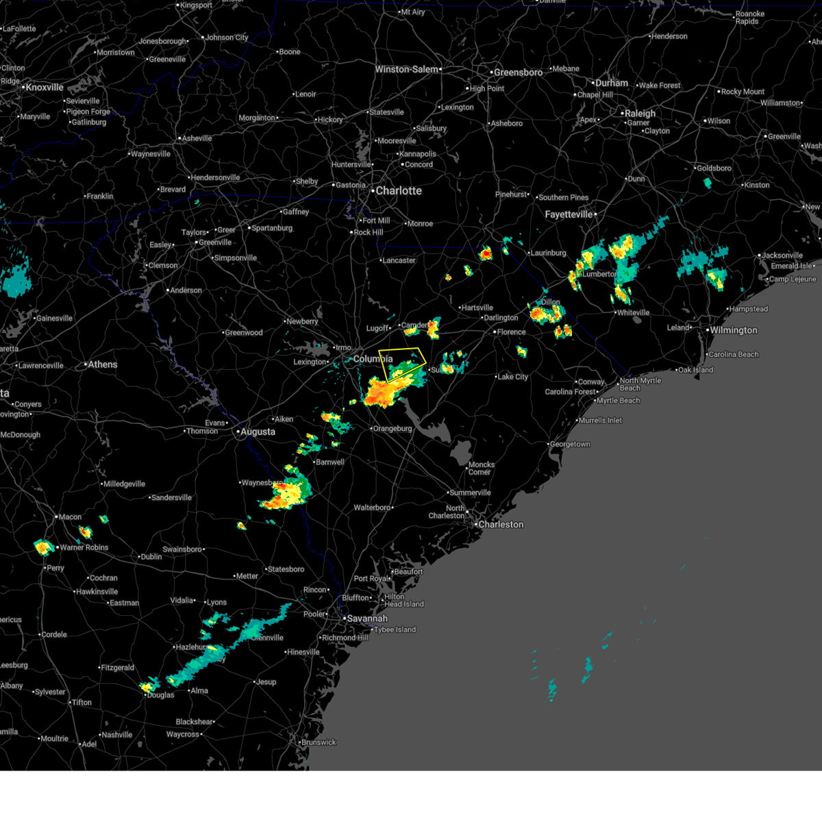
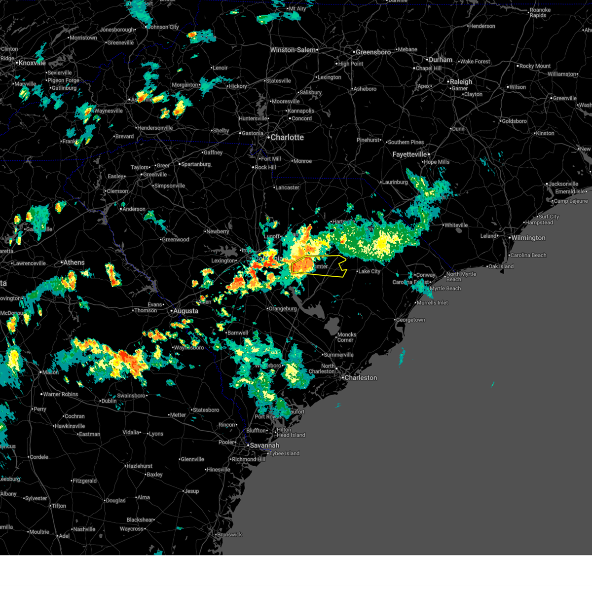
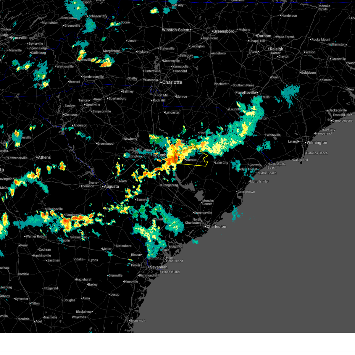
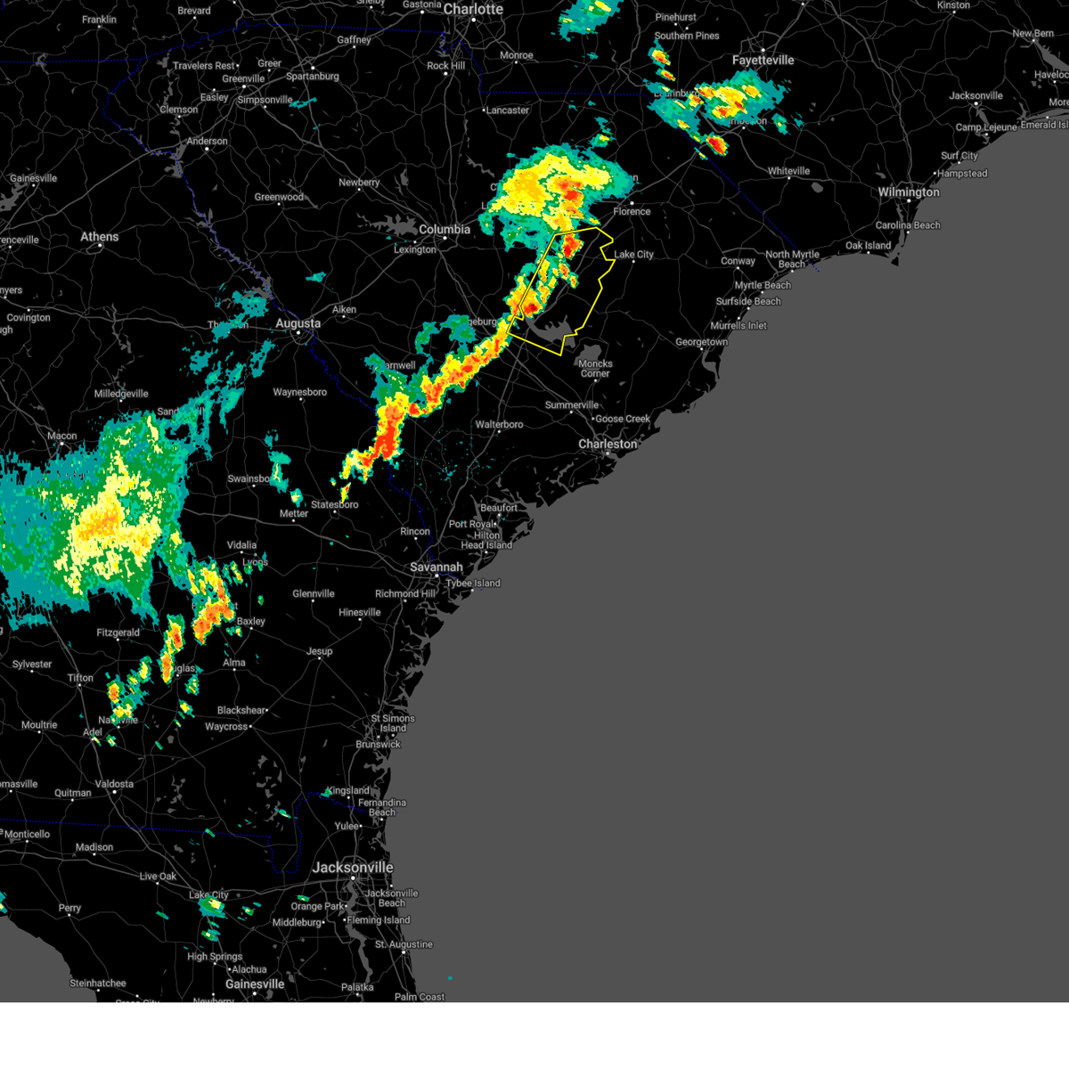
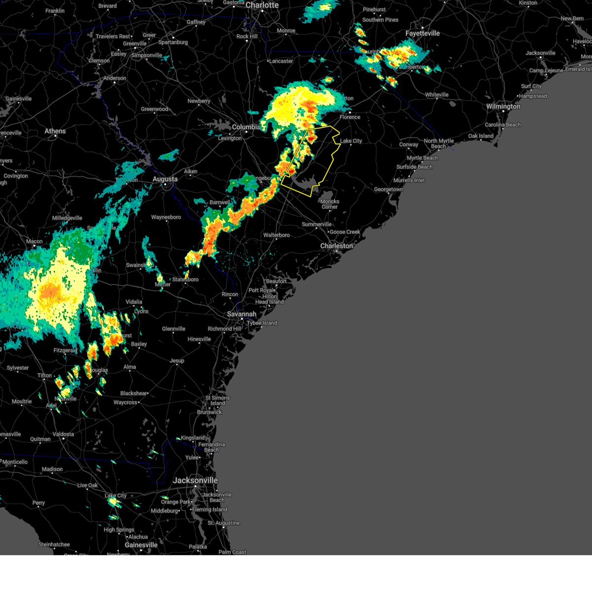
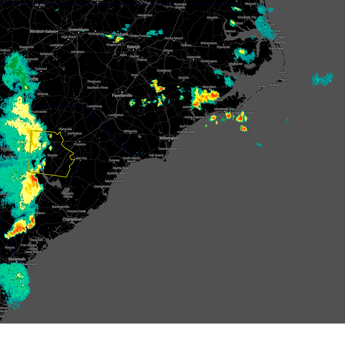
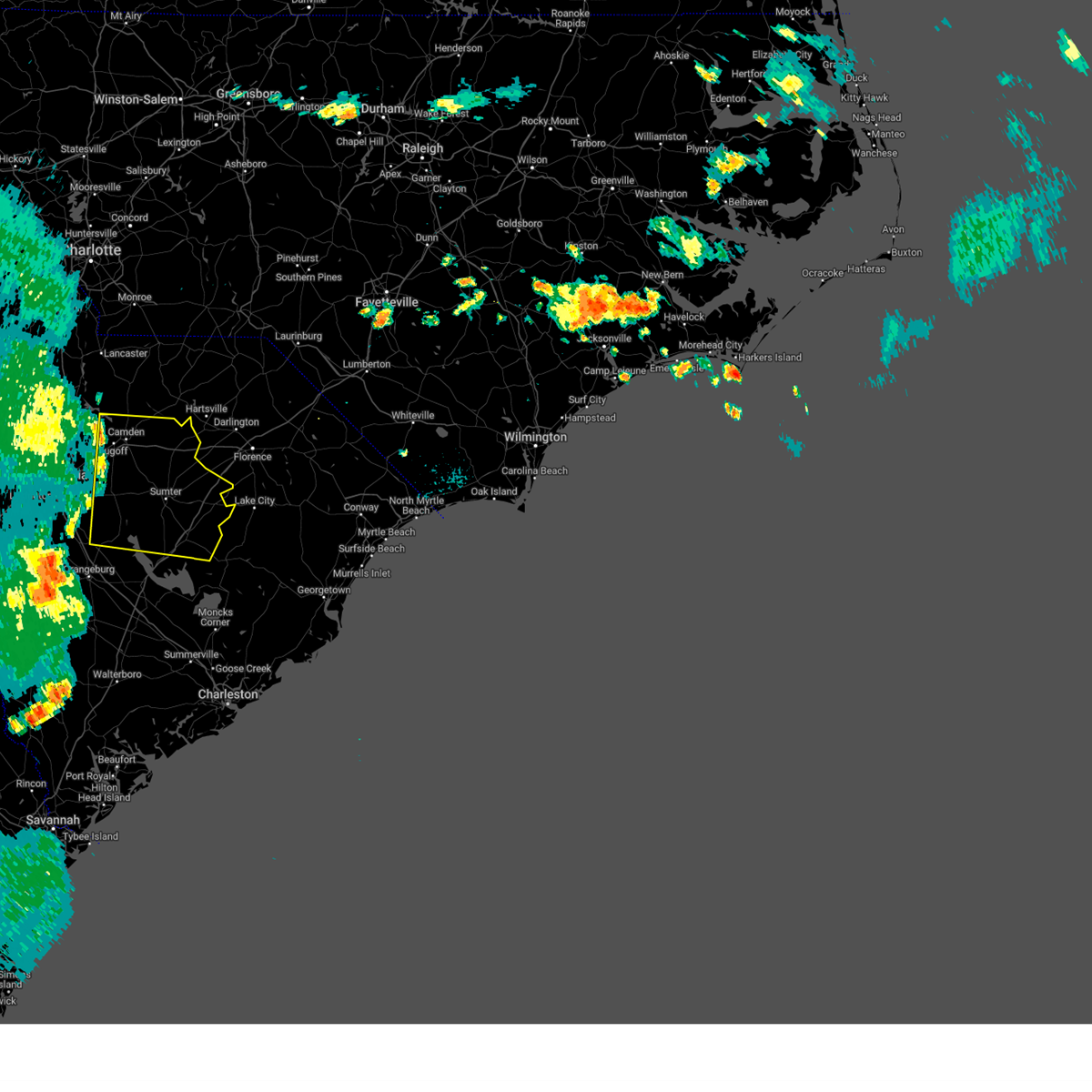
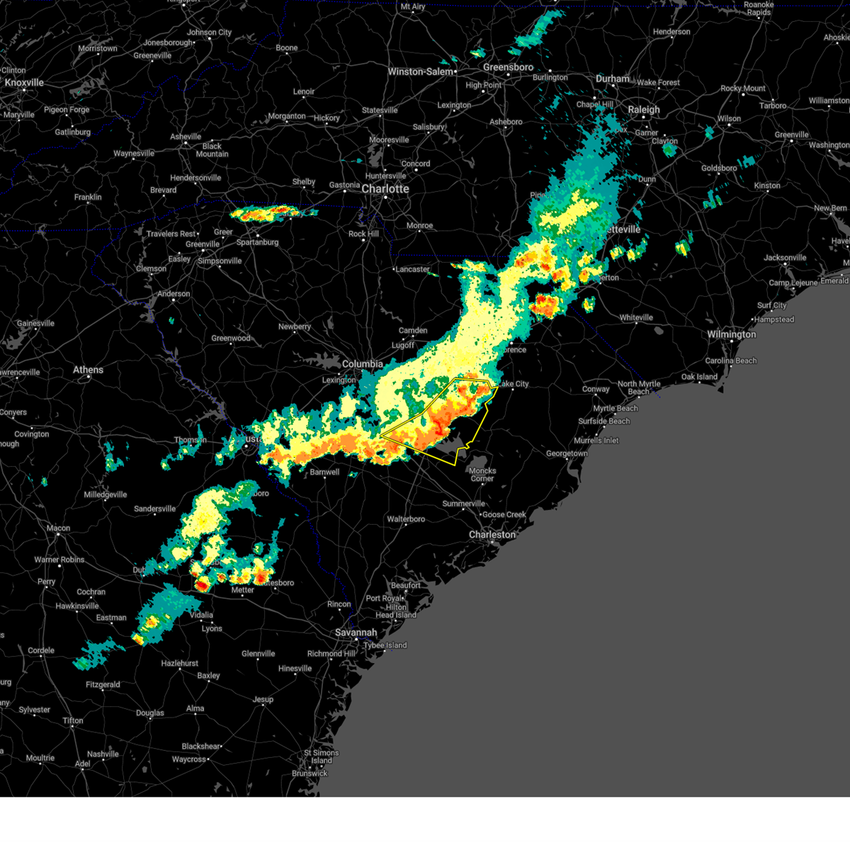
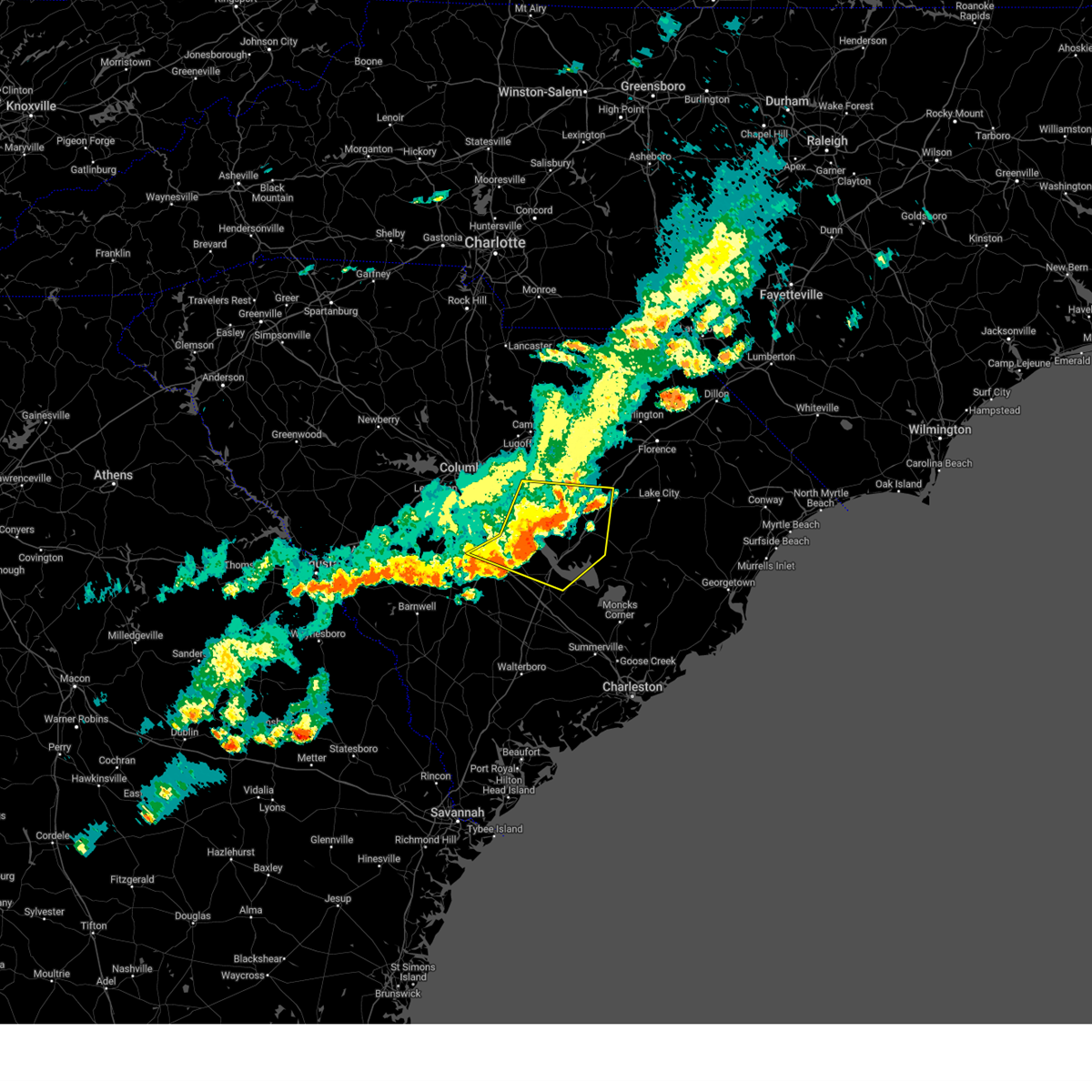
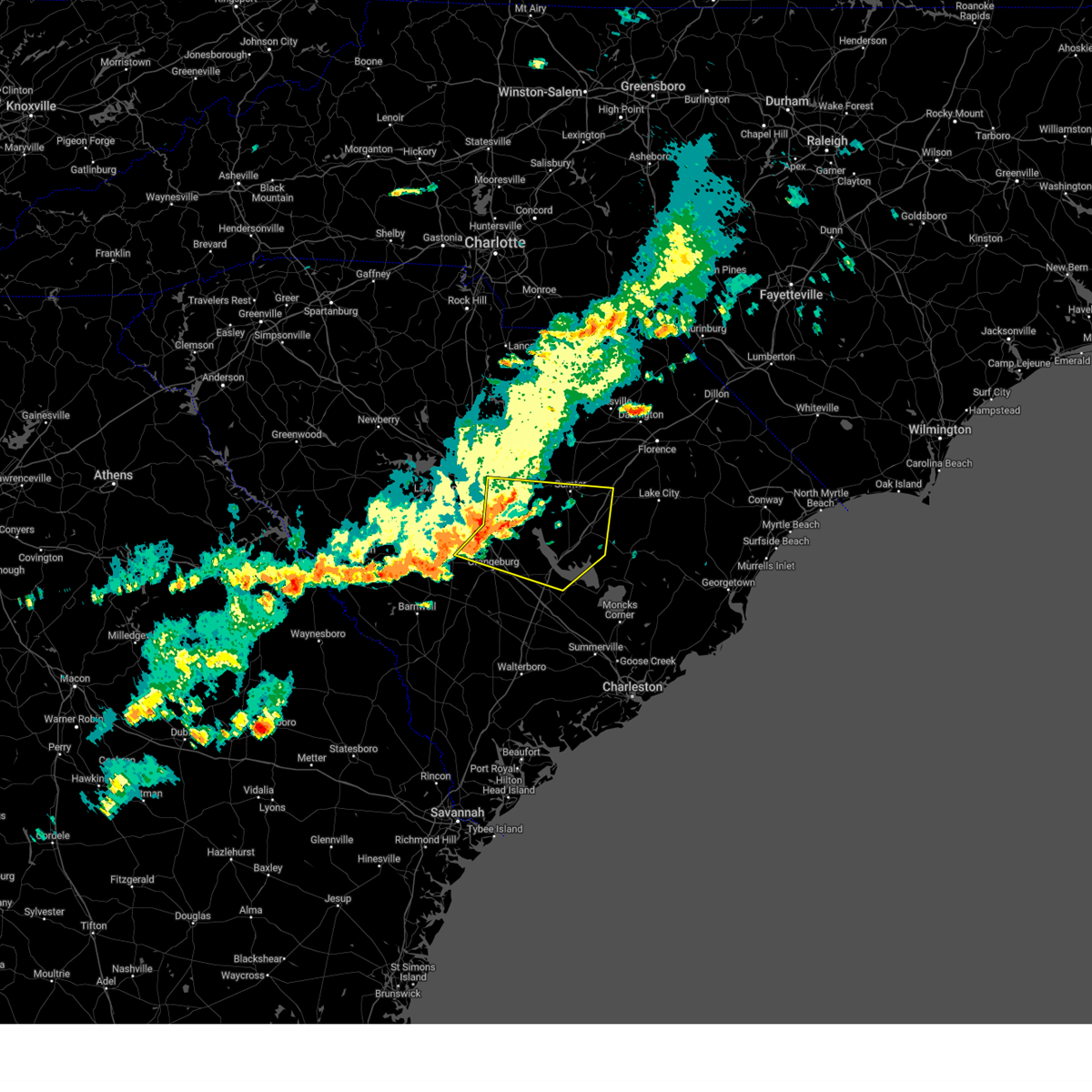
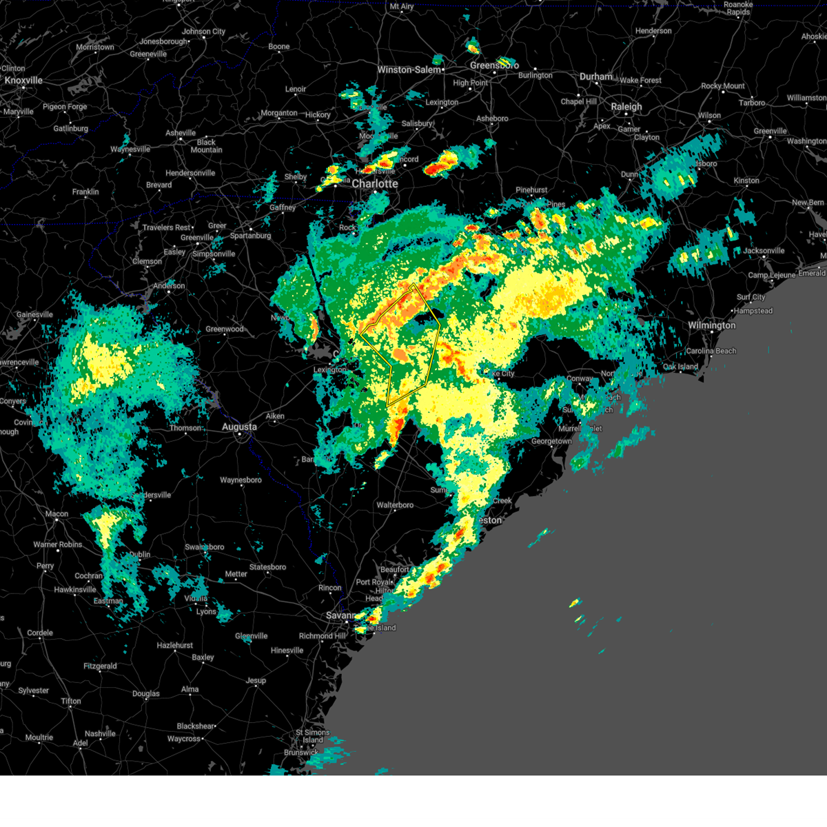
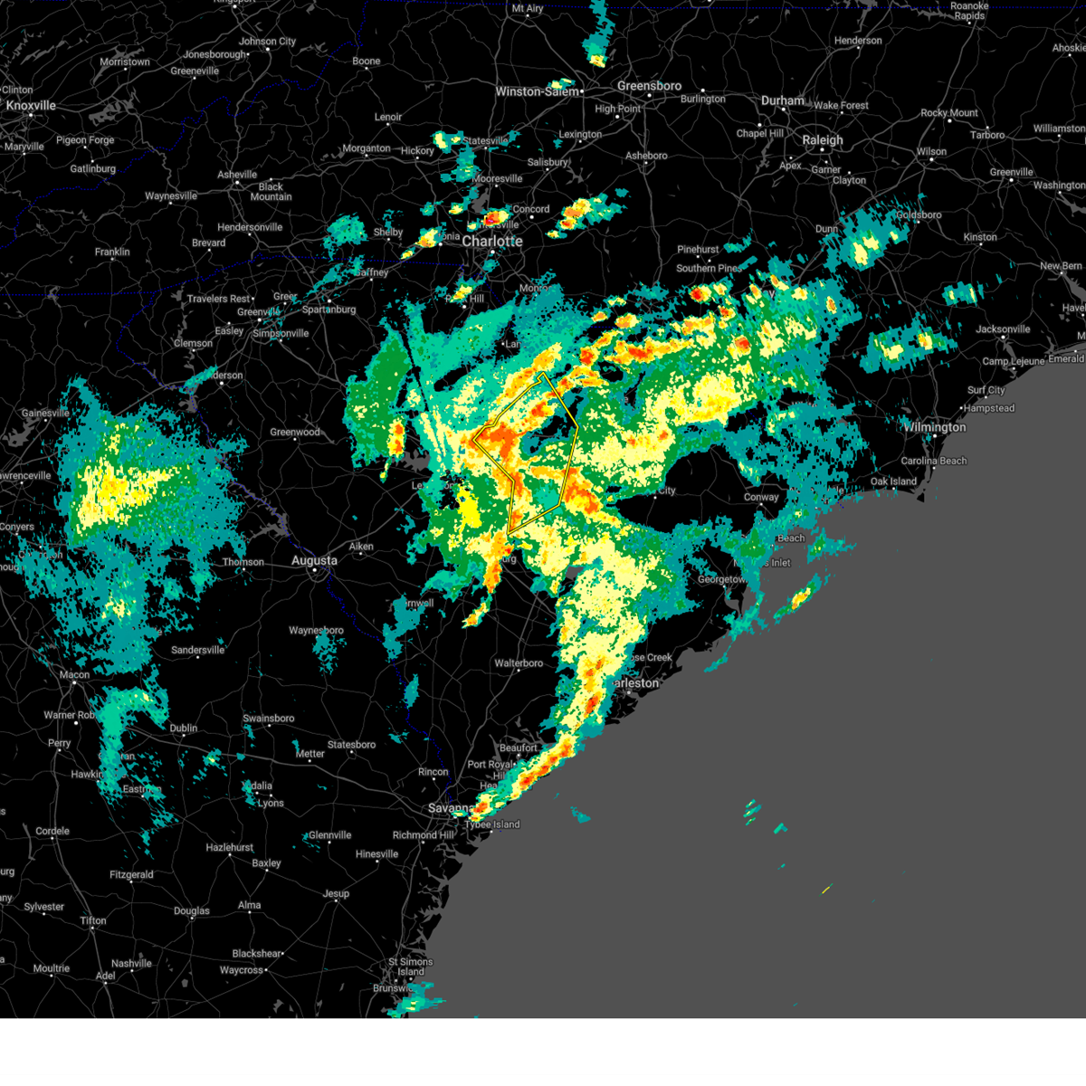
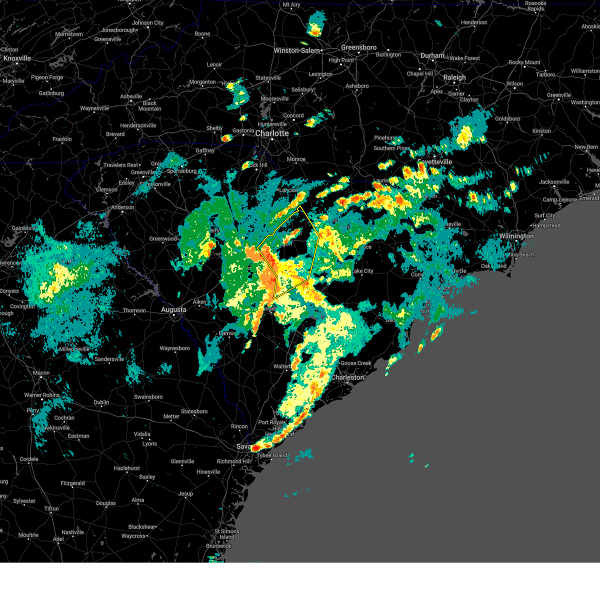
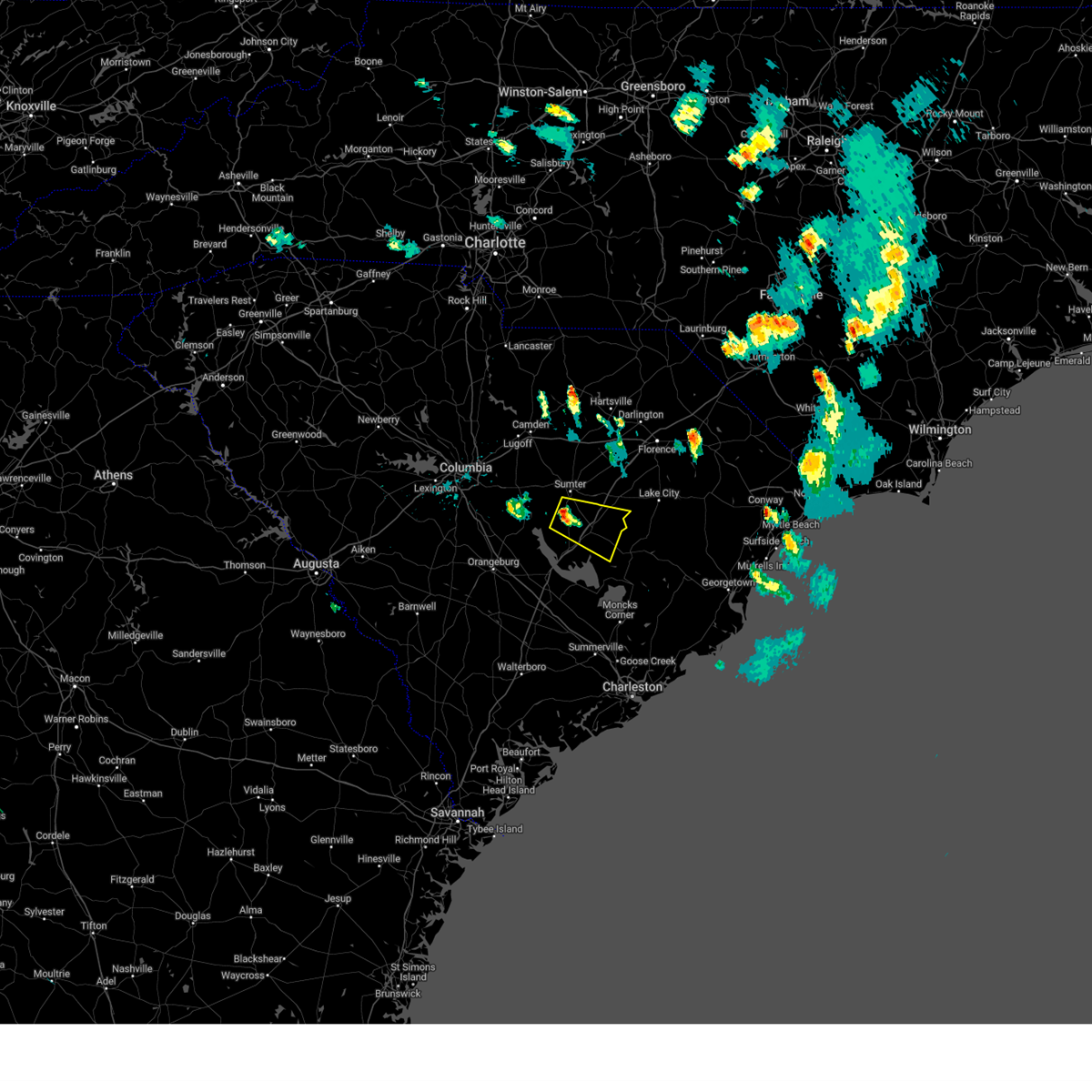
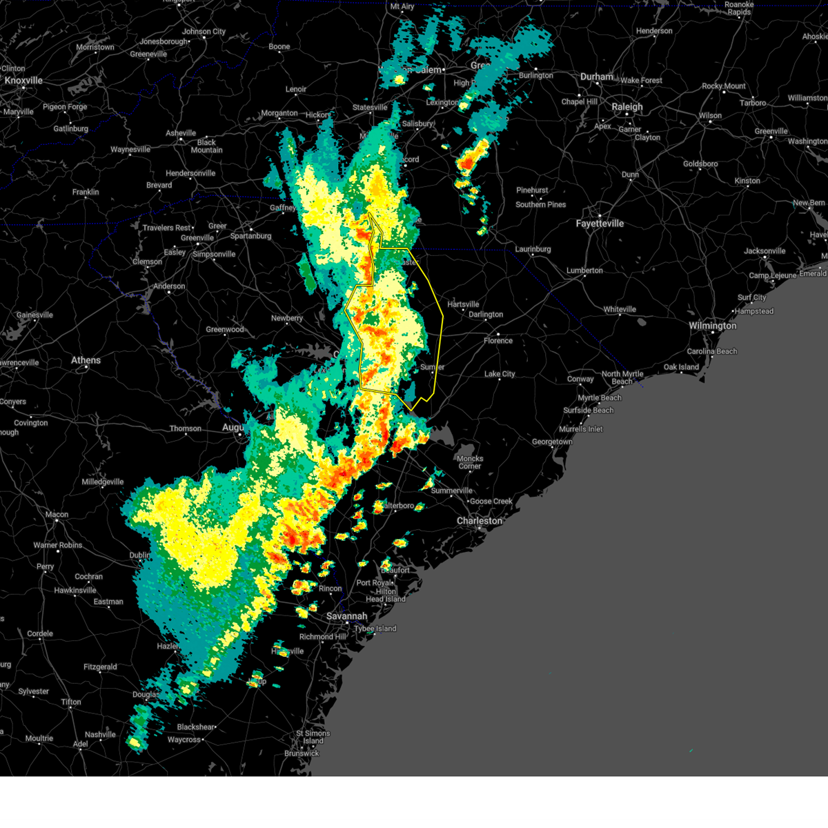
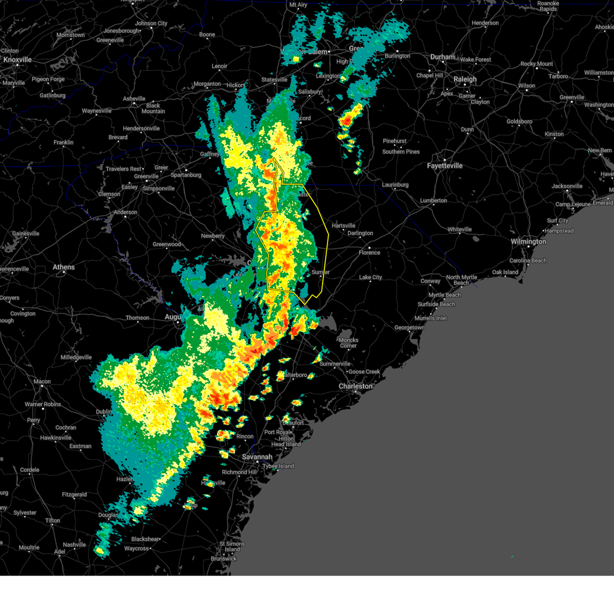
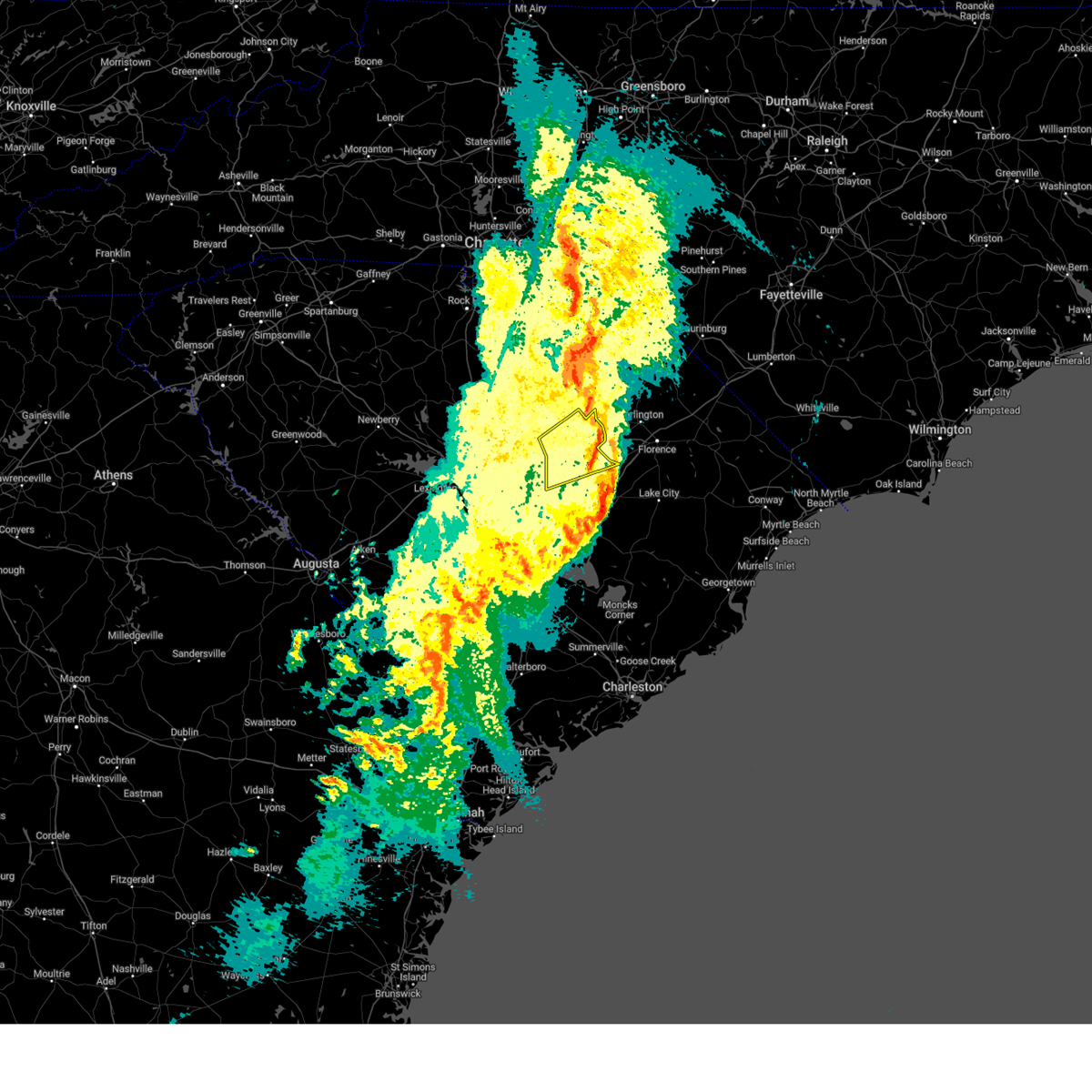
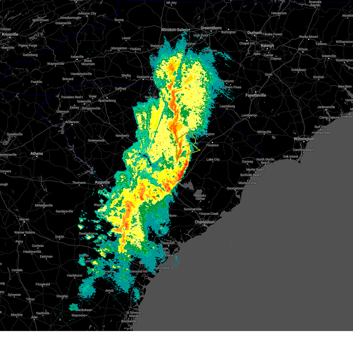
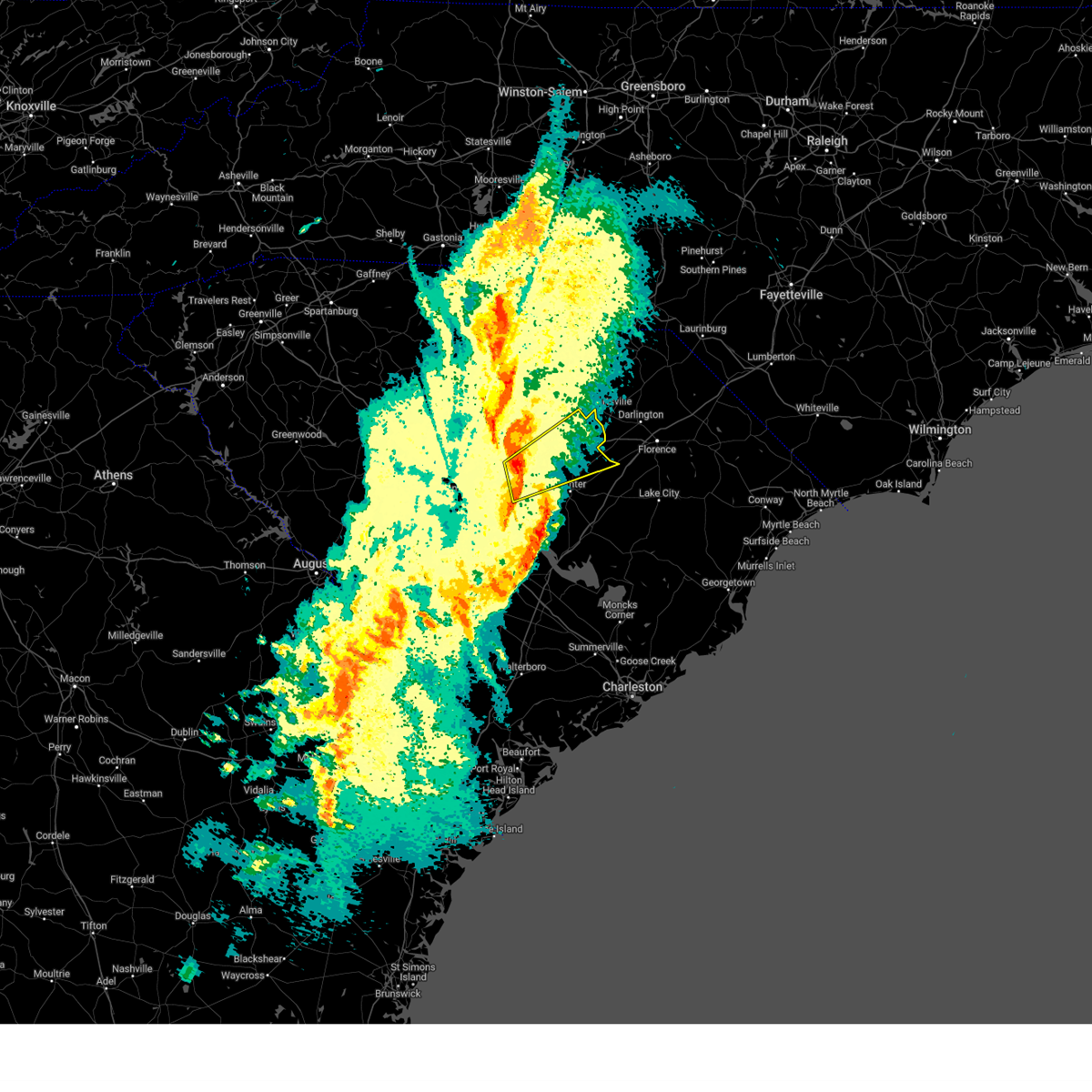
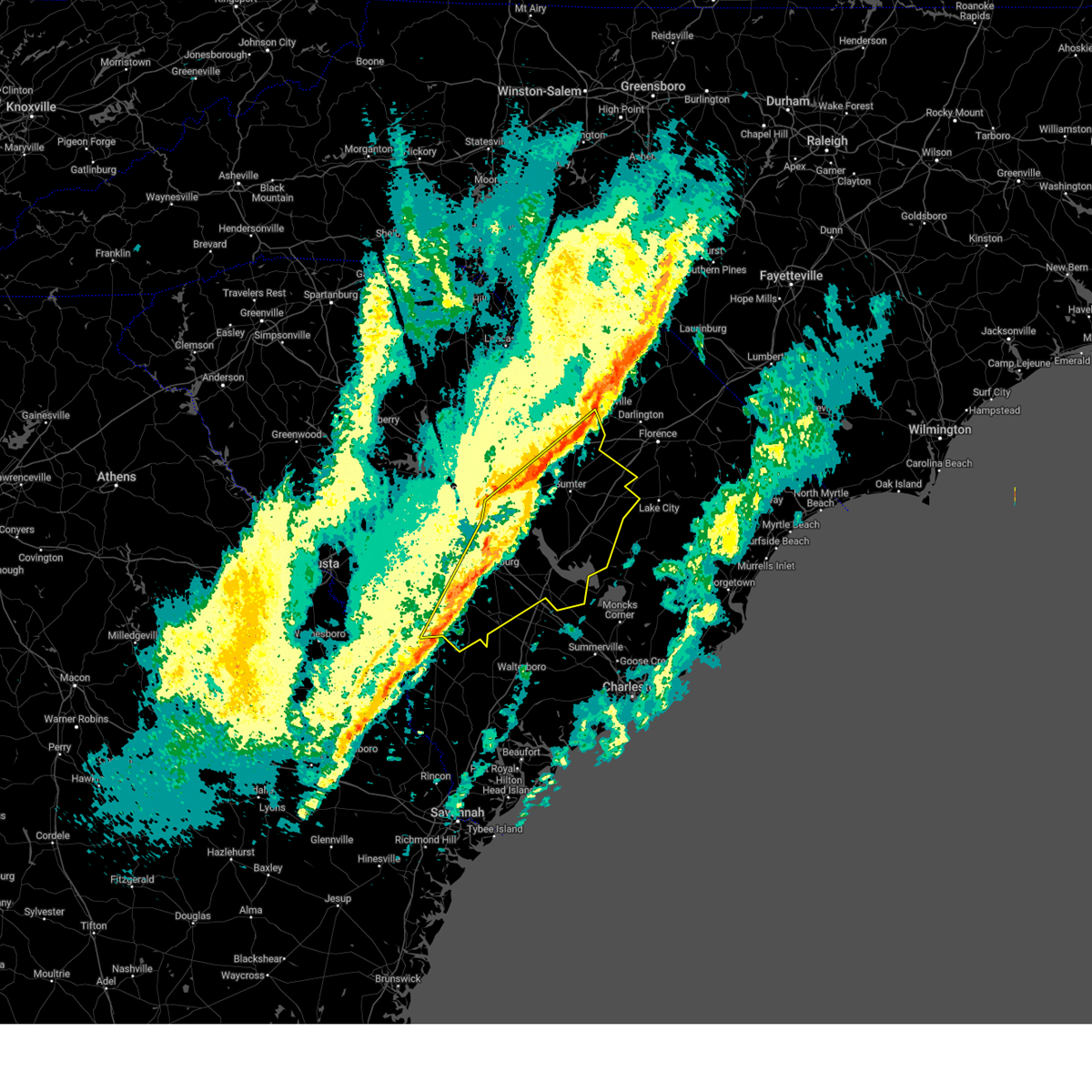
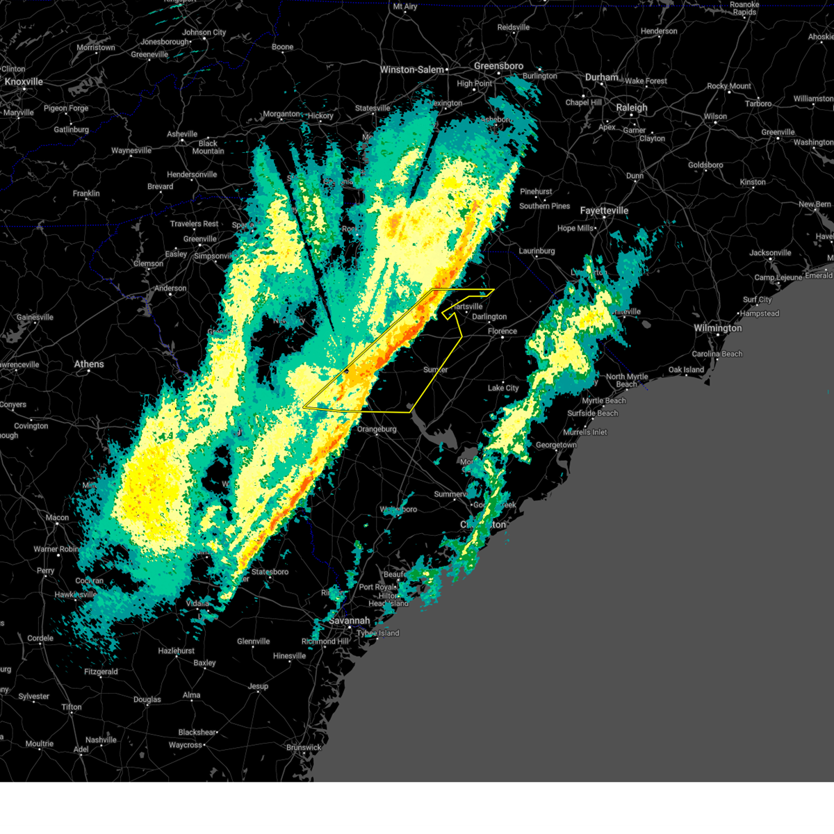
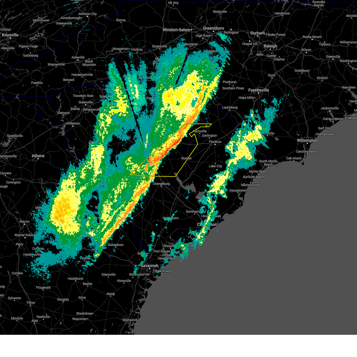
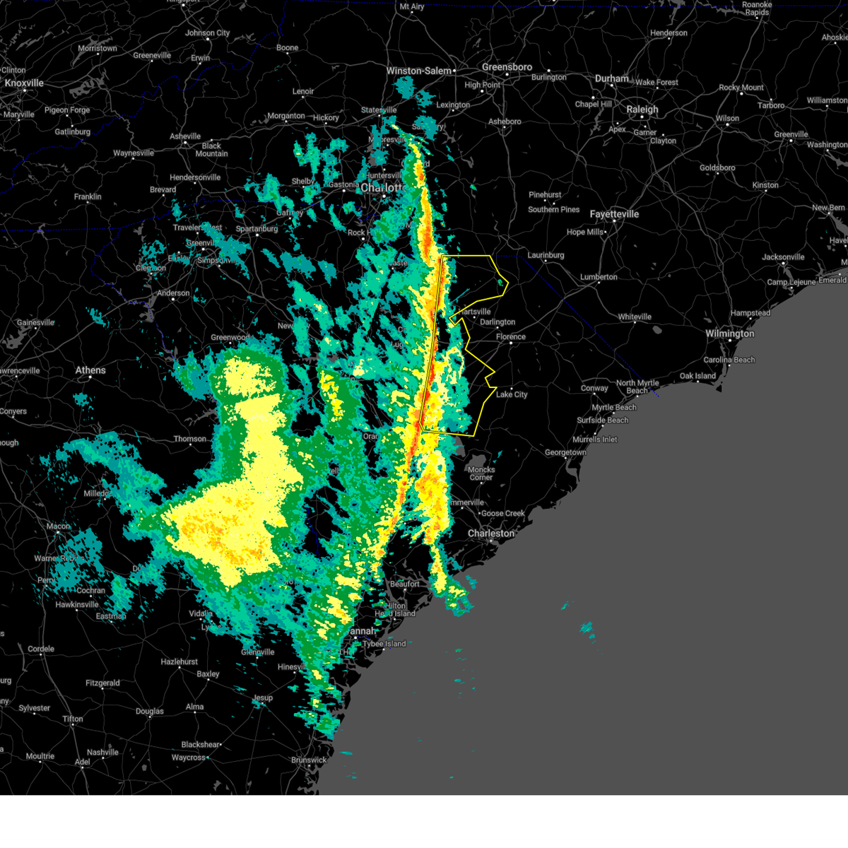
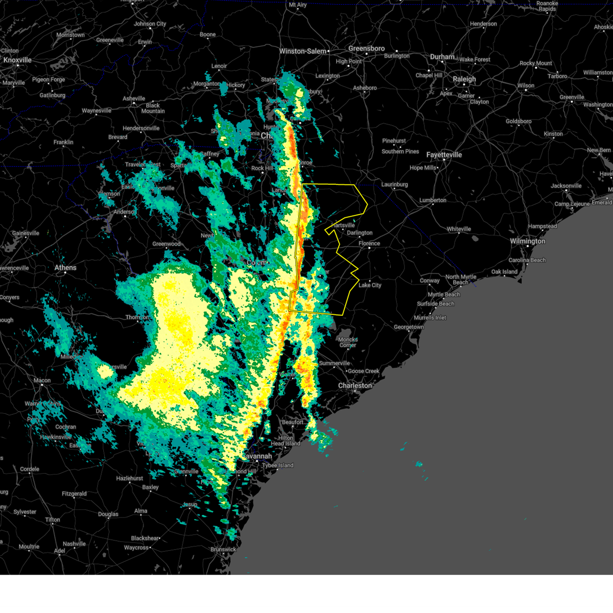
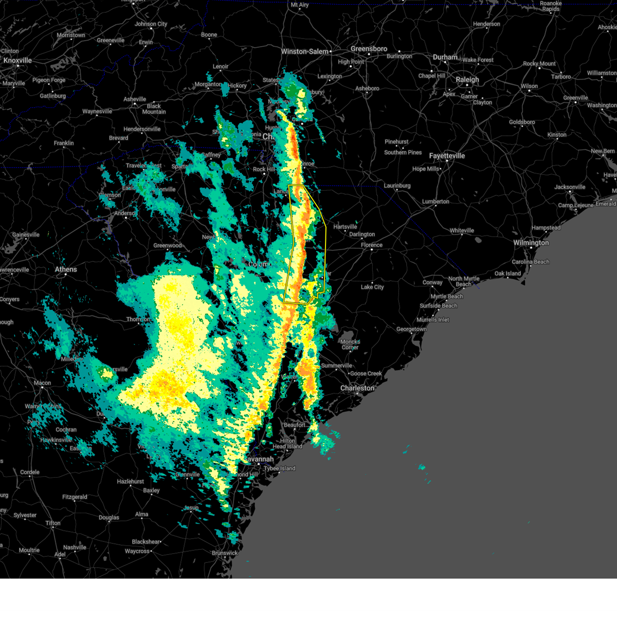
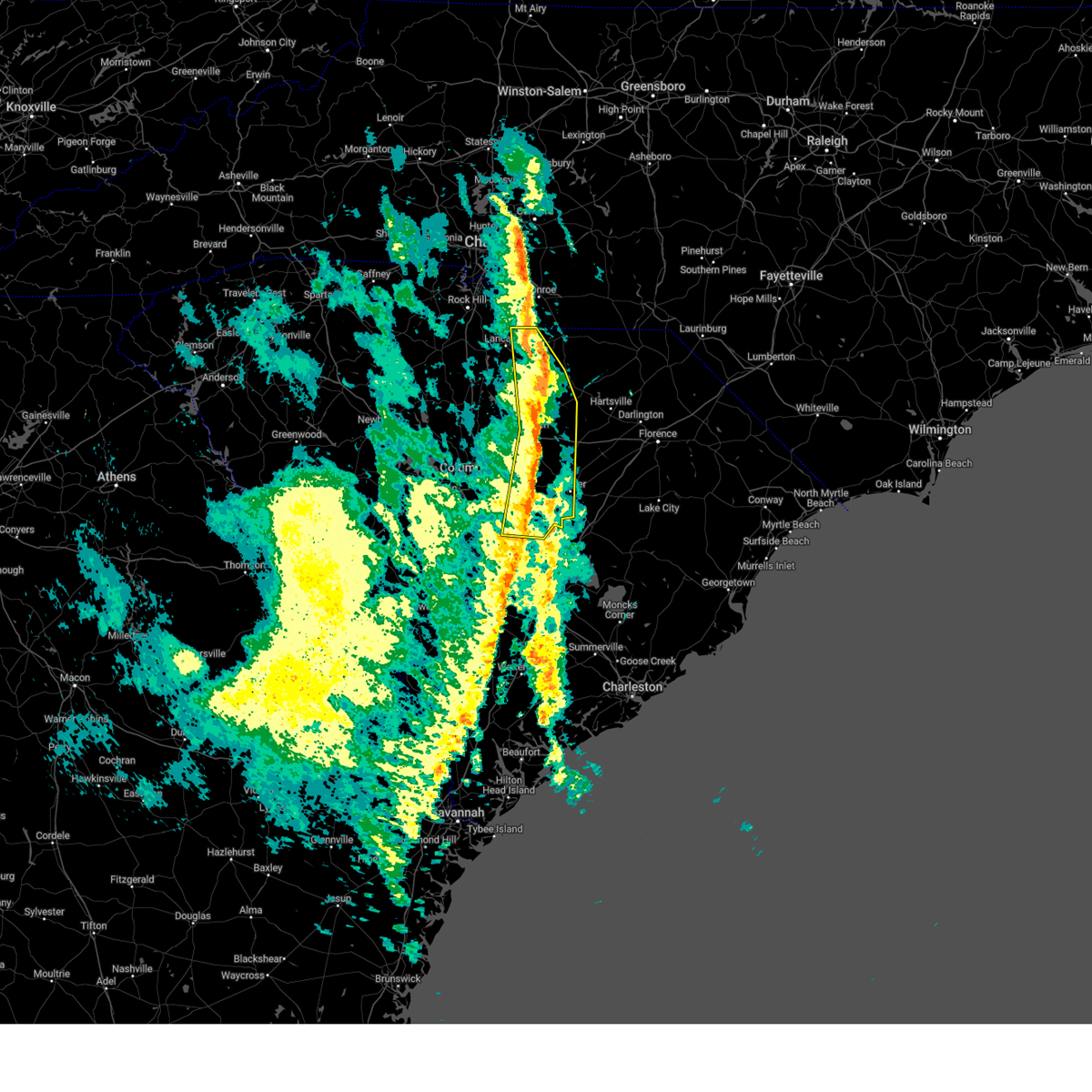
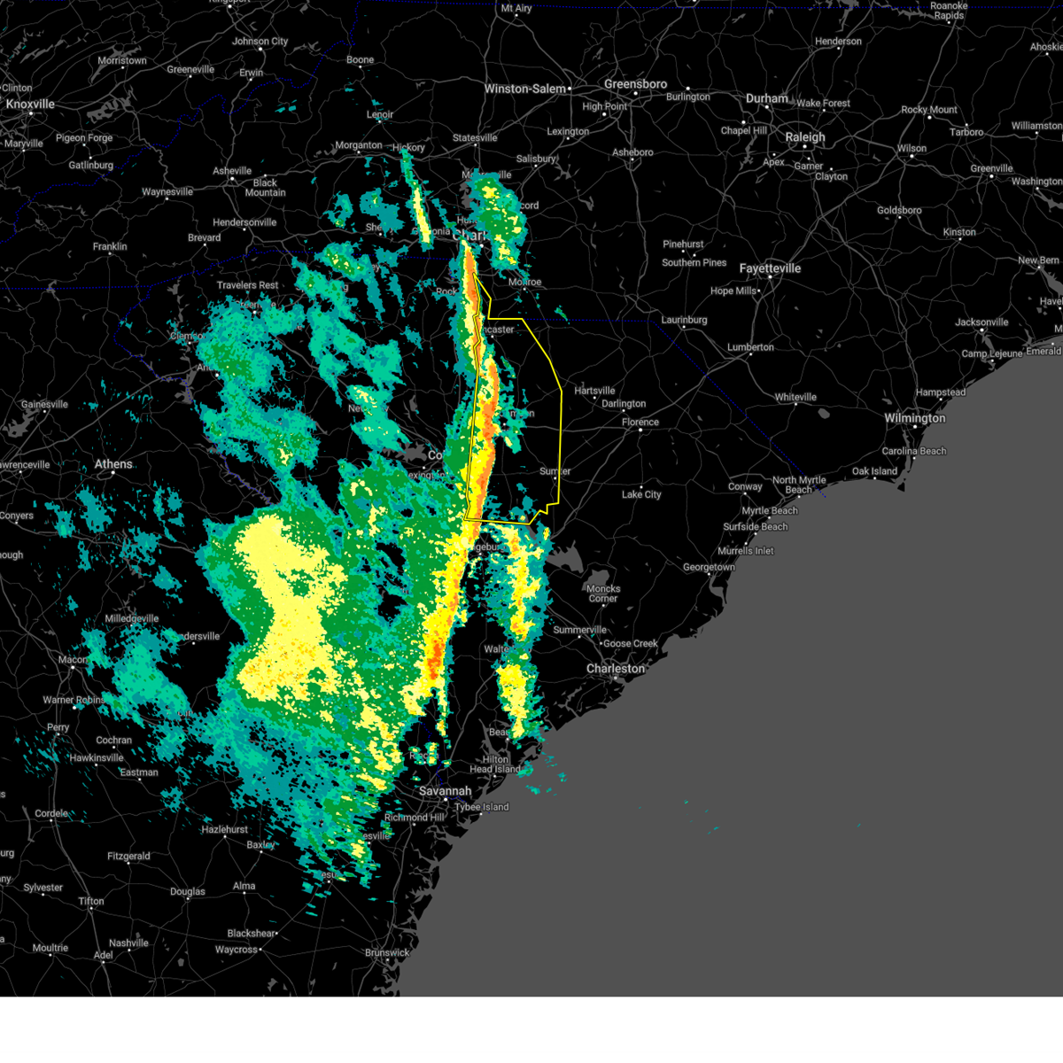
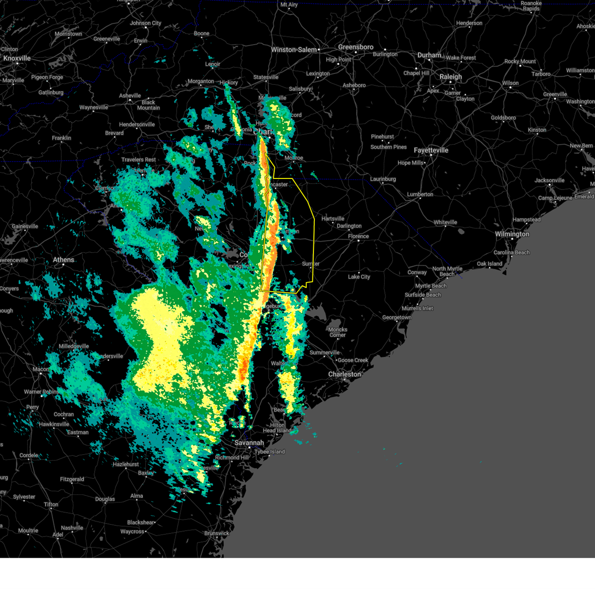
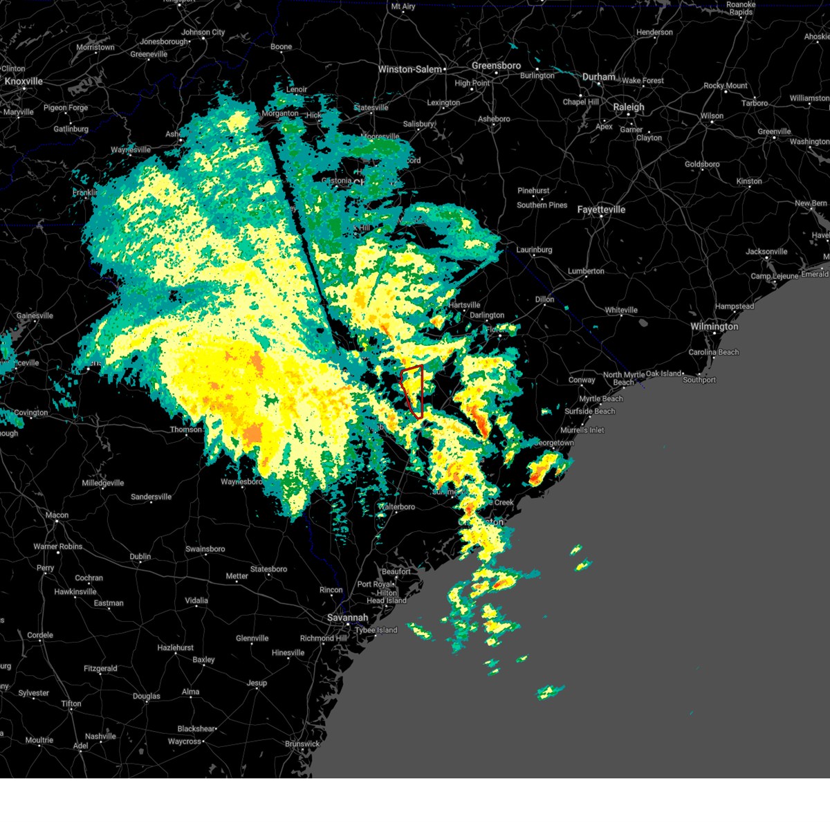
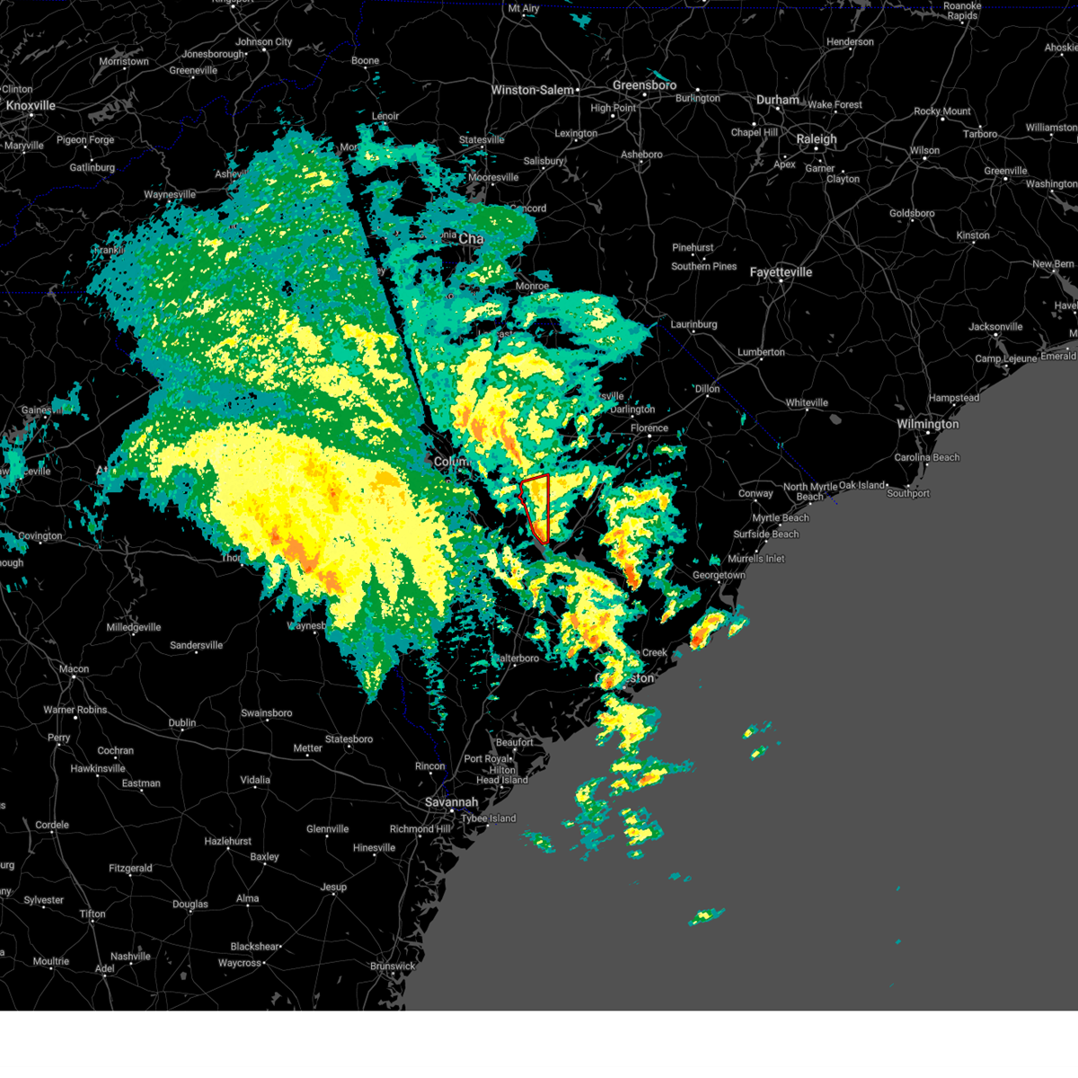
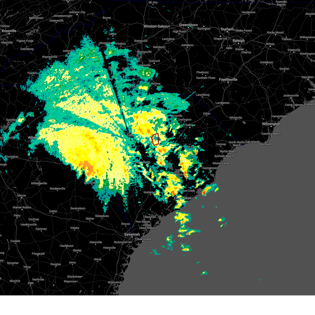
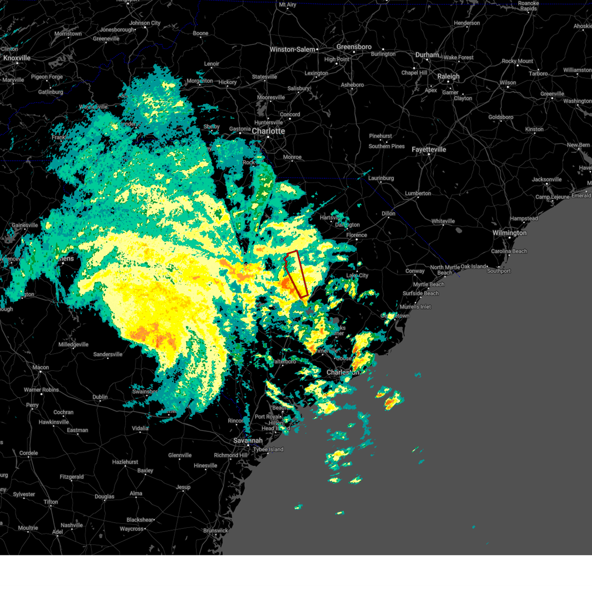
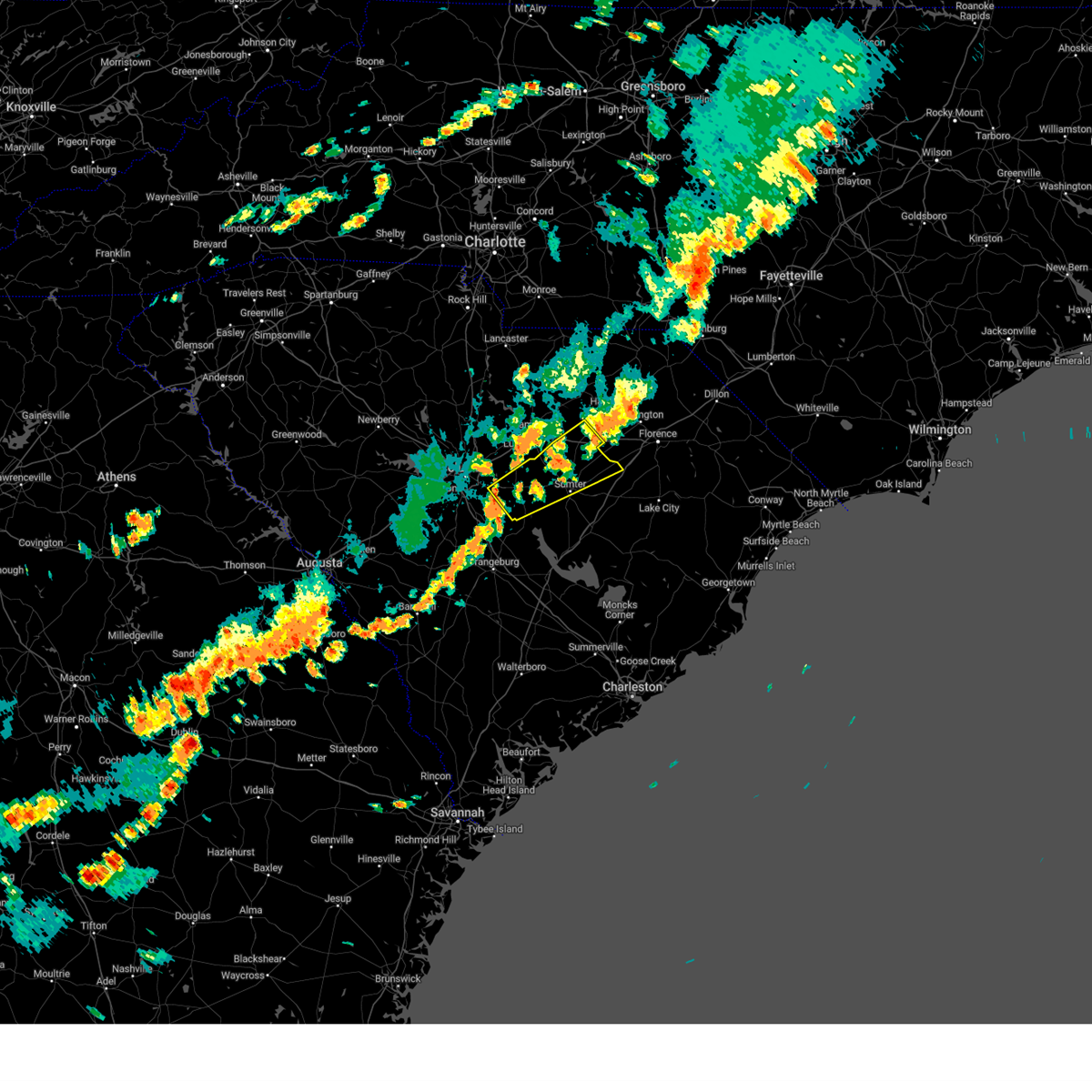
Hail Map for Sumter, SC
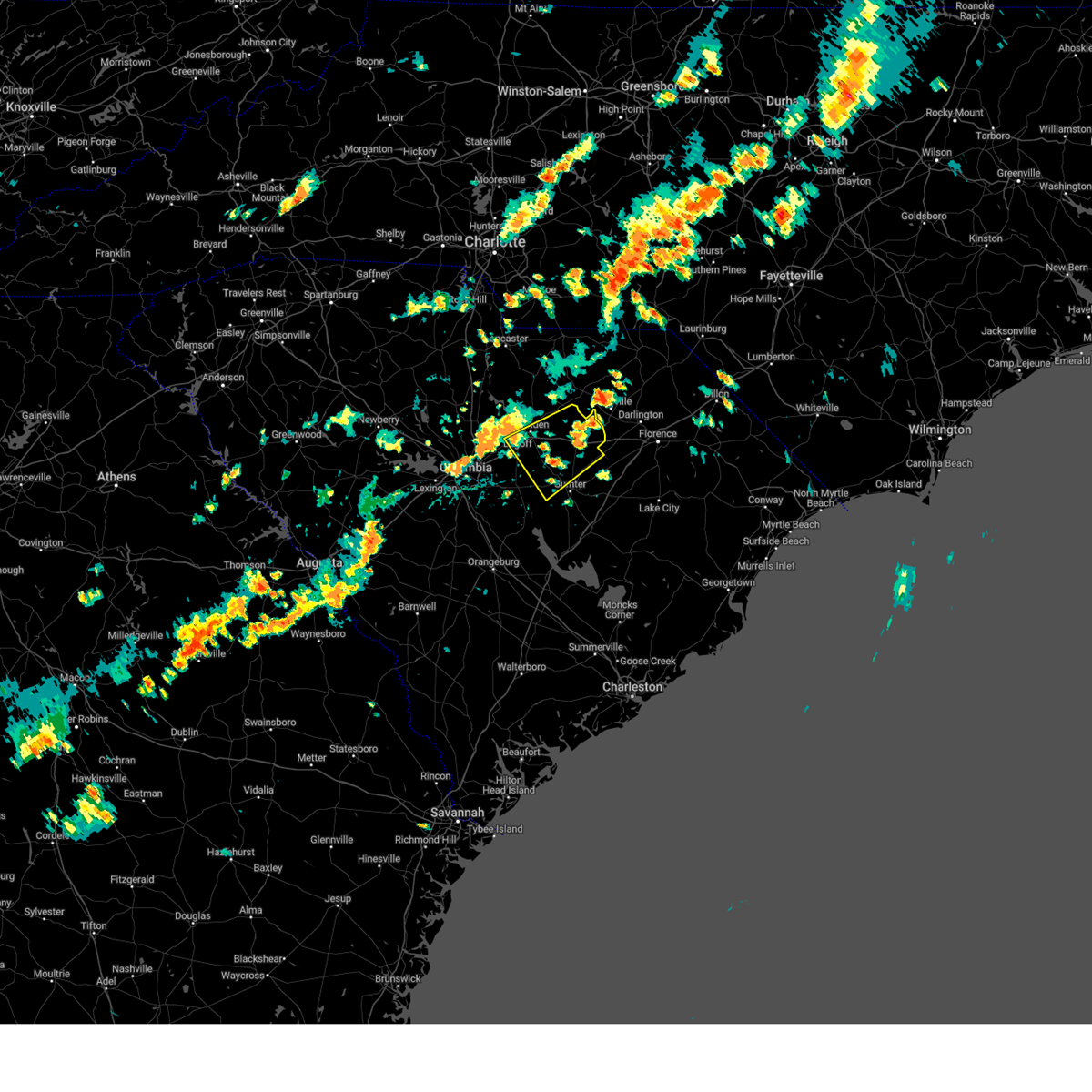
The Sumter, SC area has had 18 reports of on-the-ground hail by trained spotters, and has been under severe weather warnings 60 times during the past 12 months. Doppler radar has detected hail at or near Sumter, SC on 94 occasions, including 5 occasions during the past year.
| Name: | Sumter, SC |
| Where Located: | 54.6 miles NNW of Charleston, SC |
| Map: | Google Map for Sumter, SC |
| Population: | 40524 |
| Housing Units: | 18150 |
| More Info: | Search Google for Sumter, SC |
1
The Top Recent Hail Date for Sumter, SC is Wednesday, June 11, 2025 (34th out of 94)

Hail and Wind Damage Spotted near Sumter, SC
| Date / Time | Report Details |
|---|---|
| 7/4/2025 7:26 PM EDT |
 The storm which prompted the warning has weakened below severe limits, and has exited the warned area. therefore, the warning will be allowed to expire. however, gusty winds are still possible with this thunderstorm. to report severe weather, contact your nearest law enforcement agency. they will relay your report to the national weather service columbia. The storm which prompted the warning has weakened below severe limits, and has exited the warned area. therefore, the warning will be allowed to expire. however, gusty winds are still possible with this thunderstorm. to report severe weather, contact your nearest law enforcement agency. they will relay your report to the national weather service columbia.
|
| 7/4/2025 7:11 PM EDT |
 the severe thunderstorm warning has been cancelled and is no longer in effect the severe thunderstorm warning has been cancelled and is no longer in effect
|
| 7/4/2025 7:11 PM EDT |
 At 710 pm edt, a severe thunderstorm was located over oakland, or over shaw air base, moving southwest at 20 mph (radar indicated). Hazards include 60 mph wind gusts. Expect damage to trees and powerlines. Locations impacted include, columbia, sumter, shaw air base, eastover, oakland, fort jackson mccrady training center, dalzell, dinkins mill, cherryvale, and stateburg. At 710 pm edt, a severe thunderstorm was located over oakland, or over shaw air base, moving southwest at 20 mph (radar indicated). Hazards include 60 mph wind gusts. Expect damage to trees and powerlines. Locations impacted include, columbia, sumter, shaw air base, eastover, oakland, fort jackson mccrady training center, dalzell, dinkins mill, cherryvale, and stateburg.
|
| 7/4/2025 6:48 PM EDT | Scdps website reported a tree in roadway at the intersection of church street and west hampton lane. time estimated by rada in sumter county SC, 1.9 miles WNW of Sumter, SC |
| 7/4/2025 6:45 PM EDT |
 Svrcae the national weather service in columbia has issued a * severe thunderstorm warning for, southwestern lee county in central south carolina, northwestern sumter county in central south carolina, east central richland county in central south carolina, * until 730 pm edt. * at 645 pm edt, a severe thunderstorm was located near sumter county airport, or 8 miles north of sumter, moving west at 25 mph (radar indicated). Hazards include 60 mph wind gusts. expect damage to trees and powerlines Svrcae the national weather service in columbia has issued a * severe thunderstorm warning for, southwestern lee county in central south carolina, northwestern sumter county in central south carolina, east central richland county in central south carolina, * until 730 pm edt. * at 645 pm edt, a severe thunderstorm was located near sumter county airport, or 8 miles north of sumter, moving west at 25 mph (radar indicated). Hazards include 60 mph wind gusts. expect damage to trees and powerlines
|
| 6/25/2025 9:00 PM EDT |
 The storms which prompted the warning have moved out of the area. therefore, the warning has been allowed to expire. however, heavy rain is still possible with these thunderstorms. a severe thunderstorm watch remains in effect until midnight edt for central south carolina. The storms which prompted the warning have moved out of the area. therefore, the warning has been allowed to expire. however, heavy rain is still possible with these thunderstorms. a severe thunderstorm watch remains in effect until midnight edt for central south carolina.
|
| 6/25/2025 8:33 PM EDT |
 At 833 pm edt, severe thunderstorms were located along a line extending from near elgin to 9 miles southwest of prosperity, moving southeast at 20 mph (radar indicated). Hazards include 60 mph wind gusts and half dollar size hail. Hail damage to vehicles is expected. expect wind damage to trees and powerlines. locations impacted include, columbia, sumter, lexington, west columbia, cayce, irmo, forest acres, newberry, camden, batesburg-leesville, springdale, dentsville, oak grove, st. andrews, vc summer nuclear station, highway 6 at lake murray dam, red bank, saluda, south congaree, and pine ridge. this includes the following highways, interstate 126 between mile markers 0 and 3. interstate 20 in south carolina between mile markers 49 and 100. interstate 26 between mile markers 77 and 116. Interstate 77 between mile markers 0 and 35. At 833 pm edt, severe thunderstorms were located along a line extending from near elgin to 9 miles southwest of prosperity, moving southeast at 20 mph (radar indicated). Hazards include 60 mph wind gusts and half dollar size hail. Hail damage to vehicles is expected. expect wind damage to trees and powerlines. locations impacted include, columbia, sumter, lexington, west columbia, cayce, irmo, forest acres, newberry, camden, batesburg-leesville, springdale, dentsville, oak grove, st. andrews, vc summer nuclear station, highway 6 at lake murray dam, red bank, saluda, south congaree, and pine ridge. this includes the following highways, interstate 126 between mile markers 0 and 3. interstate 20 in south carolina between mile markers 49 and 100. interstate 26 between mile markers 77 and 116. Interstate 77 between mile markers 0 and 35.
|
| 6/25/2025 7:56 PM EDT |
 Svrcae the national weather service in columbia has issued a * severe thunderstorm warning for, southern fairfield county in central south carolina, southern newberry county in central south carolina, northern lexington county in central south carolina, northwestern sumter county in central south carolina, saluda county in central south carolina, richland county in central south carolina, southwestern kershaw county in central south carolina, * until 900 pm edt. * at 756 pm edt, severe thunderstorms were located along a line extending from 6 miles south of longtown to 7 miles southwest of newberry college, moving southeast at 20 mph (radar indicated). Hazards include 60 mph wind gusts and quarter size hail. Hail damage to vehicles is expected. Expect wind damage to trees and powerlines. Svrcae the national weather service in columbia has issued a * severe thunderstorm warning for, southern fairfield county in central south carolina, southern newberry county in central south carolina, northern lexington county in central south carolina, northwestern sumter county in central south carolina, saluda county in central south carolina, richland county in central south carolina, southwestern kershaw county in central south carolina, * until 900 pm edt. * at 756 pm edt, severe thunderstorms were located along a line extending from 6 miles south of longtown to 7 miles southwest of newberry college, moving southeast at 20 mph (radar indicated). Hazards include 60 mph wind gusts and quarter size hail. Hail damage to vehicles is expected. Expect wind damage to trees and powerlines.
|
| 6/25/2025 7:43 PM EDT | Scdps website reported a tree in roadway near the intersection of bethel church road and sanford drive. time estimated by rada in sumter county SC, 6.6 miles N of Sumter, SC |
| 6/25/2025 7:00 PM EDT |
 Svrcae the national weather service in columbia has issued a * severe thunderstorm warning for, lee county in central south carolina, clarendon county in central south carolina, sumter county in central south carolina, * until 800 pm edt. * at 700 pm edt, severe thunderstorms were located along a line extending from lee state park to poston, moving southwest at 30 mph (radar indicated). Hazards include 60 mph wind gusts. expect damage to trees and powerlines Svrcae the national weather service in columbia has issued a * severe thunderstorm warning for, lee county in central south carolina, clarendon county in central south carolina, sumter county in central south carolina, * until 800 pm edt. * at 700 pm edt, severe thunderstorms were located along a line extending from lee state park to poston, moving southwest at 30 mph (radar indicated). Hazards include 60 mph wind gusts. expect damage to trees and powerlines
|
| 6/13/2025 9:06 PM EDT |
 The storm which prompted the warning has weakened below severe limits, and no longer poses an immediate threat to life or property. therefore, the warning will be allowed to expire. however, gusty winds are still possible with this thunderstorm. The storm which prompted the warning has weakened below severe limits, and no longer poses an immediate threat to life or property. therefore, the warning will be allowed to expire. however, gusty winds are still possible with this thunderstorm.
|
| 6/13/2025 8:47 PM EDT |
 At 846 pm edt, a severe thunderstorm was located over mulberry, or over sumter, moving east at 20 mph (radar indicated). Hazards include 60 mph wind gusts. Expect damage to trees and powerlines. locations impacted include, sumter, south sumter, shaw air base, mulberry, woods bay state park, sumter county airport, millwood, turbeville, mayesville, cane savannah, oswego, wedgewood, east sumter, cherryvale, gable, shiloh, lakewood, stateburg, dalzell, and privateer. This includes interstate 95 between mile markers 130 and 146. At 846 pm edt, a severe thunderstorm was located over mulberry, or over sumter, moving east at 20 mph (radar indicated). Hazards include 60 mph wind gusts. Expect damage to trees and powerlines. locations impacted include, sumter, south sumter, shaw air base, mulberry, woods bay state park, sumter county airport, millwood, turbeville, mayesville, cane savannah, oswego, wedgewood, east sumter, cherryvale, gable, shiloh, lakewood, stateburg, dalzell, and privateer. This includes interstate 95 between mile markers 130 and 146.
|
| 6/13/2025 8:24 PM EDT |
 Svrcae the national weather service in columbia has issued a * severe thunderstorm warning for, southern lee county in central south carolina, northeastern clarendon county in central south carolina, central sumter county in central south carolina, * until 915 pm edt. * at 824 pm edt, a severe thunderstorm was located over shaw air base, moving east at 20 mph (radar indicated). Hazards include 60 mph wind gusts. expect damage to trees and powerlines Svrcae the national weather service in columbia has issued a * severe thunderstorm warning for, southern lee county in central south carolina, northeastern clarendon county in central south carolina, central sumter county in central south carolina, * until 915 pm edt. * at 824 pm edt, a severe thunderstorm was located over shaw air base, moving east at 20 mph (radar indicated). Hazards include 60 mph wind gusts. expect damage to trees and powerlines
|
| 6/8/2025 11:52 AM EDT |
 At 1152 am edt, a severe thunderstorm was located over summerton, or 11 miles southwest of manning, moving east at 35 mph (radar indicated). Hazards include 60 mph wind gusts and quarter size hail. Hail damage to vehicles is expected. expect wind damage to trees and powerlines. locations impacted include, sumter, manning, south sumter, summerton, elloree, alcolu, woods bay state park, santee state park, santee cooper regional airport, mulberry, santee, turbeville, mayesville, pinewood, eutawville, paxville, vance, rimini, brogdon, and eautaw springs. This includes interstate 95 between mile markers 94 and 146. At 1152 am edt, a severe thunderstorm was located over summerton, or 11 miles southwest of manning, moving east at 35 mph (radar indicated). Hazards include 60 mph wind gusts and quarter size hail. Hail damage to vehicles is expected. expect wind damage to trees and powerlines. locations impacted include, sumter, manning, south sumter, summerton, elloree, alcolu, woods bay state park, santee state park, santee cooper regional airport, mulberry, santee, turbeville, mayesville, pinewood, eutawville, paxville, vance, rimini, brogdon, and eautaw springs. This includes interstate 95 between mile markers 94 and 146.
|
| 6/8/2025 11:44 AM EDT |
 Svrcae the national weather service in columbia has issued a * severe thunderstorm warning for, southeastern lee county in central south carolina, clarendon county in central south carolina, central sumter county in central south carolina, east central orangeburg county in central south carolina, * until 1230 pm edt. * at 1144 am edt, a severe thunderstorm was located near santee state park, or 15 miles southwest of manning, moving east at 35 mph (radar indicated). Hazards include 60 mph wind gusts and penny size hail. expect damage to trees and powerlines Svrcae the national weather service in columbia has issued a * severe thunderstorm warning for, southeastern lee county in central south carolina, clarendon county in central south carolina, central sumter county in central south carolina, east central orangeburg county in central south carolina, * until 1230 pm edt. * at 1144 am edt, a severe thunderstorm was located near santee state park, or 15 miles southwest of manning, moving east at 35 mph (radar indicated). Hazards include 60 mph wind gusts and penny size hail. expect damage to trees and powerlines
|
| 6/7/2025 10:08 PM EDT |
 The storms which prompted the warning have weakened below severe limits, and no longer pose an immediate threat to life or property. therefore, the warning will be allowed to expire. however, gusty winds up to 50 mph are still possible with these thunderstorms. a severe thunderstorm watch remains in effect until midnight edt for central south carolina. The storms which prompted the warning have weakened below severe limits, and no longer pose an immediate threat to life or property. therefore, the warning will be allowed to expire. however, gusty winds up to 50 mph are still possible with these thunderstorms. a severe thunderstorm watch remains in effect until midnight edt for central south carolina.
|
| 6/7/2025 10:06 PM EDT | Sumter fire reported a tree on power line at guignard pkwy and pocalla r in sumter county SC, 3.6 miles NNW of Sumter, SC |
| 6/7/2025 9:36 PM EDT |
 Svrcae the national weather service in columbia has issued a * severe thunderstorm warning for, lee county in central south carolina, central calhoun county in central south carolina, clarendon county in central south carolina, sumter county in central south carolina, southeastern richland county in central south carolina, southern kershaw county in central south carolina, * until 1015 pm edt. * at 935 pm edt, severe thunderstorms were located along a line extending from near lake wateree dam to near st. matthews, moving east at 55 mph (radar indicated). Hazards include 60 mph wind gusts. expect damage to trees and powerlines Svrcae the national weather service in columbia has issued a * severe thunderstorm warning for, lee county in central south carolina, central calhoun county in central south carolina, clarendon county in central south carolina, sumter county in central south carolina, southeastern richland county in central south carolina, southern kershaw county in central south carolina, * until 1015 pm edt. * at 935 pm edt, severe thunderstorms were located along a line extending from near lake wateree dam to near st. matthews, moving east at 55 mph (radar indicated). Hazards include 60 mph wind gusts. expect damage to trees and powerlines
|
| 5/30/2025 5:14 PM EDT |
 Svrcae the national weather service in columbia has issued a * severe thunderstorm warning for, southeastern calhoun county in central south carolina, clarendon county in central south carolina, central sumter county in central south carolina, east central orangeburg county in central south carolina, * until 600 pm edt. * at 513 pm edt, severe thunderstorms were located along a line extending from near woods bay state park to near santee cooper regional airport to near manning to near elloree, moving east at 75 mph (radar indicated). Hazards include 70 mph wind gusts. Expect considerable tree damage. damage is likely to mobile homes, roofs, and outbuildings. This line of storms has a history of producing significant wind damage. Svrcae the national weather service in columbia has issued a * severe thunderstorm warning for, southeastern calhoun county in central south carolina, clarendon county in central south carolina, central sumter county in central south carolina, east central orangeburg county in central south carolina, * until 600 pm edt. * at 513 pm edt, severe thunderstorms were located along a line extending from near woods bay state park to near santee cooper regional airport to near manning to near elloree, moving east at 75 mph (radar indicated). Hazards include 70 mph wind gusts. Expect considerable tree damage. damage is likely to mobile homes, roofs, and outbuildings. This line of storms has a history of producing significant wind damage.
|
| 5/30/2025 4:57 PM EDT | Sc highway patrol reported a tree down in the roadway on pinewood rd at stadium rd. time estimated by rada in sumter county SC, 2.4 miles N of Sumter, SC |
| 5/30/2025 4:54 PM EDT |
 At 454 pm edt, severe thunderstorms were located along a line extending from near shaw air base to 8 miles north of santee state park to near brookdale, moving east at 45 mph (trained weather spotters). Hazards include 70 mph wind gusts. Expect considerable tree damage. damage is likely to mobile homes, roofs, and outbuildings. locations impacted include, sumter, manning, brookdale, south sumter, st. matthews, summerton, eastover, elloree, alcolu, santee state park, santee cooper regional airport, mulberry, millwood, poinsett state park, santee, pinewood, cameron, eutawville, paxville, and vance. this includes the following highways, interstate 26 between mile markers 139 and 151. Interstate 95 between mile markers 93 and 138. At 454 pm edt, severe thunderstorms were located along a line extending from near shaw air base to 8 miles north of santee state park to near brookdale, moving east at 45 mph (trained weather spotters). Hazards include 70 mph wind gusts. Expect considerable tree damage. damage is likely to mobile homes, roofs, and outbuildings. locations impacted include, sumter, manning, brookdale, south sumter, st. matthews, summerton, eastover, elloree, alcolu, santee state park, santee cooper regional airport, mulberry, millwood, poinsett state park, santee, pinewood, cameron, eutawville, paxville, and vance. this includes the following highways, interstate 26 between mile markers 139 and 151. Interstate 95 between mile markers 93 and 138.
|
| 5/30/2025 4:33 PM EDT |
 Svrcae the national weather service in columbia has issued a * severe thunderstorm warning for, calhoun county in central south carolina, clarendon county in central south carolina, sumter county in central south carolina, central orangeburg county in central south carolina, southeastern richland county in central south carolina, * until 515 pm edt. * at 433 pm edt, severe thunderstorms were located along a line extending from near mcentire air base to near st. matthews to 9 miles northwest of edisto gardens, moving east at 45 mph (trained weather spotters reported several large trees down). Hazards include 70 mph wind gusts. Expect considerable tree damage. Damage is likely to mobile homes, roofs, and outbuildings. Svrcae the national weather service in columbia has issued a * severe thunderstorm warning for, calhoun county in central south carolina, clarendon county in central south carolina, sumter county in central south carolina, central orangeburg county in central south carolina, southeastern richland county in central south carolina, * until 515 pm edt. * at 433 pm edt, severe thunderstorms were located along a line extending from near mcentire air base to near st. matthews to 9 miles northwest of edisto gardens, moving east at 45 mph (trained weather spotters reported several large trees down). Hazards include 70 mph wind gusts. Expect considerable tree damage. Damage is likely to mobile homes, roofs, and outbuildings.
|
| 5/29/2025 5:58 PM EDT |
 The storms which prompted the warning have weakened below severe limits, and no longer pose an immediate threat to life or property. therefore, the warning will be allowed to expire. however, heavy rain is still likely with these thunderstorms, causing some localized roadway flooding. The storms which prompted the warning have weakened below severe limits, and no longer pose an immediate threat to life or property. therefore, the warning will be allowed to expire. however, heavy rain is still likely with these thunderstorms, causing some localized roadway flooding.
|
| 5/29/2025 5:41 PM EDT |
 At 541 pm edt, severe thunderstorms were located along a line extending from lake wateree dam to 7 miles north of oakland to 6 miles southwest of poinsett state park, moving northeast at 45 mph (radar indicated). Hazards include 60 mph wind gusts. Expect damage to trees and powerlines. locations impacted include, columbia, sumter, camden, lake wateree dam, shaw air base, eastover, lugoff, westville, villages at sandhill, oakland, cassatt, elgin, lake carolina, sumter county airport, millwood, poinsett state park, goodale state park, lucknow, cane savannah, and dalzell. This includes interstate 20 in south carolina between mile markers 80 and 115. At 541 pm edt, severe thunderstorms were located along a line extending from lake wateree dam to 7 miles north of oakland to 6 miles southwest of poinsett state park, moving northeast at 45 mph (radar indicated). Hazards include 60 mph wind gusts. Expect damage to trees and powerlines. locations impacted include, columbia, sumter, camden, lake wateree dam, shaw air base, eastover, lugoff, westville, villages at sandhill, oakland, cassatt, elgin, lake carolina, sumter county airport, millwood, poinsett state park, goodale state park, lucknow, cane savannah, and dalzell. This includes interstate 20 in south carolina between mile markers 80 and 115.
|
| 5/29/2025 5:17 PM EDT |
 Svrcae the national weather service in columbia has issued a * severe thunderstorm warning for, northwestern lee county in central south carolina, central calhoun county in central south carolina, northwestern sumter county in central south carolina, eastern richland county in central south carolina, kershaw county in central south carolina, * until 600 pm edt. * at 517 pm edt, severe thunderstorms were located along a line extending from killian to near eastover to near brookdale, moving northeast at 45 mph (radar indicated). Hazards include 60 mph wind gusts. expect damage to trees and powerlines Svrcae the national weather service in columbia has issued a * severe thunderstorm warning for, northwestern lee county in central south carolina, central calhoun county in central south carolina, northwestern sumter county in central south carolina, eastern richland county in central south carolina, kershaw county in central south carolina, * until 600 pm edt. * at 517 pm edt, severe thunderstorms were located along a line extending from killian to near eastover to near brookdale, moving northeast at 45 mph (radar indicated). Hazards include 60 mph wind gusts. expect damage to trees and powerlines
|
| 5/14/2025 4:58 PM EDT |
 Svrcae the national weather service in columbia has issued a * severe thunderstorm warning for, central clarendon county in central south carolina, south central sumter county in central south carolina, * until 545 pm edt. * at 458 pm edt, a severe thunderstorm was located 7 miles south of south sumter, moving east at 25 mph (radar indicated). Hazards include 60 mph wind gusts and quarter size hail. Hail damage to vehicles is expected. Expect wind damage to trees and powerlines. Svrcae the national weather service in columbia has issued a * severe thunderstorm warning for, central clarendon county in central south carolina, south central sumter county in central south carolina, * until 545 pm edt. * at 458 pm edt, a severe thunderstorm was located 7 miles south of south sumter, moving east at 25 mph (radar indicated). Hazards include 60 mph wind gusts and quarter size hail. Hail damage to vehicles is expected. Expect wind damage to trees and powerlines.
|
| 3/31/2025 5:08 PM EDT |
 the severe thunderstorm warning has been cancelled and is no longer in effect the severe thunderstorm warning has been cancelled and is no longer in effect
|
| 3/31/2025 5:08 PM EDT |
 At 508 pm edt, severe thunderstorms were located along a line extending from near irwin to near lake wateree dam to horrel hill, moving east at 65 mph (radar indicated). Hazards include 60 mph wind gusts. Expect damage to trees and powerlines. locations impacted include, dalzell, manville, bell town fire station, community of almond glen, mitford, faith christian school, midway elementary school, heath springs, wateree river correctional institution, woodrow, camden, mulberry, dentsville, forty acre rock preserve, south sumter, kershaw correctional institution, shaw air base, mcwhirter airfield, bethune, and north towne square shopping center. this includes the following highways, interstate 20 in south carolina between mile markers 74 and 116. Interstate 77 between mile markers 6 and 19, and between mile markers 22 and 51. At 508 pm edt, severe thunderstorms were located along a line extending from near irwin to near lake wateree dam to horrel hill, moving east at 65 mph (radar indicated). Hazards include 60 mph wind gusts. Expect damage to trees and powerlines. locations impacted include, dalzell, manville, bell town fire station, community of almond glen, mitford, faith christian school, midway elementary school, heath springs, wateree river correctional institution, woodrow, camden, mulberry, dentsville, forty acre rock preserve, south sumter, kershaw correctional institution, shaw air base, mcwhirter airfield, bethune, and north towne square shopping center. this includes the following highways, interstate 20 in south carolina between mile markers 74 and 116. Interstate 77 between mile markers 6 and 19, and between mile markers 22 and 51.
|
| 3/31/2025 4:55 PM EDT |
 At 454 pm edt, severe thunderstorms were located along a line extending from near blackstock to near springdale to near pine ridge, moving northeast at 50 mph (radar indicated). Hazards include 60 mph wind gusts. Expect damage to trees and powerlines. locations impacted include, dalzell, lebanon fire station, manville, bell town fire station, community of almond glen, mitford, faith christian school, cayce riverwalk, columbia international university, midway elementary school, pine ridge, heath springs, wateree river correctional institution, woodrow, camden, mulberry, seven oaks, olympia, dentsville, and lake murray marina. this includes the following highways, interstate 126 between mile markers 0 and 3. interstate 20 in south carolina between mile markers 55 and 116. interstate 26 between mile markers 95 and 126. Interstate 77 between mile markers 0 and 51. At 454 pm edt, severe thunderstorms were located along a line extending from near blackstock to near springdale to near pine ridge, moving northeast at 50 mph (radar indicated). Hazards include 60 mph wind gusts. Expect damage to trees and powerlines. locations impacted include, dalzell, lebanon fire station, manville, bell town fire station, community of almond glen, mitford, faith christian school, cayce riverwalk, columbia international university, midway elementary school, pine ridge, heath springs, wateree river correctional institution, woodrow, camden, mulberry, seven oaks, olympia, dentsville, and lake murray marina. this includes the following highways, interstate 126 between mile markers 0 and 3. interstate 20 in south carolina between mile markers 55 and 116. interstate 26 between mile markers 95 and 126. Interstate 77 between mile markers 0 and 51.
|
| 3/31/2025 4:55 PM EDT |
 the severe thunderstorm warning has been cancelled and is no longer in effect the severe thunderstorm warning has been cancelled and is no longer in effect
|
| 3/31/2025 4:32 PM EDT |
 Svrcae the national weather service in columbia has issued a * severe thunderstorm warning for, fairfield county in central south carolina, lancaster county in central south carolina, western lee county in central south carolina, eastern newberry county in central south carolina, northern calhoun county in central south carolina, west central clarendon county in central south carolina, lexington county in central south carolina, sumter county in central south carolina, northeastern aiken county in central south carolina, richland county in central south carolina, kershaw county in central south carolina, * until 530 pm edt. * at 432 pm edt, severe thunderstorms were located along a line extending from 6 miles west of chester state park to near jenkinsville to 13 miles southwest of red bank, moving northeast at 55 mph (radar indicated). Hazards include 60 mph wind gusts. expect damage to trees and powerlines Svrcae the national weather service in columbia has issued a * severe thunderstorm warning for, fairfield county in central south carolina, lancaster county in central south carolina, western lee county in central south carolina, eastern newberry county in central south carolina, northern calhoun county in central south carolina, west central clarendon county in central south carolina, lexington county in central south carolina, sumter county in central south carolina, northeastern aiken county in central south carolina, richland county in central south carolina, kershaw county in central south carolina, * until 530 pm edt. * at 432 pm edt, severe thunderstorms were located along a line extending from 6 miles west of chester state park to near jenkinsville to 13 miles southwest of red bank, moving northeast at 55 mph (radar indicated). Hazards include 60 mph wind gusts. expect damage to trees and powerlines
|
| 3/16/2025 9:37 AM EDT |
 The storm which prompted the warning has weakened below severe limits, and has exited the warned area. therefore, the warning will be allowed to expire. a tornado watch remains in effect until 200 pm edt for central south carolina. The storm which prompted the warning has weakened below severe limits, and has exited the warned area. therefore, the warning will be allowed to expire. a tornado watch remains in effect until 200 pm edt for central south carolina.
|
| 3/16/2025 9:11 AM EDT |
 At 910 am edt, a severe thunderstorm was located 9 miles southwest of bishopville, moving northeast at 45 mph (radar indicated). Hazards include 60 mph wind gusts. Expect damage to trees and powerlines. locations impacted include, ashwood, lucknow, oswego, dalzell, lee state park, manville, bishopville, spring hill, lynchburg, oakland, antioch, sumter county airport, st. charles, cherryvale, elliott, shaw air base, wisacky, woodrow, ashland, and sumter. This includes interstate 20 in south carolina between mile markers 101 and 126. At 910 am edt, a severe thunderstorm was located 9 miles southwest of bishopville, moving northeast at 45 mph (radar indicated). Hazards include 60 mph wind gusts. Expect damage to trees and powerlines. locations impacted include, ashwood, lucknow, oswego, dalzell, lee state park, manville, bishopville, spring hill, lynchburg, oakland, antioch, sumter county airport, st. charles, cherryvale, elliott, shaw air base, wisacky, woodrow, ashland, and sumter. This includes interstate 20 in south carolina between mile markers 101 and 126.
|
| 3/16/2025 9:11 AM EDT |
 the severe thunderstorm warning has been cancelled and is no longer in effect the severe thunderstorm warning has been cancelled and is no longer in effect
|
| 3/16/2025 8:45 AM EDT |
 Svrcae the national weather service in columbia has issued a * severe thunderstorm warning for, lee county in central south carolina, northwestern sumter county in central south carolina, east central richland county in central south carolina, southeastern kershaw county in central south carolina, * until 945 am edt. * at 845 am edt, a severe thunderstorm was located 9 miles northeast of mcentire air base, moving northeast at 35 mph (radar indicated). Hazards include 60 mph wind gusts. expect damage to trees and powerlines Svrcae the national weather service in columbia has issued a * severe thunderstorm warning for, lee county in central south carolina, northwestern sumter county in central south carolina, east central richland county in central south carolina, southeastern kershaw county in central south carolina, * until 945 am edt. * at 845 am edt, a severe thunderstorm was located 9 miles northeast of mcentire air base, moving northeast at 35 mph (radar indicated). Hazards include 60 mph wind gusts. expect damage to trees and powerlines
|
| 2/16/2025 9:05 AM EST | Sumter dispatch reported trees down on us 15 at brewington rd. time estimated by rada in sumter county SC, 4.8 miles SW of Sumter, SC |
| 2/16/2025 8:45 AM EST | Sumter dispatch reported trees down on peach orchard rd at oakcrest rd. time estimated by rada in sumter county SC, 7.6 miles SE of Sumter, SC |
| 2/16/2025 8:29 AM EST |
 Svrcae the national weather service in columbia has issued a * severe thunderstorm warning for, lee county in central south carolina, calhoun county in central south carolina, clarendon county in central south carolina, southeastern barnwell county in central south carolina, bamberg county in central south carolina, sumter county in central south carolina, orangeburg county in central south carolina, southeastern richland county in central south carolina, * until 945 am est. * at 827 am est, severe thunderstorms were located along a line extending from near bishopville to near ulmer, moving east at 45 mph (numerous reports of downed trees from trained weather spotters). Hazards include 60 mph wind gusts. expect damage to trees and powerlines Svrcae the national weather service in columbia has issued a * severe thunderstorm warning for, lee county in central south carolina, calhoun county in central south carolina, clarendon county in central south carolina, southeastern barnwell county in central south carolina, bamberg county in central south carolina, sumter county in central south carolina, orangeburg county in central south carolina, southeastern richland county in central south carolina, * until 945 am est. * at 827 am est, severe thunderstorms were located along a line extending from near bishopville to near ulmer, moving east at 45 mph (numerous reports of downed trees from trained weather spotters). Hazards include 60 mph wind gusts. expect damage to trees and powerlines
|
| 2/16/2025 8:10 AM EST |
 At 810 am est, severe thunderstorms were located along a line extending from 8 miles southeast of mt pisgah to near sandy run, moving east at 50 mph (radar indicated). Hazards include 60 mph wind gusts. Expect damage to trees and powerlines. locations impacted include, columbia, sumter, west columbia, cayce, forest acres, camden, bishopville, dentsville, shaw air base, mcentire air base, south congaree, pine ridge, st. matthews, gaston, arcadia lakes, eastover, lugoff, oakland, mulberry, and sesquicentennial state park. this includes the following highways, interstate 126 near mile marker 3. interstate 20 in south carolina between mile markers 72 and 126. interstate 26 between mile markers 112 and 137. Interstate 77 between mile markers 0 and 18. At 810 am est, severe thunderstorms were located along a line extending from 8 miles southeast of mt pisgah to near sandy run, moving east at 50 mph (radar indicated). Hazards include 60 mph wind gusts. Expect damage to trees and powerlines. locations impacted include, columbia, sumter, west columbia, cayce, forest acres, camden, bishopville, dentsville, shaw air base, mcentire air base, south congaree, pine ridge, st. matthews, gaston, arcadia lakes, eastover, lugoff, oakland, mulberry, and sesquicentennial state park. this includes the following highways, interstate 126 near mile marker 3. interstate 20 in south carolina between mile markers 72 and 126. interstate 26 between mile markers 112 and 137. Interstate 77 between mile markers 0 and 18.
|
| 2/16/2025 8:10 AM EST |
 the severe thunderstorm warning has been cancelled and is no longer in effect the severe thunderstorm warning has been cancelled and is no longer in effect
|
| 2/16/2025 7:26 AM EST |
 Svrcae the national weather service in columbia has issued a * severe thunderstorm warning for, central fairfield county in central south carolina, southwestern lancaster county in central south carolina, lee county in central south carolina, calhoun county in central south carolina, southeastern chesterfield county in central south carolina, lexington county in central south carolina, western sumter county in central south carolina, northeastern aiken county in central south carolina, northwestern orangeburg county in central south carolina, richland county in central south carolina, kershaw county in central south carolina, * until 830 am est. * at 725 am est, severe thunderstorms were located along a line extending from 7 miles southwest of great falls to 6 miles southeast of ridge spring, moving east at 55 mph (radar indicated). Hazards include 60 mph wind gusts. expect damage to trees and powerlines Svrcae the national weather service in columbia has issued a * severe thunderstorm warning for, central fairfield county in central south carolina, southwestern lancaster county in central south carolina, lee county in central south carolina, calhoun county in central south carolina, southeastern chesterfield county in central south carolina, lexington county in central south carolina, western sumter county in central south carolina, northeastern aiken county in central south carolina, northwestern orangeburg county in central south carolina, richland county in central south carolina, kershaw county in central south carolina, * until 830 am est. * at 725 am est, severe thunderstorms were located along a line extending from 7 miles southwest of great falls to 6 miles southeast of ridge spring, moving east at 55 mph (radar indicated). Hazards include 60 mph wind gusts. expect damage to trees and powerlines
|
| 12/29/2024 10:01 AM EST |
 At 1001 am est, severe thunderstorms were located along a line extending from 6 miles east of pageland to near summerton, moving east at 35 mph (radar indicated). Hazards include 60 mph wind gusts. Expect damage to trees and powerlines. locations impacted include, sumter, cheraw, manning, bishopville, south sumter, chesterfield, summerton, mulberry, cheraw state park, alcolu, northeastern technical college, woods bay state park, santee cooper regional airport, elliott, cheraw municipal airport, lee state park, carolina sandhills wildlife refuge, sumter county airport, millwood, and mcbee. this includes the following highways, interstate 20 in south carolina between mile markers 108 and 125. Interstate 95 between mile markers 105 and 146. At 1001 am est, severe thunderstorms were located along a line extending from 6 miles east of pageland to near summerton, moving east at 35 mph (radar indicated). Hazards include 60 mph wind gusts. Expect damage to trees and powerlines. locations impacted include, sumter, cheraw, manning, bishopville, south sumter, chesterfield, summerton, mulberry, cheraw state park, alcolu, northeastern technical college, woods bay state park, santee cooper regional airport, elliott, cheraw municipal airport, lee state park, carolina sandhills wildlife refuge, sumter county airport, millwood, and mcbee. this includes the following highways, interstate 20 in south carolina between mile markers 108 and 125. Interstate 95 between mile markers 105 and 146.
|
| 12/29/2024 10:01 AM EST |
 the severe thunderstorm warning has been cancelled and is no longer in effect the severe thunderstorm warning has been cancelled and is no longer in effect
|
| 12/29/2024 9:41 AM EST |
 Svrcae the national weather service in columbia has issued a * severe thunderstorm warning for, southeastern lancaster county in central south carolina, lee county in central south carolina, east central calhoun county in central south carolina, clarendon county in central south carolina, chesterfield county in central south carolina, sumter county in central south carolina, eastern kershaw county in central south carolina, * until 1045 am est. * at 940 am est, severe thunderstorms were located along a line extending from near pageland to 8 miles north of elloree, moving east at 35 mph (radar indicated). Hazards include 60 mph wind gusts. expect damage to trees and powerlines Svrcae the national weather service in columbia has issued a * severe thunderstorm warning for, southeastern lancaster county in central south carolina, lee county in central south carolina, east central calhoun county in central south carolina, clarendon county in central south carolina, chesterfield county in central south carolina, sumter county in central south carolina, eastern kershaw county in central south carolina, * until 1045 am est. * at 940 am est, severe thunderstorms were located along a line extending from near pageland to 8 miles north of elloree, moving east at 35 mph (radar indicated). Hazards include 60 mph wind gusts. expect damage to trees and powerlines
|
| 12/29/2024 9:37 AM EST |
 At 937 am est, severe thunderstorms were located along a line extending from 6 miles northeast of mt pisgah to near south sumter, moving east at 60 mph (radar indicated). Hazards include 60 mph wind gusts. Expect damage to trees and powerlines. locations impacted include, columbia, sumter, camden, south sumter, shaw air base, kershaw, elgin, eastover, heath springs, oakland, mulberry, westville, cassatt, mt pisgah, buford, sumter county airport, gadsden, millwood, poinsett state park, and goodale state park. This includes interstate 20 in south carolina between mile markers 92 and 114. At 937 am est, severe thunderstorms were located along a line extending from 6 miles northeast of mt pisgah to near south sumter, moving east at 60 mph (radar indicated). Hazards include 60 mph wind gusts. Expect damage to trees and powerlines. locations impacted include, columbia, sumter, camden, south sumter, shaw air base, kershaw, elgin, eastover, heath springs, oakland, mulberry, westville, cassatt, mt pisgah, buford, sumter county airport, gadsden, millwood, poinsett state park, and goodale state park. This includes interstate 20 in south carolina between mile markers 92 and 114.
|
| 12/29/2024 9:37 AM EST |
 the severe thunderstorm warning has been cancelled and is no longer in effect the severe thunderstorm warning has been cancelled and is no longer in effect
|
| 12/29/2024 9:21 AM EST |
 the severe thunderstorm warning has been cancelled and is no longer in effect the severe thunderstorm warning has been cancelled and is no longer in effect
|
| 12/29/2024 9:21 AM EST |
 At 921 am est, severe thunderstorms were located along a line extending from near heath springs to near poinsett state park, moving east at 60 mph (radar indicated). Hazards include 60 mph wind gusts. Expect damage to trees and powerlines. locations impacted include, columbia, sumter, lancaster, camden, springdale, south sumter, shaw air base, mcentire air base, lake wateree dam, indian land, dentsville, kershaw, elgin, eastover, heath springs, lugoff, oakland, liberty hill, mulberry, and andrew jackson state park. this includes the following highways, interstate 20 in south carolina between mile markers 76 and 114. interstate 26 between mile markers 132 and 135. Interstate 77 near mile marker 15. At 921 am est, severe thunderstorms were located along a line extending from near heath springs to near poinsett state park, moving east at 60 mph (radar indicated). Hazards include 60 mph wind gusts. Expect damage to trees and powerlines. locations impacted include, columbia, sumter, lancaster, camden, springdale, south sumter, shaw air base, mcentire air base, lake wateree dam, indian land, dentsville, kershaw, elgin, eastover, heath springs, lugoff, oakland, liberty hill, mulberry, and andrew jackson state park. this includes the following highways, interstate 20 in south carolina between mile markers 76 and 114. interstate 26 between mile markers 132 and 135. Interstate 77 near mile marker 15.
|
| 12/29/2024 8:39 AM EST |
 Svrcae the national weather service in columbia has issued a * severe thunderstorm warning for, fairfield county in central south carolina, lancaster county in central south carolina, northwestern lee county in central south carolina, northern calhoun county in central south carolina, eastern lexington county in central south carolina, sumter county in central south carolina, richland county in central south carolina, kershaw county in central south carolina, * until 945 am est. * at 839 am est, severe thunderstorms were located along a line extending from 7 miles northeast of blair to 13 miles southwest of gaston, moving east at 55 mph (radar indicated). Hazards include 60 mph wind gusts. expect damage to trees and powerlines Svrcae the national weather service in columbia has issued a * severe thunderstorm warning for, fairfield county in central south carolina, lancaster county in central south carolina, northwestern lee county in central south carolina, northern calhoun county in central south carolina, eastern lexington county in central south carolina, sumter county in central south carolina, richland county in central south carolina, kershaw county in central south carolina, * until 945 am est. * at 839 am est, severe thunderstorms were located along a line extending from 7 miles northeast of blair to 13 miles southwest of gaston, moving east at 55 mph (radar indicated). Hazards include 60 mph wind gusts. expect damage to trees and powerlines
|
| 9/27/2024 5:57 AM EDT |
 The storm which prompted the warning has weakened below severe limits, and no longer appears capable of producing a tornado. therefore, the warning will be allowed to expire. a tornado watch remains in effect until 800 am edt for central south carolina. The storm which prompted the warning has weakened below severe limits, and no longer appears capable of producing a tornado. therefore, the warning will be allowed to expire. a tornado watch remains in effect until 800 am edt for central south carolina.
|
| 9/27/2024 5:48 AM EDT |
 At 548 am edt, a severe thunderstorm capable of producing a tornado was located 8 miles south of poinsett state park, or 16 miles west of manning, moving north at 75 mph (radar indicated rotation). Hazards include tornado. Flying debris will be dangerous to those caught without shelter. mobile homes will be damaged or destroyed. damage to roofs, windows, and vehicles will occur. tree damage is likely. this dangerous storm will be near, poinsett state park around 555 am edt. sumter and shaw air base around 600 am edt. Other locations impacted by this tornadic thunderstorm include wedgewood, pinewood, cherryvale, rimini, cane savannah, and stateburg. At 548 am edt, a severe thunderstorm capable of producing a tornado was located 8 miles south of poinsett state park, or 16 miles west of manning, moving north at 75 mph (radar indicated rotation). Hazards include tornado. Flying debris will be dangerous to those caught without shelter. mobile homes will be damaged or destroyed. damage to roofs, windows, and vehicles will occur. tree damage is likely. this dangerous storm will be near, poinsett state park around 555 am edt. sumter and shaw air base around 600 am edt. Other locations impacted by this tornadic thunderstorm include wedgewood, pinewood, cherryvale, rimini, cane savannah, and stateburg.
|
| 9/27/2024 5:48 AM EDT |
 the tornado warning has been cancelled and is no longer in effect the tornado warning has been cancelled and is no longer in effect
|
| 9/27/2024 5:42 AM EDT |
 The storm which prompted the warning has weakened below severe limits, and has exited the warned area. therefore, the warning will be allowed to expire. a tornado watch remains in effect until 800 am edt for central south carolina. remember, a tornado warning still remains in effect for portions of clarendon and sumter counties until 600 am edt. The storm which prompted the warning has weakened below severe limits, and has exited the warned area. therefore, the warning will be allowed to expire. a tornado watch remains in effect until 800 am edt for central south carolina. remember, a tornado warning still remains in effect for portions of clarendon and sumter counties until 600 am edt.
|
| 9/27/2024 5:34 AM EDT |
 At 534 am edt, a severe thunderstorm capable of producing a tornado was located near oakland, or near shaw air base, moving north at 60 mph (radar indicated rotation). Hazards include tornado. Flying debris will be dangerous to those caught without shelter. mobile homes will be damaged or destroyed. damage to roofs, windows, and vehicles will occur. tree damage is likely. This tornadic thunderstorm will remain over mainly rural areas of northwestern sumter county, including the following locations, wedgewood, stateburg, and dinkins mill. At 534 am edt, a severe thunderstorm capable of producing a tornado was located near oakland, or near shaw air base, moving north at 60 mph (radar indicated rotation). Hazards include tornado. Flying debris will be dangerous to those caught without shelter. mobile homes will be damaged or destroyed. damage to roofs, windows, and vehicles will occur. tree damage is likely. This tornadic thunderstorm will remain over mainly rural areas of northwestern sumter county, including the following locations, wedgewood, stateburg, and dinkins mill.
|
| 9/27/2024 5:34 AM EDT |
 Torcae the national weather service in columbia has issued a * tornado warning for, southwestern clarendon county in central south carolina, southwestern sumter county in central south carolina, east central orangeburg county in central south carolina, * until 600 am edt. * at 533 am edt, a severe thunderstorm capable of producing a tornado was located 7 miles southeast of santee state park, or 18 miles southwest of manning, moving north at 75 mph (radar indicated rotation). Hazards include tornado. Flying debris will be dangerous to those caught without shelter. mobile homes will be damaged or destroyed. damage to roofs, windows, and vehicles will occur. tree damage is likely. this dangerous storm will be near, poinsett state park around 545 am edt. other locations impacted by this tornadic thunderstorm include cane savannah, rimini, st. paul, vance, eutawville, wedgewood, indian bluff recreation park, pinewood, cherryvale, and mill creek marina and campground. This includes interstate 95 between mile markers 99 and 107. Torcae the national weather service in columbia has issued a * tornado warning for, southwestern clarendon county in central south carolina, southwestern sumter county in central south carolina, east central orangeburg county in central south carolina, * until 600 am edt. * at 533 am edt, a severe thunderstorm capable of producing a tornado was located 7 miles southeast of santee state park, or 18 miles southwest of manning, moving north at 75 mph (radar indicated rotation). Hazards include tornado. Flying debris will be dangerous to those caught without shelter. mobile homes will be damaged or destroyed. damage to roofs, windows, and vehicles will occur. tree damage is likely. this dangerous storm will be near, poinsett state park around 545 am edt. other locations impacted by this tornadic thunderstorm include cane savannah, rimini, st. paul, vance, eutawville, wedgewood, indian bluff recreation park, pinewood, cherryvale, and mill creek marina and campground. This includes interstate 95 between mile markers 99 and 107.
|
| 9/27/2024 5:29 AM EDT |
 the tornado warning has been cancelled and is no longer in effect the tornado warning has been cancelled and is no longer in effect
|
| 9/27/2024 5:29 AM EDT |
 At 528 am edt, a severe thunderstorm capable of producing a tornado was located near shaw air base, moving north at 75 mph (radar indicated rotation). Hazards include tornado. Flying debris will be dangerous to those caught without shelter. mobile homes will be damaged or destroyed. damage to roofs, windows, and vehicles will occur. tree damage is likely. this dangerous storm will be near, oakland around 535 am edt. Other locations impacted by this tornadic thunderstorm include wedgewood, stateburg, and dinkins mill. At 528 am edt, a severe thunderstorm capable of producing a tornado was located near shaw air base, moving north at 75 mph (radar indicated rotation). Hazards include tornado. Flying debris will be dangerous to those caught without shelter. mobile homes will be damaged or destroyed. damage to roofs, windows, and vehicles will occur. tree damage is likely. this dangerous storm will be near, oakland around 535 am edt. Other locations impacted by this tornadic thunderstorm include wedgewood, stateburg, and dinkins mill.
|
| 9/27/2024 5:14 AM EDT |
 Torcae the national weather service in columbia has issued a * tornado warning for, west central clarendon county in central south carolina, western sumter county in central south carolina, * until 545 am edt. * at 513 am edt, a severe thunderstorm capable of producing a tornado was located 7 miles northwest of summerton, or 13 miles west of manning, moving north at 60 mph (radar indicated rotation). Hazards include tornado. Flying debris will be dangerous to those caught without shelter. mobile homes will be damaged or destroyed. damage to roofs, windows, and vehicles will occur. tree damage is likely. this dangerous storm will be near, poinsett state park around 520 am edt. sumter, shaw air base, and oakland around 525 am edt. Other locations impacted by this tornadic thunderstorm include wedgewood, cane savannah, dinkins mill, pinewood, cherryvale, stateburg, and privateer. Torcae the national weather service in columbia has issued a * tornado warning for, west central clarendon county in central south carolina, western sumter county in central south carolina, * until 545 am edt. * at 513 am edt, a severe thunderstorm capable of producing a tornado was located 7 miles northwest of summerton, or 13 miles west of manning, moving north at 60 mph (radar indicated rotation). Hazards include tornado. Flying debris will be dangerous to those caught without shelter. mobile homes will be damaged or destroyed. damage to roofs, windows, and vehicles will occur. tree damage is likely. this dangerous storm will be near, poinsett state park around 520 am edt. sumter, shaw air base, and oakland around 525 am edt. Other locations impacted by this tornadic thunderstorm include wedgewood, cane savannah, dinkins mill, pinewood, cherryvale, stateburg, and privateer.
|
| 8/3/2024 5:40 PM EDT |
 Svrcae the national weather service in columbia has issued a * severe thunderstorm warning for, lee county in central south carolina, northern sumter county in central south carolina, southeastern richland county in central south carolina, * until 630 pm edt. * at 540 pm edt, a severe thunderstorm was located over eastover, or near mcentire air base, moving northeast at 55 mph (radar indicated). Hazards include 60 mph wind gusts. expect damage to trees and powerlines Svrcae the national weather service in columbia has issued a * severe thunderstorm warning for, lee county in central south carolina, northern sumter county in central south carolina, southeastern richland county in central south carolina, * until 630 pm edt. * at 540 pm edt, a severe thunderstorm was located over eastover, or near mcentire air base, moving northeast at 55 mph (radar indicated). Hazards include 60 mph wind gusts. expect damage to trees and powerlines
|
| 8/3/2024 4:15 PM EDT |
 Svrcae the national weather service in columbia has issued a * severe thunderstorm warning for, lee county in central south carolina, northwestern sumter county in central south carolina, eastern richland county in central south carolina, southern kershaw county in central south carolina, * until 500 pm edt. * at 414 pm edt, a severe thunderstorm was located near sumter county airport, or 7 miles northeast of shaw air base, moving northeast at 35 mph (radar indicated). Hazards include 60 mph wind gusts and penny size hail. expect damage to trees and powerlines Svrcae the national weather service in columbia has issued a * severe thunderstorm warning for, lee county in central south carolina, northwestern sumter county in central south carolina, eastern richland county in central south carolina, southern kershaw county in central south carolina, * until 500 pm edt. * at 414 pm edt, a severe thunderstorm was located near sumter county airport, or 7 miles northeast of shaw air base, moving northeast at 35 mph (radar indicated). Hazards include 60 mph wind gusts and penny size hail. expect damage to trees and powerlines
|
| 7/19/2024 7:19 PM EDT | Sumter county dispatch reports trees down on bethel church rd near the intersection of lloyd dr. time estimated from rada in sumter county SC, 6.6 miles N of Sumter, SC |
| 7/19/2024 6:51 PM EDT |
 Svrcae the national weather service in columbia has issued a * severe thunderstorm warning for, west central clarendon county in central south carolina, southwestern sumter county in central south carolina, * until 730 pm edt. * at 651 pm edt, a severe thunderstorm was located 8 miles west of alcolu, or 8 miles south of south sumter, and is nearly stationary (radar indicated). Hazards include 60 mph wind gusts. expect damage to trees and powerlines Svrcae the national weather service in columbia has issued a * severe thunderstorm warning for, west central clarendon county in central south carolina, southwestern sumter county in central south carolina, * until 730 pm edt. * at 651 pm edt, a severe thunderstorm was located 8 miles west of alcolu, or 8 miles south of south sumter, and is nearly stationary (radar indicated). Hazards include 60 mph wind gusts. expect damage to trees and powerlines
|
| 7/18/2024 8:13 PM EDT |
 The storm which prompted the warning has weakened below severe limits, and no longer poses an immediate threat to life or property. therefore, the warning will be allowed to expire. however, gusty winds and heavy rain are still possible with this thunderstorm. to report severe weather, contact your nearest law enforcement agency. they will relay your report to the national weather service columbia. The storm which prompted the warning has weakened below severe limits, and no longer poses an immediate threat to life or property. therefore, the warning will be allowed to expire. however, gusty winds and heavy rain are still possible with this thunderstorm. to report severe weather, contact your nearest law enforcement agency. they will relay your report to the national weather service columbia.
|
| 7/18/2024 7:45 PM EDT | Sumter fire dept responding to a tree that fell on a vehicle on azalea ct. time estimated from rada in sumter county SC, 3.1 miles S of Sumter, SC |
| 7/18/2024 7:36 PM EDT |
 Svrcae the national weather service in columbia has issued a * severe thunderstorm warning for, southwestern lee county in central south carolina, northwestern calhoun county in central south carolina, southeastern lexington county in central south carolina, sumter county in central south carolina, southeastern richland county in central south carolina, south central kershaw county in central south carolina, * until 815 pm edt. * at 736 pm edt, a severe thunderstorm was located 8 miles north of eastover, or 8 miles northeast of mcentire air base, moving east at 35 mph (radar indicated). Hazards include 60 mph wind gusts. expect damage to trees and powerlines Svrcae the national weather service in columbia has issued a * severe thunderstorm warning for, southwestern lee county in central south carolina, northwestern calhoun county in central south carolina, southeastern lexington county in central south carolina, sumter county in central south carolina, southeastern richland county in central south carolina, south central kershaw county in central south carolina, * until 815 pm edt. * at 736 pm edt, a severe thunderstorm was located 8 miles north of eastover, or 8 miles northeast of mcentire air base, moving east at 35 mph (radar indicated). Hazards include 60 mph wind gusts. expect damage to trees and powerlines
|
| 7/17/2024 7:30 PM EDT | Sc dept of public safety reports trees down on pinewood rd near the intersection of starks ferry rd. time estimated from rada in sumter county SC, 7.4 miles NNE of Sumter, SC |
| 7/17/2024 7:30 PM EDT | Sc dept of public safety reports trees down on pinewood rd near the intersection of south saint pauls church rd. time estimated from rada in sumter county SC, 5.9 miles NNE of Sumter, SC |
| 7/17/2024 7:25 PM EDT |
 Svrcae the national weather service in columbia has issued a * severe thunderstorm warning for, southeastern lee county in central south carolina, northern clarendon county in central south carolina, sumter county in central south carolina, * until 815 pm edt. * at 725 pm edt, a severe thunderstorm was located near poinsett state park, or 8 miles southwest of south sumter, moving east at 25 mph (radar indicated). Hazards include 60 mph wind gusts and quarter size hail. Hail damage to vehicles is expected. Expect wind damage to trees and powerlines. Svrcae the national weather service in columbia has issued a * severe thunderstorm warning for, southeastern lee county in central south carolina, northern clarendon county in central south carolina, sumter county in central south carolina, * until 815 pm edt. * at 725 pm edt, a severe thunderstorm was located near poinsett state park, or 8 miles southwest of south sumter, moving east at 25 mph (radar indicated). Hazards include 60 mph wind gusts and quarter size hail. Hail damage to vehicles is expected. Expect wind damage to trees and powerlines.
|
| 7/16/2024 3:56 PM EDT |
 At 356 pm edt, a severe thunderstorm was located over sumter county airport, or near sumter, moving east at 10 mph (radar indicated). Hazards include 60 mph wind gusts. Expect damage to trees and powerlines. locations impacted include, sumter, south sumter, shaw air base, mulberry, oakland, sumter county airport, millwood, mayesville, cane savannah, ashwood, oswego, dalzell, manville, brogdon, lakewood, privateer, wedgewood, east sumter, st. charles, and cherryvale. This includes interstate 20 in south carolina between mile markers 117 and 122. At 356 pm edt, a severe thunderstorm was located over sumter county airport, or near sumter, moving east at 10 mph (radar indicated). Hazards include 60 mph wind gusts. Expect damage to trees and powerlines. locations impacted include, sumter, south sumter, shaw air base, mulberry, oakland, sumter county airport, millwood, mayesville, cane savannah, ashwood, oswego, dalzell, manville, brogdon, lakewood, privateer, wedgewood, east sumter, st. charles, and cherryvale. This includes interstate 20 in south carolina between mile markers 117 and 122.
|
| 7/16/2024 3:50 PM EDT | 911 call center reports a powerline down along craig rd in sumter. time estimated by rada in sumter county SC, 5.3 miles WNW of Sumter, SC |
| 7/16/2024 3:23 PM EDT |
 Svrcae the national weather service in columbia has issued a * severe thunderstorm warning for, central lee county in central south carolina, sumter county in central south carolina, * until 415 pm edt. * at 323 pm edt, a severe thunderstorm was located over oakland, or over shaw air base, moving east at 10 mph (radar indicated). Hazards include 60 mph wind gusts. expect damage to trees and powerlines Svrcae the national weather service in columbia has issued a * severe thunderstorm warning for, central lee county in central south carolina, sumter county in central south carolina, * until 415 pm edt. * at 323 pm edt, a severe thunderstorm was located over oakland, or over shaw air base, moving east at 10 mph (radar indicated). Hazards include 60 mph wind gusts. expect damage to trees and powerlines
|
| 6/15/2024 4:07 PM EDT |
 The storm which prompted the warning has weakened below severe limits, and no longer poses an immediate threat to life or property. therefore, the warning will be allowed to expire. however, heavy rain is still possible with this thunderstorm. The storm which prompted the warning has weakened below severe limits, and no longer poses an immediate threat to life or property. therefore, the warning will be allowed to expire. however, heavy rain is still possible with this thunderstorm.
|
| 6/15/2024 3:50 PM EDT |
 At 350 pm edt, a severe thunderstorm was located near shaw air base, moving south at 10 mph (radar indicated). Hazards include 60 mph wind gusts and penny size hail. Expect damage to trees and powerlines. Locations impacted include, sumter, shaw air base, south sumter, oakland, millwood, poinsett state park, sumter county airport, pinewood, paxville, cane savannah, privateer, wedgewood, cherryvale, stateburg, and lakewood. At 350 pm edt, a severe thunderstorm was located near shaw air base, moving south at 10 mph (radar indicated). Hazards include 60 mph wind gusts and penny size hail. Expect damage to trees and powerlines. Locations impacted include, sumter, shaw air base, south sumter, oakland, millwood, poinsett state park, sumter county airport, pinewood, paxville, cane savannah, privateer, wedgewood, cherryvale, stateburg, and lakewood.
|
| 6/15/2024 3:25 PM EDT |
 Svrcae the national weather service in columbia has issued a * severe thunderstorm warning for, northwestern clarendon county in central south carolina, southwestern sumter county in central south carolina, southeastern richland county in central south carolina, * until 415 pm edt. * at 325 pm edt, a severe thunderstorm was located over shaw air base, moving south at 10 mph (radar indicated). Hazards include 60 mph wind gusts and penny size hail. expect damage to trees and powerlines Svrcae the national weather service in columbia has issued a * severe thunderstorm warning for, northwestern clarendon county in central south carolina, southwestern sumter county in central south carolina, southeastern richland county in central south carolina, * until 415 pm edt. * at 325 pm edt, a severe thunderstorm was located over shaw air base, moving south at 10 mph (radar indicated). Hazards include 60 mph wind gusts and penny size hail. expect damage to trees and powerlines
|
| 6/9/2024 10:27 PM EDT | The storm which prompted the warning has weakened below severe limits, and no longer poses an immediate threat to life or property. therefore, the warning will be allowed to expire. however, gusty winds and heavy rain are still possible with this thunderstorm. |
| 6/9/2024 10:10 PM EDT | Sumter county dispatch reported trees down along oswego highway and elsewhere along the lee county border. time estimated by rada in sumter county SC, 6.5 miles SW of Sumter, SC |
| 6/9/2024 10:09 PM EDT |
 At 1009 pm edt, a severe thunderstorm was located near elliott, or 12 miles southeast of bishopville, moving southeast at 55 mph (radar indicated). Hazards include 60 mph wind gusts. Expect damage to trees and powerlines. locations impacted include, sumter, bishopville, south sumter, woods bay state park, elliott, mulberry, lee state park, sumter county airport, millwood, mcbee, mayesville, lynchburg, bethune, lucknow, dalzell, dinkins mill, manville, spring hill, brogdon, and boykin. this includes the following highways, interstate 20 in south carolina between mile markers 102 and 126. Interstate 95 between mile markers 135 and 146. At 1009 pm edt, a severe thunderstorm was located near elliott, or 12 miles southeast of bishopville, moving southeast at 55 mph (radar indicated). Hazards include 60 mph wind gusts. Expect damage to trees and powerlines. locations impacted include, sumter, bishopville, south sumter, woods bay state park, elliott, mulberry, lee state park, sumter county airport, millwood, mcbee, mayesville, lynchburg, bethune, lucknow, dalzell, dinkins mill, manville, spring hill, brogdon, and boykin. this includes the following highways, interstate 20 in south carolina between mile markers 102 and 126. Interstate 95 between mile markers 135 and 146.
|
| 6/9/2024 9:39 PM EDT |
 Svrcae the national weather service in columbia has issued a * severe thunderstorm warning for, lee county in central south carolina, south central chesterfield county in central south carolina, central sumter county in central south carolina, kershaw county in central south carolina, * until 1030 pm edt. * at 938 pm edt, a severe thunderstorm was located near goodale state park, or 8 miles northeast of camden, moving southeast at 55 mph (radar indicated). Hazards include 60 mph wind gusts. expect damage to trees and powerlines Svrcae the national weather service in columbia has issued a * severe thunderstorm warning for, lee county in central south carolina, south central chesterfield county in central south carolina, central sumter county in central south carolina, kershaw county in central south carolina, * until 1030 pm edt. * at 938 pm edt, a severe thunderstorm was located near goodale state park, or 8 miles northeast of camden, moving southeast at 55 mph (radar indicated). Hazards include 60 mph wind gusts. expect damage to trees and powerlines
|
| 5/10/2024 5:54 PM EDT |
 At 554 pm edt, severe thunderstorms were located along a line extending from near oak grove to horrel hill, moving east at 30 mph (radar indicated). Hazards include 60 mph wind gusts and quarter size hail. Hail damage to vehicles is expected. expect wind damage to trees and powerlines. locations impacted include, columbia, lexington, west columbia, cayce, irmo, forest acres, st. andrews, dentsville, oak grove, mcentire air base, highway 6 at lake murray dam, red bank, south congaree, pine ridge, gaston, arcadia lakes, eastover, columbia international university, harbison state forest, and sesquicentennial state park. this includes the following highways, interstate 126 between mile markers 0 and 3. interstate 20 in south carolina between mile markers 51 and 84. interstate 26 between mile markers 97 and 131. Interstate 77 between mile markers 0 and 23. At 554 pm edt, severe thunderstorms were located along a line extending from near oak grove to horrel hill, moving east at 30 mph (radar indicated). Hazards include 60 mph wind gusts and quarter size hail. Hail damage to vehicles is expected. expect wind damage to trees and powerlines. locations impacted include, columbia, lexington, west columbia, cayce, irmo, forest acres, st. andrews, dentsville, oak grove, mcentire air base, highway 6 at lake murray dam, red bank, south congaree, pine ridge, gaston, arcadia lakes, eastover, columbia international university, harbison state forest, and sesquicentennial state park. this includes the following highways, interstate 126 between mile markers 0 and 3. interstate 20 in south carolina between mile markers 51 and 84. interstate 26 between mile markers 97 and 131. Interstate 77 between mile markers 0 and 23.
|
| 5/10/2024 5:54 PM EDT |
 the severe thunderstorm warning has been cancelled and is no longer in effect the severe thunderstorm warning has been cancelled and is no longer in effect
|
| 5/10/2024 5:10 PM EDT |
 Svrcae the national weather service in columbia has issued a * severe thunderstorm warning for, south central newberry county in central south carolina, northwestern calhoun county in central south carolina, lexington county in central south carolina, west central sumter county in central south carolina, east central saluda county in central south carolina, richland county in central south carolina, * until 630 pm edt. * at 509 pm edt, severe thunderstorms were located along a line extending from near dreher island state park to columbia, moving east at 40 mph (radar indicated). Hazards include 60 mph wind gusts and half dollar size hail. Hail damage to vehicles is expected. Expect wind damage to trees and powerlines. Svrcae the national weather service in columbia has issued a * severe thunderstorm warning for, south central newberry county in central south carolina, northwestern calhoun county in central south carolina, lexington county in central south carolina, west central sumter county in central south carolina, east central saluda county in central south carolina, richland county in central south carolina, * until 630 pm edt. * at 509 pm edt, severe thunderstorms were located along a line extending from near dreher island state park to columbia, moving east at 40 mph (radar indicated). Hazards include 60 mph wind gusts and half dollar size hail. Hail damage to vehicles is expected. Expect wind damage to trees and powerlines.
|
| 5/9/2024 4:50 AM EDT |
 The storms which prompted the warning have weakened below severe limits, and have exited the warned area. therefore, the warning will be allowed to expire. The storms which prompted the warning have weakened below severe limits, and have exited the warned area. therefore, the warning will be allowed to expire.
|
| 5/9/2024 4:35 AM EDT |
 At 435 am edt, severe thunderstorms were located along a line extending from near dovesville to near elliott, moving east at 55 mph (radar indicated). Hazards include 60 mph wind gusts. Expect damage to trees and powerlines. locations impacted include, sumter, cheraw, bishopville, shaw air base, cheraw state park, oakland, elliott, mulberry, lee state park, carolina sandhills wildlife refuge, sumter county airport, mcbee, mayesville, lynchburg, patrick, bethune, lucknow, dalzell, dinkins mill, and manville. this includes the following highways, interstate 20 in south carolina between mile markers 104 and 126. Interstate 95 between mile markers 138 and 146. At 435 am edt, severe thunderstorms were located along a line extending from near dovesville to near elliott, moving east at 55 mph (radar indicated). Hazards include 60 mph wind gusts. Expect damage to trees and powerlines. locations impacted include, sumter, cheraw, bishopville, shaw air base, cheraw state park, oakland, elliott, mulberry, lee state park, carolina sandhills wildlife refuge, sumter county airport, mcbee, mayesville, lynchburg, patrick, bethune, lucknow, dalzell, dinkins mill, and manville. this includes the following highways, interstate 20 in south carolina between mile markers 104 and 126. Interstate 95 between mile markers 138 and 146.
|
| 5/9/2024 4:35 AM EDT |
 the severe thunderstorm warning has been cancelled and is no longer in effect the severe thunderstorm warning has been cancelled and is no longer in effect
|
| 5/9/2024 4:35 AM EDT |
 At 434 am edt, severe thunderstorms were located along a line extending from near poinsett state park to 7 miles northwest of brookdale, moving east at 45 mph (radar indicated). Hazards include 60 mph wind gusts. Expect damage to trees and powerlines. locations impacted include, sumter, orangeburg, brookdale, south sumter, st. matthews, eastover, congaree national park, claflin college, south carolina state university, orangeburg county airport, gadsden, millwood, poinsett state park, edisto gardens, mulberry, north, pinewood, springfield, cameron, and neeses. this includes the following highways, interstate 26 between mile markers 129 and 150. Interstate 95 between mile markers 133 and 137. At 434 am edt, severe thunderstorms were located along a line extending from near poinsett state park to 7 miles northwest of brookdale, moving east at 45 mph (radar indicated). Hazards include 60 mph wind gusts. Expect damage to trees and powerlines. locations impacted include, sumter, orangeburg, brookdale, south sumter, st. matthews, eastover, congaree national park, claflin college, south carolina state university, orangeburg county airport, gadsden, millwood, poinsett state park, edisto gardens, mulberry, north, pinewood, springfield, cameron, and neeses. this includes the following highways, interstate 26 between mile markers 129 and 150. Interstate 95 between mile markers 133 and 137.
|
| 5/9/2024 4:26 AM EDT |
 At 426 am edt, severe thunderstorms were located along a line extending from near poinsett state park to 10 miles northwest of orangeburg, moving east at 45 mph (radar indicated). Hazards include 60 mph wind gusts. Expect damage to trees and powerlines. locations impacted include, sumter, orangeburg, south sumter, mcentire air base, brookdale, st. matthews, eastover, orangeburg county airport, congaree national park, hopkins, claflin college, horrel hill, south carolina state university, sandy run, gadsden, millwood, poinsett state park, edisto gardens, mulberry, and swansea. this includes the following highways, interstate 20 in south carolina between mile markers 25 and 26. interstate 26 between mile markers 123 and 150. Interstate 95 between mile markers 133 and 137. At 426 am edt, severe thunderstorms were located along a line extending from near poinsett state park to 10 miles northwest of orangeburg, moving east at 45 mph (radar indicated). Hazards include 60 mph wind gusts. Expect damage to trees and powerlines. locations impacted include, sumter, orangeburg, south sumter, mcentire air base, brookdale, st. matthews, eastover, orangeburg county airport, congaree national park, hopkins, claflin college, horrel hill, south carolina state university, sandy run, gadsden, millwood, poinsett state park, edisto gardens, mulberry, and swansea. this includes the following highways, interstate 20 in south carolina between mile markers 25 and 26. interstate 26 between mile markers 123 and 150. Interstate 95 between mile markers 133 and 137.
|
| 5/9/2024 4:20 AM EDT | Sumter county dispatch reports a tree down along 378 and north kings highway. time estimated by rada in sumter county SC, 8.1 miles ESE of Sumter, SC |
| 5/9/2024 4:15 AM EDT |
 At 414 am edt, severe thunderstorms were located along a line extending from 6 miles northwest of clyde to near oakland, moving east at 55 mph (radar indicated). Hazards include 60 mph wind gusts. Expect damage to trees and powerlines. locations impacted include, columbia, sumter, forest acres, camden, cheraw, bishopville, shaw air base, oakland, mulberry, sc state fair grounds, fort jackson, cheraw state park, cassatt, elliott, lee state park, carolina sandhills wildlife refuge, sumter county airport, goodale state park, mcbee, and mayesville. this includes the following highways, interstate 20 in south carolina between mile markers 85 and 88, and between mile markers 96 and 126. interstate 77 between mile markers 9 and 12. Interstate 95 between mile markers 138 and 146. At 414 am edt, severe thunderstorms were located along a line extending from 6 miles northwest of clyde to near oakland, moving east at 55 mph (radar indicated). Hazards include 60 mph wind gusts. Expect damage to trees and powerlines. locations impacted include, columbia, sumter, forest acres, camden, cheraw, bishopville, shaw air base, oakland, mulberry, sc state fair grounds, fort jackson, cheraw state park, cassatt, elliott, lee state park, carolina sandhills wildlife refuge, sumter county airport, goodale state park, mcbee, and mayesville. this includes the following highways, interstate 20 in south carolina between mile markers 85 and 88, and between mile markers 96 and 126. interstate 77 between mile markers 9 and 12. Interstate 95 between mile markers 138 and 146.
|
| 5/9/2024 4:15 AM EDT |
 the severe thunderstorm warning has been cancelled and is no longer in effect the severe thunderstorm warning has been cancelled and is no longer in effect
|
| 5/9/2024 3:57 AM EDT |
 Svrcae the national weather service in columbia has issued a * severe thunderstorm warning for, calhoun county in central south carolina, northwestern clarendon county in central south carolina, southern lexington county in central south carolina, southern sumter county in central south carolina, northeastern aiken county in central south carolina, northwestern orangeburg county in central south carolina, southeastern richland county in central south carolina, * until 500 am edt. * at 357 am edt, severe thunderstorms were located along a line extending from near forest acres to 12 miles southeast of batesburg-leesville, moving east at 45 mph (radar indicated). Hazards include 60 mph wind gusts. expect damage to trees and powerlines Svrcae the national weather service in columbia has issued a * severe thunderstorm warning for, calhoun county in central south carolina, northwestern clarendon county in central south carolina, southern lexington county in central south carolina, southern sumter county in central south carolina, northeastern aiken county in central south carolina, northwestern orangeburg county in central south carolina, southeastern richland county in central south carolina, * until 500 am edt. * at 357 am edt, severe thunderstorms were located along a line extending from near forest acres to 12 miles southeast of batesburg-leesville, moving east at 45 mph (radar indicated). Hazards include 60 mph wind gusts. expect damage to trees and powerlines
|
| 5/9/2024 3:49 AM EDT |
 Svrcae the national weather service in columbia has issued a * severe thunderstorm warning for, east central fairfield county in central south carolina, south central lancaster county in central south carolina, lee county in central south carolina, central chesterfield county in central south carolina, northern sumter county in central south carolina, northeastern richland county in central south carolina, kershaw county in central south carolina, * until 445 am edt. * at 348 am edt, severe thunderstorms were located along a line extending from near westville to sesquicentennial state park, moving east at 55 mph (radar indicated). Hazards include 60 mph wind gusts and penny size hail. expect damage to trees and powerlines Svrcae the national weather service in columbia has issued a * severe thunderstorm warning for, east central fairfield county in central south carolina, south central lancaster county in central south carolina, lee county in central south carolina, central chesterfield county in central south carolina, northern sumter county in central south carolina, northeastern richland county in central south carolina, kershaw county in central south carolina, * until 445 am edt. * at 348 am edt, severe thunderstorms were located along a line extending from near westville to sesquicentennial state park, moving east at 55 mph (radar indicated). Hazards include 60 mph wind gusts and penny size hail. expect damage to trees and powerlines
|
| 2/28/2024 7:41 PM EST | At 740 pm est, severe thunderstorms were located along a line extending from near brownsville to near mulberry to near brookdale, moving east at 50 mph (radar indicated). Hazards include 60 mph wind gusts. Expect damage to trees and powerlines. locations impacted include, sumter, orangeburg, manning, brookdale, south sumter, summerton, bowman, elloree, alcolu, woods bay state park, santee state park, claflin college, south carolina state university, orangeburg county airport, edisto gardens, santee, turbeville, mayesville, pinewood, and cameron. this includes the following highways, interstate 26 between mile markers 144 and 166. Interstate 95 between mile markers 94 and 146. |
| 2/28/2024 7:21 PM EST | At 721 pm est, severe thunderstorms were located along a line extending from floyd to near oakland to 14 miles northeast of blackville, moving east at 50 mph (radar indicated). Hazards include 60 mph wind gusts. Expect damage to trees and powerlines. locations impacted include, sumter, orangeburg, manning, south sumter, shaw air base, brookdale, st. matthews, summerton, bowman, eastover, elloree, oakland, santee state park, mulberry, orangeburg county airport, alcolu, woods bay state park, elliott, claflin college, and south carolina state university. this includes the following highways, interstate 26 between mile markers 132 and 166. Interstate 95 between mile markers 94 and 146. |
| 2/28/2024 7:03 PM EST | Svrcae the national weather service in columbia has issued a * severe thunderstorm warning for, lee county in central south carolina, calhoun county in central south carolina, western clarendon county in central south carolina, southeastern lexington county in central south carolina, sumter county in central south carolina, east central aiken county in central south carolina, orangeburg county in central south carolina, southeastern richland county in central south carolina, * until 800 pm est. * at 702 pm est, severe thunderstorms were located along a line extending from kellytown to near mcentire air base to near aiken state park, moving east at 50 mph (radar indicated). Hazards include 60 mph wind gusts. expect damage to trees and powerlines |
| 1/9/2024 4:55 PM EST |
 The severe thunderstorm warning for central lee, clarendon, central sumter and southeastern orangeburg counties will expire at 500 pm est, the storms which prompted the warning have moved out of the area. therefore, the warning will be allowed to expire. please report any storm related damage to the national weather service in columbia sc. The severe thunderstorm warning for central lee, clarendon, central sumter and southeastern orangeburg counties will expire at 500 pm est, the storms which prompted the warning have moved out of the area. therefore, the warning will be allowed to expire. please report any storm related damage to the national weather service in columbia sc.
|
| 1/9/2024 4:39 PM EST |
 At 439 pm est, severe thunderstorms were located along a line extending from 11 miles northwest of hoffman to quinby, moving east at 55 mph (emergency management). Hazards include 60 mph wind gusts. Expect damage to trees and powerlines. locations impacted include, sumter, manning, bishopville, south sumter, holly hill, summerton, alcolu, woods bay state park, santee cooper regional airport, elliott, lee state park, turbeville, mayesville, lynchburg, eutawville, paxville, brogdon, eautaw springs, blounts landing, and ashland. this includes the following highways, interstate 20 in south carolina between mile markers 117 and 125. interstate 95 between mile markers 107 and 146. hail threat, radar indicated max hail size, <. 75 in wind threat, radar indicated max wind gust, 60 mph. At 439 pm est, severe thunderstorms were located along a line extending from 11 miles northwest of hoffman to quinby, moving east at 55 mph (emergency management). Hazards include 60 mph wind gusts. Expect damage to trees and powerlines. locations impacted include, sumter, manning, bishopville, south sumter, holly hill, summerton, alcolu, woods bay state park, santee cooper regional airport, elliott, lee state park, turbeville, mayesville, lynchburg, eutawville, paxville, brogdon, eautaw springs, blounts landing, and ashland. this includes the following highways, interstate 20 in south carolina between mile markers 117 and 125. interstate 95 between mile markers 107 and 146. hail threat, radar indicated max hail size, <. 75 in wind threat, radar indicated max wind gust, 60 mph.
|
| 1/9/2024 4:03 PM EST | Tree down on bultman drive highway 521 in downtown sumte in sumter county SC, 2.6 miles WSW of Sumter, SC |
| 1/9/2024 3:44 PM EST |
 At 344 pm est, severe thunderstorms were located along a line extending from 7 miles northwest of carolina sandhills wildlife refuge to 8 miles north of summerton, moving northeast at 55 mph (emergency management). Hazards include 60 mph wind gusts. expect damage to trees and powerlines At 344 pm est, severe thunderstorms were located along a line extending from 7 miles northwest of carolina sandhills wildlife refuge to 8 miles north of summerton, moving northeast at 55 mph (emergency management). Hazards include 60 mph wind gusts. expect damage to trees and powerlines
|
| 1/9/2024 3:43 PM EST |
 The tornado warning for east central calhoun, west central clarendon and southwestern sumter counties will expire at 345 pm est, the storm which prompted the warning has weakened below severe limits, and no longer appears capable of producing a tornado. therefore, the warning will be allowed to expire. however, gusty winds are still possible. a tornado watch remains in effect until 600 pm est for central south carolina. The tornado warning for east central calhoun, west central clarendon and southwestern sumter counties will expire at 345 pm est, the storm which prompted the warning has weakened below severe limits, and no longer appears capable of producing a tornado. therefore, the warning will be allowed to expire. however, gusty winds are still possible. a tornado watch remains in effect until 600 pm est for central south carolina.
|
| 1/9/2024 3:29 PM EST |
 At 329 pm est, a severe thunderstorm capable of producing a tornado was located 7 miles south of poinsett state park, or 15 miles southwest of south sumter, moving northeast at 60 mph (radar indicated rotation). Hazards include tornado. Flying debris will be dangerous to those caught without shelter. mobile homes will be damaged or destroyed. damage to roofs, windows, and vehicles will occur. tree damage is likely. this dangerous storm will be near, sumter, south sumter, and poinsett state park around 335 pm est. millwood around 340 pm est. other locations impacted by this tornadic thunderstorm include cane savannah, wedgewood, pinewood, poplar creek landing, cherryvale, rimini, stumphole landing, paxville, brogdon, and low falls landing. This includes interstate 95 between mile markers 119 and 126. At 329 pm est, a severe thunderstorm capable of producing a tornado was located 7 miles south of poinsett state park, or 15 miles southwest of south sumter, moving northeast at 60 mph (radar indicated rotation). Hazards include tornado. Flying debris will be dangerous to those caught without shelter. mobile homes will be damaged or destroyed. damage to roofs, windows, and vehicles will occur. tree damage is likely. this dangerous storm will be near, sumter, south sumter, and poinsett state park around 335 pm est. millwood around 340 pm est. other locations impacted by this tornadic thunderstorm include cane savannah, wedgewood, pinewood, poplar creek landing, cherryvale, rimini, stumphole landing, paxville, brogdon, and low falls landing. This includes interstate 95 between mile markers 119 and 126.
|
| 1/9/2024 3:13 PM EST |
 At 313 pm est, a severe thunderstorm capable of producing a tornado was located near elloree, or 8 miles east of brookdale, moving northeast at 60 mph (radar indicated rotation). Hazards include tornado. Flying debris will be dangerous to those caught without shelter. mobile homes will be damaged or destroyed. damage to roofs, windows, and vehicles will occur. tree damage is likely. this dangerous storm will be near, elloree and santee state park around 320 pm est. poinsett state park around 330 pm est. other locations impacted by this tornadic thunderstorm include cane savannah, poplar creek landing, rimini, stumphole landing, yonder field, brogdon, cameron, lakewood, privateer, and wedgewood. this includes the following highways, interstate 26 near mile marker 157. Interstate 95 between mile markers 119 and 126. At 313 pm est, a severe thunderstorm capable of producing a tornado was located near elloree, or 8 miles east of brookdale, moving northeast at 60 mph (radar indicated rotation). Hazards include tornado. Flying debris will be dangerous to those caught without shelter. mobile homes will be damaged or destroyed. damage to roofs, windows, and vehicles will occur. tree damage is likely. this dangerous storm will be near, elloree and santee state park around 320 pm est. poinsett state park around 330 pm est. other locations impacted by this tornadic thunderstorm include cane savannah, poplar creek landing, rimini, stumphole landing, yonder field, brogdon, cameron, lakewood, privateer, and wedgewood. this includes the following highways, interstate 26 near mile marker 157. Interstate 95 between mile markers 119 and 126.
|
| 1/9/2024 2:58 PM EST |
 At 258 pm est, severe thunderstorms were located along a line extending from arcadia lakes to 6 miles north of lodge, moving northeast at 45 mph (radar indicated). Hazards include 70 mph wind gusts. Expect considerable tree damage. Damage is likely to mobile homes, roofs, and outbuildings. At 258 pm est, severe thunderstorms were located along a line extending from arcadia lakes to 6 miles north of lodge, moving northeast at 45 mph (radar indicated). Hazards include 70 mph wind gusts. Expect considerable tree damage. Damage is likely to mobile homes, roofs, and outbuildings.
|
| 9/7/2023 6:50 PM EDT |
 The severe thunderstorm warning for west central lee, central calhoun, northwestern sumter, southeastern richland and central kershaw counties will expire at 700 pm edt, the storms which prompted the warning have weakened below severe limits, and have exited the warned area. therefore, the warning will be allowed to expire. to report severe weather, contact your nearest law enforcement agency. they will relay your report to the national weather service columbia. The severe thunderstorm warning for west central lee, central calhoun, northwestern sumter, southeastern richland and central kershaw counties will expire at 700 pm edt, the storms which prompted the warning have weakened below severe limits, and have exited the warned area. therefore, the warning will be allowed to expire. to report severe weather, contact your nearest law enforcement agency. they will relay your report to the national weather service columbia.
|
| 9/7/2023 6:42 PM EDT |
 At 642 pm edt, severe thunderstorms were located along a line extending from lake wateree dam to 7 miles southeast of lugoff to near eastover to near st. matthews, moving east at 20 mph (radar indicated). Hazards include 60 mph wind gusts. Expect damage to trees and powerlines. locations impacted include, sumter, camden, lake wateree dam, shaw air base, st. matthews, eastover, lugoff, westville, oakland, goodale state park, dinkins mill, spring hill, dekalb, north towne square shopping center, fort motte, antioch, wedgewood, boykin, wateree river correctional institution, and rembert. this includes interstate 20 in south carolina between mile markers 93 and 105. hail threat, radar indicated max hail size, <. 75 in wind threat, radar indicated max wind gust, 60 mph. At 642 pm edt, severe thunderstorms were located along a line extending from lake wateree dam to 7 miles southeast of lugoff to near eastover to near st. matthews, moving east at 20 mph (radar indicated). Hazards include 60 mph wind gusts. Expect damage to trees and powerlines. locations impacted include, sumter, camden, lake wateree dam, shaw air base, st. matthews, eastover, lugoff, westville, oakland, goodale state park, dinkins mill, spring hill, dekalb, north towne square shopping center, fort motte, antioch, wedgewood, boykin, wateree river correctional institution, and rembert. this includes interstate 20 in south carolina between mile markers 93 and 105. hail threat, radar indicated max hail size, <. 75 in wind threat, radar indicated max wind gust, 60 mph.
|
| 9/7/2023 6:22 PM EDT |
 At 621 pm edt, severe thunderstorms were located along a line extending from near springdale to near elgin to congaree national park to 6 miles south of sandy run, moving east at 15 mph (radar indicated). Hazards include 60 mph wind gusts. numerous wind damage has been reported!. expect damage to trees and powerlines At 621 pm edt, severe thunderstorms were located along a line extending from near springdale to near elgin to congaree national park to 6 miles south of sandy run, moving east at 15 mph (radar indicated). Hazards include 60 mph wind gusts. numerous wind damage has been reported!. expect damage to trees and powerlines
|
| 8/26/2023 7:20 PM EDT | Report of tree down near britton rd and boots branch rd. and another on camp branch rd. time estimated based on rada in sumter county SC, 9.3 miles WNW of Sumter, SC |
| 8/15/2023 6:11 PM EDT |
 The severe thunderstorm warning for southern lee and central sumter counties will expire at 615 pm edt, the storm which prompted the warning has weakened below severe limits, and no longer poses an immediate threat to life or property. therefore, the warning will be allowed to expire. The severe thunderstorm warning for southern lee and central sumter counties will expire at 615 pm edt, the storm which prompted the warning has weakened below severe limits, and no longer poses an immediate threat to life or property. therefore, the warning will be allowed to expire.
|
| 8/15/2023 5:58 PM EDT |
 At 558 pm edt, a severe thunderstorm was located near elliott, or 13 miles southeast of bishopville, moving east at 40 mph (radar indicated). Hazards include 60 mph wind gusts. Expect damage to trees and powerlines. locations impacted include, sumter, mulberry, woods bay state park, sumter county airport, elliott, mayesville, lynchburg, ashwood, oswego, manville, east sumter, st. charles, shiloh, and wisacky. this includes interstate 95 between mile markers 135 and 146. hail threat, radar indicated max hail size, <. 75 in wind threat, radar indicated max wind gust, 60 mph. At 558 pm edt, a severe thunderstorm was located near elliott, or 13 miles southeast of bishopville, moving east at 40 mph (radar indicated). Hazards include 60 mph wind gusts. Expect damage to trees and powerlines. locations impacted include, sumter, mulberry, woods bay state park, sumter county airport, elliott, mayesville, lynchburg, ashwood, oswego, manville, east sumter, st. charles, shiloh, and wisacky. this includes interstate 95 between mile markers 135 and 146. hail threat, radar indicated max hail size, <. 75 in wind threat, radar indicated max wind gust, 60 mph.
|
| 8/15/2023 5:50 PM EDT | Nws employee passed along a report from public of numerous trees downed in the emerald lakes subdivision. time estimated by rada in sumter county SC, 7.8 miles SSW of Sumter, SC |
| 8/15/2023 5:38 PM EDT |
 At 538 pm edt, a severe thunderstorm was located near sumter county airport, or 7 miles northeast of sumter, moving east at 40 mph (radar indicated). Hazards include 60 mph wind gusts. expect damage to trees and powerlines At 538 pm edt, a severe thunderstorm was located near sumter county airport, or 7 miles northeast of sumter, moving east at 40 mph (radar indicated). Hazards include 60 mph wind gusts. expect damage to trees and powerlines
|
| 8/15/2023 5:15 PM EDT |
 At 515 pm edt, a severe thunderstorm was located 10 miles south of goodale state park, or 10 miles southeast of camden, moving east at 45 mph (radar indicated. widespread wind damage has been reported as this storm pushed through lexington and richland counties). Hazards include 60 mph wind gusts. Expect damage to trees and powerlines. locations impacted include, sumter, camden, bishopville, shaw air base, lugoff, oakland, elliott, lee state park, goodale state park, sumter county airport, lucknow, dalzell, dinkins mill, manville, spring hill, boykin, wateree river correctional institution, stateburg, woodrow, and ashwood. this includes interstate 20 in south carolina between mile markers 88 and 121. hail threat, radar indicated max hail size, <. 75 in wind threat, radar indicated max wind gust, 60 mph. At 515 pm edt, a severe thunderstorm was located 10 miles south of goodale state park, or 10 miles southeast of camden, moving east at 45 mph (radar indicated. widespread wind damage has been reported as this storm pushed through lexington and richland counties). Hazards include 60 mph wind gusts. Expect damage to trees and powerlines. locations impacted include, sumter, camden, bishopville, shaw air base, lugoff, oakland, elliott, lee state park, goodale state park, sumter county airport, lucknow, dalzell, dinkins mill, manville, spring hill, boykin, wateree river correctional institution, stateburg, woodrow, and ashwood. this includes interstate 20 in south carolina between mile markers 88 and 121. hail threat, radar indicated max hail size, <. 75 in wind threat, radar indicated max wind gust, 60 mph.
|
| 8/15/2023 4:55 PM EDT |
 At 455 pm edt, a severe thunderstorm was located 7 miles southeast of elgin, or 9 miles east of columbia, moving east at 45 mph (radar indicated). Hazards include 70 mph wind gusts. Expect considerable tree damage. Damage is likely to mobile homes, roofs, and outbuildings. At 455 pm edt, a severe thunderstorm was located 7 miles southeast of elgin, or 9 miles east of columbia, moving east at 45 mph (radar indicated). Hazards include 70 mph wind gusts. Expect considerable tree damage. Damage is likely to mobile homes, roofs, and outbuildings.
|
| 8/7/2023 7:49 PM EDT |
 At 748 pm edt, severe thunderstorms were located along a line extending from 6 miles south of elliott to near alcolu to 7 miles southeast of poinsett state park, moving east at 55 mph (radar indicated). Hazards include 60 mph wind gusts. Expect damage to trees and powerlines. locations impacted include, sumter, manning, south sumter, mulberry, alcolu, woods bay state park, sumter county airport, santee cooper regional airport, millwood, turbeville, mayesville, lynchburg, paxville, oswego, brogdon, lakewood, privateer, foreston, east sumter, and st. charles. this includes interstate 95 between mile markers 112 and 146. hail threat, radar indicated max hail size, <. 75 in wind threat, radar indicated max wind gust, 60 mph. At 748 pm edt, severe thunderstorms were located along a line extending from 6 miles south of elliott to near alcolu to 7 miles southeast of poinsett state park, moving east at 55 mph (radar indicated). Hazards include 60 mph wind gusts. Expect damage to trees and powerlines. locations impacted include, sumter, manning, south sumter, mulberry, alcolu, woods bay state park, sumter county airport, santee cooper regional airport, millwood, turbeville, mayesville, lynchburg, paxville, oswego, brogdon, lakewood, privateer, foreston, east sumter, and st. charles. this includes interstate 95 between mile markers 112 and 146. hail threat, radar indicated max hail size, <. 75 in wind threat, radar indicated max wind gust, 60 mph.
|
| 8/7/2023 7:23 PM EDT |
 The severe thunderstorm warning for east central calhoun, clarendon, central sumter and southeastern richland counties will expire at 730 pm edt, the storms which prompted the warning have moved out of the area. therefore, the warning will be allowed to expire. a severe thunderstorm watch remains in effect until midnight edt for central south carolina. a severe thunderstorm warning has been reissued for the line of storms over clarendon county, moving eastward at 40 mph, and for a strong line of storms moving eastward out of richland county. this is until 8 pm. The severe thunderstorm warning for east central calhoun, clarendon, central sumter and southeastern richland counties will expire at 730 pm edt, the storms which prompted the warning have moved out of the area. therefore, the warning will be allowed to expire. a severe thunderstorm watch remains in effect until midnight edt for central south carolina. a severe thunderstorm warning has been reissued for the line of storms over clarendon county, moving eastward at 40 mph, and for a strong line of storms moving eastward out of richland county. this is until 8 pm.
|
| 8/7/2023 7:21 PM EDT |
 At 721 pm edt, severe thunderstorms were located along a line extending from near oakland to near eastover to near congaree national park, moving east at 55 mph (radar indicated). Hazards include 60 mph wind gusts. expect damage to trees and powerlines At 721 pm edt, severe thunderstorms were located along a line extending from near oakland to near eastover to near congaree national park, moving east at 55 mph (radar indicated). Hazards include 60 mph wind gusts. expect damage to trees and powerlines
|
| 8/7/2023 6:52 PM EDT |
 At 652 pm edt, severe thunderstorms were located along a line extending from near eastover to near poinsett state park to 11 miles east of st. matthews to 9 miles northwest of santee state park to 7 miles northwest of elloree, moving east at 60 mph (radar indicated). Hazards include 70 mph wind gusts. Expect considerable tree damage. Damage is likely to mobile homes, roofs, and outbuildings. At 652 pm edt, severe thunderstorms were located along a line extending from near eastover to near poinsett state park to 11 miles east of st. matthews to 9 miles northwest of santee state park to 7 miles northwest of elloree, moving east at 60 mph (radar indicated). Hazards include 70 mph wind gusts. Expect considerable tree damage. Damage is likely to mobile homes, roofs, and outbuildings.
|
| 8/7/2023 6:35 PM EDT |
 At 635 pm edt, severe thunderstorms were located along a line extending from near sc state fair grounds to near congaree national park, moving northeast at 35 mph (radar indicated). Hazards include 70 mph wind gusts. Expect considerable tree damage. Damage is likely to mobile homes, roofs, and outbuildings. At 635 pm edt, severe thunderstorms were located along a line extending from near sc state fair grounds to near congaree national park, moving northeast at 35 mph (radar indicated). Hazards include 70 mph wind gusts. Expect considerable tree damage. Damage is likely to mobile homes, roofs, and outbuildings.
|
| 6/27/2023 1:16 AM EDT |
 At 116 am edt, a severe thunderstorm was located near poinsett state park, or 8 miles southwest of south sumter, moving east at 35 mph (radar indicated). Hazards include 60 mph wind gusts and penny size hail. expect damage to trees and powerlines At 116 am edt, a severe thunderstorm was located near poinsett state park, or 8 miles southwest of south sumter, moving east at 35 mph (radar indicated). Hazards include 60 mph wind gusts and penny size hail. expect damage to trees and powerlines
|
| 6/27/2023 12:28 AM EDT |
 At 1228 am edt, a severe thunderstorm was located near shaw air base, moving east at 30 mph (radar indicated). Hazards include 60 mph wind gusts and nickel size hail. expect damage to trees and powerlines At 1228 am edt, a severe thunderstorm was located near shaw air base, moving east at 30 mph (radar indicated). Hazards include 60 mph wind gusts and nickel size hail. expect damage to trees and powerlines
|
| 6/26/2023 11:47 PM EDT |
 At 1146 pm edt, a severe thunderstorm was located over woodfield, or over columbia, moving east at 30 mph (radar indicated). Hazards include 60 mph wind gusts and quarter size hail. Hail damage to vehicles is expected. Expect wind damage to trees and powerlines. At 1146 pm edt, a severe thunderstorm was located over woodfield, or over columbia, moving east at 30 mph (radar indicated). Hazards include 60 mph wind gusts and quarter size hail. Hail damage to vehicles is expected. Expect wind damage to trees and powerlines.
|
| 6/26/2023 11:34 PM EDT |
 At 1134 pm edt, a severe thunderstorm was located near sumter county airport, or 7 miles northeast of shaw air base, moving east at 35 mph (radar indicated). Hazards include 60 mph wind gusts and quarter size hail. Hail damage to vehicles is expected. expect wind damage to trees and powerlines. locations impacted include, columbia, sumter, camden, bishopville, lugoff, oakland, villages at sandhill, elgin, lake carolina, sumter county airport, mulberry, mayesville, dalzell, dinkins mill, manville, spring hill, fort jackson wildcat road, boykin, wateree river correctional institution and woodrow. this includes interstate 20 in south carolina between mile markers 78 and 118. hail threat, radar indicated max hail size, 1. 00 in wind threat, radar indicated max wind gust, 60 mph. At 1134 pm edt, a severe thunderstorm was located near sumter county airport, or 7 miles northeast of shaw air base, moving east at 35 mph (radar indicated). Hazards include 60 mph wind gusts and quarter size hail. Hail damage to vehicles is expected. expect wind damage to trees and powerlines. locations impacted include, columbia, sumter, camden, bishopville, lugoff, oakland, villages at sandhill, elgin, lake carolina, sumter county airport, mulberry, mayesville, dalzell, dinkins mill, manville, spring hill, fort jackson wildcat road, boykin, wateree river correctional institution and woodrow. this includes interstate 20 in south carolina between mile markers 78 and 118. hail threat, radar indicated max hail size, 1. 00 in wind threat, radar indicated max wind gust, 60 mph.
|
| 6/26/2023 10:59 PM EDT |
 At 1059 pm edt, a severe thunderstorm was located near villages at sandhill, or near columbia, moving east at 35 mph (radar indicated). Hazards include 60 mph wind gusts and quarter size hail. Hail damage to vehicles is expected. Expect wind damage to trees and powerlines. At 1059 pm edt, a severe thunderstorm was located near villages at sandhill, or near columbia, moving east at 35 mph (radar indicated). Hazards include 60 mph wind gusts and quarter size hail. Hail damage to vehicles is expected. Expect wind damage to trees and powerlines.
|
| 6/26/2023 10:25 PM EDT |
 At 1024 pm edt, a severe thunderstorm was located over forest acres, moving east at 30 mph (radar indicated). Hazards include 60 mph wind gusts and quarter size hail. Hail damage to vehicles is expected. Expect wind damage to trees and powerlines. At 1024 pm edt, a severe thunderstorm was located over forest acres, moving east at 30 mph (radar indicated). Hazards include 60 mph wind gusts and quarter size hail. Hail damage to vehicles is expected. Expect wind damage to trees and powerlines.
|
| 6/26/2023 11:15 AM EDT | Trees blocking coon ridge rd. time estimate in sumter county SC, 11.4 miles ESE of Sumter, SC |
| 6/11/2023 4:57 PM EDT | Duke energy reported power lines down causing outages along lewis rd near club ln in sumte in sumter county SC, 1.9 miles NNW of Sumter, SC |
| 6/6/2023 10:50 PM EDT | A tree fell on us hwy 521 and alice dr. time estimate in sumter county SC, 3.1 miles S of Sumter, SC |
| 6/6/2023 10:00 PM EDT | A tree fell on us hwy 378 and hwy 261... just west of shaw afb. time estimate in sumter county SC, 8.1 miles ESE of Sumter, SC |
| 4/30/2023 12:52 PM EDT | Facebook report and photo by sumter pd of tree falling on power lines on north main st in sumter. time estimated from rada in sumter county SC, 2.6 miles WSW of Sumter, SC |
| 3/27/2023 12:26 AM EDT |
 The severe thunderstorm warning for east central calhoun, west central clarendon, southwestern sumter and southeastern richland counties will expire at 1230 am edt, the storm which prompted the warning has weakened below severe limits, and no longer poses an immediate threat to life or property. therefore, the warning will be allowed to expire. however small hail is still possible with this thunderstorm. The severe thunderstorm warning for east central calhoun, west central clarendon, southwestern sumter and southeastern richland counties will expire at 1230 am edt, the storm which prompted the warning has weakened below severe limits, and no longer poses an immediate threat to life or property. therefore, the warning will be allowed to expire. however small hail is still possible with this thunderstorm.
|
| 3/27/2023 12:14 AM EDT |
 At 1214 am edt, a severe thunderstorm was located near poinsett state park, or 11 miles southwest of shaw air base, moving east at 60 mph (radar indicated). Hazards include 60 mph wind gusts and quarter size hail. Hail damage to vehicles is expected. expect wind damage to trees and powerlines. locations impacted include, eastover, gadsden, poinsett state park, oakland, pinewood, wedgewood, dinkins mill, rimini, fort motte and stateburg. hail threat, radar indicated max hail size, 1. 00 in wind threat, radar indicated max wind gust, 60 mph. At 1214 am edt, a severe thunderstorm was located near poinsett state park, or 11 miles southwest of shaw air base, moving east at 60 mph (radar indicated). Hazards include 60 mph wind gusts and quarter size hail. Hail damage to vehicles is expected. expect wind damage to trees and powerlines. locations impacted include, eastover, gadsden, poinsett state park, oakland, pinewood, wedgewood, dinkins mill, rimini, fort motte and stateburg. hail threat, radar indicated max hail size, 1. 00 in wind threat, radar indicated max wind gust, 60 mph.
|
| 3/26/2023 11:57 PM EDT |
 At 1156 pm edt, a severe thunderstorm was located near sandy run, or 15 miles southwest of mcentire air base, moving east at 30 mph (radar indicated). Hazards include ping pong ball size hail and 60 mph wind gusts. People and animals outdoors will be injured. expect hail damage to roofs, siding, windows, and vehicles. expect wind damage to trees and powerlines. locations impacted include, st. matthews, summerton, eastover, congaree national park, gadsden, poinsett state park, oakland, pinewood, dinkins mill, rimini, st. paul, fort motte, wedgewood, lone star, low falls landing and stateburg. this includes interstate 95 between mile markers 107 and 108. hail threat, radar indicated max hail size, 1. 50 in wind threat, radar indicated max wind gust, 60 mph. At 1156 pm edt, a severe thunderstorm was located near sandy run, or 15 miles southwest of mcentire air base, moving east at 30 mph (radar indicated). Hazards include ping pong ball size hail and 60 mph wind gusts. People and animals outdoors will be injured. expect hail damage to roofs, siding, windows, and vehicles. expect wind damage to trees and powerlines. locations impacted include, st. matthews, summerton, eastover, congaree national park, gadsden, poinsett state park, oakland, pinewood, dinkins mill, rimini, st. paul, fort motte, wedgewood, lone star, low falls landing and stateburg. this includes interstate 95 between mile markers 107 and 108. hail threat, radar indicated max hail size, 1. 50 in wind threat, radar indicated max wind gust, 60 mph.
|
| 3/26/2023 11:41 PM EDT |
 At 1140 pm edt, a severe thunderstorm was located near sandy run, or 13 miles southwest of mcentire air base, moving east at 30 mph (radar indicated). Hazards include ping pong ball size hail and 60 mph wind gusts. People and animals outdoors will be injured. expect hail damage to roofs, siding, windows, and vehicles. Expect wind damage to trees and powerlines. At 1140 pm edt, a severe thunderstorm was located near sandy run, or 13 miles southwest of mcentire air base, moving east at 30 mph (radar indicated). Hazards include ping pong ball size hail and 60 mph wind gusts. People and animals outdoors will be injured. expect hail damage to roofs, siding, windows, and vehicles. Expect wind damage to trees and powerlines.
|
| 3/26/2023 10:58 AM EDT |
 The severe thunderstorm warning for southeastern calhoun, western clarendon, southwestern sumter, east central orangeburg and southeastern richland counties will expire at 1100 am edt, the storm which prompted the warning has moved out of the area. therefore, the warning will be allowed to expire. a severe thunderstorm watch remains in effect until 100 pm edt for central south carolina. remember, a severe thunderstorm warning still remains in effect for sumter and clarendon counties. The severe thunderstorm warning for southeastern calhoun, western clarendon, southwestern sumter, east central orangeburg and southeastern richland counties will expire at 1100 am edt, the storm which prompted the warning has moved out of the area. therefore, the warning will be allowed to expire. a severe thunderstorm watch remains in effect until 100 pm edt for central south carolina. remember, a severe thunderstorm warning still remains in effect for sumter and clarendon counties.
|
| 3/26/2023 10:30 AM EDT |
 At 1030 am edt, a severe thunderstorm was located 9 miles northwest of santee state park, or 18 miles northeast of brookdale, moving east at 55 mph (radar indicated). Hazards include 70 mph wind gusts and penny size hail. Expect considerable tree damage. Damage is likely to mobile homes, roofs, and outbuildings. At 1030 am edt, a severe thunderstorm was located 9 miles northwest of santee state park, or 18 miles northeast of brookdale, moving east at 55 mph (radar indicated). Hazards include 70 mph wind gusts and penny size hail. Expect considerable tree damage. Damage is likely to mobile homes, roofs, and outbuildings.
|
| 1/4/2023 12:10 PM EST |
 The severe thunderstorm warning for southern lee, eastern calhoun, clarendon, sumter and southeastern orangeburg counties will expire at 1215 pm est, the storms which prompted the warning have weakened below severe limits, and have exited the warned area. therefore, the warning will be allowed to expire. a tornado watch remains in effect until 200 pm est for central south carolina. The severe thunderstorm warning for southern lee, eastern calhoun, clarendon, sumter and southeastern orangeburg counties will expire at 1215 pm est, the storms which prompted the warning have weakened below severe limits, and have exited the warned area. therefore, the warning will be allowed to expire. a tornado watch remains in effect until 200 pm est for central south carolina.
|
| 1/4/2023 11:44 AM EST |
 At 1143 am est, severe thunderstorms were located along a line extending from 6 miles north of sumter county airport to 6 miles south of summerton to near harleyville, moving east at 45 mph (radar indicated). Hazards include 60 mph wind gusts. Expect damage to trees and powerlines. locations impacted include, sumter, manning, south sumter, shaw air base, holly hill, summerton, oakland, santee state park, mulberry, alcolu, woods bay state park, santee cooper regional airport, elliott, sumter county airport, millwood, santee, turbeville, mayesville, pinewood and lynchburg. this includes the following highways, interstate 26 between mile markers 166 and 169. Interstate 95 between mile markers 85 and 146. At 1143 am est, severe thunderstorms were located along a line extending from 6 miles north of sumter county airport to 6 miles south of summerton to near harleyville, moving east at 45 mph (radar indicated). Hazards include 60 mph wind gusts. Expect damage to trees and powerlines. locations impacted include, sumter, manning, south sumter, shaw air base, holly hill, summerton, oakland, santee state park, mulberry, alcolu, woods bay state park, santee cooper regional airport, elliott, sumter county airport, millwood, santee, turbeville, mayesville, pinewood and lynchburg. this includes the following highways, interstate 26 between mile markers 166 and 169. Interstate 95 between mile markers 85 and 146.
|
| 1/4/2023 11:34 AM EST |
 At 1133 am est, severe thunderstorms were located along a line extending from near oakland to near santee state park to reevesville, moving east at 45 mph (radar indicated). Hazards include 60 mph wind gusts. Expect damage to trees and powerlines. locations impacted include, sumter, manning, south sumter, shaw air base, holly hill, summerton, bowman, eastover, elloree, oakland, santee state park, mulberry, alcolu, woods bay state park, santee cooper regional airport, elliott, sumter county airport, millwood, poinsett state park and santee. this includes the following highways, interstate 26 between mile markers 159 and 169. Interstate 95 between mile markers 85 and 146. At 1133 am est, severe thunderstorms were located along a line extending from near oakland to near santee state park to reevesville, moving east at 45 mph (radar indicated). Hazards include 60 mph wind gusts. Expect damage to trees and powerlines. locations impacted include, sumter, manning, south sumter, shaw air base, holly hill, summerton, bowman, eastover, elloree, oakland, santee state park, mulberry, alcolu, woods bay state park, santee cooper regional airport, elliott, sumter county airport, millwood, poinsett state park and santee. this includes the following highways, interstate 26 between mile markers 159 and 169. Interstate 95 between mile markers 85 and 146.
|
| 1/4/2023 11:17 AM EST |
 At 1116 am est, severe thunderstorms were located along a line extending from 8 miles northeast of mcentire air base to 6 miles north of bowman to near branchville, moving east at 45 mph (radar indicated. wind damage has been reported with these storms!). Hazards include 60 mph wind gusts. expect damage to trees and powerlines At 1116 am est, severe thunderstorms were located along a line extending from 8 miles northeast of mcentire air base to 6 miles north of bowman to near branchville, moving east at 45 mph (radar indicated. wind damage has been reported with these storms!). Hazards include 60 mph wind gusts. expect damage to trees and powerlines
|
| 11/11/2022 1:55 AM EST |
 The tornado warning for northwestern sumter and east central richland counties will expire at 200 am est, the storm which prompted the warning has weakened below severe limits, and has exited the warned area. therefore, the warning will be allowed to expire. a tornado watch remains in effect until 700 am est for central south carolina. The tornado warning for northwestern sumter and east central richland counties will expire at 200 am est, the storm which prompted the warning has weakened below severe limits, and has exited the warned area. therefore, the warning will be allowed to expire. a tornado watch remains in effect until 700 am est for central south carolina.
|
| 11/11/2022 1:40 AM EST |
 At 140 am est, a severe thunderstorm capable of producing a tornado was located over shaw air base, moving northwest at 35 mph (radar indicated rotation). Hazards include tornado. Flying debris will be dangerous to those caught without shelter. mobile homes will be damaged or destroyed. damage to roofs, windows, and vehicles will occur. tree damage is likely. This tornadic thunderstorm will remain over mainly rural areas of northwestern sumter and east central richland counties, including the following locations, dalzell, dinkins mill, cherryvale, wateree river correctional institution, rembert, stateburg and wedgewood. At 140 am est, a severe thunderstorm capable of producing a tornado was located over shaw air base, moving northwest at 35 mph (radar indicated rotation). Hazards include tornado. Flying debris will be dangerous to those caught without shelter. mobile homes will be damaged or destroyed. damage to roofs, windows, and vehicles will occur. tree damage is likely. This tornadic thunderstorm will remain over mainly rural areas of northwestern sumter and east central richland counties, including the following locations, dalzell, dinkins mill, cherryvale, wateree river correctional institution, rembert, stateburg and wedgewood.
|
| 11/11/2022 1:32 AM EST |
 At 132 am est, a severe thunderstorm capable of producing a tornado was located near millwood, or near shaw air base, moving northwest at 35 mph (radar indicated rotation). Hazards include tornado. Flying debris will be dangerous to those caught without shelter. mobile homes will be damaged or destroyed. damage to roofs, windows, and vehicles will occur. tree damage is likely. this dangerous storm will be near, shaw air base and oakland around 140 am est. Other locations impacted by this tornadic thunderstorm include wedgewood, cane savannah, dalzell, dinkins mill, cherryvale, wateree river correctional institution, rembert, stateburg, lakewood and privateer. At 132 am est, a severe thunderstorm capable of producing a tornado was located near millwood, or near shaw air base, moving northwest at 35 mph (radar indicated rotation). Hazards include tornado. Flying debris will be dangerous to those caught without shelter. mobile homes will be damaged or destroyed. damage to roofs, windows, and vehicles will occur. tree damage is likely. this dangerous storm will be near, shaw air base and oakland around 140 am est. Other locations impacted by this tornadic thunderstorm include wedgewood, cane savannah, dalzell, dinkins mill, cherryvale, wateree river correctional institution, rembert, stateburg, lakewood and privateer.
|
| 8/3/2022 2:45 PM EDT | Sumter 911 reported trees and power lines down at nettles rd and bethel church rd. time estimate in sumter county SC, 6.6 miles N of Sumter, SC |
| 7/13/2022 2:13 PM EDT |
 The severe thunderstorm warning for northwestern clarendon and southwestern sumter counties will expire at 215 pm edt, the storm which prompted the warning has weakened below severe limits, and has exited the warned area. therefore, the warning will be allowed to expire. however small hail, gusty winds and heavy rain are still possible with this thunderstorm. The severe thunderstorm warning for northwestern clarendon and southwestern sumter counties will expire at 215 pm edt, the storm which prompted the warning has weakened below severe limits, and has exited the warned area. therefore, the warning will be allowed to expire. however small hail, gusty winds and heavy rain are still possible with this thunderstorm.
|
| 7/13/2022 2:00 PM EDT |
 At 200 pm edt, a severe thunderstorm was located 7 miles west of alcolu, or 7 miles northwest of manning, moving northeast at 20 mph (radar indicated). Hazards include 60 mph wind gusts and nickel size hail. Expect damage to trees and powerlines. locations impacted include, manning, south sumter, summerton, alcolu, pinewood, paxville, rimini, davis station, brogdon, lakewood and privateer. this includes interstate 95 between mile markers 109 and 128. hail threat, radar indicated max hail size, 0. 88 in wind threat, radar indicated max wind gust, 60 mph. At 200 pm edt, a severe thunderstorm was located 7 miles west of alcolu, or 7 miles northwest of manning, moving northeast at 20 mph (radar indicated). Hazards include 60 mph wind gusts and nickel size hail. Expect damage to trees and powerlines. locations impacted include, manning, south sumter, summerton, alcolu, pinewood, paxville, rimini, davis station, brogdon, lakewood and privateer. this includes interstate 95 between mile markers 109 and 128. hail threat, radar indicated max hail size, 0. 88 in wind threat, radar indicated max wind gust, 60 mph.
|
| 7/13/2022 1:57 PM EDT | Black river electric cooperative reported trees on power lines along geddings road near pearson roa in sumter county SC, 9.6 miles NNW of Sumter, SC |
| 7/13/2022 1:47 PM EDT |
 At 146 pm edt, a severe thunderstorm was located 8 miles southeast of poinsett state park, or 12 miles west of manning, moving east at 20 mph (radar indicated). Hazards include 60 mph wind gusts and nickel size hail. expect damage to trees and powerlines At 146 pm edt, a severe thunderstorm was located 8 miles southeast of poinsett state park, or 12 miles west of manning, moving east at 20 mph (radar indicated). Hazards include 60 mph wind gusts and nickel size hail. expect damage to trees and powerlines
|
| 6/17/2022 7:42 PM EDT |
 At 742 pm edt, a severe thunderstorm was located near elliott, or 14 miles northeast of sumter, moving east at 75 mph (radar indicated). Hazards include 60 mph wind gusts and penny size hail. expect damage to trees and powerlines At 742 pm edt, a severe thunderstorm was located near elliott, or 14 miles northeast of sumter, moving east at 75 mph (radar indicated). Hazards include 60 mph wind gusts and penny size hail. expect damage to trees and powerlines
|
| 6/17/2022 7:10 PM EDT | Trees reported down on sc378 and foxville r in sumter county SC, 9.2 miles E of Sumter, SC |
| 6/17/2022 7:04 PM EDT |
 At 704 pm edt, severe thunderstorms were located along a line extending from 6 miles south of gadsden to 12 miles east of aiken state park, moving southeast at 30 mph (radar indicated). Hazards include 60 mph wind gusts. expect damage to trees and powerlines At 704 pm edt, severe thunderstorms were located along a line extending from 6 miles south of gadsden to 12 miles east of aiken state park, moving southeast at 30 mph (radar indicated). Hazards include 60 mph wind gusts. expect damage to trees and powerlines
|
| 6/17/2022 6:56 PM EDT | Trees reported down on mcrays mill rd at pitts r in sumter county SC, 2.4 miles NE of Sumter, SC |
| 6/17/2022 6:50 PM EDT |
 At 649 pm edt, a severe thunderstorm was located near oakland, or near shaw air base, moving east at 40 mph (radar indicated). Hazards include 60 mph wind gusts. expect damage to trees and powerlines At 649 pm edt, a severe thunderstorm was located near oakland, or near shaw air base, moving east at 40 mph (radar indicated). Hazards include 60 mph wind gusts. expect damage to trees and powerlines
|
| 6/17/2022 6:38 PM EDT |
 At 637 pm edt, a severe thunderstorm was located near poinsett state park, or near shaw air base, moving southeast at 25 mph (radar indicated). Hazards include 60 mph wind gusts and penny size hail. expect damage to trees and powerlines At 637 pm edt, a severe thunderstorm was located near poinsett state park, or near shaw air base, moving southeast at 25 mph (radar indicated). Hazards include 60 mph wind gusts and penny size hail. expect damage to trees and powerlines
|
| 6/17/2022 5:50 PM EDT |
 At 550 pm edt, a severe thunderstorm was located near shaw air base, moving southeast at 10 mph (radar indicated). Hazards include 60 mph wind gusts and penny size hail. expect damage to trees and powerlines At 550 pm edt, a severe thunderstorm was located near shaw air base, moving southeast at 10 mph (radar indicated). Hazards include 60 mph wind gusts and penny size hail. expect damage to trees and powerlines
|
| 6/16/2022 7:30 PM EDT |
 At 730 pm edt, a severe thunderstorm was located near poinsett state park, or 14 miles southwest of south sumter, moving southeast at 25 mph (radar indicated). Hazards include 60 mph wind gusts and penny size hail. Expect damage to trees and powerlines. locations impacted include, sumter, south sumter, st. matthews, eastover, congaree national park, gadsden, poinsett state park, millwood, pinewood, paxville, cane savannah, fort motte, lakewood, privateer, wedgewood and rimini. this includes the following highways, interstate 26 between mile markers 131 and 137. interstate 95 between mile markers 117 and 118. hail threat, radar indicated max hail size, 0. 75 in wind threat, radar indicated max wind gust, 60 mph. At 730 pm edt, a severe thunderstorm was located near poinsett state park, or 14 miles southwest of south sumter, moving southeast at 25 mph (radar indicated). Hazards include 60 mph wind gusts and penny size hail. Expect damage to trees and powerlines. locations impacted include, sumter, south sumter, st. matthews, eastover, congaree national park, gadsden, poinsett state park, millwood, pinewood, paxville, cane savannah, fort motte, lakewood, privateer, wedgewood and rimini. this includes the following highways, interstate 26 between mile markers 131 and 137. interstate 95 between mile markers 117 and 118. hail threat, radar indicated max hail size, 0. 75 in wind threat, radar indicated max wind gust, 60 mph.
|
| 6/16/2022 7:05 PM EDT | Sc highway patrol reported trees down at lewis road and deejay lane. time estimate in sumter county SC, 3.4 miles NNW of Sumter, SC |
| 6/16/2022 6:57 PM EDT |
 The severe thunderstorm warning for southwestern lee, northwestern sumter, northeastern richland and southwestern kershaw counties will expire at 700 pm edt, the storm which prompted the warning has moved out of the area. therefore, the warning will be allowed to expire. however gusty winds and heavy rain are still possible with this thunderstorm. a severe thunderstorm watch remains in effect until 900 pm edt for central south carolina. remember, a severe thunderstorm warning still remains in effect for northern sumter and eastern richland counties. The severe thunderstorm warning for southwestern lee, northwestern sumter, northeastern richland and southwestern kershaw counties will expire at 700 pm edt, the storm which prompted the warning has moved out of the area. therefore, the warning will be allowed to expire. however gusty winds and heavy rain are still possible with this thunderstorm. a severe thunderstorm watch remains in effect until 900 pm edt for central south carolina. remember, a severe thunderstorm warning still remains in effect for northern sumter and eastern richland counties.
|
| 6/16/2022 6:56 PM EDT |
 At 656 pm edt, a severe thunderstorm was located near eastover, or 8 miles southwest of shaw air base, moving southeast at 25 mph (radar indicated). Hazards include 60 mph wind gusts and penny size hail. expect damage to trees and powerlines At 656 pm edt, a severe thunderstorm was located near eastover, or 8 miles southwest of shaw air base, moving southeast at 25 mph (radar indicated). Hazards include 60 mph wind gusts and penny size hail. expect damage to trees and powerlines
|
| 6/16/2022 6:43 PM EDT |
 At 642 pm edt, a severe thunderstorm was located near woods bay state park, or 13 miles west of lake city, moving south at 20 mph (radar indicated). Hazards include 60 mph wind gusts and penny size hail. expect damage to trees and powerlines At 642 pm edt, a severe thunderstorm was located near woods bay state park, or 13 miles west of lake city, moving south at 20 mph (radar indicated). Hazards include 60 mph wind gusts and penny size hail. expect damage to trees and powerlines
|
| 6/16/2022 6:20 PM EDT |
 At 620 pm edt, a severe thunderstorm was located over villages at sandhill, or 7 miles northeast of dentsville, moving east at 30 mph (radar indicated). Hazards include 60 mph wind gusts. expect damage to trees and powerlines At 620 pm edt, a severe thunderstorm was located over villages at sandhill, or 7 miles northeast of dentsville, moving east at 30 mph (radar indicated). Hazards include 60 mph wind gusts. expect damage to trees and powerlines
|
| 6/3/2022 6:27 PM EDT |
 The severe thunderstorm warning for northwestern sumter county will expire at 630 pm edt, the storm which prompted the warning has weakened below severe limits, and has exited the warned area. therefore, the warning will be allowed to expire. The severe thunderstorm warning for northwestern sumter county will expire at 630 pm edt, the storm which prompted the warning has weakened below severe limits, and has exited the warned area. therefore, the warning will be allowed to expire.
|
| 6/3/2022 6:11 PM EDT |
 At 610 pm edt, a severe thunderstorm was located near shaw air base, moving east at 10 mph (public reported trees down near stateburg). Hazards include 60 mph wind gusts. Expect damage to trees and powerlines. locations impacted include, sumter, south sumter, shaw air base, mulberry, oakland, sumter county airport, millwood, oswego, dalzell, east sumter, cherryvale, stateburg and cane savannah. hail threat, radar indicated max hail size, <. 75 in wind threat, radar indicated max wind gust, 60 mph. At 610 pm edt, a severe thunderstorm was located near shaw air base, moving east at 10 mph (public reported trees down near stateburg). Hazards include 60 mph wind gusts. Expect damage to trees and powerlines. locations impacted include, sumter, south sumter, shaw air base, mulberry, oakland, sumter county airport, millwood, oswego, dalzell, east sumter, cherryvale, stateburg and cane savannah. hail threat, radar indicated max hail size, <. 75 in wind threat, radar indicated max wind gust, 60 mph.
|
| 6/3/2022 5:57 PM EDT | Tree down blocking the roadway. time estimated from rada in sumter county SC, 8.1 miles ESE of Sumter, SC |
| 6/3/2022 5:47 PM EDT |
 At 546 pm edt, a severe thunderstorm was located near shaw air base, moving east at 10 mph (radar indicated). Hazards include 60 mph wind gusts and quarter size hail. Hail damage to vehicles is expected. Expect wind damage to trees and powerlines. At 546 pm edt, a severe thunderstorm was located near shaw air base, moving east at 10 mph (radar indicated). Hazards include 60 mph wind gusts and quarter size hail. Hail damage to vehicles is expected. Expect wind damage to trees and powerlines.
|
| 5/6/2022 6:25 PM EDT |
 The severe thunderstorm warning for southeastern lee, clarendon, central sumter and east central orangeburg counties will expire at 630 pm edt, the storm which prompted the warning has weakened below severe limits, and has exited the warned area. therefore, the warning will be allowed to expire. a severe thunderstorm watch remains in effect until 1000 pm edt for central south carolina. The severe thunderstorm warning for southeastern lee, clarendon, central sumter and east central orangeburg counties will expire at 630 pm edt, the storm which prompted the warning has weakened below severe limits, and has exited the warned area. therefore, the warning will be allowed to expire. a severe thunderstorm watch remains in effect until 1000 pm edt for central south carolina.
|
| 5/6/2022 6:22 PM EDT | Highway patrol reported a tree in the roadway. time estimated from rada in sumter county SC, 9.9 miles W of Sumter, SC |
| 5/6/2022 6:14 PM EDT |
 At 613 pm edt, a severe thunderstorm was located near alcolu, or 7 miles north of manning, moving northeast at 70 mph (radar indicated). Hazards include 60 mph wind gusts and quarter size hail. Hail damage to vehicles is expected. expect wind damage to trees and powerlines. locations impacted include, sumter, manning, south sumter, shaw air base, summerton, alcolu, woods bay state park, santee cooper regional airport, elliott, mulberry, sumter county airport, millwood, oakland, turbeville, mayesville, lynchburg, eutawville, paxville, cane savannah and brogdon. this includes interstate 95 between mile markers 104 and 146. hail threat, radar indicated max hail size, 1. 00 in wind threat, radar indicated max wind gust, 60 mph. At 613 pm edt, a severe thunderstorm was located near alcolu, or 7 miles north of manning, moving northeast at 70 mph (radar indicated). Hazards include 60 mph wind gusts and quarter size hail. Hail damage to vehicles is expected. expect wind damage to trees and powerlines. locations impacted include, sumter, manning, south sumter, shaw air base, summerton, alcolu, woods bay state park, santee cooper regional airport, elliott, mulberry, sumter county airport, millwood, oakland, turbeville, mayesville, lynchburg, eutawville, paxville, cane savannah and brogdon. this includes interstate 95 between mile markers 104 and 146. hail threat, radar indicated max hail size, 1. 00 in wind threat, radar indicated max wind gust, 60 mph.
|
| 5/6/2022 5:56 PM EDT |
 At 556 pm edt, a severe thunderstorm was located near summerton, or 14 miles west of manning, moving northeast at 70 mph (radar indicated). Hazards include 60 mph wind gusts and quarter size hail. Hail damage to vehicles is expected. Expect wind damage to trees and powerlines. At 556 pm edt, a severe thunderstorm was located near summerton, or 14 miles west of manning, moving northeast at 70 mph (radar indicated). Hazards include 60 mph wind gusts and quarter size hail. Hail damage to vehicles is expected. Expect wind damage to trees and powerlines.
|
| 5/3/2022 6:50 PM EDT |
 The severe thunderstorm warning for southeastern lee, northwestern clarendon and central sumter counties will expire at 700 pm edt, the storms which prompted the warning have weakened below severe limits, and no longer pose an immediate threat to life or property. therefore, the warning will be allowed to expire. The severe thunderstorm warning for southeastern lee, northwestern clarendon and central sumter counties will expire at 700 pm edt, the storms which prompted the warning have weakened below severe limits, and no longer pose an immediate threat to life or property. therefore, the warning will be allowed to expire.
|
| 5/3/2022 6:29 PM EDT |
 At 629 pm edt, severe thunderstorms were located along a line extending from 6 miles south of elliott to 9 miles southeast of poinsett state park, moving east at 20 mph (radar indicated). Hazards include 60 mph wind gusts and quarter size hail. Hail damage to vehicles is expected. Expect wind damage to trees and powerlines. At 629 pm edt, severe thunderstorms were located along a line extending from 6 miles south of elliott to 9 miles southeast of poinsett state park, moving east at 20 mph (radar indicated). Hazards include 60 mph wind gusts and quarter size hail. Hail damage to vehicles is expected. Expect wind damage to trees and powerlines.
|
| 5/3/2022 6:05 PM EDT |
 At 604 pm edt, severe thunderstorms were located along a line extending from near mulberry to near poinsett state park, moving northeast at 20 mph (radar indicated). Hazards include 60 mph wind gusts and quarter size hail. Hail damage to vehicles is expected. Expect wind damage to trees and powerlines. At 604 pm edt, severe thunderstorms were located along a line extending from near mulberry to near poinsett state park, moving northeast at 20 mph (radar indicated). Hazards include 60 mph wind gusts and quarter size hail. Hail damage to vehicles is expected. Expect wind damage to trees and powerlines.
|
| 4/5/2022 7:25 PM EDT |
 At 725 pm edt, severe thunderstorms were located along a line extending from lydia to 6 miles southeast of poinsett state park, moving east at 55 mph (radar indicated). Hazards include 60 mph wind gusts. expect damage to trees and powerlines At 725 pm edt, severe thunderstorms were located along a line extending from lydia to 6 miles southeast of poinsett state park, moving east at 55 mph (radar indicated). Hazards include 60 mph wind gusts. expect damage to trees and powerlines
|
| 4/5/2022 5:21 PM EDT |
 At 520 pm edt, a severe thunderstorm capable of producing a tornado was located over poinsett state park, or 13 miles southwest of south sumter, moving northeast at 35 mph (radar indicated rotation). Hazards include tornado. Flying debris will be dangerous to those caught without shelter. mobile homes will be damaged or destroyed. damage to roofs, windows, and vehicles will occur. tree damage is likely. this dangerous storm will be near, sumter and millwood around 545 pm edt. Other locations impacted by this tornadic thunderstorm include cane savannah, paxville, pinewood, lakewood, privateer and wedgewood. At 520 pm edt, a severe thunderstorm capable of producing a tornado was located over poinsett state park, or 13 miles southwest of south sumter, moving northeast at 35 mph (radar indicated rotation). Hazards include tornado. Flying debris will be dangerous to those caught without shelter. mobile homes will be damaged or destroyed. damage to roofs, windows, and vehicles will occur. tree damage is likely. this dangerous storm will be near, sumter and millwood around 545 pm edt. Other locations impacted by this tornadic thunderstorm include cane savannah, paxville, pinewood, lakewood, privateer and wedgewood.
|
| 4/5/2022 5:13 PM EDT |
 At 513 pm edt, a severe thunderstorm capable of producing a tornado was located near poinsett state park, or 16 miles southeast of mcentire air base, moving northeast at 35 mph (weather spotters reported a funnel cloud at 500pm northeast of st. matthews!). Hazards include tornado. Flying debris will be dangerous to those caught without shelter. mobile homes will be damaged or destroyed. damage to roofs, windows, and vehicles will occur. tree damage is likely. this dangerous storm will be near, poinsett state park around 520 pm edt. sumter and millwood around 545 pm edt. Other locations impacted by this tornadic thunderstorm include cane savannah, pinewood, fort motte, paxville, lakewood, privateer and wedgewood. At 513 pm edt, a severe thunderstorm capable of producing a tornado was located near poinsett state park, or 16 miles southeast of mcentire air base, moving northeast at 35 mph (weather spotters reported a funnel cloud at 500pm northeast of st. matthews!). Hazards include tornado. Flying debris will be dangerous to those caught without shelter. mobile homes will be damaged or destroyed. damage to roofs, windows, and vehicles will occur. tree damage is likely. this dangerous storm will be near, poinsett state park around 520 pm edt. sumter and millwood around 545 pm edt. Other locations impacted by this tornadic thunderstorm include cane savannah, pinewood, fort motte, paxville, lakewood, privateer and wedgewood.
|
| 4/5/2022 5:02 PM EDT |
 At 502 pm edt, a severe thunderstorm capable of producing a tornado was located near st. matthews, or 15 miles northeast of brookdale, moving northeast at 35 mph (radar indicated rotation. at 500pm, trained spotter reported a funnel cloud northeast of st. matthews). Hazards include tornado. Flying debris will be dangerous to those caught without shelter. mobile homes will be damaged or destroyed. damage to roofs, windows, and vehicles will occur. tree damage is likely. this dangerous storm will be near, poinsett state park around 525 pm edt. sumter and millwood around 545 pm edt. Other locations impacted by this tornadic thunderstorm include wedgewood, cane savannah, pinewood, fort motte, paxville, lakewood and privateer. At 502 pm edt, a severe thunderstorm capable of producing a tornado was located near st. matthews, or 15 miles northeast of brookdale, moving northeast at 35 mph (radar indicated rotation. at 500pm, trained spotter reported a funnel cloud northeast of st. matthews). Hazards include tornado. Flying debris will be dangerous to those caught without shelter. mobile homes will be damaged or destroyed. damage to roofs, windows, and vehicles will occur. tree damage is likely. this dangerous storm will be near, poinsett state park around 525 pm edt. sumter and millwood around 545 pm edt. Other locations impacted by this tornadic thunderstorm include wedgewood, cane savannah, pinewood, fort motte, paxville, lakewood and privateer.
|
| 3/16/2022 11:35 PM EDT |
 At 1133 pm edt, a severe thunderstorm was located over alcolu, or near manning, moving northeast at 30 mph (radar indicated). Hazards include quarter size hail. Damage to vehicles is expected. locations impacted include, sumter, manning, south sumter, alcolu, paxville, east sumter, davis station, brogdon, lakewood and privateer. This includes interstate 95 between mile markers 112 and 127. At 1133 pm edt, a severe thunderstorm was located over alcolu, or near manning, moving northeast at 30 mph (radar indicated). Hazards include quarter size hail. Damage to vehicles is expected. locations impacted include, sumter, manning, south sumter, alcolu, paxville, east sumter, davis station, brogdon, lakewood and privateer. This includes interstate 95 between mile markers 112 and 127.
|
| 3/16/2022 10:57 PM EDT |
 At 1057 pm edt, a severe thunderstorm was located near summerton, or 14 miles west of manning, moving northeast at 30 mph (radar indicated). Hazards include quarter size hail. damage to vehicles is expected At 1057 pm edt, a severe thunderstorm was located near summerton, or 14 miles west of manning, moving northeast at 30 mph (radar indicated). Hazards include quarter size hail. damage to vehicles is expected
|
| 7/28/2021 8:05 PM EDT |
 The severe thunderstorm warning for northwestern sumter, richland and southwestern kershaw counties will expire at 815 pm edt, the storm which prompted the warning has weakened below severe limits, and no longer poses an immediate threat to life or property. therefore, the warning will be allowed to expire. however heavy rain is still possible with this thunderstorm. The severe thunderstorm warning for northwestern sumter, richland and southwestern kershaw counties will expire at 815 pm edt, the storm which prompted the warning has weakened below severe limits, and no longer poses an immediate threat to life or property. therefore, the warning will be allowed to expire. however heavy rain is still possible with this thunderstorm.
|
| 7/28/2021 7:14 PM EDT |
 At 713 pm edt, a severe thunderstorm was located near lugoff, or 7 miles southwest of camden, moving southwest at 20 mph. additional storms near columbia may also become severe soon (radar indicated). Hazards include 60 mph wind gusts and penny size hail. expect damage to roofs, siding, and trees At 713 pm edt, a severe thunderstorm was located near lugoff, or 7 miles southwest of camden, moving southwest at 20 mph. additional storms near columbia may also become severe soon (radar indicated). Hazards include 60 mph wind gusts and penny size hail. expect damage to roofs, siding, and trees
|
| 5/4/2021 6:27 PM EDT |
 At 626 pm edt, severe thunderstorms were located along a line extending from near cartersville to near santee state park, moving southeast at 55 mph (radar indicated). Hazards include 60 mph wind gusts and quarter size hail. Hail damage to vehicles is expected. expect wind damage to roofs, siding, and trees. locations impacted include, sumter, manning, south sumter, summerton, alcolu, woods bay state park, santee cooper regional airport, elliott, mulberry, millwood, turbeville, mayesville, pinewood, lynchburg, paxville, rimini, brogdon, oswego, st. paul and lakewood. This includes interstate 95 between mile markers 102 and 146. At 626 pm edt, severe thunderstorms were located along a line extending from near cartersville to near santee state park, moving southeast at 55 mph (radar indicated). Hazards include 60 mph wind gusts and quarter size hail. Hail damage to vehicles is expected. expect wind damage to roofs, siding, and trees. locations impacted include, sumter, manning, south sumter, summerton, alcolu, woods bay state park, santee cooper regional airport, elliott, mulberry, millwood, turbeville, mayesville, pinewood, lynchburg, paxville, rimini, brogdon, oswego, st. paul and lakewood. This includes interstate 95 between mile markers 102 and 146.
|
| 5/4/2021 6:07 PM EDT |
 At 607 pm edt, severe thunderstorms were located along a line extending from near clyde to near st. matthews, moving southeast at 45 mph (radar indicated). Hazards include 60 mph wind gusts and quarter size hail. Hail damage to vehicles is expected. Expect wind damage to roofs, siding, and trees. At 607 pm edt, severe thunderstorms were located along a line extending from near clyde to near st. matthews, moving southeast at 45 mph (radar indicated). Hazards include 60 mph wind gusts and quarter size hail. Hail damage to vehicles is expected. Expect wind damage to roofs, siding, and trees.
|
| 5/3/2021 5:57 PM EDT | Corrects previous tstm wnd dmg report from 2 sse dalzell. highway patrol reports tree down along brewington rd near october cir. time estimated by rada in sumter county SC, 5 miles SSE of Sumter, SC |
| 5/3/2021 5:52 PM EDT |
 The severe thunderstorm warning for southwestern lee and northwestern sumter counties will expire at 600 pm edt, the storm which prompted the warning has weakened below severe limits, and no longer poses an immediate threat to life or property. therefore, the warning will be allowed to expire. a tornado watch remains in effect until 700 pm edt for central south carolina. The severe thunderstorm warning for southwestern lee and northwestern sumter counties will expire at 600 pm edt, the storm which prompted the warning has weakened below severe limits, and no longer poses an immediate threat to life or property. therefore, the warning will be allowed to expire. a tornado watch remains in effect until 700 pm edt for central south carolina.
|
| 5/3/2021 5:32 PM EDT |
 At 531 pm edt, a severe thunderstorm was located over shaw air base, moving east at 45 mph (radar indicated). Hazards include 60 mph wind gusts and penny size hail. Expect damage to roofs, siding, and trees. locations impacted include, sumter, south sumter, shaw air base, mulberry, oakland, sumter county airport, millwood, elliott, mayesville, cane savannah, ashwood, oswego, dalzell, lakewood, wedgewood, east sumter, st. charles, cherryvale, wisacky and stateburg. this includes the following highways, interstate 20 in south carolina near mile marker 121. Interstate 95 near mile marker 134. At 531 pm edt, a severe thunderstorm was located over shaw air base, moving east at 45 mph (radar indicated). Hazards include 60 mph wind gusts and penny size hail. Expect damage to roofs, siding, and trees. locations impacted include, sumter, south sumter, shaw air base, mulberry, oakland, sumter county airport, millwood, elliott, mayesville, cane savannah, ashwood, oswego, dalzell, lakewood, wedgewood, east sumter, st. charles, cherryvale, wisacky and stateburg. this includes the following highways, interstate 20 in south carolina near mile marker 121. Interstate 95 near mile marker 134.
|
| 5/3/2021 5:14 PM EDT |
 At 514 pm edt, a severe thunderstorm was located over eastover, or 7 miles east of mcentire air base, moving east at 45 mph (radar indicated). Hazards include 60 mph wind gusts and penny size hail. expect damage to roofs, siding, and trees At 514 pm edt, a severe thunderstorm was located over eastover, or 7 miles east of mcentire air base, moving east at 45 mph (radar indicated). Hazards include 60 mph wind gusts and penny size hail. expect damage to roofs, siding, and trees
|
| 5/3/2021 5:07 PM EDT |
 At 506 pm edt, a severe thunderstorm was located 7 miles west of oakland, or 9 miles west of shaw air base, moving east at 35 mph (radar indicated). Hazards include 60 mph wind gusts and penny size hail. Expect damage to roofs, siding, and trees. Locations impacted include, columbia, sumter, mcentire air base, shaw air base, eastover, hopkins, oakland, horrel hill, dinkins mill, fort jackson mccrady training center, cherryvale, wateree river correctional institution, rembert, stateburg, wedgewood, cane savannah and dalzell. At 506 pm edt, a severe thunderstorm was located 7 miles west of oakland, or 9 miles west of shaw air base, moving east at 35 mph (radar indicated). Hazards include 60 mph wind gusts and penny size hail. Expect damage to roofs, siding, and trees. Locations impacted include, columbia, sumter, mcentire air base, shaw air base, eastover, hopkins, oakland, horrel hill, dinkins mill, fort jackson mccrady training center, cherryvale, wateree river correctional institution, rembert, stateburg, wedgewood, cane savannah and dalzell.
|
| 5/3/2021 4:57 PM EDT | Highway patrol reports tree down along brewington rd near october cir. time estimated by rada in sumter county SC, 5 miles SSE of Sumter, SC |
| 5/3/2021 4:48 PM EDT |
 At 440 pm edt, a severe thunderstorm was located near sumter county airport, or 9 miles north of sumter, moving east at 50 mph (radar indicated). Hazards include 60 mph wind gusts and half dollar size hail. Hail damage to vehicles is expected. Expect wind damage to roofs, siding, and trees. At 440 pm edt, a severe thunderstorm was located near sumter county airport, or 9 miles north of sumter, moving east at 50 mph (radar indicated). Hazards include 60 mph wind gusts and half dollar size hail. Hail damage to vehicles is expected. Expect wind damage to roofs, siding, and trees.
|
| 5/3/2021 4:44 PM EDT |
 At 443 pm edt, a severe thunderstorm was located over horrel hill, or near mcentire air base, moving east at 35 mph (radar indicated). Hazards include 60 mph wind gusts and quarter size hail. Hail damage to vehicles is expected. Expect wind damage to roofs, siding, and trees. At 443 pm edt, a severe thunderstorm was located over horrel hill, or near mcentire air base, moving east at 35 mph (radar indicated). Hazards include 60 mph wind gusts and quarter size hail. Hail damage to vehicles is expected. Expect wind damage to roofs, siding, and trees.
|
| 5/3/2021 4:41 PM EDT |
 At 440 pm edt, a severe thunderstorm was located near sumter county airport, or 9 miles north of sumter, moving east at 50 mph (radar indicated). Hazards include 60 mph wind gusts and half dollar size hail. Hail damage to vehicles is expected. Expect wind damage to roofs, siding, and trees. At 440 pm edt, a severe thunderstorm was located near sumter county airport, or 9 miles north of sumter, moving east at 50 mph (radar indicated). Hazards include 60 mph wind gusts and half dollar size hail. Hail damage to vehicles is expected. Expect wind damage to roofs, siding, and trees.
|
| 5/3/2021 4:26 PM EDT |
 The severe thunderstorm warning for northwestern sumter and south central kershaw counties will expire at 430 pm edt, the storm which prompted the warning has moved out of the area. therefore, the warning will be allowed to expire. a tornado watch remains in effect until 700 pm edt for central south carolina. The severe thunderstorm warning for northwestern sumter and south central kershaw counties will expire at 430 pm edt, the storm which prompted the warning has moved out of the area. therefore, the warning will be allowed to expire. a tornado watch remains in effect until 700 pm edt for central south carolina.
|
| 5/3/2021 4:19 PM EDT |
 At 418 pm edt, a severe thunderstorm was located 8 miles northwest of sumter county airport, or 8 miles north of shaw air base, moving east at 35 mph (radar indicated). Hazards include 60 mph wind gusts and quarter size hail. Hail damage to vehicles is expected. Expect wind damage to roofs, siding, and trees. At 418 pm edt, a severe thunderstorm was located 8 miles northwest of sumter county airport, or 8 miles north of shaw air base, moving east at 35 mph (radar indicated). Hazards include 60 mph wind gusts and quarter size hail. Hail damage to vehicles is expected. Expect wind damage to roofs, siding, and trees.
|
| 5/3/2021 4:13 PM EDT |
 At 413 pm edt, a severe thunderstorm was located 10 miles northwest of oakland, or 11 miles northwest of shaw air base, moving east at 25 mph (radar indicated). Hazards include 60 mph wind gusts and quarter size hail. Hail damage to vehicles is expected. expect wind damage to roofs, siding, and trees. locations impacted include, sumter, oakland, boykin, dinkins mill, wateree river correctional institution, rembert, dalzell and stateburg. This includes interstate 20 in south carolina between mile markers 101 and 103. At 413 pm edt, a severe thunderstorm was located 10 miles northwest of oakland, or 11 miles northwest of shaw air base, moving east at 25 mph (radar indicated). Hazards include 60 mph wind gusts and quarter size hail. Hail damage to vehicles is expected. expect wind damage to roofs, siding, and trees. locations impacted include, sumter, oakland, boykin, dinkins mill, wateree river correctional institution, rembert, dalzell and stateburg. This includes interstate 20 in south carolina between mile markers 101 and 103.
|
| 5/3/2021 4:03 PM EDT |
 At 403 pm edt, a severe thunderstorm was located 8 miles southeast of elgin, or 11 miles northeast of mcentire air base, moving east at 25 mph (radar indicated). Hazards include 60 mph wind gusts and quarter size hail. Hail damage to vehicles is expected. Expect wind damage to roofs, siding, and trees. At 403 pm edt, a severe thunderstorm was located 8 miles southeast of elgin, or 11 miles northeast of mcentire air base, moving east at 25 mph (radar indicated). Hazards include 60 mph wind gusts and quarter size hail. Hail damage to vehicles is expected. Expect wind damage to roofs, siding, and trees.
|
| 3/28/2021 4:30 PM EDT | Highway patrol reported trees down along twelve bridges roa in sumter county SC, 9.9 miles NW of Sumter, SC |
| 3/28/2021 4:30 PM EDT | The asos at shaw afb recorded a peak wind gust of 63 mph at 416 pm this afternoo in sumter county SC, 6.3 miles SE of Sumter, SC |
| 3/28/2021 4:23 PM EDT |
 At 422 pm edt, severe thunderstorms were located along a line extending from 7 miles southwest of bishopville to 7 miles southeast of poinsett state park, moving east at 55 mph (radar indicated). Hazards include 60 mph wind gusts. expect damage to roofs, siding, and trees At 422 pm edt, severe thunderstorms were located along a line extending from 7 miles southwest of bishopville to 7 miles southeast of poinsett state park, moving east at 55 mph (radar indicated). Hazards include 60 mph wind gusts. expect damage to roofs, siding, and trees
|
| 3/28/2021 4:21 PM EDT | Highway patrol reported trees down near the intersection of starks ferry road and kolb roa in sumter county SC, 6.8 miles NNE of Sumter, SC |
| 3/28/2021 4:19 PM EDT | Reported a downed river birch tree along shadow trail in sumter... s in sumter county SC, 1.1 miles SSE of Sumter, SC |
| 3/28/2021 4:18 PM EDT |
 At 417 pm edt, severe thunderstorms were located along a line extending from 6 miles northeast of oakland to near poinsett state park to 6 miles west of elloree, moving east at 55 mph (radar indicated. at 354 pm, joint base mcentire reported a wind gust of 60 mph). Hazards include 60 mph wind gusts. Expect damage to roofs, siding, and trees. Locations impacted include, sumter, south sumter, shaw air base, mulberry, oakland, sumter county airport, millwood, poinsett state park, pinewood, paxville, cane savannah, oswego, dalzell, dinkins mill, rimini, fort motte, lakewood, privateer, wedgewood and east sumter. At 417 pm edt, severe thunderstorms were located along a line extending from 6 miles northeast of oakland to near poinsett state park to 6 miles west of elloree, moving east at 55 mph (radar indicated. at 354 pm, joint base mcentire reported a wind gust of 60 mph). Hazards include 60 mph wind gusts. Expect damage to roofs, siding, and trees. Locations impacted include, sumter, south sumter, shaw air base, mulberry, oakland, sumter county airport, millwood, poinsett state park, pinewood, paxville, cane savannah, oswego, dalzell, dinkins mill, rimini, fort motte, lakewood, privateer, wedgewood and east sumter.
|
| 3/28/2021 4:16 PM EDT | Public and highway patrol reported a large oak tree down on eagle road just south of broad stree in sumter county SC, 5.3 miles ESE of Sumter, SC |
| 3/28/2021 4:06 PM EDT |
 At 405 pm edt, severe thunderstorms were located along a line extending from 8 miles northwest of oakland to near eastover to orangeburg, moving east at 55 mph (radar indicated). Hazards include 60 mph wind gusts. Expect damage to roofs, siding, and trees. locations impacted include, sumter, orangeburg, brookdale, south sumter, shaw air base, st. matthews, eastover, elloree, oakland, santee state park, mulberry, sumter county airport, gadsden, millwood, poinsett state park, santee, pinewood, cameron, paxville and cane savannah. this includes interstate 26 between mile markers 139 and 150. Multiple trees have been reported down near interstate 26 and exits 129 and 133. At 405 pm edt, severe thunderstorms were located along a line extending from 8 miles northwest of oakland to near eastover to orangeburg, moving east at 55 mph (radar indicated). Hazards include 60 mph wind gusts. Expect damage to roofs, siding, and trees. locations impacted include, sumter, orangeburg, brookdale, south sumter, shaw air base, st. matthews, eastover, elloree, oakland, santee state park, mulberry, sumter county airport, gadsden, millwood, poinsett state park, santee, pinewood, cameron, paxville and cane savannah. this includes interstate 26 between mile markers 139 and 150. Multiple trees have been reported down near interstate 26 and exits 129 and 133.
|
| 3/28/2021 3:49 PM EDT |
 At 348 pm edt, severe thunderstorms were located along a line extending from near fort jackson to near sandy run to 13 miles west of edisto gardens, moving east at 55 mph (radar indicated. at 343 pm a wind gust to 58 mph was reported at columbia owens airport). Hazards include 60 mph wind gusts. expect damage to roofs, siding, and trees At 348 pm edt, severe thunderstorms were located along a line extending from near fort jackson to near sandy run to 13 miles west of edisto gardens, moving east at 55 mph (radar indicated. at 343 pm a wind gust to 58 mph was reported at columbia owens airport). Hazards include 60 mph wind gusts. expect damage to roofs, siding, and trees
|
| 9/17/2020 1:57 PM EDT |
 The tornado warning for central sumter county will expire at 200 pm edt, the storm which prompted the warning has weakened below severe limits, and no longer appears capable of producing a tornado. therefore, the warning will be allowed to expire. a tornado watch remains in effect until 600 pm edt for central south carolina. to report severe weather, contact your nearest law enforcement agency. they will relay your report to the national weather service columbia. The tornado warning for central sumter county will expire at 200 pm edt, the storm which prompted the warning has weakened below severe limits, and no longer appears capable of producing a tornado. therefore, the warning will be allowed to expire. a tornado watch remains in effect until 600 pm edt for central south carolina. to report severe weather, contact your nearest law enforcement agency. they will relay your report to the national weather service columbia.
|
| 9/17/2020 1:31 PM EDT |
 At 131 pm edt, a severe thunderstorm capable of producing a tornado was located near south sumter, moving northeast at 30 mph (radar indicated rotation). Hazards include tornado. Flying debris will be dangerous to those caught without shelter. mobile homes will be damaged or destroyed. damage to roofs, windows, and vehicles will occur. tree damage is likely. this dangerous storm will be near, sumter, south sumter and millwood around 140 pm edt. mulberry and sumter county airport around 145 pm edt. Other locations impacted by this tornadic thunderstorm include cane savannah, oswego, east sumter, lakewood, privateer, dalzell and wedgewood. At 131 pm edt, a severe thunderstorm capable of producing a tornado was located near south sumter, moving northeast at 30 mph (radar indicated rotation). Hazards include tornado. Flying debris will be dangerous to those caught without shelter. mobile homes will be damaged or destroyed. damage to roofs, windows, and vehicles will occur. tree damage is likely. this dangerous storm will be near, sumter, south sumter and millwood around 140 pm edt. mulberry and sumter county airport around 145 pm edt. Other locations impacted by this tornadic thunderstorm include cane savannah, oswego, east sumter, lakewood, privateer, dalzell and wedgewood.
|
| 9/17/2020 1:11 PM EDT |
 At 111 pm edt, a severe thunderstorm capable of producing a tornado was located near poinsett state park, or 14 miles southwest of south sumter, moving northeast at 25 mph (radar indicated rotation). Hazards include tornado. Flying debris will be dangerous to those caught without shelter. mobile homes will be damaged or destroyed. damage to roofs, windows, and vehicles will occur. tree damage is likely. this dangerous storm will be near, poinsett state park around 120 pm edt. sumter, south sumter, shaw air base, millwood and oakland around 145 pm edt. mulberry around 150 pm edt. sumter county airport around 155 pm edt. Other locations impacted by this tornadic thunderstorm include wedgewood, cane savannah, oswego, dalzell, east sumter, pinewood, cherryvale, lakewood, privateer and stateburg. At 111 pm edt, a severe thunderstorm capable of producing a tornado was located near poinsett state park, or 14 miles southwest of south sumter, moving northeast at 25 mph (radar indicated rotation). Hazards include tornado. Flying debris will be dangerous to those caught without shelter. mobile homes will be damaged or destroyed. damage to roofs, windows, and vehicles will occur. tree damage is likely. this dangerous storm will be near, poinsett state park around 120 pm edt. sumter, south sumter, shaw air base, millwood and oakland around 145 pm edt. mulberry around 150 pm edt. sumter county airport around 155 pm edt. Other locations impacted by this tornadic thunderstorm include wedgewood, cane savannah, oswego, dalzell, east sumter, pinewood, cherryvale, lakewood, privateer and stateburg.
|
| 9/17/2020 11:48 AM EDT |
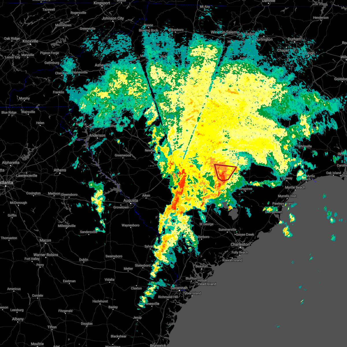 At 1148 am edt, a severe thunderstorm capable of producing a tornado was located near south sumter, moving north at 15 mph (radar indicated rotation). Hazards include tornado. Flying debris will be dangerous to those caught without shelter. mobile homes will be damaged or destroyed. damage to roofs, windows, and vehicles will occur. tree damage is likely. this dangerous storm will be near, mulberry around 1200 pm edt. sumter county airport around 1215 pm edt. other locations impacted by this tornadic thunderstorm include oswego, mayesville, east sumter, st. Charles, lynchburg and lakewood. At 1148 am edt, a severe thunderstorm capable of producing a tornado was located near south sumter, moving north at 15 mph (radar indicated rotation). Hazards include tornado. Flying debris will be dangerous to those caught without shelter. mobile homes will be damaged or destroyed. damage to roofs, windows, and vehicles will occur. tree damage is likely. this dangerous storm will be near, mulberry around 1200 pm edt. sumter county airport around 1215 pm edt. other locations impacted by this tornadic thunderstorm include oswego, mayesville, east sumter, st. Charles, lynchburg and lakewood.
|
| 9/17/2020 11:27 AM EDT |
 At 1127 am edt, a severe thunderstorm capable of producing a tornado was located near south sumter, moving north at 25 mph (radar indicated rotation). Hazards include tornado. Flying debris will be dangerous to those caught without shelter. mobile homes will be damaged or destroyed. damage to roofs, windows, and vehicles will occur. tree damage is likely. this dangerous storm will be near, sumter around 1135 am edt. south sumter and millwood around 1140 am edt. mulberry around 1145 am edt. sumter county airport around 1150 am edt. other locations impacted by this tornadic thunderstorm include oswego, east sumter, st. Charles, mayesville, brogdon, lakewood, lynchburg and dalzell. At 1127 am edt, a severe thunderstorm capable of producing a tornado was located near south sumter, moving north at 25 mph (radar indicated rotation). Hazards include tornado. Flying debris will be dangerous to those caught without shelter. mobile homes will be damaged or destroyed. damage to roofs, windows, and vehicles will occur. tree damage is likely. this dangerous storm will be near, sumter around 1135 am edt. south sumter and millwood around 1140 am edt. mulberry around 1145 am edt. sumter county airport around 1150 am edt. other locations impacted by this tornadic thunderstorm include oswego, east sumter, st. Charles, mayesville, brogdon, lakewood, lynchburg and dalzell.
|
| 9/17/2020 11:17 AM EDT |
 At 1117 am edt, a severe thunderstorm capable of producing a tornado was located 7 miles west of alcolu, or 8 miles west of manning, moving north at 15 mph (radar indicated rotation). Hazards include tornado. Flying debris will be dangerous to those caught without shelter. mobile homes will be damaged or destroyed. damage to roofs, windows, and vehicles will occur. tree damage is likely. this dangerous storm will be near, sumter, south sumter and millwood around 1200 pm edt. Other locations impacted by this tornadic thunderstorm include cane savannah, paxville, lakewood, privateer and east sumter. At 1117 am edt, a severe thunderstorm capable of producing a tornado was located 7 miles west of alcolu, or 8 miles west of manning, moving north at 15 mph (radar indicated rotation). Hazards include tornado. Flying debris will be dangerous to those caught without shelter. mobile homes will be damaged or destroyed. damage to roofs, windows, and vehicles will occur. tree damage is likely. this dangerous storm will be near, sumter, south sumter and millwood around 1200 pm edt. Other locations impacted by this tornadic thunderstorm include cane savannah, paxville, lakewood, privateer and east sumter.
|
| 9/17/2020 10:44 AM EDT |
 At 1044 am edt, a severe thunderstorm capable of producing a tornado was located near summerton, or 13 miles west of manning, moving north at 15 mph (radar indicated rotation). Hazards include tornado. Flying debris will be dangerous to those caught without shelter. mobile homes will be damaged or destroyed. damage to roofs, windows, and vehicles will occur. tree damage is likely. this dangerous storm will be near, poinsett state park around 1120 am edt. sumter and millwood around 1130 am edt. Other locations impacted by this tornadic thunderstorm include wedgewood, cane savannah, pinewood, rimini, paxville, lakewood, privateer and east sumter. At 1044 am edt, a severe thunderstorm capable of producing a tornado was located near summerton, or 13 miles west of manning, moving north at 15 mph (radar indicated rotation). Hazards include tornado. Flying debris will be dangerous to those caught without shelter. mobile homes will be damaged or destroyed. damage to roofs, windows, and vehicles will occur. tree damage is likely. this dangerous storm will be near, poinsett state park around 1120 am edt. sumter and millwood around 1130 am edt. Other locations impacted by this tornadic thunderstorm include wedgewood, cane savannah, pinewood, rimini, paxville, lakewood, privateer and east sumter.
|
| 9/17/2020 7:56 AM EDT |
 At 756 am edt, a severe thunderstorm capable of producing a tornado was located near poinsett state park, or 17 miles southwest of south sumter, moving north at 25 mph (radar indicated rotation). Hazards include tornado. Flying debris will be dangerous to those caught without shelter. mobile homes will be damaged or destroyed. damage to roofs, windows, and vehicles will occur. tree damage is likely. this dangerous storm will be near, poinsett state park around 810 am edt. shaw air base around 830 am edt. Other locations impacted by this tornadic thunderstorm include wedgewood, cane savannah, cherryvale and stateburg. At 756 am edt, a severe thunderstorm capable of producing a tornado was located near poinsett state park, or 17 miles southwest of south sumter, moving north at 25 mph (radar indicated rotation). Hazards include tornado. Flying debris will be dangerous to those caught without shelter. mobile homes will be damaged or destroyed. damage to roofs, windows, and vehicles will occur. tree damage is likely. this dangerous storm will be near, poinsett state park around 810 am edt. shaw air base around 830 am edt. Other locations impacted by this tornadic thunderstorm include wedgewood, cane savannah, cherryvale and stateburg.
|
| 8/13/2020 4:21 PM EDT |
 The severe thunderstorm warning for southwestern sumter county will expire at 430 pm edt, the storm which prompted the warning has weakened below severe limits, and no longer poses an immediate threat to life or property. therefore, the warning will be allowed to expire. The severe thunderstorm warning for southwestern sumter county will expire at 430 pm edt, the storm which prompted the warning has weakened below severe limits, and no longer poses an immediate threat to life or property. therefore, the warning will be allowed to expire.
|
| 8/13/2020 3:50 PM EDT |
 At 350 pm edt, a severe thunderstorm was located near poinsett state park, or 8 miles southwest of shaw air base, moving east at 15 mph (radar indicated). Hazards include 60 mph wind gusts. expect damage to roofs, siding, and trees At 350 pm edt, a severe thunderstorm was located near poinsett state park, or 8 miles southwest of shaw air base, moving east at 15 mph (radar indicated). Hazards include 60 mph wind gusts. expect damage to roofs, siding, and trees
|
| 7/10/2020 7:49 PM EDT |
 At 749 pm edt, a severe thunderstorm was located 7 miles east of fort jackson, or 8 miles north of mcentire air base, moving east at 10 mph (radar indicated). Hazards include 60 mph wind gusts and penny size hail. expect damage to roofs, siding, and trees At 749 pm edt, a severe thunderstorm was located 7 miles east of fort jackson, or 8 miles north of mcentire air base, moving east at 10 mph (radar indicated). Hazards include 60 mph wind gusts and penny size hail. expect damage to roofs, siding, and trees
|
| 6/30/2020 7:25 PM EDT | Trees and power lines blown down near bethel church rd and us hwy 15 s. time estimate in sumter county SC, 5.9 miles N of Sumter, SC |
| 6/30/2020 7:14 PM EDT |
 At 713 pm edt, a severe thunderstorm was located near wedgefield, moving southeast at 25 mph (radar indicated). Hazards include 60 mph wind gusts and quarter size hail. Hail damage to vehicles is expected. expect wind damage to roofs, siding, and trees. Locations impacted include, south sumter, mulberry, millwood, poinsett state park, oakland, pinewood, cane savannah, brogdon, lakewood, privateer, wedgewood, east sumter, cherryvale and stateburg. At 713 pm edt, a severe thunderstorm was located near wedgefield, moving southeast at 25 mph (radar indicated). Hazards include 60 mph wind gusts and quarter size hail. Hail damage to vehicles is expected. expect wind damage to roofs, siding, and trees. Locations impacted include, south sumter, mulberry, millwood, poinsett state park, oakland, pinewood, cane savannah, brogdon, lakewood, privateer, wedgewood, east sumter, cherryvale and stateburg.
|
| 6/30/2020 7:02 PM EDT |
 At 702 pm edt, a severe thunderstorm was located over shaw air base, moving southeast at 20 mph (radar indicated). Hazards include 60 mph wind gusts and quarter size hail. Hail damage to vehicles is expected. Expect wind damage to roofs, siding, and trees. At 702 pm edt, a severe thunderstorm was located over shaw air base, moving southeast at 20 mph (radar indicated). Hazards include 60 mph wind gusts and quarter size hail. Hail damage to vehicles is expected. Expect wind damage to roofs, siding, and trees.
|
| 6/28/2020 9:05 PM EDT |
 At 904 pm edt, a severe thunderstorm was located near south sumter, moving east at 40 mph (radar indicated). Hazards include 60 mph wind gusts. Expect damage to roofs, siding, and trees. locations impacted include, sumter, south sumter, shaw air base, mulberry, alcolu, woods bay state park, sumter county airport, millwood, poinsett state park, oakland, turbeville, mayesville, cane savannah, oswego, dalzell, brogdon, lakewood, privateer, wedgewood and east sumter. This includes interstate 95 between mile markers 121 and 140. At 904 pm edt, a severe thunderstorm was located near south sumter, moving east at 40 mph (radar indicated). Hazards include 60 mph wind gusts. Expect damage to roofs, siding, and trees. locations impacted include, sumter, south sumter, shaw air base, mulberry, alcolu, woods bay state park, sumter county airport, millwood, poinsett state park, oakland, turbeville, mayesville, cane savannah, oswego, dalzell, brogdon, lakewood, privateer, wedgewood and east sumter. This includes interstate 95 between mile markers 121 and 140.
|
| 6/28/2020 8:42 PM EDT |
 At 841 pm edt, a severe thunderstorm was located near oakland, or near shaw air base, moving east at 40 mph (radar indicated). Hazards include 60 mph wind gusts. expect damage to roofs, siding, and trees At 841 pm edt, a severe thunderstorm was located near oakland, or near shaw air base, moving east at 40 mph (radar indicated). Hazards include 60 mph wind gusts. expect damage to roofs, siding, and trees
|
| 5/23/2020 2:03 AM EDT |
 At 203 am edt, a severe thunderstorm was located near sumter county airport, or 9 miles north of sumter, moving east at 45 mph (radar indicated). Hazards include 60 mph wind gusts. Expect damage to roofs, siding, and trees. locations impacted include, sumter, shaw air base, mulberry, oakland, sumter county airport, elliott, millwood, mayesville, lynchburg, ashwood, oswego, dalzell, dinkins mill, manville, st. charles, cherryvale, wisacky, stateburg, woodrow and east sumter. this includes the following highways, interstate 20 in south carolina between mile markers 119 and 126. Interstate 95 between mile markers 140 and 145. At 203 am edt, a severe thunderstorm was located near sumter county airport, or 9 miles north of sumter, moving east at 45 mph (radar indicated). Hazards include 60 mph wind gusts. Expect damage to roofs, siding, and trees. locations impacted include, sumter, shaw air base, mulberry, oakland, sumter county airport, elliott, millwood, mayesville, lynchburg, ashwood, oswego, dalzell, dinkins mill, manville, st. charles, cherryvale, wisacky, stateburg, woodrow and east sumter. this includes the following highways, interstate 20 in south carolina between mile markers 119 and 126. Interstate 95 between mile markers 140 and 145.
|
| 5/23/2020 1:40 AM EDT |
 At 139 am edt, a severe thunderstorm was located 8 miles northwest of oakland, or 9 miles northwest of shaw air base, moving east at 40 mph (radar indicated). Hazards include 60 mph wind gusts. expect damage to roofs, siding, and trees At 139 am edt, a severe thunderstorm was located 8 miles northwest of oakland, or 9 miles northwest of shaw air base, moving east at 40 mph (radar indicated). Hazards include 60 mph wind gusts. expect damage to roofs, siding, and trees
|
| 5/22/2020 6:56 PM EDT |
 The severe thunderstorm warning for lee, northeastern clarendon and central sumter counties will expire at 700 pm edt, the storms which prompted the warning have weakened below severe limits. therefore, the warning will be allowed to expire. however gusty winds are still possible with these thunderstorms. to report severe weather, contact your nearest law enforcement agency. they will relay your report to the national weather service columbia. The severe thunderstorm warning for lee, northeastern clarendon and central sumter counties will expire at 700 pm edt, the storms which prompted the warning have weakened below severe limits. therefore, the warning will be allowed to expire. however gusty winds are still possible with these thunderstorms. to report severe weather, contact your nearest law enforcement agency. they will relay your report to the national weather service columbia.
|
| 5/22/2020 6:43 PM EDT |
 At 642 pm edt, severe thunderstorms were located along a line extending from near sumter county airport to near elliott, moving east at 25 mph. this storm has produced one inch diameter hail at shaw air force base near sumter at 624 pm (radar indicated). Hazards include 60 mph wind gusts and quarter size hail. Hail damage to vehicles is expected. expect wind damage to roofs, siding, and trees. locations impacted include, sumter, bishopville, south sumter, shaw air base, woods bay state park, elliott, mulberry, lee state park, sumter county airport, millwood, oakland, turbeville, mayesville, lynchburg, cane savannah, dalzell, manville, spring hill, brogdon and wedgewood. this includes the following highways, interstate 20 in south carolina between mile markers 110 and 125. Interstate 95 between mile markers 128 and 146. At 642 pm edt, severe thunderstorms were located along a line extending from near sumter county airport to near elliott, moving east at 25 mph. this storm has produced one inch diameter hail at shaw air force base near sumter at 624 pm (radar indicated). Hazards include 60 mph wind gusts and quarter size hail. Hail damage to vehicles is expected. expect wind damage to roofs, siding, and trees. locations impacted include, sumter, bishopville, south sumter, shaw air base, woods bay state park, elliott, mulberry, lee state park, sumter county airport, millwood, oakland, turbeville, mayesville, lynchburg, cane savannah, dalzell, manville, spring hill, brogdon and wedgewood. this includes the following highways, interstate 20 in south carolina between mile markers 110 and 125. Interstate 95 between mile markers 128 and 146.
|
| 5/22/2020 6:24 PM EDT | Quarter sized hail reported 5.9 miles ESE of Sumter, SC, air force weather observer at shaw afb near sumter observed one inch hail. |
| 5/22/2020 6:18 PM EDT |
 At 617 pm edt, a severe thunderstorm was located near fort jackson, or near mcentire air base, moving east at 35 mph (radar indicated). Hazards include 60 mph wind gusts and quarter size hail. Hail damage to vehicles is expected. expect wind damage to roofs, siding, and trees. locations impacted include, columbia, sumter, camden, mcentire air base, shaw air base, lugoff, lake carolina, oakland, villages at sandhill, fort jackson, elgin, horrel hill, dinkins mill, antioch, fort jackson wildcat road, wedgewood, boykin, fort jackson mccrady training center, wateree river correctional institution and rembert. This includes interstate 20 in south carolina between mile markers 78 and 105. At 617 pm edt, a severe thunderstorm was located near fort jackson, or near mcentire air base, moving east at 35 mph (radar indicated). Hazards include 60 mph wind gusts and quarter size hail. Hail damage to vehicles is expected. expect wind damage to roofs, siding, and trees. locations impacted include, columbia, sumter, camden, mcentire air base, shaw air base, lugoff, lake carolina, oakland, villages at sandhill, fort jackson, elgin, horrel hill, dinkins mill, antioch, fort jackson wildcat road, wedgewood, boykin, fort jackson mccrady training center, wateree river correctional institution and rembert. This includes interstate 20 in south carolina between mile markers 78 and 105.
|
| 5/22/2020 6:09 PM EDT |
 At 609 pm edt, severe thunderstorms were located along a line extending from near goodale state park to sumter, moving east at 30 mph (radar indicated). Hazards include 60 mph wind gusts and quarter size hail. Hail damage to vehicles is expected. Expect wind damage to roofs, siding, and trees. At 609 pm edt, severe thunderstorms were located along a line extending from near goodale state park to sumter, moving east at 30 mph (radar indicated). Hazards include 60 mph wind gusts and quarter size hail. Hail damage to vehicles is expected. Expect wind damage to roofs, siding, and trees.
|
| 5/22/2020 5:59 PM EDT |
 At 559 pm edt, severe thunderstorms were located along a line extending from dentsville to lexington, moving east at 35 mph (radar indicated). Hazards include 60 mph wind gusts and quarter size hail. Hail damage to vehicles is expected. Expect wind damage to roofs, siding, and trees. At 559 pm edt, severe thunderstorms were located along a line extending from dentsville to lexington, moving east at 35 mph (radar indicated). Hazards include 60 mph wind gusts and quarter size hail. Hail damage to vehicles is expected. Expect wind damage to roofs, siding, and trees.
|
| 5/22/2020 5:52 PM EDT |
 At 552 pm edt, a severe thunderstorm was located near elloree, or 12 miles northeast of brookdale, moving east at 25 mph (radar indicated). Hazards include 60 mph wind gusts and quarter size hail. Hail damage to vehicles is expected. Expect wind damage to roofs, siding, and trees. At 552 pm edt, a severe thunderstorm was located near elloree, or 12 miles northeast of brookdale, moving east at 25 mph (radar indicated). Hazards include 60 mph wind gusts and quarter size hail. Hail damage to vehicles is expected. Expect wind damage to roofs, siding, and trees.
|
| 4/13/2020 6:39 AM EDT |
 At 639 am edt, severe thunderstorms were located along a line extending from near clyde to near elloree, moving east at 55 mph (radar indicated). Hazards include 70 mph wind gusts and penny size hail. Expect considerable tree damage. Damage is likely to mobile homes, roofs, and outbuildings. At 639 am edt, severe thunderstorms were located along a line extending from near clyde to near elloree, moving east at 55 mph (radar indicated). Hazards include 70 mph wind gusts and penny size hail. Expect considerable tree damage. Damage is likely to mobile homes, roofs, and outbuildings.
|
| 2/13/2020 1:09 PM EST |
 At 109 pm est, severe thunderstorms were located along a line extending from near elliott to near santee state park, moving east at 40 mph (radar indicated). Hazards include 60 mph wind gusts. expect damage to roofs, siding, and trees At 109 pm est, severe thunderstorms were located along a line extending from near elliott to near santee state park, moving east at 40 mph (radar indicated). Hazards include 60 mph wind gusts. expect damage to roofs, siding, and trees
|
| 2/13/2020 12:52 PM EST |
 At 1251 pm est, severe thunderstorms were located along a line extending from near dovesville to south sumter, moving east at 60 mph (radar indicated). Hazards include 60 mph wind gusts. Expect damage to roofs, siding, and trees. locations impacted include, sumter, bishopville, south sumter, shaw air base, woods bay state park, elliott, mulberry, lee state park, sumter county airport, millwood, poinsett state park, oakland, turbeville, mayesville, lynchburg, cane savannah, dalzell, manville, brogdon and wedgewood. this includes the following highways, interstate 20 in south carolina between mile markers 113 and 126. Interstate 95 between mile markers 126 and 146. At 1251 pm est, severe thunderstorms were located along a line extending from near dovesville to south sumter, moving east at 60 mph (radar indicated). Hazards include 60 mph wind gusts. Expect damage to roofs, siding, and trees. locations impacted include, sumter, bishopville, south sumter, shaw air base, woods bay state park, elliott, mulberry, lee state park, sumter county airport, millwood, poinsett state park, oakland, turbeville, mayesville, lynchburg, cane savannah, dalzell, manville, brogdon and wedgewood. this includes the following highways, interstate 20 in south carolina between mile markers 113 and 126. Interstate 95 between mile markers 126 and 146.
|
| 2/13/2020 12:51 PM EST | Report received of a downed power line on council and w. bartlette streets. time estimated by rada in sumter county SC, 1.9 miles WNW of Sumter, SC |
| 2/13/2020 12:25 PM EST |
 At 1224 pm est, severe thunderstorms were located along a line extending from near cassatt to near congaree national park, moving east at 60 mph (radar indicated). Hazards include 60 mph wind gusts. expect damage to roofs, siding, and trees At 1224 pm est, severe thunderstorms were located along a line extending from near cassatt to near congaree national park, moving east at 60 mph (radar indicated). Hazards include 60 mph wind gusts. expect damage to roofs, siding, and trees
|
| 2/6/2020 4:43 PM EST |
 At 443 pm est, severe thunderstorms were located along a line extending from near clyde to 9 miles southwest of bishopville to near eastover, moving east at 35 mph (radar indicated). Hazards include 60 mph wind gusts. expect damage to roofs, siding, and trees At 443 pm est, severe thunderstorms were located along a line extending from near clyde to 9 miles southwest of bishopville to near eastover, moving east at 35 mph (radar indicated). Hazards include 60 mph wind gusts. expect damage to roofs, siding, and trees
|
| 2/6/2020 4:27 PM EST |
 At 427 pm est, severe thunderstorms were located along a line extending from near carolina sandhills wildlife refuge to 8 miles southeast of goodale state park to near eastover, moving east at 55 mph (radar indicated). Hazards include 60 mph wind gusts. Expect damage to roofs, siding, and trees. locations impacted include, columbia, sumter, cayce, camden, bishopville, south sumter, shaw air base, mcentire air base, gaston, eastover, lugoff, oakland, mulberry, fort jackson, congaree national park, hopkins, cassatt, horrel hill, carolina sandhills wildlife refuge and sc state farmer`s market. this includes the following highways, interstate 20 in south carolina between mile markers 79 and 119. interstate 26 between mile markers 117 and 132. Interstate 77 between mile markers 2 and 12. At 427 pm est, severe thunderstorms were located along a line extending from near carolina sandhills wildlife refuge to 8 miles southeast of goodale state park to near eastover, moving east at 55 mph (radar indicated). Hazards include 60 mph wind gusts. Expect damage to roofs, siding, and trees. locations impacted include, columbia, sumter, cayce, camden, bishopville, south sumter, shaw air base, mcentire air base, gaston, eastover, lugoff, oakland, mulberry, fort jackson, congaree national park, hopkins, cassatt, horrel hill, carolina sandhills wildlife refuge and sc state farmer`s market. this includes the following highways, interstate 20 in south carolina between mile markers 79 and 119. interstate 26 between mile markers 117 and 132. Interstate 77 between mile markers 2 and 12.
|
| 2/6/2020 4:02 PM EST |
 At 402 pm est, severe thunderstorms were located along a line extending from kershaw to near elgin to sandy run, moving east at 55 mph (radar indicated). Hazards include 60 mph wind gusts. expect damage to roofs, siding, and trees At 402 pm est, severe thunderstorms were located along a line extending from kershaw to near elgin to sandy run, moving east at 55 mph (radar indicated). Hazards include 60 mph wind gusts. expect damage to roofs, siding, and trees
|
| 1/11/2020 10:50 PM EST |
 At 1048 pm est, likely severe thunderstorms were located along a line extending from near the lee and kershaw county line southward into parts of western orangeburg county. movement was east-northeast at 65 mph (radar indicated). Hazards include 60 mph wind gusts. expect damage to roofs, siding, and trees At 1048 pm est, likely severe thunderstorms were located along a line extending from near the lee and kershaw county line southward into parts of western orangeburg county. movement was east-northeast at 65 mph (radar indicated). Hazards include 60 mph wind gusts. expect damage to roofs, siding, and trees
|
| 10/31/2019 8:27 PM EDT |
 The severe thunderstorm warning for southeastern lee, clarendon, central sumter and southeastern orangeburg counties will expire at 830 pm edt, the storms which prompted the warning have moved out of the area. therefore, the warning will be allowed to expire. The severe thunderstorm warning for southeastern lee, clarendon, central sumter and southeastern orangeburg counties will expire at 830 pm edt, the storms which prompted the warning have moved out of the area. therefore, the warning will be allowed to expire.
|
| 10/31/2019 7:51 PM EDT |
 At 751 pm edt, severe thunderstorms were located along a line extending from near elliott to santee cooper regional airport to near holly hill, moving east at 45 mph (radar indicated). Hazards include 60 mph wind gusts. Expect damage to roofs, siding, and trees. locations impacted include, sumter, manning, south sumter, holly hill, summerton, alcolu, woods bay state park, santee state park, santee cooper regional airport, mulberry, sumter county airport, millwood, santee, turbeville, mayesville, lynchburg, eutawville, paxville, vance and brogdon. this includes the following highways, interstate 26 between mile markers 164 and 168. Interstate 95 between mile markers 86 and 146. At 751 pm edt, severe thunderstorms were located along a line extending from near elliott to santee cooper regional airport to near holly hill, moving east at 45 mph (radar indicated). Hazards include 60 mph wind gusts. Expect damage to roofs, siding, and trees. locations impacted include, sumter, manning, south sumter, holly hill, summerton, alcolu, woods bay state park, santee state park, santee cooper regional airport, mulberry, sumter county airport, millwood, santee, turbeville, mayesville, lynchburg, eutawville, paxville, vance and brogdon. this includes the following highways, interstate 26 between mile markers 164 and 168. Interstate 95 between mile markers 86 and 146.
|
| 10/31/2019 7:27 PM EDT |
 At 726 pm edt, severe thunderstorms were located along a line extending from near shaw air base to near elloree to near padgetts, moving east at 35 mph (radar indicated). Hazards include 60 mph wind gusts. expect damage to roofs, siding, and trees At 726 pm edt, severe thunderstorms were located along a line extending from near shaw air base to near elloree to near padgetts, moving east at 35 mph (radar indicated). Hazards include 60 mph wind gusts. expect damage to roofs, siding, and trees
|
| 9/27/2019 4:18 PM EDT |
 At 418 pm edt, severe thunderstorms were located along a line extending from near mcentire air base to oakland, moving northeast at 15 mph (radar indicated). Hazards include 60 mph wind gusts and quarter size hail. Hail damage to vehicles is expected. Expect wind damage to roofs, siding, and trees. At 418 pm edt, severe thunderstorms were located along a line extending from near mcentire air base to oakland, moving northeast at 15 mph (radar indicated). Hazards include 60 mph wind gusts and quarter size hail. Hail damage to vehicles is expected. Expect wind damage to roofs, siding, and trees.
|
| 8/23/2019 3:30 PM EDT |
 At 329 pm edt, severe thunderstorms were located along a line extending from 6 miles southwest of bishopville to near sumter to 7 miles southeast of poinsett state park, moving east at 20 mph (radar indicated). Hazards include 60 mph wind gusts and quarter size hail. Hail damage to vehicles is expected. expect wind damage to roofs, siding, and trees. locations impacted include, sumter, bishopville, south sumter, elliott, mulberry, lee state park, sumter county airport, millwood, mayesville, pinewood, lynchburg, paxville, manville, rimini, brogdon, lone star, low falls landing, woodrow, ashwood and oswego. This includes interstate 20 in south carolina between mile markers 110 and 126. At 329 pm edt, severe thunderstorms were located along a line extending from 6 miles southwest of bishopville to near sumter to 7 miles southeast of poinsett state park, moving east at 20 mph (radar indicated). Hazards include 60 mph wind gusts and quarter size hail. Hail damage to vehicles is expected. expect wind damage to roofs, siding, and trees. locations impacted include, sumter, bishopville, south sumter, elliott, mulberry, lee state park, sumter county airport, millwood, mayesville, pinewood, lynchburg, paxville, manville, rimini, brogdon, lone star, low falls landing, woodrow, ashwood and oswego. This includes interstate 20 in south carolina between mile markers 110 and 126.
|
| 8/23/2019 3:08 PM EDT |
 At 308 pm edt, severe thunderstorms were located along a line extending from 9 miles south of goodale state park to near millwood to 8 miles south of poinsett state park, moving east at 20 mph (radar indicated). Hazards include 60 mph wind gusts and quarter size hail. Hail damage to vehicles is expected. Expect wind damage to roofs, siding, and trees. At 308 pm edt, severe thunderstorms were located along a line extending from 9 miles south of goodale state park to near millwood to 8 miles south of poinsett state park, moving east at 20 mph (radar indicated). Hazards include 60 mph wind gusts and quarter size hail. Hail damage to vehicles is expected. Expect wind damage to roofs, siding, and trees.
|
| 6/22/2019 6:20 PM EDT | Schp reported multiple trees down on underwood rd... eddie lane and poole rd. time estimated by rada in sumter county SC, 9.3 miles N of Sumter, SC |
| 6/22/2019 6:20 PM EDT | Trees reported down on old manning roa in sumter county SC, 7.9 miles NNW of Sumter, SC |
| 6/22/2019 6:12 PM EDT | Schp reported tree down on loring mill rd and hwy 378. time estimated by rada in sumter county SC, 3.6 miles SE of Sumter, SC |
| 6/22/2019 6:08 PM EDT |
 At 608 pm edt, severe thunderstorms were located along a line extending from near oats to sumter county airport to congaree national park, moving southeast at 50 mph (radar indicated). Hazards include 60 mph wind gusts. Expect damage to roofs, siding, and trees. locations impacted include, columbia, sumter, cayce, bishopville, mcentire air base, south sumter, shaw air base, st. matthews, eastover, congaree national park, hopkins, oakland, woods bay state park, elliott, horrel hill, mulberry, lee state park, sandy run, sumter county airport and gadsden. this includes the following highways, interstate 20 in south carolina between mile markers 106 and 125. interstate 26 interstate 77 between mile markers 3 and 8. Interstate 95 between mile markers 134 and 146. At 608 pm edt, severe thunderstorms were located along a line extending from near oats to sumter county airport to congaree national park, moving southeast at 50 mph (radar indicated). Hazards include 60 mph wind gusts. Expect damage to roofs, siding, and trees. locations impacted include, columbia, sumter, cayce, bishopville, mcentire air base, south sumter, shaw air base, st. matthews, eastover, congaree national park, hopkins, oakland, woods bay state park, elliott, horrel hill, mulberry, lee state park, sandy run, sumter county airport and gadsden. this includes the following highways, interstate 20 in south carolina between mile markers 106 and 125. interstate 26 interstate 77 between mile markers 3 and 8. Interstate 95 between mile markers 134 and 146.
|
| 6/22/2019 5:48 PM EDT |
 At 548 pm edt, severe thunderstorms were located along a line extending from 6 miles northwest of bishopville to near oakland to near sc state farmer`s market, moving southeast at 50 mph (radar indicated). Hazards include 60 mph wind gusts. expect damage to roofs, siding, and trees At 548 pm edt, severe thunderstorms were located along a line extending from 6 miles northwest of bishopville to near oakland to near sc state farmer`s market, moving southeast at 50 mph (radar indicated). Hazards include 60 mph wind gusts. expect damage to roofs, siding, and trees
|
| 6/22/2019 5:13 AM EDT |
 At 513 am edt, severe thunderstorms were located along a line extending from near lamar to near summerton, moving east at 65 mph (radar indicated). Hazards include 70 mph wind gusts. Expect considerable tree damage. Damage is likely to mobile homes, roofs, and outbuildings. At 513 am edt, severe thunderstorms were located along a line extending from near lamar to near summerton, moving east at 65 mph (radar indicated). Hazards include 70 mph wind gusts. Expect considerable tree damage. Damage is likely to mobile homes, roofs, and outbuildings.
|
| 6/22/2019 4:56 AM EDT | Highway patrol reported trees down queen chapel rd and ebenezer r in sumter county SC, 6.6 miles S of Sumter, SC |
| 6/22/2019 4:54 AM EDT | Highway patrol reported trees down near 505 colony rd and colony circl in sumter county SC, 8.7 miles SSW of Sumter, SC |
| 6/22/2019 4:53 AM EDT | Sc highway patrol reports tree in roadway along us 15 near martinville church roa in lee county SC, 11.2 miles SSW of Sumter, SC |
| 6/22/2019 4:46 AM EDT |
 At 445 am edt, severe thunderstorms were located along a line extending from near carolina sandhills wildlife refuge to near poinsett state park, moving east at 45 mph (radar indicated). Hazards include 70 mph wind gusts. Expect considerable tree damage. damage is likely to mobile homes, roofs, and outbuildings. locations impacted include, sumter, cheraw, manning, bishopville, south sumter, shaw air base, oakland, mulberry, cheraw state park, alcolu, northeastern technical college, woods bay state park, cassatt, elliott, lee state park, carolina sandhills wildlife refuge, mt pisgah, sumter county airport, millwood and poinsett state park. this includes the following highways, interstate 20 in south carolina between mile markers 100 and 125. Interstate 26 interstate 95 between mile markers 113 and 146. At 445 am edt, severe thunderstorms were located along a line extending from near carolina sandhills wildlife refuge to near poinsett state park, moving east at 45 mph (radar indicated). Hazards include 70 mph wind gusts. Expect considerable tree damage. damage is likely to mobile homes, roofs, and outbuildings. locations impacted include, sumter, cheraw, manning, bishopville, south sumter, shaw air base, oakland, mulberry, cheraw state park, alcolu, northeastern technical college, woods bay state park, cassatt, elliott, lee state park, carolina sandhills wildlife refuge, mt pisgah, sumter county airport, millwood and poinsett state park. this includes the following highways, interstate 20 in south carolina between mile markers 100 and 125. Interstate 26 interstate 95 between mile markers 113 and 146.
|
| 6/22/2019 4:22 AM EDT |
 At 421 am edt, severe thunderstorms were located along a line extending from near mt pisgah to near eastover, moving east at 80 mph (radar indicated). Hazards include 70 mph wind gusts. Expect considerable tree damage. Damage is likely to mobile homes, roofs, and outbuildings. At 421 am edt, severe thunderstorms were located along a line extending from near mt pisgah to near eastover, moving east at 80 mph (radar indicated). Hazards include 70 mph wind gusts. Expect considerable tree damage. Damage is likely to mobile homes, roofs, and outbuildings.
|
| 6/20/2019 5:42 PM EDT |
 At 541 pm edt, severe thunderstorms were located along a line extending from 8 miles southwest of poinsett state park to near blackville, moving east at 60 mph. the strongest winds will soon move over st. matthews in calhoun county (radar indicated). Hazards include 70 mph wind gusts. Expect considerable tree damage. Damage is likely to mobile homes, roofs, and outbuildings. At 541 pm edt, severe thunderstorms were located along a line extending from 8 miles southwest of poinsett state park to near blackville, moving east at 60 mph. the strongest winds will soon move over st. matthews in calhoun county (radar indicated). Hazards include 70 mph wind gusts. Expect considerable tree damage. Damage is likely to mobile homes, roofs, and outbuildings.
|
| 6/20/2019 5:23 PM EDT | Schp reported a tree down in road way at 12 bridges road and us 521. time estimated by rada in sumter county SC, 9.3 miles NW of Sumter, SC |
| 6/20/2019 5:07 PM EDT | Schp reported a tree down in road way at lewis road and kingsbury road... sumter county. time estimated by rada in sumter county SC, 2.5 miles NNW of Sumter, SC |
| 6/20/2019 5:03 PM EDT |
 At 503 pm edt, a severe thunderstorm was located over millwood, or over sumter, moving east at 35 mph (radar indicated). Hazards include 60 mph wind gusts. Expect damage to roofs, siding, and trees. locations impacted include, sumter, manning, mcentire air base, south sumter, shaw air base, st. matthews, summerton, eastover, congaree national park, alcolu, oakland, woods bay state park, elliott, mulberry, sumter county airport, gadsden, millwood, poinsett state park, turbeville and mayesville. This includes interstate 95 between mile markers 112 and 146. At 503 pm edt, a severe thunderstorm was located over millwood, or over sumter, moving east at 35 mph (radar indicated). Hazards include 60 mph wind gusts. Expect damage to roofs, siding, and trees. locations impacted include, sumter, manning, mcentire air base, south sumter, shaw air base, st. matthews, summerton, eastover, congaree national park, alcolu, oakland, woods bay state park, elliott, mulberry, sumter county airport, gadsden, millwood, poinsett state park, turbeville and mayesville. This includes interstate 95 between mile markers 112 and 146.
|
| 6/20/2019 4:30 PM EDT |
 At 430 pm edt, a severe thunderstorm was located 9 miles northeast of horrel hill, or 9 miles northeast of mcentire air base, moving east at 40 mph (radar indicated). Hazards include 60 mph wind gusts. expect damage to roofs, siding, and trees At 430 pm edt, a severe thunderstorm was located 9 miles northeast of horrel hill, or 9 miles northeast of mcentire air base, moving east at 40 mph (radar indicated). Hazards include 60 mph wind gusts. expect damage to roofs, siding, and trees
|
| 4/19/2019 2:48 PM EDT |
 At 246 pm edt, severe thunderstorms were located along a line extending from 6 miles southeast of elgin to near millwood to manning, moving north at 60 mph (radar indicated). Hazards include 70 mph wind gusts. Expect considerable tree damage. damage is likely to mobile homes, roofs, and outbuildings. Locations impacted include, sumter, manning, south sumter, shaw air base, alcolu, oakland, woods bay state park, mulberry, sumter county airport, millwood, lugoff, turbeville, mayesville, lynchburg, dalzell, dinkins mill, spring hill, brogdon, boykin and cherryvale. At 246 pm edt, severe thunderstorms were located along a line extending from 6 miles southeast of elgin to near millwood to manning, moving north at 60 mph (radar indicated). Hazards include 70 mph wind gusts. Expect considerable tree damage. damage is likely to mobile homes, roofs, and outbuildings. Locations impacted include, sumter, manning, south sumter, shaw air base, alcolu, oakland, woods bay state park, mulberry, sumter county airport, millwood, lugoff, turbeville, mayesville, lynchburg, dalzell, dinkins mill, spring hill, brogdon, boykin and cherryvale.
|
| 4/19/2019 2:44 PM EDT | Schp reported tree down n. wise drive and jefferson road. time estimated by rada in sumter county SC, 3.3 miles SSW of Sumter, SC |
| 4/19/2019 2:44 PM EDT |
 At 244 pm edt, a severe thunderstorm capable of producing a tornado was located near sumter county airport, or near shaw air base, moving north at 55 mph (radar indicated rotation). Hazards include tornado. Flying debris will be dangerous to those caught without shelter. mobile homes will be damaged or destroyed. damage to roofs, windows, and vehicles will occur. tree damage is likely. this dangerous storm will be near, bishopville around 300 pm edt. Other locations impacted by this tornadic thunderstorm include ashwood, dalzell, antioch, manville, spring hill and woodrow. At 244 pm edt, a severe thunderstorm capable of producing a tornado was located near sumter county airport, or near shaw air base, moving north at 55 mph (radar indicated rotation). Hazards include tornado. Flying debris will be dangerous to those caught without shelter. mobile homes will be damaged or destroyed. damage to roofs, windows, and vehicles will occur. tree damage is likely. this dangerous storm will be near, bishopville around 300 pm edt. Other locations impacted by this tornadic thunderstorm include ashwood, dalzell, antioch, manville, spring hill and woodrow.
|
| 4/19/2019 2:40 PM EDT | Shaw afb asos reported 55-kt / 63-mph win in sumter county SC, 5.9 miles ESE of Sumter, SC |
| 4/19/2019 2:37 PM EDT | Schp reports trees down stamey livestock road and hwy 378. time estimated by rada in sumter county SC, 3.5 miles SSE of Sumter, SC |
| 4/19/2019 2:36 PM EDT | *** 1 inj *** media report of child injured due to tree falling on house. time estimated on rada in sumter county SC, 5.1 miles ESE of Sumter, SC |
| 4/19/2019 2:36 PM EDT | County em reported tree down on mobile home on blanche road. time estmd by rada in sumter county SC, 5.3 miles ESE of Sumter, SC |
| 4/19/2019 2:36 PM EDT |
 At 236 pm edt, a severe thunderstorm capable of producing a tornado was located over shaw air base, moving north at 55 mph (radar indicated rotation). Hazards include tornado. Flying debris will be dangerous to those caught without shelter. mobile homes will be damaged or destroyed. damage to roofs, windows, and vehicles will occur. tree damage is likely. this dangerous storm will be near, bishopville around 300 pm edt. Other locations impacted by this tornadic thunderstorm include ashwood, dalzell, manville, cherryvale, spring hill, antioch, woodrow, cane savannah, wedgewood and stateburg. At 236 pm edt, a severe thunderstorm capable of producing a tornado was located over shaw air base, moving north at 55 mph (radar indicated rotation). Hazards include tornado. Flying debris will be dangerous to those caught without shelter. mobile homes will be damaged or destroyed. damage to roofs, windows, and vehicles will occur. tree damage is likely. this dangerous storm will be near, bishopville around 300 pm edt. Other locations impacted by this tornadic thunderstorm include ashwood, dalzell, manville, cherryvale, spring hill, antioch, woodrow, cane savannah, wedgewood and stateburg.
|
| 4/19/2019 2:20 PM EDT |
 At 220 pm edt, severe thunderstorms were located along a line extending from near st. matthews to near santee state park to 7 miles west of cross, moving north at 55 mph (radar indicated). Hazards include 70 mph wind gusts. Expect considerable tree damage. Damage is likely to mobile homes, roofs, and outbuildings. At 220 pm edt, severe thunderstorms were located along a line extending from near st. matthews to near santee state park to 7 miles west of cross, moving north at 55 mph (radar indicated). Hazards include 70 mph wind gusts. Expect considerable tree damage. Damage is likely to mobile homes, roofs, and outbuildings.
|
| 9/27/2018 10:08 PM EDT |
 At 1007 pm edt, severe thunderstorms were located along a line extending from 7 miles northwest of camden to near eastover, moving northeast at 40 mph (radar indicated). Hazards include 60 mph wind gusts. expect damage to roofs, siding, and trees At 1007 pm edt, severe thunderstorms were located along a line extending from 7 miles northwest of camden to near eastover, moving northeast at 40 mph (radar indicated). Hazards include 60 mph wind gusts. expect damage to roofs, siding, and trees
|
| 9/27/2018 8:34 PM EDT |
 At 834 pm edt, a severe thunderstorm was located 8 miles northeast of oakland, or 8 miles north of sumter, moving northeast at 35 mph (radar indicated). Hazards include 60 mph wind gusts. expect damage to roofs, siding, and trees At 834 pm edt, a severe thunderstorm was located 8 miles northeast of oakland, or 8 miles north of sumter, moving northeast at 35 mph (radar indicated). Hazards include 60 mph wind gusts. expect damage to roofs, siding, and trees
|
| 9/17/2018 6:13 PM EDT |
 At 613 pm edt, a severe thunderstorm was located over south sumter, moving east at 30 mph (radar indicated). Hazards include 70 mph wind gusts. Expect considerable tree damage. Damage is likely to mobile homes, roofs, and outbuildings. At 613 pm edt, a severe thunderstorm was located over south sumter, moving east at 30 mph (radar indicated). Hazards include 70 mph wind gusts. Expect considerable tree damage. Damage is likely to mobile homes, roofs, and outbuildings.
|
| 7/23/2018 4:48 PM EDT |
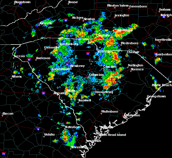 At 448 pm edt, a severe thunderstorm capable of producing a tornado was located near south sumter, moving north at 10 mph (radar indicated rotation). Hazards include tornado and quarter size hail. Flying debris will be dangerous to those caught without shelter. mobile homes will be damaged or destroyed. damage to roofs, windows, and vehicles will occur. tree damage is likely. Locations impacted include, south sumter, mulberry, mayesville and east sumter. At 448 pm edt, a severe thunderstorm capable of producing a tornado was located near south sumter, moving north at 10 mph (radar indicated rotation). Hazards include tornado and quarter size hail. Flying debris will be dangerous to those caught without shelter. mobile homes will be damaged or destroyed. damage to roofs, windows, and vehicles will occur. tree damage is likely. Locations impacted include, south sumter, mulberry, mayesville and east sumter.
|
| 7/23/2018 4:33 PM EDT |
 At 433 pm edt, a severe thunderstorm capable of producing a tornado was located near south sumter, moving north at 20 mph (radar indicated rotation). Hazards include tornado and quarter size hail. Flying debris will be dangerous to those caught without shelter. mobile homes will be damaged or destroyed. damage to roofs, windows, and vehicles will occur. Tree damage is likely. At 433 pm edt, a severe thunderstorm capable of producing a tornado was located near south sumter, moving north at 20 mph (radar indicated rotation). Hazards include tornado and quarter size hail. Flying debris will be dangerous to those caught without shelter. mobile homes will be damaged or destroyed. damage to roofs, windows, and vehicles will occur. Tree damage is likely.
|
| 7/23/2018 3:14 PM EDT |
 At 314 pm edt, a severe thunderstorm was located 12 miles north of elloree, or 17 miles southwest of south sumter, moving northeast at 25 mph (radar indicated). Hazards include 60 mph wind gusts and quarter size hail. Hail damage to vehicles is expected. Expect wind damage to roofs, siding, and trees. At 314 pm edt, a severe thunderstorm was located 12 miles north of elloree, or 17 miles southwest of south sumter, moving northeast at 25 mph (radar indicated). Hazards include 60 mph wind gusts and quarter size hail. Hail damage to vehicles is expected. Expect wind damage to roofs, siding, and trees.
|
| 7/23/2018 2:13 PM EDT |
 At 213 pm edt, a severe thunderstorm was located near oakland, or 12 miles west of sumter, moving north at 10 mph (radar indicated). Hazards include 60 mph wind gusts and quarter size hail. Hail damage to vehicles is expected. expect wind damage to roofs, siding, and trees. Locations impacted include, oakland, stateburg and rembert. At 213 pm edt, a severe thunderstorm was located near oakland, or 12 miles west of sumter, moving north at 10 mph (radar indicated). Hazards include 60 mph wind gusts and quarter size hail. Hail damage to vehicles is expected. expect wind damage to roofs, siding, and trees. Locations impacted include, oakland, stateburg and rembert.
|
| 7/23/2018 1:52 PM EDT |
 At 152 pm edt, a severe thunderstorm was located near oakland, or 11 miles west of sumter, and is nearly stationary (radar indicated). Hazards include 60 mph wind gusts and quarter size hail. Hail damage to vehicles is expected. Expect wind damage to roofs, siding, and trees. At 152 pm edt, a severe thunderstorm was located near oakland, or 11 miles west of sumter, and is nearly stationary (radar indicated). Hazards include 60 mph wind gusts and quarter size hail. Hail damage to vehicles is expected. Expect wind damage to roofs, siding, and trees.
|
| 7/17/2018 7:55 PM EDT |
 At 754 pm edt, a severe thunderstorm was located near south sumter, moving southeast at 25 mph (radar indicated). Hazards include 60 mph wind gusts. expect damage to roofs, siding, and trees At 754 pm edt, a severe thunderstorm was located near south sumter, moving southeast at 25 mph (radar indicated). Hazards include 60 mph wind gusts. expect damage to roofs, siding, and trees
|
| 6/29/2018 8:47 PM EDT |
 At 846 pm edt, severe thunderstorms were located along a line extending from 8 miles south of heath springs to near oakland, moving west at 15 mph (radar indicated). Hazards include 60 mph wind gusts and penny size hail. expect damage to roofs, siding, and trees At 846 pm edt, severe thunderstorms were located along a line extending from 8 miles south of heath springs to near oakland, moving west at 15 mph (radar indicated). Hazards include 60 mph wind gusts and penny size hail. expect damage to roofs, siding, and trees
|
| 6/27/2018 7:50 PM EDT |
 At 750 pm edt, severe thunderstorms were located along a line extending from near lydia to 9 miles southeast of eastover, moving east at 35 mph (radar indicated). Hazards include 60 mph wind gusts and quarter size hail. Hail damage to vehicles is expected. expect wind damage to roofs, siding, and trees. locations impacted include, sumter, bishopville, south sumter, eastover, mulberry, oakland, millwood, mayesville, pinewood, lynchburg, cane savannah, oswego, dalzell, lakewood, privateer, wedgewood, east sumter, cherryvale, rembert and stateburg. This includes interstate 20 in south carolina between mile markers 108 and 126. At 750 pm edt, severe thunderstorms were located along a line extending from near lydia to 9 miles southeast of eastover, moving east at 35 mph (radar indicated). Hazards include 60 mph wind gusts and quarter size hail. Hail damage to vehicles is expected. expect wind damage to roofs, siding, and trees. locations impacted include, sumter, bishopville, south sumter, eastover, mulberry, oakland, millwood, mayesville, pinewood, lynchburg, cane savannah, oswego, dalzell, lakewood, privateer, wedgewood, east sumter, cherryvale, rembert and stateburg. This includes interstate 20 in south carolina between mile markers 108 and 126.
|
| 6/27/2018 7:29 PM EDT |
 At 729 pm edt, severe thunderstorms were located along a line extending from 6 miles west of clyde to 6 miles southwest of eastover, moving east at 35 mph (radar indicated). Hazards include 60 mph wind gusts and quarter size hail. Hail damage to vehicles is expected. Expect wind damage to roofs, siding, and trees. At 729 pm edt, severe thunderstorms were located along a line extending from 6 miles west of clyde to 6 miles southwest of eastover, moving east at 35 mph (radar indicated). Hazards include 60 mph wind gusts and quarter size hail. Hail damage to vehicles is expected. Expect wind damage to roofs, siding, and trees.
|
| 6/25/2018 9:28 PM EDT |
 The severe thunderstorm warning for lee, central calhoun, west central clarendon, sumter, central kershaw and southeastern richland counties will expire at 930 pm edt, the storms which prompted the warning have weakened below severe limits, and no longer pose an immediate threat to life or property. therefore, the warning will be allowed to expire. however gusty winds, frequent lightning, and heavy rain are still possible with these thunderstorms. a severe thunderstorm watch remains in effect until 1000 pm edt for central south carolina. remember, a severe thunderstorm warning still remains in effect for clarendon and calhoun coutnies through 10 pm. The severe thunderstorm warning for lee, central calhoun, west central clarendon, sumter, central kershaw and southeastern richland counties will expire at 930 pm edt, the storms which prompted the warning have weakened below severe limits, and no longer pose an immediate threat to life or property. therefore, the warning will be allowed to expire. however gusty winds, frequent lightning, and heavy rain are still possible with these thunderstorms. a severe thunderstorm watch remains in effect until 1000 pm edt for central south carolina. remember, a severe thunderstorm warning still remains in effect for clarendon and calhoun coutnies through 10 pm.
|
| 6/25/2018 9:16 PM EDT |
 At 916 pm edt, severe thunderstorms were located along a line extending from near bishopville to 7 miles east of eastover, moving east at 45 mph (radar indicated). Hazards include 60 mph wind gusts. Expect damage to roofs, siding, and trees. locations impacted include, sumter, camden, bishopville, south sumter, st. matthews, eastover, mulberry, oakland, millwood, mayesville, pinewood, bethune, paxville, cane savannah, oswego, dalzell, lakewood, privateer, wedgewood and east sumter. this includes the following highways, interstate 20 in south carolina between mile markers 95 and 125. Interstate 26 between mile markers 131 and 136. At 916 pm edt, severe thunderstorms were located along a line extending from near bishopville to 7 miles east of eastover, moving east at 45 mph (radar indicated). Hazards include 60 mph wind gusts. Expect damage to roofs, siding, and trees. locations impacted include, sumter, camden, bishopville, south sumter, st. matthews, eastover, mulberry, oakland, millwood, mayesville, pinewood, bethune, paxville, cane savannah, oswego, dalzell, lakewood, privateer, wedgewood and east sumter. this includes the following highways, interstate 20 in south carolina between mile markers 95 and 125. Interstate 26 between mile markers 131 and 136.
|
| 6/25/2018 8:43 PM EDT |
 At 843 pm edt, severe thunderstorms were located along a line extending from 9 miles north of camden to near forest acres, moving east at 40 mph (radar indicated). Hazards include 60 mph wind gusts. expect damage to roofs, siding, and trees At 843 pm edt, severe thunderstorms were located along a line extending from 9 miles north of camden to near forest acres, moving east at 40 mph (radar indicated). Hazards include 60 mph wind gusts. expect damage to roofs, siding, and trees
|
| 6/25/2018 8:14 PM EDT |
 At 813 pm edt, severe thunderstorms were located along a line extending from near manning to near elloree to 10 miles south of gaston, moving southeast at 20 mph (radar indicated). Hazards include 70 mph wind gusts and quarter size hail. Hail damage to vehicles is expected. expect considerable tree damage. Wind damage is also likely to mobile homes, roofs, and outbuildings. At 813 pm edt, severe thunderstorms were located along a line extending from near manning to near elloree to 10 miles south of gaston, moving southeast at 20 mph (radar indicated). Hazards include 70 mph wind gusts and quarter size hail. Hail damage to vehicles is expected. expect considerable tree damage. Wind damage is also likely to mobile homes, roofs, and outbuildings.
|
| 6/25/2018 7:41 PM EDT |
 The national weather service in columbia has issued a * severe thunderstorm warning for. calhoun county in central south carolina. clarendon county in central south carolina. southeastern lexington county in central south carolina. Southwestern sumter county in central south carolina. The national weather service in columbia has issued a * severe thunderstorm warning for. calhoun county in central south carolina. clarendon county in central south carolina. southeastern lexington county in central south carolina. Southwestern sumter county in central south carolina.
|
| 6/25/2018 6:34 PM EDT |
 At 634 pm edt, severe thunderstorms were located along a line extending from near pamplico to 8 miles northeast of mulberry, moving east at 40 mph (radar indicated). Hazards include 60 mph wind gusts and quarter size hail. Hail damage to vehicles is expected. expect wind damage to roofs, siding, and trees. locations impacted include, sumter, mulberry, turbeville, mayesville, lynchburg, oswego, east sumter and shiloh. This includes interstate 95 between mile markers 133 and 146. At 634 pm edt, severe thunderstorms were located along a line extending from near pamplico to 8 miles northeast of mulberry, moving east at 40 mph (radar indicated). Hazards include 60 mph wind gusts and quarter size hail. Hail damage to vehicles is expected. expect wind damage to roofs, siding, and trees. locations impacted include, sumter, mulberry, turbeville, mayesville, lynchburg, oswego, east sumter and shiloh. This includes interstate 95 between mile markers 133 and 146.
|
| 6/25/2018 6:13 PM EDT |
 At 612 pm edt, severe thunderstorms were located along a line extending from new hope to 6 miles northeast of oakland, moving east at 40 mph (radar indicated). Hazards include 60 mph wind gusts and quarter size hail. Hail damage to vehicles is expected. expect wind damage to roofs, siding, and trees. locations impacted include, sumter, south sumter, mulberry, oakland, millwood, turbeville, mayesville, lynchburg, cane savannah, oswego, dalzell, wedgewood, east sumter, cherryvale, rembert, shiloh and stateburg. This includes interstate 95 between mile markers 132 and 146. At 612 pm edt, severe thunderstorms were located along a line extending from new hope to 6 miles northeast of oakland, moving east at 40 mph (radar indicated). Hazards include 60 mph wind gusts and quarter size hail. Hail damage to vehicles is expected. expect wind damage to roofs, siding, and trees. locations impacted include, sumter, south sumter, mulberry, oakland, millwood, turbeville, mayesville, lynchburg, cane savannah, oswego, dalzell, wedgewood, east sumter, cherryvale, rembert, shiloh and stateburg. This includes interstate 95 between mile markers 132 and 146.
|
| 6/25/2018 5:57 PM EDT |
 At 557 pm edt, severe thunderstorms were located along a line extending from near sardis to 7 miles northwest of oakland, moving east at 40 mph (radar indicated). Hazards include 60 mph wind gusts and quarter size hail. Hail damage to vehicles is expected. Expect wind damage to roofs, siding, and trees. At 557 pm edt, severe thunderstorms were located along a line extending from near sardis to 7 miles northwest of oakland, moving east at 40 mph (radar indicated). Hazards include 60 mph wind gusts and quarter size hail. Hail damage to vehicles is expected. Expect wind damage to roofs, siding, and trees.
|
| 6/15/2018 10:39 PM EDT |
 The severe thunderstorm warning for southeastern calhoun, southwestern clarendon, southwestern sumter and southeastern richland counties will expire at 1045 pm edt, the storm which prompted the warning has weakened below severe limits, and no longer poses an immediate threat to life or property. therefore, the warning will be allowed to expire. to report severe weather, contact your nearest law enforcement agency. they will relay your report to the national weather service columbia. The severe thunderstorm warning for southeastern calhoun, southwestern clarendon, southwestern sumter and southeastern richland counties will expire at 1045 pm edt, the storm which prompted the warning has weakened below severe limits, and no longer poses an immediate threat to life or property. therefore, the warning will be allowed to expire. to report severe weather, contact your nearest law enforcement agency. they will relay your report to the national weather service columbia.
|
| 6/15/2018 10:17 PM EDT |
 At 1016 pm edt, a severe thunderstorm was located 11 miles east of st. matthews, or 18 miles southwest of south sumter, moving south at 35 mph (radar indicated). Hazards include 60 mph wind gusts. Expect damage to roofs, siding, and trees. locations impacted include, sumter, manning, south sumter, summerton, eastover, mulberry, millwood, pinewood, cameron, paxville, cane savannah, lakewood, privateer, wedgewood, east sumter and cherryvale. This includes interstate 95 between mile markers 101 and 120. At 1016 pm edt, a severe thunderstorm was located 11 miles east of st. matthews, or 18 miles southwest of south sumter, moving south at 35 mph (radar indicated). Hazards include 60 mph wind gusts. Expect damage to roofs, siding, and trees. locations impacted include, sumter, manning, south sumter, summerton, eastover, mulberry, millwood, pinewood, cameron, paxville, cane savannah, lakewood, privateer, wedgewood, east sumter and cherryvale. This includes interstate 95 between mile markers 101 and 120.
|
| 6/15/2018 9:56 PM EDT |
 At 956 pm edt, a severe thunderstorm was located 7 miles south of oakland, or 9 miles southwest of sumter, moving south at 35 mph (radar indicated). Hazards include 60 mph wind gusts. expect damage to roofs, siding, and trees At 956 pm edt, a severe thunderstorm was located 7 miles south of oakland, or 9 miles southwest of sumter, moving south at 35 mph (radar indicated). Hazards include 60 mph wind gusts. expect damage to roofs, siding, and trees
|
| 6/15/2018 9:41 PM EDT | 52-kt (60 mph wind gust reported by the shaw afb asos (kssc in sumter county SC, 6.4 miles ESE of Sumter, SC |
| 6/15/2018 9:40 PM EDT |
 At 940 pm edt, severe thunderstorms were located along a line extending from 6 miles west of oakland to 9 miles northeast of manning, moving south at 20 mph (radar indicated). Hazards include 60 mph wind gusts. Expect damage to roofs, siding, and trees. locations impacted include, sumter, manning, south sumter, eastover, oakland, millwood, pinewood, paxville, cane savannah, lakewood, privateer, wedgewood, cherryvale, stateburg and east sumter. This includes interstate 95 between mile markers 113 and 129. At 940 pm edt, severe thunderstorms were located along a line extending from 6 miles west of oakland to 9 miles northeast of manning, moving south at 20 mph (radar indicated). Hazards include 60 mph wind gusts. Expect damage to roofs, siding, and trees. locations impacted include, sumter, manning, south sumter, eastover, oakland, millwood, pinewood, paxville, cane savannah, lakewood, privateer, wedgewood, cherryvale, stateburg and east sumter. This includes interstate 95 between mile markers 113 and 129.
|
| 6/15/2018 9:33 PM EDT | Schp reported tree in roadway on cowby lane at boulevard road. time estimated by rada in sumter county SC, 5.7 miles WNW of Sumter, SC |
| 6/15/2018 9:24 PM EDT |
 At 924 pm edt, severe thunderstorms were located along a line extending from 10 miles northwest of oakland to 8 miles east of south sumter, moving south at 20 mph (radar indicated). Hazards include 60 mph wind gusts and penny size hail. expect damage to roofs, siding, and trees At 924 pm edt, severe thunderstorms were located along a line extending from 10 miles northwest of oakland to 8 miles east of south sumter, moving south at 20 mph (radar indicated). Hazards include 60 mph wind gusts and penny size hail. expect damage to roofs, siding, and trees
|
| 6/15/2018 9:09 PM EDT |
 At 909 pm edt, a severe thunderstorm was located 8 miles northeast of manning, moving south at 20 mph (radar indicated). Hazards include 60 mph wind gusts and penny size hail. Expect damage to roofs, siding, and trees. locations impacted include, manning, mulberry, turbeville, mayesville, oswego and east sumter. This includes interstate 95 between mile markers 119 and 137. At 909 pm edt, a severe thunderstorm was located 8 miles northeast of manning, moving south at 20 mph (radar indicated). Hazards include 60 mph wind gusts and penny size hail. Expect damage to roofs, siding, and trees. locations impacted include, manning, mulberry, turbeville, mayesville, oswego and east sumter. This includes interstate 95 between mile markers 119 and 137.
|
| 6/15/2018 8:52 PM EDT |
 At 851 pm edt, a severe thunderstorm was located 12 miles west of hebron, or 12 miles northeast of manning, moving south at 20 mph (radar indicated). Hazards include 60 mph wind gusts and penny size hail. Expect damage to roofs, siding, and trees. locations impacted include, manning, mulberry, turbeville, mayesville, oswego and east sumter. This includes interstate 95 between mile markers 119 and 137. At 851 pm edt, a severe thunderstorm was located 12 miles west of hebron, or 12 miles northeast of manning, moving south at 20 mph (radar indicated). Hazards include 60 mph wind gusts and penny size hail. Expect damage to roofs, siding, and trees. locations impacted include, manning, mulberry, turbeville, mayesville, oswego and east sumter. This includes interstate 95 between mile markers 119 and 137.
|
| 6/15/2018 8:39 PM EDT |
 At 839 pm edt, a severe thunderstorm was located 13 miles east of south sumter, moving south at 20 mph (radar indicated). Hazards include 60 mph wind gusts and penny size hail. expect damage to roofs, siding, and trees At 839 pm edt, a severe thunderstorm was located 13 miles east of south sumter, moving south at 20 mph (radar indicated). Hazards include 60 mph wind gusts and penny size hail. expect damage to roofs, siding, and trees
|
| 6/14/2018 8:43 PM EDT |
 The severe thunderstorm warning for west central sumter county will expire at 845 pm edt. the storm which prompted the warning has weakened below severe limits, and no longer poses an immediate threat to life or property. therefore, the warning will be allowed to expire. However gusty winds and heavy rain are still possible with this thunderstorm. The severe thunderstorm warning for west central sumter county will expire at 845 pm edt. the storm which prompted the warning has weakened below severe limits, and no longer poses an immediate threat to life or property. therefore, the warning will be allowed to expire. However gusty winds and heavy rain are still possible with this thunderstorm.
|
| 6/14/2018 8:32 PM EDT |
 At 830 pm edt, a severe thunderstorm was located over millwood, or near sumter, moving south at 15 mph (radar indicated. at 818 pm, winds gusted to 62 mph at shaw air force base in sumter). Hazards include 60 mph wind gusts and quarter size hail. Hail damage to vehicles is expected. expect wind damage to roofs, siding, and trees. Locations impacted include, sumter, south sumter, mulberry, oakland, millwood, cane savannah, lakewood, privateer, wedgewood, east sumter, cherryvale, stateburg and dalzell. At 830 pm edt, a severe thunderstorm was located over millwood, or near sumter, moving south at 15 mph (radar indicated. at 818 pm, winds gusted to 62 mph at shaw air force base in sumter). Hazards include 60 mph wind gusts and quarter size hail. Hail damage to vehicles is expected. expect wind damage to roofs, siding, and trees. Locations impacted include, sumter, south sumter, mulberry, oakland, millwood, cane savannah, lakewood, privateer, wedgewood, east sumter, cherryvale, stateburg and dalzell.
|
| 6/14/2018 8:31 PM EDT | Sc highway patrol reported trees on the roadway on loring mill rd at wise dr. time estimated by rada in sumter county SC, 2.4 miles ESE of Sumter, SC |
| 6/14/2018 8:23 PM EDT | Shaw air force base measured a 58 mph wind gust from the east 5 minutes later than previous repor in sumter county SC, 6.3 miles SE of Sumter, SC |
| 6/14/2018 8:18 PM EDT | Shaw air force base measured a 62 mph wind gus in sumter county SC, 6.3 miles SE of Sumter, SC |
| 6/14/2018 8:18 PM EDT |
 At 817 pm edt, a severe thunderstorm was located near sumter, moving south at 15 mph (radar indicated). Hazards include 60 mph wind gusts and quarter size hail. Hail damage to vehicles is expected. expect wind damage to roofs, siding, and trees. Locations impacted include, sumter, south sumter, mulberry, oakland, millwood, cane savannah, dalzell, lakewood, privateer, wedgewood, east sumter, cherryvale and stateburg. At 817 pm edt, a severe thunderstorm was located near sumter, moving south at 15 mph (radar indicated). Hazards include 60 mph wind gusts and quarter size hail. Hail damage to vehicles is expected. expect wind damage to roofs, siding, and trees. Locations impacted include, sumter, south sumter, mulberry, oakland, millwood, cane savannah, dalzell, lakewood, privateer, wedgewood, east sumter, cherryvale and stateburg.
|
| 6/14/2018 8:14 PM EDT | Shaw air force base measured a peak wind gusts of 70 mph at 8:14p in sumter county SC, 6.3 miles SE of Sumter, SC |
| 6/14/2018 8:01 PM EDT |
 At 801 pm edt, a severe thunderstorm was located near oakland, or 9 miles northwest of sumter, moving south at 15 mph (radar indicated). Hazards include 60 mph wind gusts and quarter size hail. Hail damage to vehicles is expected. Expect wind damage to roofs, siding, and trees. At 801 pm edt, a severe thunderstorm was located near oakland, or 9 miles northwest of sumter, moving south at 15 mph (radar indicated). Hazards include 60 mph wind gusts and quarter size hail. Hail damage to vehicles is expected. Expect wind damage to roofs, siding, and trees.
|
| 6/11/2018 2:39 PM EDT |
 At 236 pm edt, thunderstorms extended from sumter county through extreme eastern lower richland county and on into calhoun county. some of these storms were severe. movement was east near 15 mph. the most threatened areas included the cities of sumter and st. matthews plus the privateer area of sumter county (radar indicated). Hazards include 60 mph wind gusts and quarter size hail. Hail damage to vehicles is expected. expect wind damage to roofs, siding, and trees. locations impacted include, sumter, south sumter, st. matthews, mulberry, millwood, mayesville, pinewood, cameron, cane savannah, oswego, lakewood, privateer, wedgewood, east sumter, cherryvale and shiloh. this includes the following highways, interstate 26 between mile markers 132 and 140. Interstate 95 between mile markers 134 and 142. At 236 pm edt, thunderstorms extended from sumter county through extreme eastern lower richland county and on into calhoun county. some of these storms were severe. movement was east near 15 mph. the most threatened areas included the cities of sumter and st. matthews plus the privateer area of sumter county (radar indicated). Hazards include 60 mph wind gusts and quarter size hail. Hail damage to vehicles is expected. expect wind damage to roofs, siding, and trees. locations impacted include, sumter, south sumter, st. matthews, mulberry, millwood, mayesville, pinewood, cameron, cane savannah, oswego, lakewood, privateer, wedgewood, east sumter, cherryvale and shiloh. this includes the following highways, interstate 26 between mile markers 132 and 140. Interstate 95 between mile markers 134 and 142.
|
| 6/11/2018 2:22 PM EDT |
 At 221 pm edt, severe thunderstorms were located along a line extending from near oakland to 7 miles southeast of gaston, moving east at 15 mph (radar indicated). Hazards include 60 mph wind gusts and quarter size hail. Hail damage to vehicles is expected. Expect wind damage to roofs, siding, and trees. At 221 pm edt, severe thunderstorms were located along a line extending from near oakland to 7 miles southeast of gaston, moving east at 15 mph (radar indicated). Hazards include 60 mph wind gusts and quarter size hail. Hail damage to vehicles is expected. Expect wind damage to roofs, siding, and trees.
|
| 4/15/2018 4:03 PM EDT |
 At 401 pm edt, thunderstorms extended from the bishopville area southward to around manning. storm movement was northward near 40 mph. some of the thunderstorms likely contained wind gusts of 40 to 60 mph (radar indicated). Hazards include 60 mph wind gusts. Expect damage to roofs, siding, and trees. locations impacted include, sumter, manning, bishopville, south sumter, summerton, mulberry, millwood, turbeville, mayesville, pinewood, lynchburg, paxville, cane savannah, oswego, dalzell, lakewood, privateer, east sumter, shiloh and cherryvale. this includes the following highways, interstate 20 in south carolina between mile markers 106 and 125. interstate 95 between mile markers 100 and 146. A tornado watch remains in effect until 700 pm edt for central south carolina. At 401 pm edt, thunderstorms extended from the bishopville area southward to around manning. storm movement was northward near 40 mph. some of the thunderstorms likely contained wind gusts of 40 to 60 mph (radar indicated). Hazards include 60 mph wind gusts. Expect damage to roofs, siding, and trees. locations impacted include, sumter, manning, bishopville, south sumter, summerton, mulberry, millwood, turbeville, mayesville, pinewood, lynchburg, paxville, cane savannah, oswego, dalzell, lakewood, privateer, east sumter, shiloh and cherryvale. this includes the following highways, interstate 20 in south carolina between mile markers 106 and 125. interstate 95 between mile markers 100 and 146. A tornado watch remains in effect until 700 pm edt for central south carolina.
|
| 4/15/2018 4:00 PM EDT | Corrects previous tstm wnd dmg report from 1 ne millwood. public report with picture of awning over gas pumps heavily damaged at service station on alice drive. time es in sumter county SC, 0.8 miles WNW of Sumter, SC |
| 4/15/2018 3:52 PM EDT | County dispatch and schp reports trees and powerlines down at multiple locations including wedgefield road and oakland ave... alice drive and wesmark... catchall road in sumter county SC, 1.8 miles SSE of Sumter, SC |
| 4/15/2018 3:32 PM EDT |
 At 330 pm edt, weather radar showed numerous thunderstorms extending from the area northeast of orangeburg to near bishopville. movement was northeast near 40 mph. some of these storms likely contained wind gusts of 40 to 60 mph (radar indicated). Hazards include 60 mph wind gusts. expect damage to roofs, siding, and trees At 330 pm edt, weather radar showed numerous thunderstorms extending from the area northeast of orangeburg to near bishopville. movement was northeast near 40 mph. some of these storms likely contained wind gusts of 40 to 60 mph (radar indicated). Hazards include 60 mph wind gusts. expect damage to roofs, siding, and trees
|
| 4/15/2018 3:00 PM EDT | Public report with picture of awning over gas pumps heavily damaged at service station on alice drive. time estimated by rada in sumter county SC, 0.8 miles WNW of Sumter, SC |
| 3/1/2018 4:26 PM EST |
 At 424 pm est, showers with wind gusts of 40 to 60 mph extended from the sumter area southward into calhoun county movement was eastward near 50 mph (radar indicated). Hazards include 60 mph wind gusts. Expect damage to roofs, siding, and trees. locations impacted include, sumter, south sumter, st. Matthews, mulberry, millwood, mayesville, pinewood, lynchburg, paxville, cane savannah, oswego, lakewood, privateer, wedgewood, east sumter, cherryvale, shiloh and dalzell. At 424 pm est, showers with wind gusts of 40 to 60 mph extended from the sumter area southward into calhoun county movement was eastward near 50 mph (radar indicated). Hazards include 60 mph wind gusts. Expect damage to roofs, siding, and trees. locations impacted include, sumter, south sumter, st. Matthews, mulberry, millwood, mayesville, pinewood, lynchburg, paxville, cane savannah, oswego, lakewood, privateer, wedgewood, east sumter, cherryvale, shiloh and dalzell.
|
| 3/1/2018 4:22 PM EST | Military meteorologist/trained spotter estimated wind gusts at 60 mph. power outage in area occurred at 4 25 pm shortly after peak wind in sumter county SC, 7.8 miles SSW of Sumter, SC |
| 3/1/2018 4:00 PM EST |
 At 358 pm est, showers with damaging wind extended from lower richland county into western calhoun county. movement was eastward near 50 mph and toward sumter county (radar indicated). Hazards include 60 mph wind gusts. expect damage to roofs, siding, and trees At 358 pm est, showers with damaging wind extended from lower richland county into western calhoun county. movement was eastward near 50 mph and toward sumter county (radar indicated). Hazards include 60 mph wind gusts. expect damage to roofs, siding, and trees
|
| 3/1/2018 3:38 PM EST |
 At 337 pm est, showers with damaging wind were in the columbia area moving eastward near 45 mph (radar indicated). Hazards include 60 mph wind gusts. expect damage to roofs, siding, and trees At 337 pm est, showers with damaging wind were in the columbia area moving eastward near 45 mph (radar indicated). Hazards include 60 mph wind gusts. expect damage to roofs, siding, and trees
|
| 9/6/2017 4:28 PM EDT |
 At 428 pm edt, a severe thunderstorm was located near mulberry, or 8 miles northeast of south sumter, moving east at 35 mph (radar indicated). Hazards include 60 mph wind gusts. expect damage to roofs, siding, and trees At 428 pm edt, a severe thunderstorm was located near mulberry, or 8 miles northeast of south sumter, moving east at 35 mph (radar indicated). Hazards include 60 mph wind gusts. expect damage to roofs, siding, and trees
|
| 9/6/2017 2:18 PM EDT |
 At 217 pm edt, a severe thunderstorm was located near south sumter, moving northeast at 30 mph (radar indicated). Hazards include 60 mph wind gusts and nickel size hail. Expect damage to roofs, siding, and trees. Locations impacted include, manning, south sumter, mulberry, millwood, turbeville, mayesville, pinewood, lynchburg, paxville, lakewood, privateer, east sumter and shiloh. At 217 pm edt, a severe thunderstorm was located near south sumter, moving northeast at 30 mph (radar indicated). Hazards include 60 mph wind gusts and nickel size hail. Expect damage to roofs, siding, and trees. Locations impacted include, manning, south sumter, mulberry, millwood, turbeville, mayesville, pinewood, lynchburg, paxville, lakewood, privateer, east sumter and shiloh.
|
| 9/6/2017 1:51 PM EDT |
 At 151 pm edt, a severe thunderstorm was located 9 miles northwest of summerton, or 16 miles west of manning, moving northeast at 30 mph (radar indicated). Hazards include 60 mph wind gusts and quarter size hail. Hail damage to vehicles is expected. Expect wind damage to roofs, siding, and trees. At 151 pm edt, a severe thunderstorm was located 9 miles northwest of summerton, or 16 miles west of manning, moving northeast at 30 mph (radar indicated). Hazards include 60 mph wind gusts and quarter size hail. Hail damage to vehicles is expected. Expect wind damage to roofs, siding, and trees.
|
| 7/19/2017 3:50 PM EDT | Sumter county dispatch reported a tree down on red bay rd. at lafayette dr. time estimated based on rada in sumter county SC, 3 miles NW of Sumter, SC |
| 7/19/2017 3:49 PM EDT | Sumter county dispatch reported a tree down at 255 ott street. time estimated based on rada in sumter county SC, 5.3 miles W of Sumter, SC |
| 7/19/2017 3:48 PM EDT |
 At 347 pm edt, severe thunderstorms were located along a line extending from near bishopville to south sumter to near summerton to 8 miles northwest of holly hill, moving southeast at 20 mph (radar indicated). Hazards include 60 mph wind gusts and penny size hail. expect damage to roofs, siding, and trees At 347 pm edt, severe thunderstorms were located along a line extending from near bishopville to south sumter to near summerton to 8 miles northwest of holly hill, moving southeast at 20 mph (radar indicated). Hazards include 60 mph wind gusts and penny size hail. expect damage to roofs, siding, and trees
|
| 7/19/2017 3:42 PM EDT | Sumter co. dispatch reported tree down at mccray's mill road and guignard rd. time estimated based on rada in sumter county SC, 2.1 miles WNW of Sumter, SC |
| 7/19/2017 3:28 PM EDT | Sumter county dispatch reported tree down on hidden bay drive. time estimated based on rada in sumter county SC, 2.2 miles E of Sumter, SC |
| 7/19/2017 3:06 PM EDT |
 At 305 pm edt, a severe thunderstorm was located near oakland, or 13 miles west of sumter, moving south at 10 mph (radar indicated). Hazards include 60 mph wind gusts and quarter size hail. Hail damage to vehicles is expected. expect wind damage to roofs, siding, and trees. Locations impacted include, sumter, eastover, oakland, dalzell, cherryvale, rembert and stateburg. At 305 pm edt, a severe thunderstorm was located near oakland, or 13 miles west of sumter, moving south at 10 mph (radar indicated). Hazards include 60 mph wind gusts and quarter size hail. Hail damage to vehicles is expected. expect wind damage to roofs, siding, and trees. Locations impacted include, sumter, eastover, oakland, dalzell, cherryvale, rembert and stateburg.
|
| 7/19/2017 2:47 PM EDT |
 At 247 pm edt, a severe thunderstorm was located 9 miles northwest of oakland, or 14 miles south of camden, moving southeast at 10 mph (radar indicated). Hazards include 60 mph wind gusts and quarter size hail. Hail damage to vehicles is expected. Expect wind damage to roofs, siding, and trees. At 247 pm edt, a severe thunderstorm was located 9 miles northwest of oakland, or 14 miles south of camden, moving southeast at 10 mph (radar indicated). Hazards include 60 mph wind gusts and quarter size hail. Hail damage to vehicles is expected. Expect wind damage to roofs, siding, and trees.
|
| 7/8/2017 8:20 PM EDT |
 The severe thunderstorm warning for southern lee and central sumter counties will expire at 830 pm edt, the storm which prompted the warning has weakened below severe limits, and no longer poses an immediate threat to life or property. therefore the warning will be allowed to expire. however gusty winds are still possible with this thunderstorm. The severe thunderstorm warning for southern lee and central sumter counties will expire at 830 pm edt, the storm which prompted the warning has weakened below severe limits, and no longer poses an immediate threat to life or property. therefore the warning will be allowed to expire. however gusty winds are still possible with this thunderstorm.
|
| 7/8/2017 7:56 PM EDT |
 At 755 pm edt, a severe thunderstorm was located near oakland, or near sumter, moving east at 30 mph (radar indicated). Hazards include 60 mph wind gusts and quarter size hail. Hail damage to vehicles is expected. expect wind damage to roofs, siding, and trees. Locations impacted include, sumter, south sumter, mulberry, oakland, millwood, mayesville, lynchburg, cane savannah, oswego, dalzell, wedgewood, east sumter, cherryvale, stateburg and shiloh. At 755 pm edt, a severe thunderstorm was located near oakland, or near sumter, moving east at 30 mph (radar indicated). Hazards include 60 mph wind gusts and quarter size hail. Hail damage to vehicles is expected. expect wind damage to roofs, siding, and trees. Locations impacted include, sumter, south sumter, mulberry, oakland, millwood, mayesville, lynchburg, cane savannah, oswego, dalzell, wedgewood, east sumter, cherryvale, stateburg and shiloh.
|
| 7/8/2017 7:27 PM EDT |
 At 727 pm edt, a severe thunderstorm was located near oakland, or 10 miles west of sumter, moving east at 35 mph (radar indicated). Hazards include 60 mph wind gusts and quarter size hail. Hail damage to vehicles is expected. Expect wind damage to roofs, siding, and trees. At 727 pm edt, a severe thunderstorm was located near oakland, or 10 miles west of sumter, moving east at 35 mph (radar indicated). Hazards include 60 mph wind gusts and quarter size hail. Hail damage to vehicles is expected. Expect wind damage to roofs, siding, and trees.
|
| 7/6/2017 8:53 PM EDT |
 The severe thunderstorm warning for lee and sumter counties will expire at 900 pm edt, the storms which prompted the warning have weakened below severe limits, and are moving out of the warned area. therefore the warning will be allowed to expire. however gusty winds are still possible with these thunderstorms. to report severe weather, contact your nearest law enforcement agency. they will relay your report to the national weather service columbia. The severe thunderstorm warning for lee and sumter counties will expire at 900 pm edt, the storms which prompted the warning have weakened below severe limits, and are moving out of the warned area. therefore the warning will be allowed to expire. however gusty winds are still possible with these thunderstorms. to report severe weather, contact your nearest law enforcement agency. they will relay your report to the national weather service columbia.
|
| 7/6/2017 8:25 PM EDT |
 At 824 pm edt, severe thunderstorms were located along a line extending from near mulberry to 7 miles east of south sumter, moving east at 40 mph (radar indicated and reports of downed trees). Hazards include 60 mph wind gusts. Expect damage to roofs, siding, and trees. Locations impacted include, sumter, bishopville, south sumter, mulberry, oakland, millwood, mayesville, lynchburg, cane savannah, oswego, dalzell, lakewood, wedgewood, east sumter, cherryvale, rembert, shiloh, stateburg and privateer. At 824 pm edt, severe thunderstorms were located along a line extending from near mulberry to 7 miles east of south sumter, moving east at 40 mph (radar indicated and reports of downed trees). Hazards include 60 mph wind gusts. Expect damage to roofs, siding, and trees. Locations impacted include, sumter, bishopville, south sumter, mulberry, oakland, millwood, mayesville, lynchburg, cane savannah, oswego, dalzell, lakewood, wedgewood, east sumter, cherryvale, rembert, shiloh, stateburg and privateer.
|
| 7/6/2017 8:19 PM EDT | Reported a tree down along sumter highway... u.s. highway 1 in lee county SC, 11.2 miles SSW of Sumter, SC |
| 7/6/2017 8:18 PM EDT | Reported a tree down on biddle road near u.s. highway 1 in sumter county SC, 10.6 miles SSW of Sumter, SC |
| 7/6/2017 7:53 PM EDT |
 At 752 pm edt, severe thunderstorms were located along a line extending from 12 miles southeast of lugoff to near oakland, moving east at 35 mph (radar indicated). Hazards include 60 mph wind gusts. expect damage to roofs, siding, and trees At 752 pm edt, severe thunderstorms were located along a line extending from 12 miles southeast of lugoff to near oakland, moving east at 35 mph (radar indicated). Hazards include 60 mph wind gusts. expect damage to roofs, siding, and trees
|
| 7/1/2017 10:02 PM EDT |
 At 1000 pm edt, a severe thunderstorm was located over millwood, or near sumter, and was moving southeast at 15 mph (radar indicated). Hazards include 60 mph wind gusts. expect damage to roofs, siding, and trees At 1000 pm edt, a severe thunderstorm was located over millwood, or near sumter, and was moving southeast at 15 mph (radar indicated). Hazards include 60 mph wind gusts. expect damage to roofs, siding, and trees
|
| 6/15/2017 5:50 PM EDT | Highway patrol reports two trees down--one on starks ferry rd near bethel church rd... and one on pinewood road near gwyndale r in sumter county SC, 6.8 miles NNE of Sumter, SC |
| 5/29/2017 9:36 PM EDT |
 At 935 pm edt, a severe thunderstorm was located near millwood, or near sumter, moving east at 35 mph (radar indicated). Hazards include 60 mph wind gusts and quarter size hail. Hail damage to vehicles is expected. expect wind damage to roofs, siding, and trees. Locations impacted include, sumter, south sumter, mulberry, oakland, millwood, cane savannah, oswego, dalzell, lakewood, privateer, wedgewood, east sumter, cherryvale and stateburg. At 935 pm edt, a severe thunderstorm was located near millwood, or near sumter, moving east at 35 mph (radar indicated). Hazards include 60 mph wind gusts and quarter size hail. Hail damage to vehicles is expected. expect wind damage to roofs, siding, and trees. Locations impacted include, sumter, south sumter, mulberry, oakland, millwood, cane savannah, oswego, dalzell, lakewood, privateer, wedgewood, east sumter, cherryvale and stateburg.
|
| 5/29/2017 9:33 PM EDT | Highway patrol reported trees down us 378 and patriot pkwa in sumter county SC, 7 miles ESE of Sumter, SC |
| 5/29/2017 9:33 PM EDT | Highway patrol reported trees down 2700 north main street north of sumte in sumter county SC, 6.3 miles SW of Sumter, SC |
| 5/29/2017 9:08 PM EDT |
 At 907 pm edt, a severe thunderstorm was located 9 miles west of eastover, or 14 miles southeast of cayce, moving east at 50 mph (radar indicated). Hazards include 60 mph wind gusts and quarter size hail. Hail damage to vehicles is expected. expect wind damage to roofs, siding, and trees. Locations impacted include, sumter, south sumter, eastover, mulberry, oakland, millwood, cane savannah, oswego, dalzell, lakewood, privateer, wedgewood, east sumter, cherryvale and stateburg. At 907 pm edt, a severe thunderstorm was located 9 miles west of eastover, or 14 miles southeast of cayce, moving east at 50 mph (radar indicated). Hazards include 60 mph wind gusts and quarter size hail. Hail damage to vehicles is expected. expect wind damage to roofs, siding, and trees. Locations impacted include, sumter, south sumter, eastover, mulberry, oakland, millwood, cane savannah, oswego, dalzell, lakewood, privateer, wedgewood, east sumter, cherryvale and stateburg.
|
| 5/29/2017 8:57 PM EDT |
 At 857 pm edt, a severe thunderstorm was located near gaston, or 11 miles south of cayce, moving east at 50 mph (radar indicated). Hazards include 60 mph wind gusts and quarter size hail. Hail damage to vehicles is expected. Expect wind damage to roofs, siding, and trees. At 857 pm edt, a severe thunderstorm was located near gaston, or 11 miles south of cayce, moving east at 50 mph (radar indicated). Hazards include 60 mph wind gusts and quarter size hail. Hail damage to vehicles is expected. Expect wind damage to roofs, siding, and trees.
|
| 5/29/2017 8:37 PM EDT | Schp reports trees down on hwy 378 at patriot parkwa in sumter county SC, 7 miles ESE of Sumter, SC |
| 5/29/2017 8:31 PM EDT | Highway patrol reported trees down east brewington rd and blossom view d in sumter county SC, 6.1 miles WSW of Sumter, SC |
| 5/29/2017 8:12 PM EDT | Quarter sized hail reported 2.9 miles NNE of Sumter, SC, quarter size hail and estimated 50 mph winds on ridgehill drive. |
| 5/29/2017 7:52 PM EDT |
 At 750 pm edt, a severe thunderstorm was located near forest acres, moving east at 35 mph. 60 mph wind gust was reported at the columbia metro airport (radar indicated). Hazards include 60 mph wind gusts. expect damage to roofs, siding, and trees At 750 pm edt, a severe thunderstorm was located near forest acres, moving east at 35 mph. 60 mph wind gust was reported at the columbia metro airport (radar indicated). Hazards include 60 mph wind gusts. expect damage to roofs, siding, and trees
|
| 5/29/2017 7:32 PM EDT |
 At 732 pm edt, a severe thunderstorm was located 7 miles west of eastover, or 14 miles southeast of forest acres, moving northeast at 40 mph (radar indicated). Hazards include 60 mph wind gusts and quarter size hail. Hail damage to vehicles is expected. Expect wind damage to roofs, siding, and trees. At 732 pm edt, a severe thunderstorm was located 7 miles west of eastover, or 14 miles southeast of forest acres, moving northeast at 40 mph (radar indicated). Hazards include 60 mph wind gusts and quarter size hail. Hail damage to vehicles is expected. Expect wind damage to roofs, siding, and trees.
|
| 5/28/2017 8:05 PM EDT | Trees in road us 15 near lakewood apt in sumter county SC, 3.6 miles NNW of Sumter, SC |
| 5/28/2017 7:57 PM EDT | Damage to part of roof... car port... and car 1973 beckwood r in sumter county SC, 3.8 miles S of Sumter, SC |
| 5/28/2017 7:53 PM EDT |
 At 753 pm edt, a severe thunderstorm was located near millwood, or 7 miles southwest of sumter, moving east at 40 mph (radar indicated). Hazards include 60 mph wind gusts. expect damage to roofs, siding, and trees At 753 pm edt, a severe thunderstorm was located near millwood, or 7 miles southwest of sumter, moving east at 40 mph (radar indicated). Hazards include 60 mph wind gusts. expect damage to roofs, siding, and trees
|
| 5/28/2017 7:24 PM EDT |
 At 723 pm edt, a severe thunderstorm was located near fort jackson, or 8 miles southeast of woodfields, moving east at 40 mph (radar indicated). Hazards include 60 mph wind gusts. expect damage to roofs, siding, and trees At 723 pm edt, a severe thunderstorm was located near fort jackson, or 8 miles southeast of woodfields, moving east at 40 mph (radar indicated). Hazards include 60 mph wind gusts. expect damage to roofs, siding, and trees
|
| 5/22/2017 3:39 PM EDT |
 At 337 pm edt, a likely severe thunderstorm was located near oakland, or 12 miles northwest of sumter, moving east at 10 mph (radar indicated). Hazards include 60 mph wind gusts and penny size hail. Expect damage to roofs, siding, and trees. Locations impacted include, area between horatio and rembert. At 337 pm edt, a likely severe thunderstorm was located near oakland, or 12 miles northwest of sumter, moving east at 10 mph (radar indicated). Hazards include 60 mph wind gusts and penny size hail. Expect damage to roofs, siding, and trees. Locations impacted include, area between horatio and rembert.
|
| 5/22/2017 3:22 PM EDT |
 The national weather service in columbia has issued a * severe thunderstorm warning for. northwestern sumter county in central south carolina. south central kershaw county in central south carolina. Until 400 pm edt * at 321 pm edt, a severe thunderstorm was located 7 miles northwest. The national weather service in columbia has issued a * severe thunderstorm warning for. northwestern sumter county in central south carolina. south central kershaw county in central south carolina. Until 400 pm edt * at 321 pm edt, a severe thunderstorm was located 7 miles northwest.
|
| 5/4/2017 8:57 PM EDT |
 The tornado warning for central sumter county will expire at 900 pm edt, the storm which prompted the warning has weakened below severe limits, and no longer appears capable of producing a tornado. therefore the warning will be allowed to expire. a tornado watch remains in effect until 300 am edt for central south carolina. to report severe weather, contact your nearest law enforcement agency. they will relay your report to the national weather service columbia. The tornado warning for central sumter county will expire at 900 pm edt, the storm which prompted the warning has weakened below severe limits, and no longer appears capable of producing a tornado. therefore the warning will be allowed to expire. a tornado watch remains in effect until 300 am edt for central south carolina. to report severe weather, contact your nearest law enforcement agency. they will relay your report to the national weather service columbia.
|
| 5/4/2017 8:46 PM EDT |
 At 846 pm edt, a severe thunderstorm capable of producing a tornado was located near south sumter, moving north at 35 mph (radar indicated rotation). Hazards include tornado. Flying debris will be dangerous to those caught without shelter. mobile homes will be damaged or destroyed. damage to roofs, windows, and vehicles will occur. tree damage is likely. this dangerous storm will be near, sumter, south sumter and millwood around 855 pm edt. Other locations impacted by this tornadic thunderstorm include lakewood, privateer and cane savannah. At 846 pm edt, a severe thunderstorm capable of producing a tornado was located near south sumter, moving north at 35 mph (radar indicated rotation). Hazards include tornado. Flying debris will be dangerous to those caught without shelter. mobile homes will be damaged or destroyed. damage to roofs, windows, and vehicles will occur. tree damage is likely. this dangerous storm will be near, sumter, south sumter and millwood around 855 pm edt. Other locations impacted by this tornadic thunderstorm include lakewood, privateer and cane savannah.
|
| 5/4/2017 8:34 PM EDT |
 At 834 pm edt, a severe thunderstorm capable of producing a tornado was located 7 miles north of summerton, or 8 miles west of manning, moving north at 35 mph (radar indicated rotation). Hazards include tornado. Flying debris will be dangerous to those caught without shelter. mobile homes will be damaged or destroyed. damage to roofs, windows, and vehicles will occur. tree damage is likely. this dangerous storm will be near, sumter around 855 pm edt. south sumter and millwood around 900 pm edt. Other locations impacted by this tornadic thunderstorm include paxville, lakewood, privateer and cane savannah. At 834 pm edt, a severe thunderstorm capable of producing a tornado was located 7 miles north of summerton, or 8 miles west of manning, moving north at 35 mph (radar indicated rotation). Hazards include tornado. Flying debris will be dangerous to those caught without shelter. mobile homes will be damaged or destroyed. damage to roofs, windows, and vehicles will occur. tree damage is likely. this dangerous storm will be near, sumter around 855 pm edt. south sumter and millwood around 900 pm edt. Other locations impacted by this tornadic thunderstorm include paxville, lakewood, privateer and cane savannah.
|
| 5/4/2017 8:26 PM EDT |
 At 826 pm edt, a severe thunderstorm capable of producing a tornado was located near summerton, or 10 miles west of manning, moving north at 35 mph (radar indicated rotation). Hazards include tornado. Flying debris will be dangerous to those caught without shelter. mobile homes will be damaged or destroyed. damage to roofs, windows, and vehicles will occur. tree damage is likely. this dangerous storm will be near, sumter around 855 pm edt. south sumter and millwood around 900 pm edt. Other locations impacted by this tornadic thunderstorm include cane savannah, paxville, lakewood, privateer and pinewood. At 826 pm edt, a severe thunderstorm capable of producing a tornado was located near summerton, or 10 miles west of manning, moving north at 35 mph (radar indicated rotation). Hazards include tornado. Flying debris will be dangerous to those caught without shelter. mobile homes will be damaged or destroyed. damage to roofs, windows, and vehicles will occur. tree damage is likely. this dangerous storm will be near, sumter around 855 pm edt. south sumter and millwood around 900 pm edt. Other locations impacted by this tornadic thunderstorm include cane savannah, paxville, lakewood, privateer and pinewood.
|
| 4/5/2017 4:17 PM EDT |
 At 416 pm edt, severe thunderstorms were located along a line extending from 9 miles north of oakland to 9 miles southwest of south sumter, moving east at 25 mph (radar indicated). Hazards include 70 mph wind gusts and quarter size hail. Hail damage to vehicles is expected. expect considerable tree damage. Wind damage is also likely to mobile homes, roofs, and outbuildings. At 416 pm edt, severe thunderstorms were located along a line extending from 9 miles north of oakland to 9 miles southwest of south sumter, moving east at 25 mph (radar indicated). Hazards include 70 mph wind gusts and quarter size hail. Hail damage to vehicles is expected. expect considerable tree damage. Wind damage is also likely to mobile homes, roofs, and outbuildings.
|
| 4/5/2017 3:36 PM EDT |
 At 336 pm edt, severe thunderstorms were located along a line extending from 7 miles south of bishopville to 8 miles west of eastover, moving east at 20 mph (radar indicated). Hazards include 70 mph wind gusts and quarter size hail. Hail damage to vehicles is expected. expect considerable tree damage. wind damage is also likely to mobile homes, roofs, and outbuildings. locations impacted include, sumter, south sumter, eastover, mulberry, oakland, millwood, mayesville, pinewood, lynchburg, cane savannah, oswego, dalzell, lakewood, privateer, wedgewood, east sumter, cherryvale, rembert, shiloh and stateburg. A tornado watch remains in effect until 800 pm edt for central south carolina. At 336 pm edt, severe thunderstorms were located along a line extending from 7 miles south of bishopville to 8 miles west of eastover, moving east at 20 mph (radar indicated). Hazards include 70 mph wind gusts and quarter size hail. Hail damage to vehicles is expected. expect considerable tree damage. wind damage is also likely to mobile homes, roofs, and outbuildings. locations impacted include, sumter, south sumter, eastover, mulberry, oakland, millwood, mayesville, pinewood, lynchburg, cane savannah, oswego, dalzell, lakewood, privateer, wedgewood, east sumter, cherryvale, rembert, shiloh and stateburg. A tornado watch remains in effect until 800 pm edt for central south carolina.
|
| 4/5/2017 3:12 PM EDT |
 At 311 pm edt, severe thunderstorms were located along a line extending from 6 miles north of oakland to 11 miles east of gaston, moving east at 45 mph (radar indicated). Hazards include 70 mph wind gusts and quarter size hail. Hail damage to vehicles is expected. expect considerable tree damage. Wind damage is also likely to mobile homes, roofs, and outbuildings. At 311 pm edt, severe thunderstorms were located along a line extending from 6 miles north of oakland to 11 miles east of gaston, moving east at 45 mph (radar indicated). Hazards include 70 mph wind gusts and quarter size hail. Hail damage to vehicles is expected. expect considerable tree damage. Wind damage is also likely to mobile homes, roofs, and outbuildings.
|
| 4/3/2017 5:28 PM EDT |
 At 528 pm edt, severe thunderstorms were located along a line extending from near lamar to 9 miles southeast of eastover, moving northeast at 60 mph (radar indicated). Hazards include 70 mph wind gusts. Expect considerable tree damage. damage is likely to mobile homes, roofs, and outbuildings. locations impacted include, sumter, bishopville, south sumter, eastover, mulberry, oakland, millwood, mayesville, pinewood, lynchburg, cane savannah, oswego, dalzell, lakewood, privateer, wedgewood, east sumter, cherryvale, rembert and shiloh. A tornado watch remains in effect until 900 pm edt for central south carolina. At 528 pm edt, severe thunderstorms were located along a line extending from near lamar to 9 miles southeast of eastover, moving northeast at 60 mph (radar indicated). Hazards include 70 mph wind gusts. Expect considerable tree damage. damage is likely to mobile homes, roofs, and outbuildings. locations impacted include, sumter, bishopville, south sumter, eastover, mulberry, oakland, millwood, mayesville, pinewood, lynchburg, cane savannah, oswego, dalzell, lakewood, privateer, wedgewood, east sumter, cherryvale, rembert and shiloh. A tornado watch remains in effect until 900 pm edt for central south carolina.
|
| 4/3/2017 4:55 PM EDT |
 At 455 pm edt, severe thunderstorms were located along a line extending from 9 miles southeast of camden to near st. matthews, moving northeast at 90 mph (radar indicated). Hazards include 70 mph wind gusts. Expect considerable tree damage. Damage is likely to mobile homes, roofs, and outbuildings. At 455 pm edt, severe thunderstorms were located along a line extending from 9 miles southeast of camden to near st. matthews, moving northeast at 90 mph (radar indicated). Hazards include 70 mph wind gusts. Expect considerable tree damage. Damage is likely to mobile homes, roofs, and outbuildings.
|
| 3/21/2017 11:09 PM EDT | Highway patrol reported trees down along highway 15 near the lee county line. in sumter county SC, 11.2 miles SSW of Sumter, SC |
| 3/21/2017 11:08 PM EDT | Highway patrol reported a tree down at east brewington road and winkles roa in sumter county SC, 4.8 miles WSW of Sumter, SC |
| 3/21/2017 10:55 PM EDT | Sc highway patrol reported trees down on north purdy street at haynsworth street in downtown sumte in sumter county SC, 1.3 miles WSW of Sumter, SC |
| 3/21/2017 10:34 PM EDT |
 At 1033 pm edt, a severe thunderstorm was located near eastover, or 18 miles southeast of woodfields, moving southeast at 45 mph (radar indicated). Hazards include 70 mph wind gusts. Expect considerable tree damage. Damage is likely to mobile homes, roofs, and outbuildings. At 1033 pm edt, a severe thunderstorm was located near eastover, or 18 miles southeast of woodfields, moving southeast at 45 mph (radar indicated). Hazards include 70 mph wind gusts. Expect considerable tree damage. Damage is likely to mobile homes, roofs, and outbuildings.
|
| 9/2/2016 12:58 PM EDT |
 At 1258 pm edt, a severe thunderstorm capable of producing a tornado was located near mulberry, or near sumter, moving northwest at 15 mph (radar indicated rotation). Hazards include tornado. Flying debris will be dangerous to those caught without shelter. mobile homes will be damaged or destroyed. damage to roofs, windows, and vehicles will occur. tree damage is likely. This tornadic thunderstorm will remain over mainly rural areas of southwestern lee and northwestern sumter counties, including the following locations: oswego and dalzell. At 1258 pm edt, a severe thunderstorm capable of producing a tornado was located near mulberry, or near sumter, moving northwest at 15 mph (radar indicated rotation). Hazards include tornado. Flying debris will be dangerous to those caught without shelter. mobile homes will be damaged or destroyed. damage to roofs, windows, and vehicles will occur. tree damage is likely. This tornadic thunderstorm will remain over mainly rural areas of southwestern lee and northwestern sumter counties, including the following locations: oswego and dalzell.
|
| 8/18/2016 3:35 PM EDT |
 At 334 pm edt, a severe thunderstorm was located near rembert, or 10 miles northwest of sumter, moving south at 15 mph (radar indicated). Hazards include 60 mph wind gusts and penny size hail. Expect damage to roofs. siding. And trees. At 334 pm edt, a severe thunderstorm was located near rembert, or 10 miles northwest of sumter, moving south at 15 mph (radar indicated). Hazards include 60 mph wind gusts and penny size hail. Expect damage to roofs. siding. And trees.
|
| 7/19/2016 4:41 PM EDT | Trees in roadway hwy 441 at cotton acres roa in sumter county SC, 10 miles S of Sumter, SC |
| 7/19/2016 4:40 PM EDT | Quarter sized hail reported 7.8 miles SSW of Sumter, SC, observer also estimated 70 mph winds. 3 trees down in emerald lakes subdivision. |
| 7/19/2016 4:38 PM EDT | Trees in roadway queen chapel rd at foxworth mill r in sumter county SC, 6.1 miles SSW of Sumter, SC |
| 7/19/2016 4:14 PM EDT |
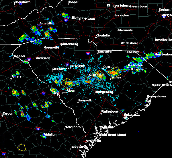 At 413 pm edt, a severe thunderstorm was located 10 miles southwest of bishopville, moving southwest at 5 mph (radar indicated). Hazards include 60 mph wind gusts and penny size hail. Expect damage to roofs. siding. And trees. At 413 pm edt, a severe thunderstorm was located 10 miles southwest of bishopville, moving southwest at 5 mph (radar indicated). Hazards include 60 mph wind gusts and penny size hail. Expect damage to roofs. siding. And trees.
|
| 7/14/2016 1:36 PM EDT |
 At 135 pm edt, a severe thunderstorm was located 8 miles southwest of bishopville, moving east at 20 mph (radar indicated). Hazards include 60 mph wind gusts. Expect damage to roofs. siding. And trees. At 135 pm edt, a severe thunderstorm was located 8 miles southwest of bishopville, moving east at 20 mph (radar indicated). Hazards include 60 mph wind gusts. Expect damage to roofs. siding. And trees.
|
| 7/14/2016 12:43 PM EDT |
 At 1240 pm edt, a severe thunderstorm was located 8 miles north of eastover, or 12 miles east of woodfields, moving east at 15 mph (radar indicated. this storm has already knocked down a tree in richland county along leesburg road). Hazards include 60 mph wind gusts. Expect damage to roofs. siding. and trees. Locations impacted include, columbia, sumter, oakland, stateburg, cherryvale, dalzell and rembert. At 1240 pm edt, a severe thunderstorm was located 8 miles north of eastover, or 12 miles east of woodfields, moving east at 15 mph (radar indicated. this storm has already knocked down a tree in richland county along leesburg road). Hazards include 60 mph wind gusts. Expect damage to roofs. siding. and trees. Locations impacted include, columbia, sumter, oakland, stateburg, cherryvale, dalzell and rembert.
|
| 7/14/2016 12:17 PM EDT |
 At 1217 pm edt, a severe thunderstorm was located near fort jackson, or 7 miles southeast of woodfields, moving east at 30 mph (radar indicated). Hazards include 60 mph wind gusts. Expect damage to roofs. siding. And trees. At 1217 pm edt, a severe thunderstorm was located near fort jackson, or 7 miles southeast of woodfields, moving east at 30 mph (radar indicated). Hazards include 60 mph wind gusts. Expect damage to roofs. siding. And trees.
|
| 7/10/2016 3:58 PM EDT |
 At 358 pm edt, a severe thunderstorm was located 7 miles north of manning, moving east at 20 mph (radar indicated). Hazards include 60 mph wind gusts. Expect damage to roofs. siding. and trees. Locations impacted include, sumter, manning, south sumter, millwood, turbeville, shiloh, lakewood, east sumter, privateer and cane savannah. At 358 pm edt, a severe thunderstorm was located 7 miles north of manning, moving east at 20 mph (radar indicated). Hazards include 60 mph wind gusts. Expect damage to roofs. siding. and trees. Locations impacted include, sumter, manning, south sumter, millwood, turbeville, shiloh, lakewood, east sumter, privateer and cane savannah.
|
| 7/10/2016 3:50 PM EDT | Sc highway patrol reports multiple trees down in the vicinity of lakewood high school in sumter count in sumter county SC, 4.9 miles NNW of Sumter, SC |
| 7/10/2016 3:42 PM EDT |
 At 342 pm edt, a severe thunderstorm was located near manning, moving east at 30 mph (radar indicated). Hazards include 60 mph wind gusts and penny size hail. Expect damage to roofs. siding. And trees. At 342 pm edt, a severe thunderstorm was located near manning, moving east at 30 mph (radar indicated). Hazards include 60 mph wind gusts and penny size hail. Expect damage to roofs. siding. And trees.
|
| 7/10/2016 3:28 PM EDT |
 The severe thunderstorm warning for northeastern calhoun, southeastern richland and southwestern sumter counties will expire at 330 pm edt, the storm which prompted the warning has weakened below severe limits, and no longer poses an immediate threat to life or property. therefore the warning will be allowed to expire. however gusty winds and frequent lightning are still possible with this thunderstorm. to report severe weather, contact your nearest law enforcement agency. they will relay your report to the national weather service columbia. The severe thunderstorm warning for northeastern calhoun, southeastern richland and southwestern sumter counties will expire at 330 pm edt, the storm which prompted the warning has weakened below severe limits, and no longer poses an immediate threat to life or property. therefore the warning will be allowed to expire. however gusty winds and frequent lightning are still possible with this thunderstorm. to report severe weather, contact your nearest law enforcement agency. they will relay your report to the national weather service columbia.
|
| 7/10/2016 3:27 PM EDT | Sc highway patrol reports trees down at the intersection of n lake cherryvale dr and luton st near shaw afb in sumter... s in sumter county SC, 4.6 miles ESE of Sumter, SC |
| 7/10/2016 2:55 PM EDT |
 At 255 pm edt, a severe thunderstorm was located near eastover, or 19 miles southwest of sumter, moving northeast at 15 mph (radar indicated). Hazards include 60 mph wind gusts and penny size hail. Expect damage to roofs. siding. and trees. Locations impacted include, sumter, south sumter, eastover, millwood, oakland, pinewood, cane savannah, privateer, wedgewood, cherryvale, lakewood and stateburg. At 255 pm edt, a severe thunderstorm was located near eastover, or 19 miles southwest of sumter, moving northeast at 15 mph (radar indicated). Hazards include 60 mph wind gusts and penny size hail. Expect damage to roofs. siding. and trees. Locations impacted include, sumter, south sumter, eastover, millwood, oakland, pinewood, cane savannah, privateer, wedgewood, cherryvale, lakewood and stateburg.
|
| 7/10/2016 2:40 PM EDT |
 At 240 pm edt, a severe thunderstorm was located 7 miles south of eastover, or 18 miles northeast of brookdale, moving east at 20 mph (radar indicated). Hazards include 60 mph wind gusts and penny size hail. Expect damage to roofs. siding. And trees. At 240 pm edt, a severe thunderstorm was located 7 miles south of eastover, or 18 miles northeast of brookdale, moving east at 20 mph (radar indicated). Hazards include 60 mph wind gusts and penny size hail. Expect damage to roofs. siding. And trees.
|
| 7/9/2016 12:15 AM EDT |
 At 1214 am edt, severe thunderstorms were located along a line extending from near lydia to 6 miles south of eastover, moving southeast at 30 mph (radar indicated). Hazards include 60 mph wind gusts. Expect damage to roofs. siding. And trees. At 1214 am edt, severe thunderstorms were located along a line extending from near lydia to 6 miles south of eastover, moving southeast at 30 mph (radar indicated). Hazards include 60 mph wind gusts. Expect damage to roofs. siding. And trees.
|
| 7/8/2016 11:46 PM EDT |
 At 1145 pm edt, severe thunderstorms were located along a line extending from 12 miles west of clyde to 9 miles west of eastover, moving east at 40 mph (radar indicated). Hazards include 60 mph wind gusts. Expect damage to roofs. siding. And trees. At 1145 pm edt, severe thunderstorms were located along a line extending from 12 miles west of clyde to 9 miles west of eastover, moving east at 40 mph (radar indicated). Hazards include 60 mph wind gusts. Expect damage to roofs. siding. And trees.
|
| 7/7/2016 10:42 PM EDT |
 At 1041 pm edt, a severe thunderstorm was located near oakland, or 7 miles west of sumter, moving southeast at 35 mph (radar indicated). Hazards include 70 mph wind gusts. Expect considerable tree damage. Damage is likely to mobile homes, roofs, and outbuildings. At 1041 pm edt, a severe thunderstorm was located near oakland, or 7 miles west of sumter, moving southeast at 35 mph (radar indicated). Hazards include 70 mph wind gusts. Expect considerable tree damage. Damage is likely to mobile homes, roofs, and outbuildings.
|
| 7/7/2016 9:56 PM EDT |
 At 955 pm edt, severe thunderstorms were located along a line extending from near new hope to near south sumter, moving southeast at 15 mph (radar indicated). Hazards include 60 mph wind gusts. Expect damage to roofs. siding. and trees. severe thunderstorms will be near, manning around 1030 pm edt. Other locations impacted by these severe thunderstorms include oswego, cane savannah, mayesville, shiloh, cherryvale, lakewood, turbeville, east sumter, lynchburg and privateer. At 955 pm edt, severe thunderstorms were located along a line extending from near new hope to near south sumter, moving southeast at 15 mph (radar indicated). Hazards include 60 mph wind gusts. Expect damage to roofs. siding. and trees. severe thunderstorms will be near, manning around 1030 pm edt. Other locations impacted by these severe thunderstorms include oswego, cane savannah, mayesville, shiloh, cherryvale, lakewood, turbeville, east sumter, lynchburg and privateer.
|
| 7/7/2016 9:24 PM EDT | Reported trees down near the intersection of queen chapel road and ebenezer roa in sumter county SC, 6.6 miles S of Sumter, SC |
| 7/7/2016 8:56 PM EDT |
 At 855 pm edt, severe thunderstorms were located along a line extending from 7 miles west of winnsboro to lydia, moving southeast at 20 mph (radar indicated). Hazards include 60 mph wind gusts. Expect damage to roofs. siding. And trees. At 855 pm edt, severe thunderstorms were located along a line extending from 7 miles west of winnsboro to lydia, moving southeast at 20 mph (radar indicated). Hazards include 60 mph wind gusts. Expect damage to roofs. siding. And trees.
|
| 7/7/2016 4:22 PM EDT |
 At 422 pm edt, a severe thunderstorm was located near camden, moving east at 50 mph (law enforcement). Hazards include 60 mph wind gusts and penny size hail. Expect damage to roofs. siding. and trees. Locations impacted include, sumter, camden, oakland, lugoff, stateburg, cherryvale, rembert and dalzell. At 422 pm edt, a severe thunderstorm was located near camden, moving east at 50 mph (law enforcement). Hazards include 60 mph wind gusts and penny size hail. Expect damage to roofs. siding. and trees. Locations impacted include, sumter, camden, oakland, lugoff, stateburg, cherryvale, rembert and dalzell.
|
| 7/7/2016 4:04 PM EDT |
 At 402 pm edt, a severe thunderstorm was located 9 miles west of lugoff, or 12 miles northeast of dentsville, moving east at 45 mph (law enforcement has reported considerable wind damage associated with this storm). Hazards include 60 mph wind gusts and penny size hail. Expect damage to roofs. siding. And trees. At 402 pm edt, a severe thunderstorm was located 9 miles west of lugoff, or 12 miles northeast of dentsville, moving east at 45 mph (law enforcement has reported considerable wind damage associated with this storm). Hazards include 60 mph wind gusts and penny size hail. Expect damage to roofs. siding. And trees.
|
| 7/5/2016 6:41 PM EDT |
 At 636 pm edt, a line of thunderstorms extended from central chesterfield county southward through lee county, eastern sumter county, and western clarendon county. movement was eastward near 35 mph. some of the thunderstorms in the line contained wind gusts of 40 to 60 mph (radar indicated). Hazards include 60 mph wind gusts. Expect damage to roofs. siding. and trees. locations impacted include, sumter, cheraw, manning, bishopville, south sumter, chesterfield, summerton, clyde, mulberry, wallace, mcbee, turbeville, mayesville, pinewood, lynchburg, ruby, patrick, paxville, mcfarlan and shiloh. 75in <50mph. At 636 pm edt, a line of thunderstorms extended from central chesterfield county southward through lee county, eastern sumter county, and western clarendon county. movement was eastward near 35 mph. some of the thunderstorms in the line contained wind gusts of 40 to 60 mph (radar indicated). Hazards include 60 mph wind gusts. Expect damage to roofs. siding. and trees. locations impacted include, sumter, cheraw, manning, bishopville, south sumter, chesterfield, summerton, clyde, mulberry, wallace, mcbee, turbeville, mayesville, pinewood, lynchburg, ruby, patrick, paxville, mcfarlan and shiloh. 75in <50mph.
|
| 7/5/2016 5:45 PM EDT |
 At 542 pm edt, a line of thunderstorms extended from lancaster county southward through kershaw, lower richland and calhoun county. movement was east-northeast near 35 mph. some of the thunderstorms within the line likely contained wind gusts of 40 to 60 mph (radar indicated). Hazards include 60 mph wind gusts. Expect damage to roofs. Siding and trees. At 542 pm edt, a line of thunderstorms extended from lancaster county southward through kershaw, lower richland and calhoun county. movement was east-northeast near 35 mph. some of the thunderstorms within the line likely contained wind gusts of 40 to 60 mph (radar indicated). Hazards include 60 mph wind gusts. Expect damage to roofs. Siding and trees.
|
| 6/25/2016 4:10 PM EDT |
 At 409 pm edt, a severe thunderstorm was located near mulberry, or near south sumter, moving south at 20 mph (radar indicated). Hazards include 60 mph wind gusts and penny size hail. Expect damage to roofs. siding. And trees. At 409 pm edt, a severe thunderstorm was located near mulberry, or near south sumter, moving south at 20 mph (radar indicated). Hazards include 60 mph wind gusts and penny size hail. Expect damage to roofs. siding. And trees.
|
| 6/24/2016 5:25 PM EDT |
 At 524 pm edt, severe thunderstorms were located along a line extending from 12 miles south of cartersville to 16 miles south of gaston, moving southeast at 25 mph (radar indicated). Hazards include 60 mph wind gusts and quarter size hail. Hail damage to vehicles is expected. Expect wind damage to roofs, siding, and trees. At 524 pm edt, severe thunderstorms were located along a line extending from 12 miles south of cartersville to 16 miles south of gaston, moving southeast at 25 mph (radar indicated). Hazards include 60 mph wind gusts and quarter size hail. Hail damage to vehicles is expected. Expect wind damage to roofs, siding, and trees.
|
| 6/24/2016 5:22 PM EDT |
 At 521 pm edt, severe thunderstorms were located along a line extending from near hebron to 11 miles southwest of millwood, moving south at 20 mph (radar indicated). Hazards include 60 mph wind gusts and quarter size hail. Hail damage to vehicles is expected. expect wind damage to roofs, siding, and trees. Locations impacted include, sumter, south sumter, turbeville, mayesville, pinewood, lynchburg, paxville, privateer, shiloh, lakewood, cane savannah, east sumter and wedgewood. At 521 pm edt, severe thunderstorms were located along a line extending from near hebron to 11 miles southwest of millwood, moving south at 20 mph (radar indicated). Hazards include 60 mph wind gusts and quarter size hail. Hail damage to vehicles is expected. expect wind damage to roofs, siding, and trees. Locations impacted include, sumter, south sumter, turbeville, mayesville, pinewood, lynchburg, paxville, privateer, shiloh, lakewood, cane savannah, east sumter and wedgewood.
|
| 6/24/2016 5:14 PM EDT | Schp reports trees down at kolb rd and starks ferry rd. time estimated based on rada in sumter county SC, 6.8 miles NNE of Sumter, SC |
| 6/24/2016 5:08 PM EDT |
 At 507 pm edt, severe thunderstorms were located along a line extending from near sardis to 9 miles east of eastover, moving south at 20 mph (radar indicated). Hazards include 60 mph wind gusts and quarter size hail. Hail damage to vehicles is expected. Expect wind damage to roofs, siding, and trees. At 507 pm edt, severe thunderstorms were located along a line extending from near sardis to 9 miles east of eastover, moving south at 20 mph (radar indicated). Hazards include 60 mph wind gusts and quarter size hail. Hail damage to vehicles is expected. Expect wind damage to roofs, siding, and trees.
|
| 6/24/2016 4:50 PM EDT |
 At 449 pm edt, severe thunderstorms were located along a line extending from near sardis to 7 miles southwest of oakland, moving southeast at 15 mph (radar indicated). Hazards include 60 mph wind gusts and quarter size hail. Hail damage to vehicles is expected. Expect wind damage to roofs, siding, and trees. At 449 pm edt, severe thunderstorms were located along a line extending from near sardis to 7 miles southwest of oakland, moving southeast at 15 mph (radar indicated). Hazards include 60 mph wind gusts and quarter size hail. Hail damage to vehicles is expected. Expect wind damage to roofs, siding, and trees.
|
| 6/17/2016 3:05 PM EDT |
 At 305 pm edt, a severe thunderstorm was located near manning, moving southeast at 40 mph (radar indicated). Hazards include 70 mph wind gusts. Expect considerable tree damage. damage is likely to mobile homes, roofs, and outbuildings. Locations impacted include, manning, summerton, turbeville, mayesville, lynchburg, paxville, shiloh and east sumter. At 305 pm edt, a severe thunderstorm was located near manning, moving southeast at 40 mph (radar indicated). Hazards include 70 mph wind gusts. Expect considerable tree damage. damage is likely to mobile homes, roofs, and outbuildings. Locations impacted include, manning, summerton, turbeville, mayesville, lynchburg, paxville, shiloh and east sumter.
|
| 6/17/2016 2:46 PM EDT | Trees down on hwy 15 in sumter county SC, 6.6 miles N of Sumter, SC |
| 6/17/2016 2:45 PM EDT |
 At 245 pm edt, a severe thunderstorm was located 7 miles south of south sumter, moving southeast at 50 mph (radar indicated). Hazards include 70 mph wind gusts. Expect considerable tree damage. Damage is likely to mobile homes, roofs, and outbuildings. At 245 pm edt, a severe thunderstorm was located 7 miles south of south sumter, moving southeast at 50 mph (radar indicated). Hazards include 70 mph wind gusts. Expect considerable tree damage. Damage is likely to mobile homes, roofs, and outbuildings.
|
| 6/17/2016 2:38 PM EDT | Numerous trees down wedgefield rd and cane savannah r in sumter county SC, 4.3 miles ENE of Sumter, SC |
| 6/17/2016 2:15 PM EDT |
 At 215 pm edt, a severe thunderstorm was located 8 miles east of mulberry, or 9 miles northeast of south sumter, moving southeast at 30 mph (radar indicated). Hazards include 70 mph wind gusts and ping pong ball size hail. People and animals outdoors will be injured. expect hail damage to roofs, siding, windows, and vehicles. expect considerable tree damage. Wind damage is also likely to mobile homes, roofs, and outbuildings. At 215 pm edt, a severe thunderstorm was located 8 miles east of mulberry, or 9 miles northeast of south sumter, moving southeast at 30 mph (radar indicated). Hazards include 70 mph wind gusts and ping pong ball size hail. People and animals outdoors will be injured. expect hail damage to roofs, siding, windows, and vehicles. expect considerable tree damage. Wind damage is also likely to mobile homes, roofs, and outbuildings.
|
| 6/17/2016 2:07 PM EDT |
 At 207 pm edt, a severe thunderstorm was located 7 miles northwest of eastover, or 11 miles southeast of woodfields, moving southeast at 40 mph (radar indicated). Hazards include 70 mph wind gusts and nickel size hail. Expect considerable tree damage. Damage is likely to mobile homes, roofs, and outbuildings. At 207 pm edt, a severe thunderstorm was located 7 miles northwest of eastover, or 11 miles southeast of woodfields, moving southeast at 40 mph (radar indicated). Hazards include 70 mph wind gusts and nickel size hail. Expect considerable tree damage. Damage is likely to mobile homes, roofs, and outbuildings.
|
| 6/17/2016 1:52 PM EDT |
 At 151 pm edt, a severe thunderstorm was located 9 miles north of mulberry, or 9 miles north of sumter, moving southeast at 30 mph (radar indicated). Hazards include 70 mph wind gusts and ping pong ball size hail. People and animals outdoors will be injured. expect hail damage to roofs, siding, windows, and vehicles. expect considerable tree damage. wind damage is also likely to mobile homes, roofs, and outbuildings. Locations impacted include, sumter, bishopville, mulberry, mayesville, lynchburg, oswego, east sumter and dalzell. At 151 pm edt, a severe thunderstorm was located 9 miles north of mulberry, or 9 miles north of sumter, moving southeast at 30 mph (radar indicated). Hazards include 70 mph wind gusts and ping pong ball size hail. People and animals outdoors will be injured. expect hail damage to roofs, siding, windows, and vehicles. expect considerable tree damage. wind damage is also likely to mobile homes, roofs, and outbuildings. Locations impacted include, sumter, bishopville, mulberry, mayesville, lynchburg, oswego, east sumter and dalzell.
|
| 6/17/2016 1:39 PM EDT |
 At 139 pm edt, a severe thunderstorm was located 8 miles southwest of bishopville, moving southeast at 25 mph (radar indicated). Hazards include 70 mph wind gusts and quarter size hail. Hail damage to vehicles is expected. expect considerable tree damage. wind damage is also likely to mobile homes, roofs, and outbuildings. Locations impacted include, sumter, bishopville, south sumter, mulberry, mayesville, lynchburg, oswego, east sumter and dalzell. At 139 pm edt, a severe thunderstorm was located 8 miles southwest of bishopville, moving southeast at 25 mph (radar indicated). Hazards include 70 mph wind gusts and quarter size hail. Hail damage to vehicles is expected. expect considerable tree damage. wind damage is also likely to mobile homes, roofs, and outbuildings. Locations impacted include, sumter, bishopville, south sumter, mulberry, mayesville, lynchburg, oswego, east sumter and dalzell.
|
| 6/17/2016 1:25 PM EDT |
 At 124 pm edt, a severe thunderstorm was located 8 miles east of camden, moving southeast at 25 mph (radar indicated). Hazards include 60 mph wind gusts and half dollar size hail. Hail damage to vehicles is expected. Expect wind damage to roofs, siding, and trees. At 124 pm edt, a severe thunderstorm was located 8 miles east of camden, moving southeast at 25 mph (radar indicated). Hazards include 60 mph wind gusts and half dollar size hail. Hail damage to vehicles is expected. Expect wind damage to roofs, siding, and trees.
|
| 6/15/2016 2:51 PM EDT |
 At 250 pm edt, a severe thunderstorm was located near south sumter, moving east at 30 mph (radar indicated). Hazards include 60 mph wind gusts. Expect damage to roofs. siding. and trees. Locations impacted include, sumter, manning, south sumter, millwood, pinewood, paxville, cane savannah, wedgewood, privateer, cherryvale, lakewood and east sumter. At 250 pm edt, a severe thunderstorm was located near south sumter, moving east at 30 mph (radar indicated). Hazards include 60 mph wind gusts. Expect damage to roofs. siding. and trees. Locations impacted include, sumter, manning, south sumter, millwood, pinewood, paxville, cane savannah, wedgewood, privateer, cherryvale, lakewood and east sumter.
|
| 6/15/2016 2:42 PM EDT |
 At 242 pm edt, a severe thunderstorm was located near south sumter, moving east at 30 mph (radar indicated). Hazards include 60 mph wind gusts. Expect damage to roofs. siding. and trees. Locations impacted include, sumter, manning, south sumter, millwood, oakland, mulberry, mayesville, pinewood, paxville, oswego, cane savannah, wedgewood, lakewood, east sumter, privateer, stateburg, cherryvale and dalzell. At 242 pm edt, a severe thunderstorm was located near south sumter, moving east at 30 mph (radar indicated). Hazards include 60 mph wind gusts. Expect damage to roofs. siding. and trees. Locations impacted include, sumter, manning, south sumter, millwood, oakland, mulberry, mayesville, pinewood, paxville, oswego, cane savannah, wedgewood, lakewood, east sumter, privateer, stateburg, cherryvale and dalzell.
|
| 6/15/2016 2:23 PM EDT |
 At 223 pm edt, a severe thunderstorm was located near eastover, or 11 miles southwest of sumter, moving east at 20 mph (radar indicated). Hazards include 60 mph wind gusts. Expect damage to roofs. siding. And trees. At 223 pm edt, a severe thunderstorm was located near eastover, or 11 miles southwest of sumter, moving east at 20 mph (radar indicated). Hazards include 60 mph wind gusts. Expect damage to roofs. siding. And trees.
|
| 6/5/2016 8:38 PM EDT | Tree down at us 521 and mason roa in sumter county SC, 3.9 miles SSE of Sumter, SC |
| 6/5/2016 8:34 PM EDT | Tree down at east brewington road and mikom roa in sumter county SC, 9.4 miles W of Sumter, SC |
| 6/5/2016 6:32 PM EDT | Several trees dow in sumter county SC, 4.8 miles SW of Sumter, SC |
| 6/2/2016 9:16 PM EDT | Tree down boots branch rd x hwy 37 in sumter county SC, 9.5 miles W of Sumter, SC |
| 6/2/2016 9:16 PM EDT | Tree down e brewington rd x eastern school r in sumter county SC, 9.9 miles W of Sumter, SC |
| 6/2/2016 8:52 PM EDT |
 At 851 pm edt, severe thunderstorms were located along a line extending from near cartersville to near mulberry, moving east at 20 mph (radar indicated). Hazards include 60 mph wind gusts and nickel size hail. Expect damage to roofs. siding. And trees. At 851 pm edt, severe thunderstorms were located along a line extending from near cartersville to near mulberry, moving east at 20 mph (radar indicated). Hazards include 60 mph wind gusts and nickel size hail. Expect damage to roofs. siding. And trees.
|
| 5/12/2016 2:45 PM EDT |
 At 242 pm edt, a severe thunderstorm was located near sumter, moving east at 10 mph (law enforcement reported multiple trees down from this storm. official observations have indicated penny sized hail at shaw air force base). Hazards include 60 mph wind gusts and nickel size hail. Expect damage to roofs. siding. and trees. Locations impacted include, sumter, south sumter, millwood, oakland, mulberry, mayesville, oswego, cane savannah, wedgewood, rembert, east sumter, stateburg, cherryvale, dalzell and lakewood. At 242 pm edt, a severe thunderstorm was located near sumter, moving east at 10 mph (law enforcement reported multiple trees down from this storm. official observations have indicated penny sized hail at shaw air force base). Hazards include 60 mph wind gusts and nickel size hail. Expect damage to roofs. siding. and trees. Locations impacted include, sumter, south sumter, millwood, oakland, mulberry, mayesville, oswego, cane savannah, wedgewood, rembert, east sumter, stateburg, cherryvale, dalzell and lakewood.
|
| 5/12/2016 2:16 PM EDT |
 At 215 pm edt, a severe thunderstorm was located near shaw air force base, or 8 miles northwest of sumter, moving east at 15 mph (radar indicated). Hazards include 60 mph wind gusts and quarter size hail. Hail damage to vehicles is expected. Expect wind damage to roofs, siding, and trees. At 215 pm edt, a severe thunderstorm was located near shaw air force base, or 8 miles northwest of sumter, moving east at 15 mph (radar indicated). Hazards include 60 mph wind gusts and quarter size hail. Hail damage to vehicles is expected. Expect wind damage to roofs, siding, and trees.
|
| 5/12/2016 1:54 PM EDT |
 At 152 pm edt, a severe thunderstorm was located 9 miles southeast of camden, moving east at 10 mph. the thunderstorm is moving along i20 just west of highway 521 near camden (radar indicated). Hazards include 60 mph wind gusts and nickel size hail. Expect damage to roofs. siding. and trees. Locations impacted include, sumter, camden, bishopville, oakland, oswego, rembert, dalzell and stateburg. At 152 pm edt, a severe thunderstorm was located 9 miles southeast of camden, moving east at 10 mph. the thunderstorm is moving along i20 just west of highway 521 near camden (radar indicated). Hazards include 60 mph wind gusts and nickel size hail. Expect damage to roofs. siding. and trees. Locations impacted include, sumter, camden, bishopville, oakland, oswego, rembert, dalzell and stateburg.
|
| 5/12/2016 1:40 PM EDT |
 At 139 pm edt, a severe thunderstorm was located 8 miles southeast of camden, moving east at 10 mph (radar indicated). Hazards include 60 mph wind gusts and quarter size hail. Hail damage to vehicles is expected. Expect wind damage to roofs, siding, and trees. At 139 pm edt, a severe thunderstorm was located 8 miles southeast of camden, moving east at 10 mph (radar indicated). Hazards include 60 mph wind gusts and quarter size hail. Hail damage to vehicles is expected. Expect wind damage to roofs, siding, and trees.
|
| 2/3/2016 3:40 PM EST |
 A tornado warning remains in effect until 400 pm est for southeastern lee and northeastern sumter counties. at 337 pm est. doppler radar indicated thunderstorms with likely wind gusts of 40 to 60 mph moving into central lee county. this storm has had a history of producing tornadoes. Movement was eastward near 50 mph. A tornado warning remains in effect until 400 pm est for southeastern lee and northeastern sumter counties. at 337 pm est. doppler radar indicated thunderstorms with likely wind gusts of 40 to 60 mph moving into central lee county. this storm has had a history of producing tornadoes. Movement was eastward near 50 mph.
|
| 2/3/2016 3:26 PM EST |
 At 322 pm est, doppler radar indicated a severe thunderstorm capable of producing a tornado. the storm extended from west of manville to rembert to stateburg. movement was east at 50 mph. circulation has diminished but there was still a threat of a tornado. At 322 pm est, doppler radar indicated a severe thunderstorm capable of producing a tornado. the storm extended from west of manville to rembert to stateburg. movement was east at 50 mph. circulation has diminished but there was still a threat of a tornado.
|
| 2/3/2016 3:00 PM EST |
 At 259 pm est, doppler radar indicated a severe thunderstorm capable of producing destructive winds in excess of 70 mph. this storm was located near fort jackson, or 8 miles east of woodfields, moving east-northeast at 40 mph. locations impacted include, columbia, sumter, west columbia, cayce, forest acres, camden, woodfields, dentsville, pine ridge, gaston, arcadia lakes, eastover, woodfield, five points, oakland, fort jackson, lugoff, swansea, rembert and stateburg. At 259 pm est, doppler radar indicated a severe thunderstorm capable of producing destructive winds in excess of 70 mph. this storm was located near fort jackson, or 8 miles east of woodfields, moving east-northeast at 40 mph. locations impacted include, columbia, sumter, west columbia, cayce, forest acres, camden, woodfields, dentsville, pine ridge, gaston, arcadia lakes, eastover, woodfield, five points, oakland, fort jackson, lugoff, swansea, rembert and stateburg.
|
| 2/3/2016 2:55 PM EST |
 The national weather service in columbia has issued a * tornado warning for. southern kershaw county in central south carolina. northeastern richland county in central south carolina. south central chesterfield county in central south carolina. Lee county in central south carolina. The national weather service in columbia has issued a * tornado warning for. southern kershaw county in central south carolina. northeastern richland county in central south carolina. south central chesterfield county in central south carolina. Lee county in central south carolina.
|
| 2/3/2016 2:27 PM EST |
 At 226 pm est, doppler radar indicated a severe thunderstorm capable of producing damaging winds in excess of 60 mph. this storm was located over south congaree, or near springdale, and moving east-northeast at 40 mph. At 226 pm est, doppler radar indicated a severe thunderstorm capable of producing damaging winds in excess of 60 mph. this storm was located over south congaree, or near springdale, and moving east-northeast at 40 mph.
|
| 9/21/2015 9:22 PM EDT |
 At 921 pm edt, doppler radar indicated a severe thunderstorm capable of producing damaging winds in excess of 60 mph. this storm was located near eastover, or 11 miles west of sumter. this storm was nearly stationary. penny size hail may also accompany the damaging winds. At 921 pm edt, doppler radar indicated a severe thunderstorm capable of producing damaging winds in excess of 60 mph. this storm was located near eastover, or 11 miles west of sumter. this storm was nearly stationary. penny size hail may also accompany the damaging winds.
|
| 9/4/2015 11:56 PM EDT |
 At 1155 pm edt, doppler radar indicated an area severe thunderstorms capable of producing damaging winds in excess of 60 mph. the strongest storms were located over sumter and western lee county, moving west at 10 mph. At 1155 pm edt, doppler radar indicated an area severe thunderstorms capable of producing damaging winds in excess of 60 mph. the strongest storms were located over sumter and western lee county, moving west at 10 mph.
|
| 9/4/2015 11:49 PM EDT |
 At 1148 pm edt, doppler radar indicated a severe thunderstorm capable of producing damaging winds in excess of 60 mph. this storm was located near mulberry, or 7 miles northeast of sumter, moving west at 10 mph. locations impacted include, sumter, south sumter, millwood, mulberry, mayesville, oswego, cane savannah, lakewood, east sumter, dalzell, cherryvale and privateer. At 1148 pm edt, doppler radar indicated a severe thunderstorm capable of producing damaging winds in excess of 60 mph. this storm was located near mulberry, or 7 miles northeast of sumter, moving west at 10 mph. locations impacted include, sumter, south sumter, millwood, mulberry, mayesville, oswego, cane savannah, lakewood, east sumter, dalzell, cherryvale and privateer.
|
| 9/4/2015 11:10 PM EDT |
 At 1109 pm edt, doppler radar indicated a severe thunderstorm capable of producing quarter size hail and damaging winds in excess of 60 mph. this storm was located 9 miles southwest of cartersville, or 13 miles northeast of south sumter, and moving west at 10 mph. At 1109 pm edt, doppler radar indicated a severe thunderstorm capable of producing quarter size hail and damaging winds in excess of 60 mph. this storm was located 9 miles southwest of cartersville, or 13 miles northeast of south sumter, and moving west at 10 mph.
|
| 8/6/2015 5:46 PM EDT |
 At 546 pm edt, doppler radar indicated a severe thunderstorm capable of producing damaging winds in excess of 60 mph. this storm was located near pine ridge, or near cayce, and moving east at 40 mph. At 546 pm edt, doppler radar indicated a severe thunderstorm capable of producing damaging winds in excess of 60 mph. this storm was located near pine ridge, or near cayce, and moving east at 40 mph.
|
| 8/5/2015 4:53 PM EDT |
 At 453 pm edt, doppler radar indicated a severe thunderstorm capable of producing destructive winds in excess of 70 mph. this storm was located 8 miles south of bishopville, and moving northeast at 20 mph. penny size hail may also accompany the damaging winds. At 453 pm edt, doppler radar indicated a severe thunderstorm capable of producing destructive winds in excess of 70 mph. this storm was located 8 miles south of bishopville, and moving northeast at 20 mph. penny size hail may also accompany the damaging winds.
|
| 7/18/2015 6:22 PM EDT |
 At 622 pm edt, doppler radar indicated a line of severe thunderstorms capable of producing damaging winds in excess of 60 mph. these storms were located along a line extending from near pageland to near columbia, and moving southeast at 55 mph. penny size hail may also accompany the damaging winds. At 622 pm edt, doppler radar indicated a line of severe thunderstorms capable of producing damaging winds in excess of 60 mph. these storms were located along a line extending from near pageland to near columbia, and moving southeast at 55 mph. penny size hail may also accompany the damaging winds.
|
| 7/2/2015 5:50 PM EDT |
 At 549 pm edt, doppler radar indicated a line of severe thunderstorms capable of producing damaging winds in excess of 60 mph. these storms were located along a line extending from near lydia to south sumter to 7 miles northwest of elloree to near bamberg, moving southeast at 45 mph. locations impacted include, sumter, orangeburg, manning, brookdale, south sumter, st. matthews, holly hill, branchville, summerton, bowman, elloree, millwood, mulberry, santee, turbeville, mayesville, pinewood, cameron, lynchburg and eutawville. At 549 pm edt, doppler radar indicated a line of severe thunderstorms capable of producing damaging winds in excess of 60 mph. these storms were located along a line extending from near lydia to south sumter to 7 miles northwest of elloree to near bamberg, moving southeast at 45 mph. locations impacted include, sumter, orangeburg, manning, brookdale, south sumter, st. matthews, holly hill, branchville, summerton, bowman, elloree, millwood, mulberry, santee, turbeville, mayesville, pinewood, cameron, lynchburg and eutawville.
|
| 7/2/2015 5:27 PM EDT |
 At 527 pm edt, doppler radar indicated a line of severe thunderstorms capable of producing damaging winds in excess of 60 mph. these storms were located along a line extending from 6 miles southwest of clyde to 10 miles southeast of camden to 7 miles east of eastover to st. matthews to 10 miles northeast of denmark, and moving east at 35 mph. At 527 pm edt, doppler radar indicated a line of severe thunderstorms capable of producing damaging winds in excess of 60 mph. these storms were located along a line extending from 6 miles southwest of clyde to 10 miles southeast of camden to 7 miles east of eastover to st. matthews to 10 miles northeast of denmark, and moving east at 35 mph.
|
| 6/30/2015 5:40 PM EDT | Sc highway patrol reported trees down throughout sumter. time estimated from rada in sumter county SC, 3.3 miles NNE of Sumter, SC |
| 6/30/2015 5:17 PM EDT |
 At 516 pm edt, doppler radar indicated a line of severe thunderstorms capable of producing damaging winds in excess of 60 mph. these storms were located along a line extending from 6 miles northeast of fort jackson to near bamberg, and moving east at 30 mph. nickel size hail may also accompany the damaging winds. At 516 pm edt, doppler radar indicated a line of severe thunderstorms capable of producing damaging winds in excess of 60 mph. these storms were located along a line extending from 6 miles northeast of fort jackson to near bamberg, and moving east at 30 mph. nickel size hail may also accompany the damaging winds.
|
| 6/27/2015 7:45 PM EDT |
 At 738 pm edt, doppler radar indicated a line of severe thunderstorms capable of producing damaging winds in excess of 60 mph. these storms were located along a line extending from near lamar to 11 miles south of cartersville to near elloree, moving east at 35 mph. locations impacted include, manning, summerton, turbeville, mayesville, pinewood, lynchburg, paxville, oswego, and privateer. At 738 pm edt, doppler radar indicated a line of severe thunderstorms capable of producing damaging winds in excess of 60 mph. these storms were located along a line extending from near lamar to 11 miles south of cartersville to near elloree, moving east at 35 mph. locations impacted include, manning, summerton, turbeville, mayesville, pinewood, lynchburg, paxville, oswego, and privateer.
|
| 6/27/2015 7:23 PM EDT | Reports of multiple trees down on vehicles on plowden mill road. time estimated by rada in sumter county SC, 3.7 miles WNW of Sumter, SC |
| 6/27/2015 7:13 PM EDT | Trees down hwy 521 at mason road. time estimated by rada in sumter county SC, 3.2 miles SSE of Sumter, SC |
| 6/27/2015 6:59 PM EDT |
 At 658 pm edt, doppler radar indicated a line of severe thunderstorms capable of producing damaging winds in excess of 60 mph. these storms were located along a line extending from 9 miles west of bishopville to near sumter to st. matthews, and moving east at 40 mph. At 658 pm edt, doppler radar indicated a line of severe thunderstorms capable of producing damaging winds in excess of 60 mph. these storms were located along a line extending from 9 miles west of bishopville to near sumter to st. matthews, and moving east at 40 mph.
|
| 6/27/2015 6:42 PM EDT |
 At 640 pm edt, doppler radar indicated a line of severe thunderstorms capable of producing damaging winds in excess of 60 mph. these storms were located along a line extending from near lugoff to near eastover to 11 miles northwest of orangeburg, moving east at 35 mph. expect strong winds near camden, rembert, eastover, shaw air base, sumter, and st matthews. locations impacted include, columbia, sumter, camden, st. matthews, eastover, oakland, lugoff, stateburg, rembert, dalzell, cherryvale and wedgewood. At 640 pm edt, doppler radar indicated a line of severe thunderstorms capable of producing damaging winds in excess of 60 mph. these storms were located along a line extending from near lugoff to near eastover to 11 miles northwest of orangeburg, moving east at 35 mph. expect strong winds near camden, rembert, eastover, shaw air base, sumter, and st matthews. locations impacted include, columbia, sumter, camden, st. matthews, eastover, oakland, lugoff, stateburg, rembert, dalzell, cherryvale and wedgewood.
|
| 6/27/2015 6:14 PM EDT |
 At 613 pm edt, doppler radar indicated a line of severe thunderstorms capable of producing damaging winds in excess of 60 mph. these storms were located along a line extending from near dentsville to columbia to near wagener, and moving east at 40 mph. At 613 pm edt, doppler radar indicated a line of severe thunderstorms capable of producing damaging winds in excess of 60 mph. these storms were located along a line extending from near dentsville to columbia to near wagener, and moving east at 40 mph.
|
| 6/24/2015 9:10 PM EDT |
 At 909 pm edt, doppler radar indicated a severe thunderstorm capable of producing quarter size hail and damaging winds in excess of 60 mph. this storm was located near oakland, or 10 miles west of sumter, and moving east at 10 mph. At 909 pm edt, doppler radar indicated a severe thunderstorm capable of producing quarter size hail and damaging winds in excess of 60 mph. this storm was located near oakland, or 10 miles west of sumter, and moving east at 10 mph.
|
| 6/24/2015 7:48 PM EDT |
 At 747 pm edt, local law enforcement reported wind damage from a severe thunderstorm. this storm is capable of producing quarter size hail and damaging winds in excess of 60 mph. this storm was located over mulberry, or near south sumter. this storm was nearly stationary. locations impacted include, sumter, south sumter, millwood, mulberry, oswego, cane savannah, cherryvale, east sumter, dalzell and wedgewood. At 747 pm edt, local law enforcement reported wind damage from a severe thunderstorm. this storm is capable of producing quarter size hail and damaging winds in excess of 60 mph. this storm was located over mulberry, or near south sumter. this storm was nearly stationary. locations impacted include, sumter, south sumter, millwood, mulberry, oswego, cane savannah, cherryvale, east sumter, dalzell and wedgewood.
|
| 6/24/2015 7:45 PM EDT | Sc highway patrol reported trees down at oswego highway and pike road/highway 76 in sumter county SC, 3.7 miles WSW of Sumter, SC |
| 6/24/2015 7:35 PM EDT | Sc highway patrol reported trees down on queen chapel road and ferrell road/brewington road. wind gust to 48 mph at the sumter municipal airpor in sumter county SC, 5.5 miles SSW of Sumter, SC |
| 6/24/2015 7:28 PM EDT |
 At 728 pm edt, doppler radar indicated multiple severe thunderstorms capable of producing quarter size hail and damaging winds in excess of 60 mph. the strongest storm wis located over mulberry, or near sumter. this storm was nearly stationary. At 728 pm edt, doppler radar indicated multiple severe thunderstorms capable of producing quarter size hail and damaging winds in excess of 60 mph. the strongest storm wis located over mulberry, or near sumter. this storm was nearly stationary.
|
| 6/22/2015 5:59 PM EDT |
 At 558 pm edt, doppler radar indicated a severe thunderstorm capable of producing quarter size hail and damaging winds in excess of 60 mph. this storm was located 8 miles southwest of bishopville, and moving south at 5 mph. At 558 pm edt, doppler radar indicated a severe thunderstorm capable of producing quarter size hail and damaging winds in excess of 60 mph. this storm was located 8 miles southwest of bishopville, and moving south at 5 mph.
|
| 6/18/2015 4:11 PM EDT | At 411 pm edt, doppler radar indicated a severe thunderstorm capable of producing quarter size hail and damaging winds in excess of 60 mph. this storm was located 7 miles north of manning, and moving east at 10 mph. |
| 6/18/2015 3:30 PM EDT | At 330 pm edt, doppler radar indicated a severe thunderstorm capable of producing quarter size hail and damaging winds in excess of 60 mph. this storm was located 9 miles east of gaston, or 12 miles southeast of cayce, and moving northeast at 55 mph. |
| 6/18/2015 3:21 PM EDT | Trees downed in roadway; airport road at jefferson road. time est from rada in sumter county SC, 3.3 miles SSW of Sumter, SC |
| 6/18/2015 2:57 PM EDT | At 256 pm edt, doppler radar indicated a line of severe thunderstorms capable of producing quarter size hail and damaging winds in excess of 60 mph. these storms were located along a line extending from mulberry to 9 miles east of aiken, and moving east northeast at 20 mph. |
| 4/19/2015 6:10 PM EDT | Sumter county dispatch reported trees down at the intersection of dogwood drive and bagnal driv in sumter county SC, 3 miles W of Sumter, SC |
| 4/19/2015 6:03 PM EDT | At 558 pm edt, national weather service doppler radar continued to indicate a line of severe thunderstorms capable of producing damaging winds in excess of 60 mph. these storms were located along a line extending from oakland to 10 miles southeast of eutawville, or along a line extending from 11 miles northwest of sumter to 15 miles west of moncks corner, moving northeast at 40 mph. other locations in the warning include but are not limited to millwood, south sumter, mulberry, manning, mayesville, bishopville, turbeville and lynchburg. |
| 4/19/2015 5:24 PM EDT | At 522 pm edt, national weather service doppler radar indicated a line of severe thunderstorms capable of producing damaging winds in excess of 60 mph. these storms were located along a line extending from 13 miles west of eastover to 15 miles south of bowman, or along a line extending from 9 miles south of forest acres to 6 miles southwest of saint george, and moving northeast at 40 mph. * some communities in the warning area include sumter, summerton, st. matthews, south sumter, orangeburg, mulberry, millwood, manning, holly hill, elloree, eastover, brookdale, bowman, bishopville and oakland. |
| 4/8/2015 12:00 AM EDT | The national weather service in columbia has issued a * severe thunderstorm warning for. Southeastern lee county in central south carolina eastern sumter county in central south carolina northern clarendon county in central south carolina * until 1245 am edt. |
| 4/7/2015 11:46 PM EDT | Sumter county dispatch reported power lines down along calhoun street near stewart stree in sumter county SC, 1.3 miles WNW of Sumter, SC |
| 4/7/2015 11:12 PM EDT | The national weather service in columbia has issued a * severe thunderstorm warning for. Southern kershaw county in central south carolina lee county in central south carolina eastern richland county in central south carolina sumter county in central south carolina. |
| 4/7/2015 10:37 PM EDT | The national weather service in columbia has issued a * severe thunderstorm warning for. Southern kershaw county in central south carolina southern lee county in central south carolina southeastern richland county in central south carolina northern calhoun county in central south carolina. |
| 5/23/2014 8:40 PM EDT | Half Dollar sized hail reported 3.5 miles NNE of Sumter, SC, spotter reported quarter to half dollar size hail along with estimated wind gusts to 60 mph in the twin lakes neighborhood of sumter. the hail covered the ground. hail |
| 7/17/2013 4:50 PM EDT | Sumter county dispatch reported trees and powerlines down in the city of sumte in sumter county SC, 1.1 miles SSE of Sumter, SC |
| 4/19/2013 5:49 PM EDT | Skywarn spotter reported trees down on both sides of hwy 521 just south of sumter near frierson roa in sumter county SC, 0.6 miles SE of Sumter, SC |
| 4/19/2013 5:24 PM EDT | Shaw air force base asos reported a wind gust of 82 mp in sumter county SC, 6.3 miles SE of Sumter, SC |
| 3/18/2013 10:17 PM EDT | Trees down at pearson road and old stone roa in sumter county SC, 10.2 miles N of Sumter, SC |
| 1/30/2013 10:15 PM EST | Trees down on power lines in sumter county SC, 3.1 miles S of Sumter, SC |
| 8/2/2012 4:50 PM EDT | Ping Pong Ball sized hail reported 6.5 miles W of Sumter, SC, youngs food store on hwy 378 e of sumter reported 1.5 inch hail. |
| 7/1/2012 5:40 PM EDT | Quarter sized hail reported 5.2 miles N of Sumter, SC, quarter size hail 3 miles sw of sumter. |
| 7/1/2012 5:15 PM EDT | Quarter sized hail reported 4 miles SSW of Sumter, SC, quarter size hail and winds estimated to be 45 mph. |
| 5/15/2012 7:01 PM EDT | Highway patrol reported trees down near the intersection of seymour road and sargent roa in sumter county SC, 7.2 miles SE of Sumter, SC |
| 3/24/2012 8:10 PM EDT | Half Dollar sized hail reported 8.3 miles ESE of Sumter, SC, half dollar size hail reported just north of shaw air force base. |
| 1/1/0001 12:00 AM | Half Dollar sized hail reported 1.1 miles SSE of Sumter, SC, public report half dollar size hail |
| 1/1/0001 12:00 AM | Sumter county sheriff office reported severl trees down in the cherryvale are in sumter county SC, 6.5 miles SE of Sumter, SC |
| 1/1/0001 12:00 AM | Quarter sized hail reported 9.8 miles NNW of Sumter, SC, public reported 1.00 inch hail. |
| 1/1/0001 12:00 AM | Hen Egg sized hail reported 4.5 miles SE of Sumter, SC, public report of 2 inch hail near shaw afb |
| 4/9/2011 10:14 PM EDT | Golf Ball sized hail reported 0.3 miles SSW of Sumter, SC, cocorahs observer reports golf ball hail near usc sumter campus. |
| 4/9/2011 10:12 PM EDT | Golf Ball sized hail reported 1.1 miles SSE of Sumter, SC, spotter reported hail ranging from quarter size up to golf ball size and covering the ground in sumter. |
| 1/1/0001 12:00 AM | Golf Ball sized hail reported 5.4 miles SE of Sumter, SC, event occurred at 1011 pm 04/09/2011 |
| 1/1/0001 12:00 AM | Hen Egg sized hail reported 3.2 miles SE of Sumter, SC, public reported hail from golf ball to hen egg size near shaw air force base. |
| 4/9/2011 10:10 PM EDT | Tennis Ball sized hail reported 7.2 miles ESE of Sumter, SC, public reported hail up to tennis ball size near shaw air force base. |
| 4/9/2011 10:10 PM EDT | Tea Cup sized hail reported 1.1 miles SSE of Sumter, SC, public reported 3.0 inch hail near sumter. |
| 1/1/0001 12:00 AM | Quarter sized hail reported 5.6 miles ESE of Sumter, SC, sheriff dispatch reported quarter size hail near broad street and cherryvale drive. |
Hail Maps for Sumter, SC
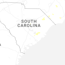
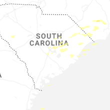
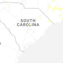
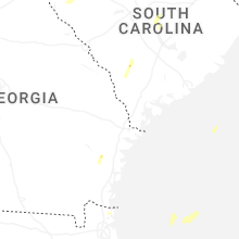


Connect with Interactive Hail Maps