

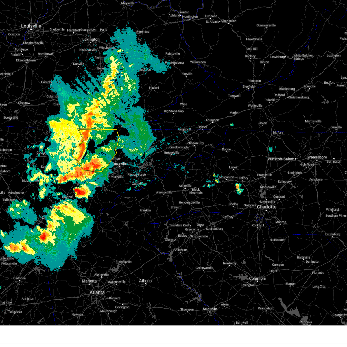
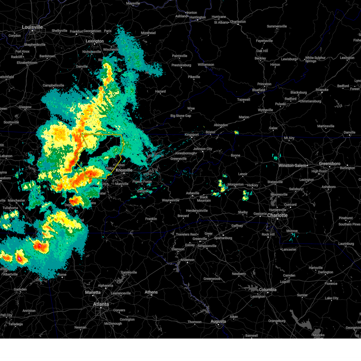
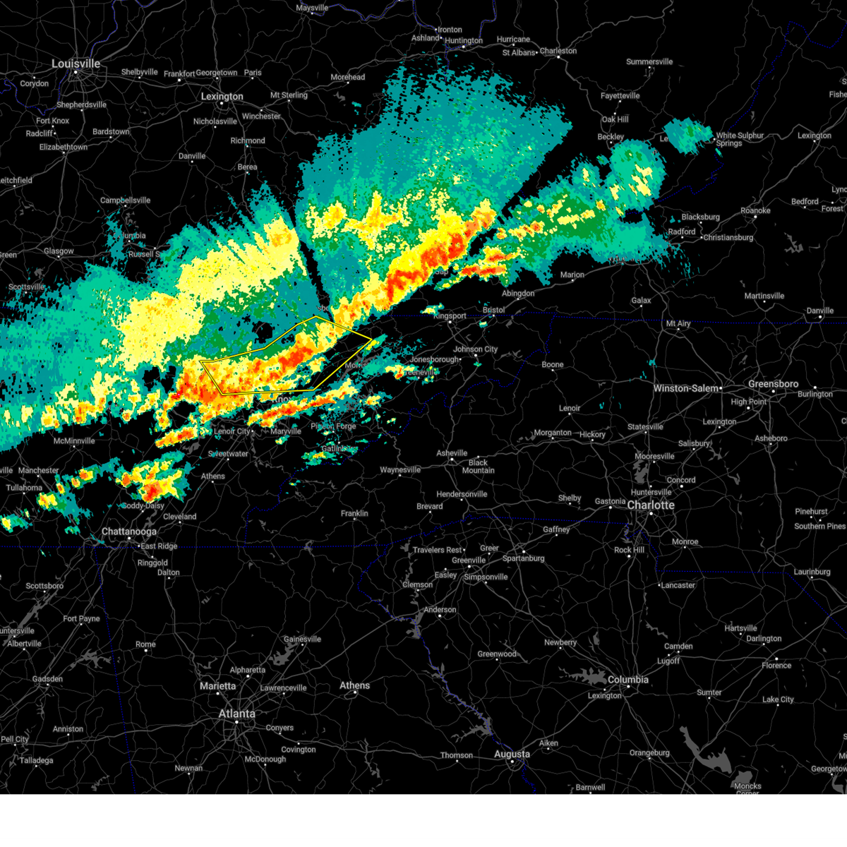
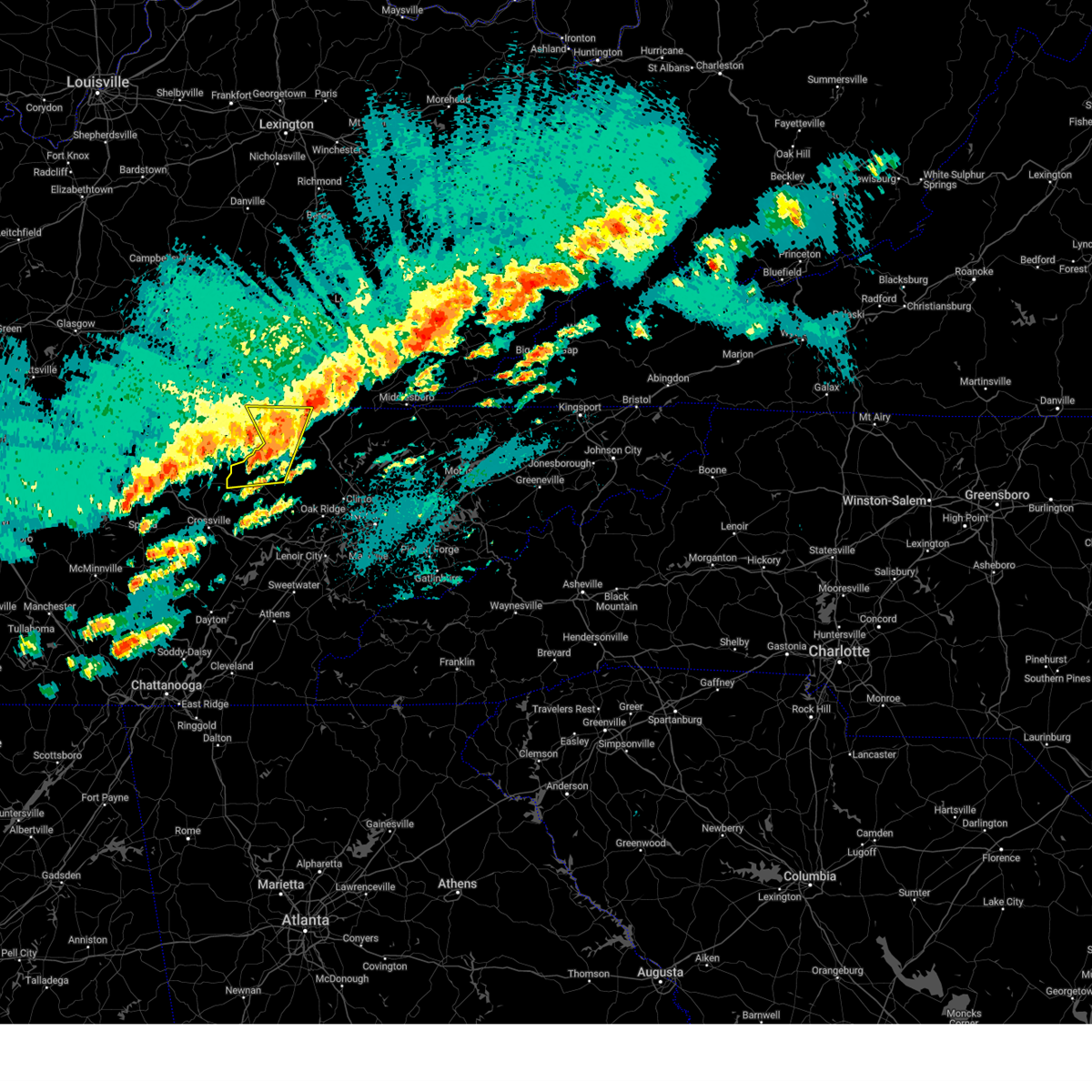
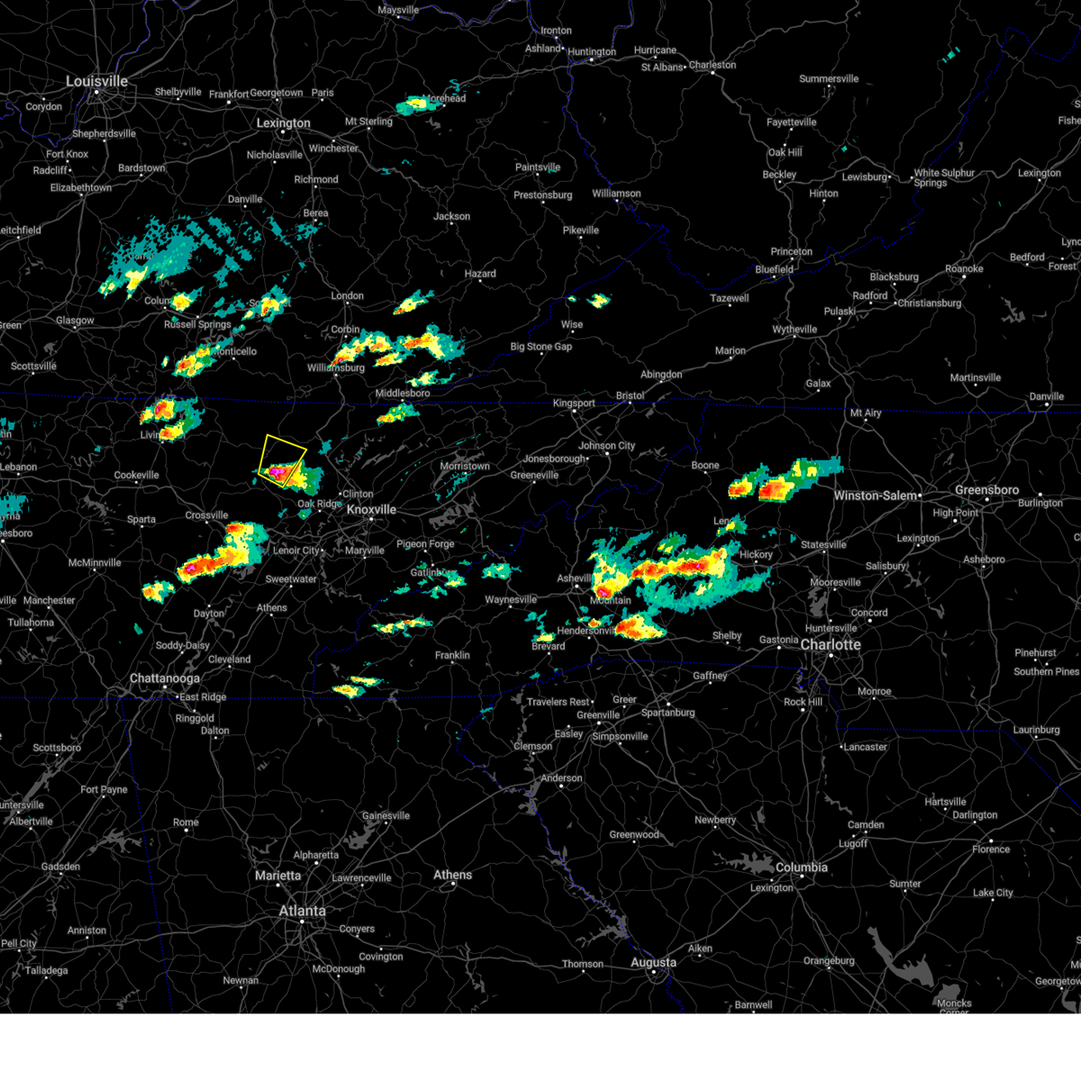
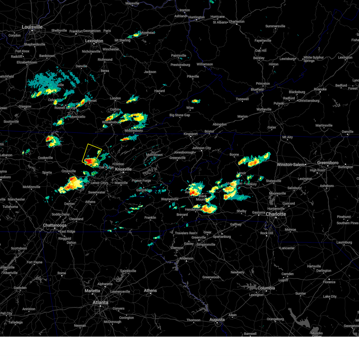
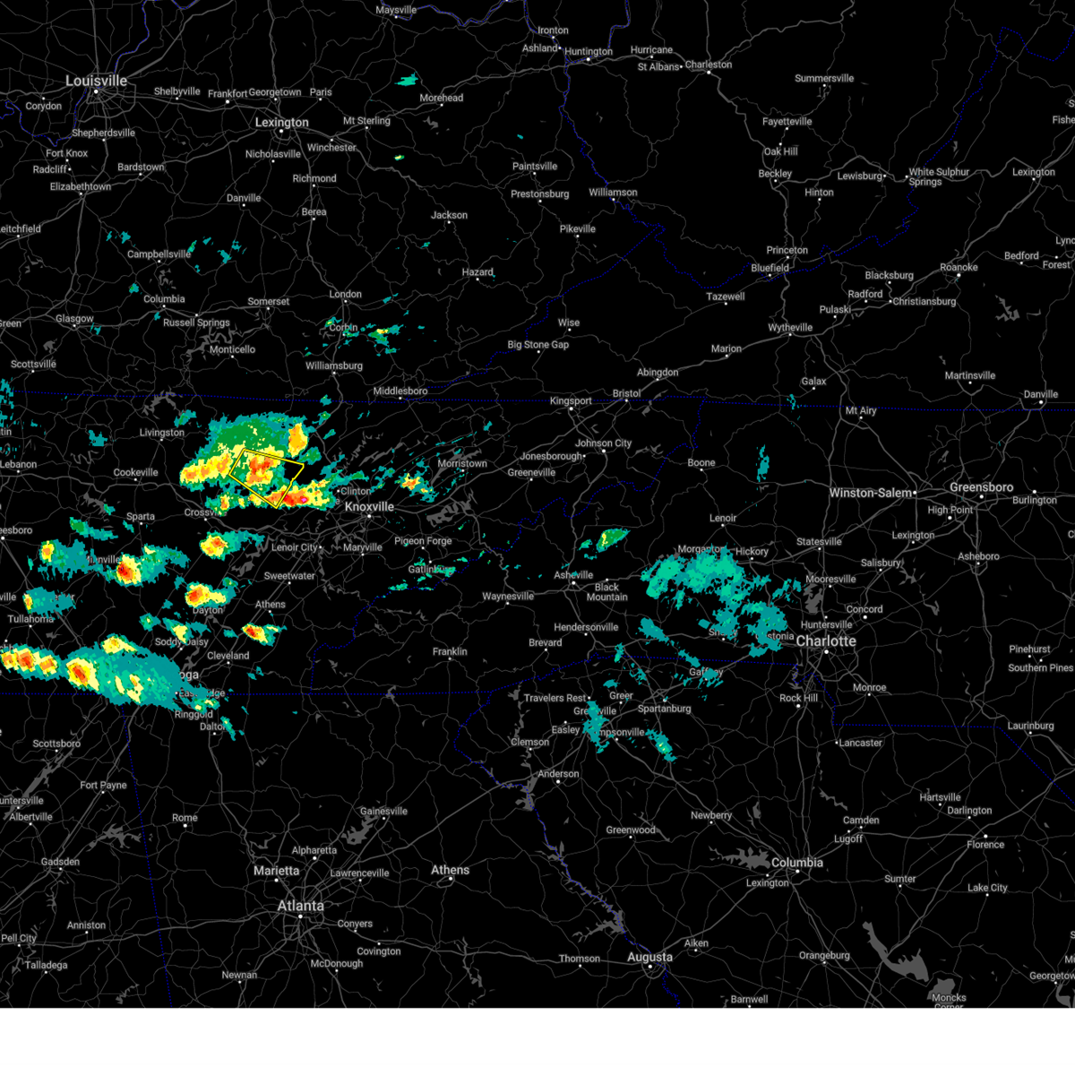
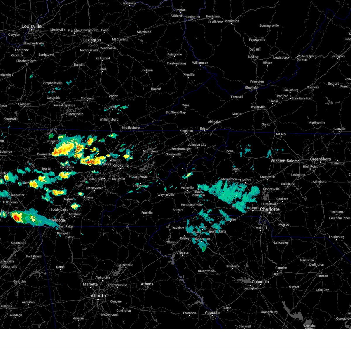
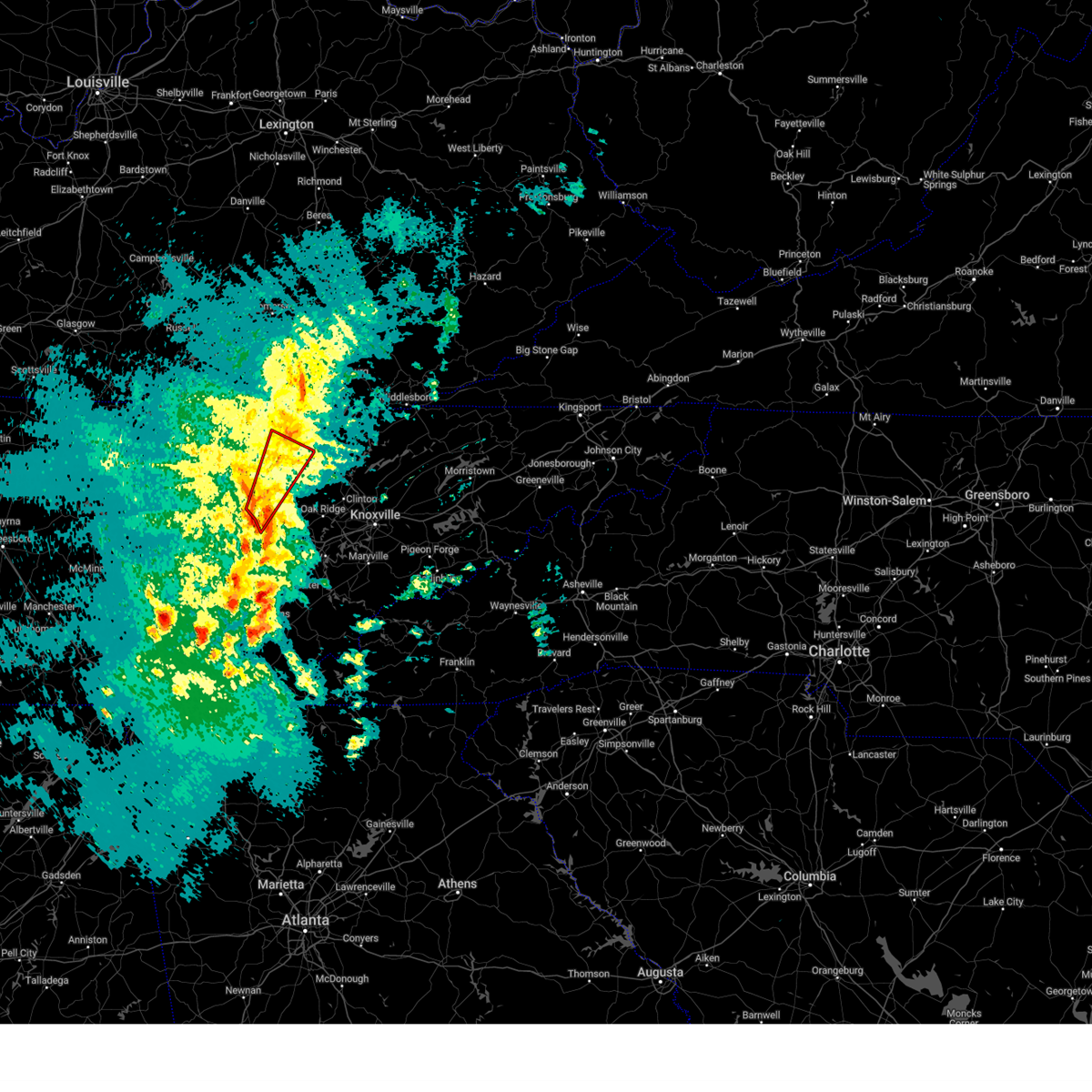
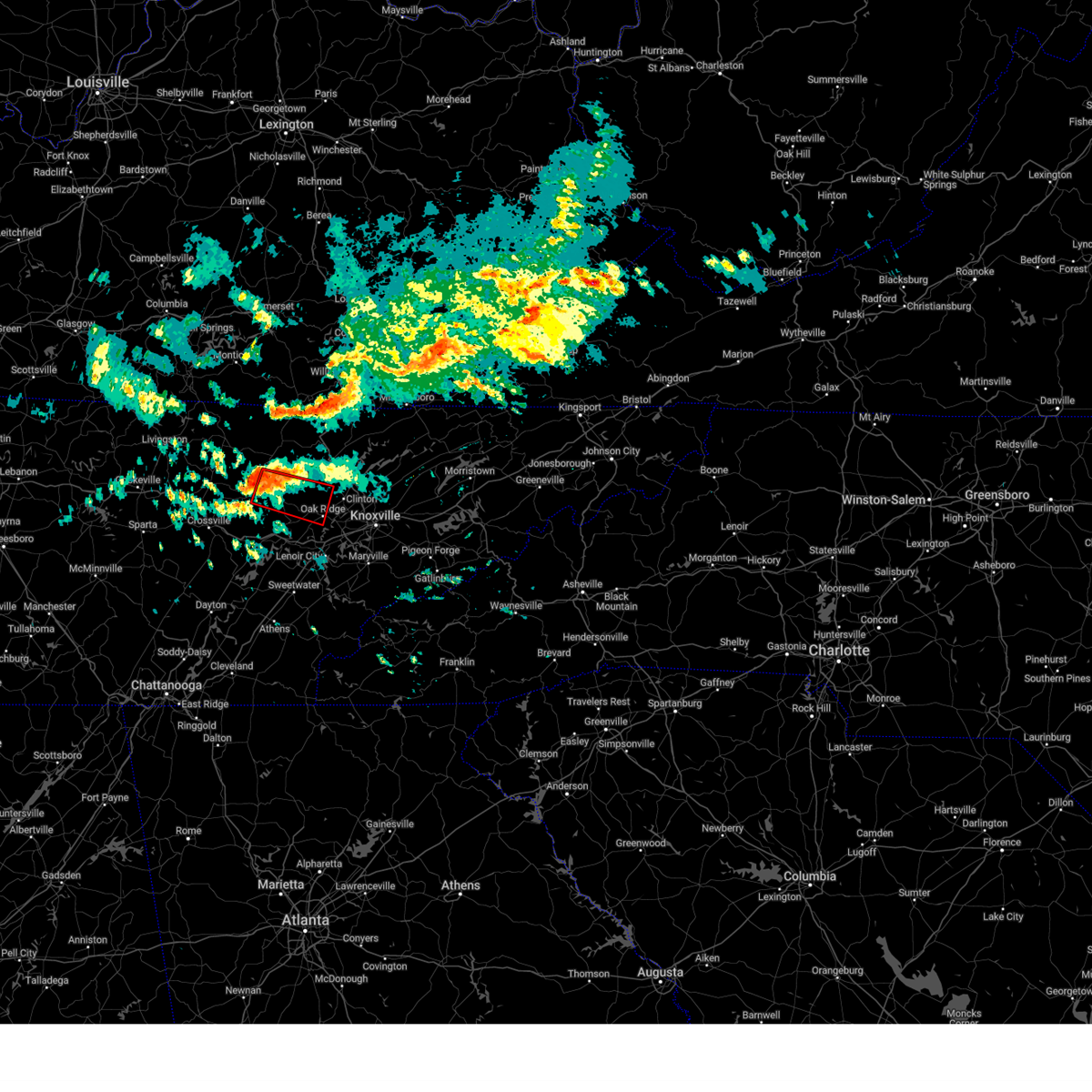
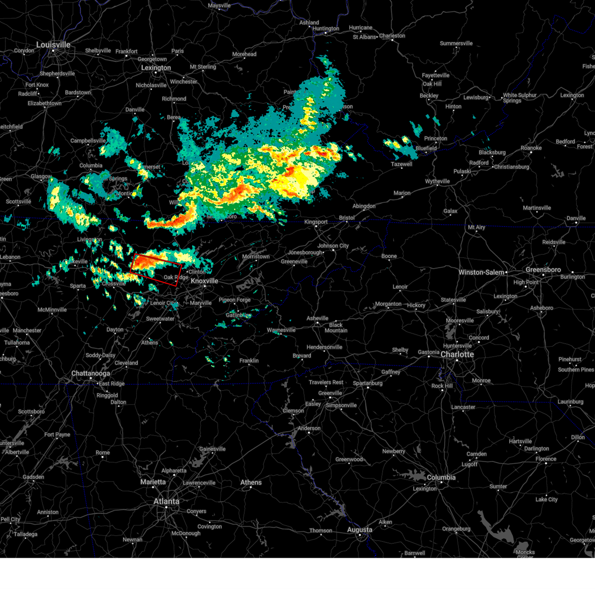
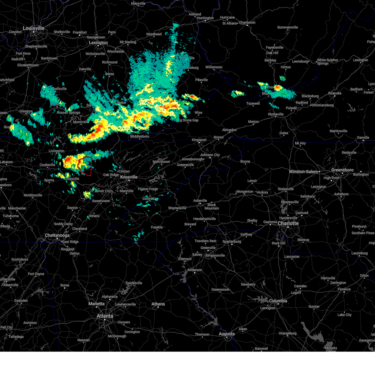
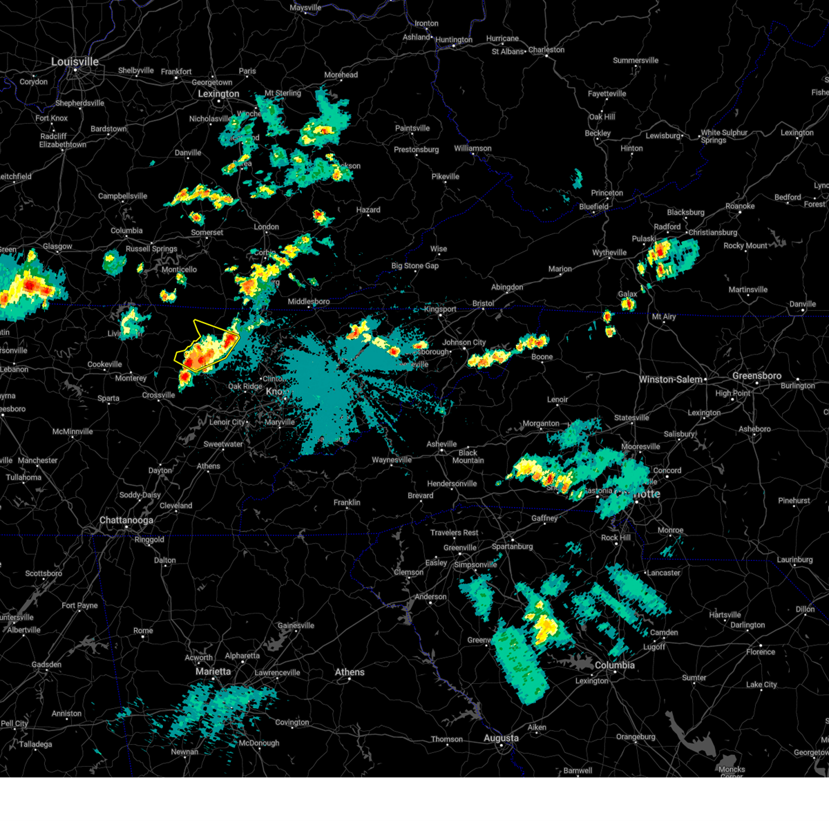
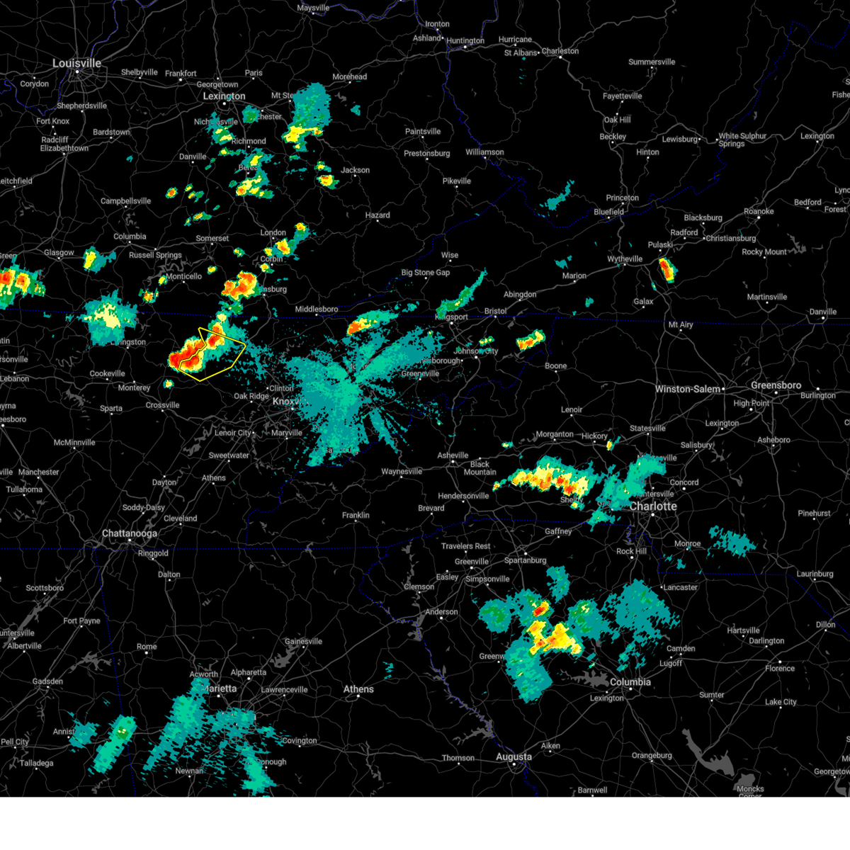
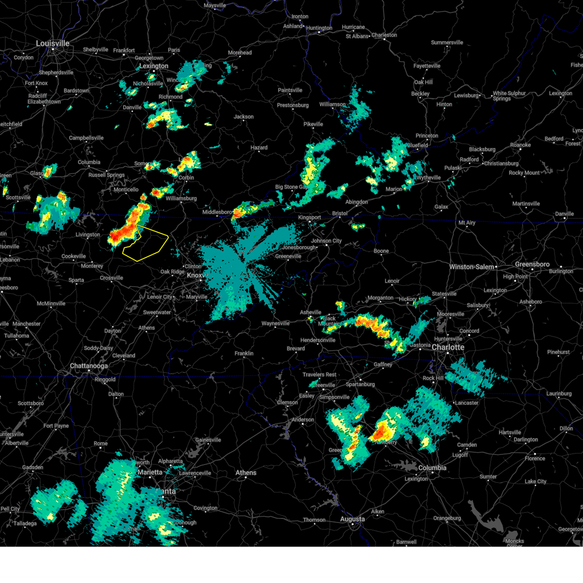
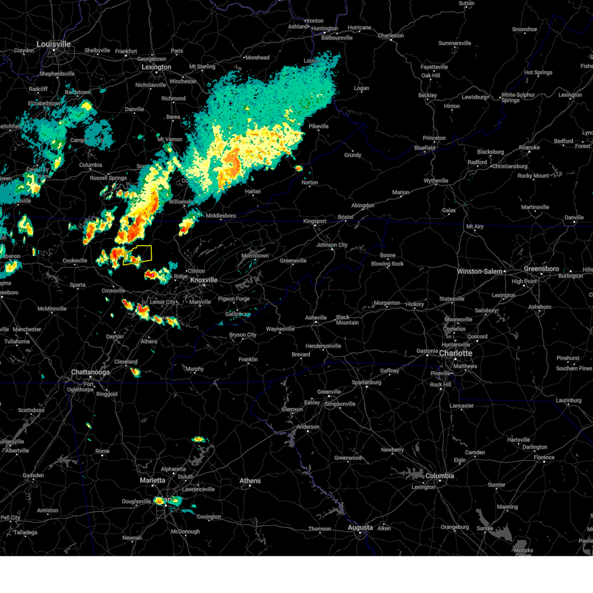
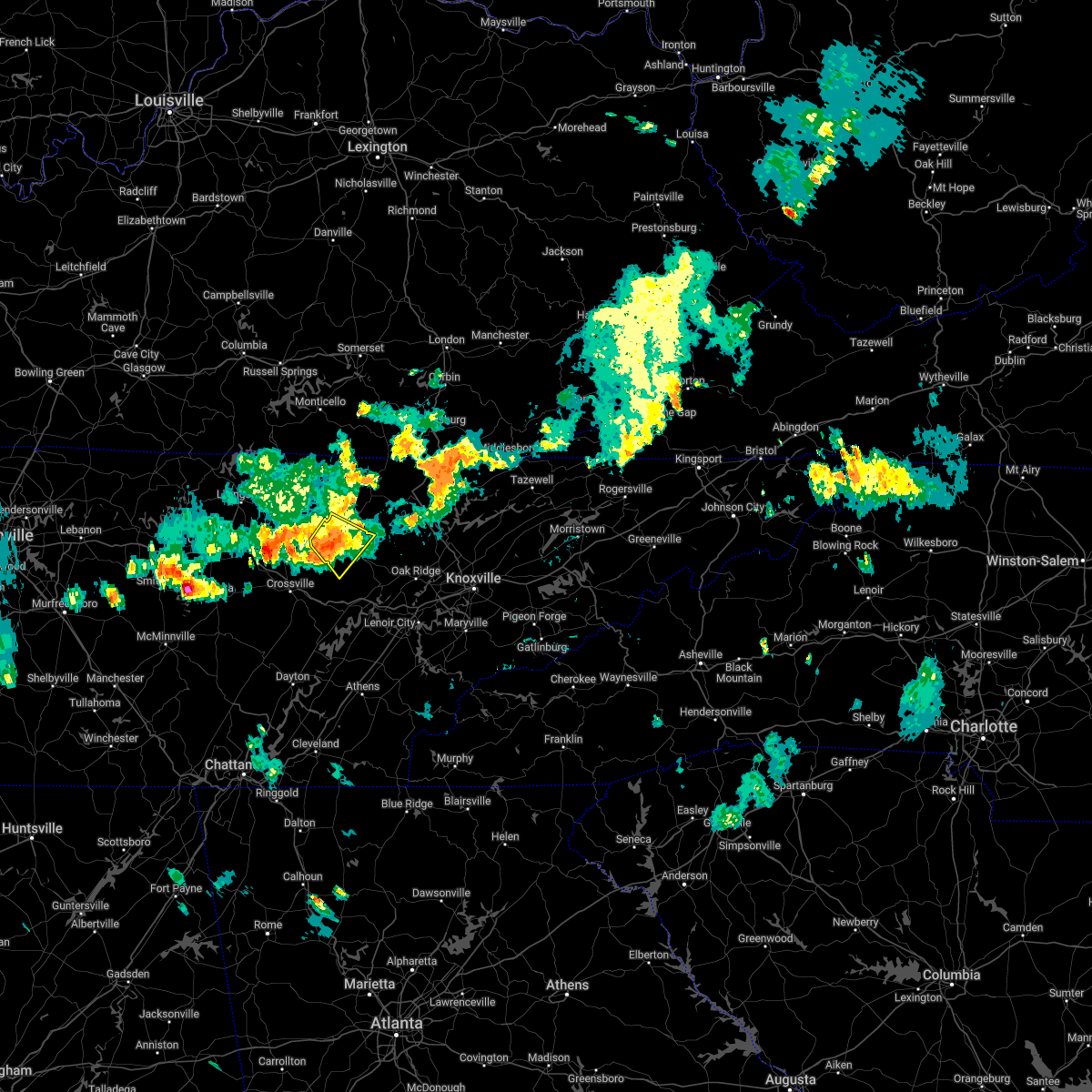
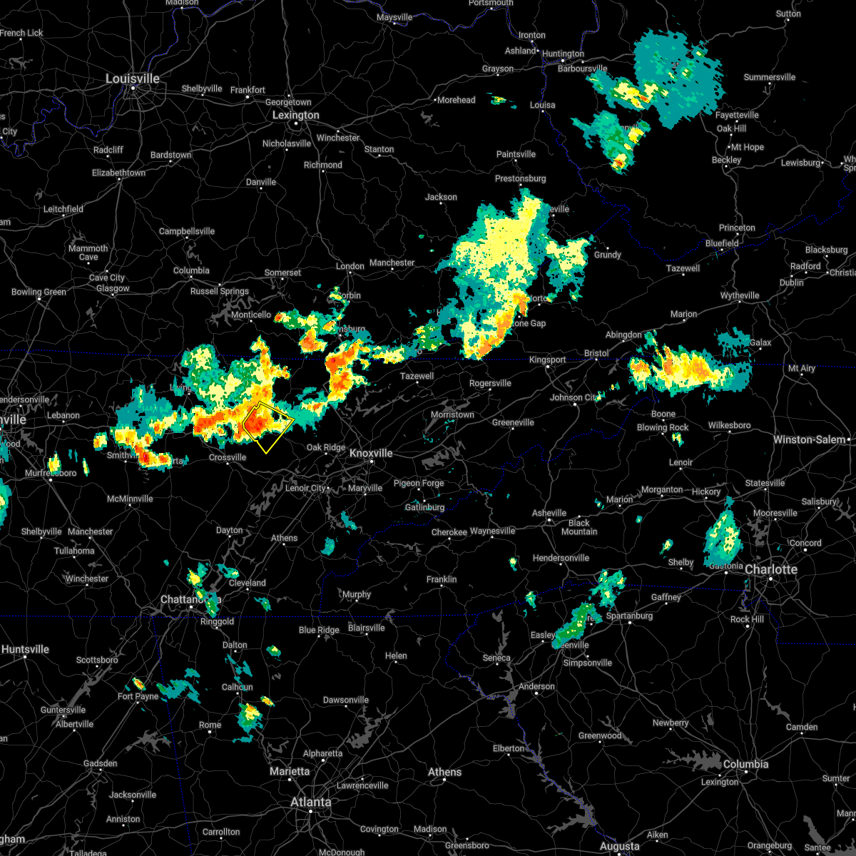
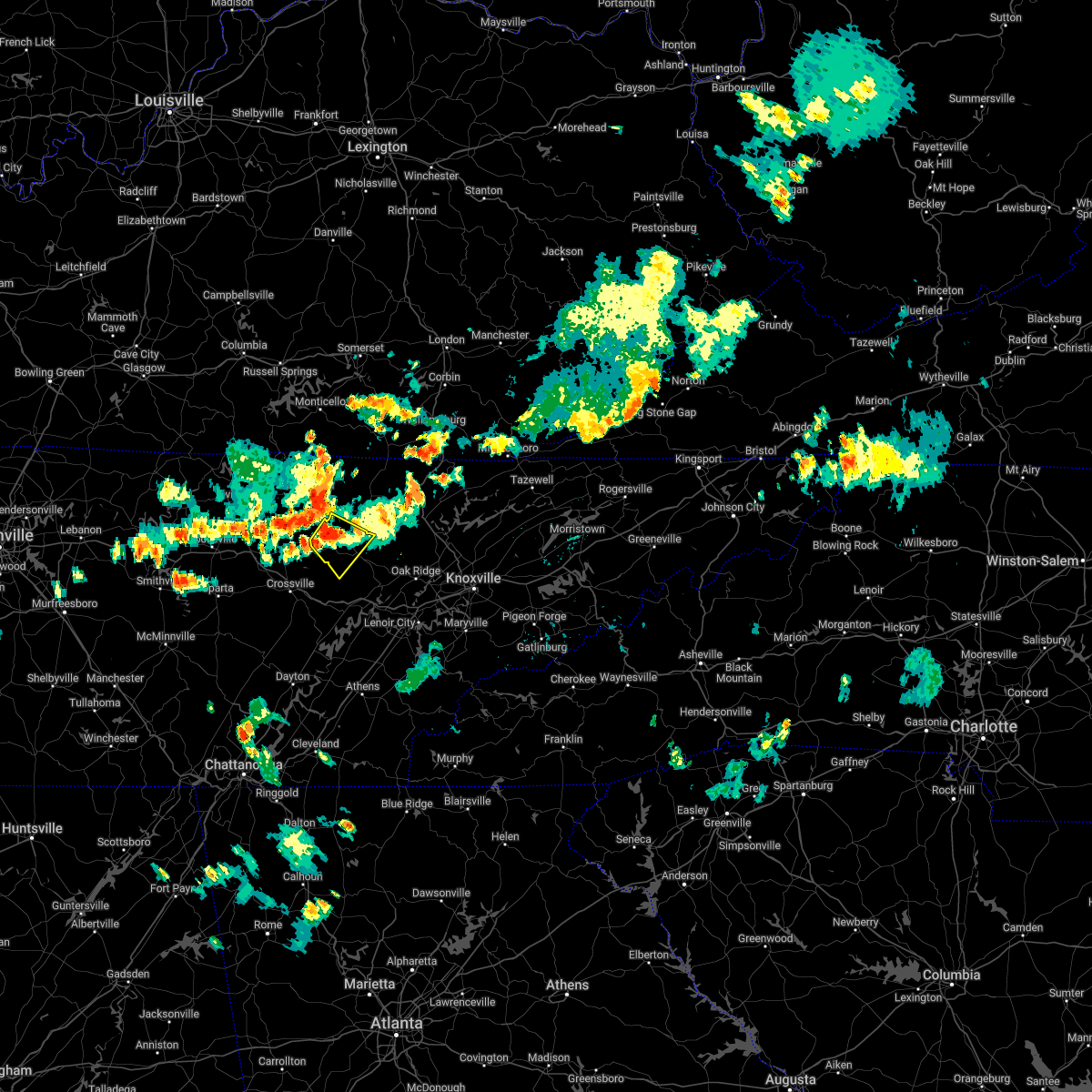
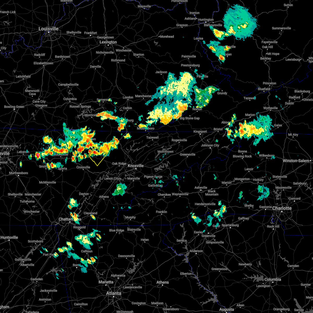
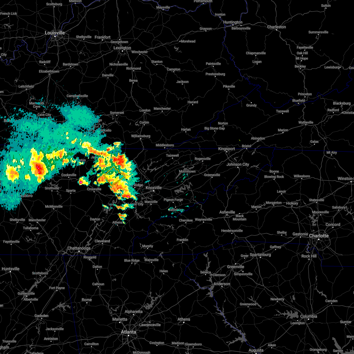
Hail Map for Sunbright, TN
The Sunbright, TN area has had 4 reports of on-the-ground hail by trained spotters, and has been under severe weather warnings 21 times during the past 12 months. Doppler radar has detected hail at or near Sunbright, TN on 42 occasions, including 4 occasions during the past year.
| Name: | Sunbright, TN |
| Where Located: | 46.7 miles WNW of Knoxville, TN |
| Map: | Google Map for Sunbright, TN |
| Population: | 552 |
| Housing Units: | 276 |
| More Info: | Search Google for Sunbright, TN |
3
The Top Recent Hail Date for Sunbright, TN is Thursday, April 10, 2025 (5th out of 42)

Hail and Wind Damage Spotted near Sunbright, TN
| Date / Time | Report Details |
|---|---|
| 5/20/2025 9:35 PM EDT |
 At 935 pm edt, severe thunderstorms were located along a line extending from near strunk to near rockwood, moving east at 45 mph (radar indicated). Hazards include 60 mph wind gusts and quarter size hail. Hail damage to vehicles is expected. expect wind damage to roofs, siding, and trees. locations impacted include, norris dam state park, rugby, caryville, high point, elk valley, coalfield, huntsville, smokey junction, winfield, and honey creek state park. this includes the following highways, interstate 40 in tennessee between mile markers 344 and 351. Interstate 75 in tennessee between mile markers 119 and 161. At 935 pm edt, severe thunderstorms were located along a line extending from near strunk to near rockwood, moving east at 45 mph (radar indicated). Hazards include 60 mph wind gusts and quarter size hail. Hail damage to vehicles is expected. expect wind damage to roofs, siding, and trees. locations impacted include, norris dam state park, rugby, caryville, high point, elk valley, coalfield, huntsville, smokey junction, winfield, and honey creek state park. this includes the following highways, interstate 40 in tennessee between mile markers 344 and 351. Interstate 75 in tennessee between mile markers 119 and 161.
|
| 5/20/2025 9:14 PM EDT |
 Svrmrx the national weather service in morristown has issued a * severe thunderstorm warning for, morgan county in east tennessee, anderson county in east tennessee, campbell county in east tennessee, northern roane county in east tennessee, scott county in east tennessee, * until 1015 pm edt. * at 913 pm edt, severe thunderstorms were located along a line extending from near mount pisgah to 6 miles west of crossville, moving east at 50 mph (radar indicated). Hazards include 60 mph wind gusts and half dollar size hail. Hail damage to vehicles is expected. Expect wind damage to roofs, siding, and trees. Svrmrx the national weather service in morristown has issued a * severe thunderstorm warning for, morgan county in east tennessee, anderson county in east tennessee, campbell county in east tennessee, northern roane county in east tennessee, scott county in east tennessee, * until 1015 pm edt. * at 913 pm edt, severe thunderstorms were located along a line extending from near mount pisgah to 6 miles west of crossville, moving east at 50 mph (radar indicated). Hazards include 60 mph wind gusts and half dollar size hail. Hail damage to vehicles is expected. Expect wind damage to roofs, siding, and trees.
|
| 5/17/2025 2:05 AM EDT |
 At 205 am edt, severe thunderstorms were located along a line extending from near tazewell to 8 miles west of maynardville to 7 miles north of oliver springs, moving east at 45 mph (radar indicated). Hazards include 70 mph wind gusts and nickel size hail. Expect considerable tree damage. damage is likely to mobile homes, roofs, and outbuildings. locations impacted include, norris dam state park, luttrell, lone mountain, caryville, howard quarter, arthur, smokey junction, new tazewell, maynardville, and rosedale. This includes interstate 75 in tennessee between mile markers 114 and 139. At 205 am edt, severe thunderstorms were located along a line extending from near tazewell to 8 miles west of maynardville to 7 miles north of oliver springs, moving east at 45 mph (radar indicated). Hazards include 70 mph wind gusts and nickel size hail. Expect considerable tree damage. damage is likely to mobile homes, roofs, and outbuildings. locations impacted include, norris dam state park, luttrell, lone mountain, caryville, howard quarter, arthur, smokey junction, new tazewell, maynardville, and rosedale. This includes interstate 75 in tennessee between mile markers 114 and 139.
|
| 5/17/2025 1:39 AM EDT | Svrmrx the national weather service in morristown has issued a * severe thunderstorm warning for, central morgan county in east tennessee, claiborne county in east tennessee, anderson county in east tennessee, northeastern knox county in east tennessee, southwestern hancock county in east tennessee, campbell county in east tennessee, grainger county in east tennessee, southern scott county in east tennessee, union county in east tennessee, * until 230 am edt. * at 139 am edt, severe thunderstorms were located along a line extending from near fonde to near jacksboro to 8 miles north of wartburg, moving east at 45 mph (radar indicated). Hazards include 60 mph wind gusts and quarter size hail. Hail damage to vehicles is expected. Expect wind damage to roofs, siding, and trees. |
| 5/17/2025 12:30 AM CDT |
 The storms which prompted the warning have moved out of the area. therefore, the warning has been allowed to expire. a tornado watch remains in effect until 400 am edt for east tennessee. remember, a severe thunderstorm warning still remains in effect for most of scott county until 145 am edt. The storms which prompted the warning have moved out of the area. therefore, the warning has been allowed to expire. a tornado watch remains in effect until 400 am edt for east tennessee. remember, a severe thunderstorm warning still remains in effect for most of scott county until 145 am edt.
|
| 5/16/2025 11:57 PM CDT | Svrmrx the national weather service in morristown has issued a * severe thunderstorm warning for, northwestern morgan county in east tennessee, scott county in east tennessee, * until 130 am edt. * at 1257 am edt, severe thunderstorms were located along a line extending from near duckrun to near oneida to 10 miles west of jamestown, moving east at 60 mph (radar indicated). Hazards include 60 mph wind gusts and quarter size hail. Hail damage to vehicles is expected. Expect wind damage to roofs, siding, and trees. |
| 5/8/2025 4:36 PM EDT |
 At 435 pm edt, a severe thunderstorm was located 10 miles north of wartburg, moving northeast at 25 mph (radar indicated). Hazards include tennis ball size hail and 60 mph wind gusts. People and animals outdoors will be injured. expect hail damage to roofs, siding, windows, and vehicles. expect wind damage to roofs, siding, and trees. Locations impacted include, norma, elgin, robbins, frozen head state park, slick rock, sunbright, and helenwood. At 435 pm edt, a severe thunderstorm was located 10 miles north of wartburg, moving northeast at 25 mph (radar indicated). Hazards include tennis ball size hail and 60 mph wind gusts. People and animals outdoors will be injured. expect hail damage to roofs, siding, windows, and vehicles. expect wind damage to roofs, siding, and trees. Locations impacted include, norma, elgin, robbins, frozen head state park, slick rock, sunbright, and helenwood.
|
| 5/8/2025 4:24 PM EDT |
 Svrmrx the national weather service in morristown has issued a * severe thunderstorm warning for, central morgan county in east tennessee, southern scott county in east tennessee, * until 515 pm edt. * at 424 pm edt, a severe thunderstorm was located near wartburg, moving northeast at 20 mph (radar indicated). Hazards include ping pong ball size hail and 60 mph wind gusts. People and animals outdoors will be injured. expect hail damage to roofs, siding, windows, and vehicles. Expect wind damage to roofs, siding, and trees. Svrmrx the national weather service in morristown has issued a * severe thunderstorm warning for, central morgan county in east tennessee, southern scott county in east tennessee, * until 515 pm edt. * at 424 pm edt, a severe thunderstorm was located near wartburg, moving northeast at 20 mph (radar indicated). Hazards include ping pong ball size hail and 60 mph wind gusts. People and animals outdoors will be injured. expect hail damage to roofs, siding, windows, and vehicles. Expect wind damage to roofs, siding, and trees.
|
| 5/2/2025 5:32 PM EDT | Svrmrx the national weather service in morristown has issued a * severe thunderstorm warning for, central morgan county in east tennessee, northwestern anderson county in east tennessee, central campbell county in east tennessee, central scott county in east tennessee, * until 615 pm edt. * at 531 pm edt, severe thunderstorms were located along a line extending from 14 miles southwest of helenwood to 10 miles northeast of wartburg to 7 miles northwest of clinton, moving northeast at 35 mph (radar indicated). Hazards include 60 mph wind gusts and quarter size hail. Hail damage to vehicles is expected. Expect wind damage to roofs, siding, and trees. |
| 4/10/2025 4:52 PM EDT |
 the severe thunderstorm warning has been cancelled and is no longer in effect the severe thunderstorm warning has been cancelled and is no longer in effect
|
| 4/10/2025 4:33 PM EDT |
 Svrmrx the national weather service in morristown has issued a * severe thunderstorm warning for, central morgan county in east tennessee, south central scott county in east tennessee, * until 515 pm edt. * at 432 pm edt, a severe thunderstorm was located 12 miles northwest of wartburg, moving southeast at 30 mph (radar indicated). Hazards include 60 mph wind gusts and quarter size hail. Hail damage to vehicles is expected. Expect wind damage to roofs, siding, and trees. Svrmrx the national weather service in morristown has issued a * severe thunderstorm warning for, central morgan county in east tennessee, south central scott county in east tennessee, * until 515 pm edt. * at 432 pm edt, a severe thunderstorm was located 12 miles northwest of wartburg, moving southeast at 30 mph (radar indicated). Hazards include 60 mph wind gusts and quarter size hail. Hail damage to vehicles is expected. Expect wind damage to roofs, siding, and trees.
|
| 3/15/2025 7:45 PM EDT | the tornado warning has been cancelled and is no longer in effect |
| 3/15/2025 7:35 PM EDT | At 735 pm edt, a severe thunderstorm capable of producing a tornado was located over wartburg, moving northeast at 60 mph (radar indicated rotation). Hazards include tornado. Flying debris will be dangerous to those caught without shelter. mobile homes will be damaged or destroyed. damage to roofs, windows, and vehicles will occur. tree damage is likely. this dangerous storm will be near, huntsville and helenwood around 755 pm edt. Other locations impacted by this tornadic thunderstorm include norma, elgin, robbins, frozen head state park, slick rock, and sunbright. |
| 3/15/2025 7:22 PM EDT |
 Tormrx the national weather service in morristown has issued a * tornado warning for, central morgan county in east tennessee, central scott county in east tennessee, * until 800 pm edt. * at 722 pm edt, a severe thunderstorm capable of producing a tornado was located 7 miles northwest of rockwood, moving northeast at 60 mph (radar indicated rotation). Hazards include tornado. Flying debris will be dangerous to those caught without shelter. mobile homes will be damaged or destroyed. damage to roofs, windows, and vehicles will occur. tree damage is likely. this dangerous storm will be near, wartburg around 730 pm edt. huntsville around 755 pm edt. Other locations impacted by this tornadic thunderstorm include pine orchard, norma, elgin, robbins, frozen head state park, slick rock, and sunbright. Tormrx the national weather service in morristown has issued a * tornado warning for, central morgan county in east tennessee, central scott county in east tennessee, * until 800 pm edt. * at 722 pm edt, a severe thunderstorm capable of producing a tornado was located 7 miles northwest of rockwood, moving northeast at 60 mph (radar indicated rotation). Hazards include tornado. Flying debris will be dangerous to those caught without shelter. mobile homes will be damaged or destroyed. damage to roofs, windows, and vehicles will occur. tree damage is likely. this dangerous storm will be near, wartburg around 730 pm edt. huntsville around 755 pm edt. Other locations impacted by this tornadic thunderstorm include pine orchard, norma, elgin, robbins, frozen head state park, slick rock, and sunbright.
|
| 2/6/2025 8:25 PM EST | Several homes damaged and trees down. possible tornad in morgan county TN, 4.9 miles NE of Sunbright, TN |
| 2/6/2025 8:24 PM EST |
 At 823 pm est, a confirmed tornado was located near wartburg, moving east at 40 mph (radar confirmed tornado). Hazards include damaging tornado and quarter size hail. Flying debris will be dangerous to those caught without shelter. mobile homes will be damaged or destroyed. damage to roofs, windows, and vehicles will occur. tree damage is likely. this tornado will be near, wartburg around 830 pm est. Other locations impacted by this tornadic thunderstorm include coalfield, rosedale, frozen head state park, petros, and sunbright. At 823 pm est, a confirmed tornado was located near wartburg, moving east at 40 mph (radar confirmed tornado). Hazards include damaging tornado and quarter size hail. Flying debris will be dangerous to those caught without shelter. mobile homes will be damaged or destroyed. damage to roofs, windows, and vehicles will occur. tree damage is likely. this tornado will be near, wartburg around 830 pm est. Other locations impacted by this tornadic thunderstorm include coalfield, rosedale, frozen head state park, petros, and sunbright.
|
| 2/6/2025 8:21 PM EST |
 At 821 pm est, a severe thunderstorm capable of producing a tornado was located 11 miles northwest of wartburg, moving east at 45 mph (radar indicated rotation). Hazards include tornado and quarter size hail. Flying debris will be dangerous to those caught without shelter. mobile homes will be damaged or destroyed. damage to roofs, windows, and vehicles will occur. tree damage is likely. Locations impacted include, sunbright and frozen head state park. At 821 pm est, a severe thunderstorm capable of producing a tornado was located 11 miles northwest of wartburg, moving east at 45 mph (radar indicated rotation). Hazards include tornado and quarter size hail. Flying debris will be dangerous to those caught without shelter. mobile homes will be damaged or destroyed. damage to roofs, windows, and vehicles will occur. tree damage is likely. Locations impacted include, sunbright and frozen head state park.
|
| 2/6/2025 8:19 PM EST |
 Tormrx the national weather service in morristown has issued a * tornado warning for, central morgan county in east tennessee, southwestern anderson county in east tennessee, northeastern roane county in east tennessee, south central scott county in east tennessee, * until 845 pm est. * at 819 pm est, a severe thunderstorm capable of producing a tornado was located 7 miles northwest of wartburg, moving east at 55 mph (radar indicated rotation). Hazards include tornado and quarter size hail. Flying debris will be dangerous to those caught without shelter. mobile homes will be damaged or destroyed. damage to roofs, windows, and vehicles will occur. tree damage is likely. this dangerous storm will be near, wartburg around 825 pm est. oliver springs around 840 pm est. Other locations impacted by this tornadic thunderstorm include coalfield, rosedale, frozen head state park, deerlodge, petros, and sunbright. Tormrx the national weather service in morristown has issued a * tornado warning for, central morgan county in east tennessee, southwestern anderson county in east tennessee, northeastern roane county in east tennessee, south central scott county in east tennessee, * until 845 pm est. * at 819 pm est, a severe thunderstorm capable of producing a tornado was located 7 miles northwest of wartburg, moving east at 55 mph (radar indicated rotation). Hazards include tornado and quarter size hail. Flying debris will be dangerous to those caught without shelter. mobile homes will be damaged or destroyed. damage to roofs, windows, and vehicles will occur. tree damage is likely. this dangerous storm will be near, wartburg around 825 pm est. oliver springs around 840 pm est. Other locations impacted by this tornadic thunderstorm include coalfield, rosedale, frozen head state park, deerlodge, petros, and sunbright.
|
| 2/6/2025 8:18 PM EST | Several homes damaged and trees down. reports of fatalities but number unknown. possible tornad in morgan county TN, 5.4 miles ENE of Sunbright, TN |
| 2/6/2025 7:53 PM EST |
 Tormrx the national weather service in morristown has issued a * tornado warning for, northwestern morgan county in east tennessee, * until 830 pm est. * at 753 pm est, a severe thunderstorm capable of producing a tornado was located 11 miles northeast of monterey, or 15 miles southwest of jamestown, moving east at 40 mph (radar indicated rotation). Hazards include tornado and quarter size hail. Flying debris will be dangerous to those caught without shelter. mobile homes will be damaged or destroyed. damage to roofs, windows, and vehicles will occur. tree damage is likely. This tornadic thunderstorm will remain over mainly rural areas of northwestern morgan county, including the following locations, high point, deerlodge, sunbright, and frozen head state park. Tormrx the national weather service in morristown has issued a * tornado warning for, northwestern morgan county in east tennessee, * until 830 pm est. * at 753 pm est, a severe thunderstorm capable of producing a tornado was located 11 miles northeast of monterey, or 15 miles southwest of jamestown, moving east at 40 mph (radar indicated rotation). Hazards include tornado and quarter size hail. Flying debris will be dangerous to those caught without shelter. mobile homes will be damaged or destroyed. damage to roofs, windows, and vehicles will occur. tree damage is likely. This tornadic thunderstorm will remain over mainly rural areas of northwestern morgan county, including the following locations, high point, deerlodge, sunbright, and frozen head state park.
|
| 8/17/2024 9:39 PM EDT |
 The storms which prompted the warning have weakened below severe limits, and no longer pose an immediate threat to life or property. therefore, the warning will be allowed to expire. however, small hail and gusty winds are still possible with these thunderstorms. The storms which prompted the warning have weakened below severe limits, and no longer pose an immediate threat to life or property. therefore, the warning will be allowed to expire. however, small hail and gusty winds are still possible with these thunderstorms.
|
| 8/17/2024 9:21 PM EDT |
 At 921 pm edt, severe thunderstorms were located along a line extending from huntsville to 6 miles south of helenwood to 14 miles northwest of wartburg, moving southeast at 30 mph (radar indicated). Hazards include 60 mph wind gusts and penny size hail. Expect damage to roofs, siding, and trees. Locations impacted include, huntsville, helenwood, sunbright, rugby, rugby state park, deerlodge, honey creek state park, norma, elgin, and robbins. At 921 pm edt, severe thunderstorms were located along a line extending from huntsville to 6 miles south of helenwood to 14 miles northwest of wartburg, moving southeast at 30 mph (radar indicated). Hazards include 60 mph wind gusts and penny size hail. Expect damage to roofs, siding, and trees. Locations impacted include, huntsville, helenwood, sunbright, rugby, rugby state park, deerlodge, honey creek state park, norma, elgin, and robbins.
|
| 8/17/2024 9:01 PM EDT |
 Svrmrx the national weather service in morristown has issued a * severe thunderstorm warning for, northwestern morgan county in east tennessee, central scott county in east tennessee, * until 945 pm edt. * at 900 pm edt, severe thunderstorms were located along a line extending from 6 miles northwest of helenwood to 11 miles west of huntsville to 8 miles south of jamestown, moving southeast at 30 mph (radar indicated). Hazards include 60 mph wind gusts and penny size hail. expect damage to roofs, siding, and trees Svrmrx the national weather service in morristown has issued a * severe thunderstorm warning for, northwestern morgan county in east tennessee, central scott county in east tennessee, * until 945 pm edt. * at 900 pm edt, severe thunderstorms were located along a line extending from 6 miles northwest of helenwood to 11 miles west of huntsville to 8 miles south of jamestown, moving southeast at 30 mph (radar indicated). Hazards include 60 mph wind gusts and penny size hail. expect damage to roofs, siding, and trees
|
| 5/27/2024 2:11 AM EDT |
 The storm which prompted the warning has weakened below severe limits, and no longer poses an immediate threat to life or property. therefore, the warning will be allowed to expire. however, gusty winds and heavy rain are still possible with this thunderstorm. a tornado watch remains in effect until 600 am edt for east tennessee. The storm which prompted the warning has weakened below severe limits, and no longer poses an immediate threat to life or property. therefore, the warning will be allowed to expire. however, gusty winds and heavy rain are still possible with this thunderstorm. a tornado watch remains in effect until 600 am edt for east tennessee.
|
| 5/27/2024 1:56 AM EDT |
 At 155 am edt, a severe thunderstorm was located over huntsville, or near oneida, moving southeast at 40 mph (radar indicated). Hazards include 60 mph wind gusts and penny size hail. Expect damage to roofs, siding, and trees. locations impacted include, oneida, jacksboro, huntsville, helenwood, jellico, caryville, winfield, sunbright, rugby, and elk valley. This includes interstate 75 in tennessee between mile markers 135 and 161. At 155 am edt, a severe thunderstorm was located over huntsville, or near oneida, moving southeast at 40 mph (radar indicated). Hazards include 60 mph wind gusts and penny size hail. Expect damage to roofs, siding, and trees. locations impacted include, oneida, jacksboro, huntsville, helenwood, jellico, caryville, winfield, sunbright, rugby, and elk valley. This includes interstate 75 in tennessee between mile markers 135 and 161.
|
| 5/27/2024 1:41 AM EDT |
 At 141 am edt, a severe thunderstorm was located near great meadows campsites, or 8 miles northwest of oneida, moving southeast at 45 mph (radar indicated). Hazards include 60 mph wind gusts and penny size hail. Expect damage to roofs, siding, and trees. locations impacted include, oneida, jacksboro, huntsville, helenwood, jellico, caryville, winfield, sunbright, rugby, and elk valley. This includes interstate 75 in tennessee between mile markers 135 and 161. At 141 am edt, a severe thunderstorm was located near great meadows campsites, or 8 miles northwest of oneida, moving southeast at 45 mph (radar indicated). Hazards include 60 mph wind gusts and penny size hail. Expect damage to roofs, siding, and trees. locations impacted include, oneida, jacksboro, huntsville, helenwood, jellico, caryville, winfield, sunbright, rugby, and elk valley. This includes interstate 75 in tennessee between mile markers 135 and 161.
|
| 5/27/2024 1:23 AM EDT |
 Svrmrx the national weather service in morristown has issued a * severe thunderstorm warning for, northwestern morgan county in east tennessee, western campbell county in east tennessee, scott county in east tennessee, * until 215 am edt. * at 122 am edt, severe thunderstorms were located along a line extending from near frazer to 8 miles southwest of jamestown, moving southeast at 45 mph (radar indicated). Hazards include 60 mph wind gusts and penny size hail. expect damage to roofs, siding, and trees Svrmrx the national weather service in morristown has issued a * severe thunderstorm warning for, northwestern morgan county in east tennessee, western campbell county in east tennessee, scott county in east tennessee, * until 215 am edt. * at 122 am edt, severe thunderstorms were located along a line extending from near frazer to 8 miles southwest of jamestown, moving southeast at 45 mph (radar indicated). Hazards include 60 mph wind gusts and penny size hail. expect damage to roofs, siding, and trees
|
| 5/23/2024 7:15 PM EDT | Several trees dow in morgan county TN, 0.7 miles SW of Sunbright, TN |
| 5/23/2024 7:11 PM EDT |
 At 710 pm edt, severe thunderstorms were located along a line extending from near strunk to 6 miles southwest of huntsville to 6 miles north of rockwood, moving east at 35 mph (radar indicated). Hazards include 60 mph wind gusts and quarter size hail. Hail damage to vehicles is expected. expect wind damage to roofs, siding, and trees. Locations impacted include, oneida, wartburg, huntsville, helenwood, winfield, sunbright, oakdale, rugby, high point, and coalfield. At 710 pm edt, severe thunderstorms were located along a line extending from near strunk to 6 miles southwest of huntsville to 6 miles north of rockwood, moving east at 35 mph (radar indicated). Hazards include 60 mph wind gusts and quarter size hail. Hail damage to vehicles is expected. expect wind damage to roofs, siding, and trees. Locations impacted include, oneida, wartburg, huntsville, helenwood, winfield, sunbright, oakdale, rugby, high point, and coalfield.
|
| 5/23/2024 6:38 PM EDT |
 Svrmrx the national weather service in morristown has issued a * severe thunderstorm warning for, morgan county in east tennessee, west central anderson county in east tennessee, west central campbell county in east tennessee, scott county in east tennessee, * until 745 pm edt. * at 638 pm edt, severe thunderstorms were located along a line extending from near mount pisgah to 8 miles southeast of jamestown to near crossville, moving northeast at 20 mph (radar indicated). Hazards include 60 mph wind gusts and quarter size hail. Hail damage to vehicles is expected. Expect wind damage to roofs, siding, and trees. Svrmrx the national weather service in morristown has issued a * severe thunderstorm warning for, morgan county in east tennessee, west central anderson county in east tennessee, west central campbell county in east tennessee, scott county in east tennessee, * until 745 pm edt. * at 638 pm edt, severe thunderstorms were located along a line extending from near mount pisgah to 8 miles southeast of jamestown to near crossville, moving northeast at 20 mph (radar indicated). Hazards include 60 mph wind gusts and quarter size hail. Hail damage to vehicles is expected. Expect wind damage to roofs, siding, and trees.
|
| 5/22/2024 8:42 PM EDT |
 The storms which prompted the warning have weakened below severe limits, and no longer pose an immediate threat to life or property. therefore, the warning will be allowed to expire. however, gusty winds are still possible with these thunderstorms. The storms which prompted the warning have weakened below severe limits, and no longer pose an immediate threat to life or property. therefore, the warning will be allowed to expire. however, gusty winds are still possible with these thunderstorms.
|
| 5/22/2024 8:24 PM EDT | Several trees dow in morgan county TN, 4.5 miles ENE of Sunbright, TN |
| 5/22/2024 8:05 PM EDT |
 Svrmrx the national weather service in morristown has issued a * severe thunderstorm warning for, morgan county in east tennessee, northwestern anderson county in east tennessee, southwestern campbell county in east tennessee, northwestern roane county in east tennessee, southeastern scott county in east tennessee, * until 845 pm edt. * at 805 pm edt, severe thunderstorms were located along a line extending from 12 miles south of jamestown to 7 miles north of fairfield glade to crossville, moving east at 50 mph (radar indicated). Hazards include 60 mph wind gusts and penny size hail. expect damage to roofs, siding, and trees Svrmrx the national weather service in morristown has issued a * severe thunderstorm warning for, morgan county in east tennessee, northwestern anderson county in east tennessee, southwestern campbell county in east tennessee, northwestern roane county in east tennessee, southeastern scott county in east tennessee, * until 845 pm edt. * at 805 pm edt, severe thunderstorms were located along a line extending from 12 miles south of jamestown to 7 miles north of fairfield glade to crossville, moving east at 50 mph (radar indicated). Hazards include 60 mph wind gusts and penny size hail. expect damage to roofs, siding, and trees
|
| 5/22/2024 7:32 PM EDT |
 At 732 pm edt, severe thunderstorms were located along a line extending from near great meadows campsites to 8 miles west of helenwood to 9 miles northwest of fairfield glade, moving east at 50 mph (radar indicated). Hazards include 60 mph wind gusts and penny size hail. Expect damage to roofs, siding, and trees. locations impacted include, la follette, oneida, wartburg, jacksboro, huntsville, helenwood, jellico, caryville, winfield, and sunbright. This includes interstate 75 in tennessee between mile markers 133 and 158. At 732 pm edt, severe thunderstorms were located along a line extending from near great meadows campsites to 8 miles west of helenwood to 9 miles northwest of fairfield glade, moving east at 50 mph (radar indicated). Hazards include 60 mph wind gusts and penny size hail. Expect damage to roofs, siding, and trees. locations impacted include, la follette, oneida, wartburg, jacksboro, huntsville, helenwood, jellico, caryville, winfield, and sunbright. This includes interstate 75 in tennessee between mile markers 133 and 158.
|
| 5/22/2024 7:30 PM EDT | Trees down and small hai in morgan county TN, 1.2 miles WSW of Sunbright, TN |
| 5/22/2024 6:50 PM EDT |
 Svrmrx the national weather service in morristown has issued a * severe thunderstorm warning for, morgan county in east tennessee, northwestern anderson county in east tennessee, western campbell county in east tennessee, scott county in east tennessee, * until 745 pm edt. * at 650 pm edt, severe thunderstorms were located along a line extending from 6 miles west of byrdstown to 6 miles east of livingston to 6 miles southeast of baxter, moving east at 50 mph (radar indicated). Hazards include 60 mph wind gusts and penny size hail. expect damage to roofs, siding, and trees Svrmrx the national weather service in morristown has issued a * severe thunderstorm warning for, morgan county in east tennessee, northwestern anderson county in east tennessee, western campbell county in east tennessee, scott county in east tennessee, * until 745 pm edt. * at 650 pm edt, severe thunderstorms were located along a line extending from 6 miles west of byrdstown to 6 miles east of livingston to 6 miles southeast of baxter, moving east at 50 mph (radar indicated). Hazards include 60 mph wind gusts and penny size hail. expect damage to roofs, siding, and trees
|
| 5/8/2024 9:20 PM EDT |
 At 920 pm edt, a severe thunderstorm was located near wartburg, moving east at 45 mph (radar indicated). Hazards include 60 mph wind gusts and quarter size hail. Hail damage to vehicles is expected. expect wind damage to roofs, siding, and trees. Locations impacted include, wartburg, sunbright, oakdale, high point, coalfield, deerlodge, elgin, frozen head state park, slick rock, and petros. At 920 pm edt, a severe thunderstorm was located near wartburg, moving east at 45 mph (radar indicated). Hazards include 60 mph wind gusts and quarter size hail. Hail damage to vehicles is expected. expect wind damage to roofs, siding, and trees. Locations impacted include, wartburg, sunbright, oakdale, high point, coalfield, deerlodge, elgin, frozen head state park, slick rock, and petros.
|
| 5/8/2024 8:58 PM EDT |
 Svrmrx the national weather service in morristown has issued a * severe thunderstorm warning for, morgan county in east tennessee, southwestern scott county in east tennessee, * until 945 pm edt. * at 857 pm edt, a severe thunderstorm was located 12 miles northwest of fairfield glade, or 13 miles north of crossville, moving east at 45 mph (radar indicated). Hazards include 60 mph wind gusts and quarter size hail. Hail damage to vehicles is expected. Expect wind damage to roofs, siding, and trees. Svrmrx the national weather service in morristown has issued a * severe thunderstorm warning for, morgan county in east tennessee, southwestern scott county in east tennessee, * until 945 pm edt. * at 857 pm edt, a severe thunderstorm was located 12 miles northwest of fairfield glade, or 13 miles north of crossville, moving east at 45 mph (radar indicated). Hazards include 60 mph wind gusts and quarter size hail. Hail damage to vehicles is expected. Expect wind damage to roofs, siding, and trees.
|
| 5/8/2024 9:53 AM EDT |
 At 953 am edt, a severe thunderstorm was located 11 miles north of wartburg, moving east at 35 mph (radar indicated). Hazards include 60 mph wind gusts and quarter size hail. Hail damage to vehicles is expected. expect wind damage to roofs, siding, and trees. Locations impacted include, huntsville, helenwood, sunbright, rugby, rugby state park, deerlodge, honey creek state park, elgin, robbins, and frozen head state park. At 953 am edt, a severe thunderstorm was located 11 miles north of wartburg, moving east at 35 mph (radar indicated). Hazards include 60 mph wind gusts and quarter size hail. Hail damage to vehicles is expected. expect wind damage to roofs, siding, and trees. Locations impacted include, huntsville, helenwood, sunbright, rugby, rugby state park, deerlodge, honey creek state park, elgin, robbins, and frozen head state park.
|
| 5/8/2024 9:50 AM EDT | Trees dow in morgan county TN, 0.6 miles WNW of Sunbright, TN |
| 5/8/2024 9:36 AM EDT |
 At 936 am edt, a severe thunderstorm was located 12 miles southeast of jamestown, moving east at 40 mph (radar indicated). Hazards include 60 mph wind gusts and quarter size hail. Hail damage to vehicles is expected. expect wind damage to roofs, siding, and trees. Locations impacted include, oneida, huntsville, helenwood, winfield, sunbright, rugby, honey creek state park, robbins, big south fork national park, and rugby state park. At 936 am edt, a severe thunderstorm was located 12 miles southeast of jamestown, moving east at 40 mph (radar indicated). Hazards include 60 mph wind gusts and quarter size hail. Hail damage to vehicles is expected. expect wind damage to roofs, siding, and trees. Locations impacted include, oneida, huntsville, helenwood, winfield, sunbright, rugby, honey creek state park, robbins, big south fork national park, and rugby state park.
|
| 5/8/2024 9:21 AM EDT |
 Svrmrx the national weather service in morristown has issued a * severe thunderstorm warning for, northern morgan county in east tennessee, central scott county in east tennessee, * until 1015 am edt. * at 921 am edt, a severe thunderstorm was located near jamestown, moving east at 40 mph (radar indicated). Hazards include 60 mph wind gusts and quarter size hail. Hail damage to vehicles is expected. Expect wind damage to roofs, siding, and trees. Svrmrx the national weather service in morristown has issued a * severe thunderstorm warning for, northern morgan county in east tennessee, central scott county in east tennessee, * until 1015 am edt. * at 921 am edt, a severe thunderstorm was located near jamestown, moving east at 40 mph (radar indicated). Hazards include 60 mph wind gusts and quarter size hail. Hail damage to vehicles is expected. Expect wind damage to roofs, siding, and trees.
|
| 4/2/2024 5:27 PM EDT |
 At 527 pm edt, a confirmed tornado was located 11 miles north of wartburg, moving northeast at 25 mph (radar confirmed tornado). Hazards include damaging tornado and half dollar size hail. Flying debris will be dangerous to those caught without shelter. mobile homes will be damaged or destroyed. damage to roofs, windows, and vehicles will occur. tree damage is likely. this tornado will be near, huntsville around 555 pm edt. Other locations impacted by this tornadic thunderstorm include norma, elgin, robbins, smokey junction, slick rock, and sunbright. At 527 pm edt, a confirmed tornado was located 11 miles north of wartburg, moving northeast at 25 mph (radar confirmed tornado). Hazards include damaging tornado and half dollar size hail. Flying debris will be dangerous to those caught without shelter. mobile homes will be damaged or destroyed. damage to roofs, windows, and vehicles will occur. tree damage is likely. this tornado will be near, huntsville around 555 pm edt. Other locations impacted by this tornadic thunderstorm include norma, elgin, robbins, smokey junction, slick rock, and sunbright.
|
| 4/2/2024 5:24 PM EDT |
 At 523 pm edt, a severe thunderstorm capable of producing a tornado was located 11 miles northwest of wartburg, moving northeast at 35 mph (radar indicated rotation). Hazards include tornado and quarter size hail. Flying debris will be dangerous to those caught without shelter. mobile homes will be damaged or destroyed. damage to roofs, windows, and vehicles will occur. tree damage is likely. this dangerous storm will be near, huntsville around 545 pm edt. Other locations impacted by this tornadic thunderstorm include smokey junction, norma, elgin, robbins, slick rock, sunbright, rugby state park, and frozen head state park. At 523 pm edt, a severe thunderstorm capable of producing a tornado was located 11 miles northwest of wartburg, moving northeast at 35 mph (radar indicated rotation). Hazards include tornado and quarter size hail. Flying debris will be dangerous to those caught without shelter. mobile homes will be damaged or destroyed. damage to roofs, windows, and vehicles will occur. tree damage is likely. this dangerous storm will be near, huntsville around 545 pm edt. Other locations impacted by this tornadic thunderstorm include smokey junction, norma, elgin, robbins, slick rock, sunbright, rugby state park, and frozen head state park.
|
| 4/2/2024 5:16 PM EDT |
 At 516 pm edt, a severe thunderstorm capable of producing a tornado was located 12 miles northwest of wartburg, moving northeast at 50 mph (radar indicated rotation). Hazards include tornado and quarter size hail. Flying debris will be dangerous to those caught without shelter. mobile homes will be damaged or destroyed. damage to roofs, windows, and vehicles will occur. tree damage is likely. this dangerous storm will be near, huntsville around 535 pm edt. Other locations impacted by this tornadic thunderstorm include rugby, rugby state park, smokey junction, deerlodge, honey creek state park, norma, elgin, robbins, slick rock, and sunbright. At 516 pm edt, a severe thunderstorm capable of producing a tornado was located 12 miles northwest of wartburg, moving northeast at 50 mph (radar indicated rotation). Hazards include tornado and quarter size hail. Flying debris will be dangerous to those caught without shelter. mobile homes will be damaged or destroyed. damage to roofs, windows, and vehicles will occur. tree damage is likely. this dangerous storm will be near, huntsville around 535 pm edt. Other locations impacted by this tornadic thunderstorm include rugby, rugby state park, smokey junction, deerlodge, honey creek state park, norma, elgin, robbins, slick rock, and sunbright.
|
| 4/2/2024 5:07 PM EDT |
 Tormrx the national weather service in morristown has issued a * tornado warning for, northern morgan county in east tennessee, southwestern campbell county in east tennessee, central scott county in east tennessee, * until 600 pm edt. * at 507 pm edt, a severe thunderstorm capable of producing a tornado was located 13 miles northwest of wartburg, moving northeast at 55 mph (radar indicated rotation). Hazards include tornado and quarter size hail. Flying debris will be dangerous to those caught without shelter. mobile homes will be damaged or destroyed. damage to roofs, windows, and vehicles will occur. tree damage is likely. this dangerous storm will be near, huntsville and helenwood around 525 pm edt. Other locations impacted by this tornadic thunderstorm include rugby, high point, rugby state park, smokey junction, deerlodge, honey creek state park, norma, elgin, robbins, and slick rock. Tormrx the national weather service in morristown has issued a * tornado warning for, northern morgan county in east tennessee, southwestern campbell county in east tennessee, central scott county in east tennessee, * until 600 pm edt. * at 507 pm edt, a severe thunderstorm capable of producing a tornado was located 13 miles northwest of wartburg, moving northeast at 55 mph (radar indicated rotation). Hazards include tornado and quarter size hail. Flying debris will be dangerous to those caught without shelter. mobile homes will be damaged or destroyed. damage to roofs, windows, and vehicles will occur. tree damage is likely. this dangerous storm will be near, huntsville and helenwood around 525 pm edt. Other locations impacted by this tornadic thunderstorm include rugby, high point, rugby state park, smokey junction, deerlodge, honey creek state park, norma, elgin, robbins, and slick rock.
|
| 8/12/2023 3:30 PM EDT | A few trees dow in morgan county TN, 5.8 miles NE of Sunbright, TN |
| 8/12/2023 3:11 PM EDT |
 At 311 pm edt, severe thunderstorms were located along a line extending from 11 miles southeast of jamestown to 7 miles west of wartburg to near rockwood, moving east at 35 mph (radar indicated). Hazards include 60 mph wind gusts and nickel size hail. expect damage to roofs, siding, and trees At 311 pm edt, severe thunderstorms were located along a line extending from 11 miles southeast of jamestown to 7 miles west of wartburg to near rockwood, moving east at 35 mph (radar indicated). Hazards include 60 mph wind gusts and nickel size hail. expect damage to roofs, siding, and trees
|
| 8/12/2023 2:56 PM EDT |
 The severe thunderstorm warning for morgan, northwestern anderson, southwestern campbell and central scott counties will expire at 300 pm edt, the storms which prompted the warning have moved out of the area. therefore, the warning will be allowed to expire. a severe thunderstorm watch remains in effect until 700 pm edt for east tennessee. remember, a severe thunderstorm warning still remains in effect for eastern scott, and morgan counties until 330 pm edt. The severe thunderstorm warning for morgan, northwestern anderson, southwestern campbell and central scott counties will expire at 300 pm edt, the storms which prompted the warning have moved out of the area. therefore, the warning will be allowed to expire. a severe thunderstorm watch remains in effect until 700 pm edt for east tennessee. remember, a severe thunderstorm warning still remains in effect for eastern scott, and morgan counties until 330 pm edt.
|
| 8/12/2023 2:33 PM EDT | Several trees dow in morgan county TN, 5 miles NE of Sunbright, TN |
| 8/12/2023 2:25 PM EDT |
 At 225 pm edt, severe thunderstorms were located along a line extending from near huntsville to 11 miles south of helenwood to near wartburg, moving east at 30 mph (radar indicated). Hazards include 70 mph wind gusts and quarter size hail. Hail damage to vehicles is expected. expect considerable tree damage. wind damage is also likely to mobile homes, roofs, and outbuildings. locations impacted include, wartburg, oliver springs, huntsville, helenwood, caryville, sunbright, rugby, high point, smokey junction, and honey creek state park. this includes interstate 75 in tennessee between mile markers 141 and 149. thunderstorm damage threat, considerable hail threat, radar indicated max hail size, 1. 00 in wind threat, radar indicated max wind gust, 70 mph. At 225 pm edt, severe thunderstorms were located along a line extending from near huntsville to 11 miles south of helenwood to near wartburg, moving east at 30 mph (radar indicated). Hazards include 70 mph wind gusts and quarter size hail. Hail damage to vehicles is expected. expect considerable tree damage. wind damage is also likely to mobile homes, roofs, and outbuildings. locations impacted include, wartburg, oliver springs, huntsville, helenwood, caryville, sunbright, rugby, high point, smokey junction, and honey creek state park. this includes interstate 75 in tennessee between mile markers 141 and 149. thunderstorm damage threat, considerable hail threat, radar indicated max hail size, 1. 00 in wind threat, radar indicated max wind gust, 70 mph.
|
| 8/12/2023 2:17 PM EDT |
 At 217 pm edt, severe thunderstorms were located along a line extending from near helenwood to 6 miles west of wartburg, moving east at 30 mph (radar indicated). Hazards include 60 mph wind gusts and quarter size hail. Hail damage to vehicles is expected. Expect wind damage to roofs, siding, and trees. At 217 pm edt, severe thunderstorms were located along a line extending from near helenwood to 6 miles west of wartburg, moving east at 30 mph (radar indicated). Hazards include 60 mph wind gusts and quarter size hail. Hail damage to vehicles is expected. Expect wind damage to roofs, siding, and trees.
|
| 8/7/2023 12:11 PM EDT |
 At 1210 pm edt, a severe thunderstorm was located near huntsville, or 14 miles south of oneida, moving east at 40 mph (radar indicated). Hazards include 60 mph wind gusts and quarter size hail. Hail damage to vehicles is expected. Expect wind damage to roofs, siding, and trees. At 1210 pm edt, a severe thunderstorm was located near huntsville, or 14 miles south of oneida, moving east at 40 mph (radar indicated). Hazards include 60 mph wind gusts and quarter size hail. Hail damage to vehicles is expected. Expect wind damage to roofs, siding, and trees.
|
| 6/26/2023 1:48 AM EDT |
 At 148 am edt, severe thunderstorms were located along a line extending from 7 miles east of la follette to 6 miles northeast of clinton to near oliver springs, moving southeast at 55 mph (radar indicated). Hazards include 60 mph wind gusts and penny size hail. Expect damage to roofs, siding, and trees. locations impacted include, clinton, la follette, oliver springs, jacksboro, caryville, rocky top, norris, sunbright, norris dam state park and smokey junction. this includes interstate 75 in tennessee between mile markers 118 and 142. hail threat, radar indicated max hail size, 0. 75 in wind threat, radar indicated max wind gust, 60 mph. At 148 am edt, severe thunderstorms were located along a line extending from 7 miles east of la follette to 6 miles northeast of clinton to near oliver springs, moving southeast at 55 mph (radar indicated). Hazards include 60 mph wind gusts and penny size hail. Expect damage to roofs, siding, and trees. locations impacted include, clinton, la follette, oliver springs, jacksboro, caryville, rocky top, norris, sunbright, norris dam state park and smokey junction. this includes interstate 75 in tennessee between mile markers 118 and 142. hail threat, radar indicated max hail size, 0. 75 in wind threat, radar indicated max wind gust, 60 mph.
|
| 6/26/2023 1:45 AM EDT |
 At 144 am edt, severe thunderstorms were located along a line extending from near la follette to 8 miles southwest of jacksboro to 9 miles north of wartburg to 8 miles south of jamestown, moving southeast at 40 mph (radar indicated). Hazards include 60 mph wind gusts and penny size hail. expect damage to roofs, siding, and trees At 144 am edt, severe thunderstorms were located along a line extending from near la follette to 8 miles southwest of jacksboro to 9 miles north of wartburg to 8 miles south of jamestown, moving southeast at 40 mph (radar indicated). Hazards include 60 mph wind gusts and penny size hail. expect damage to roofs, siding, and trees
|
| 6/26/2023 1:30 AM EDT |
 At 130 am edt, severe thunderstorms were located along a line extending from 9 miles southwest of helenwood to 9 miles west of jamestown, moving south at 30 mph (radar indicated). Hazards include 60 mph wind gusts and penny size hail. expect damage to roofs, siding, and trees At 130 am edt, severe thunderstorms were located along a line extending from 9 miles southwest of helenwood to 9 miles west of jamestown, moving south at 30 mph (radar indicated). Hazards include 60 mph wind gusts and penny size hail. expect damage to roofs, siding, and trees
|
| 6/26/2023 1:09 AM EDT |
 At 108 am edt, severe thunderstorms were located along a line extending from stearns to near oneida to 10 miles east of jamestown, moving southeast at 55 mph (radar indicated). Hazards include 60 mph wind gusts and penny size hail. expect damage to roofs, siding, and trees At 108 am edt, severe thunderstorms were located along a line extending from stearns to near oneida to 10 miles east of jamestown, moving southeast at 55 mph (radar indicated). Hazards include 60 mph wind gusts and penny size hail. expect damage to roofs, siding, and trees
|
| 6/11/2023 8:38 PM EDT |
 At 837 pm edt, a severe thunderstorm was located 10 miles south of jamestown, moving east at 35 mph (radar indicated). Hazards include 60 mph wind gusts and nickel size hail. expect damage to roofs, siding, and trees At 837 pm edt, a severe thunderstorm was located 10 miles south of jamestown, moving east at 35 mph (radar indicated). Hazards include 60 mph wind gusts and nickel size hail. expect damage to roofs, siding, and trees
|
| 6/11/2023 7:25 PM EDT | Trees dow in morgan county TN, 3.8 miles ESE of Sunbright, TN |
| 6/11/2023 7:24 PM EDT |
 At 724 pm edt, a severe thunderstorm capable of producing a tornado was located 14 miles southwest of helenwood, or 14 miles northwest of wartburg, moving northeast at 45 mph (radar indicated rotation). Hazards include tornado and quarter size hail. Flying debris will be dangerous to those caught without shelter. mobile homes will be damaged or destroyed. damage to roofs, windows, and vehicles will occur. tree damage is likely. this dangerous storm will be near, huntsville and helenwood around 745 pm edt. Other locations impacted by this tornadic thunderstorm include rugby, rugby state park, norma, elgin, robbins, slick rock and sunbright. At 724 pm edt, a severe thunderstorm capable of producing a tornado was located 14 miles southwest of helenwood, or 14 miles northwest of wartburg, moving northeast at 45 mph (radar indicated rotation). Hazards include tornado and quarter size hail. Flying debris will be dangerous to those caught without shelter. mobile homes will be damaged or destroyed. damage to roofs, windows, and vehicles will occur. tree damage is likely. this dangerous storm will be near, huntsville and helenwood around 745 pm edt. Other locations impacted by this tornadic thunderstorm include rugby, rugby state park, norma, elgin, robbins, slick rock and sunbright.
|
| 6/11/2023 7:01 PM EDT |
 At 700 pm edt, a severe thunderstorm was located 12 miles northwest of wartburg, moving northeast at 45 mph (radar indicated). Hazards include 60 mph wind gusts and quarter size hail. Hail damage to vehicles is expected. Expect wind damage to roofs, siding, and trees. At 700 pm edt, a severe thunderstorm was located 12 miles northwest of wartburg, moving northeast at 45 mph (radar indicated). Hazards include 60 mph wind gusts and quarter size hail. Hail damage to vehicles is expected. Expect wind damage to roofs, siding, and trees.
|
| 6/11/2023 5:35 PM EDT |
 At 535 pm edt, a severe thunderstorm capable of producing a tornado was located near jamestown, moving east at 30 mph (radar indicated rotation). Hazards include tornado and ping pong ball size hail. Flying debris will be dangerous to those caught without shelter. mobile homes will be damaged or destroyed. damage to roofs, windows, and vehicles will occur. tree damage is likely. this dangerous storm will be near, oneida, huntsville and helenwood around 610 pm edt. Other locations impacted by this tornadic thunderstorm include rugby, rugby state park, smokey junction, winfield, honey creek state park, norma, elgin, robbins, slick rock and big south fork national park. At 535 pm edt, a severe thunderstorm capable of producing a tornado was located near jamestown, moving east at 30 mph (radar indicated rotation). Hazards include tornado and ping pong ball size hail. Flying debris will be dangerous to those caught without shelter. mobile homes will be damaged or destroyed. damage to roofs, windows, and vehicles will occur. tree damage is likely. this dangerous storm will be near, oneida, huntsville and helenwood around 610 pm edt. Other locations impacted by this tornadic thunderstorm include rugby, rugby state park, smokey junction, winfield, honey creek state park, norma, elgin, robbins, slick rock and big south fork national park.
|
| 4/1/2023 4:10 AM EDT | Several trees dow in morgan county TN, 0.6 miles WNW of Sunbright, TN |
| 9/25/2022 5:34 PM EDT |
 At 534 pm edt, a severe thunderstorm was located 9 miles south of huntsville, or 12 miles north of wartburg, moving southeast at 35 mph (radar indicated). Hazards include 60 mph wind gusts and quarter size hail. Hail damage to vehicles is expected. Expect wind damage to roofs, siding, and trees. At 534 pm edt, a severe thunderstorm was located 9 miles south of huntsville, or 12 miles north of wartburg, moving southeast at 35 mph (radar indicated). Hazards include 60 mph wind gusts and quarter size hail. Hail damage to vehicles is expected. Expect wind damage to roofs, siding, and trees.
|
| 7/12/2022 7:31 PM EDT |
 At 730 pm edt, a severe thunderstorm was located 7 miles southeast of huntsville, or 14 miles southeast of oneida, moving southeast at 35 mph (radar indicated). Hazards include 60 mph wind gusts and quarter size hail. Hail damage to vehicles is expected. Expect wind damage to roofs, siding, and trees. At 730 pm edt, a severe thunderstorm was located 7 miles southeast of huntsville, or 14 miles southeast of oneida, moving southeast at 35 mph (radar indicated). Hazards include 60 mph wind gusts and quarter size hail. Hail damage to vehicles is expected. Expect wind damage to roofs, siding, and trees.
|
| 7/6/2022 5:28 PM EDT | Tree down on rome road. time and location estimate in morgan county TN, 5.3 miles NNE of Sunbright, TN |
| 7/6/2022 5:15 PM EDT | Tree down on hwy 27 north of sunbright. time estimate in morgan county TN, 0.7 miles SW of Sunbright, TN |
| 6/26/2022 6:10 PM EDT |
 The severe thunderstorm warning for western morgan county will expire at 615 pm edt, the storm which prompted the warning has weakened below severe limits, and no longer poses an immediate threat to life or property. therefore, the warning will be allowed to expire. however gusty winds of 40 mph or higher are still possible with this thunderstorm. The severe thunderstorm warning for western morgan county will expire at 615 pm edt, the storm which prompted the warning has weakened below severe limits, and no longer poses an immediate threat to life or property. therefore, the warning will be allowed to expire. however gusty winds of 40 mph or higher are still possible with this thunderstorm.
|
| 6/26/2022 5:56 PM EDT |
 At 554 pm edt, a severe thunderstorm was located 12 miles north of fairfield glade, or 13 miles west of wartburg, moving southeast at 5 mph. the storm was starting to weaken but still may produce wind damage as it collapses (radar indicated). Hazards include 60 mph wind gusts and quarter size hail. Hail damage to vehicles is possible. expect wind damage to roofs, siding, and trees. locations impacted include, sunbright, high point, deerlodge and frozen head state park. hail threat, radar indicated max hail size, 1. 00 in wind threat, radar indicated max wind gust, 60 mph. At 554 pm edt, a severe thunderstorm was located 12 miles north of fairfield glade, or 13 miles west of wartburg, moving southeast at 5 mph. the storm was starting to weaken but still may produce wind damage as it collapses (radar indicated). Hazards include 60 mph wind gusts and quarter size hail. Hail damage to vehicles is possible. expect wind damage to roofs, siding, and trees. locations impacted include, sunbright, high point, deerlodge and frozen head state park. hail threat, radar indicated max hail size, 1. 00 in wind threat, radar indicated max wind gust, 60 mph.
|
| 6/26/2022 5:38 PM EDT |
 At 537 pm edt, a severe thunderstorm was located 14 miles northwest of wartburg, and is nearly stationary (radar indicated). Hazards include 60 mph wind gusts and quarter size hail. Hail damage to vehicles is expected. expect wind damage to roofs, siding, and trees. locations impacted include, sunbright, high point, deerlodge and frozen head state park. hail threat, radar indicated max hail size, 1. 00 in wind threat, radar indicated max wind gust, 60 mph. At 537 pm edt, a severe thunderstorm was located 14 miles northwest of wartburg, and is nearly stationary (radar indicated). Hazards include 60 mph wind gusts and quarter size hail. Hail damage to vehicles is expected. expect wind damage to roofs, siding, and trees. locations impacted include, sunbright, high point, deerlodge and frozen head state park. hail threat, radar indicated max hail size, 1. 00 in wind threat, radar indicated max wind gust, 60 mph.
|
| 6/26/2022 5:28 PM EDT |
 At 528 pm edt, a severe thunderstorm was located 14 miles northwest of wartburg, moving southeast at 10 mph (radar indicated). Hazards include 60 mph wind gusts and quarter size hail. Hail damage to vehicles is expected. Expect wind damage to roofs, siding, and trees. At 528 pm edt, a severe thunderstorm was located 14 miles northwest of wartburg, moving southeast at 10 mph (radar indicated). Hazards include 60 mph wind gusts and quarter size hail. Hail damage to vehicles is expected. Expect wind damage to roofs, siding, and trees.
|
| 4/13/2022 10:50 PM EDT |
 At 1050 pm edt, severe thunderstorms were located along a line extending from near blue heron to 6 miles southeast of crossville, moving east at 45 mph (radar indicated). Hazards include 60 mph wind gusts. Expect damage to roofs, siding, and trees. locations impacted include, oneida, wartburg, huntsville, helenwood, jellico, winfield, sunbright, rugby, elk valley and high point. this includes interstate 75 in tennessee between mile markers 144 and 156. hail threat, radar indicated max hail size, <. 75 in wind threat, radar indicated max wind gust, 60 mph. At 1050 pm edt, severe thunderstorms were located along a line extending from near blue heron to 6 miles southeast of crossville, moving east at 45 mph (radar indicated). Hazards include 60 mph wind gusts. Expect damage to roofs, siding, and trees. locations impacted include, oneida, wartburg, huntsville, helenwood, jellico, winfield, sunbright, rugby, elk valley and high point. this includes interstate 75 in tennessee between mile markers 144 and 156. hail threat, radar indicated max hail size, <. 75 in wind threat, radar indicated max wind gust, 60 mph.
|
| 4/13/2022 10:29 PM EDT |
 At 1029 pm edt, severe thunderstorms were located along a line extending from near mount pisgah to 12 miles southwest of crossville, moving east at 45 mph (radar indicated). Hazards include 60 mph wind gusts. expect damage to roofs, siding, and trees At 1029 pm edt, severe thunderstorms were located along a line extending from near mount pisgah to 12 miles southwest of crossville, moving east at 45 mph (radar indicated). Hazards include 60 mph wind gusts. expect damage to roofs, siding, and trees
|
| 12/6/2021 9:11 AM EST |
 The severe thunderstorm warning for morgan and scott counties will expire at 915 am est, the storms which prompted the warning have moved out of the area. therefore, the warning will be allowed to expire. The severe thunderstorm warning for morgan and scott counties will expire at 915 am est, the storms which prompted the warning have moved out of the area. therefore, the warning will be allowed to expire.
|
| 12/6/2021 9:01 AM EST |
 At 901 am est, severe thunderstorms were located along a line extending from near hollyhill to near huntsville to 10 miles northeast of fairfield glade, moving east at 45 mph (radar indicated). Hazards include 60 mph wind gusts. Expect damage to roofs, siding, and trees. locations impacted include, oneida, wartburg, huntsville, helenwood, winfield, sunbright, oakdale, smokey junction, pine orchard and robbins. hail threat, radar indicated max hail size, <. 75 in wind threat, radar indicated max wind gust, 60 mph. At 901 am est, severe thunderstorms were located along a line extending from near hollyhill to near huntsville to 10 miles northeast of fairfield glade, moving east at 45 mph (radar indicated). Hazards include 60 mph wind gusts. Expect damage to roofs, siding, and trees. locations impacted include, oneida, wartburg, huntsville, helenwood, winfield, sunbright, oakdale, smokey junction, pine orchard and robbins. hail threat, radar indicated max hail size, <. 75 in wind threat, radar indicated max wind gust, 60 mph.
|
| 12/6/2021 8:25 AM EST |
 At 824 am est, severe thunderstorms were located along a line extending from near mount pisgah to near jamestown to monterey, moving east at 45 mph (radar indicated). Hazards include 60 mph wind gusts. expect damage to roofs, siding, and trees At 824 am est, severe thunderstorms were located along a line extending from near mount pisgah to near jamestown to monterey, moving east at 45 mph (radar indicated). Hazards include 60 mph wind gusts. expect damage to roofs, siding, and trees
|
| 8/9/2021 6:16 PM EDT |
 At 616 pm edt, a severe thunderstorm was located 7 miles north of wartburg, moving east at 20 mph (radar indicated). Hazards include 60 mph wind gusts and quarter size hail. Hail damage to vehicles is expected. expect wind damage to roofs, siding, and trees. locations impacted include, wartburg, frozen head state park, slick rock, petros, elgin and coalfield. hail threat, radar indicated max hail size, 1. 00 in wind threat, radar indicated max wind gust, 60 mph. At 616 pm edt, a severe thunderstorm was located 7 miles north of wartburg, moving east at 20 mph (radar indicated). Hazards include 60 mph wind gusts and quarter size hail. Hail damage to vehicles is expected. expect wind damage to roofs, siding, and trees. locations impacted include, wartburg, frozen head state park, slick rock, petros, elgin and coalfield. hail threat, radar indicated max hail size, 1. 00 in wind threat, radar indicated max wind gust, 60 mph.
|
| 8/9/2021 6:05 PM EDT | Numerous trees were blown down around sunbrigh in morgan county TN, 0.6 miles WNW of Sunbright, TN |
| 8/9/2021 5:49 PM EDT |
 At 549 pm edt, a severe thunderstorm was located 11 miles northwest of wartburg, moving east at 20 mph (radar indicated). Hazards include 60 mph wind gusts and quarter size hail. Hail damage to vehicles is expected. Expect wind damage to roofs, siding, and trees. At 549 pm edt, a severe thunderstorm was located 11 miles northwest of wartburg, moving east at 20 mph (radar indicated). Hazards include 60 mph wind gusts and quarter size hail. Hail damage to vehicles is expected. Expect wind damage to roofs, siding, and trees.
|
| 6/21/2021 5:05 PM EDT |
 At 504 pm edt, a severe thunderstorm was located 10 miles southwest of helenwood, or 13 miles southeast of jamestown, moving east at 45 mph (radar indicated). Hazards include 70 mph wind gusts and nickel size hail. Expect considerable tree damage. Damage is likely to mobile homes, roofs, and outbuildings. At 504 pm edt, a severe thunderstorm was located 10 miles southwest of helenwood, or 13 miles southeast of jamestown, moving east at 45 mph (radar indicated). Hazards include 70 mph wind gusts and nickel size hail. Expect considerable tree damage. Damage is likely to mobile homes, roofs, and outbuildings.
|
| 6/21/2021 4:34 PM EDT |
 At 433 pm edt, a severe thunderstorm was located near wartburg, moving northeast at 35 mph (radar indicated). Hazards include 60 mph wind gusts and nickel size hail. Expect damage to roofs, siding, and trees. Locations impacted include, wartburg, sunbright, oakdale, coalfield, pine orchard, frozen head state park and petros. At 433 pm edt, a severe thunderstorm was located near wartburg, moving northeast at 35 mph (radar indicated). Hazards include 60 mph wind gusts and nickel size hail. Expect damage to roofs, siding, and trees. Locations impacted include, wartburg, sunbright, oakdale, coalfield, pine orchard, frozen head state park and petros.
|
| 6/21/2021 4:29 PM EDT |
 At 428 pm edt, a severe thunderstorm was located 8 miles east of fairfield glade, or 9 miles southwest of wartburg, moving northeast at 35 mph (radar indicated). Hazards include 60 mph wind gusts and nickel size hail. expect damage to roofs, siding, and trees At 428 pm edt, a severe thunderstorm was located 8 miles east of fairfield glade, or 9 miles southwest of wartburg, moving northeast at 35 mph (radar indicated). Hazards include 60 mph wind gusts and nickel size hail. expect damage to roofs, siding, and trees
|
| 5/4/2021 9:45 AM EDT | Corrects previous tstm wnd dmg report from 3 w deerlodge. several trees down on hwy 62 in the chestnut ridge communit in morgan county TN, 8.4 miles ENE of Sunbright, TN |
| 5/4/2021 9:45 AM EDT | Several trees down along hwy 62 in the chestnut ridge communit in morgan county TN, 8.4 miles NE of Sunbright, TN |
| 4/8/2021 5:40 PM EDT | Half Dollar sized hail reported 0.6 miles WNW of Sunbright, TN, quarter to half dollar sized hail reported. |
| 4/8/2021 5:38 PM EDT |
 At 538 pm edt, a severe thunderstorm was located 11 miles northwest of wartburg, moving northeast at 30 mph (radar indicated). Hazards include 60 mph wind gusts and half dollar size hail. Hail damage to vehicles is expected. expect wind damage to roofs, siding, and trees. locations impacted include, la follette, oneida, jacksboro, huntsville, helenwood, caryville, winfield, sunbright, elk valley and smokey junction. This includes interstate 75 in tennessee between mile markers 138 and 150. At 538 pm edt, a severe thunderstorm was located 11 miles northwest of wartburg, moving northeast at 30 mph (radar indicated). Hazards include 60 mph wind gusts and half dollar size hail. Hail damage to vehicles is expected. expect wind damage to roofs, siding, and trees. locations impacted include, la follette, oneida, jacksboro, huntsville, helenwood, caryville, winfield, sunbright, elk valley and smokey junction. This includes interstate 75 in tennessee between mile markers 138 and 150.
|
| 4/8/2021 5:30 PM EDT | Trees down. possible tornad in morgan county TN, 0.6 miles WNW of Sunbright, TN |
| 4/8/2021 5:21 PM EDT |
 The national weather service in morristown has issued a * severe thunderstorm warning for. northwestern morgan county in east tennessee. northwestern campbell county in east tennessee. scott county in east tennessee. Until 600 pm edt. The national weather service in morristown has issued a * severe thunderstorm warning for. northwestern morgan county in east tennessee. northwestern campbell county in east tennessee. scott county in east tennessee. Until 600 pm edt.
|
| 4/8/2021 5:00 PM EDT |
 At 500 pm edt, a severe thunderstorm capable of producing a tornado was located 14 miles north of fairfield glade, or 15 miles south of jamestown, moving northeast at 30 mph (radar indicated rotation). Hazards include tornado and ping pong ball size hail. Flying debris will be dangerous to those caught without shelter. mobile homes will be damaged or destroyed. damage to roofs, windows, and vehicles will occur. tree damage is likely. this dangerous storm will be near, huntsville and helenwood around 545 pm edt. Other locations impacted by this tornadic thunderstorm include rugby, high point, rugby state park, deerlodge, honey creek state park, elgin, robbins, slick rock, sunbright and frozen head state park. At 500 pm edt, a severe thunderstorm capable of producing a tornado was located 14 miles north of fairfield glade, or 15 miles south of jamestown, moving northeast at 30 mph (radar indicated rotation). Hazards include tornado and ping pong ball size hail. Flying debris will be dangerous to those caught without shelter. mobile homes will be damaged or destroyed. damage to roofs, windows, and vehicles will occur. tree damage is likely. this dangerous storm will be near, huntsville and helenwood around 545 pm edt. Other locations impacted by this tornadic thunderstorm include rugby, high point, rugby state park, deerlodge, honey creek state park, elgin, robbins, slick rock, sunbright and frozen head state park.
|
| 4/8/2021 4:47 PM EDT |
 At 447 pm edt, a severe thunderstorm capable of producing a tornado was located 11 miles north of fairfield glade, or 14 miles north of crossville, moving northeast at 35 mph (radar indicated rotation). Hazards include tornado and half dollar size hail. Flying debris will be dangerous to those caught without shelter. mobile homes will be damaged or destroyed. damage to roofs, windows, and vehicles will occur. tree damage is likely. this dangerous storm will be near, huntsville and helenwood around 530 pm edt. Other locations impacted by this tornadic thunderstorm include rugby, high point, rugby state park, deerlodge, honey creek state park, elgin, robbins, slick rock, sunbright and frozen head state park. At 447 pm edt, a severe thunderstorm capable of producing a tornado was located 11 miles north of fairfield glade, or 14 miles north of crossville, moving northeast at 35 mph (radar indicated rotation). Hazards include tornado and half dollar size hail. Flying debris will be dangerous to those caught without shelter. mobile homes will be damaged or destroyed. damage to roofs, windows, and vehicles will occur. tree damage is likely. this dangerous storm will be near, huntsville and helenwood around 530 pm edt. Other locations impacted by this tornadic thunderstorm include rugby, high point, rugby state park, deerlodge, honey creek state park, elgin, robbins, slick rock, sunbright and frozen head state park.
|
| 3/27/2021 8:37 AM EDT |
 The severe thunderstorm warning for central morgan county will expire at 845 am edt, the storm which prompted the warning has weakened below severe limits, and has exited the warned area. therefore, the warning will be allowed to expire. The severe thunderstorm warning for central morgan county will expire at 845 am edt, the storm which prompted the warning has weakened below severe limits, and has exited the warned area. therefore, the warning will be allowed to expire.
|
| 3/27/2021 8:14 AM EDT |
 At 813 am edt, a severe thunderstorm was located 7 miles northwest of wartburg, moving northeast at 50 mph (radar indicated). Hazards include quarter size hail. Damage to vehicles is expected. Locations impacted include, wartburg, sunbright, frozen head state park and deerlodge. At 813 am edt, a severe thunderstorm was located 7 miles northwest of wartburg, moving northeast at 50 mph (radar indicated). Hazards include quarter size hail. Damage to vehicles is expected. Locations impacted include, wartburg, sunbright, frozen head state park and deerlodge.
|
| 7/31/2020 4:42 PM EDT |
 At 441 pm edt, severe thunderstorms were located along a line extending from near jamestown to 13 miles west of helenwood to 16 miles northwest of wartburg, moving east at 55 mph (radar indicated). Hazards include 60 mph wind gusts. expect damage to roofs, siding, and trees At 441 pm edt, severe thunderstorms were located along a line extending from near jamestown to 13 miles west of helenwood to 16 miles northwest of wartburg, moving east at 55 mph (radar indicated). Hazards include 60 mph wind gusts. expect damage to roofs, siding, and trees
|
| 6/21/2020 6:17 PM EDT |
 At 617 pm edt, severe thunderstorms were located along a line extending from co- operative to 9 miles southwest of helenwood, moving east at 35 mph (radar indicated). Hazards include 60 mph wind gusts and penny size hail. Expect damage to roofs, siding, and trees. locations impacted include, oneida, huntsville, helenwood, jellico, caryville, winfield, sunbright, rugby, elk valley and honey creek state park. This includes interstate 75 in tennessee between mile markers 141 and 156. At 617 pm edt, severe thunderstorms were located along a line extending from co- operative to 9 miles southwest of helenwood, moving east at 35 mph (radar indicated). Hazards include 60 mph wind gusts and penny size hail. Expect damage to roofs, siding, and trees. locations impacted include, oneida, huntsville, helenwood, jellico, caryville, winfield, sunbright, rugby, elk valley and honey creek state park. This includes interstate 75 in tennessee between mile markers 141 and 156.
|
| 6/21/2020 5:58 PM EDT |
 At 558 pm edt, severe thunderstorms were located along a line extending from mount pisgah to 12 miles southeast of jamestown, moving northeast at 30 mph (radar indicated). Hazards include 60 mph wind gusts and penny size hail. expect damage to roofs, siding, and trees At 558 pm edt, severe thunderstorms were located along a line extending from mount pisgah to 12 miles southeast of jamestown, moving northeast at 30 mph (radar indicated). Hazards include 60 mph wind gusts and penny size hail. expect damage to roofs, siding, and trees
|
| 5/3/2020 7:52 PM EDT |
 The severe thunderstorm warning for morgan, roane and scott counties will expire at 800 pm edt, the storms which prompted the warning have weakened below severe limits, and no longer pose an immediate threat to life or property. therefore, the warning will be allowed to expire. however gusty winds and heavy rain are still possible with these thunderstorms. a severe thunderstorm watch remains in effect until 900 pm edt for east tennessee. a severe thunderstorm watch also remains in effect until 1100 pm edt for east tennessee. The severe thunderstorm warning for morgan, roane and scott counties will expire at 800 pm edt, the storms which prompted the warning have weakened below severe limits, and no longer pose an immediate threat to life or property. therefore, the warning will be allowed to expire. however gusty winds and heavy rain are still possible with these thunderstorms. a severe thunderstorm watch remains in effect until 900 pm edt for east tennessee. a severe thunderstorm watch also remains in effect until 1100 pm edt for east tennessee.
|
| 5/3/2020 7:40 PM EDT | 1 tree down on nashville highway in the lancing are in morgan county TN, 4.1 miles NE of Sunbright, TN |
| 5/3/2020 7:40 PM EDT |
 At 740 pm edt, severe thunderstorms were located along a line extending from near strunk to 10 miles south of helenwood to near rockwood, moving east at 50 mph (radar indicated). Hazards include 60 mph wind gusts. Expect damage to roofs, siding, and trees. locations impacted include, oak ridge, kingston, rockwood, loudon, oneida, wartburg, fairview, huntsville, helenwood and midtown. This includes interstate 40 in tennessee between mile markers 341 and 363. At 740 pm edt, severe thunderstorms were located along a line extending from near strunk to 10 miles south of helenwood to near rockwood, moving east at 50 mph (radar indicated). Hazards include 60 mph wind gusts. Expect damage to roofs, siding, and trees. locations impacted include, oak ridge, kingston, rockwood, loudon, oneida, wartburg, fairview, huntsville, helenwood and midtown. This includes interstate 40 in tennessee between mile markers 341 and 363.
|
| 5/3/2020 7:11 PM EDT |
 At 711 pm edt, severe thunderstorms were located along a line extending from near mount pisgah to 11 miles south of jamestown to 8 miles southwest of crossville, moving east at 50 mph (radar indicated). Hazards include 60 mph wind gusts. expect damage to roofs, siding, and trees At 711 pm edt, severe thunderstorms were located along a line extending from near mount pisgah to 11 miles south of jamestown to 8 miles southwest of crossville, moving east at 50 mph (radar indicated). Hazards include 60 mph wind gusts. expect damage to roofs, siding, and trees
|
| 3/29/2020 4:12 AM EDT |
 At 412 am edt, severe thunderstorms were located along a line extending from 9 miles south of great meadows campsites to 7 miles southwest of wartburg, moving northeast at 70 mph (radar indicated). Hazards include 70 mph wind gusts and penny size hail. Expect considerable tree damage. damage is likely to mobile homes, roofs, and outbuildings. Locations impacted include, oneida, wartburg, oliver springs, huntsville, helenwood, harriman, winfield, sunbright, oakdale and rugby. At 412 am edt, severe thunderstorms were located along a line extending from 9 miles south of great meadows campsites to 7 miles southwest of wartburg, moving northeast at 70 mph (radar indicated). Hazards include 70 mph wind gusts and penny size hail. Expect considerable tree damage. damage is likely to mobile homes, roofs, and outbuildings. Locations impacted include, oneida, wartburg, oliver springs, huntsville, helenwood, harriman, winfield, sunbright, oakdale and rugby.
|
| 3/29/2020 3:47 AM EDT |
 At 346 am edt, severe thunderstorms were located along a line extending from 8 miles north of monterey to 7 miles southwest of crossville, moving northeast at 65 mph (radar indicated). Hazards include 60 mph wind gusts and quarter size hail. Hail damage to vehicles is expected. Expect wind damage to roofs, siding, and trees. At 346 am edt, severe thunderstorms were located along a line extending from 8 miles north of monterey to 7 miles southwest of crossville, moving northeast at 65 mph (radar indicated). Hazards include 60 mph wind gusts and quarter size hail. Hail damage to vehicles is expected. Expect wind damage to roofs, siding, and trees.
|
| 3/3/2020 4:03 AM EST |
 At 402 am est, a severe thunderstorm was located near wartburg, moving east at 50 mph (radar indicated). Hazards include 60 mph wind gusts and quarter size hail. Hail damage to vehicles is expected. expect wind damage to roofs, siding, and trees. locations impacted include, oak ridge, clinton, la follette, wartburg, oliver springs, jacksboro, caryville, coalfield, smokey junction and rosedale. This includes interstate 75 in tennessee between mile markers 130 and 138. At 402 am est, a severe thunderstorm was located near wartburg, moving east at 50 mph (radar indicated). Hazards include 60 mph wind gusts and quarter size hail. Hail damage to vehicles is expected. expect wind damage to roofs, siding, and trees. locations impacted include, oak ridge, clinton, la follette, wartburg, oliver springs, jacksboro, caryville, coalfield, smokey junction and rosedale. This includes interstate 75 in tennessee between mile markers 130 and 138.
|
| 3/3/2020 3:56 AM EST |
 The tornado warning for central morgan county will expire at 400 am est, the tornado threat has diminished and the tornado warning has been cancelled. however, large hail and damaging winds remain likely and a severe thunderstorm warning remains in effect for the area. however hail and gusty winds are still possible with this thunderstorm. storms can sometimes weaken and then restrengthen, so stay tuned to local media for the latest on this storm. remember, a severe thunderstorm warning still remains in effect for morgan county. The tornado warning for central morgan county will expire at 400 am est, the tornado threat has diminished and the tornado warning has been cancelled. however, large hail and damaging winds remain likely and a severe thunderstorm warning remains in effect for the area. however hail and gusty winds are still possible with this thunderstorm. storms can sometimes weaken and then restrengthen, so stay tuned to local media for the latest on this storm. remember, a severe thunderstorm warning still remains in effect for morgan county.
|
| 3/3/2020 3:49 AM EST |
 At 349 am est, a severe thunderstorm capable of producing a tornado was located near wartburg, moving east at 50 mph (radar indicated rotation). Hazards include tornado and half dollar size hail. Flying debris will be dangerous to those caught without shelter. mobile homes will be damaged or destroyed. damage to roofs, windows, and vehicles will occur. tree damage is likely. This tornadic thunderstorm will remain over mainly rural areas of central morgan county, including the following locations, coalfield, frozen head state park, deerlodge, petros and sunbright. At 349 am est, a severe thunderstorm capable of producing a tornado was located near wartburg, moving east at 50 mph (radar indicated rotation). Hazards include tornado and half dollar size hail. Flying debris will be dangerous to those caught without shelter. mobile homes will be damaged or destroyed. damage to roofs, windows, and vehicles will occur. tree damage is likely. This tornadic thunderstorm will remain over mainly rural areas of central morgan county, including the following locations, coalfield, frozen head state park, deerlodge, petros and sunbright.
|
| 3/3/2020 3:43 AM EST |
 At 343 am est, a severe thunderstorm capable of producing a tornado was located 9 miles west of wartburg, moving east at 50 mph (radar indicated rotation). Hazards include tornado and half dollar size hail. Flying debris will be dangerous to those caught without shelter. mobile homes will be damaged or destroyed. damage to roofs, windows, and vehicles will occur. tree damage is likely. this dangerous storm will be near, wartburg around 355 am est. Other locations impacted by this tornadic thunderstorm include high point, coalfield, frozen head state park, deerlodge, petros and sunbright. At 343 am est, a severe thunderstorm capable of producing a tornado was located 9 miles west of wartburg, moving east at 50 mph (radar indicated rotation). Hazards include tornado and half dollar size hail. Flying debris will be dangerous to those caught without shelter. mobile homes will be damaged or destroyed. damage to roofs, windows, and vehicles will occur. tree damage is likely. this dangerous storm will be near, wartburg around 355 am est. Other locations impacted by this tornadic thunderstorm include high point, coalfield, frozen head state park, deerlodge, petros and sunbright.
|
| 3/3/2020 3:38 AM EST |
 At 338 am est, a severe thunderstorm was located 12 miles north of fairfield glade, or 17 miles west of wartburg, moving east at 50 mph (radar indicated). Hazards include 60 mph wind gusts and quarter size hail. Hail damage to vehicles is expected. expect wind damage to roofs, siding, and trees. locations impacted include, oak ridge, clinton, la follette, wartburg, oliver springs, jacksboro, caryville, sunbright, high point and coalfield. This includes interstate 75 in tennessee between mile markers 130 and 138. At 338 am est, a severe thunderstorm was located 12 miles north of fairfield glade, or 17 miles west of wartburg, moving east at 50 mph (radar indicated). Hazards include 60 mph wind gusts and quarter size hail. Hail damage to vehicles is expected. expect wind damage to roofs, siding, and trees. locations impacted include, oak ridge, clinton, la follette, wartburg, oliver springs, jacksboro, caryville, sunbright, high point and coalfield. This includes interstate 75 in tennessee between mile markers 130 and 138.
|
| 3/3/2020 3:35 AM EST |
 At 335 am est, a severe thunderstorm capable of producing a tornado was located 10 miles north of fairfield glade, or 16 miles northeast of crossville, moving east at 50 mph (radar indicated rotation). Hazards include tornado and half dollar size hail. Flying debris will be dangerous to those caught without shelter. mobile homes will be damaged or destroyed. damage to roofs, windows, and vehicles will occur. tree damage is likely. this dangerous storm will be near, wartburg around 355 am est. Other locations impacted by this tornadic thunderstorm include high point, coalfield, frozen head state park, deerlodge, petros and sunbright. At 335 am est, a severe thunderstorm capable of producing a tornado was located 10 miles north of fairfield glade, or 16 miles northeast of crossville, moving east at 50 mph (radar indicated rotation). Hazards include tornado and half dollar size hail. Flying debris will be dangerous to those caught without shelter. mobile homes will be damaged or destroyed. damage to roofs, windows, and vehicles will occur. tree damage is likely. this dangerous storm will be near, wartburg around 355 am est. Other locations impacted by this tornadic thunderstorm include high point, coalfield, frozen head state park, deerlodge, petros and sunbright.
|
| 3/3/2020 3:27 AM EST |
 At 326 am est, a severe thunderstorm was located 10 miles east of monterey, or 15 miles north of crossville, moving east at 50 mph (radar indicated). Hazards include 60 mph wind gusts and quarter size hail. Hail damage to vehicles is expected. Expect wind damage to roofs, siding, and trees. At 326 am est, a severe thunderstorm was located 10 miles east of monterey, or 15 miles north of crossville, moving east at 50 mph (radar indicated). Hazards include 60 mph wind gusts and quarter size hail. Hail damage to vehicles is expected. Expect wind damage to roofs, siding, and trees.
|
| 2/12/2020 8:38 PM EST |
 At 838 pm est, severe thunderstorms were located along a line extending from 10 miles southeast of jamestown to crossville to 8 miles northeast of pikeville, moving east at 60 mph (radar indicated). Hazards include 60 mph wind gusts. expect damage to roofs, siding, and trees At 838 pm est, severe thunderstorms were located along a line extending from 10 miles southeast of jamestown to crossville to 8 miles northeast of pikeville, moving east at 60 mph (radar indicated). Hazards include 60 mph wind gusts. expect damage to roofs, siding, and trees
|
| 2/12/2020 8:22 PM EST |
 At 821 pm est, severe thunderstorms were located along a line extending from kidds crossing to 6 miles east of jamestown to 16 miles northeast of monterey, moving east at 55 mph (radar indicated). Hazards include 60 mph wind gusts. expect damage to roofs, siding, and trees At 821 pm est, severe thunderstorms were located along a line extending from kidds crossing to 6 miles east of jamestown to 16 miles northeast of monterey, moving east at 55 mph (radar indicated). Hazards include 60 mph wind gusts. expect damage to roofs, siding, and trees
|
| 6/23/2019 6:59 PM EDT |
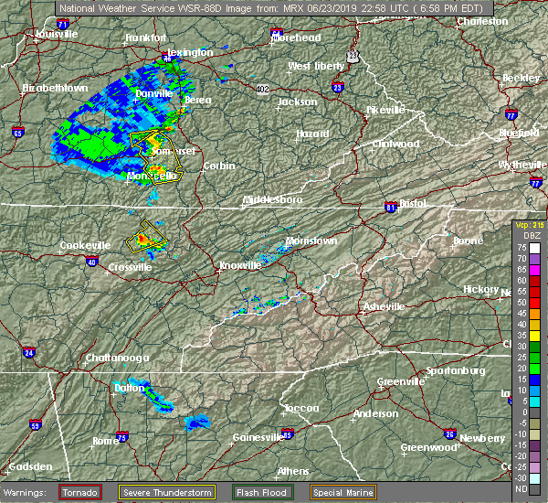 At 659 pm edt, a severe thunderstorm was located 7 miles southwest of helenwood, or 13 miles southwest of oneida, moving northeast at 30 mph (radar indicated). Hazards include 60 mph wind gusts and quarter size hail. Hail damage to vehicles is expected. expect wind damage to roofs, siding, and trees. Locations impacted include, sunbright, rugby, rugby state park, honey creek state park, elgin, robbins, slick rock and frozen head state park. At 659 pm edt, a severe thunderstorm was located 7 miles southwest of helenwood, or 13 miles southwest of oneida, moving northeast at 30 mph (radar indicated). Hazards include 60 mph wind gusts and quarter size hail. Hail damage to vehicles is expected. expect wind damage to roofs, siding, and trees. Locations impacted include, sunbright, rugby, rugby state park, honey creek state park, elgin, robbins, slick rock and frozen head state park.
|
| 6/23/2019 6:41 PM EDT |
 At 641 pm edt, a severe thunderstorm was located 13 miles northwest of wartburg, moving northeast at 30 mph (radar indicated). Hazards include 60 mph wind gusts and quarter size hail. Hail damage to vehicles is expected. Expect wind damage to roofs, siding, and trees. At 641 pm edt, a severe thunderstorm was located 13 miles northwest of wartburg, moving northeast at 30 mph (radar indicated). Hazards include 60 mph wind gusts and quarter size hail. Hail damage to vehicles is expected. Expect wind damage to roofs, siding, and trees.
|
| 6/21/2019 10:50 PM EDT | Couple of trees down on peters ford r in morgan county TN, 6.8 miles SE of Sunbright, TN |
| 6/21/2019 10:29 PM EDT |
 At 1016 pm edt, severe thunderstorms were located along a line extending from near steubenville to 7 miles east of monterey, moving east at 55 mph (radar indicated). Hazards include 70 mph wind gusts and nickel size hail. Expect considerable tree damage. Damage is likely to mobile homes, roofs, and outbuildings. At 1016 pm edt, severe thunderstorms were located along a line extending from near steubenville to 7 miles east of monterey, moving east at 55 mph (radar indicated). Hazards include 70 mph wind gusts and nickel size hail. Expect considerable tree damage. Damage is likely to mobile homes, roofs, and outbuildings.
|
| 6/21/2019 10:17 PM EDT |
 At 1016 pm edt, severe thunderstorms were located along a line extending from near steubenville to 7 miles east of monterey, moving east at 55 mph (radar indicated). Hazards include 70 mph wind gusts and nickel size hail. Expect considerable tree damage. Damage is likely to mobile homes, roofs, and outbuildings. At 1016 pm edt, severe thunderstorms were located along a line extending from near steubenville to 7 miles east of monterey, moving east at 55 mph (radar indicated). Hazards include 70 mph wind gusts and nickel size hail. Expect considerable tree damage. Damage is likely to mobile homes, roofs, and outbuildings.
|
| 6/19/2019 11:54 PM EDT |
 At 1154 pm edt, severe thunderstorms were located along a line extending from near hollyhill to near huntsville to 9 miles northwest of wartburg, moving east at 40 mph (radar indicated). Hazards include 60 mph wind gusts and penny size hail. expect damage to roofs, siding, and trees At 1154 pm edt, severe thunderstorms were located along a line extending from near hollyhill to near huntsville to 9 miles northwest of wartburg, moving east at 40 mph (radar indicated). Hazards include 60 mph wind gusts and penny size hail. expect damage to roofs, siding, and trees
|
| 6/19/2019 11:38 PM EDT |
 At 1138 pm edt, severe thunderstorms were located along a line extending from near blue heron to near fairfield glade, moving east at 35 mph (radar indicated). Hazards include 60 mph wind gusts and quarter size hail. Hail damage to vehicles is expected. expect wind damage to roofs, siding, and trees. Locations impacted include, oneida, wartburg, huntsville, helenwood, winfield, sunbright, oakdale, rugby, high point, smokey junction, pine orchard, honey creek state park, robbins, big south fork national park, rugby state park, deerlodge, ketchen, norma, elgin and frozen head state park. At 1138 pm edt, severe thunderstorms were located along a line extending from near blue heron to near fairfield glade, moving east at 35 mph (radar indicated). Hazards include 60 mph wind gusts and quarter size hail. Hail damage to vehicles is expected. expect wind damage to roofs, siding, and trees. Locations impacted include, oneida, wartburg, huntsville, helenwood, winfield, sunbright, oakdale, rugby, high point, smokey junction, pine orchard, honey creek state park, robbins, big south fork national park, rugby state park, deerlodge, ketchen, norma, elgin and frozen head state park.
|
| 6/19/2019 11:19 PM EDT |
 At 1118 pm edt, severe thunderstorms were located along a line extending from great meadows campsites to crossville, moving east at 30 mph (radar indicated). Hazards include 60 mph wind gusts and quarter size hail. Hail damage to vehicles is expected. Expect wind damage to roofs, siding, and trees. At 1118 pm edt, severe thunderstorms were located along a line extending from great meadows campsites to crossville, moving east at 30 mph (radar indicated). Hazards include 60 mph wind gusts and quarter size hail. Hail damage to vehicles is expected. Expect wind damage to roofs, siding, and trees.
|
| 8/8/2018 2:11 PM EDT |
 At 211 pm edt, severe thunderstorms were located along a line extending from near betsey to helenwood to near fairfield glade, moving east at 55 mph (radar indicated). Hazards include 60 mph wind gusts and penny size hail. Expect damage to roofs, siding, and trees. Locations impacted include, la follette, oneida, wartburg, oliver springs, jacksboro, huntsville, helenwood, jellico, caryville, lake city, winfield, sunbright, rugby, high point, elk valley, smokey junction, honey creek state park, rosedale, robbins and big south fork national park. At 211 pm edt, severe thunderstorms were located along a line extending from near betsey to helenwood to near fairfield glade, moving east at 55 mph (radar indicated). Hazards include 60 mph wind gusts and penny size hail. Expect damage to roofs, siding, and trees. Locations impacted include, la follette, oneida, wartburg, oliver springs, jacksboro, huntsville, helenwood, jellico, caryville, lake city, winfield, sunbright, rugby, high point, elk valley, smokey junction, honey creek state park, rosedale, robbins and big south fork national park.
|
| 8/8/2018 1:53 PM EDT |
 At 152 pm edt, severe thunderstorms were located along a line extending from near parnell to near jamestown to 8 miles north of crossville, moving east at 35 mph (radar indicated). Hazards include 60 mph wind gusts and penny size hail. expect damage to roofs, siding, and trees At 152 pm edt, severe thunderstorms were located along a line extending from near parnell to near jamestown to 8 miles north of crossville, moving east at 35 mph (radar indicated). Hazards include 60 mph wind gusts and penny size hail. expect damage to roofs, siding, and trees
|
| 7/21/2018 2:43 AM EDT |
 At 243 am edt, a severe thunderstorm was located over midtown, or near kingston, moving east at 35 mph (radar indicated). Hazards include 60 mph wind gusts and penny size hail. Expect damage to roofs, siding, and trees. locations impacted include, oak ridge, clinton, kingston, rockwood, wartburg, fairview, oliver springs, midtown, harriman, sunbright, oakdale, coalfield, bradbury, smokey junction, pine orchard, rosedale, dearmond, frozen head state park, slick rock and petros. A tornado watch remains in effect until 400 am edt for east tennessee. At 243 am edt, a severe thunderstorm was located over midtown, or near kingston, moving east at 35 mph (radar indicated). Hazards include 60 mph wind gusts and penny size hail. Expect damage to roofs, siding, and trees. locations impacted include, oak ridge, clinton, kingston, rockwood, wartburg, fairview, oliver springs, midtown, harriman, sunbright, oakdale, coalfield, bradbury, smokey junction, pine orchard, rosedale, dearmond, frozen head state park, slick rock and petros. A tornado watch remains in effect until 400 am edt for east tennessee.
|
| 7/21/2018 2:11 AM EDT |
 At 210 am edt, a severe thunderstorm was located 13 miles southeast of jamestown, moving southeast at 40 mph (radar indicated). Hazards include 60 mph wind gusts and penny size hail. expect damage to roofs, siding, and trees At 210 am edt, a severe thunderstorm was located 13 miles southeast of jamestown, moving southeast at 40 mph (radar indicated). Hazards include 60 mph wind gusts and penny size hail. expect damage to roofs, siding, and trees
|
| 6/28/2018 5:15 AM EDT | A few trees down and some power outages near burrvill in morgan county TN, 5.5 miles SE of Sunbright, TN |
| 6/27/2018 4:53 PM EDT |
 At 452 pm edt, a severe thunderstorm was located near wartburg, moving southeast at 35 mph (radar indicated). Hazards include 60 mph wind gusts and penny size hail. Expect damage to roofs, siding, and trees. Locations impacted include, wartburg, harriman, sunbright, oakdale, high point, deerlodge, frozen head state park, petros and rugby state park. At 452 pm edt, a severe thunderstorm was located near wartburg, moving southeast at 35 mph (radar indicated). Hazards include 60 mph wind gusts and penny size hail. Expect damage to roofs, siding, and trees. Locations impacted include, wartburg, harriman, sunbright, oakdale, high point, deerlodge, frozen head state park, petros and rugby state park.
|
| 6/27/2018 4:28 PM EDT |
 At 428 pm edt, a severe thunderstorm was located 9 miles south of jamestown, moving southeast at 35 mph (radar indicated). Hazards include 60 mph wind gusts and penny size hail. expect damage to roofs, siding, and trees At 428 pm edt, a severe thunderstorm was located 9 miles south of jamestown, moving southeast at 35 mph (radar indicated). Hazards include 60 mph wind gusts and penny size hail. expect damage to roofs, siding, and trees
|
| 6/26/2018 4:39 PM EDT |
 At 438 pm edt, severe thunderstorms were located along a line extending from 11 miles southwest of helenwood to 6 miles southwest of wartburg, moving southeast at 35 mph (radar indicated). Hazards include 60 mph wind gusts and quarter size hail. Hail damage to vehicles is expected. expect wind damage to roofs, siding, and trees. Locations impacted include, wartburg, oliver springs, sunbright, oakdale, coalfield, high point, pine orchard, deerlodge, frozen head state park and petros. At 438 pm edt, severe thunderstorms were located along a line extending from 11 miles southwest of helenwood to 6 miles southwest of wartburg, moving southeast at 35 mph (radar indicated). Hazards include 60 mph wind gusts and quarter size hail. Hail damage to vehicles is expected. expect wind damage to roofs, siding, and trees. Locations impacted include, wartburg, oliver springs, sunbright, oakdale, coalfield, high point, pine orchard, deerlodge, frozen head state park and petros.
|
| 6/26/2018 4:21 PM EDT |
 At 421 pm edt, severe thunderstorms were located along a line extending from 6 miles southwest of helenwood to 9 miles northeast of monterey, moving southeast at 25 mph (radar indicated). Hazards include 60 mph wind gusts and quarter size hail. Hail damage to vehicles is expected. Expect wind damage to roofs, siding, and trees. At 421 pm edt, severe thunderstorms were located along a line extending from 6 miles southwest of helenwood to 9 miles northeast of monterey, moving southeast at 25 mph (radar indicated). Hazards include 60 mph wind gusts and quarter size hail. Hail damage to vehicles is expected. Expect wind damage to roofs, siding, and trees.
|
| 6/25/2018 2:09 PM EDT |
 At 209 pm edt, severe thunderstorms were located along a line extending from zion hill to near jacksboro, moving east at 45 mph (radar indicated). Hazards include 60 mph wind gusts and penny size hail. Expect damage to roofs, siding, and trees. Locations impacted include, clinton, la follette, oneida, jacksboro, huntsville, helenwood, jellico, caryville, lake city, norris, winfield, sunbright, norris dam state park, rugby, elk valley, smokey junction, rosedale, robbins, cove lake state park and ketchen. At 209 pm edt, severe thunderstorms were located along a line extending from zion hill to near jacksboro, moving east at 45 mph (radar indicated). Hazards include 60 mph wind gusts and penny size hail. Expect damage to roofs, siding, and trees. Locations impacted include, clinton, la follette, oneida, jacksboro, huntsville, helenwood, jellico, caryville, lake city, norris, winfield, sunbright, norris dam state park, rugby, elk valley, smokey junction, rosedale, robbins, cove lake state park and ketchen.
|
| 6/25/2018 1:43 PM EDT |
 At 142 pm edt, severe thunderstorms were located along a line extending from near co-operative to 9 miles northwest of wartburg, moving east at 20 mph (radar indicated). Hazards include 60 mph wind gusts and quarter size hail. Hail damage to vehicles is expected. Expect wind damage to roofs, siding, and trees. At 142 pm edt, severe thunderstorms were located along a line extending from near co-operative to 9 miles northwest of wartburg, moving east at 20 mph (radar indicated). Hazards include 60 mph wind gusts and quarter size hail. Hail damage to vehicles is expected. Expect wind damage to roofs, siding, and trees.
|
| 5/31/2018 5:54 PM EDT |
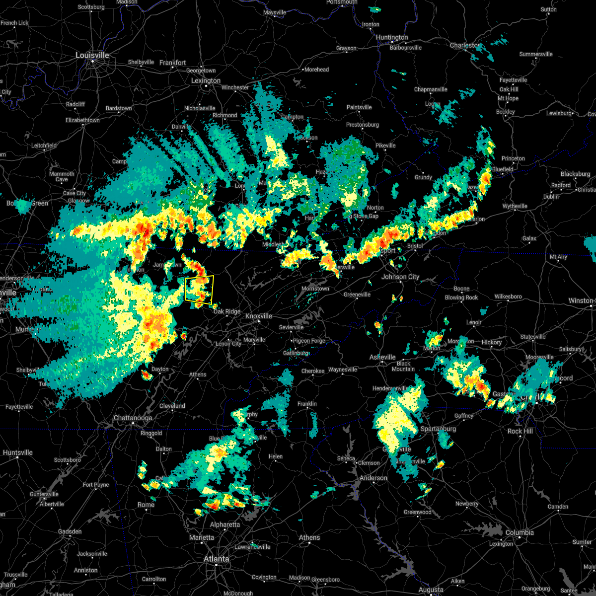 The severe thunderstorm warning for central morgan and southwestern scott counties will expire at 600 pm edt, the storm which prompted the warning has weakened below severe limits, and no longer poses an immediate threat to life or property. therefore, the warning will be allowed to expire. however gusty winds are still possible with this thunderstorm. The severe thunderstorm warning for central morgan and southwestern scott counties will expire at 600 pm edt, the storm which prompted the warning has weakened below severe limits, and no longer poses an immediate threat to life or property. therefore, the warning will be allowed to expire. however gusty winds are still possible with this thunderstorm.
|
| 5/31/2018 5:36 PM EDT |
 At 536 pm edt, a severe thunderstorm was located 10 miles north of wartburg, moving east at 25 mph (radar indicated). Hazards include 60 mph wind gusts. Expect damage to roofs, siding, and trees. Locations impacted include, sunbright, elgin, frozen head state park, slick rock, robbins and petros. At 536 pm edt, a severe thunderstorm was located 10 miles north of wartburg, moving east at 25 mph (radar indicated). Hazards include 60 mph wind gusts. Expect damage to roofs, siding, and trees. Locations impacted include, sunbright, elgin, frozen head state park, slick rock, robbins and petros.
|
| 5/31/2018 5:17 PM EDT |
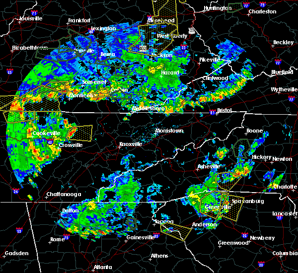 At 516 pm edt, a severe thunderstorm was located 13 miles northwest of wartburg, moving east at 30 mph (radar indicated). Hazards include 60 mph wind gusts. expect damage to roofs, siding, and trees At 516 pm edt, a severe thunderstorm was located 13 miles northwest of wartburg, moving east at 30 mph (radar indicated). Hazards include 60 mph wind gusts. expect damage to roofs, siding, and trees
|
| 4/4/2018 12:33 AM EDT |
 At 1232 am edt, severe thunderstorms were located along a line extending from 11 miles south of huntsville to 7 miles west of rockwood, moving east at 65 mph (radar indicated). Hazards include 60 mph wind gusts. Expect damage to roofs, siding, and trees. Locations impacted include, wartburg, oliver springs, huntsville, harriman, sunbright, oakdale, rugby, high point, coalfield, smokey junction, pine orchard, robbins, rugby state park, deerlodge, norma, elgin, frozen head state park, slick rock and petros. At 1232 am edt, severe thunderstorms were located along a line extending from 11 miles south of huntsville to 7 miles west of rockwood, moving east at 65 mph (radar indicated). Hazards include 60 mph wind gusts. Expect damage to roofs, siding, and trees. Locations impacted include, wartburg, oliver springs, huntsville, harriman, sunbright, oakdale, rugby, high point, coalfield, smokey junction, pine orchard, robbins, rugby state park, deerlodge, norma, elgin, frozen head state park, slick rock and petros.
|
| 4/4/2018 12:16 AM EDT |
 At 1216 am edt, severe thunderstorms were located along a line extending from 11 miles northeast of fairfield glade to 10 miles southwest of crossville, moving east at 45 mph (radar indicated). Hazards include 60 mph wind gusts. expect damage to roofs, siding, and trees At 1216 am edt, severe thunderstorms were located along a line extending from 11 miles northeast of fairfield glade to 10 miles southwest of crossville, moving east at 45 mph (radar indicated). Hazards include 60 mph wind gusts. expect damage to roofs, siding, and trees
|
| 7/6/2017 7:20 PM EDT |
 At 720 pm edt, severe thunderstorms were located along a line extending from near peepace store to near tazewell to 11 miles south of pruden to 7 miles north of wartburg, moving east at 50 mph (radar indicated). Hazards include 60 mph wind gusts and penny size hail. Expect damage to roofs, siding, and trees. Locations impacted include, la follette, wartburg, jacksboro, caryville, lake city, sunbright, high point, smokey junction, rosedale, disney, cove lake state park, deerlodge, clairfield, fincastle, royal blue, norma, frozen head state park, slick rock, petros and elgin. At 720 pm edt, severe thunderstorms were located along a line extending from near peepace store to near tazewell to 11 miles south of pruden to 7 miles north of wartburg, moving east at 50 mph (radar indicated). Hazards include 60 mph wind gusts and penny size hail. Expect damage to roofs, siding, and trees. Locations impacted include, la follette, wartburg, jacksboro, caryville, lake city, sunbright, high point, smokey junction, rosedale, disney, cove lake state park, deerlodge, clairfield, fincastle, royal blue, norma, frozen head state park, slick rock, petros and elgin.
|
| 7/6/2017 6:54 PM EDT |
 At 653 pm edt, severe thunderstorms were located along a line extending from ferndale to near wilkerson to 7 miles northwest of la follette to 15 miles south of jamestown, moving east at 50 mph (radar indicated). Hazards include 60 mph wind gusts and penny size hail. Expect damage to roofs, siding, and trees. Locations impacted include, la follette, oneida, wartburg, jacksboro, huntsville, helenwood, jellico, caryville, lake city, winfield, sunbright, rugby, high point, elk valley, smokey junction, rosedale, robbins, cove lake state park, deerlodge and ketchen. At 653 pm edt, severe thunderstorms were located along a line extending from ferndale to near wilkerson to 7 miles northwest of la follette to 15 miles south of jamestown, moving east at 50 mph (radar indicated). Hazards include 60 mph wind gusts and penny size hail. Expect damage to roofs, siding, and trees. Locations impacted include, la follette, oneida, wartburg, jacksboro, huntsville, helenwood, jellico, caryville, lake city, winfield, sunbright, rugby, high point, elk valley, smokey junction, rosedale, robbins, cove lake state park, deerlodge and ketchen.
|
| 7/6/2017 6:29 PM EDT |
 At 628 pm edt, severe thunderstorms were located along a line extending from siler to near zion hill to near helenwood to near monterey, moving east at 45 mph (radar indicated). Hazards include 60 mph wind gusts and penny size hail. expect damage to roofs, siding, and trees At 628 pm edt, severe thunderstorms were located along a line extending from siler to near zion hill to near helenwood to near monterey, moving east at 45 mph (radar indicated). Hazards include 60 mph wind gusts and penny size hail. expect damage to roofs, siding, and trees
|
| 5/27/2017 8:37 PM CDT |
 At 937 pm edt/837 pm cdt/, severe thunderstorms were located along a line extending from huntsville to 12 miles southwest of jamestown to near monterey to 11 miles east of sparta to near spencer to 8 miles west of mcminnville, moving southeast at 60 mph (radar indicated). Hazards include 70 mph wind gusts and quarter size hail. Hail damage to vehicles is expected. expect considerable tree damage. wind damage is also likely to mobile homes, roofs, and outbuildings. Locations impacted include, oak ridge, dayton, kingston, rockwood, dunlap, oneida, pikeville, wartburg, fairview, spring city, huntsville, midtown, helenwood, harriman, graysville, winfield, sunbright, oakdale, rugby and high point. At 937 pm edt/837 pm cdt/, severe thunderstorms were located along a line extending from huntsville to 12 miles southwest of jamestown to near monterey to 11 miles east of sparta to near spencer to 8 miles west of mcminnville, moving southeast at 60 mph (radar indicated). Hazards include 70 mph wind gusts and quarter size hail. Hail damage to vehicles is expected. expect considerable tree damage. wind damage is also likely to mobile homes, roofs, and outbuildings. Locations impacted include, oak ridge, dayton, kingston, rockwood, dunlap, oneida, pikeville, wartburg, fairview, spring city, huntsville, midtown, helenwood, harriman, graysville, winfield, sunbright, oakdale, rugby and high point.
|
| 5/27/2017 8:25 PM CDT |
 At 925 pm edt/825 pm cdt/, severe thunderstorms were located along a line extending from 7 miles south of great meadows campsites to livingston to near algood to 6 miles south of cookeville to 9 miles southeast of smithville to near woodbury, moving southeast at 55 mph (radar indicated). Hazards include 60 mph wind gusts and quarter size hail. Hail damage to vehicles is expected. Expect wind damage to roofs, siding, and trees. At 925 pm edt/825 pm cdt/, severe thunderstorms were located along a line extending from 7 miles south of great meadows campsites to livingston to near algood to 6 miles south of cookeville to 9 miles southeast of smithville to near woodbury, moving southeast at 55 mph (radar indicated). Hazards include 60 mph wind gusts and quarter size hail. Hail damage to vehicles is expected. Expect wind damage to roofs, siding, and trees.
|
| 3/1/2017 10:20 AM EST |
 At 1019 am est, severe thunderstorms were located along a line extending from youngs creek to near jacksboro to near wartburg, moving east at 65 mph (radar indicated). Hazards include 70 mph wind gusts and quarter size hail. Hail damage to vehicles is expected. expect considerable tree damage. wind damage is also likely to mobile homes, roofs, and outbuildings. Locations impacted include, oak ridge, clinton, la follette, kingston, rockwood, oneida, wartburg, oliver springs, jacksboro, huntsville, helenwood, midtown, harriman, jellico, caryville, lake city, norris, winfield, sunbright and oakdale. At 1019 am est, severe thunderstorms were located along a line extending from youngs creek to near jacksboro to near wartburg, moving east at 65 mph (radar indicated). Hazards include 70 mph wind gusts and quarter size hail. Hail damage to vehicles is expected. expect considerable tree damage. wind damage is also likely to mobile homes, roofs, and outbuildings. Locations impacted include, oak ridge, clinton, la follette, kingston, rockwood, oneida, wartburg, oliver springs, jacksboro, huntsville, helenwood, midtown, harriman, jellico, caryville, lake city, norris, winfield, sunbright and oakdale.
|
| 3/1/2017 10:02 AM EST |
 At 959 am est, severe thunderstorms were located along a line extending from denney to 11 miles southwest of helenwood to fairfield glade, moving east at 65 mph (radar indicated). Hazards include 70 mph wind gusts and quarter size hail. Hail damage to vehicles is expected. expect considerable tree damage. wind damage is also likely to mobile homes, roofs, and outbuildings. Locations impacted include, oak ridge, clinton, la follette, kingston, rockwood, oneida, wartburg, oliver springs, jacksboro, huntsville, helenwood, midtown, harriman, jellico, caryville, lake city, norris, winfield, sunbright and oakdale. At 959 am est, severe thunderstorms were located along a line extending from denney to 11 miles southwest of helenwood to fairfield glade, moving east at 65 mph (radar indicated). Hazards include 70 mph wind gusts and quarter size hail. Hail damage to vehicles is expected. expect considerable tree damage. wind damage is also likely to mobile homes, roofs, and outbuildings. Locations impacted include, oak ridge, clinton, la follette, kingston, rockwood, oneida, wartburg, oliver springs, jacksboro, huntsville, helenwood, midtown, harriman, jellico, caryville, lake city, norris, winfield, sunbright and oakdale.
|
| 3/1/2017 9:37 AM EST |
 At 936 am est, severe thunderstorms were located along a line extending from near zula to 11 miles northeast of monterey to 10 miles east of sparta, moving east at 65 mph (radar indicated). Hazards include 70 mph wind gusts and quarter size hail. Hail damage to vehicles is expected. expect considerable tree damage. Wind damage is also likely to mobile homes, roofs, and outbuildings. At 936 am est, severe thunderstorms were located along a line extending from near zula to 11 miles northeast of monterey to 10 miles east of sparta, moving east at 65 mph (radar indicated). Hazards include 70 mph wind gusts and quarter size hail. Hail damage to vehicles is expected. expect considerable tree damage. Wind damage is also likely to mobile homes, roofs, and outbuildings.
|
| 12/18/2016 2:20 AM EST |
 At 219 am est, severe thunderstorms were located along a line extending from near dorthae to 8 miles southwest of jamestown, moving east at 60 mph (radar indicated). Hazards include 70 mph wind gusts and quarter size hail. Hail damage to vehicles is expected. expect considerable tree damage. wind damage is also likely to mobile homes, roofs, and outbuildings. locations impacted include, oneida, huntsville, helenwood, jellico, caryville, winfield, sunbright, elk valley, ketchen, slick rock, deerlodge, high point, rugby, royal blue, robbins, norma, indian mountain s. p. elgin, big south fork national and rugby s. P At 219 am est, severe thunderstorms were located along a line extending from near dorthae to 8 miles southwest of jamestown, moving east at 60 mph (radar indicated). Hazards include 70 mph wind gusts and quarter size hail. Hail damage to vehicles is expected. expect considerable tree damage. wind damage is also likely to mobile homes, roofs, and outbuildings. locations impacted include, oneida, huntsville, helenwood, jellico, caryville, winfield, sunbright, elk valley, ketchen, slick rock, deerlodge, high point, rugby, royal blue, robbins, norma, indian mountain s. p. elgin, big south fork national and rugby s. P
|
| 12/18/2016 1:49 AM EST |
 At 148 am est, severe thunderstorms were located along a line extending from near delta to near baxter, moving east at 50 mph (radar indicated). Hazards include 60 mph wind gusts and penny size hail. expect damage to roofs, siding, and trees At 148 am est, severe thunderstorms were located along a line extending from near delta to near baxter, moving east at 50 mph (radar indicated). Hazards include 60 mph wind gusts and penny size hail. expect damage to roofs, siding, and trees
|
| 11/30/2016 3:24 AM EST |
 At 324 am est, a severe thunderstorm capable of producing a tornado was located near fairfield glade, or 14 miles west of wartburg, moving northeast at 45 mph (radar indicated rotation). Hazards include tornado. Flying debris will be dangerous to those caught without shelter. mobile homes will be damaged or destroyed. damage to roofs, windows, and vehicles will occur. tree damage is likely. this dangerous storm will be near, wartburg around 340 am est. other locations impacted by this tornadic thunderstorm include sunbright, deerlodge, high point and frozen head s. P At 324 am est, a severe thunderstorm capable of producing a tornado was located near fairfield glade, or 14 miles west of wartburg, moving northeast at 45 mph (radar indicated rotation). Hazards include tornado. Flying debris will be dangerous to those caught without shelter. mobile homes will be damaged or destroyed. damage to roofs, windows, and vehicles will occur. tree damage is likely. this dangerous storm will be near, wartburg around 340 am est. other locations impacted by this tornadic thunderstorm include sunbright, deerlodge, high point and frozen head s. P
|
| 7/19/2016 3:13 PM EDT |
 At 313 pm edt, a severe thunderstorm was located near midtown, or 7 miles northeast of rockwood, moving southeast at 35 mph (radar indicated). Hazards include 60 mph wind gusts and quarter size hail. Hail damage to vehicles is expected. expect wind damage to roofs, siding, and trees. locations impacted include, wartburg, oliver springs, sunbright, oakdale, frozen head s. p,. coalfield, petros, slick rock, deerlodge, rugby, pine orchard, robbins, elgin and rugby s. P At 313 pm edt, a severe thunderstorm was located near midtown, or 7 miles northeast of rockwood, moving southeast at 35 mph (radar indicated). Hazards include 60 mph wind gusts and quarter size hail. Hail damage to vehicles is expected. expect wind damage to roofs, siding, and trees. locations impacted include, wartburg, oliver springs, sunbright, oakdale, frozen head s. p,. coalfield, petros, slick rock, deerlodge, rugby, pine orchard, robbins, elgin and rugby s. P
|
| 7/19/2016 2:49 PM EDT |
 At 248 pm edt, a severe thunderstorm was located 7 miles northwest of wartburg, moving south at 35 mph (radar indicated). Hazards include 60 mph wind gusts and quarter size hail. Hail damage to vehicles is expected. Expect wind damage to roofs, siding, and trees. At 248 pm edt, a severe thunderstorm was located 7 miles northwest of wartburg, moving south at 35 mph (radar indicated). Hazards include 60 mph wind gusts and quarter size hail. Hail damage to vehicles is expected. Expect wind damage to roofs, siding, and trees.
|
| 7/9/2016 12:22 AM EDT |
 At 1222 am edt, severe thunderstorms were located along a line extending from 10 miles south of helenwood to near wartburg to 7 miles northwest of midtown, moving east at 55 mph (radar indicated). Hazards include 60 mph wind gusts. Expect damage to roofs. siding. and trees. locations impacted include, kingston, rockwood, wartburg, oliver springs, midtown, helenwood, harriman, sunbright, oakdale, frozen head s. p,. Coalfield, dearmond, petros, slick rock, smokey junction, rugby, pine orchard, robbins, norma and rosedale. At 1222 am edt, severe thunderstorms were located along a line extending from 10 miles south of helenwood to near wartburg to 7 miles northwest of midtown, moving east at 55 mph (radar indicated). Hazards include 60 mph wind gusts. Expect damage to roofs. siding. and trees. locations impacted include, kingston, rockwood, wartburg, oliver springs, midtown, helenwood, harriman, sunbright, oakdale, frozen head s. p,. Coalfield, dearmond, petros, slick rock, smokey junction, rugby, pine orchard, robbins, norma and rosedale.
|
| 7/9/2016 12:03 AM EDT |
 At 1202 am edt, severe thunderstorms were located along a line extending from 8 miles east of jamestown to 11 miles west of wartburg to near fairfield glade, moving east at 55 mph (radar indicated). Hazards include 60 mph wind gusts. Expect damage to roofs. siding. And trees. At 1202 am edt, severe thunderstorms were located along a line extending from 8 miles east of jamestown to 11 miles west of wartburg to near fairfield glade, moving east at 55 mph (radar indicated). Hazards include 60 mph wind gusts. Expect damage to roofs. siding. And trees.
|
| 7/8/2016 5:10 PM EDT | Trees and power lines down along glades roa in morgan county TN, 6.7 miles E of Sunbright, TN |
| 7/8/2016 5:10 PM EDT | Trees and power lines down on blades roa in morgan county TN, 6.8 miles NNE of Sunbright, TN |
| 7/8/2016 5:01 PM EDT |
 At 500 pm edt, a severe thunderstorm was located 12 miles north of fairfield glade, or 17 miles west of wartburg, moving east at 30 mph (radar indicated). Hazards include 60 mph wind gusts and half dollar size hail. Hail damage to vehicles is expected. expect wind damage to roofs, siding, and trees. locations impacted include, sunbright, deerlodge, high point and frozen head s. P At 500 pm edt, a severe thunderstorm was located 12 miles north of fairfield glade, or 17 miles west of wartburg, moving east at 30 mph (radar indicated). Hazards include 60 mph wind gusts and half dollar size hail. Hail damage to vehicles is expected. expect wind damage to roofs, siding, and trees. locations impacted include, sunbright, deerlodge, high point and frozen head s. P
|
| 7/8/2016 4:47 PM EDT |
 At 446 pm edt, a severe thunderstorm was located 13 miles east of monterey, or 16 miles south of jamestown, moving east at 30 mph (radar indicated). Hazards include 60 mph wind gusts and half dollar size hail. Hail damage to vehicles is expected. Expect wind damage to roofs, siding, and trees. At 446 pm edt, a severe thunderstorm was located 13 miles east of monterey, or 16 miles south of jamestown, moving east at 30 mph (radar indicated). Hazards include 60 mph wind gusts and half dollar size hail. Hail damage to vehicles is expected. Expect wind damage to roofs, siding, and trees.
|
| 7/7/2016 6:02 PM EDT |
 At 601 pm edt, severe thunderstorms were located along a line extending from near huntsville to 11 miles west of jacksboro to 8 miles northwest of oliver springs, moving southeast at 45 mph (radar indicated). Hazards include 60 mph wind gusts and penny size hail. Expect damage to roofs. siding. and trees. locations impacted include, la follette, oneida, wartburg, oliver springs, jacksboro, huntsville, helenwood, jellico, caryville, lake city, norris, winfield, sunbright, oakdale, cove lake s. p,. frozen head s. p,. Petros, disney, high point and royal blue. At 601 pm edt, severe thunderstorms were located along a line extending from near huntsville to 11 miles west of jacksboro to 8 miles northwest of oliver springs, moving southeast at 45 mph (radar indicated). Hazards include 60 mph wind gusts and penny size hail. Expect damage to roofs. siding. and trees. locations impacted include, la follette, oneida, wartburg, oliver springs, jacksboro, huntsville, helenwood, jellico, caryville, lake city, norris, winfield, sunbright, oakdale, cove lake s. p,. frozen head s. p,. Petros, disney, high point and royal blue.
|
| 7/7/2016 5:55 PM EDT | Trees downed throughout count in morgan county TN, 0.6 miles WNW of Sunbright, TN |
| 7/7/2016 5:52 PM EDT |
 At 551 pm edt, severe thunderstorms were located along a line extending from near oneida to 6 miles south of huntsville to near wartburg, moving east at 45 mph (radar indicated). Hazards include 60 mph wind gusts and penny size hail. Expect damage to roofs. siding. and trees. locations impacted include, la follette, oneida, wartburg, oliver springs, jacksboro, huntsville, helenwood, jellico, caryville, lake city, norris, winfield, sunbright, oakdale, cove lake s. p,. frozen head s. p,. Petros, disney, high point and royal blue. At 551 pm edt, severe thunderstorms were located along a line extending from near oneida to 6 miles south of huntsville to near wartburg, moving east at 45 mph (radar indicated). Hazards include 60 mph wind gusts and penny size hail. Expect damage to roofs. siding. and trees. locations impacted include, la follette, oneida, wartburg, oliver springs, jacksboro, huntsville, helenwood, jellico, caryville, lake city, norris, winfield, sunbright, oakdale, cove lake s. p,. frozen head s. p,. Petros, disney, high point and royal blue.
|
| 7/7/2016 5:34 PM EDT |
 At 534 pm edt, severe thunderstorms were located along a line extending from near great meadows campsites in the big south fork to near helenwood to 14 miles southeast of jamestown, moving east at 55 mph (radar indicated). Hazards include 60 mph wind gusts and penny size hail. Expect damage to roofs. siding. And trees. At 534 pm edt, severe thunderstorms were located along a line extending from near great meadows campsites in the big south fork to near helenwood to 14 miles southeast of jamestown, moving east at 55 mph (radar indicated). Hazards include 60 mph wind gusts and penny size hail. Expect damage to roofs. siding. And trees.
|
| 5/2/2016 1:42 PM EDT | The severe thunderstorm warning for central scott and north central morgan counties will expire at 145 pm edt, the storm which prompted the warning has weakened below severe limits, and no longer pose an immediate threat to life or property. therefore the warning will be allowed to expire. however small hail is still possible with this thunderstorm. |
| 5/2/2016 1:32 PM EDT |
 At 132 pm edt, a severe thunderstorm was located 10 miles south of helenwood, or 11 miles north of wartburg, moving northeast at 25 mph (radar indicated). Hazards include 60 mph wind gusts and quarter size hail. Hail damage to vehicles is expected. expect wind damage to roofs, siding, and trees. Locations impacted include, oneida, huntsville, helenwood, sunbright, elgin, slick rock, rugby and smokey junction. At 132 pm edt, a severe thunderstorm was located 10 miles south of helenwood, or 11 miles north of wartburg, moving northeast at 25 mph (radar indicated). Hazards include 60 mph wind gusts and quarter size hail. Hail damage to vehicles is expected. expect wind damage to roofs, siding, and trees. Locations impacted include, oneida, huntsville, helenwood, sunbright, elgin, slick rock, rugby and smokey junction.
|
| 5/2/2016 1:18 PM EDT |
 At 118 pm edt, a severe thunderstorm was located 12 miles southwest of helenwood, or 12 miles northwest of wartburg, moving northeast at 30 mph (radar indicated). Hazards include 60 mph wind gusts and half dollar size hail. Hail damage to vehicles is expected. expect wind damage to roofs, siding, and trees. Locations impacted include, oneida, huntsville, helenwood, sunbright, elgin, slick rock, rugby, deerlodge and smokey junction. At 118 pm edt, a severe thunderstorm was located 12 miles southwest of helenwood, or 12 miles northwest of wartburg, moving northeast at 30 mph (radar indicated). Hazards include 60 mph wind gusts and half dollar size hail. Hail damage to vehicles is expected. expect wind damage to roofs, siding, and trees. Locations impacted include, oneida, huntsville, helenwood, sunbright, elgin, slick rock, rugby, deerlodge and smokey junction.
|
| 5/2/2016 1:07 PM EDT |
 At 107 pm edt, a severe thunderstorm was located 14 miles northwest of wartburg, moving northeast at 30 mph (radar indicated). Hazards include 60 mph wind gusts and quarter size hail. Hail damage to vehicles is expected. Expect wind damage to roofs, siding, and trees. At 107 pm edt, a severe thunderstorm was located 14 miles northwest of wartburg, moving northeast at 30 mph (radar indicated). Hazards include 60 mph wind gusts and quarter size hail. Hail damage to vehicles is expected. Expect wind damage to roofs, siding, and trees.
|
| 7/18/2015 4:44 PM EDT |
 At 443 pm edt, a severe thunderstorm was located near wartburg, moving east at 25 mph (radar indicated). Hazards include 60 mph wind gusts and quarter size hail. Hail damage to vehicles is expected. Expect wind damage to roofs, siding and trees. At 443 pm edt, a severe thunderstorm was located near wartburg, moving east at 25 mph (radar indicated). Hazards include 60 mph wind gusts and quarter size hail. Hail damage to vehicles is expected. Expect wind damage to roofs, siding and trees.
|
| 7/14/2015 3:15 PM EDT |
 At 315 pm edt, a severe thunderstorm capable of producing a tornado was located 20 miles west of helenwood, or 21 miles northwest of wartburg, moving southeast at 35 mph (radar indicated rotation). Hazards include tornado and quarter size hail. Flying debris will be dangerous to those caught without shelter. mobile homes will be damaged or destroyed. damage to roofs, windows and vehicles will occur. tree damage is likely. This tornadic thunderstorm will remain over mainly rural areas of northwestern morgan county, including the following locations, deerlodge, sunbright and high point. At 315 pm edt, a severe thunderstorm capable of producing a tornado was located 20 miles west of helenwood, or 21 miles northwest of wartburg, moving southeast at 35 mph (radar indicated rotation). Hazards include tornado and quarter size hail. Flying debris will be dangerous to those caught without shelter. mobile homes will be damaged or destroyed. damage to roofs, windows and vehicles will occur. tree damage is likely. This tornadic thunderstorm will remain over mainly rural areas of northwestern morgan county, including the following locations, deerlodge, sunbright and high point.
|
| 7/14/2015 3:07 PM EDT |
 At 307 pm edt, a severe thunderstorm was located 14 miles northwest of wartburg, moving southeast at 35 mph (radar indicated). Hazards include golf ball size hail and 60 mph wind gusts. People and animals outdoors will be injured. expect hail damage to roofs, siding, windows and vehicles. expect wind damage to roofs, siding and trees. Locations impacted include, wartburg, sunbright, deerlodge and high point. At 307 pm edt, a severe thunderstorm was located 14 miles northwest of wartburg, moving southeast at 35 mph (radar indicated). Hazards include golf ball size hail and 60 mph wind gusts. People and animals outdoors will be injured. expect hail damage to roofs, siding, windows and vehicles. expect wind damage to roofs, siding and trees. Locations impacted include, wartburg, sunbright, deerlodge and high point.
|
| 7/14/2015 3:00 PM EDT | Ping Pong Ball sized hail reported 5.9 miles NE of Sunbright, TN, deer lodge |
| 7/14/2015 2:51 PM EDT |
 At 250 pm edt, a severe thunderstorm was located 25 miles northwest of wartburg, moving east at 30 mph (radar indicated). Hazards include golf ball size hail and 60 mph wind gusts. People and animals outdoors will be injured. expect hail damage to roofs, siding, windows and vehicles. Expect wind damage to roofs, siding and trees. At 250 pm edt, a severe thunderstorm was located 25 miles northwest of wartburg, moving east at 30 mph (radar indicated). Hazards include golf ball size hail and 60 mph wind gusts. People and animals outdoors will be injured. expect hail damage to roofs, siding, windows and vehicles. Expect wind damage to roofs, siding and trees.
|
| 7/7/2015 10:38 PM EDT |
 At 1037 pm edt, a severe thunderstorm was located 11 miles southwest of jacksboro, or 15 miles northeast of wartburg, moving east at 35 mph (radar indicated). Hazards include 60 mph wind gusts and quarter size hail. Hail damage to vehicles is expected. expect wind damage to roofs, siding and trees. Locations impacted include, wartburg, sunbright, elgin, slick rock, rugby, deerlodge and petros. At 1037 pm edt, a severe thunderstorm was located 11 miles southwest of jacksboro, or 15 miles northeast of wartburg, moving east at 35 mph (radar indicated). Hazards include 60 mph wind gusts and quarter size hail. Hail damage to vehicles is expected. expect wind damage to roofs, siding and trees. Locations impacted include, wartburg, sunbright, elgin, slick rock, rugby, deerlodge and petros.
|
| 7/7/2015 10:12 PM EDT |
 At 1011 pm edt, a severe thunderstorm was located 11 miles southwest of helenwood, or 11 miles north of wartburg, moving east at 40 mph (radar indicated). Hazards include 60 mph wind gusts and quarter size hail. Hail damage to vehicles is expected. Expect wind damage to roofs, siding and trees. At 1011 pm edt, a severe thunderstorm was located 11 miles southwest of helenwood, or 11 miles north of wartburg, moving east at 40 mph (radar indicated). Hazards include 60 mph wind gusts and quarter size hail. Hail damage to vehicles is expected. Expect wind damage to roofs, siding and trees.
|
| 6/30/2015 3:50 PM EDT |
 At 349 pm edt, a severe thunderstorm was located 9 miles north of wartburg, moving east to southeast at 25 mph (radar indicated). Hazards include 60 mph wind gusts and up to quarter size hail. Hail damage to vehicles is expected. expect wind damage to roofs, siding and trees. locations impacted include, wartburg, huntsville, sunbright, oakdale, frozen head s. p,. Petros, slick rock, deerlodge, smokey junction, norma, elgin, robbins and coalfield. At 349 pm edt, a severe thunderstorm was located 9 miles north of wartburg, moving east to southeast at 25 mph (radar indicated). Hazards include 60 mph wind gusts and up to quarter size hail. Hail damage to vehicles is expected. expect wind damage to roofs, siding and trees. locations impacted include, wartburg, huntsville, sunbright, oakdale, frozen head s. p,. Petros, slick rock, deerlodge, smokey junction, norma, elgin, robbins and coalfield.
|
| 6/30/2015 3:30 PM EDT |
 At 329 pm edt, a severe thunderstorm was located near helenwood, or 10 miles southwest of oneida, moving southeast at 25 mph (radar indicated). Hazards include 60 mph wind gusts and quarter size hail. Hail damage to vehicles is expected. Expect wind damage to roofs, siding and trees. At 329 pm edt, a severe thunderstorm was located near helenwood, or 10 miles southwest of oneida, moving southeast at 25 mph (radar indicated). Hazards include 60 mph wind gusts and quarter size hail. Hail damage to vehicles is expected. Expect wind damage to roofs, siding and trees.
|
| 5/11/2015 3:46 PM EDT | At 345 pm edt, a severe thunderstorm was located 8 miles southwest of helenwood, or 14 miles southwest of oneida, moving northeast at 35 mph (radar indicated). Hazards include 60 mph wind gusts and quarter size hail. Hail damage to vehicles is expected. Expect wind damage to roofs, siding and trees. |
| 4/10/2015 6:13 AM EDT | A severe thunderstorm warning remains in effect until 645 am edt for central campbell. northwestern morgan and scott counties. at 611 am edt. a severe thunderstorm was located over huntsville. moving east at 45 mph. hazard. 60 mph wind gusts. source. Radar indicated. |
| 4/10/2015 6:00 AM EDT | The national weather service in morristown has issued a * severe thunderstorm warning for. central campbell county in eastern tennessee. northwestern morgan county in eastern tennessee. scott county in eastern tennessee. Until 645 am edt. |
| 2/21/2014 12:55 AM EST | Several trees down near deelodge are in morgan county TN, 5.4 miles ENE of Sunbright, TN |
| 12/22/2013 1:50 AM EST | Few trees and power lines down in deer lodg in morgan county TN, 3.2 miles ENE of Sunbright, TN |
| 12/22/2013 1:42 AM EST | Powerlines dow in morgan county TN, 5.4 miles ENE of Sunbright, TN |
| 7/5/2012 7:00 PM EDT | Light structural damage to sunbright city garage...also numerous trees and powerlines down across the count in morgan county TN, 0.6 miles WNW of Sunbright, TN |
| 7/5/2012 6:00 PM EDT | Multiple trees dow in morgan county TN, 5.4 miles ENE of Sunbright, TN |
| 4/26/2012 6:30 AM EDT | Quarter sized hail reported 8.1 miles S of Sunbright, TN |
| 1/1/0001 12:00 AM | A couple of trees down in the sunbright are in morgan county TN, 0.6 miles WNW of Sunbright, TN |
| 1/1/0001 12:00 AM | Quarter sized hail reported 9.7 miles ENE of Sunbright, TN |
| 1/1/0001 12:00 AM | A few trees down near sunbright...tennessee in morgan county TN, 0.6 miles WNW of Sunbright, TN |
| 1/1/0001 12:00 AM | Trees dow in morgan county TN, 0.6 miles WNW of Sunbright, TN |
Hail Maps for Sunbright, TN


Connect with Interactive Hail Maps