

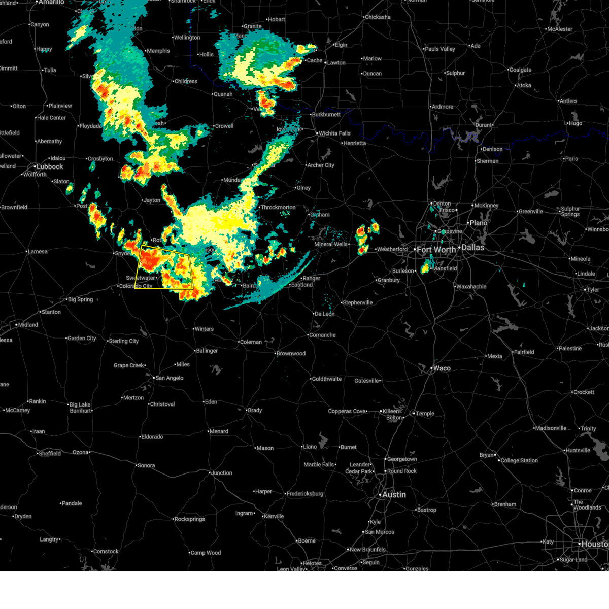
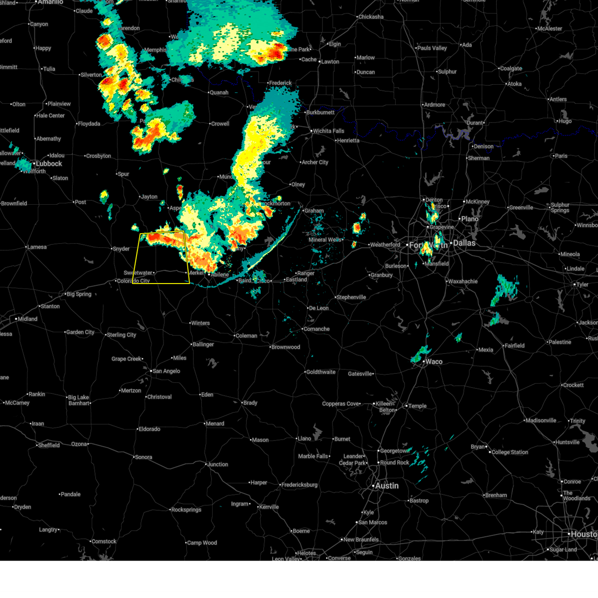
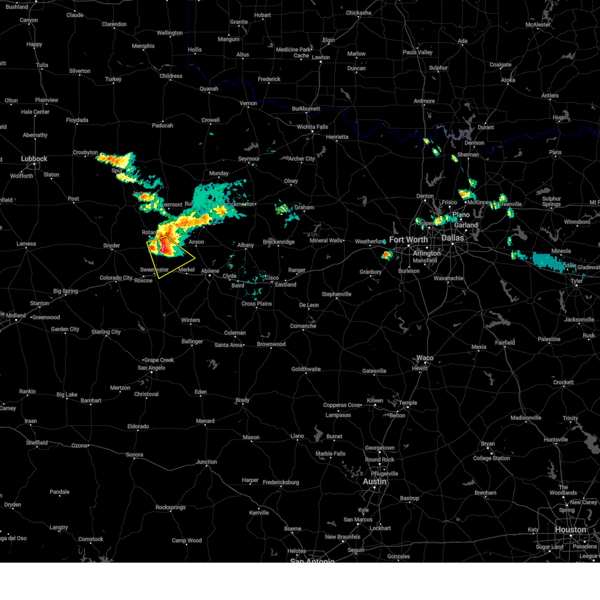
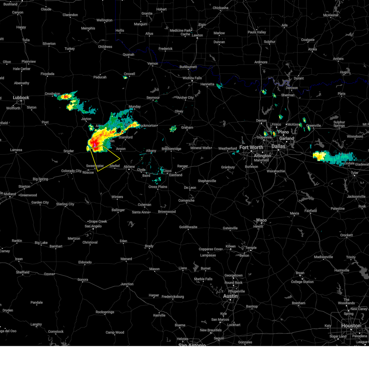
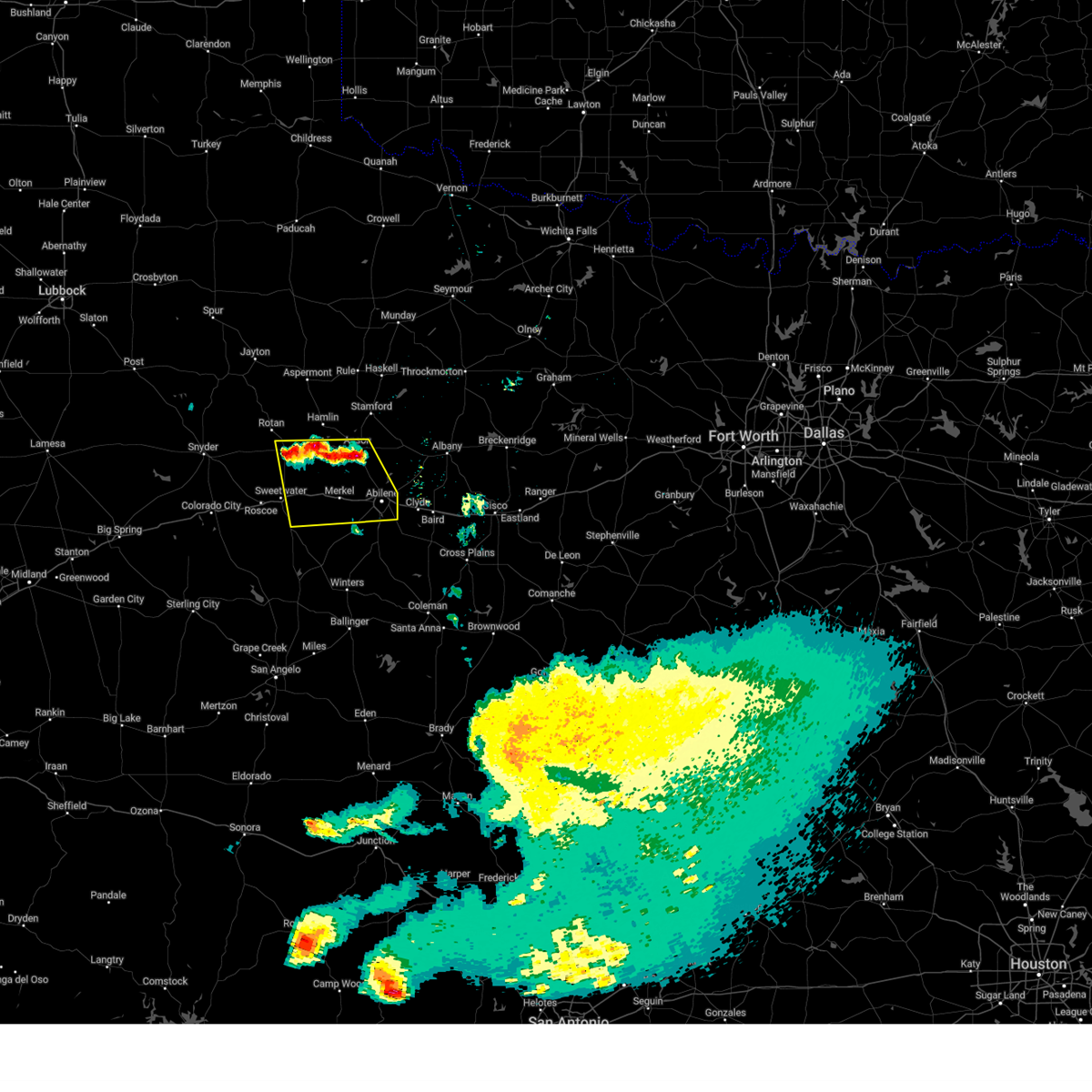
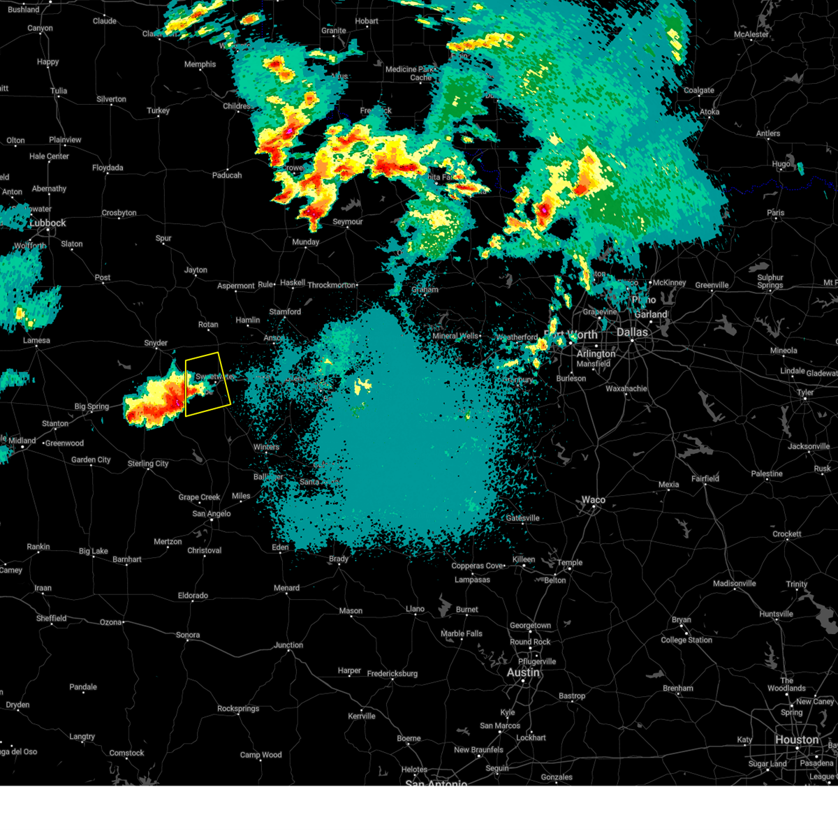
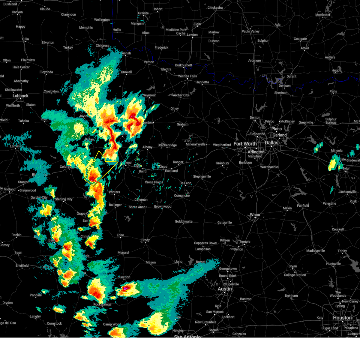
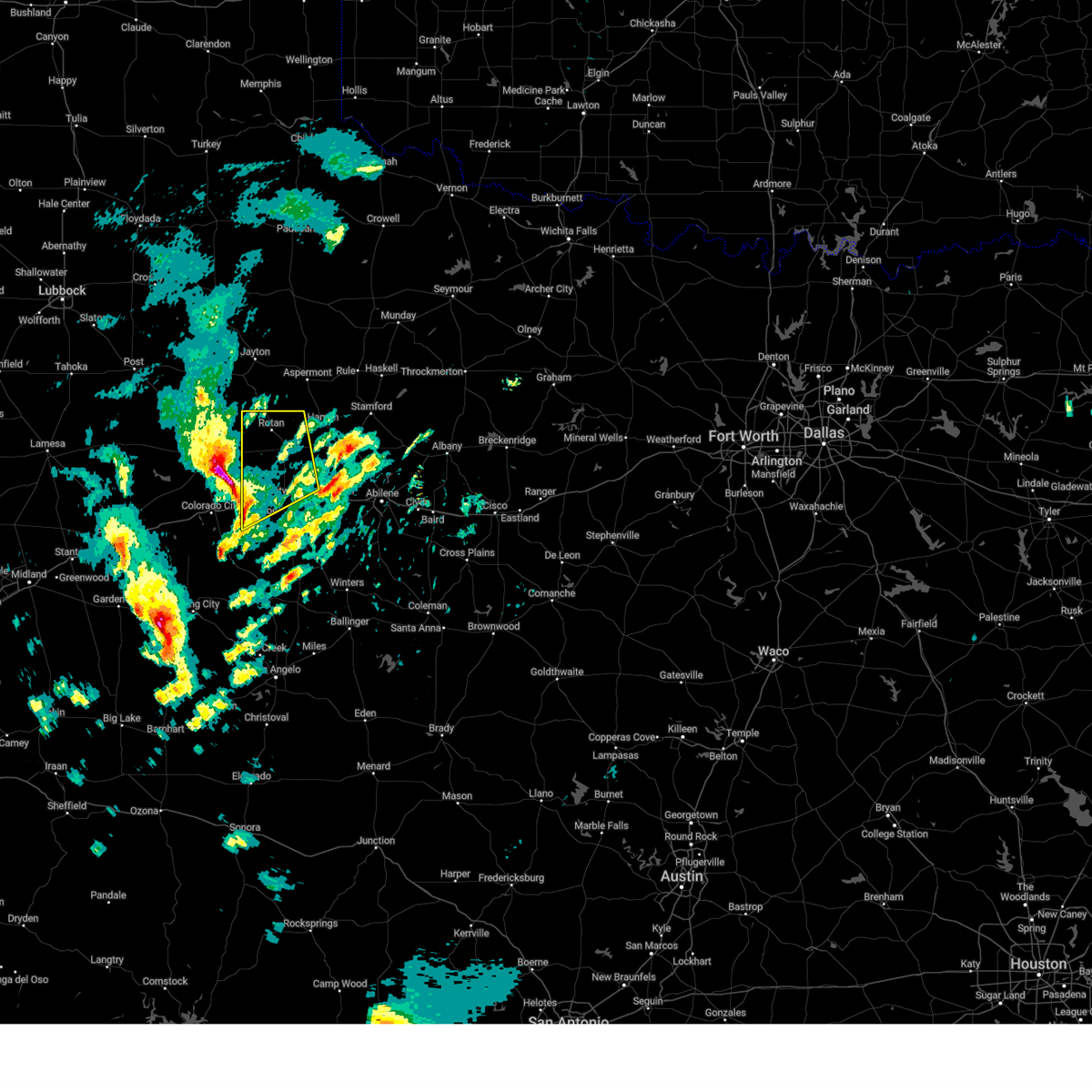
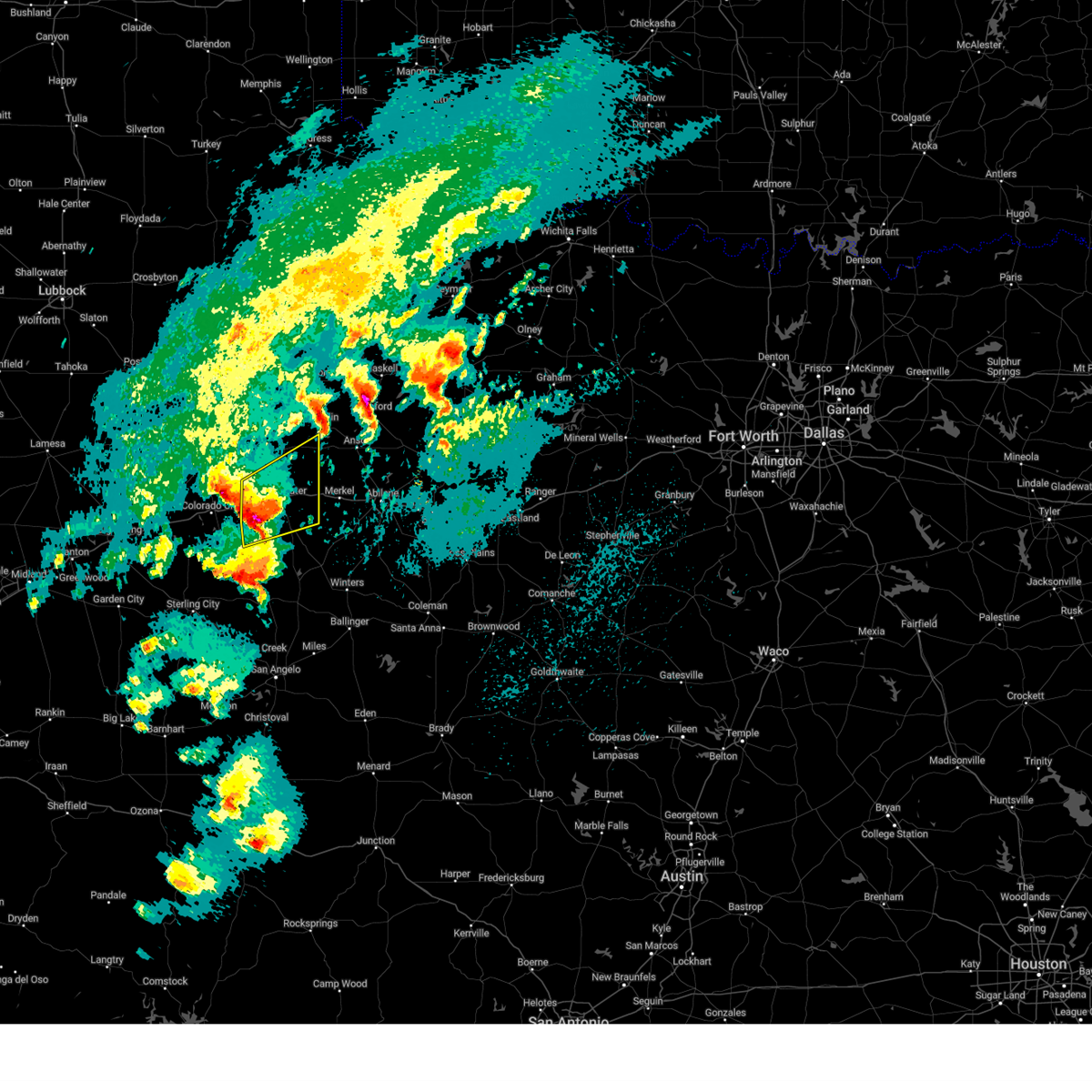
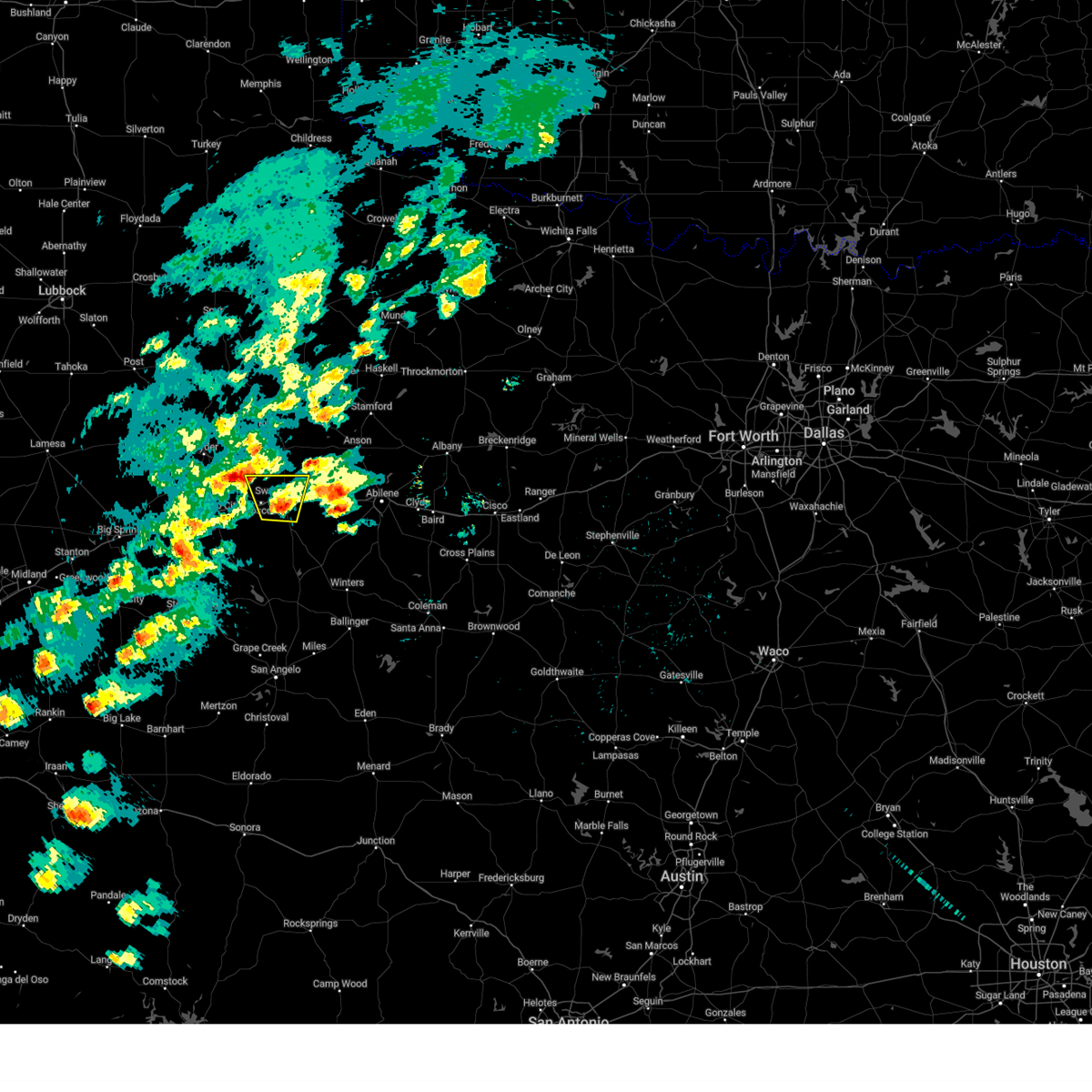
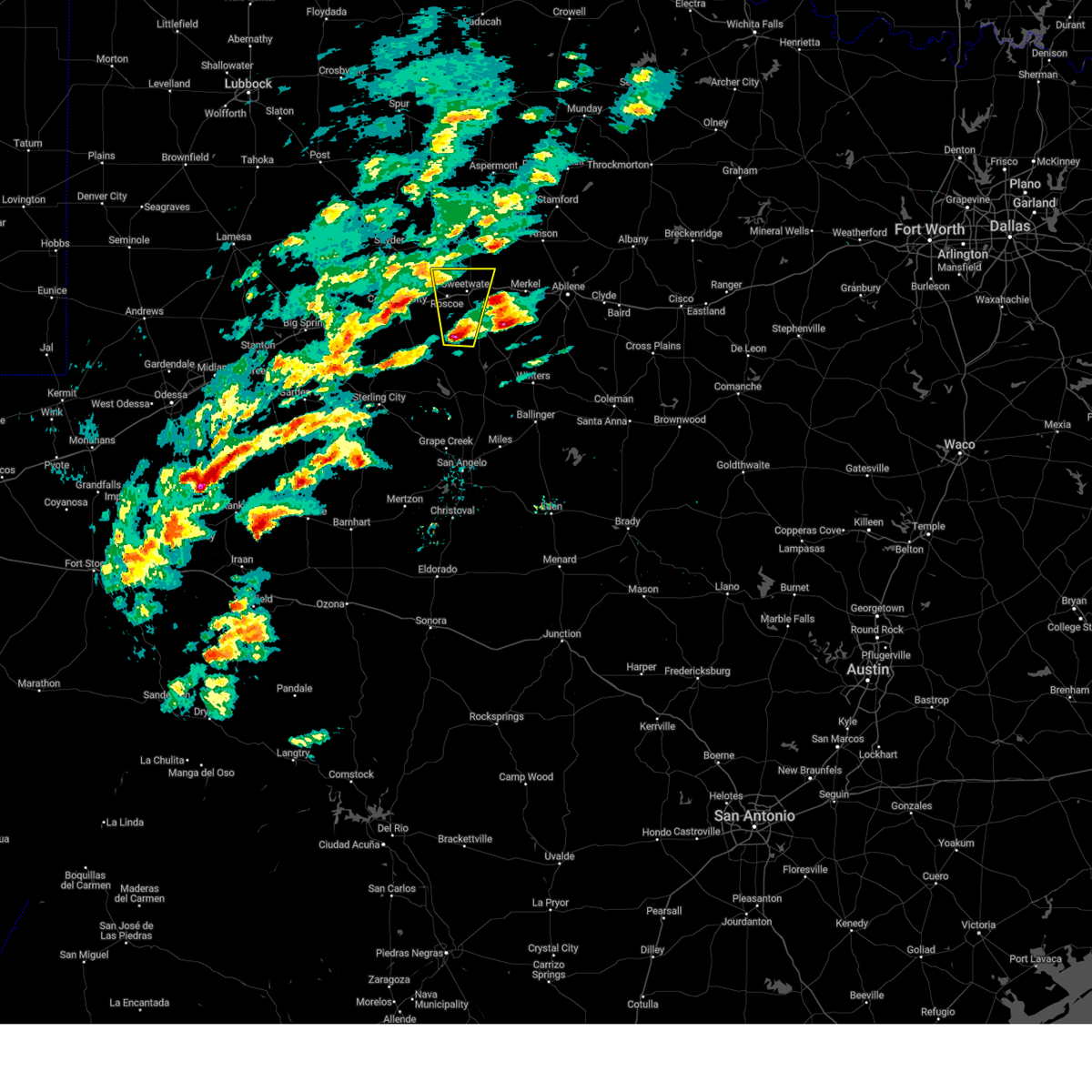
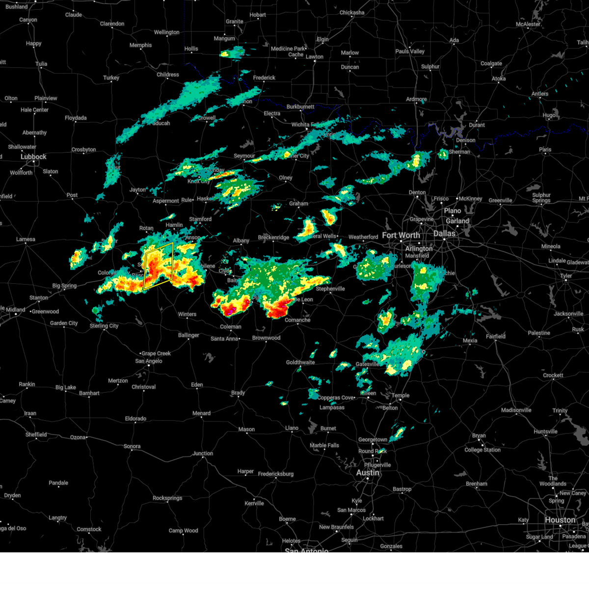
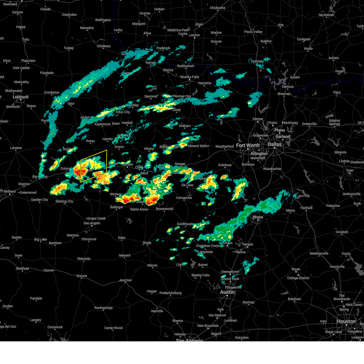
Hail Map for Sweetwater, TX
The Sweetwater, TX area has had 31 reports of on-the-ground hail by trained spotters, and has been under severe weather warnings 22 times during the past 12 months. Doppler radar has detected hail at or near Sweetwater, TX on 106 occasions, including 8 occasions during the past year.
| Name: | Sweetwater, TX |
| Where Located: | 39.1 miles W of Abilene, TX |
| Map: | Google Map for Sweetwater, TX |
| Population: | 10906 |
| Housing Units: | 5040 |
| More Info: | Search Google for Sweetwater, TX |
3
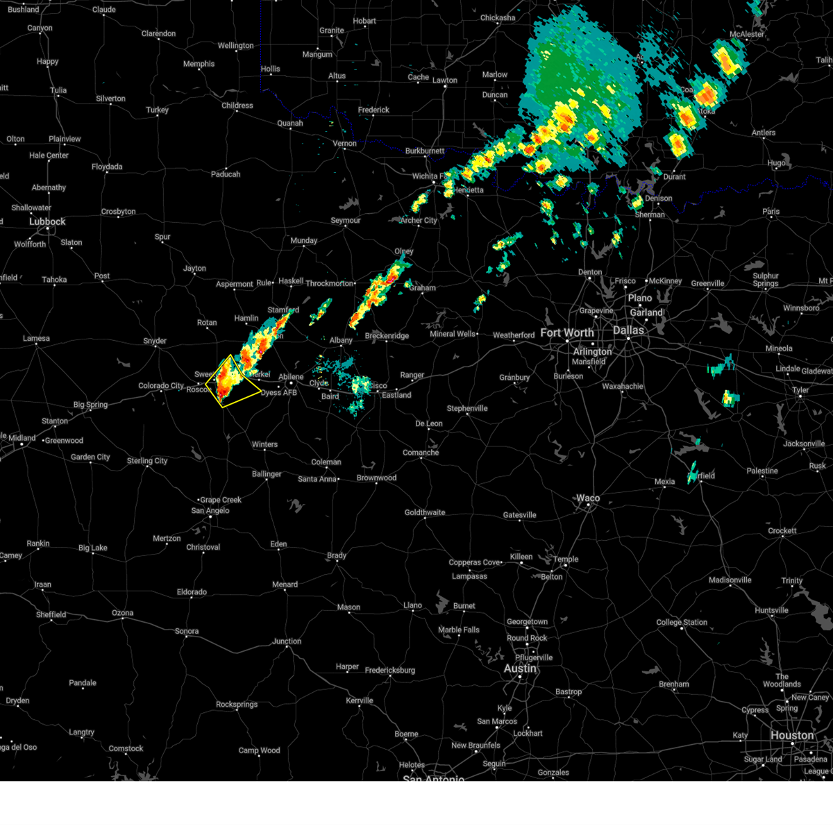
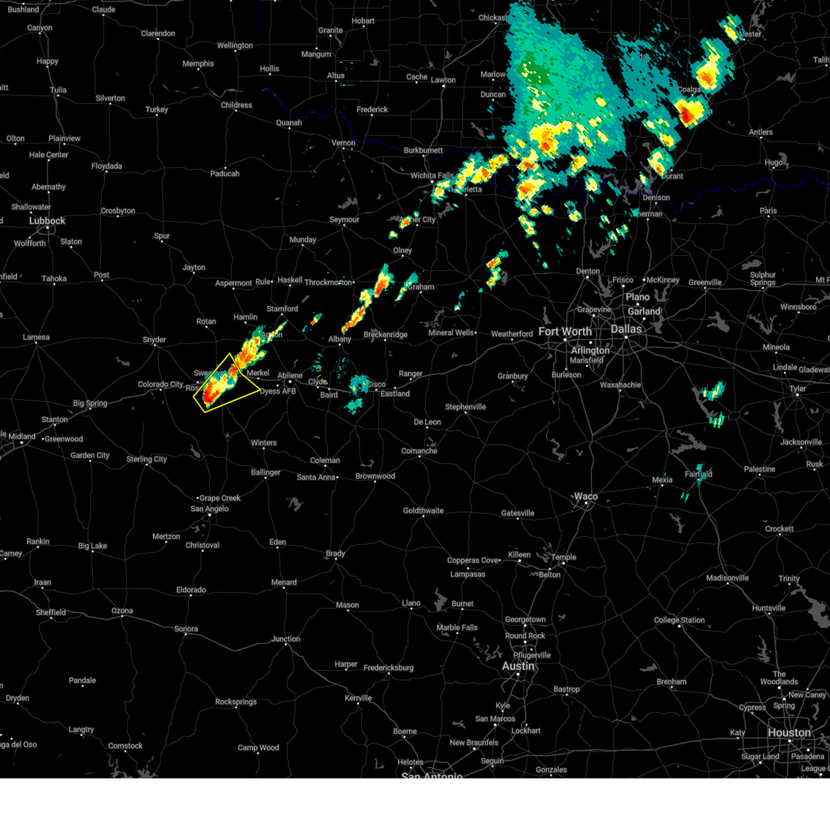
The Top Recent Hail Date for Sweetwater, TX is Tuesday, April 29, 2025 (5th out of 106)

Hail and Wind Damage Spotted near Sweetwater, TX
| Date / Time | Report Details |
|---|---|
| 7/9/2025 1:37 AM CDT |
 At 137 am cdt, a severe thunderstorm was located near busby, or near longworth, moving south at 20 mph (radar indicated). Hazards include 60 mph wind gusts and nickel size hail. Expect damage to roofs, siding, and trees. this severe storm will be near, sweetwater around 140 am cdt. roscoe around 200 am cdt. Other locations impacted by this severe thunderstorm include gannon, lake sweetwater, camp boothe oaks, busby, and capitola. At 137 am cdt, a severe thunderstorm was located near busby, or near longworth, moving south at 20 mph (radar indicated). Hazards include 60 mph wind gusts and nickel size hail. Expect damage to roofs, siding, and trees. this severe storm will be near, sweetwater around 140 am cdt. roscoe around 200 am cdt. Other locations impacted by this severe thunderstorm include gannon, lake sweetwater, camp boothe oaks, busby, and capitola.
|
| 7/9/2025 12:59 AM CDT |
 At 1259 am cdt, a severe thunderstorm was located over roby, moving south at 20 mph (radar indicated). Hazards include 60 mph wind gusts and nickel size hail. Expect damage to roofs, siding, and trees. this severe storm will be near, roby and longworth around 105 am cdt. sweetwater around 130 am cdt. Other locations impacted by this severe thunderstorm include the intersection of us- 180 and ranch road 126, gannon, lake sweetwater, camp boothe oaks, busby, and capitola. At 1259 am cdt, a severe thunderstorm was located over roby, moving south at 20 mph (radar indicated). Hazards include 60 mph wind gusts and nickel size hail. Expect damage to roofs, siding, and trees. this severe storm will be near, roby and longworth around 105 am cdt. sweetwater around 130 am cdt. Other locations impacted by this severe thunderstorm include the intersection of us- 180 and ranch road 126, gannon, lake sweetwater, camp boothe oaks, busby, and capitola.
|
| 7/9/2025 12:55 AM CDT |
 Svrsjt the national weather service in san angelo has issued a * severe thunderstorm warning for, western jones county in west central texas, northern nolan county in west central texas, fisher county in west central texas, northwestern taylor county in west central texas, * until 200 am cdt. * at 1255 am cdt, a severe thunderstorm was located near roby, moving south at 20 mph (radar indicated). Hazards include 60 mph wind gusts. Expect damage to roofs, siding, and trees. this severe thunderstorm will be near, roby and longworth around 100 am cdt. sweetwater around 130 am cdt. Other locations impacted by this severe thunderstorm include the intersection of us- 180 and ranch road 126, gannon, lake sweetwater, camp boothe oaks, busby, and capitola. Svrsjt the national weather service in san angelo has issued a * severe thunderstorm warning for, western jones county in west central texas, northern nolan county in west central texas, fisher county in west central texas, northwestern taylor county in west central texas, * until 200 am cdt. * at 1255 am cdt, a severe thunderstorm was located near roby, moving south at 20 mph (radar indicated). Hazards include 60 mph wind gusts. Expect damage to roofs, siding, and trees. this severe thunderstorm will be near, roby and longworth around 100 am cdt. sweetwater around 130 am cdt. Other locations impacted by this severe thunderstorm include the intersection of us- 180 and ranch road 126, gannon, lake sweetwater, camp boothe oaks, busby, and capitola.
|
| 6/9/2025 12:17 AM CDT | Svrsjt the national weather service in san angelo has issued a * severe thunderstorm warning for, nolan county in west central texas, southwestern fisher county in west central texas, west central taylor county in west central texas, * until 100 am cdt. * at 1216 am cdt, a severe thunderstorm was located near gannon, or near sweetwater, moving southeast at 40 mph (radar indicated). Hazards include 60 mph wind gusts. Expect damage to roofs, siding, and trees. this severe thunderstorm will be near, sweetwater around 1220 am cdt. nolan around 1235 am cdt. other locations impacted by this severe thunderstorm include camp butman, gannon, the intersection of highway 70 and ranch road 53, lake sweetwater, the intersection of ranch road 608 and highway 147, camp boothe oaks, and busby. This includes interstate 20 between mile markers 232 and 260. |
| 6/8/2025 9:34 PM CDT | Svrsjt the national weather service in san angelo has issued a * severe thunderstorm warning for, northwestern callahan county in west central texas, southern jones county in west central texas, northeastern nolan county in west central texas, southeastern fisher county in west central texas, northern taylor county in west central texas, southwestern shackelford county in west central texas, * until 1015 pm cdt. * at 932 pm cdt, a severe thunderstorm was located over longworth, moving east at 25 mph. also, another severe storm near abilene (radar indicated). Hazards include ping pong ball size hail and 60 mph wind gusts. People and animals outdoors will be injured. expect hail damage to roofs, siding, windows, and vehicles. expect wind damage to roofs, siding, and trees. this severe thunderstorm will be near, sylvester around 940 pm cdt. other locations impacted by this severe thunderstorm include impact, hodges, funston, the intersection of us- 180 and ranch road 126, lake fort phantom hill, truby, stith, and the intersection of us-180 and farm road 600. This includes interstate 20 between mile markers 249 and 296. |
| 6/8/2025 8:30 AM CDT |
 At 830 am cdt, a severe thunderstorm was located over sylvester, moving southeast at 35 mph (radar indicated). Hazards include ping pong ball size hail and 60 mph wind gusts. People and animals outdoors will be injured. expect hail damage to roofs, siding, windows, and vehicles. expect wind damage to roofs, siding, and trees. this severe storm will be near, noodle around 845 am cdt. other locations impacted by this severe thunderstorm include busby. This includes interstate 20 between mile markers 247 and 256. At 830 am cdt, a severe thunderstorm was located over sylvester, moving southeast at 35 mph (radar indicated). Hazards include ping pong ball size hail and 60 mph wind gusts. People and animals outdoors will be injured. expect hail damage to roofs, siding, windows, and vehicles. expect wind damage to roofs, siding, and trees. this severe storm will be near, noodle around 845 am cdt. other locations impacted by this severe thunderstorm include busby. This includes interstate 20 between mile markers 247 and 256.
|
| 6/8/2025 8:17 AM CDT |
 Svrsjt the national weather service in san angelo has issued a * severe thunderstorm warning for, southwestern jones county in west central texas, northeastern nolan county in west central texas, southeastern fisher county in west central texas, * until 900 am cdt. * at 816 am cdt, a severe thunderstorm was located near roby, moving southeast at 35 mph (radar indicated. at 8:10 am a 71 mph wind gust was reported 5 miles west of rotan). Hazards include two inch hail and 70 mph wind gusts. People and animals outdoors will be injured. expect hail damage to roofs, siding, windows, and vehicles. expect considerable tree damage. wind damage is also likely to mobile homes, roofs, and outbuildings. this severe thunderstorm will be near, roby, sylvester, and mccaulley around 820 am cdt. longworth around 825 am cdt. noodle around 845 am cdt. other locations impacted by this severe thunderstorm include busby. This includes interstate 20 between mile markers 247 and 256. Svrsjt the national weather service in san angelo has issued a * severe thunderstorm warning for, southwestern jones county in west central texas, northeastern nolan county in west central texas, southeastern fisher county in west central texas, * until 900 am cdt. * at 816 am cdt, a severe thunderstorm was located near roby, moving southeast at 35 mph (radar indicated. at 8:10 am a 71 mph wind gust was reported 5 miles west of rotan). Hazards include two inch hail and 70 mph wind gusts. People and animals outdoors will be injured. expect hail damage to roofs, siding, windows, and vehicles. expect considerable tree damage. wind damage is also likely to mobile homes, roofs, and outbuildings. this severe thunderstorm will be near, roby, sylvester, and mccaulley around 820 am cdt. longworth around 825 am cdt. noodle around 845 am cdt. other locations impacted by this severe thunderstorm include busby. This includes interstate 20 between mile markers 247 and 256.
|
| 5/23/2025 2:50 AM CDT |
 Svrsjt the national weather service in san angelo has issued a * severe thunderstorm warning for, southern jones county in west central texas, northeastern nolan county in west central texas, southeastern fisher county in west central texas, northern taylor county in west central texas, * until 330 am cdt. * at 249 am cdt, a severe thunderstorm was located near noodle, moving southeast at 25 mph (radar indicated). Hazards include 60 mph wind gusts and half dollar size hail. Hail damage to vehicles is expected. expect wind damage to roofs, siding, and trees. this severe thunderstorm will be near, noodle around 255 am cdt. trent around 300 am cdt. merkel around 305 am cdt. other locations impacted by this severe thunderstorm include impact, hodges, funston, the intersection of us- 180 and ranch road 126, lake fort phantom hill, kirby lake, truby, stith, and lake sweetwater. This includes interstate 20 between mile markers 247 and 292. Svrsjt the national weather service in san angelo has issued a * severe thunderstorm warning for, southern jones county in west central texas, northeastern nolan county in west central texas, southeastern fisher county in west central texas, northern taylor county in west central texas, * until 330 am cdt. * at 249 am cdt, a severe thunderstorm was located near noodle, moving southeast at 25 mph (radar indicated). Hazards include 60 mph wind gusts and half dollar size hail. Hail damage to vehicles is expected. expect wind damage to roofs, siding, and trees. this severe thunderstorm will be near, noodle around 255 am cdt. trent around 300 am cdt. merkel around 305 am cdt. other locations impacted by this severe thunderstorm include impact, hodges, funston, the intersection of us- 180 and ranch road 126, lake fort phantom hill, kirby lake, truby, stith, and lake sweetwater. This includes interstate 20 between mile markers 247 and 292.
|
| 4/30/2025 12:16 AM CDT |
 Svrsjt the national weather service in san angelo has issued a * severe thunderstorm warning for, southwestern jones county in west central texas, northeastern nolan county in west central texas, southeastern fisher county in west central texas, northwestern taylor county in west central texas, * until 100 am cdt. * at 1216 am cdt, a severe thunderstorm was located over lake sweetwater, or near sweetwater, moving east at 30 mph (radar indicated). Hazards include golf ball size hail and 70 mph wind gusts. People and animals outdoors will be injured. expect hail damage to roofs, siding, windows, and vehicles. expect considerable tree damage. wind damage is also likely to mobile homes, roofs, and outbuildings. this severe thunderstorm will be near, trent around 1220 am cdt. merkel around 1235 am cdt. noodle around 1240 am cdt. other locations impacted by this severe thunderstorm include lake sweetwater and stith. This includes interstate 20 between mile markers 244 and 275. Svrsjt the national weather service in san angelo has issued a * severe thunderstorm warning for, southwestern jones county in west central texas, northeastern nolan county in west central texas, southeastern fisher county in west central texas, northwestern taylor county in west central texas, * until 100 am cdt. * at 1216 am cdt, a severe thunderstorm was located over lake sweetwater, or near sweetwater, moving east at 30 mph (radar indicated). Hazards include golf ball size hail and 70 mph wind gusts. People and animals outdoors will be injured. expect hail damage to roofs, siding, windows, and vehicles. expect considerable tree damage. wind damage is also likely to mobile homes, roofs, and outbuildings. this severe thunderstorm will be near, trent around 1220 am cdt. merkel around 1235 am cdt. noodle around 1240 am cdt. other locations impacted by this severe thunderstorm include lake sweetwater and stith. This includes interstate 20 between mile markers 244 and 275.
|
| 4/30/2025 12:14 AM CDT |
 At 1213 am cdt, a severe thunderstorm was located over sweetwater, moving east at 30 mph (radar indicated). Hazards include golf ball size hail and 70 mph wind gusts. People and animals outdoors will be injured. expect hail damage to roofs, siding, windows, and vehicles. expect considerable tree damage. wind damage is also likely to mobile homes, roofs, and outbuildings. this severe storm will be near, sweetwater around 1220 am cdt. other locations impacted by this severe thunderstorm include gannon, the intersection of ranch road 608 and highway 147, camp boothe oaks, us-84 near the nolan-fisher county line, and i-20 near the nolan- mitchell county line. This includes interstate 20 between mile markers 229 and 249. At 1213 am cdt, a severe thunderstorm was located over sweetwater, moving east at 30 mph (radar indicated). Hazards include golf ball size hail and 70 mph wind gusts. People and animals outdoors will be injured. expect hail damage to roofs, siding, windows, and vehicles. expect considerable tree damage. wind damage is also likely to mobile homes, roofs, and outbuildings. this severe storm will be near, sweetwater around 1220 am cdt. other locations impacted by this severe thunderstorm include gannon, the intersection of ranch road 608 and highway 147, camp boothe oaks, us-84 near the nolan-fisher county line, and i-20 near the nolan- mitchell county line. This includes interstate 20 between mile markers 229 and 249.
|
| 4/30/2025 12:04 AM CDT |
 At 1204 am cdt, a severe thunderstorm was located over roscoe, moving east at 25 mph (radar indicated). Hazards include two inch hail and 60 mph wind gusts. People and animals outdoors will be injured. expect hail damage to roofs, siding, windows, and vehicles. expect wind damage to roofs, siding, and trees. this severe storm will be near, sweetwater around 1210 am cdt. other locations impacted by this severe thunderstorm include gannon, the intersection of highway 70 and ranch road 53, the intersection of ranch road 608 and highway 147, camp boothe oaks, busby, capitola, us-84 near the nolan-fisher county line, and i-20 near the nolan- mitchell county line. This includes interstate 20 between mile markers 229 and 249. At 1204 am cdt, a severe thunderstorm was located over roscoe, moving east at 25 mph (radar indicated). Hazards include two inch hail and 60 mph wind gusts. People and animals outdoors will be injured. expect hail damage to roofs, siding, windows, and vehicles. expect wind damage to roofs, siding, and trees. this severe storm will be near, sweetwater around 1210 am cdt. other locations impacted by this severe thunderstorm include gannon, the intersection of highway 70 and ranch road 53, the intersection of ranch road 608 and highway 147, camp boothe oaks, busby, capitola, us-84 near the nolan-fisher county line, and i-20 near the nolan- mitchell county line. This includes interstate 20 between mile markers 229 and 249.
|
| 4/29/2025 11:53 PM CDT |
 At 1152 pm cdt, a severe thunderstorm was located near champion, moving east at 35 mph (radar indicated). Hazards include golf ball size hail and 60 mph wind gusts. People and animals outdoors will be injured. expect hail damage to roofs, siding, windows, and vehicles. expect wind damage to roofs, siding, and trees. this severe storm will be near, sweetwater and roscoe around 1200 am cdt. other locations impacted by this severe thunderstorm include gannon, the intersection of highway 70 and ranch road 53, the intersection of ranch road 608 and highway 147, camp boothe oaks, busby, capitola, us-84 near the nolan-fisher county line, and i-20 near the nolan- mitchell county line. This includes interstate 20 between mile markers 229 and 249. At 1152 pm cdt, a severe thunderstorm was located near champion, moving east at 35 mph (radar indicated). Hazards include golf ball size hail and 60 mph wind gusts. People and animals outdoors will be injured. expect hail damage to roofs, siding, windows, and vehicles. expect wind damage to roofs, siding, and trees. this severe storm will be near, sweetwater and roscoe around 1200 am cdt. other locations impacted by this severe thunderstorm include gannon, the intersection of highway 70 and ranch road 53, the intersection of ranch road 608 and highway 147, camp boothe oaks, busby, capitola, us-84 near the nolan-fisher county line, and i-20 near the nolan- mitchell county line. This includes interstate 20 between mile markers 229 and 249.
|
| 4/29/2025 11:43 PM CDT |
 Svrsjt the national weather service in san angelo has issued a * severe thunderstorm warning for, northwestern nolan county in west central texas, southwestern fisher county in west central texas, * until 1230 am cdt. * at 1143 pm cdt, a severe thunderstorm was located near champion, moving east at 25 mph (radar indicated). Hazards include 60 mph wind gusts and half dollar size hail. Hail damage to vehicles is expected. expect wind damage to roofs, siding, and trees. this severe thunderstorm will be near, champion around 1150 pm cdt. roscoe around 1155 pm cdt. sweetwater around 1205 am cdt. other locations impacted by this severe thunderstorm include gannon, the intersection of highway 70 and ranch road 53, lake sweetwater, the intersection of ranch road 608 and highway 147, camp boothe oaks, busby, capitola, us-84 near the nolan-fisher county line, and i- 20 near the nolan-mitchell county line. This includes interstate 20 between mile markers 229 and 249. Svrsjt the national weather service in san angelo has issued a * severe thunderstorm warning for, northwestern nolan county in west central texas, southwestern fisher county in west central texas, * until 1230 am cdt. * at 1143 pm cdt, a severe thunderstorm was located near champion, moving east at 25 mph (radar indicated). Hazards include 60 mph wind gusts and half dollar size hail. Hail damage to vehicles is expected. expect wind damage to roofs, siding, and trees. this severe thunderstorm will be near, champion around 1150 pm cdt. roscoe around 1155 pm cdt. sweetwater around 1205 am cdt. other locations impacted by this severe thunderstorm include gannon, the intersection of highway 70 and ranch road 53, lake sweetwater, the intersection of ranch road 608 and highway 147, camp boothe oaks, busby, capitola, us-84 near the nolan-fisher county line, and i- 20 near the nolan-mitchell county line. This includes interstate 20 between mile markers 229 and 249.
|
| 4/5/2025 12:22 AM CDT |
 Svrsjt the national weather service in san angelo has issued a * severe thunderstorm warning for, central nolan county in west central texas, southeastern fisher county in west central texas, northwestern taylor county in west central texas, * until 100 am cdt. * at 1221 am cdt, a severe thunderstorm was located over maryneal, moving northeast at 40 mph (radar indicated). Hazards include 60 mph wind gusts and quarter size hail. Hail damage to vehicles is expected. expect wind damage to roofs, siding, and trees. this severe thunderstorm will be near, nolan around 1230 am cdt. sweetwater around 1235 am cdt. trent around 1250 am cdt. other locations impacted by this severe thunderstorm include the intersection of highway 70 and ranch road 53, lake sweetwater, camp boothe oaks, and camp butman. This includes interstate 20 between mile markers 243 and 272. Svrsjt the national weather service in san angelo has issued a * severe thunderstorm warning for, central nolan county in west central texas, southeastern fisher county in west central texas, northwestern taylor county in west central texas, * until 100 am cdt. * at 1221 am cdt, a severe thunderstorm was located over maryneal, moving northeast at 40 mph (radar indicated). Hazards include 60 mph wind gusts and quarter size hail. Hail damage to vehicles is expected. expect wind damage to roofs, siding, and trees. this severe thunderstorm will be near, nolan around 1230 am cdt. sweetwater around 1235 am cdt. trent around 1250 am cdt. other locations impacted by this severe thunderstorm include the intersection of highway 70 and ranch road 53, lake sweetwater, camp boothe oaks, and camp butman. This includes interstate 20 between mile markers 243 and 272.
|
| 4/4/2025 11:22 PM CDT |
 Svrsjt the national weather service in san angelo has issued a * severe thunderstorm warning for, northern nolan county in west central texas, fisher county in west central texas, * until midnight cdt. * at 1119 pm cdt, a severe thunderstorm was located near hermleigh, or 7 miles northwest of inadale, moving northeast at 50 mph (radar indicated). Hazards include ping pong ball size hail and 60 mph wind gusts. People and animals outdoors will be injured. expect hail damage to roofs, siding, windows, and vehicles. expect wind damage to roofs, siding, and trees. this severe thunderstorm will be near, hobbs around 1130 pm cdt. roby and rotan around 1140 pm cdt. other locations impacted by this severe thunderstorm include gannon, busby, capitola, i-20 near the nolan-mitchell county line, us- 180 near the fisher-scurry county line, and us-84 near the nolan- fisher county line. This includes interstate 20 between mile markers 229 and 256. Svrsjt the national weather service in san angelo has issued a * severe thunderstorm warning for, northern nolan county in west central texas, fisher county in west central texas, * until midnight cdt. * at 1119 pm cdt, a severe thunderstorm was located near hermleigh, or 7 miles northwest of inadale, moving northeast at 50 mph (radar indicated). Hazards include ping pong ball size hail and 60 mph wind gusts. People and animals outdoors will be injured. expect hail damage to roofs, siding, windows, and vehicles. expect wind damage to roofs, siding, and trees. this severe thunderstorm will be near, hobbs around 1130 pm cdt. roby and rotan around 1140 pm cdt. other locations impacted by this severe thunderstorm include gannon, busby, capitola, i-20 near the nolan-mitchell county line, us- 180 near the fisher-scurry county line, and us-84 near the nolan- fisher county line. This includes interstate 20 between mile markers 229 and 256.
|
| 4/4/2025 1:57 AM CDT |
 Svrsjt the national weather service in san angelo has issued a * severe thunderstorm warning for, northern nolan county in west central texas, southern fisher county in west central texas, * until 230 am cdt. * at 157 am cdt, a severe thunderstorm was located near the intersection of ranch road 608 and highway 147, or near champion, moving northeast at 55 mph (radar indicated). Hazards include 60 mph wind gusts and quarter size hail. Hail damage to vehicles is expected. expect wind damage to roofs, siding, and trees. this severe thunderstorm will be near, sweetwater and roscoe around 200 am cdt. other locations impacted by this severe thunderstorm include us- 84 near the nolan-fisher county line, i-20 near the nolan- mitchell county line, gannon, the intersection of highway 70 and ranch road 53, lake sweetwater, the intersection of ranch road 608 and highway 147, camp boothe oaks, busby, and capitola. This includes interstate 20 between mile markers 229 and 260. Svrsjt the national weather service in san angelo has issued a * severe thunderstorm warning for, northern nolan county in west central texas, southern fisher county in west central texas, * until 230 am cdt. * at 157 am cdt, a severe thunderstorm was located near the intersection of ranch road 608 and highway 147, or near champion, moving northeast at 55 mph (radar indicated). Hazards include 60 mph wind gusts and quarter size hail. Hail damage to vehicles is expected. expect wind damage to roofs, siding, and trees. this severe thunderstorm will be near, sweetwater and roscoe around 200 am cdt. other locations impacted by this severe thunderstorm include us- 84 near the nolan-fisher county line, i-20 near the nolan- mitchell county line, gannon, the intersection of highway 70 and ranch road 53, lake sweetwater, the intersection of ranch road 608 and highway 147, camp boothe oaks, busby, and capitola. This includes interstate 20 between mile markers 229 and 260.
|
| 4/4/2025 12:28 AM CDT |
 At 1227 am cdt, a severe thunderstorm was located over sweetwater, moving north at 45 mph (radar indicated). Hazards include 60 mph wind gusts and quarter size hail. Hail damage to vehicles is expected. expect wind damage to roofs, siding, and trees. this severe thunderstorm will affect the following locations, lake sweetwater, gannon, and camp boothe oaks. This includes interstate 20 between mile markers 235 and 253. At 1227 am cdt, a severe thunderstorm was located over sweetwater, moving north at 45 mph (radar indicated). Hazards include 60 mph wind gusts and quarter size hail. Hail damage to vehicles is expected. expect wind damage to roofs, siding, and trees. this severe thunderstorm will affect the following locations, lake sweetwater, gannon, and camp boothe oaks. This includes interstate 20 between mile markers 235 and 253.
|
| 4/4/2025 12:08 AM CDT |
 Svrsjt the national weather service in san angelo has issued a * severe thunderstorm warning for, central nolan county in west central texas, southern fisher county in west central texas, * until 100 am cdt. * at 1208 am cdt, a severe thunderstorm was located over maryneal, moving north at 35 mph (radar indicated). Hazards include 60 mph wind gusts and quarter size hail. Hail damage to vehicles is expected. expect wind damage to roofs, siding, and trees. this severe thunderstorm will be near, sweetwater and roscoe around 1220 am cdt. other locations impacted by this severe thunderstorm include gannon, the intersection of highway 70 and ranch road 53, lake sweetwater, the intersection of ranch road 608 and highway 147, and camp boothe oaks. This includes interstate 20 between mile markers 232 and 253. Svrsjt the national weather service in san angelo has issued a * severe thunderstorm warning for, central nolan county in west central texas, southern fisher county in west central texas, * until 100 am cdt. * at 1208 am cdt, a severe thunderstorm was located over maryneal, moving north at 35 mph (radar indicated). Hazards include 60 mph wind gusts and quarter size hail. Hail damage to vehicles is expected. expect wind damage to roofs, siding, and trees. this severe thunderstorm will be near, sweetwater and roscoe around 1220 am cdt. other locations impacted by this severe thunderstorm include gannon, the intersection of highway 70 and ranch road 53, lake sweetwater, the intersection of ranch road 608 and highway 147, and camp boothe oaks. This includes interstate 20 between mile markers 232 and 253.
|
| 3/8/2025 3:12 AM CST |
 At 311 am cst, a severe thunderstorm was located 7 miles southeast of longworth, moving northeast at 35 mph (radar indicated). Hazards include quarter size hail. Damage to vehicles is expected. this severe storm will be near, longworth around 315 am cst. other locations impacted by this severe thunderstorm include lake sweetwater, camp boothe oaks, busby, and the intersection of highway 70 and ranch road 53. This includes interstate 20 between mile markers 240 and 260. At 311 am cst, a severe thunderstorm was located 7 miles southeast of longworth, moving northeast at 35 mph (radar indicated). Hazards include quarter size hail. Damage to vehicles is expected. this severe storm will be near, longworth around 315 am cst. other locations impacted by this severe thunderstorm include lake sweetwater, camp boothe oaks, busby, and the intersection of highway 70 and ranch road 53. This includes interstate 20 between mile markers 240 and 260.
|
| 3/8/2025 2:41 AM CST |
 Svrsjt the national weather service in san angelo has issued a * severe thunderstorm warning for, northern nolan county in west central texas, southern fisher county in west central texas, * until 330 am cst. * at 239 am cst, a severe thunderstorm was located over champion, moving northeast at 30 mph (radar indicated). Hazards include quarter size hail. Damage to vehicles is expected. this severe thunderstorm will be near, sweetwater and roscoe around 245 am cst. longworth around 310 am cst. other locations impacted by this severe thunderstorm include gannon, lake sweetwater, the intersection of ranch road 608 and highway 147, camp boothe oaks, busby, capitola, us-84 near the nolan- fisher county line, i-20 near the nolan- mitchell county line, and the intersection of highway 70 and ranch road 53. This includes interstate 20 between mile markers 229 and 260. Svrsjt the national weather service in san angelo has issued a * severe thunderstorm warning for, northern nolan county in west central texas, southern fisher county in west central texas, * until 330 am cst. * at 239 am cst, a severe thunderstorm was located over champion, moving northeast at 30 mph (radar indicated). Hazards include quarter size hail. Damage to vehicles is expected. this severe thunderstorm will be near, sweetwater and roscoe around 245 am cst. longworth around 310 am cst. other locations impacted by this severe thunderstorm include gannon, lake sweetwater, the intersection of ranch road 608 and highway 147, camp boothe oaks, busby, capitola, us-84 near the nolan- fisher county line, i-20 near the nolan- mitchell county line, and the intersection of highway 70 and ranch road 53. This includes interstate 20 between mile markers 229 and 260.
|
| 11/18/2024 3:15 AM CST | Awos station ksww sweetwate in nolan county TX, 3.5 miles E of Sweetwater, TX |
| 11/3/2024 6:41 PM CST |
 At 641 pm cst, a severe thunderstorm was located over lake sweetwater, or 7 miles southeast of sweetwater, moving northeast at 30 mph (radar indicated). Hazards include 60 mph wind gusts and quarter size hail. Hail damage to vehicles is expected. expect wind damage to roofs, siding, and trees. this severe storm will be near, sweetwater around 645 pm cst. trent around 650 pm cst. other locations impacted by this severe thunderstorm include the intersection of highway 70 and ranch road 53, lake sweetwater, and camp boothe oaks. This includes interstate 20 between mile markers 241 and 260. At 641 pm cst, a severe thunderstorm was located over lake sweetwater, or 7 miles southeast of sweetwater, moving northeast at 30 mph (radar indicated). Hazards include 60 mph wind gusts and quarter size hail. Hail damage to vehicles is expected. expect wind damage to roofs, siding, and trees. this severe storm will be near, sweetwater around 645 pm cst. trent around 650 pm cst. other locations impacted by this severe thunderstorm include the intersection of highway 70 and ranch road 53, lake sweetwater, and camp boothe oaks. This includes interstate 20 between mile markers 241 and 260.
|
| 11/3/2024 6:23 PM CST |
 Svrsjt the national weather service in san angelo has issued a * severe thunderstorm warning for, central and northern nolan county in west central texas, southeastern fisher county in west central texas, northwestern taylor county in west central texas, * until 700 pm cst. * at 621 pm cst, a severe thunderstorm was located near the intersection of ranch road 608 and highway 147, or just north of maryneal, and moving northeast at 30 mph (radar indicated). Hazards include 60 mph wind gusts and quarter size hail. Hail damage to vehicles is expected. expect wind damage to roofs, siding, and trees. this severe thunderstorm will be near, sweetwater around 625 pm cst. other locations impacted by this severe thunderstorm include the intersection of highway 70 and ranch road 53, lake sweetwater, the intersection of ranch road 608 and highway 147, and camp boothe oaks. This includes interstate 20 between mile markers 241 and 260. Svrsjt the national weather service in san angelo has issued a * severe thunderstorm warning for, central and northern nolan county in west central texas, southeastern fisher county in west central texas, northwestern taylor county in west central texas, * until 700 pm cst. * at 621 pm cst, a severe thunderstorm was located near the intersection of ranch road 608 and highway 147, or just north of maryneal, and moving northeast at 30 mph (radar indicated). Hazards include 60 mph wind gusts and quarter size hail. Hail damage to vehicles is expected. expect wind damage to roofs, siding, and trees. this severe thunderstorm will be near, sweetwater around 625 pm cst. other locations impacted by this severe thunderstorm include the intersection of highway 70 and ranch road 53, lake sweetwater, the intersection of ranch road 608 and highway 147, and camp boothe oaks. This includes interstate 20 between mile markers 241 and 260.
|
| 5/30/2024 11:44 PM CDT |
 The storm which prompted the warning has moved out of the area. therefore, the warning will be allowed to expire. however, small hail and gusty winds are still possible with this thunderstorm. remember, a severe thunderstorm warning still remains in effect for northern taylor and southern jones county until 1230 am. The storm which prompted the warning has moved out of the area. therefore, the warning will be allowed to expire. however, small hail and gusty winds are still possible with this thunderstorm. remember, a severe thunderstorm warning still remains in effect for northern taylor and southern jones county until 1230 am.
|
| 5/30/2024 11:43 PM CDT |
 The storm which prompted the warning has weakened below severe limits, and has exited the warned area. therefore, the warning will be allowed to expire. however, heavy rain is still possible with this thunderstorm. The storm which prompted the warning has weakened below severe limits, and has exited the warned area. therefore, the warning will be allowed to expire. however, heavy rain is still possible with this thunderstorm.
|
| 5/30/2024 11:13 PM CDT |
 At 1112 pm cdt, a severe thunderstorm was located near trent, moving northeast at 25 mph (radar indicated). Hazards include ping pong ball size hail and 60 mph wind gusts. People and animals outdoors will be injured. expect hail damage to roofs, siding, windows, and vehicles. expect wind damage to roofs, siding, and trees. this severe storm will be near, noodle around 1120 pm cdt. hawley around 1140 pm cdt. other locations impacted by this severe thunderstorm include hodges, truby, stith, and lake sweetwater. This includes interstate 20 between mile markers 242 and 276. At 1112 pm cdt, a severe thunderstorm was located near trent, moving northeast at 25 mph (radar indicated). Hazards include ping pong ball size hail and 60 mph wind gusts. People and animals outdoors will be injured. expect hail damage to roofs, siding, windows, and vehicles. expect wind damage to roofs, siding, and trees. this severe storm will be near, noodle around 1120 pm cdt. hawley around 1140 pm cdt. other locations impacted by this severe thunderstorm include hodges, truby, stith, and lake sweetwater. This includes interstate 20 between mile markers 242 and 276.
|
| 5/30/2024 11:01 PM CDT |
 Svrsjt the national weather service in san angelo has issued a * severe thunderstorm warning for, northwestern nolan county in west central texas, southern fisher county in west central texas, * until 1145 pm cdt. * at 1101 pm cdt, a severe thunderstorm was located near wastella, moving east at 20 mph (radar indicated). Hazards include 60 mph wind gusts and half dollar size hail. Hail damage to vehicles is expected. expect wind damage to roofs, siding, and trees. this severe thunderstorm will be near, sweetwater and roscoe around 1105 pm cdt. other locations impacted by this severe thunderstorm include gannon, busby, capitola, i-20 near the nolan-mitchell county line, and us- 84 near the nolan-fisher county line. This includes interstate 20 between mile markers 229 and 241. Svrsjt the national weather service in san angelo has issued a * severe thunderstorm warning for, northwestern nolan county in west central texas, southern fisher county in west central texas, * until 1145 pm cdt. * at 1101 pm cdt, a severe thunderstorm was located near wastella, moving east at 20 mph (radar indicated). Hazards include 60 mph wind gusts and half dollar size hail. Hail damage to vehicles is expected. expect wind damage to roofs, siding, and trees. this severe thunderstorm will be near, sweetwater and roscoe around 1105 pm cdt. other locations impacted by this severe thunderstorm include gannon, busby, capitola, i-20 near the nolan-mitchell county line, and us- 84 near the nolan-fisher county line. This includes interstate 20 between mile markers 229 and 241.
|
| 5/30/2024 10:56 PM CDT |
 Svrsjt the national weather service in san angelo has issued a * severe thunderstorm warning for, southwestern jones county in west central texas, northeastern nolan county in west central texas, southeastern fisher county in west central texas, northwestern taylor county in west central texas, * until 1145 pm cdt. * at 1055 pm cdt, a severe thunderstorm was located near trent, moving northeast at 25 mph (radar indicated). Hazards include 60 mph wind gusts and half dollar size hail. Hail damage to vehicles is expected. expect wind damage to roofs, siding, and trees. this severe thunderstorm will be near, merkel and trent around 1100 pm cdt. noodle around 1105 pm cdt. hawley around 1140 pm cdt. other locations impacted by this severe thunderstorm include hodges, truby, stith, and lake sweetwater. This includes interstate 20 between mile markers 242 and 276. Svrsjt the national weather service in san angelo has issued a * severe thunderstorm warning for, southwestern jones county in west central texas, northeastern nolan county in west central texas, southeastern fisher county in west central texas, northwestern taylor county in west central texas, * until 1145 pm cdt. * at 1055 pm cdt, a severe thunderstorm was located near trent, moving northeast at 25 mph (radar indicated). Hazards include 60 mph wind gusts and half dollar size hail. Hail damage to vehicles is expected. expect wind damage to roofs, siding, and trees. this severe thunderstorm will be near, merkel and trent around 1100 pm cdt. noodle around 1105 pm cdt. hawley around 1140 pm cdt. other locations impacted by this severe thunderstorm include hodges, truby, stith, and lake sweetwater. This includes interstate 20 between mile markers 242 and 276.
|
| 4/30/2024 7:04 PM CDT |
 Svrsjt the national weather service in san angelo has issued a * severe thunderstorm warning for, northwestern nolan county in west central texas, western fisher county in west central texas, * until 745 pm cdt. * at 703 pm cdt, a severe thunderstorm was located over inadale, moving northeast at 30 mph (radar indicated). Hazards include 60 mph wind gusts and quarter size hail. Hail damage to vehicles is expected. expect wind damage to roofs, siding, and trees. This severe thunderstorm will remain over mainly rural areas of northwestern nolan and western fisher counties, including the following locations, gannon, busby, capitola, and us-84 near the nolan-fisher county line. Svrsjt the national weather service in san angelo has issued a * severe thunderstorm warning for, northwestern nolan county in west central texas, western fisher county in west central texas, * until 745 pm cdt. * at 703 pm cdt, a severe thunderstorm was located over inadale, moving northeast at 30 mph (radar indicated). Hazards include 60 mph wind gusts and quarter size hail. Hail damage to vehicles is expected. expect wind damage to roofs, siding, and trees. This severe thunderstorm will remain over mainly rural areas of northwestern nolan and western fisher counties, including the following locations, gannon, busby, capitola, and us-84 near the nolan-fisher county line.
|
| 4/27/2024 10:49 PM CDT |
 Svrsjt the national weather service in san angelo has issued a * severe thunderstorm warning for, western jones county in west central texas, northeastern nolan county in west central texas, eastern fisher county in west central texas, * until 1145 pm cdt. * at 1048 pm cdt, a severe thunderstorms were from hamlin to sweetwater moving east at 20 mph (radar indicated). Hazards include 60 mph wind gusts and half dollar size hail. Hail damage to vehicles is expected. expect wind damage to roofs, siding, and trees. this severe thunderstorm will be near, mccaulley around 1055 pm cdt. neinda around 1100 pm cdt. noodle around 1110 pm cdt. other locations impacted by this severe thunderstorm include the intersection of us-180 and ranch road 126, truby, hitson, and tuxedo. This includes interstate 20 between mile markers 246 and 255. Svrsjt the national weather service in san angelo has issued a * severe thunderstorm warning for, western jones county in west central texas, northeastern nolan county in west central texas, eastern fisher county in west central texas, * until 1145 pm cdt. * at 1048 pm cdt, a severe thunderstorms were from hamlin to sweetwater moving east at 20 mph (radar indicated). Hazards include 60 mph wind gusts and half dollar size hail. Hail damage to vehicles is expected. expect wind damage to roofs, siding, and trees. this severe thunderstorm will be near, mccaulley around 1055 pm cdt. neinda around 1100 pm cdt. noodle around 1110 pm cdt. other locations impacted by this severe thunderstorm include the intersection of us-180 and ranch road 126, truby, hitson, and tuxedo. This includes interstate 20 between mile markers 246 and 255.
|
| 4/27/2024 9:36 PM CDT |
 the severe thunderstorm warning has been cancelled and is no longer in effect the severe thunderstorm warning has been cancelled and is no longer in effect
|
| 4/27/2024 9:25 PM CDT |
 At 925 pm cdt, a severe thunderstorm was located 7 miles northeast of lake sweetwater, or 7 miles west of trent, moving northeast at 20 mph (radar indicated). Hazards include 60 mph wind gusts and penny size hail. Expect damage to roofs, siding, and trees. locations impacted include, sweetwater and lake sweetwater. This includes interstate 20 between mile markers 244 and 260. At 925 pm cdt, a severe thunderstorm was located 7 miles northeast of lake sweetwater, or 7 miles west of trent, moving northeast at 20 mph (radar indicated). Hazards include 60 mph wind gusts and penny size hail. Expect damage to roofs, siding, and trees. locations impacted include, sweetwater and lake sweetwater. This includes interstate 20 between mile markers 244 and 260.
|
| 4/27/2024 9:15 PM CDT |
 Svrsjt the national weather service in san angelo has issued a * severe thunderstorm warning for, southwestern jones county in west central texas, northeastern nolan county in west central texas, southeastern fisher county in west central texas, * until 1015 pm cdt. * at 914 pm cdt, a severe thunderstorm was located near lake sweetwater, or near sweetwater, moving northeast at 25 mph (radar indicated). Hazards include 60 mph wind gusts and quarter size hail. Hail damage to vehicles is expected. expect wind damage to roofs, siding, and trees. this severe thunderstorm will remain over mainly rural areas of southwestern jones, northeastern nolan and southeastern fisher counties, including the following locations, lake sweetwater. This includes interstate 20 between mile markers 244 and 260. Svrsjt the national weather service in san angelo has issued a * severe thunderstorm warning for, southwestern jones county in west central texas, northeastern nolan county in west central texas, southeastern fisher county in west central texas, * until 1015 pm cdt. * at 914 pm cdt, a severe thunderstorm was located near lake sweetwater, or near sweetwater, moving northeast at 25 mph (radar indicated). Hazards include 60 mph wind gusts and quarter size hail. Hail damage to vehicles is expected. expect wind damage to roofs, siding, and trees. this severe thunderstorm will remain over mainly rural areas of southwestern jones, northeastern nolan and southeastern fisher counties, including the following locations, lake sweetwater. This includes interstate 20 between mile markers 244 and 260.
|
| 4/27/2024 9:14 PM CDT | Quarter sized hail reported 1.3 miles WNW of Sweetwater, TX, report from mping: quarter (1.00 in.). |
| 4/27/2024 8:20 PM CDT |
 Svrsjt the national weather service in san angelo has issued a * severe thunderstorm warning for, northwestern nolan county in west central texas, southeastern fisher county in west central texas, * until 900 pm cdt. * at 820 pm cdt, a severe thunderstorm was located near roscoe, moving northeast at 45 mph (public). Hazards include 60 mph wind gusts and quarter size hail. Hail damage to vehicles is expected. expect wind damage to roofs, siding, and trees. this severe thunderstorm will be near, sweetwater and roscoe around 825 pm cdt. longworth around 840 pm cdt. other locations impacted by this severe thunderstorm include gannon, camp boothe oaks, busby, and capitola. This includes interstate 20 between mile markers 232 and 248. Svrsjt the national weather service in san angelo has issued a * severe thunderstorm warning for, northwestern nolan county in west central texas, southeastern fisher county in west central texas, * until 900 pm cdt. * at 820 pm cdt, a severe thunderstorm was located near roscoe, moving northeast at 45 mph (public). Hazards include 60 mph wind gusts and quarter size hail. Hail damage to vehicles is expected. expect wind damage to roofs, siding, and trees. this severe thunderstorm will be near, sweetwater and roscoe around 825 pm cdt. longworth around 840 pm cdt. other locations impacted by this severe thunderstorm include gannon, camp boothe oaks, busby, and capitola. This includes interstate 20 between mile markers 232 and 248.
|
| 4/1/2024 3:17 PM CDT |
 Svrsjt the national weather service in san angelo has issued a * severe thunderstorm warning for, jones county in west central texas, northeastern nolan county in west central texas, southeastern fisher county in west central texas, northwestern taylor county in west central texas, * until 415 pm cdt. * at 316 pm cdt, a severe thunderstorm was located near longworth, moving northeast at 60 mph (radar indicated). Hazards include 70 mph wind gusts and quarter size hail. Hail damage to vehicles is expected. expect considerable tree damage. wind damage is also likely to mobile homes, roofs, and outbuildings. this severe thunderstorm will be near, sylvester and mccaulley around 320 pm cdt. neinda around 325 pm cdt. hamlin around 330 pm cdt. stamford around 345 pm cdt. other locations impacted by this severe thunderstorm include hodges, funston, the intersection of us- 180 and ranch road 126, truby, stith, and tuxedo. This includes interstate 20 between mile markers 246 and 272. Svrsjt the national weather service in san angelo has issued a * severe thunderstorm warning for, jones county in west central texas, northeastern nolan county in west central texas, southeastern fisher county in west central texas, northwestern taylor county in west central texas, * until 415 pm cdt. * at 316 pm cdt, a severe thunderstorm was located near longworth, moving northeast at 60 mph (radar indicated). Hazards include 70 mph wind gusts and quarter size hail. Hail damage to vehicles is expected. expect considerable tree damage. wind damage is also likely to mobile homes, roofs, and outbuildings. this severe thunderstorm will be near, sylvester and mccaulley around 320 pm cdt. neinda around 325 pm cdt. hamlin around 330 pm cdt. stamford around 345 pm cdt. other locations impacted by this severe thunderstorm include hodges, funston, the intersection of us- 180 and ranch road 126, truby, stith, and tuxedo. This includes interstate 20 between mile markers 246 and 272.
|
| 4/1/2024 3:15 PM CDT | Nolan co s.o. reported multiple power poles down in the city of sweetwate in nolan county TX, 0 miles NE of Sweetwater, TX |
| 10/3/2023 8:28 PM CDT |
 At 828 pm cdt, a severe thunderstorm was located near lake sweetwater, or 8 miles northwest of nolan, moving east at 25 mph (radar indicated). Hazards include 60 mph wind gusts and quarter size hail. Hail damage to vehicles is expected. expect wind damage to roofs, siding, and trees. this severe thunderstorm will be near, trent around 850 pm cdt. other locations impacted by this severe thunderstorm include the intersection of highway 70 and ranch road 53, lake sweetwater, and camp butman. this includes interstate 20 near mile marker 244, and between mile markers 262 and 272. hail threat, radar indicated max hail size, 1. 00 in wind threat, radar indicated max wind gust, 60 mph. At 828 pm cdt, a severe thunderstorm was located near lake sweetwater, or 8 miles northwest of nolan, moving east at 25 mph (radar indicated). Hazards include 60 mph wind gusts and quarter size hail. Hail damage to vehicles is expected. expect wind damage to roofs, siding, and trees. this severe thunderstorm will be near, trent around 850 pm cdt. other locations impacted by this severe thunderstorm include the intersection of highway 70 and ranch road 53, lake sweetwater, and camp butman. this includes interstate 20 near mile marker 244, and between mile markers 262 and 272. hail threat, radar indicated max hail size, 1. 00 in wind threat, radar indicated max wind gust, 60 mph.
|
| 10/3/2023 8:08 PM CDT |
 At 808 pm cdt, a severe thunderstorm was located over the intersection of ranch road 608 and highway 147, or near maryneal, moving east at 20 mph (radar indicated). Hazards include two inch hail and 60 mph wind gusts. People and animals outdoors will be injured. expect hail damage to roofs, siding, windows, and vehicles. expect wind damage to roofs, siding, and trees. this severe storm will be near, sweetwater around 815 pm cdt. nolan around 825 pm cdt. other locations impacted by this severe thunderstorm include the intersection of highway 70 and ranch road 53, lake sweetwater, the intersection of ranch road 608 and highway 147, and camp boothe oaks. this includes interstate 20 between mile markers 237 and 260. thunderstorm damage threat, considerable hail threat, radar indicated max hail size, 2. 00 in wind threat, radar indicated max wind gust, 60 mph. At 808 pm cdt, a severe thunderstorm was located over the intersection of ranch road 608 and highway 147, or near maryneal, moving east at 20 mph (radar indicated). Hazards include two inch hail and 60 mph wind gusts. People and animals outdoors will be injured. expect hail damage to roofs, siding, windows, and vehicles. expect wind damage to roofs, siding, and trees. this severe storm will be near, sweetwater around 815 pm cdt. nolan around 825 pm cdt. other locations impacted by this severe thunderstorm include the intersection of highway 70 and ranch road 53, lake sweetwater, the intersection of ranch road 608 and highway 147, and camp boothe oaks. this includes interstate 20 between mile markers 237 and 260. thunderstorm damage threat, considerable hail threat, radar indicated max hail size, 2. 00 in wind threat, radar indicated max wind gust, 60 mph.
|
| 10/3/2023 7:49 PM CDT |
 At 749 pm cdt, a severe thunderstorm was located near champion, moving east at 20 mph (radar indicated). Hazards include tennis ball size hail and 60 mph wind gusts. People and animals outdoors will be injured. expect hail damage to roofs, siding, windows, and vehicles. expect wind damage to roofs, siding, and trees. this severe storm will be near, nolan around 820 pm cdt. other locations impacted by this severe thunderstorm include us- 84 near the nolan-fisher county line, i-20 near the nolan- mitchell county line, the intersection of highway 70 and ranch road 53, lake sweetwater, the intersection of ranch road 608 and highway 147, and camp boothe oaks. this includes interstate 20 between mile markers 229 and 260. thunderstorm damage threat, considerable hail threat, radar indicated max hail size, 2. 50 in wind threat, radar indicated max wind gust, 60 mph. At 749 pm cdt, a severe thunderstorm was located near champion, moving east at 20 mph (radar indicated). Hazards include tennis ball size hail and 60 mph wind gusts. People and animals outdoors will be injured. expect hail damage to roofs, siding, windows, and vehicles. expect wind damage to roofs, siding, and trees. this severe storm will be near, nolan around 820 pm cdt. other locations impacted by this severe thunderstorm include us- 84 near the nolan-fisher county line, i-20 near the nolan- mitchell county line, the intersection of highway 70 and ranch road 53, lake sweetwater, the intersection of ranch road 608 and highway 147, and camp boothe oaks. this includes interstate 20 between mile markers 229 and 260. thunderstorm damage threat, considerable hail threat, radar indicated max hail size, 2. 50 in wind threat, radar indicated max wind gust, 60 mph.
|
| 10/3/2023 7:24 PM CDT |
 At 724 pm cdt, a severe thunderstorm was located over loraine, moving east at 25 mph (radar indicated). Hazards include two inch hail and 60 mph wind gusts. People and animals outdoors will be injured. expect hail damage to roofs, siding, windows, and vehicles. expect wind damage to roofs, siding, and trees. this severe thunderstorm will be near, roscoe and champion around 730 pm cdt. sweetwater around 745 pm cdt. nolan around 815 pm cdt. other locations impacted by this severe thunderstorm include us- 84 near the nolan-fisher county line, i-20 near the nolan- mitchell county line, the intersection of highway 70 and ranch road 53, lake sweetwater, the intersection of ranch road 608 and highway 147, and camp boothe oaks. this includes interstate 20 between mile markers 229 and 260. thunderstorm damage threat, considerable hail threat, radar indicated max hail size, 2. 00 in wind threat, radar indicated max wind gust, 60 mph. At 724 pm cdt, a severe thunderstorm was located over loraine, moving east at 25 mph (radar indicated). Hazards include two inch hail and 60 mph wind gusts. People and animals outdoors will be injured. expect hail damage to roofs, siding, windows, and vehicles. expect wind damage to roofs, siding, and trees. this severe thunderstorm will be near, roscoe and champion around 730 pm cdt. sweetwater around 745 pm cdt. nolan around 815 pm cdt. other locations impacted by this severe thunderstorm include us- 84 near the nolan-fisher county line, i-20 near the nolan- mitchell county line, the intersection of highway 70 and ranch road 53, lake sweetwater, the intersection of ranch road 608 and highway 147, and camp boothe oaks. this includes interstate 20 between mile markers 229 and 260. thunderstorm damage threat, considerable hail threat, radar indicated max hail size, 2. 00 in wind threat, radar indicated max wind gust, 60 mph.
|
| 9/16/2023 6:49 AM CDT |
 At 647 am cdt, severe thunderstorms were located along a line extending from trent to robert lee to water valley, moving southeast at 40 mph (radar indicated). Hazards include 60 mph wind gusts and penny size hail. Expect damage to roofs, siding, and trees. these severe storms will be near, northern san angelo, maverick, merkel, bronte, norton, orient, arden, carlsbad, fort chadbourne, and san angelo state park around 655 am cdt. other locations impacted by these severe thunderstorms include shep, wilmeth, lake sweetwater, pumphrey, the intersection of highway 208 and ranch road 2662, the intersection of highway 158 and ranch road 2059, camp butman, us-87 near the coke- tom green county line, stith, and the intersection of highway 70 and ranch road 53. this includes interstate 20 between mile markers 236 and 273. hail threat, radar indicated max hail size, 0. 75 in wind threat, radar indicated max wind gust, 60 mph. At 647 am cdt, severe thunderstorms were located along a line extending from trent to robert lee to water valley, moving southeast at 40 mph (radar indicated). Hazards include 60 mph wind gusts and penny size hail. Expect damage to roofs, siding, and trees. these severe storms will be near, northern san angelo, maverick, merkel, bronte, norton, orient, arden, carlsbad, fort chadbourne, and san angelo state park around 655 am cdt. other locations impacted by these severe thunderstorms include shep, wilmeth, lake sweetwater, pumphrey, the intersection of highway 208 and ranch road 2662, the intersection of highway 158 and ranch road 2059, camp butman, us-87 near the coke- tom green county line, stith, and the intersection of highway 70 and ranch road 53. this includes interstate 20 between mile markers 236 and 273. hail threat, radar indicated max hail size, 0. 75 in wind threat, radar indicated max wind gust, 60 mph.
|
| 9/16/2023 6:28 AM CDT |
 At 625 am cdt, severe thunderstorms were located along a line extending from camp boothe oaks to near sanco to near broome to 14 miles east of saint lawrence, moving southeast at 30 mph (radar indicated). Hazards include 70 mph wind gusts and penny size hail. Expect considerable tree damage. damage is likely to mobile homes, roofs, and outbuildings. severe thunderstorms will be near, robert lee, blackwell, nolan, e. v. spence reservoir near paint creek recreation area, water valley, maryneal, broome, and sanco around 630 am cdt. fort chadbourne around 635 am cdt. bronte, carlsbad, and hylton around 640 am cdt. grape creek around 645 am cdt. happy valley around 650 am cdt. maverick, arden, wingate, and tennyson around 655 am cdt. norton, orient, and san angelo state park around 700 am cdt. o. c. fisher reservoir around 705 am cdt. other locations impacted by these severe thunderstorms include shep, wilmeth, lake sweetwater, pumphrey, the intersection of highway 208 and ranch road 2662, the intersection of highway 158 and ranch road 2059, camp butman, us-87 near the coke- tom green county line, stith, and the intersection of highway 70 and ranch road 53. this includes interstate 20 between mile markers 235 and 273. thunderstorm damage threat, considerable hail threat, radar indicated max hail size, 0. 75 in wind threat, radar indicated max wind gust, 70 mph. At 625 am cdt, severe thunderstorms were located along a line extending from camp boothe oaks to near sanco to near broome to 14 miles east of saint lawrence, moving southeast at 30 mph (radar indicated). Hazards include 70 mph wind gusts and penny size hail. Expect considerable tree damage. damage is likely to mobile homes, roofs, and outbuildings. severe thunderstorms will be near, robert lee, blackwell, nolan, e. v. spence reservoir near paint creek recreation area, water valley, maryneal, broome, and sanco around 630 am cdt. fort chadbourne around 635 am cdt. bronte, carlsbad, and hylton around 640 am cdt. grape creek around 645 am cdt. happy valley around 650 am cdt. maverick, arden, wingate, and tennyson around 655 am cdt. norton, orient, and san angelo state park around 700 am cdt. o. c. fisher reservoir around 705 am cdt. other locations impacted by these severe thunderstorms include shep, wilmeth, lake sweetwater, pumphrey, the intersection of highway 208 and ranch road 2662, the intersection of highway 158 and ranch road 2059, camp butman, us-87 near the coke- tom green county line, stith, and the intersection of highway 70 and ranch road 53. this includes interstate 20 between mile markers 235 and 273. thunderstorm damage threat, considerable hail threat, radar indicated max hail size, 0. 75 in wind threat, radar indicated max wind gust, 70 mph.
|
| 9/16/2023 5:42 AM CDT |
 At 538 am cdt, severe thunderstorms were located along a line extending from near inadale to near loraine to 12 miles southwest of champion creek reservoir to 7 miles west of garden city, moving southeast at 40 mph (radar indicated). Hazards include 70 mph wind gusts and quarter size hail. Hail damage to vehicles is expected. expect considerable tree damage. wind damage is also likely to mobile homes, roofs, and outbuildings. severe thunderstorms will be near, sweetwater, roscoe, sterling city, wastella, maryneal, champion, and silver around 545 am cdt. sanco around 555 am cdt. e. v. spence reservoir near paint creek recreation area and broome around 600 am cdt. robert lee and blackwell around 605 am cdt. other locations impacted by these severe thunderstorms include us- 84 near the nolan-fisher county line, i-20 near the nolan- mitchell county line, the intersection of highway 158 and ranch road 2059, us-87 near the coke-tom green county line, gannon, the intersection of highway 70 and ranch road 53, lake sweetwater, the intersection of ranch road 608 and highway 147, camp boothe oaks, and busby. this includes interstate 20 between mile markers 229 and 252. thunderstorm damage threat, considerable hail threat, radar indicated max hail size, 1. 00 in wind threat, radar indicated max wind gust, 70 mph. At 538 am cdt, severe thunderstorms were located along a line extending from near inadale to near loraine to 12 miles southwest of champion creek reservoir to 7 miles west of garden city, moving southeast at 40 mph (radar indicated). Hazards include 70 mph wind gusts and quarter size hail. Hail damage to vehicles is expected. expect considerable tree damage. wind damage is also likely to mobile homes, roofs, and outbuildings. severe thunderstorms will be near, sweetwater, roscoe, sterling city, wastella, maryneal, champion, and silver around 545 am cdt. sanco around 555 am cdt. e. v. spence reservoir near paint creek recreation area and broome around 600 am cdt. robert lee and blackwell around 605 am cdt. other locations impacted by these severe thunderstorms include us- 84 near the nolan-fisher county line, i-20 near the nolan- mitchell county line, the intersection of highway 158 and ranch road 2059, us-87 near the coke-tom green county line, gannon, the intersection of highway 70 and ranch road 53, lake sweetwater, the intersection of ranch road 608 and highway 147, camp boothe oaks, and busby. this includes interstate 20 between mile markers 229 and 252. thunderstorm damage threat, considerable hail threat, radar indicated max hail size, 1. 00 in wind threat, radar indicated max wind gust, 70 mph.
|
| 8/10/2023 5:24 PM CDT |
 At 523 pm cdt, a severe thunderstorm was located near trent, moving east at 10 mph (radar indicated). Hazards include 60 mph wind gusts. Expect damage to roofs, siding, and trees. this severe storm will be near, trent around 550 pm cdt. noodle around 605 pm cdt. other locations impacted by this severe thunderstorm include lake sweetwater. this includes interstate 20 between mile markers 245 and 267. hail threat, radar indicated max hail size, <. 75 in wind threat, radar indicated max wind gust, 60 mph. At 523 pm cdt, a severe thunderstorm was located near trent, moving east at 10 mph (radar indicated). Hazards include 60 mph wind gusts. Expect damage to roofs, siding, and trees. this severe storm will be near, trent around 550 pm cdt. noodle around 605 pm cdt. other locations impacted by this severe thunderstorm include lake sweetwater. this includes interstate 20 between mile markers 245 and 267. hail threat, radar indicated max hail size, <. 75 in wind threat, radar indicated max wind gust, 60 mph.
|
| 8/10/2023 5:05 PM CDT |
 At 504 pm cdt, a severe thunderstorm was located 8 miles southeast of longworth, moving east at 10 mph (radar indicated). Hazards include 60 mph wind gusts and quarter size hail. Hail damage to vehicles is expected. expect wind damage to roofs, siding, and trees. this severe thunderstorm will be near, trent around 550 pm cdt. noodle around 600 pm cdt. other locations impacted by this severe thunderstorm include lake sweetwater. this includes interstate 20 between mile markers 245 and 267. hail threat, radar indicated max hail size, 1. 00 in wind threat, radar indicated max wind gust, 60 mph. At 504 pm cdt, a severe thunderstorm was located 8 miles southeast of longworth, moving east at 10 mph (radar indicated). Hazards include 60 mph wind gusts and quarter size hail. Hail damage to vehicles is expected. expect wind damage to roofs, siding, and trees. this severe thunderstorm will be near, trent around 550 pm cdt. noodle around 600 pm cdt. other locations impacted by this severe thunderstorm include lake sweetwater. this includes interstate 20 between mile markers 245 and 267. hail threat, radar indicated max hail size, 1. 00 in wind threat, radar indicated max wind gust, 60 mph.
|
| 7/16/2023 4:00 AM CDT |
 At 358 am cdt, severe thunderstorms were located along a line extending from 9 miles northwest of lake kemp to near jud to near rotan, moving southeast at 45 mph (radar indicated). Hazards include 60 mph wind gusts. Expect damage to roofs, siding, and trees. these severe storms will be near, rochester and o`brien around 410 am cdt. haskell around 420 am cdt. weinert and paint creek around 425 am cdt. stamford around 430 am cdt. millers creek reservoir around 445 am cdt. other locations impacted by these severe thunderstorms include the intersection of us-180 and ranch road 126, us-84 near the nolan- fisher county line, i-20 near the nolan-mitchell county line, hitson, tuxedo, capitola. this includes interstate 20 between mile markers 229 and 252. hail threat, radar indicated max hail size, <. 75 in wind threat, radar indicated max wind gust, 60 mph. At 358 am cdt, severe thunderstorms were located along a line extending from 9 miles northwest of lake kemp to near jud to near rotan, moving southeast at 45 mph (radar indicated). Hazards include 60 mph wind gusts. Expect damage to roofs, siding, and trees. these severe storms will be near, rochester and o`brien around 410 am cdt. haskell around 420 am cdt. weinert and paint creek around 425 am cdt. stamford around 430 am cdt. millers creek reservoir around 445 am cdt. other locations impacted by these severe thunderstorms include the intersection of us-180 and ranch road 126, us-84 near the nolan- fisher county line, i-20 near the nolan-mitchell county line, hitson, tuxedo, capitola. this includes interstate 20 between mile markers 229 and 252. hail threat, radar indicated max hail size, <. 75 in wind threat, radar indicated max wind gust, 60 mph.
|
| 7/16/2023 3:27 AM CDT |
 At 326 am cdt, severe thunderstorms were located along a line extending from 8 miles south of crowell to 8 miles northwest of swenson to 6 miles north of snyder, moving southeast at 45 mph (radar indicated). Hazards include 60 mph wind gusts. Expect damage to roofs, siding, and trees. severe thunderstorms will be near, roscoe around 355 am cdt. sagerton around 400 am cdt. roby, rule and rochester around 405 am cdt. sweetwater, o`brien and longworth around 410 am cdt. sylvester around 415 am cdt. haskell, weinert, mccaulley and paint creek around 420 am cdt. stamford and hamlin around 425 am cdt. neinda and millers creek reservoir around 430 am cdt. other locations impacted by these severe thunderstorms include the intersection of us-180 and ranch road 126, us-84 near the nolan- fisher county line, i-20 near the nolan- mitchell county line, hitson, us-180 near the fisher- scurry county line, tuxedo, gannon, busby, capitola and us- 277 near the haskell-knox county line. this includes interstate 20 between mile markers 229 and 252. hail threat, radar indicated max hail size, <. 75 in wind threat, radar indicated max wind gust, 60 mph. At 326 am cdt, severe thunderstorms were located along a line extending from 8 miles south of crowell to 8 miles northwest of swenson to 6 miles north of snyder, moving southeast at 45 mph (radar indicated). Hazards include 60 mph wind gusts. Expect damage to roofs, siding, and trees. severe thunderstorms will be near, roscoe around 355 am cdt. sagerton around 400 am cdt. roby, rule and rochester around 405 am cdt. sweetwater, o`brien and longworth around 410 am cdt. sylvester around 415 am cdt. haskell, weinert, mccaulley and paint creek around 420 am cdt. stamford and hamlin around 425 am cdt. neinda and millers creek reservoir around 430 am cdt. other locations impacted by these severe thunderstorms include the intersection of us-180 and ranch road 126, us-84 near the nolan- fisher county line, i-20 near the nolan- mitchell county line, hitson, us-180 near the fisher- scurry county line, tuxedo, gannon, busby, capitola and us- 277 near the haskell-knox county line. this includes interstate 20 between mile markers 229 and 252. hail threat, radar indicated max hail size, <. 75 in wind threat, radar indicated max wind gust, 60 mph.
|
| 6/23/2023 8:00 PM CDT |
 At 800 pm cdt, a severe thunderstorm was located near sweetwater, moving east at 15 mph (radar indicated). Hazards include 60 mph wind gusts and quarter size hail. Hail damage to vehicles is expected. expect wind damage to roofs, siding, and trees. this severe thunderstorm will remain over mainly rural areas of north central nolan and south central fisher counties, including the following locations, busby and gannon. this includes interstate 20 between mile markers 237 and 250. hail threat, radar indicated max hail size, 1. 00 in wind threat, radar indicated max wind gust, 60 mph. At 800 pm cdt, a severe thunderstorm was located near sweetwater, moving east at 15 mph (radar indicated). Hazards include 60 mph wind gusts and quarter size hail. Hail damage to vehicles is expected. expect wind damage to roofs, siding, and trees. this severe thunderstorm will remain over mainly rural areas of north central nolan and south central fisher counties, including the following locations, busby and gannon. this includes interstate 20 between mile markers 237 and 250. hail threat, radar indicated max hail size, 1. 00 in wind threat, radar indicated max wind gust, 60 mph.
|
| 6/23/2023 7:45 PM CDT |
 At 745 pm cdt, a severe thunderstorm was located over gannon, or near sweetwater, moving east at 15 mph (radar indicated). Hazards include 60 mph wind gusts and half dollar size hail. Hail damage to vehicles is expected. expect wind damage to roofs, siding, and trees. this severe storm will be near, sweetwater around 800 pm cdt. other locations impacted by this severe thunderstorm include busby, capitola and gannon. this includes interstate 20 between mile markers 229 and 250. hail threat, radar indicated max hail size, 1. 25 in wind threat, radar indicated max wind gust, 60 mph. At 745 pm cdt, a severe thunderstorm was located over gannon, or near sweetwater, moving east at 15 mph (radar indicated). Hazards include 60 mph wind gusts and half dollar size hail. Hail damage to vehicles is expected. expect wind damage to roofs, siding, and trees. this severe storm will be near, sweetwater around 800 pm cdt. other locations impacted by this severe thunderstorm include busby, capitola and gannon. this includes interstate 20 between mile markers 229 and 250. hail threat, radar indicated max hail size, 1. 25 in wind threat, radar indicated max wind gust, 60 mph.
|
| 6/23/2023 7:31 PM CDT |
 At 730 pm cdt, a severe thunderstorm was located near roscoe, moving northeast at 20 mph (radar indicated). Hazards include 60 mph wind gusts and half dollar size hail. Hail damage to vehicles is expected. expect wind damage to roofs, siding, and trees. this severe storm will be near, sweetwater around 800 pm cdt. other locations impacted by this severe thunderstorm include us- 84 near the nolan-fisher county line, i-20 near the nolan- mitchell county line, gannon, lake sweetwater, the intersection of ranch road 608 and highway 147, camp boothe oaks, busby and capitola. this includes interstate 20 between mile markers 229 and 250. hail threat, radar indicated max hail size, 1. 25 in wind threat, radar indicated max wind gust, 60 mph. At 730 pm cdt, a severe thunderstorm was located near roscoe, moving northeast at 20 mph (radar indicated). Hazards include 60 mph wind gusts and half dollar size hail. Hail damage to vehicles is expected. expect wind damage to roofs, siding, and trees. this severe storm will be near, sweetwater around 800 pm cdt. other locations impacted by this severe thunderstorm include us- 84 near the nolan-fisher county line, i-20 near the nolan- mitchell county line, gannon, lake sweetwater, the intersection of ranch road 608 and highway 147, camp boothe oaks, busby and capitola. this includes interstate 20 between mile markers 229 and 250. hail threat, radar indicated max hail size, 1. 25 in wind threat, radar indicated max wind gust, 60 mph.
|
| 6/23/2023 7:19 PM CDT |
 At 719 pm cdt, a severe thunderstorm was located over i-20 near the nolan-mitchell county line, or near loraine, moving northeast at 15 mph (radar indicated). Hazards include 60 mph wind gusts and quarter size hail. Hail damage to vehicles is expected. expect wind damage to roofs, siding, and trees. this severe thunderstorm will be near, wastella around 730 pm cdt. roscoe around 755 pm cdt. sweetwater around 815 pm cdt. other locations impacted by this severe thunderstorm include us- 84 near the nolan-fisher county line, i-20 near the nolan- mitchell county line, gannon, lake sweetwater, the intersection of ranch road 608 and highway 147, camp boothe oaks, busby and capitola. this includes interstate 20 between mile markers 229 and 250. 10 precautionary/preparedness actions, for your protection move to an interior room on the lowest floor of a building. hail threat, radar indicated max hail size, 1. 00 in wind threat, radar indicated max wind gust, 60 mph. At 719 pm cdt, a severe thunderstorm was located over i-20 near the nolan-mitchell county line, or near loraine, moving northeast at 15 mph (radar indicated). Hazards include 60 mph wind gusts and quarter size hail. Hail damage to vehicles is expected. expect wind damage to roofs, siding, and trees. this severe thunderstorm will be near, wastella around 730 pm cdt. roscoe around 755 pm cdt. sweetwater around 815 pm cdt. other locations impacted by this severe thunderstorm include us- 84 near the nolan-fisher county line, i-20 near the nolan- mitchell county line, gannon, lake sweetwater, the intersection of ranch road 608 and highway 147, camp boothe oaks, busby and capitola. this includes interstate 20 between mile markers 229 and 250. 10 precautionary/preparedness actions, for your protection move to an interior room on the lowest floor of a building. hail threat, radar indicated max hail size, 1. 00 in wind threat, radar indicated max wind gust, 60 mph.
|
| 6/23/2023 6:43 PM CDT |
 At 643 pm cdt, a severe thunderstorm was located near champion, moving northeast at 20 mph (radar indicated). Hazards include 60 mph wind gusts and half dollar size hail. Hail damage to vehicles is expected. expect wind damage to roofs, siding, and trees. this severe thunderstorm will be near, champion around 655 pm cdt. maryneal around 715 pm cdt. roscoe around 720 pm cdt. sweetwater around 745 pm cdt. other locations impacted by this severe thunderstorm include the intersection of highway 70 and ranch road 53, the intersection of ranch road 608 and highway 147 and camp boothe oaks. this includes interstate 20 between mile markers 232 and 245. hail threat, radar indicated max hail size, 1. 25 in wind threat, radar indicated max wind gust, 60 mph. At 643 pm cdt, a severe thunderstorm was located near champion, moving northeast at 20 mph (radar indicated). Hazards include 60 mph wind gusts and half dollar size hail. Hail damage to vehicles is expected. expect wind damage to roofs, siding, and trees. this severe thunderstorm will be near, champion around 655 pm cdt. maryneal around 715 pm cdt. roscoe around 720 pm cdt. sweetwater around 745 pm cdt. other locations impacted by this severe thunderstorm include the intersection of highway 70 and ranch road 53, the intersection of ranch road 608 and highway 147 and camp boothe oaks. this includes interstate 20 between mile markers 232 and 245. hail threat, radar indicated max hail size, 1. 25 in wind threat, radar indicated max wind gust, 60 mph.
|
| 6/22/2023 12:09 AM CDT |
 At 1209 am cdt, a severe thunderstorm was located near hodges, or near tye, moving south at 30 mph. this is a destructive storm for very strong winds (radar indicated). Hazards include 90 mph wind gusts and nickel size hail. You are in a life-threatening situation. flying debris may be deadly to those caught without shelter. mobile homes will be heavily damaged or destroyed. homes and businesses will have substantial roof and window damage. expect extensive tree damage and power outages. this severe storm will be near, abilene and tye around 1215 am cdt. dyess afb around 1220 am cdt. wylie, caps and view around 1230 am cdt. buffalo gap and potosi around 1235 am cdt. coronados camp around 1240 am cdt. tuscola around 1250 am cdt. other locations impacted by this severe thunderstorm include funston, impact, lake abilene, camp tonkawa, shep, lake fort phantom hill, lake sweetwater, ovalo, busby and hodges. this includes interstate 20 between mile markers 240 and 290. thunderstorm damage threat, destructive hail threat, radar indicated max hail size, 0. 88 in wind threat, radar indicated max wind gust, 90 mph. At 1209 am cdt, a severe thunderstorm was located near hodges, or near tye, moving south at 30 mph. this is a destructive storm for very strong winds (radar indicated). Hazards include 90 mph wind gusts and nickel size hail. You are in a life-threatening situation. flying debris may be deadly to those caught without shelter. mobile homes will be heavily damaged or destroyed. homes and businesses will have substantial roof and window damage. expect extensive tree damage and power outages. this severe storm will be near, abilene and tye around 1215 am cdt. dyess afb around 1220 am cdt. wylie, caps and view around 1230 am cdt. buffalo gap and potosi around 1235 am cdt. coronados camp around 1240 am cdt. tuscola around 1250 am cdt. other locations impacted by this severe thunderstorm include funston, impact, lake abilene, camp tonkawa, shep, lake fort phantom hill, lake sweetwater, ovalo, busby and hodges. this includes interstate 20 between mile markers 240 and 290. thunderstorm damage threat, destructive hail threat, radar indicated max hail size, 0. 88 in wind threat, radar indicated max wind gust, 90 mph.
|
| 6/22/2023 12:01 AM CDT |
 At 1200 am cdt, a severe thunderstorm was located over hodges, or near hawley, moving southeast at 45 mph. this is a destructive storm for strong winds up to 80 mph (radar indicated). Hazards include 80 mph wind gusts and nickel size hail. Flying debris will be dangerous to those caught without shelter. mobile homes will be heavily damaged. expect considerable damage to roofs, windows, and vehicles. extensive tree damage and power outages are likely. this severe storm will be near, abilene and merkel around 1205 am cdt. tye around 1210 am cdt. dyess afb around 1215 am cdt. wylie, caps and view around 1220 am cdt. buffalo gap, potosi and coronados camp around 1225 am cdt. tuscola around 1235 am cdt. other locations impacted by this severe thunderstorm include funston, impact, the intersection of us- 180 and ranch road 126, lake abilene, camp tonkawa, shep, lake fort phantom hill, gannon, lake sweetwater and ovalo. this includes interstate 20 between mile markers 229 and 290. thunderstorm damage threat, destructive hail threat, radar indicated max hail size, 0. 88 in wind threat, radar indicated max wind gust, 80 mph. At 1200 am cdt, a severe thunderstorm was located over hodges, or near hawley, moving southeast at 45 mph. this is a destructive storm for strong winds up to 80 mph (radar indicated). Hazards include 80 mph wind gusts and nickel size hail. Flying debris will be dangerous to those caught without shelter. mobile homes will be heavily damaged. expect considerable damage to roofs, windows, and vehicles. extensive tree damage and power outages are likely. this severe storm will be near, abilene and merkel around 1205 am cdt. tye around 1210 am cdt. dyess afb around 1215 am cdt. wylie, caps and view around 1220 am cdt. buffalo gap, potosi and coronados camp around 1225 am cdt. tuscola around 1235 am cdt. other locations impacted by this severe thunderstorm include funston, impact, the intersection of us- 180 and ranch road 126, lake abilene, camp tonkawa, shep, lake fort phantom hill, gannon, lake sweetwater and ovalo. this includes interstate 20 between mile markers 229 and 290. thunderstorm damage threat, destructive hail threat, radar indicated max hail size, 0. 88 in wind threat, radar indicated max wind gust, 80 mph.
|
| 6/21/2023 11:57 PM CDT | Tractor trailers blown over near mm 244 in sweetwater on i-2 in nolan county TX, 1.5 miles NNW of Sweetwater, TX |
| 6/21/2023 11:54 PM CDT |
 At 1153 pm cdt, a severe thunderstorm was located over trent, moving south at 30 mph (radar indicated). Hazards include 70 mph wind gusts and quarter size hail. Hail damage to vehicles is expected. expect considerable tree damage. wind damage is also likely to mobile homes, roofs, and outbuildings. this severe storm will be near, merkel around 1200 am cdt. tye around 1205 am cdt. dyess afb around 1210 am cdt. nolan and maryneal around 1215 am cdt. wylie, view and caps around 1220 am cdt. buffalo gap and potosi around 1225 am cdt. coronados camp around 1230 am cdt. tuscola around 1240 am cdt. other locations impacted by this severe thunderstorm include funston, impact, the intersection of us- 180 and ranch road 126, lake abilene, camp tonkawa, shep, lake fort phantom hill, gannon, lake sweetwater and ovalo. this includes interstate 20 between mile markers 229 and 290. thunderstorm damage threat, considerable hail threat, radar indicated max hail size, 1. 00 in wind threat, radar indicated max wind gust, 70 mph. At 1153 pm cdt, a severe thunderstorm was located over trent, moving south at 30 mph (radar indicated). Hazards include 70 mph wind gusts and quarter size hail. Hail damage to vehicles is expected. expect considerable tree damage. wind damage is also likely to mobile homes, roofs, and outbuildings. this severe storm will be near, merkel around 1200 am cdt. tye around 1205 am cdt. dyess afb around 1210 am cdt. nolan and maryneal around 1215 am cdt. wylie, view and caps around 1220 am cdt. buffalo gap and potosi around 1225 am cdt. coronados camp around 1230 am cdt. tuscola around 1240 am cdt. other locations impacted by this severe thunderstorm include funston, impact, the intersection of us- 180 and ranch road 126, lake abilene, camp tonkawa, shep, lake fort phantom hill, gannon, lake sweetwater and ovalo. this includes interstate 20 between mile markers 229 and 290. thunderstorm damage threat, considerable hail threat, radar indicated max hail size, 1. 00 in wind threat, radar indicated max wind gust, 70 mph.
|
| 6/21/2023 11:50 PM CDT | 64 kt gust at ksww aso in nolan county TX, 3.6 miles ENE of Sweetwater, TX |
| 6/21/2023 11:45 PM CDT | Part of roof blown off house and took down power lines in downtown sweetwate in nolan county TX, 0.6 miles W of Sweetwater, TX |
| 6/21/2023 11:43 PM CDT | 66 mph gust at ksww avenger field airport aso in nolan county TX, 3.5 miles E of Sweetwater, TX |
| 6/21/2023 11:41 PM CDT |
 At 1141 pm cdt, a severe thunderstorm was located near noodle, moving south at 30 mph (radar indicated). Hazards include 70 mph wind gusts and quarter size hail. Hail damage to vehicles is expected. expect considerable tree damage. wind damage is also likely to mobile homes, roofs, and outbuildings. this severe thunderstorm will be near, sweetwater and roscoe around 1145 pm cdt. hawley around 1150 pm cdt. trent around 1155 pm cdt. merkel around 1200 am cdt. tye around 1205 am cdt. dyess afb around 1210 am cdt. maryneal around 1215 am cdt. wylie, nolan, view and caps around 1220 am cdt. other locations impacted by this severe thunderstorm include funston, impact, the intersection of us- 180 and ranch road 126, lake abilene, camp tonkawa, shep, lake fort phantom hill, gannon, lake sweetwater and ovalo. this includes interstate 20 between mile markers 229 and 290. thunderstorm damage threat, considerable hail threat, radar indicated max hail size, 1. 00 in wind threat, radar indicated max wind gust, 70 mph. At 1141 pm cdt, a severe thunderstorm was located near noodle, moving south at 30 mph (radar indicated). Hazards include 70 mph wind gusts and quarter size hail. Hail damage to vehicles is expected. expect considerable tree damage. wind damage is also likely to mobile homes, roofs, and outbuildings. this severe thunderstorm will be near, sweetwater and roscoe around 1145 pm cdt. hawley around 1150 pm cdt. trent around 1155 pm cdt. merkel around 1200 am cdt. tye around 1205 am cdt. dyess afb around 1210 am cdt. maryneal around 1215 am cdt. wylie, nolan, view and caps around 1220 am cdt. other locations impacted by this severe thunderstorm include funston, impact, the intersection of us- 180 and ranch road 126, lake abilene, camp tonkawa, shep, lake fort phantom hill, gannon, lake sweetwater and ovalo. this includes interstate 20 between mile markers 229 and 290. thunderstorm damage threat, considerable hail threat, radar indicated max hail size, 1. 00 in wind threat, radar indicated max wind gust, 70 mph.
|
| 6/21/2023 11:38 PM CDT | Report from mping: 1-inch tree limbs broken; shingles blown of in nolan county TX, 1.3 miles WNW of Sweetwater, TX |
| 6/21/2023 11:14 PM CDT |
 At 1113 pm cdt, a severe thunderstorm capable of producing a tornado was located over sylvester, moving south at 30 mph. this storm produced a wind gust of 95 mph a few minutes ago in rotan. this storm has the potential of producing up to 100 mph winds as it continues south southeast (radar indicated rotation). Hazards include tornado and softball size hail. Flying debris will be dangerous to those caught without shelter. mobile homes will be damaged or destroyed. damage to roofs, windows, and vehicles will occur. tree damage is likely. this dangerous storm will be near, longworth around 1120 pm cdt. sweetwater, roscoe and noodle around 1140 pm cdt. trent around 1155 pm cdt. merkel around 1200 am cdt. other locations impacted by this tornadic thunderstorm include the intersection of us- 180 and ranch road 126, hitson, stith, gannon, busby, capitola, us- 84 near the nolan-fisher county line and us-180 near the fisher- scurry county line. This includes interstate 20 between mile markers 240 and 241, and between mile markers 245 and 275. At 1113 pm cdt, a severe thunderstorm capable of producing a tornado was located over sylvester, moving south at 30 mph. this storm produced a wind gust of 95 mph a few minutes ago in rotan. this storm has the potential of producing up to 100 mph winds as it continues south southeast (radar indicated rotation). Hazards include tornado and softball size hail. Flying debris will be dangerous to those caught without shelter. mobile homes will be damaged or destroyed. damage to roofs, windows, and vehicles will occur. tree damage is likely. this dangerous storm will be near, longworth around 1120 pm cdt. sweetwater, roscoe and noodle around 1140 pm cdt. trent around 1155 pm cdt. merkel around 1200 am cdt. other locations impacted by this tornadic thunderstorm include the intersection of us- 180 and ranch road 126, hitson, stith, gannon, busby, capitola, us- 84 near the nolan-fisher county line and us-180 near the fisher- scurry county line. This includes interstate 20 between mile markers 240 and 241, and between mile markers 245 and 275.
|
| 6/21/2023 11:00 PM CDT |
 At 1059 pm cdt, a severe thunderstorm capable of producing a tornado was located near roby, moving south at 30 mph. this storm also has the potential of producing wind in excess of 70 mph (radar indicated rotation). Hazards include tornado and softball size hail. Flying debris will be dangerous to those caught without shelter. mobile homes will be damaged or destroyed. damage to roofs, windows, and vehicles will occur. tree damage is likely. this dangerous storm will be near, roby and mccaulley around 1110 pm cdt. sylvester and neinda around 1115 pm cdt. longworth around 1120 pm cdt. sweetwater, roscoe and noodle around 1140 pm cdt. merkel and trent around 1145 pm cdt. other locations impacted by this tornadic thunderstorm include the intersection of us- 180 and ranch road 126, hitson, stith, gannon, busby, capitola, us- 84 near the nolan-fisher county line and us-180 near the fisher- scurry county line. This includes interstate 20 between mile markers 240 and 241, and between mile markers 245 and 275. At 1059 pm cdt, a severe thunderstorm capable of producing a tornado was located near roby, moving south at 30 mph. this storm also has the potential of producing wind in excess of 70 mph (radar indicated rotation). Hazards include tornado and softball size hail. Flying debris will be dangerous to those caught without shelter. mobile homes will be damaged or destroyed. damage to roofs, windows, and vehicles will occur. tree damage is likely. this dangerous storm will be near, roby and mccaulley around 1110 pm cdt. sylvester and neinda around 1115 pm cdt. longworth around 1120 pm cdt. sweetwater, roscoe and noodle around 1140 pm cdt. merkel and trent around 1145 pm cdt. other locations impacted by this tornadic thunderstorm include the intersection of us- 180 and ranch road 126, hitson, stith, gannon, busby, capitola, us- 84 near the nolan-fisher county line and us-180 near the fisher- scurry county line. This includes interstate 20 between mile markers 240 and 241, and between mile markers 245 and 275.
|
| 5/23/2023 9:37 PM CDT |
 At 936 pm cdt, severe thunderstorms were located along a line extending from stith to nolan, moving southeast at 35 mph (radar indicated). Hazards include 70 mph wind gusts and quarter size hail. Hail damage to vehicles is expected. expect considerable tree damage. wind damage is also likely to mobile homes, roofs, and outbuildings. these severe storms will be near, tye and hylton around 945 pm cdt. dyess afb around 950 pm cdt. happy valley, caps and coronados camp around 955 pm cdt. wylie around 1000 pm cdt. potosi around 1010 pm cdt. other locations impacted by these severe thunderstorms include funston, impact, the intersection of us- 180 and ranch road 126, lake abilene, camp tonkawa, hitson, shep, lake fort phantom hill, gannon and lake sweetwater. this includes interstate 20 between mile markers 229 and 296. thunderstorm damage threat, considerable hail threat, radar indicated max hail size, 1. 00 in wind threat, radar indicated max wind gust, 70 mph. At 936 pm cdt, severe thunderstorms were located along a line extending from stith to nolan, moving southeast at 35 mph (radar indicated). Hazards include 70 mph wind gusts and quarter size hail. Hail damage to vehicles is expected. expect considerable tree damage. wind damage is also likely to mobile homes, roofs, and outbuildings. these severe storms will be near, tye and hylton around 945 pm cdt. dyess afb around 950 pm cdt. happy valley, caps and coronados camp around 955 pm cdt. wylie around 1000 pm cdt. potosi around 1010 pm cdt. other locations impacted by these severe thunderstorms include funston, impact, the intersection of us- 180 and ranch road 126, lake abilene, camp tonkawa, hitson, shep, lake fort phantom hill, gannon and lake sweetwater. this includes interstate 20 between mile markers 229 and 296. thunderstorm damage threat, considerable hail threat, radar indicated max hail size, 1. 00 in wind threat, radar indicated max wind gust, 70 mph.
|
| 5/23/2023 9:15 PM CDT | Storm damage reported in nolan county TX, 3.6 miles ENE of Sweetwater, TX |
| 5/23/2023 8:59 PM CDT |
 At 858 pm cdt, severe thunderstorms were located along a line extending from near sylvester to near roscoe, moving southeast at 35 mph (radar indicated). Hazards include 60 mph wind gusts and quarter size hail. Hail damage to vehicles is expected. expect wind damage to roofs, siding, and trees. severe thunderstorms will be near, sweetwater and neinda around 905 pm cdt. noodle around 920 pm cdt. nolan and merkel around 935 pm cdt. tye and hylton around 945 pm cdt. dyess afb around 950 pm cdt. happy valley, caps and coronados camp around 955 pm cdt. wylie and potosi around 1000 pm cdt. other locations impacted by these severe thunderstorms include funston, impact, the intersection of us- 180 and ranch road 126, lake abilene, camp tonkawa, hitson, shep, lake fort phantom hill, gannon and lake sweetwater. this includes interstate 20 between mile markers 229 and 296. hail threat, radar indicated max hail size, 1. 00 in wind threat, radar indicated max wind gust, 60 mph. At 858 pm cdt, severe thunderstorms were located along a line extending from near sylvester to near roscoe, moving southeast at 35 mph (radar indicated). Hazards include 60 mph wind gusts and quarter size hail. Hail damage to vehicles is expected. expect wind damage to roofs, siding, and trees. severe thunderstorms will be near, sweetwater and neinda around 905 pm cdt. noodle around 920 pm cdt. nolan and merkel around 935 pm cdt. tye and hylton around 945 pm cdt. dyess afb around 950 pm cdt. happy valley, caps and coronados camp around 955 pm cdt. wylie and potosi around 1000 pm cdt. other locations impacted by these severe thunderstorms include funston, impact, the intersection of us- 180 and ranch road 126, lake abilene, camp tonkawa, hitson, shep, lake fort phantom hill, gannon and lake sweetwater. this includes interstate 20 between mile markers 229 and 296. hail threat, radar indicated max hail size, 1. 00 in wind threat, radar indicated max wind gust, 60 mph.
|
| 4/25/2023 7:38 PM CDT |
 At 736 pm cdt, a severe thunderstorm was located near lake sweetwater, or 8 miles southwest of trent, moving southeast at 25 mph. this is a destructive storm for lake sweetwater and northeast nolan county (radar indicated). Hazards include baseball size hail and 60 mph wind gusts. People and animals outdoors will be severely injured. expect shattered windows, extensive damage to roofs, siding, and vehicles. this severe thunderstorm will remain over mainly rural areas of northeastern nolan, northwestern taylor and southeastern fisher counties, including the following locations, lake sweetwater and camp butman. this includes interstate 20 between mile markers 243 and 272. thunderstorm damage threat, destructive hail threat, radar indicated max hail size, 2. 75 in wind threat, radar indicated max wind gust, 60 mph. At 736 pm cdt, a severe thunderstorm was located near lake sweetwater, or 8 miles southwest of trent, moving southeast at 25 mph. this is a destructive storm for lake sweetwater and northeast nolan county (radar indicated). Hazards include baseball size hail and 60 mph wind gusts. People and animals outdoors will be severely injured. expect shattered windows, extensive damage to roofs, siding, and vehicles. this severe thunderstorm will remain over mainly rural areas of northeastern nolan, northwestern taylor and southeastern fisher counties, including the following locations, lake sweetwater and camp butman. this includes interstate 20 between mile markers 243 and 272. thunderstorm damage threat, destructive hail threat, radar indicated max hail size, 2. 75 in wind threat, radar indicated max wind gust, 60 mph.
|
| 4/25/2023 7:20 PM CDT | Baseball sized hail reported 2.3 miles W of Sweetwater, TX, report from mping: baseball (2.75 in.). |
| 4/25/2023 7:18 PM CDT | Hen Egg sized hail reported 0.9 miles NW of Sweetwater, TX, report from mping: hen egg+ (2.25 in.). |
| 4/25/2023 7:15 PM CDT | Golf Ball sized hail reported 4.8 miles WSW of Sweetwater, TX |
| 4/25/2023 7:13 PM CDT | Golf Ball sized hail reported 0.7 miles S of Sweetwater, TX |
| 4/25/2023 7:13 PM CDT |
 At 711 pm cdt, a severe thunderstorm was located near sweetwater, moving southeast at 25 mph. this is a destructive storm for sweetwater and northeast nolan county (radar indicated). Hazards include baseball size hail and 60 mph wind gusts. People and animals outdoors will be severely injured. expect shattered windows, extensive damage to roofs, siding, and vehicles. this severe thunderstorm will be near, trent around 745 pm cdt. merkel around 755 pm cdt. other locations impacted by this severe thunderstorm include lake sweetwater and camp butman. this includes interstate 20 between mile markers 240 and 272. thunderstorm damage threat, destructive hail threat, radar indicated max hail size, 2. 75 in wind threat, radar indicated max wind gust, 60 mph. At 711 pm cdt, a severe thunderstorm was located near sweetwater, moving southeast at 25 mph. this is a destructive storm for sweetwater and northeast nolan county (radar indicated). Hazards include baseball size hail and 60 mph wind gusts. People and animals outdoors will be severely injured. expect shattered windows, extensive damage to roofs, siding, and vehicles. this severe thunderstorm will be near, trent around 745 pm cdt. merkel around 755 pm cdt. other locations impacted by this severe thunderstorm include lake sweetwater and camp butman. this includes interstate 20 between mile markers 240 and 272. thunderstorm damage threat, destructive hail threat, radar indicated max hail size, 2. 75 in wind threat, radar indicated max wind gust, 60 mph.
|
| 4/25/2023 7:10 PM CDT | Hen Egg sized hail reported 2.4 miles WSW of Sweetwater, TX, report from mping: hen egg (2.00 in.). |
| 4/25/2023 7:05 PM CDT |
 At 703 pm cdt, a severe thunderstorm was located near gannon, or near sweetwater, moving east at 25 mph (trained weather spotters reported 2 inch diameter hail 6 miles northwest of sweetwater at 7 pm cdt). Hazards include two inch hail. People and animals outdoors will be injured. expect damage to roofs, siding, windows, and vehicles. this severe storm will be near, longworth around 715 pm cdt. other locations impacted by this severe thunderstorm include busby, capitola and gannon. this includes interstate 20 between mile markers 245 and 260. thunderstorm damage threat, considerable hail threat, radar indicated max hail size, 2. 00 in wind threat, radar indicated max wind gust, <50 mph. At 703 pm cdt, a severe thunderstorm was located near gannon, or near sweetwater, moving east at 25 mph (trained weather spotters reported 2 inch diameter hail 6 miles northwest of sweetwater at 7 pm cdt). Hazards include two inch hail. People and animals outdoors will be injured. expect damage to roofs, siding, windows, and vehicles. this severe storm will be near, longworth around 715 pm cdt. other locations impacted by this severe thunderstorm include busby, capitola and gannon. this includes interstate 20 between mile markers 245 and 260. thunderstorm damage threat, considerable hail threat, radar indicated max hail size, 2. 00 in wind threat, radar indicated max wind gust, <50 mph.
|
| 4/25/2023 7:00 PM CDT | Hen Egg sized hail reported 5.8 miles SE of Sweetwater, TX |
| 4/25/2023 6:44 PM CDT |
 At 643 pm cdt, a severe thunderstorm was located over capitola, or 8 miles west of longworth, moving east at 30 mph (radar indicated). Hazards include golf ball size hail and 60 mph wind gusts. People and animals outdoors will be injured. expect hail damage to roofs, siding, windows, and vehicles. expect wind damage to roofs, siding, and trees. this severe thunderstorm will be near, roby around 655 pm cdt. longworth around 700 pm cdt. sylvester around 710 pm cdt. other locations impacted by this severe thunderstorm include busby, capitola and gannon. this includes interstate 20 between mile markers 245 and 260. thunderstorm damage threat, considerable hail threat, radar indicated max hail size, 1. 75 in wind threat, radar indicated max wind gust, 60 mph. At 643 pm cdt, a severe thunderstorm was located over capitola, or 8 miles west of longworth, moving east at 30 mph (radar indicated). Hazards include golf ball size hail and 60 mph wind gusts. People and animals outdoors will be injured. expect hail damage to roofs, siding, windows, and vehicles. expect wind damage to roofs, siding, and trees. this severe thunderstorm will be near, roby around 655 pm cdt. longworth around 700 pm cdt. sylvester around 710 pm cdt. other locations impacted by this severe thunderstorm include busby, capitola and gannon. this includes interstate 20 between mile markers 245 and 260. thunderstorm damage threat, considerable hail threat, radar indicated max hail size, 1. 75 in wind threat, radar indicated max wind gust, 60 mph.
|
| 4/9/2023 6:28 PM CDT |
 At 628 pm cdt, a severe thunderstorm was located near sweetwater, moving southeast at 30 mph (radar indicated). Hazards include 60 mph wind gusts and quarter size hail. Hail damage to vehicles is expected. expect wind damage to roofs, siding, and trees. this severe thunderstorm will be near, trent around 645 pm cdt. nolan around 705 pm cdt. coronados camp around 725 pm cdt. other locations impacted by this severe thunderstorm include lake abilene, camp tonkawa, camp butman, the intersection of highway 70 and ranch road 53, lake sweetwater and busby. this includes interstate 20 between mile markers 244 and 271. hail threat, radar indicated max hail size, 1. 00 in wind threat, radar indicated max wind gust, 60 mph. At 628 pm cdt, a severe thunderstorm was located near sweetwater, moving southeast at 30 mph (radar indicated). Hazards include 60 mph wind gusts and quarter size hail. Hail damage to vehicles is expected. expect wind damage to roofs, siding, and trees. this severe thunderstorm will be near, trent around 645 pm cdt. nolan around 705 pm cdt. coronados camp around 725 pm cdt. other locations impacted by this severe thunderstorm include lake abilene, camp tonkawa, camp butman, the intersection of highway 70 and ranch road 53, lake sweetwater and busby. this includes interstate 20 between mile markers 244 and 271. hail threat, radar indicated max hail size, 1. 00 in wind threat, radar indicated max wind gust, 60 mph.
|
| 4/9/2023 6:11 PM CDT |
 At 611 pm cdt, a severe thunderstorm was located over busby, or near longworth, moving southeast at 25 mph (radar indicated). Hazards include 60 mph wind gusts and half dollar size hail. Hail damage to vehicles is expected. expect wind damage to roofs, siding, and trees. this severe storm will be near, sweetwater around 625 pm cdt. other locations impacted by this severe thunderstorm include gannon, lake sweetwater, camp boothe oaks, busby and capitola. this includes interstate 20 between mile markers 235 and 257. hail threat, radar indicated max hail size, 1. 25 in wind threat, radar indicated max wind gust, 60 mph. At 611 pm cdt, a severe thunderstorm was located over busby, or near longworth, moving southeast at 25 mph (radar indicated). Hazards include 60 mph wind gusts and half dollar size hail. Hail damage to vehicles is expected. expect wind damage to roofs, siding, and trees. this severe storm will be near, sweetwater around 625 pm cdt. other locations impacted by this severe thunderstorm include gannon, lake sweetwater, camp boothe oaks, busby and capitola. this includes interstate 20 between mile markers 235 and 257. hail threat, radar indicated max hail size, 1. 25 in wind threat, radar indicated max wind gust, 60 mph.
|
| 4/9/2023 5:57 PM CDT |
 At 557 pm cdt, a severe thunderstorm was located near capitola, or near roby, moving southeast at 30 mph. this is a destructive storm large hail (radar indicated). Hazards include baseball size hail and 70 mph wind gusts. People and animals outdoors will be severely injured. expect shattered windows, extensive damage to roofs, siding, and vehicles. this severe storm will be near, longworth around 605 pm cdt. sweetwater around 625 pm cdt. other locations impacted by this severe thunderstorm include gannon, lake sweetwater, camp boothe oaks, busby and capitola. this includes interstate 20 between mile markers 235 and 257. thunderstorm damage threat, destructive hail threat, radar indicated max hail size, 2. 75 in wind threat, radar indicated max wind gust, 70 mph. At 557 pm cdt, a severe thunderstorm was located near capitola, or near roby, moving southeast at 30 mph. this is a destructive storm large hail (radar indicated). Hazards include baseball size hail and 70 mph wind gusts. People and animals outdoors will be severely injured. expect shattered windows, extensive damage to roofs, siding, and vehicles. this severe storm will be near, longworth around 605 pm cdt. sweetwater around 625 pm cdt. other locations impacted by this severe thunderstorm include gannon, lake sweetwater, camp boothe oaks, busby and capitola. this includes interstate 20 between mile markers 235 and 257. thunderstorm damage threat, destructive hail threat, radar indicated max hail size, 2. 75 in wind threat, radar indicated max wind gust, 70 mph.
|
| 4/9/2023 5:43 PM CDT |
 At 543 pm cdt, a severe thunderstorm was located near hobbs, moving southeast at 35 mph (radar indicated). Hazards include two inch hail and 70 mph wind gusts. People and animals outdoors will be injured. expect hail damage to roofs, siding, windows, and vehicles. expect considerable tree damage. wind damage is also likely to mobile homes, roofs, and outbuildings. this severe thunderstorm will be near, roby around 550 pm cdt. longworth around 600 pm cdt. sweetwater around 615 pm cdt. other locations impacted by this severe thunderstorm include gannon, lake sweetwater, camp boothe oaks, busby and capitola. this includes interstate 20 between mile markers 235 and 257. thunderstorm damage threat, considerable hail threat, radar indicated max hail size, 2. 00 in wind threat, radar indicated max wind gust, 70 mph. At 543 pm cdt, a severe thunderstorm was located near hobbs, moving southeast at 35 mph (radar indicated). Hazards include two inch hail and 70 mph wind gusts. People and animals outdoors will be injured. expect hail damage to roofs, siding, windows, and vehicles. expect considerable tree damage. wind damage is also likely to mobile homes, roofs, and outbuildings. this severe thunderstorm will be near, roby around 550 pm cdt. longworth around 600 pm cdt. sweetwater around 615 pm cdt. other locations impacted by this severe thunderstorm include gannon, lake sweetwater, camp boothe oaks, busby and capitola. this includes interstate 20 between mile markers 235 and 257. thunderstorm damage threat, considerable hail threat, radar indicated max hail size, 2. 00 in wind threat, radar indicated max wind gust, 70 mph.
|
| 2/16/2022 11:33 PM CST |
 At 1130 pm cst, a cluster of severe thunderstorms continued from sweetwater north into central fisher county moving east at 55 mph. a west texas mesonet site 11 miles south of sweetwater recorded a 55 mph wind gust (radar indicated). Hazards include 60 mph wind gusts. Expect damage to roofs, siding, and trees. this severe storm will be near, noodle around 1140 pm cst. other locations impacted by this severe thunderstorm include hitson, tuxedo, stith, gannon, truby, lake sweetwater, camp boothe oaks, busby, capitola and the intersection of us-180 and ranch road 126. this includes interstate 20 between mile markers 230 and 273. hail threat, radar indicated max hail size, <. 75 in wind threat, radar indicated max wind gust, 60 mph. At 1130 pm cst, a cluster of severe thunderstorms continued from sweetwater north into central fisher county moving east at 55 mph. a west texas mesonet site 11 miles south of sweetwater recorded a 55 mph wind gust (radar indicated). Hazards include 60 mph wind gusts. Expect damage to roofs, siding, and trees. this severe storm will be near, noodle around 1140 pm cst. other locations impacted by this severe thunderstorm include hitson, tuxedo, stith, gannon, truby, lake sweetwater, camp boothe oaks, busby, capitola and the intersection of us-180 and ranch road 126. this includes interstate 20 between mile markers 230 and 273. hail threat, radar indicated max hail size, <. 75 in wind threat, radar indicated max wind gust, 60 mph.
|
| 2/16/2022 11:23 PM CST |
 At 1123 pm cst, a severe thunderstorm was located near gannon, or near sweetwater, moving east at 55 mph (radar indicated). Hazards include 60 mph wind gusts. Expect damage to roofs, siding, and trees. this severe thunderstorm will be near, sylvester around 1135 pm cst. noodle around 1140 pm cst. other locations impacted by this severe thunderstorm include hitson, tuxedo, stith, gannon, truby, lake sweetwater, camp boothe oaks, busby, capitola and the intersection of us-180 and ranch road 126. this includes interstate 20 between mile markers 230 and 273. hail threat, radar indicated max hail size, <. 75 in wind threat, radar indicated max wind gust, 60 mph. At 1123 pm cst, a severe thunderstorm was located near gannon, or near sweetwater, moving east at 55 mph (radar indicated). Hazards include 60 mph wind gusts. Expect damage to roofs, siding, and trees. this severe thunderstorm will be near, sylvester around 1135 pm cst. noodle around 1140 pm cst. other locations impacted by this severe thunderstorm include hitson, tuxedo, stith, gannon, truby, lake sweetwater, camp boothe oaks, busby, capitola and the intersection of us-180 and ranch road 126. this includes interstate 20 between mile markers 230 and 273. hail threat, radar indicated max hail size, <. 75 in wind threat, radar indicated max wind gust, 60 mph.
|
| 10/26/2021 11:02 PM CDT |
 At 1101 pm cdt, severe thunderstorms were located along a line extending from longworth to near champion, moving northeast at 35 mph (radar indicated). Hazards include 60 mph wind gusts and penny size hail. expect damage to roofs, siding, and trees At 1101 pm cdt, severe thunderstorms were located along a line extending from longworth to near champion, moving northeast at 35 mph (radar indicated). Hazards include 60 mph wind gusts and penny size hail. expect damage to roofs, siding, and trees
|
| 9/30/2021 3:45 PM CDT |
 At 344 pm cdt, a severe thunderstorm was located near nolan, moving northeast at 10 mph (radar indicated). Hazards include ping pong ball size hail and 60 mph wind gusts. People and animals outdoors will be injured. expect hail damage to roofs, siding, windows, and vehicles. Expect wind damage to roofs, siding, and trees. At 344 pm cdt, a severe thunderstorm was located near nolan, moving northeast at 10 mph (radar indicated). Hazards include ping pong ball size hail and 60 mph wind gusts. People and animals outdoors will be injured. expect hail damage to roofs, siding, windows, and vehicles. Expect wind damage to roofs, siding, and trees.
|
| 9/30/2021 2:48 PM CDT | Half Dollar sized hail reported 0.6 miles W of Sweetwater, TX |
| 9/30/2021 2:27 PM CDT |
 At 226 pm cdt, a severe thunderstorm was located over camp boothe oaks, or near roscoe, moving east at 10 mph (radar indicated). Hazards include ping pong ball size hail and 60 mph wind gusts. People and animals outdoors will be injured. expect hail damage to roofs, siding, windows, and vehicles. Expect wind damage to roofs, siding, and trees. At 226 pm cdt, a severe thunderstorm was located over camp boothe oaks, or near roscoe, moving east at 10 mph (radar indicated). Hazards include ping pong ball size hail and 60 mph wind gusts. People and animals outdoors will be injured. expect hail damage to roofs, siding, windows, and vehicles. Expect wind damage to roofs, siding, and trees.
|
| 6/14/2021 8:15 AM CDT | Skywarn spotter reports multiple power poles and large trees down in sweetwater... t in nolan county TX, 0.9 miles SW of Sweetwater, TX |
| 6/2/2021 5:25 PM CDT |
 At 525 pm cdt, a severe thunderstorm was located over sweetwater, moving east at 15 mph (radar indicated). Hazards include quarter size hail. Damage to vehicles is expected. this severe thunderstorm will remain over mainly rural areas of north central nolan county. This includes interstate 20 between mile markers 242 and 252. At 525 pm cdt, a severe thunderstorm was located over sweetwater, moving east at 15 mph (radar indicated). Hazards include quarter size hail. Damage to vehicles is expected. this severe thunderstorm will remain over mainly rural areas of north central nolan county. This includes interstate 20 between mile markers 242 and 252.
|
| 6/2/2021 4:53 PM CDT |
 At 453 pm cdt, a severe thunderstorm was located near roscoe, moving east at 20 mph (radar indicated). Hazards include ping pong ball size hail. People and animals outdoors will be injured. expect damage to roofs, siding, windows, and vehicles. this severe thunderstorm will be near, sweetwater around 520 pm cdt. other locations impacted by this severe thunderstorm include lake sweetwater and camp boothe oaks. This includes interstate 20 between mile markers 234 and 252. At 453 pm cdt, a severe thunderstorm was located near roscoe, moving east at 20 mph (radar indicated). Hazards include ping pong ball size hail. People and animals outdoors will be injured. expect damage to roofs, siding, windows, and vehicles. this severe thunderstorm will be near, sweetwater around 520 pm cdt. other locations impacted by this severe thunderstorm include lake sweetwater and camp boothe oaks. This includes interstate 20 between mile markers 234 and 252.
|
| 5/17/2021 7:57 PM CDT | Half Dollar sized hail reported 1.5 miles SSW of Sweetwater, TX, report from mping: half dollar (1.25 in.). |
| 5/17/2021 7:24 PM CDT |
 At 724 pm cdt, a severe thunderstorm was located over roscoe, moving northeast at 25 mph (radar indicated). Hazards include 60 mph wind gusts and quarter size hail. Hail damage to vehicles is expected. expect wind damage to roofs, siding, and trees. this severe thunderstorm will be near, sweetwater around 745 pm cdt. other locations impacted by this severe thunderstorm include gannon, lake sweetwater, the intersection of ranch road 608 and highway 147, camp boothe oaks and busby. This includes interstate 20 between mile markers 230 and 256. At 724 pm cdt, a severe thunderstorm was located over roscoe, moving northeast at 25 mph (radar indicated). Hazards include 60 mph wind gusts and quarter size hail. Hail damage to vehicles is expected. expect wind damage to roofs, siding, and trees. this severe thunderstorm will be near, sweetwater around 745 pm cdt. other locations impacted by this severe thunderstorm include gannon, lake sweetwater, the intersection of ranch road 608 and highway 147, camp boothe oaks and busby. This includes interstate 20 between mile markers 230 and 256.
|
| 5/17/2021 6:21 PM CDT |
 At 620 pm cdt, a severe thunderstorm was located near gannon, or near roscoe, moving east at 20 mph (radar indicated). Hazards include ping pong ball size hail. People and animals outdoors will be injured. expect damage to roofs, siding, windows, and vehicles. this severe storm will be near, sweetwater around 640 pm cdt. other locations impacted by this severe thunderstorm include gannon, busby, capitola, i-20 near the nolan-mitchell county line and us- 84 near the nolan-fisher county line. This includes interstate 20 between mile markers 229 and 254. At 620 pm cdt, a severe thunderstorm was located near gannon, or near roscoe, moving east at 20 mph (radar indicated). Hazards include ping pong ball size hail. People and animals outdoors will be injured. expect damage to roofs, siding, windows, and vehicles. this severe storm will be near, sweetwater around 640 pm cdt. other locations impacted by this severe thunderstorm include gannon, busby, capitola, i-20 near the nolan-mitchell county line and us- 84 near the nolan-fisher county line. This includes interstate 20 between mile markers 229 and 254.
|
| 5/17/2021 5:59 PM CDT |
 At 558 pm cdt, a severe thunderstorm was located over wastella, moving northeast at 20 mph (radar indicated). Hazards include two inch hail. People and animals outdoors will be injured. expect damage to roofs, siding, windows, and vehicles. this severe thunderstorm will be near, sweetwater around 630 pm cdt. other locations impacted by this severe thunderstorm include gannon, busby, capitola, i-20 near the nolan-mitchell county line and us- 84 near the nolan-fisher county line. This includes interstate 20 between mile markers 229 and 254. At 558 pm cdt, a severe thunderstorm was located over wastella, moving northeast at 20 mph (radar indicated). Hazards include two inch hail. People and animals outdoors will be injured. expect damage to roofs, siding, windows, and vehicles. this severe thunderstorm will be near, sweetwater around 630 pm cdt. other locations impacted by this severe thunderstorm include gannon, busby, capitola, i-20 near the nolan-mitchell county line and us- 84 near the nolan-fisher county line. This includes interstate 20 between mile markers 229 and 254.
|
| 5/16/2021 9:01 PM CDT |
 At 900 pm cdt, a severe thunderstorm was located over gannon, or 9 miles northeast of wastella, moving northeast at 30 mph (radar indicated). Hazards include 60 mph wind gusts and quarter size hail. Hail damage to vehicles is expected. expect wind damage to roofs, siding, and trees. locations impacted include, sweetwater, roscoe, gannon, busby, capitola and us- 180 near the fisher-scurry county line. people near west texas rodeo association rodeo should seek safe shelter immediately! this includes interstate 20 between mile markers 233 and 251. hail threat, radar indicated max hail size, 1. 00 in wind threat, radar indicated max wind gust, 60 mph. At 900 pm cdt, a severe thunderstorm was located over gannon, or 9 miles northeast of wastella, moving northeast at 30 mph (radar indicated). Hazards include 60 mph wind gusts and quarter size hail. Hail damage to vehicles is expected. expect wind damage to roofs, siding, and trees. locations impacted include, sweetwater, roscoe, gannon, busby, capitola and us- 180 near the fisher-scurry county line. people near west texas rodeo association rodeo should seek safe shelter immediately! this includes interstate 20 between mile markers 233 and 251. hail threat, radar indicated max hail size, 1. 00 in wind threat, radar indicated max wind gust, 60 mph.
|
| 5/16/2021 8:33 PM CDT |
 At 830 pm cdt, a severe thunderstorm was located near loraine, moving northeast at 30 mph (radar indicated). Hazards include 60 mph wind gusts and half dollar size hail. Hail damage to vehicles is expected. Expect wind damage to roofs, siding, and trees. At 830 pm cdt, a severe thunderstorm was located near loraine, moving northeast at 30 mph (radar indicated). Hazards include 60 mph wind gusts and half dollar size hail. Hail damage to vehicles is expected. Expect wind damage to roofs, siding, and trees.
|
| 5/3/2021 9:09 PM CDT |
 At 909 pm cdt, a severe thunderstorm was located near longworth, or 7 miles north of sweetwater, moving east at 45 mph (radar indicated). Hazards include 60 mph wind gusts and quarter size hail. Hail damage to vehicles is expected. expect wind damage to roofs, siding, and trees. this severe thunderstorm will remain over mainly rural areas of northeastern nolan and southern fisher counties, including the following locations, busby, capitola and gannon. This includes interstate 20 between mile markers 244 and 260. At 909 pm cdt, a severe thunderstorm was located near longworth, or 7 miles north of sweetwater, moving east at 45 mph (radar indicated). Hazards include 60 mph wind gusts and quarter size hail. Hail damage to vehicles is expected. expect wind damage to roofs, siding, and trees. this severe thunderstorm will remain over mainly rural areas of northeastern nolan and southern fisher counties, including the following locations, busby, capitola and gannon. This includes interstate 20 between mile markers 244 and 260.
|
| 5/3/2021 8:48 PM CDT |
 At 847 pm cdt, a severe thunderstorm was located near inadale, or 13 miles northwest of roscoe, moving east at 45 mph (radar indicated). Hazards include 60 mph wind gusts and quarter size hail. Hail damage to vehicles is expected. expect wind damage to roofs, siding, and trees. this severe thunderstorm will be near, wastella around 850 pm cdt. sweetwater around 910 pm cdt. longworth around 915 pm cdt. other locations impacted by this severe thunderstorm include gannon, lake sweetwater, busby, capitola and us-84 near the nolan-fisher county line. This includes interstate 20 between mile markers 233 and 260. At 847 pm cdt, a severe thunderstorm was located near inadale, or 13 miles northwest of roscoe, moving east at 45 mph (radar indicated). Hazards include 60 mph wind gusts and quarter size hail. Hail damage to vehicles is expected. expect wind damage to roofs, siding, and trees. this severe thunderstorm will be near, wastella around 850 pm cdt. sweetwater around 910 pm cdt. longworth around 915 pm cdt. other locations impacted by this severe thunderstorm include gannon, lake sweetwater, busby, capitola and us-84 near the nolan-fisher county line. This includes interstate 20 between mile markers 233 and 260.
|
| 5/3/2021 7:28 PM CDT |
 At 727 pm cdt, a severe thunderstorm was located near sweetwater, moving east at 40 mph (radar indicated). Hazards include ping pong ball size hail and 60 mph wind gusts. People and animals outdoors will be injured. expect hail damage to roofs, siding, windows, and vehicles. expect wind damage to roofs, siding, and trees. this severe thunderstorm will be near, sweetwater around 730 pm cdt. merkel around 800 pm cdt. view around 810 pm cdt. tye, caps and dyess afb around 815 pm cdt. other locations impacted by this severe thunderstorm include lake abilene, camp tonkawa, camp butman, the intersection of highway 70 and ranch road 53, lake sweetwater, the intersection of ranch road 608 and highway 147 and camp boothe oaks. This includes interstate 20 between mile markers 235 and 248. At 727 pm cdt, a severe thunderstorm was located near sweetwater, moving east at 40 mph (radar indicated). Hazards include ping pong ball size hail and 60 mph wind gusts. People and animals outdoors will be injured. expect hail damage to roofs, siding, windows, and vehicles. expect wind damage to roofs, siding, and trees. this severe thunderstorm will be near, sweetwater around 730 pm cdt. merkel around 800 pm cdt. view around 810 pm cdt. tye, caps and dyess afb around 815 pm cdt. other locations impacted by this severe thunderstorm include lake abilene, camp tonkawa, camp butman, the intersection of highway 70 and ranch road 53, lake sweetwater, the intersection of ranch road 608 and highway 147 and camp boothe oaks. This includes interstate 20 between mile markers 235 and 248.
|
| 5/3/2021 6:56 PM CDT |
 At 654 pm cdt, a severe thunderstorm was located 8 miles southwest of longworth, or 9 miles northwest of sweetwater, moving east at 35 mph (radar indicated). Hazards include ping pong ball size hail and 60 mph wind gusts. People and animals outdoors will be injured. expect hail damage to roofs, siding, windows, and vehicles. expect wind damage to roofs, siding, and trees. this severe storm will be near, sweetwater around 705 pm cdt. longworth around 710 pm cdt. sylvester around 715 pm cdt. other locations impacted by this severe thunderstorm include us- 84 near the nolan-fisher county line, i-20 near the nolan- mitchell county line, gannon, lake sweetwater, busby and capitola. This includes interstate 20 between mile markers 229 and 260. At 654 pm cdt, a severe thunderstorm was located 8 miles southwest of longworth, or 9 miles northwest of sweetwater, moving east at 35 mph (radar indicated). Hazards include ping pong ball size hail and 60 mph wind gusts. People and animals outdoors will be injured. expect hail damage to roofs, siding, windows, and vehicles. expect wind damage to roofs, siding, and trees. this severe storm will be near, sweetwater around 705 pm cdt. longworth around 710 pm cdt. sylvester around 715 pm cdt. other locations impacted by this severe thunderstorm include us- 84 near the nolan-fisher county line, i-20 near the nolan- mitchell county line, gannon, lake sweetwater, busby and capitola. This includes interstate 20 between mile markers 229 and 260.
|
| 5/3/2021 6:34 PM CDT |
 At 632 pm cdt, a severe thunderstorm was located about 13 miles northwest of roscoe, moving east at 35 mph (radar indicated). Hazards include golf ball size hail and 60 mph wind gusts. People and animals outdoors will be injured. expect hail damage to roofs, siding, windows, and vehicles. expect wind damage to roofs, siding, and trees. this severe thunderstorm will be near, sweetwater around 705 pm cdt. longworth around 710 pm cdt. other locations impacted by this severe thunderstorm include us- 84 near the nolan-fisher county line, i-20 near the nolan- mitchell county line, us-180 near the fisher- scurry county line, gannon, lake sweetwater, the intersection of ranch road 608 and highway 147, camp boothe oaks, busby and capitola. This includes interstate 20 between mile markers 229 and 260. At 632 pm cdt, a severe thunderstorm was located about 13 miles northwest of roscoe, moving east at 35 mph (radar indicated). Hazards include golf ball size hail and 60 mph wind gusts. People and animals outdoors will be injured. expect hail damage to roofs, siding, windows, and vehicles. expect wind damage to roofs, siding, and trees. this severe thunderstorm will be near, sweetwater around 705 pm cdt. longworth around 710 pm cdt. other locations impacted by this severe thunderstorm include us- 84 near the nolan-fisher county line, i-20 near the nolan- mitchell county line, us-180 near the fisher- scurry county line, gannon, lake sweetwater, the intersection of ranch road 608 and highway 147, camp boothe oaks, busby and capitola. This includes interstate 20 between mile markers 229 and 260.
|
| 4/28/2021 1:36 AM CDT |
 At 135 am cdt, a severe thunderstorm was located near sweetwater, moving east at 45 mph (radar indicated). Hazards include 70 mph wind gusts and quarter size hail. Hail damage to vehicles is expected. expect considerable tree damage. wind damage is also likely to mobile homes, roofs, and outbuildings. This includes interstate 20 between mile markers 235 and 260. At 135 am cdt, a severe thunderstorm was located near sweetwater, moving east at 45 mph (radar indicated). Hazards include 70 mph wind gusts and quarter size hail. Hail damage to vehicles is expected. expect considerable tree damage. wind damage is also likely to mobile homes, roofs, and outbuildings. This includes interstate 20 between mile markers 235 and 260.
|
| 4/28/2021 1:24 AM CDT | At 123 am cdt, a severe thunderstorm was located near roscoe, moving east at 45 mph (radar indicated). Hazards include 70 mph wind gusts and half dollar size hail. Hail damage to vehicles is expected. expect considerable tree damage. wind damage is also likely to mobile homes, roofs, and outbuildings. this severe storm will be near, sweetwater around 135 am cdt. This includes interstate 20 between mile markers 229 and 260. |
| 4/28/2021 1:11 AM CDT |
 At 110 am cdt, a severe thunderstorm was located over champion, or 7 miles southwest of roscoe, moving east at 55 mph (radar indicated). Hazards include 70 mph wind gusts and half dollar size hail. Hail damage to vehicles is expected. expect considerable tree damage. wind damage is also likely to mobile homes, roofs, and outbuildings. this severe thunderstorm will be near, roscoe around 120 am cdt. sweetwater around 130 am cdt. other locations impacted by this severe thunderstorm include gannon, the intersection of highway 70 and ranch road 53, lake sweetwater, the intersection of ranch road 608 and highway 147, camp boothe oaks, busby, capitola, us-84 near the nolan-fisher county line and i- 20 near the nolan-mitchell county line. This includes interstate 20 between mile markers 229 and 260. At 110 am cdt, a severe thunderstorm was located over champion, or 7 miles southwest of roscoe, moving east at 55 mph (radar indicated). Hazards include 70 mph wind gusts and half dollar size hail. Hail damage to vehicles is expected. expect considerable tree damage. wind damage is also likely to mobile homes, roofs, and outbuildings. this severe thunderstorm will be near, roscoe around 120 am cdt. sweetwater around 130 am cdt. other locations impacted by this severe thunderstorm include gannon, the intersection of highway 70 and ranch road 53, lake sweetwater, the intersection of ranch road 608 and highway 147, camp boothe oaks, busby, capitola, us-84 near the nolan-fisher county line and i- 20 near the nolan-mitchell county line. This includes interstate 20 between mile markers 229 and 260.
|
| 4/27/2021 10:11 PM CDT |
 At 1008 pm cdt, a severe thunderstorm was located over inadale, or 12 miles northwest of roscoe, moving east at 40 mph. at 953 pm, golf ball size hail was reported in hermleigh (radar indicated). Hazards include golf ball size hail and 70 mph wind gusts. People and animals outdoors will be injured. expect hail damage to roofs, siding, windows, and vehicles. expect considerable tree damage. wind damage is also likely to mobile homes, roofs, and outbuildings. this severe storm will be near, roby and longworth around 1040 pm cdt. sylvester around 1050 pm cdt. mccaulley around 1100 pm cdt. other locations impacted by this severe thunderstorm include gannon, lake sweetwater, busby, capitola, i-20 near the nolan- mitchell county line, us-180 near the fisher- scurry county line and us-84 near the nolan-fisher county line. This includes interstate 20 between mile markers 229 and 260. At 1008 pm cdt, a severe thunderstorm was located over inadale, or 12 miles northwest of roscoe, moving east at 40 mph. at 953 pm, golf ball size hail was reported in hermleigh (radar indicated). Hazards include golf ball size hail and 70 mph wind gusts. People and animals outdoors will be injured. expect hail damage to roofs, siding, windows, and vehicles. expect considerable tree damage. wind damage is also likely to mobile homes, roofs, and outbuildings. this severe storm will be near, roby and longworth around 1040 pm cdt. sylvester around 1050 pm cdt. mccaulley around 1100 pm cdt. other locations impacted by this severe thunderstorm include gannon, lake sweetwater, busby, capitola, i-20 near the nolan- mitchell county line, us-180 near the fisher- scurry county line and us-84 near the nolan-fisher county line. This includes interstate 20 between mile markers 229 and 260.
|
| 4/27/2021 9:53 PM CDT |
 At 952 pm cdt, a severe thunderstorm was located near hermleigh, or 13 miles northeast of colorado city, moving east at 45 mph. this is a very dangerous storm (radar indicated). Hazards include 80 mph wind gusts and ping pong ball size hail. Flying debris will be dangerous to those caught without shelter. mobile homes will be heavily damaged. expect considerable damage to roofs, windows, and vehicles. extensive tree damage and power outages are likely. this severe thunderstorm will be near, roby and longworth around 1025 pm cdt. sylvester around 1035 pm cdt. mccaulley around 1040 pm cdt. other locations impacted by this severe thunderstorm include gannon, lake sweetwater, busby, capitola, i-20 near the nolan- mitchell county line, us-180 near the fisher- scurry county line and us-84 near the nolan-fisher county line. This includes interstate 20 between mile markers 229 and 260. At 952 pm cdt, a severe thunderstorm was located near hermleigh, or 13 miles northeast of colorado city, moving east at 45 mph. this is a very dangerous storm (radar indicated). Hazards include 80 mph wind gusts and ping pong ball size hail. Flying debris will be dangerous to those caught without shelter. mobile homes will be heavily damaged. expect considerable damage to roofs, windows, and vehicles. extensive tree damage and power outages are likely. this severe thunderstorm will be near, roby and longworth around 1025 pm cdt. sylvester around 1035 pm cdt. mccaulley around 1040 pm cdt. other locations impacted by this severe thunderstorm include gannon, lake sweetwater, busby, capitola, i-20 near the nolan- mitchell county line, us-180 near the fisher- scurry county line and us-84 near the nolan-fisher county line. This includes interstate 20 between mile markers 229 and 260.
|
| 4/27/2021 9:12 PM CDT |
 At 911 pm cdt, a severe thunderstorm capable of producing a tornado was located 7 miles east of sweetwater, moving east at 40 mph (radar indicated rotation). Hazards include tornado and quarter size hail. Flying debris will be dangerous to those caught without shelter. mobile homes will be damaged or destroyed. damage to roofs, windows, and vehicles will occur. tree damage is likely. this dangerous storm will be near, trent around 925 pm cdt. merkel and noodle around 935 pm cdt. tye around 945 pm cdt. hawley around 955 pm cdt. abilene around 1000 pm cdt. other locations impacted by this tornadic thunderstorm include impact, hodges, stith, truby and lake sweetwater. This includes interstate 20 between mile markers 247 and 285. At 911 pm cdt, a severe thunderstorm capable of producing a tornado was located 7 miles east of sweetwater, moving east at 40 mph (radar indicated rotation). Hazards include tornado and quarter size hail. Flying debris will be dangerous to those caught without shelter. mobile homes will be damaged or destroyed. damage to roofs, windows, and vehicles will occur. tree damage is likely. this dangerous storm will be near, trent around 925 pm cdt. merkel and noodle around 935 pm cdt. tye around 945 pm cdt. hawley around 955 pm cdt. abilene around 1000 pm cdt. other locations impacted by this tornadic thunderstorm include impact, hodges, stith, truby and lake sweetwater. This includes interstate 20 between mile markers 247 and 285.
|
| 4/27/2021 9:02 PM CDT |
 At 901 pm cdt, a severe thunderstorm capable of producing a tornado was located near sweetwater, moving east at 35 mph (radar indicated rotation). Hazards include tornado and ping pong ball size hail. Flying debris will be dangerous to those caught without shelter. mobile homes will be damaged or destroyed. damage to roofs, windows, and vehicles will occur. tree damage is likely. this tornadic thunderstorm will remain over mainly rural areas of northeastern nolan county, including the following locations, lake sweetwater. This includes interstate 20 between mile markers 243 and 245, and near mile marker 257. At 901 pm cdt, a severe thunderstorm capable of producing a tornado was located near sweetwater, moving east at 35 mph (radar indicated rotation). Hazards include tornado and ping pong ball size hail. Flying debris will be dangerous to those caught without shelter. mobile homes will be damaged or destroyed. damage to roofs, windows, and vehicles will occur. tree damage is likely. this tornadic thunderstorm will remain over mainly rural areas of northeastern nolan county, including the following locations, lake sweetwater. This includes interstate 20 between mile markers 243 and 245, and near mile marker 257.
|
| 4/27/2021 9:00 PM CDT | Half Dollar sized hail reported 1.3 miles WSW of Sweetwater, TX |
| 4/27/2021 8:59 PM CDT | Quarter sized hail reported 0.6 miles W of Sweetwater, TX |
| 4/27/2021 8:46 PM CDT |
 At 844 pm cdt, a severe thunderstorm capable of producing a tornado was located near champion, or near roscoe, moving east at 30 mph (radar indicated rotation). Hazards include tornado and ping pong ball size hail. Flying debris will be dangerous to those caught without shelter. mobile homes will be damaged or destroyed. damage to roofs, windows, and vehicles will occur. tree damage is likely. this dangerous storm will be near, between sweetwater and nolan and will cross highway 70 other locations impacted by this tornadic thunderstorm include the intersection of highway 70 and ranch road 53, lake sweetwater, the intersection of ranch road 608 and highway 147 and camp boothe oaks. This includes interstate 20 between mile markers 232 and 237, and between mile markers 241 and 245, and near mile marker 257. At 844 pm cdt, a severe thunderstorm capable of producing a tornado was located near champion, or near roscoe, moving east at 30 mph (radar indicated rotation). Hazards include tornado and ping pong ball size hail. Flying debris will be dangerous to those caught without shelter. mobile homes will be damaged or destroyed. damage to roofs, windows, and vehicles will occur. tree damage is likely. this dangerous storm will be near, between sweetwater and nolan and will cross highway 70 other locations impacted by this tornadic thunderstorm include the intersection of highway 70 and ranch road 53, lake sweetwater, the intersection of ranch road 608 and highway 147 and camp boothe oaks. This includes interstate 20 between mile markers 232 and 237, and between mile markers 241 and 245, and near mile marker 257.
|
| 4/27/2021 8:33 PM CDT |
 At 833 pm cdt, a severe thunderstorm was located near roscoe, moving east at 30 mph (radar indicated). Hazards include ping pong ball size hail and 60 mph wind gusts. People and animals outdoors will be injured. expect hail damage to roofs, siding, windows, and vehicles. expect wind damage to roofs, siding, and trees. this severe storm will be near, sweetwater around 845 pm cdt. other locations impacted by this severe thunderstorm include us- 84 near the nolan-fisher county line, i-20 near the nolan- mitchell county line, gannon, lake sweetwater, the intersection of ranch road 608 and highway 147, camp boothe oaks, busby and capitola. This includes interstate 20 between mile markers 229 and 257. At 833 pm cdt, a severe thunderstorm was located near roscoe, moving east at 30 mph (radar indicated). Hazards include ping pong ball size hail and 60 mph wind gusts. People and animals outdoors will be injured. expect hail damage to roofs, siding, windows, and vehicles. expect wind damage to roofs, siding, and trees. this severe storm will be near, sweetwater around 845 pm cdt. other locations impacted by this severe thunderstorm include us- 84 near the nolan-fisher county line, i-20 near the nolan- mitchell county line, gannon, lake sweetwater, the intersection of ranch road 608 and highway 147, camp boothe oaks, busby and capitola. This includes interstate 20 between mile markers 229 and 257.
|
| 4/27/2021 8:11 PM CDT |
 At 810 pm cdt, a severe thunderstorm was located near loraine, or 8 miles west of roscoe, moving east at 30 mph. another severe thunderstorm was near roby, moving east at 25 mph (radar indicated). Hazards include golf ball size hail and 70 mph wind gusts. People and animals outdoors will be injured. expect hail damage to roofs, siding, windows, and vehicles. expect wind damage to roofs, siding, and trees. this severe thunderstorm will be near, wastella around 815 pm cdt champion around 815 pm cdt. roscoe around 825 pm cdt. sweetwater around 845 pm cdt. other locations impacted by this severe thunderstorm include us- 84 near the nolan-fisher county line, i-20 near the nolan- mitchell county line, gannon, lake sweetwater, the intersection of ranch road 608 and highway 147, camp boothe oaks, busby and capitola. This includes interstate 20 between mile markers 229 and 257. At 810 pm cdt, a severe thunderstorm was located near loraine, or 8 miles west of roscoe, moving east at 30 mph. another severe thunderstorm was near roby, moving east at 25 mph (radar indicated). Hazards include golf ball size hail and 70 mph wind gusts. People and animals outdoors will be injured. expect hail damage to roofs, siding, windows, and vehicles. expect wind damage to roofs, siding, and trees. this severe thunderstorm will be near, wastella around 815 pm cdt champion around 815 pm cdt. roscoe around 825 pm cdt. sweetwater around 845 pm cdt. other locations impacted by this severe thunderstorm include us- 84 near the nolan-fisher county line, i-20 near the nolan- mitchell county line, gannon, lake sweetwater, the intersection of ranch road 608 and highway 147, camp boothe oaks, busby and capitola. This includes interstate 20 between mile markers 229 and 257.
|
| 3/13/2021 8:59 PM CDT |
 At 758 pm cst, severe thunderstorms were located along a line extending from 6 miles north of hamlin to near longworth to 8 miles south of sweetwater, moving northeast at 45 mph (radar indicated). Hazards include 60 mph wind gusts and quarter size hail. Hail damage to vehicles is expected. expect wind damage to roofs, siding, and trees. these severe storms will be near, mccaulley around 810 pm cst. hamlin around 820 pm cst. other locations impacted by these severe thunderstorms include the intersection of highway 70 and ranch road 53, hitson, lake sweetwater, the intersection of ranch road 608 and highway 147, camp boothe oaks and busby. This includes interstate 20 between mile markers 240 and 260. At 758 pm cst, severe thunderstorms were located along a line extending from 6 miles north of hamlin to near longworth to 8 miles south of sweetwater, moving northeast at 45 mph (radar indicated). Hazards include 60 mph wind gusts and quarter size hail. Hail damage to vehicles is expected. expect wind damage to roofs, siding, and trees. these severe storms will be near, mccaulley around 810 pm cst. hamlin around 820 pm cst. other locations impacted by these severe thunderstorms include the intersection of highway 70 and ranch road 53, hitson, lake sweetwater, the intersection of ranch road 608 and highway 147, camp boothe oaks and busby. This includes interstate 20 between mile markers 240 and 260.
|
| 3/13/2021 8:37 PM CDT |
 At 736 pm cst, severe thunderstorms were located along a line extending from near rotan to 6 miles north of roscoe to 9 miles north of silver, moving northeast at 35 mph (radar indicated). Hazards include 60 mph wind gusts and quarter size hail. Hail damage to vehicles is expected. expect wind damage to roofs, siding, and trees. these severe storms will be near, rotan and roby around 740 pm cst. sweetwater around 745 pm cst. hamlin around 800 pm cst. other locations impacted by these severe thunderstorms include hitson, gannon, the intersection of highway 70 and ranch road 53, lake sweetwater, the intersection of ranch road 608 and highway 147, camp boothe oaks, busby, capitola, us-84 near the nolan- fisher county line and i-20 near the nolan-mitchell county line. People near rattlesnake roundup should seek safe shelter immediately! this includes interstate 20 between mile markers 229 and 260. At 736 pm cst, severe thunderstorms were located along a line extending from near rotan to 6 miles north of roscoe to 9 miles north of silver, moving northeast at 35 mph (radar indicated). Hazards include 60 mph wind gusts and quarter size hail. Hail damage to vehicles is expected. expect wind damage to roofs, siding, and trees. these severe storms will be near, rotan and roby around 740 pm cst. sweetwater around 745 pm cst. hamlin around 800 pm cst. other locations impacted by these severe thunderstorms include hitson, gannon, the intersection of highway 70 and ranch road 53, lake sweetwater, the intersection of ranch road 608 and highway 147, camp boothe oaks, busby, capitola, us-84 near the nolan- fisher county line and i-20 near the nolan-mitchell county line. People near rattlesnake roundup should seek safe shelter immediately! this includes interstate 20 between mile markers 229 and 260.
|
| 3/13/2021 8:12 PM CDT |
 At 711 pm cst, severe thunderstorms were located along a line extending from 8 miles south of hobbs to near loraine to 10 miles south of champion creek reservoir, moving northeast at 45 mph (radar indicated). Hazards include 60 mph wind gusts and quarter size hail. Hail damage to vehicles is expected. expect wind damage to roofs, siding, and trees. severe thunderstorms will be near, hobbs around 720 pm cst. wastella around 725 pm cst. rotan around 730 pm cst. champion around 735 pm cst. roscoe, roby and longworth around 750 pm cst. sweetwater and sylvester around 800 pm cst. mccaulley around 805 pm cst. hamlin around 815 pm cst. other locations impacted by these severe thunderstorms include hitson, gannon, the intersection of highway 70 and ranch road 53, lake sweetwater, the intersection of ranch road 608 and highway 147, camp boothe oaks, busby, capitola, us-180 near the fisher- scurry county line and i-20 near the nolan-mitchell county line. People near rattlesnake roundup should seek safe shelter immediately! this includes interstate 20 between mile markers 229 and 260. At 711 pm cst, severe thunderstorms were located along a line extending from 8 miles south of hobbs to near loraine to 10 miles south of champion creek reservoir, moving northeast at 45 mph (radar indicated). Hazards include 60 mph wind gusts and quarter size hail. Hail damage to vehicles is expected. expect wind damage to roofs, siding, and trees. severe thunderstorms will be near, hobbs around 720 pm cst. wastella around 725 pm cst. rotan around 730 pm cst. champion around 735 pm cst. roscoe, roby and longworth around 750 pm cst. sweetwater and sylvester around 800 pm cst. mccaulley around 805 pm cst. hamlin around 815 pm cst. other locations impacted by these severe thunderstorms include hitson, gannon, the intersection of highway 70 and ranch road 53, lake sweetwater, the intersection of ranch road 608 and highway 147, camp boothe oaks, busby, capitola, us-180 near the fisher- scurry county line and i-20 near the nolan-mitchell county line. People near rattlesnake roundup should seek safe shelter immediately! this includes interstate 20 between mile markers 229 and 260.
|
| 6/19/2020 8:54 PM CDT |
 At 852 pm cdt, a severe thunderstorm was located over maryneal, or 13 miles southeast of roscoe, moving east at 35 mph. at 844 pm cdt, a mesonet station measured a wind gust of 61 mph, 11 miles southwest of sweetwater (radar indicated). Hazards include 60 mph wind gusts. Expect damage to roofs, siding, and trees. this severe storm will be near, nolan around 910 pm cdt. hylton around 920 pm cdt. other locations impacted by this severe thunderstorm include the intersection of highway 70 and ranch road 53, lake sweetwater, the intersection of ranch road 608 and highway 147, camp boothe oaks, us- 84 near the nolan-fisher county line and i-20 near the nolan- mitchell county line. This includes interstate 20 between mile markers 229 and 246. At 852 pm cdt, a severe thunderstorm was located over maryneal, or 13 miles southeast of roscoe, moving east at 35 mph. at 844 pm cdt, a mesonet station measured a wind gust of 61 mph, 11 miles southwest of sweetwater (radar indicated). Hazards include 60 mph wind gusts. Expect damage to roofs, siding, and trees. this severe storm will be near, nolan around 910 pm cdt. hylton around 920 pm cdt. other locations impacted by this severe thunderstorm include the intersection of highway 70 and ranch road 53, lake sweetwater, the intersection of ranch road 608 and highway 147, camp boothe oaks, us- 84 near the nolan-fisher county line and i-20 near the nolan- mitchell county line. This includes interstate 20 between mile markers 229 and 246.
|
| 6/19/2020 8:38 PM CDT |
 At 837 pm cdt, a severe thunderstorm was located near champion, or near roscoe, moving east at 35 mph (radar indicated). Hazards include 60 mph wind gusts and penny size hail. Expect damage to roofs, siding, and trees. this severe storm will be near, maryneal around 850 pm cdt. nolan around 910 pm cdt. other locations impacted by this severe thunderstorm include the intersection of highway 70 and ranch road 53, lake sweetwater, the intersection of ranch road 608 and highway 147, camp boothe oaks, us- 84 near the nolan-fisher county line and i-20 near the nolan- mitchell county line. This includes interstate 20 between mile markers 229 and 246. At 837 pm cdt, a severe thunderstorm was located near champion, or near roscoe, moving east at 35 mph (radar indicated). Hazards include 60 mph wind gusts and penny size hail. Expect damage to roofs, siding, and trees. this severe storm will be near, maryneal around 850 pm cdt. nolan around 910 pm cdt. other locations impacted by this severe thunderstorm include the intersection of highway 70 and ranch road 53, lake sweetwater, the intersection of ranch road 608 and highway 147, camp boothe oaks, us- 84 near the nolan-fisher county line and i-20 near the nolan- mitchell county line. This includes interstate 20 between mile markers 229 and 246.
|
| 6/19/2020 8:08 PM CDT |
 At 807 pm cdt, a severe thunderstorm was located over colorado city, moving east at 40 mph (radar indicated). Hazards include 60 mph wind gusts and penny size hail. Expect damage to roofs, siding, and trees. this severe thunderstorm will be near, champion around 830 pm cdt. roscoe around 835 pm cdt. maryneal around 845 pm cdt. nolan around 905 pm cdt. other locations impacted by this severe thunderstorm include the intersection of highway 70 and ranch road 53, lake sweetwater, the intersection of ranch road 608 and highway 147, camp boothe oaks, us- 84 near the nolan-fisher county line and i-20 near the nolan- mitchell county line. This includes interstate 20 between mile markers 229 and 246. At 807 pm cdt, a severe thunderstorm was located over colorado city, moving east at 40 mph (radar indicated). Hazards include 60 mph wind gusts and penny size hail. Expect damage to roofs, siding, and trees. this severe thunderstorm will be near, champion around 830 pm cdt. roscoe around 835 pm cdt. maryneal around 845 pm cdt. nolan around 905 pm cdt. other locations impacted by this severe thunderstorm include the intersection of highway 70 and ranch road 53, lake sweetwater, the intersection of ranch road 608 and highway 147, camp boothe oaks, us- 84 near the nolan-fisher county line and i-20 near the nolan- mitchell county line. This includes interstate 20 between mile markers 229 and 246.
|
| 6/19/2020 7:56 PM CDT |
 At 755 pm cdt, a severe thunderstorm was located near hermleigh, or 9 miles east of snyder, moving east at 30 mph (radar indicated). Hazards include 60 mph wind gusts and penny size hail. Expect damage to roofs, siding, and trees. this severe thunderstorm will be near, hobbs around 810 pm cdt. roby around 835 pm cdt. longworth around 840 pm cdt. other locations impacted by this severe thunderstorm include gannon, hitson, busby, capitola and us-84 near the nolan-fisher county line. This includes interstate 20 between mile markers 246 and 260. At 755 pm cdt, a severe thunderstorm was located near hermleigh, or 9 miles east of snyder, moving east at 30 mph (radar indicated). Hazards include 60 mph wind gusts and penny size hail. Expect damage to roofs, siding, and trees. this severe thunderstorm will be near, hobbs around 810 pm cdt. roby around 835 pm cdt. longworth around 840 pm cdt. other locations impacted by this severe thunderstorm include gannon, hitson, busby, capitola and us-84 near the nolan-fisher county line. This includes interstate 20 between mile markers 246 and 260.
|
| 5/21/2020 8:26 PM CDT | Golf Ball sized hail reported 5.9 miles SW of Sweetwater, TX |
| 5/21/2020 8:05 PM CDT |
 At 805 pm cdt, a severe thunderstorm was located near longworth, or 8 miles north of sweetwater, moving east at 10 mph (radar indicated). Hazards include 60 mph wind gusts and half dollar size hail. Hail damage to vehicles is expected. expect wind damage to roofs, siding, and trees. this severe storm will be near, longworth around 820 pm cdt. sylvester around 850 pm cdt. other locations impacted by this severe thunderstorm include busby, capitola and gannon. This includes interstate 20 between mile markers 247 and 260. At 805 pm cdt, a severe thunderstorm was located near longworth, or 8 miles north of sweetwater, moving east at 10 mph (radar indicated). Hazards include 60 mph wind gusts and half dollar size hail. Hail damage to vehicles is expected. expect wind damage to roofs, siding, and trees. this severe storm will be near, longworth around 820 pm cdt. sylvester around 850 pm cdt. other locations impacted by this severe thunderstorm include busby, capitola and gannon. This includes interstate 20 between mile markers 247 and 260.
|
| 5/21/2020 7:38 PM CDT |
 At 737 pm cdt, a severe thunderstorm was located 7 miles southwest of longworth, or 8 miles north of sweetwater, moving east at 15 mph (radar indicated). Hazards include 60 mph wind gusts and quarter size hail. Hail damage to vehicles is expected. expect wind damage to roofs, siding, and trees. this severe thunderstorm will be near, longworth around 800 pm cdt. sylvester around 820 pm cdt. other locations impacted by this severe thunderstorm include busby, capitola and gannon. This includes interstate 20 between mile markers 246 and 260. At 737 pm cdt, a severe thunderstorm was located 7 miles southwest of longworth, or 8 miles north of sweetwater, moving east at 15 mph (radar indicated). Hazards include 60 mph wind gusts and quarter size hail. Hail damage to vehicles is expected. expect wind damage to roofs, siding, and trees. this severe thunderstorm will be near, longworth around 800 pm cdt. sylvester around 820 pm cdt. other locations impacted by this severe thunderstorm include busby, capitola and gannon. This includes interstate 20 between mile markers 246 and 260.
|
| 5/15/2020 7:10 PM CDT |
 At 709 pm cdt, a severe thunderstorm was located near trent, or 13 miles east of sweetwater, moving northeast at 45 mph (radar indicated). Hazards include 60 mph wind gusts. Expect damage to roofs, siding, and trees. this severe thunderstorm will be near, trent around 720 pm cdt. merkel around 725 pm cdt. noodle around 730 pm cdt. hawley around 745 pm cdt. abilene around 750 pm cdt. nugent around 755 pm cdt. lueders around 805 pm cdt. other locations impacted by this severe thunderstorm include funston, impact, lake abilene, camp tonkawa, shep, lake fort phantom hill, lake sweetwater, the intersection of us- 180 and farm road 600, ovalo and hodges. This includes interstate 20 between mile markers 242 and 292. At 709 pm cdt, a severe thunderstorm was located near trent, or 13 miles east of sweetwater, moving northeast at 45 mph (radar indicated). Hazards include 60 mph wind gusts. Expect damage to roofs, siding, and trees. this severe thunderstorm will be near, trent around 720 pm cdt. merkel around 725 pm cdt. noodle around 730 pm cdt. hawley around 745 pm cdt. abilene around 750 pm cdt. nugent around 755 pm cdt. lueders around 805 pm cdt. other locations impacted by this severe thunderstorm include funston, impact, lake abilene, camp tonkawa, shep, lake fort phantom hill, lake sweetwater, the intersection of us- 180 and farm road 600, ovalo and hodges. This includes interstate 20 between mile markers 242 and 292.
|
| 8/31/2019 5:19 PM CDT |
 At 519 pm cdt, a severe thunderstorm was located near trent, or 15 miles east of sweetwater, moving west at 15 mph (radar indicated). Hazards include 60 mph wind gusts and quarter size hail. Hail damage to vehicles is expected. expect wind damage to roofs, siding, and trees. this severe thunderstorm will remain over mainly rural areas of northeastern nolan and northwestern taylor counties, including the following locations, the intersection of highway 70 and ranch road 53, lake sweetwater and camp butman. This includes interstate 20 between mile markers 246 and 262. At 519 pm cdt, a severe thunderstorm was located near trent, or 15 miles east of sweetwater, moving west at 15 mph (radar indicated). Hazards include 60 mph wind gusts and quarter size hail. Hail damage to vehicles is expected. expect wind damage to roofs, siding, and trees. this severe thunderstorm will remain over mainly rural areas of northeastern nolan and northwestern taylor counties, including the following locations, the intersection of highway 70 and ranch road 53, lake sweetwater and camp butman. This includes interstate 20 between mile markers 246 and 262.
|
| 8/31/2019 4:42 PM CDT |
 At 442 pm cdt, a severe thunderstorm was located over merkel, or 15 miles west of abilene, moving west at 15 mph (radar indicated). Hazards include 70 mph wind gusts and quarter size hail. Hail damage to vehicles is expected. expect considerable tree damage. wind damage is also likely to mobile homes, roofs, and outbuildings. this severe thunderstorm will be near, merkel around 450 pm cdt. trent around 515 pm cdt. other locations impacted by this severe thunderstorm include the intersection of highway 70 and ranch road 53, lake sweetwater and camp butman. This includes interstate 20 between mile markers 246 and 274. At 442 pm cdt, a severe thunderstorm was located over merkel, or 15 miles west of abilene, moving west at 15 mph (radar indicated). Hazards include 70 mph wind gusts and quarter size hail. Hail damage to vehicles is expected. expect considerable tree damage. wind damage is also likely to mobile homes, roofs, and outbuildings. this severe thunderstorm will be near, merkel around 450 pm cdt. trent around 515 pm cdt. other locations impacted by this severe thunderstorm include the intersection of highway 70 and ranch road 53, lake sweetwater and camp butman. This includes interstate 20 between mile markers 246 and 274.
|
| 8/31/2019 4:23 PM CDT |
 At 423 pm cdt, a severe thunderstorm was located over roscoe, and is nearly stationary (radar indicated). Hazards include 70 mph wind gusts and quarter size hail. Hail damage to vehicles is expected. expect considerable tree damage. wind damage is also likely to mobile homes, roofs, and outbuildings. this severe thunderstorm will be near, roscoe and champion around 515 pm cdt. other locations impacted by this severe thunderstorm include the intersection of ranch road 608 and highway 147, camp boothe oaks, us- 84 near the nolan-fisher county line and i-20 near the nolan- mitchell county line. This includes interstate 20 between mile markers 229 and 248. At 423 pm cdt, a severe thunderstorm was located over roscoe, and is nearly stationary (radar indicated). Hazards include 70 mph wind gusts and quarter size hail. Hail damage to vehicles is expected. expect considerable tree damage. wind damage is also likely to mobile homes, roofs, and outbuildings. this severe thunderstorm will be near, roscoe and champion around 515 pm cdt. other locations impacted by this severe thunderstorm include the intersection of ranch road 608 and highway 147, camp boothe oaks, us- 84 near the nolan-fisher county line and i-20 near the nolan- mitchell county line. This includes interstate 20 between mile markers 229 and 248.
|
| 8/31/2019 4:22 PM CDT | Storm damage reported in nolan county TX, 3 miles E of Sweetwater, TX |
| 8/31/2019 4:02 PM CDT | Storm damage reported in nolan county TX, 3 miles E of Sweetwater, TX |
| 6/23/2019 5:09 PM CDT |
 At 455 pm cdt, a severe thunderstorm was located near roscoe, moving northeast at 25 mph (radar indicated). Hazards include 60 mph wind gusts and half dollar size hail. Hail damage to vehicles is expected. expect wind damage to roofs, siding, and trees. this severe thunderstorm will be near, sweetwater around 515 pm cdt. other locations impacted by this severe thunderstorm include camp butman, the intersection of highway 70 and ranch road 53, lake sweetwater, the intersection of ranch road 608 and highway 147 and camp boothe oaks. This includes interstate 20 between mile markers 232 and 264. At 455 pm cdt, a severe thunderstorm was located near roscoe, moving northeast at 25 mph (radar indicated). Hazards include 60 mph wind gusts and half dollar size hail. Hail damage to vehicles is expected. expect wind damage to roofs, siding, and trees. this severe thunderstorm will be near, sweetwater around 515 pm cdt. other locations impacted by this severe thunderstorm include camp butman, the intersection of highway 70 and ranch road 53, lake sweetwater, the intersection of ranch road 608 and highway 147 and camp boothe oaks. This includes interstate 20 between mile markers 232 and 264.
|
| 6/23/2019 5:02 PM CDT | Quarter sized hail reported 1.4 miles N of Sweetwater, TX, quarter size hail was reported on i-20 on the south side of sweetwater. |
| 6/23/2019 4:55 PM CDT |
 At 455 pm cdt, a severe thunderstorm was located near roscoe, moving northeast at 25 mph (radar indicated). Hazards include 60 mph wind gusts and half dollar size hail. Hail damage to vehicles is expected. expect wind damage to roofs, siding, and trees. this severe thunderstorm will be near, sweetwater around 515 pm cdt. other locations impacted by this severe thunderstorm include camp butman, the intersection of highway 70 and ranch road 53, lake sweetwater, the intersection of ranch road 608 and highway 147 and camp boothe oaks. This includes interstate 20 between mile markers 232 and 264. At 455 pm cdt, a severe thunderstorm was located near roscoe, moving northeast at 25 mph (radar indicated). Hazards include 60 mph wind gusts and half dollar size hail. Hail damage to vehicles is expected. expect wind damage to roofs, siding, and trees. this severe thunderstorm will be near, sweetwater around 515 pm cdt. other locations impacted by this severe thunderstorm include camp butman, the intersection of highway 70 and ranch road 53, lake sweetwater, the intersection of ranch road 608 and highway 147 and camp boothe oaks. This includes interstate 20 between mile markers 232 and 264.
|
| 6/23/2019 4:44 PM CDT |
 At 443 pm cdt, a severe thunderstorm was located 7 miles northwest of trent, or 12 miles northeast of sweetwater, moving east at 30 mph (radar indicated). Hazards include 60 mph wind gusts and quarter size hail. Hail damage to vehicles is expected. expect wind damage to roofs, siding, and trees. this severe storm will be near, trent around 450 pm cdt. noodle around 500 pm cdt. other locations impacted by this severe thunderstorm include lake sweetwater and stith. This includes interstate 20 between mile markers 244 and 275. At 443 pm cdt, a severe thunderstorm was located 7 miles northwest of trent, or 12 miles northeast of sweetwater, moving east at 30 mph (radar indicated). Hazards include 60 mph wind gusts and quarter size hail. Hail damage to vehicles is expected. expect wind damage to roofs, siding, and trees. this severe storm will be near, trent around 450 pm cdt. noodle around 500 pm cdt. other locations impacted by this severe thunderstorm include lake sweetwater and stith. This includes interstate 20 between mile markers 244 and 275.
|
| 6/23/2019 4:29 PM CDT |
 The national weather service in san angelo has issued a * severe thunderstorm warning for. southwestern jones county in west central texas. northeastern nolan county in west central texas. southeastern fisher county in west central texas. Northwestern taylor county in west central texas. The national weather service in san angelo has issued a * severe thunderstorm warning for. southwestern jones county in west central texas. northeastern nolan county in west central texas. southeastern fisher county in west central texas. Northwestern taylor county in west central texas.
|
| 6/5/2019 9:55 PM CDT |
 At 954 pm cdt, severe thunderstorms were located along a line extending from hamlin to near nolan to 6 miles south of robert lee, moving east at 55 mph (radar indicated). Hazards include 60 mph wind gusts and significant blowing dust. Expect damage to roofs, siding, and trees. severe thunderstorms will be near, hamlin and neinda around 1000 pm cdt. bronte and happy valley around 1005 pm cdt. anson, maverick and coronados camp around 1010 pm cdt. norton around 1015 pm cdt. buffalo gap, avoca and bradshaw around 1020 pm cdt. tuscola, lueders and lawn around 1025 pm cdt. ballinger and hatchel around 1030 pm cdt. benoit and dudley around 1035 pm cdt. other locations impacted by these severe thunderstorms include funston, shep, wilmeth, lake coleman, lake sweetwater, the intersection of us- 180 and farm road 600, the intersection of highway 208 and ranch road 2662, goldsboro, big country baptist assembly and ballinger lake. This includes interstate 20 between mile markers 244 and 305. At 954 pm cdt, severe thunderstorms were located along a line extending from hamlin to near nolan to 6 miles south of robert lee, moving east at 55 mph (radar indicated). Hazards include 60 mph wind gusts and significant blowing dust. Expect damage to roofs, siding, and trees. severe thunderstorms will be near, hamlin and neinda around 1000 pm cdt. bronte and happy valley around 1005 pm cdt. anson, maverick and coronados camp around 1010 pm cdt. norton around 1015 pm cdt. buffalo gap, avoca and bradshaw around 1020 pm cdt. tuscola, lueders and lawn around 1025 pm cdt. ballinger and hatchel around 1030 pm cdt. benoit and dudley around 1035 pm cdt. other locations impacted by these severe thunderstorms include funston, shep, wilmeth, lake coleman, lake sweetwater, the intersection of us- 180 and farm road 600, the intersection of highway 208 and ranch road 2662, goldsboro, big country baptist assembly and ballinger lake. This includes interstate 20 between mile markers 244 and 305.
|
| 6/5/2019 9:29 PM CDT |
 At 927 pm cdt, severe thunderstorms were located along a line extending from near rotan to near broome, moving southeast at 35 mph. near zero visibility and 55 to 60 miles per hour winds were reported just west of sweetwater on interstate 20 due to blowing dust. blowing dust was also reported in sterling county (radar indicated). Hazards include 60 mph wind gusts and quarter size hail. Hail damage to vehicles is expected. expect wind damage to roofs, siding, and trees. these severe storms will be near, broome around 935 pm cdt. roby around 950 pm cdt. sylvester, mccaulley and longworth around 1000 pm cdt. other locations impacted by these severe thunderstorms include hitson, gannon, lake sweetwater, busby, capitola, the intersection of highway 208 and ranch road 2662, the intersection of highway 158 and ranch road 2059, the intersection of highway 70 and ranch road 53, oak creek reservoir and the intersection of ranch road 608 and highway 147. This includes interstate 20 between mile markers 229 and 260. At 927 pm cdt, severe thunderstorms were located along a line extending from near rotan to near broome, moving southeast at 35 mph. near zero visibility and 55 to 60 miles per hour winds were reported just west of sweetwater on interstate 20 due to blowing dust. blowing dust was also reported in sterling county (radar indicated). Hazards include 60 mph wind gusts and quarter size hail. Hail damage to vehicles is expected. expect wind damage to roofs, siding, and trees. these severe storms will be near, broome around 935 pm cdt. roby around 950 pm cdt. sylvester, mccaulley and longworth around 1000 pm cdt. other locations impacted by these severe thunderstorms include hitson, gannon, lake sweetwater, busby, capitola, the intersection of highway 208 and ranch road 2662, the intersection of highway 158 and ranch road 2059, the intersection of highway 70 and ranch road 53, oak creek reservoir and the intersection of ranch road 608 and highway 147. This includes interstate 20 between mile markers 229 and 260.
|
| 6/5/2019 9:24 PM CDT | Blowing dust and 60 mph winds w/near zero visibility and traffic stopped on i2 in nolan county TX, 4.2 miles E of Sweetwater, TX |
| 6/5/2019 9:06 PM CDT |
 At 905 pm cdt, a line of severe thunderstorms were located along a line extending from 8 miles east of fluvanna to 14 miles southeast of garden city, moving east at 35 mph (radar indicated). Hazards include 60 mph wind gusts and quarter size hail. Hail damage to vehicles is expected. expect wind damage to roofs, siding, and trees. severe thunderstorms will be near, sterling city around 935 pm cdt. other locations impacted by these severe thunderstorms include hitson, gannon, lake sweetwater, busby, capitola, the intersection of highway 208 and ranch road 2662, the intersection of highway 158 and ranch road 2059, the intersection of highway 70 and ranch road 53, oak creek reservoir and the intersection of ranch road 608 and highway 147. This includes interstate 20 between mile markers 229 and 260. At 905 pm cdt, a line of severe thunderstorms were located along a line extending from 8 miles east of fluvanna to 14 miles southeast of garden city, moving east at 35 mph (radar indicated). Hazards include 60 mph wind gusts and quarter size hail. Hail damage to vehicles is expected. expect wind damage to roofs, siding, and trees. severe thunderstorms will be near, sterling city around 935 pm cdt. other locations impacted by these severe thunderstorms include hitson, gannon, lake sweetwater, busby, capitola, the intersection of highway 208 and ranch road 2662, the intersection of highway 158 and ranch road 2059, the intersection of highway 70 and ranch road 53, oak creek reservoir and the intersection of ranch road 608 and highway 147. This includes interstate 20 between mile markers 229 and 260.
|
| 5/31/2019 4:06 AM CDT |
 At 405 am cdt, a severe thunderstorm was located near trent, or 11 miles east of sweetwater, moving east at 45 mph (radar indicated). Hazards include 60 to 65 mph wind gusts. Expect damage to roofs, siding, and trees. this severe thunderstorm will be near, trent around 410 am cdt. merkel around 420 am cdt. tye and view around 430 am cdt. buffalo gap, caps and dyess afb around 435 am cdt. wylie around 440 am cdt. other locations impacted by this severe thunderstorm include hodges, lake abilene, camp tonkawa, camp butman, stith, truby, the intersection of highway 70 and ranch road 53, lake sweetwater and ovalo. This includes interstate 20 between mile markers 245 and 283. At 405 am cdt, a severe thunderstorm was located near trent, or 11 miles east of sweetwater, moving east at 45 mph (radar indicated). Hazards include 60 to 65 mph wind gusts. Expect damage to roofs, siding, and trees. this severe thunderstorm will be near, trent around 410 am cdt. merkel around 420 am cdt. tye and view around 430 am cdt. buffalo gap, caps and dyess afb around 435 am cdt. wylie around 440 am cdt. other locations impacted by this severe thunderstorm include hodges, lake abilene, camp tonkawa, camp butman, stith, truby, the intersection of highway 70 and ranch road 53, lake sweetwater and ovalo. This includes interstate 20 between mile markers 245 and 283.
|
| 5/31/2019 3:20 AM CDT |
 At 319 am cdt, a severe thunderstorm was located 7 miles northeast of wastella, or 10 miles north of roscoe, moving east at 35 mph (radar indicated). Hazards include 60 mph wind gusts. Expect damage to roofs, siding, and trees. this severe thunderstorm will be near, sweetwater and longworth around 340 am cdt. other locations impacted by this severe thunderstorm include gannon, lake sweetwater, busby, capitola, us-180 near the fisher- scurry county line and us-84 near the nolan-fisher county line. This includes interstate 20 between mile markers 239 and 255. At 319 am cdt, a severe thunderstorm was located 7 miles northeast of wastella, or 10 miles north of roscoe, moving east at 35 mph (radar indicated). Hazards include 60 mph wind gusts. Expect damage to roofs, siding, and trees. this severe thunderstorm will be near, sweetwater and longworth around 340 am cdt. other locations impacted by this severe thunderstorm include gannon, lake sweetwater, busby, capitola, us-180 near the fisher- scurry county line and us-84 near the nolan-fisher county line. This includes interstate 20 between mile markers 239 and 255.
|
| 5/29/2019 7:04 AM CDT |
 At 703 am cdt, a severe thunderstorm was located near trent, or 11 miles east of sweetwater, moving east at 45 mph (radar indicated). Hazards include 60 mph wind gusts and quarter size hail. Hail damage to vehicles is expected. expect wind damage to roofs, siding, and trees. this severe thunderstorm will be near, trent around 710 am cdt. merkel and noodle around 715 am cdt. tye around 730 am cdt. hawley around 735 am cdt. abilene around 745 am cdt. other locations impacted by this severe thunderstorm include funston, impact, hodges, lake fort phantom hill, kirby lake, stith, truby, lake sweetwater, the intersection of us- 180 and farm road 600 and busby. This includes interstate 20 between mile markers 244 and 292. At 703 am cdt, a severe thunderstorm was located near trent, or 11 miles east of sweetwater, moving east at 45 mph (radar indicated). Hazards include 60 mph wind gusts and quarter size hail. Hail damage to vehicles is expected. expect wind damage to roofs, siding, and trees. this severe thunderstorm will be near, trent around 710 am cdt. merkel and noodle around 715 am cdt. tye around 730 am cdt. hawley around 735 am cdt. abilene around 745 am cdt. other locations impacted by this severe thunderstorm include funston, impact, hodges, lake fort phantom hill, kirby lake, stith, truby, lake sweetwater, the intersection of us- 180 and farm road 600 and busby. This includes interstate 20 between mile markers 244 and 292.
|
| 5/29/2019 7:03 AM CDT | Quarter sized hail reported 1.5 miles NNW of Sweetwater, TX |
| 5/29/2019 6:47 AM CDT |
 At 645 am cdt, a severe thunderstorm was located over sweetwater, moving east at 35 mph (radar indicated). Hazards include 60 mph wind gusts and half dollar size hail. Hail damage to vehicles is expected. expect wind damage to roofs, siding, and trees. this severe thunderstorm will move near the following locations, sweetwater, gannon, lake sweetwater, camp boothe oaks, busby and capitola. This includes interstate 20 between mile markers 230 and 259. At 645 am cdt, a severe thunderstorm was located over sweetwater, moving east at 35 mph (radar indicated). Hazards include 60 mph wind gusts and half dollar size hail. Hail damage to vehicles is expected. expect wind damage to roofs, siding, and trees. this severe thunderstorm will move near the following locations, sweetwater, gannon, lake sweetwater, camp boothe oaks, busby and capitola. This includes interstate 20 between mile markers 230 and 259.
|
| 5/29/2019 6:29 AM CDT |
 At 628 am cdt, a severe thunderstorm was located near roscoe, moving northeast at 35 mph (radar indicated). Hazards include 60 mph wind gusts and quarter size hail. Hail damage to vehicles is expected. expect wind damage to roofs, siding, and trees. this severe thunderstorm will be near, sweetwater around 650 am cdt. longworth around 700 am cdt. sylvester around 710 am cdt. mccaulley around 715 am cdt. other locations impacted by this severe thunderstorm include gannon, lake sweetwater, camp boothe oaks, busby, capitola, us- 84 near the nolan-fisher county line and i-20 near the nolan- mitchell county line. This includes interstate 20 between mile markers 229 and 259. At 628 am cdt, a severe thunderstorm was located near roscoe, moving northeast at 35 mph (radar indicated). Hazards include 60 mph wind gusts and quarter size hail. Hail damage to vehicles is expected. expect wind damage to roofs, siding, and trees. this severe thunderstorm will be near, sweetwater around 650 am cdt. longworth around 700 am cdt. sylvester around 710 am cdt. mccaulley around 715 am cdt. other locations impacted by this severe thunderstorm include gannon, lake sweetwater, camp boothe oaks, busby, capitola, us- 84 near the nolan-fisher county line and i-20 near the nolan- mitchell county line. This includes interstate 20 between mile markers 229 and 259.
|
| 5/20/2019 9:14 PM CDT |
 At 912 pm cdt, a confirmed tornado was located near wastella, or near roscoe, moving northeast at 35 mph (radar indicated tornado). Hazards include tornado and golf ball size hail. Flying debris will be dangerous to those caught without shelter. mobile homes will be damaged or destroyed. damage to roofs, windows, and vehicles will occur. tree damage is likely. this tornadic thunderstorm will remain over mainly rural areas of northwestern nolan and southwestern fisher counties, including the following locations, gannon, i-20 near the nolan- mitchell county line and us-84 near the nolan-fisher county line. This includes interstate 20 near mile marker 229. At 912 pm cdt, a confirmed tornado was located near wastella, or near roscoe, moving northeast at 35 mph (radar indicated tornado). Hazards include tornado and golf ball size hail. Flying debris will be dangerous to those caught without shelter. mobile homes will be damaged or destroyed. damage to roofs, windows, and vehicles will occur. tree damage is likely. this tornadic thunderstorm will remain over mainly rural areas of northwestern nolan and southwestern fisher counties, including the following locations, gannon, i-20 near the nolan- mitchell county line and us-84 near the nolan-fisher county line. This includes interstate 20 near mile marker 229.
|
| 5/20/2019 9:06 PM CDT |
 At 906 pm cdt, a severe thunderstorm capable of producing a tornado was located near wastella, or 7 miles west of roscoe, moving northeast at 35 mph (radar indicated rotation). Hazards include tornado and golf ball size hail. Flying debris will be dangerous to those caught without shelter. mobile homes will be damaged or destroyed. damage to roofs, windows, and vehicles will occur. tree damage is likely. this dangerous storm will be near, roscoe around 915 pm cdt. sweetwater around 930 pm cdt. other locations impacted by this tornadic thunderstorm include gannon, the intersection of ranch road 608 and highway 147, camp boothe oaks, us-84 near the nolan-fisher county line and i- 20 near the nolan-mitchell county line. This includes interstate 20 between mile markers 229 and 247. At 906 pm cdt, a severe thunderstorm capable of producing a tornado was located near wastella, or 7 miles west of roscoe, moving northeast at 35 mph (radar indicated rotation). Hazards include tornado and golf ball size hail. Flying debris will be dangerous to those caught without shelter. mobile homes will be damaged or destroyed. damage to roofs, windows, and vehicles will occur. tree damage is likely. this dangerous storm will be near, roscoe around 915 pm cdt. sweetwater around 930 pm cdt. other locations impacted by this tornadic thunderstorm include gannon, the intersection of ranch road 608 and highway 147, camp boothe oaks, us-84 near the nolan-fisher county line and i- 20 near the nolan-mitchell county line. This includes interstate 20 between mile markers 229 and 247.
|
| 5/20/2019 8:57 PM CDT |
 At 856 pm cdt, a confirmed tornado was located over loraine, or 9 miles east of colorado city, moving northeast at 40 mph. a tornado was reported with this storm near colorado city (weather spotters confirmed tornado). Hazards include damaging tornado and golf ball size hail. Flying debris will be dangerous to those caught without shelter. mobile homes will be damaged or destroyed. damage to roofs, windows, and vehicles will occur. tree damage is likely. this tornado will be near, wastella around 905 pm cdt. roscoe around 910 pm cdt. sweetwater around 925 pm cdt. other locations impacted by this tornadic thunderstorm include gannon, the intersection of ranch road 608 and highway 147, camp boothe oaks, us-84 near the nolan-fisher county line and i- 20 near the nolan-mitchell county line. This includes interstate 20 between mile markers 229 and 247. At 856 pm cdt, a confirmed tornado was located over loraine, or 9 miles east of colorado city, moving northeast at 40 mph. a tornado was reported with this storm near colorado city (weather spotters confirmed tornado). Hazards include damaging tornado and golf ball size hail. Flying debris will be dangerous to those caught without shelter. mobile homes will be damaged or destroyed. damage to roofs, windows, and vehicles will occur. tree damage is likely. this tornado will be near, wastella around 905 pm cdt. roscoe around 910 pm cdt. sweetwater around 925 pm cdt. other locations impacted by this tornadic thunderstorm include gannon, the intersection of ranch road 608 and highway 147, camp boothe oaks, us-84 near the nolan-fisher county line and i- 20 near the nolan-mitchell county line. This includes interstate 20 between mile markers 229 and 247.
|
| 5/20/2019 8:47 PM CDT |
 At 846 pm cdt, a confirmed tornado was located near loraine, or near colorado city, moving east at 45 mph (weather spotters confirmed tornado). Hazards include damaging tornado and golf ball size hail. Flying debris will be dangerous to those caught without shelter. mobile homes will be damaged or destroyed. damage to roofs, windows, and vehicles will occur. tree damage is likely. the tornado will be near, champion and wastella around 900 pm cdt. roscoe around 905 pm cdt. sweetwater around 920 pm cdt. other locations impacted by this tornadic thunderstorm include gannon, the intersection of ranch road 608 and highway 147, camp boothe oaks, us-84 near the nolan-fisher county line and i- 20 near the nolan-mitchell county line. This includes interstate 20 between mile markers 229 and 247. At 846 pm cdt, a confirmed tornado was located near loraine, or near colorado city, moving east at 45 mph (weather spotters confirmed tornado). Hazards include damaging tornado and golf ball size hail. Flying debris will be dangerous to those caught without shelter. mobile homes will be damaged or destroyed. damage to roofs, windows, and vehicles will occur. tree damage is likely. the tornado will be near, champion and wastella around 900 pm cdt. roscoe around 905 pm cdt. sweetwater around 920 pm cdt. other locations impacted by this tornadic thunderstorm include gannon, the intersection of ranch road 608 and highway 147, camp boothe oaks, us-84 near the nolan-fisher county line and i- 20 near the nolan-mitchell county line. This includes interstate 20 between mile markers 229 and 247.
|
| 5/7/2019 11:49 PM CDT |
 At 1141 pm cdt, a severe thunderstorm was located near trent, or 17 miles east of sweetwater, moving northeast at 35 mph (radar indicated). Hazards include 60 mph wind gusts and quarter size hail. Hail damage to vehicles is expected. expect wind damage to roofs, siding, and trees. this severe thunderstorm will remain over mainly rural areas of nolan, southeastern fisher and northwestern taylor counties, including the following locations, camp butman, the intersection of highway 70 and ranch road 53, lake sweetwater, camp boothe oaks and shep. This includes interstate 20 between mile markers 240 and 263. At 1141 pm cdt, a severe thunderstorm was located near trent, or 17 miles east of sweetwater, moving northeast at 35 mph (radar indicated). Hazards include 60 mph wind gusts and quarter size hail. Hail damage to vehicles is expected. expect wind damage to roofs, siding, and trees. this severe thunderstorm will remain over mainly rural areas of nolan, southeastern fisher and northwestern taylor counties, including the following locations, camp butman, the intersection of highway 70 and ranch road 53, lake sweetwater, camp boothe oaks and shep. This includes interstate 20 between mile markers 240 and 263.
|
| 5/7/2019 11:41 PM CDT |
 At 1122 pm cdt, a severe thunderstorm was located over maryneal, or 13 miles northwest of blackwell, moving northeast at 35 mph (radar indicated). Hazards include 60 mph wind gusts and quarter size hail. Hail damage to vehicles is expected. expect wind damage to roofs, siding, and trees. this severe thunderstorm will be near, nolan around 1130 pm cdt. trent around 1145 pm cdt. other locations impacted by this severe thunderstorm include shep, camp butman, the intersection of highway 70 and ranch road 53, lake sweetwater, the intersection of ranch road 608 and highway 147, camp boothe oaks, us-84 near the nolan-fisher county line and i- 20 near the nolan-mitchell county line. This includes interstate 20 between mile markers 229 and 263. At 1122 pm cdt, a severe thunderstorm was located over maryneal, or 13 miles northwest of blackwell, moving northeast at 35 mph (radar indicated). Hazards include 60 mph wind gusts and quarter size hail. Hail damage to vehicles is expected. expect wind damage to roofs, siding, and trees. this severe thunderstorm will be near, nolan around 1130 pm cdt. trent around 1145 pm cdt. other locations impacted by this severe thunderstorm include shep, camp butman, the intersection of highway 70 and ranch road 53, lake sweetwater, the intersection of ranch road 608 and highway 147, camp boothe oaks, us-84 near the nolan-fisher county line and i- 20 near the nolan-mitchell county line. This includes interstate 20 between mile markers 229 and 263.
|
| 5/7/2019 11:22 PM CDT |
 The national weather service in san angelo has issued a * severe thunderstorm warning for. nolan county in west central texas. southeastern fisher county in west central texas. northwestern taylor county in west central texas. Until midnight cdt. The national weather service in san angelo has issued a * severe thunderstorm warning for. nolan county in west central texas. southeastern fisher county in west central texas. northwestern taylor county in west central texas. Until midnight cdt.
|
| 5/3/2019 7:44 PM CDT | Trees down across sweetwate in nolan county TX, 0.9 miles NW of Sweetwater, TX |
| 5/3/2019 7:44 PM CDT |
 At 743 pm cdt, a severe thunderstorm was located over sweetwater, moving southwest at 20 mph (radar indicated). Hazards include 70 mph wind gusts and half dollar size hail. Hail damage to vehicles is expected. expect considerable tree damage. wind damage is also likely to mobile homes, roofs, and outbuildings. this severe thunderstorm will be near, roscoe around 750 pm cdt. maryneal around 820 pm cdt. other locations impacted by this severe thunderstorm include the intersection of highway 70 and ranch road 53, lake sweetwater, the intersection of ranch road 608 and highway 147 and camp boothe oaks. This includes interstate 20 between mile markers 236 and 249. At 743 pm cdt, a severe thunderstorm was located over sweetwater, moving southwest at 20 mph (radar indicated). Hazards include 70 mph wind gusts and half dollar size hail. Hail damage to vehicles is expected. expect considerable tree damage. wind damage is also likely to mobile homes, roofs, and outbuildings. this severe thunderstorm will be near, roscoe around 750 pm cdt. maryneal around 820 pm cdt. other locations impacted by this severe thunderstorm include the intersection of highway 70 and ranch road 53, lake sweetwater, the intersection of ranch road 608 and highway 147 and camp boothe oaks. This includes interstate 20 between mile markers 236 and 249.
|
| 5/3/2019 7:34 PM CDT |
 At 732 pm cdt, a severe thunderstorm was located over sweetwater, moving southwest at 20 mph (golf ball size hail reported by law enforcement). Hazards include golf ball size hail and 60 to 70 mph wind gusts. People and animals outdoors will be injured. expect hail damage to roofs, siding, windows, and vehicles. expect considerable tree damage. wind damage is also likely to mobile homes, roofs, and outbuildings. this severe storm will be near, roscoe around 745 pm cdt. other locations impacted by this severe thunderstorm include gannon, the intersection of highway 70 and ranch road 53, lake sweetwater, the intersection of ranch road 608 and highway 147 and camp boothe oaks. This includes interstate 20 between mile markers 231 and 251. At 732 pm cdt, a severe thunderstorm was located over sweetwater, moving southwest at 20 mph (golf ball size hail reported by law enforcement). Hazards include golf ball size hail and 60 to 70 mph wind gusts. People and animals outdoors will be injured. expect hail damage to roofs, siding, windows, and vehicles. expect considerable tree damage. wind damage is also likely to mobile homes, roofs, and outbuildings. this severe storm will be near, roscoe around 745 pm cdt. other locations impacted by this severe thunderstorm include gannon, the intersection of highway 70 and ranch road 53, lake sweetwater, the intersection of ranch road 608 and highway 147 and camp boothe oaks. This includes interstate 20 between mile markers 231 and 251.
|
| 5/3/2019 7:27 PM CDT | Golf Ball sized hail reported 0.6 miles W of Sweetwater, TX, golf ball hail mixed with ping pong sized hail. |
| 5/3/2019 7:07 PM CDT |
 At 707 pm cdt, a severe thunderstorm was located along the border of nolan and fisher counties 5 miles north of sweetwater, moving south-southwest at 25 mph (radar indicated). Hazards include ping pong ball size hail and 60 mph wind gusts. People and animals outdoors will be injured. expect hail damage to roofs, siding, windows, and vehicles. expect wind damage to roofs, siding, and trees. this severe thunderstorm will be near, sweetwater around 715 pm cdt. roscoe around 730 pm cdt. other locations impacted by this severe thunderstorm include gannon, the intersection of highway 70 and ranch road 53, lake sweetwater, the intersection of ranch road 608 and highway 147 and camp boothe oaks. This includes interstate 20 between mile markers 231 and 252. At 707 pm cdt, a severe thunderstorm was located along the border of nolan and fisher counties 5 miles north of sweetwater, moving south-southwest at 25 mph (radar indicated). Hazards include ping pong ball size hail and 60 mph wind gusts. People and animals outdoors will be injured. expect hail damage to roofs, siding, windows, and vehicles. expect wind damage to roofs, siding, and trees. this severe thunderstorm will be near, sweetwater around 715 pm cdt. roscoe around 730 pm cdt. other locations impacted by this severe thunderstorm include gannon, the intersection of highway 70 and ranch road 53, lake sweetwater, the intersection of ranch road 608 and highway 147 and camp boothe oaks. This includes interstate 20 between mile markers 231 and 252.
|
| 5/1/2019 4:34 PM CDT |
 At 433 pm cdt, a severe thunderstorm was located over loraine, or 9 miles southwest of roscoe, moving northeast at 30 mph (radar indicated). Hazards include 60 mph wind gusts and quarter size hail. Hail damage to vehicles is expected. expect wind damage to roofs, siding, and trees. this severe thunderstorm will be near, roscoe around 455 pm cdt. sweetwater around 515 pm cdt. other locations impacted by this severe thunderstorm include gannon, i-20 near the nolan-mitchell county line, the intersection of highway 70 and ranch road 53, the intersection of ranch road 608 and highway 147 and camp boothe oaks. This includes interstate 20 between mile markers 229 and 247. At 433 pm cdt, a severe thunderstorm was located over loraine, or 9 miles southwest of roscoe, moving northeast at 30 mph (radar indicated). Hazards include 60 mph wind gusts and quarter size hail. Hail damage to vehicles is expected. expect wind damage to roofs, siding, and trees. this severe thunderstorm will be near, roscoe around 455 pm cdt. sweetwater around 515 pm cdt. other locations impacted by this severe thunderstorm include gannon, i-20 near the nolan-mitchell county line, the intersection of highway 70 and ranch road 53, the intersection of ranch road 608 and highway 147 and camp boothe oaks. This includes interstate 20 between mile markers 229 and 247.
|
| 4/23/2019 4:04 PM CDT |
 At 404 pm cdt, a severe thunderstorm was located near maryneal, or 12 miles south of sweetwater, moving northeast at 20 mph (radar indicated). Hazards include 60 mph wind gusts and half dollar size hail. Hail damage to vehicles is expected. expect wind damage to roofs, siding, and trees. Locations impacted include, sweetwater, maryneal, the intersection of highway 70 and ranch road 53, lake sweetwater, the intersection of ranch road 608 and highway 147 and camp boothe oaks. At 404 pm cdt, a severe thunderstorm was located near maryneal, or 12 miles south of sweetwater, moving northeast at 20 mph (radar indicated). Hazards include 60 mph wind gusts and half dollar size hail. Hail damage to vehicles is expected. expect wind damage to roofs, siding, and trees. Locations impacted include, sweetwater, maryneal, the intersection of highway 70 and ranch road 53, lake sweetwater, the intersection of ranch road 608 and highway 147 and camp boothe oaks.
|
| 4/23/2019 3:43 PM CDT |
 At 343 pm cdt, a severe thunderstorm was located near maryneal, or 13 miles northwest of blackwell, moving northeast at 20 mph (radar indicated). Hazards include 60 mph wind gusts and quarter size hail. Hail damage to vehicles is expected. Expect wind damage to roofs, siding, and trees. At 343 pm cdt, a severe thunderstorm was located near maryneal, or 13 miles northwest of blackwell, moving northeast at 20 mph (radar indicated). Hazards include 60 mph wind gusts and quarter size hail. Hail damage to vehicles is expected. Expect wind damage to roofs, siding, and trees.
|
| 4/23/2019 12:00 PM CDT |
 The national weather service in san angelo has issued a * severe thunderstorm warning for. southwestern jones county in west central texas. northeastern nolan county in west central texas. southeastern fisher county in west central texas. Northwestern taylor county in west central texas. The national weather service in san angelo has issued a * severe thunderstorm warning for. southwestern jones county in west central texas. northeastern nolan county in west central texas. southeastern fisher county in west central texas. Northwestern taylor county in west central texas.
|
| 4/23/2019 11:46 AM CDT |
 A severe thunderstorm warning remains in effect until noon cdt for northern nolan. southern fisher and northwestern taylor counties. at 1145 am cdt, a severe thunderstorm was located near longworth, or 8 miles northeast of sweetwater, moving east at 45 mph. hazard. 60 mph wind gusts and quarter size hail. source. Radar indicated. A severe thunderstorm warning remains in effect until noon cdt for northern nolan. southern fisher and northwestern taylor counties. at 1145 am cdt, a severe thunderstorm was located near longworth, or 8 miles northeast of sweetwater, moving east at 45 mph. hazard. 60 mph wind gusts and quarter size hail. source. Radar indicated.
|
| 4/23/2019 11:19 AM CDT |
 The national weather service in san angelo has issued a * severe thunderstorm warning for. northern nolan county in west central texas. southern fisher county in west central texas. northwestern taylor county in west central texas. Until noon cdt. The national weather service in san angelo has issued a * severe thunderstorm warning for. northern nolan county in west central texas. southern fisher county in west central texas. northwestern taylor county in west central texas. Until noon cdt.
|
| 4/6/2019 5:12 AM CDT |
 At 512 am cdt, a severe thunderstorm was located near roscoe, moving northeast at 40 mph (radar indicated). Hazards include 60 mph wind gusts. Expect damage to roofs, siding, and trees. this severe thunderstorm will be near, sweetwater around 530 am cdt. other locations impacted by this severe thunderstorm include gannon, the intersection of highway 70 and ranch road 53, lake sweetwater, the intersection of ranch road 608 and highway 147, camp boothe oaks and i-20 near the nolan-mitchell county line. This includes interstate 20 between mile markers 229 and 259. At 512 am cdt, a severe thunderstorm was located near roscoe, moving northeast at 40 mph (radar indicated). Hazards include 60 mph wind gusts. Expect damage to roofs, siding, and trees. this severe thunderstorm will be near, sweetwater around 530 am cdt. other locations impacted by this severe thunderstorm include gannon, the intersection of highway 70 and ranch road 53, lake sweetwater, the intersection of ranch road 608 and highway 147, camp boothe oaks and i-20 near the nolan-mitchell county line. This includes interstate 20 between mile markers 229 and 259.
|
| 3/13/2019 12:45 AM CDT |
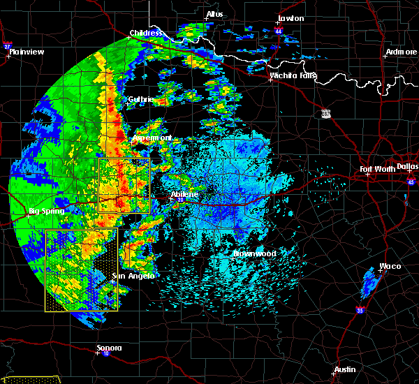 At 1244 am cdt, severe thunderstorms were located along a line extending from near rotan to near longworth to near champion, moving east at 45 mph (radar indicated). Hazards include 70 mph wind gusts. Expect considerable tree damage. damage is likely to mobile homes, roofs, and outbuildings. these severe storms will be near, longworth around 1250 am cdt. merkel, trent and noodle around 100 am cdt. other locations impacted by these severe thunderstorms include the intersection of us- 180 and ranch road 126, hitson, camp butman, gannon, the intersection of highway 70 and ranch road 53, lake sweetwater, the intersection of ranch road 608 and highway 147, camp boothe oaks, busby and capitola. A tornado watch remains in effect until 500 am cdt for west central texas. At 1244 am cdt, severe thunderstorms were located along a line extending from near rotan to near longworth to near champion, moving east at 45 mph (radar indicated). Hazards include 70 mph wind gusts. Expect considerable tree damage. damage is likely to mobile homes, roofs, and outbuildings. these severe storms will be near, longworth around 1250 am cdt. merkel, trent and noodle around 100 am cdt. other locations impacted by these severe thunderstorms include the intersection of us- 180 and ranch road 126, hitson, camp butman, gannon, the intersection of highway 70 and ranch road 53, lake sweetwater, the intersection of ranch road 608 and highway 147, camp boothe oaks, busby and capitola. A tornado watch remains in effect until 500 am cdt for west central texas.
|
| 3/13/2019 12:35 AM CDT | Awos station sww... sweetwate in nolan county TX, 3.5 miles E of Sweetwater, TX |
| 3/13/2019 12:31 AM CDT |
 At 1230 am cdt, severe thunderstorms were located along a line extending from near jayton to near roscoe, moving east at 45 mph (radar indicated). Hazards include 60 mph wind gusts and penny size hail. Expect damage to roofs, siding, and trees. these severe storms will be near, sweetwater around 1245 am cdt. merkel, trent and noodle around 100 am cdt. other locations impacted by these severe thunderstorms include the intersection of us-180 and ranch road 126, us-84 near the nolan- fisher county line, i-20 near the nolan- mitchell county line, hitson, camp butman, gannon, the intersection of highway 70 and ranch road 53, lake sweetwater, the intersection of ranch road 608 and highway 147 and camp boothe oaks. A tornado watch remains in effect until 500 am cdt for west central texas. At 1230 am cdt, severe thunderstorms were located along a line extending from near jayton to near roscoe, moving east at 45 mph (radar indicated). Hazards include 60 mph wind gusts and penny size hail. Expect damage to roofs, siding, and trees. these severe storms will be near, sweetwater around 1245 am cdt. merkel, trent and noodle around 100 am cdt. other locations impacted by these severe thunderstorms include the intersection of us-180 and ranch road 126, us-84 near the nolan- fisher county line, i-20 near the nolan- mitchell county line, hitson, camp butman, gannon, the intersection of highway 70 and ranch road 53, lake sweetwater, the intersection of ranch road 608 and highway 147 and camp boothe oaks. A tornado watch remains in effect until 500 am cdt for west central texas.
|
| 3/13/2019 12:15 AM CDT |
 At 1214 am cdt, severe thunderstorms were located along a line extending from near clairemont to near colorado city, moving east at 55 mph (radar indicated). Hazards include 60 mph wind gusts and penny size hail. Expect damage to roofs, siding, and trees. severe thunderstorms will be near, wastella and champion around 1225 am cdt. roscoe around 1235 am cdt. sweetwater around 1245 am cdt. merkel, trent and noodle around 100 am cdt. other locations impacted by these severe thunderstorms include the intersection of us-180 and ranch road 126, us-84 near the nolan- fisher county line, i-20 near the nolan- mitchell county line, hitson, camp butman, gannon, the intersection of highway 70 and ranch road 53, lake sweetwater, the intersection of ranch road 608 and highway 147 and camp boothe oaks. this includes interstate 20 between mile markers 229 and 269. A tornado watch remains in effect until 500 am cdt for west central texas. At 1214 am cdt, severe thunderstorms were located along a line extending from near clairemont to near colorado city, moving east at 55 mph (radar indicated). Hazards include 60 mph wind gusts and penny size hail. Expect damage to roofs, siding, and trees. severe thunderstorms will be near, wastella and champion around 1225 am cdt. roscoe around 1235 am cdt. sweetwater around 1245 am cdt. merkel, trent and noodle around 100 am cdt. other locations impacted by these severe thunderstorms include the intersection of us-180 and ranch road 126, us-84 near the nolan- fisher county line, i-20 near the nolan- mitchell county line, hitson, camp butman, gannon, the intersection of highway 70 and ranch road 53, lake sweetwater, the intersection of ranch road 608 and highway 147 and camp boothe oaks. this includes interstate 20 between mile markers 229 and 269. A tornado watch remains in effect until 500 am cdt for west central texas.
|
| 7/30/2018 7:12 AM CDT |
 The severe thunderstorm warning for callahan, southern jones, nolan, southern shackelford, southeastern fisher and taylor counties will expire at 715 am cdt, the storms which prompted the warning have weakened below severe limits, and no longer pose an immediate threat to life or property. therefore, the warning will be allowed to expire. however gusty winds are still possible with these thunderstorms. The severe thunderstorm warning for callahan, southern jones, nolan, southern shackelford, southeastern fisher and taylor counties will expire at 715 am cdt, the storms which prompted the warning have weakened below severe limits, and no longer pose an immediate threat to life or property. therefore, the warning will be allowed to expire. however gusty winds are still possible with these thunderstorms.
|
| 7/30/2018 6:52 AM CDT |
 At 650 am cdt, a severe thunderstorm was located 8 miles southwest of merkel, or 20 miles east of sweetwater, moving south at 20 mph (radar indicated). Hazards include 60 mph wind gusts. Expect damage to roofs, siding, and trees. this severe storm will be near, coronados camp around 705 am cdt. happy valley around 715 am cdt. Other locations impacted by this severe thunderstorm include funston, shep, lake sweetwater, the intersection of us- 180 and farm road 600, admiral, camp butman, the intersection of ranch road 608 and highway 147, camp boothe oaks, impact and the intersection of us-180 and ranch road 126. At 650 am cdt, a severe thunderstorm was located 8 miles southwest of merkel, or 20 miles east of sweetwater, moving south at 20 mph (radar indicated). Hazards include 60 mph wind gusts. Expect damage to roofs, siding, and trees. this severe storm will be near, coronados camp around 705 am cdt. happy valley around 715 am cdt. Other locations impacted by this severe thunderstorm include funston, shep, lake sweetwater, the intersection of us- 180 and farm road 600, admiral, camp butman, the intersection of ranch road 608 and highway 147, camp boothe oaks, impact and the intersection of us-180 and ranch road 126.
|
| 7/30/2018 6:27 AM CDT |
 At 622 am cdt, a severe thunderstorm was located 8 miles northwest of trent, or 12 miles northeast of sweetwater, moving south at 20 mph (radar indicated). Hazards include 60 mph wind gusts. Expect damage to roofs, siding, and trees. this severe thunderstorm will be near, abilene around 630 am cdt. trent around 630 am cdt. nolan around 645 am cdt. coronados camp around 650 am cdt. happy valley around 700 am cdt. bradshaw around 705 am cdt. This includes interstate 20 between mile markers 229 and 323. At 622 am cdt, a severe thunderstorm was located 8 miles northwest of trent, or 12 miles northeast of sweetwater, moving south at 20 mph (radar indicated). Hazards include 60 mph wind gusts. Expect damage to roofs, siding, and trees. this severe thunderstorm will be near, abilene around 630 am cdt. trent around 630 am cdt. nolan around 645 am cdt. coronados camp around 650 am cdt. happy valley around 700 am cdt. bradshaw around 705 am cdt. This includes interstate 20 between mile markers 229 and 323.
|
| 7/1/2018 7:32 PM CDT |
 At 731 pm cdt, a severe thunderstorm was located 3 miles north of sweetwater, and is nearly stationary (radar indicated). Hazards include 60 mph wind gusts. Expect damage to roofs, siding, and trees. this severe storm will be near, sweetwater around 735 pm cdt. roscoe around 800 pm cdt. Other locations impacted by this severe thunderstorm include busby, capitola and gannon. At 731 pm cdt, a severe thunderstorm was located 3 miles north of sweetwater, and is nearly stationary (radar indicated). Hazards include 60 mph wind gusts. Expect damage to roofs, siding, and trees. this severe storm will be near, sweetwater around 735 pm cdt. roscoe around 800 pm cdt. Other locations impacted by this severe thunderstorm include busby, capitola and gannon.
|
| 7/1/2018 7:13 PM CDT |
 At 713 pm cdt, a severe thunderstorm was located near sweetwater, moving north at 10 mph (radar indicated). Hazards include 70 mph wind gusts and quarter size hail. Hail damage to vehicles is expected. expect considerable tree damage. wind damage is also likely to mobile homes, roofs, and outbuildings. this severe thunderstorm will be near, roby and longworth around 800 pm cdt. other locations impacted by this severe thunderstorm include busby, capitola and gannon. This includes interstate 20 between mile markers 238 and 250. At 713 pm cdt, a severe thunderstorm was located near sweetwater, moving north at 10 mph (radar indicated). Hazards include 70 mph wind gusts and quarter size hail. Hail damage to vehicles is expected. expect considerable tree damage. wind damage is also likely to mobile homes, roofs, and outbuildings. this severe thunderstorm will be near, roby and longworth around 800 pm cdt. other locations impacted by this severe thunderstorm include busby, capitola and gannon. This includes interstate 20 between mile markers 238 and 250.
|
| 6/23/2018 8:00 PM CDT |
 At 759 pm cdt, a severe thunderstorm was located near longworth, or 10 miles north of sweetwater, moving northeast at 25 mph (radar indicated). Hazards include golf ball size hail and 70 mph wind gusts. People and animals outdoors will be injured. expect hail damage to roofs, siding, windows, and vehicles. expect considerable tree damage. wind damage is also likely to mobile homes, roofs, and outbuildings. this severe thunderstorm will be near, roby and longworth around 810 pm cdt. sylvester around 820 pm cdt. mccaulley around 830 pm cdt. other locations impacted by this severe thunderstorm include the intersection of us- 180 and ranch road 126, gannon, hitson, busby and capitola. This includes interstate 20 between mile markers 238 and 253. At 759 pm cdt, a severe thunderstorm was located near longworth, or 10 miles north of sweetwater, moving northeast at 25 mph (radar indicated). Hazards include golf ball size hail and 70 mph wind gusts. People and animals outdoors will be injured. expect hail damage to roofs, siding, windows, and vehicles. expect considerable tree damage. wind damage is also likely to mobile homes, roofs, and outbuildings. this severe thunderstorm will be near, roby and longworth around 810 pm cdt. sylvester around 820 pm cdt. mccaulley around 830 pm cdt. other locations impacted by this severe thunderstorm include the intersection of us- 180 and ranch road 126, gannon, hitson, busby and capitola. This includes interstate 20 between mile markers 238 and 253.
|
| 6/23/2018 7:33 PM CDT |
 At 732 pm cdt, a severe thunderstorm was located over wastella, or 7 miles northwest of roscoe, moving northeast at 25 mph (radar indicated). Hazards include two inch hail and 70 mph wind gusts. People and animals outdoors will be injured. expect hail damage to roofs, siding, windows, and vehicles. expect considerable tree damage. wind damage is also likely to mobile homes, roofs, and outbuildings. This severe thunderstorm will remain over mainly rural areas of northwestern nolan and southwestern fisher counties, including the following locations, gannon, busby, capitola, i-20 near the nolan- mitchell county line and us-84 near the nolan-fisher county line. At 732 pm cdt, a severe thunderstorm was located over wastella, or 7 miles northwest of roscoe, moving northeast at 25 mph (radar indicated). Hazards include two inch hail and 70 mph wind gusts. People and animals outdoors will be injured. expect hail damage to roofs, siding, windows, and vehicles. expect considerable tree damage. wind damage is also likely to mobile homes, roofs, and outbuildings. This severe thunderstorm will remain over mainly rural areas of northwestern nolan and southwestern fisher counties, including the following locations, gannon, busby, capitola, i-20 near the nolan- mitchell county line and us-84 near the nolan-fisher county line.
|
| 6/23/2018 7:18 PM CDT |
 At 718 pm cdt, a severe thunderstorm was located near wastella, or 10 miles west of roscoe, moving northeast at 25 mph (radar indicated). Hazards include two inch hail and 60 mph wind gusts. People and animals outdoors will be injured. expect hail damage to roofs, siding, windows, and vehicles. expect wind damage to roofs, siding, and trees. this severe thunderstorm will be near, wastella around 725 pm cdt. roscoe around 735 pm cdt. other locations impacted by this severe thunderstorm include gannon, busby, capitola, i-20 near the nolan-mitchell county line and us- 84 near the nolan-fisher county line. This includes interstate 20 between mile markers 229 and 253. At 718 pm cdt, a severe thunderstorm was located near wastella, or 10 miles west of roscoe, moving northeast at 25 mph (radar indicated). Hazards include two inch hail and 60 mph wind gusts. People and animals outdoors will be injured. expect hail damage to roofs, siding, windows, and vehicles. expect wind damage to roofs, siding, and trees. this severe thunderstorm will be near, wastella around 725 pm cdt. roscoe around 735 pm cdt. other locations impacted by this severe thunderstorm include gannon, busby, capitola, i-20 near the nolan-mitchell county line and us- 84 near the nolan-fisher county line. This includes interstate 20 between mile markers 229 and 253.
|
| 3/26/2018 7:17 PM CDT |
 At 716 pm cdt, a severe thunderstorm was located near sweetwater, moving northeast at 25 mph (radar indicated). Hazards include ping pong ball size hail and 60 mph wind gusts. People and animals outdoors will be injured. expect hail damage to roofs, siding, windows, and vehicles. expect wind damage to roofs, siding, and trees. this severe thunderstorm will be near, trent around 740 pm cdt. noodle around 755 pm cdt. other locations impacted by this severe thunderstorm include hodges, the intersection of us- 180 and ranch road 126, truby, stith and lake sweetwater. This includes interstate 20 between mile markers 244 and 266. At 716 pm cdt, a severe thunderstorm was located near sweetwater, moving northeast at 25 mph (radar indicated). Hazards include ping pong ball size hail and 60 mph wind gusts. People and animals outdoors will be injured. expect hail damage to roofs, siding, windows, and vehicles. expect wind damage to roofs, siding, and trees. this severe thunderstorm will be near, trent around 740 pm cdt. noodle around 755 pm cdt. other locations impacted by this severe thunderstorm include hodges, the intersection of us- 180 and ranch road 126, truby, stith and lake sweetwater. This includes interstate 20 between mile markers 244 and 266.
|
| 3/26/2018 7:10 PM CDT | Quarter sized hail reported 1.4 miles N of Sweetwater, TX, quarter size hail near sweetwater. |
| 3/26/2018 7:04 PM CDT |
 At 702 pm cdt, a severe thunderstorm was located over sweetwater, moving northeast at 35 mph (radar indicated). Hazards include golf ball size hail and 60 mph wind gusts. People and animals outdoors will be injured. expect hail damage to roofs, siding, windows, and vehicles. expect wind damage to roofs, siding, and trees. This severe thunderstorm will remain over mainly rural areas of northeastern nolan and south central fisher counties, including the following locations: lake sweetwater, camp boothe oaks and gannon. At 702 pm cdt, a severe thunderstorm was located over sweetwater, moving northeast at 35 mph (radar indicated). Hazards include golf ball size hail and 60 mph wind gusts. People and animals outdoors will be injured. expect hail damage to roofs, siding, windows, and vehicles. expect wind damage to roofs, siding, and trees. This severe thunderstorm will remain over mainly rural areas of northeastern nolan and south central fisher counties, including the following locations: lake sweetwater, camp boothe oaks and gannon.
|
| 3/26/2018 6:26 PM CDT |
 At 624 pm cdt, a severe thunderstorm was located near champion, or 10 miles southeast of colorado city, moving northeast at 35 mph (radar indicated). Hazards include golf ball size hail and 60 mph wind gusts. People and animals outdoors will be injured. expect hail damage to roofs, siding, windows, and vehicles. expect wind damage to roofs, siding, and trees. this severe thunderstorm will be near, champion around 635 pm cdt. roscoe around 650 pm cdt. sweetwater around 710 pm cdt. other locations impacted by this severe thunderstorm include gannon, the intersection of highway 70 and ranch road 53, lake sweetwater, the intersection of ranch road 608 and highway 147, camp boothe oaks and i-20 near the nolan-mitchell county line. This includes interstate 20 between mile markers 229 and 256. At 624 pm cdt, a severe thunderstorm was located near champion, or 10 miles southeast of colorado city, moving northeast at 35 mph (radar indicated). Hazards include golf ball size hail and 60 mph wind gusts. People and animals outdoors will be injured. expect hail damage to roofs, siding, windows, and vehicles. expect wind damage to roofs, siding, and trees. this severe thunderstorm will be near, champion around 635 pm cdt. roscoe around 650 pm cdt. sweetwater around 710 pm cdt. other locations impacted by this severe thunderstorm include gannon, the intersection of highway 70 and ranch road 53, lake sweetwater, the intersection of ranch road 608 and highway 147, camp boothe oaks and i-20 near the nolan-mitchell county line. This includes interstate 20 between mile markers 229 and 256.
|
| 3/26/2018 2:51 PM CDT |
 At 251 pm cdt, a severe thunderstorm was located near roscoe, moving northeast at 45 mph (radar indicated). Hazards include golf ball size hail and 50 mph wind gusts. People and animals outdoors will be injured. expect hail damage to roofs, siding, windows, and vehicles. expect wind damage to roofs, siding, and trees. this severe storm will be near, roscoe around 300 pm cdt. sweetwater around 310 pm cdt. Other locations impacted by this severe thunderstorm include gannon, lake sweetwater, camp boothe oaks, capitola, us-84 near the nolan- fisher county line, i-20 near the nolan- mitchell county line and the intersection of ranch road 608 and highway 147. At 251 pm cdt, a severe thunderstorm was located near roscoe, moving northeast at 45 mph (radar indicated). Hazards include golf ball size hail and 50 mph wind gusts. People and animals outdoors will be injured. expect hail damage to roofs, siding, windows, and vehicles. expect wind damage to roofs, siding, and trees. this severe storm will be near, roscoe around 300 pm cdt. sweetwater around 310 pm cdt. Other locations impacted by this severe thunderstorm include gannon, lake sweetwater, camp boothe oaks, capitola, us-84 near the nolan- fisher county line, i-20 near the nolan- mitchell county line and the intersection of ranch road 608 and highway 147.
|
| 3/26/2018 2:43 PM CDT |
 At 242 pm cdt, a severe thunderstorm was located near loraine, or 9 miles southwest of roscoe, moving northeast at 50 mph (radar indicated). Hazards include 50 mph wind gusts and half dollar size hail. Hail damage to vehicles is expected. expect wind damage to roofs, siding, and trees. this severe thunderstorm will be near, wastella around 250 pm cdt. roscoe around 255 pm cdt. sweetwater around 305 pm cdt. other locations impacted by this severe thunderstorm include gannon, lake sweetwater, camp boothe oaks, capitola, us-84 near the nolan- fisher county line, i-20 near the nolan- mitchell county line and the intersection of ranch road 608 and highway 147. This includes interstate 20 between mile markers 229 and 250. At 242 pm cdt, a severe thunderstorm was located near loraine, or 9 miles southwest of roscoe, moving northeast at 50 mph (radar indicated). Hazards include 50 mph wind gusts and half dollar size hail. Hail damage to vehicles is expected. expect wind damage to roofs, siding, and trees. this severe thunderstorm will be near, wastella around 250 pm cdt. roscoe around 255 pm cdt. sweetwater around 305 pm cdt. other locations impacted by this severe thunderstorm include gannon, lake sweetwater, camp boothe oaks, capitola, us-84 near the nolan- fisher county line, i-20 near the nolan- mitchell county line and the intersection of ranch road 608 and highway 147. This includes interstate 20 between mile markers 229 and 250.
|
| 10/21/2017 7:32 PM CDT |
 At 732 pm cdt, a severe thunderstorm was located near sweetwater, moving east at 35 mph. law enforcement reported golf ball size hail in sweetwater at 625 pm (law enforcement). Hazards include golf ball size hail and 60 mph wind gusts. People and animals outdoors will be injured. expect hail damage to roofs, siding, windows, and vehicles. expect wind damage to roofs, siding, and trees. this severe storm will be near, trent around 750 pm cdt. merkel and noodle around 800 pm cdt. Other locations impacted by this severe thunderstorm include hodges, truby, stith and lake sweetwater. At 732 pm cdt, a severe thunderstorm was located near sweetwater, moving east at 35 mph. law enforcement reported golf ball size hail in sweetwater at 625 pm (law enforcement). Hazards include golf ball size hail and 60 mph wind gusts. People and animals outdoors will be injured. expect hail damage to roofs, siding, windows, and vehicles. expect wind damage to roofs, siding, and trees. this severe storm will be near, trent around 750 pm cdt. merkel and noodle around 800 pm cdt. Other locations impacted by this severe thunderstorm include hodges, truby, stith and lake sweetwater.
|
| 10/21/2017 7:25 PM CDT | Golf Ball sized hail reported 0 miles NE of Sweetwater, TX, golf ball size hail in sweetwater. |
| 10/21/2017 7:24 PM CDT |
 At 724 pm cdt, a severe thunderstorm was located over sweetwater, moving east at 35 mph (radar indicated). Hazards include 60 mph wind gusts and quarter size hail. Hail damage to vehicles is expected. expect wind damage to roofs, siding, and trees. this severe thunderstorm will be near, trent around 750 pm cdt. merkel and noodle around 800 pm cdt. tye around 815 pm cdt. other locations impacted by this severe thunderstorm include hodges, truby, stith, lake sweetwater and camp boothe oaks. This includes interstate 20 between mile markers 239 and 281. At 724 pm cdt, a severe thunderstorm was located over sweetwater, moving east at 35 mph (radar indicated). Hazards include 60 mph wind gusts and quarter size hail. Hail damage to vehicles is expected. expect wind damage to roofs, siding, and trees. this severe thunderstorm will be near, trent around 750 pm cdt. merkel and noodle around 800 pm cdt. tye around 815 pm cdt. other locations impacted by this severe thunderstorm include hodges, truby, stith, lake sweetwater and camp boothe oaks. This includes interstate 20 between mile markers 239 and 281.
|
| 8/12/2017 12:49 PM CDT |
 At 1249 pm cdt, a severe thunderstorm was located 8 miles northwest of trent, or 10 miles northeast of sweetwater, moving northeast at 40 mph (radar indicated). Hazards include 60 mph wind gusts and penny size hail. Expect damage to roofs, siding, and trees. this severe storm will be near, trent around 1255 pm cdt. noodle around 100 pm cdt. Other locations impacted by this severe thunderstorm include lake sweetwater, gannon and stith. At 1249 pm cdt, a severe thunderstorm was located 8 miles northwest of trent, or 10 miles northeast of sweetwater, moving northeast at 40 mph (radar indicated). Hazards include 60 mph wind gusts and penny size hail. Expect damage to roofs, siding, and trees. this severe storm will be near, trent around 1255 pm cdt. noodle around 100 pm cdt. Other locations impacted by this severe thunderstorm include lake sweetwater, gannon and stith.
|
| 8/12/2017 12:31 PM CDT |
 At 1231 pm cdt, a severe thunderstorm was located over sweetwater, moving northeast at 40 mph (radar indicated). Hazards include 60 mph wind gusts and penny size hail. Expect damage to roofs, siding, and trees. this severe thunderstorm will be near, trent around 1255 pm cdt. noodle around 100 pm cdt. other locations impacted by this severe thunderstorm include gannon, lake sweetwater, camp boothe oaks and stith. This includes interstate 20 between mile markers 238 and 266. At 1231 pm cdt, a severe thunderstorm was located over sweetwater, moving northeast at 40 mph (radar indicated). Hazards include 60 mph wind gusts and penny size hail. Expect damage to roofs, siding, and trees. this severe thunderstorm will be near, trent around 1255 pm cdt. noodle around 100 pm cdt. other locations impacted by this severe thunderstorm include gannon, lake sweetwater, camp boothe oaks and stith. This includes interstate 20 between mile markers 238 and 266.
|
| 8/12/2017 12:25 PM CDT | Sweetwater pd has relayed reports of winds taking down a few trees near the 1000 block of pines st in sweetwate in nolan county TX, 0 miles NE of Sweetwater, TX |
| 7/1/2017 4:17 AM CDT |
 At 416 am cdt, severe thunderstorms were located along a line extending from near knox city to 6 miles northeast of hamlin to near buford, moving east at 50 mph (radar indicated). Hazards include 60 mph wind gusts and penny size hail. Expect damage to roofs, siding, and trees. these severe storms will be near, hamlin around 420 am cdt. weinert around 425 am cdt. roscoe around 440 am cdt. sweetwater and avoca around 445 am cdt. Other locations impacted by these severe thunderstorms include the intersection of us-180 and ranch road 126, hitson, tuxedo, us- 380 near the haskell- stonewall county line, gannon, lake sweetwater, busby, camp boothe oaks, capitola and i-20 near the nolan-mitchell county line. At 416 am cdt, severe thunderstorms were located along a line extending from near knox city to 6 miles northeast of hamlin to near buford, moving east at 50 mph (radar indicated). Hazards include 60 mph wind gusts and penny size hail. Expect damage to roofs, siding, and trees. these severe storms will be near, hamlin around 420 am cdt. weinert around 425 am cdt. roscoe around 440 am cdt. sweetwater and avoca around 445 am cdt. Other locations impacted by these severe thunderstorms include the intersection of us-180 and ranch road 126, hitson, tuxedo, us- 380 near the haskell- stonewall county line, gannon, lake sweetwater, busby, camp boothe oaks, capitola and i-20 near the nolan-mitchell county line.
|
| 7/1/2017 3:58 AM CDT |
 At 354 am cdt, severe thunderstorms were located along a line extending from 12 miles west of o`brien to 11 miles northeast of rotan to near lake j b thomas, moving east at 55 mph (radar indicated). Hazards include 70 mph wind gusts and penny size hail. Expect considerable tree damage. damage is likely to mobile homes, roofs, and outbuildings. severe thunderstorms will be near, rochester and o`brien around 405 am cdt. hamlin around 410 am cdt. weinert around 415 am cdt. wastella around 420 am cdt. roscoe around 430 am cdt. avoca around 435 am cdt. sweetwater around 440 am cdt. other locations impacted by these severe thunderstorms include the intersection of us-180 and ranch road 126, hitson, tuxedo, us- 380 near the haskell- stonewall county line, gannon, lake sweetwater, busby, camp boothe oaks, capitola and i-20 near the nolan-mitchell county line. This includes interstate 20 between mile markers 229 and 257. At 354 am cdt, severe thunderstorms were located along a line extending from 12 miles west of o`brien to 11 miles northeast of rotan to near lake j b thomas, moving east at 55 mph (radar indicated). Hazards include 70 mph wind gusts and penny size hail. Expect considerable tree damage. damage is likely to mobile homes, roofs, and outbuildings. severe thunderstorms will be near, rochester and o`brien around 405 am cdt. hamlin around 410 am cdt. weinert around 415 am cdt. wastella around 420 am cdt. roscoe around 430 am cdt. avoca around 435 am cdt. sweetwater around 440 am cdt. other locations impacted by these severe thunderstorms include the intersection of us-180 and ranch road 126, hitson, tuxedo, us- 380 near the haskell- stonewall county line, gannon, lake sweetwater, busby, camp boothe oaks, capitola and i-20 near the nolan-mitchell county line. This includes interstate 20 between mile markers 229 and 257.
|
| 6/15/2017 8:54 PM CDT |
 At 852 pm cdt, a cluster of severe thunderstorms were located along a line from avoca to abilene to happy valley , moving southeast at 40 mph (radar indicated). Hazards include 60 mph wind gusts and quarter size hail. Hail damage to vehicles is expected. expect wind damage to roofs, siding, and trees. this severe storm will be near, potosi around 905 pm cdt. Other locations impacted by this severe thunderstorm include funston, impact, lake abilene, camp tonkawa, lake fort phantom hill, gannon, lake sweetwater, ovalo, busby and hodges. At 852 pm cdt, a cluster of severe thunderstorms were located along a line from avoca to abilene to happy valley , moving southeast at 40 mph (radar indicated). Hazards include 60 mph wind gusts and quarter size hail. Hail damage to vehicles is expected. expect wind damage to roofs, siding, and trees. this severe storm will be near, potosi around 905 pm cdt. Other locations impacted by this severe thunderstorm include funston, impact, lake abilene, camp tonkawa, lake fort phantom hill, gannon, lake sweetwater, ovalo, busby and hodges.
|
| 6/15/2017 8:33 PM CDT |
 At 830 pm cdt, a cluster of severe thunderstorms from sweetwater to merkel to stamford was moving southeast at 40 mph (radar indicated). Hazards include 60 mph wind gusts and quarter size hail. Hail damage to vehicles is expected. expect wind damage to roofs, siding, and trees. this severe thunderstorm will be near, tye, abilene, and dyess afb around 845 pm cdt. view around 850 pm cdt. buffalo gap around 855 pm cdt. potosi around 905 pm cdt. other locations impacted by this severe thunderstorm include funston, impact, lake abilene, camp tonkawa, lake fort phantom hill, gannon, lake sweetwater, ovalo, busby and hodges. This includes interstate 20 between mile markers 230 and 292. At 830 pm cdt, a cluster of severe thunderstorms from sweetwater to merkel to stamford was moving southeast at 40 mph (radar indicated). Hazards include 60 mph wind gusts and quarter size hail. Hail damage to vehicles is expected. expect wind damage to roofs, siding, and trees. this severe thunderstorm will be near, tye, abilene, and dyess afb around 845 pm cdt. view around 850 pm cdt. buffalo gap around 855 pm cdt. potosi around 905 pm cdt. other locations impacted by this severe thunderstorm include funston, impact, lake abilene, camp tonkawa, lake fort phantom hill, gannon, lake sweetwater, ovalo, busby and hodges. This includes interstate 20 between mile markers 230 and 292.
|
| 6/15/2017 8:26 PM CDT | Storm damage reported in nolan county TX, 0 miles NE of Sweetwater, TX |
| 6/15/2017 8:18 PM CDT |
 At 815 pm cdt, a line of severe thunderstorms was located over southern fisher and northern nolan counties, moving southeast at 35 mph (radar indicated). Hazards include 60 mph wind gusts and quarter size hail. Hail damage to vehicles is expected. expect wind damage to roofs, siding, and trees. this severe storm will be near, nolan around 840 pm cdt. Other locations impacted by this severe thunderstorm include hitson, tuxedo, gannon, lake sweetwater, busby, capitola, the intersection of us-180 and ranch road 126, truby, camp butman and stith. At 815 pm cdt, a line of severe thunderstorms was located over southern fisher and northern nolan counties, moving southeast at 35 mph (radar indicated). Hazards include 60 mph wind gusts and quarter size hail. Hail damage to vehicles is expected. expect wind damage to roofs, siding, and trees. this severe storm will be near, nolan around 840 pm cdt. Other locations impacted by this severe thunderstorm include hitson, tuxedo, gannon, lake sweetwater, busby, capitola, the intersection of us-180 and ranch road 126, truby, camp butman and stith.
|
| 6/15/2017 7:57 PM CDT |
 At 755 pm cdt, a cluster of severe thunderstorms was located over northwestern fisher county near roby and rotan, moving south at 35 mph (radar indicated). Hazards include 60 mph wind gusts and quarter size hail. Hail damage to vehicles is expected. expect wind damage to roofs, siding, and trees. this severe thunderstorm will be near, sweetwater around 810 pm cdt. nolan around 840 pm cdt. other locations impacted by this severe thunderstorm include hitson, tuxedo, gannon, lake sweetwater, busby, capitola, the intersection of us-180 and ranch road 126, truby, camp butman and stith. This includes interstate 20 between mile markers 229 and 274. At 755 pm cdt, a cluster of severe thunderstorms was located over northwestern fisher county near roby and rotan, moving south at 35 mph (radar indicated). Hazards include 60 mph wind gusts and quarter size hail. Hail damage to vehicles is expected. expect wind damage to roofs, siding, and trees. this severe thunderstorm will be near, sweetwater around 810 pm cdt. nolan around 840 pm cdt. other locations impacted by this severe thunderstorm include hitson, tuxedo, gannon, lake sweetwater, busby, capitola, the intersection of us-180 and ranch road 126, truby, camp butman and stith. This includes interstate 20 between mile markers 229 and 274.
|
| 6/2/2017 7:30 PM CDT |
 At 729 pm cdt, a severe thunderstorm was located near sweetwater, moving east at 30 mph (radar indicated). Hazards include 60 mph wind gusts and quarter size hail. Hail damage to vehicles is expected. expect wind damage to roofs, siding, and trees. this severe thunderstorm will be near, nolan around 745 pm cdt. trent around 805 pm cdt. merkel around 815 pm cdt. tye, dyess afb and view around 830 pm cdt. other locations impacted by this severe thunderstorm include lake abilene, camp tonkawa, camp butman, the intersection of highway 70 and ranch road 53, lake sweetwater and camp boothe oaks. This includes interstate 20 between mile markers 240 and 280. At 729 pm cdt, a severe thunderstorm was located near sweetwater, moving east at 30 mph (radar indicated). Hazards include 60 mph wind gusts and quarter size hail. Hail damage to vehicles is expected. expect wind damage to roofs, siding, and trees. this severe thunderstorm will be near, nolan around 745 pm cdt. trent around 805 pm cdt. merkel around 815 pm cdt. tye, dyess afb and view around 830 pm cdt. other locations impacted by this severe thunderstorm include lake abilene, camp tonkawa, camp butman, the intersection of highway 70 and ranch road 53, lake sweetwater and camp boothe oaks. This includes interstate 20 between mile markers 240 and 280.
|
| 5/19/2017 9:24 AM CDT |
 At 923 am cdt, a severe thunderstorm was located near longworth, or 12 miles northeast of sweetwater, moving northeast at 45 mph. golf ball size hail was reported in sweetwater at 915 am (radar indicated). Hazards include golf ball size hail and 60 mph wind gusts. People and animals outdoors will be injured. expect hail damage to roofs, siding, windows, and vehicles. expect wind damage to roofs, siding, and trees. This severe thunderstorm will remain over mainly rural areas of western jones, northeastern nolan, southeastern fisher and northwestern taylor counties, including the following locations: hodges, the intersection of us-180 and ranch road 126, truby, stith, lake sweetwater and busby. At 923 am cdt, a severe thunderstorm was located near longworth, or 12 miles northeast of sweetwater, moving northeast at 45 mph. golf ball size hail was reported in sweetwater at 915 am (radar indicated). Hazards include golf ball size hail and 60 mph wind gusts. People and animals outdoors will be injured. expect hail damage to roofs, siding, windows, and vehicles. expect wind damage to roofs, siding, and trees. This severe thunderstorm will remain over mainly rural areas of western jones, northeastern nolan, southeastern fisher and northwestern taylor counties, including the following locations: hodges, the intersection of us-180 and ranch road 126, truby, stith, lake sweetwater and busby.
|
| 5/19/2017 9:15 AM CDT | Golf Ball sized hail reported 0 miles NE of Sweetwater, TX |
| 5/19/2017 9:10 AM CDT | Golf Ball sized hail reported 0 miles NE of Sweetwater, TX |
| 5/19/2017 9:09 AM CDT |
 At 844 am cdt, a severe thunderstorm was located near longworth, or 13 miles northeast of sweetwater, moving northeast at 50 mph (radar indicated). Hazards include 60 mph wind gusts and quarter size hail. Hail damage to vehicles is expected. expect wind damage to roofs, siding, and trees. this severe thunderstorm will be near, mccaulley around 855 am cdt. neinda around 905 am cdt. other locations impacted by this severe thunderstorm include hodges, the intersection of us- 180 and ranch road 126, gannon, truby, stith, lake sweetwater, busby, camp boothe oaks and capitola. This includes interstate 20 between mile markers 235 and 275. At 844 am cdt, a severe thunderstorm was located near longworth, or 13 miles northeast of sweetwater, moving northeast at 50 mph (radar indicated). Hazards include 60 mph wind gusts and quarter size hail. Hail damage to vehicles is expected. expect wind damage to roofs, siding, and trees. this severe thunderstorm will be near, mccaulley around 855 am cdt. neinda around 905 am cdt. other locations impacted by this severe thunderstorm include hodges, the intersection of us- 180 and ranch road 126, gannon, truby, stith, lake sweetwater, busby, camp boothe oaks and capitola. This includes interstate 20 between mile markers 235 and 275.
|
| 5/19/2017 8:44 AM CDT |
 At 844 am cdt, a severe thunderstorm was located near longworth, or 13 miles northeast of sweetwater, moving northeast at 50 mph (radar indicated). Hazards include 60 mph wind gusts and quarter size hail. Hail damage to vehicles is expected. expect wind damage to roofs, siding, and trees. this severe thunderstorm will be near, mccaulley around 855 am cdt. neinda around 905 am cdt. other locations impacted by this severe thunderstorm include hodges, the intersection of us- 180 and ranch road 126, gannon, truby, stith, lake sweetwater, busby, camp boothe oaks and capitola. This includes interstate 20 between mile markers 235 and 275. At 844 am cdt, a severe thunderstorm was located near longworth, or 13 miles northeast of sweetwater, moving northeast at 50 mph (radar indicated). Hazards include 60 mph wind gusts and quarter size hail. Hail damage to vehicles is expected. expect wind damage to roofs, siding, and trees. this severe thunderstorm will be near, mccaulley around 855 am cdt. neinda around 905 am cdt. other locations impacted by this severe thunderstorm include hodges, the intersection of us- 180 and ranch road 126, gannon, truby, stith, lake sweetwater, busby, camp boothe oaks and capitola. This includes interstate 20 between mile markers 235 and 275.
|
| 5/19/2017 8:36 AM CDT |
 At 836 am cdt, a severe thunderstorm was located near longworth, or 10 miles northeast of sweetwater, moving northeast at 35 mph (radar indicated). Hazards include 60 mph wind gusts and quarter size hail. Hail damage to vehicles is expected. expect wind damage to roofs, siding, and trees. Locations impacted include, sweetwater, hamlin, roscoe, roby, mccaulley, sylvester, wastella, longworth, champion, hitson, gannon, lake sweetwater, busby, capitola, the intersection of ranch road 608 and highway 147, camp boothe oaks, us-84 near the nolan-fisher county line and i- 20 near the nolan-mitchell county line. At 836 am cdt, a severe thunderstorm was located near longworth, or 10 miles northeast of sweetwater, moving northeast at 35 mph (radar indicated). Hazards include 60 mph wind gusts and quarter size hail. Hail damage to vehicles is expected. expect wind damage to roofs, siding, and trees. Locations impacted include, sweetwater, hamlin, roscoe, roby, mccaulley, sylvester, wastella, longworth, champion, hitson, gannon, lake sweetwater, busby, capitola, the intersection of ranch road 608 and highway 147, camp boothe oaks, us-84 near the nolan-fisher county line and i- 20 near the nolan-mitchell county line.
|
| 5/19/2017 8:04 AM CDT |
 At 804 am cdt, a severe thunderstorm was located near wastella, or near roscoe, moving northeast at 45 mph (radar indicated). Hazards include 60 mph wind gusts and quarter size hail. Hail damage to vehicles is expected. Expect wind damage to roofs, siding, and trees. At 804 am cdt, a severe thunderstorm was located near wastella, or near roscoe, moving northeast at 45 mph (radar indicated). Hazards include 60 mph wind gusts and quarter size hail. Hail damage to vehicles is expected. Expect wind damage to roofs, siding, and trees.
|
| 5/19/2017 4:58 AM CDT |
 At 457 am cdt, a severe thunderstorm was located near maryneal, or 9 miles southeast of roscoe, moving east at 25 mph (radar indicated). Hazards include 60 mph wind gusts and quarter size hail. Hail damage to vehicles is expected. Expect wind damage to roofs, siding, and trees. At 457 am cdt, a severe thunderstorm was located near maryneal, or 9 miles southeast of roscoe, moving east at 25 mph (radar indicated). Hazards include 60 mph wind gusts and quarter size hail. Hail damage to vehicles is expected. Expect wind damage to roofs, siding, and trees.
|
| 5/19/2017 4:43 AM CDT |
 At 442 am cdt, a severe thunderstorm was located near champion, or 9 miles south of roscoe, moving east at 25 mph (radar indicated). Hazards include 60 mph wind gusts and quarter size hail. Hail damage to vehicles is expected. expect wind damage to roofs, siding, and trees. Locations impacted include, sweetwater, roscoe, nolan, maryneal, wastella, champion, gannon, lake sweetwater, the intersection of highway 70 and ranch road 53, the intersection of ranch road 608 and highway 147, camp boothe oaks, us- 84 near the nolan-fisher county line and i-20 near the nolan- mitchell county line. At 442 am cdt, a severe thunderstorm was located near champion, or 9 miles south of roscoe, moving east at 25 mph (radar indicated). Hazards include 60 mph wind gusts and quarter size hail. Hail damage to vehicles is expected. expect wind damage to roofs, siding, and trees. Locations impacted include, sweetwater, roscoe, nolan, maryneal, wastella, champion, gannon, lake sweetwater, the intersection of highway 70 and ranch road 53, the intersection of ranch road 608 and highway 147, camp boothe oaks, us- 84 near the nolan-fisher county line and i-20 near the nolan- mitchell county line.
|
| 5/19/2017 4:11 AM CDT |
 At 409 am cdt, a severe thunderstorm was located near sweetwater, moving northeast at 20 mph (radar indicated). Hazards include 60 mph wind gusts and quarter size hail. Hail damage to vehicles is expected. Expect wind damage to roofs, siding, and trees. At 409 am cdt, a severe thunderstorm was located near sweetwater, moving northeast at 20 mph (radar indicated). Hazards include 60 mph wind gusts and quarter size hail. Hail damage to vehicles is expected. Expect wind damage to roofs, siding, and trees.
|
| 5/19/2017 3:50 AM CDT |
 At 349 am cdt, a severe thunderstorm was located over maryneal, or 12 miles northwest of blackwell, moving northeast at 20 mph (radar indicated). Hazards include 60 mph wind gusts and quarter size hail. Hail damage to vehicles is expected. expect wind damage to roofs, siding, and trees. Locations impacted include, sweetwater, roscoe, maryneal, wastella, champion, us- 84 near the nolan- fisher county line, the intersection of highway 70 and ranch road 53, lake sweetwater, the intersection of ranch road 608 and highway 147, camp boothe oaks and i-20 near the nolan-mitchell county line. At 349 am cdt, a severe thunderstorm was located over maryneal, or 12 miles northwest of blackwell, moving northeast at 20 mph (radar indicated). Hazards include 60 mph wind gusts and quarter size hail. Hail damage to vehicles is expected. expect wind damage to roofs, siding, and trees. Locations impacted include, sweetwater, roscoe, maryneal, wastella, champion, us- 84 near the nolan- fisher county line, the intersection of highway 70 and ranch road 53, lake sweetwater, the intersection of ranch road 608 and highway 147, camp boothe oaks and i-20 near the nolan-mitchell county line.
|
| 5/19/2017 3:20 AM CDT |
 At 319 am cdt, a severe thunderstorm was located near maryneal, or 15 miles northwest of blackwell, moving north at 20 mph (radar indicated). Hazards include 60 mph wind gusts and quarter size hail. Hail damage to vehicles is expected. Expect wind damage to roofs, siding, and trees. At 319 am cdt, a severe thunderstorm was located near maryneal, or 15 miles northwest of blackwell, moving north at 20 mph (radar indicated). Hazards include 60 mph wind gusts and quarter size hail. Hail damage to vehicles is expected. Expect wind damage to roofs, siding, and trees.
|
| 5/16/2017 11:58 PM CDT |
 At 1157 pm cdt, a severe thunderstorm was located near nolan, or 13 miles northeast of blackwell, moving east at 50 mph (radar indicated). Hazards include 70 mph wind gusts and quarter size hail. Hail damage to vehicles is expected. expect considerable tree damage. wind damage is also likely to mobile homes, roofs, and outbuildings. This severe thunderstorm will remain over mainly rural areas of nolan and western taylor counties, including the following locations: camp butman, the intersection of highway 70 and ranch road 53, lake sweetwater, the intersection of ranch road 608 and highway 147 and camp boothe oaks. At 1157 pm cdt, a severe thunderstorm was located near nolan, or 13 miles northeast of blackwell, moving east at 50 mph (radar indicated). Hazards include 70 mph wind gusts and quarter size hail. Hail damage to vehicles is expected. expect considerable tree damage. wind damage is also likely to mobile homes, roofs, and outbuildings. This severe thunderstorm will remain over mainly rural areas of nolan and western taylor counties, including the following locations: camp butman, the intersection of highway 70 and ranch road 53, lake sweetwater, the intersection of ranch road 608 and highway 147 and camp boothe oaks.
|
| 5/16/2017 11:43 PM CDT |
 At 1142 pm cdt, a severe thunderstorm was located near maryneal, or 9 miles northwest of blackwell, moving east at 50 mph (radar indicated). Hazards include 70 mph wind gusts and quarter size hail. Hail damage to vehicles is expected. expect considerable tree damage. wind damage is also likely to mobile homes, roofs, and outbuildings. this severe thunderstorm will be near, nolan around 1155 pm cdt. other locations impacted by this severe thunderstorm include camp butman, the intersection of highway 70 and ranch road 53, lake sweetwater, the intersection of ranch road 608 and highway 147, camp boothe oaks and i-20 near the nolan-mitchell county line. This includes interstate 20 between mile markers 229 and 270. At 1142 pm cdt, a severe thunderstorm was located near maryneal, or 9 miles northwest of blackwell, moving east at 50 mph (radar indicated). Hazards include 70 mph wind gusts and quarter size hail. Hail damage to vehicles is expected. expect considerable tree damage. wind damage is also likely to mobile homes, roofs, and outbuildings. this severe thunderstorm will be near, nolan around 1155 pm cdt. other locations impacted by this severe thunderstorm include camp butman, the intersection of highway 70 and ranch road 53, lake sweetwater, the intersection of ranch road 608 and highway 147, camp boothe oaks and i-20 near the nolan-mitchell county line. This includes interstate 20 between mile markers 229 and 270.
|
| 5/16/2017 11:22 PM CDT |
 At 1120 pm cdt, severe thunderstorms were located along a line extending from 7 miles northeast of rotan to near longworth to near roscoe, moving northeast at 50 mph (radar indicated). Hazards include 60 mph wind gusts and quarter size hail. Hail damage to vehicles is expected. expect wind damage to roofs, siding, and trees. these severe storms will be near, hamlin and sylvester around 1130 pm cdt. mccaulley around 1135 pm cdt. Other locations impacted by these severe thunderstorms include gannon, hitson, busby and capitola. At 1120 pm cdt, severe thunderstorms were located along a line extending from 7 miles northeast of rotan to near longworth to near roscoe, moving northeast at 50 mph (radar indicated). Hazards include 60 mph wind gusts and quarter size hail. Hail damage to vehicles is expected. expect wind damage to roofs, siding, and trees. these severe storms will be near, hamlin and sylvester around 1130 pm cdt. mccaulley around 1135 pm cdt. Other locations impacted by these severe thunderstorms include gannon, hitson, busby and capitola.
|
| 5/16/2017 10:58 PM CDT |
 At 1057 pm cdt, severe thunderstorms were located along a line extending from near hudd to midway in scurry county to near china grove, moving northeast at 45 mph (radar indicated). Hazards include 60 mph wind gusts and quarter size hail. Hail damage to vehicles is expected. expect wind damage to roofs, siding, and trees. severe thunderstorms will be near, hobbs around 1105 pm cdt. rotan around 1120 pm cdt. roby and longworth around 1130 pm cdt. sylvester around 1140 pm cdt. mccaulley around 1145 pm cdt. hamlin around 1155 pm cdt. other locations impacted by these severe thunderstorms include us- 84 near the nolan-fisher county line, i-20 near the nolan- mitchell county line, hitson, gannon, lake sweetwater, busby, camp boothe oaks and capitola. This includes interstate 20 between mile markers 229 and 260. At 1057 pm cdt, severe thunderstorms were located along a line extending from near hudd to midway in scurry county to near china grove, moving northeast at 45 mph (radar indicated). Hazards include 60 mph wind gusts and quarter size hail. Hail damage to vehicles is expected. expect wind damage to roofs, siding, and trees. severe thunderstorms will be near, hobbs around 1105 pm cdt. rotan around 1120 pm cdt. roby and longworth around 1130 pm cdt. sylvester around 1140 pm cdt. mccaulley around 1145 pm cdt. hamlin around 1155 pm cdt. other locations impacted by these severe thunderstorms include us- 84 near the nolan-fisher county line, i-20 near the nolan- mitchell county line, hitson, gannon, lake sweetwater, busby, camp boothe oaks and capitola. This includes interstate 20 between mile markers 229 and 260.
|
| 4/1/2017 5:22 PM CDT |
 At 521 pm cdt, a severe thunderstorm was located just north of sweetwater, moving northeast at 25 mph (radar indicated). Hazards include golf ball size hail and 60 mph wind gusts. People and animals outdoors will be injured. expect hail damage to roofs, siding, windows, and vehicles. expect wind damage to roofs, siding, and trees. this severe storm will be near, longworth around 540 pm cdt. sylvester around 545 pm cdt. Other locations impacted by this severe thunderstorm include busby, capitola and gannon. At 521 pm cdt, a severe thunderstorm was located just north of sweetwater, moving northeast at 25 mph (radar indicated). Hazards include golf ball size hail and 60 mph wind gusts. People and animals outdoors will be injured. expect hail damage to roofs, siding, windows, and vehicles. expect wind damage to roofs, siding, and trees. this severe storm will be near, longworth around 540 pm cdt. sylvester around 545 pm cdt. Other locations impacted by this severe thunderstorm include busby, capitola and gannon.
|
| 4/1/2017 5:07 PM CDT |
 At 507 pm cdt, a severe thunderstorm was located near sweetwater, moving northeast at 25 mph (radar indicated). Hazards include ping pong ball size hail and 60 mph wind gusts. People and animals outdoors will be injured. expect hail damage to roofs, siding, windows, and vehicles. expect wind damage to roofs, siding, and trees. this severe thunderstorm will be near, sweetwater around 520 pm cdt. longworth around 540 pm cdt. other locations impacted by this severe thunderstorm include busby, capitola and gannon. This includes interstate 20 between mile markers 236 and 260. At 507 pm cdt, a severe thunderstorm was located near sweetwater, moving northeast at 25 mph (radar indicated). Hazards include ping pong ball size hail and 60 mph wind gusts. People and animals outdoors will be injured. expect hail damage to roofs, siding, windows, and vehicles. expect wind damage to roofs, siding, and trees. this severe thunderstorm will be near, sweetwater around 520 pm cdt. longworth around 540 pm cdt. other locations impacted by this severe thunderstorm include busby, capitola and gannon. This includes interstate 20 between mile markers 236 and 260.
|
| 4/1/2017 4:56 PM CDT |
 At 456 pm cdt, a severe thunderstorm was located near roscoe, moving northeast at 25 mph. half dollar size hailed was reported by a trained spotter in roscoe (radar indicated). Hazards include ping pong ball size hail and 60 mph wind gusts. People and animals outdoors will be injured. expect hail damage to roofs, siding, windows, and vehicles. expect wind damage to roofs, siding, and trees. this severe storm will be near, longworth around 515 pm cdt. Other locations impacted by this severe thunderstorm include us- 84 near the nolan-fisher county line, gannon, i-20 near the nolan- mitchell county line, us-180 near the fisher- scurry county line, busby and capitola. At 456 pm cdt, a severe thunderstorm was located near roscoe, moving northeast at 25 mph. half dollar size hailed was reported by a trained spotter in roscoe (radar indicated). Hazards include ping pong ball size hail and 60 mph wind gusts. People and animals outdoors will be injured. expect hail damage to roofs, siding, windows, and vehicles. expect wind damage to roofs, siding, and trees. this severe storm will be near, longworth around 515 pm cdt. Other locations impacted by this severe thunderstorm include us- 84 near the nolan-fisher county line, gannon, i-20 near the nolan- mitchell county line, us-180 near the fisher- scurry county line, busby and capitola.
|
| 4/1/2017 4:43 PM CDT |
 At 442 pm cdt, a severe thunderstorm was located near roscoe, moving northeast at 25 mph (radar indicated). Hazards include ping pong ball size hail and 60 mph wind gusts. People and animals outdoors will be injured. expect hail damage to roofs, siding, windows, and vehicles. expect wind damage to roofs, siding, and trees. this severe storm will be near, longworth around 515 pm cdt. Other locations impacted by this severe thunderstorm include us- 84 near the nolan-fisher county line, gannon, i-20 near the nolan- mitchell county line, us-180 near the fisher- scurry county line, busby and capitola. At 442 pm cdt, a severe thunderstorm was located near roscoe, moving northeast at 25 mph (radar indicated). Hazards include ping pong ball size hail and 60 mph wind gusts. People and animals outdoors will be injured. expect hail damage to roofs, siding, windows, and vehicles. expect wind damage to roofs, siding, and trees. this severe storm will be near, longworth around 515 pm cdt. Other locations impacted by this severe thunderstorm include us- 84 near the nolan-fisher county line, gannon, i-20 near the nolan- mitchell county line, us-180 near the fisher- scurry county line, busby and capitola.
|
| 4/1/2017 4:36 PM CDT |
 At 436 pm cdt, a severe thunderstorm was located near loraine, or near roscoe, moving northeast at 15 mph (radar indicated). Hazards include 60 mph wind gusts and quarter size hail. Hail damage to vehicles is expected. expect wind damage to roofs, siding, and trees. this severe storm will be near, roscoe around 455 pm cdt. sweetwater around 515 pm cdt. Other locations impacted by this severe thunderstorm include us- 84 near the nolan-fisher county line, gannon, i-20 near the nolan- mitchell county line, us-180 near the fisher- scurry county line, busby and capitola. At 436 pm cdt, a severe thunderstorm was located near loraine, or near roscoe, moving northeast at 15 mph (radar indicated). Hazards include 60 mph wind gusts and quarter size hail. Hail damage to vehicles is expected. expect wind damage to roofs, siding, and trees. this severe storm will be near, roscoe around 455 pm cdt. sweetwater around 515 pm cdt. Other locations impacted by this severe thunderstorm include us- 84 near the nolan-fisher county line, gannon, i-20 near the nolan- mitchell county line, us-180 near the fisher- scurry county line, busby and capitola.
|
| 4/1/2017 4:25 PM CDT |
 At 425 pm cdt, a severe thunderstorm was located near wastella, or 8 miles west of roscoe, moving northeast at 25 mph (radar indicated). Hazards include 60 mph wind gusts and quarter size hail. Hail damage to vehicles is expected. expect wind damage to roofs, siding, and trees. this severe thunderstorm will be near, wastella around 435 pm cdt. roscoe around 440 pm cdt. longworth around 515 pm cdt. other locations impacted by this severe thunderstorm include us- 84 near the nolan-fisher county line, gannon, i-20 near the nolan- mitchell county line, us-180 near the fisher- scurry county line, busby and capitola. This includes interstate 20 between mile markers 229 and 241. At 425 pm cdt, a severe thunderstorm was located near wastella, or 8 miles west of roscoe, moving northeast at 25 mph (radar indicated). Hazards include 60 mph wind gusts and quarter size hail. Hail damage to vehicles is expected. expect wind damage to roofs, siding, and trees. this severe thunderstorm will be near, wastella around 435 pm cdt. roscoe around 440 pm cdt. longworth around 515 pm cdt. other locations impacted by this severe thunderstorm include us- 84 near the nolan-fisher county line, gannon, i-20 near the nolan- mitchell county line, us-180 near the fisher- scurry county line, busby and capitola. This includes interstate 20 between mile markers 229 and 241.
|
| 3/28/2017 10:00 PM CDT |
 At 1000 pm cdt, severe thunderstorms were located along a line extending from neinda to 6 miles northeast of noodle to near tye to near view to near bradshaw, moving east at 50 mph (radar indicated). Hazards include 60 mph wind gusts and penny size hail. Expect damage to roofs, siding, and trees. these severe storms will be near, anson, tye, tuscola and dyess afb around 1005 pm cdt. hawley and lawn around 1010 pm cdt. abilene, nugent and potosi around 1020 pm cdt. avoca around 1025 pm cdt. Other locations impacted by these severe thunderstorms include funston, impact, lake abilene, camp tonkawa, hitson, lake fort phantom hill, lake sweetwater, ovalo, hodges and the intersection of us-180 and ranch road 126. At 1000 pm cdt, severe thunderstorms were located along a line extending from neinda to 6 miles northeast of noodle to near tye to near view to near bradshaw, moving east at 50 mph (radar indicated). Hazards include 60 mph wind gusts and penny size hail. Expect damage to roofs, siding, and trees. these severe storms will be near, anson, tye, tuscola and dyess afb around 1005 pm cdt. hawley and lawn around 1010 pm cdt. abilene, nugent and potosi around 1020 pm cdt. avoca around 1025 pm cdt. Other locations impacted by these severe thunderstorms include funston, impact, lake abilene, camp tonkawa, hitson, lake fort phantom hill, lake sweetwater, ovalo, hodges and the intersection of us-180 and ranch road 126.
|
| 3/28/2017 9:41 PM CDT |
 At 940 pm cdt, severe thunderstorms were located along a line extending from near rotan to 7 miles southwest of trent to blackwell, moving east at 35 mph (radar indicated). Hazards include 70 mph wind gusts and quarter size hail. Hail damage to vehicles is expected. expect considerable tree damage. wind damage is also likely to mobile homes, roofs, and outbuildings. severe thunderstorms will be near, trent and hylton around 955 pm cdt. merkel and sylvester around 1000 pm cdt. mccaulley and happy valley around 1005 pm cdt. hamlin, neinda, dyess afb and view around 1015 pm cdt. tye around 1020 pm cdt. bradshaw and abilene around 1025 pm cdt. anson, tuscola and potosi around 1035 pm cdt. lawn around 1040 pm cdt. other locations impacted by these severe thunderstorms include funston, impact, lake abilene, camp tonkawa, hitson, lake fort phantom hill, gannon, lake sweetwater, ovalo and busby. This includes interstate 20 between mile markers 236 and 291. At 940 pm cdt, severe thunderstorms were located along a line extending from near rotan to 7 miles southwest of trent to blackwell, moving east at 35 mph (radar indicated). Hazards include 70 mph wind gusts and quarter size hail. Hail damage to vehicles is expected. expect considerable tree damage. wind damage is also likely to mobile homes, roofs, and outbuildings. severe thunderstorms will be near, trent and hylton around 955 pm cdt. merkel and sylvester around 1000 pm cdt. mccaulley and happy valley around 1005 pm cdt. hamlin, neinda, dyess afb and view around 1015 pm cdt. tye around 1020 pm cdt. bradshaw and abilene around 1025 pm cdt. anson, tuscola and potosi around 1035 pm cdt. lawn around 1040 pm cdt. other locations impacted by these severe thunderstorms include funston, impact, lake abilene, camp tonkawa, hitson, lake fort phantom hill, gannon, lake sweetwater, ovalo and busby. This includes interstate 20 between mile markers 236 and 291.
|
| 3/28/2017 9:30 PM CDT |
 At 928 pm cdt, a severe thunderstorm capable of producing a tornado was located near sweetwater, moving northeast at 50 mph (radar indicated rotation. a wind gusts of 73 mph was reported 11 miles southwest of sweetwater at 917 pm). Hazards include tornado, wind gusts to 80 mph, quarter size hail. Flying debris will be dangerous to those caught without shelter. mobile homes will be damaged or destroyed. damage to roofs, windows, and vehicles will occur. tree damage is likely. this dangerous storm will be near, trent around 950 pm cdt. other locations impacted by this tornadic thunderstorm include camp butman, the intersection of highway 70 and ranch road 53, lake sweetwater, the intersection of ranch road 608 and highway 147 and camp boothe oaks. This includes interstate 20 between mile markers 233 and 266. At 928 pm cdt, a severe thunderstorm capable of producing a tornado was located near sweetwater, moving northeast at 50 mph (radar indicated rotation. a wind gusts of 73 mph was reported 11 miles southwest of sweetwater at 917 pm). Hazards include tornado, wind gusts to 80 mph, quarter size hail. Flying debris will be dangerous to those caught without shelter. mobile homes will be damaged or destroyed. damage to roofs, windows, and vehicles will occur. tree damage is likely. this dangerous storm will be near, trent around 950 pm cdt. other locations impacted by this tornadic thunderstorm include camp butman, the intersection of highway 70 and ranch road 53, lake sweetwater, the intersection of ranch road 608 and highway 147 and camp boothe oaks. This includes interstate 20 between mile markers 233 and 266.
|
| 3/28/2017 9:13 PM CDT |
 At 913 pm cdt, a severe thunderstorm capable of producing a tornado was located over champion, or 8 miles south of roscoe, moving east at 50 mph (radar indicated rotation). Hazards include tornado and quarter size hail. Flying debris will be dangerous to those caught without shelter. mobile homes will be damaged or destroyed. damage to roofs, windows, and vehicles will occur. tree damage is likely. this dangerous storm will be near, sweetwater around 930 pm cdt. Other locations impacted by this tornadic thunderstorm include i-20 near the nolan-mitchell county line, the intersection of highway 70 and ranch road 53, the intersection of ranch road 608 and highway 147 and camp boothe oaks. At 913 pm cdt, a severe thunderstorm capable of producing a tornado was located over champion, or 8 miles south of roscoe, moving east at 50 mph (radar indicated rotation). Hazards include tornado and quarter size hail. Flying debris will be dangerous to those caught without shelter. mobile homes will be damaged or destroyed. damage to roofs, windows, and vehicles will occur. tree damage is likely. this dangerous storm will be near, sweetwater around 930 pm cdt. Other locations impacted by this tornadic thunderstorm include i-20 near the nolan-mitchell county line, the intersection of highway 70 and ranch road 53, the intersection of ranch road 608 and highway 147 and camp boothe oaks.
|
| 3/28/2017 9:06 PM CDT |
 At 905 pm cdt, a severe thunderstorm capable of producing a tornado was located near champion, or 11 miles southwest of roscoe, moving east at 50 mph (radar indicated rotation). Hazards include tornado and quarter size hail. Flying debris will be dangerous to those caught without shelter. mobile homes will be damaged or destroyed. damage to roofs, windows, and vehicles will occur. tree damage is likely. this dangerous storm will be near, champion around 910 pm cdt. roscoe around 920 pm cdt. sweetwater around 930 pm cdt. other locations impacted by this tornadic thunderstorm include i-20 near the nolan-mitchell county line, the intersection of highway 70 and ranch road 53, the intersection of ranch road 608 and highway 147 and camp boothe oaks. This includes interstate 20 between mile markers 229 and 243. At 905 pm cdt, a severe thunderstorm capable of producing a tornado was located near champion, or 11 miles southwest of roscoe, moving east at 50 mph (radar indicated rotation). Hazards include tornado and quarter size hail. Flying debris will be dangerous to those caught without shelter. mobile homes will be damaged or destroyed. damage to roofs, windows, and vehicles will occur. tree damage is likely. this dangerous storm will be near, champion around 910 pm cdt. roscoe around 920 pm cdt. sweetwater around 930 pm cdt. other locations impacted by this tornadic thunderstorm include i-20 near the nolan-mitchell county line, the intersection of highway 70 and ranch road 53, the intersection of ranch road 608 and highway 147 and camp boothe oaks. This includes interstate 20 between mile markers 229 and 243.
|
| 3/28/2017 8:54 PM CDT |
 At 852 pm cdt, severe thunderstorms were located along a line extending from near hudd to silver, moving east at 50 mph (radar indicated). Hazards include 60 mph wind gusts and quarter size hail. Hail damage to vehicles is expected. expect wind damage to roofs, siding, and trees. severe thunderstorms will be near, rotan around 910 pm cdt. blackwell around 920 pm cdt. hylton around 925 pm cdt. hamlin around 930 pm cdt. happy valley around 935 pm cdt. other locations impacted by these severe thunderstorms include the intersection of us- 180 and ranch road 126, hitson, gannon, camp butman, the intersection of highway 70 and ranch road 53, lake sweetwater, the intersection of ranch road 608 and highway 147, busby, camp boothe oaks and capitola. this includes interstate 20 between mile markers 230 and 267. A tornado watch remains in effect until 1100 pm cdt for west central texas. At 852 pm cdt, severe thunderstorms were located along a line extending from near hudd to silver, moving east at 50 mph (radar indicated). Hazards include 60 mph wind gusts and quarter size hail. Hail damage to vehicles is expected. expect wind damage to roofs, siding, and trees. severe thunderstorms will be near, rotan around 910 pm cdt. blackwell around 920 pm cdt. hylton around 925 pm cdt. hamlin around 930 pm cdt. happy valley around 935 pm cdt. other locations impacted by these severe thunderstorms include the intersection of us- 180 and ranch road 126, hitson, gannon, camp butman, the intersection of highway 70 and ranch road 53, lake sweetwater, the intersection of ranch road 608 and highway 147, busby, camp boothe oaks and capitola. this includes interstate 20 between mile markers 230 and 267. A tornado watch remains in effect until 1100 pm cdt for west central texas.
|
| 3/28/2017 5:33 PM CDT | Quarter sized hail reported 6.2 miles WNW of Sweetwater, TX |
| 3/28/2017 5:31 PM CDT |
 At 529 pm cdt, a severe thunderstorm was located near nolan, or 11 miles southeast of sweetwater, moving north at 30 mph (radar indicated). Hazards include 60 mph wind gusts and half dollar size hail. Hail damage to vehicles is expected. expect wind damage to roofs, siding, and trees. this severe storm will be near, sweetwater around 545 pm cdt. other locations impacted by this severe thunderstorm include camp butman, stith, the intersection of highway 70 and ranch road 53 and lake sweetwater. A tornado watch remains in effect until 1100 pm cdt for west central texas. At 529 pm cdt, a severe thunderstorm was located near nolan, or 11 miles southeast of sweetwater, moving north at 30 mph (radar indicated). Hazards include 60 mph wind gusts and half dollar size hail. Hail damage to vehicles is expected. expect wind damage to roofs, siding, and trees. this severe storm will be near, sweetwater around 545 pm cdt. other locations impacted by this severe thunderstorm include camp butman, stith, the intersection of highway 70 and ranch road 53 and lake sweetwater. A tornado watch remains in effect until 1100 pm cdt for west central texas.
|
| 3/28/2017 5:05 PM CDT |
 At 504 pm cdt, a severe thunderstorm was located near blackwell, moving north at 40 mph (radar indicated). Hazards include ping pong ball size hail and 60 mph wind gusts. People and animals outdoors will be injured. expect hail damage to roofs, siding, windows, and vehicles. expect wind damage to roofs, siding, and trees. this severe thunderstorm will be near, nolan around 515 pm cdt. trent around 540 pm cdt. other locations impacted by this severe thunderstorm include camp butman, stith, the intersection of highway 70 and ranch road 53 and lake sweetwater. this includes interstate 20 between mile markers 244 and 272. A tornado watch remains in effect until 1100 pm cdt for west central texas. At 504 pm cdt, a severe thunderstorm was located near blackwell, moving north at 40 mph (radar indicated). Hazards include ping pong ball size hail and 60 mph wind gusts. People and animals outdoors will be injured. expect hail damage to roofs, siding, windows, and vehicles. expect wind damage to roofs, siding, and trees. this severe thunderstorm will be near, nolan around 515 pm cdt. trent around 540 pm cdt. other locations impacted by this severe thunderstorm include camp butman, stith, the intersection of highway 70 and ranch road 53 and lake sweetwater. this includes interstate 20 between mile markers 244 and 272. A tornado watch remains in effect until 1100 pm cdt for west central texas.
|
| 9/16/2016 6:20 PM CDT |
 At 619 pm cdt, a severe thunderstorm was located near sweetwater, moving east at 25 mph (radar indicated). Hazards include ping pong ball size hail and 60 mph wind gusts. People and animals outdoors will be injured. expect hail damage to roofs, siding, windows, and vehicles. expect wind damage to roofs, siding, and trees. This severe thunderstorm will remain over mainly rural areas of southeastern fisher and northeastern nolan counties, including the following locations: lake sweetwater, gannon and busby. At 619 pm cdt, a severe thunderstorm was located near sweetwater, moving east at 25 mph (radar indicated). Hazards include ping pong ball size hail and 60 mph wind gusts. People and animals outdoors will be injured. expect hail damage to roofs, siding, windows, and vehicles. expect wind damage to roofs, siding, and trees. This severe thunderstorm will remain over mainly rural areas of southeastern fisher and northeastern nolan counties, including the following locations: lake sweetwater, gannon and busby.
|
| 9/16/2016 6:01 PM CDT |
 At 600 pm cdt, a severe thunderstorm was located 7 miles northwest of sweetwater, moving east at 15 mph (radar indicated). Hazards include 60 mph wind gusts and half dollar size hail. Hail damage to vehicles is expected. expect wind damage to roofs, siding, and trees. this severe thunderstorm will be near, sweetwater and longworth around 620 pm cdt. other locations impacted by this severe thunderstorm include lake sweetwater, capitola, gannon and busby. This includes interstate 20 between mile markers 244 and 259. At 600 pm cdt, a severe thunderstorm was located 7 miles northwest of sweetwater, moving east at 15 mph (radar indicated). Hazards include 60 mph wind gusts and half dollar size hail. Hail damage to vehicles is expected. expect wind damage to roofs, siding, and trees. this severe thunderstorm will be near, sweetwater and longworth around 620 pm cdt. other locations impacted by this severe thunderstorm include lake sweetwater, capitola, gannon and busby. This includes interstate 20 between mile markers 244 and 259.
|
| 5/29/2016 12:32 AM CDT |
 At 1231 am cdt, a severe thunderstorm was located over trent, or 18 miles east of sweetwater, moving east at 35 mph (radar indicated). Hazards include 60 mph wind gusts and quarter size hail. Hail damage to vehicles is expected. expect wind damage to roofs, siding, and trees. this severe storm will be near, noodle around 1235 am cdt. merkel around 1240 am cdt. other locations impacted by this severe thunderstorm include lake sweetwater, the intersection of highway 70 and ranch road 53, truby, stith, gannon, busby, camp boothe oaks, camp butman and the intersection of ranch road 608 and highway 147. This includes interstate 20 between mile markers 229 and 274. At 1231 am cdt, a severe thunderstorm was located over trent, or 18 miles east of sweetwater, moving east at 35 mph (radar indicated). Hazards include 60 mph wind gusts and quarter size hail. Hail damage to vehicles is expected. expect wind damage to roofs, siding, and trees. this severe storm will be near, noodle around 1235 am cdt. merkel around 1240 am cdt. other locations impacted by this severe thunderstorm include lake sweetwater, the intersection of highway 70 and ranch road 53, truby, stith, gannon, busby, camp boothe oaks, camp butman and the intersection of ranch road 608 and highway 147. This includes interstate 20 between mile markers 229 and 274.
|
| 5/29/2016 12:09 AM CDT |
 At 1208 am cdt, a severe thunderstorm was located near sweetwater, moving east at 20 mph (radar indicated). Hazards include ping pong ball size hail and 60 mph wind gusts. People and animals outdoors will be injured. expect hail damage to roofs, siding, windows, and vehicles. expect wind damage to roofs, siding, and trees. this severe thunderstorm will be near, trent around 1245 am cdt. merkel around 100 am cdt. other locations impacted by this severe thunderstorm include lake sweetwater, capitola, the intersection of highway 70 and ranch road 53, truby, stith, gannon, busby, camp boothe oaks, camp butman and the intersection of ranch road 608 and highway 147. This includes interstate 20 between mile markers 229 and 274. At 1208 am cdt, a severe thunderstorm was located near sweetwater, moving east at 20 mph (radar indicated). Hazards include ping pong ball size hail and 60 mph wind gusts. People and animals outdoors will be injured. expect hail damage to roofs, siding, windows, and vehicles. expect wind damage to roofs, siding, and trees. this severe thunderstorm will be near, trent around 1245 am cdt. merkel around 100 am cdt. other locations impacted by this severe thunderstorm include lake sweetwater, capitola, the intersection of highway 70 and ranch road 53, truby, stith, gannon, busby, camp boothe oaks, camp butman and the intersection of ranch road 608 and highway 147. This includes interstate 20 between mile markers 229 and 274.
|
| 5/29/2016 12:02 AM CDT |
 At 1159 pm cdt, a severe thunderstorm was located near loraine, or 5 miles west of roscoe, moving east at 20 mph (radar indicated). Hazards include 60 mph wind gusts and half dollar size hail. a second severe storm was over sweetwater moving east at 20 mph. quarter size hail and 60 mph winds are likely with this storm as it moves east along i-20. Hail damage to vehicles is expected. expect wind damage to roofs, siding, and trees. this severe storm will be near, roscoe around 1215 am cdt. other locations impacted by this severe thunderstorm include lake sweetwater, capitola, the intersection of highway 70 and ranch road 53, camp boothe oaks, gannon, busby, the intersection of ranch road 608 and highway 147, i-20 near the nolan-mitchell county line and us-84 near the nolan-fisher county line. This includes interstate 20 between mile markers 229 and 260. At 1159 pm cdt, a severe thunderstorm was located near loraine, or 5 miles west of roscoe, moving east at 20 mph (radar indicated). Hazards include 60 mph wind gusts and half dollar size hail. a second severe storm was over sweetwater moving east at 20 mph. quarter size hail and 60 mph winds are likely with this storm as it moves east along i-20. Hail damage to vehicles is expected. expect wind damage to roofs, siding, and trees. this severe storm will be near, roscoe around 1215 am cdt. other locations impacted by this severe thunderstorm include lake sweetwater, capitola, the intersection of highway 70 and ranch road 53, camp boothe oaks, gannon, busby, the intersection of ranch road 608 and highway 147, i-20 near the nolan-mitchell county line and us-84 near the nolan-fisher county line. This includes interstate 20 between mile markers 229 and 260.
|
| 5/28/2016 11:46 PM CDT |
 At 1146 pm cdt, a severe thunderstorm was located over roscoe, moving southeast at 15 mph (radar indicated). Hazards include 60 mph wind gusts and nickel size hail. Expect damage to roofs. siding. and trees. this severe storm will be near, sweetwater around 1205 am cdt. other locations impacted by this severe thunderstorm include lake sweetwater, capitola, the intersection of highway 70 and ranch road 53, camp boothe oaks, gannon, busby, the intersection of ranch road 608 and highway 147, i-20 near the nolan-mitchell county line and us-84 near the nolan-fisher county line. This includes interstate 20 between mile markers 229 and 260. At 1146 pm cdt, a severe thunderstorm was located over roscoe, moving southeast at 15 mph (radar indicated). Hazards include 60 mph wind gusts and nickel size hail. Expect damage to roofs. siding. and trees. this severe storm will be near, sweetwater around 1205 am cdt. other locations impacted by this severe thunderstorm include lake sweetwater, capitola, the intersection of highway 70 and ranch road 53, camp boothe oaks, gannon, busby, the intersection of ranch road 608 and highway 147, i-20 near the nolan-mitchell county line and us-84 near the nolan-fisher county line. This includes interstate 20 between mile markers 229 and 260.
|
| 5/28/2016 11:39 PM CDT |
 At 1139 pm cdt, a severe thunderstorm was located near roscoe, moving southeast at 20 mph (radar indicated). Hazards include 60 mph wind gusts and half dollar size hail. Hail damage to vehicles is expected. expect wind damage to roofs, siding, and trees. this severe storm will be near, sweetwater around 1150 pm cdt. nolan around 1215 am cdt. other locations impacted by this severe thunderstorm include lake sweetwater, capitola, the intersection of highway 70 and ranch road 53, camp boothe oaks, gannon, busby, the intersection of ranch road 608 and highway 147, i-20 near the nolan-mitchell county line and us-84 near the nolan-fisher county line. This includes interstate 20 between mile markers 229 and 260. At 1139 pm cdt, a severe thunderstorm was located near roscoe, moving southeast at 20 mph (radar indicated). Hazards include 60 mph wind gusts and half dollar size hail. Hail damage to vehicles is expected. expect wind damage to roofs, siding, and trees. this severe storm will be near, sweetwater around 1150 pm cdt. nolan around 1215 am cdt. other locations impacted by this severe thunderstorm include lake sweetwater, capitola, the intersection of highway 70 and ranch road 53, camp boothe oaks, gannon, busby, the intersection of ranch road 608 and highway 147, i-20 near the nolan-mitchell county line and us-84 near the nolan-fisher county line. This includes interstate 20 between mile markers 229 and 260.
|
| 5/28/2016 11:30 PM CDT |
 At 1130 pm cdt, a severe thunderstorm was located near roscoe, moving east at 30 mph (radar indicated). Hazards include golf ball size hail and 60 mph wind gusts. People and animals outdoors will be injured. expect hail damage to roofs, siding, windows, and vehicles. expect wind damage to roofs, siding, and trees. this severe storm will be near, sweetwater around 1140 pm cdt. nolan around 1210 am cdt. other locations impacted by this severe thunderstorm include lake sweetwater, capitola, the intersection of highway 70 and ranch road 53, camp boothe oaks, gannon, busby, the intersection of ranch road 608 and highway 147, i-20 near the nolan-mitchell county line and us-84 near the nolan-fisher county line. This includes interstate 20 between mile markers 229 and 260. At 1130 pm cdt, a severe thunderstorm was located near roscoe, moving east at 30 mph (radar indicated). Hazards include golf ball size hail and 60 mph wind gusts. People and animals outdoors will be injured. expect hail damage to roofs, siding, windows, and vehicles. expect wind damage to roofs, siding, and trees. this severe storm will be near, sweetwater around 1140 pm cdt. nolan around 1210 am cdt. other locations impacted by this severe thunderstorm include lake sweetwater, capitola, the intersection of highway 70 and ranch road 53, camp boothe oaks, gannon, busby, the intersection of ranch road 608 and highway 147, i-20 near the nolan-mitchell county line and us-84 near the nolan-fisher county line. This includes interstate 20 between mile markers 229 and 260.
|
| 5/28/2016 11:02 PM CDT |
 At 1101 pm cdt, a severe thunderstorm was located over inadale, or 11 miles northwest of roscoe, moving east at 25 mph (radar indicated). Hazards include tennis ball size hail and 60 mph wind gusts. People and animals outdoors will be injured. expect hail damage to roofs, siding, windows, and vehicles. expect wind damage to roofs, siding, and trees. this severe thunderstorm will be near, wastella around 1110 pm cdt. roscoe around 1125 pm cdt. sweetwater around 1140 pm cdt. nolan around 1210 am cdt. other locations impacted by this severe thunderstorm include lake sweetwater, capitola, the intersection of highway 70 and ranch road 53, camp boothe oaks, gannon, busby, the intersection of ranch road 608 and highway 147, i-20 near the nolan-mitchell county line and us-84 near the nolan-fisher county line. This includes interstate 20 between mile markers 229 and 260. At 1101 pm cdt, a severe thunderstorm was located over inadale, or 11 miles northwest of roscoe, moving east at 25 mph (radar indicated). Hazards include tennis ball size hail and 60 mph wind gusts. People and animals outdoors will be injured. expect hail damage to roofs, siding, windows, and vehicles. expect wind damage to roofs, siding, and trees. this severe thunderstorm will be near, wastella around 1110 pm cdt. roscoe around 1125 pm cdt. sweetwater around 1140 pm cdt. nolan around 1210 am cdt. other locations impacted by this severe thunderstorm include lake sweetwater, capitola, the intersection of highway 70 and ranch road 53, camp boothe oaks, gannon, busby, the intersection of ranch road 608 and highway 147, i-20 near the nolan-mitchell county line and us-84 near the nolan-fisher county line. This includes interstate 20 between mile markers 229 and 260.
|
| 5/8/2016 3:56 PM CDT |
 At 356 pm cdt, a severe thunderstorm was located near silver, or 17 miles west of blackwell, moving northeast at 35 mph (radar indicated). Hazards include 60 mph wind gusts and half dollar size hail. Hail damage to vehicles is expected. expect wind damage to roofs, siding, and trees. this severe thunderstorm will be near, maryneal around 420 pm cdt. other locations impacted by this severe thunderstorm include lake sweetwater, camp boothe oaks, the intersection of highway 70 and ranch road 53 and the intersection of ranch road 608 and highway 147. This includes interstate 20 between mile markers 231 and 251. At 356 pm cdt, a severe thunderstorm was located near silver, or 17 miles west of blackwell, moving northeast at 35 mph (radar indicated). Hazards include 60 mph wind gusts and half dollar size hail. Hail damage to vehicles is expected. expect wind damage to roofs, siding, and trees. this severe thunderstorm will be near, maryneal around 420 pm cdt. other locations impacted by this severe thunderstorm include lake sweetwater, camp boothe oaks, the intersection of highway 70 and ranch road 53 and the intersection of ranch road 608 and highway 147. This includes interstate 20 between mile markers 231 and 251.
|
| 4/26/2016 5:32 PM CDT | Quarter sized hail reported 0.6 miles E of Sweetwater, TX |
| 4/26/2016 5:24 PM CDT |
 At 523 pm cdt, a severe thunderstorm was located over roscoe, moving northeast at 45 mph (radar indicated). Hazards include 70 mph wind gusts and ping pong ball size hail. People and animals outdoors will be injured. expect hail damage to roofs, siding, windows, and vehicles. expect considerable tree damage. wind damage is also likely to mobile homes, roofs, and outbuildings. this severe storm will be near, longworth around 540 pm cdt. other locations impacted by this severe thunderstorm include lake sweetwater, capitola, camp boothe oaks, gannon, busby, i- 20 near the nolan-mitchell county line and us-84 near the nolan- fisher county line. this includes interstate 20 between mile markers 229 and 258. A tornado watch remains in effect until midnight cdt for west central texas. At 523 pm cdt, a severe thunderstorm was located over roscoe, moving northeast at 45 mph (radar indicated). Hazards include 70 mph wind gusts and ping pong ball size hail. People and animals outdoors will be injured. expect hail damage to roofs, siding, windows, and vehicles. expect considerable tree damage. wind damage is also likely to mobile homes, roofs, and outbuildings. this severe storm will be near, longworth around 540 pm cdt. other locations impacted by this severe thunderstorm include lake sweetwater, capitola, camp boothe oaks, gannon, busby, i- 20 near the nolan-mitchell county line and us-84 near the nolan- fisher county line. this includes interstate 20 between mile markers 229 and 258. A tornado watch remains in effect until midnight cdt for west central texas.
|
| 4/26/2016 5:12 PM CDT |
 At 511 pm cdt, a severe thunderstorm was located 8 miles north of roscoe, moving northeast at 55 mph (radar indicated). Hazards include 60 mph wind gusts and quarter size hail. Hail damage to vehicles is expected. expect wind damage to roofs, siding, and trees. this severe storm will be near, roby and longworth around 525 pm cdt. other locations impacted by this severe thunderstorm include lake sweetwater, capitola, camp boothe oaks, gannon, busby, i- 20 near the nolan-mitchell county line and us-84 near the nolan- fisher county line. this includes interstate 20 between mile markers 229 and 258. A tornado watch remains in effect until midnight cdt for west central texas. At 511 pm cdt, a severe thunderstorm was located 8 miles north of roscoe, moving northeast at 55 mph (radar indicated). Hazards include 60 mph wind gusts and quarter size hail. Hail damage to vehicles is expected. expect wind damage to roofs, siding, and trees. this severe storm will be near, roby and longworth around 525 pm cdt. other locations impacted by this severe thunderstorm include lake sweetwater, capitola, camp boothe oaks, gannon, busby, i- 20 near the nolan-mitchell county line and us-84 near the nolan- fisher county line. this includes interstate 20 between mile markers 229 and 258. A tornado watch remains in effect until midnight cdt for west central texas.
|
| 4/26/2016 4:58 PM CDT |
 At 457 pm cdt, a severe thunderstorm was located over loraine, or 9 miles west of roscoe, moving northeast at 55 mph (radar indicated). Hazards include two inch hail and 60 mph wind gusts. People and animals outdoors will be injured. expect hail damage to roofs, siding, windows, and vehicles. expect wind damage to roofs, siding, and trees. this severe thunderstorm will be near, roscoe around 505 pm cdt. roby and longworth around 525 pm cdt. other locations impacted by this severe thunderstorm include lake sweetwater, capitola, camp boothe oaks, gannon, busby, i- 20 near the nolan-mitchell county line and us-84 near the nolan- fisher county line. this includes interstate 20 between mile markers 229 and 258. A tornado watch remains in effect until midnight cdt for west central texas. At 457 pm cdt, a severe thunderstorm was located over loraine, or 9 miles west of roscoe, moving northeast at 55 mph (radar indicated). Hazards include two inch hail and 60 mph wind gusts. People and animals outdoors will be injured. expect hail damage to roofs, siding, windows, and vehicles. expect wind damage to roofs, siding, and trees. this severe thunderstorm will be near, roscoe around 505 pm cdt. roby and longworth around 525 pm cdt. other locations impacted by this severe thunderstorm include lake sweetwater, capitola, camp boothe oaks, gannon, busby, i- 20 near the nolan-mitchell county line and us-84 near the nolan- fisher county line. this includes interstate 20 between mile markers 229 and 258. A tornado watch remains in effect until midnight cdt for west central texas.
|
| 4/21/2016 3:28 AM CDT |
 At 328 am cdt, a severe thunderstorm was located near wastella, or near roscoe, moving east at 25 mph (radar indicated). Hazards include ping pong ball size hail and 60 mph wind gusts. People and animals outdoors will be injured. expect hail damage to roofs, siding, windows, and vehicles. expect wind damage to roofs, siding, and trees. this severe thunderstorm will be near, sweetwater around 355 am cdt. other locations impacted by this severe thunderstorm include lake sweetwater, camp boothe oaks, gannon and us-84 near the nolan- fisher county line. This includes interstate 20 between mile markers 233 and 260. At 328 am cdt, a severe thunderstorm was located near wastella, or near roscoe, moving east at 25 mph (radar indicated). Hazards include ping pong ball size hail and 60 mph wind gusts. People and animals outdoors will be injured. expect hail damage to roofs, siding, windows, and vehicles. expect wind damage to roofs, siding, and trees. this severe thunderstorm will be near, sweetwater around 355 am cdt. other locations impacted by this severe thunderstorm include lake sweetwater, camp boothe oaks, gannon and us-84 near the nolan- fisher county line. This includes interstate 20 between mile markers 233 and 260.
|
| 4/21/2016 2:40 AM CDT | Quarter sized hail reported 0 miles NE of Sweetwater, TX, located i-20 and 70 |
| 4/21/2016 2:30 AM CDT | Quarter sized hail reported 0 miles NE of Sweetwater, TX |
| 4/21/2016 2:26 AM CDT |
 At 225 am cdt, a severe thunderstorm was located over sweetwater, moving southeast at 30 mph (radar indicated). Hazards include ping pong ball size hail and 60 mph wind gusts. People and animals outdoors will be injured. expect hail damage to roofs, siding, windows, and vehicles. expect wind damage to roofs, siding, and trees. this severe thunderstorm will be near, sweetwater around 230 am cdt. nolan around 305 am cdt. hylton around 325 am cdt. happy valley around 330 am cdt. other locations impacted by this severe thunderstorm include lake sweetwater, camp boothe oaks, the intersection of highway 70 and ranch road 53 and camp butman. This includes interstate 20 between mile markers 236 and 249. At 225 am cdt, a severe thunderstorm was located over sweetwater, moving southeast at 30 mph (radar indicated). Hazards include ping pong ball size hail and 60 mph wind gusts. People and animals outdoors will be injured. expect hail damage to roofs, siding, windows, and vehicles. expect wind damage to roofs, siding, and trees. this severe thunderstorm will be near, sweetwater around 230 am cdt. nolan around 305 am cdt. hylton around 325 am cdt. happy valley around 330 am cdt. other locations impacted by this severe thunderstorm include lake sweetwater, camp boothe oaks, the intersection of highway 70 and ranch road 53 and camp butman. This includes interstate 20 between mile markers 236 and 249.
|
| 4/21/2016 1:57 AM CDT |
 At 157 am cdt, a severe thunderstorm was located 7 miles northeast of inadale, or 12 miles north of roscoe, moving southeast at 25 mph (radar indicated). Hazards include golf ball size hail and 60 mph wind gusts. People and animals outdoors will be injured. expect hail damage to roofs, siding, windows, and vehicles. expect wind damage to roofs, siding, and trees. this severe storm will be near, roscoe around 220 am cdt. sweetwater around 230 am cdt. other locations impacted by this severe thunderstorm include lake sweetwater, capitola, camp boothe oaks, gannon, busby and us- 180 near the fisher-scurry county line. This includes interstate 20 between mile markers 237 and 256. At 157 am cdt, a severe thunderstorm was located 7 miles northeast of inadale, or 12 miles north of roscoe, moving southeast at 25 mph (radar indicated). Hazards include golf ball size hail and 60 mph wind gusts. People and animals outdoors will be injured. expect hail damage to roofs, siding, windows, and vehicles. expect wind damage to roofs, siding, and trees. this severe storm will be near, roscoe around 220 am cdt. sweetwater around 230 am cdt. other locations impacted by this severe thunderstorm include lake sweetwater, capitola, camp boothe oaks, gannon, busby and us- 180 near the fisher-scurry county line. This includes interstate 20 between mile markers 237 and 256.
|
| 4/21/2016 1:25 AM CDT |
 At 124 am cdt, a severe thunderstorm was located just south of roby. an additional severe thunderstorm located in scurry county will move into fisher county in the next 15 minutes. both storms are moving southeast at 30 mph (radar indicated). Hazards include golf ball size hail and 60 mph wind gusts. People and animals outdoors will be injured. expect hail damage to roofs, siding, windows, and vehicles. expect wind damage to roofs, siding, and trees. this severe thunderstorm will be near, hobbs around 140 am cdt. roscoe around 215 am cdt. sweetwater around 225 am cdt. other locations impacted by this severe thunderstorm include lake sweetwater, capitola, camp boothe oaks, gannon, busby and us- 180 near the fisher-scurry county line. This includes interstate 20 between mile markers 237 and 256. At 124 am cdt, a severe thunderstorm was located just south of roby. an additional severe thunderstorm located in scurry county will move into fisher county in the next 15 minutes. both storms are moving southeast at 30 mph (radar indicated). Hazards include golf ball size hail and 60 mph wind gusts. People and animals outdoors will be injured. expect hail damage to roofs, siding, windows, and vehicles. expect wind damage to roofs, siding, and trees. this severe thunderstorm will be near, hobbs around 140 am cdt. roscoe around 215 am cdt. sweetwater around 225 am cdt. other locations impacted by this severe thunderstorm include lake sweetwater, capitola, camp boothe oaks, gannon, busby and us- 180 near the fisher-scurry county line. This includes interstate 20 between mile markers 237 and 256.
|
| 4/16/2016 9:16 PM CDT |
 At 916 pm cdt, a severe thunderstorm was located 8 miles west of longworth, or 12 miles northwest of sweetwater, moving northeast at 25 mph. this storm continues to have the potential to produce large hail and damaging winds (radar indicated). Hazards include 60 mph wind gusts and half dollar size hail. Hail damage to vehicles is expected. expect wind damage to roofs, siding, and trees. this severe storm will be near, roby and longworth around 940 pm cdt. other locations impacted by this severe thunderstorm include capitola, gannon, busby, us-180 near the fisher- scurry county line and us-84 near the nolan-fisher county line. this includes interstate 20 between mile markers 238 and 241, and between mile markers 246 and 256. A tornado watch remains in effect until midnight cdt for west central texas. At 916 pm cdt, a severe thunderstorm was located 8 miles west of longworth, or 12 miles northwest of sweetwater, moving northeast at 25 mph. this storm continues to have the potential to produce large hail and damaging winds (radar indicated). Hazards include 60 mph wind gusts and half dollar size hail. Hail damage to vehicles is expected. expect wind damage to roofs, siding, and trees. this severe storm will be near, roby and longworth around 940 pm cdt. other locations impacted by this severe thunderstorm include capitola, gannon, busby, us-180 near the fisher- scurry county line and us-84 near the nolan-fisher county line. this includes interstate 20 between mile markers 238 and 241, and between mile markers 246 and 256. A tornado watch remains in effect until midnight cdt for west central texas.
|
| 4/16/2016 8:59 PM CDT |
 At 858 pm cdt, a severe thunderstorm was located near inadale, or 10 miles north of roscoe, moving northeast at 25 mph. this storm has the potential to produce large hail and damaging winds. in addition this storm is producing locally heavy rainfall (radar indicated). Hazards include 60 mph wind gusts and half dollar size hail. Hail damage to vehicles is expected. expect wind damage to roofs, siding, and trees. this severe thunderstorm will be near, roby and longworth around 940 pm cdt. other locations impacted by this severe thunderstorm include capitola, gannon, busby, us-180 near the fisher- scurry county line and us-84 near the nolan-fisher county line. this includes interstate 20 between mile markers 238 and 241, and between mile markers 246 and 256. A tornado watch remains in effect until midnight cdt for west central texas. At 858 pm cdt, a severe thunderstorm was located near inadale, or 10 miles north of roscoe, moving northeast at 25 mph. this storm has the potential to produce large hail and damaging winds. in addition this storm is producing locally heavy rainfall (radar indicated). Hazards include 60 mph wind gusts and half dollar size hail. Hail damage to vehicles is expected. expect wind damage to roofs, siding, and trees. this severe thunderstorm will be near, roby and longworth around 940 pm cdt. other locations impacted by this severe thunderstorm include capitola, gannon, busby, us-180 near the fisher- scurry county line and us-84 near the nolan-fisher county line. this includes interstate 20 between mile markers 238 and 241, and between mile markers 246 and 256. A tornado watch remains in effect until midnight cdt for west central texas.
|
| 4/16/2016 5:11 PM CDT |
 At 511 pm cdt, a severe thunderstorm was located over wastella, or 8 miles northwest of roscoe, moving northeast at 15 mph (radar indicated). Hazards include 60 mph wind gusts and half dollar size hail. Hail damage to vehicles is expected. expect wind damage to roofs, siding, and trees. locations impacted include, sweetwater, roscoe, roby, wastella, hobbs, longworth, champion, capitola, us-84 near the nolan-fisher county line, i- 20 near the nolan-mitchell county line, busby, gannon and us- 180 near the fisher-scurry county line. this includes interstate 20 between mile markers 229 and 253. A tornado watch remains in effect until midnight cdt for west central texas. At 511 pm cdt, a severe thunderstorm was located over wastella, or 8 miles northwest of roscoe, moving northeast at 15 mph (radar indicated). Hazards include 60 mph wind gusts and half dollar size hail. Hail damage to vehicles is expected. expect wind damage to roofs, siding, and trees. locations impacted include, sweetwater, roscoe, roby, wastella, hobbs, longworth, champion, capitola, us-84 near the nolan-fisher county line, i- 20 near the nolan-mitchell county line, busby, gannon and us- 180 near the fisher-scurry county line. this includes interstate 20 between mile markers 229 and 253. A tornado watch remains in effect until midnight cdt for west central texas.
|
| 4/16/2016 4:59 PM CDT |
 At 459 pm cdt, a severe thunderstorm was located over wastella, or 8 miles northwest of roscoe, moving northeast at 15 mph (radar indicated). Hazards include 60 mph wind gusts and half dollar size hail. Hail damage to vehicles is expected. expect wind damage to roofs, siding, and trees. this severe thunderstorm will remain over mainly rural areas of southwestern fisher and northwestern nolan counties, including the following locations: i-20 near the nolan-mitchell county line, capitola, gannon, busby, us-180 near the fisher-scurry county line and us-84 near the nolan-fisher county line. this includes interstate 20 between mile markers 229 and 253. A tornado watch remains in effect until midnight cdt for west central texas. At 459 pm cdt, a severe thunderstorm was located over wastella, or 8 miles northwest of roscoe, moving northeast at 15 mph (radar indicated). Hazards include 60 mph wind gusts and half dollar size hail. Hail damage to vehicles is expected. expect wind damage to roofs, siding, and trees. this severe thunderstorm will remain over mainly rural areas of southwestern fisher and northwestern nolan counties, including the following locations: i-20 near the nolan-mitchell county line, capitola, gannon, busby, us-180 near the fisher-scurry county line and us-84 near the nolan-fisher county line. this includes interstate 20 between mile markers 229 and 253. A tornado watch remains in effect until midnight cdt for west central texas.
|
| 12/12/2015 8:21 PM CST |
 At 820 pm cst, severe thunderstorms were located along a line extending from near rotan to sweetwater to near maryneal, moving east at 50 mph (radar indicated). Hazards include 60 mph wind gusts. Expect damage to roofs. siding and trees. these severe storms will be near, nolan around 830 pm cst. other locations impacted by these severe thunderstorms include lake sweetwater, capitola, the intersection of highway 70 and ranch road 53, gannon, busby, camp boothe oaks and the intersection of ranch road 608 and highway 147. This includes interstate 20 between mile markers 234 and 256. At 820 pm cst, severe thunderstorms were located along a line extending from near rotan to sweetwater to near maryneal, moving east at 50 mph (radar indicated). Hazards include 60 mph wind gusts. Expect damage to roofs. siding and trees. these severe storms will be near, nolan around 830 pm cst. other locations impacted by these severe thunderstorms include lake sweetwater, capitola, the intersection of highway 70 and ranch road 53, gannon, busby, camp boothe oaks and the intersection of ranch road 608 and highway 147. This includes interstate 20 between mile markers 234 and 256.
|
| 12/12/2015 8:07 PM CST |
 At 805 pm cst, severe thunderstorms were located along a line extending from 6 miles northwest of hudd to near maryneal, moving east at 45 mph (radar indicated). Hazards include 60 mph wind gusts. Expect damage to roofs. siding and trees. severe thunderstorms will be near, sweetwater around 815 pm cst. roby, rotan, and nolan around 825 pm cst. other locations impacted by these severe thunderstorms include lake sweetwater, capitola, the intersection of highway 70 and ranch road 53, hitson, gannon, busby, camp boothe oaks and the intersection of ranch road 608 and highway 147. This includes interstate 20 between mile markers 229 and 259. At 805 pm cst, severe thunderstorms were located along a line extending from 6 miles northwest of hudd to near maryneal, moving east at 45 mph (radar indicated). Hazards include 60 mph wind gusts. Expect damage to roofs. siding and trees. severe thunderstorms will be near, sweetwater around 815 pm cst. roby, rotan, and nolan around 825 pm cst. other locations impacted by these severe thunderstorms include lake sweetwater, capitola, the intersection of highway 70 and ranch road 53, hitson, gannon, busby, camp boothe oaks and the intersection of ranch road 608 and highway 147. This includes interstate 20 between mile markers 229 and 259.
|
| 11/16/2015 11:09 PM CST |
 At 1108 pm cst, severe thunderstorms were located along a line extending from near roby to near longworth to near maryneal, moving northeast at 50 mph (radar indicated). Hazards include 70 mph wind gusts and penny size hail. Expect considerable tree damage. damage is likely to mobile homes, roofs and outbuildings. these severe storms will be near, longworth around 1115 pm cst. sylvester around 1120 pm cst. mccaulley around 1125 pm cst. other locations impacted by these severe thunderstorms include lake sweetwater, capitola, the intersection of highway 70 and ranch road 53, hitson, stith, gannon, busby, camp boothe oaks, the intersection of us- 180 and ranch road 126 and camp butman. this includes interstate 20 between mile markers 231 and 278. a tornado watch remains in effect until 200 am cst for west central texas. A tornado watch also remains in effect until 300 am cst for west central texas. At 1108 pm cst, severe thunderstorms were located along a line extending from near roby to near longworth to near maryneal, moving northeast at 50 mph (radar indicated). Hazards include 70 mph wind gusts and penny size hail. Expect considerable tree damage. damage is likely to mobile homes, roofs and outbuildings. these severe storms will be near, longworth around 1115 pm cst. sylvester around 1120 pm cst. mccaulley around 1125 pm cst. other locations impacted by these severe thunderstorms include lake sweetwater, capitola, the intersection of highway 70 and ranch road 53, hitson, stith, gannon, busby, camp boothe oaks, the intersection of us- 180 and ranch road 126 and camp butman. this includes interstate 20 between mile markers 231 and 278. a tornado watch remains in effect until 200 am cst for west central texas. A tornado watch also remains in effect until 300 am cst for west central texas.
|
| 11/16/2015 10:53 PM CST |
 At 1052 pm cst, a severe thunderstorm was located near sweetwater, moving northeast at 70 mph (radar indicated). Hazards include 70 mph wind gusts and penny size hail. Expect considerable tree damage. damage is likely to mobile homes, roofs and outbuildings. this severe storm will be near, longworth around 1100 pm cst. roby around 1105 pm cst. sylvester around 1110 pm cst. mccaulley around 1115 pm cst. other locations impacted by this severe thunderstorm include lake sweetwater, capitola, the intersection of highway 70 and ranch road 53, hitson, us-84 near the nolan-fisher county line, stith, i-20 near the nolan-mitchell county line, gannon, busby and camp boothe oaks. this includes interstate 20 between mile markers 229 and 278. a tornado watch remains in effect until 200 am cst for west central texas. A tornado watch also remains in effect until 300 am cst for west central texas. At 1052 pm cst, a severe thunderstorm was located near sweetwater, moving northeast at 70 mph (radar indicated). Hazards include 70 mph wind gusts and penny size hail. Expect considerable tree damage. damage is likely to mobile homes, roofs and outbuildings. this severe storm will be near, longworth around 1100 pm cst. roby around 1105 pm cst. sylvester around 1110 pm cst. mccaulley around 1115 pm cst. other locations impacted by this severe thunderstorm include lake sweetwater, capitola, the intersection of highway 70 and ranch road 53, hitson, us-84 near the nolan-fisher county line, stith, i-20 near the nolan-mitchell county line, gannon, busby and camp boothe oaks. this includes interstate 20 between mile markers 229 and 278. a tornado watch remains in effect until 200 am cst for west central texas. A tornado watch also remains in effect until 300 am cst for west central texas.
|
| 11/16/2015 10:40 PM CST |
 At 1039 pm cst, a severe thunderstorm was located near loraine, or 9 miles southwest of roscoe, moving northeast at 60 mph (radar indicated). Hazards include 70 mph wind gusts and penny size hail. Expect considerable tree damage. damage is likely to mobile homes, roofs and outbuildings. this severe thunderstorm will be near, wastella around 1045 pm cst. roscoe around 1050 pm cst. sweetwater around 1055 pm cst. longworth around 1105 pm cst. sylvester around 1110 pm cst. mccaulley around 1115 pm cst. other locations impacted by this severe thunderstorm include lake sweetwater, capitola, the intersection of highway 70 and ranch road 53, hitson, us-84 near the nolan-fisher county line, stith, i-20 near the nolan-mitchell county line, gannon, busby and camp boothe oaks. this includes interstate 20 between mile markers 229 and 278. A tornado watch remains in effect until 200 am cst for west central texas. At 1039 pm cst, a severe thunderstorm was located near loraine, or 9 miles southwest of roscoe, moving northeast at 60 mph (radar indicated). Hazards include 70 mph wind gusts and penny size hail. Expect considerable tree damage. damage is likely to mobile homes, roofs and outbuildings. this severe thunderstorm will be near, wastella around 1045 pm cst. roscoe around 1050 pm cst. sweetwater around 1055 pm cst. longworth around 1105 pm cst. sylvester around 1110 pm cst. mccaulley around 1115 pm cst. other locations impacted by this severe thunderstorm include lake sweetwater, capitola, the intersection of highway 70 and ranch road 53, hitson, us-84 near the nolan-fisher county line, stith, i-20 near the nolan-mitchell county line, gannon, busby and camp boothe oaks. this includes interstate 20 between mile markers 229 and 278. A tornado watch remains in effect until 200 am cst for west central texas.
|
| 10/23/2015 3:11 PM CDT |
 At 311 pm cdt, a severe thunderstorm was located near nolan, or 14 miles southeast of sweetwater, moving northeast at 40 mph (radar indicated). Hazards include 70 mph wind gusts and quarter size hail. Hail damage to vehicles is expected. expect considerable tree damage. wind damage is also likely to mobile homes, roofs and outbuildings. this severe storm will be near, trent around 325 pm cdt. other locations impacted by this severe thunderstorm include lake sweetwater, the intersection of highway 70 and ranch road 53, gannon, camp boothe oaks, camp butman and the intersection of ranch road 608 and highway 147. This includes interstate 20 between mile markers 233 and 264. At 311 pm cdt, a severe thunderstorm was located near nolan, or 14 miles southeast of sweetwater, moving northeast at 40 mph (radar indicated). Hazards include 70 mph wind gusts and quarter size hail. Hail damage to vehicles is expected. expect considerable tree damage. wind damage is also likely to mobile homes, roofs and outbuildings. this severe storm will be near, trent around 325 pm cdt. other locations impacted by this severe thunderstorm include lake sweetwater, the intersection of highway 70 and ranch road 53, gannon, camp boothe oaks, camp butman and the intersection of ranch road 608 and highway 147. This includes interstate 20 between mile markers 233 and 264.
|
| 10/23/2015 2:44 PM CDT |
 At 243 pm cdt, a severe thunderstorm was located over maryneal, or 12 miles northwest of blackwell, moving northeast at 40 mph (radar indicated). Hazards include 70 mph wind gusts and quarter size hail. Hail damage to vehicles is expected. expect considerable tree damage. wind damage is also likely to mobile homes, roofs and outbuildings. this severe thunderstorm will be near, nolan around 305 pm cdt. trent around 325 pm cdt. other locations impacted by this severe thunderstorm include lake sweetwater, the intersection of highway 70 and ranch road 53, gannon, camp boothe oaks, camp butman, the intersection of ranch road 608 and highway 147 and us- 84 near the nolan-fisher county line. This includes interstate 20 between mile markers 229 and 264. At 243 pm cdt, a severe thunderstorm was located over maryneal, or 12 miles northwest of blackwell, moving northeast at 40 mph (radar indicated). Hazards include 70 mph wind gusts and quarter size hail. Hail damage to vehicles is expected. expect considerable tree damage. wind damage is also likely to mobile homes, roofs and outbuildings. this severe thunderstorm will be near, nolan around 305 pm cdt. trent around 325 pm cdt. other locations impacted by this severe thunderstorm include lake sweetwater, the intersection of highway 70 and ranch road 53, gannon, camp boothe oaks, camp butman, the intersection of ranch road 608 and highway 147 and us- 84 near the nolan-fisher county line. This includes interstate 20 between mile markers 229 and 264.
|
| 6/13/2015 11:17 PM CDT |
 At 1114 pm cdt, a line of severe thunderstorms extended from roby to sweetwater to maryneal. movement was east at 25 mph (radar indicated). Hazards include 60 mph wind gusts. Expect damage to roofs. siding and trees. The severe thunderstorm will affect mainly rural areas of fisher and nolan counties, including the following locations, lake sweetwater. At 1114 pm cdt, a line of severe thunderstorms extended from roby to sweetwater to maryneal. movement was east at 25 mph (radar indicated). Hazards include 60 mph wind gusts. Expect damage to roofs. siding and trees. The severe thunderstorm will affect mainly rural areas of fisher and nolan counties, including the following locations, lake sweetwater.
|
| 6/13/2015 10:44 PM CDT |
 At 1040 pm cdt, a line of severe thunderstorms were located along the western fisher and nolan county line, moving east at 30 mph (radar indicated). Hazards include 60 mph wind gusts. Expect damage to roofs. siding and trees. the severe thunderstorm will be near, roby, sweetwater around 1115 pm cdt. other locations in the warning include capitola, gannon and busby. This includes interstate 20 between mile markers 227 and 255. At 1040 pm cdt, a line of severe thunderstorms were located along the western fisher and nolan county line, moving east at 30 mph (radar indicated). Hazards include 60 mph wind gusts. Expect damage to roofs. siding and trees. the severe thunderstorm will be near, roby, sweetwater around 1115 pm cdt. other locations in the warning include capitola, gannon and busby. This includes interstate 20 between mile markers 227 and 255.
|
| 5/30/2015 1:34 AM CDT | At 132 am cdt, severe thunderstorms were located along a line extending from tye to tennyson to 11 miles southwest of broome, and moving southeast at 40 mph (radar indicated). Hazards include 60 mph wind gusts and nickel size hail. Expect damage to roofs. siding and trees. severe thunderstorms will be near, caps and maverick around 140 am cdt. wylie and norton around 145 am cdt. tuscola and bradshaw around 150 am cdt. other locations in the warning include lake abilene, wilmeth, pumphrey, camp tonkawa, drasco and ovalo. This includes interstate 20 between mile markers 240 and 279. |
| 5/30/2015 1:15 AM CDT | At 114 am cdt, severe thunderstorms were located along a line extending from nolan to robert lee to 10 miles southwest of sterling city, moving east-southeast at 40 mph (radar indicated). Hazards include 60 mph wind gusts and quarter size hail. Hail damage to vehicles is expected. expect wind damage to roofs, siding and trees. severe thunderstorms will be near, fort chadbourne and hylton around 120 am cdt. coronados camp and water valley around 125 am cdt. wingate and tennyson around 130 am cdt. norton and maverick around 135 am cdt. bradshaw and winters around 140 am cdt. other locations in the warning include shep, the intersection of highway 208 and ranch road 2662, us-87 near the coke-tom green county line, wilmeth, pumphrey and drasco. This includes interstate 20 between mile markers 240 and 280. |
| 5/25/2015 9:58 AM CDT | At 955 am cdt, severe thunderstorms were located along a line extending from longworth to silver, moving east at 40 mph (radar indicated). Hazards include 60 mph wind gusts. Expect damage to roofs. siding and trees. severe thunderstorms will be near, trent and nolan around 1015 am cdt. merkel and hylton around 1025 am cdt. happy valley around 1030 am cdt. coronados camp around 1035 am cdt. other locations in the warning include lake sweetwater, the intersection of highway 70 and ranch road 53, camp butman and shep. This includes interstate 20 between mile markers 228 and 270. |
| 5/25/2015 9:41 AM CDT | Storm damage reported in nolan county TX, 4.6 miles ENE of Sweetwater, TX |
| 5/25/2015 9:30 AM CDT | At 929 am cdt, severe thunderstorms were located along a line extending from 5 miles southeast of hudd to 6 miles northwest of silver, and moving east at 45 mph (radar indicated). Hazards include 60 mph wind gusts and quarter size hail. Hail damage to vehicles is expected. expect wind damage to roofs, siding and trees. severe thunderstorms will be near, rotan and roscoe around 940 am cdt. sweetwater and roby around 950 am cdt. sylvester and longworth around 955 am cdt. mccaulley and blackwell around 1000 am cdt. other locations in the warning include capitola, the intersection of ranch road 608 and highway 147, gannon, camp boothe oaks, busby, lake sweetwater, the intersection of highway 70 and ranch road 53 and hitson. This includes interstate 20 between mile markers 227 and 251. |
| 5/25/2015 9:12 AM CDT | At 908 am cdt, severe thunderstorms were located along a line extending from 8 miles northwest of midway to 16 miles south of westbrook, moving east at 40 mph (radar indicated). Hazards include 60 mph wind gusts and quarter size hail. Hail damage to vehicles is expected. expect wind damage to roofs, siding and trees. severe thunderstorms will be near, wastella and hobbs around 925 am cdt. champion around 930 am cdt. rotan and roscoe around 935 am cdt. roby around 940 am cdt. sweetwater and longworth around 945 am cdt. sylvester and maryneal around 950 am cdt. other locations in the warning include capitola, gannon, the intersection of ranch road 608 and highway 147, busby, camp boothe oaks, hitson, lake sweetwater and the intersection of highway 70 and ranch road 53. This includes interstate 20 between mile markers 227 and 251. |
| 5/16/2015 5:58 PM CDT | At 556 pm cdt, a severe thunderstorm was located near sweetwater, moving northeast at 35 mph (radar indicated). Hazards include 60 mph wind gusts and half dollar size hail. Hail damage to vehicles is expected. expect wind damage to roofs, siding and trees. the severe thunderstorm will be near, trent around 615 pm cdt. merkel around 625 pm cdt. noodle around 630 pm cdt. other locations in the warning include stith. this includes interstate 20 between mile markers 238 and 269. 1. 25in. |
| 5/16/2015 5:40 PM CDT | At 536 pm cdt, a severe thunderstorm was located 6 miles southeast of roscoe, and moving east at 45 mph (radar indicated). Hazards include ping pong ball size hail and 60 mph wind gusts. People and pets outdoors will be injured. expect hail damage to roofs, siding, windows and vehicles. expect wind damage to roofs, siding and trees. the severe thunderstorm will be near, sweetwater around 545 pm cdt. other locations in the warning include the intersection of highway 70 and ranch road 53 and lake sweetwater. this includes interstate 20 between mile markers 228 and 250. 1. 50in. |
| 5/16/2015 5:20 PM CDT | At 516 pm cdt, a severe thunderstorm was located 7 miles south of loraine, moving northeast at 40 mph (radar indicated). Hazards include ping pong ball size hail and 60 mph wind gusts. People and pets outdoors will be injured. expect hail damage to roofs, siding, windows and vehicles. expect wind damage to roofs, siding and trees. the severe thunderstorm will be near, champion around 525 pm cdt. roscoe around 535 pm cdt. sweetwater around 545 pm cdt. other locations in the warning include the intersection of ranch road 608 and highway 147, camp boothe oaks and lake sweetwater. this includes interstate 20 between mile markers 227 and 250. 1. 50in. |
| 5/5/2015 6:55 PM CDT | At 652 pm cdt, a severe thunderstorm was located near roscoe, and moving northeast at 20 mph (radar indicated). Hazards include 60 mph wind gusts and quarter size hail. Hail damage to vehicles is expected. expect wind damage to roofs, siding and trees. the severe thunderstorm will be near, sweetwater around 710 pm cdt. other locations in the warning include gannon and busby. this includes interstate 20 between mile markers 227 and 247. 1. 00in. |
| 5/5/2015 6:33 PM CDT | At 632 pm cdt, a severe thunderstorm was located near roscoe, moving east at 15 mph (radar indicated). Hazards include 60 mph wind gusts and quarter size hail. Hail damage to vehicles is expected. expect wind damage to roofs, siding and trees. the severe thunderstorm will be near, roscoe around 650 pm cdt. sweetwater around 715 pm cdt. other locations in the warning include gannon. this includes interstate 20 between mile markers 227 and 247. 1. 00in. |
| 4/26/2015 5:57 PM CDT | At 554 pm cdt, a severe thunderstorm was located near merkel, and moving northeast at 40 mph (radar indicated). Hazards include golf ball size hail and 60 mph wind gusts. People and pets outdoors will be injured. expect hail damage to roofs, siding, windows and vehicles. expect wind damage to roofs, siding and trees. the severe thunderstorm will affect mainly rural areas of nolan and northwestern taylor counties. this includes interstate 20 between mile markers 241 and 274. 1. 75in. |
| 4/26/2015 5:49 PM CDT | At 548 pm cdt, a severe thunderstorm was located 8 miles south of trent, moving northeast at 45 mph (radar indicated). Hazards include 60 mph wind gusts and half dollar size hail. Hail damage to vehicles is expected. expect wind damage to roofs, siding and trees. the severe thunderstorm will be near, trent around 600 pm cdt. merkel around 605 pm cdt. this includes interstate 20 between mile markers 241 and 274. 1. 25in. |
| 4/22/2015 7:18 PM CDT | At 715 pm cdt, a severe thunderstorm capable of producing a tornado was located near sweetwater, and moving southeast at 15 mph (radar indicated rotation). Hazards include tornado...ping pong ball size hail and 80 mph wind gusts. Flying debris will be dangerous to those caught without shelter. mobile homes will be damaged or destroyed. damage to roofs, windows and vehicles will occur. tree damage is likely. this dangerous storm will affect mainly rural areas of northeastern nolan and northwestern taylor counties. this includes interstate 20 between mile markers 239 and 251. Radar indicated. |
| 4/22/2015 7:05 PM CDT | At 704 pm cdt, a severe thunderstorm capable of producing a tornado was located near sweetwater, and moving east at 35 mph (radar indicated rotation). Hazards include tornado and golf ball size hail. Flying debris will be dangerous to those caught without shelter. mobile homes will be damaged or destroyed. damage to roofs, windows and vehicles will occur. tree damage is likely. locations impacted include, mainly rural areas of northeastern nolan county. Radar indicated. |
| 4/22/2015 6:58 PM CDT | At 656 pm cdt, a severe thunderstorm capable of producing a tornado was located near sweetwater, and moving east at 25 mph (radar indicated rotation). Hazards include tornado. Flying debris will be dangerous to those caught without shelter. mobile homes will be damaged or destroyed. damage to roofs, windows and vehicles will occur. tree damage is likely. this dangerous storm will affect mainly rural areas of north central nolan and south central fisher counties. this includes interstate 20 between mile markers 245 and 250. Radar indicated. |
| 4/22/2015 6:50 PM CDT | At 646 pm cdt, a severe thunderstorm capable of producing a tornado was located 5 miles northwest of sweetwater, and moving east at 25 mph. at 643 pm, law enforcement reported a funnel cloud 1 mile southeast of gannon (radar indicated rotation). Hazards include tornado and half dollar size hail. Flying debris will be dangerous to those caught without shelter. mobile homes will be damaged or destroyed. damage to roofs, windows and vehicles will occur. tree damage is likely. locations impacted include, mainly rural areas of extreme northern nolan and southern fisher counties. Radar indicated. |
| 4/22/2015 6:36 PM CDT | At 632 pm cdt, a confirmed tornado was located 6 miles north of roscoe, and moving east at 20 mph (law enforcement confirmed tornado). Hazards include damaging tornado and quarter size hail. Flying debris will be dangerous to those caught without shelter. mobile homes will be damaged or destroyed. damage to roofs, windows and vehicles will occur. tree damage is likely. locations impacted include, gannon. Observed. |
| 4/22/2015 6:29 PM CDT | At 627 pm cdt, a severe thunderstorm capable of producing a tornado was located near wastella, and moving east at 25 mph (radar indicated rotation). Hazards include tornado and quarter size hail. Flying debris will be dangerous to those caught without shelter. mobile homes will be damaged or destroyed. damage to roofs, windows and vehicles will occur. tree damage is likely. this dangerous storm will affect mainly rural areas of northwestern nolan and southwestern fisher counties, including the following locations, gannon. Radar indicated. |
| 4/16/2015 5:57 PM CDT | At 556 pm cdt, a severe thunderstorm was located 6 miles northwest of sweetwater, and moving northeast at 20 mph (radar indicated). Hazards include 60 mph wind gusts and quarter size hail. Hail damage to vehicles is expected. expect wind damage to roofs, siding and trees. the severe thunderstorm will be near, longworth around 625 pm cdt. sylvester and roby around 630 pm cdt. other locations in the warning include capitola and busby. 1. 00in. |
| 4/16/2015 5:42 PM CDT | At 539 pm cdt, a severe thunderstorm was located 5 miles north of roscoe, moving north at 15 mph (radar indicated). Hazards include golf ball size hail and 60 mph wind gusts. People and pets outdoors will be injured. expect hail damage to roofs, siding, windows and vehicles. expect wind damage to roofs, siding and trees. the severe thunderstorm will be near, longworth around 620 pm cdt. roby around 630 pm cdt. other locations in the warning include gannon, capitola and busby. this includes interstate 20 between mile markers 236 and 243. 1. 75in. |
| 4/16/2015 5:30 PM CDT | At 528 pm cdt, a severe thunderstorm was located near roscoe, and moving north at 15 mph (trained weather spotters). Hazards include golf ball size hail and 60 mph wind gusts. People and pets outdoors will be injured. expect hail damage to roofs, siding, windows and vehicles. expect wind damage to roofs, siding and trees. locations impacted include, roscoe, sweetwater and gannon. this includes interstate 20 between mile markers 228 and 242. 1. 75in. |
| 4/16/2015 5:08 PM CDT | At 505 pm cdt, a severe thunderstorm was located near sweetwater, and moving north at 20 mph (radar indicated. dime size hail was reported in roscoe). Hazards include 60 mph wind gusts and quarter size hail. Hail damage to vehicles is expected. expect wind damage to roofs, siding and trees. the severe thunderstorm will affect mainly rural areas of north central nolan and south central fisher counties, including the following locations, gannon. this includes interstate 20 between mile markers 228 and 243. 1. 00in. |
| 4/16/2015 4:54 PM CDT | At 451 pm cdt, a severe thunderstorm was located near roscoe, moving north at 20 mph (radar indicated). Hazards include 60 mph wind gusts and half dollar size hail. Hail damage to vehicles is expected. expect wind damage to roofs, siding and trees. the severe thunderstorm will be near, sweetwater around 510 pm cdt. other locations in the warning include gannon. this includes interstate 20 between mile markers 228 and 242. 1. 25in. |
| 3/31/2015 5:47 PM CST | Quarter sized hail reported 5.3 miles NW of Sweetwater, TX, quarter size reported at the lake sweetwater golf course. |
| 8/8/2013 5:19 PM CDT | Trees down along haskell street... power lines down along broadway... spotter reported winds lasting approx 30-45 second in nolan county TX, 0 miles NE of Sweetwater, TX |
| 8/8/2013 5:10 PM CDT | Mobile home was destroyed. damage was consistent with straight-line wind damage in nolan county TX, 0 miles NE of Sweetwater, TX |
| 8/8/2013 5:10 PM CDT | Local police report one house and one trailer damaged on the south side of tow in nolan county TX, 0 miles NE of Sweetwater, TX |
| 8/8/2013 4:45 PM CDT | Large pecan tree limbs dow in nolan county TX, 0 miles NE of Sweetwater, TX |
| 6/6/2013 12:40 AM CDT | Trees and power lines reported down in sweetwate in nolan county TX, 0 miles NE of Sweetwater, TX |
| 6/5/2013 9:04 PM CDT | Golf Ball sized hail reported 10.3 miles NNW of Sweetwater, TX, golf ball size hail on highway 70 |
| 5/23/2013 7:45 PM CDT | Tree blown down in sweetwater in nolan county TX, 0 miles NE of Sweetwater, TX |
| 5/15/2013 5:35 PM CDT | Storm damage reported in nolan county TX, 3.5 miles E of Sweetwater, TX |
| 5/9/2013 3:01 PM CDT | Ping Pong Ball sized hail reported 7.6 miles WNW of Sweetwater, TX |
| 5/9/2013 2:57 PM CDT | Quarter sized hail reported 0 miles NE of Sweetwater, TX |
| 5/9/2013 2:39 PM CDT | Golf Ball sized hail reported 0 miles NE of Sweetwater, TX |
| 5/9/2013 2:37 PM CDT | Quarter sized hail reported 0 miles NE of Sweetwater, TX, interstate mile marker 243 |
| 5/9/2013 2:37 PM CDT | Hen Egg sized hail reported 0 miles NE of Sweetwater, TX, at the ta truck stop at interstate 20 mile marker 242 |
| 4/30/2013 9:50 PM CDT | Numerous trees knocked down on top of cars. untility poles were also knocked dow in nolan county TX, 0 miles NE of Sweetwater, TX |
| 4/30/2013 9:50 PM CDT | Numerous trees knocked down on top of cars. utility poles were also knocked dow in nolan county TX, 0 miles NE of Sweetwater, TX |
| 3/29/2013 5:57 PM CDT | Quarter sized hail reported 1.3 miles WSW of Sweetwater, TX |
| 1/1/0001 12:00 AM | Several miles along interstate 20...south of the interstate...numerous trees down and damaged billboard in nolan county TX, 0 miles NE of Sweetwater, TX |
| 1/1/0001 12:00 AM | Wind damage at gas station at highway 70 and interstate 20. car port and roof damage in nolan county TX, 0 miles NE of Sweetwater, TX |
| 1/1/0001 12:00 AM | Power lines down and roof damage south side of sweetwate in nolan county TX, 0 miles NE of Sweetwater, TX |
| 1/1/0001 12:00 AM | Power lines reported down... roof damage and large tree limbs snapped... 1 mile south of sweetwate in nolan county TX, 1.4 miles N of Sweetwater, TX |
Hail Maps for Sweetwater, TX


Connect with Interactive Hail Maps