

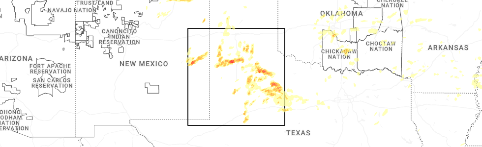
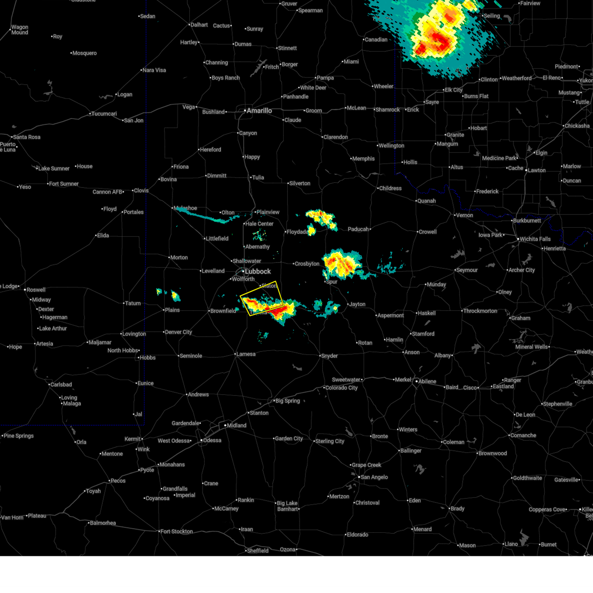
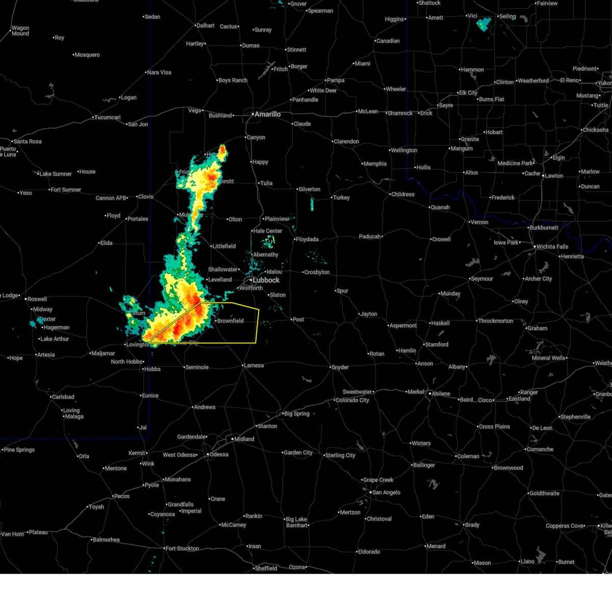
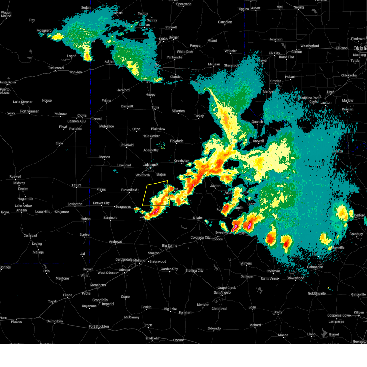
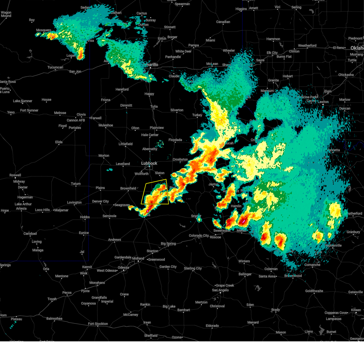
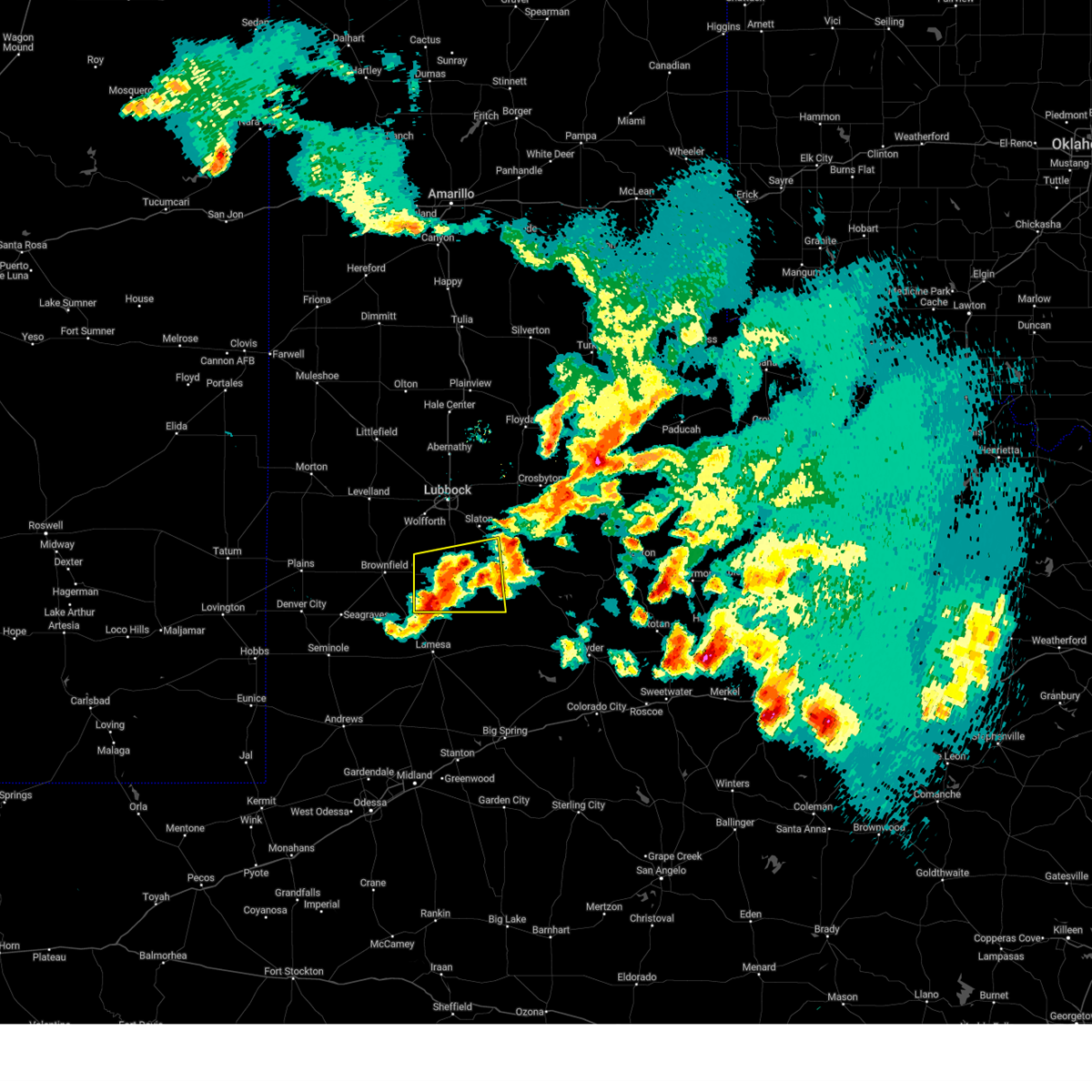
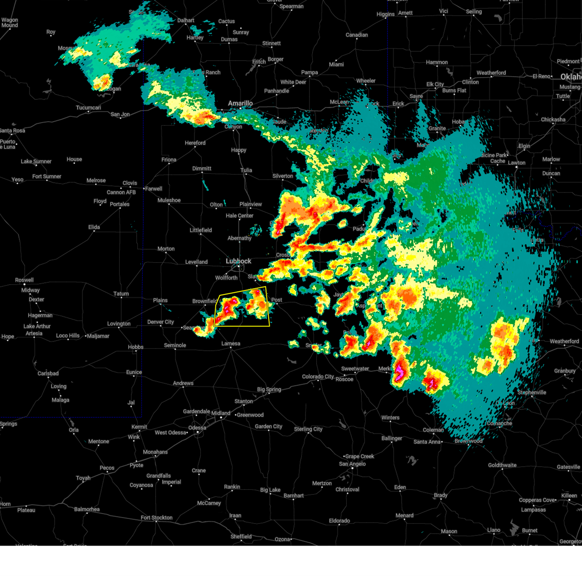
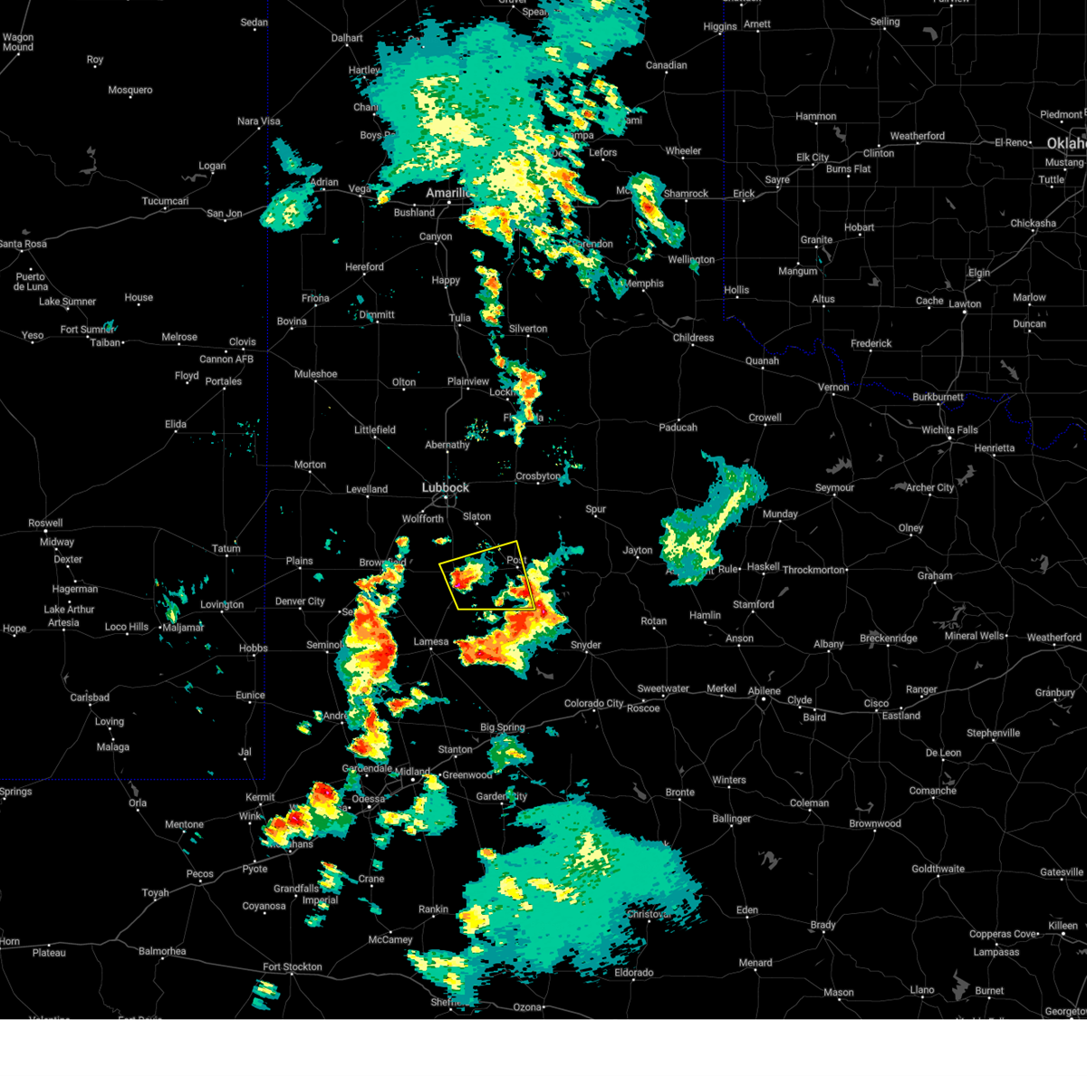
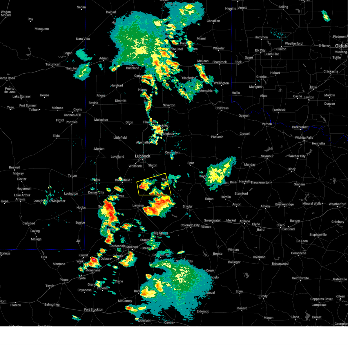
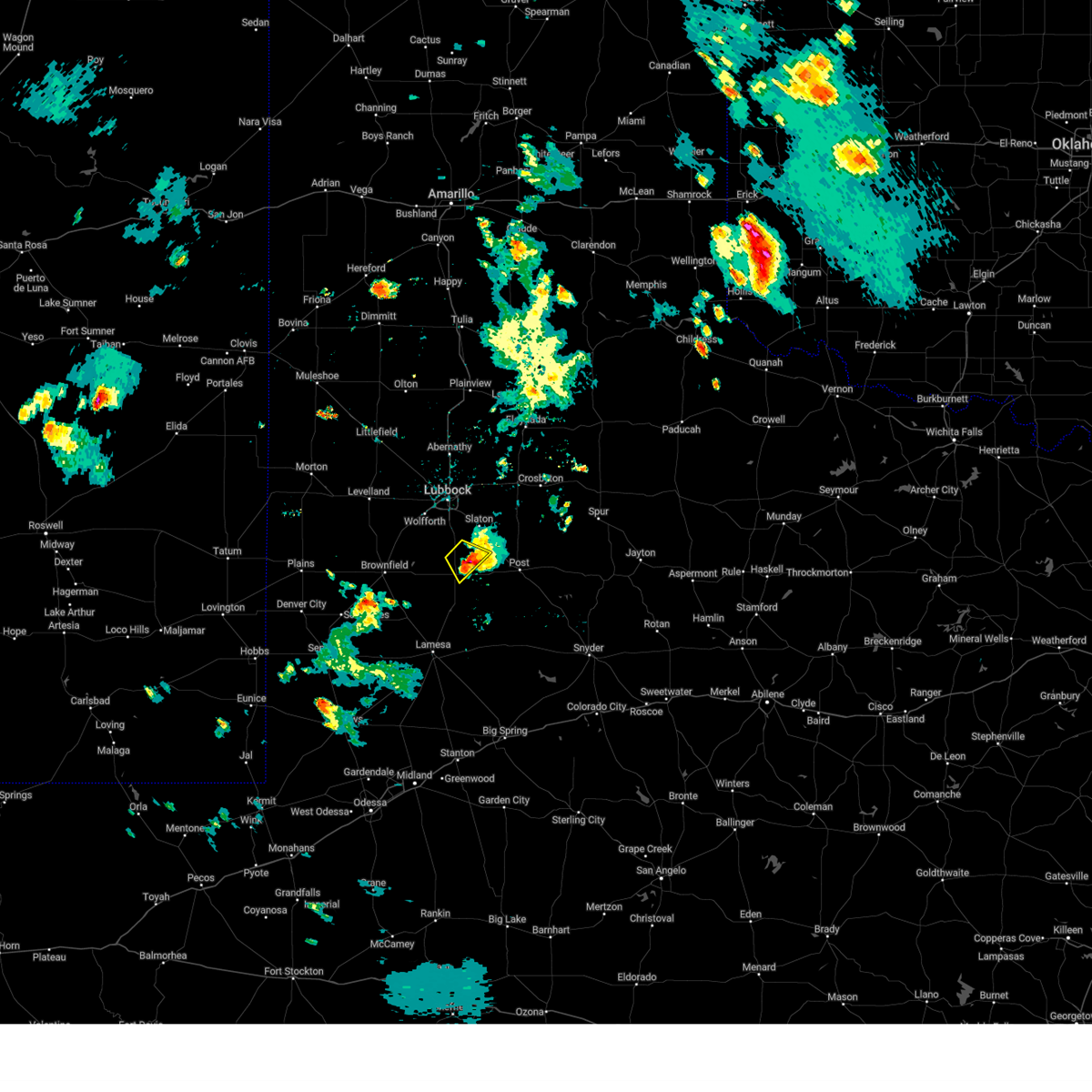
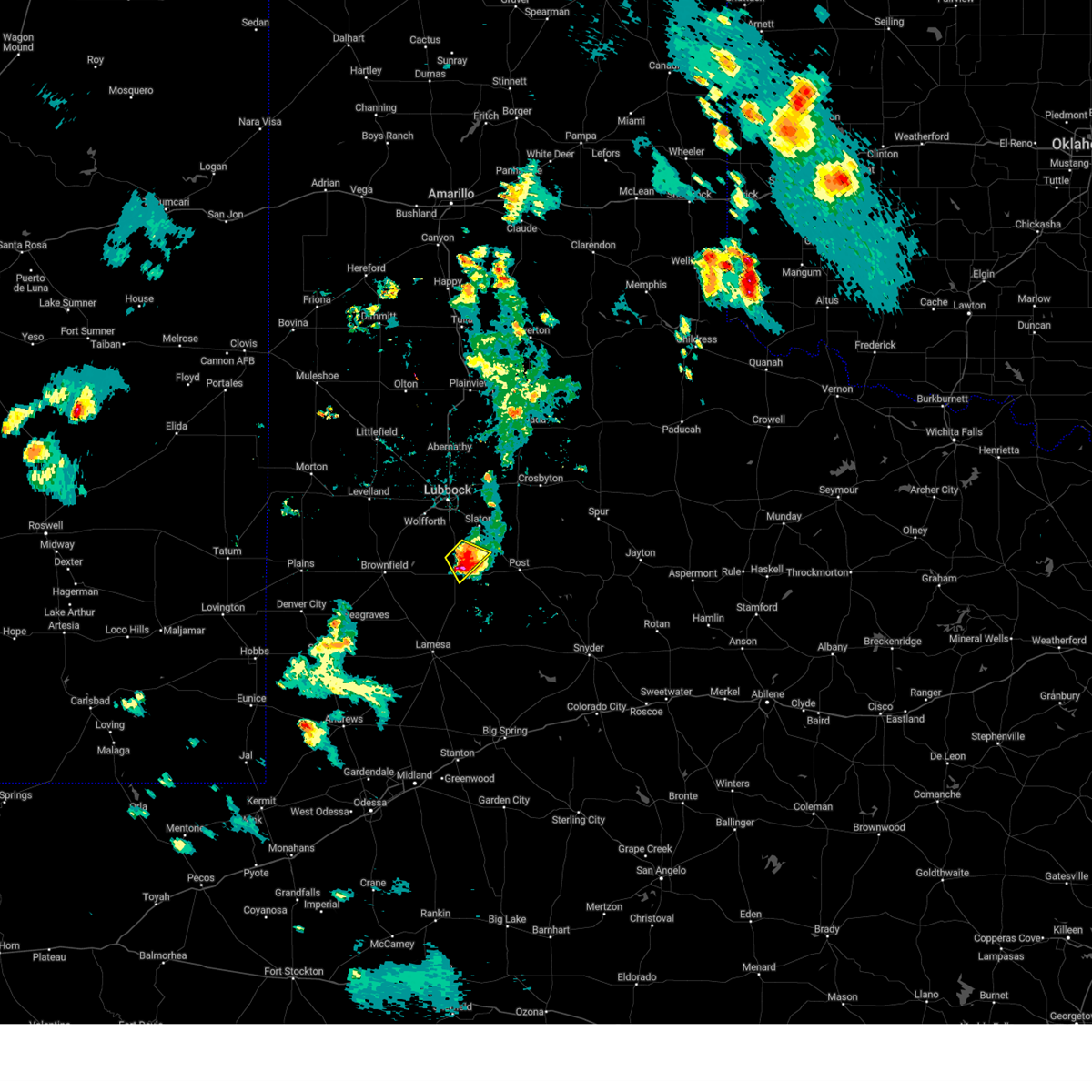
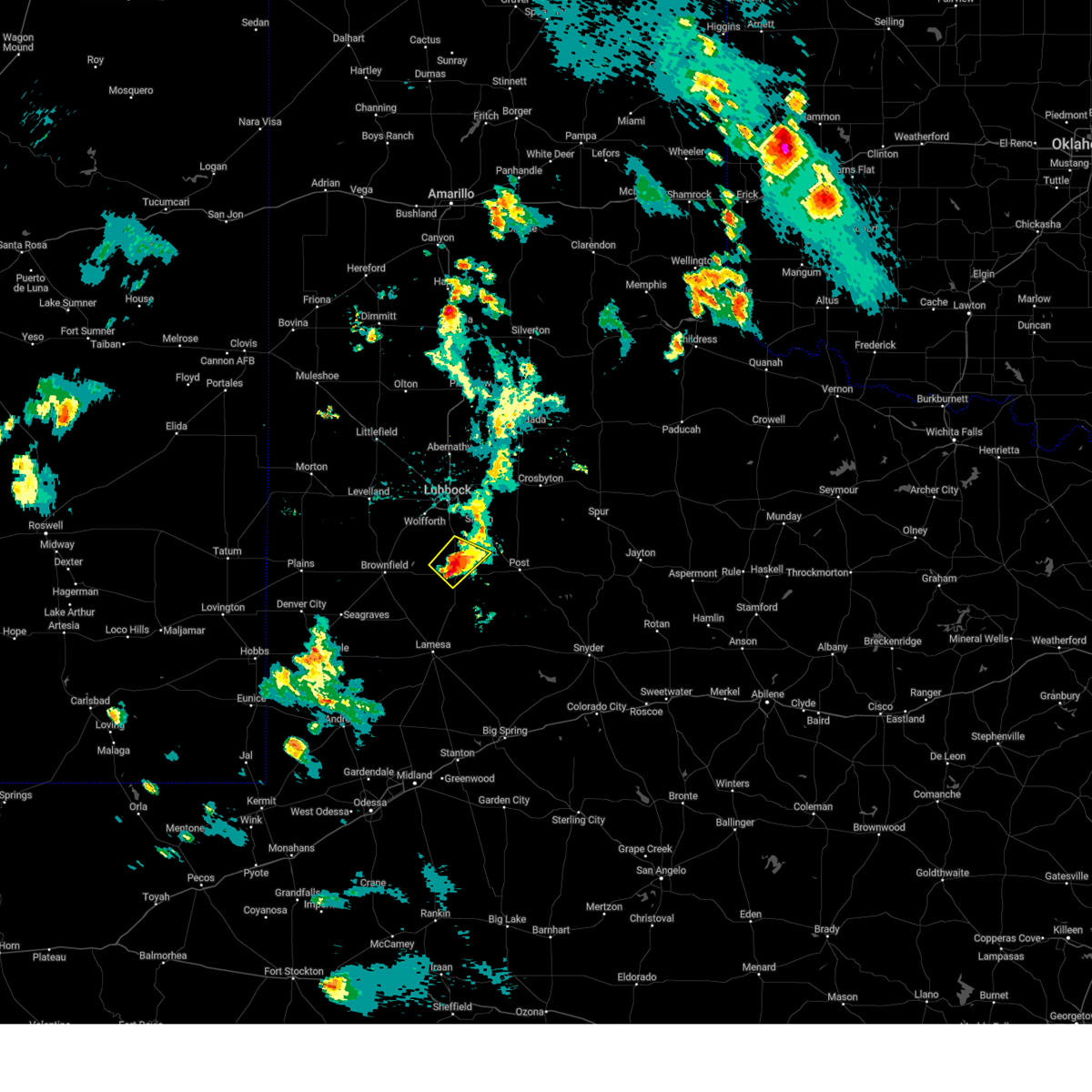
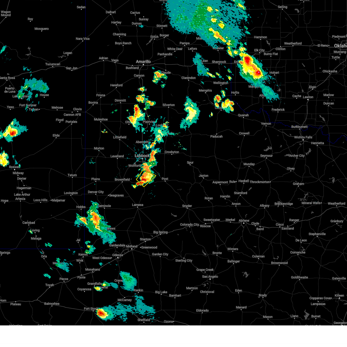
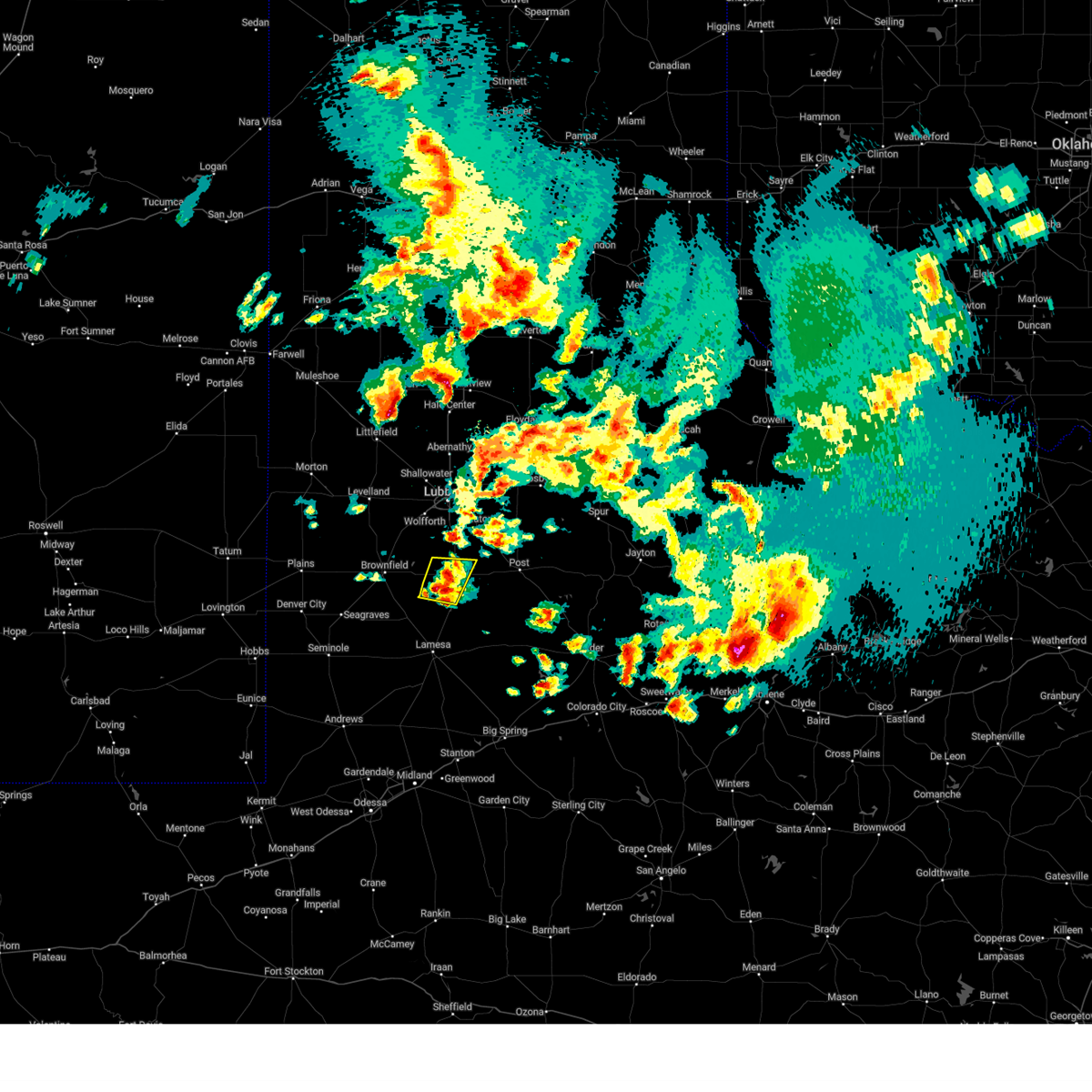
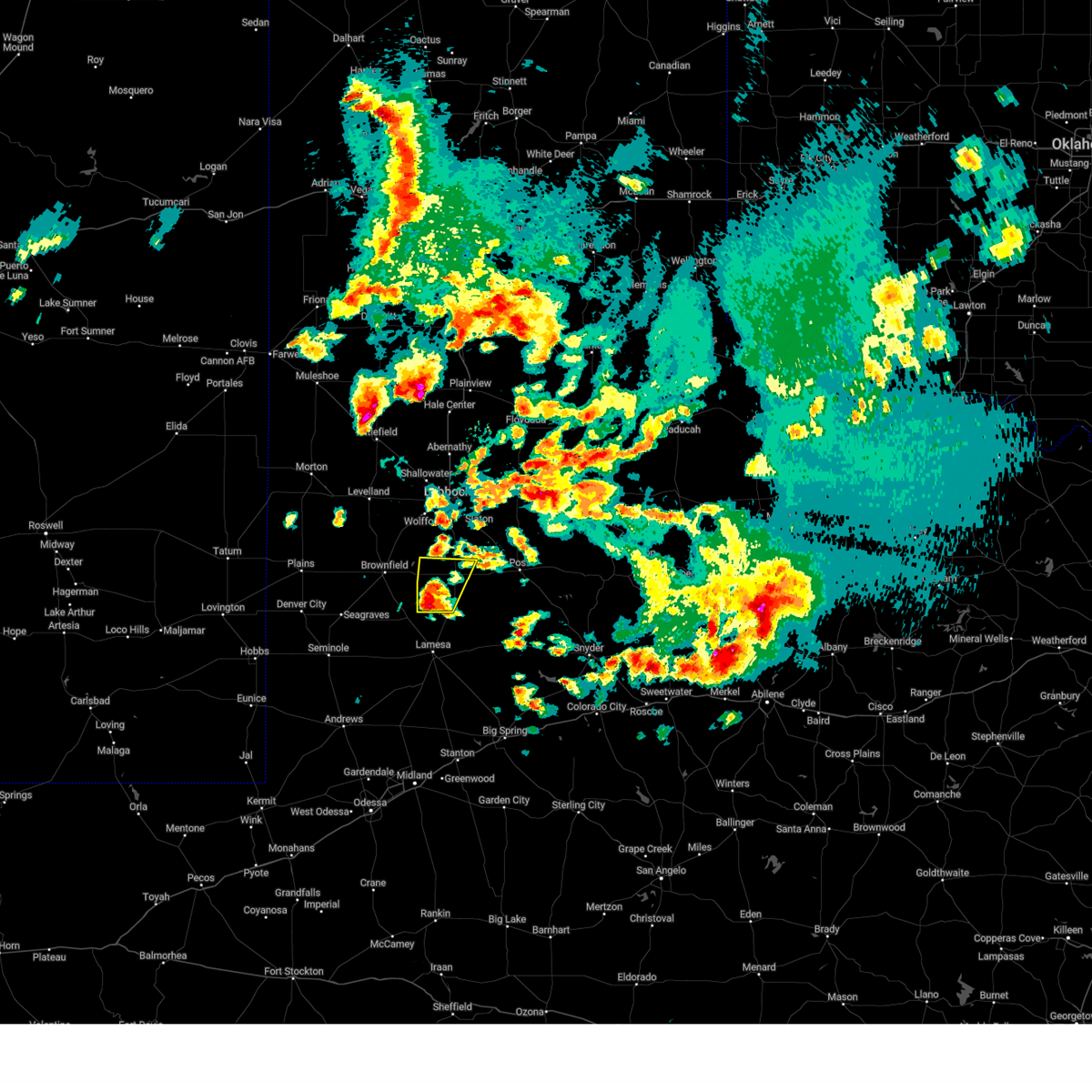
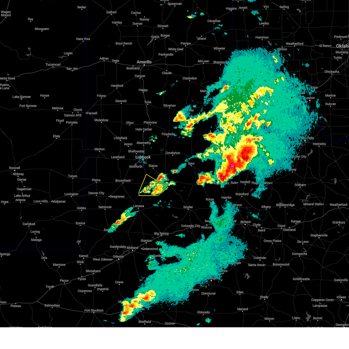
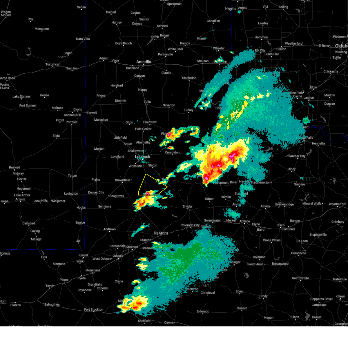
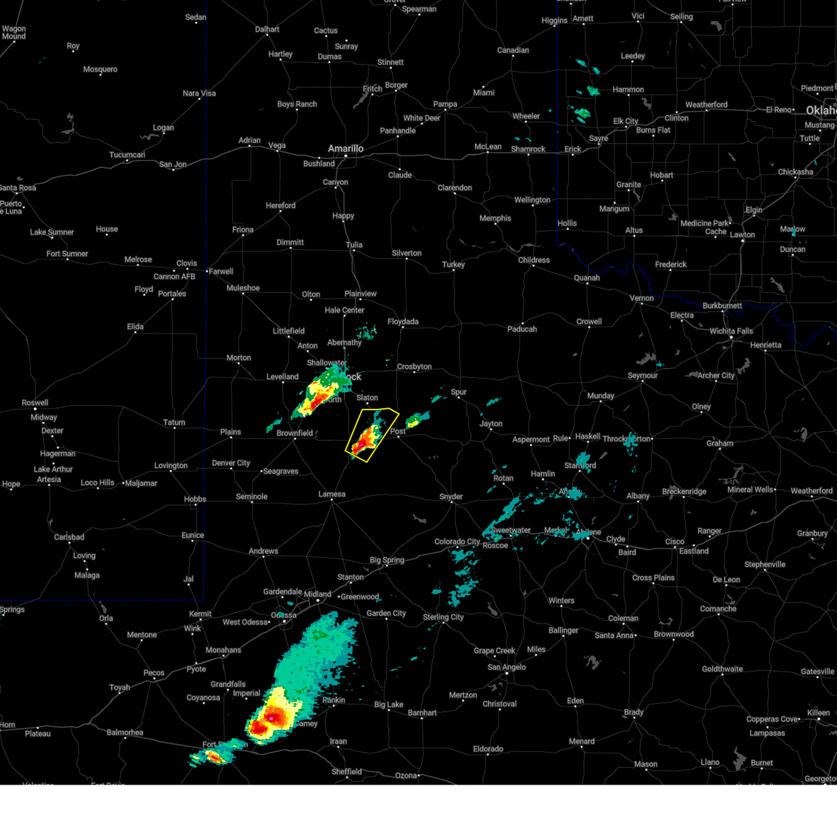
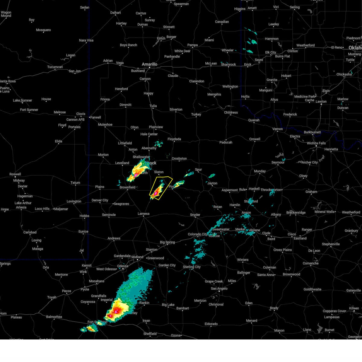
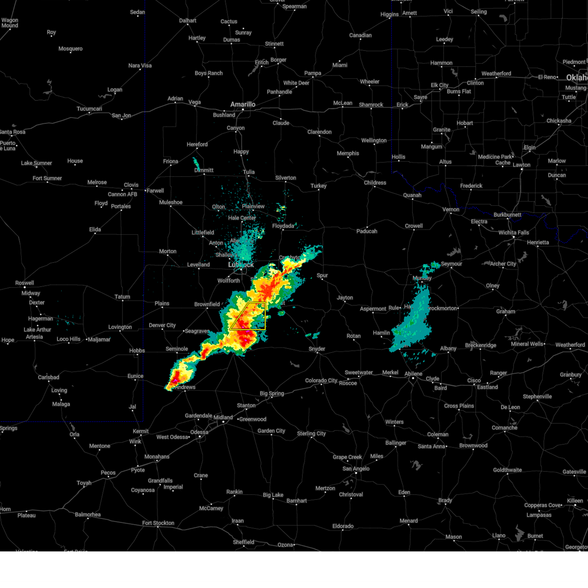
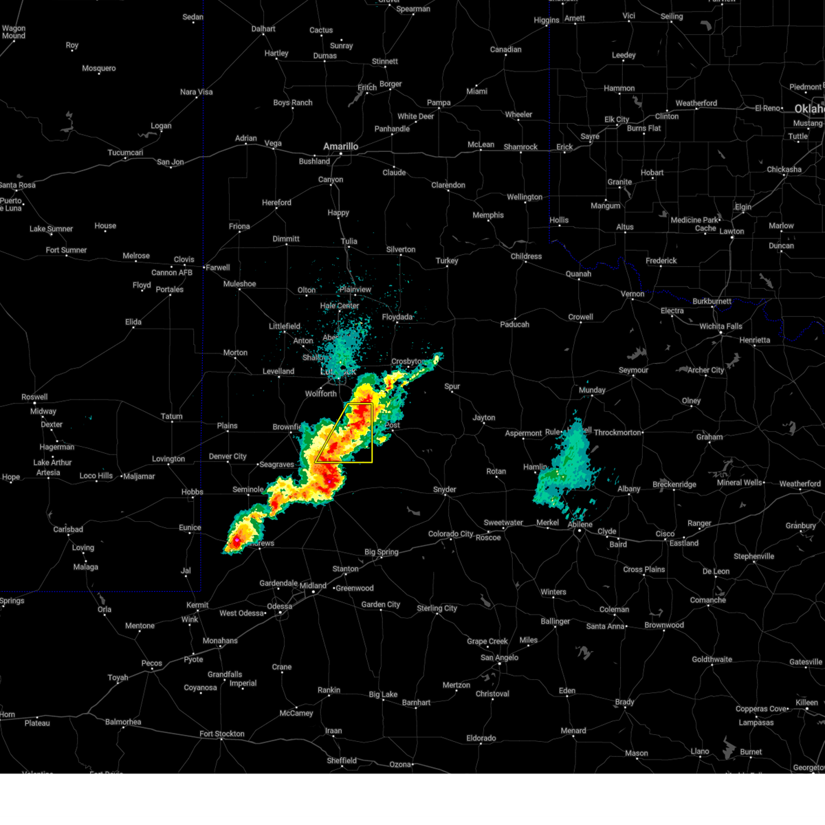
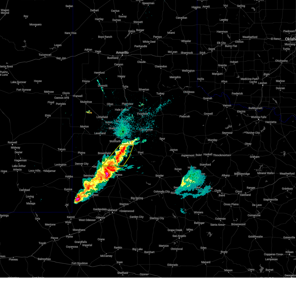
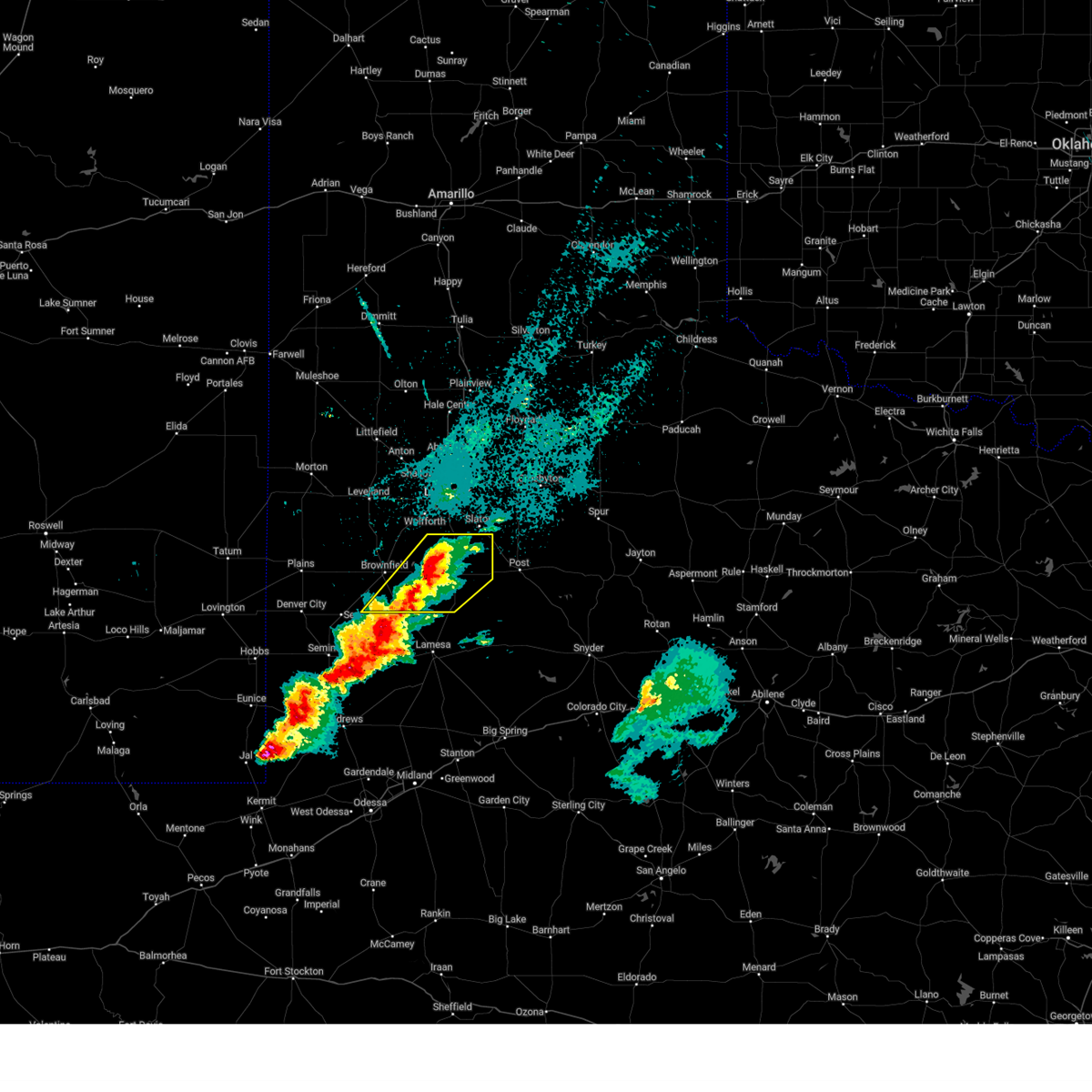
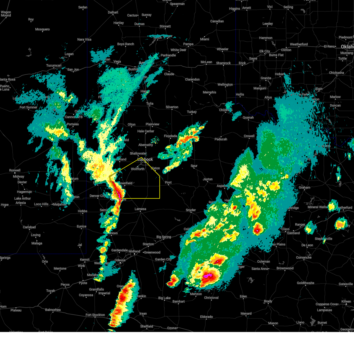
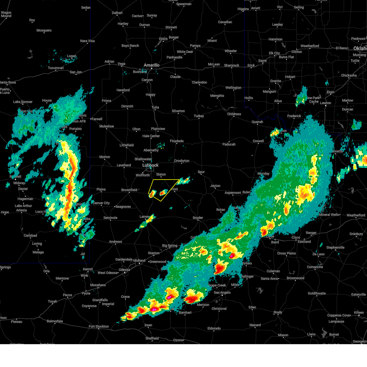
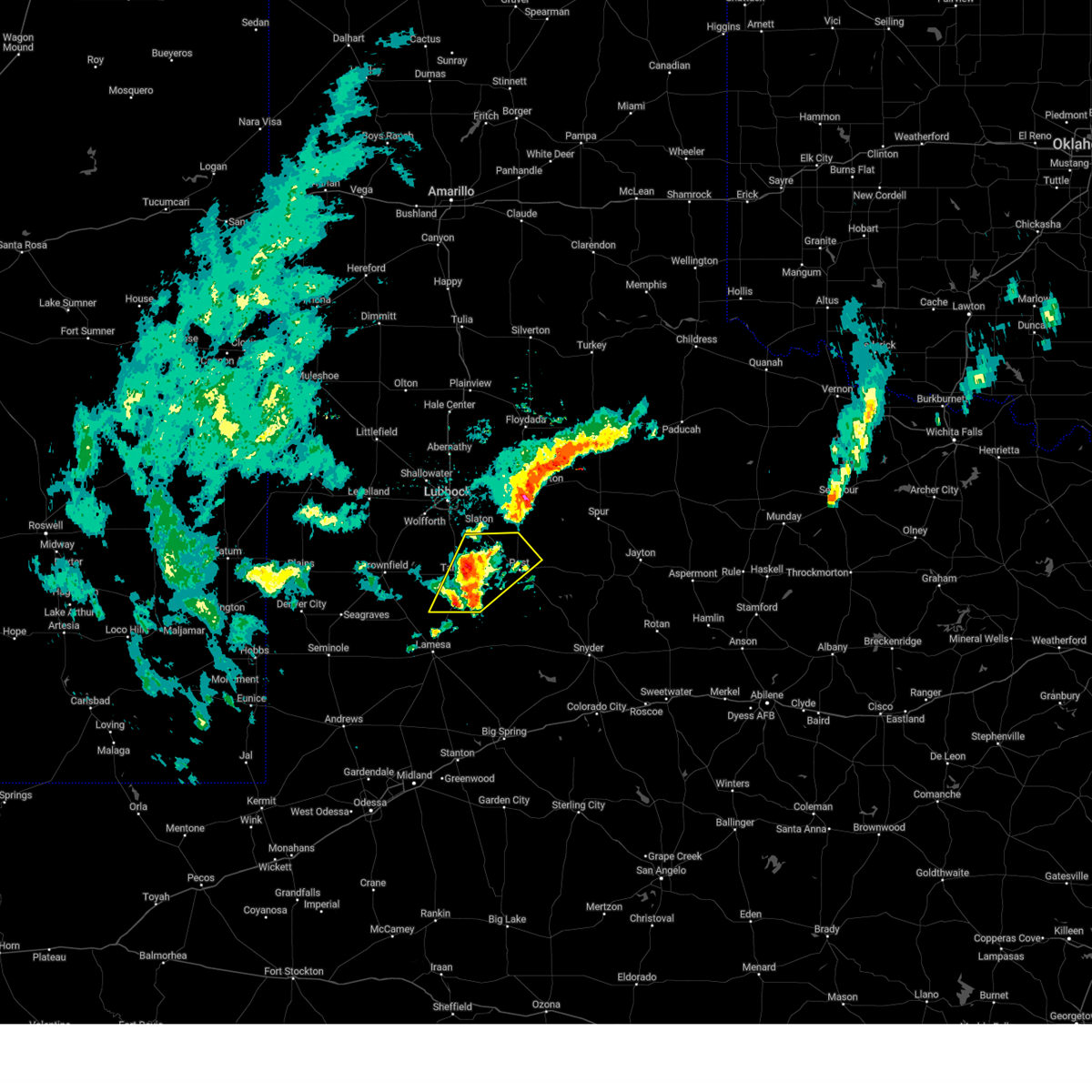
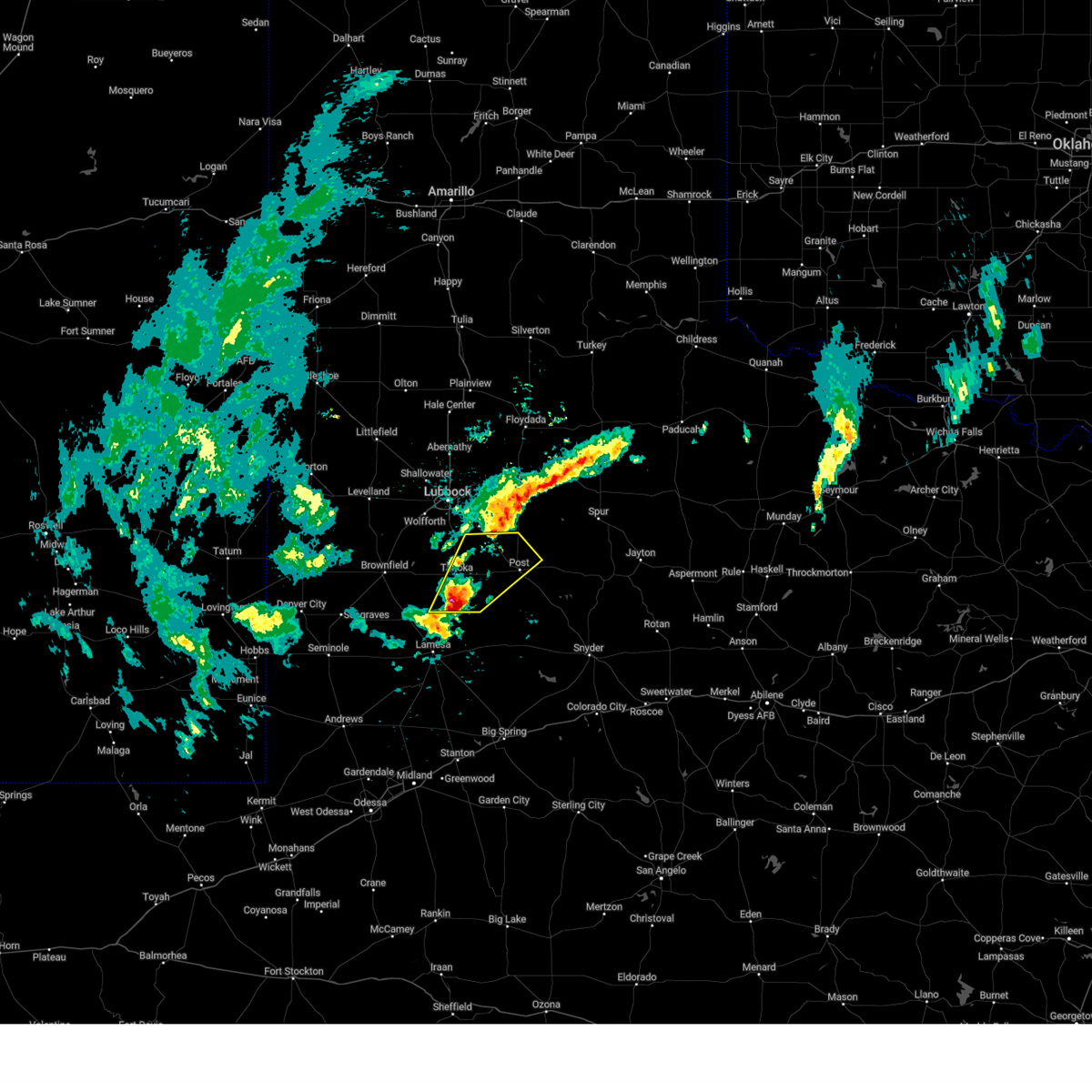
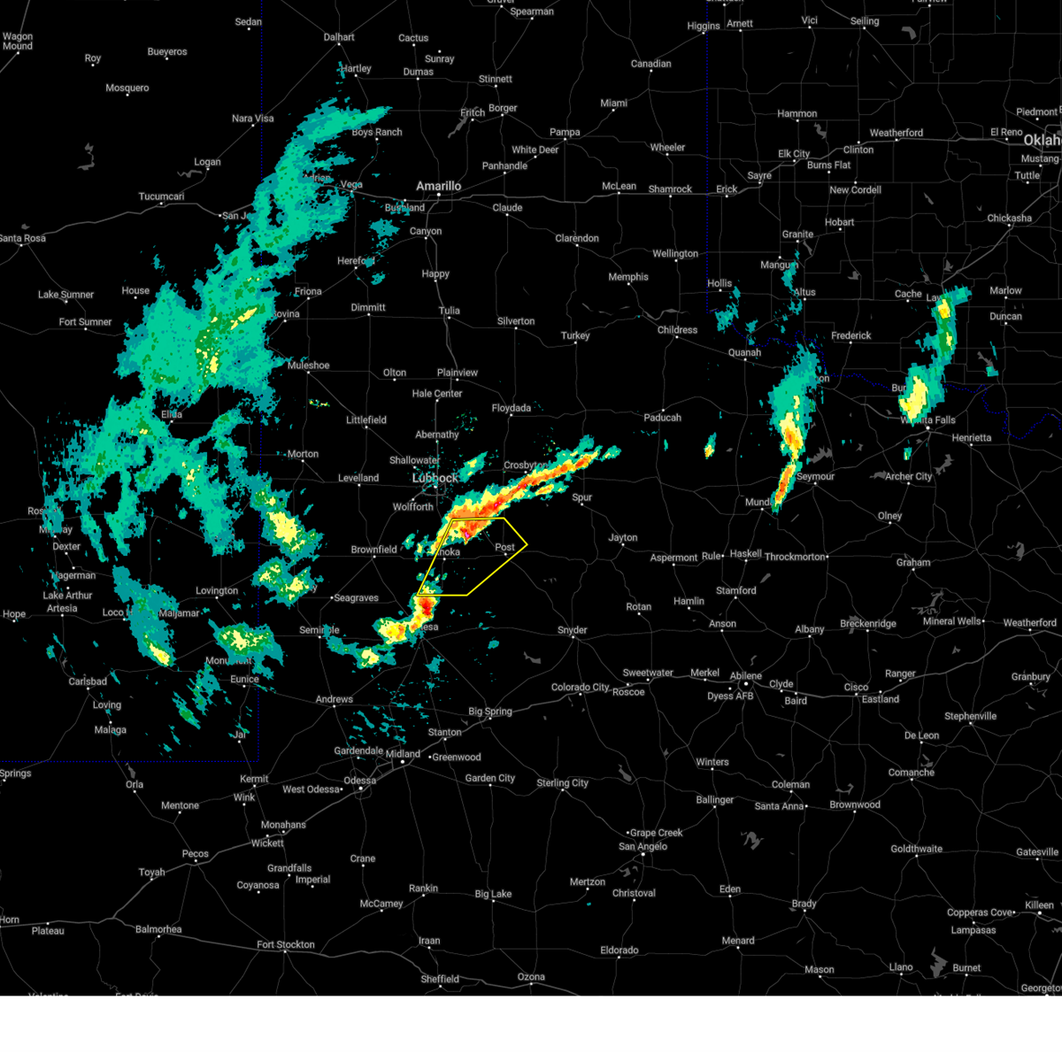
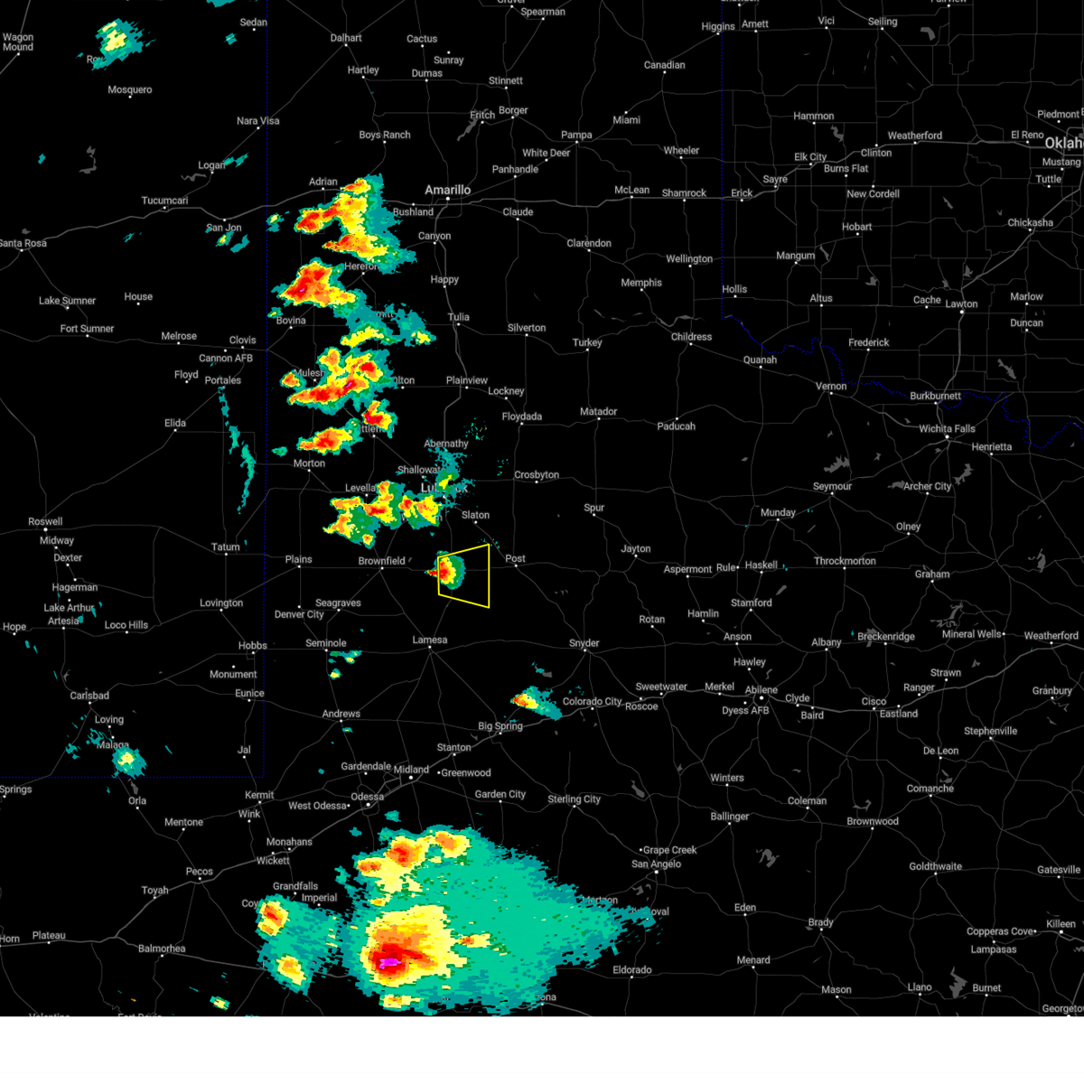
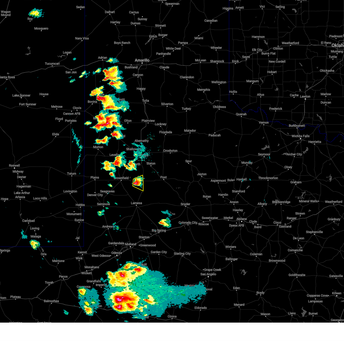
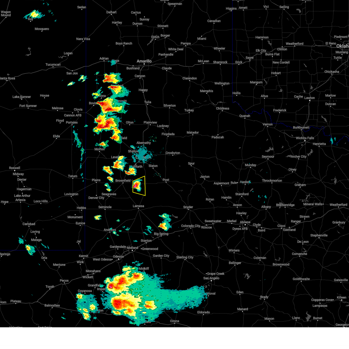
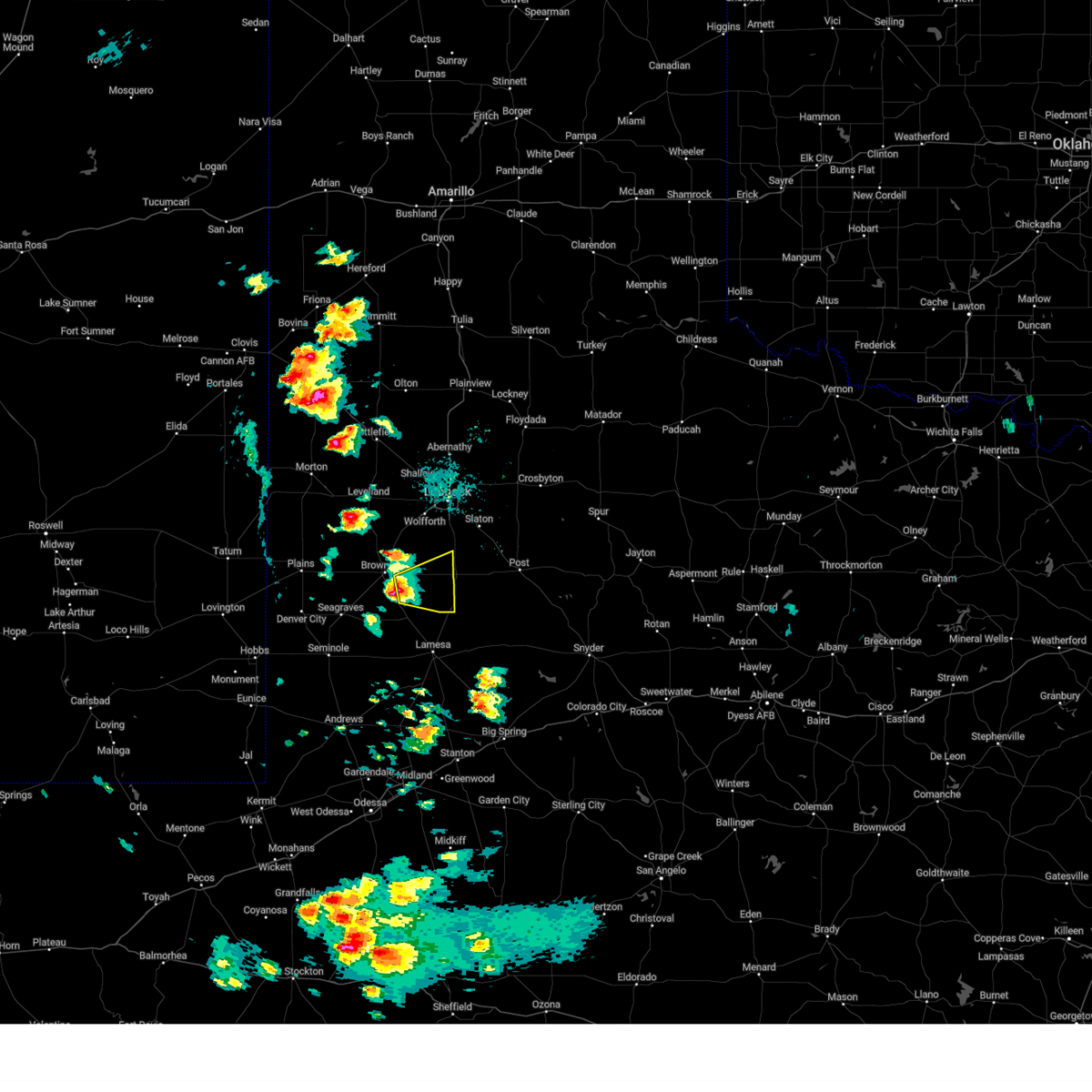
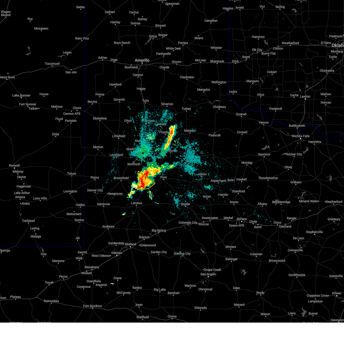
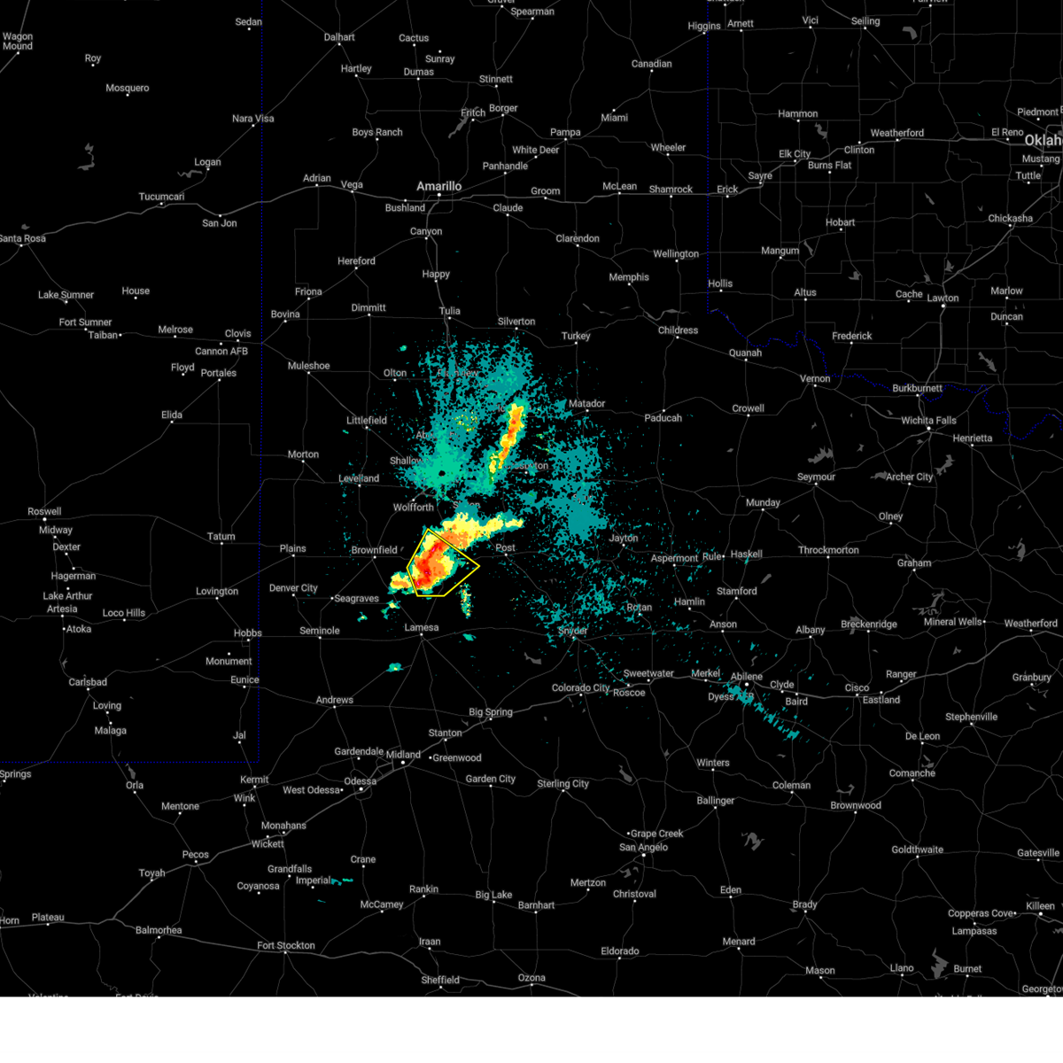
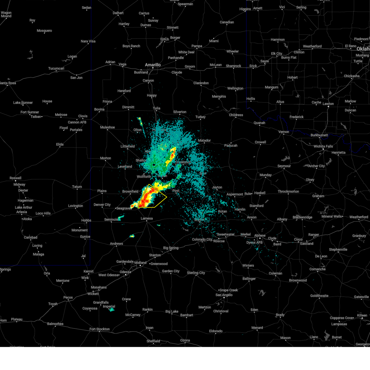
Hail Map for Tahoka, TX
The Tahoka, TX area has had 31 reports of on-the-ground hail by trained spotters, and has been under severe weather warnings 56 times during the past 12 months. Doppler radar has detected hail at or near Tahoka, TX on 106 occasions, including 7 occasions during the past year.
| Name: | Tahoka, TX |
| Where Located: | 29.7 miles S of Lubbock, TX |
| Map: | Google Map for Tahoka, TX |
| Population: | 2673 |
| Housing Units: | 1189 |
| More Info: | Search Google for Tahoka, TX |
1
The Top Recent Hail Date for Tahoka, TX is Sunday, May 25, 2025 (39th out of 106)
Hail and Wind Damage Spotted near Tahoka, TX
| Date / Time | Report Details |
|---|---|
| 6/17/2025 9:00 PM CDT |
 Svrlub the national weather service in lubbock texas has issued a * severe thunderstorm warning for, southeastern lubbock county in northwestern texas, northeastern lynn county in northwestern texas, northwestern garza county in northwestern texas, southwestern crosby county in northwestern texas, * until 945 pm cdt. * at 900 pm cdt, a severe thunderstorm was located 8 miles northeast of tahoka, moving east at 15 mph (radar indicated). Hazards include 60 mph wind gusts and quarter size hail. Hail damage to vehicles is expected. Expect wind damage to roofs, siding, and trees. Svrlub the national weather service in lubbock texas has issued a * severe thunderstorm warning for, southeastern lubbock county in northwestern texas, northeastern lynn county in northwestern texas, northwestern garza county in northwestern texas, southwestern crosby county in northwestern texas, * until 945 pm cdt. * at 900 pm cdt, a severe thunderstorm was located 8 miles northeast of tahoka, moving east at 15 mph (radar indicated). Hazards include 60 mph wind gusts and quarter size hail. Hail damage to vehicles is expected. Expect wind damage to roofs, siding, and trees.
|
| 6/13/2025 10:45 PM CDT |
 At 1045 pm cdt, severe thunderstorms were located along a line extending from 4 miles north of tahoka to o'donnell, moving southeast at 40 mph (radar indicated). Hazards include 60 mph wind gusts. Expect damage to roofs, siding, and trees. Locations impacted include, tahoka, o'donnell, and new moore. At 1045 pm cdt, severe thunderstorms were located along a line extending from 4 miles north of tahoka to o'donnell, moving southeast at 40 mph (radar indicated). Hazards include 60 mph wind gusts. Expect damage to roofs, siding, and trees. Locations impacted include, tahoka, o'donnell, and new moore.
|
| 6/13/2025 10:33 PM CDT |
 At 1033 pm cdt, severe thunderstorms were located along a line extending from 9 miles south of slide to 4 miles south of new moore, moving southeast at 40 mph (radar indicated). Hazards include 60 mph wind gusts. Expect damage to roofs, siding, and trees. Locations impacted include, tahoka, o'donnell, and new moore. At 1033 pm cdt, severe thunderstorms were located along a line extending from 9 miles south of slide to 4 miles south of new moore, moving southeast at 40 mph (radar indicated). Hazards include 60 mph wind gusts. Expect damage to roofs, siding, and trees. Locations impacted include, tahoka, o'donnell, and new moore.
|
| 6/13/2025 10:14 PM CDT |
 Svrlub the national weather service in lubbock texas has issued a * severe thunderstorm warning for, lynn county in northwestern texas, southeastern terry county in northwestern texas, * until 1100 pm cdt. * at 1014 pm cdt, severe thunderstorms were located along a line extending from 12 miles southwest of slide to 8 miles southeast of brownfield to 9 miles east of seagraves airport, moving southeast at 40 mph (radar indicated). Hazards include 60 mph wind gusts. expect damage to roofs, siding, and trees Svrlub the national weather service in lubbock texas has issued a * severe thunderstorm warning for, lynn county in northwestern texas, southeastern terry county in northwestern texas, * until 1100 pm cdt. * at 1014 pm cdt, severe thunderstorms were located along a line extending from 12 miles southwest of slide to 8 miles southeast of brownfield to 9 miles east of seagraves airport, moving southeast at 40 mph (radar indicated). Hazards include 60 mph wind gusts. expect damage to roofs, siding, and trees
|
| 6/13/2025 10:06 PM CDT |
 At 1005 pm cdt, severe thunderstorms were located along a line extending from 11 miles southwest of slide to 7 miles southeast of denver city, moving southeast at 40 mph (radar indicated). Hazards include 70 mph wind gusts. Expect considerable tree damage. damage is likely to mobile homes, roofs, and outbuildings. Locations impacted include, brownfield, denver city, tahoka, o'donnell, new moore, tokio, meadow, new home, and wellman. At 1005 pm cdt, severe thunderstorms were located along a line extending from 11 miles southwest of slide to 7 miles southeast of denver city, moving southeast at 40 mph (radar indicated). Hazards include 70 mph wind gusts. Expect considerable tree damage. damage is likely to mobile homes, roofs, and outbuildings. Locations impacted include, brownfield, denver city, tahoka, o'donnell, new moore, tokio, meadow, new home, and wellman.
|
| 6/13/2025 10:06 PM CDT |
 the severe thunderstorm warning has been cancelled and is no longer in effect the severe thunderstorm warning has been cancelled and is no longer in effect
|
| 6/13/2025 9:52 PM CDT |
 the severe thunderstorm warning has been cancelled and is no longer in effect the severe thunderstorm warning has been cancelled and is no longer in effect
|
| 6/13/2025 9:52 PM CDT |
 At 951 pm cdt, severe thunderstorms were located along a line extending from 11 miles southwest of slide to denver city, moving southeast at 35 mph (radar indicated). Hazards include 70 mph wind gusts. Expect considerable tree damage. damage is likely to mobile homes, roofs, and outbuildings. Locations impacted include, brownfield, denver city, tahoka, plains, o'donnell, locketville, new moore, tokio, meadow, new home, and wellman. At 951 pm cdt, severe thunderstorms were located along a line extending from 11 miles southwest of slide to denver city, moving southeast at 35 mph (radar indicated). Hazards include 70 mph wind gusts. Expect considerable tree damage. damage is likely to mobile homes, roofs, and outbuildings. Locations impacted include, brownfield, denver city, tahoka, plains, o'donnell, locketville, new moore, tokio, meadow, new home, and wellman.
|
| 6/13/2025 9:35 PM CDT |
 At 935 pm cdt, severe thunderstorms were located along a line extending from 7 miles southwest of reese center to 4 miles south of locketville to 8 miles west of denver city, moving southeast at 40 mph (radar indicated). Hazards include 70 mph wind gusts. Expect considerable tree damage. damage is likely to mobile homes, roofs, and outbuildings. Locations impacted include, lubbock, brownfield, denver city, tahoka, plains, wolfforth, o'donnell, new moore, tokio, locketville, slide, meadow, wilson, smyer, ropesville, new home, and wellman. At 935 pm cdt, severe thunderstorms were located along a line extending from 7 miles southwest of reese center to 4 miles south of locketville to 8 miles west of denver city, moving southeast at 40 mph (radar indicated). Hazards include 70 mph wind gusts. Expect considerable tree damage. damage is likely to mobile homes, roofs, and outbuildings. Locations impacted include, lubbock, brownfield, denver city, tahoka, plains, wolfforth, o'donnell, new moore, tokio, locketville, slide, meadow, wilson, smyer, ropesville, new home, and wellman.
|
| 6/13/2025 9:15 PM CDT |
 Svrlub the national weather service in lubbock texas has issued a * severe thunderstorm warning for, southwestern lubbock county in northwestern texas, lynn county in northwestern texas, terry county in northwestern texas, southeastern hockley county in northwestern texas, yoakum county in northwestern texas, * until 1015 pm cdt. * at 915 pm cdt, severe thunderstorms were located along a line extending from 6 miles southeast of whitharral to 5 miles southeast of sundown to 15 miles southeast of mcdonald, moving southeast at 40 mph (radar indicated). Hazards include 70 mph wind gusts. Expect considerable tree damage. Damage is likely to mobile homes, roofs, and outbuildings. Svrlub the national weather service in lubbock texas has issued a * severe thunderstorm warning for, southwestern lubbock county in northwestern texas, lynn county in northwestern texas, terry county in northwestern texas, southeastern hockley county in northwestern texas, yoakum county in northwestern texas, * until 1015 pm cdt. * at 915 pm cdt, severe thunderstorms were located along a line extending from 6 miles southeast of whitharral to 5 miles southeast of sundown to 15 miles southeast of mcdonald, moving southeast at 40 mph (radar indicated). Hazards include 70 mph wind gusts. Expect considerable tree damage. Damage is likely to mobile homes, roofs, and outbuildings.
|
| 6/8/2025 10:56 PM CDT |
 The storm which prompted the warning has weakened below severe limits, and no longer poses an immediate threat to life or property. therefore, the warning will be allowed to expire. however, gusty winds are still possible with this thunderstorm. a severe thunderstorm watch remains in effect until 1100 pm cdt for northwestern texas. The storm which prompted the warning has weakened below severe limits, and no longer poses an immediate threat to life or property. therefore, the warning will be allowed to expire. however, gusty winds are still possible with this thunderstorm. a severe thunderstorm watch remains in effect until 1100 pm cdt for northwestern texas.
|
| 6/8/2025 10:48 PM CDT |
 At 1048 pm cdt, a severe thunderstorm was located over grassland, or 10 miles east of tahoka, moving east at 40 mph (radar indicated). Hazards include 60 mph wind gusts. Expect damage to roofs, siding, and trees. Locations impacted include, tahoka, o'donnell, grassland, southland, and wilson. At 1048 pm cdt, a severe thunderstorm was located over grassland, or 10 miles east of tahoka, moving east at 40 mph (radar indicated). Hazards include 60 mph wind gusts. Expect damage to roofs, siding, and trees. Locations impacted include, tahoka, o'donnell, grassland, southland, and wilson.
|
| 6/8/2025 10:33 PM CDT |
 At 1032 pm cdt, a severe thunderstorm was located over tahoka, moving east at 40 mph (radar indicated). Hazards include 60 mph wind gusts and nickel size hail. Expect damage to roofs, siding, and trees. Locations impacted include, tahoka, o'donnell, grassland, southland, new moore, and wilson. At 1032 pm cdt, a severe thunderstorm was located over tahoka, moving east at 40 mph (radar indicated). Hazards include 60 mph wind gusts and nickel size hail. Expect damage to roofs, siding, and trees. Locations impacted include, tahoka, o'donnell, grassland, southland, new moore, and wilson.
|
| 6/8/2025 10:33 PM CDT |
 the severe thunderstorm warning has been cancelled and is no longer in effect the severe thunderstorm warning has been cancelled and is no longer in effect
|
| 6/8/2025 10:21 PM CDT |
 At 1019 pm cdt, a severe thunderstorm was located 8 miles northeast of new moore, or 9 miles west of tahoka, moving east at 40 mph (radar indicated). Hazards include 60 mph wind gusts and quarter size hail. Hail damage to vehicles is expected. expect wind damage to roofs, siding, and trees. Locations impacted include, tahoka, o'donnell, grassland, southland, new moore, and wilson. At 1019 pm cdt, a severe thunderstorm was located 8 miles northeast of new moore, or 9 miles west of tahoka, moving east at 40 mph (radar indicated). Hazards include 60 mph wind gusts and quarter size hail. Hail damage to vehicles is expected. expect wind damage to roofs, siding, and trees. Locations impacted include, tahoka, o'donnell, grassland, southland, new moore, and wilson.
|
| 6/8/2025 10:05 PM CDT | Svrlub the national weather service in lubbock texas has issued a * severe thunderstorm warning for, lynn county in northwestern texas, southwestern garza county in northwestern texas, southeastern terry county in northwestern texas, * until 1100 pm cdt. * at 1005 pm cdt, a severe thunderstorm was located 8 miles northwest of new moore, or 9 miles southeast of brownfield, moving east at 40 mph (radar indicated). Hazards include 60 mph wind gusts and half dollar size hail. Hail damage to vehicles is expected. Expect wind damage to roofs, siding, and trees. |
| 6/3/2025 12:48 AM CDT |
 At 1248 am cdt, a severe thunderstorm was located 4 miles southeast of tahoka, moving east at 20 mph (radar indicated). Hazards include 60 mph wind gusts and quarter size hail. Hail damage to vehicles is expected. expect wind damage to roofs, siding, and trees. Locations impacted include, post, tahoka, and grassland. At 1248 am cdt, a severe thunderstorm was located 4 miles southeast of tahoka, moving east at 20 mph (radar indicated). Hazards include 60 mph wind gusts and quarter size hail. Hail damage to vehicles is expected. expect wind damage to roofs, siding, and trees. Locations impacted include, post, tahoka, and grassland.
|
| 6/3/2025 12:32 AM CDT |
 Svrlub the national weather service in lubbock texas has issued a * severe thunderstorm warning for, southern lynn county in northwestern texas, western garza county in northwestern texas, * until 130 am cdt. * at 1231 am cdt, a severe thunderstorm was located 5 miles southwest of tahoka, moving east at 20 mph (radar indicated). Hazards include 60 mph wind gusts and quarter size hail. Hail damage to vehicles is expected. Expect wind damage to roofs, siding, and trees. Svrlub the national weather service in lubbock texas has issued a * severe thunderstorm warning for, southern lynn county in northwestern texas, western garza county in northwestern texas, * until 130 am cdt. * at 1231 am cdt, a severe thunderstorm was located 5 miles southwest of tahoka, moving east at 20 mph (radar indicated). Hazards include 60 mph wind gusts and quarter size hail. Hail damage to vehicles is expected. Expect wind damage to roofs, siding, and trees.
|
| 6/2/2025 7:56 PM CDT |
 The storm which prompted the warning has weakened below severe limits, and no longer poses an immediate threat to life or property. therefore, the warning will be allowed to expire. however, gusty winds are still possible with this thunderstorm. a severe thunderstorm watch remains in effect until 900 pm cdt for northwestern texas. The storm which prompted the warning has weakened below severe limits, and no longer poses an immediate threat to life or property. therefore, the warning will be allowed to expire. however, gusty winds are still possible with this thunderstorm. a severe thunderstorm watch remains in effect until 900 pm cdt for northwestern texas.
|
| 6/2/2025 7:43 PM CDT |
 At 743 pm cdt, a severe thunderstorm was located 4 miles northeast of tahoka, moving northeast at 20 mph (radar indicated). Hazards include 70 mph wind gusts and quarter size hail. Hail damage to vehicles is expected. expect considerable tree damage. wind damage is also likely to mobile homes, roofs, and outbuildings. Locations impacted include, wilson. At 743 pm cdt, a severe thunderstorm was located 4 miles northeast of tahoka, moving northeast at 20 mph (radar indicated). Hazards include 70 mph wind gusts and quarter size hail. Hail damage to vehicles is expected. expect considerable tree damage. wind damage is also likely to mobile homes, roofs, and outbuildings. Locations impacted include, wilson.
|
| 6/2/2025 7:31 PM CDT | Half Dollar sized hail reported 0.5 miles SSE of Tahoka, TX, media viewer reported. |
| 6/2/2025 7:28 PM CDT | Storm damage reported in lynn county TX, 3.3 miles SSW of Tahoka, TX |
| 6/2/2025 7:24 PM CDT |
 At 724 pm cdt, a severe thunderstorm was located 5 miles north of tahoka, moving northeast at 25 mph (radar indicated). Hazards include 60 mph wind gusts and quarter size hail. Hail damage to vehicles is expected. expect wind damage to roofs, siding, and trees. Locations impacted include, tahoka and wilson. At 724 pm cdt, a severe thunderstorm was located 5 miles north of tahoka, moving northeast at 25 mph (radar indicated). Hazards include 60 mph wind gusts and quarter size hail. Hail damage to vehicles is expected. expect wind damage to roofs, siding, and trees. Locations impacted include, tahoka and wilson.
|
| 6/2/2025 7:05 PM CDT |
 Svrlub the national weather service in lubbock texas has issued a * severe thunderstorm warning for, northern lynn county in northwestern texas, * until 800 pm cdt. * at 705 pm cdt, a severe thunderstorm was located 4 miles northwest of tahoka, moving northeast at 15 mph (radar indicated). Hazards include 60 mph wind gusts and quarter size hail. Hail damage to vehicles is expected. Expect wind damage to roofs, siding, and trees. Svrlub the national weather service in lubbock texas has issued a * severe thunderstorm warning for, northern lynn county in northwestern texas, * until 800 pm cdt. * at 705 pm cdt, a severe thunderstorm was located 4 miles northwest of tahoka, moving northeast at 15 mph (radar indicated). Hazards include 60 mph wind gusts and quarter size hail. Hail damage to vehicles is expected. Expect wind damage to roofs, siding, and trees.
|
| 5/25/2025 9:08 PM CDT |
 The storm which prompted the warning has weakened below severe limits, and no longer poses an immediate threat to life or property. therefore, the warning will be allowed to expire. however, small hail, gusty winds and heavy rain are still possible with this thunderstorm. a tornado watch remains in effect until 1100 pm cdt for northwestern texas. to report severe weather, contact your nearest law enforcement agency. they will relay your report to the national weather service lubbock texas. The storm which prompted the warning has weakened below severe limits, and no longer poses an immediate threat to life or property. therefore, the warning will be allowed to expire. however, small hail, gusty winds and heavy rain are still possible with this thunderstorm. a tornado watch remains in effect until 1100 pm cdt for northwestern texas. to report severe weather, contact your nearest law enforcement agency. they will relay your report to the national weather service lubbock texas.
|
| 5/25/2025 8:59 PM CDT | At 859 pm cdt, a severe thunderstorm was located 6 miles west of tahoka, moving northeast at 30 mph (radar indicated). Hazards include 60 mph wind gusts and quarter size hail. Hail damage to vehicles is expected. expect wind damage to roofs, siding, and trees. Locations impacted include, tahoka. |
| 5/25/2025 8:51 PM CDT | At 851 pm cdt, a severe thunderstorm was located 7 miles northeast of new moore, or 9 miles southwest of tahoka, moving north at 35 mph (radar indicated). Hazards include 60 mph wind gusts and quarter size hail. Hail damage to vehicles is expected. expect wind damage to roofs, siding, and trees. Locations impacted include, tahoka, o'donnell, and new moore. |
| 5/25/2025 8:46 PM CDT |
 At 846 pm cdt, a severe thunderstorm was located near new moore, or 12 miles southwest of tahoka, moving north at 35 mph (radar indicated). Hazards include 60 mph wind gusts and quarter size hail. Hail damage to vehicles is expected. expect wind damage to roofs, siding, and trees. Locations impacted include, tahoka, o'donnell, and new moore. At 846 pm cdt, a severe thunderstorm was located near new moore, or 12 miles southwest of tahoka, moving north at 35 mph (radar indicated). Hazards include 60 mph wind gusts and quarter size hail. Hail damage to vehicles is expected. expect wind damage to roofs, siding, and trees. Locations impacted include, tahoka, o'donnell, and new moore.
|
| 5/25/2025 8:46 PM CDT |
 the severe thunderstorm warning has been cancelled and is no longer in effect the severe thunderstorm warning has been cancelled and is no longer in effect
|
| 5/25/2025 8:39 PM CDT | Svrlub the national weather service in lubbock texas has issued a * severe thunderstorm warning for, southern lynn county in northwestern texas, eastern terry county in northwestern texas, * until 915 pm cdt. * at 839 pm cdt, a severe thunderstorm was located over new moore, or 16 miles southwest of tahoka, moving north at 35 mph (radar indicated). Hazards include 60 mph wind gusts and quarter size hail. Hail damage to vehicles is expected. Expect wind damage to roofs, siding, and trees. |
| 4/29/2025 5:59 PM CDT |
 the severe thunderstorm warning has been cancelled and is no longer in effect the severe thunderstorm warning has been cancelled and is no longer in effect
|
| 4/29/2025 5:28 PM CDT |
 Svrlub the national weather service in lubbock texas has issued a * severe thunderstorm warning for, eastern lynn county in northwestern texas, southwestern garza county in northwestern texas, * until 630 pm cdt. * at 528 pm cdt, a severe thunderstorm was located 5 miles south of o'donnell, or 14 miles northeast of lamesa, moving northeast at 25 mph (radar indicated). Hazards include 60 mph wind gusts and half dollar size hail. Hail damage to vehicles is expected. Expect wind damage to roofs, siding, and trees. Svrlub the national weather service in lubbock texas has issued a * severe thunderstorm warning for, eastern lynn county in northwestern texas, southwestern garza county in northwestern texas, * until 630 pm cdt. * at 528 pm cdt, a severe thunderstorm was located 5 miles south of o'donnell, or 14 miles northeast of lamesa, moving northeast at 25 mph (radar indicated). Hazards include 60 mph wind gusts and half dollar size hail. Hail damage to vehicles is expected. Expect wind damage to roofs, siding, and trees.
|
| 4/29/2025 2:42 PM CDT | Golf Ball sized hail reported 11.4 miles W of Tahoka, TX, tahoka fd. |
| 4/29/2025 2:25 PM CDT |
 At 224 pm cdt, a severe thunderstorm was located 5 miles east of tahoka, moving north at 15 mph (trained weather spotters. at 222 pm ping pong ball size hail was reported 6 miles east of tahoka). Hazards include ping pong ball size hail and 60 mph wind gusts. People and animals outdoors will be injured. expect hail damage to roofs, siding, windows, and vehicles. expect wind damage to roofs, siding, and trees. Locations impacted include, grassland, southland, tahoka, and wilson. At 224 pm cdt, a severe thunderstorm was located 5 miles east of tahoka, moving north at 15 mph (trained weather spotters. at 222 pm ping pong ball size hail was reported 6 miles east of tahoka). Hazards include ping pong ball size hail and 60 mph wind gusts. People and animals outdoors will be injured. expect hail damage to roofs, siding, windows, and vehicles. expect wind damage to roofs, siding, and trees. Locations impacted include, grassland, southland, tahoka, and wilson.
|
| 4/29/2025 2:22 PM CDT | Ping Pong Ball sized hail reported 6.1 miles W of Tahoka, TX, via tahoka fd. |
| 4/29/2025 2:16 PM CDT |
 Svrlub the national weather service in lubbock texas has issued a * severe thunderstorm warning for, eastern lynn county in northwestern texas, northwestern garza county in northwestern texas, * until 300 pm cdt. * at 216 pm cdt, a severe thunderstorm was located 6 miles southeast of tahoka, moving northeast at 25 mph (radar indicated). Hazards include 60 mph wind gusts and half dollar size hail. Hail damage to vehicles is expected. Expect wind damage to roofs, siding, and trees. Svrlub the national weather service in lubbock texas has issued a * severe thunderstorm warning for, eastern lynn county in northwestern texas, northwestern garza county in northwestern texas, * until 300 pm cdt. * at 216 pm cdt, a severe thunderstorm was located 6 miles southeast of tahoka, moving northeast at 25 mph (radar indicated). Hazards include 60 mph wind gusts and half dollar size hail. Hail damage to vehicles is expected. Expect wind damage to roofs, siding, and trees.
|
| 4/29/2025 1:00 AM CDT |
 At 1259 am cdt, a severe thunderstorm was located 4 miles northeast of o'donnell, or 10 miles south of tahoka, moving northeast at 45 mph. this is a destructive storm for o'donnell (west texas mesonet). Hazards include 80 mph wind gusts and quarter size hail. Flying debris will be dangerous to those caught without shelter. mobile homes will be heavily damaged. expect considerable damage to roofs, windows, and vehicles. extensive tree damage and power outages are likely. Locations impacted include, grassland, tahoka, and o'donnell. At 1259 am cdt, a severe thunderstorm was located 4 miles northeast of o'donnell, or 10 miles south of tahoka, moving northeast at 45 mph. this is a destructive storm for o'donnell (west texas mesonet). Hazards include 80 mph wind gusts and quarter size hail. Flying debris will be dangerous to those caught without shelter. mobile homes will be heavily damaged. expect considerable damage to roofs, windows, and vehicles. extensive tree damage and power outages are likely. Locations impacted include, grassland, tahoka, and o'donnell.
|
| 4/29/2025 12:47 AM CDT |
 Svrlub the national weather service in lubbock texas has issued a * severe thunderstorm warning for, lynn county in northwestern texas, * until 115 am cdt. * at 1247 am cdt, a severe thunderstorm was located near o'donnell, or 14 miles southwest of tahoka, moving northeast at 45 mph (radar indicated). Hazards include 60 mph wind gusts and quarter size hail. Hail damage to vehicles is expected. Expect wind damage to roofs, siding, and trees. Svrlub the national weather service in lubbock texas has issued a * severe thunderstorm warning for, lynn county in northwestern texas, * until 115 am cdt. * at 1247 am cdt, a severe thunderstorm was located near o'donnell, or 14 miles southwest of tahoka, moving northeast at 45 mph (radar indicated). Hazards include 60 mph wind gusts and quarter size hail. Hail damage to vehicles is expected. Expect wind damage to roofs, siding, and trees.
|
| 4/29/2025 12:19 AM CDT |
 At 1219 am cdt, a severe thunderstorm was located 8 miles north of tahoka, moving northeast at 35 mph (radar indicated). Hazards include 60 mph wind gusts and quarter size hail. Hail damage to vehicles is expected. expect wind damage to roofs, siding, and trees. Locations impacted include, wilson, new home, new moore, tahoka, and o'donnell. At 1219 am cdt, a severe thunderstorm was located 8 miles north of tahoka, moving northeast at 35 mph (radar indicated). Hazards include 60 mph wind gusts and quarter size hail. Hail damage to vehicles is expected. expect wind damage to roofs, siding, and trees. Locations impacted include, wilson, new home, new moore, tahoka, and o'donnell.
|
| 4/28/2025 11:59 PM CDT |
 the severe thunderstorm warning has been cancelled and is no longer in effect the severe thunderstorm warning has been cancelled and is no longer in effect
|
| 4/28/2025 11:59 PM CDT |
 At 1159 pm cdt, a severe thunderstorm was located 8 miles west of tahoka, moving northeast at 40 mph (radar indicated). Hazards include 60 mph wind gusts and quarter size hail. Hail damage to vehicles is expected. expect wind damage to roofs, siding, and trees. Locations impacted include, wilson, grassland, new home, new moore, tahoka, and o'donnell. At 1159 pm cdt, a severe thunderstorm was located 8 miles west of tahoka, moving northeast at 40 mph (radar indicated). Hazards include 60 mph wind gusts and quarter size hail. Hail damage to vehicles is expected. expect wind damage to roofs, siding, and trees. Locations impacted include, wilson, grassland, new home, new moore, tahoka, and o'donnell.
|
| 4/28/2025 11:31 PM CDT |
 Svrlub the national weather service in lubbock texas has issued a * severe thunderstorm warning for, lynn county in northwestern texas, southeastern terry county in northwestern texas, southeastern hockley county in northwestern texas, * until 1230 am cdt. * at 1131 pm cdt, a severe thunderstorm was located 4 miles northwest of welch, or 14 miles southeast of brownfield, moving northeast at 40 mph (radar indicated). Hazards include 60 mph wind gusts and quarter size hail. Hail damage to vehicles is expected. Expect wind damage to roofs, siding, and trees. Svrlub the national weather service in lubbock texas has issued a * severe thunderstorm warning for, lynn county in northwestern texas, southeastern terry county in northwestern texas, southeastern hockley county in northwestern texas, * until 1230 am cdt. * at 1131 pm cdt, a severe thunderstorm was located 4 miles northwest of welch, or 14 miles southeast of brownfield, moving northeast at 40 mph (radar indicated). Hazards include 60 mph wind gusts and quarter size hail. Hail damage to vehicles is expected. Expect wind damage to roofs, siding, and trees.
|
| 4/24/2025 8:20 PM CDT |
 At 820 pm cdt, a severe thunderstorm was located 6 miles northeast of o'donnell, or 10 miles south of tahoka, moving northeast at 45 mph (radar indicated). Hazards include ping pong ball size hail and 60 mph wind gusts. People and animals outdoors will be injured. expect hail damage to roofs, siding, windows, and vehicles. expect wind damage to roofs, siding, and trees. Locations impacted include, grassland, tahoka, and o'donnell. At 820 pm cdt, a severe thunderstorm was located 6 miles northeast of o'donnell, or 10 miles south of tahoka, moving northeast at 45 mph (radar indicated). Hazards include ping pong ball size hail and 60 mph wind gusts. People and animals outdoors will be injured. expect hail damage to roofs, siding, windows, and vehicles. expect wind damage to roofs, siding, and trees. Locations impacted include, grassland, tahoka, and o'donnell.
|
| 4/24/2025 8:10 PM CDT | At 810 pm cdt, a severe thunderstorm was located over o'donnell, or 15 miles northeast of lamesa, moving northeast at 35 mph (radar indicated). Hazards include tennis ball size hail and 70 mph wind gusts. People and animals outdoors will be injured. expect hail damage to roofs, siding, windows, and vehicles. expect considerable tree damage. wind damage is also likely to mobile homes, roofs, and outbuildings. Locations impacted include, grassland, tahoka, and o'donnell. |
| 4/24/2025 8:00 PM CDT |
 Svrlub the national weather service in lubbock texas has issued a * severe thunderstorm warning for, eastern lynn county in northwestern texas, southwestern garza county in northwestern texas, * until 900 pm cdt. * at 759 pm cdt, a severe thunderstorm was located 6 miles north of lamesa municipal airport, or 8 miles north of lamesa, moving northeast at 30 mph (radar indicated). Hazards include golf ball size hail and 70 mph wind gusts. People and animals outdoors will be injured. expect hail damage to roofs, siding, windows, and vehicles. expect considerable tree damage. Wind damage is also likely to mobile homes, roofs, and outbuildings. Svrlub the national weather service in lubbock texas has issued a * severe thunderstorm warning for, eastern lynn county in northwestern texas, southwestern garza county in northwestern texas, * until 900 pm cdt. * at 759 pm cdt, a severe thunderstorm was located 6 miles north of lamesa municipal airport, or 8 miles north of lamesa, moving northeast at 30 mph (radar indicated). Hazards include golf ball size hail and 70 mph wind gusts. People and animals outdoors will be injured. expect hail damage to roofs, siding, windows, and vehicles. expect considerable tree damage. Wind damage is also likely to mobile homes, roofs, and outbuildings.
|
| 4/19/2025 10:32 PM CDT |
 At 1031 pm cdt, severe thunderstorms were located along a line extending from 5 miles west of abernathy to 4 miles west of slaton to 8 miles east of o'donnell, moving northeast at 45 mph (radar indicated). Hazards include quarter size hail. Damage to vehicles is expected. Locations impacted include, grassland, lake alan henry, lubbock south plains mall, justiceburg, new deal, slaton, buffalo springs, kalgary, idalou, crosbyton, slide, o'donnell, lubbock, woodrow, lubbock science spectrum, cone, post, wilson, ransom canyon, and caprock. At 1031 pm cdt, severe thunderstorms were located along a line extending from 5 miles west of abernathy to 4 miles west of slaton to 8 miles east of o'donnell, moving northeast at 45 mph (radar indicated). Hazards include quarter size hail. Damage to vehicles is expected. Locations impacted include, grassland, lake alan henry, lubbock south plains mall, justiceburg, new deal, slaton, buffalo springs, kalgary, idalou, crosbyton, slide, o'donnell, lubbock, woodrow, lubbock science spectrum, cone, post, wilson, ransom canyon, and caprock.
|
| 4/19/2025 10:32 PM CDT |
 the severe thunderstorm warning has been cancelled and is no longer in effect the severe thunderstorm warning has been cancelled and is no longer in effect
|
| 4/19/2025 10:26 PM CDT |
 At 1025 pm cdt, severe thunderstorms were located along a line extending from 5 miles northwest of shallowater to 5 miles southeast of woodrow to 7 miles northeast of o'donnell, moving northeast at 45 mph (public. quarter to half dollar size hail was reported east of ropesville). Hazards include quarter size hail. Damage to vehicles is expected. Locations impacted include, grassland, lake alan henry, lubbock south plains mall, justiceburg, new deal, slaton, buffalo springs, kalgary, idalou, crosbyton, slide, o'donnell, lubbock, woodrow, lubbock science spectrum, reese center, cone, post, wilson, and ransom canyon. At 1025 pm cdt, severe thunderstorms were located along a line extending from 5 miles northwest of shallowater to 5 miles southeast of woodrow to 7 miles northeast of o'donnell, moving northeast at 45 mph (public. quarter to half dollar size hail was reported east of ropesville). Hazards include quarter size hail. Damage to vehicles is expected. Locations impacted include, grassland, lake alan henry, lubbock south plains mall, justiceburg, new deal, slaton, buffalo springs, kalgary, idalou, crosbyton, slide, o'donnell, lubbock, woodrow, lubbock science spectrum, reese center, cone, post, wilson, and ransom canyon.
|
| 4/19/2025 10:18 PM CDT | the severe thunderstorm warning has been cancelled and is no longer in effect |
| 4/19/2025 10:18 PM CDT | At 1018 pm cdt, severe thunderstorms were located along a line extending from reese center to 7 miles north of tahoka to o'donnell, moving northeast at 45 mph (radar indicated). Hazards include quarter size hail. Damage to vehicles is expected. Locations impacted include, grassland, lubbock south plains mall, wilson, wolfforth, texas tech university, tahoka, slide, downtown lubbock, new home, o'donnell, lubbock, woodrow, lubbock science spectrum, and reese center. |
| 4/19/2025 10:17 PM CDT | Svrlub the national weather service in lubbock texas has issued a * severe thunderstorm warning for, lubbock county in northwestern texas, lynn county in northwestern texas, garza county in northwestern texas, crosby county in northwestern texas, northeastern hockley county in northwestern texas, * until 1115 pm cdt. * at 1016 pm cdt, severe thunderstorms were located along a line extending from 6 miles south of anton to 5 miles southeast of slide to near o'donnell, moving northeast at 45 mph (radar indicated). Hazards include quarter size hail. damage to vehicles is expected |
| 4/19/2025 10:12 PM CDT | At 1011 pm cdt, severe thunderstorms were located along a line extending from 4 miles southwest of reese center to 9 miles northwest of tahoka to 3 miles west of o'donnell, moving east at 45 mph (radar indicated). Hazards include quarter size hail. penny size hail was reported in ropesville. Damage to vehicles is expected. Locations impacted include, grassland, new moore, lubbock south plains mall, wilson, ropesville, wolfforth, texas tech university, tahoka, slide, downtown lubbock, new home, o'donnell, lubbock, woodrow, lubbock science spectrum, and reese center. |
| 4/19/2025 10:05 PM CDT | At 1004 pm cdt, severe thunderstorms were located along a line extending from 9 miles southwest of reese center to 12 miles west of tahoka to 6 miles southeast of new moore, moving northeast at 40 mph (radar indicated). Hazards include quarter size hail. Damage to vehicles is expected. Locations impacted include, grassland, meadow, new moore, lubbock south plains mall, wilson, ropesville, wolfforth, texas tech university, tahoka, slide, downtown lubbock, new home, o'donnell, lubbock, woodrow, lubbock science spectrum, and reese center. |
| 4/19/2025 9:52 PM CDT | At 952 pm cdt, severe thunderstorms were located along a line extending from 3 miles northeast of locketville to 9 miles east of brownfield to 3 miles west of new moore, moving east at 50 mph (radar indicated). Hazards include 60 mph wind gusts and quarter size hail. Hail damage to vehicles is expected. expect wind damage to roofs, siding, and trees. Locations impacted include, grassland, meadow, new moore, lubbock south plains mall, wilson, ropesville, wolfforth, texas tech university, locketville, tahoka, slide, downtown lubbock, new home, o'donnell, lubbock, woodrow, lubbock science spectrum, and reese center. |
| 4/19/2025 9:41 PM CDT | At 941 pm cdt, severe thunderstorms were located along a line extending from 5 miles west of locketville to 4 miles southeast of brownfield to 4 miles northwest of welch, moving east at 50 mph (radar indicated). Hazards include 60 mph wind gusts and quarter size hail. Hail damage to vehicles is expected. expect wind damage to roofs, siding, and trees. Locations impacted include, grassland, meadow, new moore, lubbock south plains mall, wilson, ropesville, wolfforth, brownfield, texas tech university, locketville, tahoka, slide, downtown lubbock, new home, o'donnell, lubbock, woodrow, lubbock science spectrum, and reese center. |
| 4/19/2025 9:30 PM CDT |
 Svrlub the national weather service in lubbock texas has issued a * severe thunderstorm warning for, southwestern lubbock county in northwestern texas, lynn county in northwestern texas, terry county in northwestern texas, southeastern hockley county in northwestern texas, * until 1030 pm cdt. * at 929 pm cdt, severe thunderstorms were located along a line extending from 8 miles north of tokio to 7 miles southwest of brownfield to 11 miles east of seagraves airport, moving east at 50 mph (radar indicated). Hazards include 60 mph wind gusts and quarter size hail. Hail damage to vehicles is expected. Expect wind damage to roofs, siding, and trees. Svrlub the national weather service in lubbock texas has issued a * severe thunderstorm warning for, southwestern lubbock county in northwestern texas, lynn county in northwestern texas, terry county in northwestern texas, southeastern hockley county in northwestern texas, * until 1030 pm cdt. * at 929 pm cdt, severe thunderstorms were located along a line extending from 8 miles north of tokio to 7 miles southwest of brownfield to 11 miles east of seagraves airport, moving east at 50 mph (radar indicated). Hazards include 60 mph wind gusts and quarter size hail. Hail damage to vehicles is expected. Expect wind damage to roofs, siding, and trees.
|
| 4/19/2025 7:47 PM CDT |
 Svrlub the national weather service in lubbock texas has issued a * severe thunderstorm warning for, eastern lynn county in northwestern texas, northwestern garza county in northwestern texas, * until 815 pm cdt. * at 747 pm cdt, a severe thunderstorm was located over tahoka, moving northeast at 40 mph (radar indicated). Hazards include 60 mph wind gusts and quarter size hail. Hail damage to vehicles is expected. Expect wind damage to roofs, siding, and trees. Svrlub the national weather service in lubbock texas has issued a * severe thunderstorm warning for, eastern lynn county in northwestern texas, northwestern garza county in northwestern texas, * until 815 pm cdt. * at 747 pm cdt, a severe thunderstorm was located over tahoka, moving northeast at 40 mph (radar indicated). Hazards include 60 mph wind gusts and quarter size hail. Hail damage to vehicles is expected. Expect wind damage to roofs, siding, and trees.
|
| 11/4/2024 12:30 AM CST |
 the severe thunderstorm warning has been cancelled and is no longer in effect the severe thunderstorm warning has been cancelled and is no longer in effect
|
| 11/4/2024 12:14 AM CST |
 At 1214 am cst, a severe thunderstorm was located 5 miles northeast of o'donnell, or 9 miles south of tahoka, moving northeast at 35 mph (radar indicated). Hazards include 60 mph wind gusts and nickel size hail. Expect damage to roofs, siding, and trees. Locations impacted include, post, tahoka, o'donnell, grassland, southland, and wilson. At 1214 am cst, a severe thunderstorm was located 5 miles northeast of o'donnell, or 9 miles south of tahoka, moving northeast at 35 mph (radar indicated). Hazards include 60 mph wind gusts and nickel size hail. Expect damage to roofs, siding, and trees. Locations impacted include, post, tahoka, o'donnell, grassland, southland, and wilson.
|
| 11/4/2024 12:04 AM CST |
 Svrlub the national weather service in lubbock texas has issued a * severe thunderstorm warning for, eastern lynn county in northwestern texas, northwestern garza county in northwestern texas, * until 100 am cst. * at 1203 am cst, a severe thunderstorm was located over o'donnell, or 14 miles south of tahoka, moving northeast at 35 mph (radar indicated). Hazards include 60 mph wind gusts and quarter size hail. Hail damage to vehicles is expected. Expect wind damage to roofs, siding, and trees. Svrlub the national weather service in lubbock texas has issued a * severe thunderstorm warning for, eastern lynn county in northwestern texas, northwestern garza county in northwestern texas, * until 100 am cst. * at 1203 am cst, a severe thunderstorm was located over o'donnell, or 14 miles south of tahoka, moving northeast at 35 mph (radar indicated). Hazards include 60 mph wind gusts and quarter size hail. Hail damage to vehicles is expected. Expect wind damage to roofs, siding, and trees.
|
| 7/7/2024 8:32 PM CDT |
 the severe thunderstorm warning has been cancelled and is no longer in effect the severe thunderstorm warning has been cancelled and is no longer in effect
|
| 7/7/2024 8:32 PM CDT |
 At 831 pm cdt, severe thunderstorms were located along a line extending from 4 miles south of kalgary to near new moore, moving east at 20 mph (radar indicated). Hazards include 60 mph wind gusts and quarter size hail. Hail damage to vehicles is expected. expect wind damage to roofs, siding, and trees. Locations impacted include, post, tahoka, white river lake, lake alan henry, o'donnell, kalgary, grassland, southland, new moore, and justiceburg. At 831 pm cdt, severe thunderstorms were located along a line extending from 4 miles south of kalgary to near new moore, moving east at 20 mph (radar indicated). Hazards include 60 mph wind gusts and quarter size hail. Hail damage to vehicles is expected. expect wind damage to roofs, siding, and trees. Locations impacted include, post, tahoka, white river lake, lake alan henry, o'donnell, kalgary, grassland, southland, new moore, and justiceburg.
|
| 7/7/2024 7:59 PM CDT |
 Svrlub the national weather service in lubbock texas has issued a * severe thunderstorm warning for, northern kent county in northwestern texas, southeastern lubbock county in northwestern texas, lynn county in northwestern texas, southwestern dickens county in northwestern texas, garza county in northwestern texas, southeastern terry county in northwestern texas, southern crosby county in northwestern texas, * until 900 pm cdt. * at 759 pm cdt, severe thunderstorms were located along a line extending from 6 miles west of kalgary to 8 miles northwest of new moore, moving southeast at 20 mph (radar indicated). Hazards include 60 mph wind gusts and quarter size hail. Hail damage to vehicles is expected. Expect wind damage to roofs, siding, and trees. Svrlub the national weather service in lubbock texas has issued a * severe thunderstorm warning for, northern kent county in northwestern texas, southeastern lubbock county in northwestern texas, lynn county in northwestern texas, southwestern dickens county in northwestern texas, garza county in northwestern texas, southeastern terry county in northwestern texas, southern crosby county in northwestern texas, * until 900 pm cdt. * at 759 pm cdt, severe thunderstorms were located along a line extending from 6 miles west of kalgary to 8 miles northwest of new moore, moving southeast at 20 mph (radar indicated). Hazards include 60 mph wind gusts and quarter size hail. Hail damage to vehicles is expected. Expect wind damage to roofs, siding, and trees.
|
| 5/31/2024 11:44 PM CDT |
 the severe thunderstorm warning has been cancelled and is no longer in effect the severe thunderstorm warning has been cancelled and is no longer in effect
|
| 5/31/2024 11:44 PM CDT |
 At 1143 pm cdt, severe thunderstorms were located along a line extending from 3 miles west of kalgary to 4 miles south of post to 4 miles east of o'donnell, moving east at 35 mph (radar indicated). Hazards include 60 mph wind gusts and quarter size hail. Hail damage to vehicles is expected. expect wind damage to roofs, siding, and trees. Locations impacted include, post, tahoka, o'donnell, grassland, caprock, southland, and new moore. At 1143 pm cdt, severe thunderstorms were located along a line extending from 3 miles west of kalgary to 4 miles south of post to 4 miles east of o'donnell, moving east at 35 mph (radar indicated). Hazards include 60 mph wind gusts and quarter size hail. Hail damage to vehicles is expected. expect wind damage to roofs, siding, and trees. Locations impacted include, post, tahoka, o'donnell, grassland, caprock, southland, and new moore.
|
| 5/31/2024 11:30 PM CDT |
 At 1130 pm cdt, severe thunderstorms were located along a line extending from 8 miles south of caprock to 4 miles south of grassland to 3 miles west of o'donnell, moving southeast at 35 mph (radar indicated). Hazards include 70 mph wind gusts and quarter size hail. Hail damage to vehicles is expected. expect considerable tree damage. wind damage is also likely to mobile homes, roofs, and outbuildings. Locations impacted include, slaton, post, tahoka, o'donnell, grassland, caprock, southland, new moore, and wilson. At 1130 pm cdt, severe thunderstorms were located along a line extending from 8 miles south of caprock to 4 miles south of grassland to 3 miles west of o'donnell, moving southeast at 35 mph (radar indicated). Hazards include 70 mph wind gusts and quarter size hail. Hail damage to vehicles is expected. expect considerable tree damage. wind damage is also likely to mobile homes, roofs, and outbuildings. Locations impacted include, slaton, post, tahoka, o'donnell, grassland, caprock, southland, new moore, and wilson.
|
| 5/31/2024 11:16 PM CDT |
 the severe thunderstorm warning has been cancelled and is no longer in effect the severe thunderstorm warning has been cancelled and is no longer in effect
|
| 5/31/2024 11:16 PM CDT |
 At 1115 pm cdt, severe thunderstorms were located along a line extending from 5 miles northeast of southland to 5 miles west of grassland to new moore, moving southeast at 30 mph (several west texas mesonet stations measured wind gusts up to 70 mph over the past 30 minutes). Hazards include 70 mph wind gusts and quarter size hail. Hail damage to vehicles is expected. expect considerable tree damage. wind damage is also likely to mobile homes, roofs, and outbuildings. Locations impacted include, lubbock, slaton, post, tahoka, ransom canyon, o'donnell, grassland, new moore, caprock, southland, woodrow, wilson, buffalo springs, and new home. At 1115 pm cdt, severe thunderstorms were located along a line extending from 5 miles northeast of southland to 5 miles west of grassland to new moore, moving southeast at 30 mph (several west texas mesonet stations measured wind gusts up to 70 mph over the past 30 minutes). Hazards include 70 mph wind gusts and quarter size hail. Hail damage to vehicles is expected. expect considerable tree damage. wind damage is also likely to mobile homes, roofs, and outbuildings. Locations impacted include, lubbock, slaton, post, tahoka, ransom canyon, o'donnell, grassland, new moore, caprock, southland, woodrow, wilson, buffalo springs, and new home.
|
| 5/31/2024 11:02 PM CDT | Storm damage reported in lynn county TX, 3.3 miles SSW of Tahoka, TX |
| 5/31/2024 10:56 PM CDT |
 At 1054 pm cdt, a severe thunderstorm was located 5 miles north of tahoka, moving southeast at 30 mph. this is a destructive storm for new home, tahoka, slaton, and ransom canyon (several west texas mesonet stations across lubbock county have reported wind gusts to or just above 80 mph over the past half hour). Hazards include 80 mph wind gusts and quarter size hail. Flying debris will be dangerous to those caught without shelter. mobile homes will be heavily damaged. expect considerable damage to roofs, windows, and vehicles. extensive tree damage and power outages are likely. Locations impacted include, lubbock, slaton, post, tahoka, ransom canyon, o'donnell, grassland, new moore, caprock, southland, slide, woodrow, meadow, wilson, buffalo springs, and new home. At 1054 pm cdt, a severe thunderstorm was located 5 miles north of tahoka, moving southeast at 30 mph. this is a destructive storm for new home, tahoka, slaton, and ransom canyon (several west texas mesonet stations across lubbock county have reported wind gusts to or just above 80 mph over the past half hour). Hazards include 80 mph wind gusts and quarter size hail. Flying debris will be dangerous to those caught without shelter. mobile homes will be heavily damaged. expect considerable damage to roofs, windows, and vehicles. extensive tree damage and power outages are likely. Locations impacted include, lubbock, slaton, post, tahoka, ransom canyon, o'donnell, grassland, new moore, caprock, southland, slide, woodrow, meadow, wilson, buffalo springs, and new home.
|
| 5/31/2024 10:39 PM CDT |
 Svrlub the national weather service in lubbock texas has issued a * severe thunderstorm warning for, southern lubbock county in northwestern texas, lynn county in northwestern texas, western garza county in northwestern texas, northeastern terry county in northwestern texas, southwestern crosby county in northwestern texas, southeastern hockley county in northwestern texas, * until midnight cdt. * at 1038 pm cdt, a severe thunderstorm was located 6 miles south of woodrow, or 12 miles southwest of slaton, moving southeast at 35 mph. this is a destructive storm for southern lubbock county, new home, tahoka, and wilson (several west texas mesonet sites observed wind gusts to or above 80 mph). Hazards include 80 mph wind gusts and quarter size hail. Flying debris will be dangerous to those caught without shelter. mobile homes will be heavily damaged. expect considerable damage to roofs, windows, and vehicles. Extensive tree damage and power outages are likely. Svrlub the national weather service in lubbock texas has issued a * severe thunderstorm warning for, southern lubbock county in northwestern texas, lynn county in northwestern texas, western garza county in northwestern texas, northeastern terry county in northwestern texas, southwestern crosby county in northwestern texas, southeastern hockley county in northwestern texas, * until midnight cdt. * at 1038 pm cdt, a severe thunderstorm was located 6 miles south of woodrow, or 12 miles southwest of slaton, moving southeast at 35 mph. this is a destructive storm for southern lubbock county, new home, tahoka, and wilson (several west texas mesonet sites observed wind gusts to or above 80 mph). Hazards include 80 mph wind gusts and quarter size hail. Flying debris will be dangerous to those caught without shelter. mobile homes will be heavily damaged. expect considerable damage to roofs, windows, and vehicles. Extensive tree damage and power outages are likely.
|
| 5/29/2024 3:05 AM CDT |
 Svrlub the national weather service in lubbock texas has issued a * severe thunderstorm warning for, eastern lynn county in northwestern texas, southern garza county in northwestern texas, * until 345 am cdt. * at 305 am cdt, a severe thunderstorm was located 5 miles west of grassland, or 7 miles southeast of tahoka, moving southeast at 35 mph (radar indicated). Hazards include 70 mph wind gusts and ping pong ball size hail. People and animals outdoors will be injured. expect hail damage to roofs, siding, windows, and vehicles. expect considerable tree damage. Wind damage is also likely to mobile homes, roofs, and outbuildings. Svrlub the national weather service in lubbock texas has issued a * severe thunderstorm warning for, eastern lynn county in northwestern texas, southern garza county in northwestern texas, * until 345 am cdt. * at 305 am cdt, a severe thunderstorm was located 5 miles west of grassland, or 7 miles southeast of tahoka, moving southeast at 35 mph (radar indicated). Hazards include 70 mph wind gusts and ping pong ball size hail. People and animals outdoors will be injured. expect hail damage to roofs, siding, windows, and vehicles. expect considerable tree damage. Wind damage is also likely to mobile homes, roofs, and outbuildings.
|
| 5/29/2024 3:01 AM CDT |
 At 301 am cdt, a severe thunderstorm was located 5 miles west of grassland, or 6 miles east of tahoka, moving southeast at 35 mph (radar indicated). Hazards include 70 mph wind gusts and ping pong ball size hail. People and animals outdoors will be injured. expect hail damage to roofs, siding, windows, and vehicles. expect considerable tree damage. wind damage is also likely to mobile homes, roofs, and outbuildings. Locations impacted include, tahoka, grassland, wilson, and new home. At 301 am cdt, a severe thunderstorm was located 5 miles west of grassland, or 6 miles east of tahoka, moving southeast at 35 mph (radar indicated). Hazards include 70 mph wind gusts and ping pong ball size hail. People and animals outdoors will be injured. expect hail damage to roofs, siding, windows, and vehicles. expect considerable tree damage. wind damage is also likely to mobile homes, roofs, and outbuildings. Locations impacted include, tahoka, grassland, wilson, and new home.
|
| 5/29/2024 2:46 AM CDT |
 At 245 am cdt, a severe thunderstorm was located 4 miles north of tahoka, moving southeast at 35 mph (radar indicated). Hazards include ping pong ball size hail and 60 mph wind gusts. People and animals outdoors will be injured. expect hail damage to roofs, siding, windows, and vehicles. expect wind damage to roofs, siding, and trees. Locations impacted include, tahoka, o'donnell, grassland, slide, wilson, and new home. At 245 am cdt, a severe thunderstorm was located 4 miles north of tahoka, moving southeast at 35 mph (radar indicated). Hazards include ping pong ball size hail and 60 mph wind gusts. People and animals outdoors will be injured. expect hail damage to roofs, siding, windows, and vehicles. expect wind damage to roofs, siding, and trees. Locations impacted include, tahoka, o'donnell, grassland, slide, wilson, and new home.
|
| 5/29/2024 2:46 AM CDT |
 the severe thunderstorm warning has been cancelled and is no longer in effect the severe thunderstorm warning has been cancelled and is no longer in effect
|
| 5/29/2024 2:27 AM CDT |
 At 227 am cdt, a severe thunderstorm was located 6 miles south of slide, or 15 miles northwest of tahoka, moving southeast at 30 mph (radar indicated). Hazards include ping pong ball size hail and 60 mph wind gusts. People and animals outdoors will be injured. expect hail damage to roofs, siding, windows, and vehicles. expect wind damage to roofs, siding, and trees. Locations impacted include, tahoka, o'donnell, grassland, slide, wilson, and new home. At 227 am cdt, a severe thunderstorm was located 6 miles south of slide, or 15 miles northwest of tahoka, moving southeast at 30 mph (radar indicated). Hazards include ping pong ball size hail and 60 mph wind gusts. People and animals outdoors will be injured. expect hail damage to roofs, siding, windows, and vehicles. expect wind damage to roofs, siding, and trees. Locations impacted include, tahoka, o'donnell, grassland, slide, wilson, and new home.
|
| 5/29/2024 2:08 AM CDT |
 Svrlub the national weather service in lubbock texas has issued a * severe thunderstorm warning for, southwestern lubbock county in northwestern texas, lynn county in northwestern texas, northeastern terry county in northwestern texas, southeastern hockley county in northwestern texas, * until 315 am cdt. * at 207 am cdt, a severe thunderstorm was located 10 miles southwest of wolfforth, or 17 miles southwest of lubbock, moving southeast at 35 mph (radar indicated). Hazards include ping pong ball size hail and 60 mph wind gusts. People and animals outdoors will be injured. expect hail damage to roofs, siding, windows, and vehicles. Expect wind damage to roofs, siding, and trees. Svrlub the national weather service in lubbock texas has issued a * severe thunderstorm warning for, southwestern lubbock county in northwestern texas, lynn county in northwestern texas, northeastern terry county in northwestern texas, southeastern hockley county in northwestern texas, * until 315 am cdt. * at 207 am cdt, a severe thunderstorm was located 10 miles southwest of wolfforth, or 17 miles southwest of lubbock, moving southeast at 35 mph (radar indicated). Hazards include ping pong ball size hail and 60 mph wind gusts. People and animals outdoors will be injured. expect hail damage to roofs, siding, windows, and vehicles. Expect wind damage to roofs, siding, and trees.
|
| 5/28/2024 6:27 PM CDT |
 At 627 pm cdt, a severe thunderstorm was located 5 miles southeast of tahoka, moving southeast at 20 mph (broadcast media. two inch diameter hail was reported in tahoka). Hazards include tennis ball size hail and 60 mph wind gusts. People and animals outdoors will be injured. expect hail damage to roofs, siding, windows, and vehicles. expect wind damage to roofs, siding, and trees. Locations impacted include, tahoka, grassland, and wilson. At 627 pm cdt, a severe thunderstorm was located 5 miles southeast of tahoka, moving southeast at 20 mph (broadcast media. two inch diameter hail was reported in tahoka). Hazards include tennis ball size hail and 60 mph wind gusts. People and animals outdoors will be injured. expect hail damage to roofs, siding, windows, and vehicles. expect wind damage to roofs, siding, and trees. Locations impacted include, tahoka, grassland, and wilson.
|
| 5/28/2024 6:24 PM CDT |
 At 623 pm cdt, a severe thunderstorm was located near tahoka, moving southeast at 20 mph (broadcast media. two inch diameter hail was reported in tahoka). Hazards include tennis ball size hail and 60 mph wind gusts. People and animals outdoors will be injured. expect hail damage to roofs, siding, windows, and vehicles. expect wind damage to roofs, siding, and trees. Locations impacted include, tahoka, grassland, and wilson. At 623 pm cdt, a severe thunderstorm was located near tahoka, moving southeast at 20 mph (broadcast media. two inch diameter hail was reported in tahoka). Hazards include tennis ball size hail and 60 mph wind gusts. People and animals outdoors will be injured. expect hail damage to roofs, siding, windows, and vehicles. expect wind damage to roofs, siding, and trees. Locations impacted include, tahoka, grassland, and wilson.
|
| 5/28/2024 6:20 PM CDT | Quarter sized hail reported 1.1 miles SSE of Tahoka, TX, report from mping: quarter (1.00 in.). |
| 5/28/2024 6:18 PM CDT |
 At 618 pm cdt, a severe thunderstorm was located near tahoka, moving southeast at 20 mph (broadcast media. two inch diameter hail was reported in tahoka). Hazards include tennis ball size hail and 60 mph wind gusts. People and animals outdoors will be injured. expect hail damage to roofs, siding, windows, and vehicles. expect wind damage to roofs, siding, and trees. Locations impacted include, tahoka, grassland, and wilson. At 618 pm cdt, a severe thunderstorm was located near tahoka, moving southeast at 20 mph (broadcast media. two inch diameter hail was reported in tahoka). Hazards include tennis ball size hail and 60 mph wind gusts. People and animals outdoors will be injured. expect hail damage to roofs, siding, windows, and vehicles. expect wind damage to roofs, siding, and trees. Locations impacted include, tahoka, grassland, and wilson.
|
| 5/28/2024 6:09 PM CDT | Quarter sized hail reported 3.2 miles E of Tahoka, TX, report from mping: quarter (1.00 in.). |
| 5/28/2024 6:07 PM CDT |
 At 606 pm cdt, a severe thunderstorm was located over tahoka, moving southeast at 20 mph (trained weather spotters. golf ball size hail was reported in tahoka). Hazards include tennis ball size hail and 60 mph wind gusts. People and animals outdoors will be injured. expect hail damage to roofs, siding, windows, and vehicles. expect wind damage to roofs, siding, and trees. Locations impacted include, tahoka, grassland, and wilson. At 606 pm cdt, a severe thunderstorm was located over tahoka, moving southeast at 20 mph (trained weather spotters. golf ball size hail was reported in tahoka). Hazards include tennis ball size hail and 60 mph wind gusts. People and animals outdoors will be injured. expect hail damage to roofs, siding, windows, and vehicles. expect wind damage to roofs, siding, and trees. Locations impacted include, tahoka, grassland, and wilson.
|
| 5/28/2024 6:06 PM CDT | Golf Ball sized hail reported 0.9 miles ESE of Tahoka, TX |
| 5/28/2024 5:57 PM CDT |
 Svrlub the national weather service in lubbock texas has issued a * severe thunderstorm warning for, eastern lynn county in northwestern texas, * until 700 pm cdt. * at 557 pm cdt, a severe thunderstorm was located 5 miles northwest of tahoka, moving southeast at 20 mph (radar indicated). Hazards include tennis ball size hail and 60 mph wind gusts. People and animals outdoors will be injured. expect hail damage to roofs, siding, windows, and vehicles. Expect wind damage to roofs, siding, and trees. Svrlub the national weather service in lubbock texas has issued a * severe thunderstorm warning for, eastern lynn county in northwestern texas, * until 700 pm cdt. * at 557 pm cdt, a severe thunderstorm was located 5 miles northwest of tahoka, moving southeast at 20 mph (radar indicated). Hazards include tennis ball size hail and 60 mph wind gusts. People and animals outdoors will be injured. expect hail damage to roofs, siding, windows, and vehicles. Expect wind damage to roofs, siding, and trees.
|
| 5/28/2024 5:26 PM CDT | Half Dollar sized hail reported 16 miles SE of Tahoka, TX |
| 5/28/2024 4:14 PM CDT |
 the severe thunderstorm warning has been cancelled and is no longer in effect the severe thunderstorm warning has been cancelled and is no longer in effect
|
| 5/28/2024 4:08 PM CDT |
 At 407 pm cdt, a severe thunderstorm was located near tahoka, moving northeast at 25 mph (radar indicated). Hazards include 60 mph wind gusts and quarter size hail. Hail damage to vehicles is expected. expect wind damage to roofs, siding, and trees. Locations impacted include, tahoka. At 407 pm cdt, a severe thunderstorm was located near tahoka, moving northeast at 25 mph (radar indicated). Hazards include 60 mph wind gusts and quarter size hail. Hail damage to vehicles is expected. expect wind damage to roofs, siding, and trees. Locations impacted include, tahoka.
|
| 5/28/2024 4:07 PM CDT |
 The storm which prompted the warning has moved out of the area. therefore, the warning will be allowed to expire. however, small hail, gusty winds and heavy rain are still possible with this thunderstorm. a tornado watch remains in effect until 900 pm cdt for northwestern texas. to report severe weather, contact your nearest law enforcement agency. they will relay your report to the national weather service lubbock texas. The storm which prompted the warning has moved out of the area. therefore, the warning will be allowed to expire. however, small hail, gusty winds and heavy rain are still possible with this thunderstorm. a tornado watch remains in effect until 900 pm cdt for northwestern texas. to report severe weather, contact your nearest law enforcement agency. they will relay your report to the national weather service lubbock texas.
|
| 5/28/2024 3:56 PM CDT |
 At 356 pm cdt, a severe thunderstorm was located near tahoka, moving east at 20 mph (radar indicated). Hazards include 60 mph wind gusts and quarter size hail. Hail damage to vehicles is expected. expect wind damage to roofs, siding, and trees. Locations impacted include, tahoka. At 356 pm cdt, a severe thunderstorm was located near tahoka, moving east at 20 mph (radar indicated). Hazards include 60 mph wind gusts and quarter size hail. Hail damage to vehicles is expected. expect wind damage to roofs, siding, and trees. Locations impacted include, tahoka.
|
| 5/28/2024 3:50 PM CDT |
 Svrlub the national weather service in lubbock texas has issued a * severe thunderstorm warning for, southeastern lynn county in northwestern texas, * until 445 pm cdt. * at 350 pm cdt, a severe thunderstorm was located 4 miles west of tahoka, moving east at 20 mph (radar indicated). Hazards include 60 mph wind gusts and quarter size hail. Hail damage to vehicles is expected. Expect wind damage to roofs, siding, and trees. Svrlub the national weather service in lubbock texas has issued a * severe thunderstorm warning for, southeastern lynn county in northwestern texas, * until 445 pm cdt. * at 350 pm cdt, a severe thunderstorm was located 4 miles west of tahoka, moving east at 20 mph (radar indicated). Hazards include 60 mph wind gusts and quarter size hail. Hail damage to vehicles is expected. Expect wind damage to roofs, siding, and trees.
|
| 5/28/2024 3:39 PM CDT |
 At 338 pm cdt, a severe thunderstorm was located 8 miles northeast of new moore, or 9 miles west of tahoka, moving east at 20 mph (radar indicated). Hazards include 60 mph wind gusts and quarter size hail. Hail damage to vehicles is expected. expect wind damage to roofs, siding, and trees. Locations impacted include, tahoka. At 338 pm cdt, a severe thunderstorm was located 8 miles northeast of new moore, or 9 miles west of tahoka, moving east at 20 mph (radar indicated). Hazards include 60 mph wind gusts and quarter size hail. Hail damage to vehicles is expected. expect wind damage to roofs, siding, and trees. Locations impacted include, tahoka.
|
| 5/28/2024 3:31 PM CDT |
 the severe thunderstorm warning has been cancelled and is no longer in effect the severe thunderstorm warning has been cancelled and is no longer in effect
|
| 5/28/2024 3:31 PM CDT |
 At 331 pm cdt, a severe thunderstorm was located 7 miles north of new moore, or 12 miles west of tahoka, moving east at 20 mph (radar indicated). Hazards include 60 mph wind gusts and quarter size hail. Hail damage to vehicles is expected. expect wind damage to roofs, siding, and trees. Locations impacted include, o'donnell and new moore. At 331 pm cdt, a severe thunderstorm was located 7 miles north of new moore, or 12 miles west of tahoka, moving east at 20 mph (radar indicated). Hazards include 60 mph wind gusts and quarter size hail. Hail damage to vehicles is expected. expect wind damage to roofs, siding, and trees. Locations impacted include, o'donnell and new moore.
|
| 5/28/2024 3:23 PM CDT |
 At 323 pm cdt, a severe thunderstorm was located 6 miles north of new moore, or 13 miles east of brownfield, moving east at 25 mph (radar indicated). Hazards include 60 mph wind gusts and quarter size hail. Hail damage to vehicles is expected. expect wind damage to roofs, siding, and trees. Locations impacted include, o'donnell and new moore. At 323 pm cdt, a severe thunderstorm was located 6 miles north of new moore, or 13 miles east of brownfield, moving east at 25 mph (radar indicated). Hazards include 60 mph wind gusts and quarter size hail. Hail damage to vehicles is expected. expect wind damage to roofs, siding, and trees. Locations impacted include, o'donnell and new moore.
|
| 5/28/2024 3:09 PM CDT |
 Svrlub the national weather service in lubbock texas has issued a * severe thunderstorm warning for, western lynn county in northwestern texas, southeastern terry county in northwestern texas, * until 415 pm cdt. * at 308 pm cdt, a severe thunderstorm was located 8 miles northwest of new moore, or 9 miles southeast of brownfield, moving east at 20 mph (radar indicated). Hazards include golf ball size hail and 60 mph wind gusts. People and animals outdoors will be injured. expect hail damage to roofs, siding, windows, and vehicles. Expect wind damage to roofs, siding, and trees. Svrlub the national weather service in lubbock texas has issued a * severe thunderstorm warning for, western lynn county in northwestern texas, southeastern terry county in northwestern texas, * until 415 pm cdt. * at 308 pm cdt, a severe thunderstorm was located 8 miles northwest of new moore, or 9 miles southeast of brownfield, moving east at 20 mph (radar indicated). Hazards include golf ball size hail and 60 mph wind gusts. People and animals outdoors will be injured. expect hail damage to roofs, siding, windows, and vehicles. Expect wind damage to roofs, siding, and trees.
|
| 5/1/2024 6:31 PM CDT | Storm damage reported in lynn county TX, 5.4 miles SSW of Tahoka, TX |
| 5/1/2024 6:04 PM CDT | At 604 pm cdt, a severe thunderstorm was located 6 miles east of brownfield, moving north at 40 mph (west texas mesonet). Hazards include 60 mph wind gusts and quarter size hail. Hail damage to vehicles is expected. expect wind damage to roofs, siding, and trees. Locations impacted include, brownfield, tahoka, o'donnell, new moore, meadow, wilson, new home, and wellman. |
| 5/1/2024 5:43 PM CDT | Svrlub the national weather service in lubbock texas has issued a * severe thunderstorm warning for, lynn county in northwestern texas, northwestern garza county in northwestern texas, terry county in northwestern texas, * until 615 pm cdt. * at 542 pm cdt, a severe thunderstorm was located 8 miles west of welch, or 15 miles south of brownfield, moving north at 40 mph (radar indicated). Hazards include 60 mph wind gusts and quarter size hail. Hail damage to vehicles is expected. Expect wind damage to roofs, siding, and trees. |
| 4/25/2024 11:21 PM CDT |
 At 1121 pm cdt, a severe thunderstorm was located near tahoka, moving northeast at 40 mph (radar indicated). Hazards include 60 mph wind gusts and quarter size hail. Hail damage to vehicles is expected. expect wind damage to roofs, siding, and trees. Locations impacted include, tahoka, grassland, and new home. At 1121 pm cdt, a severe thunderstorm was located near tahoka, moving northeast at 40 mph (radar indicated). Hazards include 60 mph wind gusts and quarter size hail. Hail damage to vehicles is expected. expect wind damage to roofs, siding, and trees. Locations impacted include, tahoka, grassland, and new home.
|
| 4/25/2024 11:13 PM CDT |
 the severe thunderstorm warning has been cancelled and is no longer in effect the severe thunderstorm warning has been cancelled and is no longer in effect
|
| 4/25/2024 11:13 PM CDT |
 At 1112 pm cdt, a severe thunderstorm was located 5 miles northeast of new moore, or 11 miles southwest of tahoka, moving northeast at 30 mph (radar indicated). Hazards include 60 mph wind gusts and quarter size hail. Hail damage to vehicles is expected. expect wind damage to roofs, siding, and trees. Locations impacted include, tahoka, o'donnell, grassland, and new home. At 1112 pm cdt, a severe thunderstorm was located 5 miles northeast of new moore, or 11 miles southwest of tahoka, moving northeast at 30 mph (radar indicated). Hazards include 60 mph wind gusts and quarter size hail. Hail damage to vehicles is expected. expect wind damage to roofs, siding, and trees. Locations impacted include, tahoka, o'donnell, grassland, and new home.
|
| 4/25/2024 11:04 PM CDT |
 Svrlub the national weather service in lubbock texas has issued a * severe thunderstorm warning for, lynn county in northwestern texas, southeastern terry county in northwestern texas, * until midnight cdt. * at 1103 pm cdt, a severe thunderstorm was located over new moore, or 16 miles southwest of tahoka, moving northeast at 30 mph (radar indicated). Hazards include 60 mph wind gusts and quarter size hail. Hail damage to vehicles is expected. Expect wind damage to roofs, siding, and trees. Svrlub the national weather service in lubbock texas has issued a * severe thunderstorm warning for, lynn county in northwestern texas, southeastern terry county in northwestern texas, * until midnight cdt. * at 1103 pm cdt, a severe thunderstorm was located over new moore, or 16 miles southwest of tahoka, moving northeast at 30 mph (radar indicated). Hazards include 60 mph wind gusts and quarter size hail. Hail damage to vehicles is expected. Expect wind damage to roofs, siding, and trees.
|
| 9/11/2023 6:13 PM CDT |
 At 613 pm cdt, a severe thunderstorm was located 4 miles southwest of southland, or 8 miles south of slaton, moving southeast at 20 mph (radar indicated). Hazards include 60 mph wind gusts and quarter size hail. Hail damage to vehicles is expected. expect wind damage to roofs, siding, and trees. locations impacted include, slaton, tahoka, southland, and wilson. hail threat, radar indicated max hail size, 1. 00 in wind threat, radar indicated max wind gust, 60 mph. At 613 pm cdt, a severe thunderstorm was located 4 miles southwest of southland, or 8 miles south of slaton, moving southeast at 20 mph (radar indicated). Hazards include 60 mph wind gusts and quarter size hail. Hail damage to vehicles is expected. expect wind damage to roofs, siding, and trees. locations impacted include, slaton, tahoka, southland, and wilson. hail threat, radar indicated max hail size, 1. 00 in wind threat, radar indicated max wind gust, 60 mph.
|
| 9/11/2023 5:42 PM CDT |
 At 542 pm cdt, a severe thunderstorm was located 5 miles east of woodrow, or 6 miles west of slaton, moving south at 25 mph (radar indicated). Hazards include 60 mph wind gusts and quarter size hail. Hail damage to vehicles is expected. Expect wind damage to roofs, siding, and trees. At 542 pm cdt, a severe thunderstorm was located 5 miles east of woodrow, or 6 miles west of slaton, moving south at 25 mph (radar indicated). Hazards include 60 mph wind gusts and quarter size hail. Hail damage to vehicles is expected. Expect wind damage to roofs, siding, and trees.
|
| 7/8/2023 12:13 AM CDT |
 At 1212 am cdt, a severe thunderstorm was located 9 miles southwest of slaton, moving east at 30 mph (west texas mesonet. several mesonet stations across lubbock county have recorded wind gusts as high as 64 mph). Hazards include 60 mph wind gusts. Expect damage to roofs, siding, and trees. locations impacted include, lubbock, slaton, post, tahoka, wolfforth, idalou, ralls, lorenzo, ransom canyon, grassland, lubbock south plains mall, caprock, texas tech university, lubbock international airport, southland, slide, downtown lubbock, woodrow, reese center and wilson. hail threat, radar indicated max hail size, <. 75 in wind threat, observed max wind gust, 60 mph. At 1212 am cdt, a severe thunderstorm was located 9 miles southwest of slaton, moving east at 30 mph (west texas mesonet. several mesonet stations across lubbock county have recorded wind gusts as high as 64 mph). Hazards include 60 mph wind gusts. Expect damage to roofs, siding, and trees. locations impacted include, lubbock, slaton, post, tahoka, wolfforth, idalou, ralls, lorenzo, ransom canyon, grassland, lubbock south plains mall, caprock, texas tech university, lubbock international airport, southland, slide, downtown lubbock, woodrow, reese center and wilson. hail threat, radar indicated max hail size, <. 75 in wind threat, observed max wind gust, 60 mph.
|
| 7/7/2023 11:57 PM CDT |
 At 1157 pm cdt, a severe thunderstorm was located 6 miles southeast of slide, or 12 miles north of tahoka, moving east at 30 mph (west texas mesonet station in reese center recorded a wind gust to 60 mph). Hazards include 60 mph wind gusts. expect damage to roofs, siding, and trees At 1157 pm cdt, a severe thunderstorm was located 6 miles southeast of slide, or 12 miles north of tahoka, moving east at 30 mph (west texas mesonet station in reese center recorded a wind gust to 60 mph). Hazards include 60 mph wind gusts. expect damage to roofs, siding, and trees
|
| 6/7/2023 11:20 PM CDT |
 The severe thunderstorm warning for southeastern lynn and garza counties will expire at 1130 pm cdt, the storm which prompted the warning has weakened below severe limits, and no longer poses an immediate threat to life or property. therefore, the warning will be allowed to expire. The severe thunderstorm warning for southeastern lynn and garza counties will expire at 1130 pm cdt, the storm which prompted the warning has weakened below severe limits, and no longer poses an immediate threat to life or property. therefore, the warning will be allowed to expire.
|
| 6/7/2023 10:51 PM CDT |
 At 1051 pm cdt, a severe thunderstorm was located 9 miles east of o`donnell, or 13 miles southeast of tahoka, moving east at 30 mph (radar indicated). Hazards include 60 mph wind gusts and penny size hail. Expect damage to roofs, siding, and trees. locations impacted include, post, tahoka, lake alan henry, grassland and justiceburg. hail threat, radar indicated max hail size, 0. 75 in wind threat, radar indicated max wind gust, 60 mph. At 1051 pm cdt, a severe thunderstorm was located 9 miles east of o`donnell, or 13 miles southeast of tahoka, moving east at 30 mph (radar indicated). Hazards include 60 mph wind gusts and penny size hail. Expect damage to roofs, siding, and trees. locations impacted include, post, tahoka, lake alan henry, grassland and justiceburg. hail threat, radar indicated max hail size, 0. 75 in wind threat, radar indicated max wind gust, 60 mph.
|
| 6/7/2023 10:32 PM CDT |
 At 1032 pm cdt, a severe thunderstorm was located over o`donnell, or 12 miles south of tahoka, moving east at 40 mph (radar indicated). Hazards include 60 mph wind gusts and penny size hail. expect damage to roofs, siding, and trees At 1032 pm cdt, a severe thunderstorm was located over o`donnell, or 12 miles south of tahoka, moving east at 40 mph (radar indicated). Hazards include 60 mph wind gusts and penny size hail. expect damage to roofs, siding, and trees
|
| 6/2/2023 5:04 PM CDT |
 At 503 pm cdt, a severe thunderstorm was located 8 miles south of grassland, or 15 miles southeast of tahoka, moving east at 35 mph (west texas mesonet). Hazards include 70 mph wind gusts and nickel size hail. Expect considerable tree damage. damage is likely to mobile homes, roofs, and outbuildings. locations impacted include, post, tahoka, o`donnell, grassland, and justiceburg. thunderstorm damage threat, considerable hail threat, radar indicated max hail size, 0. 88 in wind threat, radar indicated max wind gust, 70 mph. At 503 pm cdt, a severe thunderstorm was located 8 miles south of grassland, or 15 miles southeast of tahoka, moving east at 35 mph (west texas mesonet). Hazards include 70 mph wind gusts and nickel size hail. Expect considerable tree damage. damage is likely to mobile homes, roofs, and outbuildings. locations impacted include, post, tahoka, o`donnell, grassland, and justiceburg. thunderstorm damage threat, considerable hail threat, radar indicated max hail size, 0. 88 in wind threat, radar indicated max wind gust, 70 mph.
|
| 6/2/2023 4:52 PM CDT |
 At 451 pm cdt, a severe thunderstorm was located 4 miles east of o`donnell, or 12 miles south of tahoka, moving east at 30 mph (west texas mesonet. wind gusts between 70 and 80 mph have been measured by the mesonet at o`donnell). Hazards include 70 mph wind gusts and quarter size hail. Hail damage to vehicles is expected. expect considerable tree damage. wind damage is also likely to mobile homes, roofs, and outbuildings. locations impacted include, post, tahoka, o`donnell, grassland and justiceburg. thunderstorm damage threat, considerable hail threat, radar indicated max hail size, 1. 00 in wind threat, radar indicated max wind gust, 70 mph. At 451 pm cdt, a severe thunderstorm was located 4 miles east of o`donnell, or 12 miles south of tahoka, moving east at 30 mph (west texas mesonet. wind gusts between 70 and 80 mph have been measured by the mesonet at o`donnell). Hazards include 70 mph wind gusts and quarter size hail. Hail damage to vehicles is expected. expect considerable tree damage. wind damage is also likely to mobile homes, roofs, and outbuildings. locations impacted include, post, tahoka, o`donnell, grassland and justiceburg. thunderstorm damage threat, considerable hail threat, radar indicated max hail size, 1. 00 in wind threat, radar indicated max wind gust, 70 mph.
|
| 6/2/2023 4:47 PM CDT |
 At 447 pm cdt, a severe thunderstorm was located over o`donnell, or 12 miles south of tahoka, moving east at 30 mph (west texas mesonet. at 438 pm cdt, a wind gust of 62 mph was measured at o`donnell). Hazards include 60 mph wind gusts and quarter size hail. Hail damage to vehicles is expected. Expect wind damage to roofs, siding, and trees. At 447 pm cdt, a severe thunderstorm was located over o`donnell, or 12 miles south of tahoka, moving east at 30 mph (west texas mesonet. at 438 pm cdt, a wind gust of 62 mph was measured at o`donnell). Hazards include 60 mph wind gusts and quarter size hail. Hail damage to vehicles is expected. Expect wind damage to roofs, siding, and trees.
|
| 5/25/2023 3:31 AM CDT |
 At 330 am cdt, a severe thunderstorm was located 4 miles north of o`donnell, or 9 miles south of tahoka, moving east at 25 mph (radar indicated). Hazards include 70 mph wind gusts and quarter size hail. Hail damage to vehicles is expected. expect considerable tree damage. wind damage is also likely to mobile homes, roofs, and outbuildings. locations impacted include, tahoka, o`donnell and wilson. thunderstorm damage threat, considerable hail threat, radar indicated max hail size, 1. 00 in wind threat, radar indicated max wind gust, 70 mph. At 330 am cdt, a severe thunderstorm was located 4 miles north of o`donnell, or 9 miles south of tahoka, moving east at 25 mph (radar indicated). Hazards include 70 mph wind gusts and quarter size hail. Hail damage to vehicles is expected. expect considerable tree damage. wind damage is also likely to mobile homes, roofs, and outbuildings. locations impacted include, tahoka, o`donnell and wilson. thunderstorm damage threat, considerable hail threat, radar indicated max hail size, 1. 00 in wind threat, radar indicated max wind gust, 70 mph.
|
| 5/25/2023 3:04 AM CDT |
 At 303 am cdt, a severe thunderstorm was located over new moore, or 15 miles southeast of brownfield, moving east at 20 mph (radar indicated). Hazards include 70 mph wind gusts and ping pong ball size hail. People and animals outdoors will be injured. expect hail damage to roofs, siding, windows, and vehicles. expect considerable tree damage. Wind damage is also likely to mobile homes, roofs, and outbuildings. At 303 am cdt, a severe thunderstorm was located over new moore, or 15 miles southeast of brownfield, moving east at 20 mph (radar indicated). Hazards include 70 mph wind gusts and ping pong ball size hail. People and animals outdoors will be injured. expect hail damage to roofs, siding, windows, and vehicles. expect considerable tree damage. Wind damage is also likely to mobile homes, roofs, and outbuildings.
|
| 5/23/2023 6:41 PM CDT |
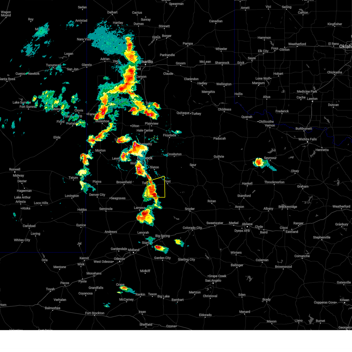 At 640 pm cdt, a severe thunderstorm was located 6 miles southwest of grassland, or 7 miles southeast of tahoka, moving east at 30 mph (radar indicated). Hazards include 60 mph wind gusts and quarter size hail. Hail damage to vehicles is expected. expect wind damage to roofs, siding, and trees. locations impacted include, tahoka and grassland. hail threat, radar indicated max hail size, 1. 00 in wind threat, radar indicated max wind gust, 60 mph. At 640 pm cdt, a severe thunderstorm was located 6 miles southwest of grassland, or 7 miles southeast of tahoka, moving east at 30 mph (radar indicated). Hazards include 60 mph wind gusts and quarter size hail. Hail damage to vehicles is expected. expect wind damage to roofs, siding, and trees. locations impacted include, tahoka and grassland. hail threat, radar indicated max hail size, 1. 00 in wind threat, radar indicated max wind gust, 60 mph.
|
| 5/23/2023 6:27 PM CDT |
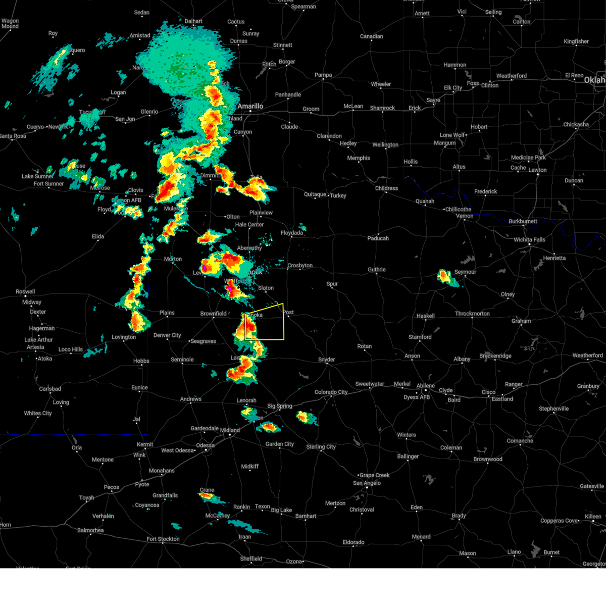 At 627 pm cdt, a severe thunderstorm was located 5 miles south of tahoka, moving east at 30 mph (radar indicated). Hazards include 60 mph wind gusts and quarter size hail. Hail damage to vehicles is expected. Expect wind damage to roofs, siding, and trees. At 627 pm cdt, a severe thunderstorm was located 5 miles south of tahoka, moving east at 30 mph (radar indicated). Hazards include 60 mph wind gusts and quarter size hail. Hail damage to vehicles is expected. Expect wind damage to roofs, siding, and trees.
|
| 5/22/2023 8:09 PM CDT |
 At 809 pm cdt, a severe thunderstorm was located over grassland, or 11 miles west of post, moving east at 30 mph (radar indicated). Hazards include ping pong ball size hail and 60 mph wind gusts. People and animals outdoors will be injured. expect hail damage to roofs, siding, windows, and vehicles. expect wind damage to roofs, siding, and trees. locations impacted include, post, tahoka and grassland. hail threat, radar indicated max hail size, 1. 50 in wind threat, radar indicated max wind gust, 60 mph. At 809 pm cdt, a severe thunderstorm was located over grassland, or 11 miles west of post, moving east at 30 mph (radar indicated). Hazards include ping pong ball size hail and 60 mph wind gusts. People and animals outdoors will be injured. expect hail damage to roofs, siding, windows, and vehicles. expect wind damage to roofs, siding, and trees. locations impacted include, post, tahoka and grassland. hail threat, radar indicated max hail size, 1. 50 in wind threat, radar indicated max wind gust, 60 mph.
|
| 5/22/2023 8:02 PM CDT |
 At 801 pm cdt, a severe thunderstorm was located 7 miles southeast of tahoka, moving east at 20 mph (radar indicated). Hazards include 60 mph wind gusts and quarter size hail. Hail damage to vehicles is expected. Expect wind damage to roofs, siding, and trees. At 801 pm cdt, a severe thunderstorm was located 7 miles southeast of tahoka, moving east at 20 mph (radar indicated). Hazards include 60 mph wind gusts and quarter size hail. Hail damage to vehicles is expected. Expect wind damage to roofs, siding, and trees.
|
| 5/18/2023 5:35 PM CDT |
 At 534 pm cdt, a severe thunderstorm was located over tahoka, moving north at 20 mph (radar indicated). Hazards include 60 mph wind gusts and half dollar size hail. Hail damage to vehicles is expected. Expect wind damage to roofs, siding, and trees. At 534 pm cdt, a severe thunderstorm was located over tahoka, moving north at 20 mph (radar indicated). Hazards include 60 mph wind gusts and half dollar size hail. Hail damage to vehicles is expected. Expect wind damage to roofs, siding, and trees.
|
| 4/9/2023 8:50 PM CDT |
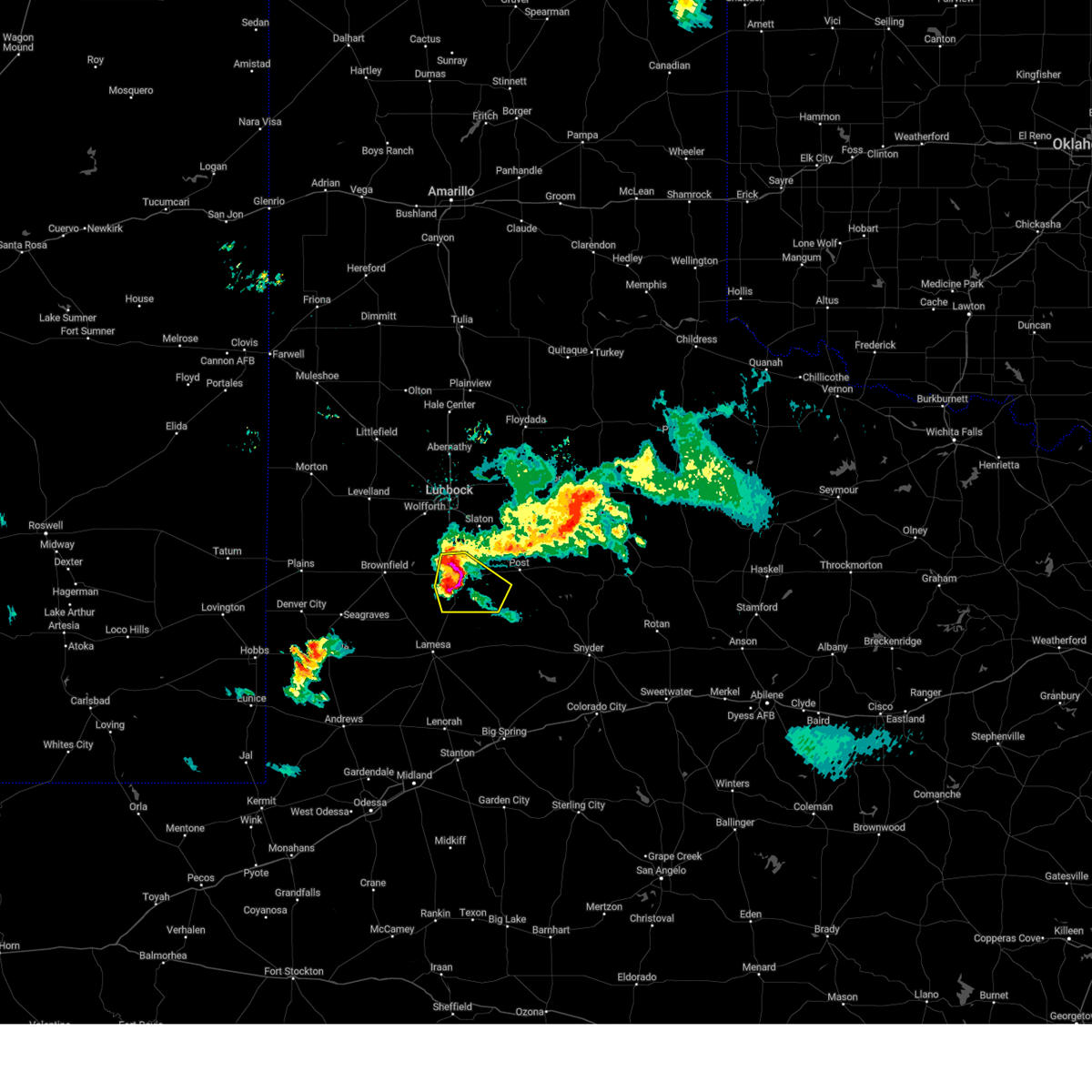 At 849 pm cdt, a severe thunderstorm was located 4 miles southeast of tahoka, moving southeast at 20 mph (trained weather spotters. at 845 pm cdt, quarter size hail was observed in tahoka). Hazards include 60 mph wind gusts and quarter size hail. Hail damage to vehicles is expected. expect wind damage to roofs, siding, and trees. locations impacted include, tahoka, o`donnell and grassland. hail threat, observed max hail size, 1. 00 in wind threat, radar indicated max wind gust, 60 mph. At 849 pm cdt, a severe thunderstorm was located 4 miles southeast of tahoka, moving southeast at 20 mph (trained weather spotters. at 845 pm cdt, quarter size hail was observed in tahoka). Hazards include 60 mph wind gusts and quarter size hail. Hail damage to vehicles is expected. expect wind damage to roofs, siding, and trees. locations impacted include, tahoka, o`donnell and grassland. hail threat, observed max hail size, 1. 00 in wind threat, radar indicated max wind gust, 60 mph.
|
| 4/9/2023 8:45 PM CDT | Quarter sized hail reported 0.5 miles SW of Tahoka, TX |
| 4/9/2023 8:44 PM CDT |
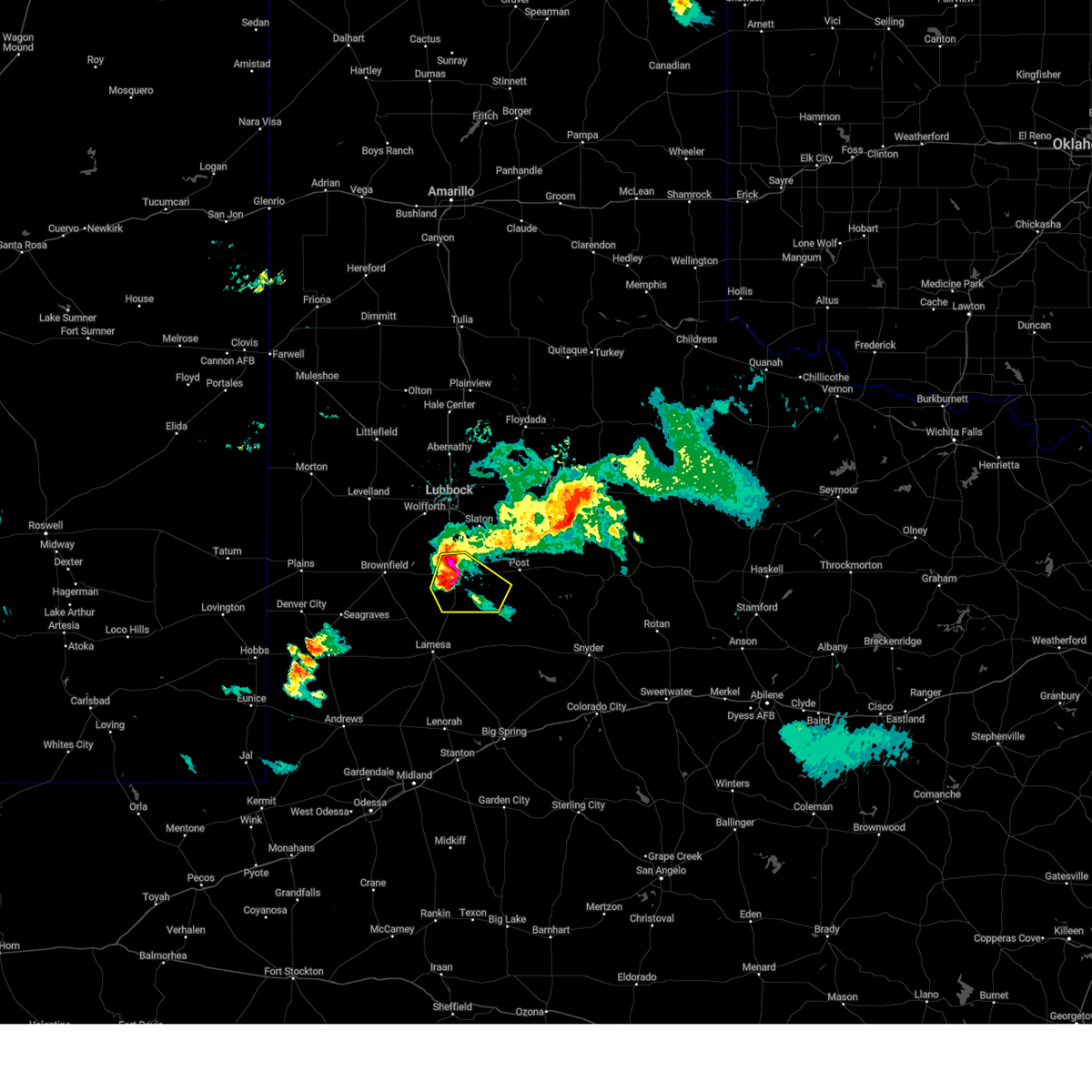 At 844 pm cdt, a severe thunderstorm was located over tahoka, moving southeast at 25 mph (radar indicated). Hazards include 60 mph wind gusts and quarter size hail. Hail damage to vehicles is expected. Expect wind damage to roofs, siding, and trees. At 844 pm cdt, a severe thunderstorm was located over tahoka, moving southeast at 25 mph (radar indicated). Hazards include 60 mph wind gusts and quarter size hail. Hail damage to vehicles is expected. Expect wind damage to roofs, siding, and trees.
|
| 4/9/2023 8:31 PM CDT |
 At 830 pm cdt, a severe thunderstorm was located near tahoka, moving southeast at 25 mph (radar indicated). Hazards include 60 mph wind gusts and quarter size hail. Hail damage to vehicles is expected. expect wind damage to roofs, siding, and trees. locations impacted include, tahoka, wilson and new home. hail threat, radar indicated max hail size, 1. 00 in wind threat, radar indicated max wind gust, 60 mph. At 830 pm cdt, a severe thunderstorm was located near tahoka, moving southeast at 25 mph (radar indicated). Hazards include 60 mph wind gusts and quarter size hail. Hail damage to vehicles is expected. expect wind damage to roofs, siding, and trees. locations impacted include, tahoka, wilson and new home. hail threat, radar indicated max hail size, 1. 00 in wind threat, radar indicated max wind gust, 60 mph.
|
| 4/9/2023 8:18 PM CDT |
 At 818 pm cdt, severe thunderstorms were located along a line extending from 6 miles southeast of woodrow to 8 miles southeast of slide to 11 miles west of tahoka, moving southeast at 25 mph (radar indicated). Hazards include 60 mph wind gusts and quarter size hail. Hail damage to vehicles is expected. expect wind damage to roofs, siding, and trees. locations impacted include, tahoka, wilson and new home. hail threat, radar indicated max hail size, 1. 00 in wind threat, radar indicated max wind gust, 60 mph. At 818 pm cdt, severe thunderstorms were located along a line extending from 6 miles southeast of woodrow to 8 miles southeast of slide to 11 miles west of tahoka, moving southeast at 25 mph (radar indicated). Hazards include 60 mph wind gusts and quarter size hail. Hail damage to vehicles is expected. expect wind damage to roofs, siding, and trees. locations impacted include, tahoka, wilson and new home. hail threat, radar indicated max hail size, 1. 00 in wind threat, radar indicated max wind gust, 60 mph.
|
| 4/9/2023 7:58 PM CDT |
 At 758 pm cdt, severe thunderstorms were located along a line extending from 3 miles southeast of woodrow to slide to 11 miles south of wolfforth, moving southeast at 25 mph (radar indicated). Hazards include 60 mph wind gusts and quarter size hail. Hail damage to vehicles is expected. Expect wind damage to roofs, siding, and trees. At 758 pm cdt, severe thunderstorms were located along a line extending from 3 miles southeast of woodrow to slide to 11 miles south of wolfforth, moving southeast at 25 mph (radar indicated). Hazards include 60 mph wind gusts and quarter size hail. Hail damage to vehicles is expected. Expect wind damage to roofs, siding, and trees.
|
| 5/16/2022 8:33 PM CDT |
 At 833 pm cdt, severe thunderstorms were located along a line extending from 3 miles northeast of cotton center to near lubbock south plains mall to 3 miles south of slaton to 5 miles southeast of grassland, moving northeast at 45 mph (radar indicated). Hazards include 70 mph wind gusts and quarter size hail. Hail damage to vehicles is expected. expect considerable tree damage. wind damage is also likely to mobile homes, roofs, and outbuildings. locations impacted include, lubbock, plainview, slaton, post, floydada, abernathy, tahoka, hale center, crosbyton, lake alan henry, white river lake, wolfforth, shallowater, idalou, ralls, lockney, petersburg, lorenzo, ransom canyon and cotton center. thunderstorm damage threat, considerable hail threat, radar indicated max hail size, 1. 00 in wind threat, radar indicated max wind gust, 70 mph. At 833 pm cdt, severe thunderstorms were located along a line extending from 3 miles northeast of cotton center to near lubbock south plains mall to 3 miles south of slaton to 5 miles southeast of grassland, moving northeast at 45 mph (radar indicated). Hazards include 70 mph wind gusts and quarter size hail. Hail damage to vehicles is expected. expect considerable tree damage. wind damage is also likely to mobile homes, roofs, and outbuildings. locations impacted include, lubbock, plainview, slaton, post, floydada, abernathy, tahoka, hale center, crosbyton, lake alan henry, white river lake, wolfforth, shallowater, idalou, ralls, lockney, petersburg, lorenzo, ransom canyon and cotton center. thunderstorm damage threat, considerable hail threat, radar indicated max hail size, 1. 00 in wind threat, radar indicated max wind gust, 70 mph.
|
| 5/16/2022 8:17 PM CDT |
 At 816 pm cdt, severe thunderstorms were located along a line extending from near spade to near slide to 9 miles south of grassland, moving northeast at 45 mph (radar indicated). Hazards include 70 mph wind gusts and quarter size hail. Hail damage to vehicles is expected. expect considerable tree damage. Wind damage is also likely to mobile homes, roofs, and outbuildings. At 816 pm cdt, severe thunderstorms were located along a line extending from near spade to near slide to 9 miles south of grassland, moving northeast at 45 mph (radar indicated). Hazards include 70 mph wind gusts and quarter size hail. Hail damage to vehicles is expected. expect considerable tree damage. Wind damage is also likely to mobile homes, roofs, and outbuildings.
|
| 5/1/2022 9:01 PM CDT | Golf Ball sized hail reported 12.3 miles NNW of Tahoka, TX, mostly 1 to 1.25 inch diameter hail... with largest golf ball size |
| 6/26/2021 10:04 PM CDT | West texas mesonet in lynn county TX, 3.3 miles SSW of Tahoka, TX |
| 6/26/2021 9:57 PM CDT |
 At 957 pm cdt, severe thunderstorms were located along a line extending from 3 miles northeast of claytonville to 8 miles west of caprock, moving east at 20 mph (radar indicated). Hazards include 70 mph wind gusts and ping pong ball size hail. People and animals outdoors will be injured. expect hail damage to roofs, siding, windows, and vehicles. expect considerable tree damage. Wind damage is also likely to mobile homes, roofs, and outbuildings. At 957 pm cdt, severe thunderstorms were located along a line extending from 3 miles northeast of claytonville to 8 miles west of caprock, moving east at 20 mph (radar indicated). Hazards include 70 mph wind gusts and ping pong ball size hail. People and animals outdoors will be injured. expect hail damage to roofs, siding, windows, and vehicles. expect considerable tree damage. Wind damage is also likely to mobile homes, roofs, and outbuildings.
|
| 6/7/2021 12:15 AM CDT |
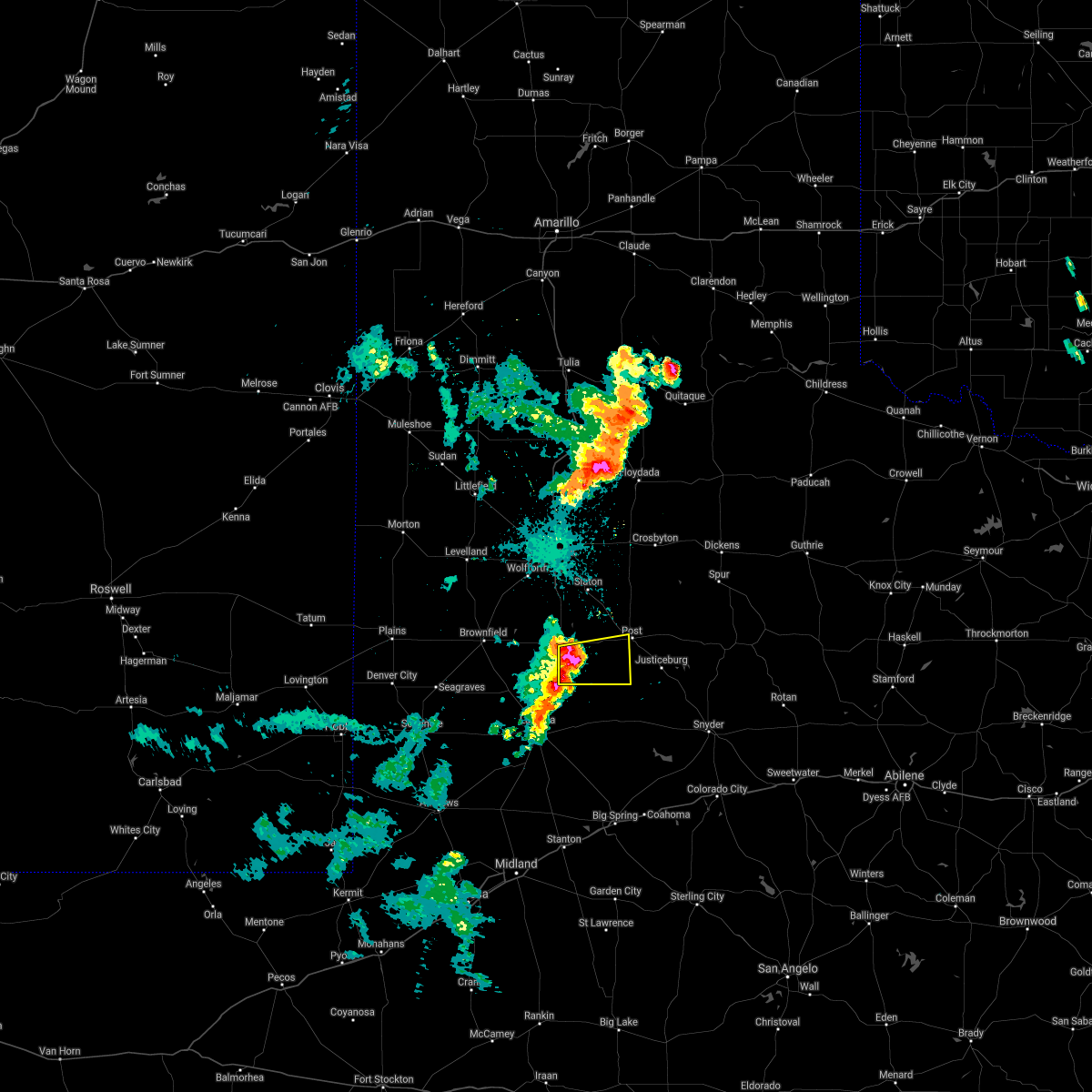 At 1215 am cdt, a severe thunderstorm was located 5 miles southeast of tahoka, moving east at 15 mph (radar indicated). Hazards include 60 mph wind gusts and quarter size hail. Hail damage to vehicles is expected. Expect wind damage to roofs, siding, and trees. At 1215 am cdt, a severe thunderstorm was located 5 miles southeast of tahoka, moving east at 15 mph (radar indicated). Hazards include 60 mph wind gusts and quarter size hail. Hail damage to vehicles is expected. Expect wind damage to roofs, siding, and trees.
|
| 6/6/2021 11:43 PM CDT |
 At 1143 pm cdt, a severe thunderstorm was located 8 miles west of tahoka, moving east at 30 mph (radar indicated). Hazards include 60 mph wind gusts and quarter size hail. Hail damage to vehicles is expected. expect wind damage to roofs, siding, and trees. Locations impacted include, tahoka, o`donnell, grassland and new moore. At 1143 pm cdt, a severe thunderstorm was located 8 miles west of tahoka, moving east at 30 mph (radar indicated). Hazards include 60 mph wind gusts and quarter size hail. Hail damage to vehicles is expected. expect wind damage to roofs, siding, and trees. Locations impacted include, tahoka, o`donnell, grassland and new moore.
|
| 6/6/2021 11:19 PM CDT |
 At 1119 pm cdt, a severe thunderstorm was located 8 miles east of brownfield, moving east at 30 mph (radar indicated). Hazards include 60 mph wind gusts and quarter size hail. Hail damage to vehicles is expected. Expect wind damage to roofs, siding, and trees. At 1119 pm cdt, a severe thunderstorm was located 8 miles east of brownfield, moving east at 30 mph (radar indicated). Hazards include 60 mph wind gusts and quarter size hail. Hail damage to vehicles is expected. Expect wind damage to roofs, siding, and trees.
|
| 5/17/2021 8:51 PM CDT |
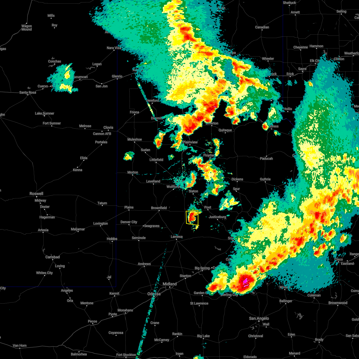 At 851 pm cdt, a severe thunderstorm was located 6 miles southwest of grassland, or 8 miles southeast of tahoka, moving east at 25 mph (radar indicated). Hazards include 60 mph wind gusts and quarter size hail. Hail damage to vehicles is expected. expect wind damage to roofs, siding, and trees. Locations impacted include, tahoka and grassland. At 851 pm cdt, a severe thunderstorm was located 6 miles southwest of grassland, or 8 miles southeast of tahoka, moving east at 25 mph (radar indicated). Hazards include 60 mph wind gusts and quarter size hail. Hail damage to vehicles is expected. expect wind damage to roofs, siding, and trees. Locations impacted include, tahoka and grassland.
|
| 5/17/2021 8:39 PM CDT |
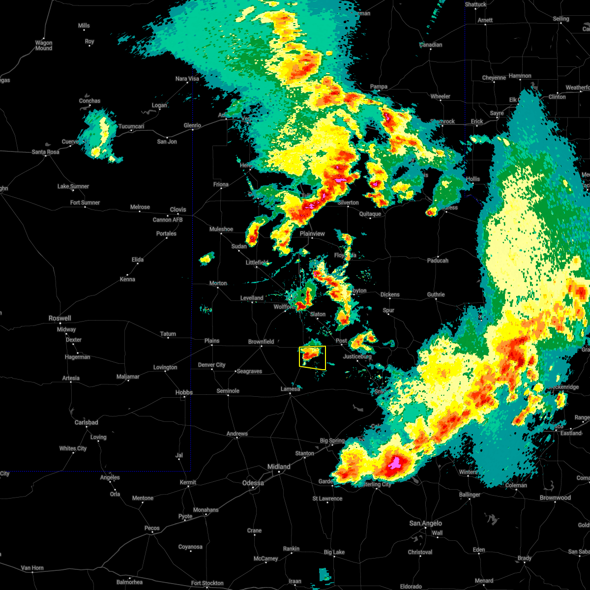 At 839 pm cdt, a severe thunderstorm was located 6 miles south of tahoka, moving east at 25 mph (radar indicated). Hazards include 60 mph wind gusts and quarter size hail. Hail damage to vehicles is expected. Expect wind damage to roofs, siding, and trees. At 839 pm cdt, a severe thunderstorm was located 6 miles south of tahoka, moving east at 25 mph (radar indicated). Hazards include 60 mph wind gusts and quarter size hail. Hail damage to vehicles is expected. Expect wind damage to roofs, siding, and trees.
|
| 5/17/2021 8:28 PM CDT |
 At 828 pm cdt, a severe thunderstorm was located 7 miles southeast of tahoka, moving east at 25 mph (radar indicated). Hazards include golf ball size hail and 60 mph wind gusts. People and animals outdoors will be injured. expect hail damage to roofs, siding, windows, and vehicles. expect wind damage to roofs, siding, and trees. Locations impacted include, tahoka, o`donnell and grassland. At 828 pm cdt, a severe thunderstorm was located 7 miles southeast of tahoka, moving east at 25 mph (radar indicated). Hazards include golf ball size hail and 60 mph wind gusts. People and animals outdoors will be injured. expect hail damage to roofs, siding, windows, and vehicles. expect wind damage to roofs, siding, and trees. Locations impacted include, tahoka, o`donnell and grassland.
|
| 5/17/2021 8:17 PM CDT |
 At 817 pm cdt, a severe thunderstorm was located 6 miles north of o`donnell, or 7 miles south of tahoka, moving east at 25 mph (radar indicated). Hazards include golf ball size hail and 60 mph wind gusts. People and animals outdoors will be injured. expect hail damage to roofs, siding, windows, and vehicles. expect wind damage to roofs, siding, and trees. Locations impacted include, tahoka, o`donnell and grassland. At 817 pm cdt, a severe thunderstorm was located 6 miles north of o`donnell, or 7 miles south of tahoka, moving east at 25 mph (radar indicated). Hazards include golf ball size hail and 60 mph wind gusts. People and animals outdoors will be injured. expect hail damage to roofs, siding, windows, and vehicles. expect wind damage to roofs, siding, and trees. Locations impacted include, tahoka, o`donnell and grassland.
|
| 5/17/2021 8:11 PM CDT |
 At 811 pm cdt, a severe thunderstorm was located 7 miles north of tahoka, moving north at 20 mph (radar indicated). Hazards include golf ball size hail and 60 mph wind gusts. People and animals outdoors will be injured. expect hail damage to roofs, siding, windows, and vehicles. expect wind damage to roofs, siding, and trees. Locations impacted include, tahoka and wilson. At 811 pm cdt, a severe thunderstorm was located 7 miles north of tahoka, moving north at 20 mph (radar indicated). Hazards include golf ball size hail and 60 mph wind gusts. People and animals outdoors will be injured. expect hail damage to roofs, siding, windows, and vehicles. expect wind damage to roofs, siding, and trees. Locations impacted include, tahoka and wilson.
|
| 5/17/2021 8:02 PM CDT |
 At 801 pm cdt, a severe thunderstorm was located 4 miles north of tahoka, moving north at 20 mph (radar indicated). Hazards include golf ball size hail and 60 mph wind gusts. People and animals outdoors will be injured. expect hail damage to roofs, siding, windows, and vehicles. Expect wind damage to roofs, siding, and trees. At 801 pm cdt, a severe thunderstorm was located 4 miles north of tahoka, moving north at 20 mph (radar indicated). Hazards include golf ball size hail and 60 mph wind gusts. People and animals outdoors will be injured. expect hail damage to roofs, siding, windows, and vehicles. Expect wind damage to roofs, siding, and trees.
|
| 5/17/2021 7:46 PM CDT |
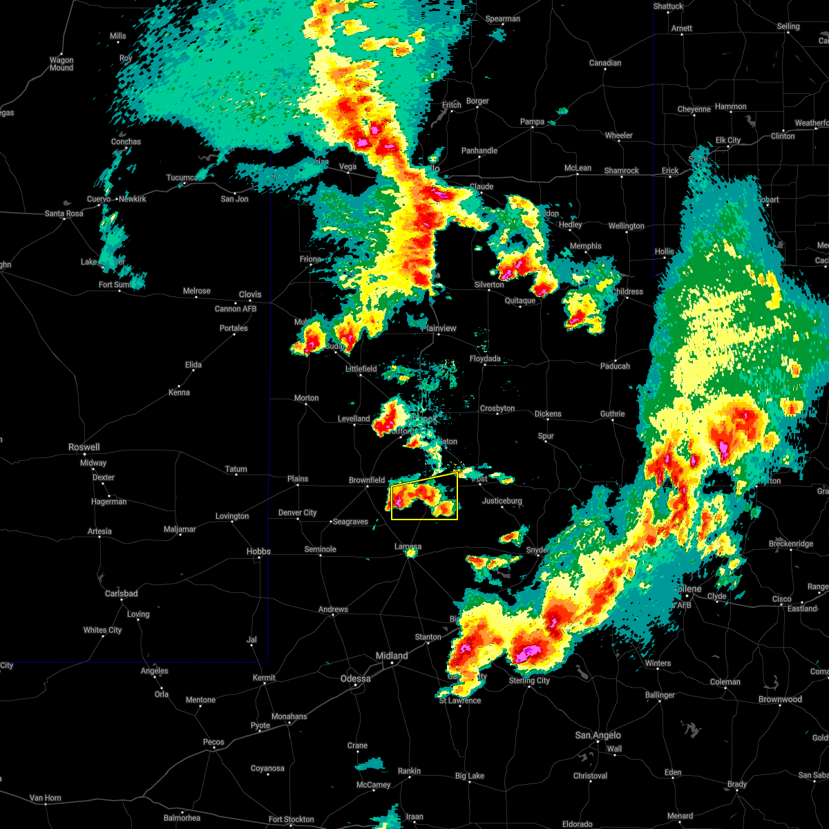 At 746 pm cdt, a severe thunderstorm was located near new moore, or 14 miles southwest of tahoka, moving east at 25 mph (radar indicated). Hazards include golf ball size hail and 60 mph wind gusts. People and animals outdoors will be injured. expect hail damage to roofs, siding, windows, and vehicles. Expect wind damage to roofs, siding, and trees. At 746 pm cdt, a severe thunderstorm was located near new moore, or 14 miles southwest of tahoka, moving east at 25 mph (radar indicated). Hazards include golf ball size hail and 60 mph wind gusts. People and animals outdoors will be injured. expect hail damage to roofs, siding, windows, and vehicles. Expect wind damage to roofs, siding, and trees.
|
| 5/17/2021 7:43 PM CDT |
 At 742 pm cdt, a severe thunderstorm was located 7 miles west of southland, or 7 miles south of slaton, moving north at 30 mph (radar indicated). Hazards include 60 mph wind gusts and quarter size hail. Hail damage to vehicles is expected. expect wind damage to roofs, siding, and trees. Locations impacted include, tahoka, grassland and wilson. At 742 pm cdt, a severe thunderstorm was located 7 miles west of southland, or 7 miles south of slaton, moving north at 30 mph (radar indicated). Hazards include 60 mph wind gusts and quarter size hail. Hail damage to vehicles is expected. expect wind damage to roofs, siding, and trees. Locations impacted include, tahoka, grassland and wilson.
|
| 5/17/2021 7:14 PM CDT |
 At 713 pm cdt, a severe thunderstorm was located 4 miles southwest of grassland, or 9 miles southeast of tahoka, moving north at 35 mph (radar indicated). Hazards include ping pong ball size hail and 60 mph wind gusts. People and animals outdoors will be injured. expect hail damage to roofs, siding, windows, and vehicles. Expect wind damage to roofs, siding, and trees. At 713 pm cdt, a severe thunderstorm was located 4 miles southwest of grassland, or 9 miles southeast of tahoka, moving north at 35 mph (radar indicated). Hazards include ping pong ball size hail and 60 mph wind gusts. People and animals outdoors will be injured. expect hail damage to roofs, siding, windows, and vehicles. Expect wind damage to roofs, siding, and trees.
|
| 5/15/2021 9:31 PM CDT |
 At 931 pm cdt, severe thunderstorms were located along a line extending from 4 miles south of cotton center to near downtown lubbock to 8 miles north of new moore, moving east at 55 mph (radar indicated). Hazards include 60 mph wind gusts and penny size hail. expect damage to roofs, siding, and trees At 931 pm cdt, severe thunderstorms were located along a line extending from 4 miles south of cotton center to near downtown lubbock to 8 miles north of new moore, moving east at 55 mph (radar indicated). Hazards include 60 mph wind gusts and penny size hail. expect damage to roofs, siding, and trees
|
| 5/15/2021 9:17 PM CDT |
 At 916 pm cdt, severe thunderstorms were located along a line extending from 4 miles east of spade to 6 miles northwest of shallowater to 3 miles north of wolfforth to 11 miles southeast of locketville to 3 miles northwest of welch, moving east at 20 mph (radar indicated). Hazards include 70 mph wind gusts and quarter size hail. Hail damage to vehicles is expected. expect considerable tree damage. wind damage is also likely to mobile homes, roofs, and outbuildings. Locations impacted include, lubbock, levelland, brownfield, slaton, abernathy, tahoka, wolfforth, shallowater, idalou, anton, ransom canyon, cotton center, new moore, spade, lubbock south plains mall, locketville, slide, woodrow, reese center and lubbock international airport. At 916 pm cdt, severe thunderstorms were located along a line extending from 4 miles east of spade to 6 miles northwest of shallowater to 3 miles north of wolfforth to 11 miles southeast of locketville to 3 miles northwest of welch, moving east at 20 mph (radar indicated). Hazards include 70 mph wind gusts and quarter size hail. Hail damage to vehicles is expected. expect considerable tree damage. wind damage is also likely to mobile homes, roofs, and outbuildings. Locations impacted include, lubbock, levelland, brownfield, slaton, abernathy, tahoka, wolfforth, shallowater, idalou, anton, ransom canyon, cotton center, new moore, spade, lubbock south plains mall, locketville, slide, woodrow, reese center and lubbock international airport.
|
| 5/15/2021 9:03 PM CDT |
 At 856 pm cdt, severe thunderstorms were located along a line extending from spade to 3 miles south of anton to 3 miles southwest of reese center to 6 miles southeast of locketville to 9 miles east of seagraves airport, moving east at 20 mph. a swath of enhanced winds near reese center will continue to move east into central lubbock county (radar indicated). Hazards include 70 mph wind gusts and quarter size hail. Hail damage to vehicles is expected. expect considerable tree damage. wind damage is also likely to mobile homes, roofs, and outbuildings. Locations impacted include, lubbock, levelland, brownfield, littlefield, slaton, denver city, abernathy, tahoka, wolfforth, shallowater, idalou, sundown, anton, ransom canyon, cotton center, new moore, spade, tokio, lubbock south plains mall and locketville. At 856 pm cdt, severe thunderstorms were located along a line extending from spade to 3 miles south of anton to 3 miles southwest of reese center to 6 miles southeast of locketville to 9 miles east of seagraves airport, moving east at 20 mph. a swath of enhanced winds near reese center will continue to move east into central lubbock county (radar indicated). Hazards include 70 mph wind gusts and quarter size hail. Hail damage to vehicles is expected. expect considerable tree damage. wind damage is also likely to mobile homes, roofs, and outbuildings. Locations impacted include, lubbock, levelland, brownfield, littlefield, slaton, denver city, abernathy, tahoka, wolfforth, shallowater, idalou, sundown, anton, ransom canyon, cotton center, new moore, spade, tokio, lubbock south plains mall and locketville.
|
| 5/15/2021 8:59 PM CDT |
 At 856 pm cdt, severe thunderstorms were located along a line extending from spade to 3 miles south of anton to 3 miles southwest of reese center to 6 miles southeast of locketville to 9 miles east of seagraves airport, moving east at 20 mph. a swath of enhanced winds near reese center will continue to move east into central lubbock county (radar indicated). Hazards include 70 mph wind gusts and quarter size hail. Hail damage to vehicles is expected. expect considerable tree damage. wind damage is also likely to mobile homes, roofs, and outbuildings. Locations impacted include, lubbock, levelland, brownfield, littlefield, slaton, denver city, abernathy, tahoka, wolfforth, shallowater, idalou, sundown, anton, ransom canyon, cotton center, new moore, spade, tokio, lubbock south plains mall and locketville. At 856 pm cdt, severe thunderstorms were located along a line extending from spade to 3 miles south of anton to 3 miles southwest of reese center to 6 miles southeast of locketville to 9 miles east of seagraves airport, moving east at 20 mph. a swath of enhanced winds near reese center will continue to move east into central lubbock county (radar indicated). Hazards include 70 mph wind gusts and quarter size hail. Hail damage to vehicles is expected. expect considerable tree damage. wind damage is also likely to mobile homes, roofs, and outbuildings. Locations impacted include, lubbock, levelland, brownfield, littlefield, slaton, denver city, abernathy, tahoka, wolfforth, shallowater, idalou, sundown, anton, ransom canyon, cotton center, new moore, spade, tokio, lubbock south plains mall and locketville.
|
| 5/15/2021 8:40 PM CDT |
 At 835 pm cdt, severe thunderstorms were located along a line extending from 6 miles west of littlefield to 6 miles west of whitharral to 9 miles west of reese center to 7 miles north of brownfield to 4 miles east of seagraves airport, moving east at 20 mph. a swath of enhanced winds just north of opdyke west will continue to move east into central hockley county (emergency management reported 1" sized hail in levelland). Hazards include 70 mph wind gusts and half dollar size hail. Hail damage to vehicles is expected. expect considerable tree damage. wind damage is also likely to mobile homes, roofs, and outbuildings. Locations impacted include, lubbock, levelland, brownfield, littlefield, slaton, denver city, abernathy, tahoka, plains, wolfforth, shallowater, idalou, sundown, anton, ransom canyon, cotton center, new moore, spade, tokio and lubbock south plains mall. At 835 pm cdt, severe thunderstorms were located along a line extending from 6 miles west of littlefield to 6 miles west of whitharral to 9 miles west of reese center to 7 miles north of brownfield to 4 miles east of seagraves airport, moving east at 20 mph. a swath of enhanced winds just north of opdyke west will continue to move east into central hockley county (emergency management reported 1" sized hail in levelland). Hazards include 70 mph wind gusts and half dollar size hail. Hail damage to vehicles is expected. expect considerable tree damage. wind damage is also likely to mobile homes, roofs, and outbuildings. Locations impacted include, lubbock, levelland, brownfield, littlefield, slaton, denver city, abernathy, tahoka, plains, wolfforth, shallowater, idalou, sundown, anton, ransom canyon, cotton center, new moore, spade, tokio and lubbock south plains mall.
|
| 5/15/2021 8:30 PM CDT |
 At 827 pm cdt, severe thunderstorms were located along a line extending from 6 miles northeast of pep to 9 miles west of whitharral to 7 miles east of levelland to 7 miles north of brownfield to seagraves airport, moving east at 20 mph (emergency management reported 1" sized hail in levelland). Hazards include 70 mph wind gusts and half dollar size hail. Hail damage to vehicles is expected. expect considerable tree damage. wind damage is also likely to mobile homes, roofs, and outbuildings. Locations impacted include, lubbock, levelland, brownfield, littlefield, slaton, denver city, abernathy, tahoka, plains, wolfforth, shallowater, idalou, sundown, anton, ransom canyon, cotton center, new moore, spade, tokio and lubbock south plains mall. At 827 pm cdt, severe thunderstorms were located along a line extending from 6 miles northeast of pep to 9 miles west of whitharral to 7 miles east of levelland to 7 miles north of brownfield to seagraves airport, moving east at 20 mph (emergency management reported 1" sized hail in levelland). Hazards include 70 mph wind gusts and half dollar size hail. Hail damage to vehicles is expected. expect considerable tree damage. wind damage is also likely to mobile homes, roofs, and outbuildings. Locations impacted include, lubbock, levelland, brownfield, littlefield, slaton, denver city, abernathy, tahoka, plains, wolfforth, shallowater, idalou, sundown, anton, ransom canyon, cotton center, new moore, spade, tokio and lubbock south plains mall.
|
| 5/15/2021 8:24 PM CDT |
 At 823 pm cdt, severe thunderstorms were located along a line extending from 6 miles northeast of pep to 9 miles west of whitharral to 6 miles east of levelland to 7 miles north of brownfield to seagraves airport, moving east at 20 mph (radar indicated). Hazards include 70 mph wind gusts and half dollar size hail. Hail damage to vehicles is expected. expect considerable tree damage. Wind damage is also likely to mobile homes, roofs, and outbuildings. At 823 pm cdt, severe thunderstorms were located along a line extending from 6 miles northeast of pep to 9 miles west of whitharral to 6 miles east of levelland to 7 miles north of brownfield to seagraves airport, moving east at 20 mph (radar indicated). Hazards include 70 mph wind gusts and half dollar size hail. Hail damage to vehicles is expected. expect considerable tree damage. Wind damage is also likely to mobile homes, roofs, and outbuildings.
|
| 5/3/2021 6:37 PM CDT |
 At 636 pm cdt, a severe thunderstorm was located 6 miles northeast of o`donnell, or 10 miles south of tahoka, moving east at 30 mph (radar indicated). Hazards include golf ball size hail and 60 mph wind gusts. People and animals outdoors will be injured. expect hail damage to roofs, siding, windows, and vehicles. Expect wind damage to roofs, siding, and trees. At 636 pm cdt, a severe thunderstorm was located 6 miles northeast of o`donnell, or 10 miles south of tahoka, moving east at 30 mph (radar indicated). Hazards include golf ball size hail and 60 mph wind gusts. People and animals outdoors will be injured. expect hail damage to roofs, siding, windows, and vehicles. Expect wind damage to roofs, siding, and trees.
|
| 5/3/2021 6:36 PM CDT | Quarter sized hail reported 0.5 miles SSE of Tahoka, TX |
| 5/3/2021 6:32 PM CDT |
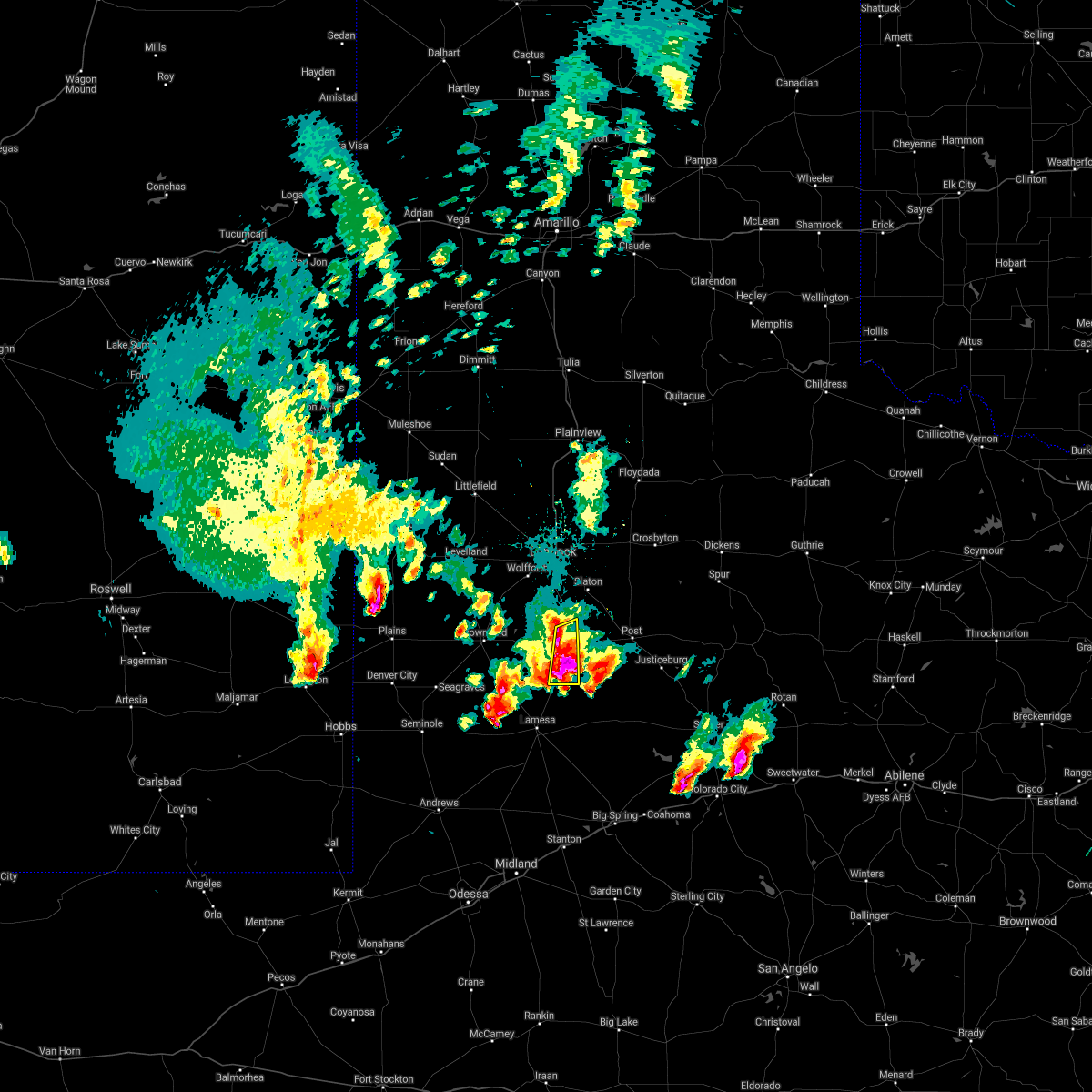 At 631 pm cdt, a severe thunderstorm was located 7 miles northeast of o`donnell, or 7 miles south of tahoka, moving east at 35 mph (radar indicated). Hazards include golf ball size hail and 60 mph wind gusts. People and animals outdoors will be injured. expect hail damage to roofs, siding, windows, and vehicles. expect wind damage to roofs, siding, and trees. Locations impacted include, tahoka and o`donnell. At 631 pm cdt, a severe thunderstorm was located 7 miles northeast of o`donnell, or 7 miles south of tahoka, moving east at 35 mph (radar indicated). Hazards include golf ball size hail and 60 mph wind gusts. People and animals outdoors will be injured. expect hail damage to roofs, siding, windows, and vehicles. expect wind damage to roofs, siding, and trees. Locations impacted include, tahoka and o`donnell.
|
| 5/3/2021 6:15 PM CDT |
 At 615 pm cdt, a severe thunderstorm was located 6 miles east of new moore, or 10 miles southwest of tahoka, moving east at 35 mph (radar indicated). Hazards include golf ball size hail and 60 mph wind gusts. People and animals outdoors will be injured. expect hail damage to roofs, siding, windows, and vehicles. expect wind damage to roofs, siding, and trees. Locations impacted include, tahoka, o`donnell and new moore. At 615 pm cdt, a severe thunderstorm was located 6 miles east of new moore, or 10 miles southwest of tahoka, moving east at 35 mph (radar indicated). Hazards include golf ball size hail and 60 mph wind gusts. People and animals outdoors will be injured. expect hail damage to roofs, siding, windows, and vehicles. expect wind damage to roofs, siding, and trees. Locations impacted include, tahoka, o`donnell and new moore.
|
| 5/3/2021 6:02 PM CDT |
 At 602 pm cdt, a severe thunderstorm was located over new moore, or 15 miles southeast of brownfield, moving east at 35 mph (radar indicated). Hazards include golf ball size hail and 60 mph wind gusts. People and animals outdoors will be injured. expect hail damage to roofs, siding, windows, and vehicles. expect wind damage to roofs, siding, and trees. Locations impacted include, tahoka, o`donnell, new moore and wilson. At 602 pm cdt, a severe thunderstorm was located over new moore, or 15 miles southeast of brownfield, moving east at 35 mph (radar indicated). Hazards include golf ball size hail and 60 mph wind gusts. People and animals outdoors will be injured. expect hail damage to roofs, siding, windows, and vehicles. expect wind damage to roofs, siding, and trees. Locations impacted include, tahoka, o`donnell, new moore and wilson.
|
| 5/3/2021 5:44 PM CDT |
 At 544 pm cdt, a severe thunderstorm was located 9 miles south of brownfield, moving east at 35 mph (radar indicated). Hazards include golf ball size hail and 60 mph wind gusts. People and animals outdoors will be injured. expect hail damage to roofs, siding, windows, and vehicles. Expect wind damage to roofs, siding, and trees. At 544 pm cdt, a severe thunderstorm was located 9 miles south of brownfield, moving east at 35 mph (radar indicated). Hazards include golf ball size hail and 60 mph wind gusts. People and animals outdoors will be injured. expect hail damage to roofs, siding, windows, and vehicles. Expect wind damage to roofs, siding, and trees.
|
| 3/13/2021 5:00 PM CST |
 At 459 pm cst, a severe thunderstorm was located 6 miles northeast of grassland, or 9 miles west of post, moving northeast at 60 mph. some rotation was also noted about 4 miles southeast of southland (radar indicated). Hazards include 60 mph wind gusts and half dollar size hail. Hail damage to vehicles is expected. expect wind damage to roofs, siding, and trees. Locations impacted include, post, tahoka, grassland, southland and wilson. At 459 pm cst, a severe thunderstorm was located 6 miles northeast of grassland, or 9 miles west of post, moving northeast at 60 mph. some rotation was also noted about 4 miles southeast of southland (radar indicated). Hazards include 60 mph wind gusts and half dollar size hail. Hail damage to vehicles is expected. expect wind damage to roofs, siding, and trees. Locations impacted include, post, tahoka, grassland, southland and wilson.
|
| 3/13/2021 4:43 PM CST |
 At 443 pm cst, a severe thunderstorm was located 7 miles northeast of o`donnell, or 10 miles south of tahoka, moving northeast at 70 mph (radar indicated). Hazards include ping pong ball size hail and 60 mph wind gusts. People and animals outdoors will be injured. expect hail damage to roofs, siding, windows, and vehicles. Expect wind damage to roofs, siding, and trees. At 443 pm cst, a severe thunderstorm was located 7 miles northeast of o`donnell, or 10 miles south of tahoka, moving northeast at 70 mph (radar indicated). Hazards include ping pong ball size hail and 60 mph wind gusts. People and animals outdoors will be injured. expect hail damage to roofs, siding, windows, and vehicles. Expect wind damage to roofs, siding, and trees.
|
| 7/5/2020 9:25 PM CDT |
 At 925 pm cdt, severe thunderstorms were located along a line extending from 6 miles southwest of abernathy to near wolfforth to 4 miles northeast of brownfield, moving east at 45 mph (radar indicated). Hazards include 70 mph wind gusts. Expect considerable tree damage. Damage is likely to mobile homes, roofs, and outbuildings. At 925 pm cdt, severe thunderstorms were located along a line extending from 6 miles southwest of abernathy to near wolfforth to 4 miles northeast of brownfield, moving east at 45 mph (radar indicated). Hazards include 70 mph wind gusts. Expect considerable tree damage. Damage is likely to mobile homes, roofs, and outbuildings.
|
| 6/22/2020 11:57 PM CDT |
 At 1156 pm cdt, severe thunderstorms were located along a line extending from 5 miles northwest of tokio to 7 miles west of tahoka, moving south at 30 mph (radar indicated). Hazards include 70 mph wind gusts. Expect considerable tree damage. Damage is likely to mobile homes, roofs, and outbuildings. At 1156 pm cdt, severe thunderstorms were located along a line extending from 5 miles northwest of tokio to 7 miles west of tahoka, moving south at 30 mph (radar indicated). Hazards include 70 mph wind gusts. Expect considerable tree damage. Damage is likely to mobile homes, roofs, and outbuildings.
|
| 6/17/2020 8:55 PM CDT |
 At 855 pm cdt, a severe thunderstorm was located over grassland, or 9 miles west of post, moving east at 35 mph (radar indicated). Hazards include 60 mph wind gusts and penny size hail. Expect damage to roofs, siding, and trees. Locations impacted include, post, tahoka, o`donnell and grassland. At 855 pm cdt, a severe thunderstorm was located over grassland, or 9 miles west of post, moving east at 35 mph (radar indicated). Hazards include 60 mph wind gusts and penny size hail. Expect damage to roofs, siding, and trees. Locations impacted include, post, tahoka, o`donnell and grassland.
|
| 6/17/2020 8:31 PM CDT |
 At 831 pm cdt, a severe thunderstorm was located 4 miles south of tahoka, moving east at 35 mph (radar indicated). Hazards include 70 mph wind gusts and penny size hail. Expect considerable tree damage. Damage is likely to mobile homes, roofs, and outbuildings. At 831 pm cdt, a severe thunderstorm was located 4 miles south of tahoka, moving east at 35 mph (radar indicated). Hazards include 70 mph wind gusts and penny size hail. Expect considerable tree damage. Damage is likely to mobile homes, roofs, and outbuildings.
|
| 6/17/2020 8:15 PM CDT |
 At 815 pm cdt, a severe thunderstorm was located 8 miles southwest of southland, or 11 miles south of slaton, moving northeast at 35 mph (radar indicated). Hazards include 70 mph wind gusts and penny size hail. Expect considerable tree damage. damage is likely to mobile homes, roofs, and outbuildings. Locations impacted include, tahoka. At 815 pm cdt, a severe thunderstorm was located 8 miles southwest of southland, or 11 miles south of slaton, moving northeast at 35 mph (radar indicated). Hazards include 70 mph wind gusts and penny size hail. Expect considerable tree damage. damage is likely to mobile homes, roofs, and outbuildings. Locations impacted include, tahoka.
|
| 6/17/2020 8:09 PM CDT |
 At 809 pm cdt, a severe thunderstorm was located 7 miles northeast of tahoka, moving northeast at 35 mph (radar indicated). Hazards include 70 mph wind gusts and penny size hail. Expect considerable tree damage. damage is likely to mobile homes, roofs, and outbuildings. Locations impacted include, tahoka. At 809 pm cdt, a severe thunderstorm was located 7 miles northeast of tahoka, moving northeast at 35 mph (radar indicated). Hazards include 70 mph wind gusts and penny size hail. Expect considerable tree damage. damage is likely to mobile homes, roofs, and outbuildings. Locations impacted include, tahoka.
|
| 6/17/2020 7:44 PM CDT |
 At 744 pm cdt, a severe thunderstorm was located 8 miles west of tahoka, moving northeast at 35 mph (radar indicated). Hazards include 70 mph wind gusts and penny size hail. Expect considerable tree damage. Damage is likely to mobile homes, roofs, and outbuildings. At 744 pm cdt, a severe thunderstorm was located 8 miles west of tahoka, moving northeast at 35 mph (radar indicated). Hazards include 70 mph wind gusts and penny size hail. Expect considerable tree damage. Damage is likely to mobile homes, roofs, and outbuildings.
|
| 6/17/2020 7:42 PM CDT | West texas mesonet in lynn county TX, 3.3 miles SSW of Tahoka, TX |
| 6/4/2020 10:48 PM CDT |
 At 1047 pm cdt, severe thunderstorms were located along a line extending from 4 miles west of lake alan henry to 12 miles south of post to 3 miles northeast of o`donnell, moving south at 35 mph. these are very dangerous storms (radar indicated). Hazards include 90 mph wind gusts. You are in a life-threatening situation. flying debris may be deadly to those caught without shelter. mobile homes will be heavily damaged or destroyed. homes and businesses will have substantial roof and window damage. expect extensive tree damage and power outages. Locations impacted include, post, tahoka, lake alan henry, o`donnell, grassland, southland, justiceburg and wilson. At 1047 pm cdt, severe thunderstorms were located along a line extending from 4 miles west of lake alan henry to 12 miles south of post to 3 miles northeast of o`donnell, moving south at 35 mph. these are very dangerous storms (radar indicated). Hazards include 90 mph wind gusts. You are in a life-threatening situation. flying debris may be deadly to those caught without shelter. mobile homes will be heavily damaged or destroyed. homes and businesses will have substantial roof and window damage. expect extensive tree damage and power outages. Locations impacted include, post, tahoka, lake alan henry, o`donnell, grassland, southland, justiceburg and wilson.
|
| 6/4/2020 10:38 PM CDT |
 At 1038 pm cdt, severe thunderstorms were located along a line extending from 6 miles northeast of justiceburg to 9 miles southeast of grassland to 5 miles northeast of o`donnell, moving south at 35 mph (radar indicated). Hazards include 70 mph wind gusts and quarter size hail. Hail damage to vehicles is expected. expect considerable tree damage. wind damage is also likely to mobile homes, roofs, and outbuildings. Locations impacted include, post, tahoka, lake alan henry, o`donnell, grassland, southland, justiceburg and wilson. At 1038 pm cdt, severe thunderstorms were located along a line extending from 6 miles northeast of justiceburg to 9 miles southeast of grassland to 5 miles northeast of o`donnell, moving south at 35 mph (radar indicated). Hazards include 70 mph wind gusts and quarter size hail. Hail damage to vehicles is expected. expect considerable tree damage. wind damage is also likely to mobile homes, roofs, and outbuildings. Locations impacted include, post, tahoka, lake alan henry, o`donnell, grassland, southland, justiceburg and wilson.
|
| 6/4/2020 10:24 PM CDT |
 At 1024 pm cdt, severe thunderstorms were located along a line extending from 12 miles east of post to 6 miles east of grassland to near tahoka, moving south at 35 mph (radar indicated). Hazards include 70 mph wind gusts and quarter size hail. Hail damage to vehicles is expected. expect considerable tree damage. Wind damage is also likely to mobile homes, roofs, and outbuildings. At 1024 pm cdt, severe thunderstorms were located along a line extending from 12 miles east of post to 6 miles east of grassland to near tahoka, moving south at 35 mph (radar indicated). Hazards include 70 mph wind gusts and quarter size hail. Hail damage to vehicles is expected. expect considerable tree damage. Wind damage is also likely to mobile homes, roofs, and outbuildings.
|
| 6/4/2020 10:04 PM CDT | Storm damage reported in lynn county TX, 3.3 miles SSW of Tahoka, TX |
| 6/4/2020 10:03 PM CDT |
 At 1003 pm cdt, severe thunderstorms were located along a line extending from 9 miles northeast of post to 4 miles west of tahoka, moving southeast at 35 mph (radar indicated). Hazards include golf ball size hail and 70 mph wind gusts. People and animals outdoors will be injured. expect hail damage to roofs, siding, windows, and vehicles. expect considerable tree damage. wind damage is also likely to mobile homes, roofs, and outbuildings. Locations impacted include, post, tahoka, lake alan henry, o`donnell, grassland, southland, justiceburg and wilson. At 1003 pm cdt, severe thunderstorms were located along a line extending from 9 miles northeast of post to 4 miles west of tahoka, moving southeast at 35 mph (radar indicated). Hazards include golf ball size hail and 70 mph wind gusts. People and animals outdoors will be injured. expect hail damage to roofs, siding, windows, and vehicles. expect considerable tree damage. wind damage is also likely to mobile homes, roofs, and outbuildings. Locations impacted include, post, tahoka, lake alan henry, o`donnell, grassland, southland, justiceburg and wilson.
|
| 6/4/2020 9:58 PM CDT |
 At 958 pm cdt, a severe thunderstorm was located 4 miles northeast of tahoka, moving south at 40 mph (radar indicated). Hazards include 70 mph wind gusts. Expect considerable tree damage. Damage is likely to mobile homes, roofs, and outbuildings. At 958 pm cdt, a severe thunderstorm was located 4 miles northeast of tahoka, moving south at 40 mph (radar indicated). Hazards include 70 mph wind gusts. Expect considerable tree damage. Damage is likely to mobile homes, roofs, and outbuildings.
|
| 5/24/2020 7:17 PM CDT |
 At 717 pm cdt, a severe thunderstorm was located 5 miles northeast of ralls, or 6 miles northwest of crosbyton, moving northeast at 40 mph (radar indicated). Hazards include 60 mph wind gusts and quarter size hail. Hail damage to vehicles is expected. expect wind damage to roofs, siding, and trees. Locations impacted include, slaton, tahoka, lorenzo and wilson. At 717 pm cdt, a severe thunderstorm was located 5 miles northeast of ralls, or 6 miles northwest of crosbyton, moving northeast at 40 mph (radar indicated). Hazards include 60 mph wind gusts and quarter size hail. Hail damage to vehicles is expected. expect wind damage to roofs, siding, and trees. Locations impacted include, slaton, tahoka, lorenzo and wilson.
|
| 5/24/2020 6:59 PM CDT | Half Dollar sized hail reported 8 miles WNW of Tahoka, TX |
| 5/24/2020 6:51 PM CDT |
 At 650 pm cdt, a severe thunderstorm was located 6 miles east of ransom canyon, or 9 miles northeast of slaton, moving northeast at 40 mph. a second storm was located 7 miles east of tahoka and was moving north at 15 mph (radar indicated). Hazards include 60 mph wind gusts and quarter size hail. Hail damage to vehicles is expected. expect wind damage to roofs, siding, and trees. Locations impacted include, lubbock, slaton, tahoka, idalou, lorenzo, ransom canyon, woodrow, wilson and new home. At 650 pm cdt, a severe thunderstorm was located 6 miles east of ransom canyon, or 9 miles northeast of slaton, moving northeast at 40 mph. a second storm was located 7 miles east of tahoka and was moving north at 15 mph (radar indicated). Hazards include 60 mph wind gusts and quarter size hail. Hail damage to vehicles is expected. expect wind damage to roofs, siding, and trees. Locations impacted include, lubbock, slaton, tahoka, idalou, lorenzo, ransom canyon, woodrow, wilson and new home.
|
| 5/24/2020 6:39 PM CDT |
 At 638 pm cdt, a severe thunderstorm was located over ransom canyon, or 5 miles northwest of slaton, moving northeast at 40 mph. this storm has a history of producing quarter size hail or larger. a second storm was located 10 miles south of wilson and moving north at 15 mph (radar indicated). Hazards include ping pong ball size hail and 60 mph wind gusts. People and animals outdoors will be injured. expect hail damage to roofs, siding, windows, and vehicles. expect wind damage to roofs, siding, and trees. Locations impacted include, lubbock, slaton, tahoka, idalou, lorenzo, ransom canyon, texas tech university, lubbock international airport, slide, downtown lubbock, woodrow, wilson, new home and lubbock science spectrum. At 638 pm cdt, a severe thunderstorm was located over ransom canyon, or 5 miles northwest of slaton, moving northeast at 40 mph. this storm has a history of producing quarter size hail or larger. a second storm was located 10 miles south of wilson and moving north at 15 mph (radar indicated). Hazards include ping pong ball size hail and 60 mph wind gusts. People and animals outdoors will be injured. expect hail damage to roofs, siding, windows, and vehicles. expect wind damage to roofs, siding, and trees. Locations impacted include, lubbock, slaton, tahoka, idalou, lorenzo, ransom canyon, texas tech university, lubbock international airport, slide, downtown lubbock, woodrow, wilson, new home and lubbock science spectrum.
|
| 5/24/2020 6:29 PM CDT |
 At 628 pm cdt, a severe thunderstorm was located near woodrow, or 8 miles west of slaton, moving northeast at 40 mph. a second storm was located 10 miles southeast of tahoka and is moving north at 15 mph. these storms have a history of producing quarter size or larger hail (radar indicated). Hazards include two inch hail and 60 mph wind gusts. People and animals outdoors will be injured. expect hail damage to roofs, siding, windows, and vehicles. Expect wind damage to roofs, siding, and trees. At 628 pm cdt, a severe thunderstorm was located near woodrow, or 8 miles west of slaton, moving northeast at 40 mph. a second storm was located 10 miles southeast of tahoka and is moving north at 15 mph. these storms have a history of producing quarter size or larger hail (radar indicated). Hazards include two inch hail and 60 mph wind gusts. People and animals outdoors will be injured. expect hail damage to roofs, siding, windows, and vehicles. Expect wind damage to roofs, siding, and trees.
|
| 5/24/2020 6:17 PM CDT | Quarter sized hail reported 9.5 miles NNW of Tahoka, TX |
| 5/24/2020 6:09 PM CDT |
 At 609 pm cdt, a severe thunderstorm was located 4 miles east of tahoka, moving north at 15 mph (radar indicated). Hazards include two inch hail and 60 mph wind gusts. People and animals outdoors will be injured. expect hail damage to roofs, siding, windows, and vehicles. expect wind damage to roofs, siding, and trees. Locations impacted include, tahoka, grassland, southland and wilson. At 609 pm cdt, a severe thunderstorm was located 4 miles east of tahoka, moving north at 15 mph (radar indicated). Hazards include two inch hail and 60 mph wind gusts. People and animals outdoors will be injured. expect hail damage to roofs, siding, windows, and vehicles. expect wind damage to roofs, siding, and trees. Locations impacted include, tahoka, grassland, southland and wilson.
|
| 5/24/2020 5:46 PM CDT |
 At 545 pm cdt, a severe thunderstorm was located 8 miles northeast of o`donnell, or 8 miles southeast of tahoka, moving northeast at 15 mph (radar indicated). Hazards include golf ball size hail and 60 mph wind gusts. People and animals outdoors will be injured. expect hail damage to roofs, siding, windows, and vehicles. expect wind damage to roofs, siding, and trees. Locations impacted include, tahoka, grassland, southland and wilson. At 545 pm cdt, a severe thunderstorm was located 8 miles northeast of o`donnell, or 8 miles southeast of tahoka, moving northeast at 15 mph (radar indicated). Hazards include golf ball size hail and 60 mph wind gusts. People and animals outdoors will be injured. expect hail damage to roofs, siding, windows, and vehicles. expect wind damage to roofs, siding, and trees. Locations impacted include, tahoka, grassland, southland and wilson.
|
| 5/24/2020 5:34 PM CDT |
 At 534 pm cdt, a severe thunderstorm was located 8 miles northeast of o`donnell, or 10 miles southeast of tahoka, moving north at 15 mph (radar indicated). Hazards include golf ball size hail and 60 mph wind gusts. People and animals outdoors will be injured. expect hail damage to roofs, siding, windows, and vehicles. Expect wind damage to roofs, siding, and trees. At 534 pm cdt, a severe thunderstorm was located 8 miles northeast of o`donnell, or 10 miles southeast of tahoka, moving north at 15 mph (radar indicated). Hazards include golf ball size hail and 60 mph wind gusts. People and animals outdoors will be injured. expect hail damage to roofs, siding, windows, and vehicles. Expect wind damage to roofs, siding, and trees.
|
| 5/23/2020 7:14 PM CDT |
 At 712 pm cdt, severe thunderstorms were located across much of lynn and garza counties, moving north at 45 mph. the most severe part of the storm is across southern garza county and nearly stationary (radar indicated). Hazards include two inch hail and 70 mph wind gusts. People and animals outdoors will be injured. expect hail damage to roofs, siding, windows, and vehicles. expect considerable tree damage. wind damage is also likely to mobile homes, roofs, and outbuildings. Locations impacted include, post, tahoka, lake alan henry, o`donnell, grassland, southland, justiceburg, wilson and new home. At 712 pm cdt, severe thunderstorms were located across much of lynn and garza counties, moving north at 45 mph. the most severe part of the storm is across southern garza county and nearly stationary (radar indicated). Hazards include two inch hail and 70 mph wind gusts. People and animals outdoors will be injured. expect hail damage to roofs, siding, windows, and vehicles. expect considerable tree damage. wind damage is also likely to mobile homes, roofs, and outbuildings. Locations impacted include, post, tahoka, lake alan henry, o`donnell, grassland, southland, justiceburg, wilson and new home.
|
| 5/23/2020 7:06 PM CDT |
 At 704 pm cdt, severe thunderstorms were located along a line extending from 4 miles east of post to 11 miles southwest of slide, moving north at 45 mph. the most intense part of the storm was located across southern garza county though a band of large hail extended from southern garza to western lynn counties (radar indicated). Hazards include two inch hail and 60 mph wind gusts. People and animals outdoors will be injured. expect hail damage to roofs, siding, windows, and vehicles. expect wind damage to roofs, siding, and trees. Locations impacted include, post, tahoka, lake alan henry, o`donnell, grassland, southland, new moore, justiceburg, wilson and new home. At 704 pm cdt, severe thunderstorms were located along a line extending from 4 miles east of post to 11 miles southwest of slide, moving north at 45 mph. the most intense part of the storm was located across southern garza county though a band of large hail extended from southern garza to western lynn counties (radar indicated). Hazards include two inch hail and 60 mph wind gusts. People and animals outdoors will be injured. expect hail damage to roofs, siding, windows, and vehicles. expect wind damage to roofs, siding, and trees. Locations impacted include, post, tahoka, lake alan henry, o`donnell, grassland, southland, new moore, justiceburg, wilson and new home.
|
| 5/23/2020 6:55 PM CDT |
 At 652 pm cdt, severe thunderstorms were located along a line extending from 7 miles southeast of post to 3 miles north of new moore, moving north at 25 mph. multiple areas of large hail were noted with golf ball hail across southern lynn county and baseball hail across southern garza county. these are very dangerous storms (radar indicated). Hazards include baseball size hail and 70 mph wind gusts. People and animals outdoors will be severely injured. expect shattered windows, extensive damage to roofs, siding, and vehicles. Locations impacted include, post, tahoka, lake alan henry, o`donnell, grassland, southland, new moore, justiceburg, wilson and new home. At 652 pm cdt, severe thunderstorms were located along a line extending from 7 miles southeast of post to 3 miles north of new moore, moving north at 25 mph. multiple areas of large hail were noted with golf ball hail across southern lynn county and baseball hail across southern garza county. these are very dangerous storms (radar indicated). Hazards include baseball size hail and 70 mph wind gusts. People and animals outdoors will be severely injured. expect shattered windows, extensive damage to roofs, siding, and vehicles. Locations impacted include, post, tahoka, lake alan henry, o`donnell, grassland, southland, new moore, justiceburg, wilson and new home.
|
| 5/23/2020 6:45 PM CDT |
 At 643 pm cdt, severe thunderstorms were located along a line extending from 5 miles west of justiceburg to 3 miles northeast of new moore, moving north at 40 mph. this storm is showing strong rotation 10 miles of post and could produce a tornado with little notice. the area of rotation is drifting east near 5 mph. these are very dangerous storms (radar indicated). Hazards include baseball size hail and 70 mph wind gusts. People and animals outdoors will be severely injured. expect shattered windows, extensive damage to roofs, siding, and vehicles. Locations impacted include, post, tahoka, lake alan henry, o`donnell, grassland, southland, new moore, justiceburg, wilson and new home. At 643 pm cdt, severe thunderstorms were located along a line extending from 5 miles west of justiceburg to 3 miles northeast of new moore, moving north at 40 mph. this storm is showing strong rotation 10 miles of post and could produce a tornado with little notice. the area of rotation is drifting east near 5 mph. these are very dangerous storms (radar indicated). Hazards include baseball size hail and 70 mph wind gusts. People and animals outdoors will be severely injured. expect shattered windows, extensive damage to roofs, siding, and vehicles. Locations impacted include, post, tahoka, lake alan henry, o`donnell, grassland, southland, new moore, justiceburg, wilson and new home.
|
| 5/23/2020 6:41 PM CDT |
 At 641 pm cdt, severe thunderstorms were located along a line extending from 5 miles west of justiceburg to 3 miles northeast of new moore, moving north at 40 mph (radar indicated). Hazards include two inch hail. People and animals outdoors will be injured. Expect damage to roofs, siding, windows, and vehicles. At 641 pm cdt, severe thunderstorms were located along a line extending from 5 miles west of justiceburg to 3 miles northeast of new moore, moving north at 40 mph (radar indicated). Hazards include two inch hail. People and animals outdoors will be injured. Expect damage to roofs, siding, windows, and vehicles.
|
| 5/23/2020 3:55 PM CDT |
 At 354 pm cdt, a severe thunderstorm was located 6 miles northwest of post, moving northeast at 25 mph. a second severe thunderstorm was located 5 miles south of grassland (radar indicated). Hazards include ping pong ball size hail and 60 mph wind gusts. People and animals outdoors will be injured. expect hail damage to roofs, siding, windows, and vehicles. expect wind damage to roofs, siding, and trees. Locations impacted include, post, tahoka, grassland, southland and wilson. At 354 pm cdt, a severe thunderstorm was located 6 miles northwest of post, moving northeast at 25 mph. a second severe thunderstorm was located 5 miles south of grassland (radar indicated). Hazards include ping pong ball size hail and 60 mph wind gusts. People and animals outdoors will be injured. expect hail damage to roofs, siding, windows, and vehicles. expect wind damage to roofs, siding, and trees. Locations impacted include, post, tahoka, grassland, southland and wilson.
|
| 5/23/2020 3:48 PM CDT |
 At 348 pm cdt, a severe thunderstorm was located 10 miles east of o`donnell, or 16 miles northwest of gail, moving north at 30 mph (radar indicated). Hazards include ping pong ball size hail and 60 mph wind gusts. People and animals outdoors will be injured. expect hail damage to roofs, siding, windows, and vehicles. Expect wind damage to roofs, siding, and trees. At 348 pm cdt, a severe thunderstorm was located 10 miles east of o`donnell, or 16 miles northwest of gail, moving north at 30 mph (radar indicated). Hazards include ping pong ball size hail and 60 mph wind gusts. People and animals outdoors will be injured. expect hail damage to roofs, siding, windows, and vehicles. Expect wind damage to roofs, siding, and trees.
|
| 5/15/2020 4:53 PM CDT |
 At 453 pm cdt, a severe thunderstorm was located 7 miles northeast of tahoka, moving north at 15 mph (radar indicated). Hazards include 60 mph wind gusts and quarter size hail. Hail damage to vehicles is expected. expect wind damage to roofs, siding, and trees. Locations impacted include, grassland, wilson and new home. At 453 pm cdt, a severe thunderstorm was located 7 miles northeast of tahoka, moving north at 15 mph (radar indicated). Hazards include 60 mph wind gusts and quarter size hail. Hail damage to vehicles is expected. expect wind damage to roofs, siding, and trees. Locations impacted include, grassland, wilson and new home.
|
| 5/15/2020 4:27 PM CDT |
 At 426 pm cdt, a severe thunderstorm was located over tahoka, moving north at 15 mph (radar indicated). Hazards include ping pong ball size hail and 60 mph wind gusts. People and animals outdoors will be injured. expect hail damage to roofs, siding, windows, and vehicles. Expect wind damage to roofs, siding, and trees. At 426 pm cdt, a severe thunderstorm was located over tahoka, moving north at 15 mph (radar indicated). Hazards include ping pong ball size hail and 60 mph wind gusts. People and animals outdoors will be injured. expect hail damage to roofs, siding, windows, and vehicles. Expect wind damage to roofs, siding, and trees.
|
| 5/15/2020 4:19 PM CDT |
 At 419 pm cdt, a severe thunderstorm was located 7 miles north of post, moving northeast at 25 mph (radar indicated). Hazards include 70 mph wind gusts and quarter size hail. Hail damage to vehicles is expected. expect considerable tree damage. wind damage is also likely to mobile homes, roofs, and outbuildings. Locations impacted include, post, tahoka, o`donnell, grassland, southland, new moore, wilson and new home. At 419 pm cdt, a severe thunderstorm was located 7 miles north of post, moving northeast at 25 mph (radar indicated). Hazards include 70 mph wind gusts and quarter size hail. Hail damage to vehicles is expected. expect considerable tree damage. wind damage is also likely to mobile homes, roofs, and outbuildings. Locations impacted include, post, tahoka, o`donnell, grassland, southland, new moore, wilson and new home.
|
| 5/15/2020 3:33 PM CDT |
 At 333 pm cdt, a severe thunderstorm was located 4 miles southwest of grassland, or 11 miles southeast of tahoka, moving northeast at 25 mph (radar indicated). Hazards include 70 mph wind gusts and quarter size hail. Hail damage to vehicles is expected. expect considerable tree damage. Wind damage is also likely to mobile homes, roofs, and outbuildings. At 333 pm cdt, a severe thunderstorm was located 4 miles southwest of grassland, or 11 miles southeast of tahoka, moving northeast at 25 mph (radar indicated). Hazards include 70 mph wind gusts and quarter size hail. Hail damage to vehicles is expected. expect considerable tree damage. Wind damage is also likely to mobile homes, roofs, and outbuildings.
|
| 5/13/2020 7:15 PM CDT | Ping Pong Ball sized hail reported 10.2 miles W of Tahoka, TX |
| 5/11/2020 9:25 PM CDT |
 At 925 pm cdt, severe thunderstorms were located along a line extending from near lorenzo to 12 miles west of tahoka to 5 miles southeast of tokio, moving southeast at 40 mph (radar indicated). Hazards include golf ball size hail and 60 mph wind gusts. People and animals outdoors will be injured. expect hail damage to roofs, siding, windows, and vehicles. expect wind damage to roofs, siding, and trees. Locations impacted include, lubbock, brownfield, slaton, tahoka, wolfforth, idalou, sundown, lorenzo, ransom canyon, o`donnell, new moore, tokio, lubbock south plains mall, locketville, slide, woodrow, caprock, southland, texas tech university and lubbock international airport. At 925 pm cdt, severe thunderstorms were located along a line extending from near lorenzo to 12 miles west of tahoka to 5 miles southeast of tokio, moving southeast at 40 mph (radar indicated). Hazards include golf ball size hail and 60 mph wind gusts. People and animals outdoors will be injured. expect hail damage to roofs, siding, windows, and vehicles. expect wind damage to roofs, siding, and trees. Locations impacted include, lubbock, brownfield, slaton, tahoka, wolfforth, idalou, sundown, lorenzo, ransom canyon, o`donnell, new moore, tokio, lubbock south plains mall, locketville, slide, woodrow, caprock, southland, texas tech university and lubbock international airport.
|
| 5/11/2020 9:06 PM CDT |
 At 905 pm cdt, severe thunderstorms were located along a line extending from 3 miles southwest of petersburg to 11 miles west of slide to 6 miles northwest of tokio, moving southeast at 40 mph (radar indicated). Hazards include golf ball size hail and 60 mph wind gusts. People and animals outdoors will be injured. expect hail damage to roofs, siding, windows, and vehicles. expect wind damage to roofs, siding, and trees. Locations impacted include, lubbock, brownfield, slaton, abernathy, tahoka, wolfforth, shallowater, idalou, ralls, sundown, petersburg, lorenzo, ransom canyon, o`donnell, new moore, tokio, lubbock south plains mall, locketville, slide and woodrow. At 905 pm cdt, severe thunderstorms were located along a line extending from 3 miles southwest of petersburg to 11 miles west of slide to 6 miles northwest of tokio, moving southeast at 40 mph (radar indicated). Hazards include golf ball size hail and 60 mph wind gusts. People and animals outdoors will be injured. expect hail damage to roofs, siding, windows, and vehicles. expect wind damage to roofs, siding, and trees. Locations impacted include, lubbock, brownfield, slaton, abernathy, tahoka, wolfforth, shallowater, idalou, ralls, sundown, petersburg, lorenzo, ransom canyon, o`donnell, new moore, tokio, lubbock south plains mall, locketville, slide and woodrow.
|
| 5/11/2020 8:45 PM CDT |
 At 845 pm cdt, severe thunderstorms were located along a line extending from 5 miles southeast of hale center to 8 miles southeast of levelland to 15 miles north of plains, moving southeast at 40 mph (radar indicated). Hazards include golf ball size hail and 60 mph wind gusts. People and animals outdoors will be injured. expect hail damage to roofs, siding, windows, and vehicles. Expect wind damage to roofs, siding, and trees. At 845 pm cdt, severe thunderstorms were located along a line extending from 5 miles southeast of hale center to 8 miles southeast of levelland to 15 miles north of plains, moving southeast at 40 mph (radar indicated). Hazards include golf ball size hail and 60 mph wind gusts. People and animals outdoors will be injured. expect hail damage to roofs, siding, windows, and vehicles. Expect wind damage to roofs, siding, and trees.
|
| 8/3/2019 6:29 PM CDT | West texas mesonet report in lynn county TX, 3.3 miles SSW of Tahoka, TX |
| 6/24/2019 6:58 PM CDT | Golf Ball sized hail reported 0.4 miles NW of Tahoka, TX |
| 6/24/2019 6:38 PM CDT |
 At 638 pm cdt, a severe thunderstorm was located 5 miles southwest of tahoka, moving northeast at 30 mph. this is a very dangerous storm (radar indicated). Hazards include baseball size hail and 70 mph wind gusts. People and animals outdoors will be severely injured. expect shattered windows, extensive damage to roofs, siding, and vehicles. Locations impacted include, tahoka, wilson and new home. At 638 pm cdt, a severe thunderstorm was located 5 miles southwest of tahoka, moving northeast at 30 mph. this is a very dangerous storm (radar indicated). Hazards include baseball size hail and 70 mph wind gusts. People and animals outdoors will be severely injured. expect shattered windows, extensive damage to roofs, siding, and vehicles. Locations impacted include, tahoka, wilson and new home.
|
| 6/24/2019 6:25 PM CDT | Baseball sized hail reported 7.1 miles NE of Tahoka, TX |
| 6/24/2019 6:10 PM CDT |
 At 610 pm cdt, a severe thunderstorm was located near new moore, or 17 miles north of lamesa, moving northeast at 25 mph (radar indicated). Hazards include two inch hail and 60 mph wind gusts. People and animals outdoors will be injured. expect hail damage to roofs, siding, windows, and vehicles. Expect wind damage to roofs, siding, and trees. At 610 pm cdt, a severe thunderstorm was located near new moore, or 17 miles north of lamesa, moving northeast at 25 mph (radar indicated). Hazards include two inch hail and 60 mph wind gusts. People and animals outdoors will be injured. expect hail damage to roofs, siding, windows, and vehicles. Expect wind damage to roofs, siding, and trees.
|
| 6/18/2019 9:54 PM CDT |
 At 954 pm cdt, a severe thunderstorm was located 6 miles southeast of southland, or 8 miles northwest of post, moving southeast at 15 mph (radar indicated). Hazards include 60 mph wind gusts and quarter size hail. Hail damage to vehicles is expected. expect wind damage to roofs, siding, and trees. Locations impacted include, post, tahoka, grassland, southland and wilson. At 954 pm cdt, a severe thunderstorm was located 6 miles southeast of southland, or 8 miles northwest of post, moving southeast at 15 mph (radar indicated). Hazards include 60 mph wind gusts and quarter size hail. Hail damage to vehicles is expected. expect wind damage to roofs, siding, and trees. Locations impacted include, post, tahoka, grassland, southland and wilson.
|
| 6/18/2019 9:30 PM CDT |
 At 930 pm cdt, a severe thunderstorm was located over southland, or 8 miles southeast of slaton, moving southeast at 15 mph (radar indicated). Hazards include ping pong ball size hail and 60 mph wind gusts. People and animals outdoors will be injured. expect hail damage to roofs, siding, windows, and vehicles. Expect wind damage to roofs, siding, and trees. At 930 pm cdt, a severe thunderstorm was located over southland, or 8 miles southeast of slaton, moving southeast at 15 mph (radar indicated). Hazards include ping pong ball size hail and 60 mph wind gusts. People and animals outdoors will be injured. expect hail damage to roofs, siding, windows, and vehicles. Expect wind damage to roofs, siding, and trees.
|
| 6/5/2019 7:40 PM CDT |
 The severe thunderstorm warning for northeastern lynn, eastern lubbock, floyd, western garza, crosby and eastern hale counties will expire at 745 pm cdt, the storms which prompted the warning have moved out of the area. therefore, the warning will be allowed to expire. however gusty winds and heavy rain are still possible with these thunderstorms. The severe thunderstorm warning for northeastern lynn, eastern lubbock, floyd, western garza, crosby and eastern hale counties will expire at 745 pm cdt, the storms which prompted the warning have moved out of the area. therefore, the warning will be allowed to expire. however gusty winds and heavy rain are still possible with these thunderstorms.
|
| 6/5/2019 7:38 PM CDT |
 At 737 pm cdt, severe thunderstorms were located along a line extending from 7 miles northeast of crosbyton to 10 miles south of grassland, moving east at 35 mph (radar indicated). Hazards include 70 mph wind gusts. Expect considerable tree damage. Damage is likely to mobile homes, roofs, and outbuildings. At 737 pm cdt, severe thunderstorms were located along a line extending from 7 miles northeast of crosbyton to 10 miles south of grassland, moving east at 35 mph (radar indicated). Hazards include 70 mph wind gusts. Expect considerable tree damage. Damage is likely to mobile homes, roofs, and outbuildings.
|
| 6/5/2019 7:25 PM CDT |
 At 723 pm cdt, severe thunderstorms were located along a line extending from 5 miles west of south plains to 9 miles east of cone to 3 miles west of caprock to grassland, moving east at 35 mph (radar indicated. at 715 pm cdt, the west texas mesonet station 2 miles north northeast of floydada reported a wind gust to 59 mph. sustained wind speeds of 40 to 50 mph with gusts to 60 to 70 mph will remain possible in and just west of the line of thunderstorms). Hazards include 70 mph wind gusts. Expect considerable tree damage. damage is likely to mobile homes, roofs, and outbuildings. Locations impacted include, slaton, post, floydada, tahoka, crosbyton, ralls, lockney, petersburg, lorenzo, ransom canyon, grassland, cone, south plains, aiken, caprock, southland and wilson. At 723 pm cdt, severe thunderstorms were located along a line extending from 5 miles west of south plains to 9 miles east of cone to 3 miles west of caprock to grassland, moving east at 35 mph (radar indicated. at 715 pm cdt, the west texas mesonet station 2 miles north northeast of floydada reported a wind gust to 59 mph. sustained wind speeds of 40 to 50 mph with gusts to 60 to 70 mph will remain possible in and just west of the line of thunderstorms). Hazards include 70 mph wind gusts. Expect considerable tree damage. damage is likely to mobile homes, roofs, and outbuildings. Locations impacted include, slaton, post, floydada, tahoka, crosbyton, ralls, lockney, petersburg, lorenzo, ransom canyon, grassland, cone, south plains, aiken, caprock, southland and wilson.
|
| 6/5/2019 7:13 PM CDT |
 At 712 pm cdt, severe thunderstorms were located along a line extending from 7 miles north of aiken to 4 miles north of cone to 3 miles northeast of slaton to 4 miles southeast of tahoka, moving east at 35 mph (radar indicated. at 705 pm cdt, the west texas mesonet site 2 miles north northeast of floydada reported a wind gust to 60 mph). Hazards include 70 mph wind gusts. Expect considerable tree damage. damage is likely to mobile homes, roofs, and outbuildings. Locations impacted include, east lubbock, plainview, slaton, post, floydada, abernathy, tahoka, hale center, crosbyton, idalou, ralls, lockney, petersburg, lorenzo, ransom canyon, grassland, aiken, slide and woodrow. At 712 pm cdt, severe thunderstorms were located along a line extending from 7 miles north of aiken to 4 miles north of cone to 3 miles northeast of slaton to 4 miles southeast of tahoka, moving east at 35 mph (radar indicated. at 705 pm cdt, the west texas mesonet site 2 miles north northeast of floydada reported a wind gust to 60 mph). Hazards include 70 mph wind gusts. Expect considerable tree damage. damage is likely to mobile homes, roofs, and outbuildings. Locations impacted include, east lubbock, plainview, slaton, post, floydada, abernathy, tahoka, hale center, crosbyton, idalou, ralls, lockney, petersburg, lorenzo, ransom canyon, grassland, aiken, slide and woodrow.
|
| 6/5/2019 7:06 PM CDT |
 At 705 pm cdt, severe thunderstorms were located along a line extending from 7 miles north of aiken to 4 miles north of cone to near slaton to tahoka, moving east at 40 mph (radar indicated). Hazards include 70 mph wind gusts. Expect considerable tree damage. damage is likely to mobile homes, roofs, and outbuildings. Locations impacted include, lubbock, plainview, slaton, post, floydada, abernathy, tahoka, hale center, crosbyton, idalou, ralls, lockney, petersburg, lorenzo, ransom canyon, grassland, lubbock south plains mall, aiken, slide and woodrow. At 705 pm cdt, severe thunderstorms were located along a line extending from 7 miles north of aiken to 4 miles north of cone to near slaton to tahoka, moving east at 40 mph (radar indicated). Hazards include 70 mph wind gusts. Expect considerable tree damage. damage is likely to mobile homes, roofs, and outbuildings. Locations impacted include, lubbock, plainview, slaton, post, floydada, abernathy, tahoka, hale center, crosbyton, idalou, ralls, lockney, petersburg, lorenzo, ransom canyon, grassland, lubbock south plains mall, aiken, slide and woodrow.
|
| 6/5/2019 6:39 PM CDT |
 At 638 pm cdt, severe thunderstorms were located along a line extending from near plainview to 7 miles northeast of abernathy to downtown lubbock to 10 miles south of slide, moving east at 35 mph (radar indicated). Hazards include 70 mph wind gusts and penny size hail. Expect considerable tree damage. Damage is likely to mobile homes, roofs, and outbuildings. At 638 pm cdt, severe thunderstorms were located along a line extending from near plainview to 7 miles northeast of abernathy to downtown lubbock to 10 miles south of slide, moving east at 35 mph (radar indicated). Hazards include 70 mph wind gusts and penny size hail. Expect considerable tree damage. Damage is likely to mobile homes, roofs, and outbuildings.
|
| 5/20/2019 5:34 PM CDT |
 At 534 pm cdt, a severe thunderstorm was located 7 miles southwest of southland, or 11 miles south of slaton, moving northeast at 60 mph (radar indicated). Hazards include quarter size hail. Damage to vehicles is expected. Locations impacted include, tahoka, o`donnell and grassland. At 534 pm cdt, a severe thunderstorm was located 7 miles southwest of southland, or 11 miles south of slaton, moving northeast at 60 mph (radar indicated). Hazards include quarter size hail. Damage to vehicles is expected. Locations impacted include, tahoka, o`donnell and grassland.
|
| 5/20/2019 5:32 PM CDT |
 At 531 pm cdt, a severe thunderstorm was located 7 miles northwest of grassland, or 8 miles northeast of tahoka, moving northeast at 75 mph (radar indicated). Hazards include quarter size hail. Damage to vehicles is expected. Locations impacted include, tahoka, o`donnell and grassland. At 531 pm cdt, a severe thunderstorm was located 7 miles northwest of grassland, or 8 miles northeast of tahoka, moving northeast at 75 mph (radar indicated). Hazards include quarter size hail. Damage to vehicles is expected. Locations impacted include, tahoka, o`donnell and grassland.
|
| 5/20/2019 5:19 PM CDT |
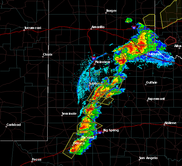 At 519 pm cdt, a severe thunderstorm was located over o`donnell, or 12 miles south of tahoka, moving northeast at 60 mph (radar indicated). Hazards include quarter size hail. damage to vehicles is expected At 519 pm cdt, a severe thunderstorm was located over o`donnell, or 12 miles south of tahoka, moving northeast at 60 mph (radar indicated). Hazards include quarter size hail. damage to vehicles is expected
|
| 5/20/2019 5:12 PM CDT |
 At 512 pm cdt, a severe thunderstorm was located 8 miles northeast of tahoka, moving northeast at 40 mph (radar indicated). Hazards include 60 mph wind gusts and quarter size hail. Hail damage to vehicles is expected. Expect wind damage to roofs, siding, and trees. At 512 pm cdt, a severe thunderstorm was located 8 miles northeast of tahoka, moving northeast at 40 mph (radar indicated). Hazards include 60 mph wind gusts and quarter size hail. Hail damage to vehicles is expected. Expect wind damage to roofs, siding, and trees.
|
| 5/20/2019 4:54 PM CDT |
 At 454 pm cdt, a severe thunderstorm was located 4 miles west of tahoka, moving northeast at 55 mph (radar indicated). Hazards include 60 mph wind gusts and quarter size hail. Hail damage to vehicles is expected. expect wind damage to roofs, siding, and trees. Locations impacted include, lubbock, slaton, tahoka, ransom canyon, caprock, southland, new moore, woodrow, wilson and new home. At 454 pm cdt, a severe thunderstorm was located 4 miles west of tahoka, moving northeast at 55 mph (radar indicated). Hazards include 60 mph wind gusts and quarter size hail. Hail damage to vehicles is expected. expect wind damage to roofs, siding, and trees. Locations impacted include, lubbock, slaton, tahoka, ransom canyon, caprock, southland, new moore, woodrow, wilson and new home.
|
| 5/20/2019 4:43 PM CDT |
 At 443 pm cdt, a severe thunderstorm was located 5 miles north of tahoka, moving northeast at 40 mph (radar indicated). Hazards include ping pong ball size hail and 60 mph wind gusts. People and animals outdoors will be injured. expect hail damage to roofs, siding, windows, and vehicles. expect wind damage to roofs, siding, and trees. Locations impacted include, lubbock, slaton, tahoka, ransom canyon, caprock, southland, new moore, woodrow, wilson and new home. At 443 pm cdt, a severe thunderstorm was located 5 miles north of tahoka, moving northeast at 40 mph (radar indicated). Hazards include ping pong ball size hail and 60 mph wind gusts. People and animals outdoors will be injured. expect hail damage to roofs, siding, windows, and vehicles. expect wind damage to roofs, siding, and trees. Locations impacted include, lubbock, slaton, tahoka, ransom canyon, caprock, southland, new moore, woodrow, wilson and new home.
|
| 5/20/2019 4:22 PM CDT |
 At 422 pm cdt, a severe thunderstorm was located 5 miles northeast of new moore, or 11 miles southwest of tahoka, moving northeast at 40 mph (radar indicated). Hazards include ping pong ball size hail and 60 mph wind gusts. People and animals outdoors will be injured. expect hail damage to roofs, siding, windows, and vehicles. Expect wind damage to roofs, siding, and trees. At 422 pm cdt, a severe thunderstorm was located 5 miles northeast of new moore, or 11 miles southwest of tahoka, moving northeast at 40 mph (radar indicated). Hazards include ping pong ball size hail and 60 mph wind gusts. People and animals outdoors will be injured. expect hail damage to roofs, siding, windows, and vehicles. Expect wind damage to roofs, siding, and trees.
|
| 5/20/2019 4:07 PM CDT |
 At 406 pm cdt, a severe thunderstorm was located near welch, or 16 miles northwest of lamesa, moving northeast at 40 mph (radar indicated). Hazards include quarter size hail. Damage to vehicles is expected. Locations impacted include, tahoka, o`donnell, new moore, wilson and new home. At 406 pm cdt, a severe thunderstorm was located near welch, or 16 miles northwest of lamesa, moving northeast at 40 mph (radar indicated). Hazards include quarter size hail. Damage to vehicles is expected. Locations impacted include, tahoka, o`donnell, new moore, wilson and new home.
|
| 5/20/2019 3:58 PM CDT |
 At 358 pm cdt, a severe thunderstorm was located 5 miles southwest of tahoka, moving northeast at 55 mph (radar indicated). Hazards include quarter size hail. Damage to vehicles is expected. Locations impacted include, tahoka, o`donnell, new moore, wilson and new home. At 358 pm cdt, a severe thunderstorm was located 5 miles southwest of tahoka, moving northeast at 55 mph (radar indicated). Hazards include quarter size hail. Damage to vehicles is expected. Locations impacted include, tahoka, o`donnell, new moore, wilson and new home.
|
| 5/20/2019 3:40 PM CDT |
 At 339 pm cdt, a severe thunderstorm was located 12 miles southwest of slide, or 14 miles northeast of brownfield, moving northeast at 50 mph (radar indicated). Hazards include quarter size hail. Damage to vehicles is expected. Locations impacted include, tahoka, o`donnell, new moore, wilson and new home. At 339 pm cdt, a severe thunderstorm was located 12 miles southwest of slide, or 14 miles northeast of brownfield, moving northeast at 50 mph (radar indicated). Hazards include quarter size hail. Damage to vehicles is expected. Locations impacted include, tahoka, o`donnell, new moore, wilson and new home.
|
| 5/20/2019 3:24 PM CDT |
 At 323 pm cdt, a severe thunderstorm was located 4 miles southeast of new moore, or 15 miles southwest of tahoka, moving northeast at 60 mph (radar indicated). Hazards include quarter size hail. damage to vehicles is expected At 323 pm cdt, a severe thunderstorm was located 4 miles southeast of new moore, or 15 miles southwest of tahoka, moving northeast at 60 mph (radar indicated). Hazards include quarter size hail. damage to vehicles is expected
|
| 5/7/2019 6:14 PM CDT | Numerous power lines snapped. possible tornado crossed roa in lynn county TX, 3.9 miles SSE of Tahoka, TX |
| 5/5/2019 7:02 PM CDT |
 At 702 pm cdt, a severe thunderstorm was located 9 miles west of tahoka, moving southeast at 10 mph. radar is detecting increasing rotation aloft with this storm (radar indicated). Hazards include golf ball size hail. People and animals outdoors will be injured. expect damage to roofs, siding, windows and vehicles. Locations impacted include, tahoka, wilson and new home. At 702 pm cdt, a severe thunderstorm was located 9 miles west of tahoka, moving southeast at 10 mph. radar is detecting increasing rotation aloft with this storm (radar indicated). Hazards include golf ball size hail. People and animals outdoors will be injured. expect damage to roofs, siding, windows and vehicles. Locations impacted include, tahoka, wilson and new home.
|
| 5/5/2019 6:43 PM CDT |
 At 642 pm cdt, a severe thunderstorm was located 7 miles southwest of new home, moving northeast at 15 mph (radar indicated). Hazards include ping pong ball size hail. People and animals outdoors will be injured. Expect damage to roofs, siding, windows and vehicles. At 642 pm cdt, a severe thunderstorm was located 7 miles southwest of new home, moving northeast at 15 mph (radar indicated). Hazards include ping pong ball size hail. People and animals outdoors will be injured. Expect damage to roofs, siding, windows and vehicles.
|
| 5/5/2019 6:40 PM CDT | Tennis Ball sized hail reported 7.1 miles NW of Tahoka, TX, back windshield broken out of car |
| 5/5/2019 6:33 PM CDT | Ping Pong Ball sized hail reported 5.3 miles NW of Tahoka, TX, east of 87 on fm 1313 |
| 5/5/2019 6:29 PM CDT |
 At 629 pm cdt, a severe thunderstorm capable of producing a tornado was located 5 miles southwest of grassland, or 8 miles southeast of tahoka, moving southeast at 15 mph (radar indicated rotation). Hazards include tornado and golf ball size hail. Flying debris will be dangerous to those caught without shelter. mobile homes will be damaged or destroyed. damage to roofs, windows, and vehicles will occur. tree damage is likely. Locations impacted include, tahoka and grassland. At 629 pm cdt, a severe thunderstorm capable of producing a tornado was located 5 miles southwest of grassland, or 8 miles southeast of tahoka, moving southeast at 15 mph (radar indicated rotation). Hazards include tornado and golf ball size hail. Flying debris will be dangerous to those caught without shelter. mobile homes will be damaged or destroyed. damage to roofs, windows, and vehicles will occur. tree damage is likely. Locations impacted include, tahoka and grassland.
|
| 5/5/2019 6:11 PM CDT |
 At 610 pm cdt, a confirmed tornado was located 4 miles east of tahoka, moving southeast at 15 mph. this tornado is wrapped in dust and rain and may be difficult to see. this is a particularly dangerous situation. take cover now! (weather spotters confirmed tornado). Hazards include damaging tornado. You are in a life-threatening situation. flying debris may be deadly to those caught without shelter. mobile homes will be destroyed. Considerable damage to homes, businesses, and vehicles is likely and complete destruction is possible. At 610 pm cdt, a confirmed tornado was located 4 miles east of tahoka, moving southeast at 15 mph. this tornado is wrapped in dust and rain and may be difficult to see. this is a particularly dangerous situation. take cover now! (weather spotters confirmed tornado). Hazards include damaging tornado. You are in a life-threatening situation. flying debris may be deadly to those caught without shelter. mobile homes will be destroyed. Considerable damage to homes, businesses, and vehicles is likely and complete destruction is possible.
|
| 5/5/2019 6:10 PM CDT | Powerlines falling as chaser driving down hwy 380 east of tahoka in rfd winds..seen on chaser video live on tv in lynn county TX, 1.5 miles W of Tahoka, TX |
| 5/5/2019 6:01 PM CDT |
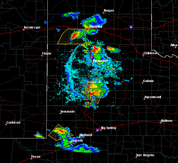 At 600 pm cdt, a confirmed tornado was located 1.5 miles north- northeast of tahoka, moving south-southeast at 35 mph. this is a particularly dangerous situation. take cover now! (weather spotters confirmed tornado). Hazards include damaging tornado. You are in a life-threatening situation. flying debris may be deadly to those caught without shelter. mobile homes will be destroyed. considerable damage to homes, businesses, and vehicles is likely and complete destruction is possible. Locations impacted include, tahoka and grassland. At 600 pm cdt, a confirmed tornado was located 1.5 miles north- northeast of tahoka, moving south-southeast at 35 mph. this is a particularly dangerous situation. take cover now! (weather spotters confirmed tornado). Hazards include damaging tornado. You are in a life-threatening situation. flying debris may be deadly to those caught without shelter. mobile homes will be destroyed. considerable damage to homes, businesses, and vehicles is likely and complete destruction is possible. Locations impacted include, tahoka and grassland.
|
| 5/5/2019 5:58 PM CDT | Storm damage reported in lynn county TX, 3.3 miles SSW of Tahoka, TX |
| 5/5/2019 5:55 PM CDT | Storm damage reported in lynn county TX, 3.3 miles SSW of Tahoka, TX |
| 5/5/2019 5:51 PM CDT |
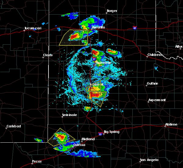 At 551 pm cdt, a confirmed large and extremely dangerous tornado was located over tahoka, moving southeast at 35 mph. this is a particularly dangerous situation. take cover now! (weather spotters confirmed tornado). Hazards include damaging tornado. You are in a life-threatening situation. flying debris may be deadly to those caught without shelter. mobile homes will be destroyed. considerable damage to homes, businesses, and vehicles is likely and complete destruction is possible. Locations impacted include, tahoka and grassland. At 551 pm cdt, a confirmed large and extremely dangerous tornado was located over tahoka, moving southeast at 35 mph. this is a particularly dangerous situation. take cover now! (weather spotters confirmed tornado). Hazards include damaging tornado. You are in a life-threatening situation. flying debris may be deadly to those caught without shelter. mobile homes will be destroyed. considerable damage to homes, businesses, and vehicles is likely and complete destruction is possible. Locations impacted include, tahoka and grassland.
|
| 5/5/2019 5:48 PM CDT |
 At 547 pm cdt, a confirmed tornado was located 7 miles north- northwest of tahoka, moving southeast at 35 mph (weather spotters confirmed tornado). Hazards include damaging tornado and ping pong ball size hail. Flying debris will be dangerous to those caught without shelter. mobile homes will be damaged or destroyed. damage to roofs, windows, and vehicles will occur. Tree damage is likely. At 547 pm cdt, a confirmed tornado was located 7 miles north- northwest of tahoka, moving southeast at 35 mph (weather spotters confirmed tornado). Hazards include damaging tornado and ping pong ball size hail. Flying debris will be dangerous to those caught without shelter. mobile homes will be damaged or destroyed. damage to roofs, windows, and vehicles will occur. Tree damage is likely.
|
| 5/5/2019 5:35 PM CDT |
 At 535 pm cdt, a severe thunderstorm was located 9 miles southeast of slide, or 10 miles north of tahoka, moving southeast at 20 mph (radar indicated). Hazards include golf ball size hail and 60 mph wind gusts. People and animals outdoors will be injured. expect hail damage to roofs, siding, windows, and vehicles. Expect wind damage to roofs, siding, and trees. At 535 pm cdt, a severe thunderstorm was located 9 miles southeast of slide, or 10 miles north of tahoka, moving southeast at 20 mph (radar indicated). Hazards include golf ball size hail and 60 mph wind gusts. People and animals outdoors will be injured. expect hail damage to roofs, siding, windows, and vehicles. Expect wind damage to roofs, siding, and trees.
|
| 5/20/2018 12:11 AM CDT |
 At 1211 am cdt, a severe thunderstorm was located near grassland, or 8 miles southeast of tahoka, moving southeast at 35 mph (radar indicated). Hazards include 60 mph wind gusts and quarter size hail. Hail damage to vehicles is expected. Expect wind damage to roofs, siding, and trees. At 1211 am cdt, a severe thunderstorm was located near grassland, or 8 miles southeast of tahoka, moving southeast at 35 mph (radar indicated). Hazards include 60 mph wind gusts and quarter size hail. Hail damage to vehicles is expected. Expect wind damage to roofs, siding, and trees.
|
| 5/19/2018 11:55 PM CDT | Golf Ball sized hail reported 0.4 miles NW of Tahoka, TX, time of hail estimated |
| 5/19/2018 11:55 PM CDT |
 At 1155 pm cdt, a severe thunderstorm was located near tahoka, moving southeast at 30 mph (radar indicated). Hazards include golf ball size hail and 60 mph wind gusts. People and animals outdoors will be injured. expect hail damage to roofs, siding, windows, and vehicles. expect wind damage to roofs, siding, and trees. Locations impacted include, tahoka. At 1155 pm cdt, a severe thunderstorm was located near tahoka, moving southeast at 30 mph (radar indicated). Hazards include golf ball size hail and 60 mph wind gusts. People and animals outdoors will be injured. expect hail damage to roofs, siding, windows, and vehicles. expect wind damage to roofs, siding, and trees. Locations impacted include, tahoka.
|
| 5/19/2018 11:41 PM CDT |
 At 1141 pm cdt, a severe thunderstorm was located near tahoka, moving southeast at 35 mph (radar indicated). Hazards include two inch hail and 60 mph wind gusts. People and animals outdoors will be injured. expect hail damage to roofs, siding, windows, and vehicles. Expect wind damage to roofs, siding, and trees. At 1141 pm cdt, a severe thunderstorm was located near tahoka, moving southeast at 35 mph (radar indicated). Hazards include two inch hail and 60 mph wind gusts. People and animals outdoors will be injured. expect hail damage to roofs, siding, windows, and vehicles. Expect wind damage to roofs, siding, and trees.
|
| 5/19/2018 11:32 PM CDT |
 At 1132 pm cdt, a severe thunderstorm was located 3 miles west of tahoka, moving southeast at 25 mph (radar indicated). Hazards include two inch hail and 60 mph wind gusts. People and animals outdoors will be injured. expect hail damage to roofs, siding, windows, and vehicles. expect wind damage to roofs, siding, and trees. Locations impacted include, tahoka, wilson and new home. At 1132 pm cdt, a severe thunderstorm was located 3 miles west of tahoka, moving southeast at 25 mph (radar indicated). Hazards include two inch hail and 60 mph wind gusts. People and animals outdoors will be injured. expect hail damage to roofs, siding, windows, and vehicles. expect wind damage to roofs, siding, and trees. Locations impacted include, tahoka, wilson and new home.
|
| 5/19/2018 11:09 PM CDT |
 At 1106 pm, a dangerous severe thunderstorm was located 6 miles southwest of new home, moving east at 10 mph. this is a very dangerous storm! (radar indicated). Hazards include baseball size hail. People and animals outdoors will be severely injured. expect shattered windows, extensive damage to roofs, siding and vehicles. Locations impacted include, tahoka, wilson and new home. At 1106 pm, a dangerous severe thunderstorm was located 6 miles southwest of new home, moving east at 10 mph. this is a very dangerous storm! (radar indicated). Hazards include baseball size hail. People and animals outdoors will be severely injured. expect shattered windows, extensive damage to roofs, siding and vehicles. Locations impacted include, tahoka, wilson and new home.
|
| 5/19/2018 10:50 PM CDT |
 At 1042 pm, a severe thunderstorm was located 11 miles west of new home, moving east at 10 mph (radar indicated). Hazards include half dollar size hail. damage to vehicles is expected At 1042 pm, a severe thunderstorm was located 11 miles west of new home, moving east at 10 mph (radar indicated). Hazards include half dollar size hail. damage to vehicles is expected
|
| 5/19/2018 10:43 PM CDT |
 At 1042 pm, a severe thunderstorm was located 11 miles west of new home, moving east at 10 mph (radar indicated). Hazards include half dollar size hail. damage to vehicles is expected At 1042 pm, a severe thunderstorm was located 11 miles west of new home, moving east at 10 mph (radar indicated). Hazards include half dollar size hail. damage to vehicles is expected
|
| 5/17/2018 6:19 PM CDT | Storm damage reported in lynn county TX, 3.8 miles W of Tahoka, TX |
| 5/15/2018 4:37 PM CDT |
 At 436 pm cdt, severe thunderstorms were located along a line extending from near tahoka to grassland, moving north at 10 mph. a trained spotter reported nickel size hail 7 miles southeast of tahoka at 434 pm (radar indicated). Hazards include golf ball size hail and 70 mph wind gusts. People and animals outdoors will be injured. expect hail damage to roofs, siding, windows, and vehicles. expect considerable tree damage. wind damage is also likely to mobile homes, roofs, and outbuildings. Locations impacted include, tahoka, grassland, southland and wilson. At 436 pm cdt, severe thunderstorms were located along a line extending from near tahoka to grassland, moving north at 10 mph. a trained spotter reported nickel size hail 7 miles southeast of tahoka at 434 pm (radar indicated). Hazards include golf ball size hail and 70 mph wind gusts. People and animals outdoors will be injured. expect hail damage to roofs, siding, windows, and vehicles. expect considerable tree damage. wind damage is also likely to mobile homes, roofs, and outbuildings. Locations impacted include, tahoka, grassland, southland and wilson.
|
| 5/15/2018 4:28 PM CDT |
 At 427 pm cdt, a severe thunderstorm was located near grassland, or 8 miles east of tahoka, moving north at 15 mph. trained storm spotters reported golfball size hail in grassland at 427 pm (trained weather spotters). Hazards include golf ball size hail and 70 mph wind gusts. People and animals outdoors will be injured. expect hail damage to roofs, siding, windows, and vehicles. expect considerable tree damage. wind damage is also likely to mobile homes, roofs, and outbuildings. Locations impacted include, tahoka, grassland, southland and wilson. At 427 pm cdt, a severe thunderstorm was located near grassland, or 8 miles east of tahoka, moving north at 15 mph. trained storm spotters reported golfball size hail in grassland at 427 pm (trained weather spotters). Hazards include golf ball size hail and 70 mph wind gusts. People and animals outdoors will be injured. expect hail damage to roofs, siding, windows, and vehicles. expect considerable tree damage. wind damage is also likely to mobile homes, roofs, and outbuildings. Locations impacted include, tahoka, grassland, southland and wilson.
|
| 5/15/2018 4:25 PM CDT | Golf Ball sized hail reported 12 miles W of Tahoka, TX |
| 5/15/2018 4:14 PM CDT |
 At 413 pm cdt, a severe thunderstorm was located near grassland, or near tahoka, moving north at 15 mph (radar indicated). Hazards include ping pong ball size hail and 60 mph wind gusts. People and animals outdoors will be injured. expect hail damage to roofs, siding, windows, and vehicles. Expect wind damage to roofs, siding, and trees. At 413 pm cdt, a severe thunderstorm was located near grassland, or near tahoka, moving north at 15 mph (radar indicated). Hazards include ping pong ball size hail and 60 mph wind gusts. People and animals outdoors will be injured. expect hail damage to roofs, siding, windows, and vehicles. Expect wind damage to roofs, siding, and trees.
|
| 9/18/2017 7:09 PM CDT |
 The severe thunderstorm warning for southeastern lynn county will expire at 715 pm cdt, the storm which prompted the warning has weakened below severe limits, and no longer poses an immediate threat to life or property. therefore the warning will be allowed to expire. however small hail, gusty winds and heavy rain are still possible with this thunderstorm. The severe thunderstorm warning for southeastern lynn county will expire at 715 pm cdt, the storm which prompted the warning has weakened below severe limits, and no longer poses an immediate threat to life or property. therefore the warning will be allowed to expire. however small hail, gusty winds and heavy rain are still possible with this thunderstorm.
|
| 9/18/2017 6:54 PM CDT |
 At 653 pm cdt, a severe thunderstorm was located near o`donnell, or 9 miles south of tahoka, moving east at 15 mph (radar indicated). Hazards include 60 mph wind gusts and quarter size hail. Hail damage to vehicles is expected. expect wind damage to roofs, siding, and trees. Locations impacted include, o`donnell and grassland. At 653 pm cdt, a severe thunderstorm was located near o`donnell, or 9 miles south of tahoka, moving east at 15 mph (radar indicated). Hazards include 60 mph wind gusts and quarter size hail. Hail damage to vehicles is expected. expect wind damage to roofs, siding, and trees. Locations impacted include, o`donnell and grassland.
|
| 9/18/2017 6:34 PM CDT |
 At 633 pm cdt, a severe thunderstorm was located near o`donnell, or 13 miles southwest of tahoka, moving northeast at 15 mph (radar indicated). Hazards include 60 mph wind gusts and quarter size hail. Hail damage to vehicles is expected. Expect wind damage to roofs, siding, and trees. At 633 pm cdt, a severe thunderstorm was located near o`donnell, or 13 miles southwest of tahoka, moving northeast at 15 mph (radar indicated). Hazards include 60 mph wind gusts and quarter size hail. Hail damage to vehicles is expected. Expect wind damage to roofs, siding, and trees.
|
| 8/22/2017 7:28 PM CDT | Also measured gusts to 58 and 59 mph at 727 pm and 734 respectivel in lynn county TX, 3.3 miles SSW of Tahoka, TX |
| 7/4/2017 10:18 PM CDT |
 At 1017 pm cdt, severe thunderstorms were located along a line extending from near crosbyton to near grassland to new moore to 6 miles west of seagraves, moving southeast at 40 mph (radar indicated). Hazards include 60 mph wind gusts. Expect damage to roofs, siding, and trees. Locations impacted include, brownfield, slaton, post, denver city, tahoka, crosbyton, ralls, lorenzo, ransom canyon, o`donnell, grassland, new moore, cone, caprock, southland, wilson, new home and wellman. At 1017 pm cdt, severe thunderstorms were located along a line extending from near crosbyton to near grassland to new moore to 6 miles west of seagraves, moving southeast at 40 mph (radar indicated). Hazards include 60 mph wind gusts. Expect damage to roofs, siding, and trees. Locations impacted include, brownfield, slaton, post, denver city, tahoka, crosbyton, ralls, lorenzo, ransom canyon, o`donnell, grassland, new moore, cone, caprock, southland, wilson, new home and wellman.
|
| 7/4/2017 10:05 PM CDT |
 At 1004 pm cdt, severe thunderstorms were located along a line extending from 6 miles northwest of caprock to 9 miles southeast of woodrow to near welch to 6 miles southeast of denver city, moving southeast at 30 mph (radar indicated). Hazards include 60 mph wind gusts. Expect damage to roofs, siding, and trees. Locations impacted include, lubbock, brownfield, slaton, post, denver city, tahoka, crosbyton, idalou, ralls, lorenzo, ransom canyon, o`donnell, grassland, new moore, lubbock south plains mall, slide, woodrow, cone, caprock and texas tech university. At 1004 pm cdt, severe thunderstorms were located along a line extending from 6 miles northwest of caprock to 9 miles southeast of woodrow to near welch to 6 miles southeast of denver city, moving southeast at 30 mph (radar indicated). Hazards include 60 mph wind gusts. Expect damage to roofs, siding, and trees. Locations impacted include, lubbock, brownfield, slaton, post, denver city, tahoka, crosbyton, idalou, ralls, lorenzo, ransom canyon, o`donnell, grassland, new moore, lubbock south plains mall, slide, woodrow, cone, caprock and texas tech university.
|
| 7/4/2017 9:52 PM CDT | Storm damage reported in lynn county TX, 3.3 miles SSW of Tahoka, TX |
| 7/4/2017 9:42 PM CDT |
 At 941 pm cdt, severe thunderstorms were located along a line extending from near idalou to near slide to 6 miles southwest of brownfield to near denver city, moving southeast at 30 mph (radar indicated). Hazards include 60 mph wind gusts and penny size hail. expect damage to roofs, siding, and trees At 941 pm cdt, severe thunderstorms were located along a line extending from near idalou to near slide to 6 miles southwest of brownfield to near denver city, moving southeast at 30 mph (radar indicated). Hazards include 60 mph wind gusts and penny size hail. expect damage to roofs, siding, and trees
|
| 7/1/2017 2:51 AM CDT |
 At 251 am cdt, a severe thunderstorm was located near tahoka, moving east at 15 mph (radar indicated). Hazards include 60 mph wind gusts and quarter size hail. Hail damage to vehicles is expected. Expect wind damage to roofs, siding, and trees. At 251 am cdt, a severe thunderstorm was located near tahoka, moving east at 15 mph (radar indicated). Hazards include 60 mph wind gusts and quarter size hail. Hail damage to vehicles is expected. Expect wind damage to roofs, siding, and trees.
|
| 7/1/2017 2:23 AM CDT |
 At 222 am cdt, a severe thunderstorm was located near lubbock, and moving east at 40 mph (radar indicated). Hazards include 70 mph wind gusts and quarter size hail. Hail damage to vehicles is expected. expect considerable tree damage. wind damage is also likely to mobile homes, roofs, and outbuildings. Locations impacted include, lubbock, tahoka, wolfforth, shallowater, idalou, lubbock south plains mall, texas tech university, lubbock international airport, slide, downtown lubbock, woodrow, reese center, new deal, ropesville, new home and lubbock science spectrum. At 222 am cdt, a severe thunderstorm was located near lubbock, and moving east at 40 mph (radar indicated). Hazards include 70 mph wind gusts and quarter size hail. Hail damage to vehicles is expected. expect considerable tree damage. wind damage is also likely to mobile homes, roofs, and outbuildings. Locations impacted include, lubbock, tahoka, wolfforth, shallowater, idalou, lubbock south plains mall, texas tech university, lubbock international airport, slide, downtown lubbock, woodrow, reese center, new deal, ropesville, new home and lubbock science spectrum.
|
| 7/1/2017 1:58 AM CDT |
 At 157 am cdt, a severe thunderstorm was located 9 miles northeast of locketville, or 12 miles southeast of levelland, moving east at 55 mph. this is a very dangerous storm (radar indicated). Hazards include 80 mph wind gusts and quarter size hail. Flying debris will be dangerous to those caught without shelter. mobile homes will be heavily damaged. expect considerable damage to roofs, windows, and vehicles. Extensive tree damage and power outages are likely. At 157 am cdt, a severe thunderstorm was located 9 miles northeast of locketville, or 12 miles southeast of levelland, moving east at 55 mph. this is a very dangerous storm (radar indicated). Hazards include 80 mph wind gusts and quarter size hail. Flying debris will be dangerous to those caught without shelter. mobile homes will be heavily damaged. expect considerable damage to roofs, windows, and vehicles. Extensive tree damage and power outages are likely.
|
| 6/26/2017 2:27 AM CDT |
 At 227 am cdt, severe thunderstorms were located along a line extending from 10 miles north of tahoka to near new moore, moving south at 40 mph (radar indicated). Hazards include 60 mph wind gusts. Expect damage to roofs, siding, and trees. Locations impacted include, tahoka, o`donnell, new moore and wilson. At 227 am cdt, severe thunderstorms were located along a line extending from 10 miles north of tahoka to near new moore, moving south at 40 mph (radar indicated). Hazards include 60 mph wind gusts. Expect damage to roofs, siding, and trees. Locations impacted include, tahoka, o`donnell, new moore and wilson.
|
| 6/26/2017 2:12 AM CDT |
 At 212 am cdt, a severe thunderstorm was located 7 miles northwest of tahoka, moving south at 40 mph (radar indicated). Hazards include 60 mph wind gusts. expect damage to roofs, siding, and trees At 212 am cdt, a severe thunderstorm was located 7 miles northwest of tahoka, moving south at 40 mph (radar indicated). Hazards include 60 mph wind gusts. expect damage to roofs, siding, and trees
|
| 6/26/2017 2:05 AM CDT |
 At 205 am cdt, severe thunderstorms were located along a line extending from near woodrow to near welch, moving southeast at 45 mph (radar indicated). Hazards include 60 mph wind gusts. Expect damage to roofs, siding, and trees. Locations impacted include, lubbock, brownfield, slaton, tahoka, idalou, ransom canyon, o`donnell, grassland, new moore, lubbock south plains mall, texas tech university, lubbock international airport, slide, downtown lubbock, woodrow, wilson, new home and lubbock science spectrum. At 205 am cdt, severe thunderstorms were located along a line extending from near woodrow to near welch, moving southeast at 45 mph (radar indicated). Hazards include 60 mph wind gusts. Expect damage to roofs, siding, and trees. Locations impacted include, lubbock, brownfield, slaton, tahoka, idalou, ransom canyon, o`donnell, grassland, new moore, lubbock south plains mall, texas tech university, lubbock international airport, slide, downtown lubbock, woodrow, wilson, new home and lubbock science spectrum.
|
| 6/26/2017 1:48 AM CDT |
 At 148 am cdt, severe thunderstorms were located along a line extending from near lubbock south plains mall to 8 miles northeast of loop, moving southeast at 45 mph (radar indicated). Hazards include 70 mph wind gusts. Expect considerable tree damage. Damage is likely to mobile homes, roofs, and outbuildings. At 148 am cdt, severe thunderstorms were located along a line extending from near lubbock south plains mall to 8 miles northeast of loop, moving southeast at 45 mph (radar indicated). Hazards include 70 mph wind gusts. Expect considerable tree damage. Damage is likely to mobile homes, roofs, and outbuildings.
|
| 6/15/2017 5:58 PM CDT |
 At 557 pm cdt, a severe thunderstorm was located 8 miles southwest of tahoka, moving southeast at 25 mph (radar indicated). Hazards include 60 mph wind gusts and quarter size hail. Hail damage to vehicles is expected. expect wind damage to roofs, siding, and trees. Locations impacted include, tahoka, o`donnell and new moore. At 557 pm cdt, a severe thunderstorm was located 8 miles southwest of tahoka, moving southeast at 25 mph (radar indicated). Hazards include 60 mph wind gusts and quarter size hail. Hail damage to vehicles is expected. expect wind damage to roofs, siding, and trees. Locations impacted include, tahoka, o`donnell and new moore.
|
| 6/15/2017 5:40 PM CDT |
 At 540 pm cdt, a severe thunderstorm was located 9 miles north of new moore, or 10 miles west of tahoka, moving southeast at 25 mph (radar indicated). Hazards include 60 mph wind gusts and quarter size hail. Hail damage to vehicles is expected. Expect wind damage to roofs, siding, and trees. At 540 pm cdt, a severe thunderstorm was located 9 miles north of new moore, or 10 miles west of tahoka, moving southeast at 25 mph (radar indicated). Hazards include 60 mph wind gusts and quarter size hail. Hail damage to vehicles is expected. Expect wind damage to roofs, siding, and trees.
|
| 4/16/2017 9:36 PM CDT |
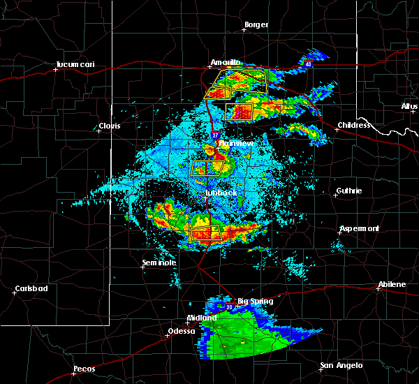 At 935 pm cdt, a severe thunderstorm was located near tahoka, moving east at 20 mph (radar indicated). Hazards include 60 mph wind gusts and quarter size hail. Hail damage to vehicles is expected. expect wind damage to roofs, siding, and trees. Locations impacted include, tahoka. At 935 pm cdt, a severe thunderstorm was located near tahoka, moving east at 20 mph (radar indicated). Hazards include 60 mph wind gusts and quarter size hail. Hail damage to vehicles is expected. expect wind damage to roofs, siding, and trees. Locations impacted include, tahoka.
|
| 4/16/2017 9:16 PM CDT |
 At 915 pm cdt, a severe thunderstorm was located 8 miles north of new moore, or 11 miles west of tahoka, moving east at 20 mph (radar indicated). Hazards include 60 mph wind gusts and quarter size hail. Hail damage to vehicles is expected. Expect wind damage to roofs, siding, and trees. At 915 pm cdt, a severe thunderstorm was located 8 miles north of new moore, or 11 miles west of tahoka, moving east at 20 mph (radar indicated). Hazards include 60 mph wind gusts and quarter size hail. Hail damage to vehicles is expected. Expect wind damage to roofs, siding, and trees.
|
| 5/30/2016 9:03 PM CDT | Half Dollar sized hail reported 0.4 miles NW of Tahoka, TX, reported on the north side of town via spotter |
| 5/30/2016 8:57 PM CDT |
 At 855 pm cdt, a severe thunderstorm was located along u.s. highway 87 about 6 miles north of tahoka, moving northeast at 20 mph (radar indicated). Hazards include 60 mph wind gusts and half dollar size hail. Hail damage to vehicles is expected. expect wind damage to roofs, siding and trees. Locations impacted include, tahoka and wilson. At 855 pm cdt, a severe thunderstorm was located along u.s. highway 87 about 6 miles north of tahoka, moving northeast at 20 mph (radar indicated). Hazards include 60 mph wind gusts and half dollar size hail. Hail damage to vehicles is expected. expect wind damage to roofs, siding and trees. Locations impacted include, tahoka and wilson.
|
| 5/30/2016 8:47 PM CDT | Quarter sized hail reported 0.4 miles NW of Tahoka, TX |
| 5/30/2016 8:40 PM CDT |
 At 840 pm cdt, a severe thunderstorm was located over tahoka, moving northeast at 20 mph (radar indicated). Hazards include 60 mph wind gusts and quarter size hail. Hail damage to vehicles is expected. Expect wind damage to roofs, siding and trees. At 840 pm cdt, a severe thunderstorm was located over tahoka, moving northeast at 20 mph (radar indicated). Hazards include 60 mph wind gusts and quarter size hail. Hail damage to vehicles is expected. Expect wind damage to roofs, siding and trees.
|
| 5/22/2016 5:10 PM CDT | Baseball sized hail reported 12.5 miles WNW of Tahoka, TX |
| 5/13/2016 7:11 PM CDT | Reported by west texas mesonet. severe winds from 711-715 pm with peak gust 65 mp in lynn county TX, 3.3 miles SSW of Tahoka, TX |
| 4/21/2016 1:31 AM CDT |
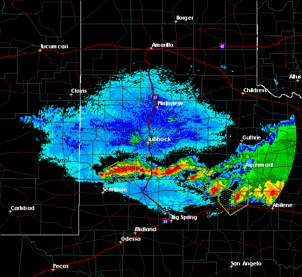 At 131 am cdt, severe thunderstorms were located along a line extending from new moore to near o`donnell to 8 miles south of grassland, moving south at 15 mph (radar indicated). Hazards include ping pong ball size hail. People and animals outdoors will be injured. Expect damage to roofs, siding, windows and vehicles. At 131 am cdt, severe thunderstorms were located along a line extending from new moore to near o`donnell to 8 miles south of grassland, moving south at 15 mph (radar indicated). Hazards include ping pong ball size hail. People and animals outdoors will be injured. Expect damage to roofs, siding, windows and vehicles.
|
| 6/12/2015 8:58 PM CDT |
 At 857 pm cdt, a severe thunderstorm was located 8 miles east of brownfield, moving southeast at 35 mph (radar indicated). Hazards include 60 mph wind gusts and half dollar size hail. Hail damage to vehicles is expected. Expect wind damage to roofs, siding and trees. At 857 pm cdt, a severe thunderstorm was located 8 miles east of brownfield, moving southeast at 35 mph (radar indicated). Hazards include 60 mph wind gusts and half dollar size hail. Hail damage to vehicles is expected. Expect wind damage to roofs, siding and trees.
|
| 6/12/2015 7:44 PM CDT |
 At 744 pm cdt, a severe thunderstorm was located 10 miles west of slide, or 16 miles northeast of brownfield, moving east at 15 mph. this storm has a history of producing baseball size hail and a funnel cloud. this is a very dangerous storm (radar indicated). Hazards include three inch hail and 70 mph wind gusts. People and animals outdoors will be severely injured. Expect shattered windows, extensive damage to roofs, siding and vehicles. At 744 pm cdt, a severe thunderstorm was located 10 miles west of slide, or 16 miles northeast of brownfield, moving east at 15 mph. this storm has a history of producing baseball size hail and a funnel cloud. this is a very dangerous storm (radar indicated). Hazards include three inch hail and 70 mph wind gusts. People and animals outdoors will be severely injured. Expect shattered windows, extensive damage to roofs, siding and vehicles.
|
| 6/12/2015 7:36 PM CDT | Quarter sized hail reported 14.9 miles SE of Tahoka, TX, on 211 |
| 6/12/2015 7:26 PM CDT |
 At 725 pm cdt, a severe thunderstorm was located 11 miles east of brownfield, moving northeast at 25 mph. this is a very dangerous storm (radar indicated). Hazards include baseball size hail and 70 mph wind gusts. People and animals outdoors will be severely injured. expect shattered windows, extensive damage to roofs, siding and vehicles. locations impacted include, brownfield, tahoka and new moore. A tornado watch remains in effect until 1000 pm cdt for northwestern texas. At 725 pm cdt, a severe thunderstorm was located 11 miles east of brownfield, moving northeast at 25 mph. this is a very dangerous storm (radar indicated). Hazards include baseball size hail and 70 mph wind gusts. People and animals outdoors will be severely injured. expect shattered windows, extensive damage to roofs, siding and vehicles. locations impacted include, brownfield, tahoka and new moore. A tornado watch remains in effect until 1000 pm cdt for northwestern texas.
|
| 6/12/2015 7:13 PM CDT |
 At 713 pm cdt, a severe thunderstorm was located 9 miles east of brownfield, moving northeast at 25 mph (radar indicated). Hazards include two inch hail. People and animals outdoors will be injured. Expect damage to roofs, siding, windows and vehicles. At 713 pm cdt, a severe thunderstorm was located 9 miles east of brownfield, moving northeast at 25 mph (radar indicated). Hazards include two inch hail. People and animals outdoors will be injured. Expect damage to roofs, siding, windows and vehicles.
|
| 5/28/2015 3:00 PM CDT | At 259 pm cdt, a severe thunderstorm was located near tahoka, moving northeast at 35 mph. a trained spotter reported quarter size hail 10 miles west of tahoka (trained weather spotters). Hazards include half dollar size hail and 60 mph wind gusts. Hail damage to vehicles is expected. expect wind damage to roofs, siding and trees. locations impacted include, lubbock, tahoka, wolfforth, woodrow, slide, wilson and new home. A tornado watch remains in effect until 800 pm cdt for northwestern texas. |
| 5/28/2015 2:50 PM CDT | Quarter sized hail reported 10.1 miles E of Tahoka, TX |
| 5/28/2015 2:35 PM CDT | At 234 pm cdt, a severe thunderstorm was located near new moore, or 11 miles southeast of brownfield, moving northeast at 30 mph (radar indicated). Hazards include ping pong ball size hail and 60 mph wind gusts. People and animals outdoors will be injured. expect hail damage to roofs, siding, windows and vehicles. Expect wind damage to roofs, siding and trees. |
| 5/23/2015 5:57 PM CDT | The severe thunderstorm warning for southeastern lynn county will expire at 600 pm cdt, the storm which prompted the warning has weakened below severe limits and exited the warned area. therefore the warning will be allowed to expire. however gusty winds to 50 mph, small hail and heavy rain are still possible with this thunderstorm. a tornado watch remains in effect until 200 am cdt for northwestern texas. |
| 5/23/2015 5:44 PM CDT | At 544 pm cdt, a severe thunderstorm was located near grassland, or 9 miles east of tahoka, moving northeast at 40 mph (radar indicated). Hazards include quarter size hail and 60 mph wind gusts. Hail damage to vehicles is expected. expect wind damage to roofs, siding and trees. locations impacted include, tahoka and grassland. A tornado watch remains in effect until 200 am cdt for northwestern texas. |
| 5/23/2015 5:30 PM CDT | At 529 pm cdt, a severe thunderstorm was located near o`donnell, or 11 miles south of tahoka, moving northeast at 35 mph. at 520 pm a wind gust to 55 mph was recorded by the o`donnell west texas mesonet (radar indicated). Hazards include quarter size hail and 60 mph wind gusts. Hail damage to vehicles is expected. expect wind damage to roofs, siding and trees. locations impacted include, tahoka, o`donnell and grassland. a tornado watch remains in effect until 700 pm cdt for northwestern texas. A tornado watch also remains in effect until 200 am cdt for northwestern texas. |
| 5/23/2015 5:13 PM CDT | At 512 pm cdt, a severe thunderstorm was located over o`donnell, or 14 miles south of tahoka, moving north at 30 mph (radar indicated). Hazards include 60 mph wind gusts and quarter size hail. Hail damage to vehicles is expected. Expect wind damage to roofs, siding and trees. |
| 5/19/2015 8:05 AM CDT | At 805 am cdt, a severe thunderstorm was located near new moore, or 10 miles southwest of tahoka, moving northeast at 25 mph (radar indicated). Hazards include quarter size hail and 60 mph wind gusts. Hail damage to vehicles is expected. expect wind damage to roofs, siding and trees. locations impacted include, tahoka, o`donnell and new moore. 1. 00in. |
| 5/19/2015 7:54 AM CDT | At 753 am cdt, a severe thunderstorm was located over new moore, or 15 miles southwest of tahoka, moving northeast at 25 mph (radar indicated). Hazards include ping pong size hail and 60 mph wind gusts. People and animals outdoors will be injured. expect hail damage to roofs, siding, windows and vehicles. expect wind damage to roofs, siding and trees. locations impacted include, tahoka, o`donnell and new moore. 1. 50in. |
| 5/19/2015 7:46 AM CDT | At 746 am cdt, a severe thunderstorm was located over new moore, or 17 miles north of lamesa, moving northeast at 25 mph (radar indicated). Hazards include ping pong size hail and 60 mph wind gusts. People and animals outdoors will be injured. expect hail damage to roofs, siding, windows and vehicles. expect wind damage to roofs, siding and trees. locations impacted include, tahoka, o`donnell and new moore. 1. 50in. |
| 5/19/2015 7:39 AM CDT | At 738 am cdt, a severe thunderstorm was located over pride, or 15 miles northwest of lamesa, moving northeast at 25 mph (radar indicated). Hazards include 60 mph wind gusts and half dollar size hail. Hail damage to vehicles is expected. Expect wind damage to roofs, siding and trees. |
| 4/16/2015 8:23 PM CDT | A severe thunderstorm warning remains in effect until 845 pm cdt for northeastern lynn county, 817 pm cdt, trained weather spotters reported ping-pong sized hail in tahoka. at 822 pm cdt, a severe thunderstorm was located near tahoka, moving north at 40 mph (trained weather spotters). Hazards include ping pong size hail. People and animals outdoors will be injured. expect damage to roofs, siding, windows and vehicles. locations impacted include, tahoka, wilson and new home. 1. 50in. |
| 4/16/2015 8:17 PM CDT | Ping Pong Ball sized hail reported 0.4 miles NW of Tahoka, TX, half dollar to ping pong ball size. |
| 4/16/2015 8:14 PM CDT | At 813 pm cdt, a severe thunderstorm was located 2 miles south of tahoka, moving north at 40 mph (radar indicated). Hazards include ping pong ball size hail. People and animals outdoors will be injured. Expect damage to roofs, siding, windows and vehicles. |
| 4/8/2015 7:38 PM CDT | A severe thunderstorm warning remains in effect until 745 pm cdt for central lubbock and central lynn counties. at 737 pm cdt. a line of severe thunderstorms were located from lorenzo. to near o`donnell. moving east at 40 mph. hazard. 60 mph wind gusts and penny size hail. source. Radar indicated. |
| 4/8/2015 7:34 PM CDT | The national weather service in lubbock has issued a * severe thunderstorm warning for. garza county in northwestern texas. eastern lynn county in northwestern texas. until 815 pm cdt * at 733 pm cdt. Severe thunderstorms were located along a line. |
| 4/8/2015 7:30 PM CDT | Reported by lynn county sheriffs offic in lynn county TX, 0.4 miles NW of Tahoka, TX |
| 4/8/2015 7:28 PM CDT | A severe thunderstorm warning remains in effect until 745 pm cdt for lubbock and lynn counties. at 726 pm cdt. a line of severe thunderstorms were located from near idalou. or 13 miles northeast of lubbock. to near o`donnell. moving east at 50 mph. hazard. 70 mph wind gusts and penny size hail. |
| 4/8/2015 7:18 PM CDT | A severe thunderstorm warning remains in effect until 745 pm cdt for eastern hockley. eastern terry. lubbock and lynn counties. at 714 pm cdt. a line of severe thunderstorms were located from near reese center to 5 miles west of o`donnell. moving east at 50 mph. hazard. 80 mph wind gusts and penny size hail. |
| 4/8/2015 7:08 PM CDT | The national weather service in lubbock has issued a * severe thunderstorm warning for. eastern hockley county in northwestern texas. terry county in northwestern texas. lubbock county in northwestern texas. Lynn county in northwestern texas. |
| 6/8/2014 12:25 AM CDT | Storm damage reported in lynn county TX, 2.9 miles SSW of Tahoka, TX |
| 6/8/2014 12:15 AM CDT | Storm damage reported in lynn county TX, 2.9 miles SSW of Tahoka, TX |
| 6/17/2013 8:02 PM CDT | Quarter sized hail reported 0.4 miles NW of Tahoka, TX, quarter sized hail reported byco-op observer |
| 6/5/2013 11:00 PM CDT | Storm damage reported in lynn county TX, 2.9 miles SSW of Tahoka, TX |
| 5/23/2013 7:25 PM CDT | Trained spotter measured 53kt wind gust associated with outflow winds in tahoka in lynn county TX, 0.4 miles NW of Tahoka, TX |
| 4/30/2013 5:45 PM CDT | Power poles snapped 1.5 miles east of west point. time estimate in lynn county TX, 11.8 miles E of Tahoka, TX |
| 4/29/2012 11:49 PM CDT | Golf Ball sized hail reported 0.4 miles NW of Tahoka, TX, golfball hail reported in tahoka. |
| 4/29/2012 11:15 PM CDT | Hen Egg sized hail reported 0.4 miles NW of Tahoka, TX |
| 4/29/2012 11:12 PM CDT | Golf Ball sized hail reported 0.4 miles NW of Tahoka, TX |
| 4/29/2012 10:17 PM CDT | Golf Ball sized hail reported 16.9 miles SE of Tahoka, TX, 179 and 211 |
| 1/1/0001 12:00 AM | Quarter sized hail reported 0.5 miles SSE of Tahoka, TX |
Hail Maps for Tahoka, TX


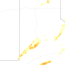
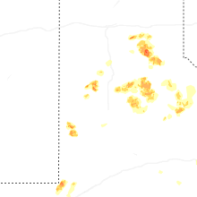


Connect with Interactive Hail Maps