

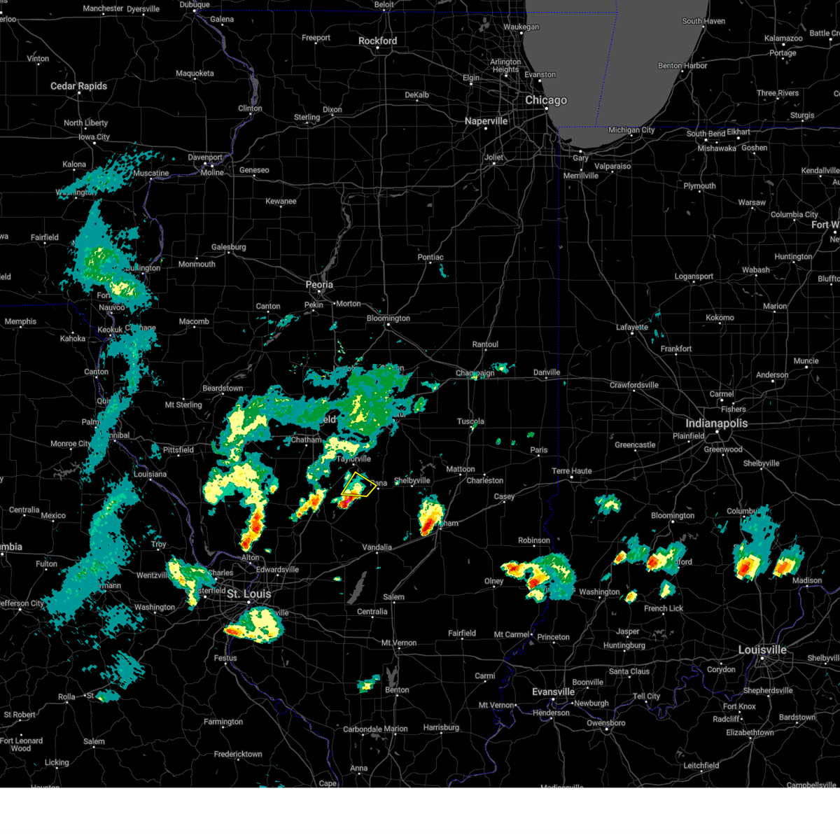
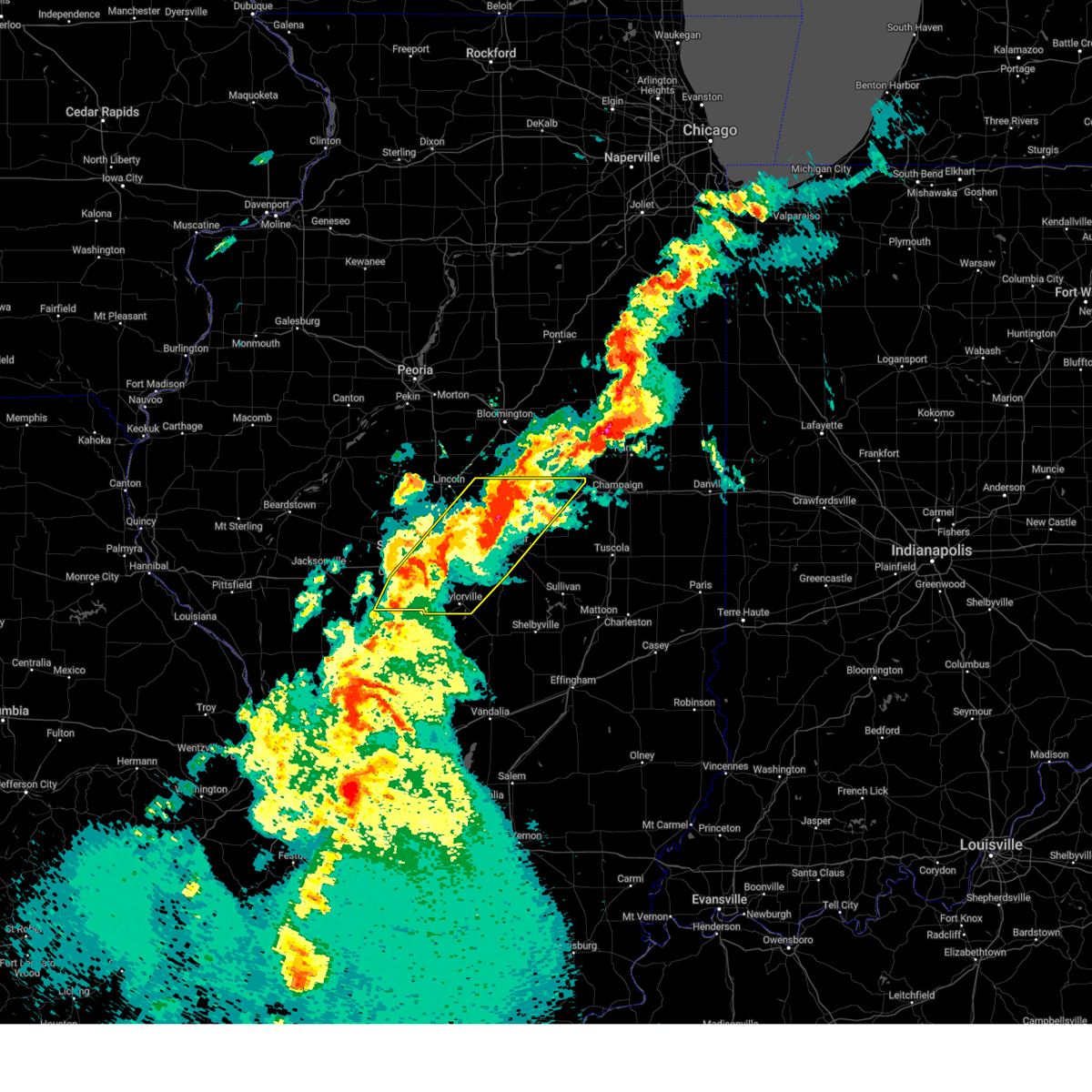
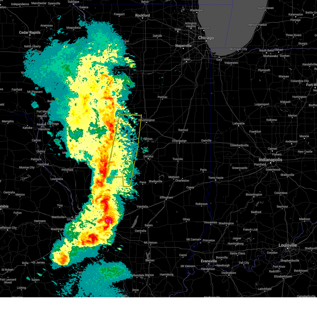
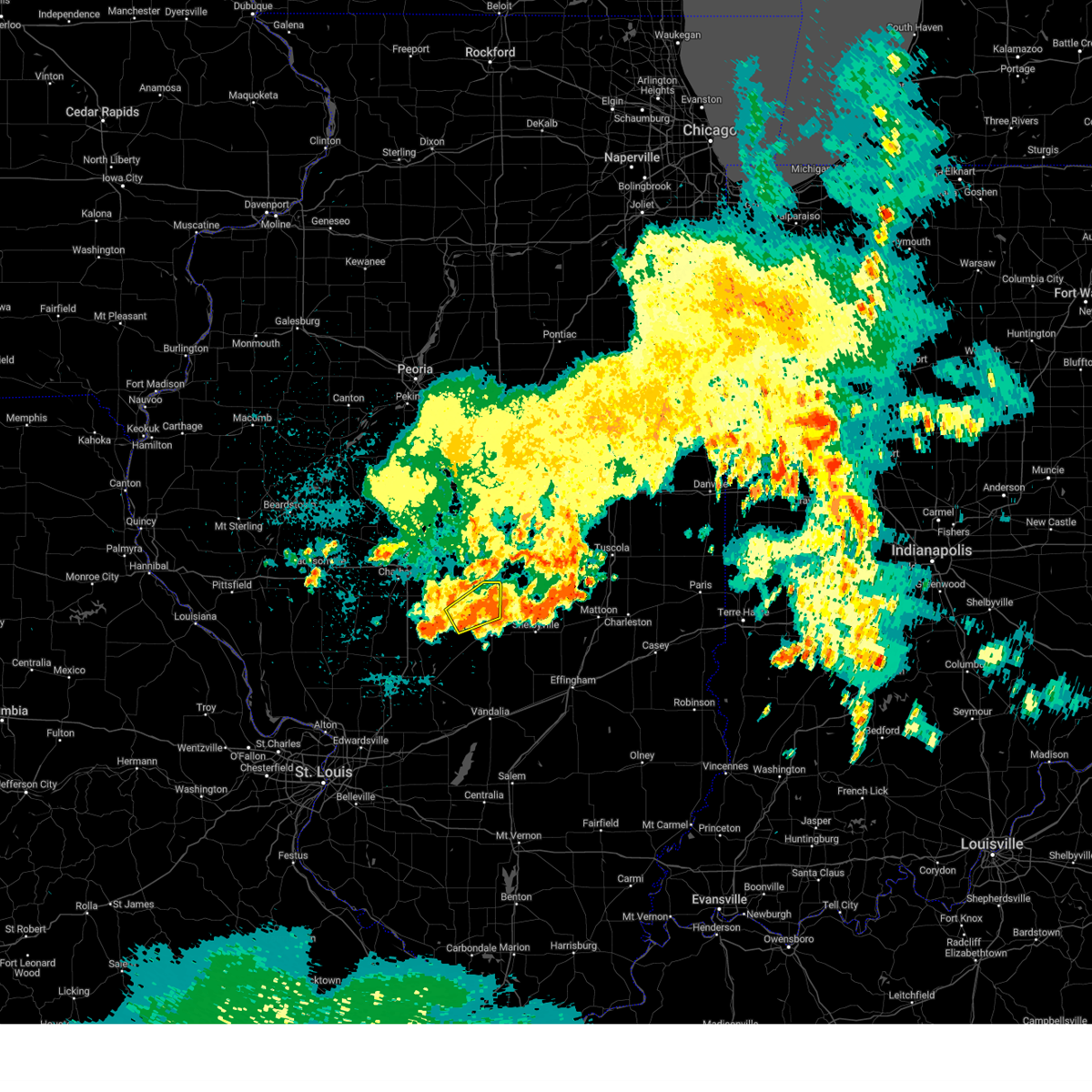
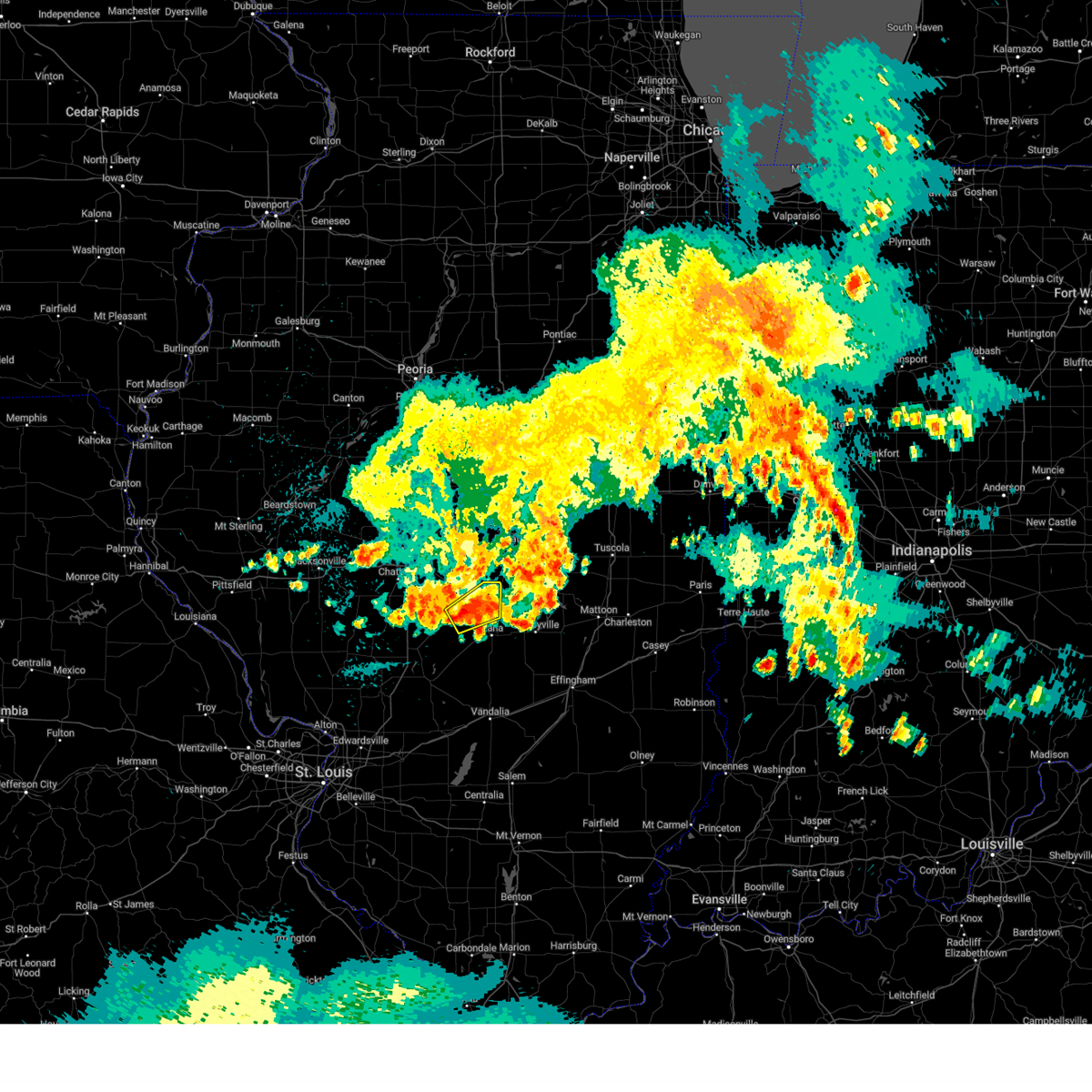
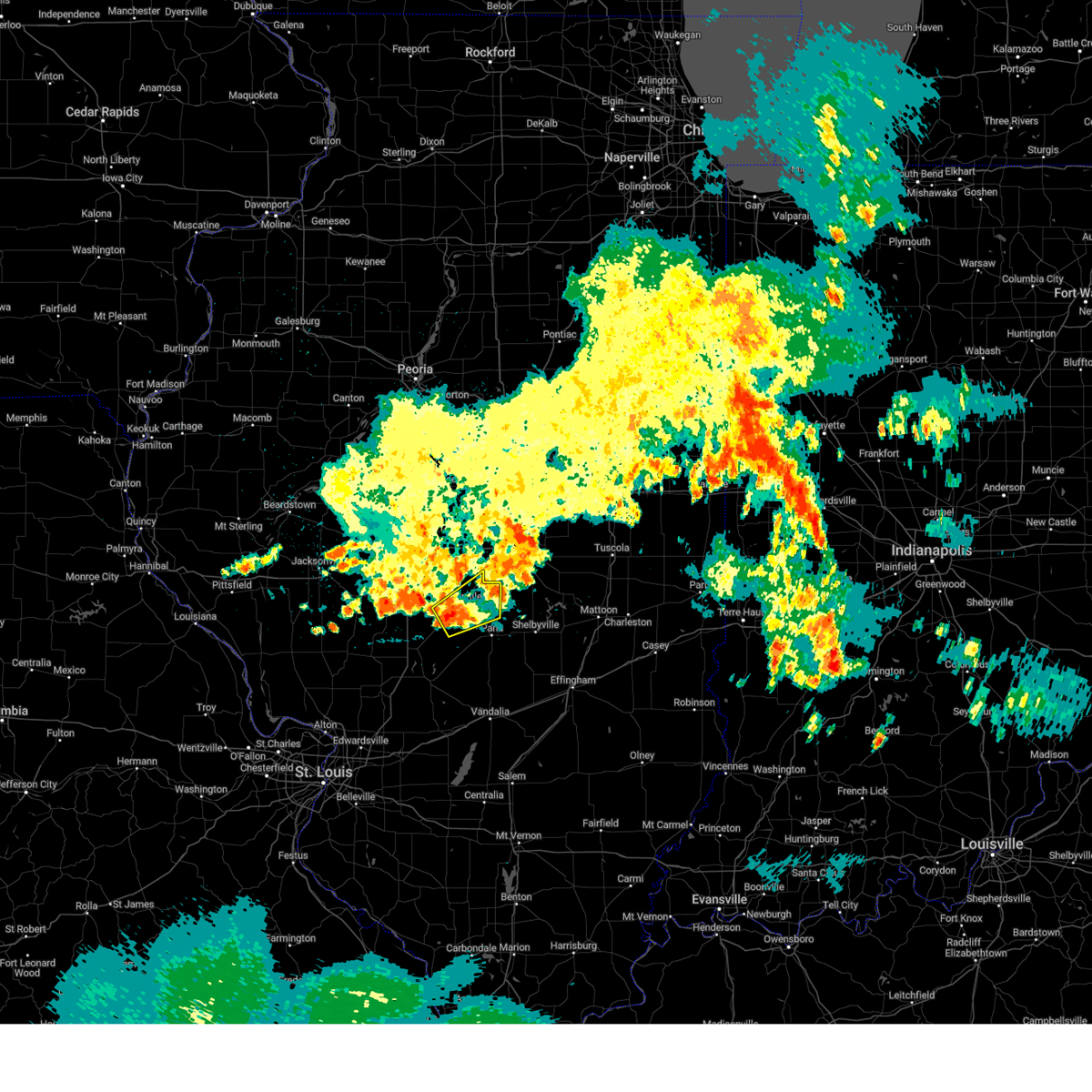
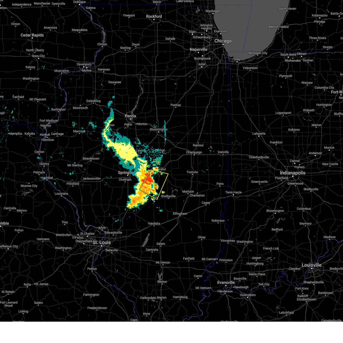
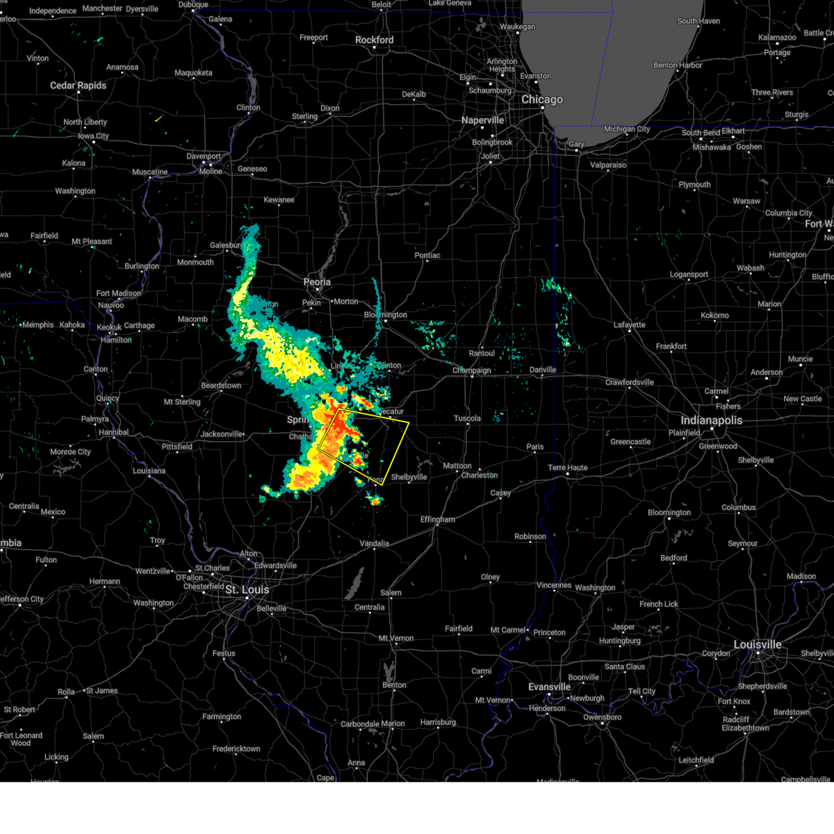
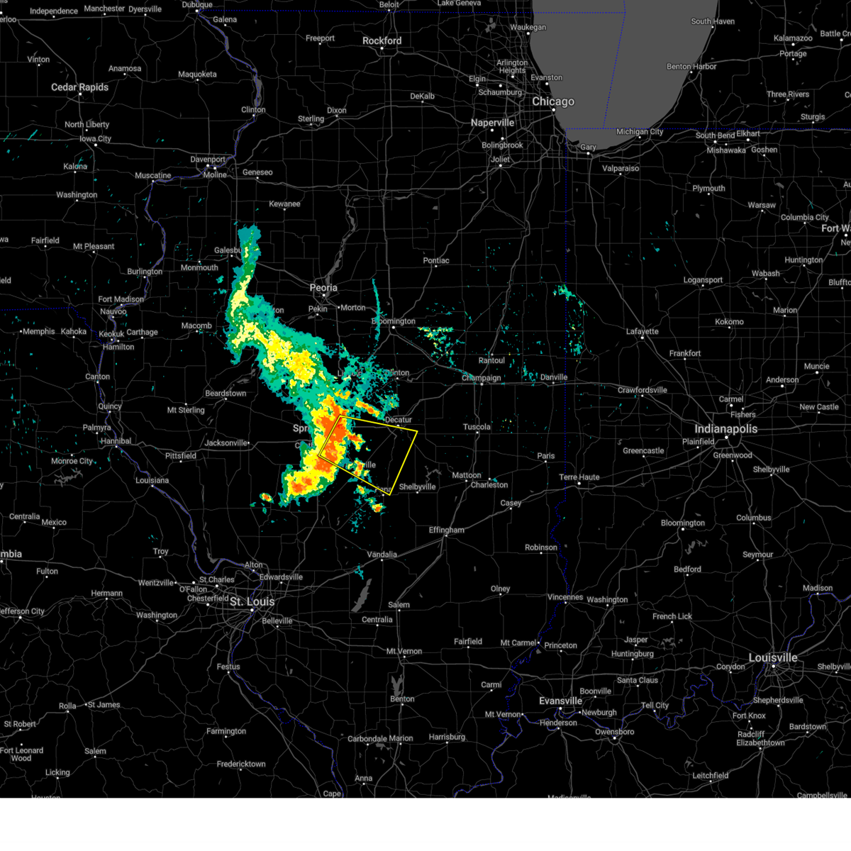
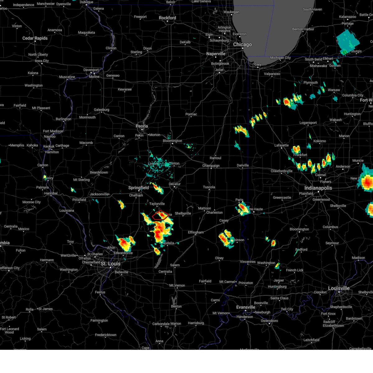
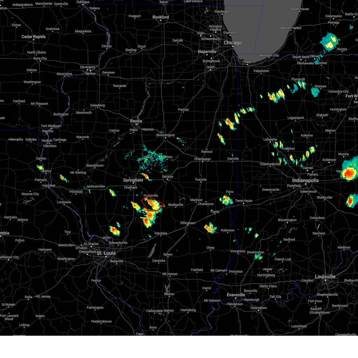
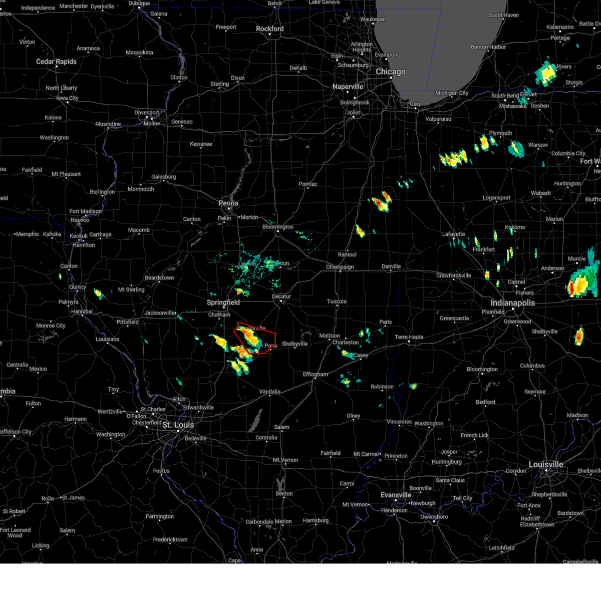
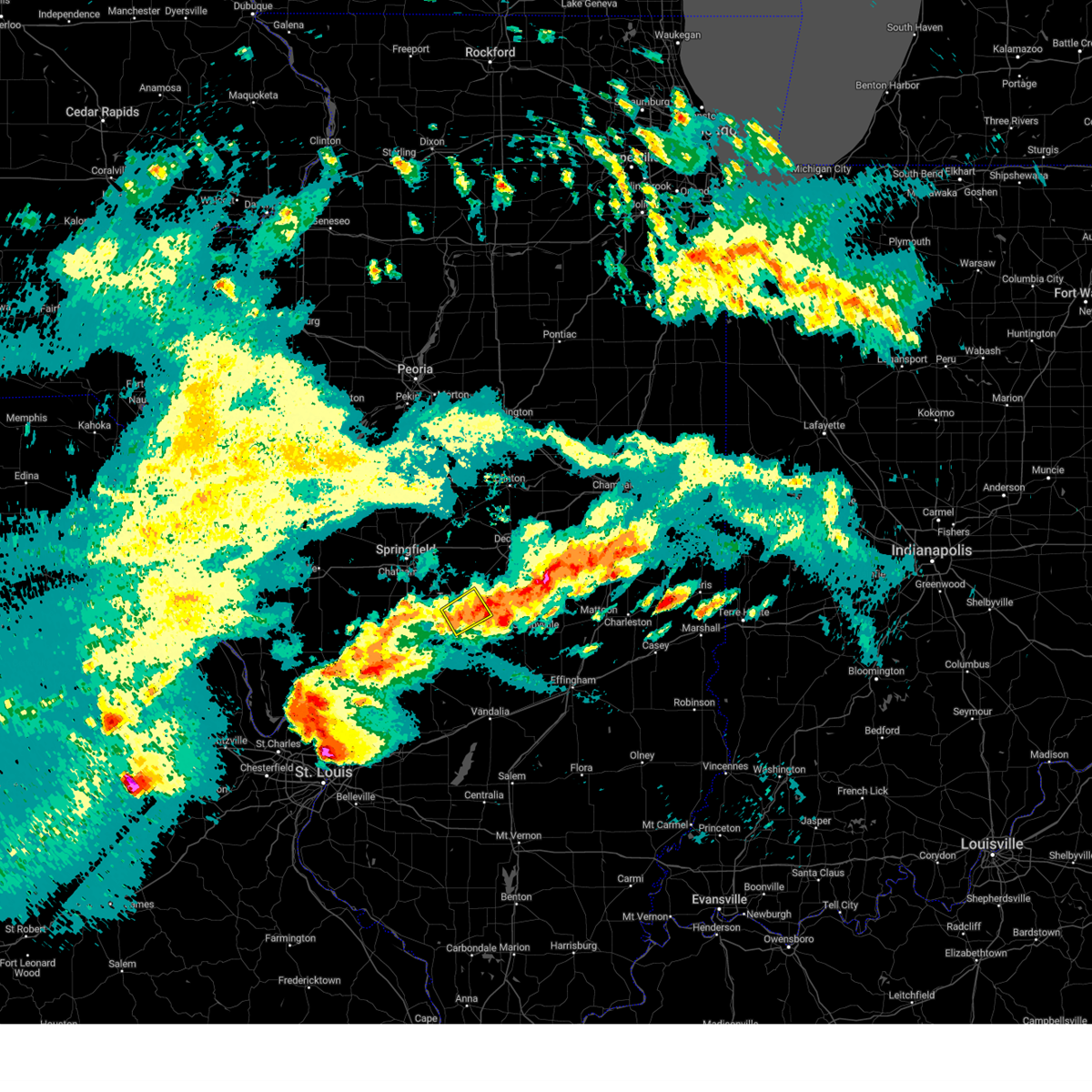
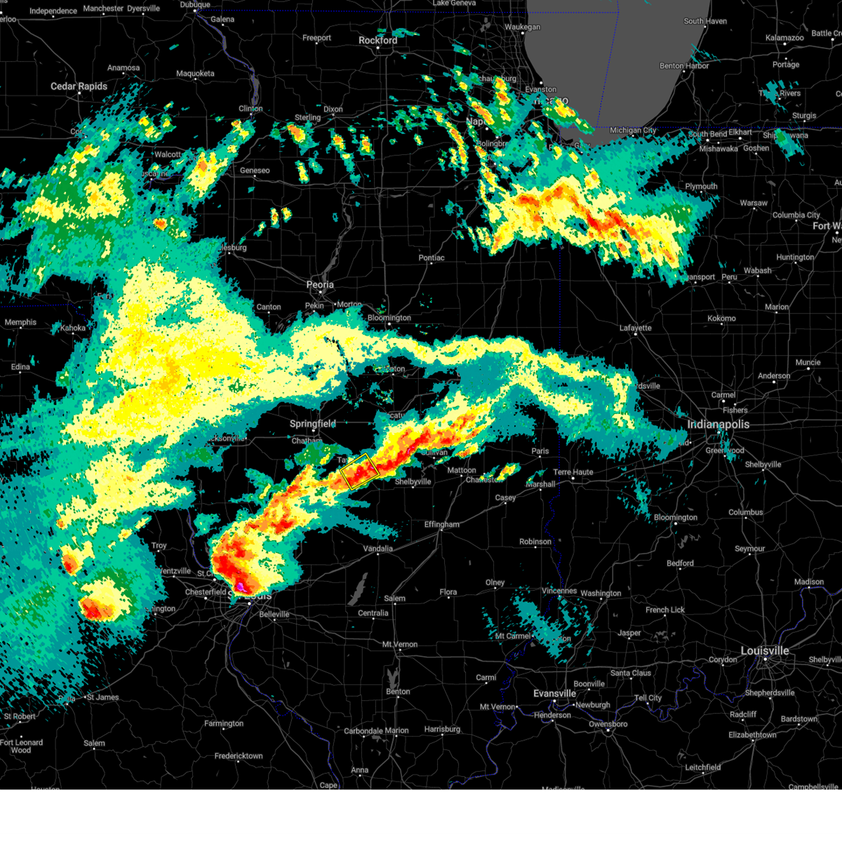
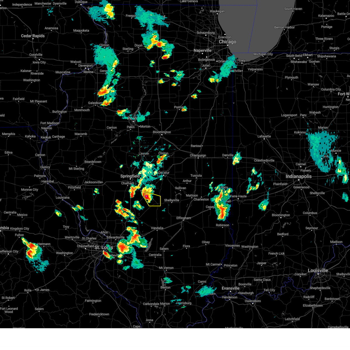
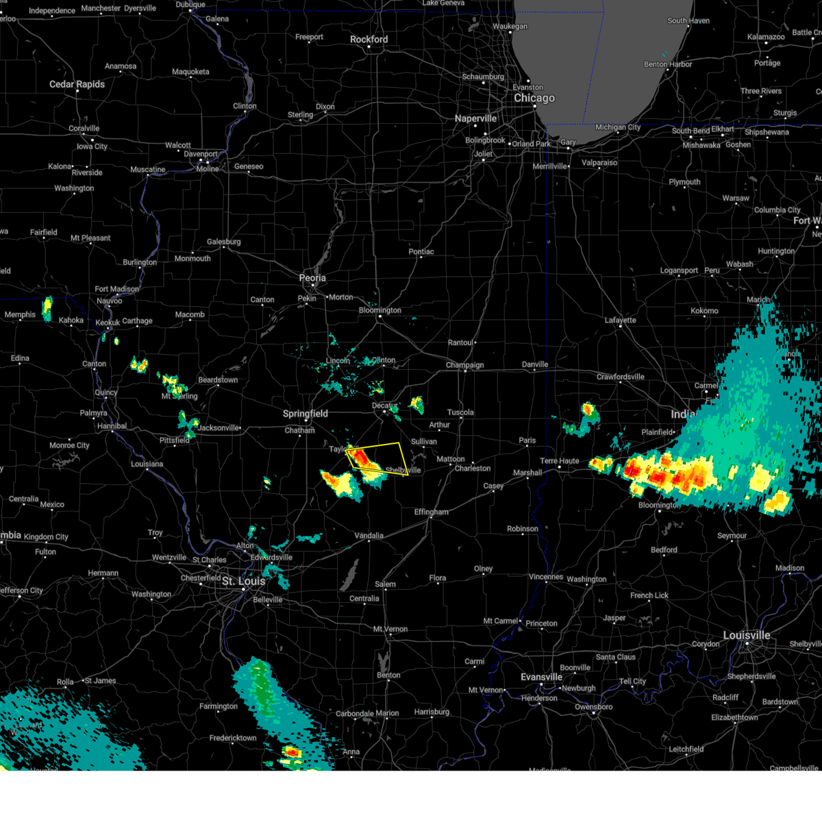
Hail Map for Taylorville, IL
The Taylorville, IL area has had 19 reports of on-the-ground hail by trained spotters, and has been under severe weather warnings 23 times during the past 12 months. Doppler radar has detected hail at or near Taylorville, IL on 84 occasions, including 4 occasions during the past year.
| Name: | Taylorville, IL |
| Where Located: | 48.4 miles W of Mattoon, IL |
| Map: | Google Map for Taylorville, IL |
| Population: | 11246 |
| Housing Units: | 5422 |
| More Info: | Search Google for Taylorville, IL |
1
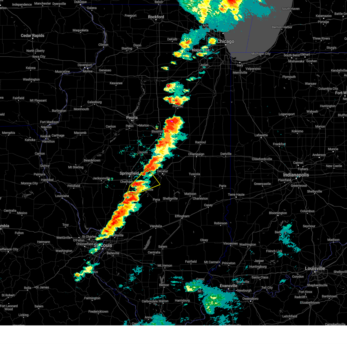
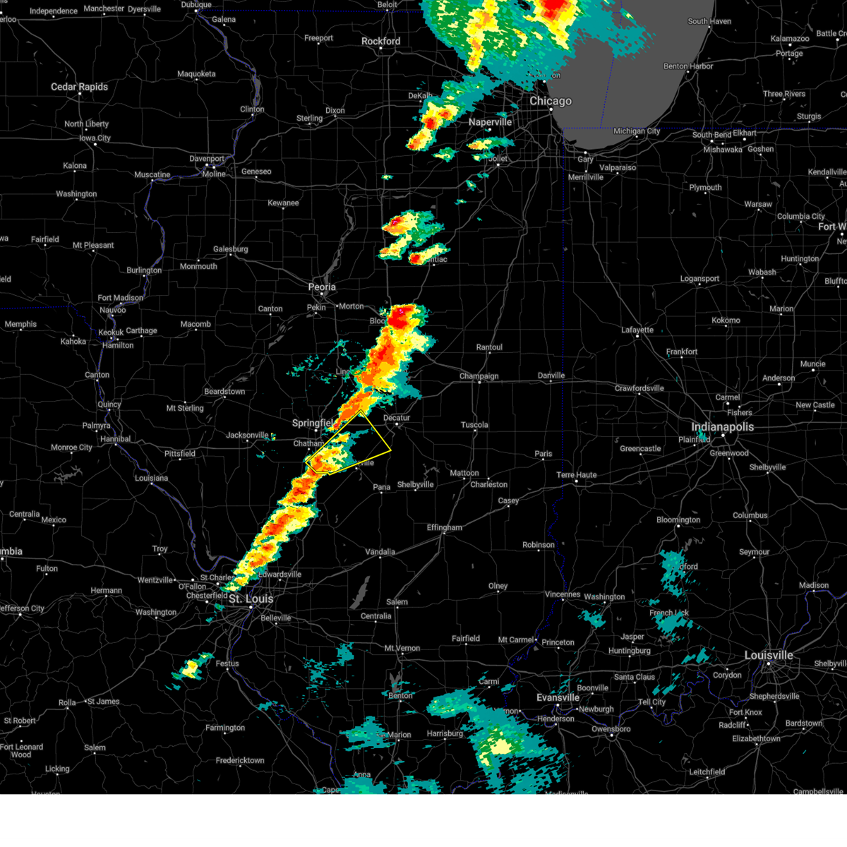
The Top Recent Hail Date for Taylorville, IL is Friday, May 16, 2025 (31st out of 84)

Hail and Wind Damage Spotted near Taylorville, IL
| Date / Time | Report Details |
|---|---|
| 5/16/2025 4:10 PM CDT | The storm which prompted the warning has moved out of the area. therefore, the warning will be allowed to expire. a tornado watch remains in effect until 1000 pm cdt for central illinois. |
| 5/16/2025 3:32 PM CDT | Svrilx the national weather service in lincoln has issued a * severe thunderstorm warning for, christian county in central illinois, south central sangamon county in central illinois, northwestern shelby county in central illinois, southwestern macon county in central illinois, * until 415 pm cdt. * at 332 pm cdt, a severe thunderstorm was located near farmersville, or 11 miles southeast of virden, moving northeast at 55 mph (radar indicated). Hazards include 60 mph wind gusts and quarter size hail. Hail damage to vehicles is expected. expect wind damage to roofs, siding, and trees. this severe thunderstorm will be near, morrisonville around 340 pm cdt. taylorville, kincaid, and jeisyville around 345 pm cdt. other locations in the path of this severe thunderstorm include stonington, blue mound and macon. this includes the following highways, interstate 55 between mile markers 77 and 80. Interstate 72 between mile markers 128 and 131. |
| 5/15/2025 7:23 PM CDT |
 At 723 pm cdt, a severe thunderstorm was located near edinburg, or 13 miles east of springfield, moving northeast at 50 mph (radar indicated). Hazards include golf ball size hail and 60 mph wind gusts. People and animals outdoors will be injured. expect hail damage to roofs, siding, windows, and vehicles. expect wind damage to roofs, siding, and trees. this severe storm will be near, mount auburn around 730 pm cdt. illiopolis around 735 pm cdt. other locations impacted by this severe thunderstorm include sangchris lake state park, bulpitt, tovey, glenarm, sharpsburg, and langleyville. this includes the following highways, interstate 55 between mile markers 77 and 84. Interstate 72 between mile markers 116 and 127. At 723 pm cdt, a severe thunderstorm was located near edinburg, or 13 miles east of springfield, moving northeast at 50 mph (radar indicated). Hazards include golf ball size hail and 60 mph wind gusts. People and animals outdoors will be injured. expect hail damage to roofs, siding, windows, and vehicles. expect wind damage to roofs, siding, and trees. this severe storm will be near, mount auburn around 730 pm cdt. illiopolis around 735 pm cdt. other locations impacted by this severe thunderstorm include sangchris lake state park, bulpitt, tovey, glenarm, sharpsburg, and langleyville. this includes the following highways, interstate 55 between mile markers 77 and 84. Interstate 72 between mile markers 116 and 127.
|
| 5/15/2025 7:12 PM CDT |
 Svrilx the national weather service in lincoln has issued a * severe thunderstorm warning for, southeastern logan county in central illinois, northern christian county in central illinois, southeastern sangamon county in central illinois, southwestern macon county in central illinois, * until 800 pm cdt. * at 712 pm cdt, a severe thunderstorm was located over pawnee, or 11 miles northeast of virden, moving northeast at 35 mph (radar indicated). Hazards include 60 mph wind gusts and quarter size hail. Hail damage to vehicles is expected. expect wind damage to roofs, siding, and trees. this severe thunderstorm will be near, pawnee around 715 pm cdt. edinburg around 725 pm cdt. other locations in the path of this severe thunderstorm include mount auburn. this includes the following highways, interstate 55 between mile markers 77 and 85. Interstate 72 between mile markers 116 and 127. Svrilx the national weather service in lincoln has issued a * severe thunderstorm warning for, southeastern logan county in central illinois, northern christian county in central illinois, southeastern sangamon county in central illinois, southwestern macon county in central illinois, * until 800 pm cdt. * at 712 pm cdt, a severe thunderstorm was located over pawnee, or 11 miles northeast of virden, moving northeast at 35 mph (radar indicated). Hazards include 60 mph wind gusts and quarter size hail. Hail damage to vehicles is expected. expect wind damage to roofs, siding, and trees. this severe thunderstorm will be near, pawnee around 715 pm cdt. edinburg around 725 pm cdt. other locations in the path of this severe thunderstorm include mount auburn. this includes the following highways, interstate 55 between mile markers 77 and 85. Interstate 72 between mile markers 116 and 127.
|
| 4/30/2025 8:27 PM CDT |
 Svrilx the national weather service in lincoln has issued a * severe thunderstorm warning for, southeastern christian county in central illinois, northwestern shelby county in central illinois, * until 915 pm cdt. * at 826 pm cdt, a severe thunderstorm was located near owaneco, or near pana, moving northeast at 20 mph (radar indicated). Hazards include ping pong ball size hail and 60 mph wind gusts. People and animals outdoors will be injured. expect hail damage to roofs, siding, windows, and vehicles. expect wind damage to roofs, siding, and trees. this severe thunderstorm will be near, owaneco around 830 pm cdt. Assumption around 840 pm cdt. Svrilx the national weather service in lincoln has issued a * severe thunderstorm warning for, southeastern christian county in central illinois, northwestern shelby county in central illinois, * until 915 pm cdt. * at 826 pm cdt, a severe thunderstorm was located near owaneco, or near pana, moving northeast at 20 mph (radar indicated). Hazards include ping pong ball size hail and 60 mph wind gusts. People and animals outdoors will be injured. expect hail damage to roofs, siding, windows, and vehicles. expect wind damage to roofs, siding, and trees. this severe thunderstorm will be near, owaneco around 830 pm cdt. Assumption around 840 pm cdt.
|
| 4/30/2025 8:10 PM CDT |
 At 810 pm cdt, a severe thunderstorm was located near nokomis, moving northeast at 25 mph (radar indicated). Hazards include ping pong ball size hail and 60 mph wind gusts. People and animals outdoors will be injured. expect hail damage to roofs, siding, windows, and vehicles. expect wind damage to roofs, siding, and trees. Locations impacted include, rosamond. At 810 pm cdt, a severe thunderstorm was located near nokomis, moving northeast at 25 mph (radar indicated). Hazards include ping pong ball size hail and 60 mph wind gusts. People and animals outdoors will be injured. expect hail damage to roofs, siding, windows, and vehicles. expect wind damage to roofs, siding, and trees. Locations impacted include, rosamond.
|
| 4/30/2025 7:57 PM CDT |
 Svrilx the national weather service in lincoln has issued a * severe thunderstorm warning for, south central christian county in central illinois, * until 830 pm cdt. * at 757 pm cdt, a severe thunderstorm was located over nokomis, moving northeast at 25 mph (radar indicated). Hazards include quarter size hail. Damage to vehicles is expected. This severe thunderstorm will remain over mainly rural areas of south central christian county, including the following locations, ohlman and rosamond. Svrilx the national weather service in lincoln has issued a * severe thunderstorm warning for, south central christian county in central illinois, * until 830 pm cdt. * at 757 pm cdt, a severe thunderstorm was located over nokomis, moving northeast at 25 mph (radar indicated). Hazards include quarter size hail. Damage to vehicles is expected. This severe thunderstorm will remain over mainly rural areas of south central christian county, including the following locations, ohlman and rosamond.
|
| 4/20/2025 8:25 PM CDT | Svrilx the national weather service in lincoln has issued a * severe thunderstorm warning for, menard county in central illinois, logan county in central illinois, northwestern christian county in central illinois, sangamon county in central illinois, tazewell county in central illinois, eastern mason county in central illinois, southeastern peoria county in central illinois, * until 900 pm cdt. * at 825 pm cdt, severe thunderstorms were located along a line extending from glasford to near virden, moving northeast at 55 mph (radar indicated). Hazards include 60 mph wind gusts. Expect damage to roofs, siding, and trees. severe thunderstorms will be near, mason city, greenview, south pekin, mapleton, bartonville, chatham, peoria international airport, manito, green valley, and pekin around 830 pm cdt. west peoria, peoria, middletown, bellevue, san jose, new holland, marquette heights, creve coeur, east peoria, and sherman around 835 pm cdt. williamsville, delavan, rochester, and riverton around 840 pm cdt. tremont, morton, elkhart, emden, and washington around 845 pm cdt. other locations in the path of these severe thunderstorms include dawson, hartsburg, cornland, buffalo, hopedale, lincoln and mechanicsburg. this includes the following highways, interstate 155 between mile markers 0 and 31. interstate 474 between mile markers 6 and 14. interstate 55 between mile markers 77 and 131. interstate 72 between mile markers 86 and 119. Interstate 74 between mile markers 92 and 108. |
| 4/2/2025 5:34 PM CDT | Svrilx the national weather service in lincoln has issued a * severe thunderstorm warning for, southeastern christian county in central illinois, central shelby county in central illinois, * until 615 pm cdt. * at 534 pm cdt, a severe thunderstorm was located near nokomis, moving northeast at 55 mph (radar indicated). Hazards include 60 mph wind gusts and quarter size hail. Hail damage to vehicles is expected. expect wind damage to roofs, siding, and trees. this severe thunderstorm will be near, pana around 540 pm cdt. Assumption around 550 pm cdt. |
| 4/2/2025 4:42 PM CDT |
 At 442 pm cdt, severe thunderstorms were located along a line extending from near weldon to near taylorville, moving northeast at 50 mph (radar indicated). Hazards include 70 mph wind gusts and quarter size hail. Hail damage to vehicles is expected. expect considerable tree damage. wind damage is also likely to mobile homes, roofs, and outbuildings. these severe storms will be near, stonington, oreana, blue mound, weldon, forsyth, taylorville, decatur, argenta, and harristown around 445 pm cdt. de land, mount zion, decatur airport, macon, and cisco around 450 pm cdt. long creek around 455 pm cdt. other locations impacted by these severe thunderstorms include sangchris lake state park, willeys, clinton power station, weldon springs state park, glenarm, thayer, southern view, elwin, clear lake, and lodge. this includes the following highways, interstate 55 between mile markers 77 and 99. Interstate 72 between mile markers 95 and 163. At 442 pm cdt, severe thunderstorms were located along a line extending from near weldon to near taylorville, moving northeast at 50 mph (radar indicated). Hazards include 70 mph wind gusts and quarter size hail. Hail damage to vehicles is expected. expect considerable tree damage. wind damage is also likely to mobile homes, roofs, and outbuildings. these severe storms will be near, stonington, oreana, blue mound, weldon, forsyth, taylorville, decatur, argenta, and harristown around 445 pm cdt. de land, mount zion, decatur airport, macon, and cisco around 450 pm cdt. long creek around 455 pm cdt. other locations impacted by these severe thunderstorms include sangchris lake state park, willeys, clinton power station, weldon springs state park, glenarm, thayer, southern view, elwin, clear lake, and lodge. this includes the following highways, interstate 55 between mile markers 77 and 99. Interstate 72 between mile markers 95 and 163.
|
| 4/2/2025 4:24 PM CDT | Svrilx the national weather service in lincoln has issued a * severe thunderstorm warning for, southeastern logan county in central illinois, central christian county in central illinois, central sangamon county in central illinois, central piatt county in central illinois, southern de witt county in central illinois, macon county in central illinois, * until 515 pm cdt. * at 423 pm cdt, severe thunderstorms were located along a line extending from near wapella to near pawnee, moving northeast at 65 mph (radar indicated). Hazards include 60 mph wind gusts and quarter size hail. Hail damage to vehicles is expected. expect wind damage to roofs, siding, and trees. severe thunderstorms will be near, edinburg, mount auburn, maroa, latham, clinton, warrensburg, jeisyville, niantic, kincaid, and illiopolis around 430 pm cdt. forsyth, decatur, and harristown around 435 pm cdt. weldon around 440 pm cdt. other locations in the path of these severe thunderstorms include oreana, blue mound, argenta, de land, mount zion, decatur airport, long creek and cisco. this includes the following highways, interstate 55 between mile markers 77 and 100. Interstate 72 between mile markers 95 and 163. |
| 3/14/2025 10:41 PM CDT | Svrilx the national weather service in lincoln has issued a * severe thunderstorm warning for, christian county in central illinois, eastern sangamon county in central illinois, western shelby county in central illinois, macon county in central illinois, * until 1145 pm cdt. * at 1041 pm cdt, severe thunderstorms were located along a line extending from near cornland to near white oak to near van burensburg, moving northeast at 60 mph (radar indicated). Hazards include 70 mph wind gusts. Expect considerable tree damage. damage is likely to mobile homes, roofs, and outbuildings. severe thunderstorms will be near, edinburg, morrisonville, mechanicsburg, jeisyville, buffalo, and kincaid around 1045 pm cdt. mount auburn, taylorville, and illiopolis around 1050 pm cdt. owaneco and niantic around 1055 pm cdt. stonington and pana around 1100 pm cdt. other locations in the path of these severe thunderstorms include blue mound, warrensburg, harristown, herrick, assumption, tower hill, decatur, cowden, moweaqua, forsyth, macon and shelbyville. This includes interstate 72 between mile markers 112 and 148. |
| 3/14/2025 10:04 PM CDT |
 Svrilx the national weather service in lincoln has issued a * severe thunderstorm warning for, eastern menard county in central illinois, logan county in central illinois, western christian county in central illinois, sangamon county in central illinois, tazewell county in central illinois, southwestern mclean county in central illinois, east central mason county in central illinois, * until 1100 pm cdt. * at 1004 pm cdt, severe thunderstorms were located along a line extending from near manito to near greenview to near waverly, moving northeast at 60 mph (radar indicated). Hazards include 70 mph wind gusts. Expect considerable tree damage. damage is likely to mobile homes, roofs, and outbuildings. severe thunderstorms will be near, mason city, middletown, san jose, delavan, new holland, chatham, green valley, pekin, sherman, and springfield around 1010 pm cdt. williamsville, hartsburg, tremont, morton, elkhart, emden, hopedale, and riverton around 1015 pm cdt. mackinaw, rochester, and lincoln around 1020 pm cdt. other locations in the path of these severe thunderstorms include dawson, minier, buffalo, cornland, armington, mechanicsburg, mount pulaski, atlanta, stanford, danvers, beason, mclean, illiopolis and carlock. this includes the following highways, interstate 155 between mile markers 0 and 31. interstate 55 between mile markers 77 and 145. interstate 72 between mile markers 87 and 122. Interstate 74 between mile markers 119 and 121. Svrilx the national weather service in lincoln has issued a * severe thunderstorm warning for, eastern menard county in central illinois, logan county in central illinois, western christian county in central illinois, sangamon county in central illinois, tazewell county in central illinois, southwestern mclean county in central illinois, east central mason county in central illinois, * until 1100 pm cdt. * at 1004 pm cdt, severe thunderstorms were located along a line extending from near manito to near greenview to near waverly, moving northeast at 60 mph (radar indicated). Hazards include 70 mph wind gusts. Expect considerable tree damage. damage is likely to mobile homes, roofs, and outbuildings. severe thunderstorms will be near, mason city, middletown, san jose, delavan, new holland, chatham, green valley, pekin, sherman, and springfield around 1010 pm cdt. williamsville, hartsburg, tremont, morton, elkhart, emden, hopedale, and riverton around 1015 pm cdt. mackinaw, rochester, and lincoln around 1020 pm cdt. other locations in the path of these severe thunderstorms include dawson, minier, buffalo, cornland, armington, mechanicsburg, mount pulaski, atlanta, stanford, danvers, beason, mclean, illiopolis and carlock. this includes the following highways, interstate 155 between mile markers 0 and 31. interstate 55 between mile markers 77 and 145. interstate 72 between mile markers 87 and 122. Interstate 74 between mile markers 119 and 121.
|
| 8/16/2024 3:51 AM CDT |
 The storm which prompted the warning has weakened below severe limits, and no longer poses an immediate threat to life or property. therefore, the warning will be allowed to expire. however, heavy rain is still possible with this thunderstorm. to report severe weather, contact your nearest law enforcement agency. they will relay your report to the national weather service lincoln. The storm which prompted the warning has weakened below severe limits, and no longer poses an immediate threat to life or property. therefore, the warning will be allowed to expire. however, heavy rain is still possible with this thunderstorm. to report severe weather, contact your nearest law enforcement agency. they will relay your report to the national weather service lincoln.
|
| 8/16/2024 3:39 AM CDT |
 At 339 am cdt, a severe thunderstorm was located near owaneco, or near taylorville, moving northeast at 40 mph (radar indicated). Hazards include 60 mph wind gusts and nickel size hail. Expect damage to roofs, siding, and trees. this severe storm will be near, assumption around 350 am cdt. moweaqua around 355 am cdt. Other locations impacted by this severe thunderstorm include taylorville municipal airport and willeys. At 339 am cdt, a severe thunderstorm was located near owaneco, or near taylorville, moving northeast at 40 mph (radar indicated). Hazards include 60 mph wind gusts and nickel size hail. Expect damage to roofs, siding, and trees. this severe storm will be near, assumption around 350 am cdt. moweaqua around 355 am cdt. Other locations impacted by this severe thunderstorm include taylorville municipal airport and willeys.
|
| 8/16/2024 3:26 AM CDT |
 Svrilx the national weather service in lincoln has issued a * severe thunderstorm warning for, central christian county in central illinois, * until 400 am cdt. * at 326 am cdt, a severe thunderstorm was located near taylorville, moving northeast at 45 mph (radar indicated). Hazards include 60 mph wind gusts and quarter size hail. Hail damage to vehicles is expected. expect wind damage to roofs, siding, and trees. this severe thunderstorm will be near, taylorville around 330 am cdt. stonington around 340 am cdt. Moweaqua around 345 am cdt. Svrilx the national weather service in lincoln has issued a * severe thunderstorm warning for, central christian county in central illinois, * until 400 am cdt. * at 326 am cdt, a severe thunderstorm was located near taylorville, moving northeast at 45 mph (radar indicated). Hazards include 60 mph wind gusts and quarter size hail. Hail damage to vehicles is expected. expect wind damage to roofs, siding, and trees. this severe thunderstorm will be near, taylorville around 330 am cdt. stonington around 340 am cdt. Moweaqua around 345 am cdt.
|
| 7/30/2024 8:27 AM CDT |
 the severe thunderstorm warning has been cancelled and is no longer in effect the severe thunderstorm warning has been cancelled and is no longer in effect
|
| 7/30/2024 8:27 AM CDT |
 At 826 am cdt, a severe thunderstorm was located near blue mound, or 14 miles northeast of taylorville, moving east at 45 mph (trained weather spotters). Hazards include 60 mph wind gusts. Expect damage to roofs, siding, and trees. this severe storm will be near, moweaqua around 830 am cdt. other locations impacted by this severe thunderstorm include boody, willeys, hervey city, sharpsburg, taylorville municipal airport, elwin, and langleyville. This includes interstate 72 between mile markers 127 and 134. At 826 am cdt, a severe thunderstorm was located near blue mound, or 14 miles northeast of taylorville, moving east at 45 mph (trained weather spotters). Hazards include 60 mph wind gusts. Expect damage to roofs, siding, and trees. this severe storm will be near, moweaqua around 830 am cdt. other locations impacted by this severe thunderstorm include boody, willeys, hervey city, sharpsburg, taylorville municipal airport, elwin, and langleyville. This includes interstate 72 between mile markers 127 and 134.
|
| 7/30/2024 8:14 AM CDT |
 At 813 am cdt, a severe thunderstorm was located near mount auburn, or 13 miles north of taylorville, moving east at 45 mph (trained weather spotters. at 745 am, springfield reported wind gusts over 55 mph and broken tree branches). Hazards include 60 mph wind gusts. Expect damage to roofs, siding, and trees. this severe storm will be near, blue mound and stonington around 820 am cdt. moweaqua around 825 am cdt. other locations impacted by this severe thunderstorm include sangchris lake state park, boody, willeys, hervey city, sharpsburg, taylorville municipal airport, elwin, bulpitt, langleyville, and tovey. This includes interstate 72 between mile markers 113 and 134. At 813 am cdt, a severe thunderstorm was located near mount auburn, or 13 miles north of taylorville, moving east at 45 mph (trained weather spotters. at 745 am, springfield reported wind gusts over 55 mph and broken tree branches). Hazards include 60 mph wind gusts. Expect damage to roofs, siding, and trees. this severe storm will be near, blue mound and stonington around 820 am cdt. moweaqua around 825 am cdt. other locations impacted by this severe thunderstorm include sangchris lake state park, boody, willeys, hervey city, sharpsburg, taylorville municipal airport, elwin, bulpitt, langleyville, and tovey. This includes interstate 72 between mile markers 113 and 134.
|
| 7/30/2024 8:05 AM CDT |
 Svrilx the national weather service in lincoln has issued a * severe thunderstorm warning for, christian county in central illinois, eastern sangamon county in central illinois, northwestern shelby county in central illinois, southern macon county in central illinois, * until 845 am cdt. * at 804 am cdt, a severe thunderstorm was located near mechanicsburg, or 14 miles east of springfield, moving east at 45 mph (radar indicated). Hazards include 60 mph wind gusts. Expect damage to roofs, siding, and trees. this severe thunderstorm will be near, mount auburn around 810 am cdt. blue mound and stonington around 820 am cdt. other locations in the path of this severe thunderstorm include moweaqua and macon. This includes interstate 72 between mile markers 110 and 134. Svrilx the national weather service in lincoln has issued a * severe thunderstorm warning for, christian county in central illinois, eastern sangamon county in central illinois, northwestern shelby county in central illinois, southern macon county in central illinois, * until 845 am cdt. * at 804 am cdt, a severe thunderstorm was located near mechanicsburg, or 14 miles east of springfield, moving east at 45 mph (radar indicated). Hazards include 60 mph wind gusts. Expect damage to roofs, siding, and trees. this severe thunderstorm will be near, mount auburn around 810 am cdt. blue mound and stonington around 820 am cdt. other locations in the path of this severe thunderstorm include moweaqua and macon. This includes interstate 72 between mile markers 110 and 134.
|
| 7/29/2024 8:02 PM CDT |
 At 802 pm cdt, a severe thunderstorm capable of producing a tornado was located near owaneco, or 7 miles north of nokomis, moving southeast at 20 mph (radar indicated rotation). Hazards include tornado and quarter size hail. Flying debris will be dangerous to those caught without shelter. mobile homes will be damaged or destroyed. damage to roofs, windows, and vehicles will occur. tree damage is likely. This tornadic thunderstorm will remain over mainly rural areas of southeastern christian county, including the following locations, rosamond. At 802 pm cdt, a severe thunderstorm capable of producing a tornado was located near owaneco, or 7 miles north of nokomis, moving southeast at 20 mph (radar indicated rotation). Hazards include tornado and quarter size hail. Flying debris will be dangerous to those caught without shelter. mobile homes will be damaged or destroyed. damage to roofs, windows, and vehicles will occur. tree damage is likely. This tornadic thunderstorm will remain over mainly rural areas of southeastern christian county, including the following locations, rosamond.
|
| 7/29/2024 7:42 PM CDT |
 At 741 pm cdt, a severe thunderstorm capable of producing a tornado was located southwest of taylorville, moving southeast at 15 mph (radar indicated rotation). Hazards include tornado and quarter size hail. Flying debris will be dangerous to those caught without shelter. mobile homes will be damaged or destroyed. damage to roofs, windows, and vehicles will occur. tree damage is likely. this dangerous storm will be near, taylorville around 745 pm cdt. Other locations impacted by this tornadic thunderstorm include taylorville municipal airport, rosamond, palmer, and langleyville. At 741 pm cdt, a severe thunderstorm capable of producing a tornado was located southwest of taylorville, moving southeast at 15 mph (radar indicated rotation). Hazards include tornado and quarter size hail. Flying debris will be dangerous to those caught without shelter. mobile homes will be damaged or destroyed. damage to roofs, windows, and vehicles will occur. tree damage is likely. this dangerous storm will be near, taylorville around 745 pm cdt. Other locations impacted by this tornadic thunderstorm include taylorville municipal airport, rosamond, palmer, and langleyville.
|
| 7/29/2024 7:25 PM CDT |
 Torilx the national weather service in lincoln has issued a * tornado warning for, southern christian county in central illinois, * until 815 pm cdt. * at 724 pm cdt, a severe thunderstorm capable of producing a tornado was located over jeisyville, or 8 miles west of taylorville, moving southeast at 15 mph (radar indicated rotation). Hazards include tornado and quarter size hail. Flying debris will be dangerous to those caught without shelter. mobile homes will be damaged or destroyed. damage to roofs, windows, and vehicles will occur. tree damage is likely. This dangerous storm will be near, taylorville around 735 pm cdt. Torilx the national weather service in lincoln has issued a * tornado warning for, southern christian county in central illinois, * until 815 pm cdt. * at 724 pm cdt, a severe thunderstorm capable of producing a tornado was located over jeisyville, or 8 miles west of taylorville, moving southeast at 15 mph (radar indicated rotation). Hazards include tornado and quarter size hail. Flying debris will be dangerous to those caught without shelter. mobile homes will be damaged or destroyed. damage to roofs, windows, and vehicles will occur. tree damage is likely. This dangerous storm will be near, taylorville around 735 pm cdt.
|
| 5/24/2024 5:10 PM CDT |
 The storm which prompted the warning has weakened below severe limits, and has exited the warned area. therefore, the warning will be allowed to expire. a severe thunderstorm watch remains in effect until 900 pm cdt for central illinois. The storm which prompted the warning has weakened below severe limits, and has exited the warned area. therefore, the warning will be allowed to expire. a severe thunderstorm watch remains in effect until 900 pm cdt for central illinois.
|
| 5/24/2024 4:45 PM CDT |
 the severe thunderstorm warning has been cancelled and is no longer in effect the severe thunderstorm warning has been cancelled and is no longer in effect
|
| 5/24/2024 4:45 PM CDT |
 At 445 pm cdt, a severe thunderstorm was located over jeisyville, or 8 miles west of taylorville, moving northeast at 25 mph (radar indicated). Hazards include 60 mph wind gusts and quarter size hail. Hail damage to vehicles is expected. expect wind damage to roofs, siding, and trees. this severe storm will be near, taylorville, kincaid, and jeisyville around 450 pm cdt. Other locations impacted by this severe thunderstorm include taylorville municipal airport, bulpitt, langleyville, tovey, palmer, and sangchris lake state park. At 445 pm cdt, a severe thunderstorm was located over jeisyville, or 8 miles west of taylorville, moving northeast at 25 mph (radar indicated). Hazards include 60 mph wind gusts and quarter size hail. Hail damage to vehicles is expected. expect wind damage to roofs, siding, and trees. this severe storm will be near, taylorville, kincaid, and jeisyville around 450 pm cdt. Other locations impacted by this severe thunderstorm include taylorville municipal airport, bulpitt, langleyville, tovey, palmer, and sangchris lake state park.
|
| 5/24/2024 4:26 PM CDT |
 Svrilx the national weather service in lincoln has issued a * severe thunderstorm warning for, west central christian county in central illinois, southeastern sangamon county in central illinois, * until 515 pm cdt. * at 425 pm cdt, a severe thunderstorm was located over white oak, or 12 miles east of virden, moving northeast at 30 mph (radar indicated). Hazards include 60 mph wind gusts and quarter size hail. Hail damage to vehicles is expected. expect wind damage to roofs, siding, and trees. this severe thunderstorm will be near, kincaid and jeisyville around 440 pm cdt. Other locations in the path of this severe thunderstorm include taylorville. Svrilx the national weather service in lincoln has issued a * severe thunderstorm warning for, west central christian county in central illinois, southeastern sangamon county in central illinois, * until 515 pm cdt. * at 425 pm cdt, a severe thunderstorm was located over white oak, or 12 miles east of virden, moving northeast at 30 mph (radar indicated). Hazards include 60 mph wind gusts and quarter size hail. Hail damage to vehicles is expected. expect wind damage to roofs, siding, and trees. this severe thunderstorm will be near, kincaid and jeisyville around 440 pm cdt. Other locations in the path of this severe thunderstorm include taylorville.
|
| 4/18/2024 5:51 PM CDT |
 Svrilx the national weather service in lincoln has issued a * severe thunderstorm warning for, southwestern christian county in central illinois, * until 645 pm cdt. * at 551 pm cdt, a severe thunderstorm was located 7 miles south of girard, or 9 miles northeast of carlinville, moving east at 30 mph (radar indicated). Hazards include ping pong ball size hail and 60 mph wind gusts. People and animals outdoors will be injured. expect hail damage to roofs, siding, windows, and vehicles. expect wind damage to roofs, siding, and trees. This severe thunderstorm will remain over mainly rural areas of southwestern christian county, including the following locations, palmer. Svrilx the national weather service in lincoln has issued a * severe thunderstorm warning for, southwestern christian county in central illinois, * until 645 pm cdt. * at 551 pm cdt, a severe thunderstorm was located 7 miles south of girard, or 9 miles northeast of carlinville, moving east at 30 mph (radar indicated). Hazards include ping pong ball size hail and 60 mph wind gusts. People and animals outdoors will be injured. expect hail damage to roofs, siding, windows, and vehicles. expect wind damage to roofs, siding, and trees. This severe thunderstorm will remain over mainly rural areas of southwestern christian county, including the following locations, palmer.
|
| 4/1/2024 7:08 PM CDT |
 The storm which prompted the warning has weakened below severe limits, and has exited the warned area. therefore, the warning will be allowed to expire. a tornado watch remains in effect until midnight cdt for central illinois. The storm which prompted the warning has weakened below severe limits, and has exited the warned area. therefore, the warning will be allowed to expire. a tornado watch remains in effect until midnight cdt for central illinois.
|
| 4/1/2024 6:58 PM CDT |
 At 657 pm cdt, a severe thunderstorm was located near taylorville, moving northeast at 30 mph (radar indicated). Hazards include 60 mph wind gusts and quarter size hail. Hail damage to vehicles is expected. expect wind damage to roofs, siding, and trees. This severe thunderstorm will remain over mainly rural areas of southeastern christian county, including the following locations, taylorville municipal airport and willeys. At 657 pm cdt, a severe thunderstorm was located near taylorville, moving northeast at 30 mph (radar indicated). Hazards include 60 mph wind gusts and quarter size hail. Hail damage to vehicles is expected. expect wind damage to roofs, siding, and trees. This severe thunderstorm will remain over mainly rural areas of southeastern christian county, including the following locations, taylorville municipal airport and willeys.
|
| 4/1/2024 6:40 PM CDT |
 Svrilx the national weather service in lincoln has issued a * severe thunderstorm warning for, southern christian county in central illinois, * until 715 pm cdt. * at 640 pm cdt, a severe thunderstorm was located near taylorville, moving northeast at 35 mph (radar indicated). Hazards include 60 mph wind gusts and quarter size hail. Hail damage to vehicles is expected. expect wind damage to roofs, siding, and trees. this severe thunderstorm will be near, taylorville around 645 pm cdt. Stonington around 700 pm cdt. Svrilx the national weather service in lincoln has issued a * severe thunderstorm warning for, southern christian county in central illinois, * until 715 pm cdt. * at 640 pm cdt, a severe thunderstorm was located near taylorville, moving northeast at 35 mph (radar indicated). Hazards include 60 mph wind gusts and quarter size hail. Hail damage to vehicles is expected. expect wind damage to roofs, siding, and trees. this severe thunderstorm will be near, taylorville around 645 pm cdt. Stonington around 700 pm cdt.
|
| 3/14/2024 5:29 PM CDT |
 The storm which prompted the warning has moved out of the area. therefore, the warning will be allowed to expire. a tornado watch remains in effect until 900 pm cdt for central illinois. The storm which prompted the warning has moved out of the area. therefore, the warning will be allowed to expire. a tornado watch remains in effect until 900 pm cdt for central illinois.
|
| 3/14/2024 5:25 PM CDT |
 Torilx the national weather service in lincoln has issued a * tornado warning for, southeastern christian county in central illinois, northwestern shelby county in central illinois, * until 600 pm cdt. * at 524 pm cdt, a severe thunderstorm capable of producing a tornado was located over taylorville, moving east at 45 mph (radar indicated rotation). Hazards include tornado and half dollar size hail. Flying debris will be dangerous to those caught without shelter. mobile homes will be damaged or destroyed. damage to roofs, windows, and vehicles will occur. tree damage is likely. this dangerous storm will be near, owaneco around 530 pm cdt. Assumption around 535 pm cdt. Torilx the national weather service in lincoln has issued a * tornado warning for, southeastern christian county in central illinois, northwestern shelby county in central illinois, * until 600 pm cdt. * at 524 pm cdt, a severe thunderstorm capable of producing a tornado was located over taylorville, moving east at 45 mph (radar indicated rotation). Hazards include tornado and half dollar size hail. Flying debris will be dangerous to those caught without shelter. mobile homes will be damaged or destroyed. damage to roofs, windows, and vehicles will occur. tree damage is likely. this dangerous storm will be near, owaneco around 530 pm cdt. Assumption around 535 pm cdt.
|
| 3/14/2024 5:24 PM CDT | Half Dollar sized hail reported 1.7 miles SE of Taylorville, IL, measured half dollar hail east side of taylorville from a trained spotter. |
| 3/14/2024 5:14 PM CDT |
 the tornado warning has been cancelled and is no longer in effect the tornado warning has been cancelled and is no longer in effect
|
| 3/14/2024 5:14 PM CDT |
 At 513 pm cdt, a severe thunderstorm capable of producing a tornado was located near white oak, or 11 miles west of taylorville, moving east-southeast at 45 mph (radar indicated rotation). Hazards include tornado and golf ball size hail. Flying debris will be dangerous to those caught without shelter. mobile homes will be damaged or destroyed. damage to roofs, windows, and vehicles will occur. tree damage is likely. this dangerous storm will be near, taylorville around 520 pm cdt. Other locations impacted by this tornadic thunderstorm include palmer, sharpsburg, taylorville municipal airport, bulpitt, langleyville, tovey, and sangchris lake state park. At 513 pm cdt, a severe thunderstorm capable of producing a tornado was located near white oak, or 11 miles west of taylorville, moving east-southeast at 45 mph (radar indicated rotation). Hazards include tornado and golf ball size hail. Flying debris will be dangerous to those caught without shelter. mobile homes will be damaged or destroyed. damage to roofs, windows, and vehicles will occur. tree damage is likely. this dangerous storm will be near, taylorville around 520 pm cdt. Other locations impacted by this tornadic thunderstorm include palmer, sharpsburg, taylorville municipal airport, bulpitt, langleyville, tovey, and sangchris lake state park.
|
| 3/14/2024 4:54 PM CDT |
 Torilx the national weather service in lincoln has issued a * tornado warning for, southwestern christian county in central illinois, south central sangamon county in central illinois, * until 530 pm cdt. * at 454 pm cdt, a severe thunderstorm capable of producing a tornado was located over virden, moving east at 45 mph (radar indicated rotation). Hazards include tornado and golf ball size hail. Flying debris will be dangerous to those caught without shelter. mobile homes will be damaged or destroyed. damage to roofs, windows, and vehicles will occur. tree damage is likely. this dangerous storm will be near, auburn and divernon around 500 pm cdt. pawnee around 505 pm cdt. other locations in the path of this tornadic thunderstorm include kincaid, jeisyville and taylorville. This includes interstate 55 between mile markers 77 and 83. Torilx the national weather service in lincoln has issued a * tornado warning for, southwestern christian county in central illinois, south central sangamon county in central illinois, * until 530 pm cdt. * at 454 pm cdt, a severe thunderstorm capable of producing a tornado was located over virden, moving east at 45 mph (radar indicated rotation). Hazards include tornado and golf ball size hail. Flying debris will be dangerous to those caught without shelter. mobile homes will be damaged or destroyed. damage to roofs, windows, and vehicles will occur. tree damage is likely. this dangerous storm will be near, auburn and divernon around 500 pm cdt. pawnee around 505 pm cdt. other locations in the path of this tornadic thunderstorm include kincaid, jeisyville and taylorville. This includes interstate 55 between mile markers 77 and 83.
|
| 3/14/2024 8:57 AM CDT |
 The storms which prompted the warning have moved out of the area. therefore, the warning will be allowed to expire. however, gusty winds are still possible with these thunderstorms. a severe thunderstorm watch remains in effect until 1000 am cdt for central illinois. a severe thunderstorm watch also remains in effect until noon cdt for central illinois. The storms which prompted the warning have moved out of the area. therefore, the warning will be allowed to expire. however, gusty winds are still possible with these thunderstorms. a severe thunderstorm watch remains in effect until 1000 am cdt for central illinois. a severe thunderstorm watch also remains in effect until noon cdt for central illinois.
|
| 3/14/2024 8:47 AM CDT |
 the tornado warning has been cancelled and is no longer in effect the tornado warning has been cancelled and is no longer in effect
|
| 3/14/2024 8:36 AM CDT |
 At 836 am cdt, a severe thunderstorm capable of producing a tornado was located near taylorville, moving east at 50 mph (radar indicated rotation). Hazards include tornado and quarter size hail. Flying debris will be dangerous to those caught without shelter. mobile homes will be damaged or destroyed. damage to roofs, windows, and vehicles will occur. tree damage is likely. this dangerous storm will be near, owaneco around 840 am cdt. Other locations impacted by this tornadic thunderstorm include rosamond, taylorville municipal airport, and langleyville. At 836 am cdt, a severe thunderstorm capable of producing a tornado was located near taylorville, moving east at 50 mph (radar indicated rotation). Hazards include tornado and quarter size hail. Flying debris will be dangerous to those caught without shelter. mobile homes will be damaged or destroyed. damage to roofs, windows, and vehicles will occur. tree damage is likely. this dangerous storm will be near, owaneco around 840 am cdt. Other locations impacted by this tornadic thunderstorm include rosamond, taylorville municipal airport, and langleyville.
|
| 3/14/2024 8:34 AM CDT |
 At 834 am cdt, severe thunderstorms were located along a line extending from near illiopolis to near taylorville, moving east at 40 mph (radar indicated). Hazards include 60 mph wind gusts and quarter size hail. Hail damage to vehicles is expected. expect wind damage to roofs, siding, and trees. these severe storms will be near, taylorville, blue mound, stonington, and niantic around 840 am cdt. harristown and owaneco around 845 am cdt. decatur around 850 am cdt. moweaqua and assumption around 855 am cdt. other locations impacted by these severe thunderstorms include boody, willeys, palmer, oconee, sharpsburg, rosamond, taylorville municipal airport, bulpitt, langleyville, and tovey. This includes interstate 72 between mile markers 116 and 137. At 834 am cdt, severe thunderstorms were located along a line extending from near illiopolis to near taylorville, moving east at 40 mph (radar indicated). Hazards include 60 mph wind gusts and quarter size hail. Hail damage to vehicles is expected. expect wind damage to roofs, siding, and trees. these severe storms will be near, taylorville, blue mound, stonington, and niantic around 840 am cdt. harristown and owaneco around 845 am cdt. decatur around 850 am cdt. moweaqua and assumption around 855 am cdt. other locations impacted by these severe thunderstorms include boody, willeys, palmer, oconee, sharpsburg, rosamond, taylorville municipal airport, bulpitt, langleyville, and tovey. This includes interstate 72 between mile markers 116 and 137.
|
| 3/14/2024 8:23 AM CDT |
 Torilx the national weather service in lincoln has issued a * tornado warning for, southwestern christian county in central illinois, * until 900 am cdt. * at 822 am cdt, a severe thunderstorm capable of producing a tornado was located near morrisonville, or 13 miles east of virden, moving east at 50 mph (radar indicated rotation). Hazards include tornado and quarter size hail. Flying debris will be dangerous to those caught without shelter. mobile homes will be damaged or destroyed. damage to roofs, windows, and vehicles will occur. tree damage is likely. This dangerous storm will be near, owaneco around 840 am cdt. Torilx the national weather service in lincoln has issued a * tornado warning for, southwestern christian county in central illinois, * until 900 am cdt. * at 822 am cdt, a severe thunderstorm capable of producing a tornado was located near morrisonville, or 13 miles east of virden, moving east at 50 mph (radar indicated rotation). Hazards include tornado and quarter size hail. Flying debris will be dangerous to those caught without shelter. mobile homes will be damaged or destroyed. damage to roofs, windows, and vehicles will occur. tree damage is likely. This dangerous storm will be near, owaneco around 840 am cdt.
|
| 3/14/2024 8:13 AM CDT |
 Svrilx the national weather service in lincoln has issued a * severe thunderstorm warning for, christian county in central illinois, central sangamon county in central illinois, western shelby county in central illinois, southwestern macon county in central illinois, * until 900 am cdt. * at 812 am cdt, severe thunderstorms were located along a line extending from riverton to near farmersville, moving east at 40 mph (radar indicated). Hazards include 60 mph wind gusts and quarter size hail. Hail damage to vehicles is expected. expect wind damage to roofs, siding, and trees. severe thunderstorms will be near, kincaid, edinburg, mechanicsburg, dawson, and buffalo around 820 am cdt. jeisyville around 825 am cdt. taylorville, illiopolis, and mount auburn around 830 am cdt. other locations in the path of these severe thunderstorms include blue mound, stonington, niantic, harristown and owaneco. this includes the following highways, interstate 55 between mile markers 77 and 102. Interstate 72 between mile markers 98 and 137. Svrilx the national weather service in lincoln has issued a * severe thunderstorm warning for, christian county in central illinois, central sangamon county in central illinois, western shelby county in central illinois, southwestern macon county in central illinois, * until 900 am cdt. * at 812 am cdt, severe thunderstorms were located along a line extending from riverton to near farmersville, moving east at 40 mph (radar indicated). Hazards include 60 mph wind gusts and quarter size hail. Hail damage to vehicles is expected. expect wind damage to roofs, siding, and trees. severe thunderstorms will be near, kincaid, edinburg, mechanicsburg, dawson, and buffalo around 820 am cdt. jeisyville around 825 am cdt. taylorville, illiopolis, and mount auburn around 830 am cdt. other locations in the path of these severe thunderstorms include blue mound, stonington, niantic, harristown and owaneco. this includes the following highways, interstate 55 between mile markers 77 and 102. Interstate 72 between mile markers 98 and 137.
|
| 9/26/2023 7:07 PM CDT |
 At 707 pm cdt, a severe thunderstorm was located near taylorville, moving southeast at 30 mph (radar indicated). Hazards include 60 mph wind gusts and quarter size hail. Hail damage to vehicles is expected. expect wind damage to roofs, siding, and trees. this severe storm will be near, taylorville around 710 pm cdt. pana around 720 pm cdt. other locations impacted by this severe thunderstorm include rosamond, owaneco, taylorville airport, and vanderville. hail threat, radar indicated max hail size, 1. 00 in wind threat, radar indicated max wind gust, 60 mph. At 707 pm cdt, a severe thunderstorm was located near taylorville, moving southeast at 30 mph (radar indicated). Hazards include 60 mph wind gusts and quarter size hail. Hail damage to vehicles is expected. expect wind damage to roofs, siding, and trees. this severe storm will be near, taylorville around 710 pm cdt. pana around 720 pm cdt. other locations impacted by this severe thunderstorm include rosamond, owaneco, taylorville airport, and vanderville. hail threat, radar indicated max hail size, 1. 00 in wind threat, radar indicated max wind gust, 60 mph.
|
| 9/26/2023 6:53 PM CDT |
 At 653 pm cdt, a severe thunderstorm was located near taylorville, moving southeast at 30 mph (radar indicated). Hazards include 60 mph wind gusts and quarter size hail. Hail damage to vehicles is expected. expect wind damage to roofs, siding, and trees. this severe thunderstorm will be near, taylorville around 700 pm cdt. other locations in the path of this severe thunderstorm include pana. hail threat, radar indicated max hail size, 1. 00 in wind threat, radar indicated max wind gust, 60 mph. At 653 pm cdt, a severe thunderstorm was located near taylorville, moving southeast at 30 mph (radar indicated). Hazards include 60 mph wind gusts and quarter size hail. Hail damage to vehicles is expected. expect wind damage to roofs, siding, and trees. this severe thunderstorm will be near, taylorville around 700 pm cdt. other locations in the path of this severe thunderstorm include pana. hail threat, radar indicated max hail size, 1. 00 in wind threat, radar indicated max wind gust, 60 mph.
|
| 8/6/2023 7:01 PM CDT | Half Dollar sized hail reported 1.3 miles S of Taylorville, IL |
| 8/6/2023 7:01 PM CDT |
 At 701 pm cdt, a severe thunderstorm was located over taylorville, moving east at 35 mph (radar indicated). Hazards include 60 mph wind gusts and half dollar size hail. Hail damage to vehicles is expected. expect wind damage to roofs, siding, and trees. this severe thunderstorm will be near, assumption around 720 pm cdt. hail threat, observed max hail size, 1. 25 in wind threat, radar indicated max wind gust, 60 mph. At 701 pm cdt, a severe thunderstorm was located over taylorville, moving east at 35 mph (radar indicated). Hazards include 60 mph wind gusts and half dollar size hail. Hail damage to vehicles is expected. expect wind damage to roofs, siding, and trees. this severe thunderstorm will be near, assumption around 720 pm cdt. hail threat, observed max hail size, 1. 25 in wind threat, radar indicated max wind gust, 60 mph.
|
| 8/6/2023 7:00 PM CDT | Quarter sized hail reported 2.6 miles SE of Taylorville, IL |
| 8/6/2023 6:30 PM CDT |
 At 630 pm cdt, a confirmed tornado was located over edinburg, or 9 miles northwest of taylorville, moving east at 35 mph (weather spotters confirmed tornado). Hazards include damaging tornado. Flying debris will be dangerous to those caught without shelter. mobile homes will be damaged or destroyed. damage to roofs, windows, and vehicles will occur. tree damage is likely. this tornado will be near, taylorville around 635 pm cdt. Other locations in the path of this tornadic thunderstorm include stonington. At 630 pm cdt, a confirmed tornado was located over edinburg, or 9 miles northwest of taylorville, moving east at 35 mph (weather spotters confirmed tornado). Hazards include damaging tornado. Flying debris will be dangerous to those caught without shelter. mobile homes will be damaged or destroyed. damage to roofs, windows, and vehicles will occur. tree damage is likely. this tornado will be near, taylorville around 635 pm cdt. Other locations in the path of this tornadic thunderstorm include stonington.
|
| 8/6/2023 6:24 PM CDT |
 At 624 pm cdt, a severe thunderstorm capable of producing a tornado was located over bulpitt, or 11 miles northwest of taylorville, moving east at 35 mph (radar indicated rotation). Hazards include tornado. Flying debris will be dangerous to those caught without shelter. mobile homes will be damaged or destroyed. damage to roofs, windows, and vehicles will occur. tree damage is likely. this dangerous storm will be near, taylorville around 635 pm cdt. Other locations in the path of this tornadic thunderstorm include stonington. At 624 pm cdt, a severe thunderstorm capable of producing a tornado was located over bulpitt, or 11 miles northwest of taylorville, moving east at 35 mph (radar indicated rotation). Hazards include tornado. Flying debris will be dangerous to those caught without shelter. mobile homes will be damaged or destroyed. damage to roofs, windows, and vehicles will occur. tree damage is likely. this dangerous storm will be near, taylorville around 635 pm cdt. Other locations in the path of this tornadic thunderstorm include stonington.
|
| 7/23/2023 8:16 PM CDT |
 At 815 pm cdt, a severe thunderstorm was located near taylorville, moving east at 35 mph (radar indicated). Hazards include 60 mph wind gusts and quarter size hail. Hail damage to vehicles is expected. expect wind damage to roofs, siding, and trees. locations impacted include, stonington, assumption and moweaqua. hail threat, radar indicated max hail size, 1. 00 in wind threat, radar indicated max wind gust, 60 mph. At 815 pm cdt, a severe thunderstorm was located near taylorville, moving east at 35 mph (radar indicated). Hazards include 60 mph wind gusts and quarter size hail. Hail damage to vehicles is expected. expect wind damage to roofs, siding, and trees. locations impacted include, stonington, assumption and moweaqua. hail threat, radar indicated max hail size, 1. 00 in wind threat, radar indicated max wind gust, 60 mph.
|
| 7/23/2023 7:59 PM CDT |
 At 758 pm cdt, a severe thunderstorm was located over bulpitt, or 11 miles northwest of taylorville, moving east at 35 mph (radar indicated). Hazards include 60 mph wind gusts and half dollar size hail. Hail damage to vehicles is expected. expect wind damage to roofs, siding, and trees. this severe thunderstorm will be near, edinburg around 805 pm cdt. taylorville around 810 pm cdt. other locations in the path of this severe thunderstorm include stonington, blue mound and moweaqua. hail threat, radar indicated max hail size, 1. 25 in wind threat, radar indicated max wind gust, 60 mph. At 758 pm cdt, a severe thunderstorm was located over bulpitt, or 11 miles northwest of taylorville, moving east at 35 mph (radar indicated). Hazards include 60 mph wind gusts and half dollar size hail. Hail damage to vehicles is expected. expect wind damage to roofs, siding, and trees. this severe thunderstorm will be near, edinburg around 805 pm cdt. taylorville around 810 pm cdt. other locations in the path of this severe thunderstorm include stonington, blue mound and moweaqua. hail threat, radar indicated max hail size, 1. 25 in wind threat, radar indicated max wind gust, 60 mph.
|
| 7/17/2023 7:21 PM CDT |
 At 720 pm cdt, a severe thunderstorm was located over assumption, or 9 miles east of taylorville, moving east at 40 mph. golf ball size hail was reported by a trained spotter one mile east southeast of the taylorville airport at 716 pm cdt (radar indicated). Hazards include ping pong ball size hail and 60 mph wind gusts. People and animals outdoors will be injured. expect hail damage to roofs, siding, windows, and vehicles. expect wind damage to roofs, siding, and trees. locations impacted include, westervelt. hail threat, radar indicated max hail size, 1. 50 in wind threat, radar indicated max wind gust, 60 mph. At 720 pm cdt, a severe thunderstorm was located over assumption, or 9 miles east of taylorville, moving east at 40 mph. golf ball size hail was reported by a trained spotter one mile east southeast of the taylorville airport at 716 pm cdt (radar indicated). Hazards include ping pong ball size hail and 60 mph wind gusts. People and animals outdoors will be injured. expect hail damage to roofs, siding, windows, and vehicles. expect wind damage to roofs, siding, and trees. locations impacted include, westervelt. hail threat, radar indicated max hail size, 1. 50 in wind threat, radar indicated max wind gust, 60 mph.
|
| 7/17/2023 7:16 PM CDT | Golf Ball sized hail reported 1.1 miles E of Taylorville, IL |
| 7/17/2023 7:13 PM CDT | Ping Pong Ball sized hail reported 2.6 miles SE of Taylorville, IL |
| 7/17/2023 7:12 PM CDT |
 At 711 pm cdt, a severe thunderstorm was located over taylorville, moving east at 40 mph. ping pong size hail was reported by a storm spotter in taylorville at 710 pm cdt (radar indicated). Hazards include ping pong ball size hail and 60 mph wind gusts. People and animals outdoors will be injured. expect hail damage to roofs, siding, windows, and vehicles. expect wind damage to roofs, siding, and trees. this severe thunderstorm will be near, assumption around 725 pm cdt. other locations in the path of this severe thunderstorm include westervelt. hail threat, radar indicated max hail size, 1. 50 in wind threat, radar indicated max wind gust, 60 mph. At 711 pm cdt, a severe thunderstorm was located over taylorville, moving east at 40 mph. ping pong size hail was reported by a storm spotter in taylorville at 710 pm cdt (radar indicated). Hazards include ping pong ball size hail and 60 mph wind gusts. People and animals outdoors will be injured. expect hail damage to roofs, siding, windows, and vehicles. expect wind damage to roofs, siding, and trees. this severe thunderstorm will be near, assumption around 725 pm cdt. other locations in the path of this severe thunderstorm include westervelt. hail threat, radar indicated max hail size, 1. 50 in wind threat, radar indicated max wind gust, 60 mph.
|
| 7/17/2023 7:10 PM CDT | Ping Pong Ball sized hail reported 2.1 miles SE of Taylorville, IL |
| 7/17/2023 7:09 PM CDT | Ping Pong Ball sized hail reported 2.6 miles SE of Taylorville, IL, report from mping: ping pong ball (1.50 in.). |
| 7/17/2023 7:07 PM CDT | Quarter sized hail reported 1.7 miles SE of Taylorville, IL, relayed via social media. |
| 7/17/2023 7:07 PM CDT | Ping Pong Ball sized hail reported 2.1 miles SSE of Taylorville, IL, report from mping: ping pong ball (1.50 in.). |
| 7/17/2023 7:02 PM CDT |
 At 702 pm cdt, a severe thunderstorm was located over taylorville, moving east at 40 mph (radar indicated). Hazards include golf ball size hail and 60 mph wind gusts. People and animals outdoors will be injured. expect hail damage to roofs, siding, windows, and vehicles. expect wind damage to roofs, siding, and trees. this severe thunderstorm will remain over mainly rural areas of southern christian and southeastern sangamon counties, including the following locations, rosamond, palmer, owaneco, tovey, taylorville airport and vanderville. thunderstorm damage threat, considerable hail threat, radar indicated max hail size, 1. 75 in wind threat, radar indicated max wind gust, 60 mph. At 702 pm cdt, a severe thunderstorm was located over taylorville, moving east at 40 mph (radar indicated). Hazards include golf ball size hail and 60 mph wind gusts. People and animals outdoors will be injured. expect hail damage to roofs, siding, windows, and vehicles. expect wind damage to roofs, siding, and trees. this severe thunderstorm will remain over mainly rural areas of southern christian and southeastern sangamon counties, including the following locations, rosamond, palmer, owaneco, tovey, taylorville airport and vanderville. thunderstorm damage threat, considerable hail threat, radar indicated max hail size, 1. 75 in wind threat, radar indicated max wind gust, 60 mph.
|
| 7/17/2023 6:55 PM CDT |
 At 654 pm cdt, a severe thunderstorm was located near jeisyville, or 8 miles west of taylorville, moving east at 40 mph (radar indicated). Hazards include 60 mph wind gusts and quarter size hail. Hail damage to vehicles is expected. expect wind damage to roofs, siding, and trees. this severe storm will be near, taylorville around 700 pm cdt. this includes interstate 55 between mile markers 77 and 82. hail threat, radar indicated max hail size, 1. 00 in wind threat, radar indicated max wind gust, 60 mph. At 654 pm cdt, a severe thunderstorm was located near jeisyville, or 8 miles west of taylorville, moving east at 40 mph (radar indicated). Hazards include 60 mph wind gusts and quarter size hail. Hail damage to vehicles is expected. expect wind damage to roofs, siding, and trees. this severe storm will be near, taylorville around 700 pm cdt. this includes interstate 55 between mile markers 77 and 82. hail threat, radar indicated max hail size, 1. 00 in wind threat, radar indicated max wind gust, 60 mph.
|
| 7/17/2023 6:41 PM CDT |
 At 641 pm cdt, a severe thunderstorm was located over white oak, or 9 miles east of virden, moving east at 40 mph (radar indicated). Hazards include ping pong ball size hail and 60 mph wind gusts. People and animals outdoors will be injured. expect hail damage to roofs, siding, windows, and vehicles. expect wind damage to roofs, siding, and trees. this severe thunderstorm will be near, kincaid, morrisonville, bulpitt and jeisyville around 655 pm cdt. taylorville around 700 pm cdt. this includes interstate 55 between mile markers 77 and 82. hail threat, radar indicated max hail size, 1. 50 in wind threat, radar indicated max wind gust, 60 mph. At 641 pm cdt, a severe thunderstorm was located over white oak, or 9 miles east of virden, moving east at 40 mph (radar indicated). Hazards include ping pong ball size hail and 60 mph wind gusts. People and animals outdoors will be injured. expect hail damage to roofs, siding, windows, and vehicles. expect wind damage to roofs, siding, and trees. this severe thunderstorm will be near, kincaid, morrisonville, bulpitt and jeisyville around 655 pm cdt. taylorville around 700 pm cdt. this includes interstate 55 between mile markers 77 and 82. hail threat, radar indicated max hail size, 1. 50 in wind threat, radar indicated max wind gust, 60 mph.
|
| 7/5/2023 4:02 PM CDT |
 At 401 pm cdt, a severe thunderstorm was located near taylorville, moving east at 25 mph (radar indicated). Hazards include 60 mph wind gusts and quarter size hail. Hail damage to vehicles is expected. Expect wind damage to roofs, siding, and trees. At 401 pm cdt, a severe thunderstorm was located near taylorville, moving east at 25 mph (radar indicated). Hazards include 60 mph wind gusts and quarter size hail. Hail damage to vehicles is expected. Expect wind damage to roofs, siding, and trees.
|
| 6/29/2023 12:41 PM CDT |
 The tornado warning for west central christian county will expire at 1245 pm cdt, the storm which prompted the warning has weakened below severe limits, and has exited the warned area. therefore, the warning will be allowed to expire. a severe thunderstorm watch remains in effect until 500 pm cdt for central illinois. The tornado warning for west central christian county will expire at 1245 pm cdt, the storm which prompted the warning has weakened below severe limits, and has exited the warned area. therefore, the warning will be allowed to expire. a severe thunderstorm watch remains in effect until 500 pm cdt for central illinois.
|
| 6/29/2023 12:40 PM CDT | Report from mping: 3-inch tree limbs broken; power poles broke in christian county IL, 2.6 miles SE of Taylorville, IL |
| 6/29/2023 12:38 PM CDT | Large branches down... gutters and shingles blown of in christian county IL, 2.6 miles SE of Taylorville, IL |
| 6/29/2023 12:35 PM CDT | Emergency manager reports trees through houses across northeastern third of christian county. 2 barns were also destroye in christian county IL, 3.5 miles SSE of Taylorville, IL |
| 6/29/2023 12:32 PM CDT |
 At 1231 pm cdt, a severe thunderstorm capable of producing a tornado was located near jeisyville, or 7 miles west of taylorville, moving east at 60 mph (radar indicated rotation). Hazards include tornado and half dollar size hail. Flying debris will be dangerous to those caught without shelter. mobile homes will be damaged or destroyed. damage to roofs, windows, and vehicles will occur. tree damage is likely. this dangerous storm will be near, taylorville around 1235 pm cdt. Pana and assumption around 1250 pm cdt. At 1231 pm cdt, a severe thunderstorm capable of producing a tornado was located near jeisyville, or 7 miles west of taylorville, moving east at 60 mph (radar indicated rotation). Hazards include tornado and half dollar size hail. Flying debris will be dangerous to those caught without shelter. mobile homes will be damaged or destroyed. damage to roofs, windows, and vehicles will occur. tree damage is likely. this dangerous storm will be near, taylorville around 1235 pm cdt. Pana and assumption around 1250 pm cdt.
|
| 6/29/2023 12:30 PM CDT |
 At 1229 pm cdt, a severe thunderstorm capable of producing a tornado was located near bulpitt, or 12 miles northwest of taylorville, moving east at 50 mph (radar indicated rotation). Hazards include tornado and half dollar size hail. Flying debris will be dangerous to those caught without shelter. mobile homes will be damaged or destroyed. damage to roofs, windows, and vehicles will occur. tree damage is likely. this dangerous storm will be near, jeisyville around 1235 pm cdt. Other locations in the path of this tornadic thunderstorm include taylorville. At 1229 pm cdt, a severe thunderstorm capable of producing a tornado was located near bulpitt, or 12 miles northwest of taylorville, moving east at 50 mph (radar indicated rotation). Hazards include tornado and half dollar size hail. Flying debris will be dangerous to those caught without shelter. mobile homes will be damaged or destroyed. damage to roofs, windows, and vehicles will occur. tree damage is likely. this dangerous storm will be near, jeisyville around 1235 pm cdt. Other locations in the path of this tornadic thunderstorm include taylorville.
|
| 6/29/2023 12:19 PM CDT |
 At 1219 pm cdt, a severe thunderstorm capable of producing a tornado was located near chatham, or 7 miles south of springfield, moving east at 75 mph (radar indicated rotation). Hazards include tornado and half dollar size hail. Flying debris will be dangerous to those caught without shelter. mobile homes will be damaged or destroyed. damage to roofs, windows, and vehicles will occur. tree damage is likely. this dangerous storm will be near, kincaid, edinburg, bulpitt and jeisyville around 1230 pm cdt. taylorville around 1235 pm cdt. This includes interstate 55 between mile markers 83 and 91. At 1219 pm cdt, a severe thunderstorm capable of producing a tornado was located near chatham, or 7 miles south of springfield, moving east at 75 mph (radar indicated rotation). Hazards include tornado and half dollar size hail. Flying debris will be dangerous to those caught without shelter. mobile homes will be damaged or destroyed. damage to roofs, windows, and vehicles will occur. tree damage is likely. this dangerous storm will be near, kincaid, edinburg, bulpitt and jeisyville around 1230 pm cdt. taylorville around 1235 pm cdt. This includes interstate 55 between mile markers 83 and 91.
|
| 6/29/2023 12:10 PM CDT |
 At 1209 pm cdt, severe thunderstorms were located along a line extending from san jose to near waverly, moving east at 70 mph (emergency management). Hazards include 70 mph wind gusts and half dollar size hail. Hail damage to vehicles is expected. expect considerable tree damage. wind damage is also likely to mobile homes, roofs, and outbuildings. severe thunderstorms will be near, san jose and emden around 1215 pm cdt. hartsburg around 1220 pm cdt. auburn and divernon around 1225 pm cdt. other locations in the path of these severe thunderstorms include pawnee, atlanta, waynesville, bulpitt, taylorville, kincaid, edinburg, jeisyville, stonington and moweaqua. this includes the following highways, interstate 155 between mile markers 0 and 11. interstate 55 between mile markers 77 and 141. Interstate 72 between mile markers 77 and 146. At 1209 pm cdt, severe thunderstorms were located along a line extending from san jose to near waverly, moving east at 70 mph (emergency management). Hazards include 70 mph wind gusts and half dollar size hail. Hail damage to vehicles is expected. expect considerable tree damage. wind damage is also likely to mobile homes, roofs, and outbuildings. severe thunderstorms will be near, san jose and emden around 1215 pm cdt. hartsburg around 1220 pm cdt. auburn and divernon around 1225 pm cdt. other locations in the path of these severe thunderstorms include pawnee, atlanta, waynesville, bulpitt, taylorville, kincaid, edinburg, jeisyville, stonington and moweaqua. this includes the following highways, interstate 155 between mile markers 0 and 11. interstate 55 between mile markers 77 and 141. Interstate 72 between mile markers 77 and 146.
|
| 5/7/2023 6:35 PM CDT |
 At 635 pm cdt, a severe thunderstorm was located near morrisonville, or 8 miles southwest of taylorville, moving southeast at 25 mph (radar indicated). Hazards include quarter size hail. Damage to vehicles is expected. this severe thunderstorm will remain over mainly rural areas of southwestern christian county, including the following locations, palmer and vanderville. hail threat, radar indicated max hail size, 1. 00 in wind threat, radar indicated max wind gust, <50 mph. At 635 pm cdt, a severe thunderstorm was located near morrisonville, or 8 miles southwest of taylorville, moving southeast at 25 mph (radar indicated). Hazards include quarter size hail. Damage to vehicles is expected. this severe thunderstorm will remain over mainly rural areas of southwestern christian county, including the following locations, palmer and vanderville. hail threat, radar indicated max hail size, 1. 00 in wind threat, radar indicated max wind gust, <50 mph.
|
| 5/7/2023 6:16 PM CDT |
 At 616 pm cdt, a severe thunderstorm was located near jeisyville, or 9 miles west of taylorville, moving east at 20 mph (radar indicated). Hazards include ping pong ball size hail. People and animals outdoors will be injured. expect damage to roofs, siding, windows, and vehicles. this severe thunderstorm will be near, jeisyville around 620 pm cdt. morrisonville around 625 pm cdt. taylorville around 630 pm cdt. other locations in the path of this severe thunderstorm include pana and assumption. hail threat, radar indicated max hail size, 1. 50 in wind threat, radar indicated max wind gust, <50 mph. At 616 pm cdt, a severe thunderstorm was located near jeisyville, or 9 miles west of taylorville, moving east at 20 mph (radar indicated). Hazards include ping pong ball size hail. People and animals outdoors will be injured. expect damage to roofs, siding, windows, and vehicles. this severe thunderstorm will be near, jeisyville around 620 pm cdt. morrisonville around 625 pm cdt. taylorville around 630 pm cdt. other locations in the path of this severe thunderstorm include pana and assumption. hail threat, radar indicated max hail size, 1. 50 in wind threat, radar indicated max wind gust, <50 mph.
|
| 5/7/2023 5:47 PM CDT |
 At 547 pm cdt, a severe thunderstorm was located over pawnee, or 13 miles southeast of springfield, moving east at 25 mph (radar indicated). Hazards include quarter size hail. Damage to vehicles is expected. locations impacted include, bulpitt, kincaid and jeisyville. this includes interstate 55 between mile markers 78 and 84. hail threat, radar indicated max hail size, 1. 00 in wind threat, radar indicated max wind gust, <50 mph. At 547 pm cdt, a severe thunderstorm was located over pawnee, or 13 miles southeast of springfield, moving east at 25 mph (radar indicated). Hazards include quarter size hail. Damage to vehicles is expected. locations impacted include, bulpitt, kincaid and jeisyville. this includes interstate 55 between mile markers 78 and 84. hail threat, radar indicated max hail size, 1. 00 in wind threat, radar indicated max wind gust, <50 mph.
|
| 5/7/2023 5:26 PM CDT |
 At 526 pm cdt, a severe thunderstorm was located near divernon, or 8 miles northeast of virden, moving east at 25 mph (radar indicated). Hazards include half dollar size hail. Damage to vehicles is expected. this severe thunderstorm will be near, divernon around 530 pm cdt. pawnee around 540 pm cdt. other locations in the path of this severe thunderstorm include kincaid, edinburg, bulpitt and jeisyville. this includes interstate 55 between mile markers 77 and 86. hail threat, radar indicated max hail size, 1. 25 in wind threat, radar indicated max wind gust, <50 mph. At 526 pm cdt, a severe thunderstorm was located near divernon, or 8 miles northeast of virden, moving east at 25 mph (radar indicated). Hazards include half dollar size hail. Damage to vehicles is expected. this severe thunderstorm will be near, divernon around 530 pm cdt. pawnee around 540 pm cdt. other locations in the path of this severe thunderstorm include kincaid, edinburg, bulpitt and jeisyville. this includes interstate 55 between mile markers 77 and 86. hail threat, radar indicated max hail size, 1. 25 in wind threat, radar indicated max wind gust, <50 mph.
|
| 5/7/2023 5:18 PM CDT |
 At 518 pm cdt, a severe thunderstorm was located near pawnee, or 13 miles northwest of taylorville, moving east at 30 mph (radar indicated). Hazards include ping pong ball size hail. People and animals outdoors will be injured. expect damage to roofs, siding, windows, and vehicles. locations impacted include, kincaid, bulpitt, jeisyville and taylorville. hail threat, radar indicated max hail size, 1. 50 in wind threat, radar indicated max wind gust, <50 mph. At 518 pm cdt, a severe thunderstorm was located near pawnee, or 13 miles northwest of taylorville, moving east at 30 mph (radar indicated). Hazards include ping pong ball size hail. People and animals outdoors will be injured. expect damage to roofs, siding, windows, and vehicles. locations impacted include, kincaid, bulpitt, jeisyville and taylorville. hail threat, radar indicated max hail size, 1. 50 in wind threat, radar indicated max wind gust, <50 mph.
|
| 5/7/2023 5:06 PM CDT |
 At 506 pm cdt, a severe thunderstorm was located over pawnee, or 10 miles south of springfield, moving east at 15 mph (radar indicated). Hazards include ping pong ball size hail. People and animals outdoors will be injured. expect damage to roofs, siding, windows, and vehicles. this severe thunderstorm will be near, pawnee around 510 pm cdt. other locations in the path of this severe thunderstorm include kincaid, bulpitt and jeisyville. this includes interstate 55 between mile markers 78 and 85. hail threat, radar indicated max hail size, 1. 50 in wind threat, radar indicated max wind gust, <50 mph. At 506 pm cdt, a severe thunderstorm was located over pawnee, or 10 miles south of springfield, moving east at 15 mph (radar indicated). Hazards include ping pong ball size hail. People and animals outdoors will be injured. expect damage to roofs, siding, windows, and vehicles. this severe thunderstorm will be near, pawnee around 510 pm cdt. other locations in the path of this severe thunderstorm include kincaid, bulpitt and jeisyville. this includes interstate 55 between mile markers 78 and 85. hail threat, radar indicated max hail size, 1. 50 in wind threat, radar indicated max wind gust, <50 mph.
|
| 5/7/2023 4:32 PM CDT |
 At 432 pm cdt, a severe thunderstorm was located near morrisonville, or 9 miles southwest of taylorville, moving east at 15 mph (radar indicated). Hazards include quarter size hail. damage to vehicles is expected At 432 pm cdt, a severe thunderstorm was located near morrisonville, or 9 miles southwest of taylorville, moving east at 15 mph (radar indicated). Hazards include quarter size hail. damage to vehicles is expected
|
| 5/7/2023 4:25 PM CDT |
 The severe thunderstorm warning for southwestern christian county will expire at 430 pm cdt, the storm which prompted the warning has weakened below severe limits, and no longer poses an immediate threat to life or property. therefore, the warning will be allowed to expire. a severe thunderstorm watch remains in effect until 900 pm cdt for central illinois. to report severe weather, contact your nearest law enforcement agency. they will relay your report to the national weather service lincoln. The severe thunderstorm warning for southwestern christian county will expire at 430 pm cdt, the storm which prompted the warning has weakened below severe limits, and no longer poses an immediate threat to life or property. therefore, the warning will be allowed to expire. a severe thunderstorm watch remains in effect until 900 pm cdt for central illinois. to report severe weather, contact your nearest law enforcement agency. they will relay your report to the national weather service lincoln.
|
| 5/7/2023 4:10 PM CDT |
 At 409 pm cdt, a severe thunderstorm was located near morrisonville, or 8 miles west of taylorville, moving east at 15 mph (radar indicated). Hazards include quarter size hail. Damage to vehicles is expected. locations impacted include, taylorville. hail threat, radar indicated max hail size, 1. 00 in wind threat, radar indicated max wind gust, <50 mph. At 409 pm cdt, a severe thunderstorm was located near morrisonville, or 8 miles west of taylorville, moving east at 15 mph (radar indicated). Hazards include quarter size hail. Damage to vehicles is expected. locations impacted include, taylorville. hail threat, radar indicated max hail size, 1. 00 in wind threat, radar indicated max wind gust, <50 mph.
|
| 5/7/2023 3:41 PM CDT |
 At 341 pm cdt, a severe thunderstorm was located over white oak, or 12 miles east of virden, moving east at 20 mph (trained weather spotters). Hazards include ping pong ball size hail and 60 mph wind gusts. People and animals outdoors will be injured. expect hail damage to roofs, siding, windows, and vehicles. expect wind damage to roofs, siding, and trees. this severe thunderstorm will be near, kincaid, bulpitt and jeisyville around 400 pm cdt. other locations in the path of this severe thunderstorm include taylorville. this includes interstate 55 between mile markers 77 and 84. hail threat, radar indicated max hail size, 1. 50 in wind threat, radar indicated max wind gust, 60 mph. At 341 pm cdt, a severe thunderstorm was located over white oak, or 12 miles east of virden, moving east at 20 mph (trained weather spotters). Hazards include ping pong ball size hail and 60 mph wind gusts. People and animals outdoors will be injured. expect hail damage to roofs, siding, windows, and vehicles. expect wind damage to roofs, siding, and trees. this severe thunderstorm will be near, kincaid, bulpitt and jeisyville around 400 pm cdt. other locations in the path of this severe thunderstorm include taylorville. this includes interstate 55 between mile markers 77 and 84. hail threat, radar indicated max hail size, 1. 50 in wind threat, radar indicated max wind gust, 60 mph.
|
| 5/7/2023 5:30 AM CDT |
 At 530 am cdt, severe thunderstorms were located along a line extending from near dennison to near morrisonville, moving south at 20 mph (radar indicated). Hazards include 60 mph wind gusts and penny size hail. Expect damage to roofs, siding, and trees. severe thunderstorms will be near, morrisonville around 535 am cdt. other locations in the path of these severe thunderstorms include west union. this includes the following highways, interstate 57 between mile markers 169 and 191. interstate 70 between mile markers 106 and 154. hail threat, radar indicated max hail size, 0. 75 in wind threat, radar indicated max wind gust, 60 mph. At 530 am cdt, severe thunderstorms were located along a line extending from near dennison to near morrisonville, moving south at 20 mph (radar indicated). Hazards include 60 mph wind gusts and penny size hail. Expect damage to roofs, siding, and trees. severe thunderstorms will be near, morrisonville around 535 am cdt. other locations in the path of these severe thunderstorms include west union. this includes the following highways, interstate 57 between mile markers 169 and 191. interstate 70 between mile markers 106 and 154. hail threat, radar indicated max hail size, 0. 75 in wind threat, radar indicated max wind gust, 60 mph.
|
| 4/20/2023 7:37 PM CDT |
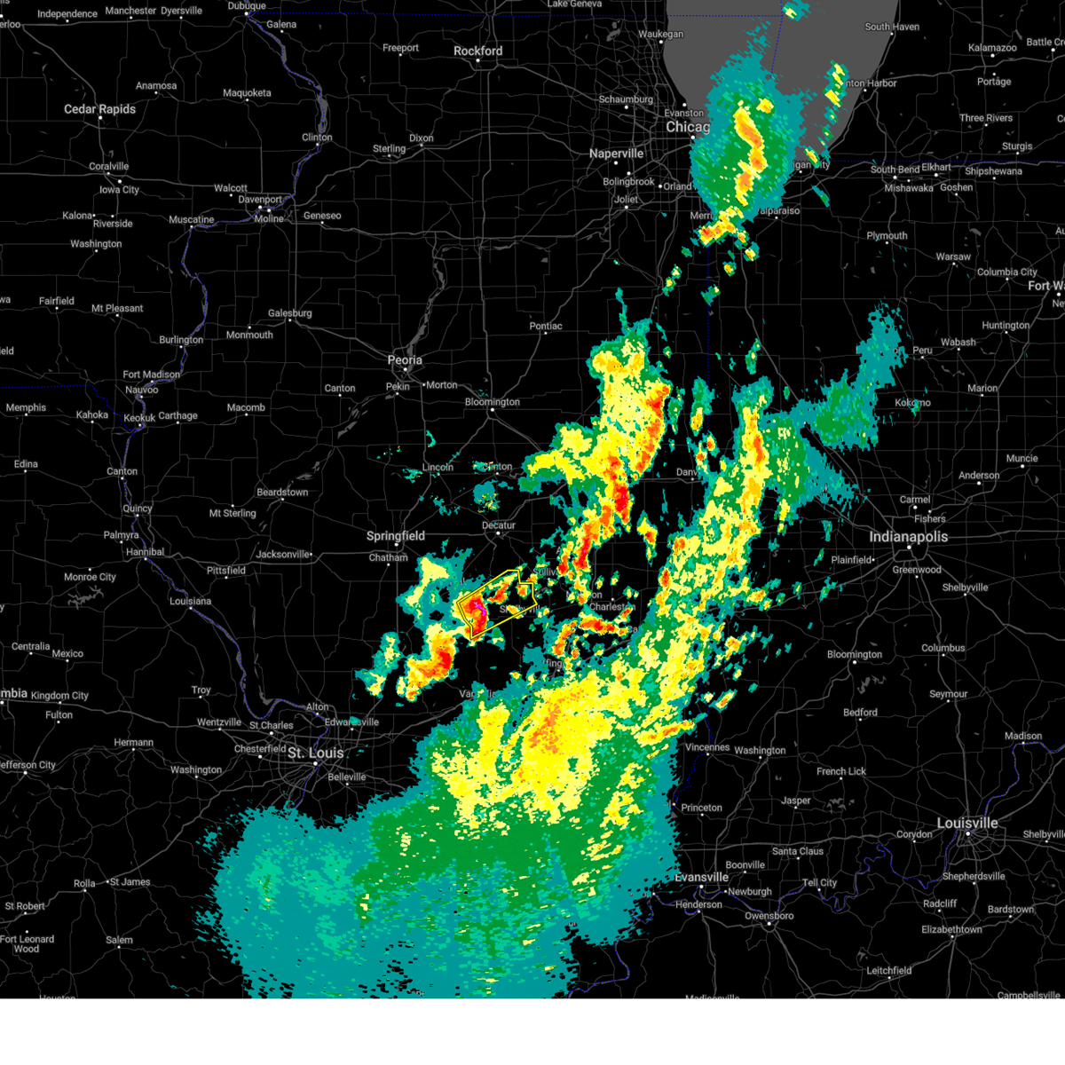 At 736 pm cdt, a severe thunderstorm was located near assumption, or 13 miles west of shelbyville, moving northeast at 50 mph (radar indicated). Hazards include 60 mph wind gusts and quarter size hail. Hail damage to vehicles is expected. expect wind damage to roofs, siding, and trees. this severe storm will be near, westervelt around 745 pm cdt. other locations in the path of this severe thunderstorm include findlay. hail threat, radar indicated max hail size, 1. 00 in wind threat, radar indicated max wind gust, 60 mph. At 736 pm cdt, a severe thunderstorm was located near assumption, or 13 miles west of shelbyville, moving northeast at 50 mph (radar indicated). Hazards include 60 mph wind gusts and quarter size hail. Hail damage to vehicles is expected. expect wind damage to roofs, siding, and trees. this severe storm will be near, westervelt around 745 pm cdt. other locations in the path of this severe thunderstorm include findlay. hail threat, radar indicated max hail size, 1. 00 in wind threat, radar indicated max wind gust, 60 mph.
|
| 4/20/2023 7:28 PM CDT |
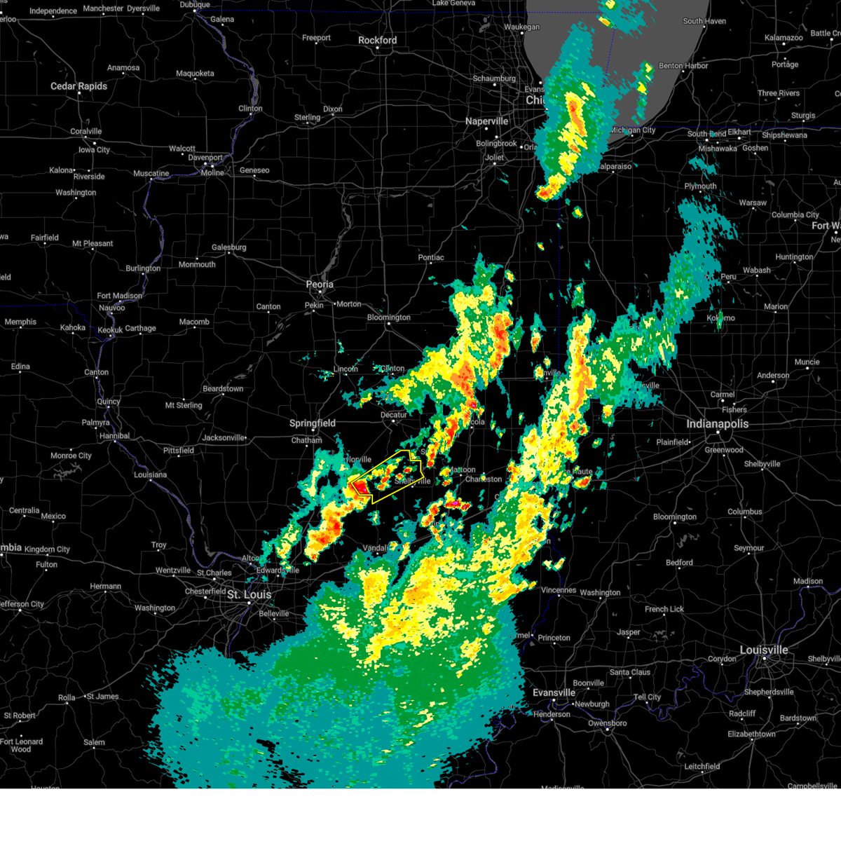 At 728 pm cdt, a severe thunderstorm was located near pana, or 9 miles northeast of nokomis, moving northeast at 50 mph (radar indicated). Hazards include quarter size hail. Damage to vehicles is expected. this severe thunderstorm will be near, assumption and tower hill around 740 pm cdt. westervelt around 745 pm cdt. other locations in the path of this severe thunderstorm include findlay. hail threat, radar indicated max hail size, 1. 00 in wind threat, radar indicated max wind gust, <50 mph. At 728 pm cdt, a severe thunderstorm was located near pana, or 9 miles northeast of nokomis, moving northeast at 50 mph (radar indicated). Hazards include quarter size hail. Damage to vehicles is expected. this severe thunderstorm will be near, assumption and tower hill around 740 pm cdt. westervelt around 745 pm cdt. other locations in the path of this severe thunderstorm include findlay. hail threat, radar indicated max hail size, 1. 00 in wind threat, radar indicated max wind gust, <50 mph.
|
| 4/20/2023 6:35 PM CDT |
 At 635 pm cdt, severe thunderstorms were located along a line extending from near macon to near stonington, moving northeast at 55 mph (radar indicated). Hazards include 60 mph wind gusts and quarter size hail. Hail damage to vehicles is expected. expect wind damage to roofs, siding, and trees. severe thunderstorms will be near, harristown around 640 pm cdt. decatur and mount zion around 645 pm cdt. macon around 650 pm cdt. oreana around 655 pm cdt. other locations in the path of these severe thunderstorms include long creek, dalton city, monticello, cerro gordo and bement. this includes interstate 72 between mile markers 144 and 150. hail threat, radar indicated max hail size, 1. 00 in wind threat, radar indicated max wind gust, 60 mph. At 635 pm cdt, severe thunderstorms were located along a line extending from near macon to near stonington, moving northeast at 55 mph (radar indicated). Hazards include 60 mph wind gusts and quarter size hail. Hail damage to vehicles is expected. expect wind damage to roofs, siding, and trees. severe thunderstorms will be near, harristown around 640 pm cdt. decatur and mount zion around 645 pm cdt. macon around 650 pm cdt. oreana around 655 pm cdt. other locations in the path of these severe thunderstorms include long creek, dalton city, monticello, cerro gordo and bement. this includes interstate 72 between mile markers 144 and 150. hail threat, radar indicated max hail size, 1. 00 in wind threat, radar indicated max wind gust, 60 mph.
|
| 3/31/2023 7:42 PM CDT | Quarter sized hail reported 6.7 miles SW of Taylorville, IL |
| 3/31/2023 7:38 PM CDT | Half Dollar sized hail reported 2.1 miles SSE of Taylorville, IL, report from mping: half dollar (1.25 in.). |
| 3/31/2023 7:33 PM CDT | Quarter sized hail reported 1.7 miles SE of Taylorville, IL |
| 2/22/2023 3:08 PM CST |
 At 307 pm cst, severe thunderstorms were located along a line extending from 6 miles southeast of taylorville to 7 miles north of ramsey, moving east at 45 mph (radar indicated). Hazards include 60 mph wind gusts. Expect damage to roofs, siding, and trees. severe thunderstorms will be near, assumption around 315 pm cst. tower hill around 320 pm cst. cowden around 325 pm cst. other locations in the path of these severe thunderstorms include shelbyville, westervelt, findlay, bethany, stewardson, sullivan, lovington, windsor and allenville. hail threat, radar indicated max hail size, <. 75 in wind threat, radar indicated max wind gust, 60 mph. At 307 pm cst, severe thunderstorms were located along a line extending from 6 miles southeast of taylorville to 7 miles north of ramsey, moving east at 45 mph (radar indicated). Hazards include 60 mph wind gusts. Expect damage to roofs, siding, and trees. severe thunderstorms will be near, assumption around 315 pm cst. tower hill around 320 pm cst. cowden around 325 pm cst. other locations in the path of these severe thunderstorms include shelbyville, westervelt, findlay, bethany, stewardson, sullivan, lovington, windsor and allenville. hail threat, radar indicated max hail size, <. 75 in wind threat, radar indicated max wind gust, 60 mph.
|
| 6/17/2022 5:43 AM CDT |
 At 542 am cdt, severe thunderstorms were located along a line extending from moweaqua to near brownstown, moving east at 25 mph (radar indicated). Hazards include 60 mph wind gusts. expect damage to roofs, siding, and trees At 542 am cdt, severe thunderstorms were located along a line extending from moweaqua to near brownstown, moving east at 25 mph (radar indicated). Hazards include 60 mph wind gusts. expect damage to roofs, siding, and trees
|
| 6/17/2022 5:28 AM CDT |
 At 528 am cdt, a severe thunderstorm was located over morrisonville, or 9 miles southwest of taylorville, moving east at 35 mph (radar indicated). Hazards include 60 mph wind gusts. Expect damage to roofs, siding, and trees. locations impacted include, morrisonville and palmer. hail threat, radar indicated max hail size, <. 75 in wind threat, radar indicated max wind gust, 60 mph. At 528 am cdt, a severe thunderstorm was located over morrisonville, or 9 miles southwest of taylorville, moving east at 35 mph (radar indicated). Hazards include 60 mph wind gusts. Expect damage to roofs, siding, and trees. locations impacted include, morrisonville and palmer. hail threat, radar indicated max hail size, <. 75 in wind threat, radar indicated max wind gust, 60 mph.
|
| 6/17/2022 5:14 AM CDT |
 At 514 am cdt, a severe thunderstorm was located near farmersville, or 8 miles east of virden, moving east at 25 mph (radar indicated). Hazards include 60 mph wind gusts. expect damage to roofs, siding, and trees At 514 am cdt, a severe thunderstorm was located near farmersville, or 8 miles east of virden, moving east at 25 mph (radar indicated). Hazards include 60 mph wind gusts. expect damage to roofs, siding, and trees
|
| 6/17/2022 4:55 AM CDT |
 At 454 am cdt, severe thunderstorms were located along a line extending from near new berlin to near edinburg, moving east at 25 mph (radar indicated). Hazards include 60 mph wind gusts and penny size hail. Expect damage to roofs, siding, and trees. these severe storms will be near, taylorville, kincaid, edinburg, bulpitt and jeisyville around 500 am cdt. other locations in the path of these severe thunderstorms include stonington, chatham, springfield and rochester. this includes the following highways, interstate 55 between mile markers 77 and 99. interstate 72 between mile markers 80 and 110. hail threat, radar indicated max hail size, 0. 75 in wind threat, radar indicated max wind gust, 60 mph. At 454 am cdt, severe thunderstorms were located along a line extending from near new berlin to near edinburg, moving east at 25 mph (radar indicated). Hazards include 60 mph wind gusts and penny size hail. Expect damage to roofs, siding, and trees. these severe storms will be near, taylorville, kincaid, edinburg, bulpitt and jeisyville around 500 am cdt. other locations in the path of these severe thunderstorms include stonington, chatham, springfield and rochester. this includes the following highways, interstate 55 between mile markers 77 and 99. interstate 72 between mile markers 80 and 110. hail threat, radar indicated max hail size, 0. 75 in wind threat, radar indicated max wind gust, 60 mph.
|
| 6/17/2022 4:42 AM CDT |
 At 442 am cdt, severe thunderstorms were located along a line extending from new berlin to near jeisyville, moving east at 30 mph (radar indicated). Hazards include 60 mph wind gusts and nickel size hail. Expect damage to roofs, siding, and trees. severe thunderstorms will be near, taylorville, kincaid, edinburg, bulpitt and jeisyville around 445 am cdt. auburn and stonington around 500 am cdt. other locations in the path of these severe thunderstorms include chatham, springfield, rochester and pawnee. this includes the following highways, interstate 55 between mile markers 77 and 99. interstate 72 between mile markers 80 and 110. hail threat, radar indicated max hail size, 0. 88 in wind threat, radar indicated max wind gust, 60 mph. At 442 am cdt, severe thunderstorms were located along a line extending from new berlin to near jeisyville, moving east at 30 mph (radar indicated). Hazards include 60 mph wind gusts and nickel size hail. Expect damage to roofs, siding, and trees. severe thunderstorms will be near, taylorville, kincaid, edinburg, bulpitt and jeisyville around 445 am cdt. auburn and stonington around 500 am cdt. other locations in the path of these severe thunderstorms include chatham, springfield, rochester and pawnee. this includes the following highways, interstate 55 between mile markers 77 and 99. interstate 72 between mile markers 80 and 110. hail threat, radar indicated max hail size, 0. 88 in wind threat, radar indicated max wind gust, 60 mph.
|
| 4/30/2022 7:02 PM CDT |
 At 701 pm cdt, a severe thunderstorm was located over mount zion, or near decatur, moving northeast at 40 mph (radar indicated). Hazards include 60 mph wind gusts and quarter size hail. Hail damage to vehicles is expected. expect wind damage to roofs, siding, and trees. locations impacted include, decatur, taylorville, moweaqua, harristown, assumption, blue mound, macon, stonington, westervelt, owaneco, boody, willeys and elwin. hail threat, radar indicated max hail size, 1. 00 in wind threat, radar indicated max wind gust, 60 mph. At 701 pm cdt, a severe thunderstorm was located over mount zion, or near decatur, moving northeast at 40 mph (radar indicated). Hazards include 60 mph wind gusts and quarter size hail. Hail damage to vehicles is expected. expect wind damage to roofs, siding, and trees. locations impacted include, decatur, taylorville, moweaqua, harristown, assumption, blue mound, macon, stonington, westervelt, owaneco, boody, willeys and elwin. hail threat, radar indicated max hail size, 1. 00 in wind threat, radar indicated max wind gust, 60 mph.
|
| 4/30/2022 6:44 PM CDT | Quarter sized hail reported 2.1 miles SSE of Taylorville, IL, report from mping: quarter (1.00 in.). |
| 4/30/2022 6:44 PM CDT |
 At 643 pm cdt, a severe thunderstorm was located over macon, or 12 miles southwest of decatur, moving northeast at 40 mph (radar indicated). Hazards include 60 mph wind gusts and quarter size hail. Hail damage to vehicles is expected. expect wind damage to roofs, siding, and trees. this severe thunderstorm will remain over mainly rural areas of central christian, western moultrie, northwestern shelby and southwestern macon counties, including the following locations, boody, willeys, palmer, sharpsburg, vanderville, elwin, owaneco and taylorville airport. this includes interstate 72 between mile markers 127 and 136. hail threat, radar indicated max hail size, 1. 00 in wind threat, radar indicated max wind gust, 60 mph. At 643 pm cdt, a severe thunderstorm was located over macon, or 12 miles southwest of decatur, moving northeast at 40 mph (radar indicated). Hazards include 60 mph wind gusts and quarter size hail. Hail damage to vehicles is expected. expect wind damage to roofs, siding, and trees. this severe thunderstorm will remain over mainly rural areas of central christian, western moultrie, northwestern shelby and southwestern macon counties, including the following locations, boody, willeys, palmer, sharpsburg, vanderville, elwin, owaneco and taylorville airport. this includes interstate 72 between mile markers 127 and 136. hail threat, radar indicated max hail size, 1. 00 in wind threat, radar indicated max wind gust, 60 mph.
|
| 4/30/2022 6:29 PM CDT |
 At 629 pm cdt, a severe thunderstorm was located over stonington, or 7 miles northeast of taylorville, moving northeast at 40 mph (radar indicated). Hazards include 60 mph wind gusts and quarter size hail. Hail damage to vehicles is expected. expect wind damage to roofs, siding, and trees. this severe thunderstorm will be near, blue mound around 645 pm cdt. other locations in the path of this severe thunderstorm include moweaqua and macon. this includes interstate 72 between mile markers 126 and 136. hail threat, radar indicated max hail size, 1. 00 in wind threat, radar indicated max wind gust, 60 mph. At 629 pm cdt, a severe thunderstorm was located over stonington, or 7 miles northeast of taylorville, moving northeast at 40 mph (radar indicated). Hazards include 60 mph wind gusts and quarter size hail. Hail damage to vehicles is expected. expect wind damage to roofs, siding, and trees. this severe thunderstorm will be near, blue mound around 645 pm cdt. other locations in the path of this severe thunderstorm include moweaqua and macon. this includes interstate 72 between mile markers 126 and 136. hail threat, radar indicated max hail size, 1. 00 in wind threat, radar indicated max wind gust, 60 mph.
|
| 4/30/2022 6:18 PM CDT |
 At 618 pm cdt, a severe thunderstorm was located near stonington, or 7 miles north of taylorville, moving northeast at 50 mph (radar indicated). Hazards include 60 mph wind gusts and quarter size hail. Hail damage to vehicles is expected. expect wind damage to roofs, siding, and trees. this severe storm will be near, mount auburn around 625 pm cdt. other locations in the path of this severe thunderstorm include blue mound, macon and niantic. this includes interstate 72 between mile markers 125 and 128. hail threat, radar indicated max hail size, 1. 00 in wind threat, radar indicated max wind gust, 60 mph. At 618 pm cdt, a severe thunderstorm was located near stonington, or 7 miles north of taylorville, moving northeast at 50 mph (radar indicated). Hazards include 60 mph wind gusts and quarter size hail. Hail damage to vehicles is expected. expect wind damage to roofs, siding, and trees. this severe storm will be near, mount auburn around 625 pm cdt. other locations in the path of this severe thunderstorm include blue mound, macon and niantic. this includes interstate 72 between mile markers 125 and 128. hail threat, radar indicated max hail size, 1. 00 in wind threat, radar indicated max wind gust, 60 mph.
|
| 4/30/2022 6:05 PM CDT |
 At 604 pm cdt, a severe thunderstorm was located over kincaid, or 8 miles northwest of taylorville, moving northeast at 50 mph (radar indicated). Hazards include 60 mph wind gusts and quarter size hail. Hail damage to vehicles is expected. expect wind damage to roofs, siding, and trees. this severe thunderstorm will be near, stonington and mount auburn around 620 pm cdt. other locations in the path of this severe thunderstorm include blue mound and niantic. this includes interstate 72 between mile markers 125 and 128. hail threat, radar indicated max hail size, 1. 00 in wind threat, radar indicated max wind gust, 60 mph. At 604 pm cdt, a severe thunderstorm was located over kincaid, or 8 miles northwest of taylorville, moving northeast at 50 mph (radar indicated). Hazards include 60 mph wind gusts and quarter size hail. Hail damage to vehicles is expected. expect wind damage to roofs, siding, and trees. this severe thunderstorm will be near, stonington and mount auburn around 620 pm cdt. other locations in the path of this severe thunderstorm include blue mound and niantic. this includes interstate 72 between mile markers 125 and 128. hail threat, radar indicated max hail size, 1. 00 in wind threat, radar indicated max wind gust, 60 mph.
|
| 4/24/2022 12:52 PM CDT |
 At 1252 pm cdt, a severe thunderstorm was located near edinburg, or near taylorville, moving northeast at 40 mph (radar indicated). Hazards include 60 mph wind gusts. Expect damage to roofs, siding, and trees. Locations impacted include, taylorville, kincaid, edinburg, stonington, bulpitt, jeisyville, tovey, sicily, willeys, roby and sharpsburg. At 1252 pm cdt, a severe thunderstorm was located near edinburg, or near taylorville, moving northeast at 40 mph (radar indicated). Hazards include 60 mph wind gusts. Expect damage to roofs, siding, and trees. Locations impacted include, taylorville, kincaid, edinburg, stonington, bulpitt, jeisyville, tovey, sicily, willeys, roby and sharpsburg.
|
| 4/24/2022 12:41 PM CDT |
 At 1241 pm cdt, a severe thunderstorm was located over jeisyville, or 9 miles west of taylorville, moving northeast at 35 mph (radar indicated). Hazards include 60 mph wind gusts. Expect damage to roofs, siding, and trees. Locations impacted include, taylorville, edinburg and stonington. At 1241 pm cdt, a severe thunderstorm was located over jeisyville, or 9 miles west of taylorville, moving northeast at 35 mph (radar indicated). Hazards include 60 mph wind gusts. Expect damage to roofs, siding, and trees. Locations impacted include, taylorville, edinburg and stonington.
|
| 4/24/2022 12:27 PM CDT |
 At 1226 pm cdt, a severe thunderstorm was located over white oak, or 10 miles east of virden, moving northeast at 35 mph (radar indicated). Hazards include 60 mph wind gusts. Expect damage to roofs, siding, and trees. this severe thunderstorm will be near, pawnee around 1235 pm cdt. bulpitt and jeisyville around 1245 pm cdt. other locations in the path of this severe thunderstorm include taylorville, kincaid, edinburg and stonington. This includes interstate 55 between mile markers 78 and 82. At 1226 pm cdt, a severe thunderstorm was located over white oak, or 10 miles east of virden, moving northeast at 35 mph (radar indicated). Hazards include 60 mph wind gusts. Expect damage to roofs, siding, and trees. this severe thunderstorm will be near, pawnee around 1235 pm cdt. bulpitt and jeisyville around 1245 pm cdt. other locations in the path of this severe thunderstorm include taylorville, kincaid, edinburg and stonington. This includes interstate 55 between mile markers 78 and 82.
|
| 3/5/2022 11:35 PM CST |
 The severe thunderstorm warning for christian, northwestern shelby and southwestern macon counties will expire at 1145 pm cst, the storm which prompted the warning has moved out of the area. therefore, the warning will be allowed to expire. a severe thunderstorm watch remains in effect until 200 am cst for central illinois. to report severe weather, contact your nearest law enforcement agency. they will relay your report to the national weather service lincoln. The severe thunderstorm warning for christian, northwestern shelby and southwestern macon counties will expire at 1145 pm cst, the storm which prompted the warning has moved out of the area. therefore, the warning will be allowed to expire. a severe thunderstorm watch remains in effect until 200 am cst for central illinois. to report severe weather, contact your nearest law enforcement agency. they will relay your report to the national weather service lincoln.
|
| 3/5/2022 11:15 PM CST | Awos station ktaz taylorville muni a in christian county IL, 2.7 miles E of Taylorville, IL |
| 3/5/2022 11:15 PM CST |
 At 1114 pm cst, a severe thunderstorm was located near taylorville, moving east at 60 mph (radar indicated). Hazards include 60 mph wind gusts. Expect damage to roofs, siding, and trees. locations impacted include, stonington, assumption, moweaqua and macon. This includes interstate 72 between mile markers 131 and 135. At 1114 pm cst, a severe thunderstorm was located near taylorville, moving east at 60 mph (radar indicated). Hazards include 60 mph wind gusts. Expect damage to roofs, siding, and trees. locations impacted include, stonington, assumption, moweaqua and macon. This includes interstate 72 between mile markers 131 and 135.
|
| 3/5/2022 10:59 PM CST |
 At 1058 pm cst, a severe thunderstorm was located over white oak, or 9 miles east of virden, moving east at 65 mph (radar indicated). Hazards include 60 mph wind gusts. Expect damage to roofs, siding, and trees. this severe thunderstorm will be near, kincaid, bulpitt and jeisyville around 1110 pm cst. taylorville around 1115 pm cst. other locations in the path of this severe thunderstorm include stonington, assumption, blue mound, moweaqua and macon. this includes the following highways, interstate 55 between mile markers 77 and 83. Interstate 72 between mile markers 129 and 135. At 1058 pm cst, a severe thunderstorm was located over white oak, or 9 miles east of virden, moving east at 65 mph (radar indicated). Hazards include 60 mph wind gusts. Expect damage to roofs, siding, and trees. this severe thunderstorm will be near, kincaid, bulpitt and jeisyville around 1110 pm cst. taylorville around 1115 pm cst. other locations in the path of this severe thunderstorm include stonington, assumption, blue mound, moweaqua and macon. this includes the following highways, interstate 55 between mile markers 77 and 83. Interstate 72 between mile markers 129 and 135.
|
| 10/24/2021 9:45 PM CDT | Relayed by county ema. small garage damaged. 52x100 machine shed destroye in christian county IL, 3.9 miles ENE of Taylorville, IL |
| 8/12/2021 3:20 PM CDT | Trained spotter reported 70-75 mph wind gust in christian county IL, 1.7 miles SE of Taylorville, IL |
| 8/12/2021 3:20 PM CDT | Trained spotter estimated 70-75 mph wind in christian county IL, 1.3 miles NW of Taylorville, IL |
| 8/12/2021 3:16 PM CDT | Storm damage reported in christian county IL, 2.7 miles E of Taylorville, IL |
| 8/12/2021 3:15 PM CDT | Branches down north silver st 800 block blocking roa in christian county IL, 2.6 miles SE of Taylorville, IL |
| 8/12/2021 3:13 PM CDT |
 At 313 pm cdt, a severe thunderstorm was located over taylorville, moving southeast at 45 mph (radar indicated). Hazards include 70 mph wind gusts and penny size hail. Expect considerable tree damage. damage is likely to mobile homes, roofs, and outbuildings. locations impacted include, taylorville, shelbyville, pana, moweaqua, bethany, assumption, blue mound, macon, stonington, findlay, tower hill, westervelt, herrick, rosamond, owaneco, oconee, kirksville and vanderville. thunderstorm damage threat, considerable hail threat, radar indicated max hail size, 0. 75 in wind threat, radar indicated max wind gust, 70 mph. At 313 pm cdt, a severe thunderstorm was located over taylorville, moving southeast at 45 mph (radar indicated). Hazards include 70 mph wind gusts and penny size hail. Expect considerable tree damage. damage is likely to mobile homes, roofs, and outbuildings. locations impacted include, taylorville, shelbyville, pana, moweaqua, bethany, assumption, blue mound, macon, stonington, findlay, tower hill, westervelt, herrick, rosamond, owaneco, oconee, kirksville and vanderville. thunderstorm damage threat, considerable hail threat, radar indicated max hail size, 0. 75 in wind threat, radar indicated max wind gust, 70 mph.
|
| 8/12/2021 3:10 PM CDT | Large limbs up to 3 in down some of which that have fallen on houses and vehicles. time estimated from rada in christian county IL, 2.2 miles WNW of Taylorville, IL |
| 8/12/2021 3:10 PM CDT | Personal weather station read 58 mph before equipment outage in christian county IL, 1.3 miles NW of Taylorville, IL |
| 8/12/2021 3:10 PM CDT | Personal weather equipment read 58 mph before failin in christian county IL, 1.7 miles SE of Taylorville, IL |
| 8/12/2021 3:08 PM CDT |
 At 307 pm cdt, a severe thunderstorm was located near taylorville, moving southeast at 45 mph (radar indicated). Hazards include 60 mph wind gusts and penny size hail. expect damage to roofs, siding, and trees At 307 pm cdt, a severe thunderstorm was located near taylorville, moving southeast at 45 mph (radar indicated). Hazards include 60 mph wind gusts and penny size hail. expect damage to roofs, siding, and trees
|
| 8/12/2021 3:00 PM CDT |
 At 300 pm cdt, a severe thunderstorm was located near edinburg, or 12 miles southeast of springfield, moving southeast at 30 mph (trained weather spotters). Hazards include 60 mph wind gusts and penny size hail. Expect damage to roofs, siding, and trees. locations impacted include, edinburg, kincaid, bulpitt, jeisyville, taylorville and stonington. this includes the following highways, interstate 55 between mile markers 88 and 97. interstate 72 between mile markers 97 and 120. hail threat, radar indicated max hail size, 0. 75 in wind threat, radar indicated max wind gust, 60 mph. At 300 pm cdt, a severe thunderstorm was located near edinburg, or 12 miles southeast of springfield, moving southeast at 30 mph (trained weather spotters). Hazards include 60 mph wind gusts and penny size hail. Expect damage to roofs, siding, and trees. locations impacted include, edinburg, kincaid, bulpitt, jeisyville, taylorville and stonington. this includes the following highways, interstate 55 between mile markers 88 and 97. interstate 72 between mile markers 97 and 120. hail threat, radar indicated max hail size, 0. 75 in wind threat, radar indicated max wind gust, 60 mph.
|
| 8/12/2021 2:43 PM CDT |
 At 243 pm cdt, a severe thunderstorm was located over rochester, or near springfield, moving southeast at 30 mph (radar indicated). Hazards include 60 mph wind gusts and penny size hail. Expect damage to roofs, siding, and trees. this severe thunderstorm will be near, mechanicsburg around 250 pm cdt. other locations in the path of this severe thunderstorm include edinburg, kincaid, bulpitt, jeisyville, taylorville and stonington. this includes the following highways, interstate 55 between mile markers 88 and 107. interstate 72 between mile markers 93 and 120. hail threat, radar indicated max hail size, 0. 75 in wind threat, radar indicated max wind gust, 60 mph. At 243 pm cdt, a severe thunderstorm was located over rochester, or near springfield, moving southeast at 30 mph (radar indicated). Hazards include 60 mph wind gusts and penny size hail. Expect damage to roofs, siding, and trees. this severe thunderstorm will be near, mechanicsburg around 250 pm cdt. other locations in the path of this severe thunderstorm include edinburg, kincaid, bulpitt, jeisyville, taylorville and stonington. this includes the following highways, interstate 55 between mile markers 88 and 107. interstate 72 between mile markers 93 and 120. hail threat, radar indicated max hail size, 0. 75 in wind threat, radar indicated max wind gust, 60 mph.
|
| 7/9/2021 11:43 PM CDT |
 At 1143 pm cdt, a severe thunderstorm was located near taylorville, moving east at 45 mph (radar indicated. at 1135 pm cdt 60 mph wind was reported at the taylorville airport). Hazards include 60 mph wind gusts. Expect damage to roofs, siding, and trees. this severe thunderstorm will be near, pana around 1150 pm cdt. assumption around 1155 pm cdt. tower hill around 1200 am cdt. Other locations in the path of this severe thunderstorm include westervelt, shelbyville and findlay. At 1143 pm cdt, a severe thunderstorm was located near taylorville, moving east at 45 mph (radar indicated. at 1135 pm cdt 60 mph wind was reported at the taylorville airport). Hazards include 60 mph wind gusts. Expect damage to roofs, siding, and trees. this severe thunderstorm will be near, pana around 1150 pm cdt. assumption around 1155 pm cdt. tower hill around 1200 am cdt. Other locations in the path of this severe thunderstorm include westervelt, shelbyville and findlay.
|
| 7/9/2021 11:35 PM CDT | Corrects previous non-tstm wnd gst report from taylorville airport. awos station ktaz taylorville muni a in christian county IL, 2.7 miles E of Taylorville, IL |
| 6/19/2021 7:06 AM CDT |
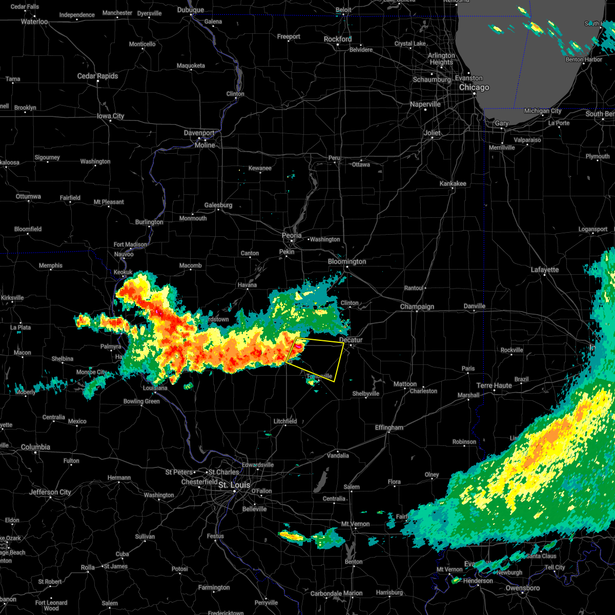 At 706 am cdt, a severe thunderstorm was located near rochester, or near springfield, moving east at 55 mph (radar indicated). Hazards include 70 mph wind gusts and nickel size hail. Expect considerable tree damage. damage is likely to mobile homes, roofs, and outbuildings. this severe thunderstorm will be near, mechanicsburg around 710 am cdt. edinburg around 715 am cdt. illiopolis and mount auburn around 720 am cdt. stonington around 725 am cdt. other locations in the path of this severe thunderstorm include blue mound. this includes the following highways, interstate 55 near mile marker 89, and between mile markers 93 and 97. Interstate 72 between mile markers 100 and 135. At 706 am cdt, a severe thunderstorm was located near rochester, or near springfield, moving east at 55 mph (radar indicated). Hazards include 70 mph wind gusts and nickel size hail. Expect considerable tree damage. damage is likely to mobile homes, roofs, and outbuildings. this severe thunderstorm will be near, mechanicsburg around 710 am cdt. edinburg around 715 am cdt. illiopolis and mount auburn around 720 am cdt. stonington around 725 am cdt. other locations in the path of this severe thunderstorm include blue mound. this includes the following highways, interstate 55 near mile marker 89, and between mile markers 93 and 97. Interstate 72 between mile markers 100 and 135.
|
| 5/27/2021 1:28 PM CDT |
 At 127 pm cdt, severe thunderstorms were located along a line extending from near kenney to near macon to near nokomis, moving east at 40 mph (radar indicated). Hazards include 60 mph wind gusts and quarter size hail. Hail damage to vehicles is expected. expect wind damage to roofs, siding, and trees. these severe storms will be near, moweaqua, warrensburg, macon and kenney around 135 pm cdt. forsyth and maroa around 140 pm cdt. mount zion, long creek and oreana around 145 pm cdt. assumption around 150 pm cdt. tower hill around 155 pm cdt. westervelt around 205 pm cdt. shelbyville around 210 pm cdt. other locations impacted by these severe thunderstorms include boody, hervey city, weldon springs state park, vanderville, rosamond, rowell, elwin, owaneco and decatur airport. This includes interstate 72 between mile markers 126 and 146. At 127 pm cdt, severe thunderstorms were located along a line extending from near kenney to near macon to near nokomis, moving east at 40 mph (radar indicated). Hazards include 60 mph wind gusts and quarter size hail. Hail damage to vehicles is expected. expect wind damage to roofs, siding, and trees. these severe storms will be near, moweaqua, warrensburg, macon and kenney around 135 pm cdt. forsyth and maroa around 140 pm cdt. mount zion, long creek and oreana around 145 pm cdt. assumption around 150 pm cdt. tower hill around 155 pm cdt. westervelt around 205 pm cdt. shelbyville around 210 pm cdt. other locations impacted by these severe thunderstorms include boody, hervey city, weldon springs state park, vanderville, rosamond, rowell, elwin, owaneco and decatur airport. This includes interstate 72 between mile markers 126 and 146.
|
| 5/27/2021 1:05 PM CDT |
 At 103 pm cdt, severe thunderstorms were located along a line extending from near cornland to near edinburg to near nokomis, moving east at 40 mph (radar indicated). Hazards include 60 mph wind gusts and quarter size hail. Hail damage to vehicles is expected. expect wind damage to roofs, siding, and trees. severe thunderstorms will be near, mount auburn around 110 pm cdt. mount pulaski and stonington around 115 pm cdt. blue mound, latham and chestnut around 120 pm cdt. pana and moweaqua around 125 pm cdt. warrensburg, macon and kenney around 130 pm cdt. mount zion and tower hill around 135 pm cdt. forsyth, maroa and long creek around 140 pm cdt. shelbyville, oreana and westervelt around 145 pm cdt. other locations impacted by these severe thunderstorms include boody, willeys, weldon springs state park, sharpsburg, rowell, elwin, decatur airport, roby, hervey city and vanderville. This includes interstate 72 between mile markers 113 and 146. At 103 pm cdt, severe thunderstorms were located along a line extending from near cornland to near edinburg to near nokomis, moving east at 40 mph (radar indicated). Hazards include 60 mph wind gusts and quarter size hail. Hail damage to vehicles is expected. expect wind damage to roofs, siding, and trees. severe thunderstorms will be near, mount auburn around 110 pm cdt. mount pulaski and stonington around 115 pm cdt. blue mound, latham and chestnut around 120 pm cdt. pana and moweaqua around 125 pm cdt. warrensburg, macon and kenney around 130 pm cdt. mount zion and tower hill around 135 pm cdt. forsyth, maroa and long creek around 140 pm cdt. shelbyville, oreana and westervelt around 145 pm cdt. other locations impacted by these severe thunderstorms include boody, willeys, weldon springs state park, sharpsburg, rowell, elwin, decatur airport, roby, hervey city and vanderville. This includes interstate 72 between mile markers 113 and 146.
|
| 5/3/2021 7:33 PM CDT |
 At 733 pm cdt, a severe thunderstorm was located near pana, or near nokomis, moving east at 35 mph (trained weather spotters). Hazards include golf ball size hail and 60 mph wind gusts. People and animals outdoors will be injured. expect hail damage to roofs, siding, windows, and vehicles. Expect wind damage to roofs, siding, and trees. At 733 pm cdt, a severe thunderstorm was located near pana, or near nokomis, moving east at 35 mph (trained weather spotters). Hazards include golf ball size hail and 60 mph wind gusts. People and animals outdoors will be injured. expect hail damage to roofs, siding, windows, and vehicles. Expect wind damage to roofs, siding, and trees.
|
| 5/3/2021 7:31 PM CDT |
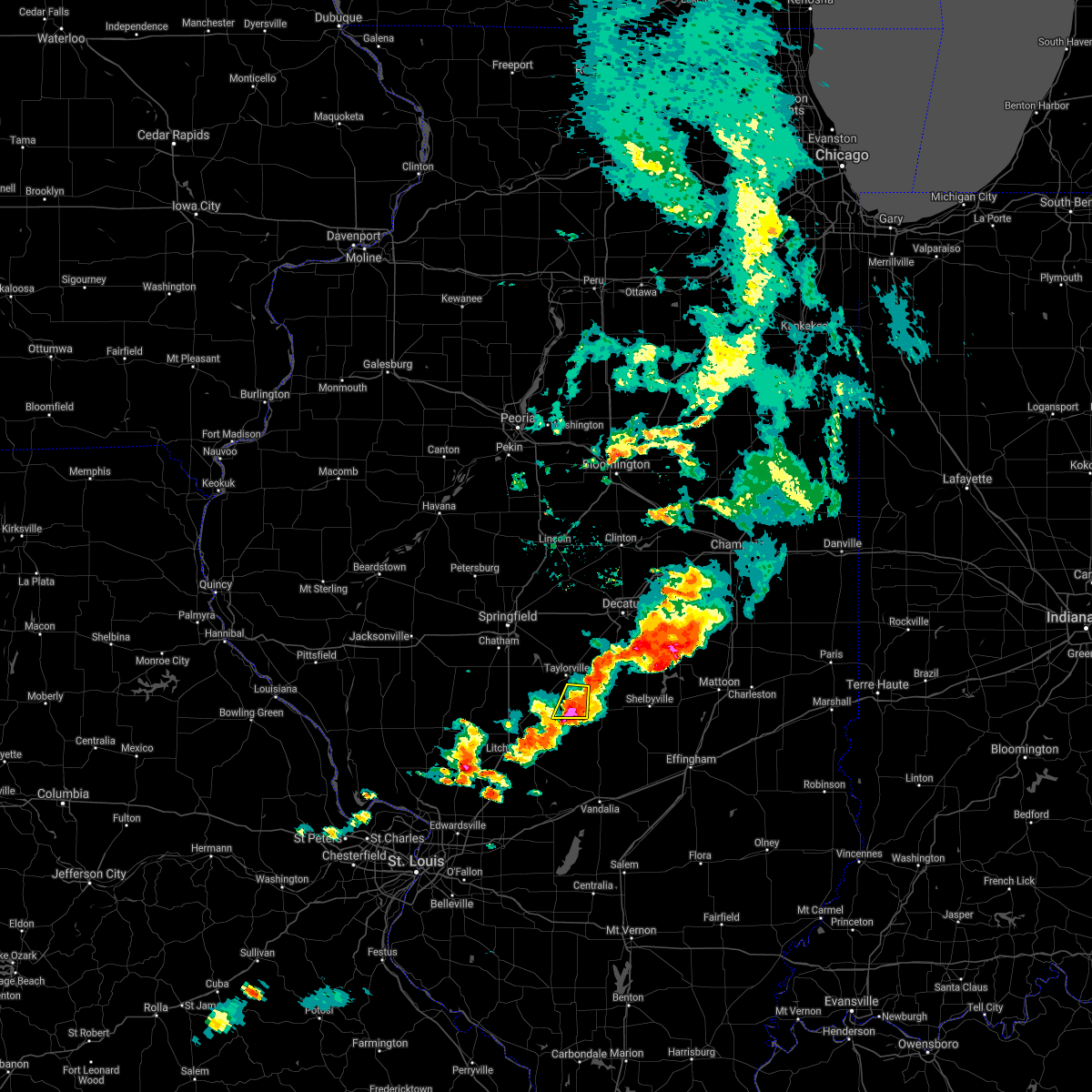 At 730 pm cdt, a severe thunderstorm was located near pana, or 7 miles northeast of nokomis, moving east at 35 mph (trained weather spotters). Hazards include ping pong ball size hail and 60 mph wind gusts. People and animals outdoors will be injured. expect hail damage to roofs, siding, windows, and vehicles. expect wind damage to roofs, siding, and trees. Locations impacted include, taylorville, owaneco and vanderville. At 730 pm cdt, a severe thunderstorm was located near pana, or 7 miles northeast of nokomis, moving east at 35 mph (trained weather spotters). Hazards include ping pong ball size hail and 60 mph wind gusts. People and animals outdoors will be injured. expect hail damage to roofs, siding, windows, and vehicles. expect wind damage to roofs, siding, and trees. Locations impacted include, taylorville, owaneco and vanderville.
|
| 5/3/2021 7:27 PM CDT |
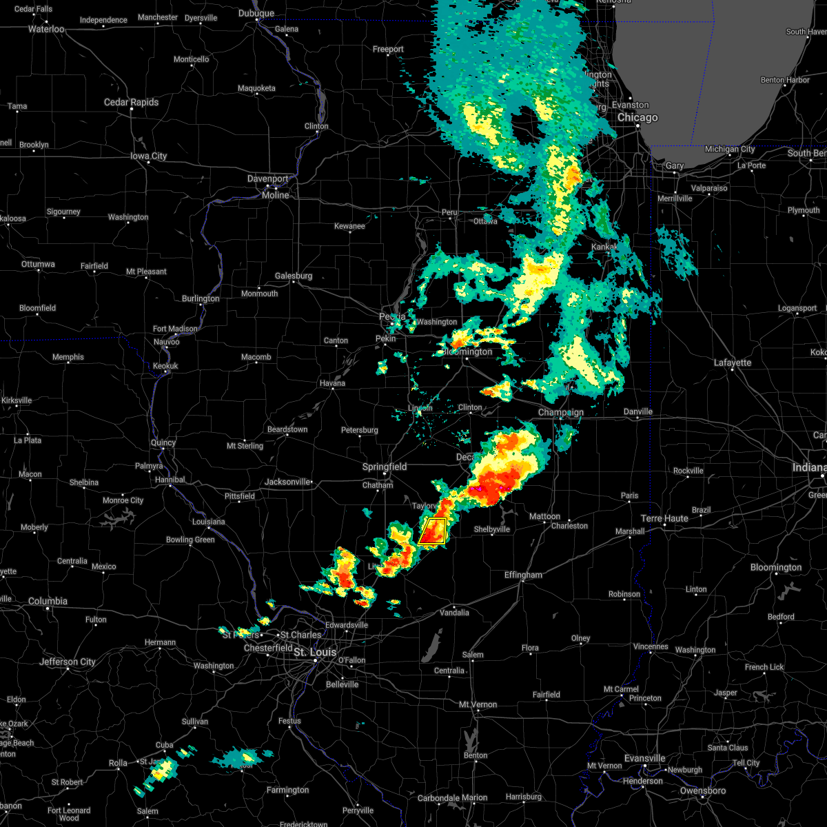 At 727 pm cdt, a severe thunderstorm was located 7 miles north of nokomis, moving east at 35 mph (radar indicated). Hazards include ping pong ball size hail and 60 mph wind gusts. People and animals outdoors will be injured. expect hail damage to roofs, siding, windows, and vehicles. expect wind damage to roofs, siding, and trees. Locations impacted include, taylorville, owaneco and vanderville. At 727 pm cdt, a severe thunderstorm was located 7 miles north of nokomis, moving east at 35 mph (radar indicated). Hazards include ping pong ball size hail and 60 mph wind gusts. People and animals outdoors will be injured. expect hail damage to roofs, siding, windows, and vehicles. expect wind damage to roofs, siding, and trees. Locations impacted include, taylorville, owaneco and vanderville.
|
| 5/3/2021 7:09 PM CDT |
 At 709 pm cdt, a severe thunderstorm was located over morrisonville, or 12 miles northwest of nokomis, moving east at 35 mph (radar indicated). Hazards include ping pong ball size hail and 60 mph wind gusts. People and animals outdoors will be injured. expect hail damage to roofs, siding, windows, and vehicles. expect wind damage to roofs, siding, and trees. Locations impacted include, taylorville, morrisonville, owaneco, palmer and vanderville. At 709 pm cdt, a severe thunderstorm was located over morrisonville, or 12 miles northwest of nokomis, moving east at 35 mph (radar indicated). Hazards include ping pong ball size hail and 60 mph wind gusts. People and animals outdoors will be injured. expect hail damage to roofs, siding, windows, and vehicles. expect wind damage to roofs, siding, and trees. Locations impacted include, taylorville, morrisonville, owaneco, palmer and vanderville.
|
| 5/3/2021 6:54 PM CDT |
 At 654 pm cdt, a severe thunderstorm was located over farmersville, or 9 miles southeast of virden, moving east at 35 mph (radar indicated). Hazards include ping pong ball size hail and 60 mph wind gusts. People and animals outdoors will be injured. expect hail damage to roofs, siding, windows, and vehicles. Expect wind damage to roofs, siding, and trees. At 654 pm cdt, a severe thunderstorm was located over farmersville, or 9 miles southeast of virden, moving east at 35 mph (radar indicated). Hazards include ping pong ball size hail and 60 mph wind gusts. People and animals outdoors will be injured. expect hail damage to roofs, siding, windows, and vehicles. Expect wind damage to roofs, siding, and trees.
|
| 3/27/2021 6:00 PM CDT | Sheet metal on the road and damage to tree in christian county IL, 0.9 miles SE of Taylorville, IL |
| 3/27/2021 6:00 PM CDT | Large tree dow in christian county IL, 1.3 miles ESE of Taylorville, IL |
| 3/27/2021 5:58 PM CDT | Quarter sized hail reported 2.1 miles SSE of Taylorville, IL, report from mping: quarter (1.00 in.). |
| 3/27/2021 5:56 PM CDT | Awos station ktaz taylorville muni a in christian county IL, 2.7 miles E of Taylorville, IL |
| 3/27/2021 5:56 PM CDT |
 At 556 pm cdt, a severe thunderstorm was located over assumption, or 12 miles east of taylorville, moving east at 70 mph (radar indicated). Hazards include 60 mph wind gusts and quarter size hail. Hail damage to vehicles is expected. expect wind damage to roofs, siding, and trees. Locations impacted include, taylorville, moweaqua, kincaid, assumption, edinburg, stonington, bulpitt, jeisyville, owaneco, willeys, sharpsburg and taylorville airport. At 556 pm cdt, a severe thunderstorm was located over assumption, or 12 miles east of taylorville, moving east at 70 mph (radar indicated). Hazards include 60 mph wind gusts and quarter size hail. Hail damage to vehicles is expected. expect wind damage to roofs, siding, and trees. Locations impacted include, taylorville, moweaqua, kincaid, assumption, edinburg, stonington, bulpitt, jeisyville, owaneco, willeys, sharpsburg and taylorville airport.
|
| 3/27/2021 5:54 PM CDT | Half Dollar sized hail reported 2 miles S of Taylorville, IL |
| 3/27/2021 5:54 PM CDT | Half Dollar sized hail reported 2.1 miles WSW of Taylorville, IL, report from mping: half dollar (1.25 in.). |
| 3/27/2021 5:47 PM CDT |
 At 547 pm cdt, a severe thunderstorm was located near taylorville, moving east at 50 mph (radar indicated). Hazards include 60 mph wind gusts and quarter size hail. Hail damage to vehicles is expected. expect wind damage to roofs, siding, and trees. Locations impacted include, taylorville, moweaqua, kincaid, assumption, edinburg, morrisonville, stonington, bulpitt, jeisyville, tovey, owaneco, palmer, willeys, sharpsburg, sicily and taylorville airport. At 547 pm cdt, a severe thunderstorm was located near taylorville, moving east at 50 mph (radar indicated). Hazards include 60 mph wind gusts and quarter size hail. Hail damage to vehicles is expected. expect wind damage to roofs, siding, and trees. Locations impacted include, taylorville, moweaqua, kincaid, assumption, edinburg, morrisonville, stonington, bulpitt, jeisyville, tovey, owaneco, palmer, willeys, sharpsburg, sicily and taylorville airport.
|
| 3/27/2021 5:32 PM CDT |
 At 532 pm cdt, a severe thunderstorm was located over white oak, or 9 miles east of virden, moving east at 55 mph (radar indicated). Hazards include 60 mph wind gusts and quarter size hail. Hail damage to vehicles is expected. Expect wind damage to roofs, siding, and trees. At 532 pm cdt, a severe thunderstorm was located over white oak, or 9 miles east of virden, moving east at 55 mph (radar indicated). Hazards include 60 mph wind gusts and quarter size hail. Hail damage to vehicles is expected. Expect wind damage to roofs, siding, and trees.
|
| 8/10/2020 4:40 PM CDT |
 At 439 pm cdt, severe thunderstorms were located along a line extending from camargo to near nokomis, moving southeast at 40 mph (radar indicated). Hazards include 70 mph wind gusts. Expect considerable tree damage. damage is likely to mobile homes, roofs, and outbuildings. locations impacted include, charleston, mattoon, taylorville, shelbyville, tuscola, sullivan, pana, arcola, arthur, bethany, assumption, morrisonville, oakland, windsor, stewardson, findlay, cowden, tower hill, camargo and humboldt. This includes interstate 57 between mile markers 182 and 212. At 439 pm cdt, severe thunderstorms were located along a line extending from camargo to near nokomis, moving southeast at 40 mph (radar indicated). Hazards include 70 mph wind gusts. Expect considerable tree damage. damage is likely to mobile homes, roofs, and outbuildings. locations impacted include, charleston, mattoon, taylorville, shelbyville, tuscola, sullivan, pana, arcola, arthur, bethany, assumption, morrisonville, oakland, windsor, stewardson, findlay, cowden, tower hill, camargo and humboldt. This includes interstate 57 between mile markers 182 and 212.
|
| 8/10/2020 4:29 PM CDT |
 At 429 pm cdt, severe thunderstorms were located along a line extending from allerton to near assumption, moving east at 70 mph (radar indicated). Hazards include 70 mph wind gusts. Expect considerable tree damage. Damage is likely to mobile homes, roofs, and outbuildings. At 429 pm cdt, severe thunderstorms were located along a line extending from allerton to near assumption, moving east at 70 mph (radar indicated). Hazards include 70 mph wind gusts. Expect considerable tree damage. Damage is likely to mobile homes, roofs, and outbuildings.
|
| 7/21/2020 4:39 PM CDT |
 At 438 pm cdt, severe thunderstorms were located along a line extending from near mechanicsburg to taylorville, moving east at 45 mph (radar indicated). Hazards include 60 mph wind gusts. expect damage to roofs, siding, and trees At 438 pm cdt, severe thunderstorms were located along a line extending from near mechanicsburg to taylorville, moving east at 45 mph (radar indicated). Hazards include 60 mph wind gusts. expect damage to roofs, siding, and trees
|
| 7/21/2020 4:27 PM CDT |
 At 427 pm cdt, a severe squall line capable of producing both tornadoes and extensive straight line wind damage was located over edinburg, or 12 miles northwest of taylorville, moving east at 50 mph (radar indicated rotation). Hazards include tornado. Flying debris will be dangerous to those caught without shelter. mobile homes will be damaged or destroyed. damage to roofs, windows, and vehicles will occur. tree damage is likely. these dangerous storms will be near, taylorville around 435 pm cdt. mount auburn around 440 pm cdt. stonington around 445 pm cdt. Other locations impacted by this tornadic thunderstorm include sangchris lake state park, sicily, willeys, roby, sharpsburg, berry, owaneco, tovey and taylorville airport. At 427 pm cdt, a severe squall line capable of producing both tornadoes and extensive straight line wind damage was located over edinburg, or 12 miles northwest of taylorville, moving east at 50 mph (radar indicated rotation). Hazards include tornado. Flying debris will be dangerous to those caught without shelter. mobile homes will be damaged or destroyed. damage to roofs, windows, and vehicles will occur. tree damage is likely. these dangerous storms will be near, taylorville around 435 pm cdt. mount auburn around 440 pm cdt. stonington around 445 pm cdt. Other locations impacted by this tornadic thunderstorm include sangchris lake state park, sicily, willeys, roby, sharpsburg, berry, owaneco, tovey and taylorville airport.
|
| 7/21/2020 4:18 PM CDT |
 At 418 pm cdt, severe thunderstorms capable of producing both tornadoes and extensive straight line wind damage were located over white oak, or 12 miles east of virden, moving east at 45 mph (radar indicated rotation). Hazards include tornado. Flying debris will be dangerous to those caught without shelter. mobile homes will be damaged or destroyed. damage to roofs, windows, and vehicles will occur. tree damage is likely. these dangerous storms will be near, kincaid, edinburg, bulpitt and jeisyville around 430 pm cdt. taylorville around 435 pm cdt. stonington around 445 pm cdt. other locations impacted by this tornadic thunderstorm include sangchris lake state park, sicily, willeys, roby, sharpsburg, berry, owaneco, tovey, taylorville airport and glenarm. This includes interstate 55 between mile markers 84 and 89. At 418 pm cdt, severe thunderstorms capable of producing both tornadoes and extensive straight line wind damage were located over white oak, or 12 miles east of virden, moving east at 45 mph (radar indicated rotation). Hazards include tornado. Flying debris will be dangerous to those caught without shelter. mobile homes will be damaged or destroyed. damage to roofs, windows, and vehicles will occur. tree damage is likely. these dangerous storms will be near, kincaid, edinburg, bulpitt and jeisyville around 430 pm cdt. taylorville around 435 pm cdt. stonington around 445 pm cdt. other locations impacted by this tornadic thunderstorm include sangchris lake state park, sicily, willeys, roby, sharpsburg, berry, owaneco, tovey, taylorville airport and glenarm. This includes interstate 55 between mile markers 84 and 89.
|
| 6/20/2020 5:04 PM CDT | Numerous treees blown down and power out along lincoln trail road east of taylorvill in christian county IL, 4.8 miles W of Taylorville, IL |
| 5/2/2020 10:26 PM CDT |
 At 1026 pm cdt, severe thunderstorms were located along a line extending from near bethany to 6 miles southwest of pana, moving east at 60 mph (radar indicated). Hazards include 60 mph wind gusts and penny size hail. Expect damage to roofs, siding, and trees. Locations impacted include, taylorville, shelbyville, pana, moweaqua, bethany, assumption, findlay, tower hill, westervelt, rosamond, owaneco and vanderville. At 1026 pm cdt, severe thunderstorms were located along a line extending from near bethany to 6 miles southwest of pana, moving east at 60 mph (radar indicated). Hazards include 60 mph wind gusts and penny size hail. Expect damage to roofs, siding, and trees. Locations impacted include, taylorville, shelbyville, pana, moweaqua, bethany, assumption, findlay, tower hill, westervelt, rosamond, owaneco and vanderville.
|
| 5/2/2020 10:07 PM CDT |
 At 1006 pm cdt, severe thunderstorms were located along a line extending from near macon to near morrisonville, moving east at 60 mph (radar indicated. at 1006 pm, a 52 mph wind gust was reported at the taylorville airport). Hazards include 60 mph wind gusts and penny size hail. expect damage to roofs, siding, and trees At 1006 pm cdt, severe thunderstorms were located along a line extending from near macon to near morrisonville, moving east at 60 mph (radar indicated. at 1006 pm, a 52 mph wind gust was reported at the taylorville airport). Hazards include 60 mph wind gusts and penny size hail. expect damage to roofs, siding, and trees
|
| 4/28/2020 8:25 PM CDT |
 The severe thunderstorm warning for southern christian county will expire at 830 pm cdt, the storm which prompted the warning has weakened below severe limits, and no longer poses an immediate threat to life or property. therefore, the warning will be allowed to expire. a severe thunderstorm watch remains in effect until 1100 pm cdt for central illinois. The severe thunderstorm warning for southern christian county will expire at 830 pm cdt, the storm which prompted the warning has weakened below severe limits, and no longer poses an immediate threat to life or property. therefore, the warning will be allowed to expire. a severe thunderstorm watch remains in effect until 1100 pm cdt for central illinois.
|
| 4/28/2020 8:24 PM CDT |
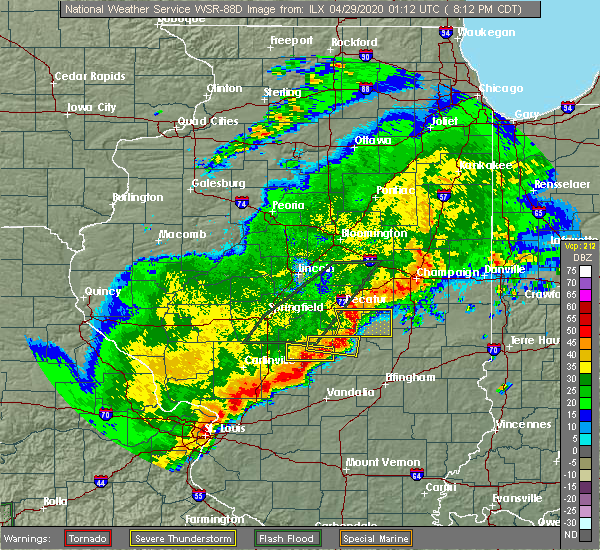 The severe thunderstorm warning for southeastern christian and northwestern shelby counties will expire at 830 pm cdt, the storm which prompted the warning has weakened below severe limits, and no longer poses an immediate threat to life or property. therefore, the warning will be allowed to expire. a severe thunderstorm watch remains in effect until 1100 pm cdt for central illinois. The severe thunderstorm warning for southeastern christian and northwestern shelby counties will expire at 830 pm cdt, the storm which prompted the warning has weakened below severe limits, and no longer poses an immediate threat to life or property. therefore, the warning will be allowed to expire. a severe thunderstorm watch remains in effect until 1100 pm cdt for central illinois.
|
| 4/28/2020 7:54 PM CDT |
 At 754 pm cdt, a severe thunderstorm was located near morrisonville, or 9 miles southwest of taylorville, moving east at 35 mph (radar indicated). Hazards include 60 mph wind gusts and quarter size hail. Hail damage to vehicles is expected. Expect wind damage to roofs, siding, and trees. At 754 pm cdt, a severe thunderstorm was located near morrisonville, or 9 miles southwest of taylorville, moving east at 35 mph (radar indicated). Hazards include 60 mph wind gusts and quarter size hail. Hail damage to vehicles is expected. Expect wind damage to roofs, siding, and trees.
|
| 4/28/2020 7:41 PM CDT |
 At 740 pm cdt, a severe thunderstorm was located near macon, or 7 miles southwest of decatur, moving east at 35 mph (radar indicated). Hazards include 60 mph wind gusts. Expect damage to roofs, siding, and trees. locations impacted include, decatur, taylorville, moweaqua, harristown, blue mound, macon, stonington, illiopolis, niantic, boody, willeys and elwin. This includes interstate 72 between mile markers 123 and 135. At 740 pm cdt, a severe thunderstorm was located near macon, or 7 miles southwest of decatur, moving east at 35 mph (radar indicated). Hazards include 60 mph wind gusts. Expect damage to roofs, siding, and trees. locations impacted include, decatur, taylorville, moweaqua, harristown, blue mound, macon, stonington, illiopolis, niantic, boody, willeys and elwin. This includes interstate 72 between mile markers 123 and 135.
|
| 4/28/2020 7:38 PM CDT |
 At 738 pm cdt, a severe thunderstorm was located near taylorville, moving east at 35 mph (radar indicated). Hazards include 60 mph wind gusts. expect damage to roofs, siding, and trees At 738 pm cdt, a severe thunderstorm was located near taylorville, moving east at 35 mph (radar indicated). Hazards include 60 mph wind gusts. expect damage to roofs, siding, and trees
|
| 4/28/2020 7:07 PM CDT |
 At 707 pm cdt, a severe thunderstorm was located over mechanicsburg, or 14 miles east of springfield, moving east at 35 mph (radar indicated). Hazards include 60 mph wind gusts. expect damage to roofs, siding, and trees At 707 pm cdt, a severe thunderstorm was located over mechanicsburg, or 14 miles east of springfield, moving east at 35 mph (radar indicated). Hazards include 60 mph wind gusts. expect damage to roofs, siding, and trees
|
| 4/11/2020 8:26 PM CDT |
 At 826 pm cdt, a severe thunderstorm was located near moweaqua, or 10 miles northeast of taylorville, moving east at 40 mph (radar indicated). Hazards include quarter size hail. Damage to vehicles is expected. Locations impacted include, taylorville, moweaqua, assumption, blue mound, macon, stonington, westervelt, willeys and taylorville airport. At 826 pm cdt, a severe thunderstorm was located near moweaqua, or 10 miles northeast of taylorville, moving east at 40 mph (radar indicated). Hazards include quarter size hail. Damage to vehicles is expected. Locations impacted include, taylorville, moweaqua, assumption, blue mound, macon, stonington, westervelt, willeys and taylorville airport.
|
| 4/11/2020 8:06 PM CDT |
 At 806 pm cdt, a severe thunderstorm was located near jeisyville, or near taylorville, moving east at 40 mph (radar indicated). Hazards include quarter size hail. damage to vehicles is expected At 806 pm cdt, a severe thunderstorm was located near jeisyville, or near taylorville, moving east at 40 mph (radar indicated). Hazards include quarter size hail. damage to vehicles is expected
|
| 4/11/2020 8:03 PM CDT |
 At 803 pm cdt, a severe thunderstorm was located over edinburg, or 8 miles northwest of taylorville, moving east at 45 mph (radar indicated). Hazards include quarter size hail. Damage to vehicles is expected. Locations impacted include, taylorville, kincaid, edinburg, bulpitt, jeisyville, tovey, sangchris lake state park, sicily, roby, sharpsburg and taylorville airport. At 803 pm cdt, a severe thunderstorm was located over edinburg, or 8 miles northwest of taylorville, moving east at 45 mph (radar indicated). Hazards include quarter size hail. Damage to vehicles is expected. Locations impacted include, taylorville, kincaid, edinburg, bulpitt, jeisyville, tovey, sangchris lake state park, sicily, roby, sharpsburg and taylorville airport.
|
| 4/11/2020 7:45 PM CDT |
 At 745 pm cdt, a severe thunderstorm was located over pawnee, or 11 miles south of springfield, moving east at 45 mph (radar indicated). Hazards include quarter size hail. Damage to vehicles is expected. locations impacted include, springfield, taylorville, chatham, auburn, rochester, pawnee, kincaid, divernon, edinburg, bulpitt, jeisyville, southern view, tovey, berry, sangchris lake state park, glenarm, sharpsburg, sicily, roby and taylorville airport. this includes the following highways, interstate 55 between mile markers 79 and 94. Interstate 72 between mile markers 95 and 100. At 745 pm cdt, a severe thunderstorm was located over pawnee, or 11 miles south of springfield, moving east at 45 mph (radar indicated). Hazards include quarter size hail. Damage to vehicles is expected. locations impacted include, springfield, taylorville, chatham, auburn, rochester, pawnee, kincaid, divernon, edinburg, bulpitt, jeisyville, southern view, tovey, berry, sangchris lake state park, glenarm, sharpsburg, sicily, roby and taylorville airport. this includes the following highways, interstate 55 between mile markers 79 and 94. Interstate 72 between mile markers 95 and 100.
|
| 4/11/2020 7:31 PM CDT |
 At 730 pm cdt, a severe thunderstorm was located near loami, or 9 miles north of virden, moving east at 45 mph (radar indicated). Hazards include quarter size hail. damage to vehicles is expected At 730 pm cdt, a severe thunderstorm was located near loami, or 9 miles north of virden, moving east at 45 mph (radar indicated). Hazards include quarter size hail. damage to vehicles is expected
|
| 4/8/2020 6:17 PM CDT |
 At 614 pm cdt, severe thunderstorms were located along a line extending from near white heath to near mount zion to near jeisyville, moving east at 45 mph (radar indicated). Hazards include 70 mph wind gusts and quarter size hail. Hail damage to vehicles is expected. expect considerable tree damage. wind damage is also likely to mobile homes, roofs, and outbuildings. locations impacted include, decatur, taylorville, tuscola, sullivan, mount zion, tolono, villa grove, arthur, moweaqua, bement, kincaid, cerro gordo, bethany, long creek, atwood, assumption, blue mound, macon, lovington and morrisonville. This includes interstate 57 between mile markers 208 and 226. At 614 pm cdt, severe thunderstorms were located along a line extending from near white heath to near mount zion to near jeisyville, moving east at 45 mph (radar indicated). Hazards include 70 mph wind gusts and quarter size hail. Hail damage to vehicles is expected. expect considerable tree damage. wind damage is also likely to mobile homes, roofs, and outbuildings. locations impacted include, decatur, taylorville, tuscola, sullivan, mount zion, tolono, villa grove, arthur, moweaqua, bement, kincaid, cerro gordo, bethany, long creek, atwood, assumption, blue mound, macon, lovington and morrisonville. This includes interstate 57 between mile markers 208 and 226.
|
| 4/8/2020 5:56 PM CDT |
 At 556 pm cdt, severe thunderstorms were located along a line extending from near monticello to near macon to near pawnee, moving east at 45 mph (radar indicated). Hazards include 70 mph wind gusts and quarter size hail. Hail damage to vehicles is expected. expect considerable tree damage. Wind damage is also likely to mobile homes, roofs, and outbuildings. At 556 pm cdt, severe thunderstorms were located along a line extending from near monticello to near macon to near pawnee, moving east at 45 mph (radar indicated). Hazards include 70 mph wind gusts and quarter size hail. Hail damage to vehicles is expected. expect considerable tree damage. Wind damage is also likely to mobile homes, roofs, and outbuildings.
|
| 3/28/2020 10:55 AM CDT |
 At 1055 am cdt, a severe thunderstorm was located over pawnee, or 11 miles south of springfield, moving east at 45 mph (trained weather spotters). Hazards include quarter size hail. damage to vehicles is expected At 1055 am cdt, a severe thunderstorm was located over pawnee, or 11 miles south of springfield, moving east at 45 mph (trained weather spotters). Hazards include quarter size hail. damage to vehicles is expected
|
| 8/20/2019 10:46 AM CDT |
 At 1046 am cdt, severe thunderstorms were located along a line extending from near decatur to near stonington to near girard, moving east at 50 mph (radar indicated). Hazards include 70 mph wind gusts and quarter size hail. Hail damage to vehicles is expected. expect considerable tree damage. wind damage is also likely to mobile homes, roofs, and outbuildings. locations impacted include, decatur, taylorville, mount zion, kincaid, harristown, blue mound, macon, morrisonville, stonington, jeisyville, palmer, boody, willeys, sharpsburg, elwin, decatur airport and taylorville airport. This includes interstate 72 between mile markers 132 and 135. At 1046 am cdt, severe thunderstorms were located along a line extending from near decatur to near stonington to near girard, moving east at 50 mph (radar indicated). Hazards include 70 mph wind gusts and quarter size hail. Hail damage to vehicles is expected. expect considerable tree damage. wind damage is also likely to mobile homes, roofs, and outbuildings. locations impacted include, decatur, taylorville, mount zion, kincaid, harristown, blue mound, macon, morrisonville, stonington, jeisyville, palmer, boody, willeys, sharpsburg, elwin, decatur airport and taylorville airport. This includes interstate 72 between mile markers 132 and 135.
|
| 8/20/2019 10:17 AM CDT |
 At 1016 am cdt, severe thunderstorms were located along a line extending from near cornland to rochester to near palmyra, moving east at 55 mph (radar indicated). Hazards include 70 mph wind gusts and quarter size hail. Hail damage to vehicles is expected. expect considerable tree damage. Wind damage is also likely to mobile homes, roofs, and outbuildings. At 1016 am cdt, severe thunderstorms were located along a line extending from near cornland to rochester to near palmyra, moving east at 55 mph (radar indicated). Hazards include 70 mph wind gusts and quarter size hail. Hail damage to vehicles is expected. expect considerable tree damage. Wind damage is also likely to mobile homes, roofs, and outbuildings.
|
| 8/12/2019 9:42 PM CDT |
 The tornado warning for central christian county will expire at 945 pm cdt, the storm which prompted the warning has moved out of the area. therefore, the warning will be allowed to expire. however gusty winds and heavy rain are still possible with this thunderstorm. a tornado watch remains in effect until 300 am cdt for central illinois. The tornado warning for central christian county will expire at 945 pm cdt, the storm which prompted the warning has moved out of the area. therefore, the warning will be allowed to expire. however gusty winds and heavy rain are still possible with this thunderstorm. a tornado watch remains in effect until 300 am cdt for central illinois.
|
| 8/12/2019 9:22 PM CDT |
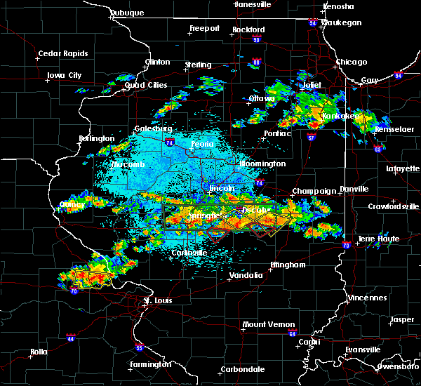 At 921 pm cdt, a confirmed tornado was located near stonington, or northeast of taylorville, moving southeast at 25 mph (radar confirmed tornado). Hazards include damaging tornado and quarter size hail. Flying debris will be dangerous to those caught without shelter. mobile homes will be damaged or destroyed. damage to roofs, windows, and vehicles will occur. tree damage is likely. this tornado will be, between taylorville and stonington around 925 pm cdt. Other locations impacted by this tornadic thunderstorm include willeys. At 921 pm cdt, a confirmed tornado was located near stonington, or northeast of taylorville, moving southeast at 25 mph (radar confirmed tornado). Hazards include damaging tornado and quarter size hail. Flying debris will be dangerous to those caught without shelter. mobile homes will be damaged or destroyed. damage to roofs, windows, and vehicles will occur. tree damage is likely. this tornado will be, between taylorville and stonington around 925 pm cdt. Other locations impacted by this tornadic thunderstorm include willeys.
|
| 8/12/2019 9:14 PM CDT |
 At 914 pm cdt, a confirmed tornado was located near edinburg, or 7 miles north of taylorville, moving southeast at 20 mph (radar confirmed tornado). Hazards include damaging tornado and quarter size hail. Flying debris will be dangerous to those caught without shelter. mobile homes will be damaged or destroyed. damage to roofs, windows, and vehicles will occur. tree damage is likely. this tornado will be near, taylorville around 920 pm cdt. stonington around 925 pm cdt. Other locations impacted by this tornadic thunderstorm include willeys and sharpsburg. At 914 pm cdt, a confirmed tornado was located near edinburg, or 7 miles north of taylorville, moving southeast at 20 mph (radar confirmed tornado). Hazards include damaging tornado and quarter size hail. Flying debris will be dangerous to those caught without shelter. mobile homes will be damaged or destroyed. damage to roofs, windows, and vehicles will occur. tree damage is likely. this tornado will be near, taylorville around 920 pm cdt. stonington around 925 pm cdt. Other locations impacted by this tornadic thunderstorm include willeys and sharpsburg.
|
| 8/12/2019 9:07 PM CDT |
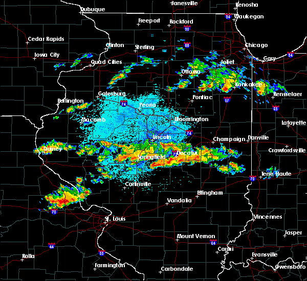 At 907 pm cdt, a severe thunderstorm capable of producing a tornado was located over edinburg, or 9 miles northwest of taylorville, moving southeast at 20 mph (radar indicated rotation). Hazards include tornado and quarter size hail. Flying debris will be dangerous to those caught without shelter. mobile homes will be damaged or destroyed. damage to roofs, windows, and vehicles will occur. tree damage is likely. this dangerous storm will be near, taylorville around 915 pm cdt. stonington around 930 pm cdt. Other locations impacted by this tornadic thunderstorm include willeys and sharpsburg. At 907 pm cdt, a severe thunderstorm capable of producing a tornado was located over edinburg, or 9 miles northwest of taylorville, moving southeast at 20 mph (radar indicated rotation). Hazards include tornado and quarter size hail. Flying debris will be dangerous to those caught without shelter. mobile homes will be damaged or destroyed. damage to roofs, windows, and vehicles will occur. tree damage is likely. this dangerous storm will be near, taylorville around 915 pm cdt. stonington around 930 pm cdt. Other locations impacted by this tornadic thunderstorm include willeys and sharpsburg.
|
| 8/12/2019 8:56 PM CDT |
 At 855 pm cdt, a severe thunderstorm was located near edinburg, or 14 miles northwest of taylorville, moving southeast at 25 mph (radar indicated). Hazards include 60 mph wind gusts and quarter size hail. Hail damage to vehicles is expected. expect wind damage to roofs, siding, and trees. Locations impacted include, taylorville, kincaid, edinburg, mount auburn, berry, sangchris lake state park, roby and sharpsburg. At 855 pm cdt, a severe thunderstorm was located near edinburg, or 14 miles northwest of taylorville, moving southeast at 25 mph (radar indicated). Hazards include 60 mph wind gusts and quarter size hail. Hail damage to vehicles is expected. expect wind damage to roofs, siding, and trees. Locations impacted include, taylorville, kincaid, edinburg, mount auburn, berry, sangchris lake state park, roby and sharpsburg.
|
| 8/12/2019 8:37 PM CDT |
 At 837 pm cdt, a severe thunderstorm was located over rochester, or 7 miles east of springfield, moving southeast at 25 mph (radar indicated). Hazards include 60 mph wind gusts and quarter size hail. Hail damage to vehicles is expected. Expect wind damage to roofs, siding, and trees. At 837 pm cdt, a severe thunderstorm was located over rochester, or 7 miles east of springfield, moving southeast at 25 mph (radar indicated). Hazards include 60 mph wind gusts and quarter size hail. Hail damage to vehicles is expected. Expect wind damage to roofs, siding, and trees.
|
| 6/21/2019 12:48 PM CDT |
 At 1247 pm cdt, severe thunderstorms were located along a line extending from near jeisyville to near nokomis to witt, moving east at 45 mph (radar indicated). Hazards include 60 mph wind gusts and penny size hail. Expect damage to roofs, siding, and trees. Locations impacted include, taylorville, shelbyville, pana, assumption, tower hill, westervelt, herrick, rosamond, owaneco, palmer, oconee, vanderville and taylorville airport. At 1247 pm cdt, severe thunderstorms were located along a line extending from near jeisyville to near nokomis to witt, moving east at 45 mph (radar indicated). Hazards include 60 mph wind gusts and penny size hail. Expect damage to roofs, siding, and trees. Locations impacted include, taylorville, shelbyville, pana, assumption, tower hill, westervelt, herrick, rosamond, owaneco, palmer, oconee, vanderville and taylorville airport.
|
| 6/21/2019 12:27 PM CDT |
 At 1226 pm cdt, severe thunderstorms were located along a line extending from near divernon to near raymond to near litchfield, moving east at 40 mph (radar indicated). Hazards include 60 mph wind gusts and penny size hail. expect damage to roofs, siding, and trees At 1226 pm cdt, severe thunderstorms were located along a line extending from near divernon to near raymond to near litchfield, moving east at 40 mph (radar indicated). Hazards include 60 mph wind gusts and penny size hail. expect damage to roofs, siding, and trees
|
| 6/5/2019 4:55 PM CDT |
 At 454 pm cdt, severe thunderstorms were located along a line extending from near assumption to near nokomis, moving southeast at 35 mph (radar indicated. at 438 pm a wind gust of 63 mph was reported at the taylorville airport). Hazards include 60 mph wind gusts. Expect damage to roofs, siding, and trees. Locations impacted include, taylorville, pana, assumption, morrisonville, tower hill, rosamond, owaneco, palmer and vanderville. At 454 pm cdt, severe thunderstorms were located along a line extending from near assumption to near nokomis, moving southeast at 35 mph (radar indicated. at 438 pm a wind gust of 63 mph was reported at the taylorville airport). Hazards include 60 mph wind gusts. Expect damage to roofs, siding, and trees. Locations impacted include, taylorville, pana, assumption, morrisonville, tower hill, rosamond, owaneco, palmer and vanderville.
|
| 6/5/2019 4:38 PM CDT | Storm damage reported in christian county IL, 2.7 miles E of Taylorville, IL |
| 6/5/2019 4:35 PM CDT | Roof damage at hickory estates in christian county IL, 1.3 miles NW of Taylorville, IL |
| 6/5/2019 4:27 PM CDT |
 At 427 pm cdt, a severe thunderstorm was located near taylorville, moving southeast at 30 mph (radar indicated). Hazards include 60 mph wind gusts and quarter size hail. Hail damage to vehicles is expected. Expect wind damage to roofs, siding, and trees. At 427 pm cdt, a severe thunderstorm was located near taylorville, moving southeast at 30 mph (radar indicated). Hazards include 60 mph wind gusts and quarter size hail. Hail damage to vehicles is expected. Expect wind damage to roofs, siding, and trees.
|
| 6/5/2019 4:20 PM CDT |
 At 419 pm cdt, a severe thunderstorm was located over bulpitt, or 11 miles northwest of taylorville. another severe storm was about 3 miles northwest of pawnee. all of the storms were moving southeast at 30 mph (radar indicated. at 355 pm trees were blown down in rochester). Hazards include 60 mph wind gusts and quarter size hail. Hail damage to vehicles is expected. expect wind damage to roofs, siding, and trees. locations impacted include, springfield, taylorville, pawnee, kincaid, edinburg, bulpitt, jeisyville, tovey, berry, sangchris lake state park, willeys, sharpsburg, sicily and taylorville airport. This includes interstate 55 between mile markers 86 and 89. At 419 pm cdt, a severe thunderstorm was located over bulpitt, or 11 miles northwest of taylorville. another severe storm was about 3 miles northwest of pawnee. all of the storms were moving southeast at 30 mph (radar indicated. at 355 pm trees were blown down in rochester). Hazards include 60 mph wind gusts and quarter size hail. Hail damage to vehicles is expected. expect wind damage to roofs, siding, and trees. locations impacted include, springfield, taylorville, pawnee, kincaid, edinburg, bulpitt, jeisyville, tovey, berry, sangchris lake state park, willeys, sharpsburg, sicily and taylorville airport. This includes interstate 55 between mile markers 86 and 89.
|
| 6/5/2019 4:06 PM CDT | Pulic report of a roof and siding ripped off of a barn in jeisyville...relayed through social medi in christian county IL, 7.8 miles ESE of Taylorville, IL |
| 6/5/2019 3:54 PM CDT |
 The national weather service in lincoln has issued a * severe thunderstorm warning for. northern christian county in central illinois. eastern sangamon county in central illinois. until 445 pm cdt. At 354 pm cdt, a severe thunderstorm was located over rochester, or. The national weather service in lincoln has issued a * severe thunderstorm warning for. northern christian county in central illinois. eastern sangamon county in central illinois. until 445 pm cdt. At 354 pm cdt, a severe thunderstorm was located over rochester, or.
|
| 5/23/2019 1:48 AM CDT |
 At 146 am cdt, a severe thunderstorm was located over arthur to pana, moving east at 35 mph (radar indicated). Hazards include 60 mph wind gusts. brief tornados are possible with this storm. Expect damage to roofs, siding, and trees. locations impacted include, decatur, taylorville, shelbyville, tuscola, sullivan, pana, mount zion, arcola, villa grove, arthur, moweaqua, cerro gordo, bethany, long creek, atwood, assumption, macon, lovington, morrisonville and stonington. This includes interstate 57 between mile markers 204 and 217. At 146 am cdt, a severe thunderstorm was located over arthur to pana, moving east at 35 mph (radar indicated). Hazards include 60 mph wind gusts. brief tornados are possible with this storm. Expect damage to roofs, siding, and trees. locations impacted include, decatur, taylorville, shelbyville, tuscola, sullivan, pana, mount zion, arcola, villa grove, arthur, moweaqua, cerro gordo, bethany, long creek, atwood, assumption, macon, lovington, morrisonville and stonington. This includes interstate 57 between mile markers 204 and 217.
|
| 5/23/2019 1:25 AM CDT |
 At 125 am cdt, a severe thunderstorm was located near dalton city, or 12 miles northwest of sullivan, moving east at 35 mph (radar indicated). Hazards include 60 mph wind gusts. expect damage to roofs, siding, and trees At 125 am cdt, a severe thunderstorm was located near dalton city, or 12 miles northwest of sullivan, moving east at 35 mph (radar indicated). Hazards include 60 mph wind gusts. expect damage to roofs, siding, and trees
|
| 5/23/2019 1:17 AM CDT |
 At 116 am cdt, a severe thunderstorm was located over mount zion, or 8 miles southeast of decatur, moving east at 45 mph (radar indicated). Hazards include 60 mph wind gusts. Expect damage to roofs, siding, and trees. locations impacted include, decatur, taylorville, mount zion, moweaqua, cerro gordo, harristown, bethany, long creek, assumption, blue mound, macon, stonington, findlay, dalton city, westervelt, oakley, owaneco, boody, willeys and elwin. This includes interstate 72 between mile markers 142 and 146. At 116 am cdt, a severe thunderstorm was located over mount zion, or 8 miles southeast of decatur, moving east at 45 mph (radar indicated). Hazards include 60 mph wind gusts. Expect damage to roofs, siding, and trees. locations impacted include, decatur, taylorville, mount zion, moweaqua, cerro gordo, harristown, bethany, long creek, assumption, blue mound, macon, stonington, findlay, dalton city, westervelt, oakley, owaneco, boody, willeys and elwin. This includes interstate 72 between mile markers 142 and 146.
|
| 5/23/2019 12:44 AM CDT |
 At 1244 am cdt, a severe thunderstorm was located near mount auburn, or 14 miles north of taylorville, moving east at 45 mph (radar indicated). Hazards include 60 mph wind gusts. several brief tornados are possible with this storm. expect damage to roofs, siding, and trees At 1244 am cdt, a severe thunderstorm was located near mount auburn, or 14 miles north of taylorville, moving east at 45 mph (radar indicated). Hazards include 60 mph wind gusts. several brief tornados are possible with this storm. expect damage to roofs, siding, and trees
|
| 5/21/2019 3:53 PM CDT |
 At 853 pm cdt, severe thunderstorms were located along a line extending from near nokomis to near ramsey to near mulberry grove, moving northeast at 60 mph (radar indicated). Hazards include 60 mph wind gusts and quarter size hail. Hail damage to vehicles is expected. Expect wind damage to roofs, siding, and trees. At 853 pm cdt, severe thunderstorms were located along a line extending from near nokomis to near ramsey to near mulberry grove, moving northeast at 60 mph (radar indicated). Hazards include 60 mph wind gusts and quarter size hail. Hail damage to vehicles is expected. Expect wind damage to roofs, siding, and trees.
|
| 12/1/2018 5:35 PM CST |
 At 534 pm cst, a confirmed large and destructive tornado was located over stonington, or 8 miles north of taylorville, moving northeast at 35 mph. tornado emergency for stonginton. this is a particularly dangerous situation. take cover now! (radar confirmed tornado). Hazards include deadly tornado. You are in a life-threatening situation. flying debris may be deadly to those caught without shelter. mobile homes will be destroyed. considerable damage to homes, businesses, and vehicles is likely and complete destruction is possible. This tornadic thunderstorm will remain over mainly rural areas of central christian county, including the following locations, willeys. At 534 pm cst, a confirmed large and destructive tornado was located over stonington, or 8 miles north of taylorville, moving northeast at 35 mph. tornado emergency for stonginton. this is a particularly dangerous situation. take cover now! (radar confirmed tornado). Hazards include deadly tornado. You are in a life-threatening situation. flying debris may be deadly to those caught without shelter. mobile homes will be destroyed. considerable damage to homes, businesses, and vehicles is likely and complete destruction is possible. This tornadic thunderstorm will remain over mainly rural areas of central christian county, including the following locations, willeys.
|
| 12/1/2018 5:15 PM CST |
 Tornado emergency for taylorville, the national weather service in lincoln has issued a * tornado warning for, central christian county in central illinois, * until 545 pm cst. * at 514 pm cst, a confirmed large and destructive tornado was observed near taylorville, moving northeast at 30 mph. tornado emergency for taylorville. this is a particularly dangerous situation. take cover now! (radar confirmed tornado). Hazards include deadly tornado. You are in a life-threatening situation. flying debris may be deadly to those caught without shelter. mobile homes will be destroyed. considerable damage to homes, businesses, and vehicles is likely and complete destruction is possible. the tornado will be near, taylorville around 525 pm cst. stonington around 540 pm cst. Other locations impacted by this tornadic thunderstorm include willeys, taylorville airport and sharpsburg. Tornado emergency for taylorville, the national weather service in lincoln has issued a * tornado warning for, central christian county in central illinois, * until 545 pm cst. * at 514 pm cst, a confirmed large and destructive tornado was observed near taylorville, moving northeast at 30 mph. tornado emergency for taylorville. this is a particularly dangerous situation. take cover now! (radar confirmed tornado). Hazards include deadly tornado. You are in a life-threatening situation. flying debris may be deadly to those caught without shelter. mobile homes will be destroyed. considerable damage to homes, businesses, and vehicles is likely and complete destruction is possible. the tornado will be near, taylorville around 525 pm cst. stonington around 540 pm cst. Other locations impacted by this tornadic thunderstorm include willeys, taylorville airport and sharpsburg.
|
| 12/1/2018 4:54 PM CST |
 At 453 pm cst, a confirmed large and extremely dangerous tornado was located over morrisonville, or 10 miles northwest of nokomis, moving northeast at 35 mph. this is a particularly dangerous situation. take cover now! (radar confirmed tornado). Hazards include damaging tornado. You are in a life-threatening situation. flying debris may be deadly to those caught without shelter. mobile homes will be destroyed. considerable damage to homes, businesses, and vehicles is likely and complete destruction is possible. the tornado will be near, taylorville around 520 pm cst. Other locations impacted by this tornadic thunderstorm include willeys, palmer, owaneco, taylorville airport and vanderville. At 453 pm cst, a confirmed large and extremely dangerous tornado was located over morrisonville, or 10 miles northwest of nokomis, moving northeast at 35 mph. this is a particularly dangerous situation. take cover now! (radar confirmed tornado). Hazards include damaging tornado. You are in a life-threatening situation. flying debris may be deadly to those caught without shelter. mobile homes will be destroyed. considerable damage to homes, businesses, and vehicles is likely and complete destruction is possible. the tornado will be near, taylorville around 520 pm cst. Other locations impacted by this tornadic thunderstorm include willeys, palmer, owaneco, taylorville airport and vanderville.
|
| 12/1/2018 4:51 PM CST |
 At 451 pm cst, a confirmed tornado was located over white oak, or 12 miles east of virden, moving northeast at 25 mph (radar confirmed tornado). Hazards include damaging tornado. Flying debris will be dangerous to those caught without shelter. mobile homes will be damaged or destroyed. damage to roofs, windows, and vehicles will occur. tree damage is likely. this tornado will be near, kincaid, bulpitt and jeisyville around 515 pm cst. Other locations impacted by this tornadic thunderstorm include sangchris lake state park, sicily, tovey and sharpsburg. At 451 pm cst, a confirmed tornado was located over white oak, or 12 miles east of virden, moving northeast at 25 mph (radar confirmed tornado). Hazards include damaging tornado. Flying debris will be dangerous to those caught without shelter. mobile homes will be damaged or destroyed. damage to roofs, windows, and vehicles will occur. tree damage is likely. this tornado will be near, kincaid, bulpitt and jeisyville around 515 pm cst. Other locations impacted by this tornadic thunderstorm include sangchris lake state park, sicily, tovey and sharpsburg.
|
| 12/1/2018 4:39 PM CST |
 At 439 pm cst, a severe thunderstorm capable of producing a tornado was located near raymond, or 9 miles north of hillsboro, moving northeast at 35 mph (radar indicated rotation). Hazards include tornado. Flying debris will be dangerous to those caught without shelter. mobile homes will be damaged or destroyed. damage to roofs, windows, and vehicles will occur. tree damage is likely. this dangerous storm will be near, morrisonville around 455 pm cst. taylorville around 520 pm cst. Other locations impacted by this tornadic thunderstorm include willeys, palmer, owaneco, taylorville airport and vanderville. At 439 pm cst, a severe thunderstorm capable of producing a tornado was located near raymond, or 9 miles north of hillsboro, moving northeast at 35 mph (radar indicated rotation). Hazards include tornado. Flying debris will be dangerous to those caught without shelter. mobile homes will be damaged or destroyed. damage to roofs, windows, and vehicles will occur. tree damage is likely. this dangerous storm will be near, morrisonville around 455 pm cst. taylorville around 520 pm cst. Other locations impacted by this tornadic thunderstorm include willeys, palmer, owaneco, taylorville airport and vanderville.
|
| 12/1/2018 4:37 PM CST |
 At 436 pm cst, a severe thunderstorm capable of producing a tornado was located near raymond, or 12 miles southeast of virden, moving northeast at 25 mph (radar indicated rotation). Hazards include tornado. Flying debris will be dangerous to those caught without shelter. mobile homes will be damaged or destroyed. damage to roofs, windows, and vehicles will occur. tree damage is likely. this dangerous storm will be near, kincaid, bulpitt and jeisyville around 515 pm cst. Other locations impacted by this tornadic thunderstorm include sangchris lake state park, sicily, tovey and sharpsburg. At 436 pm cst, a severe thunderstorm capable of producing a tornado was located near raymond, or 12 miles southeast of virden, moving northeast at 25 mph (radar indicated rotation). Hazards include tornado. Flying debris will be dangerous to those caught without shelter. mobile homes will be damaged or destroyed. damage to roofs, windows, and vehicles will occur. tree damage is likely. this dangerous storm will be near, kincaid, bulpitt and jeisyville around 515 pm cst. Other locations impacted by this tornadic thunderstorm include sangchris lake state park, sicily, tovey and sharpsburg.
|
| 8/16/2018 11:36 PM CDT |
 At 1136 pm cdt, a severe thunderstorm was located near stonington, or near taylorville, moving southeast at 35 mph (radar indicated). Hazards include 60 mph wind gusts and quarter size hail. Hail damage to vehicles is expected. expect wind damage to roofs, siding, and trees. Locations impacted include, taylorville, moweaqua, kincaid, assumption, blue mound, macon, edinburg, stonington, mount auburn, bulpitt, jeisyville, tovey, rosamond, owaneco, sangchris lake state park, willeys, sharpsburg, sicily, roby and vanderville. At 1136 pm cdt, a severe thunderstorm was located near stonington, or near taylorville, moving southeast at 35 mph (radar indicated). Hazards include 60 mph wind gusts and quarter size hail. Hail damage to vehicles is expected. expect wind damage to roofs, siding, and trees. Locations impacted include, taylorville, moweaqua, kincaid, assumption, blue mound, macon, edinburg, stonington, mount auburn, bulpitt, jeisyville, tovey, rosamond, owaneco, sangchris lake state park, willeys, sharpsburg, sicily, roby and vanderville.
|
| 8/16/2018 11:09 PM CDT |
 At 1108 pm cdt, a severe thunderstorm was located near edinburg, or 12 miles southeast of springfield, moving southeast at 35 mph (radar indicated). Hazards include ping pong ball size hail and 60 mph wind gusts. People and animals outdoors will be injured. expect hail damage to roofs, siding, windows, and vehicles. Expect wind damage to roofs, siding, and trees. At 1108 pm cdt, a severe thunderstorm was located near edinburg, or 12 miles southeast of springfield, moving southeast at 35 mph (radar indicated). Hazards include ping pong ball size hail and 60 mph wind gusts. People and animals outdoors will be injured. expect hail damage to roofs, siding, windows, and vehicles. Expect wind damage to roofs, siding, and trees.
|
| 7/19/2018 11:26 PM CDT |
 The severe thunderstorm warning for southern christian county will expire at 1130 pm cdt. the storm which prompted the warning has moved out of the area. therefore, the warning will be allowed to expire. however gusty winds are still possible with this thunderstorm. A severe thunderstorm watch remains in effect until 200 am cdt for. The severe thunderstorm warning for southern christian county will expire at 1130 pm cdt. the storm which prompted the warning has moved out of the area. therefore, the warning will be allowed to expire. however gusty winds are still possible with this thunderstorm. A severe thunderstorm watch remains in effect until 200 am cdt for.
|
| 7/19/2018 11:14 PM CDT |
 At 1114 pm cdt, a severe thunderstorm was located near pana, or 9 miles northeast of nokomis, moving southeast at 40 mph (radar indicated). Hazards include 60 mph wind gusts. Expect damage to roofs, siding, and trees. Locations impacted include, taylorville, pana, assumption, morrisonville, rosamond, owaneco, palmer, ohlman, sharpsburg, vanderville and taylorville airport. At 1114 pm cdt, a severe thunderstorm was located near pana, or 9 miles northeast of nokomis, moving southeast at 40 mph (radar indicated). Hazards include 60 mph wind gusts. Expect damage to roofs, siding, and trees. Locations impacted include, taylorville, pana, assumption, morrisonville, rosamond, owaneco, palmer, ohlman, sharpsburg, vanderville and taylorville airport.
|
| 7/19/2018 10:46 PM CDT |
 The national weather service in lincoln has issued a * severe thunderstorm warning for. christian county in central illinois. until 1130 pm cdt. At 1045 pm cdt, a severe thunderstorm was located near jeisyville, or 10 miles west of taylorville, moving southeast at 40 mph. The national weather service in lincoln has issued a * severe thunderstorm warning for. christian county in central illinois. until 1130 pm cdt. At 1045 pm cdt, a severe thunderstorm was located near jeisyville, or 10 miles west of taylorville, moving southeast at 40 mph.
|
| 6/28/2018 5:17 PM CDT |
 At 517 pm cdt, severe thunderstorms were located along a line extending from stonington to near nokomis, moving east at 40 mph (radar indicated). Hazards include 70 mph wind gusts. Expect considerable tree damage. damage is likely to mobile homes, roofs, and outbuildings. locations impacted include, taylorville, stonington, illiopolis, niantic, mount auburn, latham, owaneco, palmer, willeys, sharpsburg, vanderville and taylorville airport. This includes interstate 72 between mile markers 120 and 128. At 517 pm cdt, severe thunderstorms were located along a line extending from stonington to near nokomis, moving east at 40 mph (radar indicated). Hazards include 70 mph wind gusts. Expect considerable tree damage. damage is likely to mobile homes, roofs, and outbuildings. locations impacted include, taylorville, stonington, illiopolis, niantic, mount auburn, latham, owaneco, palmer, willeys, sharpsburg, vanderville and taylorville airport. This includes interstate 72 between mile markers 120 and 128.
|
| 6/28/2018 5:02 PM CDT |
 At 501 pm cdt, severe thunderstorms were located along a line extending from mount pulaski to mount auburn to near morrisonville, moving east at 60 mph (radar indicated). Hazards include 70 mph wind gusts. Expect considerable tree damage. damage is likely to mobile homes, roofs, and outbuildings. locations impacted include, taylorville, atlanta, mount pulaski, kincaid, edinburg, morrisonville, stonington, illiopolis, niantic, mechanicsburg, mount auburn, latham, chestnut, bulpitt, jeisyville, beason, tovey, buffalo, berry and owaneco. this includes the following highways, interstate 55 between mile markers 139 and 142. Interstate 72 between mile markers 113 and 128. At 501 pm cdt, severe thunderstorms were located along a line extending from mount pulaski to mount auburn to near morrisonville, moving east at 60 mph (radar indicated). Hazards include 70 mph wind gusts. Expect considerable tree damage. damage is likely to mobile homes, roofs, and outbuildings. locations impacted include, taylorville, atlanta, mount pulaski, kincaid, edinburg, morrisonville, stonington, illiopolis, niantic, mechanicsburg, mount auburn, latham, chestnut, bulpitt, jeisyville, beason, tovey, buffalo, berry and owaneco. this includes the following highways, interstate 55 between mile markers 139 and 142. Interstate 72 between mile markers 113 and 128.
|
| 6/28/2018 4:44 PM CDT |
 At 444 pm cdt, severe thunderstorms were located along a line extending from near elkhart to rochester to near virden, moving southeast at 45 mph (radar indicated). Hazards include 70 mph wind gusts. Expect considerable tree damage. Damage is likely to mobile homes, roofs, and outbuildings. At 444 pm cdt, severe thunderstorms were located along a line extending from near elkhart to rochester to near virden, moving southeast at 45 mph (radar indicated). Hazards include 70 mph wind gusts. Expect considerable tree damage. Damage is likely to mobile homes, roofs, and outbuildings.
|
| 6/10/2018 5:52 PM CDT |
 At 551 pm cdt, a severe thunderstorm was located over assumption, or 9 miles east of taylorville, moving east at 35 mph (radar indicated). Hazards include 60 mph wind gusts and quarter size hail. Hail damage to vehicles is expected. expect wind damage to roofs, siding, and trees. Locations impacted include, taylorville, shelbyville, assumption, tower hill, westervelt, owaneco and willeys. At 551 pm cdt, a severe thunderstorm was located over assumption, or 9 miles east of taylorville, moving east at 35 mph (radar indicated). Hazards include 60 mph wind gusts and quarter size hail. Hail damage to vehicles is expected. expect wind damage to roofs, siding, and trees. Locations impacted include, taylorville, shelbyville, assumption, tower hill, westervelt, owaneco and willeys.
|
| 6/10/2018 5:39 PM CDT |
 At 539 pm cdt, a severe thunderstorm was located over taylorville, moving southeast at 35 mph (radar indicated). Hazards include 60 mph wind gusts and quarter size hail. Hail damage to vehicles is expected. Expect wind damage to roofs, siding, and trees. At 539 pm cdt, a severe thunderstorm was located over taylorville, moving southeast at 35 mph (radar indicated). Hazards include 60 mph wind gusts and quarter size hail. Hail damage to vehicles is expected. Expect wind damage to roofs, siding, and trees.
|
| 6/9/2018 10:32 AM CDT |
 At 1032 am cdt, a severe thunderstorm was located near assumption, or 7 miles east of taylorville, moving southeast at 35 mph (radar indicated). Hazards include 60 mph wind gusts and quarter size hail. Hail damage to vehicles is expected. Expect wind damage to roofs, siding, and trees. At 1032 am cdt, a severe thunderstorm was located near assumption, or 7 miles east of taylorville, moving southeast at 35 mph (radar indicated). Hazards include 60 mph wind gusts and quarter size hail. Hail damage to vehicles is expected. Expect wind damage to roofs, siding, and trees.
|
| 5/15/2018 5:09 PM CDT |
 At 509 pm cdt, a severe thunderstorm was located 7 miles south of taylorville, moving southeast at 20 mph (radar indicated). Hazards include 60 mph wind gusts and half dollar size hail. Hail damage to vehicles is expected. Expect wind damage to roofs, siding, and trees. At 509 pm cdt, a severe thunderstorm was located 7 miles south of taylorville, moving southeast at 20 mph (radar indicated). Hazards include 60 mph wind gusts and half dollar size hail. Hail damage to vehicles is expected. Expect wind damage to roofs, siding, and trees.
|
| 11/5/2017 2:12 PM CDT |
 At 111 pm cst, a severe thunderstorm was located near mount auburn, or 12 miles north of taylorville, moving northeast at 55 mph (radar indicated). Hazards include 60 mph wind gusts and quarter size hail. Hail damage to vehicles is expected. expect wind damage to roofs, siding, and trees. locations impacted include, taylorville, moweaqua, kincaid, blue mound, edinburg, stonington, niantic, mount auburn, bulpitt, jeisyville, tovey, sangchris lake state park, willeys, sharpsburg, sicily and taylorville airport. this includes interstate 72 between mile markers 125 and 129. A tornado watch remains in effect until 700 pm cst for central illinois. At 111 pm cst, a severe thunderstorm was located near mount auburn, or 12 miles north of taylorville, moving northeast at 55 mph (radar indicated). Hazards include 60 mph wind gusts and quarter size hail. Hail damage to vehicles is expected. expect wind damage to roofs, siding, and trees. locations impacted include, taylorville, moweaqua, kincaid, blue mound, edinburg, stonington, niantic, mount auburn, bulpitt, jeisyville, tovey, sangchris lake state park, willeys, sharpsburg, sicily and taylorville airport. this includes interstate 72 between mile markers 125 and 129. A tornado watch remains in effect until 700 pm cst for central illinois.
|
| 11/5/2017 1:54 PM CDT |
 At 1253 pm cst, a severe thunderstorm was located near bulpitt, or 13 miles west of taylorville, moving northeast at 50 mph (radar indicated). Hazards include 60 mph wind gusts and quarter size hail. Hail damage to vehicles is expected. Expect wind damage to roofs, siding, and trees. At 1253 pm cst, a severe thunderstorm was located near bulpitt, or 13 miles west of taylorville, moving northeast at 50 mph (radar indicated). Hazards include 60 mph wind gusts and quarter size hail. Hail damage to vehicles is expected. Expect wind damage to roofs, siding, and trees.
|
| 7/10/2017 10:46 PM CDT |
 At 1045 pm cdt, severe thunderstorms were located along a line extending from assumption to near pana to near morrisonville, moving southeast at 55 mph (radar indicated). Hazards include 70 mph wind gusts. Expect considerable tree damage. damage is likely to mobile homes, roofs, and outbuildings. Locations impacted include, taylorville, pana, kincaid, assumption, morrisonville, stonington, bulpitt, jeisyville, tovey, rosamond, owaneco, palmer, willeys, sharpsburg, vanderville and taylorville airport. At 1045 pm cdt, severe thunderstorms were located along a line extending from assumption to near pana to near morrisonville, moving southeast at 55 mph (radar indicated). Hazards include 70 mph wind gusts. Expect considerable tree damage. damage is likely to mobile homes, roofs, and outbuildings. Locations impacted include, taylorville, pana, kincaid, assumption, morrisonville, stonington, bulpitt, jeisyville, tovey, rosamond, owaneco, palmer, willeys, sharpsburg, vanderville and taylorville airport.
|
| 7/10/2017 10:14 PM CDT |
 At 1014 pm cdt, severe thunderstorms were located along a line extending from near mechanicsburg to near rochester to near loami, moving southeast at 45 mph (radar indicated). Hazards include 70 mph wind gusts. Expect considerable tree damage. Damage is likely to mobile homes, roofs, and outbuildings. At 1014 pm cdt, severe thunderstorms were located along a line extending from near mechanicsburg to near rochester to near loami, moving southeast at 45 mph (radar indicated). Hazards include 70 mph wind gusts. Expect considerable tree damage. Damage is likely to mobile homes, roofs, and outbuildings.
|
| 6/17/2017 11:43 PM CDT |
 The severe thunderstorm warning for northwestern christian and southern sangamon counties will expire at 1145 pm cdt, the storm which prompted the warning has weakened below severe limits, and no longer poses an immediate threat to life or property. therefore the warning will be allowed to expire. however gusty winds and heavy rain are still possible with this thunderstorm. a severe thunderstorm watch remains in effect until 100 am cdt for central and west central illinois. a severe thunderstorm watch also remains in effect until 600 am cdt for central illinois. The severe thunderstorm warning for northwestern christian and southern sangamon counties will expire at 1145 pm cdt, the storm which prompted the warning has weakened below severe limits, and no longer poses an immediate threat to life or property. therefore the warning will be allowed to expire. however gusty winds and heavy rain are still possible with this thunderstorm. a severe thunderstorm watch remains in effect until 100 am cdt for central and west central illinois. a severe thunderstorm watch also remains in effect until 600 am cdt for central illinois.
|
| 6/17/2017 11:28 PM CDT |
 At 1126 pm cdt, a severe thunderstorm was located over chatham, or 7 miles south of springfield, moving east-southeast at 40 mph (radar indicated). Hazards include 60 mph wind gusts and quarter size hail. Hail damage to vehicles is expected. expect wind damage to roofs, siding, and trees. locations impacted include, springfield, taylorville, chatham, auburn, rochester, pawnee, kincaid, divernon, edinburg, loami, mount auburn, bulpitt, jeisyville, tovey, berry, sangchris lake state park, glenarm, sharpsburg, sicily and roby. This includes interstate 55 between mile markers 80 and 91. At 1126 pm cdt, a severe thunderstorm was located over chatham, or 7 miles south of springfield, moving east-southeast at 40 mph (radar indicated). Hazards include 60 mph wind gusts and quarter size hail. Hail damage to vehicles is expected. expect wind damage to roofs, siding, and trees. locations impacted include, springfield, taylorville, chatham, auburn, rochester, pawnee, kincaid, divernon, edinburg, loami, mount auburn, bulpitt, jeisyville, tovey, berry, sangchris lake state park, glenarm, sharpsburg, sicily and roby. This includes interstate 55 between mile markers 80 and 91.
|
| 6/17/2017 10:41 PM CDT |
 At 1041 pm cdt, a severe thunderstorm was located near new berlin, or 15 miles east of jacksonville, moving east at 40 mph (radar indicated). Hazards include 60 mph wind gusts and quarter size hail. Hail damage to vehicles is expected. Expect wind damage to roofs, siding, and trees. At 1041 pm cdt, a severe thunderstorm was located near new berlin, or 15 miles east of jacksonville, moving east at 40 mph (radar indicated). Hazards include 60 mph wind gusts and quarter size hail. Hail damage to vehicles is expected. Expect wind damage to roofs, siding, and trees.
|
| 5/19/2017 6:41 AM CDT |
 The severe thunderstorm warning for menard, christian, sangamon, cass and northern morgan counties will expire at 645 am cdt, the storms which prompted the warning have weakened below severe limits, and no longer pose an immediate threat to life or property. therefore the warning will be allowed to expire. however gusty winds and heavy rain are still possible with these thunderstorms. The severe thunderstorm warning for menard, christian, sangamon, cass and northern morgan counties will expire at 645 am cdt, the storms which prompted the warning have weakened below severe limits, and no longer pose an immediate threat to life or property. therefore the warning will be allowed to expire. however gusty winds and heavy rain are still possible with these thunderstorms.
|
| 5/19/2017 6:28 AM CDT |
 At 627 am cdt, severe thunderstorms were located along a line extending from near virginia to near pawnee to near schram city, moving northeast at 60 mph (radar indicated). Hazards include 60 mph wind gusts. Expect damage to roofs, siding, and trees. locations impacted include, springfield, jacksonville, taylorville, virginia, chatham, alexander, auburn, sherman, rochester, riverton, pawnee, petersburg, athens, kincaid, williamsville, new berlin, ashland, divernon, edinburg and morrisonville. this includes the following highways, interstate 55 between mile markers 79 and 109. Interstate 72 between mile markers 68 and 124. At 627 am cdt, severe thunderstorms were located along a line extending from near virginia to near pawnee to near schram city, moving northeast at 60 mph (radar indicated). Hazards include 60 mph wind gusts. Expect damage to roofs, siding, and trees. locations impacted include, springfield, jacksonville, taylorville, virginia, chatham, alexander, auburn, sherman, rochester, riverton, pawnee, petersburg, athens, kincaid, williamsville, new berlin, ashland, divernon, edinburg and morrisonville. this includes the following highways, interstate 55 between mile markers 79 and 109. Interstate 72 between mile markers 68 and 124.
|
| 5/19/2017 6:07 AM CDT |
 At 606 am cdt, severe thunderstorms were located along a line extending from near meredosia to near girard to near sorento, moving northeast at 55 mph (radar indicated). Hazards include 70 mph wind gusts. Expect considerable tree damage. damage is likely to mobile homes, roofs, and outbuildings. locations impacted include, springfield, jacksonville, taylorville, virginia, winchester, chatham, alexander, auburn, sherman, rochester, riverton, pawnee, petersburg, athens, kincaid, williamsville, new berlin, ashland, waverly and divernon. this includes the following highways, interstate 55 between mile markers 77 and 109. Interstate 72 between mile markers 46 and 124. At 606 am cdt, severe thunderstorms were located along a line extending from near meredosia to near girard to near sorento, moving northeast at 55 mph (radar indicated). Hazards include 70 mph wind gusts. Expect considerable tree damage. damage is likely to mobile homes, roofs, and outbuildings. locations impacted include, springfield, jacksonville, taylorville, virginia, winchester, chatham, alexander, auburn, sherman, rochester, riverton, pawnee, petersburg, athens, kincaid, williamsville, new berlin, ashland, waverly and divernon. this includes the following highways, interstate 55 between mile markers 77 and 109. Interstate 72 between mile markers 46 and 124.
|
| 5/19/2017 5:47 AM CDT |
 At 547 am cdt, severe thunderstorms were located along a line extending from near naples to 7 miles west of carlinville to near marine, moving northeast at 60 mph (radar indicated). Hazards include 70 mph wind gusts. Expect considerable tree damage. Damage is likely to mobile homes, roofs, and outbuildings. At 547 am cdt, severe thunderstorms were located along a line extending from near naples to 7 miles west of carlinville to near marine, moving northeast at 60 mph (radar indicated). Hazards include 70 mph wind gusts. Expect considerable tree damage. Damage is likely to mobile homes, roofs, and outbuildings.
|
| 4/29/2017 6:37 PM CDT | Mature trees were uprooted and 2 houses were damaged in christian county IL, 1.3 miles NW of Taylorville, IL |
| 4/29/2017 5:26 PM CDT |
 At 526 pm cdt, severe thunderstorms were located along a line extending from mount auburn to 8 miles north of ramsey, moving northeast at 50 mph (trained weather spotters). Hazards include 60 mph wind gusts and quarter size hail. Hail damage to vehicles is expected. Expect wind damage to roofs, siding, and trees. At 526 pm cdt, severe thunderstorms were located along a line extending from mount auburn to 8 miles north of ramsey, moving northeast at 50 mph (trained weather spotters). Hazards include 60 mph wind gusts and quarter size hail. Hail damage to vehicles is expected. Expect wind damage to roofs, siding, and trees.
|
| 4/29/2017 5:16 PM CDT | Power lines down along highway 48 south of taylorville in christian county IL, 1.3 miles NW of Taylorville, IL |
| 4/29/2017 5:02 PM CDT |
 At 502 pm cdt, severe thunderstorms were located along a line extending from near pawnee to near witt to near reno, moving northeast at 50 mph (trained weather spotters). Hazards include 60 mph wind gusts and quarter size hail. Hail damage to vehicles is expected. expect wind damage to roofs, siding, and trees. locations impacted include, decatur, taylorville, pana, moweaqua, kincaid, harristown, warrensburg, assumption, blue mound, macon, edinburg, morrisonville, stonington, niantic, tower hill, mount auburn, bulpitt, jeisyville, tovey and herrick. This includes interstate 72 between mile markers 125 and 139. At 502 pm cdt, severe thunderstorms were located along a line extending from near pawnee to near witt to near reno, moving northeast at 50 mph (trained weather spotters). Hazards include 60 mph wind gusts and quarter size hail. Hail damage to vehicles is expected. expect wind damage to roofs, siding, and trees. locations impacted include, decatur, taylorville, pana, moweaqua, kincaid, harristown, warrensburg, assumption, blue mound, macon, edinburg, morrisonville, stonington, niantic, tower hill, mount auburn, bulpitt, jeisyville, tovey and herrick. This includes interstate 72 between mile markers 125 and 139.
|
| 4/29/2017 4:46 PM CDT |
 At 445 pm cdt, severe thunderstorms were located along a line extending from near virden to litchfield to near alhambra, moving northeast at 50 mph (radar indicated). Hazards include 60 mph wind gusts and quarter size hail. Hail damage to vehicles is expected. Expect wind damage to roofs, siding, and trees. At 445 pm cdt, severe thunderstorms were located along a line extending from near virden to litchfield to near alhambra, moving northeast at 50 mph (radar indicated). Hazards include 60 mph wind gusts and quarter size hail. Hail damage to vehicles is expected. Expect wind damage to roofs, siding, and trees.
|
| 3/17/2017 6:53 AM CDT |
 At 653 am cdt, a severe thunderstorm was located over taylorville, moving southeast at 50 mph (radar indicated). Hazards include 60 mph wind gusts and half dollar size hail. Hail damage to vehicles is expected. Expect wind damage to roofs, siding, and trees. At 653 am cdt, a severe thunderstorm was located over taylorville, moving southeast at 50 mph (radar indicated). Hazards include 60 mph wind gusts and half dollar size hail. Hail damage to vehicles is expected. Expect wind damage to roofs, siding, and trees.
|
| 3/17/2017 6:12 AM CDT |
 At 611 am cdt, a severe thunderstorm was located near new berlin, or 10 miles west of springfield, moving east at 45 mph (radar indicated). Hazards include 60 mph wind gusts and half dollar size hail. Hail damage to vehicles is expected. Expect wind damage to roofs, siding, and trees. At 611 am cdt, a severe thunderstorm was located near new berlin, or 10 miles west of springfield, moving east at 45 mph (radar indicated). Hazards include 60 mph wind gusts and half dollar size hail. Hail damage to vehicles is expected. Expect wind damage to roofs, siding, and trees.
|
| 3/7/2017 12:56 AM CST |
 At 1252 am cst, severe thunderstorms were located along a line extending from near kenney to white oak, moving east at 55 mph (radar indicated). Hazards include 70 mph wind gusts and quarter size hail. Hail damage to vehicles is expected. expect considerable tree damage. wind damage is also likely to mobile homes, roofs, and outbuildings. locations impacted include, springfield, decatur, taylorville, auburn, rochester, forsyth, pawnee, maroa, kincaid, harristown, warrensburg, divernon, blue mound, edinburg, morrisonville, stonington, illiopolis, niantic, mechanicsburg and mount auburn. this includes the following highways, interstate 55 between mile markers 77 and 85. interstate 72 between mile markers 112 and 144. A tornado watch remains in effect until 400 am cst for sangamon county, and a severe thunderstorm watch remains in effect until 500 am cst for logan county, christian county, macon county and dewitt county. At 1252 am cst, severe thunderstorms were located along a line extending from near kenney to white oak, moving east at 55 mph (radar indicated). Hazards include 70 mph wind gusts and quarter size hail. Hail damage to vehicles is expected. expect considerable tree damage. wind damage is also likely to mobile homes, roofs, and outbuildings. locations impacted include, springfield, decatur, taylorville, auburn, rochester, forsyth, pawnee, maroa, kincaid, harristown, warrensburg, divernon, blue mound, edinburg, morrisonville, stonington, illiopolis, niantic, mechanicsburg and mount auburn. this includes the following highways, interstate 55 between mile markers 77 and 85. interstate 72 between mile markers 112 and 144. A tornado watch remains in effect until 400 am cst for sangamon county, and a severe thunderstorm watch remains in effect until 500 am cst for logan county, christian county, macon county and dewitt county.
|
| 3/7/2017 12:30 AM CST |
 At 1229 am cst, severe thunderstorms were located along a line extending from near williamsville to near waverly, moving east at 65 mph (radar indicated). Hazards include 70 mph wind gusts and quarter size hail. Hail damage to vehicles is expected. expect considerable tree damage. Wind damage is also likely to mobile homes, roofs, and outbuildings. At 1229 am cst, severe thunderstorms were located along a line extending from near williamsville to near waverly, moving east at 65 mph (radar indicated). Hazards include 70 mph wind gusts and quarter size hail. Hail damage to vehicles is expected. expect considerable tree damage. Wind damage is also likely to mobile homes, roofs, and outbuildings.
|
| 2/28/2017 5:52 PM CST |
 The tornado warning for central christian county will expire at 600 pm cst, the storm which prompted the warning has weakened below severe limits, and no longer appears capable of producing a tornado. therefore the warning will be allowed to expire. a tornado watch remains in effect until 1000 pm cst for central illinois. to report severe weather, contact your nearest law enforcement agency. they will relay your report to the national weather service lincoln. The tornado warning for central christian county will expire at 600 pm cst, the storm which prompted the warning has weakened below severe limits, and no longer appears capable of producing a tornado. therefore the warning will be allowed to expire. a tornado watch remains in effect until 1000 pm cst for central illinois. to report severe weather, contact your nearest law enforcement agency. they will relay your report to the national weather service lincoln.
|
| 2/28/2017 5:36 PM CST |
 At 535 pm cst, a severe thunderstorm capable of producing a tornado was located near morrisonville, or 12 miles west of taylorville, moving northeast at 55 mph (radar indicated rotation). Hazards include tornado and quarter size hail. Flying debris will be dangerous to those caught without shelter. mobile homes will be damaged or destroyed. damage to roofs, windows, and vehicles will occur. tree damage is likely. this dangerous storm will be near, kincaid, bulpitt and jeisyville around 545 pm cst. taylorville around 550 pm cst. stonington around 555 pm cst. moweaqua around 600 pm cst. Other locations impacted by this tornadic thunderstorm include palmer, sharpsburg, taylorville airport, willeys and owaneco. At 535 pm cst, a severe thunderstorm capable of producing a tornado was located near morrisonville, or 12 miles west of taylorville, moving northeast at 55 mph (radar indicated rotation). Hazards include tornado and quarter size hail. Flying debris will be dangerous to those caught without shelter. mobile homes will be damaged or destroyed. damage to roofs, windows, and vehicles will occur. tree damage is likely. this dangerous storm will be near, kincaid, bulpitt and jeisyville around 545 pm cst. taylorville around 550 pm cst. stonington around 555 pm cst. moweaqua around 600 pm cst. Other locations impacted by this tornadic thunderstorm include palmer, sharpsburg, taylorville airport, willeys and owaneco.
|
| 7/13/2016 4:47 PM CDT |
 At 447 pm cdt, severe thunderstorms were located along a line extending from near latham to near moweaqua to near nokomis, moving east at 50 mph (radar indicated). Hazards include 60 mph wind gusts. Expect damage to roofs. siding. and trees. locations impacted include, decatur, taylorville, shelbyville, pana, mount zion, forsyth, moweaqua, harristown, long creek, warrensburg, assumption, blue mound, macon, edinburg, stonington, illiopolis, niantic, cowden, tower hill and mechanicsburg. This includes interstate 72 between mile markers 112 and 145. At 447 pm cdt, severe thunderstorms were located along a line extending from near latham to near moweaqua to near nokomis, moving east at 50 mph (radar indicated). Hazards include 60 mph wind gusts. Expect damage to roofs. siding. and trees. locations impacted include, decatur, taylorville, shelbyville, pana, mount zion, forsyth, moweaqua, harristown, long creek, warrensburg, assumption, blue mound, macon, edinburg, stonington, illiopolis, niantic, cowden, tower hill and mechanicsburg. This includes interstate 72 between mile markers 112 and 145.
|
| 7/13/2016 4:24 PM CDT |
 At 423 pm cdt, severe thunderstorms were located along a line extending from near riverton to near pawnee to near litchfield, moving east at 45 mph (radar indicated). Hazards include 60 mph wind gusts. Expect damage to roofs. siding. And trees. At 423 pm cdt, severe thunderstorms were located along a line extending from near riverton to near pawnee to near litchfield, moving east at 45 mph (radar indicated). Hazards include 60 mph wind gusts. Expect damage to roofs. siding. And trees.
|
| 4/27/2016 11:57 PM CDT | The severe thunderstorm warning for northeastern sangamon and northwestern christian counties will expire at 1200 am cdt. the storm which prompted the warning has weakened below severe limits. and no longer pose an immediate threat to life or property. therefore the warning will be allowed to expire. However hail up to dime size is still possible with this thunderstorm. |
| 4/27/2016 11:36 PM CDT |
 At 1135 pm cdt, a severe thunderstorm was located near edinburg, or 11 miles southeast of springfield, moving northeast at 35 mph (trained weather spotters. at 1115 pm...one inch hail was reported in pawnee). Hazards include quarter size hail. Damage to vehicles is expected. locations impacted include, springfield, rochester, riverton, edinburg, mechanicsburg, mount auburn, spaulding, dawson, buffalo, berry, sharpsburg, roby and sangchris lake state park. This includes interstate 72 between mile markers 106 and 120. At 1135 pm cdt, a severe thunderstorm was located near edinburg, or 11 miles southeast of springfield, moving northeast at 35 mph (trained weather spotters. at 1115 pm...one inch hail was reported in pawnee). Hazards include quarter size hail. Damage to vehicles is expected. locations impacted include, springfield, rochester, riverton, edinburg, mechanicsburg, mount auburn, spaulding, dawson, buffalo, berry, sharpsburg, roby and sangchris lake state park. This includes interstate 72 between mile markers 106 and 120.
|
| 4/27/2016 11:26 PM CDT |
 At 1126 pm cdt, a severe thunderstorm was located near pawnee, or 12 miles southeast of springfield, moving northeast at 35 mph (radar indicated). Hazards include quarter size hail. Damage to vehicles is expected. locations impacted include, springfield, rochester, riverton, pawnee, kincaid, edinburg, mechanicsburg, mount auburn, bulpitt, jeisyville, spaulding, tovey, dawson, buffalo, berry, sharpsburg, roby, sicily and sangchris lake state park. this includes the following highways, interstate 55 near mile marker 85. Interstate 72 between mile markers 106 and 120. At 1126 pm cdt, a severe thunderstorm was located near pawnee, or 12 miles southeast of springfield, moving northeast at 35 mph (radar indicated). Hazards include quarter size hail. Damage to vehicles is expected. locations impacted include, springfield, rochester, riverton, pawnee, kincaid, edinburg, mechanicsburg, mount auburn, bulpitt, jeisyville, spaulding, tovey, dawson, buffalo, berry, sharpsburg, roby, sicily and sangchris lake state park. this includes the following highways, interstate 55 near mile marker 85. Interstate 72 between mile markers 106 and 120.
|
| 4/27/2016 11:01 PM CDT |
 At 1101 pm cdt, a severe thunderstorm was located over farmersville, or 8 miles southeast of virden, moving northeast at 35 mph (radar indicated). Hazards include 60 mph wind gusts and quarter size hail. Hail damage to vehicles is expected. Expect wind damage to roofs, siding, and trees. At 1101 pm cdt, a severe thunderstorm was located over farmersville, or 8 miles southeast of virden, moving northeast at 35 mph (radar indicated). Hazards include 60 mph wind gusts and quarter size hail. Hail damage to vehicles is expected. Expect wind damage to roofs, siding, and trees.
|
| 4/27/2016 6:45 PM CDT |
 At 645 pm cdt, a confirmed tornado was located 5 miles east of raymond, or 9 miles west of nokomis, moving northeast at 15 mph (weather spotters confirmed tornado). Hazards include damaging tornado. Flying debris will be dangerous to those caught without shelter. mobile homes will be damaged or destroyed. damage to roofs, windows, and vehicles will occur. tree damage is likely. this tornado will be near, morrisonville around 705 pm cdt. Other locations impacted by this tornadic thunderstorm include palmer, owaneco, taylorville airport and vanderville. At 645 pm cdt, a confirmed tornado was located 5 miles east of raymond, or 9 miles west of nokomis, moving northeast at 15 mph (weather spotters confirmed tornado). Hazards include damaging tornado. Flying debris will be dangerous to those caught without shelter. mobile homes will be damaged or destroyed. damage to roofs, windows, and vehicles will occur. tree damage is likely. this tornado will be near, morrisonville around 705 pm cdt. Other locations impacted by this tornadic thunderstorm include palmer, owaneco, taylorville airport and vanderville.
|
| 4/27/2016 6:37 PM CDT |
 At 637 pm cdt, a confirmed tornado was located near morrisonville, or 12 miles northwest of nokomis, moving northeast at 20 mph (weather spotters confirmed tornado). Hazards include damaging tornado. Flying debris will be dangerous to those caught without shelter. mobile homes will be damaged or destroyed. damage to roofs, windows, and vehicles will occur. tree damage is likely. the tornado will be near, morrisonville around 650 pm cdt. taylorville, kincaid, bulpitt and jeisyville around 715 pm cdt. Other locations impacted by this tornadic thunderstorm include palmer, owaneco, taylorville airport, vanderville and tovey. At 637 pm cdt, a confirmed tornado was located near morrisonville, or 12 miles northwest of nokomis, moving northeast at 20 mph (weather spotters confirmed tornado). Hazards include damaging tornado. Flying debris will be dangerous to those caught without shelter. mobile homes will be damaged or destroyed. damage to roofs, windows, and vehicles will occur. tree damage is likely. the tornado will be near, morrisonville around 650 pm cdt. taylorville, kincaid, bulpitt and jeisyville around 715 pm cdt. Other locations impacted by this tornadic thunderstorm include palmer, owaneco, taylorville airport, vanderville and tovey.
|
| 6/28/2015 8:08 PM CDT |
 At 808 pm cdt, a severe thunderstorm was located over taylorville, moving southeast at 30 mph (radar indicated). Hazards include quarter size hail. Damage to vehicles is expected. Locations impacted include, taylorville, pana, kincaid, assumption, jeisyville, rosamond, owaneco, palmer and taylorville airport. At 808 pm cdt, a severe thunderstorm was located over taylorville, moving southeast at 30 mph (radar indicated). Hazards include quarter size hail. Damage to vehicles is expected. Locations impacted include, taylorville, pana, kincaid, assumption, jeisyville, rosamond, owaneco, palmer and taylorville airport.
|
| 6/28/2015 7:58 PM CDT |
 At 758 pm cdt, a severe thunderstorm was located over taylorville, moving southeast at 20 mph (radar indicated). Hazards include half dollar size hail. Damage to vehicles is expected. Locations impacted include, taylorville, pana, kincaid, assumption, jeisyville, rosamond, owaneco, palmer and taylorville airport. At 758 pm cdt, a severe thunderstorm was located over taylorville, moving southeast at 20 mph (radar indicated). Hazards include half dollar size hail. Damage to vehicles is expected. Locations impacted include, taylorville, pana, kincaid, assumption, jeisyville, rosamond, owaneco, palmer and taylorville airport.
|
| 6/28/2015 7:50 PM CDT | Quarter sized hail reported 0.8 miles N of Taylorville, IL |
| 6/28/2015 7:45 PM CDT |
 At 745 pm cdt, a severe thunderstorm was located over jeisyville, or 6 miles northwest of taylorville, moving southeast at 25 mph (radar indicated). Hazards include ping pong ball size hail. People and animals outdoors will be injured. Expect damage to roofs, siding, windows and vehicles. At 745 pm cdt, a severe thunderstorm was located over jeisyville, or 6 miles northwest of taylorville, moving southeast at 25 mph (radar indicated). Hazards include ping pong ball size hail. People and animals outdoors will be injured. Expect damage to roofs, siding, windows and vehicles.
|
| 6/28/2015 7:33 PM CDT |
 At 733 pm cdt, a severe thunderstorm was located over jeisyville, or 8 miles northwest of taylorville, moving southeast at 30 mph (radar indicated). Hazards include quarter size hail. Damage to vehicles is expected. Locations impacted include, taylorville, kincaid, edinburg, bulpitt, jeisyville, tovey, sharpsburg, taylorville airport and sangchris lake state park. At 733 pm cdt, a severe thunderstorm was located over jeisyville, or 8 miles northwest of taylorville, moving southeast at 30 mph (radar indicated). Hazards include quarter size hail. Damage to vehicles is expected. Locations impacted include, taylorville, kincaid, edinburg, bulpitt, jeisyville, tovey, sharpsburg, taylorville airport and sangchris lake state park.
|
| 6/28/2015 7:24 PM CDT |
 At 723 pm cdt, a severe thunderstorm was located over bulpitt, or 12 miles northwest of taylorville, moving southeast at 25 mph (radar indicated). Hazards include quarter size hail. Damage to vehicles is expected. Locations impacted include, taylorville, kincaid, edinburg, morrisonville, bulpitt, jeisyville, tovey, palmer, sharpsburg, taylorville airport and sangchris lake state park. At 723 pm cdt, a severe thunderstorm was located over bulpitt, or 12 miles northwest of taylorville, moving southeast at 25 mph (radar indicated). Hazards include quarter size hail. Damage to vehicles is expected. Locations impacted include, taylorville, kincaid, edinburg, morrisonville, bulpitt, jeisyville, tovey, palmer, sharpsburg, taylorville airport and sangchris lake state park.
|
| 6/28/2015 7:14 PM CDT |
 At 714 pm cdt, a severe thunderstorm was located near pawnee, or 11 miles southeast of springfield, moving southeast at 25 mph (radar indicated). Hazards include quarter size hail. damage to vehicles is expected At 714 pm cdt, a severe thunderstorm was located near pawnee, or 11 miles southeast of springfield, moving southeast at 25 mph (radar indicated). Hazards include quarter size hail. damage to vehicles is expected
|
| 6/28/2015 6:58 PM CDT |
 At 657 pm cdt, a severe thunderstorm was located near rochester, or 8 miles southeast of springfield, moving southeast at 30 mph (radar indicated). Hazards include half dollar size hail. Damage to vehicles is expected. locations impacted include, springfield, taylorville, chatham, rochester, pawnee, kincaid, edinburg, morrisonville, stonington, bulpitt, jeisyville, jerome, southern view, tovey, berry, palmer, sharpsburg, taylorville airport and sangchris lake state park. this includes the following highways, interstate 55 between mile markers 84 and 93. Interstate 72 between mile markers 95 and 99. At 657 pm cdt, a severe thunderstorm was located near rochester, or 8 miles southeast of springfield, moving southeast at 30 mph (radar indicated). Hazards include half dollar size hail. Damage to vehicles is expected. locations impacted include, springfield, taylorville, chatham, rochester, pawnee, kincaid, edinburg, morrisonville, stonington, bulpitt, jeisyville, jerome, southern view, tovey, berry, palmer, sharpsburg, taylorville airport and sangchris lake state park. this includes the following highways, interstate 55 between mile markers 84 and 93. Interstate 72 between mile markers 95 and 99.
|
| 6/28/2015 6:48 PM CDT |
 At 647 pm cdt, a severe thunderstorm was located over rochester, or 5 miles southeast of springfield, moving southeast at 40 mph (radar indicated). Hazards include half dollar size hail. damage to vehicles is expected At 647 pm cdt, a severe thunderstorm was located over rochester, or 5 miles southeast of springfield, moving southeast at 40 mph (radar indicated). Hazards include half dollar size hail. damage to vehicles is expected
|
| 6/25/2015 8:22 PM CDT |
 At 821 pm cdt, a severe thunderstorm was located over jeisyville, or 6 miles northwest of taylorville, moving northeast at 35 mph (radar indicated). Hazards include 60 mph wind gusts and quarter size hail. Hail damage to vehicles is expected. expect wind damage to roofs, siding and trees. Locations impacted include, taylorville, kincaid, edinburg, morrisonville, stonington, bulpitt, jeisyville, tovey, owaneco, palmer, sharpsburg and taylorville airport. At 821 pm cdt, a severe thunderstorm was located over jeisyville, or 6 miles northwest of taylorville, moving northeast at 35 mph (radar indicated). Hazards include 60 mph wind gusts and quarter size hail. Hail damage to vehicles is expected. expect wind damage to roofs, siding and trees. Locations impacted include, taylorville, kincaid, edinburg, morrisonville, stonington, bulpitt, jeisyville, tovey, owaneco, palmer, sharpsburg and taylorville airport.
|
| 6/25/2015 8:13 PM CDT |
 At 813 pm cdt, a severe thunderstorm was located over jeisyville, or 10 miles west of taylorville, moving northeast at 30 mph (radar indicated). Hazards include 60 mph wind gusts and quarter size hail. Hail damage to vehicles is expected. expect wind damage to roofs, siding and trees. locations impacted include, taylorville, kincaid, edinburg, morrisonville, stonington, bulpitt, jeisyville, tovey, owaneco, palmer, sharpsburg and taylorville airport. This includes interstate 55 near mile marker 78. At 813 pm cdt, a severe thunderstorm was located over jeisyville, or 10 miles west of taylorville, moving northeast at 30 mph (radar indicated). Hazards include 60 mph wind gusts and quarter size hail. Hail damage to vehicles is expected. expect wind damage to roofs, siding and trees. locations impacted include, taylorville, kincaid, edinburg, morrisonville, stonington, bulpitt, jeisyville, tovey, owaneco, palmer, sharpsburg and taylorville airport. This includes interstate 55 near mile marker 78.
|
| 6/25/2015 7:56 PM CDT |
 At 756 pm cdt, a severe thunderstorm was located 5 miles south of pawnee, or 16 miles west of taylorville, moving northeast at 30 mph (radar indicated). Hazards include 60 mph wind gusts and quarter size hail. Hail damage to vehicles is expected. expect wind damage to roofs, siding and trees. locations impacted include, taylorville, auburn, pawnee, kincaid, divernon, edinburg, morrisonville, stonington, bulpitt, jeisyville, thayer, tovey, owaneco, palmer, sharpsburg, taylorville airport and sangchris lake state park. This includes interstate 55 between mile markers 77 and 83. At 756 pm cdt, a severe thunderstorm was located 5 miles south of pawnee, or 16 miles west of taylorville, moving northeast at 30 mph (radar indicated). Hazards include 60 mph wind gusts and quarter size hail. Hail damage to vehicles is expected. expect wind damage to roofs, siding and trees. locations impacted include, taylorville, auburn, pawnee, kincaid, divernon, edinburg, morrisonville, stonington, bulpitt, jeisyville, thayer, tovey, owaneco, palmer, sharpsburg, taylorville airport and sangchris lake state park. This includes interstate 55 between mile markers 77 and 83.
|
| 6/25/2015 7:41 PM CDT |
 At 740 pm cdt, a severe thunderstorm was located 8 miles south of divernon, or 23 miles south of springfield, moving northeast at 35 mph (radar indicated). Hazards include 60 mph wind gusts and quarter size hail. Hail damage to vehicles is expected. Expect wind damage to roofs, siding and trees. At 740 pm cdt, a severe thunderstorm was located 8 miles south of divernon, or 23 miles south of springfield, moving northeast at 35 mph (radar indicated). Hazards include 60 mph wind gusts and quarter size hail. Hail damage to vehicles is expected. Expect wind damage to roofs, siding and trees.
|
| 6/20/2015 10:32 PM CDT |
 At 1032 pm cdt, severe thunderstorms were located along a line extending from near warrensburg to near stonington to 5 miles northeast of morrisonville, moving east at 45 mph (trained weather spotters). Hazards include 60 mph wind gusts. Expect damage to roofs. siding and trees. locations impacted include, decatur, taylorville, pana, mount zion, forsyth, moweaqua, maroa, harristown, long creek, warrensburg, assumption, blue mound, macon, morrisonville, argenta, stonington, oreana, niantic, dalton city and oakley. this includes interstate 72 between mile markers 127 and 156. A tornado watch remains in effect until 1100 pm cdt for central illinois. At 1032 pm cdt, severe thunderstorms were located along a line extending from near warrensburg to near stonington to 5 miles northeast of morrisonville, moving east at 45 mph (trained weather spotters). Hazards include 60 mph wind gusts. Expect damage to roofs. siding and trees. locations impacted include, decatur, taylorville, pana, mount zion, forsyth, moweaqua, maroa, harristown, long creek, warrensburg, assumption, blue mound, macon, morrisonville, argenta, stonington, oreana, niantic, dalton city and oakley. this includes interstate 72 between mile markers 127 and 156. A tornado watch remains in effect until 1100 pm cdt for central illinois.
|
| 6/20/2015 10:16 PM CDT |
 At 1016 pm cdt, severe thunderstorms were located along a line extending from near chestnut to near edinburg to 4 miles south of pawnee, moving east at 40 mph (trained weather spotters). Hazards include 60 mph wind gusts. Expect damage to roofs. Siding and trees. At 1016 pm cdt, severe thunderstorms were located along a line extending from near chestnut to near edinburg to 4 miles south of pawnee, moving east at 40 mph (trained weather spotters). Hazards include 60 mph wind gusts. Expect damage to roofs. Siding and trees.
|
| 6/7/2015 9:45 PM CDT | At 945 pm cdt, severe thunderstorms were located along a line extending from near cooks mills to near shelbyville to 5 miles southeast of morrisonville, moving southeast at 55 mph (radar indicated). Hazards include 60 mph wind gusts and quarter size hail. Hail damage to vehicles is expected. expect wind damage to roofs, siding and trees. locations impacted include, taylorville, shelbyville, sullivan, pana, lakewood, moweaqua, kincaid, bethany, assumption, blue mound, macon, edinburg, morrisonville, stonington, windsor, stewardson, findlay, cowden, tower hill and dalton city. This includes interstate 57 between mile markers 169 and 170. |
| 6/7/2015 9:15 PM CDT | At 915 pm cdt, severe thunderstorms were located along a line extending from 6 miles southwest of dalton city to 6 miles southwest of auburn, moving southeast at 35 mph (radar indicated). Hazards include 60 mph wind gusts and quarter size hail. Hail damage to vehicles is expected. Expect wind damage to roofs, siding and trees. |
| 5/24/2015 11:31 PM CDT | At 1131 pm cdt, a severe thunderstorm was located over mount auburn, or 14 miles north of taylorville, moving north at 50 mph (radar indicated). Hazards include 60 mph wind gusts. Expect damage to roofs. siding and trees. locations impacted include, taylorville, pana, moweaqua, kincaid, assumption, edinburg, morrisonville, stonington, illiopolis, mechanicsburg, mount auburn, bulpitt, jeisyville, tovey, dawson, buffalo, rosamond, berry, owaneco and palmer. this includes interstate 72 between mile markers 110 and 124. A tornado watch remains in effect until 100 am cdt for central illinois. |
| 5/24/2015 11:03 PM CDT | At 1102 pm cdt, a severe thunderstorm was located near morrisonville, or near nokomis, moving north at 55 mph (radar indicated). Hazards include 60 mph wind gusts. Expect damage to roofs. Siding and trees. |
| 5/10/2015 7:00 PM CDT | At 659 pm cdt, severe thunderstorms were located along a line extending from near edinburg to near taylorville to near nokomis, moving northeast at 50 mph (radar indicated). Hazards include 60 mph wind gusts and penny size hail. Expect damage to roofs. siding and trees. locations impacted include, taylorville, pana, lakewood, moweaqua, kincaid, assumption, blue mound, edinburg, morrisonville, stonington, tower hill, bulpitt, jeisyville, tovey, rosamond, owaneco, palmer, oconee, sharpsburg and taylorville airport. 0. 75in. |
| 5/10/2015 6:35 PM CDT | At 635 pm cdt, severe thunderstorms were located along a line extending from near divernon to taylor springs, moving northeast at 50 mph (radar indicated). Hazards include 60 mph wind gusts and penny size hail. Expect damage to roofs. Siding and trees. |
| 4/9/2015 8:18 PM CDT | Quarter sized hail reported 1.3 miles NW of Taylorville, IL |
| 4/9/2015 7:41 PM CDT | The national weather service in lincoln has issued a * tornado warning for. northern christian county in central illinois. southwestern macon county in central illinois. until 815 pm cdt * at 738 pm cdt. A severe thunderstorm capable of producing a. |
| 11/17/2013 11:55 AM CST | Storm damage reported in christian county IL, 2.7 miles E of Taylorville, IL |
| 11/17/2013 11:50 AM CST | Power lines down in christian county IL, 1.8 miles NW of Taylorville, IL |
| 5/31/2013 9:15 PM CDT | A machine shed was destroyed near taylorvill in christian county IL, 1.3 miles NW of Taylorville, IL |
| 8/16/2012 3:00 PM CDT | Quarter sized hail reported 1.6 miles SW of Taylorville, IL |
| 1/1/0001 12:00 AM | Storm damage reported in christian county IL, 2.2 miles NNE of Taylorville, IL |
| 1/1/0001 12:00 AM | Rail cars blow off tracks in christian county IL, 1.3 miles NW of Taylorville, IL |
| 1/1/0001 12:00 AM | Siding ripped off some buildings on cherokee street in christian county IL, 1.3 miles NW of Taylorville, IL |
| 1/1/0001 12:00 AM | Trees blown down on spencer street in christian county IL, 1.3 miles NW of Taylorville, IL |
| 1/1/0001 12:00 AM | Wide spread power outage in city of taylorville in christian county IL, 1.3 miles NW of Taylorville, IL |
Hail Maps for Taylorville, IL

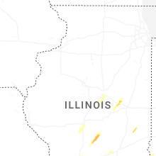


Connect with Interactive Hail Maps