

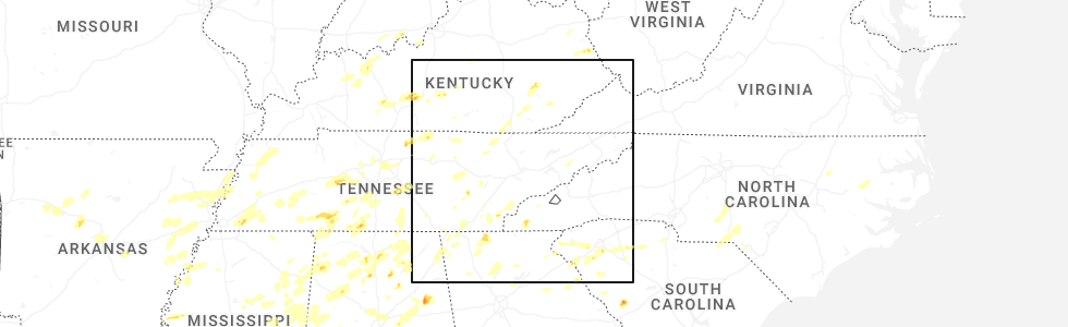
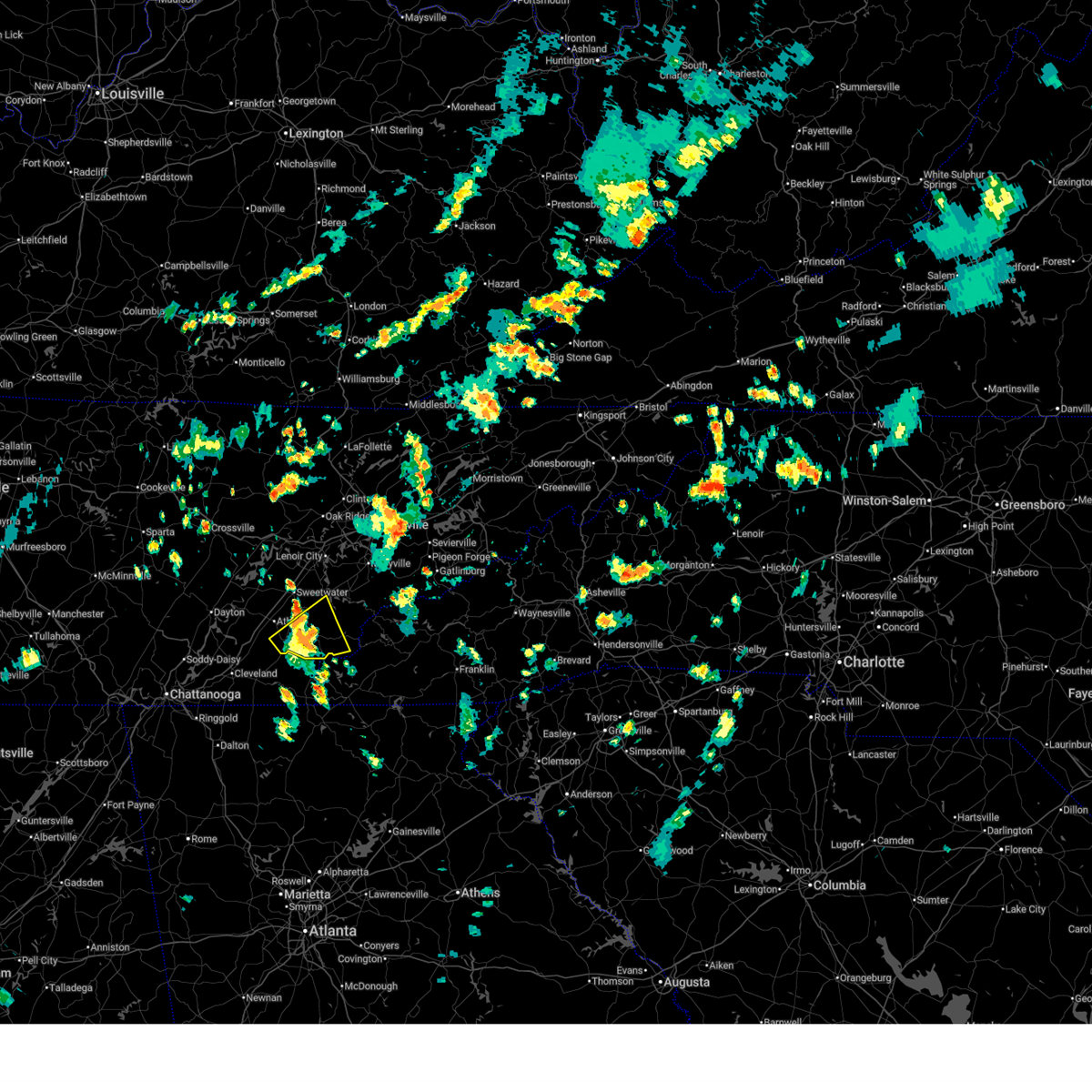
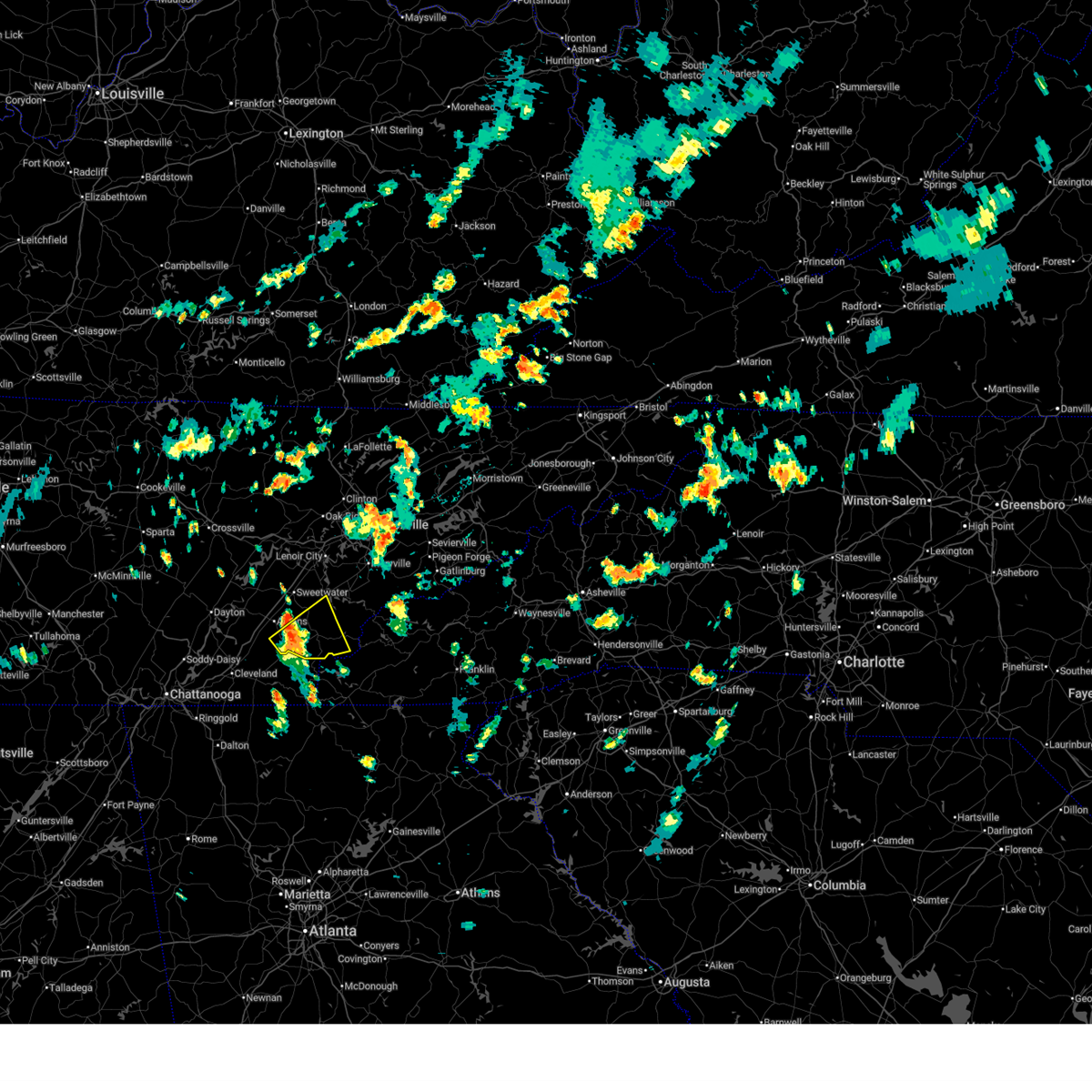
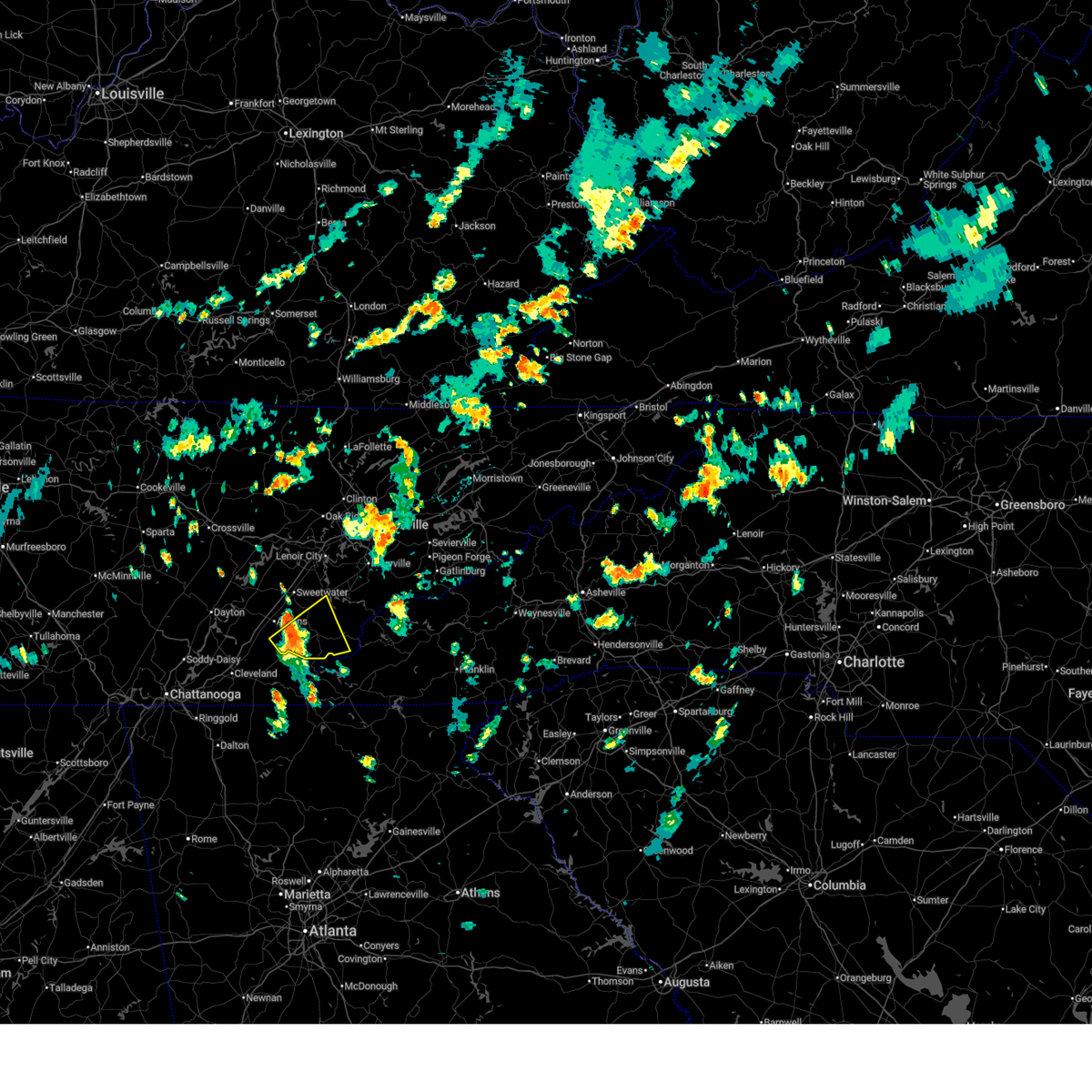
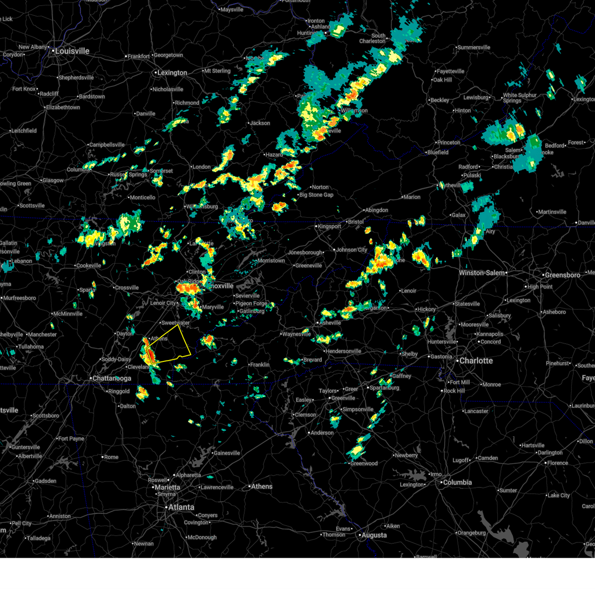
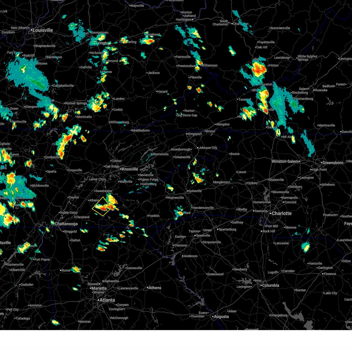
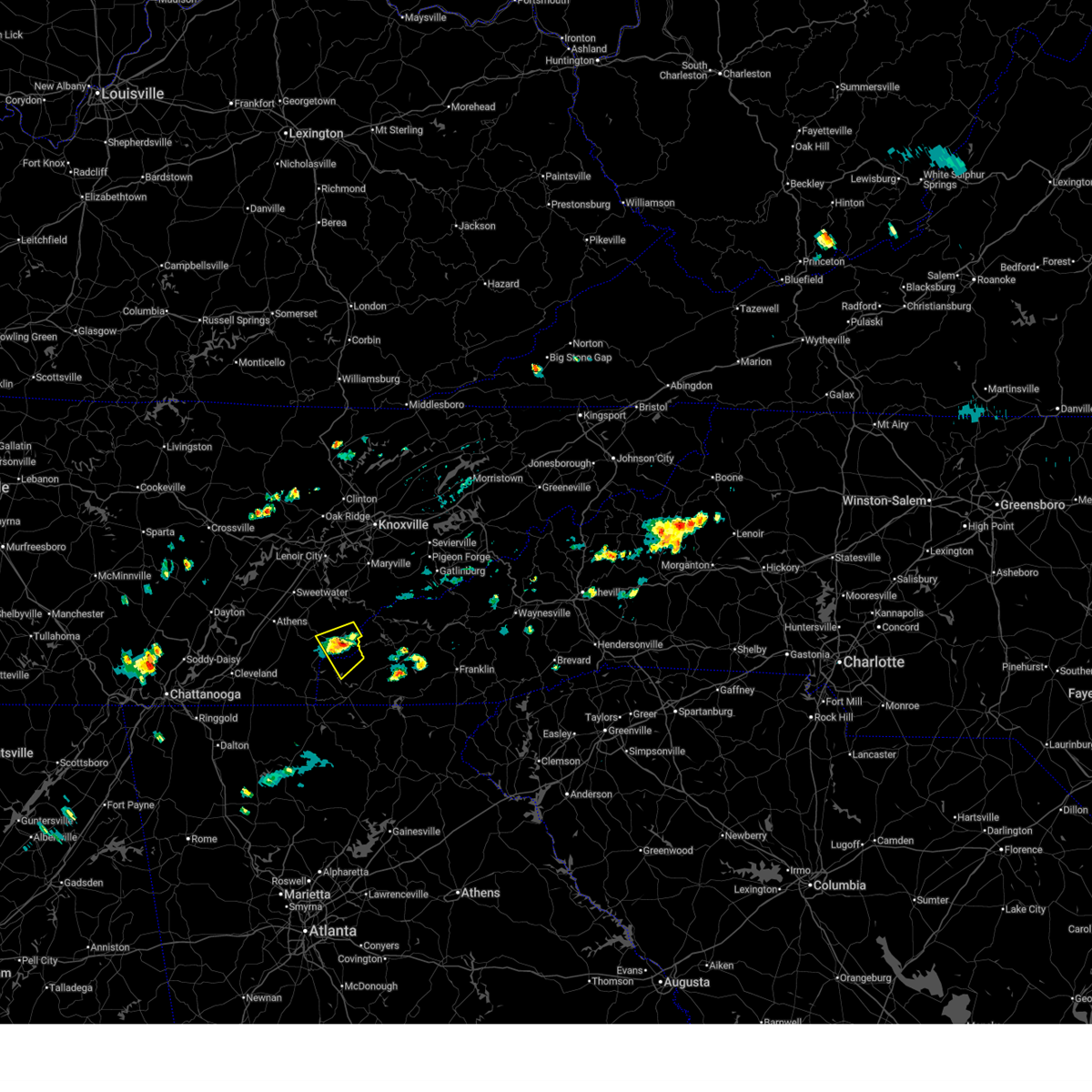
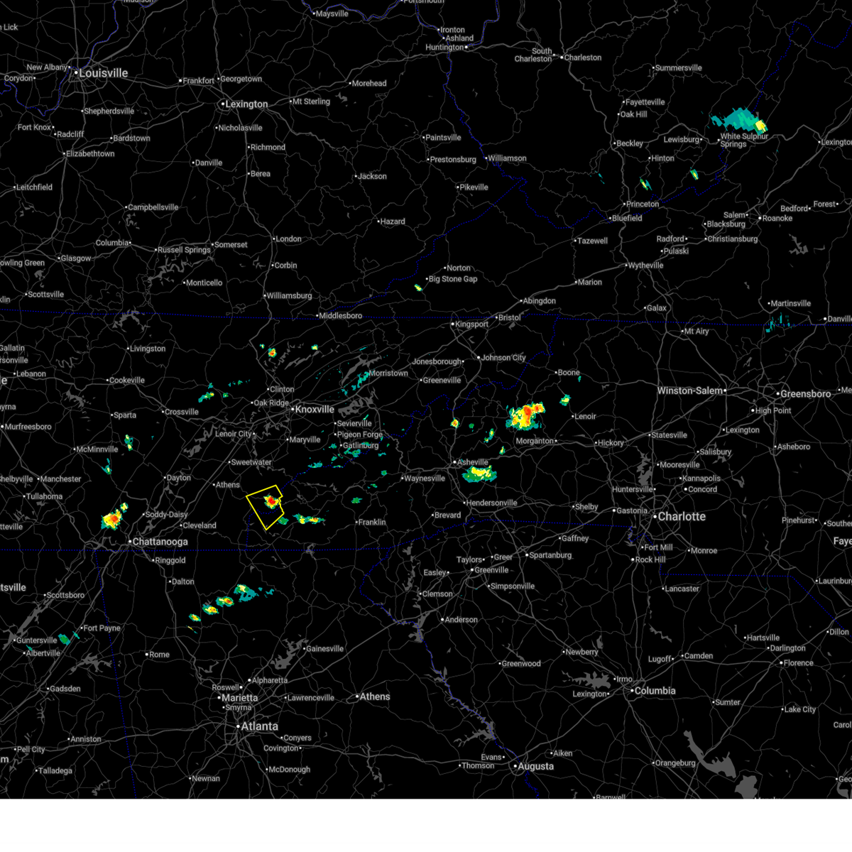
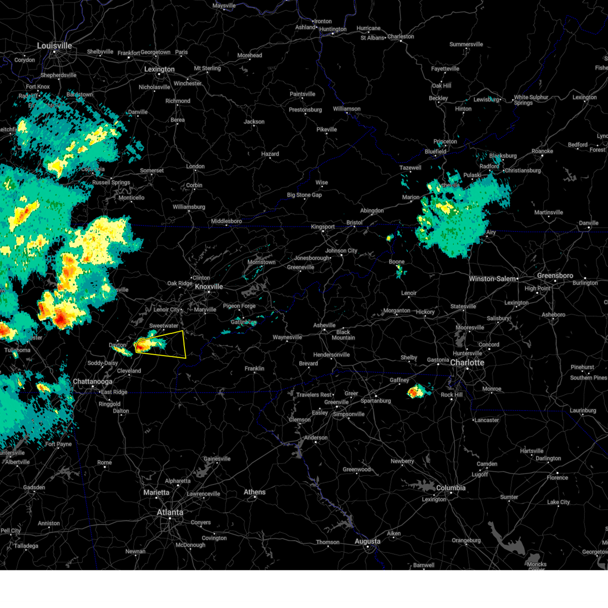
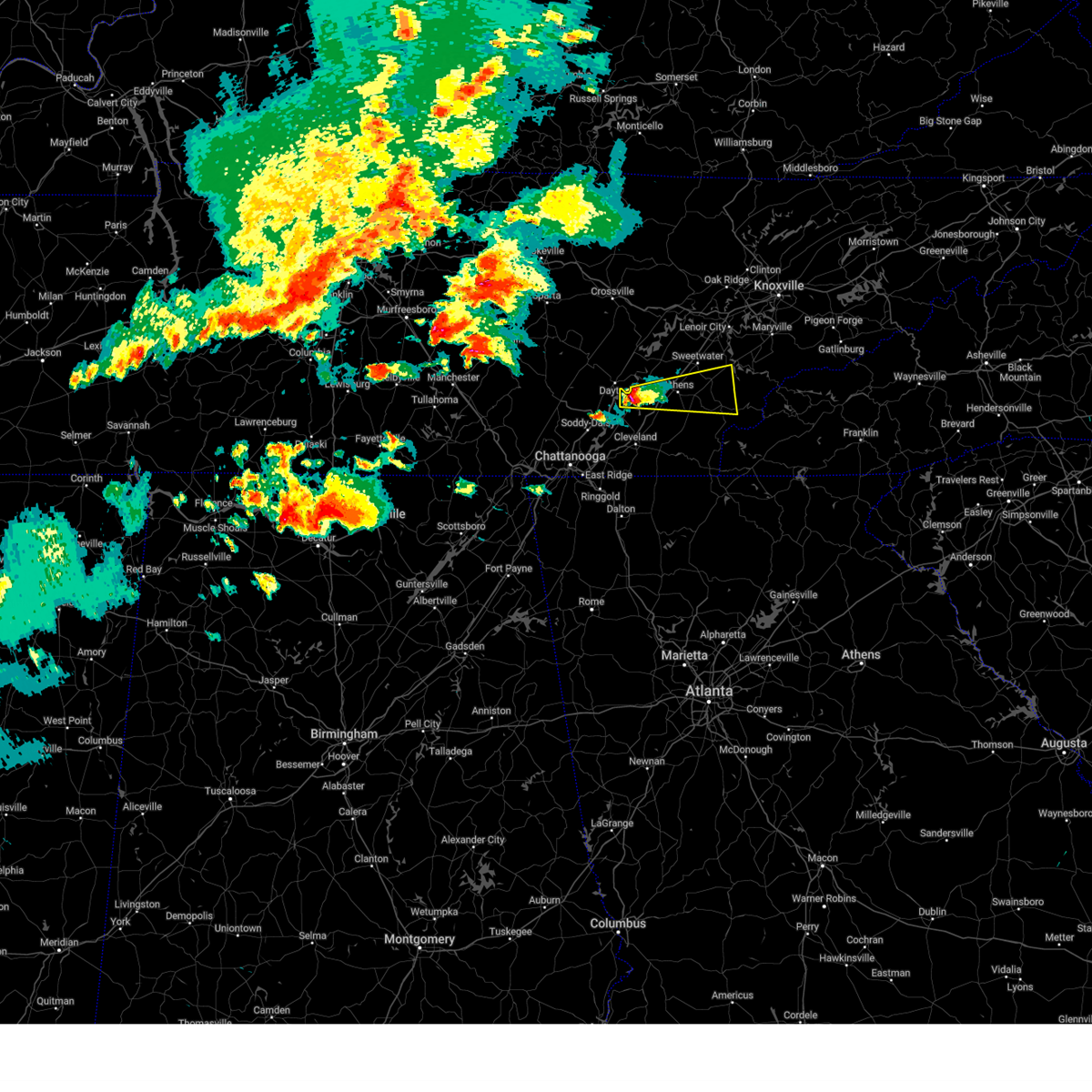
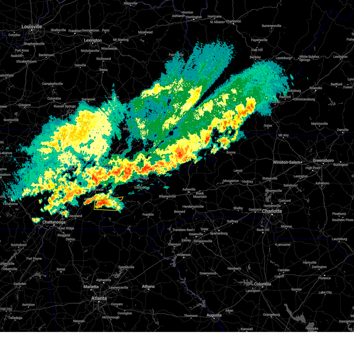
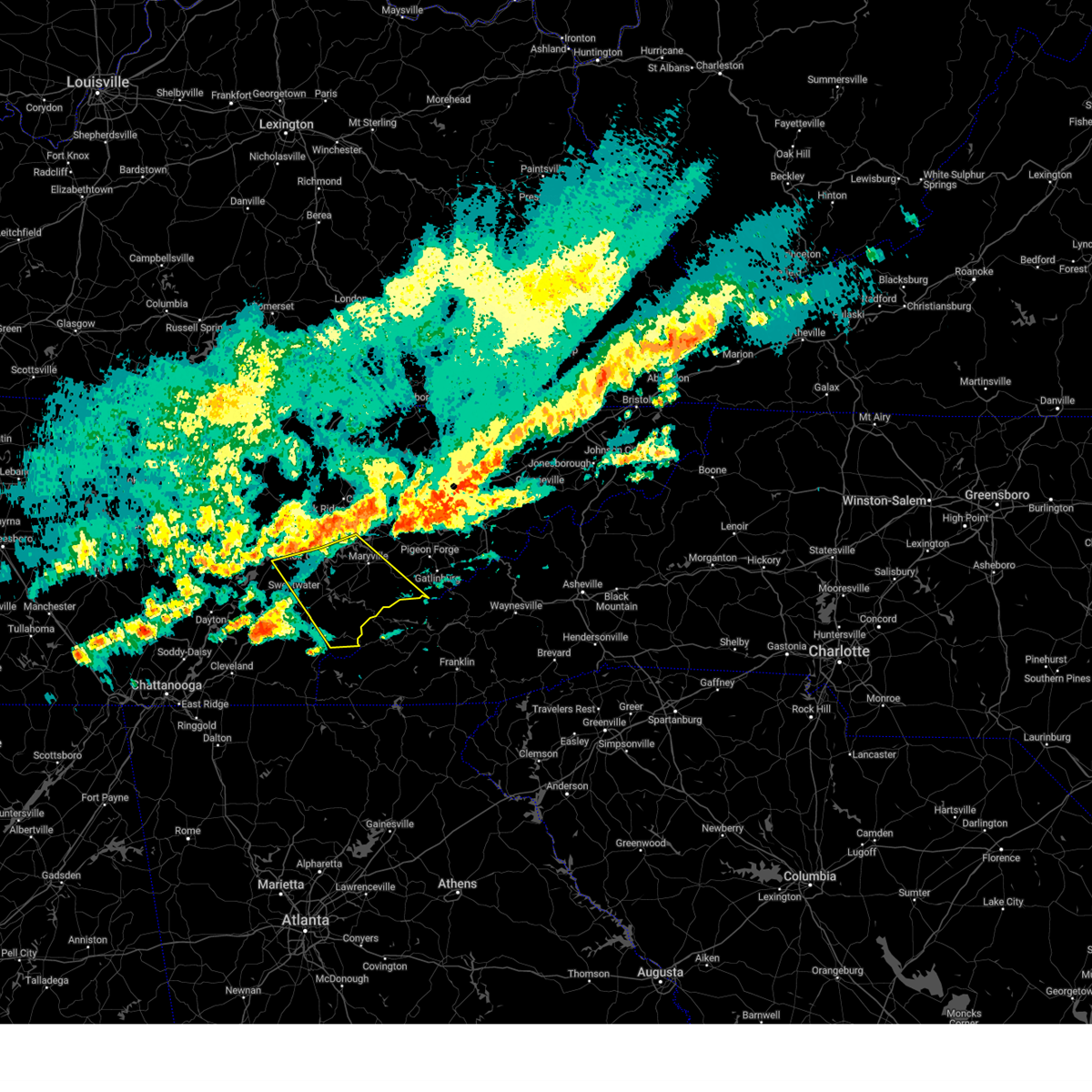
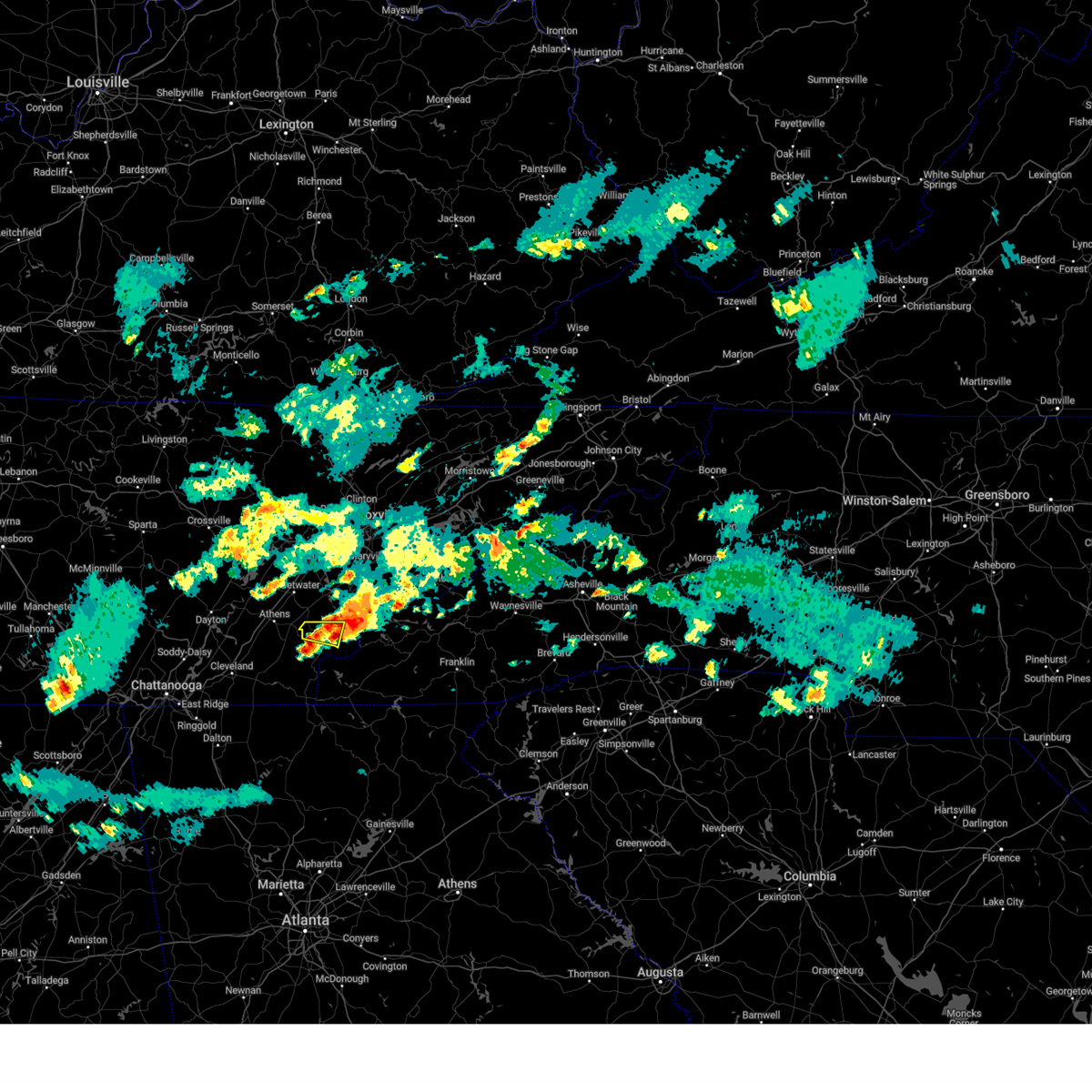
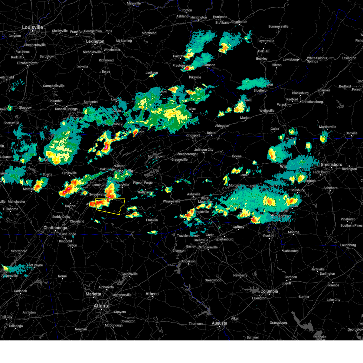
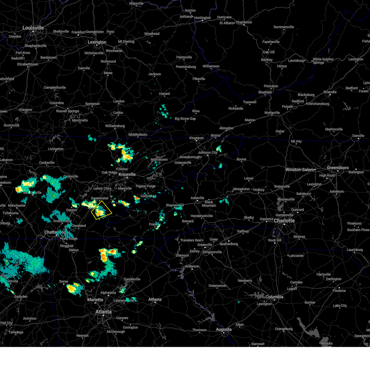
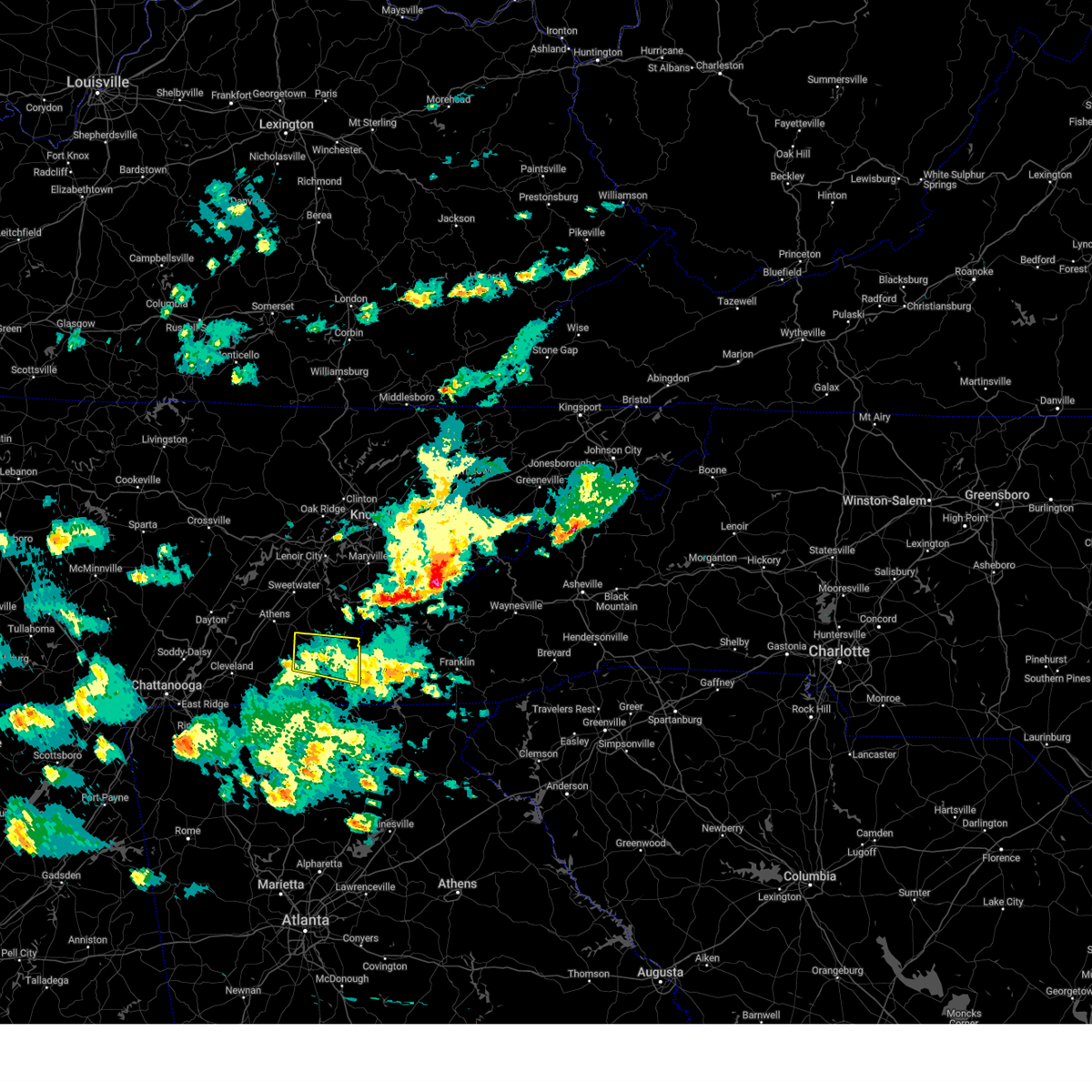
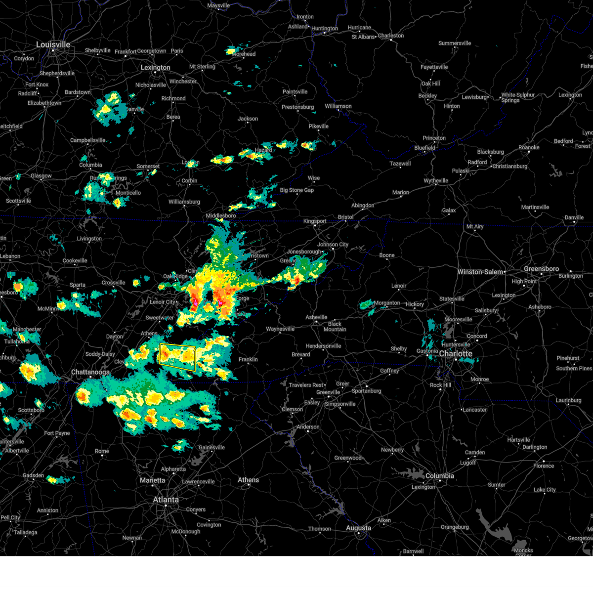
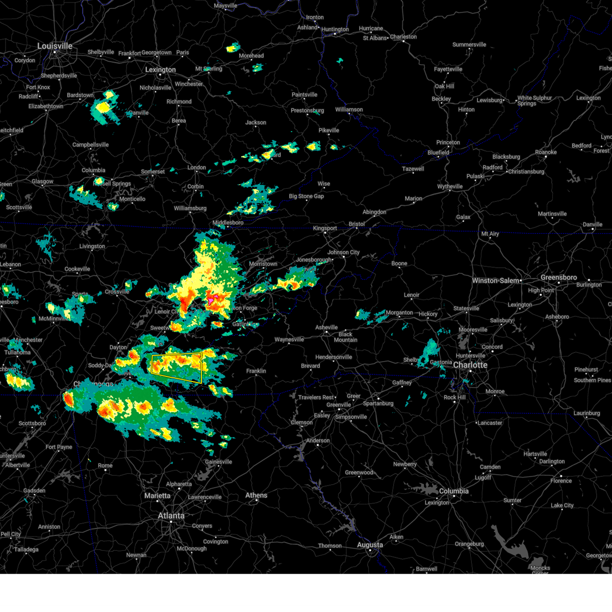
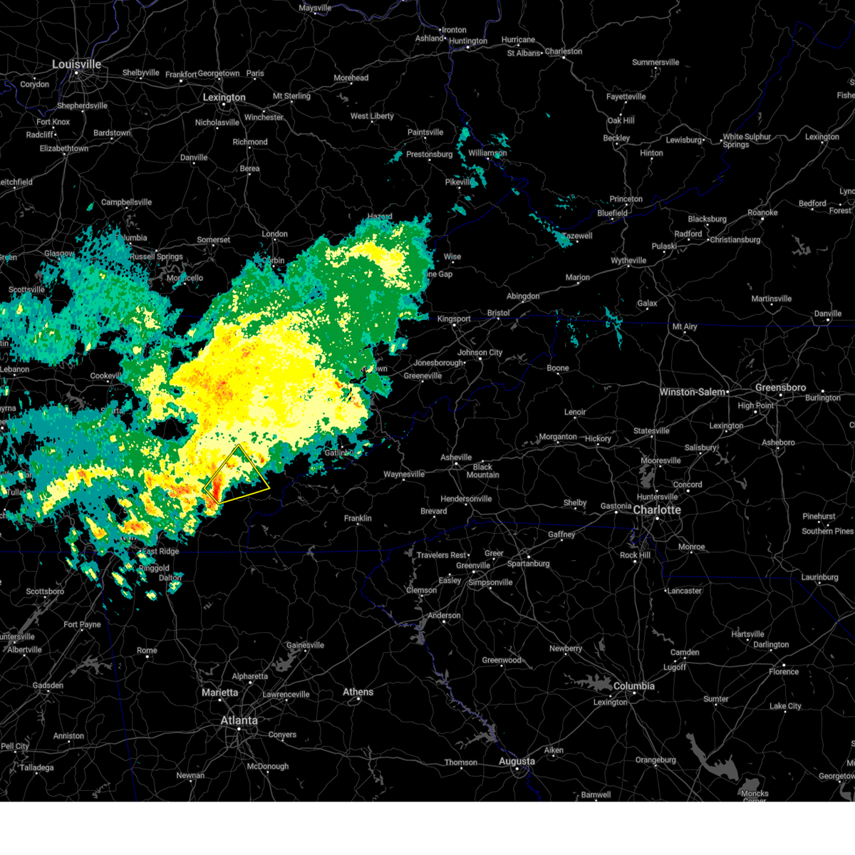
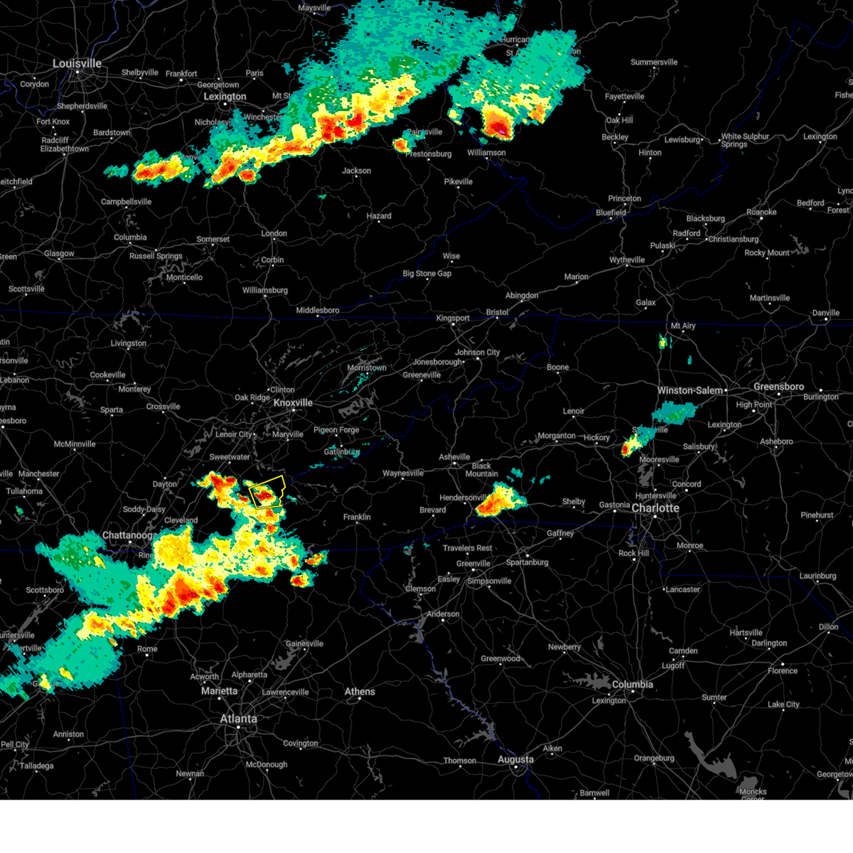
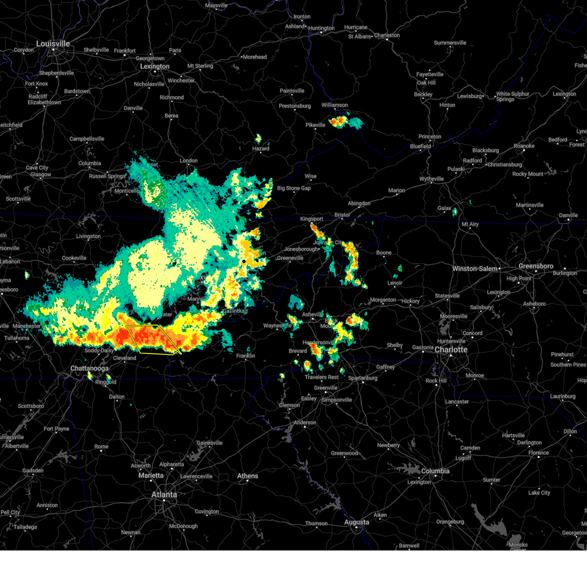
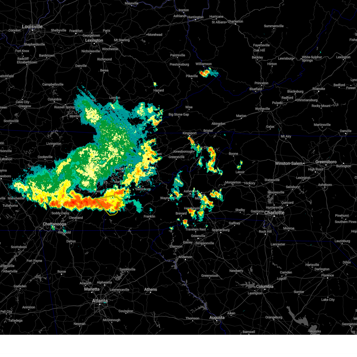
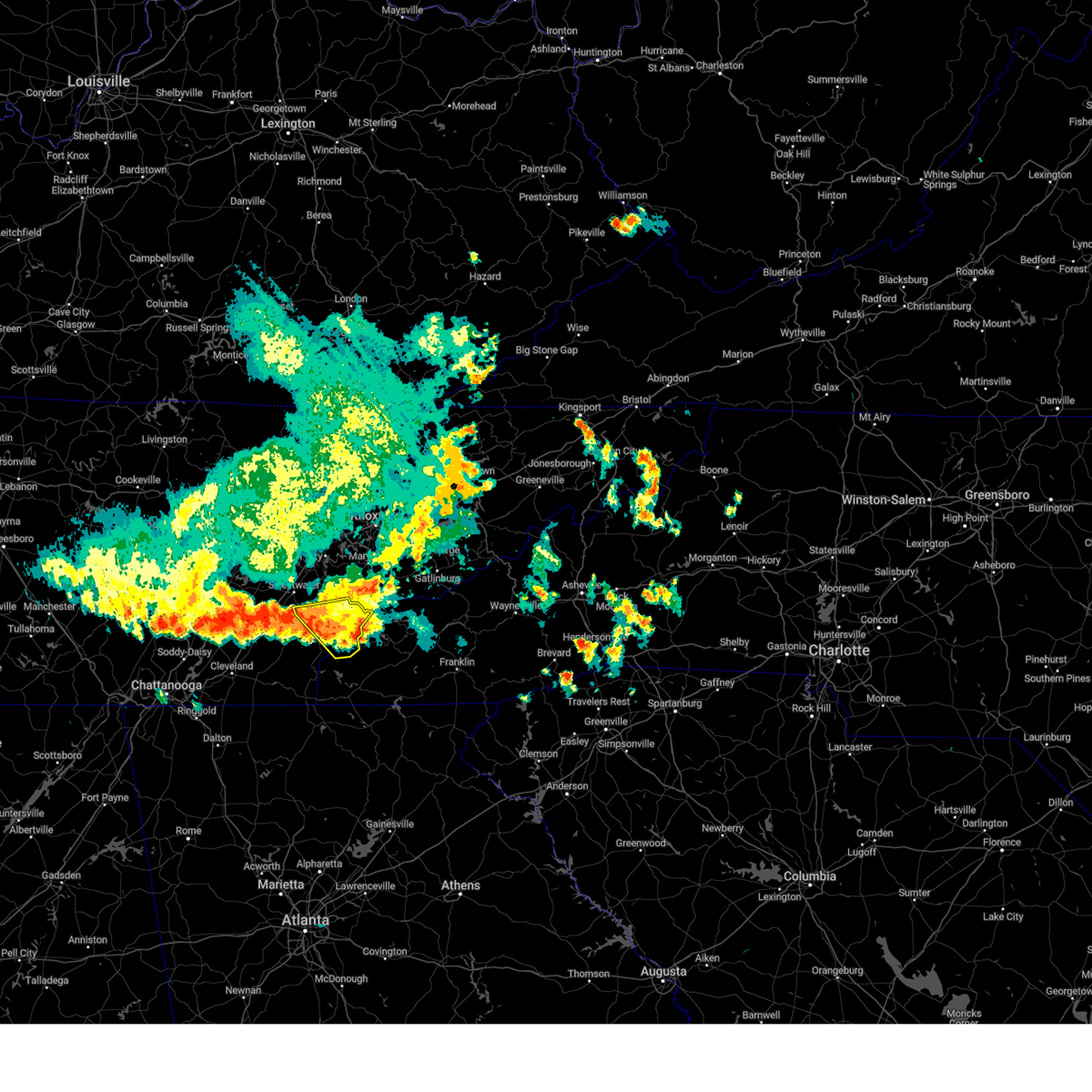
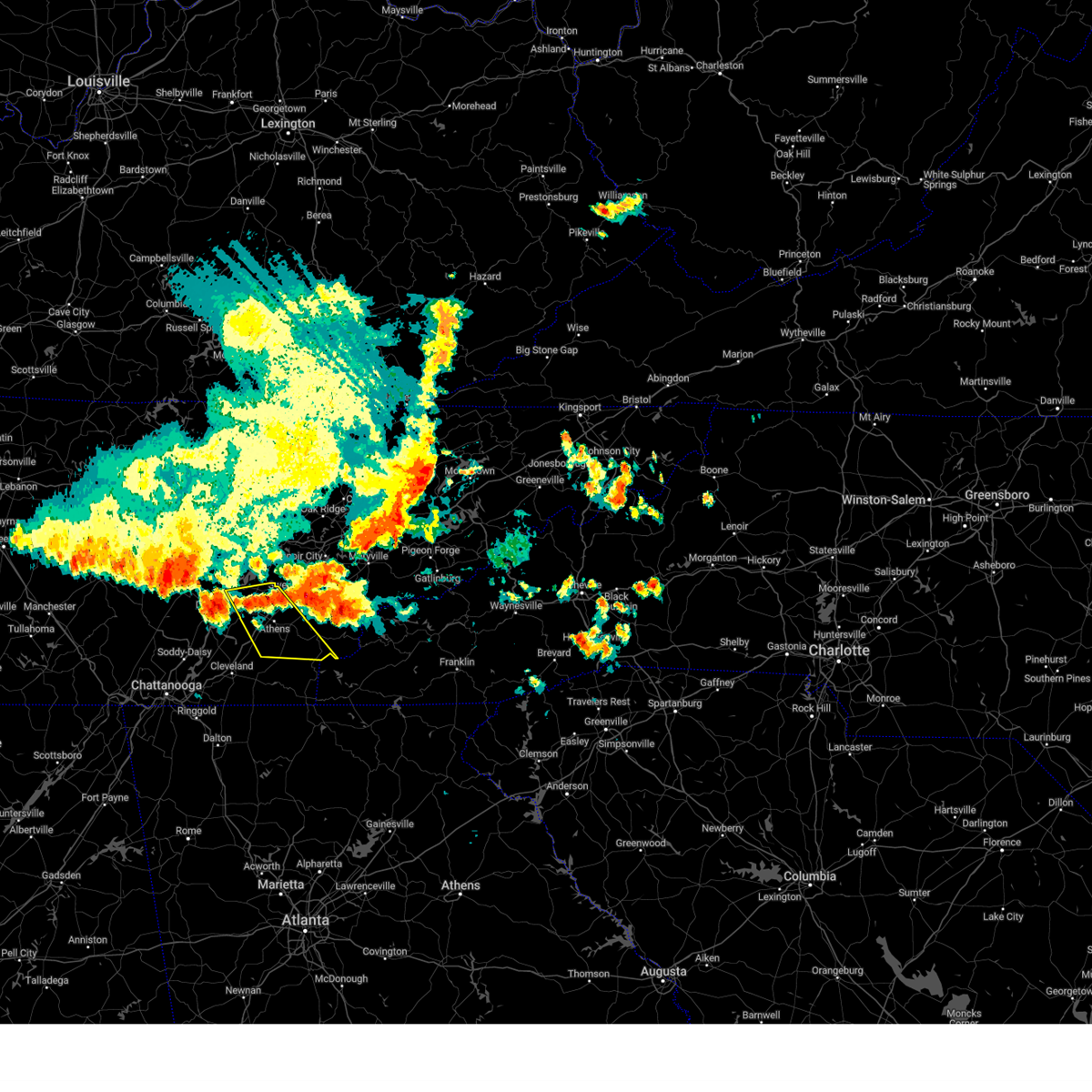
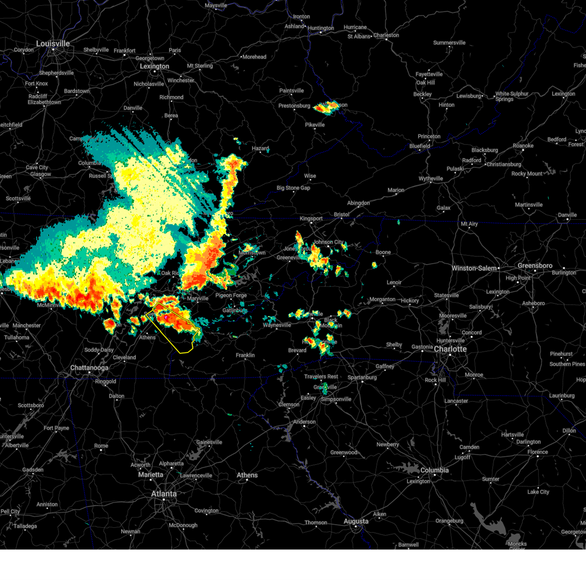
Hail Map for Tellico Plains, TN
The Tellico Plains, TN area has had 3 reports of on-the-ground hail by trained spotters, and has been under severe weather warnings 50 times during the past 12 months. Doppler radar has detected hail at or near Tellico Plains, TN on 44 occasions, including 4 occasions during the past year.
| Name: | Tellico Plains, TN |
| Where Located: | 46.1 miles SSW of Knoxville, TN |
| Map: | Google Map for Tellico Plains, TN |
| Population: | 880 |
| Housing Units: | 471 |
| More Info: | Search Google for Tellico Plains, TN |
1
The Top Recent Hail Date for Tellico Plains, TN is Friday, May 2, 2025 (13th out of 44)
Hail and Wind Damage Spotted near Tellico Plains, TN
| Date / Time | Report Details |
|---|---|
| 7/1/2025 4:08 PM EDT |
 The storm which prompted the warning has weakened below severe limits, and no longer poses an immediate threat to life or property. therefore, the warning will be allowed to expire. The storm which prompted the warning has weakened below severe limits, and no longer poses an immediate threat to life or property. therefore, the warning will be allowed to expire.
|
| 7/1/2025 3:54 PM EDT |
 At 353 pm edt, a severe thunderstorm was located near etowah, or 13 miles southeast of athens, moving northeast at 20 mph (radar indicated). Hazards include 60 mph wind gusts and penny size hail. Expect damage to roofs, siding, and trees. Locations impacted include, madisonville, etowah, englewood, vonore, tellico plains, coker creek, mount vernon, and bullet creek. At 353 pm edt, a severe thunderstorm was located near etowah, or 13 miles southeast of athens, moving northeast at 20 mph (radar indicated). Hazards include 60 mph wind gusts and penny size hail. Expect damage to roofs, siding, and trees. Locations impacted include, madisonville, etowah, englewood, vonore, tellico plains, coker creek, mount vernon, and bullet creek.
|
| 7/1/2025 3:54 PM EDT |
 the severe thunderstorm warning has been cancelled and is no longer in effect the severe thunderstorm warning has been cancelled and is no longer in effect
|
| 7/1/2025 3:36 PM EDT |
 Svrmrx the national weather service in morristown has issued a * severe thunderstorm warning for, northeastern polk county in east tennessee, southeastern mcminn county in east tennessee, western monroe county in east tennessee, * until 415 pm edt. * at 335 pm edt, a severe thunderstorm was located over etowah, or 11 miles southeast of athens, moving east at 20 mph (radar indicated). Hazards include 60 mph wind gusts and penny size hail. expect damage to roofs, siding, and trees Svrmrx the national weather service in morristown has issued a * severe thunderstorm warning for, northeastern polk county in east tennessee, southeastern mcminn county in east tennessee, western monroe county in east tennessee, * until 415 pm edt. * at 335 pm edt, a severe thunderstorm was located over etowah, or 11 miles southeast of athens, moving east at 20 mph (radar indicated). Hazards include 60 mph wind gusts and penny size hail. expect damage to roofs, siding, and trees
|
| 6/27/2025 4:05 PM EDT | The storm which prompted the warning has weakened below severe limits, and no longer poses an immediate threat to life or property. therefore, the warning will be allowed to expire. however, gusty winds and heavy rain are still possible with this thunderstorm. |
| 6/27/2025 3:37 PM EDT |
 Svrmrx the national weather service in morristown has issued a * severe thunderstorm warning for, northwestern cherokee county in southwestern north carolina, northeastern polk county in east tennessee, southeastern mcminn county in east tennessee, southwestern monroe county in east tennessee, * until 415 pm edt. * at 337 pm edt, a severe thunderstorm was located 14 miles east of etowah, or 16 miles south of madisonville, and is nearly stationary (radar indicated). Hazards include 60 mph wind gusts and penny size hail. expect damage to roofs, siding, and trees Svrmrx the national weather service in morristown has issued a * severe thunderstorm warning for, northwestern cherokee county in southwestern north carolina, northeastern polk county in east tennessee, southeastern mcminn county in east tennessee, southwestern monroe county in east tennessee, * until 415 pm edt. * at 337 pm edt, a severe thunderstorm was located 14 miles east of etowah, or 16 miles south of madisonville, and is nearly stationary (radar indicated). Hazards include 60 mph wind gusts and penny size hail. expect damage to roofs, siding, and trees
|
| 6/25/2025 2:58 PM EDT |
 At 258 pm edt, a severe thunderstorm was located 16 miles northwest of murphy, moving west at 15 mph (radar indicated). Hazards include 60 mph wind gusts and penny size hail. Expect damage to roofs, siding, and trees. Locations impacted include, tellico plains, citico, and unaka. At 258 pm edt, a severe thunderstorm was located 16 miles northwest of murphy, moving west at 15 mph (radar indicated). Hazards include 60 mph wind gusts and penny size hail. Expect damage to roofs, siding, and trees. Locations impacted include, tellico plains, citico, and unaka.
|
| 6/25/2025 2:41 PM EDT |
 Svrmrx the national weather service in morristown has issued a * severe thunderstorm warning for, northwestern cherokee county in southwestern north carolina, southeastern monroe county in east tennessee, * until 330 pm edt. * at 240 pm edt, a severe thunderstorm was located 13 miles west of town of santeetlah, or 16 miles west of robbinsville, moving southwest at 5 mph (radar indicated). Hazards include 60 mph wind gusts and penny size hail. expect damage to roofs, siding, and trees Svrmrx the national weather service in morristown has issued a * severe thunderstorm warning for, northwestern cherokee county in southwestern north carolina, southeastern monroe county in east tennessee, * until 330 pm edt. * at 240 pm edt, a severe thunderstorm was located 13 miles west of town of santeetlah, or 16 miles west of robbinsville, moving southwest at 5 mph (radar indicated). Hazards include 60 mph wind gusts and penny size hail. expect damage to roofs, siding, and trees
|
| 5/20/2025 7:33 PM EDT |
 At 733 pm edt, a severe thunderstorm was located near athens, moving east at 30 mph (radar indicated). Hazards include 60 mph wind gusts and penny size hail. Expect damage to roofs, siding, and trees. locations impacted include, riceville, madisonville, englewood, mount vernon, clear water, athens, niota, tellico plains, vonore, and etowah. This includes interstate 75 in tennessee between mile markers 41 and 53. At 733 pm edt, a severe thunderstorm was located near athens, moving east at 30 mph (radar indicated). Hazards include 60 mph wind gusts and penny size hail. Expect damage to roofs, siding, and trees. locations impacted include, riceville, madisonville, englewood, mount vernon, clear water, athens, niota, tellico plains, vonore, and etowah. This includes interstate 75 in tennessee between mile markers 41 and 53.
|
| 5/20/2025 7:33 PM EDT |
 the severe thunderstorm warning has been cancelled and is no longer in effect the severe thunderstorm warning has been cancelled and is no longer in effect
|
| 5/20/2025 7:11 PM EDT |
 Svrmrx the national weather service in morristown has issued a * severe thunderstorm warning for, southwestern meigs county in east tennessee, mcminn county in east tennessee, northwestern monroe county in east tennessee, * until 800 pm edt. * at 711 pm edt, a severe thunderstorm was located 9 miles northwest of charleston, or 10 miles southwest of decatur, moving east at 40 mph (radar indicated). Hazards include 60 mph wind gusts and penny size hail. expect damage to roofs, siding, and trees Svrmrx the national weather service in morristown has issued a * severe thunderstorm warning for, southwestern meigs county in east tennessee, mcminn county in east tennessee, northwestern monroe county in east tennessee, * until 800 pm edt. * at 711 pm edt, a severe thunderstorm was located 9 miles northwest of charleston, or 10 miles southwest of decatur, moving east at 40 mph (radar indicated). Hazards include 60 mph wind gusts and penny size hail. expect damage to roofs, siding, and trees
|
| 5/17/2025 3:30 AM EDT | Trees dow in monroe county TN, 8 miles SW of Tellico Plains, TN |
| 5/17/2025 3:04 AM EDT |
 Svrmrx the national weather service in morristown has issued a * severe thunderstorm warning for, southeastern mcminn county in east tennessee, south central blount county in east tennessee, central monroe county in east tennessee, * until 330 am edt. * at 304 am edt, a severe thunderstorm was located 8 miles northeast of etowah, or 9 miles south of madisonville, moving east at 50 mph (radar indicated). Hazards include 60 mph wind gusts and quarter size hail. Hail damage to vehicles is expected. Expect wind damage to roofs, siding, and trees. Svrmrx the national weather service in morristown has issued a * severe thunderstorm warning for, southeastern mcminn county in east tennessee, south central blount county in east tennessee, central monroe county in east tennessee, * until 330 am edt. * at 304 am edt, a severe thunderstorm was located 8 miles northeast of etowah, or 9 miles south of madisonville, moving east at 50 mph (radar indicated). Hazards include 60 mph wind gusts and quarter size hail. Hail damage to vehicles is expected. Expect wind damage to roofs, siding, and trees.
|
| 5/17/2025 2:42 AM EDT |
 Svrmrx the national weather service in morristown has issued a * severe thunderstorm warning for, loudon county in east tennessee, southwestern knox county in east tennessee, blount county in east tennessee, monroe county in east tennessee, southeastern roane county in east tennessee, south central sevier county in east tennessee, * until 330 am edt. * at 242 am edt, severe thunderstorms were located along a line extending from near rockford to near lenoir city to near fairview, moving southeast at 50 mph (radar indicated). Hazards include 60 mph wind gusts. expect damage to roofs, siding, and trees Svrmrx the national weather service in morristown has issued a * severe thunderstorm warning for, loudon county in east tennessee, southwestern knox county in east tennessee, blount county in east tennessee, monroe county in east tennessee, southeastern roane county in east tennessee, south central sevier county in east tennessee, * until 330 am edt. * at 242 am edt, severe thunderstorms were located along a line extending from near rockford to near lenoir city to near fairview, moving southeast at 50 mph (radar indicated). Hazards include 60 mph wind gusts. expect damage to roofs, siding, and trees
|
| 5/8/2025 8:53 PM EDT |
 the severe thunderstorm warning has been cancelled and is no longer in effect the severe thunderstorm warning has been cancelled and is no longer in effect
|
| 5/8/2025 8:31 PM EDT |
 the severe thunderstorm warning has been cancelled and is no longer in effect the severe thunderstorm warning has been cancelled and is no longer in effect
|
| 5/8/2025 8:31 PM EDT |
 At 831 pm edt, a severe thunderstorm was located 9 miles south of madisonville, moving east at 20 mph (radar indicated). Hazards include quarter size hail. Damage to vehicles is expected. Locations impacted include, mount vernon and tellico plains. At 831 pm edt, a severe thunderstorm was located 9 miles south of madisonville, moving east at 20 mph (radar indicated). Hazards include quarter size hail. Damage to vehicles is expected. Locations impacted include, mount vernon and tellico plains.
|
| 5/8/2025 8:19 PM EDT |
 Svrmrx the national weather service in morristown has issued a * severe thunderstorm warning for, east central mcminn county in east tennessee, southwestern monroe county in east tennessee, * until 915 pm edt. * at 819 pm edt, a severe thunderstorm was located near etowah, or 10 miles south of madisonville, moving east at 20 mph (radar indicated). Hazards include quarter size hail. damage to vehicles is expected Svrmrx the national weather service in morristown has issued a * severe thunderstorm warning for, east central mcminn county in east tennessee, southwestern monroe county in east tennessee, * until 915 pm edt. * at 819 pm edt, a severe thunderstorm was located near etowah, or 10 miles south of madisonville, moving east at 20 mph (radar indicated). Hazards include quarter size hail. damage to vehicles is expected
|
| 5/8/2025 7:15 PM EDT |
 Svrmrx the national weather service in morristown has issued a * severe thunderstorm warning for, northeastern mcminn county in east tennessee, southwestern blount county in east tennessee, central monroe county in east tennessee, * until 800 pm edt. * at 715 pm edt, a severe thunderstorm was located near madisonville, moving east at 25 mph (radar indicated). Hazards include 60 mph wind gusts and quarter size hail. Hail damage to vehicles is expected. Expect wind damage to roofs, siding, and trees. Svrmrx the national weather service in morristown has issued a * severe thunderstorm warning for, northeastern mcminn county in east tennessee, southwestern blount county in east tennessee, central monroe county in east tennessee, * until 800 pm edt. * at 715 pm edt, a severe thunderstorm was located near madisonville, moving east at 25 mph (radar indicated). Hazards include 60 mph wind gusts and quarter size hail. Hail damage to vehicles is expected. Expect wind damage to roofs, siding, and trees.
|
| 5/2/2025 8:01 PM EDT |
 the severe thunderstorm warning has been cancelled and is no longer in effect the severe thunderstorm warning has been cancelled and is no longer in effect
|
| 5/2/2025 8:01 PM EDT |
 At 801 pm edt, severe thunderstorms were located along a line extending from 10 miles west of murphy to 6 miles northwest of blue ridge, moving east at 40 mph (radar indicated). Hazards include 60 mph wind gusts and penny size hail. Expect damage to roofs, siding, and trees. locations impacted include, william l. Davenport refuge, coker creek, violet, big frog mountain, turtletown, copperhill, bullet creek, hiawasse dam, archville, and tellico plains. At 801 pm edt, severe thunderstorms were located along a line extending from 10 miles west of murphy to 6 miles northwest of blue ridge, moving east at 40 mph (radar indicated). Hazards include 60 mph wind gusts and penny size hail. Expect damage to roofs, siding, and trees. locations impacted include, william l. Davenport refuge, coker creek, violet, big frog mountain, turtletown, copperhill, bullet creek, hiawasse dam, archville, and tellico plains.
|
| 5/2/2025 7:43 PM EDT |
 At 743 pm edt, severe thunderstorms were located along a line extending from 7 miles north of ducktown to 11 miles northeast of eton, moving east at 40 mph (radar indicated). Hazards include 60 mph wind gusts and penny size hail. Expect damage to roofs, siding, and trees. locations impacted include, william l. Davenport refuge, coker creek, conasauga, violet, big frog mountain, parksville, turtletown, copperhill, bullet creek, and reliance. At 743 pm edt, severe thunderstorms were located along a line extending from 7 miles north of ducktown to 11 miles northeast of eton, moving east at 40 mph (radar indicated). Hazards include 60 mph wind gusts and penny size hail. Expect damage to roofs, siding, and trees. locations impacted include, william l. Davenport refuge, coker creek, conasauga, violet, big frog mountain, parksville, turtletown, copperhill, bullet creek, and reliance.
|
| 5/2/2025 7:37 PM EDT | Svrmrx the national weather service in morristown has issued a * severe thunderstorm warning for, cherokee county in southwestern north carolina, polk county in east tennessee, southeastern mcminn county in east tennessee, southern monroe county in east tennessee, * until 830 pm edt. * at 737 pm edt, severe thunderstorms were located along a line extending from 8 miles northwest of ducktown to 8 miles northeast of eton, moving east at 40 mph (radar indicated). Hazards include 60 mph wind gusts and penny size hail. expect damage to roofs, siding, and trees |
| 5/2/2025 4:32 PM EDT | the severe thunderstorm warning has been cancelled and is no longer in effect |
| 5/2/2025 4:20 PM EDT | Several trees dow in monroe county TN, 7.1 miles SW of Tellico Plains, TN |
| 5/2/2025 4:15 PM EDT |
 the severe thunderstorm warning has been cancelled and is no longer in effect the severe thunderstorm warning has been cancelled and is no longer in effect
|
| 5/2/2025 4:04 PM EDT |
 Svrmrx the national weather service in morristown has issued a * severe thunderstorm warning for, southeastern loudon county in east tennessee, southwestern blount county in east tennessee, central monroe county in east tennessee, * until 445 pm edt. * at 403 pm edt, a severe thunderstorm was located 13 miles southeast of madisonville, moving northeast at 25 mph (radar indicated). Hazards include 60 mph wind gusts and quarter size hail. Hail damage to vehicles is expected. Expect wind damage to roofs, siding, and trees. Svrmrx the national weather service in morristown has issued a * severe thunderstorm warning for, southeastern loudon county in east tennessee, southwestern blount county in east tennessee, central monroe county in east tennessee, * until 445 pm edt. * at 403 pm edt, a severe thunderstorm was located 13 miles southeast of madisonville, moving northeast at 25 mph (radar indicated). Hazards include 60 mph wind gusts and quarter size hail. Hail damage to vehicles is expected. Expect wind damage to roofs, siding, and trees.
|
| 5/2/2025 3:54 PM EDT | At 353 pm edt, a severe thunderstorm was located near benton, moving northeast at 25 mph (radar indicated). Hazards include 60 mph wind gusts and quarter size hail. Hail damage to vehicles is expected. expect wind damage to roofs, siding, and trees. locations impacted include, englewood, mount vernon, bullet creek, athens, etowah, hiwassee ocoee state park, niota, dentville, and tellico plains. This includes interstate 75 in tennessee between mile markers 54 and 55. |
| 5/2/2025 3:38 PM EDT | Svrmrx the national weather service in morristown has issued a * severe thunderstorm warning for, central polk county in east tennessee, southeastern mcminn county in east tennessee, southwestern monroe county in east tennessee, * until 430 pm edt. * at 338 pm edt, a severe thunderstorm was located over benton, moving northeast at 25 mph (radar indicated). Hazards include 60 mph wind gusts and quarter size hail. Hail damage to vehicles is expected. Expect wind damage to roofs, siding, and trees. |
| 4/23/2025 6:25 PM EDT |
 the severe thunderstorm warning has been cancelled and is no longer in effect the severe thunderstorm warning has been cancelled and is no longer in effect
|
| 4/23/2025 6:06 PM EDT |
 Svrmrx the national weather service in morristown has issued a * severe thunderstorm warning for, southeastern mcminn county in east tennessee, northwestern monroe county in east tennessee, * until 645 pm edt. * at 606 pm edt, a severe thunderstorm was located near etowah, or near athens, moving northeast at 10 mph (radar indicated). Hazards include 60 mph wind gusts and quarter size hail. Hail damage to vehicles is expected. Expect wind damage to roofs, siding, and trees. Svrmrx the national weather service in morristown has issued a * severe thunderstorm warning for, southeastern mcminn county in east tennessee, northwestern monroe county in east tennessee, * until 645 pm edt. * at 606 pm edt, a severe thunderstorm was located near etowah, or near athens, moving northeast at 10 mph (radar indicated). Hazards include 60 mph wind gusts and quarter size hail. Hail damage to vehicles is expected. Expect wind damage to roofs, siding, and trees.
|
| 4/23/2025 5:04 PM EDT |
 the severe thunderstorm warning has been cancelled and is no longer in effect the severe thunderstorm warning has been cancelled and is no longer in effect
|
| 4/23/2025 4:33 PM EDT |
 Svrmrx the national weather service in morristown has issued a * severe thunderstorm warning for, northeastern polk county in east tennessee, southeastern mcminn county in east tennessee, southwestern monroe county in east tennessee, * until 515 pm edt. * at 433 pm edt, a severe thunderstorm was located 7 miles east of etowah, or 14 miles south of madisonville, moving north at 15 mph (radar indicated). Hazards include 60 mph wind gusts and quarter size hail. Hail damage to vehicles is expected. Expect wind damage to roofs, siding, and trees. Svrmrx the national weather service in morristown has issued a * severe thunderstorm warning for, northeastern polk county in east tennessee, southeastern mcminn county in east tennessee, southwestern monroe county in east tennessee, * until 515 pm edt. * at 433 pm edt, a severe thunderstorm was located 7 miles east of etowah, or 14 miles south of madisonville, moving north at 15 mph (radar indicated). Hazards include 60 mph wind gusts and quarter size hail. Hail damage to vehicles is expected. Expect wind damage to roofs, siding, and trees.
|
| 4/10/2025 6:47 PM EDT |
 the severe thunderstorm warning has been cancelled and is no longer in effect the severe thunderstorm warning has been cancelled and is no longer in effect
|
| 4/10/2025 6:24 PM EDT |
 At 623 pm edt, a severe thunderstorm was located 11 miles southeast of etowah, or 15 miles north of ducktown, moving east at 30 mph (radar indicated). Hazards include quarter size hail. Damage to vehicles is expected. Locations impacted include, bullet creek, hiawasse dam, coker creek, violet, tellico plains, and unaka. At 623 pm edt, a severe thunderstorm was located 11 miles southeast of etowah, or 15 miles north of ducktown, moving east at 30 mph (radar indicated). Hazards include quarter size hail. Damage to vehicles is expected. Locations impacted include, bullet creek, hiawasse dam, coker creek, violet, tellico plains, and unaka.
|
| 4/10/2025 6:08 PM EDT |
 Svrmrx the national weather service in morristown has issued a * severe thunderstorm warning for, northwestern cherokee county in southwestern north carolina, northeastern polk county in east tennessee, southeastern mcminn county in east tennessee, southern monroe county in east tennessee, * until 700 pm edt. * at 607 pm edt, a severe thunderstorm was located near etowah, or 10 miles northeast of benton, moving east at 35 mph (radar indicated). Hazards include quarter size hail. damage to vehicles is expected Svrmrx the national weather service in morristown has issued a * severe thunderstorm warning for, northwestern cherokee county in southwestern north carolina, northeastern polk county in east tennessee, southeastern mcminn county in east tennessee, southern monroe county in east tennessee, * until 700 pm edt. * at 607 pm edt, a severe thunderstorm was located near etowah, or 10 miles northeast of benton, moving east at 35 mph (radar indicated). Hazards include quarter size hail. damage to vehicles is expected
|
| 4/10/2025 5:38 PM EDT |
 At 538 pm edt, a severe thunderstorm was located 7 miles east of etowah, or 15 miles southeast of athens, moving east at 30 mph (radar indicated). Hazards include quarter size hail. Damage to vehicles is expected. Locations impacted include, bullet creek, coker creek, violet, citico, tellico plains, and unaka. At 538 pm edt, a severe thunderstorm was located 7 miles east of etowah, or 15 miles southeast of athens, moving east at 30 mph (radar indicated). Hazards include quarter size hail. Damage to vehicles is expected. Locations impacted include, bullet creek, coker creek, violet, citico, tellico plains, and unaka.
|
| 4/10/2025 5:21 PM EDT | Svrmrx the national weather service in morristown has issued a * severe thunderstorm warning for, northwestern cherokee county in southwestern north carolina, northeastern polk county in east tennessee, southeastern mcminn county in east tennessee, southwestern monroe county in east tennessee, * until 615 pm edt. * at 521 pm edt, a severe thunderstorm was located over etowah, or 10 miles south of athens, moving east at 30 mph (radar indicated). Hazards include quarter size hail. damage to vehicles is expected |
| 3/15/2025 11:02 AM EDT |
 At 1101 am edt, a severe thunderstorm was located near athens, moving northeast at 45 mph (radar indicated). Hazards include 60 mph wind gusts and penny size hail. Expect damage to roofs, siding, and trees. locations impacted include, madisonville, tariffville, englewood, mount vernon, athens, etowah, niota, philadelphia, sweetwater, and loudon. This includes interstate 75 in tennessee between mile markers 56 and 66. At 1101 am edt, a severe thunderstorm was located near athens, moving northeast at 45 mph (radar indicated). Hazards include 60 mph wind gusts and penny size hail. Expect damage to roofs, siding, and trees. locations impacted include, madisonville, tariffville, englewood, mount vernon, athens, etowah, niota, philadelphia, sweetwater, and loudon. This includes interstate 75 in tennessee between mile markers 56 and 66.
|
| 3/15/2025 11:02 AM EDT |
 the severe thunderstorm warning has been cancelled and is no longer in effect the severe thunderstorm warning has been cancelled and is no longer in effect
|
| 3/15/2025 10:43 AM EDT |
 Svrmrx the national weather service in morristown has issued a * severe thunderstorm warning for, northeastern bradley county in east tennessee, south central loudon county in east tennessee, northwestern polk county in east tennessee, mcminn county in east tennessee, northwestern monroe county in east tennessee, * until 1130 am edt. * at 1042 am edt, a severe thunderstorm was located near charleston, or 10 miles north of benton, moving northeast at 50 mph (radar indicated). Hazards include 60 mph wind gusts and penny size hail. expect damage to roofs, siding, and trees Svrmrx the national weather service in morristown has issued a * severe thunderstorm warning for, northeastern bradley county in east tennessee, south central loudon county in east tennessee, northwestern polk county in east tennessee, mcminn county in east tennessee, northwestern monroe county in east tennessee, * until 1130 am edt. * at 1042 am edt, a severe thunderstorm was located near charleston, or 10 miles north of benton, moving northeast at 50 mph (radar indicated). Hazards include 60 mph wind gusts and penny size hail. expect damage to roofs, siding, and trees
|
| 8/17/2024 5:08 PM EDT |
 Svrmrx the national weather service in morristown has issued a * severe thunderstorm warning for, southeastern monroe county in east tennessee, * until 600 pm edt. * at 508 pm edt, a severe thunderstorm was located 14 miles southeast of madisonville, moving east at 15 mph (radar indicated). Hazards include 60 mph wind gusts and quarter size hail. Hail damage to vehicles is expected. Expect wind damage to roofs, siding, and trees. Svrmrx the national weather service in morristown has issued a * severe thunderstorm warning for, southeastern monroe county in east tennessee, * until 600 pm edt. * at 508 pm edt, a severe thunderstorm was located 14 miles southeast of madisonville, moving east at 15 mph (radar indicated). Hazards include 60 mph wind gusts and quarter size hail. Hail damage to vehicles is expected. Expect wind damage to roofs, siding, and trees.
|
| 7/30/2024 6:07 PM EDT | the severe thunderstorm warning has been cancelled and is no longer in effect |
| 7/30/2024 6:07 PM EDT | At 606 pm edt, severe thunderstorms were located along a line extending from 9 miles east of etowah to charleston, moving southeast at 40 mph (radar indicated). Hazards include 60 mph wind gusts and penny size hail. Expect damage to roofs, siding, and trees. locations impacted include, etowah, tellico plains, riceville, bullet creek, coker creek, and dentville. This includes interstate 75 in tennessee between mile markers 39 and 42. |
| 7/30/2024 6:05 PM EDT | At 605 pm edt, a severe thunderstorm was located 14 miles northwest of murphy, moving southeast at 20 mph (radar indicated). Hazards include 60 mph wind gusts. Expect damage to roofs, siding, and trees. Locations impacted include, tellico plains. |
| 7/30/2024 5:52 PM EDT |
 At 552 pm edt, severe thunderstorms were located along a line extending from 6 miles southwest of madisonville to 6 miles southwest of decatur, moving southeast at 15 mph (radar indicated). Hazards include 60 mph wind gusts and penny size hail. Expect damage to roofs, siding, and trees. locations impacted include, athens, decatur, etowah, englewood, tellico plains, niota, riceville, coker creek, mount vernon, and clear water. This includes interstate 75 in tennessee between mile markers 39 and 54. At 552 pm edt, severe thunderstorms were located along a line extending from 6 miles southwest of madisonville to 6 miles southwest of decatur, moving southeast at 15 mph (radar indicated). Hazards include 60 mph wind gusts and penny size hail. Expect damage to roofs, siding, and trees. locations impacted include, athens, decatur, etowah, englewood, tellico plains, niota, riceville, coker creek, mount vernon, and clear water. This includes interstate 75 in tennessee between mile markers 39 and 54.
|
| 7/30/2024 5:52 PM EDT |
 the severe thunderstorm warning has been cancelled and is no longer in effect the severe thunderstorm warning has been cancelled and is no longer in effect
|
| 7/30/2024 5:51 PM EDT |
 the severe thunderstorm warning has been cancelled and is no longer in effect the severe thunderstorm warning has been cancelled and is no longer in effect
|
| 7/30/2024 5:51 PM EDT |
 At 550 pm edt, a severe thunderstorm was located 15 miles southeast of madisonville, moving southeast at 35 mph (radar indicated). Hazards include 60 mph wind gusts and penny size hail. Expect damage to roofs, siding, and trees. Locations impacted include, madisonville, tellico plains, citico beach, tariffville, mount vernon, and citico. At 550 pm edt, a severe thunderstorm was located 15 miles southeast of madisonville, moving southeast at 35 mph (radar indicated). Hazards include 60 mph wind gusts and penny size hail. Expect damage to roofs, siding, and trees. Locations impacted include, madisonville, tellico plains, citico beach, tariffville, mount vernon, and citico.
|
| 7/30/2024 5:41 PM EDT | Svrmrx the national weather service in morristown has issued a * severe thunderstorm warning for, cherokee county in southwestern north carolina, clay county in southwestern north carolina, polk county in east tennessee, southeastern mcminn county in east tennessee, southern monroe county in east tennessee, * until 645 pm edt. * at 541 pm edt, severe thunderstorms were located along a line extending from 8 miles southwest of town of santeetlah to near etowah, moving southeast at 35 mph (radar indicated). Hazards include 60 mph wind gusts and penny size hail. expect damage to roofs, siding, and trees |
| 7/30/2024 5:24 PM EDT |
 Svrmrx the national weather service in morristown has issued a * severe thunderstorm warning for, east central rhea county in east tennessee, east central meigs county in east tennessee, northeastern polk county in east tennessee, mcminn county in east tennessee, southwestern monroe county in east tennessee, * until 630 pm edt. * at 523 pm edt, severe thunderstorms were located along a line extending from near sweetwater to near dayton, moving southeast at 20 mph (radar indicated). Hazards include 60 mph wind gusts and penny size hail. expect damage to roofs, siding, and trees Svrmrx the national weather service in morristown has issued a * severe thunderstorm warning for, east central rhea county in east tennessee, east central meigs county in east tennessee, northeastern polk county in east tennessee, mcminn county in east tennessee, southwestern monroe county in east tennessee, * until 630 pm edt. * at 523 pm edt, severe thunderstorms were located along a line extending from near sweetwater to near dayton, moving southeast at 20 mph (radar indicated). Hazards include 60 mph wind gusts and penny size hail. expect damage to roofs, siding, and trees
|
| 7/30/2024 5:09 PM EDT |
 Svrmrx the national weather service in morristown has issued a * severe thunderstorm warning for, southwestern loudon county in east tennessee, northeastern mcminn county in east tennessee, monroe county in east tennessee, * until 615 pm edt. * at 509 pm edt, a severe thunderstorm was located near madisonville, moving southeast at 20 mph (radar indicated). Hazards include 60 mph wind gusts and penny size hail. expect damage to roofs, siding, and trees Svrmrx the national weather service in morristown has issued a * severe thunderstorm warning for, southwestern loudon county in east tennessee, northeastern mcminn county in east tennessee, monroe county in east tennessee, * until 615 pm edt. * at 509 pm edt, a severe thunderstorm was located near madisonville, moving southeast at 20 mph (radar indicated). Hazards include 60 mph wind gusts and penny size hail. expect damage to roofs, siding, and trees
|
| 5/23/2024 8:25 PM EDT | Several trees dow in monroe county TN, 9.5 miles N of Tellico Plains, TN |
| 5/23/2024 7:44 PM EDT |
 At 743 pm edt, a severe thunderstorm was located near etowah, or 10 miles northeast of benton, moving east at 30 mph (radar indicated). Hazards include 60 mph wind gusts and quarter size hail. Hail damage to vehicles is expected. expect wind damage to roofs, siding, and trees. Locations impacted include, etowah, tellico plains, coker creek, bullet creek, reliance, hiwassee ocoee state park, dentville, and mount vernon. At 743 pm edt, a severe thunderstorm was located near etowah, or 10 miles northeast of benton, moving east at 30 mph (radar indicated). Hazards include 60 mph wind gusts and quarter size hail. Hail damage to vehicles is expected. expect wind damage to roofs, siding, and trees. Locations impacted include, etowah, tellico plains, coker creek, bullet creek, reliance, hiwassee ocoee state park, dentville, and mount vernon.
|
| 5/23/2024 7:44 PM EDT |
 the severe thunderstorm warning has been cancelled and is no longer in effect the severe thunderstorm warning has been cancelled and is no longer in effect
|
| 5/23/2024 7:29 PM EDT |
 Svrmrx the national weather service in morristown has issued a * severe thunderstorm warning for, northwestern cherokee county in southwestern north carolina, east central bradley county in east tennessee, northern polk county in east tennessee, southeastern mcminn county in east tennessee, southwestern monroe county in east tennessee, * until 815 pm edt. * at 729 pm edt, a severe thunderstorm was located near benton, moving east at 30 mph (radar indicated). Hazards include 60 mph wind gusts and quarter size hail. Hail damage to vehicles is expected. Expect wind damage to roofs, siding, and trees. Svrmrx the national weather service in morristown has issued a * severe thunderstorm warning for, northwestern cherokee county in southwestern north carolina, east central bradley county in east tennessee, northern polk county in east tennessee, southeastern mcminn county in east tennessee, southwestern monroe county in east tennessee, * until 815 pm edt. * at 729 pm edt, a severe thunderstorm was located near benton, moving east at 30 mph (radar indicated). Hazards include 60 mph wind gusts and quarter size hail. Hail damage to vehicles is expected. Expect wind damage to roofs, siding, and trees.
|
| 5/9/2024 6:34 AM EDT |
 At 633 am edt, severe thunderstorms were located along a line extending from etowah to 9 miles east of benton to 7 miles northwest of ducktown, moving east at 55 mph (radar indicated). Hazards include 70 mph wind gusts and quarter size hail. Hail damage to vehicles is expected. expect considerable tree damage. wind damage is also likely to mobile homes, roofs, and outbuildings. locations impacted include, murphy, ducktown, etowah, tellico plains, william l. Davenport refuge, coker creek, violet, big frog mountain, turtletown, and bullet creek. At 633 am edt, severe thunderstorms were located along a line extending from etowah to 9 miles east of benton to 7 miles northwest of ducktown, moving east at 55 mph (radar indicated). Hazards include 70 mph wind gusts and quarter size hail. Hail damage to vehicles is expected. expect considerable tree damage. wind damage is also likely to mobile homes, roofs, and outbuildings. locations impacted include, murphy, ducktown, etowah, tellico plains, william l. Davenport refuge, coker creek, violet, big frog mountain, turtletown, and bullet creek.
|
| 5/9/2024 6:34 AM EDT |
 the severe thunderstorm warning has been cancelled and is no longer in effect the severe thunderstorm warning has been cancelled and is no longer in effect
|
| 5/9/2024 6:12 AM EDT |
 Svrmrx the national weather service in morristown has issued a * severe thunderstorm warning for, cherokee county in southwestern north carolina, bradley county in east tennessee, polk county in east tennessee, mcminn county in east tennessee, monroe county in east tennessee, * until 715 am edt. * at 611 am edt, severe thunderstorms were located along a line extending from near athens to near charleston to cleveland to cohutta, moving east at 50 mph (radar indicated). Hazards include 60 mph wind gusts and quarter size hail. Hail damage to vehicles is expected. Expect wind damage to roofs, siding, and trees. Svrmrx the national weather service in morristown has issued a * severe thunderstorm warning for, cherokee county in southwestern north carolina, bradley county in east tennessee, polk county in east tennessee, mcminn county in east tennessee, monroe county in east tennessee, * until 715 am edt. * at 611 am edt, severe thunderstorms were located along a line extending from near athens to near charleston to cleveland to cohutta, moving east at 50 mph (radar indicated). Hazards include 60 mph wind gusts and quarter size hail. Hail damage to vehicles is expected. Expect wind damage to roofs, siding, and trees.
|
| 5/8/2024 11:01 PM EDT |
 At 1101 pm edt, a severe thunderstorm was located 11 miles southeast of madisonville, moving east at 45 mph (radar indicated). Hazards include 60 mph wind gusts and quarter size hail. Hail damage to vehicles is expected. expect wind damage to roofs, siding, and trees. Locations impacted include, madisonville, tellico plains, coker creek, violet, tariffville, mount vernon, citico, bullet creek, hiawasse dam, and marble. At 1101 pm edt, a severe thunderstorm was located 11 miles southeast of madisonville, moving east at 45 mph (radar indicated). Hazards include 60 mph wind gusts and quarter size hail. Hail damage to vehicles is expected. expect wind damage to roofs, siding, and trees. Locations impacted include, madisonville, tellico plains, coker creek, violet, tariffville, mount vernon, citico, bullet creek, hiawasse dam, and marble.
|
| 5/8/2024 11:01 PM EDT |
 the severe thunderstorm warning has been cancelled and is no longer in effect the severe thunderstorm warning has been cancelled and is no longer in effect
|
| 5/8/2024 10:55 PM EDT | One tree dow in monroe county TN, 5.2 miles NE of Tellico Plains, TN |
| 5/8/2024 10:37 PM EDT |
 Svrmrx the national weather service in morristown has issued a * severe thunderstorm warning for, central cherokee county in southwestern north carolina, east central bradley county in east tennessee, northern polk county in east tennessee, southeastern mcminn county in east tennessee, south central blount county in east tennessee, monroe county in east tennessee, * until 1130 pm edt. * at 1037 pm edt, a severe thunderstorm was located over etowah, or 7 miles south of athens, moving east at 45 mph (radar indicated). Hazards include 70 mph wind gusts and ping pong ball size hail. People and animals outdoors will be injured. expect hail damage to roofs, siding, windows, and vehicles. expect considerable tree damage. Wind damage is also likely to mobile homes, roofs, and outbuildings. Svrmrx the national weather service in morristown has issued a * severe thunderstorm warning for, central cherokee county in southwestern north carolina, east central bradley county in east tennessee, northern polk county in east tennessee, southeastern mcminn county in east tennessee, south central blount county in east tennessee, monroe county in east tennessee, * until 1130 pm edt. * at 1037 pm edt, a severe thunderstorm was located over etowah, or 7 miles south of athens, moving east at 45 mph (radar indicated). Hazards include 70 mph wind gusts and ping pong ball size hail. People and animals outdoors will be injured. expect hail damage to roofs, siding, windows, and vehicles. expect considerable tree damage. Wind damage is also likely to mobile homes, roofs, and outbuildings.
|
| 9/9/2023 3:33 PM EDT |
 At 333 pm edt, a severe thunderstorm was located 15 miles southeast of madisonville, moving northeast at 10 mph (radar indicated). Hazards include 60 mph wind gusts and quarter size hail. Hail damage to vehicles is expected. Expect wind damage to roofs, siding, and trees. At 333 pm edt, a severe thunderstorm was located 15 miles southeast of madisonville, moving northeast at 10 mph (radar indicated). Hazards include 60 mph wind gusts and quarter size hail. Hail damage to vehicles is expected. Expect wind damage to roofs, siding, and trees.
|
| 8/14/2023 11:13 PM EDT |
 The severe thunderstorm warning for east central mcminn and southwestern monroe counties will expire at 1115 pm edt, the storm which prompted the warning has weakened below severe limits, and no longer poses an immediate threat to life or property. therefore, the warning will be allowed to expire. however, heavy rain is still possible with this thunderstorm. a severe thunderstorm watch remains in effect until 300 am edt for east tennessee. The severe thunderstorm warning for east central mcminn and southwestern monroe counties will expire at 1115 pm edt, the storm which prompted the warning has weakened below severe limits, and no longer poses an immediate threat to life or property. therefore, the warning will be allowed to expire. however, heavy rain is still possible with this thunderstorm. a severe thunderstorm watch remains in effect until 300 am edt for east tennessee.
|
| 8/14/2023 10:53 PM EDT |
 At 1053 pm edt, a severe thunderstorm was located near etowah, or 10 miles southwest of madisonville, moving east at 45 mph (radar indicated). Hazards include 60 mph wind gusts. Expect damage to roofs, siding, and trees. locations impacted include, athens, madisonville, etowah, englewood, tellico plains, niota, and mount vernon. this includes interstate 75 in tennessee between mile markers 50 and 52. hail threat, radar indicated max hail size, <. 75 in wind threat, radar indicated max wind gust, 60 mph. At 1053 pm edt, a severe thunderstorm was located near etowah, or 10 miles southwest of madisonville, moving east at 45 mph (radar indicated). Hazards include 60 mph wind gusts. Expect damage to roofs, siding, and trees. locations impacted include, athens, madisonville, etowah, englewood, tellico plains, niota, and mount vernon. this includes interstate 75 in tennessee between mile markers 50 and 52. hail threat, radar indicated max hail size, <. 75 in wind threat, radar indicated max wind gust, 60 mph.
|
| 8/14/2023 10:32 PM EDT |
 At 1032 pm edt, a severe thunderstorm was located over athens, moving east at 30 mph (radar indicated). Hazards include 60 mph wind gusts. expect damage to roofs, siding, and trees At 1032 pm edt, a severe thunderstorm was located over athens, moving east at 30 mph (radar indicated). Hazards include 60 mph wind gusts. expect damage to roofs, siding, and trees
|
| 8/14/2023 10:05 PM EDT |
 At 1004 pm edt, a severe thunderstorm was located 16 miles east of etowah, or 17 miles northwest of murphy, moving east at 40 mph (radar indicated). Hazards include 60 mph wind gusts and quarter size hail. Hail damage to vehicles is expected. expect wind damage to roofs, siding, and trees. locations impacted include, etowah, tellico plains, coker creek, violet, citico, bullet creek, and unaka. hail threat, radar indicated max hail size, 1. 00 in wind threat, radar indicated max wind gust, 60 mph. At 1004 pm edt, a severe thunderstorm was located 16 miles east of etowah, or 17 miles northwest of murphy, moving east at 40 mph (radar indicated). Hazards include 60 mph wind gusts and quarter size hail. Hail damage to vehicles is expected. expect wind damage to roofs, siding, and trees. locations impacted include, etowah, tellico plains, coker creek, violet, citico, bullet creek, and unaka. hail threat, radar indicated max hail size, 1. 00 in wind threat, radar indicated max wind gust, 60 mph.
|
| 8/14/2023 9:44 PM EDT |
 At 943 pm edt, a severe thunderstorm was located near etowah, or 10 miles northeast of benton, moving east at 40 mph (radar indicated). Hazards include 60 mph wind gusts and quarter size hail. Hail damage to vehicles is expected. Expect wind damage to roofs, siding, and trees. At 943 pm edt, a severe thunderstorm was located near etowah, or 10 miles northeast of benton, moving east at 40 mph (radar indicated). Hazards include 60 mph wind gusts and quarter size hail. Hail damage to vehicles is expected. Expect wind damage to roofs, siding, and trees.
|
| 8/14/2023 9:23 PM EDT |
 At 923 pm edt, a severe thunderstorm was located near charleston, or 9 miles south of athens, moving east at 35 mph (radar indicated). Hazards include 60 mph wind gusts and quarter size hail. Hail damage to vehicles is expected. expect wind damage to roofs, siding, and trees. locations impacted include, athens, benton, etowah, charleston, englewood, tellico plains, calhoun, riceville, coker creek, and turtletown. this includes interstate 75 in tennessee between mile markers 37 and 42. hail threat, radar indicated max hail size, 1. 00 in wind threat, radar indicated max wind gust, 60 mph. At 923 pm edt, a severe thunderstorm was located near charleston, or 9 miles south of athens, moving east at 35 mph (radar indicated). Hazards include 60 mph wind gusts and quarter size hail. Hail damage to vehicles is expected. expect wind damage to roofs, siding, and trees. locations impacted include, athens, benton, etowah, charleston, englewood, tellico plains, calhoun, riceville, coker creek, and turtletown. this includes interstate 75 in tennessee between mile markers 37 and 42. hail threat, radar indicated max hail size, 1. 00 in wind threat, radar indicated max wind gust, 60 mph.
|
| 8/14/2023 8:59 PM EDT |
 At 859 pm edt, a severe thunderstorm was located near charleston, or 12 miles north of cleveland, moving east at 45 mph (radar indicated). Hazards include 60 mph wind gusts and quarter size hail. Hail damage to vehicles is expected. Expect wind damage to roofs, siding, and trees. At 859 pm edt, a severe thunderstorm was located near charleston, or 12 miles north of cleveland, moving east at 45 mph (radar indicated). Hazards include 60 mph wind gusts and quarter size hail. Hail damage to vehicles is expected. Expect wind damage to roofs, siding, and trees.
|
| 8/12/2023 3:51 PM EDT |
 At 349 pm edt, severe thunderstorms were located along a line extending from 9 miles southeast of lenoir city to 14 miles southeast of etowah, moving east at 35 mph (law enforcement. law enforcement reported trees down across the sweetwater area in monroe county). Hazards include 60 mph wind gusts. Expect damage to roofs, siding, and trees. locations impacted include, maryville, athens, loudon, madisonville, etowah, englewood, vonore, greenback, friendsville, and tellico plains. hail threat, radar indicated max hail size, <. 75 in wind threat, observed max wind gust, 60 mph. At 349 pm edt, severe thunderstorms were located along a line extending from 9 miles southeast of lenoir city to 14 miles southeast of etowah, moving east at 35 mph (law enforcement. law enforcement reported trees down across the sweetwater area in monroe county). Hazards include 60 mph wind gusts. Expect damage to roofs, siding, and trees. locations impacted include, maryville, athens, loudon, madisonville, etowah, englewood, vonore, greenback, friendsville, and tellico plains. hail threat, radar indicated max hail size, <. 75 in wind threat, observed max wind gust, 60 mph.
|
| 8/12/2023 3:26 PM EDT |
 At 326 pm edt, severe thunderstorms were located along a line extending from near loudon to 6 miles northeast of benton, moving east at 35 mph (law enforcement. law enforcement reported multiple trees down across mcminn county). Hazards include 60 mph wind gusts. expect damage to roofs, siding, and trees At 326 pm edt, severe thunderstorms were located along a line extending from near loudon to 6 miles northeast of benton, moving east at 35 mph (law enforcement. law enforcement reported multiple trees down across mcminn county). Hazards include 60 mph wind gusts. expect damage to roofs, siding, and trees
|
| 8/12/2023 2:48 PM EDT |
 At 247 pm edt, severe thunderstorms were located along a line extending from near spring city to 7 miles south of decatur to near cleveland, moving east at 45 mph (law enforcement. law enforcement reported numerous trees and powerlines down for portions of hamilton and rhea counties). Hazards include 60 mph wind gusts. expect damage to roofs, siding, and trees At 247 pm edt, severe thunderstorms were located along a line extending from near spring city to 7 miles south of decatur to near cleveland, moving east at 45 mph (law enforcement. law enforcement reported numerous trees and powerlines down for portions of hamilton and rhea counties). Hazards include 60 mph wind gusts. expect damage to roofs, siding, and trees
|
| 8/10/2023 5:39 AM EDT |
 At 539 am edt, severe thunderstorms were located along a line extending from 6 miles southeast of madisonville to 9 miles east of etowah to 9 miles south of benton, moving east at 60 mph (radar indicated). Hazards include 60 mph wind gusts. Expect damage to roofs, siding, and trees. locations impacted include, benton, etowah, englewood, tellico plains, conasauga, big frog mountain, parksville, reliance, bullet creek, and archville. hail threat, radar indicated max hail size, <. 75 in wind threat, radar indicated max wind gust, 60 mph. At 539 am edt, severe thunderstorms were located along a line extending from 6 miles southeast of madisonville to 9 miles east of etowah to 9 miles south of benton, moving east at 60 mph (radar indicated). Hazards include 60 mph wind gusts. Expect damage to roofs, siding, and trees. locations impacted include, benton, etowah, englewood, tellico plains, conasauga, big frog mountain, parksville, reliance, bullet creek, and archville. hail threat, radar indicated max hail size, <. 75 in wind threat, radar indicated max wind gust, 60 mph.
|
| 8/10/2023 4:57 AM EDT |
 At 456 am edt, severe thunderstorms were located along a line extending from 9 miles southwest of dayton to near soddy-daisy to 6 miles west of lookout mountain, moving east at 60 mph (radar indicated). Hazards include 60 mph wind gusts. expect damage to roofs, siding, and trees At 456 am edt, severe thunderstorms were located along a line extending from 9 miles southwest of dayton to near soddy-daisy to 6 miles west of lookout mountain, moving east at 60 mph (radar indicated). Hazards include 60 mph wind gusts. expect damage to roofs, siding, and trees
|
| 8/7/2023 2:20 PM EDT |
 At 220 pm edt, severe thunderstorms were located along a line extending from lenoir city to 6 miles east of athens to lakesite, moving east at 50 mph (radar indicated). Hazards include 70 mph wind gusts and penny size hail. Expect considerable tree damage. Damage is likely to mobile homes, roofs, and outbuildings. At 220 pm edt, severe thunderstorms were located along a line extending from lenoir city to 6 miles east of athens to lakesite, moving east at 50 mph (radar indicated). Hazards include 70 mph wind gusts and penny size hail. Expect considerable tree damage. Damage is likely to mobile homes, roofs, and outbuildings.
|
| 8/7/2023 1:49 PM EDT |
 At 149 pm edt/1249 pm cdt/, severe thunderstorms were located along a line extending from near fairview to near decatur to near fairmount, moving east at 50 mph (law enforcement). Hazards include 60 mph wind gusts and nickel size hail. expect damage to roofs, siding, and trees At 149 pm edt/1249 pm cdt/, severe thunderstorms were located along a line extending from near fairview to near decatur to near fairmount, moving east at 50 mph (law enforcement). Hazards include 60 mph wind gusts and nickel size hail. expect damage to roofs, siding, and trees
|
| 3/25/2023 3:58 AM EDT |
 At 357 am edt, a severe thunderstorm was located 14 miles west of town of santeetlah, or 17 miles west of robbinsville, moving east at 45 mph (radar indicated). Hazards include 60 mph wind gusts. Expect damage to roofs, siding, and trees. locations impacted include, ducktown, tellico plains, william l. davenport refuge, coker creek, violet, tariffville, big frog mountain, turtletown, copperhill and hiawasse dam. hail threat, radar indicated max hail size, <. 75 in wind threat, radar indicated max wind gust, 60 mph. At 357 am edt, a severe thunderstorm was located 14 miles west of town of santeetlah, or 17 miles west of robbinsville, moving east at 45 mph (radar indicated). Hazards include 60 mph wind gusts. Expect damage to roofs, siding, and trees. locations impacted include, ducktown, tellico plains, william l. davenport refuge, coker creek, violet, tariffville, big frog mountain, turtletown, copperhill and hiawasse dam. hail threat, radar indicated max hail size, <. 75 in wind threat, radar indicated max wind gust, 60 mph.
|
| 3/25/2023 3:16 AM EDT |
 At 315 am edt, a severe thunderstorm was located near east cleveland, or near cleveland, moving east at 45 mph (radar indicated). Hazards include 60 mph wind gusts. expect damage to roofs, siding, and trees At 315 am edt, a severe thunderstorm was located near east cleveland, or near cleveland, moving east at 45 mph (radar indicated). Hazards include 60 mph wind gusts. expect damage to roofs, siding, and trees
|
| 3/3/2023 3:16 PM EST |
 At 315 pm est, a severe thunderstorm was located near ducktown, moving east at 40 mph (radar indicated). Hazards include 70 mph wind gusts. Expect considerable tree damage. damage is likely to mobile homes, roofs, and outbuildings. locations impacted include, athens, madisonville, ducktown, etowah, englewood, tellico plains, niota, william l. davenport refuge, coker creek and big frog mountain. this includes interstate 75 in tennessee near mile marker 53. time, mot, loc 2015z 019deg 170kt 3498 8446 thunderstorm damage threat, considerable hail threat, radar indicated max hail size, <. 75 in wind threat, observed max wind gust, 70 mph. At 315 pm est, a severe thunderstorm was located near ducktown, moving east at 40 mph (radar indicated). Hazards include 70 mph wind gusts. Expect considerable tree damage. damage is likely to mobile homes, roofs, and outbuildings. locations impacted include, athens, madisonville, ducktown, etowah, englewood, tellico plains, niota, william l. davenport refuge, coker creek and big frog mountain. this includes interstate 75 in tennessee near mile marker 53. time, mot, loc 2015z 019deg 170kt 3498 8446 thunderstorm damage threat, considerable hail threat, radar indicated max hail size, <. 75 in wind threat, observed max wind gust, 70 mph.
|
| 3/3/2023 3:11 PM EST |
 At 310 pm est, a severe thunderstorm was located near ducktown, moving northeast at 40 mph (radar indicated). Hazards include 70 mph wind gusts. Expect considerable tree damage. Damage is likely to mobile homes, roofs, and outbuildings. At 310 pm est, a severe thunderstorm was located near ducktown, moving northeast at 40 mph (radar indicated). Hazards include 70 mph wind gusts. Expect considerable tree damage. Damage is likely to mobile homes, roofs, and outbuildings.
|
| 3/3/2023 2:33 PM EST |
 At 233 pm est, a severe thunderstorm was located near athens, moving northeast at 40 mph (radar indicated). Hazards include 70 mph wind gusts. Expect considerable tree damage. Damage is likely to mobile homes, roofs, and outbuildings. At 233 pm est, a severe thunderstorm was located near athens, moving northeast at 40 mph (radar indicated). Hazards include 70 mph wind gusts. Expect considerable tree damage. Damage is likely to mobile homes, roofs, and outbuildings.
|
| 2/27/2023 5:43 PM EST |
 The severe thunderstorm warning for northwestern cherokee, north central polk, southern blount, southern monroe and south central sevier counties will expire at 545 pm est, the storms which prompted the warning have moved out of the warned area. therefore, the warning will be allowed to expire. The severe thunderstorm warning for northwestern cherokee, north central polk, southern blount, southern monroe and south central sevier counties will expire at 545 pm est, the storms which prompted the warning have moved out of the warned area. therefore, the warning will be allowed to expire.
|
| 2/27/2023 5:27 PM EST |
 At 527 pm est, severe thunderstorms were located along a line extending from 8 miles northwest of smoky mountains-twentymile creek to 16 miles southeast of madisonville to 7 miles southeast of etowah, moving east at 30 mph (radar indicated). Hazards include 60 mph wind gusts. Expect damage to roofs, siding, and trees. locations impacted include, smoky mountains-clingmans dome, smoky mountains-twentymile creek, smoky mountains-fontana area, tellico plains, coker creek, citico, talassee, bullet creek, deals gap and great smoky mountains national park. hail threat, radar indicated max hail size, <. 75 in wind threat, radar indicated max wind gust, 60 mph. At 527 pm est, severe thunderstorms were located along a line extending from 8 miles northwest of smoky mountains-twentymile creek to 16 miles southeast of madisonville to 7 miles southeast of etowah, moving east at 30 mph (radar indicated). Hazards include 60 mph wind gusts. Expect damage to roofs, siding, and trees. locations impacted include, smoky mountains-clingmans dome, smoky mountains-twentymile creek, smoky mountains-fontana area, tellico plains, coker creek, citico, talassee, bullet creek, deals gap and great smoky mountains national park. hail threat, radar indicated max hail size, <. 75 in wind threat, radar indicated max wind gust, 60 mph.
|
| 2/27/2023 5:15 PM EST | Trees down in tellico plains and other eastern areas of the count in monroe county TN, 0.2 miles SSE of Tellico Plains, TN |
| 2/27/2023 5:02 PM EST |
 At 501 pm est, severe thunderstorms were located along a line extending from 14 miles southwest of maryville to 9 miles south of madisonville to 6 miles southwest of etowah, moving east at 30 mph (radar indicated). Hazards include 60 mph wind gusts. expect damage to roofs, siding, and trees At 501 pm est, severe thunderstorms were located along a line extending from 14 miles southwest of maryville to 9 miles south of madisonville to 6 miles southwest of etowah, moving east at 30 mph (radar indicated). Hazards include 60 mph wind gusts. expect damage to roofs, siding, and trees
|
| 1/3/2023 3:56 PM EST |
 The severe thunderstorm warning for northwestern cherokee, northeastern polk, southwestern blount and monroe counties will expire at 400 pm est, the storms which prompted the warning have moved out of the area. therefore, the warning will be allowed to expire. however gusty winds are still possible with these thunderstorms. The severe thunderstorm warning for northwestern cherokee, northeastern polk, southwestern blount and monroe counties will expire at 400 pm est, the storms which prompted the warning have moved out of the area. therefore, the warning will be allowed to expire. however gusty winds are still possible with these thunderstorms.
|
| 1/3/2023 3:20 PM EST | Several trees dow in monroe county TN, 1.2 miles WNW of Tellico Plains, TN |
| 1/3/2023 3:09 PM EST |
 At 308 pm est, severe thunderstorms were located along a line extending from 13 miles northeast of madisonville to 7 miles east of benton, moving east at 50 mph (law enforcement). Hazards include 60 mph wind gusts. expect damage to roofs, siding, and trees At 308 pm est, severe thunderstorms were located along a line extending from 13 miles northeast of madisonville to 7 miles east of benton, moving east at 50 mph (law enforcement). Hazards include 60 mph wind gusts. expect damage to roofs, siding, and trees
|
| 1/3/2023 2:55 PM EST |
 At 254 pm est, severe thunderstorms were located along a line extending from near loudon to near athens to near charleston, moving east at 40 mph (radar indicated). Hazards include 60 mph wind gusts. Expect damage to roofs, siding, and trees. locations impacted include, cleveland, athens, sweetwater, madisonville, etowah, charleston, englewood, vonore, greenback and tellico plains. this includes interstate 75 in tennessee between mile markers 28 and 66. hail threat, radar indicated max hail size, <. 75 in wind threat, radar indicated max wind gust, 60 mph. At 254 pm est, severe thunderstorms were located along a line extending from near loudon to near athens to near charleston, moving east at 40 mph (radar indicated). Hazards include 60 mph wind gusts. Expect damage to roofs, siding, and trees. locations impacted include, cleveland, athens, sweetwater, madisonville, etowah, charleston, englewood, vonore, greenback and tellico plains. this includes interstate 75 in tennessee between mile markers 28 and 66. hail threat, radar indicated max hail size, <. 75 in wind threat, radar indicated max wind gust, 60 mph.
|
| 1/3/2023 2:39 PM EST |
 At 238 pm est, severe thunderstorms were located along a line extending from 6 miles south of fairview to 8 miles north of charleston to 6 miles northwest of cleveland, moving east at 40 mph (radar indicated). Hazards include 60 mph wind gusts. expect damage to roofs, siding, and trees At 238 pm est, severe thunderstorms were located along a line extending from 6 miles south of fairview to 8 miles north of charleston to 6 miles northwest of cleveland, moving east at 40 mph (radar indicated). Hazards include 60 mph wind gusts. expect damage to roofs, siding, and trees
|
| 8/5/2022 5:39 PM EDT |
 At 539 pm edt, severe thunderstorms were located along a line extending from near louisville to 6 miles south of madisonville, moving east at 15 mph (radar indicated). Hazards include 60 mph wind gusts and nickel size hail. Expect damage to roofs, siding, and trees. locations impacted include, knoxville, maryville, alcoa, madisonville, farragut, louisville, rockford, eagleton village, vonore and greenback. this includes interstate 40 in tennessee between mile markers 374 and 383. hail threat, radar indicated max hail size, 0. 88 in wind threat, radar indicated max wind gust, 60 mph. At 539 pm edt, severe thunderstorms were located along a line extending from near louisville to 6 miles south of madisonville, moving east at 15 mph (radar indicated). Hazards include 60 mph wind gusts and nickel size hail. Expect damage to roofs, siding, and trees. locations impacted include, knoxville, maryville, alcoa, madisonville, farragut, louisville, rockford, eagleton village, vonore and greenback. this includes interstate 40 in tennessee between mile markers 374 and 383. hail threat, radar indicated max hail size, 0. 88 in wind threat, radar indicated max wind gust, 60 mph.
|
| 8/5/2022 5:12 PM EDT |
 At 512 pm edt, severe thunderstorms were located along a line extending from near louisville to near madisonville, moving east at 10 mph (radar indicated). Hazards include 60 mph wind gusts and nickel size hail. expect damage to roofs, siding, and trees At 512 pm edt, severe thunderstorms were located along a line extending from near louisville to near madisonville, moving east at 10 mph (radar indicated). Hazards include 60 mph wind gusts and nickel size hail. expect damage to roofs, siding, and trees
|
| 7/6/2022 7:45 PM EDT | Trees down in coker creek. also in other locations across the southern and southeast parts of the count in monroe county TN, 7.4 miles N of Tellico Plains, TN |
| 7/6/2022 7:43 PM EDT |
 At 743 pm edt, a severe thunderstorm was located 13 miles southeast of etowah, or 15 miles north of ducktown, moving east at 15 mph (radar indicated). Hazards include 60 mph wind gusts. Expect damage to roofs, siding, and trees. locations impacted include, tellico plains, bullet creek, hiawasse dam, coker creek, violet and unaka. hail threat, radar indicated max hail size, <. 75 in wind threat, radar indicated max wind gust, 60 mph. At 743 pm edt, a severe thunderstorm was located 13 miles southeast of etowah, or 15 miles north of ducktown, moving east at 15 mph (radar indicated). Hazards include 60 mph wind gusts. Expect damage to roofs, siding, and trees. locations impacted include, tellico plains, bullet creek, hiawasse dam, coker creek, violet and unaka. hail threat, radar indicated max hail size, <. 75 in wind threat, radar indicated max wind gust, 60 mph.
|
| 7/6/2022 7:22 PM EDT |
 At 721 pm edt, a severe thunderstorm was located 8 miles southeast of etowah, or 16 miles northeast of benton, moving east at 20 mph (radar indicated). Hazards include 60 mph wind gusts. expect damage to roofs, siding, and trees At 721 pm edt, a severe thunderstorm was located 8 miles southeast of etowah, or 16 miles northeast of benton, moving east at 20 mph (radar indicated). Hazards include 60 mph wind gusts. expect damage to roofs, siding, and trees
|
| 6/17/2022 3:38 PM EDT |
 The severe thunderstorm warning for northwestern cherokee and monroe counties will expire at 345 pm edt, the storm which prompted the warning has moved out of the area. therefore, the warning will be allowed to expire. however gusty winds and heavy rain are still possible with this thunderstorm. a severe thunderstorm watch remains in effect until 400 pm edt for east tennessee. a severe thunderstorm watch also remains in effect until 700 pm edt for southwestern north carolina. The severe thunderstorm warning for northwestern cherokee and monroe counties will expire at 345 pm edt, the storm which prompted the warning has moved out of the area. therefore, the warning will be allowed to expire. however gusty winds and heavy rain are still possible with this thunderstorm. a severe thunderstorm watch remains in effect until 400 pm edt for east tennessee. a severe thunderstorm watch also remains in effect until 700 pm edt for southwestern north carolina.
|
| 6/17/2022 3:21 PM EDT |
 At 321 pm edt, a severe thunderstorm was located 13 miles west of town of santeetlah, or 17 miles west of robbinsville, moving southeast at 35 mph (law enforcement). Hazards include 60 mph wind gusts and quarter size hail. Hail damage to vehicles is expected. expect wind damage to roofs, siding, and trees. locations impacted include, madisonville, murphy, tellico plains, coker creek, citico beach, tariffville, mount vernon, citico and unaka. hail threat, observed max hail size, 1. 00 in wind threat, observed max wind gust, 60 mph. At 321 pm edt, a severe thunderstorm was located 13 miles west of town of santeetlah, or 17 miles west of robbinsville, moving southeast at 35 mph (law enforcement). Hazards include 60 mph wind gusts and quarter size hail. Hail damage to vehicles is expected. expect wind damage to roofs, siding, and trees. locations impacted include, madisonville, murphy, tellico plains, coker creek, citico beach, tariffville, mount vernon, citico and unaka. hail threat, observed max hail size, 1. 00 in wind threat, observed max wind gust, 60 mph.
|
| 6/17/2022 3:06 PM EDT |
 At 305 pm edt, a severe thunderstorm was located 8 miles southeast of madisonville, moving east at 40 mph (law enforcement). Hazards include 60 mph wind gusts and quarter size hail. Hail damage to vehicles is expected. expect wind damage to roofs, siding, and trees. locations impacted include, madisonville, murphy, tellico plains, coker creek, citico beach, tariffville, mount vernon, citico and unaka. hail threat, observed max hail size, 1. 00 in wind threat, observed max wind gust, 60 mph. At 305 pm edt, a severe thunderstorm was located 8 miles southeast of madisonville, moving east at 40 mph (law enforcement). Hazards include 60 mph wind gusts and quarter size hail. Hail damage to vehicles is expected. expect wind damage to roofs, siding, and trees. locations impacted include, madisonville, murphy, tellico plains, coker creek, citico beach, tariffville, mount vernon, citico and unaka. hail threat, observed max hail size, 1. 00 in wind threat, observed max wind gust, 60 mph.
|
| 6/17/2022 2:52 PM EDT |
 At 252 pm edt, a severe thunderstorm was located near madisonville, moving southeast at 35 mph (law enforcement). Hazards include 60 mph wind gusts and quarter size hail. Hail damage to vehicles is expected. Expect wind damage to roofs, siding, and trees. At 252 pm edt, a severe thunderstorm was located near madisonville, moving southeast at 35 mph (law enforcement). Hazards include 60 mph wind gusts and quarter size hail. Hail damage to vehicles is expected. Expect wind damage to roofs, siding, and trees.
|
| 5/6/2022 3:50 PM EDT |
 At 349 pm edt, a severe thunderstorm was located 7 miles southeast of madisonville, moving northeast at 40 mph (radar indicated). Hazards include ping pong ball size hail and 60 mph wind gusts. People and animals outdoors will be injured. expect hail damage to roofs, siding, windows, and vehicles. expect wind damage to roofs, siding, and trees. locations impacted include, maryville, madisonville, eagleton village, smoky mountains-twentymile creek, smoky mountains-fontana area, vonore, tellico plains, fort loudon state park, tariffville and mcgee carson peninsula. hail threat, radar indicated max hail size, 1. 50 in wind threat, radar indicated max wind gust, 60 mph. At 349 pm edt, a severe thunderstorm was located 7 miles southeast of madisonville, moving northeast at 40 mph (radar indicated). Hazards include ping pong ball size hail and 60 mph wind gusts. People and animals outdoors will be injured. expect hail damage to roofs, siding, windows, and vehicles. expect wind damage to roofs, siding, and trees. locations impacted include, maryville, madisonville, eagleton village, smoky mountains-twentymile creek, smoky mountains-fontana area, vonore, tellico plains, fort loudon state park, tariffville and mcgee carson peninsula. hail threat, radar indicated max hail size, 1. 50 in wind threat, radar indicated max wind gust, 60 mph.
|
| 5/6/2022 3:29 PM EDT |
 At 329 pm edt, a severe thunderstorm was located 7 miles northeast of etowah, or 9 miles south of madisonville, moving northeast at 40 mph (radar indicated). Hazards include 60 mph wind gusts and half dollar size hail. Hail damage to vehicles is expected. Expect wind damage to roofs, siding, and trees. At 329 pm edt, a severe thunderstorm was located 7 miles northeast of etowah, or 9 miles south of madisonville, moving northeast at 40 mph (radar indicated). Hazards include 60 mph wind gusts and half dollar size hail. Hail damage to vehicles is expected. Expect wind damage to roofs, siding, and trees.
|
| 8/14/2021 8:09 PM EDT |
 The severe thunderstorm warning for central monroe county will expire at 815 pm edt, the storm which prompted the warning has weakened below severe limits, and no longer poses an immediate threat to life or property. therefore, the warning will be allowed to expire. however small hail, gusty winds and heavy rain are still possible with this thunderstorm. The severe thunderstorm warning for central monroe county will expire at 815 pm edt, the storm which prompted the warning has weakened below severe limits, and no longer poses an immediate threat to life or property. therefore, the warning will be allowed to expire. however small hail, gusty winds and heavy rain are still possible with this thunderstorm.
|
| 8/14/2021 8:00 PM EDT |
 At 800 pm edt, a severe thunderstorm was located 11 miles southeast of madisonville, moving north at 15 mph (radar indicated). Hazards include 60 mph wind gusts and quarter size hail. Hail damage to vehicles is expected. expect wind damage to roofs, siding, and trees. locations impacted include, madisonville, tellico plains, tariffville and mount vernon. hail threat, radar indicated max hail size, 1. 00 in wind threat, radar indicated max wind gust, 60 mph. At 800 pm edt, a severe thunderstorm was located 11 miles southeast of madisonville, moving north at 15 mph (radar indicated). Hazards include 60 mph wind gusts and quarter size hail. Hail damage to vehicles is expected. expect wind damage to roofs, siding, and trees. locations impacted include, madisonville, tellico plains, tariffville and mount vernon. hail threat, radar indicated max hail size, 1. 00 in wind threat, radar indicated max wind gust, 60 mph.
|
| 8/14/2021 7:48 PM EDT |
 At 748 pm edt, a severe thunderstorm was located 13 miles south of madisonville, moving north at 15 mph (radar indicated). Hazards include 60 mph wind gusts and quarter size hail. Hail damage to vehicles is expected. Expect wind damage to roofs, siding, and trees. At 748 pm edt, a severe thunderstorm was located 13 miles south of madisonville, moving north at 15 mph (radar indicated). Hazards include 60 mph wind gusts and quarter size hail. Hail damage to vehicles is expected. Expect wind damage to roofs, siding, and trees.
|
| 8/10/2021 5:55 PM EDT | Several trees down near tellico plains and citic in monroe county TN, 5 miles W of Tellico Plains, TN |
| 8/10/2021 5:39 PM EDT |
 At 539 pm edt, a severe thunderstorm was located 11 miles southeast of madisonville, moving east at 15 mph (radar indicated). Hazards include 60 mph wind gusts and quarter size hail. Hail damage to vehicles is expected. Expect wind damage to roofs, siding, and trees. At 539 pm edt, a severe thunderstorm was located 11 miles southeast of madisonville, moving east at 15 mph (radar indicated). Hazards include 60 mph wind gusts and quarter size hail. Hail damage to vehicles is expected. Expect wind damage to roofs, siding, and trees.
|
| 6/28/2021 4:39 PM EDT |
 At 439 pm edt, a severe thunderstorm was located near madisonville, moving northwest at 15 mph (radar indicated). Hazards include 60 mph wind gusts and penny size hail. Expect damage to roofs, siding, and trees. locations impacted include, athens, sweetwater, madisonville, englewood, tellico plains, niota, philadelphia and mount vernon. This includes interstate 75 in tennessee between mile markers 50 and 66. At 439 pm edt, a severe thunderstorm was located near madisonville, moving northwest at 15 mph (radar indicated). Hazards include 60 mph wind gusts and penny size hail. Expect damage to roofs, siding, and trees. locations impacted include, athens, sweetwater, madisonville, englewood, tellico plains, niota, philadelphia and mount vernon. This includes interstate 75 in tennessee between mile markers 50 and 66.
|
| 6/28/2021 4:21 PM EDT |
 At 420 pm edt, a severe thunderstorm was located 8 miles southeast of madisonville, moving northwest at 15 mph (radar indicated). Hazards include 60 mph wind gusts and penny size hail. expect damage to roofs, siding, and trees At 420 pm edt, a severe thunderstorm was located 8 miles southeast of madisonville, moving northwest at 15 mph (radar indicated). Hazards include 60 mph wind gusts and penny size hail. expect damage to roofs, siding, and trees
|
| 6/21/2021 6:50 PM EDT |
 At 649 pm edt, severe thunderstorms were located along a line extending from 10 miles southwest of maryville to 10 miles east of etowah, moving east at 30 mph (radar indicated). Hazards include 60 mph wind gusts. expect damage to roofs, siding, and trees At 649 pm edt, severe thunderstorms were located along a line extending from 10 miles southwest of maryville to 10 miles east of etowah, moving east at 30 mph (radar indicated). Hazards include 60 mph wind gusts. expect damage to roofs, siding, and trees
|
| 5/4/2021 10:45 AM EDT |
 At 1045 am edt, severe thunderstorms were located along a line extending from 7 miles south of maryville to 8 miles east of etowah, moving east at 40 mph (radar indicated). Hazards include 60 mph wind gusts and penny size hail. expect damage to roofs, siding, and trees At 1045 am edt, severe thunderstorms were located along a line extending from 7 miles south of maryville to 8 miles east of etowah, moving east at 40 mph (radar indicated). Hazards include 60 mph wind gusts and penny size hail. expect damage to roofs, siding, and trees
|
| 3/26/2021 12:11 AM EDT |
 At 1210 am edt, a severe thunderstorm was located 14 miles southeast of madisonville, moving northeast at 80 mph (radar indicated). Hazards include 60 mph wind gusts and half dollar size hail. Hail damage to vehicles is expected. expect wind damage to roofs, siding, and trees. Locations impacted include, maryville, alcoa, eagleton village, smoky mountains-fontana area, tellico plains, townsend, coker creek, tariffville, walland and bullet creek. At 1210 am edt, a severe thunderstorm was located 14 miles southeast of madisonville, moving northeast at 80 mph (radar indicated). Hazards include 60 mph wind gusts and half dollar size hail. Hail damage to vehicles is expected. expect wind damage to roofs, siding, and trees. Locations impacted include, maryville, alcoa, eagleton village, smoky mountains-fontana area, tellico plains, townsend, coker creek, tariffville, walland and bullet creek.
|
| 3/25/2021 11:55 PM EDT |
 At 1154 pm edt, a severe thunderstorm was located 7 miles east of benton, moving northeast at 60 mph (radar indicated). Hazards include 60 mph wind gusts and quarter size hail. Hail damage to vehicles is expected. Expect wind damage to roofs, siding, and trees. At 1154 pm edt, a severe thunderstorm was located 7 miles east of benton, moving northeast at 60 mph (radar indicated). Hazards include 60 mph wind gusts and quarter size hail. Hail damage to vehicles is expected. Expect wind damage to roofs, siding, and trees.
|
| 7/24/2020 6:38 PM EDT | Several trees dow in monroe county TN, 6.9 miles SW of Tellico Plains, TN |
| 7/24/2020 6:18 PM EDT |
 At 617 pm edt, a severe thunderstorm was located 11 miles southeast of madisonville, moving southeast at 10 mph (radar indicated). Hazards include 60 mph wind gusts. Expect damage to roofs, siding, and trees. Locations impacted include, tellico plains, citico and tariffville. At 617 pm edt, a severe thunderstorm was located 11 miles southeast of madisonville, moving southeast at 10 mph (radar indicated). Hazards include 60 mph wind gusts. Expect damage to roofs, siding, and trees. Locations impacted include, tellico plains, citico and tariffville.
|
| 7/24/2020 6:08 PM EDT |
 At 608 pm edt, a severe thunderstorm was located 9 miles southeast of madisonville, moving southeast at 10 mph (radar indicated). Hazards include 60 mph wind gusts. expect damage to roofs, siding, and trees At 608 pm edt, a severe thunderstorm was located 9 miles southeast of madisonville, moving southeast at 10 mph (radar indicated). Hazards include 60 mph wind gusts. expect damage to roofs, siding, and trees
|
| 7/24/2020 5:26 PM EDT |
 At 526 pm edt, a severe thunderstorm was located 12 miles northeast of ducktown, moving north at 10 mph (radar indicated). Hazards include 60 mph wind gusts. expect damage to roofs, siding, and trees At 526 pm edt, a severe thunderstorm was located 12 miles northeast of ducktown, moving north at 10 mph (radar indicated). Hazards include 60 mph wind gusts. expect damage to roofs, siding, and trees
|
| 6/21/2020 6:16 PM EDT |
 At 616 pm edt, a severe thunderstorm was located 16 miles northwest of murphy, moving northeast at 40 mph (radar indicated). Hazards include 60 mph wind gusts and quarter size hail. Hail damage to vehicles is expected. expect wind damage to roofs, siding, and trees. Locations impacted include, murphy, coker creek, violet, citico, hot house, hiawasse dam, marble and unaka. At 616 pm edt, a severe thunderstorm was located 16 miles northwest of murphy, moving northeast at 40 mph (radar indicated). Hazards include 60 mph wind gusts and quarter size hail. Hail damage to vehicles is expected. expect wind damage to roofs, siding, and trees. Locations impacted include, murphy, coker creek, violet, citico, hot house, hiawasse dam, marble and unaka.
|
| 4/25/2020 7:07 PM EDT | Quarter sized hail reported 6.2 miles SW of Tellico Plains, TN, cane creek mountain road. |
| 4/25/2020 7:02 PM EDT |
 At 701 pm edt, a severe thunderstorm was located 15 miles southeast of madisonville, moving northeast at 50 mph (radar indicated). Hazards include 60 mph wind gusts and quarter size hail. Hail damage to vehicles is expected. expect wind damage to roofs, siding, and trees. Locations impacted include, tellico plains, citico and citico beach. At 701 pm edt, a severe thunderstorm was located 15 miles southeast of madisonville, moving northeast at 50 mph (radar indicated). Hazards include 60 mph wind gusts and quarter size hail. Hail damage to vehicles is expected. expect wind damage to roofs, siding, and trees. Locations impacted include, tellico plains, citico and citico beach.
|
| 4/25/2020 6:47 PM EDT |
 At 647 pm edt, a severe thunderstorm was located 11 miles southeast of etowah, or 13 miles north of ducktown, moving northeast at 50 mph (radar indicated). Hazards include 60 mph wind gusts and quarter size hail. Hail damage to vehicles is expected. expect wind damage to roofs, siding, and trees. Locations impacted include, tellico plains, bullet creek, coker creek, citico beach, citico and violet. At 647 pm edt, a severe thunderstorm was located 11 miles southeast of etowah, or 13 miles north of ducktown, moving northeast at 50 mph (radar indicated). Hazards include 60 mph wind gusts and quarter size hail. Hail damage to vehicles is expected. expect wind damage to roofs, siding, and trees. Locations impacted include, tellico plains, bullet creek, coker creek, citico beach, citico and violet.
|
| 4/25/2020 6:38 PM EDT |
 At 637 pm edt, a severe thunderstorm was located 9 miles northwest of ducktown, moving northeast at 50 mph (radar indicated). Hazards include 60 mph wind gusts and quarter size hail. Hail damage to vehicles is expected. Expect wind damage to roofs, siding, and trees. At 637 pm edt, a severe thunderstorm was located 9 miles northwest of ducktown, moving northeast at 50 mph (radar indicated). Hazards include 60 mph wind gusts and quarter size hail. Hail damage to vehicles is expected. Expect wind damage to roofs, siding, and trees.
|
| 4/25/2020 5:55 PM EDT |
 At 555 pm edt, a severe thunderstorm was located 16 miles east of etowah, or 17 miles southeast of madisonville, moving east at 40 mph (radar indicated). Hazards include 60 mph wind gusts and quarter size hail. Hail damage to vehicles is expected. expect wind damage to roofs, siding, and trees. Locations impacted include, tellico plains, coker creek, violet, citico and unaka. At 555 pm edt, a severe thunderstorm was located 16 miles east of etowah, or 17 miles southeast of madisonville, moving east at 40 mph (radar indicated). Hazards include 60 mph wind gusts and quarter size hail. Hail damage to vehicles is expected. expect wind damage to roofs, siding, and trees. Locations impacted include, tellico plains, coker creek, violet, citico and unaka.
|
| 4/25/2020 5:43 PM EDT |
 At 543 pm edt, a severe thunderstorm was located 10 miles southeast of etowah, or 15 miles north of ducktown, moving northeast at 40 mph (radar indicated). Hazards include 60 mph wind gusts and quarter size hail. Hail damage to vehicles is expected. expect wind damage to roofs, siding, and trees. Locations impacted include, tellico plains, coker creek, violet, citico, turtletown, bullet creek and unaka. At 543 pm edt, a severe thunderstorm was located 10 miles southeast of etowah, or 15 miles north of ducktown, moving northeast at 40 mph (radar indicated). Hazards include 60 mph wind gusts and quarter size hail. Hail damage to vehicles is expected. expect wind damage to roofs, siding, and trees. Locations impacted include, tellico plains, coker creek, violet, citico, turtletown, bullet creek and unaka.
|
| 4/25/2020 5:38 PM EDT |
 At 538 pm edt, a severe thunderstorm was located 8 miles south of madisonville, moving northeast at 40 mph (radar indicated). Hazards include golf ball size hail and 60 mph wind gusts. People and animals outdoors will be injured. expect hail damage to roofs, siding, windows, and vehicles. expect wind damage to roofs, siding, and trees. Locations impacted include, madisonville, vonore, tellico plains, fort loudon state park, tariffville, mcgee carson peninsula, mount vernon and citico. At 538 pm edt, a severe thunderstorm was located 8 miles south of madisonville, moving northeast at 40 mph (radar indicated). Hazards include golf ball size hail and 60 mph wind gusts. People and animals outdoors will be injured. expect hail damage to roofs, siding, windows, and vehicles. expect wind damage to roofs, siding, and trees. Locations impacted include, madisonville, vonore, tellico plains, fort loudon state park, tariffville, mcgee carson peninsula, mount vernon and citico.
|
| 4/25/2020 5:31 PM EDT |
 At 531 pm edt, a severe thunderstorm was located near etowah, or 8 miles southeast of athens, moving northeast at 40 mph (radar indicated). Hazards include golf ball size hail and 60 mph wind gusts. People and animals outdoors will be injured. expect hail damage to roofs, siding, windows, and vehicles. expect wind damage to roofs, siding, and trees. Locations impacted include, athens, madisonville, etowah, englewood, vonore, tellico plains, fort loudon state park, tariffville, mcgee carson peninsula and mount vernon. At 531 pm edt, a severe thunderstorm was located near etowah, or 8 miles southeast of athens, moving northeast at 40 mph (radar indicated). Hazards include golf ball size hail and 60 mph wind gusts. People and animals outdoors will be injured. expect hail damage to roofs, siding, windows, and vehicles. expect wind damage to roofs, siding, and trees. Locations impacted include, athens, madisonville, etowah, englewood, vonore, tellico plains, fort loudon state park, tariffville, mcgee carson peninsula and mount vernon.
|
| 4/25/2020 5:30 PM EDT |
 At 530 pm edt, a severe thunderstorm was located 8 miles east of benton, moving northeast at 40 mph (radar indicated). Hazards include 60 mph wind gusts and quarter size hail. Hail damage to vehicles is expected. Expect wind damage to roofs, siding, and trees. At 530 pm edt, a severe thunderstorm was located 8 miles east of benton, moving northeast at 40 mph (radar indicated). Hazards include 60 mph wind gusts and quarter size hail. Hail damage to vehicles is expected. Expect wind damage to roofs, siding, and trees.
|
| 4/25/2020 5:18 PM EDT |
 At 517 pm edt, a severe thunderstorm was located near etowah, or 9 miles north of benton, moving northeast at 40 mph (radar indicated). Hazards include 60 mph wind gusts and quarter size hail. Hail damage to vehicles is expected. Expect wind damage to roofs, siding, and trees. At 517 pm edt, a severe thunderstorm was located near etowah, or 9 miles north of benton, moving northeast at 40 mph (radar indicated). Hazards include 60 mph wind gusts and quarter size hail. Hail damage to vehicles is expected. Expect wind damage to roofs, siding, and trees.
|
| 4/13/2020 12:13 AM EDT |
 At 1213 am edt, severe thunderstorms were located along a line extending from near etowah to 12 miles east of benton to 9 miles southwest of ducktown, moving east at 55 mph (radar indicated). Hazards include 70 mph wind gusts. Expect considerable tree damage. Damage is likely to mobile homes, roofs, and outbuildings. At 1213 am edt, severe thunderstorms were located along a line extending from near etowah to 12 miles east of benton to 9 miles southwest of ducktown, moving east at 55 mph (radar indicated). Hazards include 70 mph wind gusts. Expect considerable tree damage. Damage is likely to mobile homes, roofs, and outbuildings.
|
| 4/12/2020 10:28 PM EDT |
 At 1027 pm edt, a severe thunderstorm was located 13 miles southeast of etowah, or 15 miles north of ducktown, moving northeast at 60 mph (radar indicated). Hazards include 70 mph wind gusts. Expect considerable tree damage. Damage is likely to mobile homes, roofs, and outbuildings. At 1027 pm edt, a severe thunderstorm was located 13 miles southeast of etowah, or 15 miles north of ducktown, moving northeast at 60 mph (radar indicated). Hazards include 70 mph wind gusts. Expect considerable tree damage. Damage is likely to mobile homes, roofs, and outbuildings.
|
| 4/12/2020 9:55 PM EDT |
 At 955 pm edt, a severe thunderstorm was located 12 miles east of etowah, or 16 miles north of ducktown, moving northeast at 65 mph (radar indicated). Hazards include 60 mph wind gusts. Expect damage to roofs, siding, and trees. Locations impacted include, tellico plains, bullet creek, coker creek, violet and citico. At 955 pm edt, a severe thunderstorm was located 12 miles east of etowah, or 16 miles north of ducktown, moving northeast at 65 mph (radar indicated). Hazards include 60 mph wind gusts. Expect damage to roofs, siding, and trees. Locations impacted include, tellico plains, bullet creek, coker creek, violet and citico.
|
| 4/12/2020 9:37 PM EDT |
 At 937 pm edt, a severe thunderstorm was located near benton, moving northeast at 65 mph (radar indicated). Hazards include 60 mph wind gusts. expect damage to roofs, siding, and trees At 937 pm edt, a severe thunderstorm was located near benton, moving northeast at 65 mph (radar indicated). Hazards include 60 mph wind gusts. expect damage to roofs, siding, and trees
|
| 1/11/2020 4:47 PM EST |
 At 447 pm est, severe thunderstorms were located along a line extending from near lenoir city to 7 miles southeast of madisonville, moving northeast at 70 mph (radar indicated). Hazards include 70 mph wind gusts. Expect considerable tree damage. damage is likely to mobile homes, roofs, and outbuildings. Locations impacted include, lenoir city, sweetwater, loudon, madisonville, benton, englewood, vonore, greenback, tellico plains and philadelphia. At 447 pm est, severe thunderstorms were located along a line extending from near lenoir city to 7 miles southeast of madisonville, moving northeast at 70 mph (radar indicated). Hazards include 70 mph wind gusts. Expect considerable tree damage. damage is likely to mobile homes, roofs, and outbuildings. Locations impacted include, lenoir city, sweetwater, loudon, madisonville, benton, englewood, vonore, greenback, tellico plains and philadelphia.
|
| 1/11/2020 4:13 PM EST |
 At 412 pm est, severe thunderstorms were located along a line extending from 6 miles south of decatur to near wildwood lake, moving northeast at 70 mph (radar indicated). Hazards include 70 mph wind gusts. Expect considerable tree damage. Damage is likely to mobile homes, roofs, and outbuildings. At 412 pm est, severe thunderstorms were located along a line extending from 6 miles south of decatur to near wildwood lake, moving northeast at 70 mph (radar indicated). Hazards include 70 mph wind gusts. Expect considerable tree damage. Damage is likely to mobile homes, roofs, and outbuildings.
|
| 8/23/2019 2:48 PM EDT |
 At 248 pm edt, a severe thunderstorm was located near etowah, or 11 miles south of madisonville, moving east at 15 mph (radar indicated). Hazards include 60 mph wind gusts and quarter size hail. Hail damage to vehicles is expected. expect wind damage to roofs, siding, and trees. Locations impacted include, englewood, tellico plains, bullet creek, coker creek and mount vernon. At 248 pm edt, a severe thunderstorm was located near etowah, or 11 miles south of madisonville, moving east at 15 mph (radar indicated). Hazards include 60 mph wind gusts and quarter size hail. Hail damage to vehicles is expected. expect wind damage to roofs, siding, and trees. Locations impacted include, englewood, tellico plains, bullet creek, coker creek and mount vernon.
|
| 8/23/2019 2:30 PM EDT |
 At 230 pm edt, a severe thunderstorm was located over etowah, or 8 miles southeast of athens, moving east at 15 mph (radar indicated). Hazards include 60 mph wind gusts and quarter size hail. Hail damage to vehicles is expected. Expect wind damage to roofs, siding, and trees. At 230 pm edt, a severe thunderstorm was located over etowah, or 8 miles southeast of athens, moving east at 15 mph (radar indicated). Hazards include 60 mph wind gusts and quarter size hail. Hail damage to vehicles is expected. Expect wind damage to roofs, siding, and trees.
|
| 8/13/2019 8:18 PM EDT |
 At 817 pm edt, severe thunderstorms were located along a line extending from near madisonville to 15 miles southeast of sweetwater to 9 miles southeast of etowah, moving east at 25 mph (radar indicated). Hazards include 60 mph wind gusts and quarter size hail. Hail damage to vehicles is expected. expect wind damage to roofs, siding, and trees. Locations impacted include, madisonville, smoky mountains-twentymile creek, smoky mountains-fontana area, vonore, tellico plains, coker creek, fort loudon state park, tariffville, mcgee carson peninsula, bullet creek, citico beach, mount vernon, talassee, citico and deals gap. At 817 pm edt, severe thunderstorms were located along a line extending from near madisonville to 15 miles southeast of sweetwater to 9 miles southeast of etowah, moving east at 25 mph (radar indicated). Hazards include 60 mph wind gusts and quarter size hail. Hail damage to vehicles is expected. expect wind damage to roofs, siding, and trees. Locations impacted include, madisonville, smoky mountains-twentymile creek, smoky mountains-fontana area, vonore, tellico plains, coker creek, fort loudon state park, tariffville, mcgee carson peninsula, bullet creek, citico beach, mount vernon, talassee, citico and deals gap.
|
| 8/13/2019 8:15 PM EDT | A few trees reported down near tellico plain in monroe county TN, 0.6 miles WSW of Tellico Plains, TN |
| 8/13/2019 8:03 PM EDT |
 At 803 pm edt, severe thunderstorms were located along a line extending from near sweetwater to 7 miles southwest of madisonville to near etowah, moving east at 25 mph (radar indicated). Hazards include 60 mph wind gusts and quarter size hail. Hail damage to vehicles is expected. Expect wind damage to roofs, siding, and trees. At 803 pm edt, severe thunderstorms were located along a line extending from near sweetwater to 7 miles southwest of madisonville to near etowah, moving east at 25 mph (radar indicated). Hazards include 60 mph wind gusts and quarter size hail. Hail damage to vehicles is expected. Expect wind damage to roofs, siding, and trees.
|
| 6/24/2019 5:51 PM EDT |
 The severe thunderstorm warning for loudon, southern knox, central mcminn, blount, monroe and east central roane counties will expire at 600 pm edt, the storms which prompted the warning have weakened below severe limits, and have exited the warned area. therefore, the warning will be allowed to expire. however gusty winds are still possible with these thunderstorms. a severe thunderstorm watch remains in effect until 900 pm edt for east tennessee. The severe thunderstorm warning for loudon, southern knox, central mcminn, blount, monroe and east central roane counties will expire at 600 pm edt, the storms which prompted the warning have weakened below severe limits, and have exited the warned area. therefore, the warning will be allowed to expire. however gusty winds are still possible with these thunderstorms. a severe thunderstorm watch remains in effect until 900 pm edt for east tennessee.
|
| 6/24/2019 5:36 PM EDT |
 At 535 pm edt, severe thunderstorms were located along a line extending from near knoxville to near etowah, moving east at 45 mph (radar indicated). Hazards include 60 mph wind gusts. Expect damage to roofs, siding, and trees. Locations impacted include, knoxville, oak ridge, maryville, athens, lenoir city, alcoa, sweetwater, loudon, madisonville, farragut, etowah, louisville, rockford, eagleton village, englewood, vonore, greenback, friendsville, tellico plains and niota. At 535 pm edt, severe thunderstorms were located along a line extending from near knoxville to near etowah, moving east at 45 mph (radar indicated). Hazards include 60 mph wind gusts. Expect damage to roofs, siding, and trees. Locations impacted include, knoxville, oak ridge, maryville, athens, lenoir city, alcoa, sweetwater, loudon, madisonville, farragut, etowah, louisville, rockford, eagleton village, englewood, vonore, greenback, friendsville, tellico plains and niota.
|
| 6/24/2019 5:08 PM EDT |
 At 507 pm edt, severe thunderstorms were located along a line extending from near oak ridge to 6 miles northwest of charleston, moving east at 45 mph (radar indicated). Hazards include 60 mph wind gusts. expect damage to roofs, siding, and trees At 507 pm edt, severe thunderstorms were located along a line extending from near oak ridge to 6 miles northwest of charleston, moving east at 45 mph (radar indicated). Hazards include 60 mph wind gusts. expect damage to roofs, siding, and trees
|
| 6/22/2019 12:11 AM EDT |
 At 1210 am edt, severe thunderstorms were located along a line extending from 15 miles west of town of santeetlah to 9 miles north of ducktown to near chatsworth, moving east at 60 mph (radar indicated). Hazards include 60 mph wind gusts and quarter size hail. Hail damage to vehicles is expected. expect wind damage to roofs, siding, and trees. locations impacted include, benton, ducktown, tellico plains, william l. Davenport refuge, coker creek, conasauga, big frog mountain, parksville, turtletown, bullet creek, reliance, copperhill, archville, hiwassee ocoee state park and gap springs. At 1210 am edt, severe thunderstorms were located along a line extending from 15 miles west of town of santeetlah to 9 miles north of ducktown to near chatsworth, moving east at 60 mph (radar indicated). Hazards include 60 mph wind gusts and quarter size hail. Hail damage to vehicles is expected. expect wind damage to roofs, siding, and trees. locations impacted include, benton, ducktown, tellico plains, william l. Davenport refuge, coker creek, conasauga, big frog mountain, parksville, turtletown, bullet creek, reliance, copperhill, archville, hiwassee ocoee state park and gap springs.
|
| 6/21/2019 11:57 PM EDT |
 At 1157 pm edt, severe thunderstorms were located along a line extending from 7 miles southwest of madisonville to near charleston to near ringgold, moving east at 40 mph (radar indicated). Hazards include 65 mph wind gusts and quarter size hail. Hail damage to vehicles is expected. expect wind damage to roofs, siding, and trees. locations impacted include, cleveland, athens, benton, ducktown, etowah, charleston, south cleveland, east cleveland, wildwood lake, englewood, tellico plains, calhoun, william l. Davenport refuge, waterville, big frog mountain, hillsview, parksville, red clay state park, bullet creek and copperhill. At 1157 pm edt, severe thunderstorms were located along a line extending from 7 miles southwest of madisonville to near charleston to near ringgold, moving east at 40 mph (radar indicated). Hazards include 65 mph wind gusts and quarter size hail. Hail damage to vehicles is expected. expect wind damage to roofs, siding, and trees. locations impacted include, cleveland, athens, benton, ducktown, etowah, charleston, south cleveland, east cleveland, wildwood lake, englewood, tellico plains, calhoun, william l. Davenport refuge, waterville, big frog mountain, hillsview, parksville, red clay state park, bullet creek and copperhill.
|
| 6/21/2019 11:50 PM EDT |
 A severe thunderstorm warning remains in effect until 1215 am edt for southeastern loudon. northeastern mcminn. blount and monroe counties. At 1149 pm edt, severe thunderstorms were located along a line extending from near eagleton village to 11 miles northwest of smoky mountains-twentymile creek to 9 miles east of etowah, moving east at. A severe thunderstorm warning remains in effect until 1215 am edt for southeastern loudon. northeastern mcminn. blount and monroe counties. At 1149 pm edt, severe thunderstorms were located along a line extending from near eagleton village to 11 miles northwest of smoky mountains-twentymile creek to 9 miles east of etowah, moving east at.
|
| 6/21/2019 11:47 PM EDT |
 At 1146 pm edt, severe thunderstorms were located along a line extending from near athens to charleston to near chickamauga, moving east at 50 mph (radar indicated). Hazards include 65 mph wind gusts and quarter size hail. Hail damage to vehicles is expected. expect wind damage to roofs, siding, and trees. locations impacted include, chattanooga, cleveland, athens, benton, ducktown, soddy-daisy, etowah, lakesite, charleston, ridgeside, harrison, east cleveland, south cleveland, wildwood lake, red bank, collegedale, englewood, tellico plains, calhoun and william l. Davenport refuge. At 1146 pm edt, severe thunderstorms were located along a line extending from near athens to charleston to near chickamauga, moving east at 50 mph (radar indicated). Hazards include 65 mph wind gusts and quarter size hail. Hail damage to vehicles is expected. expect wind damage to roofs, siding, and trees. locations impacted include, chattanooga, cleveland, athens, benton, ducktown, soddy-daisy, etowah, lakesite, charleston, ridgeside, harrison, east cleveland, south cleveland, wildwood lake, red bank, collegedale, englewood, tellico plains, calhoun and william l. Davenport refuge.
|
| 6/21/2019 11:47 PM EDT |
 A severe thunderstorm warning remains in effect until 1230 am edt for bradley. polk. southwestern meigs. southern mcminn. southwestern monroe and southeastern hamilton counties. At 1146 pm edt, severe thunderstorms were located along a line extending from near athens to charleston to near chickamauga, moving east at 50 mph. A severe thunderstorm warning remains in effect until 1230 am edt for bradley. polk. southwestern meigs. southern mcminn. southwestern monroe and southeastern hamilton counties. At 1146 pm edt, severe thunderstorms were located along a line extending from near athens to charleston to near chickamauga, moving east at 50 mph.
|
| 6/21/2019 11:37 PM EDT |
 At 1135 pm edt, severe thunderstorms were located along a line extending from near eagleton village to athens, moving east at 45 mph (radar indicated). Hazards include 65 mph wind gusts and quarter size hail. Hail damage to vehicles is expected. expect wind damage to roofs, siding, and trees. Locations impacted include, maryville, athens, lenoir city, alcoa, sweetwater, loudon, madisonville, decatur, louisville, rockford, eagleton village, smoky mountains-fontana area, englewood, vonore, greenback, friendsville, tellico plains, niota, philadelphia and townsend. At 1135 pm edt, severe thunderstorms were located along a line extending from near eagleton village to athens, moving east at 45 mph (radar indicated). Hazards include 65 mph wind gusts and quarter size hail. Hail damage to vehicles is expected. expect wind damage to roofs, siding, and trees. Locations impacted include, maryville, athens, lenoir city, alcoa, sweetwater, loudon, madisonville, decatur, louisville, rockford, eagleton village, smoky mountains-fontana area, englewood, vonore, greenback, friendsville, tellico plains, niota, philadelphia and townsend.
|
| 6/21/2019 11:25 PM EDT |
 At 1124 pm edt, severe thunderstorms were located along a line extending from decatur to 8 miles northeast of soddy-daisy to near trenton, moving east at 40 mph (radar indicated). Hazards include 60 mph wind gusts and quarter size hail. Hail damage to vehicles is expected. Expect wind damage to roofs, siding, and trees. At 1124 pm edt, severe thunderstorms were located along a line extending from decatur to 8 miles northeast of soddy-daisy to near trenton, moving east at 40 mph (radar indicated). Hazards include 60 mph wind gusts and quarter size hail. Hail damage to vehicles is expected. Expect wind damage to roofs, siding, and trees.
|
| 6/21/2019 11:11 PM EDT |
 At 1110 pm edt, severe thunderstorms were located along a line extending from farragut to near dayton, moving east at 45 mph (radar indicated). Hazards include 60 mph wind gusts and quarter size hail. Hail damage to vehicles is expected. Expect wind damage to roofs, siding, and trees. At 1110 pm edt, severe thunderstorms were located along a line extending from farragut to near dayton, moving east at 45 mph (radar indicated). Hazards include 60 mph wind gusts and quarter size hail. Hail damage to vehicles is expected. Expect wind damage to roofs, siding, and trees.
|
| 6/20/2019 7:06 AM EDT |
 At 705 am edt, severe thunderstorms were located along a line extending from midtown to near ducktown, moving east at 50 mph (radar indicated). Hazards include 60 mph wind gusts. Expect damage to roofs, siding, and trees. Locations impacted include, oak ridge, athens, lenoir city, kingston, sweetwater, rockwood, loudon, madisonville, fairview, etowah, oliver springs, midtown, harriman, englewood, vonore, greenback, tellico plains, niota, philadelphia and mcgee carson peninsula. At 705 am edt, severe thunderstorms were located along a line extending from midtown to near ducktown, moving east at 50 mph (radar indicated). Hazards include 60 mph wind gusts. Expect damage to roofs, siding, and trees. Locations impacted include, oak ridge, athens, lenoir city, kingston, sweetwater, rockwood, loudon, madisonville, fairview, etowah, oliver springs, midtown, harriman, englewood, vonore, greenback, tellico plains, niota, philadelphia and mcgee carson peninsula.
|
| 6/20/2019 6:31 AM EDT |
 At 629 am edt, severe thunderstorms were located along a line extending from 8 miles south of crossville to near wildwood lake, moving east at 50 mph (radar indicated). Hazards include 60 mph wind gusts. expect damage to roofs, siding, and trees At 629 am edt, severe thunderstorms were located along a line extending from 8 miles south of crossville to near wildwood lake, moving east at 50 mph (radar indicated). Hazards include 60 mph wind gusts. expect damage to roofs, siding, and trees
|
| 11/6/2018 5:19 AM EST |
 At 519 am est, severe thunderstorms were located along a line extending from 8 miles east of etowah to 12 miles northeast of eton, moving east at 45 mph (radar indicated). Hazards include 60 mph wind gusts. Expect damage to roofs, siding, and trees. locations impacted include, ducktown, tellico plains, william l. davenport refuge, coker creek, big frog mountain, turtletown, bullet creek, reliance, copperhill, archville, hiwassee ocoee state park and mount vernon. A tornado watch remains in effect until 900 am est for southwestern north carolina, and east tennessee. At 519 am est, severe thunderstorms were located along a line extending from 8 miles east of etowah to 12 miles northeast of eton, moving east at 45 mph (radar indicated). Hazards include 60 mph wind gusts. Expect damage to roofs, siding, and trees. locations impacted include, ducktown, tellico plains, william l. davenport refuge, coker creek, big frog mountain, turtletown, bullet creek, reliance, copperhill, archville, hiwassee ocoee state park and mount vernon. A tornado watch remains in effect until 900 am est for southwestern north carolina, and east tennessee.
|
| 11/6/2018 5:14 AM EST |
 At 513 am est, severe thunderstorms were located along a line extending from 13 miles west of smoky mountains-twentymile creek to 15 miles east of etowah to 9 miles southwest of ducktown, moving east at 50 mph (radar indicated). Hazards include 60 mph wind gusts. expect damage to roofs, siding, and trees At 513 am est, severe thunderstorms were located along a line extending from 13 miles west of smoky mountains-twentymile creek to 15 miles east of etowah to 9 miles southwest of ducktown, moving east at 50 mph (radar indicated). Hazards include 60 mph wind gusts. expect damage to roofs, siding, and trees
|
| 11/6/2018 5:11 AM EST |
 At 511 am est, a severe thunderstorm capable of producing a tornado was located 7 miles east of etowah, or 11 miles south of madisonville, moving east at 40 mph (radar indicated rotation). Hazards include tornado. Flying debris will be dangerous to those caught without shelter. mobile homes will be damaged or destroyed. damage to roofs, windows, and vehicles will occur. tree damage is likely. This tornadic thunderstorm will remain over mainly rural areas of southwestern monroe county, including the following locations, mount vernon, bullet creek and tellico plains. At 511 am est, a severe thunderstorm capable of producing a tornado was located 7 miles east of etowah, or 11 miles south of madisonville, moving east at 40 mph (radar indicated rotation). Hazards include tornado. Flying debris will be dangerous to those caught without shelter. mobile homes will be damaged or destroyed. damage to roofs, windows, and vehicles will occur. tree damage is likely. This tornadic thunderstorm will remain over mainly rural areas of southwestern monroe county, including the following locations, mount vernon, bullet creek and tellico plains.
|
| 11/6/2018 5:05 AM EST |
 At 504 am est, severe thunderstorms were located along a line extending from etowah to 9 miles north of eton, moving east at 40 mph (radar indicated). Hazards include 60 mph wind gusts. Expect damage to roofs, siding, and trees. locations impacted include, benton, ducktown, etowah, tellico plains, calhoun, william l. davenport refuge, riceville, coker creek, conasauga, big frog mountain, parksville, turtletown, bullet creek, reliance, copperhill, archville, hiwassee ocoee state park, dentville and mount vernon. A tornado watch remains in effect until 900 am est for southwestern north carolina, and east tennessee. At 504 am est, severe thunderstorms were located along a line extending from etowah to 9 miles north of eton, moving east at 40 mph (radar indicated). Hazards include 60 mph wind gusts. Expect damage to roofs, siding, and trees. locations impacted include, benton, ducktown, etowah, tellico plains, calhoun, william l. davenport refuge, riceville, coker creek, conasauga, big frog mountain, parksville, turtletown, bullet creek, reliance, copperhill, archville, hiwassee ocoee state park, dentville and mount vernon. A tornado watch remains in effect until 900 am est for southwestern north carolina, and east tennessee.
|
| 11/6/2018 4:57 AM EST |
 At 457 am est, a severe thunderstorm capable of producing a tornado was located near etowah, or 8 miles south of athens, moving east at 40 mph (radar indicated rotation). Hazards include tornado. Flying debris will be dangerous to those caught without shelter. mobile homes will be damaged or destroyed. damage to roofs, windows, and vehicles will occur. tree damage is likely. this dangerous storm will be near, etowah around 505 am est. Other locations impacted by this tornadic thunderstorm include englewood, mount vernon, tellico plains and dentville. At 457 am est, a severe thunderstorm capable of producing a tornado was located near etowah, or 8 miles south of athens, moving east at 40 mph (radar indicated rotation). Hazards include tornado. Flying debris will be dangerous to those caught without shelter. mobile homes will be damaged or destroyed. damage to roofs, windows, and vehicles will occur. tree damage is likely. this dangerous storm will be near, etowah around 505 am est. Other locations impacted by this tornadic thunderstorm include englewood, mount vernon, tellico plains and dentville.
|
| 11/6/2018 4:44 AM EST |
 At 444 am est, severe thunderstorms were located along a line extending from charleston to near cohutta, moving east at 45 mph (radar indicated). Hazards include 60 mph wind gusts. expect damage to roofs, siding, and trees At 444 am est, severe thunderstorms were located along a line extending from charleston to near cohutta, moving east at 45 mph (radar indicated). Hazards include 60 mph wind gusts. expect damage to roofs, siding, and trees
|
| 11/6/2018 4:22 AM EST |
 The severe thunderstorm warning for central loudon, northeastern mcminn, northwestern monroe and roane counties will expire at 430 am est, the storms which prompted the warning have moved out of the area. therefore, the warning will be allowed to expire. a tornado watch remains in effect until 900 am est for east tennessee. The severe thunderstorm warning for central loudon, northeastern mcminn, northwestern monroe and roane counties will expire at 430 am est, the storms which prompted the warning have moved out of the area. therefore, the warning will be allowed to expire. a tornado watch remains in effect until 900 am est for east tennessee.
|
| 11/6/2018 4:03 AM EST |
 At 402 am est, severe thunderstorms were located along a line extending from fairview to near athens, moving east at 50 mph (radar indicated). Hazards include 60 mph wind gusts. Expect damage to roofs, siding, and trees. locations impacted include, oak ridge, athens, lenoir city, kingston, sweetwater, rockwood, loudon, madisonville, fairview, etowah, midtown, harriman, englewood, tellico plains, niota, philadelphia, paint rock, bradbury, murray store and mount vernon. A tornado watch remains in effect until 900 am est for east tennessee. At 402 am est, severe thunderstorms were located along a line extending from fairview to near athens, moving east at 50 mph (radar indicated). Hazards include 60 mph wind gusts. Expect damage to roofs, siding, and trees. locations impacted include, oak ridge, athens, lenoir city, kingston, sweetwater, rockwood, loudon, madisonville, fairview, etowah, midtown, harriman, englewood, tellico plains, niota, philadelphia, paint rock, bradbury, murray store and mount vernon. A tornado watch remains in effect until 900 am est for east tennessee.
|
| 11/6/2018 3:43 AM EST |
 At 343 am est, severe thunderstorms were located along a line extending from near spring city to 8 miles south of decatur, moving east at 45 mph (radar indicated). Hazards include 60 mph wind gusts. expect damage to roofs, siding, and trees At 343 am est, severe thunderstorms were located along a line extending from near spring city to 8 miles south of decatur, moving east at 45 mph (radar indicated). Hazards include 60 mph wind gusts. expect damage to roofs, siding, and trees
|
| 8/8/2018 4:34 PM EDT |
 At 434 pm edt, a severe thunderstorm was located 7 miles west of murphy, moving east at 30 mph (radar indicated). Hazards include 60 mph wind gusts. Expect damage to roofs, siding, and trees. locations impacted include, murphy, ducktown, tellico plains, william l. Davenport refuge, coker creek, violet, big frog mountain, turtletown, hiawasse dam, copperhill, bullet creek, hot house and unaka. At 434 pm edt, a severe thunderstorm was located 7 miles west of murphy, moving east at 30 mph (radar indicated). Hazards include 60 mph wind gusts. Expect damage to roofs, siding, and trees. locations impacted include, murphy, ducktown, tellico plains, william l. Davenport refuge, coker creek, violet, big frog mountain, turtletown, hiawasse dam, copperhill, bullet creek, hot house and unaka.
|
| 8/8/2018 4:15 PM EDT |
 At 415 pm edt, a severe thunderstorm was located 7 miles northwest of ducktown, moving east at 15 mph (radar indicated). Hazards include 60 mph wind gusts and penny size hail. Expect damage to roofs, siding, and trees. locations impacted include, murphy, benton, ducktown, etowah, tellico plains, william l. Davenport refuge, coker creek, violet, conasauga, big frog mountain, parksville, turtletown, hiawasse dam, reliance, copperhill, bullet creek, archville, hiwassee ocoee state park, hot house and unaka. At 415 pm edt, a severe thunderstorm was located 7 miles northwest of ducktown, moving east at 15 mph (radar indicated). Hazards include 60 mph wind gusts and penny size hail. Expect damage to roofs, siding, and trees. locations impacted include, murphy, benton, ducktown, etowah, tellico plains, william l. Davenport refuge, coker creek, violet, conasauga, big frog mountain, parksville, turtletown, hiawasse dam, reliance, copperhill, bullet creek, archville, hiwassee ocoee state park, hot house and unaka.
|
| 8/8/2018 4:01 PM EDT |
 At 344 pm edt, severe thunderstorms were located along a line extending from 8 miles east of madisonville to 9 miles southeast of wildwood lake, moving east at 15 mph (radar indicated). Hazards include 60 mph wind gusts and penny size hail. expect damage to roofs, siding, and trees At 344 pm edt, severe thunderstorms were located along a line extending from 8 miles east of madisonville to 9 miles southeast of wildwood lake, moving east at 15 mph (radar indicated). Hazards include 60 mph wind gusts and penny size hail. expect damage to roofs, siding, and trees
|
| 8/8/2018 4:01 PM EDT |
 At 400 pm edt, a severe thunderstorm was located 7 miles southeast of benton, moving northeast at 35 mph (radar indicated). Hazards include 60 mph wind gusts and penny size hail. Expect damage to roofs, siding, and trees. locations impacted include, madisonville, murphy, benton, ducktown, etowah, englewood, vonore, greenback, tellico plains, william l. Davenport refuge, big frog mountain, mcgee carson peninsula, parksville, copperhill, bullet creek, archville, mount vernon, clover hill, cades cove and dentville. At 400 pm edt, a severe thunderstorm was located 7 miles southeast of benton, moving northeast at 35 mph (radar indicated). Hazards include 60 mph wind gusts and penny size hail. Expect damage to roofs, siding, and trees. locations impacted include, madisonville, murphy, benton, ducktown, etowah, englewood, vonore, greenback, tellico plains, william l. Davenport refuge, big frog mountain, mcgee carson peninsula, parksville, copperhill, bullet creek, archville, mount vernon, clover hill, cades cove and dentville.
|
| 8/8/2018 3:44 PM EDT |
 At 344 pm edt, severe thunderstorms were located along a line extending from 8 miles east of madisonville to 9 miles southeast of wildwood lake, moving east at 15 mph (radar indicated). Hazards include 60 mph wind gusts and penny size hail. expect damage to roofs, siding, and trees At 344 pm edt, severe thunderstorms were located along a line extending from 8 miles east of madisonville to 9 miles southeast of wildwood lake, moving east at 15 mph (radar indicated). Hazards include 60 mph wind gusts and penny size hail. expect damage to roofs, siding, and trees
|
| 8/8/2018 3:35 PM EDT | Power lines and trees dow in monroe county TN, 4.5 miles SE of Tellico Plains, TN |
| 8/8/2018 3:21 PM EDT |
 At 321 pm edt, a severe thunderstorm was located 8 miles south of madisonville, moving east at 25 mph (radar indicated). Hazards include 60 mph wind gusts and penny size hail. Expect damage to roofs, siding, and trees. Locations impacted include, athens, madisonville, etowah, englewood, tellico plains, coker creek, tariffville, mount vernon, citico, bullet creek, dentville and riceville. At 321 pm edt, a severe thunderstorm was located 8 miles south of madisonville, moving east at 25 mph (radar indicated). Hazards include 60 mph wind gusts and penny size hail. Expect damage to roofs, siding, and trees. Locations impacted include, athens, madisonville, etowah, englewood, tellico plains, coker creek, tariffville, mount vernon, citico, bullet creek, dentville and riceville.
|
| 8/8/2018 3:04 PM EDT |
 At 304 pm edt, a severe thunderstorm was located near etowah, or 9 miles southeast of athens, moving east at 30 mph (radar indicated). Hazards include 60 mph wind gusts and penny size hail. expect damage to roofs, siding, and trees At 304 pm edt, a severe thunderstorm was located near etowah, or 9 miles southeast of athens, moving east at 30 mph (radar indicated). Hazards include 60 mph wind gusts and penny size hail. expect damage to roofs, siding, and trees
|
| 8/8/2018 2:29 PM EDT |
 A severe thunderstorm warning remains in effect until 245 pm edt for central mcminn and northwestern monroe counties. at 229 pm edt, a severe thunderstorm was located near decatur, moving east at 15 mph. hazard. 60 mph wind gusts and penny size hail. source. Radar indicated. A severe thunderstorm warning remains in effect until 245 pm edt for central mcminn and northwestern monroe counties. at 229 pm edt, a severe thunderstorm was located near decatur, moving east at 15 mph. hazard. 60 mph wind gusts and penny size hail. source. Radar indicated.
|
| 8/8/2018 2:04 PM EDT |
 At 204 pm edt, a severe thunderstorm was located over decatur, moving east at 15 mph (radar indicated). Hazards include 60 mph wind gusts and penny size hail. expect damage to roofs, siding, and trees At 204 pm edt, a severe thunderstorm was located over decatur, moving east at 15 mph (radar indicated). Hazards include 60 mph wind gusts and penny size hail. expect damage to roofs, siding, and trees
|
| 7/21/2018 8:24 AM EDT | Several trees and power lines dow in monroe county TN, 0.2 miles SSE of Tellico Plains, TN |
| 7/21/2018 4:18 AM EDT |
 At 418 am edt, severe thunderstorms were located along a line extending from near madisonville to near etowah, moving east at 40 mph (radar indicated). Hazards include 60 mph wind gusts. Expect damage to roofs, siding, and trees. Locations impacted include, madisonville, tellico plains, coker creek, tariffville, mount vernon, citico, bullet creek and unaka. At 418 am edt, severe thunderstorms were located along a line extending from near madisonville to near etowah, moving east at 40 mph (radar indicated). Hazards include 60 mph wind gusts. Expect damage to roofs, siding, and trees. Locations impacted include, madisonville, tellico plains, coker creek, tariffville, mount vernon, citico, bullet creek and unaka.
|
| 7/21/2018 3:53 AM EDT |
 The national weather service in morristown has issued a * severe thunderstorm warning for. northwestern cherokee county in southwestern north carolina. mcminn county in east tennessee. monroe county in east tennessee. Until 445 am edt. The national weather service in morristown has issued a * severe thunderstorm warning for. northwestern cherokee county in southwestern north carolina. mcminn county in east tennessee. monroe county in east tennessee. Until 445 am edt.
|
| 7/21/2018 3:53 AM EDT |
 At 353 am edt, severe thunderstorms were located along a line extending from near athens to near charleston, moving east at 50 mph (radar indicated). Hazards include 60 mph wind gusts. expect damage to roofs, siding, and trees At 353 am edt, severe thunderstorms were located along a line extending from near athens to near charleston, moving east at 50 mph (radar indicated). Hazards include 60 mph wind gusts. expect damage to roofs, siding, and trees
|
| 7/5/2018 3:49 PM EDT |
 At 349 pm edt, a severe thunderstorm was located 11 miles south of madisonville, moving west at 10 mph (radar indicated). Hazards include 60 mph wind gusts and quarter size hail. Hail damage to vehicles is expected. expect wind damage to roofs, siding, and trees. Locations impacted include, tellico plains, mount vernon and bullet creek. At 349 pm edt, a severe thunderstorm was located 11 miles south of madisonville, moving west at 10 mph (radar indicated). Hazards include 60 mph wind gusts and quarter size hail. Hail damage to vehicles is expected. expect wind damage to roofs, siding, and trees. Locations impacted include, tellico plains, mount vernon and bullet creek.
|
| 7/5/2018 3:32 PM EDT |
 At 332 pm edt, a severe thunderstorm was located 13 miles southeast of madisonville, moving west at 10 mph (radar indicated). Hazards include 60 mph wind gusts and quarter size hail. Hail damage to vehicles is expected. Expect wind damage to roofs, siding, and trees. At 332 pm edt, a severe thunderstorm was located 13 miles southeast of madisonville, moving west at 10 mph (radar indicated). Hazards include 60 mph wind gusts and quarter size hail. Hail damage to vehicles is expected. Expect wind damage to roofs, siding, and trees.
|
| 6/28/2018 9:36 AM EDT |
 The severe thunderstorm warning for northeastern polk, central meigs, mcminn and southwestern monroe counties will expire at 945 am edt, the storm which prompted the warning has weakened below severe limits, and no longer poses an immediate threat to life or property. therefore, the warning will be allowed to expire. however gusty winds and heavy rain are still expected with this thunderstorm. The severe thunderstorm warning for northeastern polk, central meigs, mcminn and southwestern monroe counties will expire at 945 am edt, the storm which prompted the warning has weakened below severe limits, and no longer poses an immediate threat to life or property. therefore, the warning will be allowed to expire. however gusty winds and heavy rain are still expected with this thunderstorm.
|
| 6/28/2018 8:51 AM EDT |
 At 850 am edt, a severe thunderstorm was located near decatur, moving southeast at 25 mph (radar indicated). Hazards include 60 mph wind gusts and penny size hail. expect damage to roofs, siding, and trees At 850 am edt, a severe thunderstorm was located near decatur, moving southeast at 25 mph (radar indicated). Hazards include 60 mph wind gusts and penny size hail. expect damage to roofs, siding, and trees
|
| 6/26/2018 6:53 PM EDT |
 At 653 pm edt/553 pm cdt/, severe thunderstorms were located along a line extending from fontana village to 6 miles northwest of dunlap, moving southeast at 25 mph (radar indicated). Hazards include 60 mph wind gusts and quarter size hail. Hail damage to vehicles is expected. expect wind damage to roofs, siding, and trees. Locations impacted include, chattanooga, cleveland, athens, dayton, sweetwater, dunlap, madisonville, andrews, pikeville, decatur, benton, soddy-daisy, signal mountain, etowah, walden, lakesite, charleston, fairmount, englewood and graysville. At 653 pm edt/553 pm cdt/, severe thunderstorms were located along a line extending from fontana village to 6 miles northwest of dunlap, moving southeast at 25 mph (radar indicated). Hazards include 60 mph wind gusts and quarter size hail. Hail damage to vehicles is expected. expect wind damage to roofs, siding, and trees. Locations impacted include, chattanooga, cleveland, athens, dayton, sweetwater, dunlap, madisonville, andrews, pikeville, decatur, benton, soddy-daisy, signal mountain, etowah, walden, lakesite, charleston, fairmount, englewood and graysville.
|
| 6/26/2018 6:25 PM EDT |
 At 624 pm edt/524 pm cdt/, severe thunderstorms were located along a line extending from near smoky mountains-twentymile creek to 8 miles north of dunlap, moving southeast at 30 mph (radar indicated). Hazards include 60 mph wind gusts and quarter size hail. Hail damage to vehicles is expected. Expect wind damage to roofs, siding, and trees. At 624 pm edt/524 pm cdt/, severe thunderstorms were located along a line extending from near smoky mountains-twentymile creek to 8 miles north of dunlap, moving southeast at 30 mph (radar indicated). Hazards include 60 mph wind gusts and quarter size hail. Hail damage to vehicles is expected. Expect wind damage to roofs, siding, and trees.
|
| 6/25/2018 3:19 PM EDT |
 At 319 pm edt, severe thunderstorms were located along a line extending from 6 miles southeast of maryville to near town of santeetlah to 15 miles east of etowah to 7 miles northeast of ducktown, moving southeast at 30 mph (radar indicated). Hazards include 60 mph wind gusts and quarter size hail. Hail damage to vehicles is expected. expect wind damage to roofs, siding, and trees. Locations impacted include, maryville, andrews, murphy, tellico plains, townsend, coker creek, violet, tariffville, hiawasse dam, marble, culberson, happy valley, citico beach, clover hill, talassee, citico, cades cove, hot house, unaka and great smoky mountains national park. At 319 pm edt, severe thunderstorms were located along a line extending from 6 miles southeast of maryville to near town of santeetlah to 15 miles east of etowah to 7 miles northeast of ducktown, moving southeast at 30 mph (radar indicated). Hazards include 60 mph wind gusts and quarter size hail. Hail damage to vehicles is expected. expect wind damage to roofs, siding, and trees. Locations impacted include, maryville, andrews, murphy, tellico plains, townsend, coker creek, violet, tariffville, hiawasse dam, marble, culberson, happy valley, citico beach, clover hill, talassee, citico, cades cove, hot house, unaka and great smoky mountains national park.
|
| 6/25/2018 3:01 PM EDT |
 At 301 pm edt, severe thunderstorms were located along a line extending from near maryville to 11 miles west of smoky mountains-twentymile creek to 8 miles east of etowah to 8 miles north of ducktown, moving southeast at 30 mph (radar indicated). Hazards include 60 mph wind gusts and quarter size hail. Hail damage to vehicles is expected. Expect wind damage to roofs, siding, and trees. At 301 pm edt, severe thunderstorms were located along a line extending from near maryville to 11 miles west of smoky mountains-twentymile creek to 8 miles east of etowah to 8 miles north of ducktown, moving southeast at 30 mph (radar indicated). Hazards include 60 mph wind gusts and quarter size hail. Hail damage to vehicles is expected. Expect wind damage to roofs, siding, and trees.
|
| 6/25/2018 2:28 PM EDT |
 At 227 pm edt, severe thunderstorms were located along a line extending from near kingston to near sweetwater to near athens, moving east at 35 mph (radar indicated). Hazards include 60 mph wind gusts and penny size hail. Expect damage to roofs, siding, and trees. Locations impacted include, athens, lenoir city, dayton, kingston, sweetwater, loudon, madisonville, decatur, farragut, etowah, englewood, graysville, vonore, greenback, friendsville, tellico plains, niota, philadelphia, mcgee carson peninsula and hillsview. At 227 pm edt, severe thunderstorms were located along a line extending from near kingston to near sweetwater to near athens, moving east at 35 mph (radar indicated). Hazards include 60 mph wind gusts and penny size hail. Expect damage to roofs, siding, and trees. Locations impacted include, athens, lenoir city, dayton, kingston, sweetwater, loudon, madisonville, decatur, farragut, etowah, englewood, graysville, vonore, greenback, friendsville, tellico plains, niota, philadelphia, mcgee carson peninsula and hillsview.
|
| 6/25/2018 1:55 PM EDT |
 At 155 pm edt, severe thunderstorms were located along a line extending from 6 miles west of rockwood to near decatur to near dayton, moving east at 35 mph (radar indicated). Hazards include 60 mph wind gusts and penny size hail. expect damage to roofs, siding, and trees At 155 pm edt, severe thunderstorms were located along a line extending from 6 miles west of rockwood to near decatur to near dayton, moving east at 35 mph (radar indicated). Hazards include 60 mph wind gusts and penny size hail. expect damage to roofs, siding, and trees
|
| 6/24/2018 6:56 PM EDT |
 At 655 pm edt, a severe thunderstorm was located 8 miles west of sweetwater, moving southeast at 25 mph (radar indicated). Hazards include 60 mph wind gusts and penny size hail. Expect damage to roofs, siding, and trees. Locations impacted include, athens, sweetwater, madisonville, englewood, vonore, tellico plains, niota, mount vernon and murray store. At 655 pm edt, a severe thunderstorm was located 8 miles west of sweetwater, moving southeast at 25 mph (radar indicated). Hazards include 60 mph wind gusts and penny size hail. Expect damage to roofs, siding, and trees. Locations impacted include, athens, sweetwater, madisonville, englewood, vonore, tellico plains, niota, mount vernon and murray store.
|
| 6/24/2018 6:16 PM EDT |
 At 616 pm edt, a severe thunderstorm was located near sweetwater, moving southeast at 15 mph (radar indicated). Hazards include 60 mph wind gusts and quarter size hail. Hail damage to vehicles is expected. Expect wind damage to roofs, siding, and trees. At 616 pm edt, a severe thunderstorm was located near sweetwater, moving southeast at 15 mph (radar indicated). Hazards include 60 mph wind gusts and quarter size hail. Hail damage to vehicles is expected. Expect wind damage to roofs, siding, and trees.
|
| 6/23/2018 3:32 PM EDT |
 At 332 pm edt, severe thunderstorms were located along a line extending from 14 miles west of town of santeetlah to near murphy to near blairsville, moving east at 50 mph (radar indicated). Hazards include 60 mph wind gusts and penny size hail. Expect damage to roofs, siding, and trees. Locations impacted include, andrews, murphy, tellico plains, marble, citico and unaka. At 332 pm edt, severe thunderstorms were located along a line extending from 14 miles west of town of santeetlah to near murphy to near blairsville, moving east at 50 mph (radar indicated). Hazards include 60 mph wind gusts and penny size hail. Expect damage to roofs, siding, and trees. Locations impacted include, andrews, murphy, tellico plains, marble, citico and unaka.
|
| 6/23/2018 3:19 PM EDT |
 At 318 pm edt, severe thunderstorms were located along a line extending from 12 miles east of etowah to 9 miles northwest of murphy to 8 miles northeast of morganton, moving east at 50 mph (radar indicated). Hazards include 60 mph wind gusts and penny size hail. Expect damage to roofs, siding, and trees. Locations impacted include, andrews, murphy, etowah, tellico plains, marble, culberson, citico, hot house, unaka, riceville and copperhill. At 318 pm edt, severe thunderstorms were located along a line extending from 12 miles east of etowah to 9 miles northwest of murphy to 8 miles northeast of morganton, moving east at 50 mph (radar indicated). Hazards include 60 mph wind gusts and penny size hail. Expect damage to roofs, siding, and trees. Locations impacted include, andrews, murphy, etowah, tellico plains, marble, culberson, citico, hot house, unaka, riceville and copperhill.
|
| 6/23/2018 3:15 PM EDT | Trees dow in monroe county TN, 0.2 miles SSE of Tellico Plains, TN |
| 6/23/2018 2:57 PM EDT |
 At 256 pm edt, severe thunderstorms were located along a line extending from near etowah to 10 miles east of benton to near ducktown, moving east at 50 mph (radar indicated). Hazards include 60 mph wind gusts and penny size hail. expect damage to roofs, siding, and trees At 256 pm edt, severe thunderstorms were located along a line extending from near etowah to 10 miles east of benton to near ducktown, moving east at 50 mph (radar indicated). Hazards include 60 mph wind gusts and penny size hail. expect damage to roofs, siding, and trees
|
| 4/4/2018 2:21 AM EDT |
 At 221 am edt, a severe thunderstorm was located 8 miles east of benton, moving east at 50 mph (radar indicated). Hazards include 60 mph wind gusts and quarter size hail. Hail damage to vehicles is expected. expect wind damage to roofs, siding, and trees. locations impacted include, benton, ducktown, etowah, tellico plains, william l. Davenport refuge, coker creek, conasauga, big frog mountain, parksville, turtletown, bullet creek, reliance, copperhill, archville, hiwassee ocoee state park and dentville. At 221 am edt, a severe thunderstorm was located 8 miles east of benton, moving east at 50 mph (radar indicated). Hazards include 60 mph wind gusts and quarter size hail. Hail damage to vehicles is expected. expect wind damage to roofs, siding, and trees. locations impacted include, benton, ducktown, etowah, tellico plains, william l. Davenport refuge, coker creek, conasauga, big frog mountain, parksville, turtletown, bullet creek, reliance, copperhill, archville, hiwassee ocoee state park and dentville.
|
| 4/4/2018 2:04 AM EDT |
 At 203 am edt, a severe thunderstorm was located near east cleveland, or near cleveland, moving east at 50 mph (radar indicated). Hazards include 60 mph wind gusts and quarter size hail. Hail damage to vehicles is expected. Expect wind damage to roofs, siding, and trees. At 203 am edt, a severe thunderstorm was located near east cleveland, or near cleveland, moving east at 50 mph (radar indicated). Hazards include 60 mph wind gusts and quarter size hail. Hail damage to vehicles is expected. Expect wind damage to roofs, siding, and trees.
|
| 3/17/2018 7:55 PM EDT |
 At 755 pm edt, a severe thunderstorm was located 16 miles east of etowah, or 16 miles northeast of ducktown, moving southeast at 40 mph (radar indicated). Hazards include 60 mph wind gusts and half dollar size hail. Hail damage to vehicles is expected. Expect wind damage to roofs, siding, and trees. At 755 pm edt, a severe thunderstorm was located 16 miles east of etowah, or 16 miles northeast of ducktown, moving southeast at 40 mph (radar indicated). Hazards include 60 mph wind gusts and half dollar size hail. Hail damage to vehicles is expected. Expect wind damage to roofs, siding, and trees.
|
| 3/17/2018 7:51 PM EDT |
 At 751 pm edt, a severe thunderstorm was located 14 miles east of etowah, or 16 miles south of madisonville, moving east at 45 mph (radar indicated). Hazards include golf ball size hail and 60 mph wind gusts. People and animals outdoors will be injured. expect hail damage to roofs, siding, windows, and vehicles. expect wind damage to roofs, siding, and trees. Locations impacted include, murphy, tellico plains, coker creek, violet, mount vernon, bullet creek, hiawasse dam and unaka. At 751 pm edt, a severe thunderstorm was located 14 miles east of etowah, or 16 miles south of madisonville, moving east at 45 mph (radar indicated). Hazards include golf ball size hail and 60 mph wind gusts. People and animals outdoors will be injured. expect hail damage to roofs, siding, windows, and vehicles. expect wind damage to roofs, siding, and trees. Locations impacted include, murphy, tellico plains, coker creek, violet, mount vernon, bullet creek, hiawasse dam and unaka.
|
| 3/17/2018 7:24 PM EDT |
 At 724 pm edt, a severe thunderstorm was located near athens, moving east at 40 mph (radar indicated). Hazards include golf ball size hail and 60 mph wind gusts. People and animals outdoors will be injured. expect hail damage to roofs, siding, windows, and vehicles. Expect wind damage to roofs, siding, and trees. At 724 pm edt, a severe thunderstorm was located near athens, moving east at 40 mph (radar indicated). Hazards include golf ball size hail and 60 mph wind gusts. People and animals outdoors will be injured. expect hail damage to roofs, siding, windows, and vehicles. Expect wind damage to roofs, siding, and trees.
|
| 5/27/2017 11:01 PM EDT |
 At 1101 pm edt/1001 pm cdt/, severe thunderstorms were located along a line extending from 9 miles north of fontana village to 10 miles south of madisonville to near etowah to near harrison to 8 miles southeast of sewanee, moving southeast at 45 mph (radar indicated). Hazards include 70 mph wind gusts and quarter size hail. Hail damage to vehicles is expected. expect considerable tree damage. wind damage is also likely to mobile homes, roofs, and outbuildings. Locations impacted include, chattanooga, cleveland, jasper, soddy-daisy, signal mountain, etowah, south pittsburg, walden, lakesite, whitwell, kimball, monteagle, charleston, ridgeside, harrison, east cleveland, south cleveland, fairmount, wildwood lake and red bank. At 1101 pm edt/1001 pm cdt/, severe thunderstorms were located along a line extending from 9 miles north of fontana village to 10 miles south of madisonville to near etowah to near harrison to 8 miles southeast of sewanee, moving southeast at 45 mph (radar indicated). Hazards include 70 mph wind gusts and quarter size hail. Hail damage to vehicles is expected. expect considerable tree damage. wind damage is also likely to mobile homes, roofs, and outbuildings. Locations impacted include, chattanooga, cleveland, jasper, soddy-daisy, signal mountain, etowah, south pittsburg, walden, lakesite, whitwell, kimball, monteagle, charleston, ridgeside, harrison, east cleveland, south cleveland, fairmount, wildwood lake and red bank.
|
| 5/27/2017 10:39 PM EDT |
 At 1039 pm edt/939 pm cdt/, severe thunderstorms were located along a line extending from near louisville to 7 miles west of madisonville to 6 miles southwest of athens to near dunlap, moving southeast at 45 mph (radar indicated). Hazards include 70 mph wind gusts and quarter size hail. Hail damage to vehicles is expected. expect considerable tree damage. wind damage is also likely to mobile homes, roofs, and outbuildings. Locations impacted include, chattanooga, cleveland, maryville, athens, alcoa, sweetwater, loudon, madisonville, jasper, decatur, soddy-daisy, signal mountain, etowah, south pittsburg, louisville, walden, lakesite, whitwell, tracy city and kimball. At 1039 pm edt/939 pm cdt/, severe thunderstorms were located along a line extending from near louisville to 7 miles west of madisonville to 6 miles southwest of athens to near dunlap, moving southeast at 45 mph (radar indicated). Hazards include 70 mph wind gusts and quarter size hail. Hail damage to vehicles is expected. expect considerable tree damage. wind damage is also likely to mobile homes, roofs, and outbuildings. Locations impacted include, chattanooga, cleveland, maryville, athens, alcoa, sweetwater, loudon, madisonville, jasper, decatur, soddy-daisy, signal mountain, etowah, south pittsburg, louisville, walden, lakesite, whitwell, tracy city and kimball.
|
| 5/27/2017 10:08 PM EDT |
 At 1008 pm edt/908 pm cdt/, severe thunderstorms were located along a line extending from oliver springs to 6 miles east of spring city to 6 miles north of dayton to 7 miles north of gruetli-laager, moving southeast at 45 mph (radar indicated). Hazards include 70 mph wind gusts and quarter size hail. Hail damage to vehicles is expected. expect considerable tree damage. Wind damage is also likely to mobile homes, roofs, and outbuildings. At 1008 pm edt/908 pm cdt/, severe thunderstorms were located along a line extending from oliver springs to 6 miles east of spring city to 6 miles north of dayton to 7 miles north of gruetli-laager, moving southeast at 45 mph (radar indicated). Hazards include 70 mph wind gusts and quarter size hail. Hail damage to vehicles is expected. expect considerable tree damage. Wind damage is also likely to mobile homes, roofs, and outbuildings.
|
| 4/22/2017 7:12 PM EDT |
 At 712 pm edt, severe thunderstorms were located along a line extending from 8 miles southeast of loudon to near madisonville to 14 miles east of etowah, moving east at 50 mph (radar indicated). Hazards include 60 mph wind gusts and quarter size hail. Hail damage to vehicles is expected. expect wind damage to roofs, siding, and trees. locations impacted include, sweetwater, madisonville, vonore, greenback, tellico plains, citico beach, tariffville, mcgee carson peninsula, mount vernon and fort loudon s. P At 712 pm edt, severe thunderstorms were located along a line extending from 8 miles southeast of loudon to near madisonville to 14 miles east of etowah, moving east at 50 mph (radar indicated). Hazards include 60 mph wind gusts and quarter size hail. Hail damage to vehicles is expected. expect wind damage to roofs, siding, and trees. locations impacted include, sweetwater, madisonville, vonore, greenback, tellico plains, citico beach, tariffville, mcgee carson peninsula, mount vernon and fort loudon s. P
|
| 4/22/2017 7:03 PM EDT |
 At 702 pm edt, severe thunderstorms were located along a line extending from near loudon to 6 miles south of sweetwater to 6 miles southwest of madisonville, moving east at 50 mph (radar indicated). Hazards include 60 mph wind gusts and quarter size hail. Hail damage to vehicles is expected. expect wind damage to roofs, siding, and trees. locations impacted include, athens, lenoir city, sweetwater, loudon, madisonville, etowah, englewood, vonore, greenback, friendsville, tellico plains, niota, philadelphia, riceville, tariffville, mcgee carson peninsula, citico beach, mount vernon, tellico village and fort loudon s. P At 702 pm edt, severe thunderstorms were located along a line extending from near loudon to 6 miles south of sweetwater to 6 miles southwest of madisonville, moving east at 50 mph (radar indicated). Hazards include 60 mph wind gusts and quarter size hail. Hail damage to vehicles is expected. expect wind damage to roofs, siding, and trees. locations impacted include, athens, lenoir city, sweetwater, loudon, madisonville, etowah, englewood, vonore, greenback, friendsville, tellico plains, niota, philadelphia, riceville, tariffville, mcgee carson peninsula, citico beach, mount vernon, tellico village and fort loudon s. P
|
| 4/22/2017 6:38 PM EDT |
 At 638 pm edt, severe thunderstorms were located along a line extending from 8 miles southeast of spring city to near decatur to 7 miles north of charleston, moving east at 50 mph (radar indicated). Hazards include 60 mph wind gusts and quarter size hail. Hail damage to vehicles is expected. Expect wind damage to roofs, siding, and trees. At 638 pm edt, severe thunderstorms were located along a line extending from 8 miles southeast of spring city to near decatur to 7 miles north of charleston, moving east at 50 mph (radar indicated). Hazards include 60 mph wind gusts and quarter size hail. Hail damage to vehicles is expected. Expect wind damage to roofs, siding, and trees.
|
| 3/21/2017 8:21 PM EDT |
 At 820 pm edt, severe thunderstorms were located along a line extending from 14 miles west of fontana village to 12 miles west of town of santeetlah, moving east at 45 mph (radar indicated). Hazards include 60 mph wind gusts and quarter size hail. Hail damage to vehicles is expected. expect wind damage to roofs, siding, and trees. locations impacted include, sweetwater, madisonville, vonore, tellico plains, citico beach, tariffville, mcgee carson peninsula, citico and fort loudon s. P At 820 pm edt, severe thunderstorms were located along a line extending from 14 miles west of fontana village to 12 miles west of town of santeetlah, moving east at 45 mph (radar indicated). Hazards include 60 mph wind gusts and quarter size hail. Hail damage to vehicles is expected. expect wind damage to roofs, siding, and trees. locations impacted include, sweetwater, madisonville, vonore, tellico plains, citico beach, tariffville, mcgee carson peninsula, citico and fort loudon s. P
|
| 3/21/2017 7:45 PM EDT |
 At 745 pm edt, severe thunderstorms were located along a line extending from near athens to etowah, moving east at 60 mph (radar indicated). Hazards include 60 mph wind gusts and quarter size hail. Hail damage to vehicles is expected. Expect wind damage to roofs, siding, and trees. At 745 pm edt, severe thunderstorms were located along a line extending from near athens to etowah, moving east at 60 mph (radar indicated). Hazards include 60 mph wind gusts and quarter size hail. Hail damage to vehicles is expected. Expect wind damage to roofs, siding, and trees.
|
| 3/1/2017 4:15 PM EST | A few sporadic trees down across monroe count in monroe county TN, 2.8 miles W of Tellico Plains, TN |
| 3/1/2017 4:05 PM EST |
 At 403 pm est, severe thunderstorms were located along a line extending from 9 miles south of madisonville to near benton to near cohutta, moving east at 50 mph (radar indicated). Hazards include 60 mph wind gusts and quarter size hail. Hail damage to vehicles is expected. expect wind damage to roofs, siding, and trees. locations impacted include, benton, ducktown, wildwood lake, south cleveland, tellico plains, william l. davenport refuge, waterville, conasauga, big frog mountain, parksville, turtletown, bullet creek, reliance, flint springs, archville, gap springs, mount vernon, hiwassee ocoee s. p. and copperhill. A tornado watch remains in effect until 700 pm est for southwestern north carolina, and eastern tennessee. At 403 pm est, severe thunderstorms were located along a line extending from 9 miles south of madisonville to near benton to near cohutta, moving east at 50 mph (radar indicated). Hazards include 60 mph wind gusts and quarter size hail. Hail damage to vehicles is expected. expect wind damage to roofs, siding, and trees. locations impacted include, benton, ducktown, wildwood lake, south cleveland, tellico plains, william l. davenport refuge, waterville, conasauga, big frog mountain, parksville, turtletown, bullet creek, reliance, flint springs, archville, gap springs, mount vernon, hiwassee ocoee s. p. and copperhill. A tornado watch remains in effect until 700 pm est for southwestern north carolina, and eastern tennessee.
|
| 3/1/2017 3:35 PM EST |
 At 333 pm est, a severe thunderstorm was located over cleveland, moving east at 45 mph (radar indicated). Hazards include 60 mph wind gusts and quarter size hail. Hail damage to vehicles is expected. Expect wind damage to roofs, siding, and trees. At 333 pm est, a severe thunderstorm was located over cleveland, moving east at 45 mph (radar indicated). Hazards include 60 mph wind gusts and quarter size hail. Hail damage to vehicles is expected. Expect wind damage to roofs, siding, and trees.
|
| 11/30/2016 6:17 AM EST |
 At 616 am est, severe thunderstorms were located along a line extending from near eagleton village to near wildwood lake, moving northeast at 45 mph (radar indicated). Hazards include 60 mph wind gusts and penny size hail. Expect damage to roofs. siding. and trees. locations impacted include, chattanooga, cleveland, athens, sweetwater, madisonville, benton, ducktown, etowah, charleston, south cleveland, east cleveland, wildwood lake, collegedale, englewood, vonore, tellico plains, niota, calhoun, ooltewah and parksville. A tornado watch remains in effect until 1100 am est for eastern tennessee. At 616 am est, severe thunderstorms were located along a line extending from near eagleton village to near wildwood lake, moving northeast at 45 mph (radar indicated). Hazards include 60 mph wind gusts and penny size hail. Expect damage to roofs. siding. and trees. locations impacted include, chattanooga, cleveland, athens, sweetwater, madisonville, benton, ducktown, etowah, charleston, south cleveland, east cleveland, wildwood lake, collegedale, englewood, vonore, tellico plains, niota, calhoun, ooltewah and parksville. A tornado watch remains in effect until 1100 am est for eastern tennessee.
|
| 11/30/2016 5:46 AM EST |
 At 545 am est, severe thunderstorms were located along a line extending from 8 miles northeast of madisonville to near ringgold, moving northeast at 45 mph (radar indicated). Hazards include 70 mph wind gusts and penny size hail. Expect considerable tree damage. Damage is likely to mobile homes, roofs, and outbuildings. At 545 am est, severe thunderstorms were located along a line extending from 8 miles northeast of madisonville to near ringgold, moving northeast at 45 mph (radar indicated). Hazards include 70 mph wind gusts and penny size hail. Expect considerable tree damage. Damage is likely to mobile homes, roofs, and outbuildings.
|
| 11/30/2016 5:32 AM EST |
 At 532 am est, severe thunderstorms were located along a line extending from near maryville to 13 miles northwest of town of santeetlah to 6 miles southeast of benton, moving east at 50 mph (radar indicated). Hazards include 60 mph wind gusts and penny size hail. Expect damage to roofs. siding. and trees. locations impacted include, cleveland, athens, madisonville, benton, ducktown, etowah, charleston, wildwood lake, south cleveland, east cleveland, englewood, vonore, tellico plains, calhoun, riceville, fort loudon s. p,. parksville, mount vernon, citico beach and bullet creek. A tornado watch remains in effect until 1100 am est for eastern tennessee. At 532 am est, severe thunderstorms were located along a line extending from near maryville to 13 miles northwest of town of santeetlah to 6 miles southeast of benton, moving east at 50 mph (radar indicated). Hazards include 60 mph wind gusts and penny size hail. Expect damage to roofs. siding. and trees. locations impacted include, cleveland, athens, madisonville, benton, ducktown, etowah, charleston, wildwood lake, south cleveland, east cleveland, englewood, vonore, tellico plains, calhoun, riceville, fort loudon s. p,. parksville, mount vernon, citico beach and bullet creek. A tornado watch remains in effect until 1100 am est for eastern tennessee.
|
| 11/30/2016 5:14 AM EST |
 At 514 am est, severe thunderstorms were located along a line extending from 10 miles southwest of maryville to 8 miles south of madisonville to near wildwood lake, moving east at 50 mph (radar indicated). Hazards include 70 mph wind gusts and penny size hail. Expect considerable tree damage. Damage is likely to mobile homes, roofs, and outbuildings. At 514 am est, severe thunderstorms were located along a line extending from 10 miles southwest of maryville to 8 miles south of madisonville to near wildwood lake, moving east at 50 mph (radar indicated). Hazards include 70 mph wind gusts and penny size hail. Expect considerable tree damage. Damage is likely to mobile homes, roofs, and outbuildings.
|
| 11/30/2016 4:55 AM EST |
 At 455 am est, severe thunderstorms were located along a line extending from near athens to 6 miles east of charleston to near south cleveland, moving east at 50 mph (radar indicated). Hazards include 70 mph wind gusts and nickel size hail. Expect considerable tree damage. damage is likely to mobile homes, roofs, and outbuildings. locations impacted include, cleveland, athens, madisonville, decatur, benton, etowah, charleston, wildwood lake, south cleveland, east cleveland, collegedale, englewood, niota, calhoun, mcdonald, riceville, big spring, parksville, mount vernon and bullet creek. A tornado watch remains in effect until 1100 am est for eastern tennessee. At 455 am est, severe thunderstorms were located along a line extending from near athens to 6 miles east of charleston to near south cleveland, moving east at 50 mph (radar indicated). Hazards include 70 mph wind gusts and nickel size hail. Expect considerable tree damage. damage is likely to mobile homes, roofs, and outbuildings. locations impacted include, cleveland, athens, madisonville, decatur, benton, etowah, charleston, wildwood lake, south cleveland, east cleveland, collegedale, englewood, niota, calhoun, mcdonald, riceville, big spring, parksville, mount vernon and bullet creek. A tornado watch remains in effect until 1100 am est for eastern tennessee.
|
| 11/30/2016 4:42 AM EST |
 At 441 am est, severe thunderstorms were located along a line extending from near decatur to near charleston to near harrison, moving east at 50 mph (radar indicated). Hazards include 70 mph wind gusts and nickel size hail. Expect considerable tree damage. Damage is likely to mobile homes, roofs, and outbuildings. At 441 am est, severe thunderstorms were located along a line extending from near decatur to near charleston to near harrison, moving east at 50 mph (radar indicated). Hazards include 70 mph wind gusts and nickel size hail. Expect considerable tree damage. Damage is likely to mobile homes, roofs, and outbuildings.
|
| 7/14/2016 4:53 PM EDT |
 At 452 pm edt, severe thunderstorms were located along a line extending from 7 miles east of madisonville to near ducktown, moving northeast at 25 mph (radar indicated). Hazards include 60 mph wind gusts and quarter size hail. Hail damage to vehicles is expected. expect wind damage to roofs, siding, and trees. locations impacted include, madisonville, murphy, ducktown, tellico plains, coker creek, culberson, mount vernon, citico beach, bullet creek, unaka, hiawasse dam, violet, tariffville, hot house, copperhill, citico, turtletown and william l. Davenport refuge. At 452 pm edt, severe thunderstorms were located along a line extending from 7 miles east of madisonville to near ducktown, moving northeast at 25 mph (radar indicated). Hazards include 60 mph wind gusts and quarter size hail. Hail damage to vehicles is expected. expect wind damage to roofs, siding, and trees. locations impacted include, madisonville, murphy, ducktown, tellico plains, coker creek, culberson, mount vernon, citico beach, bullet creek, unaka, hiawasse dam, violet, tariffville, hot house, copperhill, citico, turtletown and william l. Davenport refuge.
|
| 7/14/2016 4:45 PM EDT | A couple of tree reported down in monroe county in monroe county TN, 0.2 miles SSE of Tellico Plains, TN |
| 7/14/2016 4:34 PM EDT |
 At 433 pm edt, severe thunderstorms were located along a line extending from near madisonville to near ducktown, moving northeast at 25 mph (radar indicated). Hazards include 60 mph wind gusts and quarter size hail. Hail damage to vehicles is expected. Expect wind damage to roofs, siding, and trees. At 433 pm edt, severe thunderstorms were located along a line extending from near madisonville to near ducktown, moving northeast at 25 mph (radar indicated). Hazards include 60 mph wind gusts and quarter size hail. Hail damage to vehicles is expected. Expect wind damage to roofs, siding, and trees.
|
| 7/8/2016 7:40 PM EDT | Trees dow in monroe county TN, 0.9 miles S of Tellico Plains, TN |
| 7/8/2016 7:39 PM EDT |
 At 739 pm edt, a severe thunderstorm was located 8 miles south of madisonville, moving southeast at 25 mph (radar indicated). Hazards include 60 mph wind gusts and quarter size hail. Hail damage to vehicles is expected. expect wind damage to roofs, siding, and trees. Locations impacted include, tellico plains, coker creek, mount vernon and citico. At 739 pm edt, a severe thunderstorm was located 8 miles south of madisonville, moving southeast at 25 mph (radar indicated). Hazards include 60 mph wind gusts and quarter size hail. Hail damage to vehicles is expected. expect wind damage to roofs, siding, and trees. Locations impacted include, tellico plains, coker creek, mount vernon and citico.
|
| 7/8/2016 7:21 PM EDT |
 At 720 pm edt, a severe thunderstorm was located 7 miles west of madisonville, moving southeast at 30 mph (radar indicated). Hazards include 60 mph wind gusts and quarter size hail. Hail damage to vehicles is expected. Expect wind damage to roofs, siding, and trees. At 720 pm edt, a severe thunderstorm was located 7 miles west of madisonville, moving southeast at 30 mph (radar indicated). Hazards include 60 mph wind gusts and quarter size hail. Hail damage to vehicles is expected. Expect wind damage to roofs, siding, and trees.
|
| 7/8/2016 5:10 PM EDT |
 At 510 pm edt, a severe thunderstorm was located 15 miles southeast of madisonville, moving east at 30 mph (radar indicated). Hazards include 60 mph wind gusts and penny size hail. Expect damage to roofs. siding. And trees. At 510 pm edt, a severe thunderstorm was located 15 miles southeast of madisonville, moving east at 30 mph (radar indicated). Hazards include 60 mph wind gusts and penny size hail. Expect damage to roofs. siding. And trees.
|
| 7/6/2016 8:12 PM EDT |
 At 812 pm edt, severe thunderstorms were located along a line extending from 6 miles north of blairsville to near ducktown to near charleston to near walden, moving southeast at 55 mph (radar indicated). Hazards include 60 mph wind gusts. Expect damage to roofs. siding. And trees. At 812 pm edt, severe thunderstorms were located along a line extending from 6 miles north of blairsville to near ducktown to near charleston to near walden, moving southeast at 55 mph (radar indicated). Hazards include 60 mph wind gusts. Expect damage to roofs. siding. And trees.
|
| 8/10/2015 4:22 PM EDT | Couple trees down in tellico plain in monroe county TN, 0.2 miles SSE of Tellico Plains, TN |
| 8/10/2015 4:08 PM EDT |
 At 408 pm edt, a severe thunderstorm was located 12 miles southeast of madisonville, moving east at 30 mph (radar indicated). Hazards include 60 mph wind gusts and penny size hail. Expect damage to roofs. Siding and trees. At 408 pm edt, a severe thunderstorm was located 12 miles southeast of madisonville, moving east at 30 mph (radar indicated). Hazards include 60 mph wind gusts and penny size hail. Expect damage to roofs. Siding and trees.
|
| 7/14/2015 5:15 PM EDT |
 At 514 pm edt, a severe thunderstorm capable of producing a tornado was located 12 miles southeast of madisonville, moving southeast at 40 mph (radar indicated rotation). Hazards include tornado and quarter size hail. Flying debris will be dangerous to those caught without shelter. mobile homes will be damaged or destroyed. damage to roofs, windows and vehicles will occur. tree damage is likely. Locations impacted include, tellico plains, coker creek, unaka, hiawasse dam and violet. At 514 pm edt, a severe thunderstorm capable of producing a tornado was located 12 miles southeast of madisonville, moving southeast at 40 mph (radar indicated rotation). Hazards include tornado and quarter size hail. Flying debris will be dangerous to those caught without shelter. mobile homes will be damaged or destroyed. damage to roofs, windows and vehicles will occur. tree damage is likely. Locations impacted include, tellico plains, coker creek, unaka, hiawasse dam and violet.
|
| 7/14/2015 4:58 PM EDT |
 At 458 pm edt, a severe thunderstorm capable of producing a tornado was located near madisonville, moving southeast at 40 mph (radar indicated rotation). Hazards include tornado and quarter size hail. Flying debris will be dangerous to those caught without shelter. mobile homes will be damaged or destroyed. damage to roofs, windows and vehicles will occur. tree damage is likely. This tornadic thunderstorm will remain over mainly rural areas of northwestern cherokee, east central mcminn and southern monroe counties, including the following locations, mount vernon, citico, hiawasse dam, tellico plains, coker creek, unaka, englewood and violet. At 458 pm edt, a severe thunderstorm capable of producing a tornado was located near madisonville, moving southeast at 40 mph (radar indicated rotation). Hazards include tornado and quarter size hail. Flying debris will be dangerous to those caught without shelter. mobile homes will be damaged or destroyed. damage to roofs, windows and vehicles will occur. tree damage is likely. This tornadic thunderstorm will remain over mainly rural areas of northwestern cherokee, east central mcminn and southern monroe counties, including the following locations, mount vernon, citico, hiawasse dam, tellico plains, coker creek, unaka, englewood and violet.
|
| 7/14/2015 4:56 PM EDT |
 At 455 pm edt, a severe thunderstorm was located near madisonville, moving southeast at 35 mph (radar indicated). Hazards include 60 mph wind gusts and quarter size hail. Hail damage to vehicles is expected. expect wind damage to roofs, siding and trees. Locations impacted include, sweetwater, madisonville, vonore, greenback, friendsville, tellico plains, philadelphia, mount vernon, tariffville, citico, talassee and citico beach. At 455 pm edt, a severe thunderstorm was located near madisonville, moving southeast at 35 mph (radar indicated). Hazards include 60 mph wind gusts and quarter size hail. Hail damage to vehicles is expected. expect wind damage to roofs, siding and trees. Locations impacted include, sweetwater, madisonville, vonore, greenback, friendsville, tellico plains, philadelphia, mount vernon, tariffville, citico, talassee and citico beach.
|
| 7/14/2015 4:34 PM EDT |
 At 434 pm edt, a severe thunderstorm was located near sweetwater, moving southeast at 35 mph (radar indicated). Hazards include 60 mph wind gusts and quarter size hail. Hail damage to vehicles is expected. Expect wind damage to roofs, siding and trees. At 434 pm edt, a severe thunderstorm was located near sweetwater, moving southeast at 35 mph (radar indicated). Hazards include 60 mph wind gusts and quarter size hail. Hail damage to vehicles is expected. Expect wind damage to roofs, siding and trees.
|
| 7/11/2015 5:05 PM EDT |
 At 505 pm edt, a severe thunderstorm was located over madisonville, moving southeast at 15 mph (radar indicated). Hazards include 60 mph wind gusts and nickel size hail. Expect damage to roofs. siding and trees. Locations impacted include, sweetwater, madisonville, vonore, tellico plains, mount vernon and tariffville. At 505 pm edt, a severe thunderstorm was located over madisonville, moving southeast at 15 mph (radar indicated). Hazards include 60 mph wind gusts and nickel size hail. Expect damage to roofs. siding and trees. Locations impacted include, sweetwater, madisonville, vonore, tellico plains, mount vernon and tariffville.
|
| 7/11/2015 4:43 PM EDT |
 At 442 pm edt, a severe thunderstorm was located near madisonville, moving southeast at 10 mph (radar indicated). Hazards include 60 mph wind gusts and quarter size hail. Hail damage to vehicles is possible. Expect wind damage to roofs, siding and trees. At 442 pm edt, a severe thunderstorm was located near madisonville, moving southeast at 10 mph (radar indicated). Hazards include 60 mph wind gusts and quarter size hail. Hail damage to vehicles is possible. Expect wind damage to roofs, siding and trees.
|
| 6/8/2015 7:58 PM EDT | At 758 pm edt, severe thunderstorms were located along a line extending from 12 miles southwest of maryville to chatsworth, moving east at 30 mph (radar indicated). Hazards include 60 mph wind gusts and penny size hail. Expect damage to roofs. Siding and trees. |
| 6/8/2015 7:58 PM EDT | At 758 pm edt, severe thunderstorms were located along a line extending from 12 miles southwest of maryville to chatsworth, moving east at 30 mph (radar indicated). Hazards include 60 mph wind gusts and penny size hail. Expect damage to roofs. Siding and trees. |
| 6/8/2015 7:44 PM EDT | At 744 pm edt, severe thunderstorms were located along a line extending from 10 miles southeast of madisonville to 11 miles south of benton, moving east at 35 mph (radar indicated). Hazards include 60 mph wind gusts and nickel size hail. Expect damage to roofs. siding and trees. Locations impacted include, cleveland, athens, sweetwater, madisonville, murphy, benton, ducktown, etowah, charleston, south cleveland, east cleveland, wildwood lake, collegedale, englewood, vonore, tellico plains, niota, calhoun, parksville and mount vernon. |
| 6/8/2015 7:44 PM EDT | At 744 pm edt, severe thunderstorms were located along a line extending from 10 miles southeast of madisonville to 11 miles south of benton, moving east at 35 mph (radar indicated). Hazards include 60 mph wind gusts and nickel size hail. Expect damage to roofs. siding and trees. Locations impacted include, cleveland, athens, sweetwater, madisonville, murphy, benton, ducktown, etowah, charleston, south cleveland, east cleveland, wildwood lake, collegedale, englewood, vonore, tellico plains, niota, calhoun, parksville and mount vernon. |
| 6/8/2015 7:15 PM EDT | At 715 pm edt, severe thunderstorms were located along a line extending from near etowah to cohutta, moving east at 30 mph (radar indicated). Hazards include 65 mph wind gusts and penny size hail. Expect damage to roofs. siding and trees. Locations impacted include, cleveland, athens, sweetwater, madisonville, murphy, benton, ducktown, etowah, charleston, south cleveland, east cleveland, wildwood lake, collegedale, englewood, vonore, tellico plains, niota, calhoun, parksville and mount vernon. |
| 6/8/2015 7:15 PM EDT | At 715 pm edt, severe thunderstorms were located along a line extending from near etowah to cohutta, moving east at 30 mph (radar indicated). Hazards include 65 mph wind gusts and penny size hail. Expect damage to roofs. siding and trees. Locations impacted include, cleveland, athens, sweetwater, madisonville, murphy, benton, ducktown, etowah, charleston, south cleveland, east cleveland, wildwood lake, collegedale, englewood, vonore, tellico plains, niota, calhoun, parksville and mount vernon. |
| 6/8/2015 6:55 PM EDT | At 655 pm edt, severe thunderstorms were located along a line extending from near athens to near east cleveland, moving east at 35 mph (radar indicated). Hazards include 60 mph wind gusts and penny size hail. Expect damage to roofs. Siding and trees. |
| 6/8/2015 6:55 PM EDT | At 655 pm edt, severe thunderstorms were located along a line extending from near athens to near east cleveland, moving east at 35 mph (radar indicated). Hazards include 60 mph wind gusts and penny size hail. Expect damage to roofs. Siding and trees. |
| 6/8/2015 5:27 PM EDT | At 527 pm edt, a severe thunderstorm was located near madisonville, moving northeast at 35 mph (radar indicated). Hazards include 60 mph wind gusts and penny size hail. Expect damage to roofs. siding and trees. locations impacted include, athens, sweetwater, madisonville, etowah, charleston, englewood, vonore, greenback, friendsville, tellico plains, niota, philadelphia, calhoun, riceville, fort loudon s. p,. Mount vernon, citico beach, tellico village, hillsview and clear water. |
| 6/8/2015 5:10 PM EDT | At 509 pm edt, a severe thunderstorm was located over athens, moving east at 35 mph (radar indicated). Hazards include 60 mph wind gusts and penny size hail. Expect damage to roofs. Siding and trees. |
| 6/1/2015 10:45 PM EDT | At 1045 pm edt, a severe thunderstorm was located near etowah, or near athens, moving east at 20 mph (radar indicated). Hazards include 60 mph wind gusts and quarter size hail. Hail damage to vehicles is expected. expect wind damage to roofs, siding and trees. Locations impacted include, athens, madisonville, etowah, englewood, tellico plains and mount vernon. |
| 6/1/2015 10:33 PM EDT | At 1033 pm edt, a severe thunderstorm was located near athens, moving east at 20 mph (radar indicated). Hazards include 60 mph wind gusts and quarter size hail. Hail damage to vehicles is expected. Expect wind damage to roofs, siding and trees. |
| 5/31/2015 3:29 PM EDT | At 329 pm edt, severe thunderstorms were located along a line extending from near loudon to 12 miles southeast of madisonville, moving northeast at 30 mph (radar indicated). Hazards include 60 mph wind gusts and penny size hail. Expect damage to roofs. siding and trees. locations impacted include, knoxville, maryville, athens, lenoir city, alcoa, sweetwater, loudon, madisonville, farragut, louisville, rockford, eagleton village, englewood, vonore, greenback, friendsville, tellico plains, niota, philadelphia and fort loudon s. P |
| 5/31/2015 3:27 PM EDT | At 327 pm edt, severe thunderstorms were located along a line extending from near madisonville to near murphy, moving northeast at 35 mph (radar indicated). Hazards include 60 mph wind gusts and penny size hail. Expect damage to roofs. siding and trees. locations impacted include, vonore, greenback, tellico plains, coker creek, fort loudon s. p,. Citico beach, mount vernon, unaka, hiawasse dam, violet, mcgee carson peninsula, tariffville and citico. |
| 5/31/2015 3:27 PM EDT | At 327 pm edt, severe thunderstorms were located along a line extending from near madisonville to near murphy, moving northeast at 35 mph (radar indicated). Hazards include 60 mph wind gusts and penny size hail. Expect damage to roofs. siding and trees. locations impacted include, vonore, greenback, tellico plains, coker creek, fort loudon s. p,. Citico beach, mount vernon, unaka, hiawasse dam, violet, mcgee carson peninsula, tariffville and citico. |
| 5/31/2015 3:06 PM EDT | At 306 pm edt, a severe thunderstorm was located near sweetwater, moving northeast at 30 mph (radar indicated). Hazards include 60 mph wind gusts and penny size hail. Expect damage to roofs. Siding and trees. |
| 5/31/2015 3:01 PM EDT | At 300 pm edt, a severe thunderstorm was located 12 miles northeast of ducktown, moving northeast at 40 mph (radar indicated). Hazards include 60 mph wind gusts and penny size hail. Expect damage to roofs. Siding and trees. |
| 5/31/2015 3:01 PM EDT | At 300 pm edt, a severe thunderstorm was located 12 miles northeast of ducktown, moving northeast at 40 mph (radar indicated). Hazards include 60 mph wind gusts and penny size hail. Expect damage to roofs. Siding and trees. |
| 4/19/2015 8:41 PM EDT | At 839 pm edt, a severe thunderstorm was located 12 miles southwest of maryville, moving northeast at 55 mph (radar indicated). Hazards include 60 mph wind gusts and penny size hail. Expect damage to roofs. siding and trees. locations impacted include, sweetwater, madisonville, vonore, greenback, friendsville, tellico plains, philadelphia, mount vernon, tariffville, bullet creek and citico beach. 0. 75in. |
| 4/19/2015 8:23 PM EDT | At 822 pm edt, a severe thunderstorm was located over madisonville, moving northeast at 55 mph (radar indicated). Hazards include 60 mph wind gusts and penny size hail. Expect damage to roofs. Siding and trees. |
| 4/3/2015 9:02 PM EDT | A severe thunderstorm warning remains in effect until 930 pm edt for monroe. northeastern mcminn. southern blount and loudon counties. at 901 pm edt. severe thunderstorms were located along a line extending from near lenoir city to 6 miles east of decatur. Moving east at 60 mph. |
| 4/3/2015 8:46 PM EDT | The national weather service in morristown has issued a * severe thunderstorm warning for. monroe county in eastern tennessee. northeastern mcminn county in eastern tennessee. southern blount county in eastern tennessee. Loudon county in eastern tennessee. |
| 8/20/2014 4:10 PM EDT | Trees down on tellico mountai in monroe county TN, 3.9 miles N of Tellico Plains, TN |
| 5/13/2014 3:05 PM EDT | Quarter sized hail reported 0.2 miles SSE of Tellico Plains, TN |
| 4/11/2013 9:05 PM EDT | Trees down across count in monroe county TN, 7.9 miles W of Tellico Plains, TN |
| 7/17/2012 4:40 PM EDT | One tree down in monroe county TN, 4 miles E of Tellico Plains, TN |
| 7/1/2012 11:54 PM EDT | Trees down county wide in monroe county TN, 4.5 miles SE of Tellico Plains, TN |
| 4/26/2012 5:55 PM EDT | Quarter sized hail reported 0.2 miles SSE of Tellico Plains, TN |
| 1/1/0001 12:00 AM | Several trees and power lines dow in monroe county TN, 0.2 miles SSE of Tellico Plains, TN |
| 1/1/0001 12:00 AM | A few trees down. reported by spotter/ham radio operato in monroe county TN, 4.9 miles SW of Tellico Plains, TN |
| 1/1/0001 12:00 AM | A few trees down near telico plain in monroe county TN, 0.2 miles SSE of Tellico Plains, TN |
Hail Maps for Tellico Plains, TN

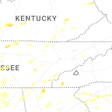
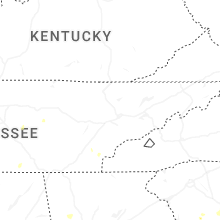


Connect with Interactive Hail Maps