

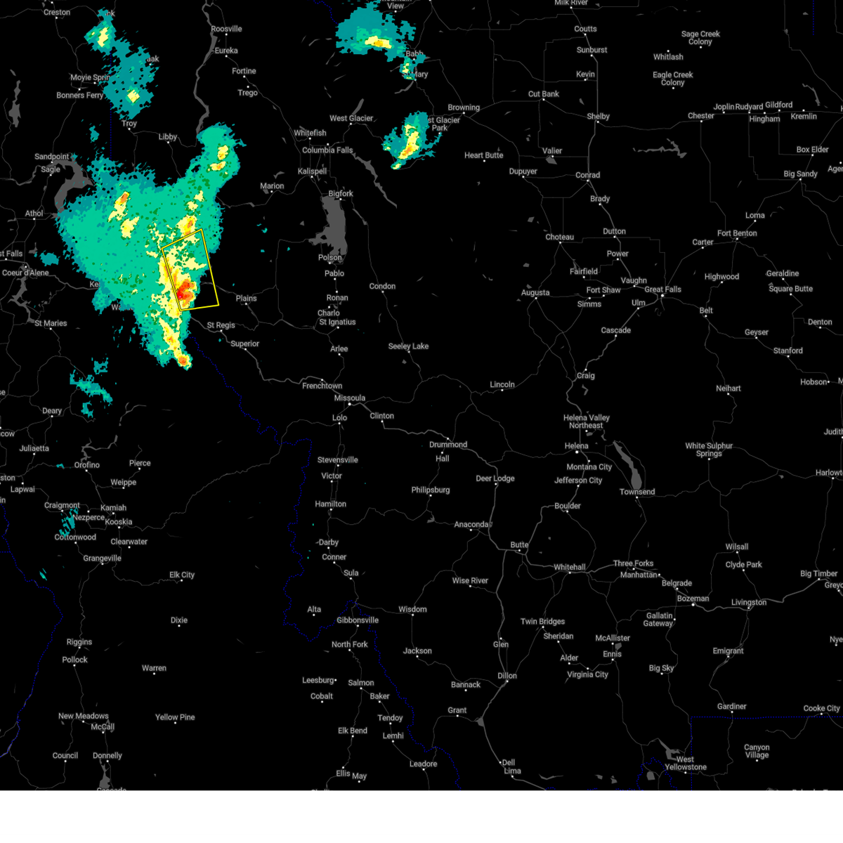
Hail Map for Thompson Falls, MT
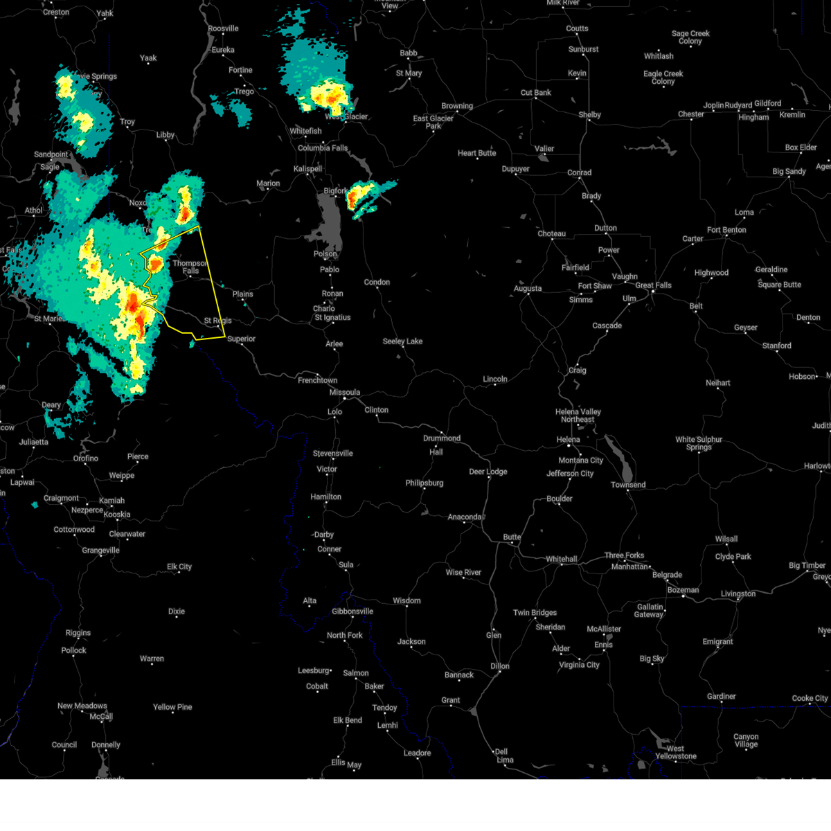
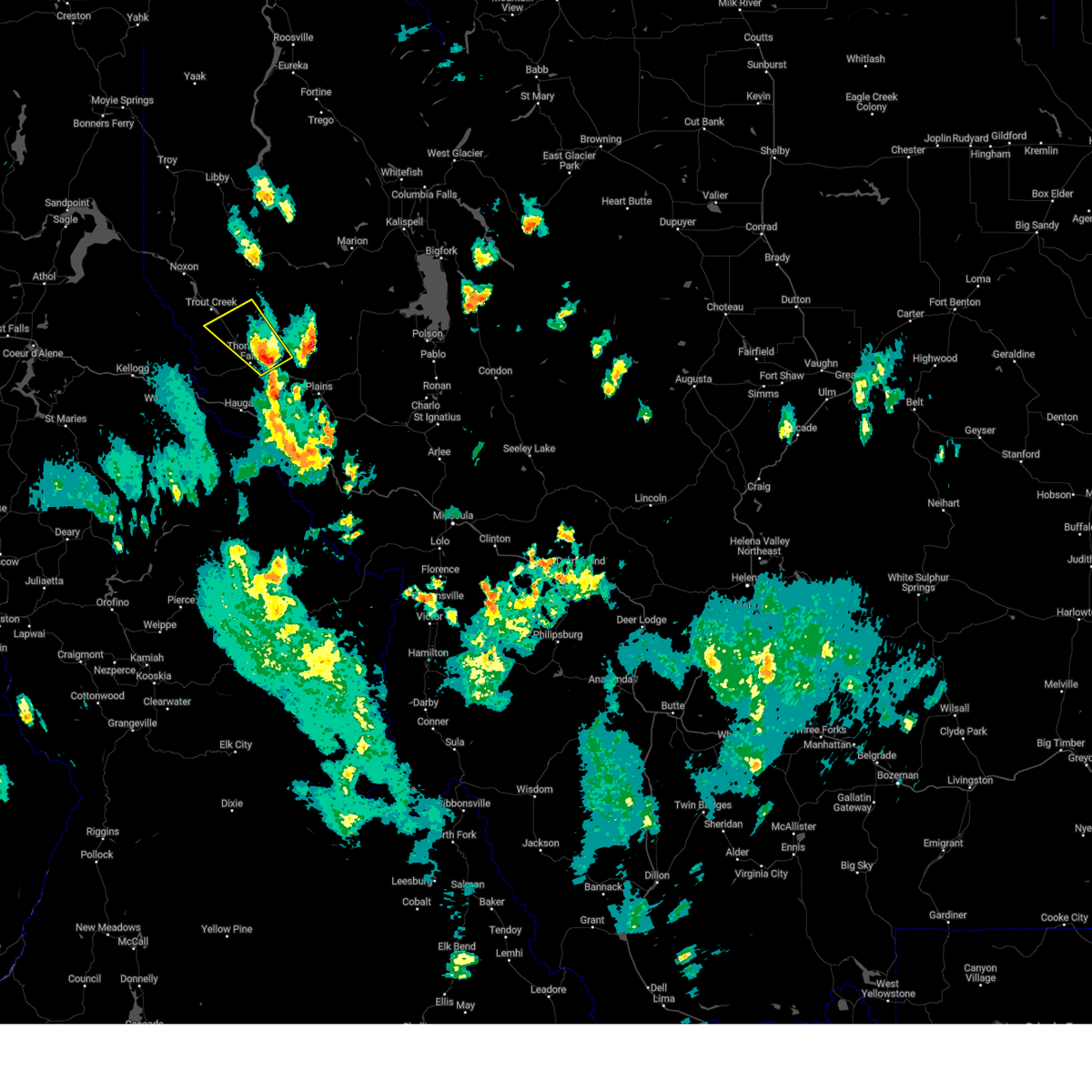
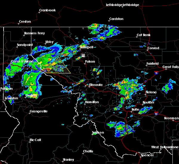
The Thompson Falls, MT area has had 1 report of on-the-ground hail by trained spotters, and has been under severe weather warnings 3 times during the past 12 months. Doppler radar has detected hail at or near Thompson Falls, MT on 5 occasions, including 1 occasion during the past year.
| Name: | Thompson Falls, MT |
| Where Located: | 73 miles SW of Whitefish, MT |
| Map: | Google Map for Thompson Falls, MT |
| Population: | 1313 |
| Housing Units: | 681 |
| More Info: | Search Google for Thompson Falls, MT |
0
The Top Recent Hail Date for Thompson Falls, MT is Friday, August 23, 2024 (4th out of 5)

Hail and Wind Damage Spotted near Thompson Falls, MT
| Date / Time | Report Details |
|---|---|
| 9/25/2024 7:21 PM MDT |
 At 720 pm mdt, severe thunderstorms were located along a line extending from 20 miles southeast of noxon to near thompson falls, moving northeast at 55 mph (radar indicated). Hazards include 60 mph wind gusts. Expect damage to roofs, siding, and trees. Locations impacted include, thompson falls, snider, belknap, and white pine. At 720 pm mdt, severe thunderstorms were located along a line extending from 20 miles southeast of noxon to near thompson falls, moving northeast at 55 mph (radar indicated). Hazards include 60 mph wind gusts. Expect damage to roofs, siding, and trees. Locations impacted include, thompson falls, snider, belknap, and white pine.
|
| 9/25/2024 7:20 PM MDT | Widespread power outages in thompson falls associated with thunderstorm wind damage. time estimated via rada in sanders county MT, 1.3 miles E of Thompson Falls, MT |
| 9/25/2024 7:20 PM MDT | Downed tree at the bottom of cherry creek road. time estimated via rada in sanders county MT, 1 miles ENE of Thompson Falls, MT |
| 9/25/2024 6:54 PM MDT |
 Svrmso the national weather service in missoula has issued a * severe thunderstorm warning for, northwestern mineral county in west central montana, west central sanders county in northwestern montana, * until 730 pm mdt. * at 653 pm mdt, severe thunderstorms were located along a line extending from near mullan to 13 miles south of lookout pass, moving northeast at 55 mph (radar indicated). Hazards include 60 mph wind gusts. expect damage to roofs, siding, and trees Svrmso the national weather service in missoula has issued a * severe thunderstorm warning for, northwestern mineral county in west central montana, west central sanders county in northwestern montana, * until 730 pm mdt. * at 653 pm mdt, severe thunderstorms were located along a line extending from near mullan to 13 miles south of lookout pass, moving northeast at 55 mph (radar indicated). Hazards include 60 mph wind gusts. expect damage to roofs, siding, and trees
|
| 8/23/2024 3:38 PM MDT |
 Svrmso the national weather service in missoula has issued a * severe thunderstorm warning for, central sanders county in northwestern montana, * until 415 pm mdt. * at 337 pm mdt, a severe thunderstorm was located near thompson falls, moving northwest at 30 mph (radar indicated). Hazards include 60 mph wind gusts and half dollar size hail. Hail damage to vehicles is expected. Expect wind damage to roofs, siding, and trees. Svrmso the national weather service in missoula has issued a * severe thunderstorm warning for, central sanders county in northwestern montana, * until 415 pm mdt. * at 337 pm mdt, a severe thunderstorm was located near thompson falls, moving northwest at 30 mph (radar indicated). Hazards include 60 mph wind gusts and half dollar size hail. Hail damage to vehicles is expected. Expect wind damage to roofs, siding, and trees.
|
| 6/8/2016 5:25 PM MDT |
 The severe thunderstorm warning for north central mineral and central sanders counties will expire at 530 pm mdt, the severe thunderstorm which prompted the warning has but will still see small hail and gusty winds. therefore the warning will be allowed to expire. The severe thunderstorm warning for north central mineral and central sanders counties will expire at 530 pm mdt, the severe thunderstorm which prompted the warning has but will still see small hail and gusty winds. therefore the warning will be allowed to expire.
|
| 6/8/2016 5:18 PM MDT |
 At 518 pm mdt, doppler radar indicated a severe thunderstorm capable of producing quarter size hail and damaging winds in excess of 60 mph. this storm was located 24 miles west of big arm, or 31 miles southwest of kalispell, moving northeast at 100 mph. locations impacted include, thompson falls, plains, haugan, de borgia, paradise, snider, saltese, eddy and weeksville. At 518 pm mdt, doppler radar indicated a severe thunderstorm capable of producing quarter size hail and damaging winds in excess of 60 mph. this storm was located 24 miles west of big arm, or 31 miles southwest of kalispell, moving northeast at 100 mph. locations impacted include, thompson falls, plains, haugan, de borgia, paradise, snider, saltese, eddy and weeksville.
|
| 6/8/2016 5:11 PM MDT |
 The severe thunderstorm warning for northwestern mineral and central sanders counties will expire at 515 pm mdt, the severe thunderstorm which prompted the warning has weakened. therefore the warning will be allowed to expire. The severe thunderstorm warning for northwestern mineral and central sanders counties will expire at 515 pm mdt, the severe thunderstorm which prompted the warning has weakened. therefore the warning will be allowed to expire.
|
| 6/8/2016 4:57 PM MDT |
 At 456 pm mdt, doppler radar indicated a severe thunderstorm capable of producing quarter size hail and damaging winds in excess of 60 mph. this storm was located near thompson falls, and moving northeast at 45 mph. At 456 pm mdt, doppler radar indicated a severe thunderstorm capable of producing quarter size hail and damaging winds in excess of 60 mph. this storm was located near thompson falls, and moving northeast at 45 mph.
|
| 6/8/2016 4:52 PM MDT |
 At 451 pm mdt, doppler radar indicated a severe thunderstorm capable of producing quarter size hail and damaging winds in excess of 60 mph. this storm was located near lookout pass, or 13 miles southwest of thompson falls, and moving northeast at 45 mph. At 451 pm mdt, doppler radar indicated a severe thunderstorm capable of producing quarter size hail and damaging winds in excess of 60 mph. this storm was located near lookout pass, or 13 miles southwest of thompson falls, and moving northeast at 45 mph.
|
| 8/11/2015 7:20 PM MDT |
 At 720 pm mdt, doppler radar indicated a severe thunderstorm capable of producing quarter size hail. this storm was located near de borgia, or 14 miles south of thompson falls, and moving north at 30 mph. At 720 pm mdt, doppler radar indicated a severe thunderstorm capable of producing quarter size hail. this storm was located near de borgia, or 14 miles south of thompson falls, and moving north at 30 mph.
|
| 7/20/2012 5:00 PM MDT | Quarter sized hail reported 0.2 miles SSW of Thompson Falls, MT |
| 7/20/2012 5:00 PM MDT | Several trees down along main street in sanders county MT, 0.2 miles SSW of Thompson Falls, MT |
Hail Maps for Thompson Falls, MT


Connect with Interactive Hail Maps