

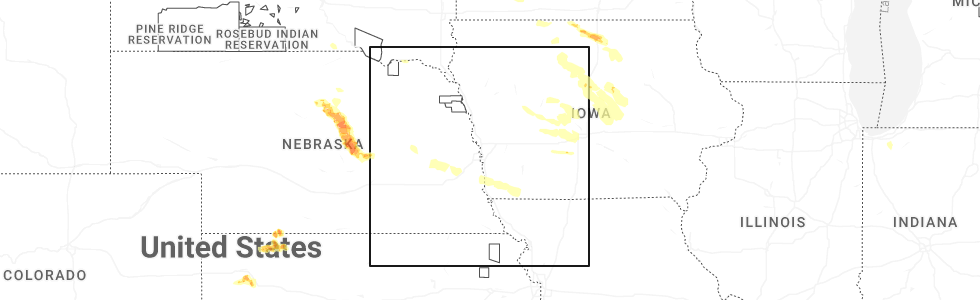
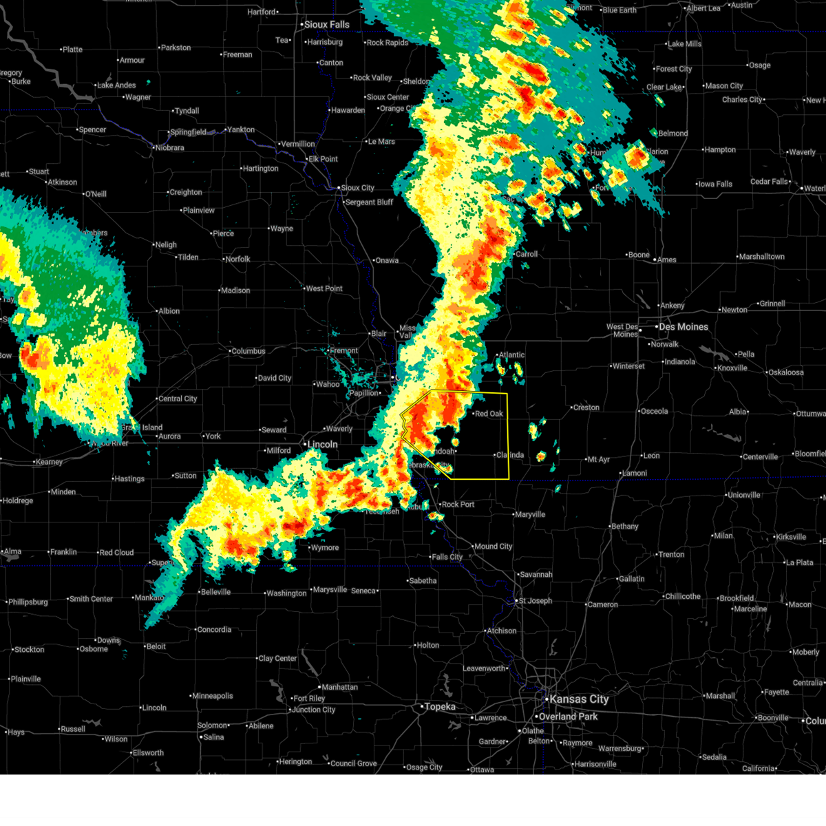
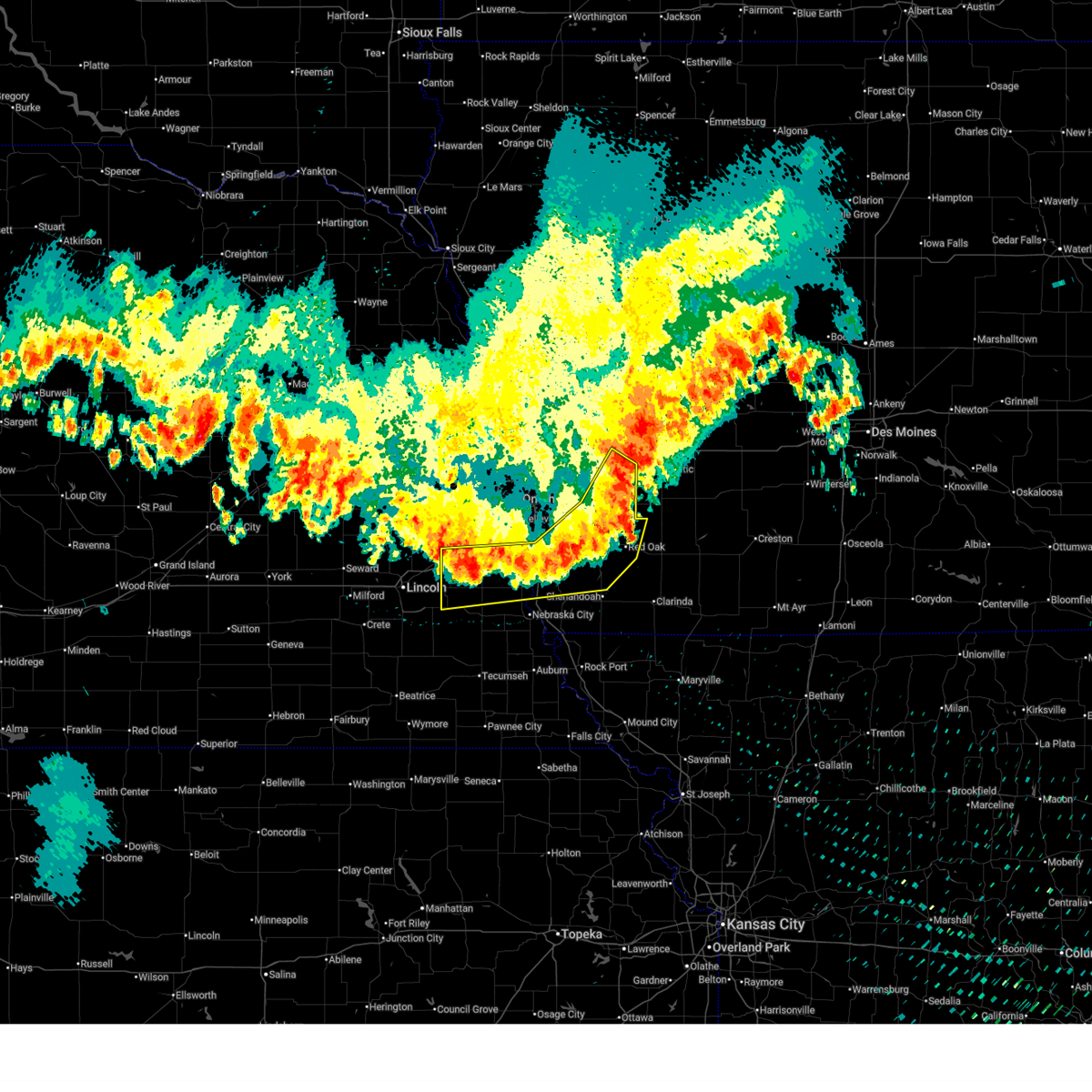
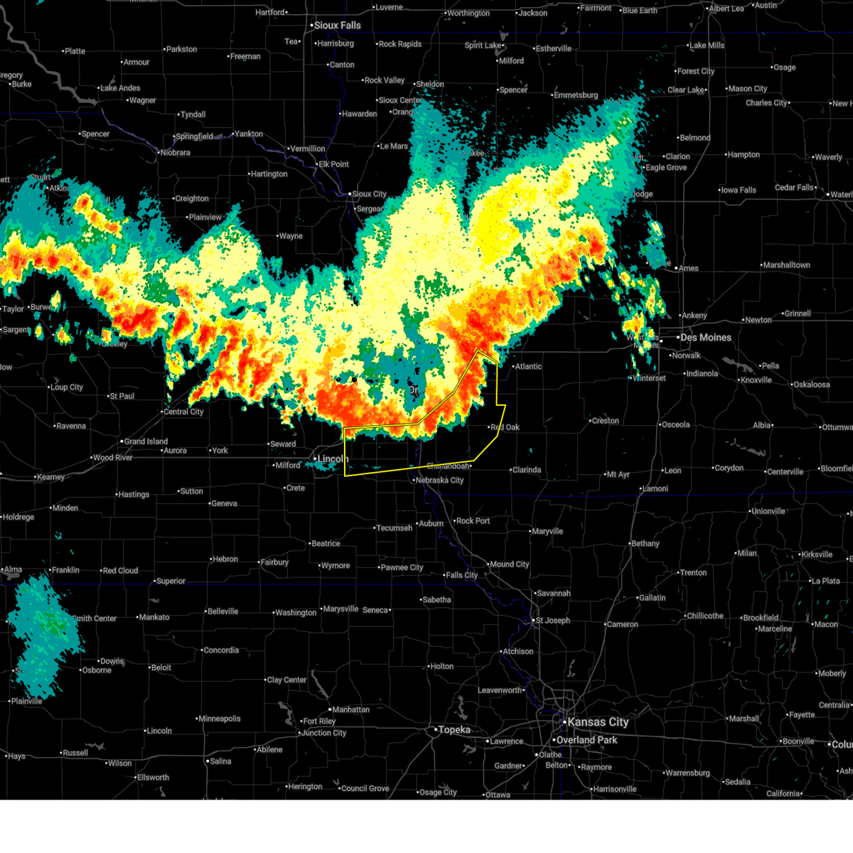
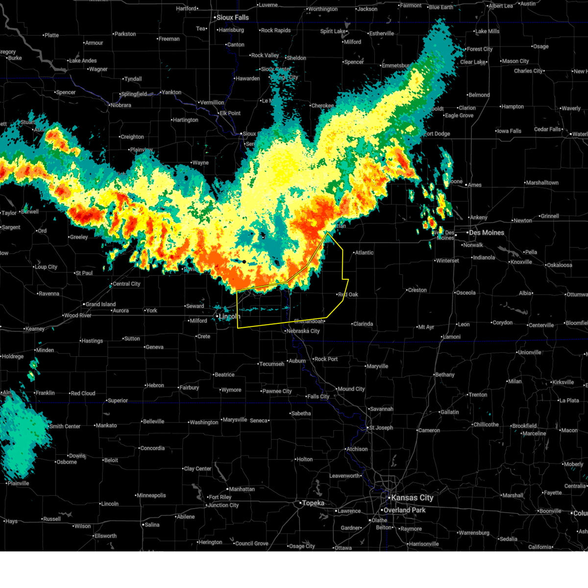
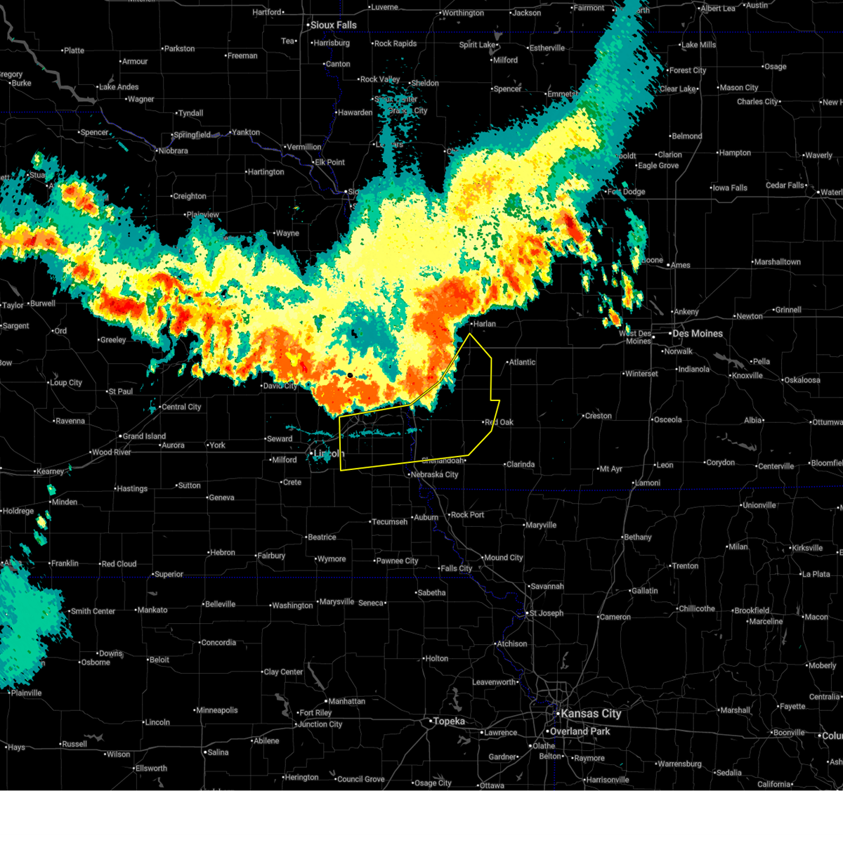
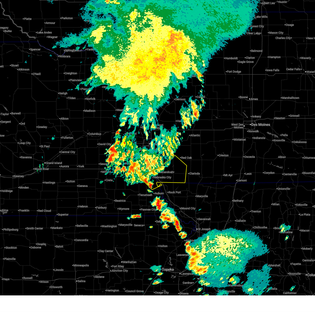
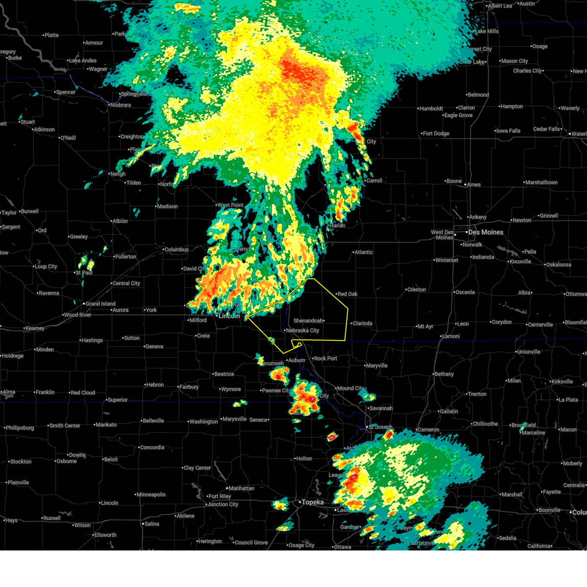
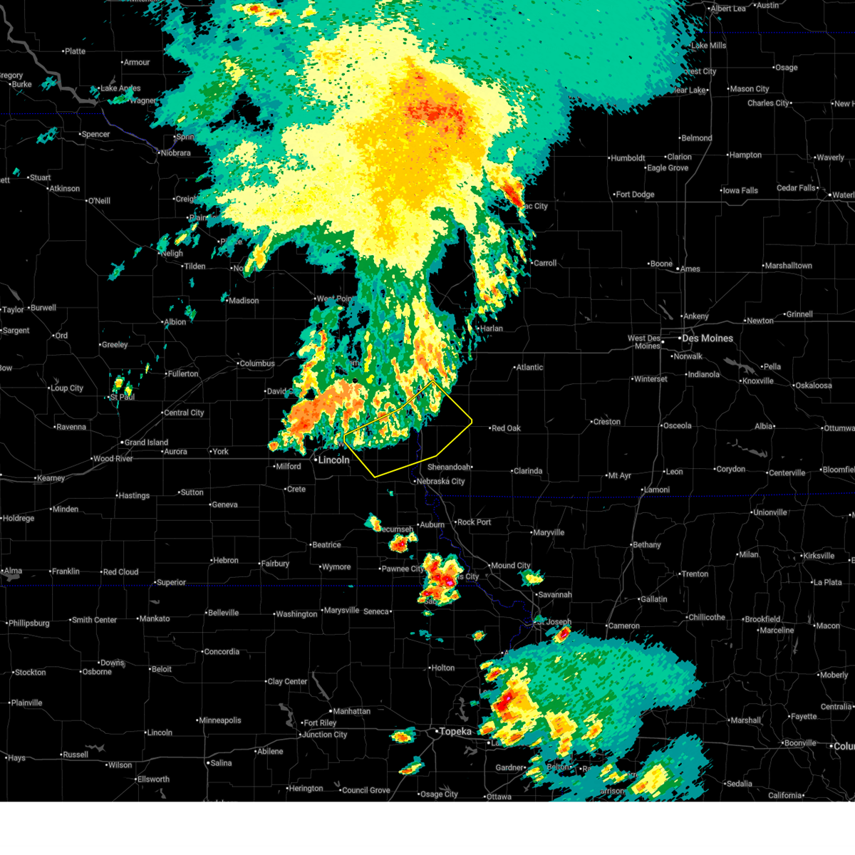
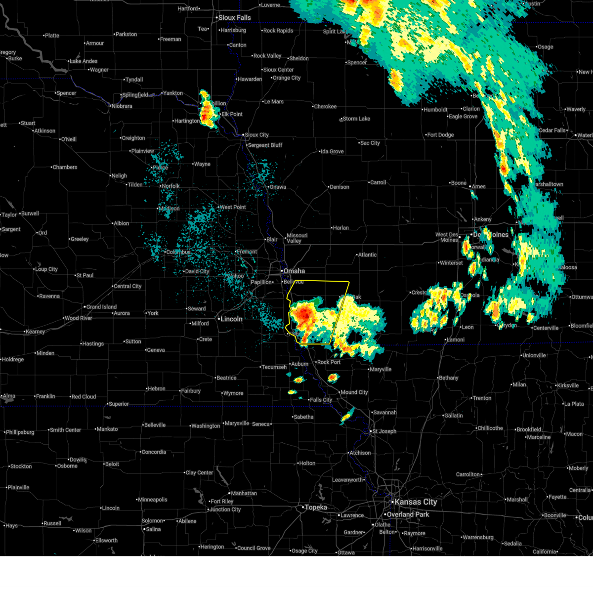
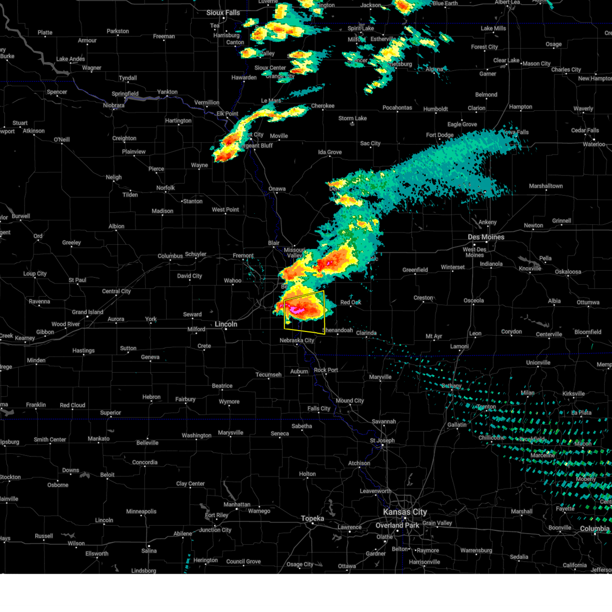
Hail Map for Thurman, IA
The Thurman, IA area has had 12 reports of on-the-ground hail by trained spotters, and has been under severe weather warnings 34 times during the past 12 months. Doppler radar has detected hail at or near Thurman, IA on 93 occasions, including 5 occasions during the past year.
| Name: | Thurman, IA |
| Where Located: | 31.9 miles SSE of Omaha, NE |
| Map: | Google Map for Thurman, IA |
| Population: | 229 |
| Housing Units: | 91 |
| More Info: | Search Google for Thurman, IA |
1
The Top Recent Hail Date for Thurman, IA is Thursday, June 19, 2025 (23rd out of 93)
Hail and Wind Damage Spotted near Thurman, IA
| Date / Time | Report Details |
|---|---|
| 7/10/2025 3:14 AM CDT |
 Svroax the national weather service in omaha has issued a * severe thunderstorm warning for, fremont county in southwestern iowa, montgomery county in southwestern iowa, mills county in southwestern iowa, page county in southwestern iowa, * until 400 am cdt. * at 314 am cdt, severe thunderstorms were located along a line extending from 4 miles west of griswold to 7 miles northwest of essex to 2 miles north of sidney, moving southeast at 40 mph (public report of a measured 61 mph wind gust south of glenwood, ia at 3:04 am). Hazards include 60 mph wind gusts. Expect damage to roofs, siding, and trees. severe thunderstorms will be near, red oak, shenandoah, sidney, essex, farragut, elliott, and riverton around 320 am cdt. stanton around 325 am cdt. grant around 330 am cdt. other locations in the path of these severe thunderstorms include villisca, clarinda, coin, college springs, blanchard and shambaugh. People attending mills county fairgrounds should seek safe shelter immediately! this includes interstate 29 between mile markers 24 and 32. Svroax the national weather service in omaha has issued a * severe thunderstorm warning for, fremont county in southwestern iowa, montgomery county in southwestern iowa, mills county in southwestern iowa, page county in southwestern iowa, * until 400 am cdt. * at 314 am cdt, severe thunderstorms were located along a line extending from 4 miles west of griswold to 7 miles northwest of essex to 2 miles north of sidney, moving southeast at 40 mph (public report of a measured 61 mph wind gust south of glenwood, ia at 3:04 am). Hazards include 60 mph wind gusts. Expect damage to roofs, siding, and trees. severe thunderstorms will be near, red oak, shenandoah, sidney, essex, farragut, elliott, and riverton around 320 am cdt. stanton around 325 am cdt. grant around 330 am cdt. other locations in the path of these severe thunderstorms include villisca, clarinda, coin, college springs, blanchard and shambaugh. People attending mills county fairgrounds should seek safe shelter immediately! this includes interstate 29 between mile markers 24 and 32.
|
| 7/7/2025 11:13 PM CDT |
 The storms which prompted the warning have weakened below severe limits, and no longer pose an immediate threat to life or property. therefore, the warning will be allowed to expire. however, gusty winds up to 50 to 55 mph are still possible with these thunderstorms. a severe thunderstorm watch remains in effect until 400 am cdt for southwestern iowa, and southeastern and east central nebraska. The storms which prompted the warning have weakened below severe limits, and no longer pose an immediate threat to life or property. therefore, the warning will be allowed to expire. however, gusty winds up to 50 to 55 mph are still possible with these thunderstorms. a severe thunderstorm watch remains in effect until 400 am cdt for southwestern iowa, and southeastern and east central nebraska.
|
| 7/7/2025 11:02 PM CDT |
 the severe thunderstorm warning has been cancelled and is no longer in effect the severe thunderstorm warning has been cancelled and is no longer in effect
|
| 7/7/2025 11:02 PM CDT |
 At 1101 pm cdt, severe thunderstorms were located along a line extending from 5 miles northwest of griswold to 3 miles east of emerson to randolph to 2 miles northwest of avoca, moving southeast at 35 mph (radar indicated). Hazards include 60 mph wind gusts and penny size hail. Expect damage to roofs, siding, and trees. these severe storms will be near, red oak, elliott, avoca, union, nehawka, and randolph around 1105 pm cdt. Other locations in the path of these severe thunderstorms include essex. At 1101 pm cdt, severe thunderstorms were located along a line extending from 5 miles northwest of griswold to 3 miles east of emerson to randolph to 2 miles northwest of avoca, moving southeast at 35 mph (radar indicated). Hazards include 60 mph wind gusts and penny size hail. Expect damage to roofs, siding, and trees. these severe storms will be near, red oak, elliott, avoca, union, nehawka, and randolph around 1105 pm cdt. Other locations in the path of these severe thunderstorms include essex.
|
| 7/7/2025 10:47 PM CDT |
 At 1046 pm cdt, severe thunderstorms were located along a line extending from 7 miles east of oakland to emerson to 2 miles east of tabor to 4 miles southeast of elmwood, moving southeast at 45 mph (radar indicated). Hazards include 60 mph wind gusts and penny size hail. Expect damage to roofs, siding, and trees. these severe storms will be near, red oak, emerson, avoca, union, nehawka, and randolph around 1050 pm cdt. Other locations in the path of these severe thunderstorms include elliott and essex. At 1046 pm cdt, severe thunderstorms were located along a line extending from 7 miles east of oakland to emerson to 2 miles east of tabor to 4 miles southeast of elmwood, moving southeast at 45 mph (radar indicated). Hazards include 60 mph wind gusts and penny size hail. Expect damage to roofs, siding, and trees. these severe storms will be near, red oak, emerson, avoca, union, nehawka, and randolph around 1050 pm cdt. Other locations in the path of these severe thunderstorms include elliott and essex.
|
| 7/7/2025 10:34 PM CDT |
 Svroax the national weather service in omaha has issued a * severe thunderstorm warning for, northern fremont county in southwestern iowa, western montgomery county in southwestern iowa, mills county in southwestern iowa, eastern pottawattamie county in southwestern iowa, northwestern page county in southwestern iowa, south central shelby county in southwestern iowa, southern sarpy county in east central nebraska, northwestern otoe county in southeastern nebraska, southeastern saunders county in east central nebraska, cass county in southeastern nebraska, * until 1115 pm cdt. * at 1034 pm cdt, severe thunderstorms were located along a line extending from 2 miles northeast of hancock to 2 miles southwest of henderson to 5 miles south of glenwood to murdock, moving southeast at 45 mph (radar indicated). Hazards include 60 mph wind gusts and penny size hail. Expect damage to roofs, siding, and trees. severe thunderstorms will be near, malvern, weeping water, tabor, murray, emerson, nehawka, henderson, randolph, hastings, and beaver lake around 1040 pm cdt. avoca and union around 1045 pm cdt. red oak and elliott around 1050 pm cdt. other locations in the path of these severe thunderstorms include essex. this includes the following highways, interstate 29 between mile markers 15 and 39. interstate 80 in iowa between mile markers 37 and 43. Interstate 80 in nebraska between mile markers 415 and 430. Svroax the national weather service in omaha has issued a * severe thunderstorm warning for, northern fremont county in southwestern iowa, western montgomery county in southwestern iowa, mills county in southwestern iowa, eastern pottawattamie county in southwestern iowa, northwestern page county in southwestern iowa, south central shelby county in southwestern iowa, southern sarpy county in east central nebraska, northwestern otoe county in southeastern nebraska, southeastern saunders county in east central nebraska, cass county in southeastern nebraska, * until 1115 pm cdt. * at 1034 pm cdt, severe thunderstorms were located along a line extending from 2 miles northeast of hancock to 2 miles southwest of henderson to 5 miles south of glenwood to murdock, moving southeast at 45 mph (radar indicated). Hazards include 60 mph wind gusts and penny size hail. Expect damage to roofs, siding, and trees. severe thunderstorms will be near, malvern, weeping water, tabor, murray, emerson, nehawka, henderson, randolph, hastings, and beaver lake around 1040 pm cdt. avoca and union around 1045 pm cdt. red oak and elliott around 1050 pm cdt. other locations in the path of these severe thunderstorms include essex. this includes the following highways, interstate 29 between mile markers 15 and 39. interstate 80 in iowa between mile markers 37 and 43. Interstate 80 in nebraska between mile markers 415 and 430.
|
| 6/29/2025 6:37 AM CDT |
 At 637 am cdt, severe thunderstorms were located along a line extending from 2 miles northeast of red oak to 4 miles northwest of shenandoah to 2 miles southwest of nebraska city, moving east at 55 mph (radar indicated). Hazards include 60 mph wind gusts. Expect damage to roofs, siding, and trees. Locations impacted include, shenandoah, hamburg, essex, farragut, riverton and coin. At 637 am cdt, severe thunderstorms were located along a line extending from 2 miles northeast of red oak to 4 miles northwest of shenandoah to 2 miles southwest of nebraska city, moving east at 55 mph (radar indicated). Hazards include 60 mph wind gusts. Expect damage to roofs, siding, and trees. Locations impacted include, shenandoah, hamburg, essex, farragut, riverton and coin.
|
| 6/29/2025 6:37 AM CDT |
 the severe thunderstorm warning has been cancelled and is no longer in effect the severe thunderstorm warning has been cancelled and is no longer in effect
|
| 6/29/2025 6:15 AM CDT |
 Svroax the national weather service in omaha has issued a * severe thunderstorm warning for, fremont county in southwestern iowa, southwestern montgomery county in southwestern iowa, mills county in southwestern iowa, page county in southwestern iowa, north central nemaha county in southeastern nebraska, eastern otoe county in southeastern nebraska, southeastern cass county in southeastern nebraska, * until 645 am cdt. * at 614 am cdt, severe thunderstorms were located along a line extending from 2 miles west of henderson to 3 miles west of tabor to 4 miles southwest of avoca, moving southeast at 55 mph (radar indicated). Hazards include 60 mph wind gusts. Expect damage to roofs, siding, and trees. severe thunderstorms will be near, malvern, tabor, emerson, union, dunbar, randolph, and hastings around 620 am cdt. nebraska city and sidney around 625 am cdt. other locations in the path of these severe thunderstorms include shenandoah, hamburg, essex, farragut and riverton. This includes interstate 29 between mile markers 1 and 32. Svroax the national weather service in omaha has issued a * severe thunderstorm warning for, fremont county in southwestern iowa, southwestern montgomery county in southwestern iowa, mills county in southwestern iowa, page county in southwestern iowa, north central nemaha county in southeastern nebraska, eastern otoe county in southeastern nebraska, southeastern cass county in southeastern nebraska, * until 645 am cdt. * at 614 am cdt, severe thunderstorms were located along a line extending from 2 miles west of henderson to 3 miles west of tabor to 4 miles southwest of avoca, moving southeast at 55 mph (radar indicated). Hazards include 60 mph wind gusts. Expect damage to roofs, siding, and trees. severe thunderstorms will be near, malvern, tabor, emerson, union, dunbar, randolph, and hastings around 620 am cdt. nebraska city and sidney around 625 am cdt. other locations in the path of these severe thunderstorms include shenandoah, hamburg, essex, farragut and riverton. This includes interstate 29 between mile markers 1 and 32.
|
| 6/29/2025 6:08 AM CDT |
 the severe thunderstorm warning has been cancelled and is no longer in effect the severe thunderstorm warning has been cancelled and is no longer in effect
|
| 6/29/2025 6:08 AM CDT |
 At 607 am cdt, severe thunderstorms were located along a line extending from 4 miles southeast of treynor to 3 miles southwest of pacific junction to near elmwood, moving east at 45 mph (weather instrument measurement measured gust of 62 mph at omaha eppley airfield at 5:43 am). Hazards include 60 mph wind gusts. Expect damage to roofs, siding, and trees. Locations impacted include, plattsmouth, glenwood, malvern, weeping water, pacific junction, murray, silver city, beaver lake, avoca, nehawka, tabor, hastings and union. At 607 am cdt, severe thunderstorms were located along a line extending from 4 miles southeast of treynor to 3 miles southwest of pacific junction to near elmwood, moving east at 45 mph (weather instrument measurement measured gust of 62 mph at omaha eppley airfield at 5:43 am). Hazards include 60 mph wind gusts. Expect damage to roofs, siding, and trees. Locations impacted include, plattsmouth, glenwood, malvern, weeping water, pacific junction, murray, silver city, beaver lake, avoca, nehawka, tabor, hastings and union.
|
| 6/29/2025 5:42 AM CDT |
 Svroax the national weather service in omaha has issued a * severe thunderstorm warning for, northwestern fremont county in southwestern iowa, mills county in southwestern iowa, southwestern pottawattamie county in southwestern iowa, sarpy county in east central nebraska, northeastern lancaster county in southeastern nebraska, north central otoe county in southeastern nebraska, southeastern douglas county in east central nebraska, southeastern saunders county in east central nebraska, cass county in southeastern nebraska, * until 615 am cdt. * at 542 am cdt, severe thunderstorms were located along a line extending from 5 miles southwest of underwood to near walnut creek recreation area to 3 miles north of greenwood, moving southeast at 45 mph (weather instrument measurement measured gust of 62 mph at omaha eppley airfield at 5:43 am). Hazards include 60 mph wind gusts. Expect damage to roofs, siding, and trees. severe thunderstorms will be near, southeastern omaha, council bluffs, bellevue, papillion, offutt afb, ashland, springfield, louisville, greenwood, and cedar creek around 545 am cdt. plattsmouth, treynor, and murdock around 550 am cdt. glenwood, elmwood, and pacific junction around 555 am cdt. weeping water, murray, silver city, and beaver lake around 600 am cdt. other locations in the path of these severe thunderstorms include malvern, avoca and nehawka. this includes the following highways, interstate 29 between mile markers 20 and 63. interstate 80 in iowa between mile markers 1 and 11. Interstate 80 in nebraska between mile markers 415 and 454. Svroax the national weather service in omaha has issued a * severe thunderstorm warning for, northwestern fremont county in southwestern iowa, mills county in southwestern iowa, southwestern pottawattamie county in southwestern iowa, sarpy county in east central nebraska, northeastern lancaster county in southeastern nebraska, north central otoe county in southeastern nebraska, southeastern douglas county in east central nebraska, southeastern saunders county in east central nebraska, cass county in southeastern nebraska, * until 615 am cdt. * at 542 am cdt, severe thunderstorms were located along a line extending from 5 miles southwest of underwood to near walnut creek recreation area to 3 miles north of greenwood, moving southeast at 45 mph (weather instrument measurement measured gust of 62 mph at omaha eppley airfield at 5:43 am). Hazards include 60 mph wind gusts. Expect damage to roofs, siding, and trees. severe thunderstorms will be near, southeastern omaha, council bluffs, bellevue, papillion, offutt afb, ashland, springfield, louisville, greenwood, and cedar creek around 545 am cdt. plattsmouth, treynor, and murdock around 550 am cdt. glenwood, elmwood, and pacific junction around 555 am cdt. weeping water, murray, silver city, and beaver lake around 600 am cdt. other locations in the path of these severe thunderstorms include malvern, avoca and nehawka. this includes the following highways, interstate 29 between mile markers 20 and 63. interstate 80 in iowa between mile markers 1 and 11. Interstate 80 in nebraska between mile markers 415 and 454.
|
| 6/20/2025 1:36 AM CDT |
 At 134 am cdt, a severe thunderstorm was located near randolph, or 17 miles southwest of red oak, moving east at 30 mph (radar indicated). Hazards include 70 mph wind gusts. Expect considerable tree damage. damage is likely to mobile homes, roofs, and outbuildings. This severe storm will be near, essex around 145 am cdt. At 134 am cdt, a severe thunderstorm was located near randolph, or 17 miles southwest of red oak, moving east at 30 mph (radar indicated). Hazards include 70 mph wind gusts. Expect considerable tree damage. damage is likely to mobile homes, roofs, and outbuildings. This severe storm will be near, essex around 145 am cdt.
|
| 6/20/2025 1:27 AM CDT |
 the severe thunderstorm warning has been cancelled and is no longer in effect the severe thunderstorm warning has been cancelled and is no longer in effect
|
| 6/20/2025 1:27 AM CDT |
 At 126 am cdt, a severe thunderstorm was located over randolph, or 19 miles northeast of nebraska city, moving east at 30 mph (radar indicated). Hazards include 60 mph wind gusts. Expect damage to roofs, siding, and trees. this severe storm will be near, randolph around 130 am cdt. Other locations in the path of this severe thunderstorm include essex. At 126 am cdt, a severe thunderstorm was located over randolph, or 19 miles northeast of nebraska city, moving east at 30 mph (radar indicated). Hazards include 60 mph wind gusts. Expect damage to roofs, siding, and trees. this severe storm will be near, randolph around 130 am cdt. Other locations in the path of this severe thunderstorm include essex.
|
| 6/20/2025 1:10 AM CDT |
 Svroax the national weather service in omaha has issued a * severe thunderstorm warning for, fremont county in southwestern iowa, western montgomery county in southwestern iowa, mills county in southwestern iowa, southeastern pottawattamie county in southwestern iowa, western page county in southwestern iowa, northeastern otoe county in southeastern nebraska, southeastern cass county in southeastern nebraska, * until 200 am cdt. * at 109 am cdt, a severe thunderstorm was located 5 miles west of tabor, or 16 miles north of nebraska city, moving east at 30 mph (radar indicated). Hazards include 60 mph wind gusts. Expect damage to roofs, siding, and trees. this severe thunderstorm will be near, tabor around 115 am cdt. randolph around 125 am cdt. other locations in the path of this severe thunderstorm include essex. This includes interstate 29 between mile markers 1 and 37. Svroax the national weather service in omaha has issued a * severe thunderstorm warning for, fremont county in southwestern iowa, western montgomery county in southwestern iowa, mills county in southwestern iowa, southeastern pottawattamie county in southwestern iowa, western page county in southwestern iowa, northeastern otoe county in southeastern nebraska, southeastern cass county in southeastern nebraska, * until 200 am cdt. * at 109 am cdt, a severe thunderstorm was located 5 miles west of tabor, or 16 miles north of nebraska city, moving east at 30 mph (radar indicated). Hazards include 60 mph wind gusts. Expect damage to roofs, siding, and trees. this severe thunderstorm will be near, tabor around 115 am cdt. randolph around 125 am cdt. other locations in the path of this severe thunderstorm include essex. This includes interstate 29 between mile markers 1 and 37.
|
| 6/20/2025 12:49 AM CDT |
 At 1249 am cdt, a severe thunderstorm was located 6 miles southeast of cedar creek, or 12 miles southwest of offutt afb, moving east at 30 mph (radar indicated). Hazards include 60 mph wind gusts. Expect damage to roofs, siding, and trees. this severe storm will be near, murray and beaver lake around 1255 am cdt. Other locations in the path of this severe thunderstorm include plattsmouth. At 1249 am cdt, a severe thunderstorm was located 6 miles southeast of cedar creek, or 12 miles southwest of offutt afb, moving east at 30 mph (radar indicated). Hazards include 60 mph wind gusts. Expect damage to roofs, siding, and trees. this severe storm will be near, murray and beaver lake around 1255 am cdt. Other locations in the path of this severe thunderstorm include plattsmouth.
|
| 6/20/2025 12:35 AM CDT |
 Svroax the national weather service in omaha has issued a * severe thunderstorm warning for, northwestern fremont county in southwestern iowa, southwestern mills county in southwestern iowa, sarpy county in east central nebraska, northeastern otoe county in southeastern nebraska, cass county in southeastern nebraska, * until 115 am cdt. * at 1235 am cdt, a severe thunderstorm was located over louisville, or 10 miles south of gretna, moving east at 30 mph (radar indicated). Hazards include 60 mph wind gusts. Expect damage to roofs, siding, and trees. this severe thunderstorm will be near, cedar creek around 1240 am cdt. murray and beaver lake around 1255 am cdt. this includes the following highways, interstate 29 between mile markers 15 and 37. Interstate 80 in nebraska between mile markers 428 and 437. Svroax the national weather service in omaha has issued a * severe thunderstorm warning for, northwestern fremont county in southwestern iowa, southwestern mills county in southwestern iowa, sarpy county in east central nebraska, northeastern otoe county in southeastern nebraska, cass county in southeastern nebraska, * until 115 am cdt. * at 1235 am cdt, a severe thunderstorm was located over louisville, or 10 miles south of gretna, moving east at 30 mph (radar indicated). Hazards include 60 mph wind gusts. Expect damage to roofs, siding, and trees. this severe thunderstorm will be near, cedar creek around 1240 am cdt. murray and beaver lake around 1255 am cdt. this includes the following highways, interstate 29 between mile markers 15 and 37. Interstate 80 in nebraska between mile markers 428 and 437.
|
| 4/17/2025 8:37 PM CDT |
 The storm which prompted the warning has moved out of the area. therefore, the warning will be allowed to expire. a tornado watch remains in effect until midnight cdt for southwestern iowa, and southeastern nebraska. remember, a tornado warning still remains in effect for portions of mills and fremont counties until 9 pm cdt. The storm which prompted the warning has moved out of the area. therefore, the warning will be allowed to expire. a tornado watch remains in effect until midnight cdt for southwestern iowa, and southeastern nebraska. remember, a tornado warning still remains in effect for portions of mills and fremont counties until 9 pm cdt.
|
| 4/17/2025 8:17 PM CDT |
 Svroax the national weather service in omaha has issued a * severe thunderstorm warning for, northeastern fremont county in southwestern iowa, southwestern montgomery county in southwestern iowa, southeastern mills county in southwestern iowa, northwestern page county in southwestern iowa, * until 900 pm cdt. * at 817 pm cdt, a severe thunderstorm was located near tabor, or 17 miles southeast of offutt afb, moving east at 35 mph (radar indicated). Hazards include two inch hail and 60 mph wind gusts. People and animals outdoors will be injured. expect hail damage to roofs, siding, windows, and vehicles. expect wind damage to roofs, siding, and trees. this severe thunderstorm will be near, tabor around 820 pm cdt. Randolph around 825 pm cdt. Svroax the national weather service in omaha has issued a * severe thunderstorm warning for, northeastern fremont county in southwestern iowa, southwestern montgomery county in southwestern iowa, southeastern mills county in southwestern iowa, northwestern page county in southwestern iowa, * until 900 pm cdt. * at 817 pm cdt, a severe thunderstorm was located near tabor, or 17 miles southeast of offutt afb, moving east at 35 mph (radar indicated). Hazards include two inch hail and 60 mph wind gusts. People and animals outdoors will be injured. expect hail damage to roofs, siding, windows, and vehicles. expect wind damage to roofs, siding, and trees. this severe thunderstorm will be near, tabor around 820 pm cdt. Randolph around 825 pm cdt.
|
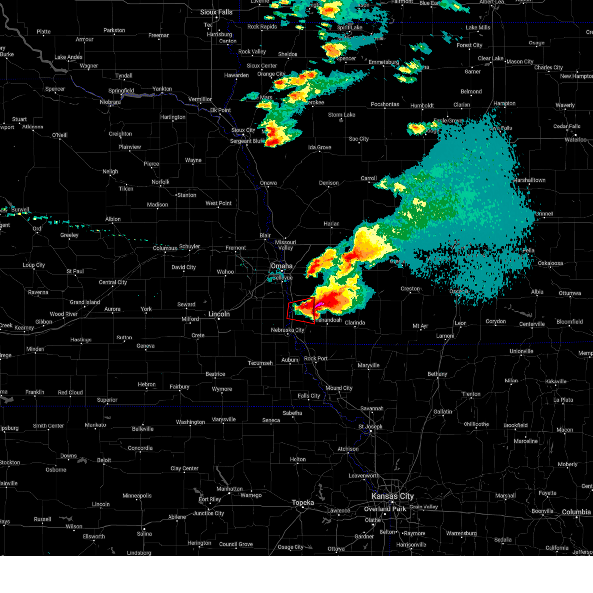
| 4/17/2025 8:16 PM CDT | Golf Ball sized hail reported 3.3 miles S of Thurman, IA |
| 4/17/2025 8:12 PM CDT |
 the severe thunderstorm warning has been cancelled and is no longer in effect the severe thunderstorm warning has been cancelled and is no longer in effect
|
| 4/17/2025 8:12 PM CDT |
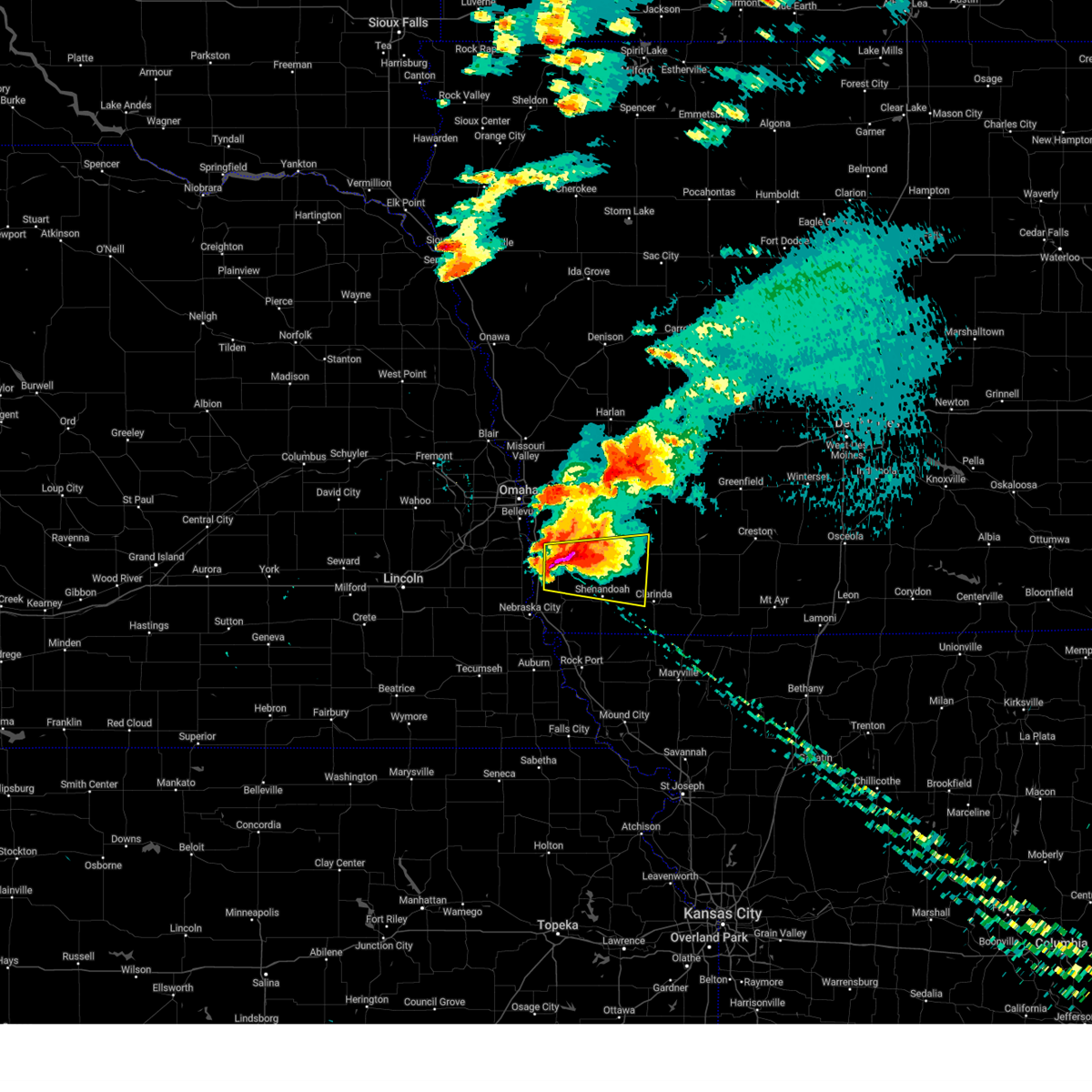
 At 812 pm cdt, a severe thunderstorm was located 4 miles northwest of tabor, or 15 miles southeast of offutt afb, moving east at 30 mph (radar indicated). Hazards include golf ball size hail and 60 mph wind gusts. People and animals outdoors will be injured. expect hail damage to roofs, siding, windows, and vehicles. expect wind damage to roofs, siding, and trees. Locations impacted include, glenwood, malvern, tabor, pacific junction, randolph, and thurman. At 812 pm cdt, a severe thunderstorm was located 4 miles northwest of tabor, or 15 miles southeast of offutt afb, moving east at 30 mph (radar indicated). Hazards include golf ball size hail and 60 mph wind gusts. People and animals outdoors will be injured. expect hail damage to roofs, siding, windows, and vehicles. expect wind damage to roofs, siding, and trees. Locations impacted include, glenwood, malvern, tabor, pacific junction, randolph, and thurman.
|
| 4/17/2025 8:10 PM CDT |
 At 810 pm cdt, a severe thunderstorm capable of producing a tornado was located 4 miles west of tabor, or 16 miles north of nebraska city, moving east at 30 mph (radar indicated rotation). Hazards include tornado and golf ball size hail. Flying debris will be dangerous to those caught without shelter. mobile homes will be damaged or destroyed. damage to roofs, windows, and vehicles will occur. tree damage is likely. this dangerous storm will be near, tabor around 815 pm cdt. Randolph around 820 pm cdt. At 810 pm cdt, a severe thunderstorm capable of producing a tornado was located 4 miles west of tabor, or 16 miles north of nebraska city, moving east at 30 mph (radar indicated rotation). Hazards include tornado and golf ball size hail. Flying debris will be dangerous to those caught without shelter. mobile homes will be damaged or destroyed. damage to roofs, windows, and vehicles will occur. tree damage is likely. this dangerous storm will be near, tabor around 815 pm cdt. Randolph around 820 pm cdt.
|
| 4/17/2025 8:04 PM CDT |
 At 804 pm cdt, a severe thunderstorm was located 3 miles south of pacific junction, or 11 miles southeast of offutt afb, moving east at 35 mph (radar indicated). Hazards include two inch hail and 60 mph wind gusts. People and animals outdoors will be injured. expect hail damage to roofs, siding, windows, and vehicles. expect wind damage to roofs, siding, and trees. Locations impacted include, malvern. At 804 pm cdt, a severe thunderstorm was located 3 miles south of pacific junction, or 11 miles southeast of offutt afb, moving east at 35 mph (radar indicated). Hazards include two inch hail and 60 mph wind gusts. People and animals outdoors will be injured. expect hail damage to roofs, siding, windows, and vehicles. expect wind damage to roofs, siding, and trees. Locations impacted include, malvern.
|
| 4/17/2025 8:02 PM CDT |
 At 802 pm cdt, a severe thunderstorm capable of producing a tornado was located near beaver lake, or 14 miles north of nebraska city, moving east at 30 mph (radar indicated rotation). Hazards include tornado and two inch hail. Flying debris will be dangerous to those caught without shelter. mobile homes will be damaged or destroyed. damage to roofs, windows, and vehicles will occur. tree damage is likely. this dangerous storm will be near, tabor around 815 pm cdt. Other locations in the path of this tornadic thunderstorm include randolph. At 802 pm cdt, a severe thunderstorm capable of producing a tornado was located near beaver lake, or 14 miles north of nebraska city, moving east at 30 mph (radar indicated rotation). Hazards include tornado and two inch hail. Flying debris will be dangerous to those caught without shelter. mobile homes will be damaged or destroyed. damage to roofs, windows, and vehicles will occur. tree damage is likely. this dangerous storm will be near, tabor around 815 pm cdt. Other locations in the path of this tornadic thunderstorm include randolph.
|
| 4/17/2025 7:56 PM CDT |
 Toroax the national weather service in omaha has issued a * tornado warning for, northwestern fremont county in southwestern iowa, southwestern mills county in southwestern iowa, southeastern cass county in southeastern nebraska, * until 845 pm cdt. * at 754 pm cdt, a confirmed tornado was located 3 miles east of manley with another area of radar indicated rotation near murray, or 14 miles north of nebraska city, moving east at 30 mph (law enforcement confirmed tornado). Hazards include damaging tornado and hail up to two inches in diameter. Flying debris will be dangerous to those caught without shelter. mobile homes will be damaged or destroyed. damage to roofs, windows, and vehicles will occur. tree damage is likely. the tornado will be near, beaver lake around 800 pm cdt. Other locations in the path of this tornadic thunderstorm include tabor and randolph. Toroax the national weather service in omaha has issued a * tornado warning for, northwestern fremont county in southwestern iowa, southwestern mills county in southwestern iowa, southeastern cass county in southeastern nebraska, * until 845 pm cdt. * at 754 pm cdt, a confirmed tornado was located 3 miles east of manley with another area of radar indicated rotation near murray, or 14 miles north of nebraska city, moving east at 30 mph (law enforcement confirmed tornado). Hazards include damaging tornado and hail up to two inches in diameter. Flying debris will be dangerous to those caught without shelter. mobile homes will be damaged or destroyed. damage to roofs, windows, and vehicles will occur. tree damage is likely. the tornado will be near, beaver lake around 800 pm cdt. Other locations in the path of this tornadic thunderstorm include tabor and randolph.
|
| 4/17/2025 7:48 PM CDT |
 Svroax the national weather service in omaha has issued a * severe thunderstorm warning for, northwestern fremont county in southwestern iowa, mills county in southwestern iowa, southeastern sarpy county in east central nebraska, eastern cass county in southeastern nebraska, * until 830 pm cdt. * at 747 pm cdt, a severe thunderstorm was located 4 miles southeast of cedar creek, or 11 miles southwest of offutt afb, moving east at 40 mph (radar indicated). Hazards include two inch hail and 60 mph wind gusts. People and animals outdoors will be injured. expect hail damage to roofs, siding, windows, and vehicles. expect wind damage to roofs, siding, and trees. this severe thunderstorm will be near, plattsmouth around 755 pm cdt. beaver lake around 800 pm cdt. pacific junction around 805 pm cdt. other locations in the path of this severe thunderstorm include glenwood. This includes interstate 29 between mile markers 20 and 39. Svroax the national weather service in omaha has issued a * severe thunderstorm warning for, northwestern fremont county in southwestern iowa, mills county in southwestern iowa, southeastern sarpy county in east central nebraska, eastern cass county in southeastern nebraska, * until 830 pm cdt. * at 747 pm cdt, a severe thunderstorm was located 4 miles southeast of cedar creek, or 11 miles southwest of offutt afb, moving east at 40 mph (radar indicated). Hazards include two inch hail and 60 mph wind gusts. People and animals outdoors will be injured. expect hail damage to roofs, siding, windows, and vehicles. expect wind damage to roofs, siding, and trees. this severe thunderstorm will be near, plattsmouth around 755 pm cdt. beaver lake around 800 pm cdt. pacific junction around 805 pm cdt. other locations in the path of this severe thunderstorm include glenwood. This includes interstate 29 between mile markers 20 and 39.
|
| 3/14/2025 4:30 PM CDT |
 At 430 pm cdt, severe thunderstorms were located along a line extending from near avoca to near farragut, moving north at 45 mph (radar indicated). Hazards include 70 mph wind gusts and quarter size hail. Hail damage to vehicles is expected. expect considerable tree damage. wind damage is also likely to mobile homes, roofs, and outbuildings. Locations impacted include, camp catron, lorton, talmage, beaver lake, riverton, hamburg, murray, malvern, union, avoca, tabor, plattsmouth, nehawka, randolph, thurman, nebraska city, hastings, farragut, sidney, and waubonsie state park. At 430 pm cdt, severe thunderstorms were located along a line extending from near avoca to near farragut, moving north at 45 mph (radar indicated). Hazards include 70 mph wind gusts and quarter size hail. Hail damage to vehicles is expected. expect considerable tree damage. wind damage is also likely to mobile homes, roofs, and outbuildings. Locations impacted include, camp catron, lorton, talmage, beaver lake, riverton, hamburg, murray, malvern, union, avoca, tabor, plattsmouth, nehawka, randolph, thurman, nebraska city, hastings, farragut, sidney, and waubonsie state park.
|
| 3/14/2025 4:07 PM CDT |
 Svroax the national weather service in omaha has issued a * severe thunderstorm warning for, fremont county in southwestern iowa, southern mills county in southwestern iowa, central otoe county in southeastern nebraska, eastern cass county in southeastern nebraska, * until 500 pm cdt. * at 407 pm cdt, severe thunderstorms were located along a line extending from 3 miles west of cook to 4 miles south of hamburg, moving north at 45 mph (radar indicated). Hazards include 60 mph wind gusts and quarter size hail. Hail damage to vehicles is expected. Expect wind damage to roofs, siding, and trees. Svroax the national weather service in omaha has issued a * severe thunderstorm warning for, fremont county in southwestern iowa, southern mills county in southwestern iowa, central otoe county in southeastern nebraska, eastern cass county in southeastern nebraska, * until 500 pm cdt. * at 407 pm cdt, severe thunderstorms were located along a line extending from 3 miles west of cook to 4 miles south of hamburg, moving north at 45 mph (radar indicated). Hazards include 60 mph wind gusts and quarter size hail. Hail damage to vehicles is expected. Expect wind damage to roofs, siding, and trees.
|
| 8/14/2024 7:50 PM CDT |
 At 750 pm cdt, severe thunderstorms were located along a line extending from near syracuse to 3 miles east of lorton to 3 miles southeast of brock, moving northeast at 45 mph (radar indicated). Hazards include 60 mph wind gusts. Expect damage to roofs, siding, and trees. Locations impacted include, nebraska city, syracuse, hamburg, sidney, peru, johnson, cook, talmage, union, dunbar, brock, julian, lorton, thurman, camp catron, duck creek recreation area, and waubonsie state park. At 750 pm cdt, severe thunderstorms were located along a line extending from near syracuse to 3 miles east of lorton to 3 miles southeast of brock, moving northeast at 45 mph (radar indicated). Hazards include 60 mph wind gusts. Expect damage to roofs, siding, and trees. Locations impacted include, nebraska city, syracuse, hamburg, sidney, peru, johnson, cook, talmage, union, dunbar, brock, julian, lorton, thurman, camp catron, duck creek recreation area, and waubonsie state park.
|
| 8/14/2024 7:33 PM CDT |
 Svroax the national weather service in omaha has issued a * severe thunderstorm warning for, western fremont county in southwestern iowa, eastern johnson county in southeastern nebraska, northwestern nemaha county in southeastern nebraska, otoe county in southeastern nebraska, southeastern cass county in southeastern nebraska, * until 815 pm cdt. * at 733 pm cdt, severe thunderstorms were located along a line extending from 2 miles southeast of douglas to near cook to 3 miles southeast of tecumseh, moving northeast at 45 mph (radar indicated). Hazards include 60 mph wind gusts and penny size hail. expect damage to roofs, siding, and trees Svroax the national weather service in omaha has issued a * severe thunderstorm warning for, western fremont county in southwestern iowa, eastern johnson county in southeastern nebraska, northwestern nemaha county in southeastern nebraska, otoe county in southeastern nebraska, southeastern cass county in southeastern nebraska, * until 815 pm cdt. * at 733 pm cdt, severe thunderstorms were located along a line extending from 2 miles southeast of douglas to near cook to 3 miles southeast of tecumseh, moving northeast at 45 mph (radar indicated). Hazards include 60 mph wind gusts and penny size hail. expect damage to roofs, siding, and trees
|
| 7/31/2024 6:19 PM CDT | At 617 pm cdt, severe thunderstorms were located along a line extending from 3 miles northwest of hastings to 6 miles southwest of emerson to 2 miles northeast of farragut, moving east at 45 mph. these are destructive storms for portions of fremont, mills, pottawattamie, sarpy, and cass counties (emergency management. these storms have a history of producing widespread wind damage to trees, powerlines, structures, and vehicles). Hazards include 80 mph wind gusts. Flying debris will be dangerous to those caught without shelter. mobile homes will be heavily damaged. expect considerable damage to roofs, windows, and vehicles. extensive tree damage and power outages are likely. Locations impacted include, bellevue, offutt afb, plattsmouth, glenwood, pacific junction, murray, union, nehawka, beaver lake, and thurman. |
| 7/31/2024 5:37 PM CDT |
 Svroax the national weather service in omaha has issued a * severe thunderstorm warning for, northwestern fremont county in southwestern iowa, western mills county in southwestern iowa, southwestern pottawattamie county in southwestern iowa, southern sarpy county in east central nebraska, cass county in southeastern nebraska, * until 630 pm cdt. * at 536 pm cdt, severe thunderstorms were located along a line extending from 2 miles northeast of cedar creek to 5 miles west of murray to 5 miles northeast of dunbar, moving east at 45 mph. these are destructive storms for portions of fremont, mills, pottawattamie, sarpy, and cass counties (public. these storms have a history of producing widespread damage to trees, powerlines, and some structures). Hazards include 80 mph wind gusts. Flying debris will be dangerous to those caught without shelter. mobile homes will be heavily damaged. expect considerable damage to roofs, windows, and vehicles. Extensive tree damage and power outages are likely. Svroax the national weather service in omaha has issued a * severe thunderstorm warning for, northwestern fremont county in southwestern iowa, western mills county in southwestern iowa, southwestern pottawattamie county in southwestern iowa, southern sarpy county in east central nebraska, cass county in southeastern nebraska, * until 630 pm cdt. * at 536 pm cdt, severe thunderstorms were located along a line extending from 2 miles northeast of cedar creek to 5 miles west of murray to 5 miles northeast of dunbar, moving east at 45 mph. these are destructive storms for portions of fremont, mills, pottawattamie, sarpy, and cass counties (public. these storms have a history of producing widespread damage to trees, powerlines, and some structures). Hazards include 80 mph wind gusts. Flying debris will be dangerous to those caught without shelter. mobile homes will be heavily damaged. expect considerable damage to roofs, windows, and vehicles. Extensive tree damage and power outages are likely.
|
| 7/31/2024 5:12 PM CDT | Svroax the national weather service in omaha has issued a * severe thunderstorm warning for, northwestern fremont county in southwestern iowa, western mills county in southwestern iowa, southwestern pottawattamie county in southwestern iowa, sarpy county in east central nebraska, central otoe county in southeastern nebraska, douglas county in east central nebraska, eastern saunders county in east central nebraska, cass county in southeastern nebraska, * until 615 pm cdt. * at 511 pm cdt, severe thunderstorms were located along a line extending from 2 miles southwest of mead to 3 miles southeast of greenwood to 4 miles southeast of palmyra, moving east at 40 mph (public. these storms have a history of producing widespread wind damage to trees, powerlines, and structures across lancaster county). Hazards include 70 mph wind gusts and quarter size hail. Hail damage to vehicles is expected. expect considerable tree damage. Wind damage is also likely to mobile homes, roofs, and outbuildings. |
| 7/10/2024 6:35 PM CDT |
 The storm which prompted the warning has weakened below severe limits, and no longer poses an immediate threat to life or property. therefore, the warning will be allowed to expire. a severe thunderstorm watch remains in effect until 1000 pm cdt for southwestern iowa. The storm which prompted the warning has weakened below severe limits, and no longer poses an immediate threat to life or property. therefore, the warning will be allowed to expire. a severe thunderstorm watch remains in effect until 1000 pm cdt for southwestern iowa.
|
| 7/10/2024 6:12 PM CDT |
 Svroax the national weather service in omaha has issued a * severe thunderstorm warning for, northern fremont county in southwestern iowa, * until 645 pm cdt. * at 611 pm cdt, a severe thunderstorm was located 5 miles south of tabor, or 14 miles northeast of nebraska city, moving southeast at 15 mph (radar indicated). Hazards include quarter size hail. damage to vehicles is expected Svroax the national weather service in omaha has issued a * severe thunderstorm warning for, northern fremont county in southwestern iowa, * until 645 pm cdt. * at 611 pm cdt, a severe thunderstorm was located 5 miles south of tabor, or 14 miles northeast of nebraska city, moving southeast at 15 mph (radar indicated). Hazards include quarter size hail. damage to vehicles is expected
|
| 6/15/2024 7:29 PM CDT |
 Svroax the national weather service in omaha has issued a * severe thunderstorm warning for, fremont county in southwestern iowa, western montgomery county in southwestern iowa, mills county in southwestern iowa, southeastern pottawattamie county in southwestern iowa, northwestern page county in southwestern iowa, northeastern otoe county in southeastern nebraska, eastern cass county in southeastern nebraska, * until 815 pm cdt. * at 729 pm cdt, severe thunderstorms were located along a line extending from 4 miles northwest of glenwood to 4 miles south of nebraska city, moving east at 25 mph (radar indicated). Hazards include 60 mph wind gusts. expect damage to roofs, siding, and trees Svroax the national weather service in omaha has issued a * severe thunderstorm warning for, fremont county in southwestern iowa, western montgomery county in southwestern iowa, mills county in southwestern iowa, southeastern pottawattamie county in southwestern iowa, northwestern page county in southwestern iowa, northeastern otoe county in southeastern nebraska, eastern cass county in southeastern nebraska, * until 815 pm cdt. * at 729 pm cdt, severe thunderstorms were located along a line extending from 4 miles northwest of glenwood to 4 miles south of nebraska city, moving east at 25 mph (radar indicated). Hazards include 60 mph wind gusts. expect damage to roofs, siding, and trees
|
| 6/15/2024 7:03 PM CDT |
 Svroax the national weather service in omaha has issued a * severe thunderstorm warning for, western fremont county in southwestern iowa, western mills county in southwestern iowa, east central sarpy county in east central nebraska, central otoe county in southeastern nebraska, eastern cass county in southeastern nebraska, * until 745 pm cdt. * at 703 pm cdt, severe thunderstorms were located along a line extending from 3 miles east of cedar creek to 4 miles north of cook, moving east at 20 mph (radar indicated). Hazards include 60 mph wind gusts. expect damage to roofs, siding, and trees Svroax the national weather service in omaha has issued a * severe thunderstorm warning for, western fremont county in southwestern iowa, western mills county in southwestern iowa, east central sarpy county in east central nebraska, central otoe county in southeastern nebraska, eastern cass county in southeastern nebraska, * until 745 pm cdt. * at 703 pm cdt, severe thunderstorms were located along a line extending from 3 miles east of cedar creek to 4 miles north of cook, moving east at 20 mph (radar indicated). Hazards include 60 mph wind gusts. expect damage to roofs, siding, and trees
|
| 6/12/2024 10:28 PM CDT |
 The storm which prompted the warning has weakened below severe limits, and no longer poses an immediate threat to life or property. therefore, the warning will be allowed to expire. however, small hail and gusty winds are still possible with this thunderstorm. a severe thunderstorm watch remains in effect until 1100 pm cdt for southwestern iowa, and southeastern nebraska. The storm which prompted the warning has weakened below severe limits, and no longer poses an immediate threat to life or property. therefore, the warning will be allowed to expire. however, small hail and gusty winds are still possible with this thunderstorm. a severe thunderstorm watch remains in effect until 1100 pm cdt for southwestern iowa, and southeastern nebraska.
|
| 6/12/2024 10:15 PM CDT |
 At 1014 pm cdt, a severe thunderstorm was located 4 miles northwest of farragut, or 17 miles east of nebraska city, moving southeast at 35 mph (trained weather spotters). Hazards include golf ball size hail and 60 mph wind gusts. People and animals outdoors will be injured. expect hail damage to roofs, siding, windows, and vehicles. expect wind damage to roofs, siding, and trees. Locations impacted include, sidney, tabor, pacific junction, randolph, and thurman. At 1014 pm cdt, a severe thunderstorm was located 4 miles northwest of farragut, or 17 miles east of nebraska city, moving southeast at 35 mph (trained weather spotters). Hazards include golf ball size hail and 60 mph wind gusts. People and animals outdoors will be injured. expect hail damage to roofs, siding, windows, and vehicles. expect wind damage to roofs, siding, and trees. Locations impacted include, sidney, tabor, pacific junction, randolph, and thurman.
|
| 6/12/2024 10:15 PM CDT |
 the severe thunderstorm warning has been cancelled and is no longer in effect the severe thunderstorm warning has been cancelled and is no longer in effect
|
| 6/12/2024 10:10 PM CDT |
 At 1009 pm cdt, a severe thunderstorm was located 4 miles south of randolph, or 17 miles northeast of nebraska city, moving southeast at 35 mph (trained weather spotters. at 957 pm, golf ball sized hail was reported just northwest of plattsmouth). Hazards include two inch hail and 60 mph wind gusts. People and animals outdoors will be injured. expect hail damage to roofs, siding, windows, and vehicles. expect wind damage to roofs, siding, and trees. Locations impacted include, plattsmouth, glenwood, malvern, sidney, tabor, pacific junction, randolph, beaver lake, thurman, and imogene. At 1009 pm cdt, a severe thunderstorm was located 4 miles south of randolph, or 17 miles northeast of nebraska city, moving southeast at 35 mph (trained weather spotters. at 957 pm, golf ball sized hail was reported just northwest of plattsmouth). Hazards include two inch hail and 60 mph wind gusts. People and animals outdoors will be injured. expect hail damage to roofs, siding, windows, and vehicles. expect wind damage to roofs, siding, and trees. Locations impacted include, plattsmouth, glenwood, malvern, sidney, tabor, pacific junction, randolph, beaver lake, thurman, and imogene.
|
| 6/12/2024 10:10 PM CDT |
 the severe thunderstorm warning has been cancelled and is no longer in effect the severe thunderstorm warning has been cancelled and is no longer in effect
|
| 6/12/2024 9:58 PM CDT |
 At 956 pm cdt, a severe thunderstorm was located over tabor, or 18 miles northeast of nebraska city, moving southeast at 35 mph (trained weather spotters. at 955 pm, golf ball sized hail was reported near plattsmouth). Hazards include tennis ball size hail and 60 mph wind gusts. People and animals outdoors will be injured. expect hail damage to roofs, siding, windows, and vehicles. expect wind damage to roofs, siding, and trees. Locations impacted include, plattsmouth, glenwood, malvern, sidney, tabor, pacific junction, randolph, hastings, beaver lake, thurman, imogene, coburg, and pierce recreation area. At 956 pm cdt, a severe thunderstorm was located over tabor, or 18 miles northeast of nebraska city, moving southeast at 35 mph (trained weather spotters. at 955 pm, golf ball sized hail was reported near plattsmouth). Hazards include tennis ball size hail and 60 mph wind gusts. People and animals outdoors will be injured. expect hail damage to roofs, siding, windows, and vehicles. expect wind damage to roofs, siding, and trees. Locations impacted include, plattsmouth, glenwood, malvern, sidney, tabor, pacific junction, randolph, hastings, beaver lake, thurman, imogene, coburg, and pierce recreation area.
|
| 6/12/2024 9:58 PM CDT |
 the severe thunderstorm warning has been cancelled and is no longer in effect the severe thunderstorm warning has been cancelled and is no longer in effect
|
| 6/12/2024 9:40 PM CDT |
 Svroax the national weather service in omaha has issued a * severe thunderstorm warning for, northern fremont county in southwestern iowa, southwestern montgomery county in southwestern iowa, mills county in southwestern iowa, northwestern page county in southwestern iowa, east central sarpy county in east central nebraska, northeastern cass county in southeastern nebraska, * until 1030 pm cdt. * at 938 pm cdt, a severe thunderstorm was located over pacific junction, or 10 miles southeast of offutt afb, moving southeast at 35 mph (trained weather spotters. at 925 pm, two inch hail was reported in bellevue). Hazards include tennis ball size hail and 60 mph wind gusts. People and animals outdoors will be injured. expect hail damage to roofs, siding, windows, and vehicles. Expect wind damage to roofs, siding, and trees. Svroax the national weather service in omaha has issued a * severe thunderstorm warning for, northern fremont county in southwestern iowa, southwestern montgomery county in southwestern iowa, mills county in southwestern iowa, northwestern page county in southwestern iowa, east central sarpy county in east central nebraska, northeastern cass county in southeastern nebraska, * until 1030 pm cdt. * at 938 pm cdt, a severe thunderstorm was located over pacific junction, or 10 miles southeast of offutt afb, moving southeast at 35 mph (trained weather spotters. at 925 pm, two inch hail was reported in bellevue). Hazards include tennis ball size hail and 60 mph wind gusts. People and animals outdoors will be injured. expect hail damage to roofs, siding, windows, and vehicles. Expect wind damage to roofs, siding, and trees.
|
| 5/24/2024 2:51 AM CDT |
 the severe thunderstorm warning has been cancelled and is no longer in effect the severe thunderstorm warning has been cancelled and is no longer in effect
|
| 5/24/2024 2:51 AM CDT |
 At 250 am cdt, severe thunderstorms were located along a line extending from 3 miles northwest of woodbine to 3 miles northwest of neola to 4 miles south of union, moving east at 60 mph (radar indicated). Hazards include 70 mph wind gusts and quarter size hail. Hail damage to vehicles is expected. expect considerable tree damage. wind damage is also likely to mobile homes, roofs, and outbuildings. Locations impacted include, omaha, council bluffs, bellevue, papillion, blair, ralston, red oak, harlan, boys town, offutt afb, la vista, plattsmouth, glenwood, shenandoah, carter lake, missouri valley, logan, springfield, oakland, and woodbine. At 250 am cdt, severe thunderstorms were located along a line extending from 3 miles northwest of woodbine to 3 miles northwest of neola to 4 miles south of union, moving east at 60 mph (radar indicated). Hazards include 70 mph wind gusts and quarter size hail. Hail damage to vehicles is expected. expect considerable tree damage. wind damage is also likely to mobile homes, roofs, and outbuildings. Locations impacted include, omaha, council bluffs, bellevue, papillion, blair, ralston, red oak, harlan, boys town, offutt afb, la vista, plattsmouth, glenwood, shenandoah, carter lake, missouri valley, logan, springfield, oakland, and woodbine.
|
| 5/24/2024 2:28 AM CDT |
 Svroax the national weather service in omaha has issued a * severe thunderstorm warning for, western montgomery county in southwestern iowa, mills county in southwestern iowa, shelby county in southwestern iowa, northern fremont county in southwestern iowa, pottawattamie county in southwestern iowa, harrison county in southwestern iowa, northwestern page county in southwestern iowa, southeastern burt county in east central nebraska, east central lancaster county in southeastern nebraska, douglas county in east central nebraska, southeastern saunders county in east central nebraska, sarpy county in east central nebraska, washington county in east central nebraska, northwestern otoe county in southeastern nebraska, cass county in southeastern nebraska, * until 315 am cdt. * at 228 am cdt, severe thunderstorms were located along a line extending from 4 miles southeast of tekamah to near fort calhoun to 3 miles north of unadilla, moving east at 60 mph (radar indicated). Hazards include 70 mph wind gusts and quarter size hail. Hail damage to vehicles is expected. expect considerable tree damage. Wind damage is also likely to mobile homes, roofs, and outbuildings. Svroax the national weather service in omaha has issued a * severe thunderstorm warning for, western montgomery county in southwestern iowa, mills county in southwestern iowa, shelby county in southwestern iowa, northern fremont county in southwestern iowa, pottawattamie county in southwestern iowa, harrison county in southwestern iowa, northwestern page county in southwestern iowa, southeastern burt county in east central nebraska, east central lancaster county in southeastern nebraska, douglas county in east central nebraska, southeastern saunders county in east central nebraska, sarpy county in east central nebraska, washington county in east central nebraska, northwestern otoe county in southeastern nebraska, cass county in southeastern nebraska, * until 315 am cdt. * at 228 am cdt, severe thunderstorms were located along a line extending from 4 miles southeast of tekamah to near fort calhoun to 3 miles north of unadilla, moving east at 60 mph (radar indicated). Hazards include 70 mph wind gusts and quarter size hail. Hail damage to vehicles is expected. expect considerable tree damage. Wind damage is also likely to mobile homes, roofs, and outbuildings.
|
| 5/21/2024 1:53 PM CDT |
 the tornado warning has been cancelled and is no longer in effect the tornado warning has been cancelled and is no longer in effect
|
| 5/21/2024 1:53 PM CDT |
 At 152 pm cdt, a severe thunderstorm capable of producing a tornado was located 4 miles southeast of beaver lake, or 14 miles north of nebraska city, moving northeast at 50 mph (radar indicated rotation). Hazards include tornado and golf ball size hail. Flying debris will be dangerous to those caught without shelter. mobile homes will be damaged or destroyed. damage to roofs, windows, and vehicles will occur. tree damage is likely. this dangerous storm will be near, tabor around 155 pm cdt. Other locations in the path of this tornadic thunderstorm include malvern and hastings. At 152 pm cdt, a severe thunderstorm capable of producing a tornado was located 4 miles southeast of beaver lake, or 14 miles north of nebraska city, moving northeast at 50 mph (radar indicated rotation). Hazards include tornado and golf ball size hail. Flying debris will be dangerous to those caught without shelter. mobile homes will be damaged or destroyed. damage to roofs, windows, and vehicles will occur. tree damage is likely. this dangerous storm will be near, tabor around 155 pm cdt. Other locations in the path of this tornadic thunderstorm include malvern and hastings.
|
| 5/21/2024 1:43 PM CDT |
 Toroax the national weather service in omaha has issued a * tornado warning for, northern fremont county in southwestern iowa, southeastern mills county in southwestern iowa, northern otoe county in southeastern nebraska, southeastern cass county in southeastern nebraska, * until 230 pm cdt. * at 142 pm cdt, a severe thunderstorm capable of producing a tornado was located near union, or 7 miles northwest of nebraska city, moving northeast at 50 mph (radar indicated rotation). Hazards include tornado and tennis ball size hail. Flying debris will be dangerous to those caught without shelter. mobile homes will be damaged or destroyed. damage to roofs, windows, and vehicles will occur. tree damage is likely. this dangerous storm will be near, tabor around 155 pm cdt. Other locations in the path of this tornadic thunderstorm include malvern and hastings. Toroax the national weather service in omaha has issued a * tornado warning for, northern fremont county in southwestern iowa, southeastern mills county in southwestern iowa, northern otoe county in southeastern nebraska, southeastern cass county in southeastern nebraska, * until 230 pm cdt. * at 142 pm cdt, a severe thunderstorm capable of producing a tornado was located near union, or 7 miles northwest of nebraska city, moving northeast at 50 mph (radar indicated rotation). Hazards include tornado and tennis ball size hail. Flying debris will be dangerous to those caught without shelter. mobile homes will be damaged or destroyed. damage to roofs, windows, and vehicles will occur. tree damage is likely. this dangerous storm will be near, tabor around 155 pm cdt. Other locations in the path of this tornadic thunderstorm include malvern and hastings.
|
| 5/21/2024 6:41 AM CDT |
 Svroax the national weather service in omaha has issued a * severe thunderstorm warning for, northern fremont county in southwestern iowa, montgomery county in southwestern iowa, southern mills county in southwestern iowa, northwestern page county in southwestern iowa, * until 730 am cdt. * at 641 am cdt, severe thunderstorms were located along a line extending from 2 miles southwest of treynor to 5 miles southeast of pacific junction, moving east at 50 mph (radar indicated). Hazards include 60 mph wind gusts. expect damage to roofs, siding, and trees Svroax the national weather service in omaha has issued a * severe thunderstorm warning for, northern fremont county in southwestern iowa, montgomery county in southwestern iowa, southern mills county in southwestern iowa, northwestern page county in southwestern iowa, * until 730 am cdt. * at 641 am cdt, severe thunderstorms were located along a line extending from 2 miles southwest of treynor to 5 miles southeast of pacific junction, moving east at 50 mph (radar indicated). Hazards include 60 mph wind gusts. expect damage to roofs, siding, and trees
|
| 5/19/2024 6:33 PM CDT |
 At 632 pm cdt, a severe thunderstorm was located 4 miles northwest of nebraska city, moving east at 45 mph (radar indicated). Hazards include 60 mph wind gusts and quarter size hail. Hail damage to vehicles is expected. expect wind damage to roofs, siding, and trees. Locations impacted include, nebraska city, shenandoah, syracuse, hamburg, sidney, tabor, peru, farragut, unadilla, riverton, avoca, talmage, union, nehawka, dunbar, randolph, julian, lorton, thurman, and otoe. At 632 pm cdt, a severe thunderstorm was located 4 miles northwest of nebraska city, moving east at 45 mph (radar indicated). Hazards include 60 mph wind gusts and quarter size hail. Hail damage to vehicles is expected. expect wind damage to roofs, siding, and trees. Locations impacted include, nebraska city, shenandoah, syracuse, hamburg, sidney, tabor, peru, farragut, unadilla, riverton, avoca, talmage, union, nehawka, dunbar, randolph, julian, lorton, thurman, and otoe.
|
| 5/19/2024 6:17 PM CDT |
 Svroax the national weather service in omaha has issued a * severe thunderstorm warning for, fremont county in southwestern iowa, southeastern mills county in southwestern iowa, northern nemaha county in southeastern nebraska, otoe county in southeastern nebraska, southeastern cass county in southeastern nebraska, * until 700 pm cdt. * at 616 pm cdt, a severe thunderstorm was located 3 miles west of dunbar, or 11 miles west of nebraska city, moving east at 40 mph (radar indicated). Hazards include 60 mph wind gusts and quarter size hail. Hail damage to vehicles is expected. Expect wind damage to roofs, siding, and trees. Svroax the national weather service in omaha has issued a * severe thunderstorm warning for, fremont county in southwestern iowa, southeastern mills county in southwestern iowa, northern nemaha county in southeastern nebraska, otoe county in southeastern nebraska, southeastern cass county in southeastern nebraska, * until 700 pm cdt. * at 616 pm cdt, a severe thunderstorm was located 3 miles west of dunbar, or 11 miles west of nebraska city, moving east at 40 mph (radar indicated). Hazards include 60 mph wind gusts and quarter size hail. Hail damage to vehicles is expected. Expect wind damage to roofs, siding, and trees.
|
| 5/19/2024 7:36 AM CDT |
 the severe thunderstorm warning has been cancelled and is no longer in effect the severe thunderstorm warning has been cancelled and is no longer in effect
|
| 5/19/2024 7:29 AM CDT |
 Svroax the national weather service in omaha has issued a * severe thunderstorm warning for, northern fremont county in southwestern iowa, southern mills county in southwestern iowa, east central cass county in southeastern nebraska, * until 800 am cdt. * at 729 am cdt, a severe thunderstorm was located 4 miles east of beaver lake, or 14 miles southeast of offutt afb, moving east at 40 mph (radar indicated). Hazards include quarter size hail. damage to vehicles is expected Svroax the national weather service in omaha has issued a * severe thunderstorm warning for, northern fremont county in southwestern iowa, southern mills county in southwestern iowa, east central cass county in southeastern nebraska, * until 800 am cdt. * at 729 am cdt, a severe thunderstorm was located 4 miles east of beaver lake, or 14 miles southeast of offutt afb, moving east at 40 mph (radar indicated). Hazards include quarter size hail. damage to vehicles is expected
|
| 5/6/2024 8:55 PM CDT |
 At 854 pm cdt, severe thunderstorms were located along a line extending from 2 miles north of council bluffs airport to near randolph, moving northeast at 50 mph (emergency management reported downed power lines and snapped trees in the plattsmouth area with these storms). Hazards include 70 mph wind gusts and quarter size hail. Hail damage to vehicles is expected. expect considerable tree damage. wind damage is also likely to mobile homes, roofs, and outbuildings. these severe storms will be near, malvern, treynor, underwood, silver city, and hastings around 900 pm cdt. neola and emerson around 905 pm cdt. carson, minden, macedonia, and henderson around 910 pm cdt. oakland around 915 pm cdt. other locations impacted by these severe thunderstorms include thurman, old town park, lake manawa state park, weston, mcclelland, mineola, arrowhead park, and narrows river park. People attending council bluffs should seek safe shelter immediately!. At 854 pm cdt, severe thunderstorms were located along a line extending from 2 miles north of council bluffs airport to near randolph, moving northeast at 50 mph (emergency management reported downed power lines and snapped trees in the plattsmouth area with these storms). Hazards include 70 mph wind gusts and quarter size hail. Hail damage to vehicles is expected. expect considerable tree damage. wind damage is also likely to mobile homes, roofs, and outbuildings. these severe storms will be near, malvern, treynor, underwood, silver city, and hastings around 900 pm cdt. neola and emerson around 905 pm cdt. carson, minden, macedonia, and henderson around 910 pm cdt. oakland around 915 pm cdt. other locations impacted by these severe thunderstorms include thurman, old town park, lake manawa state park, weston, mcclelland, mineola, arrowhead park, and narrows river park. People attending council bluffs should seek safe shelter immediately!.
|
| 5/6/2024 8:55 PM CDT |
 the severe thunderstorm warning has been cancelled and is no longer in effect the severe thunderstorm warning has been cancelled and is no longer in effect
|
| 5/6/2024 8:27 PM CDT |
 Svroax the national weather service in omaha has issued a * severe thunderstorm warning for, northwestern fremont county in southwestern iowa, mills county in southwestern iowa, central pottawattamie county in southwestern iowa, northeastern sarpy county in east central nebraska, northeastern otoe county in southeastern nebraska, eastern cass county in southeastern nebraska, * until 930 pm cdt. * at 827 pm cdt, severe thunderstorms were located along a line extending from 2 miles northeast of cedar creek to 3 miles northwest of nebraska city, moving northeast at 50 mph (emergency management). Hazards include 60 mph wind gusts and nickel size hail. Expect damage to roofs, siding, and trees. severe thunderstorms will be near, bellevue, papillion, offutt afb, la vista, plattsmouth, murray, union, and beaver lake around 830 pm cdt. council bluffs around 835 pm cdt. pacific junction around 840 pm cdt. glenwood, carter lake, tabor, and council bluffs airport around 845 pm cdt. malvern and silver city around 850 pm cdt. treynor around 855 pm cdt. underwood and hastings around 900 pm cdt. neola, minden, emerson, and henderson around 905 pm cdt. other locations impacted by these severe thunderstorms include thurman, old town park, lake manawa state park, camp maha, weston, camp catron, mcclelland, mineola, arrowhead park, and narrows river park. people attending council bluffs should seek safe shelter immediately! this includes the following highways, interstate 29 between mile markers 15 and 56. Interstate 80 in iowa between mile markers 3 and 31. Svroax the national weather service in omaha has issued a * severe thunderstorm warning for, northwestern fremont county in southwestern iowa, mills county in southwestern iowa, central pottawattamie county in southwestern iowa, northeastern sarpy county in east central nebraska, northeastern otoe county in southeastern nebraska, eastern cass county in southeastern nebraska, * until 930 pm cdt. * at 827 pm cdt, severe thunderstorms were located along a line extending from 2 miles northeast of cedar creek to 3 miles northwest of nebraska city, moving northeast at 50 mph (emergency management). Hazards include 60 mph wind gusts and nickel size hail. Expect damage to roofs, siding, and trees. severe thunderstorms will be near, bellevue, papillion, offutt afb, la vista, plattsmouth, murray, union, and beaver lake around 830 pm cdt. council bluffs around 835 pm cdt. pacific junction around 840 pm cdt. glenwood, carter lake, tabor, and council bluffs airport around 845 pm cdt. malvern and silver city around 850 pm cdt. treynor around 855 pm cdt. underwood and hastings around 900 pm cdt. neola, minden, emerson, and henderson around 905 pm cdt. other locations impacted by these severe thunderstorms include thurman, old town park, lake manawa state park, camp maha, weston, camp catron, mcclelland, mineola, arrowhead park, and narrows river park. people attending council bluffs should seek safe shelter immediately! this includes the following highways, interstate 29 between mile markers 15 and 56. Interstate 80 in iowa between mile markers 3 and 31.
|
| 4/30/2024 2:56 PM CDT |
 Svroax the national weather service in omaha has issued a * severe thunderstorm warning for, northern fremont county in southwestern iowa, mills county in southwestern iowa, southeastern cass county in southeastern nebraska, * until 345 pm cdt. * at 255 pm cdt, a severe thunderstorm was located 3 miles southeast of beaver lake, or 14 miles north of nebraska city, moving northeast at 35 mph (radar indicated). Hazards include 60 mph wind gusts and quarter size hail. Hail damage to vehicles is expected. Expect wind damage to roofs, siding, and trees. Svroax the national weather service in omaha has issued a * severe thunderstorm warning for, northern fremont county in southwestern iowa, mills county in southwestern iowa, southeastern cass county in southeastern nebraska, * until 345 pm cdt. * at 255 pm cdt, a severe thunderstorm was located 3 miles southeast of beaver lake, or 14 miles north of nebraska city, moving northeast at 35 mph (radar indicated). Hazards include 60 mph wind gusts and quarter size hail. Hail damage to vehicles is expected. Expect wind damage to roofs, siding, and trees.
|
| 4/26/2024 4:19 PM CDT |
 Toroax the national weather service in omaha has issued a * tornado warning for, northwestern fremont county in southwestern iowa, western mills county in southwestern iowa, northeastern otoe county in southeastern nebraska, eastern cass county in southeastern nebraska, * until 500 pm cdt. * at 419 pm cdt, a severe thunderstorm capable of producing a tornado was located 4 miles south of union, or 6 miles northwest of nebraska city, moving north at 45 mph (radar indicated rotation). Hazards include tornado and golf ball size hail. Flying debris will be dangerous to those caught without shelter. mobile homes will be damaged or destroyed. damage to roofs, windows, and vehicles will occur. tree damage is likely. this dangerous storm will be near, union around 425 pm cdt. murray and beaver lake around 430 pm cdt. Other locations in the path of this tornadic thunderstorm include plattsmouth, pacific junction and glenwood. Toroax the national weather service in omaha has issued a * tornado warning for, northwestern fremont county in southwestern iowa, western mills county in southwestern iowa, northeastern otoe county in southeastern nebraska, eastern cass county in southeastern nebraska, * until 500 pm cdt. * at 419 pm cdt, a severe thunderstorm capable of producing a tornado was located 4 miles south of union, or 6 miles northwest of nebraska city, moving north at 45 mph (radar indicated rotation). Hazards include tornado and golf ball size hail. Flying debris will be dangerous to those caught without shelter. mobile homes will be damaged or destroyed. damage to roofs, windows, and vehicles will occur. tree damage is likely. this dangerous storm will be near, union around 425 pm cdt. murray and beaver lake around 430 pm cdt. Other locations in the path of this tornadic thunderstorm include plattsmouth, pacific junction and glenwood.
|
| 9/20/2023 3:41 AM CDT |
 At 338 am cdt, a severe thunderstorm was located near tabor, or 16 miles northeast of nebraska city, moving east-southeast at 10 mph (radar indicated). Hazards include up to 60 mph wind gusts and quarter size hail. Hail damage to vehicles is expected. expect wind damage to roofs, siding, and trees. locations impacted include, sidney, tabor, randolph, and thurman. hail threat, radar indicated max hail size, 1. 00 in wind threat, radar indicated max wind gust, 60 mph. At 338 am cdt, a severe thunderstorm was located near tabor, or 16 miles northeast of nebraska city, moving east-southeast at 10 mph (radar indicated). Hazards include up to 60 mph wind gusts and quarter size hail. Hail damage to vehicles is expected. expect wind damage to roofs, siding, and trees. locations impacted include, sidney, tabor, randolph, and thurman. hail threat, radar indicated max hail size, 1. 00 in wind threat, radar indicated max wind gust, 60 mph.
|
| 9/20/2023 3:28 AM CDT |
 At 327 am cdt, a severe thunderstorm was located over tabor, or 16 miles northeast of nebraska city, moving east-southeast at 10 mph (radar indicated). Hazards include up to 60 mph wind gusts and quarter size hail. Hail damage to vehicles is expected. Expect wind damage to roofs, siding, and trees. At 327 am cdt, a severe thunderstorm was located over tabor, or 16 miles northeast of nebraska city, moving east-southeast at 10 mph (radar indicated). Hazards include up to 60 mph wind gusts and quarter size hail. Hail damage to vehicles is expected. Expect wind damage to roofs, siding, and trees.
|
| 7/29/2023 8:36 AM CDT |
 At 835 am cdt, severe thunderstorms with a history of strong wind gusts were located along a line extending from 3 miles northwest of douglas to 4 miles south of sterling to 2 miles east of liberty, moving east at 55 mph (radar indicated). Hazards include 70 mph wind gusts and penny size hail. Expect considerable tree damage. damage is likely to mobile homes, roofs, and outbuildings. severe thunderstorms will be near, sterling, douglas, and burchard around 840 am cdt. tecumseh, pawnee city, syracuse, cook, and elk creek around 845 am cdt. table rock around 850 am cdt. johnson, talmage, du bois, and lorton around 855 am cdt. other locations in the path of these severe thunderstorms include humboldt, brock, auburn, dawson and julian. people attending otoe county fair should seek safe shelter immediately! this includes interstate 29 between mile markers 1 and 20. thunderstorm damage threat, considerable hail threat, radar indicated max hail size, 0. 75 in wind threat, observed max wind gust, 70 mph. At 835 am cdt, severe thunderstorms with a history of strong wind gusts were located along a line extending from 3 miles northwest of douglas to 4 miles south of sterling to 2 miles east of liberty, moving east at 55 mph (radar indicated). Hazards include 70 mph wind gusts and penny size hail. Expect considerable tree damage. damage is likely to mobile homes, roofs, and outbuildings. severe thunderstorms will be near, sterling, douglas, and burchard around 840 am cdt. tecumseh, pawnee city, syracuse, cook, and elk creek around 845 am cdt. table rock around 850 am cdt. johnson, talmage, du bois, and lorton around 855 am cdt. other locations in the path of these severe thunderstorms include humboldt, brock, auburn, dawson and julian. people attending otoe county fair should seek safe shelter immediately! this includes interstate 29 between mile markers 1 and 20. thunderstorm damage threat, considerable hail threat, radar indicated max hail size, 0. 75 in wind threat, observed max wind gust, 70 mph.
|
| 7/24/2023 5:57 AM CDT |
 The severe thunderstorm warning for fremont, western montgomery, eastern mills, southeastern pottawattamie and western page counties will expire at 600 am cdt, the storms which prompted the warning have weakened below severe limits, and have exited the warned area. therefore, the warning will be allowed to expire. however small hail and gusty winds are still possible with these thunderstorms. a severe thunderstorm watch remains in effect until 900 am cdt for southwestern iowa. The severe thunderstorm warning for fremont, western montgomery, eastern mills, southeastern pottawattamie and western page counties will expire at 600 am cdt, the storms which prompted the warning have weakened below severe limits, and have exited the warned area. therefore, the warning will be allowed to expire. however small hail and gusty winds are still possible with these thunderstorms. a severe thunderstorm watch remains in effect until 900 am cdt for southwestern iowa.
|
| 7/24/2023 5:38 AM CDT |
 At 538 am cdt, severe thunderstorms were located along a line extending from near macedonia to 4 miles south of hastings to 3 miles southeast of randolph to 2 miles southeast of sidney, moving southeast at 60 mph (radar indicated). Hazards include 60 mph wind gusts. Expect damage to roofs, siding, and trees. locations impacted include, red oak, shenandoah, oakland, malvern, sidney, tabor, carson, essex, farragut, emerson, elliott, riverton, macedonia, henderson, randolph, hastings, thurman, imogene, coburg and old town park. hail threat, radar indicated max hail size, <. 75 in wind threat, radar indicated max wind gust, 60 mph. At 538 am cdt, severe thunderstorms were located along a line extending from near macedonia to 4 miles south of hastings to 3 miles southeast of randolph to 2 miles southeast of sidney, moving southeast at 60 mph (radar indicated). Hazards include 60 mph wind gusts. Expect damage to roofs, siding, and trees. locations impacted include, red oak, shenandoah, oakland, malvern, sidney, tabor, carson, essex, farragut, emerson, elliott, riverton, macedonia, henderson, randolph, hastings, thurman, imogene, coburg and old town park. hail threat, radar indicated max hail size, <. 75 in wind threat, radar indicated max wind gust, 60 mph.
|
| 7/24/2023 5:28 AM CDT |
 At 528 am cdt, severe thunderstorms were located along a line extending from 6 miles northeast of treynor to 3 miles north of malvern to 4 miles northeast of tabor to 6 miles northwest of sidney, moving southeast at 60 mph (radar indicated). Hazards include 70 mph wind gusts. Expect considerable tree damage. damage is likely to mobile homes, roofs, and outbuildings. locations impacted include, sidney, emerson, randolph, farragut, riverton, shenandoah, essex, elliott and red oak. thunderstorm damage threat, considerable hail threat, radar indicated max hail size, <. 75 in wind threat, radar indicated max wind gust, 70 mph. At 528 am cdt, severe thunderstorms were located along a line extending from 6 miles northeast of treynor to 3 miles north of malvern to 4 miles northeast of tabor to 6 miles northwest of sidney, moving southeast at 60 mph (radar indicated). Hazards include 70 mph wind gusts. Expect considerable tree damage. damage is likely to mobile homes, roofs, and outbuildings. locations impacted include, sidney, emerson, randolph, farragut, riverton, shenandoah, essex, elliott and red oak. thunderstorm damage threat, considerable hail threat, radar indicated max hail size, <. 75 in wind threat, radar indicated max wind gust, 70 mph.
|
| 7/24/2023 5:10 AM CDT |
 At 510 am cdt, severe thunderstorms were located along a line extending from 5 miles northwest of underwood to 2 miles southeast of council bluffs to 4 miles east of offutt afb to 2 miles southwest of plattsmouth, moving southeast at 60 mph (radar indicated). Hazards include 70 mph wind gusts. Expect considerable tree damage. damage is likely to mobile homes, roofs, and outbuildings. severe thunderstorms will be near, plattsmouth, glenwood, pacific junction, murray and beaver lake around 515 am cdt. silver city around 520 am cdt. tabor and treynor around 525 am cdt. oakland, malvern and hastings around 530 am cdt. other locations in the path of these severe thunderstorms include sidney, carson, emerson, macedonia, randolph, farragut, riverton, henderson, shenandoah, elliott, red oak and essex. people attending westfair amphitheater & fairgrounds should seek safe shelter immediately! this includes the following highways, interstate 29 between mile markers 20 and 48. interstate 80 in iowa between mile markers 4 and 23. thunderstorm damage threat, considerable hail threat, radar indicated max hail size, <. 75 in wind threat, radar indicated max wind gust, 70 mph. At 510 am cdt, severe thunderstorms were located along a line extending from 5 miles northwest of underwood to 2 miles southeast of council bluffs to 4 miles east of offutt afb to 2 miles southwest of plattsmouth, moving southeast at 60 mph (radar indicated). Hazards include 70 mph wind gusts. Expect considerable tree damage. damage is likely to mobile homes, roofs, and outbuildings. severe thunderstorms will be near, plattsmouth, glenwood, pacific junction, murray and beaver lake around 515 am cdt. silver city around 520 am cdt. tabor and treynor around 525 am cdt. oakland, malvern and hastings around 530 am cdt. other locations in the path of these severe thunderstorms include sidney, carson, emerson, macedonia, randolph, farragut, riverton, henderson, shenandoah, elliott, red oak and essex. people attending westfair amphitheater & fairgrounds should seek safe shelter immediately! this includes the following highways, interstate 29 between mile markers 20 and 48. interstate 80 in iowa between mile markers 4 and 23. thunderstorm damage threat, considerable hail threat, radar indicated max hail size, <. 75 in wind threat, radar indicated max wind gust, 70 mph.
|
| 7/12/2023 7:22 AM CDT |
 The severe thunderstorm warning for fremont, montgomery, mills, southeastern pottawattamie, page, northeastern otoe and southeastern cass counties will expire at 730 am cdt, the storms which prompted the warning have weakened below severe limits, and no longer pose an immediate threat to life or property. therefore, the warning will be allowed to expire. a severe thunderstorm watch remains in effect until 900 am cdt for southwestern iowa, and southeastern nebraska. to report severe weather, contact your nearest law enforcement agency. they will relay your report to the national weather service omaha. The severe thunderstorm warning for fremont, montgomery, mills, southeastern pottawattamie, page, northeastern otoe and southeastern cass counties will expire at 730 am cdt, the storms which prompted the warning have weakened below severe limits, and no longer pose an immediate threat to life or property. therefore, the warning will be allowed to expire. a severe thunderstorm watch remains in effect until 900 am cdt for southwestern iowa, and southeastern nebraska. to report severe weather, contact your nearest law enforcement agency. they will relay your report to the national weather service omaha.
|
| 7/12/2023 6:50 AM CDT |
 At 650 am cdt, severe thunderstorms were located along a line extending from 2 miles east of audubon to 6 miles south of atlantic to 2 miles south of randolph to 2 miles north of unadilla, moving southeast at 65 mph (public). Hazards include 70 mph wind gusts. Expect considerable tree damage. damage is likely to mobile homes, roofs, and outbuildings. locations impacted include, eastern omaha, lincoln, council bluffs, bellevue, papillion, red oak, harlan, gretna, offutt afb, la vista, plattsmouth, glenwood, carter lake, waverly, syracuse, springfield, oakland, malvern, sidney and louisville. people attending westfair amphitheater should seek safe shelter immediately! thunderstorm damage threat, considerable hail threat, radar indicated max hail size, <. 75 in wind threat, observed max wind gust, 70 mph. At 650 am cdt, severe thunderstorms were located along a line extending from 2 miles east of audubon to 6 miles south of atlantic to 2 miles south of randolph to 2 miles north of unadilla, moving southeast at 65 mph (public). Hazards include 70 mph wind gusts. Expect considerable tree damage. damage is likely to mobile homes, roofs, and outbuildings. locations impacted include, eastern omaha, lincoln, council bluffs, bellevue, papillion, red oak, harlan, gretna, offutt afb, la vista, plattsmouth, glenwood, carter lake, waverly, syracuse, springfield, oakland, malvern, sidney and louisville. people attending westfair amphitheater should seek safe shelter immediately! thunderstorm damage threat, considerable hail threat, radar indicated max hail size, <. 75 in wind threat, observed max wind gust, 70 mph.
|
| 7/12/2023 6:44 AM CDT |
 At 644 am cdt, severe thunderstorms were located along a line extending from near elliott to 5 miles northeast of union, moving southeast at 60 mph (weather instrument measurement). Hazards include 70 mph wind gusts. Expect considerable tree damage. damage is likely to mobile homes, roofs, and outbuildings. severe thunderstorms will be near, red oak and grant around 650 am cdt. sidney and stanton around 655 am cdt. hamburg and riverton around 700 am cdt. other locations in the path of these severe thunderstorms include villisca. this includes interstate 29 between mile markers 1 and 32. thunderstorm damage threat, considerable hail threat, radar indicated max hail size, <. 75 in wind threat, observed max wind gust, 70 mph. At 644 am cdt, severe thunderstorms were located along a line extending from near elliott to 5 miles northeast of union, moving southeast at 60 mph (weather instrument measurement). Hazards include 70 mph wind gusts. Expect considerable tree damage. damage is likely to mobile homes, roofs, and outbuildings. severe thunderstorms will be near, red oak and grant around 650 am cdt. sidney and stanton around 655 am cdt. hamburg and riverton around 700 am cdt. other locations in the path of these severe thunderstorms include villisca. this includes interstate 29 between mile markers 1 and 32. thunderstorm damage threat, considerable hail threat, radar indicated max hail size, <. 75 in wind threat, observed max wind gust, 70 mph.
|
| 7/12/2023 6:33 AM CDT |
 At 633 am cdt, severe thunderstorms were located along a line extending from 3 miles northeast of irwin to 4 miles southeast of avoca to 2 miles southeast of plattsmouth to 3 miles north of walton, moving southeast at 65 mph (weather instrument measurement). Hazards include 70 mph wind gusts. Expect considerable tree damage. damage is likely to mobile homes, roofs, and outbuildings. locations impacted include, tabor, elmwood, sidney, unadilla, randolph and syracuse. people attending westfair amphitheater should seek safe shelter immediately! thunderstorm damage threat, considerable hail threat, radar indicated max hail size, <. 75 in wind threat, observed max wind gust, 70 mph. At 633 am cdt, severe thunderstorms were located along a line extending from 3 miles northeast of irwin to 4 miles southeast of avoca to 2 miles southeast of plattsmouth to 3 miles north of walton, moving southeast at 65 mph (weather instrument measurement). Hazards include 70 mph wind gusts. Expect considerable tree damage. damage is likely to mobile homes, roofs, and outbuildings. locations impacted include, tabor, elmwood, sidney, unadilla, randolph and syracuse. people attending westfair amphitheater should seek safe shelter immediately! thunderstorm damage threat, considerable hail threat, radar indicated max hail size, <. 75 in wind threat, observed max wind gust, 70 mph.
|
| 7/12/2023 6:05 AM CDT |
 At 605 am cdt, severe thunderstorms were located along a line extending from 2 miles east of ute to near logan to 5 miles southeast of yutan to 2 miles southwest of dwight, moving southeast at 65 mph (weather instrument measurement). Hazards include 70 mph wind gusts. Expect considerable tree damage. damage is likely to mobile homes, roofs, and outbuildings. severe thunderstorms will be near, gretna, millard, logan, ute and zorinsky lake around 610 am cdt. springfield, neola, valparaiso, persia, prairie queen recreation area, wehrspann lake, walnut creek recreation area and chalco around 615 am cdt. papillion, louisville, shelby, minden, cedar creek, malcolm and raymond around 620 am cdt. bellevue, offutt afb, avoca, defiance, davey and lincoln airport around 625 am cdt. other locations in the path of these severe thunderstorms include lincoln, plattsmouth, waverly, walnut, murray, irwin, hancock, beaver lake, holmes lake park, pacific junction, walton, tabor, eagle, bennet, elmwood and palmyra. people attending westfair amphitheater should seek safe shelter immediately! this includes the following highways, interstate 29 between mile markers 15 and 82. interstate 80 in iowa between mile markers 1 and 48. interstate 80 in nebraska between mile markers 382 and 454. thunderstorm damage threat, considerable hail threat, radar indicated max hail size, <. 75 in wind threat, observed max wind gust, 70 mph. At 605 am cdt, severe thunderstorms were located along a line extending from 2 miles east of ute to near logan to 5 miles southeast of yutan to 2 miles southwest of dwight, moving southeast at 65 mph (weather instrument measurement). Hazards include 70 mph wind gusts. Expect considerable tree damage. damage is likely to mobile homes, roofs, and outbuildings. severe thunderstorms will be near, gretna, millard, logan, ute and zorinsky lake around 610 am cdt. springfield, neola, valparaiso, persia, prairie queen recreation area, wehrspann lake, walnut creek recreation area and chalco around 615 am cdt. papillion, louisville, shelby, minden, cedar creek, malcolm and raymond around 620 am cdt. bellevue, offutt afb, avoca, defiance, davey and lincoln airport around 625 am cdt. other locations in the path of these severe thunderstorms include lincoln, plattsmouth, waverly, walnut, murray, irwin, hancock, beaver lake, holmes lake park, pacific junction, walton, tabor, eagle, bennet, elmwood and palmyra. people attending westfair amphitheater should seek safe shelter immediately! this includes the following highways, interstate 29 between mile markers 15 and 82. interstate 80 in iowa between mile markers 1 and 48. interstate 80 in nebraska between mile markers 382 and 454. thunderstorm damage threat, considerable hail threat, radar indicated max hail size, <. 75 in wind threat, observed max wind gust, 70 mph.
|
| 6/29/2023 7:41 AM CDT |
 At 741 am cdt, a severe thunderstorm was located 4 miles southeast of council bluffs, moving east at 35 mph (public). Hazards include 60 mph wind gusts and nickel size hail. Expect damage to roofs, siding, and trees. this severe storm will be near, council bluffs airport around 745 am cdt. other locations in the path of this severe thunderstorm include treynor. hail threat, radar indicated max hail size, 0. 88 in wind threat, observed max wind gust, 60 mph. At 741 am cdt, a severe thunderstorm was located 4 miles southeast of council bluffs, moving east at 35 mph (public). Hazards include 60 mph wind gusts and nickel size hail. Expect damage to roofs, siding, and trees. this severe storm will be near, council bluffs airport around 745 am cdt. other locations in the path of this severe thunderstorm include treynor. hail threat, radar indicated max hail size, 0. 88 in wind threat, observed max wind gust, 60 mph.
|
| 6/29/2023 7:35 AM CDT | Emergency management relayed photos of numerous downed branches and trees in thurman. estimated wind gust speed of 70 mp in fremont county IA, 0.1 miles NNE of Thurman, IA |
| 6/29/2023 7:29 AM CDT |
 At 729 am cdt, a severe thunderstorm was located over bellevue, moving east at 35 mph (radar indicated). Hazards include 60 mph wind gusts and nickel size hail. Expect damage to roofs, siding, and trees. this severe thunderstorm will be near, eppley airfield around 735 am cdt. council bluffs around 740 am cdt. council bluffs airport around 745 am cdt. other locations in the path of this severe thunderstorm include treynor. this includes the following highways, interstate 29 between mile markers 17 and 71. interstate 80 in iowa between mile markers 1 and 17. interstate 80 in nebraska between mile markers 437 and 454. hail threat, radar indicated max hail size, 0. 88 in wind threat, radar indicated max wind gust, 60 mph. At 729 am cdt, a severe thunderstorm was located over bellevue, moving east at 35 mph (radar indicated). Hazards include 60 mph wind gusts and nickel size hail. Expect damage to roofs, siding, and trees. this severe thunderstorm will be near, eppley airfield around 735 am cdt. council bluffs around 740 am cdt. council bluffs airport around 745 am cdt. other locations in the path of this severe thunderstorm include treynor. this includes the following highways, interstate 29 between mile markers 17 and 71. interstate 80 in iowa between mile markers 1 and 17. interstate 80 in nebraska between mile markers 437 and 454. hail threat, radar indicated max hail size, 0. 88 in wind threat, radar indicated max wind gust, 60 mph.
|
| 5/7/2023 9:45 PM CDT |
 At 945 pm cdt, a severe thunderstorm was located over union, or 9 miles northwest of nebraska city, moving northeast at 30 mph (radar indicated). Hazards include quarter size hail. Damage to vehicles is expected. locations impacted include, union, nehawka, beaver lake and thurman. hail threat, radar indicated max hail size, 1. 00 in wind threat, radar indicated max wind gust, <50 mph. At 945 pm cdt, a severe thunderstorm was located over union, or 9 miles northwest of nebraska city, moving northeast at 30 mph (radar indicated). Hazards include quarter size hail. Damage to vehicles is expected. locations impacted include, union, nehawka, beaver lake and thurman. hail threat, radar indicated max hail size, 1. 00 in wind threat, radar indicated max wind gust, <50 mph.
|
| 5/7/2023 9:33 PM CDT |
 At 933 pm cdt, a severe thunderstorm was located 4 miles southeast of avoca, or 11 miles northwest of nebraska city, moving northeast at 30 mph (radar indicated). Hazards include quarter size hail. Damage to vehicles is expected. locations impacted include, nehawka, union and beaver lake. hail threat, radar indicated max hail size, 1. 00 in wind threat, radar indicated max wind gust, <50 mph. At 933 pm cdt, a severe thunderstorm was located 4 miles southeast of avoca, or 11 miles northwest of nebraska city, moving northeast at 30 mph (radar indicated). Hazards include quarter size hail. Damage to vehicles is expected. locations impacted include, nehawka, union and beaver lake. hail threat, radar indicated max hail size, 1. 00 in wind threat, radar indicated max wind gust, <50 mph.
|
| 5/7/2023 9:21 PM CDT |
 At 921 pm cdt, a severe thunderstorm was located 4 miles north of syracuse, or 16 miles west of nebraska city, moving northeast at 30 mph (radar indicated). Hazards include quarter size hail. Damage to vehicles is expected. this severe thunderstorm will be near, avoca and dunbar around 930 pm cdt. other locations in the path of this severe thunderstorm include nehawka, union and beaver lake. this includes interstate 29 between mile markers 12 and 20. hail threat, radar indicated max hail size, 1. 00 in wind threat, radar indicated max wind gust, <50 mph. At 921 pm cdt, a severe thunderstorm was located 4 miles north of syracuse, or 16 miles west of nebraska city, moving northeast at 30 mph (radar indicated). Hazards include quarter size hail. Damage to vehicles is expected. this severe thunderstorm will be near, avoca and dunbar around 930 pm cdt. other locations in the path of this severe thunderstorm include nehawka, union and beaver lake. this includes interstate 29 between mile markers 12 and 20. hail threat, radar indicated max hail size, 1. 00 in wind threat, radar indicated max wind gust, <50 mph.
|
| 5/7/2023 8:25 PM CDT |
 At 824 pm cdt, severe thunderstorms were located along a line extending from 3 miles east of randolph to 2 miles west of riverton to 6 miles northeast of julian, moving east at 20 mph (emergency management. these storms have a history of producing up to 2 inch diameter hail). Hazards include ping pong ball size hail and 60 mph wind gusts. People and animals outdoors will be injured. expect hail damage to roofs, siding, windows, and vehicles. expect wind damage to roofs, siding, and trees. locations impacted include, randolph. hail threat, observed max hail size, 1. 50 in wind threat, radar indicated max wind gust, 60 mph. At 824 pm cdt, severe thunderstorms were located along a line extending from 3 miles east of randolph to 2 miles west of riverton to 6 miles northeast of julian, moving east at 20 mph (emergency management. these storms have a history of producing up to 2 inch diameter hail). Hazards include ping pong ball size hail and 60 mph wind gusts. People and animals outdoors will be injured. expect hail damage to roofs, siding, windows, and vehicles. expect wind damage to roofs, siding, and trees. locations impacted include, randolph. hail threat, observed max hail size, 1. 50 in wind threat, radar indicated max wind gust, 60 mph.
|
| 5/7/2023 8:11 PM CDT |
 At 810 pm cdt, a severe thunderstorm capable of producing a tornado was located 6 miles east of nebraska city, moving east at 20 mph. a second area of rotation was located 4 miles west of sidney, moving north (radar indicated rotation). Hazards include tornado and ping pong ball size hail. Flying debris will be dangerous to those caught without shelter. mobile homes will be damaged or destroyed. damage to roofs, windows, and vehicles will occur. tree damage is likely. this dangerous storm will be near, hamburg around 825 pm cdt. sidney around 830 pm cdt. Other locations in the path of this tornadic thunderstorm include riverton. At 810 pm cdt, a severe thunderstorm capable of producing a tornado was located 6 miles east of nebraska city, moving east at 20 mph. a second area of rotation was located 4 miles west of sidney, moving north (radar indicated rotation). Hazards include tornado and ping pong ball size hail. Flying debris will be dangerous to those caught without shelter. mobile homes will be damaged or destroyed. damage to roofs, windows, and vehicles will occur. tree damage is likely. this dangerous storm will be near, hamburg around 825 pm cdt. sidney around 830 pm cdt. Other locations in the path of this tornadic thunderstorm include riverton.
|
| 5/7/2023 7:56 PM CDT |
 At 755 pm cdt, severe thunderstorms were located along a line extending from 5 miles east of beaver lake to 5 miles southeast of union to 3 miles east of dunbar, moving east at 20 mph (emergency management. these storms have a history of producing golf ball sized hail near dunbar). Hazards include two inch hail and 60 mph wind gusts. People and animals outdoors will be injured. expect hail damage to roofs, siding, windows, and vehicles. expect wind damage to roofs, siding, and trees. severe thunderstorms will be near, tabor around 810 pm cdt. other locations in the path of these severe thunderstorms include randolph and sidney. this includes interstate 29 between mile markers 4 and 27. thunderstorm damage threat, considerable hail threat, observed max hail size, 2. 00 in wind threat, radar indicated max wind gust, 60 mph. At 755 pm cdt, severe thunderstorms were located along a line extending from 5 miles east of beaver lake to 5 miles southeast of union to 3 miles east of dunbar, moving east at 20 mph (emergency management. these storms have a history of producing golf ball sized hail near dunbar). Hazards include two inch hail and 60 mph wind gusts. People and animals outdoors will be injured. expect hail damage to roofs, siding, windows, and vehicles. expect wind damage to roofs, siding, and trees. severe thunderstorms will be near, tabor around 810 pm cdt. other locations in the path of these severe thunderstorms include randolph and sidney. this includes interstate 29 between mile markers 4 and 27. thunderstorm damage threat, considerable hail threat, observed max hail size, 2. 00 in wind threat, radar indicated max wind gust, 60 mph.
|
| 5/7/2023 7:46 PM CDT |
 At 746 pm cdt, a severe thunderstorm was located 3 miles northwest of nebraska city, moving east at 25 mph (emergency management. at 740 pm, golf ball sized hail was reported near dunbar). Hazards include two inch hail and 60 mph wind gusts. People and animals outdoors will be injured. expect hail damage to roofs, siding, windows, and vehicles. expect wind damage to roofs, siding, and trees. locations impacted include, nebraska city, glenwood, syracuse, hamburg, sidney, tabor, murray, avoca, union, nehawka, dunbar, lorton, beaver lake, thurman, otoe, camp catron and waubonsie state park. thunderstorm damage threat, considerable hail threat, observed max hail size, 2. 00 in wind threat, radar indicated max wind gust, 60 mph. At 746 pm cdt, a severe thunderstorm was located 3 miles northwest of nebraska city, moving east at 25 mph (emergency management. at 740 pm, golf ball sized hail was reported near dunbar). Hazards include two inch hail and 60 mph wind gusts. People and animals outdoors will be injured. expect hail damage to roofs, siding, windows, and vehicles. expect wind damage to roofs, siding, and trees. locations impacted include, nebraska city, glenwood, syracuse, hamburg, sidney, tabor, murray, avoca, union, nehawka, dunbar, lorton, beaver lake, thurman, otoe, camp catron and waubonsie state park. thunderstorm damage threat, considerable hail threat, observed max hail size, 2. 00 in wind threat, radar indicated max wind gust, 60 mph.
|
| 5/7/2023 7:06 PM CDT |
 At 705 pm cdt, a cluster of severe thunderstorms was located 3 miles west of dunbar, or 12 miles west of nebraska city, moving northeast at 40 mph (radar indicated). Hazards include 60 mph wind gusts and half dollar size hail. Hail damage to vehicles is expected. expect wind damage to roofs, siding, and trees. this severe thunderstorm will be near, dunbar around 710 pm cdt. nebraska city, union and nehawka around 725 pm cdt. other locations in the path of this severe thunderstorm include sidney and tabor. this includes interstate 29 between mile markers 1 and 29. hail threat, radar indicated max hail size, 1. 25 in wind threat, radar indicated max wind gust, 60 mph. At 705 pm cdt, a cluster of severe thunderstorms was located 3 miles west of dunbar, or 12 miles west of nebraska city, moving northeast at 40 mph (radar indicated). Hazards include 60 mph wind gusts and half dollar size hail. Hail damage to vehicles is expected. expect wind damage to roofs, siding, and trees. this severe thunderstorm will be near, dunbar around 710 pm cdt. nebraska city, union and nehawka around 725 pm cdt. other locations in the path of this severe thunderstorm include sidney and tabor. this includes interstate 29 between mile markers 1 and 29. hail threat, radar indicated max hail size, 1. 25 in wind threat, radar indicated max wind gust, 60 mph.
|
| 4/19/2023 8:27 PM CDT |
 At 827 pm cdt, a severe thunderstorm was located 4 miles west of sidney, or 9 miles northeast of nebraska city, moving northeast at 20 mph (radar indicated). Hazards include ping pong ball size hail and 60 mph wind gusts. People and animals outdoors will be injured. expect hail damage to roofs, siding, windows, and vehicles. expect wind damage to roofs, siding, and trees. this severe thunderstorm will be near, sidney around 835 pm cdt. other locations in the path of this severe thunderstorm include tabor and randolph. hail threat, radar indicated max hail size, 1. 50 in wind threat, radar indicated max wind gust, 60 mph. At 827 pm cdt, a severe thunderstorm was located 4 miles west of sidney, or 9 miles northeast of nebraska city, moving northeast at 20 mph (radar indicated). Hazards include ping pong ball size hail and 60 mph wind gusts. People and animals outdoors will be injured. expect hail damage to roofs, siding, windows, and vehicles. expect wind damage to roofs, siding, and trees. this severe thunderstorm will be near, sidney around 835 pm cdt. other locations in the path of this severe thunderstorm include tabor and randolph. hail threat, radar indicated max hail size, 1. 50 in wind threat, radar indicated max wind gust, 60 mph.
|
| 4/19/2023 8:20 PM CDT |
 At 819 pm cdt, a severe thunderstorm capable of producing a tornado was located 6 miles west of sidney, or 6 miles northeast of nebraska city, moving northeast at 20 mph (radar indicated rotation). Hazards include tornado and two inch hail. Flying debris will be dangerous to those caught without shelter. mobile homes will be damaged or destroyed. damage to roofs, windows, and vehicles will occur. tree damage is likely. Locations impacted include, sidney and thurman. At 819 pm cdt, a severe thunderstorm capable of producing a tornado was located 6 miles west of sidney, or 6 miles northeast of nebraska city, moving northeast at 20 mph (radar indicated rotation). Hazards include tornado and two inch hail. Flying debris will be dangerous to those caught without shelter. mobile homes will be damaged or destroyed. damage to roofs, windows, and vehicles will occur. tree damage is likely. Locations impacted include, sidney and thurman.
|
| 4/19/2023 8:14 PM CDT |
 At 813 pm cdt, a severe thunderstorm was located 3 miles northwest of tabor, or 16 miles southeast of offutt afb, moving northeast at 40 mph (trained weather spotters. this storm has a history of producing golf ball sized hail in nebraska city). Hazards include golf ball size hail and 60 mph wind gusts. People and animals outdoors will be injured. expect hail damage to roofs, siding, windows, and vehicles. expect wind damage to roofs, siding, and trees. locations impacted include, glenwood, malvern, silver city, hastings and henderson. thunderstorm damage threat, considerable hail threat, observed max hail size, 1. 75 in wind threat, radar indicated max wind gust, 60 mph. At 813 pm cdt, a severe thunderstorm was located 3 miles northwest of tabor, or 16 miles southeast of offutt afb, moving northeast at 40 mph (trained weather spotters. this storm has a history of producing golf ball sized hail in nebraska city). Hazards include golf ball size hail and 60 mph wind gusts. People and animals outdoors will be injured. expect hail damage to roofs, siding, windows, and vehicles. expect wind damage to roofs, siding, and trees. locations impacted include, glenwood, malvern, silver city, hastings and henderson. thunderstorm damage threat, considerable hail threat, observed max hail size, 1. 75 in wind threat, radar indicated max wind gust, 60 mph.
|
| 4/19/2023 8:11 PM CDT |
 At 810 pm cdt, a severe thunderstorm capable of producing a tornado was located 3 miles northeast of nebraska city, moving northeast at 25 mph (radar indicated rotation). Hazards include tornado and two inch hail. Flying debris will be dangerous to those caught without shelter. mobile homes will be damaged or destroyed. damage to roofs, windows, and vehicles will occur. tree damage is likely. Locations impacted include, sidney. At 810 pm cdt, a severe thunderstorm capable of producing a tornado was located 3 miles northeast of nebraska city, moving northeast at 25 mph (radar indicated rotation). Hazards include tornado and two inch hail. Flying debris will be dangerous to those caught without shelter. mobile homes will be damaged or destroyed. damage to roofs, windows, and vehicles will occur. tree damage is likely. Locations impacted include, sidney.
|
| 4/19/2023 7:47 PM CDT |
 At 746 pm cdt, a severe thunderstorm capable of producing a tornado was located 3 miles south of nebraska city, moving northeast at 35 mph (radar indicated rotation). Hazards include tornado and hail up to two inches in diameter. Flying debris will be dangerous to those caught without shelter. mobile homes will be damaged or destroyed. damage to roofs, windows, and vehicles will occur. tree damage is likely. this dangerous storm will be near, nebraska city around 755 pm cdt. Other locations in the path of this tornadic thunderstorm include sidney. At 746 pm cdt, a severe thunderstorm capable of producing a tornado was located 3 miles south of nebraska city, moving northeast at 35 mph (radar indicated rotation). Hazards include tornado and hail up to two inches in diameter. Flying debris will be dangerous to those caught without shelter. mobile homes will be damaged or destroyed. damage to roofs, windows, and vehicles will occur. tree damage is likely. this dangerous storm will be near, nebraska city around 755 pm cdt. Other locations in the path of this tornadic thunderstorm include sidney.
|
| 4/19/2023 7:44 PM CDT |
 At 744 pm cdt, severe thunderstorms were located along a line extending from 4 miles east of dunbar to 6 miles northwest of sidney to 4 miles southwest of randolph, moving northeast at 25 mph (trained weather spotters. at 736 pm, golf ball sized hail was reported south of nebraska city). Hazards include two inch hail and 60 mph wind gusts. People and animals outdoors will be injured. expect hail damage to roofs, siding, windows, and vehicles. expect wind damage to roofs, siding, and trees. locations impacted include, nebraska city, hamburg, sidney, thurman, camp catron and waubonsie state park. thunderstorm damage threat, considerable hail threat, observed max hail size, 2. 00 in wind threat, radar indicated max wind gust, 60 mph. At 744 pm cdt, severe thunderstorms were located along a line extending from 4 miles east of dunbar to 6 miles northwest of sidney to 4 miles southwest of randolph, moving northeast at 25 mph (trained weather spotters. at 736 pm, golf ball sized hail was reported south of nebraska city). Hazards include two inch hail and 60 mph wind gusts. People and animals outdoors will be injured. expect hail damage to roofs, siding, windows, and vehicles. expect wind damage to roofs, siding, and trees. locations impacted include, nebraska city, hamburg, sidney, thurman, camp catron and waubonsie state park. thunderstorm damage threat, considerable hail threat, observed max hail size, 2. 00 in wind threat, radar indicated max wind gust, 60 mph.
|
| 4/19/2023 7:37 PM CDT |
 At 737 pm cdt, a severe thunderstorm was located near tabor, or 15 miles northeast of nebraska city, moving northeast at 40 mph (radar indicated). Hazards include ping pong ball size hail and 60 mph wind gusts. People and animals outdoors will be injured. expect hail damage to roofs, siding, windows, and vehicles. expect wind damage to roofs, siding, and trees. this severe thunderstorm will be near, malvern around 755 pm cdt. other locations in the path of this severe thunderstorm include hastings, silver city and henderson. this includes interstate 29 near mile marker 20. hail threat, radar indicated max hail size, 1. 50 in wind threat, radar indicated max wind gust, 60 mph. At 737 pm cdt, a severe thunderstorm was located near tabor, or 15 miles northeast of nebraska city, moving northeast at 40 mph (radar indicated). Hazards include ping pong ball size hail and 60 mph wind gusts. People and animals outdoors will be injured. expect hail damage to roofs, siding, windows, and vehicles. expect wind damage to roofs, siding, and trees. this severe thunderstorm will be near, malvern around 755 pm cdt. other locations in the path of this severe thunderstorm include hastings, silver city and henderson. this includes interstate 29 near mile marker 20. hail threat, radar indicated max hail size, 1. 50 in wind threat, radar indicated max wind gust, 60 mph.
|
| 4/19/2023 7:35 PM CDT |
 At 735 pm cdt, severe thunderstorms were located along a line extending from 2 miles northeast of lorton to 6 miles northeast of nebraska city to near sidney, moving northeast at 25 mph (radar indicated). Hazards include ping pong ball size hail and 60 mph wind gusts. People and animals outdoors will be injured. expect hail damage to roofs, siding, windows, and vehicles. expect wind damage to roofs, siding, and trees. locations impacted include, sidney. hail threat, radar indicated max hail size, 1. 50 in wind threat, radar indicated max wind gust, 60 mph. At 735 pm cdt, severe thunderstorms were located along a line extending from 2 miles northeast of lorton to 6 miles northeast of nebraska city to near sidney, moving northeast at 25 mph (radar indicated). Hazards include ping pong ball size hail and 60 mph wind gusts. People and animals outdoors will be injured. expect hail damage to roofs, siding, windows, and vehicles. expect wind damage to roofs, siding, and trees. locations impacted include, sidney. hail threat, radar indicated max hail size, 1. 50 in wind threat, radar indicated max wind gust, 60 mph.
|
| 4/19/2023 7:19 PM CDT |
 At 719 pm cdt, severe thunderstorms were located along a line extending from talmage to near nebraska city to 4 miles southwest of sidney, moving northeast at 25 mph (radar indicated). Hazards include ping pong ball size hail and 60 mph wind gusts. People and animals outdoors will be injured. expect hail damage to roofs, siding, windows, and vehicles. expect wind damage to roofs, siding, and trees. severe thunderstorms will be near, nebraska city and hamburg around 725 pm cdt. sidney around 730 pm cdt. this includes interstate 29 between mile markers 1 and 20. hail threat, radar indicated max hail size, 1. 50 in wind threat, radar indicated max wind gust, 60 mph. At 719 pm cdt, severe thunderstorms were located along a line extending from talmage to near nebraska city to 4 miles southwest of sidney, moving northeast at 25 mph (radar indicated). Hazards include ping pong ball size hail and 60 mph wind gusts. People and animals outdoors will be injured. expect hail damage to roofs, siding, windows, and vehicles. expect wind damage to roofs, siding, and trees. severe thunderstorms will be near, nebraska city and hamburg around 725 pm cdt. sidney around 730 pm cdt. this includes interstate 29 between mile markers 1 and 20. hail threat, radar indicated max hail size, 1. 50 in wind threat, radar indicated max wind gust, 60 mph.
|
| 4/19/2023 6:13 PM CDT | Quarter sized hail reported 0.1 miles NNE of Thurman, IA, trained storm spotter reported quarter size hail. |
| 4/19/2023 5:50 PM CDT |
 At 550 pm cdt, a severe thunderstorm was located over julian, or 9 miles north of auburn, moving northeast at 50 mph (radar indicated). Hazards include 60 mph wind gusts and half dollar size hail. Hail damage to vehicles is expected. expect wind damage to roofs, siding, and trees. this severe thunderstorm will be near, hamburg around 600 pm cdt. nebraska city around 605 pm cdt. sidney around 610 pm cdt. other locations in the path of this severe thunderstorm include tabor and randolph. this includes interstate 29 between mile markers 1 and 24. hail threat, radar indicated max hail size, 1. 25 in wind threat, radar indicated max wind gust, 60 mph. At 550 pm cdt, a severe thunderstorm was located over julian, or 9 miles north of auburn, moving northeast at 50 mph (radar indicated). Hazards include 60 mph wind gusts and half dollar size hail. Hail damage to vehicles is expected. expect wind damage to roofs, siding, and trees. this severe thunderstorm will be near, hamburg around 600 pm cdt. nebraska city around 605 pm cdt. sidney around 610 pm cdt. other locations in the path of this severe thunderstorm include tabor and randolph. this includes interstate 29 between mile markers 1 and 24. hail threat, radar indicated max hail size, 1. 25 in wind threat, radar indicated max wind gust, 60 mph.
|
| 4/19/2023 5:32 PM CDT |
 At 531 pm cdt, a severe thunderstorm was located over malvern, or 18 miles west of red oak, moving northeast at 45 mph (trained weather spotters. at 529 pm, golf ball sized hail was reported near bartlett, ia). Hazards include two inch hail and 60 mph wind gusts. People and animals outdoors will be injured. expect hail damage to roofs, siding, windows, and vehicles. expect wind damage to roofs, siding, and trees. locations impacted include, glenwood, malvern, tabor, pacific junction, silver city, henderson, hastings, thurman and mineola. thunderstorm damage threat, considerable hail threat, observed max hail size, 2. 00 in wind threat, radar indicated max wind gust, 60 mph. At 531 pm cdt, a severe thunderstorm was located over malvern, or 18 miles west of red oak, moving northeast at 45 mph (trained weather spotters. at 529 pm, golf ball sized hail was reported near bartlett, ia). Hazards include two inch hail and 60 mph wind gusts. People and animals outdoors will be injured. expect hail damage to roofs, siding, windows, and vehicles. expect wind damage to roofs, siding, and trees. locations impacted include, glenwood, malvern, tabor, pacific junction, silver city, henderson, hastings, thurman and mineola. thunderstorm damage threat, considerable hail threat, observed max hail size, 2. 00 in wind threat, radar indicated max wind gust, 60 mph.
|
| 4/19/2023 5:29 PM CDT | Golf Ball sized hail reported 5.2 miles SSE of Thurman, IA |
| 4/19/2023 5:27 PM CDT | Ping Pong Ball sized hail reported 2.7 miles E of Thurman, IA |
| 4/19/2023 5:19 PM CDT |
 At 518 pm cdt, a severe thunderstorm was located near tabor, or 18 miles southeast of offutt afb, moving northeast at 45 mph (trained weather spotters. at 515 pm, golf ball sized hail was reported 1 mile south southeast of union). Hazards include two inch hail and 60 mph wind gusts. People and animals outdoors will be injured. expect hail damage to roofs, siding, windows, and vehicles. expect wind damage to roofs, siding, and trees. locations impacted include, malvern, silver city, hastings and henderson. thunderstorm damage threat, considerable hail threat, observed max hail size, 2. 00 in wind threat, radar indicated max wind gust, 60 mph. At 518 pm cdt, a severe thunderstorm was located near tabor, or 18 miles southeast of offutt afb, moving northeast at 45 mph (trained weather spotters. at 515 pm, golf ball sized hail was reported 1 mile south southeast of union). Hazards include two inch hail and 60 mph wind gusts. People and animals outdoors will be injured. expect hail damage to roofs, siding, windows, and vehicles. expect wind damage to roofs, siding, and trees. locations impacted include, malvern, silver city, hastings and henderson. thunderstorm damage threat, considerable hail threat, observed max hail size, 2. 00 in wind threat, radar indicated max wind gust, 60 mph.
|
| 4/19/2023 5:09 PM CDT |
 At 508 pm cdt, a severe thunderstorm was located 6 miles southwest of tabor, or 11 miles northeast of nebraska city, moving northeast at 40 mph (radar indicated). Hazards include 60 mph wind gusts and half dollar size hail. Hail damage to vehicles is expected. expect wind damage to roofs, siding, and trees. this severe thunderstorm will be near, tabor around 520 pm cdt. other locations in the path of this severe thunderstorm include malvern, silver city, hastings and henderson. this includes interstate 29 between mile markers 15 and 42. hail threat, radar indicated max hail size, 1. 25 in wind threat, radar indicated max wind gust, 60 mph. At 508 pm cdt, a severe thunderstorm was located 6 miles southwest of tabor, or 11 miles northeast of nebraska city, moving northeast at 40 mph (radar indicated). Hazards include 60 mph wind gusts and half dollar size hail. Hail damage to vehicles is expected. expect wind damage to roofs, siding, and trees. this severe thunderstorm will be near, tabor around 520 pm cdt. other locations in the path of this severe thunderstorm include malvern, silver city, hastings and henderson. this includes interstate 29 between mile markers 15 and 42. hail threat, radar indicated max hail size, 1. 25 in wind threat, radar indicated max wind gust, 60 mph.
|
| 4/14/2023 9:44 PM CDT |
 At 944 pm cdt, severe thunderstorms were located along a line extending from 2 miles northeast of glenwood to 2 miles north of randolph to farragut, moving northeast at 45 mph (emergency management. these storms have a history of producing winds strong enough to overturn a semi). Hazards include 60 mph wind gusts and quarter size hail. Hail damage to vehicles is expected. expect wind damage to roofs, siding, and trees. locations impacted include, shenandoah, malvern, sidney, tabor, farragut, riverton, randolph, hastings, thurman, imogene and waubonsie state park. hail threat, radar indicated max hail size, 1. 00 in wind threat, observed max wind gust, 60 mph. At 944 pm cdt, severe thunderstorms were located along a line extending from 2 miles northeast of glenwood to 2 miles north of randolph to farragut, moving northeast at 45 mph (emergency management. these storms have a history of producing winds strong enough to overturn a semi). Hazards include 60 mph wind gusts and quarter size hail. Hail damage to vehicles is expected. expect wind damage to roofs, siding, and trees. locations impacted include, shenandoah, malvern, sidney, tabor, farragut, riverton, randolph, hastings, thurman, imogene and waubonsie state park. hail threat, radar indicated max hail size, 1. 00 in wind threat, observed max wind gust, 60 mph.
|
| 4/14/2023 9:35 PM CDT |
 At 934 pm cdt, severe thunderstorms were located along a line extending from near pacific junction to 3 miles south of tabor to 2 miles southwest of riverton, moving northeast at 45 mph (emergency management. at 910 pm, this storm overturned a semi near peru.). Hazards include 60 mph wind gusts and quarter size hail. Hail damage to vehicles is expected. expect wind damage to roofs, siding, and trees. locations impacted include, farragut, randolph, malvern, shenandoah and hastings. hail threat, radar indicated max hail size, 1. 00 in wind threat, observed max wind gust, 60 mph. At 934 pm cdt, severe thunderstorms were located along a line extending from near pacific junction to 3 miles south of tabor to 2 miles southwest of riverton, moving northeast at 45 mph (emergency management. at 910 pm, this storm overturned a semi near peru.). Hazards include 60 mph wind gusts and quarter size hail. Hail damage to vehicles is expected. expect wind damage to roofs, siding, and trees. locations impacted include, farragut, randolph, malvern, shenandoah and hastings. hail threat, radar indicated max hail size, 1. 00 in wind threat, observed max wind gust, 60 mph.
|
| 4/14/2023 9:14 PM CDT |
 At 913 pm cdt, severe thunderstorms were located along a line extending from 4 miles east of weeping water to 3 miles northwest of nebraska city to near julian, moving northeast at 45 mph (emergency management. at 9 pm, a 60 mph wind gust was reported near talmage). Hazards include 60 mph wind gusts and quarter size hail. Hail damage to vehicles is expected. expect wind damage to roofs, siding, and trees. severe thunderstorms will be near, murray and beaver lake around 925 pm cdt. hamburg and sidney around 930 pm cdt. other locations in the path of these severe thunderstorms include tabor, riverton, farragut, randolph, malvern, shenandoah and hastings. this includes interstate 29 between mile markers 1 and 32. hail threat, radar indicated max hail size, 1. 00 in wind threat, observed max wind gust, 60 mph. At 913 pm cdt, severe thunderstorms were located along a line extending from 4 miles east of weeping water to 3 miles northwest of nebraska city to near julian, moving northeast at 45 mph (emergency management. at 9 pm, a 60 mph wind gust was reported near talmage). Hazards include 60 mph wind gusts and quarter size hail. Hail damage to vehicles is expected. expect wind damage to roofs, siding, and trees. severe thunderstorms will be near, murray and beaver lake around 925 pm cdt. hamburg and sidney around 930 pm cdt. other locations in the path of these severe thunderstorms include tabor, riverton, farragut, randolph, malvern, shenandoah and hastings. this includes interstate 29 between mile markers 1 and 32. hail threat, radar indicated max hail size, 1. 00 in wind threat, observed max wind gust, 60 mph.
|
| 6/16/2022 9:51 PM CDT |
 At 950 pm cdt, severe thunderstorms were located along a line extending from 3 miles south of tabor to 5 miles southwest of union to 2 miles west of unadilla, moving southeast at 35 mph (radar indicated). Hazards include 60 mph wind gusts and nickel size hail. Expect damage to roofs, siding, and trees. severe thunderstorms will be near, sidney around 1000 pm cdt. nebraska city around 1005 pm cdt. other locations in the path of these severe thunderstorms include lorton, hamburg, talmage, riverton and julian. this includes interstate 29 between mile markers 1 and 20. hail threat, radar indicated max hail size, 0. 88 in wind threat, radar indicated max wind gust, 60 mph. At 950 pm cdt, severe thunderstorms were located along a line extending from 3 miles south of tabor to 5 miles southwest of union to 2 miles west of unadilla, moving southeast at 35 mph (radar indicated). Hazards include 60 mph wind gusts and nickel size hail. Expect damage to roofs, siding, and trees. severe thunderstorms will be near, sidney around 1000 pm cdt. nebraska city around 1005 pm cdt. other locations in the path of these severe thunderstorms include lorton, hamburg, talmage, riverton and julian. this includes interstate 29 between mile markers 1 and 20. hail threat, radar indicated max hail size, 0. 88 in wind threat, radar indicated max wind gust, 60 mph.
|
| 6/11/2022 6:39 PM CDT |
 At 639 pm cdt, a severe thunderstorm was located 7 miles east of union, or 9 miles northeast of nebraska city, moving southeast at 40 mph (radar indicated). Hazards include 60 mph wind gusts and quarter size hail. Hail damage to vehicles is expected. expect wind damage to roofs, siding, and trees. this severe thunderstorm will be near, nebraska city around 645 pm cdt. sidney around 650 pm cdt. riverton around 655 pm cdt. other locations in the path of this severe thunderstorm include hamburg. this includes interstate 29 between mile markers 1 and 24. hail threat, radar indicated max hail size, 1. 00 in wind threat, radar indicated max wind gust, 60 mph. At 639 pm cdt, a severe thunderstorm was located 7 miles east of union, or 9 miles northeast of nebraska city, moving southeast at 40 mph (radar indicated). Hazards include 60 mph wind gusts and quarter size hail. Hail damage to vehicles is expected. expect wind damage to roofs, siding, and trees. this severe thunderstorm will be near, nebraska city around 645 pm cdt. sidney around 650 pm cdt. riverton around 655 pm cdt. other locations in the path of this severe thunderstorm include hamburg. this includes interstate 29 between mile markers 1 and 24. hail threat, radar indicated max hail size, 1. 00 in wind threat, radar indicated max wind gust, 60 mph.
|
| 6/11/2022 6:30 PM CDT |
 At 629 pm cdt, a severe thunderstorm was located 4 miles southwest of tabor, or 13 miles northeast of nebraska city, moving southeast at 50 mph (radar indicated). Hazards include ping pong ball size hail and 60 mph wind gusts. People and animals outdoors will be injured. expect hail damage to roofs, siding, windows, and vehicles. expect wind damage to roofs, siding, and trees. this severe thunderstorm will remain over mainly rural areas of northwestern fremont, central mills and eastern cass counties, including the following locations, thurman. hail threat, radar indicated max hail size, 1. 50 in wind threat, radar indicated max wind gust, 60 mph. At 629 pm cdt, a severe thunderstorm was located 4 miles southwest of tabor, or 13 miles northeast of nebraska city, moving southeast at 50 mph (radar indicated). Hazards include ping pong ball size hail and 60 mph wind gusts. People and animals outdoors will be injured. expect hail damage to roofs, siding, windows, and vehicles. expect wind damage to roofs, siding, and trees. this severe thunderstorm will remain over mainly rural areas of northwestern fremont, central mills and eastern cass counties, including the following locations, thurman. hail threat, radar indicated max hail size, 1. 50 in wind threat, radar indicated max wind gust, 60 mph.
|
| 6/11/2022 6:07 PM CDT |
 At 607 pm cdt, a severe thunderstorm was located near offutt afb, moving southeast at 40 mph (radar indicated). Hazards include ping pong ball size hail and 60 mph wind gusts. People and animals outdoors will be injured. expect hail damage to roofs, siding, windows, and vehicles. expect wind damage to roofs, siding, and trees. this severe thunderstorm will be near, plattsmouth, glenwood and pacific junction around 615 pm cdt. beaver lake around 620 pm cdt. other locations in the path of this severe thunderstorm include tabor. this includes interstate 29 between mile markers 17 and 42. hail threat, radar indicated max hail size, 1. 50 in wind threat, radar indicated max wind gust, 60 mph. At 607 pm cdt, a severe thunderstorm was located near offutt afb, moving southeast at 40 mph (radar indicated). Hazards include ping pong ball size hail and 60 mph wind gusts. People and animals outdoors will be injured. expect hail damage to roofs, siding, windows, and vehicles. expect wind damage to roofs, siding, and trees. this severe thunderstorm will be near, plattsmouth, glenwood and pacific junction around 615 pm cdt. beaver lake around 620 pm cdt. other locations in the path of this severe thunderstorm include tabor. this includes interstate 29 between mile markers 17 and 42. hail threat, radar indicated max hail size, 1. 50 in wind threat, radar indicated max wind gust, 60 mph.
|
| 5/30/2022 9:38 PM CDT |
 At 937 pm cdt, a severe thunderstorm was located 3 miles west of tabor, or 15 miles northeast of nebraska city, moving northeast at 35 mph (radar indicated). Hazards include 60 mph wind gusts and quarter size hail. Hail damage to vehicles is expected. expect wind damage to roofs, siding, and trees. this severe thunderstorm will be near, randolph around 945 pm cdt. malvern around 955 pm cdt. other locations in the path of this severe thunderstorm include emerson, hastings and henderson. this includes interstate 29 between mile markers 12 and 32. hail threat, radar indicated max hail size, 1. 00 in wind threat, radar indicated max wind gust, 60 mph. At 937 pm cdt, a severe thunderstorm was located 3 miles west of tabor, or 15 miles northeast of nebraska city, moving northeast at 35 mph (radar indicated). Hazards include 60 mph wind gusts and quarter size hail. Hail damage to vehicles is expected. expect wind damage to roofs, siding, and trees. this severe thunderstorm will be near, randolph around 945 pm cdt. malvern around 955 pm cdt. other locations in the path of this severe thunderstorm include emerson, hastings and henderson. this includes interstate 29 between mile markers 12 and 32. hail threat, radar indicated max hail size, 1. 00 in wind threat, radar indicated max wind gust, 60 mph.
|
| 5/30/2022 9:33 PM CDT |
 At 932 pm cdt, severe thunderstorms were located along a line extending from 3 miles west of tabor to 3 miles west of brock, moving east at 30 mph (radar indicated). Hazards include 60 mph wind gusts and quarter size hail. Hail damage to vehicles is expected. expect wind damage to roofs, siding, and trees. locations impacted include, nebraska city, sidney, tabor, talmage, union, dunbar, randolph, brock, julian, lorton, thurman, camp catron, duck creek recreation area and waubonsie state park. hail threat, radar indicated max hail size, 1. 00 in wind threat, radar indicated max wind gust, 60 mph. At 932 pm cdt, severe thunderstorms were located along a line extending from 3 miles west of tabor to 3 miles west of brock, moving east at 30 mph (radar indicated). Hazards include 60 mph wind gusts and quarter size hail. Hail damage to vehicles is expected. expect wind damage to roofs, siding, and trees. locations impacted include, nebraska city, sidney, tabor, talmage, union, dunbar, randolph, brock, julian, lorton, thurman, camp catron, duck creek recreation area and waubonsie state park. hail threat, radar indicated max hail size, 1. 00 in wind threat, radar indicated max wind gust, 60 mph.
|
| 5/30/2022 9:14 PM CDT |
 At 914 pm cdt, severe thunderstorms were located along a line extending from 2 miles southeast of beaver lake to 4 miles southwest of cook, moving east at 30 mph (radar indicated). Hazards include 60 mph wind gusts and quarter size hail. Hail damage to vehicles is expected. expect wind damage to roofs, siding, and trees. locations impacted include, tabor, talmage, randolph, brock, lorton and julian. hail threat, radar indicated max hail size, 1. 00 in wind threat, radar indicated max wind gust, 60 mph. At 914 pm cdt, severe thunderstorms were located along a line extending from 2 miles southeast of beaver lake to 4 miles southwest of cook, moving east at 30 mph (radar indicated). Hazards include 60 mph wind gusts and quarter size hail. Hail damage to vehicles is expected. expect wind damage to roofs, siding, and trees. locations impacted include, tabor, talmage, randolph, brock, lorton and julian. hail threat, radar indicated max hail size, 1. 00 in wind threat, radar indicated max wind gust, 60 mph.
|
| 5/30/2022 9:04 PM CDT |
 At 904 pm cdt, severe thunderstorms were located along a line extending from 2 miles south of murray to 5 miles southeast of sterling, moving east at 30 mph (radar indicated). Hazards include 60 mph wind gusts and quarter size hail. Hail damage to vehicles is expected. expect wind damage to roofs, siding, and trees. severe thunderstorms will be near, union and nehawka around 910 pm cdt. other locations in the path of these severe thunderstorms include tabor, talmage, randolph, brock, lorton and julian. this includes interstate 29 between mile markers 1 and 25. hail threat, radar indicated max hail size, 1. 00 in wind threat, radar indicated max wind gust, 60 mph. At 904 pm cdt, severe thunderstorms were located along a line extending from 2 miles south of murray to 5 miles southeast of sterling, moving east at 30 mph (radar indicated). Hazards include 60 mph wind gusts and quarter size hail. Hail damage to vehicles is expected. expect wind damage to roofs, siding, and trees. severe thunderstorms will be near, union and nehawka around 910 pm cdt. other locations in the path of these severe thunderstorms include tabor, talmage, randolph, brock, lorton and julian. this includes interstate 29 between mile markers 1 and 25. hail threat, radar indicated max hail size, 1. 00 in wind threat, radar indicated max wind gust, 60 mph.
|
| 4/29/2022 8:57 PM CDT |
 The severe thunderstorm warning for fremont, central nemaha, eastern otoe and southeastern cass counties will expire at 900 pm cdt, the storms which prompted the warning have weakened below severe limits, and no longer pose an immediate threat to life or property. therefore, the warning will be allowed to expire. however small hail and gusty winds are still possible with these thunderstorms. a tornado watch remains in effect until 1100 pm cdt for southeastern nebraska. a severe thunderstorm watch remains in effect until midnight cdt for southwestern iowa, and southeastern nebraska. The severe thunderstorm warning for fremont, central nemaha, eastern otoe and southeastern cass counties will expire at 900 pm cdt, the storms which prompted the warning have weakened below severe limits, and no longer pose an immediate threat to life or property. therefore, the warning will be allowed to expire. however small hail and gusty winds are still possible with these thunderstorms. a tornado watch remains in effect until 1100 pm cdt for southeastern nebraska. a severe thunderstorm watch remains in effect until midnight cdt for southwestern iowa, and southeastern nebraska.
|
| 4/29/2022 8:37 PM CDT |
 At 837 pm cdt, severe thunderstorms were located along a line extending from union to 7 miles north of nebraska city to 5 miles southwest of hamburg, moving northeast at 65 mph (radar indicated). Hazards include 70 mph wind gusts and half dollar size hail. Hail damage to vehicles is expected. expect considerable tree damage. wind damage is also likely to mobile homes, roofs, and outbuildings. locations impacted include, sidney and riverton. people attending 2022 arbor day should seek safe shelter immediately! thunderstorm damage threat, considerable hail threat, radar indicated max hail size, 1. 25 in wind threat, radar indicated max wind gust, 70 mph. At 837 pm cdt, severe thunderstorms were located along a line extending from union to 7 miles north of nebraska city to 5 miles southwest of hamburg, moving northeast at 65 mph (radar indicated). Hazards include 70 mph wind gusts and half dollar size hail. Hail damage to vehicles is expected. expect considerable tree damage. wind damage is also likely to mobile homes, roofs, and outbuildings. locations impacted include, sidney and riverton. people attending 2022 arbor day should seek safe shelter immediately! thunderstorm damage threat, considerable hail threat, radar indicated max hail size, 1. 25 in wind threat, radar indicated max wind gust, 70 mph.
|
| 4/29/2022 8:17 PM CDT |
 At 816 pm cdt, severe thunderstorms were located along a line extending from 4 miles north of cook to near talmage to 7 miles south of johnson, moving northeast at 55 mph. these are destructive storms for auburn and nebraska city (radar indicated. these storms have a history of producing 80 mph wind gusts ). Hazards include 80 mph wind gusts and half dollar size hail. Flying debris will be dangerous to those caught without shelter. mobile homes will be heavily damaged. expect considerable damage to roofs, windows, and vehicles. extensive tree damage and power outages are likely. severe thunderstorms will be near, talmage and lorton around 820 pm cdt. auburn around 825 pm cdt. nebraska city and peru around 835 pm cdt. other locations in the path of these severe thunderstorms include union, hamburg, sidney and riverton. people attending 2022 arbor day should seek safe shelter immediately! this includes interstate 29 between mile markers 1 and 24. thunderstorm damage threat, destructive hail threat, observed max hail size, 1. 25 in wind threat, observed max wind gust, 80 mph. At 816 pm cdt, severe thunderstorms were located along a line extending from 4 miles north of cook to near talmage to 7 miles south of johnson, moving northeast at 55 mph. these are destructive storms for auburn and nebraska city (radar indicated. these storms have a history of producing 80 mph wind gusts ). Hazards include 80 mph wind gusts and half dollar size hail. Flying debris will be dangerous to those caught without shelter. mobile homes will be heavily damaged. expect considerable damage to roofs, windows, and vehicles. extensive tree damage and power outages are likely. severe thunderstorms will be near, talmage and lorton around 820 pm cdt. auburn around 825 pm cdt. nebraska city and peru around 835 pm cdt. other locations in the path of these severe thunderstorms include union, hamburg, sidney and riverton. people attending 2022 arbor day should seek safe shelter immediately! this includes interstate 29 between mile markers 1 and 24. thunderstorm damage threat, destructive hail threat, observed max hail size, 1. 25 in wind threat, observed max wind gust, 80 mph.
|
| 4/12/2022 9:25 PM CDT |
 At 925 pm cdt, severe thunderstorms were located along a line extending from 5 miles west of atlantic to 6 miles southeast of macedonia to near sidney, moving east at 45 mph (radar indicated). Hazards include 60 mph wind gusts. Expect damage to roofs, siding, and trees. severe thunderstorms will be near, red oak around 930 pm cdt. elliott around 935 pm cdt. shenandoah around 940 pm cdt. other locations in the path of these severe thunderstorms include essex, coin and clarinda. this includes interstate 29 between mile markers 1 and 24. hail threat, radar indicated max hail size, <. 75 in wind threat, observed max wind gust, 60 mph. At 925 pm cdt, severe thunderstorms were located along a line extending from 5 miles west of atlantic to 6 miles southeast of macedonia to near sidney, moving east at 45 mph (radar indicated). Hazards include 60 mph wind gusts. Expect damage to roofs, siding, and trees. severe thunderstorms will be near, red oak around 930 pm cdt. elliott around 935 pm cdt. shenandoah around 940 pm cdt. other locations in the path of these severe thunderstorms include essex, coin and clarinda. this includes interstate 29 between mile markers 1 and 24. hail threat, radar indicated max hail size, <. 75 in wind threat, observed max wind gust, 60 mph.
|
| 4/12/2022 9:01 PM CDT |
 At 901 pm cdt, severe thunderstorms were located along a line extending from 4 miles north of oakland to 7 miles north of malvern to near nebraska city, moving east at 40 mph (radar indicated). Hazards include 70 mph wind gusts. Expect considerable tree damage. damage is likely to mobile homes, roofs, and outbuildings. locations impacted include, oakland, emerson, macedonia, sidney, red oak, farragut, elliott, shenandoah and essex. thunderstorm damage threat, considerable hail threat, radar indicated max hail size, <. 75 in wind threat, radar indicated max wind gust, 70 mph. At 901 pm cdt, severe thunderstorms were located along a line extending from 4 miles north of oakland to 7 miles north of malvern to near nebraska city, moving east at 40 mph (radar indicated). Hazards include 70 mph wind gusts. Expect considerable tree damage. damage is likely to mobile homes, roofs, and outbuildings. locations impacted include, oakland, emerson, macedonia, sidney, red oak, farragut, elliott, shenandoah and essex. thunderstorm damage threat, considerable hail threat, radar indicated max hail size, <. 75 in wind threat, radar indicated max wind gust, 70 mph.
|
| 4/12/2022 8:34 PM CDT |
 At 834 pm cdt, severe thunderstorms were located along a line extending from underwood to near offutt afb to 5 miles north of syracuse, moving east at 45 mph (radar indicated). Hazards include 70 mph wind gusts and penny size hail. Expect considerable tree damage. damage is likely to mobile homes, roofs, and outbuildings. severe thunderstorms will be near, underwood and pacific junction around 840 pm cdt. glenwood around 845 pm cdt. nehawka around 850 pm cdt. other locations in the path of these severe thunderstorms include oakland, malvern, union, emerson, macedonia, sidney, red oak, farragut and elliott. this includes the following highways, interstate 29 between mile markers 12 and 63. interstate 80 in iowa between mile markers 1 and 17. interstate 80 in nebraska between mile markers 448 and 454. thunderstorm damage threat, considerable hail threat, radar indicated max hail size, 0. 75 in wind threat, radar indicated max wind gust, 70 mph. At 834 pm cdt, severe thunderstorms were located along a line extending from underwood to near offutt afb to 5 miles north of syracuse, moving east at 45 mph (radar indicated). Hazards include 70 mph wind gusts and penny size hail. Expect considerable tree damage. damage is likely to mobile homes, roofs, and outbuildings. severe thunderstorms will be near, underwood and pacific junction around 840 pm cdt. glenwood around 845 pm cdt. nehawka around 850 pm cdt. other locations in the path of these severe thunderstorms include oakland, malvern, union, emerson, macedonia, sidney, red oak, farragut and elliott. this includes the following highways, interstate 29 between mile markers 12 and 63. interstate 80 in iowa between mile markers 1 and 17. interstate 80 in nebraska between mile markers 448 and 454. thunderstorm damage threat, considerable hail threat, radar indicated max hail size, 0. 75 in wind threat, radar indicated max wind gust, 70 mph.
|
| 12/15/2021 4:26 PM CST |
 At 425 pm cst, severe thunderstorms were located along a line extending from logan to 4 miles southeast of glenwood to near onaga, moving east at 65 mph. these are very destructive storms (trained weather spotters). Hazards include 90 mph wind gusts and penny size hail. You are in a life-threatening situation. flying debris may be deadly to those caught without shelter. mobile homes will be heavily damaged or destroyed. homes and businesses will have substantial roof and window damage. expect extensive tree damage and power outages. Locations impacted include, omaha, falls city, council bluffs, bellevue, papillion, la vista, blair, nebraska city, plattsmouth, ralston, glenwood, auburn, missouri valley, logan, hamburg, malvern, sidney, treynor, underwood and fort calhoun. At 425 pm cst, severe thunderstorms were located along a line extending from logan to 4 miles southeast of glenwood to near onaga, moving east at 65 mph. these are very destructive storms (trained weather spotters). Hazards include 90 mph wind gusts and penny size hail. You are in a life-threatening situation. flying debris may be deadly to those caught without shelter. mobile homes will be heavily damaged or destroyed. homes and businesses will have substantial roof and window damage. expect extensive tree damage and power outages. Locations impacted include, omaha, falls city, council bluffs, bellevue, papillion, la vista, blair, nebraska city, plattsmouth, ralston, glenwood, auburn, missouri valley, logan, hamburg, malvern, sidney, treynor, underwood and fort calhoun.
|
| 12/15/2021 4:12 PM CST |
 At 412 pm cst, severe thunderstorms were located along a line extending from 4 miles south of modale to near murray to near westmoreland, moving northeast at 80 mph. these are very destructive storms (trained weather spotters). Hazards include 90 mph wind gusts and penny size hail. You are in a life-threatening situation. flying debris may be deadly to those caught without shelter. mobile homes will be heavily damaged or destroyed. homes and businesses will have substantial roof and window damage. expect extensive tree damage and power outages. Locations impacted include, omaha, falls city, council bluffs, bellevue, papillion, la vista, blair, nebraska city, plattsmouth, ralston, glenwood, auburn, missouri valley, logan, hamburg, malvern, sidney, treynor, underwood and fort calhoun. At 412 pm cst, severe thunderstorms were located along a line extending from 4 miles south of modale to near murray to near westmoreland, moving northeast at 80 mph. these are very destructive storms (trained weather spotters). Hazards include 90 mph wind gusts and penny size hail. You are in a life-threatening situation. flying debris may be deadly to those caught without shelter. mobile homes will be heavily damaged or destroyed. homes and businesses will have substantial roof and window damage. expect extensive tree damage and power outages. Locations impacted include, omaha, falls city, council bluffs, bellevue, papillion, la vista, blair, nebraska city, plattsmouth, ralston, glenwood, auburn, missouri valley, logan, hamburg, malvern, sidney, treynor, underwood and fort calhoun.
|
| 12/15/2021 4:10 PM CST |
 At 409 pm cst, a severe thunderstorm capable of producing a tornado was located near union, or 27 miles south of omaha, moving northeast at 55 mph (radar indicated rotation). Hazards include tornado. Flying debris will be dangerous to those caught without shelter. mobile homes will be damaged or destroyed. damage to roofs, windows, and vehicles will occur. tree damage is likely. this dangerous storm will be near, glenwood and pacific junction around 425 pm cst. Other locations impacted by this tornadic thunderstorm include thurman, hastings and tabor. At 409 pm cst, a severe thunderstorm capable of producing a tornado was located near union, or 27 miles south of omaha, moving northeast at 55 mph (radar indicated rotation). Hazards include tornado. Flying debris will be dangerous to those caught without shelter. mobile homes will be damaged or destroyed. damage to roofs, windows, and vehicles will occur. tree damage is likely. this dangerous storm will be near, glenwood and pacific junction around 425 pm cst. Other locations impacted by this tornadic thunderstorm include thurman, hastings and tabor.
|
| 12/15/2021 4:01 PM CST |
 At 401 pm cst, a severe thunderstorm capable of producing a tornado was located near nebraska city, or 35 miles northwest of tarkio, moving northeast at 100 mph (radar indicated rotation). Hazards include tornado. Flying debris will be dangerous to those caught without shelter. mobile homes will be damaged or destroyed. damage to roofs, windows, and vehicles will occur. tree damage is likely. this dangerous storm will be near, union around 405 pm cst. glenwood, malvern and pacific junction around 415 pm cst. Other locations impacted by this tornadic thunderstorm include thurman, hastings, dunbar, camp catron, randolph and tabor. At 401 pm cst, a severe thunderstorm capable of producing a tornado was located near nebraska city, or 35 miles northwest of tarkio, moving northeast at 100 mph (radar indicated rotation). Hazards include tornado. Flying debris will be dangerous to those caught without shelter. mobile homes will be damaged or destroyed. damage to roofs, windows, and vehicles will occur. tree damage is likely. this dangerous storm will be near, union around 405 pm cst. glenwood, malvern and pacific junction around 415 pm cst. Other locations impacted by this tornadic thunderstorm include thurman, hastings, dunbar, camp catron, randolph and tabor.
|
| 12/15/2021 3:46 PM CST |
 At 345 pm cst, severe thunderstorms were located along a line extending from inglewood to 7 miles north of summerfield, moving east at 65 mph. these are very destructive storms (trained weather spotters). Hazards include 90 mph wind gusts and penny size hail. You are in a life-threatening situation. flying debris may be deadly to those caught without shelter. mobile homes will be heavily damaged or destroyed. homes and businesses will have substantial roof and window damage. expect extensive tree damage and power outages. Locations impacted include, omaha, falls city, council bluffs, bellevue, papillion, la vista, blair, nebraska city, plattsmouth, ralston, glenwood, gretna, auburn, missouri valley, syracuse, tecumseh, logan, springfield, hamburg and malvern. At 345 pm cst, severe thunderstorms were located along a line extending from inglewood to 7 miles north of summerfield, moving east at 65 mph. these are very destructive storms (trained weather spotters). Hazards include 90 mph wind gusts and penny size hail. You are in a life-threatening situation. flying debris may be deadly to those caught without shelter. mobile homes will be heavily damaged or destroyed. homes and businesses will have substantial roof and window damage. expect extensive tree damage and power outages. Locations impacted include, omaha, falls city, council bluffs, bellevue, papillion, la vista, blair, nebraska city, plattsmouth, ralston, glenwood, gretna, auburn, missouri valley, syracuse, tecumseh, logan, springfield, hamburg and malvern.
|
| 12/15/2021 3:35 PM CST |
 At 333 pm cst, severe thunderstorms were located along a line extending from 5 miles northeast of prague to 5 miles north of oketo, moving east at 65 mph. these are destructive storms (radar indicated). Hazards include 80 mph wind gusts and penny size hail. Flying debris will be dangerous to those caught without shelter. mobile homes will be heavily damaged. expect considerable damage to roofs, windows, and vehicles. Extensive tree damage and power outages are likely. At 333 pm cst, severe thunderstorms were located along a line extending from 5 miles northeast of prague to 5 miles north of oketo, moving east at 65 mph. these are destructive storms (radar indicated). Hazards include 80 mph wind gusts and penny size hail. Flying debris will be dangerous to those caught without shelter. mobile homes will be heavily damaged. expect considerable damage to roofs, windows, and vehicles. Extensive tree damage and power outages are likely.
|
| 8/25/2021 2:09 AM CDT |
 At 207 am cdt, severe thunderstorms were located along a line extending from 7 miles northeast of sidney to near hamburg, moving southeast at 40 mph (radar indicated). Hazards include 60 mph wind gusts. Expect damage to roofs, siding, and trees. locations impacted include, farragut and shenandoah. hail threat, radar indicated max hail size, <. 75 in wind threat, radar indicated max wind gust, 60 mph. At 207 am cdt, severe thunderstorms were located along a line extending from 7 miles northeast of sidney to near hamburg, moving southeast at 40 mph (radar indicated). Hazards include 60 mph wind gusts. Expect damage to roofs, siding, and trees. locations impacted include, farragut and shenandoah. hail threat, radar indicated max hail size, <. 75 in wind threat, radar indicated max wind gust, 60 mph.
|
| 8/25/2021 2:09 AM CDT |
 At 151 am cdt, severe thunderstorms were located along a line extending from 7 miles southeast of pacific junction to nebraska city, moving southeast at 40 mph (radar indicated). Hazards include 60 mph wind gusts. Expect damage to roofs, siding, and trees. severe thunderstorms will be near, sidney around 205 am cdt. hamburg around 210 am cdt. other locations in the path of these severe thunderstorms include tabor, shenandoah, randalph, sidney, riverton and farragut. this includes interstate 29 between mile markers 1 and 32. hail threat, radar indicated max hail size, <. 75 in wind threat, radar indicated max wind gust, 60 mph. At 151 am cdt, severe thunderstorms were located along a line extending from 7 miles southeast of pacific junction to nebraska city, moving southeast at 40 mph (radar indicated). Hazards include 60 mph wind gusts. Expect damage to roofs, siding, and trees. severe thunderstorms will be near, sidney around 205 am cdt. hamburg around 210 am cdt. other locations in the path of these severe thunderstorms include tabor, shenandoah, randalph, sidney, riverton and farragut. this includes interstate 29 between mile markers 1 and 32. hail threat, radar indicated max hail size, <. 75 in wind threat, radar indicated max wind gust, 60 mph.
|
| 8/25/2021 1:53 AM CDT |
 At 151 am cdt, severe thunderstorms were located along a line extending from 7 miles southeast of pacific junction to nebraska city, moving southeast at 40 mph (radar indicated). Hazards include 60 mph wind gusts. Expect damage to roofs, siding, and trees. severe thunderstorms will be near, sidney around 205 am cdt. hamburg around 210 am cdt. other locations in the path of these severe thunderstorms include tabor, shenandoah, randalph, sidney, riverton and farragut. this includes interstate 29 between mile markers 1 and 32. hail threat, radar indicated max hail size, <. 75 in wind threat, radar indicated max wind gust, 60 mph. At 151 am cdt, severe thunderstorms were located along a line extending from 7 miles southeast of pacific junction to nebraska city, moving southeast at 40 mph (radar indicated). Hazards include 60 mph wind gusts. Expect damage to roofs, siding, and trees. severe thunderstorms will be near, sidney around 205 am cdt. hamburg around 210 am cdt. other locations in the path of these severe thunderstorms include tabor, shenandoah, randalph, sidney, riverton and farragut. this includes interstate 29 between mile markers 1 and 32. hail threat, radar indicated max hail size, <. 75 in wind threat, radar indicated max wind gust, 60 mph.
|
| 8/25/2021 1:44 AM CDT |
 At 144 am cdt, severe thunderstorms were located along a line extending from pacific junction to near murray to nehawka, moving east at 45 mph (radar indicated). Hazards include 70 mph wind gusts. Expect considerable tree damage. damage is likely to mobile homes, roofs, and outbuildings. these severe storms will be near, glenwood and pacific junction around 150 am cdt. thunderstorm damage threat, considerable hail threat, radar indicated max hail size, <. 75 in wind threat, radar indicated max wind gust, 70 mph. At 144 am cdt, severe thunderstorms were located along a line extending from pacific junction to near murray to nehawka, moving east at 45 mph (radar indicated). Hazards include 70 mph wind gusts. Expect considerable tree damage. damage is likely to mobile homes, roofs, and outbuildings. these severe storms will be near, glenwood and pacific junction around 150 am cdt. thunderstorm damage threat, considerable hail threat, radar indicated max hail size, <. 75 in wind threat, radar indicated max wind gust, 70 mph.
|
| 8/25/2021 1:33 AM CDT |
 At 132 am cdt, severe thunderstorms were located along a line extending from near plattsmouth to near murray to near avoca, moving east at 45 mph (radar indicated). Hazards include 60 mph wind gusts. Expect damage to roofs, siding, and trees. these severe storms will be near, plattsmouth and murray around 135 am cdt. other locations in the path of these severe thunderstorms include pacific junction, glenwood, nehawka and union. hail threat, radar indicated max hail size, <. 75 in wind threat, radar indicated max wind gust, 60 mph. At 132 am cdt, severe thunderstorms were located along a line extending from near plattsmouth to near murray to near avoca, moving east at 45 mph (radar indicated). Hazards include 60 mph wind gusts. Expect damage to roofs, siding, and trees. these severe storms will be near, plattsmouth and murray around 135 am cdt. other locations in the path of these severe thunderstorms include pacific junction, glenwood, nehawka and union. hail threat, radar indicated max hail size, <. 75 in wind threat, radar indicated max wind gust, 60 mph.
|
| 8/25/2021 1:16 AM CDT |
 At 115 am cdt, severe thunderstorms were located along a line extending from louisville to near murdock to 4 miles west of elmwood, moving east at 45 mph (radar indicated). Hazards include 60 mph wind gusts. Expect damage to roofs, siding, and trees. severe thunderstorms will be near, louisville and weeping water around 120 am cdt. plattsmouth, murray and avoca around 135 am cdt. other locations in the path of these severe thunderstorms include pacific junction, glenwood, nehawka and union. this includes interstate 29 between mile markers 17 and 32. hail threat, radar indicated max hail size, <. 75 in wind threat, radar indicated max wind gust, 60 mph. At 115 am cdt, severe thunderstorms were located along a line extending from louisville to near murdock to 4 miles west of elmwood, moving east at 45 mph (radar indicated). Hazards include 60 mph wind gusts. Expect damage to roofs, siding, and trees. severe thunderstorms will be near, louisville and weeping water around 120 am cdt. plattsmouth, murray and avoca around 135 am cdt. other locations in the path of these severe thunderstorms include pacific junction, glenwood, nehawka and union. this includes interstate 29 between mile markers 17 and 32. hail threat, radar indicated max hail size, <. 75 in wind threat, radar indicated max wind gust, 60 mph.
|
| 8/7/2021 10:55 PM CDT |
 At 1055 pm cdt, a severe thunderstorm was located near nebraska city, or 30 miles northwest of tarkio, moving southeast at 10 mph (radar indicated). Hazards include 60 mph wind gusts. Expect damage to roofs, siding, and trees. locations impacted include, nebraska city, auburn, hamburg, sidney, peru, johnson, cook, riverton, talmage, lorton, thurman, dunbar, nemaha, brownville, brock, julian, camp catron, 7 miles south of auburn, waubonsie state park and brownville state recreation area. hail threat, radar indicated max hail size, <. 75 in wind threat, radar indicated max wind gust, 60 mph. At 1055 pm cdt, a severe thunderstorm was located near nebraska city, or 30 miles northwest of tarkio, moving southeast at 10 mph (radar indicated). Hazards include 60 mph wind gusts. Expect damage to roofs, siding, and trees. locations impacted include, nebraska city, auburn, hamburg, sidney, peru, johnson, cook, riverton, talmage, lorton, thurman, dunbar, nemaha, brownville, brock, julian, camp catron, 7 miles south of auburn, waubonsie state park and brownville state recreation area. hail threat, radar indicated max hail size, <. 75 in wind threat, radar indicated max wind gust, 60 mph.
|
| 8/7/2021 10:38 PM CDT |
 At 1038 pm cdt, a severe thunderstorm was located near nebraska city, or 31 miles northwest of tarkio, moving southeast at 20 mph (radar indicated). Hazards include 60 mph wind gusts. expect damage to roofs, siding, and trees At 1038 pm cdt, a severe thunderstorm was located near nebraska city, or 31 miles northwest of tarkio, moving southeast at 20 mph (radar indicated). Hazards include 60 mph wind gusts. expect damage to roofs, siding, and trees
|
| 7/10/2021 12:40 AM CDT |
 At 1240 am cdt, severe thunderstorms were located along a line extending from 8 miles south of pacific junction to 5 miles southwest of villisca, moving south at 60 mph (radar indicated). Hazards include 70 mph wind gusts. Expect considerable tree damage. damage is likely to mobile homes, roofs, and outbuildings. severe thunderstorms will be near, clarinda and sidney around 1250 am cdt. riverton around 1255 am cdt. hamburg and braddyville around 100 am cdt. This includes interstate 29 between mile markers 1 and 29. At 1240 am cdt, severe thunderstorms were located along a line extending from 8 miles south of pacific junction to 5 miles southwest of villisca, moving south at 60 mph (radar indicated). Hazards include 70 mph wind gusts. Expect considerable tree damage. damage is likely to mobile homes, roofs, and outbuildings. severe thunderstorms will be near, clarinda and sidney around 1250 am cdt. riverton around 1255 am cdt. hamburg and braddyville around 100 am cdt. This includes interstate 29 between mile markers 1 and 29.
|
| 6/24/2021 3:41 AM CDT |
 At 340 am cdt, severe thunderstorms were located along a line extending from near essex to table rock, moving southeast at 60 mph (radar indicated). Hazards include 60 mph wind gusts. Expect damage to roofs, siding, and trees. these severe storms will be near, shenandoah and essex around 345 am cdt. coin around 355 am cdt. clarinda around 400 am cdt. braddyville around 405 am cdt. Other locations impacted by these severe thunderstorms include dawson, rulo, preston, camp catron, college springs, brownville, coburg, braddyville, shambaugh and tabor. At 340 am cdt, severe thunderstorms were located along a line extending from near essex to table rock, moving southeast at 60 mph (radar indicated). Hazards include 60 mph wind gusts. Expect damage to roofs, siding, and trees. these severe storms will be near, shenandoah and essex around 345 am cdt. coin around 355 am cdt. clarinda around 400 am cdt. braddyville around 405 am cdt. Other locations impacted by these severe thunderstorms include dawson, rulo, preston, camp catron, college springs, brownville, coburg, braddyville, shambaugh and tabor.
|
| 6/24/2021 3:17 AM CDT |
 At 316 am cdt, severe thunderstorms were located along a line extending from 4 miles southeast of glenwood to 8 miles southwest of sterling, moving southeast at 55 mph (radar indicated). Hazards include 60 mph wind gusts. Expect damage to roofs, siding, and trees. severe thunderstorms will be near, malvern around 320 am cdt. other locations in the path of these severe thunderstorms include shenandoah, pawnee city, essex, table rock, humboldt, coin, clarinda and braddyville. This includes interstate 29 between mile markers 1 and 17. At 316 am cdt, severe thunderstorms were located along a line extending from 4 miles southeast of glenwood to 8 miles southwest of sterling, moving southeast at 55 mph (radar indicated). Hazards include 60 mph wind gusts. Expect damage to roofs, siding, and trees. severe thunderstorms will be near, malvern around 320 am cdt. other locations in the path of these severe thunderstorms include shenandoah, pawnee city, essex, table rock, humboldt, coin, clarinda and braddyville. This includes interstate 29 between mile markers 1 and 17.
|
| 6/24/2021 3:12 AM CDT |
 At 311 am cdt, severe thunderstorms were located along a line extending from near glenwood to near panama, moving southeast at 50 mph (radar indicated. papillion, ne reported a 41mph gust at 3:04 am). Hazards include 60 mph wind gusts. Expect damage to roofs, siding, and trees. Locations impacted include, plattsmouth, glenwood, pacific junction, sterling, malvern and tecumseh. At 311 am cdt, severe thunderstorms were located along a line extending from near glenwood to near panama, moving southeast at 50 mph (radar indicated. papillion, ne reported a 41mph gust at 3:04 am). Hazards include 60 mph wind gusts. Expect damage to roofs, siding, and trees. Locations impacted include, plattsmouth, glenwood, pacific junction, sterling, malvern and tecumseh.
|
| 6/24/2021 2:51 AM CDT |
 At 250 am cdt, severe thunderstorms were located along a line extending from omaha to 7 miles northwest of hickman, moving southeast at 50 mph (radar indicated). Hazards include 60 mph wind gusts. Expect damage to roofs, siding, and trees. severe thunderstorms will be near, papillion and la vista around 255 am cdt. bellevue, bennet and offutt afb around 300 am cdt. firth and panama around 305 am cdt. plattsmouth and douglas around 310 am cdt. other locations in the path of these severe thunderstorms include glenwood, pacific junction, sterling, malvern and tecumseh. this includes the following highways, interstate 29 between mile markers 10 and 42. Interstate 80 in nebraska between mile markers 411 and 444. At 250 am cdt, severe thunderstorms were located along a line extending from omaha to 7 miles northwest of hickman, moving southeast at 50 mph (radar indicated). Hazards include 60 mph wind gusts. Expect damage to roofs, siding, and trees. severe thunderstorms will be near, papillion and la vista around 255 am cdt. bellevue, bennet and offutt afb around 300 am cdt. firth and panama around 305 am cdt. plattsmouth and douglas around 310 am cdt. other locations in the path of these severe thunderstorms include glenwood, pacific junction, sterling, malvern and tecumseh. this includes the following highways, interstate 29 between mile markers 10 and 42. Interstate 80 in nebraska between mile markers 411 and 444.
|
| 10/11/2020 10:31 PM CDT |
 At 1030 pm cdt, severe thunderstorms were located along a line extending from 5 miles northeast of council bluffs to lorton, moving east at 50 mph (radar indicated). Hazards include 65 mph wind gusts. expect damage to roofs, siding, and trees At 1030 pm cdt, severe thunderstorms were located along a line extending from 5 miles northeast of council bluffs to lorton, moving east at 50 mph (radar indicated). Hazards include 65 mph wind gusts. expect damage to roofs, siding, and trees
|
| 10/11/2020 10:15 PM CDT |
 At 1015 pm cdt, severe thunderstorms were located along a line extending from near springfield to 4 miles north of sterling to near oketo, moving east at 50 mph (radar indicated). Hazards include 65 mph wind gusts. expect damage to roofs, siding, and trees At 1015 pm cdt, severe thunderstorms were located along a line extending from near springfield to 4 miles north of sterling to near oketo, moving east at 50 mph (radar indicated). Hazards include 65 mph wind gusts. expect damage to roofs, siding, and trees
|
| 8/31/2020 5:11 AM CDT |
 At 510 am cdt, a severe thunderstorm was located near sidney, or 27 miles northwest of tarkio, moving southeast at 35 mph (radar indicated). Hazards include 60 mph wind gusts and quarter size hail. Hail damage to vehicles is expected. Expect wind damage to roofs, siding, and trees. At 510 am cdt, a severe thunderstorm was located near sidney, or 27 miles northwest of tarkio, moving southeast at 35 mph (radar indicated). Hazards include 60 mph wind gusts and quarter size hail. Hail damage to vehicles is expected. Expect wind damage to roofs, siding, and trees.
|
| 8/10/2020 9:39 AM CDT |
 At 939 am cdt, severe thunderstorms were located along a line extending from 5 miles north of emerson to 7 miles northwest of sidney to near douglas, moving southeast at 65 mph (trained weather spotters and automated weather stations have reported tree damage and wind gusts of 50 to 65 mph). Hazards include 60 mph wind gusts. Expect damage to roofs, siding, and trees. these severe storms will be near, sidney and emerson around 945 am cdt. red oak, farragut and riverton around 950 am cdt. shenandoah and stanton around 955 am cdt. other locations impacted by these severe thunderstorms include thurman, grant, camp catron, hastings, coburg, burr, waubonsie state park, silver city, pierce recreation area and imogene. This includes interstate 29 between mile markers 1 and 29. At 939 am cdt, severe thunderstorms were located along a line extending from 5 miles north of emerson to 7 miles northwest of sidney to near douglas, moving southeast at 65 mph (trained weather spotters and automated weather stations have reported tree damage and wind gusts of 50 to 65 mph). Hazards include 60 mph wind gusts. Expect damage to roofs, siding, and trees. these severe storms will be near, sidney and emerson around 945 am cdt. red oak, farragut and riverton around 950 am cdt. shenandoah and stanton around 955 am cdt. other locations impacted by these severe thunderstorms include thurman, grant, camp catron, hastings, coburg, burr, waubonsie state park, silver city, pierce recreation area and imogene. This includes interstate 29 between mile markers 1 and 29.
|
| 8/10/2020 9:25 AM CDT |
 At 924 am cdt, severe thunderstorms were located along a line extending from 5 miles north of glenwood to 6 miles northwest of bennet, moving southeast at 60 mph (trained weather spotters). Hazards include 60 mph wind gusts. Expect damage to roofs, siding, and trees. severe thunderstorms will be near, south lincoln at 925 am cdt. glenwood around 930 am cdt. malvern around 935 am cdt. emerson, unadilla and douglas around 940 am cdt. syracuse around 945 am cdt. red oak around 950 am cdt. essex, stanton, talmage and lorton around 955 am cdt. other locations impacted by these severe thunderstorms include thurman, grant, camp catron, manley, hastings, coburg, burr, waubonsie state park, silver city and pierce recreation area. This includes interstate 29 between mile markers 1 and 39. At 924 am cdt, severe thunderstorms were located along a line extending from 5 miles north of glenwood to 6 miles northwest of bennet, moving southeast at 60 mph (trained weather spotters). Hazards include 60 mph wind gusts. Expect damage to roofs, siding, and trees. severe thunderstorms will be near, south lincoln at 925 am cdt. glenwood around 930 am cdt. malvern around 935 am cdt. emerson, unadilla and douglas around 940 am cdt. syracuse around 945 am cdt. red oak around 950 am cdt. essex, stanton, talmage and lorton around 955 am cdt. other locations impacted by these severe thunderstorms include thurman, grant, camp catron, manley, hastings, coburg, burr, waubonsie state park, silver city and pierce recreation area. This includes interstate 29 between mile markers 1 and 39.
|
| 6/28/2020 4:06 AM CDT |
 At 406 am cdt, severe thunderstorms were located along a line extending from near sidney to near rock port, moving east at 60 mph (radar indicated). Hazards include 60 mph wind gusts and penny size hail. Expect damage to roofs, siding, and trees. locations impacted include, nebraska city, shenandoah, auburn, hamburg, sidney, peru, farragut, riverton, thurman, randolph, brownville, imogene, julian, camp catron and waubonsie state park. This includes interstate 29 between mile markers 1 and 17. At 406 am cdt, severe thunderstorms were located along a line extending from near sidney to near rock port, moving east at 60 mph (radar indicated). Hazards include 60 mph wind gusts and penny size hail. Expect damage to roofs, siding, and trees. locations impacted include, nebraska city, shenandoah, auburn, hamburg, sidney, peru, farragut, riverton, thurman, randolph, brownville, imogene, julian, camp catron and waubonsie state park. This includes interstate 29 between mile markers 1 and 17.
|
| 6/28/2020 3:51 AM CDT |
 At 351 am cdt, severe thunderstorms were located along a line extending from 5 miles northwest of nebraska city to auburn, moving east at 60 mph (radar indicated). Hazards include 60 mph wind gusts and penny size hail. expect damage to roofs, siding, and trees At 351 am cdt, severe thunderstorms were located along a line extending from 5 miles northwest of nebraska city to auburn, moving east at 60 mph (radar indicated). Hazards include 60 mph wind gusts and penny size hail. expect damage to roofs, siding, and trees
|
| 6/9/2020 8:37 PM CDT |
 At 837 pm cdt, a severe thunderstorm was located 8 miles southeast of pacific junction, or 29 miles southeast of omaha, moving northeast at 35 mph (trained weather spotters). Hazards include 60 mph wind gusts. Expect damage to roofs, siding, and trees. locations impacted include, glenwood, malvern, sidney, pacific junction, tabor, silver city, thurman and randolph. This includes interstate 29 between mile markers 24 and 32. At 837 pm cdt, a severe thunderstorm was located 8 miles southeast of pacific junction, or 29 miles southeast of omaha, moving northeast at 35 mph (trained weather spotters). Hazards include 60 mph wind gusts. Expect damage to roofs, siding, and trees. locations impacted include, glenwood, malvern, sidney, pacific junction, tabor, silver city, thurman and randolph. This includes interstate 29 between mile markers 24 and 32.
|
| 6/9/2020 8:25 PM CDT |
 At 825 pm cdt, a severe thunderstorm was located 7 miles east of union, or 33 miles northwest of tarkio, moving northeast at 35 mph (trained weather spotters). Hazards include 60 mph wind gusts. expect damage to roofs, siding, and trees At 825 pm cdt, a severe thunderstorm was located 7 miles east of union, or 33 miles northwest of tarkio, moving northeast at 35 mph (trained weather spotters). Hazards include 60 mph wind gusts. expect damage to roofs, siding, and trees
|
| 5/24/2020 6:58 AM CDT |
 At 658 am cdt, severe thunderstorms were located along a line extending from near elliott to 4 miles southeast of emerson to near farragut, moving east at 35 mph (radar indicated). Hazards include 60 mph wind gusts and quarter size hail. Hail damage to vehicles is expected. expect wind damage to roofs, siding, and trees. locations impacted include, red oak, glenwood, shenandoah, hamburg, malvern, sidney, essex, stanton, farragut, emerson, elliott, riverton, coin, tabor, silver city, thurman, henderson, randolph, hastings and grant. This includes interstate 29 between mile markers 1 and 12. At 658 am cdt, severe thunderstorms were located along a line extending from near elliott to 4 miles southeast of emerson to near farragut, moving east at 35 mph (radar indicated). Hazards include 60 mph wind gusts and quarter size hail. Hail damage to vehicles is expected. expect wind damage to roofs, siding, and trees. locations impacted include, red oak, glenwood, shenandoah, hamburg, malvern, sidney, essex, stanton, farragut, emerson, elliott, riverton, coin, tabor, silver city, thurman, henderson, randolph, hastings and grant. This includes interstate 29 between mile markers 1 and 12.
|
| 5/24/2020 6:38 AM CDT |
 At 637 am cdt, severe thunderstorms were located along a line extending from near macedonia to 4 miles southeast of malvern to sidney, moving east at 35 mph (radar indicated). Hazards include 65 mph wind gusts and quarter size hail. Hail damage to vehicles is expected. expect wind damage to roofs, siding, and trees. locations impacted include, nebraska city, red oak, glenwood, shenandoah, hamburg, malvern, sidney, essex, stanton, farragut, pacific junction, emerson, elliott, riverton, union, coin, lorton, tabor, silver city and thurman. This includes interstate 29 between mile markers 1 and 32. At 637 am cdt, severe thunderstorms were located along a line extending from near macedonia to 4 miles southeast of malvern to sidney, moving east at 35 mph (radar indicated). Hazards include 65 mph wind gusts and quarter size hail. Hail damage to vehicles is expected. expect wind damage to roofs, siding, and trees. locations impacted include, nebraska city, red oak, glenwood, shenandoah, hamburg, malvern, sidney, essex, stanton, farragut, pacific junction, emerson, elliott, riverton, union, coin, lorton, tabor, silver city and thurman. This includes interstate 29 between mile markers 1 and 32.
|
| 5/24/2020 6:26 AM CDT |
 At 623 am cdt, severe thunderstorms were located along a line extending from 4 miles southwest of macedonia to 7 miles southwest of malvern to 5 miles northeast of nebraska city, moving east at 35 mph (a trained weather spotter reported wind of 62 mph at 6:16 am in union, nebraska). Hazards include 65 mph wind gusts and nickel size hail. expect damage to roofs, siding, and trees At 623 am cdt, severe thunderstorms were located along a line extending from 4 miles southwest of macedonia to 7 miles southwest of malvern to 5 miles northeast of nebraska city, moving east at 35 mph (a trained weather spotter reported wind of 62 mph at 6:16 am in union, nebraska). Hazards include 65 mph wind gusts and nickel size hail. expect damage to roofs, siding, and trees
|
| 5/24/2020 5:47 AM CDT |
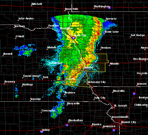 At 546 am cdt, severe thunderstorms were located along a line extending from offutt afb to 4 miles northeast of weeping water to 5 miles east of douglas, moving southeast at 30 mph (radar indicated). Hazards include 60 mph wind gusts. expect damage to roofs, siding, and trees At 546 am cdt, severe thunderstorms were located along a line extending from offutt afb to 4 miles northeast of weeping water to 5 miles east of douglas, moving southeast at 30 mph (radar indicated). Hazards include 60 mph wind gusts. expect damage to roofs, siding, and trees
|
| 3/19/2020 4:55 PM CDT |
 At 454 pm cdt, a severe thunderstorm was located over union, or 33 miles south of omaha, moving northeast at 40 mph (radar indicated). Hazards include 60 mph wind gusts and quarter size hail. Hail damage to vehicles is expected. Expect wind damage to roofs, siding, and trees. At 454 pm cdt, a severe thunderstorm was located over union, or 33 miles south of omaha, moving northeast at 40 mph (radar indicated). Hazards include 60 mph wind gusts and quarter size hail. Hail damage to vehicles is expected. Expect wind damage to roofs, siding, and trees.
|
| 5/28/2019 5:45 AM CDT |
 At 545 am cdt, a severe thunderstorm was located 6 miles north of sidney, or 29 miles northwest of tarkio, moving east at 45 mph (radar indicated). Hazards include 60 mph wind gusts and quarter size hail. Hail damage to vehicles is expected. expect wind damage to roofs, siding, and trees. locations impacted include, hamburg, sidney, farragut, riverton, tabor, thurman, randolph, imogene and waubonsie state park. This includes interstate 29 between mile markers 1 and 10, and between mile markers 20 and 24. At 545 am cdt, a severe thunderstorm was located 6 miles north of sidney, or 29 miles northwest of tarkio, moving east at 45 mph (radar indicated). Hazards include 60 mph wind gusts and quarter size hail. Hail damage to vehicles is expected. expect wind damage to roofs, siding, and trees. locations impacted include, hamburg, sidney, farragut, riverton, tabor, thurman, randolph, imogene and waubonsie state park. This includes interstate 29 between mile markers 1 and 10, and between mile markers 20 and 24.
|
| 5/28/2019 5:29 AM CDT |
 The national weather service in omaha has issued a * severe thunderstorm warning for. fremont county in southwestern iowa. southeastern mills county in southwestern iowa. eastern otoe county in southeastern nebraska. Southeastern cass county in southeastern nebraska. The national weather service in omaha has issued a * severe thunderstorm warning for. fremont county in southwestern iowa. southeastern mills county in southwestern iowa. eastern otoe county in southeastern nebraska. Southeastern cass county in southeastern nebraska.
|
| 5/5/2019 7:01 PM CDT |
 At 700 pm cdt, a severe thunderstorm was located near nebraska city, or 36 miles northwest of tarkio, moving east at 35 mph (radar indicated). Hazards include 60 mph wind gusts and quarter size hail. Hail damage to vehicles is expected. expect wind damage to roofs, siding, and trees. locations impacted include, nebraska city, auburn, syracuse, tecumseh, weeping water, johnson, cook, avoca, talmage, union, nehawka, lorton, thurman, dunbar, otoe, brock, julian, camp catron, 7 miles south of auburn and 8 miles south of johnson. This includes interstate 29 between mile markers 7 and 20. At 700 pm cdt, a severe thunderstorm was located near nebraska city, or 36 miles northwest of tarkio, moving east at 35 mph (radar indicated). Hazards include 60 mph wind gusts and quarter size hail. Hail damage to vehicles is expected. expect wind damage to roofs, siding, and trees. locations impacted include, nebraska city, auburn, syracuse, tecumseh, weeping water, johnson, cook, avoca, talmage, union, nehawka, lorton, thurman, dunbar, otoe, brock, julian, camp catron, 7 miles south of auburn and 8 miles south of johnson. This includes interstate 29 between mile markers 7 and 20.
|
| 5/5/2019 6:50 PM CDT |
 At 650 pm cdt, a severe thunderstorm was located near avoca, or 33 miles east of lincoln, moving east at 35 mph (radar indicated). Hazards include 60 mph wind gusts and quarter size hail. Hail damage to vehicles is expected. Expect wind damage to roofs, siding, and trees. At 650 pm cdt, a severe thunderstorm was located near avoca, or 33 miles east of lincoln, moving east at 35 mph (radar indicated). Hazards include 60 mph wind gusts and quarter size hail. Hail damage to vehicles is expected. Expect wind damage to roofs, siding, and trees.
|
| 9/20/2018 8:52 PM CDT |
 The severe thunderstorm warning for western fremont, western mills, sarpy, eastern johnson, nemaha, eastern otoe, western richardson, eastern pawnee and eastern cass counties will expire at 900 pm cdt, the storms which prompted the warning have moved out of the area. therefore, the warning will be allowed to expire. a severe thunderstorm watch remains in effect until 1100 pm cdt for southwestern iowa, and southeastern and east central nebraska. The severe thunderstorm warning for western fremont, western mills, sarpy, eastern johnson, nemaha, eastern otoe, western richardson, eastern pawnee and eastern cass counties will expire at 900 pm cdt, the storms which prompted the warning have moved out of the area. therefore, the warning will be allowed to expire. a severe thunderstorm watch remains in effect until 1100 pm cdt for southwestern iowa, and southeastern and east central nebraska.
|
| 9/20/2018 8:42 PM CDT |
 At 824 pm cdt, severe thunderstorms were located along a line extending from near greenwood to 4 miles west of lorton to 3 miles east of summerfield, moving east at 50 mph (radar indicated). Hazards include 60 mph wind gusts. expect damage to roofs, siding, and trees At 824 pm cdt, severe thunderstorms were located along a line extending from near greenwood to 4 miles west of lorton to 3 miles east of summerfield, moving east at 50 mph (radar indicated). Hazards include 60 mph wind gusts. expect damage to roofs, siding, and trees
|
| 9/20/2018 8:42 PM CDT |
 A severe thunderstorm warning remains in effect until 900 pm cdt for western fremont. western mills. sarpy. eastern johnson. nemaha. eastern otoe. western richardson. eastern pawnee and eastern cass counties. At 841 pm cdt, severe thunderstorms were located along a line extending from 3 miles north of springfield to 5 miles west of sidney. A severe thunderstorm warning remains in effect until 900 pm cdt for western fremont. western mills. sarpy. eastern johnson. nemaha. eastern otoe. western richardson. eastern pawnee and eastern cass counties. At 841 pm cdt, severe thunderstorms were located along a line extending from 3 miles north of springfield to 5 miles west of sidney.
|
| 9/20/2018 8:24 PM CDT |
 The national weather service in omaha has issued a * severe thunderstorm warning for. western fremont county in southwestern iowa. western mills county in southwestern iowa. sarpy county in east central nebraska. Eastern johnson county in southeastern nebraska. The national weather service in omaha has issued a * severe thunderstorm warning for. western fremont county in southwestern iowa. western mills county in southwestern iowa. sarpy county in east central nebraska. Eastern johnson county in southeastern nebraska.
|
| 9/18/2018 5:24 PM CDT |
 The severe thunderstorm warning for western fremont, southwestern mills, northeastern otoe and eastern cass counties will expire at 530 pm cdt, the storm which prompted the warning has weakened below severe limits, and no longer poses an immediate threat to life or property. therefore, the warning will be allowed to expire. however gusty winds are still possible with this thunderstorm. The severe thunderstorm warning for western fremont, southwestern mills, northeastern otoe and eastern cass counties will expire at 530 pm cdt, the storm which prompted the warning has weakened below severe limits, and no longer poses an immediate threat to life or property. therefore, the warning will be allowed to expire. however gusty winds are still possible with this thunderstorm.
|
| 9/18/2018 5:03 PM CDT |
 At 503 pm cdt, a severe thunderstorm was located over union, or 30 miles south of omaha, moving southeast at 40 mph (radar indicated). Hazards include golf ball size hail and 70 mph wind gusts. People and animals outdoors will be injured. expect hail damage to roofs, siding, windows, and vehicles. expect considerable tree damage. wind damage is also likely to mobile homes, roofs, and outbuildings. locations impacted include, nebraska city, sidney, weeping water, murray, avoca, union, nehawka, tabor, thurman, randolph, camp catron and waubonsie state park. This includes interstate 29 between mile markers 7 and 27. At 503 pm cdt, a severe thunderstorm was located over union, or 30 miles south of omaha, moving southeast at 40 mph (radar indicated). Hazards include golf ball size hail and 70 mph wind gusts. People and animals outdoors will be injured. expect hail damage to roofs, siding, windows, and vehicles. expect considerable tree damage. wind damage is also likely to mobile homes, roofs, and outbuildings. locations impacted include, nebraska city, sidney, weeping water, murray, avoca, union, nehawka, tabor, thurman, randolph, camp catron and waubonsie state park. This includes interstate 29 between mile markers 7 and 27.
|
| 9/18/2018 4:49 PM CDT |
 At 449 pm cdt, a severe thunderstorm was located 5 miles northeast of weeping water, or 23 miles south of omaha, moving southeast at 40 mph (public). Hazards include golf ball size hail and 60 mph wind gusts. People and animals outdoors will be injured. expect hail damage to roofs, siding, windows, and vehicles. Expect wind damage to roofs, siding, and trees. At 449 pm cdt, a severe thunderstorm was located 5 miles northeast of weeping water, or 23 miles south of omaha, moving southeast at 40 mph (public). Hazards include golf ball size hail and 60 mph wind gusts. People and animals outdoors will be injured. expect hail damage to roofs, siding, windows, and vehicles. Expect wind damage to roofs, siding, and trees.
|
| 9/1/2018 9:56 PM CDT |
 At 956 pm cdt, severe thunderstorms were located along a line extending from near union to 3 miles south of nebraska city to 4 miles northeast of johnson, moving east at 40 mph (radar indicated). Hazards include 60 mph wind gusts and nickel size hail. expect damage to roofs, siding, and trees At 956 pm cdt, severe thunderstorms were located along a line extending from near union to 3 miles south of nebraska city to 4 miles northeast of johnson, moving east at 40 mph (radar indicated). Hazards include 60 mph wind gusts and nickel size hail. expect damage to roofs, siding, and trees
|
| 9/1/2018 8:44 PM CDT |
 At 828 pm cdt, severe thunderstorms were located along a line extending from 3 miles north of murray to near union to 7 miles north of lorton, moving northeast at 25 mph (radar indicated). Hazards include 70 mph wind gusts and ping pong ball size hail. People and animals outdoors will be injured. expect hail damage to roofs, siding, windows, and vehicles. expect considerable tree damage. Wind damage is also likely to mobile homes, roofs, and outbuildings. At 828 pm cdt, severe thunderstorms were located along a line extending from 3 miles north of murray to near union to 7 miles north of lorton, moving northeast at 25 mph (radar indicated). Hazards include 70 mph wind gusts and ping pong ball size hail. People and animals outdoors will be injured. expect hail damage to roofs, siding, windows, and vehicles. expect considerable tree damage. Wind damage is also likely to mobile homes, roofs, and outbuildings.
|
| 9/1/2018 8:44 PM CDT |
 At 844 pm cdt, severe thunderstorms were located along a line extending from near pacific junction to 6 miles east of murray to 5 miles south of union, moving northeast at 25 mph (trained weather spotters reported 67 mph winds at the plattsmouth airport at 835 pm). Hazards include 70 mph wind gusts and ping pong ball size hail. People and animals outdoors will be injured. expect hail damage to roofs, siding, windows, and vehicles. expect considerable tree damage. wind damage is also likely to mobile homes, roofs, and outbuildings. locations impacted include, nebraska city, plattsmouth, glenwood, malvern, sidney, pacific junction, murray, union, nehawka, tabor, silver city, thurman, dunbar, randolph and camp catron. This includes interstate 29 between mile markers 12 and 37. At 844 pm cdt, severe thunderstorms were located along a line extending from near pacific junction to 6 miles east of murray to 5 miles south of union, moving northeast at 25 mph (trained weather spotters reported 67 mph winds at the plattsmouth airport at 835 pm). Hazards include 70 mph wind gusts and ping pong ball size hail. People and animals outdoors will be injured. expect hail damage to roofs, siding, windows, and vehicles. expect considerable tree damage. wind damage is also likely to mobile homes, roofs, and outbuildings. locations impacted include, nebraska city, plattsmouth, glenwood, malvern, sidney, pacific junction, murray, union, nehawka, tabor, silver city, thurman, dunbar, randolph and camp catron. This includes interstate 29 between mile markers 12 and 37.
|
| 9/1/2018 8:29 PM CDT |
 At 828 pm cdt, severe thunderstorms were located along a line extending from 3 miles north of murray to near union to 7 miles north of lorton, moving northeast at 25 mph (radar indicated). Hazards include 70 mph wind gusts and ping pong ball size hail. People and animals outdoors will be injured. expect hail damage to roofs, siding, windows, and vehicles. expect considerable tree damage. Wind damage is also likely to mobile homes, roofs, and outbuildings. At 828 pm cdt, severe thunderstorms were located along a line extending from 3 miles north of murray to near union to 7 miles north of lorton, moving northeast at 25 mph (radar indicated). Hazards include 70 mph wind gusts and ping pong ball size hail. People and animals outdoors will be injured. expect hail damage to roofs, siding, windows, and vehicles. expect considerable tree damage. Wind damage is also likely to mobile homes, roofs, and outbuildings.
|
| 9/1/2018 8:11 PM CDT |
 At 811 pm cdt, severe thunderstorms were located along a line extending from 4 miles west of murray to near unadilla, moving east at 30 mph (radar indicated). Hazards include ping pong ball size hail and 60 mph wind gusts. People and animals outdoors will be injured. expect hail damage to roofs, siding, windows, and vehicles. expect wind damage to roofs, siding, and trees. locations impacted include, nebraska city, plattsmouth, glenwood, syracuse, sidney, weeping water, elmwood, palmyra, pacific junction, murray, unadilla, avoca, union, nehawka, tabor, eagle, thurman, dunbar, manley and otoe. This includes interstate 29 between mile markers 12 and 35. At 811 pm cdt, severe thunderstorms were located along a line extending from 4 miles west of murray to near unadilla, moving east at 30 mph (radar indicated). Hazards include ping pong ball size hail and 60 mph wind gusts. People and animals outdoors will be injured. expect hail damage to roofs, siding, windows, and vehicles. expect wind damage to roofs, siding, and trees. locations impacted include, nebraska city, plattsmouth, glenwood, syracuse, sidney, weeping water, elmwood, palmyra, pacific junction, murray, unadilla, avoca, union, nehawka, tabor, eagle, thurman, dunbar, manley and otoe. This includes interstate 29 between mile markers 12 and 35.
|
| 9/1/2018 7:55 PM CDT |
 At 755 pm cdt, severe thunderstorms were located along a line extending from 4 miles northeast of weeping water to near syracuse, moving east at 40 mph (radar indicated). Hazards include ping pong ball size hail and 60 mph wind gusts. People and animals outdoors will be injured. expect hail damage to roofs, siding, windows, and vehicles. Expect wind damage to roofs, siding, and trees. At 755 pm cdt, severe thunderstorms were located along a line extending from 4 miles northeast of weeping water to near syracuse, moving east at 40 mph (radar indicated). Hazards include ping pong ball size hail and 60 mph wind gusts. People and animals outdoors will be injured. expect hail damage to roofs, siding, windows, and vehicles. Expect wind damage to roofs, siding, and trees.
|
| 8/6/2018 6:28 PM CDT |
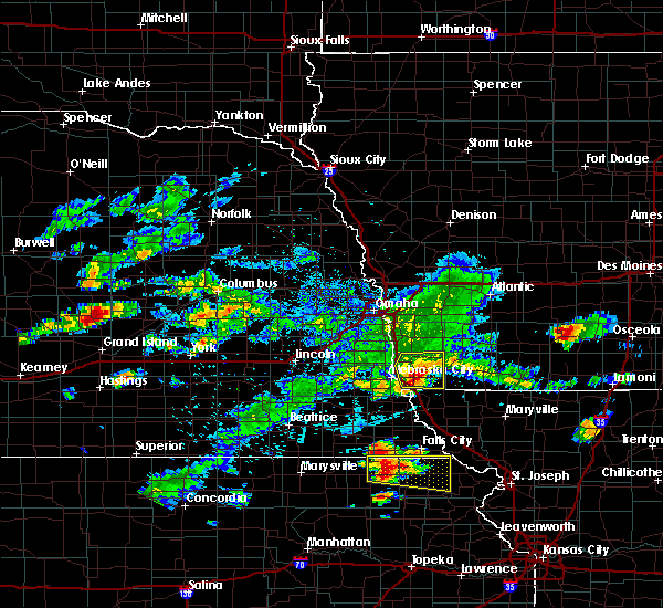 At 627 pm cdt, a severe thunderstorm was located over riverton, or 18 miles northwest of tarkio, moving east at 55 mph (radar indicated). Hazards include 60 mph wind gusts and penny size hail. Expect damage to roofs, siding, and trees. locations impacted include, hamburg, sidney, farragut, riverton, tabor, thurman, randolph, imogene and waubonsie state park. This includes interstate 29 between mile markers 1 and 10, and near mile marker 17. At 627 pm cdt, a severe thunderstorm was located over riverton, or 18 miles northwest of tarkio, moving east at 55 mph (radar indicated). Hazards include 60 mph wind gusts and penny size hail. Expect damage to roofs, siding, and trees. locations impacted include, hamburg, sidney, farragut, riverton, tabor, thurman, randolph, imogene and waubonsie state park. This includes interstate 29 between mile markers 1 and 10, and near mile marker 17.
|
| 8/6/2018 6:17 PM CDT |
 At 617 pm cdt, a severe thunderstorm was located 4 miles southwest of sidney, or 25 miles northwest of tarkio, moving east at 55 mph (radar indicated). Hazards include 60 mph wind gusts and penny size hail. Expect damage to roofs, siding, and trees. locations impacted include, nebraska city, hamburg, sidney, farragut, riverton, tabor, thurman, randolph, imogene and waubonsie state park. This includes interstate 29 between mile markers 1 and 20. At 617 pm cdt, a severe thunderstorm was located 4 miles southwest of sidney, or 25 miles northwest of tarkio, moving east at 55 mph (radar indicated). Hazards include 60 mph wind gusts and penny size hail. Expect damage to roofs, siding, and trees. locations impacted include, nebraska city, hamburg, sidney, farragut, riverton, tabor, thurman, randolph, imogene and waubonsie state park. This includes interstate 29 between mile markers 1 and 20.
|
| 8/6/2018 6:10 PM CDT |
 At 610 pm cdt, a severe thunderstorm was located over nebraska city, or 30 miles northwest of tarkio, moving east at 55 mph (radar indicated). Hazards include 60 mph wind gusts and penny size hail. expect damage to roofs, siding, and trees At 610 pm cdt, a severe thunderstorm was located over nebraska city, or 30 miles northwest of tarkio, moving east at 55 mph (radar indicated). Hazards include 60 mph wind gusts and penny size hail. expect damage to roofs, siding, and trees
|
| 6/30/2018 5:30 PM CDT |
 At 529 pm cdt, a severe thunderstorm was located 7 miles east of union, or 33 miles northwest of tarkio, moving north at 25 mph (radar indicated). Hazards include 60 mph wind gusts and quarter size hail. Hail damage to vehicles is expected. expect wind damage to roofs, siding, and trees. locations impacted include, sidney, tabor, thurman and randolph. This includes interstate 29 between mile markers 17 and 29. At 529 pm cdt, a severe thunderstorm was located 7 miles east of union, or 33 miles northwest of tarkio, moving north at 25 mph (radar indicated). Hazards include 60 mph wind gusts and quarter size hail. Hail damage to vehicles is expected. expect wind damage to roofs, siding, and trees. locations impacted include, sidney, tabor, thurman and randolph. This includes interstate 29 between mile markers 17 and 29.
|
| 6/30/2018 5:10 PM CDT |
 At 510 pm cdt, a severe thunderstorm was located near nebraska city, or 29 miles northwest of tarkio, moving north at 25 mph (radar indicated). Hazards include 60 mph wind gusts and quarter size hail. Hail damage to vehicles is expected. Expect wind damage to roofs, siding, and trees. At 510 pm cdt, a severe thunderstorm was located near nebraska city, or 29 miles northwest of tarkio, moving north at 25 mph (radar indicated). Hazards include 60 mph wind gusts and quarter size hail. Hail damage to vehicles is expected. Expect wind damage to roofs, siding, and trees.
|
| 6/11/2018 7:56 PM CDT |
 The severe thunderstorm warning for fremont, south central mills, southwestern page, northeastern nemaha, eastern otoe and southeastern cass counties will expire at 800 pm cdt, the storms which prompted the warning continue and a new warning has been issued. a tornado watch remains in effect until 1100 pm cdt for southwestern iowa, and southeastern nebraska. The severe thunderstorm warning for fremont, south central mills, southwestern page, northeastern nemaha, eastern otoe and southeastern cass counties will expire at 800 pm cdt, the storms which prompted the warning continue and a new warning has been issued. a tornado watch remains in effect until 1100 pm cdt for southwestern iowa, and southeastern nebraska.
|
| 6/11/2018 7:41 PM CDT |
 The tornado warning for northwestern fremont, southwestern mills, north central otoe and southeastern cass counties will expire at 745 pm cdt, the storm which prompted the warning continues to produce damaging winds. a storm warning remains in effec for parts of fremont county. a tornado watch remains in effect until 1100 pm cdt for southwestern iowa, and southeastern nebraska. The tornado warning for northwestern fremont, southwestern mills, north central otoe and southeastern cass counties will expire at 745 pm cdt, the storm which prompted the warning continues to produce damaging winds. a storm warning remains in effec for parts of fremont county. a tornado watch remains in effect until 1100 pm cdt for southwestern iowa, and southeastern nebraska.
|
| 6/11/2018 7:15 PM CDT | 3 farm storage buildings destroye in fremont county IA, 3.6 miles N of Thurman, IA |
| 6/11/2018 7:14 PM CDT |
 At 713 pm cdt, severe thunderstorms were located along a line extending from 3 miles northeast of sidney to near johnson, moving southeast at 45 mph. these are very dangerous storms (trained weather spotters reported 88 mph winds at thurman at 710pm). Hazards include 90 mph wind gusts and half dollar size hail. You are in a life-threatening situation. flying debris may be deadly to those caught without shelter. mobile homes will be heavily damaged or destroyed. homes and businesses will have substantial roof and window damage. expect extensive tree damage and power outages. locations impacted include, nebraska city, shenandoah, hamburg, sidney, peru, farragut, riverton, lorton, tabor, thurman, dunbar, brownville, julian, camp catron, waubonsie state park and brownville state recreation area. this includes interstate 29 between mile markers 1 and 24. A tornado watch remains in effect until 1100 pm cdt for southwestern iowa, and southeastern nebraska. At 713 pm cdt, severe thunderstorms were located along a line extending from 3 miles northeast of sidney to near johnson, moving southeast at 45 mph. these are very dangerous storms (trained weather spotters reported 88 mph winds at thurman at 710pm). Hazards include 90 mph wind gusts and half dollar size hail. You are in a life-threatening situation. flying debris may be deadly to those caught without shelter. mobile homes will be heavily damaged or destroyed. homes and businesses will have substantial roof and window damage. expect extensive tree damage and power outages. locations impacted include, nebraska city, shenandoah, hamburg, sidney, peru, farragut, riverton, lorton, tabor, thurman, dunbar, brownville, julian, camp catron, waubonsie state park and brownville state recreation area. this includes interstate 29 between mile markers 1 and 24. A tornado watch remains in effect until 1100 pm cdt for southwestern iowa, and southeastern nebraska.
|
| 6/11/2018 7:13 PM CDT | Three semis overturned on interstate 2 in fremont county IA, 3.2 miles E of Thurman, IA |
| 6/11/2018 7:10 PM CDT | Storm damage reported in fremont county IA, 0.1 miles NNE of Thurman, IA |
| 6/11/2018 7:09 PM CDT |
 At 708 pm cdt, severe thunderstorms were located along a line extending from 5 miles north of sidney to near johnson, moving southeast at 45 mph. these are very dangerous storms (trained weather spotters). Hazards include 80 mph wind gusts. Flying debris will be dangerous to those caught without shelter. mobile homes will be heavily damaged. expect considerable damage to roofs, windows, and vehicles. Extensive tree damage and power outages are likely. At 708 pm cdt, severe thunderstorms were located along a line extending from 5 miles north of sidney to near johnson, moving southeast at 45 mph. these are very dangerous storms (trained weather spotters). Hazards include 80 mph wind gusts. Flying debris will be dangerous to those caught without shelter. mobile homes will be heavily damaged. expect considerable damage to roofs, windows, and vehicles. Extensive tree damage and power outages are likely.
|
| 6/11/2018 7:00 PM CDT | Total of 9 semis overturned along i-29. 2 drivers were injured and taken by ambulance. interstate 29 was closed both north and southbound. numerous power lines are down in fremont county IA, 3.2 miles E of Thurman, IA |
| 6/11/2018 7:00 PM CDT |
 At 659 pm cdt, a severe thunderstorm capable of producing a tornado was located 4 miles east of murray, or 25 miles south of omaha, moving southeast at 25 mph (radar indicated rotation). Hazards include tornado and hail up to two inches in diameter. Flying debris will be dangerous to those caught without shelter. mobile homes will be damaged or destroyed. damage to roofs, windows, and vehicles will occur. tree damage is likely. this dangerous storm will be near, sidney around 735 pm cdt. riverton around 745 pm cdt. other locations impacted by this tornadic thunderstorm include thurman, randolph and tabor. This includes interstate 29 between mile markers 15 and 29. At 659 pm cdt, a severe thunderstorm capable of producing a tornado was located 4 miles east of murray, or 25 miles south of omaha, moving southeast at 25 mph (radar indicated rotation). Hazards include tornado and hail up to two inches in diameter. Flying debris will be dangerous to those caught without shelter. mobile homes will be damaged or destroyed. damage to roofs, windows, and vehicles will occur. tree damage is likely. this dangerous storm will be near, sidney around 735 pm cdt. riverton around 745 pm cdt. other locations impacted by this tornadic thunderstorm include thurman, randolph and tabor. This includes interstate 29 between mile markers 15 and 29.
|
| 6/9/2018 4:37 AM CDT |
 The severe thunderstorm warning for northern fremont, montgomery, mills, pottawattamie, southeastern harrison, southern shelby and northwestern page counties will expire at 445 am cdt, the storms which prompted the warning have weakened below severe limits, and no longer pose an immediate threat to life or property. therefore, the warning will be allowed to expire. however gusty winds are still possible with these thunderstorms. The severe thunderstorm warning for northern fremont, montgomery, mills, pottawattamie, southeastern harrison, southern shelby and northwestern page counties will expire at 445 am cdt, the storms which prompted the warning have weakened below severe limits, and no longer pose an immediate threat to life or property. therefore, the warning will be allowed to expire. however gusty winds are still possible with these thunderstorms.
|
| 6/9/2018 4:15 AM CDT |
 At 415 am cdt, severe thunderstorms were located along a line extending from 3 miles northwest of minden to 9 miles northeast of union, moving east at 40 mph (radar indicated). Hazards include 60 mph wind gusts. expect damage to roofs, siding, and trees At 415 am cdt, severe thunderstorms were located along a line extending from 3 miles northwest of minden to 9 miles northeast of union, moving east at 40 mph (radar indicated). Hazards include 60 mph wind gusts. expect damage to roofs, siding, and trees
|
| 6/6/2018 11:39 PM CDT |
 The severe thunderstorm warning for fremont and northeastern otoe counties will expire at 1145 pm cdt, the storm which prompted the warning has weakened below severe limits, and no longer poses an immediate threat to life or property. therefore, the warning will be allowed to expire. however gusty winds and heavy rain are still possible with this thunderstorm. a severe thunderstorm watch remains in effect until midnight cdt for southwestern iowa, and southeastern nebraska. The severe thunderstorm warning for fremont and northeastern otoe counties will expire at 1145 pm cdt, the storm which prompted the warning has weakened below severe limits, and no longer poses an immediate threat to life or property. therefore, the warning will be allowed to expire. however gusty winds and heavy rain are still possible with this thunderstorm. a severe thunderstorm watch remains in effect until midnight cdt for southwestern iowa, and southeastern nebraska.
|
| 6/6/2018 11:29 PM CDT |
 At 1111 pm cdt, a severe thunderstorm was located 5 miles northwest of sidney, or 30 miles northwest of tarkio, moving southeast at 15 mph (radar indicated. at 1110 pm, quarter size hail was reported 5 miles northwest of sidney). Hazards include 60 mph wind gusts and quarter size hail. Hail damage to vehicles is expected. Expect wind damage to roofs, siding, and trees. At 1111 pm cdt, a severe thunderstorm was located 5 miles northwest of sidney, or 30 miles northwest of tarkio, moving southeast at 15 mph (radar indicated. at 1110 pm, quarter size hail was reported 5 miles northwest of sidney). Hazards include 60 mph wind gusts and quarter size hail. Hail damage to vehicles is expected. Expect wind damage to roofs, siding, and trees.
|
| 6/6/2018 11:29 PM CDT |
 At 1129 pm cdt, a severe thunderstorm was located near hamburg, or 21 miles northwest of tarkio, moving southeast at 20 mph (radar indicated). Hazards include 60 mph wind gusts and quarter size hail. Hail damage to vehicles is expected. expect wind damage to roofs, siding, and trees. locations impacted include, nebraska city, hamburg, sidney, farragut, riverton, thurman and waubonsie state park. This includes interstate 29 between mile markers 1 and 17. At 1129 pm cdt, a severe thunderstorm was located near hamburg, or 21 miles northwest of tarkio, moving southeast at 20 mph (radar indicated). Hazards include 60 mph wind gusts and quarter size hail. Hail damage to vehicles is expected. expect wind damage to roofs, siding, and trees. locations impacted include, nebraska city, hamburg, sidney, farragut, riverton, thurman and waubonsie state park. This includes interstate 29 between mile markers 1 and 17.
|
| 6/6/2018 11:13 PM CDT |
 At 1111 pm cdt, a severe thunderstorm was located 5 miles northwest of sidney, or 30 miles northwest of tarkio, moving southeast at 15 mph (radar indicated. at 1110 pm, quarter size hail was reported 5 miles northwest of sidney). Hazards include 60 mph wind gusts and quarter size hail. Hail damage to vehicles is expected. Expect wind damage to roofs, siding, and trees. At 1111 pm cdt, a severe thunderstorm was located 5 miles northwest of sidney, or 30 miles northwest of tarkio, moving southeast at 15 mph (radar indicated. at 1110 pm, quarter size hail was reported 5 miles northwest of sidney). Hazards include 60 mph wind gusts and quarter size hail. Hail damage to vehicles is expected. Expect wind damage to roofs, siding, and trees.
|
| 4/13/2018 5:25 PM CDT |
 The severe thunderstorm warning for fremont, southern mills and eastern otoe counties will expire at 530 pm cdt, the storms which prompted the warning have weakened below severe limits, and no longer pose an immediate threat to life or property. therefore the warning will be allowed to expire. however small hail, gusty winds and heavy rain are still possible with these thunderstorms. a tornado watch remains in effect until 900 pm cdt for southwestern iowa, and southeastern nebraska. The severe thunderstorm warning for fremont, southern mills and eastern otoe counties will expire at 530 pm cdt, the storms which prompted the warning have weakened below severe limits, and no longer pose an immediate threat to life or property. therefore the warning will be allowed to expire. however small hail, gusty winds and heavy rain are still possible with these thunderstorms. a tornado watch remains in effect until 900 pm cdt for southwestern iowa, and southeastern nebraska.
|
| 4/13/2018 5:25 PM CDT |
 The severe thunderstorm warning for fremont. southern mills and eastern otoe counties will expire at 530 pm cdt. the storms which prompted the warning have weakened below severe limits, and no longer pose an immediate threat to life or property. therefore the warning will be allowed to expire. However small hail, gusty winds and heavy rain are still possible with these. The severe thunderstorm warning for fremont. southern mills and eastern otoe counties will expire at 530 pm cdt. the storms which prompted the warning have weakened below severe limits, and no longer pose an immediate threat to life or property. therefore the warning will be allowed to expire. However small hail, gusty winds and heavy rain are still possible with these.
|
| 4/13/2018 5:16 PM CDT |
 At 515 pm cdt, severe thunderstorms were located along a line extending from 5 miles northeast of malvern to 3 miles southeast of nebraska city, moving northeast at 30 mph (radar indicated). Hazards include 60 mph wind gusts and quarter size hail. Hail damage to vehicles is expected. expect wind damage to roofs, siding, and trees. locations impacted include, nebraska city, hamburg, sidney, riverton, tabor, thurman, randolph, camp catron and waubonsie state park. this includes the following highways, highway 2 in nebraska between mile markers 504 and 508. highway 75 in nebraska between mile markers 39 and 48. interstate 29 between mile markers 1 and 25. A tornado watch remains in effect until 900 pm cdt for southwestern iowa, and southeastern nebraska. At 515 pm cdt, severe thunderstorms were located along a line extending from 5 miles northeast of malvern to 3 miles southeast of nebraska city, moving northeast at 30 mph (radar indicated). Hazards include 60 mph wind gusts and quarter size hail. Hail damage to vehicles is expected. expect wind damage to roofs, siding, and trees. locations impacted include, nebraska city, hamburg, sidney, riverton, tabor, thurman, randolph, camp catron and waubonsie state park. this includes the following highways, highway 2 in nebraska between mile markers 504 and 508. highway 75 in nebraska between mile markers 39 and 48. interstate 29 between mile markers 1 and 25. A tornado watch remains in effect until 900 pm cdt for southwestern iowa, and southeastern nebraska.
|
| 4/13/2018 4:57 PM CDT |
 At 457 pm cdt, severe thunderstorms were located along a line extending from 4 miles southwest of malvern to 6 miles east of talmage, moving northeast at 40 mph (radar indicated). Hazards include 60 mph wind gusts and quarter size hail. Hail damage to vehicles is expected. Expect wind damage to roofs, siding, and trees. At 457 pm cdt, severe thunderstorms were located along a line extending from 4 miles southwest of malvern to 6 miles east of talmage, moving northeast at 40 mph (radar indicated). Hazards include 60 mph wind gusts and quarter size hail. Hail damage to vehicles is expected. Expect wind damage to roofs, siding, and trees.
|
| 6/29/2017 5:42 PM CDT |
 At 1041 pm cdt, a severe thunderstorm was located 4 miles southeast of cedar creek, or 17 miles south of omaha, moving east at 30 mph (radar indicated). Hazards include golf ball size hail. People and animals outdoors will be injured. Expect damage to roofs, siding, windows, and vehicles. At 1041 pm cdt, a severe thunderstorm was located 4 miles southeast of cedar creek, or 17 miles south of omaha, moving east at 30 mph (radar indicated). Hazards include golf ball size hail. People and animals outdoors will be injured. Expect damage to roofs, siding, windows, and vehicles.
|
| 6/28/2017 10:28 AM CDT |
 At 328 pm cdt, a severe thunderstorm was located 5 miles northeast of sidney, or 27 miles north of tarkio, moving east at 40 mph (radar indicated). Hazards include ping pong ball size hail and 60 mph wind gusts. People and animals outdoors will be injured. expect hail damage to roofs, siding, windows, and vehicles. expect wind damage to roofs, siding, and trees. locations impacted include, red oak, shenandoah, sidney, essex, farragut, tabor, thurman, randolph, imogene, coburg and pierce recreation area. this includes the following highways, highway 34 in iowa near mile marker 33. highway 59 in iowa between mile markers 13 and 28. A tornado watch remains in effect until 1000 pm cdt for southwestern iowa. At 328 pm cdt, a severe thunderstorm was located 5 miles northeast of sidney, or 27 miles north of tarkio, moving east at 40 mph (radar indicated). Hazards include ping pong ball size hail and 60 mph wind gusts. People and animals outdoors will be injured. expect hail damage to roofs, siding, windows, and vehicles. expect wind damage to roofs, siding, and trees. locations impacted include, red oak, shenandoah, sidney, essex, farragut, tabor, thurman, randolph, imogene, coburg and pierce recreation area. this includes the following highways, highway 34 in iowa near mile marker 33. highway 59 in iowa between mile markers 13 and 28. A tornado watch remains in effect until 1000 pm cdt for southwestern iowa.
|
| 6/28/2017 10:17 AM CDT |
 At 317 pm cdt, a severe thunderstorm was located 7 miles northwest of sidney, or 32 miles northwest of tarkio, moving east at 35 mph (radar indicated). Hazards include 60 mph wind gusts and quarter size hail. Hail damage to vehicles is expected. Expect wind damage to roofs, siding, and trees. At 317 pm cdt, a severe thunderstorm was located 7 miles northwest of sidney, or 32 miles northwest of tarkio, moving east at 35 mph (radar indicated). Hazards include 60 mph wind gusts and quarter size hail. Hail damage to vehicles is expected. Expect wind damage to roofs, siding, and trees.
|
| 6/16/2017 8:49 PM CDT | Several trees down. estimated 60 mph in fremont county IA, 3.1 miles W of Thurman, IA |
| 6/16/2017 8:43 PM CDT |
 At 842 pm cdt, severe thunderstorms were located along a line extending from 4 miles southwest of manning to 3 miles northwest of elliott to near farragut to 4 miles west of lorton, moving southeast at 40 mph (radar indicated). Hazards include 70 mph wind gusts. Expect considerable tree damage. Damage is likely to mobile homes, roofs, and outbuildings. At 842 pm cdt, severe thunderstorms were located along a line extending from 4 miles southwest of manning to 3 miles northwest of elliott to near farragut to 4 miles west of lorton, moving southeast at 40 mph (radar indicated). Hazards include 70 mph wind gusts. Expect considerable tree damage. Damage is likely to mobile homes, roofs, and outbuildings.
|
| 6/16/2017 8:35 PM CDT | Very large trees blocking the road in fremont county IA, 2.2 miles N of Thurman, IA |
| 6/16/2017 8:14 PM CDT |
 At 814 pm cdt, severe thunderstorms were located along a line extending from 5 miles east of persia to treynor to 3 miles southeast of pacific junction to 4 miles southwest of elmwood, moving southeast at 45 mph. these are very dangerous storms (radar indicated). Hazards include 80 mph wind gusts. Flying debris will be dangerous to those caught without shelter. mobile homes will be heavily damaged. expect considerable damage to roofs, windows, and vehicles. Extensive tree damage and power outages are likely. At 814 pm cdt, severe thunderstorms were located along a line extending from 5 miles east of persia to treynor to 3 miles southeast of pacific junction to 4 miles southwest of elmwood, moving southeast at 45 mph. these are very dangerous storms (radar indicated). Hazards include 80 mph wind gusts. Flying debris will be dangerous to those caught without shelter. mobile homes will be heavily damaged. expect considerable damage to roofs, windows, and vehicles. Extensive tree damage and power outages are likely.
|
| 6/16/2017 7:57 PM CDT |
 At 756 pm cdt, severe thunderstorms were located along a line extending from 4 miles northwest of underwood to 5 miles east of council bluffs to near cedar creek to 6 miles northwest of greenwood, moving southeast at 45 mph. these are very dangerous storms (radar indicated. numerous reports of 70 to 90 mph winds have been received associated with the leading edge of the storm). Hazards include 90 mph wind gusts. You are in a life-threatening situation. flying debris may be deadly to those caught without shelter. mobile homes will be heavily damaged or destroyed. homes and businesses will have substantial roof and window damage. expect extensive tree damage and power outages. locations impacted include, southeastern omaha, council bluffs, bellevue, papillion, la vista, plattsmouth, ralston, glenwood, gretna, waverly, ashland, springfield, oakland, malvern, louisville, weeping water, treynor, underwood, carson and elmwood. this includes the following highways, highway 34 in iowa between mile markers 1 and 23. highway 59 in iowa between mile markers 31 and 55. highway 75 in nebraska between mile markers 57 and 91. highway 77 in nebraska between mile markers 81 and 82. interstate 29 between mile markers 15 and 56. interstate 80 in iowa between mile markers 1 and 23. Interstate 80 in nebraska between mile markers 411 and 444, and between mile markers 448 and 454. At 756 pm cdt, severe thunderstorms were located along a line extending from 4 miles northwest of underwood to 5 miles east of council bluffs to near cedar creek to 6 miles northwest of greenwood, moving southeast at 45 mph. these are very dangerous storms (radar indicated. numerous reports of 70 to 90 mph winds have been received associated with the leading edge of the storm). Hazards include 90 mph wind gusts. You are in a life-threatening situation. flying debris may be deadly to those caught without shelter. mobile homes will be heavily damaged or destroyed. homes and businesses will have substantial roof and window damage. expect extensive tree damage and power outages. locations impacted include, southeastern omaha, council bluffs, bellevue, papillion, la vista, plattsmouth, ralston, glenwood, gretna, waverly, ashland, springfield, oakland, malvern, louisville, weeping water, treynor, underwood, carson and elmwood. this includes the following highways, highway 34 in iowa between mile markers 1 and 23. highway 59 in iowa between mile markers 31 and 55. highway 75 in nebraska between mile markers 57 and 91. highway 77 in nebraska between mile markers 81 and 82. interstate 29 between mile markers 15 and 56. interstate 80 in iowa between mile markers 1 and 23. Interstate 80 in nebraska between mile markers 411 and 444, and between mile markers 448 and 454.
|
| 6/16/2017 7:49 PM CDT |
 At 748 pm cdt, severe thunderstorms were located along a line extending from 6 miles southeast of missouri valley to 4 miles north of council bluffs to near gretna to 9 miles south of wahoo, moving southeast at 40 mph. these are very dangerous storms (radar indicated). Hazards include 80 mph wind gusts. Flying debris will be dangerous to those caught without shelter. mobile homes will be heavily damaged. expect considerable damage to roofs, windows, and vehicles. Extensive tree damage and power outages are likely. At 748 pm cdt, severe thunderstorms were located along a line extending from 6 miles southeast of missouri valley to 4 miles north of council bluffs to near gretna to 9 miles south of wahoo, moving southeast at 40 mph. these are very dangerous storms (radar indicated). Hazards include 80 mph wind gusts. Flying debris will be dangerous to those caught without shelter. mobile homes will be heavily damaged. expect considerable damage to roofs, windows, and vehicles. Extensive tree damage and power outages are likely.
|
| 6/15/2017 8:11 PM CDT | Golf Ball sized hail reported 3.1 miles W of Thurman, IA |
| 6/15/2017 8:10 PM CDT |
 At 810 pm cdt, a severe thunderstorm was located 4 miles northwest of sidney, or 30 miles northwest of tarkio, moving east at 20 mph (radar indicated). Hazards include half dollar size hail. damage to vehicles is expected At 810 pm cdt, a severe thunderstorm was located 4 miles northwest of sidney, or 30 miles northwest of tarkio, moving east at 20 mph (radar indicated). Hazards include half dollar size hail. damage to vehicles is expected
|
| 6/15/2017 8:04 PM CDT |
 At 803 pm cdt, a severe thunderstorm was located 7 miles northwest of sidney, or 32 miles northwest of tarkio, moving east at 20 mph (trained weather spotters). Hazards include golf ball size hail. People and animals outdoors will be injured. expect damage to roofs, siding, windows, and vehicles. locations impacted include, sidney, thurman and waubonsie state park. This includes interstate 29 near mile marker 15. At 803 pm cdt, a severe thunderstorm was located 7 miles northwest of sidney, or 32 miles northwest of tarkio, moving east at 20 mph (trained weather spotters). Hazards include golf ball size hail. People and animals outdoors will be injured. expect damage to roofs, siding, windows, and vehicles. locations impacted include, sidney, thurman and waubonsie state park. This includes interstate 29 near mile marker 15.
|
| 6/15/2017 7:58 PM CDT | Golf Ball sized hail reported 3 miles ESE of Thurman, IA |
| 6/15/2017 7:57 PM CDT |
 At 757 pm cdt, a severe thunderstorm was located 5 miles east of union, or 32 miles south of omaha, moving east at 15 mph (radar indicated). Hazards include half dollar size hail. Damage to vehicles is expected. locations impacted include, sidney, thurman and waubonsie state park. This includes interstate 29 between mile markers 15 and 24. At 757 pm cdt, a severe thunderstorm was located 5 miles east of union, or 32 miles south of omaha, moving east at 15 mph (radar indicated). Hazards include half dollar size hail. Damage to vehicles is expected. locations impacted include, sidney, thurman and waubonsie state park. This includes interstate 29 between mile markers 15 and 24.
|
| 6/15/2017 7:49 PM CDT |
 At 749 pm cdt, a severe thunderstorm was located near union, or 31 miles south of omaha, moving east at 15 mph (radar indicated). Hazards include quarter size hail. damage to vehicles is expected At 749 pm cdt, a severe thunderstorm was located near union, or 31 miles south of omaha, moving east at 15 mph (radar indicated). Hazards include quarter size hail. damage to vehicles is expected
|
| 6/15/2017 6:17 PM CDT |
 At 616 pm cdt, a severe thunderstorm was located 7 miles northwest of sidney, or 32 miles northwest of tarkio, moving east at 20 mph (radar indicated). Hazards include quarter size hail. damage to vehicles is expected At 616 pm cdt, a severe thunderstorm was located 7 miles northwest of sidney, or 32 miles northwest of tarkio, moving east at 20 mph (radar indicated). Hazards include quarter size hail. damage to vehicles is expected
|
| 6/14/2017 7:44 AM CDT |
 At 744 am cdt, severe thunderstorms were located along a line extending from 9 miles east of union to near riverton to near hamburg, moving east at 55 mph (radar indicated). Hazards include 60 mph wind gusts and penny size hail. expect damage to roofs, siding, and trees At 744 am cdt, severe thunderstorms were located along a line extending from 9 miles east of union to near riverton to near hamburg, moving east at 55 mph (radar indicated). Hazards include 60 mph wind gusts and penny size hail. expect damage to roofs, siding, and trees
|
| 6/14/2017 7:38 AM CDT |
 At 737 am cdt, a severe thunderstorm was located near sidney, or 22 miles northwest of tarkio, moving northeast at 55 mph (radar indicated). Hazards include 60 mph wind gusts and penny size hail. Expect damage to roofs, siding, and trees. locations impacted include, nebraska city, hamburg, sidney, farragut, riverton, union, nehawka, thurman, brock, julian, camp catron and waubonsie state park. this includes the following highways, highway 2 in nebraska between mile markers 502 and 508. highway 75 in nebraska between mile markers 37 and 59. Interstate 29 between mile markers 1 and 20. At 737 am cdt, a severe thunderstorm was located near sidney, or 22 miles northwest of tarkio, moving northeast at 55 mph (radar indicated). Hazards include 60 mph wind gusts and penny size hail. Expect damage to roofs, siding, and trees. locations impacted include, nebraska city, hamburg, sidney, farragut, riverton, union, nehawka, thurman, brock, julian, camp catron and waubonsie state park. this includes the following highways, highway 2 in nebraska between mile markers 502 and 508. highway 75 in nebraska between mile markers 37 and 59. Interstate 29 between mile markers 1 and 20.
|
| 6/14/2017 7:27 AM CDT |
 At 726 am cdt, a severe thunderstorm was located near nebraska city, or 26 miles northwest of tarkio, moving northeast at 55 mph (radar indicated). Hazards include 60 mph wind gusts and penny size hail. Expect damage to roofs, siding, and trees. locations impacted include, nebraska city, hamburg, sidney, farragut, riverton, avoca, talmage, union, nehawka, lorton, thurman, dunbar, otoe, brock, julian, camp catron and waubonsie state park. this includes the following highways, highway 2 in nebraska between mile markers 493 and 508. highway 75 in nebraska between mile markers 37 and 59. Interstate 29 between mile markers 1 and 20. At 726 am cdt, a severe thunderstorm was located near nebraska city, or 26 miles northwest of tarkio, moving northeast at 55 mph (radar indicated). Hazards include 60 mph wind gusts and penny size hail. Expect damage to roofs, siding, and trees. locations impacted include, nebraska city, hamburg, sidney, farragut, riverton, avoca, talmage, union, nehawka, lorton, thurman, dunbar, otoe, brock, julian, camp catron and waubonsie state park. this includes the following highways, highway 2 in nebraska between mile markers 493 and 508. highway 75 in nebraska between mile markers 37 and 59. Interstate 29 between mile markers 1 and 20.
|
| 6/14/2017 7:16 AM CDT |
 At 715 am cdt, a severe thunderstorm was located over lorton, or 34 miles west of tarkio, moving northeast at 55 mph (radar indicated). Hazards include 60 mph wind gusts and penny size hail. expect damage to roofs, siding, and trees At 715 am cdt, a severe thunderstorm was located over lorton, or 34 miles west of tarkio, moving northeast at 55 mph (radar indicated). Hazards include 60 mph wind gusts and penny size hail. expect damage to roofs, siding, and trees
|
| 5/16/2017 9:54 PM CDT |
 The severe thunderstorm warning for fremont, western mills, northeastern otoe and southeastern cass counties will expire at 1000 pm cdt, the storm which prompted the warning has moved out of the area. therefore the warning will be allowed to expire. however gusty winds over 40 mph and heavy rain are still possible with this thunderstorm. a severe thunderstorm watch remains in effect until midnight cdt for southwestern iowa, and southeastern nebraska. The severe thunderstorm warning for fremont, western mills, northeastern otoe and southeastern cass counties will expire at 1000 pm cdt, the storm which prompted the warning has moved out of the area. therefore the warning will be allowed to expire. however gusty winds over 40 mph and heavy rain are still possible with this thunderstorm. a severe thunderstorm watch remains in effect until midnight cdt for southwestern iowa, and southeastern nebraska.
|
| 5/16/2017 9:41 PM CDT |
 At 941 pm cdt, a severe thunderstorm was located 4 miles north of sidney, or 29 miles northwest of tarkio, moving northeast at 50 mph (radar indicated). Hazards include 60 mph wind gusts and nickel size hail. Expect damage to roofs, siding, and trees. Locations impacted include, glenwood, hamburg, malvern, sidney, farragut, riverton, union, tabor, thurman, randolph and waubonsie state park. At 941 pm cdt, a severe thunderstorm was located 4 miles north of sidney, or 29 miles northwest of tarkio, moving northeast at 50 mph (radar indicated). Hazards include 60 mph wind gusts and nickel size hail. Expect damage to roofs, siding, and trees. Locations impacted include, glenwood, hamburg, malvern, sidney, farragut, riverton, union, tabor, thurman, randolph and waubonsie state park.
|
| 5/16/2017 9:34 PM CDT |
 At 934 pm cdt, a severe thunderstorm was located 4 miles northwest of sidney, or 29 miles northwest of tarkio, moving northeast at 50 mph (radar indicated). Hazards include 60 mph wind gusts and nickel size hail. Expect damage to roofs, siding, and trees. Locations impacted include, nebraska city, glenwood, hamburg, malvern, sidney, farragut, pacific junction, riverton, union, nehawka, lorton, tabor, thurman, dunbar, randolph, camp catron and waubonsie state park. At 934 pm cdt, a severe thunderstorm was located 4 miles northwest of sidney, or 29 miles northwest of tarkio, moving northeast at 50 mph (radar indicated). Hazards include 60 mph wind gusts and nickel size hail. Expect damage to roofs, siding, and trees. Locations impacted include, nebraska city, glenwood, hamburg, malvern, sidney, farragut, pacific junction, riverton, union, nehawka, lorton, tabor, thurman, dunbar, randolph, camp catron and waubonsie state park.
|
| 5/16/2017 9:27 PM CDT |
 At 926 pm cdt, an area severe thunderstorm was located 7 miles east of union, or 32 miles northwest of tarkio, moving northeast at 55 mph. strong winds were spreading into much of fremont county iowa (radar indicated). Hazards include 60 mph wind gusts and quarter size hail. Hail damage to vehicles is expected. expect wind damage to roofs, siding, and trees. Locations impacted include, nebraska city, glenwood, hamburg, malvern, sidney, farragut, pacific junction, riverton, union, nehawka, lorton, tabor, thurman, dunbar, randolph, camp catron and waubonsie state park. At 926 pm cdt, an area severe thunderstorm was located 7 miles east of union, or 32 miles northwest of tarkio, moving northeast at 55 mph. strong winds were spreading into much of fremont county iowa (radar indicated). Hazards include 60 mph wind gusts and quarter size hail. Hail damage to vehicles is expected. expect wind damage to roofs, siding, and trees. Locations impacted include, nebraska city, glenwood, hamburg, malvern, sidney, farragut, pacific junction, riverton, union, nehawka, lorton, tabor, thurman, dunbar, randolph, camp catron and waubonsie state park.
|
| 5/16/2017 9:13 PM CDT |
 At 913 pm cdt, a severe thunderstorm was located near nebraska city, or 33 miles northwest of tarkio, moving northeast at 60 mph (radar indicated). Hazards include 70 mph wind gusts and quarter size hail. Hail damage to vehicles is expected. expect considerable tree damage. Wind damage is also likely to mobile homes, roofs, and outbuildings. At 913 pm cdt, a severe thunderstorm was located near nebraska city, or 33 miles northwest of tarkio, moving northeast at 60 mph (radar indicated). Hazards include 70 mph wind gusts and quarter size hail. Hail damage to vehicles is expected. expect considerable tree damage. Wind damage is also likely to mobile homes, roofs, and outbuildings.
|
| 4/15/2017 5:46 PM CDT | Ping Pong Ball sized hail reported 2.2 miles NE of Thurman, IA |
| 4/15/2017 5:43 PM CDT |
 At 543 pm cdt, a severe thunderstorm was located 6 miles west of sidney, or 29 miles northwest of tarkio, moving east at 25 mph (radar indicated). Hazards include two inch hail. People and animals outdoors will be injured. Expect damage to roofs, siding, windows, and vehicles. At 543 pm cdt, a severe thunderstorm was located 6 miles west of sidney, or 29 miles northwest of tarkio, moving east at 25 mph (radar indicated). Hazards include two inch hail. People and animals outdoors will be injured. Expect damage to roofs, siding, windows, and vehicles.
|
| 4/15/2017 5:39 PM CDT | Quarter sized hail reported 2.2 miles NE of Thurman, IA |
| 4/15/2017 5:34 PM CDT |
 At 534 pm cdt, a severe thunderstorm was located 5 miles southeast of union, or 33 miles northwest of tarkio, moving east at 15 mph (radar indicated). Hazards include golf ball size hail. People and animals outdoors will be injured. expect damage to roofs, siding, windows, and vehicles. locations impacted include, thurman. this includes the following highways, highway 75 in nebraska between mile markers 54 and 57. Interstate 29 between mile markers 12 and 20. At 534 pm cdt, a severe thunderstorm was located 5 miles southeast of union, or 33 miles northwest of tarkio, moving east at 15 mph (radar indicated). Hazards include golf ball size hail. People and animals outdoors will be injured. expect damage to roofs, siding, windows, and vehicles. locations impacted include, thurman. this includes the following highways, highway 75 in nebraska between mile markers 54 and 57. Interstate 29 between mile markers 12 and 20.
|
| 4/15/2017 5:21 PM CDT |
 At 521 pm cdt, a severe thunderstorm was located 4 miles south of union, or 35 miles northwest of tarkio, moving east at 20 mph (radar indicated). Hazards include ping pong ball size hail. People and animals outdoors will be injured. Expect damage to roofs, siding, windows, and vehicles. At 521 pm cdt, a severe thunderstorm was located 4 miles south of union, or 35 miles northwest of tarkio, moving east at 20 mph (radar indicated). Hazards include ping pong ball size hail. People and animals outdoors will be injured. Expect damage to roofs, siding, windows, and vehicles.
|
| 4/9/2017 10:24 PM CDT |
 The severe thunderstorm warning for northern fremont and southeastern mills counties will expire at 1030 pm cdt, the storm which prompted the warning has weakened below severe limits, and no longer poses an immediate threat to life or property. therefore, the warning will be allowed to expire. however small hail is still possible with this thunderstorm. The severe thunderstorm warning for northern fremont and southeastern mills counties will expire at 1030 pm cdt, the storm which prompted the warning has weakened below severe limits, and no longer poses an immediate threat to life or property. therefore, the warning will be allowed to expire. however small hail is still possible with this thunderstorm.
|
| 4/9/2017 10:10 PM CDT |
 At 1010 pm cdt, a severe thunderstorm was located 4 miles northwest of sidney, or 29 miles northwest of tarkio, moving east at 40 mph (radar indicated). Hazards include quarter size hail. Damage to vehicles is expected. locations impacted include, sidney, tabor, thurman, randolph and imogene. This includes interstate 29 between mile markers 24 and 25. At 1010 pm cdt, a severe thunderstorm was located 4 miles northwest of sidney, or 29 miles northwest of tarkio, moving east at 40 mph (radar indicated). Hazards include quarter size hail. Damage to vehicles is expected. locations impacted include, sidney, tabor, thurman, randolph and imogene. This includes interstate 29 between mile markers 24 and 25.
|
| 4/9/2017 10:04 PM CDT |
 At 1004 pm cdt, a severe thunderstorm was located 6 miles northwest of sidney, or 31 miles northwest of tarkio, moving east at 45 mph (radar indicated). Hazards include quarter size hail. Damage to vehicles is expected. locations impacted include, sidney, farragut, tabor, thurman, randolph and imogene. This includes interstate 29 between mile markers 12 and 25. At 1004 pm cdt, a severe thunderstorm was located 6 miles northwest of sidney, or 31 miles northwest of tarkio, moving east at 45 mph (radar indicated). Hazards include quarter size hail. Damage to vehicles is expected. locations impacted include, sidney, farragut, tabor, thurman, randolph and imogene. This includes interstate 29 between mile markers 12 and 25.
|
| 4/9/2017 9:47 PM CDT |
 At 947 pm cdt, a severe thunderstorm was located near nehawka, or 33 miles south of omaha, moving east at 40 mph (radar indicated). Hazards include quarter size hail. damage to vehicles is expected At 947 pm cdt, a severe thunderstorm was located near nehawka, or 33 miles south of omaha, moving east at 40 mph (radar indicated). Hazards include quarter size hail. damage to vehicles is expected
|
| 3/6/2017 4:42 PM CST |
 The severe thunderstorm warning for western fremont, northwestern montgomery, mills, southwestern pottawattamie, eastern sarpy, johnson, northwestern nemaha, otoe, pawnee, southeastern gage and eastern cass counties will expire at 445 pm cst, the storm which prompted the warning has weakened below severe limits, and no longer poses an immediate threat to life or property. therefore, the warning will be allowed to expire. however small hail and gusty winds are still possible with this thunderstorm. a tornado watch remains in effect until 1000 pm cst for southwestern iowa. a tornado watch also remains in effect until 1000 pm cst for southeastern nebraska. The severe thunderstorm warning for western fremont, northwestern montgomery, mills, southwestern pottawattamie, eastern sarpy, johnson, northwestern nemaha, otoe, pawnee, southeastern gage and eastern cass counties will expire at 445 pm cst, the storm which prompted the warning has weakened below severe limits, and no longer poses an immediate threat to life or property. therefore, the warning will be allowed to expire. however small hail and gusty winds are still possible with this thunderstorm. a tornado watch remains in effect until 1000 pm cst for southwestern iowa. a tornado watch also remains in effect until 1000 pm cst for southeastern nebraska.
|
| 3/6/2017 4:42 PM CST |
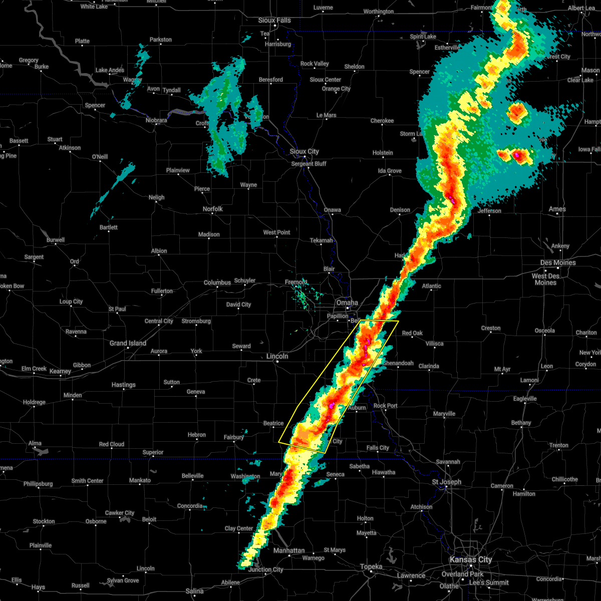 The severe thunderstorm warning for western fremont, northwestern montgomery, mills, southwestern pottawattamie, eastern sarpy, johnson, northwestern nemaha, otoe, pawnee, southeastern gage and eastern cass counties will expire at 445 pm cst, the storm which prompted the warning has weakened below severe limits, and no longer poses an immediate threat to life or property. therefore, the warning will be allowed to expire. however small hail and gusty winds are still possible with this thunderstorm. a tornado watch remains in effect until 1000 pm cst for southwestern iowa. a tornado watch also remains in effect until 1000 pm cst for southeastern nebraska. The severe thunderstorm warning for western fremont, northwestern montgomery, mills, southwestern pottawattamie, eastern sarpy, johnson, northwestern nemaha, otoe, pawnee, southeastern gage and eastern cass counties will expire at 445 pm cst, the storm which prompted the warning has weakened below severe limits, and no longer poses an immediate threat to life or property. therefore, the warning will be allowed to expire. however small hail and gusty winds are still possible with this thunderstorm. a tornado watch remains in effect until 1000 pm cst for southwestern iowa. a tornado watch also remains in effect until 1000 pm cst for southeastern nebraska.
|
| 3/6/2017 4:31 PM CST |
 At 430 pm cst, a severe thunderstorm was located over pacific junction, or 20 miles southeast of omaha, moving northeast at 60 mph. another severe thunderstorm was located just southwest of tecumseh, also moving northeast at 60 mph (radar indicated). Hazards include 60 mph wind gusts and quarter size hail. Hail damage to vehicles is expected. expect wind damage to roofs, siding, and trees. locations impacted include, nebraska city, plattsmouth, glenwood, syracuse, tecumseh, malvern, pawnee city, sterling, pacific junction, murray, blue springs, johnson, cook, avoca, talmage, union, nehawka, lorton, tabor and silver city. this includes the following highways, highway 136 in nebraska between mile markers 188 and 221. highway 2 in nebraska between mile markers 487 and 508. highway 34 in iowa between mile markers 1 and 23. highway 59 in iowa near mile marker 37. highway 75 in nebraska between mile markers 39 and 73. highway 77 in nebraska near mile marker 10. interstate 29 between mile markers 10 and 39. a tornado watch remains in effect until 1000 pm cst for southwestern iowa. A tornado watch also remains in effect until 1000 pm cst for southeastern nebraska. At 430 pm cst, a severe thunderstorm was located over pacific junction, or 20 miles southeast of omaha, moving northeast at 60 mph. another severe thunderstorm was located just southwest of tecumseh, also moving northeast at 60 mph (radar indicated). Hazards include 60 mph wind gusts and quarter size hail. Hail damage to vehicles is expected. expect wind damage to roofs, siding, and trees. locations impacted include, nebraska city, plattsmouth, glenwood, syracuse, tecumseh, malvern, pawnee city, sterling, pacific junction, murray, blue springs, johnson, cook, avoca, talmage, union, nehawka, lorton, tabor and silver city. this includes the following highways, highway 136 in nebraska between mile markers 188 and 221. highway 2 in nebraska between mile markers 487 and 508. highway 34 in iowa between mile markers 1 and 23. highway 59 in iowa near mile marker 37. highway 75 in nebraska between mile markers 39 and 73. highway 77 in nebraska near mile marker 10. interstate 29 between mile markers 10 and 39. a tornado watch remains in effect until 1000 pm cst for southwestern iowa. A tornado watch also remains in effect until 1000 pm cst for southeastern nebraska.
|
| 3/6/2017 4:19 PM CST |
 At 419 pm cst, a severe thunderstorm was located over murray, or 23 miles south of omaha, moving northeast at 95 mph (radar indicated). Hazards include 60 mph wind gusts and quarter size hail. Hail damage to vehicles is expected. expect wind damage to roofs, siding, and trees. locations impacted include, nebraska city, plattsmouth, glenwood, syracuse, tecumseh, malvern, pawnee city, sterling, pacific junction, murray, blue springs, johnson, cook, avoca, talmage, union, nehawka, lorton, tabor and silver city. this includes the following highways, highway 136 in nebraska between mile markers 188 and 221. highway 2 in nebraska between mile markers 487 and 508. highway 34 in iowa between mile markers 1 and 23. highway 59 in iowa near mile marker 37. highway 75 in nebraska between mile markers 39 and 73. highway 77 in nebraska near mile marker 10. interstate 29 between mile markers 10 and 39. a tornado watch remains in effect until 1000 pm cst for southwestern iowa. A tornado watch also remains in effect until 1000 pm cst for southeastern nebraska. At 419 pm cst, a severe thunderstorm was located over murray, or 23 miles south of omaha, moving northeast at 95 mph (radar indicated). Hazards include 60 mph wind gusts and quarter size hail. Hail damage to vehicles is expected. expect wind damage to roofs, siding, and trees. locations impacted include, nebraska city, plattsmouth, glenwood, syracuse, tecumseh, malvern, pawnee city, sterling, pacific junction, murray, blue springs, johnson, cook, avoca, talmage, union, nehawka, lorton, tabor and silver city. this includes the following highways, highway 136 in nebraska between mile markers 188 and 221. highway 2 in nebraska between mile markers 487 and 508. highway 34 in iowa between mile markers 1 and 23. highway 59 in iowa near mile marker 37. highway 75 in nebraska between mile markers 39 and 73. highway 77 in nebraska near mile marker 10. interstate 29 between mile markers 10 and 39. a tornado watch remains in effect until 1000 pm cst for southwestern iowa. A tornado watch also remains in effect until 1000 pm cst for southeastern nebraska.
|
| 3/6/2017 4:09 PM CST |
 At 408 pm cst, a severe thunderstorm was located 5 miles north of blue springs, or 7 miles southeast of beatrice, moving northeast at 60 mph (radar indicated). Hazards include 60 mph wind gusts and quarter size hail. Hail damage to vehicles is expected. Expect wind damage to roofs, siding, and trees. At 408 pm cst, a severe thunderstorm was located 5 miles north of blue springs, or 7 miles southeast of beatrice, moving northeast at 60 mph (radar indicated). Hazards include 60 mph wind gusts and quarter size hail. Hail damage to vehicles is expected. Expect wind damage to roofs, siding, and trees.
|
| 9/16/2016 1:28 AM CDT |
 At 128 am cdt, severe thunderstorms were located along a line extending from malvern to 6 miles west of sidney, moving east at 55 mph (radar indicated). Hazards include 60 mph wind gusts. Expect damage to roofs. siding. and trees. locations impacted include, red oak, glenwood, shenandoah, villisca, malvern, sidney, essex, stanton, pacific junction, emerson, elliott, tabor, thurman, randolph, hastings, grant, yorktown, imogene, coburg and viking lake state park. this includes the following highways, highway 34 in iowa between mile markers 6 and 48. highway 59 in iowa between mile markers 13 and 37. Interstate 29 between mile markers 17 and 27. At 128 am cdt, severe thunderstorms were located along a line extending from malvern to 6 miles west of sidney, moving east at 55 mph (radar indicated). Hazards include 60 mph wind gusts. Expect damage to roofs. siding. and trees. locations impacted include, red oak, glenwood, shenandoah, villisca, malvern, sidney, essex, stanton, pacific junction, emerson, elliott, tabor, thurman, randolph, hastings, grant, yorktown, imogene, coburg and viking lake state park. this includes the following highways, highway 34 in iowa between mile markers 6 and 48. highway 59 in iowa between mile markers 13 and 37. Interstate 29 between mile markers 17 and 27.
|
| 9/16/2016 1:15 AM CDT |
 At 115 am cdt, severe thunderstorms were located along a line extending from near glenwood to near union, moving east at 50 mph (radar indicated). Hazards include 60 mph wind gusts. Expect damage to roofs. siding. And trees. At 115 am cdt, severe thunderstorms were located along a line extending from near glenwood to near union, moving east at 50 mph (radar indicated). Hazards include 60 mph wind gusts. Expect damage to roofs. siding. And trees.
|
| 9/16/2016 1:15 AM CDT |
 The national weather service in omaha has issued a * severe thunderstorm warning for. montgomery county in southwestern iowa. northern fremont county in southwestern iowa. northwestern page county in southwestern iowa. Mills county in southwestern iowa. The national weather service in omaha has issued a * severe thunderstorm warning for. montgomery county in southwestern iowa. northern fremont county in southwestern iowa. northwestern page county in southwestern iowa. Mills county in southwestern iowa.
|
| 9/16/2016 1:03 AM CDT |
 At 103 am cdt, severe thunderstorms were located along a line extending from near offutt afb to 3 miles west of avoca, moving east at 50 mph (radar indicated). Hazards include 60 mph wind gusts. Expect damage to roofs. siding. and trees. locations impacted include, bellevue, plattsmouth, glenwood, malvern, weeping water, pacific junction, murray, cedar creek, avoca, union, nehawka, offutt afb, tabor, silver city, thurman, manley and camp maha. this includes the following highways, highway 34 in iowa between mile markers 1 and 17. highway 75 in nebraska between mile markers 59 and 79. Interstate 29 between mile markers 17 and 42. At 103 am cdt, severe thunderstorms were located along a line extending from near offutt afb to 3 miles west of avoca, moving east at 50 mph (radar indicated). Hazards include 60 mph wind gusts. Expect damage to roofs. siding. and trees. locations impacted include, bellevue, plattsmouth, glenwood, malvern, weeping water, pacific junction, murray, cedar creek, avoca, union, nehawka, offutt afb, tabor, silver city, thurman, manley and camp maha. this includes the following highways, highway 34 in iowa between mile markers 1 and 17. highway 75 in nebraska between mile markers 59 and 79. Interstate 29 between mile markers 17 and 42.
|
| 9/16/2016 12:51 AM CDT |
 At 1251 am cdt, severe thunderstorms were located along a line extending from near ashland to lincoln, moving east at 50 mph (radar indicated). Hazards include 60 mph wind gusts. Expect damage to roofs. siding. And trees. At 1251 am cdt, severe thunderstorms were located along a line extending from near ashland to lincoln, moving east at 50 mph (radar indicated). Hazards include 60 mph wind gusts. Expect damage to roofs. siding. And trees.
|
| 7/7/2016 3:05 AM CDT |
 At 305 am cdt, a severe thunderstorm was located over nebraska city, or 30 miles northwest of tarkio, moving east at 40 mph (radar indicated). Hazards include 60 mph wind gusts and quarter size hail. Hail damage to vehicles is expected. expect wind damage to roofs, siding and trees. Locations impacted include, nebraska city, syracuse, hamburg, sidney, riverton, avoca, union, lorton, thurman, dunbar, otoe, camp catron and waubonsie state park. At 305 am cdt, a severe thunderstorm was located over nebraska city, or 30 miles northwest of tarkio, moving east at 40 mph (radar indicated). Hazards include 60 mph wind gusts and quarter size hail. Hail damage to vehicles is expected. expect wind damage to roofs, siding and trees. Locations impacted include, nebraska city, syracuse, hamburg, sidney, riverton, avoca, union, lorton, thurman, dunbar, otoe, camp catron and waubonsie state park.
|
| 7/7/2016 2:42 AM CDT | The severe thunderstorm warning for northwestern fremont, western mills, southwestern pottawattamie, cass and southeastern sarpy counties will expire at 245 am cdt, the severe thunderstorm which prompted the warning has weakened. therefore, the warning will be allowed to expire. however gusty winds will still be possible with this thunderstorm. a severe thunderstorm watch remains in effect until 900 am cdt for southwestern iowa, and southeastern and east central nebraska. |
| 7/7/2016 2:42 AM CDT | The severe thunderstorm warning for northwestern fremont, western mills, southwestern pottawattamie, cass and southeastern sarpy counties will expire at 245 am cdt, the severe thunderstorm which prompted the warning has weakened. therefore, the warning will be allowed to expire. however gusty winds will still be possible with this thunderstorm. a severe thunderstorm watch remains in effect until 900 am cdt for southwestern iowa, and southeastern and east central nebraska. |
| 7/7/2016 2:36 AM CDT |
 At 236 am cdt, a severe thunderstorm was located 4 miles southeast of pacific junction, or 24 miles southeast of omaha, moving east at 35 mph (radar indicated). Hazards include 60 mph wind gusts and nickel size hail. Expect damage to roofs. siding and trees. Locations impacted include, bellevue, plattsmouth, glenwood, malvern, louisville, weeping water, elmwood, pacific junction, murray, cedar creek, union, nehawka, offutt afb, tabor, silver city, thurman, manley, randolph, camp maha and louisville state recreation area. At 236 am cdt, a severe thunderstorm was located 4 miles southeast of pacific junction, or 24 miles southeast of omaha, moving east at 35 mph (radar indicated). Hazards include 60 mph wind gusts and nickel size hail. Expect damage to roofs. siding and trees. Locations impacted include, bellevue, plattsmouth, glenwood, malvern, louisville, weeping water, elmwood, pacific junction, murray, cedar creek, union, nehawka, offutt afb, tabor, silver city, thurman, manley, randolph, camp maha and louisville state recreation area.
|
| 7/7/2016 2:35 AM CDT |
 At 235 am cdt, a severe thunderstorm was located near unadilla, or 25 miles southeast of lincoln, moving east at 40 mph (radar indicated). Hazards include 60 mph wind gusts and quarter size hail. Hail damage to vehicles is expected. Expect wind damage to roofs, siding and trees. At 235 am cdt, a severe thunderstorm was located near unadilla, or 25 miles southeast of lincoln, moving east at 40 mph (radar indicated). Hazards include 60 mph wind gusts and quarter size hail. Hail damage to vehicles is expected. Expect wind damage to roofs, siding and trees.
|
| 7/7/2016 2:31 AM CDT |
 At 229 am cdt, a severe thunderstorm was located near pacific junction, or 22 miles southeast of omaha, moving east at 35 mph (radar indicated). Hazards include 60 mph wind gusts and nickel size hail. Expect damage to roofs. siding and trees. Locations impacted include, southwestern council bluffs, bellevue, papillion, la vista, plattsmouth, glenwood, gretna, springfield, malvern, louisville, weeping water, elmwood, pacific junction, murray, cedar creek, murdock, union, nehawka, offutt afb and tabor. At 229 am cdt, a severe thunderstorm was located near pacific junction, or 22 miles southeast of omaha, moving east at 35 mph (radar indicated). Hazards include 60 mph wind gusts and nickel size hail. Expect damage to roofs. siding and trees. Locations impacted include, southwestern council bluffs, bellevue, papillion, la vista, plattsmouth, glenwood, gretna, springfield, malvern, louisville, weeping water, elmwood, pacific junction, murray, cedar creek, murdock, union, nehawka, offutt afb and tabor.
|
| 7/7/2016 2:20 AM CDT |
 At 219 am cdt, a severe thunderstorm was located near plattsmouth, or 16 miles south of omaha, moving east at 35 mph. the potential severe part of these storms also extended back to the west toward murdock and gretna (radar indicated). Hazards include 60 mph wind gusts and quarter size hail. Hail damage to vehicles is expected. expect wind damage to roofs, siding and trees. Locations impacted include, southern omaha, council bluffs, bellevue, papillion, la vista, plattsmouth, ralston, glenwood, gretna, springfield, malvern, louisville, weeping water, treynor, elmwood, pacific junction, murray, cedar creek, murdock and union. At 219 am cdt, a severe thunderstorm was located near plattsmouth, or 16 miles south of omaha, moving east at 35 mph. the potential severe part of these storms also extended back to the west toward murdock and gretna (radar indicated). Hazards include 60 mph wind gusts and quarter size hail. Hail damage to vehicles is expected. expect wind damage to roofs, siding and trees. Locations impacted include, southern omaha, council bluffs, bellevue, papillion, la vista, plattsmouth, ralston, glenwood, gretna, springfield, malvern, louisville, weeping water, treynor, elmwood, pacific junction, murray, cedar creek, murdock and union.
|
| 7/7/2016 2:12 AM CDT |
 At 212 am cdt, a severe thunderstorm was located 4 miles east of cedar creek, or 15 miles south of omaha, moving east at 35 mph (radar indicated). Hazards include 60 mph wind gusts and quarter size hail. Hail damage to vehicles is expected. expect wind damage to roofs, siding and trees. Locations impacted include, southern omaha, council bluffs, bellevue, papillion, la vista, plattsmouth, ralston, glenwood, gretna, springfield, malvern, louisville, weeping water, treynor, elmwood, pacific junction, murray, cedar creek, murdock and union. At 212 am cdt, a severe thunderstorm was located 4 miles east of cedar creek, or 15 miles south of omaha, moving east at 35 mph (radar indicated). Hazards include 60 mph wind gusts and quarter size hail. Hail damage to vehicles is expected. expect wind damage to roofs, siding and trees. Locations impacted include, southern omaha, council bluffs, bellevue, papillion, la vista, plattsmouth, ralston, glenwood, gretna, springfield, malvern, louisville, weeping water, treynor, elmwood, pacific junction, murray, cedar creek, murdock and union.
|
| 7/7/2016 2:02 AM CDT |
 At 202 am cdt, a severe thunderstorm was located over cedar creek, or 16 miles south of omaha, moving east at 35 mph (radar indicated). Hazards include 60 mph wind gusts and quarter size hail. Hail damage to vehicles is expected. Expect wind damage to roofs, siding and trees. At 202 am cdt, a severe thunderstorm was located over cedar creek, or 16 miles south of omaha, moving east at 35 mph (radar indicated). Hazards include 60 mph wind gusts and quarter size hail. Hail damage to vehicles is expected. Expect wind damage to roofs, siding and trees.
|
| 9/18/2015 9:48 AM CDT |
 At 948 am cdt, a severe thunderstorm was located over riverton, or 18 miles northwest of tarkio, moving northeast at 45 mph (radar indicated). Hazards include quarter size hail. Damage to vehicles is expected. locations impacted include, nebraska city, hamburg, sidney, farragut, riverton, union, nehawka, lorton, thurman, dunbar, camp catron and waubonsie state park. this includes the following highways, highway 2 in nebraska between mile markers 496 and 508. highway 59 in iowa between mile markers 1 and 10. highway 75 in nebraska between mile markers 39 and 59. Interstate 29 between mile markers 1 and 20. At 948 am cdt, a severe thunderstorm was located over riverton, or 18 miles northwest of tarkio, moving northeast at 45 mph (radar indicated). Hazards include quarter size hail. Damage to vehicles is expected. locations impacted include, nebraska city, hamburg, sidney, farragut, riverton, union, nehawka, lorton, thurman, dunbar, camp catron and waubonsie state park. this includes the following highways, highway 2 in nebraska between mile markers 496 and 508. highway 59 in iowa between mile markers 1 and 10. highway 75 in nebraska between mile markers 39 and 59. Interstate 29 between mile markers 1 and 20.
|
| 9/18/2015 9:36 AM CDT |
 At 935 am cdt, a severe thunderstorm was located 4 miles west of hamburg, or 21 miles northwest of tarkio, moving northeast at 50 mph (radar indicated). Hazards include quarter size hail. damage to vehicles is expected At 935 am cdt, a severe thunderstorm was located 4 miles west of hamburg, or 21 miles northwest of tarkio, moving northeast at 50 mph (radar indicated). Hazards include quarter size hail. damage to vehicles is expected
|
| 9/6/2015 10:42 PM CDT | The severe thunderstorm warning for fremont, southeastern cass and northeastern otoe counties will expire at 1045 pm cdt, the storm which prompted the warning has weakened below severe limits, and no longer poses an immediate threat to life or property. therefore the warning will be allowed to expire. however gusty winds and heavy rain are still possible with this thunderstorm. a severe thunderstorm watch remains in effect until 100 am cdt for southwestern iowa and southeastern nebraska. |
| 9/6/2015 10:42 PM CDT | The severe thunderstorm warning for fremont, southeastern cass and northeastern otoe counties will expire at 1045 pm cdt, the storm which prompted the warning has weakened below severe limits, and no longer poses an immediate threat to life or property. therefore the warning will be allowed to expire. however gusty winds and heavy rain are still possible with this thunderstorm. a severe thunderstorm watch remains in effect until 100 am cdt for southwestern iowa and southeastern nebraska. |
| 9/6/2015 10:05 PM CDT |
 At 1004 pm cdt, a severe thunderstorm was located near union, or 33 miles south of omaha, moving east at 30 mph (trained spotters reported 60 mph winds with this storm). Hazards include 60 mph wind gusts. Expect damage to roofs. Siding and trees. At 1004 pm cdt, a severe thunderstorm was located near union, or 33 miles south of omaha, moving east at 30 mph (trained spotters reported 60 mph winds with this storm). Hazards include 60 mph wind gusts. Expect damage to roofs. Siding and trees.
|
| 8/22/2015 7:16 PM CDT |
 At 716 pm cdt, severe thunderstorms were located along a line extending from near griswold to 9 miles southwest of malvern, moving east at 35 mph (radar indicated). Hazards include 60 mph wind gusts and quarter size hail. Hail damage to vehicles is expected. expect wind damage to roofs, siding and trees. locations impacted include, malvern, emerson, macedonia, tabor, thurman, henderson, hastings and farm creek public wildlife area. this includes the following highways, highway 34 in iowa between mile markers 14 and 27. highway 59 in iowa between mile markers 31 and 41. A tornado watch remains in effect until midnight cdt for southwestern iowa. At 716 pm cdt, severe thunderstorms were located along a line extending from near griswold to 9 miles southwest of malvern, moving east at 35 mph (radar indicated). Hazards include 60 mph wind gusts and quarter size hail. Hail damage to vehicles is expected. expect wind damage to roofs, siding and trees. locations impacted include, malvern, emerson, macedonia, tabor, thurman, henderson, hastings and farm creek public wildlife area. this includes the following highways, highway 34 in iowa between mile markers 14 and 27. highway 59 in iowa between mile markers 31 and 41. A tornado watch remains in effect until midnight cdt for southwestern iowa.
|
| 8/22/2015 7:02 PM CDT |
 At 702 pm cdt, severe thunderstorms were located along a line extending from near carson to near murray, moving east at 35 mph (radar indicated). Hazards include 60 mph wind gusts and quarter size hail. Hail damage to vehicles is expected. expect wind damage to roofs, siding and trees. locations impacted include, glenwood, malvern, carson, pacific junction, murray, emerson, macedonia, tabor, silver city, thurman, henderson, hastings, farm creek public wildlife area and old town park. this includes the following highways, highway 34 in iowa between mile markers 1 and 3, and between mile markers 9 and 27. highway 59 in iowa between mile markers 31 and 48. interstate 29 between mile markers 20 and 32. A tornado watch remains in effect until midnight cdt for southwestern iowa and southeastern nebraska. At 702 pm cdt, severe thunderstorms were located along a line extending from near carson to near murray, moving east at 35 mph (radar indicated). Hazards include 60 mph wind gusts and quarter size hail. Hail damage to vehicles is expected. expect wind damage to roofs, siding and trees. locations impacted include, glenwood, malvern, carson, pacific junction, murray, emerson, macedonia, tabor, silver city, thurman, henderson, hastings, farm creek public wildlife area and old town park. this includes the following highways, highway 34 in iowa between mile markers 1 and 3, and between mile markers 9 and 27. highway 59 in iowa between mile markers 31 and 48. interstate 29 between mile markers 20 and 32. A tornado watch remains in effect until midnight cdt for southwestern iowa and southeastern nebraska.
|
| 8/22/2015 6:50 PM CDT |
 At 649 pm cdt, severe thunderstorms were located along a line extending from near carson to near murray, moving east at 35 mph (radar indicated). Hazards include 60 mph wind gusts and quarter size hail. Hail damage to vehicles is expected. Expect wind damage to roofs, siding and trees. At 649 pm cdt, severe thunderstorms were located along a line extending from near carson to near murray, moving east at 35 mph (radar indicated). Hazards include 60 mph wind gusts and quarter size hail. Hail damage to vehicles is expected. Expect wind damage to roofs, siding and trees.
|
| 7/24/2015 8:08 PM CDT |
 At 807 pm cdt, severe thunderstorms were located along a line extending from malvern to 8 miles east of union, moving southeast at 25 mph (radar indicated). Hazards include 60 mph wind gusts. Expect damage to roofs. siding and trees. Locations impacted include, malvern, tabor, thurman and randolph. At 807 pm cdt, severe thunderstorms were located along a line extending from malvern to 8 miles east of union, moving southeast at 25 mph (radar indicated). Hazards include 60 mph wind gusts. Expect damage to roofs. siding and trees. Locations impacted include, malvern, tabor, thurman and randolph.
|
| 7/24/2015 7:53 PM CDT |
 At 753 pm cdt, severe thunderstorms were located along a line extending from glenwood to near murray, moving southeast at 25 mph (radar indicated). Hazards include 60 mph wind gusts. Expect damage to roofs. siding and trees. Locations impacted include, glenwood, malvern, pacific junction, murray, tabor, thurman and randolph. At 753 pm cdt, severe thunderstorms were located along a line extending from glenwood to near murray, moving southeast at 25 mph (radar indicated). Hazards include 60 mph wind gusts. Expect damage to roofs. siding and trees. Locations impacted include, glenwood, malvern, pacific junction, murray, tabor, thurman and randolph.
|
| 7/24/2015 7:46 PM CDT |
 At 746 pm cdt, a severe thunderstorm was located over plattsmouth, or 20 miles southeast of omaha, moving southeast at 25 mph (radar indicated). Hazards include 60 mph wind gusts. Expect damage to roofs. Siding and trees. At 746 pm cdt, a severe thunderstorm was located over plattsmouth, or 20 miles southeast of omaha, moving southeast at 25 mph (radar indicated). Hazards include 60 mph wind gusts. Expect damage to roofs. Siding and trees.
|
| 7/16/2015 12:12 AM CDT | The severe thunderstorm warning for fremont, central nemaha and eastern otoe counties will expire at 1215 am cdt, the storms which prompted the warning have weakened below severe limits, and no longer pose an immediate threat to life or property. therefore the warning will be allowed to expire. however small hail and gusty winds are still possible with these thunderstorms especially in parts of fremont county. |
| 7/16/2015 12:12 AM CDT | The severe thunderstorm warning for fremont, central nemaha and eastern otoe counties will expire at 1215 am cdt, the storms which prompted the warning have weakened below severe limits, and no longer pose an immediate threat to life or property. therefore the warning will be allowed to expire. however small hail and gusty winds are still possible with these thunderstorms especially in parts of fremont county. |
| 7/15/2015 11:56 PM CDT |
 At 1156 pm cdt, severe thunderstorms were located along a line extending from near nebraska city to peru, moving east at 45 mph (radar indicated). Hazards include 60 mph wind gusts. Expect damage to roofs. siding and trees. locations impacted include, nebraska city, shenandoah, auburn, hamburg, sidney, peru, farragut, riverton, tabor, thurman, randolph, nemaha, brownville, imogene, julian, brownville state recreation area, camp catron and waubonsie state park. this includes the following highways, highway 136 in nebraska between mile markers 230 and 240. highway 2 in nebraska between mile markers 499 and 508. highway 59 in iowa between mile markers 1 and 10. highway 75 in nebraska between mile markers 29 and 57. Interstate 29 between mile markers 1 and 20. At 1156 pm cdt, severe thunderstorms were located along a line extending from near nebraska city to peru, moving east at 45 mph (radar indicated). Hazards include 60 mph wind gusts. Expect damage to roofs. siding and trees. locations impacted include, nebraska city, shenandoah, auburn, hamburg, sidney, peru, farragut, riverton, tabor, thurman, randolph, nemaha, brownville, imogene, julian, brownville state recreation area, camp catron and waubonsie state park. this includes the following highways, highway 136 in nebraska between mile markers 230 and 240. highway 2 in nebraska between mile markers 499 and 508. highway 59 in iowa between mile markers 1 and 10. highway 75 in nebraska between mile markers 29 and 57. Interstate 29 between mile markers 1 and 20.
|
| 7/15/2015 11:45 PM CDT |
 At 1145 pm cdt, severe thunderstorms were located along a line extending from 6 miles west of nebraska city to near auburn, moving east at 45 mph (radar indicated). Hazards include 60 mph wind gusts. Expect damage to roofs. Siding and trees. At 1145 pm cdt, severe thunderstorms were located along a line extending from 6 miles west of nebraska city to near auburn, moving east at 45 mph (radar indicated). Hazards include 60 mph wind gusts. Expect damage to roofs. Siding and trees.
|
| 5/25/2015 6:55 PM CDT | The severe thunderstorm warning for southwestern mills and northwestern fremont counties will expire at 700 pm cdt, the storm which prompted the warning has moved out of the area. therefore the warning will be allowed to expire. however small hail is still possible with this thunderstorm. a severe thunderstorm watch remains in effect until 100 am cdt for southwestern iowa and southeastern nebraska. |
| 5/25/2015 6:49 PM CDT | At 648 pm cdt, a severe thunderstorm was located near union, or 32 miles south of omaha, moving northeast at 30 mph. the storm that the warning was originally for had moved farther northeast (radar indicated). Hazards include 60 mph wind gusts and half dollar size hail. Hail damage to vehicles is expected. expect wind damage to roofs, siding and trees. locations impacted include, glenwood, sidney, tabor and thurman. this includes the following highways, highway 34 in iowa near mile marker 9. Interstate 29 between mile markers 10 and 25. |
| 5/25/2015 6:39 PM CDT | At 638 pm cdt, a severe thunderstorm was located 7 miles southeast of pacific junction, or 27 miles southeast of omaha, moving north at 20 mph. another storm capable of producing hail was about 5 miles southwest of thurman, also moving northeast (radar indicated). Hazards include 60 mph wind gusts and half dollar size hail. Hail damage to vehicles is expected. expect wind damage to roofs, siding and trees. locations impacted include, glenwood, sidney, tabor, thurman, randolph and waubonsie state park. this includes the following highways, highway 34 in iowa between mile markers 9 and 11. Interstate 29 between mile markers 4 and 25. |
| 5/25/2015 6:33 PM CDT | At 633 pm cdt, a severe thunderstorm was located near malvern, or 28 miles southeast of omaha, moving northeast at 40 mph. this storm has a history of producing hail (radar indicated). Hazards include ping pong ball size hail and 60 mph wind gusts. People and animals outdoors will be injured. expect hail damage to roofs, siding, windows and vehicles. expect wind damage to roofs, siding and trees. locations impacted include, glenwood, sidney, tabor, thurman, randolph and waubonsie state park. this includes the following highways, highway 34 in iowa between mile markers 9 and 11. Interstate 29 between mile markers 4 and 25. |
| 5/25/2015 6:30 PM CDT | Quarter sized hail reported 4 miles S of Thurman, IA |
| 5/25/2015 6:26 PM CDT | At 625 pm cdt, a severe thunderstorm was located 7 miles northwest of sidney, or 33 miles northwest of tarkio, moving north at 35 mph (radar indicated). Hazards include 60 mph wind gusts and half dollar size hail. Hail damage to vehicles is expected. expect wind damage to roofs, siding and trees. locations impacted include, glenwood, sidney, tabor, thurman, randolph and waubonsie state park. this includes the following highways, highway 34 in iowa between mile markers 9 and 11. Interstate 29 between mile markers 4 and 25. |
| 5/25/2015 6:25 PM CDT | Half Dollar sized hail reported 1.8 miles ENE of Thurman, IA |
| 5/25/2015 6:18 PM CDT | At 617 pm cdt, a severe thunderstorm was located near sidney, or 27 miles northwest of tarkio, moving northeast at 30 mph. this storm produced golfball size hail near nebraska city earlier (radar indicated). Hazards include golf ball size hail and 60 mph wind gusts. People and animals outdoors will be injured. expect hail damage to roofs, siding, windows and vehicles. Expect wind damage to roofs, siding and trees. |
| 4/1/2015 11:27 PM CDT | The severe thunderstorm warning for western fremont. southeastern cass and eastern otoe counties will expire at 1130 pm cdt. the storm which prompted the warning has weakened below severe limits. and no longer pose an immediate threat to life or property. therefore the warning will be allowed to expire. However gusty winds to 50 mph are still possible with this thunderstorm. |
| 4/1/2015 11:27 PM CDT | The severe thunderstorm warning for western fremont. southeastern cass and eastern otoe counties will expire at 1130 pm cdt. the storm which prompted the warning has weakened below severe limits. and no longer pose an immediate threat to life or property. therefore the warning will be allowed to expire. However gusty winds to 50 mph are still possible with this thunderstorm. |
| 4/1/2015 11:20 PM CDT | A severe thunderstorm warning remains in effect until 1130 pm cdt for western fremont. southeastern cass and eastern otoe counties. at 1120 pm cdt. a severe thunderstorm was located near union. or 32 miles northwest of tarkio. moving east at 45 mph. hazard. 60 mph wind gusts. source. Radar indicated. |
| 4/1/2015 11:20 PM CDT | A severe thunderstorm warning remains in effect until 1130 pm cdt for western fremont. southeastern cass and eastern otoe counties. at 1120 pm cdt. a severe thunderstorm was located near union. or 32 miles northwest of tarkio. moving east at 45 mph. hazard. 60 mph wind gusts. source. Radar indicated. |
| 4/1/2015 11:15 PM CDT | A severe thunderstorm warning remains in effect until 1130 pm cdt for western fremont. southeastern cass and eastern otoe counties. at 1114 pm cdt. a severe thunderstorm was located near union. or 34 miles south of omaha. moving east at 45 mph. hazard. 60 mph wind gusts. source. Radar indicated. |
| 4/1/2015 11:15 PM CDT | A severe thunderstorm warning remains in effect until 1130 pm cdt for western fremont. southeastern cass and eastern otoe counties. at 1114 pm cdt. a severe thunderstorm was located near union. or 34 miles south of omaha. moving east at 45 mph. hazard. 60 mph wind gusts. source. Radar indicated. |
| 4/1/2015 11:05 PM CDT | The national weather service in omaha has issued a * severe thunderstorm warning for. western fremont county in southwestern iowa. southeastern cass county in southeastern nebraska. central otoe county in southeastern nebraska. Until 1130 pm cdt. |
| 4/1/2015 11:05 PM CDT | The national weather service in omaha has issued a * severe thunderstorm warning for. western fremont county in southwestern iowa. southeastern cass county in southeastern nebraska. central otoe county in southeastern nebraska. Until 1130 pm cdt. |
| 5/11/2014 9:45 PM CDT | Baseball sized hail reported 2.1 miles E of Thurman, IA |
| 5/11/2014 9:42 PM CDT | Golf Ball sized hail reported 2.1 miles E of Thurman, IA |
Hail Maps for Thurman, IA
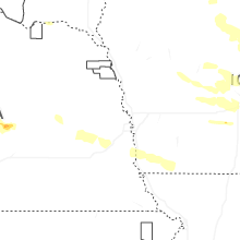
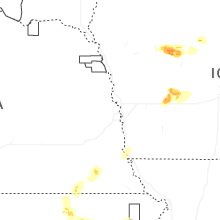

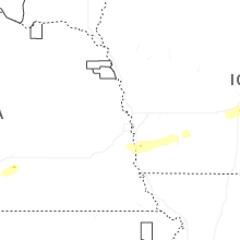


Connect with Interactive Hail Maps