

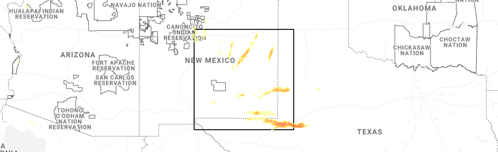
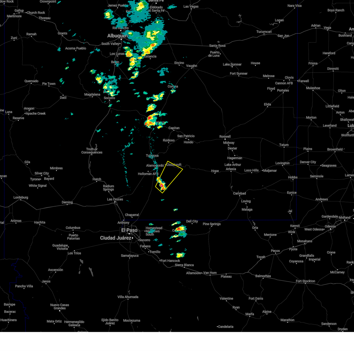
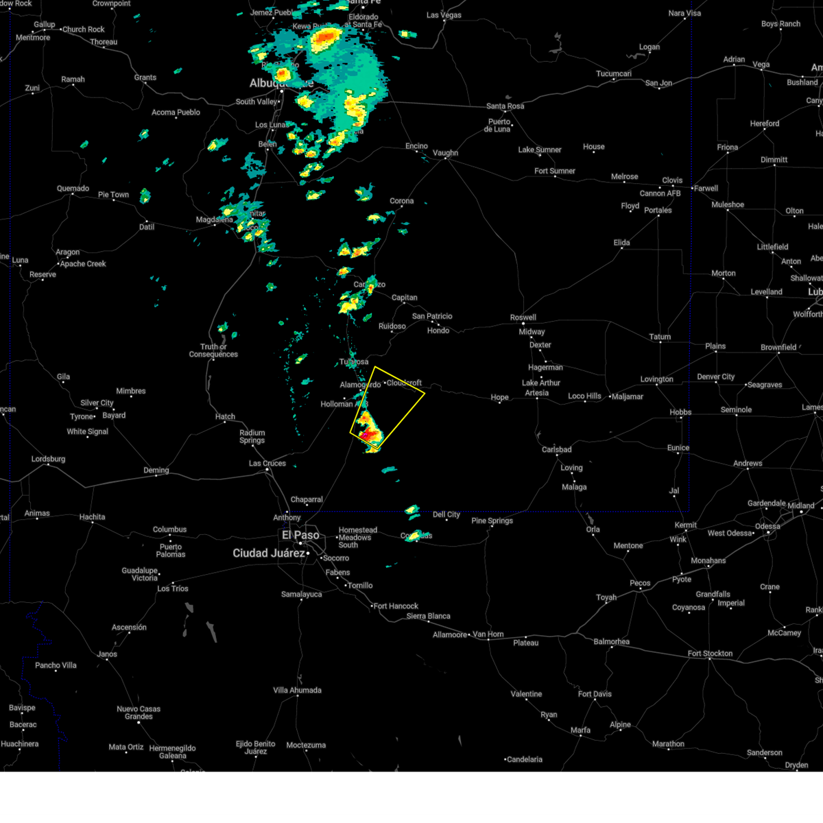
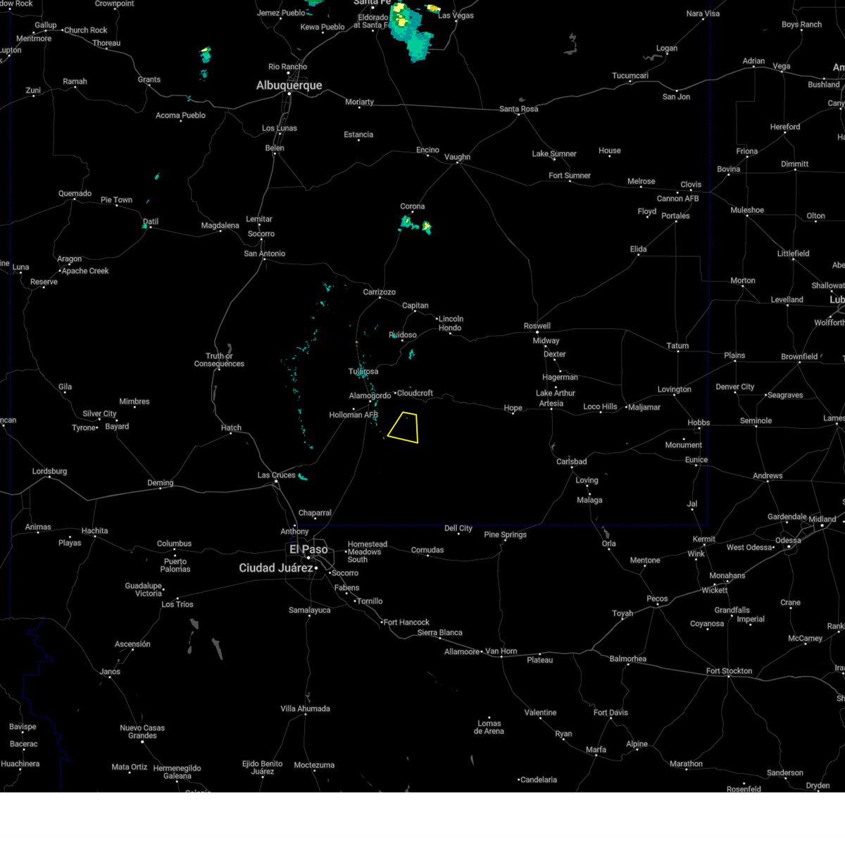
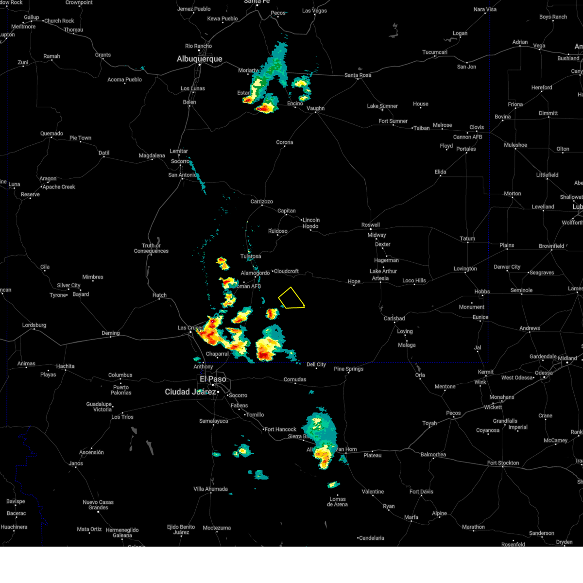
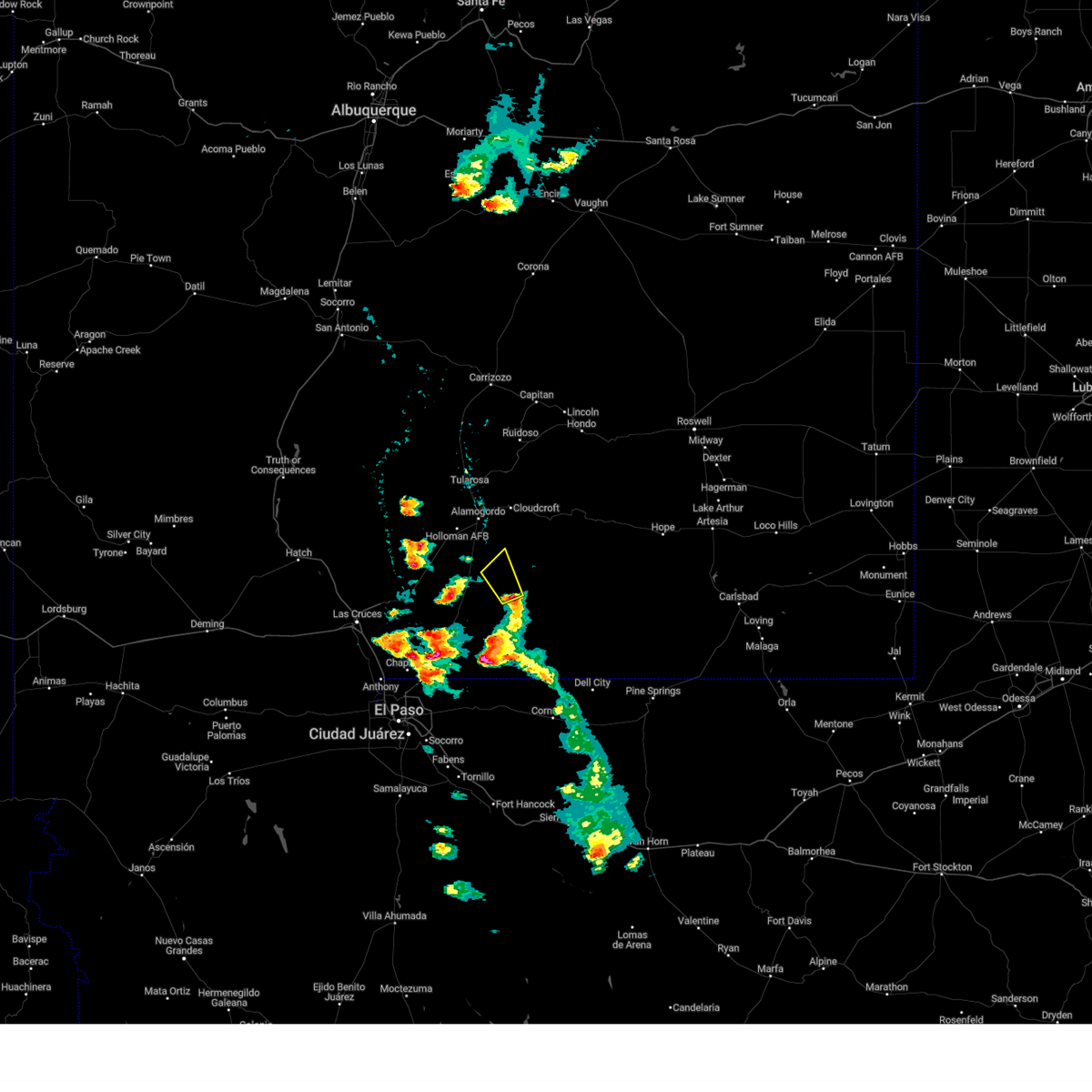
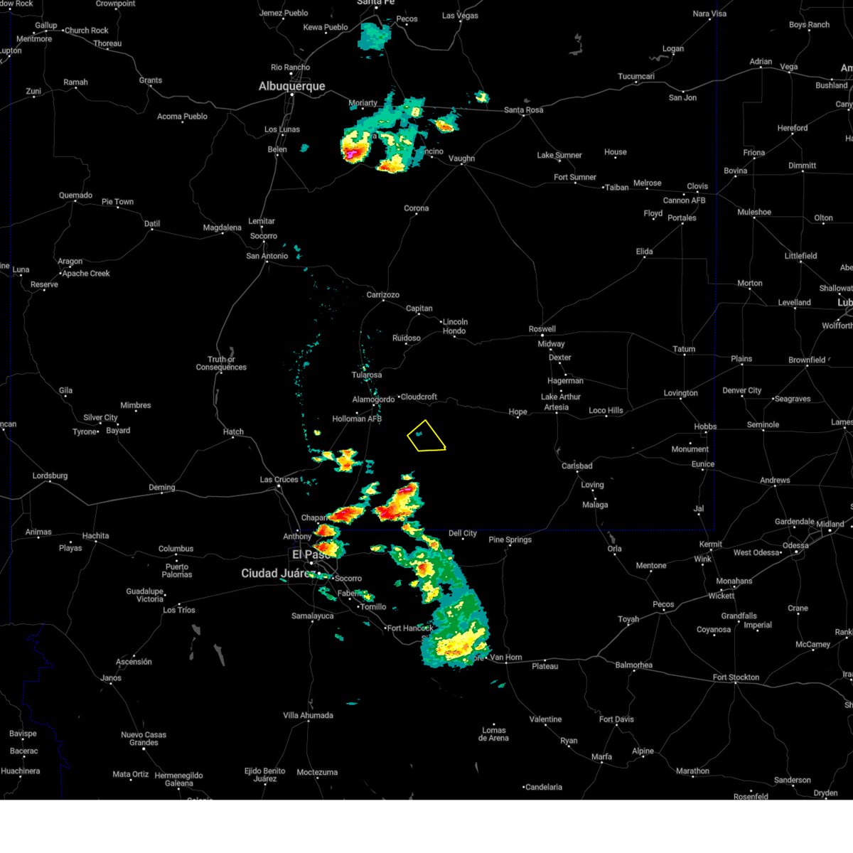
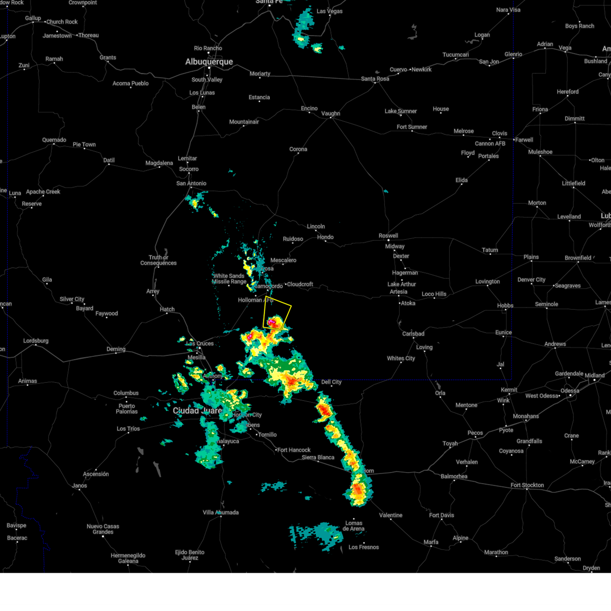
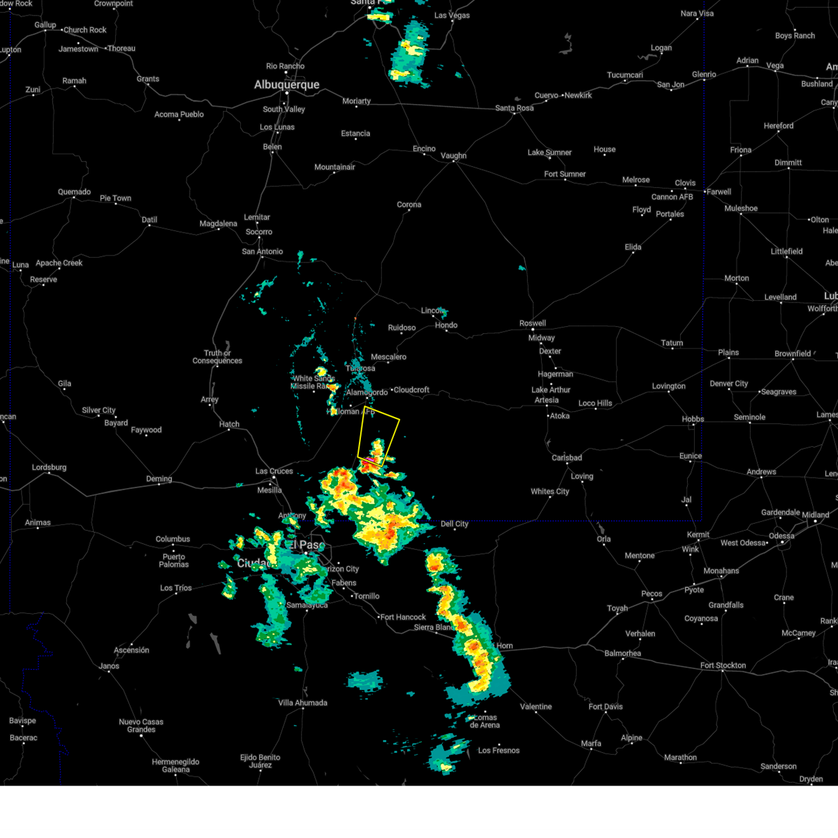
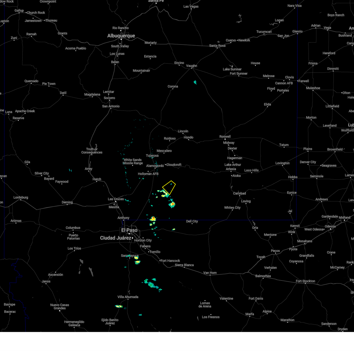
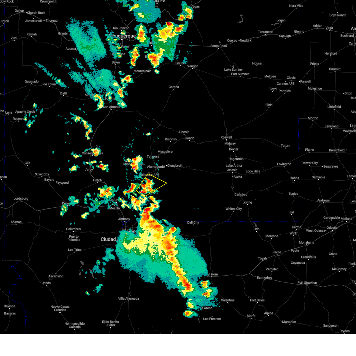
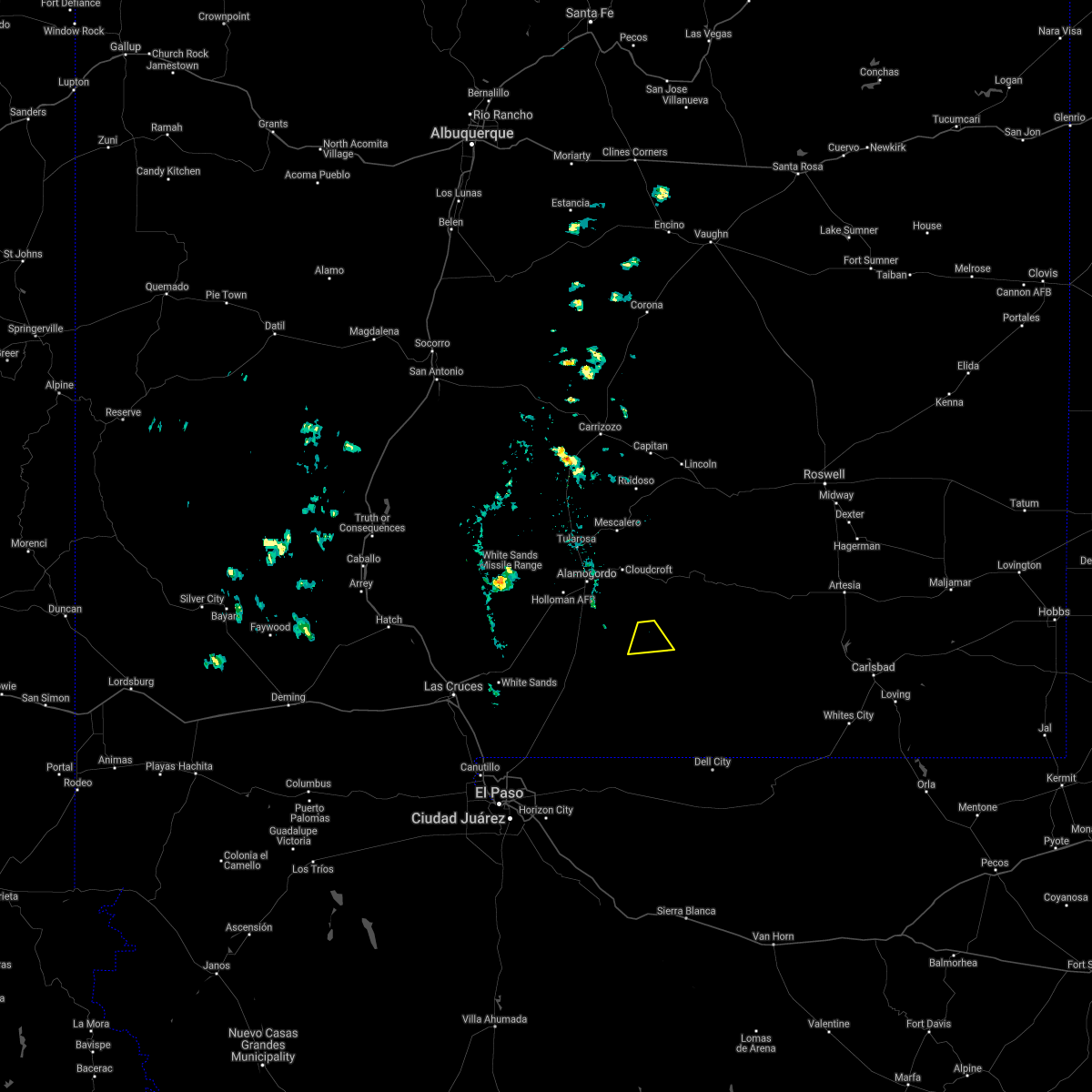
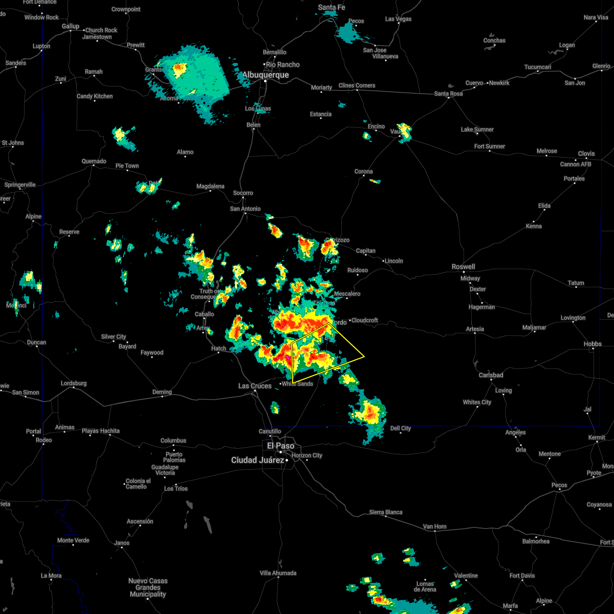
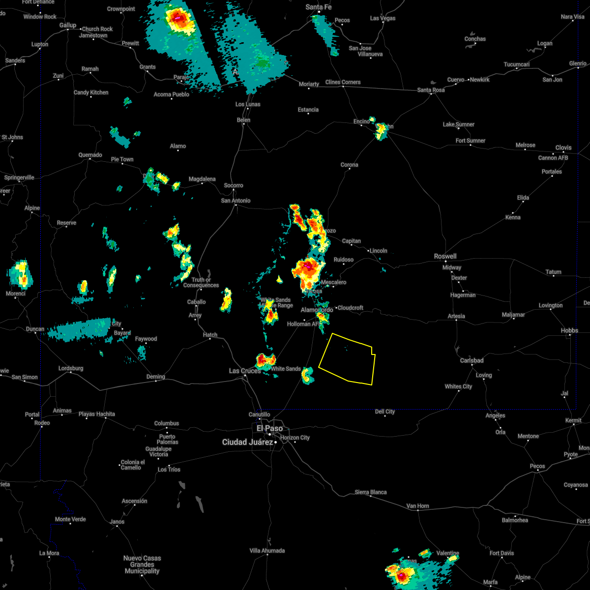
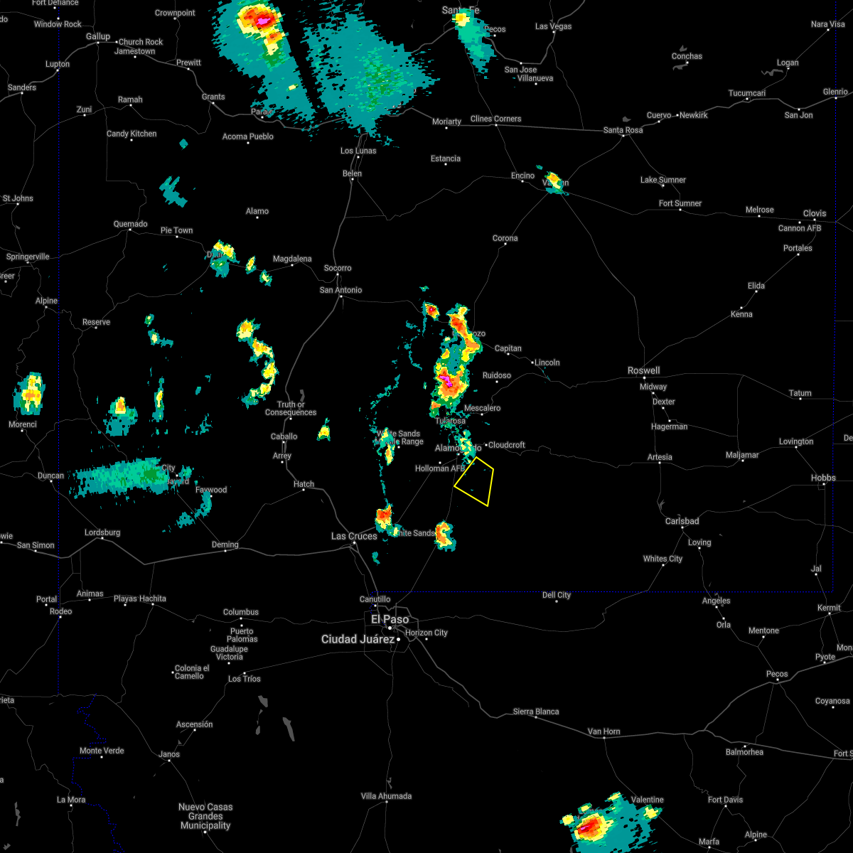
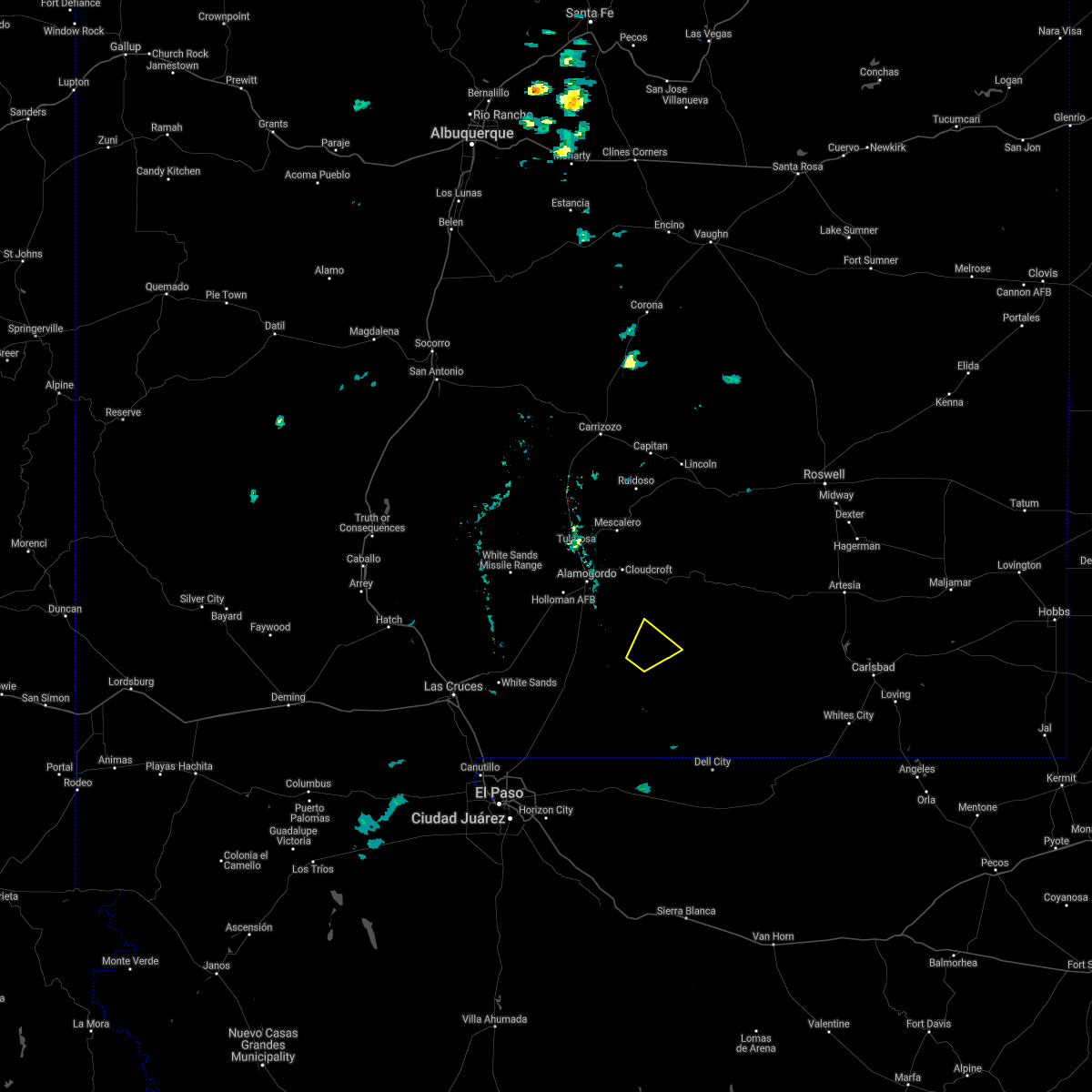
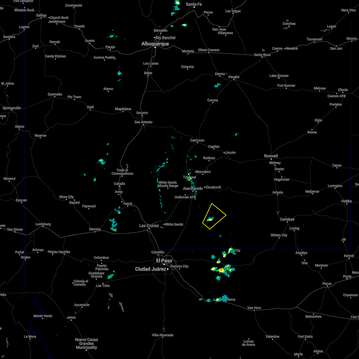
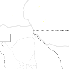
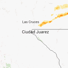
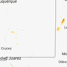
Hail Map for Timberon, NM
The Timberon, NM area has had 0 reports of on-the-ground hail by trained spotters, and has been under severe weather warnings 5 times during the past 12 months. Doppler radar has detected hail at or near Timberon, NM on 30 occasions, including 1 occasion during the past year.
| Name: | Timberon, NM |
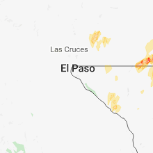
| Where Located: | 77.2 miles NE of El Paso, TX |
| Map: | Google Map for Timberon, NM |
| Population: | 348 |
| Housing Units: | 671 |
| More Info: | Search Google for Timberon, NM |
0
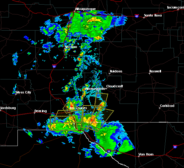
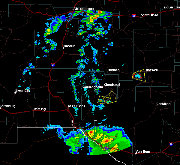
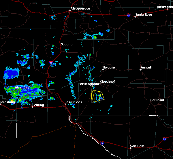
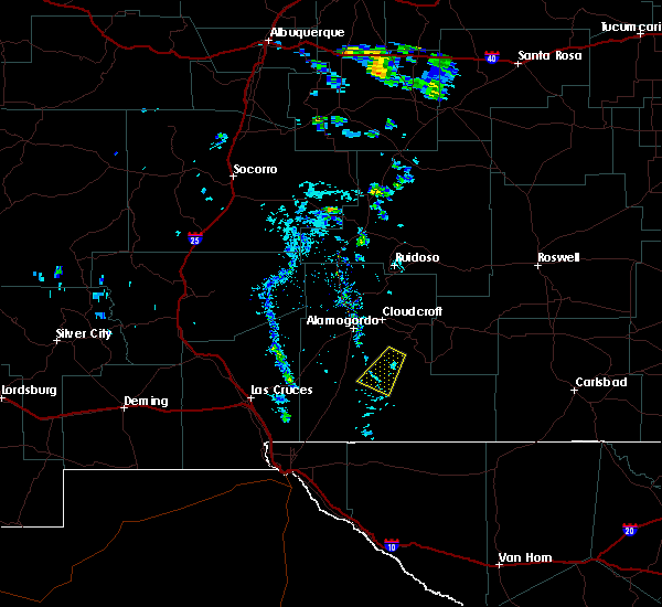
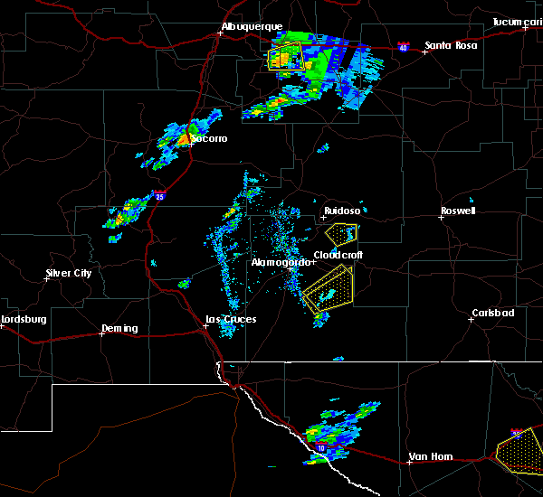
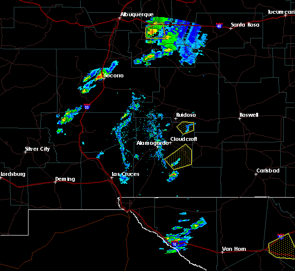
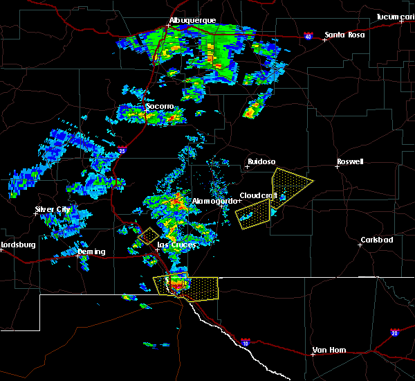
The Top Recent Hail Date for Timberon, NM is Sunday, May 4, 2025 (18th out of 30)
Hail and Wind Damage Spotted near Timberon, NM
| Date / Time | Report Details |
|---|---|
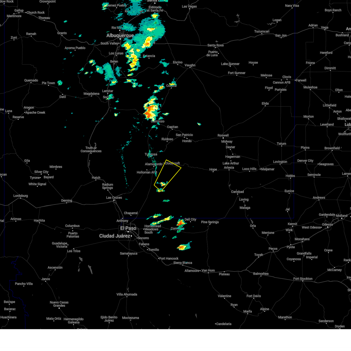
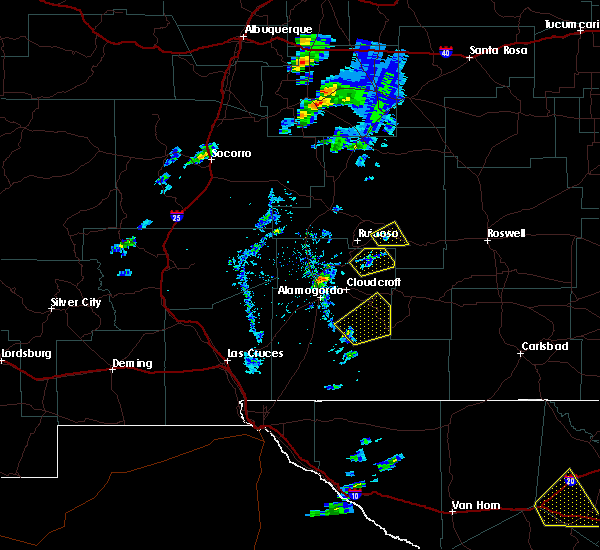
| 5/4/2025 3:43 PM MDT |
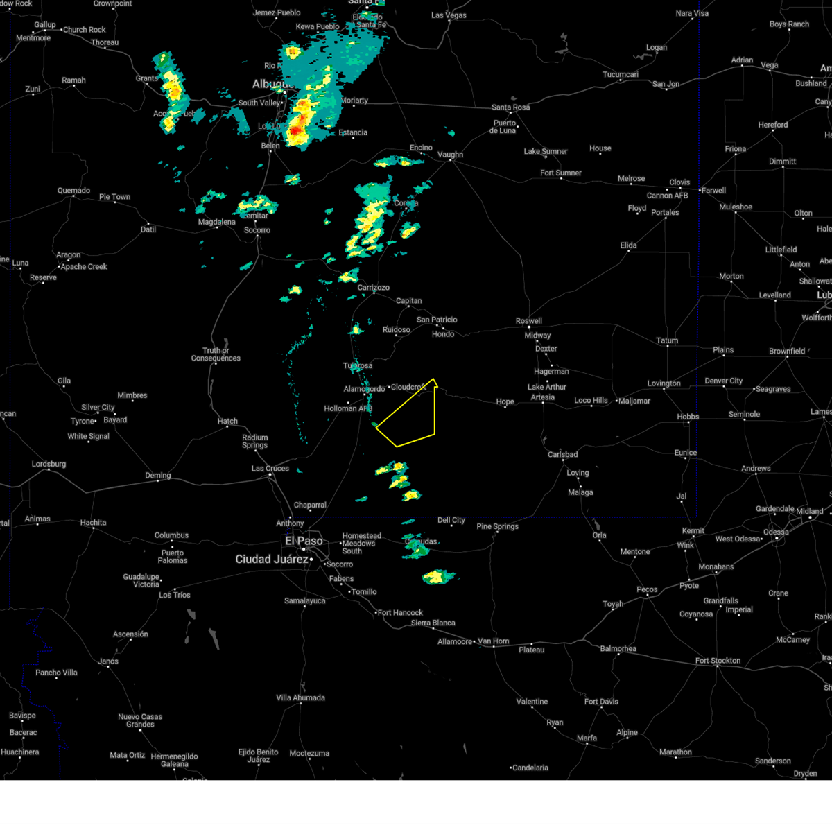 The storm which prompted the warning has moved out of the area. therefore, the warning will be allowed to expire. a severe thunderstorm watch remains in effect until 900 pm mdt for south central new mexico. The storm which prompted the warning has moved out of the area. therefore, the warning will be allowed to expire. a severe thunderstorm watch remains in effect until 900 pm mdt for south central new mexico.
|
| 5/4/2025 3:00 PM MDT |
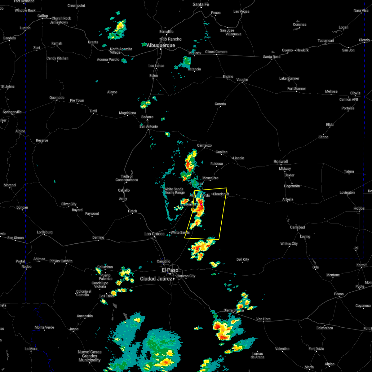
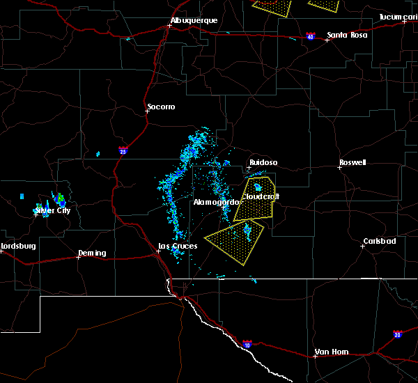
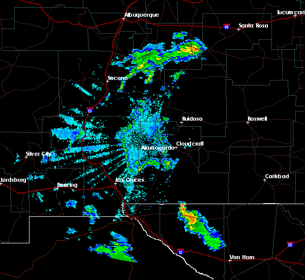
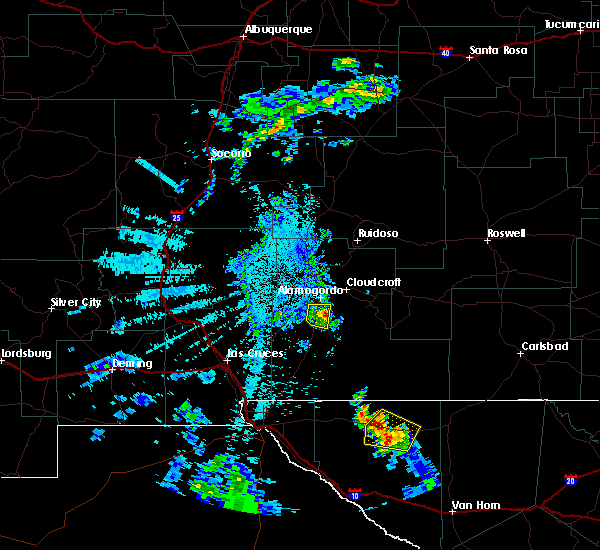
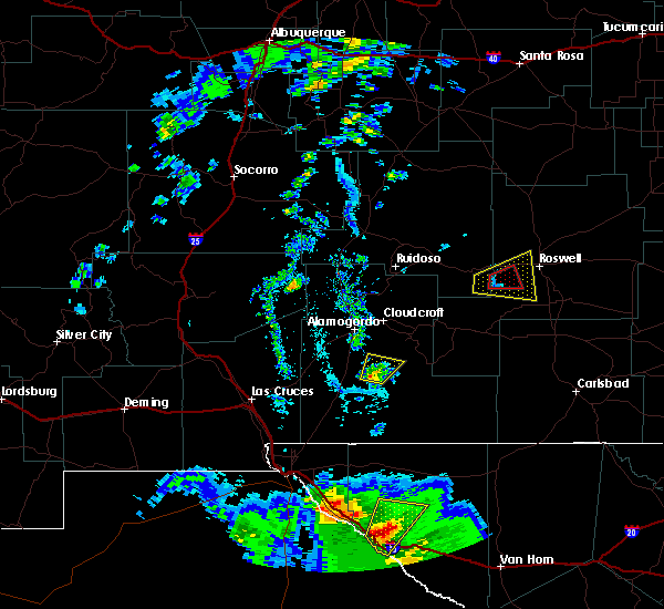
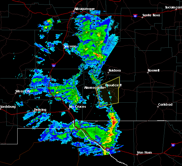
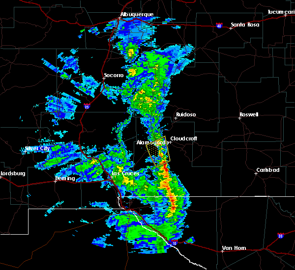
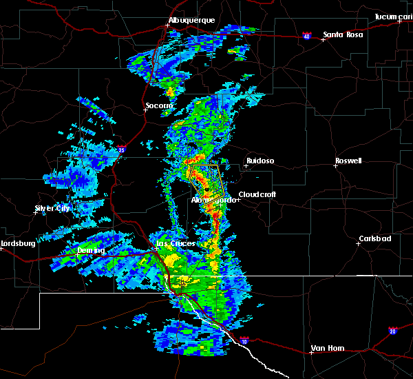
 Svrepz the national weather service in el paso has issued a * severe thunderstorm warning for, central otero county in south central new mexico, * until 345 pm mdt. * at 300 pm mdt, a severe thunderstorm was located near timberon, moving northeast at 20 mph (radar indicated). Hazards include 60 mph wind gusts and half dollar size hail. Hail damage to vehicles is expected. Expect wind damage to roofs, siding, and trees. Svrepz the national weather service in el paso has issued a * severe thunderstorm warning for, central otero county in south central new mexico, * until 345 pm mdt. * at 300 pm mdt, a severe thunderstorm was located near timberon, moving northeast at 20 mph (radar indicated). Hazards include 60 mph wind gusts and half dollar size hail. Hail damage to vehicles is expected. Expect wind damage to roofs, siding, and trees.
|
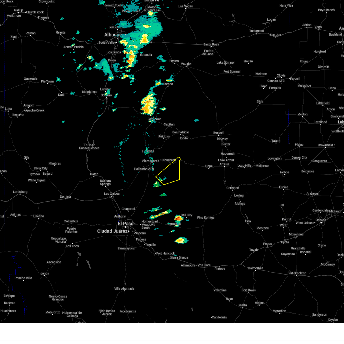
| 5/4/2025 2:54 PM MDT |
 The storm which prompted the warning has weakened below severe limits, and no longer poses an immediate threat to life or property. therefore, the warning will be allowed to expire. however, gusty winds are still possible with this thunderstorm. a severe thunderstorm watch remains in effect until 900 pm mdt for south central new mexico. The storm which prompted the warning has weakened below severe limits, and no longer poses an immediate threat to life or property. therefore, the warning will be allowed to expire. however, gusty winds are still possible with this thunderstorm. a severe thunderstorm watch remains in effect until 900 pm mdt for south central new mexico.
|
| 5/4/2025 2:38 PM MDT |
 At 238 pm mdt, a severe thunderstorm was located 6 miles west of timberon, moving northeast at 15 mph (radar indicated). Hazards include quarter size hail. Damage to vehicles is expected. Locations impacted include, benson ridge, hay canyon, sacramento, weed, cox canyon, dry canyon, james canyon, timberon, bluff springs, mayhill, sunspot, cloudcroft, and the otero mesa. At 238 pm mdt, a severe thunderstorm was located 6 miles west of timberon, moving northeast at 15 mph (radar indicated). Hazards include quarter size hail. Damage to vehicles is expected. Locations impacted include, benson ridge, hay canyon, sacramento, weed, cox canyon, dry canyon, james canyon, timberon, bluff springs, mayhill, sunspot, cloudcroft, and the otero mesa.
|
| 5/4/2025 2:16 PM MDT |
 Svrepz the national weather service in el paso has issued a * severe thunderstorm warning for, central otero county in south central new mexico, * until 300 pm mdt. * at 216 pm mdt, a severe thunderstorm was located 10 miles west of timberon, moving northeast at 30 mph (radar indicated). Hazards include quarter size hail. damage to vehicles is expected Svrepz the national weather service in el paso has issued a * severe thunderstorm warning for, central otero county in south central new mexico, * until 300 pm mdt. * at 216 pm mdt, a severe thunderstorm was located 10 miles west of timberon, moving northeast at 30 mph (radar indicated). Hazards include quarter size hail. damage to vehicles is expected
|
| 7/10/2024 12:53 PM MDT |
 Svrepz the national weather service in el paso has issued a * severe thunderstorm warning for, central otero county in south central new mexico, * until 145 pm mdt. * at 1253 pm mdt, a severe thunderstorm was located 6 miles southwest of sacramento, moving south at 10 mph (radar indicated). Hazards include 60 mph wind gusts and quarter size hail. Hail damage to vehicles is expected. Expect wind damage to roofs, siding, and trees. Svrepz the national weather service in el paso has issued a * severe thunderstorm warning for, central otero county in south central new mexico, * until 145 pm mdt. * at 1253 pm mdt, a severe thunderstorm was located 6 miles southwest of sacramento, moving south at 10 mph (radar indicated). Hazards include 60 mph wind gusts and quarter size hail. Hail damage to vehicles is expected. Expect wind damage to roofs, siding, and trees.
|
| 6/19/2024 6:10 PM MDT |
 The storm which prompted the warning has weakened below severe limits, and no longer poses an immediate threat to life or property. therefore, the warning will be allowed to expire. however, gusty winds are still possible with this thunderstorm. a severe thunderstorm watch remains in effect until 900 pm mdt for south central new mexico. The storm which prompted the warning has weakened below severe limits, and no longer poses an immediate threat to life or property. therefore, the warning will be allowed to expire. however, gusty winds are still possible with this thunderstorm. a severe thunderstorm watch remains in effect until 900 pm mdt for south central new mexico.
|
| 6/19/2024 5:55 PM MDT |
 Svrepz the national weather service in el paso has issued a * severe thunderstorm warning for, central otero county in south central new mexico, * until 645 pm mdt. * at 555 pm mdt, a severe thunderstorm was located 10 miles south of timberon, moving northwest at 20 mph (radar indicated). Hazards include 60 mph wind gusts and quarter size hail. Hail damage to vehicles is expected. Expect wind damage to roofs, siding, and trees. Svrepz the national weather service in el paso has issued a * severe thunderstorm warning for, central otero county in south central new mexico, * until 645 pm mdt. * at 555 pm mdt, a severe thunderstorm was located 10 miles south of timberon, moving northwest at 20 mph (radar indicated). Hazards include 60 mph wind gusts and quarter size hail. Hail damage to vehicles is expected. Expect wind damage to roofs, siding, and trees.
|
| 6/19/2024 5:23 PM MDT |
 Svrepz the national weather service in el paso has issued a * severe thunderstorm warning for, central otero county in south central new mexico, * until 615 pm mdt. * at 523 pm mdt, a severe thunderstorm was located 7 miles south of sacramento, moving southeast at 10 mph (radar indicated). Hazards include two inch hail and 60 mph wind gusts. People and animals outdoors will be injured. expect hail damage to roofs, siding, windows, and vehicles. Expect wind damage to roofs, siding, and trees. Svrepz the national weather service in el paso has issued a * severe thunderstorm warning for, central otero county in south central new mexico, * until 615 pm mdt. * at 523 pm mdt, a severe thunderstorm was located 7 miles south of sacramento, moving southeast at 10 mph (radar indicated). Hazards include two inch hail and 60 mph wind gusts. People and animals outdoors will be injured. expect hail damage to roofs, siding, windows, and vehicles. Expect wind damage to roofs, siding, and trees.
|
| 9/30/2023 8:29 PM MDT |
 At 829 pm mdt, a severe thunderstorm was located 6 miles southwest of sunspot, moving north at 30 mph (radar indicated). Hazards include 70 mph wind gusts and ping pong ball size hail. People and animals outdoors will be injured. expect hail damage to roofs, siding, windows, and vehicles. expect considerable tree damage. wind damage is also likely to mobile homes, roofs, and outbuildings. locations impacted include, sunspot, boles acres, and oliver lee state park. this includes highway 54 in new mexico between mile markers 53 and 54, and between mile markers 57 and 61. thunderstorm damage threat, considerable hail threat, radar indicated max hail size, 1. 50 in wind threat, radar indicated max wind gust, 70 mph. At 829 pm mdt, a severe thunderstorm was located 6 miles southwest of sunspot, moving north at 30 mph (radar indicated). Hazards include 70 mph wind gusts and ping pong ball size hail. People and animals outdoors will be injured. expect hail damage to roofs, siding, windows, and vehicles. expect considerable tree damage. wind damage is also likely to mobile homes, roofs, and outbuildings. locations impacted include, sunspot, boles acres, and oliver lee state park. this includes highway 54 in new mexico between mile markers 53 and 54, and between mile markers 57 and 61. thunderstorm damage threat, considerable hail threat, radar indicated max hail size, 1. 50 in wind threat, radar indicated max wind gust, 70 mph.
|
| 9/30/2023 8:08 PM MDT |
 At 808 pm mdt, a severe thunderstorm was located 14 miles southwest of timberon, moving north at 30 mph (radar indicated). Hazards include 70 mph wind gusts and ping pong ball size hail. People and animals outdoors will be injured. expect hail damage to roofs, siding, windows, and vehicles. expect considerable tree damage. wind damage is also likely to mobile homes, roofs, and outbuildings. locations impacted include, timberon, sunspot, boles acres, oliver lee state park, and the otero mesa. this includes highway 54 in new mexico near mile marker 40, and between mile markers 42 and 61. thunderstorm damage threat, considerable hail threat, radar indicated max hail size, 1. 50 in wind threat, radar indicated max wind gust, 70 mph. At 808 pm mdt, a severe thunderstorm was located 14 miles southwest of timberon, moving north at 30 mph (radar indicated). Hazards include 70 mph wind gusts and ping pong ball size hail. People and animals outdoors will be injured. expect hail damage to roofs, siding, windows, and vehicles. expect considerable tree damage. wind damage is also likely to mobile homes, roofs, and outbuildings. locations impacted include, timberon, sunspot, boles acres, oliver lee state park, and the otero mesa. this includes highway 54 in new mexico near mile marker 40, and between mile markers 42 and 61. thunderstorm damage threat, considerable hail threat, radar indicated max hail size, 1. 50 in wind threat, radar indicated max wind gust, 70 mph.
|
| 9/30/2023 8:02 PM MDT |
 At 801 pm mdt, a severe thunderstorm was located 12 miles northeast of orogrande, moving north at 30 mph (radar indicated). Hazards include 60 mph wind gusts and half dollar size hail. Hail damage to vehicles is expected. Expect wind damage to roofs, siding, and trees. At 801 pm mdt, a severe thunderstorm was located 12 miles northeast of orogrande, moving north at 30 mph (radar indicated). Hazards include 60 mph wind gusts and half dollar size hail. Hail damage to vehicles is expected. Expect wind damage to roofs, siding, and trees.
|
| 7/6/2023 4:10 PM MDT |
 At 409 pm mdt, a severe thunderstorm was located near timberon, moving southwest at 20 mph (radar indicated). Hazards include quarter size hail. damage to vehicles is expected At 409 pm mdt, a severe thunderstorm was located near timberon, moving southwest at 20 mph (radar indicated). Hazards include quarter size hail. damage to vehicles is expected
|
| 6/6/2023 6:41 PM MDT |
 At 641 pm mdt, a severe thunderstorm was located 12 miles northwest of orogrande, moving northeast at 5 mph (radar indicated). Hazards include 60 mph wind gusts and quarter size hail. Hail damage to vehicles is expected. Expect wind damage to roofs, siding, and trees. At 641 pm mdt, a severe thunderstorm was located 12 miles northwest of orogrande, moving northeast at 5 mph (radar indicated). Hazards include 60 mph wind gusts and quarter size hail. Hail damage to vehicles is expected. Expect wind damage to roofs, siding, and trees.
|
| 9/15/2021 3:30 PM MDT |
 At 330 pm mdt, a severe thunderstorm was located 5 miles east of timberon, moving south at 10 mph (radar indicated). Hazards include 60 mph wind gusts and quarter size hail. Hail damage to vehicles is expected. Expect wind damage to roofs, siding, and trees. At 330 pm mdt, a severe thunderstorm was located 5 miles east of timberon, moving south at 10 mph (radar indicated). Hazards include 60 mph wind gusts and quarter size hail. Hail damage to vehicles is expected. Expect wind damage to roofs, siding, and trees.
|
| 7/11/2021 6:33 PM MDT |
 At 632 pm mdt, severe thunderstorms were located along a line extending from 3 miles southeast of alamogordo to 4 miles south of holloman air force base, moving southeast at 50 mph (radar indicated). Hazards include 70 mph wind gusts and penny size hail. Expect considerable tree damage. Damage is likely to mobile homes, roofs, and outbuildings. At 632 pm mdt, severe thunderstorms were located along a line extending from 3 miles southeast of alamogordo to 4 miles south of holloman air force base, moving southeast at 50 mph (radar indicated). Hazards include 70 mph wind gusts and penny size hail. Expect considerable tree damage. Damage is likely to mobile homes, roofs, and outbuildings.
|
| 7/11/2021 5:25 PM MDT |
 At 524 pm mdt, severe thunderstorms were located along a line extending from 8 miles south of pinon to 6 miles west of timberon, moving south at 25 mph (radar indicated). Hazards include 60 mph wind gusts and quarter size hail. Hail damage to vehicles is expected. Expect wind damage to roofs, siding, and trees. At 524 pm mdt, severe thunderstorms were located along a line extending from 8 miles south of pinon to 6 miles west of timberon, moving south at 25 mph (radar indicated). Hazards include 60 mph wind gusts and quarter size hail. Hail damage to vehicles is expected. Expect wind damage to roofs, siding, and trees.
|
| 7/11/2021 5:14 PM MDT |
 At 514 pm mdt, a severe thunderstorm was located near sunspot, moving south at 20 mph (radar indicated). Hazards include ping pong ball size hail and 60 mph wind gusts. People and animals outdoors will be injured. expect hail damage to roofs, siding, windows, and vehicles. Expect wind damage to roofs, siding, and trees. At 514 pm mdt, a severe thunderstorm was located near sunspot, moving south at 20 mph (radar indicated). Hazards include ping pong ball size hail and 60 mph wind gusts. People and animals outdoors will be injured. expect hail damage to roofs, siding, windows, and vehicles. Expect wind damage to roofs, siding, and trees.
|
| 7/11/2021 4:50 PM MDT |
 At 450 pm mdt, a severe thunderstorm was located near weed, moving south at 20 mph (radar indicated). Hazards include 60 mph wind gusts and half dollar size hail. Hail damage to vehicles is expected. Expect wind damage to roofs, siding, and trees. At 450 pm mdt, a severe thunderstorm was located near weed, moving south at 20 mph (radar indicated). Hazards include 60 mph wind gusts and half dollar size hail. Hail damage to vehicles is expected. Expect wind damage to roofs, siding, and trees.
|
| 6/12/2021 2:38 PM MDT |
 At 237 pm mdt, a severe thunderstorm was located near timberon, moving southwest at 10 mph (radar indicated). Hazards include 60 mph wind gusts and quarter size hail. Hail damage to vehicles is expected. Expect wind damage to roofs, siding, and trees. At 237 pm mdt, a severe thunderstorm was located near timberon, moving southwest at 10 mph (radar indicated). Hazards include 60 mph wind gusts and quarter size hail. Hail damage to vehicles is expected. Expect wind damage to roofs, siding, and trees.
|
| 5/31/2021 5:35 PM MDT |
 The severe thunderstorm warning for central otero county will expire at 545 pm mdt, the storm which prompted the warning has weakened below severe limits, and no longer poses an immediate threat to life or property. therefore, the warning will be allowed to expire. however small hail and gusty winds are still possible with this thunderstorm. The severe thunderstorm warning for central otero county will expire at 545 pm mdt, the storm which prompted the warning has weakened below severe limits, and no longer poses an immediate threat to life or property. therefore, the warning will be allowed to expire. however small hail and gusty winds are still possible with this thunderstorm.
|
| 5/31/2021 5:20 PM MDT |
 At 520 pm mdt, a severe thunderstorm was located near timberon, moving east at 10 mph (radar indicated). Hazards include 60 mph wind gusts and quarter size hail. Hail damage to vehicles is expected. expect wind damage to roofs, siding, and trees. Locations impacted include, timberon. At 520 pm mdt, a severe thunderstorm was located near timberon, moving east at 10 mph (radar indicated). Hazards include 60 mph wind gusts and quarter size hail. Hail damage to vehicles is expected. expect wind damage to roofs, siding, and trees. Locations impacted include, timberon.
|
| 5/31/2021 5:00 PM MDT |
 The national weather service in el paso has issued a * severe thunderstorm warning for. central otero county in south central new mexico. until 545 pm mdt. At 459 pm mdt, a severe thunderstorm was located 6 miles west of timberon, moving east at 10 mph. The national weather service in el paso has issued a * severe thunderstorm warning for. central otero county in south central new mexico. until 545 pm mdt. At 459 pm mdt, a severe thunderstorm was located 6 miles west of timberon, moving east at 10 mph.
|
| 5/22/2021 3:51 PM MDT |
 The severe thunderstorm warning for central otero county will expire at 400 pm mdt, the storm which prompted the warning has weakened below severe limits, and has exited the warned area. therefore, the warning will be allowed to expire. a tornado watch remains in effect until 900 pm mdt for south central new mexico. The severe thunderstorm warning for central otero county will expire at 400 pm mdt, the storm which prompted the warning has weakened below severe limits, and has exited the warned area. therefore, the warning will be allowed to expire. a tornado watch remains in effect until 900 pm mdt for south central new mexico.
|
| 5/22/2021 3:39 PM MDT |
 At 338 pm mdt, a severe thunderstorm was located 8 miles southeast of timberon, moving northeast at 15 mph (radar indicated). Hazards include 60 mph wind gusts and half dollar size hail. Hail damage to vehicles is expected. expect wind damage to roofs, siding, and trees. Locations impacted include, timberon. At 338 pm mdt, a severe thunderstorm was located 8 miles southeast of timberon, moving northeast at 15 mph (radar indicated). Hazards include 60 mph wind gusts and half dollar size hail. Hail damage to vehicles is expected. expect wind damage to roofs, siding, and trees. Locations impacted include, timberon.
|
| 5/22/2021 3:11 PM MDT |
 At 309 pm mdt, a severe thunderstorm was located 12 miles south of timberon, moving northeast at 20 mph (radar indicated). Hazards include 60 mph wind gusts and half dollar size hail. Hail damage to vehicles is expected. Expect wind damage to roofs, siding, and trees. At 309 pm mdt, a severe thunderstorm was located 12 miles south of timberon, moving northeast at 20 mph (radar indicated). Hazards include 60 mph wind gusts and half dollar size hail. Hail damage to vehicles is expected. Expect wind damage to roofs, siding, and trees.
|
| 9/8/2020 4:11 PM MDT |
 At 409 pm mdt, severe thunderstorms were moving into the area between alamogordo and orogrande, moving northeast at 35 mph (radar indicated). Hazards include golf ball size hail and 70 mph wind gusts. People and animals outdoors will be injured. expect hail damage to roofs, siding, windows, and vehicles. expect considerable tree damage. Wind damage is also likely to mobile homes, roofs, and outbuildings. At 409 pm mdt, severe thunderstorms were moving into the area between alamogordo and orogrande, moving northeast at 35 mph (radar indicated). Hazards include golf ball size hail and 70 mph wind gusts. People and animals outdoors will be injured. expect hail damage to roofs, siding, windows, and vehicles. expect considerable tree damage. Wind damage is also likely to mobile homes, roofs, and outbuildings.
|
| 7/31/2020 3:30 PM MDT |
 At 329 pm mdt, a severe thunderstorm was located near timberon, moving southwest at 20 mph (radar indicated). Hazards include 60 mph wind gusts and quarter size hail. Hail damage to vehicles is expected. Expect wind damage to roofs, siding, and trees. At 329 pm mdt, a severe thunderstorm was located near timberon, moving southwest at 20 mph (radar indicated). Hazards include 60 mph wind gusts and quarter size hail. Hail damage to vehicles is expected. Expect wind damage to roofs, siding, and trees.
|
| 7/31/2020 2:45 PM MDT |
 At 244 pm mdt, a severe thunderstorm was located over sacramento, moving south at 15 mph (radar indicated). Hazards include 60 mph wind gusts and quarter size hail. Hail damage to vehicles is expected. Expect wind damage to roofs, siding, and trees. At 244 pm mdt, a severe thunderstorm was located over sacramento, moving south at 15 mph (radar indicated). Hazards include 60 mph wind gusts and quarter size hail. Hail damage to vehicles is expected. Expect wind damage to roofs, siding, and trees.
|
| 6/23/2020 8:01 PM MDT |
 At 800 pm mdt, severe thunderstorms were located along a line extending from 14 miles east of pinon to 15 miles east of orogrande to 5 miles east of talavera, moving south at 25 mph (radar indicated). Hazards include 60 mph outflow wind wind gusts, quarter size hail and locally torrential rain. Hail damage to vehicles is expected. expect wind damage to roofs, siding, and trees. locations impacted include, northeast el paso, chaparral, timberon, sacramento, orogrande, white sands national monument, white sands missile range headquarters, pinon, anthony gap, weed, mcgregor range base, lincoln national forest, guadalupe mountains national park, crow flats, cornudas mountains, hay canyon, franklin mountains state park, brokeoff mountains, the otero mesa and far western portions of guadalupe mountains national park. this includes the following highways, highway 70 in new mexico between mile markers 167 and 196. Highway 54 in new mexico between mile markers 1 and 52. At 800 pm mdt, severe thunderstorms were located along a line extending from 14 miles east of pinon to 15 miles east of orogrande to 5 miles east of talavera, moving south at 25 mph (radar indicated). Hazards include 60 mph outflow wind wind gusts, quarter size hail and locally torrential rain. Hail damage to vehicles is expected. expect wind damage to roofs, siding, and trees. locations impacted include, northeast el paso, chaparral, timberon, sacramento, orogrande, white sands national monument, white sands missile range headquarters, pinon, anthony gap, weed, mcgregor range base, lincoln national forest, guadalupe mountains national park, crow flats, cornudas mountains, hay canyon, franklin mountains state park, brokeoff mountains, the otero mesa and far western portions of guadalupe mountains national park. this includes the following highways, highway 70 in new mexico between mile markers 167 and 196. Highway 54 in new mexico between mile markers 1 and 52.
|
| 6/23/2020 7:31 PM MDT |
 At 730 pm mdt, severe thunderstorms were located along a line extending from 6 miles south of dunken to 14 miles southwest of timberon to 3 miles north of organ, moving south at 25 mph (radar indicated). Hazards include 60 mph outflow wind gusts, quarter size hail and torrential rain. Hail damage to vehicles is expected. Expect wind damage to roofs, siding, and trees. At 730 pm mdt, severe thunderstorms were located along a line extending from 6 miles south of dunken to 14 miles southwest of timberon to 3 miles north of organ, moving south at 25 mph (radar indicated). Hazards include 60 mph outflow wind gusts, quarter size hail and torrential rain. Hail damage to vehicles is expected. Expect wind damage to roofs, siding, and trees.
|
| 6/23/2020 6:38 PM MDT |
 At 638 pm mdt, severe thunderstorms were located along a line extending from 5 miles east of apache summit to 8 miles west of white sands national monument, moving southeast at 20 mph (radar indicated). Hazards include 60 mph wind gusts, quarter size hail and locally torrential rainfall. Hail damage to vehicles is expected. Expect wind damage to roofs, siding, and trees. At 638 pm mdt, severe thunderstorms were located along a line extending from 5 miles east of apache summit to 8 miles west of white sands national monument, moving southeast at 20 mph (radar indicated). Hazards include 60 mph wind gusts, quarter size hail and locally torrential rainfall. Hail damage to vehicles is expected. Expect wind damage to roofs, siding, and trees.
|
| 3/13/2020 3:54 PM MDT |
 At 353 pm mdt, a severe thunderstorm was located 5 miles east of orogrande, moving northeast at 45 mph (radar indicated). Hazards include 60 mph wind gusts and quarter size hail. Hail damage to vehicles is expected. Expect wind damage to roofs, siding, and trees. At 353 pm mdt, a severe thunderstorm was located 5 miles east of orogrande, moving northeast at 45 mph (radar indicated). Hazards include 60 mph wind gusts and quarter size hail. Hail damage to vehicles is expected. Expect wind damage to roofs, siding, and trees.
|
| 8/28/2019 2:32 AM MDT |
 At 232 am mdt, a severe thunderstorm was located 6 miles southeast of sunspot, moving northeast at 5 mph (radar indicated). Hazards include quarter size hail. Damage to vehicles is expected. Locations impacted include, timberon, sunspot and bluff springs. At 232 am mdt, a severe thunderstorm was located 6 miles southeast of sunspot, moving northeast at 5 mph (radar indicated). Hazards include quarter size hail. Damage to vehicles is expected. Locations impacted include, timberon, sunspot and bluff springs.
|
| 8/28/2019 2:16 AM MDT |
 At 214 am mdt, a severe thunderstorm was located 5 miles southeast of sunspot, moving northeast at 5 mph (radar indicated). Hazards include golf ball size hail. People and animals outdoors will be injured. expect damage to roofs, siding, windows, and vehicles. the core of the storm, likely producing the largest hail, was located near the intersection of the sacramento canyon road running between sunspot and timberon and west side road. Locations impacted include, timberon, sunspot, and bluff springs. At 214 am mdt, a severe thunderstorm was located 5 miles southeast of sunspot, moving northeast at 5 mph (radar indicated). Hazards include golf ball size hail. People and animals outdoors will be injured. expect damage to roofs, siding, windows, and vehicles. the core of the storm, likely producing the largest hail, was located near the intersection of the sacramento canyon road running between sunspot and timberon and west side road. Locations impacted include, timberon, sunspot, and bluff springs.
|
| 8/28/2019 1:55 AM MDT |
 At 153 am mdt, a severe thunderstorm was located over oliver lee memorial state park, and another severe thunderstorm was located about 5 miles northwest of timberon. these storms were moving east at 5 mph. additional thunderstorms may develop within the warning area over the next hour (radar indicated). Hazards include ping pong ball size hail. People and animals outdoors will be injured. Expect damage to roofs, siding, windows, and vehicles. At 153 am mdt, a severe thunderstorm was located over oliver lee memorial state park, and another severe thunderstorm was located about 5 miles northwest of timberon. these storms were moving east at 5 mph. additional thunderstorms may develop within the warning area over the next hour (radar indicated). Hazards include ping pong ball size hail. People and animals outdoors will be injured. Expect damage to roofs, siding, windows, and vehicles.
|
| 6/4/2019 4:44 PM MDT |
 At 443 pm mdt, a severe thunderstorm was located 13 miles southwest of timberon, moving north at 15 mph (radar indicated). Hazards include 60 mph wind gusts and half dollar size hail. Hail damage to vehicles is expected. Expect wind damage to roofs, siding, and trees. At 443 pm mdt, a severe thunderstorm was located 13 miles southwest of timberon, moving north at 15 mph (radar indicated). Hazards include 60 mph wind gusts and half dollar size hail. Hail damage to vehicles is expected. Expect wind damage to roofs, siding, and trees.
|
| 6/4/2019 4:03 PM MDT |
 At 403 pm mdt, a severe thunderstorm was located 13 miles northeast of orogrande, moving north at 20 mph (radar indicated). Hazards include 60 mph wind gusts and half dollar size hail. Hail damage to vehicles is expected. Expect wind damage to roofs, siding, and trees. At 403 pm mdt, a severe thunderstorm was located 13 miles northeast of orogrande, moving north at 20 mph (radar indicated). Hazards include 60 mph wind gusts and half dollar size hail. Hail damage to vehicles is expected. Expect wind damage to roofs, siding, and trees.
|
| 6/3/2019 4:43 PM MDT |
 At 443 pm mdt, a severe thunderstorm was located 4 miles southeast of timberon, moving northeast at 15 mph (radar indicated). Hazards include 60 mph wind gusts and quarter size hail. Hail damage to vehicles is expected. Expect wind damage to roofs, siding, and trees. At 443 pm mdt, a severe thunderstorm was located 4 miles southeast of timberon, moving northeast at 15 mph (radar indicated). Hazards include 60 mph wind gusts and quarter size hail. Hail damage to vehicles is expected. Expect wind damage to roofs, siding, and trees.
|
| 6/3/2019 4:29 PM MDT |
 At 428 pm mdt, a severe thunderstorm was located near timberon, moving northeast at 10 mph (radar indicated). Hazards include 60 mph wind gusts and quarter size hail. Hail damage to vehicles is expected. expect wind damage to roofs, siding, and trees. Locations impacted include, timberon and the otero mesa. At 428 pm mdt, a severe thunderstorm was located near timberon, moving northeast at 10 mph (radar indicated). Hazards include 60 mph wind gusts and quarter size hail. Hail damage to vehicles is expected. expect wind damage to roofs, siding, and trees. Locations impacted include, timberon and the otero mesa.
|
| 6/3/2019 4:02 PM MDT |
 At 401 pm mdt, a severe thunderstorm was located 9 miles southwest of timberon, moving northeast at 10 mph (radar indicated). Hazards include 60 mph wind gusts and quarter size hail. Hail damage to vehicles is expected. Expect wind damage to roofs, siding, and trees. At 401 pm mdt, a severe thunderstorm was located 9 miles southwest of timberon, moving northeast at 10 mph (radar indicated). Hazards include 60 mph wind gusts and quarter size hail. Hail damage to vehicles is expected. Expect wind damage to roofs, siding, and trees.
|
| 6/1/2019 2:16 PM MDT |
 At 216 pm mdt, a severe thunderstorm was located 6 miles southwest of timberon, moving northeast at 10 mph (radar indicated). Hazards include 60 mph wind gusts and quarter size hail. Hail damage to vehicles is expected. Expect wind damage to roofs, siding, and trees. At 216 pm mdt, a severe thunderstorm was located 6 miles southwest of timberon, moving northeast at 10 mph (radar indicated). Hazards include 60 mph wind gusts and quarter size hail. Hail damage to vehicles is expected. Expect wind damage to roofs, siding, and trees.
|
| 4/22/2019 5:22 PM MDT |
 At 520 pm mdt, severe thunderstorms with strong possibly damaging winds were moving into the area from the west at 40 mph (radar indicated). Hazards include 60 mph wind gusts. expect damage to roofs, siding, and trees At 520 pm mdt, severe thunderstorms with strong possibly damaging winds were moving into the area from the west at 40 mph (radar indicated). Hazards include 60 mph wind gusts. expect damage to roofs, siding, and trees
|
| 3/12/2019 3:52 PM MDT |
 At 350 pm mdt, severe thunderstorms were located along a line extending from near cloudcroft to 5 miles west of sacramento to 9 miles southeast of timberon, moving northeast at 35 mph (radar indicated). Hazards include 60 mph wind gusts and quarter size hail. Hail damage to vehicles is expected. expect wind damage to roofs, siding, and trees. at 350 pm mdt hail is accumulating in cloudcroft and tiberon. expect treacherous road conditions along area roads across the sacramento mountains, including u. s. highway 82. Locations impacted include, timberon, sacramento, cloudcroft, pinon, mayhill, silver lake, weed, elk silver, sixteen springs, and bluff springs. At 350 pm mdt, severe thunderstorms were located along a line extending from near cloudcroft to 5 miles west of sacramento to 9 miles southeast of timberon, moving northeast at 35 mph (radar indicated). Hazards include 60 mph wind gusts and quarter size hail. Hail damage to vehicles is expected. expect wind damage to roofs, siding, and trees. at 350 pm mdt hail is accumulating in cloudcroft and tiberon. expect treacherous road conditions along area roads across the sacramento mountains, including u. s. highway 82. Locations impacted include, timberon, sacramento, cloudcroft, pinon, mayhill, silver lake, weed, elk silver, sixteen springs, and bluff springs.
|
| 3/12/2019 3:34 PM MDT |
 At 333 pm mdt, severe thunderstorms were located along a line extending from 4 miles southwest of high rolls to 6 miles south of sunspot to 13 miles southwest of timberon, moving northeast at 35 mph (radar indicated). Hazards include ping pong ball size hail and 60 mph wind gusts. People and animals outdoors will be injured. expect hail damage to roofs, siding, windows, and vehicles. Expect wind damage to roofs, siding, and trees. At 333 pm mdt, severe thunderstorms were located along a line extending from 4 miles southwest of high rolls to 6 miles south of sunspot to 13 miles southwest of timberon, moving northeast at 35 mph (radar indicated). Hazards include ping pong ball size hail and 60 mph wind gusts. People and animals outdoors will be injured. expect hail damage to roofs, siding, windows, and vehicles. Expect wind damage to roofs, siding, and trees.
|
| 3/12/2019 3:16 PM MDT |
 At 316 pm mdt, a severe thunderstorm was located 10 miles southwest of sunspot, moving northeast at 45 mph (radar indicated). Hazards include 60 mph wind gusts and penny size hail. expect damage to roofs, siding, and trees At 316 pm mdt, a severe thunderstorm was located 10 miles southwest of sunspot, moving northeast at 45 mph (radar indicated). Hazards include 60 mph wind gusts and penny size hail. expect damage to roofs, siding, and trees
|
| 8/23/2017 12:49 PM MDT |
 At 1249 pm mdt, a severe thunderstorm was located 5 miles southwest of sacramento, or 7 miles northeast of timberon, moving southwest at 15 mph (radar indicated). Hazards include 60 mph wind gusts and quarter size hail. Hail damage to vehicles is expected. Expect wind damage to roofs, siding, and trees. At 1249 pm mdt, a severe thunderstorm was located 5 miles southwest of sacramento, or 7 miles northeast of timberon, moving southwest at 15 mph (radar indicated). Hazards include 60 mph wind gusts and quarter size hail. Hail damage to vehicles is expected. Expect wind damage to roofs, siding, and trees.
|
| 6/21/2017 5:08 PM MDT |
 The severe thunderstorm warning for central otero county will expire at 515 pm mdt, the storm which prompted the warning has weakened below severe limits. therefore, the warning will be allowed to expire. however gusty winds will continue across this area as an outflow boundary is approaching from the north. gusty winds of 40 to 50 mph will cross the lordsburg playa and bring a second round of blowing dust and greatly reduced visibilities to portions of interstate 10 west of lordsburg thru 6pm this evening. The severe thunderstorm warning for central otero county will expire at 515 pm mdt, the storm which prompted the warning has weakened below severe limits. therefore, the warning will be allowed to expire. however gusty winds will continue across this area as an outflow boundary is approaching from the north. gusty winds of 40 to 50 mph will cross the lordsburg playa and bring a second round of blowing dust and greatly reduced visibilities to portions of interstate 10 west of lordsburg thru 6pm this evening.
|
| 6/21/2017 4:30 PM MDT |
 At 429 pm mdt, a severe thunderstorm was located 4 miles southwest of timberon, moving west at 10 mph (radar indicated). Hazards include 60 mph wind gusts and quarter size hail. Hail damage to vehicles is expected. Expect wind damage to roofs, siding, and trees. At 429 pm mdt, a severe thunderstorm was located 4 miles southwest of timberon, moving west at 10 mph (radar indicated). Hazards include 60 mph wind gusts and quarter size hail. Hail damage to vehicles is expected. Expect wind damage to roofs, siding, and trees.
|
| 6/6/2017 3:31 PM MDT |
 At 329 pm mdt, a severe thunderstorm was located 5 miles west of pinon, or 10 miles east of timberon, moving south at 30 mph (radar indicated). Hazards include 60 mph wind gusts and quarter size hail. Hail damage to vehicles is expected. Expect wind damage to roofs, siding, and trees. At 329 pm mdt, a severe thunderstorm was located 5 miles west of pinon, or 10 miles east of timberon, moving south at 30 mph (radar indicated). Hazards include 60 mph wind gusts and quarter size hail. Hail damage to vehicles is expected. Expect wind damage to roofs, siding, and trees.
|
| 6/5/2017 3:17 PM MDT |
 At 315 pm mdt, a severe thunderstorm was located near timberon, moving southwest at 10 mph (radar indicated. hail damage is possible to vehicles. wind damage is possible to roofs, siding, and trees). Hazards include 50 mph wind gusts and quarter size hail. At 315 pm mdt, a severe thunderstorm was located near timberon, moving southwest at 10 mph (radar indicated. hail damage is possible to vehicles. wind damage is possible to roofs, siding, and trees). Hazards include 50 mph wind gusts and quarter size hail.
|
| 4/12/2017 1:53 PM MDT |
 At 152 pm mdt, severe thunderstorms were around timberon, moving northeast at 30 mph (radar indicated). Hazards include 60 mph wind gusts and half dollar size hail. Hail damage to vehicles is expected. Expect wind damage to roofs, siding, and trees. At 152 pm mdt, severe thunderstorms were around timberon, moving northeast at 30 mph (radar indicated). Hazards include 60 mph wind gusts and half dollar size hail. Hail damage to vehicles is expected. Expect wind damage to roofs, siding, and trees.
|
| 4/12/2017 1:45 PM MDT |
 At 144 pm mdt, a severe thunderstorm was located 6 miles northeast of timberon, moving northeast at 25 mph (radar indicated). Hazards include half dollar size hail. Damage to vehicles is expected. Locations impacted include, mayhill, sacramento, timberon, pinon, weed, and hay canyon. At 144 pm mdt, a severe thunderstorm was located 6 miles northeast of timberon, moving northeast at 25 mph (radar indicated). Hazards include half dollar size hail. Damage to vehicles is expected. Locations impacted include, mayhill, sacramento, timberon, pinon, weed, and hay canyon.
|
| 4/12/2017 1:12 PM MDT |
 At 112 pm mdt, a severe thunderstorm was located near timberon, moving northeast at 35 mph (radar indicated). Hazards include quarter size hail. damage to vehicles is expected At 112 pm mdt, a severe thunderstorm was located near timberon, moving northeast at 35 mph (radar indicated). Hazards include quarter size hail. damage to vehicles is expected
|
| 10/9/2016 8:25 PM MDT |
 The national weather service in el paso has issued a * severe thunderstorm warning for. central otero county in south central new mexico. until 915 pm mdt * at 824 pm mdt. A severe thunderstorm were over the area moving southeast at 40 mph. The national weather service in el paso has issued a * severe thunderstorm warning for. central otero county in south central new mexico. until 915 pm mdt * at 824 pm mdt. A severe thunderstorm were over the area moving southeast at 40 mph.
|
| 10/20/2015 4:58 PM MDT |
 At 457 pm mdt, a severe thunderstorm was located 6 miles southwest of sacramento, or 7 miles north of timberon, and is moving to the northeast at 30 mph (radar indicated). Hazards include 60 mph wind gusts and quarter size hail. Hail damage to vehicles is expected. Expect wind damage to roofs, siding and trees. At 457 pm mdt, a severe thunderstorm was located 6 miles southwest of sacramento, or 7 miles north of timberon, and is moving to the northeast at 30 mph (radar indicated). Hazards include 60 mph wind gusts and quarter size hail. Hail damage to vehicles is expected. Expect wind damage to roofs, siding and trees.
|
| 10/20/2015 4:04 PM MDT |
 At 404 pm mdt, a severe thunderstorm was located 7 miles north of timberon, moving northeast at 40 mph (radar indicated). Hazards include 60 mph wind gusts and quarter size hail. Hail damage to vehicles is expected. Expect wind damage to roofs, siding and trees. At 404 pm mdt, a severe thunderstorm was located 7 miles north of timberon, moving northeast at 40 mph (radar indicated). Hazards include 60 mph wind gusts and quarter size hail. Hail damage to vehicles is expected. Expect wind damage to roofs, siding and trees.
|
| 10/20/2015 3:14 PM MDT |
 At 312 pm mdt, severe thunderstorms were near sacramento and about 10 miles south of oliver lee state park moving northeast at 30 mph (radar indicated). Hazards include 60 mph wind gusts and quarter size hail. Hail damage to vehicles is expected. Expect wind damage to roofs, siding and trees. At 312 pm mdt, severe thunderstorms were near sacramento and about 10 miles south of oliver lee state park moving northeast at 30 mph (radar indicated). Hazards include 60 mph wind gusts and quarter size hail. Hail damage to vehicles is expected. Expect wind damage to roofs, siding and trees.
|
| 10/20/2015 2:32 PM MDT |
 At 231 pm mdt, a severe thunderstorm was located near timberon moving northeast at 40 mph (radar indicated). Hazards include 60 mph wind gusts and quarter size hail. Hail damage to vehicles is expected. Expect wind damage to roofs, siding and trees. At 231 pm mdt, a severe thunderstorm was located near timberon moving northeast at 40 mph (radar indicated). Hazards include 60 mph wind gusts and quarter size hail. Hail damage to vehicles is expected. Expect wind damage to roofs, siding and trees.
|
| 10/20/2015 1:30 PM MDT |
 At 129 pm mdt, a severe thunderstorm was located 14 miles southwest of timberon, moving northeast at 40 mph (radar indicated). Hazards include 60 mph wind gusts and quarter size hail. Hail damage to vehicles is expected. Expect wind damage to roofs, siding and trees. At 129 pm mdt, a severe thunderstorm was located 14 miles southwest of timberon, moving northeast at 40 mph (radar indicated). Hazards include 60 mph wind gusts and quarter size hail. Hail damage to vehicles is expected. Expect wind damage to roofs, siding and trees.
|
| 7/10/2015 6:53 PM MDT |
 The severe thunderstorm warning for central otero county will expire at 700 pm mdt, the storm which prompted the warning has moved out of the area. therefore the warning will be allowed to expire. however gusty winds and heavy rain are still possible with this thunderstorm. The severe thunderstorm warning for central otero county will expire at 700 pm mdt, the storm which prompted the warning has moved out of the area. therefore the warning will be allowed to expire. however gusty winds and heavy rain are still possible with this thunderstorm.
|
| 7/10/2015 6:16 PM MDT |
 At 616 pm mdt, a severe thunderstorm was located 6 miles northeast of pinon, or 21 miles east of timberon, moving northeast at 55 mph (radar indicated). Hazards include 60 mph wind gusts and quarter size hail. Hail damage to vehicles is expected. Expect wind damage to roofs, siding and trees. At 616 pm mdt, a severe thunderstorm was located 6 miles northeast of pinon, or 21 miles east of timberon, moving northeast at 55 mph (radar indicated). Hazards include 60 mph wind gusts and quarter size hail. Hail damage to vehicles is expected. Expect wind damage to roofs, siding and trees.
|
| 5/30/2015 6:29 PM MDT | At 622 pm mdt, national weather service meteorologists detected a severe thunderstorm capable of producing quarter size hail, and damaging winds in excess of 60 mph. this storm was located 10 miles north of timberon, moving south at 15 mph. |
Hail Maps for Timberon, NM


Connect with Interactive Hail Maps