

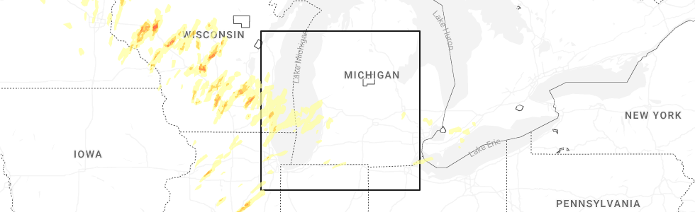
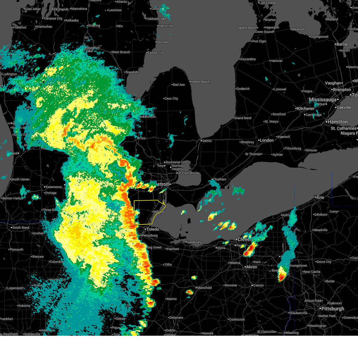
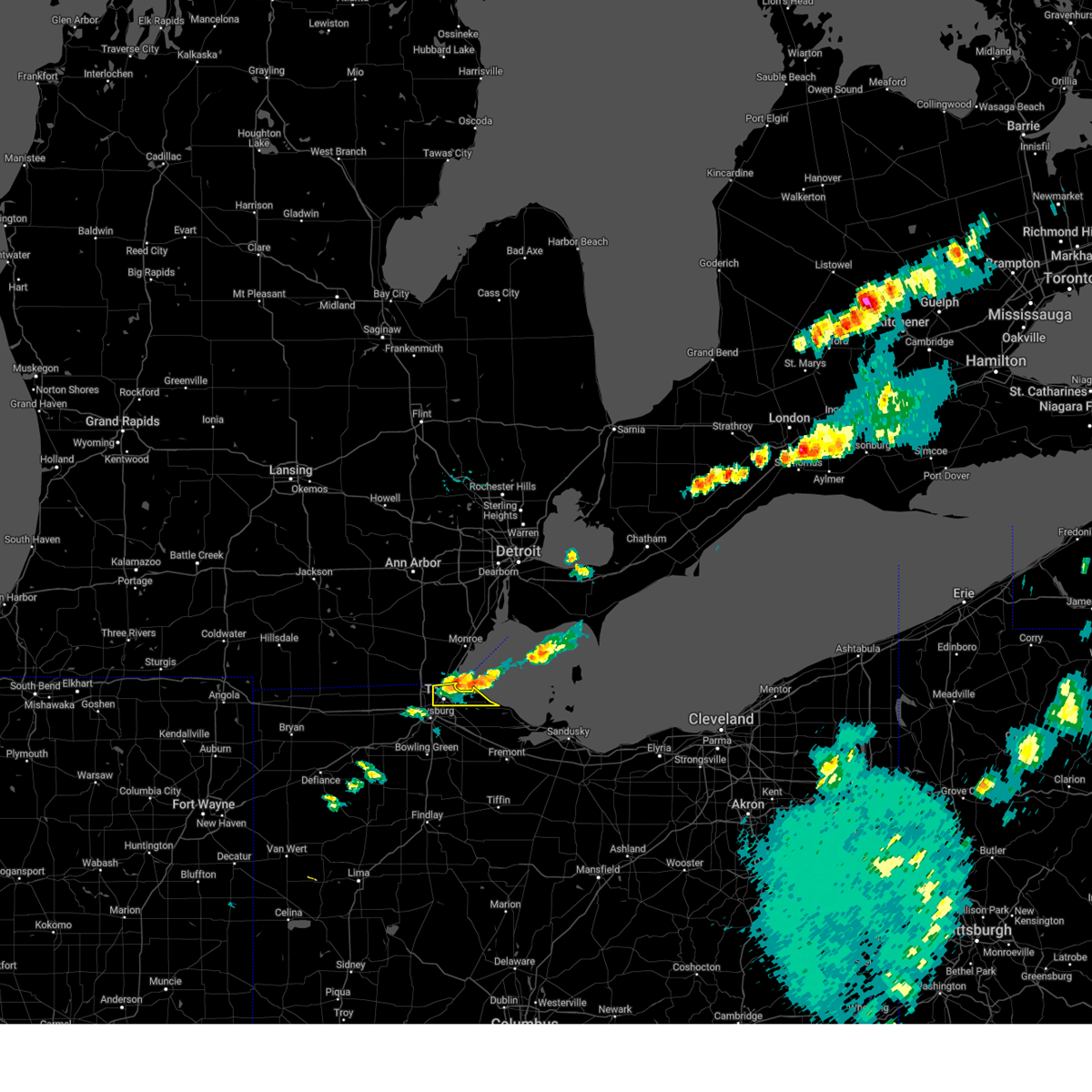
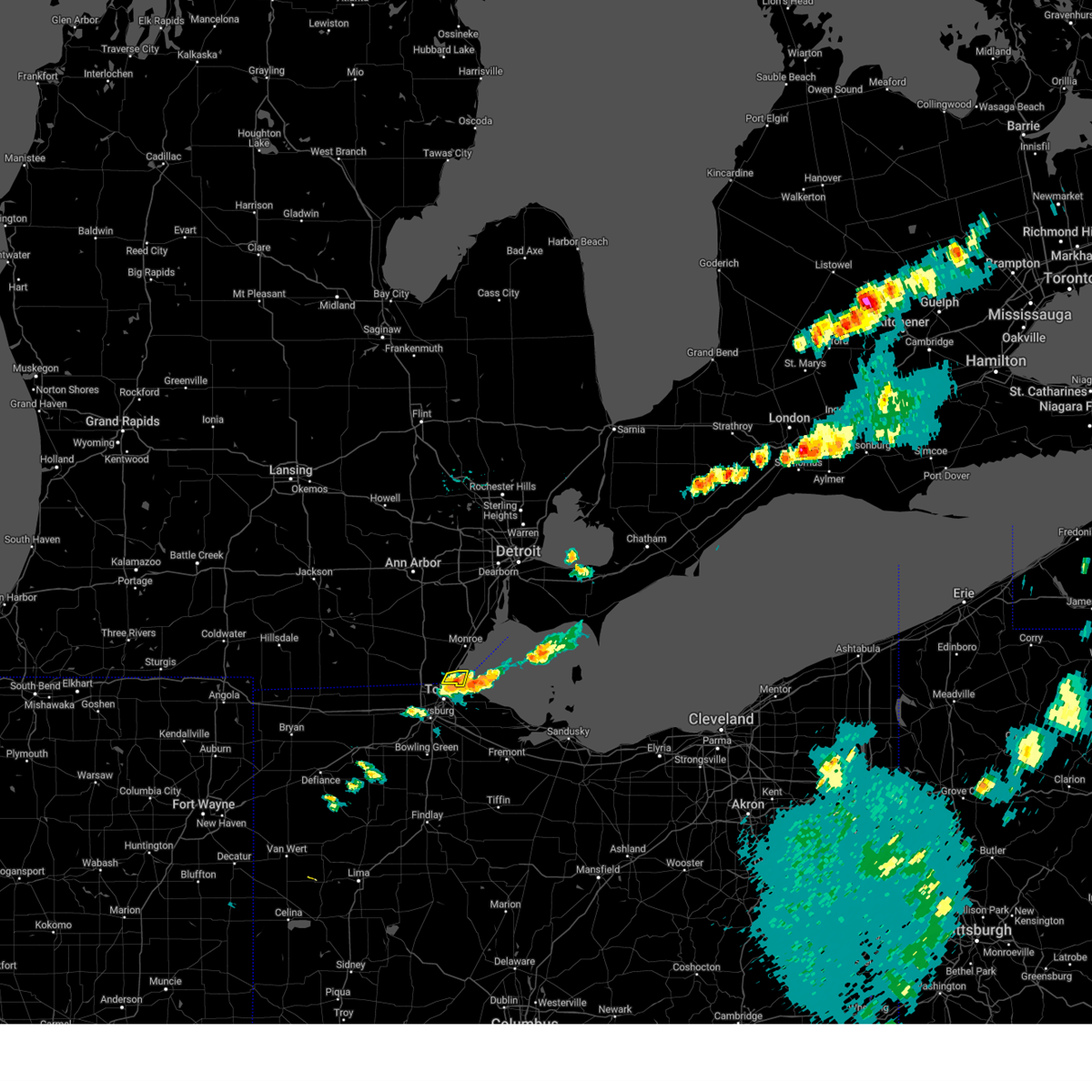
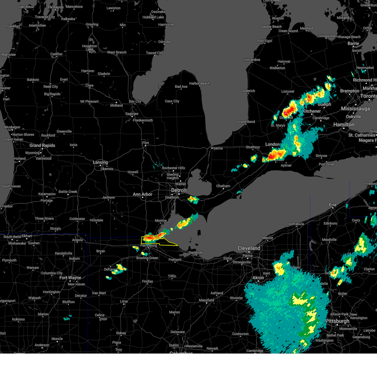
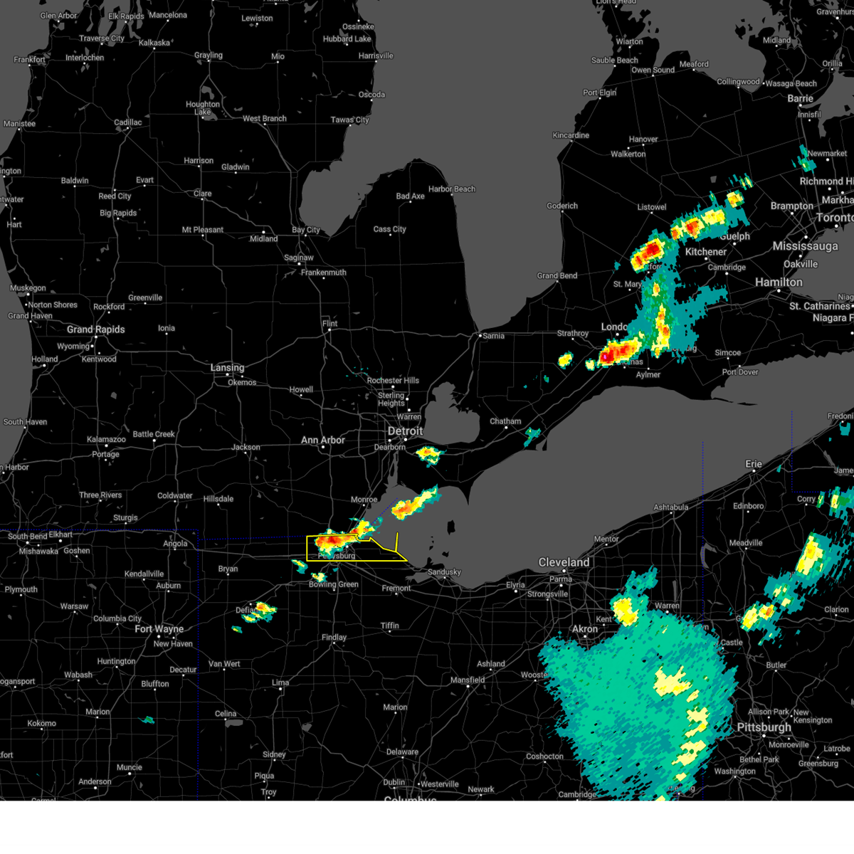
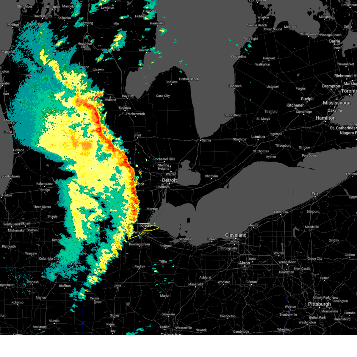
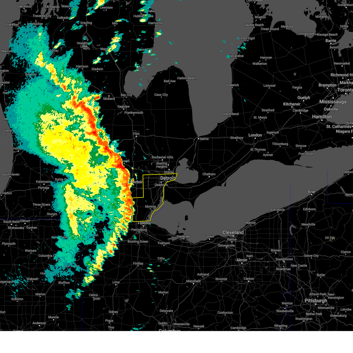
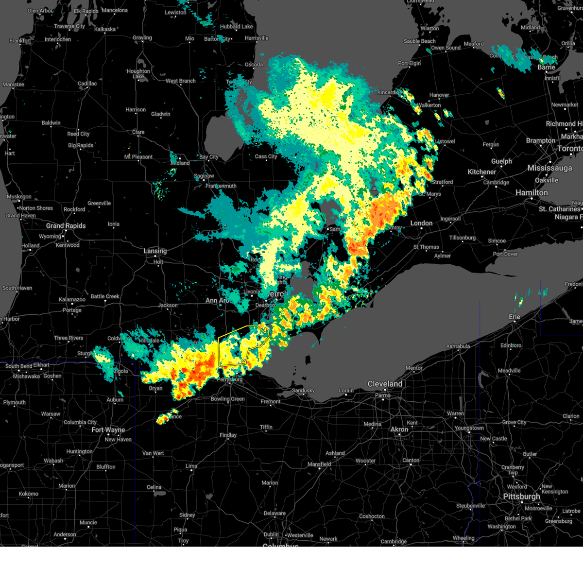
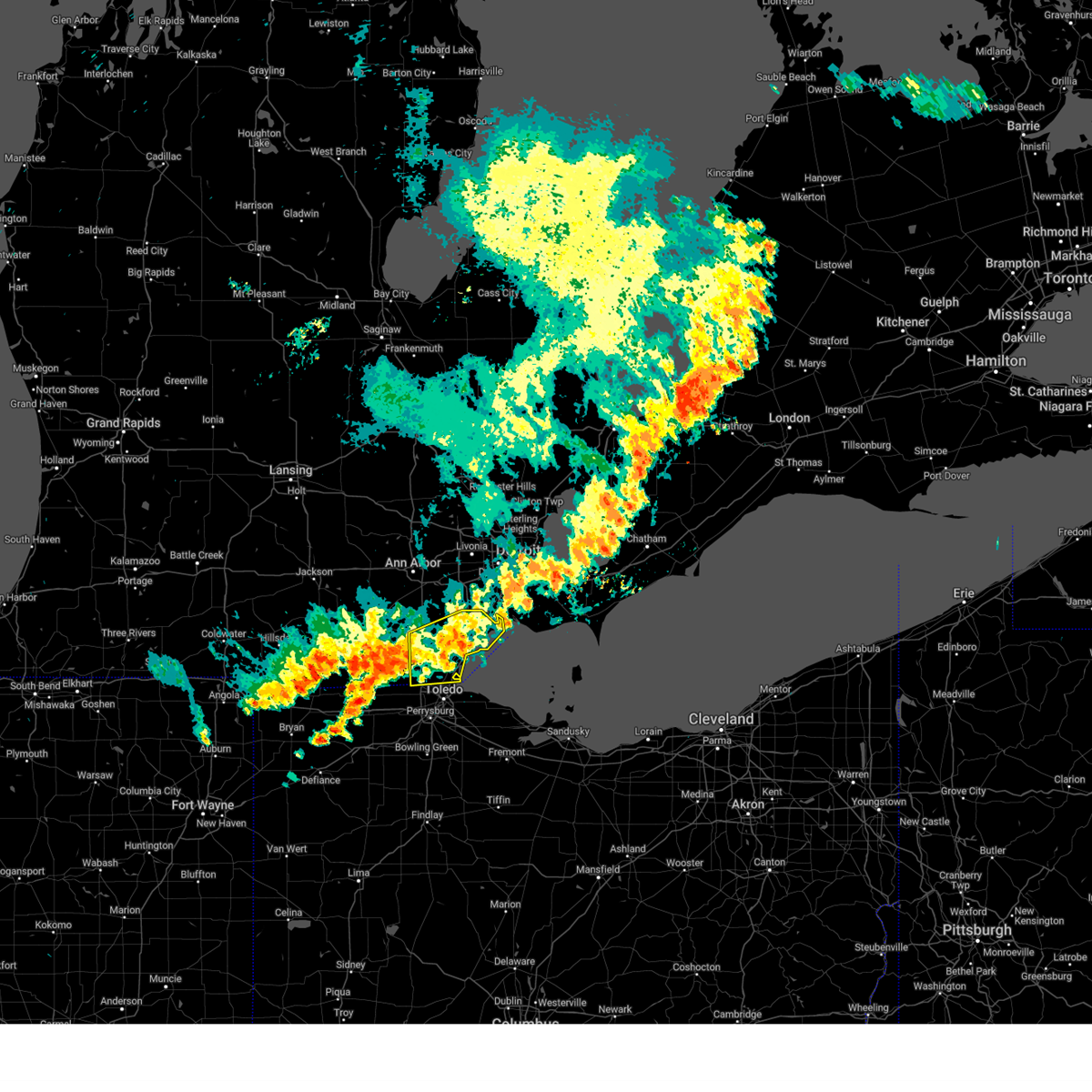
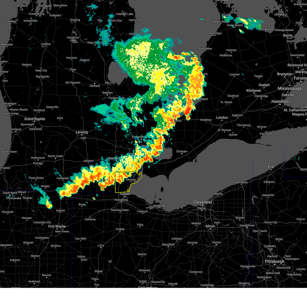
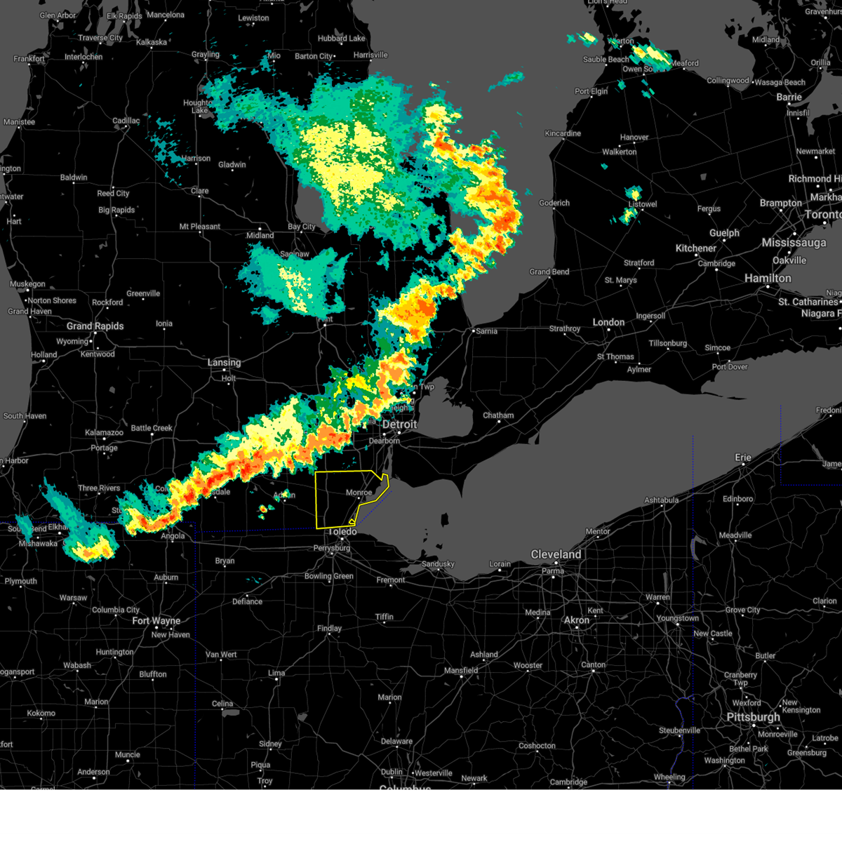
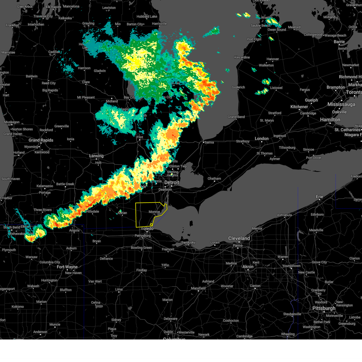
Hail Map for Toledo, OH
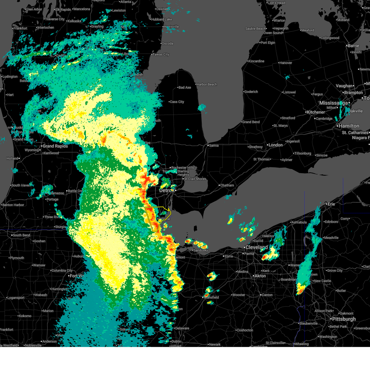
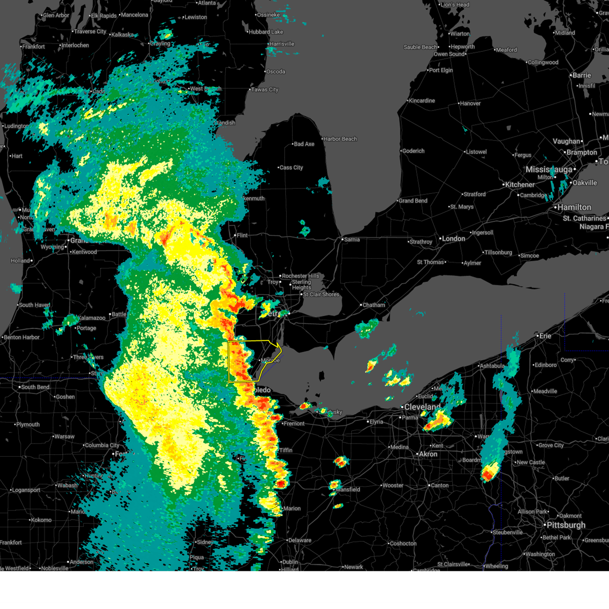
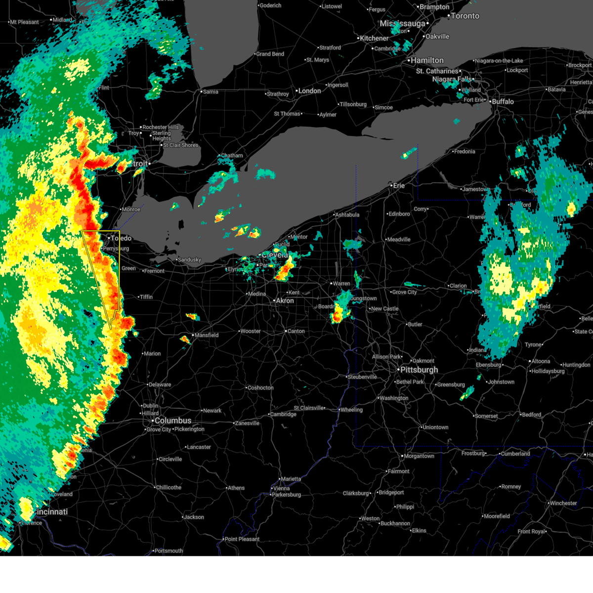
The Toledo, OH area has had 26 reports of on-the-ground hail by trained spotters, and has been under severe weather warnings 33 times during the past 12 months. Doppler radar has detected hail at or near Toledo, OH on 57 occasions, including 1 occasion during the past year.
| Name: | Toledo, OH |
| Where Located: | 89.1 miles ENE of Fort Wayne, IN |
| Map: | Google Map for Toledo, OH |
| Population: | 287208 |
| Housing Units: | 138039 |
| More Info: | Search Google for Toledo, OH |
0
The Top Recent Hail Date for Toledo, OH is Thursday, May 15, 2025 (52nd out of 57)
Hail and Wind Damage Spotted near Toledo, OH
| Date / Time | Report Details |
|---|---|
| 6/18/2025 7:56 PM EDT |
 At 756 pm edt, severe thunderstorms were located along a line extending from near willis to near monroe to near luna pier, moving northeast at 40 mph (radar indicated). Hazards include 60 mph wind gusts. Expect damage to roofs, siding, and trees. these severe storms will be near, monroe and carleton around 800 pm edt. Other locations impacted by these severe thunderstorms include newport, estral beach, toledo beach, erie, south rockwood, woodland beach, stony point, bolles harbor, scofield, and oakville. At 756 pm edt, severe thunderstorms were located along a line extending from near willis to near monroe to near luna pier, moving northeast at 40 mph (radar indicated). Hazards include 60 mph wind gusts. Expect damage to roofs, siding, and trees. these severe storms will be near, monroe and carleton around 800 pm edt. Other locations impacted by these severe thunderstorms include newport, estral beach, toledo beach, erie, south rockwood, woodland beach, stony point, bolles harbor, scofield, and oakville.
|
| 6/18/2025 7:42 PM EDT |
 At 742 pm edt, severe thunderstorms were located along a line extending from near ann arbor to near dundee to near lambertville, moving northeast at 50 mph (radar indicated). Hazards include 60 mph wind gusts. Expect damage to roofs, siding, and trees. these severe storms will be near, monroe, temperance, ida, luna pier, and maybee around 750 pm edt. carleton around 755 pm edt. Other locations impacted by these severe thunderstorms include newport, cone, estral beach, toledo beach, erie, south rockwood, woodland beach, stony point, bolles harbor, and samaria. At 742 pm edt, severe thunderstorms were located along a line extending from near ann arbor to near dundee to near lambertville, moving northeast at 50 mph (radar indicated). Hazards include 60 mph wind gusts. Expect damage to roofs, siding, and trees. these severe storms will be near, monroe, temperance, ida, luna pier, and maybee around 750 pm edt. carleton around 755 pm edt. Other locations impacted by these severe thunderstorms include newport, cone, estral beach, toledo beach, erie, south rockwood, woodland beach, stony point, bolles harbor, and samaria.
|
| 6/18/2025 7:32 PM EDT |
 At 732 pm edt, severe thunderstorms were located along a line extending from bowling green to near fostoria to near vanlue, moving northeast at 60 mph (radar indicated). Hazards include 70 mph wind gusts. Expect considerable tree damage. damage is likely to mobile homes, roofs, and outbuildings. Locations impacted include, toledo, findlay, bowling green, fostoria, perrysburg, oregon, sylvania, rossford, waterville, northwood, whitehouse, north baltimore, holland, arcadia, vanlue, van buren, maumee, ottawa hills, walbridge, and pemberville. At 732 pm edt, severe thunderstorms were located along a line extending from bowling green to near fostoria to near vanlue, moving northeast at 60 mph (radar indicated). Hazards include 70 mph wind gusts. Expect considerable tree damage. damage is likely to mobile homes, roofs, and outbuildings. Locations impacted include, toledo, findlay, bowling green, fostoria, perrysburg, oregon, sylvania, rossford, waterville, northwood, whitehouse, north baltimore, holland, arcadia, vanlue, van buren, maumee, ottawa hills, walbridge, and pemberville.
|
| 6/18/2025 7:29 PM EDT |
 At 729 pm edt, severe thunderstorms were located along a line extending from 6 miles east of manchester to deerfield to near holland, moving northeast at 45 mph (radar indicated). Hazards include 60 mph wind gusts. Expect damage to roofs, siding, and trees. these severe storms will be near, milan, dundee, temperance, petersburg, and lambertville around 735 pm edt. ida around 740 pm edt. maybee around 745 pm edt. monroe and luna pier around 750 pm edt. carleton around 755 pm edt. Other locations impacted by these severe thunderstorms include newport, cone, estral beach, toledo beach, erie, south rockwood, woodland beach, stony point, bolles harbor, and samaria. At 729 pm edt, severe thunderstorms were located along a line extending from 6 miles east of manchester to deerfield to near holland, moving northeast at 45 mph (radar indicated). Hazards include 60 mph wind gusts. Expect damage to roofs, siding, and trees. these severe storms will be near, milan, dundee, temperance, petersburg, and lambertville around 735 pm edt. ida around 740 pm edt. maybee around 745 pm edt. monroe and luna pier around 750 pm edt. carleton around 755 pm edt. Other locations impacted by these severe thunderstorms include newport, cone, estral beach, toledo beach, erie, south rockwood, woodland beach, stony point, bolles harbor, and samaria.
|
| 6/18/2025 7:27 PM EDT | Tree downed along dorr road near the 13abc studio in lucas county OH, 7 miles ENE of Toledo, OH |
| 6/18/2025 7:17 PM EDT | At 717 pm edt, severe thunderstorms were located along a line extending from near weston to van buren to near arlington, moving east at 60 mph (radar indicated). Hazards include 70 mph wind gusts. Expect considerable tree damage. damage is likely to mobile homes, roofs, and outbuildings. Locations impacted include, toledo, findlay, bowling green, fostoria, bluffton, swanton, perrysburg, oregon, sylvania, rossford, waterville, northwood, whitehouse, north baltimore, holland, mccomb, weston, arlington, arcadia, and rawson. |
| 6/18/2025 7:16 PM EDT | Svrdtx the national weather service in detroit/pontiac has issued a * severe thunderstorm warning for, monroe county in southeastern michigan, * until 830 pm edt. * at 716 pm edt, severe thunderstorms were located along a line extending from near manchester to near blissfield to near swanton, moving northeast at 45 mph (radar indicated). Hazards include 60 mph wind gusts. Expect damage to roofs, siding, and trees. severe thunderstorms will be near, petersburg and ottawa lake around 725 pm edt. dundee and lambertville around 730 pm edt. milan, temperance, and ida around 735 pm edt. maybee around 740 pm edt. luna pier around 745 pm edt. monroe and carleton around 750 pm edt. Other locations impacted by these severe thunderstorms include newport, cone, estral beach, toledo beach, erie, south rockwood, woodland beach, stony point, bolles harbor, and samaria. |
| 6/18/2025 7:14 PM EDT | Svrcle the national weather service in cleveland has issued a * severe thunderstorm warning for, ottawa county in northwestern ohio, erie county in north central ohio, sandusky county in northwestern ohio, northeastern lucas county in northwestern ohio, * until 830 pm edt. * at 714 pm edt, severe thunderstorms were located along a line extending from near delta to near rawson, moving northeast at 55 mph (radar indicated). Hazards include 60 mph wind gusts. expect damage to trees and power lines |
| 6/18/2025 6:42 PM EDT | Svrcle the national weather service in cleveland has issued a * severe thunderstorm warning for, wood county in northwestern ohio, hancock county in northwestern ohio, lucas county in northwestern ohio, * until 745 pm edt. * at 641 pm edt, severe thunderstorms were located along a line extending from near continental to near kalida to near cridersville, moving northeast at 60 mph (radar indicated). Hazards include 60 mph wind gusts. expect damage to trees and power lines |
| 6/18/2025 5:07 PM EDT | Numerous trees and large limbs downed in springfield township near intersection of king and nebrask in lucas county OH, 7.5 miles E of Toledo, OH |
| 4/29/2025 5:17 PM EDT | the severe thunderstorm warning has been cancelled and is no longer in effect |
| 4/29/2025 5:10 PM EDT | the severe thunderstorm warning has been cancelled and is no longer in effect |
| 4/29/2025 5:06 PM EDT |
 At 505 pm edt, a severe thunderstorm was located near oregon, or 9 miles east of temperance, moving east at 50 mph (radar indicated). Hazards include 60 mph wind gusts and penny size hail. Expect damage to trees and power lines. Locations impacted include, toledo, oregon, harbor view, reno beach, and bono. At 505 pm edt, a severe thunderstorm was located near oregon, or 9 miles east of temperance, moving east at 50 mph (radar indicated). Hazards include 60 mph wind gusts and penny size hail. Expect damage to trees and power lines. Locations impacted include, toledo, oregon, harbor view, reno beach, and bono.
|
| 4/29/2025 5:06 PM EDT |
 the severe thunderstorm warning has been cancelled and is no longer in effect the severe thunderstorm warning has been cancelled and is no longer in effect
|
| 4/29/2025 5:04 PM EDT |
 At 504 pm edt, a severe thunderstorm was located near luna pier, or 8 miles east of temperance, moving east at 55 mph (radar indicated). Hazards include 60 mph wind gusts and penny size hail. Expect damage to roofs, siding, and trees. This severe thunderstorm will remain over mainly rural areas of south central monroe county. At 504 pm edt, a severe thunderstorm was located near luna pier, or 8 miles east of temperance, moving east at 55 mph (radar indicated). Hazards include 60 mph wind gusts and penny size hail. Expect damage to roofs, siding, and trees. This severe thunderstorm will remain over mainly rural areas of south central monroe county.
|
| 4/29/2025 4:56 PM EDT |
 At 455 pm edt, a severe thunderstorm was located near toledo, moving east at 50 mph (radar indicated). Hazards include 60 mph wind gusts and quarter size hail. Minor damage to vehicles is possible. expect damage to trees and power lines. Locations impacted include, toledo, oregon, sylvania, northwood, holland, ottawa hills, harbor view, reno beach, williston, and bono. At 455 pm edt, a severe thunderstorm was located near toledo, moving east at 50 mph (radar indicated). Hazards include 60 mph wind gusts and quarter size hail. Minor damage to vehicles is possible. expect damage to trees and power lines. Locations impacted include, toledo, oregon, sylvania, northwood, holland, ottawa hills, harbor view, reno beach, williston, and bono.
|
| 4/29/2025 4:56 PM EDT |
 the severe thunderstorm warning has been cancelled and is no longer in effect the severe thunderstorm warning has been cancelled and is no longer in effect
|
| 4/29/2025 4:53 PM EDT |
 Svrdtx the national weather service in detroit/pontiac has issued a * severe thunderstorm warning for, south central monroe county in southeastern michigan, * until 600 pm edt. * at 453 pm edt, a severe thunderstorm was located over lambertville, or near temperance, moving east at 60 mph (radar indicated). Hazards include 60 mph wind gusts and quarter size hail. Hail damage to vehicles is expected. expect wind damage to roofs, siding, and trees. this severe thunderstorm will be near, luna pier around 500 pm edt. Other locations impacted by this severe thunderstorm include erie and toledo beach. Svrdtx the national weather service in detroit/pontiac has issued a * severe thunderstorm warning for, south central monroe county in southeastern michigan, * until 600 pm edt. * at 453 pm edt, a severe thunderstorm was located over lambertville, or near temperance, moving east at 60 mph (radar indicated). Hazards include 60 mph wind gusts and quarter size hail. Hail damage to vehicles is expected. expect wind damage to roofs, siding, and trees. this severe thunderstorm will be near, luna pier around 500 pm edt. Other locations impacted by this severe thunderstorm include erie and toledo beach.
|
| 4/29/2025 4:49 PM EDT |
 Svrcle the national weather service in cleveland has issued a * severe thunderstorm warning for, ottawa county in northwestern ohio, northeastern wood county in northwestern ohio, lucas county in northwestern ohio, * until 530 pm edt. * at 449 pm edt, a severe thunderstorm was located near sylvania, or near toledo, moving east at 55 mph (radar indicated). Hazards include 60 mph wind gusts and quarter size hail. Minor damage to vehicles is possible. Expect damage to trees and power lines. Svrcle the national weather service in cleveland has issued a * severe thunderstorm warning for, ottawa county in northwestern ohio, northeastern wood county in northwestern ohio, lucas county in northwestern ohio, * until 530 pm edt. * at 449 pm edt, a severe thunderstorm was located near sylvania, or near toledo, moving east at 55 mph (radar indicated). Hazards include 60 mph wind gusts and quarter size hail. Minor damage to vehicles is possible. Expect damage to trees and power lines.
|
| 4/2/2025 11:54 PM EDT | At 1154 pm edt, severe thunderstorms were located along a line extending from near bowling green to near fostoria to near forest, moving northeast at 65 mph (radar indicated). Hazards include 70 mph wind gusts. Expect considerable tree damage. damage is likely to mobile homes, roofs, and outbuildings. Locations impacted include, bowling green, tiffin, fremont, fostoria, perrysburg, oregon, bellevue, clyde, rossford, waterville, northwood, whitehouse, north baltimore, oak harbor, gibsonburg, genoa, woodville, weston, elmore, and green springs. |
| 4/2/2025 11:43 PM EDT | Svrcle the national weather service in cleveland has issued a * severe thunderstorm warning for, ottawa county in northwestern ohio, northwestern seneca county in northwestern ohio, northwestern wyandot county in northwestern ohio, sandusky county in northwestern ohio, wood county in northwestern ohio, hancock county in northwestern ohio, central lucas county in northwestern ohio, * until 1230 am edt. * at 1143 pm edt, severe thunderstorms were located along a line extending from near weston to near van buren to dunkirk, moving northeast at 90 mph (radar indicated). Hazards include 60 mph wind gusts. expect damage to trees and power lines |
| 4/2/2025 11:17 PM EDT |
 At 1117 pm edt, a severe thunderstorm was located near swanton, moving east at 55 mph (radar indicated). Hazards include 60 mph wind gusts. Expect damage to trees and power lines. Locations impacted include, toledo, swanton, oregon, sylvania, rossford, northwood, whitehouse, holland, maumee, ottawa hills, berkey, harbor view, and neapolis. At 1117 pm edt, a severe thunderstorm was located near swanton, moving east at 55 mph (radar indicated). Hazards include 60 mph wind gusts. Expect damage to trees and power lines. Locations impacted include, toledo, swanton, oregon, sylvania, rossford, northwood, whitehouse, holland, maumee, ottawa hills, berkey, harbor view, and neapolis.
|
| 4/2/2025 11:15 PM EDT |
 Svrcle the national weather service in cleveland has issued a * severe thunderstorm warning for, lucas county in northwestern ohio, * until 1145 pm edt. * at 1115 pm edt, a severe thunderstorm was located over sylvania, or near toledo, moving northeast at 85 mph (radar indicated). Hazards include 60 mph wind gusts. expect damage to trees and power lines Svrcle the national weather service in cleveland has issued a * severe thunderstorm warning for, lucas county in northwestern ohio, * until 1145 pm edt. * at 1115 pm edt, a severe thunderstorm was located over sylvania, or near toledo, moving northeast at 85 mph (radar indicated). Hazards include 60 mph wind gusts. expect damage to trees and power lines
|
| 3/30/2025 7:14 PM EDT | At 714 pm edt, severe thunderstorms were located along a line extending from near temperance to near lambertville to near holland, moving northeast at 45 mph (radar indicated). Hazards include 60 mph wind gusts. Expect damage to trees and power lines. Locations impacted include, toledo, perrysburg, oregon, whitehouse, holland, maumee, ottawa hills, harbor view, and reno beach. |
| 3/30/2025 7:08 PM EDT | Power lines downed near whitmer high schoo in lucas county OH, 3.9 miles SSE of Toledo, OH |
| 3/30/2025 7:08 PM EDT | Multiple trees and power lines down near the intersection of laskey and secor road in lucas county OH, 3.5 miles SE of Toledo, OH |
| 3/30/2025 7:06 PM EDT |
 At 706 pm edt, severe thunderstorms were located along a line extending from novi to belleville to near ida, moving northeast at 65 mph (radar indicated). Hazards include 70 mph wind gusts and penny size hail. Expect considerable tree damage. damage is likely to mobile homes, roofs, and outbuildings. these severe storms will be near, canton, belleville, livonia, romulus, maybee, monroe, northville, and carleton around 710 pm edt. flat rock, dearborn, taylor, and greenfield village around 715 pm edt. wyandotte and trenton around 720 pm edt. detroit and grosse ile around 725 pm edt. downtown detroit and belle isle around 730 pm edt. grosse pointe around 735 pm edt. other locations impacted by these severe thunderstorms include newport, melvindale, gibraltar, erie, new boston, woodland beach, stony point, bolles harbor, rockwood, and samaria. this includes the following highways, i-75 between mile markers 1 and 58. i-275 between mile markers 1 and 29. i-94 between mile markers 188 and 225. i-96 between mile markers 169 and 192. m-10 between mile markers 1 and 12. M-14 between mile markers 16 and 21. At 706 pm edt, severe thunderstorms were located along a line extending from novi to belleville to near ida, moving northeast at 65 mph (radar indicated). Hazards include 70 mph wind gusts and penny size hail. Expect considerable tree damage. damage is likely to mobile homes, roofs, and outbuildings. these severe storms will be near, canton, belleville, livonia, romulus, maybee, monroe, northville, and carleton around 710 pm edt. flat rock, dearborn, taylor, and greenfield village around 715 pm edt. wyandotte and trenton around 720 pm edt. detroit and grosse ile around 725 pm edt. downtown detroit and belle isle around 730 pm edt. grosse pointe around 735 pm edt. other locations impacted by these severe thunderstorms include newport, melvindale, gibraltar, erie, new boston, woodland beach, stony point, bolles harbor, rockwood, and samaria. this includes the following highways, i-75 between mile markers 1 and 58. i-275 between mile markers 1 and 29. i-94 between mile markers 188 and 225. i-96 between mile markers 169 and 192. m-10 between mile markers 1 and 12. M-14 between mile markers 16 and 21.
|
| 3/30/2025 6:51 PM EDT |
 Svrcle the national weather service in cleveland has issued a * severe thunderstorm warning for, lucas county in northwestern ohio, * until 730 pm edt. * at 651 pm edt, severe thunderstorms were located along a line extending from 7 miles south of blissfield to near swanton to near delta, moving northeast at 45 mph (radar indicated). Hazards include 60 mph wind gusts. expect damage to trees and power lines Svrcle the national weather service in cleveland has issued a * severe thunderstorm warning for, lucas county in northwestern ohio, * until 730 pm edt. * at 651 pm edt, severe thunderstorms were located along a line extending from 7 miles south of blissfield to near swanton to near delta, moving northeast at 45 mph (radar indicated). Hazards include 60 mph wind gusts. expect damage to trees and power lines
|
| 3/30/2025 6:47 PM EDT |
 Svrdtx the national weather service in detroit/pontiac has issued a * severe thunderstorm warning for, monroe county in southeastern michigan, wayne county in southeastern michigan, * until 745 pm edt. * at 646 pm edt, severe thunderstorms were located along a line extending from near dexter to britton to near ottawa lake, moving northeast at 65 mph (radar indicated). Hazards include 70 mph wind gusts and penny size hail. Expect considerable tree damage. damage is likely to mobile homes, roofs, and outbuildings. severe thunderstorms will be near, dundee, petersburg, milan, and ottawa lake around 650 pm edt. ida, canton, belleville, and maybee around 700 pm edt. livonia, romulus, monroe, and northville around 705 pm edt. taylor and carleton around 710 pm edt. flat rock, dearborn, and greenfield village around 715 pm edt. wyandotte and trenton around 720 pm edt. detroit and grosse ile around 725 pm edt. downtown detroit and belle isle around 730 pm edt. other locations impacted by these severe thunderstorms include newport, melvindale, gibraltar, erie, new boston, woodland beach, stony point, bolles harbor, rockwood, and samaria. this includes the following highways, i-75 between mile markers 1 and 58. i-275 between mile markers 1 and 29. i-94 between mile markers 188 and 225. i-96 between mile markers 169 and 192. m-10 between mile markers 1 and 12. m-14 between mile markers 16 and 21. Us-23 between mile markers 1 and 25. Svrdtx the national weather service in detroit/pontiac has issued a * severe thunderstorm warning for, monroe county in southeastern michigan, wayne county in southeastern michigan, * until 745 pm edt. * at 646 pm edt, severe thunderstorms were located along a line extending from near dexter to britton to near ottawa lake, moving northeast at 65 mph (radar indicated). Hazards include 70 mph wind gusts and penny size hail. Expect considerable tree damage. damage is likely to mobile homes, roofs, and outbuildings. severe thunderstorms will be near, dundee, petersburg, milan, and ottawa lake around 650 pm edt. ida, canton, belleville, and maybee around 700 pm edt. livonia, romulus, monroe, and northville around 705 pm edt. taylor and carleton around 710 pm edt. flat rock, dearborn, and greenfield village around 715 pm edt. wyandotte and trenton around 720 pm edt. detroit and grosse ile around 725 pm edt. downtown detroit and belle isle around 730 pm edt. other locations impacted by these severe thunderstorms include newport, melvindale, gibraltar, erie, new boston, woodland beach, stony point, bolles harbor, rockwood, and samaria. this includes the following highways, i-75 between mile markers 1 and 58. i-275 between mile markers 1 and 29. i-94 between mile markers 188 and 225. i-96 between mile markers 169 and 192. m-10 between mile markers 1 and 12. m-14 between mile markers 16 and 21. Us-23 between mile markers 1 and 25.
|
| 9/24/2024 3:58 PM EDT |
 At 358 pm edt, a severe thunderstorm was located near woodville, or 13 miles east of bowling green, moving northeast at 30 mph (radar indicated). Hazards include 60 mph wind gusts and penny size hail. Expect damage to trees and power lines. Locations impacted include, bowling green, fremont, perrysburg, oregon, clyde, rossford, northwood, oak harbor, gibsonburg, genoa, woodville, elmore, green springs, ballville, walbridge, pemberville, millbury, luckey, bradner, and wayne. At 358 pm edt, a severe thunderstorm was located near woodville, or 13 miles east of bowling green, moving northeast at 30 mph (radar indicated). Hazards include 60 mph wind gusts and penny size hail. Expect damage to trees and power lines. Locations impacted include, bowling green, fremont, perrysburg, oregon, clyde, rossford, northwood, oak harbor, gibsonburg, genoa, woodville, elmore, green springs, ballville, walbridge, pemberville, millbury, luckey, bradner, and wayne.
|
| 9/24/2024 3:41 PM EDT |
 Svrcle the national weather service in cleveland has issued a * severe thunderstorm warning for, ottawa county in northwestern ohio, northern seneca county in northwestern ohio, sandusky county in northwestern ohio, wood county in northwestern ohio, northeastern lucas county in northwestern ohio, * until 430 pm edt. * at 340 pm edt, a severe thunderstorm was located near bowling green, moving northeast at 40 mph (radar indicated). Hazards include 60 mph wind gusts and penny size hail. expect damage to trees and power lines Svrcle the national weather service in cleveland has issued a * severe thunderstorm warning for, ottawa county in northwestern ohio, northern seneca county in northwestern ohio, sandusky county in northwestern ohio, wood county in northwestern ohio, northeastern lucas county in northwestern ohio, * until 430 pm edt. * at 340 pm edt, a severe thunderstorm was located near bowling green, moving northeast at 40 mph (radar indicated). Hazards include 60 mph wind gusts and penny size hail. expect damage to trees and power lines
|
| 8/27/2024 7:11 PM EDT |
 Svrcle the national weather service in cleveland has issued a * severe thunderstorm warning for, ottawa county in northwestern ohio, northwestern seneca county in northwestern ohio, western sandusky county in northwestern ohio, wood county in northwestern ohio, lucas county in northwestern ohio, * until 815 pm edt. * at 710 pm edt, a severe thunderstorm was located over swanton, moving southeast at 45 mph (radar indicated). Hazards include 70 mph wind gusts and quarter size hail. Minor damage to vehicles is possible. expect considerable tree damage. Wind damage is also likely to mobile homes, roofs, and outbuildings. Svrcle the national weather service in cleveland has issued a * severe thunderstorm warning for, ottawa county in northwestern ohio, northwestern seneca county in northwestern ohio, western sandusky county in northwestern ohio, wood county in northwestern ohio, lucas county in northwestern ohio, * until 815 pm edt. * at 710 pm edt, a severe thunderstorm was located over swanton, moving southeast at 45 mph (radar indicated). Hazards include 70 mph wind gusts and quarter size hail. Minor damage to vehicles is possible. expect considerable tree damage. Wind damage is also likely to mobile homes, roofs, and outbuildings.
|
| 8/27/2024 7:05 PM EDT | Dispatch reports several trees and power lines down across lucas count in lucas county OH, 2.7 miles NE of Toledo, OH |
| 8/27/2024 7:00 PM EDT |
 The storms which prompted the warning have weakened below severe limits, and no longer pose an immediate threat to life or property. therefore, the warning has been allowed to expire. however, heavy rain is still possible with these thunderstorms. a severe thunderstorm watch remains in effect until 900 pm edt for southeastern michigan. The storms which prompted the warning have weakened below severe limits, and no longer pose an immediate threat to life or property. therefore, the warning has been allowed to expire. however, heavy rain is still possible with these thunderstorms. a severe thunderstorm watch remains in effect until 900 pm edt for southeastern michigan.
|
| 8/27/2024 6:45 PM EDT | Tree branch fell down on power line and caused a small fir in lucas county OH, 5.9 miles E of Toledo, OH |
| 8/27/2024 6:44 PM EDT |
 At 644 pm edt, severe thunderstorms were located along a line extending from monroe to near ottawa lake to 9 miles north of delta, moving east at 30 mph (radar indicated). Hazards include 60 mph wind gusts. Expect damage to roofs, siding, and trees. these severe storms will be near, monroe, temperance, luna pier, and ottawa lake around 650 pm edt. lambertville around 655 pm edt. other locations impacted by these severe thunderstorms include newport, samaria, estral beach, toledo beach, erie, scofield, south rockwood, woodland beach, stony point, and la salle. this includes the following highways, i-75 between mile markers 1 and 26. i-275 between mile markers 1 and 7. Us-23 between mile markers 1 and 20. At 644 pm edt, severe thunderstorms were located along a line extending from monroe to near ottawa lake to 9 miles north of delta, moving east at 30 mph (radar indicated). Hazards include 60 mph wind gusts. Expect damage to roofs, siding, and trees. these severe storms will be near, monroe, temperance, luna pier, and ottawa lake around 650 pm edt. lambertville around 655 pm edt. other locations impacted by these severe thunderstorms include newport, samaria, estral beach, toledo beach, erie, scofield, south rockwood, woodland beach, stony point, and la salle. this includes the following highways, i-75 between mile markers 1 and 26. i-275 between mile markers 1 and 7. Us-23 between mile markers 1 and 20.
|
| 8/27/2024 6:22 PM EDT |
 At 622 pm edt, severe thunderstorms were located along a line extending from grosse ile to near monroe to 6 miles south of adrian, moving southeast at 40 mph (radar indicated). Hazards include 60 mph wind gusts. Expect damage to roofs, siding, and trees. these severe storms will be near, monroe and ida around 625 pm edt. temperance, luna pier, and ottawa lake around 630 pm edt. lambertville around 635 pm edt. other locations impacted by these severe thunderstorms include newport, cone, estral beach, toledo beach, erie, south rockwood, woodland beach, stony point, samaria, and azalia. this includes the following highways, i-75 between mile markers 1 and 26. i-275 between mile markers 1 and 7. Us-23 between mile markers 1 and 25. At 622 pm edt, severe thunderstorms were located along a line extending from grosse ile to near monroe to 6 miles south of adrian, moving southeast at 40 mph (radar indicated). Hazards include 60 mph wind gusts. Expect damage to roofs, siding, and trees. these severe storms will be near, monroe and ida around 625 pm edt. temperance, luna pier, and ottawa lake around 630 pm edt. lambertville around 635 pm edt. other locations impacted by these severe thunderstorms include newport, cone, estral beach, toledo beach, erie, south rockwood, woodland beach, stony point, samaria, and azalia. this includes the following highways, i-75 between mile markers 1 and 26. i-275 between mile markers 1 and 7. Us-23 between mile markers 1 and 25.
|
| 8/27/2024 6:03 PM EDT |
 At 602 pm edt, severe thunderstorms were located along a line extending from near greenfield village to near maybee to near clayton, moving southeast at 45 mph (radar indicated). Hazards include 60 mph wind gusts. Expect damage to roofs, siding, and trees. these severe storms will be near, monroe, flat rock, dundee, carleton, ida, petersburg, and maybee around 610 pm edt. temperance, luna pier, and ottawa lake around 625 pm edt. lambertville around 630 pm edt. other locations impacted by these severe thunderstorms include newport, cone, estral beach, toledo beach, erie, south rockwood, woodland beach, stony point, samaria, and azalia. this includes the following highways, i-75 between mile markers 1 and 26. i-275 between mile markers 1 and 7. Us-23 between mile markers 1 and 25. At 602 pm edt, severe thunderstorms were located along a line extending from near greenfield village to near maybee to near clayton, moving southeast at 45 mph (radar indicated). Hazards include 60 mph wind gusts. Expect damage to roofs, siding, and trees. these severe storms will be near, monroe, flat rock, dundee, carleton, ida, petersburg, and maybee around 610 pm edt. temperance, luna pier, and ottawa lake around 625 pm edt. lambertville around 630 pm edt. other locations impacted by these severe thunderstorms include newport, cone, estral beach, toledo beach, erie, south rockwood, woodland beach, stony point, samaria, and azalia. this includes the following highways, i-75 between mile markers 1 and 26. i-275 between mile markers 1 and 7. Us-23 between mile markers 1 and 25.
|
| 8/27/2024 5:45 PM EDT |
 Svrdtx the national weather service in detroit/pontiac has issued a * severe thunderstorm warning for, monroe county in southeastern michigan, * until 700 pm edt. * at 545 pm edt, severe thunderstorms were located along a line extending from near livonia to near saline to 6 miles west of addison, moving southeast at 45 mph (radar indicated). Hazards include 60 mph wind gusts. Expect damage to roofs, siding, and trees. severe thunderstorms will be near, milan around 550 pm edt. dundee and maybee around 600 pm edt. carleton around 605 pm edt. monroe, flat rock, ida, and petersburg around 610 pm edt. temperance, luna pier, and ottawa lake around 625 pm edt. lambertville around 630 pm edt. other locations impacted by these severe thunderstorms include newport, cone, estral beach, toledo beach, erie, south rockwood, woodland beach, stony point, samaria, and azalia. this includes the following highways, i-75 between mile markers 1 and 26. i-275 between mile markers 1 and 7. Us-23 between mile markers 1 and 25. Svrdtx the national weather service in detroit/pontiac has issued a * severe thunderstorm warning for, monroe county in southeastern michigan, * until 700 pm edt. * at 545 pm edt, severe thunderstorms were located along a line extending from near livonia to near saline to 6 miles west of addison, moving southeast at 45 mph (radar indicated). Hazards include 60 mph wind gusts. Expect damage to roofs, siding, and trees. severe thunderstorms will be near, milan around 550 pm edt. dundee and maybee around 600 pm edt. carleton around 605 pm edt. monroe, flat rock, ida, and petersburg around 610 pm edt. temperance, luna pier, and ottawa lake around 625 pm edt. lambertville around 630 pm edt. other locations impacted by these severe thunderstorms include newport, cone, estral beach, toledo beach, erie, south rockwood, woodland beach, stony point, samaria, and azalia. this includes the following highways, i-75 between mile markers 1 and 26. i-275 between mile markers 1 and 7. Us-23 between mile markers 1 and 25.
|
| 6/26/2024 12:44 PM EDT |
 The storms which prompted the warning have weakened below severe limits, and no longer pose an immediate threat to life or property. therefore, the warning will be allowed to expire. however, heavy rain is still possible with these thunderstorms. The storms which prompted the warning have weakened below severe limits, and no longer pose an immediate threat to life or property. therefore, the warning will be allowed to expire. however, heavy rain is still possible with these thunderstorms.
|
| 6/26/2024 12:29 PM EDT |
 At 1229 pm edt, severe thunderstorms were located along a line extending from near toledo to northwood to near rossford, moving east at 25 mph (radar indicated). Hazards include 60 mph wind gusts. Expect damage to trees and power lines. Locations impacted include, toledo, perrysburg, oregon, rossford, waterville, northwood, genoa, maumee, walbridge, millbury, clay center, harbor view, reno beach, williston, bono, and stony ridge. At 1229 pm edt, severe thunderstorms were located along a line extending from near toledo to northwood to near rossford, moving east at 25 mph (radar indicated). Hazards include 60 mph wind gusts. Expect damage to trees and power lines. Locations impacted include, toledo, perrysburg, oregon, rossford, waterville, northwood, genoa, maumee, walbridge, millbury, clay center, harbor view, reno beach, williston, bono, and stony ridge.
|
| 6/26/2024 12:21 PM EDT | A few trees and limbs down in toled in lucas county OH, 2.1 miles WNW of Toledo, OH |
| 6/26/2024 12:16 PM EDT |
 At 1216 pm edt, severe thunderstorms were located along a line extending from near toledo to near rossford to perrysburg, moving east at 25 mph (radar indicated). Hazards include 60 mph wind gusts. Expect damage to trees and power lines. Locations impacted include, toledo, perrysburg, oregon, rossford, waterville, northwood, whitehouse, genoa, holland, maumee, ottawa hills, walbridge, millbury, clay center, harbor view, reno beach, williston, bono, and stony ridge. At 1216 pm edt, severe thunderstorms were located along a line extending from near toledo to near rossford to perrysburg, moving east at 25 mph (radar indicated). Hazards include 60 mph wind gusts. Expect damage to trees and power lines. Locations impacted include, toledo, perrysburg, oregon, rossford, waterville, northwood, whitehouse, genoa, holland, maumee, ottawa hills, walbridge, millbury, clay center, harbor view, reno beach, williston, bono, and stony ridge.
|
| 6/26/2024 12:03 PM EDT |
 Svrcle the national weather service in cleveland has issued a * severe thunderstorm warning for, ottawa county in northwestern ohio, northeastern wood county in northwestern ohio, lucas county in northwestern ohio, * until 1245 pm edt. * at 1203 pm edt, severe thunderstorms were located along a line extending from near sylvania to holland to whitehouse, moving east at 25 mph (radar indicated). Hazards include 60 mph wind gusts and quarter size hail. Minor damage to vehicles is possible. Expect damage to trees and power lines. Svrcle the national weather service in cleveland has issued a * severe thunderstorm warning for, ottawa county in northwestern ohio, northeastern wood county in northwestern ohio, lucas county in northwestern ohio, * until 1245 pm edt. * at 1203 pm edt, severe thunderstorms were located along a line extending from near sylvania to holland to whitehouse, moving east at 25 mph (radar indicated). Hazards include 60 mph wind gusts and quarter size hail. Minor damage to vehicles is possible. Expect damage to trees and power lines.
|
| 6/19/2024 7:56 PM EDT |
 The storm which prompted the warning has weakened below severe limits, and no longer poses an immediate threat to life or property. therefore, the warning will be allowed to expire. however, gusty winds and heavy rain are still possible with this thunderstorm. remember, a severe thunderstorm warning still remains in effect for portions of wood, seneca, sandusky, and ottawa counties. The storm which prompted the warning has weakened below severe limits, and no longer poses an immediate threat to life or property. therefore, the warning will be allowed to expire. however, gusty winds and heavy rain are still possible with this thunderstorm. remember, a severe thunderstorm warning still remains in effect for portions of wood, seneca, sandusky, and ottawa counties.
|
| 6/19/2024 7:22 PM EDT |
 Svrcle the national weather service in cleveland has issued a * severe thunderstorm warning for, ottawa county in northwestern ohio, northwestern seneca county in northwestern ohio, western sandusky county in northwestern ohio, wood county in northwestern ohio, northeastern lucas county in northwestern ohio, * until 800 pm edt. * at 721 pm edt, a severe thunderstorm was located 7 miles southeast of bowling green, moving northeast at 30 mph (radar indicated). Hazards include 60 mph wind gusts and quarter size hail. Minor damage to vehicles is possible. Expect damage to trees and power lines. Svrcle the national weather service in cleveland has issued a * severe thunderstorm warning for, ottawa county in northwestern ohio, northwestern seneca county in northwestern ohio, western sandusky county in northwestern ohio, wood county in northwestern ohio, northeastern lucas county in northwestern ohio, * until 800 pm edt. * at 721 pm edt, a severe thunderstorm was located 7 miles southeast of bowling green, moving northeast at 30 mph (radar indicated). Hazards include 60 mph wind gusts and quarter size hail. Minor damage to vehicles is possible. Expect damage to trees and power lines.
|
| 6/19/2024 6:51 PM EDT |
 The storm which prompted the warning has weakened below severe limits, and no longer poses an immediate threat to life or property. therefore, the warning will be allowed to expire. The storm which prompted the warning has weakened below severe limits, and no longer poses an immediate threat to life or property. therefore, the warning will be allowed to expire.
|
| 6/19/2024 6:29 PM EDT |
 At 628 pm edt, a severe thunderstorm was located over waterville, or 8 miles southeast of swanton, moving north at 15 mph (radar indicated). Hazards include 60 mph wind gusts and quarter size hail. Minor damage to vehicles is possible. expect damage to trees and power lines. Locations impacted include, toledo, swanton, perrysburg, rossford, waterville, northwood, whitehouse, holland, maumee, ottawa hills, haskins, and neapolis. At 628 pm edt, a severe thunderstorm was located over waterville, or 8 miles southeast of swanton, moving north at 15 mph (radar indicated). Hazards include 60 mph wind gusts and quarter size hail. Minor damage to vehicles is possible. expect damage to trees and power lines. Locations impacted include, toledo, swanton, perrysburg, rossford, waterville, northwood, whitehouse, holland, maumee, ottawa hills, haskins, and neapolis.
|
| 6/19/2024 6:05 PM EDT |
 Svrcle the national weather service in cleveland has issued a * severe thunderstorm warning for, northern wood county in northwestern ohio, lucas county in northwestern ohio, * until 700 pm edt. * at 604 pm edt, a severe thunderstorm was located near whitehouse, or 9 miles northwest of bowling green, moving northeast at 10 mph (radar indicated). Hazards include 60 mph wind gusts and quarter size hail. Minor damage to vehicles is possible. Expect damage to trees and power lines. Svrcle the national weather service in cleveland has issued a * severe thunderstorm warning for, northern wood county in northwestern ohio, lucas county in northwestern ohio, * until 700 pm edt. * at 604 pm edt, a severe thunderstorm was located near whitehouse, or 9 miles northwest of bowling green, moving northeast at 10 mph (radar indicated). Hazards include 60 mph wind gusts and quarter size hail. Minor damage to vehicles is possible. Expect damage to trees and power lines.
|
| 6/19/2024 2:27 PM EDT |
 the severe thunderstorm warning has been cancelled and is no longer in effect the severe thunderstorm warning has been cancelled and is no longer in effect
|
| 6/19/2024 2:13 PM EDT |
 Svrcle the national weather service in cleveland has issued a * severe thunderstorm warning for, north central lucas county in northwestern ohio, * until 245 pm edt. * at 213 pm edt, a severe thunderstorm was located over toledo, moving northeast at 15 mph (radar indicated). Hazards include 60 mph wind gusts and quarter size hail. Minor damage to vehicles is possible. Expect damage to trees and power lines. Svrcle the national weather service in cleveland has issued a * severe thunderstorm warning for, north central lucas county in northwestern ohio, * until 245 pm edt. * at 213 pm edt, a severe thunderstorm was located over toledo, moving northeast at 15 mph (radar indicated). Hazards include 60 mph wind gusts and quarter size hail. Minor damage to vehicles is possible. Expect damage to trees and power lines.
|
| 6/5/2024 3:35 PM EDT | Tree took down wires and a pole on 131st stree in lucas county OH, 6.1 miles SW of Toledo, OH |
| 5/26/2024 6:51 PM EDT |
 At 651 pm edt, severe thunderstorms were located along a line extending from near temperance to near northwood to near fremont, moving north at 35 mph (radar indicated). Hazards include 60 mph wind gusts. Expect damage to trees and power lines. Locations impacted include, toledo, fremont, perrysburg, oregon, sylvania, rossford, northwood, oak harbor, genoa, woodville, holland, elmore, maumee, ottawa hills, walbridge, millbury, luckey, lindsey, rocky ridge, and clay center. At 651 pm edt, severe thunderstorms were located along a line extending from near temperance to near northwood to near fremont, moving north at 35 mph (radar indicated). Hazards include 60 mph wind gusts. Expect damage to trees and power lines. Locations impacted include, toledo, fremont, perrysburg, oregon, sylvania, rossford, northwood, oak harbor, genoa, woodville, holland, elmore, maumee, ottawa hills, walbridge, millbury, luckey, lindsey, rocky ridge, and clay center.
|
| 5/26/2024 6:38 PM EDT | Large tree branch fell on wire on maple and elm stree in lucas county OH, 2.6 miles WSW of Toledo, OH |
| 5/26/2024 6:37 PM EDT |
 the severe thunderstorm warning has been cancelled and is no longer in effect the severe thunderstorm warning has been cancelled and is no longer in effect
|
| 5/26/2024 6:37 PM EDT |
 At 637 pm edt, severe thunderstorms were located along a line extending from sylvania to near woodville to near green springs, moving northeast at 30 mph (radar indicated). Hazards include 60 mph wind gusts. Expect damage to trees and power lines. Locations impacted include, toledo, bowling green, fremont, swanton, perrysburg, oregon, sylvania, rossford, waterville, northwood, whitehouse, oak harbor, gibsonburg, genoa, woodville, holland, elmore, maumee, ballville, and ottawa hills. At 637 pm edt, severe thunderstorms were located along a line extending from sylvania to near woodville to near green springs, moving northeast at 30 mph (radar indicated). Hazards include 60 mph wind gusts. Expect damage to trees and power lines. Locations impacted include, toledo, bowling green, fremont, swanton, perrysburg, oregon, sylvania, rossford, waterville, northwood, whitehouse, oak harbor, gibsonburg, genoa, woodville, holland, elmore, maumee, ballville, and ottawa hills.
|
| 5/26/2024 6:35 PM EDT | Tree down on power line in lucas county OH, 0.4 miles W of Toledo, OH |
| 5/26/2024 6:30 PM EDT | Large branch blocking traffic at forestview and westcheste in lucas county OH, 3.2 miles E of Toledo, OH |
| 5/26/2024 6:29 PM EDT | Tree and power lines down on byrne and dor in lucas county OH, 3 miles ENE of Toledo, OH |
| 5/26/2024 6:17 PM EDT |
 Svrcle the national weather service in cleveland has issued a * severe thunderstorm warning for, ottawa county in northwestern ohio, northwestern seneca county in northwestern ohio, sandusky county in northwestern ohio, wood county in northwestern ohio, lucas county in northwestern ohio, * until 715 pm edt. * at 617 pm edt, severe thunderstorms were located along a line extending from near swanton to near bloomville, moving north at 40 mph (radar indicated). Hazards include 60 mph wind gusts. expect damage to trees and power lines Svrcle the national weather service in cleveland has issued a * severe thunderstorm warning for, ottawa county in northwestern ohio, northwestern seneca county in northwestern ohio, sandusky county in northwestern ohio, wood county in northwestern ohio, lucas county in northwestern ohio, * until 715 pm edt. * at 617 pm edt, severe thunderstorms were located along a line extending from near swanton to near bloomville, moving north at 40 mph (radar indicated). Hazards include 60 mph wind gusts. expect damage to trees and power lines
|
| 4/17/2024 3:31 PM EDT |
 the severe thunderstorm warning has been cancelled and is no longer in effect the severe thunderstorm warning has been cancelled and is no longer in effect
|
| 4/17/2024 3:24 PM EDT |
 the severe thunderstorm warning has been cancelled and is no longer in effect the severe thunderstorm warning has been cancelled and is no longer in effect
|
| 4/17/2024 3:17 PM EDT |
 At 317 pm edt, severe thunderstorms were located along a line extending from near dundee to near temperance, moving northeast at 40 mph (radar indicated). Hazards include 60 mph wind gusts and quarter size hail. Hail damage to vehicles is expected. expect wind damage to roofs, siding, and trees. these severe storms will be near, ida, luna pier, and maybee around 320 pm edt. monroe around 325 pm edt. carleton around 330 pm edt. flat rock around 340 pm edt. Other locations impacted by these severe thunderstorms include newport, estral beach, toledo beach, erie, south rockwood, woodland beach, stony point, bolles harbor, scofield, and oakville. At 317 pm edt, severe thunderstorms were located along a line extending from near dundee to near temperance, moving northeast at 40 mph (radar indicated). Hazards include 60 mph wind gusts and quarter size hail. Hail damage to vehicles is expected. expect wind damage to roofs, siding, and trees. these severe storms will be near, ida, luna pier, and maybee around 320 pm edt. monroe around 325 pm edt. carleton around 330 pm edt. flat rock around 340 pm edt. Other locations impacted by these severe thunderstorms include newport, estral beach, toledo beach, erie, south rockwood, woodland beach, stony point, bolles harbor, scofield, and oakville.
|
| 4/17/2024 3:14 PM EDT |
 the severe thunderstorm warning has been cancelled and is no longer in effect the severe thunderstorm warning has been cancelled and is no longer in effect
|
| 4/17/2024 3:10 PM EDT |
 At 309 pm edt, severe thunderstorms were located along a line extending from near lambertville to near oregon to near northwood, moving northeast at 50 mph (radar indicated). Hazards include 60 mph wind gusts. Expect damage to trees and power lines. Locations impacted include, toledo, perrysburg, oregon, sylvania, rossford, northwood, holland, maumee, ottawa hills, walbridge, millbury, clay center, harbor view, reno beach, williston, and bono. At 309 pm edt, severe thunderstorms were located along a line extending from near lambertville to near oregon to near northwood, moving northeast at 50 mph (radar indicated). Hazards include 60 mph wind gusts. Expect damage to trees and power lines. Locations impacted include, toledo, perrysburg, oregon, sylvania, rossford, northwood, holland, maumee, ottawa hills, walbridge, millbury, clay center, harbor view, reno beach, williston, and bono.
|
| 4/17/2024 3:07 PM EDT |
 Svrdtx the national weather service in detroit/pontiac has issued a * severe thunderstorm warning for, monroe county in southeastern michigan, * until 400 pm edt. * at 306 pm edt, severe thunderstorms were located along a line extending from near britton to near lambertville, moving northeast at 40 mph (radar indicated). Hazards include 60 mph wind gusts and quarter size hail. Hail damage to vehicles is expected. expect wind damage to roofs, siding, and trees. severe thunderstorms will be near, dundee, temperance, petersburg, and lambertville around 310 pm edt. ida around 315 pm edt. luna pier and maybee around 320 pm edt. monroe around 325 pm edt. carleton around 330 pm edt. Other locations impacted by these severe thunderstorms include newport, cone, estral beach, toledo beach, erie, south rockwood, woodland beach, stony point, bolles harbor, and samaria. Svrdtx the national weather service in detroit/pontiac has issued a * severe thunderstorm warning for, monroe county in southeastern michigan, * until 400 pm edt. * at 306 pm edt, severe thunderstorms were located along a line extending from near britton to near lambertville, moving northeast at 40 mph (radar indicated). Hazards include 60 mph wind gusts and quarter size hail. Hail damage to vehicles is expected. expect wind damage to roofs, siding, and trees. severe thunderstorms will be near, dundee, temperance, petersburg, and lambertville around 310 pm edt. ida around 315 pm edt. luna pier and maybee around 320 pm edt. monroe around 325 pm edt. carleton around 330 pm edt. Other locations impacted by these severe thunderstorms include newport, cone, estral beach, toledo beach, erie, south rockwood, woodland beach, stony point, bolles harbor, and samaria.
|
| 4/17/2024 3:01 PM EDT | Multiple large branches down. time estimated via rada in lucas county OH, 4.7 miles SE of Toledo, OH |
| 4/17/2024 2:59 PM EDT | 12-15 inch diameter tree snapped off. time estimated from rada in lucas county OH, 5.5 miles ESE of Toledo, OH |
| 4/17/2024 2:59 PM EDT |
 At 259 pm edt, severe thunderstorms were located along a line extending from near perrysburg to near north baltimore to near arlington, moving northeast at 45 mph (radar indicated). Hazards include 60 mph wind gusts and penny size hail. Expect damage to trees and power lines. Locations impacted include, toledo, findlay, bowling green, fostoria, perrysburg, rossford, waterville, northwood, north baltimore, arlington, arcadia, rawson, vanlue, van buren, maumee, walbridge, pemberville, millbury, haskins, and luckey. At 259 pm edt, severe thunderstorms were located along a line extending from near perrysburg to near north baltimore to near arlington, moving northeast at 45 mph (radar indicated). Hazards include 60 mph wind gusts and penny size hail. Expect damage to trees and power lines. Locations impacted include, toledo, findlay, bowling green, fostoria, perrysburg, rossford, waterville, northwood, north baltimore, arlington, arcadia, rawson, vanlue, van buren, maumee, walbridge, pemberville, millbury, haskins, and luckey.
|
| 4/17/2024 2:55 PM EDT |
 Svrcle the national weather service in cleveland has issued a * severe thunderstorm warning for, ottawa county in northwestern ohio, northeastern wood county in northwestern ohio, lucas county in northwestern ohio, * until 400 pm edt. * at 255 pm edt, a severe thunderstorm was located near holland, or near toledo, moving northeast at 55 mph (radar indicated). Hazards include 60 mph wind gusts and penny size hail. expect damage to trees and power lines Svrcle the national weather service in cleveland has issued a * severe thunderstorm warning for, ottawa county in northwestern ohio, northeastern wood county in northwestern ohio, lucas county in northwestern ohio, * until 400 pm edt. * at 255 pm edt, a severe thunderstorm was located near holland, or near toledo, moving northeast at 55 mph (radar indicated). Hazards include 60 mph wind gusts and penny size hail. expect damage to trees and power lines
|
| 4/17/2024 2:27 PM EDT |
 Svrcle the national weather service in cleveland has issued a * severe thunderstorm warning for, wood county in northwestern ohio, hancock county in northwestern ohio, southwestern lucas county in northwestern ohio, * until 330 pm edt. * at 227 pm edt, severe thunderstorms were located along a line extending from near mcclure to near elida, moving northeast at 25 mph (radar indicated). Hazards include 60 mph wind gusts and penny size hail. expect damage to trees and power lines Svrcle the national weather service in cleveland has issued a * severe thunderstorm warning for, wood county in northwestern ohio, hancock county in northwestern ohio, southwestern lucas county in northwestern ohio, * until 330 pm edt. * at 227 pm edt, severe thunderstorms were located along a line extending from near mcclure to near elida, moving northeast at 25 mph (radar indicated). Hazards include 60 mph wind gusts and penny size hail. expect damage to trees and power lines
|
| 8/24/2023 11:28 PM EDT |
 The severe thunderstorm warning for ottawa, northwestern sandusky, central wood and lucas counties will expire at 1130 pm edt, the storms which prompted the warning have moved out of the area. therefore, the warning will be allowed to expire. a severe thunderstorm watch remains in effect until 300 am edt for north central and northwestern ohio. The severe thunderstorm warning for ottawa, northwestern sandusky, central wood and lucas counties will expire at 1130 pm edt, the storms which prompted the warning have moved out of the area. therefore, the warning will be allowed to expire. a severe thunderstorm watch remains in effect until 300 am edt for north central and northwestern ohio.
|
| 8/24/2023 11:10 PM EDT |
 The severe thunderstorm warning for monroe county will expire at 1115 pm edt, the storms which prompted the warning have moved out of the area. therefore, the warning will be allowed to expire. however gusty winds are still possible with these thunderstorms. a severe thunderstorm watch remains in effect until 100 am edt for southeastern michigan. The severe thunderstorm warning for monroe county will expire at 1115 pm edt, the storms which prompted the warning have moved out of the area. therefore, the warning will be allowed to expire. however gusty winds are still possible with these thunderstorms. a severe thunderstorm watch remains in effect until 100 am edt for southeastern michigan.
|
| 8/24/2023 11:04 PM EDT |
 At 1104 pm edt, severe thunderstorms were located along a line extending from 17 miles southeast of belle isle to 17 miles southeast of grosse ile to 8 miles northeast of oregon, moving southeast at 55 mph (radar indicated). Hazards include 60 mph wind gusts. Expect damage to roofs, siding, and trees. locations impacted include, monroe, flat rock, carleton, temperance, ida, luna pier, maybee, lambertville, ottawa lake, la salle, erie, rockwood, south rockwood, estral beach, newport, toledo beach, woodland beach, stony point, bolles harbor and samaria. hail threat, radar indicated max hail size, <. 75 in wind threat, radar indicated max wind gust, 60 mph. At 1104 pm edt, severe thunderstorms were located along a line extending from 17 miles southeast of belle isle to 17 miles southeast of grosse ile to 8 miles northeast of oregon, moving southeast at 55 mph (radar indicated). Hazards include 60 mph wind gusts. Expect damage to roofs, siding, and trees. locations impacted include, monroe, flat rock, carleton, temperance, ida, luna pier, maybee, lambertville, ottawa lake, la salle, erie, rockwood, south rockwood, estral beach, newport, toledo beach, woodland beach, stony point, bolles harbor and samaria. hail threat, radar indicated max hail size, <. 75 in wind threat, radar indicated max wind gust, 60 mph.
|
| 8/24/2023 11:00 PM EDT | Large tree limbs blown north of the toledo zo in lucas county OH, 1.5 miles NNE of Toledo, OH |
| 8/24/2023 10:58 PM EDT | Power lines blown down on orchard roa in lucas county OH, 2.3 miles ENE of Toledo, OH |
| 8/24/2023 10:57 PM EDT |
 At 1057 pm edt, severe thunderstorms were located along a line extending from 12 miles northwest of put-in-bay to waterville, moving southeast at 65 mph (radar indicated). Hazards include 70 mph wind gusts. Expect considerable tree damage. damage is likely to mobile homes, roofs, and outbuildings. Locations impacted include, toledo, bowling green, port clinton, kelleys island, put-in-bay, perrysburg, oregon, sylvania, rossford, waterville, northwood, whitehouse, oak harbor, gibsonburg, genoa, woodville, holland, weston, elmore and maumee. At 1057 pm edt, severe thunderstorms were located along a line extending from 12 miles northwest of put-in-bay to waterville, moving southeast at 65 mph (radar indicated). Hazards include 70 mph wind gusts. Expect considerable tree damage. damage is likely to mobile homes, roofs, and outbuildings. Locations impacted include, toledo, bowling green, port clinton, kelleys island, put-in-bay, perrysburg, oregon, sylvania, rossford, waterville, northwood, whitehouse, oak harbor, gibsonburg, genoa, woodville, holland, weston, elmore and maumee.
|
| 8/24/2023 10:54 PM EDT | Buoy station thro1 toledo... o in lucas county OH, 5.7 miles WSW of Toledo, OH |
| 8/24/2023 10:54 PM EDT |
 At 1054 pm edt, severe thunderstorms were located along a line extending from 9 miles southeast of belle isle to 10 miles south of grosse ile to luna pier, moving southeast at 55 mph (radar indicated). Hazards include 70 mph wind gusts. Expect considerable tree damage. damage is likely to mobile homes, roofs, and outbuildings. these severe thunderstorms will remain over mainly rural areas of monroe and wayne counties, including the following locations, newport, melvindale, gibraltar, erie, new boston, woodland beach, stony point, bolles harbor, rockwood and samaria. thunderstorm damage threat, considerable hail threat, radar indicated max hail size, <. 75 in wind threat, radar indicated max wind gust, 70 mph. At 1054 pm edt, severe thunderstorms were located along a line extending from 9 miles southeast of belle isle to 10 miles south of grosse ile to luna pier, moving southeast at 55 mph (radar indicated). Hazards include 70 mph wind gusts. Expect considerable tree damage. damage is likely to mobile homes, roofs, and outbuildings. these severe thunderstorms will remain over mainly rural areas of monroe and wayne counties, including the following locations, newport, melvindale, gibraltar, erie, new boston, woodland beach, stony point, bolles harbor, rockwood and samaria. thunderstorm damage threat, considerable hail threat, radar indicated max hail size, <. 75 in wind threat, radar indicated max wind gust, 70 mph.
|
| 8/24/2023 10:44 PM EDT |
 At 1042 pm edt, severe thunderstorms were located along a line extending from near downtown detroit to near flat rock to near dundee, moving southeast at 55 mph (radar indicated). Hazards include 70 mph wind gusts. Expect considerable tree damage. damage is likely to mobile homes, roofs, and outbuildings. these severe storms will be near, flat rock, downtown detroit, wyandotte, grosse ile and belle isle around 1045 pm edt. maybee around 1050 pm edt. temperance around 1055 pm edt. monroe and luna pier around 1100 pm edt. Other locations impacted by these severe thunderstorms include newport, melvindale, gibraltar, erie, new boston, woodland beach, stony point, bolles harbor, rockwood and samaria. At 1042 pm edt, severe thunderstorms were located along a line extending from near downtown detroit to near flat rock to near dundee, moving southeast at 55 mph (radar indicated). Hazards include 70 mph wind gusts. Expect considerable tree damage. damage is likely to mobile homes, roofs, and outbuildings. these severe storms will be near, flat rock, downtown detroit, wyandotte, grosse ile and belle isle around 1045 pm edt. maybee around 1050 pm edt. temperance around 1055 pm edt. monroe and luna pier around 1100 pm edt. Other locations impacted by these severe thunderstorms include newport, melvindale, gibraltar, erie, new boston, woodland beach, stony point, bolles harbor, rockwood and samaria.
|
| 8/24/2023 10:30 PM EDT |
 At 1029 pm edt, severe thunderstorms were located along a line extending from near carleton to 7 miles southwest of adrian, moving southeast at 65 mph (radar indicated). Hazards include 70 mph wind gusts and penny size hail. Expect considerable tree damage. Damage is likely to mobile homes, roofs, and outbuildings. At 1029 pm edt, severe thunderstorms were located along a line extending from near carleton to 7 miles southwest of adrian, moving southeast at 65 mph (radar indicated). Hazards include 70 mph wind gusts and penny size hail. Expect considerable tree damage. Damage is likely to mobile homes, roofs, and outbuildings.
|
| 8/24/2023 10:14 PM EDT |
 At 1014 pm edt, severe thunderstorms were located along a line extending from novi to near ypsilanti to near manchester, moving southeast at 55 mph (radar indicated). Hazards include 70 mph wind gusts. Expect considerable tree damage. damage is likely to mobile homes, roofs, and outbuildings. these severe storms will be near, livonia, milan, canton and northville around 1020 pm edt. belleville around 1025 pm edt. taylor and greenfield village around 1030 pm edt. carleton, detroit and dearborn around 1035 pm edt. flat rock, dundee, downtown detroit, wyandotte, petersburg and belle isle around 1040 pm edt. maybee around 1045 pm edt. ida around 1050 pm edt. monroe and temperance around 1055 pm edt. Other locations impacted by these severe thunderstorms include newport, melvindale, gibraltar, erie, new boston, woodland beach, stony point, bolles harbor, rockwood and samaria. At 1014 pm edt, severe thunderstorms were located along a line extending from novi to near ypsilanti to near manchester, moving southeast at 55 mph (radar indicated). Hazards include 70 mph wind gusts. Expect considerable tree damage. damage is likely to mobile homes, roofs, and outbuildings. these severe storms will be near, livonia, milan, canton and northville around 1020 pm edt. belleville around 1025 pm edt. taylor and greenfield village around 1030 pm edt. carleton, detroit and dearborn around 1035 pm edt. flat rock, dundee, downtown detroit, wyandotte, petersburg and belle isle around 1040 pm edt. maybee around 1045 pm edt. ida around 1050 pm edt. monroe and temperance around 1055 pm edt. Other locations impacted by these severe thunderstorms include newport, melvindale, gibraltar, erie, new boston, woodland beach, stony point, bolles harbor, rockwood and samaria.
|
| 8/24/2023 10:03 PM EDT |
 At 1003 pm edt, severe thunderstorms were located along a line extending from near milford to near dexter to near grass lake, moving southeast at 55 mph (radar indicated). Hazards include 70 mph wind gusts. Expect considerable tree damage. damage is likely to mobile homes, roofs, and outbuildings. severe thunderstorms will be near, northville around 1015 pm edt. livonia and canton around 1020 pm edt. belleville around 1025 pm edt. taylor, dearborn and greenfield village around 1030 pm edt. flat rock, carleton and detroit around 1035 pm edt. dundee, downtown detroit, wyandotte, petersburg and belle isle around 1040 pm edt. maybee around 1045 pm edt. temperance and ida around 1050 pm edt. other locations impacted by these severe thunderstorms include newport, melvindale, gibraltar, erie, new boston, woodland beach, stony point, bolles harbor, rockwood and samaria. thunderstorm damage threat, considerable hail threat, radar indicated max hail size, <. 75 in wind threat, radar indicated max wind gust, 70 mph. At 1003 pm edt, severe thunderstorms were located along a line extending from near milford to near dexter to near grass lake, moving southeast at 55 mph (radar indicated). Hazards include 70 mph wind gusts. Expect considerable tree damage. damage is likely to mobile homes, roofs, and outbuildings. severe thunderstorms will be near, northville around 1015 pm edt. livonia and canton around 1020 pm edt. belleville around 1025 pm edt. taylor, dearborn and greenfield village around 1030 pm edt. flat rock, carleton and detroit around 1035 pm edt. dundee, downtown detroit, wyandotte, petersburg and belle isle around 1040 pm edt. maybee around 1045 pm edt. temperance and ida around 1050 pm edt. other locations impacted by these severe thunderstorms include newport, melvindale, gibraltar, erie, new boston, woodland beach, stony point, bolles harbor, rockwood and samaria. thunderstorm damage threat, considerable hail threat, radar indicated max hail size, <. 75 in wind threat, radar indicated max wind gust, 70 mph.
|
| 8/24/2023 3:52 AM EDT |
 At 351 am edt, a severe thunderstorm was located over monroe, moving southeast at 25 mph (radar indicated). Hazards include 60 mph wind gusts. Expect damage to roofs, siding, and trees. this severe storm will be near, monroe around 355 am edt. luna pier around 405 am edt. other locations impacted by this severe thunderstorm include newport, cone, estral beach, toledo beach, erie, south rockwood, woodland beach, stony point, bolles harbor and samaria. hail threat, radar indicated max hail size, <. 75 in wind threat, radar indicated max wind gust, 60 mph. At 351 am edt, a severe thunderstorm was located over monroe, moving southeast at 25 mph (radar indicated). Hazards include 60 mph wind gusts. Expect damage to roofs, siding, and trees. this severe storm will be near, monroe around 355 am edt. luna pier around 405 am edt. other locations impacted by this severe thunderstorm include newport, cone, estral beach, toledo beach, erie, south rockwood, woodland beach, stony point, bolles harbor and samaria. hail threat, radar indicated max hail size, <. 75 in wind threat, radar indicated max wind gust, 60 mph.
|
| 8/24/2023 3:26 AM EDT |
 At 326 am edt, a severe thunderstorm was located near maybee, or near carleton, moving southeast at 25 mph (radar indicated). Hazards include 60 mph wind gusts. Expect damage to roofs, siding, and trees. this severe thunderstorm will be near, maybee around 335 am edt. carleton around 340 am edt. monroe around 355 am edt. luna pier around 405 am edt. other locations impacted by this severe thunderstorm include newport, cone, estral beach, toledo beach, erie, south rockwood, woodland beach, stony point, bolles harbor and samaria. hail threat, radar indicated max hail size, <. 75 in wind threat, radar indicated max wind gust, 60 mph. At 326 am edt, a severe thunderstorm was located near maybee, or near carleton, moving southeast at 25 mph (radar indicated). Hazards include 60 mph wind gusts. Expect damage to roofs, siding, and trees. this severe thunderstorm will be near, maybee around 335 am edt. carleton around 340 am edt. monroe around 355 am edt. luna pier around 405 am edt. other locations impacted by this severe thunderstorm include newport, cone, estral beach, toledo beach, erie, south rockwood, woodland beach, stony point, bolles harbor and samaria. hail threat, radar indicated max hail size, <. 75 in wind threat, radar indicated max wind gust, 60 mph.
|
| 8/24/2023 3:01 AM EDT |
 At 301 am edt, severe thunderstorms were located along a line extending from near luna pier to 12 miles north of oak harbor, moving south at 30 mph (radar indicated). Hazards include 60 mph wind gusts and quarter size hail. Minor damage to vehicles is possible. Expect damage to trees and power lines. At 301 am edt, severe thunderstorms were located along a line extending from near luna pier to 12 miles north of oak harbor, moving south at 30 mph (radar indicated). Hazards include 60 mph wind gusts and quarter size hail. Minor damage to vehicles is possible. Expect damage to trees and power lines.
|
| 8/12/2023 1:43 PM EDT |
 At 143 pm edt, a severe thunderstorm was located near luna pier, or 9 miles east of temperance, moving east at 40 mph (radar indicated). Hazards include 60 mph wind gusts. Expect damage to trees and power lines. locations impacted include, toledo, oregon, harbor view, reno beach and bono. hail threat, radar indicated max hail size, <. 75 in wind threat, radar indicated max wind gust, 60 mph. At 143 pm edt, a severe thunderstorm was located near luna pier, or 9 miles east of temperance, moving east at 40 mph (radar indicated). Hazards include 60 mph wind gusts. Expect damage to trees and power lines. locations impacted include, toledo, oregon, harbor view, reno beach and bono. hail threat, radar indicated max hail size, <. 75 in wind threat, radar indicated max wind gust, 60 mph.
|
| 8/12/2023 1:26 PM EDT |
 At 126 pm edt, a severe thunderstorm was located near temperance, moving east at 40 mph (radar indicated). Hazards include 60 mph wind gusts and penny size hail. expect damage to trees and power lines At 126 pm edt, a severe thunderstorm was located near temperance, moving east at 40 mph (radar indicated). Hazards include 60 mph wind gusts and penny size hail. expect damage to trees and power lines
|
| 7/29/2023 3:26 AM EDT |
 At 325 am edt, severe thunderstorms were located along a line extending from near archbold to near defiance, moving east at 60 mph (radar indicated). Hazards include 60 mph wind gusts. expect damage to trees and power lines At 325 am edt, severe thunderstorms were located along a line extending from near archbold to near defiance, moving east at 60 mph (radar indicated). Hazards include 60 mph wind gusts. expect damage to trees and power lines
|
| 7/29/2023 2:27 AM EDT |
 The severe thunderstorm warning for ottawa and northeastern lucas counties will expire at 230 am edt, the storms which prompted the warning have moved out of the area. therefore, the warning will be allowed to expire. The severe thunderstorm warning for ottawa and northeastern lucas counties will expire at 230 am edt, the storms which prompted the warning have moved out of the area. therefore, the warning will be allowed to expire.
|
| 7/29/2023 2:16 AM EDT |
 At 216 am edt, severe thunderstorms were located along a line extending from near luna pier to near genoa, moving east at 40 mph (radar indicated). Hazards include 60 mph wind gusts and penny size hail. Expect damage to trees and power lines. locations impacted include, oregon, harbor view, reno beach, williston and bono. hail threat, radar indicated max hail size, 0. 75 in wind threat, radar indicated max wind gust, 60 mph. At 216 am edt, severe thunderstorms were located along a line extending from near luna pier to near genoa, moving east at 40 mph (radar indicated). Hazards include 60 mph wind gusts and penny size hail. Expect damage to trees and power lines. locations impacted include, oregon, harbor view, reno beach, williston and bono. hail threat, radar indicated max hail size, 0. 75 in wind threat, radar indicated max wind gust, 60 mph.
|
| 7/29/2023 2:03 AM EDT |
 At 202 am edt, severe thunderstorms were located along a line extending from near temperance to near perrysburg, moving east at 35 mph (radar indicated). Hazards include 60 mph wind gusts and quarter size hail. Minor damage to vehicles is possible. expect damage to trees and power lines. locations impacted include, toledo, perrysburg, oregon, rossford, northwood, genoa, maumee, ottawa hills, walbridge, millbury, haskins, clay center, harbor view, reno beach, williston, bono and stony ridge. hail threat, radar indicated max hail size, 1. 00 in wind threat, radar indicated max wind gust, 60 mph. At 202 am edt, severe thunderstorms were located along a line extending from near temperance to near perrysburg, moving east at 35 mph (radar indicated). Hazards include 60 mph wind gusts and quarter size hail. Minor damage to vehicles is possible. expect damage to trees and power lines. locations impacted include, toledo, perrysburg, oregon, rossford, northwood, genoa, maumee, ottawa hills, walbridge, millbury, haskins, clay center, harbor view, reno beach, williston, bono and stony ridge. hail threat, radar indicated max hail size, 1. 00 in wind threat, radar indicated max wind gust, 60 mph.
|
| 7/29/2023 1:46 AM EDT |
 At 145 am edt, severe thunderstorms were located along a line extending from near britton to near lambertville to near holland, moving east at 35 mph (radar indicated). Hazards include 60 mph wind gusts and penny size hail. Expect damage to roofs, siding, and trees. these severe storms will be near, temperance and lambertville around 150 am edt. ida and luna pier around 205 am edt. maybee around 210 am edt. monroe around 220 am edt. carleton around 225 am edt. other locations impacted by these severe thunderstorms include newport, cone, estral beach, erie, south rockwood, woodland beach, stony point, bolles harbor, samaria and azalia. hail threat, radar indicated max hail size, 0. 75 in wind threat, radar indicated max wind gust, 60 mph. At 145 am edt, severe thunderstorms were located along a line extending from near britton to near lambertville to near holland, moving east at 35 mph (radar indicated). Hazards include 60 mph wind gusts and penny size hail. Expect damage to roofs, siding, and trees. these severe storms will be near, temperance and lambertville around 150 am edt. ida and luna pier around 205 am edt. maybee around 210 am edt. monroe around 220 am edt. carleton around 225 am edt. other locations impacted by these severe thunderstorms include newport, cone, estral beach, erie, south rockwood, woodland beach, stony point, bolles harbor, samaria and azalia. hail threat, radar indicated max hail size, 0. 75 in wind threat, radar indicated max wind gust, 60 mph.
|
| 7/29/2023 1:25 AM EDT |
 At 125 am edt, severe thunderstorms were located along a line extending from near cement city to blissfield to near whitehouse, moving east at 40 mph (radar indicated). Hazards include 60 mph wind gusts and quarter size hail. Hail damage to vehicles is expected. expect wind damage to roofs, siding, and trees. severe thunderstorms will be near, petersburg and ottawa lake around 135 am edt. temperance and lambertville around 145 am edt. ida around 150 am edt. monroe and luna pier around 200 am edt. milan and dundee around 215 am edt. maybee around 225 am edt. carleton around 230 am edt. other locations impacted by these severe thunderstorms include newport, cone, estral beach, erie, south rockwood, woodland beach, stony point, bolles harbor, samaria and azalia. hail threat, radar indicated max hail size, 1. 00 in wind threat, radar indicated max wind gust, 60 mph. At 125 am edt, severe thunderstorms were located along a line extending from near cement city to blissfield to near whitehouse, moving east at 40 mph (radar indicated). Hazards include 60 mph wind gusts and quarter size hail. Hail damage to vehicles is expected. expect wind damage to roofs, siding, and trees. severe thunderstorms will be near, petersburg and ottawa lake around 135 am edt. temperance and lambertville around 145 am edt. ida around 150 am edt. monroe and luna pier around 200 am edt. milan and dundee around 215 am edt. maybee around 225 am edt. carleton around 230 am edt. other locations impacted by these severe thunderstorms include newport, cone, estral beach, erie, south rockwood, woodland beach, stony point, bolles harbor, samaria and azalia. hail threat, radar indicated max hail size, 1. 00 in wind threat, radar indicated max wind gust, 60 mph.
|
| 7/29/2023 1:13 AM EDT |
 At 113 am edt, severe thunderstorms were located along a line extending from 9 miles east of morenci to near liberty center, moving east at 35 mph (radar indicated). Hazards include 60 mph wind gusts and quarter size hail. Minor damage to vehicles is possible. Expect damage to trees and power lines. At 113 am edt, severe thunderstorms were located along a line extending from 9 miles east of morenci to near liberty center, moving east at 35 mph (radar indicated). Hazards include 60 mph wind gusts and quarter size hail. Minor damage to vehicles is possible. Expect damage to trees and power lines.
|
| 7/26/2023 3:50 PM EDT |
 The severe thunderstorm warning for monroe county will expire at 400 pm edt, the storms which prompted the warning have moved out of the area. therefore, the warning will be allowed to expire. a severe thunderstorm watch remains in effect until 700 pm edt for southeastern michigan. The severe thunderstorm warning for monroe county will expire at 400 pm edt, the storms which prompted the warning have moved out of the area. therefore, the warning will be allowed to expire. a severe thunderstorm watch remains in effect until 700 pm edt for southeastern michigan.
|
| 7/26/2023 3:42 PM EDT |
 At 342 pm edt, severe thunderstorms were located along a line extending from near oregon to near woodville to near north baltimore, moving east at 30 mph (radar indicated). Hazards include 60 mph wind gusts and quarter size hail. Minor damage to vehicles is possible. Expect damage to trees and power lines. At 342 pm edt, severe thunderstorms were located along a line extending from near oregon to near woodville to near north baltimore, moving east at 30 mph (radar indicated). Hazards include 60 mph wind gusts and quarter size hail. Minor damage to vehicles is possible. Expect damage to trees and power lines.
|
| 7/26/2023 3:39 PM EDT | Large tree uprooted on secor roa in lucas county OH, 4.1 miles SSE of Toledo, OH |
| 7/26/2023 3:33 PM EDT |
 At 332 pm edt, severe thunderstorms were located along a line extending from near carleton to monroe to near luna pier, moving east at 50 mph (radar indicated). Hazards include 60 mph wind gusts. Expect damage to roofs, siding, and trees. these severe thunderstorms will remain over mainly rural areas of monroe county, including the following locations, newport, samaria, estral beach, scofield, erie, south rockwood, woodland beach, oakville, stony point and la salle. hail threat, radar indicated max hail size, <. 75 in wind threat, radar indicated max wind gust, 60 mph. At 332 pm edt, severe thunderstorms were located along a line extending from near carleton to monroe to near luna pier, moving east at 50 mph (radar indicated). Hazards include 60 mph wind gusts. Expect damage to roofs, siding, and trees. these severe thunderstorms will remain over mainly rural areas of monroe county, including the following locations, newport, samaria, estral beach, scofield, erie, south rockwood, woodland beach, oakville, stony point and la salle. hail threat, radar indicated max hail size, <. 75 in wind threat, radar indicated max wind gust, 60 mph.
|
| 7/26/2023 3:30 PM EDT | Minor roof damage to a residence. time estimated via rada in lucas county OH, 2.4 miles NW of Toledo, OH |
| 7/26/2023 3:28 PM EDT |
 At 327 pm edt, severe thunderstorms were located along a line extending from near luna pier to near rossford to deshler, moving east at 50 mph (radar indicated. public reported a measured wind gust of 67 mph in martin, ohio). Hazards include 60 mph wind gusts and quarter size hail. Minor damage to vehicles is possible. expect damage to trees and power lines. locations impacted include, toledo, bowling green, fostoria, perrysburg, oregon, sylvania, rossford, waterville, northwood, whitehouse, north baltimore, holland, weston, maumee, ottawa hills, walbridge, pemberville, millbury, haskins and luckey. hail threat, radar indicated max hail size, 1. 00 in wind threat, observed max wind gust, 60 mph. At 327 pm edt, severe thunderstorms were located along a line extending from near luna pier to near rossford to deshler, moving east at 50 mph (radar indicated. public reported a measured wind gust of 67 mph in martin, ohio). Hazards include 60 mph wind gusts and quarter size hail. Minor damage to vehicles is possible. expect damage to trees and power lines. locations impacted include, toledo, bowling green, fostoria, perrysburg, oregon, sylvania, rossford, waterville, northwood, whitehouse, north baltimore, holland, weston, maumee, ottawa hills, walbridge, pemberville, millbury, haskins and luckey. hail threat, radar indicated max hail size, 1. 00 in wind threat, observed max wind gust, 60 mph.
|
| 7/26/2023 3:27 PM EDT | Large tree limb downed in southwest toledo. time estimated via rada in lucas county OH, 2.9 miles NNW of Toledo, OH |
| 7/26/2023 3:20 PM EDT | Power poles and wires down in downtown toled in lucas county OH, 0.7 miles N of Toledo, OH |
| 7/26/2023 3:20 PM EDT | Large tree limbs down near monroe street and secor roa in lucas county OH, 2.6 miles ESE of Toledo, OH |
| 7/26/2023 3:16 PM EDT | Large tree snapped causing damage to a house in point plac in lucas county OH, 6.6 miles WSW of Toledo, OH |
| 7/26/2023 3:12 PM EDT |
 At 312 pm edt, severe thunderstorms were located along a line extending from near milan to petersburg to ottawa lake, moving east at 45 mph (radar indicated). Hazards include 60 mph wind gusts. Expect damage to roofs, siding, and trees. these severe storms will be near, temperance, ida, maybee and lambertville around 320 pm edt. monroe, carleton and luna pier around 330 pm edt. other locations impacted by these severe thunderstorms include newport, cone, estral beach, erie, south rockwood, woodland beach, stony point, samaria, azalia and scofield. hail threat, radar indicated max hail size, <. 75 in wind threat, radar indicated max wind gust, 60 mph. At 312 pm edt, severe thunderstorms were located along a line extending from near milan to petersburg to ottawa lake, moving east at 45 mph (radar indicated). Hazards include 60 mph wind gusts. Expect damage to roofs, siding, and trees. these severe storms will be near, temperance, ida, maybee and lambertville around 320 pm edt. monroe, carleton and luna pier around 330 pm edt. other locations impacted by these severe thunderstorms include newport, cone, estral beach, erie, south rockwood, woodland beach, stony point, samaria, azalia and scofield. hail threat, radar indicated max hail size, <. 75 in wind threat, radar indicated max wind gust, 60 mph.
|
| 7/26/2023 2:58 PM EDT |
 At 258 pm edt, a severe thunderstorm was located near britton, or near milan, moving east at 55 mph (radar indicated). Hazards include 60 mph wind gusts. Expect damage to roofs, siding, and trees. this severe thunderstorm will be near, dundee around 305 pm edt. maybee around 310 pm edt. carleton around 320 pm edt. flat rock around 330 pm edt. trenton around 335 pm edt. other locations impacted by this severe thunderstorm include newport, cone, estral beach, erie, south rockwood, woodland beach, stony point, samaria, azalia and scofield. hail threat, radar indicated max hail size, <. 75 in wind threat, radar indicated max wind gust, 60 mph. At 258 pm edt, a severe thunderstorm was located near britton, or near milan, moving east at 55 mph (radar indicated). Hazards include 60 mph wind gusts. Expect damage to roofs, siding, and trees. this severe thunderstorm will be near, dundee around 305 pm edt. maybee around 310 pm edt. carleton around 320 pm edt. flat rock around 330 pm edt. trenton around 335 pm edt. other locations impacted by this severe thunderstorm include newport, cone, estral beach, erie, south rockwood, woodland beach, stony point, samaria, azalia and scofield. hail threat, radar indicated max hail size, <. 75 in wind threat, radar indicated max wind gust, 60 mph.
|
| 7/26/2023 2:50 PM EDT |
 At 250 pm edt, severe thunderstorms were located along a line extending from 7 miles south of adrian to 6 miles northwest of delta to near wauseon to near defiance, moving east at 50 mph (radar indicated). Hazards include 60 mph wind gusts. expect damage to trees and power lines At 250 pm edt, severe thunderstorms were located along a line extending from 7 miles south of adrian to 6 miles northwest of delta to near wauseon to near defiance, moving east at 50 mph (radar indicated). Hazards include 60 mph wind gusts. expect damage to trees and power lines
|
| 7/20/2023 6:09 PM EDT |
 At 608 pm edt, a severe thunderstorm was located over rossford, or near maumee and perrysburg, moving east at 50 mph (radar indicated). Hazards include 60 mph wind gusts and quarter size hail. Minor damage to vehicles is possible. expect damage to trees and power lines. locations impacted include, toledo, bowling green, perrysburg, oregon, rossford, waterville, northwood, whitehouse, genoa, maumee, walbridge, pemberville, millbury, haskins, luckey, grand rapids, tontogany, clay center, williston and bono. hail threat, radar indicated max hail size, 1. 00 in wind threat, radar indicated max wind gust, 60 mph. At 608 pm edt, a severe thunderstorm was located over rossford, or near maumee and perrysburg, moving east at 50 mph (radar indicated). Hazards include 60 mph wind gusts and quarter size hail. Minor damage to vehicles is possible. expect damage to trees and power lines. locations impacted include, toledo, bowling green, perrysburg, oregon, rossford, waterville, northwood, whitehouse, genoa, maumee, walbridge, pemberville, millbury, haskins, luckey, grand rapids, tontogany, clay center, williston and bono. hail threat, radar indicated max hail size, 1. 00 in wind threat, radar indicated max wind gust, 60 mph.
|
| 7/20/2023 5:52 PM EDT |
 At 551 pm edt, severe thunderstorms were located along a line extending from near holland to near wauseon, moving east at 45 mph (radar indicated). Hazards include 60 mph wind gusts and penny size hail. expect damage to trees and power lines At 551 pm edt, severe thunderstorms were located along a line extending from near holland to near wauseon, moving east at 45 mph (radar indicated). Hazards include 60 mph wind gusts and penny size hail. expect damage to trees and power lines
|
| 7/14/2023 7:14 PM EDT |
 At 713 pm edt, a severe thunderstorm was located over oregon, or 7 miles east of toledo, moving southeast at 25 mph (radar indicated). Hazards include 60 mph wind gusts and half dollar size hail. People and animals outdoors will be injured. expect hail damage to roofs, siding, windows, and vehicles. Expect damage to trees and power lines. At 713 pm edt, a severe thunderstorm was located over oregon, or 7 miles east of toledo, moving southeast at 25 mph (radar indicated). Hazards include 60 mph wind gusts and half dollar size hail. People and animals outdoors will be injured. expect hail damage to roofs, siding, windows, and vehicles. Expect damage to trees and power lines.
|
| 7/11/2023 6:25 PM EDT |
 The severe thunderstorm warning for monroe and northeastern lenawee counties will expire at 630 pm edt, the storms which prompted the warning have weakened below severe limits, and no longer pose an immediate threat to life or property. therefore, the warning will be allowed to expire. The severe thunderstorm warning for monroe and northeastern lenawee counties will expire at 630 pm edt, the storms which prompted the warning have weakened below severe limits, and no longer pose an immediate threat to life or property. therefore, the warning will be allowed to expire.
|
| 7/11/2023 6:12 PM EDT |
 At 611 pm edt, severe thunderstorms were located along a line extending from near maybee to ida to petersburg to near blissfield, moving east at 30 mph (radar indicated). Hazards include 60 mph wind gusts and quarter size hail. Hail damage to vehicles is expected. expect wind damage to roofs, siding, and trees. these severe storms will be near, maybee around 615 pm edt. ida around 625 pm edt. monroe and temperance around 640 pm edt. luna pier around 700 pm edt. other locations impacted by these severe thunderstorms include newport, cone, macon, estral beach, toledo beach, erie, woodland beach, stony point, ridgeway and bolles harbor. hail threat, observed max hail size, 1. 00 in wind threat, radar indicated max wind gust, 60 mph. At 611 pm edt, severe thunderstorms were located along a line extending from near maybee to ida to petersburg to near blissfield, moving east at 30 mph (radar indicated). Hazards include 60 mph wind gusts and quarter size hail. Hail damage to vehicles is expected. expect wind damage to roofs, siding, and trees. these severe storms will be near, maybee around 615 pm edt. ida around 625 pm edt. monroe and temperance around 640 pm edt. luna pier around 700 pm edt. other locations impacted by these severe thunderstorms include newport, cone, macon, estral beach, toledo beach, erie, woodland beach, stony point, ridgeway and bolles harbor. hail threat, observed max hail size, 1. 00 in wind threat, radar indicated max wind gust, 60 mph.
|
| 7/11/2023 5:44 PM EDT |
 At 541 pm edt, severe thunderstorms were located along a line extending from dundee to near britton, moving southeast at 25 mph (radar indicated. at 525 pm edt, quarter size hail was reported east of britton). Hazards include 60 mph wind gusts and quarter size hail. Hail damage to vehicles is expected. expect wind damage to roofs, siding, and trees. these severe storms will be near, dundee around 545 pm edt. ida and maybee around 550 pm edt. petersburg around 600 pm edt. monroe around 605 pm edt. temperance around 620 pm edt. luna pier around 635 pm edt. other locations impacted by these severe thunderstorms include newport, cone, macon, estral beach, toledo beach, erie, woodland beach, stony point, ridgeway and bolles harbor. hail threat, observed max hail size, 1. 00 in wind threat, radar indicated max wind gust, 60 mph. At 541 pm edt, severe thunderstorms were located along a line extending from dundee to near britton, moving southeast at 25 mph (radar indicated. at 525 pm edt, quarter size hail was reported east of britton). Hazards include 60 mph wind gusts and quarter size hail. Hail damage to vehicles is expected. expect wind damage to roofs, siding, and trees. these severe storms will be near, dundee around 545 pm edt. ida and maybee around 550 pm edt. petersburg around 600 pm edt. monroe around 605 pm edt. temperance around 620 pm edt. luna pier around 635 pm edt. other locations impacted by these severe thunderstorms include newport, cone, macon, estral beach, toledo beach, erie, woodland beach, stony point, ridgeway and bolles harbor. hail threat, observed max hail size, 1. 00 in wind threat, radar indicated max wind gust, 60 mph.
|
| 7/11/2023 5:18 PM EDT |
 At 518 pm edt, a severe thunderstorm was located near britton, or near tecumseh, moving southeast at 25 mph (radar indicated). Hazards include 60 mph wind gusts and quarter size hail. Hail damage to vehicles is expected. expect wind damage to roofs, siding, and trees. this severe thunderstorm will be near, milan around 530 pm edt. dundee and petersburg around 540 pm edt. maybee around 550 pm edt. ida around 555 pm edt. monroe around 610 pm edt. luna pier around 615 pm edt. other locations impacted by this severe thunderstorm include newport, cone, macon, estral beach, toledo beach, erie, woodland beach, stony point, ridgeway and bolles harbor. hail threat, radar indicated max hail size, 1. 00 in wind threat, radar indicated max wind gust, 60 mph. At 518 pm edt, a severe thunderstorm was located near britton, or near tecumseh, moving southeast at 25 mph (radar indicated). Hazards include 60 mph wind gusts and quarter size hail. Hail damage to vehicles is expected. expect wind damage to roofs, siding, and trees. this severe thunderstorm will be near, milan around 530 pm edt. dundee and petersburg around 540 pm edt. maybee around 550 pm edt. ida around 555 pm edt. monroe around 610 pm edt. luna pier around 615 pm edt. other locations impacted by this severe thunderstorm include newport, cone, macon, estral beach, toledo beach, erie, woodland beach, stony point, ridgeway and bolles harbor. hail threat, radar indicated max hail size, 1. 00 in wind threat, radar indicated max wind gust, 60 mph.
|
| 6/25/2023 6:42 PM EDT |
 The severe thunderstorm warning for central monroe county will expire at 645 pm edt, the storm which prompted the warning has moved out of the area. therefore, the warning will be allowed to expire. a tornado watch remains in effect until 1100 pm edt for southeastern michigan. The severe thunderstorm warning for central monroe county will expire at 645 pm edt, the storm which prompted the warning has moved out of the area. therefore, the warning will be allowed to expire. a tornado watch remains in effect until 1100 pm edt for southeastern michigan.
|
| 6/25/2023 6:33 PM EDT |
 At 633 pm edt, a severe thunderstorm was located near monroe, moving east at 50 mph (radar indicated). Hazards include 60 mph wind gusts. Expect damage to roofs, siding, and trees. this severe thunderstorm will remain over mainly rural areas of central monroe county, including the following locations, newport, estral beach, toledo beach, erie, south rockwood, la salle, bolles harbor, woodland beach and detroit beach. hail threat, radar indicated max hail size, <. 75 in wind threat, radar indicated max wind gust, 60 mph. At 633 pm edt, a severe thunderstorm was located near monroe, moving east at 50 mph (radar indicated). Hazards include 60 mph wind gusts. Expect damage to roofs, siding, and trees. this severe thunderstorm will remain over mainly rural areas of central monroe county, including the following locations, newport, estral beach, toledo beach, erie, south rockwood, la salle, bolles harbor, woodland beach and detroit beach. hail threat, radar indicated max hail size, <. 75 in wind threat, radar indicated max wind gust, 60 mph.
|
| 6/25/2023 6:19 PM EDT |
 At 619 pm edt, severe thunderstorms were located along a line extending from near temperance to holland to near whitehouse, moving east at 30 mph (radar indicated). Hazards include 60 mph wind gusts. Expect damage to trees and power lines. locations impacted include, toledo, perrysburg, oregon, rossford, waterville, northwood, whitehouse, genoa, holland, maumee, walbridge, millbury, haskins, grand rapids, clay center, harbor view, reno beach, williston, bono and stony ridge. hail threat, radar indicated max hail size, <. 75 in wind threat, radar indicated max wind gust, 60 mph. At 619 pm edt, severe thunderstorms were located along a line extending from near temperance to holland to near whitehouse, moving east at 30 mph (radar indicated). Hazards include 60 mph wind gusts. Expect damage to trees and power lines. locations impacted include, toledo, perrysburg, oregon, rossford, waterville, northwood, whitehouse, genoa, holland, maumee, walbridge, millbury, haskins, grand rapids, clay center, harbor view, reno beach, williston, bono and stony ridge. hail threat, radar indicated max hail size, <. 75 in wind threat, radar indicated max wind gust, 60 mph.
|
| 6/25/2023 6:16 PM EDT |
 At 615 pm edt, a severe thunderstorm was located near ida, or near monroe, moving east at 50 mph (radar indicated). Hazards include 60 mph wind gusts. Expect damage to roofs, siding, and trees. this severe storm will be near, monroe around 620 pm edt. other locations impacted by this severe thunderstorm include newport, samaria, estral beach, toledo beach, scofield, erie, south rockwood, la salle, bolles harbor and woodland beach. hail threat, radar indicated max hail size, <. 75 in wind threat, radar indicated max wind gust, 60 mph. At 615 pm edt, a severe thunderstorm was located near ida, or near monroe, moving east at 50 mph (radar indicated). Hazards include 60 mph wind gusts. Expect damage to roofs, siding, and trees. this severe storm will be near, monroe around 620 pm edt. other locations impacted by this severe thunderstorm include newport, samaria, estral beach, toledo beach, scofield, erie, south rockwood, la salle, bolles harbor and woodland beach. hail threat, radar indicated max hail size, <. 75 in wind threat, radar indicated max wind gust, 60 mph.
|
| 6/25/2023 6:09 PM EDT |
 At 608 pm edt, a severe thunderstorm was located near ida, or near temperance, moving northeast at 35 mph (radar indicated). Hazards include 60 mph wind gusts. Expect damage to roofs, siding, and trees. this severe storm will be near, luna pier around 620 pm edt. monroe around 625 pm edt. other locations impacted by this severe thunderstorm include newport, estral beach, toledo beach, erie, south rockwood, bolles harbor, samaria, azalia, scofield and oakville. hail threat, radar indicated max hail size, <. 75 in wind threat, radar indicated max wind gust, 60 mph. At 608 pm edt, a severe thunderstorm was located near ida, or near temperance, moving northeast at 35 mph (radar indicated). Hazards include 60 mph wind gusts. Expect damage to roofs, siding, and trees. this severe storm will be near, luna pier around 620 pm edt. monroe around 625 pm edt. other locations impacted by this severe thunderstorm include newport, estral beach, toledo beach, erie, south rockwood, bolles harbor, samaria, azalia, scofield and oakville. hail threat, radar indicated max hail size, <. 75 in wind threat, radar indicated max wind gust, 60 mph.
|
| 6/25/2023 6:08 PM EDT | Large branch and wires dow in lucas county OH, 1 miles SE of Toledo, OH |
| 6/25/2023 6:07 PM EDT | Several instances of storm damage in the point place area of toledo. a large portion of a tree fell on 131st street. a fence was blown apart and a tree limb fell at a r in lucas county OH, 6.6 miles WSW of Toledo, OH |
| 6/25/2023 6:05 PM EDT | Large branch dow in lucas county OH, 5.5 miles NNE of Toledo, OH |
| 6/25/2023 6:05 PM EDT | Utility wires dow in lucas county OH, 3.3 miles ESE of Toledo, OH |
| 6/25/2023 6:03 PM EDT | Second story window blown out of its frame and into the living quarter in lucas county OH, 1 miles SE of Toledo, OH |
| 6/25/2023 6:01 PM EDT | 30 to 40 foot 8 diameter limb dow in lucas county OH, 1.4 miles SSW of Toledo, OH |
| 6/25/2023 5:59 PM EDT | Utility wires dow in lucas county OH, 5.5 miles NNE of Toledo, OH |
| 6/25/2023 5:55 PM EDT |
 At 554 pm edt, a severe thunderstorm was located near milan, moving east at 50 mph (radar indicated). Hazards include 60 mph wind gusts. Expect damage to roofs, siding, and trees. this severe storm will be near, maybee around 605 pm edt. carleton around 615 pm edt. other locations impacted by this severe thunderstorm include newport, cone, estral beach, toledo beach, erie, south rockwood, bolles harbor, samaria, azalia and scofield. hail threat, radar indicated max hail size, <. 75 in wind threat, radar indicated max wind gust, 60 mph. At 554 pm edt, a severe thunderstorm was located near milan, moving east at 50 mph (radar indicated). Hazards include 60 mph wind gusts. Expect damage to roofs, siding, and trees. this severe storm will be near, maybee around 605 pm edt. carleton around 615 pm edt. other locations impacted by this severe thunderstorm include newport, cone, estral beach, toledo beach, erie, south rockwood, bolles harbor, samaria, azalia and scofield. hail threat, radar indicated max hail size, <. 75 in wind threat, radar indicated max wind gust, 60 mph.
|
| 6/25/2023 5:41 PM EDT |
 At 541 pm edt, severe thunderstorms were located along a line extending from 7 miles southwest of blissfield to near delta to near napoleon, moving east at 30 mph (radar indicated). Hazards include 60 mph wind gusts. expect damage to trees and power lines At 541 pm edt, severe thunderstorms were located along a line extending from 7 miles southwest of blissfield to near delta to near napoleon, moving east at 30 mph (radar indicated). Hazards include 60 mph wind gusts. expect damage to trees and power lines
|
| 6/25/2023 5:40 PM EDT |
 At 539 pm edt, a severe thunderstorm was located over tecumseh, moving east at 50 mph (radar indicated). Hazards include 60 mph wind gusts. Expect damage to roofs, siding, and trees. this severe thunderstorm will be near, dundee around 555 pm edt. milan around 600 pm edt. maybee around 605 pm edt. carleton around 615 pm edt. other locations impacted by this severe thunderstorm include newport, cone, estral beach, toledo beach, erie, south rockwood, bolles harbor, samaria, azalia and scofield. hail threat, radar indicated max hail size, <. 75 in wind threat, radar indicated max wind gust, 60 mph. At 539 pm edt, a severe thunderstorm was located over tecumseh, moving east at 50 mph (radar indicated). Hazards include 60 mph wind gusts. Expect damage to roofs, siding, and trees. this severe thunderstorm will be near, dundee around 555 pm edt. milan around 600 pm edt. maybee around 605 pm edt. carleton around 615 pm edt. other locations impacted by this severe thunderstorm include newport, cone, estral beach, toledo beach, erie, south rockwood, bolles harbor, samaria, azalia and scofield. hail threat, radar indicated max hail size, <. 75 in wind threat, radar indicated max wind gust, 60 mph.
|
| 6/15/2023 6:20 PM EDT |
 At 619 pm edt, a severe thunderstorm was located near oregon, or 13 miles east of temperance, moving east at 30 mph (radar indicated). Hazards include golf ball size hail and 60 mph wind gusts. People and animals outdoors will be injured. expect hail damage to roofs, siding, windows, and vehicles. expect damage to trees and power lines. Locations impacted include, toledo, oregon, clay center, harbor view, reno beach, williston and bono. At 619 pm edt, a severe thunderstorm was located near oregon, or 13 miles east of temperance, moving east at 30 mph (radar indicated). Hazards include golf ball size hail and 60 mph wind gusts. People and animals outdoors will be injured. expect hail damage to roofs, siding, windows, and vehicles. expect damage to trees and power lines. Locations impacted include, toledo, oregon, clay center, harbor view, reno beach, williston and bono.
|
| 6/15/2023 6:18 PM EDT | Buoy station thro1 toledo... o in lucas county OH, 5.7 miles WSW of Toledo, OH |
| 6/15/2023 6:16 PM EDT | Numerous large trees snapped and damage to a building. possible tornado damag in lucas county OH, 6.1 miles SW of Toledo, OH |
| 6/15/2023 6:16 PM EDT | Hen Egg sized hail reported 6.6 miles WSW of Toledo, OH, time estimated via radar. |
| 6/15/2023 6:15 PM EDT | Hen Egg sized hail reported 6.1 miles SW of Toledo, OH |
| 6/15/2023 6:15 PM EDT | Tennis Ball sized hail reported 5.8 miles WSW of Toledo, OH, report from mping: tennis ball (2.50 in.). |
| 6/15/2023 6:10 PM EDT | Golf Ball sized hail reported 7.4 miles SSW of Toledo, OH |
| 6/15/2023 6:10 PM EDT | Numerous trees snapped. minor damage to a vehicle reported as well as minor damage to a roof. time estimated via rada in lucas county OH, 5.8 miles WSW of Toledo, OH |
| 6/15/2023 6:09 PM EDT | Numerous reports of trees snapped and structural damage... including roofs ripped off buildings... in point place. possible tornad in lucas county OH, 4.9 miles SW of Toledo, OH |
| 6/15/2023 6:08 PM EDT |
 At 608 pm edt, a severe thunderstorm was located near oregon, or 9 miles east of toledo, moving east at 30 mph (radar indicated). Hazards include ping pong ball size hail and 60 mph wind gusts. People and animals outdoors will be injured. expect hail damage to roofs, siding, windows, and vehicles. Expect damage to trees and power lines. At 608 pm edt, a severe thunderstorm was located near oregon, or 9 miles east of toledo, moving east at 30 mph (radar indicated). Hazards include ping pong ball size hail and 60 mph wind gusts. People and animals outdoors will be injured. expect hail damage to roofs, siding, windows, and vehicles. Expect damage to trees and power lines.
|
| 6/15/2023 6:07 PM EDT | Multiple utility poles down and report of a roof blown off of a house in washington township. time estimated via rada in lucas county OH, 4.6 miles SW of Toledo, OH |
| 6/15/2023 6:03 PM EDT |
 At 603 pm edt, a severe thunderstorm was located near monroe, moving east at 30 mph (radar indicated). Hazards include 60 mph wind gusts and quarter size hail. Hail damage to vehicles is expected. expect wind damage to roofs, siding, and trees. this severe thunderstorm will remain over mainly rural areas of monroe county, including the following locations, newport, samaria, estral beach, toledo beach, scofield, erie, south rockwood, woodland beach, stony point and la salle. hail threat, radar indicated max hail size, 1. 00 in wind threat, radar indicated max wind gust, 60 mph. At 603 pm edt, a severe thunderstorm was located near monroe, moving east at 30 mph (radar indicated). Hazards include 60 mph wind gusts and quarter size hail. Hail damage to vehicles is expected. expect wind damage to roofs, siding, and trees. this severe thunderstorm will remain over mainly rural areas of monroe county, including the following locations, newport, samaria, estral beach, toledo beach, scofield, erie, south rockwood, woodland beach, stony point and la salle. hail threat, radar indicated max hail size, 1. 00 in wind threat, radar indicated max wind gust, 60 mph.
|
| 6/15/2023 6:02 PM EDT | Quarter sized hail reported 7.4 miles SSW of Toledo, OH, penny to quarsize hail. |
| 6/15/2023 5:49 PM EDT |
 At 549 pm edt, a severe thunderstorm was located near ida, or 7 miles north of temperance, moving east at 30 mph (radar indicated). Hazards include 60 mph wind gusts and quarter size hail. Hail damage to vehicles is expected. expect wind damage to roofs, siding, and trees. this severe storm will be near, luna pier around 600 pm edt. monroe around 605 pm edt. other locations impacted by this severe thunderstorm include newport, estral beach, toledo beach, erie, south rockwood, woodland beach, stony point, bolles harbor, samaria and scofield. hail threat, radar indicated max hail size, 1. 00 in wind threat, radar indicated max wind gust, 60 mph. At 549 pm edt, a severe thunderstorm was located near ida, or 7 miles north of temperance, moving east at 30 mph (radar indicated). Hazards include 60 mph wind gusts and quarter size hail. Hail damage to vehicles is expected. expect wind damage to roofs, siding, and trees. this severe storm will be near, luna pier around 600 pm edt. monroe around 605 pm edt. other locations impacted by this severe thunderstorm include newport, estral beach, toledo beach, erie, south rockwood, woodland beach, stony point, bolles harbor, samaria and scofield. hail threat, radar indicated max hail size, 1. 00 in wind threat, radar indicated max wind gust, 60 mph.
|
| 6/15/2023 5:37 PM EDT |
 At 537 pm edt, a severe thunderstorm was located over petersburg, or near dundee, moving east at 30 mph (radar indicated). Hazards include 60 mph wind gusts and quarter size hail. Hail damage to vehicles is expected. expect wind damage to roofs, siding, and trees. this severe thunderstorm will be near, temperance and ida around 545 pm edt. luna pier around 600 pm edt. monroe around 605 pm edt. other locations impacted by this severe thunderstorm include newport, cone, estral beach, toledo beach, erie, south rockwood, woodland beach, stony point, bolles harbor and samaria. hail threat, radar indicated max hail size, 1. 00 in wind threat, radar indicated max wind gust, 60 mph. At 537 pm edt, a severe thunderstorm was located over petersburg, or near dundee, moving east at 30 mph (radar indicated). Hazards include 60 mph wind gusts and quarter size hail. Hail damage to vehicles is expected. expect wind damage to roofs, siding, and trees. this severe thunderstorm will be near, temperance and ida around 545 pm edt. luna pier around 600 pm edt. monroe around 605 pm edt. other locations impacted by this severe thunderstorm include newport, cone, estral beach, toledo beach, erie, south rockwood, woodland beach, stony point, bolles harbor and samaria. hail threat, radar indicated max hail size, 1. 00 in wind threat, radar indicated max wind gust, 60 mph.
|
| 4/5/2023 2:33 PM EDT |
 At 232 pm edt, severe thunderstorms were located along a line extending from milan to near holland to near deshler, moving east at 50 mph (emergency management). Hazards include 60 mph wind gusts. Expect damage to trees and power lines. locations impacted include, toledo, bowling green, fostoria, perrysburg, oregon, sylvania, rossford, waterville, northwood, whitehouse, north baltimore, holland, weston, maumee, ottawa hills, walbridge, pemberville, millbury, haskins and luckey. hail threat, radar indicated max hail size, <. 75 in wind threat, radar indicated max wind gust, 60 mph. At 232 pm edt, severe thunderstorms were located along a line extending from milan to near holland to near deshler, moving east at 50 mph (emergency management). Hazards include 60 mph wind gusts. Expect damage to trees and power lines. locations impacted include, toledo, bowling green, fostoria, perrysburg, oregon, sylvania, rossford, waterville, northwood, whitehouse, north baltimore, holland, weston, maumee, ottawa hills, walbridge, pemberville, millbury, haskins and luckey. hail threat, radar indicated max hail size, <. 75 in wind threat, radar indicated max wind gust, 60 mph.
|
| 4/5/2023 2:04 PM EDT |
 At 202 pm edt, severe thunderstorms were located along a line extending from near onsted to near wauseon to near holgate, moving east at 60 mph (emergency management. at 137 pm edt, emergency management reported a tree on a house in ney in defiance county, ohio). Hazards include 60 mph wind gusts. expect damage to trees and power lines At 202 pm edt, severe thunderstorms were located along a line extending from near onsted to near wauseon to near holgate, moving east at 60 mph (emergency management. at 137 pm edt, emergency management reported a tree on a house in ney in defiance county, ohio). Hazards include 60 mph wind gusts. expect damage to trees and power lines
|
| 4/1/2023 11:42 AM EDT |
 The severe thunderstorm warning for ottawa, seneca, wyandot, sandusky, crawford, wood, eastern hancock and lucas counties will expire at 1145 am edt, the storms which prompted the warning have moved out of the area. therefore, the warning will be allowed to expire. even behind the thunderstorms, gusty winds in excess of 50 mph remain possible early this afternoon. The severe thunderstorm warning for ottawa, seneca, wyandot, sandusky, crawford, wood, eastern hancock and lucas counties will expire at 1145 am edt, the storms which prompted the warning have moved out of the area. therefore, the warning will be allowed to expire. even behind the thunderstorms, gusty winds in excess of 50 mph remain possible early this afternoon.
|
| 4/1/2023 11:25 AM EDT |
 At 1124 am edt, severe thunderstorms were located along a line extending from 7 miles north of oak harbor to near bloomville to near morral, moving east at 70 mph. wind gusts in excess of 50 mph are continuing even after the thunderstorms exit (radar indicated). Hazards include 60 mph wind gusts and penny size hail. Expect damage to trees and power lines. locations impacted include, toledo, findlay, bowling green, tiffin, fremont, fostoria, bucyrus, upper sandusky, port clinton, kelleys island, put-in-bay, perrysburg, oregon, sylvania, galion, bellevue, clyde, rossford, waterville and northwood. hail threat, radar indicated max hail size, 0. 75 in wind threat, radar indicated max wind gust, 60 mph. At 1124 am edt, severe thunderstorms were located along a line extending from 7 miles north of oak harbor to near bloomville to near morral, moving east at 70 mph. wind gusts in excess of 50 mph are continuing even after the thunderstorms exit (radar indicated). Hazards include 60 mph wind gusts and penny size hail. Expect damage to trees and power lines. locations impacted include, toledo, findlay, bowling green, tiffin, fremont, fostoria, bucyrus, upper sandusky, port clinton, kelleys island, put-in-bay, perrysburg, oregon, sylvania, galion, bellevue, clyde, rossford, waterville and northwood. hail threat, radar indicated max hail size, 0. 75 in wind threat, radar indicated max wind gust, 60 mph.
|
| 4/1/2023 11:05 AM EDT | Several large tree limbs down in the county... primarily in the toledo area. time estimated via rada in lucas county OH, 2.1 miles WNW of Toledo, OH |
| 4/1/2023 11:00 AM EDT |
 At 1059 am edt, severe thunderstorms were located along a line extending from lambertville to 6 miles northeast of forest, moving east at 65 mph. toledo express airport and allen county airport gusted to 56 mph with these storms (radar indicated). Hazards include 60 mph wind gusts. expect damage to trees and power lines At 1059 am edt, severe thunderstorms were located along a line extending from lambertville to 6 miles northeast of forest, moving east at 65 mph. toledo express airport and allen county airport gusted to 56 mph with these storms (radar indicated). Hazards include 60 mph wind gusts. expect damage to trees and power lines
|
| 4/1/2023 12:35 AM EDT | Lucas county sheriff dispatch reports multiple trees and power lines down. reports that a tree fell onto a house north of maumee... o in lucas county OH, 4.9 miles NNE of Toledo, OH |
| 8/29/2022 6:41 PM EDT |
 The severe thunderstorm warning for monroe county will expire at 645 pm edt, the storms which prompted the warning have moved out of the area. therefore, the warning will be allowed to expire. The severe thunderstorm warning for monroe county will expire at 645 pm edt, the storms which prompted the warning have moved out of the area. therefore, the warning will be allowed to expire.
|
| 8/29/2022 6:28 PM EDT |
 At 626 pm edt, severe thunderstorms were located along a line extending from oregon to near van buren, moving east at 45 mph (trained weather spotters. numerous reports of tree and power-line damage have been received in lucas county with these storms). Hazards include 60 mph wind gusts. Expect damage to trees and power lines. locations impacted include, toledo, bowling green, fostoria, perrysburg, oregon, sylvania, rossford, waterville, northwood, north baltimore, holland, weston, maumee, ottawa hills, walbridge, pemberville, millbury, haskins, luckey and bradner. hail threat, radar indicated max hail size, <. 75 in wind threat, observed max wind gust, 60 mph. At 626 pm edt, severe thunderstorms were located along a line extending from oregon to near van buren, moving east at 45 mph (trained weather spotters. numerous reports of tree and power-line damage have been received in lucas county with these storms). Hazards include 60 mph wind gusts. Expect damage to trees and power lines. locations impacted include, toledo, bowling green, fostoria, perrysburg, oregon, sylvania, rossford, waterville, northwood, north baltimore, holland, weston, maumee, ottawa hills, walbridge, pemberville, millbury, haskins, luckey and bradner. hail threat, radar indicated max hail size, <. 75 in wind threat, observed max wind gust, 60 mph.
|
| 8/29/2022 6:20 PM EDT | A large tree on power lines and blocking road at wasaon and segur road in lucas county OH, 2.2 miles NNW of Toledo, OH |
| 8/29/2022 6:14 PM EDT | Multiple large trees uprooted. time estimated via rada in lucas county OH, 6.2 miles ESE of Toledo, OH |
| 8/29/2022 6:14 PM EDT |
 At 613 pm edt, severe thunderstorms were located along a line extending from flat rock to monroe to near lambertville, moving east at 55 mph (radar indicated). Hazards include 60 mph wind gusts. Expect damage to roofs, siding, and trees. these severe storms will be near, flat rock around 620 pm edt. other locations impacted by these severe thunderstorms include newport, cone, estral beach, toledo beach, erie, south rockwood, woodland beach, stony point, bolles harbor and samaria. hail threat, radar indicated max hail size, <. 75 in wind threat, radar indicated max wind gust, 60 mph. At 613 pm edt, severe thunderstorms were located along a line extending from flat rock to monroe to near lambertville, moving east at 55 mph (radar indicated). Hazards include 60 mph wind gusts. Expect damage to roofs, siding, and trees. these severe storms will be near, flat rock around 620 pm edt. other locations impacted by these severe thunderstorms include newport, cone, estral beach, toledo beach, erie, south rockwood, woodland beach, stony point, bolles harbor and samaria. hail threat, radar indicated max hail size, <. 75 in wind threat, radar indicated max wind gust, 60 mph.
|
| 8/29/2022 6:12 PM EDT |
 At 611 pm edt, severe thunderstorms were located along a line extending from lambertville to near weston, moving east at 50 mph (trained weather spotters. several reports of tree and power- line damage have been recieved from western lucas county. toledo express airport gusted to 59 mph with these storms). Hazards include 60 mph wind gusts. Expect damage to trees and power lines. locations impacted include, toledo, bowling green, fostoria, perrysburg, oregon, sylvania, rossford, waterville, northwood, whitehouse, north baltimore, holland, weston, maumee, ottawa hills, walbridge, pemberville, millbury, haskins and luckey. hail threat, radar indicated max hail size, <. 75 in wind threat, observed max wind gust, 60 mph. At 611 pm edt, severe thunderstorms were located along a line extending from lambertville to near weston, moving east at 50 mph (trained weather spotters. several reports of tree and power- line damage have been recieved from western lucas county. toledo express airport gusted to 59 mph with these storms). Hazards include 60 mph wind gusts. Expect damage to trees and power lines. locations impacted include, toledo, bowling green, fostoria, perrysburg, oregon, sylvania, rossford, waterville, northwood, whitehouse, north baltimore, holland, weston, maumee, ottawa hills, walbridge, pemberville, millbury, haskins and luckey. hail threat, radar indicated max hail size, <. 75 in wind threat, observed max wind gust, 60 mph.
|
| 8/29/2022 6:10 PM EDT | *** 1 fatal *** a tree fell on a woman near the intersection of copland street and beverly drive resulting in a fatality. time was estimated by reports and rada in lucas county OH, 5.8 miles NNE of Toledo, OH |
| 8/29/2022 5:56 PM EDT |
 At 556 pm edt, severe thunderstorms were located along a line extending from near milan to near deerfield to 9 miles southwest of blissfield, moving east at 50 mph (radar indicated). Hazards include 60 mph wind gusts. Expect damage to roofs, siding, and trees. these severe storms will be near, milan, petersburg and deerfield around 600 pm edt. dundee around 605 pm edt. ida and ottawa lake around 610 pm edt. maybee around 615 pm edt. monroe, carleton, temperance and lambertville around 620 pm edt. flat rock around 625 pm edt. luna pier around 630 pm edt. other locations impacted by these severe thunderstorms include newport, ogden center, erie, woodland beach, stony point, ridgeway, palmyra, bolles harbor, sand creek and samaria. hail threat, radar indicated max hail size, <. 75 in wind threat, radar indicated max wind gust, 60 mph. At 556 pm edt, severe thunderstorms were located along a line extending from near milan to near deerfield to 9 miles southwest of blissfield, moving east at 50 mph (radar indicated). Hazards include 60 mph wind gusts. Expect damage to roofs, siding, and trees. these severe storms will be near, milan, petersburg and deerfield around 600 pm edt. dundee around 605 pm edt. ida and ottawa lake around 610 pm edt. maybee around 615 pm edt. monroe, carleton, temperance and lambertville around 620 pm edt. flat rock around 625 pm edt. luna pier around 630 pm edt. other locations impacted by these severe thunderstorms include newport, ogden center, erie, woodland beach, stony point, ridgeway, palmyra, bolles harbor, sand creek and samaria. hail threat, radar indicated max hail size, <. 75 in wind threat, radar indicated max wind gust, 60 mph.
|
| 8/29/2022 5:47 PM EDT |
 At 547 pm edt, severe thunderstorms were located along a line extending from 8 miles southwest of blissfield to near holgate, moving east at 50 mph (emergency management. tree damage was reported in wauseon). Hazards include 60 mph wind gusts. expect damage to trees and power lines At 547 pm edt, severe thunderstorms were located along a line extending from 8 miles southwest of blissfield to near holgate, moving east at 50 mph (emergency management. tree damage was reported in wauseon). Hazards include 60 mph wind gusts. expect damage to trees and power lines
|
| 8/29/2022 5:41 PM EDT |
 At 541 pm edt, severe thunderstorms were located along a line extending from near tecumseh to near adrian to near morenci, moving east at 45 mph (radar indicated). Hazards include 60 mph wind gusts. Expect damage to roofs, siding, and trees. these severe storms will be near, tecumseh around 545 pm edt. blissfield around 555 pm edt. milan, deerfield and britton around 600 pm edt. petersburg and ottawa lake around 605 pm edt. dundee around 610 pm edt. temperance, ida and lambertville around 615 pm edt. carleton and maybee around 620 pm edt. monroe and flat rock around 625 pm edt. other locations impacted by these severe thunderstorms include newport, manitou beach-devils lake, ogden center, canandaigua, erie, woodland beach, stony point, ridgeway, palmyra and bolles harbor. hail threat, radar indicated max hail size, <. 75 in wind threat, radar indicated max wind gust, 60 mph. At 541 pm edt, severe thunderstorms were located along a line extending from near tecumseh to near adrian to near morenci, moving east at 45 mph (radar indicated). Hazards include 60 mph wind gusts. Expect damage to roofs, siding, and trees. these severe storms will be near, tecumseh around 545 pm edt. blissfield around 555 pm edt. milan, deerfield and britton around 600 pm edt. petersburg and ottawa lake around 605 pm edt. dundee around 610 pm edt. temperance, ida and lambertville around 615 pm edt. carleton and maybee around 620 pm edt. monroe and flat rock around 625 pm edt. other locations impacted by these severe thunderstorms include newport, manitou beach-devils lake, ogden center, canandaigua, erie, woodland beach, stony point, ridgeway, palmyra and bolles harbor. hail threat, radar indicated max hail size, <. 75 in wind threat, radar indicated max wind gust, 60 mph.
|
| 8/29/2022 5:21 PM EDT |
 At 521 pm edt, severe thunderstorms were located along a line extending from near brooklyn to near hudson to near holiday city, moving east at 45 mph (radar indicated). Hazards include 60 mph wind gusts. Expect damage to roofs, siding, and trees. severe thunderstorms will be near, onsted and cement city around 525 pm edt. clayton around 530 pm edt. morenci around 540 pm edt. adrian around 545 pm edt. tecumseh around 550 pm edt. deerfield and britton around 600 pm edt. blissfield and petersburg around 605 pm edt. milan, dundee and ottawa lake around 610 pm edt. other locations impacted by these severe thunderstorms include newport, manitou beach-devils lake, ogden center, canandaigua, erie, woodland beach, stony point, ridgeway, palmyra and bolles harbor. hail threat, radar indicated max hail size, <. 75 in wind threat, radar indicated max wind gust, 60 mph. At 521 pm edt, severe thunderstorms were located along a line extending from near brooklyn to near hudson to near holiday city, moving east at 45 mph (radar indicated). Hazards include 60 mph wind gusts. Expect damage to roofs, siding, and trees. severe thunderstorms will be near, onsted and cement city around 525 pm edt. clayton around 530 pm edt. morenci around 540 pm edt. adrian around 545 pm edt. tecumseh around 550 pm edt. deerfield and britton around 600 pm edt. blissfield and petersburg around 605 pm edt. milan, dundee and ottawa lake around 610 pm edt. other locations impacted by these severe thunderstorms include newport, manitou beach-devils lake, ogden center, canandaigua, erie, woodland beach, stony point, ridgeway, palmyra and bolles harbor. hail threat, radar indicated max hail size, <. 75 in wind threat, radar indicated max wind gust, 60 mph.
|
| 7/20/2022 3:46 PM EDT |
 At 346 pm edt, a severe thunderstorm was located 12 miles north of oak harbor, or 17 miles northwest of port clinton, moving east at 40 mph (radar indicated). Hazards include ping pong ball size hail and 60 mph wind gusts. People and animals outdoors will be injured. expect hail damage to roofs, siding, windows, and vehicles. expect damage to trees and power lines. locations impacted include, toledo, oregon, harbor view, reno beach and bono. hail threat, radar indicated max hail size, 1. 50 in wind threat, radar indicated max wind gust, 60 mph. At 346 pm edt, a severe thunderstorm was located 12 miles north of oak harbor, or 17 miles northwest of port clinton, moving east at 40 mph (radar indicated). Hazards include ping pong ball size hail and 60 mph wind gusts. People and animals outdoors will be injured. expect hail damage to roofs, siding, windows, and vehicles. expect damage to trees and power lines. locations impacted include, toledo, oregon, harbor view, reno beach and bono. hail threat, radar indicated max hail size, 1. 50 in wind threat, radar indicated max wind gust, 60 mph.
|
| 7/20/2022 3:36 PM EDT |
 At 336 pm edt, a severe thunderstorm was located near oregon, or 14 miles east of toledo, moving east at 40 mph (radar indicated). Hazards include 60 mph wind gusts and quarter size hail. Minor damage to vehicles is possible. expect damage to trees and power lines. locations impacted include, toledo, oregon, maumee, ottawa hills, harbor view, reno beach and bono. hail threat, radar indicated max hail size, 1. 00 in wind threat, radar indicated max wind gust, 60 mph. At 336 pm edt, a severe thunderstorm was located near oregon, or 14 miles east of toledo, moving east at 40 mph (radar indicated). Hazards include 60 mph wind gusts and quarter size hail. Minor damage to vehicles is possible. expect damage to trees and power lines. locations impacted include, toledo, oregon, maumee, ottawa hills, harbor view, reno beach and bono. hail threat, radar indicated max hail size, 1. 00 in wind threat, radar indicated max wind gust, 60 mph.
|
| 7/20/2022 3:21 PM EDT |
 At 321 pm edt, a severe thunderstorm was located near oregon, or near toledo, moving east at 40 mph (radar indicated). Hazards include 60 mph wind gusts. expect damage to trees and power lines At 321 pm edt, a severe thunderstorm was located near oregon, or near toledo, moving east at 40 mph (radar indicated). Hazards include 60 mph wind gusts. expect damage to trees and power lines
|
| 6/13/2022 10:02 PM EDT |
 At 1002 pm edt, severe thunderstorms were located along a line extending from holland to near weston to near holgate, moving southeast at 45 mph (radar indicated). Hazards include 60 mph wind gusts and penny size hail. Expect damage to trees and power lines. locations impacted include, toledo, bowling green, perrysburg, oregon, rossford, waterville, northwood, whitehouse, gibsonburg, genoa, woodville, holland, weston, elmore, maumee, ottawa hills, walbridge, pemberville, millbury and haskins. hail threat, radar indicated max hail size, 0. 75 in wind threat, radar indicated max wind gust, 60 mph. At 1002 pm edt, severe thunderstorms were located along a line extending from holland to near weston to near holgate, moving southeast at 45 mph (radar indicated). Hazards include 60 mph wind gusts and penny size hail. Expect damage to trees and power lines. locations impacted include, toledo, bowling green, perrysburg, oregon, rossford, waterville, northwood, whitehouse, gibsonburg, genoa, woodville, holland, weston, elmore, maumee, ottawa hills, walbridge, pemberville, millbury and haskins. hail threat, radar indicated max hail size, 0. 75 in wind threat, radar indicated max wind gust, 60 mph.
|
| 6/13/2022 9:38 PM EDT |
 The national weather service in cleveland has issued a * severe thunderstorm warning for. ottawa county in northwestern ohio. western sandusky county in northwestern ohio. wood county in northwestern ohio. Lucas county in northwestern ohio. The national weather service in cleveland has issued a * severe thunderstorm warning for. ottawa county in northwestern ohio. western sandusky county in northwestern ohio. wood county in northwestern ohio. Lucas county in northwestern ohio.
|
| 9/14/2021 10:01 PM EDT |
 At 1000 pm edt, severe thunderstorms were located along a line extending from 9 miles northeast of oak harbor to near woodville, moving east at 30 mph (radar indicated. at 952 pm edt, a 68 mph wind gust was measured at the toledo executive airport). Hazards include 60 mph wind gusts and nickel size hail. Expect damage to trees and power lines. locations impacted include, bowling green, sandusky, fremont, port clinton, kelleys island, put-in-bay, perrysburg, oregon, clyde, rossford, waterville, northwood, oak harbor, gibsonburg, genoa, woodville, weston, elmore, green springs and castalia. hail threat, radar indicated max hail size, 0. 88 in wind threat, observed max wind gust, 60 mph. At 1000 pm edt, severe thunderstorms were located along a line extending from 9 miles northeast of oak harbor to near woodville, moving east at 30 mph (radar indicated. at 952 pm edt, a 68 mph wind gust was measured at the toledo executive airport). Hazards include 60 mph wind gusts and nickel size hail. Expect damage to trees and power lines. locations impacted include, bowling green, sandusky, fremont, port clinton, kelleys island, put-in-bay, perrysburg, oregon, clyde, rossford, waterville, northwood, oak harbor, gibsonburg, genoa, woodville, weston, elmore, green springs and castalia. hail threat, radar indicated max hail size, 0. 88 in wind threat, observed max wind gust, 60 mph.
|
| 9/14/2021 9:42 PM EDT |
 The severe thunderstorm warning for ottawa, northern wood and lucas counties will expire at 945 pm edt, a new severe thundestorm warning has been issued further south and east and includes portions of lucas, ottawa, and wood counties. to report severe weather, contact your nearest law enforcement agency. they will relay your report to the national weather service cleveland. The severe thunderstorm warning for ottawa, northern wood and lucas counties will expire at 945 pm edt, a new severe thundestorm warning has been issued further south and east and includes portions of lucas, ottawa, and wood counties. to report severe weather, contact your nearest law enforcement agency. they will relay your report to the national weather service cleveland.
|
| 9/14/2021 9:38 PM EDT |
 At 938 pm edt, severe thunderstorms were located along a line extending from 9 miles east of oregon to near perrysburg, moving east at 30 mph (radar indicated). Hazards include 60 mph wind gusts and nickel size hail. expect damage to trees and power lines At 938 pm edt, severe thunderstorms were located along a line extending from 9 miles east of oregon to near perrysburg, moving east at 30 mph (radar indicated). Hazards include 60 mph wind gusts and nickel size hail. expect damage to trees and power lines
|
| 9/14/2021 9:32 PM EDT |
 At 932 pm edt, a severe thunderstorm was located over northwood, or near toledo, moving east at 40 mph (radar indicated). Hazards include 60 mph wind gusts and quarter size hail. Minor damage to vehicles is possible. expect damage to trees and power lines. locations impacted include, toledo, perrysburg, oregon, rossford, waterville, northwood, whitehouse, genoa, holland, maumee, ottawa hills, walbridge, millbury, rocky ridge, clay center, harbor view, reno beach, williston, bono and stony ridge. hail threat, radar indicated max hail size, 1. 00 in wind threat, radar indicated max wind gust, 60 mph. At 932 pm edt, a severe thunderstorm was located over northwood, or near toledo, moving east at 40 mph (radar indicated). Hazards include 60 mph wind gusts and quarter size hail. Minor damage to vehicles is possible. expect damage to trees and power lines. locations impacted include, toledo, perrysburg, oregon, rossford, waterville, northwood, whitehouse, genoa, holland, maumee, ottawa hills, walbridge, millbury, rocky ridge, clay center, harbor view, reno beach, williston, bono and stony ridge. hail threat, radar indicated max hail size, 1. 00 in wind threat, radar indicated max wind gust, 60 mph.
|
| 9/14/2021 9:09 PM EDT |
 At 908 pm edt, a severe thunderstorm was located near sylvania, or 7 miles west of toledo, moving east at 30 mph (radar indicated). Hazards include 60 mph wind gusts and quarter size hail. Minor damage to vehicles is possible. expect damage to trees and power lines. locations impacted include, toledo, swanton, perrysburg, oregon, sylvania, rossford, waterville, northwood, whitehouse, genoa, holland, maumee, ottawa hills, walbridge, millbury, rocky ridge, clay center, berkey, harbor view and reno beach. hail threat, radar indicated max hail size, 1. 00 in wind threat, radar indicated max wind gust, 60 mph. At 908 pm edt, a severe thunderstorm was located near sylvania, or 7 miles west of toledo, moving east at 30 mph (radar indicated). Hazards include 60 mph wind gusts and quarter size hail. Minor damage to vehicles is possible. expect damage to trees and power lines. locations impacted include, toledo, swanton, perrysburg, oregon, sylvania, rossford, waterville, northwood, whitehouse, genoa, holland, maumee, ottawa hills, walbridge, millbury, rocky ridge, clay center, berkey, harbor view and reno beach. hail threat, radar indicated max hail size, 1. 00 in wind threat, radar indicated max wind gust, 60 mph.
|
| 9/14/2021 8:44 PM EDT |
 At 843 pm edt, a severe thunderstorm was located near delta, or 7 miles northwest of swanton, moving east at 30 mph (radar indicated). Hazards include 60 mph wind gusts and quarter size hail. Minor damage to vehicles is possible. Expect damage to trees and power lines. At 843 pm edt, a severe thunderstorm was located near delta, or 7 miles northwest of swanton, moving east at 30 mph (radar indicated). Hazards include 60 mph wind gusts and quarter size hail. Minor damage to vehicles is possible. Expect damage to trees and power lines.
|
| 9/14/2021 9:21 AM EDT | Numerous reports of trees... powerlines... and power poles down across washington townshi in lucas county OH, 4.6 miles SW of Toledo, OH |
| 8/13/2021 5:11 PM EDT |
 The severe thunderstorm warning for monroe county will expire at 515 pm edt, the storms which prompted the warning have weakened below severe limits, and no longer pose an immediate threat to life or property. therefore, the warning will be allowed to expire. however heavy rain is still possible with these thunderstorms. The severe thunderstorm warning for monroe county will expire at 515 pm edt, the storms which prompted the warning have weakened below severe limits, and no longer pose an immediate threat to life or property. therefore, the warning will be allowed to expire. however heavy rain is still possible with these thunderstorms.
|
| 8/13/2021 4:51 PM EDT |
 At 451 pm edt, severe thunderstorms were located along a line extending from 6 miles east of monroe to near luna pier to ottawa lake, moving east at 20 mph (radar indicated). Hazards include 60 mph wind gusts and penny size hail. Expect damage to roofs, siding, and trees. these severe storms will be near, monroe and luna pier around 455 pm edt. other locations impacted by these severe thunderstorms include newport, samaria, estral beach, toledo beach, erie, woodland beach, stony point, la salle, bolles harbor and detroit beach. hail threat, radar indicated max hail size, 0. 75 in wind threat, radar indicated max wind gust, 60 mph. At 451 pm edt, severe thunderstorms were located along a line extending from 6 miles east of monroe to near luna pier to ottawa lake, moving east at 20 mph (radar indicated). Hazards include 60 mph wind gusts and penny size hail. Expect damage to roofs, siding, and trees. these severe storms will be near, monroe and luna pier around 455 pm edt. other locations impacted by these severe thunderstorms include newport, samaria, estral beach, toledo beach, erie, woodland beach, stony point, la salle, bolles harbor and detroit beach. hail threat, radar indicated max hail size, 0. 75 in wind threat, radar indicated max wind gust, 60 mph.
|
| 8/13/2021 4:27 PM EDT |
 At 406 pm edt, severe thunderstorms were located along a line extending from near grosse ile to petersburg to near fayette, moving east at 20 mph (radar indicated). Hazards include 60 mph wind gusts. Expect damage to roofs, siding, and trees. severe thunderstorms will be near, flat rock, dundee and petersburg around 410 pm edt. ida around 425 pm edt. lambertville around 430 pm edt. temperance around 435 pm edt. monroe around 450 pm edt. luna pier around 455 pm edt. other locations impacted by these severe thunderstorms include newport, seneca, lime creek, estral beach, munson, ogden center, canandaigua, toledo beach, erie and south rockwood. hail threat, radar indicated max hail size, <. 75 in wind threat, radar indicated max wind gust, 60 mph. At 406 pm edt, severe thunderstorms were located along a line extending from near grosse ile to petersburg to near fayette, moving east at 20 mph (radar indicated). Hazards include 60 mph wind gusts. Expect damage to roofs, siding, and trees. severe thunderstorms will be near, flat rock, dundee and petersburg around 410 pm edt. ida around 425 pm edt. lambertville around 430 pm edt. temperance around 435 pm edt. monroe around 450 pm edt. luna pier around 455 pm edt. other locations impacted by these severe thunderstorms include newport, seneca, lime creek, estral beach, munson, ogden center, canandaigua, toledo beach, erie and south rockwood. hail threat, radar indicated max hail size, <. 75 in wind threat, radar indicated max wind gust, 60 mph.
|
| 8/13/2021 4:07 PM EDT |
 At 406 pm edt, severe thunderstorms were located along a line extending from near grosse ile to petersburg to near fayette, moving east at 20 mph (radar indicated). Hazards include 60 mph wind gusts. Expect damage to roofs, siding, and trees. severe thunderstorms will be near, flat rock, dundee and petersburg around 410 pm edt. ida around 425 pm edt. lambertville around 430 pm edt. temperance around 435 pm edt. monroe around 450 pm edt. luna pier around 455 pm edt. other locations impacted by these severe thunderstorms include newport, seneca, lime creek, estral beach, munson, ogden center, canandaigua, toledo beach, erie and south rockwood. hail threat, radar indicated max hail size, <. 75 in wind threat, radar indicated max wind gust, 60 mph. At 406 pm edt, severe thunderstorms were located along a line extending from near grosse ile to petersburg to near fayette, moving east at 20 mph (radar indicated). Hazards include 60 mph wind gusts. Expect damage to roofs, siding, and trees. severe thunderstorms will be near, flat rock, dundee and petersburg around 410 pm edt. ida around 425 pm edt. lambertville around 430 pm edt. temperance around 435 pm edt. monroe around 450 pm edt. luna pier around 455 pm edt. other locations impacted by these severe thunderstorms include newport, seneca, lime creek, estral beach, munson, ogden center, canandaigua, toledo beach, erie and south rockwood. hail threat, radar indicated max hail size, <. 75 in wind threat, radar indicated max wind gust, 60 mph.
|
| 8/11/2021 4:10 PM EDT | Damage to building roo in lucas county OH, 4.2 miles NW of Toledo, OH |
| 8/11/2021 4:02 PM EDT | Large tree dow in lucas county OH, 4.1 miles SSE of Toledo, OH |
| 8/11/2021 4:00 PM EDT |
 At 400 pm edt, a severe thunderstorm was located near oak harbor, or 8 miles north of fremont, moving east at 45 mph (radar indicated). Hazards include 70 mph wind gusts. Expect considerable tree damage. damage is likely to mobile homes, roofs, and outbuildings. locations impacted include, toledo, fremont, fostoria, port clinton, oregon, bellevue, clyde, rossford, northwood, oak harbor, gibsonburg, genoa, woodville, elmore, green springs, ballville, walbridge, pemberville, millbury and luckey. thunderstorm damage threat, considerable hail threat, radar indicated max hail size, <. 75 in wind threat, radar indicated max wind gust, 70 mph. At 400 pm edt, a severe thunderstorm was located near oak harbor, or 8 miles north of fremont, moving east at 45 mph (radar indicated). Hazards include 70 mph wind gusts. Expect considerable tree damage. damage is likely to mobile homes, roofs, and outbuildings. locations impacted include, toledo, fremont, fostoria, port clinton, oregon, bellevue, clyde, rossford, northwood, oak harbor, gibsonburg, genoa, woodville, elmore, green springs, ballville, walbridge, pemberville, millbury and luckey. thunderstorm damage threat, considerable hail threat, radar indicated max hail size, <. 75 in wind threat, radar indicated max wind gust, 70 mph.
|
| 8/11/2021 3:56 PM EDT |
 At 355 pm edt, severe thunderstorms were located along a line extending from near warren to 6 miles east of grosse ile to near temperance, moving east at 45 mph (radar indicated). Hazards include 60 mph wind gusts. Expect damage to roofs, siding, and trees. these severe storms will be near, grosse pointe around 400 pm edt. other locations impacted by these severe thunderstorms include newport, melvindale, gibraltar, woodland beach, stony point, bolles harbor, rockwood, harper woods, grosse pointe shores and ecorse. people attending the aretha franklin amphitheater should seek safe shelter immediately! hail threat, radar indicated max hail size, <. 75 in wind threat, observed max wind gust, 60 mph. At 355 pm edt, severe thunderstorms were located along a line extending from near warren to 6 miles east of grosse ile to near temperance, moving east at 45 mph (radar indicated). Hazards include 60 mph wind gusts. Expect damage to roofs, siding, and trees. these severe storms will be near, grosse pointe around 400 pm edt. other locations impacted by these severe thunderstorms include newport, melvindale, gibraltar, woodland beach, stony point, bolles harbor, rockwood, harper woods, grosse pointe shores and ecorse. people attending the aretha franklin amphitheater should seek safe shelter immediately! hail threat, radar indicated max hail size, <. 75 in wind threat, observed max wind gust, 60 mph.
|
| 8/11/2021 3:49 PM EDT | 3-inch tree limbs broken; power poles broke in lucas county OH, 3.5 miles SE of Toledo, OH |
| 8/11/2021 3:37 PM EDT |
 At 337 pm edt, a severe thunderstorm was located near genoa, or 11 miles northeast of bowling green, moving east at 45 mph (radar indicated). Hazards include 60 mph wind gusts. expect damage to trees and power lines At 337 pm edt, a severe thunderstorm was located near genoa, or 11 miles northeast of bowling green, moving east at 45 mph (radar indicated). Hazards include 60 mph wind gusts. expect damage to trees and power lines
|
| 8/11/2021 3:33 PM EDT |
 At 331 pm edt, severe thunderstorms were located along a line extending from near southfield to near flat rock to near luna pier, moving east at 50 mph (radar indicated with 60 mph gust observed at ypsilanti airport). Hazards include 60 mph wind gusts. Expect damage to roofs, siding, and trees. these severe storms will be near, livonia and flat rock around 335 pm edt. taylor, trenton and grosse ile around 340 pm edt. wyandotte around 345 pm edt. downtown detroit around 350 pm edt. belle isle around 355 pm edt. other locations impacted by these severe thunderstorms include newport, melvindale, gibraltar, erie, new boston, woodland beach, stony point, bolles harbor, rockwood and samaria. people attending the aretha franklin amphitheater should seek safe shelter immediately! hail threat, radar indicated max hail size, <. 75 in wind threat, observed max wind gust, 60 mph. At 331 pm edt, severe thunderstorms were located along a line extending from near southfield to near flat rock to near luna pier, moving east at 50 mph (radar indicated with 60 mph gust observed at ypsilanti airport). Hazards include 60 mph wind gusts. Expect damage to roofs, siding, and trees. these severe storms will be near, livonia and flat rock around 335 pm edt. taylor, trenton and grosse ile around 340 pm edt. wyandotte around 345 pm edt. downtown detroit around 350 pm edt. belle isle around 355 pm edt. other locations impacted by these severe thunderstorms include newport, melvindale, gibraltar, erie, new boston, woodland beach, stony point, bolles harbor, rockwood and samaria. people attending the aretha franklin amphitheater should seek safe shelter immediately! hail threat, radar indicated max hail size, <. 75 in wind threat, observed max wind gust, 60 mph.
|
| 8/11/2021 3:28 PM EDT | Large tree down near intersection of spring grove and greenwood road in lucas county OH, 4.1 miles WNW of Toledo, OH |
| 8/11/2021 3:26 PM EDT | Storm damage reported in lucas county OH, 4.3 miles NNE of Toledo, OH |
| 8/11/2021 3:18 PM EDT |
 At 318 pm edt, severe thunderstorms were located along a line extending from near holland to near mccomb to near wapakoneta, moving east at 55 mph (radar indicated). Hazards include 60 mph wind gusts. Expect damage to trees and power lines. locations impacted include, toledo, findlay, bowling green, fostoria, bluffton, swanton, perrysburg, oregon, sylvania, rossford, waterville, northwood, whitehouse, north baltimore, holland, mccomb, weston, arlington, arcadia and rawson. hail threat, radar indicated max hail size, <. 75 in wind threat, radar indicated max wind gust, 60 mph. At 318 pm edt, severe thunderstorms were located along a line extending from near holland to near mccomb to near wapakoneta, moving east at 55 mph (radar indicated). Hazards include 60 mph wind gusts. Expect damage to trees and power lines. locations impacted include, toledo, findlay, bowling green, fostoria, bluffton, swanton, perrysburg, oregon, sylvania, rossford, waterville, northwood, whitehouse, north baltimore, holland, mccomb, weston, arlington, arcadia and rawson. hail threat, radar indicated max hail size, <. 75 in wind threat, radar indicated max wind gust, 60 mph.
|
| 8/11/2021 3:15 PM EDT |
 At 313 pm edt, severe thunderstorms were located along a line extending from near south lyon to near ottawa lake, moving east at 50 mph (radar indicated). Hazards include 60 mph wind gusts. Expect damage to roofs, siding, and trees. these severe storms will be near, canton and northville around 325 pm edt. livonia around 335 pm edt. luna pier around 340 pm edt. other locations impacted by these severe thunderstorms include newport, melvindale, gibraltar, erie, new boston, woodland beach, stony point, bolles harbor, rockwood and samaria. people attending the aretha franklin amphitheater should seek safe shelter immediately! hail threat, radar indicated max hail size, <. 75 in wind threat, radar indicated max wind gust, 60 mph. At 313 pm edt, severe thunderstorms were located along a line extending from near south lyon to near ottawa lake, moving east at 50 mph (radar indicated). Hazards include 60 mph wind gusts. Expect damage to roofs, siding, and trees. these severe storms will be near, canton and northville around 325 pm edt. livonia around 335 pm edt. luna pier around 340 pm edt. other locations impacted by these severe thunderstorms include newport, melvindale, gibraltar, erie, new boston, woodland beach, stony point, bolles harbor, rockwood and samaria. people attending the aretha franklin amphitheater should seek safe shelter immediately! hail threat, radar indicated max hail size, <. 75 in wind threat, radar indicated max wind gust, 60 mph.
|
| 8/11/2021 2:59 PM EDT |
 At 258 pm edt, severe thunderstorms were located along a line extending from near dexter to near morenci, moving east at 45 mph (radar indicated). Hazards include 60 mph wind gusts. Expect damage to roofs, siding, and trees. severe thunderstorms will be near, canton, northville, petersburg and ottawa lake around 325 pm edt. lambertville around 330 pm edt. livonia, temperance and ida around 335 pm edt. monroe and luna pier around 345 pm edt. other locations impacted by these severe thunderstorms include newport, melvindale, gibraltar, erie, new boston, woodland beach, stony point, bolles harbor, rockwood and samaria. people attending the aretha franklin amphitheater should seek safe shelter immediately! hail threat, radar indicated max hail size, <. 75 in wind threat, radar indicated max wind gust, 60 mph. At 258 pm edt, severe thunderstorms were located along a line extending from near dexter to near morenci, moving east at 45 mph (radar indicated). Hazards include 60 mph wind gusts. Expect damage to roofs, siding, and trees. severe thunderstorms will be near, canton, northville, petersburg and ottawa lake around 325 pm edt. lambertville around 330 pm edt. livonia, temperance and ida around 335 pm edt. monroe and luna pier around 345 pm edt. other locations impacted by these severe thunderstorms include newport, melvindale, gibraltar, erie, new boston, woodland beach, stony point, bolles harbor, rockwood and samaria. people attending the aretha franklin amphitheater should seek safe shelter immediately! hail threat, radar indicated max hail size, <. 75 in wind threat, radar indicated max wind gust, 60 mph.
|
| 8/11/2021 2:48 PM EDT |
 At 247 pm edt, severe thunderstorms were located along a line extending from fayette to 6 miles southeast of defiance to near celina, moving east at 55 mph (radar indicated). Hazards include 60 mph wind gusts and penny size hail. expect damage to trees and power lines At 247 pm edt, severe thunderstorms were located along a line extending from fayette to 6 miles southeast of defiance to near celina, moving east at 55 mph (radar indicated). Hazards include 60 mph wind gusts and penny size hail. expect damage to trees and power lines
|
| 8/11/2021 2:40 AM EDT |
 At 239 am edt, a severe thunderstorm was located near genoa, or 13 miles northeast of bowling green, moving northeast at 50 mph (radar indicated). Hazards include 60 mph wind gusts. expect damage to trees and power lines At 239 am edt, a severe thunderstorm was located near genoa, or 13 miles northeast of bowling green, moving northeast at 50 mph (radar indicated). Hazards include 60 mph wind gusts. expect damage to trees and power lines
|
| 7/24/2021 10:11 PM EDT |
 The severe thunderstorm warning for southern monroe county will expire at 1015 pm edt, the storms which prompted the warning have weakened below severe limits, and no longer pose an immediate threat to life or property. therefore, the warning will be allowed to expire. to report severe weather, contact your nearest law enforcement agency. they will relay your report to the national weather service detroit/pontiac. The severe thunderstorm warning for southern monroe county will expire at 1015 pm edt, the storms which prompted the warning have weakened below severe limits, and no longer pose an immediate threat to life or property. therefore, the warning will be allowed to expire. to report severe weather, contact your nearest law enforcement agency. they will relay your report to the national weather service detroit/pontiac.
|
| 7/24/2021 10:05 PM EDT |
 At 1004 pm edt, severe thunderstorms were located along a line extending from 10 miles southeast of monroe to near maybee to near ottawa lake, moving southeast at 30 mph (radar indicated). Hazards include 60 mph wind gusts. Expect damage to roofs, siding, and trees. Locations impacted include, monroe, dundee, temperance, ida, luna pier, petersburg, lambertville, ottawa lake, la salle, erie, estral beach, toledo beach, woodland beach, stony point, bolles harbor, samaria and detroit beach. At 1004 pm edt, severe thunderstorms were located along a line extending from 10 miles southeast of monroe to near maybee to near ottawa lake, moving southeast at 30 mph (radar indicated). Hazards include 60 mph wind gusts. Expect damage to roofs, siding, and trees. Locations impacted include, monroe, dundee, temperance, ida, luna pier, petersburg, lambertville, ottawa lake, la salle, erie, estral beach, toledo beach, woodland beach, stony point, bolles harbor, samaria and detroit beach.
|
| 7/24/2021 9:49 PM EDT |
 At 949 pm edt, a severe thunderstorm was located over monroe, moving southeast at 30 mph (radar indicated). Hazards include 60 mph wind gusts. Expect damage to roofs, siding, and trees. This severe thunderstorm will remain over mainly rural areas of monroe county, including the following locations, newport, estral beach, toledo beach, erie, woodland beach, stony point, bolles harbor, samaria, azalia and scofield. At 949 pm edt, a severe thunderstorm was located over monroe, moving southeast at 30 mph (radar indicated). Hazards include 60 mph wind gusts. Expect damage to roofs, siding, and trees. This severe thunderstorm will remain over mainly rural areas of monroe county, including the following locations, newport, estral beach, toledo beach, erie, woodland beach, stony point, bolles harbor, samaria, azalia and scofield.
|
| 7/24/2021 9:28 PM EDT |
 At 928 pm edt, severe thunderstorms were located along a line extending from near flat rock to near maybee to near milan, moving southeast at 30 mph (radar indicated). Hazards include 60 mph wind gusts. Expect damage to roofs, siding, and trees. these severe storms will be near, monroe around 945 pm edt. luna pier around 950 pm edt. carleton around 1000 pm edt. Other locations impacted by these severe thunderstorms include newport, cone, estral beach, toledo beach, erie, south rockwood, woodland beach, stony point, bolles harbor and samaria. At 928 pm edt, severe thunderstorms were located along a line extending from near flat rock to near maybee to near milan, moving southeast at 30 mph (radar indicated). Hazards include 60 mph wind gusts. Expect damage to roofs, siding, and trees. these severe storms will be near, monroe around 945 pm edt. luna pier around 950 pm edt. carleton around 1000 pm edt. Other locations impacted by these severe thunderstorms include newport, cone, estral beach, toledo beach, erie, south rockwood, woodland beach, stony point, bolles harbor and samaria.
|
| 7/24/2021 9:13 PM EDT |
 At 913 pm edt, severe thunderstorms were located along a line extending from romulus to near maybee to near milan, moving east at 45 mph (radar indicated). Hazards include 60 mph wind gusts. Expect damage to roofs, siding, and trees. these severe storms will be near, flat rock around 920 pm edt. carleton around 925 pm edt. ida around 930 pm edt. monroe around 940 pm edt. Other locations impacted by these severe thunderstorms include newport, cone, estral beach, toledo beach, erie, south rockwood, woodland beach, stony point, bolles harbor and samaria. At 913 pm edt, severe thunderstorms were located along a line extending from romulus to near maybee to near milan, moving east at 45 mph (radar indicated). Hazards include 60 mph wind gusts. Expect damage to roofs, siding, and trees. these severe storms will be near, flat rock around 920 pm edt. carleton around 925 pm edt. ida around 930 pm edt. monroe around 940 pm edt. Other locations impacted by these severe thunderstorms include newport, cone, estral beach, toledo beach, erie, south rockwood, woodland beach, stony point, bolles harbor and samaria.
|
| 7/24/2021 8:58 PM EDT |
 At 858 pm edt, severe thunderstorms were located along a line extending from near belleville to near manchester, moving east at 40 mph (radar indicated). Hazards include 60 mph wind gusts. Expect damage to roofs, siding, and trees. severe thunderstorms will be near, flat rock around 915 pm edt. Other locations in the path of these severe thunderstorms include milan, dundee, ida, maybee, monroe and luna pier. At 858 pm edt, severe thunderstorms were located along a line extending from near belleville to near manchester, moving east at 40 mph (radar indicated). Hazards include 60 mph wind gusts. Expect damage to roofs, siding, and trees. severe thunderstorms will be near, flat rock around 915 pm edt. Other locations in the path of these severe thunderstorms include milan, dundee, ida, maybee, monroe and luna pier.
|
| 7/7/2021 7:10 PM EDT | Multiple trees down near the intersection of laskey and douglas road in lucas county OH, 3 miles SSE of Toledo, OH |
| 7/7/2021 7:10 PM EDT | Tree down on hous in lucas county OH, 3.7 miles SSE of Toledo, OH |
| 7/7/2021 7:07 PM EDT | Tree uprooted on tree lawn on bales roa in lucas county OH, 2.7 miles SE of Toledo, OH |
| 7/7/2021 2:39 PM EDT |
 At 239 pm edt, a severe thunderstorm was located near ida, or near temperance, moving northeast at 20 mph (radar indicated). Hazards include 60 mph wind gusts and penny size hail. Expect damage to roofs, siding, and trees. this severe thunderstorm will be near, ida around 250 pm edt. luna pier and maybee around 300 pm edt. monroe around 310 pm edt. Other locations impacted by this severe thunderstorm include newport, samaria, estral beach, toledo beach, erie, south rockwood, woodland beach, stony point, la salle and bolles harbor. At 239 pm edt, a severe thunderstorm was located near ida, or near temperance, moving northeast at 20 mph (radar indicated). Hazards include 60 mph wind gusts and penny size hail. Expect damage to roofs, siding, and trees. this severe thunderstorm will be near, ida around 250 pm edt. luna pier and maybee around 300 pm edt. monroe around 310 pm edt. Other locations impacted by this severe thunderstorm include newport, samaria, estral beach, toledo beach, erie, south rockwood, woodland beach, stony point, la salle and bolles harbor.
|
| 6/21/2021 4:22 AM EDT |
 At 421 am edt, severe thunderstorms were located along a line extending from near carleton to near luna pier to near waterville, moving east at 60 mph (radar indicated). Hazards include 60 mph wind gusts. Expect damage to trees and power lines. Locations impacted include, toledo, bowling green, port clinton, put-in-bay, perrysburg, oregon, rossford, waterville, northwood, whitehouse, oak harbor, gibsonburg, genoa, woodville, holland, elmore, maumee, ottawa hills, catawba island and walbridge. At 421 am edt, severe thunderstorms were located along a line extending from near carleton to near luna pier to near waterville, moving east at 60 mph (radar indicated). Hazards include 60 mph wind gusts. Expect damage to trees and power lines. Locations impacted include, toledo, bowling green, port clinton, put-in-bay, perrysburg, oregon, rossford, waterville, northwood, whitehouse, oak harbor, gibsonburg, genoa, woodville, holland, elmore, maumee, ottawa hills, catawba island and walbridge.
|
| 6/21/2021 4:18 AM EDT |
 At 418 am edt, severe thunderstorms were located along a line extending from near willis to near monroe to near luna pier, moving east at 55 mph (radar indicated). Hazards include 60 mph wind gusts. Expect damage to roofs, siding, and trees. these severe storms will be near, flat rock around 435 am edt. Other locations impacted by these severe thunderstorms include newport, estral beach, toledo beach, erie, south rockwood, woodland beach, stony point, bolles harbor, samaria and azalia. At 418 am edt, severe thunderstorms were located along a line extending from near willis to near monroe to near luna pier, moving east at 55 mph (radar indicated). Hazards include 60 mph wind gusts. Expect damage to roofs, siding, and trees. these severe storms will be near, flat rock around 435 am edt. Other locations impacted by these severe thunderstorms include newport, estral beach, toledo beach, erie, south rockwood, woodland beach, stony point, bolles harbor, samaria and azalia.
|
| 6/21/2021 4:06 AM EDT |
 At 406 am edt, severe thunderstorms were located along a line extending from near milan to petersburg to sylvania, moving east at 55 mph (radar indicated). Hazards include 60 mph wind gusts. Expect damage to roofs, siding, and trees. these severe storms will be near, dundee and lambertville around 410 am edt. milan, temperance, ida and maybee around 415 am edt. monroe around 420 am edt. luna pier around 425 am edt. carleton around 430 am edt. Other locations impacted by these severe thunderstorms include newport, cone, estral beach, toledo beach, erie, south rockwood, woodland beach, stony point, bolles harbor and samaria. At 406 am edt, severe thunderstorms were located along a line extending from near milan to petersburg to sylvania, moving east at 55 mph (radar indicated). Hazards include 60 mph wind gusts. Expect damage to roofs, siding, and trees. these severe storms will be near, dundee and lambertville around 410 am edt. milan, temperance, ida and maybee around 415 am edt. monroe around 420 am edt. luna pier around 425 am edt. carleton around 430 am edt. Other locations impacted by these severe thunderstorms include newport, cone, estral beach, toledo beach, erie, south rockwood, woodland beach, stony point, bolles harbor and samaria.
|
| 6/21/2021 3:54 AM EDT |
 At 354 am edt, severe thunderstorms were located along a line extending from clinton to near blissfield to 8 miles north of swanton, moving east at 55 mph (radar indicated). Hazards include 60 mph wind gusts. Expect damage to roofs, siding, and trees. severe thunderstorms will be near, dundee, petersburg and ottawa lake around 405 am edt. milan, ida and lambertville around 410 am edt. temperance and maybee around 415 am edt. monroe and luna pier around 420 am edt. carleton around 430 am edt. Other locations impacted by these severe thunderstorms include newport, cone, estral beach, toledo beach, erie, south rockwood, woodland beach, stony point, bolles harbor and samaria. At 354 am edt, severe thunderstorms were located along a line extending from clinton to near blissfield to 8 miles north of swanton, moving east at 55 mph (radar indicated). Hazards include 60 mph wind gusts. Expect damage to roofs, siding, and trees. severe thunderstorms will be near, dundee, petersburg and ottawa lake around 405 am edt. milan, ida and lambertville around 410 am edt. temperance and maybee around 415 am edt. monroe and luna pier around 420 am edt. carleton around 430 am edt. Other locations impacted by these severe thunderstorms include newport, cone, estral beach, toledo beach, erie, south rockwood, woodland beach, stony point, bolles harbor and samaria.
|
| 6/21/2021 3:52 AM EDT |
 At 351 am edt, severe thunderstorms were located along a line extending from near tecumseh to 9 miles southwest of blissfield to 6 miles west of napoleon, moving east at 60 mph (radar indicated). Hazards include 60 mph wind gusts. expect damage to trees and power lines At 351 am edt, severe thunderstorms were located along a line extending from near tecumseh to 9 miles southwest of blissfield to 6 miles west of napoleon, moving east at 60 mph (radar indicated). Hazards include 60 mph wind gusts. expect damage to trees and power lines
|
| 6/20/2021 10:19 PM EDT |
 At 1019 pm edt, a severe thunderstorm was located near whitehouse, or near swanton, moving east at 35 mph (radar indicated). Hazards include 60 mph wind gusts and quarter size hail. Minor damage to vehicles is possible. expect damage to trees and power lines. Locations impacted include, toledo, swanton, perrysburg, oregon, rossford, waterville, northwood, whitehouse, holland, maumee, ottawa hills, walbridge, millbury, haskins, luckey, grand rapids, tontogany, harbor view, stony ridge and neapolis. At 1019 pm edt, a severe thunderstorm was located near whitehouse, or near swanton, moving east at 35 mph (radar indicated). Hazards include 60 mph wind gusts and quarter size hail. Minor damage to vehicles is possible. expect damage to trees and power lines. Locations impacted include, toledo, swanton, perrysburg, oregon, rossford, waterville, northwood, whitehouse, holland, maumee, ottawa hills, walbridge, millbury, haskins, luckey, grand rapids, tontogany, harbor view, stony ridge and neapolis.
|
| 6/20/2021 10:02 PM EDT |
 At 1002 pm edt, a severe thunderstorm was located near liberty center, or near wauseon, moving east at 35 mph (radar indicated). Hazards include 60 mph wind gusts and quarter size hail. Minor damage to vehicles is possible. Expect damage to trees and power lines. At 1002 pm edt, a severe thunderstorm was located near liberty center, or near wauseon, moving east at 35 mph (radar indicated). Hazards include 60 mph wind gusts and quarter size hail. Minor damage to vehicles is possible. Expect damage to trees and power lines.
|
| 6/20/2021 9:44 PM EDT |
 At 943 pm edt, severe thunderstorms were located along a line extending from near milan to near maybee to near monroe, moving northeast at 35 mph (radar indicated). Hazards include 60 mph wind gusts and penny size hail. Expect damage to roofs, siding, and trees. these severe storms will be near, carleton around 950 pm edt. Other locations impacted by these severe thunderstorms include newport, estral beach, toledo beach, erie, south rockwood, woodland beach, stony point, bolles harbor, samaria and azalia. At 943 pm edt, severe thunderstorms were located along a line extending from near milan to near maybee to near monroe, moving northeast at 35 mph (radar indicated). Hazards include 60 mph wind gusts and penny size hail. Expect damage to roofs, siding, and trees. these severe storms will be near, carleton around 950 pm edt. Other locations impacted by these severe thunderstorms include newport, estral beach, toledo beach, erie, south rockwood, woodland beach, stony point, bolles harbor, samaria and azalia.
|
| 6/20/2021 9:31 PM EDT |
 At 930 pm edt, a severe thunderstorm was located near ida, or near monroe, moving northeast at 35 mph (radar indicated). Hazards include 60 mph wind gusts and penny size hail. Expect damage to roofs, siding, and trees. this severe storm will be near, monroe and maybee around 935 pm edt. carleton around 950 pm edt. Other locations impacted by this severe thunderstorm include newport, estral beach, toledo beach, erie, south rockwood, woodland beach, stony point, bolles harbor, samaria and azalia. At 930 pm edt, a severe thunderstorm was located near ida, or near monroe, moving northeast at 35 mph (radar indicated). Hazards include 60 mph wind gusts and penny size hail. Expect damage to roofs, siding, and trees. this severe storm will be near, monroe and maybee around 935 pm edt. carleton around 950 pm edt. Other locations impacted by this severe thunderstorm include newport, estral beach, toledo beach, erie, south rockwood, woodland beach, stony point, bolles harbor, samaria and azalia.
|
| 6/20/2021 9:16 PM EDT |
 At 916 pm edt, a severe thunderstorm was located near temperance, moving northeast at 30 mph (radar indicated). Hazards include 60 mph wind gusts and penny size hail. Expect damage to roofs, siding, and trees. this severe storm will be near, ida and luna pier around 925 pm edt. monroe and maybee around 940 pm edt. carleton around 955 pm edt. Other locations impacted by this severe thunderstorm include newport, estral beach, toledo beach, erie, south rockwood, woodland beach, stony point, bolles harbor, samaria and azalia. At 916 pm edt, a severe thunderstorm was located near temperance, moving northeast at 30 mph (radar indicated). Hazards include 60 mph wind gusts and penny size hail. Expect damage to roofs, siding, and trees. this severe storm will be near, ida and luna pier around 925 pm edt. monroe and maybee around 940 pm edt. carleton around 955 pm edt. Other locations impacted by this severe thunderstorm include newport, estral beach, toledo beach, erie, south rockwood, woodland beach, stony point, bolles harbor, samaria and azalia.
|
| 6/20/2021 9:02 PM EDT |
 At 902 pm edt, a severe thunderstorm was located over lambertville, or near temperance, moving northeast at 30 mph (radar indicated). Hazards include 60 mph wind gusts and penny size hail. Expect damage to roofs, siding, and trees. this severe thunderstorm will be near, temperance around 915 pm edt. Other locations in the path of this severe thunderstorm include ida, luna pier, monroe, maybee and carleton. At 902 pm edt, a severe thunderstorm was located over lambertville, or near temperance, moving northeast at 30 mph (radar indicated). Hazards include 60 mph wind gusts and penny size hail. Expect damage to roofs, siding, and trees. this severe thunderstorm will be near, temperance around 915 pm edt. Other locations in the path of this severe thunderstorm include ida, luna pier, monroe, maybee and carleton.
|
| 11/15/2020 11:09 AM EST |
 At 1108 am est, severe thunderstorms were located along a line extending from near weston to near lima, moving northeast at 55 mph (radar indicated). Hazards include 70 mph wind gusts. Expect considerable tree damage. damage is likely to mobile homes, roofs, and outbuildings. Locations impacted include, toledo, findlay, bowling green, tiffin, fremont, fostoria, port clinton, bluffton, perrysburg, oregon, rossford, northwood, north baltimore, oak harbor, gibsonburg, genoa, woodville, elmore, arcadia and rawson. At 1108 am est, severe thunderstorms were located along a line extending from near weston to near lima, moving northeast at 55 mph (radar indicated). Hazards include 70 mph wind gusts. Expect considerable tree damage. damage is likely to mobile homes, roofs, and outbuildings. Locations impacted include, toledo, findlay, bowling green, tiffin, fremont, fostoria, port clinton, bluffton, perrysburg, oregon, rossford, northwood, north baltimore, oak harbor, gibsonburg, genoa, woodville, elmore, arcadia and rawson.
|
| 11/15/2020 10:48 AM EST |
 At 1048 am est, severe thunderstorms were located along a line extending from near holgate to near cridersville, moving northeast at 55 mph (radar indicated). Hazards include 70 mph wind gusts and penny size hail. Expect considerable tree damage. Damage is likely to mobile homes, roofs, and outbuildings. At 1048 am est, severe thunderstorms were located along a line extending from near holgate to near cridersville, moving northeast at 55 mph (radar indicated). Hazards include 70 mph wind gusts and penny size hail. Expect considerable tree damage. Damage is likely to mobile homes, roofs, and outbuildings.
|
| 10/23/2020 5:15 PM EDT |
 At 514 pm edt, a severe thunderstorm was located near oregon, or 10 miles east of toledo, moving east at 45 mph (radar indicated). Hazards include 60 mph wind gusts and penny size hail. Expect damage to trees and power lines. Locations impacted include, toledo, perrysburg, oregon, rossford, northwood, oak harbor, genoa, elmore, walbridge, millbury, luckey, rocky ridge, clay center, harbor view, reno beach, williston, bono and stony ridge. At 514 pm edt, a severe thunderstorm was located near oregon, or 10 miles east of toledo, moving east at 45 mph (radar indicated). Hazards include 60 mph wind gusts and penny size hail. Expect damage to trees and power lines. Locations impacted include, toledo, perrysburg, oregon, rossford, northwood, oak harbor, genoa, elmore, walbridge, millbury, luckey, rocky ridge, clay center, harbor view, reno beach, williston, bono and stony ridge.
|
| 10/23/2020 5:05 PM EDT |
 At 505 pm edt, a severe thunderstorm was located over rossford, or near toledo, moving east at 35 mph (radar indicated). Hazards include 60 mph wind gusts and penny size hail. expect damage to trees and power lines At 505 pm edt, a severe thunderstorm was located over rossford, or near toledo, moving east at 35 mph (radar indicated). Hazards include 60 mph wind gusts and penny size hail. expect damage to trees and power lines
|
| 10/23/2020 4:47 PM EDT |
 At 447 pm edt, severe thunderstorms were located along a line extending from near belle isle to near monroe, moving east at 45 mph (radar indicated). Hazards include 60 mph wind gusts and penny size hail. Expect damage to roofs, siding, and trees. these severe storms will be near, grosse pointe and belle isle around 450 pm edt. Other locations impacted by these severe thunderstorms include newport, gibraltar, erie, woodland beach, stony point, bolles harbor, rockwood, samaria, harper woods and grosse pointe shores. At 447 pm edt, severe thunderstorms were located along a line extending from near belle isle to near monroe, moving east at 45 mph (radar indicated). Hazards include 60 mph wind gusts and penny size hail. Expect damage to roofs, siding, and trees. these severe storms will be near, grosse pointe and belle isle around 450 pm edt. Other locations impacted by these severe thunderstorms include newport, gibraltar, erie, woodland beach, stony point, bolles harbor, rockwood, samaria, harper woods and grosse pointe shores.
|
| 10/23/2020 4:24 PM EDT |
 At 423 pm edt, severe thunderstorms were located along a line extending from dearborn to near ida, moving east at 50 mph (radar indicated). Hazards include 60 mph wind gusts and penny size hail. Expect damage to roofs, siding, and trees. these severe storms will be near, downtown detroit, detroit, dearborn, wyandotte and greenfield village around 430 pm edt. belle isle around 435 pm edt. grosse pointe and carleton around 440 pm edt. grosse ile around 455 pm edt. Other locations impacted by these severe thunderstorms include newport, melvindale, gibraltar, erie, new boston, woodland beach, stony point, bolles harbor, rockwood and samaria. At 423 pm edt, severe thunderstorms were located along a line extending from dearborn to near ida, moving east at 50 mph (radar indicated). Hazards include 60 mph wind gusts and penny size hail. Expect damage to roofs, siding, and trees. these severe storms will be near, downtown detroit, detroit, dearborn, wyandotte and greenfield village around 430 pm edt. belle isle around 435 pm edt. grosse pointe and carleton around 440 pm edt. grosse ile around 455 pm edt. Other locations impacted by these severe thunderstorms include newport, melvindale, gibraltar, erie, new boston, woodland beach, stony point, bolles harbor, rockwood and samaria.
|
| 10/23/2020 4:00 PM EDT |
 At 359 pm edt, severe thunderstorms were located along a line extending from near willis to near blissfield, moving northeast at 40 mph (radar indicated). Hazards include 60 mph wind gusts and penny size hail. Expect damage to roofs, siding, and trees. severe thunderstorms will be near, ypsilanti and willis around 405 pm edt. belleville around 410 pm edt. dundee and ida around 420 pm edt. romulus, milan and canton around 425 pm edt. taylor and maybee around 430 pm edt. greenfield village around 435 pm edt. carleton and dearborn around 440 pm edt. detroit around 445 pm edt. Other locations impacted by these severe thunderstorms include melvindale, gibraltar, erie, stony point, samaria, azalia, harper woods, westland, grosse pointe shores and scofield. At 359 pm edt, severe thunderstorms were located along a line extending from near willis to near blissfield, moving northeast at 40 mph (radar indicated). Hazards include 60 mph wind gusts and penny size hail. Expect damage to roofs, siding, and trees. severe thunderstorms will be near, ypsilanti and willis around 405 pm edt. belleville around 410 pm edt. dundee and ida around 420 pm edt. romulus, milan and canton around 425 pm edt. taylor and maybee around 430 pm edt. greenfield village around 435 pm edt. carleton and dearborn around 440 pm edt. detroit around 445 pm edt. Other locations impacted by these severe thunderstorms include melvindale, gibraltar, erie, stony point, samaria, azalia, harper woods, westland, grosse pointe shores and scofield.
|
| 7/19/2020 3:24 PM EDT |
 At 323 pm edt, a severe thunderstorm was located over rossford, or near toledo, moving east at 35 mph (radar indicated). Hazards include 60 mph wind gusts and penny size hail. expect damage to trees and power lines At 323 pm edt, a severe thunderstorm was located over rossford, or near toledo, moving east at 35 mph (radar indicated). Hazards include 60 mph wind gusts and penny size hail. expect damage to trees and power lines
|
| 7/10/2020 1:14 PM EDT |
 At 114 pm edt, severe thunderstorms were located along a line extending from toledo to 7 miles west of woodville to 7 miles northwest of fostoria, moving northeast at 25 mph (radar indicated). Hazards include 60 mph wind gusts and penny size hail. Expect damage to trees and power lines. Locations impacted include, toledo, bowling green, fostoria, perrysburg, oregon, sylvania, rossford, waterville, northwood, whitehouse, north baltimore, holland, weston, maumee, ottawa hills, walbridge, pemberville, millbury, haskins and luckey. At 114 pm edt, severe thunderstorms were located along a line extending from toledo to 7 miles west of woodville to 7 miles northwest of fostoria, moving northeast at 25 mph (radar indicated). Hazards include 60 mph wind gusts and penny size hail. Expect damage to trees and power lines. Locations impacted include, toledo, bowling green, fostoria, perrysburg, oregon, sylvania, rossford, waterville, northwood, whitehouse, north baltimore, holland, weston, maumee, ottawa hills, walbridge, pemberville, millbury, haskins and luckey.
|
| 7/10/2020 12:39 PM EDT |
 At 1239 pm edt, severe thunderstorms were located along a line extending from near ottawa lake to near whitehouse to near deshler, moving northeast at 35 mph (radar indicated). Hazards include 60 mph wind gusts and penny size hail. expect damage to trees and power lines At 1239 pm edt, severe thunderstorms were located along a line extending from near ottawa lake to near whitehouse to near deshler, moving northeast at 35 mph (radar indicated). Hazards include 60 mph wind gusts and penny size hail. expect damage to trees and power lines
|
| 7/8/2020 6:00 PM EDT | 1 foot diameter tree down. limbs dow in lucas county OH, 0.7 miles N of Toledo, OH |
| 6/27/2020 12:37 AM EDT |
 At 1236 am edt, a severe thunderstorm was located 7 miles east of oregon, or 15 miles east of toledo, moving east at 65 mph. a wind gust to 59 mph occurred at the toledo express airport (radar indicated). Hazards include 60 mph wind gusts and quarter size hail. Minor damage to vehicles is possible. expect damage to trees and power lines. Locations impacted include, toledo, sandusky, port clinton, kelleys island, put-in-bay, perrysburg, oregon, sylvania, rossford, waterville, northwood, oak harbor, genoa, woodville, holland, elmore, maumee, ottawa hills, catawba island and walbridge. At 1236 am edt, a severe thunderstorm was located 7 miles east of oregon, or 15 miles east of toledo, moving east at 65 mph. a wind gust to 59 mph occurred at the toledo express airport (radar indicated). Hazards include 60 mph wind gusts and quarter size hail. Minor damage to vehicles is possible. expect damage to trees and power lines. Locations impacted include, toledo, sandusky, port clinton, kelleys island, put-in-bay, perrysburg, oregon, sylvania, rossford, waterville, northwood, oak harbor, genoa, woodville, holland, elmore, maumee, ottawa hills, catawba island and walbridge.
|
| 6/27/2020 12:15 AM EDT |
 At 1213 am edt, a severe thunderstorm was located over holland, or near toledo, moving east at 65 mph. the location of the strongest winds will move east across northern lucas county (radar indicated). Hazards include 70 mph wind gusts and quarter size hail. Minor damage to vehicles is possible. expect considerable tree damage. wind damage is also likely to mobile homes, roofs, and outbuildings. Locations impacted include, toledo, sandusky, port clinton, swanton, kelleys island, put-in-bay, perrysburg, oregon, sylvania, rossford, waterville, northwood, whitehouse, oak harbor, genoa, woodville, holland, elmore, maumee and ottawa hills. At 1213 am edt, a severe thunderstorm was located over holland, or near toledo, moving east at 65 mph. the location of the strongest winds will move east across northern lucas county (radar indicated). Hazards include 70 mph wind gusts and quarter size hail. Minor damage to vehicles is possible. expect considerable tree damage. wind damage is also likely to mobile homes, roofs, and outbuildings. Locations impacted include, toledo, sandusky, port clinton, swanton, kelleys island, put-in-bay, perrysburg, oregon, sylvania, rossford, waterville, northwood, whitehouse, oak harbor, genoa, woodville, holland, elmore, maumee and ottawa hills.
|
| 6/26/2020 11:54 PM EDT |
 At 1153 pm edt, a severe thunderstorm was located near wauseon, moving east at 65 mph (radar indicated). Hazards include 70 mph wind gusts and quarter size hail. Minor damage to vehicles is possible. expect considerable tree damage. Wind damage is also likely to mobile homes, roofs, and outbuildings. At 1153 pm edt, a severe thunderstorm was located near wauseon, moving east at 65 mph (radar indicated). Hazards include 70 mph wind gusts and quarter size hail. Minor damage to vehicles is possible. expect considerable tree damage. Wind damage is also likely to mobile homes, roofs, and outbuildings.
|
| 6/26/2020 11:43 PM EDT |
 At 1143 pm edt, severe thunderstorms were located along a line extending from near milan to near britton to near morenci, moving east at 60 mph (radar indicated). Hazards include 60 mph wind gusts. Expect damage to roofs, siding, and trees. these severe storms will be near, milan, dundee and petersburg around 1150 pm edt. ida and maybee around 1155 pm edt. blissfield and carleton around 1200 am edt. monroe and ottawa lake around 1205 am edt. flat rock and lambertville around 1210 am edt. temperance, trenton and grosse ile around 1215 am edt. Other locations impacted by these severe thunderstorms include newport, gibraltar, ogden center, canandaigua, erie, woodland beach, ridgeway, stony point, palmyra and bolles harbor. At 1143 pm edt, severe thunderstorms were located along a line extending from near milan to near britton to near morenci, moving east at 60 mph (radar indicated). Hazards include 60 mph wind gusts. Expect damage to roofs, siding, and trees. these severe storms will be near, milan, dundee and petersburg around 1150 pm edt. ida and maybee around 1155 pm edt. blissfield and carleton around 1200 am edt. monroe and ottawa lake around 1205 am edt. flat rock and lambertville around 1210 am edt. temperance, trenton and grosse ile around 1215 am edt. Other locations impacted by these severe thunderstorms include newport, gibraltar, ogden center, canandaigua, erie, woodland beach, ridgeway, stony point, palmyra and bolles harbor.
|
| 6/26/2020 11:27 PM EDT |
 At 1126 pm edt, severe thunderstorms were located along a line extending from near clinton to near adrian to near pioneer, moving east at 55 mph (radar indicated). Hazards include 60 mph wind gusts and nickel size hail. Expect damage to roofs, siding, and trees. these severe storms will be near, tecumseh and manchester around 1130 pm edt. adrian around 1135 pm edt. morenci around 1140 pm edt. milan, deerfield and britton around 1145 pm edt. petersburg around 1150 pm edt. dundee around 1155 pm edt. blissfield, carleton, ida and maybee around 1200 am edt. monroe, luna pier and ottawa lake around 1205 am edt. Other locations impacted by these severe thunderstorms include newport, manitou beach-devils lake, whittaker, gibraltar, ogden center, canandaigua, erie, woodland beach, ridgeway and stony point. At 1126 pm edt, severe thunderstorms were located along a line extending from near clinton to near adrian to near pioneer, moving east at 55 mph (radar indicated). Hazards include 60 mph wind gusts and nickel size hail. Expect damage to roofs, siding, and trees. these severe storms will be near, tecumseh and manchester around 1130 pm edt. adrian around 1135 pm edt. morenci around 1140 pm edt. milan, deerfield and britton around 1145 pm edt. petersburg around 1150 pm edt. dundee around 1155 pm edt. blissfield, carleton, ida and maybee around 1200 am edt. monroe, luna pier and ottawa lake around 1205 am edt. Other locations impacted by these severe thunderstorms include newport, manitou beach-devils lake, whittaker, gibraltar, ogden center, canandaigua, erie, woodland beach, ridgeway and stony point.
|
| 6/26/2020 11:09 PM EDT |
 The national weather service in detroit/pontiac has issued a * severe thunderstorm warning for. monroe county in southeastern michigan. southwestern wayne county in southeastern michigan. lenawee county in southeastern michigan. Southern washtenaw county in southeastern michigan. The national weather service in detroit/pontiac has issued a * severe thunderstorm warning for. monroe county in southeastern michigan. southwestern wayne county in southeastern michigan. lenawee county in southeastern michigan. Southern washtenaw county in southeastern michigan.
|
| 6/10/2020 6:23 PM EDT |
 The severe thunderstorm warning for ottawa, western sandusky, northeastern wood and northeastern lucas counties will expire at 630 pm edt, the storm which prompted the warning has moved out of the area. therefore, the warning will be allowed to expire. a severe thunderstorm watch remains in effect until 1000 pm edt for northwestern ohio. The severe thunderstorm warning for ottawa, western sandusky, northeastern wood and northeastern lucas counties will expire at 630 pm edt, the storm which prompted the warning has moved out of the area. therefore, the warning will be allowed to expire. a severe thunderstorm watch remains in effect until 1000 pm edt for northwestern ohio.
|
| 6/10/2020 6:05 PM EDT |
 At 605 pm edt, a severe thunderstorm was located over woodville, or 13 miles east of bowling green, moving northeast at 60 mph (radar indicated). Hazards include 70 mph wind gusts and quarter size hail. Minor damage to vehicles is possible. expect considerable tree damage. wind damage is also likely to mobile homes, roofs, and outbuildings. Locations impacted include, toledo, perrysburg, oregon, rossford, northwood, gibsonburg, genoa, woodville, elmore, maumee, ottawa hills, walbridge, pemberville, millbury, haskins, luckey, bradner, wayne, risingsun and clay center. At 605 pm edt, a severe thunderstorm was located over woodville, or 13 miles east of bowling green, moving northeast at 60 mph (radar indicated). Hazards include 70 mph wind gusts and quarter size hail. Minor damage to vehicles is possible. expect considerable tree damage. wind damage is also likely to mobile homes, roofs, and outbuildings. Locations impacted include, toledo, perrysburg, oregon, rossford, northwood, gibsonburg, genoa, woodville, elmore, maumee, ottawa hills, walbridge, pemberville, millbury, haskins, luckey, bradner, wayne, risingsun and clay center.
|
| 6/10/2020 5:55 PM EDT |
 At 555 pm edt, a severe thunderstorm was located near woodville, or 9 miles east of bowling green, moving northeast at 70 mph (radar indicated). Hazards include 70 mph wind gusts and quarter size hail. Minor damage to vehicles is possible. expect considerable tree damage. wind damage is also likely to mobile homes, roofs, and outbuildings. Locations impacted include, toledo, bowling green, fostoria, perrysburg, oregon, sylvania, rossford, waterville, northwood, whitehouse, north baltimore, gibsonburg, genoa, woodville, holland, weston, elmore, maumee, ottawa hills and walbridge. At 555 pm edt, a severe thunderstorm was located near woodville, or 9 miles east of bowling green, moving northeast at 70 mph (radar indicated). Hazards include 70 mph wind gusts and quarter size hail. Minor damage to vehicles is possible. expect considerable tree damage. wind damage is also likely to mobile homes, roofs, and outbuildings. Locations impacted include, toledo, bowling green, fostoria, perrysburg, oregon, sylvania, rossford, waterville, northwood, whitehouse, north baltimore, gibsonburg, genoa, woodville, holland, weston, elmore, maumee, ottawa hills and walbridge.
|
| 6/10/2020 5:26 PM EDT |
 At 525 pm edt, a severe thunderstorm was located near north baltimore, or 11 miles southwest of bowling green, moving northeast at 60 mph (radar indicated). Hazards include 70 mph wind gusts and quarter size hail. Minor damage to vehicles is possible. expect considerable tree damage. Wind damage is also likely to mobile homes, roofs, and outbuildings. At 525 pm edt, a severe thunderstorm was located near north baltimore, or 11 miles southwest of bowling green, moving northeast at 60 mph (radar indicated). Hazards include 70 mph wind gusts and quarter size hail. Minor damage to vehicles is possible. expect considerable tree damage. Wind damage is also likely to mobile homes, roofs, and outbuildings.
|
| 6/5/2020 4:42 PM EDT |
 At 440 pm edt, a severe thunderstorm was located over dundee, moving east at 20 mph (radar indicated). Hazards include 60 mph wind gusts. Expect damage to roofs, siding, and trees. this severe storm will be near, ida and maybee around 500 pm edt. monroe and luna pier around 520 pm edt. Other locations impacted by this severe thunderstorm include newport, cone, estral beach, toledo beach, erie, south rockwood, woodland beach, stony point, bolles harbor and samaria. At 440 pm edt, a severe thunderstorm was located over dundee, moving east at 20 mph (radar indicated). Hazards include 60 mph wind gusts. Expect damage to roofs, siding, and trees. this severe storm will be near, ida and maybee around 500 pm edt. monroe and luna pier around 520 pm edt. Other locations impacted by this severe thunderstorm include newport, cone, estral beach, toledo beach, erie, south rockwood, woodland beach, stony point, bolles harbor and samaria.
|
| 6/5/2020 4:25 PM EDT |
 At 423 pm edt, a severe thunderstorm was located near britton, or near tecumseh, moving east at 20 mph (radar indicated). Hazards include 60 mph wind gusts. Expect damage to roofs, siding, and trees. this severe thunderstorm will be near, milan and dundee around 450 pm edt. ida around 510 pm edt. maybee around 515 pm edt. monroe and carleton around 530 pm edt. Other locations impacted by this severe thunderstorm include newport, ogden center, erie, woodland beach, ridgeway, stony point, palmyra, bolles harbor, samaria and azalia. At 423 pm edt, a severe thunderstorm was located near britton, or near tecumseh, moving east at 20 mph (radar indicated). Hazards include 60 mph wind gusts. Expect damage to roofs, siding, and trees. this severe thunderstorm will be near, milan and dundee around 450 pm edt. ida around 510 pm edt. maybee around 515 pm edt. monroe and carleton around 530 pm edt. Other locations impacted by this severe thunderstorm include newport, ogden center, erie, woodland beach, ridgeway, stony point, palmyra, bolles harbor, samaria and azalia.
|
| 5/26/2020 4:57 PM EDT |
 The severe thunderstorm warning for northwestern lucas county will expire at 500 pm edt, the storm which prompted the warning has moved out of the area. therefore, the warning will be allowed to expire. however heavy rain is still possible with this thunderstorm. The severe thunderstorm warning for northwestern lucas county will expire at 500 pm edt, the storm which prompted the warning has moved out of the area. therefore, the warning will be allowed to expire. however heavy rain is still possible with this thunderstorm.
|
| 5/26/2020 4:38 PM EDT |
 At 438 pm edt, a severe thunderstorm was located near toledo, moving northwest at 20 mph (trained weather spotters). Hazards include 60 mph wind gusts and quarter size hail. Minor damage to vehicles is possible. expect damage to trees and power lines. Locations impacted include, toledo, oregon, sylvania, northwood, holland, maumee and ottawa hills. At 438 pm edt, a severe thunderstorm was located near toledo, moving northwest at 20 mph (trained weather spotters). Hazards include 60 mph wind gusts and quarter size hail. Minor damage to vehicles is possible. expect damage to trees and power lines. Locations impacted include, toledo, oregon, sylvania, northwood, holland, maumee and ottawa hills.
|
| 5/26/2020 4:37 PM EDT | Numerous tree branches down across the ottawa hills/old orchard are in lucas county OH, 2.8 miles ENE of Toledo, OH |
| 5/26/2020 4:33 PM EDT | Quarter sized hail reported 2.2 miles E of Toledo, OH, trained spotter reported nickel and quarter sized hail and heavy rainfall near the intersection of kenwood and secor. |
| 5/26/2020 4:30 PM EDT |
 At 430 pm edt, a severe thunderstorm was located over toledo, moving northwest at 25 mph (radar indicated). Hazards include 60 mph wind gusts and nickel size hail. expect damage to trees and power lines At 430 pm edt, a severe thunderstorm was located over toledo, moving northwest at 25 mph (radar indicated). Hazards include 60 mph wind gusts and nickel size hail. expect damage to trees and power lines
|
| 5/26/2020 4:20 PM EDT | Quarter sized hail reported 3.7 miles NW of Toledo, OH, report from mping: quarter (1.00 in.). |
| 5/10/2020 3:59 PM EDT |
 At 358 pm edt, severe thunderstorms were located along a line extending from near deerfield to near fostoria, moving northeast at 35 mph (radar indicated). Hazards include 60 mph wind gusts. Expect damage to trees and power lines. Locations impacted include, toledo, bowling green, tiffin, fremont, fostoria, perrysburg, oregon, sylvania, rossford, waterville, northwood, whitehouse, north baltimore, oak harbor, gibsonburg, genoa, woodville, holland, weston and elmore. At 358 pm edt, severe thunderstorms were located along a line extending from near deerfield to near fostoria, moving northeast at 35 mph (radar indicated). Hazards include 60 mph wind gusts. Expect damage to trees and power lines. Locations impacted include, toledo, bowling green, tiffin, fremont, fostoria, perrysburg, oregon, sylvania, rossford, waterville, northwood, whitehouse, north baltimore, oak harbor, gibsonburg, genoa, woodville, holland, weston and elmore.
|
| 5/10/2020 3:20 PM EDT |
 At 320 pm edt, severe thunderstorms were located along a line extending from 8 miles south of adrian to near belle center, moving east at 40 mph (radar indicated). Hazards include 60 mph wind gusts. expect damage to trees and power lines At 320 pm edt, severe thunderstorms were located along a line extending from 8 miles south of adrian to near belle center, moving east at 40 mph (radar indicated). Hazards include 60 mph wind gusts. expect damage to trees and power lines
|
| 4/7/2020 11:13 PM EDT |
 At 1112 pm edt, severe thunderstorms were located along a line extending from 7 miles southwest of ottawa lake to wauseon, moving southeast at 55 mph (radar indicated). Hazards include ping pong ball size hail and 60 mph wind gusts. People and animals outdoors will be injured. expect hail damage to roofs, siding, windows, and vehicles. Expect damage to trees and power lines. At 1112 pm edt, severe thunderstorms were located along a line extending from 7 miles southwest of ottawa lake to wauseon, moving southeast at 55 mph (radar indicated). Hazards include ping pong ball size hail and 60 mph wind gusts. People and animals outdoors will be injured. expect hail damage to roofs, siding, windows, and vehicles. Expect damage to trees and power lines.
|
| 4/7/2020 10:57 PM EDT |
 The severe thunderstorm warning for ottawa, erie, central sandusky, northeastern wood and northeastern lucas counties will expire at 1100 pm edt, the storms which prompted the warning have weakened below severe limits, and no longer pose an immediate threat to life or property. therefore, the warning will be allowed to expire. however gusty winds and heavy rain are still possible with these thunderstorms. a severe thunderstorm watch remains in effect until 300 am edt for north central and northwestern ohio. The severe thunderstorm warning for ottawa, erie, central sandusky, northeastern wood and northeastern lucas counties will expire at 1100 pm edt, the storms which prompted the warning have weakened below severe limits, and no longer pose an immediate threat to life or property. therefore, the warning will be allowed to expire. however gusty winds and heavy rain are still possible with these thunderstorms. a severe thunderstorm watch remains in effect until 300 am edt for north central and northwestern ohio.
|
| 4/7/2020 10:41 PM EDT |
 At 1040 pm edt, severe thunderstorms were located along a line extending from near put-in-bay to 10 miles north of oak harbor to near toledo, moving south at 30 mph (radar indicated). Hazards include 60 mph wind gusts and penny size hail. Expect damage to trees and power lines. Locations impacted include, toledo, sandusky, fremont, port clinton, kelleys island, put-in-bay, perrysburg, oregon, rossford, northwood, oak harbor, gibsonburg, genoa, woodville, elmore, castalia, catawba island, walbridge, pemberville and millbury. At 1040 pm edt, severe thunderstorms were located along a line extending from near put-in-bay to 10 miles north of oak harbor to near toledo, moving south at 30 mph (radar indicated). Hazards include 60 mph wind gusts and penny size hail. Expect damage to trees and power lines. Locations impacted include, toledo, sandusky, fremont, port clinton, kelleys island, put-in-bay, perrysburg, oregon, rossford, northwood, oak harbor, gibsonburg, genoa, woodville, elmore, castalia, catawba island, walbridge, pemberville and millbury.
|
| 4/7/2020 10:17 PM EDT |
 At 1016 pm edt, severe thunderstorms were located along a line extending from 15 miles southeast of grosse ile to near ottawa lake, moving south at 45 mph (radar indicated). Hazards include 60 mph wind gusts and quarter size hail. Minor damage to vehicles is possible. Expect damage to trees and power lines. At 1016 pm edt, severe thunderstorms were located along a line extending from 15 miles southeast of grosse ile to near ottawa lake, moving south at 45 mph (radar indicated). Hazards include 60 mph wind gusts and quarter size hail. Minor damage to vehicles is possible. Expect damage to trees and power lines.
|
| 4/7/2020 10:09 PM EDT |
 At 1008 pm edt, a severe thunderstorm was located over monroe, moving east at 60 mph (radar indicated). Hazards include 60 mph wind gusts and quarter size hail. Hail damage to vehicles is expected. expect wind damage to roofs, siding, and trees. This severe thunderstorm will remain over northern and eastern areas of monroe county, including the following locations, newport, estral beach, toledo beach, erie, south rockwood, woodland beach, stony point, bolles harbor, samaria and scofield. At 1008 pm edt, a severe thunderstorm was located over monroe, moving east at 60 mph (radar indicated). Hazards include 60 mph wind gusts and quarter size hail. Hail damage to vehicles is expected. expect wind damage to roofs, siding, and trees. This severe thunderstorm will remain over northern and eastern areas of monroe county, including the following locations, newport, estral beach, toledo beach, erie, south rockwood, woodland beach, stony point, bolles harbor, samaria and scofield.
|
| 4/7/2020 9:56 PM EDT |
 At 955 pm edt, a severe thunderstorm was located near dundee, moving southeast at 40 mph (radar indicated). Hazards include 60 mph wind gusts and quarter size hail. Hail damage to vehicles is expected. expect wind damage to roofs, siding, and trees. this severe storm will be near, maybee around 1000 pm edt. ida around 1005 pm edt. monroe around 1015 pm edt. luna pier around 1020 pm edt. Other locations impacted by this severe thunderstorm include newport, cone, estral beach, toledo beach, erie, south rockwood, woodland beach, stony point, bolles harbor and samaria. At 955 pm edt, a severe thunderstorm was located near dundee, moving southeast at 40 mph (radar indicated). Hazards include 60 mph wind gusts and quarter size hail. Hail damage to vehicles is expected. expect wind damage to roofs, siding, and trees. this severe storm will be near, maybee around 1000 pm edt. ida around 1005 pm edt. monroe around 1015 pm edt. luna pier around 1020 pm edt. Other locations impacted by this severe thunderstorm include newport, cone, estral beach, toledo beach, erie, south rockwood, woodland beach, stony point, bolles harbor and samaria.
|
| 4/7/2020 9:41 PM EDT |
 At 941 pm edt, a severe thunderstorm was located over milan, moving southeast at 45 mph (radar indicated). Hazards include ping pong ball size hail and 60 mph wind gusts. People and animals outdoors will be injured. expect hail damage to roofs, siding, windows, and vehicles. expect wind damage to roofs, siding, and trees. this severe thunderstorm will be near, dundee around 950 pm edt. maybee around 955 pm edt. ida around 1000 pm edt. monroe and carleton around 1005 pm edt. Other locations impacted by this severe thunderstorm include newport, cone, estral beach, toledo beach, erie, south rockwood, woodland beach, stony point, bolles harbor and samaria. At 941 pm edt, a severe thunderstorm was located over milan, moving southeast at 45 mph (radar indicated). Hazards include ping pong ball size hail and 60 mph wind gusts. People and animals outdoors will be injured. expect hail damage to roofs, siding, windows, and vehicles. expect wind damage to roofs, siding, and trees. this severe thunderstorm will be near, dundee around 950 pm edt. maybee around 955 pm edt. ida around 1000 pm edt. monroe and carleton around 1005 pm edt. Other locations impacted by this severe thunderstorm include newport, cone, estral beach, toledo beach, erie, south rockwood, woodland beach, stony point, bolles harbor and samaria.
|
| 9/13/2019 4:58 PM EDT |
 At 458 pm edt, severe thunderstorms were located along a line extending from 6 miles southeast of luna pier to oregon to near northwood, moving east at 40 mph (radar indicated). Hazards include 60 mph wind gusts and quarter size hail. Minor damage to vehicles is possible. expect damage to trees and power lines. Locations impacted include, toledo, perrysburg, oregon, rossford, waterville, northwood, maumee, ottawa hills, walbridge, millbury, haskins and harbor view. At 458 pm edt, severe thunderstorms were located along a line extending from 6 miles southeast of luna pier to oregon to near northwood, moving east at 40 mph (radar indicated). Hazards include 60 mph wind gusts and quarter size hail. Minor damage to vehicles is possible. expect damage to trees and power lines. Locations impacted include, toledo, perrysburg, oregon, rossford, waterville, northwood, maumee, ottawa hills, walbridge, millbury, haskins and harbor view.
|
| 9/13/2019 4:44 PM EDT |
 A severe thunderstorm warning remains in effect until 530 pm edt for northern wood and lucas counties. at 443 pm edt, a severe thunderstorm was located near toledo, moving northeast at 40 mph. hazard. 60 mph wind gusts and quarter size hail. source. Radar indicated. A severe thunderstorm warning remains in effect until 530 pm edt for northern wood and lucas counties. at 443 pm edt, a severe thunderstorm was located near toledo, moving northeast at 40 mph. hazard. 60 mph wind gusts and quarter size hail. source. Radar indicated.
|
| 9/13/2019 4:36 PM EDT | Several large limbs down. time estimated from rada in lucas county OH, 2.6 miles ENE of Toledo, OH |
| 9/13/2019 4:23 PM EDT |
 At 423 pm edt, a severe thunderstorm was located over holland, or near swanton, moving northeast at 35 mph (radar indicated). Hazards include 60 mph wind gusts and penny size hail. expect damage to trees and power lines At 423 pm edt, a severe thunderstorm was located over holland, or near swanton, moving northeast at 35 mph (radar indicated). Hazards include 60 mph wind gusts and penny size hail. expect damage to trees and power lines
|
| 9/13/2019 4:00 PM EDT |
 At 351 pm edt, severe thunderstorms were located along a line extending from near greenfield village to near taylor to near petersburg, moving northeast at 45 mph (radar indicated). Hazards include 60 mph wind gusts and penny size hail. Expect damage to roofs, siding, and trees. severe thunderstorms will be near, livonia, romulus, flat rock and greenfield village around 355 pm edt. taylor, detroit, dearborn, trenton and grosse ile around 400 pm edt. wyandotte, luna pier and maybee around 405 pm edt. monroe and downtown detroit around 410 pm edt. carleton and belle isle around 415 pm edt. grosse pointe around 420 pm edt. other locations impacted by these severe thunderstorms include newport, melvindale, gibraltar, erie, new boston, woodland beach, stony point, bolles harbor, rockwood and samaria. People attending flat rock riverfest should seek safe shelter immediately!. At 351 pm edt, severe thunderstorms were located along a line extending from near greenfield village to near taylor to near petersburg, moving northeast at 45 mph (radar indicated). Hazards include 60 mph wind gusts and penny size hail. Expect damage to roofs, siding, and trees. severe thunderstorms will be near, livonia, romulus, flat rock and greenfield village around 355 pm edt. taylor, detroit, dearborn, trenton and grosse ile around 400 pm edt. wyandotte, luna pier and maybee around 405 pm edt. monroe and downtown detroit around 410 pm edt. carleton and belle isle around 415 pm edt. grosse pointe around 420 pm edt. other locations impacted by these severe thunderstorms include newport, melvindale, gibraltar, erie, new boston, woodland beach, stony point, bolles harbor, rockwood and samaria. People attending flat rock riverfest should seek safe shelter immediately!.
|
| 9/13/2019 3:51 PM EDT |
 At 351 pm edt, severe thunderstorms were located along a line extending from near greenfield village to near taylor to near petersburg, moving northeast at 45 mph (radar indicated). Hazards include 60 mph wind gusts and penny size hail. Expect damage to roofs, siding, and trees. severe thunderstorms will be near, livonia, romulus, flat rock and greenfield village around 355 pm edt. taylor, detroit, dearborn, trenton and grosse ile around 400 pm edt. wyandotte, luna pier and maybee around 405 pm edt. monroe and downtown detroit around 410 pm edt. carleton and belle isle around 415 pm edt. grosse pointe around 420 pm edt. other locations impacted by these severe thunderstorms include newport, melvindale, gibraltar, erie, new boston, woodland beach, stony point, bolles harbor, rockwood and samaria. People attending flat rock riverfest should seek safe shelter immediately!. At 351 pm edt, severe thunderstorms were located along a line extending from near greenfield village to near taylor to near petersburg, moving northeast at 45 mph (radar indicated). Hazards include 60 mph wind gusts and penny size hail. Expect damage to roofs, siding, and trees. severe thunderstorms will be near, livonia, romulus, flat rock and greenfield village around 355 pm edt. taylor, detroit, dearborn, trenton and grosse ile around 400 pm edt. wyandotte, luna pier and maybee around 405 pm edt. monroe and downtown detroit around 410 pm edt. carleton and belle isle around 415 pm edt. grosse pointe around 420 pm edt. other locations impacted by these severe thunderstorms include newport, melvindale, gibraltar, erie, new boston, woodland beach, stony point, bolles harbor, rockwood and samaria. People attending flat rock riverfest should seek safe shelter immediately!.
|
| 8/20/2019 5:56 PM EDT |
 At 555 pm edt, a severe thunderstorm was located 9 miles northeast of genoa, or 16 miles east of toledo, moving east at 30 mph (radar indicated). Hazards include 60 mph wind gusts and quarter size hail. Minor damage to vehicles is possible. expect damage to trees and power lines. Locations impacted include, toledo, perrysburg, oregon, rossford, northwood, maumee, walbridge, millbury, clay center, harbor view, reno beach, williston and bono. At 555 pm edt, a severe thunderstorm was located 9 miles northeast of genoa, or 16 miles east of toledo, moving east at 30 mph (radar indicated). Hazards include 60 mph wind gusts and quarter size hail. Minor damage to vehicles is possible. expect damage to trees and power lines. Locations impacted include, toledo, perrysburg, oregon, rossford, northwood, maumee, walbridge, millbury, clay center, harbor view, reno beach, williston and bono.
|
| 8/20/2019 5:28 PM EDT |
 The national weather service in cleveland has issued a * severe thunderstorm warning for. ottawa county in northwestern ohio. northeastern wood county in northwestern ohio. northeastern lucas county in northwestern ohio. Until 615 pm edt. The national weather service in cleveland has issued a * severe thunderstorm warning for. ottawa county in northwestern ohio. northeastern wood county in northwestern ohio. northeastern lucas county in northwestern ohio. Until 615 pm edt.
|
| 8/18/2019 8:40 PM EDT |
 At 837 pm edt, a severe thunderstorm was located over petersburg, or near dundee, moving northeast at 35 mph (radar indicated). Hazards include 60 mph wind gusts and penny size hail. Expect damage to roofs, siding, and trees. this severe storm will be near, dundee and temperance around 840 pm edt. ida around 845 pm edt. monroe and maybee around 850 pm edt. carleton around 900 pm edt. Other locations impacted by this severe thunderstorm include cone, macon, ogden center, ridgeway, palmyra, samaria, jasper, azalia, riga and scofield. At 837 pm edt, a severe thunderstorm was located over petersburg, or near dundee, moving northeast at 35 mph (radar indicated). Hazards include 60 mph wind gusts and penny size hail. Expect damage to roofs, siding, and trees. this severe storm will be near, dundee and temperance around 840 pm edt. ida around 845 pm edt. monroe and maybee around 850 pm edt. carleton around 900 pm edt. Other locations impacted by this severe thunderstorm include cone, macon, ogden center, ridgeway, palmyra, samaria, jasper, azalia, riga and scofield.
|
| 8/18/2019 8:32 PM EDT |
 A severe thunderstorm warning remains in effect until 915 pm edt for monroe and eastern lenawee counties. at 831 pm edt, a severe thunderstorm was located near blissfield, moving northeast at 30 mph. hazard. 60 mph wind gusts. source. Radar indicated. A severe thunderstorm warning remains in effect until 915 pm edt for monroe and eastern lenawee counties. at 831 pm edt, a severe thunderstorm was located near blissfield, moving northeast at 30 mph. hazard. 60 mph wind gusts. source. Radar indicated.
|
| 8/18/2019 8:20 PM EDT |
 At 819 pm edt, a severe thunderstorm was located over blissfield, moving northeast at 45 mph (radar indicated). Hazards include 60 mph wind gusts and penny size hail. Expect damage to roofs, siding, and trees. this severe thunderstorm will be near, petersburg and deerfield around 830 pm edt. dundee and temperance around 835 pm edt. ida around 840 pm edt. monroe and maybee around 845 pm edt. carleton around 850 pm edt. Other locations impacted by this severe thunderstorm include seneca, cone, macon, ogden center, toledo beach, erie, ridgeway, palmyra, tipton and bolles harbor. At 819 pm edt, a severe thunderstorm was located over blissfield, moving northeast at 45 mph (radar indicated). Hazards include 60 mph wind gusts and penny size hail. Expect damage to roofs, siding, and trees. this severe thunderstorm will be near, petersburg and deerfield around 830 pm edt. dundee and temperance around 835 pm edt. ida around 840 pm edt. monroe and maybee around 845 pm edt. carleton around 850 pm edt. Other locations impacted by this severe thunderstorm include seneca, cone, macon, ogden center, toledo beach, erie, ridgeway, palmyra, tipton and bolles harbor.
|
| 8/18/2019 2:24 PM EDT |
 At 222 pm edt, a severe thunderstorm was located over holland, or near toledo, moving east at 25 mph (radar indicated). Hazards include 60 mph wind gusts and half dollar size hail. quarter size hail was reported 1 mile east of holland. another thunderstorm is developing west of extreme southern lucas county and has the potential to produce gusty winds and heavy rain. People and animals outdoors will be injured. expect hail damage to roofs, siding, windows, and vehicles. expect damage to trees and power lines. Locations impacted include, toledo, swanton, oregon, sylvania, waterville, whitehouse, holland, maumee, ottawa hills and berkey. At 222 pm edt, a severe thunderstorm was located over holland, or near toledo, moving east at 25 mph (radar indicated). Hazards include 60 mph wind gusts and half dollar size hail. quarter size hail was reported 1 mile east of holland. another thunderstorm is developing west of extreme southern lucas county and has the potential to produce gusty winds and heavy rain. People and animals outdoors will be injured. expect hail damage to roofs, siding, windows, and vehicles. expect damage to trees and power lines. Locations impacted include, toledo, swanton, oregon, sylvania, waterville, whitehouse, holland, maumee, ottawa hills and berkey.
|
| 8/18/2019 1:57 PM EDT |
 At 157 pm edt, a severe thunderstorm was located over swanton, moving east at 15 mph (radar indicated). Hazards include 60 mph wind gusts and half dollar size hail. People and animals outdoors will be injured. expect hail damage to roofs, siding, windows, and vehicles. Expect damage to trees and power lines. At 157 pm edt, a severe thunderstorm was located over swanton, moving east at 15 mph (radar indicated). Hazards include 60 mph wind gusts and half dollar size hail. People and animals outdoors will be injured. expect hail damage to roofs, siding, windows, and vehicles. Expect damage to trees and power lines.
|
| 7/18/2019 3:55 PM EDT |
 The severe thunderstorm warning for ottawa, western sandusky, eastern wood and east central lucas counties will expire at 400 pm edt, the storms which prompted the warning have weakened below severe limits, and have exited the warned area. therefore, the warning will be allowed to expire. however, gusty winds are still possible with these thunderstorms. The severe thunderstorm warning for ottawa, western sandusky, eastern wood and east central lucas counties will expire at 400 pm edt, the storms which prompted the warning have weakened below severe limits, and have exited the warned area. therefore, the warning will be allowed to expire. however, gusty winds are still possible with these thunderstorms.
|
| 7/18/2019 3:41 PM EDT |
 At 340 pm edt, severe thunderstorms were located along a line extending from northwood to 8 miles north of fostoria, moving east at 35 mph (radar indicated). Hazards include 60 mph wind gusts and penny size hail. Expect damage to trees and power lines. Locations impacted include, fremont, perrysburg, oregon, rossford, northwood, oak harbor, gibsonburg, genoa, woodville, elmore, ballville, walbridge, pemberville, millbury, luckey, bradner, wayne, risingsun, lindsey and rocky ridge. At 340 pm edt, severe thunderstorms were located along a line extending from northwood to 8 miles north of fostoria, moving east at 35 mph (radar indicated). Hazards include 60 mph wind gusts and penny size hail. Expect damage to trees and power lines. Locations impacted include, fremont, perrysburg, oregon, rossford, northwood, oak harbor, gibsonburg, genoa, woodville, elmore, ballville, walbridge, pemberville, millbury, luckey, bradner, wayne, risingsun, lindsey and rocky ridge.
|
| 7/18/2019 3:14 PM EDT |
 The national weather service in cleveland has issued a * severe thunderstorm warning for. ottawa county in northwestern ohio. western sandusky county in northwestern ohio. wood county in northwestern ohio. Southern lucas county in northwestern ohio. The national weather service in cleveland has issued a * severe thunderstorm warning for. ottawa county in northwestern ohio. western sandusky county in northwestern ohio. wood county in northwestern ohio. Southern lucas county in northwestern ohio.
|
| 7/15/2019 3:30 PM EDT | Numerous trees uprooted throughout sylvania township. reports of damage to homes from trees falling on them. power lines also reported dow in lucas county OH, 6.4 miles E of Toledo, OH |
| 7/6/2019 6:58 PM EDT |
 At 657 pm edt, a severe thunderstorm was located over northwood, or 10 miles south of temperance, moving south at 20 mph (radar indicated). Hazards include 60 mph wind gusts and quarter size hail. Minor damage to vehicles is possible. Expect damage to trees and power lines. At 657 pm edt, a severe thunderstorm was located over northwood, or 10 miles south of temperance, moving south at 20 mph (radar indicated). Hazards include 60 mph wind gusts and quarter size hail. Minor damage to vehicles is possible. Expect damage to trees and power lines.
|
| 7/2/2019 9:10 PM EDT |
 At 910 pm edt, severe thunderstorms were located along a line extending from near perrysburg to near bluffton, moving east at 35 mph (radar indicated. these storms have had a history of producing 50 to 60 mph winds across northwest ohio this evening). Hazards include 60 mph wind gusts and penny size hail. expect damage to trees and power lines At 910 pm edt, severe thunderstorms were located along a line extending from near perrysburg to near bluffton, moving east at 35 mph (radar indicated. these storms have had a history of producing 50 to 60 mph winds across northwest ohio this evening). Hazards include 60 mph wind gusts and penny size hail. expect damage to trees and power lines
|
| 7/2/2019 2:29 PM EDT |
 At 228 pm edt, a severe thunderstorm was located over northwood, or 14 miles south of temperance, moving east at 35 mph (radar indicated). Hazards include 60 mph wind gusts and quarter size hail. Minor damage to vehicles is possible. Expect damage to trees and power lines. At 228 pm edt, a severe thunderstorm was located over northwood, or 14 miles south of temperance, moving east at 35 mph (radar indicated). Hazards include 60 mph wind gusts and quarter size hail. Minor damage to vehicles is possible. Expect damage to trees and power lines.
|
| 6/1/2019 3:53 PM EDT |
 The severe thunderstorm warning for ottawa, northeastern wood and northeastern lucas counties will expire at 400 pm edt, the storm which prompted the warning has moved out of the area. therefore, the warning will be allowed to expire. but a new severe thunderstorm warning has been issued further east. a severe thunderstorm watch remains in effect until 1000 pm edt for northwestern ohio. to report severe weather, contact your nearest law enforcement agency. they will relay your report to the national weather service cleveland. The severe thunderstorm warning for ottawa, northeastern wood and northeastern lucas counties will expire at 400 pm edt, the storm which prompted the warning has moved out of the area. therefore, the warning will be allowed to expire. but a new severe thunderstorm warning has been issued further east. a severe thunderstorm watch remains in effect until 1000 pm edt for northwestern ohio. to report severe weather, contact your nearest law enforcement agency. they will relay your report to the national weather service cleveland.
|
| 6/1/2019 3:36 PM EDT |
 At 336 pm edt, a severe thunderstorm was located near northwood, or 13 miles southeast of temperance, moving east at 30 mph (public). Hazards include 60 mph wind gusts and quarter size hail. Minor damage to vehicles is possible. expect damage to trees and power lines. Locations impacted include, perrysburg, oregon, rossford, northwood, oak harbor, genoa, walbridge, millbury, rocky ridge, clay center, reno beach, williston, bono and stony ridge. At 336 pm edt, a severe thunderstorm was located near northwood, or 13 miles southeast of temperance, moving east at 30 mph (public). Hazards include 60 mph wind gusts and quarter size hail. Minor damage to vehicles is possible. expect damage to trees and power lines. Locations impacted include, perrysburg, oregon, rossford, northwood, oak harbor, genoa, walbridge, millbury, rocky ridge, clay center, reno beach, williston, bono and stony ridge.
|
| 6/1/2019 3:23 PM EDT |
 At 322 pm edt, a severe thunderstorm was located over northwood, or 11 miles south of temperance, moving east at 45 mph (public). Hazards include 60 mph wind gusts and half dollar size hail. People and animals outdoors will be injured. expect hail damage to roofs, siding, windows, and vehicles. expect damage to trees and power lines. Locations impacted include, perrysburg, oregon, rossford, northwood, oak harbor, genoa, maumee, ottawa hills, walbridge, millbury, rocky ridge, clay center, harbor view, reno beach, williston, bono and stony ridge. At 322 pm edt, a severe thunderstorm was located over northwood, or 11 miles south of temperance, moving east at 45 mph (public). Hazards include 60 mph wind gusts and half dollar size hail. People and animals outdoors will be injured. expect hail damage to roofs, siding, windows, and vehicles. expect damage to trees and power lines. Locations impacted include, perrysburg, oregon, rossford, northwood, oak harbor, genoa, maumee, ottawa hills, walbridge, millbury, rocky ridge, clay center, harbor view, reno beach, williston, bono and stony ridge.
|
| 6/1/2019 3:18 PM EDT | Quarter sized hail reported 3.4 miles N of Toledo, OH, reported at toledo zoo. |
| 6/1/2019 3:16 PM EDT | Ping Pong Ball sized hail reported 3.4 miles N of Toledo, OH, a member of the public measured 1.5 inch hail on the south side of toledo. |
| 6/1/2019 3:13 PM EDT | Ping Pong Ball sized hail reported 4.5 miles NNE of Toledo, OH, a member of the public measured 1.5 inch hail on the northeast side of maumee. |
| 6/1/2019 3:12 PM EDT | Quarter sized hail reported 4.7 miles NE of Toledo, OH, trained spotter reported one inch hail at swan creek metropark. |
| 6/1/2019 3:11 PM EDT |
 At 311 pm edt, a severe thunderstorm was located near northwood, or 8 miles southeast of temperance, moving east at 30 mph (public). Hazards include 70 mph wind gusts and ping pong ball size hail. People and animals outdoors will be injured. expect hail damage to roofs, siding, windows, and vehicles. expect considerable tree damage. wind damage is also likely to mobile homes, roofs, and outbuildings. Locations impacted include, perrysburg, oregon, sylvania, rossford, waterville, northwood, oak harbor, genoa, holland, maumee, ottawa hills, walbridge, millbury, rocky ridge, clay center, harbor view, reno beach, williston, bono and stony ridge. At 311 pm edt, a severe thunderstorm was located near northwood, or 8 miles southeast of temperance, moving east at 30 mph (public). Hazards include 70 mph wind gusts and ping pong ball size hail. People and animals outdoors will be injured. expect hail damage to roofs, siding, windows, and vehicles. expect considerable tree damage. wind damage is also likely to mobile homes, roofs, and outbuildings. Locations impacted include, perrysburg, oregon, sylvania, rossford, waterville, northwood, oak harbor, genoa, holland, maumee, ottawa hills, walbridge, millbury, rocky ridge, clay center, harbor view, reno beach, williston, bono and stony ridge.
|
| 6/1/2019 3:08 PM EDT |
 At 308 pm edt, a severe thunderstorm was located near rossford, or 7 miles south of temperance, moving east at 35 mph (radar indicated). Hazards include 70 mph wind gusts and half dollar size hail. People and animals outdoors will be injured. expect hail damage to roofs, siding, windows, and vehicles. expect considerable tree damage. wind damage is also likely to mobile homes, roofs, and outbuildings. Locations impacted include, perrysburg, oregon, sylvania, rossford, waterville, northwood, oak harbor, genoa, holland, maumee, ottawa hills, walbridge, millbury, rocky ridge, clay center, harbor view, reno beach, williston, bono and stony ridge. At 308 pm edt, a severe thunderstorm was located near rossford, or 7 miles south of temperance, moving east at 35 mph (radar indicated). Hazards include 70 mph wind gusts and half dollar size hail. People and animals outdoors will be injured. expect hail damage to roofs, siding, windows, and vehicles. expect considerable tree damage. wind damage is also likely to mobile homes, roofs, and outbuildings. Locations impacted include, perrysburg, oregon, sylvania, rossford, waterville, northwood, oak harbor, genoa, holland, maumee, ottawa hills, walbridge, millbury, rocky ridge, clay center, harbor view, reno beach, williston, bono and stony ridge.
|
| 6/1/2019 3:02 PM EDT | Quarter sized hail reported 1.2 miles E of Toledo, OH, penny to quarter size hail. |
| 6/1/2019 2:58 PM EDT |
 At 258 pm edt, a severe thunderstorm was located near rossford, or 8 miles south of temperance, moving east at 25 mph (radar indicated). Hazards include 60 mph wind gusts and quarter size hail. Minor damage to vehicles is possible. Expect damage to trees and power lines. At 258 pm edt, a severe thunderstorm was located near rossford, or 8 miles south of temperance, moving east at 25 mph (radar indicated). Hazards include 60 mph wind gusts and quarter size hail. Minor damage to vehicles is possible. Expect damage to trees and power lines.
|
| 7/31/2018 10:50 PM EDT | Trees blown down and possible damage relayed from law enforcement dispatch. time is estimated. possible tornado damag in lucas county OH, 6.1 miles SW of Toledo, OH |
| 7/26/2018 3:14 PM EDT |
 At 314 pm edt, a severe thunderstorm was located over sylvania, or 8 miles west of temperance, moving east at 35 mph (radar indicated). Hazards include 60 mph wind gusts and penny size hail. Expect damage to roofs, siding, and trees. Locations impacted include, monroe, temperance, luna pier, lambertville, la salle, erie, samaria, bolles harbor and stony point. At 314 pm edt, a severe thunderstorm was located over sylvania, or 8 miles west of temperance, moving east at 35 mph (radar indicated). Hazards include 60 mph wind gusts and penny size hail. Expect damage to roofs, siding, and trees. Locations impacted include, monroe, temperance, luna pier, lambertville, la salle, erie, samaria, bolles harbor and stony point.
|
| 7/26/2018 3:01 PM EDT |
 At 301 pm edt, severe thunderstorms were located along a line extending from near flat rock to near temperance, moving east at 30 mph (radar indicated). Hazards include 60 mph wind gusts and quarter size hail. Hail damage to vehicles is expected. expect wind damage to roofs, siding, and trees. These severe thunderstorms will remain over mainly rural areas of central monroe county, including the following locations, newport, samaria, estral beach, erie, south rockwood, woodland beach, stony point, la salle, bolles harbor and detroit beach. At 301 pm edt, severe thunderstorms were located along a line extending from near flat rock to near temperance, moving east at 30 mph (radar indicated). Hazards include 60 mph wind gusts and quarter size hail. Hail damage to vehicles is expected. expect wind damage to roofs, siding, and trees. These severe thunderstorms will remain over mainly rural areas of central monroe county, including the following locations, newport, samaria, estral beach, erie, south rockwood, woodland beach, stony point, la salle, bolles harbor and detroit beach.
|
| 7/26/2018 2:47 PM EDT |
 At 247 pm edt, severe thunderstorms were located along a line extending from near carleton to near lambertville, moving east at 40 mph (radar indicated). Hazards include 60 mph wind gusts and quarter size hail. Hail damage to vehicles is expected. expect wind damage to roofs, siding, and trees. severe thunderstorms will be near, carleton around 250 pm edt. monroe and luna pier around 305 pm edt. Other locations impacted by these severe thunderstorms include newport, samaria, estral beach, erie, scofield, south rockwood, woodland beach, stony point, la salle and bolles harbor. At 247 pm edt, severe thunderstorms were located along a line extending from near carleton to near lambertville, moving east at 40 mph (radar indicated). Hazards include 60 mph wind gusts and quarter size hail. Hail damage to vehicles is expected. expect wind damage to roofs, siding, and trees. severe thunderstorms will be near, carleton around 250 pm edt. monroe and luna pier around 305 pm edt. Other locations impacted by these severe thunderstorms include newport, samaria, estral beach, erie, scofield, south rockwood, woodland beach, stony point, la salle and bolles harbor.
|
| 5/30/2018 6:46 PM EDT |
 At 644 pm edt, severe thunderstorms were located along a line extending from near lambertville to near oregon to near oak harbor, moving north at 35 mph (radar indicated. at 630 pm powerlines were reported down in gibsonburg). Hazards include 60 mph wind gusts. Expect damage to trees and power lines. Locations impacted include, oregon, sylvania, rossford, northwood, genoa, elmore, ottawa hills, walbridge, millbury, rocky ridge, clay center, berkey, harbor view, reno beach, williston and bono. At 644 pm edt, severe thunderstorms were located along a line extending from near lambertville to near oregon to near oak harbor, moving north at 35 mph (radar indicated. at 630 pm powerlines were reported down in gibsonburg). Hazards include 60 mph wind gusts. Expect damage to trees and power lines. Locations impacted include, oregon, sylvania, rossford, northwood, genoa, elmore, ottawa hills, walbridge, millbury, rocky ridge, clay center, berkey, harbor view, reno beach, williston and bono.
|
| 5/30/2018 6:44 PM EDT | Very large tree branch at 287th and 114th in point place fell on power lines. time is radar estimate in lucas county OH, 5.3 miles WSW of Toledo, OH |
| 5/30/2018 6:43 PM EDT |
 At 643 pm edt, severe thunderstorms were located along a line extending from near ottawa lake to near oregon, moving north at 40 mph (radar indicated). Hazards include 60 mph wind gusts. Expect damage to roofs, siding, and trees. these severe storms will be near, petersburg around 655 pm edt. dundee around 700 pm edt. luna pier around 705 pm edt. monroe and milan around 715 pm edt. carleton and maybee around 725 pm edt. Other locations impacted by these severe thunderstorms include newport, cone, estral beach, erie, south rockwood, woodland beach, stony point, bolles harbor, samaria and azalia. At 643 pm edt, severe thunderstorms were located along a line extending from near ottawa lake to near oregon, moving north at 40 mph (radar indicated). Hazards include 60 mph wind gusts. Expect damage to roofs, siding, and trees. these severe storms will be near, petersburg around 655 pm edt. dundee around 700 pm edt. luna pier around 705 pm edt. monroe and milan around 715 pm edt. carleton and maybee around 725 pm edt. Other locations impacted by these severe thunderstorms include newport, cone, estral beach, erie, south rockwood, woodland beach, stony point, bolles harbor, samaria and azalia.
|
| 5/30/2018 6:31 PM EDT |
 At 631 pm edt, severe thunderstorms were located along a line extending from sylvania to genoa, moving north at 40 mph (radar indicated). Hazards include 60 mph wind gusts. Expect damage to roofs, siding, and trees. severe thunderstorms will be near, ottawa lake and lambertville around 635 pm edt. temperance around 640 pm edt. petersburg around 650 pm edt. dundee and luna pier around 700 pm edt. monroe and milan around 710 pm edt. maybee around 720 pm edt. carleton around 725 pm edt. Other locations impacted by these severe thunderstorms include newport, cone, estral beach, erie, south rockwood, woodland beach, stony point, bolles harbor, samaria and azalia. At 631 pm edt, severe thunderstorms were located along a line extending from sylvania to genoa, moving north at 40 mph (radar indicated). Hazards include 60 mph wind gusts. Expect damage to roofs, siding, and trees. severe thunderstorms will be near, ottawa lake and lambertville around 635 pm edt. temperance around 640 pm edt. petersburg around 650 pm edt. dundee and luna pier around 700 pm edt. monroe and milan around 710 pm edt. maybee around 720 pm edt. carleton around 725 pm edt. Other locations impacted by these severe thunderstorms include newport, cone, estral beach, erie, south rockwood, woodland beach, stony point, bolles harbor, samaria and azalia.
|
| 5/30/2018 6:27 PM EDT |
 At 625 pm edt, severe thunderstorms were located along a line extending from near holland to near northwood to near fremont, moving north at 35 mph. the strongest winds appeared near holland in lucas county and near woodville in sandusky county (radar indicated). Hazards include 60 mph wind gusts. Expect damage to trees and power lines. Locations impacted include, bowling green, fremont, swanton, perrysburg, oregon, sylvania, rossford, waterville, northwood, whitehouse, gibsonburg, genoa, woodville, holland, elmore, maumee, ballville, ottawa hills, walbridge and pemberville. At 625 pm edt, severe thunderstorms were located along a line extending from near holland to near northwood to near fremont, moving north at 35 mph. the strongest winds appeared near holland in lucas county and near woodville in sandusky county (radar indicated). Hazards include 60 mph wind gusts. Expect damage to trees and power lines. Locations impacted include, bowling green, fremont, swanton, perrysburg, oregon, sylvania, rossford, waterville, northwood, whitehouse, gibsonburg, genoa, woodville, holland, elmore, maumee, ballville, ottawa hills, walbridge and pemberville.
|
| 5/30/2018 6:04 PM EDT |
 At 603 pm edt, severe thunderstorms were located along a line extending from near mcclure to near bowling green to 7 miles northwest of tiffin, moving north at 40 mph (radar indicated). Hazards include 60 mph wind gusts. expect damage to trees and power lines At 603 pm edt, severe thunderstorms were located along a line extending from near mcclure to near bowling green to 7 miles northwest of tiffin, moving north at 40 mph (radar indicated). Hazards include 60 mph wind gusts. expect damage to trees and power lines
|
| 5/6/2018 2:46 PM EDT |
 At 246 pm edt, a severe thunderstorm was located near ottawa lake, or near temperance, moving east at 20 mph (radar indicated). Hazards include quarter size hail. Damage to vehicles is expected. this severe thunderstorm will be near, lambertville around 255 pm edt. temperance around 300 pm edt. luna pier around 325 pm edt. Other locations impacted by this severe thunderstorm include carleton, monroe, dundee, temperance, ida, petersburg, luna pier, maybee, lambertville and ottawa lake. At 246 pm edt, a severe thunderstorm was located near ottawa lake, or near temperance, moving east at 20 mph (radar indicated). Hazards include quarter size hail. Damage to vehicles is expected. this severe thunderstorm will be near, lambertville around 255 pm edt. temperance around 300 pm edt. luna pier around 325 pm edt. Other locations impacted by this severe thunderstorm include carleton, monroe, dundee, temperance, ida, petersburg, luna pier, maybee, lambertville and ottawa lake.
|
| 5/4/2018 1:48 PM EDT |
 At 146 pm edt, a severe thunderstorm was located near oregon, or 15 miles southeast of temperance, moving east at 70 mph (winds were estimated at 60 mph 3 ese of toledo with the storm). Hazards include 70 mph wind gusts and nickel size hail. Expect considerable tree damage. damage is likely to mobile homes, roofs, and outbuildings. Locations impacted include, oregon, northwood, walbridge, millbury, clay center, harbor view, reno beach, williston and bono. At 146 pm edt, a severe thunderstorm was located near oregon, or 15 miles southeast of temperance, moving east at 70 mph (winds were estimated at 60 mph 3 ese of toledo with the storm). Hazards include 70 mph wind gusts and nickel size hail. Expect considerable tree damage. damage is likely to mobile homes, roofs, and outbuildings. Locations impacted include, oregon, northwood, walbridge, millbury, clay center, harbor view, reno beach, williston and bono.
|
| 5/4/2018 1:42 PM EDT | Ktol reported a wind gust of 52 knot in lucas county OH, 0.7 miles N of Toledo, OH |
| 5/4/2018 1:39 PM EDT |
 At 138 pm edt, a severe thunderstorm was located over northwood, or 11 miles southeast of temperance, moving east at 70 mph (radar indicated). Hazards include 70 mph wind gusts and nickel size hail. Expect considerable tree damage. damage is likely to mobile homes, roofs, and outbuildings. Locations impacted include, perrysburg, oregon, rossford, northwood, holland, maumee, ottawa hills, walbridge, millbury, clay center, harbor view, reno beach, williston and bono. At 138 pm edt, a severe thunderstorm was located over northwood, or 11 miles southeast of temperance, moving east at 70 mph (radar indicated). Hazards include 70 mph wind gusts and nickel size hail. Expect considerable tree damage. damage is likely to mobile homes, roofs, and outbuildings. Locations impacted include, perrysburg, oregon, rossford, northwood, holland, maumee, ottawa hills, walbridge, millbury, clay center, harbor view, reno beach, williston and bono.
|
| 5/4/2018 1:31 PM EDT |
 A severe thunderstorm warning remains in effect until 215 pm edt for central monroe county. at 130 pm edt, severe thunderstorms were located along a line extending from near flat rock to near temperance, moving east at 60 mph. hazard. 70 mph wind gusts. A severe thunderstorm warning remains in effect until 215 pm edt for central monroe county. at 130 pm edt, severe thunderstorms were located along a line extending from near flat rock to near temperance, moving east at 60 mph. hazard. 70 mph wind gusts.
|
| 5/4/2018 1:28 PM EDT | Dime size hail reported as well in lucas county OH, 2.8 miles WNW of Toledo, OH |
| 5/4/2018 1:20 PM EDT |
 At 107 pm edt, severe thunderstorms were located along a line extending from dundee to 9 miles southwest of blissfield, moving east at 60 mph (radar indicated). Hazards include 70 mph wind gusts. Expect considerable tree damage. damage is likely to mobile homes, roofs, and outbuildings. severe thunderstorms will be near, maybee around 115 pm edt. carleton and lambertville around 125 pm edt. flat rock and temperance around 130 pm edt. monroe and luna pier around 140 pm edt. Other locations impacted by these severe thunderstorms include carleton, blissfield, monroe, dundee, temperance, ida, petersburg, luna pier, deerfield and maybee. At 107 pm edt, severe thunderstorms were located along a line extending from dundee to 9 miles southwest of blissfield, moving east at 60 mph (radar indicated). Hazards include 70 mph wind gusts. Expect considerable tree damage. damage is likely to mobile homes, roofs, and outbuildings. severe thunderstorms will be near, maybee around 115 pm edt. carleton and lambertville around 125 pm edt. flat rock and temperance around 130 pm edt. monroe and luna pier around 140 pm edt. Other locations impacted by these severe thunderstorms include carleton, blissfield, monroe, dundee, temperance, ida, petersburg, luna pier, deerfield and maybee.
|
| 5/4/2018 1:15 PM EDT |
 At 114 pm edt, a severe thunderstorm was located near delta, or 7 miles southwest of swanton, moving east at 65 mph (radar indicated). Hazards include 70 mph wind gusts and nickel size hail. Expect considerable tree damage. Damage is likely to mobile homes, roofs, and outbuildings. At 114 pm edt, a severe thunderstorm was located near delta, or 7 miles southwest of swanton, moving east at 65 mph (radar indicated). Hazards include 70 mph wind gusts and nickel size hail. Expect considerable tree damage. Damage is likely to mobile homes, roofs, and outbuildings.
|
| 5/4/2018 1:08 PM EDT |
 At 107 pm edt, severe thunderstorms were located along a line extending from dundee to 9 miles southwest of blissfield, moving east at 60 mph (radar indicated). Hazards include 70 mph wind gusts. Expect considerable tree damage. damage is likely to mobile homes, roofs, and outbuildings. severe thunderstorms will be near, maybee around 115 pm edt. carleton and lambertville around 125 pm edt. flat rock and temperance around 130 pm edt. monroe and luna pier around 140 pm edt. Other locations impacted by these severe thunderstorms include carleton, blissfield, monroe, dundee, temperance, ida, petersburg, luna pier, deerfield and maybee. At 107 pm edt, severe thunderstorms were located along a line extending from dundee to 9 miles southwest of blissfield, moving east at 60 mph (radar indicated). Hazards include 70 mph wind gusts. Expect considerable tree damage. damage is likely to mobile homes, roofs, and outbuildings. severe thunderstorms will be near, maybee around 115 pm edt. carleton and lambertville around 125 pm edt. flat rock and temperance around 130 pm edt. monroe and luna pier around 140 pm edt. Other locations impacted by these severe thunderstorms include carleton, blissfield, monroe, dundee, temperance, ida, petersburg, luna pier, deerfield and maybee.
|
| 11/5/2017 2:16 PM EDT |
 At 116 pm est, a cluster of severe thunderstorms continue to move across eastern lucas and wood counties, moving east at 60 mph (radar indicated). Hazards include 60 mph wind gusts and penny size hail. Expect damage to trees and power lines. locations impacted include, toledo, bowling green, fostoria, oregon, rossford, northwood, north baltimore, walbridge, pemberville, millbury, luckey, bradner, wayne, bloomdale, risingsun, cygnet, portage, jerry city, hoytville and custar. A tornado watch remains in effect until 700 pm est for northwestern ohio. At 116 pm est, a cluster of severe thunderstorms continue to move across eastern lucas and wood counties, moving east at 60 mph (radar indicated). Hazards include 60 mph wind gusts and penny size hail. Expect damage to trees and power lines. locations impacted include, toledo, bowling green, fostoria, oregon, rossford, northwood, north baltimore, walbridge, pemberville, millbury, luckey, bradner, wayne, bloomdale, risingsun, cygnet, portage, jerry city, hoytville and custar. A tornado watch remains in effect until 700 pm est for northwestern ohio.
|
| 11/5/2017 1:58 PM EDT |
 At 1257 pm est, a cluster of severe thunderstorms were located across wood and lucas counties, moving east at 60 mph (radar indicated). Hazards include 60 mph wind gusts and penny size hail. Expect damage to trees and power lines. locations impacted include, toledo, bowling green, fostoria, perrysburg, oregon, sylvania, rossford, waterville, northwood, whitehouse, north baltimore, holland, weston, maumee, ottawa hills, walbridge, pemberville, millbury, haskins and luckey. A tornado watch remains in effect until 700 pm est for northwestern ohio. At 1257 pm est, a cluster of severe thunderstorms were located across wood and lucas counties, moving east at 60 mph (radar indicated). Hazards include 60 mph wind gusts and penny size hail. Expect damage to trees and power lines. locations impacted include, toledo, bowling green, fostoria, perrysburg, oregon, sylvania, rossford, waterville, northwood, whitehouse, north baltimore, holland, weston, maumee, ottawa hills, walbridge, pemberville, millbury, haskins and luckey. A tornado watch remains in effect until 700 pm est for northwestern ohio.
|
| 11/5/2017 1:29 PM EDT |
 At 1229 pm est, a severe thunderstorm was located near delta, or near wauseon, moving east at 60 mph (radar indicated). Hazards include 70 mph wind gusts and nickel size hail. Expect considerable tree damage. Damage is likely to mobile homes, roofs, and outbuildings. At 1229 pm est, a severe thunderstorm was located near delta, or near wauseon, moving east at 60 mph (radar indicated). Hazards include 70 mph wind gusts and nickel size hail. Expect considerable tree damage. Damage is likely to mobile homes, roofs, and outbuildings.
|
| 10/7/2017 10:40 PM EDT |
 At 1039 pm edt, a severe thunderstorm was located near dundee, moving northeast at 60 mph (radar indicated). Hazards include 60 mph wind gusts. Expect damage to roofs, siding, and trees. this severe storm will be near, carleton around 1050 pm edt. flat rock around 1100 pm edt. Other locations impacted by this severe thunderstorm include carleton, monroe, dundee, temperance, ida, petersburg, luna pier, maybee, lambertville and ottawa lake. At 1039 pm edt, a severe thunderstorm was located near dundee, moving northeast at 60 mph (radar indicated). Hazards include 60 mph wind gusts. Expect damage to roofs, siding, and trees. this severe storm will be near, carleton around 1050 pm edt. flat rock around 1100 pm edt. Other locations impacted by this severe thunderstorm include carleton, monroe, dundee, temperance, ida, petersburg, luna pier, maybee, lambertville and ottawa lake.
|
| 10/7/2017 10:27 PM EDT |
 At 1027 pm edt, a severe thunderstorm was located over deerfield, or near blissfield, moving northeast at 50 mph (radar indicated). Hazards include 60 mph wind gusts. Expect damage to roofs, siding, and trees. this severe thunderstorm will be near, petersburg and britton around 1030 pm edt. dundee around 1040 pm edt. maybee around 1045 pm edt. carleton around 1100 pm edt. Other locations impacted by this severe thunderstorm include carleton, monroe, dundee, temperance, ida, petersburg, luna pier, deerfield, maybee and lambertville. At 1027 pm edt, a severe thunderstorm was located over deerfield, or near blissfield, moving northeast at 50 mph (radar indicated). Hazards include 60 mph wind gusts. Expect damage to roofs, siding, and trees. this severe thunderstorm will be near, petersburg and britton around 1030 pm edt. dundee around 1040 pm edt. maybee around 1045 pm edt. carleton around 1100 pm edt. Other locations impacted by this severe thunderstorm include carleton, monroe, dundee, temperance, ida, petersburg, luna pier, deerfield, maybee and lambertville.
|
| 9/4/2017 7:27 PM EDT |
 At 727 pm edt, severe thunderstorms were located along a line extending from 8 miles east of oregon to near northwood to perrysburg to near whitehouse, moving east southeast at 35 mph (radar indicated). Hazards include 60 mph wind gusts and quarter size hail. Minor damage to vehicles is possible. expect damage to trees and power lines. Locations impacted include, toledo, bowling green, swanton, perrysburg, oregon, rossford, waterville, northwood, whitehouse, holland, maumee, ottawa hills, walbridge, pemberville, millbury, haskins, luckey, grand rapids, tontogany and harbor view. At 727 pm edt, severe thunderstorms were located along a line extending from 8 miles east of oregon to near northwood to perrysburg to near whitehouse, moving east southeast at 35 mph (radar indicated). Hazards include 60 mph wind gusts and quarter size hail. Minor damage to vehicles is possible. expect damage to trees and power lines. Locations impacted include, toledo, bowling green, swanton, perrysburg, oregon, rossford, waterville, northwood, whitehouse, holland, maumee, ottawa hills, walbridge, pemberville, millbury, haskins, luckey, grand rapids, tontogany and harbor view.
|
| 9/4/2017 7:26 PM EDT | Siding blown off house at detroit and phillips in lucas county OH, 0.7 miles N of Toledo, OH |
| 9/4/2017 7:22 PM EDT |
 The severe thunderstorm warning for southwestern monroe county will expire at 730 pm edt, the storm which prompted the warning has moved out of the area. therefore the warning will be allowed to expire. a severe thunderstorm watch remains in effect until 1100 pm edt for southeastern michigan. The severe thunderstorm warning for southwestern monroe county will expire at 730 pm edt, the storm which prompted the warning has moved out of the area. therefore the warning will be allowed to expire. a severe thunderstorm watch remains in effect until 1100 pm edt for southeastern michigan.
|
| 9/4/2017 7:15 PM EDT | Quarter sized hail reported 4.4 miles SSW of Toledo, OH |
| 9/4/2017 7:10 PM EDT | Multiple trees reported down through the north and west side of toled in lucas county OH, 2.1 miles S of Toledo, OH |
| 9/4/2017 7:10 PM EDT | Tree down on naomi dr. power lines down also in lucas county OH, 0.7 miles N of Toledo, OH |
| 9/4/2017 7:08 PM EDT |
 At 708 pm edt, a severe thunderstorm was located over lambertville, or over temperance, moving east at 50 mph (radar indicated). Hazards include 60 mph wind gusts and half dollar size hail. Hail damage to vehicles is expected. expect wind damage to roofs, siding, and trees. this severe storm will be near, luna pier around 720 pm edt. Other locations impacted by this severe thunderstorm include temperance, ottawa lake, luna pier, lambertville, samaria, toledo beach, erie, la salle, bolles harbor and monroe. At 708 pm edt, a severe thunderstorm was located over lambertville, or over temperance, moving east at 50 mph (radar indicated). Hazards include 60 mph wind gusts and half dollar size hail. Hail damage to vehicles is expected. expect wind damage to roofs, siding, and trees. this severe storm will be near, luna pier around 720 pm edt. Other locations impacted by this severe thunderstorm include temperance, ottawa lake, luna pier, lambertville, samaria, toledo beach, erie, la salle, bolles harbor and monroe.
|
| 9/4/2017 7:08 PM EDT |
 At 708 pm edt, severe thunderstorms were located along a line extending from near oregon to toledo to holland to near swanton, moving east at 30 mph (radar indicated). Hazards include 60 mph wind gusts and half dollar size hail. People and animals outdoors will be injured. expect hail damage to roofs, siding, windows, and vehicles. expect damage to trees and power lines. Locations impacted include, toledo, bowling green, swanton, perrysburg, oregon, sylvania, rossford, waterville, northwood, whitehouse, holland, maumee, ottawa hills, walbridge, pemberville, millbury, haskins, luckey, grand rapids and tontogany. At 708 pm edt, severe thunderstorms were located along a line extending from near oregon to toledo to holland to near swanton, moving east at 30 mph (radar indicated). Hazards include 60 mph wind gusts and half dollar size hail. People and animals outdoors will be injured. expect hail damage to roofs, siding, windows, and vehicles. expect damage to trees and power lines. Locations impacted include, toledo, bowling green, swanton, perrysburg, oregon, sylvania, rossford, waterville, northwood, whitehouse, holland, maumee, ottawa hills, walbridge, pemberville, millbury, haskins, luckey, grand rapids and tontogany.
|
| 9/4/2017 6:58 PM EDT |
 At 658 pm edt, a severe thunderstorm was located over ottawa lake, or 8 miles southeast of blissfield, moving east at 55 mph (radar indicated). Hazards include 60 mph wind gusts and half dollar size hail. Hail damage to vehicles is expected. expect wind damage to roofs, siding, and trees. this severe storm will be near, temperance and lambertville around 705 pm edt. Other locations impacted by this severe thunderstorm include temperance, blissfield, lambertville, ottawa lake, luna pier, deerfield, ogden center, toledo beach, erie and bolles harbor. At 658 pm edt, a severe thunderstorm was located over ottawa lake, or 8 miles southeast of blissfield, moving east at 55 mph (radar indicated). Hazards include 60 mph wind gusts and half dollar size hail. Hail damage to vehicles is expected. expect wind damage to roofs, siding, and trees. this severe storm will be near, temperance and lambertville around 705 pm edt. Other locations impacted by this severe thunderstorm include temperance, blissfield, lambertville, ottawa lake, luna pier, deerfield, ogden center, toledo beach, erie and bolles harbor.
|
| 9/4/2017 6:47 PM EDT |
 At 647 pm edt, a severe thunderstorm was located over ottawa lake, or 7 miles southeast of blissfield, moving east at 50 mph (radar indicated). Hazards include 60 mph wind gusts and half dollar size hail. Hail damage to vehicles is expected. expect wind damage to roofs, siding, and trees. this severe thunderstorm will be near, temperance and lambertville around 700 pm edt. Other locations impacted by this severe thunderstorm include temperance, blissfield, lambertville, ottawa lake, luna pier, deerfield, ogden center, toledo beach, erie and palmyra. At 647 pm edt, a severe thunderstorm was located over ottawa lake, or 7 miles southeast of blissfield, moving east at 50 mph (radar indicated). Hazards include 60 mph wind gusts and half dollar size hail. Hail damage to vehicles is expected. expect wind damage to roofs, siding, and trees. this severe thunderstorm will be near, temperance and lambertville around 700 pm edt. Other locations impacted by this severe thunderstorm include temperance, blissfield, lambertville, ottawa lake, luna pier, deerfield, ogden center, toledo beach, erie and palmyra.
|
| 9/4/2017 6:45 PM EDT |
 At 644 pm edt, a severe thunderstorm was located 7 miles north of delta, or 8 miles northwest of swanton, moving east at 45 mph (radar indicated). Hazards include 60 mph wind gusts and half dollar size hail. People and animals outdoors will be injured. expect hail damage to roofs, siding, windows, and vehicles. Expect damage to trees and power lines. At 644 pm edt, a severe thunderstorm was located 7 miles north of delta, or 8 miles northwest of swanton, moving east at 45 mph (radar indicated). Hazards include 60 mph wind gusts and half dollar size hail. People and animals outdoors will be injured. expect hail damage to roofs, siding, windows, and vehicles. Expect damage to trees and power lines.
|
| 8/2/2017 7:11 PM EDT |
 The severe thunderstorm warning for monroe county will expire at 715 pm edt, the storm which prompted the warning has weakened below severe limits, and no longer poses an immediate threat to life or property. therefore the warning will be allowed to expire. however small hail, gusty winds and heavy rain are still possible with this thunderstorm. The severe thunderstorm warning for monroe county will expire at 715 pm edt, the storm which prompted the warning has weakened below severe limits, and no longer poses an immediate threat to life or property. therefore the warning will be allowed to expire. however small hail, gusty winds and heavy rain are still possible with this thunderstorm.
|
| 8/2/2017 6:33 PM EDT |
 At 632 pm edt, a severe thunderstorm was located near monroe, moving southeast at 15 mph (radar indicated). Hazards include 60 mph wind gusts and quarter size hail. Hail damage to vehicles is expected. expect wind damage to roofs, siding, and trees. this severe storm will be near, la salle around 655 pm edt. other locations impacted by this severe thunderstorm include carleton, monroe, dundee, temperance, ida, petersburg, luna pier, maybee, lambertville and ottawa lake. People attending monroe county fair should seek safe shelter immediately!. At 632 pm edt, a severe thunderstorm was located near monroe, moving southeast at 15 mph (radar indicated). Hazards include 60 mph wind gusts and quarter size hail. Hail damage to vehicles is expected. expect wind damage to roofs, siding, and trees. this severe storm will be near, la salle around 655 pm edt. other locations impacted by this severe thunderstorm include carleton, monroe, dundee, temperance, ida, petersburg, luna pier, maybee, lambertville and ottawa lake. People attending monroe county fair should seek safe shelter immediately!.
|
| 8/2/2017 6:02 PM EDT |
 At 601 pm edt, severe thunderstorms were located along a line extending from near grosse ile to maybee, moving southeast at 15 mph (radar indicated). Hazards include 60 mph wind gusts and quarter size hail. Hail damage to vehicles is expected. expect wind damage to roofs, siding, and trees. severe thunderstorms will be near, carleton around 630 pm edt. monroe around 635 pm edt. other locations impacted by these severe thunderstorms include carleton, monroe, dundee, temperance, ida, petersburg, luna pier, maybee, lambertville and ottawa lake. People attending monroe county fair should seek safe shelter immediately!. At 601 pm edt, severe thunderstorms were located along a line extending from near grosse ile to maybee, moving southeast at 15 mph (radar indicated). Hazards include 60 mph wind gusts and quarter size hail. Hail damage to vehicles is expected. expect wind damage to roofs, siding, and trees. severe thunderstorms will be near, carleton around 630 pm edt. monroe around 635 pm edt. other locations impacted by these severe thunderstorms include carleton, monroe, dundee, temperance, ida, petersburg, luna pier, maybee, lambertville and ottawa lake. People attending monroe county fair should seek safe shelter immediately!.
|
| 7/23/2017 4:08 PM EDT |
 At 407 pm edt, a severe thunderstorm was located over luna pier, or near monroe, moving southeast at 25 mph (radar indicated). Hazards include 60 mph wind gusts and quarter size hail. Hail damage to vehicles is expected. expect wind damage to roofs, siding, and trees. This severe thunderstorm will affect areas of southern monroe county, including the following locations: temperance, monroe, luna pier, lambertville, samaria, toledo beach, erie, woodland beach, stony point and la salle. At 407 pm edt, a severe thunderstorm was located over luna pier, or near monroe, moving southeast at 25 mph (radar indicated). Hazards include 60 mph wind gusts and quarter size hail. Hail damage to vehicles is expected. expect wind damage to roofs, siding, and trees. This severe thunderstorm will affect areas of southern monroe county, including the following locations: temperance, monroe, luna pier, lambertville, samaria, toledo beach, erie, woodland beach, stony point and la salle.
|
| 7/23/2017 3:49 PM EDT |
 At 349 pm edt, a severe thunderstorm was located over ida, or near dundee, moving southeast at 20 mph (radar indicated). Hazards include 60 mph wind gusts and half dollar size hail. Hail damage to vehicles is expected. expect wind damage to roofs, siding, and trees. this severe storm will be near, monroe around 405 pm edt. luna pier around 410 pm edt. Other locations impacted by this severe thunderstorm include monroe, dundee, temperance, ida, lambertville, petersburg, luna pier, toledo beach, erie and woodland beach. At 349 pm edt, a severe thunderstorm was located over ida, or near dundee, moving southeast at 20 mph (radar indicated). Hazards include 60 mph wind gusts and half dollar size hail. Hail damage to vehicles is expected. expect wind damage to roofs, siding, and trees. this severe storm will be near, monroe around 405 pm edt. luna pier around 410 pm edt. Other locations impacted by this severe thunderstorm include monroe, dundee, temperance, ida, lambertville, petersburg, luna pier, toledo beach, erie and woodland beach.
|
| 7/23/2017 3:34 PM EDT |
 At 333 pm edt, a severe thunderstorm was located over dundee, moving southeast at 20 mph (radar indicated). Hazards include 60 mph wind gusts and quarter size hail. Hail damage to vehicles is expected. expect wind damage to roofs, siding, and trees. this severe thunderstorm will be near, ida around 345 pm edt. monroe around 405 pm edt. luna pier around 410 pm edt. Other locations impacted by this severe thunderstorm include monroe, dundee, temperance, ida, maybee, lambertville, petersburg, luna pier, toledo beach and erie. At 333 pm edt, a severe thunderstorm was located over dundee, moving southeast at 20 mph (radar indicated). Hazards include 60 mph wind gusts and quarter size hail. Hail damage to vehicles is expected. expect wind damage to roofs, siding, and trees. this severe thunderstorm will be near, ida around 345 pm edt. monroe around 405 pm edt. luna pier around 410 pm edt. Other locations impacted by this severe thunderstorm include monroe, dundee, temperance, ida, maybee, lambertville, petersburg, luna pier, toledo beach and erie.
|
| 6/22/2017 6:52 PM EDT |
 At 651 pm edt, a severe thunderstorm was located near maybee, or near monroe, moving north at 30 mph (radar indicated). Hazards include 60 mph wind gusts and penny size hail. Expect damage to roofs, siding, and trees. this severe storm will be near, carleton around 705 pm edt. Other locations impacted by this severe thunderstorm include carleton, monroe, dundee, temperance, ida, petersburg, luna pier, maybee, lambertville and ottawa lake. At 651 pm edt, a severe thunderstorm was located near maybee, or near monroe, moving north at 30 mph (radar indicated). Hazards include 60 mph wind gusts and penny size hail. Expect damage to roofs, siding, and trees. this severe storm will be near, carleton around 705 pm edt. Other locations impacted by this severe thunderstorm include carleton, monroe, dundee, temperance, ida, petersburg, luna pier, maybee, lambertville and ottawa lake.
|
| 6/22/2017 6:46 PM EDT |
 At 646 pm edt, severe thunderstorms were located along a line extending from dundee to near monroe, moving northeast at 25 mph (radar indicated). Hazards include 60 mph wind gusts and penny size hail. Expect damage to roofs, siding, and trees. these severe storms will be near, monroe around 650 pm edt. carleton around 705 pm edt. milan around 710 pm edt. flat rock around 725 pm edt. Other locations impacted by these severe thunderstorms include carleton, monroe, dundee, temperance, ida, petersburg, luna pier, maybee, lambertville and ottawa lake. At 646 pm edt, severe thunderstorms were located along a line extending from dundee to near monroe, moving northeast at 25 mph (radar indicated). Hazards include 60 mph wind gusts and penny size hail. Expect damage to roofs, siding, and trees. these severe storms will be near, monroe around 650 pm edt. carleton around 705 pm edt. milan around 710 pm edt. flat rock around 725 pm edt. Other locations impacted by these severe thunderstorms include carleton, monroe, dundee, temperance, ida, petersburg, luna pier, maybee, lambertville and ottawa lake.
|
| 6/22/2017 6:32 PM EDT |
 At 631 pm edt, a severe thunderstorm was located near luna pier, or near temperance, moving northeast at 25 mph (radar indicated). Hazards include 60 mph wind gusts and penny size hail. Expect damage to roofs, siding, and trees. this severe thunderstorm will be near, monroe around 650 pm edt. carleton around 710 pm edt. flat rock around 730 pm edt. Other locations impacted by this severe thunderstorm include carleton, monroe, dundee, temperance, ida, petersburg, luna pier, maybee, lambertville and ottawa lake. At 631 pm edt, a severe thunderstorm was located near luna pier, or near temperance, moving northeast at 25 mph (radar indicated). Hazards include 60 mph wind gusts and penny size hail. Expect damage to roofs, siding, and trees. this severe thunderstorm will be near, monroe around 650 pm edt. carleton around 710 pm edt. flat rock around 730 pm edt. Other locations impacted by this severe thunderstorm include carleton, monroe, dundee, temperance, ida, petersburg, luna pier, maybee, lambertville and ottawa lake.
|
| 6/22/2017 6:00 PM EDT |
 At 559 pm edt, a severe thunderstorm was located near northwood, or 9 miles southeast of toledo, moving northeast at 25 mph (radar indicated). Hazards include 70 mph wind gusts and quarter size hail. Minor damage to vehicles is possible. expect considerable tree damage. wind damage is also likely to mobile homes, roofs, and outbuildings. Locations impacted include, toledo, oregon, northwood, genoa, millbury, clay center, harbor view, reno beach, williston and bono. At 559 pm edt, a severe thunderstorm was located near northwood, or 9 miles southeast of toledo, moving northeast at 25 mph (radar indicated). Hazards include 70 mph wind gusts and quarter size hail. Minor damage to vehicles is possible. expect considerable tree damage. wind damage is also likely to mobile homes, roofs, and outbuildings. Locations impacted include, toledo, oregon, northwood, genoa, millbury, clay center, harbor view, reno beach, williston and bono.
|
| 6/22/2017 5:36 PM EDT |
 At 536 pm edt, a severe thunderstorm was located near perrysburg, or 8 miles northeast of bowling green, moving northeast at 20 mph (radar indicated). Hazards include 60 mph wind gusts and quarter size hail. Minor damage to vehicles is possible. Expect damage to trees and power lines. At 536 pm edt, a severe thunderstorm was located near perrysburg, or 8 miles northeast of bowling green, moving northeast at 20 mph (radar indicated). Hazards include 60 mph wind gusts and quarter size hail. Minor damage to vehicles is possible. Expect damage to trees and power lines.
|
| 3/1/2017 3:43 AM EST |
 At 342 am est, severe thunderstorms were located along a line extending from near oregon to near weston to near columbus grove, moving east at 55 mph (radar indicated). Hazards include 60 mph wind gusts and quarter size hail. Hail damage to vehicles is expected. expect wind damage to roofs, siding, and trees. Locations impacted include, toledo, findlay, bowling green, tiffin, fremont, fostoria, bluffton, perrysburg, oregon, rossford, waterville, northwood, north baltimore, oak harbor, gibsonburg, genoa, woodville, mccomb, weston and arlington. At 342 am est, severe thunderstorms were located along a line extending from near oregon to near weston to near columbus grove, moving east at 55 mph (radar indicated). Hazards include 60 mph wind gusts and quarter size hail. Hail damage to vehicles is expected. expect wind damage to roofs, siding, and trees. Locations impacted include, toledo, findlay, bowling green, tiffin, fremont, fostoria, bluffton, perrysburg, oregon, rossford, waterville, northwood, north baltimore, oak harbor, gibsonburg, genoa, woodville, mccomb, weston and arlington.
|
| 3/1/2017 3:18 AM EST |
 At 317 am est, severe thunderstorms were located along a line extending from 8 miles north of swanton to near holgate to near van wert, moving east at 65 mph (radar indicated). Hazards include 60 mph wind gusts and quarter size hail. Hail damage to vehicles is expected. Expect wind damage to roofs, siding, and trees. At 317 am est, severe thunderstorms were located along a line extending from 8 miles north of swanton to near holgate to near van wert, moving east at 65 mph (radar indicated). Hazards include 60 mph wind gusts and quarter size hail. Hail damage to vehicles is expected. Expect wind damage to roofs, siding, and trees.
|
| 3/1/2017 12:18 AM EST |
 At 1218 am est, severe thunderstorms were located along a line extending from near detroit to near lambertville, moving east at 50 mph (radar indicated). Hazards include 60 mph wind gusts and penny size hail. Expect damage to roofs, siding, and trees. these severe storms will be near, grosse pointe around 1225 am est. st. clair shores and monroe around 1235 am est. Other locations impacted by these severe thunderstorms include taylor, dundee, carleton, flat rock, monroe, temperance, grosse pointe, downtown detroit, romulus and detroit. At 1218 am est, severe thunderstorms were located along a line extending from near detroit to near lambertville, moving east at 50 mph (radar indicated). Hazards include 60 mph wind gusts and penny size hail. Expect damage to roofs, siding, and trees. these severe storms will be near, grosse pointe around 1225 am est. st. clair shores and monroe around 1235 am est. Other locations impacted by these severe thunderstorms include taylor, dundee, carleton, flat rock, monroe, temperance, grosse pointe, downtown detroit, romulus and detroit.
|
| 3/1/2017 12:05 AM EST |
 At 1205 am est, severe thunderstorms were located along a line extending from near southfield to near blissfield, moving east at 55 mph (radar indicated). Hazards include 60 mph wind gusts and penny size hail. Expect damage to roofs, siding, and trees. these severe storms will be near, detroit and dearborn around 1210 am est. grosse pointe, temperance and lambertville around 1220 am est. st. clair shores around 1225 am est. monroe and luna pier around 1230 am est. Other locations impacted by these severe thunderstorms include livonia, taylor, dundee, carleton, flat rock, monroe, temperance, grosse pointe, downtown detroit and romulus. At 1205 am est, severe thunderstorms were located along a line extending from near southfield to near blissfield, moving east at 55 mph (radar indicated). Hazards include 60 mph wind gusts and penny size hail. Expect damage to roofs, siding, and trees. these severe storms will be near, detroit and dearborn around 1210 am est. grosse pointe, temperance and lambertville around 1220 am est. st. clair shores around 1225 am est. monroe and luna pier around 1230 am est. Other locations impacted by these severe thunderstorms include livonia, taylor, dundee, carleton, flat rock, monroe, temperance, grosse pointe, downtown detroit and romulus.
|
| 2/28/2017 11:56 PM EST |
 At 1156 pm est, severe thunderstorms were located along a line extending from livonia to 8 miles southwest of blissfield, moving east at 50 mph (radar indicated). Hazards include 60 mph wind gusts and penny size hail. Expect damage to roofs, siding, and trees. severe thunderstorms will be near, livonia around 1200 am est. dearborn around 1205 am est. detroit and ottawa lake around 1210 am est. grosse pointe, temperance and lambertville around 1220 am est. luna pier around 1230 am est. Other locations impacted by these severe thunderstorms include livonia, taylor, dundee, carleton, flat rock, monroe, temperance, grosse pointe, downtown detroit and romulus. At 1156 pm est, severe thunderstorms were located along a line extending from livonia to 8 miles southwest of blissfield, moving east at 50 mph (radar indicated). Hazards include 60 mph wind gusts and penny size hail. Expect damage to roofs, siding, and trees. severe thunderstorms will be near, livonia around 1200 am est. dearborn around 1205 am est. detroit and ottawa lake around 1210 am est. grosse pointe, temperance and lambertville around 1220 am est. luna pier around 1230 am est. Other locations impacted by these severe thunderstorms include livonia, taylor, dundee, carleton, flat rock, monroe, temperance, grosse pointe, downtown detroit and romulus.
|
| 8/28/2016 1:53 PM EDT |
 At 151 pm edt, a line of storms producing brief weak tornadoes is extending from near monroe to 7 miles east of morenci, moving east at 15 mph (law enforcement confirmed tornado). Hazards include damaging tornado. Flying debris will be dangerous to those caught without shelter. mobile homes will be damaged or destroyed. damage to roofs, windows, and vehicles will occur. tree damage is likely. these tornadic storms will be near, monroe around 155 pm edt. Other locations impacted by these tornadic storms include temperance, monroe, ida, luna pier, lambertville, woodland beach, samaria, la salle, toledo beach and erie. At 151 pm edt, a line of storms producing brief weak tornadoes is extending from near monroe to 7 miles east of morenci, moving east at 15 mph (law enforcement confirmed tornado). Hazards include damaging tornado. Flying debris will be dangerous to those caught without shelter. mobile homes will be damaged or destroyed. damage to roofs, windows, and vehicles will occur. tree damage is likely. these tornadic storms will be near, monroe around 155 pm edt. Other locations impacted by these tornadic storms include temperance, monroe, ida, luna pier, lambertville, woodland beach, samaria, la salle, toledo beach and erie.
|
| 8/28/2016 1:44 PM EDT |
 At 128 pm edt, a line of thunderstorms producing brief weak tornadoes is extending from near maybee to morenci, moving east at 25 mph (law enforcement confirmed tornado). Hazards include damaging tornado. Flying debris will be dangerous to those caught without shelter. mobile homes will be damaged or destroyed. damage to roofs, windows, and vehicles will occur. tree damage is likely. these tornadic storms will be near, monroe around 140 pm edt. Other locations impacted by these tornadic storms include blissfield, morenci, monroe, dundee, temperance, ida, petersburg, luna pier, ottawa lake and deerfield. At 128 pm edt, a line of thunderstorms producing brief weak tornadoes is extending from near maybee to morenci, moving east at 25 mph (law enforcement confirmed tornado). Hazards include damaging tornado. Flying debris will be dangerous to those caught without shelter. mobile homes will be damaged or destroyed. damage to roofs, windows, and vehicles will occur. tree damage is likely. these tornadic storms will be near, monroe around 140 pm edt. Other locations impacted by these tornadic storms include blissfield, morenci, monroe, dundee, temperance, ida, petersburg, luna pier, ottawa lake and deerfield.
|
| 8/28/2016 1:29 PM EDT |
 At 128 pm edt, a line of thunderstorms producing brief weak tornadoes is extending from near maybee to morenci, moving east at 25 mph (law enforcement confirmed tornado). Hazards include damaging tornado. Flying debris will be dangerous to those caught without shelter. mobile homes will be damaged or destroyed. damage to roofs, windows, and vehicles will occur. tree damage is likely. these tornadic storms will be near, monroe around 140 pm edt. Other locations impacted by these tornadic storms include blissfield, morenci, monroe, dundee, temperance, ida, petersburg, luna pier, ottawa lake and deerfield. At 128 pm edt, a line of thunderstorms producing brief weak tornadoes is extending from near maybee to morenci, moving east at 25 mph (law enforcement confirmed tornado). Hazards include damaging tornado. Flying debris will be dangerous to those caught without shelter. mobile homes will be damaged or destroyed. damage to roofs, windows, and vehicles will occur. tree damage is likely. these tornadic storms will be near, monroe around 140 pm edt. Other locations impacted by these tornadic storms include blissfield, morenci, monroe, dundee, temperance, ida, petersburg, luna pier, ottawa lake and deerfield.
|
| 8/28/2016 1:12 PM EDT |
 At 111 pm edt, a line of thunderstorms producing brief weak tornadoes is extending from near maybee to near fayette, moving east at 15 mph (law enforcement confirmed tornado). Hazards include damaging tornado. Flying debris will be dangerous to those caught without shelter. mobile homes will be damaged or destroyed. damage to roofs, windows, and vehicles will occur. tree damage is likely. these tornadic storms will be near, ida around 115 pm edt. monroe around 135 pm edt. Other locations impacted by these tornadic storms include blissfield, morenci, monroe, dundee, temperance, ida, petersburg, luna pier, ottawa lake and deerfield. At 111 pm edt, a line of thunderstorms producing brief weak tornadoes is extending from near maybee to near fayette, moving east at 15 mph (law enforcement confirmed tornado). Hazards include damaging tornado. Flying debris will be dangerous to those caught without shelter. mobile homes will be damaged or destroyed. damage to roofs, windows, and vehicles will occur. tree damage is likely. these tornadic storms will be near, ida around 115 pm edt. monroe around 135 pm edt. Other locations impacted by these tornadic storms include blissfield, morenci, monroe, dundee, temperance, ida, petersburg, luna pier, ottawa lake and deerfield.
|
| 8/27/2016 3:55 PM EDT |
 The severe thunderstorm warning for sandusky and ottawa counties will expire at 400 pm edt, the storms which prompted the warning have weakened below severe limits, and no longer pose an immediate threat to life or property. therefore the warning will be allowed to expire. The severe thunderstorm warning for sandusky and ottawa counties will expire at 400 pm edt, the storms which prompted the warning have weakened below severe limits, and no longer pose an immediate threat to life or property. therefore the warning will be allowed to expire.
|
| 8/27/2016 3:33 PM EDT |
 At 332 pm edt, severe thunderstorms were located along a line extending from 6 miles northeast of oak harbor to 8 miles south of gibsonburg, moving northeast at 35 mph (radar indicated). Hazards include 60 mph wind gusts. Expect damage to roofs. siding and trees. Locations impacted include, fremont, port clinton, bellevue, clyde, oak harbor, gibsonburg, elmore, ballville, lindsey, rocky ridge, helena, burgoon, vickery, stony prairie, whites landing and bono. At 332 pm edt, severe thunderstorms were located along a line extending from 6 miles northeast of oak harbor to 8 miles south of gibsonburg, moving northeast at 35 mph (radar indicated). Hazards include 60 mph wind gusts. Expect damage to roofs. siding and trees. Locations impacted include, fremont, port clinton, bellevue, clyde, oak harbor, gibsonburg, elmore, ballville, lindsey, rocky ridge, helena, burgoon, vickery, stony prairie, whites landing and bono.
|
| 8/27/2016 2:57 PM EDT |
 At 257 pm edt, severe thunderstorms were located along a line extending from near luna pier to 7 miles southwest of gibsonburg, moving northeast at 30 mph (radar indicated). Hazards include 60 mph wind gusts and quarter size hail. Hail damage to vehicles is expected. expect wind damage to roofs, siding and trees. Locations impacted include, toledo, oregon, rossford, northwood, walbridge, pemberville, millbury, luckey, harbor view, reno beach, bono and stony ridge. At 257 pm edt, severe thunderstorms were located along a line extending from near luna pier to 7 miles southwest of gibsonburg, moving northeast at 30 mph (radar indicated). Hazards include 60 mph wind gusts and quarter size hail. Hail damage to vehicles is expected. expect wind damage to roofs, siding and trees. Locations impacted include, toledo, oregon, rossford, northwood, walbridge, pemberville, millbury, luckey, harbor view, reno beach, bono and stony ridge.
|
| 8/27/2016 2:56 PM EDT |
 At 256 pm edt, a severe thunderstorm was located near monroe, moving northeast at 30 mph (radar indicated). Hazards include 60 mph wind gusts. Expect damage to roofs. siding. and trees. this severe storm will be near, monroe around 300 pm edt. Other locations impacted by this severe thunderstorm include monroe, luna pier, woodland beach, toledo beach, erie, la salle, bolles harbor, stony point and detroit beach. At 256 pm edt, a severe thunderstorm was located near monroe, moving northeast at 30 mph (radar indicated). Hazards include 60 mph wind gusts. Expect damage to roofs. siding. and trees. this severe storm will be near, monroe around 300 pm edt. Other locations impacted by this severe thunderstorm include monroe, luna pier, woodland beach, toledo beach, erie, la salle, bolles harbor, stony point and detroit beach.
|
| 8/27/2016 2:56 PM EDT |
 At 255 pm edt, severe thunderstorms were located along a line extending from near northwood to 7 miles southwest of gibsonburg, moving northeast at 25 mph (radar indicated). Hazards include 60 mph wind gusts and quarter size hail. Hail damage to vehicles is expected. Expect wind damage to roofs, siding and trees. At 255 pm edt, severe thunderstorms were located along a line extending from near northwood to 7 miles southwest of gibsonburg, moving northeast at 25 mph (radar indicated). Hazards include 60 mph wind gusts and quarter size hail. Hail damage to vehicles is expected. Expect wind damage to roofs, siding and trees.
|
| 8/27/2016 2:42 PM EDT |
 At 242 pm edt, a severe thunderstorm was located near luna pier, or near temperance, moving northeast at 30 mph (radar indicated). Hazards include 60 mph wind gusts. Expect damage to roofs. siding. and trees. this severe thunderstorm will be near, luna pier around 250 pm edt. monroe around 300 pm edt. Other locations impacted by this severe thunderstorm include temperance, monroe, luna pier, woodland beach, toledo beach, samaria, erie, la salle, bolles harbor and stony point. At 242 pm edt, a severe thunderstorm was located near luna pier, or near temperance, moving northeast at 30 mph (radar indicated). Hazards include 60 mph wind gusts. Expect damage to roofs. siding. and trees. this severe thunderstorm will be near, luna pier around 250 pm edt. monroe around 300 pm edt. Other locations impacted by this severe thunderstorm include temperance, monroe, luna pier, woodland beach, toledo beach, samaria, erie, la salle, bolles harbor and stony point.
|
| 8/27/2016 2:33 PM EDT |
 At 233 pm edt, severe thunderstorms were located along a line extending from near lambertville to near bowling green, moving northeast at 95 mph (radar indicated). Hazards include 60 mph wind gusts and quarter size hail. Hail damage to vehicles is expected. Expect wind damage to roofs, siding and trees. At 233 pm edt, severe thunderstorms were located along a line extending from near lambertville to near bowling green, moving northeast at 95 mph (radar indicated). Hazards include 60 mph wind gusts and quarter size hail. Hail damage to vehicles is expected. Expect wind damage to roofs, siding and trees.
|
| 8/24/2016 9:00 PM EDT |
 At 859 pm edt, a severe thunderstorm capable of producing a tornado was located over bowling green, moving northeast at 30 mph. a wall cloud was reported with this storm at 855 pm near bowling green (radar indicated rotation). Hazards include tornado. Flying debris will be dangerous to those caught without shelter. mobile homes will be damaged or destroyed. damage to roofs, windows and vehicles will occur. tree damage is likely. This tornadic thunderstorm will remain over mainly rural areas of northeastern wood county, including the following locations: portage, haskins, wayne, bradner, millbury, pemberville, walbridge, luckey, stony ridge and maumee. At 859 pm edt, a severe thunderstorm capable of producing a tornado was located over bowling green, moving northeast at 30 mph. a wall cloud was reported with this storm at 855 pm near bowling green (radar indicated rotation). Hazards include tornado. Flying debris will be dangerous to those caught without shelter. mobile homes will be damaged or destroyed. damage to roofs, windows and vehicles will occur. tree damage is likely. This tornadic thunderstorm will remain over mainly rural areas of northeastern wood county, including the following locations: portage, haskins, wayne, bradner, millbury, pemberville, walbridge, luckey, stony ridge and maumee.
|
| 8/24/2016 8:42 PM EDT |
 At 840 pm edt, a severe thunderstorm capable of producing a tornado was located over weston, or 8 miles west of bowling green, moving northeast at 30 mph. a funnel cloud was reported near custar with this storm and the storm has a history of producing tornadoes (radar indicated rotation). Hazards include tornado. Flying debris will be dangerous to those caught without shelter. mobile homes will be damaged or destroyed. damage to roofs, windows and vehicles will occur. tree damage is likely. this dangerous storm will be near, bowling green around 900 pm edt. perrysburg around 920 pm edt. rossford and northwood around 930 pm edt. Other locations impacted by this tornadic thunderstorm include portage, haskins, wayne, stony ridge, grand rapids, bradner, millbury, pemberville, walbridge and tontogany. At 840 pm edt, a severe thunderstorm capable of producing a tornado was located over weston, or 8 miles west of bowling green, moving northeast at 30 mph. a funnel cloud was reported near custar with this storm and the storm has a history of producing tornadoes (radar indicated rotation). Hazards include tornado. Flying debris will be dangerous to those caught without shelter. mobile homes will be damaged or destroyed. damage to roofs, windows and vehicles will occur. tree damage is likely. this dangerous storm will be near, bowling green around 900 pm edt. perrysburg around 920 pm edt. rossford and northwood around 930 pm edt. Other locations impacted by this tornadic thunderstorm include portage, haskins, wayne, stony ridge, grand rapids, bradner, millbury, pemberville, walbridge and tontogany.
|
| 8/24/2016 8:10 PM EDT |
 At 808 pm edt, a severe thunderstorm capable of producing a tornado was located near rossford, or near toledo, moving northeast at 25 mph (weather spotters reported a funnel cloud). Hazards include tornado and quarter size hail. Flying debris will be dangerous to those caught without shelter. mobile homes will be damaged or destroyed. damage to roofs, windows and vehicles will occur. tree damage is likely. this dangerous storm will be near, toledo and rossford around 815 pm edt. northwood around 825 pm edt. oregon around 830 pm edt. Other locations impacted by this tornadic thunderstorm include ottawa hills, harbor view, millbury, walbridge and maumee. At 808 pm edt, a severe thunderstorm capable of producing a tornado was located near rossford, or near toledo, moving northeast at 25 mph (weather spotters reported a funnel cloud). Hazards include tornado and quarter size hail. Flying debris will be dangerous to those caught without shelter. mobile homes will be damaged or destroyed. damage to roofs, windows and vehicles will occur. tree damage is likely. this dangerous storm will be near, toledo and rossford around 815 pm edt. northwood around 825 pm edt. oregon around 830 pm edt. Other locations impacted by this tornadic thunderstorm include ottawa hills, harbor view, millbury, walbridge and maumee.
|
| 8/24/2016 7:51 PM EDT |
 At 750 pm edt, a confirmed tornado was located near whitehouse, or near swanton, moving northeast at 25 mph (weather spotters confirmed tornado). Hazards include damaging tornado and quarter size hail. Flying debris will be dangerous to those caught without shelter. mobile homes will be damaged or destroyed. damage to roofs, windows and vehicles will occur. tree damage is likely. this tornado will be near, holland around 800 pm edt. perrysburg around 810 pm edt. toledo and rossford around 815 pm edt. northwood around 825 pm edt. oregon around 830 pm edt. Other locations impacted by this tornadic thunderstorm include ottawa hills, harbor view, stony ridge, millbury, walbridge and maumee. At 750 pm edt, a confirmed tornado was located near whitehouse, or near swanton, moving northeast at 25 mph (weather spotters confirmed tornado). Hazards include damaging tornado and quarter size hail. Flying debris will be dangerous to those caught without shelter. mobile homes will be damaged or destroyed. damage to roofs, windows and vehicles will occur. tree damage is likely. this tornado will be near, holland around 800 pm edt. perrysburg around 810 pm edt. toledo and rossford around 815 pm edt. northwood around 825 pm edt. oregon around 830 pm edt. Other locations impacted by this tornadic thunderstorm include ottawa hills, harbor view, stony ridge, millbury, walbridge and maumee.
|
| 8/24/2016 7:43 PM EDT |
 At 742 pm edt, a severe thunderstorm capable of producing a tornado was located near whitehouse, or near swanton, moving northeast at 25 mph (radar indicated rotation). Hazards include tornado and quarter size hail. Flying debris will be dangerous to those caught without shelter. mobile homes will be damaged or destroyed. damage to roofs, windows and vehicles will occur. tree damage is likely. this dangerous storm will be near, waterville around 745 pm edt. holland around 800 pm edt. perrysburg and sylvania around 805 pm edt. toledo and rossford around 815 pm edt. northwood around 825 pm edt. oregon around 830 pm edt. Other locations impacted by this tornadic thunderstorm include ottawa hills, millbury, walbridge, neapolis, harbor view, stony ridge and maumee. At 742 pm edt, a severe thunderstorm capable of producing a tornado was located near whitehouse, or near swanton, moving northeast at 25 mph (radar indicated rotation). Hazards include tornado and quarter size hail. Flying debris will be dangerous to those caught without shelter. mobile homes will be damaged or destroyed. damage to roofs, windows and vehicles will occur. tree damage is likely. this dangerous storm will be near, waterville around 745 pm edt. holland around 800 pm edt. perrysburg and sylvania around 805 pm edt. toledo and rossford around 815 pm edt. northwood around 825 pm edt. oregon around 830 pm edt. Other locations impacted by this tornadic thunderstorm include ottawa hills, millbury, walbridge, neapolis, harbor view, stony ridge and maumee.
|
| 8/24/2016 7:30 PM EDT |
 At 729 pm edt, a confirmed tornado was located near whitehouse, or 7 miles south of swanton, moving east at 25 mph (public confirmed tornado). Hazards include damaging tornado and quarter size hail. Flying debris will be dangerous to those caught without shelter. mobile homes will be damaged or destroyed. damage to roofs, windows and vehicles will occur. tree damage is likely. this tornado will be near, waterville and whitehouse around 745 pm edt. Other locations impacted by this tornadic thunderstorm include haskins, grand rapids, millbury, pemberville, walbridge, tontogany, luckey, neapolis, stony ridge and maumee. At 729 pm edt, a confirmed tornado was located near whitehouse, or 7 miles south of swanton, moving east at 25 mph (public confirmed tornado). Hazards include damaging tornado and quarter size hail. Flying debris will be dangerous to those caught without shelter. mobile homes will be damaged or destroyed. damage to roofs, windows and vehicles will occur. tree damage is likely. this tornado will be near, waterville and whitehouse around 745 pm edt. Other locations impacted by this tornadic thunderstorm include haskins, grand rapids, millbury, pemberville, walbridge, tontogany, luckey, neapolis, stony ridge and maumee.
|
| 8/24/2016 7:09 PM EDT |
 At 707 pm edt, a confirmed large and extremely dangerous tornado was located near liberty center, or near napoleon, moving east at 25 mph. this is a particularly dangerous situation (public and radar confirmed tornado). Hazards include damaging tornado. You are in a life threatening situation. flying debris may be deadly to those caught without shelter. mobile homes will be destroyed. considerable damage to homes, businesses and vehicles is likely and complete destruction is possible. the tornado will be near, weston around 735 pm edt. whitehouse around 740 pm edt. bowling green and waterville around 745 pm edt. Other locations impacted by this tornadic thunderstorm include portage, haskins, wayne, neapolis, stony ridge, grand rapids, bradner, millbury, pemberville and walbridge. At 707 pm edt, a confirmed large and extremely dangerous tornado was located near liberty center, or near napoleon, moving east at 25 mph. this is a particularly dangerous situation (public and radar confirmed tornado). Hazards include damaging tornado. You are in a life threatening situation. flying debris may be deadly to those caught without shelter. mobile homes will be destroyed. considerable damage to homes, businesses and vehicles is likely and complete destruction is possible. the tornado will be near, weston around 735 pm edt. whitehouse around 740 pm edt. bowling green and waterville around 745 pm edt. Other locations impacted by this tornadic thunderstorm include portage, haskins, wayne, neapolis, stony ridge, grand rapids, bradner, millbury, pemberville and walbridge.
|
| 7/18/2016 4:24 AM EDT |
 The severe thunderstorm warning for lucas county will expire at 430 am edt, the storm which prompted the warning has weakened below severe limits, and no longer pose an immediate threat to life or property. therefore the warning will be allowed to expire. however heavy rain is still possible with this thunderstorm. The severe thunderstorm warning for lucas county will expire at 430 am edt, the storm which prompted the warning has weakened below severe limits, and no longer pose an immediate threat to life or property. therefore the warning will be allowed to expire. however heavy rain is still possible with this thunderstorm.
|
| 7/18/2016 4:02 AM EDT |
 At 402 am edt, a severe thunderstorm was located over sylvania, or 7 miles west of toledo, moving east at 35 mph (radar indicated). Hazards include 60 mph wind gusts and quarter size hail. Hail damage to vehicles is expected. Expect wind damage to roofs, siding and trees. At 402 am edt, a severe thunderstorm was located over sylvania, or 7 miles west of toledo, moving east at 35 mph (radar indicated). Hazards include 60 mph wind gusts and quarter size hail. Hail damage to vehicles is expected. Expect wind damage to roofs, siding and trees.
|
| 3/27/2016 9:26 PM EDT |
 At 925 pm edt, a severe thunderstorm was located near bowling green, moving northeast at 35 mph. other strong to possibly severe storms were located along a line from southwest of bowling green to near toledo (radar indicated). Hazards include 60 mph wind gusts and quarter size hail. Hail damage to vehicles is expected. expect wind damage to roofs, siding and trees. Locations impacted include, bowling green, perrysburg, oregon, rossford, waterville, northwood, oak harbor, gibsonburg, genoa, woodville, weston, elmore, maumee, walbridge, pemberville, millbury, haskins, luckey, bradner and grand rapids. At 925 pm edt, a severe thunderstorm was located near bowling green, moving northeast at 35 mph. other strong to possibly severe storms were located along a line from southwest of bowling green to near toledo (radar indicated). Hazards include 60 mph wind gusts and quarter size hail. Hail damage to vehicles is expected. expect wind damage to roofs, siding and trees. Locations impacted include, bowling green, perrysburg, oregon, rossford, waterville, northwood, oak harbor, gibsonburg, genoa, woodville, weston, elmore, maumee, walbridge, pemberville, millbury, haskins, luckey, bradner and grand rapids.
|
| 3/27/2016 9:02 PM EDT |
 At 901 pm edt, a severe thunderstorm was located over northwood, or 7 miles southeast of toledo, moving northeast at 30 mph (radar indicated). Hazards include 60 mph wind gusts and quarter size hail. Hail damage to vehicles is expected. Expect wind damage to roofs, siding and trees. At 901 pm edt, a severe thunderstorm was located over northwood, or 7 miles southeast of toledo, moving northeast at 30 mph (radar indicated). Hazards include 60 mph wind gusts and quarter size hail. Hail damage to vehicles is expected. Expect wind damage to roofs, siding and trees.
|
| 12/23/2015 6:31 PM EST | At 629 pm est, severe thunderstorms were located along a line extending from 6 miles northeast of monroe to near new riegel, moving east at 45 mph. a 49 mph gust was measured at the findlay airport at 627 pm (radar indicated). Hazards include 60 mph wind gusts. Expect wind damage to roofs. siding and trees. Locations impacted include, toledo, findlay, bowling green, fostoria, perrysburg, oregon, rossford, northwood, north baltimore, arlington, arcadia, vanlue, van buren, maumee, ottawa hills, walbridge, pemberville, millbury, luckey and bradner. |
| 12/23/2015 5:56 PM EST | At 556 pm est, severe thunderstorms were located along a line extending from near blissfield to near columbus grove, moving east at 65 mph. these are very dangerous storms (radar indicated). Hazards include 80 mph wind gusts and quarter size hail. Flying debris will be dangerous to those caught without shelter. mobile homes will be heavily damaged. expect considerable damage to roofs, windows and vehicles. Extensive tree damage and power outages are likely. |
| 8/3/2015 12:20 AM EDT |
 At 1220 am edt, severe thunderstorms were located along a line extending from near flat rock to hudson, moving south at 30 mph (radar indicated). Hazards include 60 mph wind gusts and nickel size hail. Expect damage to roofs. siding and trees. Locations impacted include, adrian, monroe, tecumseh, dundee, blissfield, hudson, morenci, temperance, ida, hudson, luna pier, petersburg, deerfield, britton, maybee, clayton, ottawa lake, lambertville, la salle and erie. At 1220 am edt, severe thunderstorms were located along a line extending from near flat rock to hudson, moving south at 30 mph (radar indicated). Hazards include 60 mph wind gusts and nickel size hail. Expect damage to roofs. siding and trees. Locations impacted include, adrian, monroe, tecumseh, dundee, blissfield, hudson, morenci, temperance, ida, hudson, luna pier, petersburg, deerfield, britton, maybee, clayton, ottawa lake, lambertville, la salle and erie.
|
| 8/3/2015 12:03 AM EDT |
 At 1203 am edt, severe thunderstorms were located along a line extending from 10 miles east of grosse ile to near hudson, moving south at 40 mph (radar indicated). Hazards include 60 mph wind gusts and nickel size hail. Expect damage to roofs. siding and trees. These severe thunderstorms will remain over mainly rural areas of monroe and lenawee counties, including the following locations, manitou beach-devils lake, ridgeway, samaria, springville, azalia, tipton, munson, palmyra, riga and estral beach. At 1203 am edt, severe thunderstorms were located along a line extending from 10 miles east of grosse ile to near hudson, moving south at 40 mph (radar indicated). Hazards include 60 mph wind gusts and nickel size hail. Expect damage to roofs. siding and trees. These severe thunderstorms will remain over mainly rural areas of monroe and lenawee counties, including the following locations, manitou beach-devils lake, ridgeway, samaria, springville, azalia, tipton, munson, palmyra, riga and estral beach.
|
| 8/2/2015 11:45 PM EDT |
 At 1145 pm edt, severe thunderstorms were located along a line extending from 8 miles southeast of downtown detroit to 8 miles west of addison, moving southeast at 35 mph (radar indicated). Hazards include 60 mph wind gusts and nickel size hail. Expect damage to roofs. siding and trees. these severe storms will be near, addison around 1200 am edt. hudson and hudson around 1205 am edt. clayton around 1215 am edt. blissfield around 1245 am edt. Other locations impacted by these severe thunderstorms include manitou beach-devils lake, ridgeway, samaria, springville, azalia, tipton, munson, palmyra, riga and estral beach. At 1145 pm edt, severe thunderstorms were located along a line extending from 8 miles southeast of downtown detroit to 8 miles west of addison, moving southeast at 35 mph (radar indicated). Hazards include 60 mph wind gusts and nickel size hail. Expect damage to roofs. siding and trees. these severe storms will be near, addison around 1200 am edt. hudson and hudson around 1205 am edt. clayton around 1215 am edt. blissfield around 1245 am edt. Other locations impacted by these severe thunderstorms include manitou beach-devils lake, ridgeway, samaria, springville, azalia, tipton, munson, palmyra, riga and estral beach.
|
| 8/2/2015 11:29 PM EDT |
 At 1128 pm edt, severe thunderstorms were located along a line extending from near grosse pointe to 8 miles west of cement city, moving south at 40 mph (radar indicated). Hazards include 60 mph wind gusts. Expect damage to roofs. siding and trees. severe thunderstorms will be near, hudson around 1155 pm edt. Other locations impacted by these severe thunderstorms include manitou beach-devils lake, ridgeway, samaria, springville, azalia, tipton, munson, palmyra, riga and estral beach. At 1128 pm edt, severe thunderstorms were located along a line extending from near grosse pointe to 8 miles west of cement city, moving south at 40 mph (radar indicated). Hazards include 60 mph wind gusts. Expect damage to roofs. siding and trees. severe thunderstorms will be near, hudson around 1155 pm edt. Other locations impacted by these severe thunderstorms include manitou beach-devils lake, ridgeway, samaria, springville, azalia, tipton, munson, palmyra, riga and estral beach.
|
| 6/23/2015 3:12 AM EDT | The severe thunderstorm warning for monroe county will expire at 315 am edt, the storms which prompted the warning have weakened below severe limits, and exited the warned area. therefore the warning will be allowed to expire. to report severe weather, contact your nearest law enforcement agency. they will relay your report to the national weather service detroit/pontiac. |
| 6/23/2015 3:00 AM EDT |
 At 259 am edt, severe thunderstorms were located along a line extending from near luna pier to temperance to ottawa lake, moving southeast at 35 mph (radar indicated). Hazards include 60 mph wind gusts. Expect damage to roofs. siding and trees. these severe storms will be near, luna pier around 310 am edt. Other locations impacted by these severe thunderstorms include woodland beach, samaria, la salle, azalia, estral beach, south rockwood, oakville, scofield, newport and cone. At 259 am edt, severe thunderstorms were located along a line extending from near luna pier to temperance to ottawa lake, moving southeast at 35 mph (radar indicated). Hazards include 60 mph wind gusts. Expect damage to roofs. siding and trees. these severe storms will be near, luna pier around 310 am edt. Other locations impacted by these severe thunderstorms include woodland beach, samaria, la salle, azalia, estral beach, south rockwood, oakville, scofield, newport and cone.
|
| 6/23/2015 2:51 AM EDT |
 At 251 am edt, severe thunderstorms were located along a line extending from 7 miles southeast of monroe to near temperance to 6 miles southwest of adrian, moving southeast at 50 mph (radar indicated). Hazards include 60 mph wind gusts. Expect damage to roofs. siding and trees. these severe storms will be near, temperance and lambertville around 255 am edt. luna pier around 300 am edt. blissfield around 305 am edt. ottawa lake around 315 am edt. other locations impacted by these severe thunderstorms include manitou beach-devils lake, ridgeway, samaria, springville, azalia, tipton, munson, palmyra, riga and estral beach. A tornado watch remains in effect until 300 am edt for southeastern michigan. At 251 am edt, severe thunderstorms were located along a line extending from 7 miles southeast of monroe to near temperance to 6 miles southwest of adrian, moving southeast at 50 mph (radar indicated). Hazards include 60 mph wind gusts. Expect damage to roofs. siding and trees. these severe storms will be near, temperance and lambertville around 255 am edt. luna pier around 300 am edt. blissfield around 305 am edt. ottawa lake around 315 am edt. other locations impacted by these severe thunderstorms include manitou beach-devils lake, ridgeway, samaria, springville, azalia, tipton, munson, palmyra, riga and estral beach. A tornado watch remains in effect until 300 am edt for southeastern michigan.
|
| 6/23/2015 2:34 AM EDT |
 At 234 am edt, severe thunderstorms were located along a line extending from near monroe to near adrian, moving southeast at 30 mph (radar indicated). Hazards include 60 mph wind gusts. Expect damage to roofs. siding and trees. these severe storms will be near, monroe around 240 am edt. blissfield around 300 am edt. ottawa lake around 310 am edt. other locations impacted by these severe thunderstorms include manitou beach-devils lake, ridgeway, samaria, springville, azalia, tipton, munson, palmyra, riga and estral beach. A tornado watch remains in effect until 300 am edt for southeastern michigan. At 234 am edt, severe thunderstorms were located along a line extending from near monroe to near adrian, moving southeast at 30 mph (radar indicated). Hazards include 60 mph wind gusts. Expect damage to roofs. siding and trees. these severe storms will be near, monroe around 240 am edt. blissfield around 300 am edt. ottawa lake around 310 am edt. other locations impacted by these severe thunderstorms include manitou beach-devils lake, ridgeway, samaria, springville, azalia, tipton, munson, palmyra, riga and estral beach. A tornado watch remains in effect until 300 am edt for southeastern michigan.
|
| 6/23/2015 2:19 AM EDT |
 At 218 am edt, severe thunderstorms were located along a line extending from 7 miles south of flat rock to near clayton, moving southeast at 30 mph (radar indicated). Hazards include 60 mph wind gusts. Expect damage to roofs. siding and trees. these severe storms will be near, blissfield around 300 am edt. deerfield around 305 am edt. ottawa lake and lambertville around 315 am edt. other locations impacted by these severe thunderstorms include manitou beach-devils lake, ridgeway, samaria, springville, azalia, tipton, munson, palmyra, riga and estral beach. A tornado watch remains in effect until 300 am edt for southeastern michigan. At 218 am edt, severe thunderstorms were located along a line extending from 7 miles south of flat rock to near clayton, moving southeast at 30 mph (radar indicated). Hazards include 60 mph wind gusts. Expect damage to roofs. siding and trees. these severe storms will be near, blissfield around 300 am edt. deerfield around 305 am edt. ottawa lake and lambertville around 315 am edt. other locations impacted by these severe thunderstorms include manitou beach-devils lake, ridgeway, samaria, springville, azalia, tipton, munson, palmyra, riga and estral beach. A tornado watch remains in effect until 300 am edt for southeastern michigan.
|
| 6/23/2015 2:02 AM EDT |
 At 202 am edt, severe thunderstorms were located along a line extending from near wyandotte to near hudson, moving east at 35 mph (radar indicated). Hazards include 60 mph wind gusts. Expect damage to roofs. siding and trees. severe thunderstorms will be near, morenci around 220 am edt. adrian around 230 am edt. blissfield around 250 am edt. ottawa lake around 300 am edt. lambertville around 310 am edt. temperance around 315 am edt. other locations impacted by these severe thunderstorms include manitou beach-devils lake, ridgeway, samaria, springville, azalia, tipton, munson, palmyra, riga and estral beach. A tornado watch remains in effect until 300 am edt for southeastern michigan. At 202 am edt, severe thunderstorms were located along a line extending from near wyandotte to near hudson, moving east at 35 mph (radar indicated). Hazards include 60 mph wind gusts. Expect damage to roofs. siding and trees. severe thunderstorms will be near, morenci around 220 am edt. adrian around 230 am edt. blissfield around 250 am edt. ottawa lake around 300 am edt. lambertville around 310 am edt. temperance around 315 am edt. other locations impacted by these severe thunderstorms include manitou beach-devils lake, ridgeway, samaria, springville, azalia, tipton, munson, palmyra, riga and estral beach. A tornado watch remains in effect until 300 am edt for southeastern michigan.
|
| 5/27/2015 2:10 PM EDT | The severe thunderstorm warning for central monroe county will expire at 215 pm edt, the storms which prompted the warning have moved out of the area. therefore the warning will be allowed to expire. a severe thunderstorm watch remains in effect until 700 pm edt for southeastern michigan. |
| 5/27/2015 1:57 PM EDT | Several large limbs dow in lucas county OH, 5.1 miles SE of Toledo, OH |
| 5/27/2015 1:52 PM EDT | At 151 pm edt, severe thunderstorms were located along a line extending from 8 miles south of flat rock to near monroe to toledo, moving east at 40 mph (radar indicated). Hazards include 60 mph wind gusts and penny size hail. Expect damage to roofs. siding and trees. These severe thunderstorms will remain over eastern monroe county, including the following locations, estral beach, woodland beach, south rockwood, newport, toledo beach, samaria, erie, la salle, bolles harbor and stony point. |
| 5/27/2015 1:44 PM EDT | At 141 pm edt, a severe thunderstorm was located near sylvania, or 9 miles southwest of temperance, moving east at 30 mph. pea size hail and gusty winds were reported near berkey at 125 pm (radar indicated). Hazards include 60 mph wind gusts and quarter size hail. Hail damage to vehicles is expected. expect wind damage to roofs, siding and trees. Locations impacted include, oregon, sylvania, holland, maumee, ottawa hills, berkey and harbor view. |
| 5/27/2015 1:34 PM EDT | At 133 pm edt, severe thunderstorms were located along a line extending from near flat rock to near monroe to near holland, moving northeast at 35 mph (radar indicated). Hazards include 60 mph wind gusts and penny size hail. Expect damage to roofs. siding and trees. these severe storms will be near, flat rock around 140 pm edt. temperance around 155 pm edt. luna pier around 210 pm edt. Other locations impacted by these severe thunderstorms include estral beach, woodland beach, south rockwood, scofield, newport, toledo beach, samaria, erie, la salle and bolles harbor. |
| 5/27/2015 1:20 PM EDT | At 120 pm edt, a severe thunderstorm was located near delta, or near wauseon, moving northeast at 45 mph (radar indicated). Hazards include 60 mph wind gusts and quarter size hail. Hail damage to vehicles is expected. Expect wind damage to roofs, siding and trees. |
| 5/27/2015 1:16 PM EDT | At 115 pm edt, severe thunderstorms were located along a line extending from near carleton to near monroe to near lambertville, moving northeast at 40 mph (radar indicated). Hazards include 60 mph wind gusts and penny size hail. Expect damage to roofs. siding and trees. these severe storms will be near, carleton and maybee around 120 pm edt. flat rock and luna pier around 135 pm edt. monroe around 140 pm edt. Other locations impacted by these severe thunderstorms include woodland beach, samaria, la salle, azalia, estral beach, south rockwood, oakville, scofield, newport and toledo beach. |
| 5/27/2015 1:00 PM EDT | At 1259 pm edt, a severe thunderstorm was located near dundee, moving northeast at 40 mph (radar indicated). Hazards include 60 mph wind gusts and quarter size hail. Hail damage to vehicles is expected. expect wind damage to roofs, siding and trees. this severe thunderstorm will be near, ida around 110 pm edt. maybee around 115 pm edt. carleton around 130 pm edt. flat rock around 140 pm edt. Other locations impacted by this severe thunderstorm include woodland beach, samaria, la salle, azalia, estral beach, south rockwood, oakville, scofield, newport and toledo beach. |
| 5/26/2015 6:21 PM EDT | At 621 pm edt, severe thunderstorms were located along a line extending from near deerfield to near sylvania, moving north at 55 mph (radar indicated). Hazards include 60 mph wind gusts. Expect damage to roofs. siding and trees. severe thunderstorms will be near, petersburg and deerfield around 625 pm edt. dundee and temperance around 630 pm edt. milan and ida around 640 pm edt. maybee around 645 pm edt. Other locations impacted by these severe thunderstorms include woodland beach, samaria, la salle, azalia, estral beach, south rockwood, oakville, scofield, newport and cone. |
| 5/26/2015 5:51 PM EDT | At 550 pm edt, a severe thunderstorm was located over arcadia, or near fostoria, moving northeast at 55 mph (radar indicated). Hazards include 60 mph wind gusts. Expect damage to roofs. Siding and trees. |
| 5/11/2015 4:06 PM EDT | At 403 pm edt, a severe thunderstorm was located near toledo, and moving northeast at 55 mph (radar indicated). Hazards include 60 mph wind gusts. Expect damage to roofs. siding and trees. locations impacted include, oregon and harbor view. 75in. |
| 5/11/2015 3:53 PM EDT | At 350 pm edt, a severe thunderstorm was located near sylvania, and moving northeast at 35 mph (radar indicated). Hazards include 60 mph wind gusts. Expect damage to roofs. siding and trees. locations impacted include, oregon and harbor view. 75in. |
| 5/11/2015 3:34 PM EDT | At 333 pm edt, a severe thunderstorm was located near swanton, and moving northeast at 35 mph (radar indicated). Hazards include 60 mph wind gusts. Expect damage to roofs. Siding and trees. |
| 4/9/2015 8:38 PM EDT | The severe thunderstorm warning for lucas and northern wood counties will expire at 845 pm edt. The storm which prompted the warning has moved out of the warned area. |
| 4/9/2015 8:37 PM EDT | The tornado warning for northeastern wood county will expire at 845 pm edt. The storm which prompted the warning has moved out of the warned area. |
| 4/9/2015 8:28 PM EDT | A tornado warning remains in effect for northeastern wood county until 845 pm edt. at 827 pm edt. a severe thunderstorm capable of producing a tornado was located near northwood. and moving east at 45 mph. hazard. tornado and quarter size hail. source. Radar indicated rotation. |
| 4/9/2015 8:19 PM EDT | A tornado warning remains in effect for central lucas and northern wood counties until 845 pm edt. at 816 pm edt. a confirmed tornado was reported near walnut hills heading toward route 795. this storm was moving east at 45 mph. hazard. damaging tornado and quarter size hail. source. Weather spotters confirmed tornado. |
| 4/9/2015 8:05 PM EDT | The national weather service in cleveland has issued a * tornado warning for. central lucas county in northwest ohio. northern wood county in northwest ohio. until 845 pm edt * at 804 pm edt. A severe thunderstorm capable of producing a. |
| 4/9/2015 7:51 PM EDT | The national weather service in cleveland has issued a * severe thunderstorm warning for. lucas county in northwest ohio. northern wood county in northwest ohio. until 845 pm edt * at 750 pm edt. A severe thunderstorm was located 8 miles southwest. |
| 11/24/2014 9:27 AM EST | Utility wires down in lucas county OH, 0.7 miles N of Toledo, OH |
| 6/18/2014 3:50 PM EDT | Quarter sized hail reported 2.7 miles NE of Toledo, OH |
| 6/18/2014 3:41 PM EDT | Quarter sized hail reported 0.7 miles N of Toledo, OH |
| 5/13/2014 5:25 PM EDT | Large tree across the road near detroit and wildwoo in lucas county OH, 0.7 miles N of Toledo, OH |
| 7/10/2013 2:25 PM EDT | Golf Ball sized hail reported 0.7 miles N of Toledo, OH |
| 8/4/2012 10:00 PM EDT | Storm damage reported in lucas county OH, 0.7 miles N of Toledo, OH |
| 7/5/2012 3:46 PM EDT | Ten trees down west side of cit in lucas county OH, 0.7 miles N of Toledo, OH |
| 7/5/2012 3:40 PM EDT | Numerous trees in lucas county OH, 0.7 miles N of Toledo, OH |
| 7/5/2012 3:25 PM EDT | West side of cit in lucas county OH, 0.7 miles N of Toledo, OH |
| 7/5/2012 3:25 PM EDT | Limbs and branches down west side of cit in lucas county OH, 0.7 miles N of Toledo, OH |
| 7/5/2012 3:24 PM EDT | Tree down across roa in lucas county OH, 0.7 miles N of Toledo, OH |
| 7/1/2012 5:35 PM EDT | Quarter sized hail reported 2.7 miles N of Toledo, OH |
| 7/1/2012 5:27 PM EDT | Hen Egg sized hail reported 0.7 miles N of Toledo, OH |
| 6/18/2012 2:15 PM EDT | Tree down on route 28 and straye in lucas county OH, 0.7 miles N of Toledo, OH |
| 3/15/2012 7:19 PM EDT | Quarter sized hail reported 3.5 miles S of Toledo, OH |
| 1/1/0001 12:00 AM | A few large tree limbs dow in lucas county OH, 0.7 miles S of Toledo, OH |
| 1/1/0001 12:00 AM | Quarter sized hail reported 0.7 miles N of Toledo, OH, public reported quarter size hail. |
| 1/1/0001 12:00 AM | Quarter sized hail reported 0.7 miles S of Toledo, OH, trained spotters reported quarter size hail. |
| 1/1/0001 12:00 AM | Hen Egg sized hail reported 0.7 miles N of Toledo, OH, trained spotters reported 2.00in hail lasting several minutes. |
| 1/1/0001 12:00 AM | Quarter sized hail reported 0.7 miles N of Toledo, OH, numerous reports of quarter size hail. |
| 1/1/0001 12:00 AM | Ping Pong Ball sized hail reported 0.7 miles N of Toledo, OH, trained spotters reported ping pong ball size hail lasting several minutes in the toledo area. |
| 1/1/0001 12:00 AM | Half Dollar sized hail reported 0.7 miles N of Toledo, OH, trained spotters reported half dollar size hail in the toledo area. |
| 1/1/0001 12:00 AM | 8 inch diameter limb down smashed a fenc in lucas county OH, 0.7 miles N of Toledo, OH |
| 1/1/0001 12:00 AM | Multiple limbs down on power line in lucas county OH, 0.7 miles N of Toledo, OH |
| 1/1/0001 12:00 AM | Tree 18-22 inch diameter dow in lucas county OH, 0.7 miles N of Toledo, OH |
| 1/1/0001 12:00 AM | 8 inch diameter limb down smashed a fenc in lucas county OH, 0.7 miles N of Toledo, OH |
| 1/1/0001 12:00 AM | Multiple limbs down on power line in lucas county OH, 0.7 miles N of Toledo, OH |
| 1/1/0001 12:00 AM | Numerous trees down across lucas count in lucas county OH, 0.7 miles N of Toledo, OH |
| 1/1/0001 12:00 AM | Storm damage reported in lucas county OH, 0.7 miles N of Toledo, OH |
| 1/1/0001 12:00 AM | Trees and power lines down along lakeshore driv in lucas county OH, 0.7 miles N of Toledo, OH |
| 1/1/0001 12:00 AM | Measured 63 mph wind gus in lucas county OH, 0.7 miles N of Toledo, OH |
| 1/1/0001 12:00 AM | Large limbs were downe in lucas county OH, 0.7 miles N of Toledo, OH |
| 1/1/0001 12:00 AM | Trees and branches wer downed in several areas around the city. a tree crashed through a house on the west side. a tree was on a car on douglas road. several roads were in lucas county OH, 0.7 miles N of Toledo, OH |
| 1/1/0001 12:00 AM | Tree down. 36 inch diameter in lucas county OH, 2.6 miles ESE of Toledo, OH |
| 1/1/0001 12:00 AM | Quarter sized hail reported 0.7 miles N of Toledo, OH, 1 inch hail |
Hail Maps for Toledo, OH
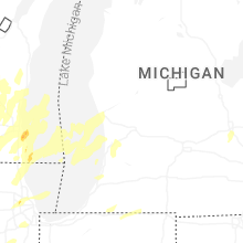


Connect with Interactive Hail Maps