

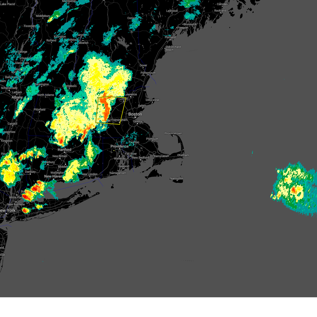
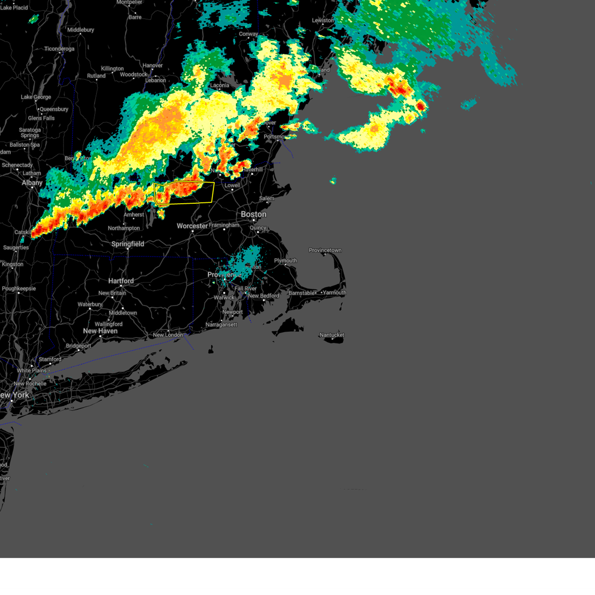
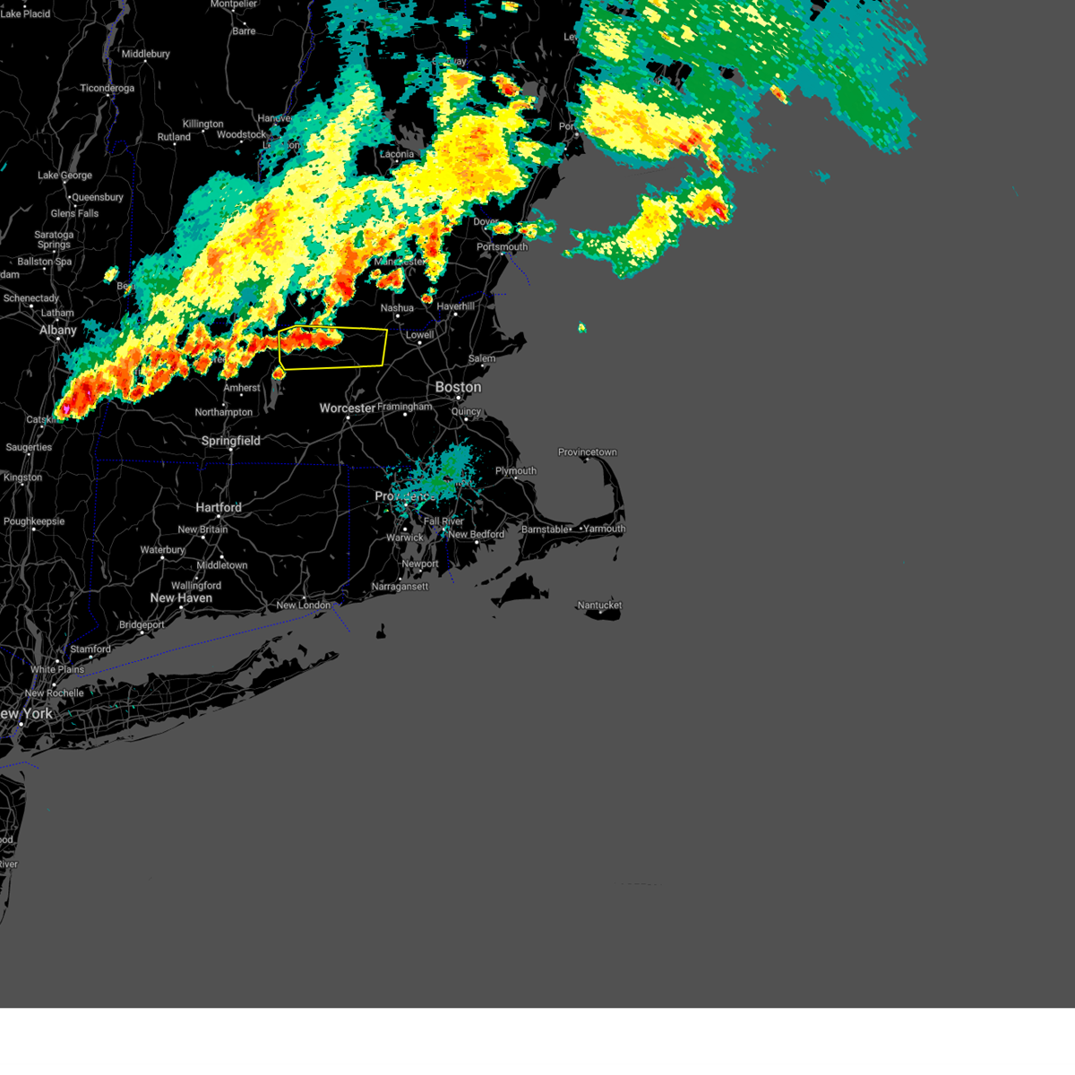
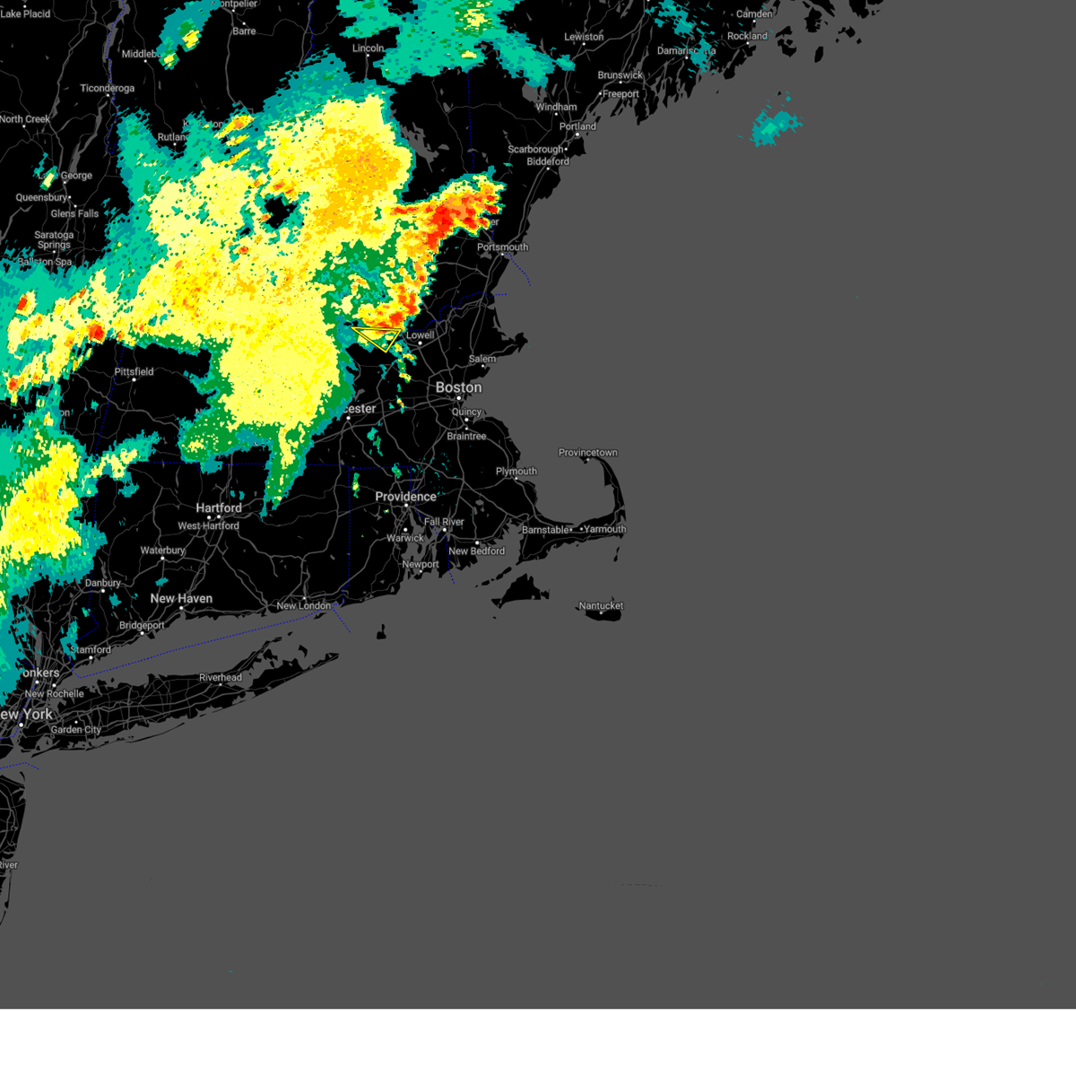
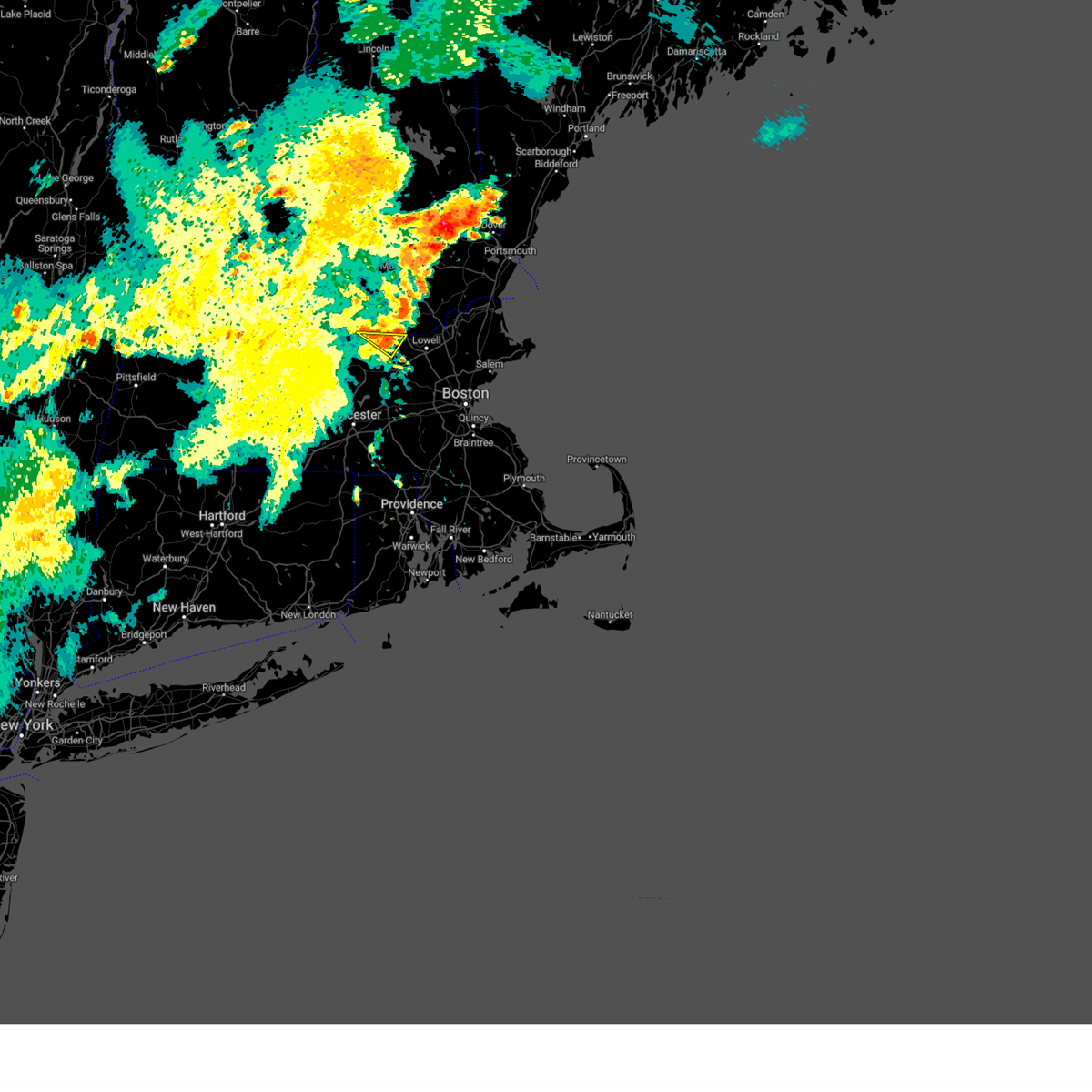
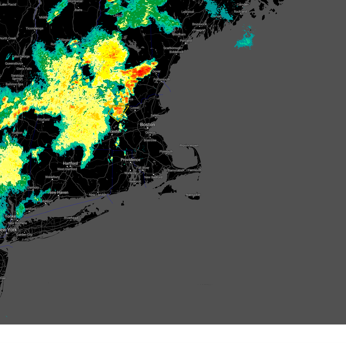
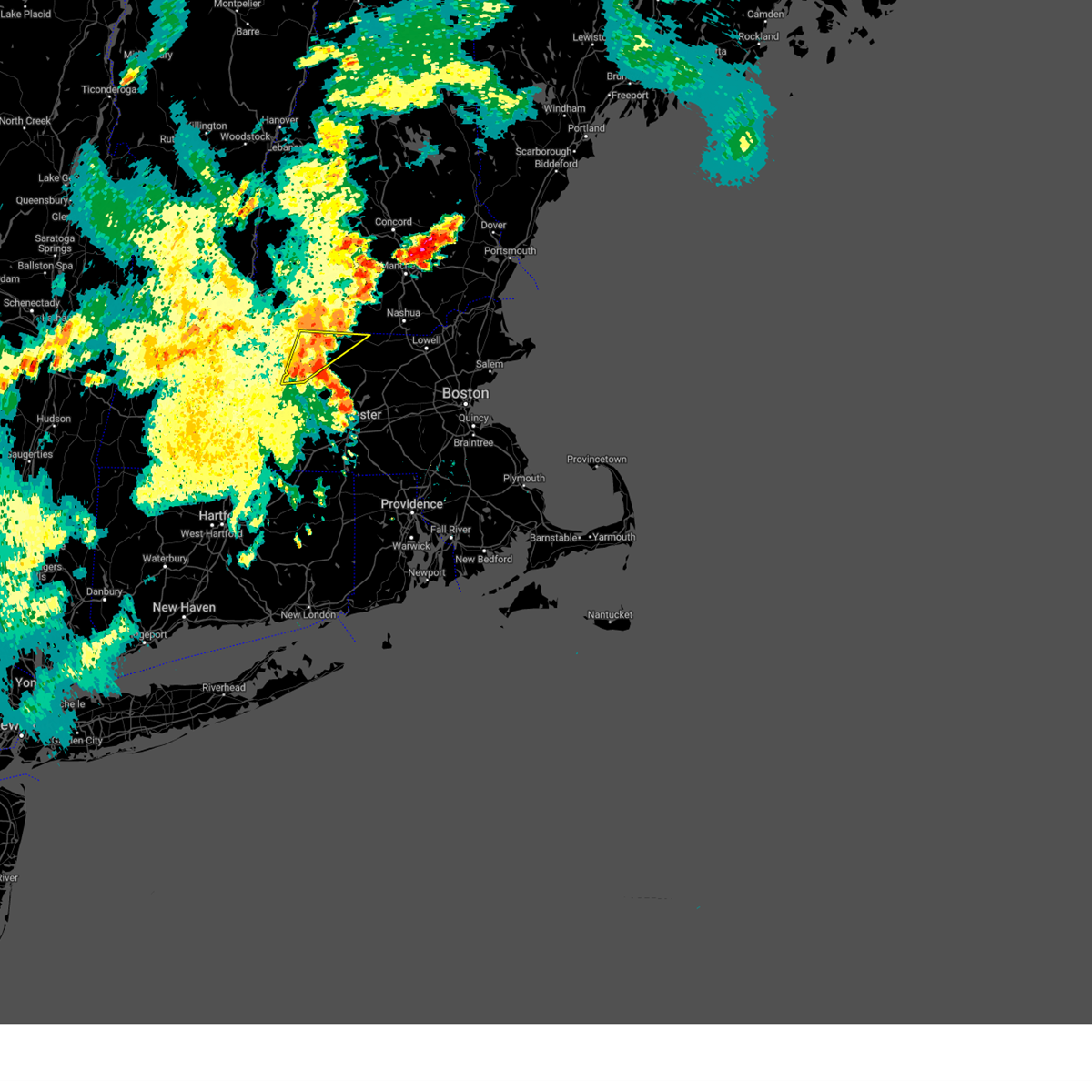
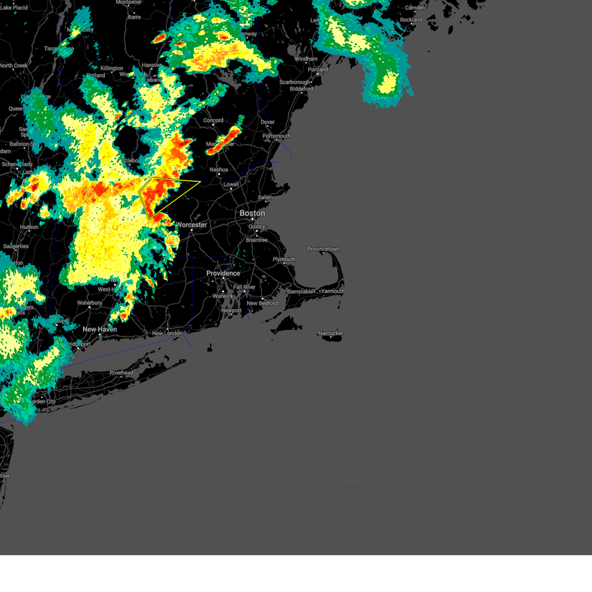
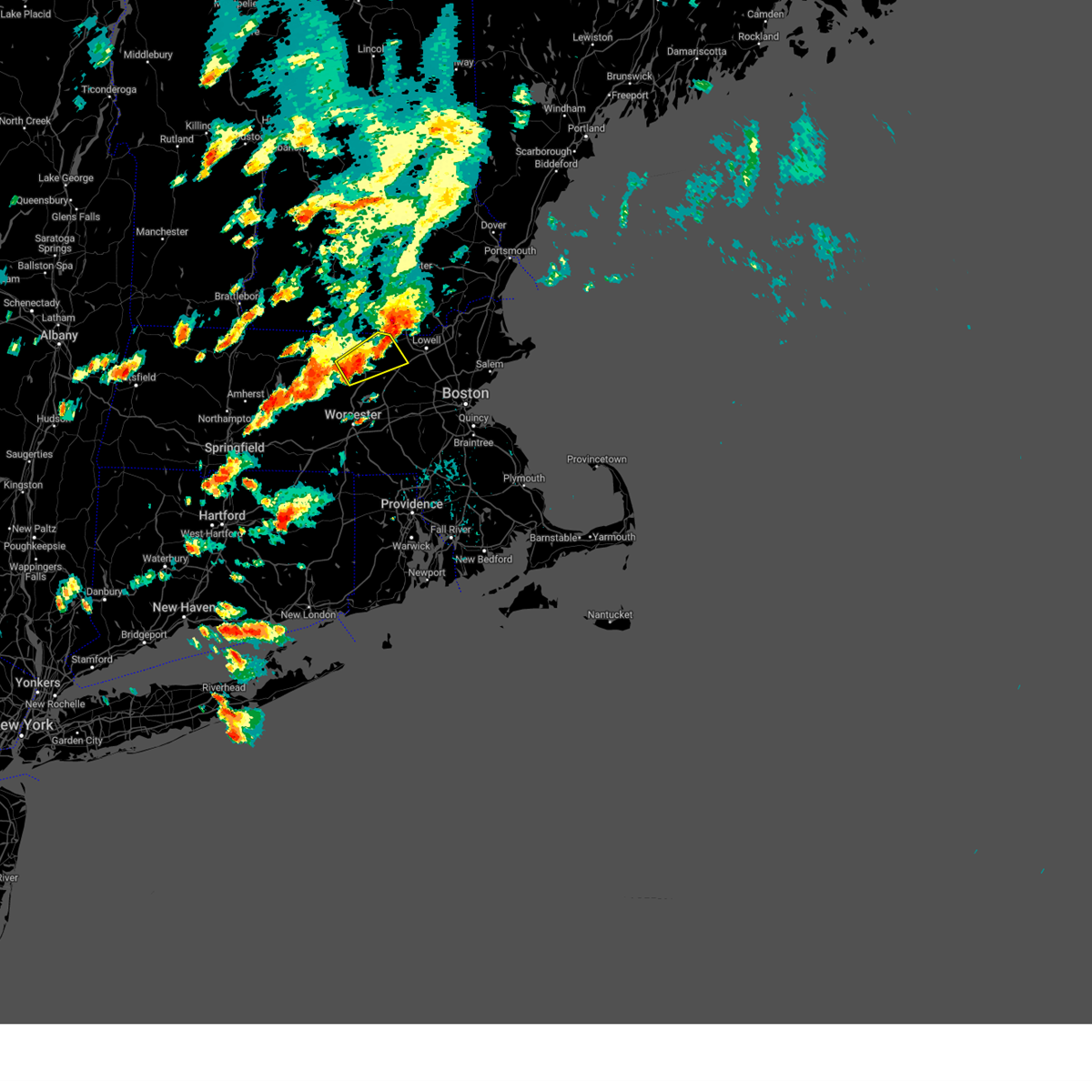
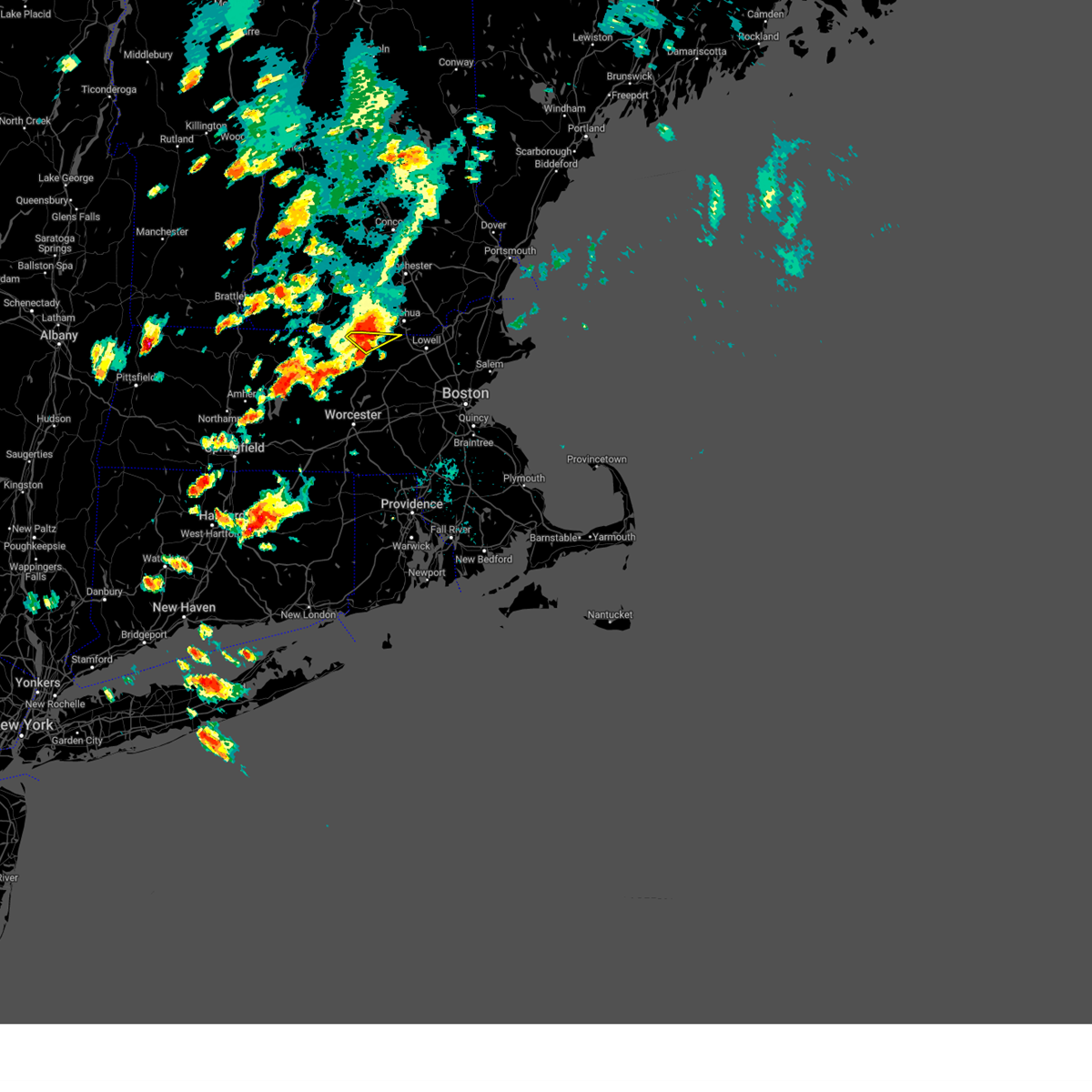
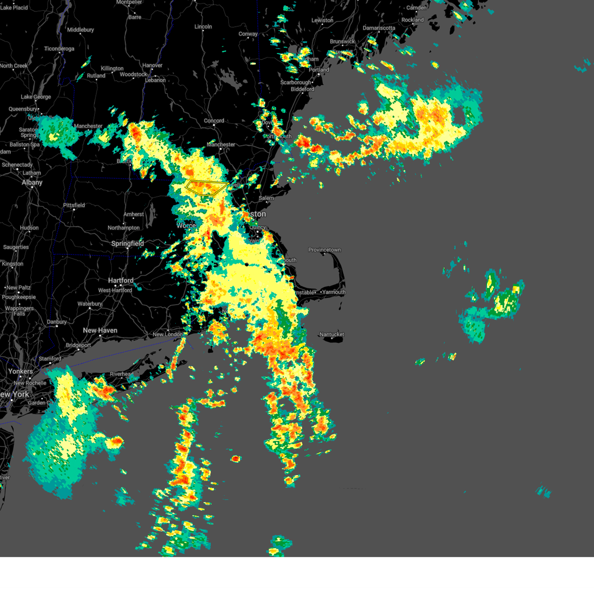
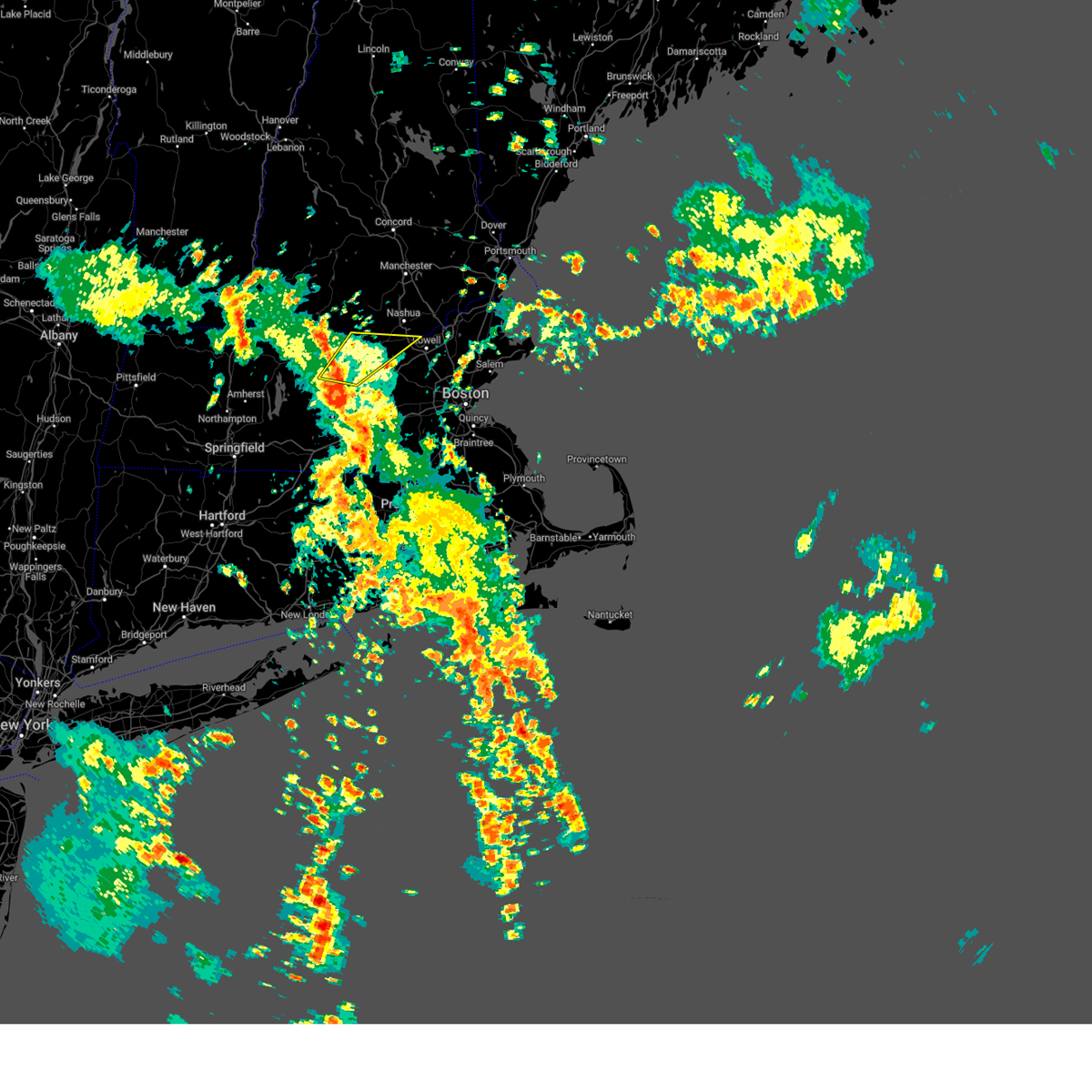
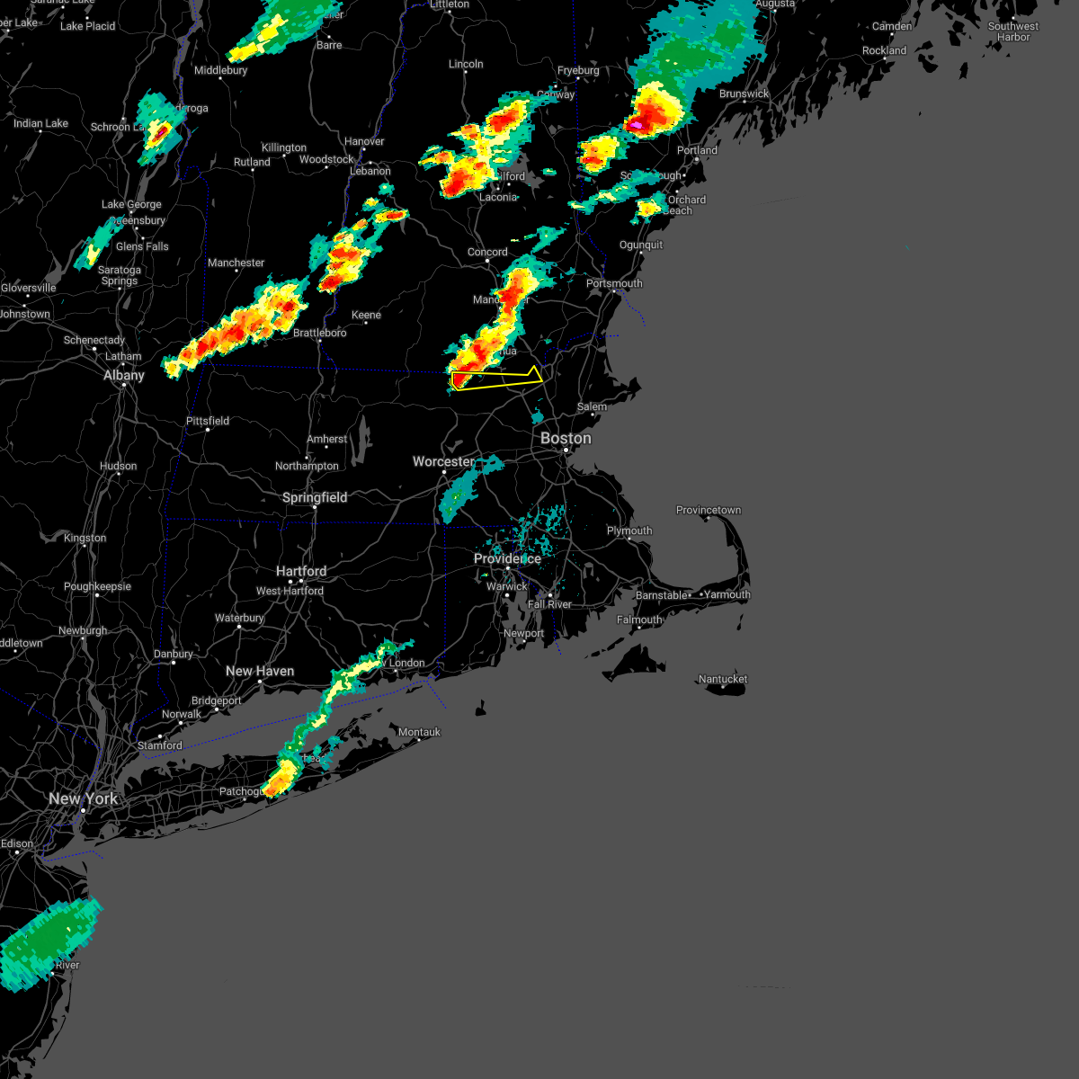
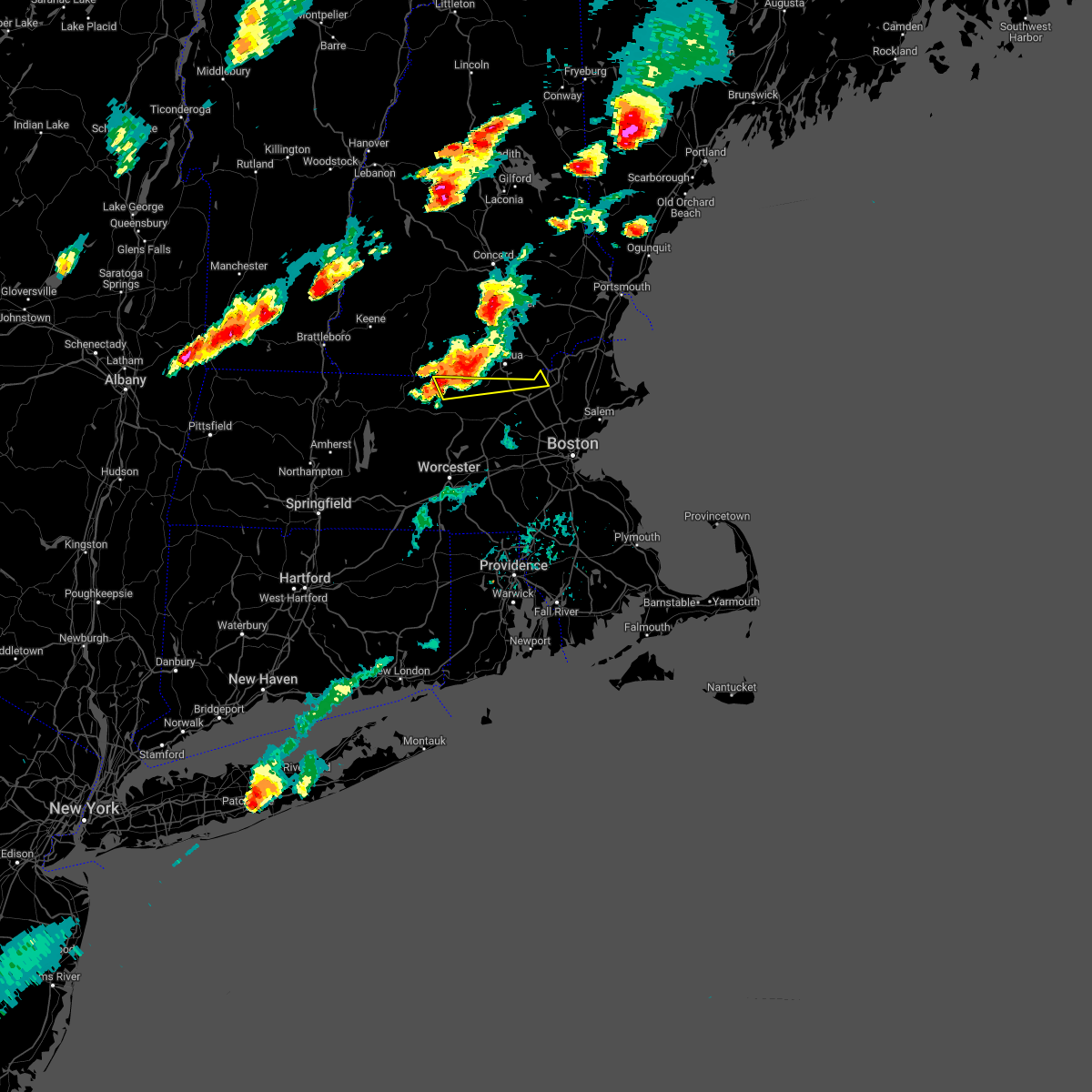
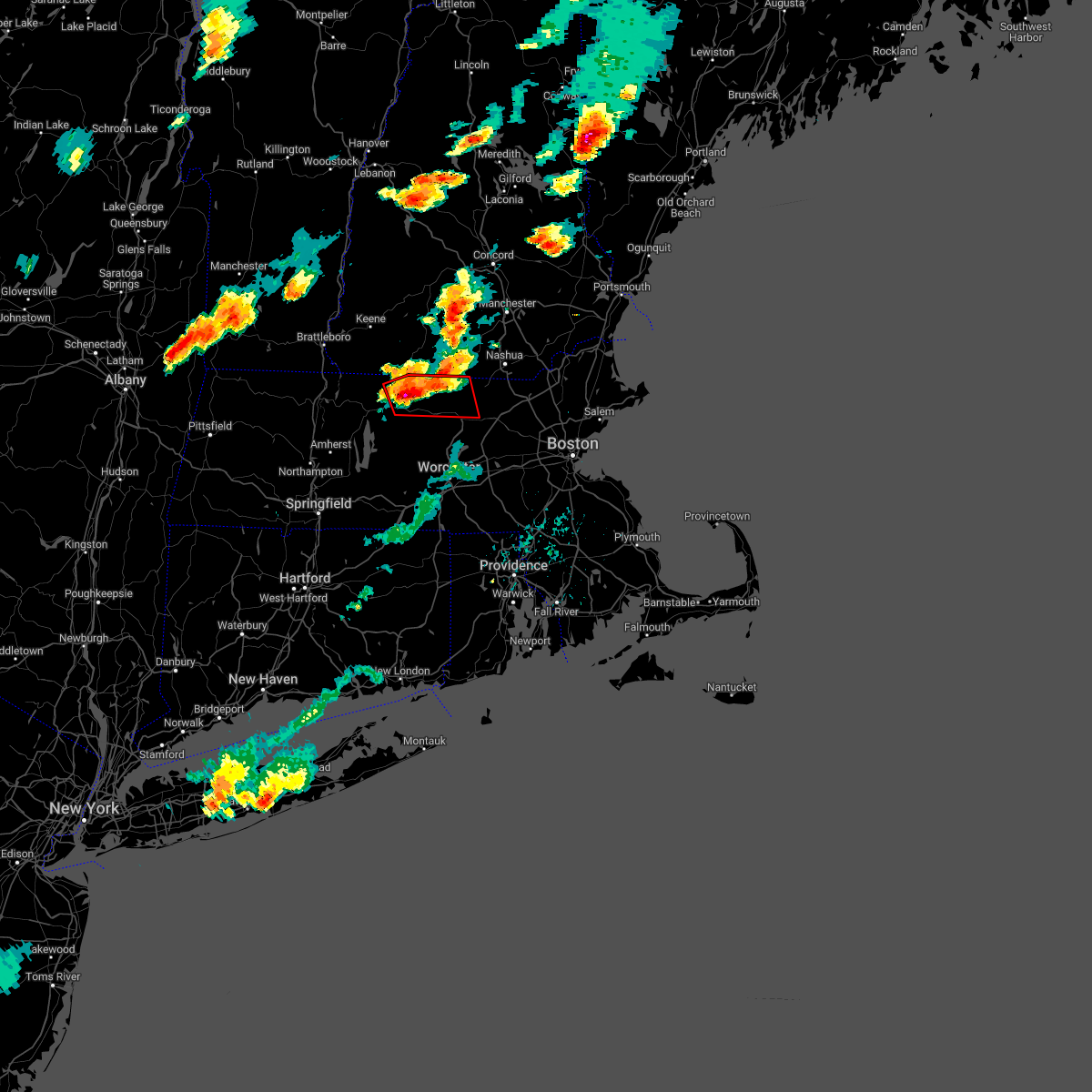
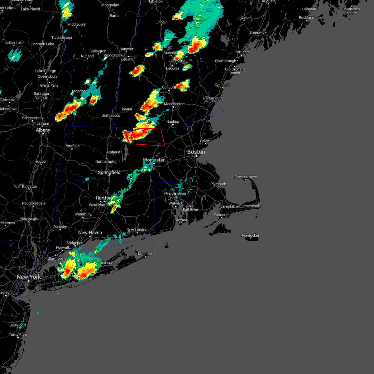
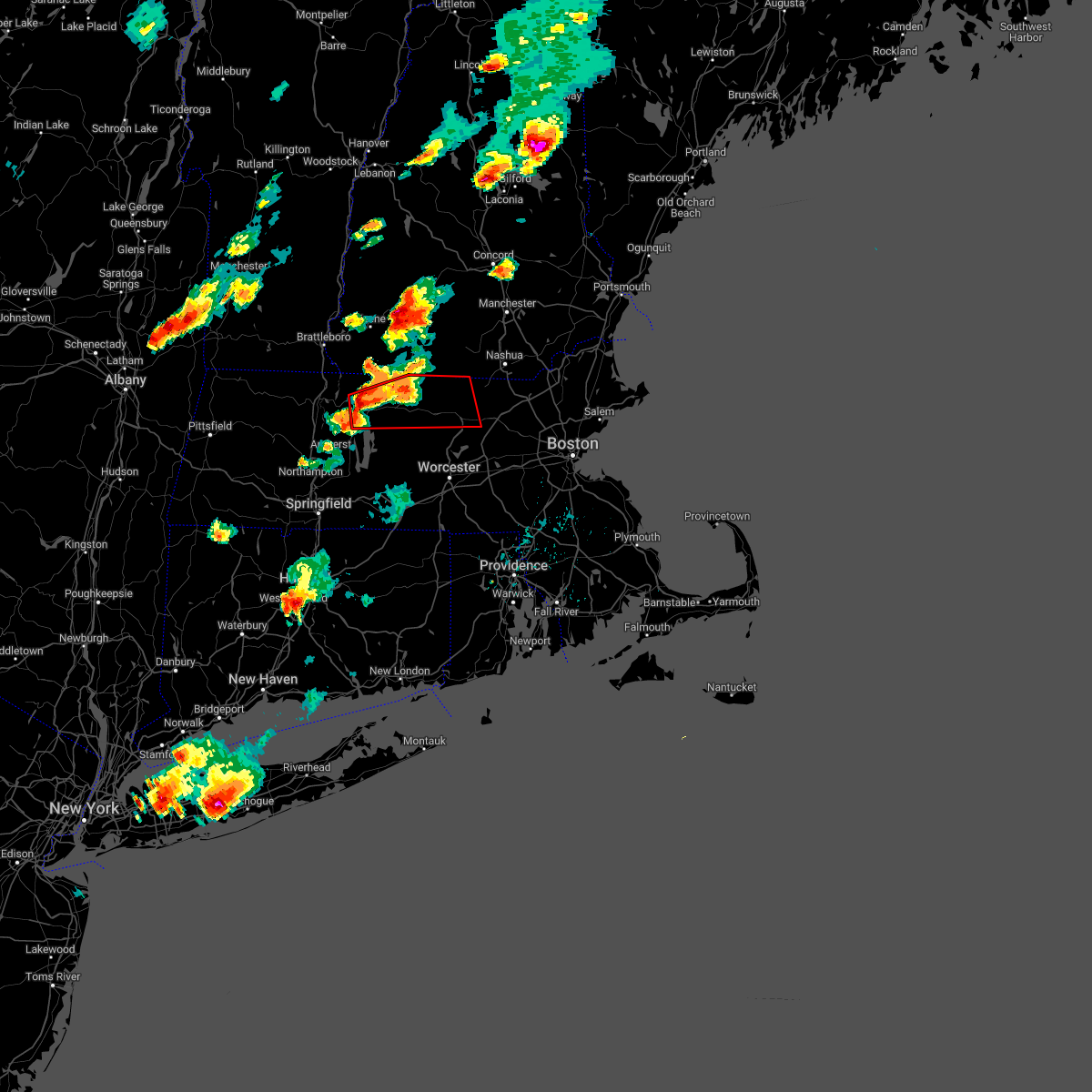
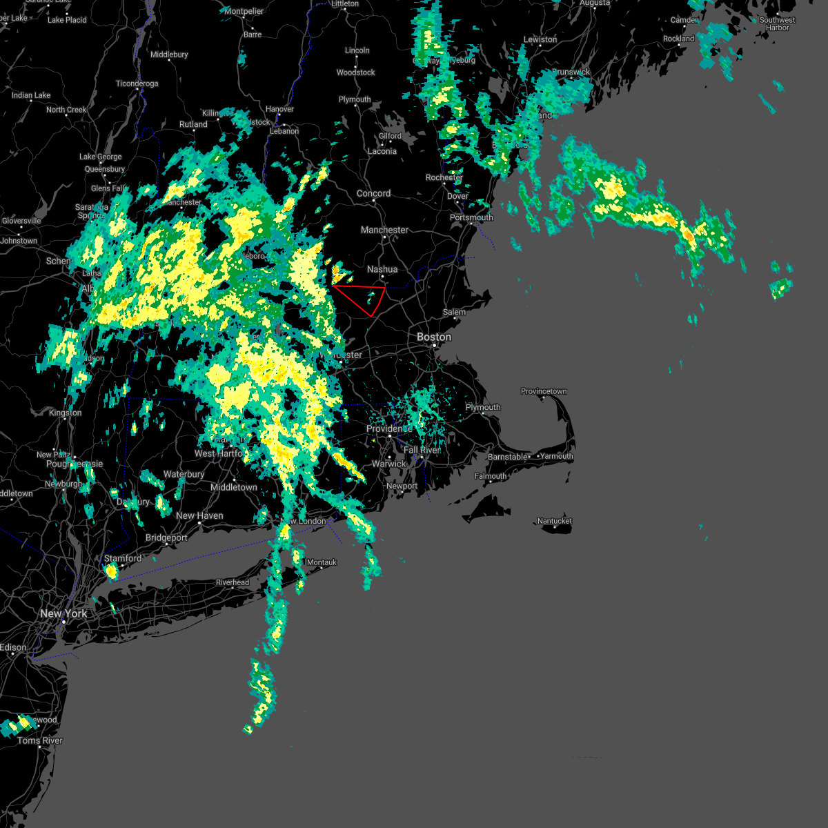
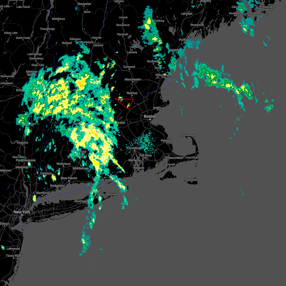
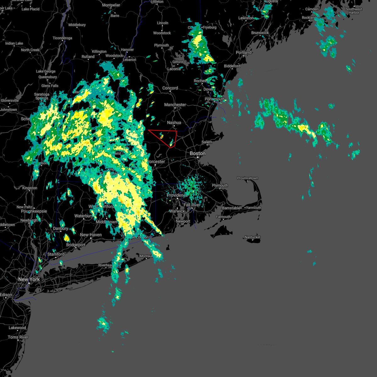
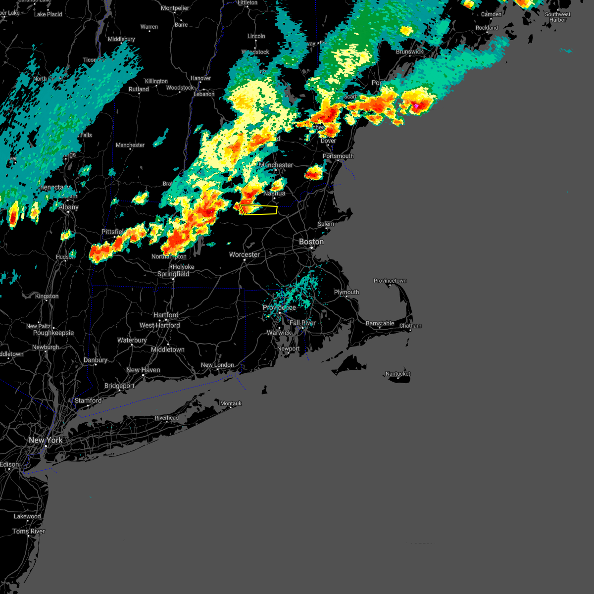
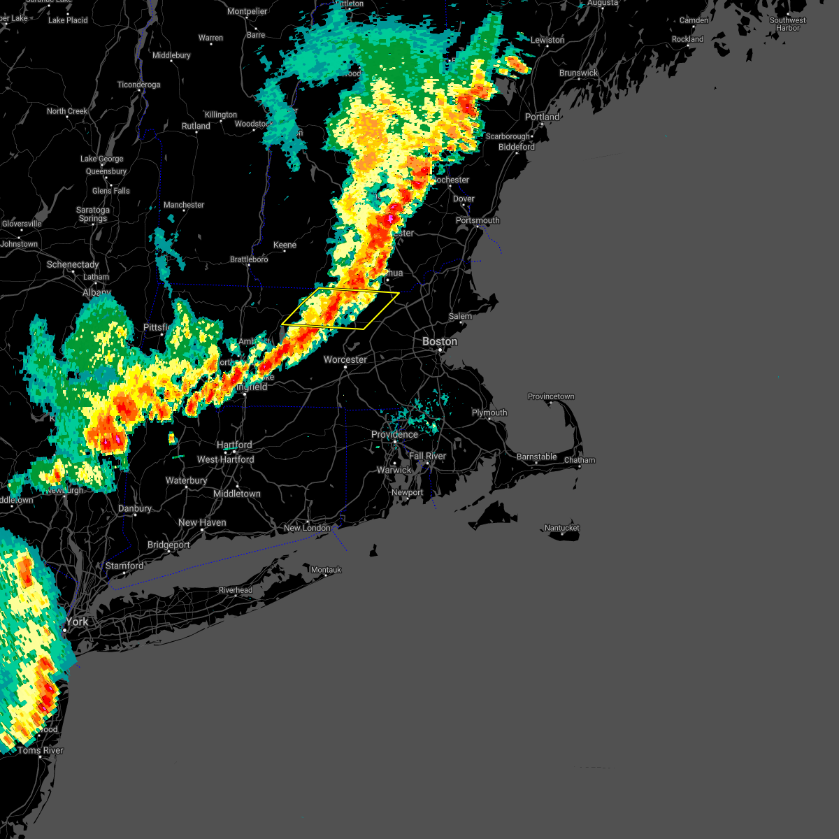
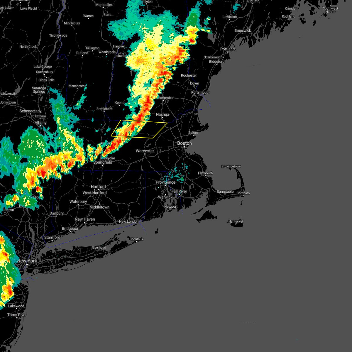
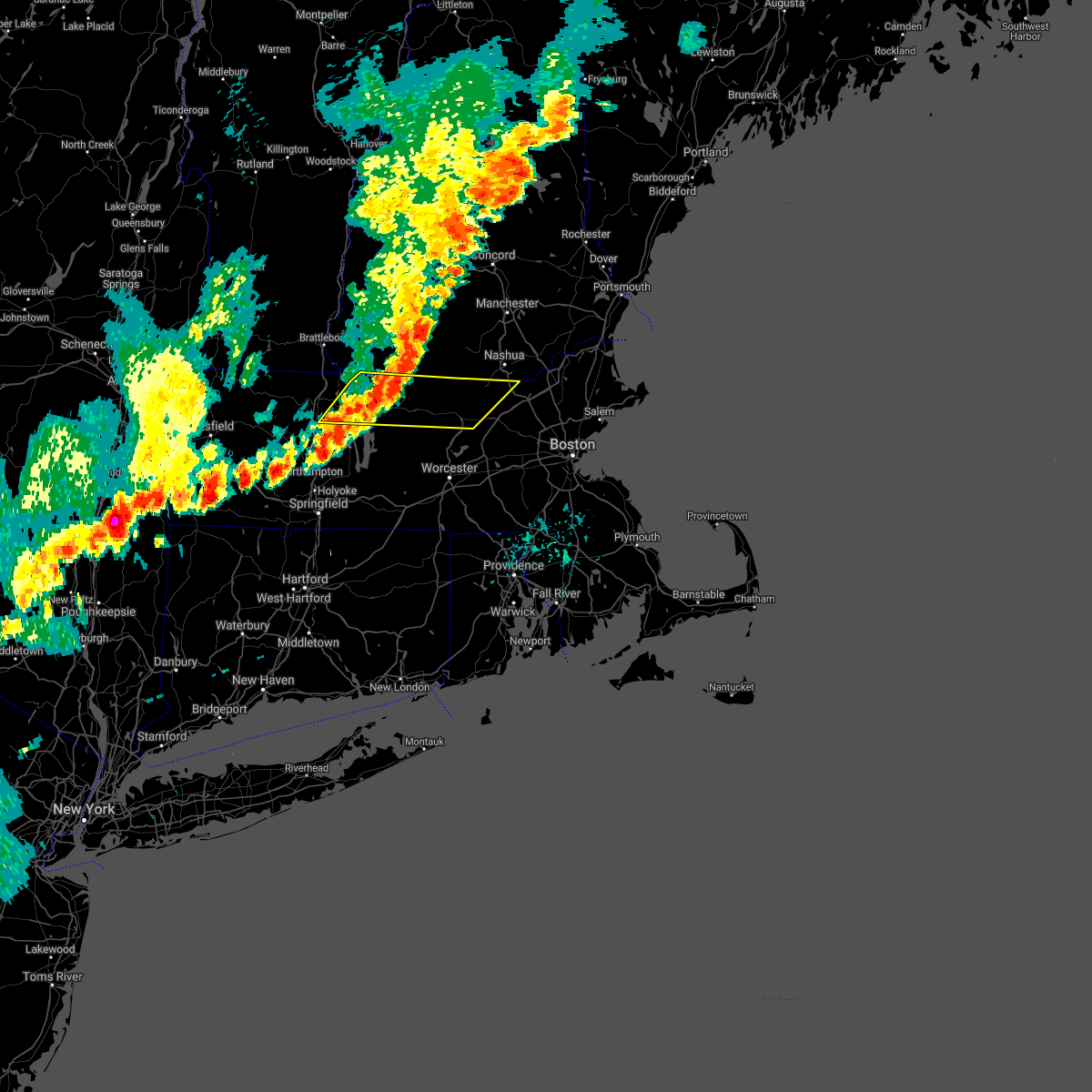
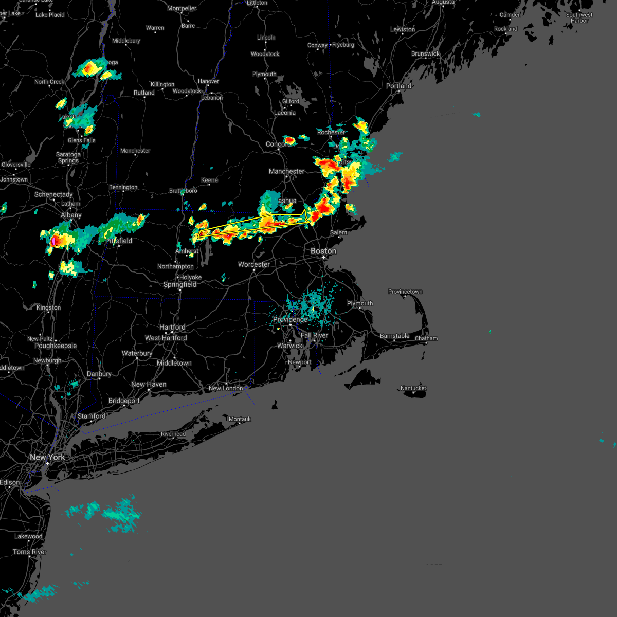
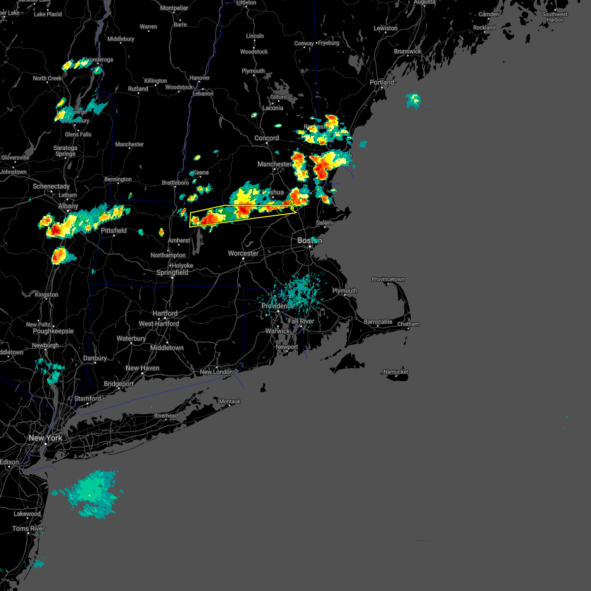
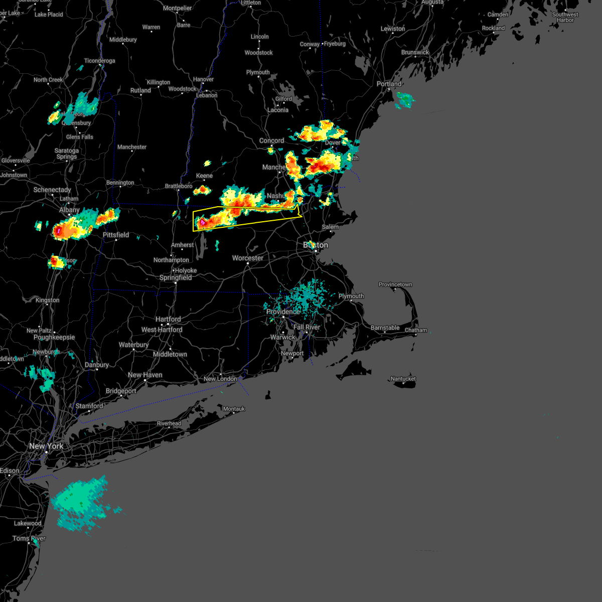
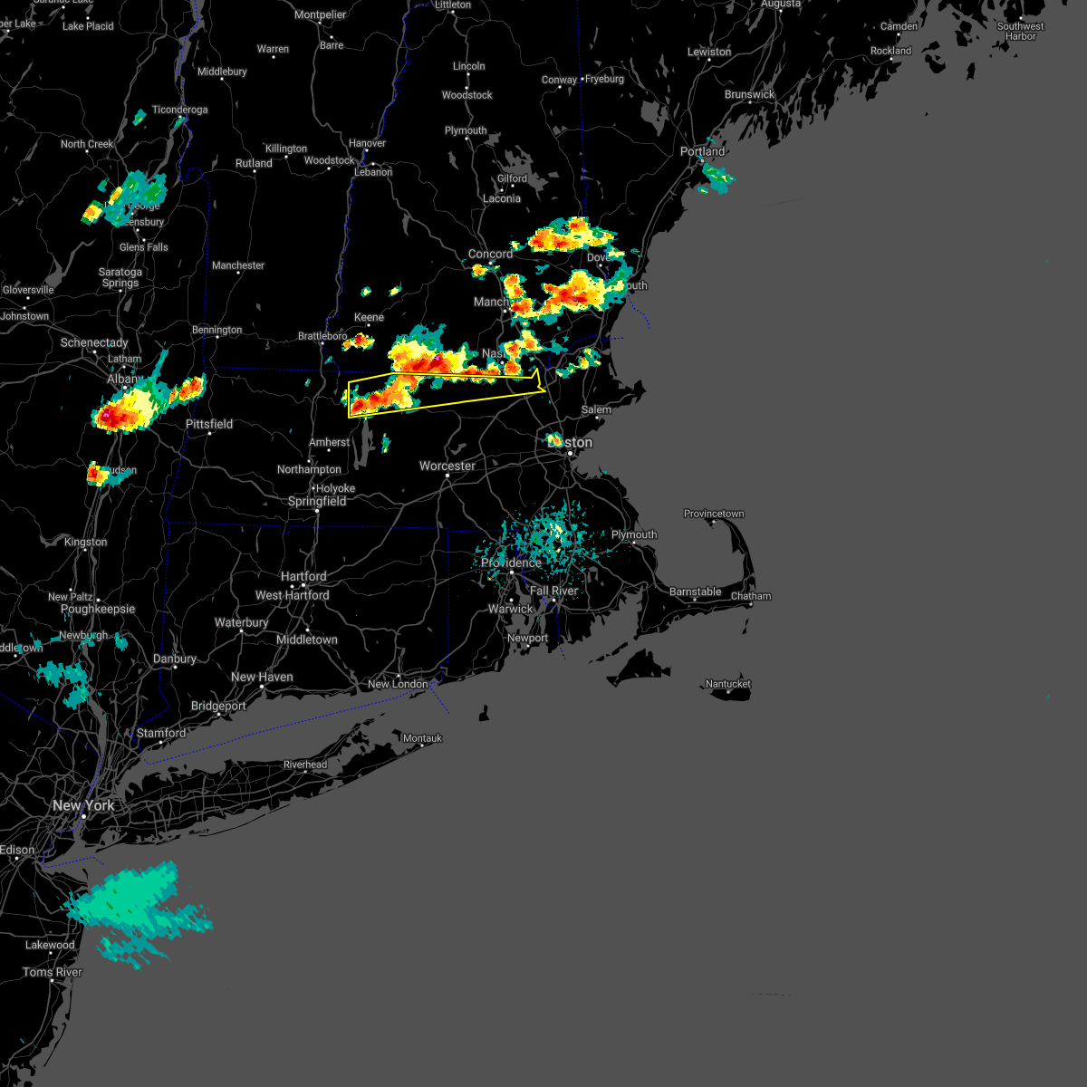
Hail Map for Townsend, MA
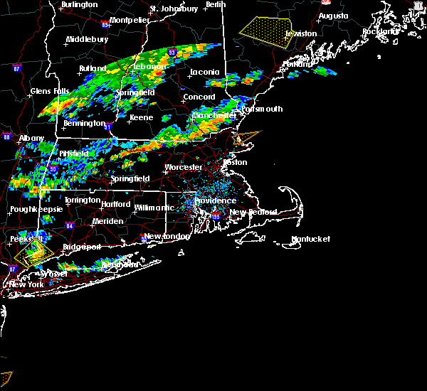
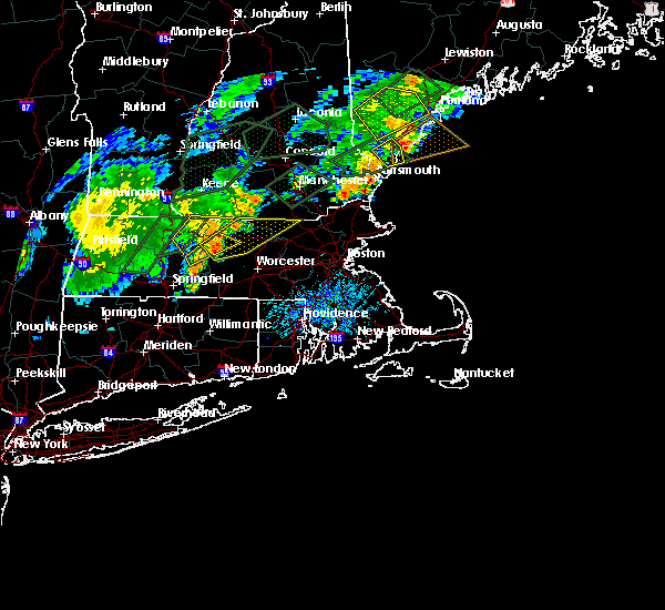
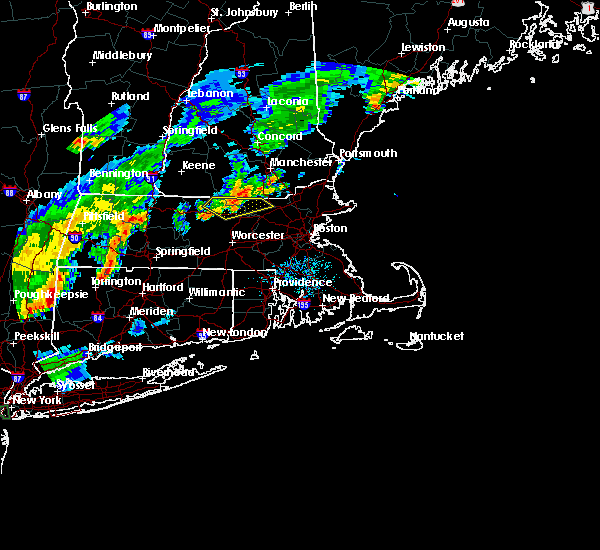
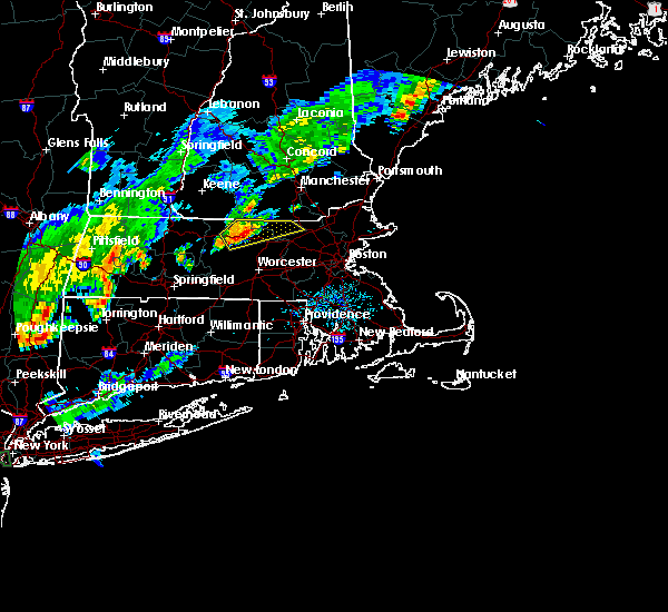
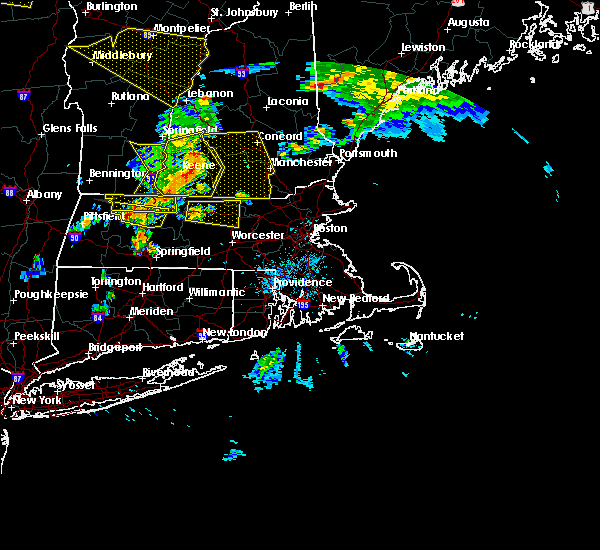
The Townsend, MA area has had 3 reports of on-the-ground hail by trained spotters, and has been under severe weather warnings 14 times during the past 12 months. Doppler radar has detected hail at or near Townsend, MA on 11 occasions.
| Name: | Townsend, MA |
| Where Located: | 60.4 miles NNW of Providence, RI |
| Map: | Google Map for Townsend, MA |
| Population: | 1128 |
| Housing Units: | 526 |
| More Info: | Search Google for Townsend, MA |
5
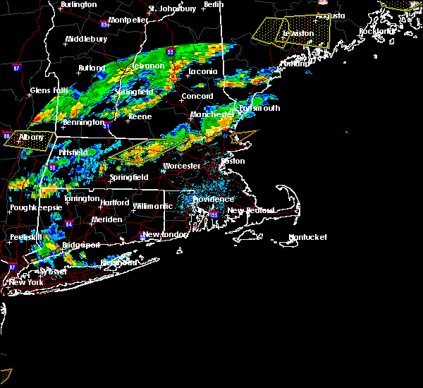
The Top Recent Hail Date for Townsend, MA is Friday, July 21, 2023 (3rd out of 11)

Hail and Wind Damage Spotted near Townsend, MA
| Date / Time | Report Details |
|---|---|
| 7/11/2025 6:55 PM EDT | The storm which prompted the warning has weakened below severe limits, and no longer poses an immediate threat to life or property. therefore, the warning will be allowed to expire. however gusty winds and heavy rain are still possible with this thunderstorm. |
| 7/11/2025 6:19 PM EDT | At 619 pm edt, a severe thunderstorm was located over shirley, or 7 miles east of leominster, moving south at 10 mph (radar indicated). Hazards include 60 mph wind gusts and penny size hail. Expect damage to trees and power lines. Locations impacted include, leominster, fitchburg, acton, pepperell, groton, lunenburg, townsend, littleton, lancaster, sterling, ayer, shirley, stow, harvard, boxborough, bolton, and dunstable. |
| 7/11/2025 6:01 PM EDT | Svrbox the national weather service in boston/norton has issued a * severe thunderstorm warning for, northeastern worcester county in central massachusetts, northwestern middlesex county in northeastern massachusetts, * until 700 pm edt. * at 600 pm edt, a severe thunderstorm was located over shirley, or 8 miles northeast of leominster, moving south at 10 mph (radar indicated). Hazards include 60 mph wind gusts and penny size hail. expect damage to trees and power lines |
| 7/11/2025 5:38 PM EDT | Quarter sized hail reported 4 miles SW of Townsend, MA, reported by weather spotter. time estimated by radar. |
| 5/3/2025 5:06 PM EDT | Svrbox the national weather service in boston/norton has issued a * severe thunderstorm warning for, northeastern windham county in northern connecticut, western essex county in northeastern massachusetts, suffolk county in eastern massachusetts, eastern worcester county in central massachusetts, central norfolk county in eastern massachusetts, middlesex county in northeastern massachusetts, * until 545 pm edt. * at 505 pm edt, severe thunderstorms were located along a line extending from fitchburg to near berlin to webster, moving east at 40 mph (automated weather station reported. at 455 pm edt, a wind gust of 61 mph was reported at worcester airport). Hazards include 60 mph wind gusts. expect damage to trees and power lines |
| 7/17/2024 7:00 PM EDT | At 700 pm edt, severe thunderstorms were located along a line extending from near groton to westborough to near dudley, moving east at 30 mph (radar indicated). Hazards include 60 mph wind gusts and penny size hail. Expect damage to roofs, siding, and trees. Locations impacted include, worcester, lowell, framingham, leominster, fitchburg, billerica, marlborough, shrewsbury, chelmsford, natick, dracut, westford, acton, hudson, westborough, concord, sudbury, ashland, hopkinton, and northborough. |
| 7/17/2024 6:49 PM EDT |
 the severe thunderstorm warning has been cancelled and is no longer in effect the severe thunderstorm warning has been cancelled and is no longer in effect
|
| 7/17/2024 6:49 PM EDT |
 At 648 pm edt, severe thunderstorms were located along a line extending from near groton to shrewsbury to southbridge, moving east at 60 mph (radar indicated). Hazards include 60 mph wind gusts and penny size hail. Expect damage to roofs, siding, and trees. Locations impacted include, worcester, lowell, framingham, leominster, fitchburg, billerica, marlborough, shrewsbury, chelmsford, natick, dracut, westford, acton, hudson, westborough, concord, sudbury, holden, ashland, and hopkinton. At 648 pm edt, severe thunderstorms were located along a line extending from near groton to shrewsbury to southbridge, moving east at 60 mph (radar indicated). Hazards include 60 mph wind gusts and penny size hail. Expect damage to roofs, siding, and trees. Locations impacted include, worcester, lowell, framingham, leominster, fitchburg, billerica, marlborough, shrewsbury, chelmsford, natick, dracut, westford, acton, hudson, westborough, concord, sudbury, holden, ashland, and hopkinton.
|
| 7/17/2024 6:23 PM EDT | Svrbox the national weather service in boston/norton has issued a * severe thunderstorm warning for, worcester county in central massachusetts, central middlesex county in northeastern massachusetts, southeastern hampden county in western massachusetts, * until 730 pm edt. * at 622 pm edt, severe thunderstorms were located along a line extending from near ashburnham to spencer to near monson, moving east at 30 mph (radar indicated). Hazards include 60 mph wind gusts and penny size hail. expect damage to roofs, siding, and trees |
| 7/16/2024 8:51 PM EDT |
 the severe thunderstorm warning has been cancelled and is no longer in effect the severe thunderstorm warning has been cancelled and is no longer in effect
|
| 7/16/2024 8:51 PM EDT |
 At 851 pm edt, severe thunderstorms were located along a line extending from near nashua to ayer to near worcester, moving east at 55 mph (radar indicated). Hazards include 60 mph wind gusts. Expect damage to roofs, siding, and trees. Locations impacted include, boston, worcester, lowell, cambridge, lynn, newton, lawrence, somerville, framingham, haverhill, waltham, malden, medford, peabody, methuen, arlington, leominster, fitchburg, billerica, and marlborough. At 851 pm edt, severe thunderstorms were located along a line extending from near nashua to ayer to near worcester, moving east at 55 mph (radar indicated). Hazards include 60 mph wind gusts. Expect damage to roofs, siding, and trees. Locations impacted include, boston, worcester, lowell, cambridge, lynn, newton, lawrence, somerville, framingham, haverhill, waltham, malden, medford, peabody, methuen, arlington, leominster, fitchburg, billerica, and marlborough.
|
| 7/16/2024 8:32 PM EDT |
 Svrbox the national weather service in boston/norton has issued a * severe thunderstorm warning for, essex county in northeastern massachusetts, central worcester county in central massachusetts, north central norfolk county in eastern massachusetts, northwestern suffolk county in eastern massachusetts, eastern hampshire county in western massachusetts, middlesex county in northeastern massachusetts, northeastern hampden county in western massachusetts, * until 915 pm edt. * at 830 pm edt, severe thunderstorms were located along a line extending from greenville to westminster to west brookfield, moving east at 45 mph (radar indicated). Hazards include 60 mph wind gusts. expect damage to roofs, siding, and trees Svrbox the national weather service in boston/norton has issued a * severe thunderstorm warning for, essex county in northeastern massachusetts, central worcester county in central massachusetts, north central norfolk county in eastern massachusetts, northwestern suffolk county in eastern massachusetts, eastern hampshire county in western massachusetts, middlesex county in northeastern massachusetts, northeastern hampden county in western massachusetts, * until 915 pm edt. * at 830 pm edt, severe thunderstorms were located along a line extending from greenville to westminster to west brookfield, moving east at 45 mph (radar indicated). Hazards include 60 mph wind gusts. expect damage to roofs, siding, and trees
|
| 7/16/2024 7:47 PM EDT |
 At 746 pm edt, severe thunderstorms were located along a line extending from new ipswich to near westminster to petersham, moving east at 55 mph (trained weather spotters). Hazards include 70 mph wind gusts. Expect considerable tree damage. damage is likely to mobile homes, roofs, and outbuildings. Locations impacted include, leominster, fitchburg, orange, gardner, hudson, holden, clinton, athol, pepperell, groton, winchendon, lunenburg, townsend, littleton, lancaster, templeton, rutland, sterling, west boylston, and ayer. At 746 pm edt, severe thunderstorms were located along a line extending from new ipswich to near westminster to petersham, moving east at 55 mph (trained weather spotters). Hazards include 70 mph wind gusts. Expect considerable tree damage. damage is likely to mobile homes, roofs, and outbuildings. Locations impacted include, leominster, fitchburg, orange, gardner, hudson, holden, clinton, athol, pepperell, groton, winchendon, lunenburg, townsend, littleton, lancaster, templeton, rutland, sterling, west boylston, and ayer.
|
| 7/16/2024 7:33 PM EDT |
 At 732 pm edt, severe thunderstorms were located along a line extending from near northfield to wendell to williamsburg, moving east at 45 mph (trained weather spotters). Hazards include 70 mph wind gusts. Expect considerable tree damage. damage is likely to mobile homes, roofs, and outbuildings. Locations impacted include, leominster, fitchburg, amherst, orange, deerfield, gardner, hudson, holden, clinton, athol, pepperell, groton, winchendon, lunenburg, townsend, littleton, montague, lancaster, templeton, and rutland. At 732 pm edt, severe thunderstorms were located along a line extending from near northfield to wendell to williamsburg, moving east at 45 mph (trained weather spotters). Hazards include 70 mph wind gusts. Expect considerable tree damage. damage is likely to mobile homes, roofs, and outbuildings. Locations impacted include, leominster, fitchburg, amherst, orange, deerfield, gardner, hudson, holden, clinton, athol, pepperell, groton, winchendon, lunenburg, townsend, littleton, montague, lancaster, templeton, and rutland.
|
| 7/16/2024 7:21 PM EDT |
 Svrbox the national weather service in boston/norton has issued a * severe thunderstorm warning for, northern worcester county in central massachusetts, central hampshire county in western massachusetts, northwestern middlesex county in northeastern massachusetts, eastern franklin county in western massachusetts, * until 815 pm edt. * at 721 pm edt, severe thunderstorms were located along a line extending from near warwick to near wendell to whately, moving east at 45 mph (trained weather spotters). Hazards include 70 mph wind gusts. Expect considerable tree damage. Damage is likely to mobile homes, roofs, and outbuildings. Svrbox the national weather service in boston/norton has issued a * severe thunderstorm warning for, northern worcester county in central massachusetts, central hampshire county in western massachusetts, northwestern middlesex county in northeastern massachusetts, eastern franklin county in western massachusetts, * until 815 pm edt. * at 721 pm edt, severe thunderstorms were located along a line extending from near warwick to near wendell to whately, moving east at 45 mph (trained weather spotters). Hazards include 70 mph wind gusts. Expect considerable tree damage. Damage is likely to mobile homes, roofs, and outbuildings.
|
| 6/20/2024 7:50 PM EDT | Tree and wires down at intersection of haynes road and trophy avenue. relayed by amateur radi in middlesex county MA, 2.4 miles WNW of Townsend, MA |
| 6/20/2024 7:50 PM EDT | Tree down near the 20 block of turner road in the town of townsend. relayed by amateur radi in middlesex county MA, 3.4 miles NNW of Townsend, MA |
| 6/20/2024 7:38 PM EDT |
 At 737 pm edt, a severe thunderstorm was located near ashburnham, or near fitchburg, moving east at 40 mph (radar indicated). Hazards include 60 mph wind gusts. Expect damage to roofs, siding, and trees. Locations impacted include, leominster, fitchburg, orange, gardner, athol, pepperell, groton, winchendon, lunenburg, townsend, lancaster, templeton, ayer, westminster, shirley, harvard, ashburnham, hubbardston, princeton, and dunstable. At 737 pm edt, a severe thunderstorm was located near ashburnham, or near fitchburg, moving east at 40 mph (radar indicated). Hazards include 60 mph wind gusts. Expect damage to roofs, siding, and trees. Locations impacted include, leominster, fitchburg, orange, gardner, athol, pepperell, groton, winchendon, lunenburg, townsend, lancaster, templeton, ayer, westminster, shirley, harvard, ashburnham, hubbardston, princeton, and dunstable.
|
| 6/20/2024 7:18 PM EDT |
 Svrbox the national weather service in boston/norton has issued a * severe thunderstorm warning for, northern worcester county in central massachusetts, northwestern middlesex county in northeastern massachusetts, eastern franklin county in western massachusetts, * until 815 pm edt. * at 718 pm edt, a severe thunderstorm was located near royalston, or 7 miles east of orange, moving east at 30 mph (radar indicated). Hazards include 60 mph wind gusts and quarter size hail. Hail damage to vehicles is expected. Expect wind damage to roofs, siding, and trees. Svrbox the national weather service in boston/norton has issued a * severe thunderstorm warning for, northern worcester county in central massachusetts, northwestern middlesex county in northeastern massachusetts, eastern franklin county in western massachusetts, * until 815 pm edt. * at 718 pm edt, a severe thunderstorm was located near royalston, or 7 miles east of orange, moving east at 30 mph (radar indicated). Hazards include 60 mph wind gusts and quarter size hail. Hail damage to vehicles is expected. Expect wind damage to roofs, siding, and trees.
|
| 9/8/2023 7:51 PM EDT |
 The severe thunderstorm warning for north central middlesex county will expire at 800 pm edt, the storm which prompted the warning has weakened below severe limits, and has exited the warned area. therefore, the warning will be allowed to expire. a severe thunderstorm watch remains in effect until 1100 pm edt for northeastern massachusetts. The severe thunderstorm warning for north central middlesex county will expire at 800 pm edt, the storm which prompted the warning has weakened below severe limits, and has exited the warned area. therefore, the warning will be allowed to expire. a severe thunderstorm watch remains in effect until 1100 pm edt for northeastern massachusetts.
|
| 9/8/2023 7:46 PM EDT |
 At 746 pm edt, a severe thunderstorm was located over dunstable, or near nashua, moving northeast at 50 mph (radar indicated). Hazards include 60 mph wind gusts and quarter size hail. Hail damage to vehicles is expected. expect wind damage to roofs, siding, and trees. locations impacted include, pepperell, groton, townsend, and dunstable. hail threat, radar indicated max hail size, 1. 00 in wind threat, radar indicated max wind gust, 60 mph. At 746 pm edt, a severe thunderstorm was located over dunstable, or near nashua, moving northeast at 50 mph (radar indicated). Hazards include 60 mph wind gusts and quarter size hail. Hail damage to vehicles is expected. expect wind damage to roofs, siding, and trees. locations impacted include, pepperell, groton, townsend, and dunstable. hail threat, radar indicated max hail size, 1. 00 in wind threat, radar indicated max wind gust, 60 mph.
|
| 9/8/2023 7:37 PM EDT |
 At 737 pm edt, a severe thunderstorm was located over townsend, or 7 miles northeast of fitchburg, moving northeast at 40 mph (radar indicated). Hazards include 60 mph wind gusts and quarter size hail. Hail damage to vehicles is expected. expect wind damage to roofs, siding, and trees. locations impacted include, leominster, fitchburg, pepperell, groton, lunenburg, townsend, lancaster, ayer, westminster, shirley, harvard, dunstable, and ashby. hail threat, radar indicated max hail size, 1. 00 in wind threat, radar indicated max wind gust, 60 mph. At 737 pm edt, a severe thunderstorm was located over townsend, or 7 miles northeast of fitchburg, moving northeast at 40 mph (radar indicated). Hazards include 60 mph wind gusts and quarter size hail. Hail damage to vehicles is expected. expect wind damage to roofs, siding, and trees. locations impacted include, leominster, fitchburg, pepperell, groton, lunenburg, townsend, lancaster, ayer, westminster, shirley, harvard, dunstable, and ashby. hail threat, radar indicated max hail size, 1. 00 in wind threat, radar indicated max wind gust, 60 mph.
|
| 9/8/2023 7:19 PM EDT |
 At 719 pm edt, a severe thunderstorm was located over sterling, or near leominster, moving northeast at 45 mph (radar indicated). Hazards include 60 mph wind gusts and quarter size hail. Hail damage to vehicles is expected. expect wind damage to roofs, siding, and trees. locations impacted include, lowell, leominster, fitchburg, marlborough, shrewsbury, chelmsford, dracut, westford, acton, hudson, westborough, holden, northborough, clinton, pepperell, tyngsborough, groton, lunenburg, townsend, and littleton. hail threat, radar indicated max hail size, 1. 00 in wind threat, radar indicated max wind gust, 60 mph. At 719 pm edt, a severe thunderstorm was located over sterling, or near leominster, moving northeast at 45 mph (radar indicated). Hazards include 60 mph wind gusts and quarter size hail. Hail damage to vehicles is expected. expect wind damage to roofs, siding, and trees. locations impacted include, lowell, leominster, fitchburg, marlborough, shrewsbury, chelmsford, dracut, westford, acton, hudson, westborough, holden, northborough, clinton, pepperell, tyngsborough, groton, lunenburg, townsend, and littleton. hail threat, radar indicated max hail size, 1. 00 in wind threat, radar indicated max wind gust, 60 mph.
|
| 9/8/2023 7:11 PM EDT |
 At 710 pm edt, severe thunderstorms were located along a line extending from near jaffrey to fitzwilliam to near templeton, moving northeast at 30 mph (radar indicated). Hazards include 60 mph wind gusts and penny size hail. Expect damage to roofs, siding, and trees. locations impacted include, fitchburg, gardner, athol, winchendon, townsend, templeton, westminster, ashburnham, hubbardston, ashby, phillipston, royalston, and petersham. hail threat, radar indicated max hail size, 0. 75 in wind threat, radar indicated max wind gust, 60 mph. At 710 pm edt, severe thunderstorms were located along a line extending from near jaffrey to fitzwilliam to near templeton, moving northeast at 30 mph (radar indicated). Hazards include 60 mph wind gusts and penny size hail. Expect damage to roofs, siding, and trees. locations impacted include, fitchburg, gardner, athol, winchendon, townsend, templeton, westminster, ashburnham, hubbardston, ashby, phillipston, royalston, and petersham. hail threat, radar indicated max hail size, 0. 75 in wind threat, radar indicated max wind gust, 60 mph.
|
| 9/8/2023 7:10 PM EDT |
 At 710 pm edt, a severe thunderstorm was located over princeton, or near leominster, moving northeast at 50 mph (radar indicated). Hazards include 60 mph wind gusts and quarter size hail. Hail damage to vehicles is expected. Expect wind damage to roofs, siding, and trees. At 710 pm edt, a severe thunderstorm was located over princeton, or near leominster, moving northeast at 50 mph (radar indicated). Hazards include 60 mph wind gusts and quarter size hail. Hail damage to vehicles is expected. Expect wind damage to roofs, siding, and trees.
|
| 9/8/2023 6:54 PM EDT |
 At 654 pm edt, severe thunderstorms were located along a line extending from near fitzwilliam to near royalston to near new salem, moving northeast at 35 mph (radar indicated). Hazards include 60 mph wind gusts and penny size hail. Expect damage to roofs, siding, and trees. locations impacted include, fitchburg, orange, gardner, athol, winchendon, townsend, templeton, westminster, ashburnham, hubbardston, ashby, northfield, erving, shutesbury, phillipston, royalston, petersham, new salem, wendell, and warwick. hail threat, radar indicated max hail size, 0. 75 in wind threat, radar indicated max wind gust, 60 mph. At 654 pm edt, severe thunderstorms were located along a line extending from near fitzwilliam to near royalston to near new salem, moving northeast at 35 mph (radar indicated). Hazards include 60 mph wind gusts and penny size hail. Expect damage to roofs, siding, and trees. locations impacted include, fitchburg, orange, gardner, athol, winchendon, townsend, templeton, westminster, ashburnham, hubbardston, ashby, northfield, erving, shutesbury, phillipston, royalston, petersham, new salem, wendell, and warwick. hail threat, radar indicated max hail size, 0. 75 in wind threat, radar indicated max wind gust, 60 mph.
|
| 9/8/2023 6:38 PM EDT |
 At 638 pm edt, severe thunderstorms were located along a line extending from near royalston to near orange to near pelham, moving northeast at 30 mph (radar indicated). Hazards include 60 mph wind gusts and penny size hail. expect damage to roofs, siding, and trees At 638 pm edt, severe thunderstorms were located along a line extending from near royalston to near orange to near pelham, moving northeast at 30 mph (radar indicated). Hazards include 60 mph wind gusts and penny size hail. expect damage to roofs, siding, and trees
|
| 7/21/2023 5:21 PM EDT | Multiple trees and wires downed on barker hill rd in townsend. power lost but was restored at 755 pm. time estimated by rada in middlesex county MA, 1.5 miles SSE of Townsend, MA |
| 7/21/2023 4:58 PM EDT |
 At 458 pm edt, a severe thunderstorm was located over leominster, moving northeast at 15 mph (radar indicated). Hazards include 60 mph wind gusts and quarter size hail. Expect wind damage to trees and power lines. Minor hail damage to vehicles is possible. At 458 pm edt, a severe thunderstorm was located over leominster, moving northeast at 15 mph (radar indicated). Hazards include 60 mph wind gusts and quarter size hail. Expect wind damage to trees and power lines. Minor hail damage to vehicles is possible.
|
| 7/21/2023 4:40 PM EDT | Trees down on lake potanipo and nh hwy 130 in brookline with diameters of 7-10 inches. small hail also reporte in hillsborough county NH, 4.9 miles SSW of Townsend, MA |
| 7/21/2023 4:36 PM EDT | Tree down on wires on barker hill rd near turnpike rd. relayed by amateur radi in middlesex county MA, 0.8 miles E of Townsend, MA |
| 7/21/2023 4:25 PM EDT |
 At 425 pm edt, a severe thunderstorm was located over townsend, or 7 miles northeast of fitchburg, moving northeast at 30 mph (radar indicated). Hazards include 60 mph wind gusts and quarter size hail. Expect wind damage to trees and power lines. Minor hail damage to vehicles is possible. At 425 pm edt, a severe thunderstorm was located over townsend, or 7 miles northeast of fitchburg, moving northeast at 30 mph (radar indicated). Hazards include 60 mph wind gusts and quarter size hail. Expect wind damage to trees and power lines. Minor hail damage to vehicles is possible.
|
| 7/16/2023 10:27 AM EDT |
 The tornado warning for northeastern worcester and northwestern middlesex counties will expire at 1030 am edt, the storm which prompted the warning has moved out of the area. therefore, the warning will be allowed to expire. however gusty winds are still possible with this thunderstorm. a tornado watch remains in effect until 300 pm edt for central and northeastern massachusetts. The tornado warning for northeastern worcester and northwestern middlesex counties will expire at 1030 am edt, the storm which prompted the warning has moved out of the area. therefore, the warning will be allowed to expire. however gusty winds are still possible with this thunderstorm. a tornado watch remains in effect until 300 pm edt for central and northeastern massachusetts.
|
| 7/16/2023 10:10 AM EDT |
 At 1010 am edt, a severe thunderstorm capable of producing a tornado was located over townsend, or 9 miles northeast of fitchburg, moving northeast at 35 mph (radar indicated rotation). Hazards include tornado. Flying debris will be dangerous to those caught without shelter. mobile homes will be damaged or destroyed. damage to roofs, windows, and vehicles will occur. tree damage is likely. This dangerous storm will be near, pepperell, groton, townsend and dunstable around 1015 am edt. At 1010 am edt, a severe thunderstorm capable of producing a tornado was located over townsend, or 9 miles northeast of fitchburg, moving northeast at 35 mph (radar indicated rotation). Hazards include tornado. Flying debris will be dangerous to those caught without shelter. mobile homes will be damaged or destroyed. damage to roofs, windows, and vehicles will occur. tree damage is likely. This dangerous storm will be near, pepperell, groton, townsend and dunstable around 1015 am edt.
|
| 7/16/2023 9:58 AM EDT |
 At 958 am edt, a severe thunderstorm was located over lunenburg, or near fitchburg, moving northeast at 30 mph (radar indicated). Hazards include 60 mph wind gusts. Expect damage to trees and power lines. Locations impacted include, leominster, fitchburg, pepperell, tyngsborough, groton, lunenburg, townsend, lancaster, ayer, shirley, harvard, dunstable and ashby. At 958 am edt, a severe thunderstorm was located over lunenburg, or near fitchburg, moving northeast at 30 mph (radar indicated). Hazards include 60 mph wind gusts. Expect damage to trees and power lines. Locations impacted include, leominster, fitchburg, pepperell, tyngsborough, groton, lunenburg, townsend, lancaster, ayer, shirley, harvard, dunstable and ashby.
|
| 7/16/2023 9:30 AM EDT |
 At 930 am edt, a severe thunderstorm was located over princeton, or near leominster, moving northeast at 30 mph (radar indicated). Hazards include 60 mph wind gusts. expect damage to trees and power lines At 930 am edt, a severe thunderstorm was located over princeton, or near leominster, moving northeast at 30 mph (radar indicated). Hazards include 60 mph wind gusts. expect damage to trees and power lines
|
| 6/27/2023 3:31 AM EDT |
 At 331 am edt, a severe thunderstorm was located over pepperell, or 9 miles northeast of fitchburg, moving northeast at 35 mph (radar indicated). Hazards include 60 mph wind gusts and penny size hail. Expect damage to trees and power lines. locations impacted include, fitchburg, dracut, westford, pepperell, tyngsborough, groton, lunenburg, townsend, ayer, shirley, ashburnham, dunstable and ashby. hail threat, radar indicated max hail size, 0. 75 in wind threat, radar indicated max wind gust, 60 mph. At 331 am edt, a severe thunderstorm was located over pepperell, or 9 miles northeast of fitchburg, moving northeast at 35 mph (radar indicated). Hazards include 60 mph wind gusts and penny size hail. Expect damage to trees and power lines. locations impacted include, fitchburg, dracut, westford, pepperell, tyngsborough, groton, lunenburg, townsend, ayer, shirley, ashburnham, dunstable and ashby. hail threat, radar indicated max hail size, 0. 75 in wind threat, radar indicated max wind gust, 60 mph.
|
| 6/27/2023 3:13 AM EDT |
 At 313 am edt, a severe thunderstorm was located over leominster, moving northeast at 35 mph (radar indicated). Hazards include 60 mph wind gusts and penny size hail. expect damage to trees and power lines At 313 am edt, a severe thunderstorm was located over leominster, moving northeast at 35 mph (radar indicated). Hazards include 60 mph wind gusts and penny size hail. expect damage to trees and power lines
|
| 8/7/2022 3:27 PM EDT | Large tree down across hwy 13 in hillsborough county NH, 4.3 miles SW of Townsend, MA |
| 7/28/2022 7:39 PM EDT |
 At 739 pm edt, severe thunderstorms were located along a line extending from brookline to near ashburnham, moving east at 55 mph (radar indicated). Hazards include 60 mph wind gusts. Expect damage to trees and power lines. these severe storms will be near, shirley around 750 pm edt. ayer and harvard around 755 pm edt. pepperell, groton and littleton around 800 pm edt. chelmsford and dunstable around 805 pm edt. lowell and tyngsborough around 810 pm edt. dracut around 815 pm edt. hail threat, radar indicated max hail size, <. 75 in wind threat, radar indicated max wind gust, 60 mph. At 739 pm edt, severe thunderstorms were located along a line extending from brookline to near ashburnham, moving east at 55 mph (radar indicated). Hazards include 60 mph wind gusts. Expect damage to trees and power lines. these severe storms will be near, shirley around 750 pm edt. ayer and harvard around 755 pm edt. pepperell, groton and littleton around 800 pm edt. chelmsford and dunstable around 805 pm edt. lowell and tyngsborough around 810 pm edt. dracut around 815 pm edt. hail threat, radar indicated max hail size, <. 75 in wind threat, radar indicated max wind gust, 60 mph.
|
| 7/28/2022 7:19 PM EDT |
 At 719 pm edt, severe thunderstorms were located along a line extending from near rindge to athol, moving east at 55 mph (radar indicated). Hazards include 60 mph wind gusts. Expect damage to trees and power lines. severe thunderstorms will be near, ashburnham around 725 pm edt. gardner and ashby around 735 pm edt. westminster and princeton around 740 pm edt. leominster and fitchburg around 745 pm edt. lunenburg, townsend and shirley around 750 pm edt. pepperell, groton, ayer and harvard around 755 pm edt. dracut, littleton and dunstable around 800 pm edt. chelmsford and tyngsborough around 805 pm edt. hail threat, radar indicated max hail size, <. 75 in wind threat, radar indicated max wind gust, 60 mph. At 719 pm edt, severe thunderstorms were located along a line extending from near rindge to athol, moving east at 55 mph (radar indicated). Hazards include 60 mph wind gusts. Expect damage to trees and power lines. severe thunderstorms will be near, ashburnham around 725 pm edt. gardner and ashby around 735 pm edt. westminster and princeton around 740 pm edt. leominster and fitchburg around 745 pm edt. lunenburg, townsend and shirley around 750 pm edt. pepperell, groton, ayer and harvard around 755 pm edt. dracut, littleton and dunstable around 800 pm edt. chelmsford and tyngsborough around 805 pm edt. hail threat, radar indicated max hail size, <. 75 in wind threat, radar indicated max wind gust, 60 mph.
|
| 7/21/2022 4:30 PM EDT | Half Dollar sized hail reported 5 miles SSW of Townsend, MA, hail fell in west brookline just west of highway 31 at the entrance to potanipo lake. time estimated by radar. |
| 7/21/2022 4:30 PM EDT | Wires down. time estimated by rada in hillsborough county NH, 4 miles SW of Townsend, MA |
| 7/21/2022 4:28 PM EDT |
 At 427 pm edt, a severe thunderstorm was located over townsend, or 9 miles southwest of nashua, moving east at 25 mph (radar indicated). Hazards include 60 mph wind gusts and penny size hail. Expect damage to trees and power lines. locations impacted include, lowell, methuen, andover, dracut, pepperell, tyngsborough, groton, townsend and dunstable. hail threat, radar indicated max hail size, 0. 75 in wind threat, radar indicated max wind gust, 60 mph. At 427 pm edt, a severe thunderstorm was located over townsend, or 9 miles southwest of nashua, moving east at 25 mph (radar indicated). Hazards include 60 mph wind gusts and penny size hail. Expect damage to trees and power lines. locations impacted include, lowell, methuen, andover, dracut, pepperell, tyngsborough, groton, townsend and dunstable. hail threat, radar indicated max hail size, 0. 75 in wind threat, radar indicated max wind gust, 60 mph.
|
| 7/21/2022 4:14 PM EDT |
 At 414 pm edt, a severe thunderstorm was located over ashby, or 7 miles north of fitchburg, moving east at 35 mph (radar indicated). Hazards include 60 mph wind gusts and penny size hail. expect damage to trees and power lines At 414 pm edt, a severe thunderstorm was located over ashby, or 7 miles north of fitchburg, moving east at 35 mph (radar indicated). Hazards include 60 mph wind gusts and penny size hail. expect damage to trees and power lines
|
| 7/21/2022 4:08 PM EDT | Hl159 reported trees and wires down. time estimated by rada in hillsborough county NH, 4.6 miles SSW of Townsend, MA |
| 7/21/2022 4:08 PM EDT | Telephone pole blown down. time estimated by rada in hillsborough county NH, 3.5 miles SW of Townsend, MA |
| 7/21/2022 4:05 PM EDT | Wires down. time estimated by rada in hillsborough county NH, 4.9 miles SSW of Townsend, MA |
| 7/21/2022 3:48 PM EDT |
 At 347 pm edt, a severe thunderstorm capable of producing a tornado was located over templeton, or 11 miles west of fitchburg, moving east at 25 mph (radar indicated rotation). Hazards include tornado and quarter size hail. Flying debris will be dangerous to those caught without shelter. mobile homes will be damaged or destroyed. damage to roofs, windows, and vehicles will occur. tree damage is likely. this dangerous storm will be near, ashburnham around 410 pm edt. westminster around 415 pm edt. fitchburg around 420 pm edt. ashby around 425 pm edt. leominster around 430 pm edt. Lunenburg, townsend and shirley around 440 pm edt. At 347 pm edt, a severe thunderstorm capable of producing a tornado was located over templeton, or 11 miles west of fitchburg, moving east at 25 mph (radar indicated rotation). Hazards include tornado and quarter size hail. Flying debris will be dangerous to those caught without shelter. mobile homes will be damaged or destroyed. damage to roofs, windows, and vehicles will occur. tree damage is likely. this dangerous storm will be near, ashburnham around 410 pm edt. westminster around 415 pm edt. fitchburg around 420 pm edt. ashby around 425 pm edt. leominster around 430 pm edt. Lunenburg, townsend and shirley around 440 pm edt.
|
| 7/21/2022 3:37 PM EDT |
 At 336 pm edt, a severe thunderstorm capable of producing a tornado was located over phillipston, or 8 miles east of orange, moving east at 40 mph (radar indicated rotation). Hazards include tornado and quarter size hail. Flying debris will be dangerous to those caught without shelter. mobile homes will be damaged or destroyed. damage to roofs, windows, and vehicles will occur. tree damage is likely. this dangerous storm will be near, templeton around 340 pm edt. winchendon and royalston around 345 pm edt. gardner around 350 pm edt. westminster and ashburnham around 400 pm edt. lunenburg and ashby around 410 pm edt. Townsend and shirley around 415 pm edt. At 336 pm edt, a severe thunderstorm capable of producing a tornado was located over phillipston, or 8 miles east of orange, moving east at 40 mph (radar indicated rotation). Hazards include tornado and quarter size hail. Flying debris will be dangerous to those caught without shelter. mobile homes will be damaged or destroyed. damage to roofs, windows, and vehicles will occur. tree damage is likely. this dangerous storm will be near, templeton around 340 pm edt. winchendon and royalston around 345 pm edt. gardner around 350 pm edt. westminster and ashburnham around 400 pm edt. lunenburg and ashby around 410 pm edt. Townsend and shirley around 415 pm edt.
|
| 7/21/2022 3:17 PM EDT |
 At 317 pm edt, a severe thunderstorm capable of producing a tornado was located near wendell, or near orange, moving east at 30 mph (radar indicated rotation). Hazards include tornado and half dollar size hail. Flying debris will be dangerous to those caught without shelter. mobile homes will be damaged or destroyed. damage to roofs, windows, and vehicles will occur. tree damage is likely. this dangerous storm will be near, orange around 330 pm edt. athol around 335 pm edt. phillipston and petersham around 340 pm edt. templeton around 345 pm edt. winchendon around 350 pm edt. gardner around 355 pm edt. westminster and ashburnham around 410 pm edt. Fitchburg, townsend and ashby around 415 pm edt. At 317 pm edt, a severe thunderstorm capable of producing a tornado was located near wendell, or near orange, moving east at 30 mph (radar indicated rotation). Hazards include tornado and half dollar size hail. Flying debris will be dangerous to those caught without shelter. mobile homes will be damaged or destroyed. damage to roofs, windows, and vehicles will occur. tree damage is likely. this dangerous storm will be near, orange around 330 pm edt. athol around 335 pm edt. phillipston and petersham around 340 pm edt. templeton around 345 pm edt. winchendon around 350 pm edt. gardner around 355 pm edt. westminster and ashburnham around 410 pm edt. Fitchburg, townsend and ashby around 415 pm edt.
|
| 3/7/2022 10:24 PM EST |
 The severe thunderstorm warning for central worcester, southeastern hampshire, northwestern middlesex and southeastern hampden counties will expire at 1030 pm est, the storms which prompted the warning have moved out of the area. therefore, the warning will be allowed to expire. The severe thunderstorm warning for central worcester, southeastern hampshire, northwestern middlesex and southeastern hampden counties will expire at 1030 pm est, the storms which prompted the warning have moved out of the area. therefore, the warning will be allowed to expire.
|
| 3/7/2022 10:03 PM EST | Large tree down on house on riverbank terrac in middlesex county MA, 0.3 miles WNW of Townsend, MA |
| 3/7/2022 10:03 PM EST |
 At 1003 pm est, severe thunderstorms were located along a line extending from near raymond to near leominster to near monson, moving east at 75 mph (radar indicated). Hazards include 60 mph wind gusts. Expect damage to trees and power lines. locations impacted include, worcester, springfield, leominster, fitchburg, shrewsbury, westford, ludlow, holden, southbridge, auburn, longmeadow, east longmeadow, belchertown, wilbraham, oxford, clinton, charlton, palmer, spencer and pepperell. hail threat, radar indicated max hail size, <. 75 in wind threat, radar indicated max wind gust, 60 mph. At 1003 pm est, severe thunderstorms were located along a line extending from near raymond to near leominster to near monson, moving east at 75 mph (radar indicated). Hazards include 60 mph wind gusts. Expect damage to trees and power lines. locations impacted include, worcester, springfield, leominster, fitchburg, shrewsbury, westford, ludlow, holden, southbridge, auburn, longmeadow, east longmeadow, belchertown, wilbraham, oxford, clinton, charlton, palmer, spencer and pepperell. hail threat, radar indicated max hail size, <. 75 in wind threat, radar indicated max wind gust, 60 mph.
|
| 3/7/2022 9:23 PM EST |
 At 923 pm est, severe thunderstorms were located along a line extending from nelson to near whately to near norfolk, moving east at 75 mph (radar indicated). Hazards include 60 mph wind gusts. expect damage to trees and power lines At 923 pm est, severe thunderstorms were located along a line extending from nelson to near whately to near norfolk, moving east at 75 mph (radar indicated). Hazards include 60 mph wind gusts. expect damage to trees and power lines
|
| 9/15/2021 7:53 PM EDT |
 At 752 pm edt, a severe thunderstorm was located near hardwick, or 16 miles southeast of orange, moving northeast at 35 mph (radar indicated). Hazards include 60 mph wind gusts and penny size hail. expect damage to trees and power lines At 752 pm edt, a severe thunderstorm was located near hardwick, or 16 miles southeast of orange, moving northeast at 35 mph (radar indicated). Hazards include 60 mph wind gusts and penny size hail. expect damage to trees and power lines
|
| 8/23/2021 2:10 PM EDT |
 The tornado warning for northeastern worcester and northwestern middlesex counties will expire at 215 pm edt, the storm which prompted the warning has weakened, and no longer appears capable of producing a tornado. therefore, the warning will be allowed to expire. The tornado warning for northeastern worcester and northwestern middlesex counties will expire at 215 pm edt, the storm which prompted the warning has weakened, and no longer appears capable of producing a tornado. therefore, the warning will be allowed to expire.
|
| 8/23/2021 1:55 PM EDT |
 At 155 pm edt, a storm capable of producing a brief and weak tornado was located over ayer, or 9 miles west of chelmsford, moving northwest at 20 mph (radar indicated rotation). Hazards include tornado. Flying debris will be dangerous to those caught without shelter. mobile homes will be damaged or destroyed. damage to roofs, windows, and vehicles will occur. tree damage is likely. Locations impacted include, pepperell, tyngsborough, groton, lunenburg, townsend, ayer, shirley, harvard, dunstable and ashby. At 155 pm edt, a storm capable of producing a brief and weak tornado was located over ayer, or 9 miles west of chelmsford, moving northwest at 20 mph (radar indicated rotation). Hazards include tornado. Flying debris will be dangerous to those caught without shelter. mobile homes will be damaged or destroyed. damage to roofs, windows, and vehicles will occur. tree damage is likely. Locations impacted include, pepperell, tyngsborough, groton, lunenburg, townsend, ayer, shirley, harvard, dunstable and ashby.
|
| 8/23/2021 1:35 PM EDT |
 At 134 pm edt, a storm capable of producing a tornado was located over littleton, or 9 miles southwest of chelmsford, moving north at 20 mph (weather spotters reported funnel cloud in west acton). Hazards include tornado. Flying debris will be dangerous to those caught without shelter. mobile homes will be damaged or destroyed. damage to roofs, windows, and vehicles will occur. Tree damage is likely. At 134 pm edt, a storm capable of producing a tornado was located over littleton, or 9 miles southwest of chelmsford, moving north at 20 mph (weather spotters reported funnel cloud in west acton). Hazards include tornado. Flying debris will be dangerous to those caught without shelter. mobile homes will be damaged or destroyed. damage to roofs, windows, and vehicles will occur. Tree damage is likely.
|
| 8/23/2021 12:53 PM EDT |
 At 1250 pm edt, a severe thunderstorm capable of producing a tornado was located over ayer, or 8 miles east of leominster, moving north at 20 mph, and a second storm 3 miles southwest of stow, moving north at 20 mph. these storms could produce a small and brief tornado (radar indicated rotation). Hazards include tornado. Flying debris will be dangerous to those caught without shelter. mobile homes will be damaged or destroyed. damage to roofs, windows, and vehicles will occur. tree damage is likely. Locations impacted include, leominster, westford, hudson, clinton, pepperell, tyngsborough, groton, lunenburg, townsend, littleton, lancaster, ayer, shirley, stow, harvard, boxborough, bolton, dunstable, ashby and berlin. At 1250 pm edt, a severe thunderstorm capable of producing a tornado was located over ayer, or 8 miles east of leominster, moving north at 20 mph, and a second storm 3 miles southwest of stow, moving north at 20 mph. these storms could produce a small and brief tornado (radar indicated rotation). Hazards include tornado. Flying debris will be dangerous to those caught without shelter. mobile homes will be damaged or destroyed. damage to roofs, windows, and vehicles will occur. tree damage is likely. Locations impacted include, leominster, westford, hudson, clinton, pepperell, tyngsborough, groton, lunenburg, townsend, littleton, lancaster, ayer, shirley, stow, harvard, boxborough, bolton, dunstable, ashby and berlin.
|
| 8/23/2021 12:26 PM EDT |
 At 1226 pm edt, a storm capable of producing a tornado was located over bolton, or near marlborough, moving north at 20 mph. this storm has a history of producing small and brief tornadoes (radar indicated rotation). Hazards include tornado. Flying debris will be dangerous to those caught without shelter. mobile homes will be damaged or destroyed. damage to roofs, windows, and vehicles will occur. Tree damage is likely. At 1226 pm edt, a storm capable of producing a tornado was located over bolton, or near marlborough, moving north at 20 mph. this storm has a history of producing small and brief tornadoes (radar indicated rotation). Hazards include tornado. Flying debris will be dangerous to those caught without shelter. mobile homes will be damaged or destroyed. damage to roofs, windows, and vehicles will occur. Tree damage is likely.
|
| 6/30/2021 5:00 PM EDT |
 At 500 pm edt, a severe thunderstorm was located over townsend, or 7 miles northeast of fitchburg, moving east at 20 mph (radar indicated). Hazards include 60 mph wind gusts and quarter size hail. Expect wind damage to trees and power lines. Minor hail damage to vehicles is possible. At 500 pm edt, a severe thunderstorm was located over townsend, or 7 miles northeast of fitchburg, moving east at 20 mph (radar indicated). Hazards include 60 mph wind gusts and quarter size hail. Expect wind damage to trees and power lines. Minor hail damage to vehicles is possible.
|
| 6/30/2021 4:58 PM EDT | A number of trees down along rt 130. some 6 to 8 inch diameter trees snapped. time estimated from rada in hillsborough county NH, 4.4 miles SSW of Townsend, MA |
| 5/26/2021 6:47 PM EDT |
 At 646 pm edt, severe thunderstorms were located along a line extending from amherst to near townsend to westminster, moving east at 35 mph (radar indicated). Hazards include 60 mph wind gusts. Expect damage to trees and power lines. Locations impacted include, leominster, fitchburg, westford, gardner, athol, pepperell, tyngsborough, groton, winchendon, lunenburg, townsend, lancaster, templeton, ayer, westminster, shirley, harvard, ashburnham, hubbardston and princeton. At 646 pm edt, severe thunderstorms were located along a line extending from amherst to near townsend to westminster, moving east at 35 mph (radar indicated). Hazards include 60 mph wind gusts. Expect damage to trees and power lines. Locations impacted include, leominster, fitchburg, westford, gardner, athol, pepperell, tyngsborough, groton, winchendon, lunenburg, townsend, lancaster, templeton, ayer, westminster, shirley, harvard, ashburnham, hubbardston and princeton.
|
| 5/26/2021 6:31 PM EDT |
 At 631 pm edt, severe thunderstorms were located along a line extending from wilton to near ashby to near templeton, moving east at 35 mph (radar indicated). Hazards include 60 mph wind gusts. Expect damage to trees and power lines. Locations impacted include, leominster, fitchburg, orange, westford, gardner, athol, pepperell, tyngsborough, groton, winchendon, lunenburg, townsend, lancaster, templeton, sterling, ayer, westminster, shirley, harvard and ashburnham. At 631 pm edt, severe thunderstorms were located along a line extending from wilton to near ashby to near templeton, moving east at 35 mph (radar indicated). Hazards include 60 mph wind gusts. Expect damage to trees and power lines. Locations impacted include, leominster, fitchburg, orange, westford, gardner, athol, pepperell, tyngsborough, groton, winchendon, lunenburg, townsend, lancaster, templeton, sterling, ayer, westminster, shirley, harvard and ashburnham.
|
| 5/26/2021 6:13 PM EDT |
 At 613 pm edt, severe thunderstorms were located along a line extending from near sharon to near winchendon to near new salem, moving east at 40 mph (radar indicated). Hazards include 60 mph wind gusts. expect damage to trees and power lines At 613 pm edt, severe thunderstorms were located along a line extending from near sharon to near winchendon to near new salem, moving east at 40 mph (radar indicated). Hazards include 60 mph wind gusts. expect damage to trees and power lines
|
| 11/15/2020 10:22 PM EST |
 At 1022 pm est, severe thunderstorms were located along a line extending from new ipswich to princeton to near woodstock, moving east at 50 mph (radar indicated). Hazards include 60 mph wind gusts. expect damage to trees and power lines At 1022 pm est, severe thunderstorms were located along a line extending from new ipswich to princeton to near woodstock, moving east at 50 mph (radar indicated). Hazards include 60 mph wind gusts. expect damage to trees and power lines
|
| 10/7/2020 5:41 PM EDT |
 The severe thunderstorm warning for central worcester, southeastern hampshire, northwestern middlesex, southeastern franklin and northeastern hampden counties will expire at 545 pm edt, the storms which prompted the warning have moved out of the area. therefore, the warning will be allowed to expire. The severe thunderstorm warning for central worcester, southeastern hampshire, northwestern middlesex, southeastern franklin and northeastern hampden counties will expire at 545 pm edt, the storms which prompted the warning have moved out of the area. therefore, the warning will be allowed to expire.
|
| 10/7/2020 5:27 PM EDT |
 At 526 pm edt, severe thunderstorms were located along a line extending from brookline to near sterling to near spencer, moving east at 70 mph (radar indicated). Hazards include 70 mph wind gusts. Expect considerable damage to trees and power lines. Damage is likely to mobile homes and outbuildings. At 526 pm edt, severe thunderstorms were located along a line extending from brookline to near sterling to near spencer, moving east at 70 mph (radar indicated). Hazards include 70 mph wind gusts. Expect considerable damage to trees and power lines. Damage is likely to mobile homes and outbuildings.
|
| 10/7/2020 5:11 PM EDT |
 At 510 pm edt, severe thunderstorms were located along a line extending from royalston to petersham to near amherst, moving east at 50 mph (radar indicated). Hazards include 60 mph wind gusts. Expect damage to trees and power lines. Locations impacted include, worcester, leominster, fitchburg, shrewsbury, gardner, holden, belchertown, northborough, clinton, palmer, spencer, pepperell, leicester, groton, winchendon, lunenburg, ware, townsend, lancaster and templeton. At 510 pm edt, severe thunderstorms were located along a line extending from royalston to petersham to near amherst, moving east at 50 mph (radar indicated). Hazards include 60 mph wind gusts. Expect damage to trees and power lines. Locations impacted include, worcester, leominster, fitchburg, shrewsbury, gardner, holden, belchertown, northborough, clinton, palmer, spencer, pepperell, leicester, groton, winchendon, lunenburg, ware, townsend, lancaster and templeton.
|
| 10/7/2020 4:50 PM EDT |
 At 450 pm edt, severe thunderstorms were located along a line extending from near northfield to near sunderland to near williamsburg, moving east at 50 mph (radar indicated). Hazards include 60 mph wind gusts. expect damage to trees and power lines At 450 pm edt, severe thunderstorms were located along a line extending from near northfield to near sunderland to near williamsburg, moving east at 50 mph (radar indicated). Hazards include 60 mph wind gusts. expect damage to trees and power lines
|
| 8/23/2020 4:02 PM EDT |
 At 400 pm edt, a severe thunderstorm was located over north andover, moving east at 20 mph (radar indicated. this storm has a history of producing wind damage in orange, athol and fitchburg. currently, the biggest concern is in the lawrence, andover, and topfield areas in essex county). Hazards include 60 mph wind gusts and quarter size hail. Expect wind damage to trees and power lines. minor hail damage to vehicles is possible. Locations impacted include, lowell, lawrence, haverhill, peabody, methuen, leominster, fitchburg, billerica, beverly, woburn, chelmsford, andover, dracut, tewksbury, gloucester, north andover, danvers, orange, reading and burlington. At 400 pm edt, a severe thunderstorm was located over north andover, moving east at 20 mph (radar indicated. this storm has a history of producing wind damage in orange, athol and fitchburg. currently, the biggest concern is in the lawrence, andover, and topfield areas in essex county). Hazards include 60 mph wind gusts and quarter size hail. Expect wind damage to trees and power lines. minor hail damage to vehicles is possible. Locations impacted include, lowell, lawrence, haverhill, peabody, methuen, leominster, fitchburg, billerica, beverly, woburn, chelmsford, andover, dracut, tewksbury, gloucester, north andover, danvers, orange, reading and burlington.
|
| 8/23/2020 3:54 PM EDT |
 At 352 pm edt, a severe thunderstorm was located over templeton, or 9 miles east of orange, moving east at 15 mph (radar indicated. numerous reports of wind damage and downed trees have occurred were still occurring across orange, athol, fitchburg, and lunenburg with these storms. this storm has a history of wind damage, seek an indoor shelter!). Hazards include 60 mph wind gusts and quarter size hail. Expect wind damage to trees and power lines. minor hail damage to vehicles is possible. Locations impacted include, lowell, fitchburg, chelmsford, andover, dracut, tewksbury, orange, westford, gardner, athol, pepperell, tyngsborough, groton, winchendon, lunenburg, townsend, templeton, westminster, shirley and ashburnham. At 352 pm edt, a severe thunderstorm was located over templeton, or 9 miles east of orange, moving east at 15 mph (radar indicated. numerous reports of wind damage and downed trees have occurred were still occurring across orange, athol, fitchburg, and lunenburg with these storms. this storm has a history of wind damage, seek an indoor shelter!). Hazards include 60 mph wind gusts and quarter size hail. Expect wind damage to trees and power lines. minor hail damage to vehicles is possible. Locations impacted include, lowell, fitchburg, chelmsford, andover, dracut, tewksbury, orange, westford, gardner, athol, pepperell, tyngsborough, groton, winchendon, lunenburg, townsend, templeton, westminster, shirley and ashburnham.
|
| 8/23/2020 3:47 PM EDT |
 At 346 pm edt, a severe thunderstorm was located over phillipston, or 9 miles southeast of orange, moving east at 15 mph. there are also several other storms stretching into northeast ma that may result in pockets of wind damage (radar indicated). Hazards include 60 mph wind gusts and quarter size hail. Expect wind damage to trees and power lines. Minor hail damage to vehicles is possible. At 346 pm edt, a severe thunderstorm was located over phillipston, or 9 miles southeast of orange, moving east at 15 mph. there are also several other storms stretching into northeast ma that may result in pockets of wind damage (radar indicated). Hazards include 60 mph wind gusts and quarter size hail. Expect wind damage to trees and power lines. Minor hail damage to vehicles is possible.
|
| 8/23/2020 3:35 PM EDT |
 At 333 pm edt, a severe thunderstorm was located over athol, or near orange, moving east at 15 mph (radar indicated two main areas of concern. the first is near and east of orange, where we have received reports of multiple trees down. the second area is in the ashby, townsend, and pepperell areas where the radar indicated strong winds). Hazards include 60 mph wind gusts and quarter size hail. Expect wind damage to trees and power lines. minor hail damage to vehicles is possible. Locations impacted include, lowell, fitchburg, chelmsford, andover, dracut, tewksbury, orange, westford, gardner, athol, pepperell, tyngsborough, groton, winchendon, lunenburg, townsend, templeton, westminster, shirley and ashburnham. At 333 pm edt, a severe thunderstorm was located over athol, or near orange, moving east at 15 mph (radar indicated two main areas of concern. the first is near and east of orange, where we have received reports of multiple trees down. the second area is in the ashby, townsend, and pepperell areas where the radar indicated strong winds). Hazards include 60 mph wind gusts and quarter size hail. Expect wind damage to trees and power lines. minor hail damage to vehicles is possible. Locations impacted include, lowell, fitchburg, chelmsford, andover, dracut, tewksbury, orange, westford, gardner, athol, pepperell, tyngsborough, groton, winchendon, lunenburg, townsend, templeton, westminster, shirley and ashburnham.
|
| 8/23/2020 3:21 PM EDT |
 At 319 pm edt, a severe thunderstorm was located over orange, moving east at 15 mph (radar indicated two areas of concern. the first over orange where multiple trees have been knocked down beginning at 256 pm. in addition, a strong wind signature was evident in the ashburnham to ashby area). Hazards include 60 mph wind gusts and quarter size hail. Expect wind damage to trees and power lines. minor hail damage to vehicles is possible. Locations impacted include, lowell, fitchburg, chelmsford, andover, dracut, tewksbury, orange, westford, gardner, athol, pepperell, tyngsborough, groton, winchendon, lunenburg, townsend, templeton, westminster, shirley and ashburnham. At 319 pm edt, a severe thunderstorm was located over orange, moving east at 15 mph (radar indicated two areas of concern. the first over orange where multiple trees have been knocked down beginning at 256 pm. in addition, a strong wind signature was evident in the ashburnham to ashby area). Hazards include 60 mph wind gusts and quarter size hail. Expect wind damage to trees and power lines. minor hail damage to vehicles is possible. Locations impacted include, lowell, fitchburg, chelmsford, andover, dracut, tewksbury, orange, westford, gardner, athol, pepperell, tyngsborough, groton, winchendon, lunenburg, townsend, templeton, westminster, shirley and ashburnham.
|
| 8/23/2020 3:14 PM EDT |
 At 313 pm edt, a severe thunderstorm was located over athol, or near orange, moving east at 15 mph (radar indicated). Hazards include 60 mph wind gusts and quarter size hail. Expect wind damage to trees and power lines. Minor hail damage to vehicles is possible. At 313 pm edt, a severe thunderstorm was located over athol, or near orange, moving east at 15 mph (radar indicated). Hazards include 60 mph wind gusts and quarter size hail. Expect wind damage to trees and power lines. Minor hail damage to vehicles is possible.
|
| 8/22/2020 10:38 AM EDT | Trees down on spaulding stree in middlesex county MA, 0.3 miles WNW of Townsend, MA |
| 8/22/2020 10:38 AM EDT | Trees down on spaulding stree in middlesex county MA, 0.3 miles WNW of Townsend, MA |
| 8/4/2020 5:08 PM EDT |
 At 507 pm edt, a severe thunderstorm capable of producing a tornado was located over shirley, or 8 miles east of fitchburg, moving north at 55 mph (radar indicated rotation). Hazards include tornado. Flying debris will be dangerous to those caught without shelter. mobile homes will be damaged or destroyed. damage to roofs, windows, and vehicles will occur. tree damage is likely. This tornadic thunderstorm will remain over mainly rural areas of northeastern worcester and northwestern middlesex counties. At 507 pm edt, a severe thunderstorm capable of producing a tornado was located over shirley, or 8 miles east of fitchburg, moving north at 55 mph (radar indicated rotation). Hazards include tornado. Flying debris will be dangerous to those caught without shelter. mobile homes will be damaged or destroyed. damage to roofs, windows, and vehicles will occur. tree damage is likely. This tornadic thunderstorm will remain over mainly rural areas of northeastern worcester and northwestern middlesex counties.
|
| 8/4/2020 4:58 PM EDT |
 The national weather service in boston/norton has issued a * tornado warning for. northeastern worcester county in central massachusetts. northwestern middlesex county in northeastern massachusetts. until 545 pm edt. At 458 pm edt, a severe thunderstorm capable of producing a tornado. The national weather service in boston/norton has issued a * tornado warning for. northeastern worcester county in central massachusetts. northwestern middlesex county in northeastern massachusetts. until 545 pm edt. At 458 pm edt, a severe thunderstorm capable of producing a tornado.
|
| 7/23/2020 2:33 PM EDT |
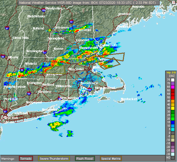 At 233 pm edt, a severe thunderstorm was located near fitchburg, moving northeast at 15 mph (radar indicated). Hazards include 60 mph wind gusts and penny size hail. expect damage to trees and power lines At 233 pm edt, a severe thunderstorm was located near fitchburg, moving northeast at 15 mph (radar indicated). Hazards include 60 mph wind gusts and penny size hail. expect damage to trees and power lines
|
| 7/5/2020 8:59 PM EDT |
 At 858 pm edt, a severe thunderstorm was located over lunenburg, moving southeast at 20 mph. another strong storm was moving southeast from sharon, new hampshire (radar indicated). Hazards include 60 mph wind gusts and quarter size hail. Expect wind damage to trees and power lines. minor hail damage to vehicles is possible. Locations impacted include, leominster, fitchburg, marlborough, chelmsford, westford, acton, hudson, concord, clinton, pepperell, tyngsborough, groton, maynard, lunenburg, townsend, littleton, lancaster, ayer, shirley and stow. At 858 pm edt, a severe thunderstorm was located over lunenburg, moving southeast at 20 mph. another strong storm was moving southeast from sharon, new hampshire (radar indicated). Hazards include 60 mph wind gusts and quarter size hail. Expect wind damage to trees and power lines. minor hail damage to vehicles is possible. Locations impacted include, leominster, fitchburg, marlborough, chelmsford, westford, acton, hudson, concord, clinton, pepperell, tyngsborough, groton, maynard, lunenburg, townsend, littleton, lancaster, ayer, shirley and stow.
|
| 7/5/2020 8:37 PM EDT |
 At 837 pm edt, a severe thunderstorm was located over mason, or 7 miles northeast of fitchburg, moving southeast at 25 mph (radar indicated). Hazards include 60 mph wind gusts and quarter size hail. Expect wind damage to trees and power lines. Minor hail damage to vehicles is possible. At 837 pm edt, a severe thunderstorm was located over mason, or 7 miles northeast of fitchburg, moving southeast at 25 mph (radar indicated). Hazards include 60 mph wind gusts and quarter size hail. Expect wind damage to trees and power lines. Minor hail damage to vehicles is possible.
|
| 5/15/2020 8:46 PM EDT | Tree down on old city rd and fitchburg rd in middlesex county MA, 0.3 miles WNW of Townsend, MA |
| 5/15/2020 8:20 PM EDT |
 At 819 pm edt, a severe thunderstorm was located over townsend, or near fitchburg, moving east at 50 mph (radar indicated. multiple reports of trees and powerlines have been reported downed in northfield from these storms). Hazards include 60 mph wind gusts and quarter size hail. Expect wind damage to trees and power lines. minor hail damage to vehicles is possible. Locations impacted include, leominster, fitchburg, gardner, athol, pepperell, winchendon, lunenburg, townsend, templeton, rutland, westminster, ashburnham, barre, hubbardston, princeton, ashby, hardwick, oakham, shutesbury and phillipston. At 819 pm edt, a severe thunderstorm was located over townsend, or near fitchburg, moving east at 50 mph (radar indicated. multiple reports of trees and powerlines have been reported downed in northfield from these storms). Hazards include 60 mph wind gusts and quarter size hail. Expect wind damage to trees and power lines. minor hail damage to vehicles is possible. Locations impacted include, leominster, fitchburg, gardner, athol, pepperell, winchendon, lunenburg, townsend, templeton, rutland, westminster, ashburnham, barre, hubbardston, princeton, ashby, hardwick, oakham, shutesbury and phillipston.
|
| 5/15/2020 8:08 PM EDT |
 At 808 pm edt, a severe thunderstorm was located over townsend, or near fitchburg, moving east at 45 mph (radar indicated). Hazards include 60 mph wind gusts and quarter size hail. Expect wind damage to trees and power lines. Minor hail damage to vehicles is possible. At 808 pm edt, a severe thunderstorm was located over townsend, or near fitchburg, moving east at 45 mph (radar indicated). Hazards include 60 mph wind gusts and quarter size hail. Expect wind damage to trees and power lines. Minor hail damage to vehicles is possible.
|
| 5/15/2020 8:04 PM EDT |
 At 803 pm edt, a severe thunderstorm was located over ashburnham, or 8 miles west of fitchburg, moving east at 50 mph (radar indicated). Hazards include 60 mph wind gusts and quarter size hail. Expect wind damage to trees and power lines. minor hail damage to vehicles is possible. Locations impacted include, leominster, fitchburg, amherst, greenfield, orange, deerfield, gardner, athol, pepperell, winchendon, lunenburg, townsend, montague, templeton, rutland, westminster, ashburnham, barre, hadley and hubbardston. At 803 pm edt, a severe thunderstorm was located over ashburnham, or 8 miles west of fitchburg, moving east at 50 mph (radar indicated). Hazards include 60 mph wind gusts and quarter size hail. Expect wind damage to trees and power lines. minor hail damage to vehicles is possible. Locations impacted include, leominster, fitchburg, amherst, greenfield, orange, deerfield, gardner, athol, pepperell, winchendon, lunenburg, townsend, montague, templeton, rutland, westminster, ashburnham, barre, hadley and hubbardston.
|
| 5/15/2020 7:48 PM EDT |
 At 748 pm edt, a severe thunderstorm was located near royalston, or near orange, moving east at 50 mph (radar indicated). Hazards include 60 mph wind gusts and quarter size hail. Expect wind damage to trees and power lines. minor hail damage to vehicles is possible. Locations impacted include, leominster, fitchburg, amherst, greenfield, orange, deerfield, gardner, athol, pepperell, winchendon, lunenburg, townsend, montague, templeton, rutland, westminster, ashburnham, barre, hadley and hubbardston. At 748 pm edt, a severe thunderstorm was located near royalston, or near orange, moving east at 50 mph (radar indicated). Hazards include 60 mph wind gusts and quarter size hail. Expect wind damage to trees and power lines. minor hail damage to vehicles is possible. Locations impacted include, leominster, fitchburg, amherst, greenfield, orange, deerfield, gardner, athol, pepperell, winchendon, lunenburg, townsend, montague, templeton, rutland, westminster, ashburnham, barre, hadley and hubbardston.
|
| 5/15/2020 7:31 PM EDT |
 At 731 pm edt, a severe thunderstorm was located over gill, or near greenfield, moving east at 50 mph (radar indicated). Hazards include 60 mph wind gusts and quarter size hail. Expect wind damage to trees and power lines. Minor hail damage to vehicles is possible. At 731 pm edt, a severe thunderstorm was located over gill, or near greenfield, moving east at 50 mph (radar indicated). Hazards include 60 mph wind gusts and quarter size hail. Expect wind damage to trees and power lines. Minor hail damage to vehicles is possible.
|
| 9/4/2019 4:27 PM EDT |
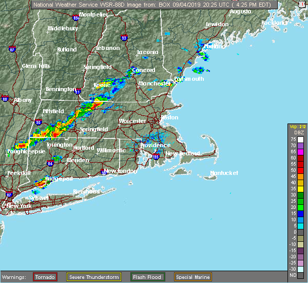 At 426 pm edt, a severe thunderstorm was located near athol, or near orange, moving east at 45 mph. a tree was reported down on wires with this storm in gill (radar indicated). Hazards include 60 mph wind gusts and penny size hail. Expect damage to trees and power lines. Locations impacted include, leominster, fitchburg, orange, gardner, athol, winchendon, lunenburg, townsend, templeton, sterling, westminster, ashburnham, hubbardston, princeton, ashby, phillipston, royalston, petersham and new salem. At 426 pm edt, a severe thunderstorm was located near athol, or near orange, moving east at 45 mph. a tree was reported down on wires with this storm in gill (radar indicated). Hazards include 60 mph wind gusts and penny size hail. Expect damage to trees and power lines. Locations impacted include, leominster, fitchburg, orange, gardner, athol, winchendon, lunenburg, townsend, templeton, sterling, westminster, ashburnham, hubbardston, princeton, ashby, phillipston, royalston, petersham and new salem.
|
| 9/4/2019 4:12 PM EDT |
 At 411 pm edt, a severe thunderstorm was located over erving, or near orange, moving east at 45 mph (radar indicated). Hazards include 60 mph wind gusts and quarter size hail. Expect wind damage to trees and power lines. Minor hail damage to vehicles is possible. At 411 pm edt, a severe thunderstorm was located over erving, or near orange, moving east at 45 mph (radar indicated). Hazards include 60 mph wind gusts and quarter size hail. Expect wind damage to trees and power lines. Minor hail damage to vehicles is possible.
|
| 8/17/2019 8:48 PM EDT |
 At 847 pm edt, a severe thunderstorm was located near winchendon, or 10 miles northwest of fitchburg, moving east at 35 mph (radar indicated). Hazards include 60 mph wind gusts and quarter size hail. Hail damage to vehicles is possible. expect damage to trees and power lines. Locations impacted include, leominster, fitchburg, orange, gardner, athol, winchendon, lunenburg, townsend, lancaster, templeton, sterling, westminster, ashburnham, hubbardston, princeton, ashby, phillipston, mason, royalston and petersham. At 847 pm edt, a severe thunderstorm was located near winchendon, or 10 miles northwest of fitchburg, moving east at 35 mph (radar indicated). Hazards include 60 mph wind gusts and quarter size hail. Hail damage to vehicles is possible. expect damage to trees and power lines. Locations impacted include, leominster, fitchburg, orange, gardner, athol, winchendon, lunenburg, townsend, lancaster, templeton, sterling, westminster, ashburnham, hubbardston, princeton, ashby, phillipston, mason, royalston and petersham.
|
| 8/17/2019 8:13 PM EDT |
 At 813 pm edt, a severe thunderstorm was located near erving, or near orange, moving east at 35 mph (radar indicated). Hazards include 60 mph wind gusts and quarter size hail. Hail damage to vehicles is possible. Expect damage to trees and power lines. At 813 pm edt, a severe thunderstorm was located near erving, or near orange, moving east at 35 mph (radar indicated). Hazards include 60 mph wind gusts and quarter size hail. Hail damage to vehicles is possible. Expect damage to trees and power lines.
|
| 7/6/2019 3:56 PM EDT |
 At 354 pm edt, severe thunderstorms were located along a line extending from near fitchburg to near petersham, moving east at 40 mph. wind gusts to 40 mph and small hail were reported in templeton at 336 pm. the storms were weakening but still have the potential to produce damaging wind gusts (radar indicated). Hazards include 60 mph wind gusts. Expect damage to trees and power lines. Locations impacted include, leominster, fitchburg, gardner, athol, pepperell, groton, winchendon, lunenburg, townsend, templeton, westminster, shirley, ashburnham, barre, hubbardston, princeton, dunstable, ashby, shutesbury and phillipston. At 354 pm edt, severe thunderstorms were located along a line extending from near fitchburg to near petersham, moving east at 40 mph. wind gusts to 40 mph and small hail were reported in templeton at 336 pm. the storms were weakening but still have the potential to produce damaging wind gusts (radar indicated). Hazards include 60 mph wind gusts. Expect damage to trees and power lines. Locations impacted include, leominster, fitchburg, gardner, athol, pepperell, groton, winchendon, lunenburg, townsend, templeton, westminster, shirley, ashburnham, barre, hubbardston, princeton, dunstable, ashby, shutesbury and phillipston.
|
| 7/6/2019 3:31 PM EDT |
 The national weather service in boston/norton has issued a * severe thunderstorm warning for. northwestern worcester county in central massachusetts. northwestern middlesex county in northeastern massachusetts. east central franklin county in western massachusetts. Until 430 pm edt. The national weather service in boston/norton has issued a * severe thunderstorm warning for. northwestern worcester county in central massachusetts. northwestern middlesex county in northeastern massachusetts. east central franklin county in western massachusetts. Until 430 pm edt.
|
| 8/7/2018 7:05 PM EDT | Tree and wires down on west meadow road in middlesex county MA, 0.3 miles WNW of Townsend, MA |
| 8/3/2018 7:11 PM EDT |
 At 627 pm edt, a severe thunderstorm was located over barre, or 13 miles southeast of orange, moving northeast at 30 mph (radar indicated). Hazards include 60 mph wind gusts. expect damage to trees and power lines At 627 pm edt, a severe thunderstorm was located over barre, or 13 miles southeast of orange, moving northeast at 30 mph (radar indicated). Hazards include 60 mph wind gusts. expect damage to trees and power lines
|
| 8/3/2018 6:27 PM EDT |
 At 627 pm edt, a severe thunderstorm was located over barre, or 13 miles southeast of orange, moving northeast at 30 mph (radar indicated). Hazards include 60 mph wind gusts. expect damage to trees and power lines At 627 pm edt, a severe thunderstorm was located over barre, or 13 miles southeast of orange, moving northeast at 30 mph (radar indicated). Hazards include 60 mph wind gusts. expect damage to trees and power lines
|
| 7/27/2018 7:43 PM EDT |
 The severe thunderstorm warning for north central worcester and northwestern middlesex counties will expire at 745 pm edt, the storm which prompted the warning has weakened below severe limits, and has exited the warned area. therefore, the warning will be allowed to expire. a severe thunderstorm watch remains in effect until 1000 pm edt for central massachusetts. The severe thunderstorm warning for north central worcester and northwestern middlesex counties will expire at 745 pm edt, the storm which prompted the warning has weakened below severe limits, and has exited the warned area. therefore, the warning will be allowed to expire. a severe thunderstorm watch remains in effect until 1000 pm edt for central massachusetts.
|
| 7/27/2018 7:33 PM EDT |
 At 732 pm edt, a severe thunderstorm was located over townsend, or near fitchburg, moving northeast at 30 mph (radar indicated). Hazards include 70 mph wind gusts and penny size hail. very strong winds are possible. along with a low risk for a tornado. Expect considerable tree damage. damage is likely to mobile homes and outbuildings. Locations impacted include, leominster, fitchburg, chelmsford, westford, gardner, pepperell, tyngsborough, groton, winchendon, lunenburg, townsend, ayer, westminster, shirley, ashburnham, princeton, dunstable and ashby. At 732 pm edt, a severe thunderstorm was located over townsend, or near fitchburg, moving northeast at 30 mph (radar indicated). Hazards include 70 mph wind gusts and penny size hail. very strong winds are possible. along with a low risk for a tornado. Expect considerable tree damage. damage is likely to mobile homes and outbuildings. Locations impacted include, leominster, fitchburg, chelmsford, westford, gardner, pepperell, tyngsborough, groton, winchendon, lunenburg, townsend, ayer, westminster, shirley, ashburnham, princeton, dunstable and ashby.
|
| 7/27/2018 7:01 PM EDT |
 At 701 pm edt, a severe thunderstorm was located near westminster, or 8 miles southwest of fitchburg, moving northeast at 30 mph (radar indicated). Hazards include 60 mph wind gusts and penny size hail. expect damage to trees and power lines At 701 pm edt, a severe thunderstorm was located near westminster, or 8 miles southwest of fitchburg, moving northeast at 30 mph (radar indicated). Hazards include 60 mph wind gusts and penny size hail. expect damage to trees and power lines
|
| 6/18/2018 5:23 PM EDT |
 At 522 pm edt, a severe thunderstorm was located over athol, or near orange, moving east at 30 mph (radar indicated). Hazards include 60 mph wind gusts and quarter size hail. Hail damage to vehicles is possible. Expect damage to trees and power lines. At 522 pm edt, a severe thunderstorm was located over athol, or near orange, moving east at 30 mph (radar indicated). Hazards include 60 mph wind gusts and quarter size hail. Hail damage to vehicles is possible. Expect damage to trees and power lines.
|
| 8/22/2017 11:33 PM EDT |
 At 1132 pm edt, severe thunderstorms were located along a line extending from near rindge to granby, moving east at 35 mph (radar indicated). Hazards include 60 mph wind gusts. expect damage to trees and power lines along with torrential downpours and possibly localized flooding At 1132 pm edt, severe thunderstorms were located along a line extending from near rindge to granby, moving east at 35 mph (radar indicated). Hazards include 60 mph wind gusts. expect damage to trees and power lines along with torrential downpours and possibly localized flooding
|
| 5/18/2017 9:43 PM EDT |
 At 942 pm edt, a severe thunderstorm was located near templeton, or 10 miles east of orange, moving east at 55 mph (radar indicated). Hazards include 60 mph wind gusts. expect damage to trees and power lines At 942 pm edt, a severe thunderstorm was located near templeton, or 10 miles east of orange, moving east at 55 mph (radar indicated). Hazards include 60 mph wind gusts. expect damage to trees and power lines
|
| 9/11/2016 10:10 AM EDT |
 The severe thunderstorm warning for northwestern essex, southeastern hampshire, southeastern hampden, worcester and middlesex counties will expire at 1015 am edt, the storms which prompted the warning have moved out of the area. therefore, the warning will be allowed to expire. The severe thunderstorm warning for northwestern essex, southeastern hampshire, southeastern hampden, worcester and middlesex counties will expire at 1015 am edt, the storms which prompted the warning have moved out of the area. therefore, the warning will be allowed to expire.
|
| 9/11/2016 9:36 AM EDT | Tree down across pearl brook road as well as tree and wires down route 13 brookline road and meadow road in middlesex county MA, 0.3 miles WNW of Townsend, MA |
| 9/11/2016 9:23 AM EDT |
 At 922 am edt, severe thunderstorms were located along a line extending from near new boston to near westminster to north brookfield to west hartford, moving east at 45 mph (radar indicated). Hazards include 60 mph wind gusts. Expect damage to roofs. siding. And trees. At 922 am edt, severe thunderstorms were located along a line extending from near new boston to near westminster to north brookfield to west hartford, moving east at 45 mph (radar indicated). Hazards include 60 mph wind gusts. Expect damage to roofs. siding. And trees.
|
| 9/11/2016 8:49 AM EDT |
 At 848 am edt, severe thunderstorms were located along a line extending from near danbury to near windsor to near richmond to leverett to new hartford, moving northeast at 45 mph (radar indicated). Hazards include 60 mph wind gusts. Expect damage to roofs. siding. And trees. At 848 am edt, severe thunderstorms were located along a line extending from near danbury to near windsor to near richmond to leverett to new hartford, moving northeast at 45 mph (radar indicated). Hazards include 60 mph wind gusts. Expect damage to roofs. siding. And trees.
|
| 8/13/2016 10:29 PM EDT |
 At 1029 pm edt, a severe thunderstorm was located over hubbardston, or 10 miles southwest of fitchburg, moving east at 50 mph (radar indicated). Hazards include 60 mph wind gusts. Expect damage to roofs. siding. and trees. Locations impacted include, worcester, leominster, fitchburg, gardner, holden, spencer, pepperell, leicester, winchendon, lunenburg, townsend, templeton, rutland, sterling, west boylston, westminster, ashburnham, barre, brookline and paxton. At 1029 pm edt, a severe thunderstorm was located over hubbardston, or 10 miles southwest of fitchburg, moving east at 50 mph (radar indicated). Hazards include 60 mph wind gusts. Expect damage to roofs. siding. and trees. Locations impacted include, worcester, leominster, fitchburg, gardner, holden, spencer, pepperell, leicester, winchendon, lunenburg, townsend, templeton, rutland, sterling, west boylston, westminster, ashburnham, barre, brookline and paxton.
|
| 8/13/2016 10:07 PM EDT |
 At 1006 pm edt, a severe thunderstorm was located near wendell, or near orange, moving east at 50 mph (radar indicated). Hazards include 60 mph wind gusts. Expect damage to roofs. siding. And trees. At 1006 pm edt, a severe thunderstorm was located near wendell, or near orange, moving east at 50 mph (radar indicated). Hazards include 60 mph wind gusts. Expect damage to roofs. siding. And trees.
|
| 7/23/2016 7:29 PM EDT |
 At 728 pm edt, a cluster of strong thunderstorms was affecting northern massachusetts producing damaging wind gusts (radar indicated and spotters have reported wind damage with these storms). Hazards include 60 mph wind gusts. Expect damage to roofs. siding. And trees. At 728 pm edt, a cluster of strong thunderstorms was affecting northern massachusetts producing damaging wind gusts (radar indicated and spotters have reported wind damage with these storms). Hazards include 60 mph wind gusts. Expect damage to roofs. siding. And trees.
|
| 7/23/2016 7:09 PM EDT | Big tree dow in middlesex county MA, 1.9 miles ESE of Townsend, MA |
| 7/23/2016 6:50 PM EDT | Trees and wires down in hillsborough county NH, 4.6 miles SSW of Townsend, MA |
| 7/23/2016 6:38 PM EDT |
 At 636 pm edt, a line of severe thunderstorms in southern new hampshire will be dropping southeast into north central and northeast massachusetts through 730 pm (spotter reporting numerous reports of wind damage in southern new hampshire). Hazards include 60 mph wind gusts. Expect damage to roofs. siding. And trees. At 636 pm edt, a line of severe thunderstorms in southern new hampshire will be dropping southeast into north central and northeast massachusetts through 730 pm (spotter reporting numerous reports of wind damage in southern new hampshire). Hazards include 60 mph wind gusts. Expect damage to roofs. siding. And trees.
|
| 7/18/2016 2:56 PM EDT |
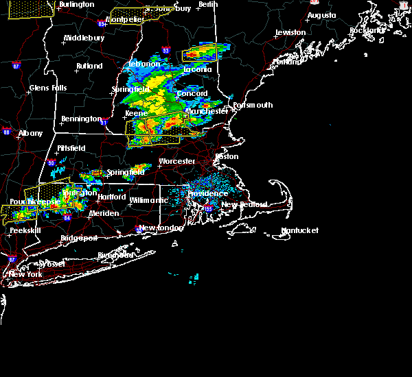 At 256 pm edt, a severe thunderstorm was located over ashburnham, or near fitchburg, moving east at 50 mph. this storm has a history of downing trees in orange and athol as well as throughout franklin county (radar indicated). Hazards include 60 mph wind gusts. Expect damage to roofs. siding. And trees. At 256 pm edt, a severe thunderstorm was located over ashburnham, or near fitchburg, moving east at 50 mph. this storm has a history of downing trees in orange and athol as well as throughout franklin county (radar indicated). Hazards include 60 mph wind gusts. Expect damage to roofs. siding. And trees.
|
| 3/17/2016 3:30 PM EDT |
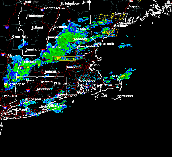 At 328 pm edt, doppler radar indicated a severe thunderstorm capable of producing damaging winds in excess of 60 mph. this storm was located near winchendon, or 9 miles west of fitchburg, moving east at 50 mph. a few trees have been reported downed in warwick and orange in association with this storm. locations impacted include, fitchburg, westford, gardner, athol, pepperell, groton, winchendon, lunenburg, townsend, littleton, templeton, ayer, westminster, shirley, ashburnham, dunstable, ashby, phillipston and royalston. At 328 pm edt, doppler radar indicated a severe thunderstorm capable of producing damaging winds in excess of 60 mph. this storm was located near winchendon, or 9 miles west of fitchburg, moving east at 50 mph. a few trees have been reported downed in warwick and orange in association with this storm. locations impacted include, fitchburg, westford, gardner, athol, pepperell, groton, winchendon, lunenburg, townsend, littleton, templeton, ayer, westminster, shirley, ashburnham, dunstable, ashby, phillipston and royalston.
|
| 3/17/2016 3:15 PM EDT |
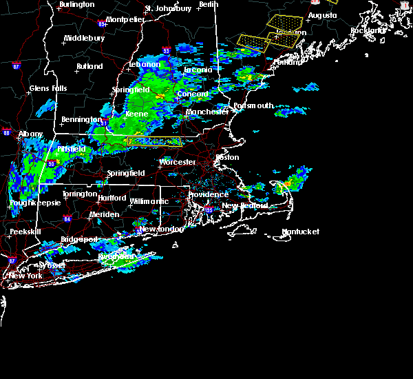 At 315 pm edt, doppler radar indicated a severe thunderstorm capable of producing damaging winds in excess of 60 mph. this storm was located near royalston, or near orange, and was moving east at 50 mph. At 315 pm edt, doppler radar indicated a severe thunderstorm capable of producing damaging winds in excess of 60 mph. this storm was located near royalston, or near orange, and was moving east at 50 mph.
|
| 2/25/2016 2:41 AM EST |
 The severe thunderstorm warning for central worcester and northwestern middlesex counties will expire at 245 am est, the storms which prompted the warning have moved out of the warned area. therefore the warning will be allowed to expire. The severe thunderstorm warning for central worcester and northwestern middlesex counties will expire at 245 am est, the storms which prompted the warning have moved out of the warned area. therefore the warning will be allowed to expire.
|
| 2/25/2016 2:22 AM EST |
 At 222 am est, doppler radar indicated a line of severe thunderstorms capable of producing destructive winds in excess of 70 mph. these storms were located along a line extending from near hopkinton to near milford to near ashby, moving northeast at 100 mph. locations impacted include, worcester, leominster, fitchburg, shrewsbury, grafton, holden, webster, southbridge, auburn, northborough, oxford, clinton, millbury, charlton, spencer, pepperell, dudley, leicester, groton and lunenburg. At 222 am est, doppler radar indicated a line of severe thunderstorms capable of producing destructive winds in excess of 70 mph. these storms were located along a line extending from near hopkinton to near milford to near ashby, moving northeast at 100 mph. locations impacted include, worcester, leominster, fitchburg, shrewsbury, grafton, holden, webster, southbridge, auburn, northborough, oxford, clinton, millbury, charlton, spencer, pepperell, dudley, leicester, groton and lunenburg.
|
| 2/25/2016 1:57 AM EST |
 At 156 am est, doppler radar indicated a line of severe thunderstorms capable of producing destructive winds in excess of 70 mph. these storms were located along a line extending from near gardner to near new braintree to near monson, and was moving northeast at 50 mph. At 156 am est, doppler radar indicated a line of severe thunderstorms capable of producing destructive winds in excess of 70 mph. these storms were located along a line extending from near gardner to near new braintree to near monson, and was moving northeast at 50 mph.
|
| 8/15/2015 6:05 PM EDT |
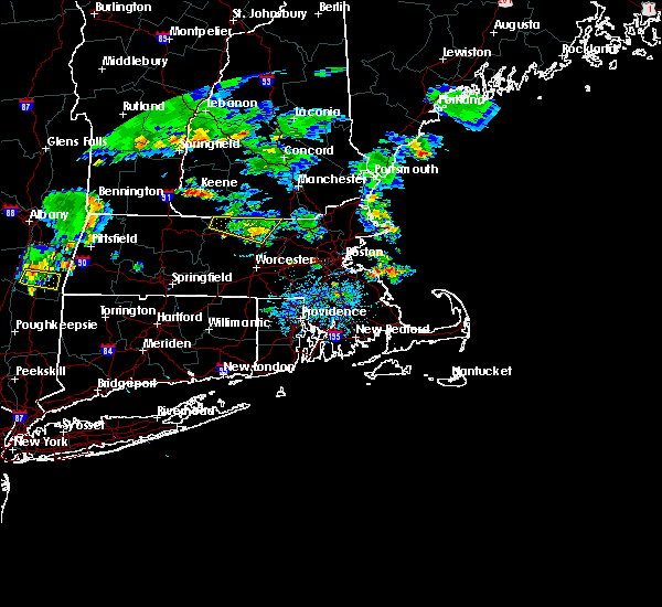 The severe thunderstorm warning for northwestern worcester and northwestern middlesex counties will expire at 615 pm edt, the storm which prompted the warning has weakened below severe limits, and no longer poses an immediate threat to life or property. therefore the warning will be allowed to expire. however heavy rain is still possible with this thunderstorm. The severe thunderstorm warning for northwestern worcester and northwestern middlesex counties will expire at 615 pm edt, the storm which prompted the warning has weakened below severe limits, and no longer poses an immediate threat to life or property. therefore the warning will be allowed to expire. however heavy rain is still possible with this thunderstorm.
|
| 8/15/2015 5:22 PM EDT |
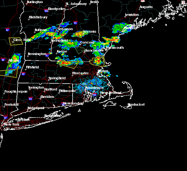 At 521 pm edt, doppler radar indicated a severe thunderstorm capable of producing quarter size hail and damaging winds in excess of 60 mph. this storm was located near winchendon, or 9 miles east of orange, and was moving east at 10 mph. * some locations impacted include, leominster, fitchburg, gardner, athol, pepperell, groton, winchendon, lunenburg, townsend, lancaster, templeton, westminster, shirley, ashburnham, ashby, phillipston and royalston. At 521 pm edt, doppler radar indicated a severe thunderstorm capable of producing quarter size hail and damaging winds in excess of 60 mph. this storm was located near winchendon, or 9 miles east of orange, and was moving east at 10 mph. * some locations impacted include, leominster, fitchburg, gardner, athol, pepperell, groton, winchendon, lunenburg, townsend, lancaster, templeton, westminster, shirley, ashburnham, ashby, phillipston and royalston.
|
| 8/4/2015 1:52 PM EDT |
 At 151 pm edt, doppler radar indicated a severe thunderstorm capable of producing large damaging hail up to golf ball size and damaging winds in excess of 60 mph. this storm was located over fitchburg, moving east at 40 mph. golf ball sized hail has been reported with this storm as it moved through gardner. locations impacted include, lowell, nashua, leominster, fitchburg, billerica, chelmsford, dracut, tewksbury, hudson, westford, acton, gardner, pelham, pepperell, tyngsborough, groton, winchendon, lunenburg, townsend and littleton. At 151 pm edt, doppler radar indicated a severe thunderstorm capable of producing large damaging hail up to golf ball size and damaging winds in excess of 60 mph. this storm was located over fitchburg, moving east at 40 mph. golf ball sized hail has been reported with this storm as it moved through gardner. locations impacted include, lowell, nashua, leominster, fitchburg, billerica, chelmsford, dracut, tewksbury, hudson, westford, acton, gardner, pelham, pepperell, tyngsborough, groton, winchendon, lunenburg, townsend and littleton.
|
| 8/4/2015 1:35 PM EDT |
 At 135 pm edt, doppler radar indicated a severe thunderstorm capable of producing large hail up to ping pong ball size and damaging winds in excess of 60 mph. this storm was located near templeton, or 12 miles southeast of orange, and was moving east at 50 mph. * some locations impacted include, lowell, nashua, leominster, fitchburg, billerica, chelmsford, dracut, tewksbury, hudson, westford, acton, gardner, pelham, athol, pepperell, tyngsborough, groton, winchendon, lunenburg and townsend. At 135 pm edt, doppler radar indicated a severe thunderstorm capable of producing large hail up to ping pong ball size and damaging winds in excess of 60 mph. this storm was located near templeton, or 12 miles southeast of orange, and was moving east at 50 mph. * some locations impacted include, lowell, nashua, leominster, fitchburg, billerica, chelmsford, dracut, tewksbury, hudson, westford, acton, gardner, pelham, athol, pepperell, tyngsborough, groton, winchendon, lunenburg and townsend.
|
| 5/28/2015 4:08 PM EDT | At 407 pm edt, doppler radar indicated a severe thunderstorm capable of producing damaging winds in excess of 60 mph. this storm was located over new ipswich, or 10 miles north of fitchburg, moving east at 35 mph. locations impacted include, fitchburg, pepperell, groton, winchendon, lunenburg, townsend, hollis, ashburnham, brookline, dunstable, ashby, mason and royalston. |
| 5/28/2015 3:44 PM EDT | At 343 pm edt, doppler radar indicated a severe thunderstorm capable of producing quarter size hail and damaging winds in excess of 60 mph. this storm was located over royalston, or 9 miles southwest of jaffrey, and was moving east at 35 mph. * some locations impacted include, fitchburg, orange, athol, pepperell, groton, winchendon, lunenburg, townsend, hollis, ashburnham, rindge, new ipswich, brookline, dunstable, ashby, fitzwilliam, mason, royalston and warwick. |
| 9/6/2014 4:37 PM EDT | Large limb down at silver beach in hillsborough county NH, 4.4 miles SSW of Townsend, MA |
| 5/25/2014 6:50 PM EDT | Quarter sized hail reported 4.4 miles SSW of Townsend, MA |
Hail Maps for Townsend, MA


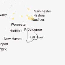

Connect with Interactive Hail Maps