

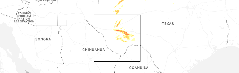
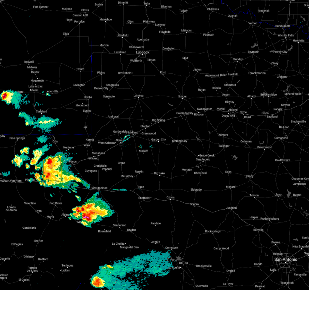
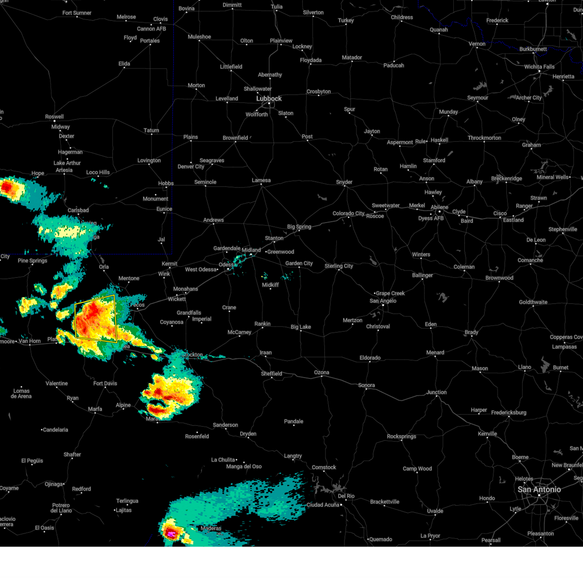
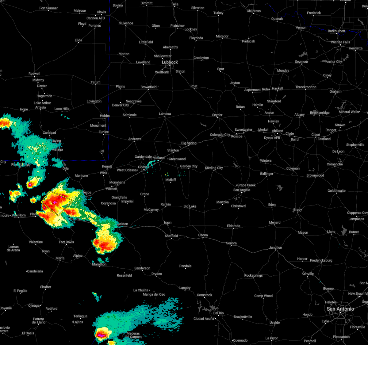
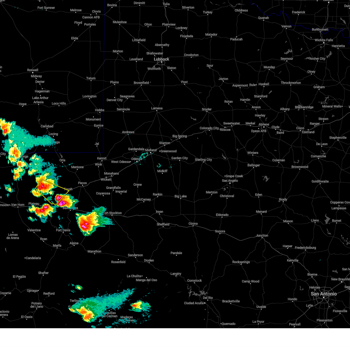
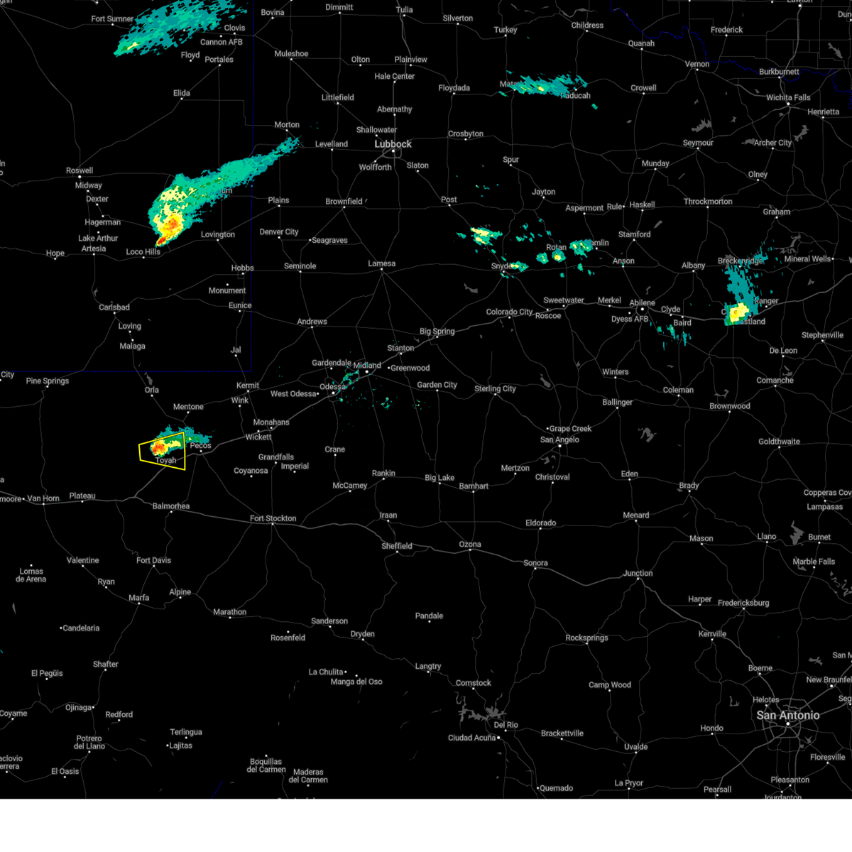
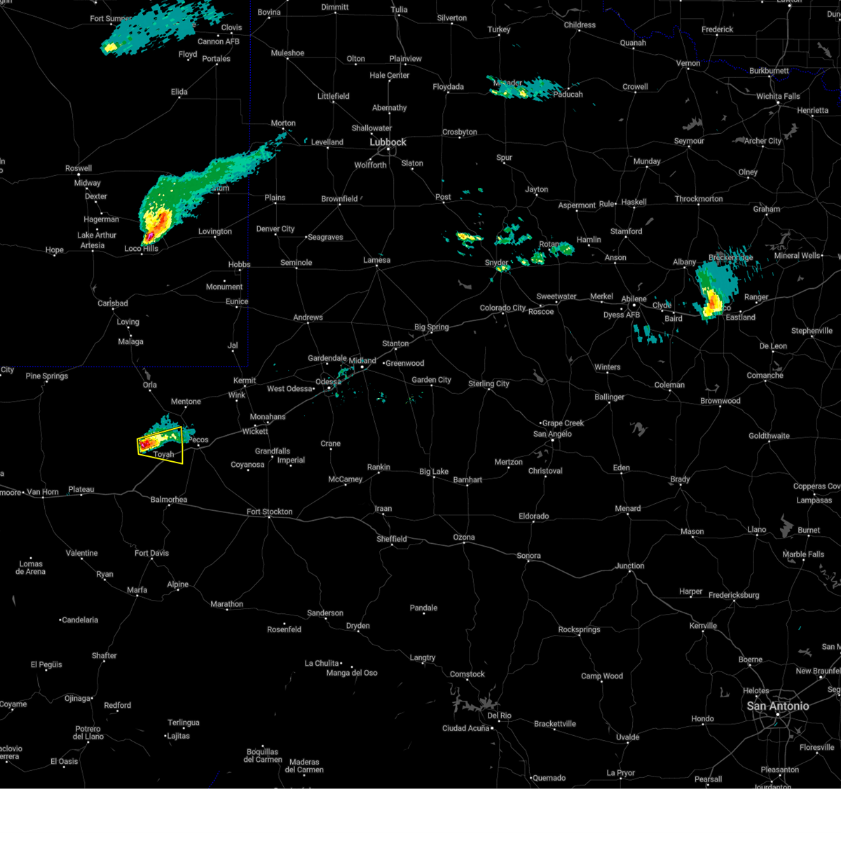
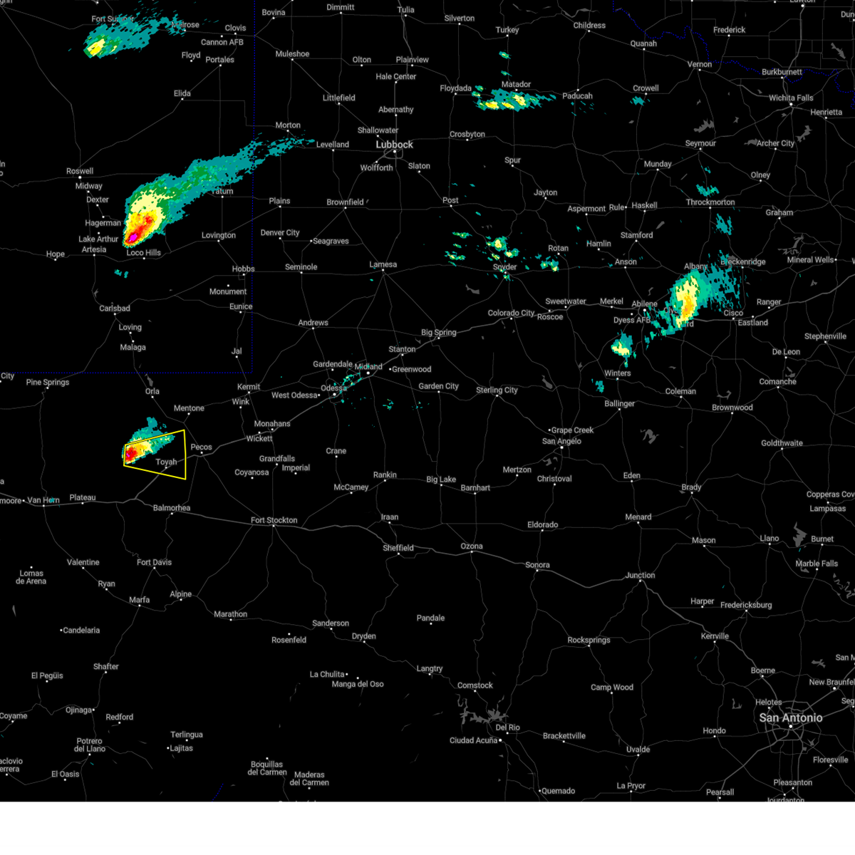
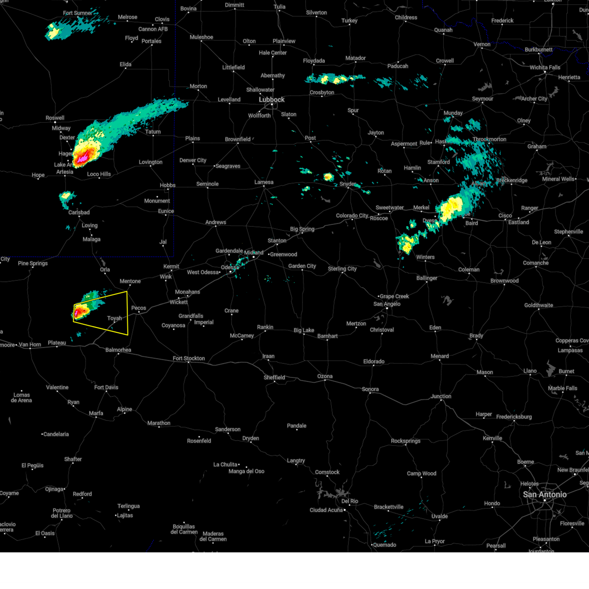
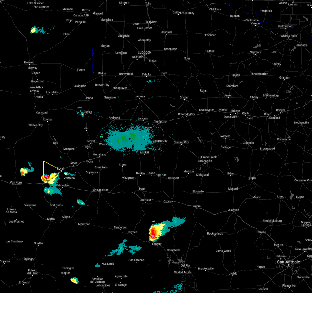
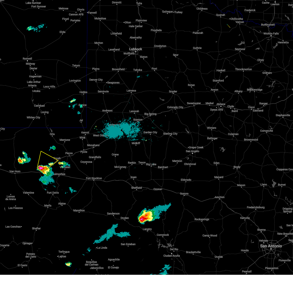
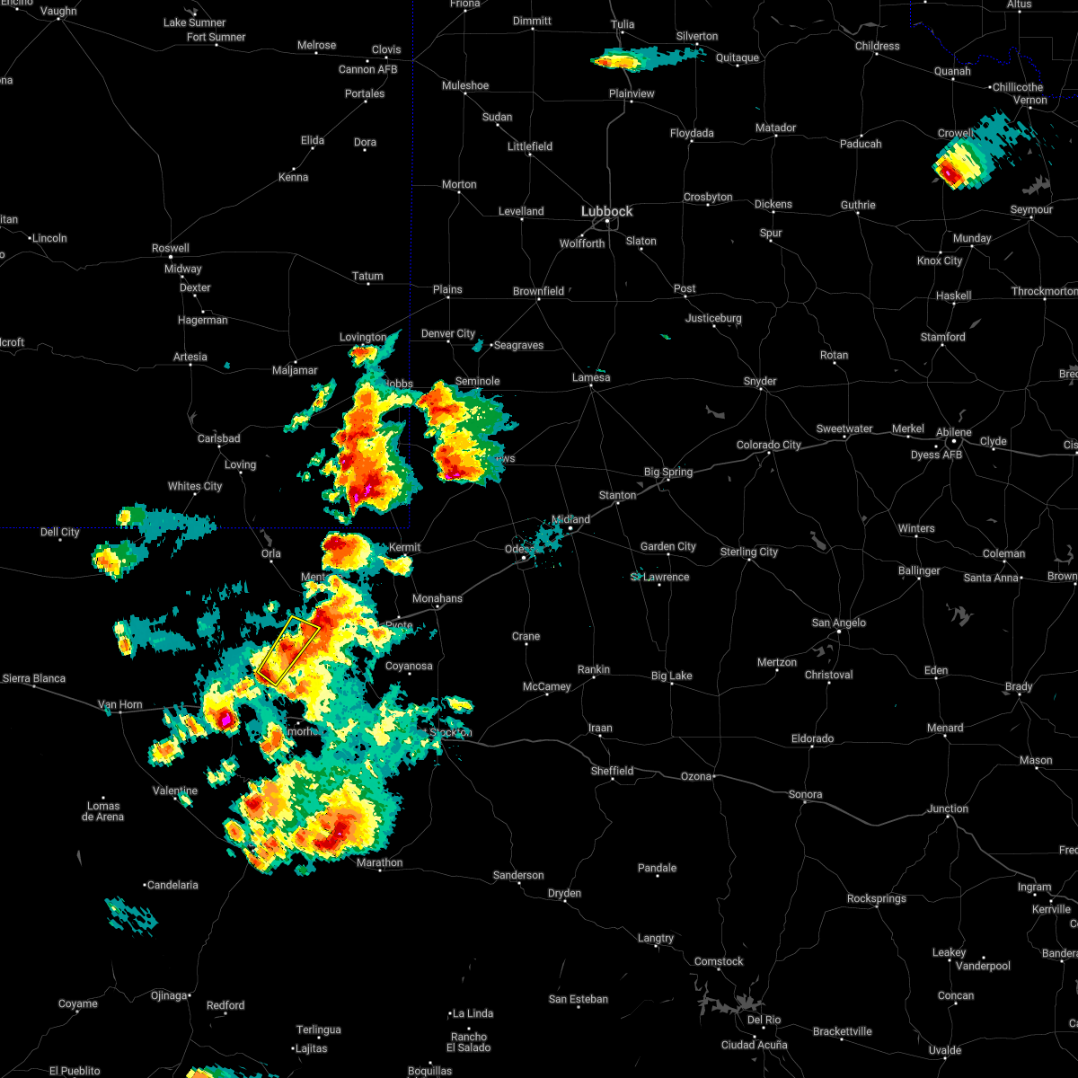
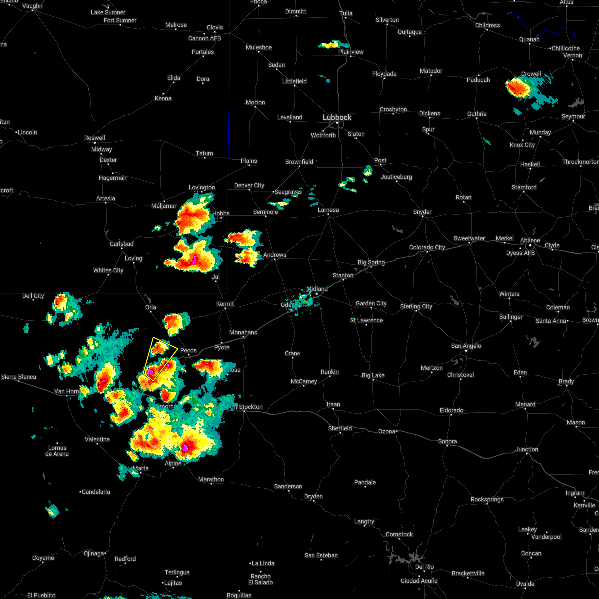
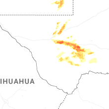
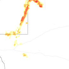
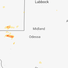
Hail Map for Toyah, TX
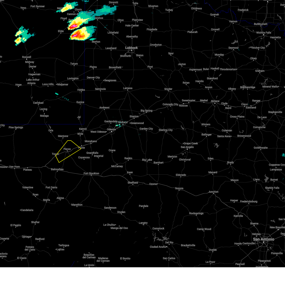
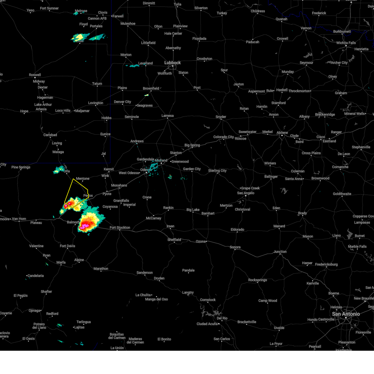
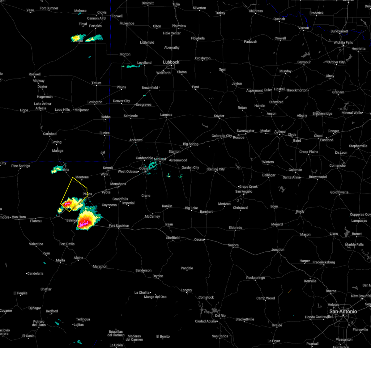
The Toyah, TX area has had 3 reports of on-the-ground hail by trained spotters, and has been under severe weather warnings 4 times during the past 12 months. Doppler radar has detected hail at or near Toyah, TX on 39 occasions, including 2 occasions during the past year.
| Name: | Toyah, TX |
| Where Located: | 66.2 miles N of Alpine, TX |
| Map: | Google Map for Toyah, TX |
| Population: | 90 |
| Housing Units: | 51 |
| More Info: | Search Google for Toyah, TX |
0
The Top Recent Hail Date for Toyah, TX is Thursday, June 5, 2025 (15th out of 39)
Hail and Wind Damage Spotted near Toyah, TX
| Date / Time | Report Details |
|---|---|
| 6/10/2025 6:38 PM CDT | Mesonet station ur144 14.1 sw toyah (upr in reeves county TX, 13.4 miles NE of Toyah, TX |
| 6/5/2025 4:24 PM CDT |
 Svrmaf the national weather service in midland has issued a * severe thunderstorm warning for, central reeves county in southwestern texas, northwestern ward county in western texas, * until 515 pm cdt. * at 424 pm cdt, a severe thunderstorm was located 9 miles east of toyah, moving northeast at 25 mph (radar indicated). Hazards include ping pong ball size hail and 60 mph wind gusts. People and animals outdoors will be injured. expect hail damage to roofs, siding, windows, and vehicles. Expect wind damage to roofs, siding, and trees. Svrmaf the national weather service in midland has issued a * severe thunderstorm warning for, central reeves county in southwestern texas, northwestern ward county in western texas, * until 515 pm cdt. * at 424 pm cdt, a severe thunderstorm was located 9 miles east of toyah, moving northeast at 25 mph (radar indicated). Hazards include ping pong ball size hail and 60 mph wind gusts. People and animals outdoors will be injured. expect hail damage to roofs, siding, windows, and vehicles. Expect wind damage to roofs, siding, and trees.
|
| 6/5/2025 3:04 PM CDT | At 303 pm cdt, a severe thunderstorm was located near toyah, moving northeast at 15 mph (radar indicated). Hazards include 60 mph wind gusts and quarter size hail. Hail damage to vehicles is expected. expect wind damage to roofs, siding, and trees. Locations impacted include, pecos and toyah. |
| 6/5/2025 2:53 PM CDT |
 At 253 pm cdt, a severe thunderstorm was located near toyah, moving northeast at 30 mph (radar indicated). Hazards include ping pong ball size hail and 60 mph wind gusts. People and animals outdoors will be injured. expect hail damage to roofs, siding, windows, and vehicles. expect wind damage to roofs, siding, and trees. locations impacted include, pecos and toyah. This includes interstate 20 between mile markers 19 and 38. At 253 pm cdt, a severe thunderstorm was located near toyah, moving northeast at 30 mph (radar indicated). Hazards include ping pong ball size hail and 60 mph wind gusts. People and animals outdoors will be injured. expect hail damage to roofs, siding, windows, and vehicles. expect wind damage to roofs, siding, and trees. locations impacted include, pecos and toyah. This includes interstate 20 between mile markers 19 and 38.
|
| 6/5/2025 2:43 PM CDT |
 Svrmaf the national weather service in midland has issued a * severe thunderstorm warning for, northwestern reeves county in southwestern texas, * until 330 pm cdt. * at 243 pm cdt, a severe thunderstorm was located near toyah, moving northeast at 30 mph (radar indicated). Hazards include 60 mph wind gusts and half dollar size hail. Hail damage to vehicles is expected. Expect wind damage to roofs, siding, and trees. Svrmaf the national weather service in midland has issued a * severe thunderstorm warning for, northwestern reeves county in southwestern texas, * until 330 pm cdt. * at 243 pm cdt, a severe thunderstorm was located near toyah, moving northeast at 30 mph (radar indicated). Hazards include 60 mph wind gusts and half dollar size hail. Hail damage to vehicles is expected. Expect wind damage to roofs, siding, and trees.
|
| 6/1/2024 6:59 PM CDT |
 At 659 pm cdt, a severe thunderstorm was located 12 miles west of toyah, moving east at 10 mph (radar indicated). Hazards include 60 mph wind gusts and quarter size hail. Hail damage to vehicles is expected. expect wind damage to roofs, siding, and trees. locations impacted include, toyah. This includes interstate 20 between mile markers 1 and 23. At 659 pm cdt, a severe thunderstorm was located 12 miles west of toyah, moving east at 10 mph (radar indicated). Hazards include 60 mph wind gusts and quarter size hail. Hail damage to vehicles is expected. expect wind damage to roofs, siding, and trees. locations impacted include, toyah. This includes interstate 20 between mile markers 1 and 23.
|
| 6/1/2024 6:45 PM CDT |
 Svrmaf the national weather service in midland has issued a * severe thunderstorm warning for, west central reeves county in southwestern texas, east central culberson county in southwestern texas, * until 730 pm cdt. * at 644 pm cdt, a severe thunderstorm was located 15 miles west of toyah, moving east at 10 mph (radar indicated). Hazards include 60 mph wind gusts and quarter size hail. Hail damage to vehicles is expected. Expect wind damage to roofs, siding, and trees. Svrmaf the national weather service in midland has issued a * severe thunderstorm warning for, west central reeves county in southwestern texas, east central culberson county in southwestern texas, * until 730 pm cdt. * at 644 pm cdt, a severe thunderstorm was located 15 miles west of toyah, moving east at 10 mph (radar indicated). Hazards include 60 mph wind gusts and quarter size hail. Hail damage to vehicles is expected. Expect wind damage to roofs, siding, and trees.
|
| 6/1/2024 6:31 PM CDT |
 At 631 pm cdt, a severe thunderstorm was located 14 miles northeast of kent, moving southeast at 15 mph (radar indicated). Hazards include 60 mph wind gusts and half dollar size hail. Hail damage to vehicles is expected. expect wind damage to roofs, siding, and trees. locations impacted include, toyah. this includes the following highways, interstate 10 between mile markers 187 and 188. Interstate 20 between mile markers 0 and 21. At 631 pm cdt, a severe thunderstorm was located 14 miles northeast of kent, moving southeast at 15 mph (radar indicated). Hazards include 60 mph wind gusts and half dollar size hail. Hail damage to vehicles is expected. expect wind damage to roofs, siding, and trees. locations impacted include, toyah. this includes the following highways, interstate 10 between mile markers 187 and 188. Interstate 20 between mile markers 0 and 21.
|
| 6/1/2024 5:56 PM CDT |
 Svrmaf the national weather service in midland has issued a * severe thunderstorm warning for, west central reeves county in southwestern texas, east central culberson county in southwestern texas, * until 645 pm cdt. * at 555 pm cdt, a severe thunderstorm was located 21 miles north of kent, moving southeast at 40 mph (radar indicated). Hazards include ping pong ball size hail and 60 mph wind gusts. People and animals outdoors will be injured. expect hail damage to roofs, siding, windows, and vehicles. Expect wind damage to roofs, siding, and trees. Svrmaf the national weather service in midland has issued a * severe thunderstorm warning for, west central reeves county in southwestern texas, east central culberson county in southwestern texas, * until 645 pm cdt. * at 555 pm cdt, a severe thunderstorm was located 21 miles north of kent, moving southeast at 40 mph (radar indicated). Hazards include ping pong ball size hail and 60 mph wind gusts. People and animals outdoors will be injured. expect hail damage to roofs, siding, windows, and vehicles. Expect wind damage to roofs, siding, and trees.
|
| 5/11/2024 8:14 PM CDT |
 the severe thunderstorm warning has been cancelled and is no longer in effect the severe thunderstorm warning has been cancelled and is no longer in effect
|
| 5/11/2024 8:06 PM CDT |
 At 805 pm cdt, a severe thunderstorm was located 10 miles northwest of toyah, moving east at 25 mph (radar indicated). Hazards include 60 mph wind gusts and quarter size hail. Hail damage to vehicles is expected. expect wind damage to roofs, siding, and trees. locations impacted include, toyah. This includes interstate 20 between mile markers 23 and 32. At 805 pm cdt, a severe thunderstorm was located 10 miles northwest of toyah, moving east at 25 mph (radar indicated). Hazards include 60 mph wind gusts and quarter size hail. Hail damage to vehicles is expected. expect wind damage to roofs, siding, and trees. locations impacted include, toyah. This includes interstate 20 between mile markers 23 and 32.
|
| 5/11/2024 8:06 PM CDT |
 the severe thunderstorm warning has been cancelled and is no longer in effect the severe thunderstorm warning has been cancelled and is no longer in effect
|
| 5/11/2024 7:46 PM CDT |
 At 745 pm cdt, a severe thunderstorm was located 18 miles west of toyah, moving east at 25 mph (radar indicated). Hazards include 60 mph wind gusts and half dollar size hail. Hail damage to vehicles is expected. expect wind damage to roofs, siding, and trees. locations impacted include, toyah. This includes interstate 20 between mile markers 18 and 32. At 745 pm cdt, a severe thunderstorm was located 18 miles west of toyah, moving east at 25 mph (radar indicated). Hazards include 60 mph wind gusts and half dollar size hail. Hail damage to vehicles is expected. expect wind damage to roofs, siding, and trees. locations impacted include, toyah. This includes interstate 20 between mile markers 18 and 32.
|
| 5/11/2024 7:30 PM CDT |
 Svrmaf the national weather service in midland has issued a * severe thunderstorm warning for, west central reeves county in southwestern texas, east central culberson county in southwestern texas, * until 830 pm cdt. * at 730 pm cdt, a severe thunderstorm was located 23 miles north of kent, moving east at 25 mph (radar indicated). Hazards include 60 mph wind gusts and half dollar size hail. Hail damage to vehicles is expected. Expect wind damage to roofs, siding, and trees. Svrmaf the national weather service in midland has issued a * severe thunderstorm warning for, west central reeves county in southwestern texas, east central culberson county in southwestern texas, * until 830 pm cdt. * at 730 pm cdt, a severe thunderstorm was located 23 miles north of kent, moving east at 25 mph (radar indicated). Hazards include 60 mph wind gusts and half dollar size hail. Hail damage to vehicles is expected. Expect wind damage to roofs, siding, and trees.
|
| 5/4/2024 4:20 PM CDT |
 At 420 pm cdt, a severe thunderstorm was located near toyah, moving east at 20 mph (radar indicated). Hazards include 60 mph wind gusts and half dollar size hail. Hail damage to vehicles is expected. expect wind damage to roofs, siding, and trees. locations impacted include, pecos, toyah, and pecos municipal airport. This includes interstate 20 between mile markers 16 and 23, and between mile markers 36 and 41. At 420 pm cdt, a severe thunderstorm was located near toyah, moving east at 20 mph (radar indicated). Hazards include 60 mph wind gusts and half dollar size hail. Hail damage to vehicles is expected. expect wind damage to roofs, siding, and trees. locations impacted include, pecos, toyah, and pecos municipal airport. This includes interstate 20 between mile markers 16 and 23, and between mile markers 36 and 41.
|
| 5/4/2024 4:06 PM CDT |
 Svrmaf the national weather service in midland has issued a * severe thunderstorm warning for, central reeves county in southwestern texas, * until 445 pm cdt. * at 405 pm cdt, a severe thunderstorm was located 8 miles southwest of toyah, moving east at 20 mph (radar indicated). Hazards include 60 mph wind gusts and half dollar size hail. Hail damage to vehicles is expected. Expect wind damage to roofs, siding, and trees. Svrmaf the national weather service in midland has issued a * severe thunderstorm warning for, central reeves county in southwestern texas, * until 445 pm cdt. * at 405 pm cdt, a severe thunderstorm was located 8 miles southwest of toyah, moving east at 20 mph (radar indicated). Hazards include 60 mph wind gusts and half dollar size hail. Hail damage to vehicles is expected. Expect wind damage to roofs, siding, and trees.
|
| 9/15/2023 8:57 PM CDT |
 At 857 pm cdt, a severe thunderstorm was located 10 miles northeast of kent, moving northeast at 25 mph (radar indicated). Hazards include ping pong ball size hail and 60 mph wind gusts. People and animals outdoors will be injured. expect hail damage to roofs, siding, windows, and vehicles. expect wind damage to roofs, siding, and trees. locations impacted include, toyah. this includes interstate 20 between mile markers 12 and 22. hail threat, radar indicated max hail size, 1. 50 in wind threat, radar indicated max wind gust, 60 mph. At 857 pm cdt, a severe thunderstorm was located 10 miles northeast of kent, moving northeast at 25 mph (radar indicated). Hazards include ping pong ball size hail and 60 mph wind gusts. People and animals outdoors will be injured. expect hail damage to roofs, siding, windows, and vehicles. expect wind damage to roofs, siding, and trees. locations impacted include, toyah. this includes interstate 20 between mile markers 12 and 22. hail threat, radar indicated max hail size, 1. 50 in wind threat, radar indicated max wind gust, 60 mph.
|
| 9/15/2023 8:44 PM CDT |
 At 844 pm cdt, a severe thunderstorm was located near kent, moving northeast at 20 mph (radar indicated). Hazards include ping pong ball size hail and 60 mph wind gusts. People and animals outdoors will be injured. expect hail damage to roofs, siding, windows, and vehicles. Expect wind damage to roofs, siding, and trees. At 844 pm cdt, a severe thunderstorm was located near kent, moving northeast at 20 mph (radar indicated). Hazards include ping pong ball size hail and 60 mph wind gusts. People and animals outdoors will be injured. expect hail damage to roofs, siding, windows, and vehicles. Expect wind damage to roofs, siding, and trees.
|
| 5/26/2023 9:29 PM CDT |
 At 929 pm cdt, a severe thunderstorm was located 15 miles north of toyah, moving southeast at 25 mph (radar indicated). Hazards include golf ball size hail and 60 mph wind gusts. People and animals outdoors will be injured. expect hail damage to roofs, siding, windows, and vehicles. expect wind damage to roofs, siding, and trees. locations impacted include, pecos, toyah and pecos municipal airport. this includes interstate 20 between mile markers 19 and 39. thunderstorm damage threat, considerable hail threat, radar indicated max hail size, 1. 75 in wind threat, radar indicated max wind gust, 60 mph. At 929 pm cdt, a severe thunderstorm was located 15 miles north of toyah, moving southeast at 25 mph (radar indicated). Hazards include golf ball size hail and 60 mph wind gusts. People and animals outdoors will be injured. expect hail damage to roofs, siding, windows, and vehicles. expect wind damage to roofs, siding, and trees. locations impacted include, pecos, toyah and pecos municipal airport. this includes interstate 20 between mile markers 19 and 39. thunderstorm damage threat, considerable hail threat, radar indicated max hail size, 1. 75 in wind threat, radar indicated max wind gust, 60 mph.
|
| 5/26/2023 9:13 PM CDT |
 At 913 pm cdt, a severe thunderstorm was located 15 miles south of orla, or 17 miles southwest of mentone, moving southeast at 25 mph (radar indicated). Hazards include golf ball size hail and 60 mph wind gusts. People and animals outdoors will be injured. expect hail damage to roofs, siding, windows, and vehicles. Expect wind damage to roofs, siding, and trees. At 913 pm cdt, a severe thunderstorm was located 15 miles south of orla, or 17 miles southwest of mentone, moving southeast at 25 mph (radar indicated). Hazards include golf ball size hail and 60 mph wind gusts. People and animals outdoors will be injured. expect hail damage to roofs, siding, windows, and vehicles. Expect wind damage to roofs, siding, and trees.
|
| 5/3/2023 5:04 PM CDT |
 At 504 pm cdt, a severe thunderstorm was located 9 miles northwest of saragosa, or 12 miles south of toyah, moving east at 25 mph (radar indicated). Hazards include 60 mph wind gusts and quarter size hail. Hail damage to vehicles is expected. Expect wind damage to roofs, siding, and trees. At 504 pm cdt, a severe thunderstorm was located 9 miles northwest of saragosa, or 12 miles south of toyah, moving east at 25 mph (radar indicated). Hazards include 60 mph wind gusts and quarter size hail. Hail damage to vehicles is expected. Expect wind damage to roofs, siding, and trees.
|
| 6/1/2022 5:31 PM CDT |
 At 531 pm cdt, a severe thunderstorm was located 9 miles southwest of toyah, moving northeast at 15 mph (radar indicated). Hazards include 60 mph wind gusts and half dollar size hail. Hail damage to vehicles is expected. expect wind damage to roofs, siding, and trees. locations impacted include, toyah. this includes interstate 20 between mile markers 12 and 25. hail threat, radar indicated max hail size, 1. 25 in wind threat, radar indicated max wind gust, 60 mph. At 531 pm cdt, a severe thunderstorm was located 9 miles southwest of toyah, moving northeast at 15 mph (radar indicated). Hazards include 60 mph wind gusts and half dollar size hail. Hail damage to vehicles is expected. expect wind damage to roofs, siding, and trees. locations impacted include, toyah. this includes interstate 20 between mile markers 12 and 25. hail threat, radar indicated max hail size, 1. 25 in wind threat, radar indicated max wind gust, 60 mph.
|
| 6/1/2022 4:56 PM CDT |
 At 456 pm cdt, a severe thunderstorm was located near toyah, moving northeast at 30 mph (radar indicated). Hazards include 60 mph wind gusts and half dollar size hail. Hail damage to vehicles is expected. expect wind damage to roofs, siding, and trees. locations impacted include, pecos, toyah and pecos municipal airport. this includes interstate 20 between mile markers 19 and 44. hail threat, radar indicated max hail size, 1. 25 in wind threat, radar indicated max wind gust, 60 mph. At 456 pm cdt, a severe thunderstorm was located near toyah, moving northeast at 30 mph (radar indicated). Hazards include 60 mph wind gusts and half dollar size hail. Hail damage to vehicles is expected. expect wind damage to roofs, siding, and trees. locations impacted include, pecos, toyah and pecos municipal airport. this includes interstate 20 between mile markers 19 and 44. hail threat, radar indicated max hail size, 1. 25 in wind threat, radar indicated max wind gust, 60 mph.
|
| 6/1/2022 4:55 PM CDT |
 At 454 pm cdt, a severe thunderstorm was located 7 miles west of toyah, moving northeast at 20 mph (radar indicated). Hazards include two inch hail and 60 mph wind gusts. People and animals outdoors will be injured. expect hail damage to roofs, siding, windows, and vehicles. Expect wind damage to roofs, siding, and trees. At 454 pm cdt, a severe thunderstorm was located 7 miles west of toyah, moving northeast at 20 mph (radar indicated). Hazards include two inch hail and 60 mph wind gusts. People and animals outdoors will be injured. expect hail damage to roofs, siding, windows, and vehicles. Expect wind damage to roofs, siding, and trees.
|
| 6/1/2022 4:37 PM CDT |
 At 437 pm cdt, a severe thunderstorm was located over toyah, moving northeast at 25 mph (radar indicated). Hazards include 70 mph wind gusts and ping pong ball size hail. People and animals outdoors will be injured. expect hail damage to roofs, siding, windows, and vehicles. expect considerable tree damage. Wind damage is also likely to mobile homes, roofs, and outbuildings. At 437 pm cdt, a severe thunderstorm was located over toyah, moving northeast at 25 mph (radar indicated). Hazards include 70 mph wind gusts and ping pong ball size hail. People and animals outdoors will be injured. expect hail damage to roofs, siding, windows, and vehicles. expect considerable tree damage. Wind damage is also likely to mobile homes, roofs, and outbuildings.
|
| 5/31/2021 6:13 AM CDT |
 At 613 am cdt, a severe thunderstorm was located 12 miles northwest of toyah, moving east at 25 mph (radar indicated). Hazards include 60 mph wind gusts and half dollar size hail. Hail damage to vehicles is expected. expect wind damage to roofs, siding, and trees. locations impacted include, pecos, toyah, toyah lake and pecos municipal airport. This includes interstate 20 between mile markers 18 and 45. At 613 am cdt, a severe thunderstorm was located 12 miles northwest of toyah, moving east at 25 mph (radar indicated). Hazards include 60 mph wind gusts and half dollar size hail. Hail damage to vehicles is expected. expect wind damage to roofs, siding, and trees. locations impacted include, pecos, toyah, toyah lake and pecos municipal airport. This includes interstate 20 between mile markers 18 and 45.
|
| 5/31/2021 5:52 AM CDT |
 At 551 am cdt, a severe thunderstorm was located 20 miles north of kent, moving east at 45 mph (radar indicated). Hazards include 60 mph wind gusts and quarter size hail. Hail damage to vehicles is expected. Expect wind damage to roofs, siding, and trees. At 551 am cdt, a severe thunderstorm was located 20 miles north of kent, moving east at 45 mph (radar indicated). Hazards include 60 mph wind gusts and quarter size hail. Hail damage to vehicles is expected. Expect wind damage to roofs, siding, and trees.
|
| 5/29/2021 1:23 AM CDT |
 At 123 am cdt, a severe thunderstorm was located 11 miles south of toyah, moving south at 35 mph (radar indicated). Hazards include 60 mph wind gusts and half dollar size hail. Hail damage to vehicles is expected. Expect wind damage to roofs, siding, and trees. At 123 am cdt, a severe thunderstorm was located 11 miles south of toyah, moving south at 35 mph (radar indicated). Hazards include 60 mph wind gusts and half dollar size hail. Hail damage to vehicles is expected. Expect wind damage to roofs, siding, and trees.
|
| 5/29/2021 12:27 AM CDT |
 At 1227 am cdt, a severe thunderstorm was located 11 miles southwest of mentone, moving southeast at 30 mph (radar indicated). Hazards include 60 mph wind gusts and half dollar size hail. Hail damage to vehicles is expected. expect wind damage to roofs, siding, and trees. locations impacted include, pecos, toyah, mentone, barstow, toyah lake, pecos municipal airport and b f goodrich testing track. This includes interstate 20 between mile markers 1 and 52. At 1227 am cdt, a severe thunderstorm was located 11 miles southwest of mentone, moving southeast at 30 mph (radar indicated). Hazards include 60 mph wind gusts and half dollar size hail. Hail damage to vehicles is expected. expect wind damage to roofs, siding, and trees. locations impacted include, pecos, toyah, mentone, barstow, toyah lake, pecos municipal airport and b f goodrich testing track. This includes interstate 20 between mile markers 1 and 52.
|
| 5/29/2021 12:02 AM CDT |
 At 1201 am cdt, a severe thunderstorm was located 16 miles southwest of orla, or 27 miles northwest of toyah, moving southeast at 30 mph (radar indicated). Hazards include 60 mph wind gusts and half dollar size hail. Hail damage to vehicles is expected. expect wind damage to roofs, siding, and trees. locations impacted include, pecos, toyah, mentone, barstow, orla, red bluff reservoir, toyah lake, pecos municipal airport, red bluff and b f goodrich testing track. This includes interstate 20 between mile markers 1 and 52. At 1201 am cdt, a severe thunderstorm was located 16 miles southwest of orla, or 27 miles northwest of toyah, moving southeast at 30 mph (radar indicated). Hazards include 60 mph wind gusts and half dollar size hail. Hail damage to vehicles is expected. expect wind damage to roofs, siding, and trees. locations impacted include, pecos, toyah, mentone, barstow, orla, red bluff reservoir, toyah lake, pecos municipal airport, red bluff and b f goodrich testing track. This includes interstate 20 between mile markers 1 and 52.
|
| 5/28/2021 11:39 PM CDT |
 At 1138 pm cdt/1038 pm mdt/, a severe thunderstorm was located 14 miles west of orla, or 32 miles west of mentone, moving southeast at 30 mph (radar indicated). Hazards include two inch hail and 60 mph wind gusts. People and animals outdoors will be injured. expect hail damage to roofs, siding, windows, and vehicles. Expect wind damage to roofs, siding, and trees. At 1138 pm cdt/1038 pm mdt/, a severe thunderstorm was located 14 miles west of orla, or 32 miles west of mentone, moving southeast at 30 mph (radar indicated). Hazards include two inch hail and 60 mph wind gusts. People and animals outdoors will be injured. expect hail damage to roofs, siding, windows, and vehicles. Expect wind damage to roofs, siding, and trees.
|
| 3/13/2020 7:37 PM CDT |
 At 736 pm cdt, a severe thunderstorm was located 7 miles north of toyah, moving east at 20 mph (radar indicated). Hazards include golf ball size hail and 60 mph wind gusts. People and animals outdoors will be injured. expect hail damage to roofs, siding, windows, and vehicles. Expect wind damage to roofs, siding, and trees. At 736 pm cdt, a severe thunderstorm was located 7 miles north of toyah, moving east at 20 mph (radar indicated). Hazards include golf ball size hail and 60 mph wind gusts. People and animals outdoors will be injured. expect hail damage to roofs, siding, windows, and vehicles. Expect wind damage to roofs, siding, and trees.
|
| 7/6/2019 4:46 PM CDT |
 At 446 pm cdt, a severe thunderstorm was located over saragosa, or 22 miles south of toyah, moving northwest at 35 mph (radar indicated). Hazards include 60 mph wind gusts and half dollar size hail. Hail damage to vehicles is expected. Expect wind damage to roofs, siding, and trees. At 446 pm cdt, a severe thunderstorm was located over saragosa, or 22 miles south of toyah, moving northwest at 35 mph (radar indicated). Hazards include 60 mph wind gusts and half dollar size hail. Hail damage to vehicles is expected. Expect wind damage to roofs, siding, and trees.
|
| 5/31/2019 8:56 PM CDT |
 The national weather service in midland has issued a * severe thunderstorm warning for. west central reeves county in southwestern texas. until 1000 pm cdt. At 855 pm cdt, a severe thunderstorm was located 7 miles northwest of toyah, moving northwest at 35 mph. The national weather service in midland has issued a * severe thunderstorm warning for. west central reeves county in southwestern texas. until 1000 pm cdt. At 855 pm cdt, a severe thunderstorm was located 7 miles northwest of toyah, moving northwest at 35 mph.
|
| 4/23/2019 8:37 PM CDT |
 At 832 pm cdt, law enforcement reported golf ball size hail in the town of toyah. at 832 cdt radar indicated a severe thunderstorm over toyah, moving east at 40 mph (law enforcement). Hazards include golf ball size hail. People and animals outdoors will be injured. expect damage to roofs, siding, windows, and vehicles. locations impacted include, pecos, toyah, verhalen, toyah lake, toyahvale and pecos municipal airport. this includes the following highways, interstate 10 between mile markers 179 and 223. Interstate 20 between mile markers 0 and 43. At 832 pm cdt, law enforcement reported golf ball size hail in the town of toyah. at 832 cdt radar indicated a severe thunderstorm over toyah, moving east at 40 mph (law enforcement). Hazards include golf ball size hail. People and animals outdoors will be injured. expect damage to roofs, siding, windows, and vehicles. locations impacted include, pecos, toyah, verhalen, toyah lake, toyahvale and pecos municipal airport. this includes the following highways, interstate 10 between mile markers 179 and 223. Interstate 20 between mile markers 0 and 43.
|
| 4/23/2019 8:32 PM CDT | Golf Ball sized hail reported 0.6 miles SSW of Toyah, TX |
| 4/23/2019 8:31 PM CDT |
 At 829 pm cdt, a severe thunderstorm was located near toyah, moving east at 40 mph (radar indicated). Hazards include golf ball size hail and 60 mph wind gusts. People and animals outdoors will be injured. expect hail damage to roofs, siding, windows, and vehicles. expect wind damage to roofs, siding, and trees. locations impacted include, pecos, toyah, verhalen, toyah lake, toyahvale and pecos municipal airport. this includes the following highways, interstate 10 between mile markers 179 and 223. Interstate 20 between mile markers 0 and 43. At 829 pm cdt, a severe thunderstorm was located near toyah, moving east at 40 mph (radar indicated). Hazards include golf ball size hail and 60 mph wind gusts. People and animals outdoors will be injured. expect hail damage to roofs, siding, windows, and vehicles. expect wind damage to roofs, siding, and trees. locations impacted include, pecos, toyah, verhalen, toyah lake, toyahvale and pecos municipal airport. this includes the following highways, interstate 10 between mile markers 179 and 223. Interstate 20 between mile markers 0 and 43.
|
| 4/23/2019 7:57 PM CDT |
 At 757 pm cdt, a severe thunderstorm was located 16 miles west of toyah, moving northeast at 55 mph (radar indicated). Hazards include golf ball size hail and 60 mph wind gusts. People and animals outdoors will be injured. expect hail damage to roofs, siding, windows, and vehicles. Expect wind damage to roofs, siding, and trees. At 757 pm cdt, a severe thunderstorm was located 16 miles west of toyah, moving northeast at 55 mph (radar indicated). Hazards include golf ball size hail and 60 mph wind gusts. People and animals outdoors will be injured. expect hail damage to roofs, siding, windows, and vehicles. Expect wind damage to roofs, siding, and trees.
|
| 5/10/2017 12:48 AM CDT |
 At 1248 am cdt, severe thunderstorms were located along a line extending from 19 miles southwest of jal to near toyah, moving northeast at 30 mph (radar indicated). Hazards include 60 mph wind gusts and quarter size hail. Hail damage to vehicles is expected. expect wind damage to roofs, siding, and trees. locations impacted include, pecos, toyah, mentone, barstow, toyah lake, pecos municipal airport and slash ranch. This includes interstate 20 between mile markers 21 and 47. At 1248 am cdt, severe thunderstorms were located along a line extending from 19 miles southwest of jal to near toyah, moving northeast at 30 mph (radar indicated). Hazards include 60 mph wind gusts and quarter size hail. Hail damage to vehicles is expected. expect wind damage to roofs, siding, and trees. locations impacted include, pecos, toyah, mentone, barstow, toyah lake, pecos municipal airport and slash ranch. This includes interstate 20 between mile markers 21 and 47.
|
| 5/10/2017 12:34 AM CDT |
 At 1233 am cdt, severe thunderstorms were located along a line extending from 19 miles north of mentone to 9 miles west of pecos, moving northeast at 35 mph (radar indicated). Hazards include 60 mph wind gusts and quarter size hail. Hail damage to vehicles is expected. Expect wind damage to roofs, siding, and trees. At 1233 am cdt, severe thunderstorms were located along a line extending from 19 miles north of mentone to 9 miles west of pecos, moving northeast at 35 mph (radar indicated). Hazards include 60 mph wind gusts and quarter size hail. Hail damage to vehicles is expected. Expect wind damage to roofs, siding, and trees.
|
| 4/12/2017 3:44 PM CDT |
 At 344 pm cdt, a severe thunderstorm was located 9 miles east of toyah, moving northeast at 30 mph (radar indicated). Hazards include 60 mph wind gusts and quarter size hail. Hail damage to vehicles is expected. expect wind damage to roofs, siding, and trees. locations impacted include, pecos, toyah, toyah lake and pecos municipal airport. This includes interstate 20 between mile markers 17 and 47. At 344 pm cdt, a severe thunderstorm was located 9 miles east of toyah, moving northeast at 30 mph (radar indicated). Hazards include 60 mph wind gusts and quarter size hail. Hail damage to vehicles is expected. expect wind damage to roofs, siding, and trees. locations impacted include, pecos, toyah, toyah lake and pecos municipal airport. This includes interstate 20 between mile markers 17 and 47.
|
| 4/12/2017 3:11 PM CDT |
 At 311 pm cdt, a severe thunderstorm was located near toyah, moving northeast at 35 mph (radar indicated). Hazards include 60 mph wind gusts and quarter size hail. Hail damage to vehicles is expected. Expect wind damage to roofs, siding, and trees. At 311 pm cdt, a severe thunderstorm was located near toyah, moving northeast at 35 mph (radar indicated). Hazards include 60 mph wind gusts and quarter size hail. Hail damage to vehicles is expected. Expect wind damage to roofs, siding, and trees.
|
| 4/12/2017 2:51 PM CDT |
 At 251 pm cdt, a severe thunderstorm was located 8 miles south of toyah, moving northeast at 15 mph (radar indicated). Hazards include 70 mph wind gusts and ping pong ball size hail. People and animals outdoors will be injured. expect hail damage to roofs, siding, windows, and vehicles. expect considerable tree damage. wind damage is also likely to mobile homes, roofs, and outbuildings. locations impacted include, balmorhea, verhalen, balmorhea lake, saragosa, balmorhea state park and toyahvale. this includes the following highways, interstate 10 between mile markers 195 and 223. Interstate 20 between mile markers 7 and 17. At 251 pm cdt, a severe thunderstorm was located 8 miles south of toyah, moving northeast at 15 mph (radar indicated). Hazards include 70 mph wind gusts and ping pong ball size hail. People and animals outdoors will be injured. expect hail damage to roofs, siding, windows, and vehicles. expect considerable tree damage. wind damage is also likely to mobile homes, roofs, and outbuildings. locations impacted include, balmorhea, verhalen, balmorhea lake, saragosa, balmorhea state park and toyahvale. this includes the following highways, interstate 10 between mile markers 195 and 223. Interstate 20 between mile markers 7 and 17.
|
| 4/12/2017 2:30 PM CDT |
 At 229 pm cdt, a severe thunderstorm was located 12 miles northwest of balmorhea, or 13 miles south of toyah, moving east at 15 mph (radar indicated). Hazards include 70 mph wind gusts and ping pong ball size hail. People and animals outdoors will be injured. expect hail damage to roofs, siding, windows, and vehicles. expect considerable tree damage. Wind damage is also likely to mobile homes, roofs, and outbuildings. At 229 pm cdt, a severe thunderstorm was located 12 miles northwest of balmorhea, or 13 miles south of toyah, moving east at 15 mph (radar indicated). Hazards include 70 mph wind gusts and ping pong ball size hail. People and animals outdoors will be injured. expect hail damage to roofs, siding, windows, and vehicles. expect considerable tree damage. Wind damage is also likely to mobile homes, roofs, and outbuildings.
|
| 4/12/2017 2:08 PM CDT |
 At 207 pm cdt, a severe thunderstorm was located 12 miles northwest of balmorhea, or 16 miles southwest of toyah, moving east at 15 mph (radar indicated). Hazards include 60 mph wind gusts and half dollar size hail. Hail damage to vehicles is expected. expect wind damage to roofs, siding, and trees. locations impacted include, toyah, balmorhea, balmorhea lake, saragosa, toyahvale and balmorhea state park. this includes the following highways, interstate 10 between mile markers 185 and 220. Interstate 20 between mile markers 0 and 24. At 207 pm cdt, a severe thunderstorm was located 12 miles northwest of balmorhea, or 16 miles southwest of toyah, moving east at 15 mph (radar indicated). Hazards include 60 mph wind gusts and half dollar size hail. Hail damage to vehicles is expected. expect wind damage to roofs, siding, and trees. locations impacted include, toyah, balmorhea, balmorhea lake, saragosa, toyahvale and balmorhea state park. this includes the following highways, interstate 10 between mile markers 185 and 220. Interstate 20 between mile markers 0 and 24.
|
| 4/12/2017 1:42 PM CDT |
 At 142 pm cdt, a severe thunderstorm was located 11 miles east of kent, moving northeast at 15 mph (radar indicated). Hazards include 60 mph wind gusts and half dollar size hail. Hail damage to vehicles is expected. Expect wind damage to roofs, siding, and trees. At 142 pm cdt, a severe thunderstorm was located 11 miles east of kent, moving northeast at 15 mph (radar indicated). Hazards include 60 mph wind gusts and half dollar size hail. Hail damage to vehicles is expected. Expect wind damage to roofs, siding, and trees.
|
| 1/1/2017 6:05 PM MST |
 At 704 pm cst/604 pm mst/, severe thunderstorms were located along a line extending from near buckeye to 13 miles east of red bluff reservoir to 14 miles northwest of balmorhea, moving east at 45 mph (radar indicated). Hazards include 60 mph wind gusts and penny size hail. Expect damage to roofs, siding, and trees. locations impacted include, hobbs, lovington, pecos, eunice, jal, wink, tatum, toyah, orla, mentone, barstow, monument, humble city, maljamar, eunice airport, nadine, jal airport, mcdonald, buckeye and halfway. this includes the following highways, interstate 10 between mile markers 186 and 189. Interstate 20 between mile markers 0 and 63. At 704 pm cst/604 pm mst/, severe thunderstorms were located along a line extending from near buckeye to 13 miles east of red bluff reservoir to 14 miles northwest of balmorhea, moving east at 45 mph (radar indicated). Hazards include 60 mph wind gusts and penny size hail. Expect damage to roofs, siding, and trees. locations impacted include, hobbs, lovington, pecos, eunice, jal, wink, tatum, toyah, orla, mentone, barstow, monument, humble city, maljamar, eunice airport, nadine, jal airport, mcdonald, buckeye and halfway. this includes the following highways, interstate 10 between mile markers 186 and 189. Interstate 20 between mile markers 0 and 63.
|
| 1/1/2017 5:43 PM MST |
 At 642 pm cst/542 pm mst/, severe thunderstorms were located along a line extending from near loco hills to near red bluff reservoir to kent, moving east at 55 mph (radar indicated). Hazards include 60 mph wind gusts and penny size hail. expect damage to roofs, siding, and trees At 642 pm cst/542 pm mst/, severe thunderstorms were located along a line extending from near loco hills to near red bluff reservoir to kent, moving east at 55 mph (radar indicated). Hazards include 60 mph wind gusts and penny size hail. expect damage to roofs, siding, and trees
|
| 6/1/2016 5:24 PM CDT |
 At 524 pm cdt, a severe thunderstorm was located 10 miles southwest of toyah, or 29 miles southwest of pecos, and is nearly stationary (radar indicated). Hazards include 60 mph wind gusts and quarter size hail. Hail damage to vehicles is expected. Expect wind damage to roofs, siding, and trees. At 524 pm cdt, a severe thunderstorm was located 10 miles southwest of toyah, or 29 miles southwest of pecos, and is nearly stationary (radar indicated). Hazards include 60 mph wind gusts and quarter size hail. Hail damage to vehicles is expected. Expect wind damage to roofs, siding, and trees.
|
| 4/9/2016 12:51 AM CDT |
 At 1251 am cdt, a severe thunderstorm was located 12 miles northwest of pecos, moving northeast at 30 mph (radar indicated). Hazards include 60 mph wind gusts and half dollar size hail. Hail damage to vehicles is expected. expect wind damage to roofs, siding, and trees. locations impacted include, pecos, mentone, toyah, pecos municipal airport and barstow. This includes interstate 20 between mile markers 18 and 48. At 1251 am cdt, a severe thunderstorm was located 12 miles northwest of pecos, moving northeast at 30 mph (radar indicated). Hazards include 60 mph wind gusts and half dollar size hail. Hail damage to vehicles is expected. expect wind damage to roofs, siding, and trees. locations impacted include, pecos, mentone, toyah, pecos municipal airport and barstow. This includes interstate 20 between mile markers 18 and 48.
|
| 4/9/2016 12:18 AM CDT |
 At 1218 am cdt, a severe thunderstorm was located 8 miles northwest of toyah, or 24 miles west of pecos, moving northeast at 30 mph (radar indicated). Hazards include 60 mph wind gusts and quarter size hail. Hail damage to vehicles is expected. Expect wind damage to roofs, siding, and trees. At 1218 am cdt, a severe thunderstorm was located 8 miles northwest of toyah, or 24 miles west of pecos, moving northeast at 30 mph (radar indicated). Hazards include 60 mph wind gusts and quarter size hail. Hail damage to vehicles is expected. Expect wind damage to roofs, siding, and trees.
|
| 10/21/2015 11:28 PM CDT |
 At 1128 pm cdt, a severe thunderstorm was located near pecos municipal airport, or near pecos, moving northeast at 45 mph (radar indicated). Hazards include 60 mph wind gusts and half dollar size hail. Hail damage to vehicles is expected. expect wind damage to roofs, siding and trees. locations impacted include, pecos, toyah, verhalen, toyah lake, pecos municipal airport, b f goodrich testing track and barstow. this includes the following highways, interstate 10 between mile markers 191 and 206. Interstate 20 between mile markers 12 and 51. At 1128 pm cdt, a severe thunderstorm was located near pecos municipal airport, or near pecos, moving northeast at 45 mph (radar indicated). Hazards include 60 mph wind gusts and half dollar size hail. Hail damage to vehicles is expected. expect wind damage to roofs, siding and trees. locations impacted include, pecos, toyah, verhalen, toyah lake, pecos municipal airport, b f goodrich testing track and barstow. this includes the following highways, interstate 10 between mile markers 191 and 206. Interstate 20 between mile markers 12 and 51.
|
| 10/21/2015 10:57 PM CDT |
 At 1056 pm cdt, a severe thunderstorm was located 9 miles northwest of balmorhea, or 30 miles southwest of pecos, moving northeast at 40 mph (radar indicated). Hazards include 60 mph wind gusts and half dollar size hail. Hail damage to vehicles is expected. Expect wind damage to roofs, siding and trees. At 1056 pm cdt, a severe thunderstorm was located 9 miles northwest of balmorhea, or 30 miles southwest of pecos, moving northeast at 40 mph (radar indicated). Hazards include 60 mph wind gusts and half dollar size hail. Hail damage to vehicles is expected. Expect wind damage to roofs, siding and trees.
|
| 10/7/2015 9:19 PM CDT | Quarter sized hail reported 0.6 miles SSW of Toyah, TX |
| 10/7/2015 9:04 PM CDT |
 At 903 pm cdt, a severe thunderstorm was located 12 miles northwest of toyahvale, or 33 miles north of fort davis, moving north at 40 mph. Hazards include 60 mph wind gusts and nickel size hail. Expect damage to roofs. siding and trees. locations impacted include, balmorhea, toyah, toyahvale, verhalen, balmorhea state park and balmorhea lake. this includes the following highways, interstate 10 between mile markers 185 and 209. Interstate 20 between mile markers 0 and 23. At 903 pm cdt, a severe thunderstorm was located 12 miles northwest of toyahvale, or 33 miles north of fort davis, moving north at 40 mph. Hazards include 60 mph wind gusts and nickel size hail. Expect damage to roofs. siding and trees. locations impacted include, balmorhea, toyah, toyahvale, verhalen, balmorhea state park and balmorhea lake. this includes the following highways, interstate 10 between mile markers 185 and 209. Interstate 20 between mile markers 0 and 23.
|
| 10/7/2015 8:38 PM CDT |
 At 837 pm cdt, a severe thunderstorm was located 8 miles northwest of davis mountains state park, or 10 miles northwest of fort davis, moving north at 45 mph. at 836 pm cdt, golfball size hail was been reported at the mcdonald observatory (observed by public). Hazards include golf ball size hail and 60 mph wind gusts. People and animals outdoors will be injured. expect hail damage to roofs, siding, windows and vehicles. Expect wind damage to roofs, siding and trees. At 837 pm cdt, a severe thunderstorm was located 8 miles northwest of davis mountains state park, or 10 miles northwest of fort davis, moving north at 45 mph. at 836 pm cdt, golfball size hail was been reported at the mcdonald observatory (observed by public). Hazards include golf ball size hail and 60 mph wind gusts. People and animals outdoors will be injured. expect hail damage to roofs, siding, windows and vehicles. Expect wind damage to roofs, siding and trees.
|
| 10/7/2015 4:39 PM CDT |
 At 438 pm cdt, a severe thunderstorm was located over saragosa, or 28 miles southwest of pecos, moving east at 35 mph (radar indicated). Hazards include 60 mph wind gusts and quarter size hail. Hail damage to vehicles is expected. expect wind damage to roofs, siding and trees. locations impacted include, balmorhea, toyahvale, verhalen, saragosa, balmorhea lake and balmorhea state park. this includes the following highways, interstate 10 between mile markers 189 and 223. Interstate 20 between mile markers 6 and 20. At 438 pm cdt, a severe thunderstorm was located over saragosa, or 28 miles southwest of pecos, moving east at 35 mph (radar indicated). Hazards include 60 mph wind gusts and quarter size hail. Hail damage to vehicles is expected. expect wind damage to roofs, siding and trees. locations impacted include, balmorhea, toyahvale, verhalen, saragosa, balmorhea lake and balmorhea state park. this includes the following highways, interstate 10 between mile markers 189 and 223. Interstate 20 between mile markers 6 and 20.
|
| 10/7/2015 4:11 PM CDT |
 At 410 pm cdt, a severe thunderstorm was located 9 miles west of toyahvale, or 27 miles north of fort davis, moving northeast at 25 mph (radar indicated). Hazards include 60 mph wind gusts and quarter size hail. Hail damage to vehicles is expected. Expect wind damage to roofs, siding and trees. At 410 pm cdt, a severe thunderstorm was located 9 miles west of toyahvale, or 27 miles north of fort davis, moving northeast at 25 mph (radar indicated). Hazards include 60 mph wind gusts and quarter size hail. Hail damage to vehicles is expected. Expect wind damage to roofs, siding and trees.
|
| 5/28/2015 1:53 PM CDT | At 149 pm cdt, a severe thunderstorm was located 5 miles southwest of toyah lake, and moving northeast at 20 mph (radar indicated). Hazards include 60 mph wind gusts and quarter size hail. Hail damage to vehicles is expected. expect wind damage to roofs, siding and trees. Locations impacted include, toyah lake. |
| 5/28/2015 1:22 PM CDT | At 119 pm cdt, a severe thunderstorm was located 7 miles northwest of balmorhea, and moving northeast at 30 mph (radar indicated). Hazards include 60 mph wind gusts and quarter size hail. Hail damage to vehicles is expected. Expect wind damage to roofs, siding and trees. |
| 5/4/2015 3:43 PM CDT | At 340 pm cdt, a severe thunderstorm was located 12 miles northwest of toyahvale, and moving east at 15 mph (radar indicated). Hazards include tennis ball size hail and 70 mph wind gusts. People and animals outdoors will be injured. expect hail damage to roofs, siding, windows and vehicles. expect considerable tree damage. wind damage is also likely to mobile homes, roofs and outbuildings. locations impacted may include, toyahvale, balmorhea, saragosa, verhalen, star mountain, balmorhea state park and balmorhea lake. 2. 50in. |
| 5/4/2015 3:37 PM CDT | At 335 pm cdt, a severe thunderstorm was located 13 miles east of kent, and moving east at 15 mph (public reported golfball hail 7 miles southeast of kent at 325 pm). Hazards include golf ball size hail and 60 mph wind gusts. People and animals outdoors will be injured. expect hail damage to roofs, siding, windows and vehicles. expect wind damage to roofs, siding and trees. the severe thunderstorm will affect mainly rural areas of northeastern jeff davis and southern reeves counties. 1. 75in. |
| 5/4/2015 3:28 PM CDT | At 322 pm cdt, a severe thunderstorm was located 13 miles east of kent, and moving east at 15 mph (public reported golfball hail in far north jeff davis 7 miles southeast of kent county). Hazards include golf ball size hail and 60 mph wind gusts. People and animals outdoors will be injured. expect hail damage to roofs, siding, windows and vehicles. expect wind damage to roofs, siding and trees. the severe thunderstorm will be near, toyahvale around 410 pm cdt. balmorhea around 415 pm cdt. 1. 75in. |
| 5/4/2015 3:14 PM CDT | At 308 pm cdt, a severe thunderstorm was located 9 miles southeast of kent, and moving east at 15 mph (radar indicated). Hazards include 60 mph wind gusts and quarter size hail. Hail damage to vehicles is expected. expect wind damage to roofs, siding and trees. the severe thunderstorm will be near, toyahvale around 410 pm cdt. balmorhea around 415 pm cdt. 1. 00in. |
| 4/11/2012 4:45 PM CDT | Tennis Ball sized hail reported 18.8 miles ESE of Toyah, TX, trained spotter reported 2 to 2.5 inch hail and winds up to 60 mph. |
Hail Maps for Toyah, TX


Connect with Interactive Hail Maps