

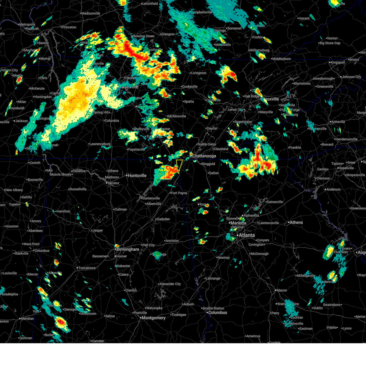
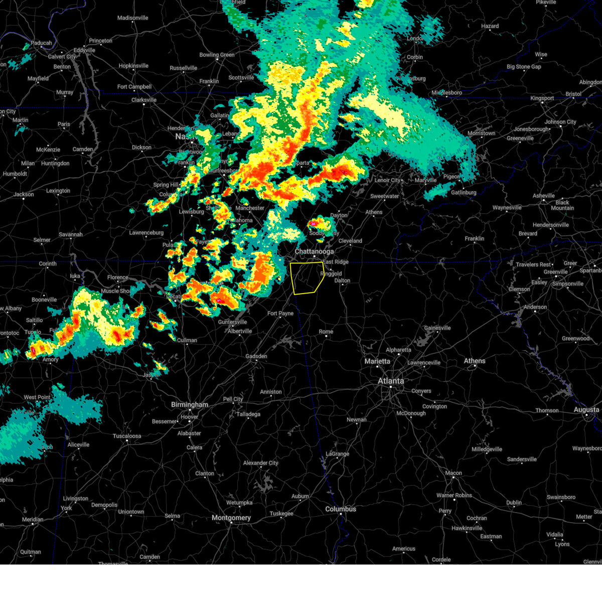
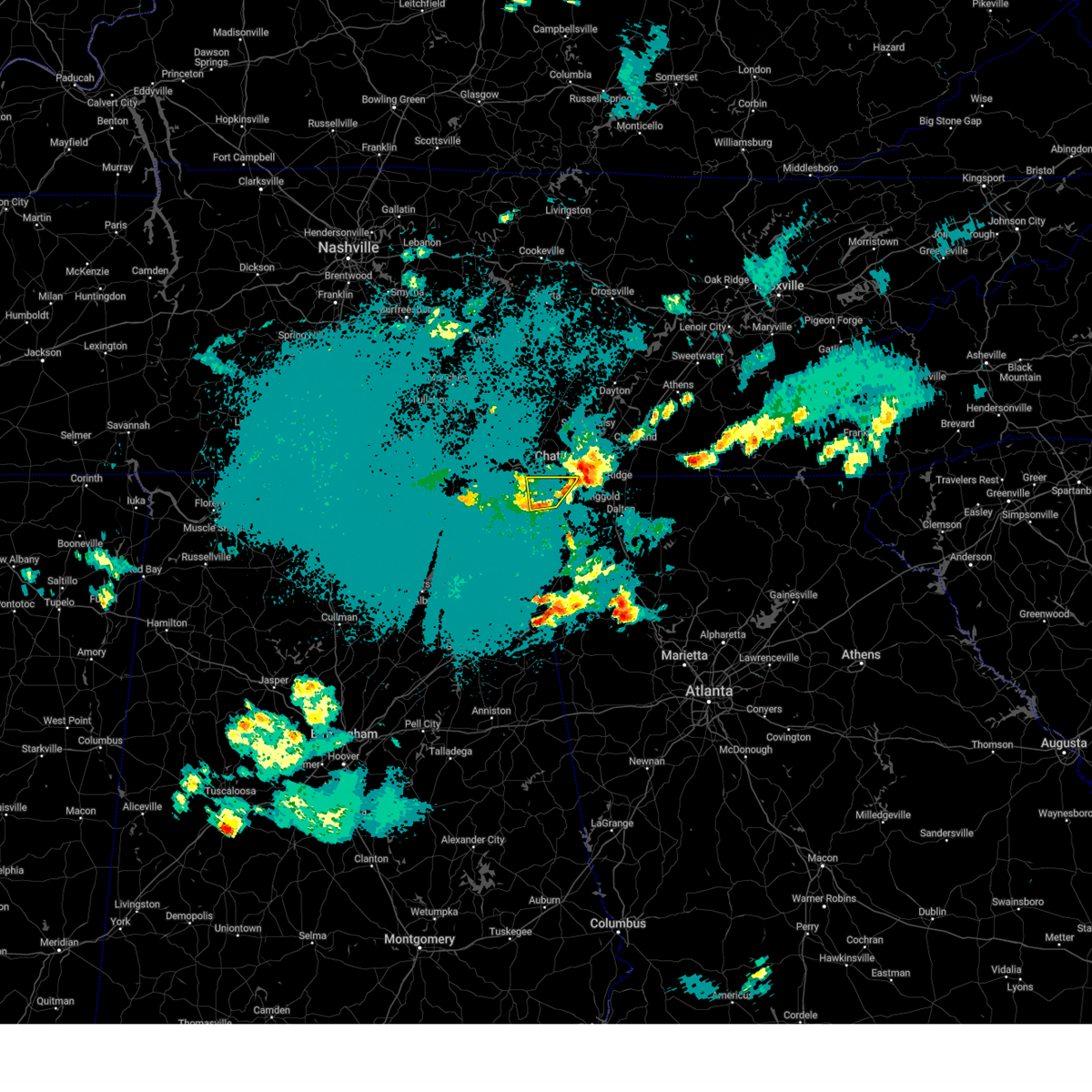
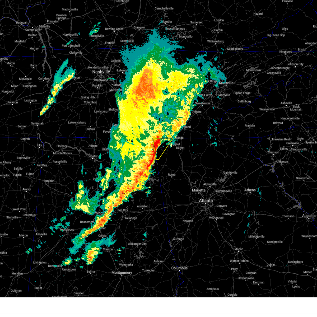
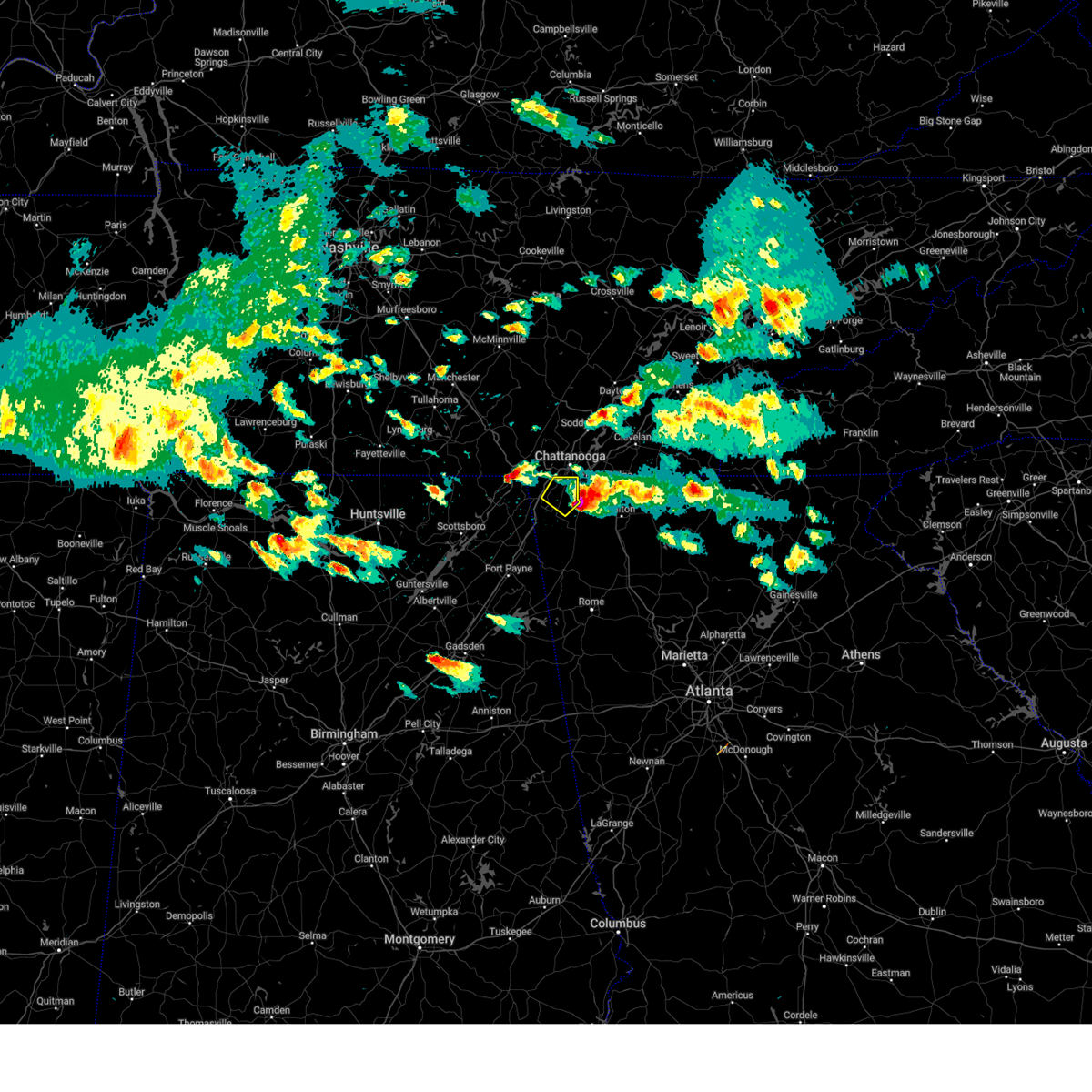
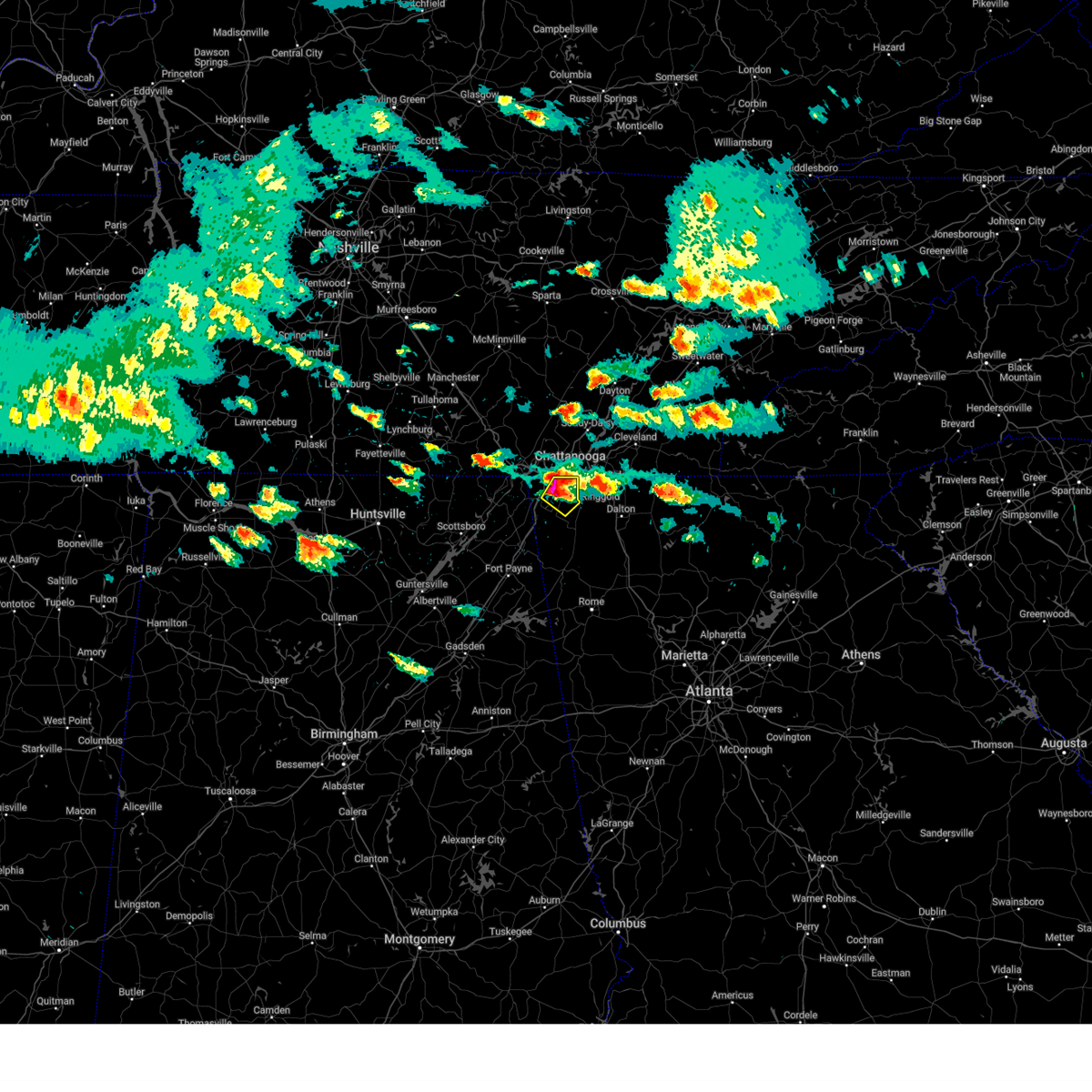
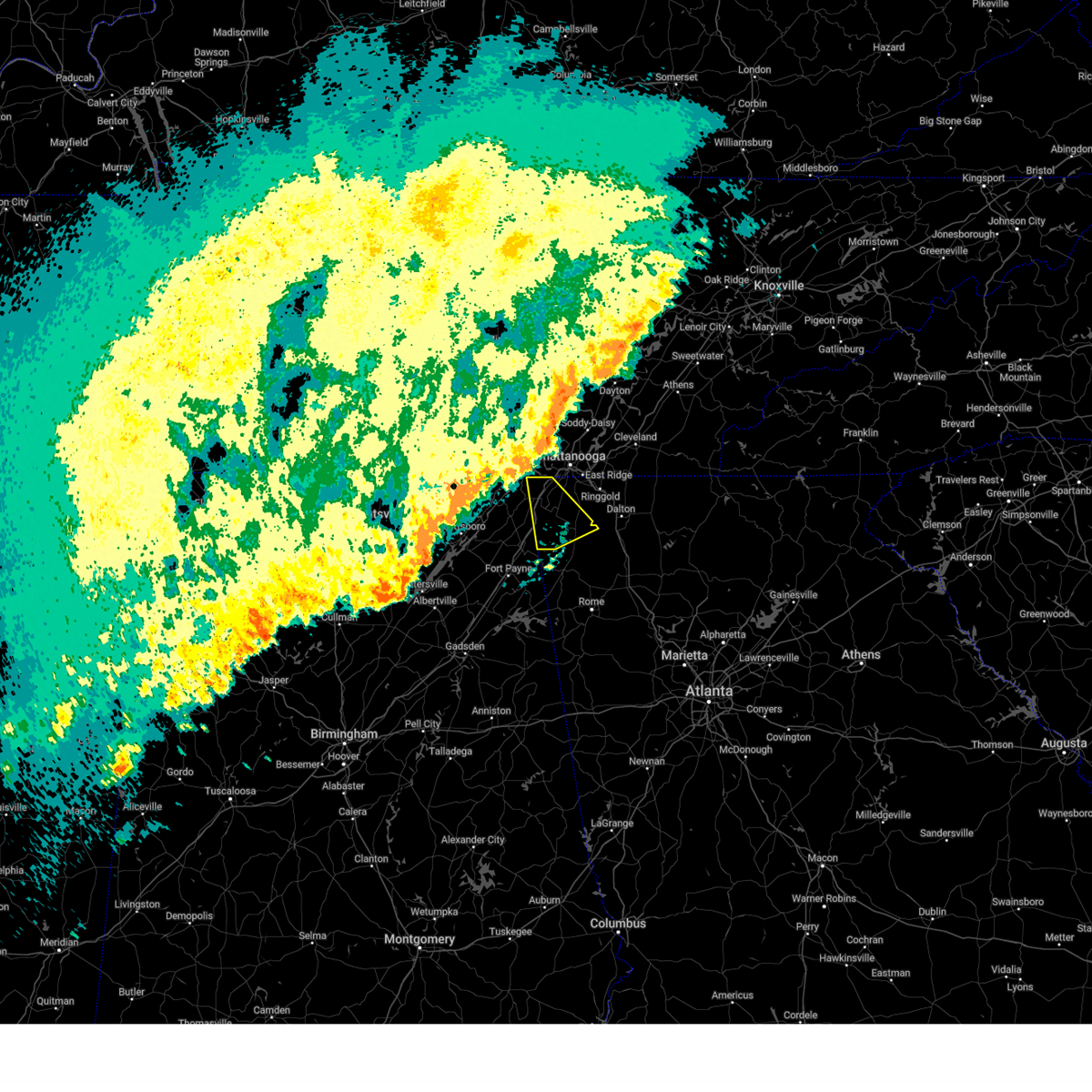
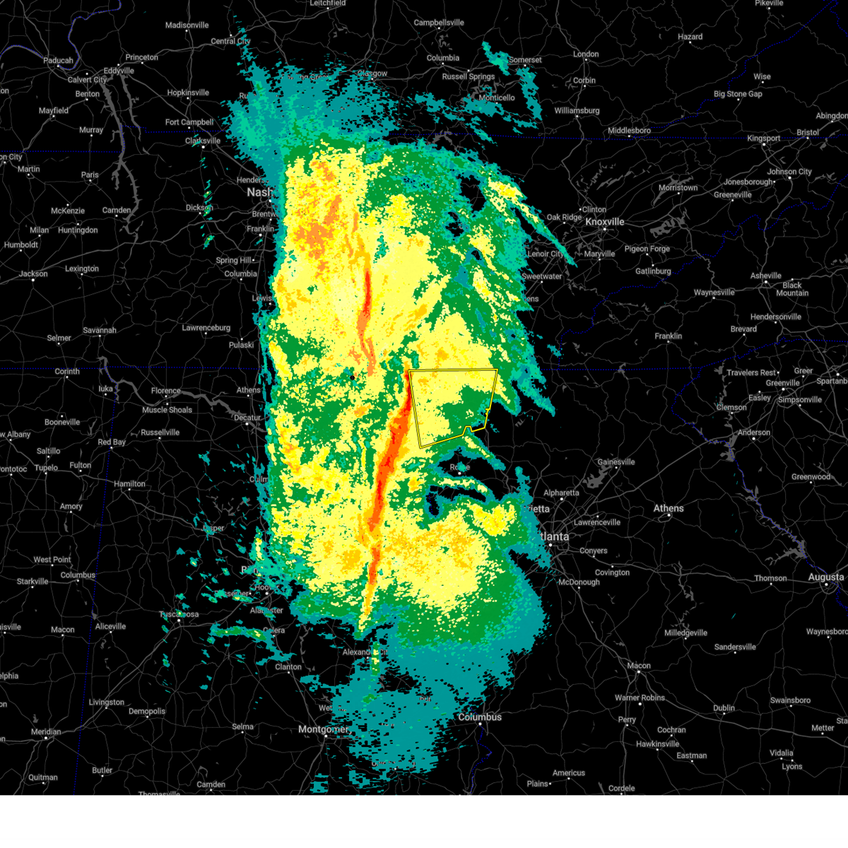
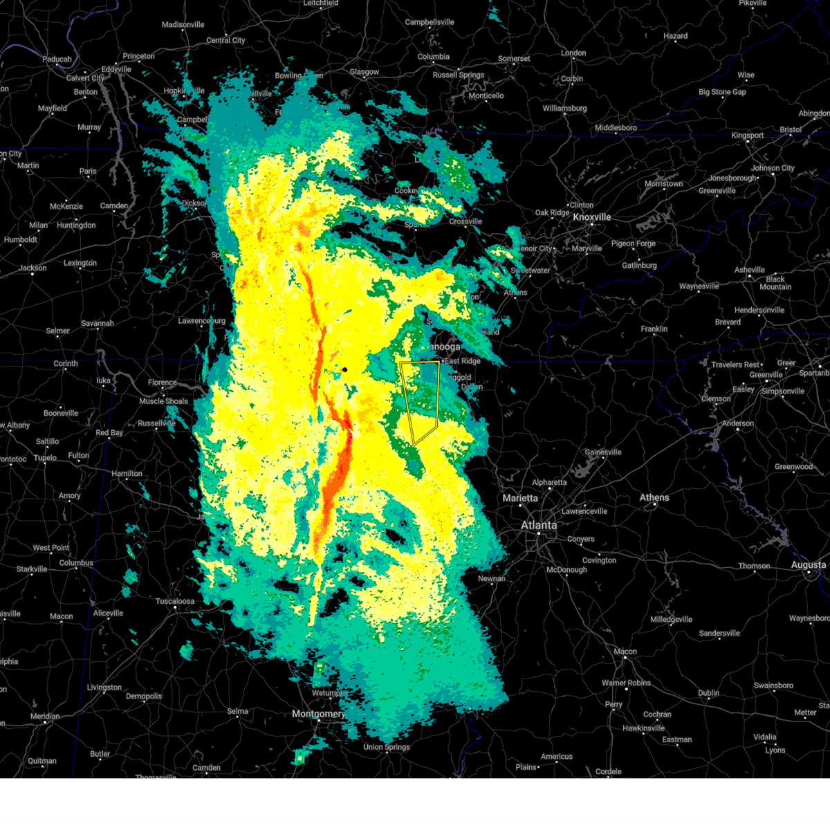
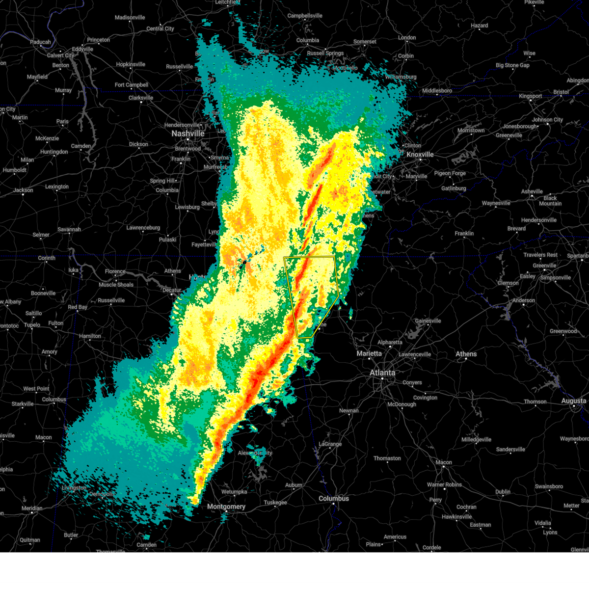
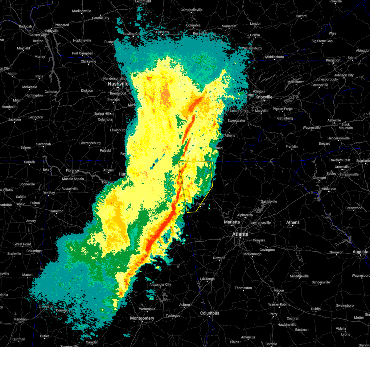
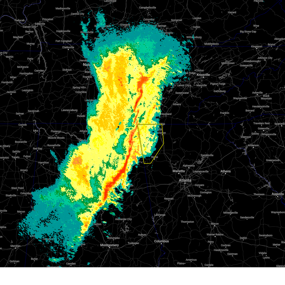
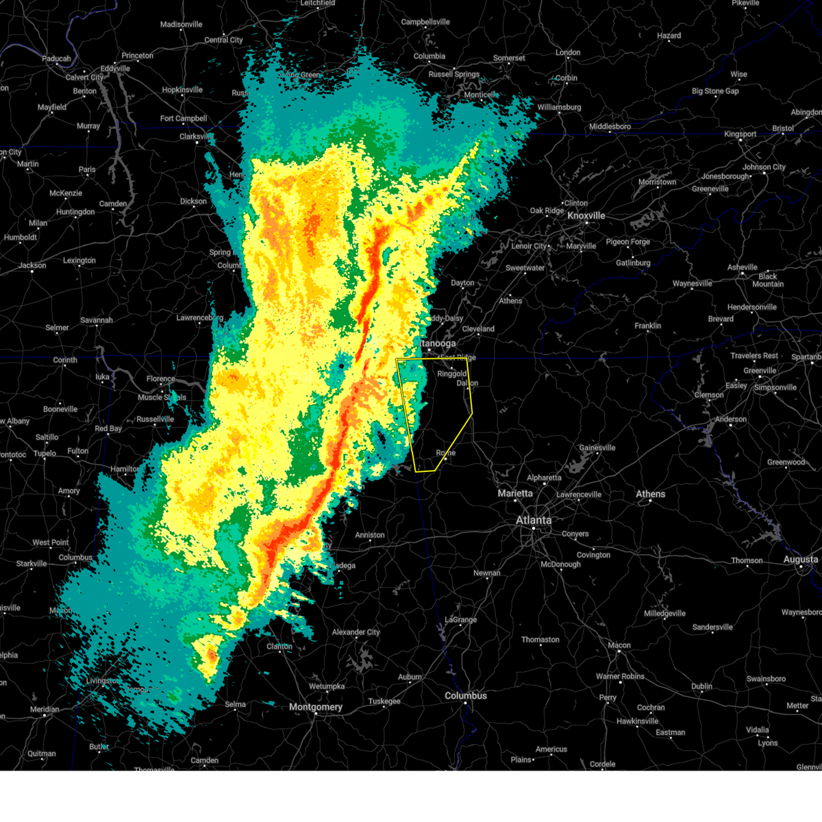
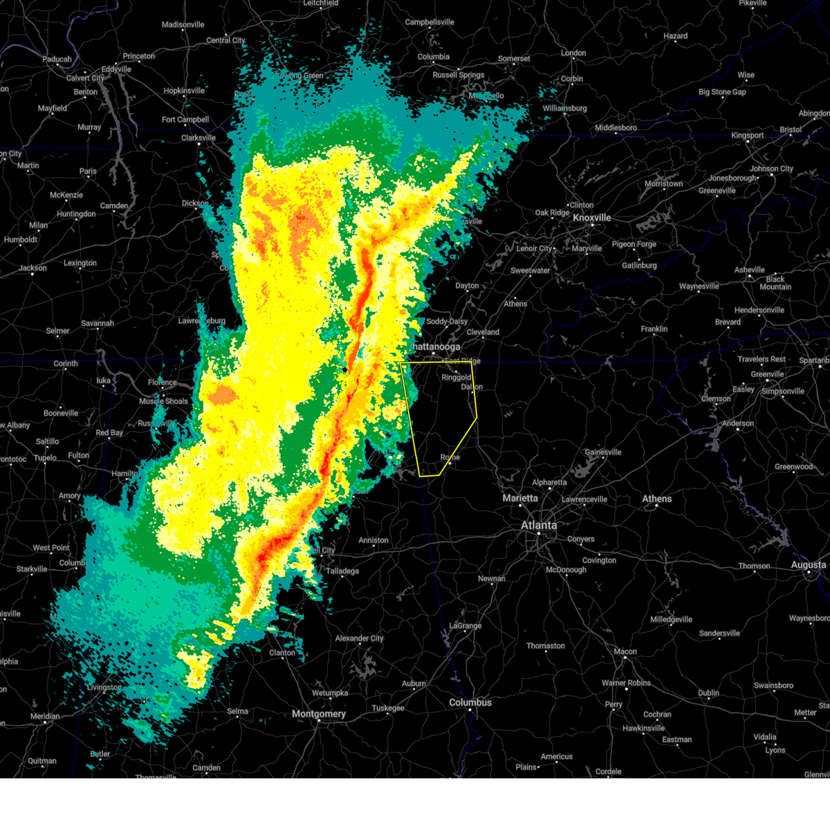
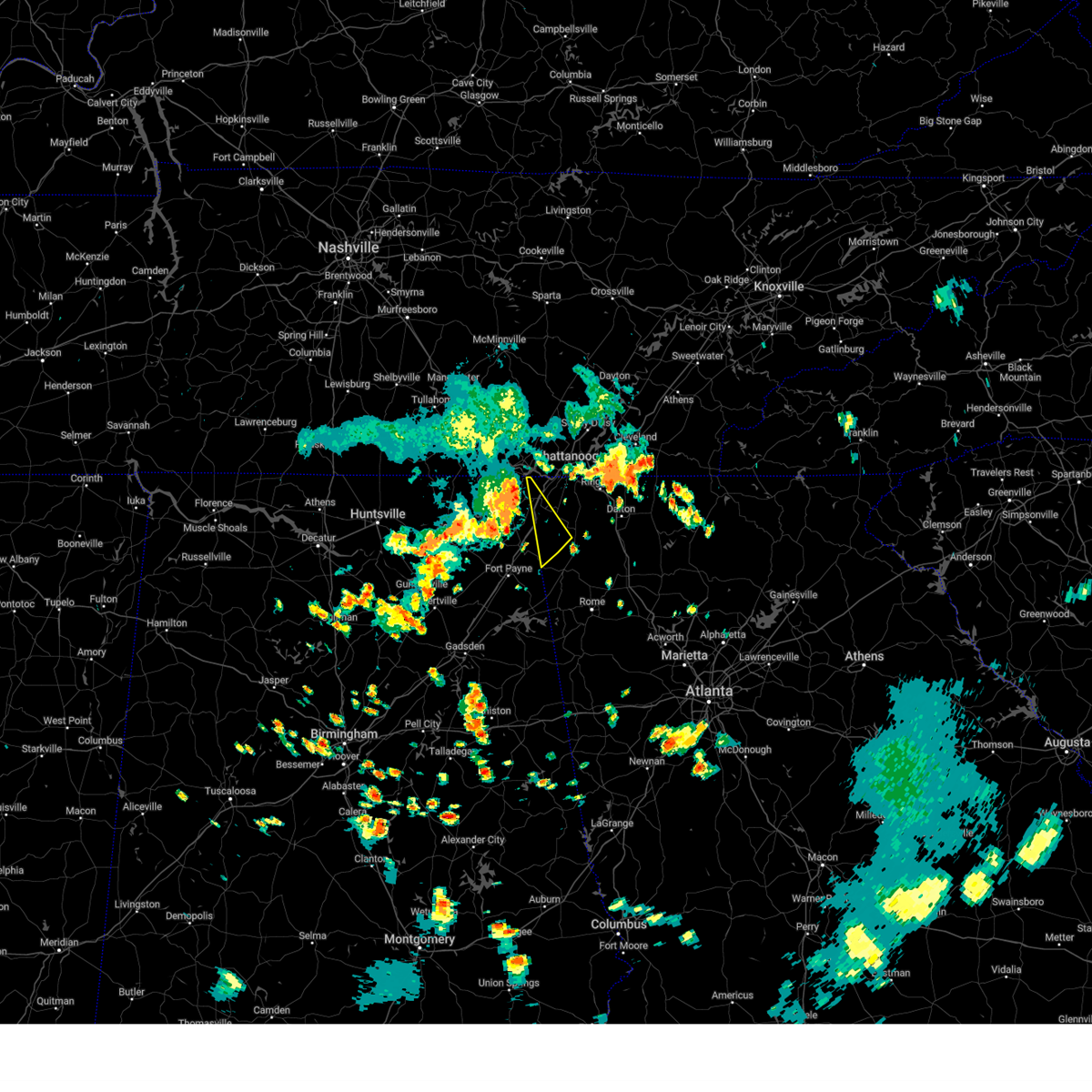
Hail Map for Trenton, GA
The Trenton, GA area has had 19 reports of on-the-ground hail by trained spotters, and has been under severe weather warnings 40 times during the past 12 months. Doppler radar has detected hail at or near Trenton, GA on 46 occasions, including 6 occasions during the past year.
| Name: | Trenton, GA |
| Where Located: | 16.5 miles SW of Chattanooga, TN |
| Map: | Google Map for Trenton, GA |
| Population: | 2301 |
| Housing Units: | 1012 |
| More Info: | Search Google for Trenton, GA |
1
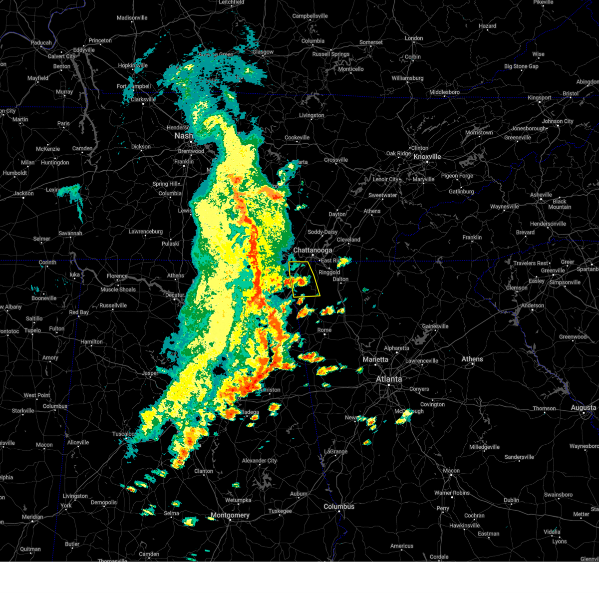
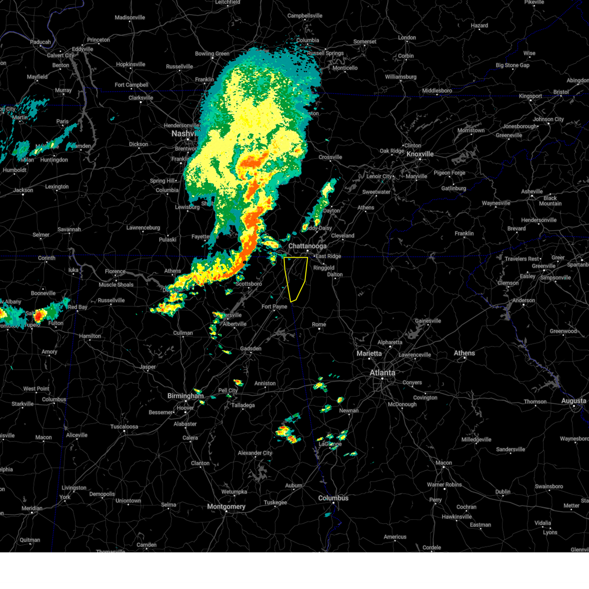
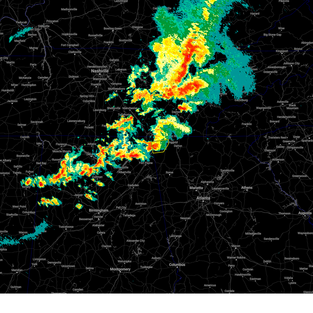
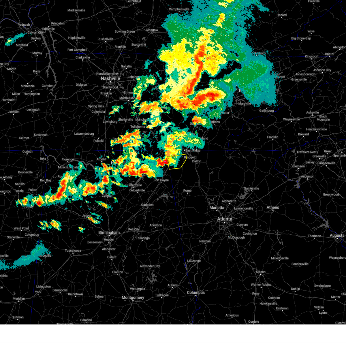
The Top Recent Hail Date for Trenton, GA is Thursday, April 10, 2025 (13th out of 46)

Hail and Wind Damage Spotted near Trenton, GA
| Date / Time | Report Details |
|---|---|
| 6/27/2025 5:50 PM EDT | The storm which prompted the warning has weakened below severe limits, and no longer poses an immediate threat to life or property. therefore, the warning will be allowed to expire. however, gusty winds and heavy rain are still possible with this thunderstorm. |
| 6/27/2025 5:38 PM EDT | The storm which prompted the warning has weakened below severe limits, and has exited the warned area. therefore, the warning has been allowed to expire. |
| 6/27/2025 5:14 PM EDT | Svrffc the national weather service in peachtree city has issued a * severe thunderstorm warning for, northwestern walker county in northwestern georgia, dade county in northwestern georgia, * until 600 pm edt. * at 513 pm edt, a severe thunderstorm was located over new england, or over trenton, moving north at 10 mph (radar indicated). Hazards include 60 mph wind gusts and quarter size hail. Hail damage to vehicles is expected. Expect wind damage to roofs, siding, and trees. |
| 6/27/2025 4:53 PM EDT |
 Svrffc the national weather service in peachtree city has issued a * severe thunderstorm warning for, northwestern dade county in northwestern georgia, * until 530 pm edt. * at 453 pm edt, a severe thunderstorm was located over higdon, or near trenton, moving north at 10 mph (radar indicated). Hazards include 60 mph wind gusts and quarter size hail. Hail damage to vehicles is expected. Expect wind damage to roofs, siding, and trees. Svrffc the national weather service in peachtree city has issued a * severe thunderstorm warning for, northwestern dade county in northwestern georgia, * until 530 pm edt. * at 453 pm edt, a severe thunderstorm was located over higdon, or near trenton, moving north at 10 mph (radar indicated). Hazards include 60 mph wind gusts and quarter size hail. Hail damage to vehicles is expected. Expect wind damage to roofs, siding, and trees.
|
| 6/7/2025 4:53 PM EDT |
 The storms which prompted the warning have moved out of the area. therefore, the warning will be allowed to expire. however, gusty winds are still possible with these thunderstorms. a severe thunderstorm watch remains in effect until 900 pm edt for northwestern georgia. remember, a severe thunderstorm warning still remains in effect for eastern and southeastern walker county. The storms which prompted the warning have moved out of the area. therefore, the warning will be allowed to expire. however, gusty winds are still possible with these thunderstorms. a severe thunderstorm watch remains in effect until 900 pm edt for northwestern georgia. remember, a severe thunderstorm warning still remains in effect for eastern and southeastern walker county.
|
| 6/7/2025 4:34 PM EDT |
 At 433 pm edt, severe thunderstorms were located along a line extending from russell cave national monument to fabius to near henagar, moving east at 55 mph. these are destructive storms for cole city and northern dade county (radar indicated). Hazards include 80 mph wind gusts. Flying debris will be dangerous to those caught without shelter. mobile homes will be heavily damaged. expect considerable damage to roofs, windows, and vehicles. extensive tree damage and power outages are likely. Locations impacted include, lafayette, trenton, la fayette, chattanooga valley, rising fawn, cole city, wildwood, stephensville, linwood, new england, chattanooga valley, morganville, hooker, cloudland canyon state park, and cooper heights. At 433 pm edt, severe thunderstorms were located along a line extending from russell cave national monument to fabius to near henagar, moving east at 55 mph. these are destructive storms for cole city and northern dade county (radar indicated). Hazards include 80 mph wind gusts. Flying debris will be dangerous to those caught without shelter. mobile homes will be heavily damaged. expect considerable damage to roofs, windows, and vehicles. extensive tree damage and power outages are likely. Locations impacted include, lafayette, trenton, la fayette, chattanooga valley, rising fawn, cole city, wildwood, stephensville, linwood, new england, chattanooga valley, morganville, hooker, cloudland canyon state park, and cooper heights.
|
| 6/7/2025 4:23 PM EDT |
 At 423 pm edt, severe thunderstorms were located along a line extending from near anderson to fackler to near dutton, moving east at 55 mph (radar indicated). Hazards include 70 mph wind gusts. Expect considerable tree damage. damage is likely to mobile homes, roofs, and outbuildings. Locations impacted include, lafayette, trenton, la fayette, chattanooga valley, rising fawn, cole city, wildwood, stephensville, linwood, new england, chattanooga valley, morganville, hooker, cloudland canyon state park, and cooper heights. At 423 pm edt, severe thunderstorms were located along a line extending from near anderson to fackler to near dutton, moving east at 55 mph (radar indicated). Hazards include 70 mph wind gusts. Expect considerable tree damage. damage is likely to mobile homes, roofs, and outbuildings. Locations impacted include, lafayette, trenton, la fayette, chattanooga valley, rising fawn, cole city, wildwood, stephensville, linwood, new england, chattanooga valley, morganville, hooker, cloudland canyon state park, and cooper heights.
|
| 6/7/2025 4:13 PM EDT |
 Svrffc the national weather service in peachtree city has issued a * severe thunderstorm warning for, western walker county in northwestern georgia, dade county in northwestern georgia, * until 500 pm edt. * at 413 pm edt, severe thunderstorms were located along a line extending from jericho to near fackler to near scottsboro, moving east at 55 mph (radar indicated). Hazards include 60 mph wind gusts. expect damage to roofs, siding, and trees Svrffc the national weather service in peachtree city has issued a * severe thunderstorm warning for, western walker county in northwestern georgia, dade county in northwestern georgia, * until 500 pm edt. * at 413 pm edt, severe thunderstorms were located along a line extending from jericho to near fackler to near scottsboro, moving east at 55 mph (radar indicated). Hazards include 60 mph wind gusts. expect damage to roofs, siding, and trees
|
| 5/25/2025 6:14 PM EDT | The storms which prompted the warning have moved out of the area. therefore, the warning will be allowed to expire. a severe thunderstorm warning still remains in effect for central dade, northern chattooga, central whitfield, catoosa, and walker counties until 7 pm edt. a severe thunderstorm watch remains in effect until midnight edt for northwestern georgia. |
| 5/25/2025 6:10 PM EDT | Multiple trees down along 700 block of dugan loop in dade count in dade county GA, 5.7 miles SSW of Trenton, GA |
| 5/25/2025 5:28 PM EDT |
 Svrffc the national weather service in peachtree city has issued a * severe thunderstorm warning for, western walker county in northwestern georgia, dade county in northwestern georgia, northwestern chattooga county in northwestern georgia, * until 615 pm edt. * at 527 pm edt, severe thunderstorms were located along a line extending from near sherwood to near jericho to hollytree, moving east at 50 mph (radar indicated). Hazards include 60 mph wind gusts and penny size hail. expect damage to roofs, siding, and trees Svrffc the national weather service in peachtree city has issued a * severe thunderstorm warning for, western walker county in northwestern georgia, dade county in northwestern georgia, northwestern chattooga county in northwestern georgia, * until 615 pm edt. * at 527 pm edt, severe thunderstorms were located along a line extending from near sherwood to near jericho to hollytree, moving east at 50 mph (radar indicated). Hazards include 60 mph wind gusts and penny size hail. expect damage to roofs, siding, and trees
|
| 5/20/2025 9:32 PM EDT |
 The storms which prompted the warning have moved out of the area. therefore, the warning has been allowed to expire. a tornado watch remains in effect until 200 am edt for northwestern georgia. remember, a severe thunderstorm warning still remains in effect for walker and dade counties. remember, a tornado warning still remains in effect for southern dade and southwestern walker counties. The storms which prompted the warning have moved out of the area. therefore, the warning has been allowed to expire. a tornado watch remains in effect until 200 am edt for northwestern georgia. remember, a severe thunderstorm warning still remains in effect for walker and dade counties. remember, a tornado warning still remains in effect for southern dade and southwestern walker counties.
|
| 5/20/2025 9:22 PM EDT |
 At 921 pm edt, severe thunderstorms were located along a line extending from near lookout mountain to near chattanooga valley to cooper heights to near rising fawn, moving east at 45 mph (radar indicated). Hazards include 60 mph wind gusts and half dollar size hail. Hail damage to vehicles is expected. expect wind damage to roofs, siding, and trees. Locations impacted include, trenton, fort oglethorpe, chickamauga, la fayette, chattanooga valley, rising fawn, noble, blue spring, stephensville, cloudland canyon state park, cooper heights, rock spring, and fairview. At 921 pm edt, severe thunderstorms were located along a line extending from near lookout mountain to near chattanooga valley to cooper heights to near rising fawn, moving east at 45 mph (radar indicated). Hazards include 60 mph wind gusts and half dollar size hail. Hail damage to vehicles is expected. expect wind damage to roofs, siding, and trees. Locations impacted include, trenton, fort oglethorpe, chickamauga, la fayette, chattanooga valley, rising fawn, noble, blue spring, stephensville, cloudland canyon state park, cooper heights, rock spring, and fairview.
|
| 5/20/2025 8:47 PM EDT |
 Svrffc the national weather service in peachtree city has issued a * severe thunderstorm warning for, northwestern catoosa county in northwestern georgia, central walker county in northwestern georgia, dade county in northwestern georgia, * until 930 pm edt. * at 846 pm edt, severe thunderstorms were located along a line extending from orme to near fabius to near fackler to near martintown, moving east at 45 mph (radar indicated). Hazards include 60 mph wind gusts and half dollar size hail. Hail damage to vehicles is expected. Expect wind damage to roofs, siding, and trees. Svrffc the national weather service in peachtree city has issued a * severe thunderstorm warning for, northwestern catoosa county in northwestern georgia, central walker county in northwestern georgia, dade county in northwestern georgia, * until 930 pm edt. * at 846 pm edt, severe thunderstorms were located along a line extending from orme to near fabius to near fackler to near martintown, moving east at 45 mph (radar indicated). Hazards include 60 mph wind gusts and half dollar size hail. Hail damage to vehicles is expected. Expect wind damage to roofs, siding, and trees.
|
| 5/8/2025 10:20 PM EDT |
 The storm which prompted the warning has weakened below severe limits, and has exited the warned area. therefore, the warning will be allowed to expire. a severe thunderstorm watch remains in effect until midnight edt for northwestern georgia. The storm which prompted the warning has weakened below severe limits, and has exited the warned area. therefore, the warning will be allowed to expire. a severe thunderstorm watch remains in effect until midnight edt for northwestern georgia.
|
| 5/8/2025 9:44 PM EDT | Svrffc the national weather service in peachtree city has issued a * severe thunderstorm warning for, northwestern walker county in northwestern georgia, dade county in northwestern georgia, * until 1030 pm edt. * at 944 pm edt, a severe thunderstorm was located over stevenson, or 8 miles southwest of bridgeport, moving northeast at 50 mph (radar indicated). Hazards include 60 mph wind gusts and quarter size hail. Hail damage to vehicles is expected. Expect wind damage to roofs, siding, and trees. |
| 5/3/2025 5:16 PM EDT |
 At 515 pm edt, severe thunderstorms were located along a line extending from new england to near valley head, moving east at 35 mph (radar indicated). Hazards include 60 mph wind gusts and penny size hail. Expect damage to roofs, siding, and trees. Locations impacted include, rising fawn, chickamauga, lookout mountain, lakeview, fort oglethorpe, cole city, fairview, stephensville, chattanooga valley, chattanooga valley, new england, morganville, trenton, hooker, cloudland canyon state park, rossville, cooper heights, indian springs, east ridge, and chattanooga. At 515 pm edt, severe thunderstorms were located along a line extending from new england to near valley head, moving east at 35 mph (radar indicated). Hazards include 60 mph wind gusts and penny size hail. Expect damage to roofs, siding, and trees. Locations impacted include, rising fawn, chickamauga, lookout mountain, lakeview, fort oglethorpe, cole city, fairview, stephensville, chattanooga valley, chattanooga valley, new england, morganville, trenton, hooker, cloudland canyon state park, rossville, cooper heights, indian springs, east ridge, and chattanooga.
|
| 5/3/2025 5:16 PM EDT |
 At 516 pm edt, a severe thunderstorm was located over trenton, moving northeast at 45 mph (radar indicated). Hazards include 60 mph wind gusts and penny size hail. Expect damage to roofs, siding, and trees. Locations impacted include, rising fawn, chickamauga, lookout mountain, lakeview, fort oglethorpe, fairview, stephensville, chattanooga valley, chattanooga valley, new england, morganville, trenton, cloudland canyon state park, rossville, cooper heights, indian springs, and east ridge. At 516 pm edt, a severe thunderstorm was located over trenton, moving northeast at 45 mph (radar indicated). Hazards include 60 mph wind gusts and penny size hail. Expect damage to roofs, siding, and trees. Locations impacted include, rising fawn, chickamauga, lookout mountain, lakeview, fort oglethorpe, fairview, stephensville, chattanooga valley, chattanooga valley, new england, morganville, trenton, cloudland canyon state park, rossville, cooper heights, indian springs, and east ridge.
|
| 1/1/0001 12:00 AM | A tree was knocked down blocking one lane at 1132 cr 31 in jackson county AL, 6.6 miles ENE of Trenton, GA |
| 5/3/2025 5:01 PM EDT |
 Svrffc the national weather service in peachtree city has issued a * severe thunderstorm warning for, northwestern catoosa county in northwestern georgia, western walker county in northwestern georgia, dade county in northwestern georgia, northwestern chattooga county in northwestern georgia, * until 545 pm edt. * at 501 pm edt, a severe thunderstorm was located near higdon, or 9 miles south of bridgeport, moving east at 45 mph (radar indicated). Hazards include 60 mph wind gusts. expect damage to roofs, siding, and trees Svrffc the national weather service in peachtree city has issued a * severe thunderstorm warning for, northwestern catoosa county in northwestern georgia, western walker county in northwestern georgia, dade county in northwestern georgia, northwestern chattooga county in northwestern georgia, * until 545 pm edt. * at 501 pm edt, a severe thunderstorm was located near higdon, or 9 miles south of bridgeport, moving east at 45 mph (radar indicated). Hazards include 60 mph wind gusts. expect damage to roofs, siding, and trees
|
| 5/3/2025 4:58 PM EDT |
 Svrffc the national weather service in peachtree city has issued a * severe thunderstorm warning for, northwestern catoosa county in northwestern georgia, western walker county in northwestern georgia, dade county in northwestern georgia, * until 545 pm edt. * at 458 pm edt, severe thunderstorms were located along a line extending from near higdon to near sylvania, moving east at 35 mph (radar indicated). Hazards include 60 mph wind gusts. expect damage to roofs, siding, and trees Svrffc the national weather service in peachtree city has issued a * severe thunderstorm warning for, northwestern catoosa county in northwestern georgia, western walker county in northwestern georgia, dade county in northwestern georgia, * until 545 pm edt. * at 458 pm edt, severe thunderstorms were located along a line extending from near higdon to near sylvania, moving east at 35 mph (radar indicated). Hazards include 60 mph wind gusts. expect damage to roofs, siding, and trees
|
| 5/2/2025 6:31 PM EDT | At 631 pm edt, severe thunderstorms were located along a line extending from cole city to near mentone, moving east at 45 mph (radar indicated). Hazards include 60 mph wind gusts and quarter size hail. Hail damage to vehicles is expected. expect wind damage to roofs, siding, and trees. Locations impacted include, lafayette, trenton, fort oglethorpe, chickamauga, lookout mountain, la fayette, chattanooga valley, center post, rising fawn, noble, cole city, wildwood, stephensville, fairview, linwood, new england, chattanooga valley, morganville, hooker, and cloudland canyon state park. |
| 5/2/2025 6:22 PM EDT |
 Svrffc the national weather service in peachtree city has issued a * severe thunderstorm warning for, walker county in northwestern georgia, dade county in northwestern georgia, * until 700 pm edt. * at 622 pm edt, severe thunderstorms were located along a line extending from near long island to near hammondville, moving east at 45 mph (radar indicated). Hazards include 60 mph wind gusts and penny size hail. expect damage to roofs, siding, and trees Svrffc the national weather service in peachtree city has issued a * severe thunderstorm warning for, walker county in northwestern georgia, dade county in northwestern georgia, * until 700 pm edt. * at 622 pm edt, severe thunderstorms were located along a line extending from near long island to near hammondville, moving east at 45 mph (radar indicated). Hazards include 60 mph wind gusts and penny size hail. expect damage to roofs, siding, and trees
|
| 4/10/2025 6:34 PM EDT |
 the severe thunderstorm warning has been cancelled and is no longer in effect the severe thunderstorm warning has been cancelled and is no longer in effect
|
| 4/10/2025 6:10 PM EDT | Quarter sized hail reported 5 miles SSE of Trenton, GA, hail up to quarter size near new home road and ballard road. |
| 4/10/2025 6:07 PM EDT |
 Svrffc the national weather service in peachtree city has issued a * severe thunderstorm warning for, northwestern walker county in northwestern georgia, northern dade county in northwestern georgia, * until 645 pm edt. * at 607 pm edt, a severe thunderstorm was located over cole city, or near trenton, moving southeast at 35 mph (radar indicated). Hazards include 60 mph wind gusts and quarter size hail. Hail damage to vehicles is expected. Expect wind damage to roofs, siding, and trees. Svrffc the national weather service in peachtree city has issued a * severe thunderstorm warning for, northwestern walker county in northwestern georgia, northern dade county in northwestern georgia, * until 645 pm edt. * at 607 pm edt, a severe thunderstorm was located over cole city, or near trenton, moving southeast at 35 mph (radar indicated). Hazards include 60 mph wind gusts and quarter size hail. Hail damage to vehicles is expected. Expect wind damage to roofs, siding, and trees.
|
| 4/10/2025 5:59 PM EDT |
 The storm which prompted the warning has moved out of the area. therefore, the warning will be allowed to expire. a severe thunderstorm watch remains in effect until midnight edt for northwestern georgia. The storm which prompted the warning has moved out of the area. therefore, the warning will be allowed to expire. a severe thunderstorm watch remains in effect until midnight edt for northwestern georgia.
|
| 4/10/2025 5:37 PM EDT |
 At 536 pm edt, a severe thunderstorm was located near cooper heights, or near trenton, moving southeast at 35 mph (public). Hazards include 60 mph wind gusts and quarter size hail. Hail damage to vehicles is expected. expect wind damage to roofs, siding, and trees. Locations impacted include, fairview, chickamauga, lookout mountain, chattanooga valley, chattanooga valley, cooper heights, wildwood, lakeview, and fort oglethorpe. At 536 pm edt, a severe thunderstorm was located near cooper heights, or near trenton, moving southeast at 35 mph (public). Hazards include 60 mph wind gusts and quarter size hail. Hail damage to vehicles is expected. expect wind damage to roofs, siding, and trees. Locations impacted include, fairview, chickamauga, lookout mountain, chattanooga valley, chattanooga valley, cooper heights, wildwood, lakeview, and fort oglethorpe.
|
| 4/10/2025 5:24 PM EDT | Quarter sized hail reported 7.5 miles S of Trenton, GA, quarter size hail near picket post trail and stallings road. |
| 4/10/2025 5:22 PM EDT | Quarter sized hail reported 7.1 miles SSE of Trenton, GA, quarter inch hail at leiderman rd near new home rd. |
| 4/10/2025 5:10 PM EDT | Svrffc the national weather service in peachtree city has issued a * severe thunderstorm warning for, northwestern walker county in northwestern georgia, northern dade county in northwestern georgia, * until 600 pm edt. * at 509 pm edt, a severe thunderstorm was located over new hope, or near jasper, moving southeast at 35 mph (radar indicated). Hazards include 60 mph wind gusts and quarter size hail. Hail damage to vehicles is expected. Expect wind damage to roofs, siding, and trees. |
| 4/6/2025 2:49 AM EDT |
 Svrffc the national weather service in peachtree city has issued a * severe thunderstorm warning for, walker county in northwestern georgia, dade county in northwestern georgia, * until 330 am edt. * at 249 am edt, severe thunderstorms were located along a line extending from hooker to stevenson to langston, moving southeast at 40 mph (radar indicated). Hazards include 60 mph wind gusts. expect damage to roofs, siding, and trees Svrffc the national weather service in peachtree city has issued a * severe thunderstorm warning for, walker county in northwestern georgia, dade county in northwestern georgia, * until 330 am edt. * at 249 am edt, severe thunderstorms were located along a line extending from hooker to stevenson to langston, moving southeast at 40 mph (radar indicated). Hazards include 60 mph wind gusts. expect damage to roofs, siding, and trees
|
| 3/4/2025 11:44 PM EST |
 The storms which prompted the warning have moved out of the warned area. therefore, the warning will be allowed to expire. a severe thunderstorm watch remains in effect until 400 am est for northwestern georgia. remember, a severe thunderstorm warning still remains in effect for portions of dade, walker, and chattooga county. The storms which prompted the warning have moved out of the warned area. therefore, the warning will be allowed to expire. a severe thunderstorm watch remains in effect until 400 am est for northwestern georgia. remember, a severe thunderstorm warning still remains in effect for portions of dade, walker, and chattooga county.
|
| 3/4/2025 11:42 PM EST |
 Svrffc the national weather service in peachtree city has issued a * severe thunderstorm warning for, catoosa county in northwestern georgia, whitfield county in northwestern georgia, walker county in northwestern georgia, northwestern gordon county in northwestern georgia, dade county in northwestern georgia, northern chattooga county in northwestern georgia, * until 1230 am est. * at 1142 pm est, severe thunderstorms were located along a line extending from cole city to sulpher springs to near chesterfield, moving northeast at 45 mph (radar indicated). Hazards include 60 mph wind gusts. expect damage to roofs, siding, and trees Svrffc the national weather service in peachtree city has issued a * severe thunderstorm warning for, catoosa county in northwestern georgia, whitfield county in northwestern georgia, walker county in northwestern georgia, northwestern gordon county in northwestern georgia, dade county in northwestern georgia, northern chattooga county in northwestern georgia, * until 1230 am est. * at 1142 pm est, severe thunderstorms were located along a line extending from cole city to sulpher springs to near chesterfield, moving northeast at 45 mph (radar indicated). Hazards include 60 mph wind gusts. expect damage to roofs, siding, and trees
|
| 3/4/2025 11:38 PM EST | A tree fell across the 600 block of slygo roa in dade county GA, 3.7 miles SSW of Trenton, GA |
| 3/4/2025 11:35 PM EST | A tree fell across the 4000 block of brow road and blocked both lane in dade county GA, 4.2 miles S of Trenton, GA |
| 3/4/2025 10:56 PM EST |
 Svrffc the national weather service in peachtree city has issued a * severe thunderstorm warning for, walker county in northwestern georgia, dade county in northwestern georgia, northwestern chattooga county in northwestern georgia, * until 1145 pm est. * at 1055 pm est, severe thunderstorms were located along a line extending from near larkinsville to near fyffe to crudup, moving northeast at 60 mph (radar indicated). Hazards include 60 mph wind gusts. expect damage to roofs, siding, and trees Svrffc the national weather service in peachtree city has issued a * severe thunderstorm warning for, walker county in northwestern georgia, dade county in northwestern georgia, northwestern chattooga county in northwestern georgia, * until 1145 pm est. * at 1055 pm est, severe thunderstorms were located along a line extending from near larkinsville to near fyffe to crudup, moving northeast at 60 mph (radar indicated). Hazards include 60 mph wind gusts. expect damage to roofs, siding, and trees
|
| 2/16/2025 3:00 AM EST |
 The storms which prompted the warning have moved out of the area. therefore, the warning will be allowed to expire. a tornado watch remains in effect until 900 am est for northwestern georgia. remember, a severe thunderstorm warning still remains in effect for portions of catoosa, walker, chattooga, and whitfield counties. The storms which prompted the warning have moved out of the area. therefore, the warning will be allowed to expire. a tornado watch remains in effect until 900 am est for northwestern georgia. remember, a severe thunderstorm warning still remains in effect for portions of catoosa, walker, chattooga, and whitfield counties.
|
| 2/16/2025 2:51 AM EST |
 At 251 am est, severe thunderstorms were located along a line extending from hicks gap state park to near sulpher springs to near cedar bluff, moving east at 65 mph (radar indicated). Hazards include 60 mph wind gusts. Expect damage to roofs, siding, and trees. Locations impacted include, rome, dalton, lafayette, summerville, ringgold, trenton, fort oglethorpe, rossville, chickamauga, trion, varnell, lookout mountain, tunnel hill, cohutta, resaca, chattanooga valley, la fayette, lyerly, menlo, and center post. At 251 am est, severe thunderstorms were located along a line extending from hicks gap state park to near sulpher springs to near cedar bluff, moving east at 65 mph (radar indicated). Hazards include 60 mph wind gusts. Expect damage to roofs, siding, and trees. Locations impacted include, rome, dalton, lafayette, summerville, ringgold, trenton, fort oglethorpe, rossville, chickamauga, trion, varnell, lookout mountain, tunnel hill, cohutta, resaca, chattanooga valley, la fayette, lyerly, menlo, and center post.
|
| 2/16/2025 2:41 AM EST |
 At 241 am est, severe thunderstorms were located along a line extending from jasper to near ider to near sand rock, moving east at 40 mph (radar indicated). Hazards include 60 mph wind gusts. Expect damage to roofs, siding, and trees. Locations impacted include, rome, dalton, lafayette, summerville, ringgold, trenton, fort oglethorpe, rossville, chickamauga, trion, varnell, lookout mountain, tunnel hill, cohutta, resaca, chattanooga valley, la fayette, lyerly, menlo, and center post. At 241 am est, severe thunderstorms were located along a line extending from jasper to near ider to near sand rock, moving east at 40 mph (radar indicated). Hazards include 60 mph wind gusts. Expect damage to roofs, siding, and trees. Locations impacted include, rome, dalton, lafayette, summerville, ringgold, trenton, fort oglethorpe, rossville, chickamauga, trion, varnell, lookout mountain, tunnel hill, cohutta, resaca, chattanooga valley, la fayette, lyerly, menlo, and center post.
|
| 2/16/2025 2:20 AM EST |
 At 219 am est, severe thunderstorms were located along a line extending from near sherwood to martintown to near mcville, moving east at 65 mph (radar indicated). Hazards include 60 mph wind gusts. Expect damage to roofs, siding, and trees. Locations impacted include, rome, dalton, lafayette, summerville, ringgold, trenton, fort oglethorpe, rossville, chickamauga, trion, varnell, lookout mountain, tunnel hill, cohutta, resaca, chattanooga valley, la fayette, lyerly, menlo, and center post. At 219 am est, severe thunderstorms were located along a line extending from near sherwood to martintown to near mcville, moving east at 65 mph (radar indicated). Hazards include 60 mph wind gusts. Expect damage to roofs, siding, and trees. Locations impacted include, rome, dalton, lafayette, summerville, ringgold, trenton, fort oglethorpe, rossville, chickamauga, trion, varnell, lookout mountain, tunnel hill, cohutta, resaca, chattanooga valley, la fayette, lyerly, menlo, and center post.
|
| 2/16/2025 2:12 AM EST |
 Svrffc the national weather service in peachtree city has issued a * severe thunderstorm warning for, catoosa county in northwestern georgia, central floyd county in northwestern georgia, central whitfield county in northwestern georgia, walker county in northwestern georgia, northwestern gordon county in northwestern georgia, dade county in northwestern georgia, chattooga county in northwestern georgia, * until 300 am est. * at 212 am est, severe thunderstorms were located along a line extending from cowan to near hollywood to guntersville, moving east at 65 mph (radar indicated). Hazards include 60 mph wind gusts. expect damage to roofs, siding, and trees Svrffc the national weather service in peachtree city has issued a * severe thunderstorm warning for, catoosa county in northwestern georgia, central floyd county in northwestern georgia, central whitfield county in northwestern georgia, walker county in northwestern georgia, northwestern gordon county in northwestern georgia, dade county in northwestern georgia, chattooga county in northwestern georgia, * until 300 am est. * at 212 am est, severe thunderstorms were located along a line extending from cowan to near hollywood to guntersville, moving east at 65 mph (radar indicated). Hazards include 60 mph wind gusts. expect damage to roofs, siding, and trees
|
| 8/17/2024 4:02 PM EDT |
 Svrffc the national weather service in peachtree city has issued a * severe thunderstorm warning for, northwestern catoosa county in northwestern georgia, northwestern walker county in northwestern georgia, dade county in northwestern georgia, * until 445 pm edt. * at 401 pm edt, a severe thunderstorm was located near long island, or near bridgeport, moving east at 20 mph (radar indicated). Hazards include 60 mph wind gusts and quarter size hail. Hail damage to vehicles is expected. Expect wind damage to roofs, siding, and trees. Svrffc the national weather service in peachtree city has issued a * severe thunderstorm warning for, northwestern catoosa county in northwestern georgia, northwestern walker county in northwestern georgia, dade county in northwestern georgia, * until 445 pm edt. * at 401 pm edt, a severe thunderstorm was located near long island, or near bridgeport, moving east at 20 mph (radar indicated). Hazards include 60 mph wind gusts and quarter size hail. Hail damage to vehicles is expected. Expect wind damage to roofs, siding, and trees.
|
| 8/17/2024 3:47 PM EDT | Quarter sized hail reported 0.7 miles NNE of Trenton, GA, hail from the size of pennies to quarters was reported at the intersection of hickory street and poplar avenue. |
| 8/17/2024 3:43 PM EDT |
 At 343 pm edt, a severe thunderstorm was located over stephensville, or near trenton, moving east at 15 mph (radar indicated). Hazards include 60 mph wind gusts and penny size hail. Expect damage to roofs, siding, and trees. Locations impacted include, trenton, lookout mountain, chattanooga valley, stephensville, chattanooga valley, new england, morganville, hooker, cloudland canyon state park, cooper heights, cole city, and wildwood. At 343 pm edt, a severe thunderstorm was located over stephensville, or near trenton, moving east at 15 mph (radar indicated). Hazards include 60 mph wind gusts and penny size hail. Expect damage to roofs, siding, and trees. Locations impacted include, trenton, lookout mountain, chattanooga valley, stephensville, chattanooga valley, new england, morganville, hooker, cloudland canyon state park, cooper heights, cole city, and wildwood.
|
| 8/17/2024 3:36 PM EDT | A tree was reported down across fuller roa in dade county GA, 3.1 miles ESE of Trenton, GA |
| 8/17/2024 3:36 PM EDT | A tree was reported down across hartline roa in dade county GA, 4.6 miles ESE of Trenton, GA |
| 8/17/2024 2:57 PM EDT |
 Svrffc the national weather service in peachtree city has issued a * severe thunderstorm warning for, northwestern walker county in northwestern georgia, dade county in northwestern georgia, * until 400 pm edt. * at 257 pm edt, a severe thunderstorm was located over russell cave national monument, or near bridgeport, moving east at 15 mph (radar indicated). Hazards include 60 mph wind gusts and penny size hail. expect damage to roofs, siding, and trees Svrffc the national weather service in peachtree city has issued a * severe thunderstorm warning for, northwestern walker county in northwestern georgia, dade county in northwestern georgia, * until 400 pm edt. * at 257 pm edt, a severe thunderstorm was located over russell cave national monument, or near bridgeport, moving east at 15 mph (radar indicated). Hazards include 60 mph wind gusts and penny size hail. expect damage to roofs, siding, and trees
|
| 7/30/2024 6:21 PM EDT |
 Svrffc the national weather service in peachtree city has issued a * severe thunderstorm warning for, catoosa county in northwestern georgia, murray county in northwestern georgia, whitfield county in northwestern georgia, central walker county in northwestern georgia, dade county in northwestern georgia, * until 700 pm edt. * at 621 pm edt, severe thunderstorms were located along a line extending from near parksville to ooltewah to near sequatchie cave, moving south at 35 mph (radar indicated). Hazards include 60 mph wind gusts and quarter size hail. Hail damage to vehicles is expected. Expect wind damage to roofs, siding, and trees. Svrffc the national weather service in peachtree city has issued a * severe thunderstorm warning for, catoosa county in northwestern georgia, murray county in northwestern georgia, whitfield county in northwestern georgia, central walker county in northwestern georgia, dade county in northwestern georgia, * until 700 pm edt. * at 621 pm edt, severe thunderstorms were located along a line extending from near parksville to ooltewah to near sequatchie cave, moving south at 35 mph (radar indicated). Hazards include 60 mph wind gusts and quarter size hail. Hail damage to vehicles is expected. Expect wind damage to roofs, siding, and trees.
|
| 7/29/2024 6:00 PM EDT |
 Svrffc the national weather service in peachtree city has issued a * severe thunderstorm warning for, southwestern walker county in northwestern georgia, western dade county in northwestern georgia, northwestern chattooga county in northwestern georgia, * until 645 pm edt. * at 600 pm edt, severe thunderstorms were located along a line extending from near cole city to near sulpher springs to powell, moving southeast at 30 mph (radar indicated). Hazards include 60 mph wind gusts and penny size hail. expect damage to roofs, siding, and trees Svrffc the national weather service in peachtree city has issued a * severe thunderstorm warning for, southwestern walker county in northwestern georgia, western dade county in northwestern georgia, northwestern chattooga county in northwestern georgia, * until 645 pm edt. * at 600 pm edt, severe thunderstorms were located along a line extending from near cole city to near sulpher springs to powell, moving southeast at 30 mph (radar indicated). Hazards include 60 mph wind gusts and penny size hail. expect damage to roofs, siding, and trees
|
| 5/27/2024 4:16 AM EDT |
 The storm which prompted the warning has moved out of the area. therefore, the warning has been allowed to expire. however, gusty winds are still possible with this thunderstorm. a tornado watch remains in effect until 900 am edt for northwestern georgia. The storm which prompted the warning has moved out of the area. therefore, the warning has been allowed to expire. however, gusty winds are still possible with this thunderstorm. a tornado watch remains in effect until 900 am edt for northwestern georgia.
|
| 5/27/2024 3:57 AM EDT | Several trees down on hartline rd and stockman r in dade county GA, 4.9 miles ESE of Trenton, GA |
| 5/27/2024 3:55 AM EDT | Several trees down on sand mountai in dade county GA, 6 miles SSE of Trenton, GA |
| 5/27/2024 3:27 AM EDT |
 Svrffc the national weather service in peachtree city has issued a * severe thunderstorm warning for, northwestern walker county in northwestern georgia, dade county in northwestern georgia, * until 415 am edt. * at 327 am edt, a severe thunderstorm was located near skyline, or 12 miles north of scottsboro, moving east at 40 mph (radar indicated). Hazards include 60 mph wind gusts and quarter size hail. Hail damage to vehicles is expected. Expect wind damage to roofs, siding, and trees. Svrffc the national weather service in peachtree city has issued a * severe thunderstorm warning for, northwestern walker county in northwestern georgia, dade county in northwestern georgia, * until 415 am edt. * at 327 am edt, a severe thunderstorm was located near skyline, or 12 miles north of scottsboro, moving east at 40 mph (radar indicated). Hazards include 60 mph wind gusts and quarter size hail. Hail damage to vehicles is expected. Expect wind damage to roofs, siding, and trees.
|
| 5/9/2024 5:43 AM EDT |
 Svrffc the national weather service in peachtree city has issued a * severe thunderstorm warning for, catoosa county in northwestern georgia, whitfield county in northwestern georgia, walker county in northwestern georgia, dade county in northwestern georgia, * until 645 am edt. * at 541 am edt, severe thunderstorms were located along a line extending from lakesite to near skyline, moving southeast at 45 mph (radar indicated). Hazards include 60 mph wind gusts and quarter size hail. Hail damage to vehicles is expected. Expect wind damage to roofs, siding, and trees. Svrffc the national weather service in peachtree city has issued a * severe thunderstorm warning for, catoosa county in northwestern georgia, whitfield county in northwestern georgia, walker county in northwestern georgia, dade county in northwestern georgia, * until 645 am edt. * at 541 am edt, severe thunderstorms were located along a line extending from lakesite to near skyline, moving southeast at 45 mph (radar indicated). Hazards include 60 mph wind gusts and quarter size hail. Hail damage to vehicles is expected. Expect wind damage to roofs, siding, and trees.
|
| 5/8/2024 10:25 PM EDT |
 Svrffc the national weather service in peachtree city has issued a * severe thunderstorm warning for, northwestern catoosa county in northwestern georgia, northwestern walker county in northwestern georgia, dade county in northwestern georgia, * until 1130 pm edt. * at 1024 pm edt, a severe thunderstorm was located over fabius, or 9 miles south of bridgeport, moving east at 30 mph. another severe storm was centered 5 miles north of cole city also moving east at 30 mph (radar indicated). Hazards include ping pong ball size hail and 60 mph wind gusts. People and animals outdoors will be injured. expect hail damage to roofs, siding, windows, and vehicles. Expect wind damage to roofs, siding, and trees. Svrffc the national weather service in peachtree city has issued a * severe thunderstorm warning for, northwestern catoosa county in northwestern georgia, northwestern walker county in northwestern georgia, dade county in northwestern georgia, * until 1130 pm edt. * at 1024 pm edt, a severe thunderstorm was located over fabius, or 9 miles south of bridgeport, moving east at 30 mph. another severe storm was centered 5 miles north of cole city also moving east at 30 mph (radar indicated). Hazards include ping pong ball size hail and 60 mph wind gusts. People and animals outdoors will be injured. expect hail damage to roofs, siding, windows, and vehicles. Expect wind damage to roofs, siding, and trees.
|
| 5/8/2024 10:15 PM EDT | Ping Pong Ball sized hail reported 6.3 miles N of Trenton, GA, 1.5 inch hail reported near daniel trace dr off of south sunset dr. |
| 5/8/2024 9:53 PM EDT | Quarter sized hail reported 6.7 miles NW of Trenton, GA, report from mping: quarter (1.00 in.). |
| 5/8/2024 9:47 PM EDT | Quarter sized hail reported 7.7 miles N of Trenton, GA, report from mping: quarter (1.00 in.). |
| 5/8/2024 9:45 PM EDT | Ping Pong Ball sized hail reported 7.2 miles NNE of Trenton, GA, golf ball sized hail reported at mm 4 on i-59. |
| 5/8/2024 9:45 PM EDT | Golf Ball sized hail reported 7.2 miles NNE of Trenton, GA, corrects previous hail report from 1 nw rising fawn. golf ball sized hail reported at mm 4 on i-59. |
| 8/24/2023 5:11 PM EDT |
 At 511 pm edt, a severe thunderstorm was located over cloudland canyon state park, or near trenton, moving south at 25 mph (radar indicated). Hazards include 60 mph wind gusts. expect damage to roofs, siding, and trees At 511 pm edt, a severe thunderstorm was located over cloudland canyon state park, or near trenton, moving south at 25 mph (radar indicated). Hazards include 60 mph wind gusts. expect damage to roofs, siding, and trees
|
| 8/13/2023 6:48 PM EDT |
 At 647 pm edt, severe thunderstorms were located along a line extending from long island to near fabius to sylvania, moving east at 30 mph (radar indicated). Hazards include 60 mph wind gusts. expect damage to roofs, siding, and trees At 647 pm edt, severe thunderstorms were located along a line extending from long island to near fabius to sylvania, moving east at 30 mph (radar indicated). Hazards include 60 mph wind gusts. expect damage to roofs, siding, and trees
|
| 8/12/2023 3:29 PM EDT |
 At 328 pm edt, severe thunderstorms were located along a line extending from near lookout mountain to near higdon, moving southeast at 35 mph (radar indicated). Hazards include 60 mph wind gusts. expect damage to roofs, siding, and trees At 328 pm edt, severe thunderstorms were located along a line extending from near lookout mountain to near higdon, moving southeast at 35 mph (radar indicated). Hazards include 60 mph wind gusts. expect damage to roofs, siding, and trees
|
| 8/12/2023 2:50 PM EDT |
 At 250 pm edt, severe thunderstorms were located along a line extending from near fiery gizzard state park to estillfork, moving southeast at 35 mph (radar indicated). Hazards include 60 mph wind gusts. expect damage to roofs, siding, and trees At 250 pm edt, severe thunderstorms were located along a line extending from near fiery gizzard state park to estillfork, moving southeast at 35 mph (radar indicated). Hazards include 60 mph wind gusts. expect damage to roofs, siding, and trees
|
| 8/10/2023 3:50 AM CDT | Tree down at 642 cr-29 in jackson county AL, 7.5 miles ENE of Trenton, GA |
| 8/7/2023 2:09 PM EDT | Trees down in dade county with concentration across i-59 and i-24 interchang in dade county GA, 7.6 miles SSW of Trenton, GA |
| 8/7/2023 2:03 PM EDT | A tree was downed on scenic hwy near the lookout mountain flight par in dade county GA, 3.8 miles WSW of Trenton, GA |
| 8/7/2023 2:01 PM EDT | Powerlines down on i-59n near i-2 in dade county GA, 7.6 miles SSW of Trenton, GA |
| 8/7/2023 1:59 PM EDT | A tree was reported down on hales gap rd at murphy hollow r in dade county GA, 4.8 miles S of Trenton, GA |
| 8/7/2023 1:57 PM EDT | A tree and power lines were downed on scratch ankle roa in dade county GA, 6.9 miles S of Trenton, GA |
| 8/7/2023 1:39 PM EDT |
 At 139 pm edt, a severe thunderstorm was located near russell cave national monument, or 7 miles west of bridgeport, moving east at 50 mph (radar indicated). Hazards include 70 mph wind gusts. Expect considerable tree damage. Damage is likely to mobile homes, roofs, and outbuildings. At 139 pm edt, a severe thunderstorm was located near russell cave national monument, or 7 miles west of bridgeport, moving east at 50 mph (radar indicated). Hazards include 70 mph wind gusts. Expect considerable tree damage. Damage is likely to mobile homes, roofs, and outbuildings.
|
| 8/6/2023 5:36 PM EDT |
 At 535 pm edt, a severe thunderstorm was located over noble, or near lafayette, moving east at 25 mph (radar indicated). Hazards include 60 mph wind gusts and penny size hail. Expect damage to roofs, siding, and trees. locations impacted include, trenton, trion, lookout mountain, chattanooga valley, la fayette, center post, rising fawn, cole city, wildwood, stephensville, linwood, cloudland, chattanooga valley, new england, morganville, hooker, cloudland canyon state park, and cooper heights. hail threat, radar indicated max hail size, 0. 75 in wind threat, radar indicated max wind gust, 60 mph. At 535 pm edt, a severe thunderstorm was located over noble, or near lafayette, moving east at 25 mph (radar indicated). Hazards include 60 mph wind gusts and penny size hail. Expect damage to roofs, siding, and trees. locations impacted include, trenton, trion, lookout mountain, chattanooga valley, la fayette, center post, rising fawn, cole city, wildwood, stephensville, linwood, cloudland, chattanooga valley, new england, morganville, hooker, cloudland canyon state park, and cooper heights. hail threat, radar indicated max hail size, 0. 75 in wind threat, radar indicated max wind gust, 60 mph.
|
| 8/6/2023 5:15 PM EDT |
 At 515 pm edt, a severe thunderstorm was located near rising fawn, or 8 miles south of trenton, moving east at 25 mph (radar indicated). Hazards include 60 mph wind gusts and penny size hail. Expect damage to roofs, siding, and trees. locations impacted include, trenton, trion, lookout mountain, chattanooga valley, la fayette, center post, rising fawn, cole city, wildwood, stephensville, linwood, cloudland, chattanooga valley, new england, morganville, hooker, cloudland canyon state park, and cooper heights. hail threat, radar indicated max hail size, 0. 75 in wind threat, radar indicated max wind gust, 60 mph. At 515 pm edt, a severe thunderstorm was located near rising fawn, or 8 miles south of trenton, moving east at 25 mph (radar indicated). Hazards include 60 mph wind gusts and penny size hail. Expect damage to roofs, siding, and trees. locations impacted include, trenton, trion, lookout mountain, chattanooga valley, la fayette, center post, rising fawn, cole city, wildwood, stephensville, linwood, cloudland, chattanooga valley, new england, morganville, hooker, cloudland canyon state park, and cooper heights. hail threat, radar indicated max hail size, 0. 75 in wind threat, radar indicated max wind gust, 60 mph.
|
| 8/6/2023 4:55 PM EDT |
 At 455 pm edt, a severe thunderstorm was located near sulpher springs, or 11 miles southwest of trenton, moving east at 25 mph (radar indicated). Hazards include 60 mph wind gusts and penny size hail. expect damage to roofs, siding, and trees At 455 pm edt, a severe thunderstorm was located near sulpher springs, or 11 miles southwest of trenton, moving east at 25 mph (radar indicated). Hazards include 60 mph wind gusts and penny size hail. expect damage to roofs, siding, and trees
|
| 7/20/2023 5:22 PM EDT |
 At 521 pm edt, a severe thunderstorm was located near rising fawn, or 10 miles south of trenton, moving southeast at 40 mph (radar indicated). Hazards include 60 mph wind gusts and quarter size hail. Hail damage to vehicles is expected. Expect wind damage to roofs, siding, and trees. At 521 pm edt, a severe thunderstorm was located near rising fawn, or 10 miles south of trenton, moving southeast at 40 mph (radar indicated). Hazards include 60 mph wind gusts and quarter size hail. Hail damage to vehicles is expected. Expect wind damage to roofs, siding, and trees.
|
| 7/20/2023 4:12 PM EDT |
 At 411 pm edt, severe thunderstorms were located along a line extending from near east cleveland to near hooker, moving southeast at 40 mph (radar indicated). Hazards include 60 mph wind gusts and quarter size hail. Hail damage to vehicles is expected. Expect wind damage to roofs, siding, and trees. At 411 pm edt, severe thunderstorms were located along a line extending from near east cleveland to near hooker, moving southeast at 40 mph (radar indicated). Hazards include 60 mph wind gusts and quarter size hail. Hail damage to vehicles is expected. Expect wind damage to roofs, siding, and trees.
|
| 7/18/2023 7:51 PM EDT |
 At 751 pm edt, a severe thunderstorm was located near cooper heights, or 8 miles north of lafayette, moving east at 40 mph (radar indicated). Hazards include 60 mph wind gusts. Expect damage to roofs, siding, and trees. locations impacted include, chattanooga, trenton, fort oglethorpe, rossville, chickamauga, lookout mountain, chattanooga valley, rising fawn, lakeview, cole city, wildwood, fairview, stephensville, chattanooga valley, new england, morganville, hooker, cloudland canyon state park, cooper heights and east ridge. hail threat, radar indicated max hail size, <. 75 in wind threat, radar indicated max wind gust, 60 mph. At 751 pm edt, a severe thunderstorm was located near cooper heights, or 8 miles north of lafayette, moving east at 40 mph (radar indicated). Hazards include 60 mph wind gusts. Expect damage to roofs, siding, and trees. locations impacted include, chattanooga, trenton, fort oglethorpe, rossville, chickamauga, lookout mountain, chattanooga valley, rising fawn, lakeview, cole city, wildwood, fairview, stephensville, chattanooga valley, new england, morganville, hooker, cloudland canyon state park, cooper heights and east ridge. hail threat, radar indicated max hail size, <. 75 in wind threat, radar indicated max wind gust, 60 mph.
|
| 7/18/2023 7:36 PM EDT |
 At 736 pm edt, a severe thunderstorm was located over stephensville, or near trenton, moving east at 70 mph (radar indicated). Hazards include 60 mph wind gusts. expect damage to roofs, siding, and trees At 736 pm edt, a severe thunderstorm was located over stephensville, or near trenton, moving east at 70 mph (radar indicated). Hazards include 60 mph wind gusts. expect damage to roofs, siding, and trees
|
| 7/2/2023 3:50 PM EDT | Tree down at harris rd near reeves r in dade county GA, 5.2 miles SSW of Trenton, GA |
| 7/2/2023 3:49 PM EDT | Tree down along murphey hollow road near ferndale branch cree in dade county GA, 6.9 miles S of Trenton, GA |
| 7/2/2023 3:44 PM EDT |
 At 344 pm edt, a severe thunderstorm was located over wildwood, or 7 miles northeast of trenton, moving east at 35 mph (radar indicated). Hazards include 60 mph wind gusts and penny size hail. Expect damage to roofs, siding, and trees. locations impacted include, trenton, fort oglethorpe, chickamauga, lookout mountain, chattanooga valley, cole city, wildwood, fairview, stephensville, chattanooga valley, new england, morganville and hooker. hail threat, radar indicated max hail size, 0. 75 in wind threat, radar indicated max wind gust, 60 mph. At 344 pm edt, a severe thunderstorm was located over wildwood, or 7 miles northeast of trenton, moving east at 35 mph (radar indicated). Hazards include 60 mph wind gusts and penny size hail. Expect damage to roofs, siding, and trees. locations impacted include, trenton, fort oglethorpe, chickamauga, lookout mountain, chattanooga valley, cole city, wildwood, fairview, stephensville, chattanooga valley, new england, morganville and hooker. hail threat, radar indicated max hail size, 0. 75 in wind threat, radar indicated max wind gust, 60 mph.
|
| 7/2/2023 3:35 PM EDT | Trees down near the intersection of ballard rd and new home r in dade county GA, 5.6 miles SSE of Trenton, GA |
| 7/2/2023 3:25 PM EDT |
 At 325 pm edt, a severe thunderstorm was located near cole city, or near bridgeport, moving east at 35 mph (radar indicated). Hazards include 60 mph wind gusts. expect damage to roofs, siding, and trees At 325 pm edt, a severe thunderstorm was located near cole city, or near bridgeport, moving east at 35 mph (radar indicated). Hazards include 60 mph wind gusts. expect damage to roofs, siding, and trees
|
| 6/25/2023 4:31 PM EDT |
 At 431 pm edt, a severe thunderstorm was located over lafayette, moving southeast at 35 mph (radar indicated). Hazards include 60 mph wind gusts and penny size hail. Expect damage to roofs, siding, and trees. locations impacted include, lafayette, trenton, fort oglethorpe, rossville, chickamauga, lookout mountain, la fayette, chattanooga valley, naomi, center post, rising fawn, suttles mill, noble, lakeview, fairview, linwood, villanow, chattanooga valley, new england and cloudland canyon state park. hail threat, radar indicated max hail size, 0. 75 in wind threat, radar indicated max wind gust, 60 mph. At 431 pm edt, a severe thunderstorm was located over lafayette, moving southeast at 35 mph (radar indicated). Hazards include 60 mph wind gusts and penny size hail. Expect damage to roofs, siding, and trees. locations impacted include, lafayette, trenton, fort oglethorpe, rossville, chickamauga, lookout mountain, la fayette, chattanooga valley, naomi, center post, rising fawn, suttles mill, noble, lakeview, fairview, linwood, villanow, chattanooga valley, new england and cloudland canyon state park. hail threat, radar indicated max hail size, 0. 75 in wind threat, radar indicated max wind gust, 60 mph.
|
| 6/25/2023 3:56 PM EDT |
 At 355 pm edt, a severe thunderstorm was located near cooper heights, or near trenton, moving south at 45 mph (these storms have a history of producing wind damage in tennessee). Hazards include 60 mph wind gusts. expect damage to roofs, siding, and trees At 355 pm edt, a severe thunderstorm was located near cooper heights, or near trenton, moving south at 45 mph (these storms have a history of producing wind damage in tennessee). Hazards include 60 mph wind gusts. expect damage to roofs, siding, and trees
|
| 6/4/2023 7:25 PM EDT |
 At 724 pm edt, a severe thunderstorm was located near fairview, or 9 miles south-southwest of chattanooga, moving southwest at 10 mph (radar indicated). Hazards include 60 mph wind gusts and quarter size hail. Hail damage to vehicles is expected. expect wind damage to roofs, siding, and trees. locations impacted include, lafayette, trenton, fort oglethorpe, chickamauga, lookout mountain, la fayette, chattanooga valley, naomi, noble, wood station, blue spring, wildwood, fairview, linwood, beaumont, chattanooga valley, new england, cloudland canyon state park, cooper heights and rock spring. hail threat, radar indicated max hail size, 1. 00 in wind threat, radar indicated max wind gust, 60 mph. At 724 pm edt, a severe thunderstorm was located near fairview, or 9 miles south-southwest of chattanooga, moving southwest at 10 mph (radar indicated). Hazards include 60 mph wind gusts and quarter size hail. Hail damage to vehicles is expected. expect wind damage to roofs, siding, and trees. locations impacted include, lafayette, trenton, fort oglethorpe, chickamauga, lookout mountain, la fayette, chattanooga valley, naomi, noble, wood station, blue spring, wildwood, fairview, linwood, beaumont, chattanooga valley, new england, cloudland canyon state park, cooper heights and rock spring. hail threat, radar indicated max hail size, 1. 00 in wind threat, radar indicated max wind gust, 60 mph.
|
| 6/4/2023 7:10 PM EDT |
 At 709 pm edt, a severe thunderstorm was located over wood station, or near ringgold. another strong to servere storm was located just west of fairview. the storms were moving southwest at 10 mph (radar indicated). Hazards include 60 mph wind gusts and quarter size hail. Hail damage to vehicles is expected. Expect wind damage to roofs, siding, and trees. At 709 pm edt, a severe thunderstorm was located over wood station, or near ringgold. another strong to servere storm was located just west of fairview. the storms were moving southwest at 10 mph (radar indicated). Hazards include 60 mph wind gusts and quarter size hail. Hail damage to vehicles is expected. Expect wind damage to roofs, siding, and trees.
|
| 3/25/2023 2:43 AM EDT | Mesonet station ga320 i-59 at sr 13 in dade county GA, 0.7 miles E of Trenton, GA |
| 3/25/2023 2:35 AM EDT |
 At 235 am edt, a tornado producing storm was located near higdon, or 7 miles southwest of trenton, moving east at 65 mph (radar confirmed tornado). Hazards include damaging tornado. Flying debris will be dangerous to those caught without shelter. mobile homes will be damaged or destroyed. damage to roofs, windows, and vehicles will occur. Tree damage is likely. At 235 am edt, a tornado producing storm was located near higdon, or 7 miles southwest of trenton, moving east at 65 mph (radar confirmed tornado). Hazards include damaging tornado. Flying debris will be dangerous to those caught without shelter. mobile homes will be damaged or destroyed. damage to roofs, windows, and vehicles will occur. Tree damage is likely.
|
| 3/25/2023 2:30 AM EDT |
 At 229 am edt, a severe thunderstorm was located near bridgeport, moving east at 55 mph (radar indicated). Hazards include 60 mph wind gusts. expect damage to roofs, siding, and trees At 229 am edt, a severe thunderstorm was located near bridgeport, moving east at 55 mph (radar indicated). Hazards include 60 mph wind gusts. expect damage to roofs, siding, and trees
|
| 3/3/2023 1:28 PM EST |
 At 125 pm est, severe thunderstorms were located along a line extending from near monteagle to near anderson to near columbus city, moving northeast at 75 mph. these are destructive storms for lookout mountain, trenton, lafayette, and ringgold (radar indicated). Hazards include 80 mph wind gusts. Flying debris will be dangerous to those caught without shelter. mobile homes will be heavily damaged. expect considerable damage to roofs, windows, and vehicles. Extensive tree damage and power outages are likely. At 125 pm est, severe thunderstorms were located along a line extending from near monteagle to near anderson to near columbus city, moving northeast at 75 mph. these are destructive storms for lookout mountain, trenton, lafayette, and ringgold (radar indicated). Hazards include 80 mph wind gusts. Flying debris will be dangerous to those caught without shelter. mobile homes will be heavily damaged. expect considerable damage to roofs, windows, and vehicles. Extensive tree damage and power outages are likely.
|
| 1/12/2023 4:56 PM EST |
 At 456 pm est, a severe thunderstorm was located near ider, or 11 miles southwest of trenton, moving east at 30 mph (radar indicated). Hazards include 60 mph wind gusts. expect damage to roofs, siding, and trees At 456 pm est, a severe thunderstorm was located near ider, or 11 miles southwest of trenton, moving east at 30 mph (radar indicated). Hazards include 60 mph wind gusts. expect damage to roofs, siding, and trees
|
| 1/12/2023 11:06 AM EST |
 At 1106 am est, severe thunderstorms were located along a line extending from near kimball to near stevenson to near pisgah, moving northeast at 50 mph (radar indicated). Hazards include 60 mph wind gusts. expect damage to roofs, siding, and trees At 1106 am est, severe thunderstorms were located along a line extending from near kimball to near stevenson to near pisgah, moving northeast at 50 mph (radar indicated). Hazards include 60 mph wind gusts. expect damage to roofs, siding, and trees
|
| 1/3/2023 2:31 PM EST | Tree down on white oak gap r in dade county GA, 1.3 miles E of Trenton, GA |
| 1/3/2023 2:23 PM EST |
 At 223 pm est, severe thunderstorms were located along a line extending from near red bank to near ider, moving southeast at 40 mph (radar indicated). Hazards include 60 mph wind gusts. expect damage to roofs, siding, and trees At 223 pm est, severe thunderstorms were located along a line extending from near red bank to near ider, moving southeast at 40 mph (radar indicated). Hazards include 60 mph wind gusts. expect damage to roofs, siding, and trees
|
| 11/29/2022 5:20 PM EST |
 At 520 pm est, a severe thunderstorm was located over rising fawn, or 7 miles south of trenton, moving east at 45 mph (radar indicated). Hazards include 60 mph wind gusts and penny size hail. expect damage to roofs, siding, and trees At 520 pm est, a severe thunderstorm was located over rising fawn, or 7 miles south of trenton, moving east at 45 mph (radar indicated). Hazards include 60 mph wind gusts and penny size hail. expect damage to roofs, siding, and trees
|
| 8/6/2022 6:45 PM EDT |
 At 645 pm edt, a severe thunderstorm was located over morganville, or near trenton, moving northeast at 15 mph (radar indicated). Hazards include 60 mph wind gusts and quarter size hail. Hail damage to vehicles is expected. expect wind damage to roofs, siding, and trees. locations impacted include, trenton, stephensville, new england, morganville, hooker, cole city and wildwood. hail threat, radar indicated max hail size, 1. 00 in wind threat, radar indicated max wind gust, 60 mph. At 645 pm edt, a severe thunderstorm was located over morganville, or near trenton, moving northeast at 15 mph (radar indicated). Hazards include 60 mph wind gusts and quarter size hail. Hail damage to vehicles is expected. expect wind damage to roofs, siding, and trees. locations impacted include, trenton, stephensville, new england, morganville, hooker, cole city and wildwood. hail threat, radar indicated max hail size, 1. 00 in wind threat, radar indicated max wind gust, 60 mph.
|
| 8/6/2022 6:29 PM EDT |
 At 628 pm edt, a severe thunderstorm was located over trenton, and is nearly stationary (radar indicated). Hazards include 60 mph wind gusts and quarter size hail. Hail damage to vehicles is expected. Expect wind damage to roofs, siding, and trees. At 628 pm edt, a severe thunderstorm was located over trenton, and is nearly stationary (radar indicated). Hazards include 60 mph wind gusts and quarter size hail. Hail damage to vehicles is expected. Expect wind damage to roofs, siding, and trees.
|
| 7/7/2022 2:36 PM EDT |
 At 236 pm edt, a severe thunderstorm was located over hooker, or 7 miles northeast of trenton, moving southeast at 25 mph (radar indicated). Hazards include 60 mph wind gusts and penny size hail. expect damage to roofs, siding, and trees At 236 pm edt, a severe thunderstorm was located over hooker, or 7 miles northeast of trenton, moving southeast at 25 mph (radar indicated). Hazards include 60 mph wind gusts and penny size hail. expect damage to roofs, siding, and trees
|
| 5/6/2022 3:21 PM EDT |
 At 321 pm edt, a severe thunderstorm was located over trenton, moving east at 60 mph (radar indicated). Hazards include 60 mph wind gusts. expect damage to roofs, siding, and trees At 321 pm edt, a severe thunderstorm was located over trenton, moving east at 60 mph (radar indicated). Hazards include 60 mph wind gusts. expect damage to roofs, siding, and trees
|
| 5/6/2022 2:16 PM CDT | Trees were snapped or uprooted on cr 32 in jackson county AL, 7.5 miles ENE of Trenton, GA |
| 5/6/2022 2:16 PM CDT | Multiple trees were reported down on powerline in jackson county AL, 5.6 miles ESE of Trenton, GA |
| 4/6/2022 6:15 PM EDT | Quarter sized hail reported 7.5 miles S of Trenton, GA, picture provided of quarter sized hail near intersection of picket post trail and stallings rd. |
| 4/6/2022 6:04 PM EDT | Half Dollar sized hail reported 8.1 miles SSE of Trenton, GA, picture provided of half-dollar sized hail near intersection of dennis rd and new home loop. |
| 4/6/2022 5:52 PM EDT |
 At 552 pm edt, a severe thunderstorm was located over bridgeport, moving east at 40 mph (radar indicated). Hazards include 60 mph wind gusts and half dollar size hail. Hail damage to vehicles is expected. Expect wind damage to roofs, siding, and trees. At 552 pm edt, a severe thunderstorm was located over bridgeport, moving east at 40 mph (radar indicated). Hazards include 60 mph wind gusts and half dollar size hail. Hail damage to vehicles is expected. Expect wind damage to roofs, siding, and trees.
|
| 1/1/2022 10:20 PM EST |
 At 1020 pm est, severe thunderstorms were located along a line extending from ooltewah to cloudland canyon state park, moving east at 55 mph (radar indicated). Hazards include 60 mph wind gusts. Expect damage to roofs, siding, and trees. Locations impacted include, ringgold, trenton, fort oglethorpe, rossville, chickamauga, lookout mountain, blue spring, fairview, chattanooga valley, hooker, cloudland canyon state park, cooper heights, rock spring, lakeview, indian springs, graysville, cole city, wildwood, stephensville and boynton. At 1020 pm est, severe thunderstorms were located along a line extending from ooltewah to cloudland canyon state park, moving east at 55 mph (radar indicated). Hazards include 60 mph wind gusts. Expect damage to roofs, siding, and trees. Locations impacted include, ringgold, trenton, fort oglethorpe, rossville, chickamauga, lookout mountain, blue spring, fairview, chattanooga valley, hooker, cloudland canyon state park, cooper heights, rock spring, lakeview, indian springs, graysville, cole city, wildwood, stephensville and boynton.
|
| 1/1/2022 9:54 PM EST | Multiple trees down and blocking the roa in dade county GA, 4.1 miles NNW of Trenton, GA |
| 1/1/2022 9:52 PM EST |
 At 951 pm est, a severe thunderstorm capable of producing a tornado was located over stephensville, or over trenton, moving east at 50 mph (radar indicated rotation). Hazards include tornado. Flying debris will be dangerous to those caught without shelter. mobile homes will be damaged or destroyed. damage to roofs, windows, and vehicles will occur. Tree damage is likely. At 951 pm est, a severe thunderstorm capable of producing a tornado was located over stephensville, or over trenton, moving east at 50 mph (radar indicated rotation). Hazards include tornado. Flying debris will be dangerous to those caught without shelter. mobile homes will be damaged or destroyed. damage to roofs, windows, and vehicles will occur. Tree damage is likely.
|
| 1/1/2022 9:46 PM EST |
 At 945 pm est, severe thunderstorms were located along a line extending from near stephensville to near hollywood, moving east at 55 mph (radar indicated). Hazards include 60 mph wind gusts. expect damage to roofs, siding, and trees At 945 pm est, severe thunderstorms were located along a line extending from near stephensville to near hollywood, moving east at 55 mph (radar indicated). Hazards include 60 mph wind gusts. expect damage to roofs, siding, and trees
|
| 12/29/2021 8:55 PM EST | The dade county emergency manager reported a tree blown down in the 200 block of casey roa in dade county GA, 2.7 miles SE of Trenton, GA |
| 12/29/2021 8:50 PM EST | The dade county emergency manager reported a tree blown down in the 2100 block of worley chapel roa in dade county GA, 4.3 miles ESE of Trenton, GA |
| 8/11/2021 6:16 PM EDT | Several trees were downed on cave springs road near holder loop roa in dade county GA, 8.3 miles N of Trenton, GA |
| 7/27/2021 4:35 PM EDT | 3 trees down along porter r in dade county GA, 2 miles ESE of Trenton, GA |
| 5/4/2021 10:43 AM EDT |
 At 1043 am edt, a severe thunderstorm was located over higdon, or near trenton, moving east at 50 mph (radar indicated). Hazards include 60 mph wind gusts and penny size hail. Expect damage to roofs, siding, and trees. Locations impacted include, ringgold, trenton, fort oglethorpe, rossville, chickamauga, lookout mountain, blue spring, fairview, chattanooga valley, hooker, cloudland canyon state park, cooper heights, rock spring, rising fawn, noble, lakeview, wood station, indian springs, graysville and cole city. At 1043 am edt, a severe thunderstorm was located over higdon, or near trenton, moving east at 50 mph (radar indicated). Hazards include 60 mph wind gusts and penny size hail. Expect damage to roofs, siding, and trees. Locations impacted include, ringgold, trenton, fort oglethorpe, rossville, chickamauga, lookout mountain, blue spring, fairview, chattanooga valley, hooker, cloudland canyon state park, cooper heights, rock spring, rising fawn, noble, lakeview, wood station, indian springs, graysville and cole city.
|
| 3/25/2021 10:51 AM EDT |
 At 1050 am edt, severe thunderstorms were located along a line extending from near cole city to near skirum, moving east at 50 mph (radar indicated). Hazards include 60 mph wind gusts and quarter size hail. Hail damage to vehicles is expected. expect wind damage to roofs, siding, and trees. Locations impacted include, dalton, lafayette, summerville, ringgold, trenton, fort oglethorpe, rossville, chickamauga, trion, lookout mountain, tunnel hill, lyerly, menlo, center post, subligna, fairview, villanow, cloudland, chattanooga valley and hooker. At 1050 am edt, severe thunderstorms were located along a line extending from near cole city to near skirum, moving east at 50 mph (radar indicated). Hazards include 60 mph wind gusts and quarter size hail. Hail damage to vehicles is expected. expect wind damage to roofs, siding, and trees. Locations impacted include, dalton, lafayette, summerville, ringgold, trenton, fort oglethorpe, rossville, chickamauga, trion, lookout mountain, tunnel hill, lyerly, menlo, center post, subligna, fairview, villanow, cloudland, chattanooga valley and hooker.
|
| 3/25/2021 10:37 AM EDT |
 At 1036 am edt, severe thunderstorms were located along a line extending from near stephensville to near geraldine, moving east at 50 mph (radar indicated). Hazards include ping pong ball size hail and 60 mph wind gusts. People and animals outdoors will be injured. expect hail damage to roofs, siding, windows, and vehicles. Expect wind damage to roofs, siding, and trees. At 1036 am edt, severe thunderstorms were located along a line extending from near stephensville to near geraldine, moving east at 50 mph (radar indicated). Hazards include ping pong ball size hail and 60 mph wind gusts. People and animals outdoors will be injured. expect hail damage to roofs, siding, windows, and vehicles. Expect wind damage to roofs, siding, and trees.
|
| 8/19/2020 1:11 PM EDT | A tree was reported down on a power line in the 600 block of lake hills driv in dade county GA, 1.3 miles S of Trenton, GA |
| 8/10/2020 7:45 PM CDT | Ema reported trees down in the higdon are in jackson county AL, 6.6 miles ENE of Trenton, GA |
| 5/4/2020 11:29 PM EDT |
 At 1128 pm edt, severe thunderstorms were located along a line extending from anderson to hollywood to near scottsboro, moving east at 70 mph (radar indicated). Hazards include 60 mph wind gusts and quarter size hail. Hail damage to vehicles is expected. Expect wind damage to roofs, siding, and trees. At 1128 pm edt, severe thunderstorms were located along a line extending from anderson to hollywood to near scottsboro, moving east at 70 mph (radar indicated). Hazards include 60 mph wind gusts and quarter size hail. Hail damage to vehicles is expected. Expect wind damage to roofs, siding, and trees.
|
| 5/3/2020 7:20 PM EDT | Tree reported down near the intersection of scenic hwy and fox trail r in dade county GA, 3.5 miles WSW of Trenton, GA |
| 5/3/2020 7:19 PM EDT | Tree reported down on burkhalter gap rd near scenic view l in dade county GA, 3 miles WSW of Trenton, GA |
| 5/3/2020 7:16 PM EDT | Tree reported down near the intersection of hwy 301 north and wells r in dade county GA, 2.3 miles SE of Trenton, GA |
| 5/3/2020 7:13 PM EDT |
 At 713 pm edt, severe thunderstorms were located along a line extending from haletown (guild) to near ider, moving east at 50 mph (radar indicated). Hazards include 60 mph wind gusts. expect damage to roofs, siding, and trees At 713 pm edt, severe thunderstorms were located along a line extending from haletown (guild) to near ider, moving east at 50 mph (radar indicated). Hazards include 60 mph wind gusts. expect damage to roofs, siding, and trees
|
| 4/12/2020 11:05 PM EDT | Recieved photos of trees and powerlines down near the intersection of gulch rd and piney r in dade county GA, 0.8 miles NNW of Trenton, GA |
| 4/12/2020 10:57 PM EDT |
 At 1056 pm edt, a confirmed tornado was located over trenton, moving east at 40 mph (radar confirmed tornado). Hazards include damaging tornado. Flying debris will be dangerous to those caught without shelter. mobile homes will be damaged or destroyed. damage to roofs, windows, and vehicles will occur. tree damage is likely. Locations impacted include, trenton, chickamauga, stephensville, chattanooga valley, new england, cloudland canyon state park, cooper heights and fairview. At 1056 pm edt, a confirmed tornado was located over trenton, moving east at 40 mph (radar confirmed tornado). Hazards include damaging tornado. Flying debris will be dangerous to those caught without shelter. mobile homes will be damaged or destroyed. damage to roofs, windows, and vehicles will occur. tree damage is likely. Locations impacted include, trenton, chickamauga, stephensville, chattanooga valley, new england, cloudland canyon state park, cooper heights and fairview.
|
| 4/12/2020 10:54 PM EDT |
 At 1054 pm edt, a severe thunderstorm capable of producing a tornado was located over higdon, or near trenton, moving east at 35 mph (radar indicated rotation). Hazards include tornado. Flying debris will be dangerous to those caught without shelter. mobile homes will be damaged or destroyed. damage to roofs, windows, and vehicles will occur. Tree damage is likely. At 1054 pm edt, a severe thunderstorm capable of producing a tornado was located over higdon, or near trenton, moving east at 35 mph (radar indicated rotation). Hazards include tornado. Flying debris will be dangerous to those caught without shelter. mobile homes will be damaged or destroyed. damage to roofs, windows, and vehicles will occur. Tree damage is likely.
|
| 4/12/2020 9:53 PM CDT | Roof removed and multiple trees down at shiloh church on county road 155. time estimated from radar. possible tornad in dekalb county AL, 6.5 miles ENE of Trenton, GA |
| 4/12/2020 10:50 PM EDT |
 At 1050 pm edt, severe thunderstorms were located along a line extending from near cole city to near ider to near lebanon, moving east at 40 mph (radar indicated). Hazards include 60 mph wind gusts. expect damage to roofs, siding, and trees At 1050 pm edt, severe thunderstorms were located along a line extending from near cole city to near ider to near lebanon, moving east at 40 mph (radar indicated). Hazards include 60 mph wind gusts. expect damage to roofs, siding, and trees
|
| 1/11/2020 3:36 PM EST | Trees reported down along the 9500th block of sand mountain hwy near the intersection of owenby rd near stephensville ga. time indicated by rada in dade county GA, 2.5 miles ENE of Trenton, GA |
| 1/11/2020 3:36 PM EST | Trees reported down near the intersection of daniel and mckaig rd near trenton ga. time indicated by rada in dade county GA, 3.4 miles NNE of Trenton, GA |
| 1/11/2020 3:31 PM EST | Large tree snapped and toppled behind glass farm nursery in the community of rising faw in dade county GA, 4 miles NNE of Trenton, GA |
| 1/11/2020 3:20 PM EST |
 At 319 pm est, severe thunderstorms were located along a line extending from 6 miles southwest of fiery gizzard s.p. to near mentone to near coloma, moving northeast at 60 mph (radar indicated). Hazards include 60 mph wind gusts. Expect damage to roofs, siding, and trees. Locations impacted include, rome, lafayette, summerville, ringgold, trenton, fort oglethorpe, rossville, chickamauga, trion, lookout mountain, cave spring, tunnel hill, shannon, lyerly, menlo, center post, pinson, subligna, fairview and coosa. At 319 pm est, severe thunderstorms were located along a line extending from 6 miles southwest of fiery gizzard s.p. to near mentone to near coloma, moving northeast at 60 mph (radar indicated). Hazards include 60 mph wind gusts. Expect damage to roofs, siding, and trees. Locations impacted include, rome, lafayette, summerville, ringgold, trenton, fort oglethorpe, rossville, chickamauga, trion, lookout mountain, cave spring, tunnel hill, shannon, lyerly, menlo, center post, pinson, subligna, fairview and coosa.
|
| 1/11/2020 3:00 PM EST |
 At 300 pm est, severe thunderstorms were located along a line extending from jericho to pine ridge to near reaves, moving northeast at 60 mph (radar indicated). Hazards include 60 mph wind gusts. expect damage to roofs, siding, and trees At 300 pm est, severe thunderstorms were located along a line extending from jericho to pine ridge to near reaves, moving northeast at 60 mph (radar indicated). Hazards include 60 mph wind gusts. expect damage to roofs, siding, and trees
|
| 12/16/2019 8:04 PM EST |
 At 804 pm est, a severe thunderstorm was located over long island, or near bridgeport, moving east at 45 mph (radar indicated). Hazards include 60 mph wind gusts. expect damage to roofs, siding, and trees At 804 pm est, a severe thunderstorm was located over long island, or near bridgeport, moving east at 45 mph (radar indicated). Hazards include 60 mph wind gusts. expect damage to roofs, siding, and trees
|
| 8/19/2019 4:43 PM EDT |
 At 422 pm edt, a severe thunderstorm was located over lookout mountain, or 9 miles northeast of trenton, moving west at 10 mph (radar indicated). Hazards include 60 mph wind gusts and half dollar size hail. Hail damage to vehicles is expected. Expect wind damage to roofs, siding, and trees. At 422 pm edt, a severe thunderstorm was located over lookout mountain, or 9 miles northeast of trenton, moving west at 10 mph (radar indicated). Hazards include 60 mph wind gusts and half dollar size hail. Hail damage to vehicles is expected. Expect wind damage to roofs, siding, and trees.
|
| 8/19/2019 4:23 PM EDT |
 The national weather service in peachtree city has issued a * severe thunderstorm warning for. central walker county in northwestern georgia. dade county in northwestern georgia. until 515 pm edt. At 422 pm edt, a severe thunderstorm was located over lookout. The national weather service in peachtree city has issued a * severe thunderstorm warning for. central walker county in northwestern georgia. dade county in northwestern georgia. until 515 pm edt. At 422 pm edt, a severe thunderstorm was located over lookout.
|
| 6/21/2019 11:42 PM EDT | Trees down along reeve road in dade count in dade county GA, 5.8 miles SE of Trenton, GA |
| 6/21/2019 11:41 PM EDT | A tree came down on a car on laura lane in trento in dade county GA, 1.2 miles NW of Trenton, GA |
| 6/21/2019 11:40 PM EDT | Em reported that trees are down on sand mountai in dade county GA, 6 miles SSE of Trenton, GA |
| 6/21/2019 11:04 PM EDT |
 At 1103 pm edt, severe thunderstorms were located along a line extending from near lone oak to near skyline, moving southeast at 45 mph (radar indicated). Hazards include 60 mph wind gusts. expect damage to roofs, siding, and trees At 1103 pm edt, severe thunderstorms were located along a line extending from near lone oak to near skyline, moving southeast at 45 mph (radar indicated). Hazards include 60 mph wind gusts. expect damage to roofs, siding, and trees
|
| 6/20/2019 5:28 AM EDT |
 At 528 am edt, severe thunderstorms were located along a line extending from orme to ider, moving northeast at 55 mph (radar indicated). Hazards include 60 mph wind gusts. expect damage to roofs, siding, and trees At 528 am edt, severe thunderstorms were located along a line extending from orme to ider, moving northeast at 55 mph (radar indicated). Hazards include 60 mph wind gusts. expect damage to roofs, siding, and trees
|
| 5/9/2019 2:51 PM EDT |
 The national weather service in peachtree city has issued a * severe thunderstorm warning for. floyd county in northwestern georgia. southwestern walker county in northwestern georgia. dade county in northwestern georgia. Chattooga county in northwestern georgia. The national weather service in peachtree city has issued a * severe thunderstorm warning for. floyd county in northwestern georgia. southwestern walker county in northwestern georgia. dade county in northwestern georgia. Chattooga county in northwestern georgia.
|
| 4/14/2019 7:49 AM EDT |
 At 749 am edt, severe thunderstorms were located along a line extending from near bridgeport to hammondville to near sand rock, moving northeast at 35 mph (radar indicated). Hazards include 60 mph wind gusts. expect damage to roofs, siding, and trees At 749 am edt, severe thunderstorms were located along a line extending from near bridgeport to hammondville to near sand rock, moving northeast at 35 mph (radar indicated). Hazards include 60 mph wind gusts. expect damage to roofs, siding, and trees
|
| 11/6/2018 3:58 AM EST |
 At 358 am est, severe thunderstorms were located along a line extending from near fabius to near dutton, moving east at 50 mph (radar indicated). Hazards include up to 70 mph wind gusts. Expect considerable tree damage. Damage is likely to mobile homes, roofs, and outbuildings. At 358 am est, severe thunderstorms were located along a line extending from near fabius to near dutton, moving east at 50 mph (radar indicated). Hazards include up to 70 mph wind gusts. Expect considerable tree damage. Damage is likely to mobile homes, roofs, and outbuildings.
|
| 11/1/2018 1:28 PM EDT |
 At 127 pm edt, a severe thunderstorm capable of producing a tornado was located over cloudland canyon state park, or over trenton, moving northeast at 30 mph (radar indicated rotation). Hazards include tornado. Flying debris will be dangerous to those caught without shelter. mobile homes will be damaged or destroyed. damage to roofs, windows, and vehicles will occur. tree damage is likely. Locations impacted include, trenton, fort oglethorpe, chickamauga, chattanooga valley, new england, morganville, wildwood and fairview. At 127 pm edt, a severe thunderstorm capable of producing a tornado was located over cloudland canyon state park, or over trenton, moving northeast at 30 mph (radar indicated rotation). Hazards include tornado. Flying debris will be dangerous to those caught without shelter. mobile homes will be damaged or destroyed. damage to roofs, windows, and vehicles will occur. tree damage is likely. Locations impacted include, trenton, fort oglethorpe, chickamauga, chattanooga valley, new england, morganville, wildwood and fairview.
|
| 11/1/2018 1:13 PM EDT |
 At 112 pm edt, a severe thunderstorm capable of producing a tornado was located near higdon, or near trenton, moving northeast at 30 mph (radar indicated rotation). Hazards include tornado. Flying debris will be dangerous to those caught without shelter. mobile homes will be damaged or destroyed. damage to roofs, windows, and vehicles will occur. tree damage is likely. Locations impacted include, trenton, fort oglethorpe, chickamauga, stephensville, rising fawn, chattanooga valley, new england, morganville, cloudland canyon state park, wildwood and fairview. At 112 pm edt, a severe thunderstorm capable of producing a tornado was located near higdon, or near trenton, moving northeast at 30 mph (radar indicated rotation). Hazards include tornado. Flying debris will be dangerous to those caught without shelter. mobile homes will be damaged or destroyed. damage to roofs, windows, and vehicles will occur. tree damage is likely. Locations impacted include, trenton, fort oglethorpe, chickamauga, stephensville, rising fawn, chattanooga valley, new england, morganville, cloudland canyon state park, wildwood and fairview.
|
| 11/1/2018 1:07 PM EDT |
 At 106 pm edt, a severe thunderstorm capable of producing a tornado was located near flat rock, or 9 miles southwest of trenton, moving northeast at 30 mph. unconfirmed reports of a tornado near ider (radar indicated rotation). Hazards include tornado. Flying debris will be dangerous to those caught without shelter. mobile homes will be damaged or destroyed. damage to roofs, windows, and vehicles will occur. Tree damage is likely. At 106 pm edt, a severe thunderstorm capable of producing a tornado was located near flat rock, or 9 miles southwest of trenton, moving northeast at 30 mph. unconfirmed reports of a tornado near ider (radar indicated rotation). Hazards include tornado. Flying debris will be dangerous to those caught without shelter. mobile homes will be damaged or destroyed. damage to roofs, windows, and vehicles will occur. Tree damage is likely.
|
| 8/17/2018 8:05 PM EDT |
 At 804 pm edt, a severe thunderstorm was located southwest of cole city, moving east at 30 mph (radar indicated). Hazards include 60 mph wind gusts. expect damage to roofs, siding, and trees At 804 pm edt, a severe thunderstorm was located southwest of cole city, moving east at 30 mph (radar indicated). Hazards include 60 mph wind gusts. expect damage to roofs, siding, and trees
|
| 6/28/2018 12:37 PM EDT |
 At 1237 pm edt, severe thunderstorms were located along a line extending from near higdon to near suttles mill, moving south at 20 mph (radar indicated). Hazards include 60 mph wind gusts. Expect damage to roofs, siding, and trees. locations impacted include, calhoun, lafayette, summerville, trenton, trion, plainville, center post, subligna, lake marvin, linwood, villanow, cloudland canyon state park, cooper heights, james h. Floyd state park, naomi, rising fawn, oostanaula, noble, suttles mill and tidings. At 1237 pm edt, severe thunderstorms were located along a line extending from near higdon to near suttles mill, moving south at 20 mph (radar indicated). Hazards include 60 mph wind gusts. Expect damage to roofs, siding, and trees. locations impacted include, calhoun, lafayette, summerville, trenton, trion, plainville, center post, subligna, lake marvin, linwood, villanow, cloudland canyon state park, cooper heights, james h. Floyd state park, naomi, rising fawn, oostanaula, noble, suttles mill and tidings.
|
| 6/28/2018 12:00 PM EDT |
 The national weather service in peachtree city has issued a * severe thunderstorm warning for. catoosa county in northwestern georgia. northeastern floyd county in northwestern georgia. southwestern whitfield county in northwestern georgia. Walker county in northwestern georgia. The national weather service in peachtree city has issued a * severe thunderstorm warning for. catoosa county in northwestern georgia. northeastern floyd county in northwestern georgia. southwestern whitfield county in northwestern georgia. Walker county in northwestern georgia.
|
| 6/28/2018 11:49 AM EDT |
 At 1149 am edt, severe thunderstorms were located along a line extending from hicks gap state park. to near chickamauga to ringgold, moving southeast at 35 mph (radar indicated). Hazards include 60 mph wind gusts. Expect damage to roofs, siding, and trees. Locations impacted include, dalton, calhoun, ringgold, trenton, fort oglethorpe, chickamauga, tunnel hill, resaca, fairmount, ranger, redbud, blue spring, fairview, chattanooga valley, rock spring, sonoraville, noble, indian springs, wood station and rocky face. At 1149 am edt, severe thunderstorms were located along a line extending from hicks gap state park. to near chickamauga to ringgold, moving southeast at 35 mph (radar indicated). Hazards include 60 mph wind gusts. Expect damage to roofs, siding, and trees. Locations impacted include, dalton, calhoun, ringgold, trenton, fort oglethorpe, chickamauga, tunnel hill, resaca, fairmount, ranger, redbud, blue spring, fairview, chattanooga valley, rock spring, sonoraville, noble, indian springs, wood station and rocky face.
|
| 6/28/2018 11:15 AM EDT |
 At 1114 am edt, severe thunderstorms were located along a line extending from signal mountain to near rocky face to ramhurst, moving southeast at 40 mph (radar indicated). Hazards include 60 mph wind gusts. expect damage to roofs, siding, and trees At 1114 am edt, severe thunderstorms were located along a line extending from signal mountain to near rocky face to ramhurst, moving southeast at 40 mph (radar indicated). Hazards include 60 mph wind gusts. expect damage to roofs, siding, and trees
|
| 6/26/2018 8:50 PM EDT | Reports of a tree blown down on burkhalter gap rd... ne of trenton in dade county GA, 3.5 miles WSW of Trenton, GA |
| 6/26/2018 8:40 PM EDT | Reports of a tree blown down near new home loop and ivey rd in northern dade county in dade county GA, 7.5 miles SSE of Trenton, GA |
| 6/26/2018 8:40 PM EDT |
 At 840 pm edt, a severe thunderstorm was located near new england, or near trenton, moving southeast at 10 mph (radar indicated). Hazards include 60 mph wind gusts and quarter size hail. Hail damage to vehicles is expected. Expect wind damage to roofs, siding, and trees. At 840 pm edt, a severe thunderstorm was located near new england, or near trenton, moving southeast at 10 mph (radar indicated). Hazards include 60 mph wind gusts and quarter size hail. Hail damage to vehicles is expected. Expect wind damage to roofs, siding, and trees.
|
| 6/23/2018 1:50 PM EDT | Report of a tree down on creek rd in dade county GA, 3.4 miles SW of Trenton, GA |
| 6/23/2018 1:48 PM EDT | 911 call center reporting caller counted approx 6 trees down along burkhalter gap r in dade county GA, 3 miles WSW of Trenton, GA |
| 6/23/2018 1:48 PM EDT | Ga 511 reporting a tree down on sunset rd blocking all lanes of traffic... near ga 13 in dade county GA, 2.8 miles N of Trenton, GA |
| 6/23/2018 1:48 PM EDT | Trees are down all over dade county... including 3 large trees down along n sunset dr in trenton in dade county GA, 0.2 miles ENE of Trenton, GA |
| 6/23/2018 1:32 PM EDT |
 At 132 pm edt, severe thunderstorms were located along a line extending from near south pittsburg to near bridgeport, moving east at 45 mph (radar indicated). Hazards include 60 mph wind gusts. expect damage to roofs, siding, and trees At 132 pm edt, severe thunderstorms were located along a line extending from near south pittsburg to near bridgeport, moving east at 45 mph (radar indicated). Hazards include 60 mph wind gusts. expect damage to roofs, siding, and trees
|
| 4/4/2018 1:05 AM EDT | Multiple trees down in the new home are in dade county GA, 5.6 miles SSE of Trenton, GA |
| 4/4/2018 12:31 AM EDT |
 The national weather service in peachtree city has issued a * severe thunderstorm warning for. walker county in northwestern georgia. western chattooga county in northwestern georgia. dade county in northwestern georgia. Until 115 am edt. The national weather service in peachtree city has issued a * severe thunderstorm warning for. walker county in northwestern georgia. western chattooga county in northwestern georgia. dade county in northwestern georgia. Until 115 am edt.
|
| 3/19/2018 9:40 PM EDT | A few trees were reported down west of saddle club road and near wells road and brow road in trento in dade county GA, 0.2 miles ENE of Trenton, GA |
| 3/19/2018 9:30 PM EDT | Quarter sized hail reported 0.2 miles ENE of Trenton, GA, quarter sized hail along brow road and saddle club road. |
| 3/19/2018 9:22 PM EDT |
 At 921 pm edt, severe thunderstorms were located along a line extending from long island to near bridgeport to fabius, moving east at 35 mph (radar indicated). Hazards include 60 mph wind gusts. expect damage to roofs, siding, and trees At 921 pm edt, severe thunderstorms were located along a line extending from long island to near bridgeport to fabius, moving east at 35 mph (radar indicated). Hazards include 60 mph wind gusts. expect damage to roofs, siding, and trees
|
| 8/4/2017 9:06 PM EDT |
 The severe thunderstorm warning for western catoosa, west central whitfield, central walker and central dade counties will expire at 915 pm edt, the storm which prompted the warning has weakened below severe limits, and no longer poses an immediate threat to life or property. therefore the warning will be allowed to expire. The severe thunderstorm warning for western catoosa, west central whitfield, central walker and central dade counties will expire at 915 pm edt, the storm which prompted the warning has weakened below severe limits, and no longer poses an immediate threat to life or property. therefore the warning will be allowed to expire.
|
| 8/4/2017 8:27 PM EDT |
 At 827 pm edt, a severe thunderstorm was located over cloudland canyon state park, or near trenton, moving east at 20 mph (radar indicated). Hazards include quarter size hail. damage to vehicles is expected At 827 pm edt, a severe thunderstorm was located over cloudland canyon state park, or near trenton, moving east at 20 mph (radar indicated). Hazards include quarter size hail. damage to vehicles is expected
|
| 5/27/2017 11:14 PM EDT |
 At 1113 pm edt, severe thunderstorms were located along a line extending from around cohutta to fort oglethorpe and cole city, moving southeast at 65 mph (radar indicated). Hazards include 60 mph wind gusts and nickel size hail. Expect damage to roofs, siding, and trees. Locations impacted include, dalton, lafayette, chatsworth, ringgold, trenton, fort oglethorpe, rossville, chickamauga, varnell, lookout mountain, eton, tunnel hill, cohutta, center post, crandall, fairview, beaverdale, villanow, chattanooga valley and cloudland canyon state park. At 1113 pm edt, severe thunderstorms were located along a line extending from around cohutta to fort oglethorpe and cole city, moving southeast at 65 mph (radar indicated). Hazards include 60 mph wind gusts and nickel size hail. Expect damage to roofs, siding, and trees. Locations impacted include, dalton, lafayette, chatsworth, ringgold, trenton, fort oglethorpe, rossville, chickamauga, varnell, lookout mountain, eton, tunnel hill, cohutta, center post, crandall, fairview, beaverdale, villanow, chattanooga valley and cloudland canyon state park.
|
| 5/27/2017 10:47 PM EDT |
 At 1044 pm edt, severe thunderstorms extended from northwest of chattanooga tennessee to north of huntsville alabama, moving southeast at 70 mph (radar indicated). Hazards include 60 mph wind gusts and nickel size hail. expect damage to roofs, siding, and trees At 1044 pm edt, severe thunderstorms extended from northwest of chattanooga tennessee to north of huntsville alabama, moving southeast at 70 mph (radar indicated). Hazards include 60 mph wind gusts and nickel size hail. expect damage to roofs, siding, and trees
|
| 4/5/2017 8:41 PM EDT |
 At 841 pm edt, a severe thunderstorm was located near sulpher springs, or 9 miles west of lafayette, moving northeast at 50 mph (radar indicated). Hazards include ping pong ball size hail and 60 mph wind gusts. People and animals outdoors will be injured. expect hail damage to roofs, siding, windows, and vehicles. Expect wind damage to roofs, siding, and trees. At 841 pm edt, a severe thunderstorm was located near sulpher springs, or 9 miles west of lafayette, moving northeast at 50 mph (radar indicated). Hazards include ping pong ball size hail and 60 mph wind gusts. People and animals outdoors will be injured. expect hail damage to roofs, siding, windows, and vehicles. Expect wind damage to roofs, siding, and trees.
|
| 3/21/2017 7:33 PM EDT | Multiple trees down and all lanes of traffic are blocked on i-59 southbound at mile marker 1 in dade county GA, 3.1 miles SSW of Trenton, GA |
| 3/21/2017 7:11 PM EDT |
 At 710 pm edt, severe thunderstorms were located extending from ridgeside to linwood to near hammondville to near columbus city, moving southeast at 35 mph (radar indicated). Hazards include 70 mph wind gusts and nickel size hail. Expect considerable tree damage. Damage is likely to mobile homes, roofs, and outbuildings. At 710 pm edt, severe thunderstorms were located extending from ridgeside to linwood to near hammondville to near columbus city, moving southeast at 35 mph (radar indicated). Hazards include 70 mph wind gusts and nickel size hail. Expect considerable tree damage. Damage is likely to mobile homes, roofs, and outbuildings.
|
| 3/21/2017 6:38 PM EDT |
 At 637 pm edt, severe thunderstorms were located extending from near fiery gizzard state park to russell cave national monument to near hollywood to near farley, moving southeast at 50 mph (radar indicated). Hazards include 70 mph wind gusts and quarter size hail. Hail damage to vehicles is expected. expect considerable tree damage. Wind damage is also likely to mobile homes, roofs, and outbuildings. At 637 pm edt, severe thunderstorms were located extending from near fiery gizzard state park to russell cave national monument to near hollywood to near farley, moving southeast at 50 mph (radar indicated). Hazards include 70 mph wind gusts and quarter size hail. Hail damage to vehicles is expected. expect considerable tree damage. Wind damage is also likely to mobile homes, roofs, and outbuildings.
|
| 3/21/2017 6:07 PM EDT |
 At 607 pm edt, a severe thunderstorm was located near trenton, moving east at 15 mph (radar indicated). Hazards include 60 mph wind gusts and quarter size hail. Hail damage to vehicles is expected. Expect wind damage to roofs, siding, and trees. At 607 pm edt, a severe thunderstorm was located near trenton, moving east at 15 mph (radar indicated). Hazards include 60 mph wind gusts and quarter size hail. Hail damage to vehicles is expected. Expect wind damage to roofs, siding, and trees.
|
| 3/21/2017 5:18 PM EDT |
 At 517 pm edt, a severe thunderstorm was located over cloudland canyon state park, or over trenton, moving southeast at 20 mph (radar indicated). Hazards include 60 mph wind gusts and quarter size hail. Hail damage to vehicles is expected. Expect wind damage to roofs, siding, and trees. At 517 pm edt, a severe thunderstorm was located over cloudland canyon state park, or over trenton, moving southeast at 20 mph (radar indicated). Hazards include 60 mph wind gusts and quarter size hail. Hail damage to vehicles is expected. Expect wind damage to roofs, siding, and trees.
|
| 3/10/2017 2:00 AM EST |
 At 159 am est, severe thunderstorms extended from near ridgeside to near stephensville to near pisgah, moving east at 60 mph (radar indicated). Hazards include 60 mph wind gusts and quarter size hail. Hail damage to vehicles is expected. expect wind damage to roofs, siding, and trees. locations impacted include, lafayette, summerville, ringgold, trenton, fort oglethorpe, rossville, chickamauga, trion, lookout mountain, menlo, center post, blue spring, fairview, linwood, cloudland, chattanooga valley, cloudland canyon state park, hooker, cooper heights and james h. Floyd state park. At 159 am est, severe thunderstorms extended from near ridgeside to near stephensville to near pisgah, moving east at 60 mph (radar indicated). Hazards include 60 mph wind gusts and quarter size hail. Hail damage to vehicles is expected. expect wind damage to roofs, siding, and trees. locations impacted include, lafayette, summerville, ringgold, trenton, fort oglethorpe, rossville, chickamauga, trion, lookout mountain, menlo, center post, blue spring, fairview, linwood, cloudland, chattanooga valley, cloudland canyon state park, hooker, cooper heights and james h. Floyd state park.
|
| 3/10/2017 1:36 AM EST |
 At 133 am est, severe thunderstorms were located 20 miles northwest of a trenton to wildwood line, moving east at 60 mph (radar indicated). Hazards include 60 mph wind gusts and quarter size hail. Hail damage to vehicles is expected. Expect wind damage to roofs, siding, and trees. At 133 am est, severe thunderstorms were located 20 miles northwest of a trenton to wildwood line, moving east at 60 mph (radar indicated). Hazards include 60 mph wind gusts and quarter size hail. Hail damage to vehicles is expected. Expect wind damage to roofs, siding, and trees.
|
| 3/1/2017 3:48 PM EST | Several trees down near i-59... exit in dade county GA, 7.2 miles NNE of Trenton, GA |
| 3/1/2017 3:48 PM EST | Trees down and power lines down at the intersection of hwy 11-s and lambert l in dade county GA, 7.7 miles N of Trenton, GA |
| 3/1/2017 3:47 PM EST | Quarter sized hail reported 7.2 miles NNE of Trenton, GA, quarter-sized hail reported at the pilot gas station in rising fawn. |
| 3/1/2017 3:39 PM EST |
 At 338 pm est, a severe thunderstorm was located over ider, or 13 miles southwest of trenton, moving east at 45 mph (radar indicated). Hazards include 60 mph wind gusts and quarter size hail. Hail damage to vehicles is expected. Expect wind damage to roofs, siding, and trees. At 338 pm est, a severe thunderstorm was located over ider, or 13 miles southwest of trenton, moving east at 45 mph (radar indicated). Hazards include 60 mph wind gusts and quarter size hail. Hail damage to vehicles is expected. Expect wind damage to roofs, siding, and trees.
|
| 11/30/2016 4:22 AM EST |
 The severe thunderstorm warning for northwestern walker, northwestern catoosa and dade counties will expire at 430 am est, the storms which prompted the warning have moved out of the area. therefore the warning will be allowed to expire. a tornado watch remains in effect until 1100 am est for northwestern georgia. The severe thunderstorm warning for northwestern walker, northwestern catoosa and dade counties will expire at 430 am est, the storms which prompted the warning have moved out of the area. therefore the warning will be allowed to expire. a tornado watch remains in effect until 1100 am est for northwestern georgia.
|
| 11/30/2016 3:47 AM EST |
 At 346 am est, severe thunderstorms were located along a line extending from long island to near bridgeport to near fabius, moving northeast at 60 mph (radar indicated). Hazards include 60 mph wind gusts. Expect damage to roofs. siding. And trees. At 346 am est, severe thunderstorms were located along a line extending from long island to near bridgeport to near fabius, moving northeast at 60 mph (radar indicated). Hazards include 60 mph wind gusts. Expect damage to roofs. siding. And trees.
|
| 11/30/2016 1:28 AM EST |
 At 128 am est, a severe thunderstorm capable of producing a tornado was located over cloudland canyon state park, or near trenton, moving northeast at 45 mph (radar indicated rotation). Hazards include tornado. Flying debris will be dangerous to those caught without shelter. mobile homes will be damaged or destroyed. damage to roofs, windows, and vehicles will occur. tree damage is likely. Locations impacted include, trenton, rising fawn, cloudland canyon state park, cooper heights, new england, morganville and stephensville. At 128 am est, a severe thunderstorm capable of producing a tornado was located over cloudland canyon state park, or near trenton, moving northeast at 45 mph (radar indicated rotation). Hazards include tornado. Flying debris will be dangerous to those caught without shelter. mobile homes will be damaged or destroyed. damage to roofs, windows, and vehicles will occur. tree damage is likely. Locations impacted include, trenton, rising fawn, cloudland canyon state park, cooper heights, new england, morganville and stephensville.
|
| 11/30/2016 1:18 AM EST |
 At 118 am est, a severe thunderstorm capable of producing a tornado was located near flat rock, or 9 miles southwest of trenton, moving northeast at 35 mph (radar indicated rotation). Hazards include tornado. Flying debris will be dangerous to those caught without shelter. mobile homes will be damaged or destroyed. damage to roofs, windows, and vehicles will occur. Tree damage is likely. At 118 am est, a severe thunderstorm capable of producing a tornado was located near flat rock, or 9 miles southwest of trenton, moving northeast at 35 mph (radar indicated rotation). Hazards include tornado. Flying debris will be dangerous to those caught without shelter. mobile homes will be damaged or destroyed. damage to roofs, windows, and vehicles will occur. Tree damage is likely.
|
| 11/30/2016 1:14 AM EST |
 At 114 am est, a severe thunderstorm was located over flat rock, or 10 miles southwest of trenton, moving northeast at 50 mph (radar indicated). Hazards include 60 mph wind gusts. Expect damage to roofs. siding. And trees. At 114 am est, a severe thunderstorm was located over flat rock, or 10 miles southwest of trenton, moving northeast at 50 mph (radar indicated). Hazards include 60 mph wind gusts. Expect damage to roofs. siding. And trees.
|
| 11/30/2016 12:05 AM EST |
 At 1204 am est, a severe thunderstorm was located near bridgeport, moving northeast at 50 mph (radar indicated). Hazards include 60 mph wind gusts. Expect damage to roofs. siding. And trees. At 1204 am est, a severe thunderstorm was located near bridgeport, moving northeast at 50 mph (radar indicated). Hazards include 60 mph wind gusts. Expect damage to roofs. siding. And trees.
|
| 7/14/2015 7:08 PM EDT |
 At 706 pm edt, severe thunderstorms were located extending from near trenton to near varnell to northeast of eton, moving east at 35 mph (radar indicated). Hazards include 60 mph wind gusts and nickel size hail. Expect damage to roofs. siding and trees. Other locations in the warning include but are not limited to dalton, lafayette, chatsworth, ringgold, trenton, fort oglethorpe, rossville, chickamauga, varnell, lookout mountain, eton, tunnel hill, cohutta, chattanooga valley, lafayette, lakeview, naomi, cisco, conasauga lake and boynton. At 706 pm edt, severe thunderstorms were located extending from near trenton to near varnell to northeast of eton, moving east at 35 mph (radar indicated). Hazards include 60 mph wind gusts and nickel size hail. Expect damage to roofs. siding and trees. Other locations in the warning include but are not limited to dalton, lafayette, chatsworth, ringgold, trenton, fort oglethorpe, rossville, chickamauga, varnell, lookout mountain, eton, tunnel hill, cohutta, chattanooga valley, lafayette, lakeview, naomi, cisco, conasauga lake and boynton.
|
| 7/14/2015 6:24 PM EDT |
 At 623 pm edt, severe thunderstorms were located extending from near kimball to near lookout mountain to south cleveland, moving east at 40 mph (radar indicated). Hazards include 60 mph wind gusts and quarter size hail. Hail damage to vehicles is expected. expect wind damage to roofs, siding and trees. Other locations in the warning include but are not limited to dalton, lafayette, chatsworth, ringgold, trenton, fort oglethorpe, rossville, chickamauga, varnell, lookout mountain, eton, tunnel hill, cohutta, chattanooga valley, la fayette, lakeview, naomi, cisco, conasauga lake and boynton. At 623 pm edt, severe thunderstorms were located extending from near kimball to near lookout mountain to south cleveland, moving east at 40 mph (radar indicated). Hazards include 60 mph wind gusts and quarter size hail. Hail damage to vehicles is expected. expect wind damage to roofs, siding and trees. Other locations in the warning include but are not limited to dalton, lafayette, chatsworth, ringgold, trenton, fort oglethorpe, rossville, chickamauga, varnell, lookout mountain, eton, tunnel hill, cohutta, chattanooga valley, la fayette, lakeview, naomi, cisco, conasauga lake and boynton.
|
| 7/2/2015 1:08 PM EDT | Multiple trees down in sand mountain...trenton and lookout mountain in dade county GA, 0.2 miles ENE of Trenton, GA |
| 7/2/2015 1:05 PM EDT |
 At 104 pm edt, a severe thunderstorm was located near trenton, moving east at 40 mph (radar indicated). Hazards include 60 mph wind gusts and penny size hail. Expect damage to roofs. siding and trees. Other locations in the warning include but are not limited to lafayette, trenton, fort oglethorpe, chickamauga, chattanooga valley, la fayette, rising fawn, chattanooga valley, blue spring, noble, cloudland canyon state park, cooper heights, new england, morganville, rock spring, linwood, fairview and stephensville. At 104 pm edt, a severe thunderstorm was located near trenton, moving east at 40 mph (radar indicated). Hazards include 60 mph wind gusts and penny size hail. Expect damage to roofs. siding and trees. Other locations in the warning include but are not limited to lafayette, trenton, fort oglethorpe, chickamauga, chattanooga valley, la fayette, rising fawn, chattanooga valley, blue spring, noble, cloudland canyon state park, cooper heights, new england, morganville, rock spring, linwood, fairview and stephensville.
|
| 6/8/2015 7:55 PM EDT | At 755 pm edt, a severe thunderstorm was located 7 miles south of trenton, moving east at 35 mph (radar indicated). Hazards include 60 mph wind gusts. Expect damage to roofs. siding and trees. Other locations in the warning include but are not limited to lafayette, ringgold, trenton, fort oglethorpe, chickamauga, la fayette, chattanooga valley, rising fawn, naomi, blue spring, noble, cloudland canyon state park, cooper heights, beaumont, rock spring, linwood, wood station and fairview. |
| 6/8/2015 6:08 PM EDT | At 607 pm edt, a severe thunderstorm was located over bridgeport, moving east at 50 mph (radar indicated). Hazards include 60 mph wind gusts and quarter size hail. Hail damage to vehicles is expected. expect wind damage to roofs, siding and trees. Other locations in the warning include but are not limited to trenton, fort oglethorpe, chickamauga, lookout mountain, chattanooga valley, chattanooga valley, cloudland canyon state park, new england, cole city, morganville, wildwood, hooker, fairview, stephensville and lakeview. |
| 4/20/2015 4:25 AM EDT | A trained spotter reported a 60 mph gust as the leading edge of the thunderstorm reached rising faw in dade county GA, 7.7 miles N of Trenton, GA |
| 4/20/2015 3:57 AM EDT | At 356 am edt, severe thunderstorms were located along a line extending from 6 miles northwest of bridgeport to near aurora, moving east at 65 mph (radar indicated). Hazards include 60 mph wind gusts and penny size hail. Expect damage to roofs. siding and trees. other locations in the warning include but are not limited to lafayette, summerville, ringgold, trenton, fort oglethorpe, rossville, chickamauga, trion, lookout mountain, chattanooga valley, la fayette, lyerly, menlo, rising fawn, lakeview, naomi, cloudland, boynton, suttles mill and holland. 0. 75in. |
| 4/19/2015 6:37 PM EDT | At 637 pm edt, severe thunderstorms were located along a line extending from kimball to near ider, moving east at 30 mph (radar indicated). Hazards include 60 mph wind gusts and quarter size hail. Hail damage to vehicles is expected. expect wind damage to roofs, siding and trees. other locations in the warning include but are not limited to trenton, fort oglethorpe, chickamauga, lookout mountain, chattanooga valley, rising fawn, chattanooga valley, cloudland canyon state park, cooper heights, new england, cole city, morganville, wildwood, hooker, fairview and stephensville. 1. 00in. |
| 4/3/2015 9:20 PM EST | Emergency manager reports at least 10 trees down...with some uprooted... and parts of a residential neighborhood without power near highway 11 south and cloverdale road in dade county GA, 7.7 miles N of Trenton, GA |
| 4/3/2015 9:34 PM EDT | The national weather service in peachtree city has issued a * severe thunderstorm warning for. dade county in northwestern georgia. until 1015 pm edt * at 933 pm edt. a severe thunderstorm was located near stevenson. or 12 miles southwest of bridgeport. Moving east at 35 mph. |
| 10/10/2014 4:55 PM EDT | 911 call center recieved reports of two trees down... one on scratch ankle road near sand mountain and another on i-59 south near mile marker 1 in dade county GA, 4.8 miles S of Trenton, GA |
| 10/10/2014 4:55 PM EDT | 911 call center recieved reports of two trees down... one on scratch ankle road near sand mountain and another on i-59 south near mile marker 1 in dade county GA, 4.2 miles S of Trenton, GA |
| 10/6/2014 7:55 PM EDT | Quarter sized hail reported 3.2 miles NE of Trenton, GA, pictures of quarter sized hail were posted on social media. |
| 8/20/2014 6:30 PM EDT | 911 call center reports numerous trees down across the count in dade county GA, 0.2 miles ENE of Trenton, GA |
| 8/17/2014 4:10 PM EDT | 4 large trees down across count in dade county GA, 0.2 miles ENE of Trenton, GA |
| 6/29/2014 5:54 PM EDT | Dade county 911 relayed a report of two trees down in the county and numerous car wrecks due to the thunderstorm in dade county GA, 0.2 miles ENE of Trenton, GA |
| 6/10/2014 3:28 PM EDT | Several large trees down and trees on power lines in dade county GA, 6 miles SSE of Trenton, GA |
| 2/21/2014 1:13 AM EST | Tree down on a house on newsome gap road. resident is trappe in dade county GA, 7.7 miles N of Trenton, GA |
| 2/21/2014 12:55 AM EST | Several trees down on highway 11 sout in dade county GA, 0.2 miles ENE of Trenton, GA |
| 7/10/2013 11:00 PM EDT | Several trees were downed across the county. one tree fell onto hwy 301 near the state line. another tree fell on hwy 136 wes in dade county GA, 3 miles E of Trenton, GA |
| 5/19/2013 3:28 PM CDT | Quarter sized hail reported 6.6 miles ENE of Trenton, GA, quarter sized hail reported in the higdon community |
| 5/19/2013 3:25 PM CDT | Quarter sized hail reported 6.6 miles ENE of Trenton, GA, quarter sized hail reported in the higdon community |
| 1/30/2013 9:10 AM EST | 4 trees were reported down in the count in dade county GA, 2.8 miles ESE of Trenton, GA |
| 1/30/2013 8:06 AM CST | Top of tree was torn off of a tree and blown into the roa in jackson county AL, 5.3 miles E of Trenton, GA |
| 5/18/2012 7:19 PM EDT | Quarter sized hail reported 6.1 miles SSW of Trenton, GA, public reported nickle to quarter sized hail covering slygo road in northern dade county. radar estimated time around 1919 edt. |
| 1/1/0001 12:00 AM | Dade county 911 reports 4-5 downed trees in the poplar springs road are in dade county GA, 3.8 miles ESE of Trenton, GA |
| 1/1/0001 12:00 AM | At least six trees down across the county...1 tree down across i-59 about 3 miles north of trenton... and numerous trees down across parts of look out moutain east and in dade county GA, 3.4 miles S of Trenton, GA |
| 1/1/0001 12:00 AM | Quarter sized hail reported 6.9 miles NNE of Trenton, GA, pilot truck stop in rising fawn reported quarter sized hail fell with the storm. |
| 1/1/0001 12:00 AM | Quarter sized hail reported 2.1 miles N of Trenton, GA, trained spotter reported quarter-sized hail outside of trenton. |
| 1/1/0001 12:00 AM | Dade county ema relayed a report of possible tornado damage in trenton. dade elementary school had part of its roof lifted u in dade county GA, 1 miles SE of Trenton, GA |
| 1/1/0001 12:00 AM | Dade county ema relayed a report of widespread tree damage in dade county in dade county GA, 0.2 miles ENE of Trenton, GA |
| 1/1/0001 12:00 AM | Dade county 911 relayed a report of a tree down on morganville loop roa in dade county GA, 5.5 miles SSW of Trenton, GA |
| 1/1/0001 12:00 AM | Several trees down across cr 81 in dekalb county AL, 6.3 miles ENE of Trenton, GA |
| 1/1/0001 12:00 AM | Dade county 911 relayed reports of widespread downed trees in and around trento in dade county GA, 0.2 miles ENE of Trenton, GA |
| 1/1/0001 12:00 AM | Three trees down in wallwood area of north trento in dade county GA, 0.2 miles ENE of Trenton, GA |
Hail Maps for Trenton, GA

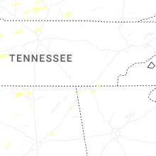


Connect with Interactive Hail Maps