

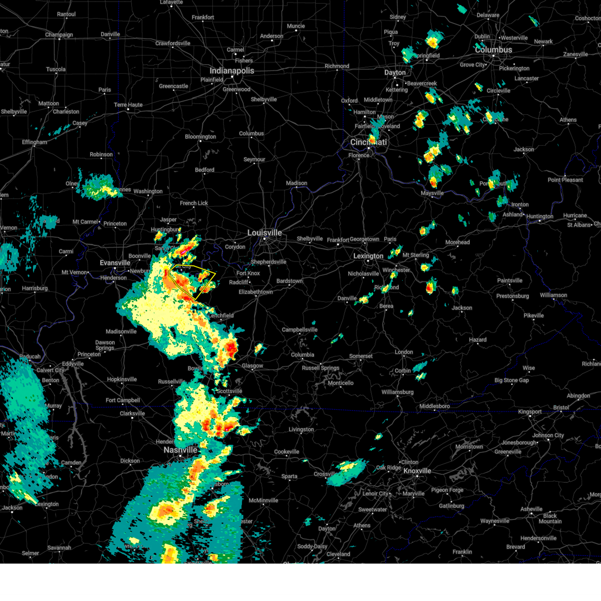
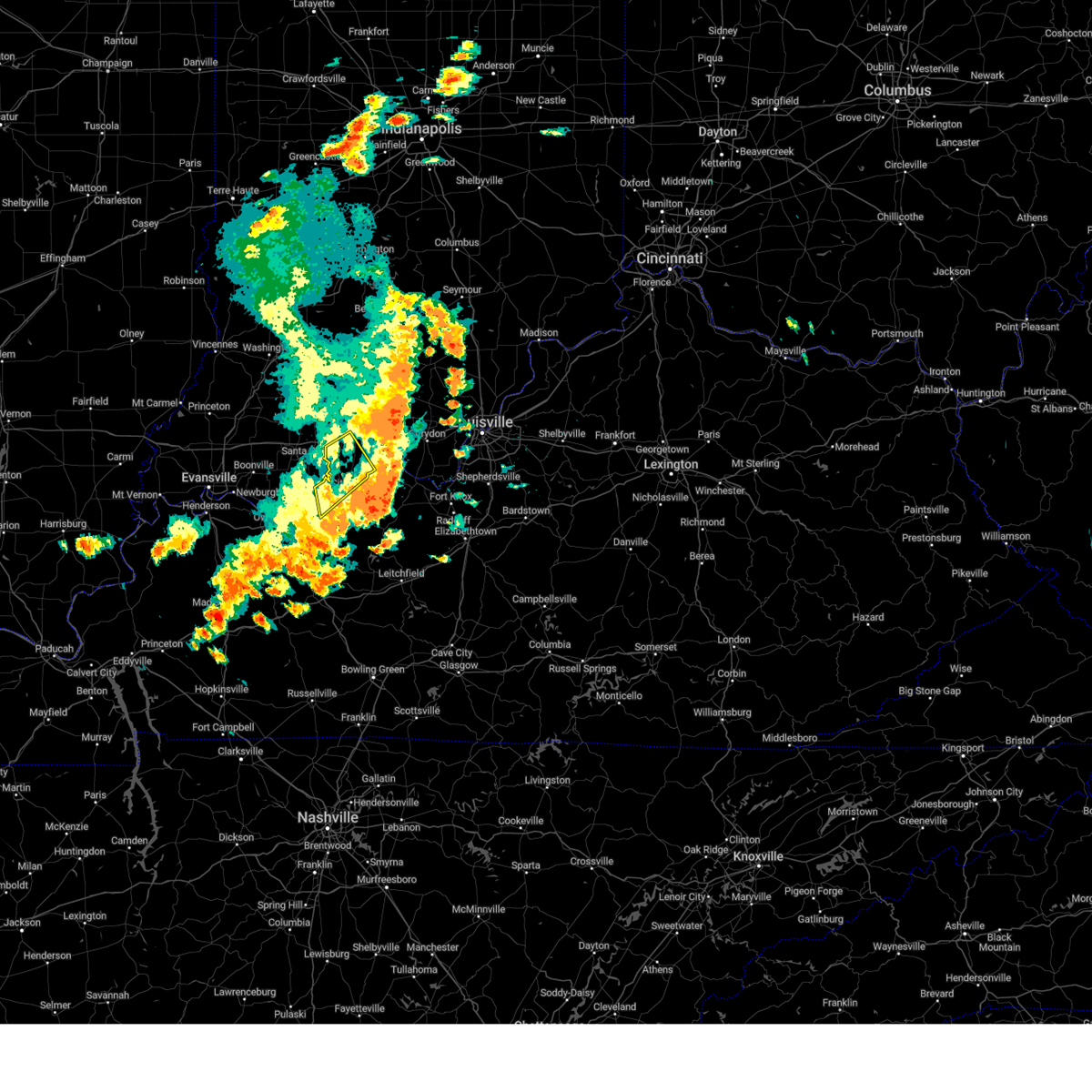
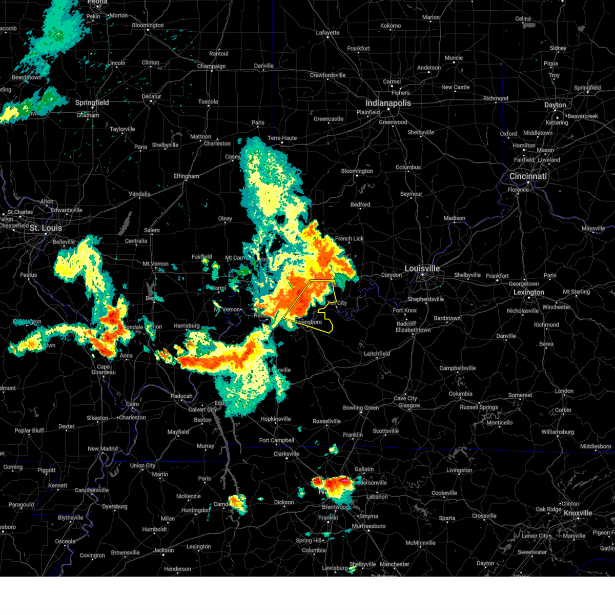
Hail Map for Troy, IN
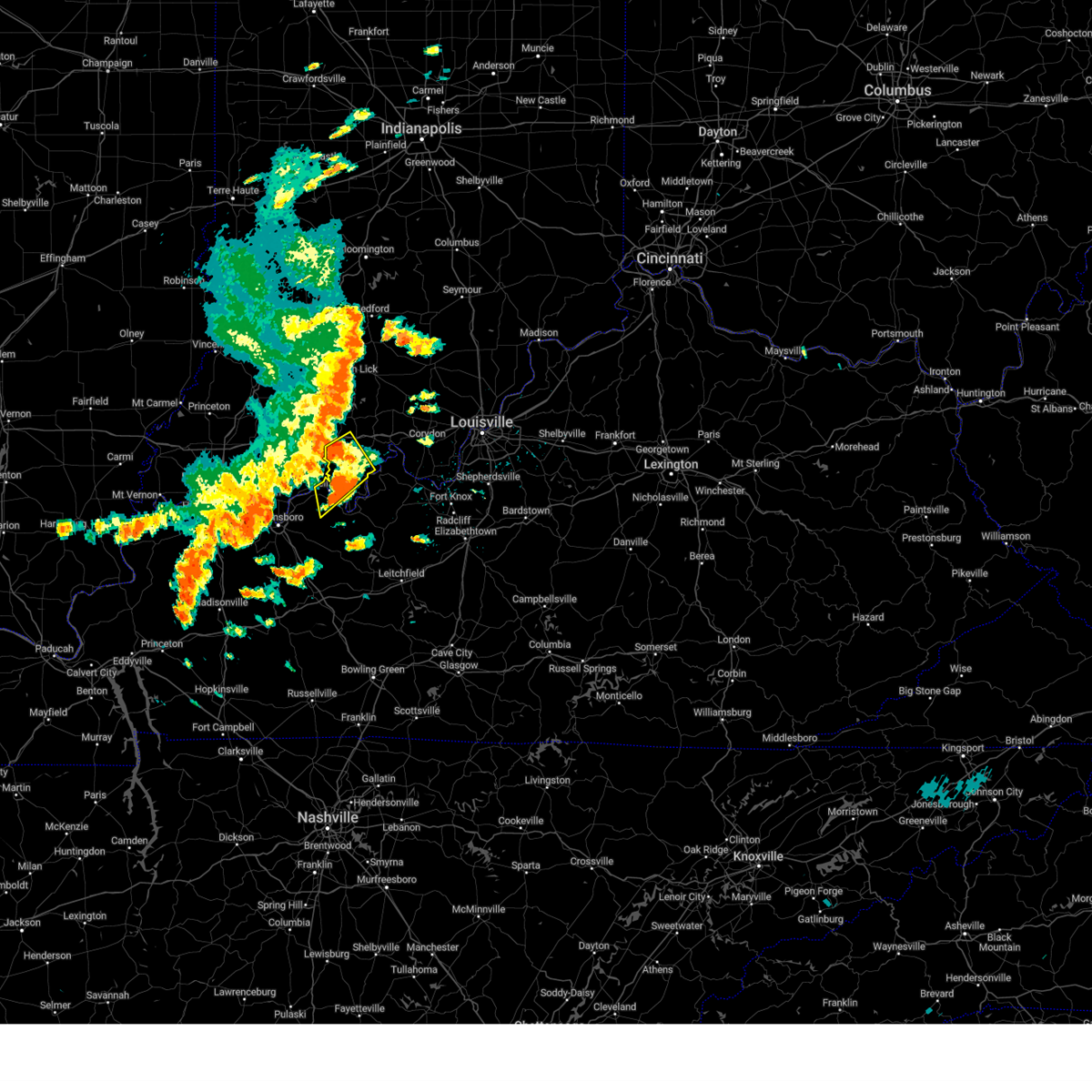
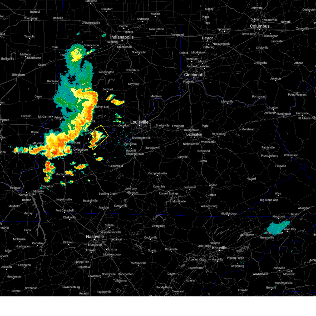
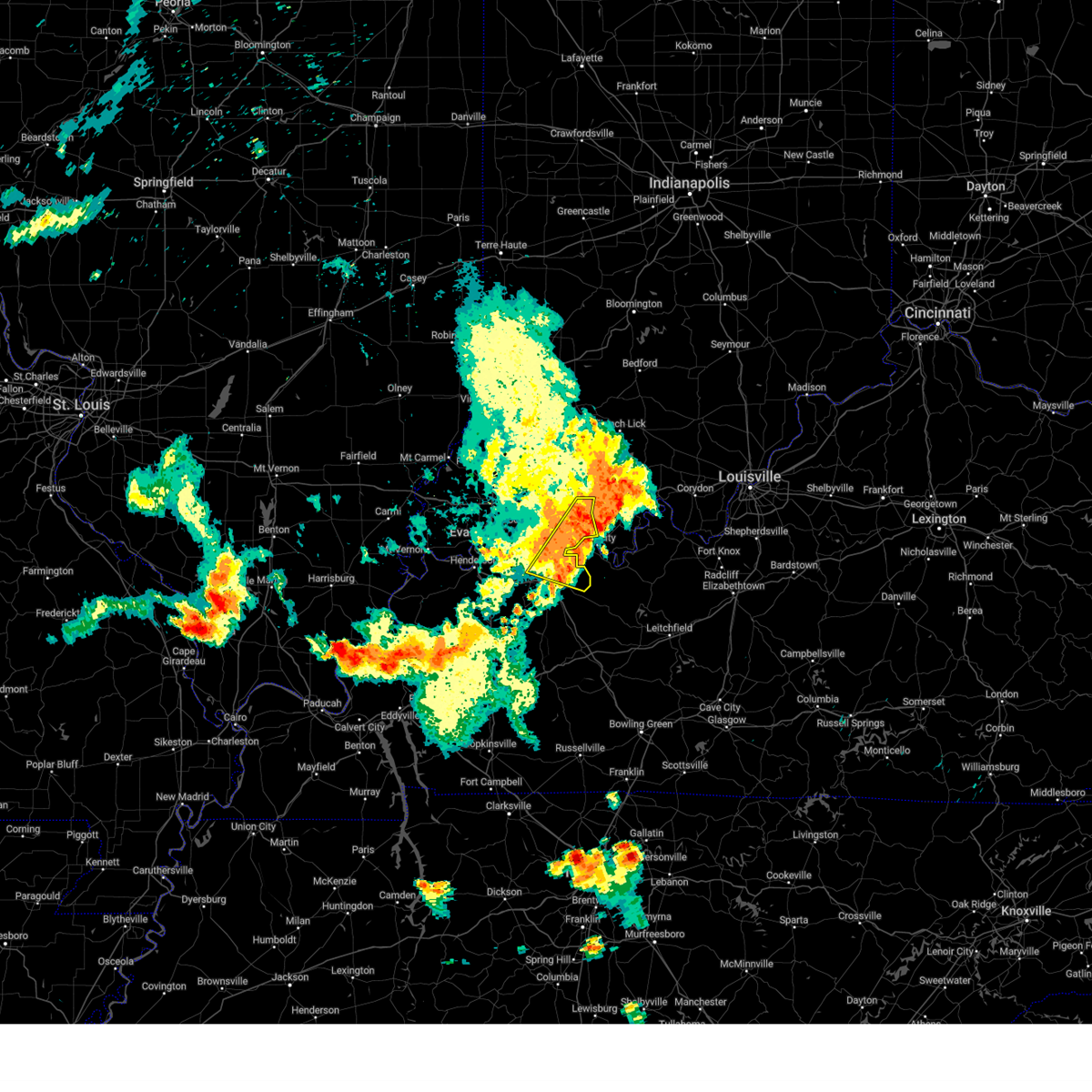
The Troy, IN area has had 0 reports of on-the-ground hail by trained spotters, and has been under severe weather warnings 41 times during the past 12 months. Doppler radar has detected hail at or near Troy, IN on 70 occasions, including 2 occasions during the past year.
| Name: | Troy, IN |
| Where Located: | 41.7 miles E of Evansville, IN |
| Map: | Google Map for Troy, IN |
| Population: | 385 |
| Housing Units: | 190 |
| More Info: | Search Google for Troy, IN |
1
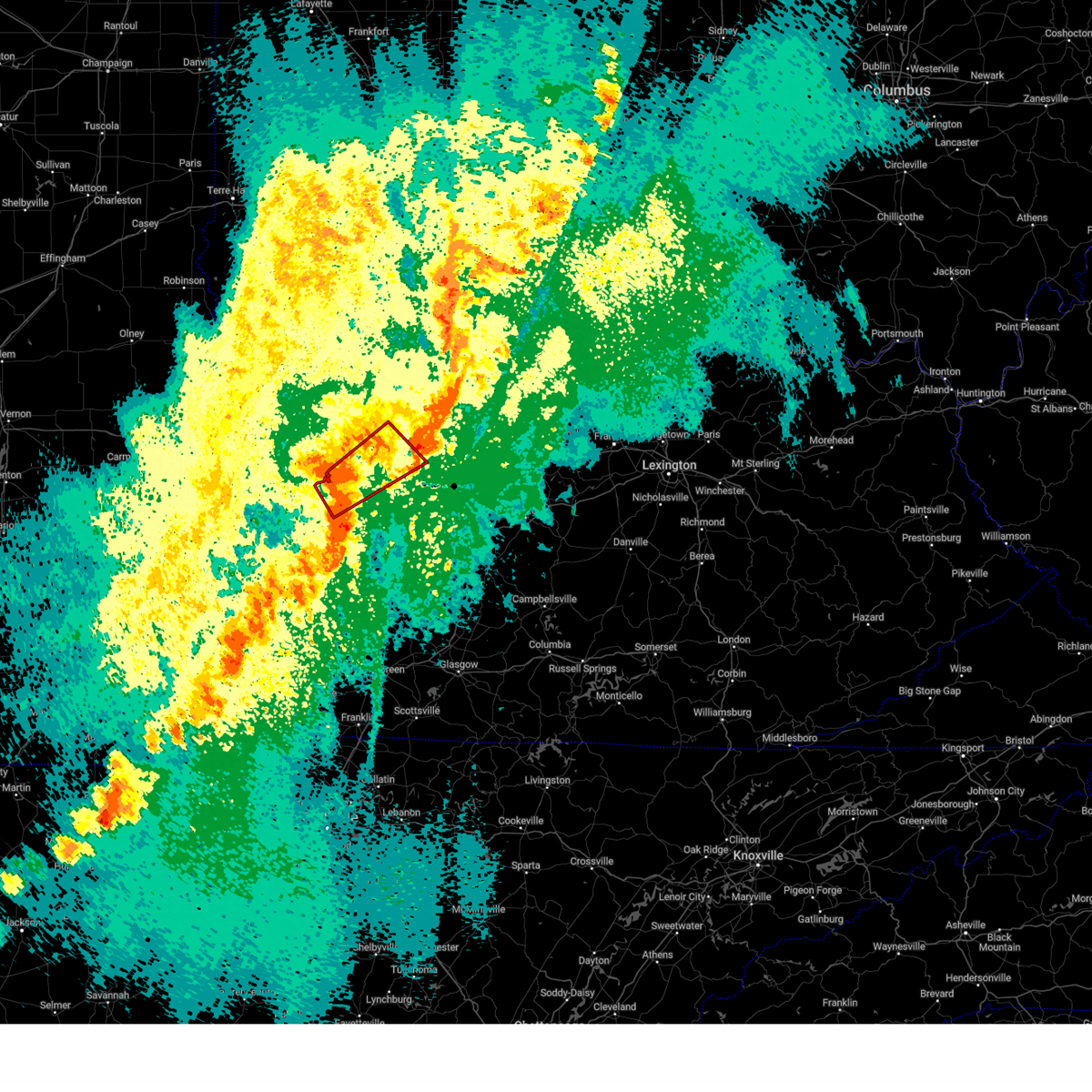
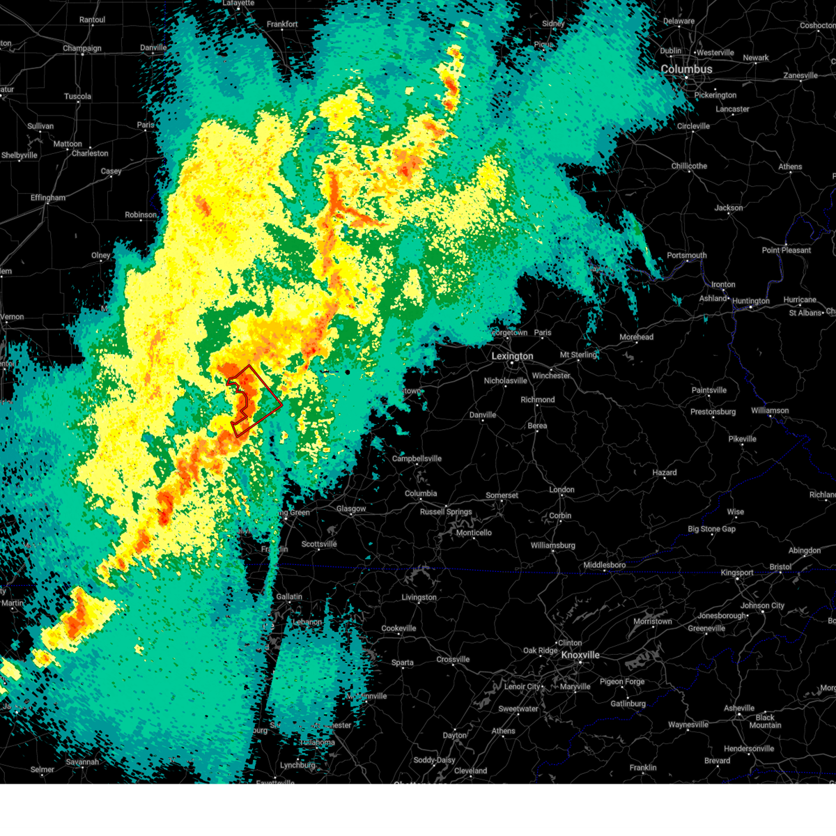
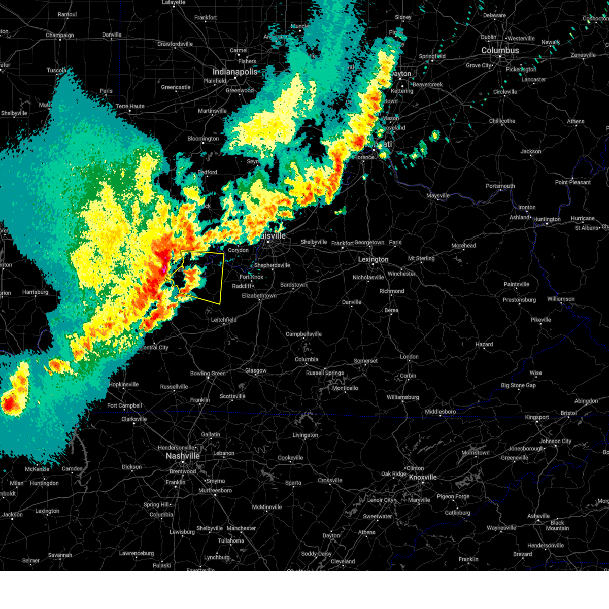
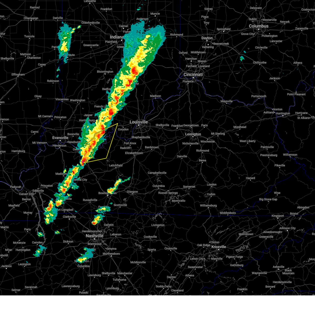
The Top Recent Hail Date for Troy, IN is Thursday, August 1, 2024 (25th out of 70)

Hail and Wind Damage Spotted near Troy, IN
| Date / Time | Report Details |
|---|---|
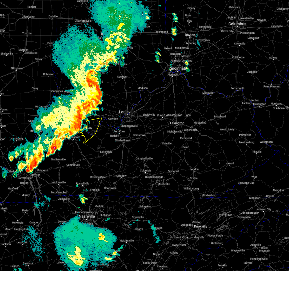
| 5/2/2025 2:00 PM CDT | The storms which prompted the warning have weakened below severe limits, and no longer pose an immediate threat to life or property. therefore, the warning has been allowed to expire. however, gusty winds and heavy rain are still possible with these thunderstorms. a severe thunderstorm watch remains in effect until 800 pm cdt for south central indiana, and central kentucky. to report severe weather, contact your nearest law enforcement agency. they will relay your report to the national weather service louisville. |
| 5/2/2025 1:45 PM CDT |
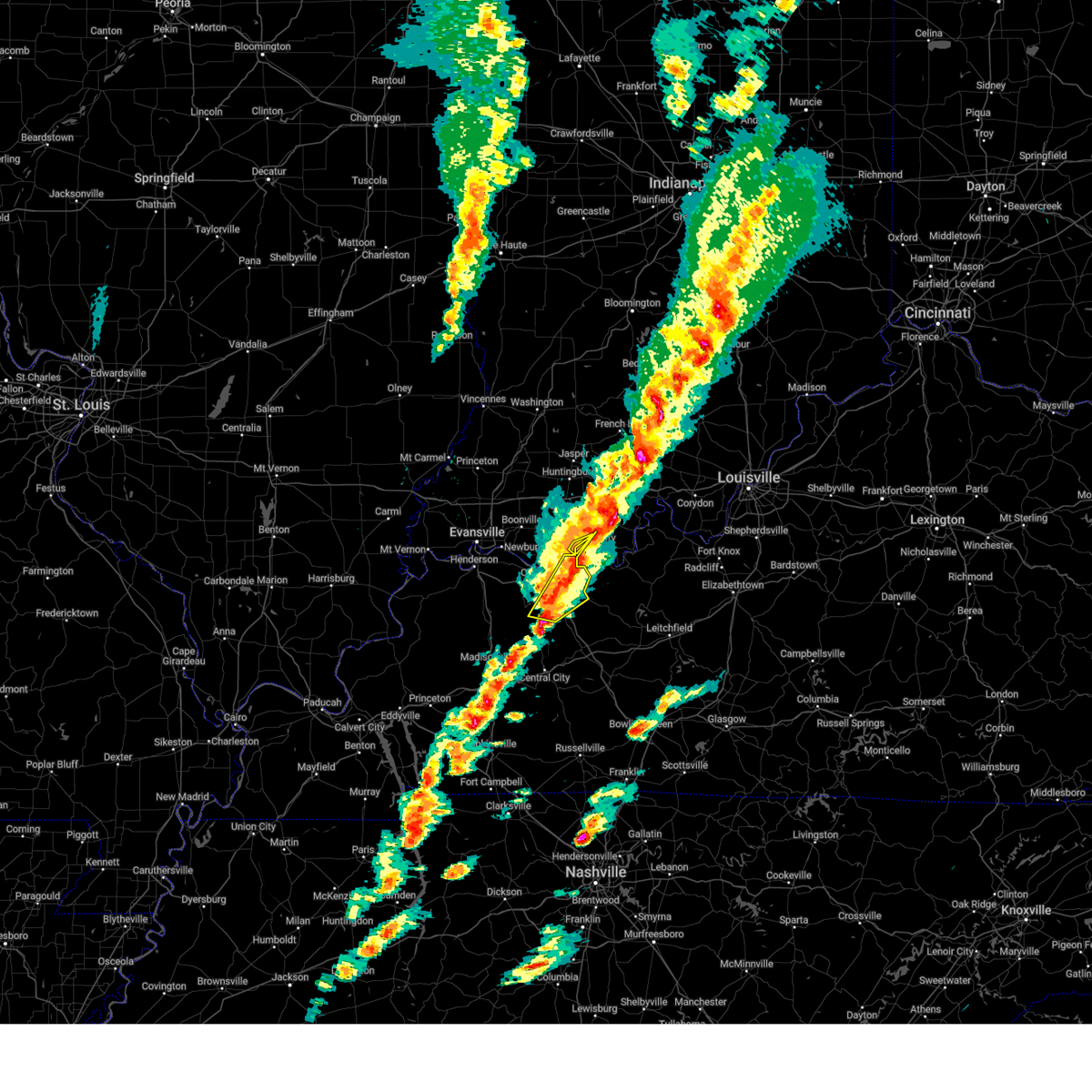
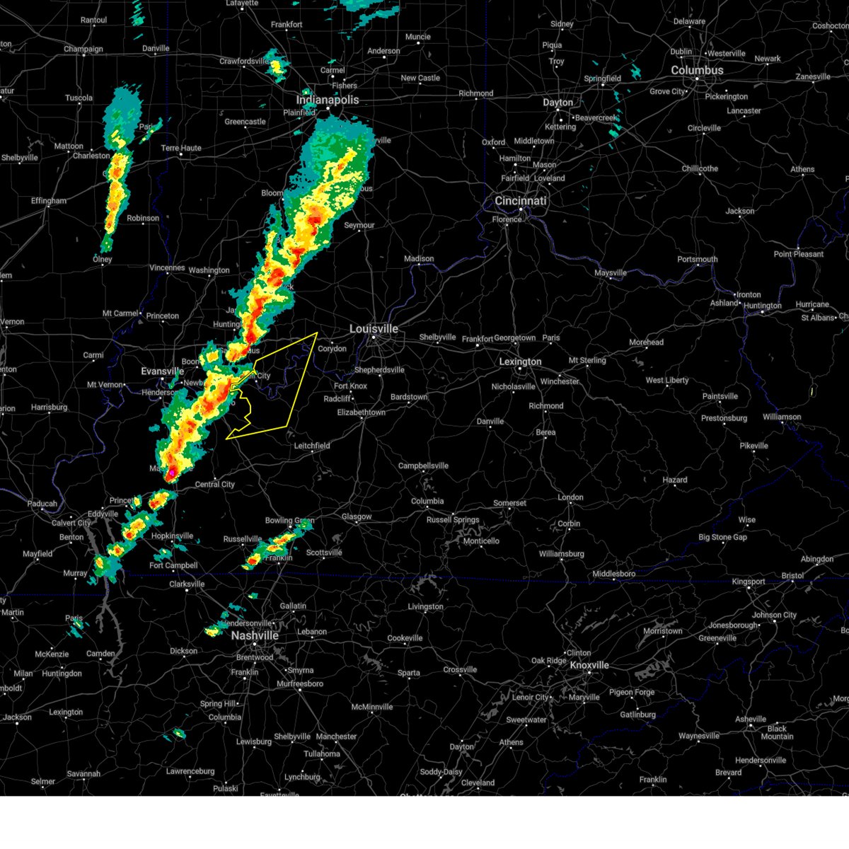
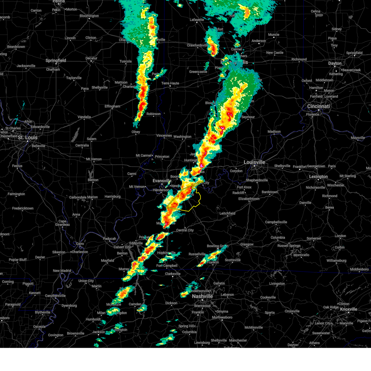
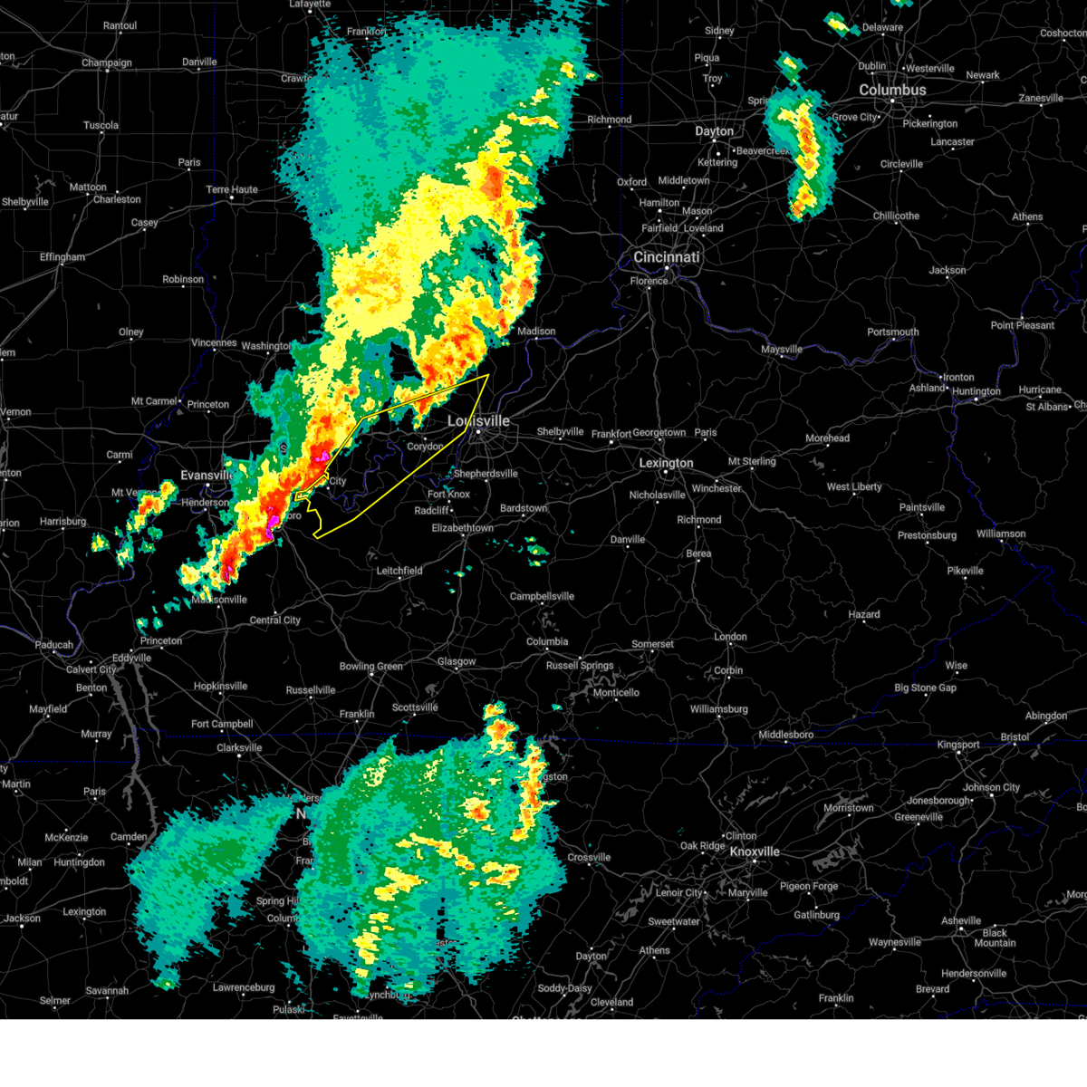
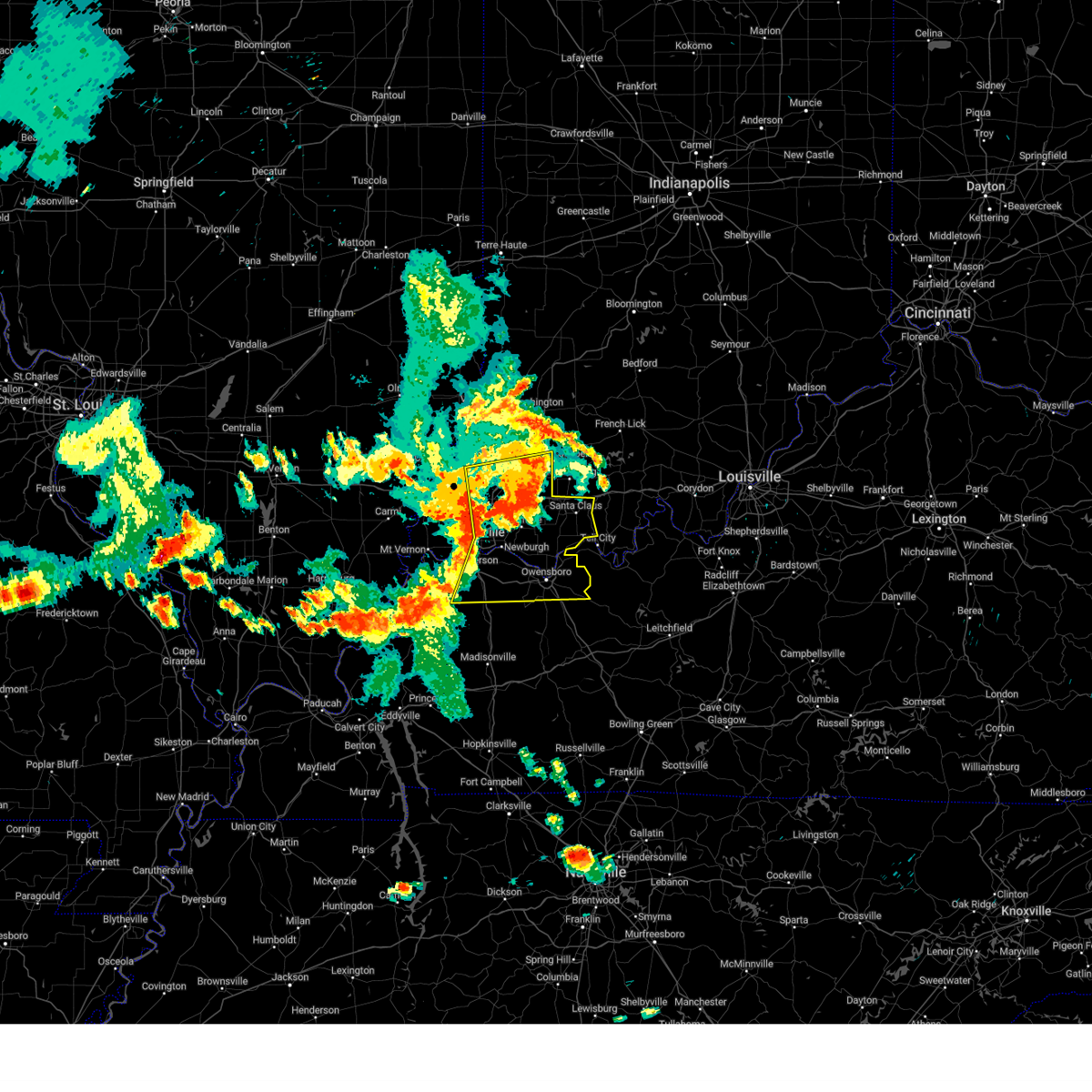
 At 145 pm cdt, severe thunderstorms were located along a line extending from 6 miles southeast of grandview to near hawesville to near hardinsburg, moving northeast at 30 mph (radar indicated). Hazards include 60 mph wind gusts and quarter size hail. Hail damage to vehicles is expected. expect wind damage to roofs, siding, and trees. Locations impacted include, tell city, hawesville, lewisport, cannelton, cloverport, troy, mystic, skillman, goering, and dodd. At 145 pm cdt, severe thunderstorms were located along a line extending from 6 miles southeast of grandview to near hawesville to near hardinsburg, moving northeast at 30 mph (radar indicated). Hazards include 60 mph wind gusts and quarter size hail. Hail damage to vehicles is expected. expect wind damage to roofs, siding, and trees. Locations impacted include, tell city, hawesville, lewisport, cannelton, cloverport, troy, mystic, skillman, goering, and dodd.
|
| 5/2/2025 1:45 PM CDT |
 the severe thunderstorm warning has been cancelled and is no longer in effect the severe thunderstorm warning has been cancelled and is no longer in effect
|
| 5/2/2025 1:17 PM CDT |
 Svrlmk the national weather service in louisville has issued a * severe thunderstorm warning for, southern perry county in south central indiana, hancock county in central kentucky, western breckinridge county in central kentucky, northeastern ohio county in central kentucky, * until 200 pm cdt. * at 117 pm cdt, severe thunderstorms were located along a line extending from near owensboro to near whitesville to 11 miles southwest of hardinsburg, moving northeast at 30 mph (radar indicated). Hazards include 60 mph wind gusts and quarter size hail. Hail damage to vehicles is expected. Expect wind damage to roofs, siding, and trees. Svrlmk the national weather service in louisville has issued a * severe thunderstorm warning for, southern perry county in south central indiana, hancock county in central kentucky, western breckinridge county in central kentucky, northeastern ohio county in central kentucky, * until 200 pm cdt. * at 117 pm cdt, severe thunderstorms were located along a line extending from near owensboro to near whitesville to 11 miles southwest of hardinsburg, moving northeast at 30 mph (radar indicated). Hazards include 60 mph wind gusts and quarter size hail. Hail damage to vehicles is expected. Expect wind damage to roofs, siding, and trees.
|
| 4/10/2025 5:12 PM CDT |
 The storms which prompted the warning have weakened below severe limits, and no longer pose an immediate threat to life or property. therefore, the warning will be allowed to expire. however, gusty winds are still possible with these thunderstorms. a severe thunderstorm watch remains in effect until 1000 pm edt/900 pm cdt/ for central kentucky. The storms which prompted the warning have weakened below severe limits, and no longer pose an immediate threat to life or property. therefore, the warning will be allowed to expire. however, gusty winds are still possible with these thunderstorms. a severe thunderstorm watch remains in effect until 1000 pm edt/900 pm cdt/ for central kentucky.
|
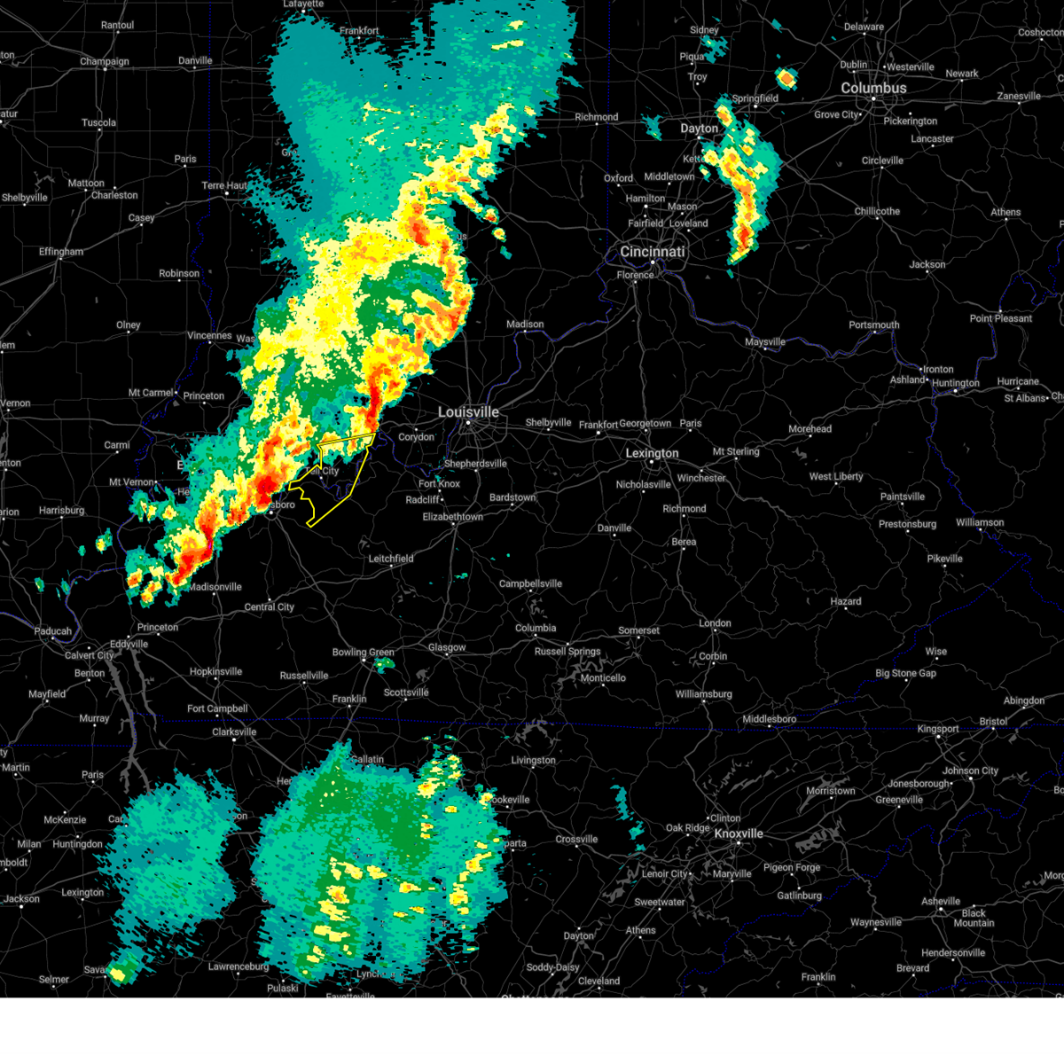
| 4/10/2025 4:46 PM CDT |
 Svrlmk the national weather service in louisville has issued a * severe thunderstorm warning for, southern perry county in south central indiana, west central meade county in central kentucky, hancock county in central kentucky, breckinridge county in central kentucky, northeastern ohio county in central kentucky, * until 615 pm edt/515 pm cdt/. * at 546 pm edt/446 pm cdt/, severe thunderstorms were located along a line extending from 13 miles southwest of english to 12 miles southwest of hardinsburg, moving east at 35 mph (radar indicated). Hazards include 60 mph wind gusts and quarter size hail. Hail damage to vehicles is expected. Expect wind damage to roofs, siding, and trees. Svrlmk the national weather service in louisville has issued a * severe thunderstorm warning for, southern perry county in south central indiana, west central meade county in central kentucky, hancock county in central kentucky, breckinridge county in central kentucky, northeastern ohio county in central kentucky, * until 615 pm edt/515 pm cdt/. * at 546 pm edt/446 pm cdt/, severe thunderstorms were located along a line extending from 13 miles southwest of english to 12 miles southwest of hardinsburg, moving east at 35 mph (radar indicated). Hazards include 60 mph wind gusts and quarter size hail. Hail damage to vehicles is expected. Expect wind damage to roofs, siding, and trees.
|
| 4/2/2025 10:29 PM CDT |
 Torlmk the national weather service in louisville has issued a * tornado warning for, southwestern harrison county in south central indiana, southeastern crawford county in south central indiana, perry county in south central indiana, northwestern meade county in central kentucky, northeastern hancock county in central kentucky, northwestern breckinridge county in central kentucky, * until midnight edt/1100 pm cdt/. * at 1129 pm edt/1029 pm cdt/, a severe thunderstorm capable of producing a tornado was located near hawesville, moving northeast at 70 mph (radar indicated rotation). Hazards include tornado. Flying debris will be dangerous to those caught without shelter. mobile homes will be damaged or destroyed. damage to roofs, windows, and vehicles will occur. tree damage is likely. This tornadic thunderstorm will remain over mainly rural areas of southwestern harrison, southeastern crawford, perry, northwestern meade, northeastern hancock and northwestern breckinridge counties, including the following locations, ranger, skillman, gerald, central, titus, curby, cedar flat, rome, deuchars, and dexter. Torlmk the national weather service in louisville has issued a * tornado warning for, southwestern harrison county in south central indiana, southeastern crawford county in south central indiana, perry county in south central indiana, northwestern meade county in central kentucky, northeastern hancock county in central kentucky, northwestern breckinridge county in central kentucky, * until midnight edt/1100 pm cdt/. * at 1129 pm edt/1029 pm cdt/, a severe thunderstorm capable of producing a tornado was located near hawesville, moving northeast at 70 mph (radar indicated rotation). Hazards include tornado. Flying debris will be dangerous to those caught without shelter. mobile homes will be damaged or destroyed. damage to roofs, windows, and vehicles will occur. tree damage is likely. This tornadic thunderstorm will remain over mainly rural areas of southwestern harrison, southeastern crawford, perry, northwestern meade, northeastern hancock and northwestern breckinridge counties, including the following locations, ranger, skillman, gerald, central, titus, curby, cedar flat, rome, deuchars, and dexter.
|
| 4/2/2025 10:26 PM CDT |
 At 1026 pm cdt, a severe thunderstorm capable of producing a tornado was located near knottsville, moving northeast at 60 mph (radar indicated rotation). Hazards include tornado. Flying debris will be dangerous to those caught without shelter. mobile homes will be damaged or destroyed. damage to roofs, windows, and vehicles will occur. tree damage is likely. this dangerous storm will be near, tell city and hawesville around 1030 pm cdt. Other locations impacted by this tornadic thunderstorm include taffy, skillman, goering, ralph, pellville, lewisport, magan, tobinsport, sunny corner, and tar fork. At 1026 pm cdt, a severe thunderstorm capable of producing a tornado was located near knottsville, moving northeast at 60 mph (radar indicated rotation). Hazards include tornado. Flying debris will be dangerous to those caught without shelter. mobile homes will be damaged or destroyed. damage to roofs, windows, and vehicles will occur. tree damage is likely. this dangerous storm will be near, tell city and hawesville around 1030 pm cdt. Other locations impacted by this tornadic thunderstorm include taffy, skillman, goering, ralph, pellville, lewisport, magan, tobinsport, sunny corner, and tar fork.
|
| 4/2/2025 10:00 PM CDT | The storms which prompted the warning have moved out of the area. therefore, the warning will be allowed to expire. however, gusty winds and heavy rain are still possible with these thunderstorms. a tornado watch remains in effect until 200 am edt/100 am cdt/ for south central indiana, and central kentucky. to report severe weather, contact your nearest law enforcement agency. they will relay your report to the national weather service louisville. remember, a severe thunderstorm warning still remains in effect. |
| 4/2/2025 9:58 PM CDT | Torlmk the national weather service in louisville has issued a * tornado warning for, southwestern perry county in south central indiana, hancock county in central kentucky, west central breckinridge county in central kentucky, northern ohio county in central kentucky, * until 1045 pm cdt. * at 958 pm cdt, a severe thunderstorm capable of producing a tornado was located over calhoun, moving northeast at 60 mph (radar indicated rotation). Hazards include tornado. Flying debris will be dangerous to those caught without shelter. mobile homes will be damaged or destroyed. damage to roofs, windows, and vehicles will occur. tree damage is likely. this dangerous storm will be near, tell city and hawesville around 1030 pm cdt. Other locations impacted by this tornadic thunderstorm include taffy, skillman, goering, ralph, pellville, lewisport, magan, tobinsport, sunny corner, and tar fork. |
| 4/2/2025 9:37 PM CDT | At 1037 pm edt/937 pm cdt/, severe thunderstorms were located along a line extending from 11 miles southwest of shoals to 10 miles northeast of santa claus to grandview, moving northeast at 60 mph (radar indicated). Hazards include 70 mph wind gusts and nickel size hail. Expect considerable tree damage. damage is likely to mobile homes, roofs, and outbuildings. Locations impacted include, jasper, tell city, paoli, corydon, brandenburg, hardinsburg, hawesville, english, carefree town, and mount pleasant. |
| 4/2/2025 9:19 PM CDT | Svrlmk the national weather service in louisville has issued a * severe thunderstorm warning for, harrison county in south central indiana, dubois county in south central indiana, crawford county in south central indiana, perry county in south central indiana, orange county in south central indiana, western washington county in south central indiana, meade county in central kentucky, hancock county in central kentucky, breckinridge county in central kentucky, northeastern ohio county in central kentucky, * until 1100 pm edt/1000 pm cdt/. * at 1018 pm edt/918 pm cdt/, severe thunderstorms were located along a line extending from near petersburg to near folsomville to stanley, moving northeast at 75 mph (radar indicated). Hazards include 70 mph wind gusts and nickel size hail. Expect considerable tree damage. Damage is likely to mobile homes, roofs, and outbuildings. |
| 3/30/2025 7:47 PM CDT |
 Svrlmk the national weather service in louisville has issued a * severe thunderstorm warning for, southern crawford county in south central indiana, perry county in south central indiana, northwestern meade county in central kentucky, hancock county in central kentucky, central breckinridge county in central kentucky, * until 915 pm edt/815 pm cdt/. * at 846 pm edt/746 pm cdt/, severe thunderstorms were located along a line extending from near santa claus to near grandview, moving east at 70 mph (radar indicated). Hazards include 70 mph wind gusts. Expect considerable tree damage. Damage is likely to mobile homes, roofs, and outbuildings. Svrlmk the national weather service in louisville has issued a * severe thunderstorm warning for, southern crawford county in south central indiana, perry county in south central indiana, northwestern meade county in central kentucky, hancock county in central kentucky, central breckinridge county in central kentucky, * until 915 pm edt/815 pm cdt/. * at 846 pm edt/746 pm cdt/, severe thunderstorms were located along a line extending from near santa claus to near grandview, moving east at 70 mph (radar indicated). Hazards include 70 mph wind gusts. Expect considerable tree damage. Damage is likely to mobile homes, roofs, and outbuildings.
|
| 3/19/2025 8:01 PM CDT |
 The storms which prompted the warning have weakened below severe limits, and no longer pose an immediate threat to life or property. therefore, the warning has been allowed to expire. a new severe thunderstorm warning has replaced the old warning. a tornado watch remains in effect until midnight edt/1100 pm cdt/ for south central indiana, and central kentucky. to report severe weather, contact your nearest law enforcement agency. they will relay your report to the national weather service louisville. The storms which prompted the warning have weakened below severe limits, and no longer pose an immediate threat to life or property. therefore, the warning has been allowed to expire. a new severe thunderstorm warning has replaced the old warning. a tornado watch remains in effect until midnight edt/1100 pm cdt/ for south central indiana, and central kentucky. to report severe weather, contact your nearest law enforcement agency. they will relay your report to the national weather service louisville.
|
| 3/19/2025 7:48 PM CDT |
 At 747 pm cdt, severe thunderstorms were located along a line extending from near hawesville to near whitesville to near livermore, moving east at 45 mph (trained weather spotters). Hazards include 60 mph wind gusts. Expect damage to roofs, siding, and trees. locations impacted include, masonville, whitesville, pleasant ridge, knottsville, troy, owensboro, and lewisport. This includes interstate 165 between mile markers 60 and 70. At 747 pm cdt, severe thunderstorms were located along a line extending from near hawesville to near whitesville to near livermore, moving east at 45 mph (trained weather spotters). Hazards include 60 mph wind gusts. Expect damage to roofs, siding, and trees. locations impacted include, masonville, whitesville, pleasant ridge, knottsville, troy, owensboro, and lewisport. This includes interstate 165 between mile markers 60 and 70.
|
| 3/19/2025 7:48 PM CDT |
 the severe thunderstorm warning has been cancelled and is no longer in effect the severe thunderstorm warning has been cancelled and is no longer in effect
|
| 3/19/2025 7:24 PM CDT |
 Svrlmk the national weather service in louisville has issued a * severe thunderstorm warning for, west central harrison county in south central indiana, southeastern crawford county in south central indiana, perry county in south central indiana, northwestern meade county in central kentucky, hancock county in central kentucky, western breckinridge county in central kentucky, northern ohio county in central kentucky, * until 900 pm edt/800 pm cdt/. * at 824 pm edt/724 pm cdt/, severe thunderstorms were located along a line extending from near grandview to near calhoun, moving northeast at 70 mph (radar indicated). Hazards include 60 mph wind gusts and penny size hail. expect damage to roofs, siding, and trees Svrlmk the national weather service in louisville has issued a * severe thunderstorm warning for, west central harrison county in south central indiana, southeastern crawford county in south central indiana, perry county in south central indiana, northwestern meade county in central kentucky, hancock county in central kentucky, western breckinridge county in central kentucky, northern ohio county in central kentucky, * until 900 pm edt/800 pm cdt/. * at 824 pm edt/724 pm cdt/, severe thunderstorms were located along a line extending from near grandview to near calhoun, moving northeast at 70 mph (radar indicated). Hazards include 60 mph wind gusts and penny size hail. expect damage to roofs, siding, and trees
|
| 3/19/2025 7:21 PM CDT |
 Svrpah the national weather service in paducah has issued a * severe thunderstorm warning for, southern spencer county in southwestern indiana, daviess county in northwestern kentucky, southeastern henderson county in northwestern kentucky, northern mclean county in northwestern kentucky, * until 800 pm cdt. * at 721 pm cdt, severe thunderstorms were located along a line extending from near grandview to owensboro to near st. joseph, moving northeast at 35 mph (trained weather spotters). Hazards include 60 mph wind gusts. expect damage to roofs, siding, and trees Svrpah the national weather service in paducah has issued a * severe thunderstorm warning for, southern spencer county in southwestern indiana, daviess county in northwestern kentucky, southeastern henderson county in northwestern kentucky, northern mclean county in northwestern kentucky, * until 800 pm cdt. * at 721 pm cdt, severe thunderstorms were located along a line extending from near grandview to owensboro to near st. joseph, moving northeast at 35 mph (trained weather spotters). Hazards include 60 mph wind gusts. expect damage to roofs, siding, and trees
|
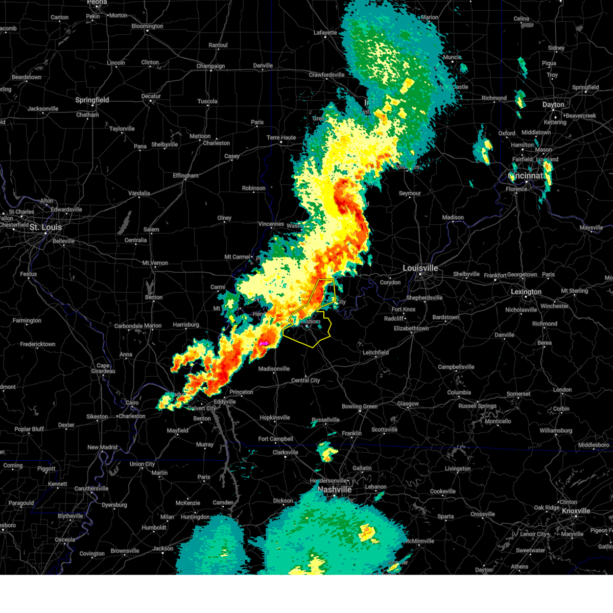
| 3/15/2025 5:25 AM CDT | Svrlmk the national weather service in louisville has issued a * severe thunderstorm warning for, southwestern harrison county in south central indiana, southeastern crawford county in south central indiana, central perry county in south central indiana, northwestern meade county in central kentucky, east central hancock county in central kentucky, northwestern breckinridge county in central kentucky, * until 700 am edt/600 am cdt/. * at 624 am edt/524 am cdt/, a severe thunderstorm was located near tell city, moving northeast at 60 mph (radar indicated). Hazards include 60 mph wind gusts and half dollar size hail. Hail damage to vehicles is expected. Expect wind damage to roofs, siding, and trees. |
| 3/15/2025 4:52 AM CDT |
 Svrlmk the national weather service in louisville has issued a * severe thunderstorm warning for, southeastern dubois county in south central indiana, crawford county in south central indiana, perry county in south central indiana, northwestern meade county in central kentucky, * until 615 am edt/515 am cdt/. * at 552 am edt/452 am cdt/, a severe thunderstorm was located 7 miles east of santa claus, moving northeast at 60 mph (radar indicated). Hazards include 60 mph wind gusts and quarter size hail. Hail damage to vehicles is expected. Expect wind damage to roofs, siding, and trees. Svrlmk the national weather service in louisville has issued a * severe thunderstorm warning for, southeastern dubois county in south central indiana, crawford county in south central indiana, perry county in south central indiana, northwestern meade county in central kentucky, * until 615 am edt/515 am cdt/. * at 552 am edt/452 am cdt/, a severe thunderstorm was located 7 miles east of santa claus, moving northeast at 60 mph (radar indicated). Hazards include 60 mph wind gusts and quarter size hail. Hail damage to vehicles is expected. Expect wind damage to roofs, siding, and trees.
|
| 3/15/2025 4:51 AM CDT |
 The storms which prompted the warning have weakened. more storms will approach the region from the southwest in the next 20 to 30 minutes, which will likely lead to another issued severe thunderstorm warning. a tornado watch remains in effect until 1000 am edt/900 am cdt/ for south central indiana, and central kentucky. The storms which prompted the warning have weakened. more storms will approach the region from the southwest in the next 20 to 30 minutes, which will likely lead to another issued severe thunderstorm warning. a tornado watch remains in effect until 1000 am edt/900 am cdt/ for south central indiana, and central kentucky.
|
| 3/15/2025 4:29 AM CDT |
 The storms which prompted the warning have moved out of the area. therefore, the warning will be allowed to expire. a tornado watch remains in effect until 1000 am edt/900 am cdt/ for south central indiana, and central kentucky. remember, a severe thunderstorm warning still remains in effect for crawford, perry, hancock, breckinridge, and ohio counties. The storms which prompted the warning have moved out of the area. therefore, the warning will be allowed to expire. a tornado watch remains in effect until 1000 am edt/900 am cdt/ for south central indiana, and central kentucky. remember, a severe thunderstorm warning still remains in effect for crawford, perry, hancock, breckinridge, and ohio counties.
|
| 3/15/2025 4:20 AM CDT | Svrlmk the national weather service in louisville has issued a * severe thunderstorm warning for, harrison county in south central indiana, northwestern clark county in south central indiana, crawford county in south central indiana, perry county in south central indiana, floyd county in south central indiana, south central washington county in south central indiana, northwestern meade county in central kentucky, hancock county in central kentucky, northwestern breckinridge county in central kentucky, northern ohio county in central kentucky, * until 600 am edt/500 am cdt/. * at 520 am edt/420 am cdt/, severe thunderstorms were located along a line extending from near english to 13 miles northeast of tell city to near st. joseph, moving east at 60 mph (radar indicated). Hazards include 60 mph wind gusts and quarter size hail. Hail damage to vehicles is expected. Expect wind damage to roofs, siding, and trees. |
| 3/15/2025 4:01 AM CDT |
 the severe thunderstorm warning has been cancelled and is no longer in effect the severe thunderstorm warning has been cancelled and is no longer in effect
|
| 3/15/2025 4:01 AM CDT |
 At 401 am cdt, severe thunderstorms were located along a line extending from 6 miles east of paoli to 11 miles southwest of english to tell city, moving northeast at 70 mph (radar indicated). Hazards include 70 mph wind gusts. Expect considerable tree damage. damage is likely to mobile homes, roofs, and outbuildings. locations impacted include, whitesville, santa claus, knottsville, st. joseph, troy, masonville, moseleyville, stanley, chrisney, rockport, grandview, owensboro, eureka, and dale. this includes the following highways, interstate 165 between mile markers 60 and 70. interstate 64 in indiana between mile markers 57 and 60. Audubon parkway between mile markers 15 and 23. At 401 am cdt, severe thunderstorms were located along a line extending from 6 miles east of paoli to 11 miles southwest of english to tell city, moving northeast at 70 mph (radar indicated). Hazards include 70 mph wind gusts. Expect considerable tree damage. damage is likely to mobile homes, roofs, and outbuildings. locations impacted include, whitesville, santa claus, knottsville, st. joseph, troy, masonville, moseleyville, stanley, chrisney, rockport, grandview, owensboro, eureka, and dale. this includes the following highways, interstate 165 between mile markers 60 and 70. interstate 64 in indiana between mile markers 57 and 60. Audubon parkway between mile markers 15 and 23.
|
| 3/15/2025 3:58 AM CDT |
 At 457 am edt/357 am cdt/, severe thunderstorms were located along a line extending from 8 miles northeast of dale to owensboro to 7 miles south of sebree, moving east at 50 mph (radar indicated). Hazards include 60 mph wind gusts and quarter size hail. Hail damage to vehicles is expected. expect wind damage to roofs, siding, and trees. Locations impacted include, tell city, hawesville, mount pleasant, lewisport, cannelton, cloverport, leopold, troy, ranger, and skillman. At 457 am edt/357 am cdt/, severe thunderstorms were located along a line extending from 8 miles northeast of dale to owensboro to 7 miles south of sebree, moving east at 50 mph (radar indicated). Hazards include 60 mph wind gusts and quarter size hail. Hail damage to vehicles is expected. expect wind damage to roofs, siding, and trees. Locations impacted include, tell city, hawesville, mount pleasant, lewisport, cannelton, cloverport, leopold, troy, ranger, and skillman.
|
| 3/15/2025 3:51 AM CDT |
 Svrlmk the national weather service in louisville has issued a * severe thunderstorm warning for, south central crawford county in south central indiana, perry county in south central indiana, hancock county in central kentucky, northwestern breckinridge county in central kentucky, northern ohio county in central kentucky, * until 530 am edt/430 am cdt/. * at 451 am edt/351 am cdt/, severe thunderstorms were located along a line extending from near dale to owensboro to 7 miles east of dixon, moving east at 50 mph (radar indicated). Hazards include 60 mph wind gusts and quarter size hail. Hail damage to vehicles is expected. Expect wind damage to roofs, siding, and trees. Svrlmk the national weather service in louisville has issued a * severe thunderstorm warning for, south central crawford county in south central indiana, perry county in south central indiana, hancock county in central kentucky, northwestern breckinridge county in central kentucky, northern ohio county in central kentucky, * until 530 am edt/430 am cdt/. * at 451 am edt/351 am cdt/, severe thunderstorms were located along a line extending from near dale to owensboro to 7 miles east of dixon, moving east at 50 mph (radar indicated). Hazards include 60 mph wind gusts and quarter size hail. Hail damage to vehicles is expected. Expect wind damage to roofs, siding, and trees.
|
| 8/1/2024 3:30 PM CDT |
 The storm which prompted the warning has weakened below severe limits, and has exited the warned area. therefore, the warning has been allowed to expire. however, gusty winds and heavy rain are still possible with this thunderstorm. a severe thunderstorm watch remains in effect until 700 pm cdt for south central indiana, and central kentucky. to report severe weather, contact your nearest law enforcement agency. they will relay your report to the national weather service louisville. The storm which prompted the warning has weakened below severe limits, and has exited the warned area. therefore, the warning has been allowed to expire. however, gusty winds and heavy rain are still possible with this thunderstorm. a severe thunderstorm watch remains in effect until 700 pm cdt for south central indiana, and central kentucky. to report severe weather, contact your nearest law enforcement agency. they will relay your report to the national weather service louisville.
|
| 8/1/2024 3:03 PM CDT |
 At 303 pm cdt, a severe thunderstorm was located 9 miles northeast of tell city, moving northeast at 20 mph (radar indicated). Hazards include 60 mph wind gusts and quarter size hail. Hail damage to vehicles is expected. expect wind damage to roofs, siding, and trees. Locations impacted include, tell city, hawesville, cannelton, leopold, troy, petri, ranger, sassafras, bristow, and celina. At 303 pm cdt, a severe thunderstorm was located 9 miles northeast of tell city, moving northeast at 20 mph (radar indicated). Hazards include 60 mph wind gusts and quarter size hail. Hail damage to vehicles is expected. expect wind damage to roofs, siding, and trees. Locations impacted include, tell city, hawesville, cannelton, leopold, troy, petri, ranger, sassafras, bristow, and celina.
|
| 8/1/2024 2:41 PM CDT |
 Svrlmk the national weather service in louisville has issued a * severe thunderstorm warning for, perry county in south central indiana, northeastern hancock county in central kentucky, * until 330 pm cdt. * at 241 pm cdt, a severe thunderstorm was located near tell city, moving northeast at 20 mph (radar indicated). Hazards include 60 mph wind gusts and quarter size hail. Hail damage to vehicles is expected. Expect wind damage to roofs, siding, and trees. Svrlmk the national weather service in louisville has issued a * severe thunderstorm warning for, perry county in south central indiana, northeastern hancock county in central kentucky, * until 330 pm cdt. * at 241 pm cdt, a severe thunderstorm was located near tell city, moving northeast at 20 mph (radar indicated). Hazards include 60 mph wind gusts and quarter size hail. Hail damage to vehicles is expected. Expect wind damage to roofs, siding, and trees.
|
| 7/30/2024 7:21 PM CDT | The storms which prompted the warning have moved out of the area. therefore, the warning will be allowed to expire. a severe thunderstorm watch remains in effect until 1000 pm cdt for southwestern indiana, and northwestern kentucky. to report severe weather, contact your nearest law enforcement agency. they will relay your report to the national weather service paducah. |
| 7/30/2024 7:08 PM CDT |
 At 707 pm cdt, severe thunderstorms were located along a line extending from 7 miles northeast of santa claus to near grandview to near eureka, moving east at 55 mph. these are destructive storms (radar indicated). Hazards include 80 mph wind gusts. Flying debris will be dangerous to those caught without shelter. mobile homes will be heavily damaged. expect considerable damage to roofs, windows, and vehicles. extensive tree damage and power outages are likely. Locations impacted include, owensboro, rockport, grandview, santa claus, knottsville, chrisney, and troy. At 707 pm cdt, severe thunderstorms were located along a line extending from 7 miles northeast of santa claus to near grandview to near eureka, moving east at 55 mph. these are destructive storms (radar indicated). Hazards include 80 mph wind gusts. Flying debris will be dangerous to those caught without shelter. mobile homes will be heavily damaged. expect considerable damage to roofs, windows, and vehicles. extensive tree damage and power outages are likely. Locations impacted include, owensboro, rockport, grandview, santa claus, knottsville, chrisney, and troy.
|
| 7/30/2024 7:08 PM CDT |
 the severe thunderstorm warning has been cancelled and is no longer in effect the severe thunderstorm warning has been cancelled and is no longer in effect
|
| 7/30/2024 7:00 PM CDT |
 At 659 pm cdt, severe thunderstorms were located along a line extending from near dale to 7 miles northwest of grandview to near eureka, moving east at 55 mph. these are destructive storms! (radar indicated). Hazards include 80 mph wind gusts. Flying debris will be dangerous to those caught without shelter. mobile homes will be heavily damaged. expect considerable damage to roofs, windows, and vehicles. extensive tree damage and power outages are likely. locations impacted include, owensboro, rockport, dale, grandview, stanley, santa claus, knottsville, eureka, chrisney, troy, tennyson, and gentryville. This includes interstate 64 in indiana between mile markers 52 and 60. At 659 pm cdt, severe thunderstorms were located along a line extending from near dale to 7 miles northwest of grandview to near eureka, moving east at 55 mph. these are destructive storms! (radar indicated). Hazards include 80 mph wind gusts. Flying debris will be dangerous to those caught without shelter. mobile homes will be heavily damaged. expect considerable damage to roofs, windows, and vehicles. extensive tree damage and power outages are likely. locations impacted include, owensboro, rockport, dale, grandview, stanley, santa claus, knottsville, eureka, chrisney, troy, tennyson, and gentryville. This includes interstate 64 in indiana between mile markers 52 and 60.
|
| 7/30/2024 7:00 PM CDT |
 the severe thunderstorm warning has been cancelled and is no longer in effect the severe thunderstorm warning has been cancelled and is no longer in effect
|
| 7/30/2024 6:59 PM CDT |
 Svrlmk the national weather service in louisville has issued a * severe thunderstorm warning for, southern crawford county in south central indiana, perry county in south central indiana, hancock county in central kentucky, * until 830 pm edt/730 pm cdt/. * at 758 pm edt/658 pm cdt/, severe thunderstorms were located along a line extending from 14 miles east of dale to 6 miles southeast of santa claus to near rockport, moving east at 45 mph (radar indicated). Hazards include 60 mph wind gusts. expect damage to roofs, siding, and trees Svrlmk the national weather service in louisville has issued a * severe thunderstorm warning for, southern crawford county in south central indiana, perry county in south central indiana, hancock county in central kentucky, * until 830 pm edt/730 pm cdt/. * at 758 pm edt/658 pm cdt/, severe thunderstorms were located along a line extending from 14 miles east of dale to 6 miles southeast of santa claus to near rockport, moving east at 45 mph (radar indicated). Hazards include 60 mph wind gusts. expect damage to roofs, siding, and trees
|
| 7/30/2024 6:49 PM CDT |
 At 648 pm cdt, severe thunderstorms were located along a line extending from 7 miles northwest of dale to near boonville to 6 miles northeast of henderson, moving east at 60 mph. these are destructive storms! (radar indicated). Hazards include 80 mph wind gusts. Flying debris will be dangerous to those caught without shelter. mobile homes will be heavily damaged. expect considerable damage to roofs, windows, and vehicles. extensive tree damage and power outages are likely. locations impacted include, evansville, owensboro, boonville, newburgh, chandler, rockport, dale, lynnville, grandview, santa claus, knottsville, folsomville, stanley, eureka, chrisney, troy, tennyson, and gentryville. this includes the following highways, interstate 69 in indiana between mile markers 4 and 7. Interstate 64 in indiana between mile markers 38 and 60. At 648 pm cdt, severe thunderstorms were located along a line extending from 7 miles northwest of dale to near boonville to 6 miles northeast of henderson, moving east at 60 mph. these are destructive storms! (radar indicated). Hazards include 80 mph wind gusts. Flying debris will be dangerous to those caught without shelter. mobile homes will be heavily damaged. expect considerable damage to roofs, windows, and vehicles. extensive tree damage and power outages are likely. locations impacted include, evansville, owensboro, boonville, newburgh, chandler, rockport, dale, lynnville, grandview, santa claus, knottsville, folsomville, stanley, eureka, chrisney, troy, tennyson, and gentryville. this includes the following highways, interstate 69 in indiana between mile markers 4 and 7. Interstate 64 in indiana between mile markers 38 and 60.
|
| 7/30/2024 6:49 PM CDT |
 the severe thunderstorm warning has been cancelled and is no longer in effect the severe thunderstorm warning has been cancelled and is no longer in effect
|
| 7/30/2024 6:40 PM CDT |
 the severe thunderstorm warning has been cancelled and is no longer in effect the severe thunderstorm warning has been cancelled and is no longer in effect
|
| 7/30/2024 6:40 PM CDT |
 At 640 pm cdt/740 pm edt/, severe thunderstorms were located along a line extending from 7 miles north of folsomville to near melody hill to near henderson, moving east at 60 mph (trained weather spotters). Hazards include 70 mph wind gusts. Expect considerable tree damage. damage is likely to mobile homes, roofs, and outbuildings. locations impacted include, evansville, owensboro, henderson, boonville, newburgh, chandler, oakland city, rockport, melody hill, dale, lynnville, grandview, whitesville, santa claus, knottsville, stanley, folsomville, eureka, elberfeld, and chrisney. this includes the following highways, interstate 165 between mile markers 68 and 70. interstate 69 in indiana between mile markers 1 and 19. interstate 64 in indiana between mile markers 30 and 60. Audubon parkway between mile markers 1 and 5, and between mile markers 15 and 23. At 640 pm cdt/740 pm edt/, severe thunderstorms were located along a line extending from 7 miles north of folsomville to near melody hill to near henderson, moving east at 60 mph (trained weather spotters). Hazards include 70 mph wind gusts. Expect considerable tree damage. damage is likely to mobile homes, roofs, and outbuildings. locations impacted include, evansville, owensboro, henderson, boonville, newburgh, chandler, oakland city, rockport, melody hill, dale, lynnville, grandview, whitesville, santa claus, knottsville, stanley, folsomville, eureka, elberfeld, and chrisney. this includes the following highways, interstate 165 between mile markers 68 and 70. interstate 69 in indiana between mile markers 1 and 19. interstate 64 in indiana between mile markers 30 and 60. Audubon parkway between mile markers 1 and 5, and between mile markers 15 and 23.
|
| 7/30/2024 6:32 PM CDT |
 Svrpah the national weather service in paducah has issued a * severe thunderstorm warning for, warrick county in southwestern indiana, eastern vanderburgh county in southwestern indiana, spencer county in southwestern indiana, southeastern gibson county in southwestern indiana, southern pike county in southwestern indiana, daviess county in northwestern kentucky, henderson county in northwestern kentucky, northwestern mclean county in northwestern kentucky, * until 730 pm cdt/830 pm edt/. * at 631 pm cdt/731 pm edt/, severe thunderstorms were located along a line extending from near owensville to near evansville to near corydon, moving east at 55 mph (radar indicated). Hazards include 70 mph wind gusts. Expect considerable tree damage. Damage is likely to mobile homes, roofs, and outbuildings. Svrpah the national weather service in paducah has issued a * severe thunderstorm warning for, warrick county in southwestern indiana, eastern vanderburgh county in southwestern indiana, spencer county in southwestern indiana, southeastern gibson county in southwestern indiana, southern pike county in southwestern indiana, daviess county in northwestern kentucky, henderson county in northwestern kentucky, northwestern mclean county in northwestern kentucky, * until 730 pm cdt/830 pm edt/. * at 631 pm cdt/731 pm edt/, severe thunderstorms were located along a line extending from near owensville to near evansville to near corydon, moving east at 55 mph (radar indicated). Hazards include 70 mph wind gusts. Expect considerable tree damage. Damage is likely to mobile homes, roofs, and outbuildings.
|
| 5/26/2024 9:44 PM CDT |
 The storms which prompted the warning have moved out of the area. therefore, the warning will be allowed to expire. however, gusty winds are still possible with these thunderstorms. a tornado watch remains in effect until 200 am edt/100 am cdt/ for south central indiana, and central kentucky. The storms which prompted the warning have moved out of the area. therefore, the warning will be allowed to expire. however, gusty winds are still possible with these thunderstorms. a tornado watch remains in effect until 200 am edt/100 am cdt/ for south central indiana, and central kentucky.
|
| 5/26/2024 9:18 PM CDT |
 At 1017 pm edt/917 pm cdt/, severe thunderstorms were located along a line extending from near washington to boonville, moving east at 50 mph (radar indicated). Hazards include 60 mph wind gusts and penny size hail. Expect damage to roofs, siding, and trees. Locations impacted include, jasper, tell city, hawesville, huntingburg, ferdinand, lewisport, cannelton, holland, birdseye, and troy. At 1017 pm edt/917 pm cdt/, severe thunderstorms were located along a line extending from near washington to boonville, moving east at 50 mph (radar indicated). Hazards include 60 mph wind gusts and penny size hail. Expect damage to roofs, siding, and trees. Locations impacted include, jasper, tell city, hawesville, huntingburg, ferdinand, lewisport, cannelton, holland, birdseye, and troy.
|
| 5/26/2024 9:14 PM CDT |
 Svrlmk the national weather service in louisville has issued a * severe thunderstorm warning for, southeastern crawford county in south central indiana, perry county in south central indiana, northwestern meade county in central kentucky, hancock county in central kentucky, northwestern breckinridge county in central kentucky, northeastern ohio county in central kentucky, * until 1100 pm edt/1000 pm cdt/. * at 1014 pm edt/914 pm cdt/, severe thunderstorms were located along a line extending from 6 miles southwest of santa claus to near owensboro to near calhoun, moving east at 55 mph (radar indicated). Hazards include 60 mph wind gusts and quarter size hail. Hail damage to vehicles is expected. Expect wind damage to roofs, siding, and trees. Svrlmk the national weather service in louisville has issued a * severe thunderstorm warning for, southeastern crawford county in south central indiana, perry county in south central indiana, northwestern meade county in central kentucky, hancock county in central kentucky, northwestern breckinridge county in central kentucky, northeastern ohio county in central kentucky, * until 1100 pm edt/1000 pm cdt/. * at 1014 pm edt/914 pm cdt/, severe thunderstorms were located along a line extending from 6 miles southwest of santa claus to near owensboro to near calhoun, moving east at 55 mph (radar indicated). Hazards include 60 mph wind gusts and quarter size hail. Hail damage to vehicles is expected. Expect wind damage to roofs, siding, and trees.
|
| 5/26/2024 8:54 PM CDT |
 Svrpah the national weather service in paducah has issued a * severe thunderstorm warning for, spencer county in southwestern indiana, daviess county in northwestern kentucky, southeastern henderson county in northwestern kentucky, mclean county in northwestern kentucky, northeastern hopkins county in northwestern kentucky, central webster county in northwestern kentucky, * until 945 pm cdt. * at 854 pm cdt, severe thunderstorms were located along a line extending from near boonville to near stanley to near clay, moving east at 65 mph (radar indicated). Hazards include 60 mph wind gusts and quarter size hail. Hail damage to vehicles is expected. Expect wind damage to roofs, siding, and trees. Svrpah the national weather service in paducah has issued a * severe thunderstorm warning for, spencer county in southwestern indiana, daviess county in northwestern kentucky, southeastern henderson county in northwestern kentucky, mclean county in northwestern kentucky, northeastern hopkins county in northwestern kentucky, central webster county in northwestern kentucky, * until 945 pm cdt. * at 854 pm cdt, severe thunderstorms were located along a line extending from near boonville to near stanley to near clay, moving east at 65 mph (radar indicated). Hazards include 60 mph wind gusts and quarter size hail. Hail damage to vehicles is expected. Expect wind damage to roofs, siding, and trees.
|
| 5/26/2024 8:52 PM CDT |
 Svrlmk the national weather service in louisville has issued a * severe thunderstorm warning for, dubois county in south central indiana, western perry county in south central indiana, northern hancock county in central kentucky, * until 1045 pm edt/945 pm cdt/. * at 951 pm edt/851 pm cdt/, severe thunderstorms were located along a line extending from near vincennes to near kasson, moving east at 50 mph (radar indicated). Hazards include 70 mph wind gusts and quarter size hail. Hail damage to vehicles is expected. expect considerable tree damage. Wind damage is also likely to mobile homes, roofs, and outbuildings. Svrlmk the national weather service in louisville has issued a * severe thunderstorm warning for, dubois county in south central indiana, western perry county in south central indiana, northern hancock county in central kentucky, * until 1045 pm edt/945 pm cdt/. * at 951 pm edt/851 pm cdt/, severe thunderstorms were located along a line extending from near vincennes to near kasson, moving east at 50 mph (radar indicated). Hazards include 70 mph wind gusts and quarter size hail. Hail damage to vehicles is expected. expect considerable tree damage. Wind damage is also likely to mobile homes, roofs, and outbuildings.
|
| 4/2/2024 6:21 AM CDT |
 Svrlmk the national weather service in louisville has issued a * severe thunderstorm warning for, southern perry county in south central indiana, hancock county in central kentucky, northwestern breckinridge county in central kentucky, northeastern ohio county in central kentucky, * until 700 am cdt. * at 621 am cdt, severe thunderstorms were located along a line extending from 6 miles north of grandview to near rockport to near st. joseph, moving east at 55 mph (radar indicated). Hazards include 70 mph wind gusts and penny size hail. Expect considerable tree damage. Damage is likely to mobile homes, roofs, and outbuildings. Svrlmk the national weather service in louisville has issued a * severe thunderstorm warning for, southern perry county in south central indiana, hancock county in central kentucky, northwestern breckinridge county in central kentucky, northeastern ohio county in central kentucky, * until 700 am cdt. * at 621 am cdt, severe thunderstorms were located along a line extending from 6 miles north of grandview to near rockport to near st. joseph, moving east at 55 mph (radar indicated). Hazards include 70 mph wind gusts and penny size hail. Expect considerable tree damage. Damage is likely to mobile homes, roofs, and outbuildings.
|
| 9/27/2023 9:27 PM CDT |
 At 927 pm cdt, severe thunderstorms were located along a line extending from near tell city to near rockport, moving southeast at 25 mph (radar indicated). Hazards include 60 mph wind gusts and quarter size hail. Hail damage to vehicles is expected. Expect wind damage to roofs, siding, and trees. At 927 pm cdt, severe thunderstorms were located along a line extending from near tell city to near rockport, moving southeast at 25 mph (radar indicated). Hazards include 60 mph wind gusts and quarter size hail. Hail damage to vehicles is expected. Expect wind damage to roofs, siding, and trees.
|
| 7/2/2023 3:59 PM CDT |
 At 458 pm edt/358 pm cdt/, a severe thunderstorm was located 15 miles southwest of carefree town, moving east at 45 mph (radar indicated). Hazards include 70 mph wind gusts. Expect considerable tree damage. damage is likely to mobile homes, roofs, and outbuildings. locations impacted include, tell city, hawesville, lewisport, cannelton, troy, raymond, frymire, gerald, dodd and andyville. thunderstorm damage threat, considerable hail threat, radar indicated max hail size, <. 75 in wind threat, radar indicated max wind gust, 70 mph. At 458 pm edt/358 pm cdt/, a severe thunderstorm was located 15 miles southwest of carefree town, moving east at 45 mph (radar indicated). Hazards include 70 mph wind gusts. Expect considerable tree damage. damage is likely to mobile homes, roofs, and outbuildings. locations impacted include, tell city, hawesville, lewisport, cannelton, troy, raymond, frymire, gerald, dodd and andyville. thunderstorm damage threat, considerable hail threat, radar indicated max hail size, <. 75 in wind threat, radar indicated max wind gust, 70 mph.
|
| 7/2/2023 3:42 PM CDT |
 At 441 pm edt/341 pm cdt/, a severe thunderstorm was located over tell city, moving east northeast at 50 mph (radar indicated). Hazards include 60 mph wind gusts and penny size hail. expect damage to roofs, siding, and trees At 441 pm edt/341 pm cdt/, a severe thunderstorm was located over tell city, moving east northeast at 50 mph (radar indicated). Hazards include 60 mph wind gusts and penny size hail. expect damage to roofs, siding, and trees
|
| 7/1/2023 2:23 AM CDT |
 At 223 am cdt, severe thunderstorms were located along a line extending from near santa claus to near eureka, moving east at 35 mph (radar indicated). Hazards include 70 mph wind gusts and quarter size hail. Hail damage to vehicles is expected. expect considerable tree damage. Wind damage is also likely to mobile homes, roofs, and outbuildings. At 223 am cdt, severe thunderstorms were located along a line extending from near santa claus to near eureka, moving east at 35 mph (radar indicated). Hazards include 70 mph wind gusts and quarter size hail. Hail damage to vehicles is expected. expect considerable tree damage. Wind damage is also likely to mobile homes, roofs, and outbuildings.
|
| 6/29/2023 3:25 PM CDT |
 At 425 pm edt/325 pm cdt/, severe thunderstorms were located along a line extending from 7 miles northeast of english to near grandview, moving southeast at 55 mph (trained weather spotters). Hazards include 60 mph wind gusts and penny size hail. Expect damage to roofs, siding, and trees. locations impacted include, tell city, corydon, hawesville, carefree town, mount pleasant, lewisport, cannelton, cloverport, palmyra and marengo. hail threat, radar indicated max hail size, 0. 75 in wind threat, observed max wind gust, 60 mph. At 425 pm edt/325 pm cdt/, severe thunderstorms were located along a line extending from 7 miles northeast of english to near grandview, moving southeast at 55 mph (trained weather spotters). Hazards include 60 mph wind gusts and penny size hail. Expect damage to roofs, siding, and trees. locations impacted include, tell city, corydon, hawesville, carefree town, mount pleasant, lewisport, cannelton, cloverport, palmyra and marengo. hail threat, radar indicated max hail size, 0. 75 in wind threat, observed max wind gust, 60 mph.
|
| 6/29/2023 3:13 PM CDT |
 At 412 pm edt/312 pm cdt/, severe thunderstorms were located along a line extending from near paoli to near folsomville, moving southeast at 55 mph (radar indicated). Hazards include 60 mph wind gusts and penny size hail. expect damage to roofs, siding, and trees At 412 pm edt/312 pm cdt/, severe thunderstorms were located along a line extending from near paoli to near folsomville, moving southeast at 55 mph (radar indicated). Hazards include 60 mph wind gusts and penny size hail. expect damage to roofs, siding, and trees
|
| 6/29/2023 8:56 AM CDT |
 At 853 am cdt, a severe thunderstorm was located near grandview, moving southeast at 25 mph (radar indicated). Hazards include 70 mph wind gusts and half dollar size hail. Hail damage to vehicles is expected. expect considerable tree damage. wind damage is also likely to mobile homes, roofs, and outbuildings. locations impacted include, tell city, hawesville, lewisport, cannelton, cloverport, troy, skillman, goering, pellville and dodd. thunderstorm damage threat, considerable hail threat, radar indicated max hail size, 1. 25 in wind threat, radar indicated max wind gust, 70 mph. At 853 am cdt, a severe thunderstorm was located near grandview, moving southeast at 25 mph (radar indicated). Hazards include 70 mph wind gusts and half dollar size hail. Hail damage to vehicles is expected. expect considerable tree damage. wind damage is also likely to mobile homes, roofs, and outbuildings. locations impacted include, tell city, hawesville, lewisport, cannelton, cloverport, troy, skillman, goering, pellville and dodd. thunderstorm damage threat, considerable hail threat, radar indicated max hail size, 1. 25 in wind threat, radar indicated max wind gust, 70 mph.
|
| 6/29/2023 8:39 AM CDT |
 At 838 am cdt, a severe thunderstorm was located near grandview, moving southeast at 30 mph (radar indicated). Hazards include 60 mph wind gusts and half dollar size hail. Hail damage to vehicles is expected. Expect wind damage to roofs, siding, and trees. At 838 am cdt, a severe thunderstorm was located near grandview, moving southeast at 30 mph (radar indicated). Hazards include 60 mph wind gusts and half dollar size hail. Hail damage to vehicles is expected. Expect wind damage to roofs, siding, and trees.
|
| 6/25/2023 8:56 PM CDT |
 At 856 pm cdt, severe thunderstorms were located along a line extending from near tell city to near owensboro, moving east at 30 mph (radar indicated). Hazards include quarter size hail. damage to vehicles is expected At 856 pm cdt, severe thunderstorms were located along a line extending from near tell city to near owensboro, moving east at 30 mph (radar indicated). Hazards include quarter size hail. damage to vehicles is expected
|
| 6/25/2023 8:37 PM CDT |
 At 837 pm cdt, a severe thunderstorm was located near tell city, moving east at 55 mph (radar indicated). Hazards include 60 mph wind gusts and quarter size hail. Hail damage to vehicles is expected. expect wind damage to roofs, siding, and trees. locations impacted include, tell city, cannelton, troy, derby, lilly dale, fenn haven, terry, gatchel, gerald and hardingrove. hail threat, radar indicated max hail size, 1. 00 in wind threat, radar indicated max wind gust, 60 mph. At 837 pm cdt, a severe thunderstorm was located near tell city, moving east at 55 mph (radar indicated). Hazards include 60 mph wind gusts and quarter size hail. Hail damage to vehicles is expected. expect wind damage to roofs, siding, and trees. locations impacted include, tell city, cannelton, troy, derby, lilly dale, fenn haven, terry, gatchel, gerald and hardingrove. hail threat, radar indicated max hail size, 1. 00 in wind threat, radar indicated max wind gust, 60 mph.
|
| 6/25/2023 8:23 PM CDT |
 At 822 pm cdt, a severe thunderstorm was located near grandview, moving east at 50 mph (radar indicated). Hazards include 60 mph wind gusts and quarter size hail. Hail damage to vehicles is expected. Expect wind damage to roofs, siding, and trees. At 822 pm cdt, a severe thunderstorm was located near grandview, moving east at 50 mph (radar indicated). Hazards include 60 mph wind gusts and quarter size hail. Hail damage to vehicles is expected. Expect wind damage to roofs, siding, and trees.
|
| 6/25/2023 7:34 PM CDT |
 At 734 pm cdt, a severe thunderstorm was located near santa claus, moving east at 35 mph (radar indicated). Hazards include 60 mph wind gusts and quarter size hail. Hail damage to vehicles is expected. Expect wind damage to roofs, siding, and trees. At 734 pm cdt, a severe thunderstorm was located near santa claus, moving east at 35 mph (radar indicated). Hazards include 60 mph wind gusts and quarter size hail. Hail damage to vehicles is expected. Expect wind damage to roofs, siding, and trees.
|
| 4/5/2023 3:28 PM CDT |
 The severe thunderstorm warning for perry, hancock, western breckinridge and northeastern ohio counties will expire at 330 pm cdt, the storms which prompted the warning have moved out of the area. therefore, the warning will be allowed to expire. however gusty winds are still possible with these thunderstorms. a tornado watch remains in effect until 400 pm cdt for south central indiana, and central kentucky. a severe thunderstorm watch remains in effect until 900 pm cdt for central kentucky. to report severe weather, contact your nearest law enforcement agency. they will relay your report to the national weather service louisville. remember, a severe thunderstorm warning still remains in effect for breckinridge county in kentucky and eastern perry county in indiana. The severe thunderstorm warning for perry, hancock, western breckinridge and northeastern ohio counties will expire at 330 pm cdt, the storms which prompted the warning have moved out of the area. therefore, the warning will be allowed to expire. however gusty winds are still possible with these thunderstorms. a tornado watch remains in effect until 400 pm cdt for south central indiana, and central kentucky. a severe thunderstorm watch remains in effect until 900 pm cdt for central kentucky. to report severe weather, contact your nearest law enforcement agency. they will relay your report to the national weather service louisville. remember, a severe thunderstorm warning still remains in effect for breckinridge county in kentucky and eastern perry county in indiana.
|
| 4/5/2023 2:59 PM CDT |
 At 258 pm cdt, severe thunderstorms were located along a line extending from near santa claus to near masonville, moving east at 45 mph (radar indicated). Hazards include 60 mph wind gusts. Expect damage to roofs, siding, and trees. These severe thunderstorms will remain over mainly rural areas of perry, hancock, western breckinridge and northeastern ohio counties, including the following locations, ranger, mcquady, skillman, goering, gerald, tar fork, rome, arrington corner, dexter and mattingly. At 258 pm cdt, severe thunderstorms were located along a line extending from near santa claus to near masonville, moving east at 45 mph (radar indicated). Hazards include 60 mph wind gusts. Expect damage to roofs, siding, and trees. These severe thunderstorms will remain over mainly rural areas of perry, hancock, western breckinridge and northeastern ohio counties, including the following locations, ranger, mcquady, skillman, goering, gerald, tar fork, rome, arrington corner, dexter and mattingly.
|
| 4/5/2023 2:44 PM CDT |
 At 242 pm cdt, severe thunderstorms were located along a line extending from folsomville to 7 miles northeast of eureka to 6 miles east of st. joseph, moving east at 45 mph (trained weather spotters. wind gusts to around 60 mph have been measured with these storms). Hazards include 70 mph wind gusts. Expect considerable tree damage. damage is likely to mobile homes, roofs, and outbuildings. locations impacted include, owensboro, rockport, dale, grandview, whitesville, chrisney, tennyson, gentryville and moseleyville. this includes the following highways, interstate 64 in indiana between mile markers 43 and 60. Audubon parkway between mile markers 15 and 23. At 242 pm cdt, severe thunderstorms were located along a line extending from folsomville to 7 miles northeast of eureka to 6 miles east of st. joseph, moving east at 45 mph (trained weather spotters. wind gusts to around 60 mph have been measured with these storms). Hazards include 70 mph wind gusts. Expect considerable tree damage. damage is likely to mobile homes, roofs, and outbuildings. locations impacted include, owensboro, rockport, dale, grandview, whitesville, chrisney, tennyson, gentryville and moseleyville. this includes the following highways, interstate 64 in indiana between mile markers 43 and 60. Audubon parkway between mile markers 15 and 23.
|
| 4/5/2023 2:26 PM CDT |
 At 224 pm cdt, severe thunderstorms were located along a line extending from 6 miles southwest of lynnville to near newburgh to near st. joseph, moving east at 50 mph (trained weather spotters. a wind gust to 62 mph was measured at the evansville airport). Hazards include 70 mph wind gusts. Expect considerable tree damage. Damage is likely to mobile homes, roofs, and outbuildings. At 224 pm cdt, severe thunderstorms were located along a line extending from 6 miles southwest of lynnville to near newburgh to near st. joseph, moving east at 50 mph (trained weather spotters. a wind gust to 62 mph was measured at the evansville airport). Hazards include 70 mph wind gusts. Expect considerable tree damage. Damage is likely to mobile homes, roofs, and outbuildings.
|
| 3/3/2023 1:13 PM CST |
 At 213 pm est/113 pm cst/, severe thunderstorms were located along a line extending from tell city to 9 miles southwest of leitchfield, moving northeast at 70 mph (radar indicated). Hazards include 70 mph wind gusts. Expect considerable tree damage. damage is likely to mobile homes, roofs, and outbuildings. Locations impacted include, tell city, leitchfield, hardinsburg, hawesville, webster, cannelton, irvington, cloverport, clarkson and leopold. At 213 pm est/113 pm cst/, severe thunderstorms were located along a line extending from tell city to 9 miles southwest of leitchfield, moving northeast at 70 mph (radar indicated). Hazards include 70 mph wind gusts. Expect considerable tree damage. damage is likely to mobile homes, roofs, and outbuildings. Locations impacted include, tell city, leitchfield, hardinsburg, hawesville, webster, cannelton, irvington, cloverport, clarkson and leopold.
|
| 3/3/2023 1:02 PM CST |
 At 201 pm est/101 pm cst/, severe thunderstorms were located along a line extending from near hawesville to 6 miles east of morgantown, moving northeast at 75 mph. these are destructive storms! (radar indicated). Hazards include 80 mph wind gusts. Flying debris will be dangerous to those caught without shelter. mobile homes will be heavily damaged. expect considerable damage to roofs, windows, and vehicles. extensive tree damage and power outages are likely. Locations impacted include, tell city, hawesville and leitchfield. At 201 pm est/101 pm cst/, severe thunderstorms were located along a line extending from near hawesville to 6 miles east of morgantown, moving northeast at 75 mph. these are destructive storms! (radar indicated). Hazards include 80 mph wind gusts. Flying debris will be dangerous to those caught without shelter. mobile homes will be heavily damaged. expect considerable damage to roofs, windows, and vehicles. extensive tree damage and power outages are likely. Locations impacted include, tell city, hawesville and leitchfield.
|
| 3/3/2023 1:01 PM CST |
 At 101 pm cst/201 pm est/, severe thunderstorms were located along a line extending from near owensville to near folsomville to 7 miles southeast of whitesville, moving northeast at 80 mph (trained weather spotters). Hazards include 60 mph wind gusts. Expect damage to roofs, siding, and trees. locations impacted include, owensboro, princeton, fort branch, oakland city, petersburg, rockport, dale, haubstadt, owensville, lynnville, winslow, grandview, patoka, whitesville, santa claus, knottsville, folsomville, elberfeld, chrisney and francisco. this includes the following highways, interstate 165 between mile markers 60 and 64, and between mile markers 66 and 68. interstate 69 in indiana between mile markers 21 and 52. interstate 64 in indiana between mile markers 30 and 59. hail threat, radar indicated max hail size, <. 75 in wind threat, radar indicated max wind gust, 60 mph. At 101 pm cst/201 pm est/, severe thunderstorms were located along a line extending from near owensville to near folsomville to 7 miles southeast of whitesville, moving northeast at 80 mph (trained weather spotters). Hazards include 60 mph wind gusts. Expect damage to roofs, siding, and trees. locations impacted include, owensboro, princeton, fort branch, oakland city, petersburg, rockport, dale, haubstadt, owensville, lynnville, winslow, grandview, patoka, whitesville, santa claus, knottsville, folsomville, elberfeld, chrisney and francisco. this includes the following highways, interstate 165 between mile markers 60 and 64, and between mile markers 66 and 68. interstate 69 in indiana between mile markers 21 and 52. interstate 64 in indiana between mile markers 30 and 59. hail threat, radar indicated max hail size, <. 75 in wind threat, radar indicated max wind gust, 60 mph.
|
| 3/3/2023 1:01 PM CST |
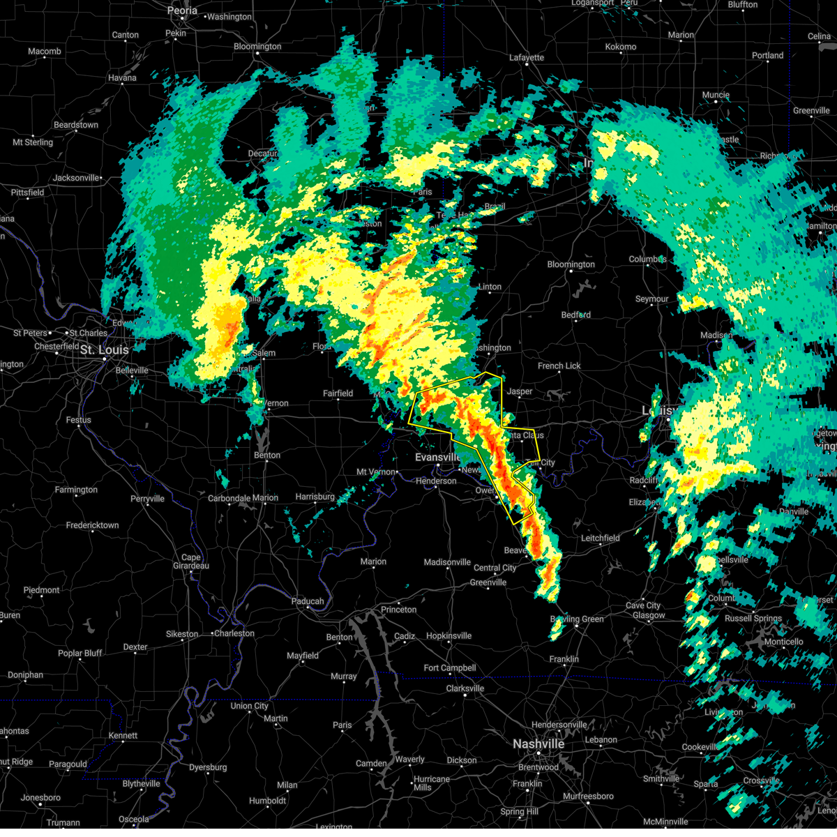 At 101 pm cst/201 pm est/, severe thunderstorms were located along a line extending from near owensville to near folsomville to 7 miles southeast of whitesville, moving northeast at 80 mph (trained weather spotters). Hazards include 60 mph wind gusts. Expect damage to roofs, siding, and trees. locations impacted include, owensboro, princeton, fort branch, oakland city, petersburg, rockport, dale, haubstadt, owensville, lynnville, winslow, grandview, patoka, whitesville, santa claus, knottsville, folsomville, elberfeld, chrisney and francisco. this includes the following highways, interstate 165 between mile markers 60 and 64, and between mile markers 66 and 68. interstate 69 in indiana between mile markers 21 and 52. interstate 64 in indiana between mile markers 30 and 59. hail threat, radar indicated max hail size, <. 75 in wind threat, radar indicated max wind gust, 60 mph. At 101 pm cst/201 pm est/, severe thunderstorms were located along a line extending from near owensville to near folsomville to 7 miles southeast of whitesville, moving northeast at 80 mph (trained weather spotters). Hazards include 60 mph wind gusts. Expect damage to roofs, siding, and trees. locations impacted include, owensboro, princeton, fort branch, oakland city, petersburg, rockport, dale, haubstadt, owensville, lynnville, winslow, grandview, patoka, whitesville, santa claus, knottsville, folsomville, elberfeld, chrisney and francisco. this includes the following highways, interstate 165 between mile markers 60 and 64, and between mile markers 66 and 68. interstate 69 in indiana between mile markers 21 and 52. interstate 64 in indiana between mile markers 30 and 59. hail threat, radar indicated max hail size, <. 75 in wind threat, radar indicated max wind gust, 60 mph.
|
| 3/3/2023 12:40 PM CST |
 At 140 pm est/1240 pm cst/, severe thunderstorms were located along a line extending from 6 miles north of livermore to near russellville, moving northeast at 80 mph. these are destructive storms! (radar indicated). Hazards include 80 mph wind gusts. Flying debris will be dangerous to those caught without shelter. mobile homes will be heavily damaged. expect considerable damage to roofs, windows, and vehicles. extensive tree damage and power outages are likely. severe thunderstorms will be near, morgantown and hawesville around 100 pm cst. other locations in the path of these severe thunderstorms include tell city and leitchfield. thunderstorm damage threat, destructive hail threat, radar indicated max hail size, <. 75 in wind threat, radar indicated max wind gust, 80 mph. At 140 pm est/1240 pm cst/, severe thunderstorms were located along a line extending from 6 miles north of livermore to near russellville, moving northeast at 80 mph. these are destructive storms! (radar indicated). Hazards include 80 mph wind gusts. Flying debris will be dangerous to those caught without shelter. mobile homes will be heavily damaged. expect considerable damage to roofs, windows, and vehicles. extensive tree damage and power outages are likely. severe thunderstorms will be near, morgantown and hawesville around 100 pm cst. other locations in the path of these severe thunderstorms include tell city and leitchfield. thunderstorm damage threat, destructive hail threat, radar indicated max hail size, <. 75 in wind threat, radar indicated max wind gust, 80 mph.
|
| 1/12/2023 4:56 AM CST |
 At 456 am cst, severe thunderstorms were located along a line extending from near eureka to near masonville to near livermore to near graham, moving northeast at 70 mph (radar indicated). Hazards include 60 mph wind gusts. Expect damage to roofs, siding, and trees. Severe thunderstorms will be near, tell city, hartford and hawesville around 515 am cst. At 456 am cst, severe thunderstorms were located along a line extending from near eureka to near masonville to near livermore to near graham, moving northeast at 70 mph (radar indicated). Hazards include 60 mph wind gusts. Expect damage to roofs, siding, and trees. Severe thunderstorms will be near, tell city, hartford and hawesville around 515 am cst.
|
| 1/12/2023 4:17 AM CST |
 At 516 am est/416 am cst/, a severe thunderstorm was located near tell city, moving northeast at 55 mph (radar indicated). Hazards include quarter size hail. damage to vehicles is expected At 516 am est/416 am cst/, a severe thunderstorm was located near tell city, moving northeast at 55 mph (radar indicated). Hazards include quarter size hail. damage to vehicles is expected
|
| 6/17/2022 8:14 AM CDT |
 At 813 am cdt, severe thunderstorms were located along a line extending from santa claus to near st. joseph, moving east at 45 mph (radar indicated). Hazards include 60 mph wind gusts. Expect damage to roofs, siding, and trees. these severe thunderstorms will remain over mainly rural areas of southern perry, hancock, western breckinridge and northeastern ohio counties, including the following locations, frymire, skillman, goering, ralph, gerald, tar fork, rome, vanzant, ellmitch and arrington corner. hail threat, radar indicated max hail size, <. 75 in wind threat, radar indicated max wind gust, 60 mph. At 813 am cdt, severe thunderstorms were located along a line extending from santa claus to near st. joseph, moving east at 45 mph (radar indicated). Hazards include 60 mph wind gusts. Expect damage to roofs, siding, and trees. these severe thunderstorms will remain over mainly rural areas of southern perry, hancock, western breckinridge and northeastern ohio counties, including the following locations, frymire, skillman, goering, ralph, gerald, tar fork, rome, vanzant, ellmitch and arrington corner. hail threat, radar indicated max hail size, <. 75 in wind threat, radar indicated max wind gust, 60 mph.
|
| 5/19/2022 3:15 PM CDT |
 At 315 pm cdt, a severe thunderstorm was located over tell city, moving east at 25 mph (radar indicated). Hazards include 60 mph wind gusts and quarter size hail. Hail damage to vehicles is expected. expect wind damage to roofs, siding, and trees. this severe thunderstorm will remain over mainly rural areas of central perry and northwestern breckinridge counties, including the following locations, raymond, frymire, terry, gerald, dodd, holt, cannelton, rome, mooleyville and dexter. hail threat, radar indicated max hail size, 1. 00 in wind threat, radar indicated max wind gust, 60 mph. At 315 pm cdt, a severe thunderstorm was located over tell city, moving east at 25 mph (radar indicated). Hazards include 60 mph wind gusts and quarter size hail. Hail damage to vehicles is expected. expect wind damage to roofs, siding, and trees. this severe thunderstorm will remain over mainly rural areas of central perry and northwestern breckinridge counties, including the following locations, raymond, frymire, terry, gerald, dodd, holt, cannelton, rome, mooleyville and dexter. hail threat, radar indicated max hail size, 1. 00 in wind threat, radar indicated max wind gust, 60 mph.
|
| 5/19/2022 1:56 PM CDT |
 At 156 pm cdt, a severe thunderstorm was located near tell city, moving northeast at 30 mph (radar indicated). Hazards include golf ball size hail and 70 mph wind gusts. People and animals outdoors will be injured. expect hail damage to roofs, siding, windows, and vehicles. expect considerable tree damage. wind damage is also likely to mobile homes, roofs, and outbuildings. Locations impacted include, tell city, hawesville, cannelton, troy, petri, adair and fenn haven. At 156 pm cdt, a severe thunderstorm was located near tell city, moving northeast at 30 mph (radar indicated). Hazards include golf ball size hail and 70 mph wind gusts. People and animals outdoors will be injured. expect hail damage to roofs, siding, windows, and vehicles. expect considerable tree damage. wind damage is also likely to mobile homes, roofs, and outbuildings. Locations impacted include, tell city, hawesville, cannelton, troy, petri, adair and fenn haven.
|
| 5/19/2022 1:30 PM CDT |
 At 130 pm cdt, a severe thunderstorm was located near rockport, moving northeast at 25 mph (radar indicated). Hazards include golf ball size hail and 70 mph wind gusts. People and animals outdoors will be injured. expect hail damage to roofs, siding, windows, and vehicles. expect considerable tree damage. wind damage is also likely to mobile homes, roofs, and outbuildings. Locations impacted include, tell city, hawesville, lewisport, cannelton, troy, petri, skillman, adair, fenn haven and waitman. At 130 pm cdt, a severe thunderstorm was located near rockport, moving northeast at 25 mph (radar indicated). Hazards include golf ball size hail and 70 mph wind gusts. People and animals outdoors will be injured. expect hail damage to roofs, siding, windows, and vehicles. expect considerable tree damage. wind damage is also likely to mobile homes, roofs, and outbuildings. Locations impacted include, tell city, hawesville, lewisport, cannelton, troy, petri, skillman, adair, fenn haven and waitman.
|
| 5/19/2022 1:21 PM CDT |
 At 121 pm cdt, a severe thunderstorm was located near knottsville, moving northeast at 25 mph (radar indicated). Hazards include 70 mph wind gusts and ping pong ball size hail. People and animals outdoors will be injured. expect hail damage to roofs, siding, windows, and vehicles. expect considerable tree damage. Wind damage is also likely to mobile homes, roofs, and outbuildings. At 121 pm cdt, a severe thunderstorm was located near knottsville, moving northeast at 25 mph (radar indicated). Hazards include 70 mph wind gusts and ping pong ball size hail. People and animals outdoors will be injured. expect hail damage to roofs, siding, windows, and vehicles. expect considerable tree damage. Wind damage is also likely to mobile homes, roofs, and outbuildings.
|
| 3/30/2022 7:21 PM CDT |
 At 719 pm cdt, severe thunderstorms were located along a line extending from hazleton south across evansville to near henderson, moving northeast at 50 mph (trained weather spotters reported tree damage). Hazards include 70 mph wind gusts. Expect considerable tree damage. damage is likely to mobile homes, roofs, and outbuildings. locations impacted include, stanley, petersburg, eureka, boonville, dale and santa claus. this includes the following highways, interstate 69 in kentucky between mile markers 142 and 148. interstate 69 in indiana between mile markers 1 and 52. interstate 64 in indiana between mile markers 18 and 60. Audubon parkway between mile markers 1 and 12. At 719 pm cdt, severe thunderstorms were located along a line extending from hazleton south across evansville to near henderson, moving northeast at 50 mph (trained weather spotters reported tree damage). Hazards include 70 mph wind gusts. Expect considerable tree damage. damage is likely to mobile homes, roofs, and outbuildings. locations impacted include, stanley, petersburg, eureka, boonville, dale and santa claus. this includes the following highways, interstate 69 in kentucky between mile markers 142 and 148. interstate 69 in indiana between mile markers 1 and 52. interstate 64 in indiana between mile markers 18 and 60. Audubon parkway between mile markers 1 and 12.
|
| 3/30/2022 6:54 PM CDT |
 At 652 pm cdt, severe thunderstorms were located along a line extending from near mount carmel to near morganfield, moving northeast at 35 mph (trained weather spotters. winds to 70 mph have been measured along this line). Hazards include 70 mph wind gusts. Expect considerable tree damage. damage is likely to mobile homes, roofs, and outbuildings. severe thunderstorms will be near, owensville around 710 pm cdt. other locations in the path of these severe thunderstorms include fort branch, princeton, patoka, henderson, oakland city, newburgh, winslow, stanley, petersburg, boonville and eureka. this includes the following highways, interstate 69 in kentucky between mile markers 141 and 148. interstate 69 in indiana between mile markers 1 and 52. interstate 64 in indiana between mile markers 18 and 60. Audubon parkway between mile markers 1 and 14. At 652 pm cdt, severe thunderstorms were located along a line extending from near mount carmel to near morganfield, moving northeast at 35 mph (trained weather spotters. winds to 70 mph have been measured along this line). Hazards include 70 mph wind gusts. Expect considerable tree damage. damage is likely to mobile homes, roofs, and outbuildings. severe thunderstorms will be near, owensville around 710 pm cdt. other locations in the path of these severe thunderstorms include fort branch, princeton, patoka, henderson, oakland city, newburgh, winslow, stanley, petersburg, boonville and eureka. this includes the following highways, interstate 69 in kentucky between mile markers 141 and 148. interstate 69 in indiana between mile markers 1 and 52. interstate 64 in indiana between mile markers 18 and 60. Audubon parkway between mile markers 1 and 14.
|
| 6/29/2021 8:39 PM CDT |
 The severe thunderstorm warning for southwestern perry and north central hancock counties will expire at 845 pm cdt, the storm which prompted the warning has moved out of the area. therefore, the warning will be allowed to expire. The severe thunderstorm warning for southwestern perry and north central hancock counties will expire at 845 pm cdt, the storm which prompted the warning has moved out of the area. therefore, the warning will be allowed to expire.
|
| 6/29/2021 8:12 PM CDT |
 At 812 pm cdt, a severe thunderstorm was located over tell city, moving north at 15 mph (radar indicated). Hazards include 60 mph wind gusts and penny size hail. Expect damage to roofs, siding, and trees. This severe thunderstorm will remain over mainly rural areas of southwestern perry and north central hancock counties, including the following locations, petri, cannelton, ranger, adair, fenn haven and troy. At 812 pm cdt, a severe thunderstorm was located over tell city, moving north at 15 mph (radar indicated). Hazards include 60 mph wind gusts and penny size hail. Expect damage to roofs, siding, and trees. This severe thunderstorm will remain over mainly rural areas of southwestern perry and north central hancock counties, including the following locations, petri, cannelton, ranger, adair, fenn haven and troy.
|
| 7/12/2020 10:22 AM CDT |
 At 1022 am cdt, a severe thunderstorm was located near tell city, moving east at 35 mph (radar indicated). Hazards include ping pong ball size hail and 60 mph wind gusts. People and animals outdoors will be injured. expect hail damage to roofs, siding, windows, and vehicles. expect wind damage to roofs, siding, and trees. Locations impacted include, tell city, cannelton, troy, petri, skillman, derby, adair, lilly dale, fenn haven and gerald. At 1022 am cdt, a severe thunderstorm was located near tell city, moving east at 35 mph (radar indicated). Hazards include ping pong ball size hail and 60 mph wind gusts. People and animals outdoors will be injured. expect hail damage to roofs, siding, windows, and vehicles. expect wind damage to roofs, siding, and trees. Locations impacted include, tell city, cannelton, troy, petri, skillman, derby, adair, lilly dale, fenn haven and gerald.
|
| 7/12/2020 9:59 AM CDT |
 At 959 am cdt, a severe thunderstorm was located near grandview, moving east at 35 mph (radar indicated). Hazards include ping pong ball size hail and 60 mph wind gusts. People and animals outdoors will be injured. expect hail damage to roofs, siding, windows, and vehicles. Expect wind damage to roofs, siding, and trees. At 959 am cdt, a severe thunderstorm was located near grandview, moving east at 35 mph (radar indicated). Hazards include ping pong ball size hail and 60 mph wind gusts. People and animals outdoors will be injured. expect hail damage to roofs, siding, windows, and vehicles. Expect wind damage to roofs, siding, and trees.
|
| 3/28/2020 9:30 PM CDT |
 The severe thunderstorm warning for northwestern harrison, southeastern crawford, central perry, northwestern meade and north central hancock counties has expired, the storm which prompted the warning has moved out of the area. therefore, the warning has been allowed to expire. however gusty winds and heavy rain are still possible with this thunderstorm. a tornado watch remains in effect until 300 am edt/200 am cdt/ for south central indiana, and central kentucky. The severe thunderstorm warning for northwestern harrison, southeastern crawford, central perry, northwestern meade and north central hancock counties has expired, the storm which prompted the warning has moved out of the area. therefore, the warning has been allowed to expire. however gusty winds and heavy rain are still possible with this thunderstorm. a tornado watch remains in effect until 300 am edt/200 am cdt/ for south central indiana, and central kentucky.
|
| 3/28/2020 9:05 PM CDT |
 At 905 pm cdt, a severe thunderstorm was located near hawesville, moving northeast at 60 mph (radar indicated). Hazards include 60 mph wind gusts and quarter size hail. Hail damage to vehicles is expected. Expect wind damage to roofs, siding, and trees. At 905 pm cdt, a severe thunderstorm was located near hawesville, moving northeast at 60 mph (radar indicated). Hazards include 60 mph wind gusts and quarter size hail. Hail damage to vehicles is expected. Expect wind damage to roofs, siding, and trees.
|
| 3/28/2020 8:54 PM CDT |
 At 954 pm edt/854 pm cdt/, a severe thunderstorm was located over grandview, moving northeast at 65 mph (radar indicated). Hazards include 60 mph wind gusts. expect damage to roofs, siding, and trees At 954 pm edt/854 pm cdt/, a severe thunderstorm was located over grandview, moving northeast at 65 mph (radar indicated). Hazards include 60 mph wind gusts. expect damage to roofs, siding, and trees
|
| 10/26/2019 4:22 PM CDT |
 At 520 pm edt/420 pm cdt/, severe thunderstorms were located along a line extending from near grandview to near hardinsburg, moving north at 70 mph (radar indicated). Hazards include 65 mph wind gusts. expect damage to roofs, siding, and trees At 520 pm edt/420 pm cdt/, severe thunderstorms were located along a line extending from near grandview to near hardinsburg, moving north at 70 mph (radar indicated). Hazards include 65 mph wind gusts. expect damage to roofs, siding, and trees
|
| 10/26/2019 4:07 PM CDT |
 At 406 pm cdt, severe thunderstorms were located along a line extending from near blairsville to near stanley to 7 miles south of masonville, moving northeast at 50 mph (trained weather spotters. the mesonet site in henderson reported a 66 mph wind gust at 400 pm). Hazards include 70 mph wind gusts. Expect considerable tree damage. Damage is likely to mobile homes, roofs, and outbuildings. At 406 pm cdt, severe thunderstorms were located along a line extending from near blairsville to near stanley to 7 miles south of masonville, moving northeast at 50 mph (trained weather spotters. the mesonet site in henderson reported a 66 mph wind gust at 400 pm). Hazards include 70 mph wind gusts. Expect considerable tree damage. Damage is likely to mobile homes, roofs, and outbuildings.
|
| 6/30/2019 7:31 PM CDT |
 At 731 pm cdt, severe thunderstorms were located along a line extending from near folsomville to 12 miles northeast of santa claus to 10 miles southwest of carefree town to 12 miles northeast of leitchfield, moving south at 25 mph (radar indicated). Hazards include 60 mph wind gusts. Expect damage to roofs, siding, and trees. Locations impacted include, tell city, hardinsburg, mount pleasant, cannelton, leopold, troy, ranger, mystic, garfield and terry. At 731 pm cdt, severe thunderstorms were located along a line extending from near folsomville to 12 miles northeast of santa claus to 10 miles southwest of carefree town to 12 miles northeast of leitchfield, moving south at 25 mph (radar indicated). Hazards include 60 mph wind gusts. Expect damage to roofs, siding, and trees. Locations impacted include, tell city, hardinsburg, mount pleasant, cannelton, leopold, troy, ranger, mystic, garfield and terry.
|
| 6/30/2019 7:01 PM CDT |
 At 801 pm edt/701 pm cdt/, severe thunderstorms were located along a line extending from 7 miles southwest of jasper to 18 miles southwest of paoli to near english to 13 miles south of brandenburg, moving south at 25 mph (radar indicated). Hazards include 60 mph wind gusts. expect damage to roofs, siding, and trees At 801 pm edt/701 pm cdt/, severe thunderstorms were located along a line extending from 7 miles southwest of jasper to 18 miles southwest of paoli to near english to 13 miles south of brandenburg, moving south at 25 mph (radar indicated). Hazards include 60 mph wind gusts. expect damage to roofs, siding, and trees
|
| 6/23/2019 2:14 PM CDT |
 At 313 pm edt/213 pm cdt/, severe thunderstorms were located along a line extending from 10 miles northeast of holiday world to 7 miles north of tell city to near grandview, moving northeast at 30 mph (radar indicated). Hazards include 60 mph wind gusts and quarter size hail. Hail damage to vehicles is expected. Expect wind damage to roofs, siding, and trees. At 313 pm edt/213 pm cdt/, severe thunderstorms were located along a line extending from 10 miles northeast of holiday world to 7 miles north of tell city to near grandview, moving northeast at 30 mph (radar indicated). Hazards include 60 mph wind gusts and quarter size hail. Hail damage to vehicles is expected. Expect wind damage to roofs, siding, and trees.
|
| 6/21/2019 5:07 PM CDT |
 At 507 pm cdt, a severe thunderstorm was located near holiday world, moving east at 35 mph (radar indicated). Hazards include 60 mph wind gusts. expect damage to roofs, siding, and trees At 507 pm cdt, a severe thunderstorm was located near holiday world, moving east at 35 mph (radar indicated). Hazards include 60 mph wind gusts. expect damage to roofs, siding, and trees
|
| 6/16/2019 7:48 PM CDT |
 At 848 pm edt/748 pm cdt/, a severe thunderstorm was located near tell city, moving east at 45 mph (radar indicated). Hazards include 60 mph wind gusts and penny size hail. expect damage to roofs, siding, and trees At 848 pm edt/748 pm cdt/, a severe thunderstorm was located near tell city, moving east at 45 mph (radar indicated). Hazards include 60 mph wind gusts and penny size hail. expect damage to roofs, siding, and trees
|
| 5/26/2019 3:30 PM CDT |
 At 329 pm cdt, a severe thunderstorm was located over rockport, moving east at 55 mph (radar indicated). Hazards include 60 mph wind gusts. expect damage to roofs, siding, and trees At 329 pm cdt, a severe thunderstorm was located over rockport, moving east at 55 mph (radar indicated). Hazards include 60 mph wind gusts. expect damage to roofs, siding, and trees
|
| 3/14/2019 1:52 PM CDT |
 At 152 pm cdt, a severe thunderstorm was located near grandview, moving northeast at 65 mph (radar indicated). Hazards include 60 mph wind gusts and quarter size hail. Hail damage to vehicles is expected. Expect wind damage to roofs, siding, and trees. At 152 pm cdt, a severe thunderstorm was located near grandview, moving northeast at 65 mph (radar indicated). Hazards include 60 mph wind gusts and quarter size hail. Hail damage to vehicles is expected. Expect wind damage to roofs, siding, and trees.
|
| 9/8/2018 5:26 PM CDT |
 The tornado warning for west central perry county will expire at 530 pm cdt, the storm which prompted the warning has weakened. however gusty winds and heavy rain are still possible with this thunderstorm. a tornado watch remains in effect until 1000 pm cdt. trees were reported down as this storm moved between tell city and troy earlier. report severe weather to local law enforcement, post your report to the national weather service louisville facebook page, or tweet your report using hashtag l, m, k, spotter. The tornado warning for west central perry county will expire at 530 pm cdt, the storm which prompted the warning has weakened. however gusty winds and heavy rain are still possible with this thunderstorm. a tornado watch remains in effect until 1000 pm cdt. trees were reported down as this storm moved between tell city and troy earlier. report severe weather to local law enforcement, post your report to the national weather service louisville facebook page, or tweet your report using hashtag l, m, k, spotter.
|
| 9/8/2018 5:05 PM CDT |
 At 504 pm cdt, a severe thunderstorm capable of producing a tornado was located over tell city, moving northeast at 20 mph (radar indicated rotation). Hazards include tornado. Flying debris will be dangerous to those caught without shelter. mobile homes will be damaged or destroyed. damage to roofs, windows, and vehicles will occur. tree damage is likely. Locations impacted include, tell city, troy, lilly dale, gatchel, and fenn haven. At 504 pm cdt, a severe thunderstorm capable of producing a tornado was located over tell city, moving northeast at 20 mph (radar indicated rotation). Hazards include tornado. Flying debris will be dangerous to those caught without shelter. mobile homes will be damaged or destroyed. damage to roofs, windows, and vehicles will occur. tree damage is likely. Locations impacted include, tell city, troy, lilly dale, gatchel, and fenn haven.
|
| 9/8/2018 4:54 PM CDT |
 At 453 pm cdt, a severe thunderstorm capable of producing a tornado was located near adair, moving northeast at 30 mph (radar indicated rotation). Hazards include tornado. Flying debris will be dangerous to those caught without shelter. mobile homes will be damaged or destroyed. damage to roofs, windows, and vehicles will occur. Tree damage is likely. At 453 pm cdt, a severe thunderstorm capable of producing a tornado was located near adair, moving northeast at 30 mph (radar indicated rotation). Hazards include tornado. Flying debris will be dangerous to those caught without shelter. mobile homes will be damaged or destroyed. damage to roofs, windows, and vehicles will occur. Tree damage is likely.
|
| 9/8/2018 4:50 PM CDT |
 At 449 pm cdt, a radar confirmed tornado was located west of adair and petri, moving northeast at 30 mph (radar confirmed tornado). Hazards include damaging tornado. Flying debris will be dangerous to those caught without shelter. mobile homes will be damaged or destroyed. damage to roofs, windows, and vehicles will occur. tree damage is likely. Locations impacted include, tell city, hawesville, lewisport, cannelton, troy, petri, and adair. At 449 pm cdt, a radar confirmed tornado was located west of adair and petri, moving northeast at 30 mph (radar confirmed tornado). Hazards include damaging tornado. Flying debris will be dangerous to those caught without shelter. mobile homes will be damaged or destroyed. damage to roofs, windows, and vehicles will occur. tree damage is likely. Locations impacted include, tell city, hawesville, lewisport, cannelton, troy, petri, and adair.
|
| 9/8/2018 4:45 PM CDT |
 At 444 pm cdt, a severe thunderstorm capable of producing a tornado was located south of lewisport, moving northeast at 30 mph (radar indicated rotation). Hazards include tornado. Flying debris will be dangerous to those caught without shelter. mobile homes will be damaged or destroyed. damage to roofs, windows, and vehicles will occur. tree damage is likely. Locations impacted include, tell city, hawesville, lewisport, cannelton, troy, petri, adair, and chambers. At 444 pm cdt, a severe thunderstorm capable of producing a tornado was located south of lewisport, moving northeast at 30 mph (radar indicated rotation). Hazards include tornado. Flying debris will be dangerous to those caught without shelter. mobile homes will be damaged or destroyed. damage to roofs, windows, and vehicles will occur. tree damage is likely. Locations impacted include, tell city, hawesville, lewisport, cannelton, troy, petri, adair, and chambers.
|
| 9/8/2018 4:36 PM CDT |
 At 434 pm cdt, a severe thunderstorm capable of producing a tornado was located near grandview, south of waitman, moving northeast at 30 mph (radar indicated rotation). Hazards include tornado. Flying debris will be dangerous to those caught without shelter. mobile homes will be damaged or destroyed. damage to roofs, windows, and vehicles will occur. tree damage is likely. Locations impacted include, tell city, hawesville, lewisport, cannelton, troy, petri, adair, waitman, and chambers. At 434 pm cdt, a severe thunderstorm capable of producing a tornado was located near grandview, south of waitman, moving northeast at 30 mph (radar indicated rotation). Hazards include tornado. Flying debris will be dangerous to those caught without shelter. mobile homes will be damaged or destroyed. damage to roofs, windows, and vehicles will occur. tree damage is likely. Locations impacted include, tell city, hawesville, lewisport, cannelton, troy, petri, adair, waitman, and chambers.
|
| 9/8/2018 4:23 PM CDT |
 The national weather service in louisville has issued a * tornado warning for. northern hancock county in central kentucky. until 500 pm cdt. At 423 pm cdt, a severe thunderstorm capable of producing a tornado was located just south of rockport, moving northeast at 30 mph. The national weather service in louisville has issued a * tornado warning for. northern hancock county in central kentucky. until 500 pm cdt. At 423 pm cdt, a severe thunderstorm capable of producing a tornado was located just south of rockport, moving northeast at 30 mph.
|
| 9/8/2018 2:40 PM CDT |
 At 239 pm cdt, a severe thunderstorm capable of producing a tornado was located over tell city, moving northeast at 30 mph (radar indicated rotation). Hazards include tornado. Flying debris will be dangerous to those caught without shelter. mobile homes will be damaged or destroyed. damage to roofs, windows, and vehicles will occur. Tree damage is likely. At 239 pm cdt, a severe thunderstorm capable of producing a tornado was located over tell city, moving northeast at 30 mph (radar indicated rotation). Hazards include tornado. Flying debris will be dangerous to those caught without shelter. mobile homes will be damaged or destroyed. damage to roofs, windows, and vehicles will occur. Tree damage is likely.
|
| 7/20/2018 9:13 PM CDT |
 At 913 pm cdt, a severe thunderstorm was located near tell city, moving southeast at 45 mph (radar indicated). Hazards include 60 mph wind gusts and quarter size hail. Hail damage to vehicles is expected. Expect wind damage to roofs, siding, and trees. At 913 pm cdt, a severe thunderstorm was located near tell city, moving southeast at 45 mph (radar indicated). Hazards include 60 mph wind gusts and quarter size hail. Hail damage to vehicles is expected. Expect wind damage to roofs, siding, and trees.
|
| 7/20/2018 7:31 PM CDT |
 At 730 pm cdt, a severe thunderstorm was located near tell city, moving east at 45 mph (radar indicated). Hazards include 60 mph wind gusts and penny size hail. Expect damage to roofs, siding, and trees. locations impacted include, tell city, hawesville, cannelton, troy, mystic, skillman, derby, sample, lilly dale, and fenn haven. A tornado watch remains in effect until 200 am cdt for south central indiana, and central kentucky. At 730 pm cdt, a severe thunderstorm was located near tell city, moving east at 45 mph (radar indicated). Hazards include 60 mph wind gusts and penny size hail. Expect damage to roofs, siding, and trees. locations impacted include, tell city, hawesville, cannelton, troy, mystic, skillman, derby, sample, lilly dale, and fenn haven. A tornado watch remains in effect until 200 am cdt for south central indiana, and central kentucky.
|
| 7/20/2018 7:21 PM CDT |
 At 720 pm cdt, a severe thunderstorm was located over tell city, moving east at 45 mph (radar indicated). Hazards include 60 mph wind gusts and nickel size hail. expect damage to roofs, siding, and trees At 720 pm cdt, a severe thunderstorm was located over tell city, moving east at 45 mph (radar indicated). Hazards include 60 mph wind gusts and nickel size hail. expect damage to roofs, siding, and trees
|
| 7/20/2018 7:21 PM CDT |
 The national weather service in louisville has issued a * severe thunderstorm warning for. southern perry county in south central indiana. northeastern hancock county in central kentucky. northwestern breckinridge county in central kentucky. Until 745 pm cdt. The national weather service in louisville has issued a * severe thunderstorm warning for. southern perry county in south central indiana. northeastern hancock county in central kentucky. northwestern breckinridge county in central kentucky. Until 745 pm cdt.
|
| 6/26/2018 7:46 PM CDT |
 At 746 pm cdt, severe thunderstorms were located along a line extending from near grandview to 11 miles east of whitesville to 10 miles south of hartford, moving east at 45 mph (radar indicated). Hazards include 60 mph wind gusts. expect damage to roofs, siding, and trees At 746 pm cdt, severe thunderstorms were located along a line extending from near grandview to 11 miles east of whitesville to 10 miles south of hartford, moving east at 45 mph (radar indicated). Hazards include 60 mph wind gusts. expect damage to roofs, siding, and trees
|
| 6/26/2018 11:42 AM CDT |
 The severe thunderstorm warning for south central crawford. perry and northwestern meade counties will expire at 1245 pm edt/1145 am cdt/. the storms which prompted the warning have moved out of the warned area. therefore, the warning will be allowed to expire. A severe thunderstorm watch remains in effect until 400 pm edt/300 pm. The severe thunderstorm warning for south central crawford. perry and northwestern meade counties will expire at 1245 pm edt/1145 am cdt/. the storms which prompted the warning have moved out of the warned area. therefore, the warning will be allowed to expire. A severe thunderstorm watch remains in effect until 400 pm edt/300 pm.
|
| 6/26/2018 11:42 AM CDT |
 The severe thunderstorm warning for south central crawford, perry and northwestern meade counties will expire at 1245 pm edt/1145 am cdt/, the storms which prompted the warning have moved out of the warned area. therefore, the warning will be allowed to expire. a severe thunderstorm watch remains in effect until 400 pm edt/300 pm cdt/ for south central indiana, and central kentucky. report severe weather to local law enforcement, post your report to the national weather service louisville facebook page, or tweet your report using hashtag l, m, k, spotter. The severe thunderstorm warning for south central crawford, perry and northwestern meade counties will expire at 1245 pm edt/1145 am cdt/, the storms which prompted the warning have moved out of the warned area. therefore, the warning will be allowed to expire. a severe thunderstorm watch remains in effect until 400 pm edt/300 pm cdt/ for south central indiana, and central kentucky. report severe weather to local law enforcement, post your report to the national weather service louisville facebook page, or tweet your report using hashtag l, m, k, spotter.
|
| 6/26/2018 11:25 AM CDT |
 At 1225 pm edt/1125 am cdt/, severe thunderstorms were located along a line extending from 15 miles east of holiday world to 13 miles northeast of hawesville to tell city, moving northeast at 45 mph (radar indicated). Hazards include 60 mph wind gusts. expect damage to roofs, siding, and trees At 1225 pm edt/1125 am cdt/, severe thunderstorms were located along a line extending from 15 miles east of holiday world to 13 miles northeast of hawesville to tell city, moving northeast at 45 mph (radar indicated). Hazards include 60 mph wind gusts. expect damage to roofs, siding, and trees
|
| 5/31/2018 12:40 PM CDT |
 At 138 pm edt/1238 pm cdt/, severe thunderstorms were located along a line extending from 14 miles southwest of carefree town to 8 miles east of whitesville, moving east at 60 mph (radar indicated). Hazards include 70 mph wind gusts. Expect considerable tree damage. damage is likely to mobile homes, roofs, and outbuildings. Locations impacted include, tell city, hawesville, mount pleasant, lewisport, cannelton, cloverport, leopold, troy, leavenworth and alton. At 138 pm edt/1238 pm cdt/, severe thunderstorms were located along a line extending from 14 miles southwest of carefree town to 8 miles east of whitesville, moving east at 60 mph (radar indicated). Hazards include 70 mph wind gusts. Expect considerable tree damage. damage is likely to mobile homes, roofs, and outbuildings. Locations impacted include, tell city, hawesville, mount pleasant, lewisport, cannelton, cloverport, leopold, troy, leavenworth and alton.
|
| 5/31/2018 12:25 PM CDT |
 At 123 pm edt/1223 pm cdt/, severe thunderstorms were located along a line extending from 6 miles southeast of holiday world to near masonville, moving east at 45 mph (radar indicated). Hazards include 70 mph wind gusts. Expect considerable tree damage. damage is likely to mobile homes, roofs, and outbuildings. Locations impacted include, tell city, hawesville, mount pleasant, lewisport, cannelton, cloverport, leopold, fordsville, troy and leavenworth. At 123 pm edt/1223 pm cdt/, severe thunderstorms were located along a line extending from 6 miles southeast of holiday world to near masonville, moving east at 45 mph (radar indicated). Hazards include 70 mph wind gusts. Expect considerable tree damage. damage is likely to mobile homes, roofs, and outbuildings. Locations impacted include, tell city, hawesville, mount pleasant, lewisport, cannelton, cloverport, leopold, fordsville, troy and leavenworth.
|
| 5/31/2018 12:16 PM CDT |
 At 115 pm edt/1215 pm cdt/, severe thunderstorms were located along a line extending from near holiday world to 6 miles north of livermore, moving east at 45 mph (radar indicated). Hazards include 60 mph wind gusts. expect damage to roofs, siding, and trees At 115 pm edt/1215 pm cdt/, severe thunderstorms were located along a line extending from near holiday world to 6 miles north of livermore, moving east at 45 mph (radar indicated). Hazards include 60 mph wind gusts. expect damage to roofs, siding, and trees
|
| 5/31/2018 12:53 PM EDT |
 At 1152 am cdt, severe thunderstorms were located along a line extending from near petersburg to 7 miles northwest of rockport, moving east at 55 mph (radar indicated). Hazards include 70 mph wind gusts. Expect considerable tree damage. Damage is likely to mobile homes, roofs, and outbuildings. At 1152 am cdt, severe thunderstorms were located along a line extending from near petersburg to 7 miles northwest of rockport, moving east at 55 mph (radar indicated). Hazards include 70 mph wind gusts. Expect considerable tree damage. Damage is likely to mobile homes, roofs, and outbuildings.
|
| 5/31/2018 11:36 AM CDT |
 At 1135 am cdt, severe thunderstorms were located along a line extending from near patoka to near lynnville to near newburgh to near robards, moving east at 45 mph. these storms have a history of producing 40 to 60 mph wind gusts and due to the wet grounds, this is downing trees and power lines (radar indicated). Hazards include 60 mph wind gusts. expect damage to roofs, siding, and trees At 1135 am cdt, severe thunderstorms were located along a line extending from near patoka to near lynnville to near newburgh to near robards, moving east at 45 mph. these storms have a history of producing 40 to 60 mph wind gusts and due to the wet grounds, this is downing trees and power lines (radar indicated). Hazards include 60 mph wind gusts. expect damage to roofs, siding, and trees
|
| 11/18/2017 3:06 PM CST |
 At 306 pm cst, severe thunderstorms were located along a line extending from 10 miles southwest of english to 7 miles northeast of tell city, moving northeast at 65 mph (radar indicated). Hazards include 70 mph wind gusts. Expect considerable tree damage. damage is likely to mobile homes, roofs, and outbuildings. Locations impacted include, tell city, cannelton, leopold, troy, ranger, derby, lilly dale, fenn haven, terry and gatchel. At 306 pm cst, severe thunderstorms were located along a line extending from 10 miles southwest of english to 7 miles northeast of tell city, moving northeast at 65 mph (radar indicated). Hazards include 70 mph wind gusts. Expect considerable tree damage. damage is likely to mobile homes, roofs, and outbuildings. Locations impacted include, tell city, cannelton, leopold, troy, ranger, derby, lilly dale, fenn haven, terry and gatchel.
|
| 11/18/2017 2:58 PM CST |
 At 255 pm cst, a severe thunderstorm was located near tell city, or 17 miles northeast of rockport, moving east at 60 mph (radar indicated). Hazards include 60 mph wind gusts. Expect damage to roofs, siding, and trees. locations impacted include, owensboro, rockport, santa claus, dale, grandview, stanley, knottsville, st. Joseph, eureka, chrisney, troy and gentryville. At 255 pm cst, a severe thunderstorm was located near tell city, or 17 miles northeast of rockport, moving east at 60 mph (radar indicated). Hazards include 60 mph wind gusts. Expect damage to roofs, siding, and trees. locations impacted include, owensboro, rockport, santa claus, dale, grandview, stanley, knottsville, st. Joseph, eureka, chrisney, troy and gentryville.
|
| 11/18/2017 2:47 PM CST |
 At 246 pm cst, severe thunderstorms were located along a line extending from holiday world to rockport, moving east at 60 mph (radar indicated). Hazards include 60 mph wind gusts. expect damage to roofs, siding, and trees At 246 pm cst, severe thunderstorms were located along a line extending from holiday world to rockport, moving east at 60 mph (radar indicated). Hazards include 60 mph wind gusts. expect damage to roofs, siding, and trees
|
| 11/18/2017 2:39 PM CST |
 At 238 pm cst, a severe thunderstorm was located near rockport, moving east at 60 mph (radar indicated). Hazards include 60 mph wind gusts. expect damage to roofs, siding, and trees At 238 pm cst, a severe thunderstorm was located near rockport, moving east at 60 mph (radar indicated). Hazards include 60 mph wind gusts. expect damage to roofs, siding, and trees
|
| 7/7/2017 9:50 PM CDT |
 At 950 pm cdt, a severe thunderstorm was located near tell city, moving southeast at 40 mph (radar indicated). Hazards include 60 mph wind gusts and penny size hail. expect damage to roofs, siding, and trees At 950 pm cdt, a severe thunderstorm was located near tell city, moving southeast at 40 mph (radar indicated). Hazards include 60 mph wind gusts and penny size hail. expect damage to roofs, siding, and trees
|
| 5/20/2017 3:45 PM CDT |
 At 345 pm cdt, a severe thunderstorm was located near tell city, moving northeast at 40 mph (radar indicated). Hazards include 60 mph wind gusts and penny size hail. Expect damage to roofs, siding, and trees. Locations impacted include, tell city, hawesville, cannelton, troy, petri, skillman, goering, adair, fenn haven and pellville. At 345 pm cdt, a severe thunderstorm was located near tell city, moving northeast at 40 mph (radar indicated). Hazards include 60 mph wind gusts and penny size hail. Expect damage to roofs, siding, and trees. Locations impacted include, tell city, hawesville, cannelton, troy, petri, skillman, goering, adair, fenn haven and pellville.
|
| 5/20/2017 3:24 PM CDT |
 At 323 pm cdt, a severe thunderstorm was located near knottsville, moving northeast at 40 mph (radar indicated). Hazards include 60 mph wind gusts and penny size hail. expect damage to roofs, siding, and trees At 323 pm cdt, a severe thunderstorm was located near knottsville, moving northeast at 40 mph (radar indicated). Hazards include 60 mph wind gusts and penny size hail. expect damage to roofs, siding, and trees
|
| 3/1/2017 1:04 AM CST |
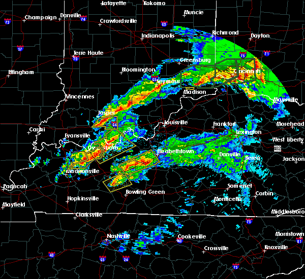 At 103 am cst, a severe thunderstorm was located near hawesville, moving northeast at 45 mph (radar indicated). Hazards include 60 mph wind gusts and quarter size hail. Hail damage to vehicles is expected. expect wind damage to roofs, siding, and trees. locations impacted include, tell city, hardinsburg, hawesville, webster, lewisport, cannelton, irvington, cloverport, leopold and fordsville. A tornado watch remains in effect until 400 am cst for south central indiana, and central kentucky. At 103 am cst, a severe thunderstorm was located near hawesville, moving northeast at 45 mph (radar indicated). Hazards include 60 mph wind gusts and quarter size hail. Hail damage to vehicles is expected. expect wind damage to roofs, siding, and trees. locations impacted include, tell city, hardinsburg, hawesville, webster, lewisport, cannelton, irvington, cloverport, leopold and fordsville. A tornado watch remains in effect until 400 am cst for south central indiana, and central kentucky.
|
| 3/1/2017 12:49 AM CST |
 At 1249 am cst, a severe thunderstorm was located near knottsville, moving northeast at 40 mph (radar indicated). Hazards include 60 mph wind gusts and quarter size hail. Hail damage to vehicles is expected. Expect wind damage to roofs, siding, and trees. At 1249 am cst, a severe thunderstorm was located near knottsville, moving northeast at 40 mph (radar indicated). Hazards include 60 mph wind gusts and quarter size hail. Hail damage to vehicles is expected. Expect wind damage to roofs, siding, and trees.
|
| 9/10/2016 1:42 PM CDT |
 The national weather service in louisville has issued a * severe thunderstorm warning for. west central harrison county in south central indiana. perry county in south central indiana. southeastern crawford county in south central indiana. Northwestern meade county in central kentucky. The national weather service in louisville has issued a * severe thunderstorm warning for. west central harrison county in south central indiana. perry county in south central indiana. southeastern crawford county in south central indiana. Northwestern meade county in central kentucky.
|
| 9/10/2016 1:42 PM CDT |
 At 242 pm edt/142 pm cdt/, severe thunderstorms were located along a line extending from 14 miles northeast of tell city to near knottsville, moving northeast at 35 mph (radar indicated). Hazards include 60 mph wind gusts. Expect damage to roofs. siding. And trees. At 242 pm edt/142 pm cdt/, severe thunderstorms were located along a line extending from 14 miles northeast of tell city to near knottsville, moving northeast at 35 mph (radar indicated). Hazards include 60 mph wind gusts. Expect damage to roofs. siding. And trees.
|
| 7/13/2016 8:04 PM EDT |
 At 804 pm edt/704 pm cdt/, severe thunderstorms were located along a line extending from near shoals to near jasper to near rockport, moving east at 40 mph (radar indicated). Hazards include 60 mph wind gusts. Expect damage to roofs. siding. And trees. At 804 pm edt/704 pm cdt/, severe thunderstorms were located along a line extending from near shoals to near jasper to near rockport, moving east at 40 mph (radar indicated). Hazards include 60 mph wind gusts. Expect damage to roofs. siding. And trees.
|
| 7/13/2016 6:40 PM CDT |
 At 634 pm, spotters reported 65 mph winds on the southeast side of evansville near angel mounds. at 638 pm cdt, severe thunderstorms were located along a line extending from near petersburg to near lynnville to newburgh, moving east at 55 mph (trained weather spotters). Hazards include 60 to 70 mph wind gusts and penny size hail. Expect considerable tree damage. Damage is likely to mobile homes, roofs, and outbuildings. At 634 pm, spotters reported 65 mph winds on the southeast side of evansville near angel mounds. at 638 pm cdt, severe thunderstorms were located along a line extending from near petersburg to near lynnville to newburgh, moving east at 55 mph (trained weather spotters). Hazards include 60 to 70 mph wind gusts and penny size hail. Expect considerable tree damage. Damage is likely to mobile homes, roofs, and outbuildings.
|
| 7/8/2016 8:25 AM CDT |
 At 824 am cdt, a severe thunderstorm was located over hawesville, moving east at 45 mph (radar indicated). Hazards include 70 mph wind gusts. Expect considerable tree damage. Damage is likely to mobile homes, roofs, and outbuildings. At 824 am cdt, a severe thunderstorm was located over hawesville, moving east at 45 mph (radar indicated). Hazards include 70 mph wind gusts. Expect considerable tree damage. Damage is likely to mobile homes, roofs, and outbuildings.
|
| 7/7/2016 2:47 PM CDT |
 At 346 pm edt/246 pm cdt/, severe thunderstorms were located along a line extending from 14 miles southwest of english to 11 miles east of whitesville, moving east at 45 mph (trained weather spotters reported trees and power lines down near lewisport with these storms!). Hazards include 70 mph wind gusts. Expect considerable tree damage. damage is likely to mobile homes, roofs, and outbuildings. Locations impacted include, tell city, hardinsburg, hawesville, , mount pleasant, webster, ferdinand, lewisport, cannelton and cloverport. At 346 pm edt/246 pm cdt/, severe thunderstorms were located along a line extending from 14 miles southwest of english to 11 miles east of whitesville, moving east at 45 mph (trained weather spotters reported trees and power lines down near lewisport with these storms!). Hazards include 70 mph wind gusts. Expect considerable tree damage. damage is likely to mobile homes, roofs, and outbuildings. Locations impacted include, tell city, hardinsburg, hawesville, , mount pleasant, webster, ferdinand, lewisport, cannelton and cloverport.
|
| 7/7/2016 2:28 PM CDT |
 At 327 pm edt/227 pm cdt/, severe thunderstorms were located along a line extending from near dale to near whitesville, moving east at 45 mph. the strongest winds were heading for tell city and hawesville (radar indicated). Hazards include 70 mph wind gusts. Expect considerable tree damage. damage is likely to mobile homes, roofs, and outbuildings. Locations impacted include, tell city, hardinsburg, hawesville, carefree town, mount pleasant, webster, ferdinand, lewisport, cannelton and cloverport. At 327 pm edt/227 pm cdt/, severe thunderstorms were located along a line extending from near dale to near whitesville, moving east at 45 mph. the strongest winds were heading for tell city and hawesville (radar indicated). Hazards include 70 mph wind gusts. Expect considerable tree damage. damage is likely to mobile homes, roofs, and outbuildings. Locations impacted include, tell city, hardinsburg, hawesville, carefree town, mount pleasant, webster, ferdinand, lewisport, cannelton and cloverport.
|
| 7/7/2016 2:25 PM CDT |
 At 224 pm cdt, severe thunderstorms were located along a line extending from near dale to near knottsville to near central city, moving east at 50 mph (trained weather spotters). Hazards include 70 mph wind gusts. Expect considerable tree damage. damage is likely to mobile homes, roofs, and outbuildings. Locations impacted include, owensboro, rockport, santa claus, dale, grandview, whitesville, knottsville, masonville, chrisney, troy and gentryville. At 224 pm cdt, severe thunderstorms were located along a line extending from near dale to near knottsville to near central city, moving east at 50 mph (trained weather spotters). Hazards include 70 mph wind gusts. Expect considerable tree damage. damage is likely to mobile homes, roofs, and outbuildings. Locations impacted include, owensboro, rockport, santa claus, dale, grandview, whitesville, knottsville, masonville, chrisney, troy and gentryville.
|
| 7/7/2016 2:20 PM CDT |
 At 319 pm edt/219 pm cdt/, severe thunderstorms were located along a line extending from near dale to near masonville, moving east at 45 mph (radar indicated). Hazards include 70 mph wind gusts and penny size hail. Expect considerable tree damage. Damage is likely to mobile homes, roofs, and outbuildings. At 319 pm edt/219 pm cdt/, severe thunderstorms were located along a line extending from near dale to near masonville, moving east at 45 mph (radar indicated). Hazards include 70 mph wind gusts and penny size hail. Expect considerable tree damage. Damage is likely to mobile homes, roofs, and outbuildings.
|
| 7/7/2016 2:11 PM CDT |
 At 210 pm cdt/310 pm edt/, severe thunderstorms were located along a line extending from near folsomville to near eureka to 6 miles northwest of graham, moving east at 50 mph (trained weather spotters). Hazards include 70 mph wind gusts. Expect considerable tree damage. Damage is likely to mobile homes, roofs, and outbuildings. At 210 pm cdt/310 pm edt/, severe thunderstorms were located along a line extending from near folsomville to near eureka to 6 miles northwest of graham, moving east at 50 mph (trained weather spotters). Hazards include 70 mph wind gusts. Expect considerable tree damage. Damage is likely to mobile homes, roofs, and outbuildings.
|
| 5/29/2016 5:11 PM CDT |
 At 510 pm cdt, a severe thunderstorm was located near hawesville, moving southeast at 15 mph (radar indicated). Hazards include 60 mph wind gusts and quarter size hail. Hail damage to vehicles is expected. expect wind damage to roofs, siding, and trees. Locations impacted include, tell city, hawesville, lewisport, cannelton, troy, adair, chambers, fenn haven, waitman and petri. At 510 pm cdt, a severe thunderstorm was located near hawesville, moving southeast at 15 mph (radar indicated). Hazards include 60 mph wind gusts and quarter size hail. Hail damage to vehicles is expected. expect wind damage to roofs, siding, and trees. Locations impacted include, tell city, hawesville, lewisport, cannelton, troy, adair, chambers, fenn haven, waitman and petri.
|
| 5/29/2016 4:55 PM CDT |
 At 454 pm cdt, a severe thunderstorm was located near grandview, moving east at 15 mph (radar indicated). Hazards include 60 mph wind gusts and quarter size hail. Hail damage to vehicles is expected. Expect wind damage to roofs, siding, and trees. At 454 pm cdt, a severe thunderstorm was located near grandview, moving east at 15 mph (radar indicated). Hazards include 60 mph wind gusts and quarter size hail. Hail damage to vehicles is expected. Expect wind damage to roofs, siding, and trees.
|
| 5/10/2016 1:21 PM CDT |
 At 120 pm cdt, a severe thunderstorm was located near whitesville, moving east at 30 mph (public. multiple reports of golf ball to two inch hail with this storm). Hazards include two inch hail and 60 mph wind gusts. People and animals outdoors will be injured. expect hail damage to roofs, siding, windows, and vehicles. expect wind damage to roofs, siding, and trees. Locations impacted include, tell city, hawesville, lewisport, cannelton, fordsville, troy, arrington corner, deanefield, aetnaville and pellville. At 120 pm cdt, a severe thunderstorm was located near whitesville, moving east at 30 mph (public. multiple reports of golf ball to two inch hail with this storm). Hazards include two inch hail and 60 mph wind gusts. People and animals outdoors will be injured. expect hail damage to roofs, siding, windows, and vehicles. expect wind damage to roofs, siding, and trees. Locations impacted include, tell city, hawesville, lewisport, cannelton, fordsville, troy, arrington corner, deanefield, aetnaville and pellville.
|
| 5/10/2016 1:08 PM CDT |
 At 108 pm cdt, a severe thunderstorm was located over masonville, moving east at 30 mph (radar indicated). Hazards include two inch hail and 60 mph wind gusts. People and animals outdoors will be injured. expect hail damage to roofs, siding, windows, and vehicles. Expect wind damage to roofs, siding, and trees. At 108 pm cdt, a severe thunderstorm was located over masonville, moving east at 30 mph (radar indicated). Hazards include two inch hail and 60 mph wind gusts. People and animals outdoors will be injured. expect hail damage to roofs, siding, windows, and vehicles. Expect wind damage to roofs, siding, and trees.
|
| 5/7/2016 8:23 PM CDT |
 The severe thunderstorm warning for spencer, pike, warrick, southeastern henderson and daviess counties will expire at 830 pm cdt/930 pm edt/, the storms which prompted the warning have moved out of the area. therefore the warning will be allowed to expire. a severe thunderstorm watch remains in effect until 100 am cdt/200 am edt/ for southwestern indiana, and northwestern kentucky. The severe thunderstorm warning for spencer, pike, warrick, southeastern henderson and daviess counties will expire at 830 pm cdt/930 pm edt/, the storms which prompted the warning have moved out of the area. therefore the warning will be allowed to expire. a severe thunderstorm watch remains in effect until 100 am cdt/200 am edt/ for southwestern indiana, and northwestern kentucky.
|
| 5/7/2016 8:23 PM CDT |
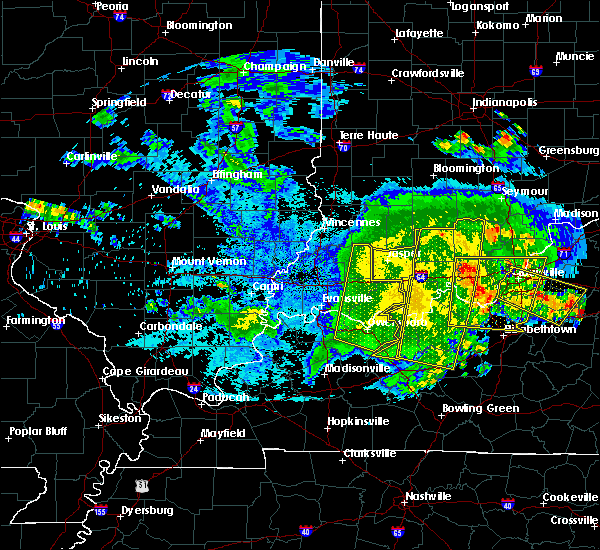 The severe thunderstorm warning for spencer, pike, warrick, southeastern henderson and daviess counties will expire at 830 pm cdt/930 pm edt/, the storms which prompted the warning have moved out of the area. therefore the warning will be allowed to expire. a severe thunderstorm watch remains in effect until 100 am cdt/200 am edt/ for southwestern indiana, and northwestern kentucky. The severe thunderstorm warning for spencer, pike, warrick, southeastern henderson and daviess counties will expire at 830 pm cdt/930 pm edt/, the storms which prompted the warning have moved out of the area. therefore the warning will be allowed to expire. a severe thunderstorm watch remains in effect until 100 am cdt/200 am edt/ for southwestern indiana, and northwestern kentucky.
|
| 5/7/2016 7:45 PM CDT |
 At 744 pm cdt/844 pm edt/, severe thunderstorms were located along a line extending from 7 miles northeast of jasper to 7 miles north of tell city to 7 miles east of st. joseph, moving southeast at 55 mph (radar indicated). Hazards include 60 mph wind gusts. Expect damage to roofs. siding. And trees. At 744 pm cdt/844 pm edt/, severe thunderstorms were located along a line extending from 7 miles northeast of jasper to 7 miles north of tell city to 7 miles east of st. joseph, moving southeast at 55 mph (radar indicated). Hazards include 60 mph wind gusts. Expect damage to roofs. siding. And trees.
|
| 5/7/2016 7:34 PM CDT |
 At 733 pm cdt, severe thunderstorms were located along a line extending from jasper to 6 miles northwest of grandview to near robards, moving east at 60 mph. these storms have a history of producing widespread wind damage with winds in excess of 60 mph (radar indicated). Hazards include 60 mph wind gusts. Expect damage to roofs. siding. and trees. locations impacted include, evansville, owensboro, henderson, newburgh, rockport, santa claus, dale, grandview, corydon, whitesville, robards, masonville, eureka, knottsville, st. Joseph, stanley, lewisport, chrisney, troy and gentryville. At 733 pm cdt, severe thunderstorms were located along a line extending from jasper to 6 miles northwest of grandview to near robards, moving east at 60 mph. these storms have a history of producing widespread wind damage with winds in excess of 60 mph (radar indicated). Hazards include 60 mph wind gusts. Expect damage to roofs. siding. and trees. locations impacted include, evansville, owensboro, henderson, newburgh, rockport, santa claus, dale, grandview, corydon, whitesville, robards, masonville, eureka, knottsville, st. Joseph, stanley, lewisport, chrisney, troy and gentryville.
|
| 5/7/2016 7:10 PM CDT |
 At 708 pm cdt, severe thunderstorms were located along a line extending from near petersburg to near boonville to near uniontown, moving east at 60 mph. this line of storms snapped power poles and tree limbs as it moved across carmi illinois, and winds were measured at 66 mph as they moved across the mount carmel airport in southern illinois (radar indicated). Hazards include 60 mph wind gusts. Expect damage to roofs. siding. And trees. At 708 pm cdt, severe thunderstorms were located along a line extending from near petersburg to near boonville to near uniontown, moving east at 60 mph. this line of storms snapped power poles and tree limbs as it moved across carmi illinois, and winds were measured at 66 mph as they moved across the mount carmel airport in southern illinois (radar indicated). Hazards include 60 mph wind gusts. Expect damage to roofs. siding. And trees.
|
| 4/27/2016 7:19 PM CDT |
 At 819 pm edt/719 pm cdt/, a severe thunderstorm was located 8 miles north of hardinsburg, moving northeast at 35 mph (radar indicated). Hazards include 60 mph wind gusts and quarter size hail. Hail damage to vehicles is expected. expect wind damage to roofs, siding, and trees. locations impacted include, tell city, brandenburg, hardinsburg, hawesville, webster, lewisport, cannelton, irvington, cloverport and troy. A tornado watch remains in effect until midnight edt/1100 pm cdt/ for south central indiana, and central kentucky. At 819 pm edt/719 pm cdt/, a severe thunderstorm was located 8 miles north of hardinsburg, moving northeast at 35 mph (radar indicated). Hazards include 60 mph wind gusts and quarter size hail. Hail damage to vehicles is expected. expect wind damage to roofs, siding, and trees. locations impacted include, tell city, brandenburg, hardinsburg, hawesville, webster, lewisport, cannelton, irvington, cloverport and troy. A tornado watch remains in effect until midnight edt/1100 pm cdt/ for south central indiana, and central kentucky.
|
| 4/27/2016 6:52 PM CDT |
 At 751 pm edt/651 pm cdt/, a severe thunderstorm was located 8 miles northeast of whitesville, moving northeast at 35 mph (radar indicated). Hazards include 70 mph wind gusts and quarter size hail. Hail damage to vehicles is expected. expect considerable tree damage. Wind damage is also likely to mobile homes, roofs, and outbuildings. At 751 pm edt/651 pm cdt/, a severe thunderstorm was located 8 miles northeast of whitesville, moving northeast at 35 mph (radar indicated). Hazards include 70 mph wind gusts and quarter size hail. Hail damage to vehicles is expected. expect considerable tree damage. Wind damage is also likely to mobile homes, roofs, and outbuildings.
|
| 4/26/2016 7:11 PM CDT |
 At 811 pm edt/711 pm cdt/, severe thunderstorms were located along a line extending from 6 miles southwest of english to near hartford, moving east at 25 mph. perry county reported multiple power outages and trees down across the county (law enforcement). Hazards include 60 mph wind gusts and quarter size hail. Hail damage to vehicles is expected. expect wind damage to roofs, siding, and trees. Locations impacted include, tell city, hawesville, mount pleasant, lewisport, cannelton, cloverport, leopold, fordsville, birdseye and troy. At 811 pm edt/711 pm cdt/, severe thunderstorms were located along a line extending from 6 miles southwest of english to near hartford, moving east at 25 mph. perry county reported multiple power outages and trees down across the county (law enforcement). Hazards include 60 mph wind gusts and quarter size hail. Hail damage to vehicles is expected. expect wind damage to roofs, siding, and trees. Locations impacted include, tell city, hawesville, mount pleasant, lewisport, cannelton, cloverport, leopold, fordsville, birdseye and troy.
|
| 4/26/2016 6:36 PM CDT |
 At 736 pm edt/636 pm cdt/, severe thunderstorms were located along a line extending from 6 miles southeast of jasper to near livermore, moving east at 30 mph (trained weather spotters). Hazards include 60 mph wind gusts and quarter size hail. Hail damage to vehicles is expected. expect wind damage to roofs, siding, and trees. Locations impacted include, tell city, hawesville, mount pleasant, lewisport, cannelton, cloverport, leopold, fordsville, birdseye and troy. At 736 pm edt/636 pm cdt/, severe thunderstorms were located along a line extending from 6 miles southeast of jasper to near livermore, moving east at 30 mph (trained weather spotters). Hazards include 60 mph wind gusts and quarter size hail. Hail damage to vehicles is expected. expect wind damage to roofs, siding, and trees. Locations impacted include, tell city, hawesville, mount pleasant, lewisport, cannelton, cloverport, leopold, fordsville, birdseye and troy.
|
| 4/26/2016 6:25 PM CDT |
 At 723 pm edt/623 pm cdt/, severe thunderstorms were located along a line extending from 6 miles southwest of jasper to calhoun, moving east at 30 mph. these storms have a history of producing damaging winds (trained weather spotters). Hazards include 60 mph wind gusts and quarter size hail. Hail damage to vehicles is expected. Expect wind damage to roofs, siding, and trees. At 723 pm edt/623 pm cdt/, severe thunderstorms were located along a line extending from 6 miles southwest of jasper to calhoun, moving east at 30 mph. these storms have a history of producing damaging winds (trained weather spotters). Hazards include 60 mph wind gusts and quarter size hail. Hail damage to vehicles is expected. Expect wind damage to roofs, siding, and trees.
|
| 12/23/2015 5:12 PM CST | The severe thunderstorm warning for southern perry, northern breckinridge and hancock counties will expire at 515 pm cst, this warning has been replaced with a new severe thunderstorm warning which is in effect until 545 pm cst. a tornado watch remains in effect until 800 pm cst for south central indiana and central kentucky. |
| 12/23/2015 5:12 PM CST | The severe thunderstorm warning for southern perry, northern breckinridge and hancock counties will expire at 515 pm cst, this warning has been replaced with a new severe thunderstorm warning which is in effect until 545 pm cst. a tornado watch remains in effect until 800 pm cst for south central indiana and central kentucky. |
| 12/23/2015 5:02 PM CST | At 502 pm cst, a severe thunderstorm was located near hawesville, moving northeast at 60 mph (radar indicated). Hazards include 60 mph wind gusts and quarter size hail. Hail damage to vehicles is expected. expect wind damage to roofs, siding and trees. locations impacted include, tell city, hardinsburg, hawesville, webster, lewisport, cannelton, irvington, cloverport, troy, arrington corner, lilly dale, dodd, pellville, gatchel, union star, gerald, hardingrove, fenn haven, adair and sample. A tornado watch remains in effect until 800 pm cst for south central indiana and central kentucky. |
| 12/23/2015 5:02 PM CST | At 502 pm cst, a severe thunderstorm was located near hawesville, moving northeast at 60 mph (radar indicated). Hazards include 60 mph wind gusts and quarter size hail. Hail damage to vehicles is expected. expect wind damage to roofs, siding and trees. locations impacted include, tell city, hardinsburg, hawesville, webster, lewisport, cannelton, irvington, cloverport, troy, arrington corner, lilly dale, dodd, pellville, gatchel, union star, gerald, hardingrove, fenn haven, adair and sample. A tornado watch remains in effect until 800 pm cst for south central indiana and central kentucky. |
| 12/23/2015 4:50 PM CST | At 450 pm cst, a severe thunderstorm was located over knottsville, moving northeast at 70 mph (radar indicated). Hazards include 60 mph wind gusts and quarter size hail. Hail damage to vehicles is expected. Expect wind damage to roofs, siding and trees. |
| 12/23/2015 4:50 PM CST | At 450 pm cst, a severe thunderstorm was located over knottsville, moving northeast at 70 mph (radar indicated). Hazards include 60 mph wind gusts and quarter size hail. Hail damage to vehicles is expected. Expect wind damage to roofs, siding and trees. |
| 12/23/2015 3:49 PM CST | At 349 pm cst, a severe thunderstorm capable of producing a tornado was located over grandview, moving northeast at 60 mph (radar indicated rotation). Hazards include tornado and quarter size hail. Flying debris will be dangerous to those caught without shelter. mobile homes will be damaged or destroyed. damage to roofs, windows and vehicles will occur. tree damage is likely. this dangerous storm will be near, tell city around 400 pm cst. Other locations impacted by this tornadic thunderstorm include celina, lilly dale, bandon, branchville, apalona, dodd, gatchel, gerald, hardingrove and fenn haven. |
| 12/23/2015 3:49 PM CST | At 349 pm cst, a severe thunderstorm capable of producing a tornado was located over grandview, moving northeast at 60 mph (radar indicated rotation). Hazards include tornado and quarter size hail. Flying debris will be dangerous to those caught without shelter. mobile homes will be damaged or destroyed. damage to roofs, windows and vehicles will occur. tree damage is likely. this dangerous storm will be near, tell city around 400 pm cst. Other locations impacted by this tornadic thunderstorm include celina, lilly dale, bandon, branchville, apalona, dodd, gatchel, gerald, hardingrove and fenn haven. |
| 12/23/2015 2:08 PM CST | At 308 pm est /208 pm cst/, severe thunderstorms were located along a line extending from near shoals to 9 miles southeast of jasper to near grandview, moving east at 45 mph (radar indicated). Hazards include 60 mph wind gusts. Expect damage to roofs. Siding and trees. |
| 12/23/2015 2:08 PM CST | At 308 pm est /208 pm cst/, severe thunderstorms were located along a line extending from near shoals to 9 miles southeast of jasper to near grandview, moving east at 45 mph (radar indicated). Hazards include 60 mph wind gusts. Expect damage to roofs. Siding and trees. |
| 7/20/2015 8:43 PM CDT |
 At 842 pm cdt, a severe thunderstorm was located 6 miles west of hawesville, and moving east at 30 mph (radar indicated). Hazards include 60 mph wind gusts. Expect damage to roofs. Siding and trees. At 842 pm cdt, a severe thunderstorm was located 6 miles west of hawesville, and moving east at 30 mph (radar indicated). Hazards include 60 mph wind gusts. Expect damage to roofs. Siding and trees.
|
| 6/21/2015 9:06 PM CDT |
 At 1003 pm edt /903 pm cdt/, severe thunderstorms were located along a line extending from 10 miles west of brandenburg to 8 miles north of hardinsburg to tell city, moving southeast at 25 mph (radar indicated). Hazards include 60 mph wind gusts and penny size hail. Expect damage to roofs. siding and trees. Locations impacted include, raymond, payneville, mystic, lodiburg, skillman, dodd, sunny corner, lauer and tobinsport. At 1003 pm edt /903 pm cdt/, severe thunderstorms were located along a line extending from 10 miles west of brandenburg to 8 miles north of hardinsburg to tell city, moving southeast at 25 mph (radar indicated). Hazards include 60 mph wind gusts and penny size hail. Expect damage to roofs. siding and trees. Locations impacted include, raymond, payneville, mystic, lodiburg, skillman, dodd, sunny corner, lauer and tobinsport.
|
| 6/21/2015 8:52 PM CDT |
 At 851 pm cdt, severe thunderstorms were located along a line extending from 14 miles east of tell city to hawesville to grandview, and moving east at 25 mph (radar indicated). Hazards include 60 mph wind gusts and quarter size hail. Hail damage to vehicles is expected. Expect wind damage to roofs, siding and trees. At 851 pm cdt, severe thunderstorms were located along a line extending from 14 miles east of tell city to hawesville to grandview, and moving east at 25 mph (radar indicated). Hazards include 60 mph wind gusts and quarter size hail. Hail damage to vehicles is expected. Expect wind damage to roofs, siding and trees.
|
| 6/19/2015 3:46 PM CDT |
 The tornado warning for north central hancock and west central perry counties will expire at 450 pm edt/350 pm cdt/, the storm which prompted the warning has moved out of hancock county. a new warning has been issued for perry county. to report severe weather, contact your nearest law enforcement agency. they will relay your report to the national weather service in louisville. The tornado warning for north central hancock and west central perry counties will expire at 450 pm edt/350 pm cdt/, the storm which prompted the warning has moved out of hancock county. a new warning has been issued for perry county. to report severe weather, contact your nearest law enforcement agency. they will relay your report to the national weather service in louisville.
|
| 6/19/2015 3:45 PM CDT |
 At 343 pm cdt, a severe thunderstorm capable of producing a tornado was located near tell city, and moving northeast at 20 mph (public reported a funnel cloud). Hazards include tornado and quarter size hail. Flying debris will be dangerous to those caught without shelter. mobile homes will be damaged or destroyed. damage to roofs, windows and vehicles will occur. This dangerous storm will affect mainly rural areas of central perry county, including the following locations, lilly dale, ranger, gatchel, terry, leopold, bandon and apalona. At 343 pm cdt, a severe thunderstorm capable of producing a tornado was located near tell city, and moving northeast at 20 mph (public reported a funnel cloud). Hazards include tornado and quarter size hail. Flying debris will be dangerous to those caught without shelter. mobile homes will be damaged or destroyed. damage to roofs, windows and vehicles will occur. This dangerous storm will affect mainly rural areas of central perry county, including the following locations, lilly dale, ranger, gatchel, terry, leopold, bandon and apalona.
|
| 6/19/2015 3:29 PM CDT |
 At 328 pm cdt, a severe thunderstorm capable of producing a tornado was located near tell city, and moving northeast at 20 mph (radar indicated rotation). Hazards include tornado and quarter size hail. Flying debris will be dangerous to those caught without shelter. mobile homes will be damaged or destroyed. damage to roofs, windows and vehicles will occur. Locations impacted include, troy. At 328 pm cdt, a severe thunderstorm capable of producing a tornado was located near tell city, and moving northeast at 20 mph (radar indicated rotation). Hazards include tornado and quarter size hail. Flying debris will be dangerous to those caught without shelter. mobile homes will be damaged or destroyed. damage to roofs, windows and vehicles will occur. Locations impacted include, troy.
|
| 6/19/2015 3:23 PM CDT |
 At 320 pm cdt, a severe thunderstorm capable of producing a tornado was located near grandview, and moving northeast at 15 mph (radar indicated rotation). Hazards include tornado and quarter size hail. Flying debris will be dangerous to those caught without shelter. mobile homes will be damaged or destroyed. damage to roofs, windows and vehicles will occur. This dangerous storm will affect mainly rural areas of northwestern hancock and west central perry counties, including the following locations, adair and troy. At 320 pm cdt, a severe thunderstorm capable of producing a tornado was located near grandview, and moving northeast at 15 mph (radar indicated rotation). Hazards include tornado and quarter size hail. Flying debris will be dangerous to those caught without shelter. mobile homes will be damaged or destroyed. damage to roofs, windows and vehicles will occur. This dangerous storm will affect mainly rural areas of northwestern hancock and west central perry counties, including the following locations, adair and troy.
|
| 5/27/2015 11:44 AM CDT | At 1142 am cdt, a severe thunderstorm was located 6 miles northeast of tell city, and moving east at 40 mph (radar indicated). Hazards include 60 mph wind gusts and quarter size hail. Hail damage to vehicles is expected. expect wind damage to roofs, siding and trees. Locations impacted include, gatchel, terry, hardingrove, gerald, bandon, rome and leopold. |
| 5/27/2015 11:26 AM CDT | At 1124 am cdt, a severe thunderstorm was located 6 miles east of grandview, and moving east at 40 mph (radar indicated). Hazards include 60 mph wind gusts and quarter size hail. Hail damage to vehicles is expected. Expect wind damage to roofs, siding and trees. |
| 5/27/2015 11:26 AM CDT | At 1124 am cdt, a severe thunderstorm was located 6 miles east of grandview, and moving east at 40 mph (radar indicated). Hazards include 60 mph wind gusts and quarter size hail. Hail damage to vehicles is expected. Expect wind damage to roofs, siding and trees. |
| 4/7/2015 3:18 PM CDT | A severe thunderstorm warning remains in effect for hancock and southern perry counties until 325 pm cdt. at 314 pm cdt. severe thunderstorms extended from north of tell city to near hawesville. and moving southeast at 55 mph. Trained spotters reported 70 mph wind gusts near lamar in spencer county at 305 pm cdt. |
| 4/7/2015 3:18 PM CDT | A severe thunderstorm warning remains in effect for hancock and southern perry counties until 325 pm cdt. at 314 pm cdt. severe thunderstorms extended from north of tell city to near hawesville. and moving southeast at 55 mph. Trained spotters reported 70 mph wind gusts near lamar in spencer county at 305 pm cdt. |
| 4/7/2015 2:12 PM CST | Trees down on a house in spencer county IN, 4.6 miles S of Troy, IN |
| 4/7/2015 3:04 PM CDT | The national weather service in louisville has issued a * severe thunderstorm warning for. southern perry county in south central indiana. hancock county in northwest kentucky. until 325 pm cdt * at 301 pm cdt. A severe thunderstorm was located near grandview. |
| 4/7/2015 3:04 PM CDT | The national weather service in louisville has issued a * severe thunderstorm warning for. southern perry county in south central indiana. hancock county in northwest kentucky. until 325 pm cdt * at 301 pm cdt. A severe thunderstorm was located near grandview. |
| 1/30/2013 1:02 AM CST | Structural damage on a house...including walls down on a garage. field tanks were also overturned and several trees were downed. time estimated from radar in perry county IN, 4.1 miles SW of Troy, IN |
| 7/24/2012 4:45 PM CDT | A few tree limbs and one tree down on state route 545. hail also rep in spencer county IN, 2.5 miles SSE of Troy, IN |
| 7/24/2012 4:38 PM CDT | Two large trees downed across highway 15 in perry county IN, 2.8 miles SW of Troy, IN |
| 7/24/2012 4:38 PM CDT | Two large trees downed across highway 84 in perry county IN, 2.8 miles SW of Troy, IN |
| 7/18/2012 8:13 PM CDT | Tree down on atlanta road north of tell cit in perry county IN, 4.4 miles SSW of Troy, IN |
| 1/1/0001 12:00 AM | Weht relaying report of trees down in troy... in in perry county IN, 0.7 miles SW of Troy, IN |
| 1/1/0001 12:00 AM | Weht relaying report of trees down in perry county IN, 0.7 miles SW of Troy, IN |
| 1/1/0001 12:00 AM | Trees reported dow in perry county IN, 1 miles N of Troy, IN |
| 1/1/0001 12:00 AM | Straight line winds destroying barn and trees dow in spencer county IN, 4.6 miles S of Troy, IN |
Hail Maps for Troy, IN


Connect with Interactive Hail Maps