

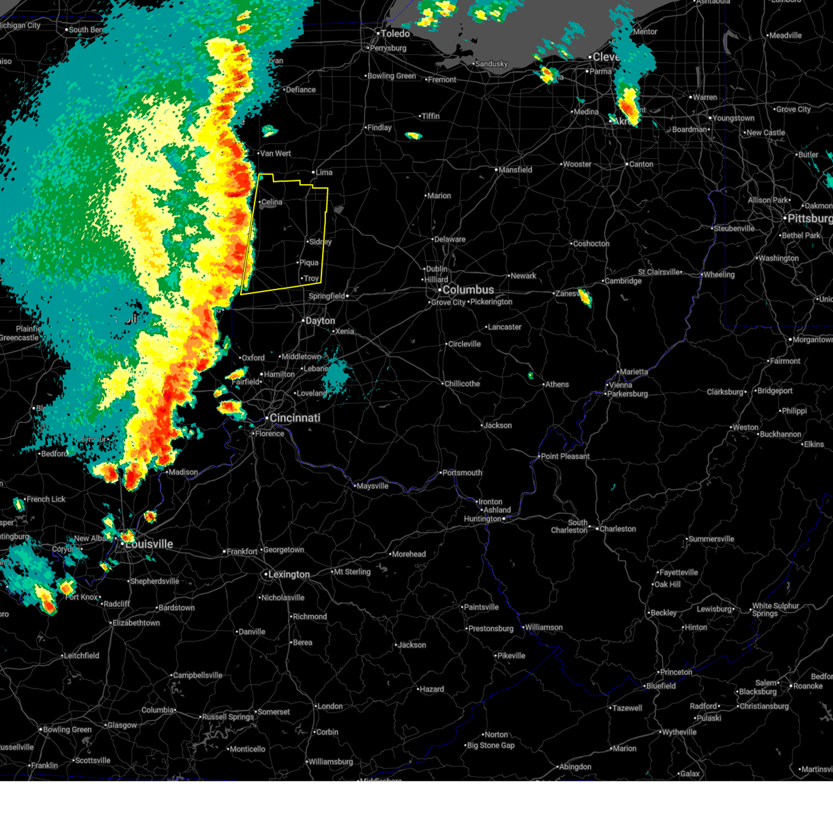
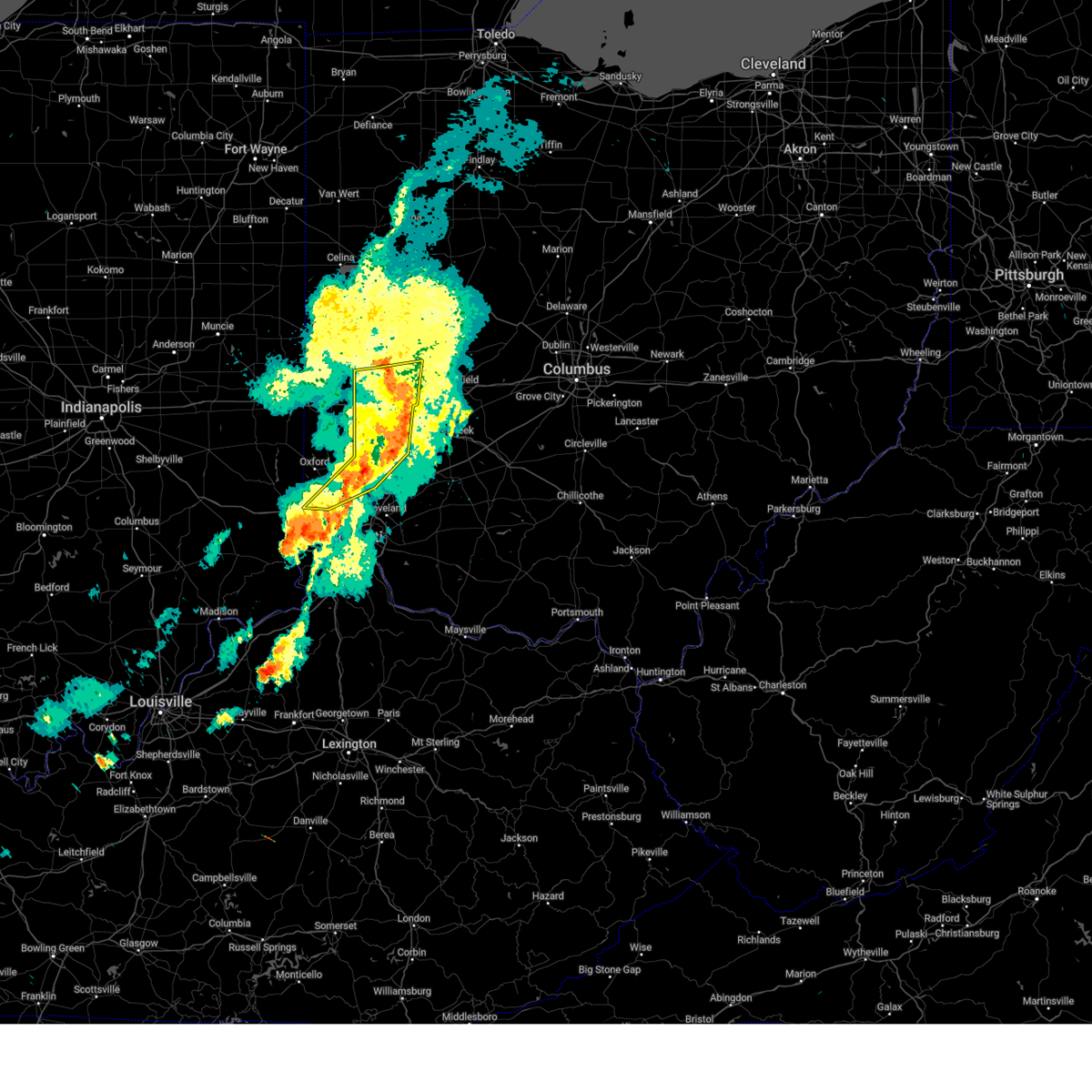
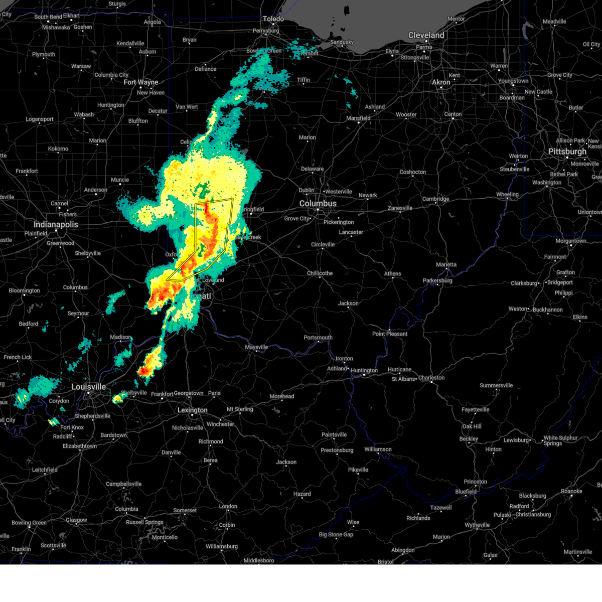
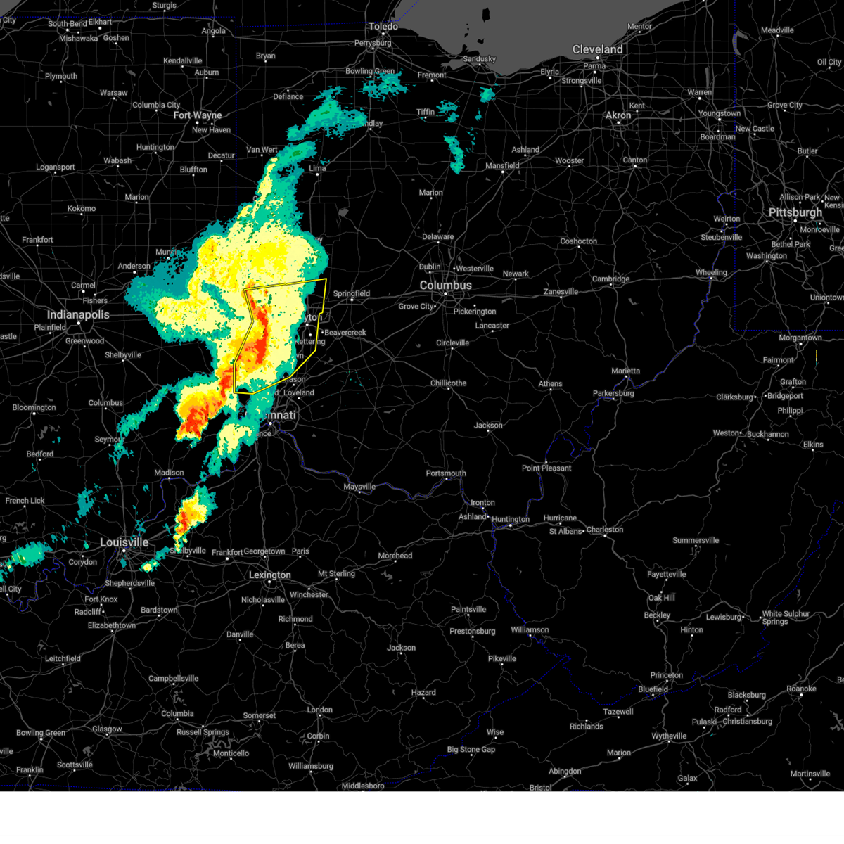
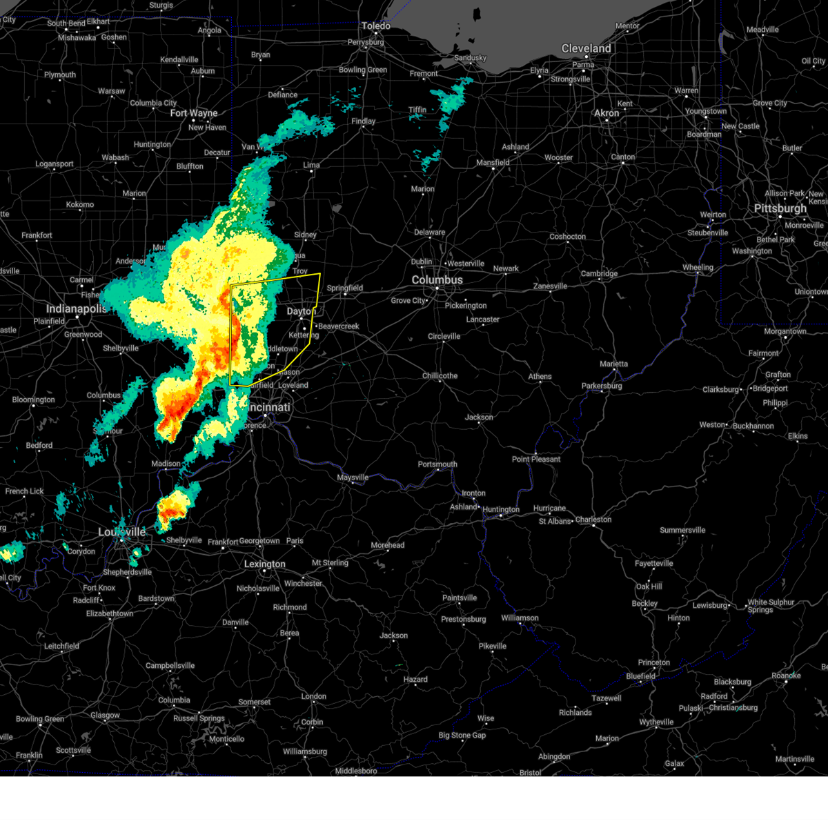
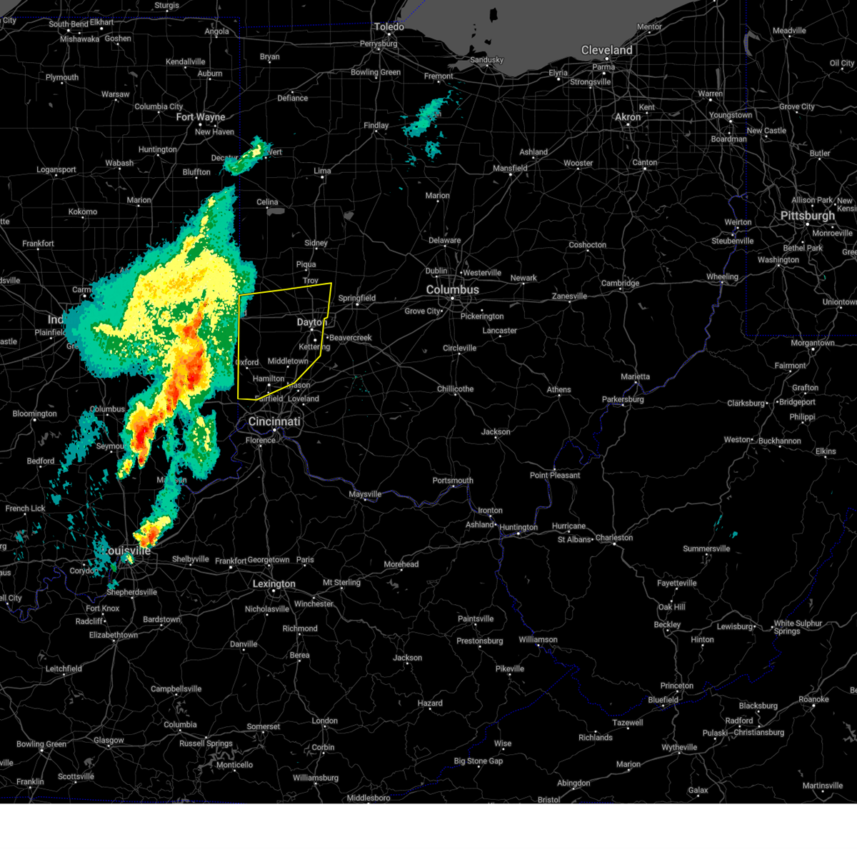
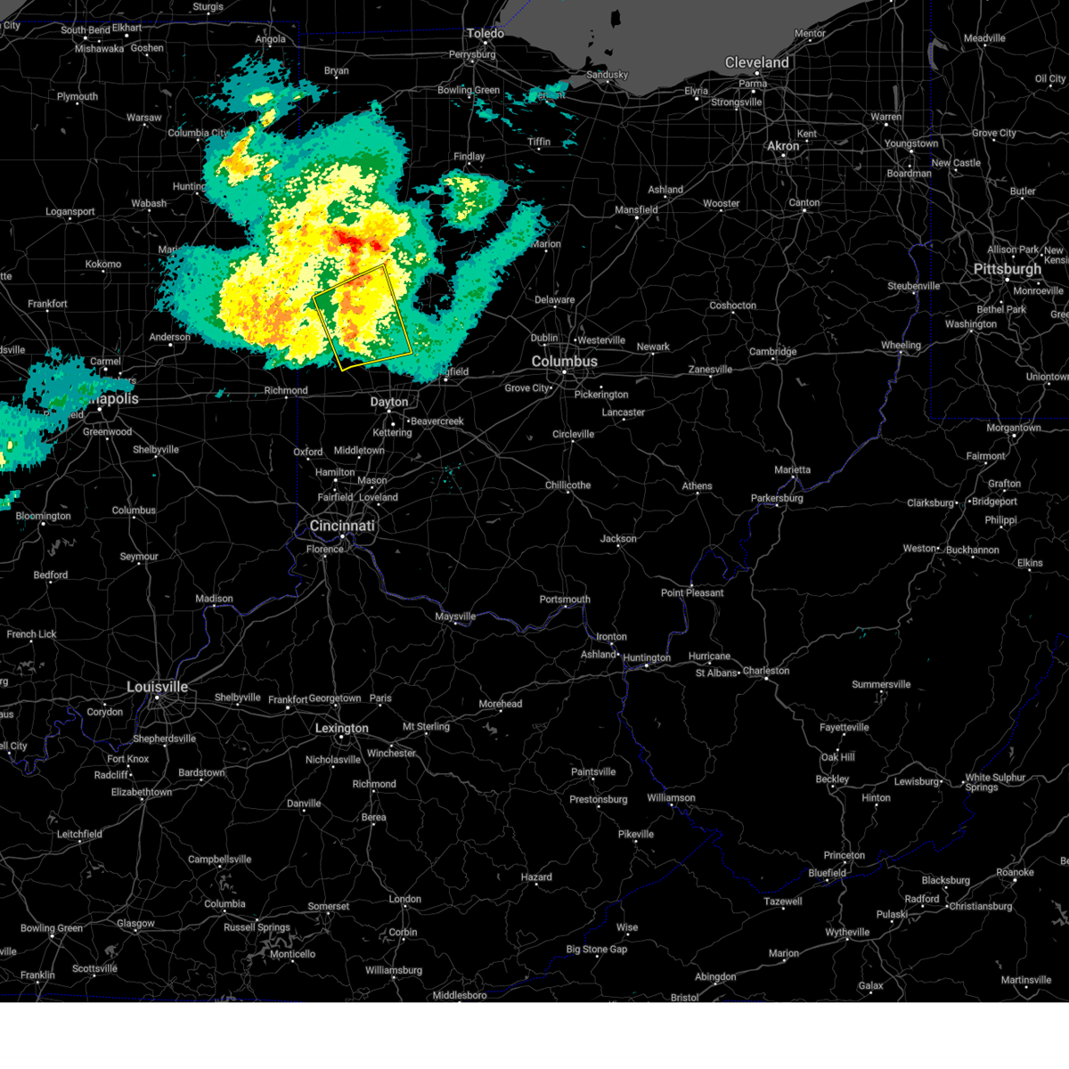
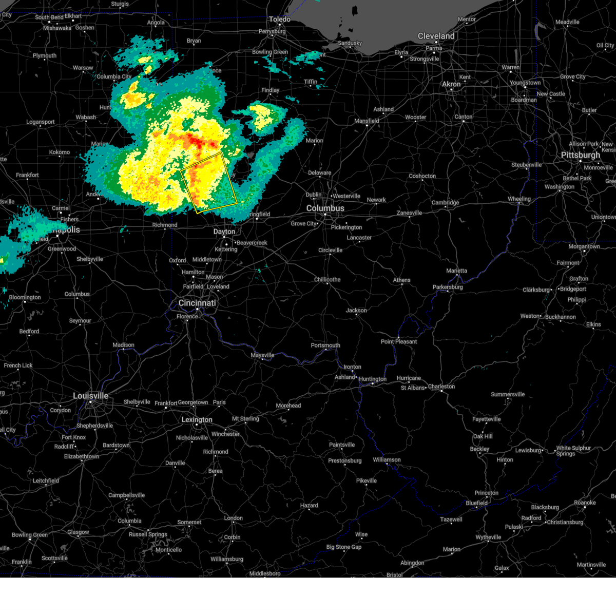
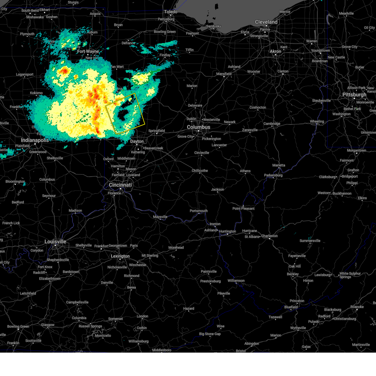
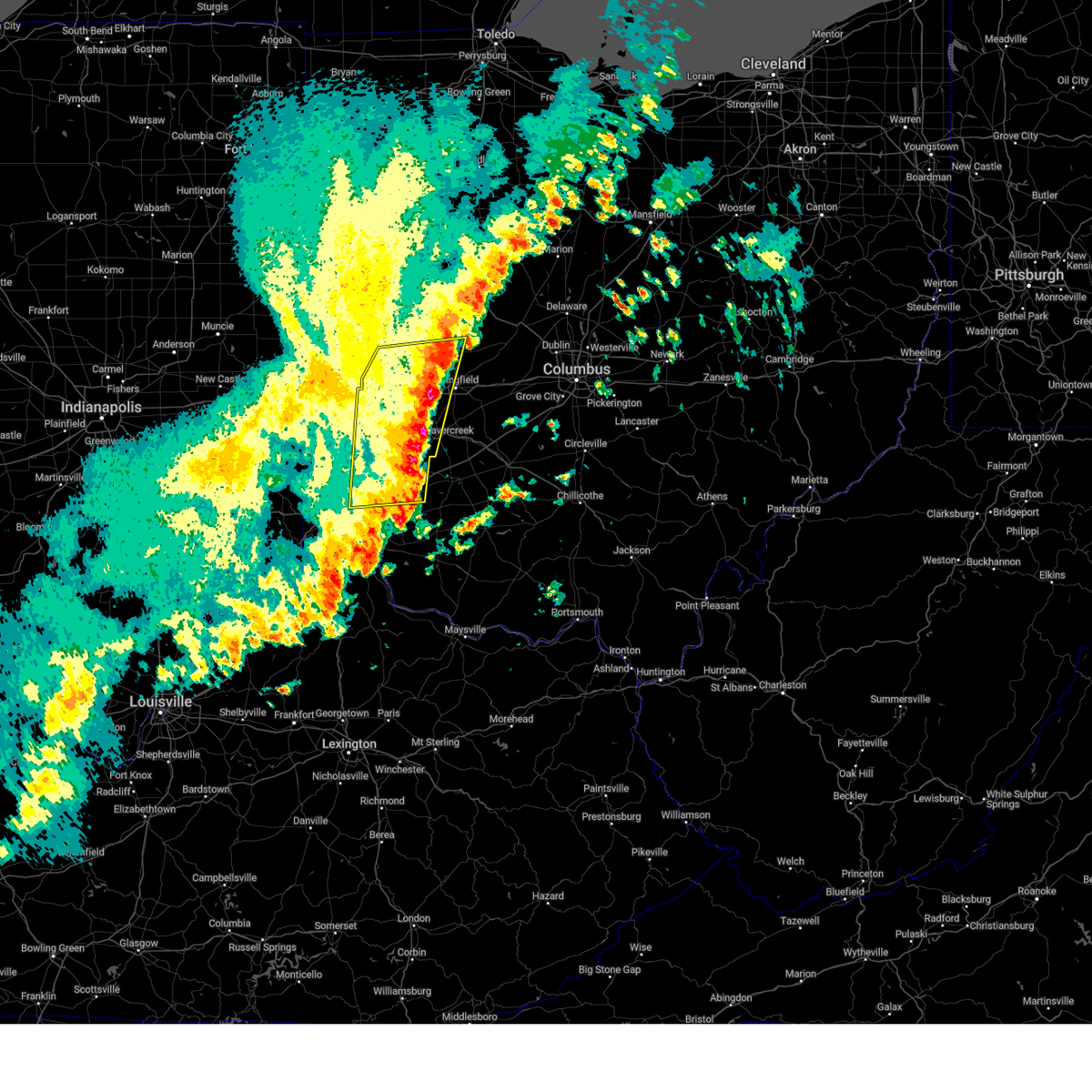
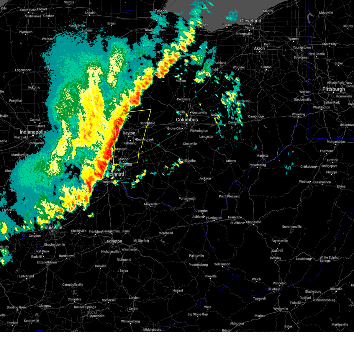
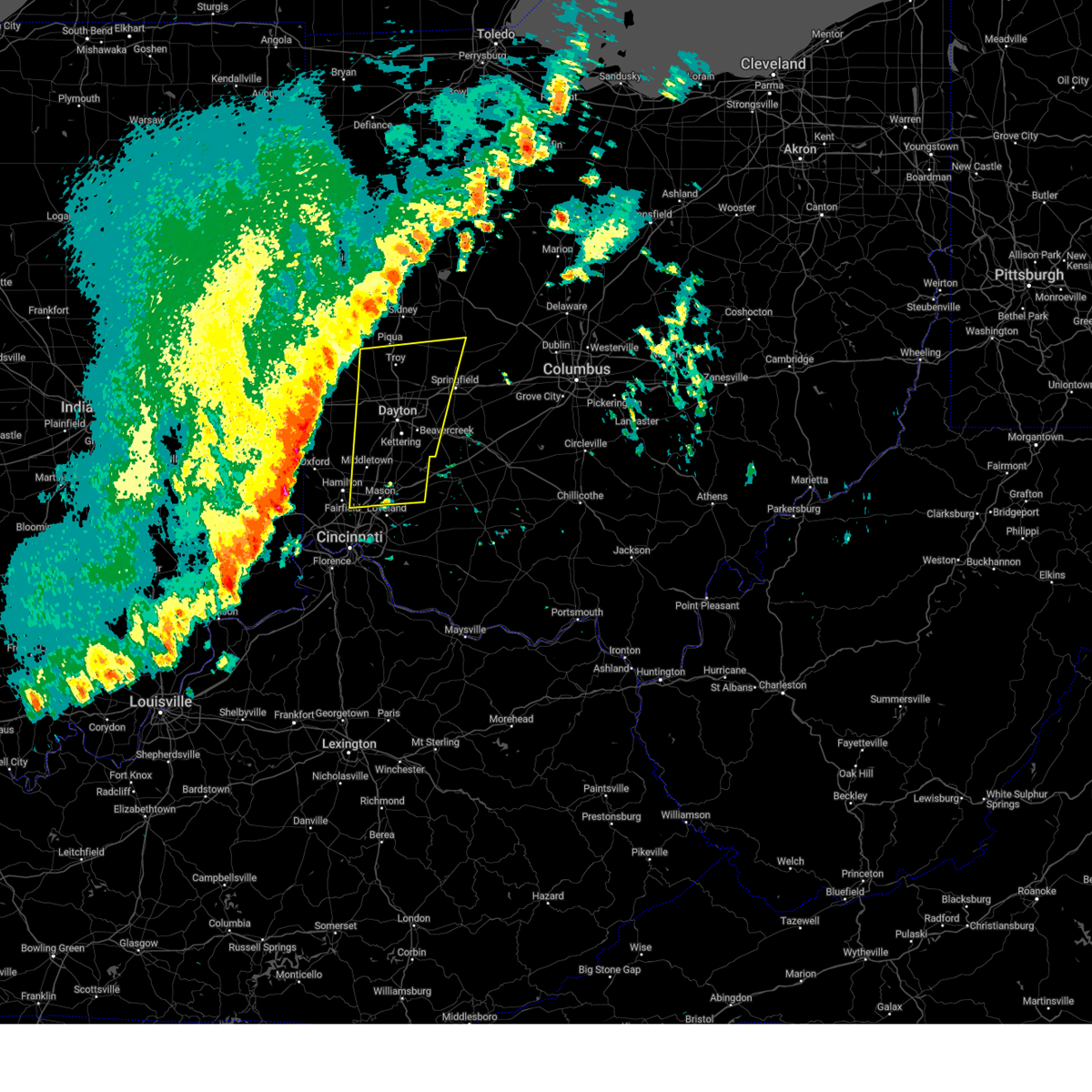
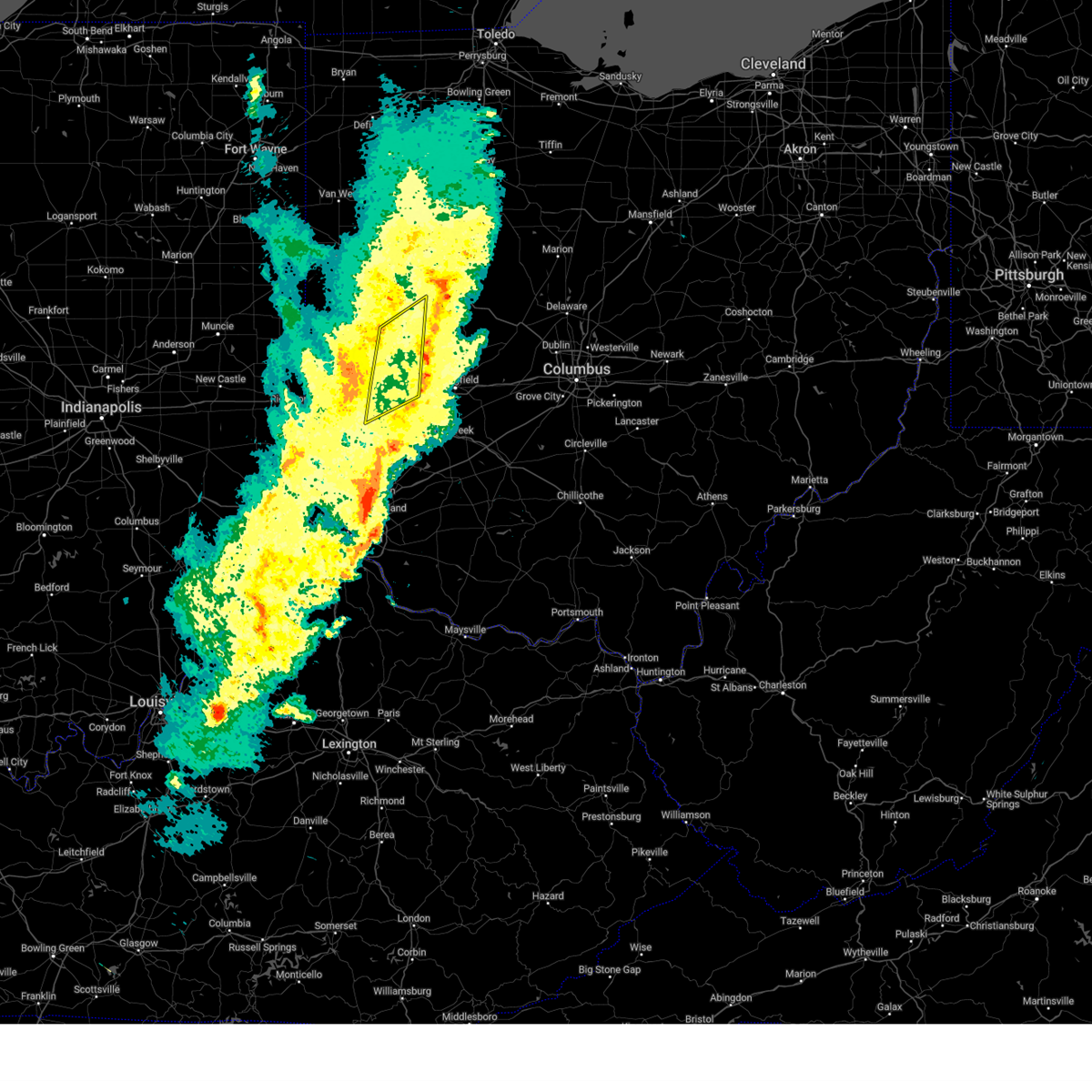
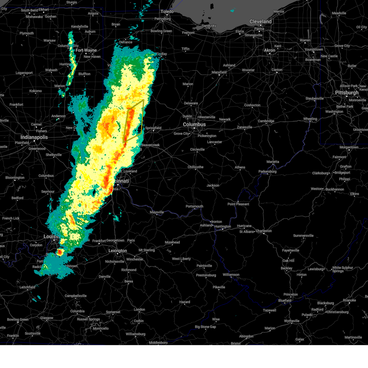
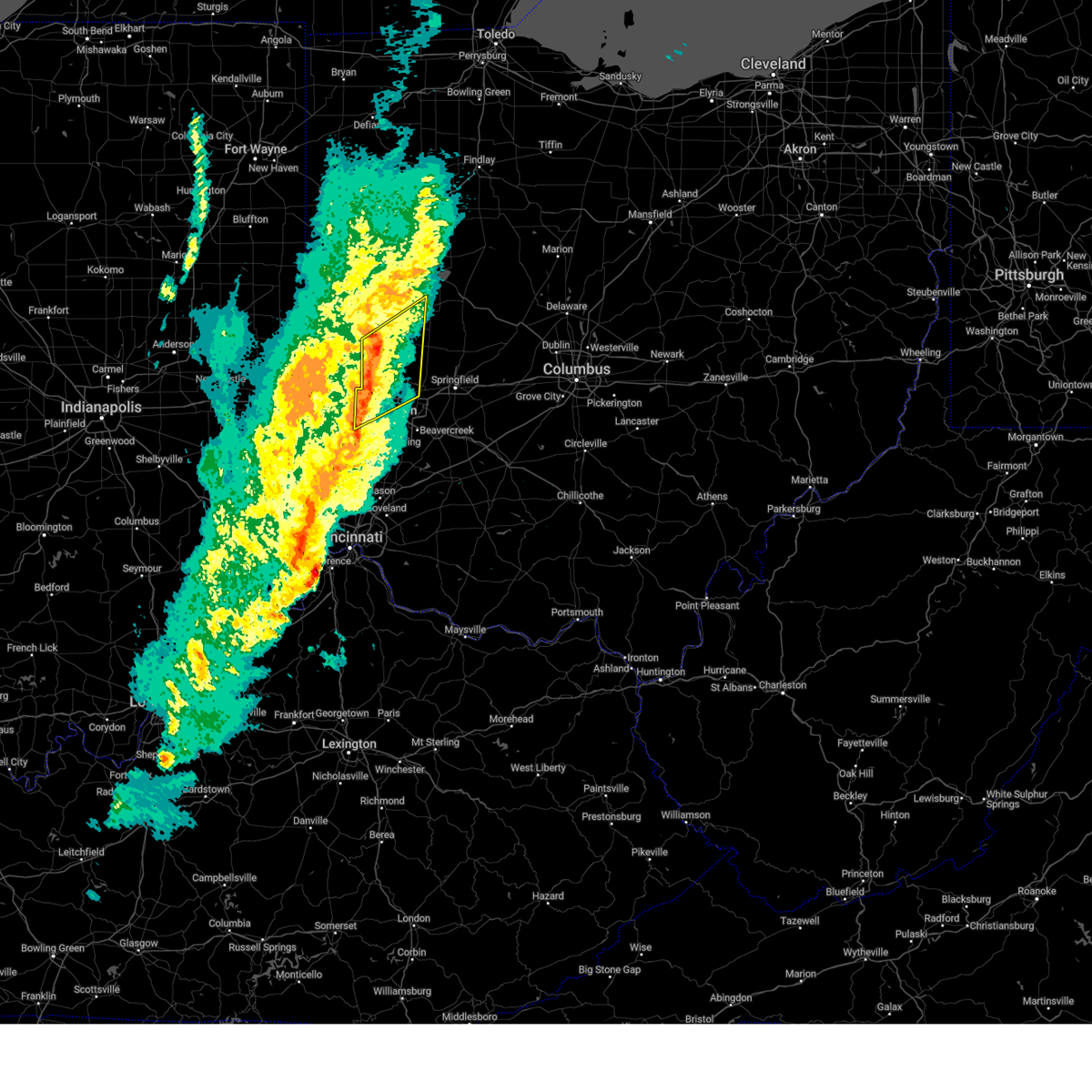
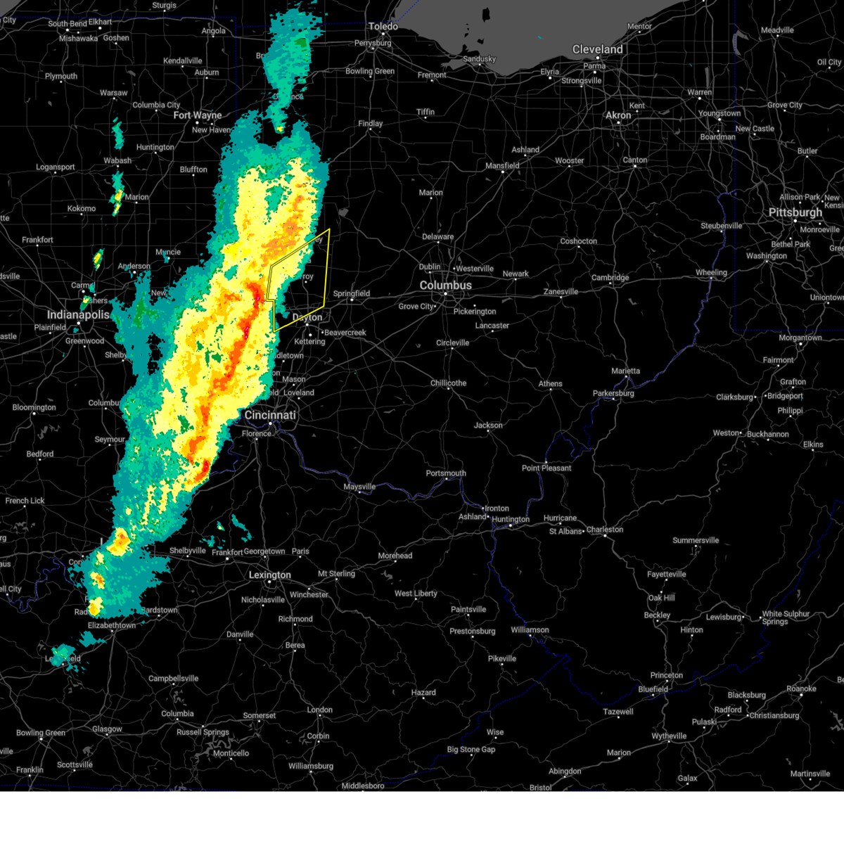
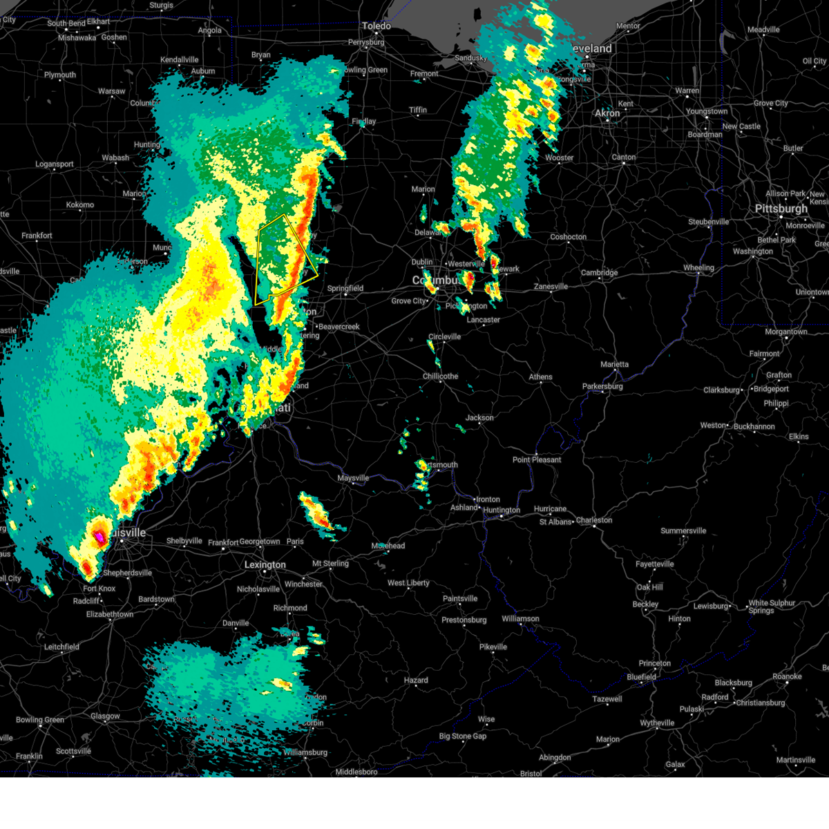
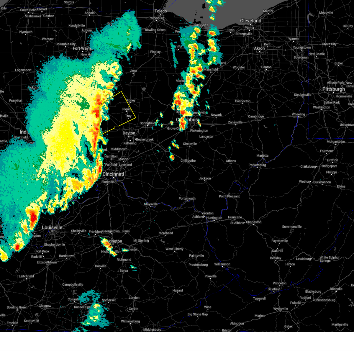
Hail Map for Troy, OH
The Troy, OH area has had 5 reports of on-the-ground hail by trained spotters, and has been under severe weather warnings 41 times during the past 12 months. Doppler radar has detected hail at or near Troy, OH on 42 occasions.
| Name: | Troy, OH |
| Where Located: | 64.5 miles W of Columbus, OH |
| Map: | Google Map for Troy, OH |
| Population: | 25058 |
| Housing Units: | 11166 |
| More Info: | Search Google for Troy, OH |
3
The Top Recent Hail Date for Troy, OH is Wednesday, May 22, 2024 (5th out of 42)

Hail and Wind Damage Spotted near Troy, OH
| Date / Time | Report Details |
|---|---|
| 6/18/2025 6:53 PM EDT | Svriln the national weather service in wilmington has issued a * severe thunderstorm warning for, southern champaign county in west central ohio, northern warren county in southwestern ohio, greene county in west central ohio, clark county in west central ohio, montgomery county in west central ohio, southeastern miami county in west central ohio, * until 800 pm edt. * at 652 pm edt, severe thunderstorms were located along a line extending from near pleasant hill to trenton, moving northeast at 45 mph (radar indicated). Hazards include 70 mph wind gusts. Expect considerable tree damage. Damage is likely to mobile homes, roofs, and outbuildings. |
| 6/18/2025 6:43 PM EDT | Svriln the national weather service in wilmington has issued a * severe thunderstorm warning for, eastern shelby county in west central ohio, champaign county in west central ohio, logan county in west central ohio, western union county in central ohio, hardin county in west central ohio, northeastern auglaize county in west central ohio, northeastern miami county in west central ohio, * until 745 pm edt. * at 642 pm edt, severe thunderstorms were located along a line extending from cridersville to near tipp city, moving east at 35 mph (emergency management. at 620 pm structural damage was reported near montezuma in mercer county). Hazards include 60 mph wind gusts. expect damage to trees and power lines |
| 6/18/2025 6:40 PM EDT | 6 inch tree limbs downed along stonyridge ave. time estimated by rada in miami county OH, 2.1 miles WSW of Troy, OH |
| 6/18/2025 6:39 PM EDT | At 638 pm edt, severe thunderstorms were located along a line extending from near delphos to pleasant hill, moving east at 55 mph (emergency manager). Hazards include 60 mph wind gusts. Expect damage to trees and power lines. locations impacted include, troy, sidney, piqua, greenville, wapakoneta, st. marys, west milton, fort shawnee, new bremen, minster, versailles, covington, arcanum, newport, cridersville, bradford, anna, fort loramie, jackson center, and pleasant hill. This includes i-75 in ohio between mile markers 71 and 118. |
| 6/18/2025 6:13 PM EDT |
 Svriln the national weather service in wilmington has issued a * severe thunderstorm warning for, shelby county in west central ohio, darke county in west central ohio, auglaize county in west central ohio, eastern mercer county in west central ohio, miami county in west central ohio, * until 700 pm edt. * at 613 pm edt, severe thunderstorms were located along a line extending from near rockford to new madison, moving east at 55 mph (public). Hazards include 60 mph wind gusts. expect damage to trees and power lines Svriln the national weather service in wilmington has issued a * severe thunderstorm warning for, shelby county in west central ohio, darke county in west central ohio, auglaize county in west central ohio, eastern mercer county in west central ohio, miami county in west central ohio, * until 700 pm edt. * at 613 pm edt, severe thunderstorms were located along a line extending from near rockford to new madison, moving east at 55 mph (public). Hazards include 60 mph wind gusts. expect damage to trees and power lines
|
| 5/16/2025 8:58 PM EDT | A new severe thunderstorm warning has been issued downstream, allowing this warning to expire. a tornado watch remains in effect until 300 am edt for west central ohio. please report previous wind damage or hail to the national weather service by going to our website at weather.gov/iln and submitting your report via social media. |
| 5/16/2025 8:50 PM EDT | the severe thunderstorm warning has been cancelled and is no longer in effect |
| 5/16/2025 8:50 PM EDT | At 849 pm edt, severe thunderstorms were located along a line extending from fort shawnee to near piqua, moving east at 65 mph (radar indicated). Hazards include 60 mph wind gusts. Expect damage to trees and power lines. locations impacted include, ginghamsburg, vandalia, montra, casstown, millerstown, kiser lake state park, yellow springs, new carlisle, terre haute, dayton international airport, pemberton, dialton, st. paris, logansville, lippincott, clifton, sidney, plattsville, troy, and snyderville. this includes the following interstates, i-70 in ohio between mile markers 35 and 56. I-75 in ohio between mile markers 62 and 82, and between mile markers 84 and 99. |
| 5/16/2025 8:38 PM EDT | the severe thunderstorm warning has been cancelled and is no longer in effect |
| 5/16/2025 8:38 PM EDT | At 837 pm edt, severe thunderstorms were located along a line extending from near st. marys to near covington, moving east at 65 mph (radar indicated). Hazards include 60 mph wind gusts. Expect damage to trees and power lines. locations impacted include, fryburg, englewood, casstown, newbern, bradford, potsdam, huntersville, lockington, west milton, covington, new knoxville, fort loramie, kiser lake state park, wright-patterson afb, yellow springs, new carlisle, hardin, pemberton, dialton, and logansville. this includes the following interstates, i-70 in ohio between mile markers 21 and 57. I-75 in ohio between mile markers 56 and 118. |
| 5/16/2025 8:13 PM EDT | Svriln the national weather service in wilmington has issued a * severe thunderstorm warning for, east central wayne county in east central indiana, shelby county in west central ohio, western champaign county in west central ohio, northern preble county in west central ohio, western logan county in west central ohio, darke county in west central ohio, western clark county in west central ohio, auglaize county in west central ohio, mercer county in west central ohio, northwestern greene county in west central ohio, northern montgomery county in west central ohio, western hardin county in west central ohio, miami county in west central ohio, * until 900 pm edt. * at 813 pm edt, severe thunderstorms were located along a line extending from near fort recovery to 6 miles west of new madison, moving east at 65 mph (radar indicated). Hazards include 60 mph wind gusts. expect damage to trees and power lines |
| 4/29/2025 1:47 PM EDT | Trees down at troy aquatic park. time estimated from rada in miami county OH, 1.9 miles SSW of Troy, OH |
| 4/29/2025 1:46 PM EDT | Large evergreen downed in troy park near adams street. time estimated by rada in miami county OH, 1.3 miles SW of Troy, OH |
| 4/29/2025 1:46 PM EDT | 6 foot tall fence blown 30 feet into the road. time estimated from rada in miami county OH, 1.7 miles NE of Troy, OH |
| 4/29/2025 1:44 PM EDT |
 The severe thunderstorm which prompted the warning has moved out of the warned area. therefore, the warning will be allowed to expire. however, gusty winds and heavy rain are still possible with this thunderstorm. a severe thunderstorm watch remains in effect until 700 pm edt for southeastern indiana, and southwestern and west central ohio. please report previous wind damage or hail to the national weather service by going to our website at weather.gov/iln and submitting your report via social media. remember, a severe thunderstorm warning still remains in effect for portions of miami, montgomery, butler, and warren counties. The severe thunderstorm which prompted the warning has moved out of the warned area. therefore, the warning will be allowed to expire. however, gusty winds and heavy rain are still possible with this thunderstorm. a severe thunderstorm watch remains in effect until 700 pm edt for southeastern indiana, and southwestern and west central ohio. please report previous wind damage or hail to the national weather service by going to our website at weather.gov/iln and submitting your report via social media. remember, a severe thunderstorm warning still remains in effect for portions of miami, montgomery, butler, and warren counties.
|
| 4/29/2025 1:37 PM EDT |
 the severe thunderstorm warning has been cancelled and is no longer in effect the severe thunderstorm warning has been cancelled and is no longer in effect
|
| 4/29/2025 1:37 PM EDT |
 At 136 pm edt, a severe thunderstorm was located over trotwood, moving east at 55 mph (radar indicated). Hazards include 70 mph wind gusts and quarter size hail. Minor hail damage to vehicles is possible. expect considerable tree damage. wind damage is also likely to mobile homes, roofs, and outbuildings. locations impacted include, franklin, ginghamsburg, vandalia, hughes, englewood, seven mile, potsdam, west milton, carlisle, south middletown, dayton international airport, millville, overlook-page mano, layhigh, hunter, okeana, clayton, centerville, poast town heights, and brookville. this includes the following interstates, i-70 in ohio between mile markers 18 and 40. I-75 in ohio between mile markers 27 and 74. At 136 pm edt, a severe thunderstorm was located over trotwood, moving east at 55 mph (radar indicated). Hazards include 70 mph wind gusts and quarter size hail. Minor hail damage to vehicles is possible. expect considerable tree damage. wind damage is also likely to mobile homes, roofs, and outbuildings. locations impacted include, franklin, ginghamsburg, vandalia, hughes, englewood, seven mile, potsdam, west milton, carlisle, south middletown, dayton international airport, millville, overlook-page mano, layhigh, hunter, okeana, clayton, centerville, poast town heights, and brookville. this includes the following interstates, i-70 in ohio between mile markers 18 and 40. I-75 in ohio between mile markers 27 and 74.
|
| 4/29/2025 1:33 PM EDT |
 Svriln the national weather service in wilmington has issued a * severe thunderstorm warning for, north central hamilton county in southwestern ohio, champaign county in west central ohio, eastern butler county in southwestern ohio, warren county in southwestern ohio, northwestern clinton county in southwestern ohio, greene county in west central ohio, clark county in west central ohio, eastern montgomery county in west central ohio, eastern miami county in west central ohio, * until 230 pm edt. * at 133 pm edt, a severe thunderstorm was located near trotwood, moving east at 60 mph (radar indicated). Hazards include 60 mph wind gusts and nickel size hail. expect damage to trees and power lines Svriln the national weather service in wilmington has issued a * severe thunderstorm warning for, north central hamilton county in southwestern ohio, champaign county in west central ohio, eastern butler county in southwestern ohio, warren county in southwestern ohio, northwestern clinton county in southwestern ohio, greene county in west central ohio, clark county in west central ohio, eastern montgomery county in west central ohio, eastern miami county in west central ohio, * until 230 pm edt. * at 133 pm edt, a severe thunderstorm was located near trotwood, moving east at 60 mph (radar indicated). Hazards include 60 mph wind gusts and nickel size hail. expect damage to trees and power lines
|
| 4/29/2025 1:25 PM EDT |
 At 125 pm edt, a severe thunderstorm was located near west alexandria, moving east at 55 mph (radar indicated). Hazards include 70 mph wind gusts and quarter size hail. Minor hail damage to vehicles is possible. expect considerable tree damage. wind damage is also likely to mobile homes, roofs, and outbuildings. locations impacted include, franklin, ginghamsburg, vandalia, hughes, englewood, seven mile, potsdam, collinsville, morning sun, west milton, carlisle, new madison, west alexandria, south middletown, wheatville, interstate 70 at us route 127, muttonville, dayton international airport, millville, and overlook-page mano. this includes the following interstates, i-70 in ohio between mile markers 8 and 40. I-75 in ohio between mile markers 27 and 74. At 125 pm edt, a severe thunderstorm was located near west alexandria, moving east at 55 mph (radar indicated). Hazards include 70 mph wind gusts and quarter size hail. Minor hail damage to vehicles is possible. expect considerable tree damage. wind damage is also likely to mobile homes, roofs, and outbuildings. locations impacted include, franklin, ginghamsburg, vandalia, hughes, englewood, seven mile, potsdam, collinsville, morning sun, west milton, carlisle, new madison, west alexandria, south middletown, wheatville, interstate 70 at us route 127, muttonville, dayton international airport, millville, and overlook-page mano. this includes the following interstates, i-70 in ohio between mile markers 8 and 40. I-75 in ohio between mile markers 27 and 74.
|
| 4/29/2025 1:08 PM EDT |
 At 107 pm edt, a severe thunderstorm was located near camden, moving east at 55 mph (radar indicated). Hazards include 70 mph wind gusts and quarter size hail. Minor hail damage to vehicles is possible. expect considerable tree damage. wind damage is also likely to mobile homes, roofs, and outbuildings. locations impacted include, franklin, englewood, potsdam, west florence, morning sun, west milton, new madison, south middletown, interstate 70 at us route 127, muttonville, camden, hunter, arcanum, new paris, clayton, reily, college corner, brookville, kettering, and drexel. this includes the following interstates, i-70 in ohio between mile markers 1 and 40. I-75 in ohio between mile markers 27 and 74. At 107 pm edt, a severe thunderstorm was located near camden, moving east at 55 mph (radar indicated). Hazards include 70 mph wind gusts and quarter size hail. Minor hail damage to vehicles is possible. expect considerable tree damage. wind damage is also likely to mobile homes, roofs, and outbuildings. locations impacted include, franklin, englewood, potsdam, west florence, morning sun, west milton, new madison, south middletown, interstate 70 at us route 127, muttonville, camden, hunter, arcanum, new paris, clayton, reily, college corner, brookville, kettering, and drexel. this includes the following interstates, i-70 in ohio between mile markers 1 and 40. I-75 in ohio between mile markers 27 and 74.
|
| 4/29/2025 12:50 PM EDT |
 Svriln the national weather service in wilmington has issued a * severe thunderstorm warning for, butler county in southwestern ohio, preble county in west central ohio, northwestern warren county in southwestern ohio, southern darke county in west central ohio, montgomery county in west central ohio, southern miami county in west central ohio, * until 145 pm edt. * at 1249 pm edt, a severe thunderstorm was located near connersville, moving east at 55 mph (radar indicated). Hazards include 70 mph wind gusts and quarter size hail. Minor hail damage to vehicles is possible. expect considerable tree damage. Wind damage is also likely to mobile homes, roofs, and outbuildings. Svriln the national weather service in wilmington has issued a * severe thunderstorm warning for, butler county in southwestern ohio, preble county in west central ohio, northwestern warren county in southwestern ohio, southern darke county in west central ohio, montgomery county in west central ohio, southern miami county in west central ohio, * until 145 pm edt. * at 1249 pm edt, a severe thunderstorm was located near connersville, moving east at 55 mph (radar indicated). Hazards include 70 mph wind gusts and quarter size hail. Minor hail damage to vehicles is possible. expect considerable tree damage. Wind damage is also likely to mobile homes, roofs, and outbuildings.
|
| 4/19/2025 6:55 AM EDT |
 The storm which prompted the warning has weakened below severe limits and no longer poses an immediate threat to life or property. therefore, the warning will be allowed to expire. please report previous wind damage or hail to the national weather service by going to our website at weather.gov/iln and submitting your report via social media. The storm which prompted the warning has weakened below severe limits and no longer poses an immediate threat to life or property. therefore, the warning will be allowed to expire. please report previous wind damage or hail to the national weather service by going to our website at weather.gov/iln and submitting your report via social media.
|
| 4/19/2025 6:50 AM EDT |
 At 650 am edt, a severe thunderstorm was located over minster, moving northeast at 75 mph (radar indicated). Hazards include 60 mph wind gusts and penny size hail. Expect damage to trees and power lines. locations impacted include, new weston, casstown, union corners, newbern, bradford, lockington, new bremen, darke county airport, covington, state route 47 at us route 127, eldora speedway, fort loramie, osgood, hardin, piqua, bloomer, lake loramie state park, sidney, troy, and minster. This includes i-75 in ohio between mile markers 74 and 96. At 650 am edt, a severe thunderstorm was located over minster, moving northeast at 75 mph (radar indicated). Hazards include 60 mph wind gusts and penny size hail. Expect damage to trees and power lines. locations impacted include, new weston, casstown, union corners, newbern, bradford, lockington, new bremen, darke county airport, covington, state route 47 at us route 127, eldora speedway, fort loramie, osgood, hardin, piqua, bloomer, lake loramie state park, sidney, troy, and minster. This includes i-75 in ohio between mile markers 74 and 96.
|
| 4/19/2025 6:31 AM EDT |
 Svriln the national weather service in wilmington has issued a * severe thunderstorm warning for, shelby county in west central ohio, darke county in west central ohio, southwestern auglaize county in west central ohio, southeastern mercer county in west central ohio, miami county in west central ohio, * until 700 am edt. * at 631 am edt, a severe thunderstorm was located over union city, moving northeast at 75 mph (radar indicated). Hazards include 60 mph wind gusts and penny size hail. expect damage to trees and power lines Svriln the national weather service in wilmington has issued a * severe thunderstorm warning for, shelby county in west central ohio, darke county in west central ohio, southwestern auglaize county in west central ohio, southeastern mercer county in west central ohio, miami county in west central ohio, * until 700 am edt. * at 631 am edt, a severe thunderstorm was located over union city, moving northeast at 75 mph (radar indicated). Hazards include 60 mph wind gusts and penny size hail. expect damage to trees and power lines
|
| 4/3/2025 12:39 AM EDT |
 The storm which prompted the warning has weakened below severe limits and no longer poses an immediate threat to life or property. therefore, the warning will be allowed to expire. however, gusty winds are still possible with this thunderstorm. a tornado watch remains in effect until 400 am edt for west central ohio. please report previous wind damage or hail to the national weather service by going to our website at weather.gov/iln and submitting your report via social media. The storm which prompted the warning has weakened below severe limits and no longer poses an immediate threat to life or property. therefore, the warning will be allowed to expire. however, gusty winds are still possible with this thunderstorm. a tornado watch remains in effect until 400 am edt for west central ohio. please report previous wind damage or hail to the national weather service by going to our website at weather.gov/iln and submitting your report via social media.
|
| 4/3/2025 12:28 AM EDT |
 the severe thunderstorm warning has been cancelled and is no longer in effect the severe thunderstorm warning has been cancelled and is no longer in effect
|
| 4/3/2025 12:28 AM EDT |
 At 1228 am edt, a severe thunderstorm was located over west milton, moving northeast at 55 mph (radar indicated). Hazards include 60 mph wind gusts. Expect damage to trees and power lines. locations impacted include, ginghamsburg, brown, vandalia, thackery, englewood, casstown, fort mckinley, phoneton, west milton, union, new carlisle, state route 41 at state route 235, dayton international airport, piqua, grayson, trotwood, dialton, medway, north hampton, and donnelsville. this includes the following interstates, i-70 in ohio between mile markers 22 and 42. I-75 in ohio between mile markers 58 and 84. At 1228 am edt, a severe thunderstorm was located over west milton, moving northeast at 55 mph (radar indicated). Hazards include 60 mph wind gusts. Expect damage to trees and power lines. locations impacted include, ginghamsburg, brown, vandalia, thackery, englewood, casstown, fort mckinley, phoneton, west milton, union, new carlisle, state route 41 at state route 235, dayton international airport, piqua, grayson, trotwood, dialton, medway, north hampton, and donnelsville. this includes the following interstates, i-70 in ohio between mile markers 22 and 42. I-75 in ohio between mile markers 58 and 84.
|
| 4/3/2025 12:07 AM EDT | Svriln the national weather service in wilmington has issued a * severe thunderstorm warning for, south central shelby county in west central ohio, southwestern champaign county in west central ohio, preble county in west central ohio, southeastern darke county in west central ohio, northwestern clark county in west central ohio, northern montgomery county in west central ohio, miami county in west central ohio, * until 1245 am edt. * at 1207 am edt, a severe thunderstorm was located over eaton, moving northeast at 55 mph (radar indicated). Hazards include 60 mph wind gusts. expect damage to trees and power lines |
| 4/2/2025 11:52 PM EDT | At 1152 pm edt, a severe thunderstorm was located near greenville, moving northeast at 60 mph (radar indicated). Hazards include 60 mph wind gusts and penny size hail. Expect damage to trees and power lines. locations impacted include, ginghamsburg, vandalia, englewood, casstown, union corners, bradford, potsdam, west florence, west milton, new madison, covington, west alexandria, interstate 70 at us route 127, dayton international airport, new hope, piqua, bloomer, greenville, arcanum, and lewisburg. this includes the following interstates, i-70 in ohio between mile markers 1 and 37. I-75 in ohio between mile markers 61 and 84. |
| 4/2/2025 11:47 PM EDT | At 1147 pm edt, a severe thunderstorm was located near greenville, moving northeast at 60 mph (radar indicated). Hazards include 60 mph wind gusts and penny size hail. Expect damage to trees and power lines. locations impacted include, ginghamsburg, vandalia, englewood, casstown, union corners, bradford, potsdam, west florence, west milton, new madison, covington, west alexandria, interstate 70 at us route 127, dayton international airport, hollansburg, new hope, piqua, bloomer, greenville, and arcanum. this includes the following interstates, i-70 in ohio between mile markers 1 and 37. I-75 in ohio between mile markers 61 and 84. |
| 4/2/2025 11:28 PM EDT | Svriln the national weather service in wilmington has issued a * severe thunderstorm warning for, northern preble county in west central ohio, southern darke county in west central ohio, northern montgomery county in west central ohio, miami county in west central ohio, * until 1215 am edt. * at 1128 pm edt, a severe thunderstorm was located over fountain city, moving northeast at 60 mph (radar indicated). Hazards include 60 mph wind gusts and penny size hail. expect damage to trees and power lines |
| 4/2/2025 10:32 PM EDT | At 1032 pm edt, a severe thunderstorm was located near fort recovery, moving northeast at 70 mph (radar indicated). Hazards include 70 mph wind gusts and quarter size hail. Minor hail damage to vehicles is possible. expect considerable tree damage. wind damage is also likely to mobile homes, roofs, and outbuildings. locations impacted include, fryburg, union corners, newbern, bradford, chickasaw, lockington, darke county airport, new madison, covington, new knoxville, neptune, fort loramie, sharps crossing, hardin, pemberton, kossuth, bloomer, lake loramie state park, arcanum, and north dayton. This includes i-75 in ohio between mile markers 76 and 118. |
| 4/2/2025 10:18 PM EDT | Svriln the national weather service in wilmington has issued a * severe thunderstorm warning for, shelby county in west central ohio, northwestern preble county in west central ohio, darke county in west central ohio, auglaize county in west central ohio, mercer county in west central ohio, northern miami county in west central ohio, * until 1115 pm edt. * at 1018 pm edt, a severe thunderstorm was located near winchester, moving northeast at 70 mph (radar indicated). Hazards include 70 mph wind gusts and quarter size hail. Minor hail damage to vehicles is possible. expect considerable tree damage. Wind damage is also likely to mobile homes, roofs, and outbuildings. |
| 3/30/2025 9:11 PM EDT |
 The storms which prompted the warning have moved out of the area. therefore, the warning will be allowed to expire. a tornado watch remains in effect until 100 am edt for southwestern and west central ohio. a severe thunderstorm watch remains in effect until 1000 pm edt for west central ohio. please report previous wind damage or hail to the national weather service by going to our website at weather.gov/iln and submitting your report via social media. remember, a severe thunderstorm warning still remains in effect for southern champaign county, clark county, montgomery county, eastern warren county, and greene county! remember, a tornado warning still remains in effect for eastern warren county!. The storms which prompted the warning have moved out of the area. therefore, the warning will be allowed to expire. a tornado watch remains in effect until 100 am edt for southwestern and west central ohio. a severe thunderstorm watch remains in effect until 1000 pm edt for west central ohio. please report previous wind damage or hail to the national weather service by going to our website at weather.gov/iln and submitting your report via social media. remember, a severe thunderstorm warning still remains in effect for southern champaign county, clark county, montgomery county, eastern warren county, and greene county! remember, a tornado warning still remains in effect for eastern warren county!.
|
| 3/30/2025 8:45 PM EDT |
 At 844 pm edt, severe thunderstorms were located along a line extending from near piqua to near williamsdale, moving northeast at 70 mph (radar indicated). Hazards include 60 mph wind gusts and nickel size hail. Expect damage to trees and power lines. locations impacted include, franklin, englewood, casstown, state route 63 at state route 741, fort ancient, potsdam, beckett ridge, west milton, pekin, corwin, south middletown, wright-patterson afb, oldtown, caesar creek state park, yellow springs, new carlisle, dialton, hunter, roxanna, and clayton. this includes the following interstates, i-70 in ohio between mile markers 19 and 53. i-71 in ohio between mile markers 23 and 41. I-75 in ohio between mile markers 19 and 81. At 844 pm edt, severe thunderstorms were located along a line extending from near piqua to near williamsdale, moving northeast at 70 mph (radar indicated). Hazards include 60 mph wind gusts and nickel size hail. Expect damage to trees and power lines. locations impacted include, franklin, englewood, casstown, state route 63 at state route 741, fort ancient, potsdam, beckett ridge, west milton, pekin, corwin, south middletown, wright-patterson afb, oldtown, caesar creek state park, yellow springs, new carlisle, dialton, hunter, roxanna, and clayton. this includes the following interstates, i-70 in ohio between mile markers 19 and 53. i-71 in ohio between mile markers 23 and 41. I-75 in ohio between mile markers 19 and 81.
|
| 3/30/2025 8:45 PM EDT |
 the severe thunderstorm warning has been cancelled and is no longer in effect the severe thunderstorm warning has been cancelled and is no longer in effect
|
| 3/30/2025 8:22 PM EDT |
 Svriln the national weather service in wilmington has issued a * severe thunderstorm warning for, southwestern champaign county in west central ohio, eastern butler county in southwestern ohio, warren county in southwestern ohio, southeastern darke county in west central ohio, western greene county in west central ohio, western clark county in west central ohio, montgomery county in west central ohio, miami county in west central ohio, * until 915 pm edt. * at 821 pm edt, severe thunderstorms were located along a line extending from arcanum to near bright, moving northeast at 70 mph (radar indicated). Hazards include 60 mph wind gusts and quarter size hail. Minor hail damage to vehicles is possible. Expect wind damage to trees and power lines. Svriln the national weather service in wilmington has issued a * severe thunderstorm warning for, southwestern champaign county in west central ohio, eastern butler county in southwestern ohio, warren county in southwestern ohio, southeastern darke county in west central ohio, western greene county in west central ohio, western clark county in west central ohio, montgomery county in west central ohio, miami county in west central ohio, * until 915 pm edt. * at 821 pm edt, severe thunderstorms were located along a line extending from arcanum to near bright, moving northeast at 70 mph (radar indicated). Hazards include 60 mph wind gusts and quarter size hail. Minor hail damage to vehicles is possible. Expect wind damage to trees and power lines.
|
| 3/19/2025 11:14 PM EDT |
 The storm which prompted the warning has moved out of the area. therefore, the warning will be allowed to expire. a severe thunderstorm watch remains in effect until 100 am edt for west central ohio. please report previous wind damage or hail to the national weather service by going to our website at weather.gov/iln and submitting your report via social media. The storm which prompted the warning has moved out of the area. therefore, the warning will be allowed to expire. a severe thunderstorm watch remains in effect until 100 am edt for west central ohio. please report previous wind damage or hail to the national weather service by going to our website at weather.gov/iln and submitting your report via social media.
|
| 3/19/2025 10:58 PM EDT |
 At 1058 pm edt, a severe thunderstorm was located near troy, moving northeast at 65 mph (radar indicated). Hazards include 60 mph wind gusts. Expect damage to trees and power lines. locations impacted include, ginghamsburg, brown, vandalia, englewood, casstown, newbern, fort mckinley, phoneton, lockington, west milton, union, maplewood, dayton international airport, pemberton, piqua, grayson, trotwood, haven view, ballou, and sidney. this includes the following interstates, i-70 in ohio between mile markers 24 and 39. I-75 in ohio between mile markers 59 and 92. At 1058 pm edt, a severe thunderstorm was located near troy, moving northeast at 65 mph (radar indicated). Hazards include 60 mph wind gusts. Expect damage to trees and power lines. locations impacted include, ginghamsburg, brown, vandalia, englewood, casstown, newbern, fort mckinley, phoneton, lockington, west milton, union, maplewood, dayton international airport, pemberton, piqua, grayson, trotwood, haven view, ballou, and sidney. this includes the following interstates, i-70 in ohio between mile markers 24 and 39. I-75 in ohio between mile markers 59 and 92.
|
| 3/19/2025 10:47 PM EDT |
 the severe thunderstorm warning has been cancelled and is no longer in effect the severe thunderstorm warning has been cancelled and is no longer in effect
|
| 3/19/2025 10:47 PM EDT |
 At 1047 pm edt, a severe thunderstorm was located near piqua, moving northeast at 65 mph (radar indicated). Hazards include 60 mph wind gusts. Expect damage to trees and power lines. locations impacted include, ginghamsburg, brown, vandalia, englewood, casstown, polo, newbern, bradford, potsdam, fort mckinley, phoneton, lockington, west milton, covington, union, maplewood, dayton international airport, pemberton, piqua, and grayson. this includes the following interstates, i-70 in ohio between mile markers 19 and 39. I-75 in ohio between mile markers 59 and 92. At 1047 pm edt, a severe thunderstorm was located near piqua, moving northeast at 65 mph (radar indicated). Hazards include 60 mph wind gusts. Expect damage to trees and power lines. locations impacted include, ginghamsburg, brown, vandalia, englewood, casstown, polo, newbern, bradford, potsdam, fort mckinley, phoneton, lockington, west milton, covington, union, maplewood, dayton international airport, pemberton, piqua, and grayson. this includes the following interstates, i-70 in ohio between mile markers 19 and 39. I-75 in ohio between mile markers 59 and 92.
|
| 3/19/2025 10:27 PM EDT |
 Svriln the national weather service in wilmington has issued a * severe thunderstorm warning for, southeastern shelby county in west central ohio, southeastern darke county in west central ohio, northern montgomery county in west central ohio, miami county in west central ohio, * until 1115 pm edt. * at 1027 pm edt, a severe thunderstorm was located over arcanum, moving northeast at 65 mph (radar indicated). Hazards include 60 mph wind gusts and penny size hail. expect damage to trees and power lines Svriln the national weather service in wilmington has issued a * severe thunderstorm warning for, southeastern shelby county in west central ohio, southeastern darke county in west central ohio, northern montgomery county in west central ohio, miami county in west central ohio, * until 1115 pm edt. * at 1027 pm edt, a severe thunderstorm was located over arcanum, moving northeast at 65 mph (radar indicated). Hazards include 60 mph wind gusts and penny size hail. expect damage to trees and power lines
|
| 3/15/2025 7:10 AM EDT |
 The storm which prompted the warning has weakened below severe limits and no longer poses an immediate threat to life or property. therefore, the warning will be allowed to expire. however, gusty winds are still possible with this thunderstorm. a tornado watch remains in effect until 1000 am edt for west central ohio. please report previous wind damage or hail to the national weather service by going to our website at weather.gov/iln and submitting your report via social media. The storm which prompted the warning has weakened below severe limits and no longer poses an immediate threat to life or property. therefore, the warning will be allowed to expire. however, gusty winds are still possible with this thunderstorm. a tornado watch remains in effect until 1000 am edt for west central ohio. please report previous wind damage or hail to the national weather service by going to our website at weather.gov/iln and submitting your report via social media.
|
| 3/15/2025 6:54 AM EDT | At 654 am edt, a severe thunderstorm was located over bradford, moving northeast at 65 mph (radar indicated). Hazards include 60 mph wind gusts and penny size hail. Expect damage to trees and power lines. locations impacted include, newport, casstown, union corners, polo, newbern, bradford, potsdam, egypt, ithaca, lockington, new bremen, darke county airport, north star, west milton, covington, russia, state route 47 at us route 127, fort loramie, osgood, and gettysburg. This includes i-75 in ohio between mile markers 71 and 88. |
| 3/15/2025 6:39 AM EDT |
 Svriln the national weather service in wilmington has issued a * severe thunderstorm warning for, western shelby county in west central ohio, northern preble county in west central ohio, darke county in west central ohio, southwestern auglaize county in west central ohio, southeastern mercer county in west central ohio, miami county in west central ohio, * until 715 am edt. * at 638 am edt, a severe thunderstorm was located near new madison, moving northeast at 65 mph (radar indicated). Hazards include 60 mph wind gusts and penny size hail. expect damage to trees and power lines Svriln the national weather service in wilmington has issued a * severe thunderstorm warning for, western shelby county in west central ohio, northern preble county in west central ohio, darke county in west central ohio, southwestern auglaize county in west central ohio, southeastern mercer county in west central ohio, miami county in west central ohio, * until 715 am edt. * at 638 am edt, a severe thunderstorm was located near new madison, moving northeast at 65 mph (radar indicated). Hazards include 60 mph wind gusts and penny size hail. expect damage to trees and power lines
|
| 7/17/2024 2:43 PM EDT | Report from two media sources of public reports of trees down. time estimated from rada in miami county OH, 1.8 miles N of Troy, OH |
| 7/14/2024 2:49 PM EDT | Multiple large trees blown down or tops snapped off along mckaig avenue just south of hobart nature preserve. time estimated from radar dat in miami county OH, 0.4 miles SE of Troy, OH |
| 5/26/2024 4:01 PM EDT |
 the tornado warning has been cancelled and is no longer in effect the tornado warning has been cancelled and is no longer in effect
|
| 5/26/2024 3:56 PM EDT |
 The storm which prompted the warning has weakened below severe limits and no longer poses an immediate threat to life or property. therefore, the warning will be allowed to expire. however, gusty winds and heavy rain are still possible with this thunderstorm. a severe thunderstorm watch remains in effect until 800 pm edt for west central ohio. please report previous wind damage or hail to the national weather service by going to our website at weather.gov/iln and submitting your report via social media. The storm which prompted the warning has weakened below severe limits and no longer poses an immediate threat to life or property. therefore, the warning will be allowed to expire. however, gusty winds and heavy rain are still possible with this thunderstorm. a severe thunderstorm watch remains in effect until 800 pm edt for west central ohio. please report previous wind damage or hail to the national weather service by going to our website at weather.gov/iln and submitting your report via social media.
|
| 5/26/2024 3:56 PM EDT |
 The storm which prompted the warning has weakened below severe limits and no longer poses an immediate threat to life or property. therefore, the warning will be allowed to expire. however, gusty winds are still possible with this thunderstorm. a severe thunderstorm watch remains in effect until 800 pm edt for west central ohio. please report previous wind damage or hail to the national weather service by going to our website at weather.gov/iln and submitting your report via social media. The storm which prompted the warning has weakened below severe limits and no longer poses an immediate threat to life or property. therefore, the warning will be allowed to expire. however, gusty winds are still possible with this thunderstorm. a severe thunderstorm watch remains in effect until 800 pm edt for west central ohio. please report previous wind damage or hail to the national weather service by going to our website at weather.gov/iln and submitting your report via social media.
|
| 5/26/2024 3:54 PM EDT | Tree on a house on south mulberry street. time estimated from rada in miami county OH, 0.5 miles NW of Troy, OH |
| 5/26/2024 3:51 PM EDT |
 the tornado warning has been cancelled and is no longer in effect the tornado warning has been cancelled and is no longer in effect
|
| 5/26/2024 3:51 PM EDT |
 At 351 pm edt, a severe thunderstorm capable of producing a tornado was located over west milton, moving north at 35 mph (radar indicated rotation). Hazards include tornado. Flying debris will be dangerous to those caught without shelter. mobile homes will be damaged or destroyed. damage to roofs, windows, and vehicles will occur. tree damage is likely. locations impacted include, troy, piqua, tipp city, west milton, covington, pleasant hill, union, casstown, ludlow falls, ginghamsburg, farrington, and garland. This includes i-75 in ohio between mile markers 66 and 81. At 351 pm edt, a severe thunderstorm capable of producing a tornado was located over west milton, moving north at 35 mph (radar indicated rotation). Hazards include tornado. Flying debris will be dangerous to those caught without shelter. mobile homes will be damaged or destroyed. damage to roofs, windows, and vehicles will occur. tree damage is likely. locations impacted include, troy, piqua, tipp city, west milton, covington, pleasant hill, union, casstown, ludlow falls, ginghamsburg, farrington, and garland. This includes i-75 in ohio between mile markers 66 and 81.
|
| 5/26/2024 3:46 PM EDT |
 At 345 pm edt, a severe thunderstorm was located over tipp city, moving north at 45 mph (radar indicated). Hazards include 60 mph wind gusts. Expect damage to trees and power lines. locations impacted include, dayton, huber heights, troy, trotwood, piqua, vandalia, englewood, tipp city, new carlisle, west milton, covington, st. paris, bradford, pleasant hill, brown, clayton, union, brookville, phillipsburg, and christiansburg. this includes the following interstates, i-70 in ohio between mile markers 21 and 44. I-75 in ohio between mile markers 59 and 85. At 345 pm edt, a severe thunderstorm was located over tipp city, moving north at 45 mph (radar indicated). Hazards include 60 mph wind gusts. Expect damage to trees and power lines. locations impacted include, dayton, huber heights, troy, trotwood, piqua, vandalia, englewood, tipp city, new carlisle, west milton, covington, st. paris, bradford, pleasant hill, brown, clayton, union, brookville, phillipsburg, and christiansburg. this includes the following interstates, i-70 in ohio between mile markers 21 and 44. I-75 in ohio between mile markers 59 and 85.
|
| 5/26/2024 3:46 PM EDT |
 the severe thunderstorm warning has been cancelled and is no longer in effect the severe thunderstorm warning has been cancelled and is no longer in effect
|
| 5/26/2024 3:40 PM EDT |
 Toriln the national weather service in wilmington has issued a * tornado warning for, northwestern montgomery county in west central ohio, central miami county in west central ohio, * until 415 pm edt. * at 340 pm edt, a severe thunderstorm capable of producing a tornado was located over englewood, moving north at 35 mph (radar indicated rotation). Hazards include tornado. Flying debris will be dangerous to those caught without shelter. mobile homes will be damaged or destroyed. damage to roofs, windows, and vehicles will occur. Tree damage is likely. Toriln the national weather service in wilmington has issued a * tornado warning for, northwestern montgomery county in west central ohio, central miami county in west central ohio, * until 415 pm edt. * at 340 pm edt, a severe thunderstorm capable of producing a tornado was located over englewood, moving north at 35 mph (radar indicated rotation). Hazards include tornado. Flying debris will be dangerous to those caught without shelter. mobile homes will be damaged or destroyed. damage to roofs, windows, and vehicles will occur. Tree damage is likely.
|
| 5/26/2024 3:22 PM EDT |
 Svriln the national weather service in wilmington has issued a * severe thunderstorm warning for, east central preble county in west central ohio, southwestern champaign county in west central ohio, southeastern darke county in west central ohio, northwestern clark county in west central ohio, northwestern greene county in west central ohio, montgomery county in west central ohio, miami county in west central ohio, * until 400 pm edt. * at 322 pm edt, a severe thunderstorm was located over moraine, moving north at 45 mph (radar indicated). Hazards include 60 mph wind gusts. expect damage to trees and power lines Svriln the national weather service in wilmington has issued a * severe thunderstorm warning for, east central preble county in west central ohio, southwestern champaign county in west central ohio, southeastern darke county in west central ohio, northwestern clark county in west central ohio, northwestern greene county in west central ohio, montgomery county in west central ohio, miami county in west central ohio, * until 400 pm edt. * at 322 pm edt, a severe thunderstorm was located over moraine, moving north at 45 mph (radar indicated). Hazards include 60 mph wind gusts. expect damage to trees and power lines
|
| 5/22/2024 7:59 PM EDT |
 the severe thunderstorm warning has been cancelled and is no longer in effect the severe thunderstorm warning has been cancelled and is no longer in effect
|
| 5/22/2024 7:45 PM EDT |
 At 742 pm edt, a severe thunderstorm was located near troy, moving east at 35 mph (radar indicated). Hazards include 60 mph wind gusts and quarter size hail. Minor hail damage to vehicles is possible. expect wind damage to trees and power lines. locations impacted include, troy, tipp city, st. paris, christiansburg, casstown, thackery, kiser lake state park, haven view, terre haute, and grayson. This includes i-75 in ohio between mile markers 68 and 76. At 742 pm edt, a severe thunderstorm was located near troy, moving east at 35 mph (radar indicated). Hazards include 60 mph wind gusts and quarter size hail. Minor hail damage to vehicles is possible. expect wind damage to trees and power lines. locations impacted include, troy, tipp city, st. paris, christiansburg, casstown, thackery, kiser lake state park, haven view, terre haute, and grayson. This includes i-75 in ohio between mile markers 68 and 76.
|
| 5/22/2024 7:45 PM EDT |
 the severe thunderstorm warning has been cancelled and is no longer in effect the severe thunderstorm warning has been cancelled and is no longer in effect
|
| 5/22/2024 7:40 PM EDT | Quarter sized hail reported 3.1 miles NW of Troy, OH |
| 5/22/2024 7:28 PM EDT |
 Svriln the national weather service in wilmington has issued a * severe thunderstorm warning for, southeastern shelby county in west central ohio, southwestern champaign county in west central ohio, northwestern clark county in west central ohio, miami county in west central ohio, * until 815 pm edt. * at 727 pm edt, a severe thunderstorm was located over west milton, moving northeast at 25 mph (trained weather spotters). Hazards include 60 mph wind gusts and quarter size hail. Minor hail damage to vehicles is possible. Expect wind damage to trees and power lines. Svriln the national weather service in wilmington has issued a * severe thunderstorm warning for, southeastern shelby county in west central ohio, southwestern champaign county in west central ohio, northwestern clark county in west central ohio, miami county in west central ohio, * until 815 pm edt. * at 727 pm edt, a severe thunderstorm was located over west milton, moving northeast at 25 mph (trained weather spotters). Hazards include 60 mph wind gusts and quarter size hail. Minor hail damage to vehicles is possible. Expect wind damage to trees and power lines.
|
| 4/17/2024 3:26 PM EDT |
 At 326 pm edt, a severe thunderstorm was located near covington, moving east at 45 mph (radar indicated). Hazards include ping pong ball size hail and 60 mph wind gusts. People and animals outdoors will be injured. expect hail damage to roofs, siding, windows, and vehicles. expect wind damage to trees and power lines. locations impacted include, troy, piqua, covington, st. paris, bradford, pleasant hill, christiansburg, fletcher, casstown, lockington, thackery, rosewood, polo, carysville, ballou, plattsville, millerstown, kiser lake state park, circle hill, and farrington. This includes i-75 in ohio between mile markers 73 and 87. At 326 pm edt, a severe thunderstorm was located near covington, moving east at 45 mph (radar indicated). Hazards include ping pong ball size hail and 60 mph wind gusts. People and animals outdoors will be injured. expect hail damage to roofs, siding, windows, and vehicles. expect wind damage to trees and power lines. locations impacted include, troy, piqua, covington, st. paris, bradford, pleasant hill, christiansburg, fletcher, casstown, lockington, thackery, rosewood, polo, carysville, ballou, plattsville, millerstown, kiser lake state park, circle hill, and farrington. This includes i-75 in ohio between mile markers 73 and 87.
|
| 4/17/2024 3:21 PM EDT |
 Svriln the national weather service in wilmington has issued a * severe thunderstorm warning for, southeastern shelby county in west central ohio, western champaign county in west central ohio, miami county in west central ohio, * until 400 pm edt. * at 321 pm edt, a severe thunderstorm was located over covington, moving east at 45 mph (radar indicated). Hazards include 60 mph wind gusts and quarter size hail. Minor hail damage to vehicles is possible. Expect wind damage to trees and power lines. Svriln the national weather service in wilmington has issued a * severe thunderstorm warning for, southeastern shelby county in west central ohio, western champaign county in west central ohio, miami county in west central ohio, * until 400 pm edt. * at 321 pm edt, a severe thunderstorm was located over covington, moving east at 45 mph (radar indicated). Hazards include 60 mph wind gusts and quarter size hail. Minor hail damage to vehicles is possible. Expect wind damage to trees and power lines.
|
| 4/2/2024 6:09 PM EDT |
 the severe thunderstorm warning has been cancelled and is no longer in effect the severe thunderstorm warning has been cancelled and is no longer in effect
|
| 4/2/2024 6:04 PM EDT |
 the severe thunderstorm warning has been cancelled and is no longer in effect the severe thunderstorm warning has been cancelled and is no longer in effect
|
| 4/2/2024 6:04 PM EDT |
 At 604 pm edt, a severe thunderstorm was located over new madison, moving northeast at 55 mph (radar indicated). Hazards include 60 mph wind gusts and quarter size hail. Minor hail damage to vehicles is possible. expect wind damage to trees and power lines. locations impacted include, troy, piqua, greenville, tipp city, west milton, versailles, covington, arcanum, newport, bradford, new paris, pleasant hill, new madison, webster, wayne lakes, russia, gettysburg, eldorado, west manchester, and laura. This includes i-75 in ohio between mile markers 70 and 84. At 604 pm edt, a severe thunderstorm was located over new madison, moving northeast at 55 mph (radar indicated). Hazards include 60 mph wind gusts and quarter size hail. Minor hail damage to vehicles is possible. expect wind damage to trees and power lines. locations impacted include, troy, piqua, greenville, tipp city, west milton, versailles, covington, arcanum, newport, bradford, new paris, pleasant hill, new madison, webster, wayne lakes, russia, gettysburg, eldorado, west manchester, and laura. This includes i-75 in ohio between mile markers 70 and 84.
|
| 4/2/2024 5:54 PM EDT |
 Svriln the national weather service in wilmington has issued a * severe thunderstorm warning for, northeastern wayne county in east central indiana, southwestern shelby county in west central ohio, northern preble county in west central ohio, southern darke county in west central ohio, miami county in west central ohio, * until 645 pm edt. * at 554 pm edt, a severe thunderstorm was located near new paris, moving northeast at 55 mph (radar indicated). Hazards include 60 mph wind gusts and quarter size hail. Minor hail damage to vehicles is possible. Expect wind damage to trees and power lines. Svriln the national weather service in wilmington has issued a * severe thunderstorm warning for, northeastern wayne county in east central indiana, southwestern shelby county in west central ohio, northern preble county in west central ohio, southern darke county in west central ohio, miami county in west central ohio, * until 645 pm edt. * at 554 pm edt, a severe thunderstorm was located near new paris, moving northeast at 55 mph (radar indicated). Hazards include 60 mph wind gusts and quarter size hail. Minor hail damage to vehicles is possible. Expect wind damage to trees and power lines.
|
| 3/26/2024 7:11 PM EDT |
 The storm which prompted the warning has weakened below severe limits and no longer poses an immediate threat to life or property. therefore, the warning will be allowed to expire. please report previous wind damage or hail to the national weather service by going to our website at weather.gov/iln and submitting your report via social media. The storm which prompted the warning has weakened below severe limits and no longer poses an immediate threat to life or property. therefore, the warning will be allowed to expire. please report previous wind damage or hail to the national weather service by going to our website at weather.gov/iln and submitting your report via social media.
|
| 3/26/2024 7:01 PM EDT |
 At 700 pm edt, a severe thunderstorm was located over covington, moving northeast at 35 mph (radar indicated). Hazards include 60 mph wind gusts. Expect damage to trees and power lines. Locations impacted include, piqua, covington, pleasant hill, and polo. At 700 pm edt, a severe thunderstorm was located over covington, moving northeast at 35 mph (radar indicated). Hazards include 60 mph wind gusts. Expect damage to trees and power lines. Locations impacted include, piqua, covington, pleasant hill, and polo.
|
| 3/26/2024 7:01 PM EDT |
 the severe thunderstorm warning has been cancelled and is no longer in effect the severe thunderstorm warning has been cancelled and is no longer in effect
|
| 3/26/2024 6:50 PM EDT |
 At 649 pm edt, a severe thunderstorm was located near bradford, moving northeast at 35 mph (radar indicated). Hazards include 60 mph wind gusts. Expect damage to trees and power lines. Locations impacted include, piqua, covington, bradford, pleasant hill, gettysburg, polo, circle hill, bloomer, and horatio. At 649 pm edt, a severe thunderstorm was located near bradford, moving northeast at 35 mph (radar indicated). Hazards include 60 mph wind gusts. Expect damage to trees and power lines. Locations impacted include, piqua, covington, bradford, pleasant hill, gettysburg, polo, circle hill, bloomer, and horatio.
|
| 3/26/2024 6:40 PM EDT |
 Svriln the national weather service in wilmington has issued a * severe thunderstorm warning for, southeastern darke county in west central ohio, northwestern miami county in west central ohio, * until 715 pm edt. * at 640 pm edt, a severe thunderstorm was located near arcanum, moving northeast at 35 mph (radar indicated). Hazards include 60 mph wind gusts. expect damage to trees and power lines Svriln the national weather service in wilmington has issued a * severe thunderstorm warning for, southeastern darke county in west central ohio, northwestern miami county in west central ohio, * until 715 pm edt. * at 640 pm edt, a severe thunderstorm was located near arcanum, moving northeast at 35 mph (radar indicated). Hazards include 60 mph wind gusts. expect damage to trees and power lines
|
| 3/14/2024 10:14 PM EDT |
 the severe thunderstorm warning has been cancelled and is no longer in effect the severe thunderstorm warning has been cancelled and is no longer in effect
|
| 3/14/2024 10:02 PM EDT |
 the severe thunderstorm warning has been cancelled and is no longer in effect the severe thunderstorm warning has been cancelled and is no longer in effect
|
| 3/14/2024 10:02 PM EDT |
 At 1002 pm edt, a severe thunderstorm was located over vandalia, moving east at 50 mph (radar indicated). Hazards include 60 mph wind gusts and quarter size hail. Minor hail damage to vehicles is possible. expect wind damage to trees and power lines. locations impacted include, dayton, springfield, huber heights, fairborn, troy, trotwood, vandalia, englewood, tipp city, new carlisle, west milton, yellow springs, wright-patterson afb, northridge, enon, brown, riverside, clayton, union, and brookville. this includes the following interstates, i-70 in ohio between mile markers 23 and 55. I-75 in ohio between mile markers 57 and 73. At 1002 pm edt, a severe thunderstorm was located over vandalia, moving east at 50 mph (radar indicated). Hazards include 60 mph wind gusts and quarter size hail. Minor hail damage to vehicles is possible. expect wind damage to trees and power lines. locations impacted include, dayton, springfield, huber heights, fairborn, troy, trotwood, vandalia, englewood, tipp city, new carlisle, west milton, yellow springs, wright-patterson afb, northridge, enon, brown, riverside, clayton, union, and brookville. this includes the following interstates, i-70 in ohio between mile markers 23 and 55. I-75 in ohio between mile markers 57 and 73.
|
| 3/14/2024 9:44 PM EDT |
 Svriln the national weather service in wilmington has issued a * severe thunderstorm warning for, northeastern preble county in west central ohio, southeastern darke county in west central ohio, western clark county in west central ohio, northwestern greene county in west central ohio, northern montgomery county in west central ohio, southern miami county in west central ohio, * until 1030 pm edt. * at 944 pm edt, a severe thunderstorm was located near arcanum, moving east at 50 mph (radar indicated). Hazards include 60 mph wind gusts and quarter size hail. Minor hail damage to vehicles is possible. Expect wind damage to trees and power lines. Svriln the national weather service in wilmington has issued a * severe thunderstorm warning for, northeastern preble county in west central ohio, southeastern darke county in west central ohio, western clark county in west central ohio, northwestern greene county in west central ohio, northern montgomery county in west central ohio, southern miami county in west central ohio, * until 1030 pm edt. * at 944 pm edt, a severe thunderstorm was located near arcanum, moving east at 50 mph (radar indicated). Hazards include 60 mph wind gusts and quarter size hail. Minor hail damage to vehicles is possible. Expect wind damage to trees and power lines.
|
| 3/14/2024 9:14 PM EDT |
 The storm which prompted the warning has weakened below severe limits and has exited the warned area. therefore, the warning will be allowed to expire. a tornado watch remains in effect until midnight edt for west central ohio. please report previous tornadoes, wind damage or hail to the national weather service by going to our website at weather.gov/iln and submitting your report via social media. remember, a severe thunderstorm warning still remains in effect for eastern shelby and miami counties. The storm which prompted the warning has weakened below severe limits and has exited the warned area. therefore, the warning will be allowed to expire. a tornado watch remains in effect until midnight edt for west central ohio. please report previous tornadoes, wind damage or hail to the national weather service by going to our website at weather.gov/iln and submitting your report via social media. remember, a severe thunderstorm warning still remains in effect for eastern shelby and miami counties.
|
| 3/14/2024 9:05 PM EDT |
 At 904 pm edt, a severe thunderstorm capable of producing a tornado was located over piqua, moving east at 40 mph (radar indicated rotation). Hazards include tornado and quarter size hail. Flying debris will be dangerous to those caught without shelter. mobile homes will be damaged or destroyed. damage to roofs, windows, and vehicles will occur. tree damage is likely. locations impacted include, piqua, covington, fletcher, casstown, lockington, polo, farrington, ballou, and plattsville. This includes i-75 in ohio between mile markers 77 and 87. At 904 pm edt, a severe thunderstorm capable of producing a tornado was located over piqua, moving east at 40 mph (radar indicated rotation). Hazards include tornado and quarter size hail. Flying debris will be dangerous to those caught without shelter. mobile homes will be damaged or destroyed. damage to roofs, windows, and vehicles will occur. tree damage is likely. locations impacted include, piqua, covington, fletcher, casstown, lockington, polo, farrington, ballou, and plattsville. This includes i-75 in ohio between mile markers 77 and 87.
|
| 3/14/2024 8:50 PM EDT |
 Toriln the national weather service in wilmington has issued a * tornado warning for, southern shelby county in west central ohio, northern miami county in west central ohio, * until 915 pm edt. * at 850 pm edt, a tornado-producing storm was located over bradford, moving east at 45 mph (radar confirmed tornado. radar shows tornado debris in the air). Hazards include damaging tornado and quarter size hail. Flying debris will be dangerous to those caught without shelter. mobile homes will be damaged or destroyed. damage to roofs, windows, and vehicles will occur. Tree damage is likely. Toriln the national weather service in wilmington has issued a * tornado warning for, southern shelby county in west central ohio, northern miami county in west central ohio, * until 915 pm edt. * at 850 pm edt, a tornado-producing storm was located over bradford, moving east at 45 mph (radar confirmed tornado. radar shows tornado debris in the air). Hazards include damaging tornado and quarter size hail. Flying debris will be dangerous to those caught without shelter. mobile homes will be damaged or destroyed. damage to roofs, windows, and vehicles will occur. Tree damage is likely.
|
| 7/29/2023 4:29 AM EDT |
 At 429 am edt, severe thunderstorms were located along a line extending from near sidney to near west milton, moving southeast at 45 mph (radar indicated). Hazards include 60 mph wind gusts. Expect damage to trees and power lines. locations impacted include, troy, sidney, piqua, tipp city, west milton, covington, bradford, pleasant hill, hardin, laura, fletcher, port jefferson, casstown, ludlow falls, lockington, polo, newbern, pemberton, grayson and haven view. this includes i-75 in ohio between mile markers 69 and 96. hail threat, radar indicated max hail size, <. 75 in wind threat, radar indicated max wind gust, 60 mph. At 429 am edt, severe thunderstorms were located along a line extending from near sidney to near west milton, moving southeast at 45 mph (radar indicated). Hazards include 60 mph wind gusts. Expect damage to trees and power lines. locations impacted include, troy, sidney, piqua, tipp city, west milton, covington, bradford, pleasant hill, hardin, laura, fletcher, port jefferson, casstown, ludlow falls, lockington, polo, newbern, pemberton, grayson and haven view. this includes i-75 in ohio between mile markers 69 and 96. hail threat, radar indicated max hail size, <. 75 in wind threat, radar indicated max wind gust, 60 mph.
|
| 7/29/2023 4:12 AM EDT |
 At 411 am edt, severe thunderstorms were located along a line extending from fort loramie to near bradford, moving east at 40 mph (radar indicated). Hazards include 60 mph wind gusts. expect damage to trees and power lines At 411 am edt, severe thunderstorms were located along a line extending from fort loramie to near bradford, moving east at 40 mph (radar indicated). Hazards include 60 mph wind gusts. expect damage to trees and power lines
|
| 7/20/2023 8:58 PM EDT |
 The severe thunderstorm warning for miami county will expire at 900 pm edt, the storm which prompted the warning has weakened below severe limits, and no longer poses an immediate threat to life or property. therefore, the warning will be allowed to expire. however small hail and gusty winds are still possible with this thunderstorm. a severe thunderstorm watch remains in effect until 1100 pm edt for west central ohio. please report previous wind damage or hail to the national weather service by going to our website at weather.gov/iln and submitting your report via social media. The severe thunderstorm warning for miami county will expire at 900 pm edt, the storm which prompted the warning has weakened below severe limits, and no longer poses an immediate threat to life or property. therefore, the warning will be allowed to expire. however small hail and gusty winds are still possible with this thunderstorm. a severe thunderstorm watch remains in effect until 1100 pm edt for west central ohio. please report previous wind damage or hail to the national weather service by going to our website at weather.gov/iln and submitting your report via social media.
|
| 7/20/2023 8:47 PM EDT | Trees down and telephone poles snapped. time estimated from rada in miami county OH, 3.1 miles S of Troy, OH |
| 7/20/2023 8:47 PM EDT |
 At 846 pm edt, a severe thunderstorm was located over troy, moving southeast at 25 mph (radar indicated). Hazards include 60 mph wind gusts and half dollar size hail. Minor hail damage to vehicles is possible. expect wind damage to trees and power lines. locations impacted include, troy, piqua, tipp city, covington, pleasant hill, brown, fletcher, casstown, ludlow falls, farrington, haven view and grayson. this includes i-75 in ohio between mile markers 69 and 85. hail threat, radar indicated max hail size, 1. 25 in wind threat, radar indicated max wind gust, 60 mph. At 846 pm edt, a severe thunderstorm was located over troy, moving southeast at 25 mph (radar indicated). Hazards include 60 mph wind gusts and half dollar size hail. Minor hail damage to vehicles is possible. expect wind damage to trees and power lines. locations impacted include, troy, piqua, tipp city, covington, pleasant hill, brown, fletcher, casstown, ludlow falls, farrington, haven view and grayson. this includes i-75 in ohio between mile markers 69 and 85. hail threat, radar indicated max hail size, 1. 25 in wind threat, radar indicated max wind gust, 60 mph.
|
| 7/20/2023 8:34 PM EDT |
 At 834 pm edt, a severe thunderstorm was located over piqua, moving east at 35 mph (radar indicated). Hazards include 60 mph wind gusts and quarter size hail. Minor hail damage to vehicles is possible. Expect wind damage to trees and power lines. At 834 pm edt, a severe thunderstorm was located over piqua, moving east at 35 mph (radar indicated). Hazards include 60 mph wind gusts and quarter size hail. Minor hail damage to vehicles is possible. Expect wind damage to trees and power lines.
|
| 7/2/2023 5:59 PM EDT |
 At 559 pm edt, severe thunderstorms were located along a line extending from near arcanum to near lewisburg, moving east at 50 mph (radar indicated). Hazards include 60 mph wind gusts. expect damage to trees and power lines At 559 pm edt, severe thunderstorms were located along a line extending from near arcanum to near lewisburg, moving east at 50 mph (radar indicated). Hazards include 60 mph wind gusts. expect damage to trees and power lines
|
| 6/15/2023 8:51 PM EDT |
 At 851 pm edt, a severe thunderstorm was located 7 miles southwest of st. paris, moving east at 35 mph (radar indicated). Hazards include 60 mph wind gusts and penny size hail. Expect damage to trees and power lines. locations impacted include, springfield, troy, urbana, st. paris, christiansburg, north hampton, fletcher, tremont city, casstown, thackery, westville, haven view, millerstown, terre haute, state route 41 at state route 235, lawrenceville and dialton. this includes i-75 in ohio near mile marker 75. hail threat, radar indicated max hail size, 0. 75 in wind threat, radar indicated max wind gust, 60 mph. At 851 pm edt, a severe thunderstorm was located 7 miles southwest of st. paris, moving east at 35 mph (radar indicated). Hazards include 60 mph wind gusts and penny size hail. Expect damage to trees and power lines. locations impacted include, springfield, troy, urbana, st. paris, christiansburg, north hampton, fletcher, tremont city, casstown, thackery, westville, haven view, millerstown, terre haute, state route 41 at state route 235, lawrenceville and dialton. this includes i-75 in ohio near mile marker 75. hail threat, radar indicated max hail size, 0. 75 in wind threat, radar indicated max wind gust, 60 mph.
|
| 6/15/2023 8:40 PM EDT |
 At 840 pm edt, a severe thunderstorm was located near piqua, moving east at 35 mph (radar indicated). Hazards include 60 mph wind gusts and penny size hail. expect damage to trees and power lines At 840 pm edt, a severe thunderstorm was located near piqua, moving east at 35 mph (radar indicated). Hazards include 60 mph wind gusts and penny size hail. expect damage to trees and power lines
|
| 6/11/2023 7:17 PM EDT |
 At 717 pm edt, a severe thunderstorm capable of producing a tornado was located over tipp city, moving northeast at 15 mph (radar indicated rotation). Hazards include tornado. Flying debris will be dangerous to those caught without shelter. mobile homes will be damaged or destroyed. damage to roofs, windows, and vehicles will occur. Tree damage is likely. At 717 pm edt, a severe thunderstorm capable of producing a tornado was located over tipp city, moving northeast at 15 mph (radar indicated rotation). Hazards include tornado. Flying debris will be dangerous to those caught without shelter. mobile homes will be damaged or destroyed. damage to roofs, windows, and vehicles will occur. Tree damage is likely.
|
| 6/11/2023 7:00 PM EDT |
 At 700 pm edt, a severe thunderstorm capable of producing a tornado was located near englewood, moving east at 15 mph (radar indicated rotation). Hazards include tornado. Flying debris will be dangerous to those caught without shelter. mobile homes will be damaged or destroyed. damage to roofs, windows, and vehicles will occur. Tree damage is likely. At 700 pm edt, a severe thunderstorm capable of producing a tornado was located near englewood, moving east at 15 mph (radar indicated rotation). Hazards include tornado. Flying debris will be dangerous to those caught without shelter. mobile homes will be damaged or destroyed. damage to roofs, windows, and vehicles will occur. Tree damage is likely.
|
| 4/1/2023 1:13 AM EDT | Small trees down... barn and fence destroye in miami county OH, 1.9 miles SSW of Troy, OH |
| 4/1/2023 1:10 AM EDT | 6 inch diameter tree down. time from radar in miami county OH, 0.9 miles WSW of Troy, OH |
| 8/29/2022 7:08 PM EDT | Power pole was snapped near the intersection of crestview and cloverdale. power reported ou in miami county OH, 2.1 miles WSW of Troy, OH |
| 7/23/2022 10:50 AM EDT |
 At 1050 am edt, severe thunderstorms were located along a line extending from 7 miles southeast of sidney to west milton, moving southeast at 40 mph (radar indicated). Hazards include 60 mph wind gusts and penny size hail. Expect damage to trees and power lines. locations impacted include, troy, sidney, piqua, tipp city, west milton, covington, pleasant hill, union, laura, fletcher, port jefferson, potsdam, casstown, ludlow falls, haven view, ballou, plattsville, maplewood, circle hill and farrington. this includes i-75 in ohio between mile markers 67 and 91. hail threat, radar indicated max hail size, 0. 75 in wind threat, radar indicated max wind gust, 60 mph. At 1050 am edt, severe thunderstorms were located along a line extending from 7 miles southeast of sidney to west milton, moving southeast at 40 mph (radar indicated). Hazards include 60 mph wind gusts and penny size hail. Expect damage to trees and power lines. locations impacted include, troy, sidney, piqua, tipp city, west milton, covington, pleasant hill, union, laura, fletcher, port jefferson, potsdam, casstown, ludlow falls, haven view, ballou, plattsville, maplewood, circle hill and farrington. this includes i-75 in ohio between mile markers 67 and 91. hail threat, radar indicated max hail size, 0. 75 in wind threat, radar indicated max wind gust, 60 mph.
|
| 7/23/2022 10:47 AM EDT | First financial bank sign damaged from winds. photo verified. time estimated from rada in miami county OH, 0.5 miles NW of Troy, OH |
| 7/23/2022 10:46 AM EDT | Numerous trees down near ridge avenue. photo verified. time estimated from rada in miami county OH, 0.5 miles NW of Troy, OH |
| 7/23/2022 10:43 AM EDT | 256 calls came in to the 911 center regarding storm damage throughout the county. numerous trees and power poles down. time estimated from rada in miami county OH, 2.5 miles SSE of Troy, OH |
| 7/23/2022 10:32 AM EDT |
 At 1031 am edt, severe thunderstorms were located along a line extending from anna to near bradford, moving east at 65 mph (radar indicated). Hazards include 60 mph wind gusts and penny size hail. Expect damage to trees and power lines. locations impacted include, troy, sidney, piqua, tipp city, west milton, covington, newport, bradford, anna, fort loramie, pleasant hill, botkins, hardin, union, russia, laura, fletcher, port jefferson, potsdam and casstown. this includes i-75 in ohio between mile markers 67 and 102. hail threat, radar indicated max hail size, 0. 75 in wind threat, radar indicated max wind gust, 60 mph. At 1031 am edt, severe thunderstorms were located along a line extending from anna to near bradford, moving east at 65 mph (radar indicated). Hazards include 60 mph wind gusts and penny size hail. Expect damage to trees and power lines. locations impacted include, troy, sidney, piqua, tipp city, west milton, covington, newport, bradford, anna, fort loramie, pleasant hill, botkins, hardin, union, russia, laura, fletcher, port jefferson, potsdam and casstown. this includes i-75 in ohio between mile markers 67 and 102. hail threat, radar indicated max hail size, 0. 75 in wind threat, radar indicated max wind gust, 60 mph.
|
| 7/23/2022 10:17 AM EDT |
 At 1017 am edt, severe thunderstorms were located along a line extending from minster to new madison, moving southeast at 45 mph (radar indicated). Hazards include 60 mph wind gusts and penny size hail. expect damage to trees and power lines At 1017 am edt, severe thunderstorms were located along a line extending from minster to new madison, moving southeast at 45 mph (radar indicated). Hazards include 60 mph wind gusts and penny size hail. expect damage to trees and power lines
|
| 7/6/2022 12:27 PM EDT |
 At 1226 pm edt, a severe thunderstorm was located over vandalia, moving southeast at 35 mph (radar indicated). Hazards include 60 mph wind gusts. Expect damage to trees and power lines. locations impacted include, dayton, springfield, kettering, beavercreek, huber heights, fairborn, troy, trotwood, vandalia, englewood, tipp city, bellbrook, moraine, new carlisle, west milton, oakwood, yellow springs, wright-patterson afb, west carrollton and enon. this includes the following interstates, i-70 in ohio between mile markers 18 and 55. i-75 in ohio between mile markers 48 and 72. hail threat, radar indicated max hail size, <. 75 in wind threat, radar indicated max wind gust, 60 mph. At 1226 pm edt, a severe thunderstorm was located over vandalia, moving southeast at 35 mph (radar indicated). Hazards include 60 mph wind gusts. Expect damage to trees and power lines. locations impacted include, dayton, springfield, kettering, beavercreek, huber heights, fairborn, troy, trotwood, vandalia, englewood, tipp city, bellbrook, moraine, new carlisle, west milton, oakwood, yellow springs, wright-patterson afb, west carrollton and enon. this includes the following interstates, i-70 in ohio between mile markers 18 and 55. i-75 in ohio between mile markers 48 and 72. hail threat, radar indicated max hail size, <. 75 in wind threat, radar indicated max wind gust, 60 mph.
|
| 7/6/2022 12:08 PM EDT |
 At 1208 pm edt, a severe thunderstorm was located over west milton, moving southeast at 40 mph (radar indicated). Hazards include 60 mph wind gusts and penny size hail. expect damage to trees and power lines At 1208 pm edt, a severe thunderstorm was located over west milton, moving southeast at 40 mph (radar indicated). Hazards include 60 mph wind gusts and penny size hail. expect damage to trees and power lines
|
| 6/8/2022 7:42 PM EDT |
 The severe thunderstorm warning for shelby, northern darke, southwestern auglaize, southeastern mercer and northern miami counties will expire at 745 pm edt, the storm which prompted the warning has weakened below severe limits, and no longer poses an immediate threat to life or property. therefore, the warning will be allowed to expire. a tornado watch remains in effect until 1000 pm edt for west central ohio. please report previous wind damage or hail to the national weather service by going to our website at weather.gov/iln and submitting your report via social media. The severe thunderstorm warning for shelby, northern darke, southwestern auglaize, southeastern mercer and northern miami counties will expire at 745 pm edt, the storm which prompted the warning has weakened below severe limits, and no longer poses an immediate threat to life or property. therefore, the warning will be allowed to expire. a tornado watch remains in effect until 1000 pm edt for west central ohio. please report previous wind damage or hail to the national weather service by going to our website at weather.gov/iln and submitting your report via social media.
|
| 6/8/2022 7:16 PM EDT |
 At 716 pm edt, a severe thunderstorm was located near ansonia, moving east at 45 mph (radar indicated). Hazards include 60 mph wind gusts. Expect damage to trees and power lines. locations impacted include, troy, sidney, piqua, greenville, minster, versailles, covington, st. henry, newport, bradford, union city, anna, fort loramie, ansonia, hardin, webster, russia, gettysburg, fletcher and port jefferson. this includes i-75 in ohio between mile markers 76 and 100. hail threat, radar indicated max hail size, <. 75 in wind threat, radar indicated max wind gust, 60 mph. At 716 pm edt, a severe thunderstorm was located near ansonia, moving east at 45 mph (radar indicated). Hazards include 60 mph wind gusts. Expect damage to trees and power lines. locations impacted include, troy, sidney, piqua, greenville, minster, versailles, covington, st. henry, newport, bradford, union city, anna, fort loramie, ansonia, hardin, webster, russia, gettysburg, fletcher and port jefferson. this includes i-75 in ohio between mile markers 76 and 100. hail threat, radar indicated max hail size, <. 75 in wind threat, radar indicated max wind gust, 60 mph.
|
| 6/8/2022 7:02 PM EDT |
 At 701 pm edt, a severe thunderstorm was located near union city, moving east at 60 mph (radar indicated). Hazards include 60 mph wind gusts. expect damage to trees and power lines At 701 pm edt, a severe thunderstorm was located near union city, moving east at 60 mph (radar indicated). Hazards include 60 mph wind gusts. expect damage to trees and power lines
|
| 6/8/2022 6:09 PM EDT |
 At 608 pm edt, a tornado-producing storm was located near tipp city, moving east at 35 mph (radar confirmed tornado. radar shows tornado debris in the air. spotters are reporting a tornado occurring near tipp city). Hazards include damaging tornado. Flying debris will be dangerous to those caught without shelter. mobile homes will be damaged or destroyed. damage to roofs, windows, and vehicles will occur. Tree damage is likely. At 608 pm edt, a tornado-producing storm was located near tipp city, moving east at 35 mph (radar confirmed tornado. radar shows tornado debris in the air. spotters are reporting a tornado occurring near tipp city). Hazards include damaging tornado. Flying debris will be dangerous to those caught without shelter. mobile homes will be damaged or destroyed. damage to roofs, windows, and vehicles will occur. Tree damage is likely.
|
| 6/8/2022 6:03 PM EDT |
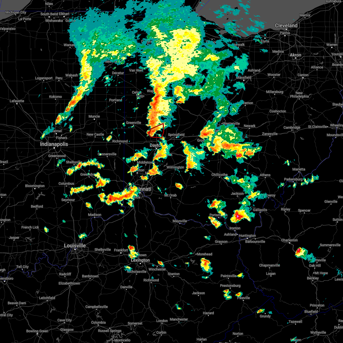 At 603 pm edt, a confirmed tornado was located near tipp city, moving east at 30 mph (radar confirmed tornado. radar shows tornado debris in the air. spotters have reported a tornado northeast of west milton). Hazards include damaging tornado. Flying debris will be dangerous to those caught without shelter. mobile homes will be damaged or destroyed. damage to roofs, windows, and vehicles will occur. tree damage is likely. locations impacted include, troy, tipp city, west milton, union, casstown, ginghamsburg, haven view and grayson. This includes i-75 in ohio between mile markers 66 and 76. At 603 pm edt, a confirmed tornado was located near tipp city, moving east at 30 mph (radar confirmed tornado. radar shows tornado debris in the air. spotters have reported a tornado northeast of west milton). Hazards include damaging tornado. Flying debris will be dangerous to those caught without shelter. mobile homes will be damaged or destroyed. damage to roofs, windows, and vehicles will occur. tree damage is likely. locations impacted include, troy, tipp city, west milton, union, casstown, ginghamsburg, haven view and grayson. This includes i-75 in ohio between mile markers 66 and 76.
|
| 6/8/2022 5:55 PM EDT |
 At 554 pm edt, a severe thunderstorm capable of producing a tornado was located over west milton, moving east at 30 mph (radar indicated rotation). Hazards include tornado. Flying debris will be dangerous to those caught without shelter. mobile homes will be damaged or destroyed. damage to roofs, windows, and vehicles will occur. tree damage is likely. locations impacted include, troy, tipp city, west milton, pleasant hill, union, casstown, ludlow falls, ginghamsburg, haven view, garland and grayson. This includes i-75 in ohio between mile markers 66 and 77. At 554 pm edt, a severe thunderstorm capable of producing a tornado was located over west milton, moving east at 30 mph (radar indicated rotation). Hazards include tornado. Flying debris will be dangerous to those caught without shelter. mobile homes will be damaged or destroyed. damage to roofs, windows, and vehicles will occur. tree damage is likely. locations impacted include, troy, tipp city, west milton, pleasant hill, union, casstown, ludlow falls, ginghamsburg, haven view, garland and grayson. This includes i-75 in ohio between mile markers 66 and 77.
|
| 6/8/2022 5:50 PM EDT |
 At 550 pm edt, a severe thunderstorm was located over piqua, moving east at 35 mph (radar indicated). Hazards include 60 mph wind gusts and penny size hail. Expect damage to trees and power lines. locations impacted include, troy, sidney, piqua, tipp city, west milton, covington, bradford, pleasant hill, hardin, russia, laura, fletcher, casstown, ludlow falls, lockington, polo, newbern, bloomer, circle hill and farrington. This includes i-75 in ohio between mile markers 69 and 93. At 550 pm edt, a severe thunderstorm was located over piqua, moving east at 35 mph (radar indicated). Hazards include 60 mph wind gusts and penny size hail. Expect damage to trees and power lines. locations impacted include, troy, sidney, piqua, tipp city, west milton, covington, bradford, pleasant hill, hardin, russia, laura, fletcher, casstown, ludlow falls, lockington, polo, newbern, bloomer, circle hill and farrington. This includes i-75 in ohio between mile markers 69 and 93.
|
| 6/8/2022 5:47 PM EDT |
 At 546 pm edt, a severe thunderstorm capable of producing a tornado was located near west milton, moving east at 30 mph (radar indicated rotation). Hazards include tornado. Flying debris will be dangerous to those caught without shelter. mobile homes will be damaged or destroyed. damage to roofs, windows, and vehicles will occur. Tree damage is likely. At 546 pm edt, a severe thunderstorm capable of producing a tornado was located near west milton, moving east at 30 mph (radar indicated rotation). Hazards include tornado. Flying debris will be dangerous to those caught without shelter. mobile homes will be damaged or destroyed. damage to roofs, windows, and vehicles will occur. Tree damage is likely.
|
| 6/8/2022 5:33 PM EDT |
 At 532 pm edt, a severe thunderstorm was located near bradford, moving east at 35 mph (radar indicated). Hazards include 60 mph wind gusts and penny size hail. Expect damage to trees and power lines. locations impacted include, troy, sidney, piqua, greenville, tipp city, west milton, versailles, covington, arcanum, bradford, pleasant hill, hardin, webster, russia, gettysburg, laura, fletcher, pitsburg, casstown and ludlow falls. this includes i-75 in ohio between mile markers 69 and 93. hail threat, radar indicated max hail size, 0. 75 in wind threat, radar indicated max wind gust, 60 mph. At 532 pm edt, a severe thunderstorm was located near bradford, moving east at 35 mph (radar indicated). Hazards include 60 mph wind gusts and penny size hail. Expect damage to trees and power lines. locations impacted include, troy, sidney, piqua, greenville, tipp city, west milton, versailles, covington, arcanum, bradford, pleasant hill, hardin, webster, russia, gettysburg, laura, fletcher, pitsburg, casstown and ludlow falls. this includes i-75 in ohio between mile markers 69 and 93. hail threat, radar indicated max hail size, 0. 75 in wind threat, radar indicated max wind gust, 60 mph.
|
| 6/8/2022 5:19 PM EDT |
 At 519 pm edt, a severe thunderstorm was located over greenville, moving east at 35 mph (radar indicated). Hazards include 60 mph wind gusts and penny size hail. expect damage to trees and power lines At 519 pm edt, a severe thunderstorm was located over greenville, moving east at 35 mph (radar indicated). Hazards include 60 mph wind gusts and penny size hail. expect damage to trees and power lines
|
| 6/6/2022 5:14 PM EDT |
 At 514 pm edt, a severe thunderstorm was located over englewood, moving northeast at 50 mph (radar indicated). Hazards include 60 mph wind gusts. expect damage to trees and power lines At 514 pm edt, a severe thunderstorm was located over englewood, moving northeast at 50 mph (radar indicated). Hazards include 60 mph wind gusts. expect damage to trees and power lines
|
| 6/1/2022 7:25 PM EDT |
 The severe thunderstorm warning for southwestern champaign, northwestern clark, northeastern montgomery and southeastern miami counties will expire at 730 pm edt, the storm which prompted the warning has weakened below severe limits, and no longer poses an immediate threat to life or property. therefore, the warning will be allowed to expire. however gusty winds and heavy rain are still possible with this thunderstorm. please report previous wind damage or hail to the national weather service by going to our website at weather.gov/iln and submitting your report via social media. The severe thunderstorm warning for southwestern champaign, northwestern clark, northeastern montgomery and southeastern miami counties will expire at 730 pm edt, the storm which prompted the warning has weakened below severe limits, and no longer poses an immediate threat to life or property. therefore, the warning will be allowed to expire. however gusty winds and heavy rain are still possible with this thunderstorm. please report previous wind damage or hail to the national weather service by going to our website at weather.gov/iln and submitting your report via social media.
|
| 6/1/2022 7:14 PM EDT |
 At 713 pm edt, a severe thunderstorm was located over new carlisle, moving northeast at 40 mph (radar indicated). Hazards include 60 mph wind gusts and nickel size hail. Expect damage to trees and power lines. locations impacted include, dayton, springfield, huber heights, troy, vandalia, urbana, tipp city, new carlisle, northridge, brown, riverside, christiansburg, north hampton, tremont city, donnelsville, casstown, ginghamsburg, thackery, phoneton and terre haute. this includes the following interstates, i-70 in ohio between mile markers 35 and 42, and between mile markers 47 and 49. i-75 in ohio between mile markers 63 and 71. hail threat, radar indicated max hail size, 0. 88 in wind threat, radar indicated max wind gust, 60 mph. At 713 pm edt, a severe thunderstorm was located over new carlisle, moving northeast at 40 mph (radar indicated). Hazards include 60 mph wind gusts and nickel size hail. Expect damage to trees and power lines. locations impacted include, dayton, springfield, huber heights, troy, vandalia, urbana, tipp city, new carlisle, northridge, brown, riverside, christiansburg, north hampton, tremont city, donnelsville, casstown, ginghamsburg, thackery, phoneton and terre haute. this includes the following interstates, i-70 in ohio between mile markers 35 and 42, and between mile markers 47 and 49. i-75 in ohio between mile markers 63 and 71. hail threat, radar indicated max hail size, 0. 88 in wind threat, radar indicated max wind gust, 60 mph.
|
| 6/1/2022 7:05 PM EDT |
 At 705 pm edt, a severe thunderstorm was located near tipp city, moving northeast at 50 mph (radar indicated). Hazards include 60 mph wind gusts and nickel size hail. expect damage to trees and power lines At 705 pm edt, a severe thunderstorm was located near tipp city, moving northeast at 50 mph (radar indicated). Hazards include 60 mph wind gusts and nickel size hail. expect damage to trees and power lines
|
| 6/1/2022 6:08 PM EDT |
 At 607 pm edt, a severe thunderstorm was located over tipp city, moving east at 25 mph (radar indicated). Hazards include 60 mph wind gusts and penny size hail. expect damage to trees and power lines At 607 pm edt, a severe thunderstorm was located over tipp city, moving east at 25 mph (radar indicated). Hazards include 60 mph wind gusts and penny size hail. expect damage to trees and power lines
|
| 5/21/2022 5:16 PM EDT |
 At 516 pm edt, a severe thunderstorm was located over englewood, moving northeast at 25 mph (radar indicated). Hazards include 60 mph wind gusts and quarter size hail. Minor hail damage to vehicles is possible. expect wind damage to trees and power lines. locations impacted include, dayton, kettering, huber heights, trotwood, vandalia, englewood, tipp city, eaton, moraine, west milton, oakwood, wright-patterson afb, west carrollton, camden, lewisburg, west alexandria, gratis, riverside, clayton and union. this includes the following interstates, i-70 in ohio between mile markers 10 and 39. i-75 in ohio between mile markers 47 and 72. hail threat, radar indicated max hail size, 1. 00 in wind threat, radar indicated max wind gust, 60 mph. At 516 pm edt, a severe thunderstorm was located over englewood, moving northeast at 25 mph (radar indicated). Hazards include 60 mph wind gusts and quarter size hail. Minor hail damage to vehicles is possible. expect wind damage to trees and power lines. locations impacted include, dayton, kettering, huber heights, trotwood, vandalia, englewood, tipp city, eaton, moraine, west milton, oakwood, wright-patterson afb, west carrollton, camden, lewisburg, west alexandria, gratis, riverside, clayton and union. this includes the following interstates, i-70 in ohio between mile markers 10 and 39. i-75 in ohio between mile markers 47 and 72. hail threat, radar indicated max hail size, 1. 00 in wind threat, radar indicated max wind gust, 60 mph.
|
| 5/21/2022 4:58 PM EDT |
 At 458 pm edt, a severe thunderstorm was located near lewisburg, moving east at 30 mph (radar indicated). Hazards include 60 mph wind gusts and quarter size hail. Minor hail damage to vehicles is possible. expect wind damage to trees and power lines. locations impacted include, dayton, kettering, huber heights, trotwood, vandalia, englewood, tipp city, eaton, moraine, west milton, oakwood, wright-patterson afb, west carrollton, camden, lewisburg, west alexandria, gratis, riverside, clayton and union. this includes the following interstates, i-70 in ohio between mile markers 10 and 39. i-75 in ohio between mile markers 47 and 72. hail threat, radar indicated max hail size, 1. 00 in wind threat, radar indicated max wind gust, 60 mph. At 458 pm edt, a severe thunderstorm was located near lewisburg, moving east at 30 mph (radar indicated). Hazards include 60 mph wind gusts and quarter size hail. Minor hail damage to vehicles is possible. expect wind damage to trees and power lines. locations impacted include, dayton, kettering, huber heights, trotwood, vandalia, englewood, tipp city, eaton, moraine, west milton, oakwood, wright-patterson afb, west carrollton, camden, lewisburg, west alexandria, gratis, riverside, clayton and union. this includes the following interstates, i-70 in ohio between mile markers 10 and 39. i-75 in ohio between mile markers 47 and 72. hail threat, radar indicated max hail size, 1. 00 in wind threat, radar indicated max wind gust, 60 mph.
|
| 5/21/2022 4:55 PM EDT |
 The severe thunderstorm warning for southern shelby, southeastern darke and miami counties will expire at 500 pm edt, the storm which prompted the warning has moved out of the area. therefore, the warning will be allowed to expire. however gusty winds and heavy rain are still possible with this thunderstorm. a severe thunderstorm watch remains in effect until 700 pm edt for west central ohio. a severe thunderstorm watch also remains in effect until 1000 pm edt for west central ohio. please report previous wind damage or hail to the national weather service by going to our website at weather.gov/iln and submitting your report via social media. The severe thunderstorm warning for southern shelby, southeastern darke and miami counties will expire at 500 pm edt, the storm which prompted the warning has moved out of the area. therefore, the warning will be allowed to expire. however gusty winds and heavy rain are still possible with this thunderstorm. a severe thunderstorm watch remains in effect until 700 pm edt for west central ohio. a severe thunderstorm watch also remains in effect until 1000 pm edt for west central ohio. please report previous wind damage or hail to the national weather service by going to our website at weather.gov/iln and submitting your report via social media.
|
| 5/21/2022 4:42 PM EDT |
 At 442 pm edt, a severe thunderstorm was located near eaton, moving northeast at 25 mph (radar indicated). Hazards include 60 mph wind gusts and quarter size hail. Minor hail damage to vehicles is possible. Expect wind damage to trees and power lines. At 442 pm edt, a severe thunderstorm was located near eaton, moving northeast at 25 mph (radar indicated). Hazards include 60 mph wind gusts and quarter size hail. Minor hail damage to vehicles is possible. Expect wind damage to trees and power lines.
|
| 5/21/2022 4:12 PM EDT |
 At 412 pm edt, a severe thunderstorm was located near bradford, moving east at 40 mph (radar indicated). Hazards include 70 mph wind gusts and quarter size hail. Minor hail damage to vehicles is possible. expect considerable tree damage. Wind damage is also likely to mobile homes, roofs, and outbuildings. At 412 pm edt, a severe thunderstorm was located near bradford, moving east at 40 mph (radar indicated). Hazards include 70 mph wind gusts and quarter size hail. Minor hail damage to vehicles is possible. expect considerable tree damage. Wind damage is also likely to mobile homes, roofs, and outbuildings.
|
| 5/3/2022 3:08 PM EDT |
 At 308 pm edt, a severe thunderstorm was located near gratis, moving northeast at 40 mph (radar indicated). Hazards include 60 mph wind gusts and quarter size hail. Minor hail damage to vehicles is possible. Expect wind damage to trees and power lines. At 308 pm edt, a severe thunderstorm was located near gratis, moving northeast at 40 mph (radar indicated). Hazards include 60 mph wind gusts and quarter size hail. Minor hail damage to vehicles is possible. Expect wind damage to trees and power lines.
|
| 3/23/2022 3:43 PM EDT |
 At 343 pm edt, a severe thunderstorm capable of producing a tornado was located near troy, moving northeast at 35 mph (radar indicated rotation). Hazards include tornado. Flying debris will be dangerous to those caught without shelter. mobile homes will be damaged or destroyed. damage to roofs, windows, and vehicles will occur. tree damage is likely. locations impacted include, troy, piqua, fletcher, lockington, ballou and farrington. This includes i-75 in ohio between mile markers 76 and 87. At 343 pm edt, a severe thunderstorm capable of producing a tornado was located near troy, moving northeast at 35 mph (radar indicated rotation). Hazards include tornado. Flying debris will be dangerous to those caught without shelter. mobile homes will be damaged or destroyed. damage to roofs, windows, and vehicles will occur. tree damage is likely. locations impacted include, troy, piqua, fletcher, lockington, ballou and farrington. This includes i-75 in ohio between mile markers 76 and 87.
|
| 3/23/2022 3:39 PM EDT |
 At 339 pm edt, a severe thunderstorm capable of producing a tornado was located near pleasant hill, moving northeast at 35 mph (radar indicated rotation). Hazards include tornado. Flying debris will be dangerous to those caught without shelter. mobile homes will be damaged or destroyed. damage to roofs, windows, and vehicles will occur. Tree damage is likely. At 339 pm edt, a severe thunderstorm capable of producing a tornado was located near pleasant hill, moving northeast at 35 mph (radar indicated rotation). Hazards include tornado. Flying debris will be dangerous to those caught without shelter. mobile homes will be damaged or destroyed. damage to roofs, windows, and vehicles will occur. Tree damage is likely.
|
| 3/23/2022 3:17 PM EDT |
 At 317 pm edt, a severe thunderstorm capable of producing a tornado was located near englewood, moving northeast at 40 mph (radar indicated rotation). Hazards include tornado. Flying debris will be dangerous to those caught without shelter. mobile homes will be damaged or destroyed. damage to roofs, windows, and vehicles will occur. Tree damage is likely. At 317 pm edt, a severe thunderstorm capable of producing a tornado was located near englewood, moving northeast at 40 mph (radar indicated rotation). Hazards include tornado. Flying debris will be dangerous to those caught without shelter. mobile homes will be damaged or destroyed. damage to roofs, windows, and vehicles will occur. Tree damage is likely.
|
| 3/6/2022 4:39 AM EST |
 The severe thunderstorm warning for shelby, northeastern darke, central auglaize and northern miami counties will expire at 445 am est, the storms which prompted the warning have weakened below severe limits, and no longer pose an immediate threat to life or property. therefore, the warning will be allowed to expire. however gusty winds are still possible with these thunderstorms. a severe thunderstorm watch remains in effect until 700 am est for west central ohio. please report previous wind damage or hail to the national weather service by going to our website at weather.gov/iln and submitting your report via social media. The severe thunderstorm warning for shelby, northeastern darke, central auglaize and northern miami counties will expire at 445 am est, the storms which prompted the warning have weakened below severe limits, and no longer pose an immediate threat to life or property. therefore, the warning will be allowed to expire. however gusty winds are still possible with these thunderstorms. a severe thunderstorm watch remains in effect until 700 am est for west central ohio. please report previous wind damage or hail to the national weather service by going to our website at weather.gov/iln and submitting your report via social media.
|
| 3/6/2022 4:27 AM EST |
 At 426 am est, severe thunderstorms were located along a line extending from near lima to near arcanum, moving east at 55 mph (radar indicated. a recent wind gust of 56 mph was observed at versailles darke county airport). Hazards include 60 mph wind gusts. Expect damage to trees and power lines. locations impacted include, troy, sidney, piqua, greenville, wapakoneta, new bremen, minster, versailles, covington, newport, cridersville, bradford, anna, fort loramie, jackson center, pleasant hill, botkins, new knoxville, waynesfield and hardin. this includes i-75 in ohio between mile markers 76 and 118. hail threat, radar indicated max hail size, <. 75 in wind threat, radar indicated max wind gust, 60 mph. At 426 am est, severe thunderstorms were located along a line extending from near lima to near arcanum, moving east at 55 mph (radar indicated. a recent wind gust of 56 mph was observed at versailles darke county airport). Hazards include 60 mph wind gusts. Expect damage to trees and power lines. locations impacted include, troy, sidney, piqua, greenville, wapakoneta, new bremen, minster, versailles, covington, newport, cridersville, bradford, anna, fort loramie, jackson center, pleasant hill, botkins, new knoxville, waynesfield and hardin. this includes i-75 in ohio between mile markers 76 and 118. hail threat, radar indicated max hail size, <. 75 in wind threat, radar indicated max wind gust, 60 mph.
|
| 3/6/2022 4:09 AM EST |
 At 409 am est, severe thunderstorms were located along a line extending from near elida to 7 miles west of greenville, moving east at 55 mph (radar indicated). Hazards include 60 mph wind gusts. Expect damage to trees and power lines. locations impacted include, troy, sidney, piqua, greenville, celina, wapakoneta, st. marys, coldwater, new bremen, minster, versailles, covington, st. henry, newport, cridersville, bradford, union city, anna, fort loramie and jackson center. this includes i-75 in ohio between mile markers 76 and 117. hail threat, radar indicated max hail size, <. 75 in wind threat, radar indicated max wind gust, 60 mph. At 409 am est, severe thunderstorms were located along a line extending from near elida to 7 miles west of greenville, moving east at 55 mph (radar indicated). Hazards include 60 mph wind gusts. Expect damage to trees and power lines. locations impacted include, troy, sidney, piqua, greenville, celina, wapakoneta, st. marys, coldwater, new bremen, minster, versailles, covington, st. henry, newport, cridersville, bradford, union city, anna, fort loramie and jackson center. this includes i-75 in ohio between mile markers 76 and 117. hail threat, radar indicated max hail size, <. 75 in wind threat, radar indicated max wind gust, 60 mph.
|
| 3/6/2022 4:02 AM EST |
 At 402 am est, severe thunderstorms were located along a line extending from near spencerville to 8 miles south of union city, moving east at 55 mph (radar indicated). Hazards include 60 mph wind gusts. Expect damage to trees and power lines. locations impacted include, troy, sidney, piqua, greenville, celina, wapakoneta, st. marys, coldwater, new bremen, minster, versailles, covington, st. henry, newport, cridersville, bradford, union city, anna, fort loramie and jackson center. this includes i-75 in ohio between mile markers 76 and 117. hail threat, radar indicated max hail size, <. 75 in wind threat, radar indicated max wind gust, 60 mph. At 402 am est, severe thunderstorms were located along a line extending from near spencerville to 8 miles south of union city, moving east at 55 mph (radar indicated). Hazards include 60 mph wind gusts. Expect damage to trees and power lines. locations impacted include, troy, sidney, piqua, greenville, celina, wapakoneta, st. marys, coldwater, new bremen, minster, versailles, covington, st. henry, newport, cridersville, bradford, union city, anna, fort loramie and jackson center. this includes i-75 in ohio between mile markers 76 and 117. hail threat, radar indicated max hail size, <. 75 in wind threat, radar indicated max wind gust, 60 mph.
|
| 3/6/2022 3:38 AM EST |
 At 338 am est, severe thunderstorms were located along a line extending from near decatur to near albany, moving east at 55 mph (radar indicated). Hazards include 70 mph wind gusts. Expect considerable tree damage. damage is likely to mobile homes, roofs, and outbuildings. locations impacted include, troy, sidney, piqua, greenville, celina, wapakoneta, st. marys, coldwater, new bremen, minster, versailles, covington, st. henry, newport, cridersville, bradford, union city, anna, fort loramie and jackson center. this includes i-75 in ohio between mile markers 76 and 117. thunderstorm damage threat, considerable hail threat, radar indicated max hail size, <. 75 in wind threat, radar indicated max wind gust, 70 mph. At 338 am est, severe thunderstorms were located along a line extending from near decatur to near albany, moving east at 55 mph (radar indicated). Hazards include 70 mph wind gusts. Expect considerable tree damage. damage is likely to mobile homes, roofs, and outbuildings. locations impacted include, troy, sidney, piqua, greenville, celina, wapakoneta, st. marys, coldwater, new bremen, minster, versailles, covington, st. henry, newport, cridersville, bradford, union city, anna, fort loramie and jackson center. this includes i-75 in ohio between mile markers 76 and 117. thunderstorm damage threat, considerable hail threat, radar indicated max hail size, <. 75 in wind threat, radar indicated max wind gust, 70 mph.
|
| 3/6/2022 3:25 AM EST |
 At 325 am est, severe thunderstorms were located along a line extending from 6 miles west of decatur to near muncie, moving east at 55 mph (radar indicated). Hazards include 60 mph wind gusts. expect damage to trees and power lines At 325 am est, severe thunderstorms were located along a line extending from 6 miles west of decatur to near muncie, moving east at 55 mph (radar indicated). Hazards include 60 mph wind gusts. expect damage to trees and power lines
|
| 8/27/2021 8:24 PM EDT |
 The severe thunderstorm warning for eastern miami county will expire at 830 pm edt, the storm which prompted the warning has weakened below severe limits, and no longer poses an immediate threat to life or property. therefore, the warning will be allowed to expire. however gusty winds and heavy rain are still possible with this thunderstorm. please report previous wind damage or hail to the national weather service by going to our website at weather.gov/iln and submitting your report via social media. The severe thunderstorm warning for eastern miami county will expire at 830 pm edt, the storm which prompted the warning has weakened below severe limits, and no longer poses an immediate threat to life or property. therefore, the warning will be allowed to expire. however gusty winds and heavy rain are still possible with this thunderstorm. please report previous wind damage or hail to the national weather service by going to our website at weather.gov/iln and submitting your report via social media.
|
| 8/27/2021 8:04 PM EDT |
 At 804 pm edt, a severe thunderstorm was located near troy, moving north at 15 mph (radar indicated). Hazards include 60 mph wind gusts. Expect damage to trees and power lines. locations impacted include, troy, piqua, tipp city, brown, fletcher, casstown, farrington, haven view, grayson and ginghamsburg. this includes i-75 in ohio between mile markers 66 and 85. hail threat, radar indicated max hail size, <. 75 in wind threat, radar indicated max wind gust, 60 mph. At 804 pm edt, a severe thunderstorm was located near troy, moving north at 15 mph (radar indicated). Hazards include 60 mph wind gusts. Expect damage to trees and power lines. locations impacted include, troy, piqua, tipp city, brown, fletcher, casstown, farrington, haven view, grayson and ginghamsburg. this includes i-75 in ohio between mile markers 66 and 85. hail threat, radar indicated max hail size, <. 75 in wind threat, radar indicated max wind gust, 60 mph.
|
| 8/27/2021 7:52 PM EDT |
 At 752 pm edt, a severe thunderstorm was located near troy, moving north at 25 mph (radar indicated). Hazards include 60 mph wind gusts. expect damage to trees and power lines At 752 pm edt, a severe thunderstorm was located near troy, moving north at 25 mph (radar indicated). Hazards include 60 mph wind gusts. expect damage to trees and power lines
|
| 8/12/2021 7:45 PM EDT | Multiple large trees dow in miami county OH, 3.4 miles ENE of Troy, OH |
| 6/18/2021 5:36 PM EDT |
 At 535 pm edt, a severe thunderstorm capable of producing a tornado was located over piqua, moving southeast at 30 mph (radar indicated rotation). Hazards include tornado. Flying debris will be dangerous to those caught without shelter. mobile homes will be damaged or destroyed. damage to roofs, windows, and vehicles will occur. tree damage is likely. locations impacted include, troy, piqua, covington, pleasant hill, polo, farrington and bloomer. This includes i-75 in ohio between mile markers 75 and 81. At 535 pm edt, a severe thunderstorm capable of producing a tornado was located over piqua, moving southeast at 30 mph (radar indicated rotation). Hazards include tornado. Flying debris will be dangerous to those caught without shelter. mobile homes will be damaged or destroyed. damage to roofs, windows, and vehicles will occur. tree damage is likely. locations impacted include, troy, piqua, covington, pleasant hill, polo, farrington and bloomer. This includes i-75 in ohio between mile markers 75 and 81.
|
| 6/18/2021 5:22 PM EDT |
 At 522 pm edt, a severe thunderstorm capable of producing a tornado was located near covington, moving southeast at 30 mph (radar indicated rotation). Hazards include tornado. Flying debris will be dangerous to those caught without shelter. mobile homes will be damaged or destroyed. damage to roofs, windows, and vehicles will occur. tree damage is likely. locations impacted include, troy, piqua, covington, pleasant hill, russia, polo, farrington and bloomer. This includes i-75 in ohio between mile markers 75 and 81. At 522 pm edt, a severe thunderstorm capable of producing a tornado was located near covington, moving southeast at 30 mph (radar indicated rotation). Hazards include tornado. Flying debris will be dangerous to those caught without shelter. mobile homes will be damaged or destroyed. damage to roofs, windows, and vehicles will occur. tree damage is likely. locations impacted include, troy, piqua, covington, pleasant hill, russia, polo, farrington and bloomer. This includes i-75 in ohio between mile markers 75 and 81.
|
| 6/18/2021 5:09 PM EDT |
 At 509 pm edt, a severe thunderstorm capable of producing a tornado was located near versailles, moving southeast at 30 mph (radar indicated rotation). Hazards include tornado. Flying debris will be dangerous to those caught without shelter. mobile homes will be damaged or destroyed. damage to roofs, windows, and vehicles will occur. Tree damage is likely. At 509 pm edt, a severe thunderstorm capable of producing a tornado was located near versailles, moving southeast at 30 mph (radar indicated rotation). Hazards include tornado. Flying debris will be dangerous to those caught without shelter. mobile homes will be damaged or destroyed. damage to roofs, windows, and vehicles will occur. Tree damage is likely.
|
| 4/9/2021 4:15 PM EDT |
 At 415 pm edt, a severe thunderstorm was located near lewisburg, moving east at 55 mph (radar indicated). Hazards include 60 mph wind gusts. Expect damage to trees and power lines. locations impacted include, dayton, huber heights, troy, trotwood, vandalia, englewood, tipp city, new carlisle, west milton, arcanum, lewisburg, west alexandria, pleasant hill, brown, clayton, union, brookville, phillipsburg, verona and west manchester. this includes the following interstates, i-70 in ohio between mile markers 11 and 40. I-75 in ohio between mile markers 60 and 80. At 415 pm edt, a severe thunderstorm was located near lewisburg, moving east at 55 mph (radar indicated). Hazards include 60 mph wind gusts. Expect damage to trees and power lines. locations impacted include, dayton, huber heights, troy, trotwood, vandalia, englewood, tipp city, new carlisle, west milton, arcanum, lewisburg, west alexandria, pleasant hill, brown, clayton, union, brookville, phillipsburg, verona and west manchester. this includes the following interstates, i-70 in ohio between mile markers 11 and 40. I-75 in ohio between mile markers 60 and 80.
|
| 4/9/2021 4:07 PM EDT |
 At 407 pm edt, a severe thunderstorm was located over lewisburg, moving east at 55 mph (radar indicated). Hazards include 60 mph wind gusts. expect damage to trees and power lines At 407 pm edt, a severe thunderstorm was located over lewisburg, moving east at 55 mph (radar indicated). Hazards include 60 mph wind gusts. expect damage to trees and power lines
|
| 11/25/2020 8:21 PM EST |
 At 811 pm est, a severe thunderstorm was located near west milton, moving northeast at 45 mph (radar indicated). Hazards include 60 mph wind gusts. Expect damage to trees and power lines. locations impacted include, dayton, huber heights, troy, trotwood, piqua, vandalia, englewood, tipp city, west milton, pleasant hill, clayton, union, ludlow falls, ginghamsburg, phoneton, northview, farrington, brandt, dayton international airport and garland. this includes the following interstates, i-70 in ohio between mile markers 24 and 41. I-75 in ohio between mile markers 59 and 81. At 811 pm est, a severe thunderstorm was located near west milton, moving northeast at 45 mph (radar indicated). Hazards include 60 mph wind gusts. Expect damage to trees and power lines. locations impacted include, dayton, huber heights, troy, trotwood, piqua, vandalia, englewood, tipp city, west milton, pleasant hill, clayton, union, ludlow falls, ginghamsburg, phoneton, northview, farrington, brandt, dayton international airport and garland. this includes the following interstates, i-70 in ohio between mile markers 24 and 41. I-75 in ohio between mile markers 59 and 81.
|
| 11/25/2020 8:11 PM EST |
 At 811 pm est, a severe thunderstorm was located near west milton, moving northeast at 45 mph (radar indicated). Hazards include 60 mph wind gusts. Expect damage to trees and power lines. locations impacted include, dayton, huber heights, troy, trotwood, piqua, vandalia, englewood, tipp city, west milton, pleasant hill, clayton, union, ludlow falls, ginghamsburg, phoneton, northview, farrington, brandt, dayton international airport and garland. this includes the following interstates, i-70 in ohio between mile markers 24 and 41. I-75 in ohio between mile markers 59 and 81. At 811 pm est, a severe thunderstorm was located near west milton, moving northeast at 45 mph (radar indicated). Hazards include 60 mph wind gusts. Expect damage to trees and power lines. locations impacted include, dayton, huber heights, troy, trotwood, piqua, vandalia, englewood, tipp city, west milton, pleasant hill, clayton, union, ludlow falls, ginghamsburg, phoneton, northview, farrington, brandt, dayton international airport and garland. this includes the following interstates, i-70 in ohio between mile markers 24 and 41. I-75 in ohio between mile markers 59 and 81.
|
| 11/25/2020 7:58 PM EST |
 At 758 pm est, a severe thunderstorm was located near englewood, moving northeast at 45 mph (radar indicated). Hazards include 60 mph wind gusts. Expect damage to trees and power lines. locations impacted include, dayton, huber heights, troy, trotwood, piqua, vandalia, englewood, tipp city, west milton, pleasant hill, riverside, clayton, union, brookville, new lebanon, shiloh, phillipsburg, laura, pitsburg and potsdam. this includes the following interstates, i-70 in ohio between mile markers 18 and 41. I-75 in ohio between mile markers 57 and 81. At 758 pm est, a severe thunderstorm was located near englewood, moving northeast at 45 mph (radar indicated). Hazards include 60 mph wind gusts. Expect damage to trees and power lines. locations impacted include, dayton, huber heights, troy, trotwood, piqua, vandalia, englewood, tipp city, west milton, pleasant hill, riverside, clayton, union, brookville, new lebanon, shiloh, phillipsburg, laura, pitsburg and potsdam. this includes the following interstates, i-70 in ohio between mile markers 18 and 41. I-75 in ohio between mile markers 57 and 81.
|
| 11/25/2020 7:46 PM EST |
 At 745 pm est, a severe thunderstorm was located over west alexandria, moving northeast at 40 mph (radar indicated). Hazards include 60 mph wind gusts. expect damage to trees and power lines At 745 pm est, a severe thunderstorm was located over west alexandria, moving northeast at 40 mph (radar indicated). Hazards include 60 mph wind gusts. expect damage to trees and power lines
|
| 11/15/2020 11:02 AM EST |
 At 1102 am est, severe thunderstorms were located along a line extending from near de graff to near tipp city, moving east at 55 mph (radar indicated). Hazards include 60 mph wind gusts. Expect damage to trees and power lines. locations impacted include, dayton, huber heights, troy, piqua, vandalia, englewood, tipp city, new carlisle, west milton, st. paris, brown, clayton, union, christiansburg, north hampton, fletcher, donnelsville, casstown, ginghamsburg and thackery. This includes i-75 in ohio between mile markers 63 and 81. At 1102 am est, severe thunderstorms were located along a line extending from near de graff to near tipp city, moving east at 55 mph (radar indicated). Hazards include 60 mph wind gusts. Expect damage to trees and power lines. locations impacted include, dayton, huber heights, troy, piqua, vandalia, englewood, tipp city, new carlisle, west milton, st. paris, brown, clayton, union, christiansburg, north hampton, fletcher, donnelsville, casstown, ginghamsburg and thackery. This includes i-75 in ohio between mile markers 63 and 81.
|
| 11/15/2020 11:00 AM EST | Large tree limb downed on merrimount ave. time estiamted by rada in miami county OH, 2.4 miles N of Troy, OH |
| 11/15/2020 11:00 AM EST | Numerous trees downed throughout the county... calls started coming in at 11 am with convective line. time of event estimate in miami county OH, 0.9 miles WSW of Troy, OH |
| 11/15/2020 11:00 AM EST | Large tree limbs down in miami county OH, 3.6 miles NNW of Troy, OH |
| 11/15/2020 10:49 AM EST |
 At 1049 am est, severe thunderstorms were located along a line extending from near piqua to near west milton, moving northeast at 60 mph (radar indicated). Hazards include 60 mph wind gusts. expect damage to trees and power lines At 1049 am est, severe thunderstorms were located along a line extending from near piqua to near west milton, moving northeast at 60 mph (radar indicated). Hazards include 60 mph wind gusts. expect damage to trees and power lines
|
| 10/12/2020 8:12 PM EDT |
 At 812 pm edt, a severe thunderstorm was located over tipp city, moving east at 45 mph (radar indicated). Hazards include 60 mph wind gusts. expect damage to trees and power lines At 812 pm edt, a severe thunderstorm was located over tipp city, moving east at 45 mph (radar indicated). Hazards include 60 mph wind gusts. expect damage to trees and power lines
|
| 9/7/2020 11:40 PM EDT |
 At 1140 pm edt, a severe thunderstorm was located near sidney, moving east at 30 mph (radar indicated). Hazards include 60 mph wind gusts. Expect damage to trees and power lines. locations impacted include, troy, sidney, piqua, covington, bradford, pleasant hill, hardin, fletcher, port jefferson, casstown, lockington, polo, newbern, ballou, plattsville, farrington, swanders, pemberton and houston. This includes i-75 in ohio between mile markers 74 and 97. At 1140 pm edt, a severe thunderstorm was located near sidney, moving east at 30 mph (radar indicated). Hazards include 60 mph wind gusts. Expect damage to trees and power lines. locations impacted include, troy, sidney, piqua, covington, bradford, pleasant hill, hardin, fletcher, port jefferson, casstown, lockington, polo, newbern, ballou, plattsville, farrington, swanders, pemberton and houston. This includes i-75 in ohio between mile markers 74 and 97.
|
| 9/7/2020 11:31 PM EDT |
 At 1131 pm edt, a severe thunderstorm was located near newport, moving east at 45 mph (radar indicated). Hazards include 60 mph wind gusts and penny size hail. expect damage to trees and power lines At 1131 pm edt, a severe thunderstorm was located near newport, moving east at 45 mph (radar indicated). Hazards include 60 mph wind gusts and penny size hail. expect damage to trees and power lines
|
| 9/7/2020 6:10 PM EDT |
 The severe thunderstorm warning for miami county will expire at 615 pm edt, the storm which prompted the warning has moved out of the area. therefore, the warning will be allowed to expire. please report previous wind damage or hail to the national weather service by going to our website at weather.gov/iln and submitting your report via social media. The severe thunderstorm warning for miami county will expire at 615 pm edt, the storm which prompted the warning has moved out of the area. therefore, the warning will be allowed to expire. please report previous wind damage or hail to the national weather service by going to our website at weather.gov/iln and submitting your report via social media.
|
| 9/7/2020 5:54 PM EDT | Storm damage reported in miami county OH, 0.4 miles NE of Troy, OH |
| 9/7/2020 5:52 PM EDT |
 At 551 pm edt, a severe thunderstorm was located over troy, moving east at 30 mph (radar indicated). Hazards include 60 mph wind gusts and quarter size hail. Minor hail damage to vehicles is possible. expect wind damage to trees and power lines. locations impacted include, troy, piqua, tipp city, west milton, covington, pleasant hill, brown, laura, fletcher, potsdam, casstown, ludlow falls, haven view, circle hill, farrington and grayson. This includes i-75 in ohio between mile markers 67 and 84. At 551 pm edt, a severe thunderstorm was located over troy, moving east at 30 mph (radar indicated). Hazards include 60 mph wind gusts and quarter size hail. Minor hail damage to vehicles is possible. expect wind damage to trees and power lines. locations impacted include, troy, piqua, tipp city, west milton, covington, pleasant hill, brown, laura, fletcher, potsdam, casstown, ludlow falls, haven view, circle hill, farrington and grayson. This includes i-75 in ohio between mile markers 67 and 84.
|
| 9/7/2020 5:30 PM EDT |
 At 530 pm edt, a severe thunderstorm was located near bradford, moving east at 30 mph (radar indicated). Hazards include 60 mph wind gusts and quarter size hail. Minor hail damage to vehicles is possible. Expect wind damage to trees and power lines. At 530 pm edt, a severe thunderstorm was located near bradford, moving east at 30 mph (radar indicated). Hazards include 60 mph wind gusts and quarter size hail. Minor hail damage to vehicles is possible. Expect wind damage to trees and power lines.
|
| 7/19/2020 4:39 PM EDT |
 At 424 pm edt, a severe thunderstorm was located near de graff, moving east at 35 mph (radar indicated). Hazards include 60 mph wind gusts. Expect damage to trees and power lines. locations impacted include, troy, piqua, bellefontaine, st. paris, west liberty, russells point, de graff, lakeview, northwood, quincy, christiansburg, rushsylvania, fletcher, huntsville, port jefferson, casstown, valley hi, zanesfield, thackery and westville. This includes i-75 in ohio between mile markers 75 and 82. At 424 pm edt, a severe thunderstorm was located near de graff, moving east at 35 mph (radar indicated). Hazards include 60 mph wind gusts. Expect damage to trees and power lines. locations impacted include, troy, piqua, bellefontaine, st. paris, west liberty, russells point, de graff, lakeview, northwood, quincy, christiansburg, rushsylvania, fletcher, huntsville, port jefferson, casstown, valley hi, zanesfield, thackery and westville. This includes i-75 in ohio between mile markers 75 and 82.
|
| 7/19/2020 4:24 PM EDT |
 At 424 pm edt, a severe thunderstorm was located near de graff, moving east at 35 mph (radar indicated). Hazards include 60 mph wind gusts. Expect damage to trees and power lines. locations impacted include, troy, piqua, bellefontaine, st. paris, west liberty, russells point, de graff, lakeview, northwood, quincy, christiansburg, rushsylvania, fletcher, huntsville, port jefferson, casstown, valley hi, zanesfield, thackery and westville. This includes i-75 in ohio between mile markers 75 and 82. At 424 pm edt, a severe thunderstorm was located near de graff, moving east at 35 mph (radar indicated). Hazards include 60 mph wind gusts. Expect damage to trees and power lines. locations impacted include, troy, piqua, bellefontaine, st. paris, west liberty, russells point, de graff, lakeview, northwood, quincy, christiansburg, rushsylvania, fletcher, huntsville, port jefferson, casstown, valley hi, zanesfield, thackery and westville. This includes i-75 in ohio between mile markers 75 and 82.
|
| 7/19/2020 3:55 PM EDT |
 At 355 pm edt, a severe thunderstorm was located near sidney, moving east at 35 mph (radar indicated). Hazards include 60 mph wind gusts. expect damage to trees and power lines At 355 pm edt, a severe thunderstorm was located near sidney, moving east at 35 mph (radar indicated). Hazards include 60 mph wind gusts. expect damage to trees and power lines
|
| 7/7/2020 3:05 PM EDT |
 At 305 pm edt, a severe thunderstorm was located near troy, moving east at 10 mph (radar indicated). Hazards include 60 mph wind gusts. expect damage to trees and power lines At 305 pm edt, a severe thunderstorm was located near troy, moving east at 10 mph (radar indicated). Hazards include 60 mph wind gusts. expect damage to trees and power lines
|
| 6/10/2020 4:31 PM EDT |
 At 431 pm edt, a severe thunderstorm was located near troy, moving northeast at 60 mph (radar indicated). Hazards include 70 mph wind gusts. Expect considerable tree damage. damage is likely to mobile homes, roofs, and outbuildings. locations impacted include, troy, sidney, piqua, bellefontaine, tipp city, new carlisle, st. paris, west liberty, de graff, quincy, christiansburg, fletcher, port jefferson, casstown, valley hi, thackery, maplewood, kiser lake state park, millerstown and state route 41 at state route 235. This includes i-75 in ohio between mile markers 71 and 76. At 431 pm edt, a severe thunderstorm was located near troy, moving northeast at 60 mph (radar indicated). Hazards include 70 mph wind gusts. Expect considerable tree damage. damage is likely to mobile homes, roofs, and outbuildings. locations impacted include, troy, sidney, piqua, bellefontaine, tipp city, new carlisle, st. paris, west liberty, de graff, quincy, christiansburg, fletcher, port jefferson, casstown, valley hi, thackery, maplewood, kiser lake state park, millerstown and state route 41 at state route 235. This includes i-75 in ohio between mile markers 71 and 76.
|
| 6/10/2020 4:17 PM EDT |
 At 417 pm edt, a severe thunderstorm was located over west milton, moving northeast at 40 mph (radar indicated). Hazards include 60 mph wind gusts and nickel size hail. Expect damage to trees and power lines. locations impacted include, dayton, huber heights, trotwood, vandalia, englewood, tipp city, new carlisle, west milton, brown, clayton, union, brookville, phillipsburg, laura, potsdam, ludlow falls, ginghamsburg, phoneton, northview and brandt. this includes the following interstates, i-70 in ohio between mile markers 21 and 40. I-75 in ohio between mile markers 59 and 71. At 417 pm edt, a severe thunderstorm was located over west milton, moving northeast at 40 mph (radar indicated). Hazards include 60 mph wind gusts and nickel size hail. Expect damage to trees and power lines. locations impacted include, dayton, huber heights, trotwood, vandalia, englewood, tipp city, new carlisle, west milton, brown, clayton, union, brookville, phillipsburg, laura, potsdam, ludlow falls, ginghamsburg, phoneton, northview and brandt. this includes the following interstates, i-70 in ohio between mile markers 21 and 40. I-75 in ohio between mile markers 59 and 71.
|
| 6/10/2020 4:08 PM EDT |
 At 407 pm edt, a severe thunderstorm was located near trotwood, moving northeast at 40 mph (radar indicated). Hazards include 60 mph wind gusts and nickel size hail. Expect damage to trees and power lines. locations impacted include, dayton, huber heights, trotwood, vandalia, englewood, tipp city, new carlisle, west milton, brown, riverside, clayton, union, brookville, new lebanon, shiloh, phillipsburg, verona, laura, potsdam and ludlow falls. this includes the following interstates, i-70 in ohio between mile markers 18 and 40. I-75 in ohio between mile markers 57 and 71. At 407 pm edt, a severe thunderstorm was located near trotwood, moving northeast at 40 mph (radar indicated). Hazards include 60 mph wind gusts and nickel size hail. Expect damage to trees and power lines. locations impacted include, dayton, huber heights, trotwood, vandalia, englewood, tipp city, new carlisle, west milton, brown, riverside, clayton, union, brookville, new lebanon, shiloh, phillipsburg, verona, laura, potsdam and ludlow falls. this includes the following interstates, i-70 in ohio between mile markers 18 and 40. I-75 in ohio between mile markers 57 and 71.
|
| 6/10/2020 4:06 PM EDT |
 At 406 pm edt, a severe thunderstorm was located near tipp city, moving northeast at 40 mph (radar indicated). Hazards include 60 mph wind gusts. expect damage to trees and power lines At 406 pm edt, a severe thunderstorm was located near tipp city, moving northeast at 40 mph (radar indicated). Hazards include 60 mph wind gusts. expect damage to trees and power lines
|
| 6/10/2020 3:57 PM EDT |
 At 357 pm edt, a severe thunderstorm was located near west alexandria, moving northeast at 40 mph (radar indicated). Hazards include 60 mph wind gusts and nickel size hail. expect damage to trees and power lines At 357 pm edt, a severe thunderstorm was located near west alexandria, moving northeast at 40 mph (radar indicated). Hazards include 60 mph wind gusts and nickel size hail. expect damage to trees and power lines
|
| 6/9/2020 8:31 PM EDT |
 At 831 pm edt, a severe thunderstorm capable of producing a tornado was located over pleasant hill, moving northeast at 35 mph (radar indicated rotation). Hazards include tornado. Flying debris will be dangerous to those caught without shelter. mobile homes will be damaged or destroyed. damage to roofs, windows, and vehicles will occur. Tree damage is likely. At 831 pm edt, a severe thunderstorm capable of producing a tornado was located over pleasant hill, moving northeast at 35 mph (radar indicated rotation). Hazards include tornado. Flying debris will be dangerous to those caught without shelter. mobile homes will be damaged or destroyed. damage to roofs, windows, and vehicles will occur. Tree damage is likely.
|
| 6/9/2020 5:08 PM EDT |
 At 507 pm edt, a severe thunderstorm was located near enon, moving northeast at 35 mph (radar indicated). Hazards include 60 mph wind gusts. Expect damage to trees and power lines. locations impacted include, springfield, fairborn, troy, urbana, tipp city, new carlisle, yellow springs, wright-patterson afb, northridge, enon, st. paris, brown, harmony, christiansburg, north hampton, fletcher, tremont city, donnelsville, casstown and green meadows. this includes the following interstates, i-70 in ohio between mile markers 42 and 64. I-75 in ohio between mile markers 68 and 76. At 507 pm edt, a severe thunderstorm was located near enon, moving northeast at 35 mph (radar indicated). Hazards include 60 mph wind gusts. Expect damage to trees and power lines. locations impacted include, springfield, fairborn, troy, urbana, tipp city, new carlisle, yellow springs, wright-patterson afb, northridge, enon, st. paris, brown, harmony, christiansburg, north hampton, fletcher, tremont city, donnelsville, casstown and green meadows. this includes the following interstates, i-70 in ohio between mile markers 42 and 64. I-75 in ohio between mile markers 68 and 76.
|
| 6/9/2020 5:00 PM EDT | Tree down. time estimated from rada in miami county OH, 1.9 miles SSW of Troy, OH |
| 6/9/2020 5:00 PM EDT |
 At 500 pm edt, a severe thunderstorm was located over enon, moving northeast at 35 mph (radar indicated). Hazards include 60 mph wind gusts. expect damage to trees and power lines At 500 pm edt, a severe thunderstorm was located over enon, moving northeast at 35 mph (radar indicated). Hazards include 60 mph wind gusts. expect damage to trees and power lines
|
| 6/9/2020 4:44 PM EDT |
 At 443 pm edt, a severe thunderstorm was located over vandalia, moving northeast at 45 mph (radar indicated). Hazards include 60 mph wind gusts. expect damage to trees and power lines At 443 pm edt, a severe thunderstorm was located over vandalia, moving northeast at 45 mph (radar indicated). Hazards include 60 mph wind gusts. expect damage to trees and power lines
|
| 5/14/2020 4:55 PM EDT |
 The severe thunderstorm warning for southwestern champaign, northwestern clark and east central miami counties will expire at 500 pm edt, the storm which prompted the warning has weakened below severe limits, and no longer poses an immediate threat to life or property. therefore, the warning will be allowed to expire. please report previous wind damage or hail to the national weather service by going to our website at weather.gov/iln and submitting your report via social media. The severe thunderstorm warning for southwestern champaign, northwestern clark and east central miami counties will expire at 500 pm edt, the storm which prompted the warning has weakened below severe limits, and no longer poses an immediate threat to life or property. therefore, the warning will be allowed to expire. please report previous wind damage or hail to the national weather service by going to our website at weather.gov/iln and submitting your report via social media.
|
| 5/14/2020 4:49 PM EDT |
 At 448 pm edt, a cluster of severe thunderstorm was located near tipp city, moving east at 50 mph (radar indicated). Hazards include 60 mph wind gusts. Expect damage to trees and power lines. locations impacted include, troy, tipp city, new carlisle, st. paris, christiansburg, north hampton, casstown, thackery, haven view, terre haute, state route 41 at state route 235, lawrenceville, grayson and dialton. This includes i-75 in ohio between mile markers 68 and 76. At 448 pm edt, a cluster of severe thunderstorm was located near tipp city, moving east at 50 mph (radar indicated). Hazards include 60 mph wind gusts. Expect damage to trees and power lines. locations impacted include, troy, tipp city, new carlisle, st. paris, christiansburg, north hampton, casstown, thackery, haven view, terre haute, state route 41 at state route 235, lawrenceville, grayson and dialton. This includes i-75 in ohio between mile markers 68 and 76.
|
| 5/14/2020 4:35 PM EDT |
 At 435 pm edt, a severe thunderstorm was located over west milton, moving east at 50 mph (radar indicated). Hazards include 60 mph wind gusts. expect damage to trees and power lines At 435 pm edt, a severe thunderstorm was located over west milton, moving east at 50 mph (radar indicated). Hazards include 60 mph wind gusts. expect damage to trees and power lines
|
| 5/10/2020 3:44 PM EDT |
 At 344 pm edt, severe thunderstorms were located along a line extending from near de graff to wright-patterson afb, moving east at 45 mph (radar indicated). Hazards include 60 mph wind gusts. Expect damage to trees and power lines. locations impacted include, dayton, springfield, huber heights, fairborn, vandalia, bellefontaine, urbana, tipp city, new carlisle, yellow springs, wright-patterson afb, northridge, enon, st. paris, west liberty, south charleston, mechanicsburg, north lewisburg, de graff and brown. this includes the following interstates, i-70 in ohio between mile markers 33 and 70. I-75 in ohio between mile markers 56 and 69. At 344 pm edt, severe thunderstorms were located along a line extending from near de graff to wright-patterson afb, moving east at 45 mph (radar indicated). Hazards include 60 mph wind gusts. Expect damage to trees and power lines. locations impacted include, dayton, springfield, huber heights, fairborn, vandalia, bellefontaine, urbana, tipp city, new carlisle, yellow springs, wright-patterson afb, northridge, enon, st. paris, west liberty, south charleston, mechanicsburg, north lewisburg, de graff and brown. this includes the following interstates, i-70 in ohio between mile markers 33 and 70. I-75 in ohio between mile markers 56 and 69.
|
| 5/10/2020 3:37 PM EDT |
 The severe thunderstorm warning for southern shelby, east central darke, northern montgomery and miami counties will expire at 345 pm edt, an additional severe thunderstorm warning remains in effect for the eastern portions of shelby, miami, and montgomery counties. please report previous wind damage or hail to the national weather service by going to our website at weather.gov/iln and submitting your report via social media. The severe thunderstorm warning for southern shelby, east central darke, northern montgomery and miami counties will expire at 345 pm edt, an additional severe thunderstorm warning remains in effect for the eastern portions of shelby, miami, and montgomery counties. please report previous wind damage or hail to the national weather service by going to our website at weather.gov/iln and submitting your report via social media.
|
| 5/10/2020 3:30 PM EDT |
 At 330 pm edt, severe thunderstorms were located along a line extending from near sidney to near northridge, moving east at 55 mph (radar indicated). Hazards include 60 mph wind gusts. expect damage to trees and power lines At 330 pm edt, severe thunderstorms were located along a line extending from near sidney to near northridge, moving east at 55 mph (radar indicated). Hazards include 60 mph wind gusts. expect damage to trees and power lines
|
| 5/10/2020 3:26 PM EDT | Large tree down and several large branches down. photos sent to office. time estimated from rada in miami county OH, 0.9 miles WSW of Troy, OH |
| 5/10/2020 3:19 PM EDT |
 At 316 pm edt, severe thunderstorms were located along a line extending from near sidney to near west milton, moving east at 45 mph (radar indicated). Hazards include 60 mph wind gusts and penny size hail. Expect damage to trees and power lines. locations impacted include, dayton, huber heights, troy, trotwood, sidney, piqua, vandalia, englewood, tipp city, west milton, covington, bradford, pleasant hill, brown, hardin, riverside, clayton, union, brookville and shiloh. this includes the following interstates, i-70 in ohio between mile markers 21 and 40. I-75 in ohio between mile markers 57 and 95. At 316 pm edt, severe thunderstorms were located along a line extending from near sidney to near west milton, moving east at 45 mph (radar indicated). Hazards include 60 mph wind gusts and penny size hail. Expect damage to trees and power lines. locations impacted include, dayton, huber heights, troy, trotwood, sidney, piqua, vandalia, englewood, tipp city, west milton, covington, bradford, pleasant hill, brown, hardin, riverside, clayton, union, brookville and shiloh. this includes the following interstates, i-70 in ohio between mile markers 21 and 40. I-75 in ohio between mile markers 57 and 95.
|
| 5/10/2020 3:04 PM EDT |
 At 303 pm edt, severe thunderstorms were located along a line extending from near bradford to near lewisburg, moving east at 50 mph. these storms have produced damage in southern darke county (radar indicated). Hazards include 60 mph wind gusts and penny size hail. Expect damage to trees and power lines. locations impacted include, dayton, huber heights, troy, trotwood, sidney, piqua, vandalia, englewood, greenville, tipp city, west milton, versailles, covington, arcanum, newport, bradford, lewisburg, pleasant hill, brown and hardin. this includes the following interstates, i-70 in ohio between mile markers 10 and 40. I-75 in ohio between mile markers 56 and 95. At 303 pm edt, severe thunderstorms were located along a line extending from near bradford to near lewisburg, moving east at 50 mph. these storms have produced damage in southern darke county (radar indicated). Hazards include 60 mph wind gusts and penny size hail. Expect damage to trees and power lines. locations impacted include, dayton, huber heights, troy, trotwood, sidney, piqua, vandalia, englewood, greenville, tipp city, west milton, versailles, covington, arcanum, newport, bradford, lewisburg, pleasant hill, brown and hardin. this includes the following interstates, i-70 in ohio between mile markers 10 and 40. I-75 in ohio between mile markers 56 and 95.
|
| 5/10/2020 2:54 PM EDT |
 At 253 pm edt, severe thunderstorms were located along a line extending from near versailles to near new paris, moving east at 45 mph (radar indicated). Hazards include 60 mph wind gusts and penny size hail. expect damage to trees and power lines At 253 pm edt, severe thunderstorms were located along a line extending from near versailles to near new paris, moving east at 45 mph (radar indicated). Hazards include 60 mph wind gusts and penny size hail. expect damage to trees and power lines
|
| 4/8/2020 3:28 AM EDT |
 The severe thunderstorm warning for southwestern champaign, southeastern darke, clark, northern greene, northern montgomery and southern miami counties will expire at 330 am edt, this warning has been replaced by a new severe thunderstorm warning, which is in effect for portions of miami, montgomery, clark, and greene counties until 415 am. a severe thunderstorm watch remains in effect until 600 am edt for west central ohio. please report previous wind damage or hail to the national weather service by going to our website at weather.gov/iln and submitting your report via social media. The severe thunderstorm warning for southwestern champaign, southeastern darke, clark, northern greene, northern montgomery and southern miami counties will expire at 330 am edt, this warning has been replaced by a new severe thunderstorm warning, which is in effect for portions of miami, montgomery, clark, and greene counties until 415 am. a severe thunderstorm watch remains in effect until 600 am edt for west central ohio. please report previous wind damage or hail to the national weather service by going to our website at weather.gov/iln and submitting your report via social media.
|
| 4/8/2020 3:26 AM EDT |
 At 325 am edt, a severe thunderstorm was located near tipp city. another severe thunderstorm was located 5 miles southeast of springfield. these storms are moving east at 55 mph (radar indicated). Hazards include 60 mph wind gusts and quarter size hail. Minor hail damage to vehicles is possible. Expect wind damage to trees and power lines. At 325 am edt, a severe thunderstorm was located near tipp city. another severe thunderstorm was located 5 miles southeast of springfield. these storms are moving east at 55 mph (radar indicated). Hazards include 60 mph wind gusts and quarter size hail. Minor hail damage to vehicles is possible. Expect wind damage to trees and power lines.
|
| 4/8/2020 3:12 AM EDT |
 At 311 am edt, a severe thunderstorm was located over springfield. another severe thunderstorm was located over laura. these storms are moving east at 55 mph (radar indicated). Hazards include 60 mph wind gusts and half dollar size hail. Minor hail damage to vehicles is possible. expect wind damage to trees and power lines. locations impacted include, dayton, springfield, huber heights, fairborn, troy, vandalia, englewood, tipp city, new carlisle, west milton, yellow springs, wright-patterson afb, northridge, cedarville, enon, arcanum, south charleston, pleasant hill, brown and riverside. this includes the following interstates, i-70 in ohio between mile markers 25 and 69. I-75 in ohio between mile markers 59 and 75. At 311 am edt, a severe thunderstorm was located over springfield. another severe thunderstorm was located over laura. these storms are moving east at 55 mph (radar indicated). Hazards include 60 mph wind gusts and half dollar size hail. Minor hail damage to vehicles is possible. expect wind damage to trees and power lines. locations impacted include, dayton, springfield, huber heights, fairborn, troy, vandalia, englewood, tipp city, new carlisle, west milton, yellow springs, wright-patterson afb, northridge, cedarville, enon, arcanum, south charleston, pleasant hill, brown and riverside. this includes the following interstates, i-70 in ohio between mile markers 25 and 69. I-75 in ohio between mile markers 59 and 75.
|
| 4/8/2020 3:03 AM EDT |
 At 303 am edt, a severe thunderstorm was located over new carlisle. another severe thunderstorm was located 3 miles north of pitsburg. these storms are moving southeast at 30 mph (radar indicated). Hazards include 60 mph wind gusts and half dollar size hail. Minor hail damage to vehicles is possible. expect wind damage to trees and power lines. locations impacted include, dayton, springfield, huber heights, fairborn, troy, vandalia, englewood, greenville, tipp city, new carlisle, west milton, yellow springs, wright-patterson afb, northridge, cedarville, enon, arcanum, south charleston, pleasant hill and brown. this includes the following interstates, i-70 in ohio between mile markers 25 and 70. I-75 in ohio between mile markers 59 and 76. At 303 am edt, a severe thunderstorm was located over new carlisle. another severe thunderstorm was located 3 miles north of pitsburg. these storms are moving southeast at 30 mph (radar indicated). Hazards include 60 mph wind gusts and half dollar size hail. Minor hail damage to vehicles is possible. expect wind damage to trees and power lines. locations impacted include, dayton, springfield, huber heights, fairborn, troy, vandalia, englewood, greenville, tipp city, new carlisle, west milton, yellow springs, wright-patterson afb, northridge, cedarville, enon, arcanum, south charleston, pleasant hill and brown. this includes the following interstates, i-70 in ohio between mile markers 25 and 70. I-75 in ohio between mile markers 59 and 76.
|
| 4/8/2020 2:55 AM EDT |
 At 254 am edt, a severe thunderstorm was located near new carlisle. another severe thunderstorm was located 4 miles south of gettysburg. these storms are moving east at 45 mph (radar indicated). Hazards include 60 mph wind gusts and half dollar size hail. Minor hail damage to vehicles is possible. expect wind damage to trees and power lines. locations impacted include, dayton, springfield, huber heights, fairborn, troy, piqua, vandalia, englewood, greenville, urbana, tipp city, new carlisle, west milton, yellow springs, wright-patterson afb, northridge, cedarville, covington, enon and arcanum. this includes the following interstates, i-70 in ohio between mile markers 25 and 70. I-75 in ohio between mile markers 59 and 81. At 254 am edt, a severe thunderstorm was located near new carlisle. another severe thunderstorm was located 4 miles south of gettysburg. these storms are moving east at 45 mph (radar indicated). Hazards include 60 mph wind gusts and half dollar size hail. Minor hail damage to vehicles is possible. expect wind damage to trees and power lines. locations impacted include, dayton, springfield, huber heights, fairborn, troy, piqua, vandalia, englewood, greenville, urbana, tipp city, new carlisle, west milton, yellow springs, wright-patterson afb, northridge, cedarville, covington, enon and arcanum. this includes the following interstates, i-70 in ohio between mile markers 25 and 70. I-75 in ohio between mile markers 59 and 81.
|
| 4/8/2020 2:45 AM EDT |
 At 245 am edt, a severe thunderstorm was located near troy, moving east at 45 mph (radar indicated). Hazards include 60 mph wind gusts and quarter size hail. Minor hail damage to vehicles is possible. Expect wind damage to trees and power lines. At 245 am edt, a severe thunderstorm was located near troy, moving east at 45 mph (radar indicated). Hazards include 60 mph wind gusts and quarter size hail. Minor hail damage to vehicles is possible. Expect wind damage to trees and power lines.
|
| 4/8/2020 2:21 AM EDT |
 The severe thunderstorm warning for shelby, northern darke and northern miami counties will expire at 230 am edt, the storm which prompted the warning has weakened below severe limits, and no longer poses an immediate threat to life or property. therefore, the warning will be allowed to expire. these storms may still produce gusty winds and small hail. a severe thunderstorm watch remains in effect until 300 am edt for west central ohio. a severe thunderstorm watch also remains in effect until 600 am edt for west central ohio. please report previous wind damage or hail to the national weather service by going to our website at weather.gov/iln and submitting your report via social media. The severe thunderstorm warning for shelby, northern darke and northern miami counties will expire at 230 am edt, the storm which prompted the warning has weakened below severe limits, and no longer poses an immediate threat to life or property. therefore, the warning will be allowed to expire. these storms may still produce gusty winds and small hail. a severe thunderstorm watch remains in effect until 300 am edt for west central ohio. a severe thunderstorm watch also remains in effect until 600 am edt for west central ohio. please report previous wind damage or hail to the national weather service by going to our website at weather.gov/iln and submitting your report via social media.
|
| 4/8/2020 2:03 AM EDT |
 At 203 am edt, a severe thunderstorm was located over versailles, moving southeast at 40 mph (radar indicated). Hazards include 60 mph wind gusts and penny size hail. Expect damage to trees and power lines. locations impacted include, troy, sidney, piqua, greenville, versailles, covington, newport, bradford, union city, fort loramie, ansonia, hardin, webster, russia, gettysburg, fletcher, port jefferson, osgood, casstown and north star. This includes i-75 in ohio between mile markers 75 and 97. At 203 am edt, a severe thunderstorm was located over versailles, moving southeast at 40 mph (radar indicated). Hazards include 60 mph wind gusts and penny size hail. Expect damage to trees and power lines. locations impacted include, troy, sidney, piqua, greenville, versailles, covington, newport, bradford, union city, fort loramie, ansonia, hardin, webster, russia, gettysburg, fletcher, port jefferson, osgood, casstown and north star. This includes i-75 in ohio between mile markers 75 and 97.
|
| 4/8/2020 1:47 AM EDT |
 At 147 am edt, a severe thunderstorm was located 7 miles north of ansonia, moving east at 55 mph (radar indicated). Hazards include 60 mph wind gusts and penny size hail. expect damage to trees and power lines At 147 am edt, a severe thunderstorm was located 7 miles north of ansonia, moving east at 55 mph (radar indicated). Hazards include 60 mph wind gusts and penny size hail. expect damage to trees and power lines
|
| 3/28/2020 1:30 PM EDT |
 At 129 pm edt, a severe thunderstorm was located near englewood, moving east at 55 mph (radar indicated). Hazards include 60 mph wind gusts and half dollar size hail. Minor hail damage to vehicles is possible. expect wind damage to trees and power lines. locations impacted include, dayton, huber heights, troy, trotwood, vandalia, englewood, tipp city, west milton, riverside, clayton, union, brookville, new lebanon, shiloh, phillipsburg, ginghamsburg, fort mckinley, phoneton, northview and pyrmont. this includes the following interstates, i-70 in ohio between mile markers 18 and 38. I-75 in ohio between mile markers 54 and 72. At 129 pm edt, a severe thunderstorm was located near englewood, moving east at 55 mph (radar indicated). Hazards include 60 mph wind gusts and half dollar size hail. Minor hail damage to vehicles is possible. expect wind damage to trees and power lines. locations impacted include, dayton, huber heights, troy, trotwood, vandalia, englewood, tipp city, west milton, riverside, clayton, union, brookville, new lebanon, shiloh, phillipsburg, ginghamsburg, fort mckinley, phoneton, northview and pyrmont. this includes the following interstates, i-70 in ohio between mile markers 18 and 38. I-75 in ohio between mile markers 54 and 72.
|
| 3/28/2020 1:23 PM EDT |
 At 123 pm edt, a severe thunderstorm was located over lewisburg, moving east at 50 mph (radar indicated). Hazards include 60 mph wind gusts and half dollar size hail. Minor hail damage to vehicles is possible. expect wind damage to trees and power lines. locations impacted include, dayton, huber heights, troy, trotwood, vandalia, englewood, tipp city, eaton, west milton, wright-patterson afb, lewisburg, west alexandria, riverside, clayton, union, brookville, new lebanon, shiloh, phillipsburg and verona. this includes the following interstates, i-70 in ohio between mile markers 8 and 38. I-75 in ohio between mile markers 54 and 73. At 123 pm edt, a severe thunderstorm was located over lewisburg, moving east at 50 mph (radar indicated). Hazards include 60 mph wind gusts and half dollar size hail. Minor hail damage to vehicles is possible. expect wind damage to trees and power lines. locations impacted include, dayton, huber heights, troy, trotwood, vandalia, englewood, tipp city, eaton, west milton, wright-patterson afb, lewisburg, west alexandria, riverside, clayton, union, brookville, new lebanon, shiloh, phillipsburg and verona. this includes the following interstates, i-70 in ohio between mile markers 8 and 38. I-75 in ohio between mile markers 54 and 73.
|
| 3/28/2020 1:10 PM EDT |
 At 109 pm edt, a severe thunderstorm was located near new paris, moving east at 55 mph (radar indicated). Hazards include 60 mph wind gusts and half dollar size hail. Minor hail damage to vehicles is possible. Expect wind damage to trees and power lines. At 109 pm edt, a severe thunderstorm was located near new paris, moving east at 55 mph (radar indicated). Hazards include 60 mph wind gusts and half dollar size hail. Minor hail damage to vehicles is possible. Expect wind damage to trees and power lines.
|
| 1/11/2020 10:12 PM EST |
 At 1012 pm est, a severe thunderstorm capable of producing a tornado was located over troy, moving northeast at 55 mph (radar indicated rotation). Hazards include tornado. Flying debris will be dangerous to those caught without shelter. mobile homes will be damaged or destroyed. damage to roofs, windows, and vehicles will occur. Tree damage is likely. At 1012 pm est, a severe thunderstorm capable of producing a tornado was located over troy, moving northeast at 55 mph (radar indicated rotation). Hazards include tornado. Flying debris will be dangerous to those caught without shelter. mobile homes will be damaged or destroyed. damage to roofs, windows, and vehicles will occur. Tree damage is likely.
|
| 9/29/2019 4:24 PM EDT |
 At 424 pm edt, a severe thunderstorm was located near new carlisle, moving east at 30 mph (radar indicated). Hazards include 60 mph wind gusts. Expect damage to trees and power lines. Locations impacted include, springfield, urbana, christiansburg, north hampton, tremont city, casstown, thackery, westville, haven view, terre haute, state route 41 at state route 235, lawrenceville, grayson and dialton. At 424 pm edt, a severe thunderstorm was located near new carlisle, moving east at 30 mph (radar indicated). Hazards include 60 mph wind gusts. Expect damage to trees and power lines. Locations impacted include, springfield, urbana, christiansburg, north hampton, tremont city, casstown, thackery, westville, haven view, terre haute, state route 41 at state route 235, lawrenceville, grayson and dialton.
|
| 9/29/2019 4:11 PM EDT |
 At 410 pm edt, a severe thunderstorm was located over tipp city, moving east at 35 mph (radar indicated). Hazards include 60 mph wind gusts. expect damage to trees and power lines At 410 pm edt, a severe thunderstorm was located over tipp city, moving east at 35 mph (radar indicated). Hazards include 60 mph wind gusts. expect damage to trees and power lines
|
| 8/8/2019 10:57 PM EDT |
 At 1056 pm edt, a severe thunderstorm was located over troy, moving east at 45 mph (radar indicated). Hazards include 60 mph wind gusts and quarter size hail. Minor hail damage to vehicles is possible. expect wind damage to trees and power lines. locations impacted include, huber heights, troy, piqua, vandalia, tipp city, new carlisle, west milton, covington, enon, pleasant hill, brown, christiansburg, north hampton, laura, donnelsville, casstown, ludlow falls, green meadows, ginghamsburg and thackery. this includes the following interstates, i-70 in ohio between mile markers 43 and 48. I-75 in ohio between mile markers 66 and 80. At 1056 pm edt, a severe thunderstorm was located over troy, moving east at 45 mph (radar indicated). Hazards include 60 mph wind gusts and quarter size hail. Minor hail damage to vehicles is possible. expect wind damage to trees and power lines. locations impacted include, huber heights, troy, piqua, vandalia, tipp city, new carlisle, west milton, covington, enon, pleasant hill, brown, christiansburg, north hampton, laura, donnelsville, casstown, ludlow falls, green meadows, ginghamsburg and thackery. this includes the following interstates, i-70 in ohio between mile markers 43 and 48. I-75 in ohio between mile markers 66 and 80.
|
| 8/8/2019 10:50 PM EDT |
 At 1050 pm edt, a severe thunderstorm was located over pleasant hill, moving east at 45 mph (radar indicated). Hazards include 60 mph wind gusts and quarter size hail. Minor hail damage to vehicles is possible. Expect wind damage to trees and power lines. At 1050 pm edt, a severe thunderstorm was located over pleasant hill, moving east at 45 mph (radar indicated). Hazards include 60 mph wind gusts and quarter size hail. Minor hail damage to vehicles is possible. Expect wind damage to trees and power lines.
|
| 8/8/2019 8:27 PM EDT |
 At 827 pm edt, a severe thunderstorm was located near piqua, moving southeast at 30 mph (radar indicated). Hazards include 60 mph wind gusts and quarter size hail. Minor hail damage to vehicles is possible. Expect wind damage to trees and power lines. At 827 pm edt, a severe thunderstorm was located near piqua, moving southeast at 30 mph (radar indicated). Hazards include 60 mph wind gusts and quarter size hail. Minor hail damage to vehicles is possible. Expect wind damage to trees and power lines.
|
| 8/8/2019 8:14 PM EDT |
 At 814 pm edt, a severe thunderstorm was located over newport, moving southeast at 25 mph (radar indicated). Hazards include 60 mph wind gusts and quarter size hail. Minor hail damage to vehicles is possible. expect wind damage to trees and power lines. locations impacted include, piqua, newport, russia, lockington, polo, newbern, farrington and houston. This includes i-75 in ohio between mile markers 78 and 88. At 814 pm edt, a severe thunderstorm was located over newport, moving southeast at 25 mph (radar indicated). Hazards include 60 mph wind gusts and quarter size hail. Minor hail damage to vehicles is possible. expect wind damage to trees and power lines. locations impacted include, piqua, newport, russia, lockington, polo, newbern, farrington and houston. This includes i-75 in ohio between mile markers 78 and 88.
|
| 8/8/2019 7:50 PM EDT |
 At 749 pm edt, a severe thunderstorm was located near st. henry, moving southeast at 30 mph (radar indicated). Hazards include 60 mph wind gusts and quarter size hail. Minor hail damage to vehicles is possible. Expect wind damage to trees and power lines. At 749 pm edt, a severe thunderstorm was located near st. henry, moving southeast at 30 mph (radar indicated). Hazards include 60 mph wind gusts and quarter size hail. Minor hail damage to vehicles is possible. Expect wind damage to trees and power lines.
|
| 8/8/2019 5:49 PM EDT |
 At 549 pm edt, a severe thunderstorm was located over pleasant hill, moving east at 35 mph (radar indicated). Hazards include 60 mph wind gusts and penny size hail. expect damage to trees and power lines At 549 pm edt, a severe thunderstorm was located over pleasant hill, moving east at 35 mph (radar indicated). Hazards include 60 mph wind gusts and penny size hail. expect damage to trees and power lines
|
| 7/21/2019 6:08 PM EDT |
 At 608 pm edt, a severe thunderstorm was located near trotwood, moving northeast at 25 mph (radar indicated). Hazards include 60 mph wind gusts. expect damage to trees and power lines At 608 pm edt, a severe thunderstorm was located near trotwood, moving northeast at 25 mph (radar indicated). Hazards include 60 mph wind gusts. expect damage to trees and power lines
|
| 7/16/2019 5:29 PM EDT |
 At 528 pm edt, a severe thunderstorm was located near west milton, moving northeast at 35 mph (radar indicated). Hazards include 60 mph wind gusts. Expect damage to trees and power lines. locations impacted include, troy, west milton, arcanum, pleasant hill, laura, pitsburg, potsdam, gordon, ludlow falls, ithaca, castine and garland. This includes i-75 in ohio between mile markers 73 and 74. At 528 pm edt, a severe thunderstorm was located near west milton, moving northeast at 35 mph (radar indicated). Hazards include 60 mph wind gusts. Expect damage to trees and power lines. locations impacted include, troy, west milton, arcanum, pleasant hill, laura, pitsburg, potsdam, gordon, ludlow falls, ithaca, castine and garland. This includes i-75 in ohio between mile markers 73 and 74.
|
| 7/16/2019 5:11 PM EDT |
 At 511 pm edt, a severe thunderstorm was located over lewisburg, moving northeast at 35 mph (radar indicated). Hazards include 60 mph wind gusts. expect damage to trees and power lines At 511 pm edt, a severe thunderstorm was located over lewisburg, moving northeast at 35 mph (radar indicated). Hazards include 60 mph wind gusts. expect damage to trees and power lines
|
| 7/3/2019 1:54 PM EDT |
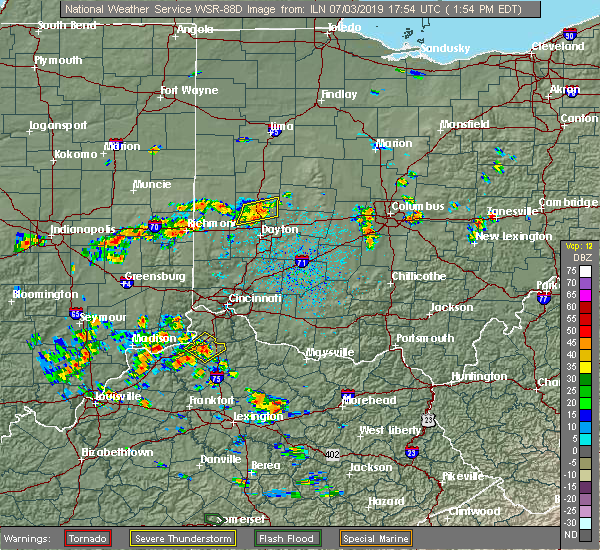 The severe thunderstorm warning for north central montgomery and central miami counties will expire at 200 pm edt, the storm which prompted the warning has weakened below severe limits, and no longer poses an immediate threat to life or property. therefore, the warning will be allowed to expire. however gusty winds and heavy rain are still possible with this thunderstorm. please report previous wind damage or hail to the national weather service by going to our website at weather.gov/iln and submitting your report via social media. The severe thunderstorm warning for north central montgomery and central miami counties will expire at 200 pm edt, the storm which prompted the warning has weakened below severe limits, and no longer poses an immediate threat to life or property. therefore, the warning will be allowed to expire. however gusty winds and heavy rain are still possible with this thunderstorm. please report previous wind damage or hail to the national weather service by going to our website at weather.gov/iln and submitting your report via social media.
|
| 7/3/2019 1:52 PM EDT |
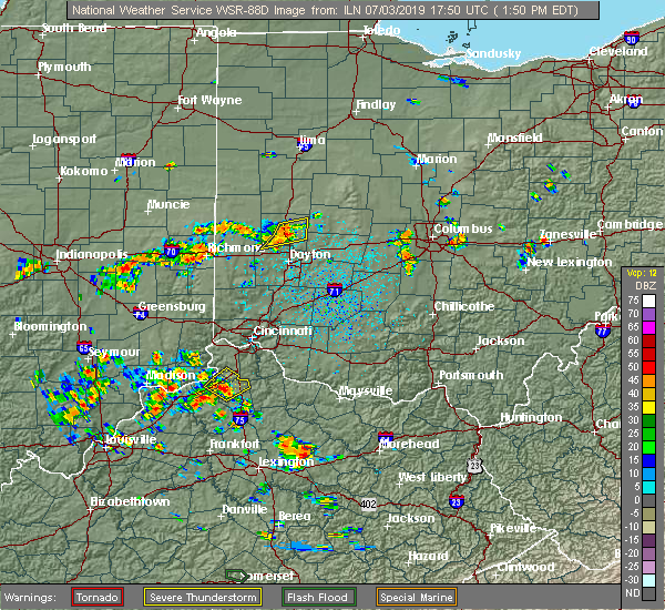 At 152 pm edt, a severe thunderstorm was located 7 miles east of troy, moving east at 20 mph (radar indicated). Hazards include 60 mph wind gusts and penny size hail. Expect damage to trees and power lines. locations impacted include, troy, tipp city, west milton, clayton, union, phillipsburg, casstown, farrington, haven view, garland and grayson. This includes i-75 in ohio between mile markers 67 and 78. At 152 pm edt, a severe thunderstorm was located 7 miles east of troy, moving east at 20 mph (radar indicated). Hazards include 60 mph wind gusts and penny size hail. Expect damage to trees and power lines. locations impacted include, troy, tipp city, west milton, clayton, union, phillipsburg, casstown, farrington, haven view, garland and grayson. This includes i-75 in ohio between mile markers 67 and 78.
|
| 7/3/2019 1:39 PM EDT |
 At 138 pm edt, a severe thunderstorm was located over troy, moving east at 20 mph (radar indicated). Hazards include 60 mph wind gusts and penny size hail. Expect damage to trees and power lines. locations impacted include, troy, tipp city, west milton, pleasant hill, clayton, union, phillipsburg, casstown, ludlow falls, haven view, farrington, garland and grayson. This includes i-75 in ohio between mile markers 67 and 78. At 138 pm edt, a severe thunderstorm was located over troy, moving east at 20 mph (radar indicated). Hazards include 60 mph wind gusts and penny size hail. Expect damage to trees and power lines. locations impacted include, troy, tipp city, west milton, pleasant hill, clayton, union, phillipsburg, casstown, ludlow falls, haven view, farrington, garland and grayson. This includes i-75 in ohio between mile markers 67 and 78.
|
| 7/3/2019 1:26 PM EDT |
 At 126 pm edt, a severe thunderstorm was located over troy, moving east at 20 mph (radar indicated). Hazards include 60 mph wind gusts and penny size hail. expect damage to trees and power lines At 126 pm edt, a severe thunderstorm was located over troy, moving east at 20 mph (radar indicated). Hazards include 60 mph wind gusts and penny size hail. expect damage to trees and power lines
|
| 6/15/2019 11:23 PM EDT |
 The national weather service in wilmington has issued a * severe thunderstorm warning for. southeastern shelby county in west central ohio. northwestern champaign county in west central ohio. southwestern logan county in west central ohio. Northeastern miami county in west central ohio. The national weather service in wilmington has issued a * severe thunderstorm warning for. southeastern shelby county in west central ohio. northwestern champaign county in west central ohio. southwestern logan county in west central ohio. Northeastern miami county in west central ohio.
|
| 5/27/2019 11:25 PM EDT |
 At 1125 pm edt, a severe thunderstorm capable of producing a tornado was located near englewood, moving southeast at 35 mph (radar indicated rotation). Hazards include tornado. Flying debris will be dangerous to those caught without shelter. mobile homes will be damaged or destroyed. damage to roofs, windows, and vehicles will occur. tree damage is likely. locations impacted include, dayton, troy, vandalia, englewood, tipp city, west milton, clayton, union, phillipsburg, laura, potsdam, ludlow falls, ginghamsburg, northview, dayton international airport and garland. this includes the following interstates, i-70 in ohio between mile markers 22 and 31. I-75 in ohio between mile markers 72 and 73. At 1125 pm edt, a severe thunderstorm capable of producing a tornado was located near englewood, moving southeast at 35 mph (radar indicated rotation). Hazards include tornado. Flying debris will be dangerous to those caught without shelter. mobile homes will be damaged or destroyed. damage to roofs, windows, and vehicles will occur. tree damage is likely. locations impacted include, dayton, troy, vandalia, englewood, tipp city, west milton, clayton, union, phillipsburg, laura, potsdam, ludlow falls, ginghamsburg, northview, dayton international airport and garland. this includes the following interstates, i-70 in ohio between mile markers 22 and 31. I-75 in ohio between mile markers 72 and 73.
|
| 5/27/2019 11:13 PM EDT |
 At 1113 pm edt, a severe thunderstorm capable of producing a tornado was located near arcanum, moving southeast at 45 mph (radar indicated rotation). Hazards include tornado. Flying debris will be dangerous to those caught without shelter. mobile homes will be damaged or destroyed. damage to roofs, windows, and vehicles will occur. Tree damage is likely. At 1113 pm edt, a severe thunderstorm capable of producing a tornado was located near arcanum, moving southeast at 45 mph (radar indicated rotation). Hazards include tornado. Flying debris will be dangerous to those caught without shelter. mobile homes will be damaged or destroyed. damage to roofs, windows, and vehicles will occur. Tree damage is likely.
|
| 5/27/2019 10:54 PM EDT |
 At 1054 pm edt, a severe thunderstorm capable of producing a tornado was located over tipp city, moving east at 35 mph (radar indicated rotation). Hazards include tornado and quarter size hail. Flying debris will be dangerous to those caught without shelter. mobile homes will be damaged or destroyed. damage to roofs, windows, and vehicles will occur. tree damage is likely. locations impacted include, springfield, huber heights, troy, vandalia, tipp city, new carlisle, enon, st. paris, brown, christiansburg, north hampton, tremont city, donnelsville, casstown, green meadows, ginghamsburg, thackery, phoneton, hustead and terre haute. this includes the following interstates, i-70 in ohio between mile markers 42 and 52. I-75 in ohio between mile markers 66 and 70. At 1054 pm edt, a severe thunderstorm capable of producing a tornado was located over tipp city, moving east at 35 mph (radar indicated rotation). Hazards include tornado and quarter size hail. Flying debris will be dangerous to those caught without shelter. mobile homes will be damaged or destroyed. damage to roofs, windows, and vehicles will occur. tree damage is likely. locations impacted include, springfield, huber heights, troy, vandalia, tipp city, new carlisle, enon, st. paris, brown, christiansburg, north hampton, tremont city, donnelsville, casstown, green meadows, ginghamsburg, thackery, phoneton, hustead and terre haute. this includes the following interstates, i-70 in ohio between mile markers 42 and 52. I-75 in ohio between mile markers 66 and 70.
|
| 5/27/2019 10:45 PM EDT |
 At 1045 pm edt, a tornado-producing storm was located near troy, moving east at 35 mph (radar confirmed tornado. radar shows tornado debris in the air). Hazards include damaging tornado and quarter size hail. Flying debris will be dangerous to those caught without shelter. mobile homes will be damaged or destroyed. damage to roofs, windows, and vehicles will occur. Tree damage is likely. At 1045 pm edt, a tornado-producing storm was located near troy, moving east at 35 mph (radar confirmed tornado. radar shows tornado debris in the air). Hazards include damaging tornado and quarter size hail. Flying debris will be dangerous to those caught without shelter. mobile homes will be damaged or destroyed. damage to roofs, windows, and vehicles will occur. Tree damage is likely.
|
| 5/27/2019 10:37 PM EDT |
 At 1037 pm edt, a confirmed tornado was located over ludlow falls, moving east at 35 mph (radar confirmed tornado. radar shows tornado debris in the air). Hazards include damaging tornado and golf ball size hail. Flying debris will be dangerous to those caught without shelter. mobile homes will be damaged or destroyed. damage to roofs, windows, and vehicles will occur. tree damage is likely. locations impacted include, troy, tipp city, west milton, pleasant hill, union, laura, potsdam, ludlow falls, ginghamsburg, garland, grayson and circle hill. This includes i-75 in ohio between mile markers 66 and 78. At 1037 pm edt, a confirmed tornado was located over ludlow falls, moving east at 35 mph (radar confirmed tornado. radar shows tornado debris in the air). Hazards include damaging tornado and golf ball size hail. Flying debris will be dangerous to those caught without shelter. mobile homes will be damaged or destroyed. damage to roofs, windows, and vehicles will occur. tree damage is likely. locations impacted include, troy, tipp city, west milton, pleasant hill, union, laura, potsdam, ludlow falls, ginghamsburg, garland, grayson and circle hill. This includes i-75 in ohio between mile markers 66 and 78.
|
| 5/27/2019 10:31 PM EDT |
 At 1031 pm edt, a confirmed tornado was located near west milton, moving east at 35 mph (radar confirmed tornado. radar shows tornado debris in the air). Hazards include damaging tornado and golf ball size hail. Flying debris will be dangerous to those caught without shelter. mobile homes will be damaged or destroyed. damage to roofs, windows, and vehicles will occur. tree damage is likely. locations impacted include, troy, tipp city, west milton, pleasant hill, union, laura, pitsburg, potsdam, ludlow falls, ginghamsburg, garland and grayson. This includes i-75 in ohio between mile markers 66 and 78. At 1031 pm edt, a confirmed tornado was located near west milton, moving east at 35 mph (radar confirmed tornado. radar shows tornado debris in the air). Hazards include damaging tornado and golf ball size hail. Flying debris will be dangerous to those caught without shelter. mobile homes will be damaged or destroyed. damage to roofs, windows, and vehicles will occur. tree damage is likely. locations impacted include, troy, tipp city, west milton, pleasant hill, union, laura, pitsburg, potsdam, ludlow falls, ginghamsburg, garland and grayson. This includes i-75 in ohio between mile markers 66 and 78.
|
| 5/27/2019 10:21 PM EDT |
 At 1020 pm edt, a severe thunderstorm capable of producing a tornado was located over arcanum, moving east at 35 mph (radar indicated rotation). Hazards include tornado and quarter size hail. Flying debris will be dangerous to those caught without shelter. mobile homes will be damaged or destroyed. damage to roofs, windows, and vehicles will occur. Tree damage is likely. At 1020 pm edt, a severe thunderstorm capable of producing a tornado was located over arcanum, moving east at 35 mph (radar indicated rotation). Hazards include tornado and quarter size hail. Flying debris will be dangerous to those caught without shelter. mobile homes will be damaged or destroyed. damage to roofs, windows, and vehicles will occur. Tree damage is likely.
|
| 5/26/2019 6:37 AM EDT |
 At 637 am edt, severe thunderstorms were located along a line extending from near de graff to tipp city, moving east at 45 mph (radar indicated). Hazards include 60 mph wind gusts. Expect damage to trees and power lines. locations impacted include, troy, sidney, piqua, tipp city, brown, fletcher, casstown, lockington, haven view, ballou, plattsville, farrington and grayson. This includes i-75 in ohio between mile markers 68 and 92. At 637 am edt, severe thunderstorms were located along a line extending from near de graff to tipp city, moving east at 45 mph (radar indicated). Hazards include 60 mph wind gusts. Expect damage to trees and power lines. locations impacted include, troy, sidney, piqua, tipp city, brown, fletcher, casstown, lockington, haven view, ballou, plattsville, farrington and grayson. This includes i-75 in ohio between mile markers 68 and 92.
|
| 5/26/2019 6:11 AM EDT |
 At 611 am edt, severe thunderstorms were located along a line extending from near newport to near bradford, moving east at 50 mph (radar indicated). Hazards include 60 mph wind gusts. expect damage to trees and power lines At 611 am edt, severe thunderstorms were located along a line extending from near newport to near bradford, moving east at 50 mph (radar indicated). Hazards include 60 mph wind gusts. expect damage to trees and power lines
|
| 5/19/2019 9:35 PM EDT |
 The severe thunderstorm warning for northeastern montgomery and southern miami counties will expire at 945 pm edt, this warning was replaced with another severe thunderstorm warning for portions of eastern montgomery and miami counties until 1000 pm. please report previous wind damage or hail to the national weather service by going to our website at weather.gov/iln and submitting your report via social media. The severe thunderstorm warning for northeastern montgomery and southern miami counties will expire at 945 pm edt, this warning was replaced with another severe thunderstorm warning for portions of eastern montgomery and miami counties until 1000 pm. please report previous wind damage or hail to the national weather service by going to our website at weather.gov/iln and submitting your report via social media.
|
| 5/19/2019 9:23 PM EDT |
 At 923 pm edt, a severe thunderstorm was located over tipp city, moving northeast at 45 mph (radar indicated). Hazards include 60 mph wind gusts. Expect damage to trees and power lines. locations impacted include, dayton, kettering, beavercreek, huber heights, troy, trotwood, vandalia, englewood, tipp city, moraine, west milton, oakwood, wright-patterson afb, riverside, clayton, union, shiloh, ginghamsburg, fort mckinley and phoneton. this includes the following interstates, i-70 in ohio between mile markers 28 and 39. I-75 in ohio between mile markers 51 and 74. At 923 pm edt, a severe thunderstorm was located over tipp city, moving northeast at 45 mph (radar indicated). Hazards include 60 mph wind gusts. Expect damage to trees and power lines. locations impacted include, dayton, kettering, beavercreek, huber heights, troy, trotwood, vandalia, englewood, tipp city, moraine, west milton, oakwood, wright-patterson afb, riverside, clayton, union, shiloh, ginghamsburg, fort mckinley and phoneton. this includes the following interstates, i-70 in ohio between mile markers 28 and 39. I-75 in ohio between mile markers 51 and 74.
|
| 5/19/2019 9:21 PM EDT |
 At 920 pm edt, a severe thunderstorm was located over vandalia, moving northeast at 35 mph (radar indicated). Hazards include 60 mph wind gusts. expect damage to trees and power lines At 920 pm edt, a severe thunderstorm was located over vandalia, moving northeast at 35 mph (radar indicated). Hazards include 60 mph wind gusts. expect damage to trees and power lines
|
| 5/19/2019 9:03 PM EDT |
 At 903 pm edt, a severe thunderstorm was located near englewood, moving northeast at 40 mph (radar indicated). Hazards include 60 mph wind gusts. Expect damage to trees and power lines. locations impacted include, dayton, kettering, beavercreek, huber heights, troy, trotwood, vandalia, englewood, tipp city, moraine, west milton, oakwood, wright-patterson afb, riverside, clayton, union, brookville, new lebanon, shiloh and phillipsburg. this includes the following interstates, i-70 in ohio between mile markers 18 and 39. I-75 in ohio between mile markers 50 and 74. At 903 pm edt, a severe thunderstorm was located near englewood, moving northeast at 40 mph (radar indicated). Hazards include 60 mph wind gusts. Expect damage to trees and power lines. locations impacted include, dayton, kettering, beavercreek, huber heights, troy, trotwood, vandalia, englewood, tipp city, moraine, west milton, oakwood, wright-patterson afb, riverside, clayton, union, brookville, new lebanon, shiloh and phillipsburg. this includes the following interstates, i-70 in ohio between mile markers 18 and 39. I-75 in ohio between mile markers 50 and 74.
|
| 5/19/2019 8:54 PM EDT |
 At 853 pm edt, a severe thunderstorm was located near lewisburg, moving east at 55 mph (radar indicated). Hazards include 60 mph wind gusts. expect damage to trees and power lines At 853 pm edt, a severe thunderstorm was located near lewisburg, moving east at 55 mph (radar indicated). Hazards include 60 mph wind gusts. expect damage to trees and power lines
|
| 4/12/2019 7:47 AM EDT |
 At 747 am edt, severe thunderstorms were located along a line extending from sidney to near tipp city, moving northeast at 70 mph (radar indicated). Hazards include 60 mph wind gusts. expect damage to trees and power lines At 747 am edt, severe thunderstorms were located along a line extending from sidney to near tipp city, moving northeast at 70 mph (radar indicated). Hazards include 60 mph wind gusts. expect damage to trees and power lines
|
| 6/9/2018 4:53 PM EDT |
 The severe thunderstorm warning for northeastern preble, southeastern darke, northwestern montgomery and miami counties will expire at 500 pm edt, the storm which prompted the warning has moved out of the area. therefore, the warning will be allowed to expire. a new severe thunderstorm warning is in effect for portions of miami, clark and champaign counties until 530 pm edt. please report previous wind damage or hail to the national weather service by going to our website at weather.gov/iln and submitting your report via social media. The severe thunderstorm warning for northeastern preble, southeastern darke, northwestern montgomery and miami counties will expire at 500 pm edt, the storm which prompted the warning has moved out of the area. therefore, the warning will be allowed to expire. a new severe thunderstorm warning is in effect for portions of miami, clark and champaign counties until 530 pm edt. please report previous wind damage or hail to the national weather service by going to our website at weather.gov/iln and submitting your report via social media.
|
| 6/9/2018 4:50 PM EDT |
 At 450 pm edt, a severe thunderstorm was located over troy, moving east at 30 mph (radar indicated). Hazards include 60 mph wind gusts and penny size hail. expect damage to trees and power lines At 450 pm edt, a severe thunderstorm was located over troy, moving east at 30 mph (radar indicated). Hazards include 60 mph wind gusts and penny size hail. expect damage to trees and power lines
|
| 6/9/2018 4:24 PM EDT |
 At 412 pm edt, a severe thunderstorm was located near arcanum, moving east at 30 mph (radar indicated). Hazards include 60 mph wind gusts. expect damage to trees and power lines At 412 pm edt, a severe thunderstorm was located near arcanum, moving east at 30 mph (radar indicated). Hazards include 60 mph wind gusts. expect damage to trees and power lines
|
| 6/9/2018 4:13 PM EDT |
 At 412 pm edt, a severe thunderstorm was located near arcanum, moving east at 30 mph (radar indicated). Hazards include 60 mph wind gusts. expect damage to trees and power lines At 412 pm edt, a severe thunderstorm was located near arcanum, moving east at 30 mph (radar indicated). Hazards include 60 mph wind gusts. expect damage to trees and power lines
|
| 5/31/2018 5:15 PM EDT |
 At 514 pm edt, a severe thunderstorm was located over tipp city, moving east at 30 mph (radar indicated). Hazards include 60 mph wind gusts. Expect damage to trees and power lines. locations impacted include, dayton, huber heights, troy, piqua, vandalia, englewood, tipp city, west milton, covington, pleasant hill, brown, clayton, union, fletcher, casstown, ludlow falls, ginghamsburg, polo, phoneton and dayton international airport. this includes the following interstates, i-70 in ohio between mile markers 25 and 39. I-75 in ohio between mile markers 61 and 85. At 514 pm edt, a severe thunderstorm was located over tipp city, moving east at 30 mph (radar indicated). Hazards include 60 mph wind gusts. Expect damage to trees and power lines. locations impacted include, dayton, huber heights, troy, piqua, vandalia, englewood, tipp city, west milton, covington, pleasant hill, brown, clayton, union, fletcher, casstown, ludlow falls, ginghamsburg, polo, phoneton and dayton international airport. this includes the following interstates, i-70 in ohio between mile markers 25 and 39. I-75 in ohio between mile markers 61 and 85.
|
| 5/31/2018 4:57 PM EDT |
 At 457 pm edt, a severe thunderstorm was located near west milton, moving east at 30 mph (radar indicated). Hazards include 60 mph wind gusts. expect damage to trees and power lines At 457 pm edt, a severe thunderstorm was located near west milton, moving east at 30 mph (radar indicated). Hazards include 60 mph wind gusts. expect damage to trees and power lines
|
| 5/30/2018 3:49 PM EDT |
 At 349 pm edt, a severe thunderstorm was located over northridge, moving north at 35 mph (radar indicated). Hazards include 60 mph wind gusts. Expect damage to trees and power lines. locations impacted include, dayton, beavercreek, huber heights, fairborn, troy, trotwood, vandalia, englewood, tipp city, new carlisle, wright-patterson afb, brown, riverside, clayton, union, shiloh, north hampton, donnelsville, ginghamsburg and fort mckinley. this includes the following interstates, i-70 in ohio between mile markers 29 and 45. I-75 in ohio between mile markers 54 and 72. At 349 pm edt, a severe thunderstorm was located over northridge, moving north at 35 mph (radar indicated). Hazards include 60 mph wind gusts. Expect damage to trees and power lines. locations impacted include, dayton, beavercreek, huber heights, fairborn, troy, trotwood, vandalia, englewood, tipp city, new carlisle, wright-patterson afb, brown, riverside, clayton, union, shiloh, north hampton, donnelsville, ginghamsburg and fort mckinley. this includes the following interstates, i-70 in ohio between mile markers 29 and 45. I-75 in ohio between mile markers 54 and 72.
|
| 5/30/2018 3:38 PM EDT |
 At 338 pm edt, a severe thunderstorm was located over kettering, moving north at 35 mph (radar indicated). Hazards include 60 mph wind gusts. expect damage to trees and power lines At 338 pm edt, a severe thunderstorm was located over kettering, moving north at 35 mph (radar indicated). Hazards include 60 mph wind gusts. expect damage to trees and power lines
|
| 5/15/2018 5:00 PM EDT |
 At 500 pm edt, a severe thunderstorm was located near new carlisle, moving east at 30 mph (radar indicated). Hazards include 60 mph wind gusts and quarter size hail. Minor hail damage to vehicles is possible. expect wind damage to trees and power lines. locations impacted include, troy, tipp city, new carlisle, brown, christiansburg, north hampton, donnelsville, casstown, ginghamsburg, thackery, haven view, state route 41 at state route 235, grayson, dialton and crystal lakes. This includes i-75 in ohio between mile markers 66 and 73. At 500 pm edt, a severe thunderstorm was located near new carlisle, moving east at 30 mph (radar indicated). Hazards include 60 mph wind gusts and quarter size hail. Minor hail damage to vehicles is possible. expect wind damage to trees and power lines. locations impacted include, troy, tipp city, new carlisle, brown, christiansburg, north hampton, donnelsville, casstown, ginghamsburg, thackery, haven view, state route 41 at state route 235, grayson, dialton and crystal lakes. This includes i-75 in ohio between mile markers 66 and 73.
|
| 5/15/2018 4:50 PM EDT |
 At 450 pm edt, a severe thunderstorm was located over tipp city, moving east at 30 mph (radar indicated). Hazards include 60 mph wind gusts and quarter size hail. Minor hail damage to vehicles is possible. Expect wind damage to trees and power lines. At 450 pm edt, a severe thunderstorm was located over tipp city, moving east at 30 mph (radar indicated). Hazards include 60 mph wind gusts and quarter size hail. Minor hail damage to vehicles is possible. Expect wind damage to trees and power lines.
|
| 5/4/2018 3:26 PM EDT |
 The severe thunderstorm warning for southeastern shelby, western champaign, northwestern clark and miami counties will expire at 330 pm edt, the storm which prompted the warning has weakened below severe limits, and no longer poses an immediate threat to life or property. therefore, the warning will be allowed to expire. however gusty winds are still possible with this thunderstorm. please report previous wind damage or hail to the national weather service by going to our website at weather.gov/iln and submitting your report via social media. The severe thunderstorm warning for southeastern shelby, western champaign, northwestern clark and miami counties will expire at 330 pm edt, the storm which prompted the warning has weakened below severe limits, and no longer poses an immediate threat to life or property. therefore, the warning will be allowed to expire. however gusty winds are still possible with this thunderstorm. please report previous wind damage or hail to the national weather service by going to our website at weather.gov/iln and submitting your report via social media.
|
| 5/4/2018 3:03 PM EDT |
 At 303 pm edt, a severe thunderstorm was located over troy, moving east at 55 mph (radar indicated). Hazards include 60 mph wind gusts. Expect damage to trees and power lines. locations impacted include, troy, piqua, tipp city, west milton, covington, st. paris, pleasant hill, christiansburg, north hampton, laura, fletcher, potsdam, casstown, ludlow falls, thackery, rosewood, carysville, haven view, ballou and kiser lake state park. This includes i-75 in ohio between mile markers 68 and 82. At 303 pm edt, a severe thunderstorm was located over troy, moving east at 55 mph (radar indicated). Hazards include 60 mph wind gusts. Expect damage to trees and power lines. locations impacted include, troy, piqua, tipp city, west milton, covington, st. paris, pleasant hill, christiansburg, north hampton, laura, fletcher, potsdam, casstown, ludlow falls, thackery, rosewood, carysville, haven view, ballou and kiser lake state park. This includes i-75 in ohio between mile markers 68 and 82.
|
| 5/4/2018 2:53 PM EDT |
 At 253 pm edt, a severe thunderstorm was located near pleasant hill, moving east at 55 mph (radar indicated). Hazards include 60 mph wind gusts. expect damage to trees and power lines At 253 pm edt, a severe thunderstorm was located near pleasant hill, moving east at 55 mph (radar indicated). Hazards include 60 mph wind gusts. expect damage to trees and power lines
|
| 1/22/2018 9:07 PM EST |
 At 905 pm est, a severe thunderstorm was located near trotwood, moving northeast at 50 mph (radar indicated). Hazards include 60 mph wind gusts. Expect damage to trees and power lines. locations impacted include, huber heights, troy, piqua, tipp city, new carlisle, st. paris, brown, christiansburg, north hampton, fletcher, casstown, thackery, phoneton, haven view, ballou, plattsville, brandt, terre haute, state route 41 at state route 235 and grayson. This includes i-75 in ohio between mile markers 67 and 79. At 905 pm est, a severe thunderstorm was located near trotwood, moving northeast at 50 mph (radar indicated). Hazards include 60 mph wind gusts. Expect damage to trees and power lines. locations impacted include, huber heights, troy, piqua, tipp city, new carlisle, st. paris, brown, christiansburg, north hampton, fletcher, casstown, thackery, phoneton, haven view, ballou, plattsville, brandt, terre haute, state route 41 at state route 235 and grayson. This includes i-75 in ohio between mile markers 67 and 79.
|
| 1/22/2018 8:59 PM EST |
 At 859 pm est, a severe thunderstorm was located over vandalia, moving northeast at 50 mph (radar indicated). Hazards include 60 mph wind gusts. expect damage to trees and power lines At 859 pm est, a severe thunderstorm was located over vandalia, moving northeast at 50 mph (radar indicated). Hazards include 60 mph wind gusts. expect damage to trees and power lines
|
| 11/18/2017 4:43 PM EST |
 At 442 pm est, a severe thunderstorm was located over troy, moving east at 45 mph (radar indicated). Hazards include 60 mph wind gusts. Expect damage to trees and power lines. locations impacted include, troy, piqua, tipp city, covington, pleasant hill, fletcher, casstown, ludlow falls, farrington, haven view and grayson. This includes i-75 in ohio between mile markers 70 and 82. At 442 pm est, a severe thunderstorm was located over troy, moving east at 45 mph (radar indicated). Hazards include 60 mph wind gusts. Expect damage to trees and power lines. locations impacted include, troy, piqua, tipp city, covington, pleasant hill, fletcher, casstown, ludlow falls, farrington, haven view and grayson. This includes i-75 in ohio between mile markers 70 and 82.
|
| 11/18/2017 4:37 PM EST |
 At 436 pm est, a severe thunderstorm was located over pleasant hill, moving east at 45 mph (radar indicated). Hazards include 60 mph wind gusts. Expect damage to trees and power lines. locations impacted include, troy, piqua, tipp city, west milton, covington, bradford, pleasant hill, laura, fletcher, pitsburg, casstown, ludlow falls, haven view, farrington, circle hill and grayson. This includes i-75 in ohio between mile markers 68 and 82. At 436 pm est, a severe thunderstorm was located over pleasant hill, moving east at 45 mph (radar indicated). Hazards include 60 mph wind gusts. Expect damage to trees and power lines. locations impacted include, troy, piqua, tipp city, west milton, covington, bradford, pleasant hill, laura, fletcher, pitsburg, casstown, ludlow falls, haven view, farrington, circle hill and grayson. This includes i-75 in ohio between mile markers 68 and 82.
|
| 11/18/2017 4:31 PM EST |
 At 430 pm est, a severe thunderstorm was located near arcanum, moving east at 45 mph (radar indicated). Hazards include 60 mph wind gusts. Expect damage to trees and power lines. locations impacted include, dayton, huber heights, troy, piqua, vandalia, englewood, tipp city, west milton, covington, arcanum, bradford, pleasant hill, brown, riverside, clayton, union, phillipsburg, gettysburg, laura and fletcher. this includes the following interstates, i-70 in ohio between mile markers 29 and 39. I-75 in ohio between mile markers 60 and 82. At 430 pm est, a severe thunderstorm was located near arcanum, moving east at 45 mph (radar indicated). Hazards include 60 mph wind gusts. Expect damage to trees and power lines. locations impacted include, dayton, huber heights, troy, piqua, vandalia, englewood, tipp city, west milton, covington, arcanum, bradford, pleasant hill, brown, riverside, clayton, union, phillipsburg, gettysburg, laura and fletcher. this includes the following interstates, i-70 in ohio between mile markers 29 and 39. I-75 in ohio between mile markers 60 and 82.
|
| 11/18/2017 4:23 PM EST |
 At 422 pm est, a severe thunderstorm was located over arcanum, moving east at 45 mph (radar indicated). Hazards include 60 mph wind gusts. expect damage to trees and power lines At 422 pm est, a severe thunderstorm was located over arcanum, moving east at 45 mph (radar indicated). Hazards include 60 mph wind gusts. expect damage to trees and power lines
|
| 11/5/2017 6:43 PM EDT |
 The severe thunderstorm warning for southeastern shelby, northwestern champaign and central miami counties will expire at 545 pm est, the storm which prompted the warning has moved out of the area. therefore, the warning will be allowed to expire. however heavy rain is still possible with this thunderstorm. a tornado watch remains in effect until 700 pm est for west central ohio. please report previous wind damage or hail to the national weather service by going to our website at weather.gov/iln and submitting your report via social media. The severe thunderstorm warning for southeastern shelby, northwestern champaign and central miami counties will expire at 545 pm est, the storm which prompted the warning has moved out of the area. therefore, the warning will be allowed to expire. however heavy rain is still possible with this thunderstorm. a tornado watch remains in effect until 700 pm est for west central ohio. please report previous wind damage or hail to the national weather service by going to our website at weather.gov/iln and submitting your report via social media.
|
| 11/5/2017 6:32 PM EDT |
 At 531 pm est, a severe thunderstorm was located near troy, moving east at 30 mph (radar indicated). Hazards include 60 mph wind gusts. Expect damage to trees and power lines. locations impacted include, troy, piqua, tipp city, west milton, fletcher, casstown, ludlow falls, rosewood, carysville, ballou, plattsville, farrington and grayson. this includes i-75 in ohio between mile markers 68 and 81. A tornado watch remains in effect until 700 pm est for west central ohio. At 531 pm est, a severe thunderstorm was located near troy, moving east at 30 mph (radar indicated). Hazards include 60 mph wind gusts. Expect damage to trees and power lines. locations impacted include, troy, piqua, tipp city, west milton, fletcher, casstown, ludlow falls, rosewood, carysville, ballou, plattsville, farrington and grayson. this includes i-75 in ohio between mile markers 68 and 81. A tornado watch remains in effect until 700 pm est for west central ohio.
|
| 11/5/2017 6:21 PM EDT |
 At 521 pm est, a severe thunderstorm was located near piqua, moving east at 30 mph (radar indicated). Hazards include 60 mph wind gusts. expect damage to trees and power lines At 521 pm est, a severe thunderstorm was located near piqua, moving east at 30 mph (radar indicated). Hazards include 60 mph wind gusts. expect damage to trees and power lines
|
| 9/4/2017 11:11 PM EDT |
 The severe thunderstorm warning for southwestern champaign, northwestern clark and eastern miami counties will expire at 1115 pm edt, the storm which prompted the warning has weakened below severe limits, and no longer poses an immediate threat to life or property. therefore, the warning will be allowed to expire. however gusty winds are still possible with this thunderstorm. please report previous wind damage or hail to the national weather service by going to our website at weather.gov/iln and submitting your report via social media. The severe thunderstorm warning for southwestern champaign, northwestern clark and eastern miami counties will expire at 1115 pm edt, the storm which prompted the warning has weakened below severe limits, and no longer poses an immediate threat to life or property. therefore, the warning will be allowed to expire. however gusty winds are still possible with this thunderstorm. please report previous wind damage or hail to the national weather service by going to our website at weather.gov/iln and submitting your report via social media.
|
| 9/4/2017 10:56 PM EDT |
 At 1056 pm edt, a severe thunderstorm was located near new carlisle, moving east at 45 mph (radar indicated). Hazards include 60 mph wind gusts. Expect damage to trees and power lines. locations impacted include, springfield, troy, piqua, urbana, tipp city, new carlisle, enon, st. paris, brown, christiansburg, north hampton, fletcher, tremont city, donnelsville, casstown, ginghamsburg, thackery, westville, terre haute and state route 41 at state route 235. this includes the following interstates, i-70 in ohio between mile markers 47 and 54. I-75 in ohio between mile markers 66 and 70, and near mile marker 81. At 1056 pm edt, a severe thunderstorm was located near new carlisle, moving east at 45 mph (radar indicated). Hazards include 60 mph wind gusts. Expect damage to trees and power lines. locations impacted include, springfield, troy, piqua, urbana, tipp city, new carlisle, enon, st. paris, brown, christiansburg, north hampton, fletcher, tremont city, donnelsville, casstown, ginghamsburg, thackery, westville, terre haute and state route 41 at state route 235. this includes the following interstates, i-70 in ohio between mile markers 47 and 54. I-75 in ohio between mile markers 66 and 70, and near mile marker 81.
|
| 9/4/2017 10:42 PM EDT |
 At 1042 pm edt, a severe thunderstorm was located over troy, moving east at 45 mph (radar indicated). Hazards include 60 mph wind gusts. expect damage to trees and power lines At 1042 pm edt, a severe thunderstorm was located over troy, moving east at 45 mph (radar indicated). Hazards include 60 mph wind gusts. expect damage to trees and power lines
|
| 9/4/2017 10:32 PM EDT |
 At 1031 pm edt, a severe thunderstorm was located over pleasant hill, moving east at 40 mph (radar indicated). Hazards include 60 mph wind gusts. Expect damage to trees and power lines. locations impacted include, troy, piqua, tipp city, west milton, covington, arcanum, bradford, pleasant hill, union, gettysburg, laura, fletcher, pitsburg, potsdam, casstown, ludlow falls, ginghamsburg, union corners, farrington and circle hill. This includes i-75 in ohio between mile markers 66 and 82. At 1031 pm edt, a severe thunderstorm was located over pleasant hill, moving east at 40 mph (radar indicated). Hazards include 60 mph wind gusts. Expect damage to trees and power lines. locations impacted include, troy, piqua, tipp city, west milton, covington, arcanum, bradford, pleasant hill, union, gettysburg, laura, fletcher, pitsburg, potsdam, casstown, ludlow falls, ginghamsburg, union corners, farrington and circle hill. This includes i-75 in ohio between mile markers 66 and 82.
|
| 9/4/2017 10:20 PM EDT |
 At 1020 pm edt, a severe thunderstorm was located near greenville, moving east at 45 mph (radar indicated). Hazards include 60 mph wind gusts. expect damage to trees and power lines At 1020 pm edt, a severe thunderstorm was located near greenville, moving east at 45 mph (radar indicated). Hazards include 60 mph wind gusts. expect damage to trees and power lines
|
| 7/23/2017 6:53 PM EDT |
 At 652 pm edt, a severe thunderstorm was located near troy, moving southeast at 30 mph (radar indicated). Hazards include 60 mph wind gusts. Expect damage to trees and power lines. locations impacted include, troy, fletcher and casstown. This includes i-75 in ohio near mile marker 79. At 652 pm edt, a severe thunderstorm was located near troy, moving southeast at 30 mph (radar indicated). Hazards include 60 mph wind gusts. Expect damage to trees and power lines. locations impacted include, troy, fletcher and casstown. This includes i-75 in ohio near mile marker 79.
|
| 7/23/2017 6:45 PM EDT |
 At 644 pm edt, a severe thunderstorm was located near piqua, moving southeast at 30 mph (radar indicated). Hazards include 60 mph wind gusts. expect damage to trees and power lines At 644 pm edt, a severe thunderstorm was located near piqua, moving southeast at 30 mph (radar indicated). Hazards include 60 mph wind gusts. expect damage to trees and power lines
|
| 7/21/2017 8:11 AM EDT |
 The severe thunderstorm warning for shelby, champaign, southwestern logan, northwestern fayette, northeastern darke, clark, southwestern auglaize, southeastern mercer, northwestern warren, greene, montgomery, southwestern madison and miami counties will expire at 815 am edt, the storms which prompted the warning have moved out of the area. therefore, the warning will be allowed to expire. however gusty winds are still possible with these thunderstorms. please report previous wind damage or hail to the national weather service by going to our website at weather.gov/iln and submitting your report via social media. remember, a new severe thunderstorm warning has been issued for portions of shelby, logan, miami, champaign, clark, greene, madison, and fayette counties. The severe thunderstorm warning for shelby, champaign, southwestern logan, northwestern fayette, northeastern darke, clark, southwestern auglaize, southeastern mercer, northwestern warren, greene, montgomery, southwestern madison and miami counties will expire at 815 am edt, the storms which prompted the warning have moved out of the area. therefore, the warning will be allowed to expire. however gusty winds are still possible with these thunderstorms. please report previous wind damage or hail to the national weather service by going to our website at weather.gov/iln and submitting your report via social media. remember, a new severe thunderstorm warning has been issued for portions of shelby, logan, miami, champaign, clark, greene, madison, and fayette counties.
|
| 7/21/2017 7:49 AM EDT |
 At 749 am edt, severe thunderstorms were located along a line extending from anna to bellbrook, moving east at 55 mph (radar indicated). Hazards include 60 mph wind gusts. Expect damage to trees and power lines. locations impacted include, dayton, springfield, kettering, beavercreek, huber heights, fairborn, xenia, troy, trotwood, sidney, piqua, miamisburg, springboro, vandalia, englewood, bellefontaine, urbana, franklin, tipp city and bellbrook. this includes the following interstates, i-70 in ohio between mile markers 24 and 71. i-71 in ohio between mile markers 59 and 67. I-75 in ohio between mile markers 40 and 104. At 749 am edt, severe thunderstorms were located along a line extending from anna to bellbrook, moving east at 55 mph (radar indicated). Hazards include 60 mph wind gusts. Expect damage to trees and power lines. locations impacted include, dayton, springfield, kettering, beavercreek, huber heights, fairborn, xenia, troy, trotwood, sidney, piqua, miamisburg, springboro, vandalia, englewood, bellefontaine, urbana, franklin, tipp city and bellbrook. this includes the following interstates, i-70 in ohio between mile markers 24 and 71. i-71 in ohio between mile markers 59 and 67. I-75 in ohio between mile markers 40 and 104.
|
| 7/21/2017 7:28 AM EDT |
 At 728 am edt, severe thunderstorms were located along a line extending from 6 miles west of minster to near carlisle, moving east at 55 mph (radar indicated). Hazards include 60 mph wind gusts. expect damage to trees and power lines At 728 am edt, severe thunderstorms were located along a line extending from 6 miles west of minster to near carlisle, moving east at 55 mph (radar indicated). Hazards include 60 mph wind gusts. expect damage to trees and power lines
|
| 7/11/2017 2:49 PM EDT |
 At 249 pm edt, showers with embedded severe thunderstorms were located along a line extending from near englewood to monroe, moving east at 60 mph (radar indicated). Hazards include 70 mph wind gusts. Expect considerable tree damage. damage is likely to mobile homes, roofs, and outbuildings. locations impacted include, dayton, hamilton, middletown, fairfield, mason, troy, trotwood, miamisburg, lebanon, springboro, vandalia, englewood, monroe, trenton, franklin, tipp city, eaton, moraine, carlisle and west milton. this includes the following interstates, i-70 in ohio between mile markers 10 and 33. i-71 in ohio between mile markers 27 and 28. I-75 in ohio between mile markers 24 and 53, and between mile markers 70 and 76. At 249 pm edt, showers with embedded severe thunderstorms were located along a line extending from near englewood to monroe, moving east at 60 mph (radar indicated). Hazards include 70 mph wind gusts. Expect considerable tree damage. damage is likely to mobile homes, roofs, and outbuildings. locations impacted include, dayton, hamilton, middletown, fairfield, mason, troy, trotwood, miamisburg, lebanon, springboro, vandalia, englewood, monroe, trenton, franklin, tipp city, eaton, moraine, carlisle and west milton. this includes the following interstates, i-70 in ohio between mile markers 10 and 33. i-71 in ohio between mile markers 27 and 28. I-75 in ohio between mile markers 24 and 53, and between mile markers 70 and 76.
|
| 7/11/2017 2:28 PM EDT |
 At 227 pm edt, showers and embedded severe thunderstorms were located along a line extending from near new madison to near darrtown, moving east at 60 mph (radar indicated). Hazards include 60 mph wind gusts. expect damage to trees and power lines At 227 pm edt, showers and embedded severe thunderstorms were located along a line extending from near new madison to near darrtown, moving east at 60 mph (radar indicated). Hazards include 60 mph wind gusts. expect damage to trees and power lines
|
| 6/13/2017 1:42 PM EDT | Tree down on woodcliff dr. time estimated from rada in miami county OH, 2.4 miles W of Troy, OH |
| 6/13/2017 1:35 PM EDT |
 At 135 pm edt, a severe thunderstorm was located over vandalia, moving east at 35 mph (radar indicated). Hazards include 60 mph wind gusts and penny size hail. Expect damage to roofs, siding, and trees. locations impacted include, dayton, huber heights, troy, trotwood, vandalia, englewood, tipp city, west milton, pleasant hill, brown, riverside, clayton, union, shiloh, casstown, ludlow falls, ginghamsburg, fort mckinley, phoneton and haven view. this includes the following interstates, i-70 in ohio between mile markers 27 and 40. I-75 in ohio between mile markers 58 and 77. At 135 pm edt, a severe thunderstorm was located over vandalia, moving east at 35 mph (radar indicated). Hazards include 60 mph wind gusts and penny size hail. Expect damage to roofs, siding, and trees. locations impacted include, dayton, huber heights, troy, trotwood, vandalia, englewood, tipp city, west milton, pleasant hill, brown, riverside, clayton, union, shiloh, casstown, ludlow falls, ginghamsburg, fort mckinley, phoneton and haven view. this includes the following interstates, i-70 in ohio between mile markers 27 and 40. I-75 in ohio between mile markers 58 and 77.
|
| 6/13/2017 1:26 PM EDT |
 At 125 pm edt, a severe thunderstorm was located over englewood, moving east at 35 mph (radar indicated). Hazards include 60 mph wind gusts and penny size hail. expect damage to roofs, siding, and trees At 125 pm edt, a severe thunderstorm was located over englewood, moving east at 35 mph (radar indicated). Hazards include 60 mph wind gusts and penny size hail. expect damage to roofs, siding, and trees
|
| 6/5/2017 5:11 PM EDT |
 The severe thunderstorm warning for southwestern shelby. northeastern darke and northwestern miami counties will expire at 515 pm edt. the storm which prompted the warning has weakened below severe limits, and no longer poses an immediate threat to life or property. therefore, the warning will be allowed to expire. However small hail. The severe thunderstorm warning for southwestern shelby. northeastern darke and northwestern miami counties will expire at 515 pm edt. the storm which prompted the warning has weakened below severe limits, and no longer poses an immediate threat to life or property. therefore, the warning will be allowed to expire. However small hail.
|
| 6/5/2017 5:00 PM EDT |
 At 500 pm edt, a severe thunderstorm was located over versailles, moving south at 25 mph (radar indicated). Hazards include 60 mph wind gusts and quarter size hail. Hail damage to vehicles is expected. expect wind damage to roofs, siding, and trees. locations impacted include, troy, piqua, greenville, versailles, covington, newport, bradford, pleasant hill, webster, russia, gettysburg, lockington, union corners, polo, newbern, bloomer, darke county airport, abbottsville, farrington and circle hill. This includes i-75 in ohio between mile markers 76 and 85. At 500 pm edt, a severe thunderstorm was located over versailles, moving south at 25 mph (radar indicated). Hazards include 60 mph wind gusts and quarter size hail. Hail damage to vehicles is expected. expect wind damage to roofs, siding, and trees. locations impacted include, troy, piqua, greenville, versailles, covington, newport, bradford, pleasant hill, webster, russia, gettysburg, lockington, union corners, polo, newbern, bloomer, darke county airport, abbottsville, farrington and circle hill. This includes i-75 in ohio between mile markers 76 and 85.
|
| 6/5/2017 4:49 PM EDT |
 At 449 pm edt, a severe thunderstorm was located near versailles, moving south at 25 mph (radar indicated). Hazards include 60 mph wind gusts and quarter size hail. Hail damage to vehicles is expected. expect wind damage to roofs, siding, and trees. locations impacted include, troy, piqua, greenville, versailles, covington, newport, bradford, fort loramie, pleasant hill, ansonia, hardin, webster, russia, gettysburg, osgood, north star, rossburg, lockington, new weston and yorkshire. This includes i-75 in ohio between mile markers 76 and 85. At 449 pm edt, a severe thunderstorm was located near versailles, moving south at 25 mph (radar indicated). Hazards include 60 mph wind gusts and quarter size hail. Hail damage to vehicles is expected. expect wind damage to roofs, siding, and trees. locations impacted include, troy, piqua, greenville, versailles, covington, newport, bradford, fort loramie, pleasant hill, ansonia, hardin, webster, russia, gettysburg, osgood, north star, rossburg, lockington, new weston and yorkshire. This includes i-75 in ohio between mile markers 76 and 85.
|
| 6/5/2017 4:33 PM EDT |
 At 433 pm edt, a severe thunderstorm was located near st. henry, moving south at 25 mph (radar indicated). Hazards include 60 mph wind gusts and quarter size hail. Hail damage to vehicles is expected. Expect wind damage to roofs, siding, and trees. At 433 pm edt, a severe thunderstorm was located near st. henry, moving south at 25 mph (radar indicated). Hazards include 60 mph wind gusts and quarter size hail. Hail damage to vehicles is expected. Expect wind damage to roofs, siding, and trees.
|
| 5/24/2017 10:09 PM EDT | Trees and powerlines reported down near intersection of deweese rd. and peterson rd. time estimated by radar. possible tornad in miami county OH, 5.1 miles SSW of Troy, OH |
| 5/24/2017 9:59 PM EDT |
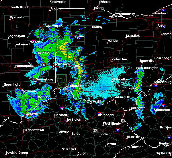 At 959 pm edt, a severe thunderstorm capable of producing a tornado was located near casstown, moving north at 20 mph (radar indicated rotation). Hazards include tornado. Flying debris will be dangerous to those caught without shelter. mobile homes will be damaged or destroyed. damage to roofs, windows, and vehicles will occur. tree damage is likely. Locations impacted include, troy and casstown. At 959 pm edt, a severe thunderstorm capable of producing a tornado was located near casstown, moving north at 20 mph (radar indicated rotation). Hazards include tornado. Flying debris will be dangerous to those caught without shelter. mobile homes will be damaged or destroyed. damage to roofs, windows, and vehicles will occur. tree damage is likely. Locations impacted include, troy and casstown.
|
| 5/24/2017 9:53 PM EDT |
 At 952 pm edt, a severe thunderstorm capable of producing a tornado was located 4 miles east of troy, moving northwest at 20 mph (radar indicated rotation). Hazards include tornado. Flying debris will be dangerous to those caught without shelter. mobile homes will be damaged or destroyed. damage to roofs, windows, and vehicles will occur. tree damage is likely. locations impacted include, troy, casstown, grayson and farrington. This includes i-75 in ohio between mile markers 76 and 79. At 952 pm edt, a severe thunderstorm capable of producing a tornado was located 4 miles east of troy, moving northwest at 20 mph (radar indicated rotation). Hazards include tornado. Flying debris will be dangerous to those caught without shelter. mobile homes will be damaged or destroyed. damage to roofs, windows, and vehicles will occur. tree damage is likely. locations impacted include, troy, casstown, grayson and farrington. This includes i-75 in ohio between mile markers 76 and 79.
|
| 5/24/2017 9:40 PM EDT |
 At 938 pm edt, a severe thunderstorm likely producing a tornado was located 5 miles east of tipp city, moving northwest at 20 mph (radar indicated rotation). Hazards include tornado. Flying debris will be dangerous to those caught without shelter. mobile homes will be damaged or destroyed. damage to roofs, windows, and vehicles will occur. Tree damage is likely. At 938 pm edt, a severe thunderstorm likely producing a tornado was located 5 miles east of tipp city, moving northwest at 20 mph (radar indicated rotation). Hazards include tornado. Flying debris will be dangerous to those caught without shelter. mobile homes will be damaged or destroyed. damage to roofs, windows, and vehicles will occur. Tree damage is likely.
|
| 5/24/2017 9:29 PM EDT |
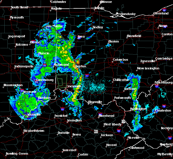 At 929 pm edt, a confirmed tornado was located four miles west of new carlisle, moving northwest at 20 mph (radar confirmed tornado. radar shows tornado debris in the air). Hazards include damaging tornado. Flying debris will be dangerous to those caught without shelter. mobile homes will be damaged or destroyed. damage to roofs, windows, and vehicles will occur. tree damage is likely. Locations impacted include, troy, tipp city, brown, casstown, grayson and haven view. At 929 pm edt, a confirmed tornado was located four miles west of new carlisle, moving northwest at 20 mph (radar confirmed tornado. radar shows tornado debris in the air). Hazards include damaging tornado. Flying debris will be dangerous to those caught without shelter. mobile homes will be damaged or destroyed. damage to roofs, windows, and vehicles will occur. tree damage is likely. Locations impacted include, troy, tipp city, brown, casstown, grayson and haven view.
|
| 5/24/2017 9:22 PM EDT |
 At 922 pm edt, a tornado-producing storm was located 4 miles southwest of new carlisle, moving northwest at 20 mph (radar confirmed tornado. radar shows tornado debris in the air). Hazards include damaging tornado. Flying debris will be dangerous to those caught without shelter. mobile homes will be damaged or destroyed. damage to roofs, windows, and vehicles will occur. Tree damage is likely. At 922 pm edt, a tornado-producing storm was located 4 miles southwest of new carlisle, moving northwest at 20 mph (radar confirmed tornado. radar shows tornado debris in the air). Hazards include damaging tornado. Flying debris will be dangerous to those caught without shelter. mobile homes will be damaged or destroyed. damage to roofs, windows, and vehicles will occur. Tree damage is likely.
|
| 5/19/2017 4:37 PM EDT |
 The severe thunderstorm warning for northeastern miami county will expire at 445 pm edt, the storm which prompted the warning has weakened below severe limits, and no longer poses an immediate threat to life or property. therefore, the warning will be allowed to expire. however heavy rain is still possible with this thunderstorm. a severe thunderstorm watch remains in effect until 1100 pm edt for west central ohio. please report previous wind damage or hail to the national weather service by going to our website at weather.gov/iln and submitting your report via social media. The severe thunderstorm warning for northeastern miami county will expire at 445 pm edt, the storm which prompted the warning has weakened below severe limits, and no longer poses an immediate threat to life or property. therefore, the warning will be allowed to expire. however heavy rain is still possible with this thunderstorm. a severe thunderstorm watch remains in effect until 1100 pm edt for west central ohio. please report previous wind damage or hail to the national weather service by going to our website at weather.gov/iln and submitting your report via social media.
|
| 5/19/2017 4:28 PM EDT |
 At 428 pm edt, a severe thunderstorm was located near piqua, moving east at 35 mph (radar indicated). Hazards include 60 mph wind gusts. Expect damage to roofs, siding, and trees. locations impacted include, troy, piqua, fletcher, casstown, farrington and haven view. This includes i-75 in ohio between mile markers 72 and 81. At 428 pm edt, a severe thunderstorm was located near piqua, moving east at 35 mph (radar indicated). Hazards include 60 mph wind gusts. Expect damage to roofs, siding, and trees. locations impacted include, troy, piqua, fletcher, casstown, farrington and haven view. This includes i-75 in ohio between mile markers 72 and 81.
|
| 5/19/2017 4:15 PM EDT |
 At 415 pm edt, a severe thunderstorm was located near pleasant hill, moving east at 35 mph (radar indicated). Hazards include 60 mph wind gusts. Expect damage to roofs, siding, and trees. locations impacted include, troy, piqua, west milton, pleasant hill, laura, fletcher, casstown, ludlow falls, farrington and haven view. This includes i-75 in ohio between mile markers 71 and 84. At 415 pm edt, a severe thunderstorm was located near pleasant hill, moving east at 35 mph (radar indicated). Hazards include 60 mph wind gusts. Expect damage to roofs, siding, and trees. locations impacted include, troy, piqua, west milton, pleasant hill, laura, fletcher, casstown, ludlow falls, farrington and haven view. This includes i-75 in ohio between mile markers 71 and 84.
|
| 5/19/2017 3:59 PM EDT |
 At 359 pm edt, a severe thunderstorm was located near pleasant hill, moving east at 35 mph (radar indicated). Hazards include 60 mph wind gusts. expect damage to roofs, siding, and trees At 359 pm edt, a severe thunderstorm was located near pleasant hill, moving east at 35 mph (radar indicated). Hazards include 60 mph wind gusts. expect damage to roofs, siding, and trees
|
| 1/10/2017 9:00 PM EST |
 At 859 pm est, severe thunderstorms were located along a line extending from near piqua to near englewood, moving east at 65 mph (radar indicated). Hazards include 60 mph wind gusts. expect damage to roofs, siding, and trees At 859 pm est, severe thunderstorms were located along a line extending from near piqua to near englewood, moving east at 65 mph (radar indicated). Hazards include 60 mph wind gusts. expect damage to roofs, siding, and trees
|
| 8/27/2016 3:35 PM EDT |
 At 334 pm edt, a severe thunderstorm was located near tipp city, moving northeast at 25 mph. Hazards include 60 mph wind gusts. Expect damage to roofs. siding. and trees. locations impacted include, springfield, fairborn, xenia, troy, piqua, tipp city, new carlisle, yellow springs, wright-patterson afb, northridge, cedarville, enon, st. Paris, wilberforce, brown, christiansburg, north hampton, fletcher, tremont city and donnelsville. At 334 pm edt, a severe thunderstorm was located near tipp city, moving northeast at 25 mph. Hazards include 60 mph wind gusts. Expect damage to roofs. siding. and trees. locations impacted include, springfield, fairborn, xenia, troy, piqua, tipp city, new carlisle, yellow springs, wright-patterson afb, northridge, cedarville, enon, st. Paris, wilberforce, brown, christiansburg, north hampton, fletcher, tremont city and donnelsville.
|
| 8/27/2016 3:26 PM EDT |
 At 325 pm edt, a severe thunderstorm was located over tipp city, moving northeast at 25 mph (radar indicated). Hazards include 60 mph wind gusts. Expect damage to roofs. siding. and trees. locations impacted include, dayton, springfield, beavercreek, huber heights, fairborn, xenia, troy, piqua, vandalia, tipp city, new carlisle, west milton, yellow springs, wright-patterson afb, northridge, cedarville, enon, st. Paris, wilberforce and brown. At 325 pm edt, a severe thunderstorm was located over tipp city, moving northeast at 25 mph (radar indicated). Hazards include 60 mph wind gusts. Expect damage to roofs. siding. and trees. locations impacted include, dayton, springfield, beavercreek, huber heights, fairborn, xenia, troy, piqua, vandalia, tipp city, new carlisle, west milton, yellow springs, wright-patterson afb, northridge, cedarville, enon, st. Paris, wilberforce and brown.
|
| 8/27/2016 3:13 PM EDT |
 At 313 pm edt, a severe thunderstorm was located near tipp city, moving northeast at 25 mph (radar indicated). Hazards include 70 mph wind gusts. Expect considerable tree damage. Damage is likely to mobile homes, roofs, and outbuildings. At 313 pm edt, a severe thunderstorm was located near tipp city, moving northeast at 25 mph (radar indicated). Hazards include 70 mph wind gusts. Expect considerable tree damage. Damage is likely to mobile homes, roofs, and outbuildings.
|
| 8/27/2016 2:45 PM EDT |
 At 245 pm edt, severe thunderstorms were located along a line extending from lewisburg to miamisburg to near kings island, moving northeast at 40 mph (radar indicated). Hazards include 60 mph wind gusts and penny size hail. Expect damage to roofs. siding. And trees. At 245 pm edt, severe thunderstorms were located along a line extending from lewisburg to miamisburg to near kings island, moving northeast at 40 mph (radar indicated). Hazards include 60 mph wind gusts and penny size hail. Expect damage to roofs. siding. And trees.
|
| 8/20/2016 7:37 PM EDT |
 At 736 pm edt, a severe thunderstorm was located over pleasant hill, moving east at 30 mph (radar indicated). Hazards include 60 mph wind gusts. Expect damage to roofs. siding. And trees. At 736 pm edt, a severe thunderstorm was located over pleasant hill, moving east at 30 mph (radar indicated). Hazards include 60 mph wind gusts. Expect damage to roofs. siding. And trees.
|
| 7/13/2016 8:04 PM EDT |
 At 804 pm edt, a severe thunderstorm was located near st. paris, moving northeast at 50 mph (radar indicated). Hazards include 60 mph wind gusts and penny size hail. Expect damage to roofs. siding. and trees. locations impacted include, springfield, huber heights, troy, tipp city, new carlisle, st. Paris, brown, christiansburg, north hampton, donnelsville, casstown, park layne, brandt, dialton, grayson, medway, haven view, crystal lakes, thackery and snyderville. At 804 pm edt, a severe thunderstorm was located near st. paris, moving northeast at 50 mph (radar indicated). Hazards include 60 mph wind gusts and penny size hail. Expect damage to roofs. siding. and trees. locations impacted include, springfield, huber heights, troy, tipp city, new carlisle, st. Paris, brown, christiansburg, north hampton, donnelsville, casstown, park layne, brandt, dialton, grayson, medway, haven view, crystal lakes, thackery and snyderville.
|
| 7/13/2016 7:54 PM EDT |
 At 753 pm edt, a severe thunderstorm was located near tipp city, moving northeast at 50 mph (radar indicated). Hazards include 60 mph wind gusts and penny size hail. Expect damage to roofs. siding. and trees. locations impacted include, dayton, springfield, huber heights, troy, trotwood, vandalia, englewood, tipp city, new carlisle, west milton, northridge, st. Paris, brown, riverside, clayton, union, shiloh, christiansburg, north hampton and donnelsville. At 753 pm edt, a severe thunderstorm was located near tipp city, moving northeast at 50 mph (radar indicated). Hazards include 60 mph wind gusts and penny size hail. Expect damage to roofs. siding. and trees. locations impacted include, dayton, springfield, huber heights, troy, trotwood, vandalia, englewood, tipp city, new carlisle, west milton, northridge, st. Paris, brown, riverside, clayton, union, shiloh, christiansburg, north hampton and donnelsville.
|
| 7/13/2016 7:42 PM EDT |
 At 741 pm edt, a severe thunderstorm was located over west milton, moving northeast at 50 mph (radar indicated). Hazards include 60 mph wind gusts and penny size hail. Expect damage to roofs. siding. And trees. At 741 pm edt, a severe thunderstorm was located over west milton, moving northeast at 50 mph (radar indicated). Hazards include 60 mph wind gusts and penny size hail. Expect damage to roofs. siding. And trees.
|
| 6/23/2016 2:33 AM EDT |
 At 233 am edt, a severe thunderstorm was located near new carlisle, moving east at 70 mph (radar indicated). Hazards include 70 mph wind gusts and penny size hail. Expect considerable tree damage. damage is likely to mobile homes, roofs, and outbuildings. locations impacted include, dayton, springfield, huber heights, fairborn, troy, vandalia, urbana, tipp city, new carlisle, west milton, wright-patterson afb, northridge, enon, st. paris, brown, clayton, union, harmony, christiansburg and north hampton. A tornado watch remains in effect until 500 am edt for west central ohio. At 233 am edt, a severe thunderstorm was located near new carlisle, moving east at 70 mph (radar indicated). Hazards include 70 mph wind gusts and penny size hail. Expect considerable tree damage. damage is likely to mobile homes, roofs, and outbuildings. locations impacted include, dayton, springfield, huber heights, fairborn, troy, vandalia, urbana, tipp city, new carlisle, west milton, wright-patterson afb, northridge, enon, st. paris, brown, clayton, union, harmony, christiansburg and north hampton. A tornado watch remains in effect until 500 am edt for west central ohio.
|
| 6/23/2016 2:12 AM EDT |
 At 212 am edt, a severe thunderstorm was located near bradford, moving east at 70 mph (radar indicated). Hazards include 70 mph wind gusts and penny size hail. Expect considerable tree damage. Damage is likely to mobile homes, roofs, and outbuildings. At 212 am edt, a severe thunderstorm was located near bradford, moving east at 70 mph (radar indicated). Hazards include 70 mph wind gusts and penny size hail. Expect considerable tree damage. Damage is likely to mobile homes, roofs, and outbuildings.
|
| 6/20/2016 7:34 PM EDT |
 At 734 pm edt, a severe thunderstorm was located near greenville, moving southeast at 35 mph (radar indicated). Hazards include 60 mph wind gusts. Expect damage to roofs. siding. And trees. At 734 pm edt, a severe thunderstorm was located near greenville, moving southeast at 35 mph (radar indicated). Hazards include 60 mph wind gusts. Expect damage to roofs. siding. And trees.
|
| 3/27/2016 11:08 PM EDT |
 The severe thunderstorm warning for northeastern montgomery and miami counties will expire at 1115 pm edt, the storm which prompted the warning has moved out of the area. therefore the warning will be allowed to expire. an additional severe thunderstorm warning remains in effect for eastern miami county until 1145 pm. please report previous wind damage or hail to the national weather service by going to our website at weather.gov/iln and submit your report via social media. The severe thunderstorm warning for northeastern montgomery and miami counties will expire at 1115 pm edt, the storm which prompted the warning has moved out of the area. therefore the warning will be allowed to expire. an additional severe thunderstorm warning remains in effect for eastern miami county until 1145 pm. please report previous wind damage or hail to the national weather service by going to our website at weather.gov/iln and submit your report via social media.
|
| 3/27/2016 10:51 PM EDT |
 At 1051 pm edt, radar indicated a severe thunderstorm located near west milton, moving northeast at 50 mph. storm hazards include, winds to 60 mph, locations impacted include, dayton, huber heights, troy, piqua, vandalia, englewood, tipp city, west milton, covington, pleasant hill, brown, clayton, union, fletcher, casstown, ludlow falls, farrington, polo, brandt and grayson. this includes the following interstates, i-70 in ohio between mile markers 25 and 38. i-75 in ohio between mile markers 61 and 85. At 1051 pm edt, radar indicated a severe thunderstorm located near west milton, moving northeast at 50 mph. storm hazards include, winds to 60 mph, locations impacted include, dayton, huber heights, troy, piqua, vandalia, englewood, tipp city, west milton, covington, pleasant hill, brown, clayton, union, fletcher, casstown, ludlow falls, farrington, polo, brandt and grayson. this includes the following interstates, i-70 in ohio between mile markers 25 and 38. i-75 in ohio between mile markers 61 and 85.
|
| 3/27/2016 10:43 PM EDT |
 At 1043 pm edt, radar indicated a severe thunderstorm located near west milton, moving northeast at 50 mph. storm hazards include, winds to 60 mph,. At 1043 pm edt, radar indicated a severe thunderstorm located near west milton, moving northeast at 50 mph. storm hazards include, winds to 60 mph,.
|
| 3/14/2016 2:37 PM EDT |
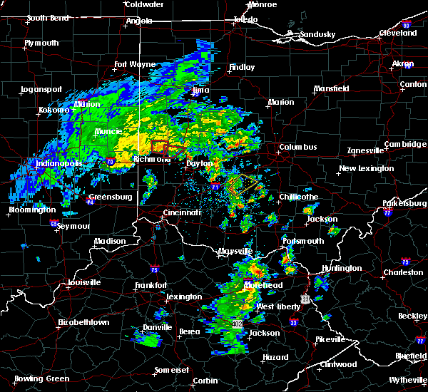 The tornado warning for southwestern miami and southeastern darke counties will expire at 245 pm edt, the storm which prompted the warning has weakened below severe limits. therefore the warning will be allowed to expire. please report previous tornadoes, wind damage or hail to the national weather service by going to our website at weather.gov/iln and submit your report via social media. The tornado warning for southwestern miami and southeastern darke counties will expire at 245 pm edt, the storm which prompted the warning has weakened below severe limits. therefore the warning will be allowed to expire. please report previous tornadoes, wind damage or hail to the national weather service by going to our website at weather.gov/iln and submit your report via social media.
|
| 3/14/2016 2:25 PM EDT |
 At 225 pm edt, radar indicated a severe thunderstorm with strong rotation located near west milton, moving north at 30 mph. a tornado is occurring or imminent. locations impacted include, troy, west milton, pleasant hill, laura, potsdam, ludlow falls, circle hill and garland. this includes i-75 in ohio between mile markers 74 and 75. At 225 pm edt, radar indicated a severe thunderstorm with strong rotation located near west milton, moving north at 30 mph. a tornado is occurring or imminent. locations impacted include, troy, west milton, pleasant hill, laura, potsdam, ludlow falls, circle hill and garland. this includes i-75 in ohio between mile markers 74 and 75.
|
| 3/14/2016 2:16 PM EDT |
 At 216 pm edt, radar indicated a severe thunderstorm capable of producing a tornado near lewisburg, moving north at 30 mph. At 216 pm edt, radar indicated a severe thunderstorm capable of producing a tornado near lewisburg, moving north at 30 mph.
|
| 12/23/2015 5:34 PM EST | Tornado warning remains in effect for northeastern miami county until 600 pm est. at 534 pm est. radar indicated a severe thunderstorm capable of producing a tornado located near piqua. moving northeast at 50 mph. locations impacted include. troy. piqua. fletcher. Casstown and farrington. |
| 12/23/2015 5:28 PM EST | At 527 pm est, radar indicated a severe thunderstorm capable of producing a tornado over pleasant hill, moving northeast at 50 mph. |
| 12/23/2015 5:22 PM EST | At 522 pm est, radar indicated severe thunderstorms located along a line extending from near versailles to near englewood, moving northeast at 60 mph. storm hazards include, winds to 60 mph,. |
| 7/19/2015 2:01 PM EDT |
 At 201 pm edt, radar indicated a severe thunderstorm located near tipp city, moving east at 35 mph. storm hazards include, winds to 60 mph, very heavy rain which may cause minor flooding,. At 201 pm edt, radar indicated a severe thunderstorm located near tipp city, moving east at 35 mph. storm hazards include, winds to 60 mph, very heavy rain which may cause minor flooding,.
|
| 7/18/2015 6:12 PM EDT | The severe thunderstorm warning for northeastern miami county will expire at 615 pm edt, the storm which prompted the warning has weakened below severe limits. therefore the warning will be allowed to expire. heavy rain is likely with this storm with urban and small stream flooding likely across the warned area. please report previous wind damage or hail to the national weather service by going to our website at weather.gov/iln and submit your report via social media. |
| 7/18/2015 5:50 PM EDT |
 At 549 pm edt, radar indicated a severe thunderstorm located 7 miles east of piqua, moving south at 20 mph. storm hazards include, winds to 60 mph, frequent cloud to ground lightning, very heavy rain which may cause minor flooding,. At 549 pm edt, radar indicated a severe thunderstorm located 7 miles east of piqua, moving south at 20 mph. storm hazards include, winds to 60 mph, frequent cloud to ground lightning, very heavy rain which may cause minor flooding,.
|
| 5/11/2015 4:10 PM EDT | At 408 pm edt, radar continued to indicate a severe thunderstorm located near west milton, moving northeast at 50 mph. storm hazards include, winds to 60 mph, locations impacted include, troy. in addition, circle hill and pleasant hill are near the path of this storm. this includes the following interstate, i-75 between mile markers 70 and 76, , <0.75in. |
| 5/11/2015 4:00 PM EDT | At 358 pm edt, radar continued to indicate a severe thunderstorm located near gordon, moving northeast at 50 mph. storm hazards include, winds to 60 mph, locations impacted include, arcanum, west milton, covington, troy and piqua. in addition, phillipsburg, pitsburg, garland, potsdam, union, laura, union corners and ludlow falls are near the path of this storm. this includes the following interstates, i-70 between mile markers 9 and 23, i-75 between mile markers 69 and 80, , <0.75in. |
| 5/11/2015 3:43 PM EDT | At 341 pm edt, radar indicated a severe thunderstorm located near new hope, moving northeast at 50 mph. storm hazards include, winds to 60 mph, penny size hail,. |
| 4/10/2015 3:11 AM EDT | The national weather service in wilmington has issued a * severe thunderstorm warning for. southeastern shelby county in west central ohio. eastern montgomery county in west central ohio. eastern miami county in west central ohio. Southern logan county in west central ohio. |
| 4/10/2015 3:05 AM EDT | A severe thunderstorm warning remains in effect until 315 am edt for northern montgomery and central miami counties. at 304 am edt. radar continued to indicate a severe thunderstorm located near ginghamsburg. moving east at 65 mph. storm hazards include. Winds to 60 mph. |
| 4/10/2015 2:48 AM EDT | A severe thunderstorm warning remains in effect until 315 am edt for northeastern preble. northern montgomery. southwestern miami and southeastern darke counties. at 245 am edt. radar continued to indicate a severe thunderstorm located near verona. moving east at 65 mph. Storm hazards include. |
| 4/10/2015 2:39 AM EDT | The national weather service in wilmington has issued a * severe thunderstorm warning for. northern preble county in west central ohio. northern montgomery county in west central ohio. southwestern miami county in west central ohio. Southeastern darke county in west central ohio. |
| 4/9/2015 6:46 PM EDT | The national weather service in wilmington has issued a * severe thunderstorm warning for. northeastern montgomery county in west central ohio. southeastern miami county in west central ohio. northern greene county in west central ohio. Western clark county in west central ohio. |
| 4/8/2015 10:44 AM EDT | A severe thunderstorm warning remains in effect until 1100 am edt for southeastern miami county. at 1042 am edt. radar indicated that the severe thunderstorm had weakened. this storm was located near grayson. moving east at 50 mph. Storm hazards include. |
| 4/8/2015 10:26 AM EDT | A severe thunderstorm warning remains in effect until 1100 am edt for southern miami and southeastern darke counties. at 1025 am edt. radar continued to indicate a severe thunderstorm located near laura. moving east at 50 mph. storm hazards include. Winds to 60 mph. |
| 4/8/2015 10:16 AM EDT | The national weather service in wilmington has issued a * severe thunderstorm warning for. southern miami county in west central ohio. southeastern darke county in west central ohio. until 1100 am edt. at 1014 am edt. Radar indicated a severe thunderstorm located near. |
| 5/21/2014 5:30 PM EDT | Quarter sized hail reported 3.9 miles NE of Troy, OH, dime to quarter size hail on nashville rd west of i-75. |
| 2/20/2014 11:09 PM EST | Structural damage in miami county OH, 3.5 miles W of Troy, OH |
| 7/20/2013 11:39 AM EDT | Several trees/branches down within city limit in miami county OH, 0.9 miles WSW of Troy, OH |
| 6/23/2013 6:50 PM EDT | Quarter sized hail reported 4 miles W of Troy, OH |
| 7/1/2012 5:40 PM EDT | Half inch hail fell as wel in miami county OH, 1.1 miles SSW of Troy, OH |
| 7/1/2012 5:15 PM EDT | Trees upr in miami county OH, 0.4 miles SE of Troy, OH |
| 1/1/0001 12:00 AM | Quarter sized hail reported 4.5 miles S of Troy, OH |
| 1/1/0001 12:00 AM | Quarter sized hail reported 0.4 miles SE of Troy, OH |
Hail Maps for Troy, OH


Connect with Interactive Hail Maps