

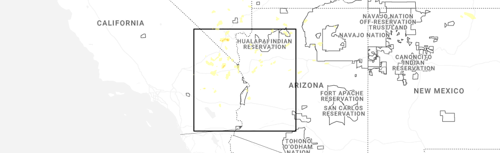
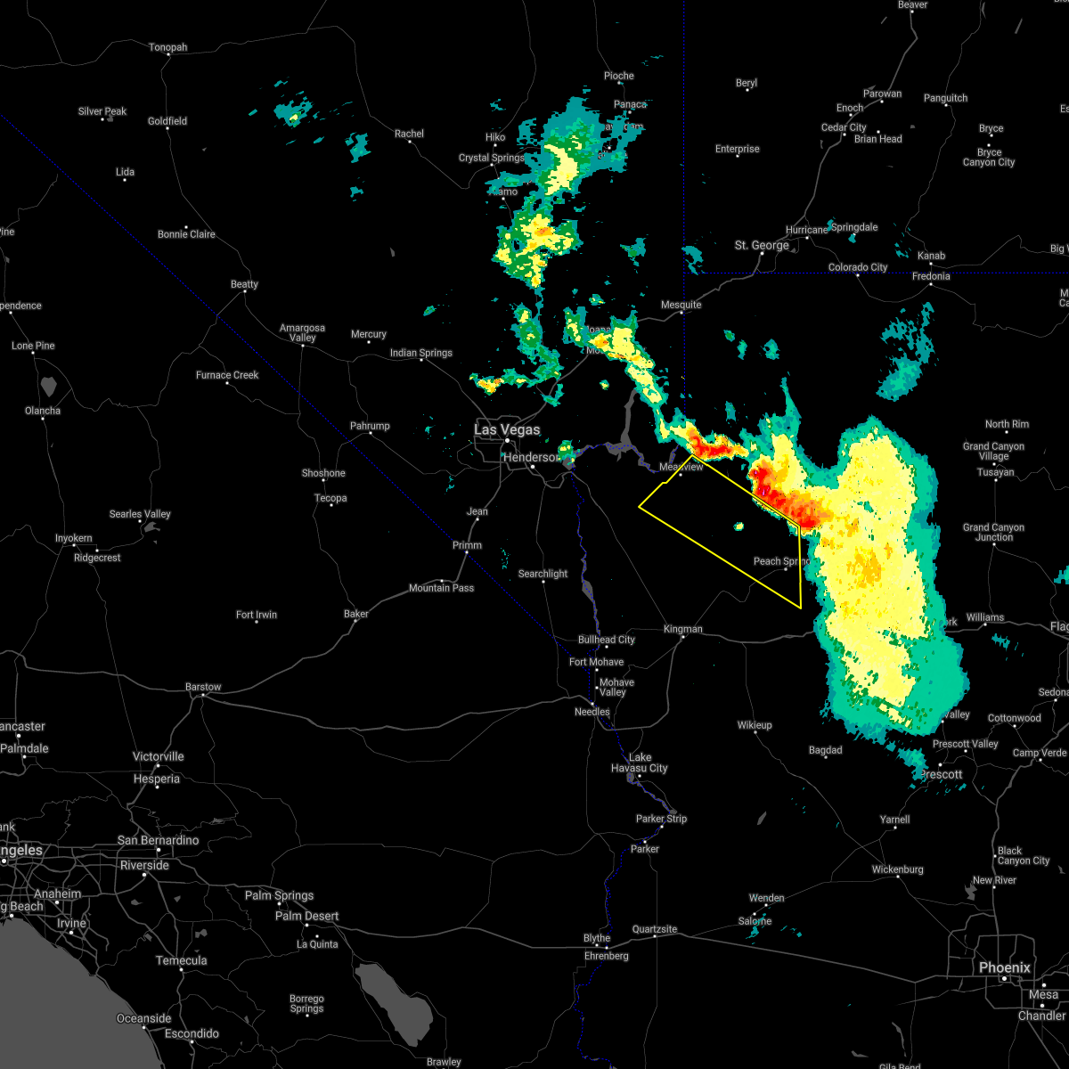
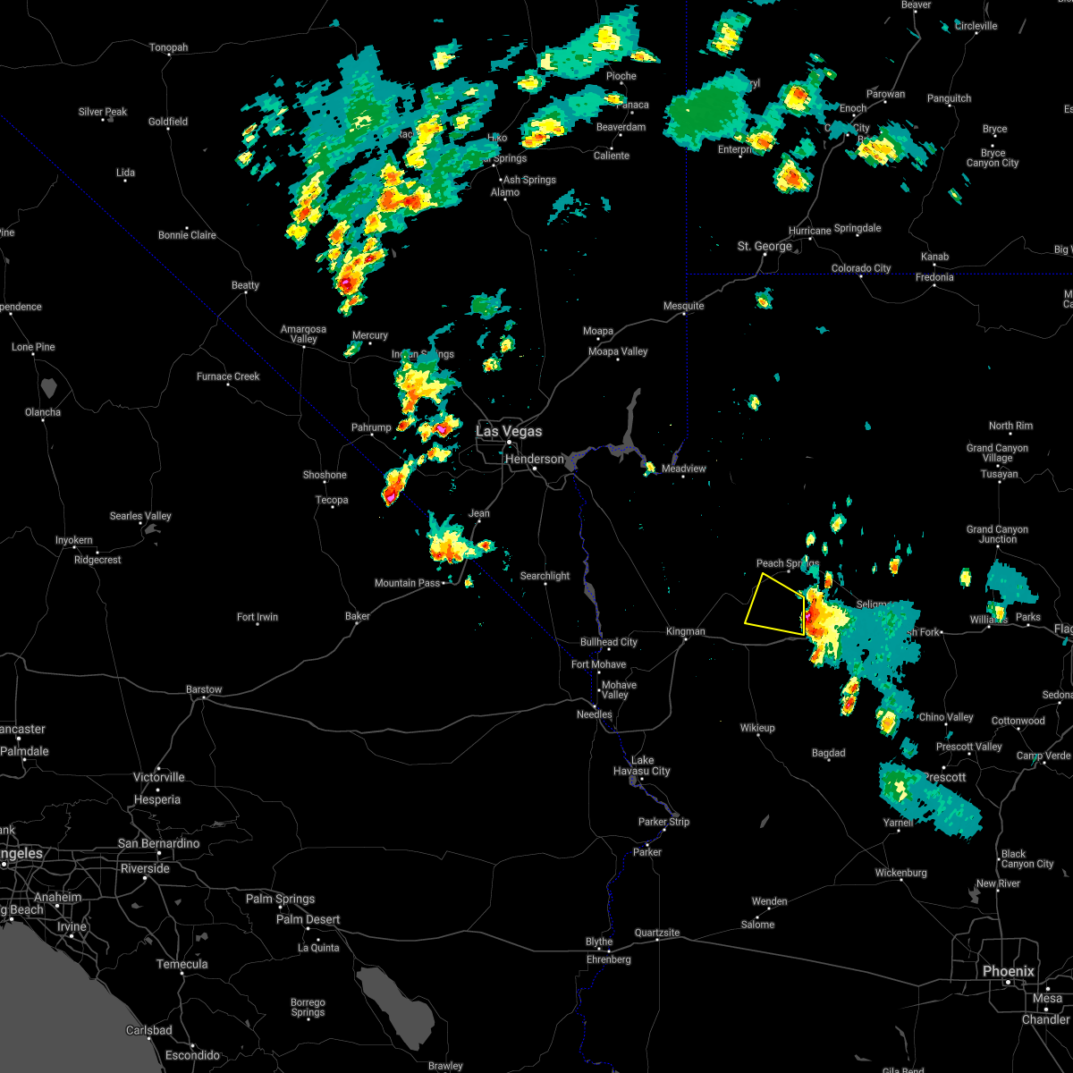
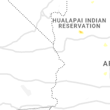
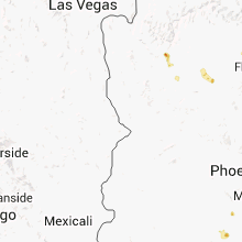
Hail Map for Truxton, AZ
The Truxton, AZ area has had 0 reports of on-the-ground hail by trained spotters, and has been under severe weather warnings 3 times during the past 12 months. Doppler radar has detected hail at or near Truxton, AZ on 27 occasions, including 3 occasions during the past year.
| Name: | Truxton, AZ |
| Where Located: | 82.4 miles NNE of Lake Havasu City, AZ |
| Map: | Google Map for Truxton, AZ |
| Population: | 134 |
| Housing Units: | 73 |
| More Info: | Search Google for Truxton, AZ |
0
The Top Recent Hail Date for Truxton, AZ is Tuesday, June 3, 2025 (27th out of 27)
Hail and Wind Damage Spotted near Truxton, AZ
| Date / Time | Report Details |
|---|---|
| 8/11/2024 6:20 PM MST |
 The storm which prompted the warning has weakened, and no longer poses an immediate threat to life or property. therefore, the warning will be allowed to expire. The storm which prompted the warning has weakened, and no longer poses an immediate threat to life or property. therefore, the warning will be allowed to expire.
|
| 8/11/2024 6:06 PM MST |
 At 606 pm mst, a severe thunderstorm was located south of peach springs, or 40 miles northeast of kingman, and is nearly stationary (radar indicated). Hazards include 60 mph wind gusts and quarter size hail. Hail damage to vehicles is expected. expect wind damage to roofs and trees. locations impacted include, peach springs. This includes route 66 between mile markers 96 and 109. At 606 pm mst, a severe thunderstorm was located south of peach springs, or 40 miles northeast of kingman, and is nearly stationary (radar indicated). Hazards include 60 mph wind gusts and quarter size hail. Hail damage to vehicles is expected. expect wind damage to roofs and trees. locations impacted include, peach springs. This includes route 66 between mile markers 96 and 109.
|
| 8/11/2024 5:47 PM MST |
 Svrvef the national weather service in las vegas has issued a * severe thunderstorm warning for, central mohave county in northwestern arizona, * until 630 pm mst. * at 546 pm mst, a severe thunderstorm was located near peach springs, or 40 miles northeast of kingman, and is nearly stationary (radar indicated). Hazards include 60 mph wind gusts and quarter size hail. Hail damage to vehicles is expected. Expect wind damage to roofs and trees. Svrvef the national weather service in las vegas has issued a * severe thunderstorm warning for, central mohave county in northwestern arizona, * until 630 pm mst. * at 546 pm mst, a severe thunderstorm was located near peach springs, or 40 miles northeast of kingman, and is nearly stationary (radar indicated). Hazards include 60 mph wind gusts and quarter size hail. Hail damage to vehicles is expected. Expect wind damage to roofs and trees.
|
| 7/12/2024 4:11 PM MST |
 The storm around peach springs which prompted the warning has weakened, and no longer poses an immediate threat to life or property. therefore, the warning will be allowed to expire. however, heavy rain is still possible with this thunderstorm. The storm around peach springs which prompted the warning has weakened, and no longer poses an immediate threat to life or property. therefore, the warning will be allowed to expire. however, heavy rain is still possible with this thunderstorm.
|
| 7/12/2024 4:03 PM MST |
 At 401 pm mst, a severe thunderstorm was located over diamond creek road and peach springs, moving west at 10 mph (radar indicated). Hazards include 60 mph wind gusts. Expect damage to roofs and trees. locations impacted include, peach springs, valentine, and diamond creek campground. This includes route 66 between mile markers 80 and 109. At 401 pm mst, a severe thunderstorm was located over diamond creek road and peach springs, moving west at 10 mph (radar indicated). Hazards include 60 mph wind gusts. Expect damage to roofs and trees. locations impacted include, peach springs, valentine, and diamond creek campground. This includes route 66 between mile markers 80 and 109.
|
| 7/12/2024 3:38 PM MST |
 Svrvef the national weather service in las vegas has issued a * severe thunderstorm warning for, central mohave county in northwestern arizona, * until 415 pm mst. * at 337 pm mst, a severe thunderstorm was located over peach springs, or 42 miles northeast of kingman, moving west at 10 mph (radar indicated). Hazards include 60 mph wind gusts. expect damage to roofs and trees Svrvef the national weather service in las vegas has issued a * severe thunderstorm warning for, central mohave county in northwestern arizona, * until 415 pm mst. * at 337 pm mst, a severe thunderstorm was located over peach springs, or 42 miles northeast of kingman, moving west at 10 mph (radar indicated). Hazards include 60 mph wind gusts. expect damage to roofs and trees
|
| 8/21/2022 8:33 PM MST | At 831 pm mst, severe thunderstorms were located along a line extending from dolan springs to near diamond m ranch, moving south at 30 mph. strong winds and hail will be approaching kingman by 9pm (radar indicated). Hazards include 60 mph wind gusts and quarter size hail. Hail damage to vehicles is expected. expect wind damage to roofs and trees. locations impacted include, kingman, katherine landing, windy point campground, wild cow campground, diamond m ranch, blake ranch road, golden valley, dw ranch road, packsaddle campground, chloride, new kingman-butler, valentine, dolan springs, hualapai mountain park, hualapai peak and peach springs. this includes interstate 40 in arizona between mile markers 40 and 93. hail threat, radar indicated max hail size, 1. 00 in wind threat, radar indicated max wind gust, 60 mph. |
| 8/21/2022 7:58 PM MST | At 756 pm mst, a severe thunderstorm was located 10 miles east of cottonwood cove, or 16 miles north of katherine landing, moving south at 40 mph (radar indicated). Hazards include 60 mph wind gusts and quarter size hail. Hail damage to vehicles is expected. expect wind damage to roofs and trees. locations impacted include, grand canyon ranch, lake mead national recreation area, diamond creek campground, pierce ferry and antares roads, dolan springs and peach springs. hail threat, radar indicated max hail size, 1. 00 in wind threat, observed max wind gust, 60 mph. |
| 8/21/2022 7:54 PM MST | At 754 pm mst, severe thunderstorms were located along a line extending from 12 miles southeast of boulder city to 13 miles south of diamond creek campground, moving south at 25 mph. this storm will impact dolan springs imminently and kingman by 9 pm (radar indicated). Hazards include 60 mph wind gusts and quarter size hail. Hail damage to vehicles is expected. Expect wind damage to roofs and trees. |
| 8/21/2022 7:29 PM MST | At 728 pm pdt/728 pm mst/, a line of severe thunderstorm was located from near willow beach to peach springs, moving south at 30 mph (radar indicated). Hazards include 60 mph wind gusts and quarter size hail. Hail damage to vehicles is expected. expect wind damage to roofs and trees. locations impacted include, henderson, boulder city, las vegas bay, lake las vegas, boulder beach, grand canyon skywalk, diamond creek campground, railroad pass, boulder beach campground, las vegas bay campground, pierce ferry and antares roads, callville bay, meadview, hoover dam, grand canyon ranch, callville bay campground, lake mead national recreation area, temple bar campground, south cove and dolan springs. hail threat, radar indicated max hail size, 1. 00 in wind threat, observed max wind gust, 60 mph. |
| 8/21/2022 7:29 PM MST | At 728 pm pdt/728 pm mst/, a line of severe thunderstorm was located from near willow beach to peach springs, moving south at 30 mph (radar indicated). Hazards include 60 mph wind gusts and quarter size hail. Hail damage to vehicles is expected. expect wind damage to roofs and trees. locations impacted include, henderson, boulder city, las vegas bay, lake las vegas, boulder beach, grand canyon skywalk, diamond creek campground, railroad pass, boulder beach campground, las vegas bay campground, pierce ferry and antares roads, callville bay, meadview, hoover dam, grand canyon ranch, callville bay campground, lake mead national recreation area, temple bar campground, south cove and dolan springs. hail threat, radar indicated max hail size, 1. 00 in wind threat, observed max wind gust, 60 mph. |
| 8/21/2022 6:52 PM MST | At 651 pm pdt/651 pm mst/, a severe thunderstorm was located 11 miles west of temple bar campground, or 18 miles east of boulder city, moving south at 20 mph (radar indicated). Hazards include 70 mph wind gusts. Expect considerable tree damage. Damage is likely to mobile homes, roofs, and outbuildings. |
| 8/21/2022 6:52 PM MST | At 651 pm pdt/651 pm mst/, a severe thunderstorm was located 11 miles west of temple bar campground, or 18 miles east of boulder city, moving south at 20 mph (radar indicated). Hazards include 70 mph wind gusts. Expect considerable tree damage. Damage is likely to mobile homes, roofs, and outbuildings. |
| 7/17/2022 4:26 PM MST |
 The severe thunderstorm warning for central mohave county will expire at 430 pm mst, the storm which prompted the warning has weakened below severe limits, and no longer poses an immediate threat to life or property. therefore, the warning will be allowed to expire. heavy downpours and wind gusts to 50 mph are still possible with this storm, particularly those traveling along highway 66 east of valentine and along buck and doe road should continue to use extra caution. The severe thunderstorm warning for central mohave county will expire at 430 pm mst, the storm which prompted the warning has weakened below severe limits, and no longer poses an immediate threat to life or property. therefore, the warning will be allowed to expire. heavy downpours and wind gusts to 50 mph are still possible with this storm, particularly those traveling along highway 66 east of valentine and along buck and doe road should continue to use extra caution.
|
| 7/17/2022 4:05 PM MST |
 At 404 pm mst, a severe thunderstorm was located 9 miles northeast of valentine, or 32 miles northeast of kingman, moving west at 25 mph (radar indicated). Hazards include 60 mph wind gusts and small hail. Expect damage to roofs and trees. locations impacted include, highway 66 from valentine to peach springs. hail threat, radar indicated max hail size, <. 75 in wind threat, radar indicated max wind gust, 60 mph. At 404 pm mst, a severe thunderstorm was located 9 miles northeast of valentine, or 32 miles northeast of kingman, moving west at 25 mph (radar indicated). Hazards include 60 mph wind gusts and small hail. Expect damage to roofs and trees. locations impacted include, highway 66 from valentine to peach springs. hail threat, radar indicated max hail size, <. 75 in wind threat, radar indicated max wind gust, 60 mph.
|
| 7/17/2022 3:47 PM MST |
 At 346 pm mst, a severe thunderstorm was located 11 miles north of diamond m ranch, or 36 miles northeast of kingman, moving northwest at 20 mph (radar indicated). Hazards include 60 mph wind gusts and small hail. expect damage to roofs and trees At 346 pm mst, a severe thunderstorm was located 11 miles north of diamond m ranch, or 36 miles northeast of kingman, moving northwest at 20 mph (radar indicated). Hazards include 60 mph wind gusts and small hail. expect damage to roofs and trees
|
| 7/14/2022 2:03 PM MST |
 At 201 pm mst, a severe thunderstorm was located near valentine, or 24 miles northeast of kingman, moving northwest at 30 mph (radar indicated). Hazards include 60 mph wind gusts and pea size hail. Expect damage to roofs and trees. locations impacted include, valentine, truxton, and peach springs. this includes route 66 from mile marker 80 to mile marker 110. hail threat, radar indicated max hail size, <. 75 in wind threat, radar indicated max wind gust, 60 mph. At 201 pm mst, a severe thunderstorm was located near valentine, or 24 miles northeast of kingman, moving northwest at 30 mph (radar indicated). Hazards include 60 mph wind gusts and pea size hail. Expect damage to roofs and trees. locations impacted include, valentine, truxton, and peach springs. this includes route 66 from mile marker 80 to mile marker 110. hail threat, radar indicated max hail size, <. 75 in wind threat, radar indicated max wind gust, 60 mph.
|
| 7/14/2022 1:51 PM MST |
 At 147 pm mst, a severe thunderstorm was located near valentine, or 28 miles northeast of kingman, moving northwest at 30 mph (radar indicated). Hazards include 60 mph wind gusts and pea size hail. expect damage to roofs and trees At 147 pm mst, a severe thunderstorm was located near valentine, or 28 miles northeast of kingman, moving northwest at 30 mph (radar indicated). Hazards include 60 mph wind gusts and pea size hail. expect damage to roofs and trees
|
| 10/5/2021 11:01 AM MST |
 At 1101 am mst, severe thunderstorms were located along a line extending from near diamond m ranch to 11 miles west of chloride, moving northeast at 30 mph. at 1051 am, 68 mph wind gusts were recorded at kingman airport (radar indicated). Hazards include 70 mph wind gusts. Expect considerable tree damage. damage is likely to mobile homes, roofs, and outbuildings. locations impacted include, kingman, windy point campground, grand canyon skywalk, diamond creek campground, pierce ferry and antares roads, diamond m ranch, blake ranch road, golden valley, dw ranch road, packsaddle campground, chloride, grand canyon ranch, new kingman-butler, valentine, dolan springs, lake mead national recreation area and peach springs. this includes interstate 40 in arizona between mile markers 45 and 93. thunderstorm damage threat, considerable hail threat, radar indicated max hail size, <. 75 in wind threat, radar indicated max wind gust, 70 mph. At 1101 am mst, severe thunderstorms were located along a line extending from near diamond m ranch to 11 miles west of chloride, moving northeast at 30 mph. at 1051 am, 68 mph wind gusts were recorded at kingman airport (radar indicated). Hazards include 70 mph wind gusts. Expect considerable tree damage. damage is likely to mobile homes, roofs, and outbuildings. locations impacted include, kingman, windy point campground, grand canyon skywalk, diamond creek campground, pierce ferry and antares roads, diamond m ranch, blake ranch road, golden valley, dw ranch road, packsaddle campground, chloride, grand canyon ranch, new kingman-butler, valentine, dolan springs, lake mead national recreation area and peach springs. this includes interstate 40 in arizona between mile markers 45 and 93. thunderstorm damage threat, considerable hail threat, radar indicated max hail size, <. 75 in wind threat, radar indicated max wind gust, 70 mph.
|
| 10/5/2021 10:55 AM MST |
 At 1054 am mst, severe thunderstorms were located along a line extending from near diamond m ranch to 12 miles northeast of katherine landing, moving northeast at 30 mph. strong winds exceeding 50 mph have been reported near kingman (radar indicated). Hazards include 60 mph wind gusts. expect damage to roofs and trees At 1054 am mst, severe thunderstorms were located along a line extending from near diamond m ranch to 12 miles northeast of katherine landing, moving northeast at 30 mph. strong winds exceeding 50 mph have been reported near kingman (radar indicated). Hazards include 60 mph wind gusts. expect damage to roofs and trees
|
| 8/10/2021 1:53 PM MST |
 At 152 pm mst, a severe thunderstorm was located 9 miles east of valentine, or 31 miles northeast of kingman, moving south at 10 mph (radar indicated). Hazards include 60 mph wind gusts. Expect damage to roofs and trees. locations impacted include, valentine. hail threat, radar indicated max hail size, <. 75 in wind threat, radar indicated max wind gust, 60 mph. At 152 pm mst, a severe thunderstorm was located 9 miles east of valentine, or 31 miles northeast of kingman, moving south at 10 mph (radar indicated). Hazards include 60 mph wind gusts. Expect damage to roofs and trees. locations impacted include, valentine. hail threat, radar indicated max hail size, <. 75 in wind threat, radar indicated max wind gust, 60 mph.
|
| 8/10/2021 1:35 PM MST |
 At 130 pm mst, a severe thunderstorm was located 9 miles northeast of valentine, or 32 miles northeast of kingman, moving south at 20 mph. travelers along route 66 between truxton and valentine should anticpate severe winds (radar indicated). Hazards include 60 mph wind gusts. expect damage to roofs and trees At 130 pm mst, a severe thunderstorm was located 9 miles northeast of valentine, or 32 miles northeast of kingman, moving south at 20 mph. travelers along route 66 between truxton and valentine should anticpate severe winds (radar indicated). Hazards include 60 mph wind gusts. expect damage to roofs and trees
|
| 7/23/2021 10:58 PM MST |
 The severe thunderstorm warning for central mohave county will expire at 1100 pm mst, the storms which prompted the warning have weakened below severe limits, and no longer pose an immediate threat to life or property. therefore, the warning will be allowed to expire. however gusty winds up to 50 mph and brief heavy rain are still possible with these thunderstorms. The severe thunderstorm warning for central mohave county will expire at 1100 pm mst, the storms which prompted the warning have weakened below severe limits, and no longer pose an immediate threat to life or property. therefore, the warning will be allowed to expire. however gusty winds up to 50 mph and brief heavy rain are still possible with these thunderstorms.
|
| 7/23/2021 10:18 PM MST |
 At 1017 pm mst, severe thunderstorms were located along a line extending from near meadview to 19 miles north of valentine to 13 miles south of diamond creek campground, moving southwest at 40 mph (radar indicated). Hazards include 60 mph wind gusts. expect damage to roofs and trees At 1017 pm mst, severe thunderstorms were located along a line extending from near meadview to 19 miles north of valentine to 13 miles south of diamond creek campground, moving southwest at 40 mph (radar indicated). Hazards include 60 mph wind gusts. expect damage to roofs and trees
|
| 7/23/2021 10:12 PM MST |
 At 1011 pm mst, severe thunderstorms were located along a line extending from near meadview to 19 miles southeast of grand canyon ranch to 10 miles south of diamond creek campground, moving southwest at 45 mph (radar indicated). Hazards include 60 mph wind gusts. Expect damage to roofs and trees. Locations impacted include, pierce ferry and antares roads, grand canyon ranch, meadview, lake mead national recreation area and peach springs. At 1011 pm mst, severe thunderstorms were located along a line extending from near meadview to 19 miles southeast of grand canyon ranch to 10 miles south of diamond creek campground, moving southwest at 45 mph (radar indicated). Hazards include 60 mph wind gusts. Expect damage to roofs and trees. Locations impacted include, pierce ferry and antares roads, grand canyon ranch, meadview, lake mead national recreation area and peach springs.
|
| 7/23/2021 9:52 PM MST |
 At 949 pm mst, severe thunderstorms were located along a line extending from 7 miles east of south cove to near diamond creek campground, moving southwest at 15 mph (radar indicated). Hazards include 60 mph wind gusts. expect damage to roofs and trees and possible blowing dust due to high winds At 949 pm mst, severe thunderstorms were located along a line extending from 7 miles east of south cove to near diamond creek campground, moving southwest at 15 mph (radar indicated). Hazards include 60 mph wind gusts. expect damage to roofs and trees and possible blowing dust due to high winds
|
| 8/23/2020 3:41 PM MST |
 The severe thunderstorm warning for southeastern mohave county will expire at 345 pm mst, the storm between peach springs and diamond m ranch which prompted the warning has weakened below severe limits, and no longer poses an immediate threat to life or property. therefore, the warning will be allowed to expire. The severe thunderstorm warning for southeastern mohave county will expire at 345 pm mst, the storm between peach springs and diamond m ranch which prompted the warning has weakened below severe limits, and no longer poses an immediate threat to life or property. therefore, the warning will be allowed to expire.
|
| 8/23/2020 3:33 PM MST |
 At 331 pm mst, a severe thunderstorm was located 10 miles south peach springs moving west to northwest at 15 mph. doppler radar indicated it was weakening. however, gusts near the storms may still reach 60 mph (radar indicated). Hazards include 60 mph wind gusts. Expect damage to roofs and trees. Locations impacted include, diamond m ranch. At 331 pm mst, a severe thunderstorm was located 10 miles south peach springs moving west to northwest at 15 mph. doppler radar indicated it was weakening. however, gusts near the storms may still reach 60 mph (radar indicated). Hazards include 60 mph wind gusts. Expect damage to roofs and trees. Locations impacted include, diamond m ranch.
|
| 8/23/2020 3:00 PM MST |
 At 259 pm mst, a severe thunderstorm was located over diamond m ranch, or 38 miles east of kingman, moving west at 15 mph (radar indicated). Hazards include 60 mph wind gusts. expect damage to roofs and trees At 259 pm mst, a severe thunderstorm was located over diamond m ranch, or 38 miles east of kingman, moving west at 15 mph (radar indicated). Hazards include 60 mph wind gusts. expect damage to roofs and trees
|
| 8/18/2020 3:29 PM MST |
 At 324 pm mst, a cluster of severe thunderstorms capable of damaging outflow winds was located near valentine on route 66 extending south of the interstate 40 corridor moving southwest at 20 mph (radar indicated). Hazards include 60 mph wind gusts and small hail. Expect damage to roofs and trees as well as reduced visibility due to blowing dust. Strong crosswinds for high profile vehicles, particularly on interstate 40 east of kingman. At 324 pm mst, a cluster of severe thunderstorms capable of damaging outflow winds was located near valentine on route 66 extending south of the interstate 40 corridor moving southwest at 20 mph (radar indicated). Hazards include 60 mph wind gusts and small hail. Expect damage to roofs and trees as well as reduced visibility due to blowing dust. Strong crosswinds for high profile vehicles, particularly on interstate 40 east of kingman.
|
| 5/10/2020 1:23 PM MST |
 At 121 pm mst, the storm which prompted the warning was northeast of valentine and had weakened. therefore, the warning will be allowed to expire. however, gusty winds are still possible in the area. At 121 pm mst, the storm which prompted the warning was northeast of valentine and had weakened. therefore, the warning will be allowed to expire. however, gusty winds are still possible in the area.
|
| 5/10/2020 1:01 PM MST |
 At 100 pm mst, a severe thunderstorm was located near valentine, or 27 miles northeast of kingman, moving north at 25 mph. another storm was developing over buck and doe road northwest of peach springs (radar indicated). Hazards include 70 mph wind gusts. Expect considerable tree damage. damage is likely to mobile homes, roofs, and outbuildings. Locations impacted include, valentine. At 100 pm mst, a severe thunderstorm was located near valentine, or 27 miles northeast of kingman, moving north at 25 mph. another storm was developing over buck and doe road northwest of peach springs (radar indicated). Hazards include 70 mph wind gusts. Expect considerable tree damage. damage is likely to mobile homes, roofs, and outbuildings. Locations impacted include, valentine.
|
| 5/10/2020 12:45 PM MST |
 At 1244 pm mst, a severe thunderstorm was located over valentine, or 21 miles northeast of kingman, moving north at 25 mph (radar indicated). Hazards include 70 mph wind gusts. Expect considerable tree damage. Damage is likely to mobile homes, roofs, and outbuildings. At 1244 pm mst, a severe thunderstorm was located over valentine, or 21 miles northeast of kingman, moving north at 25 mph (radar indicated). Hazards include 70 mph wind gusts. Expect considerable tree damage. Damage is likely to mobile homes, roofs, and outbuildings.
|
| 8/11/2018 5:28 PM MST |
 The severe thunderstorm warning for central mohave county will expire at 530 pm mst, the storm which prompted the warning is moving out of the warned area. therefore, the warning will be allowed to expire. however, doppler radar continues to indicate the storm remains severe and a new warning will be issued shortly. The severe thunderstorm warning for central mohave county will expire at 530 pm mst, the storm which prompted the warning is moving out of the warned area. therefore, the warning will be allowed to expire. however, doppler radar continues to indicate the storm remains severe and a new warning will be issued shortly.
|
| 8/11/2018 5:13 PM MST |
 At 510 pm mst, doppler radar indicates a severe thunderstorm continuing 12 miles north of valentine, or 33 miles northeast of kingman, moving northwest at 20 mph (radar indicated). Hazards include 60 mph wind gusts and quarter size hail. Hail damage to vehicles is expected. expect wind damage to roofs and trees. Locations impacted include, buck and doe road north of route 66. At 510 pm mst, doppler radar indicates a severe thunderstorm continuing 12 miles north of valentine, or 33 miles northeast of kingman, moving northwest at 20 mph (radar indicated). Hazards include 60 mph wind gusts and quarter size hail. Hail damage to vehicles is expected. expect wind damage to roofs and trees. Locations impacted include, buck and doe road north of route 66.
|
| 8/11/2018 4:40 PM MST |
 At 437 pm mst, a severe thunderstorm was located near valentine along route 66 between mile markers 84 and 99, or 29 miles northeast of kingman, moving northwest at 20 mph (radar indicated). Hazards include 60 mph wind gusts and quarter size hail. Hail damage to vehicles is expected. Expect wind damage to roofs and trees. At 437 pm mst, a severe thunderstorm was located near valentine along route 66 between mile markers 84 and 99, or 29 miles northeast of kingman, moving northwest at 20 mph (radar indicated). Hazards include 60 mph wind gusts and quarter size hail. Hail damage to vehicles is expected. Expect wind damage to roofs and trees.
|
| 8/11/2018 4:30 PM MST |
 At 428 pm mst, doppler radar continues to show a severe thunderstorm along route 66 between valentine and peach springs moving northwest at 10 mph (radar indicated). Hazards include 60 mph wind gusts and quarter size hail. Hail damage to vehicles is expected. expect wind damage to roofs and trees. locations impacted include, valentine. This includes interstate 40 in arizona near mile marker 70. At 428 pm mst, doppler radar continues to show a severe thunderstorm along route 66 between valentine and peach springs moving northwest at 10 mph (radar indicated). Hazards include 60 mph wind gusts and quarter size hail. Hail damage to vehicles is expected. expect wind damage to roofs and trees. locations impacted include, valentine. This includes interstate 40 in arizona near mile marker 70.
|
| 8/11/2018 4:04 PM MST |
 At 402 pm mst, a severe thunderstorm was located 7 miles west of diamond m ranch, or 32 miles east of kingman, moving west at 10 mph (radar indicated). Hazards include 60 mph wind gusts and quarter size hail. Hail damage to vehicles is expected. Expect wind damage to roofs and trees. At 402 pm mst, a severe thunderstorm was located 7 miles west of diamond m ranch, or 32 miles east of kingman, moving west at 10 mph (radar indicated). Hazards include 60 mph wind gusts and quarter size hail. Hail damage to vehicles is expected. Expect wind damage to roofs and trees.
|
| 8/9/2018 6:54 PM MST |
 The severe thunderstorm warning for central mohave county will expire at 700 pm mst, the storms which prompted the warning have weakened below severe limits, and no longer pose an immediate threat to life or property. therefore, the warning will be allowed to expire. however gusty winds and heavy rain are still possible with these thunderstorms. The severe thunderstorm warning for central mohave county will expire at 700 pm mst, the storms which prompted the warning have weakened below severe limits, and no longer pose an immediate threat to life or property. therefore, the warning will be allowed to expire. however gusty winds and heavy rain are still possible with these thunderstorms.
|
| 8/9/2018 6:21 PM MST |
 At 557 pm mst, severe thunderstorms were located along a line extending from 8 miles south of grand canyon skywalk to 7 miles northeast of diamond m ranch, moving southwest at 15 mph (radar indicated). Hazards include 60 mph wind gusts and quarter size hail. Hail damage to vehicles is expected. expect wind damage to roofs and trees. severe thunderstorms will be near, diamond m ranch and grand canyon ranch around 625 pm mst. pierce ferry and antares roads around 700 pm mst. other locations impacted by these severe thunderstorms include peach springs. This includes interstate 40 in arizona between mile markers 78 and 91. At 557 pm mst, severe thunderstorms were located along a line extending from 8 miles south of grand canyon skywalk to 7 miles northeast of diamond m ranch, moving southwest at 15 mph (radar indicated). Hazards include 60 mph wind gusts and quarter size hail. Hail damage to vehicles is expected. expect wind damage to roofs and trees. severe thunderstorms will be near, diamond m ranch and grand canyon ranch around 625 pm mst. pierce ferry and antares roads around 700 pm mst. other locations impacted by these severe thunderstorms include peach springs. This includes interstate 40 in arizona between mile markers 78 and 91.
|
| 8/9/2018 5:58 PM MST |
 At 557 pm mst, severe thunderstorms were located along a line extending from 8 miles south of grand canyon skywalk to 7 miles northeast of diamond m ranch, moving southwest at 15 mph (radar indicated). Hazards include 60 mph wind gusts and quarter size hail. Hail damage to vehicles is expected. expect wind damage to roofs and trees. severe thunderstorms will be near, diamond m ranch and grand canyon ranch around 625 pm mst. pierce ferry and antares roads around 700 pm mst. other locations impacted by these severe thunderstorms include peach springs. This includes interstate 40 in arizona between mile markers 78 and 91. At 557 pm mst, severe thunderstorms were located along a line extending from 8 miles south of grand canyon skywalk to 7 miles northeast of diamond m ranch, moving southwest at 15 mph (radar indicated). Hazards include 60 mph wind gusts and quarter size hail. Hail damage to vehicles is expected. expect wind damage to roofs and trees. severe thunderstorms will be near, diamond m ranch and grand canyon ranch around 625 pm mst. pierce ferry and antares roads around 700 pm mst. other locations impacted by these severe thunderstorms include peach springs. This includes interstate 40 in arizona between mile markers 78 and 91.
|
| 8/9/2018 5:28 PM MST |
 At 527 pm mst, a severe thunderstorm was located 16 miles north of diamond m ranch, or 20 miles northeast of kingman, and is nearly stationary (radar indicated). Hazards include golf ball size hail and 60 mph wind gusts. People and animals outdoors will be injured. expect hail damage to roofs, windows, and vehicles. expect wind damage to roofs and trees. locations impacted include, peach springs. Portions of route 66 and diamond creek road. At 527 pm mst, a severe thunderstorm was located 16 miles north of diamond m ranch, or 20 miles northeast of kingman, and is nearly stationary (radar indicated). Hazards include golf ball size hail and 60 mph wind gusts. People and animals outdoors will be injured. expect hail damage to roofs, windows, and vehicles. expect wind damage to roofs and trees. locations impacted include, peach springs. Portions of route 66 and diamond creek road.
|
| 8/9/2018 5:17 PM MST |
 At 515 pm mst, a severe thunderstorm was located 8 miles south of diamond creek campground, or 47 miles northeast of kingman, moving south at 20 mph (radar indicated). Hazards include 60 mph wind gusts and quarter size hail. Hail damage to vehicles is expected. expect wind damage to roofs and trees. this severe thunderstorm will remain over mainly rural areas of central mohave county, including the following locations, peach springs. This includes portions of route 66 and diamond creek road. At 515 pm mst, a severe thunderstorm was located 8 miles south of diamond creek campground, or 47 miles northeast of kingman, moving south at 20 mph (radar indicated). Hazards include 60 mph wind gusts and quarter size hail. Hail damage to vehicles is expected. expect wind damage to roofs and trees. this severe thunderstorm will remain over mainly rural areas of central mohave county, including the following locations, peach springs. This includes portions of route 66 and diamond creek road.
|
| 9/4/2017 2:56 PM MST |
 At 254 pm mst, a severe thunderstorm was located 14 miles northeast of diamond m ranch, or 48 miles northeast of kingman, and is moving east at 10 mph (radar indicated). Hazards include 60 mph wind gusts and quarter size hail. Hail damage to vehicles is expected. Expect wind damage to roofs, siding, and trees. At 254 pm mst, a severe thunderstorm was located 14 miles northeast of diamond m ranch, or 48 miles northeast of kingman, and is moving east at 10 mph (radar indicated). Hazards include 60 mph wind gusts and quarter size hail. Hail damage to vehicles is expected. Expect wind damage to roofs, siding, and trees.
|
| 7/30/2016 1:11 AM MST |
 At 110 am mst, doppler radar indicated severe thunderstorms capable of producing damaging winds in excess of 60 mph. these storms were located near peach springs, moving east at 30 mph. locations impacted include, diamond creek campground, diamond m ranch, valentine and peach springs. At 110 am mst, doppler radar indicated severe thunderstorms capable of producing damaging winds in excess of 60 mph. these storms were located near peach springs, moving east at 30 mph. locations impacted include, diamond creek campground, diamond m ranch, valentine and peach springs.
|
| 7/30/2016 12:26 AM MST |
 At 1225 am mst, doppler radar indicated a line of severe thunderstorms capable of producing quarter size hail and damaging winds in excess of 60 mph. these storms were located along a line extending from 13 miles west of diamond creek campground to 13 miles southeast of blake ranch road, and moving east at 30 mph. At 1225 am mst, doppler radar indicated a line of severe thunderstorms capable of producing quarter size hail and damaging winds in excess of 60 mph. these storms were located along a line extending from 13 miles west of diamond creek campground to 13 miles southeast of blake ranch road, and moving east at 30 mph.
|
| 6/29/2016 5:23 PM MST |
 The severe thunderstorm warning for central mohave county will expire at 530 pm mst, the storm which prompted the warning has weakened below severe limits, and no longer poses an immediate threat to life or property. therefore the warning will be allowed to expire. The severe thunderstorm warning for central mohave county will expire at 530 pm mst, the storm which prompted the warning has weakened below severe limits, and no longer poses an immediate threat to life or property. therefore the warning will be allowed to expire.
|
| 6/29/2016 5:13 PM MST |
 At 512 pm mst, doppler radar indicated a severe thunderstorm capable of producing damaging winds in excess of 60 mph. this storm was located near valentine, or 29 miles northeast of kingman, and was nearly statinoary. locations impacted include, valentine and peach springs and route 66. At 512 pm mst, doppler radar indicated a severe thunderstorm capable of producing damaging winds in excess of 60 mph. this storm was located near valentine, or 29 miles northeast of kingman, and was nearly statinoary. locations impacted include, valentine and peach springs and route 66.
|
| 6/29/2016 4:43 PM MST |
 At 442 pm mst, doppler radar indicated a severe thunderstorm capable of producing damaging winds in excess of 60 mph. this storm was located near route 66 abouit 8 miles northeast of valentine, or 31 miles northeast of kingman, and moving slowly northeast. At 442 pm mst, doppler radar indicated a severe thunderstorm capable of producing damaging winds in excess of 60 mph. this storm was located near route 66 abouit 8 miles northeast of valentine, or 31 miles northeast of kingman, and moving slowly northeast.
|
| 10/18/2015 9:18 PM MST |
 At 918 pm mst, doppler radar indicated a severe thunderstorm capable of producing quarter size hail and destructive winds in excess of 70 mph. this storm was located 19 miles west of diamond creek campground, or 38 miles northeast of kingman, moving northeast at 40 mph. locations impacted include, diamond creek campground, grand canyon skywalk, grand canyon ranch, toroweap campground, bar ten ranch and tuweep. At 918 pm mst, doppler radar indicated a severe thunderstorm capable of producing quarter size hail and destructive winds in excess of 70 mph. this storm was located 19 miles west of diamond creek campground, or 38 miles northeast of kingman, moving northeast at 40 mph. locations impacted include, diamond creek campground, grand canyon skywalk, grand canyon ranch, toroweap campground, bar ten ranch and tuweep.
|
| 10/18/2015 8:59 PM MST |
 At 858 pm mst, doppler radar indicated severe thunderstorms capable of producing quarter size hail and destructive winds in excess of 70 mph. this storm was located 16 miles northwest of valentine, or 28 miles northeast of kingman, and moving northeast at 40 mph. At 858 pm mst, doppler radar indicated severe thunderstorms capable of producing quarter size hail and destructive winds in excess of 70 mph. this storm was located 16 miles northwest of valentine, or 28 miles northeast of kingman, and moving northeast at 40 mph.
|
| 10/18/2015 8:46 PM MST |
 At 844 pm mst, doppler radar continues to indicate severe thunderstorms moving northeastward across central mohave county. earlier, trained weather spotters reported ping pong size hail and destructive winds in excess of 70 mph in the golden valley area. these storms are located 15 miles southwest of diamond creek campground, or 38 miles northeast of kingman, moving northeast at 55 mph. locations impacted include, grand canyon skywalk, grand canyon ranch, pierce ferry and antares roads, dolan springs, valentine and peach springs. At 844 pm mst, doppler radar continues to indicate severe thunderstorms moving northeastward across central mohave county. earlier, trained weather spotters reported ping pong size hail and destructive winds in excess of 70 mph in the golden valley area. these storms are located 15 miles southwest of diamond creek campground, or 38 miles northeast of kingman, moving northeast at 55 mph. locations impacted include, grand canyon skywalk, grand canyon ranch, pierce ferry and antares roads, dolan springs, valentine and peach springs.
|
| 10/18/2015 8:13 PM MST |
 At 812 pm mst, doppler radar indicated a severe thunderstorm capable of producing large damaging hail up to ping pong ball size and destructive winds in excess of 70 mph. this storm was located near chloride, or 11 miles north of kingman, and moving northeast at 55 mph. At 812 pm mst, doppler radar indicated a severe thunderstorm capable of producing large damaging hail up to ping pong ball size and destructive winds in excess of 70 mph. this storm was located near chloride, or 11 miles north of kingman, and moving northeast at 55 mph.
|
| 7/18/2015 2:54 PM MST |
 The severe thunderstorm warning for central mohave county will expire at 300 pm mst, the storm which prompted the warning has weakened below severe limits. therefore the severe thunderstorm warning will be allowed to expire. however heavy rain is still possible with this thunderstorm and a flash flood warning remains in effect. The severe thunderstorm warning for central mohave county will expire at 300 pm mst, the storm which prompted the warning has weakened below severe limits. therefore the severe thunderstorm warning will be allowed to expire. however heavy rain is still possible with this thunderstorm and a flash flood warning remains in effect.
|
| 7/18/2015 2:12 PM MST | The severe thunderstorm warning for central mohave county will expire at 215 pm mst, this warning has been replaced with another warning for the same area. |
| 7/18/2015 2:11 PM MST |
 At 209 pm mst, doppler radar indicated a severe thunderstorm capable of producing damaging winds in excess of 60 mph. this storm was located over valentine, or 22 miles northeast of kingman, and moving northeast at 10 mph. At 209 pm mst, doppler radar indicated a severe thunderstorm capable of producing damaging winds in excess of 60 mph. this storm was located over valentine, or 22 miles northeast of kingman, and moving northeast at 10 mph.
|
| 7/18/2015 1:54 PM MST |
 At 153 pm mst, doppler radar indicated a severe thunderstorm capable of producing damaging winds in excess of 60 mph. this storm was located near valentine, or 19 miles northeast of kingman. this storm was nearly stationary. in addition to the wind threat, flash flooding is likely occuring in the area. use extreme caution. locations impacted include, valentine, .route 66 near valentine. At 153 pm mst, doppler radar indicated a severe thunderstorm capable of producing damaging winds in excess of 60 mph. this storm was located near valentine, or 19 miles northeast of kingman. this storm was nearly stationary. in addition to the wind threat, flash flooding is likely occuring in the area. use extreme caution. locations impacted include, valentine, .route 66 near valentine.
|
| 7/18/2015 1:36 PM MST |
 At 135 pm mst, doppler radar indicated a severe thunderstorm capable of producing damaging winds in excess of 60 mph. this storm was located over valentine, or 26 miles northeast of kingman, and moving northeast at 55 mph. At 135 pm mst, doppler radar indicated a severe thunderstorm capable of producing damaging winds in excess of 60 mph. this storm was located over valentine, or 26 miles northeast of kingman, and moving northeast at 55 mph.
|
Hail Maps for Truxton, AZ


Connect with Interactive Hail Maps