

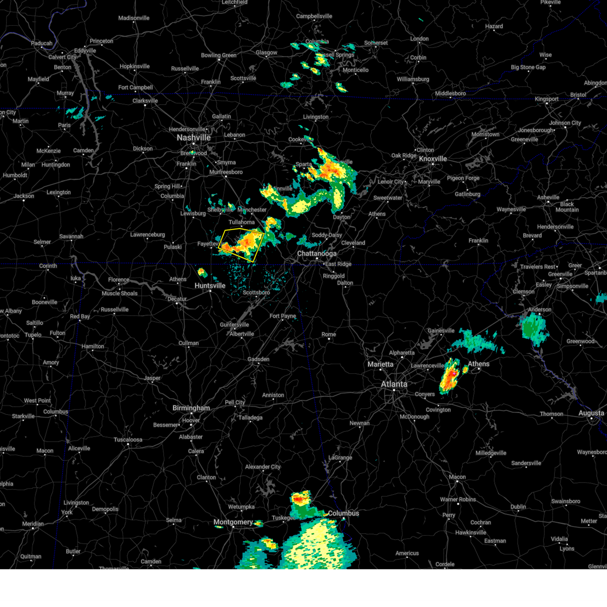
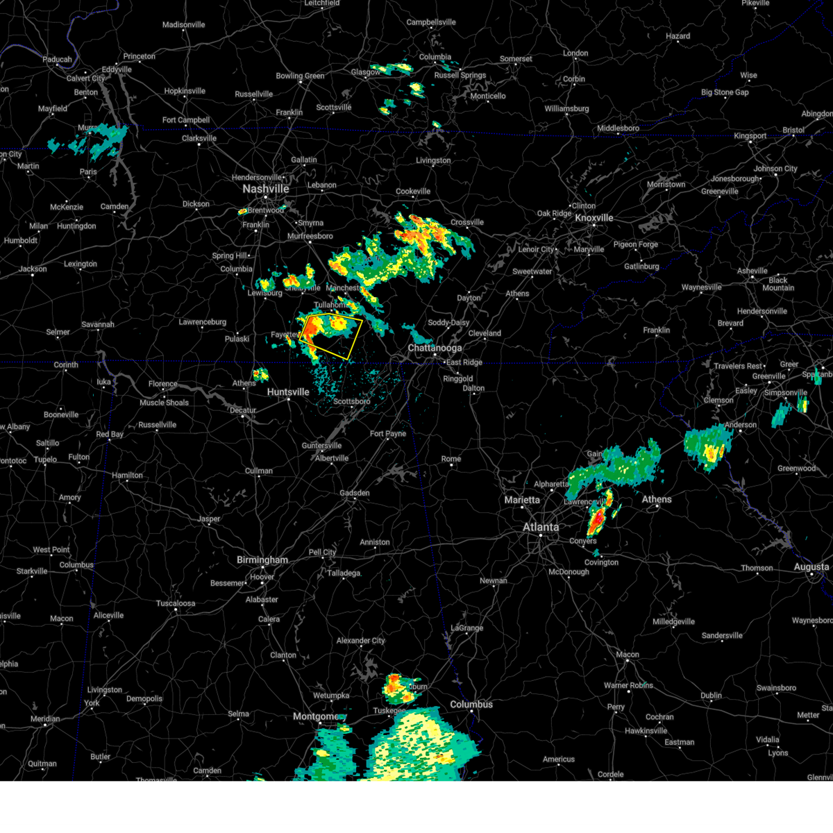
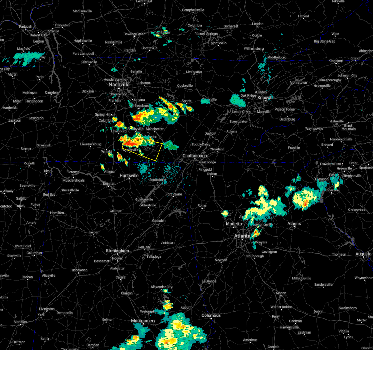
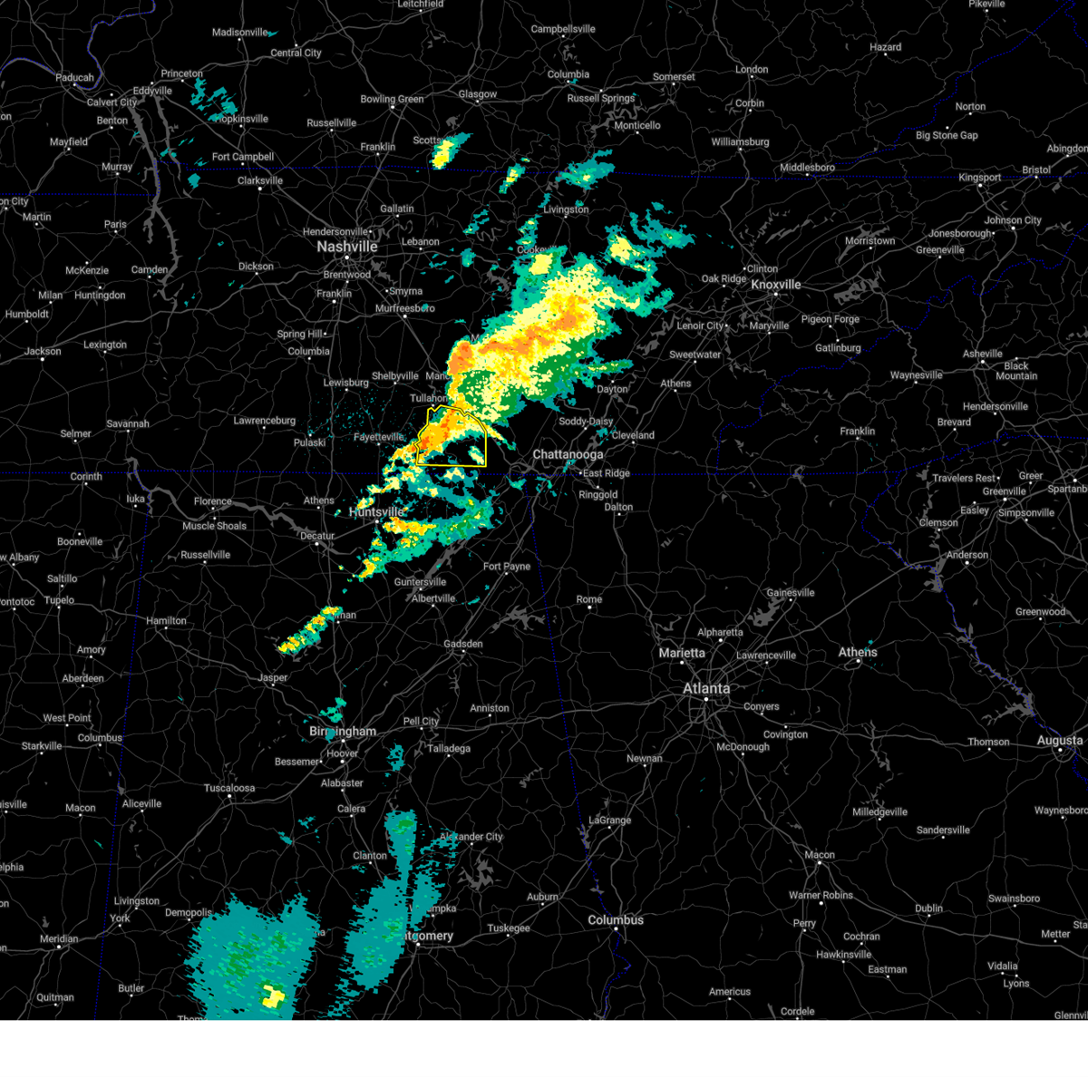
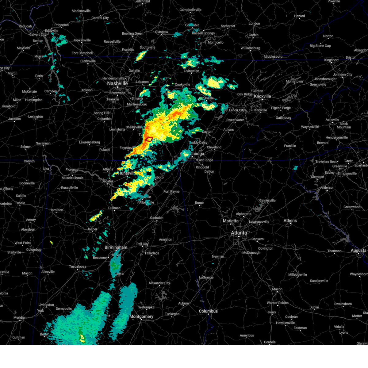
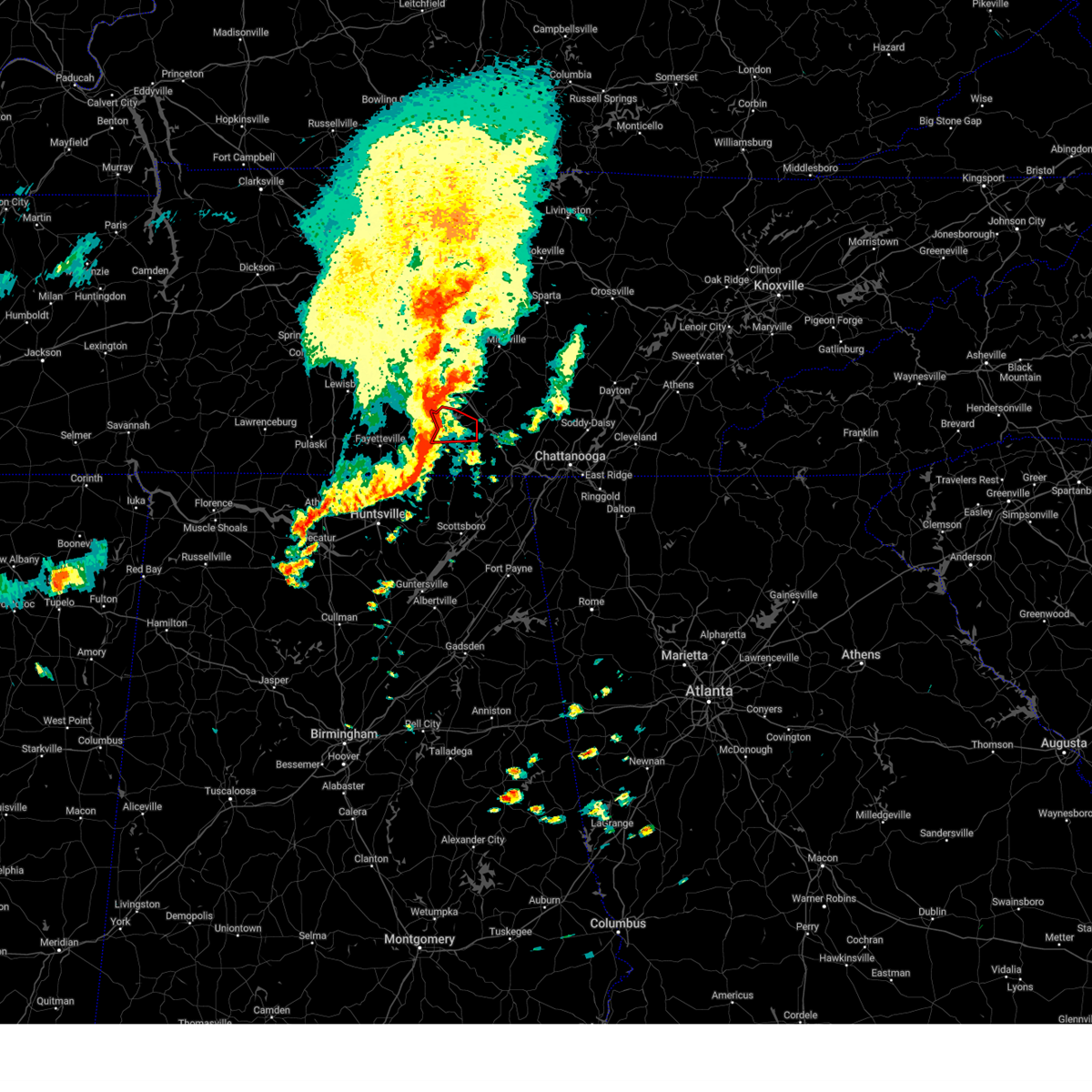
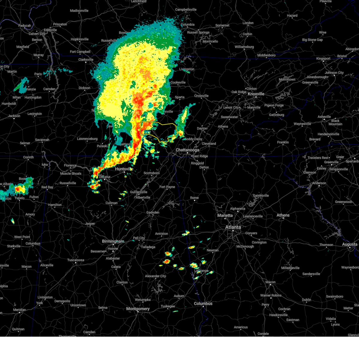
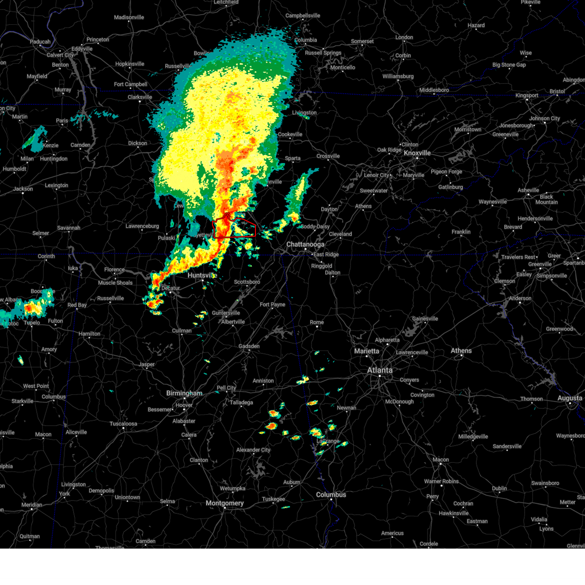
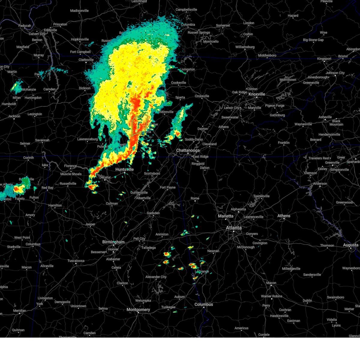
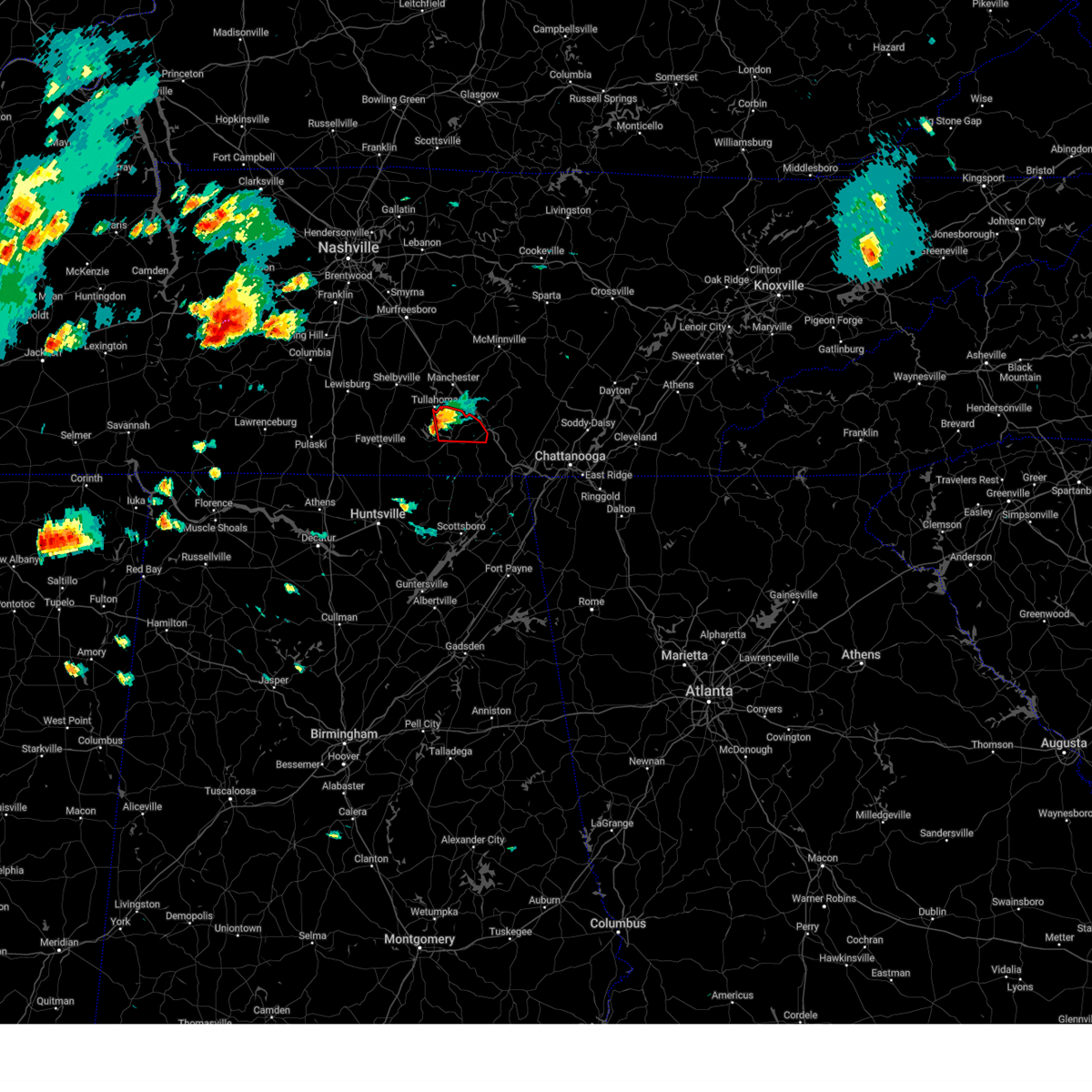
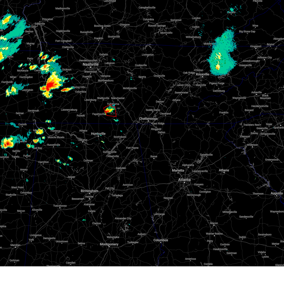
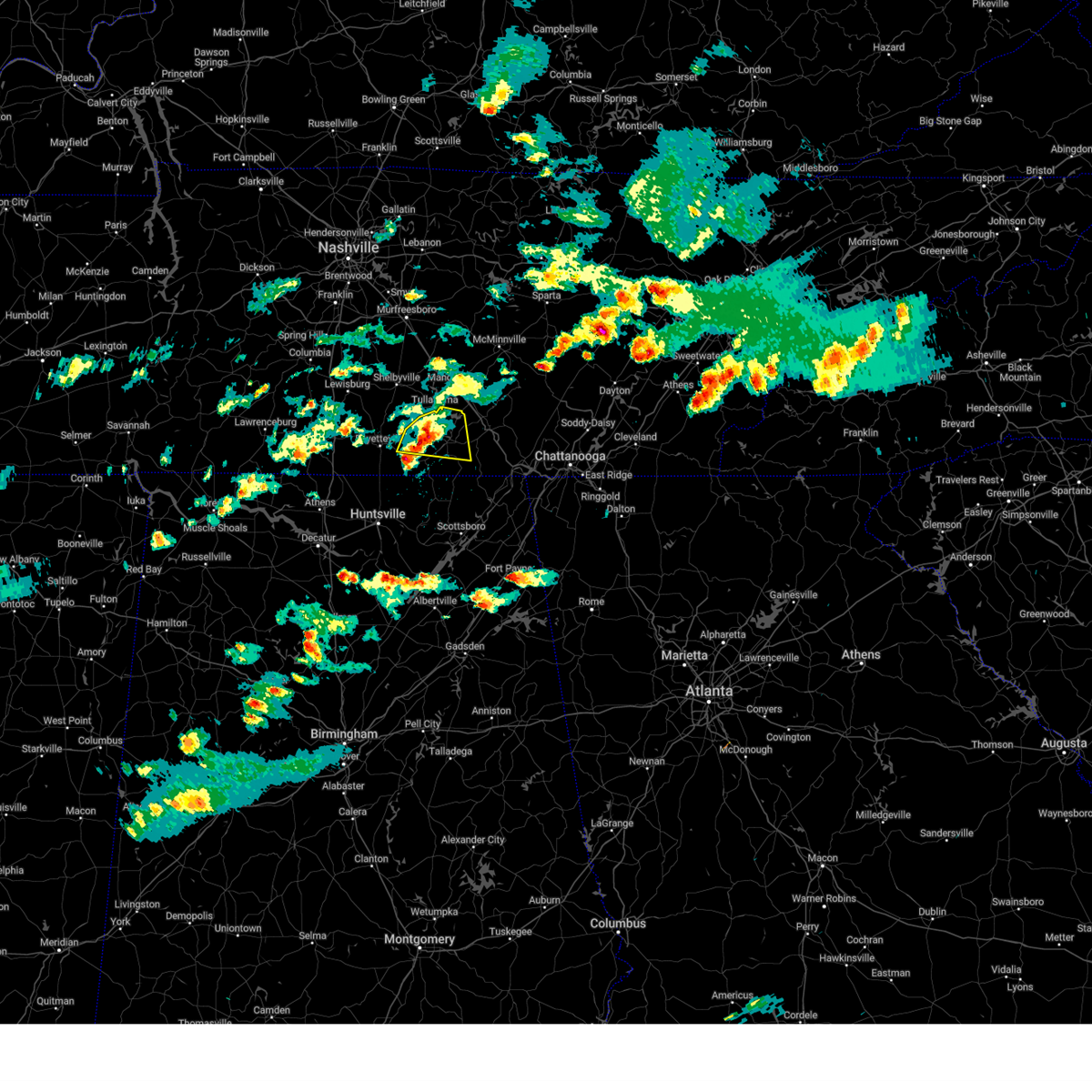
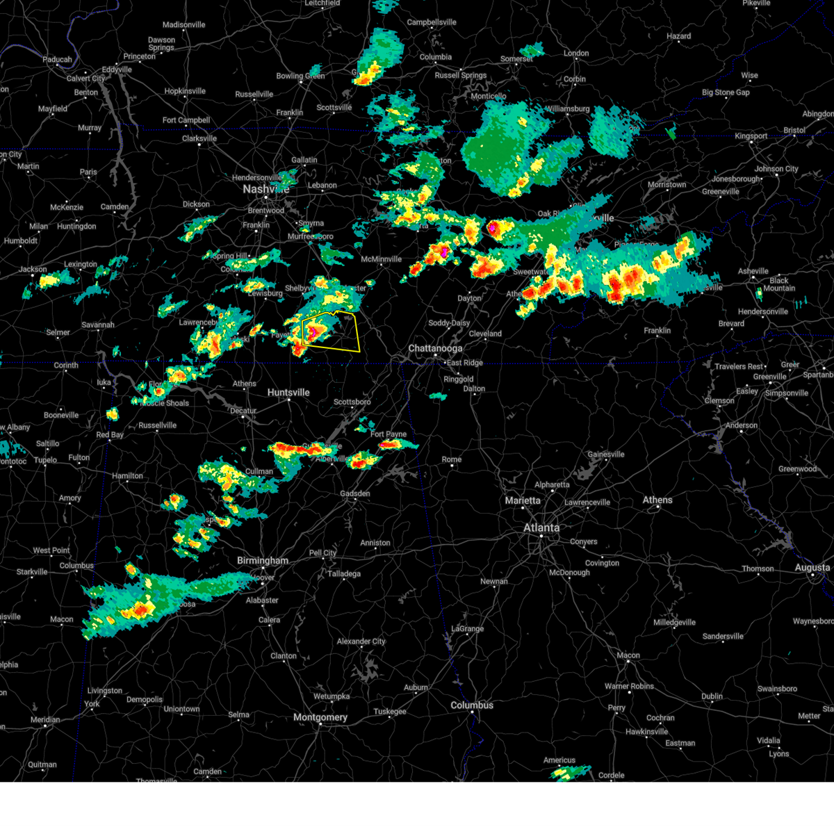
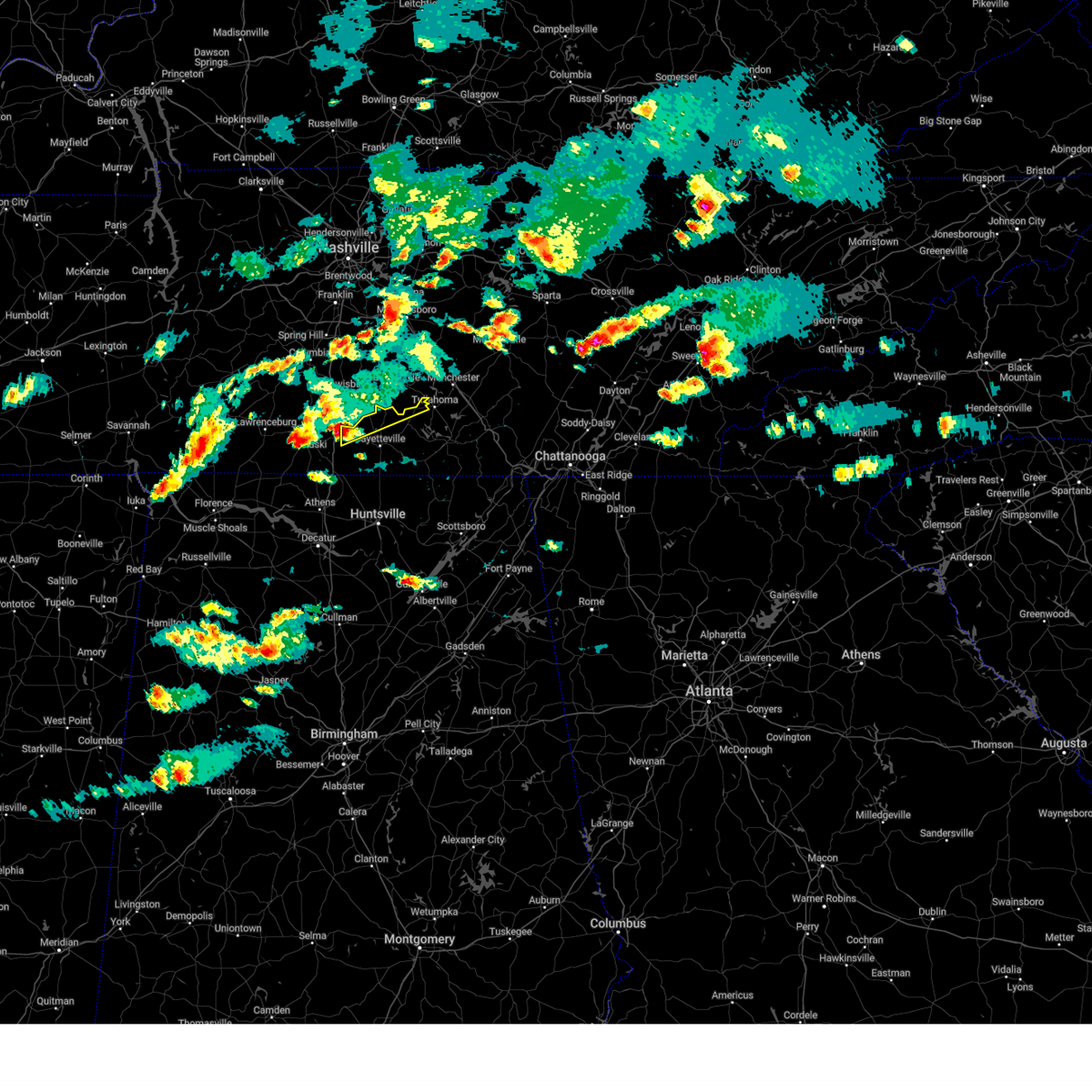
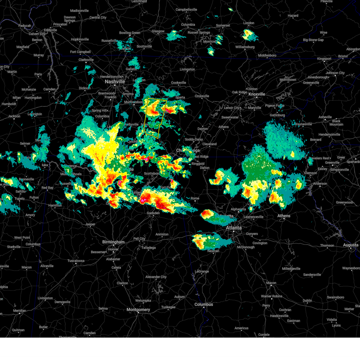
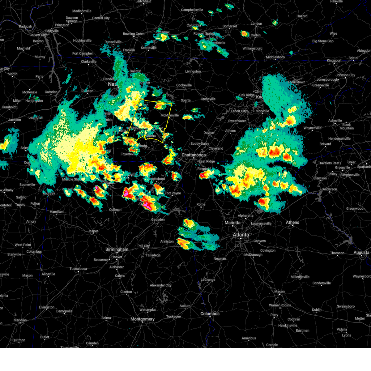
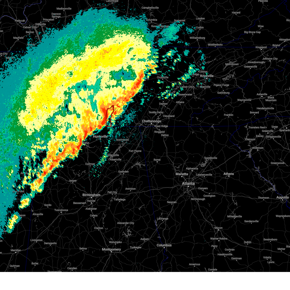
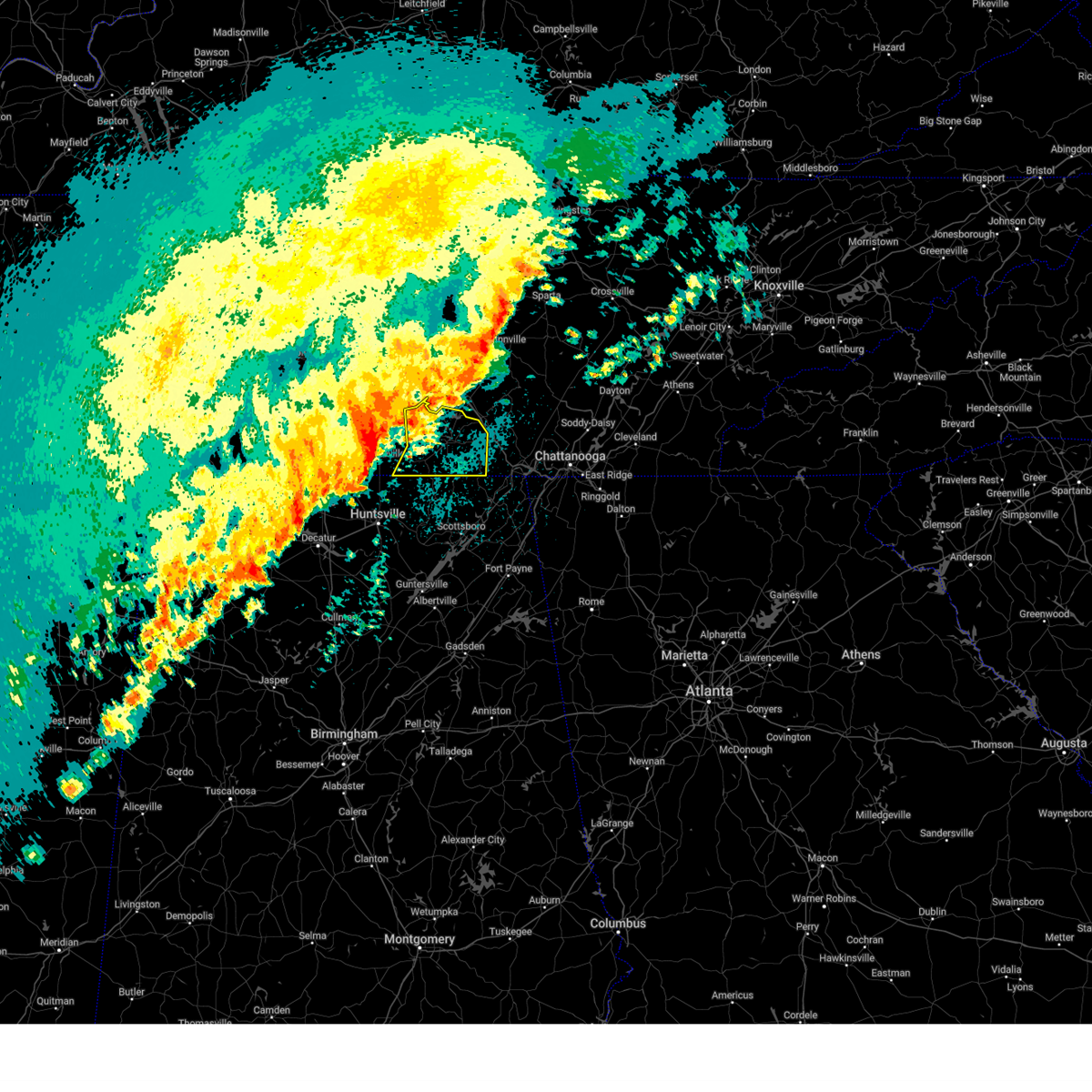
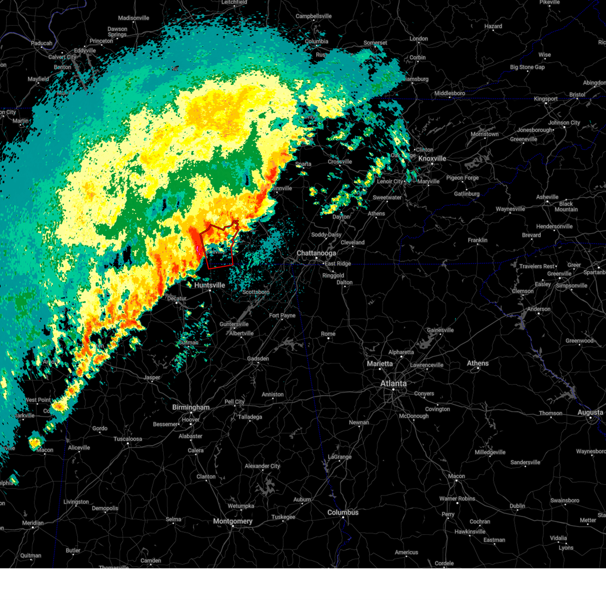
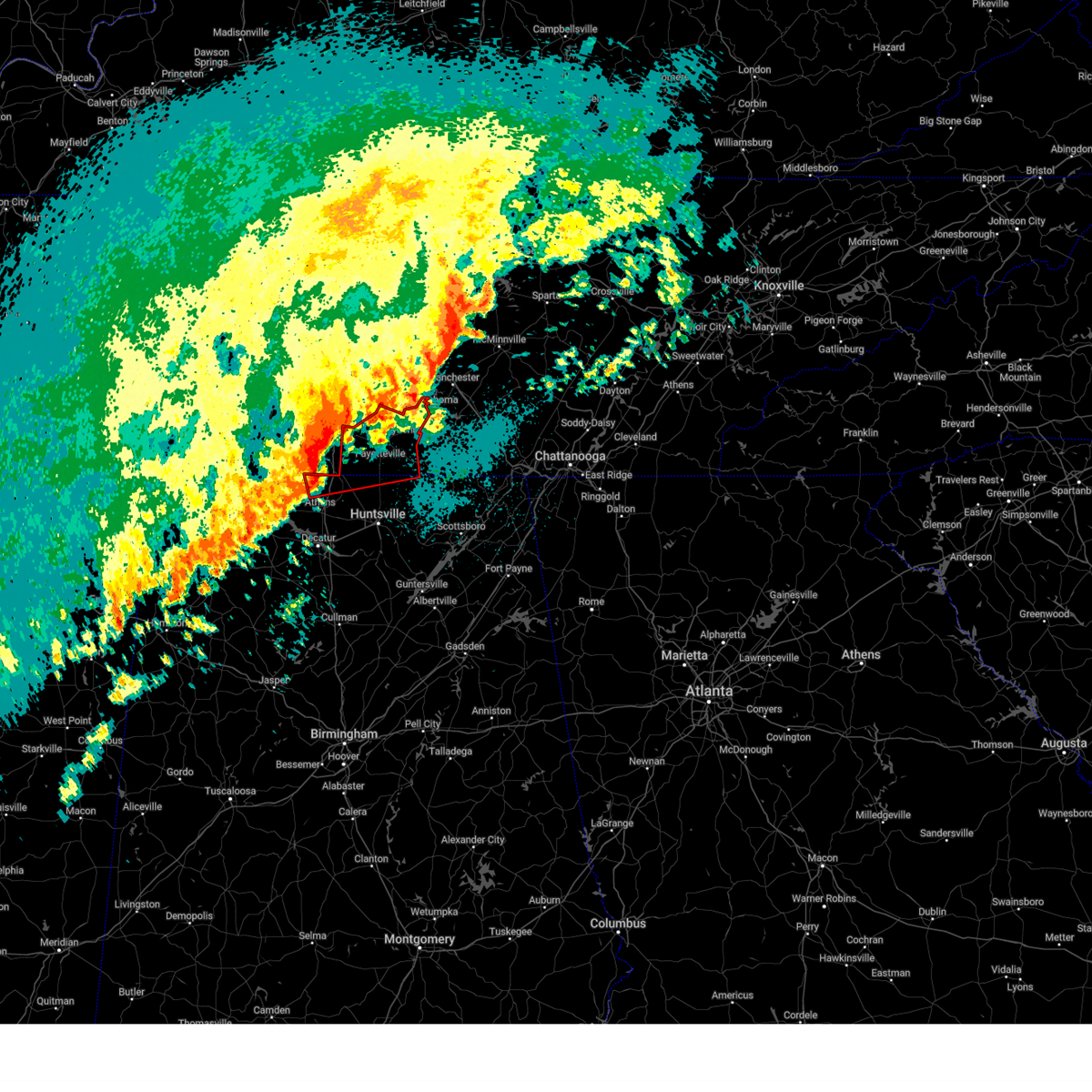
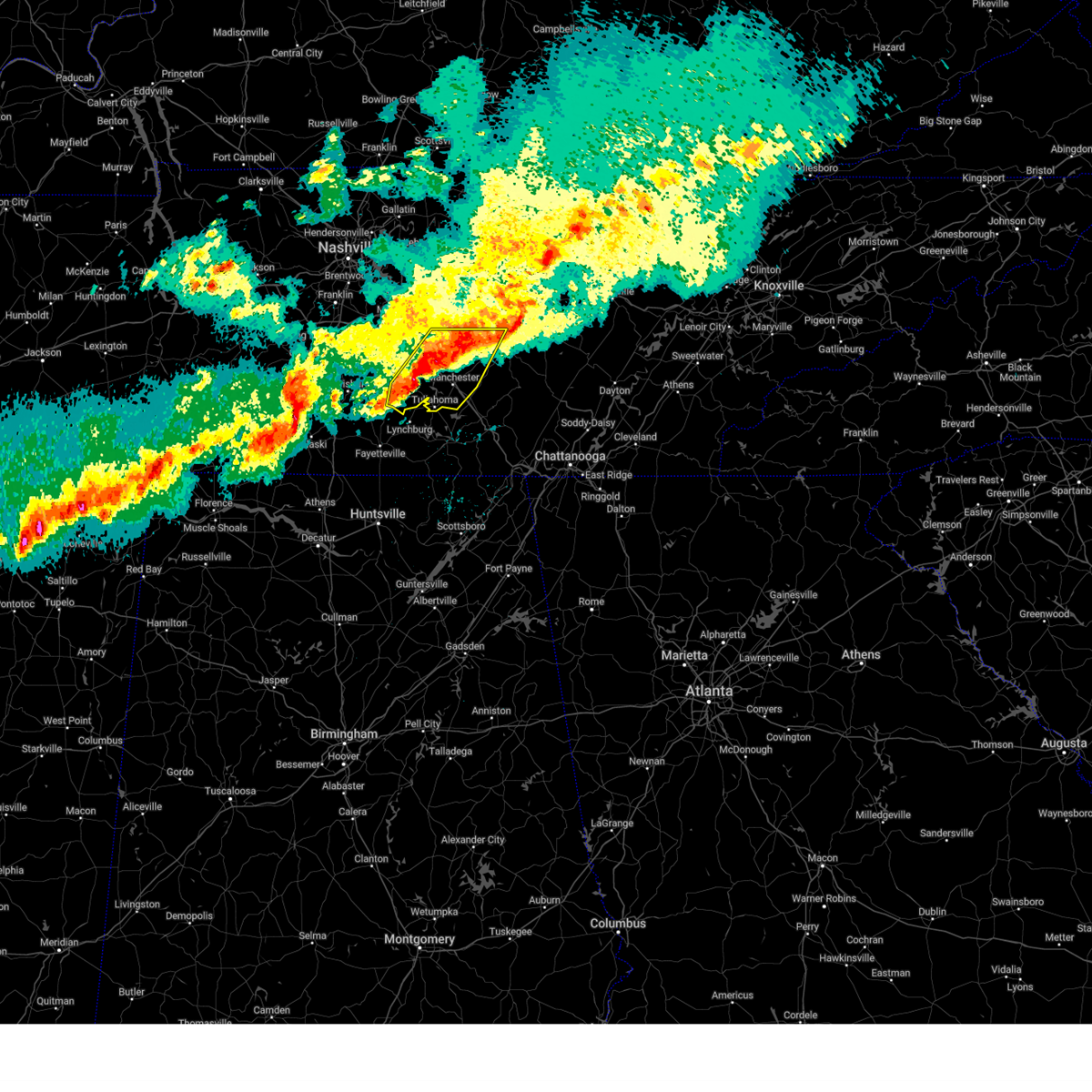
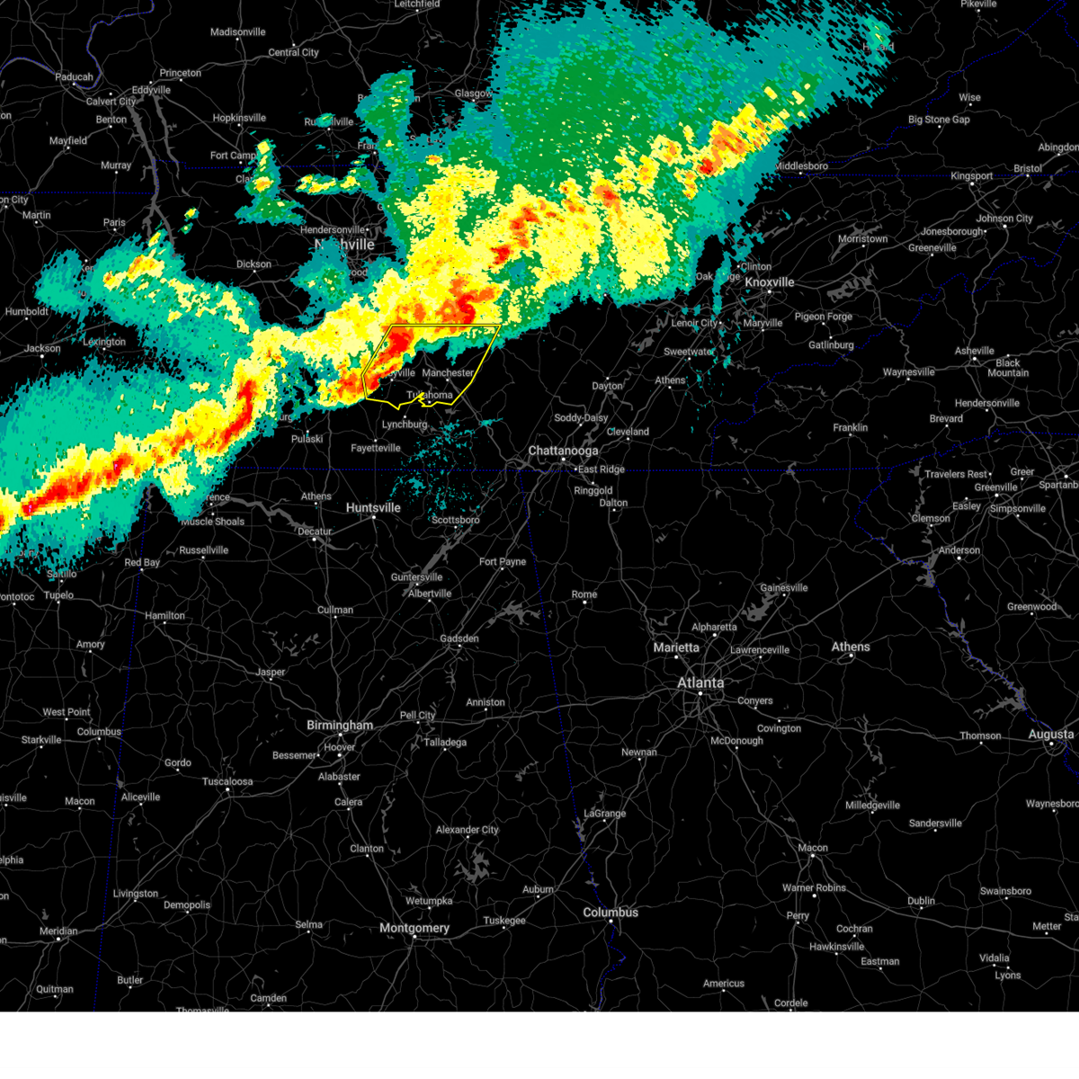
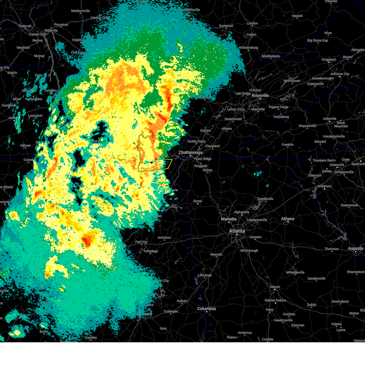
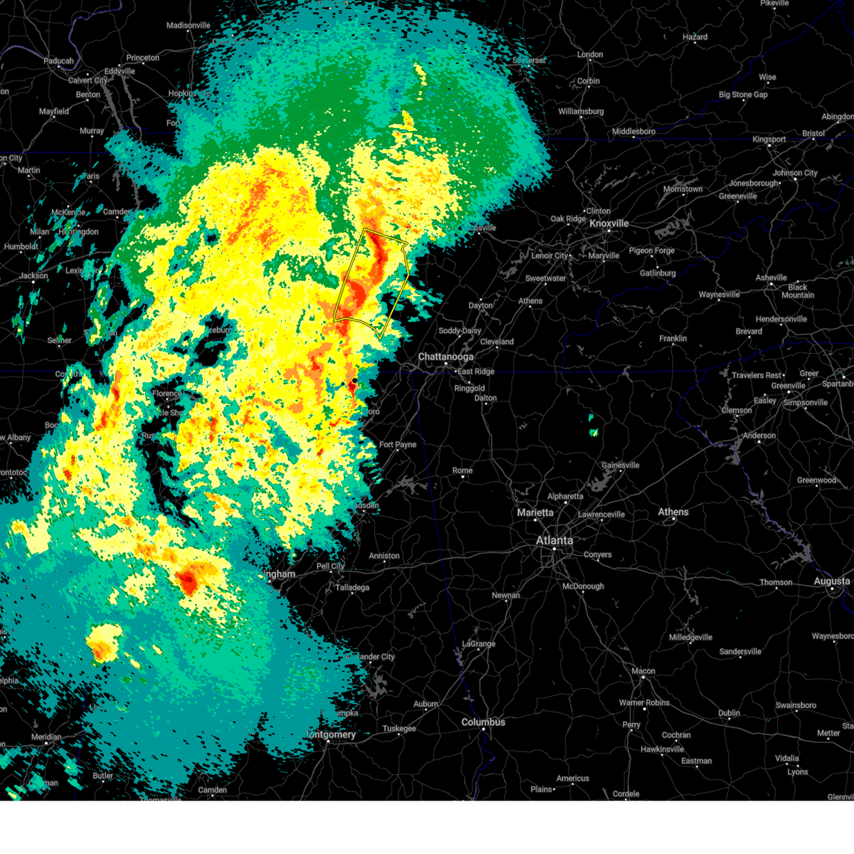
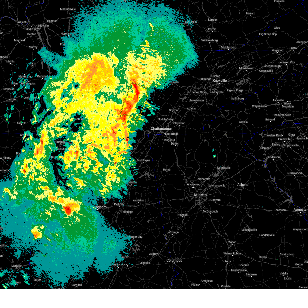
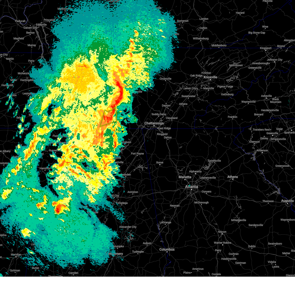
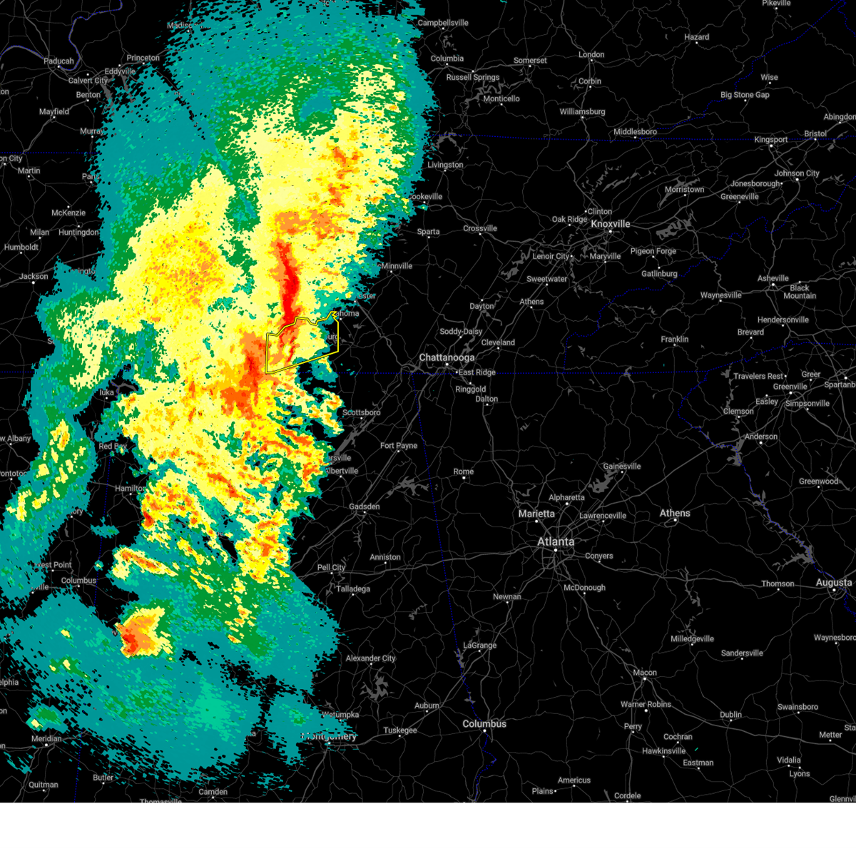
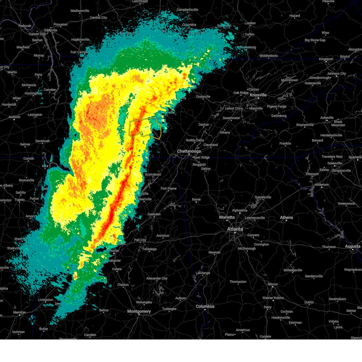
Hail Map for Tullahoma, TN
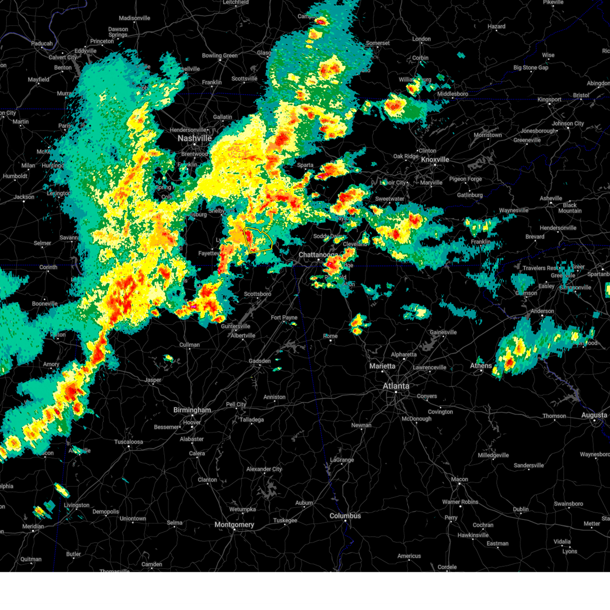
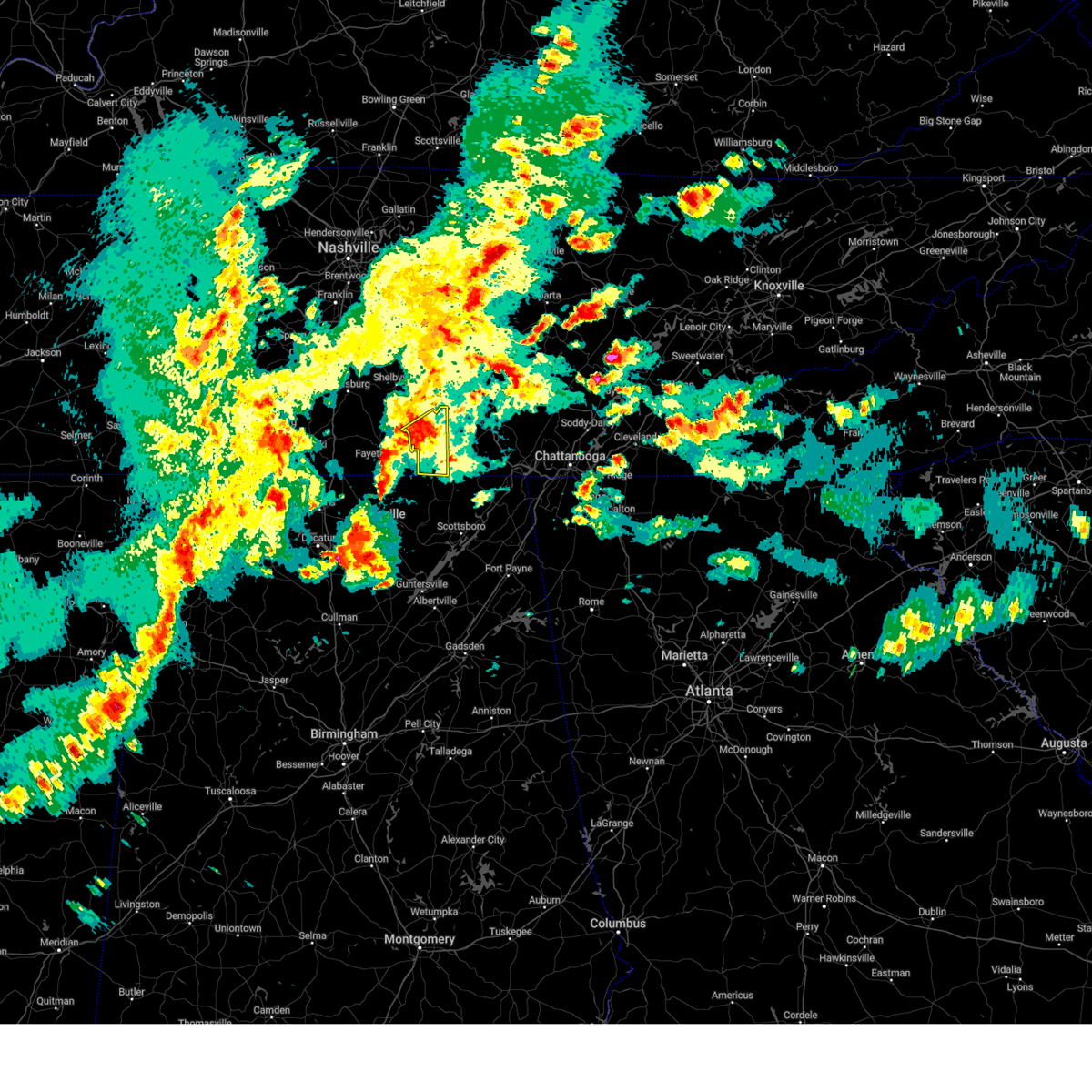
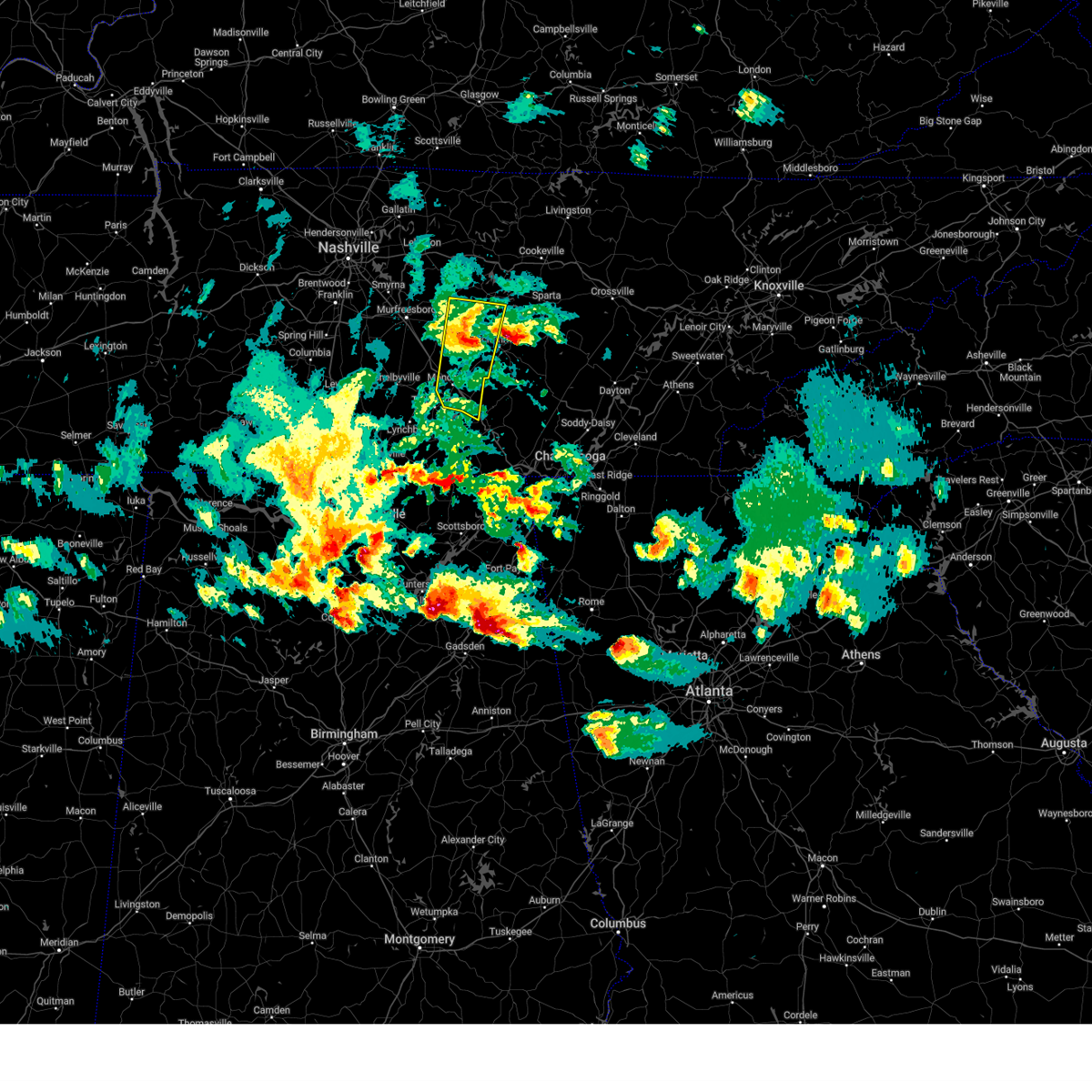
The Tullahoma, TN area has had 15 reports of on-the-ground hail by trained spotters, and has been under severe weather warnings 114 times during the past 12 months. Doppler radar has detected hail at or near Tullahoma, TN on 70 occasions, including 6 occasions during the past year.
| Name: | Tullahoma, TN |
| Where Located: | 55.9 miles WNW of Chattanooga, TN |
| Map: | Google Map for Tullahoma, TN |
| Population: | 18655 |
| Housing Units: | 8557 |
| More Info: | Search Google for Tullahoma, TN |
1
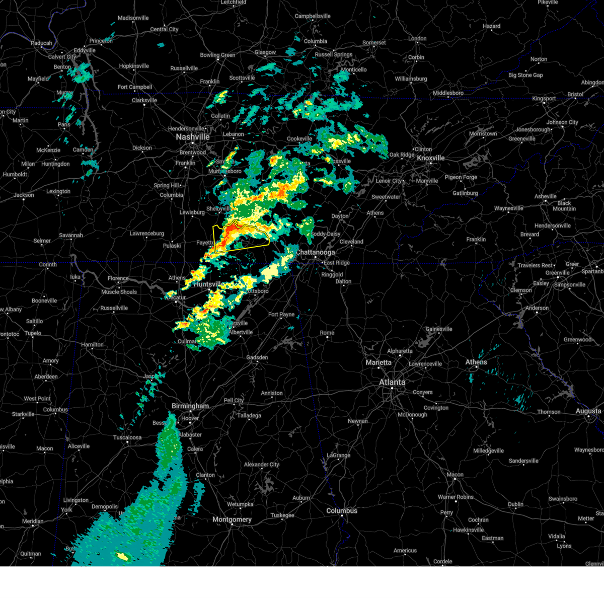
The Top Recent Hail Date for Tullahoma, TN is Monday, July 29, 2024 (16th out of 70)

Hail and Wind Damage Spotted near Tullahoma, TN
| Date / Time | Report Details |
|---|---|
| 6/7/2025 3:11 PM CDT |
 At 311 pm cdt, severe thunderstorms were located along a line extending from 14 miles south of woodbury to manchester to 8 miles northeast of estill springs, moving east at 45 mph (radar indicated). Hazards include 60 mph wind gusts and penny size hail. Expect damage to roofs, siding, and trees. locations impacted include, mcminnville, manchester, gruetli-laager, tracy city, monteagle, altamont, coalmont, morrison, palmer, beersheba springs, viola, summitville, hillsboro, pelham, arnold afb, and fiery gizzard state park. This includes interstate 24 between mile markers 100 and 136. At 311 pm cdt, severe thunderstorms were located along a line extending from 14 miles south of woodbury to manchester to 8 miles northeast of estill springs, moving east at 45 mph (radar indicated). Hazards include 60 mph wind gusts and penny size hail. Expect damage to roofs, siding, and trees. locations impacted include, mcminnville, manchester, gruetli-laager, tracy city, monteagle, altamont, coalmont, morrison, palmer, beersheba springs, viola, summitville, hillsboro, pelham, arnold afb, and fiery gizzard state park. This includes interstate 24 between mile markers 100 and 136.
|
| 6/7/2025 3:11 PM CDT |
 the severe thunderstorm warning has been cancelled and is no longer in effect the severe thunderstorm warning has been cancelled and is no longer in effect
|
| 6/7/2025 3:06 PM CDT |
 the severe thunderstorm warning has been cancelled and is no longer in effect the severe thunderstorm warning has been cancelled and is no longer in effect
|
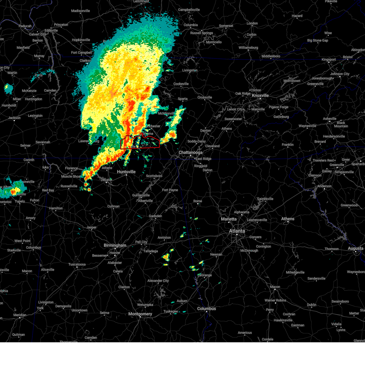
| 6/7/2025 3:06 PM CDT |
 At 305 pm cdt, severe thunderstorms were located along a line extending from near estill springs to section, moving east at 50 mph (emergency management). Hazards include 60 mph wind gusts. Expect damage to roofs, siding, and trees. Locations impacted include, scottsboro, winchester, bridgeport, decherd, henagar, estill springs, stevenson, cowan, hollywood, and skyline. At 305 pm cdt, severe thunderstorms were located along a line extending from near estill springs to section, moving east at 50 mph (emergency management). Hazards include 60 mph wind gusts. Expect damage to roofs, siding, and trees. Locations impacted include, scottsboro, winchester, bridgeport, decherd, henagar, estill springs, stevenson, cowan, hollywood, and skyline.
|
| 6/7/2025 3:02 PM CDT | Tspotter report of a large tree down at maplewood cemetery in tullahom in coffee county TN, 2.3 miles N of Tullahoma, TN |
| 6/7/2025 3:00 PM CDT | Tspotter report of power lines in road from a tree that fell on clements drive in tullahom in coffee county TN, 2.3 miles N of Tullahoma, TN |
| 6/7/2025 2:58 PM CDT |
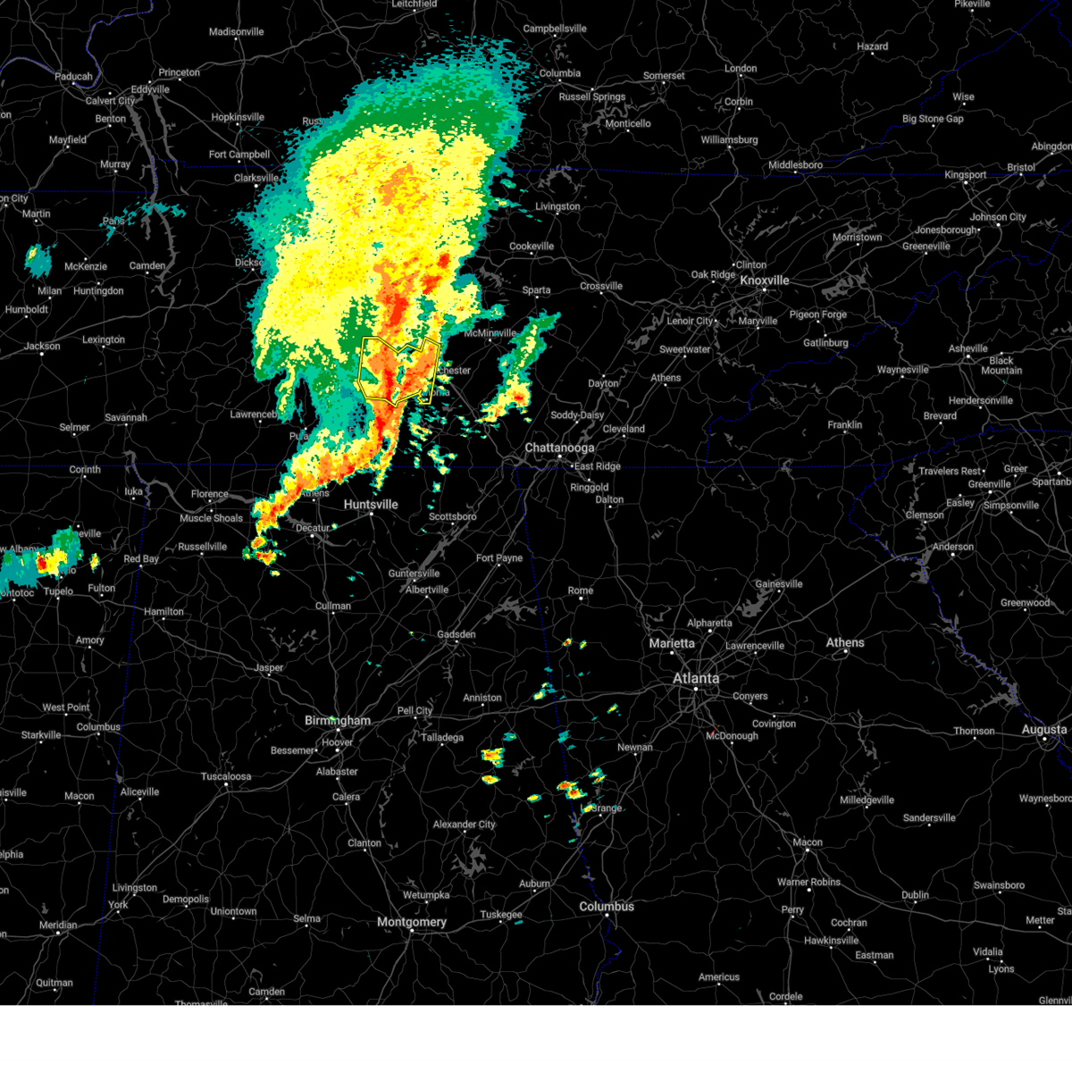
 Svrohx the national weather service in nashville has issued a * severe thunderstorm warning for, warren county in middle tennessee, coffee county in middle tennessee, southeastern bedford county in middle tennessee, grundy county in middle tennessee, * until 400 pm cdt. * at 258 pm cdt, severe thunderstorms were located along a line extending from 11 miles northeast of shelbyville to tullahoma, moving east at 40 mph (radar indicated). Hazards include 60 mph wind gusts and penny size hail. expect damage to roofs, siding, and trees Svrohx the national weather service in nashville has issued a * severe thunderstorm warning for, warren county in middle tennessee, coffee county in middle tennessee, southeastern bedford county in middle tennessee, grundy county in middle tennessee, * until 400 pm cdt. * at 258 pm cdt, severe thunderstorms were located along a line extending from 11 miles northeast of shelbyville to tullahoma, moving east at 40 mph (radar indicated). Hazards include 60 mph wind gusts and penny size hail. expect damage to roofs, siding, and trees
|
| 6/7/2025 2:51 PM CDT |
 Svrhun the national weather service in huntsville alabama has issued a * severe thunderstorm warning for, jackson county in northeastern alabama, northeastern dekalb county in northeastern alabama, eastern moore county in middle tennessee, franklin county in middle tennessee, * until 345 pm cdt. * at 250 pm cdt, severe thunderstorms were located along a line extending from near lynchburg to 6 miles east of woodville, moving east at 50 mph (radar indicated). Hazards include 60 mph wind gusts. expect damage to roofs, siding, and trees Svrhun the national weather service in huntsville alabama has issued a * severe thunderstorm warning for, jackson county in northeastern alabama, northeastern dekalb county in northeastern alabama, eastern moore county in middle tennessee, franklin county in middle tennessee, * until 345 pm cdt. * at 250 pm cdt, severe thunderstorms were located along a line extending from near lynchburg to 6 miles east of woodville, moving east at 50 mph (radar indicated). Hazards include 60 mph wind gusts. expect damage to roofs, siding, and trees
|
| 6/6/2025 10:54 PM CDT |
 The storm which prompted the warning has weakened below severe limits, and no longer poses an immediate threat to life or property. therefore, the warning will be allowed to expire. however, gusty winds and heavy rain are still possible with this thunderstorm. The storm which prompted the warning has weakened below severe limits, and no longer poses an immediate threat to life or property. therefore, the warning will be allowed to expire. however, gusty winds and heavy rain are still possible with this thunderstorm.
|
| 6/6/2025 10:30 PM CDT |
 At 1030 pm cdt, a severe thunderstorm was located near tims ford lake, or 8 miles southeast of lynchburg, moving east at 40 mph (radar indicated). Hazards include 60 mph wind gusts and quarter size hail. Hail damage to vehicles is expected. expect wind damage to roofs, siding, and trees. Locations impacted include, winchester, lynchburg, decherd, estill springs, cowan, tims ford lake, lexie crossroads, mulberry, harmony, and hurdlow. At 1030 pm cdt, a severe thunderstorm was located near tims ford lake, or 8 miles southeast of lynchburg, moving east at 40 mph (radar indicated). Hazards include 60 mph wind gusts and quarter size hail. Hail damage to vehicles is expected. expect wind damage to roofs, siding, and trees. Locations impacted include, winchester, lynchburg, decherd, estill springs, cowan, tims ford lake, lexie crossroads, mulberry, harmony, and hurdlow.
|
| 6/6/2025 10:02 PM CDT |
 Svrhun the national weather service in huntsville alabama has issued a * severe thunderstorm warning for, moore county in middle tennessee, central lincoln county in middle tennessee, central franklin county in middle tennessee, * until 1100 pm cdt. * at 1002 pm cdt, a severe thunderstorm was located near lynchburg, moving east at 40 mph (radar indicated). Hazards include 60 mph wind gusts and quarter size hail. Hail damage to vehicles is expected. Expect wind damage to roofs, siding, and trees. Svrhun the national weather service in huntsville alabama has issued a * severe thunderstorm warning for, moore county in middle tennessee, central lincoln county in middle tennessee, central franklin county in middle tennessee, * until 1100 pm cdt. * at 1002 pm cdt, a severe thunderstorm was located near lynchburg, moving east at 40 mph (radar indicated). Hazards include 60 mph wind gusts and quarter size hail. Hail damage to vehicles is expected. Expect wind damage to roofs, siding, and trees.
|
| 5/27/2025 9:12 PM CDT |
 Svrhun the national weather service in huntsville alabama has issued a * severe thunderstorm warning for, franklin county in middle tennessee, * until 1015 pm cdt. * at 911 pm cdt, severe thunderstorms were located along a line extending from 8 miles north of decherd to near estill springs to near winchester to near huntland, moving east at 15 mph (radar indicated). Hazards include 60 mph wind gusts. expect damage to roofs, siding, and trees Svrhun the national weather service in huntsville alabama has issued a * severe thunderstorm warning for, franklin county in middle tennessee, * until 1015 pm cdt. * at 911 pm cdt, severe thunderstorms were located along a line extending from 8 miles north of decherd to near estill springs to near winchester to near huntland, moving east at 15 mph (radar indicated). Hazards include 60 mph wind gusts. expect damage to roofs, siding, and trees
|
| 5/27/2025 9:01 PM CDT |
 At 900 pm cdt, a severe thunderstorm was located over tims ford lake, or near winchester, moving east at 20 mph (radar indicated). Hazards include 60 mph wind gusts. Expect damage to roofs, siding, and trees. locations impacted include, lexie crossroads, estill springs, harmony, hurdlow, sewanee, st. Andrews, marble hill, tims ford lake, decherd, and woods reservoir. At 900 pm cdt, a severe thunderstorm was located over tims ford lake, or near winchester, moving east at 20 mph (radar indicated). Hazards include 60 mph wind gusts. Expect damage to roofs, siding, and trees. locations impacted include, lexie crossroads, estill springs, harmony, hurdlow, sewanee, st. Andrews, marble hill, tims ford lake, decherd, and woods reservoir.
|
| 5/27/2025 9:00 PM CDT |
 The storm which prompted the warning has weakened below severe limits, and has exited the warned area. therefore, the warning will be allowed to expire. The storm which prompted the warning has weakened below severe limits, and has exited the warned area. therefore, the warning will be allowed to expire.
|
| 5/27/2025 8:44 PM CDT |
 At 844 pm cdt, a severe thunderstorm was located over tims ford lake, or 7 miles northwest of winchester, moving east at 25 mph (radar indicated). Hazards include 60 mph wind gusts. Expect damage to roofs, siding, and trees. locations impacted include, lexie crossroads, estill springs, harmony, hurdlow, lois, lynchburg, sewanee, st. Andrews, marble hill, and tims ford lake. At 844 pm cdt, a severe thunderstorm was located over tims ford lake, or 7 miles northwest of winchester, moving east at 25 mph (radar indicated). Hazards include 60 mph wind gusts. Expect damage to roofs, siding, and trees. locations impacted include, lexie crossroads, estill springs, harmony, hurdlow, lois, lynchburg, sewanee, st. Andrews, marble hill, and tims ford lake.
|
| 5/27/2025 8:44 PM CDT |
 the severe thunderstorm warning has been cancelled and is no longer in effect the severe thunderstorm warning has been cancelled and is no longer in effect
|
| 5/27/2025 8:43 PM CDT |
 At 842 pm cdt, a severe thunderstorm capable of producing a tornado was located near estill springs, or 9 miles north of winchester, moving northeast at 15 mph (radar indicated rotation). Hazards include tornado. Flying debris will be dangerous to those caught without shelter. mobile homes will be damaged or destroyed. damage to roofs, windows, and vehicles will occur. tree damage is likely. This tornadic thunderstorm will remain over mainly rural areas of northwestern franklin county, including the following locations, arnold afb. At 842 pm cdt, a severe thunderstorm capable of producing a tornado was located near estill springs, or 9 miles north of winchester, moving northeast at 15 mph (radar indicated rotation). Hazards include tornado. Flying debris will be dangerous to those caught without shelter. mobile homes will be damaged or destroyed. damage to roofs, windows, and vehicles will occur. tree damage is likely. This tornadic thunderstorm will remain over mainly rural areas of northwestern franklin county, including the following locations, arnold afb.
|
| 5/27/2025 8:31 PM CDT |
 Torhun the national weather service in huntsville alabama has issued a * tornado warning for, northwestern franklin county in middle tennessee, * until 900 pm cdt. * at 831 pm cdt, a severe thunderstorm capable of producing a tornado was located near estill springs, or 8 miles northwest of winchester, moving northeast at 15 mph (radar indicated rotation). Hazards include tornado. Flying debris will be dangerous to those caught without shelter. mobile homes will be damaged or destroyed. damage to roofs, windows, and vehicles will occur. tree damage is likely. this dangerous storm will be near, estill springs around 835 pm cdt. Other locations impacted by this tornadic thunderstorm include arnold afb and woods reservoir. Torhun the national weather service in huntsville alabama has issued a * tornado warning for, northwestern franklin county in middle tennessee, * until 900 pm cdt. * at 831 pm cdt, a severe thunderstorm capable of producing a tornado was located near estill springs, or 8 miles northwest of winchester, moving northeast at 15 mph (radar indicated rotation). Hazards include tornado. Flying debris will be dangerous to those caught without shelter. mobile homes will be damaged or destroyed. damage to roofs, windows, and vehicles will occur. tree damage is likely. this dangerous storm will be near, estill springs around 835 pm cdt. Other locations impacted by this tornadic thunderstorm include arnold afb and woods reservoir.
|
| 5/27/2025 8:20 PM CDT |
 Svrhun the national weather service in huntsville alabama has issued a * severe thunderstorm warning for, moore county in middle tennessee, northeastern lincoln county in middle tennessee, northern franklin county in middle tennessee, * until 915 pm cdt. * at 819 pm cdt, a severe thunderstorm was located over lynchburg, moving east at 10 mph (radar indicated). Hazards include 60 mph wind gusts. expect damage to roofs, siding, and trees Svrhun the national weather service in huntsville alabama has issued a * severe thunderstorm warning for, moore county in middle tennessee, northeastern lincoln county in middle tennessee, northern franklin county in middle tennessee, * until 915 pm cdt. * at 819 pm cdt, a severe thunderstorm was located over lynchburg, moving east at 10 mph (radar indicated). Hazards include 60 mph wind gusts. expect damage to roofs, siding, and trees
|
| 5/25/2025 4:20 PM CDT |
 At 419 pm cdt, a severe thunderstorm was located near winchester, moving east at 45 mph (emergency management). Hazards include 70 mph wind gusts and penny size hail. this line of storms has a history of producing numerous damaging wind reports across much of lincoln and moore counties. Expect considerable tree damage. damage is likely to mobile homes, roofs, and outbuildings. locations impacted include, jericho, huntland, elora, maxwell, st. Andrews, larkin, francisco, tims ford lake, beans creek, and woods reservoir. At 419 pm cdt, a severe thunderstorm was located near winchester, moving east at 45 mph (emergency management). Hazards include 70 mph wind gusts and penny size hail. this line of storms has a history of producing numerous damaging wind reports across much of lincoln and moore counties. Expect considerable tree damage. damage is likely to mobile homes, roofs, and outbuildings. locations impacted include, jericho, huntland, elora, maxwell, st. Andrews, larkin, francisco, tims ford lake, beans creek, and woods reservoir.
|
| 5/25/2025 4:18 PM CDT |
 At 418 pm cdt, a severe thunderstorm was located near winchester, moving east at 45 mph (law enforcement). Hazards include 70 mph wind gusts and penny size hail. Expect considerable tree damage. damage is likely to mobile homes, roofs, and outbuildings. locations impacted include, jericho, huntland, elora, maxwell, st. Andrews, larkin, francisco, tims ford lake, beans creek, and woods reservoir. At 418 pm cdt, a severe thunderstorm was located near winchester, moving east at 45 mph (law enforcement). Hazards include 70 mph wind gusts and penny size hail. Expect considerable tree damage. damage is likely to mobile homes, roofs, and outbuildings. locations impacted include, jericho, huntland, elora, maxwell, st. Andrews, larkin, francisco, tims ford lake, beans creek, and woods reservoir.
|
| 5/25/2025 4:18 PM CDT |
 At 417 pm cdt, a severe thunderstorm was located over manchester, moving east at 45 mph (radar indicated). Hazards include 60 mph wind gusts. Expect damage to roofs, siding, and trees. locations impacted include, manchester, gruetli-laager, tracy city, monteagle, altamont, coalmont, palmer, beersheba springs, hillsboro, pelham, arnold afb, and fiery gizzard state park. This includes interstate 24 between mile markers 111 and 135. At 417 pm cdt, a severe thunderstorm was located over manchester, moving east at 45 mph (radar indicated). Hazards include 60 mph wind gusts. Expect damage to roofs, siding, and trees. locations impacted include, manchester, gruetli-laager, tracy city, monteagle, altamont, coalmont, palmer, beersheba springs, hillsboro, pelham, arnold afb, and fiery gizzard state park. This includes interstate 24 between mile markers 111 and 135.
|
| 5/25/2025 4:16 PM CDT |
 At 416 pm cdt, a severe thunderstorm capable of producing a tornado was located near estill springs, or 7 miles north of winchester, moving east at 35 mph (radar indicated rotation). Hazards include tornado. Flying debris will be dangerous to those caught without shelter. mobile homes will be damaged or destroyed. damage to roofs, windows, and vehicles will occur. tree damage is likely. This tornadic thunderstorm will remain over mainly rural areas of northeastern franklin county, including the following locations, woods reservoir, alto, and arnold afb. At 416 pm cdt, a severe thunderstorm capable of producing a tornado was located near estill springs, or 7 miles north of winchester, moving east at 35 mph (radar indicated rotation). Hazards include tornado. Flying debris will be dangerous to those caught without shelter. mobile homes will be damaged or destroyed. damage to roofs, windows, and vehicles will occur. tree damage is likely. This tornadic thunderstorm will remain over mainly rural areas of northeastern franklin county, including the following locations, woods reservoir, alto, and arnold afb.
|
| 5/25/2025 4:11 PM CDT |
 The storms which prompted the warning have moved out of the area. therefore, the warning will be allowed to expire. a severe thunderstorm watch remains in effect until 1100 pm cdt for middle tennessee. The storms which prompted the warning have moved out of the area. therefore, the warning will be allowed to expire. a severe thunderstorm watch remains in effect until 1100 pm cdt for middle tennessee.
|
| 5/25/2025 4:10 PM CDT |
 the tornado warning has been cancelled and is no longer in effect the tornado warning has been cancelled and is no longer in effect
|
| 5/25/2025 4:10 PM CDT |
 At 409 pm cdt, a severe thunderstorm capable of producing a tornado was located near tims ford lake, or 8 miles east of lynchburg, moving east at 45 mph (radar indicated rotation). Hazards include tornado. Flying debris will be dangerous to those caught without shelter. mobile homes will be damaged or destroyed. damage to roofs, windows, and vehicles will occur. tree damage is likely. this dangerous storm will be near, estill springs and tims ford lake around 415 pm cdt. Other locations impacted by this tornadic thunderstorm include woods reservoir, alto, and arnold afb. At 409 pm cdt, a severe thunderstorm capable of producing a tornado was located near tims ford lake, or 8 miles east of lynchburg, moving east at 45 mph (radar indicated rotation). Hazards include tornado. Flying debris will be dangerous to those caught without shelter. mobile homes will be damaged or destroyed. damage to roofs, windows, and vehicles will occur. tree damage is likely. this dangerous storm will be near, estill springs and tims ford lake around 415 pm cdt. Other locations impacted by this tornadic thunderstorm include woods reservoir, alto, and arnold afb.
|
| 5/25/2025 4:05 PM CDT |
 Svrohx the national weather service in nashville has issued a * severe thunderstorm warning for, coffee county in middle tennessee, grundy county in middle tennessee, * until 500 pm cdt. * at 404 pm cdt, a severe thunderstorm was located near tullahoma, or 9 miles west of manchester, moving east at 45 mph (radar indicated). Hazards include 60 mph wind gusts. expect damage to roofs, siding, and trees Svrohx the national weather service in nashville has issued a * severe thunderstorm warning for, coffee county in middle tennessee, grundy county in middle tennessee, * until 500 pm cdt. * at 404 pm cdt, a severe thunderstorm was located near tullahoma, or 9 miles west of manchester, moving east at 45 mph (radar indicated). Hazards include 60 mph wind gusts. expect damage to roofs, siding, and trees
|
| 5/25/2025 4:05 PM CDT |
 At 404 pm cdt, a severe thunderstorm was located 7 miles south of lynchburg, moving east at 45 mph (law enforcement). Hazards include 70 mph wind gusts and penny size hail. 911 call center reported power poles down in petersburg at 350 pm cdt. Expect considerable tree damage. damage is likely to mobile homes, roofs, and outbuildings. locations impacted include, jericho, huntland, elora, hurdlow, lynchburg, maxwell, st. Andrews, larkin, smithland, and francisco. At 404 pm cdt, a severe thunderstorm was located 7 miles south of lynchburg, moving east at 45 mph (law enforcement). Hazards include 70 mph wind gusts and penny size hail. 911 call center reported power poles down in petersburg at 350 pm cdt. Expect considerable tree damage. damage is likely to mobile homes, roofs, and outbuildings. locations impacted include, jericho, huntland, elora, hurdlow, lynchburg, maxwell, st. Andrews, larkin, smithland, and francisco.
|
| 5/25/2025 4:02 PM CDT |
 At 402 pm cdt, a severe thunderstorm capable of producing a tornado was located near lynchburg, moving east at 45 mph (radar indicated rotation). Hazards include tornado. Flying debris will be dangerous to those caught without shelter. mobile homes will be damaged or destroyed. damage to roofs, windows, and vehicles will occur. tree damage is likely. this dangerous storm will be near, estill springs and tims ford lake around 410 pm cdt. Other locations impacted by this tornadic thunderstorm include woods reservoir, harmony, arnold afb, hurdlow, lois, alto, and marble hill. At 402 pm cdt, a severe thunderstorm capable of producing a tornado was located near lynchburg, moving east at 45 mph (radar indicated rotation). Hazards include tornado. Flying debris will be dangerous to those caught without shelter. mobile homes will be damaged or destroyed. damage to roofs, windows, and vehicles will occur. tree damage is likely. this dangerous storm will be near, estill springs and tims ford lake around 410 pm cdt. Other locations impacted by this tornadic thunderstorm include woods reservoir, harmony, arnold afb, hurdlow, lois, alto, and marble hill.
|
| 5/25/2025 4:01 PM CDT |
 At 400 pm cdt, severe thunderstorms were located along a line extending from 13 miles south of murfreesboro to near lynchburg, moving east at 45 mph (radar indicated). Hazards include 60 mph wind gusts. Expect damage to roofs, siding, and trees. locations impacted include, shelbyville, tullahoma, wartrace, bell buckle, normandy, beechgrove, and raus. This includes interstate 24 between mile markers 97 and 106. At 400 pm cdt, severe thunderstorms were located along a line extending from 13 miles south of murfreesboro to near lynchburg, moving east at 45 mph (radar indicated). Hazards include 60 mph wind gusts. Expect damage to roofs, siding, and trees. locations impacted include, shelbyville, tullahoma, wartrace, bell buckle, normandy, beechgrove, and raus. This includes interstate 24 between mile markers 97 and 106.
|
| 5/25/2025 3:55 PM CDT | Moore county ema reported a tree uprooted along main street in lynchburg t in moore county TN, 12 miles NE of Tullahoma, TN |
| 5/25/2025 3:45 PM CDT |
 Svrhun the national weather service in huntsville alabama has issued a * severe thunderstorm warning for, northwestern jackson county in northeastern alabama, northeastern madison county in north central alabama, moore county in middle tennessee, lincoln county in middle tennessee, franklin county in middle tennessee, * until 445 pm cdt. * at 345 pm cdt, a severe thunderstorm was located near fayetteville, moving east at 45 mph (radar indicated). Hazards include 70 mph wind gusts and penny size hail. Expect considerable tree damage. Damage is likely to mobile homes, roofs, and outbuildings. Svrhun the national weather service in huntsville alabama has issued a * severe thunderstorm warning for, northwestern jackson county in northeastern alabama, northeastern madison county in north central alabama, moore county in middle tennessee, lincoln county in middle tennessee, franklin county in middle tennessee, * until 445 pm cdt. * at 345 pm cdt, a severe thunderstorm was located near fayetteville, moving east at 45 mph (radar indicated). Hazards include 70 mph wind gusts and penny size hail. Expect considerable tree damage. Damage is likely to mobile homes, roofs, and outbuildings.
|
| 5/25/2025 3:44 PM CDT |
 the severe thunderstorm warning has been cancelled and is no longer in effect the severe thunderstorm warning has been cancelled and is no longer in effect
|
| 5/25/2025 3:44 PM CDT |
 At 344 pm cdt, severe thunderstorms were located along a line extending from 12 miles north of shelbyville to 6 miles north of fayetteville, moving east at 45 mph (radar indicated). Hazards include 60 mph wind gusts. Expect damage to roofs, siding, and trees. locations impacted include, shelbyville, tullahoma, wartrace, bell buckle, normandy, rover, deason, beechgrove, raus, and unionville. This includes interstate 24 between mile markers 97 and 106. At 344 pm cdt, severe thunderstorms were located along a line extending from 12 miles north of shelbyville to 6 miles north of fayetteville, moving east at 45 mph (radar indicated). Hazards include 60 mph wind gusts. Expect damage to roofs, siding, and trees. locations impacted include, shelbyville, tullahoma, wartrace, bell buckle, normandy, rover, deason, beechgrove, raus, and unionville. This includes interstate 24 between mile markers 97 and 106.
|
| 5/25/2025 3:41 PM CDT |
 Torhun the national weather service in huntsville alabama has issued a * tornado warning for, moore county in middle tennessee, central lincoln county in middle tennessee, northern franklin county in middle tennessee, * until 430 pm cdt. * at 341 pm cdt, a severe thunderstorm capable of producing a tornado was located near fayetteville, moving east at 45 mph (radar indicated rotation). Hazards include tornado. Flying debris will be dangerous to those caught without shelter. mobile homes will be damaged or destroyed. damage to roofs, windows, and vehicles will occur. tree damage is likely. this dangerous storm will be near, lynchburg around 350 pm cdt. tims ford lake around 400 pm cdt. estill springs around 410 pm cdt. winchester and decherd around 415 pm cdt. Other locations impacted by this tornadic thunderstorm include mulberry, chestnut ridge, howell, harmony, belleville, hurdlow, lois, mimosa, booneville, and marble hill. Torhun the national weather service in huntsville alabama has issued a * tornado warning for, moore county in middle tennessee, central lincoln county in middle tennessee, northern franklin county in middle tennessee, * until 430 pm cdt. * at 341 pm cdt, a severe thunderstorm capable of producing a tornado was located near fayetteville, moving east at 45 mph (radar indicated rotation). Hazards include tornado. Flying debris will be dangerous to those caught without shelter. mobile homes will be damaged or destroyed. damage to roofs, windows, and vehicles will occur. tree damage is likely. this dangerous storm will be near, lynchburg around 350 pm cdt. tims ford lake around 400 pm cdt. estill springs around 410 pm cdt. winchester and decherd around 415 pm cdt. Other locations impacted by this tornadic thunderstorm include mulberry, chestnut ridge, howell, harmony, belleville, hurdlow, lois, mimosa, booneville, and marble hill.
|
| 5/25/2025 3:24 PM CDT |
 Svrohx the national weather service in nashville has issued a * severe thunderstorm warning for, marshall county in middle tennessee, western coffee county in middle tennessee, bedford county in middle tennessee, * until 415 pm cdt. * at 323 pm cdt, severe thunderstorms were located along a line extending from 9 miles east of spring hill to 11 miles southwest of petersburg, moving east at 45 mph (radar indicated). Hazards include 60 mph wind gusts. expect damage to roofs, siding, and trees Svrohx the national weather service in nashville has issued a * severe thunderstorm warning for, marshall county in middle tennessee, western coffee county in middle tennessee, bedford county in middle tennessee, * until 415 pm cdt. * at 323 pm cdt, severe thunderstorms were located along a line extending from 9 miles east of spring hill to 11 miles southwest of petersburg, moving east at 45 mph (radar indicated). Hazards include 60 mph wind gusts. expect damage to roofs, siding, and trees
|
| 5/20/2025 3:39 PM CDT |
 The storm which prompted the warning has moved out of the area. therefore, the warning will be allowed to expire. a tornado watch remains in effect until 1000 pm cdt for north central and northeastern alabama, and middle tennessee. The storm which prompted the warning has moved out of the area. therefore, the warning will be allowed to expire. a tornado watch remains in effect until 1000 pm cdt for north central and northeastern alabama, and middle tennessee.
|
| 5/20/2025 3:37 PM CDT |
 Torhun the national weather service in huntsville alabama has issued a * tornado warning for, northeastern franklin county in middle tennessee, * until 430 pm cdt. * at 337 pm cdt, a severe thunderstorm capable of producing a tornado was located over tims ford lake, or near winchester, moving east at 35 mph (radar indicated rotation). Hazards include tornado and half dollar size hail. Flying debris will be dangerous to those caught without shelter. mobile homes will be damaged or destroyed. damage to roofs, windows, and vehicles will occur. tree damage is likely. this dangerous storm will be near, winchester, estill springs, tims ford lake, and decherd around 345 pm cdt. sewanee around 400 pm cdt. other locations impacted by this tornadic thunderstorm include alto, st. Andrews, woods reservoir, and arnold afb. Torhun the national weather service in huntsville alabama has issued a * tornado warning for, northeastern franklin county in middle tennessee, * until 430 pm cdt. * at 337 pm cdt, a severe thunderstorm capable of producing a tornado was located over tims ford lake, or near winchester, moving east at 35 mph (radar indicated rotation). Hazards include tornado and half dollar size hail. Flying debris will be dangerous to those caught without shelter. mobile homes will be damaged or destroyed. damage to roofs, windows, and vehicles will occur. tree damage is likely. this dangerous storm will be near, winchester, estill springs, tims ford lake, and decherd around 345 pm cdt. sewanee around 400 pm cdt. other locations impacted by this tornadic thunderstorm include alto, st. Andrews, woods reservoir, and arnold afb.
|
| 5/20/2025 3:18 PM CDT |
 At 318 pm cdt, a severe thunderstorm capable of producing a tornado was located near lynchburg, moving east at 30 mph (radar indicated rotation). Hazards include tornado and quarter size hail. Flying debris will be dangerous to those caught without shelter. mobile homes will be damaged or destroyed. damage to roofs, windows, and vehicles will occur. tree damage is likely. this dangerous storm will be near, tims ford lake around 325 pm cdt. winchester around 335 pm cdt. Other locations impacted by this tornadic thunderstorm include hurdlow, lois, marble hill, harmony, and arnold afb. At 318 pm cdt, a severe thunderstorm capable of producing a tornado was located near lynchburg, moving east at 30 mph (radar indicated rotation). Hazards include tornado and quarter size hail. Flying debris will be dangerous to those caught without shelter. mobile homes will be damaged or destroyed. damage to roofs, windows, and vehicles will occur. tree damage is likely. this dangerous storm will be near, tims ford lake around 325 pm cdt. winchester around 335 pm cdt. Other locations impacted by this tornadic thunderstorm include hurdlow, lois, marble hill, harmony, and arnold afb.
|
| 5/20/2025 3:18 PM CDT |
 the tornado warning has been cancelled and is no longer in effect the tornado warning has been cancelled and is no longer in effect
|
| 5/20/2025 2:55 PM CDT | Torhun the national weather service in huntsville alabama has issued a * tornado warning for, moore county in middle tennessee, northeastern lincoln county in middle tennessee, northwestern franklin county in middle tennessee, * until 345 pm cdt. * at 255 pm cdt, a severe thunderstorm capable of producing a tornado was located over fayetteville, moving east at 30 mph (radar indicated rotation). Hazards include tornado. Flying debris will be dangerous to those caught without shelter. mobile homes will be damaged or destroyed. damage to roofs, windows, and vehicles will occur. tree damage is likely. this dangerous storm will be near, tims ford lake around 320 pm cdt. winchester around 330 pm cdt. Other locations impacted by this tornadic thunderstorm include lexie crossroads, mulberry, harmony, belleville, hurdlow, lois, mimosa, booneville, marble hill, and belvidere. |
| 5/8/2025 7:15 PM CDT |
 At 714 pm cdt, a severe thunderstorm was located near tims ford lake, or 7 miles southeast of lynchburg, moving east at 20 mph (radar indicated). Hazards include 60 mph wind gusts and half dollar size hail. Hail damage to vehicles is expected. expect wind damage to roofs, siding, and trees. Locations impacted include, lexie crossroads, estill springs, harmony, hurdlow, lois, marble hill, smithland, tims ford lake, decherd, and woods reservoir. At 714 pm cdt, a severe thunderstorm was located near tims ford lake, or 7 miles southeast of lynchburg, moving east at 20 mph (radar indicated). Hazards include 60 mph wind gusts and half dollar size hail. Hail damage to vehicles is expected. expect wind damage to roofs, siding, and trees. Locations impacted include, lexie crossroads, estill springs, harmony, hurdlow, lois, marble hill, smithland, tims ford lake, decherd, and woods reservoir.
|
| 5/8/2025 7:02 PM CDT |
 Svrhun the national weather service in huntsville alabama has issued a * severe thunderstorm warning for, moore county in middle tennessee, northeastern lincoln county in middle tennessee, central franklin county in middle tennessee, * until 800 pm cdt. * at 702 pm cdt, a severe thunderstorm was located near lynchburg, moving east at 20 mph (radar indicated). Hazards include 60 mph wind gusts and half dollar size hail. Hail damage to vehicles is expected. Expect wind damage to roofs, siding, and trees. Svrhun the national weather service in huntsville alabama has issued a * severe thunderstorm warning for, moore county in middle tennessee, northeastern lincoln county in middle tennessee, central franklin county in middle tennessee, * until 800 pm cdt. * at 702 pm cdt, a severe thunderstorm was located near lynchburg, moving east at 20 mph (radar indicated). Hazards include 60 mph wind gusts and half dollar size hail. Hail damage to vehicles is expected. Expect wind damage to roofs, siding, and trees.
|
| 5/8/2025 6:51 PM CDT | The storm which prompted the warning has moved out of the area. therefore, the warning will be allowed to expire. a severe thunderstorm watch remains in effect until 1000 pm cdt for north central and northeastern alabama, and middle tennessee. remember, a severe thunderstorm warning still remains in effect for portions of lincoln county until 7:15 pm. |
| 5/8/2025 5:58 PM CDT |
 Svrhun the national weather service in huntsville alabama has issued a * severe thunderstorm warning for, northern moore county in middle tennessee, northwestern lincoln county in middle tennessee, * until 700 pm cdt. * at 558 pm cdt, a severe thunderstorm was located 10 miles southwest of petersburg, or 13 miles northwest of fayetteville, moving northeast at 20 mph (radar indicated). Hazards include 60 mph wind gusts and quarter size hail. Hail damage to vehicles is expected. Expect wind damage to roofs, siding, and trees. Svrhun the national weather service in huntsville alabama has issued a * severe thunderstorm warning for, northern moore county in middle tennessee, northwestern lincoln county in middle tennessee, * until 700 pm cdt. * at 558 pm cdt, a severe thunderstorm was located 10 miles southwest of petersburg, or 13 miles northwest of fayetteville, moving northeast at 20 mph (radar indicated). Hazards include 60 mph wind gusts and quarter size hail. Hail damage to vehicles is expected. Expect wind damage to roofs, siding, and trees.
|
| 5/2/2025 4:56 PM CDT | Tree reported down at cobb hollow and hurricane creek rd in moore county tn by em in moore county TN, 6.7 miles NE of Tullahoma, TN |
| 5/2/2025 3:07 PM CDT |
 Svrhun the national weather service in huntsville alabama has issued a * severe thunderstorm warning for, northeastern franklin county in middle tennessee, * until 345 pm cdt. * at 307 pm cdt, a severe thunderstorm was located over estill springs, or near winchester, moving northeast at 35 mph (radar indicated). Hazards include 60 mph wind gusts and quarter size hail. Hail damage to vehicles is expected. Expect wind damage to roofs, siding, and trees. Svrhun the national weather service in huntsville alabama has issued a * severe thunderstorm warning for, northeastern franklin county in middle tennessee, * until 345 pm cdt. * at 307 pm cdt, a severe thunderstorm was located over estill springs, or near winchester, moving northeast at 35 mph (radar indicated). Hazards include 60 mph wind gusts and quarter size hail. Hail damage to vehicles is expected. Expect wind damage to roofs, siding, and trees.
|
| 5/2/2025 3:01 PM CDT |
 the severe thunderstorm warning has been cancelled and is no longer in effect the severe thunderstorm warning has been cancelled and is no longer in effect
|
| 5/2/2025 3:01 PM CDT |
 At 301 pm cdt, a severe thunderstorm was located near tims ford lake, or 8 miles west of winchester, moving east at 25 mph (radar indicated). Hazards include 60 mph wind gusts and penny size hail. Expect damage to roofs, siding, and trees. Locations impacted include, lexie crossroads, estill springs, harmony, huntland, hurdlow, lois, maxwell, marble hill, tims ford lake, and beans creek. At 301 pm cdt, a severe thunderstorm was located near tims ford lake, or 8 miles west of winchester, moving east at 25 mph (radar indicated). Hazards include 60 mph wind gusts and penny size hail. Expect damage to roofs, siding, and trees. Locations impacted include, lexie crossroads, estill springs, harmony, huntland, hurdlow, lois, maxwell, marble hill, tims ford lake, and beans creek.
|
| 5/2/2025 2:50 PM CDT | At 249 pm cdt, a severe thunderstorm was located 7 miles northwest of huntland, or 9 miles south of lynchburg, moving east at 35 mph (radar indicated). Hazards include 60 mph wind gusts and penny size hail. Expect damage to roofs, siding, and trees. Locations impacted include, huntland, elora, hurdlow, lynchburg, maxwell, mimosa, smithland, tims ford lake, beans creek, and lincoln. |
| 5/2/2025 2:29 PM CDT | Svrhun the national weather service in huntsville alabama has issued a * severe thunderstorm warning for, moore county in middle tennessee, lincoln county in middle tennessee, western franklin county in middle tennessee, * until 330 pm cdt. * at 229 pm cdt, a severe thunderstorm was located near fayetteville, moving east at 25 mph (radar indicated). Hazards include 60 mph wind gusts and penny size hail. expect damage to roofs, siding, and trees |
| 5/2/2025 2:19 PM CDT | the severe thunderstorm warning has been cancelled and is no longer in effect |
| 5/2/2025 2:03 PM CDT | the severe thunderstorm warning has been cancelled and is no longer in effect |
| 5/2/2025 2:03 PM CDT | At 203 pm cdt, a severe thunderstorm was located near lynchburg, moving north at 25 mph (public). Hazards include 60 mph wind gusts and quarter size hail. Hail damage to vehicles is expected. expect wind damage to roofs, siding, and trees. Locations impacted include, lois, lynchburg, and tims ford lake. |
| 5/2/2025 1:55 PM CDT | Ping Pong Ball sized hail reported 9.8 miles ENE of Tullahoma, TN |
| 5/2/2025 1:50 PM CDT | Quarter sized hail reported 11.6 miles ENE of Tullahoma, TN, report relayed via social media. |
| 5/2/2025 1:46 PM CDT | Svrhun the national weather service in huntsville alabama has issued a * severe thunderstorm warning for, moore county in middle tennessee, northeastern lincoln county in middle tennessee, northwestern franklin county in middle tennessee, * until 245 pm cdt. * at 145 pm cdt, a severe thunderstorm was located near lynchburg, moving north at 25 mph (radar indicated). Hazards include 60 mph wind gusts and quarter size hail. Hail damage to vehicles is expected. Expect wind damage to roofs, siding, and trees. |
| 4/10/2025 6:30 PM CDT |
 the severe thunderstorm warning has been cancelled and is no longer in effect the severe thunderstorm warning has been cancelled and is no longer in effect
|
| 4/10/2025 6:30 PM CDT |
 At 630 pm cdt, severe thunderstorms were located along a line extending from near smithville to 6 miles northeast of estill springs, moving east at 40 mph (radar indicated). Hazards include 60 mph wind gusts. Expect damage to roofs, siding, and trees. locations impacted include, woodbury, morrison, hillsboro, centertown, manchester, viola, summitville, auburntown, arnold afb, and mcminnville. This includes interstate 24 between mile markers 104 and 126. At 630 pm cdt, severe thunderstorms were located along a line extending from near smithville to 6 miles northeast of estill springs, moving east at 40 mph (radar indicated). Hazards include 60 mph wind gusts. Expect damage to roofs, siding, and trees. locations impacted include, woodbury, morrison, hillsboro, centertown, manchester, viola, summitville, auburntown, arnold afb, and mcminnville. This includes interstate 24 between mile markers 104 and 126.
|
| 4/10/2025 5:52 PM CDT |
 Svrohx the national weather service in nashville has issued a * severe thunderstorm warning for, southwestern de kalb county in middle tennessee, southeastern rutherford county in middle tennessee, western warren county in middle tennessee, coffee county in middle tennessee, bedford county in middle tennessee, cannon county in middle tennessee, * until 645 pm cdt. * at 551 pm cdt, severe thunderstorms were located along a line extending from near walterhill to near petersburg, moving east at 25 mph (radar indicated). Hazards include 60 mph wind gusts. expect damage to roofs, siding, and trees Svrohx the national weather service in nashville has issued a * severe thunderstorm warning for, southwestern de kalb county in middle tennessee, southeastern rutherford county in middle tennessee, western warren county in middle tennessee, coffee county in middle tennessee, bedford county in middle tennessee, cannon county in middle tennessee, * until 645 pm cdt. * at 551 pm cdt, severe thunderstorms were located along a line extending from near walterhill to near petersburg, moving east at 25 mph (radar indicated). Hazards include 60 mph wind gusts. expect damage to roofs, siding, and trees
|
| 4/6/2025 12:25 AM CDT |
 The storm which prompted the warning has weakened below severe limits, and no longer appears capable of producing a tornado. therefore, the warning will be allowed to expire. however, gusty winds are still possible with this thunderstorm. a tornado watch remains in effect until 300 am cdt for north central alabama, and middle tennessee. The storm which prompted the warning has weakened below severe limits, and no longer appears capable of producing a tornado. therefore, the warning will be allowed to expire. however, gusty winds are still possible with this thunderstorm. a tornado watch remains in effect until 300 am cdt for north central alabama, and middle tennessee.
|
| 4/6/2025 12:24 AM CDT |
 At 1223 am cdt, severe thunderstorms were located along a line extending from near tullahoma to near tims ford lake to 6 miles west of huntland, moving east at 40 mph (radar indicated). Hazards include 60 mph wind gusts. Expect damage to roofs, siding, and trees. locations impacted include, huntland, elora, hurdlow, lynchburg, maxwell, st. Andrews, smithland, tims ford lake, beans creek, and woods reservoir. At 1223 am cdt, severe thunderstorms were located along a line extending from near tullahoma to near tims ford lake to 6 miles west of huntland, moving east at 40 mph (radar indicated). Hazards include 60 mph wind gusts. Expect damage to roofs, siding, and trees. locations impacted include, huntland, elora, hurdlow, lynchburg, maxwell, st. Andrews, smithland, tims ford lake, beans creek, and woods reservoir.
|
| 4/6/2025 12:24 AM CDT |
 Svrohx the national weather service in nashville has issued a * severe thunderstorm warning for, southwestern warren county in middle tennessee, coffee county in middle tennessee, grundy county in middle tennessee, * until 115 am cdt. * at 1224 am cdt, severe thunderstorms were located along a line extending from near tullahoma to near huntland, moving northeast at 50 mph (radar indicated). Hazards include 60 mph wind gusts and penny size hail. expect damage to roofs, siding, and trees Svrohx the national weather service in nashville has issued a * severe thunderstorm warning for, southwestern warren county in middle tennessee, coffee county in middle tennessee, grundy county in middle tennessee, * until 115 am cdt. * at 1224 am cdt, severe thunderstorms were located along a line extending from near tullahoma to near huntland, moving northeast at 50 mph (radar indicated). Hazards include 60 mph wind gusts and penny size hail. expect damage to roofs, siding, and trees
|
| 4/6/2025 12:20 AM CDT |
 At 1219 am cdt, a severe thunderstorm capable of producing a tornado was located near huntland, or 9 miles south of lynchburg, moving northeast at 45 mph (radar indicated rotation). Hazards include tornado. Flying debris will be dangerous to those caught without shelter. mobile homes will be damaged or destroyed. damage to roofs, windows, and vehicles will occur. tree damage is likely. Locations impacted include, smithland, flintville, elora, hurdlow, lois, lynchburg, marble hill, and tims ford lake. At 1219 am cdt, a severe thunderstorm capable of producing a tornado was located near huntland, or 9 miles south of lynchburg, moving northeast at 45 mph (radar indicated rotation). Hazards include tornado. Flying debris will be dangerous to those caught without shelter. mobile homes will be damaged or destroyed. damage to roofs, windows, and vehicles will occur. tree damage is likely. Locations impacted include, smithland, flintville, elora, hurdlow, lois, lynchburg, marble hill, and tims ford lake.
|
| 4/6/2025 12:20 AM CDT |
 the tornado warning has been cancelled and is no longer in effect the tornado warning has been cancelled and is no longer in effect
|
| 4/6/2025 12:16 AM CDT |
 Svrhun the national weather service in huntsville alabama has issued a * severe thunderstorm warning for, moore county in middle tennessee, eastern lincoln county in middle tennessee, franklin county in middle tennessee, * until 115 am cdt. * at 1215 am cdt, severe thunderstorms were located along a line extending from near lynchburg to 8 miles northwest of huntland to 8 miles north of new market, moving east at 40 mph (radar indicated). Hazards include 60 mph wind gusts. expect damage to roofs, siding, and trees Svrhun the national weather service in huntsville alabama has issued a * severe thunderstorm warning for, moore county in middle tennessee, eastern lincoln county in middle tennessee, franklin county in middle tennessee, * until 115 am cdt. * at 1215 am cdt, severe thunderstorms were located along a line extending from near lynchburg to 8 miles northwest of huntland to 8 miles north of new market, moving east at 40 mph (radar indicated). Hazards include 60 mph wind gusts. expect damage to roofs, siding, and trees
|
| 4/6/2025 12:07 AM CDT |
 At 1207 am cdt, a severe thunderstorm capable of producing a tornado was located 7 miles southeast of fayetteville, moving east at 45 mph (radar indicated rotation). Hazards include tornado. Flying debris will be dangerous to those caught without shelter. mobile homes will be damaged or destroyed. damage to roofs, windows, and vehicles will occur. tree damage is likely. This tornadic thunderstorm will remain over mainly rural areas of north central madison, moore and lincoln counties, including the following locations, mulberry, chestnut ridge, howell, belleville, elora, hurdlow, belleview, lois, mimosa, and booneville. At 1207 am cdt, a severe thunderstorm capable of producing a tornado was located 7 miles southeast of fayetteville, moving east at 45 mph (radar indicated rotation). Hazards include tornado. Flying debris will be dangerous to those caught without shelter. mobile homes will be damaged or destroyed. damage to roofs, windows, and vehicles will occur. tree damage is likely. This tornadic thunderstorm will remain over mainly rural areas of north central madison, moore and lincoln counties, including the following locations, mulberry, chestnut ridge, howell, belleville, elora, hurdlow, belleview, lois, mimosa, and booneville.
|
| 4/5/2025 11:54 PM CDT |
 At 1154 pm cdt, a severe thunderstorm capable of producing a tornado was located near fayetteville, moving northeast at 45 mph (radar indicated rotation). Hazards include tornado. Flying debris will be dangerous to those caught without shelter. mobile homes will be damaged or destroyed. damage to roofs, windows, and vehicles will occur. tree damage is likely. this dangerous storm will be near, fayetteville around 1200 am cdt. lynchburg and tims ford lake around 1220 am cdt. Other locations impacted by this tornadic thunderstorm include mulberry, chestnut ridge, howell, belleville, elora, hurdlow, belleview, lois, mimosa, and booneville. At 1154 pm cdt, a severe thunderstorm capable of producing a tornado was located near fayetteville, moving northeast at 45 mph (radar indicated rotation). Hazards include tornado. Flying debris will be dangerous to those caught without shelter. mobile homes will be damaged or destroyed. damage to roofs, windows, and vehicles will occur. tree damage is likely. this dangerous storm will be near, fayetteville around 1200 am cdt. lynchburg and tims ford lake around 1220 am cdt. Other locations impacted by this tornadic thunderstorm include mulberry, chestnut ridge, howell, belleville, elora, hurdlow, belleview, lois, mimosa, and booneville.
|
| 4/5/2025 11:49 PM CDT |
 the tornado warning has been cancelled and is no longer in effect the tornado warning has been cancelled and is no longer in effect
|
| 4/5/2025 11:49 PM CDT |
 At 1148 pm cdt, a severe thunderstorm capable of producing a tornado was located 7 miles northeast of ardmore, or 11 miles southwest of fayetteville, moving northeast at 45 mph (radar indicated rotation). Hazards include tornado. Flying debris will be dangerous to those caught without shelter. mobile homes will be damaged or destroyed. damage to roofs, windows, and vehicles will occur. tree damage is likely. this dangerous storm will be near, fayetteville around 1155 pm cdt. lynchburg around 1220 am cdt. tims ford lake around 1225 am cdt. Other locations impacted by this tornadic thunderstorm include elkwood, howell, elora, hurdlow, mimosa, smithland, coldwater, blanche, fisk, and lincoln. At 1148 pm cdt, a severe thunderstorm capable of producing a tornado was located 7 miles northeast of ardmore, or 11 miles southwest of fayetteville, moving northeast at 45 mph (radar indicated rotation). Hazards include tornado. Flying debris will be dangerous to those caught without shelter. mobile homes will be damaged or destroyed. damage to roofs, windows, and vehicles will occur. tree damage is likely. this dangerous storm will be near, fayetteville around 1155 pm cdt. lynchburg around 1220 am cdt. tims ford lake around 1225 am cdt. Other locations impacted by this tornadic thunderstorm include elkwood, howell, elora, hurdlow, mimosa, smithland, coldwater, blanche, fisk, and lincoln.
|
| 4/5/2025 11:41 PM CDT |
 At 1141 pm cdt, a severe thunderstorm capable of producing a tornado was located near ardmore, or 15 miles southeast of pulaski, moving northeast at 45 mph (radar indicated rotation). Hazards include tornado. Flying debris will be dangerous to those caught without shelter. mobile homes will be damaged or destroyed. damage to roofs, windows, and vehicles will occur. tree damage is likely. this dangerous storm will be near, fayetteville around 1200 am cdt. lynchburg around 1220 am cdt. tims ford lake around 1225 am cdt. Other locations impacted by this tornadic thunderstorm include elkwood, howell, elora, hurdlow, mimosa, smithland, holland gin, coldwater, blanche, and fisk. At 1141 pm cdt, a severe thunderstorm capable of producing a tornado was located near ardmore, or 15 miles southeast of pulaski, moving northeast at 45 mph (radar indicated rotation). Hazards include tornado. Flying debris will be dangerous to those caught without shelter. mobile homes will be damaged or destroyed. damage to roofs, windows, and vehicles will occur. tree damage is likely. this dangerous storm will be near, fayetteville around 1200 am cdt. lynchburg around 1220 am cdt. tims ford lake around 1225 am cdt. Other locations impacted by this tornadic thunderstorm include elkwood, howell, elora, hurdlow, mimosa, smithland, holland gin, coldwater, blanche, and fisk.
|
| 4/5/2025 11:29 PM CDT |
 Torhun the national weather service in huntsville alabama has issued a * tornado warning for, northwestern madison county in north central alabama, northeastern limestone county in north central alabama, moore county in middle tennessee, lincoln county in middle tennessee, * until 1230 am cdt. * at 1129 pm cdt, a severe thunderstorm capable of producing a tornado was located 7 miles west of ardmore, or 13 miles north of athens, moving northeast at 45 mph (radar indicated rotation). Hazards include tornado. Flying debris will be dangerous to those caught without shelter. mobile homes will be damaged or destroyed. damage to roofs, windows, and vehicles will occur. tree damage is likely. this dangerous storm will be near, ardmore around 1135 pm cdt. fayetteville around 1200 am cdt. lynchburg around 1220 am cdt. tims ford lake around 1225 am cdt. Other locations impacted by this tornadic thunderstorm include elkwood, howell, elora, hurdlow, mimosa, smithland, holland gin, leggtown, coldwater, and blanche. Torhun the national weather service in huntsville alabama has issued a * tornado warning for, northwestern madison county in north central alabama, northeastern limestone county in north central alabama, moore county in middle tennessee, lincoln county in middle tennessee, * until 1230 am cdt. * at 1129 pm cdt, a severe thunderstorm capable of producing a tornado was located 7 miles west of ardmore, or 13 miles north of athens, moving northeast at 45 mph (radar indicated rotation). Hazards include tornado. Flying debris will be dangerous to those caught without shelter. mobile homes will be damaged or destroyed. damage to roofs, windows, and vehicles will occur. tree damage is likely. this dangerous storm will be near, ardmore around 1135 pm cdt. fayetteville around 1200 am cdt. lynchburg around 1220 am cdt. tims ford lake around 1225 am cdt. Other locations impacted by this tornadic thunderstorm include elkwood, howell, elora, hurdlow, mimosa, smithland, holland gin, leggtown, coldwater, and blanche.
|
| 3/31/2025 1:45 AM CDT | At 145 am cdt, severe thunderstorms were located along a line extending from 10 miles west of mcminnville to lynchburg, moving east at 30 mph (radar indicated). Hazards include 60 mph wind gusts and quarter size hail. Hail damage to vehicles is expected. expect wind damage to roofs, siding, and trees. locations impacted include, morrison, tullahoma, beechgrove, raus, summitville, manchester, normandy, wartrace, centertown, shelbyville, bell buckle, mcminnville, and arnold afb. This includes interstate 24 between mile markers 96 and 118. |
| 3/31/2025 1:45 AM CDT | the severe thunderstorm warning has been cancelled and is no longer in effect |
| 3/31/2025 1:20 AM CDT |
 At 120 am cdt, severe thunderstorms were located along a line extending from 10 miles southwest of woodbury to near petersburg, moving east at 30 mph (radar indicated). Hazards include 60 mph wind gusts and quarter size hail. Hail damage to vehicles is expected. expect wind damage to roofs, siding, and trees. locations impacted include, morrison, centertown, bell buckle, tullahoma, beechgrove, raus, summitville, manchester, bradyville, shelbyville, normandy, wartrace, mcminnville, and arnold afb. This includes interstate 24 between mile markers 91 and 118. At 120 am cdt, severe thunderstorms were located along a line extending from 10 miles southwest of woodbury to near petersburg, moving east at 30 mph (radar indicated). Hazards include 60 mph wind gusts and quarter size hail. Hail damage to vehicles is expected. expect wind damage to roofs, siding, and trees. locations impacted include, morrison, centertown, bell buckle, tullahoma, beechgrove, raus, summitville, manchester, bradyville, shelbyville, normandy, wartrace, mcminnville, and arnold afb. This includes interstate 24 between mile markers 91 and 118.
|
| 3/31/2025 1:05 AM CDT |
 Svrohx the national weather service in nashville has issued a * severe thunderstorm warning for, southeastern rutherford county in middle tennessee, western warren county in middle tennessee, coffee county in middle tennessee, bedford county in middle tennessee, southern cannon county in middle tennessee, * until 200 am cdt. * at 105 am cdt, severe thunderstorms were located along a line extending from 13 miles southeast of murfreesboro to near petersburg, moving east at 30 mph (radar indicated). Hazards include 60 mph wind gusts and penny size hail. expect damage to roofs, siding, and trees Svrohx the national weather service in nashville has issued a * severe thunderstorm warning for, southeastern rutherford county in middle tennessee, western warren county in middle tennessee, coffee county in middle tennessee, bedford county in middle tennessee, southern cannon county in middle tennessee, * until 200 am cdt. * at 105 am cdt, severe thunderstorms were located along a line extending from 13 miles southeast of murfreesboro to near petersburg, moving east at 30 mph (radar indicated). Hazards include 60 mph wind gusts and penny size hail. expect damage to roofs, siding, and trees
|
| 3/15/2025 6:44 PM CDT |
 Svrhun the national weather service in huntsville alabama has issued a * severe thunderstorm warning for, eastern moore county in middle tennessee, western franklin county in middle tennessee, * until 715 pm cdt. * at 643 pm cdt, a severe thunderstorm was located near tims ford lake, or 7 miles west of winchester, moving northeast at 65 mph (radar indicated). Hazards include 60 mph wind gusts. expect damage to roofs, siding, and trees Svrhun the national weather service in huntsville alabama has issued a * severe thunderstorm warning for, eastern moore county in middle tennessee, western franklin county in middle tennessee, * until 715 pm cdt. * at 643 pm cdt, a severe thunderstorm was located near tims ford lake, or 7 miles west of winchester, moving northeast at 65 mph (radar indicated). Hazards include 60 mph wind gusts. expect damage to roofs, siding, and trees
|
| 3/15/2025 4:45 PM CDT | The storms which prompted the warning have weakened below severe limits, and no longer pose an immediate threat to life or property. therefore, the warning has been allowed to expire. a tornado watch remains in effect until 800 pm cdt for north central and northeastern alabama. a tornado watch also remains in effect until 900 pm cdt for middle tennessee. |
| 3/15/2025 4:24 PM CDT |
 the severe thunderstorm warning has been cancelled and is no longer in effect the severe thunderstorm warning has been cancelled and is no longer in effect
|
| 3/15/2025 4:24 PM CDT |
 At 424 pm cdt, severe thunderstorms were located along a line extending from 6 miles northeast of estill springs to cowan to 7 miles northeast of skyline, moving north at 45 mph (radar indicated). Hazards include 60 mph wind gusts. Expect damage to roofs, siding, and trees. locations impacted include, jericho, huntland, hurdlow, maxwell, st. Andrews, larkin, bridgeport, francisco, tims ford lake, and beans creek. At 424 pm cdt, severe thunderstorms were located along a line extending from 6 miles northeast of estill springs to cowan to 7 miles northeast of skyline, moving north at 45 mph (radar indicated). Hazards include 60 mph wind gusts. Expect damage to roofs, siding, and trees. locations impacted include, jericho, huntland, hurdlow, maxwell, st. Andrews, larkin, bridgeport, francisco, tims ford lake, and beans creek.
|
| 3/15/2025 4:10 PM CDT |
 the severe thunderstorm warning has been cancelled and is no longer in effect the severe thunderstorm warning has been cancelled and is no longer in effect
|
| 3/15/2025 4:10 PM CDT |
 At 409 pm cdt, severe thunderstorms were located along a line extending from 6 miles west of smithville to near mcminnville to 9 miles east of manchester, moving east at 55 mph (radar indicated). Hazards include 60 mph wind gusts and penny size hail. Expect damage to roofs, siding, and trees. locations impacted include, morrison, centertown, tullahoma, summitville, woodbury, mcminnville, hillsboro, pelham, manchester, viola, altamont, monteagle, and arnold afb. This includes interstate 24 between mile markers 104 and 133. At 409 pm cdt, severe thunderstorms were located along a line extending from 6 miles west of smithville to near mcminnville to 9 miles east of manchester, moving east at 55 mph (radar indicated). Hazards include 60 mph wind gusts and penny size hail. Expect damage to roofs, siding, and trees. locations impacted include, morrison, centertown, tullahoma, summitville, woodbury, mcminnville, hillsboro, pelham, manchester, viola, altamont, monteagle, and arnold afb. This includes interstate 24 between mile markers 104 and 133.
|
| 3/15/2025 4:02 PM CDT |
 the tornado warning has been cancelled and is no longer in effect the tornado warning has been cancelled and is no longer in effect
|
| 3/15/2025 3:55 PM CDT |
 At 355 pm cdt, severe thunderstorms were located along a line extending from 10 miles south of watertown to 7 miles southeast of woodbury to near manchester, moving east at 55 mph (radar indicated). Hazards include 60 mph wind gusts and penny size hail. Expect damage to roofs, siding, and trees. locations impacted include, morrison, centertown, tullahoma, beechgrove, raus, summitville, auburntown, woodbury, mcminnville, hillsboro, pelham, manchester, bradyville, normandy, milton, viola, readyville, liberty, altamont, and monteagle. This includes interstate 24 between mile markers 95 and 133. At 355 pm cdt, severe thunderstorms were located along a line extending from 10 miles south of watertown to 7 miles southeast of woodbury to near manchester, moving east at 55 mph (radar indicated). Hazards include 60 mph wind gusts and penny size hail. Expect damage to roofs, siding, and trees. locations impacted include, morrison, centertown, tullahoma, beechgrove, raus, summitville, auburntown, woodbury, mcminnville, hillsboro, pelham, manchester, bradyville, normandy, milton, viola, readyville, liberty, altamont, and monteagle. This includes interstate 24 between mile markers 95 and 133.
|
| 3/15/2025 3:49 PM CDT |
 At 349 pm cdt, a severe thunderstorm was located near lynchburg, moving northeast at 35 mph (radar indicated). Hazards include 60 mph wind gusts. Expect damage to roofs, siding, and trees. Locations impacted include, lexie crossroads, mulberry, fayetteville, harmony, hurdlow, belleview, lois, lynchburg, mimosa, and booneville. At 349 pm cdt, a severe thunderstorm was located near lynchburg, moving northeast at 35 mph (radar indicated). Hazards include 60 mph wind gusts. Expect damage to roofs, siding, and trees. Locations impacted include, lexie crossroads, mulberry, fayetteville, harmony, hurdlow, belleview, lois, lynchburg, mimosa, and booneville.
|
| 3/15/2025 3:48 PM CDT | Svrhun the national weather service in huntsville alabama has issued a * severe thunderstorm warning for, northern jackson county in northeastern alabama, northern madison county in north central alabama, moore county in middle tennessee, eastern lincoln county in middle tennessee, franklin county in middle tennessee, * until 445 pm cdt. * at 347 pm cdt, severe thunderstorms were located along a line extending from lynchburg to 7 miles north of new market to near alabama a and m university, moving east at 45 mph (radar indicated). Hazards include 60 mph wind gusts. expect damage to roofs, siding, and trees |
| 3/15/2025 3:44 PM CDT | the tornado warning has been cancelled and is no longer in effect |
| 3/15/2025 3:44 PM CDT | At 343 pm cdt, a severe thunderstorm capable of producing a tornado was located over lynchburg, moving northeast at 40 mph (radar indicated rotation). Hazards include tornado. Flying debris will be dangerous to those caught without shelter. mobile homes will be damaged or destroyed. damage to roofs, windows, and vehicles will occur. tree damage is likely. this dangerous storm will be near, tims ford lake around 350 pm cdt. estill springs around 355 pm cdt. Other locations impacted by this tornadic thunderstorm include hurdlow, lois, woods reservoir, marble hill, and arnold afb. |
| 3/15/2025 3:38 PM CDT | Svrohx the national weather service in nashville has issued a * severe thunderstorm warning for, southern de kalb county in middle tennessee, eastern rutherford county in middle tennessee, warren county in middle tennessee, coffee county in middle tennessee, southeastern wilson county in middle tennessee, eastern bedford county in middle tennessee, western grundy county in middle tennessee, cannon county in middle tennessee, * until 430 pm cdt. * at 338 pm cdt, severe thunderstorms were located along a line extending from murfreesboro to 15 miles northeast of shelbyville to near lynchburg, moving east at 55 mph (radar indicated). Hazards include 60 mph wind gusts and penny size hail. expect damage to roofs, siding, and trees |
| 3/15/2025 3:35 PM CDT | Torhun the national weather service in huntsville alabama has issued a * tornado warning for, moore county in middle tennessee, northeastern lincoln county in middle tennessee, northern franklin county in middle tennessee, * until 415 pm cdt. * at 335 pm cdt, a severe thunderstorm capable of producing a tornado was located near lynchburg, moving northeast at 40 mph (radar indicated rotation). Hazards include tornado. Flying debris will be dangerous to those caught without shelter. mobile homes will be damaged or destroyed. damage to roofs, windows, and vehicles will occur. tree damage is likely. this dangerous storm will be near, lynchburg and tims ford lake around 340 pm cdt. estill springs around 355 pm cdt. Other locations impacted by this tornadic thunderstorm include mulberry, woods reservoir, arnold afb, hurdlow, lois, alto, booneville, and marble hill. |
| 3/15/2025 3:21 PM CDT |
 Svrhun the national weather service in huntsville alabama has issued a * severe thunderstorm warning for, moore county in middle tennessee, lincoln county in middle tennessee, northwestern franklin county in middle tennessee, * until 400 pm cdt. * at 321 pm cdt, a severe thunderstorm was located near petersburg, or near fayetteville, moving northeast at 35 mph (radar indicated). Hazards include 60 mph wind gusts. expect damage to roofs, siding, and trees Svrhun the national weather service in huntsville alabama has issued a * severe thunderstorm warning for, moore county in middle tennessee, lincoln county in middle tennessee, northwestern franklin county in middle tennessee, * until 400 pm cdt. * at 321 pm cdt, a severe thunderstorm was located near petersburg, or near fayetteville, moving northeast at 35 mph (radar indicated). Hazards include 60 mph wind gusts. expect damage to roofs, siding, and trees
|
| 2/16/2025 1:04 AM CST |
 At 103 am cst, severe thunderstorms were located along a line extending from 9 miles southwest of mcminnville to 7 miles northeast of skyline to 6 miles south of grant to near dallas, moving east at 70 mph. multiple areas of rotation are present within this line. this line of storms has a history of producing confirmed winds of 65-75 mph (radar indicated). Hazards include 70 mph wind gusts and quarter size hail. Hail damage to vehicles is expected. expect considerable tree damage. wind damage is also likely to mobile homes, roofs, and outbuildings. Locations impacted include, albertville, scottsboro, fort payne, boaz, winchester, guntersville, arab, rainsville, bridgeport, and decherd. At 103 am cst, severe thunderstorms were located along a line extending from 9 miles southwest of mcminnville to 7 miles northeast of skyline to 6 miles south of grant to near dallas, moving east at 70 mph. multiple areas of rotation are present within this line. this line of storms has a history of producing confirmed winds of 65-75 mph (radar indicated). Hazards include 70 mph wind gusts and quarter size hail. Hail damage to vehicles is expected. expect considerable tree damage. wind damage is also likely to mobile homes, roofs, and outbuildings. Locations impacted include, albertville, scottsboro, fort payne, boaz, winchester, guntersville, arab, rainsville, bridgeport, and decherd.
|
| 2/16/2025 1:04 AM CST |
 the severe thunderstorm warning has been cancelled and is no longer in effect the severe thunderstorm warning has been cancelled and is no longer in effect
|
| 2/16/2025 12:55 AM CST |
 At 1254 am cst, a severe thunderstorm was located over manchester, moving east at 50 mph (radar indicated). Hazards include 60 mph wind gusts. Expect damage to roofs, siding, and trees. locations impacted include, manchester, tullahoma, hillsboro, summitville, and arnold afb. This includes interstate 24 between mile markers 99 and 126. At 1254 am cst, a severe thunderstorm was located over manchester, moving east at 50 mph (radar indicated). Hazards include 60 mph wind gusts. Expect damage to roofs, siding, and trees. locations impacted include, manchester, tullahoma, hillsboro, summitville, and arnold afb. This includes interstate 24 between mile markers 99 and 126.
|
| 2/16/2025 12:55 AM CST |
 the severe thunderstorm warning has been cancelled and is no longer in effect the severe thunderstorm warning has been cancelled and is no longer in effect
|
| 2/16/2025 12:53 AM CST |
 At 1252 am cst, a severe thunderstorm capable of producing a tornado was located near tims ford lake, or near winchester, moving northeast at 60 mph (radar indicated rotation). Hazards include tornado. Flying debris will be dangerous to those caught without shelter. mobile homes will be damaged or destroyed. damage to roofs, windows, and vehicles will occur. tree damage is likely. this dangerous storm will be near, winchester, decherd, estill springs, and tims ford lake around 100 am cst. sewanee around 105 am cst. other locations impacted by this tornadic thunderstorm include lexie crossroads, woods reservoir, harmony, arnold afb, alto, maxwell, st. Andrews, and belvidere. At 1252 am cst, a severe thunderstorm capable of producing a tornado was located near tims ford lake, or near winchester, moving northeast at 60 mph (radar indicated rotation). Hazards include tornado. Flying debris will be dangerous to those caught without shelter. mobile homes will be damaged or destroyed. damage to roofs, windows, and vehicles will occur. tree damage is likely. this dangerous storm will be near, winchester, decherd, estill springs, and tims ford lake around 100 am cst. sewanee around 105 am cst. other locations impacted by this tornadic thunderstorm include lexie crossroads, woods reservoir, harmony, arnold afb, alto, maxwell, st. Andrews, and belvidere.
|
| 2/16/2025 12:53 AM CST |
 the tornado warning has been cancelled and is no longer in effect the tornado warning has been cancelled and is no longer in effect
|
| 2/16/2025 12:45 AM CST |
 Svrhun the national weather service in huntsville alabama has issued a * severe thunderstorm warning for, marshall county in northeastern alabama, jackson county in northeastern alabama, madison county in north central alabama, dekalb county in northeastern alabama, cullman county in north central alabama, southeastern morgan county in north central alabama, moore county in middle tennessee, eastern lincoln county in middle tennessee, franklin county in middle tennessee, * until 145 am cst. * at 1243 am cst, severe thunderstorms were located along a line extending from 11 miles northwest of manchester to near new market to near morgan city to near arkadelphia, moving east at 75 mph. multiple areas of rotation are present within this line. this line of storms has a history of producing confirmed winds of 65-75 mph (radar indicated). Hazards include 70 mph wind gusts and quarter size hail. Hail damage to vehicles is expected. expect considerable tree damage. Wind damage is also likely to mobile homes, roofs, and outbuildings. Svrhun the national weather service in huntsville alabama has issued a * severe thunderstorm warning for, marshall county in northeastern alabama, jackson county in northeastern alabama, madison county in north central alabama, dekalb county in northeastern alabama, cullman county in north central alabama, southeastern morgan county in north central alabama, moore county in middle tennessee, eastern lincoln county in middle tennessee, franklin county in middle tennessee, * until 145 am cst. * at 1243 am cst, severe thunderstorms were located along a line extending from 11 miles northwest of manchester to near new market to near morgan city to near arkadelphia, moving east at 75 mph. multiple areas of rotation are present within this line. this line of storms has a history of producing confirmed winds of 65-75 mph (radar indicated). Hazards include 70 mph wind gusts and quarter size hail. Hail damage to vehicles is expected. expect considerable tree damage. Wind damage is also likely to mobile homes, roofs, and outbuildings.
|
| 2/16/2025 12:44 AM CST |
 Torhun the national weather service in huntsville alabama has issued a * tornado warning for, moore county in middle tennessee, southeastern lincoln county in middle tennessee, central franklin county in middle tennessee, * until 130 am cst. * at 1243 am cst, a severe thunderstorm capable of producing a tornado was located 7 miles northwest of huntland, or 10 miles south of lynchburg, moving east at 60 mph (radar indicated rotation). Hazards include tornado. Flying debris will be dangerous to those caught without shelter. mobile homes will be damaged or destroyed. damage to roofs, windows, and vehicles will occur. tree damage is likely. this dangerous storm will be near, tims ford lake around 1250 am cst. winchester, decherd, and estill springs around 1255 am cst. sewanee around 105 am cst. other locations impacted by this tornadic thunderstorm include lexie crossroads, harmony, hurdlow, lois, maxwell, st. Andrews, marble hill, smithland, woods reservoir, and arnold afb. Torhun the national weather service in huntsville alabama has issued a * tornado warning for, moore county in middle tennessee, southeastern lincoln county in middle tennessee, central franklin county in middle tennessee, * until 130 am cst. * at 1243 am cst, a severe thunderstorm capable of producing a tornado was located 7 miles northwest of huntland, or 10 miles south of lynchburg, moving east at 60 mph (radar indicated rotation). Hazards include tornado. Flying debris will be dangerous to those caught without shelter. mobile homes will be damaged or destroyed. damage to roofs, windows, and vehicles will occur. tree damage is likely. this dangerous storm will be near, tims ford lake around 1250 am cst. winchester, decherd, and estill springs around 1255 am cst. sewanee around 105 am cst. other locations impacted by this tornadic thunderstorm include lexie crossroads, harmony, hurdlow, lois, maxwell, st. Andrews, marble hill, smithland, woods reservoir, and arnold afb.
|
| 2/16/2025 12:41 AM CST | Trees down on lynchburg highway between lynchburg and tullahoma (time estimated by radar in moore county TN, 8.5 miles ENE of Tullahoma, TN |
| 2/16/2025 12:39 AM CST |
 Svrohx the national weather service in nashville has issued a * severe thunderstorm warning for, coffee county in middle tennessee, southeastern bedford county in middle tennessee, * until 115 am cst. * at 1239 am cst, a severe thunderstorm was located 7 miles east of shelbyville, moving east at 50 mph (radar indicated). Hazards include 60 mph wind gusts. expect damage to roofs, siding, and trees Svrohx the national weather service in nashville has issued a * severe thunderstorm warning for, coffee county in middle tennessee, southeastern bedford county in middle tennessee, * until 115 am cst. * at 1239 am cst, a severe thunderstorm was located 7 miles east of shelbyville, moving east at 50 mph (radar indicated). Hazards include 60 mph wind gusts. expect damage to roofs, siding, and trees
|
| 2/16/2025 12:37 AM CST | Tree down on booneville highway (time estimated by radar in moore county TN, 13.4 miles ENE of Tullahoma, TN |
| 2/16/2025 12:31 AM CST |
 the severe thunderstorm warning has been cancelled and is no longer in effect the severe thunderstorm warning has been cancelled and is no longer in effect
|
| 2/16/2025 12:31 AM CST |
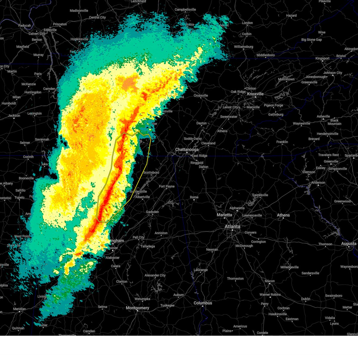 At 1229 am cst, severe thunderstorms were located along a line extending from 7 miles west of shelbyville to near meridianville to near triana to near smith dam, moving northeast at 65 mph. multiple areas of rotation are present within this line. additionally, there has recently been a confirmed report of a wind gust of 75 mph at huntsville international airport (radar indicated). Hazards include 70 mph wind gusts and quarter size hail. Hail damage to vehicles is expected. expect considerable tree damage. wind damage is also likely to mobile homes, roofs, and outbuildings. Locations impacted include, huntsville, decatur, madison, cullman, hartselle, winchester, arab, fayetteville, moores mill, and meridianville. At 1229 am cst, severe thunderstorms were located along a line extending from 7 miles west of shelbyville to near meridianville to near triana to near smith dam, moving northeast at 65 mph. multiple areas of rotation are present within this line. additionally, there has recently been a confirmed report of a wind gust of 75 mph at huntsville international airport (radar indicated). Hazards include 70 mph wind gusts and quarter size hail. Hail damage to vehicles is expected. expect considerable tree damage. wind damage is also likely to mobile homes, roofs, and outbuildings. Locations impacted include, huntsville, decatur, madison, cullman, hartselle, winchester, arab, fayetteville, moores mill, and meridianville.
|
| 2/16/2025 12:21 AM CST |
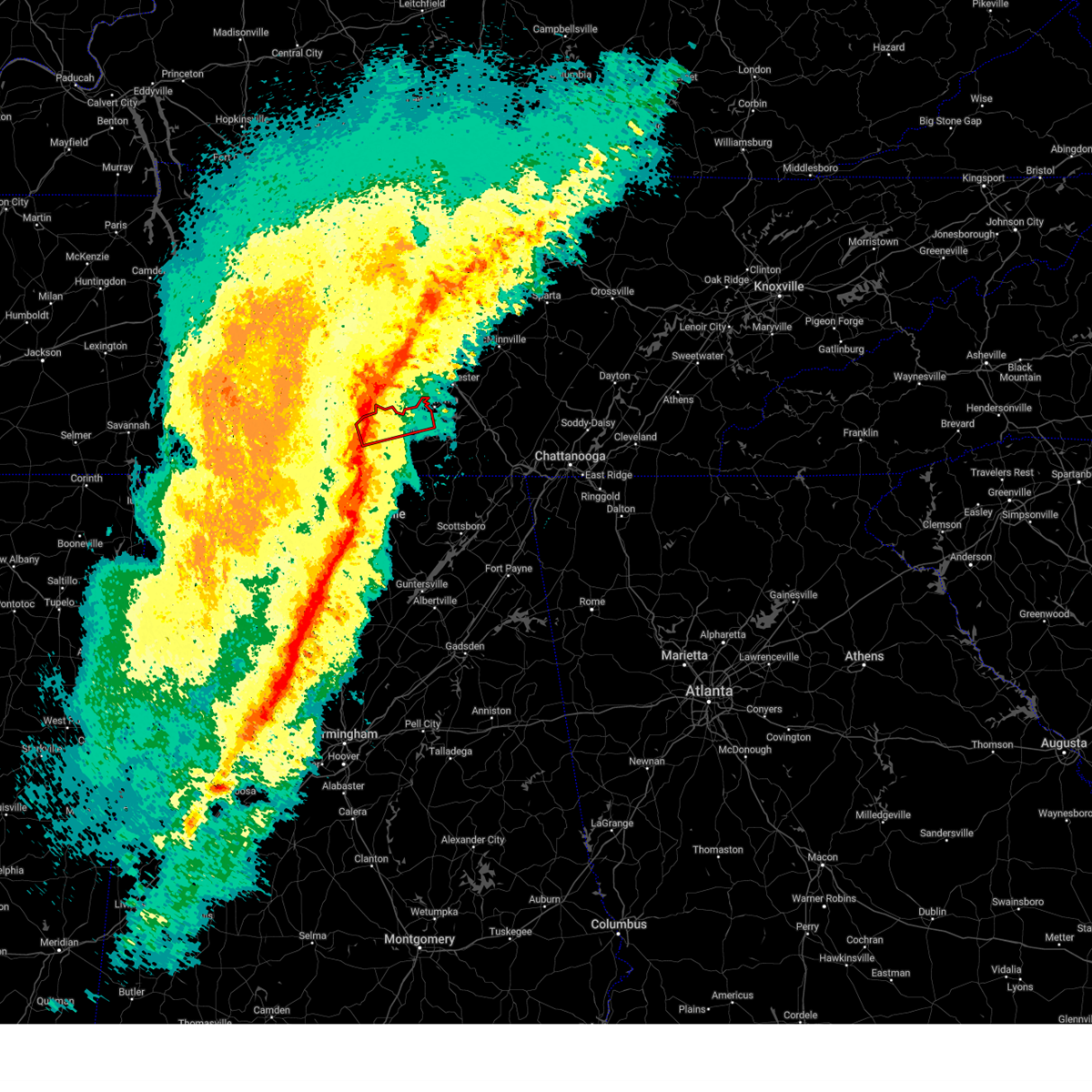 Torhun the national weather service in huntsville alabama has issued a * tornado warning for, moore county in middle tennessee, northern lincoln county in middle tennessee, northwestern franklin county in middle tennessee, * until 1245 am cst. * at 1220 am cst, a severe thunderstorm capable of producing a tornado was located over petersburg, or 10 miles north of fayetteville, moving east at 45 mph (radar indicated rotation). Hazards include tornado. Flying debris will be dangerous to those caught without shelter. mobile homes will be damaged or destroyed. damage to roofs, windows, and vehicles will occur. tree damage is likely. this dangerous storm will be near, lynchburg around 1235 am cst. Other locations impacted by this tornadic thunderstorm include mulberry, chestnut ridge, howell, belleville, lois, mimosa, and booneville. Torhun the national weather service in huntsville alabama has issued a * tornado warning for, moore county in middle tennessee, northern lincoln county in middle tennessee, northwestern franklin county in middle tennessee, * until 1245 am cst. * at 1220 am cst, a severe thunderstorm capable of producing a tornado was located over petersburg, or 10 miles north of fayetteville, moving east at 45 mph (radar indicated rotation). Hazards include tornado. Flying debris will be dangerous to those caught without shelter. mobile homes will be damaged or destroyed. damage to roofs, windows, and vehicles will occur. tree damage is likely. this dangerous storm will be near, lynchburg around 1235 am cst. Other locations impacted by this tornadic thunderstorm include mulberry, chestnut ridge, howell, belleville, lois, mimosa, and booneville.
|
| 2/16/2025 12:18 AM CST | At 1215 am cst, severe thunderstorms were located along a line extending from lewisburg to near harvest to near hartselle to near camp mcdowell, moving northeast at 65 mph. multiple areas of rotation are present within this line. additionally, there have been confirmed reports of wind gusts of 60-65 mph along county line road in madison and at pryor field in decatur (radar indicated). Hazards include 60 mph wind gusts and quarter size hail. Hail damage to vehicles is expected. expect wind damage to roofs, siding, and trees. Locations impacted include, huntsville, decatur, madison, athens, cullman, hartselle, winchester, arab, fayetteville, and moores mill. |
| 2/16/2025 12:04 AM CST |
 Svrhun the national weather service in huntsville alabama has issued a * severe thunderstorm warning for, northwestern marshall county in northeastern alabama, northwestern jackson county in northeastern alabama, madison county in north central alabama, limestone county in north central alabama, cullman county in north central alabama, morgan county in north central alabama, southeastern lawrence county in northwestern alabama, moore county in middle tennessee, lincoln county in middle tennessee, western franklin county in middle tennessee, * until 1245 am cst. * at 1203 am cst, severe thunderstorms were located along a line extending from 11 miles southwest of lewisburg to tanner to 8 miles northeast of brushy lake to near carbon hill, moving northeast at 65 mph. multiple areas of rotation are present within this line. this line of storms has a history of producing wind damage (radar indicated). Hazards include 60 mph wind gusts and quarter size hail. Hail damage to vehicles is expected. Expect wind damage to roofs, siding, and trees. Svrhun the national weather service in huntsville alabama has issued a * severe thunderstorm warning for, northwestern marshall county in northeastern alabama, northwestern jackson county in northeastern alabama, madison county in north central alabama, limestone county in north central alabama, cullman county in north central alabama, morgan county in north central alabama, southeastern lawrence county in northwestern alabama, moore county in middle tennessee, lincoln county in middle tennessee, western franklin county in middle tennessee, * until 1245 am cst. * at 1203 am cst, severe thunderstorms were located along a line extending from 11 miles southwest of lewisburg to tanner to 8 miles northeast of brushy lake to near carbon hill, moving northeast at 65 mph. multiple areas of rotation are present within this line. this line of storms has a history of producing wind damage (radar indicated). Hazards include 60 mph wind gusts and quarter size hail. Hail damage to vehicles is expected. Expect wind damage to roofs, siding, and trees.
|
| 12/29/2024 12:25 AM CST |
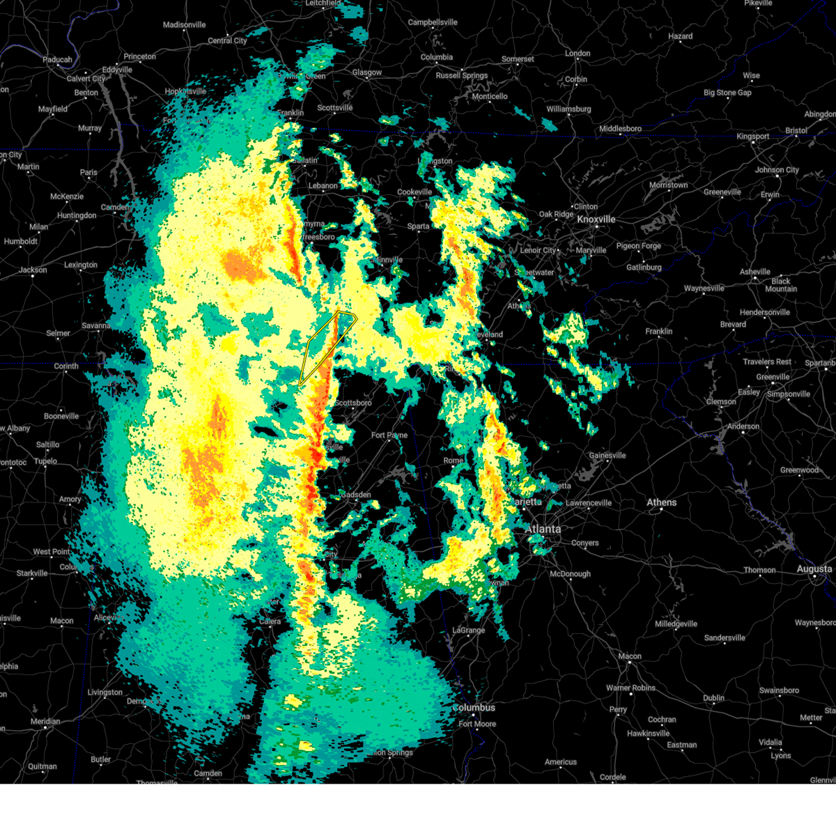 The storms which prompted the warning have weakened below severe limits, and no longer pose an immediate threat to life or property. therefore, the warning will be allowed to expire. however, gusty winds are still possible with these thunderstorms. a tornado watch remains in effect until 400 am cst for north central and northeastern alabama, and middle tennessee. to report severe weather, contact your nearest law enforcement agency. they will relay your report to the national weather service huntsville alabama. The storms which prompted the warning have weakened below severe limits, and no longer pose an immediate threat to life or property. therefore, the warning will be allowed to expire. however, gusty winds are still possible with these thunderstorms. a tornado watch remains in effect until 400 am cst for north central and northeastern alabama, and middle tennessee. to report severe weather, contact your nearest law enforcement agency. they will relay your report to the national weather service huntsville alabama.
|
| 12/28/2024 11:59 PM CST |
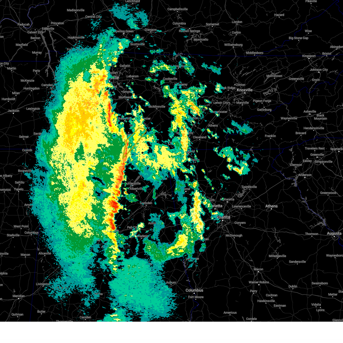 At 1158 pm cst, severe thunderstorms were located along a line extending from 7 miles northwest of huntland to new market, moving northeast at 40 mph (radar indicated). Hazards include 60 mph wind gusts. Expect damage to roofs, siding, and trees. Locations impacted include, winchester, decherd, estill springs, huntland, tims ford lake, new market, lexie crossroads, plevna, harmony, and elora. At 1158 pm cst, severe thunderstorms were located along a line extending from 7 miles northwest of huntland to new market, moving northeast at 40 mph (radar indicated). Hazards include 60 mph wind gusts. Expect damage to roofs, siding, and trees. Locations impacted include, winchester, decherd, estill springs, huntland, tims ford lake, new market, lexie crossroads, plevna, harmony, and elora.
|
| 12/28/2024 11:26 PM CST |
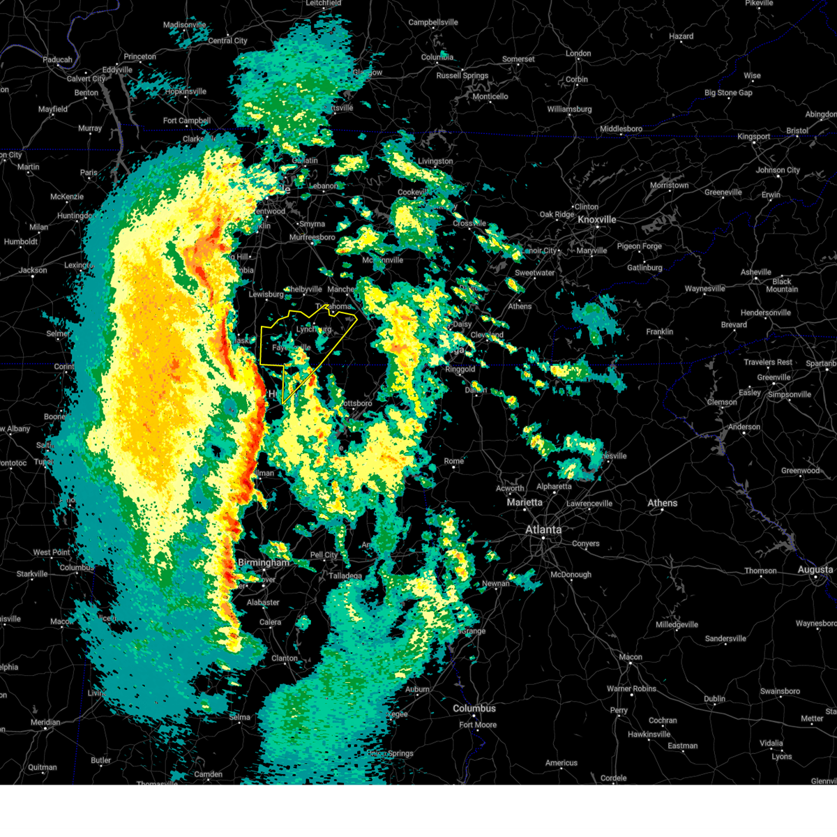 Svrhun the national weather service in huntsville alabama has issued a * severe thunderstorm warning for, north central madison county in north central alabama, moore county in middle tennessee, lincoln county in middle tennessee, western franklin county in middle tennessee, * until 1230 am cst. * at 1124 pm cst, severe thunderstorms were located along a line extending from near ardmore to harvest to madison, moving northeast at 60 mph. these storms have a history of producing power outages across northern alabama (radar indicated). Hazards include 60 mph wind gusts. expect damage to roofs, siding, and trees Svrhun the national weather service in huntsville alabama has issued a * severe thunderstorm warning for, north central madison county in north central alabama, moore county in middle tennessee, lincoln county in middle tennessee, western franklin county in middle tennessee, * until 1230 am cst. * at 1124 pm cst, severe thunderstorms were located along a line extending from near ardmore to harvest to madison, moving northeast at 60 mph. these storms have a history of producing power outages across northern alabama (radar indicated). Hazards include 60 mph wind gusts. expect damage to roofs, siding, and trees
|
| 8/17/2024 2:40 PM CDT |
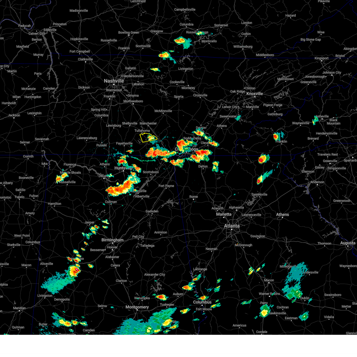 The storm which prompted the warning has weakened below severe limits, and no longer poses an immediate threat to life or property. therefore, the warning will be allowed to expire. The storm which prompted the warning has weakened below severe limits, and no longer poses an immediate threat to life or property. therefore, the warning will be allowed to expire.
|
| 8/17/2024 2:25 PM CDT |
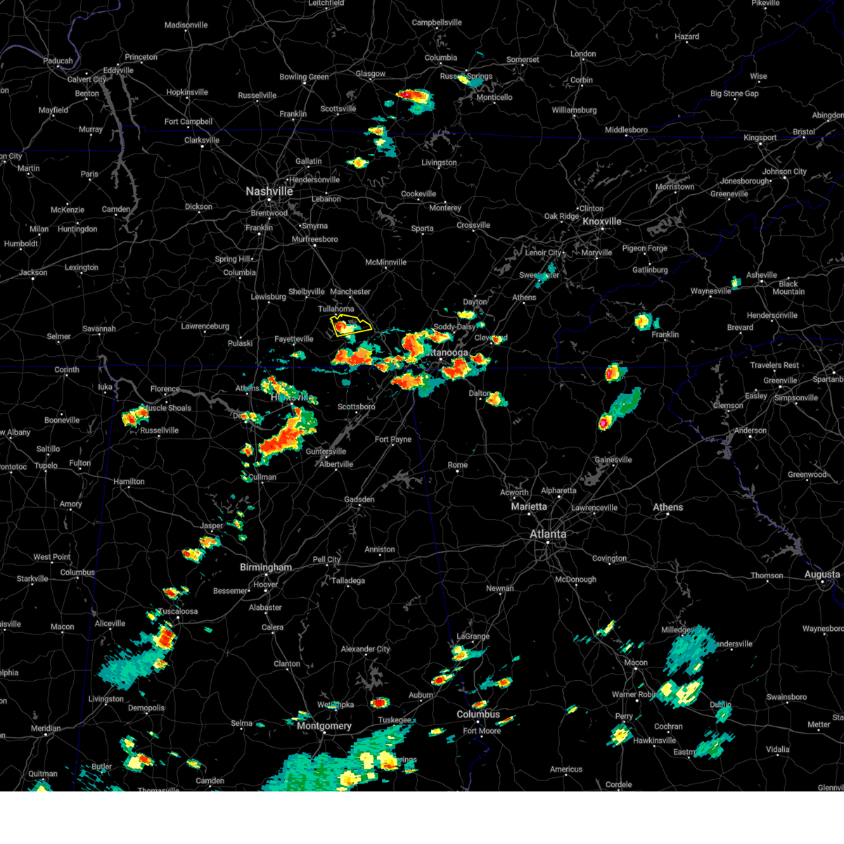 At 224 pm cdt, a severe thunderstorm was located over estill springs, or 7 miles north of winchester, moving east at 35 mph (radar indicated). Hazards include 60 mph wind gusts and quarter size hail. Hail damage to vehicles is expected. expect wind damage to roofs, siding, and trees. Locations impacted include, winchester, decherd, estill springs, tims ford lake, woods reservoir, arnold afb, and alto. At 224 pm cdt, a severe thunderstorm was located over estill springs, or 7 miles north of winchester, moving east at 35 mph (radar indicated). Hazards include 60 mph wind gusts and quarter size hail. Hail damage to vehicles is expected. expect wind damage to roofs, siding, and trees. Locations impacted include, winchester, decherd, estill springs, tims ford lake, woods reservoir, arnold afb, and alto.
|
| 8/17/2024 2:25 PM CDT |
 the severe thunderstorm warning has been cancelled and is no longer in effect the severe thunderstorm warning has been cancelled and is no longer in effect
|
| 8/17/2024 2:17 PM CDT |
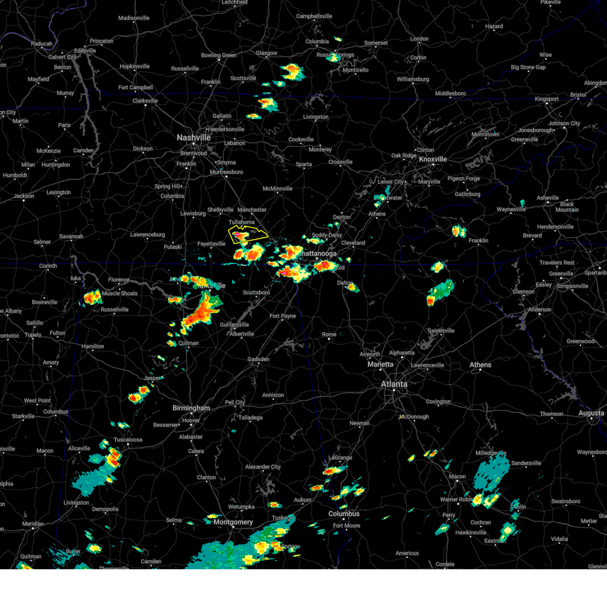 At 217 pm cdt, a severe thunderstorm was located near tims ford lake, or 8 miles northwest of winchester, moving east at 30 mph (radar indicated). Hazards include 60 mph wind gusts and quarter size hail. Hail damage to vehicles is expected. expect wind damage to roofs, siding, and trees. Locations impacted include, winchester, decherd, estill springs, tims ford lake, woods reservoir, arnold afb, and alto. At 217 pm cdt, a severe thunderstorm was located near tims ford lake, or 8 miles northwest of winchester, moving east at 30 mph (radar indicated). Hazards include 60 mph wind gusts and quarter size hail. Hail damage to vehicles is expected. expect wind damage to roofs, siding, and trees. Locations impacted include, winchester, decherd, estill springs, tims ford lake, woods reservoir, arnold afb, and alto.
|
| 8/17/2024 2:02 PM CDT |
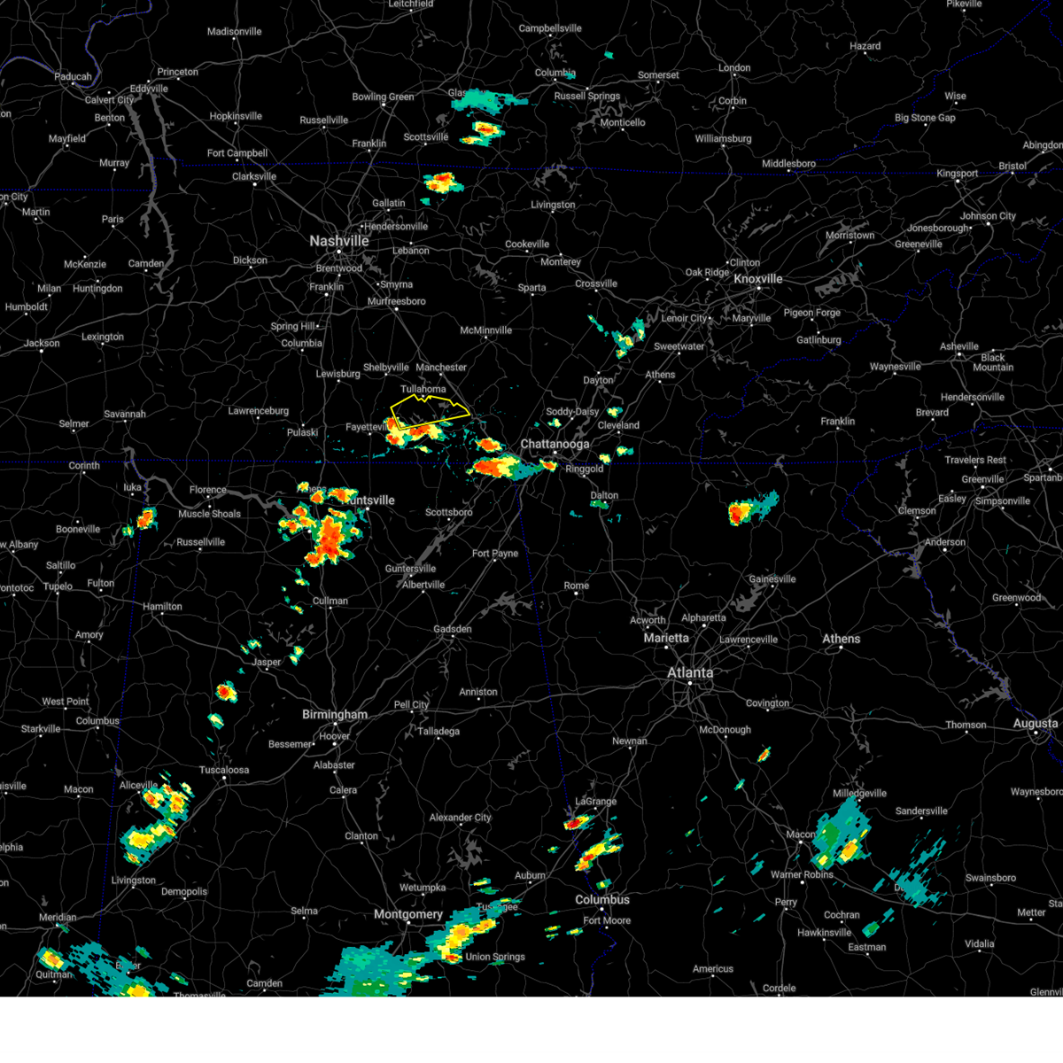 Svrhun the national weather service in huntsville alabama has issued a * severe thunderstorm warning for, eastern moore county in middle tennessee, northern franklin county in middle tennessee, * until 245 pm cdt. * at 202 pm cdt, a severe thunderstorm was located near lynchburg, moving east at 35 mph (radar indicated). Hazards include 60 mph wind gusts and quarter size hail. Hail damage to vehicles is expected. Expect wind damage to roofs, siding, and trees. Svrhun the national weather service in huntsville alabama has issued a * severe thunderstorm warning for, eastern moore county in middle tennessee, northern franklin county in middle tennessee, * until 245 pm cdt. * at 202 pm cdt, a severe thunderstorm was located near lynchburg, moving east at 35 mph (radar indicated). Hazards include 60 mph wind gusts and quarter size hail. Hail damage to vehicles is expected. Expect wind damage to roofs, siding, and trees.
|
| 7/30/2024 5:06 PM CDT |
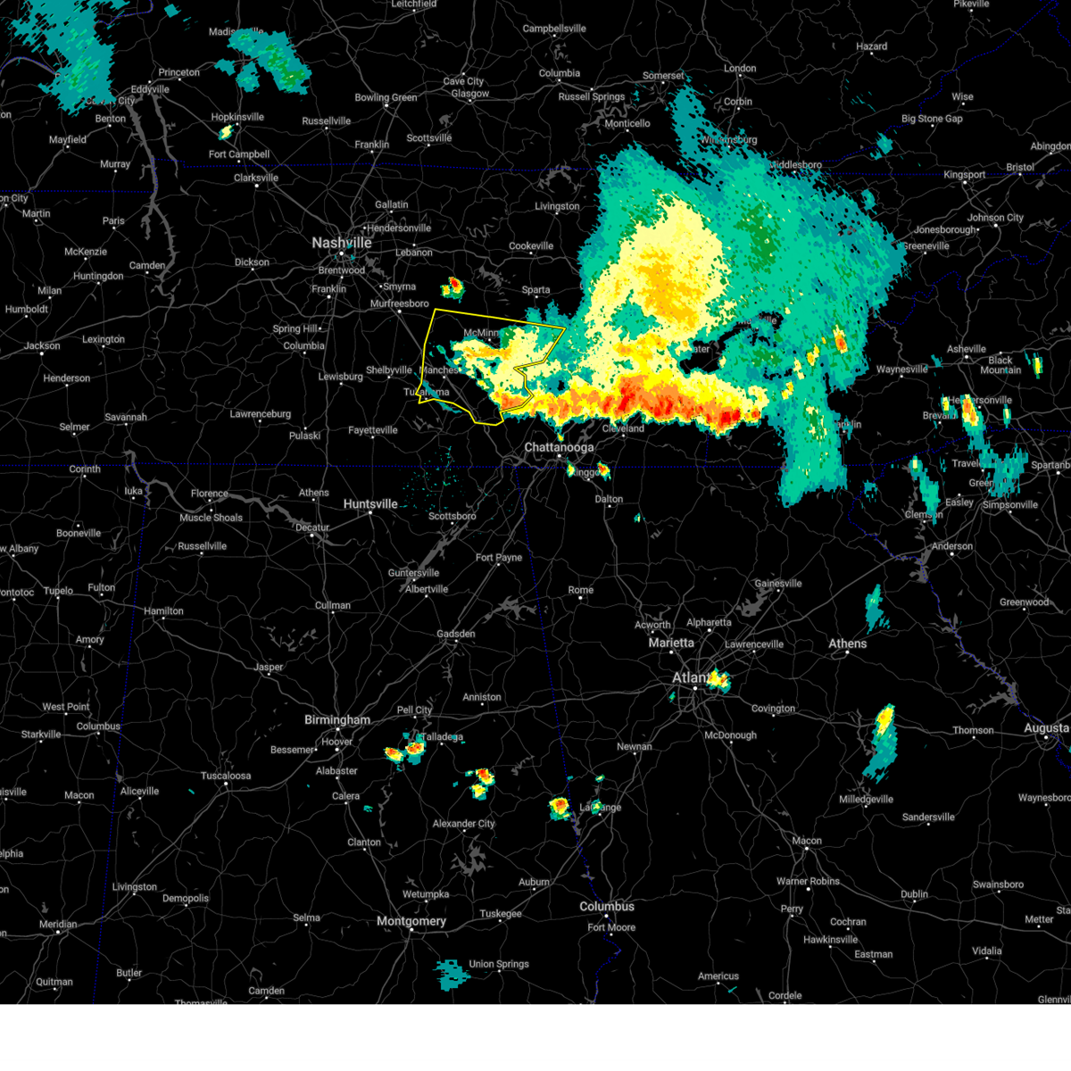 The storms which prompted the warning have weakened below severe limits, and no longer pose an immediate threat to life or property. therefore, the warning will be allowed to expire. a severe thunderstorm watch remains in effect until 800 pm cdt for middle tennessee. to report severe weather, contact your nearest law enforcement agency. they will relay your report to the national weather service nashville. The storms which prompted the warning have weakened below severe limits, and no longer pose an immediate threat to life or property. therefore, the warning will be allowed to expire. a severe thunderstorm watch remains in effect until 800 pm cdt for middle tennessee. to report severe weather, contact your nearest law enforcement agency. they will relay your report to the national weather service nashville.
|
| 7/30/2024 4:37 PM CDT |
 the severe thunderstorm warning has been cancelled and is no longer in effect the severe thunderstorm warning has been cancelled and is no longer in effect
|
| 7/30/2024 4:37 PM CDT |
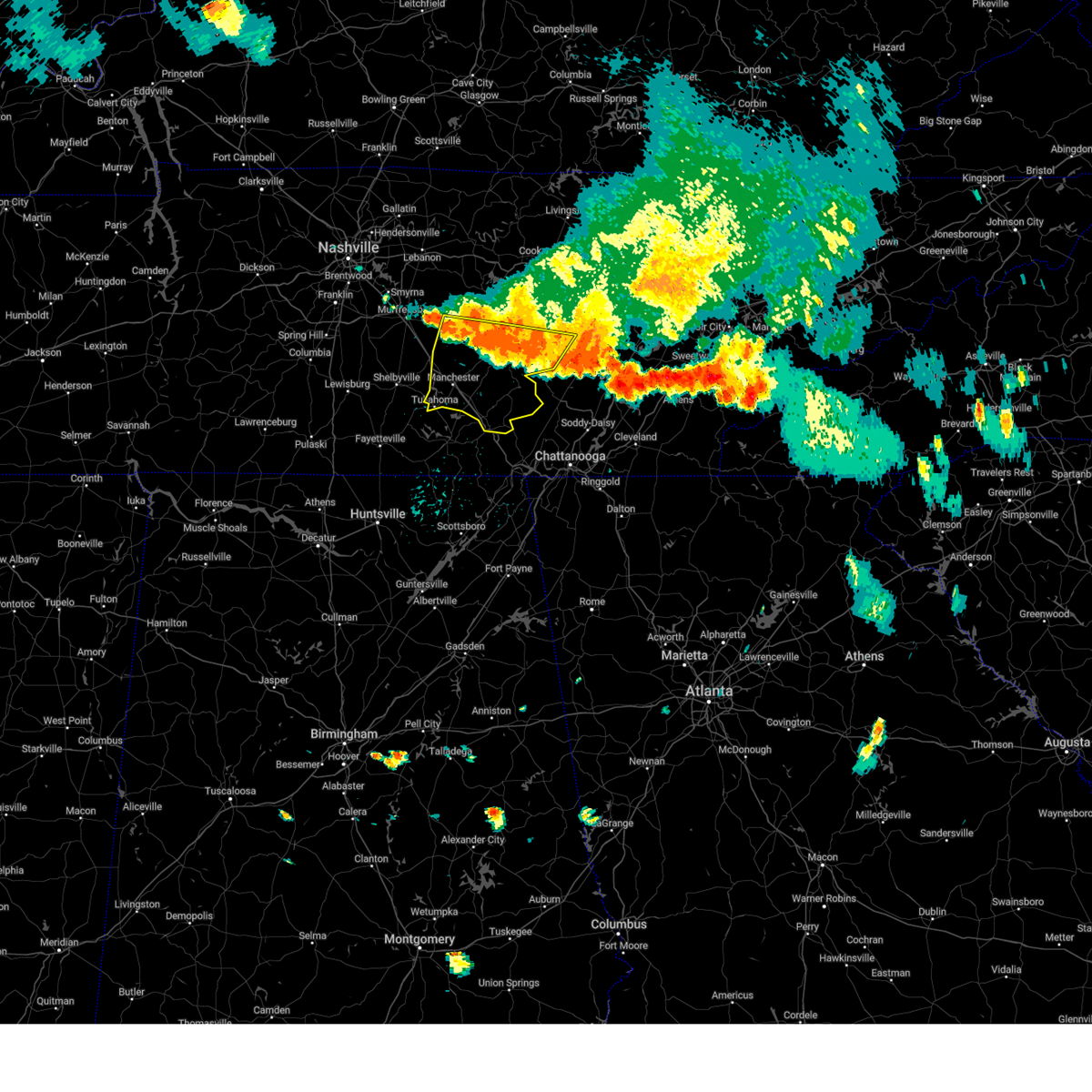 At 437 pm cdt, severe thunderstorms were located along a line extending from bell buckle to fall creek falls, moving southeast at 40 mph (radar indicated). Hazards include 60 mph wind gusts and quarter size hail. Hail damage to vehicles is expected. expect wind damage to roofs, siding, and trees. locations impacted include, mcminnville, manchester, woodbury, spencer, tullahoma, gruetli-laager, tracy city, monteagle, altamont, coalmont, morrison, palmer, beersheba springs, centertown, viola, summitville, fall creek falls state park, hillsboro, pelham, and bradyville. This includes interstate 24 between mile markers 101 and 136. At 437 pm cdt, severe thunderstorms were located along a line extending from bell buckle to fall creek falls, moving southeast at 40 mph (radar indicated). Hazards include 60 mph wind gusts and quarter size hail. Hail damage to vehicles is expected. expect wind damage to roofs, siding, and trees. locations impacted include, mcminnville, manchester, woodbury, spencer, tullahoma, gruetli-laager, tracy city, monteagle, altamont, coalmont, morrison, palmer, beersheba springs, centertown, viola, summitville, fall creek falls state park, hillsboro, pelham, and bradyville. This includes interstate 24 between mile markers 101 and 136.
|
| 7/30/2024 4:10 PM CDT |
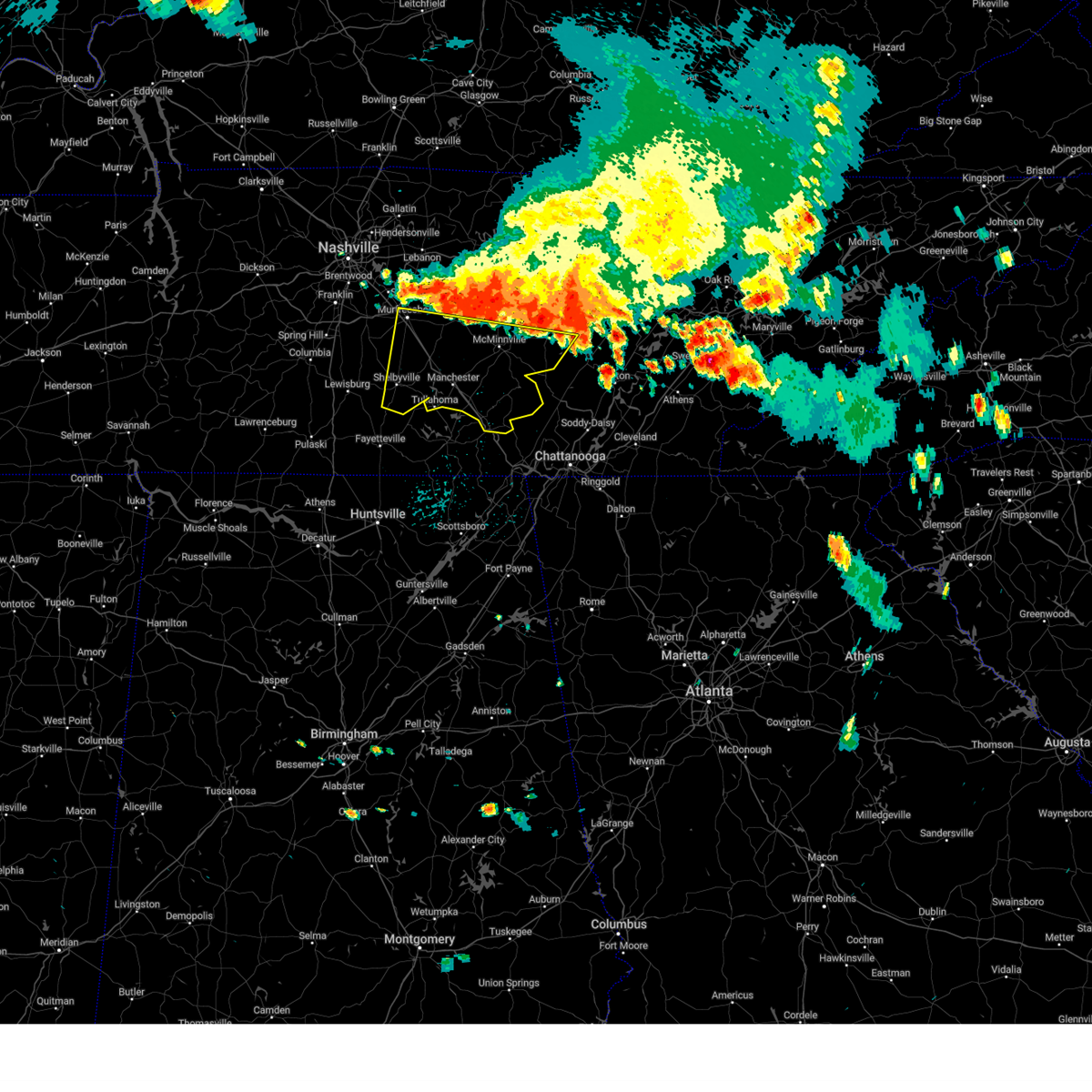 Svrohx the national weather service in nashville has issued a * severe thunderstorm warning for, southeastern rutherford county in middle tennessee, van buren county in middle tennessee, warren county in middle tennessee, coffee county in middle tennessee, bedford county in middle tennessee, grundy county in middle tennessee, cannon county in middle tennessee, * until 515 pm cdt. * at 409 pm cdt, severe thunderstorms were located along a line extending from murfreesboro to spencer, moving south at 30 mph (radar indicated). Hazards include 60 mph wind gusts and quarter size hail. Hail damage to vehicles is expected. Expect wind damage to roofs, siding, and trees. Svrohx the national weather service in nashville has issued a * severe thunderstorm warning for, southeastern rutherford county in middle tennessee, van buren county in middle tennessee, warren county in middle tennessee, coffee county in middle tennessee, bedford county in middle tennessee, grundy county in middle tennessee, cannon county in middle tennessee, * until 515 pm cdt. * at 409 pm cdt, severe thunderstorms were located along a line extending from murfreesboro to spencer, moving south at 30 mph (radar indicated). Hazards include 60 mph wind gusts and quarter size hail. Hail damage to vehicles is expected. Expect wind damage to roofs, siding, and trees.
|
| 7/29/2024 3:40 PM CDT |
 Svrhun the national weather service in huntsville alabama has issued a * severe thunderstorm warning for, northwestern jackson county in northeastern alabama, northeastern madison county in north central alabama, moore county in middle tennessee, lincoln county in middle tennessee, franklin county in middle tennessee, * until 430 pm cdt. * at 340 pm cdt, a severe thunderstorm was located near lynchburg, moving southeast at 25 mph (radar indicated). Hazards include 70 mph wind gusts and quarter size hail. Hail damage to vehicles is expected. expect considerable tree damage. Wind damage is also likely to mobile homes, roofs, and outbuildings. Svrhun the national weather service in huntsville alabama has issued a * severe thunderstorm warning for, northwestern jackson county in northeastern alabama, northeastern madison county in north central alabama, moore county in middle tennessee, lincoln county in middle tennessee, franklin county in middle tennessee, * until 430 pm cdt. * at 340 pm cdt, a severe thunderstorm was located near lynchburg, moving southeast at 25 mph (radar indicated). Hazards include 70 mph wind gusts and quarter size hail. Hail damage to vehicles is expected. expect considerable tree damage. Wind damage is also likely to mobile homes, roofs, and outbuildings.
|
| 7/29/2024 3:31 PM CDT |
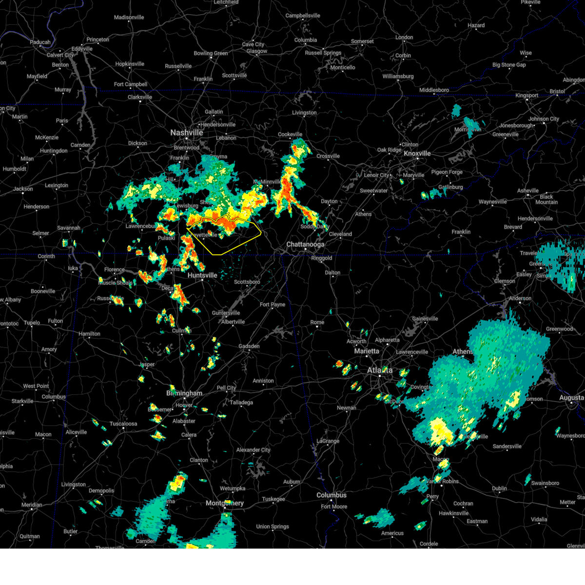 At 330 pm cdt, a severe thunderstorm was located near lynchburg, moving southeast at 30 mph (radar indicated). Hazards include ping pong ball size hail and 60 mph wind gusts. People and animals outdoors will be injured. expect hail damage to roofs, siding, windows, and vehicles. expect wind damage to roofs, siding, and trees. Locations impacted include, winchester, fayetteville, lynchburg, decherd, estill springs, cowan, huntland, petersburg, tims ford lake, and sewanee. At 330 pm cdt, a severe thunderstorm was located near lynchburg, moving southeast at 30 mph (radar indicated). Hazards include ping pong ball size hail and 60 mph wind gusts. People and animals outdoors will be injured. expect hail damage to roofs, siding, windows, and vehicles. expect wind damage to roofs, siding, and trees. Locations impacted include, winchester, fayetteville, lynchburg, decherd, estill springs, cowan, huntland, petersburg, tims ford lake, and sewanee.
|
| 7/29/2024 3:18 PM CDT | A tree limb was reported down on the road at this location near the intersection of hurricane creek road and cobb hollow roa in moore county TN, 6.7 miles NE of Tullahoma, TN |
| 7/29/2024 3:16 PM CDT |
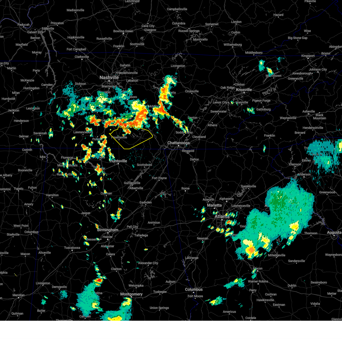 Svrhun the national weather service in huntsville alabama has issued a * severe thunderstorm warning for, moore county in middle tennessee, lincoln county in middle tennessee, franklin county in middle tennessee, * until 345 pm cdt. * at 316 pm cdt, a severe thunderstorm was located near shelbyville, moving southeast at 30 mph (radar indicated). Hazards include 60 mph wind gusts and quarter size hail. Hail damage to vehicles is expected. Expect wind damage to roofs, siding, and trees. Svrhun the national weather service in huntsville alabama has issued a * severe thunderstorm warning for, moore county in middle tennessee, lincoln county in middle tennessee, franklin county in middle tennessee, * until 345 pm cdt. * at 316 pm cdt, a severe thunderstorm was located near shelbyville, moving southeast at 30 mph (radar indicated). Hazards include 60 mph wind gusts and quarter size hail. Hail damage to vehicles is expected. Expect wind damage to roofs, siding, and trees.
|
| 7/29/2024 3:14 PM CDT | A tree was reported across the road at this location on old shelbyville highwa in moore county TN, 4.6 miles E of Tullahoma, TN |
| 6/5/2024 9:52 PM CDT | Tree down across roa in moore county TN, 12.1 miles NE of Tullahoma, TN |
| 6/5/2024 9:50 PM CDT | Tree down across roa in moore county TN, 9.5 miles ENE of Tullahoma, TN |
| 6/5/2024 9:48 PM CDT | Tree down across roa in moore county TN, 10.7 miles NE of Tullahoma, TN |
| 6/5/2024 9:48 PM CDT | Tree down across roa in moore county TN, 9.3 miles NNE of Tullahoma, TN |
| 5/25/2024 6:39 AM CDT |
 At 638 am cdt, severe thunderstorms were located along a line extending from estill springs to 6 miles west of grant, moving east at 45 mph (radar indicated). Hazards include 60 mph wind gusts and nickel size hail. Expect damage to roofs, siding, and trees. Locations impacted include, scottsboro, winchester, rainsville, decherd, estill springs, stevenson, sylvania, cowan, fyffe, and hollywood. At 638 am cdt, severe thunderstorms were located along a line extending from estill springs to 6 miles west of grant, moving east at 45 mph (radar indicated). Hazards include 60 mph wind gusts and nickel size hail. Expect damage to roofs, siding, and trees. Locations impacted include, scottsboro, winchester, rainsville, decherd, estill springs, stevenson, sylvania, cowan, fyffe, and hollywood.
|
| 5/25/2024 6:39 AM CDT |
 the severe thunderstorm warning has been cancelled and is no longer in effect the severe thunderstorm warning has been cancelled and is no longer in effect
|
| 5/25/2024 6:20 AM CDT |
 At 620 am cdt, severe thunderstorms were located along a line extending from lynchburg to near morgan city, moving southeast at 50 mph (radar indicated). Hazards include 60 mph wind gusts and nickel size hail. Expect damage to roofs, siding, and trees. Locations impacted include, huntsville, scottsboro, winchester, fayetteville, rainsville, moores mill, meridianville, lynchburg, redstone arsenal, and hazel green. At 620 am cdt, severe thunderstorms were located along a line extending from lynchburg to near morgan city, moving southeast at 50 mph (radar indicated). Hazards include 60 mph wind gusts and nickel size hail. Expect damage to roofs, siding, and trees. Locations impacted include, huntsville, scottsboro, winchester, fayetteville, rainsville, moores mill, meridianville, lynchburg, redstone arsenal, and hazel green.
|
| 5/25/2024 6:14 AM CDT |
 the severe thunderstorm warning has been cancelled and is no longer in effect the severe thunderstorm warning has been cancelled and is no longer in effect
|
| 5/25/2024 6:14 AM CDT |
 At 614 am cdt, severe thunderstorms were located along a line extending from near lynchburg to near morgan city, moving southeast at 45 mph (radar indicated). Hazards include 70 mph wind gusts and nickel size hail. Expect considerable tree damage. damage is likely to mobile homes, roofs, and outbuildings. Locations impacted include, huntsville, madison, scottsboro, winchester, fayetteville, rainsville, moores mill, meridianville, lynchburg, and redstone arsenal. At 614 am cdt, severe thunderstorms were located along a line extending from near lynchburg to near morgan city, moving southeast at 45 mph (radar indicated). Hazards include 70 mph wind gusts and nickel size hail. Expect considerable tree damage. damage is likely to mobile homes, roofs, and outbuildings. Locations impacted include, huntsville, madison, scottsboro, winchester, fayetteville, rainsville, moores mill, meridianville, lynchburg, and redstone arsenal.
|
| 5/25/2024 6:00 AM CDT |
 At 600 am cdt, severe thunderstorms were located along a line extending from near petersburg to triana, moving southeast at 50 mph (radar indicated). Hazards include 70 mph wind gusts and nickel size hail. Expect considerable tree damage. damage is likely to mobile homes, roofs, and outbuildings. Locations impacted include, huntsville, madison, athens, scottsboro, winchester, fayetteville, rainsville, moores mill, meridianville, and lynchburg. At 600 am cdt, severe thunderstorms were located along a line extending from near petersburg to triana, moving southeast at 50 mph (radar indicated). Hazards include 70 mph wind gusts and nickel size hail. Expect considerable tree damage. damage is likely to mobile homes, roofs, and outbuildings. Locations impacted include, huntsville, madison, athens, scottsboro, winchester, fayetteville, rainsville, moores mill, meridianville, and lynchburg.
|
| 5/25/2024 5:53 AM CDT |
 Svrhun the national weather service in huntsville alabama has issued a * severe thunderstorm warning for, northeastern marshall county in northeastern alabama, jackson county in northeastern alabama, madison county in north central alabama, limestone county in north central alabama, central dekalb county in northeastern alabama, moore county in middle tennessee, lincoln county in middle tennessee, franklin county in middle tennessee, * until 700 am cdt. * at 553 am cdt, severe thunderstorms were located along a line extending from petersburg to near huntsville international airport, moving southeast at 50 mph (radar indicated). Hazards include 60 mph wind gusts and nickel size hail. expect damage to roofs, siding, and trees Svrhun the national weather service in huntsville alabama has issued a * severe thunderstorm warning for, northeastern marshall county in northeastern alabama, jackson county in northeastern alabama, madison county in north central alabama, limestone county in north central alabama, central dekalb county in northeastern alabama, moore county in middle tennessee, lincoln county in middle tennessee, franklin county in middle tennessee, * until 700 am cdt. * at 553 am cdt, severe thunderstorms were located along a line extending from petersburg to near huntsville international airport, moving southeast at 50 mph (radar indicated). Hazards include 60 mph wind gusts and nickel size hail. expect damage to roofs, siding, and trees
|
| 5/14/2024 5:55 PM CDT |
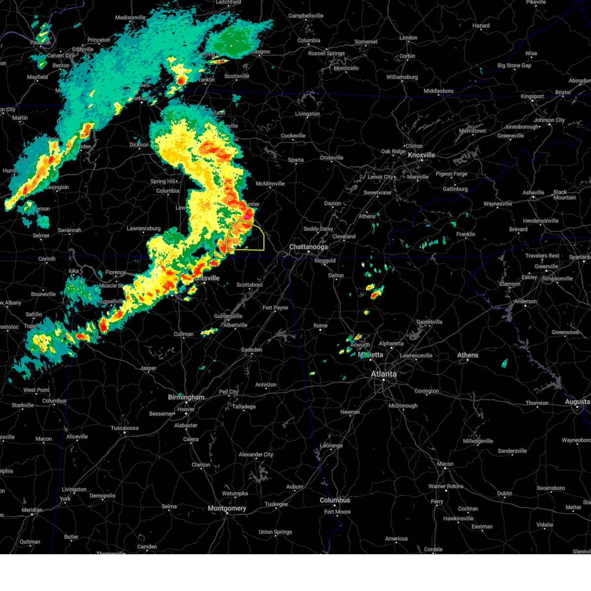 The storms which prompted the warning have weakened below severe limits, and no longer pose an immediate threat to life or property. therefore, the warning will be allowed to expire. however, gusty winds are still possible with these thunderstorms. a severe thunderstorm watch remains in effect until 800 pm cdt for north central alabama, and middle tennessee. The storms which prompted the warning have weakened below severe limits, and no longer pose an immediate threat to life or property. therefore, the warning will be allowed to expire. however, gusty winds are still possible with these thunderstorms. a severe thunderstorm watch remains in effect until 800 pm cdt for north central alabama, and middle tennessee.
|
| 5/14/2024 5:54 PM CDT |
 At 553 pm cdt, severe thunderstorms were located along a line extending from 7 miles south of manchester to near decherd to 7 miles southwest of cowan, moving east at 50 mph (emergency management). Hazards include 60 mph wind gusts. Expect damage to roofs, siding, and trees. Locations impacted include, winchester, decherd, estill springs, cowan, huntland, sewanee, tims ford lake, lexie crossroads, harmony, and maxwell. At 553 pm cdt, severe thunderstorms were located along a line extending from 7 miles south of manchester to near decherd to 7 miles southwest of cowan, moving east at 50 mph (emergency management). Hazards include 60 mph wind gusts. Expect damage to roofs, siding, and trees. Locations impacted include, winchester, decherd, estill springs, cowan, huntland, sewanee, tims ford lake, lexie crossroads, harmony, and maxwell.
|
| 5/14/2024 5:54 PM CDT |
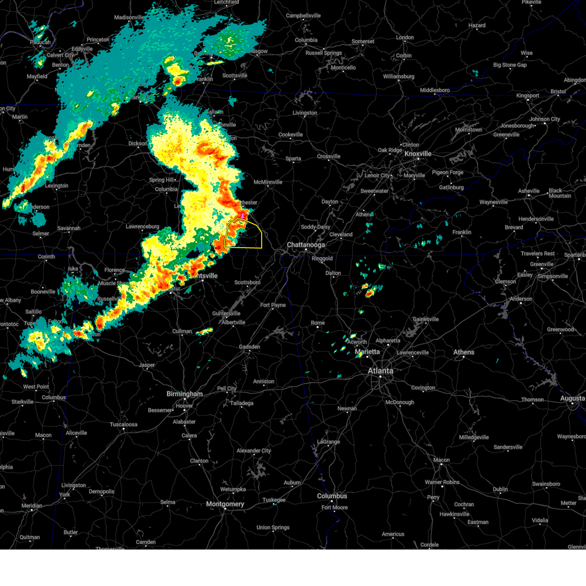 the severe thunderstorm warning has been cancelled and is no longer in effect the severe thunderstorm warning has been cancelled and is no longer in effect
|
| 5/14/2024 5:41 PM CDT |
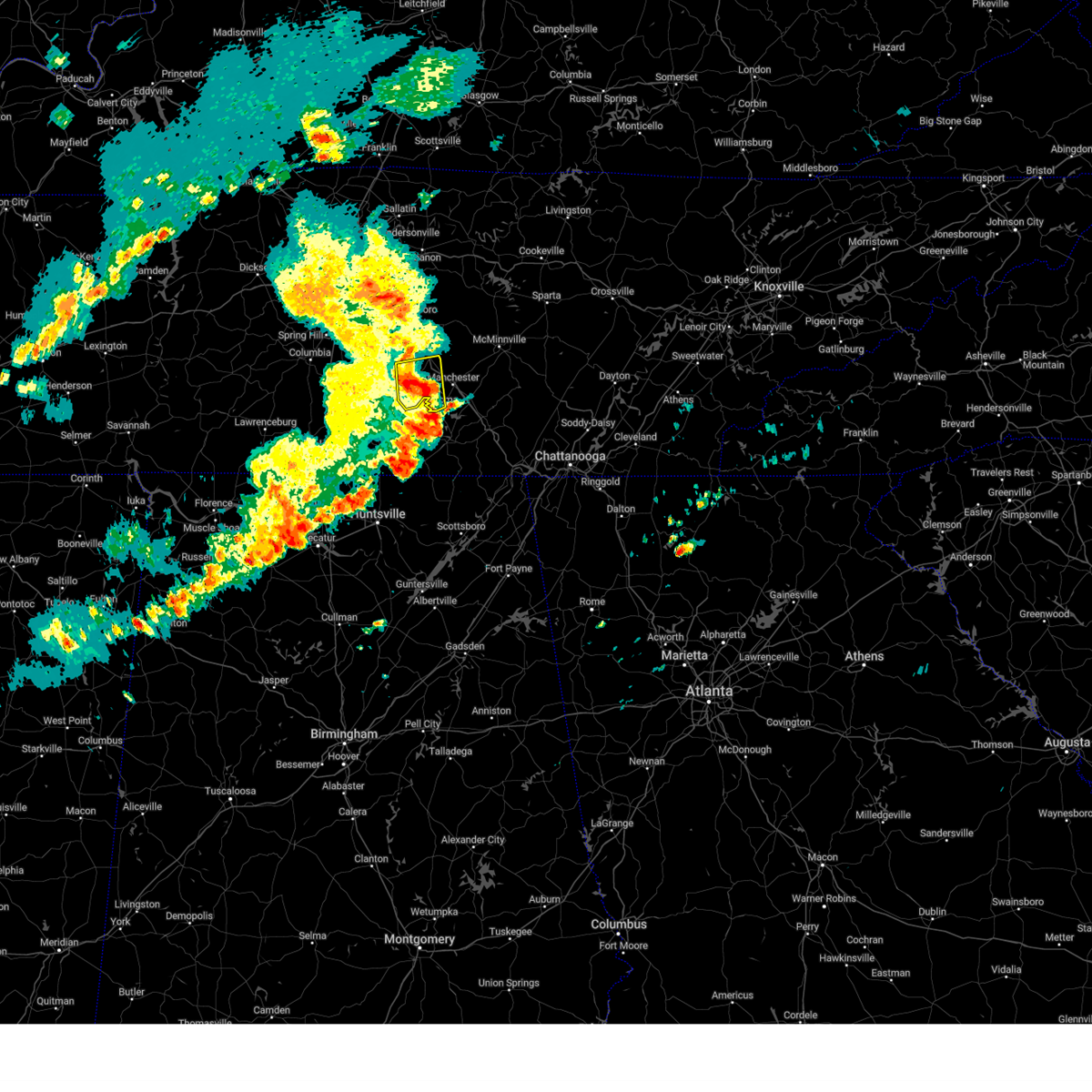 the severe thunderstorm warning has been cancelled and is no longer in effect the severe thunderstorm warning has been cancelled and is no longer in effect
|
| 5/14/2024 5:41 PM CDT |
 At 541 pm cdt, severe thunderstorms were located along a line extending from 6 miles northeast of shelbyville to 13 miles west of manchester to near tullahoma, moving east at 45 mph (radar indicated). Hazards include 60 mph wind gusts. Expect damage to roofs, siding, and trees. locations impacted include, shelbyville, tullahoma, wartrace, bell buckle, normandy, deason, beechgrove, raus, and arnold afb. This includes interstate 24 between mile markers 97 and 105. At 541 pm cdt, severe thunderstorms were located along a line extending from 6 miles northeast of shelbyville to 13 miles west of manchester to near tullahoma, moving east at 45 mph (radar indicated). Hazards include 60 mph wind gusts. Expect damage to roofs, siding, and trees. locations impacted include, shelbyville, tullahoma, wartrace, bell buckle, normandy, deason, beechgrove, raus, and arnold afb. This includes interstate 24 between mile markers 97 and 105.
|
| 5/14/2024 5:30 PM CDT |
 Svrhun the national weather service in huntsville alabama has issued a * severe thunderstorm warning for, eastern moore county in middle tennessee, franklin county in middle tennessee, * until 600 pm cdt. * at 529 pm cdt, severe thunderstorms were located along a line extending from 6 miles west of tullahoma to near tims ford lake to near huntland, moving east at 50 mph (emergency management. at 525 pm wind damage was reported in moore county). Hazards include 60 mph wind gusts. expect damage to roofs, siding, and trees Svrhun the national weather service in huntsville alabama has issued a * severe thunderstorm warning for, eastern moore county in middle tennessee, franklin county in middle tennessee, * until 600 pm cdt. * at 529 pm cdt, severe thunderstorms were located along a line extending from 6 miles west of tullahoma to near tims ford lake to near huntland, moving east at 50 mph (emergency management. at 525 pm wind damage was reported in moore county). Hazards include 60 mph wind gusts. expect damage to roofs, siding, and trees
|
| 5/14/2024 5:27 PM CDT | Report of a tree down across flat creek hwy from moore county em in moore county TN, 10.1 miles ENE of Tullahoma, TN |
| 5/14/2024 5:25 PM CDT | Report from broadcast media of a tree down on tanyard hill rd in moore county... t in moore county TN, 11.2 miles NE of Tullahoma, TN |
| 5/14/2024 5:22 PM CDT |
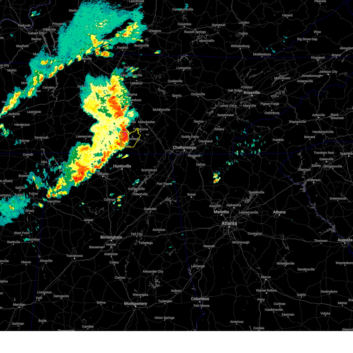 At 521 pm cdt, severe thunderstorms were located along a line extending from near shelbyville to near lynchburg to 7 miles northwest of hazel green, moving east at 45 mph (radar indicated). Hazards include 60 mph wind gusts and nickel size hail. Expect damage to roofs, siding, and trees. Locations impacted include, fayetteville, lynchburg, tims ford lake, mulberry, chestnut ridge, belleville, hurdlow, lois, mimosa, and booneville. At 521 pm cdt, severe thunderstorms were located along a line extending from near shelbyville to near lynchburg to 7 miles northwest of hazel green, moving east at 45 mph (radar indicated). Hazards include 60 mph wind gusts and nickel size hail. Expect damage to roofs, siding, and trees. Locations impacted include, fayetteville, lynchburg, tims ford lake, mulberry, chestnut ridge, belleville, hurdlow, lois, mimosa, and booneville.
|
| 5/14/2024 5:13 PM CDT |
 Svrohx the national weather service in nashville has issued a * severe thunderstorm warning for, northeastern marshall county in middle tennessee, southern rutherford county in middle tennessee, western coffee county in middle tennessee, bedford county in middle tennessee, * until 600 pm cdt. * at 513 pm cdt, severe thunderstorms were located along a line extending from 13 miles east of spring hill to near shelbyville to near petersburg, moving east at 45 mph (radar indicated). Hazards include 60 mph wind gusts. expect damage to roofs, siding, and trees Svrohx the national weather service in nashville has issued a * severe thunderstorm warning for, northeastern marshall county in middle tennessee, southern rutherford county in middle tennessee, western coffee county in middle tennessee, bedford county in middle tennessee, * until 600 pm cdt. * at 513 pm cdt, severe thunderstorms were located along a line extending from 13 miles east of spring hill to near shelbyville to near petersburg, moving east at 45 mph (radar indicated). Hazards include 60 mph wind gusts. expect damage to roofs, siding, and trees
|
| 5/14/2024 5:07 PM CDT |
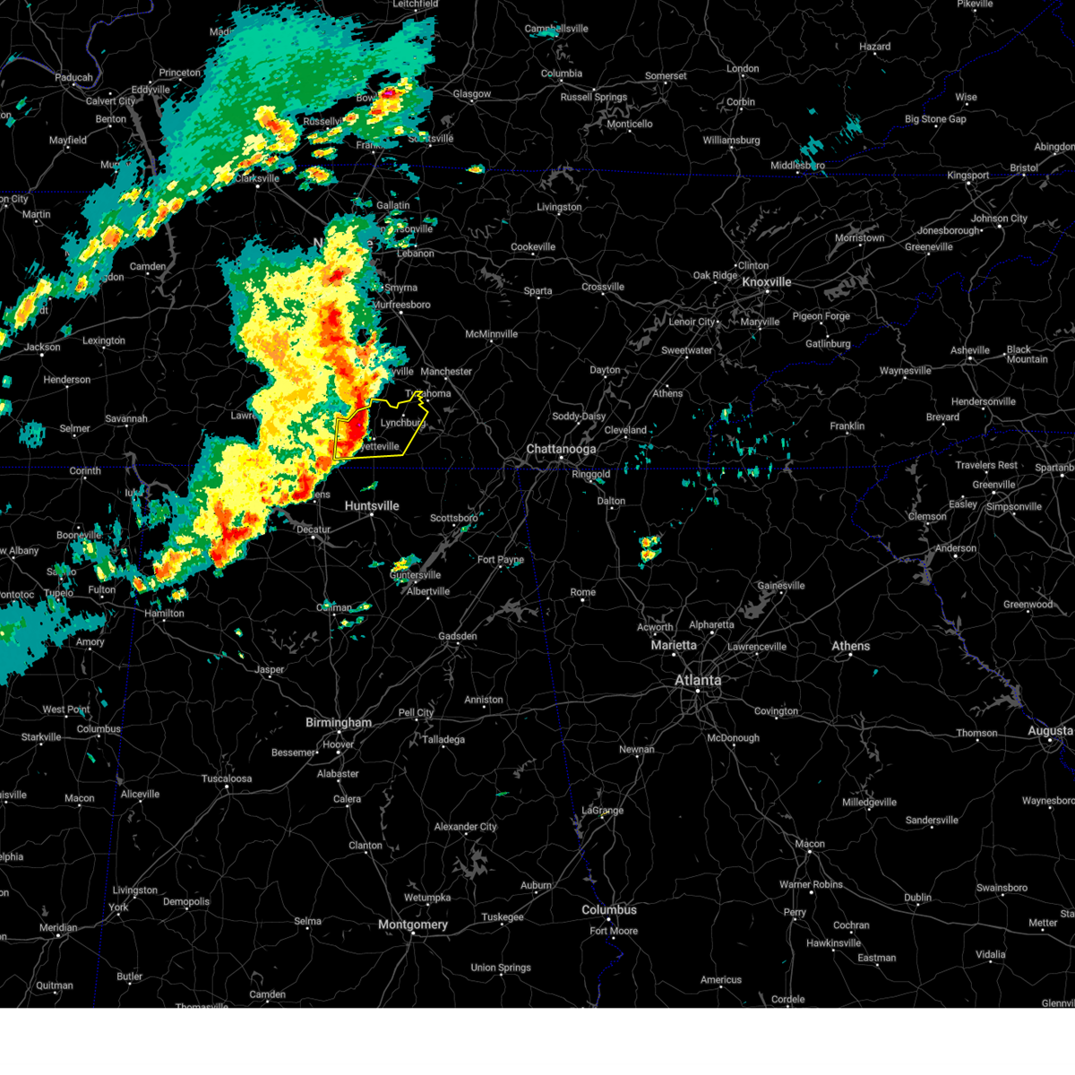 Svrhun the national weather service in huntsville alabama has issued a * severe thunderstorm warning for, moore county in middle tennessee, lincoln county in middle tennessee, northwestern franklin county in middle tennessee, * until 530 pm cdt. * at 507 pm cdt, severe thunderstorms were located along a line extending from 6 miles north of petersburg to 6 miles north of fayetteville to near ardmore, moving east at 45 mph (radar indicated). Hazards include 60 mph wind gusts and nickel size hail. expect damage to roofs, siding, and trees Svrhun the national weather service in huntsville alabama has issued a * severe thunderstorm warning for, moore county in middle tennessee, lincoln county in middle tennessee, northwestern franklin county in middle tennessee, * until 530 pm cdt. * at 507 pm cdt, severe thunderstorms were located along a line extending from 6 miles north of petersburg to 6 miles north of fayetteville to near ardmore, moving east at 45 mph (radar indicated). Hazards include 60 mph wind gusts and nickel size hail. expect damage to roofs, siding, and trees
|
| 5/8/2024 8:31 PM CDT |
 the severe thunderstorm warning has been cancelled and is no longer in effect the severe thunderstorm warning has been cancelled and is no longer in effect
|
| 5/8/2024 8:31 PM CDT |
 At 830 pm cdt, a severe thunderstorm was located near manchester, moving east at 45 mph (trained weather spotters). Hazards include 60 mph wind gusts and half dollar size hail. Hail damage to vehicles is expected. expect wind damage to roofs, siding, and trees. locations impacted include, mcminnville, manchester, tullahoma, altamont, coalmont, morrison, viola, hillsboro, beechgrove, and summitville. This includes interstate 24 between mile markers 97 and 123. At 830 pm cdt, a severe thunderstorm was located near manchester, moving east at 45 mph (trained weather spotters). Hazards include 60 mph wind gusts and half dollar size hail. Hail damage to vehicles is expected. expect wind damage to roofs, siding, and trees. locations impacted include, mcminnville, manchester, tullahoma, altamont, coalmont, morrison, viola, hillsboro, beechgrove, and summitville. This includes interstate 24 between mile markers 97 and 123.
|
| 5/8/2024 8:28 PM CDT |
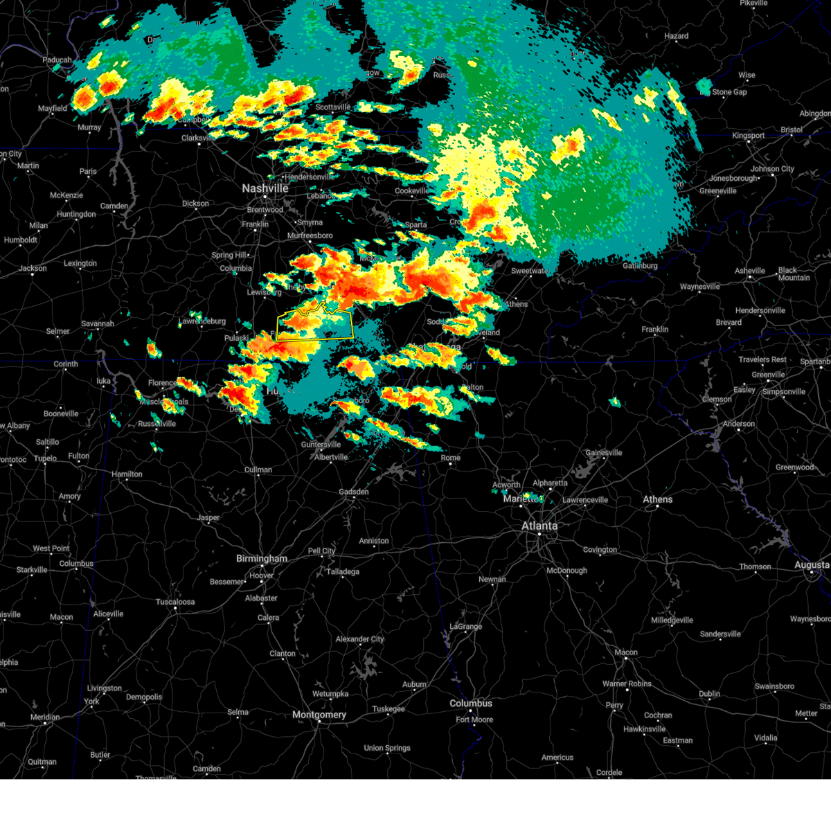 Svrhun the national weather service in huntsville alabama has issued a * severe thunderstorm warning for, moore county in middle tennessee, central lincoln county in middle tennessee, northwestern franklin county in middle tennessee, * until 915 pm cdt. * at 828 pm cdt, a severe thunderstorm was located near lynchburg, moving east at 40 mph (radar indicated). Hazards include 60 mph wind gusts and quarter size hail. Hail damage to vehicles is expected. Expect wind damage to roofs, siding, and trees. Svrhun the national weather service in huntsville alabama has issued a * severe thunderstorm warning for, moore county in middle tennessee, central lincoln county in middle tennessee, northwestern franklin county in middle tennessee, * until 915 pm cdt. * at 828 pm cdt, a severe thunderstorm was located near lynchburg, moving east at 40 mph (radar indicated). Hazards include 60 mph wind gusts and quarter size hail. Hail damage to vehicles is expected. Expect wind damage to roofs, siding, and trees.
|
| 5/8/2024 8:19 PM CDT |
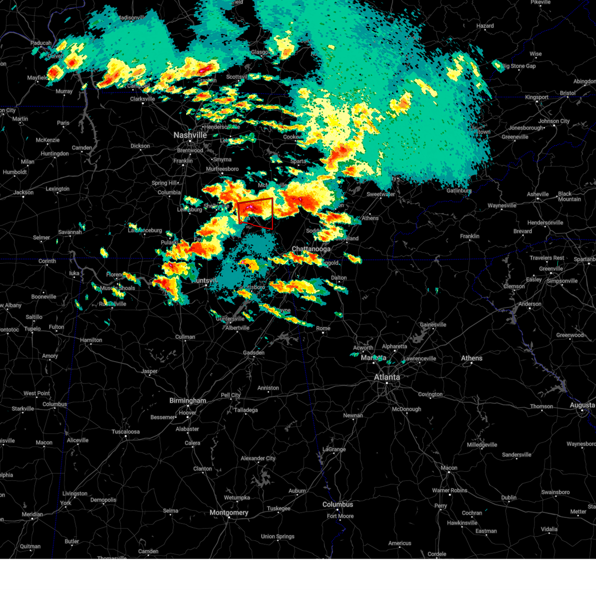 Torohx the national weather service in nashville has issued a * tornado warning for, southwestern warren county in middle tennessee, coffee county in middle tennessee, northwestern grundy county in middle tennessee, * until 845 pm cdt. * at 819 pm cdt, a severe thunderstorm capable of producing a tornado was located over manchester, moving east at 25 mph (radar indicated rotation). Hazards include tornado and golf ball size hail. Flying debris will be dangerous to those caught without shelter. mobile homes will be damaged or destroyed. damage to roofs, windows, and vehicles will occur. tree damage is likely. this dangerous storm will be near, manchester around 825 pm cdt. other locations impacted by this tornadic thunderstorm include pelham, viola, hillsboro, summitville, arnold afb, and altamont. This includes interstate 24 between mile markers 104 and 126. Torohx the national weather service in nashville has issued a * tornado warning for, southwestern warren county in middle tennessee, coffee county in middle tennessee, northwestern grundy county in middle tennessee, * until 845 pm cdt. * at 819 pm cdt, a severe thunderstorm capable of producing a tornado was located over manchester, moving east at 25 mph (radar indicated rotation). Hazards include tornado and golf ball size hail. Flying debris will be dangerous to those caught without shelter. mobile homes will be damaged or destroyed. damage to roofs, windows, and vehicles will occur. tree damage is likely. this dangerous storm will be near, manchester around 825 pm cdt. other locations impacted by this tornadic thunderstorm include pelham, viola, hillsboro, summitville, arnold afb, and altamont. This includes interstate 24 between mile markers 104 and 126.
|
| 5/8/2024 8:14 PM CDT |
 At 814 pm cdt, a severe thunderstorm was located near manchester, moving east at 45 mph (trained weather spotters). Hazards include golf ball size hail and 60 mph wind gusts. People and animals outdoors will be injured. expect hail damage to roofs, siding, windows, and vehicles. expect wind damage to roofs, siding, and trees. locations impacted include, shelbyville, mcminnville, manchester, tullahoma, altamont, coalmont, morrison, wartrace, bell buckle, normandy, viola, beechgrove, raus, summitville, deason, and hillsboro. This includes interstate 24 between mile markers 97 and 123. At 814 pm cdt, a severe thunderstorm was located near manchester, moving east at 45 mph (trained weather spotters). Hazards include golf ball size hail and 60 mph wind gusts. People and animals outdoors will be injured. expect hail damage to roofs, siding, windows, and vehicles. expect wind damage to roofs, siding, and trees. locations impacted include, shelbyville, mcminnville, manchester, tullahoma, altamont, coalmont, morrison, wartrace, bell buckle, normandy, viola, beechgrove, raus, summitville, deason, and hillsboro. This includes interstate 24 between mile markers 97 and 123.
|
| 5/8/2024 8:07 PM CDT |
 Svrohx the national weather service in nashville has issued a * severe thunderstorm warning for, southwestern warren county in middle tennessee, coffee county in middle tennessee, eastern bedford county in middle tennessee, northwestern grundy county in middle tennessee, * until 845 pm cdt. * at 807 pm cdt, a severe thunderstorm was located 9 miles north of tullahoma, or 10 miles east of shelbyville, moving east at 45 mph (radar indicated). Hazards include 60 mph wind gusts and half dollar size hail. Hail damage to vehicles is expected. Expect wind damage to roofs, siding, and trees. Svrohx the national weather service in nashville has issued a * severe thunderstorm warning for, southwestern warren county in middle tennessee, coffee county in middle tennessee, eastern bedford county in middle tennessee, northwestern grundy county in middle tennessee, * until 845 pm cdt. * at 807 pm cdt, a severe thunderstorm was located 9 miles north of tullahoma, or 10 miles east of shelbyville, moving east at 45 mph (radar indicated). Hazards include 60 mph wind gusts and half dollar size hail. Hail damage to vehicles is expected. Expect wind damage to roofs, siding, and trees.
|
| 5/7/2024 7:29 PM CDT |
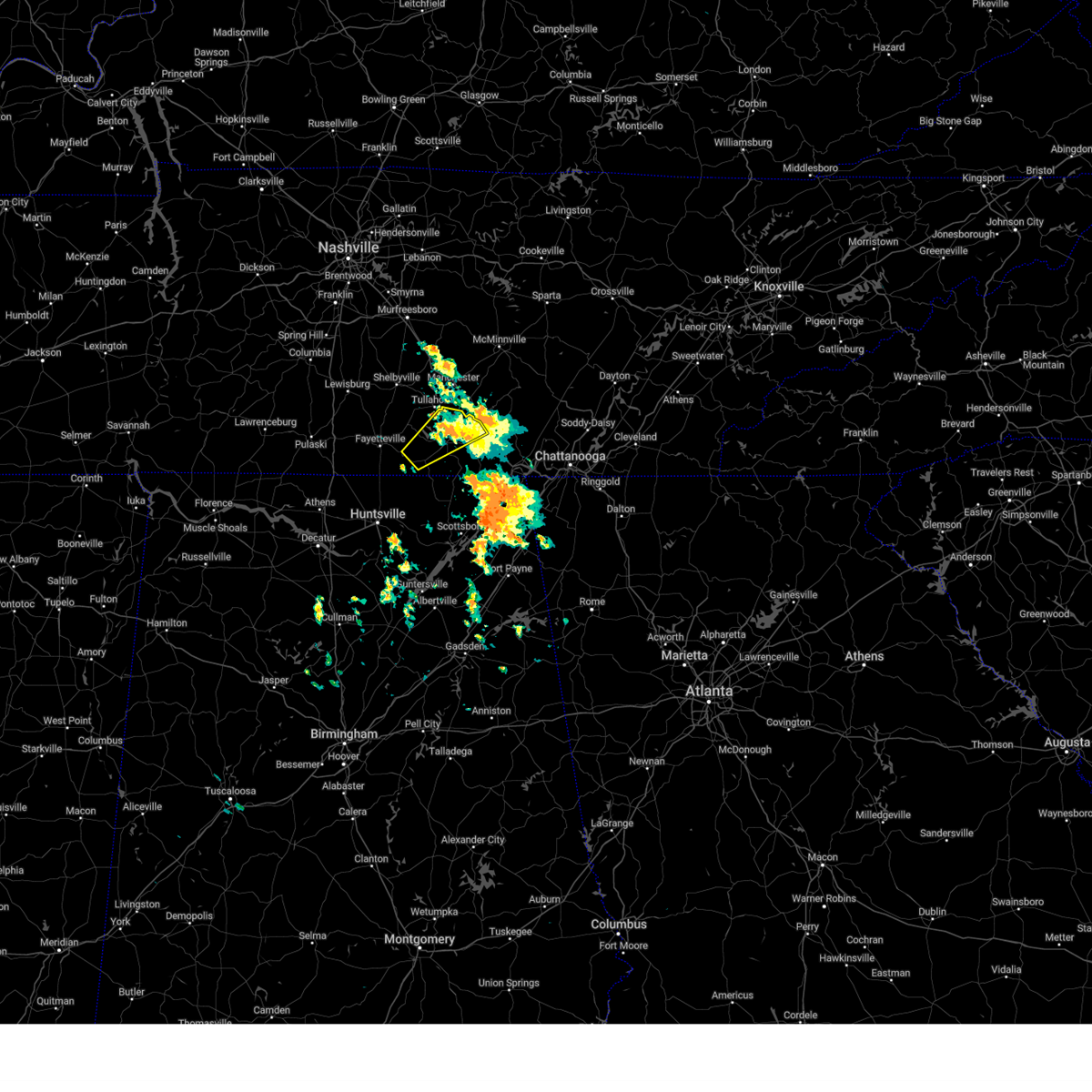 The storm which prompted the warning has weakened below severe limits, and has exited the warned area. therefore, the warning will be allowed to expire. The storm which prompted the warning has weakened below severe limits, and has exited the warned area. therefore, the warning will be allowed to expire.
|
| 5/7/2024 6:52 PM CDT |
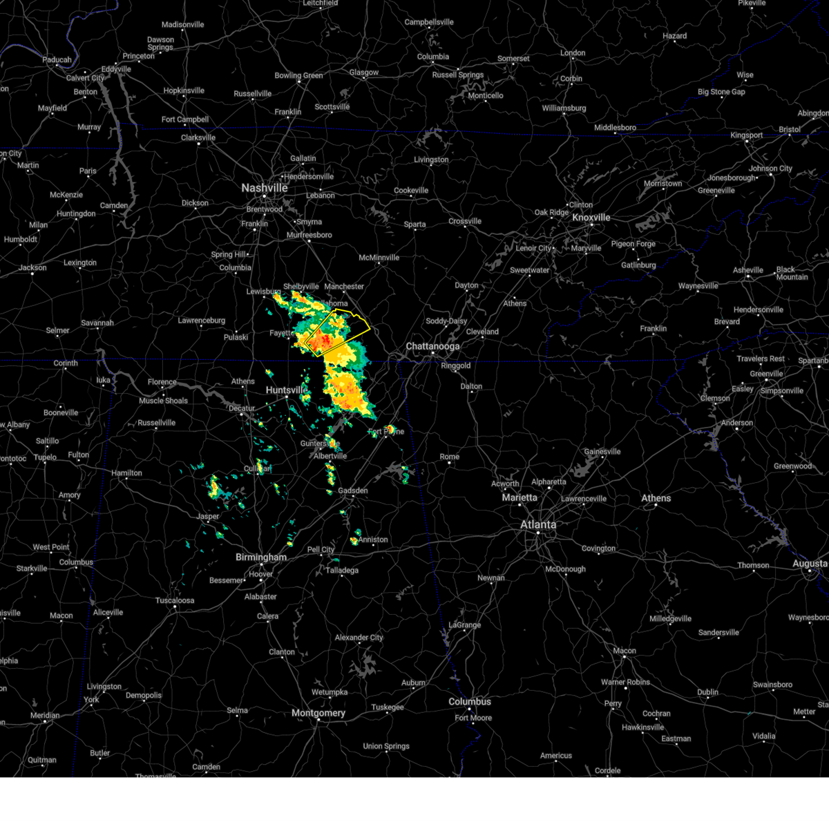 Svrhun the national weather service in huntsville alabama has issued a * severe thunderstorm warning for, southeastern moore county in middle tennessee, east central lincoln county in middle tennessee, central franklin county in middle tennessee, * until 730 pm cdt. * at 651 pm cdt, a severe thunderstorm was located near huntland, or 13 miles south of lynchburg, moving northeast at 35 mph (radar indicated). Hazards include 60 mph wind gusts and quarter size hail. Hail damage to vehicles is expected. Expect wind damage to roofs, siding, and trees. Svrhun the national weather service in huntsville alabama has issued a * severe thunderstorm warning for, southeastern moore county in middle tennessee, east central lincoln county in middle tennessee, central franklin county in middle tennessee, * until 730 pm cdt. * at 651 pm cdt, a severe thunderstorm was located near huntland, or 13 miles south of lynchburg, moving northeast at 35 mph (radar indicated). Hazards include 60 mph wind gusts and quarter size hail. Hail damage to vehicles is expected. Expect wind damage to roofs, siding, and trees.
|
| 4/2/2024 6:59 PM CDT |
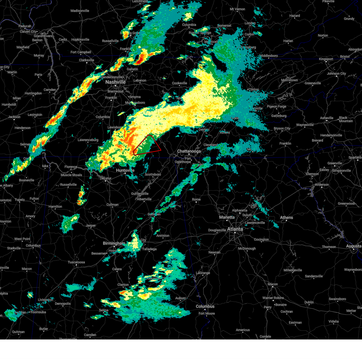 Torhun the national weather service in huntsville alabama has issued a * tornado warning for, southeastern moore county in middle tennessee, southeastern lincoln county in middle tennessee, central franklin county in middle tennessee, * until 730 pm cdt. * at 658 pm cdt, a severe thunderstorm capable of producing a tornado was located near huntland, or 12 miles southeast of fayetteville, moving northeast at 40 mph (radar indicated rotation). Hazards include tornado. Flying debris will be dangerous to those caught without shelter. mobile homes will be damaged or destroyed. damage to roofs, windows, and vehicles will occur. tree damage is likely. this dangerous storm will be near, huntland around 705 pm cdt. tims ford lake around 710 pm cdt. winchester around 715 pm cdt. decherd and estill springs around 720 pm cdt. Other locations impacted by this tornadic thunderstorm include lexie crossroads, smithland, beans creek, woods reservoir, harmony, arnold afb, maxwell, belvidere, and hurdlow. Torhun the national weather service in huntsville alabama has issued a * tornado warning for, southeastern moore county in middle tennessee, southeastern lincoln county in middle tennessee, central franklin county in middle tennessee, * until 730 pm cdt. * at 658 pm cdt, a severe thunderstorm capable of producing a tornado was located near huntland, or 12 miles southeast of fayetteville, moving northeast at 40 mph (radar indicated rotation). Hazards include tornado. Flying debris will be dangerous to those caught without shelter. mobile homes will be damaged or destroyed. damage to roofs, windows, and vehicles will occur. tree damage is likely. this dangerous storm will be near, huntland around 705 pm cdt. tims ford lake around 710 pm cdt. winchester around 715 pm cdt. decherd and estill springs around 720 pm cdt. Other locations impacted by this tornadic thunderstorm include lexie crossroads, smithland, beans creek, woods reservoir, harmony, arnold afb, maxwell, belvidere, and hurdlow.
|
| 3/15/2024 4:57 AM CDT |
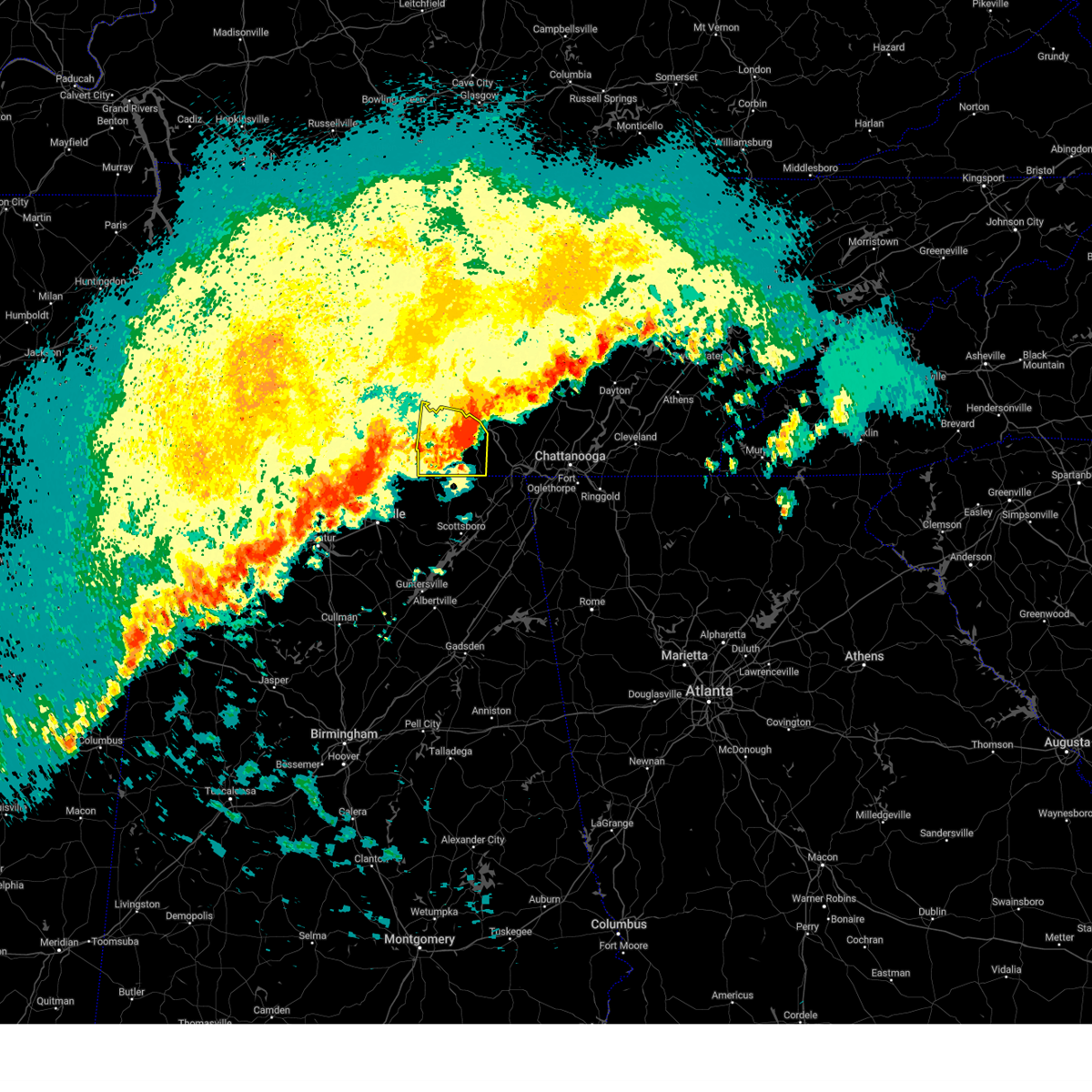 The storm which prompted the warning will be allowed to expire. however, gusty winds are still possible with this thunderstorm. a severe thunderstorm watch remains in effect until 1000 am cdt for north central and northeastern alabama. remember, a tornado warning still remains in effect for east central franklin county tn until 515 am. The storm which prompted the warning will be allowed to expire. however, gusty winds are still possible with this thunderstorm. a severe thunderstorm watch remains in effect until 1000 am cdt for north central and northeastern alabama. remember, a tornado warning still remains in effect for east central franklin county tn until 515 am.
|
| 3/15/2024 4:35 AM CDT |
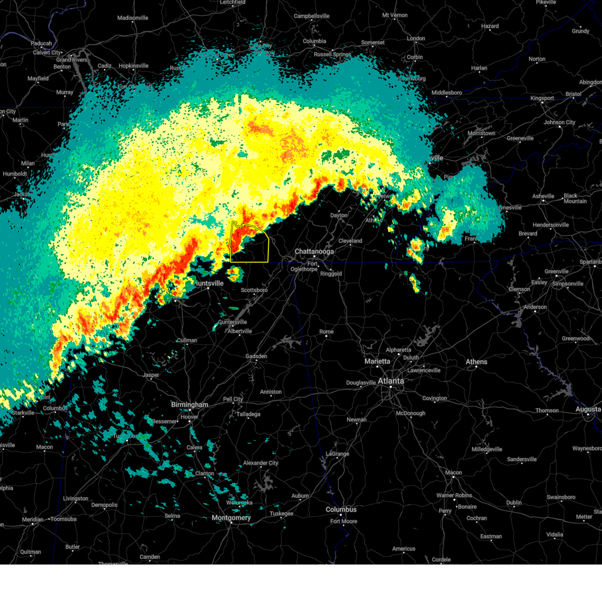 Svrhun the national weather service in huntsville alabama has issued a * severe thunderstorm warning for, eastern moore county in middle tennessee, franklin county in middle tennessee, * until 500 am cdt. * at 434 am cdt, a severe thunderstorm was located near tims ford lake, or near winchester, moving east at 45 mph (radar indicated). Hazards include 60 mph wind gusts and quarter size hail. Hail damage to vehicles is expected. Expect wind damage to roofs, siding, and trees. Svrhun the national weather service in huntsville alabama has issued a * severe thunderstorm warning for, eastern moore county in middle tennessee, franklin county in middle tennessee, * until 500 am cdt. * at 434 am cdt, a severe thunderstorm was located near tims ford lake, or near winchester, moving east at 45 mph (radar indicated). Hazards include 60 mph wind gusts and quarter size hail. Hail damage to vehicles is expected. Expect wind damage to roofs, siding, and trees.
|
| 2/28/2024 9:37 AM CST |
 At 937 am cst, severe thunderstorms were located along a line extending from near lynchburg to near harvest, moving east at 50 mph (radar indicated). Hazards include 60 mph wind gusts and quarter size hail. Hail damage to vehicles is expected. expect wind damage to roofs, siding, and trees. Locations impacted include, huntsville, decatur, madison, winchester, fayetteville, moores mill, meridianville, lynchburg, redstone arsenal, and hazel green. At 937 am cst, severe thunderstorms were located along a line extending from near lynchburg to near harvest, moving east at 50 mph (radar indicated). Hazards include 60 mph wind gusts and quarter size hail. Hail damage to vehicles is expected. expect wind damage to roofs, siding, and trees. Locations impacted include, huntsville, decatur, madison, winchester, fayetteville, moores mill, meridianville, lynchburg, redstone arsenal, and hazel green.
|
| 2/28/2024 9:20 AM CST |
 Svrhun the national weather service in huntsville alabama has issued a * severe thunderstorm warning for, northwestern jackson county in northeastern alabama, madison county in north central alabama, limestone county in north central alabama, northern morgan county in north central alabama, east central lawrence county in northwestern alabama, moore county in middle tennessee, lincoln county in middle tennessee, franklin county in middle tennessee, * until 945 am cst. * at 920 am cst, severe thunderstorms were located along a line extending from near fayetteville to near athens, moving east at 50 mph (radar indicated). Hazards include 60 mph wind gusts and quarter size hail. Hail damage to vehicles is expected. Expect wind damage to roofs, siding, and trees. Svrhun the national weather service in huntsville alabama has issued a * severe thunderstorm warning for, northwestern jackson county in northeastern alabama, madison county in north central alabama, limestone county in north central alabama, northern morgan county in north central alabama, east central lawrence county in northwestern alabama, moore county in middle tennessee, lincoln county in middle tennessee, franklin county in middle tennessee, * until 945 am cst. * at 920 am cst, severe thunderstorms were located along a line extending from near fayetteville to near athens, moving east at 50 mph (radar indicated). Hazards include 60 mph wind gusts and quarter size hail. Hail damage to vehicles is expected. Expect wind damage to roofs, siding, and trees.
|
| 12/9/2023 8:21 PM CST |
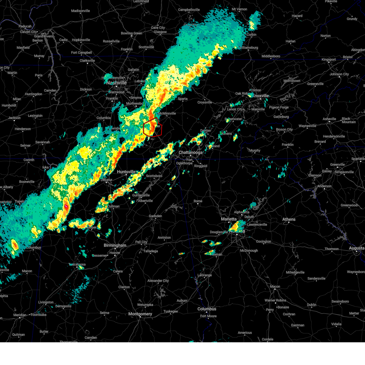 The tornado warning for coffee county will expire at 830 pm cst, the tornado threat has diminished and the tornado warning has been cancelled. however, large hail and damaging winds remain likely and a severe thunderstorm warning remains in effect for the area. a tornado watch remains in effect until 1100 pm cst for middle tennessee. The tornado warning for coffee county will expire at 830 pm cst, the tornado threat has diminished and the tornado warning has been cancelled. however, large hail and damaging winds remain likely and a severe thunderstorm warning remains in effect for the area. a tornado watch remains in effect until 1100 pm cst for middle tennessee.
|
| 12/9/2023 8:12 PM CST | Quarter sized hail reported 1.7 miles SE of Tullahoma, TN, photo received of quarter-sized hail along riley creek road between normandy lake and tullahoma. time is radar estimated. |
| 12/9/2023 8:11 PM CST |
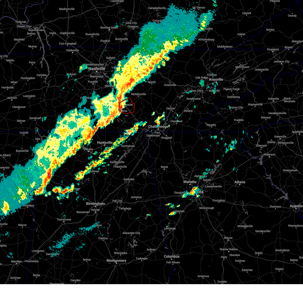 At 811 pm cst, a severe thunderstorm capable of producing a tornado was located near manchester, moving east at 40 mph (radar indicated rotation). Hazards include tornado. Flying debris will be dangerous to those caught without shelter. mobile homes will be damaged or destroyed. damage to roofs, windows, and vehicles will occur. tree damage is likely. this dangerous storm will be near, manchester around 815 pm cst. other locations impacted by this tornadic thunderstorm include hillsboro, summitville, and arnold afb. This includes interstate 24 between mile markers 102 and 121. At 811 pm cst, a severe thunderstorm capable of producing a tornado was located near manchester, moving east at 40 mph (radar indicated rotation). Hazards include tornado. Flying debris will be dangerous to those caught without shelter. mobile homes will be damaged or destroyed. damage to roofs, windows, and vehicles will occur. tree damage is likely. this dangerous storm will be near, manchester around 815 pm cst. other locations impacted by this tornadic thunderstorm include hillsboro, summitville, and arnold afb. This includes interstate 24 between mile markers 102 and 121.
|
| 12/9/2023 8:06 PM CST |
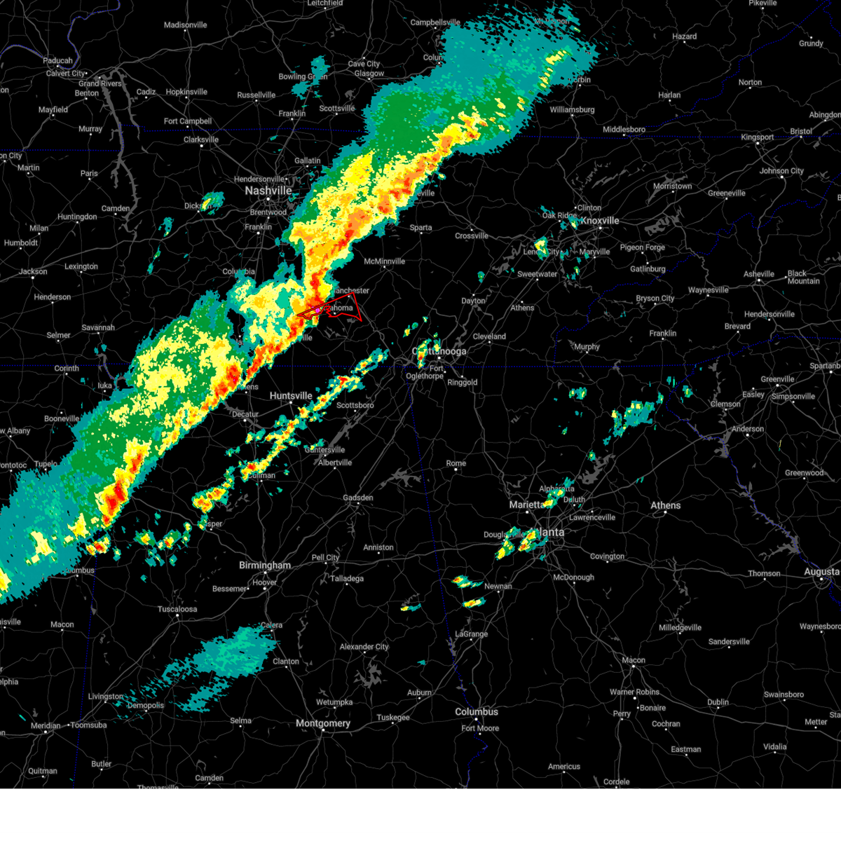 The tornado warning for southwestern coffee and southeastern bedford counties will expire at 815 pm cst, the tornado warning that was previously in effect has been reissued for bedford and coffee counties and is in effect until 830 pm. please refer to that bulletin for the latest severe weather information. a tornado watch remains in effect until 1100 pm cst for middle tennessee. The tornado warning for southwestern coffee and southeastern bedford counties will expire at 815 pm cst, the tornado warning that was previously in effect has been reissued for bedford and coffee counties and is in effect until 830 pm. please refer to that bulletin for the latest severe weather information. a tornado watch remains in effect until 1100 pm cst for middle tennessee.
|
| 12/9/2023 8:05 PM CST |
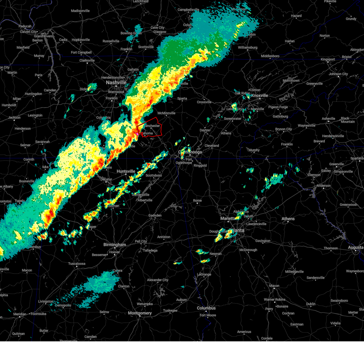 At 804 pm cst, a severe thunderstorm capable of producing a tornado was located near normandy, or 9 miles west of manchester, moving east at 40 mph (radar indicated rotation). Hazards include tornado. Flying debris will be dangerous to those caught without shelter. mobile homes will be damaged or destroyed. damage to roofs, windows, and vehicles will occur. tree damage is likely. this dangerous storm will be near, manchester around 810 pm cst. other locations impacted by this tornadic thunderstorm include normandy, hillsboro, summitville, wartrace, and arnold afb. This includes interstate 24 between mile markers 102 and 122. At 804 pm cst, a severe thunderstorm capable of producing a tornado was located near normandy, or 9 miles west of manchester, moving east at 40 mph (radar indicated rotation). Hazards include tornado. Flying debris will be dangerous to those caught without shelter. mobile homes will be damaged or destroyed. damage to roofs, windows, and vehicles will occur. tree damage is likely. this dangerous storm will be near, manchester around 810 pm cst. other locations impacted by this tornadic thunderstorm include normandy, hillsboro, summitville, wartrace, and arnold afb. This includes interstate 24 between mile markers 102 and 122.
|
| 12/9/2023 7:48 PM CST |
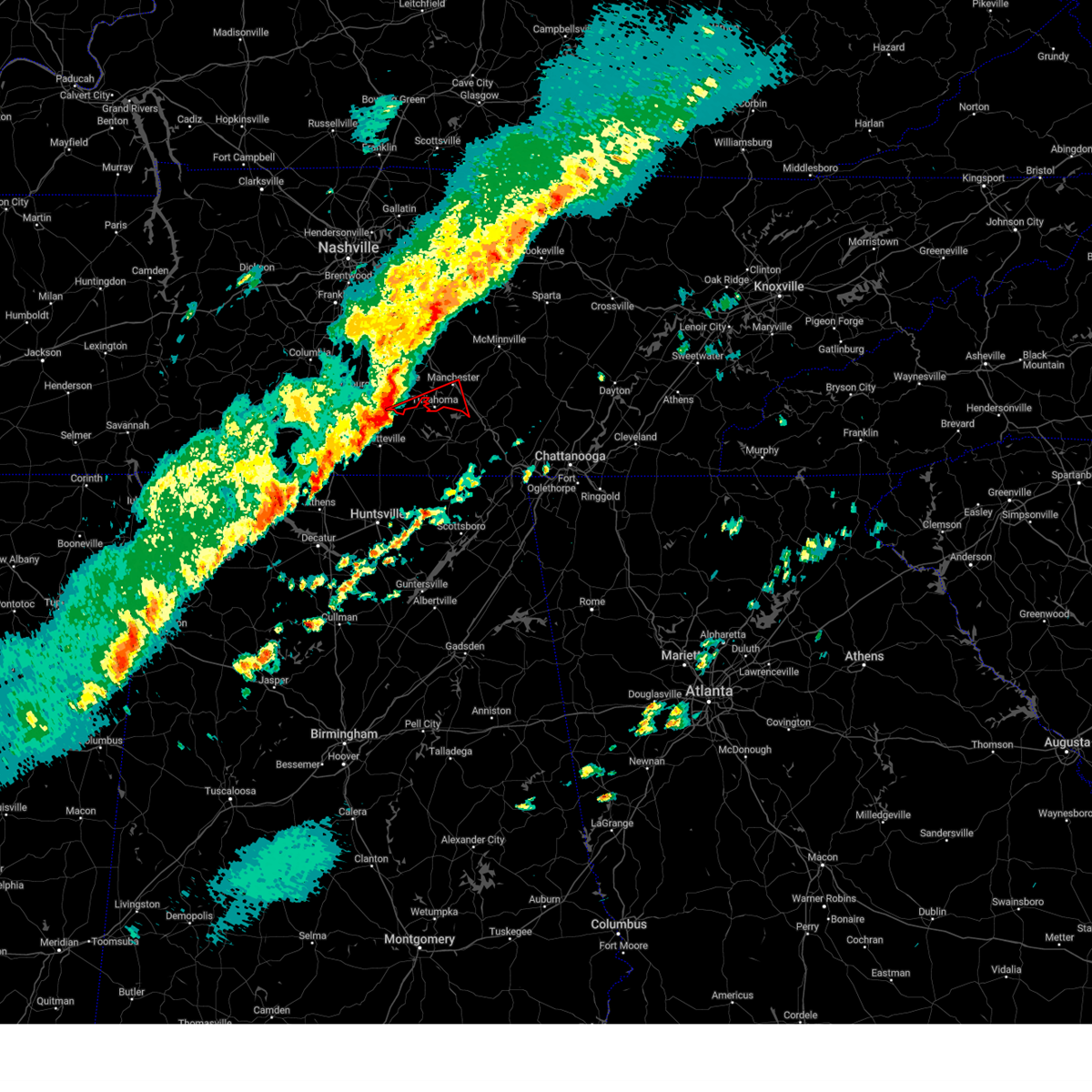 At 748 pm cst, a severe thunderstorm capable of producing a tornado was located 5 miles northwest of lynchburg, moving east at 40 mph (radar indicated rotation). Hazards include tornado. Flying debris will be dangerous to those caught without shelter. mobile homes will be damaged or destroyed. damage to roofs, windows, and vehicles will occur. tree damage is likely. this dangerous storm will be near, tullahoma around 805 pm cst. other locations impacted by this tornadic thunderstorm include raus and arnold afb. This includes interstate 24 between mile markers 111 and 117. At 748 pm cst, a severe thunderstorm capable of producing a tornado was located 5 miles northwest of lynchburg, moving east at 40 mph (radar indicated rotation). Hazards include tornado. Flying debris will be dangerous to those caught without shelter. mobile homes will be damaged or destroyed. damage to roofs, windows, and vehicles will occur. tree damage is likely. this dangerous storm will be near, tullahoma around 805 pm cst. other locations impacted by this tornadic thunderstorm include raus and arnold afb. This includes interstate 24 between mile markers 111 and 117.
|
| 8/13/2023 4:41 PM CDT |
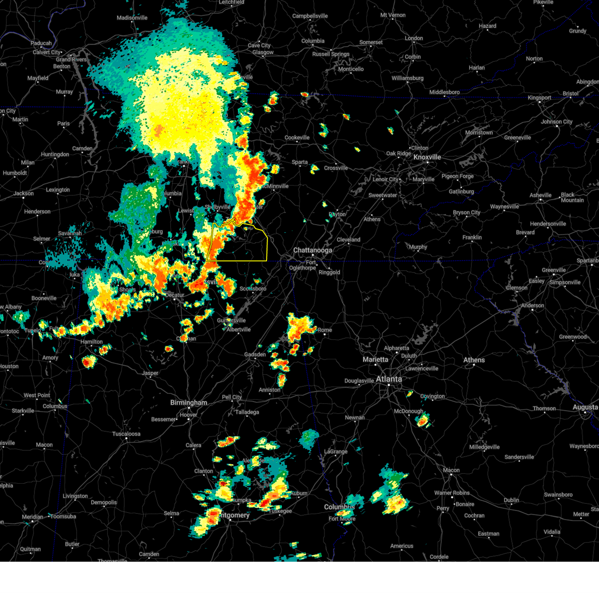 At 440 pm cdt, severe thunderstorms were located along a line extending from near tullahoma to near huntland to elora, moving east at 30 mph (radar indicated). Hazards include 60 mph wind gusts. expect damage to roofs, siding, and trees At 440 pm cdt, severe thunderstorms were located along a line extending from near tullahoma to near huntland to elora, moving east at 30 mph (radar indicated). Hazards include 60 mph wind gusts. expect damage to roofs, siding, and trees
|
| 8/12/2023 1:45 PM CDT | Report of multiple trees down in estill springs along ut farm rd. time estimated by rada in franklin county TN, 6 miles NNW of Tullahoma, TN |
| 8/12/2023 1:25 PM CDT |
 At 124 pm cdt, severe thunderstorms were located along a line extending from near estill springs to near tims ford lake to 9 miles north of new market, moving southeast at 25 mph (radar indicated). Hazards include 70 mph wind gusts and penny size hail. Expect considerable tree damage. damage is likely to mobile homes, roofs, and outbuildings. locations impacted include, winchester, fayetteville, decherd, estill springs, cowan, huntland, tims ford lake, sewanee, anderson and hurdlow. thunderstorm damage threat, considerable hail threat, radar indicated max hail size, 0. 75 in wind threat, radar indicated max wind gust, 70 mph. At 124 pm cdt, severe thunderstorms were located along a line extending from near estill springs to near tims ford lake to 9 miles north of new market, moving southeast at 25 mph (radar indicated). Hazards include 70 mph wind gusts and penny size hail. Expect considerable tree damage. damage is likely to mobile homes, roofs, and outbuildings. locations impacted include, winchester, fayetteville, decherd, estill springs, cowan, huntland, tims ford lake, sewanee, anderson and hurdlow. thunderstorm damage threat, considerable hail threat, radar indicated max hail size, 0. 75 in wind threat, radar indicated max wind gust, 70 mph.
|
| 8/12/2023 1:12 PM CDT | Report of three trees down near tullahoma. time estimated by rada in moore county TN, 5.2 miles NNE of Tullahoma, TN |
| 8/12/2023 1:10 PM CDT |
 At 110 pm cdt, severe thunderstorms were located along a line extending from tullahoma to near tims ford lake to near fayetteville, moving southeast at 30 mph (radar indicated). Hazards include 60 mph wind gusts and penny size hail. expect damage to roofs, siding, and trees At 110 pm cdt, severe thunderstorms were located along a line extending from tullahoma to near tims ford lake to near fayetteville, moving southeast at 30 mph (radar indicated). Hazards include 60 mph wind gusts and penny size hail. expect damage to roofs, siding, and trees
|
| 8/12/2023 1:10 PM CDT |
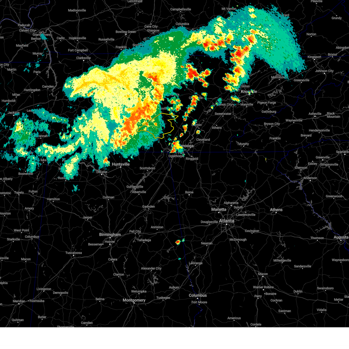 At 109 pm cdt, severe thunderstorms were located along a line extending from mcminnville to near tullahoma, moving east at 55 mph (radar indicated). Hazards include 60 mph wind gusts. expect damage to roofs, siding, and trees At 109 pm cdt, severe thunderstorms were located along a line extending from mcminnville to near tullahoma, moving east at 55 mph (radar indicated). Hazards include 60 mph wind gusts. expect damage to roofs, siding, and trees
|
| 8/12/2023 1:04 PM CDT |
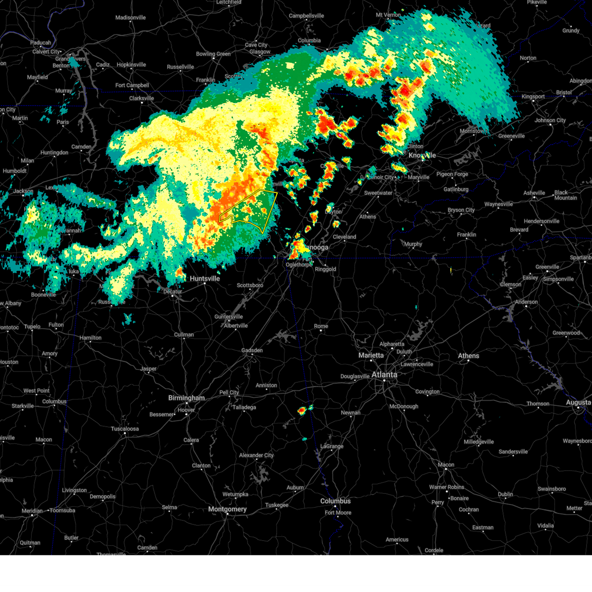 At 104 pm cdt, severe thunderstorms were located along a line extending from near mcminnville to near lynchburg, moving east at 50 mph (radar indicated). Hazards include 60 mph wind gusts. Expect damage to roofs, siding, and trees. locations impacted include, mcminnville, manchester, tullahoma, monteagle, altamont, morrison, normandy, viola, raus, summitville, hillsboro, pelham and arnold afb. this includes interstate 24 between mile markers 106 and 131. hail threat, radar indicated max hail size, <. 75 in wind threat, radar indicated max wind gust, 60 mph. At 104 pm cdt, severe thunderstorms were located along a line extending from near mcminnville to near lynchburg, moving east at 50 mph (radar indicated). Hazards include 60 mph wind gusts. Expect damage to roofs, siding, and trees. locations impacted include, mcminnville, manchester, tullahoma, monteagle, altamont, morrison, normandy, viola, raus, summitville, hillsboro, pelham and arnold afb. this includes interstate 24 between mile markers 106 and 131. hail threat, radar indicated max hail size, <. 75 in wind threat, radar indicated max wind gust, 60 mph.
|
| 8/12/2023 12:59 PM CDT |
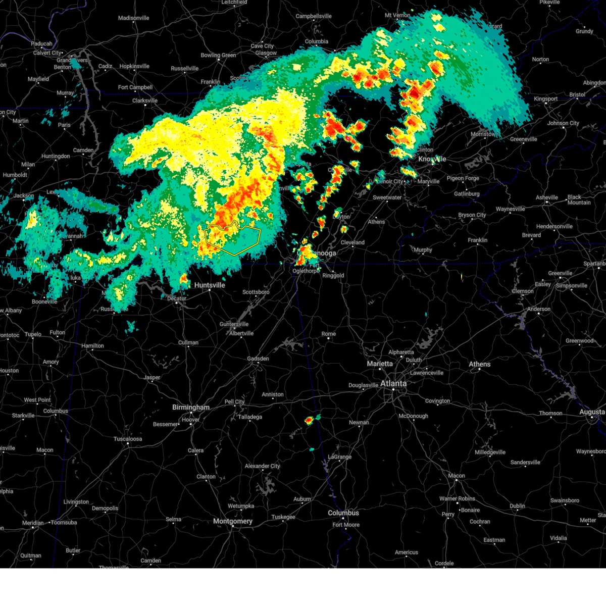 At 1258 pm cdt, severe thunderstorms were located along a line extending from near tullahoma to lynchburg to 6 miles northeast of fayetteville, moving east at 45 mph (radar indicated). Hazards include 60 mph wind gusts and penny size hail. Expect damage to roofs, siding, and trees. locations impacted include, winchester, lynchburg, decherd, estill springs, petersburg, tims ford lake, lexie crossroads, mulberry, chestnut ridge and howell. hail threat, radar indicated max hail size, 0. 75 in wind threat, radar indicated max wind gust, 60 mph. At 1258 pm cdt, severe thunderstorms were located along a line extending from near tullahoma to lynchburg to 6 miles northeast of fayetteville, moving east at 45 mph (radar indicated). Hazards include 60 mph wind gusts and penny size hail. Expect damage to roofs, siding, and trees. locations impacted include, winchester, lynchburg, decherd, estill springs, petersburg, tims ford lake, lexie crossroads, mulberry, chestnut ridge and howell. hail threat, radar indicated max hail size, 0. 75 in wind threat, radar indicated max wind gust, 60 mph.
|
| 8/12/2023 12:51 PM CDT |
 At 1250 pm cdt, severe thunderstorms were located along a line extending from centertown to petersburg, moving east at 50 mph (radar indicated). Hazards include 60 mph wind gusts. Expect damage to roofs, siding, and trees. locations impacted include, shelbyville, mcminnville, manchester, tullahoma, monteagle, altamont, morrison, wartrace, normandy, viola, beechgrove, raus, summitville, hillsboro, pelham and arnold afb. this includes interstate 24 between mile markers 97 and 131. hail threat, radar indicated max hail size, <. 75 in wind threat, radar indicated max wind gust, 60 mph. At 1250 pm cdt, severe thunderstorms were located along a line extending from centertown to petersburg, moving east at 50 mph (radar indicated). Hazards include 60 mph wind gusts. Expect damage to roofs, siding, and trees. locations impacted include, shelbyville, mcminnville, manchester, tullahoma, monteagle, altamont, morrison, wartrace, normandy, viola, beechgrove, raus, summitville, hillsboro, pelham and arnold afb. this includes interstate 24 between mile markers 97 and 131. hail threat, radar indicated max hail size, <. 75 in wind threat, radar indicated max wind gust, 60 mph.
|
| 8/12/2023 12:50 PM CDT |
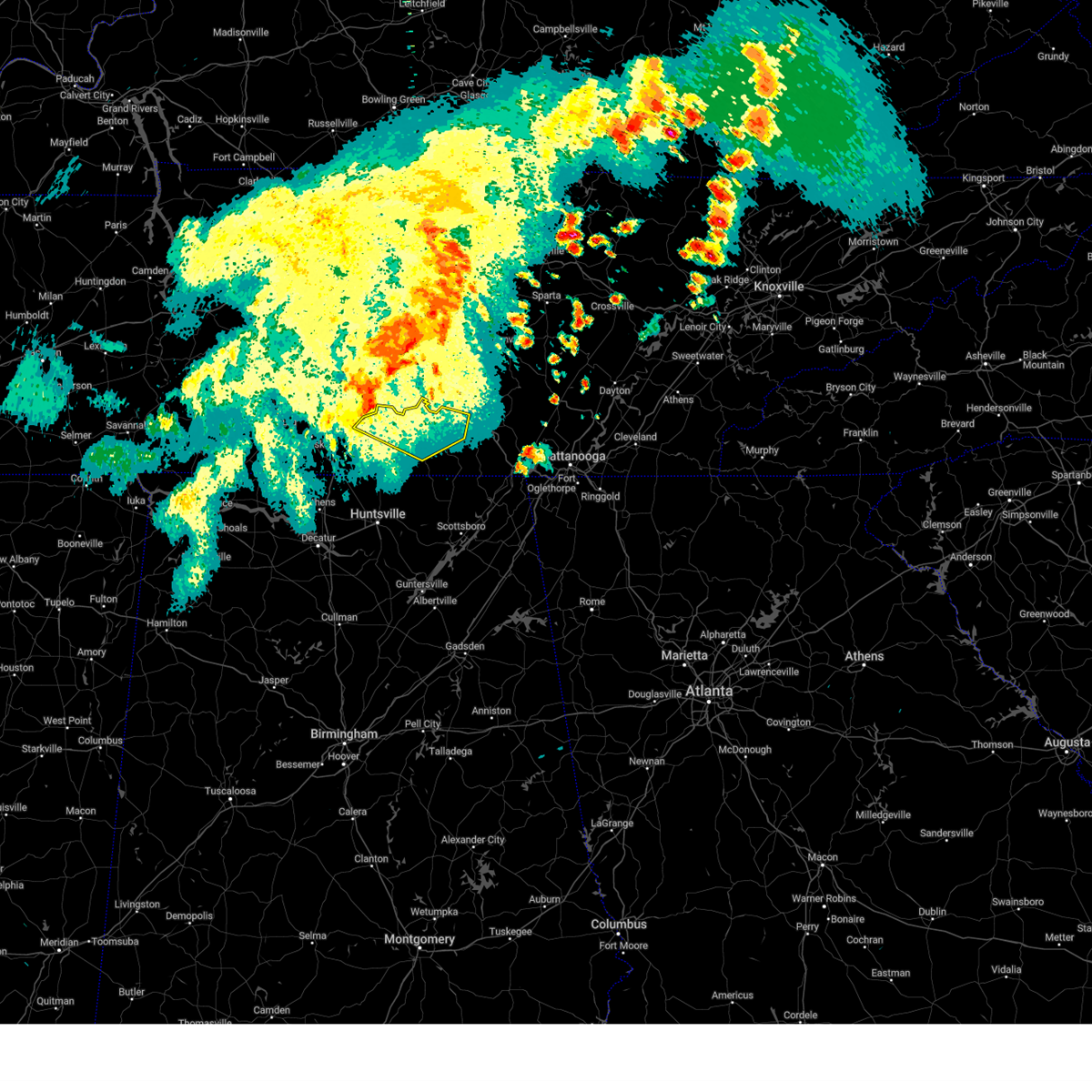 At 1249 pm cdt, a severe thunderstorm was located near lynchburg, moving east at 50 mph (radar indicated). Hazards include 60 mph wind gusts and penny size hail. Expect damage to roofs, siding, and trees. locations impacted include, winchester, lynchburg, decherd, estill springs, petersburg, tims ford lake, lexie crossroads, mulberry, chestnut ridge and howell. hail threat, radar indicated max hail size, 0. 75 in wind threat, radar indicated max wind gust, 60 mph. At 1249 pm cdt, a severe thunderstorm was located near lynchburg, moving east at 50 mph (radar indicated). Hazards include 60 mph wind gusts and penny size hail. Expect damage to roofs, siding, and trees. locations impacted include, winchester, lynchburg, decherd, estill springs, petersburg, tims ford lake, lexie crossroads, mulberry, chestnut ridge and howell. hail threat, radar indicated max hail size, 0. 75 in wind threat, radar indicated max wind gust, 60 mph.
|
| 8/12/2023 12:31 PM CDT |
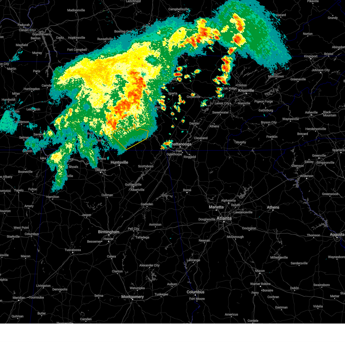 At 1230 pm cdt, a severe thunderstorm was located near lewisburg, moving east at 45 mph (radar indicated). Hazards include 60 mph wind gusts and penny size hail. expect damage to roofs, siding, and trees At 1230 pm cdt, a severe thunderstorm was located near lewisburg, moving east at 45 mph (radar indicated). Hazards include 60 mph wind gusts and penny size hail. expect damage to roofs, siding, and trees
|
| 8/12/2023 12:29 PM CDT |
 At 1228 pm cdt, severe thunderstorms were located along a line extending from murfreesboro to near lewisburg, moving east at 50 mph (radar indicated). Hazards include 60 mph wind gusts. expect damage to roofs, siding, and trees At 1228 pm cdt, severe thunderstorms were located along a line extending from murfreesboro to near lewisburg, moving east at 50 mph (radar indicated). Hazards include 60 mph wind gusts. expect damage to roofs, siding, and trees
|
| 8/10/2023 2:50 AM CDT | Trees down along ray burton r in moore county TN, 10.3 miles NE of Tullahoma, TN |
| 8/10/2023 2:50 AM CDT | Trees down at chestnut ridge rd and stewart hollow r in moore county TN, 8.6 miles NE of Tullahoma, TN |
| 8/10/2023 2:50 AM CDT | Trees down on hurrican creek roa in moore county TN, 7.7 miles NE of Tullahoma, TN |
| 8/10/2023 2:50 AM CDT | Tree down at culberland springs rd and raysville r in moore county TN, 5.6 miles ENE of Tullahoma, TN |
| 8/10/2023 2:50 AM CDT | Tree down at 1087 stewart hollow r in moore county TN, 9.1 miles NE of Tullahoma, TN |
| 7/20/2023 3:33 PM CDT |
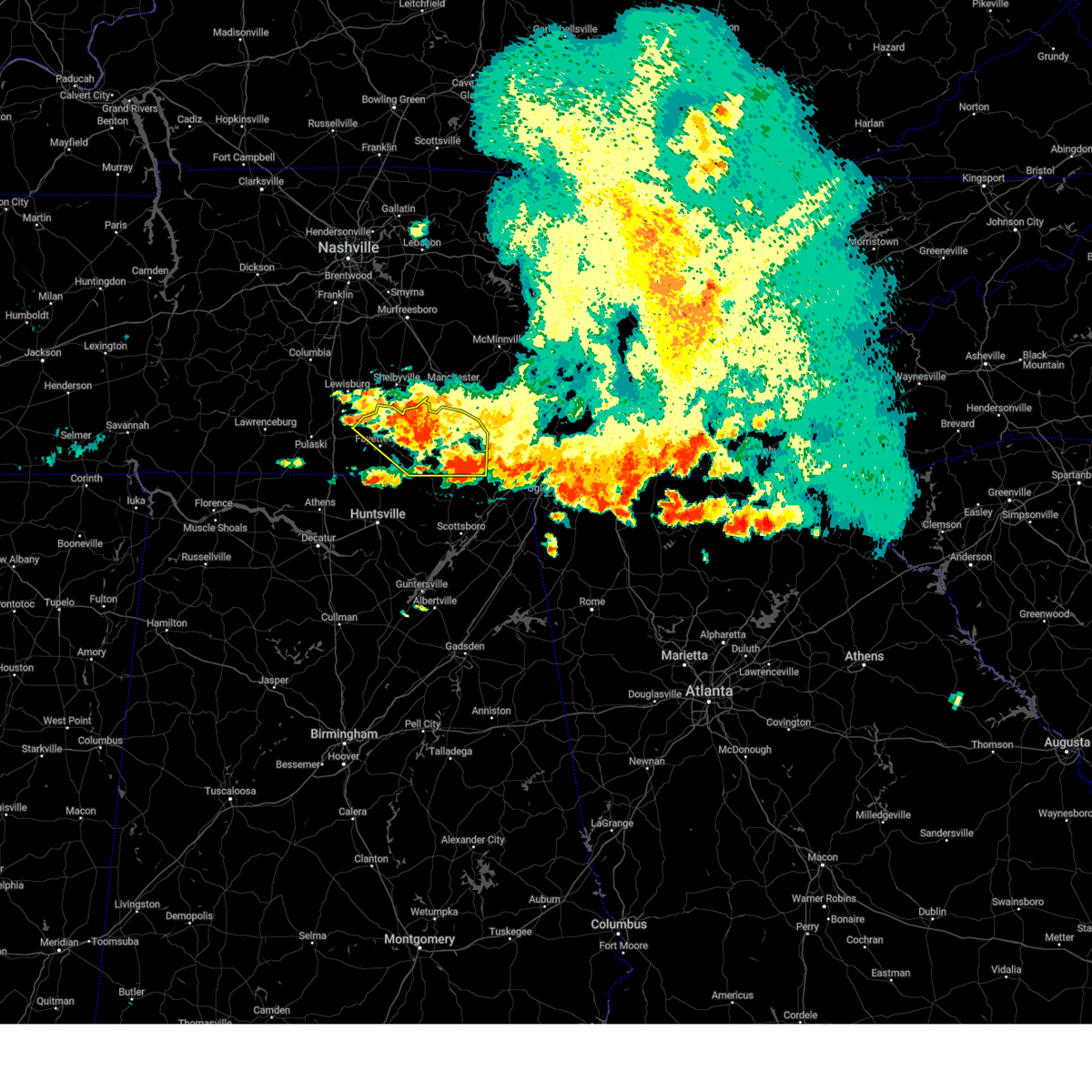 At 332 pm cdt, severe thunderstorms were located along a line extending from 7 miles south of tracy city to near fayetteville, moving southeast at 35 mph (radar indicated). Hazards include 60 mph wind gusts and penny size hail. Expect damage to roofs, siding, and trees. locations impacted include, winchester, fayetteville, lynchburg, decherd, estill springs, cowan, huntland, petersburg, tims ford lake and sewanee. hail threat, radar indicated max hail size, 0. 75 in wind threat, observed max wind gust, 60 mph. At 332 pm cdt, severe thunderstorms were located along a line extending from 7 miles south of tracy city to near fayetteville, moving southeast at 35 mph (radar indicated). Hazards include 60 mph wind gusts and penny size hail. Expect damage to roofs, siding, and trees. locations impacted include, winchester, fayetteville, lynchburg, decherd, estill springs, cowan, huntland, petersburg, tims ford lake and sewanee. hail threat, radar indicated max hail size, 0. 75 in wind threat, observed max wind gust, 60 mph.
|
| 7/20/2023 3:08 PM CDT |
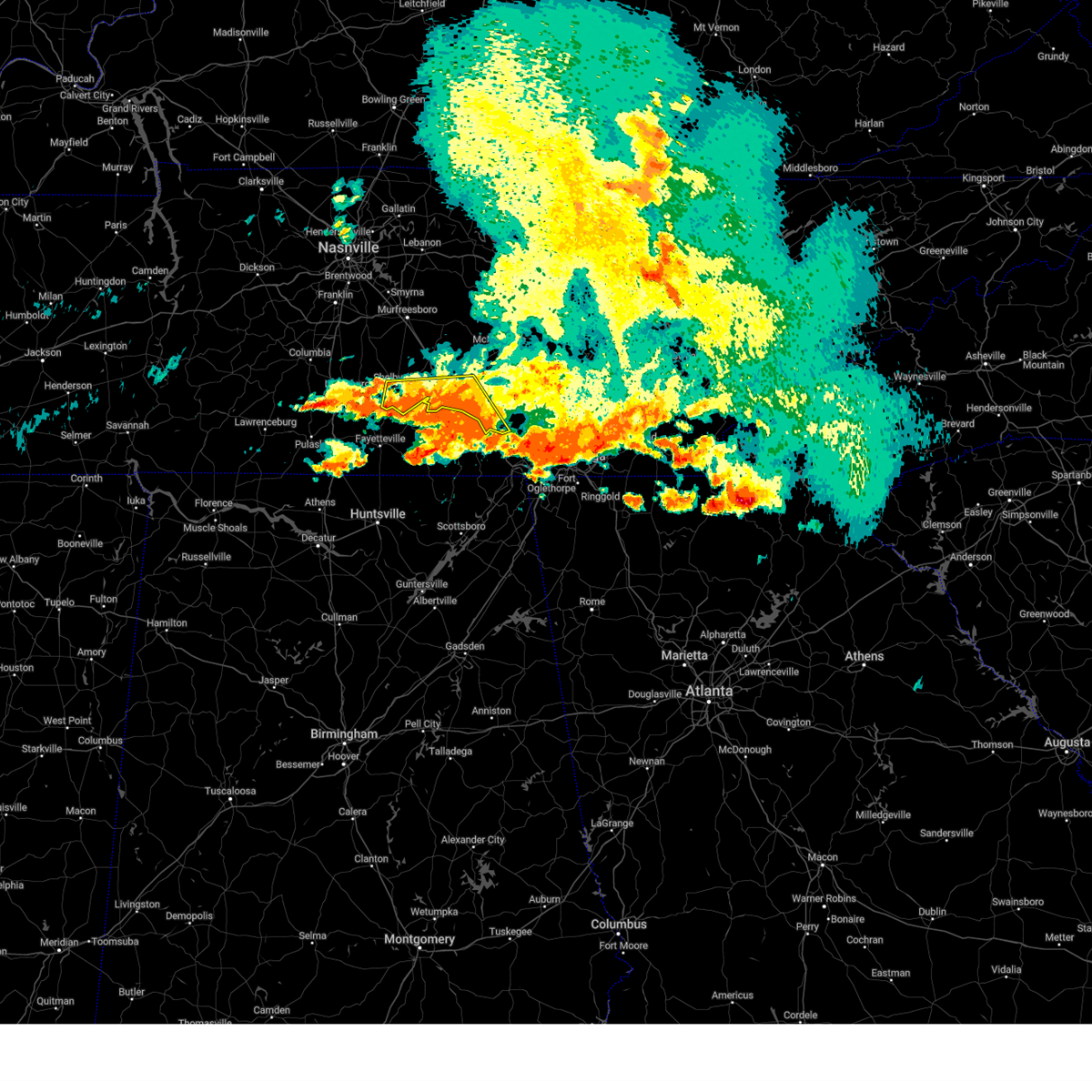 The severe thunderstorm warning for southern coffee, southeastern bedford and southwestern grundy counties will expire at 315 pm cdt, the storm which prompted the warning has weakened below severe limits, and no longer poses an immediate threat to life or property. therefore, the warning will be allowed to expire. however gusty winds and heavy rain are still possible with this thunderstorm. a severe thunderstorm watch remains in effect until 700 pm cdt for middle tennessee. The severe thunderstorm warning for southern coffee, southeastern bedford and southwestern grundy counties will expire at 315 pm cdt, the storm which prompted the warning has weakened below severe limits, and no longer poses an immediate threat to life or property. therefore, the warning will be allowed to expire. however gusty winds and heavy rain are still possible with this thunderstorm. a severe thunderstorm watch remains in effect until 700 pm cdt for middle tennessee.
|
| 7/20/2023 2:58 PM CDT |
 At 257 pm cdt, severe thunderstorms were located along a line extending from near sewanee to 10 miles southwest of lewisburg, moving southeast at 35 mph. prolonged heavy rainfall may also lead to localized flooding (radar indicated). Hazards include 60 mph wind gusts and penny size hail. expect damage to roofs, siding, and trees At 257 pm cdt, severe thunderstorms were located along a line extending from near sewanee to 10 miles southwest of lewisburg, moving southeast at 35 mph. prolonged heavy rainfall may also lead to localized flooding (radar indicated). Hazards include 60 mph wind gusts and penny size hail. expect damage to roofs, siding, and trees
|
| 7/20/2023 2:54 PM CDT |
 The severe thunderstorm warning for moore, lincoln and franklin counties will expire at 300 pm cdt, the storm which prompted the warning will continue to be a threat and a subsequent severe thunderstorm warning will be issued as this one expires at 300 pm. a severe thunderstorm watch remains in effect until 900 pm cdt for north central and northeastern alabama, and middle tennessee. to report severe weather, contact your nearest law enforcement agency. they will relay your report to the national weather service huntsville alabama. The severe thunderstorm warning for moore, lincoln and franklin counties will expire at 300 pm cdt, the storm which prompted the warning will continue to be a threat and a subsequent severe thunderstorm warning will be issued as this one expires at 300 pm. a severe thunderstorm watch remains in effect until 900 pm cdt for north central and northeastern alabama, and middle tennessee. to report severe weather, contact your nearest law enforcement agency. they will relay your report to the national weather service huntsville alabama.
|
| 7/20/2023 2:51 PM CDT |
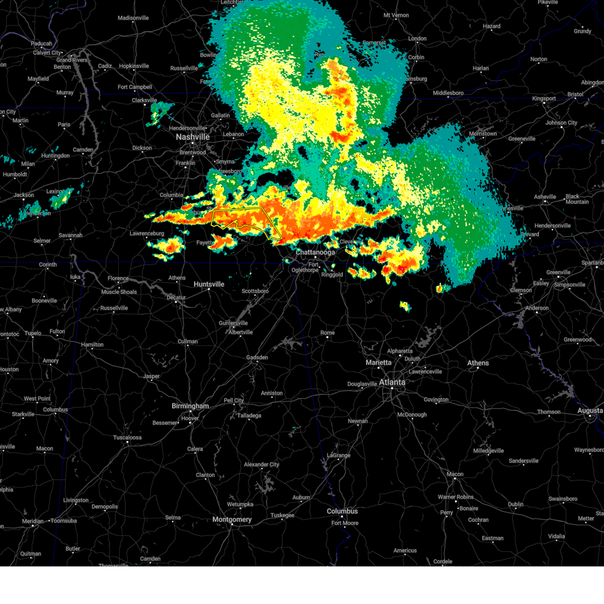 At 250 pm cdt, a severe thunderstorm was located near manchester, moving southeast at 35 mph (radar indicated). Hazards include 60 mph wind gusts and nickel size hail. Expect damage to roofs, siding, and trees. locations impacted include, shelbyville, manchester, tullahoma, tracy city, monteagle, normandy, hillsboro, pelham, raus, arnold afb and fiery gizzard state park. this includes interstate 24 between mile markers 108 and 134. hail threat, radar indicated max hail size, 0. 88 in wind threat, radar indicated max wind gust, 60 mph. At 250 pm cdt, a severe thunderstorm was located near manchester, moving southeast at 35 mph (radar indicated). Hazards include 60 mph wind gusts and nickel size hail. Expect damage to roofs, siding, and trees. locations impacted include, shelbyville, manchester, tullahoma, tracy city, monteagle, normandy, hillsboro, pelham, raus, arnold afb and fiery gizzard state park. this includes interstate 24 between mile markers 108 and 134. hail threat, radar indicated max hail size, 0. 88 in wind threat, radar indicated max wind gust, 60 mph.
|
| 7/20/2023 2:45 PM CDT | Corrects time of previous tstm wnd dmg report from 3 ne tullahoma. trees down with multiple power outages in the short springs/ovoca area. time is radar estimate in coffee county TN, 2 miles SW of Tullahoma, TN |
| 7/20/2023 2:33 PM CDT |
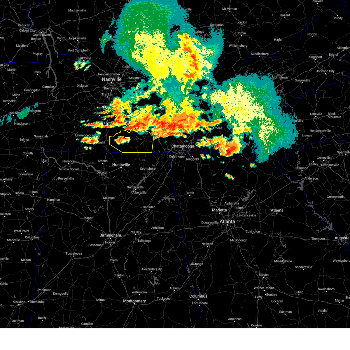 At 232 pm cdt, a severe thunderstorm was located near lynchburg, moving southeast at 25 mph (radar indicated). Hazards include 70 mph wind gusts and quarter size hail. numerous trees have fallen as a result of this storm. Hail damage to vehicles is expected. expect considerable tree damage. wind damage is also likely to mobile homes, roofs, and outbuildings. locations impacted include, winchester, fayetteville, lynchburg, decherd, estill springs, cowan, huntland, petersburg, tims ford lake and sewanee. thunderstorm damage threat, considerable hail threat, radar indicated max hail size, 1. 00 in wind threat, observed max wind gust, 70 mph. At 232 pm cdt, a severe thunderstorm was located near lynchburg, moving southeast at 25 mph (radar indicated). Hazards include 70 mph wind gusts and quarter size hail. numerous trees have fallen as a result of this storm. Hail damage to vehicles is expected. expect considerable tree damage. wind damage is also likely to mobile homes, roofs, and outbuildings. locations impacted include, winchester, fayetteville, lynchburg, decherd, estill springs, cowan, huntland, petersburg, tims ford lake and sewanee. thunderstorm damage threat, considerable hail threat, radar indicated max hail size, 1. 00 in wind threat, observed max wind gust, 70 mph.
|
| 7/20/2023 2:30 PM CDT |
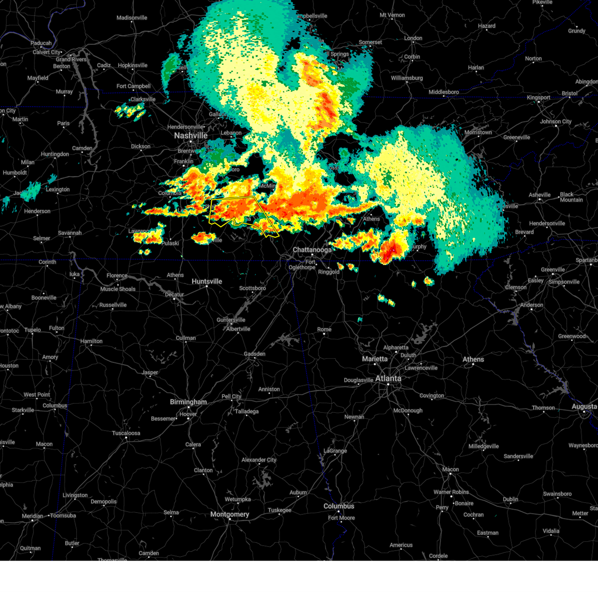 At 229 pm cdt, a severe thunderstorm was located over manchester, moving southeast at 50 mph (radar indicated). Hazards include 60 mph wind gusts and quarter size hail. Hail damage to vehicles is expected. Expect wind damage to roofs, siding, and trees. At 229 pm cdt, a severe thunderstorm was located over manchester, moving southeast at 50 mph (radar indicated). Hazards include 60 mph wind gusts and quarter size hail. Hail damage to vehicles is expected. Expect wind damage to roofs, siding, and trees.
|
| 7/20/2023 2:29 PM CDT | Trees down with multiple power outages in the short springs/ovoca area. time is radar estimate in coffee county TN, 2 miles SW of Tullahoma, TN |
| 7/20/2023 2:15 PM CDT |
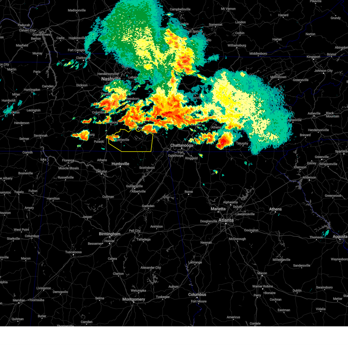 At 215 pm cdt, a severe thunderstorm was located 8 miles southwest of petersburg, or 9 miles northwest of fayetteville, moving east at 55 mph (radar indicated). Hazards include 60 mph wind gusts and quarter size hail. Hail damage to vehicles is expected. Expect wind damage to roofs, siding, and trees. At 215 pm cdt, a severe thunderstorm was located 8 miles southwest of petersburg, or 9 miles northwest of fayetteville, moving east at 55 mph (radar indicated). Hazards include 60 mph wind gusts and quarter size hail. Hail damage to vehicles is expected. Expect wind damage to roofs, siding, and trees.
|
| 7/20/2023 2:00 PM CDT |
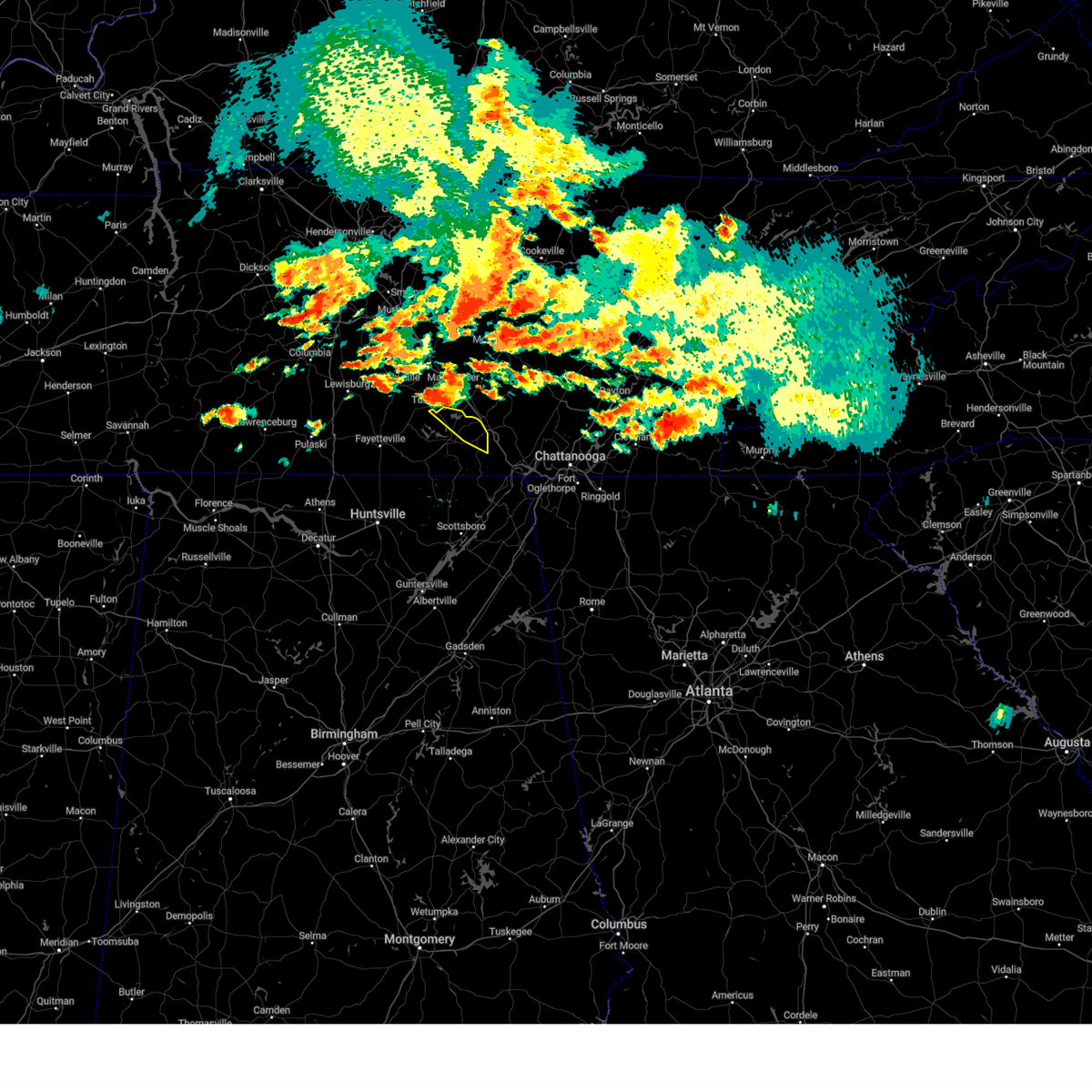 At 200 pm cdt, a severe thunderstorm was located near tullahoma, or 7 miles south of manchester, moving east at 30 mph (radar indicated). Hazards include 60 mph wind gusts and quarter size hail. Hail damage to vehicles is expected. expect wind damage to roofs, siding, and trees. locations impacted include, decherd, estill springs, cowan, sewanee, woods reservoir, arnold afb, alto and st. andrews. hail threat, radar indicated max hail size, 1. 00 in wind threat, radar indicated max wind gust, 60 mph. At 200 pm cdt, a severe thunderstorm was located near tullahoma, or 7 miles south of manchester, moving east at 30 mph (radar indicated). Hazards include 60 mph wind gusts and quarter size hail. Hail damage to vehicles is expected. expect wind damage to roofs, siding, and trees. locations impacted include, decherd, estill springs, cowan, sewanee, woods reservoir, arnold afb, alto and st. andrews. hail threat, radar indicated max hail size, 1. 00 in wind threat, radar indicated max wind gust, 60 mph.
|
| 7/20/2023 1:58 PM CDT |
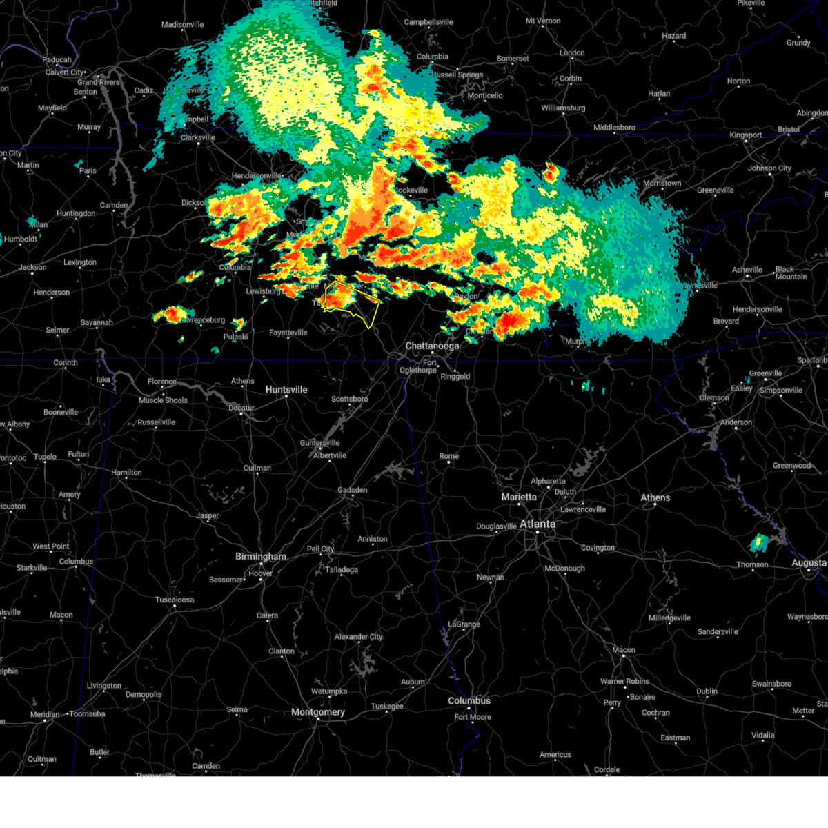 At 157 pm cdt, a severe thunderstorm was located near manchester, moving east at 40 mph (radar indicated). Hazards include 60 mph wind gusts and quarter size hail. Hail damage to vehicles is expected. expect wind damage to roofs, siding, and trees. locations impacted include, manchester, tullahoma, monteagle, altamont, hillsboro, pelham, arnold afb and woods reservoir. this includes interstate 24 between mile markers 105 and 134. hail threat, radar indicated max hail size, 1. 00 in wind threat, radar indicated max wind gust, 60 mph. At 157 pm cdt, a severe thunderstorm was located near manchester, moving east at 40 mph (radar indicated). Hazards include 60 mph wind gusts and quarter size hail. Hail damage to vehicles is expected. expect wind damage to roofs, siding, and trees. locations impacted include, manchester, tullahoma, monteagle, altamont, hillsboro, pelham, arnold afb and woods reservoir. this includes interstate 24 between mile markers 105 and 134. hail threat, radar indicated max hail size, 1. 00 in wind threat, radar indicated max wind gust, 60 mph.
|
| 7/20/2023 1:44 PM CDT |
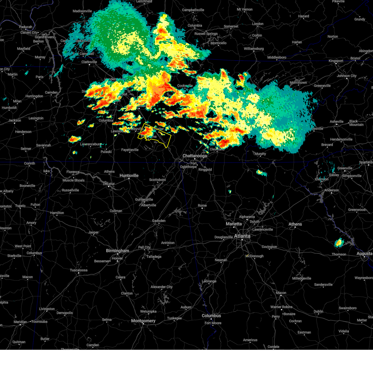 At 144 pm cdt, a severe thunderstorm was located near tullahoma, or 9 miles east of shelbyville, moving east at 40 mph (radar indicated). Hazards include 60 mph wind gusts and quarter size hail. Hail damage to vehicles is expected. Expect wind damage to roofs, siding, and trees. At 144 pm cdt, a severe thunderstorm was located near tullahoma, or 9 miles east of shelbyville, moving east at 40 mph (radar indicated). Hazards include 60 mph wind gusts and quarter size hail. Hail damage to vehicles is expected. Expect wind damage to roofs, siding, and trees.
|
| 7/20/2023 1:40 PM CDT |
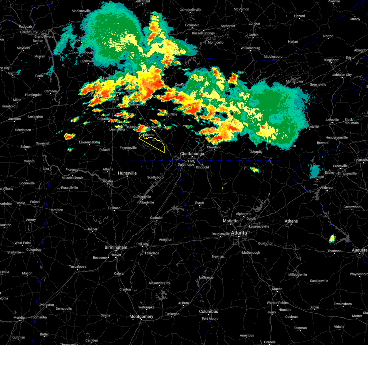 At 140 pm cdt, a severe thunderstorm was located near tullahoma, or 8 miles southeast of shelbyville, moving east at 30 mph (radar indicated). Hazards include 60 mph wind gusts and half dollar size hail. Hail damage to vehicles is expected. Expect wind damage to roofs, siding, and trees. At 140 pm cdt, a severe thunderstorm was located near tullahoma, or 8 miles southeast of shelbyville, moving east at 30 mph (radar indicated). Hazards include 60 mph wind gusts and half dollar size hail. Hail damage to vehicles is expected. Expect wind damage to roofs, siding, and trees.
|
| 7/18/2023 4:56 PM CDT |
 At 456 pm cdt, severe thunderstorms were located along a line extending from 7 miles south of murfreesboro to 13 miles west of ardmore, moving southeast at 50 mph (radar indicated). Hazards include 60 mph wind gusts and penny size hail. expect damage to roofs, siding, and trees At 456 pm cdt, severe thunderstorms were located along a line extending from 7 miles south of murfreesboro to 13 miles west of ardmore, moving southeast at 50 mph (radar indicated). Hazards include 60 mph wind gusts and penny size hail. expect damage to roofs, siding, and trees
|
| 7/18/2023 4:37 PM CDT |
 At 437 pm cdt, severe thunderstorms were located along a line extending from 15 miles northwest of shelbyville to lewisburg to 10 miles northeast of pulaski, moving southeast at 45 mph (radar indicated). Hazards include 60 mph wind gusts and penny size hail. expect damage to roofs, siding, and trees At 437 pm cdt, severe thunderstorms were located along a line extending from 15 miles northwest of shelbyville to lewisburg to 10 miles northeast of pulaski, moving southeast at 45 mph (radar indicated). Hazards include 60 mph wind gusts and penny size hail. expect damage to roofs, siding, and trees
|
| 7/2/2023 2:04 PM CDT |
 At 204 pm cdt, a severe thunderstorm was located near manchester, moving east at 55 mph (radar indicated). Hazards include 60 mph wind gusts. expect damage to roofs, siding, and trees At 204 pm cdt, a severe thunderstorm was located near manchester, moving east at 55 mph (radar indicated). Hazards include 60 mph wind gusts. expect damage to roofs, siding, and trees
|
| 7/2/2023 1:36 PM CDT |
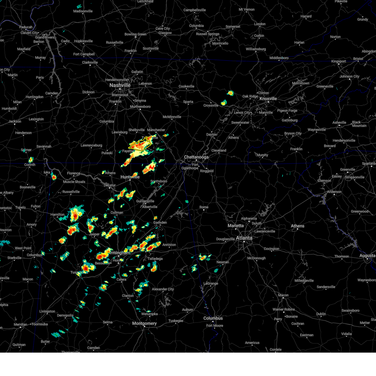 At 136 pm cdt, a severe thunderstorm was located over lynchburg, moving northeast at 35 mph (radar indicated). Hazards include 60 mph wind gusts and quarter size hail. Hail damage to vehicles is expected. expect wind damage to roofs, siding, and trees. locations impacted include, lynchburg, tims ford lake, mulberry, belleville, lois, booneville and mimosa. hail threat, radar indicated max hail size, 1. 00 in wind threat, radar indicated max wind gust, 60 mph. At 136 pm cdt, a severe thunderstorm was located over lynchburg, moving northeast at 35 mph (radar indicated). Hazards include 60 mph wind gusts and quarter size hail. Hail damage to vehicles is expected. expect wind damage to roofs, siding, and trees. locations impacted include, lynchburg, tims ford lake, mulberry, belleville, lois, booneville and mimosa. hail threat, radar indicated max hail size, 1. 00 in wind threat, radar indicated max wind gust, 60 mph.
|
| 7/2/2023 1:23 PM CDT |
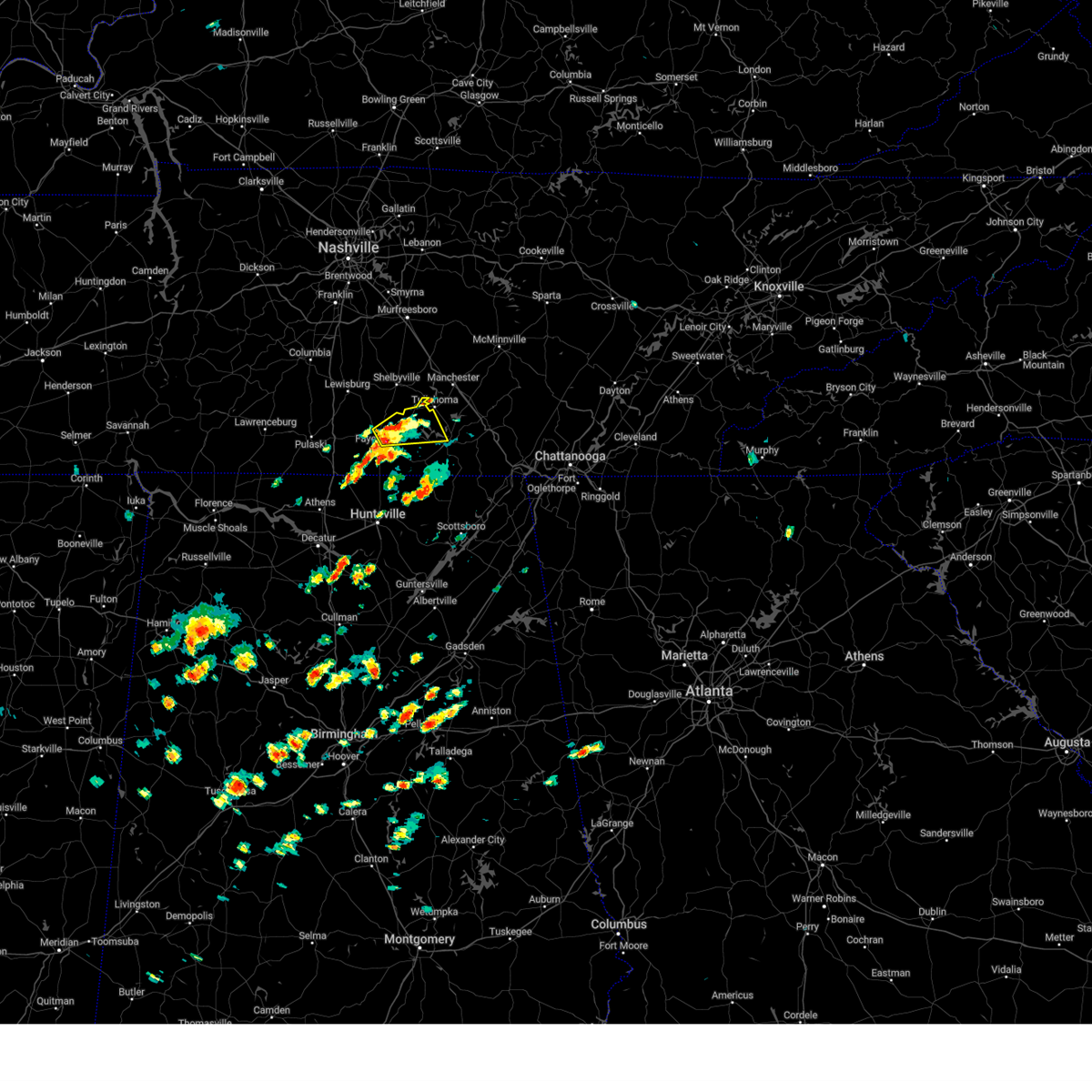 At 123 pm cdt, a severe thunderstorm was located near fayetteville, moving northeast at 35 mph (radar indicated). Hazards include 60 mph wind gusts and quarter size hail. Hail damage to vehicles is expected. Expect wind damage to roofs, siding, and trees. At 123 pm cdt, a severe thunderstorm was located near fayetteville, moving northeast at 35 mph (radar indicated). Hazards include 60 mph wind gusts and quarter size hail. Hail damage to vehicles is expected. Expect wind damage to roofs, siding, and trees.
|
| 7/1/2023 2:21 PM CDT |
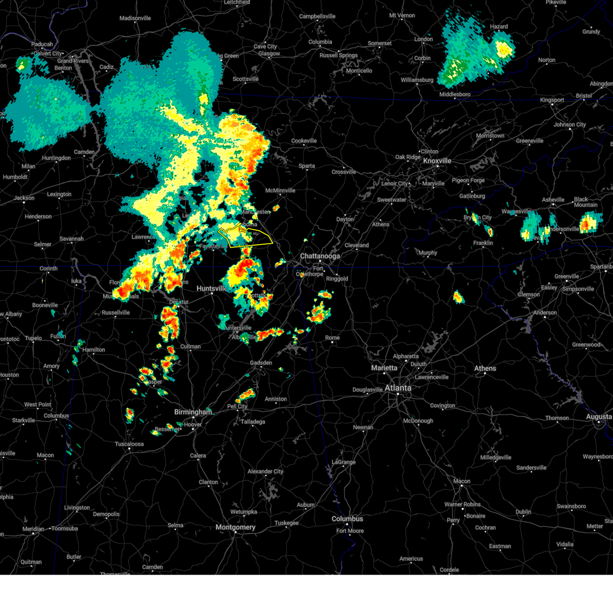 The severe thunderstorm warning for moore and northern franklin counties will expire at 230 pm cdt, the storm which prompted the warning has weakened below severe limits and no longer poses an immediate threat to life or property. therefore, the warning will be allowed to expire. gusty winds are still possible with this thunderstorm. a severe thunderstorm watch remains in effect until 800 pm cdt for north central and northeastern alabama, and middle tennessee. The severe thunderstorm warning for moore and northern franklin counties will expire at 230 pm cdt, the storm which prompted the warning has weakened below severe limits and no longer poses an immediate threat to life or property. therefore, the warning will be allowed to expire. gusty winds are still possible with this thunderstorm. a severe thunderstorm watch remains in effect until 800 pm cdt for north central and northeastern alabama, and middle tennessee.
|
| 7/1/2023 2:02 PM CDT |
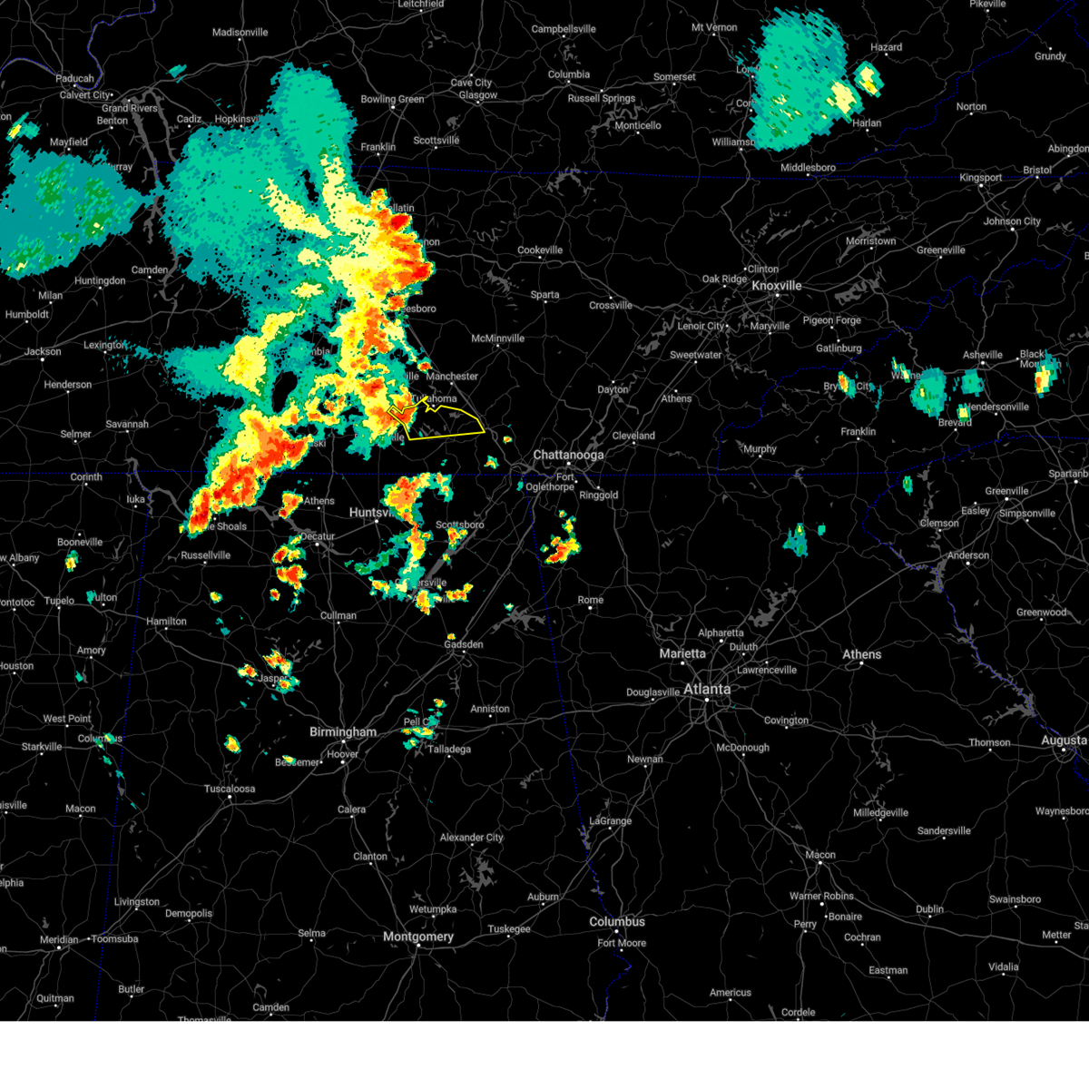 At 201 pm cdt, a severe thunderstorm was located near tullahoma, or near lynchburg moving east at 30 mph (radar indicated). Hazards include 60 mph wind gusts and quarter size hail. Hail damage to vehicles is expected. expect wind damage to roofs, siding, and trees. Locations impacted include, winchester, lynchburg, decherd, estill springs, tims ford lake, sewanee, woods reservoir, arnold afb, lois and alto. At 201 pm cdt, a severe thunderstorm was located near tullahoma, or near lynchburg moving east at 30 mph (radar indicated). Hazards include 60 mph wind gusts and quarter size hail. Hail damage to vehicles is expected. expect wind damage to roofs, siding, and trees. Locations impacted include, winchester, lynchburg, decherd, estill springs, tims ford lake, sewanee, woods reservoir, arnold afb, lois and alto.
|
| 7/1/2023 1:52 PM CDT | Multiple trees down in downtown lynchburg. kenyard hill road... boonville hwy... campion acres road... and main street north. some trees down on houses. some commercial in moore county TN, 11.5 miles NE of Tullahoma, TN |
| 7/1/2023 1:35 PM CDT |
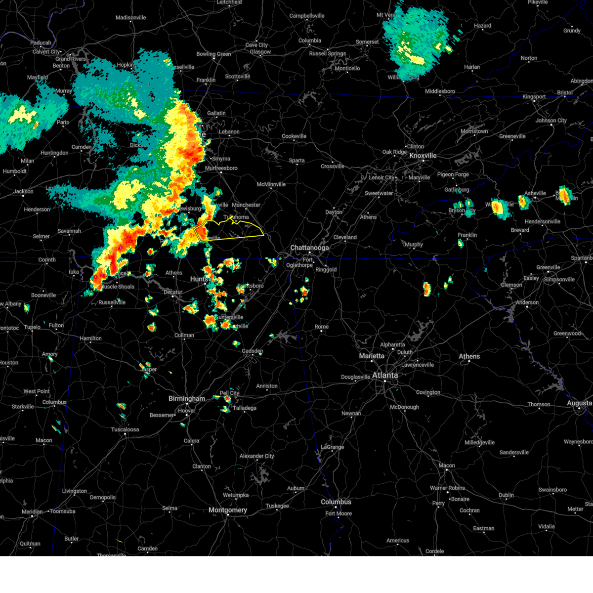 At 135 pm cdt, a severe thunderstorm was located 7 miles west of lynchburg, moving east at 30 mph (radar indicated). Hazards include 60 mph wind gusts and quarter size hail. Hail damage to vehicles is expected. Expect wind damage to roofs, siding, and trees. At 135 pm cdt, a severe thunderstorm was located 7 miles west of lynchburg, moving east at 30 mph (radar indicated). Hazards include 60 mph wind gusts and quarter size hail. Hail damage to vehicles is expected. Expect wind damage to roofs, siding, and trees.
|
| 6/25/2023 2:56 PM CDT |
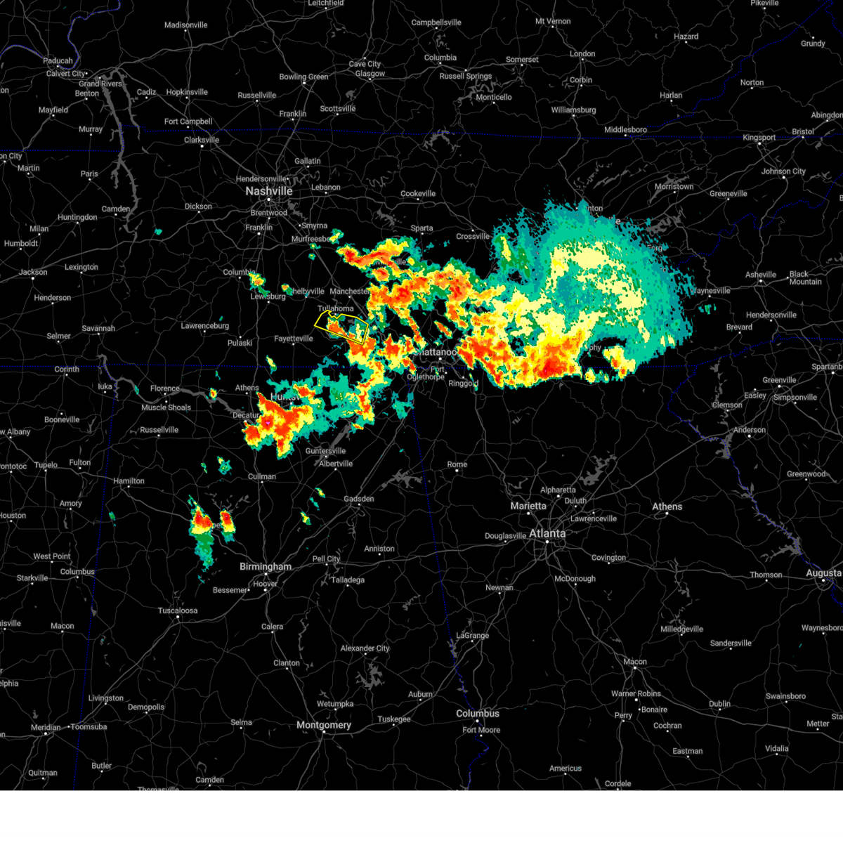 The severe thunderstorm warning for northeastern moore and northern franklin counties will expire at 300 pm cdt, the storm which prompted the warning has weakened below severe limits, and no longer poses an immediate threat to life or property. therefore, the warning will be allowed to expire. however gusty winds and heavy rain are still possible with this thunderstorm. a severe thunderstorm watch remains in effect until 600 pm cdt for north central and northeastern alabama, and middle tennessee. The severe thunderstorm warning for northeastern moore and northern franklin counties will expire at 300 pm cdt, the storm which prompted the warning has weakened below severe limits, and no longer poses an immediate threat to life or property. therefore, the warning will be allowed to expire. however gusty winds and heavy rain are still possible with this thunderstorm. a severe thunderstorm watch remains in effect until 600 pm cdt for north central and northeastern alabama, and middle tennessee.
|
| 6/25/2023 2:43 PM CDT |
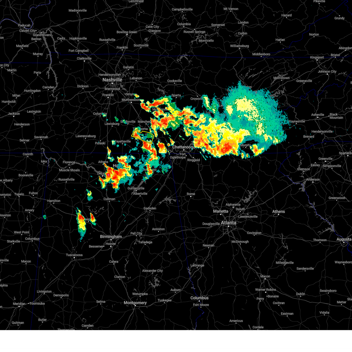 At 243 pm cdt, a severe thunderstorm was located near lynchburg, moving southeast at 25 mph (radar indicated). Hazards include 60 mph wind gusts and quarter size hail. Hail damage to vehicles is expected. expect wind damage to roofs, siding, and trees. locations impacted include, winchester, lynchburg, decherd, estill springs, cowan, tims ford lake, woods reservoir, arnold afb and alto. hail threat, radar indicated max hail size, 1. 00 in wind threat, radar indicated max wind gust, 60 mph. At 243 pm cdt, a severe thunderstorm was located near lynchburg, moving southeast at 25 mph (radar indicated). Hazards include 60 mph wind gusts and quarter size hail. Hail damage to vehicles is expected. expect wind damage to roofs, siding, and trees. locations impacted include, winchester, lynchburg, decherd, estill springs, cowan, tims ford lake, woods reservoir, arnold afb and alto. hail threat, radar indicated max hail size, 1. 00 in wind threat, radar indicated max wind gust, 60 mph.
|
| 6/25/2023 2:36 PM CDT | Report of 6-8 trees down 18-24 inches in diameter in lynchburg. time estimated by rada in moore county TN, 11.4 miles ENE of Tullahoma, TN |
| 6/25/2023 2:13 PM CDT |
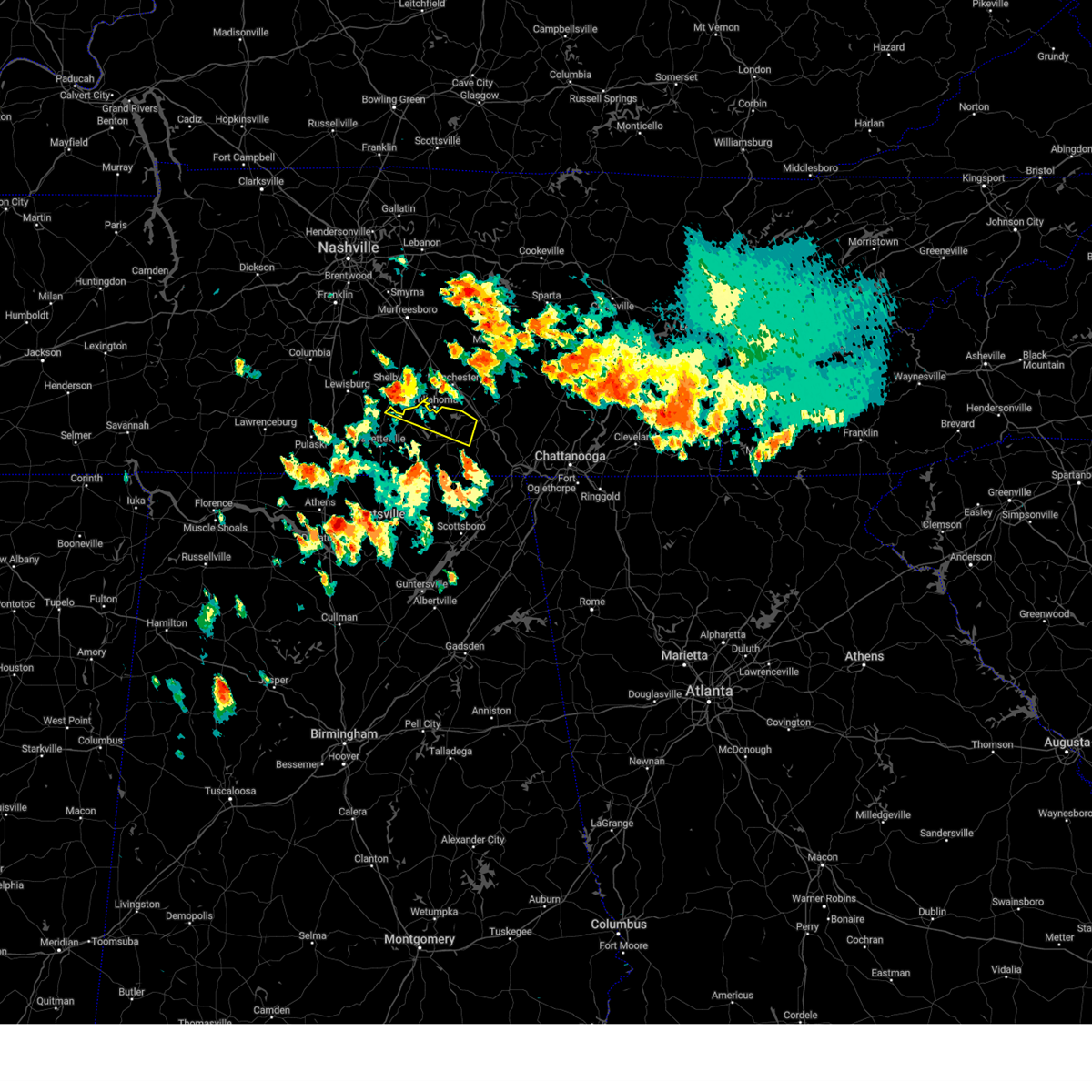 At 213 pm cdt, a severe thunderstorm was located near tullahoma, or 8 miles north of lynchburg, moving east at 40 mph (radar indicated). Hazards include 60 mph wind gusts and quarter size hail. Hail damage to vehicles is expected. Expect wind damage to roofs, siding, and trees. At 213 pm cdt, a severe thunderstorm was located near tullahoma, or 8 miles north of lynchburg, moving east at 40 mph (radar indicated). Hazards include 60 mph wind gusts and quarter size hail. Hail damage to vehicles is expected. Expect wind damage to roofs, siding, and trees.
|
| 6/11/2023 8:08 PM CDT |
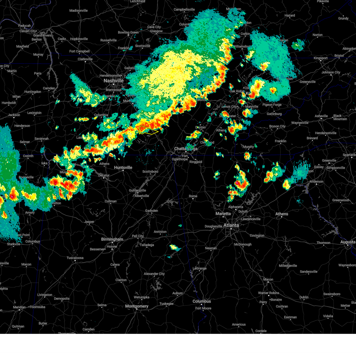 At 808 pm cdt, a severe thunderstorm was located over tullahoma, or 8 miles southwest of manchester, moving east at 45 mph (radar indicated). Hazards include 60 mph wind gusts. Expect damage to roofs, siding, and trees. locations impacted include, manchester, tullahoma and arnold afb. this includes interstate 24 between mile markers 117 and 123. hail threat, radar indicated max hail size, <. 75 in wind threat, radar indicated max wind gust, 60 mph. At 808 pm cdt, a severe thunderstorm was located over tullahoma, or 8 miles southwest of manchester, moving east at 45 mph (radar indicated). Hazards include 60 mph wind gusts. Expect damage to roofs, siding, and trees. locations impacted include, manchester, tullahoma and arnold afb. this includes interstate 24 between mile markers 117 and 123. hail threat, radar indicated max hail size, <. 75 in wind threat, radar indicated max wind gust, 60 mph.
|
| 6/11/2023 7:54 PM CDT |
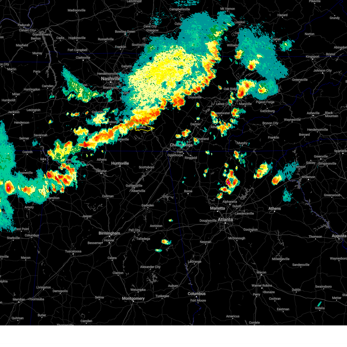 At 754 pm cdt, a severe thunderstorm was located 7 miles northwest of tullahoma, or 8 miles southeast of shelbyville, moving east at 45 mph (radar indicated). Hazards include 60 mph wind gusts. expect damage to roofs, siding, and trees At 754 pm cdt, a severe thunderstorm was located 7 miles northwest of tullahoma, or 8 miles southeast of shelbyville, moving east at 45 mph (radar indicated). Hazards include 60 mph wind gusts. expect damage to roofs, siding, and trees
|
| 5/18/2023 4:55 PM CDT |
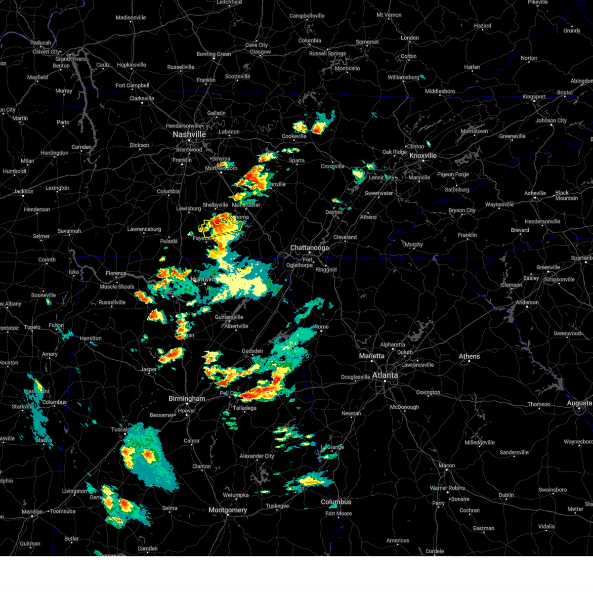 The severe thunderstorm warning for moore, northeastern lincoln and northwestern franklin counties will expire at 500 pm cdt, the storms which prompted the warning have moved out of the area. therefore, the warning will be allowed to expire. however heavy rain is still possible with these thunderstorms. The severe thunderstorm warning for moore, northeastern lincoln and northwestern franklin counties will expire at 500 pm cdt, the storms which prompted the warning have moved out of the area. therefore, the warning will be allowed to expire. however heavy rain is still possible with these thunderstorms.
|
| 5/18/2023 4:42 PM CDT |
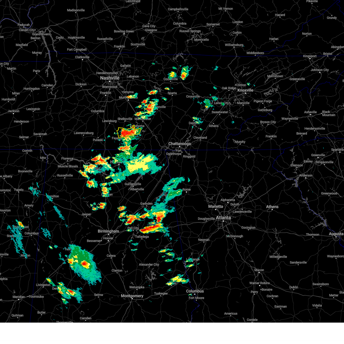 At 441 pm cdt, severe thunderstorms were located along a line extending from near tullahoma to near lynchburg to 6 miles southeast of petersburg, moving north at 15 mph (radar indicated). Hazards include 60 mph wind gusts and quarter size hail. Hail damage to vehicles is expected. expect wind damage to roofs, siding, and trees. locations impacted include, lynchburg, tims ford lake, chestnut ridge, belleville, lois, mimosa, booneville and arnold afb. hail threat, radar indicated max hail size, 1. 00 in wind threat, radar indicated max wind gust, 60 mph. At 441 pm cdt, severe thunderstorms were located along a line extending from near tullahoma to near lynchburg to 6 miles southeast of petersburg, moving north at 15 mph (radar indicated). Hazards include 60 mph wind gusts and quarter size hail. Hail damage to vehicles is expected. expect wind damage to roofs, siding, and trees. locations impacted include, lynchburg, tims ford lake, chestnut ridge, belleville, lois, mimosa, booneville and arnold afb. hail threat, radar indicated max hail size, 1. 00 in wind threat, radar indicated max wind gust, 60 mph.
|
| 5/18/2023 4:26 PM CDT |
 At 426 pm cdt, severe thunderstorms were located along a line extending from near tims ford lake to near lynchburg to near fayetteville, moving north at 10 mph (radar indicated). Hazards include 60 mph wind gusts and quarter size hail. Hail damage to vehicles is expected. Expect wind damage to roofs, siding, and trees. At 426 pm cdt, severe thunderstorms were located along a line extending from near tims ford lake to near lynchburg to near fayetteville, moving north at 10 mph (radar indicated). Hazards include 60 mph wind gusts and quarter size hail. Hail damage to vehicles is expected. Expect wind damage to roofs, siding, and trees.
|
| 3/25/2023 12:31 AM CDT |
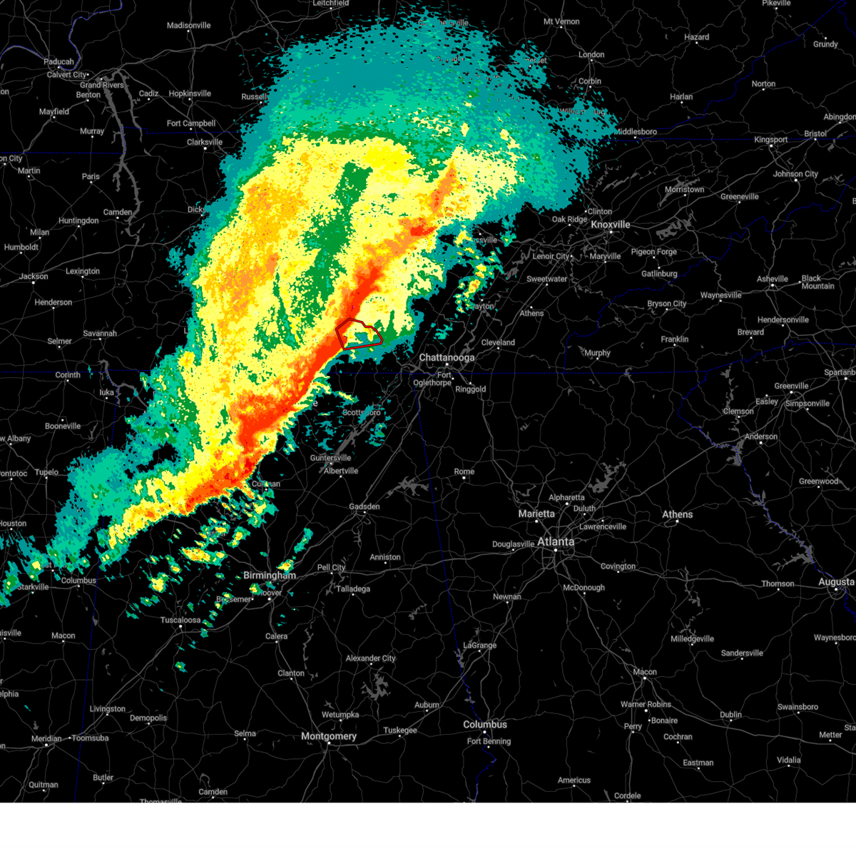 At 1231 am cdt, a severe thunderstorm capable of producing a tornado was located over decherd, or near winchester, moving east at 50 mph (radar indicated rotation). Hazards include tornado and quarter size hail. Flying debris will be dangerous to those caught without shelter. mobile homes will be damaged or destroyed. damage to roofs, windows, and vehicles will occur. tree damage is likely. locations impacted include, winchester, decherd, estill springs, cowan, tims ford lake, sewanee, woods reservoir, arnold afb, alto and st. Andrews. At 1231 am cdt, a severe thunderstorm capable of producing a tornado was located over decherd, or near winchester, moving east at 50 mph (radar indicated rotation). Hazards include tornado and quarter size hail. Flying debris will be dangerous to those caught without shelter. mobile homes will be damaged or destroyed. damage to roofs, windows, and vehicles will occur. tree damage is likely. locations impacted include, winchester, decherd, estill springs, cowan, tims ford lake, sewanee, woods reservoir, arnold afb, alto and st. Andrews.
|
| 3/25/2023 12:26 AM CDT |
 At 1225 am cdt, severe thunderstorms were located along a line extending from near tullahoma to near huntland to new market to huntsville, moving east at 45 mph (radar indicated). Hazards include 60 mph wind gusts and quarter size hail. Hail damage to vehicles is expected. expect wind damage to roofs, siding, and trees. locations impacted include, huntsville, madison, winchester, moores mill, meridianville, redstone arsenal, lynchburg, hazel green, decherd and estill springs. hail threat, radar indicated max hail size, 1. 00 in wind threat, radar indicated max wind gust, 60 mph. At 1225 am cdt, severe thunderstorms were located along a line extending from near tullahoma to near huntland to new market to huntsville, moving east at 45 mph (radar indicated). Hazards include 60 mph wind gusts and quarter size hail. Hail damage to vehicles is expected. expect wind damage to roofs, siding, and trees. locations impacted include, huntsville, madison, winchester, moores mill, meridianville, redstone arsenal, lynchburg, hazel green, decherd and estill springs. hail threat, radar indicated max hail size, 1. 00 in wind threat, radar indicated max wind gust, 60 mph.
|
| 3/25/2023 12:22 AM CDT |
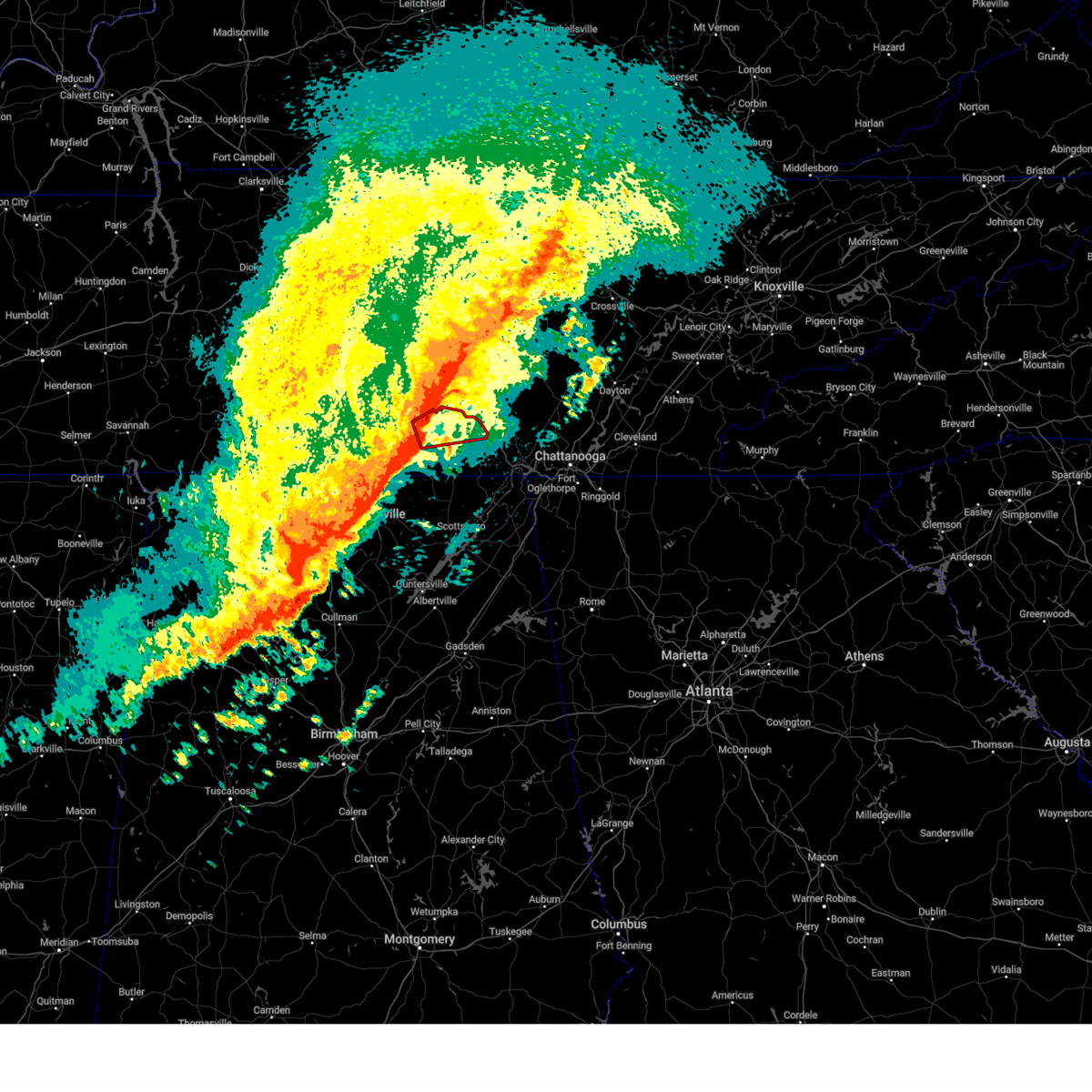 At 1222 am cdt, a severe thunderstorm capable of producing a tornado was located over tims ford lake, or 7 miles northwest of winchester, moving east at 50 mph (radar indicated rotation). Hazards include tornado and quarter size hail. Flying debris will be dangerous to those caught without shelter. mobile homes will be damaged or destroyed. damage to roofs, windows, and vehicles will occur. Tree damage is likely. At 1222 am cdt, a severe thunderstorm capable of producing a tornado was located over tims ford lake, or 7 miles northwest of winchester, moving east at 50 mph (radar indicated rotation). Hazards include tornado and quarter size hail. Flying debris will be dangerous to those caught without shelter. mobile homes will be damaged or destroyed. damage to roofs, windows, and vehicles will occur. Tree damage is likely.
|
| 3/25/2023 12:16 AM CDT |
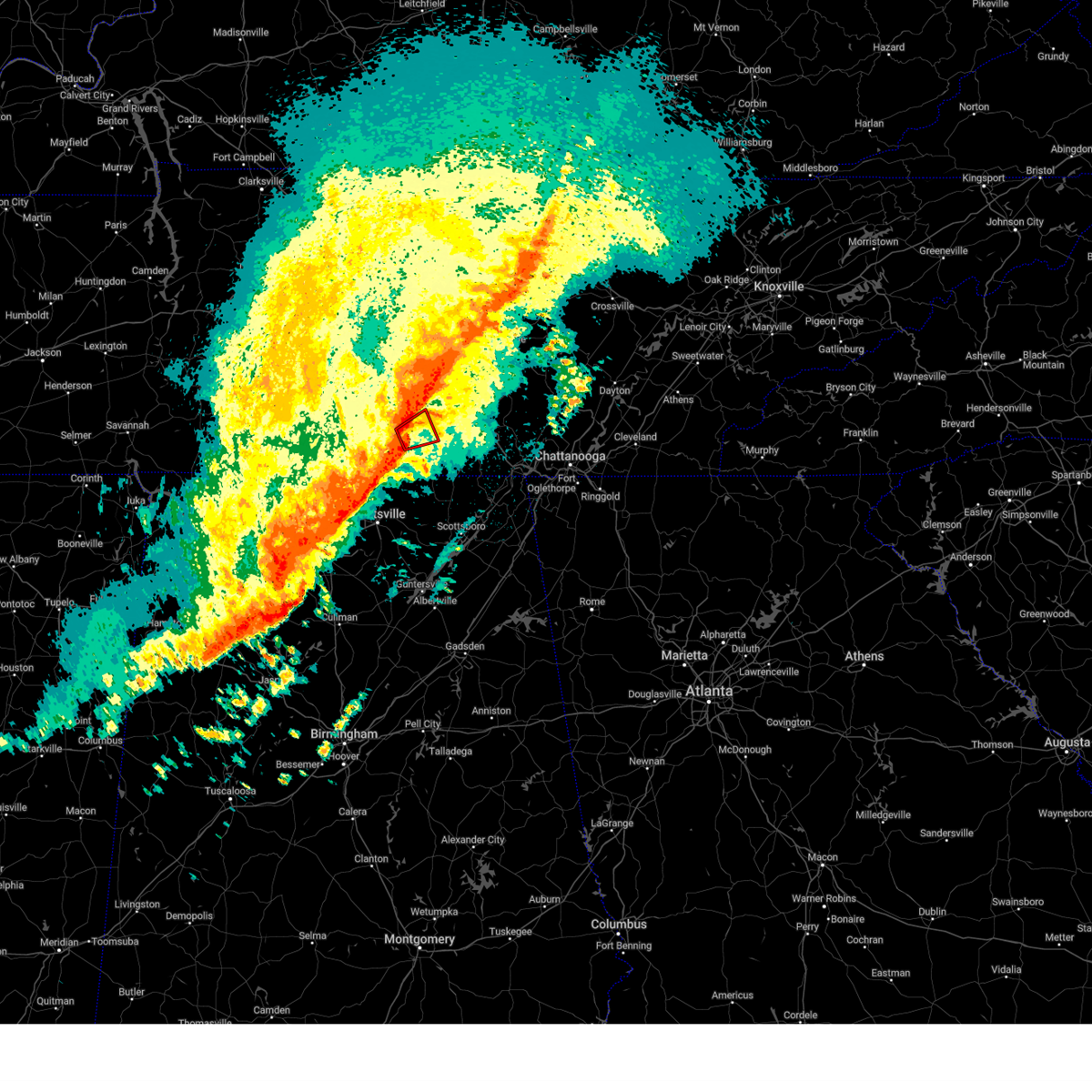 At 1216 am cdt, a severe thunderstorm capable of producing a tornado was located near lynchburg, moving northeast at 55 mph (radar indicated rotation). Hazards include tornado. Flying debris will be dangerous to those caught without shelter. mobile homes will be damaged or destroyed. damage to roofs, windows, and vehicles will occur. tree damage is likely. Locations impacted include, lynchburg, tims ford lake, hurdlow, lois, marble hill and harmony. At 1216 am cdt, a severe thunderstorm capable of producing a tornado was located near lynchburg, moving northeast at 55 mph (radar indicated rotation). Hazards include tornado. Flying debris will be dangerous to those caught without shelter. mobile homes will be damaged or destroyed. damage to roofs, windows, and vehicles will occur. tree damage is likely. Locations impacted include, lynchburg, tims ford lake, hurdlow, lois, marble hill and harmony.
|
| 3/25/2023 12:08 AM CDT |
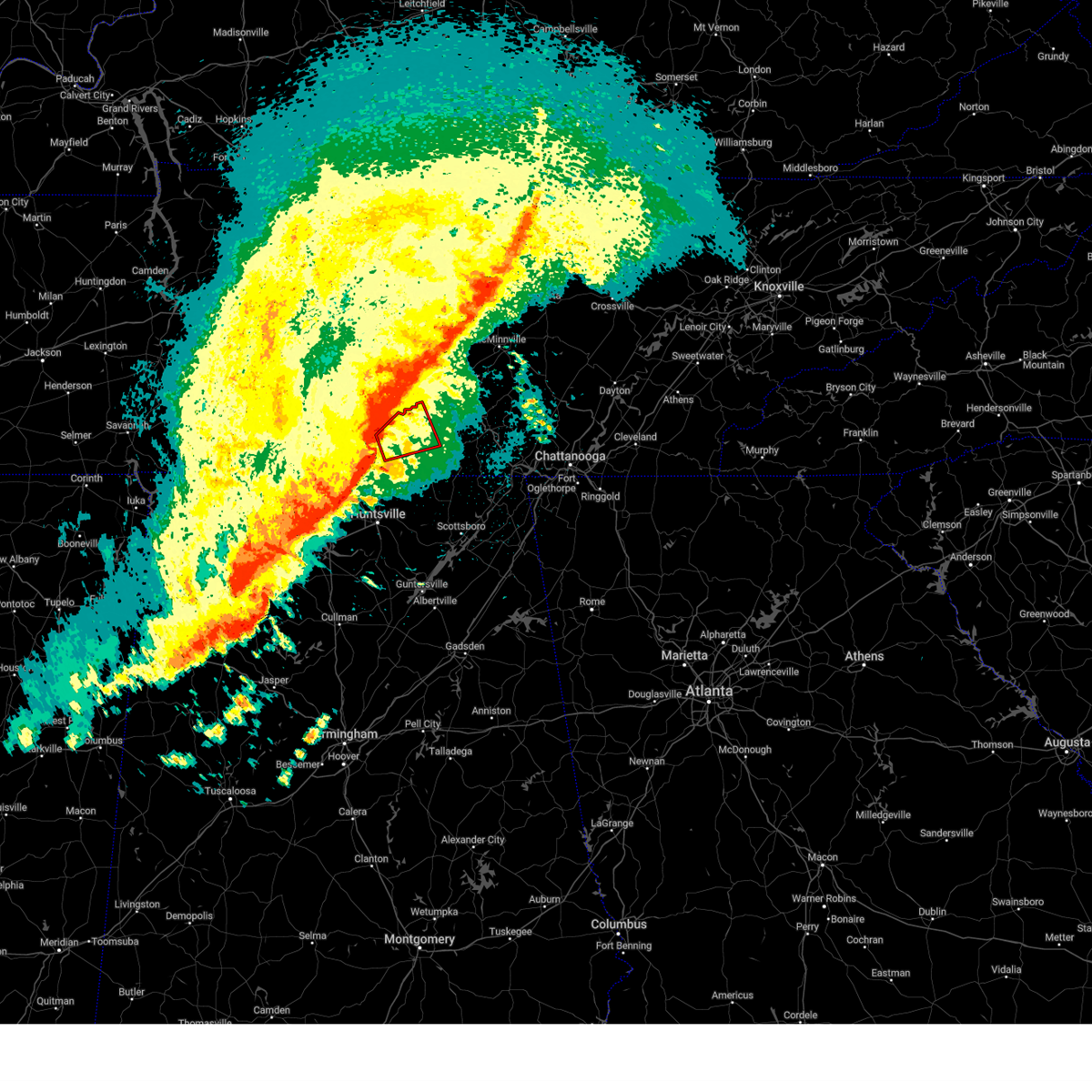 At 1208 am cdt, a severe thunderstorm capable of producing a tornado was located near fayetteville, moving east at 40 mph (radar indicated rotation). Hazards include tornado. Flying debris will be dangerous to those caught without shelter. mobile homes will be damaged or destroyed. damage to roofs, windows, and vehicles will occur. tree damage is likely. Locations impacted include, fayetteville, lynchburg, tims ford lake, lexie crossroads, mulberry, harmony, hurdlow, lois, mimosa and booneville. At 1208 am cdt, a severe thunderstorm capable of producing a tornado was located near fayetteville, moving east at 40 mph (radar indicated rotation). Hazards include tornado. Flying debris will be dangerous to those caught without shelter. mobile homes will be damaged or destroyed. damage to roofs, windows, and vehicles will occur. tree damage is likely. Locations impacted include, fayetteville, lynchburg, tims ford lake, lexie crossroads, mulberry, harmony, hurdlow, lois, mimosa and booneville.
|
| 3/25/2023 12:06 AM CDT |
 At 1205 am cdt, severe thunderstorms were located along a line extending from near lynchburg to near fayetteville to near harvest to near tanner, moving east at 45 mph (radar indicated). Hazards include 60 mph wind gusts and quarter size hail. Hail damage to vehicles is expected. Expect wind damage to roofs, siding, and trees. At 1205 am cdt, severe thunderstorms were located along a line extending from near lynchburg to near fayetteville to near harvest to near tanner, moving east at 45 mph (radar indicated). Hazards include 60 mph wind gusts and quarter size hail. Hail damage to vehicles is expected. Expect wind damage to roofs, siding, and trees.
|
| 3/24/2023 11:58 PM CDT |
 At 1158 pm cdt, a severe thunderstorm capable of producing a tornado was located over fayetteville, moving east at 50 mph (radar indicated rotation). Hazards include tornado. Flying debris will be dangerous to those caught without shelter. mobile homes will be damaged or destroyed. damage to roofs, windows, and vehicles will occur. tree damage is likely. this dangerous storm will be near, lynchburg around 1215 am cdt. tims ford lake around 1230 am cdt. Other locations impacted by this tornadic thunderstorm include lexie crossroads, mulberry, howell, harmony, hurdlow, lois, mimosa, booneville, marble hill and skinem. At 1158 pm cdt, a severe thunderstorm capable of producing a tornado was located over fayetteville, moving east at 50 mph (radar indicated rotation). Hazards include tornado. Flying debris will be dangerous to those caught without shelter. mobile homes will be damaged or destroyed. damage to roofs, windows, and vehicles will occur. tree damage is likely. this dangerous storm will be near, lynchburg around 1215 am cdt. tims ford lake around 1230 am cdt. Other locations impacted by this tornadic thunderstorm include lexie crossroads, mulberry, howell, harmony, hurdlow, lois, mimosa, booneville, marble hill and skinem.
|
| 3/3/2023 12:10 PM CST |
 At 1209 pm cst, severe thunderstorms were located along a line extending from 9 miles south of watertown to near woodbury to 9 miles north of manchester, moving northeast at 65 mph (radar indicated). Hazards include 70 mph wind gusts. Expect considerable tree damage. damage is likely to mobile homes, roofs, and outbuildings. locations impacted include, mcminnville, manchester, smithville, woodbury, watertown, alexandria, morrison, dowelltown, liberty, auburntown, centertown, rock island state park, summitville, center hill lake and edgar evans state park. this includes interstate 24 between mile markers 103 and 111. thunderstorm damage threat, considerable hail threat, radar indicated max hail size, <. 75 in wind threat, radar indicated max wind gust, 70 mph. At 1209 pm cst, severe thunderstorms were located along a line extending from 9 miles south of watertown to near woodbury to 9 miles north of manchester, moving northeast at 65 mph (radar indicated). Hazards include 70 mph wind gusts. Expect considerable tree damage. damage is likely to mobile homes, roofs, and outbuildings. locations impacted include, mcminnville, manchester, smithville, woodbury, watertown, alexandria, morrison, dowelltown, liberty, auburntown, centertown, rock island state park, summitville, center hill lake and edgar evans state park. this includes interstate 24 between mile markers 103 and 111. thunderstorm damage threat, considerable hail threat, radar indicated max hail size, <. 75 in wind threat, radar indicated max wind gust, 70 mph.
|
| 3/3/2023 11:57 AM CST |
 At 1157 am cst, severe thunderstorms were located along a line extending from 12 miles north of manchester to 6 miles south of tims ford lake, moving northeast at 55 mph (radar indicated). Hazards include 70 mph wind gusts. Expect considerable tree damage. damage is likely to mobile homes, roofs, and outbuildings. locations impacted include, huntsville, winchester, lynchburg, moores mill, decherd, estill springs, stevenson, cowan, huntland and skyline. thunderstorm damage threat, considerable hail threat, radar indicated max hail size, <. 75 in wind threat, radar indicated max wind gust, 70 mph. At 1157 am cst, severe thunderstorms were located along a line extending from 12 miles north of manchester to 6 miles south of tims ford lake, moving northeast at 55 mph (radar indicated). Hazards include 70 mph wind gusts. Expect considerable tree damage. damage is likely to mobile homes, roofs, and outbuildings. locations impacted include, huntsville, winchester, lynchburg, moores mill, decherd, estill springs, stevenson, cowan, huntland and skyline. thunderstorm damage threat, considerable hail threat, radar indicated max hail size, <. 75 in wind threat, radar indicated max wind gust, 70 mph.
|
| 3/3/2023 11:56 AM CST |
 At 1156 am cst, severe thunderstorms were located along a line extending from 8 miles east of murfreesboro to 14 miles southwest of woodbury to 9 miles east of shelbyville, moving northeast at 65 mph (radar indicated). Hazards include 70 mph wind gusts. Expect considerable tree damage. Damage is likely to mobile homes, roofs, and outbuildings. At 1156 am cst, severe thunderstorms were located along a line extending from 8 miles east of murfreesboro to 14 miles southwest of woodbury to 9 miles east of shelbyville, moving northeast at 65 mph (radar indicated). Hazards include 70 mph wind gusts. Expect considerable tree damage. Damage is likely to mobile homes, roofs, and outbuildings.
|
| 3/3/2023 11:33 AM CST |
 At 1131 am cst, severe thunderstorms were located along a line extending from 7 miles northwest of lynchburg to meridianville, moving northeast at 70 mph. huntsville airport has recorded a wind gusts of 69 mph and wind damage has been reported with this line of storms (radar indicated). Hazards include 70 mph wind gusts. Expect considerable tree damage. damage is likely to mobile homes, roofs, and outbuildings. locations impacted include, northern huntsville, madison, winchester, fayetteville, moores mill, meridianville, lynchburg, hazel green, decherd and estill springs. thunderstorm damage threat, considerable hail threat, radar indicated max hail size, <. 75 in wind threat, radar indicated max wind gust, 70 mph. At 1131 am cst, severe thunderstorms were located along a line extending from 7 miles northwest of lynchburg to meridianville, moving northeast at 70 mph. huntsville airport has recorded a wind gusts of 69 mph and wind damage has been reported with this line of storms (radar indicated). Hazards include 70 mph wind gusts. Expect considerable tree damage. damage is likely to mobile homes, roofs, and outbuildings. locations impacted include, northern huntsville, madison, winchester, fayetteville, moores mill, meridianville, lynchburg, hazel green, decherd and estill springs. thunderstorm damage threat, considerable hail threat, radar indicated max hail size, <. 75 in wind threat, radar indicated max wind gust, 70 mph.
|
| 3/3/2023 11:25 AM CST |
 At 1123 am cst, severe thunderstorms were located along a line extending from near petersburg to near madison, moving northeast at 100 mph (radar indicated). Hazards include 70 mph wind gusts. Expect considerable tree damage. Damage is likely to mobile homes, roofs, and outbuildings. At 1123 am cst, severe thunderstorms were located along a line extending from near petersburg to near madison, moving northeast at 100 mph (radar indicated). Hazards include 70 mph wind gusts. Expect considerable tree damage. Damage is likely to mobile homes, roofs, and outbuildings.
|
| 2/16/2023 6:38 PM CST |
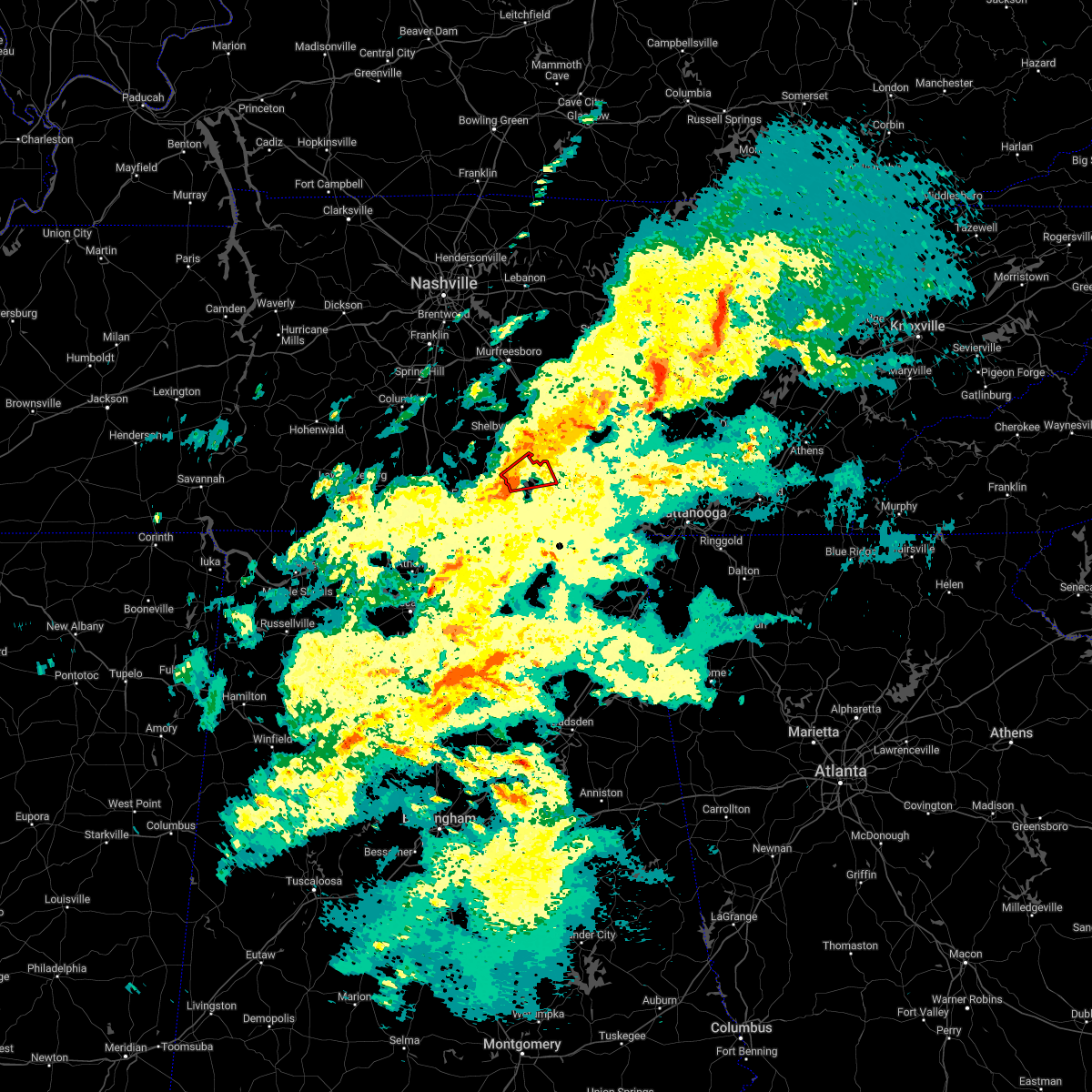 At 637 pm cst, a severe thunderstorm capable of producing a tornado was located over lynchburg, moving northeast at 30 mph (radar indicated rotation). Hazards include tornado. Flying debris will be dangerous to those caught without shelter. mobile homes will be damaged or destroyed. damage to roofs, windows, and vehicles will occur. tree damage is likely. this dangerous storm will be near, tims ford lake around 650 pm cst. estill springs around 700 pm cst. Other locations impacted by this tornadic thunderstorm include lois and arnold afb. At 637 pm cst, a severe thunderstorm capable of producing a tornado was located over lynchburg, moving northeast at 30 mph (radar indicated rotation). Hazards include tornado. Flying debris will be dangerous to those caught without shelter. mobile homes will be damaged or destroyed. damage to roofs, windows, and vehicles will occur. tree damage is likely. this dangerous storm will be near, tims ford lake around 650 pm cst. estill springs around 700 pm cst. Other locations impacted by this tornadic thunderstorm include lois and arnold afb.
|
| 2/16/2023 6:32 PM CST |
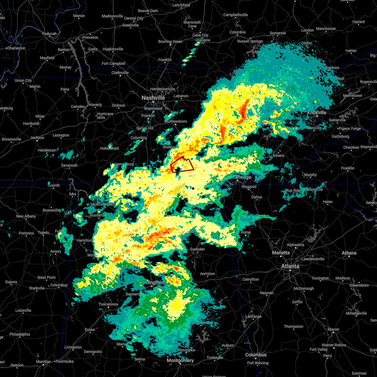 At 632 pm cst, a severe thunderstorm capable of producing a tornado was located near lynchburg, moving northeast at 30 mph (radar indicated rotation). Hazards include tornado. Flying debris will be dangerous to those caught without shelter. mobile homes will be damaged or destroyed. damage to roofs, windows, and vehicles will occur. tree damage is likely. this dangerous storm will be near, lynchburg around 635 pm cst. tims ford lake around 655 pm cst. winchester and estill springs around 700 pm cst. Other locations impacted by this tornadic thunderstorm include hurdlow, lois, booneville, marble hill, harmony and arnold afb. At 632 pm cst, a severe thunderstorm capable of producing a tornado was located near lynchburg, moving northeast at 30 mph (radar indicated rotation). Hazards include tornado. Flying debris will be dangerous to those caught without shelter. mobile homes will be damaged or destroyed. damage to roofs, windows, and vehicles will occur. tree damage is likely. this dangerous storm will be near, lynchburg around 635 pm cst. tims ford lake around 655 pm cst. winchester and estill springs around 700 pm cst. Other locations impacted by this tornadic thunderstorm include hurdlow, lois, booneville, marble hill, harmony and arnold afb.
|
| 1/12/2023 2:52 PM CST |
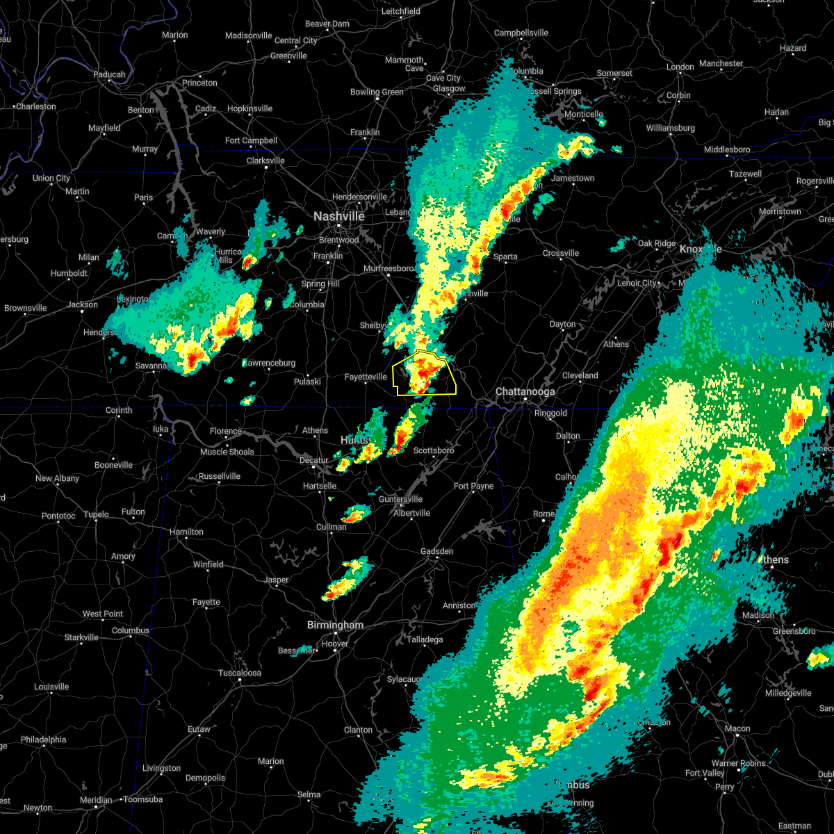 The severe thunderstorm warning for southeastern moore and franklin counties will expire at 300 pm cst, the storm which prompted the warning has weakened below severe limits, and no longer poses an immediate threat to life or property. therefore, the warning will be allowed to expire. however small hail is still possible with this thunderstorm. The severe thunderstorm warning for southeastern moore and franklin counties will expire at 300 pm cst, the storm which prompted the warning has weakened below severe limits, and no longer poses an immediate threat to life or property. therefore, the warning will be allowed to expire. however small hail is still possible with this thunderstorm.
|
| 1/12/2023 2:44 PM CST |
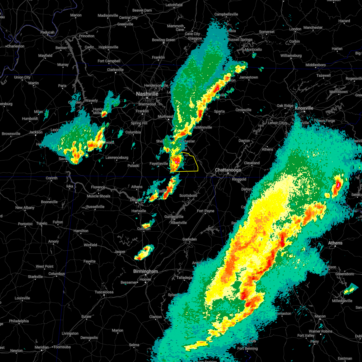 At 243 pm cst, a severe thunderstorm was located near tims ford lake, or near winchester, moving east at 45 mph (radar indicated). Hazards include 60 mph wind gusts and quarter size hail. Hail damage to vehicles is expected. expect wind damage to roofs, siding, and trees. locations impacted include, winchester, decherd, estill springs, cowan, huntland, sewanee, tims ford lake, lexie crossroads, harmony and hurdlow. hail threat, radar indicated max hail size, 1. 00 in wind threat, radar indicated max wind gust, 60 mph. At 243 pm cst, a severe thunderstorm was located near tims ford lake, or near winchester, moving east at 45 mph (radar indicated). Hazards include 60 mph wind gusts and quarter size hail. Hail damage to vehicles is expected. expect wind damage to roofs, siding, and trees. locations impacted include, winchester, decherd, estill springs, cowan, huntland, sewanee, tims ford lake, lexie crossroads, harmony and hurdlow. hail threat, radar indicated max hail size, 1. 00 in wind threat, radar indicated max wind gust, 60 mph.
|
| 1/12/2023 2:29 PM CST |
 At 229 pm cst, a severe thunderstorm was located 7 miles south of lynchburg, moving east at 45 mph (radar indicated). Hazards include 60 mph wind gusts and quarter size hail. Hail damage to vehicles is expected. Expect wind damage to roofs, siding, and trees. At 229 pm cst, a severe thunderstorm was located 7 miles south of lynchburg, moving east at 45 mph (radar indicated). Hazards include 60 mph wind gusts and quarter size hail. Hail damage to vehicles is expected. Expect wind damage to roofs, siding, and trees.
|
| 1/12/2023 2:29 PM CST |
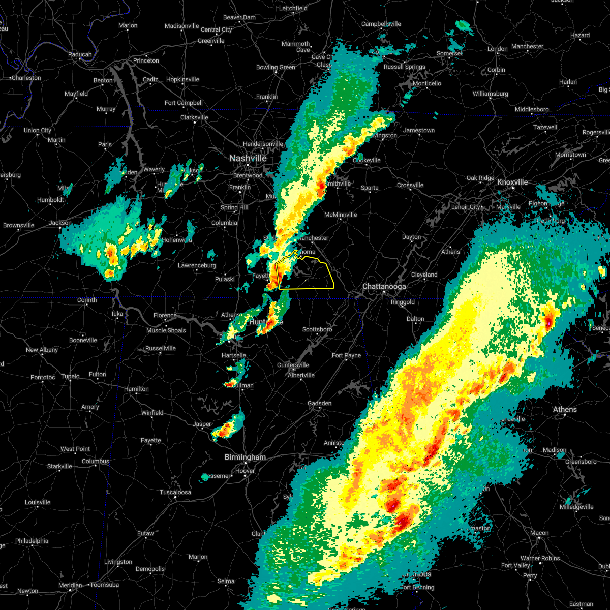 At 229 pm cst, a severe thunderstorm was located 7 miles south of lynchburg, moving east at 45 mph (radar indicated). Hazards include 60 mph wind gusts and quarter size hail. Hail damage to vehicles is expected. Expect wind damage to roofs, siding, and trees. At 229 pm cst, a severe thunderstorm was located 7 miles south of lynchburg, moving east at 45 mph (radar indicated). Hazards include 60 mph wind gusts and quarter size hail. Hail damage to vehicles is expected. Expect wind damage to roofs, siding, and trees.
|
| 9/3/2022 9:15 PM CDT | Tree down on car in the bel-aire community in tullahoma. - twitter report in coffee county TN, 1.7 miles NNE of Tullahoma, TN |
| 8/3/2022 3:37 PM CDT |
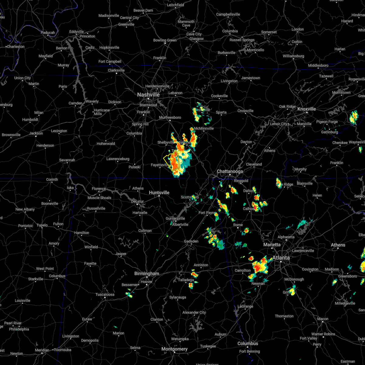 At 337 pm cdt, a severe thunderstorm was located over lynchburg, moving northwest at 20 mph (radar indicated). Hazards include 60 mph wind gusts. Expect damage to roofs, siding, and trees. locations impacted include, lynchburg, tims ford lake, lexie crossroads, harmony, hurdlow, lois, booneville and marble hill. hail threat, radar indicated max hail size, <. 75 in wind threat, radar indicated max wind gust, 60 mph. At 337 pm cdt, a severe thunderstorm was located over lynchburg, moving northwest at 20 mph (radar indicated). Hazards include 60 mph wind gusts. Expect damage to roofs, siding, and trees. locations impacted include, lynchburg, tims ford lake, lexie crossroads, harmony, hurdlow, lois, booneville and marble hill. hail threat, radar indicated max hail size, <. 75 in wind threat, radar indicated max wind gust, 60 mph.
|
| 8/3/2022 3:18 PM CDT |
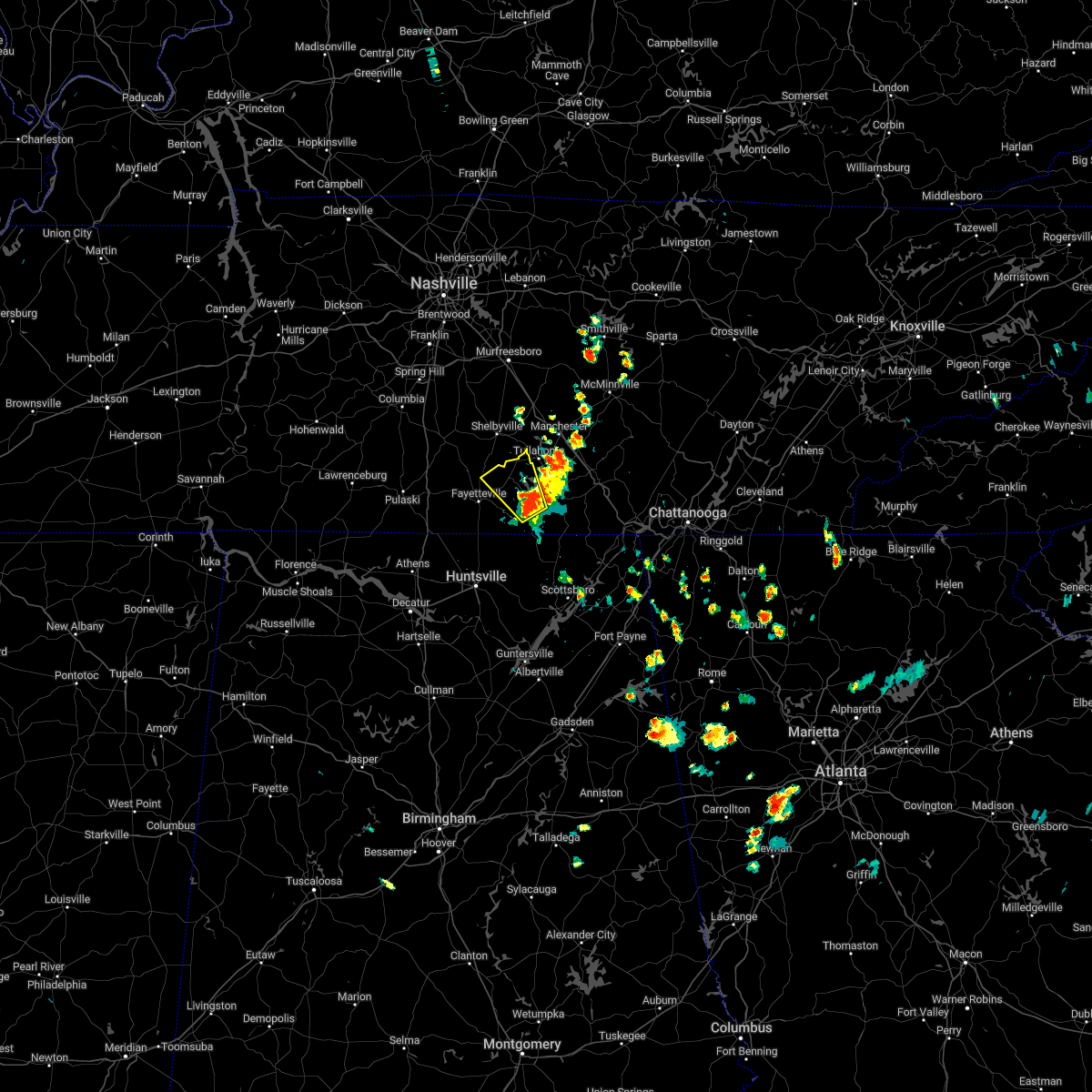 At 318 pm cdt, a severe thunderstorm was located near lynchburg, moving northwest at 20 mph (radar indicated). Hazards include 60 mph wind gusts. expect damage to roofs, siding, and trees At 318 pm cdt, a severe thunderstorm was located near lynchburg, moving northwest at 20 mph (radar indicated). Hazards include 60 mph wind gusts. expect damage to roofs, siding, and trees
|
| 7/12/2022 8:20 PM CDT |
 At 819 pm cdt, severe thunderstorms were located along a line extending from 10 miles northwest of manchester to chapel hill, moving southeast at 10 mph (public. at 815 pm cdt...quarter size hail was reported in chapel hill with these storms). Hazards include ping pong ball size hail and 60 mph wind gusts. People and animals outdoors will be injured. expect hail damage to roofs, siding, windows, and vehicles. expect wind damage to roofs, siding, and trees. locations impacted include, shelbyville, manchester, tullahoma, chapel hill, wartrace, eagleville, bell buckle, normandy, christiana, beechgrove, raus, fosterville, summitville, rover, belfast, deason, hillsboro, bradyville, farmington and unionville. this includes interstate 24 between mile markers 87 and 127. hail threat, observed max hail size, 1. 50 in wind threat, radar indicated max wind gust, 60 mph. At 819 pm cdt, severe thunderstorms were located along a line extending from 10 miles northwest of manchester to chapel hill, moving southeast at 10 mph (public. at 815 pm cdt...quarter size hail was reported in chapel hill with these storms). Hazards include ping pong ball size hail and 60 mph wind gusts. People and animals outdoors will be injured. expect hail damage to roofs, siding, windows, and vehicles. expect wind damage to roofs, siding, and trees. locations impacted include, shelbyville, manchester, tullahoma, chapel hill, wartrace, eagleville, bell buckle, normandy, christiana, beechgrove, raus, fosterville, summitville, rover, belfast, deason, hillsboro, bradyville, farmington and unionville. this includes interstate 24 between mile markers 87 and 127. hail threat, observed max hail size, 1. 50 in wind threat, radar indicated max wind gust, 60 mph.
|
| 7/12/2022 8:03 PM CDT |
 At 802 pm cdt, severe thunderstorms were located along a line extending from chapel hill to bell buckle, moving southeast at 20 mph (radar indicated). Hazards include golf ball size hail and 60 mph wind gusts. People and animals outdoors will be injured. expect hail damage to roofs, siding, windows, and vehicles. expect wind damage to roofs, siding, and trees. locations impacted include, shelbyville, manchester, tullahoma, chapel hill, wartrace, eagleville, bell buckle, normandy, christiana, beechgrove, raus, fosterville, summitville, rover, belfast, deason, hillsboro, bradyville, farmington and unionville. this includes interstate 24 between mile markers 87 and 127. thunderstorm damage threat, considerable hail threat, radar indicated max hail size, 1. 75 in wind threat, radar indicated max wind gust, 60 mph. At 802 pm cdt, severe thunderstorms were located along a line extending from chapel hill to bell buckle, moving southeast at 20 mph (radar indicated). Hazards include golf ball size hail and 60 mph wind gusts. People and animals outdoors will be injured. expect hail damage to roofs, siding, windows, and vehicles. expect wind damage to roofs, siding, and trees. locations impacted include, shelbyville, manchester, tullahoma, chapel hill, wartrace, eagleville, bell buckle, normandy, christiana, beechgrove, raus, fosterville, summitville, rover, belfast, deason, hillsboro, bradyville, farmington and unionville. this includes interstate 24 between mile markers 87 and 127. thunderstorm damage threat, considerable hail threat, radar indicated max hail size, 1. 75 in wind threat, radar indicated max wind gust, 60 mph.
|
| 7/12/2022 7:51 PM CDT |
 At 751 pm cdt, severe thunderstorms were located along a line extending from chapel hill to bell buckle, moving southeast at 25 mph (radar indicated). Hazards include 60 mph wind gusts and half dollar size hail. Hail damage to vehicles is expected. Expect wind damage to roofs, siding, and trees. At 751 pm cdt, severe thunderstorms were located along a line extending from chapel hill to bell buckle, moving southeast at 25 mph (radar indicated). Hazards include 60 mph wind gusts and half dollar size hail. Hail damage to vehicles is expected. Expect wind damage to roofs, siding, and trees.
|
| 7/9/2022 4:58 AM CDT |
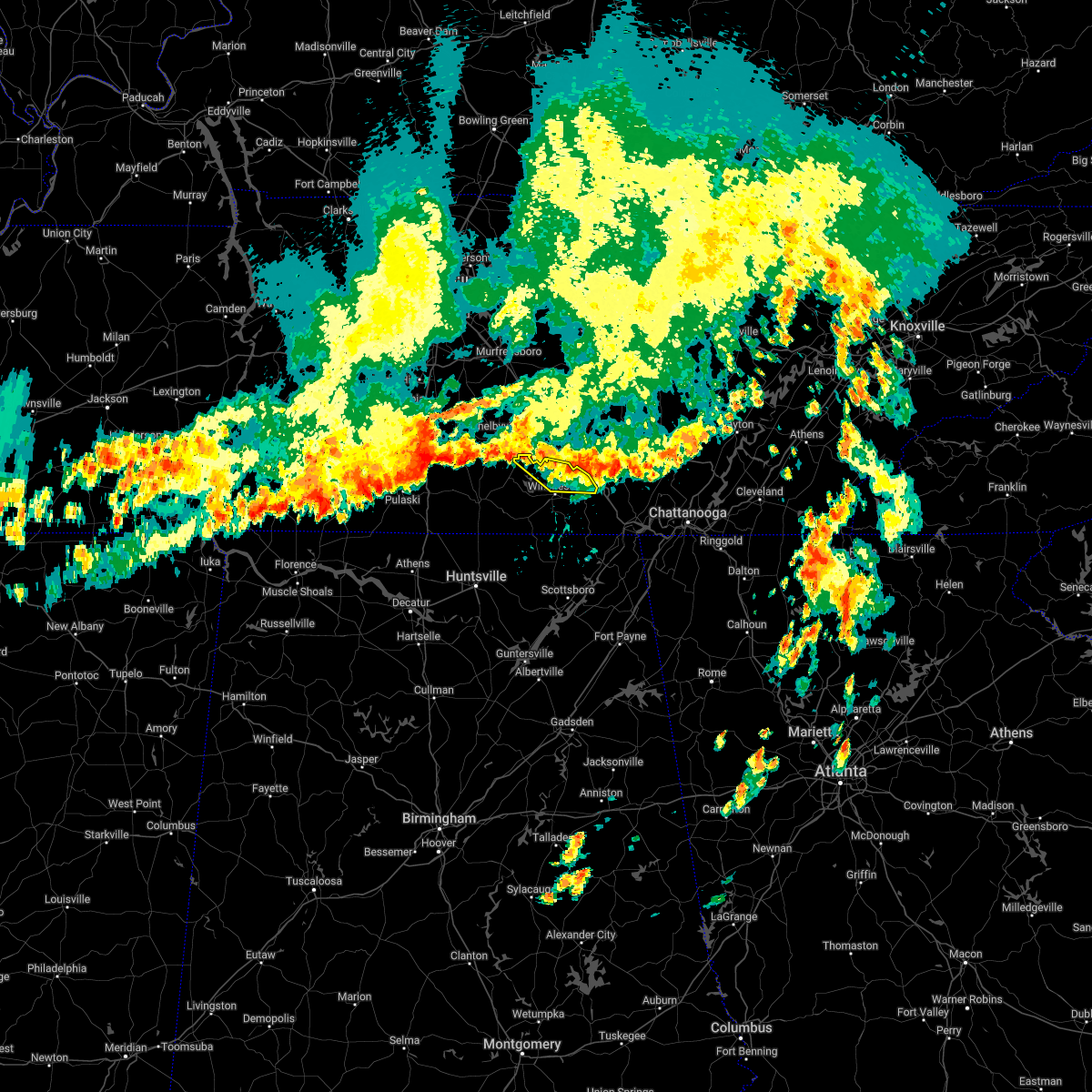 The severe thunderstorm warning for northeastern moore and northern franklin counties will expire at 500 am cdt, the storms which prompted the warning have weakened below severe limits, and no longer pose an immediate threat to life or property. therefore, the warning will be allowed to expire. however gusty winds are still possible with these thunderstorms. The severe thunderstorm warning for northeastern moore and northern franklin counties will expire at 500 am cdt, the storms which prompted the warning have weakened below severe limits, and no longer pose an immediate threat to life or property. therefore, the warning will be allowed to expire. however gusty winds are still possible with these thunderstorms.
|
| 7/9/2022 4:33 AM CDT |
 At 433 am cdt, severe thunderstorms were located along a line extending from near lynchburg to 8 miles northeast of estill springs, moving southeast at 20 mph (radar indicated). Hazards include 60 mph wind gusts. expect damage to roofs, siding, and trees At 433 am cdt, severe thunderstorms were located along a line extending from near lynchburg to 8 miles northeast of estill springs, moving southeast at 20 mph (radar indicated). Hazards include 60 mph wind gusts. expect damage to roofs, siding, and trees
|
| 7/9/2022 4:05 AM CDT |
 The severe thunderstorm warning for southern de kalb, southeastern rutherford, warren, coffee, eastern bedford and cannon counties will expire at 415 am cdt, the storms which prompted the warning have weakened below severe limits, and no longer pose an immediate threat to life or property. therefore, the warning will be allowed to expire. however gusty winds are still possible with these thunderstorms. The severe thunderstorm warning for southern de kalb, southeastern rutherford, warren, coffee, eastern bedford and cannon counties will expire at 415 am cdt, the storms which prompted the warning have weakened below severe limits, and no longer pose an immediate threat to life or property. therefore, the warning will be allowed to expire. however gusty winds are still possible with these thunderstorms.
|
| 7/9/2022 3:53 AM CDT |
 At 352 am cdt, severe thunderstorms were located along a line extending from near mcminnville to near manchester to near shelbyville, moving south at 55 mph (radar indicated). Hazards include 60 mph wind gusts. Expect damage to roofs, siding, and trees. locations impacted include, murfreesboro, shelbyville, mcminnville, manchester, smithville, woodbury, morrison, wartrace, bell buckle, centertown, normandy, christiana, beechgrove, raus, fosterville, summitville, deason, rockvale, bradyville and readyville. this includes interstate 24 between mile markers 81 and 114. hail threat, radar indicated max hail size, <. 75 in wind threat, radar indicated max wind gust, 60 mph. At 352 am cdt, severe thunderstorms were located along a line extending from near mcminnville to near manchester to near shelbyville, moving south at 55 mph (radar indicated). Hazards include 60 mph wind gusts. Expect damage to roofs, siding, and trees. locations impacted include, murfreesboro, shelbyville, mcminnville, manchester, smithville, woodbury, morrison, wartrace, bell buckle, centertown, normandy, christiana, beechgrove, raus, fosterville, summitville, deason, rockvale, bradyville and readyville. this includes interstate 24 between mile markers 81 and 114. hail threat, radar indicated max hail size, <. 75 in wind threat, radar indicated max wind gust, 60 mph.
|
| 7/9/2022 3:25 AM CDT |
 At 325 am cdt, severe thunderstorms were located along a line extending from near smithville to 10 miles southwest of murfreesboro, moving south at 45 mph (radar indicated). Hazards include 60 mph wind gusts. expect damage to roofs, siding, and trees At 325 am cdt, severe thunderstorms were located along a line extending from near smithville to 10 miles southwest of murfreesboro, moving south at 45 mph (radar indicated). Hazards include 60 mph wind gusts. expect damage to roofs, siding, and trees
|
| 6/7/2022 2:34 PM CDT |
 At 234 pm cdt, a severe thunderstorm was located near lynchburg, moving east at 15 mph (radar indicated). Hazards include 60 mph wind gusts. expect damage to roofs, siding, and trees At 234 pm cdt, a severe thunderstorm was located near lynchburg, moving east at 15 mph (radar indicated). Hazards include 60 mph wind gusts. expect damage to roofs, siding, and trees
|
| 6/7/2022 2:30 PM CDT | Multiple trees were knocked down along highway 50 east of lynchburg. time estimated by rada in moore county TN, 12 miles NE of Tullahoma, TN |
| 4/13/2022 8:47 PM CDT |
 At 847 pm cdt, severe thunderstorms were located along a line extending from near smithville to 8 miles southeast of woodbury to near estill springs, moving east at 55 mph (radar indicated). Hazards include 70 mph wind gusts. Expect considerable tree damage. damage is likely to mobile homes, roofs, and outbuildings. locations impacted include, mcminnville, manchester, sparta, smithville, woodbury, spencer, tullahoma, gruetli-laager, tracy city, monteagle, altamont, coalmont, morrison, doyle, beersheba springs, liberty, centertown, viola, rock island state park and summitville. this includes interstate 24 between mile markers 104 and 134. thunderstorm damage threat, considerable hail threat, radar indicated max hail size, <. 75 in wind threat, radar indicated max wind gust, 70 mph. At 847 pm cdt, severe thunderstorms were located along a line extending from near smithville to 8 miles southeast of woodbury to near estill springs, moving east at 55 mph (radar indicated). Hazards include 70 mph wind gusts. Expect considerable tree damage. damage is likely to mobile homes, roofs, and outbuildings. locations impacted include, mcminnville, manchester, sparta, smithville, woodbury, spencer, tullahoma, gruetli-laager, tracy city, monteagle, altamont, coalmont, morrison, doyle, beersheba springs, liberty, centertown, viola, rock island state park and summitville. this includes interstate 24 between mile markers 104 and 134. thunderstorm damage threat, considerable hail threat, radar indicated max hail size, <. 75 in wind threat, radar indicated max wind gust, 70 mph.
|
| 4/13/2022 8:27 PM CDT |
 At 826 pm cdt, severe thunderstorms were located along a line extending from 8 miles southwest of watertown to 11 miles southeast of murfreesboro to near lynchburg, moving east at 55 mph (radar indicated). Hazards include 70 mph wind gusts. Expect considerable tree damage. Damage is likely to mobile homes, roofs, and outbuildings. At 826 pm cdt, severe thunderstorms were located along a line extending from 8 miles southwest of watertown to 11 miles southeast of murfreesboro to near lynchburg, moving east at 55 mph (radar indicated). Hazards include 70 mph wind gusts. Expect considerable tree damage. Damage is likely to mobile homes, roofs, and outbuildings.
|
| 4/13/2022 8:22 PM CDT |
 At 822 pm cdt, severe thunderstorms were located along a line extending from 10 miles southeast of murfreesboro to 8 miles northwest of hazel green, moving east at 60 mph (radar indicated). Hazards include 70 mph wind gusts. Expect considerable tree damage. damage is likely to mobile homes, roofs, and outbuildings. locations impacted include, shelbyville, manchester, tullahoma, wartrace, bell buckle, normandy, christiana, deason, bradyville, beechgrove, raus and fosterville. this includes interstate 24 between mile markers 87 and 111. thunderstorm damage threat, considerable hail threat, radar indicated max hail size, <. 75 in wind threat, radar indicated max wind gust, 70 mph. At 822 pm cdt, severe thunderstorms were located along a line extending from 10 miles southeast of murfreesboro to 8 miles northwest of hazel green, moving east at 60 mph (radar indicated). Hazards include 70 mph wind gusts. Expect considerable tree damage. damage is likely to mobile homes, roofs, and outbuildings. locations impacted include, shelbyville, manchester, tullahoma, wartrace, bell buckle, normandy, christiana, deason, bradyville, beechgrove, raus and fosterville. this includes interstate 24 between mile markers 87 and 111. thunderstorm damage threat, considerable hail threat, radar indicated max hail size, <. 75 in wind threat, radar indicated max wind gust, 70 mph.
|
| 4/13/2022 8:16 PM CDT |
 At 815 pm cdt, severe thunderstorms were located along a line extending from 9 miles south of murfreesboro to near ardmore, moving east at 60 mph (radar indicated). Hazards include 70 mph wind gusts. Expect considerable tree damage. damage is likely to mobile homes, roofs, and outbuildings. locations impacted include, shelbyville, lewisburg, manchester, pulaski, tullahoma, chapel hill, ardmore, cornersville, wartrace, eagleville, elkton, bell buckle, normandy, beechgrove, raus, fosterville, rover, belfast, frankewing and bradyville. this includes the following highways, interstate 65 between mile markers 1 and 25. interstate 24 between mile markers 87 and 111. thunderstorm damage threat, considerable hail threat, radar indicated max hail size, <. 75 in wind threat, radar indicated max wind gust, 70 mph. At 815 pm cdt, severe thunderstorms were located along a line extending from 9 miles south of murfreesboro to near ardmore, moving east at 60 mph (radar indicated). Hazards include 70 mph wind gusts. Expect considerable tree damage. damage is likely to mobile homes, roofs, and outbuildings. locations impacted include, shelbyville, lewisburg, manchester, pulaski, tullahoma, chapel hill, ardmore, cornersville, wartrace, eagleville, elkton, bell buckle, normandy, beechgrove, raus, fosterville, rover, belfast, frankewing and bradyville. this includes the following highways, interstate 65 between mile markers 1 and 25. interstate 24 between mile markers 87 and 111. thunderstorm damage threat, considerable hail threat, radar indicated max hail size, <. 75 in wind threat, radar indicated max wind gust, 70 mph.
|
| 4/13/2022 8:15 PM CDT |
 At 814 pm cdt, severe thunderstorms were located along a line extending from 10 miles southwest of shelbyville to 6 miles south of petersburg to 11 miles west of fayetteville to ardmore, moving east at 65 mph (radar indicated). Hazards include 70 mph wind gusts. Expect considerable tree damage. damage is likely to mobile homes, roofs, and outbuildings. locations impacted include, fayetteville, lynchburg, ardmore, petersburg, tims ford lake, lincoln, howell, elora, hurdlow and mimosa. thunderstorm damage threat, considerable hail threat, radar indicated max hail size, <. 75 in wind threat, radar indicated max wind gust, 70 mph. At 814 pm cdt, severe thunderstorms were located along a line extending from 10 miles southwest of shelbyville to 6 miles south of petersburg to 11 miles west of fayetteville to ardmore, moving east at 65 mph (radar indicated). Hazards include 70 mph wind gusts. Expect considerable tree damage. damage is likely to mobile homes, roofs, and outbuildings. locations impacted include, fayetteville, lynchburg, ardmore, petersburg, tims ford lake, lincoln, howell, elora, hurdlow and mimosa. thunderstorm damage threat, considerable hail threat, radar indicated max hail size, <. 75 in wind threat, radar indicated max wind gust, 70 mph.
|
| 4/13/2022 7:54 PM CDT |
 At 753 pm cdt, severe thunderstorms were located along a line extending from 7 miles east of spring hill to 13 miles east of lexington, moving east at 60 mph (radar indicated). Hazards include 70 mph wind gusts. Expect considerable tree damage. Damage is likely to mobile homes, roofs, and outbuildings. At 753 pm cdt, severe thunderstorms were located along a line extending from 7 miles east of spring hill to 13 miles east of lexington, moving east at 60 mph (radar indicated). Hazards include 70 mph wind gusts. Expect considerable tree damage. Damage is likely to mobile homes, roofs, and outbuildings.
|
| 4/13/2022 7:52 PM CDT |
 At 751 pm cdt, severe thunderstorms were located along a line extending from 15 miles southwest of lewisburg to near pulaski to 12 miles northeast of lexington to near rogersville, moving east at 60 mph (radar indicated). Hazards include 70 mph wind gusts. Expect considerable tree damage. Damage is likely to mobile homes, roofs, and outbuildings. At 751 pm cdt, severe thunderstorms were located along a line extending from 15 miles southwest of lewisburg to near pulaski to 12 miles northeast of lexington to near rogersville, moving east at 60 mph (radar indicated). Hazards include 70 mph wind gusts. Expect considerable tree damage. Damage is likely to mobile homes, roofs, and outbuildings.
|
| 3/30/2022 11:14 PM CDT | A tree was reported down on cumberland springs roa in moore county TN, 5.6 miles ENE of Tullahoma, TN |
| 3/30/2022 11:13 PM CDT | A tree was reported down on woosley roa in moore county TN, 6.9 miles ENE of Tullahoma, TN |
| 3/30/2022 11:10 PM CDT | Powerlines were reported down on buckeye loop roa in moore county TN, 12.7 miles ENE of Tullahoma, TN |
| 3/30/2022 11:08 PM CDT | A tree was reported down on grammar hill roa in moore county TN, 12.6 miles NE of Tullahoma, TN |
| 3/30/2022 10:26 PM CDT |
 At 1024 pm cdt, severe thunderstorms were located along a line extending from near hazel green to 7 miles southeast of helicon, moving east at 40 mph (radar indicated). Hazards include 60 mph wind gusts. expect damage to roofs, siding, and trees At 1024 pm cdt, severe thunderstorms were located along a line extending from near hazel green to 7 miles southeast of helicon, moving east at 40 mph (radar indicated). Hazards include 60 mph wind gusts. expect damage to roofs, siding, and trees
|
| 1/1/2022 6:43 PM CST |
 The severe thunderstorm warning for northern madison. moore. southeastern lincoln and western franklin counties will expire at 645 pm cst. the storms which prompted the warning have weakened below severe limits, and no longer pose an immediate threat to life or property. Therefore, the warning will be allowed to expire. The severe thunderstorm warning for northern madison. moore. southeastern lincoln and western franklin counties will expire at 645 pm cst. the storms which prompted the warning have weakened below severe limits, and no longer pose an immediate threat to life or property. Therefore, the warning will be allowed to expire.
|
| 1/1/2022 6:43 PM CST |
 The severe thunderstorm warning for northern madison, moore, southeastern lincoln and western franklin counties will expire at 645 pm cst, the storms which prompted the warning have weakened below severe limits, and no longer pose an immediate threat to life or property. therefore, the warning will be allowed to expire. a tornado watch remains in effect until 700 pm cst for north central, northeastern and northwestern alabama, and middle tennessee. a tornado watch also remains in effect until 1000 pm cst for northeastern alabama. remember, a tornado warning still remains in effect for southern franklin county in southern middle tennessee. The severe thunderstorm warning for northern madison, moore, southeastern lincoln and western franklin counties will expire at 645 pm cst, the storms which prompted the warning have weakened below severe limits, and no longer pose an immediate threat to life or property. therefore, the warning will be allowed to expire. a tornado watch remains in effect until 700 pm cst for north central, northeastern and northwestern alabama, and middle tennessee. a tornado watch also remains in effect until 1000 pm cst for northeastern alabama. remember, a tornado warning still remains in effect for southern franklin county in southern middle tennessee.
|
| 1/1/2022 6:25 PM CST | Tree down along norman wisemand r in moore county TN, 12 miles NE of Tullahoma, TN |
| 1/1/2022 6:23 PM CST |
 At 623 pm cst, severe thunderstorms were located along a line extending from near lynchburg to near university of alabama in huntsville, moving east at 45 mph (radar indicated). Hazards include 60 mph wind gusts. Expect damage to roofs, siding, and trees. locations impacted include, northern huntsville, madison, winchester, lynchburg, moores mill, meridianville, hazel green, decherd, estill springs and huntland. hail threat, radar indicated max hail size, <. 75 in wind threat, radar indicated max wind gust, 60 mph. At 623 pm cst, severe thunderstorms were located along a line extending from near lynchburg to near university of alabama in huntsville, moving east at 45 mph (radar indicated). Hazards include 60 mph wind gusts. Expect damage to roofs, siding, and trees. locations impacted include, northern huntsville, madison, winchester, lynchburg, moores mill, meridianville, hazel green, decherd, estill springs and huntland. hail threat, radar indicated max hail size, <. 75 in wind threat, radar indicated max wind gust, 60 mph.
|
| 1/1/2022 6:05 PM CST |
 At 604 pm cst, severe thunderstorms were located along a line extending from 8 miles east of manchester to 10 miles northeast of decherd to estill springs, moving northeast at 60 mph (radar indicated). Hazards include 60 mph wind gusts. Expect damage to roofs, siding, and trees. locations impacted include, manchester, tullahoma, gruetli-laager, altamont, coalmont, beersheba springs, viola, hillsboro, arnold afb and woods reservoir. this includes interstate 24 between mile markers 114 and 126. hail threat, radar indicated max hail size, <. 75 in wind threat, radar indicated max wind gust, 60 mph. At 604 pm cst, severe thunderstorms were located along a line extending from 8 miles east of manchester to 10 miles northeast of decherd to estill springs, moving northeast at 60 mph (radar indicated). Hazards include 60 mph wind gusts. Expect damage to roofs, siding, and trees. locations impacted include, manchester, tullahoma, gruetli-laager, altamont, coalmont, beersheba springs, viola, hillsboro, arnold afb and woods reservoir. this includes interstate 24 between mile markers 114 and 126. hail threat, radar indicated max hail size, <. 75 in wind threat, radar indicated max wind gust, 60 mph.
|
| 1/1/2022 6:00 PM CST |
 At 600 pm cst, severe thunderstorms were located along a line extending from near petersburg to near tanner, moving east at 50 mph (radar indicated). Hazards include 60 mph wind gusts. expect damage to roofs, siding, and trees At 600 pm cst, severe thunderstorms were located along a line extending from near petersburg to near tanner, moving east at 50 mph (radar indicated). Hazards include 60 mph wind gusts. expect damage to roofs, siding, and trees
|
| 1/1/2022 5:56 PM CST |
 The severe thunderstorm warning for moore, southeastern lincoln and northern franklin counties will expire at 600 pm cst, the storm which prompted the warning has weakened below severe limits, and no longer poses an immediate threat to life or property. therefore, the warning will be allowed to expire. a tornado watch remains in effect until 700 pm cst for north central and northeastern alabama, and middle tennessee. The severe thunderstorm warning for moore, southeastern lincoln and northern franklin counties will expire at 600 pm cst, the storm which prompted the warning has weakened below severe limits, and no longer poses an immediate threat to life or property. therefore, the warning will be allowed to expire. a tornado watch remains in effect until 700 pm cst for north central and northeastern alabama, and middle tennessee.
|
| 1/1/2022 5:55 PM CST |
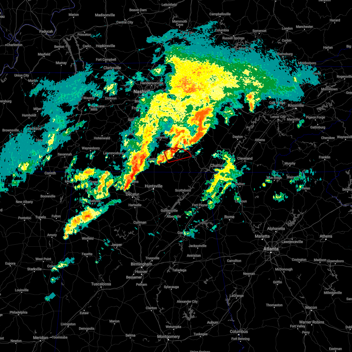 The tornado warning for southeastern moore and northern franklin counties will expire at 600 pm cst, the storm which prompted the warning has weakened below severe limits, and no longer appears capable of producing a tornado. therefore, the warning will be allowed to expire. a tornado watch remains in effect until 700 pm cst for north central and northeastern alabama, and middle tennessee. The tornado warning for southeastern moore and northern franklin counties will expire at 600 pm cst, the storm which prompted the warning has weakened below severe limits, and no longer appears capable of producing a tornado. therefore, the warning will be allowed to expire. a tornado watch remains in effect until 700 pm cst for north central and northeastern alabama, and middle tennessee.
|
| 1/1/2022 5:51 PM CST |
 At 551 pm cst, severe thunderstorms were located along a line extending from near manchester to near estill springs to near tims ford lake, moving northeast at 60 mph (radar indicated). Hazards include 60 mph wind gusts. expect damage to roofs, siding, and trees At 551 pm cst, severe thunderstorms were located along a line extending from near manchester to near estill springs to near tims ford lake, moving northeast at 60 mph (radar indicated). Hazards include 60 mph wind gusts. expect damage to roofs, siding, and trees
|
| 1/1/2022 5:47 PM CST |
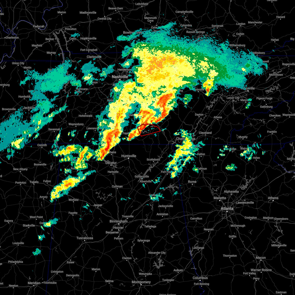 At 546 pm cst, a severe thunderstorm capable of producing a tornado was located near tims ford lake, or near lynchburg, moving east at 50 mph (radar indicated rotation). Hazards include tornado. Flying debris will be dangerous to those caught without shelter. mobile homes will be damaged or destroyed. damage to roofs, windows, and vehicles will occur. tree damage is likely. this dangerous storm will be near, winchester and estill springs around 555 pm cst. decherd around 600 pm cst. Other locations impacted by this tornadic thunderstorm include alto, marble hill, woods reservoir, harmony and arnold afb. At 546 pm cst, a severe thunderstorm capable of producing a tornado was located near tims ford lake, or near lynchburg, moving east at 50 mph (radar indicated rotation). Hazards include tornado. Flying debris will be dangerous to those caught without shelter. mobile homes will be damaged or destroyed. damage to roofs, windows, and vehicles will occur. tree damage is likely. this dangerous storm will be near, winchester and estill springs around 555 pm cst. decherd around 600 pm cst. Other locations impacted by this tornadic thunderstorm include alto, marble hill, woods reservoir, harmony and arnold afb.
|
| 1/1/2022 5:42 PM CST | Tree down along shasteen hollow r in moore county TN, 9 miles NNE of Tullahoma, TN |
| 1/1/2022 5:42 PM CST |
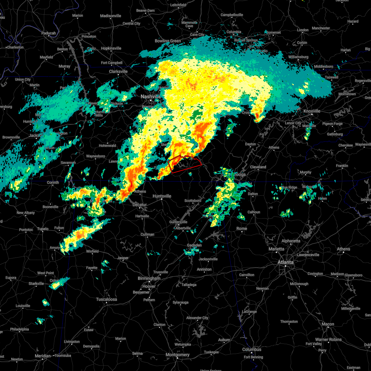 At 541 pm cst, a severe thunderstorm capable of producing a tornado was located near lynchburg, moving east at 50 mph (radar indicated rotation). Hazards include tornado. Flying debris will be dangerous to those caught without shelter. mobile homes will be damaged or destroyed. damage to roofs, windows, and vehicles will occur. tree damage is likely. this dangerous storm will be near, tims ford lake around 550 pm cst. winchester and estill springs around 555 pm cst. decherd around 600 pm cst. Other locations impacted by this tornadic thunderstorm include lexie crossroads, smithland, woods reservoir, harmony, arnold afb, hurdlow, lois, alto, booneville and marble hill. At 541 pm cst, a severe thunderstorm capable of producing a tornado was located near lynchburg, moving east at 50 mph (radar indicated rotation). Hazards include tornado. Flying debris will be dangerous to those caught without shelter. mobile homes will be damaged or destroyed. damage to roofs, windows, and vehicles will occur. tree damage is likely. this dangerous storm will be near, tims ford lake around 550 pm cst. winchester and estill springs around 555 pm cst. decherd around 600 pm cst. Other locations impacted by this tornadic thunderstorm include lexie crossroads, smithland, woods reservoir, harmony, arnold afb, hurdlow, lois, alto, booneville and marble hill.
|
| 1/1/2022 5:33 PM CST |
 At 532 pm cst, a severe thunderstorm was located near fayetteville, moving east at 50 mph (radar indicated). Hazards include 60 mph wind gusts. expect damage to roofs, siding, and trees At 532 pm cst, a severe thunderstorm was located near fayetteville, moving east at 50 mph (radar indicated). Hazards include 60 mph wind gusts. expect damage to roofs, siding, and trees
|
| 1/1/2022 5:21 PM CST |
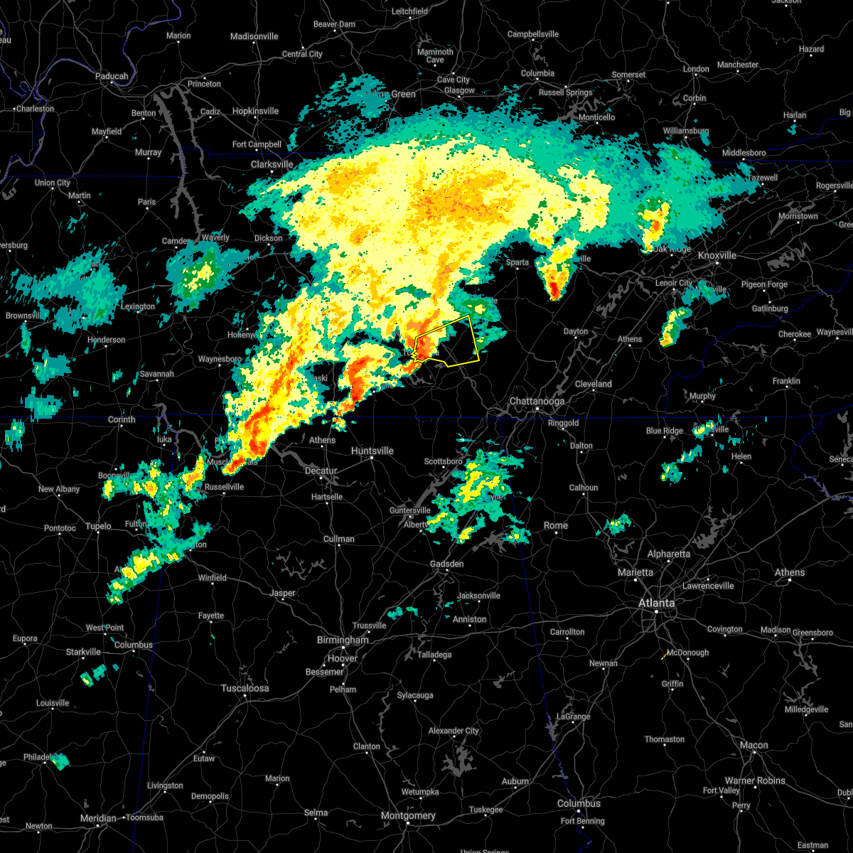 At 520 pm cst, a severe thunderstorm was located near manchester, moving east at 45 mph (radar indicated). Hazards include 60 mph wind gusts. Expect damage to roofs, siding, and trees. locations impacted include, manchester, tullahoma, altamont, morrison, viola, hillsboro, summitville, arnold afb and woods reservoir. this includes interstate 24 between mile markers 107 and 125. hail threat, radar indicated max hail size, <. 75 in wind threat, radar indicated max wind gust, 60 mph. At 520 pm cst, a severe thunderstorm was located near manchester, moving east at 45 mph (radar indicated). Hazards include 60 mph wind gusts. Expect damage to roofs, siding, and trees. locations impacted include, manchester, tullahoma, altamont, morrison, viola, hillsboro, summitville, arnold afb and woods reservoir. this includes interstate 24 between mile markers 107 and 125. hail threat, radar indicated max hail size, <. 75 in wind threat, radar indicated max wind gust, 60 mph.
|
| 1/1/2022 5:08 PM CST |
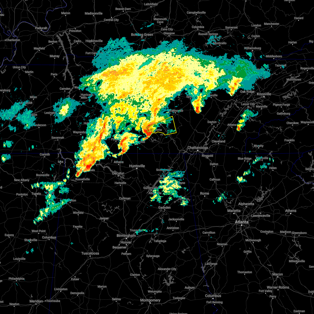 At 508 pm cst, a severe thunderstorm was located near tullahoma, or 7 miles northeast of lynchburg, moving east at 45 mph (radar indicated). Hazards include 60 mph wind gusts. expect damage to roofs, siding, and trees At 508 pm cst, a severe thunderstorm was located near tullahoma, or 7 miles northeast of lynchburg, moving east at 45 mph (radar indicated). Hazards include 60 mph wind gusts. expect damage to roofs, siding, and trees
|
| 12/11/2021 7:00 AM CST |
 At 659 am cst, severe thunderstorms were located along a line extending from near tullahoma to near tims ford lake to 8 miles north of huntland to 7 miles north of new market, moving east at 60 mph (radar indicated). Hazards include 60 mph wind gusts. Expect damage to roofs, siding, and trees. locations impacted include, winchester, lynchburg, hazel green, decherd, estill springs, cowan, huntland, tims ford lake, lincoln and elora. hail threat, radar indicated max hail size, <. 75 in wind threat, radar indicated max wind gust, 60 mph. At 659 am cst, severe thunderstorms were located along a line extending from near tullahoma to near tims ford lake to 8 miles north of huntland to 7 miles north of new market, moving east at 60 mph (radar indicated). Hazards include 60 mph wind gusts. Expect damage to roofs, siding, and trees. locations impacted include, winchester, lynchburg, hazel green, decherd, estill springs, cowan, huntland, tims ford lake, lincoln and elora. hail threat, radar indicated max hail size, <. 75 in wind threat, radar indicated max wind gust, 60 mph.
|
| 12/11/2021 6:55 AM CST | Trees down along ridgeville r in moore county TN, 6.8 miles NE of Tullahoma, TN |
| 12/11/2021 6:51 AM CST | Trees down near the intersection of tanyard rd and coffee cree in moore county TN, 12.4 miles NE of Tullahoma, TN |
| 12/11/2021 6:41 AM CST |
 At 640 am cst, severe thunderstorms were located along a line extending from near petersburg to near fayetteville to 10 miles north of hazel green to 6 miles north of harvest, moving east at 60 mph (radar indicated). Hazards include 60 mph wind gusts. expect damage to roofs, siding, and trees At 640 am cst, severe thunderstorms were located along a line extending from near petersburg to near fayetteville to 10 miles north of hazel green to 6 miles north of harvest, moving east at 60 mph (radar indicated). Hazards include 60 mph wind gusts. expect damage to roofs, siding, and trees
|
| 12/6/2021 7:56 AM CST |
 The severe thunderstorm warning for moore, northeastern lincoln and northwestern franklin counties will expire at 800 am cst, the storms which prompted the warning have weakened. therefore, the warning will be allowed to expire. The severe thunderstorm warning for moore, northeastern lincoln and northwestern franklin counties will expire at 800 am cst, the storms which prompted the warning have weakened. therefore, the warning will be allowed to expire.
|
| 12/6/2021 7:53 AM CST | Report of trees and powerlines down on marbury roa in coffee county TN, 1.1 miles NE of Tullahoma, TN |
| 12/6/2021 7:49 AM CST |
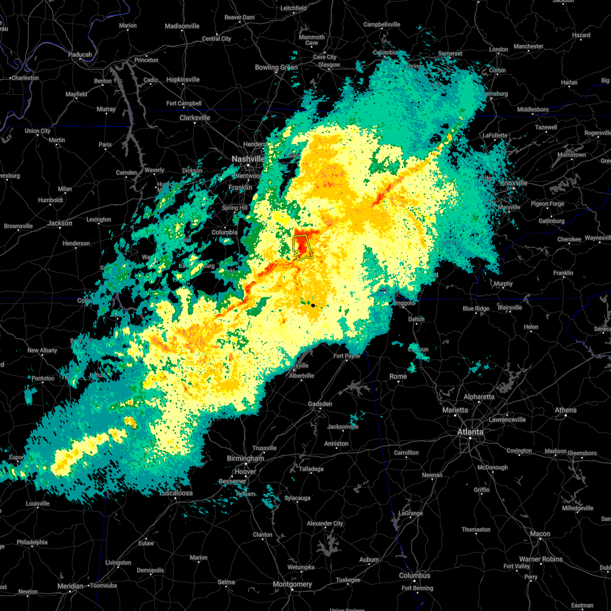 At 748 am cst, a severe thunderstorm was located near tullahoma, or 10 miles northeast of lynchburg, moving east at 50 mph (radar indicated). Hazards include 60 mph wind gusts. Expect damage to roofs, siding, and trees. locations impacted include, tullahoma, normandy and arnold afb. this includes interstate 24 between mile markers 104 and 105. hail threat, radar indicated max hail size, <. 75 in wind threat, radar indicated max wind gust, 60 mph. At 748 am cst, a severe thunderstorm was located near tullahoma, or 10 miles northeast of lynchburg, moving east at 50 mph (radar indicated). Hazards include 60 mph wind gusts. Expect damage to roofs, siding, and trees. locations impacted include, tullahoma, normandy and arnold afb. this includes interstate 24 between mile markers 104 and 105. hail threat, radar indicated max hail size, <. 75 in wind threat, radar indicated max wind gust, 60 mph.
|
| 12/6/2021 7:48 AM CST | Breckenridge community trees down. time estimated via rada in coffee county TN, 1.2 miles WSW of Tullahoma, TN |
| 12/6/2021 7:47 AM CST |
 At 747 am cst, a severe thunderstorm capable of producing a tornado was located near tullahoma, or near manchester, moving east at 55 mph (radar indicated rotation). Hazards include tornado. Flying debris will be dangerous to those caught without shelter. mobile homes will be damaged or destroyed. damage to roofs, windows, and vehicles will occur. tree damage is likely. this dangerous storm will be near, manchester around 755 am cst. other locations impacted by this tornadic thunderstorm include hillsboro, normandy and arnold afb. This includes interstate 24 between mile markers 109 and 124. At 747 am cst, a severe thunderstorm capable of producing a tornado was located near tullahoma, or near manchester, moving east at 55 mph (radar indicated rotation). Hazards include tornado. Flying debris will be dangerous to those caught without shelter. mobile homes will be damaged or destroyed. damage to roofs, windows, and vehicles will occur. tree damage is likely. this dangerous storm will be near, manchester around 755 am cst. other locations impacted by this tornadic thunderstorm include hillsboro, normandy and arnold afb. This includes interstate 24 between mile markers 109 and 124.
|
| 12/6/2021 7:42 AM CST | Emergency manager reports trees... powerlines... and home damage in northern moore county near ledford mill road west northwest of tullahom in moore county TN, 5.1 miles E of Tullahoma, TN |
| 12/6/2021 7:42 AM CST |
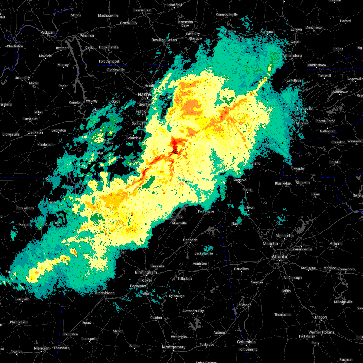 At 742 am cst, a severe thunderstorm capable of producing a tornado was located near tullahoma, or 8 miles northeast of lynchburg, moving east at 55 mph (radar indicated rotation). Hazards include tornado. Flying debris will be dangerous to those caught without shelter. mobile homes will be damaged or destroyed. damage to roofs, windows, and vehicles will occur. tree damage is likely. This tornadic thunderstorm will remain over mainly rural areas of northeastern moore county. At 742 am cst, a severe thunderstorm capable of producing a tornado was located near tullahoma, or 8 miles northeast of lynchburg, moving east at 55 mph (radar indicated rotation). Hazards include tornado. Flying debris will be dangerous to those caught without shelter. mobile homes will be damaged or destroyed. damage to roofs, windows, and vehicles will occur. tree damage is likely. This tornadic thunderstorm will remain over mainly rural areas of northeastern moore county.
|
| 12/6/2021 7:40 AM CST |
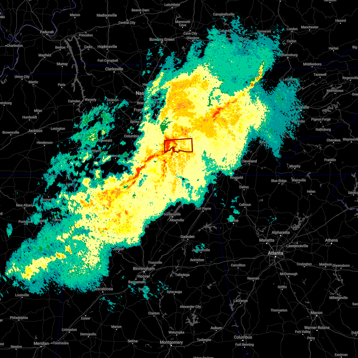 At 739 am cst, a severe thunderstorm capable of producing a tornado was located near tullahoma, or 8 miles southeast of shelbyville, moving east at 55 mph (radar indicated rotation). Hazards include tornado. Flying debris will be dangerous to those caught without shelter. mobile homes will be damaged or destroyed. damage to roofs, windows, and vehicles will occur. tree damage is likely. this dangerous storm will be near, tullahoma around 745 am cst. manchester around 755 am cst. other locations impacted by this tornadic thunderstorm include normandy, raus, hillsboro and arnold afb. This includes interstate 24 between mile markers 107 and 124. At 739 am cst, a severe thunderstorm capable of producing a tornado was located near tullahoma, or 8 miles southeast of shelbyville, moving east at 55 mph (radar indicated rotation). Hazards include tornado. Flying debris will be dangerous to those caught without shelter. mobile homes will be damaged or destroyed. damage to roofs, windows, and vehicles will occur. tree damage is likely. this dangerous storm will be near, tullahoma around 745 am cst. manchester around 755 am cst. other locations impacted by this tornadic thunderstorm include normandy, raus, hillsboro and arnold afb. This includes interstate 24 between mile markers 107 and 124.
|
| 12/6/2021 7:37 AM CST |
 At 736 am cst, a severe thunderstorm was located near shelbyville, moving east at 50 mph (radar indicated). Hazards include 60 mph wind gusts. Expect damage to roofs, siding, and trees. locations impacted include, shelbyville, tullahoma, wartrace, normandy, raus and arnold afb. this includes interstate 24 between mile markers 104 and 105. hail threat, radar indicated max hail size, <. 75 in wind threat, radar indicated max wind gust, 60 mph. At 736 am cst, a severe thunderstorm was located near shelbyville, moving east at 50 mph (radar indicated). Hazards include 60 mph wind gusts. Expect damage to roofs, siding, and trees. locations impacted include, shelbyville, tullahoma, wartrace, normandy, raus and arnold afb. this includes interstate 24 between mile markers 104 and 105. hail threat, radar indicated max hail size, <. 75 in wind threat, radar indicated max wind gust, 60 mph.
|
| 12/6/2021 7:33 AM CST |
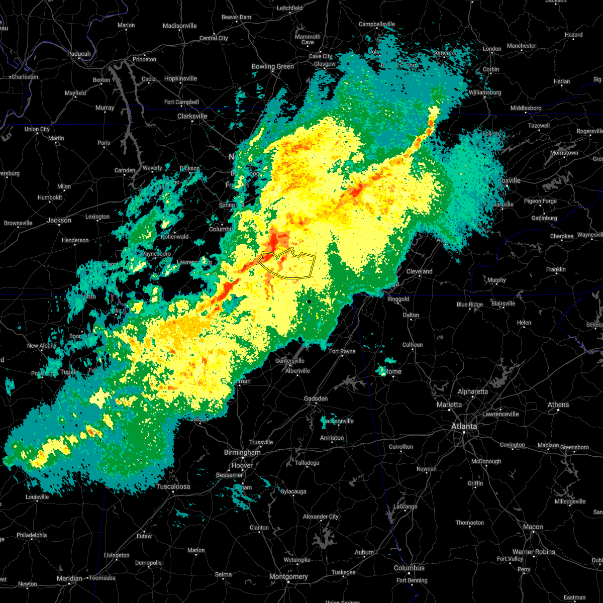 At 733 am cst, severe thunderstorms were located along a line extending from 6 miles north of shelbyville to near petersburg to 11 miles west of fayetteville, moving east at 45 mph (radar indicated). Hazards include 70 mph wind gusts. Expect considerable tree damage. damage is likely to mobile homes, roofs, and outbuildings. locations impacted include, winchester, lynchburg, decherd, estill springs, tims ford lake, lexie crossroads, mulberry, chestnut ridge, harmony and belleville. thunderstorm damage threat, considerable hail threat, radar indicated max hail size, <. 75 in wind threat, radar indicated max wind gust, 70 mph. At 733 am cst, severe thunderstorms were located along a line extending from 6 miles north of shelbyville to near petersburg to 11 miles west of fayetteville, moving east at 45 mph (radar indicated). Hazards include 70 mph wind gusts. Expect considerable tree damage. damage is likely to mobile homes, roofs, and outbuildings. locations impacted include, winchester, lynchburg, decherd, estill springs, tims ford lake, lexie crossroads, mulberry, chestnut ridge, harmony and belleville. thunderstorm damage threat, considerable hail threat, radar indicated max hail size, <. 75 in wind threat, radar indicated max wind gust, 70 mph.
|
| 12/6/2021 7:27 AM CST |
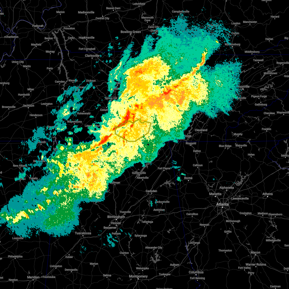 At 727 am cst, severe thunderstorms were located along a line extending from 9 miles northwest of shelbyville to near petersburg to 11 miles east of pulaski, moving southeast at 45 mph (radar indicated). Hazards include 70 mph wind gusts. Expect considerable tree damage. Damage is likely to mobile homes, roofs, and outbuildings. At 727 am cst, severe thunderstorms were located along a line extending from 9 miles northwest of shelbyville to near petersburg to 11 miles east of pulaski, moving southeast at 45 mph (radar indicated). Hazards include 70 mph wind gusts. Expect considerable tree damage. Damage is likely to mobile homes, roofs, and outbuildings.
|
| 12/6/2021 7:21 AM CST |
 At 721 am cst, a severe thunderstorm was located near lewisburg, moving east at 50 mph (radar indicated). Hazards include 60 mph wind gusts. expect damage to roofs, siding, and trees At 721 am cst, a severe thunderstorm was located near lewisburg, moving east at 50 mph (radar indicated). Hazards include 60 mph wind gusts. expect damage to roofs, siding, and trees
|
| 8/1/2021 12:12 AM CDT |
 The severe thunderstorm warning for moore, lincoln and franklin counties will expire at 1215 am cdt, the storms which prompted the warning have moved out of the area. therefore, the warning will be allowed to expire. a severe thunderstorm watch remains in effect until 300 am cdt for north central and northeastern alabama, and middle tennessee. remember, a severe thunderstorm warning still remains in effect for franklin county tennessee until 100 am cdt. The severe thunderstorm warning for moore, lincoln and franklin counties will expire at 1215 am cdt, the storms which prompted the warning have moved out of the area. therefore, the warning will be allowed to expire. a severe thunderstorm watch remains in effect until 300 am cdt for north central and northeastern alabama, and middle tennessee. remember, a severe thunderstorm warning still remains in effect for franklin county tennessee until 100 am cdt.
|
| 8/1/2021 12:11 AM CDT |
 At 1210 am cdt, severe thunderstorms were located along a line extending from near manchester to near tims ford lake to near huntland, moving southeast at 50 mph (radar indicated). Hazards include 60 mph wind gusts. expect damage to roofs, siding, and trees At 1210 am cdt, severe thunderstorms were located along a line extending from near manchester to near tims ford lake to near huntland, moving southeast at 50 mph (radar indicated). Hazards include 60 mph wind gusts. expect damage to roofs, siding, and trees
|
| 8/1/2021 12:10 AM CDT |
 At 1210 am cdt, severe thunderstorms were located along a line extending from near mcminnville to near estill springs, moving east at 45 mph (radar indicated). Hazards include 60 mph wind gusts. Expect damage to roofs, siding, and trees. locations impacted include, mcminnville, manchester, tullahoma, gruetli-laager, tracy city, monteagle, altamont, coalmont, morrison, palmer, beersheba springs, centertown, viola, summitville, hillsboro, pelham, arnold afb and fiery gizzard state park. This includes interstate 24 between mile markers 104 and 134. At 1210 am cdt, severe thunderstorms were located along a line extending from near mcminnville to near estill springs, moving east at 45 mph (radar indicated). Hazards include 60 mph wind gusts. Expect damage to roofs, siding, and trees. locations impacted include, mcminnville, manchester, tullahoma, gruetli-laager, tracy city, monteagle, altamont, coalmont, morrison, palmer, beersheba springs, centertown, viola, summitville, hillsboro, pelham, arnold afb and fiery gizzard state park. This includes interstate 24 between mile markers 104 and 134.
|
| 7/31/2021 11:55 PM CDT |
 At 1154 pm cdt, severe thunderstorms were located along a line extending from centertown to near lynchburg, moving east at 45 mph (radar indicated). Hazards include 60 mph wind gusts. expect damage to roofs, siding, and trees At 1154 pm cdt, severe thunderstorms were located along a line extending from centertown to near lynchburg, moving east at 45 mph (radar indicated). Hazards include 60 mph wind gusts. expect damage to roofs, siding, and trees
|
| 7/31/2021 11:49 PM CDT |
 At 1148 pm cdt, severe thunderstorms were located along a line extending from 8 miles northwest of manchester to near lynchburg to 8 miles east of pulaski, moving east at 40 mph (radar indicated). Hazards include 60 mph wind gusts. Expect damage to roofs, siding, and trees. Locations impacted include, winchester, fayetteville, lynchburg, decherd, estill springs, cowan, huntland, petersburg, tims ford lake and sewanee. At 1148 pm cdt, severe thunderstorms were located along a line extending from 8 miles northwest of manchester to near lynchburg to 8 miles east of pulaski, moving east at 40 mph (radar indicated). Hazards include 60 mph wind gusts. Expect damage to roofs, siding, and trees. Locations impacted include, winchester, fayetteville, lynchburg, decherd, estill springs, cowan, huntland, petersburg, tims ford lake and sewanee.
|
| 7/31/2021 11:27 PM CDT |
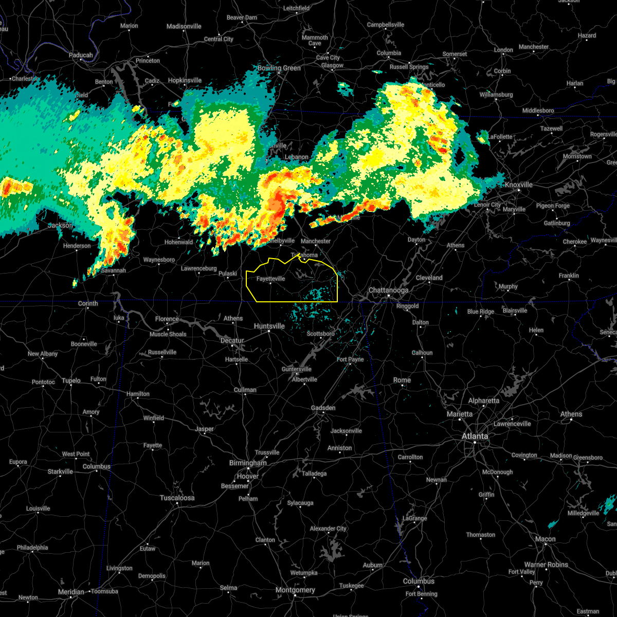 At 1126 pm cdt, severe thunderstorms were located along a line extending from 11 miles south of murfreesboro to 6 miles west of shelbyville to 8 miles southwest of lewisburg, moving southeast at 45 mph (radar indicated). Hazards include 60 mph wind gusts. expect damage to roofs, siding, and trees At 1126 pm cdt, severe thunderstorms were located along a line extending from 11 miles south of murfreesboro to 6 miles west of shelbyville to 8 miles southwest of lewisburg, moving southeast at 45 mph (radar indicated). Hazards include 60 mph wind gusts. expect damage to roofs, siding, and trees
|
| 7/31/2021 11:26 PM CDT |
 At 1125 pm cdt, severe thunderstorms were located along a line extending from near murfreesboro to near shelbyville to cornersville, moving southeast at 45 mph (radar indicated). Hazards include 60 mph wind gusts. expect damage to roofs, siding, and trees At 1125 pm cdt, severe thunderstorms were located along a line extending from near murfreesboro to near shelbyville to cornersville, moving southeast at 45 mph (radar indicated). Hazards include 60 mph wind gusts. expect damage to roofs, siding, and trees
|
| 7/26/2021 3:06 PM CDT |
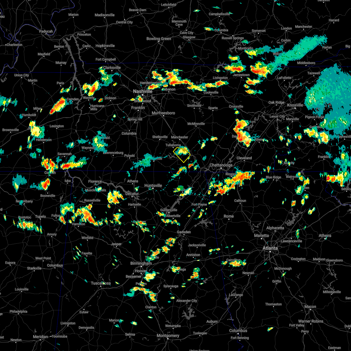 The severe thunderstorm warning for northeastern franklin county will expire at 315 pm cdt, the storm which prompted the warning has weakened below severe limits, and no longer poses an immediate threat to life or property. therefore, the warning will be allowed to expire. The severe thunderstorm warning for northeastern franklin county will expire at 315 pm cdt, the storm which prompted the warning has weakened below severe limits, and no longer poses an immediate threat to life or property. therefore, the warning will be allowed to expire.
|
| 7/26/2021 2:47 PM CDT |
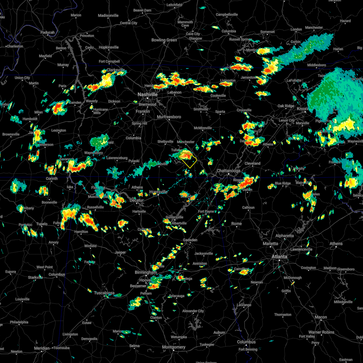 At 247 pm cdt, a severe thunderstorm was located near decherd, or 8 miles northeast of winchester, moving southeast at 10 mph (radar indicated). Hazards include 60 mph wind gusts. expect damage to roofs, siding, and trees At 247 pm cdt, a severe thunderstorm was located near decherd, or 8 miles northeast of winchester, moving southeast at 10 mph (radar indicated). Hazards include 60 mph wind gusts. expect damage to roofs, siding, and trees
|
| 5/6/2021 7:01 PM CDT |
 At 701 pm cdt, severe thunderstorms were located along a line extending from 6 miles north of mcminnville to decherd, moving east at 50 mph (radar indicated). Hazards include 60 mph wind gusts. Expect damage to roofs, siding, and trees. locations impacted include, mcminnville, manchester, monteagle, altamont, morrison, viola, hillsboro, pelham, summitville and arnold afb. This includes interstate 24 between mile markers 107 and 134. At 701 pm cdt, severe thunderstorms were located along a line extending from 6 miles north of mcminnville to decherd, moving east at 50 mph (radar indicated). Hazards include 60 mph wind gusts. Expect damage to roofs, siding, and trees. locations impacted include, mcminnville, manchester, monteagle, altamont, morrison, viola, hillsboro, pelham, summitville and arnold afb. This includes interstate 24 between mile markers 107 and 134.
|
| 5/6/2021 6:56 PM CDT |
 The severe thunderstorm warning for moore, lincoln and western franklin counties will expire at 700 pm cdt, the storms which prompted the warning have moved out of the area. therefore, the warning will be allowed to expire. remember, a severe thunderstorm warning still remains in effect for southeastern lincoln and franklin counties until 730 pm. The severe thunderstorm warning for moore, lincoln and western franklin counties will expire at 700 pm cdt, the storms which prompted the warning have moved out of the area. therefore, the warning will be allowed to expire. remember, a severe thunderstorm warning still remains in effect for southeastern lincoln and franklin counties until 730 pm.
|
| 5/6/2021 6:54 PM CDT | Report of large trees down on davis stree in coffee county TN, 1.1 miles NE of Tullahoma, TN |
| 5/6/2021 6:53 PM CDT |
 At 652 pm cdt, severe thunderstorms were located along a line extending from near estill springs to 6 miles southwest of huntland, moving east at 40 mph (radar indicated). Hazards include 60 mph wind gusts and penny size hail. expect damage to roofs, siding, and trees At 652 pm cdt, severe thunderstorms were located along a line extending from near estill springs to 6 miles southwest of huntland, moving east at 40 mph (radar indicated). Hazards include 60 mph wind gusts and penny size hail. expect damage to roofs, siding, and trees
|
| 5/6/2021 6:48 PM CDT |
 At 648 pm cdt, severe thunderstorms were located along a line extending from 6 miles southeast of woodbury to near tims ford lake, moving east at 50 mph (radar indicated). Hazards include 60 mph wind gusts. Expect damage to roofs, siding, and trees. locations impacted include, mcminnville, manchester, tullahoma, monteagle, altamont, morrison, normandy, viola, beechgrove, summitville, hillsboro, pelham and arnold afb. This includes interstate 24 between mile markers 96 and 134. At 648 pm cdt, severe thunderstorms were located along a line extending from 6 miles southeast of woodbury to near tims ford lake, moving east at 50 mph (radar indicated). Hazards include 60 mph wind gusts. Expect damage to roofs, siding, and trees. locations impacted include, mcminnville, manchester, tullahoma, monteagle, altamont, morrison, normandy, viola, beechgrove, summitville, hillsboro, pelham and arnold afb. This includes interstate 24 between mile markers 96 and 134.
|
| 5/6/2021 6:27 PM CDT |
 At 626 pm cdt, severe thunderstorms were located along a line extending from 10 miles southeast of murfreesboro to near fayetteville, moving east at 50 mph (radar indicated). Hazards include 60 mph wind gusts. expect damage to roofs, siding, and trees At 626 pm cdt, severe thunderstorms were located along a line extending from 10 miles southeast of murfreesboro to near fayetteville, moving east at 50 mph (radar indicated). Hazards include 60 mph wind gusts. expect damage to roofs, siding, and trees
|
| 5/6/2021 6:00 PM CDT |
 At 559 pm cdt, severe thunderstorms were located along a line extending from 11 miles northwest of shelbyville to 13 miles east of lexington, moving east at 35 mph (radar indicated). Hazards include 60 mph wind gusts and penny size hail. expect damage to roofs, siding, and trees At 559 pm cdt, severe thunderstorms were located along a line extending from 11 miles northwest of shelbyville to 13 miles east of lexington, moving east at 35 mph (radar indicated). Hazards include 60 mph wind gusts and penny size hail. expect damage to roofs, siding, and trees
|
| 5/4/2021 8:06 AM CDT |
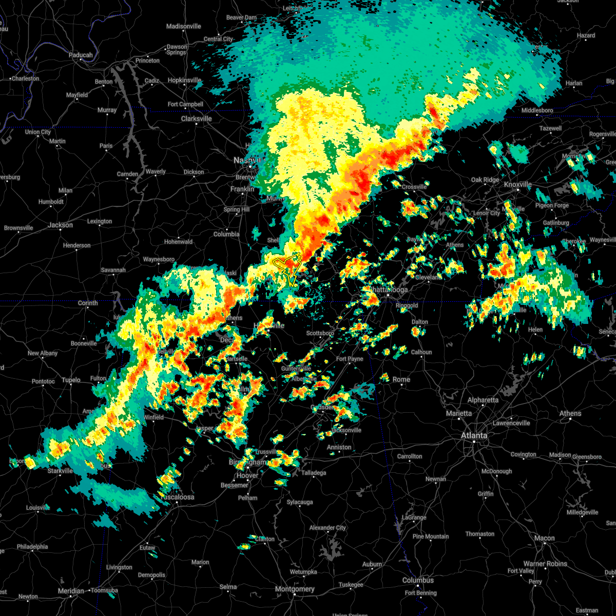 At 806 am cdt, a severe thunderstorm was located near lynchburg, moving east at 50 mph (radar indicated). Hazards include 60 mph wind gusts and quarter size hail. Hail damage to vehicles is expected. expect wind damage to roofs, siding, and trees. Locations impacted include, lynchburg, tims ford lake, hurdlow, lois and marble hill. At 806 am cdt, a severe thunderstorm was located near lynchburg, moving east at 50 mph (radar indicated). Hazards include 60 mph wind gusts and quarter size hail. Hail damage to vehicles is expected. expect wind damage to roofs, siding, and trees. Locations impacted include, lynchburg, tims ford lake, hurdlow, lois and marble hill.
|
| 5/4/2021 7:53 AM CDT |
 At 753 am cdt, severe thunderstorms were located along a line extending from 6 miles southeast of smithville to near tullahoma, moving east at 50 mph (radar indicated). Hazards include 60 mph wind gusts. expect damage to roofs, siding, and trees At 753 am cdt, severe thunderstorms were located along a line extending from 6 miles southeast of smithville to near tullahoma, moving east at 50 mph (radar indicated). Hazards include 60 mph wind gusts. expect damage to roofs, siding, and trees
|
| 5/4/2021 7:51 AM CDT |
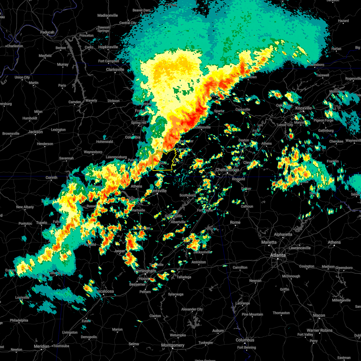 At 751 am cdt, a severe thunderstorm was located near fayetteville, moving east at 50 mph (radar indicated). Hazards include 60 mph wind gusts and quarter size hail. Hail damage to vehicles is expected. expect wind damage to roofs, siding, and trees. Locations impacted include, fayetteville, lynchburg, petersburg, tims ford lake, mulberry, chestnut ridge, howell, belleville, hurdlow and lois. At 751 am cdt, a severe thunderstorm was located near fayetteville, moving east at 50 mph (radar indicated). Hazards include 60 mph wind gusts and quarter size hail. Hail damage to vehicles is expected. expect wind damage to roofs, siding, and trees. Locations impacted include, fayetteville, lynchburg, petersburg, tims ford lake, mulberry, chestnut ridge, howell, belleville, hurdlow and lois.
|
| 5/4/2021 7:38 AM CDT |
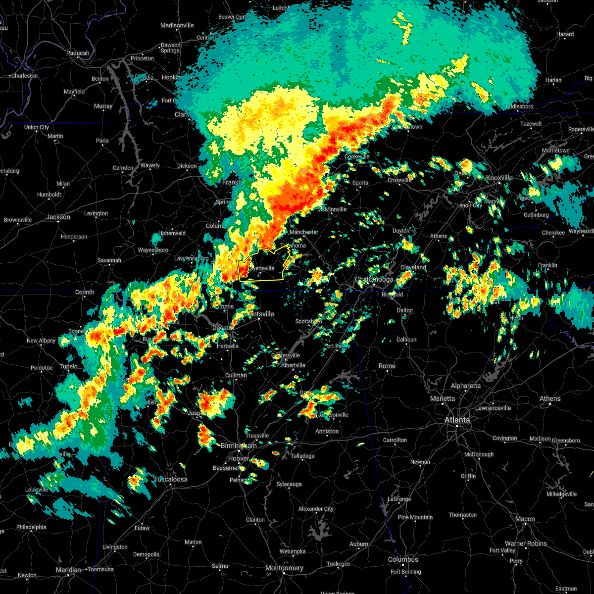 At 738 am cdt, a severe thunderstorm was located near fayetteville, moving east at 50 mph (radar indicated). Hazards include 60 mph wind gusts and quarter size hail. Hail damage to vehicles is expected. Expect wind damage to roofs, siding, and trees. At 738 am cdt, a severe thunderstorm was located near fayetteville, moving east at 50 mph (radar indicated). Hazards include 60 mph wind gusts and quarter size hail. Hail damage to vehicles is expected. Expect wind damage to roofs, siding, and trees.
|
| 5/4/2021 7:35 AM CDT |
 At 735 am cdt, severe thunderstorms were located along a line extending from 6 miles west of woodbury to 6 miles south of shelbyville, moving east at 60 mph (radar indicated). Hazards include 60 mph wind gusts. expect damage to roofs, siding, and trees At 735 am cdt, severe thunderstorms were located along a line extending from 6 miles west of woodbury to 6 miles south of shelbyville, moving east at 60 mph (radar indicated). Hazards include 60 mph wind gusts. expect damage to roofs, siding, and trees
|
| 4/8/2021 9:37 AM CDT |
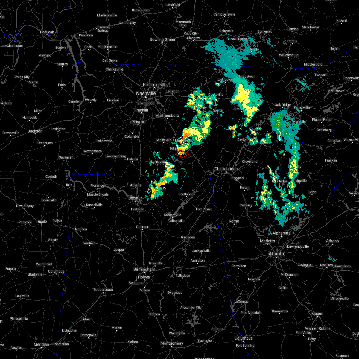 At 937 am cdt, a severe thunderstorm capable of producing a tornado was located near estill springs, or 8 miles north of winchester, moving northeast at 30 mph (radar indicated rotation). Hazards include tornado. Flying debris will be dangerous to those caught without shelter. mobile homes will be damaged or destroyed. damage to roofs, windows, and vehicles will occur. Tree damage is likely. At 937 am cdt, a severe thunderstorm capable of producing a tornado was located near estill springs, or 8 miles north of winchester, moving northeast at 30 mph (radar indicated rotation). Hazards include tornado. Flying debris will be dangerous to those caught without shelter. mobile homes will be damaged or destroyed. damage to roofs, windows, and vehicles will occur. Tree damage is likely.
|
| 5/4/2020 9:35 PM CDT | Tree down cobb hoolow and flippo road. additional trees on grammar hiil road and louis ridge roa in moore county TN, 7.1 miles NE of Tullahoma, TN |
| 5/4/2020 9:14 PM CDT | Tree down across dog tail roa in moore county TN, 11.4 miles ENE of Tullahoma, TN |
| 5/3/2020 5:36 PM CDT |
 At 535 pm cdt, severe thunderstorms were located along a line extending from 7 miles north of sewanee to near new market to near madison, moving southeast at 65 mph. this storm continues to produce widespread wind damage (radar indicated). Hazards include 70 mph wind gusts. Expect considerable tree damage. damage is likely to mobile homes, roofs, and outbuildings. Locations impacted include, huntsville, decatur, madison, athens, scottsboro, winchester, fayetteville, bridgeport, moores mill and meridianville. At 535 pm cdt, severe thunderstorms were located along a line extending from 7 miles north of sewanee to near new market to near madison, moving southeast at 65 mph. this storm continues to produce widespread wind damage (radar indicated). Hazards include 70 mph wind gusts. Expect considerable tree damage. damage is likely to mobile homes, roofs, and outbuildings. Locations impacted include, huntsville, decatur, madison, athens, scottsboro, winchester, fayetteville, bridgeport, moores mill and meridianville.
|
| 5/3/2020 5:34 PM CDT |
 At 534 pm cdt, severe thunderstorms were located along a line extending from 12 miles east of manchester to near monteagle to near huntland, moving southeast at 70 mph (radar indicated). Hazards include 60 mph wind gusts and penny size hail. Expect damage to roofs, siding, and trees. locations impacted include, manchester, tullahoma, gruetli-laager, tracy city, monteagle, altamont, coalmont, morrison, palmer, beersheba springs, viola, summitville, hillsboro, pelham, arnold afb and fiery gizzard state park. This includes interstate 24 between mile markers 108 and 135. At 534 pm cdt, severe thunderstorms were located along a line extending from 12 miles east of manchester to near monteagle to near huntland, moving southeast at 70 mph (radar indicated). Hazards include 60 mph wind gusts and penny size hail. Expect damage to roofs, siding, and trees. locations impacted include, manchester, tullahoma, gruetli-laager, tracy city, monteagle, altamont, coalmont, morrison, palmer, beersheba springs, viola, summitville, hillsboro, pelham, arnold afb and fiery gizzard state park. This includes interstate 24 between mile markers 108 and 135.
|
| 5/3/2020 5:23 PM CDT |
 At 522 pm cdt, severe thunderstorms were located along a line extending from near tullahoma to hazel green to near athens, moving southeast at 65 mph. this storm has a history of producing wind damage, most recently in northern limestone and madison county (radar indicated). Hazards include 70 mph wind gusts. Expect considerable tree damage. damage is likely to mobile homes, roofs, and outbuildings. Locations impacted include, huntsville, decatur, madison, athens, scottsboro, winchester, fayetteville, bridgeport, moores mill and meridianville. At 522 pm cdt, severe thunderstorms were located along a line extending from near tullahoma to hazel green to near athens, moving southeast at 65 mph. this storm has a history of producing wind damage, most recently in northern limestone and madison county (radar indicated). Hazards include 70 mph wind gusts. Expect considerable tree damage. damage is likely to mobile homes, roofs, and outbuildings. Locations impacted include, huntsville, decatur, madison, athens, scottsboro, winchester, fayetteville, bridgeport, moores mill and meridianville.
|
| 5/3/2020 5:18 PM CDT | Widespread trees and power outages reported in the county. the most widespread damage was in northern franklin county. roof damage reported at a residence on highway 12 in franklin county TN, 8.5 miles NNE of Tullahoma, TN |
| 5/3/2020 5:17 PM CDT | Multiple trees down in tullahoma in coffee county TN, 1.1 miles NE of Tullahoma, TN |
| 5/3/2020 5:13 PM CDT |
 At 512 pm cdt, severe thunderstorms were located along a line extending from near tullahoma to near ardmore to 7 miles east of rogersville, moving southeast at 65 mph (radar indicated. this storm has a history of producing wind damage). Hazards include 60 mph wind gusts and penny size hail. expect damage to roofs, siding, and trees At 512 pm cdt, severe thunderstorms were located along a line extending from near tullahoma to near ardmore to 7 miles east of rogersville, moving southeast at 65 mph (radar indicated. this storm has a history of producing wind damage). Hazards include 60 mph wind gusts and penny size hail. expect damage to roofs, siding, and trees
|
| 5/3/2020 5:07 PM CDT |
 At 506 pm cdt, severe thunderstorms were located along a line extending from shelbyville to near ardmore to near leighton, moving southeast at 65 mph. this storm has a history producing wind damage in eastern lauderdale county (radar indicated). Hazards include 60 mph wind gusts and quarter size hail. Hail damage to vehicles is expected. expect wind damage to roofs, siding, and trees. Locations impacted include, northwestern huntsville, decatur, madison, florence, athens, winchester, fayetteville, moores mill, meridianville and lynchburg. At 506 pm cdt, severe thunderstorms were located along a line extending from shelbyville to near ardmore to near leighton, moving southeast at 65 mph. this storm has a history producing wind damage in eastern lauderdale county (radar indicated). Hazards include 60 mph wind gusts and quarter size hail. Hail damage to vehicles is expected. expect wind damage to roofs, siding, and trees. Locations impacted include, northwestern huntsville, decatur, madison, florence, athens, winchester, fayetteville, moores mill, meridianville and lynchburg.
|
| 5/3/2020 5:06 PM CDT |
 At 506 pm cdt, severe thunderstorms were located along a line extending from 10 miles south of murfreesboro to near shelbyville to 9 miles west of fayetteville, moving southeast at 70 mph (radar indicated). Hazards include 70 mph wind gusts and penny size hail. Expect considerable tree damage. Damage is likely to mobile homes, roofs, and outbuildings. At 506 pm cdt, severe thunderstorms were located along a line extending from 10 miles south of murfreesboro to near shelbyville to 9 miles west of fayetteville, moving southeast at 70 mph (radar indicated). Hazards include 70 mph wind gusts and penny size hail. Expect considerable tree damage. Damage is likely to mobile homes, roofs, and outbuildings.
|
| 5/3/2020 4:30 PM CDT |
 At 430 pm cdt, severe thunderstorms were located along a line extending from near spring hill to 6 miles west of lawrenceburg to near walnut grove, moving southeast at 65 mph (radar indicated). Hazards include 60 mph wind gusts and quarter size hail. Hail damage to vehicles is expected. Expect wind damage to roofs, siding, and trees. At 430 pm cdt, severe thunderstorms were located along a line extending from near spring hill to 6 miles west of lawrenceburg to near walnut grove, moving southeast at 65 mph (radar indicated). Hazards include 60 mph wind gusts and quarter size hail. Hail damage to vehicles is expected. Expect wind damage to roofs, siding, and trees.
|
| 3/29/2020 3:06 AM CDT |
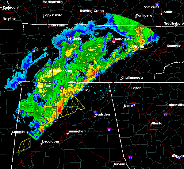 The severe thunderstorm warning for moore, central lincoln and northern franklin counties will expire at 315 am cdt, the storm which prompted the warning has moved out of the area. therefore, the warning will be allowed to expire. however gusty winds are still possible with this thunderstorm. a tornado watch remains in effect until 500 am cdt for north central and northeastern alabama, and middle tennessee. The severe thunderstorm warning for moore, central lincoln and northern franklin counties will expire at 315 am cdt, the storm which prompted the warning has moved out of the area. therefore, the warning will be allowed to expire. however gusty winds are still possible with this thunderstorm. a tornado watch remains in effect until 500 am cdt for north central and northeastern alabama, and middle tennessee.
|
| 3/29/2020 2:42 AM CDT |
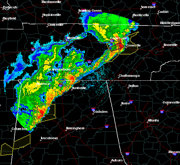 At 242 am cdt, a severe thunderstorm was located near fayetteville, moving northeast at 65 mph (radar indicated). Hazards include 60 mph wind gusts and quarter size hail. Hail damage to vehicles is expected. Expect wind damage to roofs, siding, and trees. At 242 am cdt, a severe thunderstorm was located near fayetteville, moving northeast at 65 mph (radar indicated). Hazards include 60 mph wind gusts and quarter size hail. Hail damage to vehicles is expected. Expect wind damage to roofs, siding, and trees.
|
| 3/29/2020 2:11 AM CDT |
 The severe thunderstorm warning for western warren, coffee and cannon counties will expire at 215 am cdt, the storms which prompted the warning have moved out of the area. therefore, the warning will be allowed to expire. a tornado watch remains in effect until 400 am cdt for middle tennessee. The severe thunderstorm warning for western warren, coffee and cannon counties will expire at 215 am cdt, the storms which prompted the warning have moved out of the area. therefore, the warning will be allowed to expire. a tornado watch remains in effect until 400 am cdt for middle tennessee.
|
| 3/29/2020 1:59 AM CDT |
 A severe thunderstorm warning remains in effect until 215 am cdt for western warren. coffee and cannon counties. at 159 am cdt, severe thunderstorms were located along a line extending from near woodbury to manchester, moving east at 80 mph. hazard. 70 mph wind gusts. source. Radar indicated. A severe thunderstorm warning remains in effect until 215 am cdt for western warren. coffee and cannon counties. at 159 am cdt, severe thunderstorms were located along a line extending from near woodbury to manchester, moving east at 80 mph. hazard. 70 mph wind gusts. source. Radar indicated.
|
| 3/29/2020 1:56 AM CDT |
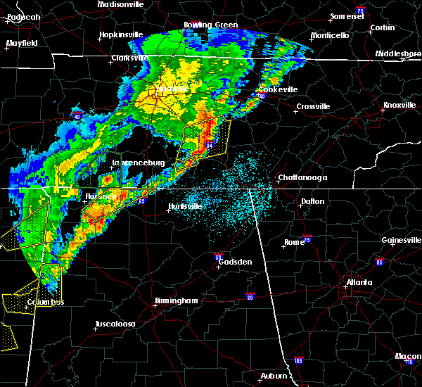 The severe thunderstorm warning for moore and northeastern lincoln counties will expire at 200 am cdt, the storm which prompted the warning has weakened below severe limits. therefore, the warning will be allowed to expire. a tornado watch remains in effect until 400 am cdt for north central alabama, and middle tennessee. The severe thunderstorm warning for moore and northeastern lincoln counties will expire at 200 am cdt, the storm which prompted the warning has weakened below severe limits. therefore, the warning will be allowed to expire. a tornado watch remains in effect until 400 am cdt for north central alabama, and middle tennessee.
|
| 3/29/2020 1:55 AM CDT | Two trees down completely blocking five points road. time estimated from rada in moore county TN, 5.9 miles ENE of Tullahoma, TN |
| 3/29/2020 1:50 AM CDT |
 At 149 am cdt, a severe thunderstorm was located 7 miles west of tullahoma, or 8 miles north of lynchburg, moving northeast at 70 mph (radar indicated). Hazards include 60 mph wind gusts and quarter size hail. Hail damage to vehicles is expected. expect wind damage to roofs, siding, and trees. Locations impacted include, lynchburg, mimosa and booneville. At 149 am cdt, a severe thunderstorm was located 7 miles west of tullahoma, or 8 miles north of lynchburg, moving northeast at 70 mph (radar indicated). Hazards include 60 mph wind gusts and quarter size hail. Hail damage to vehicles is expected. expect wind damage to roofs, siding, and trees. Locations impacted include, lynchburg, mimosa and booneville.
|
| 3/29/2020 1:46 AM CDT |
 At 145 am cdt, severe thunderstorms were located along a line extending from 10 miles southeast of murfreesboro to 7 miles northwest of lynchburg, moving northeast at 70 mph (radar indicated). Hazards include 60 mph wind gusts. Expect damage to roofs, siding, and trees. locations impacted include, shelbyville, manchester, woodbury, tullahoma, morrison, wartrace, bell buckle, centertown, normandy, christiana, beechgrove, raus, fosterville, summitville, deason, bradyville and readyville. This includes interstate 24 between mile markers 85 and 117. At 145 am cdt, severe thunderstorms were located along a line extending from 10 miles southeast of murfreesboro to 7 miles northwest of lynchburg, moving northeast at 70 mph (radar indicated). Hazards include 60 mph wind gusts. Expect damage to roofs, siding, and trees. locations impacted include, shelbyville, manchester, woodbury, tullahoma, morrison, wartrace, bell buckle, centertown, normandy, christiana, beechgrove, raus, fosterville, summitville, deason, bradyville and readyville. This includes interstate 24 between mile markers 85 and 117.
|
| 3/29/2020 1:33 AM CDT |
 At 132 am cdt, a severe thunderstorm was located near petersburg, or 10 miles northwest of fayetteville, moving northeast at 70 mph (radar indicated). Hazards include 60 mph wind gusts and quarter size hail. Hail damage to vehicles is expected. Expect wind damage to roofs, siding, and trees. At 132 am cdt, a severe thunderstorm was located near petersburg, or 10 miles northwest of fayetteville, moving northeast at 70 mph (radar indicated). Hazards include 60 mph wind gusts and quarter size hail. Hail damage to vehicles is expected. Expect wind damage to roofs, siding, and trees.
|
| 3/29/2020 1:32 AM CDT |
 At 132 am cdt, severe thunderstorms were located along a line extending from 11 miles north of shelbyville to near petersburg, moving northeast at 70 mph (radar indicated). Hazards include 60 mph wind gusts. expect damage to roofs, siding, and trees At 132 am cdt, severe thunderstorms were located along a line extending from 11 miles north of shelbyville to near petersburg, moving northeast at 70 mph (radar indicated). Hazards include 60 mph wind gusts. expect damage to roofs, siding, and trees
|
| 3/24/2020 7:02 PM CDT |
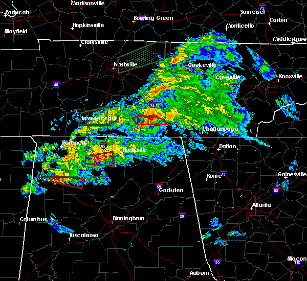 At 702 pm cdt, a severe thunderstorm capable of producing a tornado was located over winchester, moving east at 45 mph (radar indicated rotation). Hazards include tornado and quarter size hail. Flying debris will be dangerous to those caught without shelter. mobile homes will be damaged or destroyed. damage to roofs, windows, and vehicles will occur. tree damage is likely. locations impacted include, winchester, decherd, estill springs, sewanee, tims ford lake, woods reservoir, arnold afb, alto and st. Andrews. At 702 pm cdt, a severe thunderstorm capable of producing a tornado was located over winchester, moving east at 45 mph (radar indicated rotation). Hazards include tornado and quarter size hail. Flying debris will be dangerous to those caught without shelter. mobile homes will be damaged or destroyed. damage to roofs, windows, and vehicles will occur. tree damage is likely. locations impacted include, winchester, decherd, estill springs, sewanee, tims ford lake, woods reservoir, arnold afb, alto and st. Andrews.
|
| 3/24/2020 6:45 PM CDT |
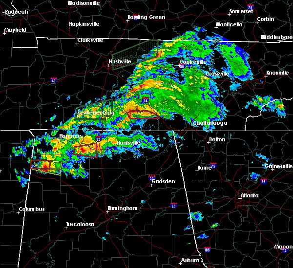 At 645 pm cdt, a severe thunderstorm capable of producing a tornado was located over lynchburg, moving east at 45 mph (radar indicated rotation). Hazards include tornado and quarter size hail. Flying debris will be dangerous to those caught without shelter. mobile homes will be damaged or destroyed. damage to roofs, windows, and vehicles will occur. Tree damage is likely. At 645 pm cdt, a severe thunderstorm capable of producing a tornado was located over lynchburg, moving east at 45 mph (radar indicated rotation). Hazards include tornado and quarter size hail. Flying debris will be dangerous to those caught without shelter. mobile homes will be damaged or destroyed. damage to roofs, windows, and vehicles will occur. Tree damage is likely.
|
| 2/12/2020 6:36 PM CST | Reports of several trees down in southern coffee county...specifically east lincoln stree in coffee county TN, 1.1 miles NE of Tullahoma, TN |
| 2/12/2020 6:32 PM CST | Tree down near turkey creek and hermitage drive in tullahoma in coffee county TN, 2 miles NE of Tullahoma, TN |
| 2/12/2020 6:30 PM CST |
 At 629 pm cst, severe thunderstorms were located along a line extending from near tullahoma to 6 miles northwest of new market, moving east at 60 mph (radar indicated). Hazards include 60 mph wind gusts and penny size hail. expect damage to roofs, siding, and trees At 629 pm cst, severe thunderstorms were located along a line extending from near tullahoma to 6 miles northwest of new market, moving east at 60 mph (radar indicated). Hazards include 60 mph wind gusts and penny size hail. expect damage to roofs, siding, and trees
|
| 2/5/2020 7:10 PM CST |
 The severe thunderstorm warning for moore, lincoln and western franklin counties will expire at 715 pm cst, the storms which prompted the warning have weakened below severe limits, and no longer pose an immediate threat to life or property. therefore, the warning will be allowed to expire. however gusty winds are still possible with these thunderstorms. a tornado watch remains in effect until 1100 pm cst for north central and northeastern alabama, and middle tennessee. The severe thunderstorm warning for moore, lincoln and western franklin counties will expire at 715 pm cst, the storms which prompted the warning have weakened below severe limits, and no longer pose an immediate threat to life or property. therefore, the warning will be allowed to expire. however gusty winds are still possible with these thunderstorms. a tornado watch remains in effect until 1100 pm cst for north central and northeastern alabama, and middle tennessee.
|
| 2/5/2020 7:00 PM CST |
 At 700 pm cst, severe thunderstorms were located along a line extending from 8 miles northeast of shelbyville to 8 miles northwest of hazel green, moving east at 50 mph (radar indicated). Hazards include 60 mph wind gusts and a possible tornado. Expect damage to roofs, siding, and trees. Locations impacted include, fayetteville, lynchburg, estill springs, ardmore, huntland, tims ford lake, lincoln, howell, elora and hurdlow. At 700 pm cst, severe thunderstorms were located along a line extending from 8 miles northeast of shelbyville to 8 miles northwest of hazel green, moving east at 50 mph (radar indicated). Hazards include 60 mph wind gusts and a possible tornado. Expect damage to roofs, siding, and trees. Locations impacted include, fayetteville, lynchburg, estill springs, ardmore, huntland, tims ford lake, lincoln, howell, elora and hurdlow.
|
| 2/5/2020 6:29 PM CST |
 At 628 pm cst, severe thunderstorms were located along a line extending from near lewisburg to 12 miles west of ardmore, moving northeast at 65 mph. at 615 pm cst, wind damage to multiple structures was reported around lawrenceburg (radar indicated). Hazards include 60 mph wind gusts. expect damage to roofs, siding, and trees At 628 pm cst, severe thunderstorms were located along a line extending from near lewisburg to 12 miles west of ardmore, moving northeast at 65 mph. at 615 pm cst, wind damage to multiple structures was reported around lawrenceburg (radar indicated). Hazards include 60 mph wind gusts. expect damage to roofs, siding, and trees
|
| 12/16/2019 6:32 PM CST |
 At 632 pm cst, severe thunderstorms were located along a line extending from near manchester to 10 miles south of cowan to near skyline, moving northeast at 70 mph (radar indicated). Hazards include 60 mph wind gusts. Expect damage to roofs, siding, and trees. Locations impacted include, scottsboro, winchester, lynchburg, decherd, estill springs, cowan, hollywood, huntland, skyline and woodville. At 632 pm cst, severe thunderstorms were located along a line extending from near manchester to 10 miles south of cowan to near skyline, moving northeast at 70 mph (radar indicated). Hazards include 60 mph wind gusts. Expect damage to roofs, siding, and trees. Locations impacted include, scottsboro, winchester, lynchburg, decherd, estill springs, cowan, hollywood, huntland, skyline and woodville.
|
| 12/16/2019 6:18 PM CST | Trees down on hurricane creek roa in moore county TN, 8.6 miles NE of Tullahoma, TN |
| 12/16/2019 6:03 PM CST |
 At 602 pm cst, severe thunderstorms were located along a line extending from near petersburg to huntsville to triana, moving northeast at 70 mph. wind gusts of 60 to 70 mph have been measured (radar indicated). Hazards include 70 mph wind gusts and quarter size hail. Hail damage to vehicles is expected. expect considerable tree damage. Wind damage is also likely to mobile homes, roofs, and outbuildings. At 602 pm cst, severe thunderstorms were located along a line extending from near petersburg to huntsville to triana, moving northeast at 70 mph. wind gusts of 60 to 70 mph have been measured (radar indicated). Hazards include 70 mph wind gusts and quarter size hail. Hail damage to vehicles is expected. expect considerable tree damage. Wind damage is also likely to mobile homes, roofs, and outbuildings.
|
| 9/10/2019 6:07 PM CDT |
 The severe thunderstorm warning for moore county will expire at 615 pm cdt, the storm which prompted the warning has weakened below severe limits, and no longer poses an immediate threat to life or property. therefore, the warning will be allowed to expire. however heavy rain is still possible with this thunderstorm. The severe thunderstorm warning for moore county will expire at 615 pm cdt, the storm which prompted the warning has weakened below severe limits, and no longer poses an immediate threat to life or property. therefore, the warning will be allowed to expire. however heavy rain is still possible with this thunderstorm.
|
| 9/10/2019 5:44 PM CDT |
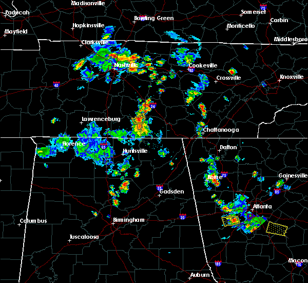 The national weather service in huntsville alabama has issued a * severe thunderstorm warning for. moore county in middle tennessee. until 615 pm cdt. At 543 pm cdt, a severe thunderstorm was located over lynchburg, moving north at 10 mph. The national weather service in huntsville alabama has issued a * severe thunderstorm warning for. moore county in middle tennessee. until 615 pm cdt. At 543 pm cdt, a severe thunderstorm was located over lynchburg, moving north at 10 mph.
|
| 9/10/2019 5:43 PM CDT | Trees were knocked down on cumberland springs road. time estimated by rada in moore county TN, 5.9 miles ENE of Tullahoma, TN |
| 9/10/2019 5:43 PM CDT | A tree was down on wiggins avenu in moore county TN, 11.6 miles ENE of Tullahoma, TN |
| 9/10/2019 5:41 PM CDT | Trees were knocked down on finney and county line roads. time estimated by rada in moore county TN, 9.5 miles ENE of Tullahoma, TN |
| 9/10/2019 5:36 PM CDT | A tree was knocked down on wiggins road. time estimated by rada in moore county TN, 11.6 miles ENE of Tullahoma, TN |
| 9/10/2019 5:33 PM CDT | Several reports of trees being knocked down throughout moore county were received. some of these were blocking roads. time estimated by radar... but may need adjustment in moore county TN, 12.8 miles NE of Tullahoma, TN |
| 9/10/2019 5:20 PM CDT | Trees were knocked down on harry hill road... pleasant hill road... and griffin road. time estimated by rada in moore county TN, 9.8 miles NE of Tullahoma, TN |
| 8/13/2019 7:01 PM CDT |
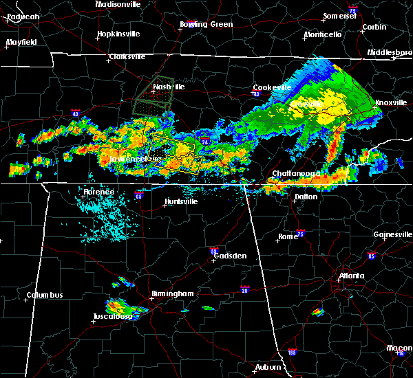 At 650 pm cdt, a severe thunderstorm was located near lynchburg, moving east at 25 mph (radar indicated). Hazards include 70 mph wind gusts. Expect considerable tree damage. damage is likely to mobile homes, roofs, and outbuildings. Locations impacted include, lynchburg, petersburg, tims ford lake, lexie crossroads, mulberry, chestnut ridge, howell, harmony, belleville and hurdlow. At 650 pm cdt, a severe thunderstorm was located near lynchburg, moving east at 25 mph (radar indicated). Hazards include 70 mph wind gusts. Expect considerable tree damage. damage is likely to mobile homes, roofs, and outbuildings. Locations impacted include, lynchburg, petersburg, tims ford lake, lexie crossroads, mulberry, chestnut ridge, howell, harmony, belleville and hurdlow.
|
| 8/13/2019 6:55 PM CDT | Tree down on hwy 55 near motlow state community college. time estimated from rada in moore county TN, 5.4 miles ENE of Tullahoma, TN |
| 8/13/2019 6:51 PM CDT |
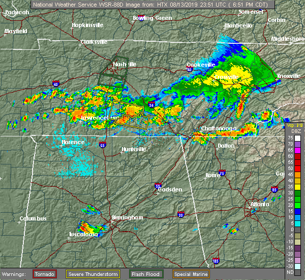 At 650 pm cdt, a severe thunderstorm was located near lynchburg, moving east at 25 mph (radar indicated). Hazards include 70 mph wind gusts. Expect considerable tree damage. damage is likely to mobile homes, roofs, and outbuildings. Locations impacted include, lynchburg, petersburg, tims ford lake, lexie crossroads, mulberry, chestnut ridge, howell, harmony, belleville and hurdlow. At 650 pm cdt, a severe thunderstorm was located near lynchburg, moving east at 25 mph (radar indicated). Hazards include 70 mph wind gusts. Expect considerable tree damage. damage is likely to mobile homes, roofs, and outbuildings. Locations impacted include, lynchburg, petersburg, tims ford lake, lexie crossroads, mulberry, chestnut ridge, howell, harmony, belleville and hurdlow.
|
| 8/13/2019 6:37 PM CDT |
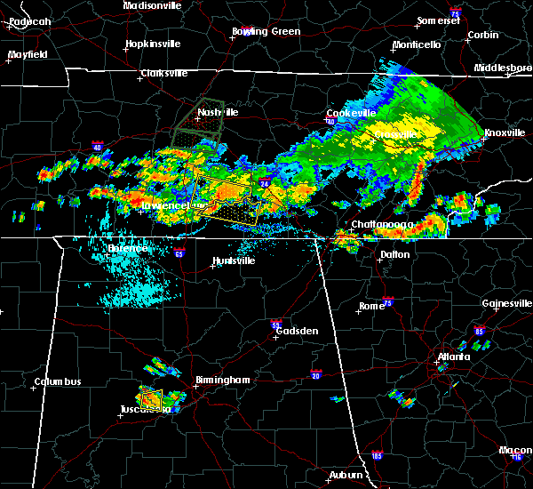 At 636 pm cdt, a severe thunderstorm was located near petersburg, or 12 miles north of fayetteville, moving east at 25 mph (radar indicated). Hazards include 60 mph wind gusts. expect damage to roofs, siding, and trees At 636 pm cdt, a severe thunderstorm was located near petersburg, or 12 miles north of fayetteville, moving east at 25 mph (radar indicated). Hazards include 60 mph wind gusts. expect damage to roofs, siding, and trees
|
| 8/7/2019 1:58 PM CDT |
 At 158 pm cdt, a severe thunderstorm was located near lynchburg, moving southeast at 15 mph (radar indicated). Hazards include 60 mph wind gusts and quarter size hail. Hail damage to vehicles is expected. expect wind damage to roofs, siding, and trees. Locations impacted include, lynchburg, tims ford lake, mulberry, lois and booneville. At 158 pm cdt, a severe thunderstorm was located near lynchburg, moving southeast at 15 mph (radar indicated). Hazards include 60 mph wind gusts and quarter size hail. Hail damage to vehicles is expected. expect wind damage to roofs, siding, and trees. Locations impacted include, lynchburg, tims ford lake, mulberry, lois and booneville.
|
| 8/7/2019 1:42 PM CDT |
 At 142 pm cdt, a severe thunderstorm was located 7 miles east of petersburg, moving southeast at 15 mph (radar indicated). Hazards include 60 mph wind gusts and quarter size hail. Hail damage to vehicles is expected. Expect wind damage to roofs, siding, and trees. At 142 pm cdt, a severe thunderstorm was located 7 miles east of petersburg, moving southeast at 15 mph (radar indicated). Hazards include 60 mph wind gusts and quarter size hail. Hail damage to vehicles is expected. Expect wind damage to roofs, siding, and trees.
|
| 8/6/2019 9:56 PM CDT |
 At 956 pm cdt, severe thunderstorms were located along a line extending from 6 miles northeast of manchester to petersburg, moving southeast at 35 mph (radar indicated). Hazards include 60 mph wind gusts. Expect damage to roofs, siding, and trees. locations impacted include, shelbyville, lewisburg, manchester, tullahoma, chapel hill, wartrace, bell buckle, normandy, beechgrove, raus, rover, belfast, deason, hillsboro, farmington and unionville. This includes interstate 24 between mile markers 97 and 127. At 956 pm cdt, severe thunderstorms were located along a line extending from 6 miles northeast of manchester to petersburg, moving southeast at 35 mph (radar indicated). Hazards include 60 mph wind gusts. Expect damage to roofs, siding, and trees. locations impacted include, shelbyville, lewisburg, manchester, tullahoma, chapel hill, wartrace, bell buckle, normandy, beechgrove, raus, rover, belfast, deason, hillsboro, farmington and unionville. This includes interstate 24 between mile markers 97 and 127.
|
| 8/6/2019 9:43 PM CDT |
 The national weather service in nashville has issued a * severe thunderstorm warning for. marshall county in middle tennessee. southern rutherford county in middle tennessee. coffee county in middle tennessee. Bedford county in middle tennessee. The national weather service in nashville has issued a * severe thunderstorm warning for. marshall county in middle tennessee. southern rutherford county in middle tennessee. coffee county in middle tennessee. Bedford county in middle tennessee.
|
| 6/21/2019 9:31 PM CDT |
 At 931 pm cdt, severe thunderstorms were located along a line extending from gruetli-laager to near hazel green, moving east at 50 mph (radar indicated). Hazards include 70 mph wind gusts. Expect considerable tree damage. damage is likely to mobile homes, roofs, and outbuildings. Locations impacted include, northern huntsville, winchester, fayetteville, moores mill, meridianville, lynchburg, hazel green, decherd, estill springs and cowan. At 931 pm cdt, severe thunderstorms were located along a line extending from gruetli-laager to near hazel green, moving east at 50 mph (radar indicated). Hazards include 70 mph wind gusts. Expect considerable tree damage. damage is likely to mobile homes, roofs, and outbuildings. Locations impacted include, northern huntsville, winchester, fayetteville, moores mill, meridianville, lynchburg, hazel green, decherd, estill springs and cowan.
|
| 6/21/2019 9:22 PM CDT | Trees have been knocked down at multiple locations in moore count in moore county TN, 11.1 miles NE of Tullahoma, TN |
| 6/21/2019 9:13 PM CDT |
 At 912 pm cdt, severe thunderstorms were located along a line extending from 9 miles east of manchester to near ardmore, moving east at 40 mph (radar indicated). Hazards include 60 mph wind gusts and penny size hail. expect damage to roofs, siding, and trees At 912 pm cdt, severe thunderstorms were located along a line extending from 9 miles east of manchester to near ardmore, moving east at 40 mph (radar indicated). Hazards include 60 mph wind gusts and penny size hail. expect damage to roofs, siding, and trees
|
| 6/21/2019 9:12 PM CDT |
 At 912 pm cdt, severe thunderstorms were located along a line extending from 6 miles northeast of mcminnville to 11 miles northeast of manchester to tullahoma, moving southeast at 45 mph (radar indicated). Hazards include 70 mph wind gusts and nickel size hail. Expect considerable tree damage. Damage is likely to mobile homes, roofs, and outbuildings. At 912 pm cdt, severe thunderstorms were located along a line extending from 6 miles northeast of mcminnville to 11 miles northeast of manchester to tullahoma, moving southeast at 45 mph (radar indicated). Hazards include 70 mph wind gusts and nickel size hail. Expect considerable tree damage. Damage is likely to mobile homes, roofs, and outbuildings.
|
| 6/21/2019 9:09 PM CDT | Trees down in tullahoma and across northern coffee count in coffee county TN, 1.1 miles NE of Tullahoma, TN |
| 6/21/2019 9:02 PM CDT |
 At 902 pm cdt, severe thunderstorms were located along a line extending from 9 miles southeast of woodbury to near shelbyville, moving southeast at 45 mph (radar indicated). Hazards include 70 mph wind gusts and penny size hail. Expect considerable tree damage. damage is likely to mobile homes, roofs, and outbuildings. locations impacted include, shelbyville, manchester, tullahoma, morrison, wartrace, bell buckle, normandy, christiana, beechgrove, raus, fosterville, summitville, deason, bradyville and unionville. This includes interstate 24 between mile markers 82 and 112. At 902 pm cdt, severe thunderstorms were located along a line extending from 9 miles southeast of woodbury to near shelbyville, moving southeast at 45 mph (radar indicated). Hazards include 70 mph wind gusts and penny size hail. Expect considerable tree damage. damage is likely to mobile homes, roofs, and outbuildings. locations impacted include, shelbyville, manchester, tullahoma, morrison, wartrace, bell buckle, normandy, christiana, beechgrove, raus, fosterville, summitville, deason, bradyville and unionville. This includes interstate 24 between mile markers 82 and 112.
|
| 6/21/2019 8:59 PM CDT |
 At 859 pm cdt, severe thunderstorms were located along a line extending from 6 miles east of shelbyville to 8 miles west of pulaski, moving southeast at 35 mph (radar indicated). Hazards include 60 mph wind gusts and penny sized hail. Expect damage to roofs, siding, and trees. Locations impacted include, winchester, fayetteville, lynchburg, decherd, estill springs, ardmore, petersburg, tims ford lake, howell and hurdlow. At 859 pm cdt, severe thunderstorms were located along a line extending from 6 miles east of shelbyville to 8 miles west of pulaski, moving southeast at 35 mph (radar indicated). Hazards include 60 mph wind gusts and penny sized hail. Expect damage to roofs, siding, and trees. Locations impacted include, winchester, fayetteville, lynchburg, decherd, estill springs, ardmore, petersburg, tims ford lake, howell and hurdlow.
|
| 6/21/2019 8:41 PM CDT |
 At 841 pm cdt, severe thunderstorms were located along a line extending from woodbury to lewisburg, moving southeast at 45 mph (radar indicated). Hazards include 70 mph wind gusts and penny size hail. Expect considerable tree damage. Damage is likely to mobile homes, roofs, and outbuildings. At 841 pm cdt, severe thunderstorms were located along a line extending from woodbury to lewisburg, moving southeast at 45 mph (radar indicated). Hazards include 70 mph wind gusts and penny size hail. Expect considerable tree damage. Damage is likely to mobile homes, roofs, and outbuildings.
|
| 6/21/2019 8:38 PM CDT |
 At 837 pm cdt, severe thunderstorms were located along a line extending from 7 miles northwest of shelbyville to near lawrenceburg, moving southeast at 35 mph (radar indicated). Hazards include 60 mph wind gusts and penny size hail. expect damage to roofs, siding, and trees At 837 pm cdt, severe thunderstorms were located along a line extending from 7 miles northwest of shelbyville to near lawrenceburg, moving southeast at 35 mph (radar indicated). Hazards include 60 mph wind gusts and penny size hail. expect damage to roofs, siding, and trees
|
| 6/20/2019 4:23 AM CDT |
 At 422 am cdt, severe thunderstorms were located along a line extending from near manchester to 6 miles northeast of little river falls, moving northeast at 60 mph (radar indicated). Hazards include 60 mph wind gusts. Expect damage to roofs, siding, and trees. Locations impacted include, scottsboro, winchester, rainsville, bridgeport, decherd, henagar, estill springs, stevenson, sylvania and cowan. At 422 am cdt, severe thunderstorms were located along a line extending from near manchester to 6 miles northeast of little river falls, moving northeast at 60 mph (radar indicated). Hazards include 60 mph wind gusts. Expect damage to roofs, siding, and trees. Locations impacted include, scottsboro, winchester, rainsville, bridgeport, decherd, henagar, estill springs, stevenson, sylvania and cowan.
|
| 6/20/2019 4:08 AM CDT |
 At 408 am cdt, severe thunderstorms were located along a line extending from tullahoma to near little river canyon national preserve, moving northeast at 60 mph (radar indicated). Hazards include 60 mph wind gusts. expect damage to roofs, siding, and trees At 408 am cdt, severe thunderstorms were located along a line extending from tullahoma to near little river canyon national preserve, moving northeast at 60 mph (radar indicated). Hazards include 60 mph wind gusts. expect damage to roofs, siding, and trees
|
| 6/20/2019 4:00 AM CDT | Multiple trees down across the county and power outages reporte in moore county TN, 11.5 miles NE of Tullahoma, TN |
| 6/20/2019 3:30 AM CDT |
 At 329 am cdt, a severe thunderstorm was located 7 miles north of hazel green, or 7 miles south of fayetteville, moving northeast at 45 mph (radar indicated). Hazards include 60 mph wind gusts. expect damage to roofs, siding, and trees At 329 am cdt, a severe thunderstorm was located 7 miles north of hazel green, or 7 miles south of fayetteville, moving northeast at 45 mph (radar indicated). Hazards include 60 mph wind gusts. expect damage to roofs, siding, and trees
|
| 5/9/2019 1:25 PM CDT |
 The severe thunderstorm warning for northwestern jackson. eastern madison. moore. eastern lincoln and western franklin counties will expire at 130 pm cdt. the storms which prompted the warning have moved out of the area. Therefore, the warning will be allowed to expire. The severe thunderstorm warning for northwestern jackson. eastern madison. moore. eastern lincoln and western franklin counties will expire at 130 pm cdt. the storms which prompted the warning have moved out of the area. Therefore, the warning will be allowed to expire.
|
| 5/9/2019 1:24 PM CDT |
 The national weather service in huntsville alabama has issued a * severe thunderstorm warning for. jackson county in northeastern alabama. franklin county in middle tennessee. until 200 pm cdt. At 124 pm cdt, severe thunderstorms were located along a line. The national weather service in huntsville alabama has issued a * severe thunderstorm warning for. jackson county in northeastern alabama. franklin county in middle tennessee. until 200 pm cdt. At 124 pm cdt, severe thunderstorms were located along a line.
|
| 5/9/2019 1:15 PM CDT |
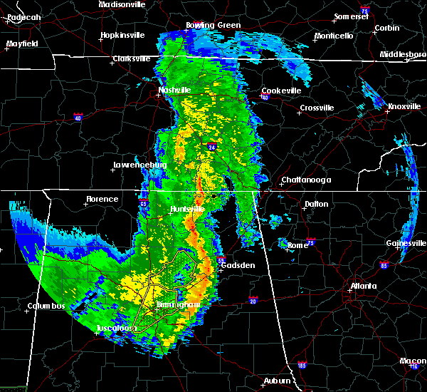 A tornado warning remains in effect until 130 pm cdt for moore. east central lincoln and northwestern franklin counties. at 115 pm cdt, a severe thunderstorm capable of producing a tornado was located near lynchburg, moving northeast at 25 mph. hazard. tornado. source. Radar indicated rotation. A tornado warning remains in effect until 130 pm cdt for moore. east central lincoln and northwestern franklin counties. at 115 pm cdt, a severe thunderstorm capable of producing a tornado was located near lynchburg, moving northeast at 25 mph. hazard. tornado. source. Radar indicated rotation.
|
| 5/9/2019 1:11 PM CDT |
 A severe thunderstorm warning remains in effect until 130 pm cdt for northwestern jackson. eastern madison. moore. eastern lincoln and western franklin counties. at 110 pm cdt, severe thunderstorms were located along a line extending from 8 miles east of petersburg to near gurley, moving northeast at 35 mph. This line has a history of producing damage. A severe thunderstorm warning remains in effect until 130 pm cdt for northwestern jackson. eastern madison. moore. eastern lincoln and western franklin counties. at 110 pm cdt, severe thunderstorms were located along a line extending from 8 miles east of petersburg to near gurley, moving northeast at 35 mph. This line has a history of producing damage.
|
| 5/9/2019 1:07 PM CDT |
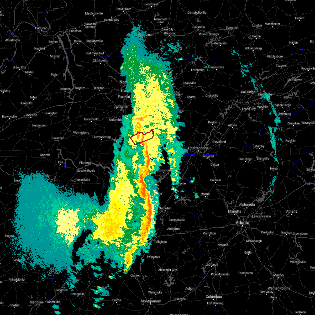 The tornado warning for moore and northern lincoln counties will expire at 115 pm cdt. the storm which prompted the warning has weakened below severe limits, and no longer appears capable of producing a tornado. therefore, the warning will be allowed to expire. However heavy rain is still possible with this thunderstorm. The tornado warning for moore and northern lincoln counties will expire at 115 pm cdt. the storm which prompted the warning has weakened below severe limits, and no longer appears capable of producing a tornado. therefore, the warning will be allowed to expire. However heavy rain is still possible with this thunderstorm.
|
| 5/9/2019 1:02 PM CDT |
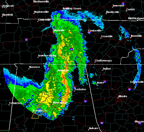 The national weather service in huntsville alabama has issued a * tornado warning for. moore county in middle tennessee. southeastern lincoln county in middle tennessee. northwestern franklin county in middle tennessee. Until 130 pm cdt. The national weather service in huntsville alabama has issued a * tornado warning for. moore county in middle tennessee. southeastern lincoln county in middle tennessee. northwestern franklin county in middle tennessee. Until 130 pm cdt.
|
| 5/9/2019 12:53 PM CDT |
 The national weather service in huntsville alabama has issued a * severe thunderstorm warning for. northwestern jackson county in northeastern alabama. central madison county in north central alabama. moore county in middle tennessee. Eastern lincoln county in middle tennessee. The national weather service in huntsville alabama has issued a * severe thunderstorm warning for. northwestern jackson county in northeastern alabama. central madison county in north central alabama. moore county in middle tennessee. Eastern lincoln county in middle tennessee.
|
| 3/25/2019 2:39 PM CDT |
 At 238 pm cdt, a severe thunderstorm was located over estill springs, or near winchester, moving east at 30 mph (radar indicated). Hazards include 60 mph wind gusts and quarter size hail. Hail damage to vehicles is expected. expect wind damage to roofs, siding, and trees. locations impacted include, decherd, estill springs, sewanee, tims ford lake, woods reservoir, arnold afb, alto and st. Andrews. At 238 pm cdt, a severe thunderstorm was located over estill springs, or near winchester, moving east at 30 mph (radar indicated). Hazards include 60 mph wind gusts and quarter size hail. Hail damage to vehicles is expected. expect wind damage to roofs, siding, and trees. locations impacted include, decherd, estill springs, sewanee, tims ford lake, woods reservoir, arnold afb, alto and st. Andrews.
|
| 3/25/2019 2:23 PM CDT |
 At 222 pm cdt, a severe thunderstorm was located near estill springs, or 8 miles east of lynchburg, moving east at 35 mph (radar indicated). Hazards include 60 mph wind gusts and quarter size hail. Hail damage to vehicles is expected. Expect wind damage to roofs, siding, and trees. At 222 pm cdt, a severe thunderstorm was located near estill springs, or 8 miles east of lynchburg, moving east at 35 mph (radar indicated). Hazards include 60 mph wind gusts and quarter size hail. Hail damage to vehicles is expected. Expect wind damage to roofs, siding, and trees.
|
| 3/9/2019 9:03 PM CDT |
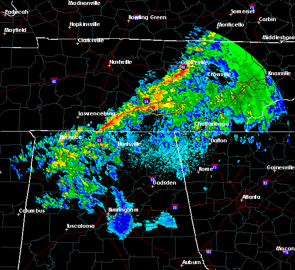 At 803 pm cst, a severe thunderstorm was located near arnold air force base, moving east at 45 mph (radar indicated). Hazards include 60 mph wind gusts. expect damage to roofs, siding, and trees At 803 pm cst, a severe thunderstorm was located near arnold air force base, moving east at 45 mph (radar indicated). Hazards include 60 mph wind gusts. expect damage to roofs, siding, and trees
|
| 11/6/2018 1:14 AM CST |
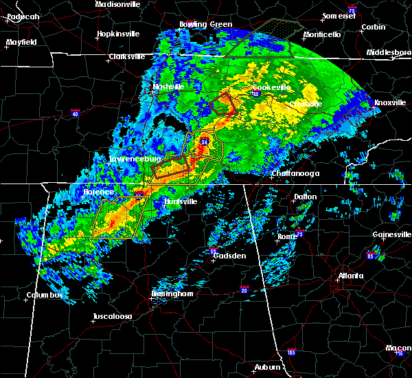 At 114 am cst, severe thunderstorms were located along a line extending from manchester to tims ford lake to 9 miles west of huntland, moving east at 55 mph (radar indicated). Hazards include 60 mph wind gusts. expect damage to roofs, siding, and trees At 114 am cst, severe thunderstorms were located along a line extending from manchester to tims ford lake to 9 miles west of huntland, moving east at 55 mph (radar indicated). Hazards include 60 mph wind gusts. expect damage to roofs, siding, and trees
|
| 11/6/2018 1:00 AM CST | Trees down at pleasant hill road at jacey lan in moore county TN, 8.9 miles NE of Tullahoma, TN |
| 11/6/2018 12:59 AM CST |
 At 1259 am cst, a severe thunderstorm was located 7 miles northwest of manchester, moving east at 65 mph (radar indicated). Hazards include 60 mph wind gusts. Expect damage to roofs, siding, and trees. locations impacted include, manchester, tullahoma, wartrace, bell buckle, normandy, hillsboro, arnold afb, beechgrove, raus, summitville and woods reservoir. this includes interstate 24 between mile markers 97 and 127. a tornado watch remains in effect until 300 am cst for middle tennessee. A tornado watch also remains in effect until 600 am cst for middle tennessee. At 1259 am cst, a severe thunderstorm was located 7 miles northwest of manchester, moving east at 65 mph (radar indicated). Hazards include 60 mph wind gusts. Expect damage to roofs, siding, and trees. locations impacted include, manchester, tullahoma, wartrace, bell buckle, normandy, hillsboro, arnold afb, beechgrove, raus, summitville and woods reservoir. this includes interstate 24 between mile markers 97 and 127. a tornado watch remains in effect until 300 am cst for middle tennessee. A tornado watch also remains in effect until 600 am cst for middle tennessee.
|
| 11/6/2018 12:47 AM CST |
 At 1247 am cst, a severe thunderstorm was located over shelbyville, moving east at 65 mph (radar indicated). Hazards include 60 mph wind gusts. expect damage to roofs, siding, and trees At 1247 am cst, a severe thunderstorm was located over shelbyville, moving east at 65 mph (radar indicated). Hazards include 60 mph wind gusts. expect damage to roofs, siding, and trees
|
| 11/6/2018 12:39 AM CST |
 At 1238 am cst, severe thunderstorms were located along a line extending from 6 miles southwest of shelbyville to near ardmore, moving east at 45 mph (radar indicated). Hazards include 60 mph wind gusts. expect damage to roofs, siding, and trees At 1238 am cst, severe thunderstorms were located along a line extending from 6 miles southwest of shelbyville to near ardmore, moving east at 45 mph (radar indicated). Hazards include 60 mph wind gusts. expect damage to roofs, siding, and trees
|
| 8/9/2018 1:02 PM CDT | Tspotter report and photo of a tree split on 12 oaks road and tree limbs down on huntington place in coffee county TN, 1.1 miles NE of Tullahoma, TN |
| 7/5/2018 2:54 PM CDT | Facebook picture of a tree down on lynn street in tullahoma. time estimated based on rada in coffee county TN, 1.1 miles NE of Tullahoma, TN |
| 6/28/2018 2:23 PM CDT |
 At 223 pm cdt, severe thunderstorms were located along a line extending from 7 miles northeast of decherd to 8 miles east of fayetteville, moving southeast at 55 mph (radar indicated). Hazards include 60 mph wind gusts and nickel size hail. expect damage to roofs, siding, and trees At 223 pm cdt, severe thunderstorms were located along a line extending from 7 miles northeast of decherd to 8 miles east of fayetteville, moving southeast at 55 mph (radar indicated). Hazards include 60 mph wind gusts and nickel size hail. expect damage to roofs, siding, and trees
|
| 6/28/2018 11:55 AM CDT |
 At 1154 am cdt, a severe thunderstorm was located near tims ford lake, or 7 miles south of lynchburg, moving southeast at 35 mph (radar indicated). Hazards include 70 mph wind gusts and penny size hail. Expect considerable tree damage. Damage is likely to mobile homes, roofs, and outbuildings. At 1154 am cdt, a severe thunderstorm was located near tims ford lake, or 7 miles south of lynchburg, moving southeast at 35 mph (radar indicated). Hazards include 70 mph wind gusts and penny size hail. Expect considerable tree damage. Damage is likely to mobile homes, roofs, and outbuildings.
|
| 6/28/2018 11:36 AM CDT |
 At 1135 am cdt, a severe thunderstorm was located 7 miles west of lynchburg, moving southeast at 30 mph. an area of very strong winds is moving through winchester, tn now and will impact jackson county al soon (radar indicated). Hazards include 70 mph wind gusts. Expect considerable tree damage. damage is likely to mobile homes, roofs, and outbuildings. Locations impacted include, winchester, fayetteville, lynchburg, decherd, estill springs, cowan, ardmore, huntland, petersburg and tims ford lake. At 1135 am cdt, a severe thunderstorm was located 7 miles west of lynchburg, moving southeast at 30 mph. an area of very strong winds is moving through winchester, tn now and will impact jackson county al soon (radar indicated). Hazards include 70 mph wind gusts. Expect considerable tree damage. damage is likely to mobile homes, roofs, and outbuildings. Locations impacted include, winchester, fayetteville, lynchburg, decherd, estill springs, cowan, ardmore, huntland, petersburg and tims ford lake.
|
| 6/28/2018 11:02 AM CDT |
 At 1101 am cdt, a severe thunderstorm was located 8 miles northeast of lewisburg, moving southeast at 30 mph (radar indicated). Hazards include 70 mph wind gusts and nickel size hail. Expect considerable tree damage. Damage is likely to mobile homes, roofs, and outbuildings. At 1101 am cdt, a severe thunderstorm was located 8 miles northeast of lewisburg, moving southeast at 30 mph (radar indicated). Hazards include 70 mph wind gusts and nickel size hail. Expect considerable tree damage. Damage is likely to mobile homes, roofs, and outbuildings.
|
| 5/31/2018 8:22 PM CDT |
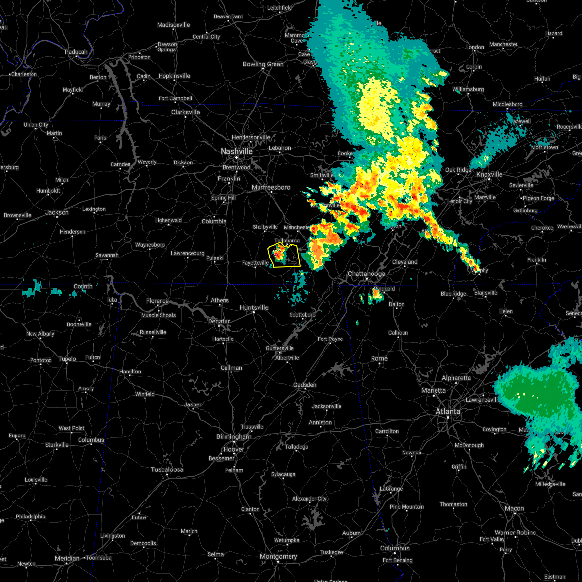 The national weather service in huntsville alabama has issued a * severe thunderstorm warning for. moore county in middle tennessee. northwestern franklin county in middle tennessee. until 900 pm cdt. At 821 pm cdt, a severe thunderstorm was located over lynchburg,. The national weather service in huntsville alabama has issued a * severe thunderstorm warning for. moore county in middle tennessee. northwestern franklin county in middle tennessee. until 900 pm cdt. At 821 pm cdt, a severe thunderstorm was located over lynchburg,.
|
| 5/31/2018 8:19 PM CDT | Corrects previous tstm wnd dmg report from 2 sw lynchburg. tree was downed across county highway 50 near henshaw roa in moore county TN, 11.9 miles NE of Tullahoma, TN |
| 5/31/2018 8:19 AM CDT | Tree was downed across county highway 50 near henshaw roa in moore county TN, 11.9 miles NE of Tullahoma, TN |
| 5/20/2018 3:52 PM CDT |
 The severe thunderstorm warning for moore and northwestern franklin counties will expire at 400 pm cdt, the storm which prompted the warning has weakened below severe limits, and no longer poses an immediate threat to life or property. therefore, the warning will be allowed to expire. however heavy rain is still possible with this thunderstorm. The severe thunderstorm warning for moore and northwestern franklin counties will expire at 400 pm cdt, the storm which prompted the warning has weakened below severe limits, and no longer poses an immediate threat to life or property. therefore, the warning will be allowed to expire. however heavy rain is still possible with this thunderstorm.
|
| 5/20/2018 3:33 PM CDT | Ema reports multiple trees down in the vicinity of pleasant hill rd and east of hwy 5 in moore county TN, 9.8 miles NE of Tullahoma, TN |
| 5/20/2018 3:33 PM CDT | Ema reports tree down across road along norman wiseman r in moore county TN, 11.6 miles NE of Tullahoma, TN |
| 5/20/2018 3:33 PM CDT | Ema reports tree down across lois creek r in moore county TN, 10.2 miles NE of Tullahoma, TN |
| 5/20/2018 3:32 PM CDT |
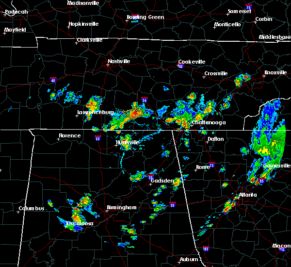 At 331 pm cdt, a severe thunderstorm was located near lynchburg, moving northwest at 5 mph (radar indicated). Hazards include 60 mph wind gusts and nickel size hail. expect damage to roofs, siding, and trees At 331 pm cdt, a severe thunderstorm was located near lynchburg, moving northwest at 5 mph (radar indicated). Hazards include 60 mph wind gusts and nickel size hail. expect damage to roofs, siding, and trees
|
| 5/20/2018 3:30 PM CDT | Ema reports trees down in the vicinity of fulks holllow rd and hurricane cree in moore county TN, 6.7 miles NE of Tullahoma, TN |
| 4/3/2018 11:35 PM CDT |
 At 1132 pm cdt, severe thunderstorms were located along a line extending from near sewanee to near boaz, moving east at 60 mph (emergency managers. at 1132 pm cdt, emergency managers reported a tree down on a house in scottsboro. this line of storms has a history of producing widespread wind damage across much of north alabama). Hazards include 60 mph wind gusts. Expect damage to roofs, siding, and trees. Locations impacted include, albertville, scottsboro, boaz, winchester, guntersville, rainsville, decherd, estill springs, stevenson and crossville. At 1132 pm cdt, severe thunderstorms were located along a line extending from near sewanee to near boaz, moving east at 60 mph (emergency managers. at 1132 pm cdt, emergency managers reported a tree down on a house in scottsboro. this line of storms has a history of producing widespread wind damage across much of north alabama). Hazards include 60 mph wind gusts. Expect damage to roofs, siding, and trees. Locations impacted include, albertville, scottsboro, boaz, winchester, guntersville, rainsville, decherd, estill springs, stevenson and crossville.
|
| 4/3/2018 11:24 PM CDT |
 At 1123 pm cdt, severe thunderstorms were located along a line extending from near estill springs tennessee to douglas alabama, moving east at 50 mph (radar indicated. this line of storms has a history of producing widespread wind damage across the shoals and huntsville areas). Hazards include 60 mph wind gusts. Expect damage to roofs, siding, and trees. Locations impacted include, albertville, scottsboro, boaz, winchester, guntersville, rainsville, decherd, estill springs, stevenson and crossville. At 1123 pm cdt, severe thunderstorms were located along a line extending from near estill springs tennessee to douglas alabama, moving east at 50 mph (radar indicated. this line of storms has a history of producing widespread wind damage across the shoals and huntsville areas). Hazards include 60 mph wind gusts. Expect damage to roofs, siding, and trees. Locations impacted include, albertville, scottsboro, boaz, winchester, guntersville, rainsville, decherd, estill springs, stevenson and crossville.
|
| 4/3/2018 11:23 PM CDT |
 The severe thunderstorm warning for moore county will expire at 1130 pm cdt, the storms which prompted the warning have moved out of the area. therefore the warning will be allowed to expire. a severe thunderstorm watch remains in effect until 100 am cdt for north central and northeastern alabama, and middle tennessee. The severe thunderstorm warning for moore county will expire at 1130 pm cdt, the storms which prompted the warning have moved out of the area. therefore the warning will be allowed to expire. a severe thunderstorm watch remains in effect until 100 am cdt for north central and northeastern alabama, and middle tennessee.
|
| 4/3/2018 11:18 PM CDT |
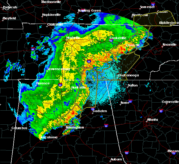 At 1118 pm cdt, severe thunderstorms were located along a line extending from 12 miles north of manchester to near lynchburg, moving northeast at 50 mph (radar indicated). Hazards include 60 mph wind gusts and penny size hail. Expect damage to roofs, siding, and trees. Locations impacted include, lynchburg, tims ford lake, hurdlow, lois and marble hill. At 1118 pm cdt, severe thunderstorms were located along a line extending from 12 miles north of manchester to near lynchburg, moving northeast at 50 mph (radar indicated). Hazards include 60 mph wind gusts and penny size hail. Expect damage to roofs, siding, and trees. Locations impacted include, lynchburg, tims ford lake, hurdlow, lois and marble hill.
|
| 4/3/2018 11:17 PM CDT |
 At 1115 pm cdt, severe thunderstorms were located along a line extending from near estill springs to near arab, moving east at 60 mph (radar indicated. this line of storms has a history of producing widespread wind damage across the shoals and huntsville areas). Hazards include 60 mph wind gusts. Expect damage to roofs, siding, and trees. Locations impacted include, albertville, scottsboro, boaz, winchester, guntersville, arab, rainsville, decherd, estill springs and stevenson. At 1115 pm cdt, severe thunderstorms were located along a line extending from near estill springs to near arab, moving east at 60 mph (radar indicated. this line of storms has a history of producing widespread wind damage across the shoals and huntsville areas). Hazards include 60 mph wind gusts. Expect damage to roofs, siding, and trees. Locations impacted include, albertville, scottsboro, boaz, winchester, guntersville, arab, rainsville, decherd, estill springs and stevenson.
|
| 4/3/2018 11:02 PM CDT |
 At 1102 pm cdt, severe thunderstorms were located along a line extending from shelbyville to near fayetteville, moving northeast at 50 mph (radar indicated). Hazards include 60 mph wind gusts and penny size hail. Expect damage to roofs, siding, and trees. Locations impacted include, fayetteville, lynchburg, tims ford lake, lincoln, mulberry, chestnut ridge, howell, belleville, elora and hurdlow. At 1102 pm cdt, severe thunderstorms were located along a line extending from shelbyville to near fayetteville, moving northeast at 50 mph (radar indicated). Hazards include 60 mph wind gusts and penny size hail. Expect damage to roofs, siding, and trees. Locations impacted include, fayetteville, lynchburg, tims ford lake, lincoln, mulberry, chestnut ridge, howell, belleville, elora and hurdlow.
|
| 4/3/2018 11:01 PM CDT |
 At 1059 pm cdt, severe thunderstorms were located along a line extending from near lynchburg to holly pond, moving east at 60 mph (emergency management. there have been numerous reports of downed trees and power lines across northwest and north central alabama, and the decatur and huntsville airports have reported wind gusts of at least 70 mph). Hazards include 70 mph wind gusts. Expect considerable tree damage. Damage is likely to mobile homes, roofs, and outbuildings. At 1059 pm cdt, severe thunderstorms were located along a line extending from near lynchburg to holly pond, moving east at 60 mph (emergency management. there have been numerous reports of downed trees and power lines across northwest and north central alabama, and the decatur and huntsville airports have reported wind gusts of at least 70 mph). Hazards include 70 mph wind gusts. Expect considerable tree damage. Damage is likely to mobile homes, roofs, and outbuildings.
|
| 4/3/2018 10:41 PM CDT |
 At 1041 pm cdt, severe thunderstorms were located along a line extending from near petersburg to ardmore, moving northeast at 50 mph (radar indicated). Hazards include 60 mph wind gusts and penny size hail. expect damage to roofs, siding, and trees At 1041 pm cdt, severe thunderstorms were located along a line extending from near petersburg to ardmore, moving northeast at 50 mph (radar indicated). Hazards include 60 mph wind gusts and penny size hail. expect damage to roofs, siding, and trees
|
| 11/18/2017 6:09 PM CST |
 At 609 pm cst, severe thunderstorms were located along a line extending from tullahoma to meridianville, moving east at 65 mph (radar indicated). Hazards include 60 mph wind gusts. expect damage to roofs, siding, and trees At 609 pm cst, severe thunderstorms were located along a line extending from tullahoma to meridianville, moving east at 65 mph (radar indicated). Hazards include 60 mph wind gusts. expect damage to roofs, siding, and trees
|
| 9/21/2017 3:24 PM CDT |
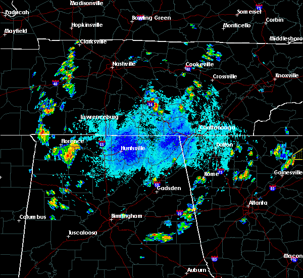 At 324 pm cdt, a severe thunderstorm was located near manchester, moving west at 15 mph (radar indicated). Hazards include 60 mph wind gusts and quarter size hail. Hail damage to vehicles is expected. Expect wind damage to roofs, siding, and trees. At 324 pm cdt, a severe thunderstorm was located near manchester, moving west at 15 mph (radar indicated). Hazards include 60 mph wind gusts and quarter size hail. Hail damage to vehicles is expected. Expect wind damage to roofs, siding, and trees.
|
| 7/5/2017 2:47 PM CDT |
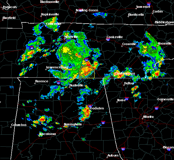 At 246 pm cdt, a severe thunderstorm was located near decherd, or near winchester, moving east at 45 mph (radar indicated). Hazards include 60 mph wind gusts. Expect damage to roofs, siding, and trees. Locations impacted include, winchester, decherd, estill springs, monteagle, tims ford lake, sewanee, lexie crossroads, harmony, oak grove and woods reservoir. At 246 pm cdt, a severe thunderstorm was located near decherd, or near winchester, moving east at 45 mph (radar indicated). Hazards include 60 mph wind gusts. Expect damage to roofs, siding, and trees. Locations impacted include, winchester, decherd, estill springs, monteagle, tims ford lake, sewanee, lexie crossroads, harmony, oak grove and woods reservoir.
|
| 7/5/2017 2:39 PM CDT |
 At 238 pm cdt, a severe thunderstorm was located near winchester, moving east at 40 mph (radar indicated). Hazards include 60 mph wind gusts. expect damage to roofs, siding, and trees At 238 pm cdt, a severe thunderstorm was located near winchester, moving east at 40 mph (radar indicated). Hazards include 60 mph wind gusts. expect damage to roofs, siding, and trees
|
| 7/5/2017 2:32 PM CDT |
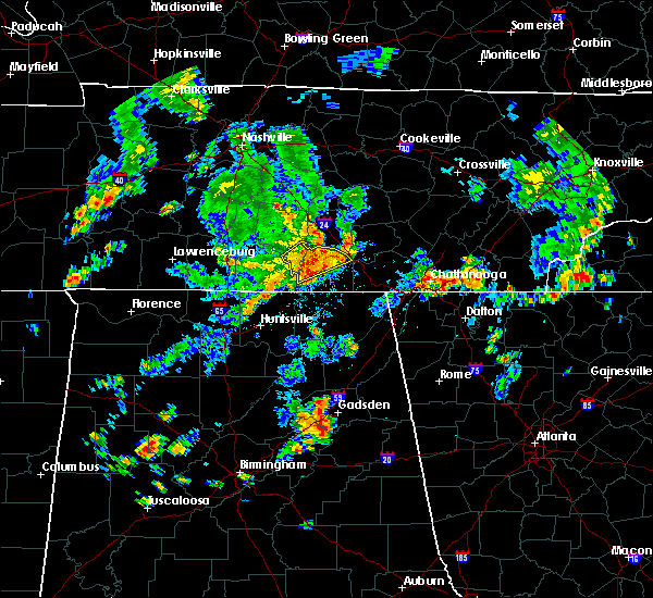 At 231 pm cdt, a severe thunderstorm was located near tims ford lake, or near winchester, moving east at 40 mph (radar indicated). Hazards include 60 mph wind gusts. Expect damage to roofs, siding, and trees. Locations impacted include, winchester, lynchburg, decherd, estill springs, monteagle, tims ford lake, sewanee, hurdlow, woods reservoir and alto. At 231 pm cdt, a severe thunderstorm was located near tims ford lake, or near winchester, moving east at 40 mph (radar indicated). Hazards include 60 mph wind gusts. Expect damage to roofs, siding, and trees. Locations impacted include, winchester, lynchburg, decherd, estill springs, monteagle, tims ford lake, sewanee, hurdlow, woods reservoir and alto.
|
| 7/5/2017 2:18 PM CDT |
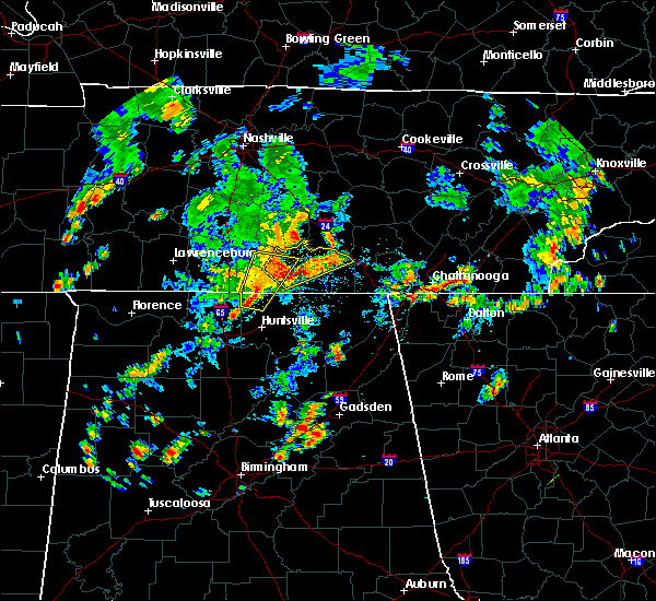 At 218 pm cdt, a severe thunderstorm was located near lynchburg, moving northeast at 45 mph (radar indicated). Hazards include 60 mph wind gusts. expect damage to roofs, siding, and trees At 218 pm cdt, a severe thunderstorm was located near lynchburg, moving northeast at 45 mph (radar indicated). Hazards include 60 mph wind gusts. expect damage to roofs, siding, and trees
|
| 5/27/2017 9:48 PM CDT |
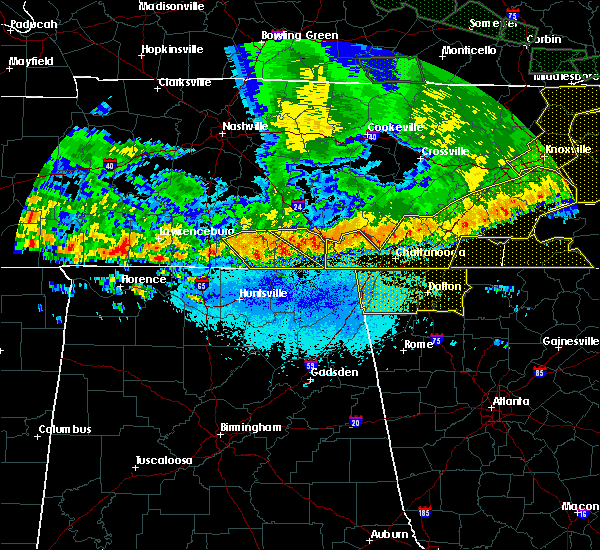 At 948 pm cdt, severe thunderstorms were located along a line extending from near sewanee to winchester, moving southeast at 25 mph (radar indicated). Hazards include 60 mph wind gusts and quarter size hail. Hail damage to vehicles is expected. expect wind damage to roofs, siding, and trees. locations impacted include, winchester, decherd, estill springs, cowan, monteagle, sewanee, tims ford lake, st. Andrews, sherwood and woods reservoir. At 948 pm cdt, severe thunderstorms were located along a line extending from near sewanee to winchester, moving southeast at 25 mph (radar indicated). Hazards include 60 mph wind gusts and quarter size hail. Hail damage to vehicles is expected. expect wind damage to roofs, siding, and trees. locations impacted include, winchester, decherd, estill springs, cowan, monteagle, sewanee, tims ford lake, st. Andrews, sherwood and woods reservoir.
|
| 5/27/2017 9:33 PM CDT |
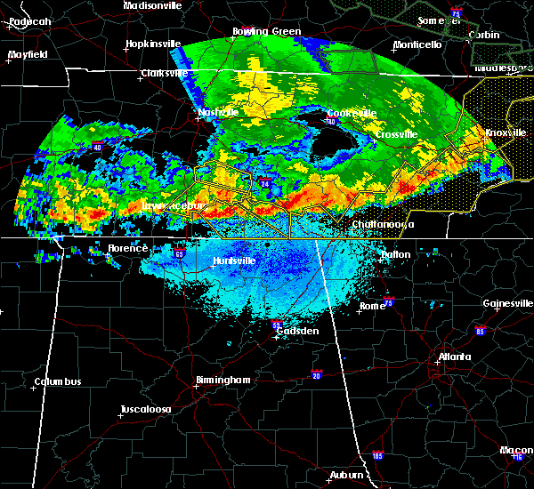 At 932 pm cdt, a severe thunderstorm was located near estill springs, or 8 miles north of winchester, moving southeast at 40 mph (radar indicated). Hazards include 60 mph wind gusts and quarter size hail. Hail damage to vehicles is expected. Expect wind damage to roofs, siding, and trees. At 932 pm cdt, a severe thunderstorm was located near estill springs, or 8 miles north of winchester, moving southeast at 40 mph (radar indicated). Hazards include 60 mph wind gusts and quarter size hail. Hail damage to vehicles is expected. Expect wind damage to roofs, siding, and trees.
|
| 4/30/2017 3:58 PM CDT |
 The severe thunderstorm warning for jackson, dekalb and franklin counties will expire at 400 pm cdt, the storms which prompted the warning have weakened below severe limits, and no longer pose an immediate threat to life or property. therefore the warning will be allowed to expire. however, gusty winds are still possible with these thunderstorms. a tornado watch remains in effect until 700 pm cdt for northeastern alabama, and middle tennessee. The severe thunderstorm warning for jackson, dekalb and franklin counties will expire at 400 pm cdt, the storms which prompted the warning have weakened below severe limits, and no longer pose an immediate threat to life or property. therefore the warning will be allowed to expire. however, gusty winds are still possible with these thunderstorms. a tornado watch remains in effect until 700 pm cdt for northeastern alabama, and middle tennessee.
|
| 4/30/2017 3:58 PM CDT |
 The severe thunderstorm warning for jackson. dekalb and franklin counties will expire at 400 pm cdt. the storms which prompted the warning have weakened below severe limits, and no longer pose an immediate threat to life or property. therefore the warning will be allowed to expire. However, gusty winds are still possible with these thunderstorms. The severe thunderstorm warning for jackson. dekalb and franklin counties will expire at 400 pm cdt. the storms which prompted the warning have weakened below severe limits, and no longer pose an immediate threat to life or property. therefore the warning will be allowed to expire. However, gusty winds are still possible with these thunderstorms.
|
| 4/30/2017 3:49 PM CDT |
 At 349 pm cdt, severe thunderstorms were located along a line extending from near estill springs to near collinsville, moving east at 40 mph (radar indicated). Hazards include 60 mph wind gusts. Expect damage to roofs, siding, and trees. locations impacted include, scottsboro, fort payne, winchester, rainsville, bridgeport, little river canyon national preserve, decherd, henagar, estill springs and stevenson. A tornado watch remains in effect until 700 pm cdt for north central and northeastern alabama, and middle tennessee. At 349 pm cdt, severe thunderstorms were located along a line extending from near estill springs to near collinsville, moving east at 40 mph (radar indicated). Hazards include 60 mph wind gusts. Expect damage to roofs, siding, and trees. locations impacted include, scottsboro, fort payne, winchester, rainsville, bridgeport, little river canyon national preserve, decherd, henagar, estill springs and stevenson. A tornado watch remains in effect until 700 pm cdt for north central and northeastern alabama, and middle tennessee.
|
| 4/30/2017 3:46 PM CDT |
 At 346 pm cdt, severe thunderstorms were located along a line extending from near murfreesboro to 10 miles southwest of woodbury to estill springs, moving northeast at 55 mph (radar indicated). Hazards include 60 mph wind gusts. Expect damage to roofs, siding, and trees. locations impacted include, murfreesboro, manchester, woodbury, tullahoma, walterhill, lascassas, christiana, beechgrove, fosterville, summitville, rockvale, bradyville, milton, readyville and arnold afb. A tornado watch remains in effect until 700 pm cdt for middle tennessee. At 346 pm cdt, severe thunderstorms were located along a line extending from near murfreesboro to 10 miles southwest of woodbury to estill springs, moving northeast at 55 mph (radar indicated). Hazards include 60 mph wind gusts. Expect damage to roofs, siding, and trees. locations impacted include, murfreesboro, manchester, woodbury, tullahoma, walterhill, lascassas, christiana, beechgrove, fosterville, summitville, rockvale, bradyville, milton, readyville and arnold afb. A tornado watch remains in effect until 700 pm cdt for middle tennessee.
|
| 4/30/2017 3:33 PM CDT |
 At 333 pm cdt, severe thunderstorms were located along a line extending from 7 miles north of tullahoma to near crossville, moving northeast at 55 mph (radar indicated). Hazards include 60 mph wind gusts. Expect damage to roofs, siding, and trees. locations impacted include, scottsboro, fort payne, boaz, winchester, rainsville, bridgeport, little river canyon national preserve, decherd, henagar and estill springs. A tornado watch remains in effect until 700 pm cdt for north central and northeastern alabama, and middle tennessee. At 333 pm cdt, severe thunderstorms were located along a line extending from 7 miles north of tullahoma to near crossville, moving northeast at 55 mph (radar indicated). Hazards include 60 mph wind gusts. Expect damage to roofs, siding, and trees. locations impacted include, scottsboro, fort payne, boaz, winchester, rainsville, bridgeport, little river canyon national preserve, decherd, henagar and estill springs. A tornado watch remains in effect until 700 pm cdt for north central and northeastern alabama, and middle tennessee.
|
| 4/30/2017 3:26 PM CDT |
 At 326 pm cdt, severe thunderstorms were located along a line extending from eagleville to near shelbyville to near huntland, moving northeast at 55 mph (radar indicated). Hazards include 60 mph wind gusts. expect damage to roofs, siding, and trees At 326 pm cdt, severe thunderstorms were located along a line extending from eagleville to near shelbyville to near huntland, moving northeast at 55 mph (radar indicated). Hazards include 60 mph wind gusts. expect damage to roofs, siding, and trees
|
| 4/30/2017 3:19 PM CDT |
 At 319 pm cdt, severe thunderstorms were located along a line extending from nolensville to near shelbyville to huntland, moving northeast at 50 mph (radar indicated). Hazards include 60 mph wind gusts. Expect damage to roofs, siding, and trees. locations impacted include, shelbyville, chapel hill, wartrace, bell buckle, normandy, rover, deason, raus, farmington, unionville and beechgrove. A tornado watch remains in effect until 700 pm cdt for middle tennessee. At 319 pm cdt, severe thunderstorms were located along a line extending from nolensville to near shelbyville to huntland, moving northeast at 50 mph (radar indicated). Hazards include 60 mph wind gusts. Expect damage to roofs, siding, and trees. locations impacted include, shelbyville, chapel hill, wartrace, bell buckle, normandy, rover, deason, raus, farmington, unionville and beechgrove. A tornado watch remains in effect until 700 pm cdt for middle tennessee.
|
| 4/30/2017 3:17 PM CDT |
 At 317 pm cdt, severe thunderstorms were located along a line extending from lynchburg to albertville, moving northeast at 40 mph (radar indicated). Hazards include 60 mph wind gusts. Expect damage to roofs, siding, and trees. locations impacted include, albertville, scottsboro, fort payne, boaz, winchester, guntersville, fayetteville, rainsville, bridgeport and lynchburg. A tornado watch remains in effect until 700 pm cdt for north central and northeastern alabama, and middle tennessee. At 317 pm cdt, severe thunderstorms were located along a line extending from lynchburg to albertville, moving northeast at 40 mph (radar indicated). Hazards include 60 mph wind gusts. Expect damage to roofs, siding, and trees. locations impacted include, albertville, scottsboro, fort payne, boaz, winchester, guntersville, fayetteville, rainsville, bridgeport and lynchburg. A tornado watch remains in effect until 700 pm cdt for north central and northeastern alabama, and middle tennessee.
|
| 4/30/2017 3:01 PM CDT |
 At 300 pm cdt, severe thunderstorms were located along a line extending from chapel hill to near petersburg to near hazel green, moving northeast at 50 mph (radar indicated). Hazards include 60 mph wind gusts. expect damage to roofs, siding, and trees At 300 pm cdt, severe thunderstorms were located along a line extending from chapel hill to near petersburg to near hazel green, moving northeast at 50 mph (radar indicated). Hazards include 60 mph wind gusts. expect damage to roofs, siding, and trees
|
| 4/30/2017 2:54 PM CDT |
 At 252 pm cdt, severe thunderstorms were located along a line extending from near petersburg to near altoona, moving northeast at 55 mph (radar indicated). Hazards include 60 mph wind gusts. expect damage to roofs, siding, and trees At 252 pm cdt, severe thunderstorms were located along a line extending from near petersburg to near altoona, moving northeast at 55 mph (radar indicated). Hazards include 60 mph wind gusts. expect damage to roofs, siding, and trees
|
| 4/5/2017 5:23 PM CDT |
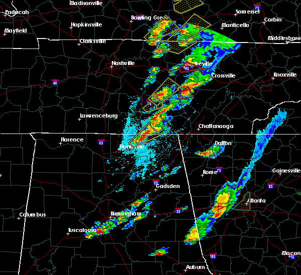 The severe thunderstorm warning for central coffee county will expire at 530 pm cdt, the storm which prompted the warning has moved out of the area. therefore the warning will be allowed to expire. a tornado watch remains in effect until 900 pm cdt for middle tennessee. The severe thunderstorm warning for central coffee county will expire at 530 pm cdt, the storm which prompted the warning has moved out of the area. therefore the warning will be allowed to expire. a tornado watch remains in effect until 900 pm cdt for middle tennessee.
|
| 4/5/2017 5:09 PM CDT |
 At 508 pm cdt, a severe thunderstorm was located over manchester, moving northeast at 40 mph (trained weather spotters). Hazards include 60 mph wind gusts and quarter size hail. Hail damage to vehicles is expected. expect wind damage to roofs, siding, and trees. locations impacted include, manchester and summitville. A tornado watch remains in effect until 900 pm cdt for middle tennessee. At 508 pm cdt, a severe thunderstorm was located over manchester, moving northeast at 40 mph (trained weather spotters). Hazards include 60 mph wind gusts and quarter size hail. Hail damage to vehicles is expected. expect wind damage to roofs, siding, and trees. locations impacted include, manchester and summitville. A tornado watch remains in effect until 900 pm cdt for middle tennessee.
|
| 4/5/2017 4:59 PM CDT |
 At 459 pm cdt, a severe thunderstorm was located near manchester, moving northeast at 40 mph (emergency management). Hazards include 60 mph wind gusts and quarter size hail. Hail damage to vehicles is expected. Expect wind damage to roofs, siding, and trees. At 459 pm cdt, a severe thunderstorm was located near manchester, moving northeast at 40 mph (emergency management). Hazards include 60 mph wind gusts and quarter size hail. Hail damage to vehicles is expected. Expect wind damage to roofs, siding, and trees.
|
| 4/5/2017 4:58 PM CDT | Quarter sized hail reported 1.1 miles NE of Tullahoma, TN |
| 4/5/2017 4:26 PM CDT |
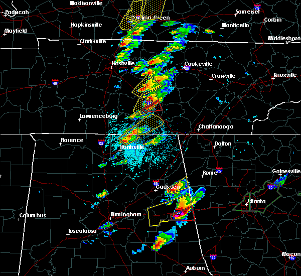 At 426 pm cdt, a severe thunderstorm capable of producing a tornado was located over manchester, moving northeast at 40 mph (radar indicated rotation). Hazards include tornado and golf ball size hail. Flying debris will be dangerous to those caught without shelter. mobile homes will be damaged or destroyed. damage to roofs, windows, and vehicles will occur. tree damage is likely. This tornadic thunderstorm will remain over mainly rural areas of central coffee county, including the following locations: hillsboro and summitville. At 426 pm cdt, a severe thunderstorm capable of producing a tornado was located over manchester, moving northeast at 40 mph (radar indicated rotation). Hazards include tornado and golf ball size hail. Flying debris will be dangerous to those caught without shelter. mobile homes will be damaged or destroyed. damage to roofs, windows, and vehicles will occur. tree damage is likely. This tornadic thunderstorm will remain over mainly rural areas of central coffee county, including the following locations: hillsboro and summitville.
|
| 4/5/2017 4:18 PM CDT |
 At 417 pm cdt, a severe thunderstorm capable of producing a tornado was located over tullahoma, or 9 miles southwest of manchester, moving northeast at 35 mph (radar indicated rotation). Hazards include tornado and golf ball size hail. Flying debris will be dangerous to those caught without shelter. mobile homes will be damaged or destroyed. damage to roofs, windows, and vehicles will occur. tree damage is likely. this dangerous storm will be near, manchester around 435 pm cdt. Other locations impacted by this tornadic thunderstorm include hillsboro, summitville and arnold afb. At 417 pm cdt, a severe thunderstorm capable of producing a tornado was located over tullahoma, or 9 miles southwest of manchester, moving northeast at 35 mph (radar indicated rotation). Hazards include tornado and golf ball size hail. Flying debris will be dangerous to those caught without shelter. mobile homes will be damaged or destroyed. damage to roofs, windows, and vehicles will occur. tree damage is likely. this dangerous storm will be near, manchester around 435 pm cdt. Other locations impacted by this tornadic thunderstorm include hillsboro, summitville and arnold afb.
|
| 4/5/2017 4:14 PM CDT |
 At 414 pm cdt, a severe thunderstorm was located near tullahoma, or 9 miles east of shelbyville, moving northeast at 35 mph (radar indicated). Hazards include 60 mph wind gusts and half dollar size hail. Hail damage to vehicles is expected. expect wind damage to roofs, siding, and trees. locations impacted include, manchester, tullahoma, wartrace, normandy, beechgrove and raus. A tornado watch remains in effect until 900 pm cdt for middle tennessee. At 414 pm cdt, a severe thunderstorm was located near tullahoma, or 9 miles east of shelbyville, moving northeast at 35 mph (radar indicated). Hazards include 60 mph wind gusts and half dollar size hail. Hail damage to vehicles is expected. expect wind damage to roofs, siding, and trees. locations impacted include, manchester, tullahoma, wartrace, normandy, beechgrove and raus. A tornado watch remains in effect until 900 pm cdt for middle tennessee.
|
| 4/5/2017 4:02 PM CDT |
 At 401 pm cdt, a severe thunderstorm was located near lynchburg, moving northeast at 40 mph (trained weather spotters). Hazards include 60 mph wind gusts and half dollar size hail. Hail damage to vehicles is expected. expect wind damage to roofs, siding, and trees. locations impacted include, shelbyville, manchester, tullahoma, wartrace, bell buckle, normandy, beechgrove and raus. A tornado watch remains in effect until 900 pm cdt for middle tennessee. At 401 pm cdt, a severe thunderstorm was located near lynchburg, moving northeast at 40 mph (trained weather spotters). Hazards include 60 mph wind gusts and half dollar size hail. Hail damage to vehicles is expected. expect wind damage to roofs, siding, and trees. locations impacted include, shelbyville, manchester, tullahoma, wartrace, bell buckle, normandy, beechgrove and raus. A tornado watch remains in effect until 900 pm cdt for middle tennessee.
|
| 4/5/2017 3:57 PM CDT |
 The severe thunderstorm warning for northern moore and northeastern lincoln counties will expire at 400 pm cdt, the storm which prompted the warning is moving out of lincoln and moore counties. therefore the warning will be allowed to expire. a tornado watch remains in effect until 900 pm cdt for north central and northeastern alabama, and middle tennessee. to report severe weather, contact your nearest law enforcement agency. they will relay your report to the national weather service huntsville alabama. The severe thunderstorm warning for northern moore and northeastern lincoln counties will expire at 400 pm cdt, the storm which prompted the warning is moving out of lincoln and moore counties. therefore the warning will be allowed to expire. a tornado watch remains in effect until 900 pm cdt for north central and northeastern alabama, and middle tennessee. to report severe weather, contact your nearest law enforcement agency. they will relay your report to the national weather service huntsville alabama.
|
| 4/5/2017 3:51 PM CDT |
 At 350 pm cdt, a severe thunderstorm was located near petersburg, or 9 miles north of fayetteville, moving northeast at 25 mph (radar indicated). Hazards include 60 mph wind gusts and quarter size hail. Hail damage to vehicles is expected. Expect wind damage to roofs, siding, and trees. At 350 pm cdt, a severe thunderstorm was located near petersburg, or 9 miles north of fayetteville, moving northeast at 25 mph (radar indicated). Hazards include 60 mph wind gusts and quarter size hail. Hail damage to vehicles is expected. Expect wind damage to roofs, siding, and trees.
|
| 4/5/2017 3:47 PM CDT |
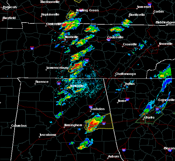 At 346 pm cdt, a severe thunderstorm was located near petersburg, or 9 miles north of fayetteville, moving northeast at 50 mph (radar indicated. at 340 pm cdt, emergency management reported small hail in the cyruston area northwest of fayetteville, but the storm has intensified since then). Hazards include ping pong ball size hail and 60 mph wind gusts. People and animals outdoors will be injured. expect hail damage to roofs, siding, windows, and vehicles. expect wind damage to roofs, siding, and trees. locations impacted include, fayetteville, lynchburg, chestnut ridge, howell, belleville, mimosa and booneville. A tornado watch remains in effect until 900 pm cdt for north central and northeastern alabama, and middle tennessee. At 346 pm cdt, a severe thunderstorm was located near petersburg, or 9 miles north of fayetteville, moving northeast at 50 mph (radar indicated. at 340 pm cdt, emergency management reported small hail in the cyruston area northwest of fayetteville, but the storm has intensified since then). Hazards include ping pong ball size hail and 60 mph wind gusts. People and animals outdoors will be injured. expect hail damage to roofs, siding, windows, and vehicles. expect wind damage to roofs, siding, and trees. locations impacted include, fayetteville, lynchburg, chestnut ridge, howell, belleville, mimosa and booneville. A tornado watch remains in effect until 900 pm cdt for north central and northeastern alabama, and middle tennessee.
|
| 4/5/2017 3:36 PM CDT |
 At 336 pm cdt, a severe thunderstorm was located near fayetteville, moving northeast at 50 mph (radar indicated). Hazards include 60 mph wind gusts and quarter size hail. Hail damage to vehicles is expected. Expect wind damage to roofs, siding, and trees. At 336 pm cdt, a severe thunderstorm was located near fayetteville, moving northeast at 50 mph (radar indicated). Hazards include 60 mph wind gusts and quarter size hail. Hail damage to vehicles is expected. Expect wind damage to roofs, siding, and trees.
|
| 3/21/2017 5:26 PM CDT | Power outages in kings lane subdivision in coffee county TN, 1.1 miles NE of Tullahoma, TN |
| 3/21/2017 5:03 PM CDT | Tspotter reports of a tree blown down on meadowbrook lane and a tree down across thacker road in tullahoma in coffee county TN, 1.1 miles NE of Tullahoma, TN |
| 3/21/2017 5:00 PM CDT | Quarter sized hail reported 11.1 miles NE of Tullahoma, TN |
| 3/21/2017 4:46 PM CDT |
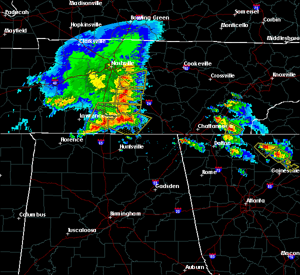 At 445 pm cdt, severe thunderstorms were located along a line extending from 6 miles west of lynchburg to 8 miles southwest of fayetteville, moving southeast at 60 mph (radar indicated). Hazards include 70 mph wind gusts and quarter size hail. Hail damage to vehicles is expected. expect considerable tree damage. wind damage is also likely to mobile homes, roofs, and outbuildings. Locations impacted include, winchester, fayetteville, lynchburg, estill springs, huntland, petersburg, tims ford lake, lincoln, hurdlow and smithland. At 445 pm cdt, severe thunderstorms were located along a line extending from 6 miles west of lynchburg to 8 miles southwest of fayetteville, moving southeast at 60 mph (radar indicated). Hazards include 70 mph wind gusts and quarter size hail. Hail damage to vehicles is expected. expect considerable tree damage. wind damage is also likely to mobile homes, roofs, and outbuildings. Locations impacted include, winchester, fayetteville, lynchburg, estill springs, huntland, petersburg, tims ford lake, lincoln, hurdlow and smithland.
|
| 3/21/2017 4:33 PM CDT |
 At 433 pm cdt, severe thunderstorms were located along a line extending from 7 miles north of petersburg to 9 miles east of pulaski, moving southeast at 60 mph (radar indicated). Hazards include 70 mph wind gusts and quarter size hail. Hail damage to vehicles is expected. expect considerable tree damage. Wind damage is also likely to mobile homes, roofs, and outbuildings. At 433 pm cdt, severe thunderstorms were located along a line extending from 7 miles north of petersburg to 9 miles east of pulaski, moving southeast at 60 mph (radar indicated). Hazards include 70 mph wind gusts and quarter size hail. Hail damage to vehicles is expected. expect considerable tree damage. Wind damage is also likely to mobile homes, roofs, and outbuildings.
|
| 3/10/2017 1:20 AM CST | Multiple trees down around tims ford lake southwest of tullahoma. several roads and areas are affecte in moore county TN, 8.5 miles NE of Tullahoma, TN |
| 3/10/2017 12:09 AM CST |
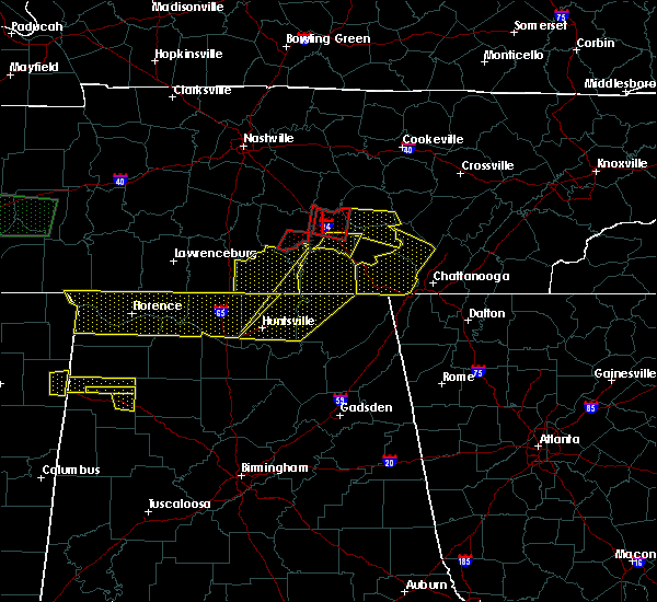 At 1209 am cst, a severe thunderstorm was located near manchester, moving east at 55 mph (radar indicated). Hazards include ping pong ball size hail and 60 mph wind gusts. People and animals outdoors will be injured. expect hail damage to roofs, siding, windows, and vehicles. expect wind damage to roofs, siding, and trees. Locations impacted include, manchester, hillsboro, arnold afb and woods reservoir. At 1209 am cst, a severe thunderstorm was located near manchester, moving east at 55 mph (radar indicated). Hazards include ping pong ball size hail and 60 mph wind gusts. People and animals outdoors will be injured. expect hail damage to roofs, siding, windows, and vehicles. expect wind damage to roofs, siding, and trees. Locations impacted include, manchester, hillsboro, arnold afb and woods reservoir.
|
| 3/10/2017 12:08 AM CST | Trees and power lines were knocked down. power outages reporte in franklin county TN, 6.5 miles N of Tullahoma, TN |
| 3/10/2017 12:06 AM CST | A power pole was knocked down at 2106 gourdneck road. in franklin county TN, 6.1 miles NNE of Tullahoma, TN |
| 3/10/2017 12:05 AM CST | Trees were knocked down at 1097 turkey creek roa in moore county TN, 5.9 miles NE of Tullahoma, TN |
| 3/10/2017 12:05 AM CST | Half Dollar sized hail reported 1.1 miles NE of Tullahoma, TN |
| 3/10/2017 12:04 AM CST | Trees were knocked down at 9404 chestnut ridge roa in moore county TN, 9.3 miles NNE of Tullahoma, TN |
| 3/10/2017 12:04 AM CST | Trees were knocked down at 24 patterson roa in moore county TN, 7.6 miles NE of Tullahoma, TN |
| 3/10/2017 12:04 AM CST | Trees were knocked down at 1908 cobb hollow roa in moore county TN, 8.5 miles NE of Tullahoma, TN |
| 3/10/2017 12:04 AM CST | Trees and power lines were knocked down at 2370 hurricane creek roa in moore county TN, 7.2 miles NE of Tullahoma, TN |
| 3/10/2017 12:03 AM CST | Trees were knocked down at 2431 lynchburg highwa in moore county TN, 9.5 miles ENE of Tullahoma, TN |
| 3/10/2017 12:03 AM CST | Trees were knocked down at 2449 winchester highwa in moore county TN, 12.5 miles NE of Tullahoma, TN |
| 3/10/2017 12:03 AM CST | Trees were knocked down on chestnut ridge roa in moore county TN, 8.7 miles NE of Tullahoma, TN |
| 3/10/2017 12:03 AM CST | Trees were knocked down at 75 tankersley ridge roa in moore county TN, 7.5 miles NNE of Tullahoma, TN |
| 3/10/2017 12:03 AM CST | Trees were knocked down at 2243 raysville roa in moore county TN, 5.9 miles ENE of Tullahoma, TN |
| 3/10/2017 12:02 AM CST | Trees were knocked down at 239 hurricane creek roa in moore county TN, 8.9 miles NE of Tullahoma, TN |
| 3/10/2017 12:00 AM CST |
 At 1200 am cst, a severe thunderstorm was located near tullahoma, or near manchester, moving east at 55 mph (radar indicated). Hazards include 60 mph wind gusts. expect damage to roofs, siding, and trees At 1200 am cst, a severe thunderstorm was located near tullahoma, or near manchester, moving east at 55 mph (radar indicated). Hazards include 60 mph wind gusts. expect damage to roofs, siding, and trees
|
| 3/9/2017 11:59 PM CST |
 At 1159 pm cst, severe thunderstorms were located along a line extending from 8 miles northeast of manchester to 6 miles northwest of hazel green, moving east at 40 mph (radar indicated). Hazards include 60 mph wind gusts and quarter size hail. Hail damage to vehicles is expected. expect wind damage to roofs, siding, and trees. Locations impacted include, huntsville, madison, winchester, moores mill, meridianville, redstone arsenal, hazel green, decherd, estill springs and cowan. At 1159 pm cst, severe thunderstorms were located along a line extending from 8 miles northeast of manchester to 6 miles northwest of hazel green, moving east at 40 mph (radar indicated). Hazards include 60 mph wind gusts and quarter size hail. Hail damage to vehicles is expected. expect wind damage to roofs, siding, and trees. Locations impacted include, huntsville, madison, winchester, moores mill, meridianville, redstone arsenal, hazel green, decherd, estill springs and cowan.
|
| 3/9/2017 11:58 PM CST | Trees were knocked down at 115 morris hollow roa in moore county TN, 12.7 miles ENE of Tullahoma, TN |
| 3/9/2017 11:58 PM CST | Several trees reported down with powerlines impacted in the tullahoma area just north of tims ford lak in franklin county TN, 5.8 miles NNE of Tullahoma, TN |
| 3/9/2017 11:55 PM CST | Trees were knocked down at 347 buckeye loop roa in moore county TN, 12.4 miles NE of Tullahoma, TN |
| 3/9/2017 11:55 PM CST |
 At 1155 pm cst, severe thunderstorms were located along a line extending from 7 miles northeast of manchester to 7 miles east of ardmore, moving east at 95 mph (radar indicated). Hazards include 60 mph wind gusts and quarter size hail. Hail damage to vehicles is expected. Expect wind damage to roofs, siding, and trees. At 1155 pm cst, severe thunderstorms were located along a line extending from 7 miles northeast of manchester to 7 miles east of ardmore, moving east at 95 mph (radar indicated). Hazards include 60 mph wind gusts and quarter size hail. Hail damage to vehicles is expected. Expect wind damage to roofs, siding, and trees.
|
| 3/9/2017 11:43 PM CST |
 At 1142 pm cst, severe thunderstorms were located along a line extending from 7 miles west of shelbyville to 6 miles southwest of pulaski, moving southeast at 40 mph (radar indicated). Hazards include 60 mph wind gusts and quarter size hail. Hail damage to vehicles is expected. expect wind damage to roofs, siding, and trees. Locations impacted include, fayetteville, lynchburg, ardmore, petersburg, tims ford lake, lincoln, hurdlow, smithland, blanche and coldwater. At 1142 pm cst, severe thunderstorms were located along a line extending from 7 miles west of shelbyville to 6 miles southwest of pulaski, moving southeast at 40 mph (radar indicated). Hazards include 60 mph wind gusts and quarter size hail. Hail damage to vehicles is expected. expect wind damage to roofs, siding, and trees. Locations impacted include, fayetteville, lynchburg, ardmore, petersburg, tims ford lake, lincoln, hurdlow, smithland, blanche and coldwater.
|
| 3/9/2017 11:30 PM CST |
 At 1130 pm cst, severe thunderstorms were located along a line extending from 10 miles northeast of lewisburg to 8 miles west of pulaski, moving southeast at 40 mph (radar indicated). Hazards include 60 mph wind gusts and quarter size hail. Hail damage to vehicles is expected. Expect wind damage to roofs, siding, and trees. At 1130 pm cst, severe thunderstorms were located along a line extending from 10 miles northeast of lewisburg to 8 miles west of pulaski, moving southeast at 40 mph (radar indicated). Hazards include 60 mph wind gusts and quarter size hail. Hail damage to vehicles is expected. Expect wind damage to roofs, siding, and trees.
|
| 3/9/2017 11:56 AM CST | Trees were knocked down at 1506 lynchburg highwa in moore county TN, 10.2 miles NE of Tullahoma, TN |
| 3/9/2017 11:56 AM CST | Trees were knocked down at 20 lois ridge roa in moore county TN, 12.5 miles NE of Tullahoma, TN |
| 3/9/2017 11:55 AM CST | Trees were knocked down on harry hill roa in moore county TN, 9.8 miles NE of Tullahoma, TN |
| 3/1/2017 12:22 PM CST |
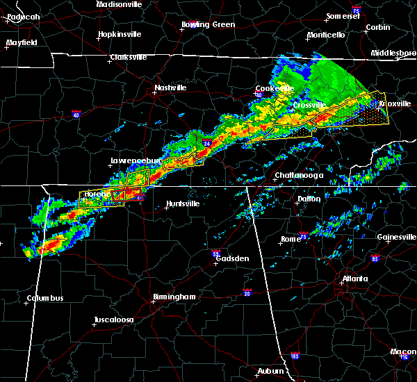 At 1221 pm cst, a severe thunderstorm was located near lynchburg, moving east at 50 mph (radar indicated). Hazards include 60 mph wind gusts and quarter size hail. Hail damage to vehicles is expected. expect wind damage to roofs, siding, and trees. locations impacted include, lynchburg, estill springs, petersburg, tims ford lake, chestnut ridge, howell, belleville, booneville and arnold afb. A tornado watch remains in effect until 600 pm cst for north central and northeastern alabama, and middle tennessee. At 1221 pm cst, a severe thunderstorm was located near lynchburg, moving east at 50 mph (radar indicated). Hazards include 60 mph wind gusts and quarter size hail. Hail damage to vehicles is expected. expect wind damage to roofs, siding, and trees. locations impacted include, lynchburg, estill springs, petersburg, tims ford lake, chestnut ridge, howell, belleville, booneville and arnold afb. A tornado watch remains in effect until 600 pm cst for north central and northeastern alabama, and middle tennessee.
|
| 3/1/2017 12:08 PM CST |
 At 1208 pm cst, a severe thunderstorm was located 7 miles west of lynchburg, moving east at 60 mph (radar indicated). Hazards include 60 mph wind gusts and quarter size hail. Hail damage to vehicles is expected. expect wind damage to roofs, siding, and trees. locations impacted include, winchester, lynchburg, estill springs, petersburg, tims ford lake, howell, mimosa, mulberry, chestnut ridge and belleville. A tornado watch remains in effect until 600 pm cst for north central and northeastern alabama, and middle tennessee. At 1208 pm cst, a severe thunderstorm was located 7 miles west of lynchburg, moving east at 60 mph (radar indicated). Hazards include 60 mph wind gusts and quarter size hail. Hail damage to vehicles is expected. expect wind damage to roofs, siding, and trees. locations impacted include, winchester, lynchburg, estill springs, petersburg, tims ford lake, howell, mimosa, mulberry, chestnut ridge and belleville. A tornado watch remains in effect until 600 pm cst for north central and northeastern alabama, and middle tennessee.
|
| 3/1/2017 12:00 PM CST |
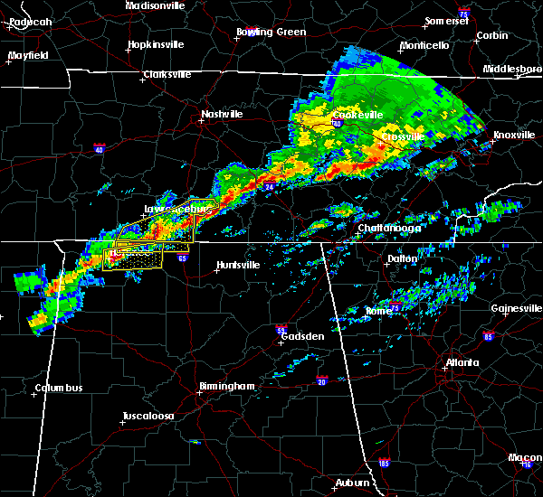 At 1200 pm cst, a severe thunderstorm was located near petersburg, or 9 miles northwest of fayetteville, moving east at 60 mph (radar indicated). Hazards include 60 mph wind gusts and quarter size hail. Hail damage to vehicles is expected. Expect wind damage to roofs, siding, and trees. At 1200 pm cst, a severe thunderstorm was located near petersburg, or 9 miles northwest of fayetteville, moving east at 60 mph (radar indicated). Hazards include 60 mph wind gusts and quarter size hail. Hail damage to vehicles is expected. Expect wind damage to roofs, siding, and trees.
|
| 12/18/2016 1:50 AM CST |
 At 150 am cst, severe thunderstorms were located along a line extending from 7 miles southwest of lynchburg to near fayetteville to near harvest, moving northeast at 65 mph (radar indicated). Hazards include 60 mph wind gusts. Expect damage to roofs, siding, and trees. locations impacted include, fayetteville, lynchburg, hazel green, ardmore, harvest, tims ford lake, lincoln, hurdlow, taft and mimosa. A tornado watch remains in effect until 300 am cst for north central alabama, and middle tennessee. At 150 am cst, severe thunderstorms were located along a line extending from 7 miles southwest of lynchburg to near fayetteville to near harvest, moving northeast at 65 mph (radar indicated). Hazards include 60 mph wind gusts. Expect damage to roofs, siding, and trees. locations impacted include, fayetteville, lynchburg, hazel green, ardmore, harvest, tims ford lake, lincoln, hurdlow, taft and mimosa. A tornado watch remains in effect until 300 am cst for north central alabama, and middle tennessee.
|
| 12/18/2016 1:41 AM CST |
 The severe thunderstorm warning for northwestern lincoln and northern moore counties will expire at 145 am cst, the storms which prompted the warning have weakened below severe limits, and no longer pose an immediate threat to life or property. therefore the warning will be allowed to expire. a tornado watch remains in effect until 300 am cst for north central alabama, and middle tennessee. a severe thunderstorm watch remains in effect until 500 am cst for north central and northeastern alabama, and middle tennessee. The severe thunderstorm warning for northwestern lincoln and northern moore counties will expire at 145 am cst, the storms which prompted the warning have weakened below severe limits, and no longer pose an immediate threat to life or property. therefore the warning will be allowed to expire. a tornado watch remains in effect until 300 am cst for north central alabama, and middle tennessee. a severe thunderstorm watch remains in effect until 500 am cst for north central and northeastern alabama, and middle tennessee.
|
| 12/18/2016 1:30 AM CST |
 At 129 am cst, severe thunderstorms were located along a line extending from 14 miles north of harvest to ardmore to 6 miles west of tanner, moving northeast at 60 mph (radar indicated). Hazards include 60 mph wind gusts. expect damage to roofs, siding, and trees At 129 am cst, severe thunderstorms were located along a line extending from 14 miles north of harvest to ardmore to 6 miles west of tanner, moving northeast at 60 mph (radar indicated). Hazards include 60 mph wind gusts. expect damage to roofs, siding, and trees
|
| 12/18/2016 1:30 AM CST |
 At 129 am cst, a severe thunderstorm capable of producing a tornado was located 8 miles north of manchester, moving northeast at 65 mph (radar indicated rotation). Hazards include tornado. Flying debris will be dangerous to those caught without shelter. mobile homes will be damaged or destroyed. damage to roofs, windows, and vehicles will occur. tree damage is likely. this dangerous storm will be near, mcminnville around 145 am cst. Other locations impacted by this tornadic thunderstorm include summitville, morrison, beechgrove, centertown and viola. At 129 am cst, a severe thunderstorm capable of producing a tornado was located 8 miles north of manchester, moving northeast at 65 mph (radar indicated rotation). Hazards include tornado. Flying debris will be dangerous to those caught without shelter. mobile homes will be damaged or destroyed. damage to roofs, windows, and vehicles will occur. tree damage is likely. this dangerous storm will be near, mcminnville around 145 am cst. Other locations impacted by this tornadic thunderstorm include summitville, morrison, beechgrove, centertown and viola.
|
| 12/18/2016 1:30 AM CST |
 At 129 am cst, severe thunderstorms were located along a line extending from 14 miles north of harvest to ardmore to 6 miles west of tanner, moving northeast at 60 mph (radar indicated). Hazards include 60 mph wind gusts. expect damage to roofs, siding, and trees At 129 am cst, severe thunderstorms were located along a line extending from 14 miles north of harvest to ardmore to 6 miles west of tanner, moving northeast at 60 mph (radar indicated). Hazards include 60 mph wind gusts. expect damage to roofs, siding, and trees
|
| 12/18/2016 1:20 AM CST |
 At 120 am cst, a severe thunderstorm capable of producing a tornado was located 9 miles east of shelbyville, moving northeast at 65 mph (radar indicated rotation). Hazards include tornado. Flying debris will be dangerous to those caught without shelter. mobile homes will be damaged or destroyed. damage to roofs, windows, and vehicles will occur. tree damage is likely. this dangerous storm will be near, manchester around 130 am cst. mcminnville around 145 am cst. Other locations impacted by this tornadic thunderstorm include raus, summitville, morrison, wartrace, normandy, beechgrove, centertown, viola and bell buckle. At 120 am cst, a severe thunderstorm capable of producing a tornado was located 9 miles east of shelbyville, moving northeast at 65 mph (radar indicated rotation). Hazards include tornado. Flying debris will be dangerous to those caught without shelter. mobile homes will be damaged or destroyed. damage to roofs, windows, and vehicles will occur. tree damage is likely. this dangerous storm will be near, manchester around 130 am cst. mcminnville around 145 am cst. Other locations impacted by this tornadic thunderstorm include raus, summitville, morrison, wartrace, normandy, beechgrove, centertown, viola and bell buckle.
|
| 12/18/2016 1:19 AM CST |
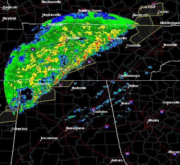 At 119 am cst, severe thunderstorms were located along a line extending from near petersburg to 13 miles west of fayetteville, moving northeast at 55 mph (radar indicated). Hazards include 60 mph wind gusts. expect damage to roofs, siding, and trees At 119 am cst, severe thunderstorms were located along a line extending from near petersburg to 13 miles west of fayetteville, moving northeast at 55 mph (radar indicated). Hazards include 60 mph wind gusts. expect damage to roofs, siding, and trees
|
| 12/18/2016 1:15 AM CST |
 At 115 am cst, a severe thunderstorm was located near shelbyville, moving northeast at 60 mph (radar indicated). Hazards include 60 mph wind gusts. Expect damage to roofs, siding, and trees. locations impacted include, shelbyville, lewisburg, manchester, wartrace, bell buckle, normandy, summitville, christiana, belfast, bradyville, farmington, raus, fosterville, deason and beechgrove. A tornado watch remains in effect until 300 am cst for middle tennessee. At 115 am cst, a severe thunderstorm was located near shelbyville, moving northeast at 60 mph (radar indicated). Hazards include 60 mph wind gusts. Expect damage to roofs, siding, and trees. locations impacted include, shelbyville, lewisburg, manchester, wartrace, bell buckle, normandy, summitville, christiana, belfast, bradyville, farmington, raus, fosterville, deason and beechgrove. A tornado watch remains in effect until 300 am cst for middle tennessee.
|
| 12/18/2016 12:59 AM CST |
 At 1258 am cst, a severe thunderstorm was located near lewisburg, moving northeast at 70 mph. another cell was located southwest of chapel hill (radar indicated). Hazards include 60 mph wind gusts. expect damage to roofs, siding, and trees At 1258 am cst, a severe thunderstorm was located near lewisburg, moving northeast at 70 mph. another cell was located southwest of chapel hill (radar indicated). Hazards include 60 mph wind gusts. expect damage to roofs, siding, and trees
|
| 12/18/2016 12:51 AM CST |
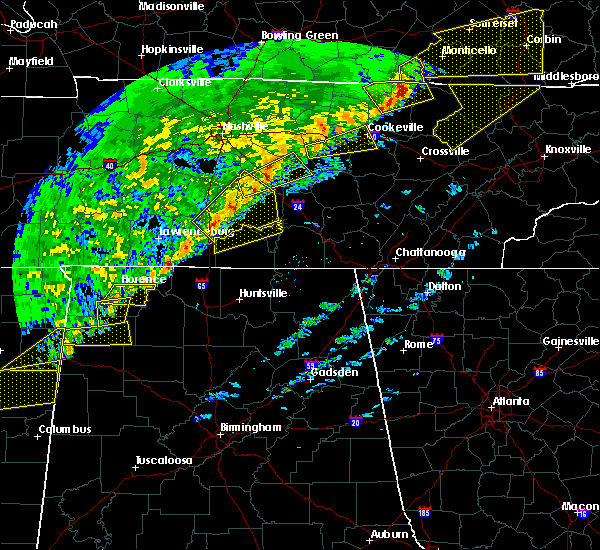 At 1250 am cst, severe thunderstorms were located along a line extending from near shelbyville to 8 miles south of pulaski, moving northeast at 60 mph (radar indicated). Hazards include 60 mph wind gusts. expect damage to roofs, siding, and trees At 1250 am cst, severe thunderstorms were located along a line extending from near shelbyville to 8 miles south of pulaski, moving northeast at 60 mph (radar indicated). Hazards include 60 mph wind gusts. expect damage to roofs, siding, and trees
|
| 11/29/2016 9:48 PM CST |
 At 948 pm cst, a severe thunderstorm was located over estill springs, or near winchester, moving northeast at 55 mph (radar indicated). Hazards include 60 mph wind gusts. Expect damage to roofs. siding. And trees. At 948 pm cst, a severe thunderstorm was located over estill springs, or near winchester, moving northeast at 55 mph (radar indicated). Hazards include 60 mph wind gusts. Expect damage to roofs. siding. And trees.
|
| 11/29/2016 9:19 PM CST |
 At 918 pm cst, a confirmed large and extremely dangerous tornado was located near manchester, moving northeast at 40 mph. this is a particularly dangerous situation. take cover now! (weather spotters confirmed tornado. at 915 pm...trained spotters reported a large tornado north of highway 55 moving towards manchester). Hazards include damaging tornado. You are in a life-threatening situation. flying debris may be deadly to those caught without shelter. mobile homes will be destroyed. considerable damage to homes, businesses, and vehicles is likely and complete destruction is possible. This tornadic thunderstorm will remain over mainly rural areas of southern coffee county, including the following locations: hillsboro and arnold afb. At 918 pm cst, a confirmed large and extremely dangerous tornado was located near manchester, moving northeast at 40 mph. this is a particularly dangerous situation. take cover now! (weather spotters confirmed tornado. at 915 pm...trained spotters reported a large tornado north of highway 55 moving towards manchester). Hazards include damaging tornado. You are in a life-threatening situation. flying debris may be deadly to those caught without shelter. mobile homes will be destroyed. considerable damage to homes, businesses, and vehicles is likely and complete destruction is possible. This tornadic thunderstorm will remain over mainly rural areas of southern coffee county, including the following locations: hillsboro and arnold afb.
|
| 11/29/2016 9:13 PM CST |
 At 913 pm cst, a confirmed large and extremely dangerous tornado was located near tullahoma, moving northeast at 40 mph. this is a particularly dangerous situation. take cover now! (radar confirmed tornado). Hazards include damaging tornado. You are in a life-threatening situation. flying debris may be deadly to those caught without shelter. mobile homes will be destroyed. considerable damage to homes, businesses, and vehicles is likely and complete destruction is possible. the tornado will be near, manchester around 925 pm cst. Other locations impacted by this tornadic thunderstorm include hillsboro and arnold afb. At 913 pm cst, a confirmed large and extremely dangerous tornado was located near tullahoma, moving northeast at 40 mph. this is a particularly dangerous situation. take cover now! (radar confirmed tornado). Hazards include damaging tornado. You are in a life-threatening situation. flying debris may be deadly to those caught without shelter. mobile homes will be destroyed. considerable damage to homes, businesses, and vehicles is likely and complete destruction is possible. the tornado will be near, manchester around 925 pm cst. Other locations impacted by this tornadic thunderstorm include hillsboro and arnold afb.
|
| 11/29/2016 9:12 PM CST | Tullahoma asos recorded 51 knot gust in coffee county TN, 1.3 miles SSE of Tullahoma, TN |
| 11/29/2016 9:09 PM CST | Multiple trees and power lines were downed across the north end of tullahom in coffee county TN, 1.1 miles NE of Tullahoma, TN |
| 11/29/2016 9:09 PM CST |
 At 908 pm cst, a large and extremely dangerous tornado was located near tullahoma, or 10 miles northeast of lynchburg, moving northeast at 40 mph. this is a particularly dangerous situation. take cover now! (radar indicated rotation). Hazards include damaging tornado. You are in a life-threatening situation. flying debris may be deadly to those caught without shelter. mobile homes will be destroyed. considerable damage to homes, businesses, and vehicles is likely and complete destruction is possible. the tornado will be near, manchester around 925 pm cst. Other locations impacted by this tornadic thunderstorm include hillsboro and arnold afb. At 908 pm cst, a large and extremely dangerous tornado was located near tullahoma, or 10 miles northeast of lynchburg, moving northeast at 40 mph. this is a particularly dangerous situation. take cover now! (radar indicated rotation). Hazards include damaging tornado. You are in a life-threatening situation. flying debris may be deadly to those caught without shelter. mobile homes will be destroyed. considerable damage to homes, businesses, and vehicles is likely and complete destruction is possible. the tornado will be near, manchester around 925 pm cst. Other locations impacted by this tornadic thunderstorm include hillsboro and arnold afb.
|
| 11/29/2016 9:08 PM CST | Portions of tullahoma mcdonalds roof blown away in coffee county TN, 0.6 miles ENE of Tullahoma, TN |
| 11/29/2016 9:07 PM CST | Large tree down and blocking road on golf club lane in tullahoma in coffee county TN, 1.2 miles E of Tullahoma, TN |
| 11/29/2016 9:07 PM CST | Roof damage to strip mall along n jackson street in tullahoma in coffee county TN, 0.8 miles SE of Tullahoma, TN |
| 11/29/2016 9:07 PM CST | Tree down across cedar street in tullahoma. road impassable in coffee county TN, 1.1 miles NE of Tullahoma, TN |
| 11/29/2016 9:07 PM CST | Tree fell on house near lakewood country club in tullahoma in coffee county TN, 1.3 miles SSE of Tullahoma, TN |
| 11/29/2016 9:07 PM CST | Tspotter report of trees and power lines down in the sharondale area of tullahom in coffee county TN, 2.3 miles NE of Tullahoma, TN |
| 11/29/2016 9:06 PM CST | House destroyed and trees down in the sharondale area in tullahoma possible tornado in coffee county TN, 1.5 miles NE of Tullahoma, TN |
| 11/29/2016 9:05 PM CST |
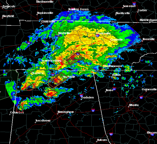 At 905 pm cst, a severe thunderstorm capable of producing a tornado was located near tullahoma, or 8 miles northeast of lynchburg, moving northeast at 40 mph (radar indicated rotation). Hazards include tornado and quarter size hail. Flying debris will be dangerous to those caught without shelter. mobile homes will be damaged or destroyed. damage to roofs, windows, and vehicles will occur. tree damage is likely. this dangerous storm will be near, manchester around 930 pm cst. Other locations impacted by this tornadic thunderstorm include raus, hillsboro, normandy and arnold afb. At 905 pm cst, a severe thunderstorm capable of producing a tornado was located near tullahoma, or 8 miles northeast of lynchburg, moving northeast at 40 mph (radar indicated rotation). Hazards include tornado and quarter size hail. Flying debris will be dangerous to those caught without shelter. mobile homes will be damaged or destroyed. damage to roofs, windows, and vehicles will occur. tree damage is likely. this dangerous storm will be near, manchester around 930 pm cst. Other locations impacted by this tornadic thunderstorm include raus, hillsboro, normandy and arnold afb.
|
| 11/29/2016 8:57 PM CST |
 At 857 pm cst, a severe thunderstorm capable of producing a tornado was located over lynchburg, moving northeast at 40 mph (radar indicated rotation). Hazards include tornado and quarter size hail. Flying debris will be dangerous to those caught without shelter. mobile homes will be damaged or destroyed. damage to roofs, windows, and vehicles will occur. tree damage is likely. this dangerous storm will be near, tullahoma around 910 pm cst. manchester around 925 pm cst. Other locations impacted by this tornadic thunderstorm include raus, hillsboro, normandy and arnold afb. At 857 pm cst, a severe thunderstorm capable of producing a tornado was located over lynchburg, moving northeast at 40 mph (radar indicated rotation). Hazards include tornado and quarter size hail. Flying debris will be dangerous to those caught without shelter. mobile homes will be damaged or destroyed. damage to roofs, windows, and vehicles will occur. tree damage is likely. this dangerous storm will be near, tullahoma around 910 pm cst. manchester around 925 pm cst. Other locations impacted by this tornadic thunderstorm include raus, hillsboro, normandy and arnold afb.
|
| 11/29/2016 8:53 PM CST |
 At 853 pm cst, a severe thunderstorm capable of producing a tornado was located over lynchburg, moving east at 30 mph (radar indicated rotation). Hazards include tornado and quarter size hail. Flying debris will be dangerous to those caught without shelter. mobile homes will be damaged or destroyed. damage to roofs, windows, and vehicles will occur. tree damage is likely. this dangerous storm will be near, tims ford lake around 905 pm cst. estill springs around 920 pm cst. Other locations impacted by this tornadic thunderstorm include marble hill, lois, arnold afb, oak grove and woods reservoir. At 853 pm cst, a severe thunderstorm capable of producing a tornado was located over lynchburg, moving east at 30 mph (radar indicated rotation). Hazards include tornado and quarter size hail. Flying debris will be dangerous to those caught without shelter. mobile homes will be damaged or destroyed. damage to roofs, windows, and vehicles will occur. tree damage is likely. this dangerous storm will be near, tims ford lake around 905 pm cst. estill springs around 920 pm cst. Other locations impacted by this tornadic thunderstorm include marble hill, lois, arnold afb, oak grove and woods reservoir.
|
| 11/29/2016 8:48 PM CST |
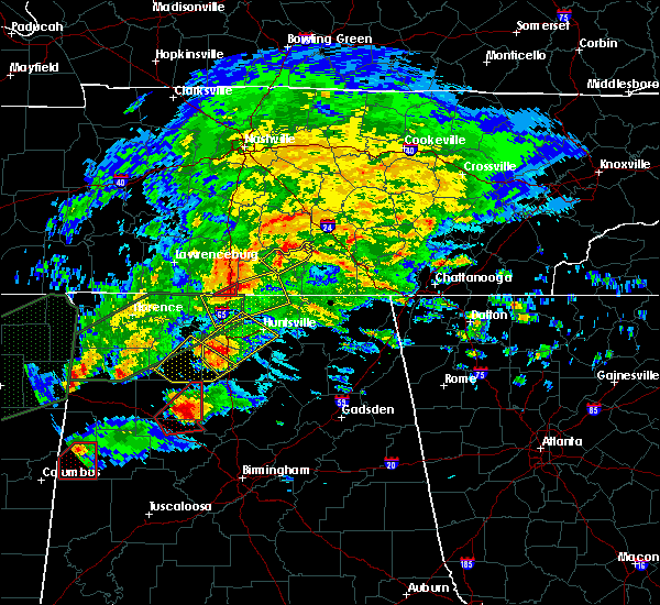 At 848 pm cst, a severe thunderstorm was located near lynchburg, moving northeast at 35 mph (radar indicated). Hazards include 60 mph wind gusts. Expect damage to roofs. siding. And trees. At 848 pm cst, a severe thunderstorm was located near lynchburg, moving northeast at 35 mph (radar indicated). Hazards include 60 mph wind gusts. Expect damage to roofs. siding. And trees.
|
| 11/29/2016 8:40 PM CST |
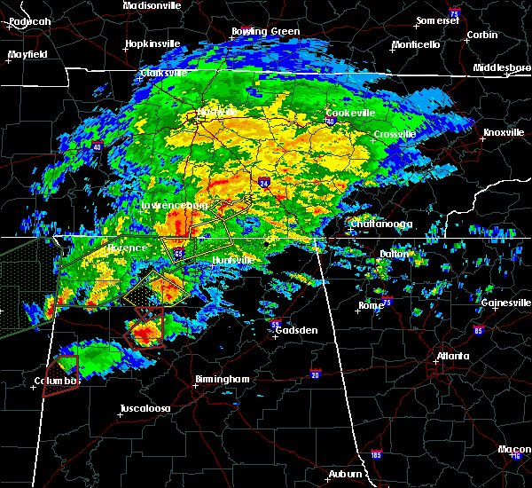 At 840 pm cst, a severe thunderstorm was located near fayetteville, moving northeast at 35 mph (radar indicated). Hazards include 60 mph wind gusts and nickel size hail. Expect damage to roofs. siding. And trees. At 840 pm cst, a severe thunderstorm was located near fayetteville, moving northeast at 35 mph (radar indicated). Hazards include 60 mph wind gusts and nickel size hail. Expect damage to roofs. siding. And trees.
|
| 7/8/2016 10:25 PM CDT |
 At 1024 pm cdt, severe thunderstorms were located along a line extending from 10 miles northeast of manchester to near lynchburg, moving east at 40 mph (radar indicated). Hazards include 60 mph wind gusts and penny size hail. Expect damage to roofs. siding. and trees. locations impacted include, shelbyville, manchester, tullahoma, tracy city, monteagle, coalmont, wartrace, normandy, raus, pelham, hillsboro, beechgrove, arnold afb and fiery gizzard s. P At 1024 pm cdt, severe thunderstorms were located along a line extending from 10 miles northeast of manchester to near lynchburg, moving east at 40 mph (radar indicated). Hazards include 60 mph wind gusts and penny size hail. Expect damage to roofs. siding. and trees. locations impacted include, shelbyville, manchester, tullahoma, tracy city, monteagle, coalmont, wartrace, normandy, raus, pelham, hillsboro, beechgrove, arnold afb and fiery gizzard s. P
|
| 7/8/2016 10:00 PM CDT |
 At 959 pm cdt, severe thunderstorms were located along a line extending from 14 miles northwest of manchester to near petersburg, moving east at 40 mph (radar indicated). Hazards include 60 mph wind gusts and penny size hail. Expect damage to roofs. siding. And trees. At 959 pm cdt, severe thunderstorms were located along a line extending from 14 miles northwest of manchester to near petersburg, moving east at 40 mph (radar indicated). Hazards include 60 mph wind gusts and penny size hail. Expect damage to roofs. siding. And trees.
|
| 7/8/2016 9:31 PM CDT |
 At 931 pm cdt, severe thunderstorms were located along a line extending from near murfreesboro to near petersburg, moving east at 45 mph (radar indicated). Hazards include 70 mph wind gusts and penny size hail. Expect considerable tree damage. Damage is likely to mobile homes, roofs, and outbuildings. At 931 pm cdt, severe thunderstorms were located along a line extending from near murfreesboro to near petersburg, moving east at 45 mph (radar indicated). Hazards include 70 mph wind gusts and penny size hail. Expect considerable tree damage. Damage is likely to mobile homes, roofs, and outbuildings.
|
| 7/8/2016 7:42 PM CDT |
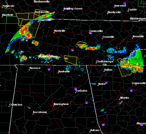 At 742 pm cdt, a severe thunderstorm was located over lynchburg, moving east at 20 mph (radar indicated). Hazards include 60 mph wind gusts. Expect damage to roofs. siding. And trees. At 742 pm cdt, a severe thunderstorm was located over lynchburg, moving east at 20 mph (radar indicated). Hazards include 60 mph wind gusts. Expect damage to roofs. siding. And trees.
|
| 7/7/2016 8:11 AM CDT |
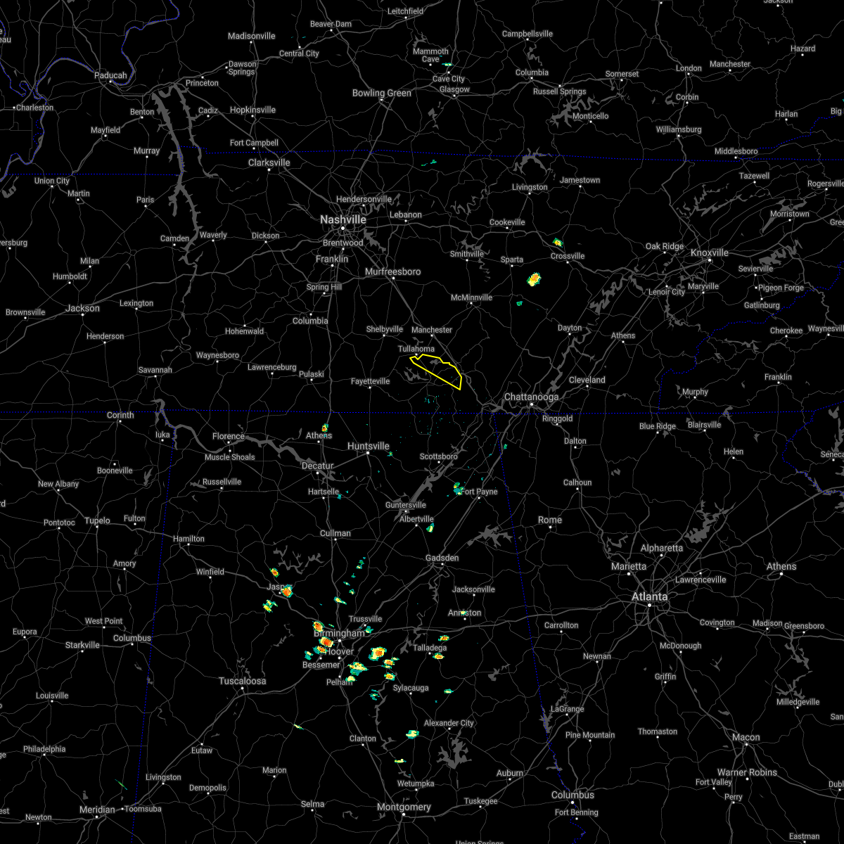 The severe thunderstorm warning for northeastern franklin county will expire at 815 am cdt, the storm which prompted the warning has weakened below severe limits, and no longer pose an immediate threat to life or property. therefore, the warning will be allowed to expire. however gusty winds and heavy rain are still possible with this thunderstorm. The severe thunderstorm warning for northeastern franklin county will expire at 815 am cdt, the storm which prompted the warning has weakened below severe limits, and no longer pose an immediate threat to life or property. therefore, the warning will be allowed to expire. however gusty winds and heavy rain are still possible with this thunderstorm.
|
| 7/7/2016 8:02 AM CDT |
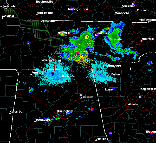 At 802 am cdt, a severe thunderstorm was located near monteagle, or 16 miles northeast of winchester, moving southeast at 45 mph (radar indicated). Hazards include 60 mph wind gusts. Expect damage to roofs. siding. and trees. locations impacted include, decherd, estill springs, monteagle, sewanee, st. Andrews, alto, arnold afb, oak grove and woods reservoir. At 802 am cdt, a severe thunderstorm was located near monteagle, or 16 miles northeast of winchester, moving southeast at 45 mph (radar indicated). Hazards include 60 mph wind gusts. Expect damage to roofs. siding. and trees. locations impacted include, decherd, estill springs, monteagle, sewanee, st. Andrews, alto, arnold afb, oak grove and woods reservoir.
|
| 7/7/2016 7:49 AM CDT |
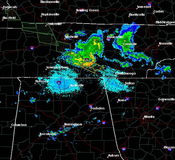 At 749 am cdt, a severe thunderstorm was located over manchester, moving southeast at 45 mph (radar indicated). Hazards include 60 mph wind gusts. Expect damage to roofs. siding. and trees. locations impacted include, manchester, tullahoma, tracy city, monteagle, coalmont, pelham, hillsboro, arnold afb and fiery gizzard s. P At 749 am cdt, a severe thunderstorm was located over manchester, moving southeast at 45 mph (radar indicated). Hazards include 60 mph wind gusts. Expect damage to roofs. siding. and trees. locations impacted include, manchester, tullahoma, tracy city, monteagle, coalmont, pelham, hillsboro, arnold afb and fiery gizzard s. P
|
| 7/7/2016 7:40 AM CDT |
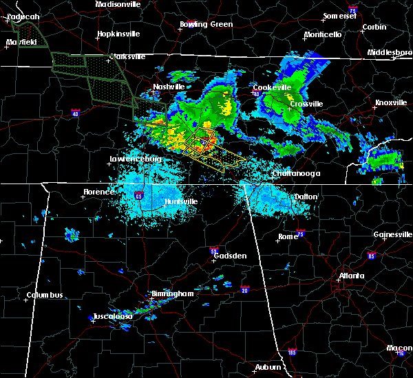 At 739 am cdt, a severe thunderstorm was located over manchester, moving southeast at 45 mph (radar indicated). Hazards include 60 mph wind gusts. Expect damage to roofs. siding. And trees. At 739 am cdt, a severe thunderstorm was located over manchester, moving southeast at 45 mph (radar indicated). Hazards include 60 mph wind gusts. Expect damage to roofs. siding. And trees.
|
| 7/7/2016 7:37 AM CDT |
 At 736 am cdt, a severe thunderstorm was located near tullahoma, or 7 miles west of manchester, moving southeast at 45 mph (radar indicated). Hazards include 60 mph wind gusts. Expect damage to roofs. siding. And trees. At 736 am cdt, a severe thunderstorm was located near tullahoma, or 7 miles west of manchester, moving southeast at 45 mph (radar indicated). Hazards include 60 mph wind gusts. Expect damage to roofs. siding. And trees.
|
| 7/7/2016 7:33 AM CDT |
 At 732 am cdt, a severe thunderstorm was located 7 miles northwest of manchester, moving southeast at 45 mph (radar indicated). Hazards include 60 mph wind gusts. Expect damage to roofs. siding. and trees. Locations impacted include, manchester, wartrace, normandy and beechgrove. At 732 am cdt, a severe thunderstorm was located 7 miles northwest of manchester, moving southeast at 45 mph (radar indicated). Hazards include 60 mph wind gusts. Expect damage to roofs. siding. and trees. Locations impacted include, manchester, wartrace, normandy and beechgrove.
|
| 7/7/2016 7:18 AM CDT |
 At 718 am cdt, a severe thunderstorm was located 11 miles northeast of shelbyville, moving southeast at 45 mph (radar indicated). Hazards include 60 mph wind gusts. Expect damage to roofs. siding. And trees. At 718 am cdt, a severe thunderstorm was located 11 miles northeast of shelbyville, moving southeast at 45 mph (radar indicated). Hazards include 60 mph wind gusts. Expect damage to roofs. siding. And trees.
|
| 6/15/2016 6:24 PM CDT |
 The severe thunderstorm warning for lincoln, northern franklin and moore counties will expire at 630 pm cdt, the storms which prompted the warning have moved out of the warned area. therefore the warning will be allowed to expire. an additional warning remains in effect for parts of lincoln, franklin and moore counties in tn. The severe thunderstorm warning for lincoln, northern franklin and moore counties will expire at 630 pm cdt, the storms which prompted the warning have moved out of the warned area. therefore the warning will be allowed to expire. an additional warning remains in effect for parts of lincoln, franklin and moore counties in tn.
|
| 6/15/2016 6:24 PM CDT |
 At 624 pm cdt, severe thunderstorms were located along a line extending from near dunlap to near sewanee, moving southeast at 40 mph (radar indicated). Hazards include 60 mph wind gusts. Expect damage to roofs. siding. and trees. locations impacted include, manchester, tullahoma, gruetli-laager, tracy city, monteagle, altamont, coalmont, palmer, beersheba springs, pelham, hillsboro, arnold afb and fiery gizzard s. P At 624 pm cdt, severe thunderstorms were located along a line extending from near dunlap to near sewanee, moving southeast at 40 mph (radar indicated). Hazards include 60 mph wind gusts. Expect damage to roofs. siding. and trees. locations impacted include, manchester, tullahoma, gruetli-laager, tracy city, monteagle, altamont, coalmont, palmer, beersheba springs, pelham, hillsboro, arnold afb and fiery gizzard s. P
|
| 6/15/2016 6:15 PM CDT |
 At 615 pm cdt, severe thunderstorms were located along a line extending from near pikeville to near monteagle, moving southeast at 35 mph (radar indicated). Hazards include 60 mph wind gusts. Expect damage to roofs. siding. and trees. locations impacted include, manchester, spencer, tullahoma, gruetli-laager, tracy city, monteagle, altamont, coalmont, palmer, beersheba springs, viola, fall creek falls state park, pelham, hillsboro, arnold afb, fall creek falls s. p. and fiery gizzard s. P At 615 pm cdt, severe thunderstorms were located along a line extending from near pikeville to near monteagle, moving southeast at 35 mph (radar indicated). Hazards include 60 mph wind gusts. Expect damage to roofs. siding. and trees. locations impacted include, manchester, spencer, tullahoma, gruetli-laager, tracy city, monteagle, altamont, coalmont, palmer, beersheba springs, viola, fall creek falls state park, pelham, hillsboro, arnold afb, fall creek falls s. p. and fiery gizzard s. P
|
| 6/15/2016 5:54 PM CDT |
 At 553 pm cdt, severe thunderstorms were located along a line extending from 9 miles south of mcminnville to 10 miles east of pulaski, moving southeast at 20 mph. this storm did topple trees in lynchburg, tn as it passed through as reported by law enforcement (radar indicated). Hazards include 60 mph wind gusts and quarter size hail. Hail damage to vehicles is expected. expect wind damage to roofs, siding, and trees. Locations impacted include, winchester, fayetteville, lynchburg, decherd, estill springs, ardmore, monteagle, petersburg, tims ford lake and sewanee. At 553 pm cdt, severe thunderstorms were located along a line extending from 9 miles south of mcminnville to 10 miles east of pulaski, moving southeast at 20 mph. this storm did topple trees in lynchburg, tn as it passed through as reported by law enforcement (radar indicated). Hazards include 60 mph wind gusts and quarter size hail. Hail damage to vehicles is expected. expect wind damage to roofs, siding, and trees. Locations impacted include, winchester, fayetteville, lynchburg, decherd, estill springs, ardmore, monteagle, petersburg, tims ford lake and sewanee.
|
| 6/15/2016 5:54 PM CDT |
 At 554 pm cdt, severe thunderstorms were located along a line extending from near spencer to 8 miles southeast of manchester, moving southeast at 35 mph (radar indicated). Hazards include 60 mph wind gusts. Expect damage to roofs. siding. And trees. At 554 pm cdt, severe thunderstorms were located along a line extending from near spencer to 8 miles southeast of manchester, moving southeast at 35 mph (radar indicated). Hazards include 60 mph wind gusts. Expect damage to roofs. siding. And trees.
|
| 6/15/2016 5:45 PM CDT | Dozens of trees were knocked down throughout the county. several telephone poles and power lines also knocked down. power outages near the tims ford lake are in franklin county TN, 5.5 miles NNE of Tullahoma, TN |
| 6/15/2016 5:45 PM CDT | Tspotter report of a tree and power line down near east lincoln elementary school in tullahoma in coffee county TN, 1 miles NNW of Tullahoma, TN |
| 6/15/2016 5:42 PM CDT | Ema reports multiple trees down in lynchbur in moore county TN, 11.1 miles NE of Tullahoma, TN |
| 6/15/2016 5:42 PM CDT |
 At 541 pm cdt, severe thunderstorms were located along a line extending from 7 miles south of mcminnville to 6 miles east of pulaski, moving southeast at 20 mph (radar indicated). Hazards include 60 mph wind gusts and quarter size hail. Hail damage to vehicles is expected. Expect wind damage to roofs, siding, and trees. At 541 pm cdt, severe thunderstorms were located along a line extending from 7 miles south of mcminnville to 6 miles east of pulaski, moving southeast at 20 mph (radar indicated). Hazards include 60 mph wind gusts and quarter size hail. Hail damage to vehicles is expected. Expect wind damage to roofs, siding, and trees.
|
| 6/15/2016 5:27 PM CDT |
 At 527 pm cdt, severe thunderstorms were located along a line extending from 9 miles southeast of woodbury to 10 miles northwest of manchester to shelbyville, moving southeast at 40 mph (radar indicated). Hazards include 60 mph wind gusts. Expect damage to roofs. siding. And trees. At 527 pm cdt, severe thunderstorms were located along a line extending from 9 miles southeast of woodbury to 10 miles northwest of manchester to shelbyville, moving southeast at 40 mph (radar indicated). Hazards include 60 mph wind gusts. Expect damage to roofs. siding. And trees.
|
| 4/30/2016 6:28 PM CDT |
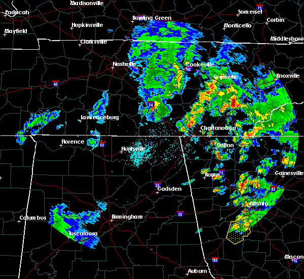 At 627 pm cdt, a severe thunderstorm was located over manchester, moving northeast at 45 mph (radar indicated). Hazards include 60 mph wind gusts and quarter size hail. Hail damage to vehicles is expected. Expect wind damage to roofs, siding, and trees. At 627 pm cdt, a severe thunderstorm was located over manchester, moving northeast at 45 mph (radar indicated). Hazards include 60 mph wind gusts and quarter size hail. Hail damage to vehicles is expected. Expect wind damage to roofs, siding, and trees.
|
| 4/30/2016 5:42 PM CDT | The severe thunderstorm warning for lincoln, northwestern franklin and moore counties will expire at 545 pm cdt, the storm which prompted the warning has weakened below severe limits, and no longer pose an immediate threat to life or property. therefore the warning will be allowed to expire. |
| 4/30/2016 5:23 PM CDT |
 At 522 pm cdt, a severe thunderstorm was located near fayetteville, moving northeast at 45 mph (radar indicated). Hazards include 60 mph wind gusts and quarter size hail. Hail damage to vehicles is expected. expect wind damage to roofs, siding, and trees. Locations impacted include, winchester, fayetteville, lynchburg, petersburg, tims ford lake, harmony, hurdlow, taft, mimosa and marble hill. At 522 pm cdt, a severe thunderstorm was located near fayetteville, moving northeast at 45 mph (radar indicated). Hazards include 60 mph wind gusts and quarter size hail. Hail damage to vehicles is expected. expect wind damage to roofs, siding, and trees. Locations impacted include, winchester, fayetteville, lynchburg, petersburg, tims ford lake, harmony, hurdlow, taft, mimosa and marble hill.
|
| 4/30/2016 5:05 PM CDT |
 At 505 pm cdt, a severe thunderstorm was located 9 miles northeast of ardmore, or 9 miles southwest of fayetteville, moving northeast at 55 mph (radar indicated). Hazards include 60 mph wind gusts and quarter size hail. Hail damage to vehicles is expected. Expect wind damage to roofs, siding, and trees. At 505 pm cdt, a severe thunderstorm was located 9 miles northeast of ardmore, or 9 miles southwest of fayetteville, moving northeast at 55 mph (radar indicated). Hazards include 60 mph wind gusts and quarter size hail. Hail damage to vehicles is expected. Expect wind damage to roofs, siding, and trees.
|
| 4/27/2016 7:32 PM CDT |
 At 731 pm cdt, a severe thunderstorm was located over manchester, moving northeast at 45 mph (radar indicated). Hazards include 60 mph wind gusts. Expect damage to roofs. siding. And trees. At 731 pm cdt, a severe thunderstorm was located over manchester, moving northeast at 45 mph (radar indicated). Hazards include 60 mph wind gusts. Expect damage to roofs. siding. And trees.
|
| 4/27/2016 7:13 PM CDT | Tree down on north atlantic st. in tullahom in coffee county TN, 1.1 miles NE of Tullahoma, TN |
| 7/14/2015 5:00 PM CDT | A few trees downed by thunderstorm wind in moore county TN, 10.2 miles NE of Tullahoma, TN |
| 7/14/2015 4:59 PM CDT |
 At 458 pm cdt, a severe thunderstorm was located near manchester, moving southeast at 30 mph (radar indicated). Hazards include 60 mph wind gusts and quarter size hail. Hail damage to vehicles is expected. expect wind damage to roofs, siding and trees. this severe thunderstorm will be near, monteagle around 535 pm cdt. tracy city around 540 pm cdt. other locations impacted by this severe thunderstorm include coalmont, pelham, hillsboro, arnold afb, fiery gizzard s. p,. Altamont and woods reservoir. At 458 pm cdt, a severe thunderstorm was located near manchester, moving southeast at 30 mph (radar indicated). Hazards include 60 mph wind gusts and quarter size hail. Hail damage to vehicles is expected. expect wind damage to roofs, siding and trees. this severe thunderstorm will be near, monteagle around 535 pm cdt. tracy city around 540 pm cdt. other locations impacted by this severe thunderstorm include coalmont, pelham, hillsboro, arnold afb, fiery gizzard s. p,. Altamont and woods reservoir.
|
| 7/1/2015 2:04 PM CDT |
 At 204 pm cdt, a severe thunderstorm was located near tullahoma, or 8 miles south of manchester, moving southeast at 35 mph (radar indicated). Hazards include 60 mph wind gusts. Expect damage to roofs. siding and trees. This severe thunderstorm will remain over mainly rural areas of southwestern coffee county, including the following locations, oak grove and arnold afb. At 204 pm cdt, a severe thunderstorm was located near tullahoma, or 8 miles south of manchester, moving southeast at 35 mph (radar indicated). Hazards include 60 mph wind gusts. Expect damage to roofs. siding and trees. This severe thunderstorm will remain over mainly rural areas of southwestern coffee county, including the following locations, oak grove and arnold afb.
|
| 7/1/2015 1:47 PM CDT |
 At 146 pm cdt, a severe thunderstorm was located near tullahoma, or 10 miles southeast of shelbyville, moving southeast at 35 mph (radar indicated). Hazards include 60 mph wind gusts. Expect damage to roofs. siding and trees. this severe thunderstorm will be near, tullahoma around 155 pm cdt. Other locations impacted by this severe thunderstorm include oak grove and arnold afb. At 146 pm cdt, a severe thunderstorm was located near tullahoma, or 10 miles southeast of shelbyville, moving southeast at 35 mph (radar indicated). Hazards include 60 mph wind gusts. Expect damage to roofs. siding and trees. this severe thunderstorm will be near, tullahoma around 155 pm cdt. Other locations impacted by this severe thunderstorm include oak grove and arnold afb.
|
| 7/1/2015 1:45 PM CDT | Large branch snapped and estimated wind gust of 50 mph in coffee county TN, 1.1 miles NE of Tullahoma, TN |
| 4/20/2015 2:15 AM CDT | At 214 am cdt, severe thunderstorms were located along a line extending from lynchburg to 6 miles north of new market, moving east at 45 mph (radar indicated). Hazards include 60 mph wind gusts and penny size hail. Expect damage to roofs. siding and trees. severe thunderstorms will be near, estill springs, huntland and tims ford lake around 230 am cdt. winchester and decherd around 235 am cdt. monteagle and sewanee around 250 am cdt. other locations impacted by these severe thunderstorms include belvidere, st. andrews, maxwell, harmony, alto, anderson, sherwood, arnold afb, beans creek and lexie crossroads. 0. 75in. |
| 4/20/2015 2:10 AM CDT | At 210 am cdt, severe thunderstorms were located along a line extending from near lynchburg to 7 miles northeast of hazel green, moving east at 45 mph (radar indicated). Hazards include 60 mph wind gusts and penny size hail. Expect damage to roofs. siding and trees. these severe storms will be near, lynchburg around 215 am cdt. tims ford lake around 230 am cdt. other locations impacted by these severe thunderstorms include flintville, belleview, elora, smithland, hurdlow, crystal springs, howell, kelso, mimosa and chestnut ridge. 0. 75in. |
| 4/20/2015 2:00 AM CDT | At 159 am cdt, severe thunderstorms were located along a line extending from near petersburg to 7 miles northwest of hazel green, moving east at 45 mph (radar indicated). Hazards include 60 mph wind gusts and penny size hail. Expect damage to roofs. siding and trees. these severe storms will be near, lynchburg around 215 am cdt. tims ford lake around 230 am cdt. other locations impacted by these severe thunderstorms include blanche, elora, smithland, hurdlow, taft, mimosa, chestnut ridge, marble hill, lincoln and molino. 0. 75in. |
| 4/20/2015 1:42 AM CDT | At 142 am cdt, severe thunderstorms were located along a line extending from 10 miles west of petersburg to ardmore, moving east at 35 mph (radar indicated). Hazards include 60 mph wind gusts and penny size hail. Expect damage to roofs. siding and trees. severe thunderstorms will be near, petersburg around 200 am cdt. lynchburg around 220 am cdt. other locations impacted by these severe thunderstorms include blanche, elora, smithland, hurdlow, taft, mimosa, chestnut ridge, marble hill, lincoln and molino. 0. 75in. |
| 4/3/2015 7:42 PM CDT | The severe thunderstorm warning for western franklin and moore counties will expire at 745 pm cdt. the storm which prompted the warning has weakened below severe limits. and no longer pose an immediate threat to life or property. therefore the warning will be allowed to expire. However gusty winds are still possible with this thunderstorm. |
| 4/3/2015 7:33 PM CDT | A severe thunderstorm warning remains in effect until 745 pm cdt for western franklin and moore counties. at 730 pm cdt. a severe thunderstorm was located near lynchburg. moving southeast at 50 mph. hazard. 60 mph wind gusts and quarter size hail. source. Radar indicated. |
| 4/3/2015 7:17 PM CDT | The national weather service in huntsville has issued a * severe thunderstorm warning for. northeastern lincoln county in middle tennessee. western franklin county in middle tennessee. moore county in middle tennessee. Until 745 pm cdt. |
| 12/21/2013 11:32 PM CST | Trees were knocked down on cumberland springs roa in moore county TN, 5.6 miles ENE of Tullahoma, TN |
| 12/21/2013 11:32 PM CST | Trees were knocked down on highway 130 near motlow college. power lines also dow in moore county TN, 5.4 miles ENE of Tullahoma, TN |
| 12/21/2013 11:32 PM CST | Trees were knocked down on five points roa in moore county TN, 6.4 miles ENE of Tullahoma, TN |
| 7/10/2013 8:15 PM CDT | Tree blown down on highway 41a at shipman creek road in bedford county TN, 4.7 miles ESE of Tullahoma, TN |
| 6/17/2013 3:30 PM CDT | Law enforcement dispatch reported a tree down in northern coffee count in coffee county TN, 0.8 miles SE of Tullahoma, TN |
| 4/19/2013 2:15 AM CDT | Trees and powerlines reported down on bakertown roa in moore county TN, 10.9 miles NE of Tullahoma, TN |
| 4/19/2013 2:15 AM CDT | Trees and powerlines reported down on bullrun roa in moore county TN, 11.7 miles NNE of Tullahoma, TN |
| 4/19/2013 2:13 AM CDT | Downed trees and other debris on road reported on norman wiesman road near highway 5 in moore county TN, 12.5 miles NE of Tullahoma, TN |
| 4/19/2013 2:13 AM CDT | Trees...power poles and powerlines reported down at the intersection of highway 50 and lois ridge roa in moore county TN, 12.5 miles NE of Tullahoma, TN |
| 8/17/2012 12:15 AM CDT | Tree blown down in the yard of a home in tullahom in coffee county TN, 1.1 miles NE of Tullahoma, TN |
| 8/1/2012 8:30 PM CDT | Numerous trees were blown down all around tullahom in coffee county TN, 1.1 miles NE of Tullahoma, TN |
| 7/16/2012 7:00 PM CDT | Trees blown down on west side of tullahoma at around 7 pm. reported by ham operato in coffee county TN, 1.1 miles NE of Tullahoma, TN |
| 7/16/2012 7:00 PM CDT | Numerous trees blown down on west side of tullahoma in bel aire neighborhood including on lincoln st and crestwood dr. one tree destroyed a shed and damaged a house. an in coffee county TN, 2.5 miles NNE of Tullahoma, TN |
| 5/29/2012 7:34 PM CDT | Multiple trees down and power outages in tullahoma in coffee county TN, 1.1 miles NE of Tullahoma, TN |
| 10/18/2011 3:05 PM CDT | Quarter sized hail reported 1.1 miles NE of Tullahoma, TN |
| 1/1/0001 12:00 AM | Quarter sized hail reported 4.5 miles NNE of Tullahoma, TN, quarter size hail reported at west middle school. |
| 10/18/2011 3:00 PM CDT | Baseball sized hail reported 1.1 miles NE of Tullahoma, TN, the hail produced lots of damage to cars and roofs |
| 1/1/0001 12:00 AM | Quarter sized hail reported 8.7 miles NE of Tullahoma, TN, penny to quarter size hail up to one half of an inch deep was reported covering the road at this location. |
| 1/1/0001 12:00 AM | Quarter sized hail reported 8.1 miles NNE of Tullahoma, TN, penny to quarter size hail was reported covering the road on tankeysville ridge road. |
| 1/1/0001 12:00 AM | Quarter sized hail reported 9.9 miles NNE of Tullahoma, TN, penny to quarter size hail was reported covering ed sanders road up to one half inch deep. |
| 1/1/0001 12:00 AM | Quarter sized hail reported 10.2 miles NE of Tullahoma, TN, penny to quarter size hail was reported covering the road on lost creek road. |
| 1/1/0001 12:00 AM | Large branches in roads in coffee county TN, 1.1 miles NE of Tullahoma, TN |
| 1/1/0001 12:00 AM | Trees reported down across the count in moore county TN, 11.1 miles NE of Tullahoma, TN |
| 1/1/0001 12:00 AM | Trees were blown down on highway 5 in moore county TN, 10.2 miles NE of Tullahoma, TN |
| 1/1/0001 12:00 AM | Quarter sized hail reported 1.7 miles NNE of Tullahoma, TN |
| 1/1/0001 12:00 AM | Trees blown down and power lines dow in coffee county TN, 4 miles WNW of Tullahoma, TN |
| 1/1/0001 12:00 AM | Several trailers overturned with numerous trees down along highway 41a. church roof blown off near carr creek road and motlow college road. possible tornado. time estim in moore county TN, 3.9 miles ESE of Tullahoma, TN |
| 1/1/0001 12:00 AM | A tree was blown down on a house on lois ridge roa in moore county TN, 13 miles NE of Tullahoma, TN |
| 1/1/0001 12:00 AM | Tree down on house along lois ridge roa in moore county TN, 13 miles NE of Tullahoma, TN |
| 1/1/0001 12:00 AM | Quarter sized hail reported 5 miles WNW of Tullahoma, TN |
| 1/1/0001 12:00 AM | Trees down on marbury in coffee county TN, 1.1 miles NE of Tullahoma, TN |
Hail Maps for Tullahoma, TN


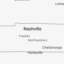


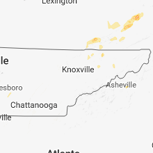


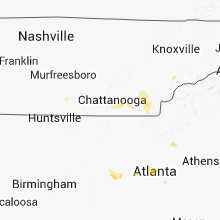


Connect with Interactive Hail Maps