

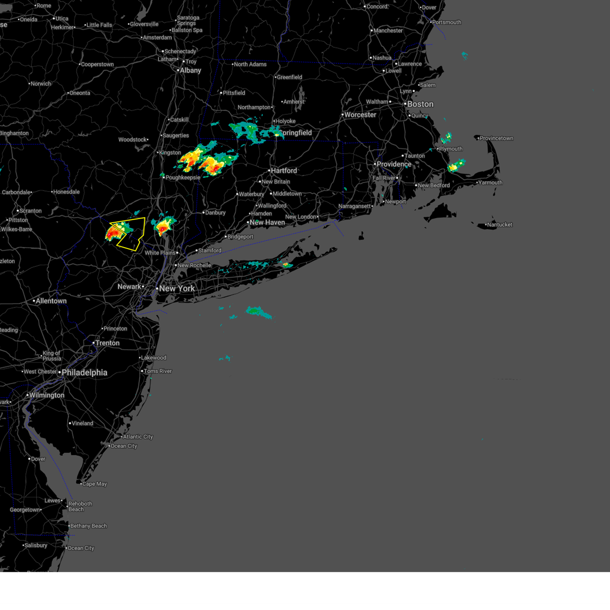
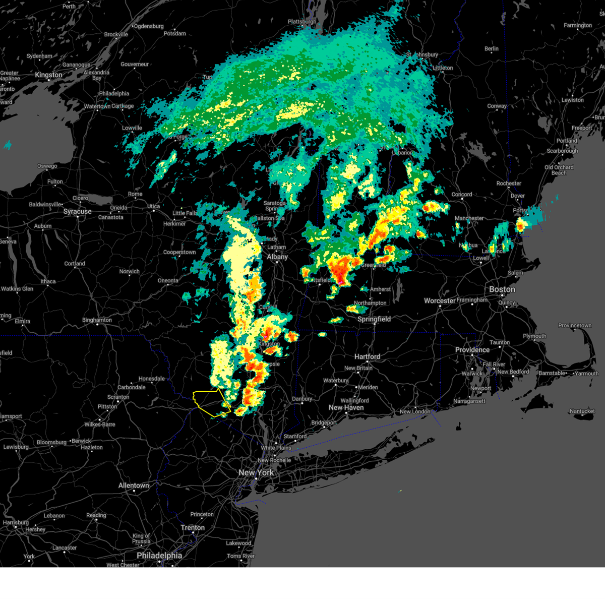
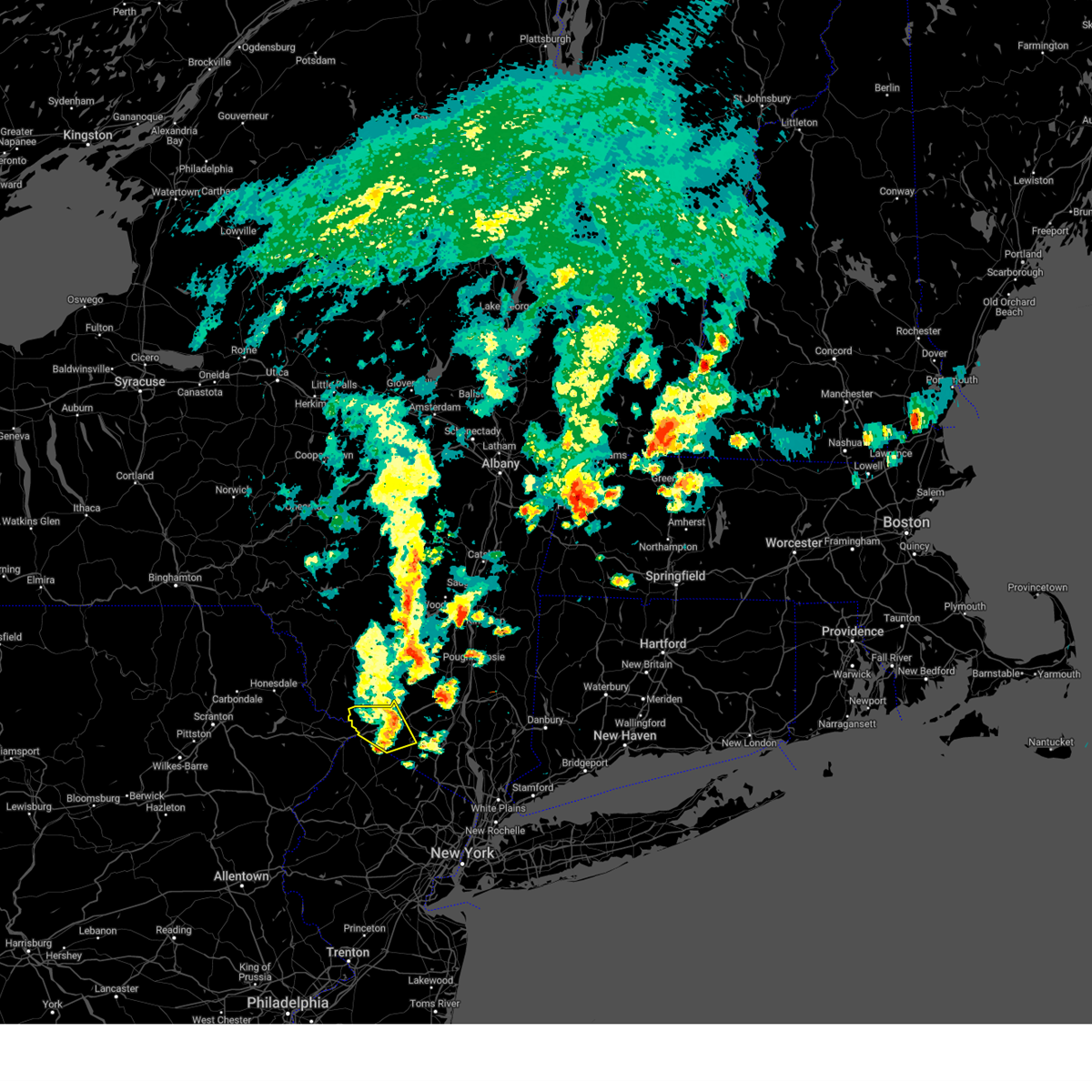
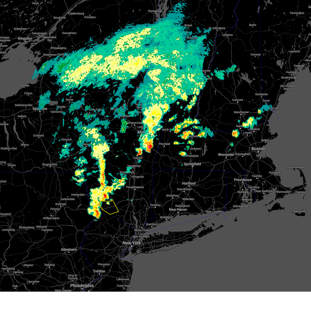
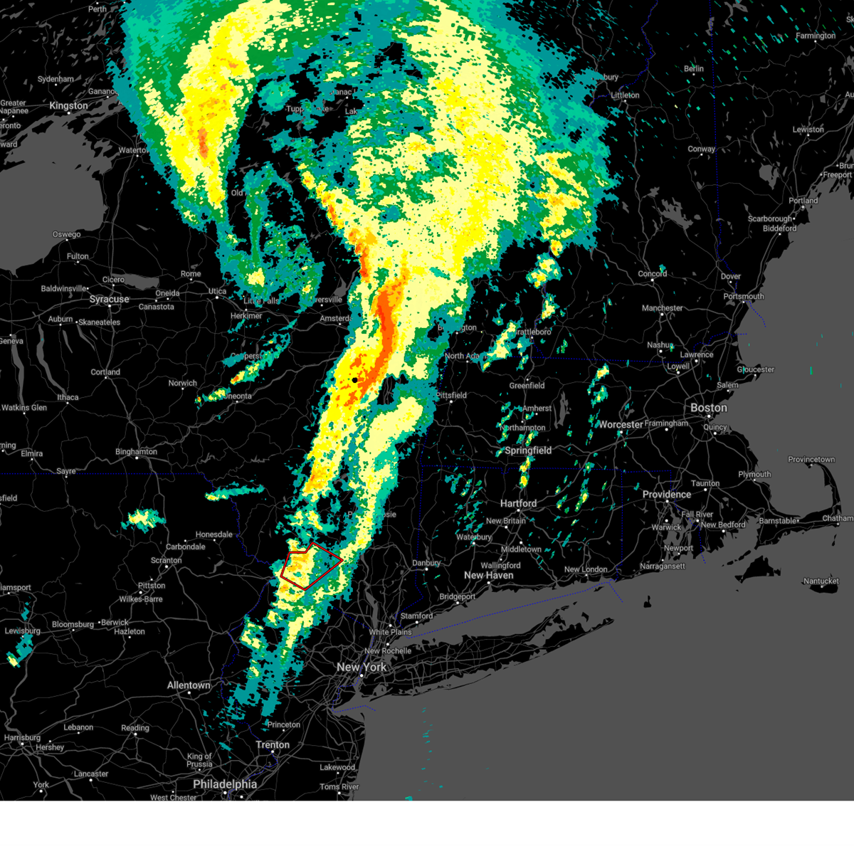
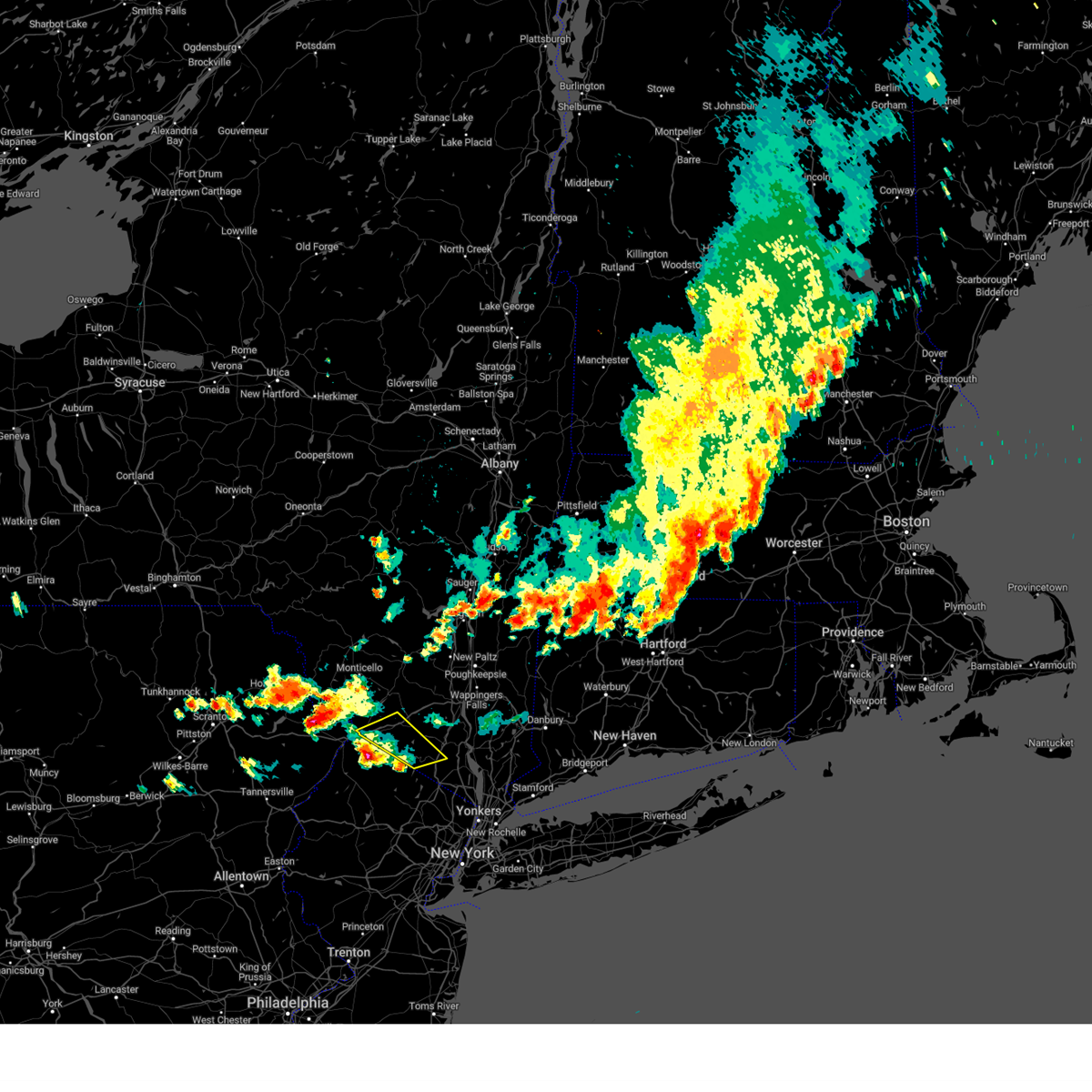
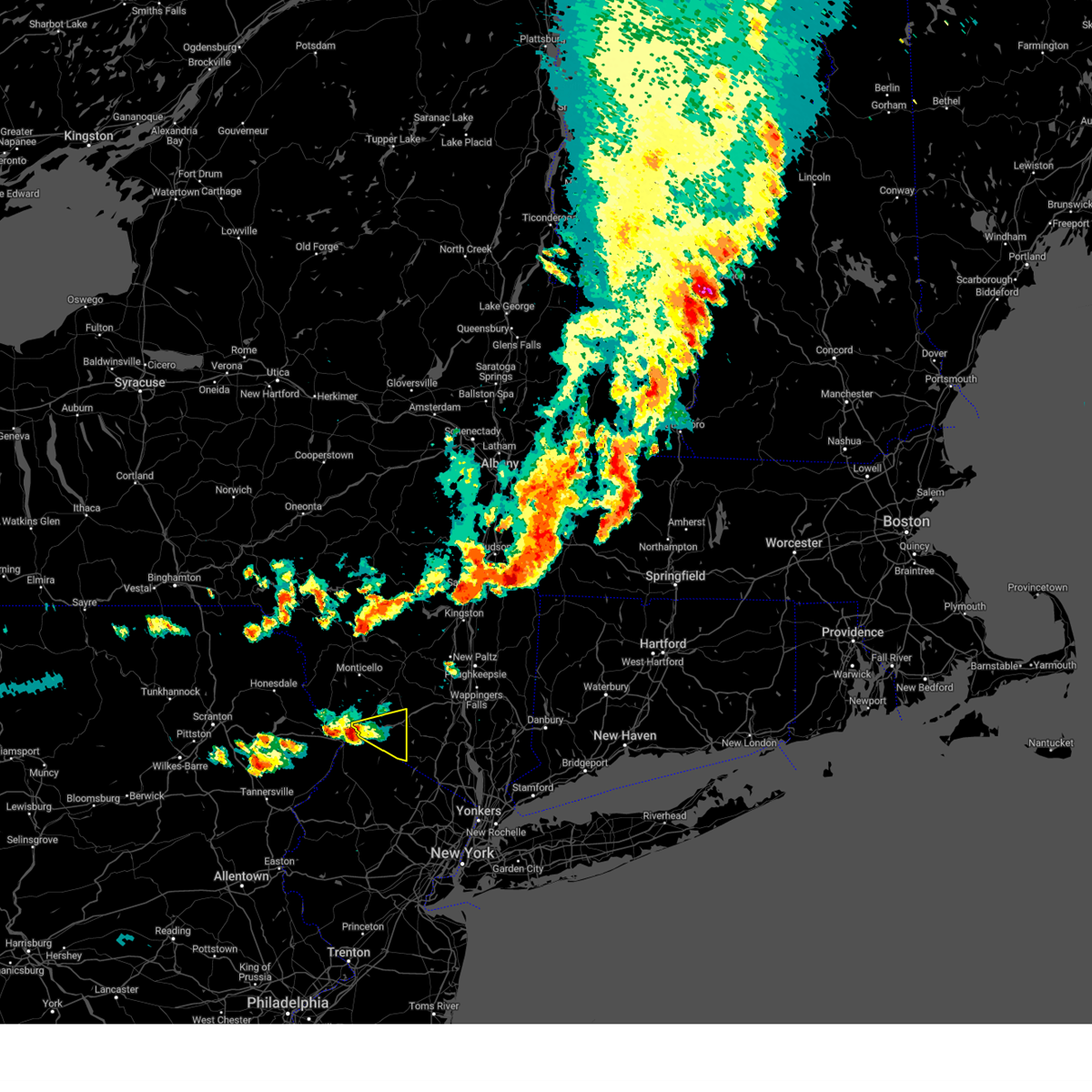
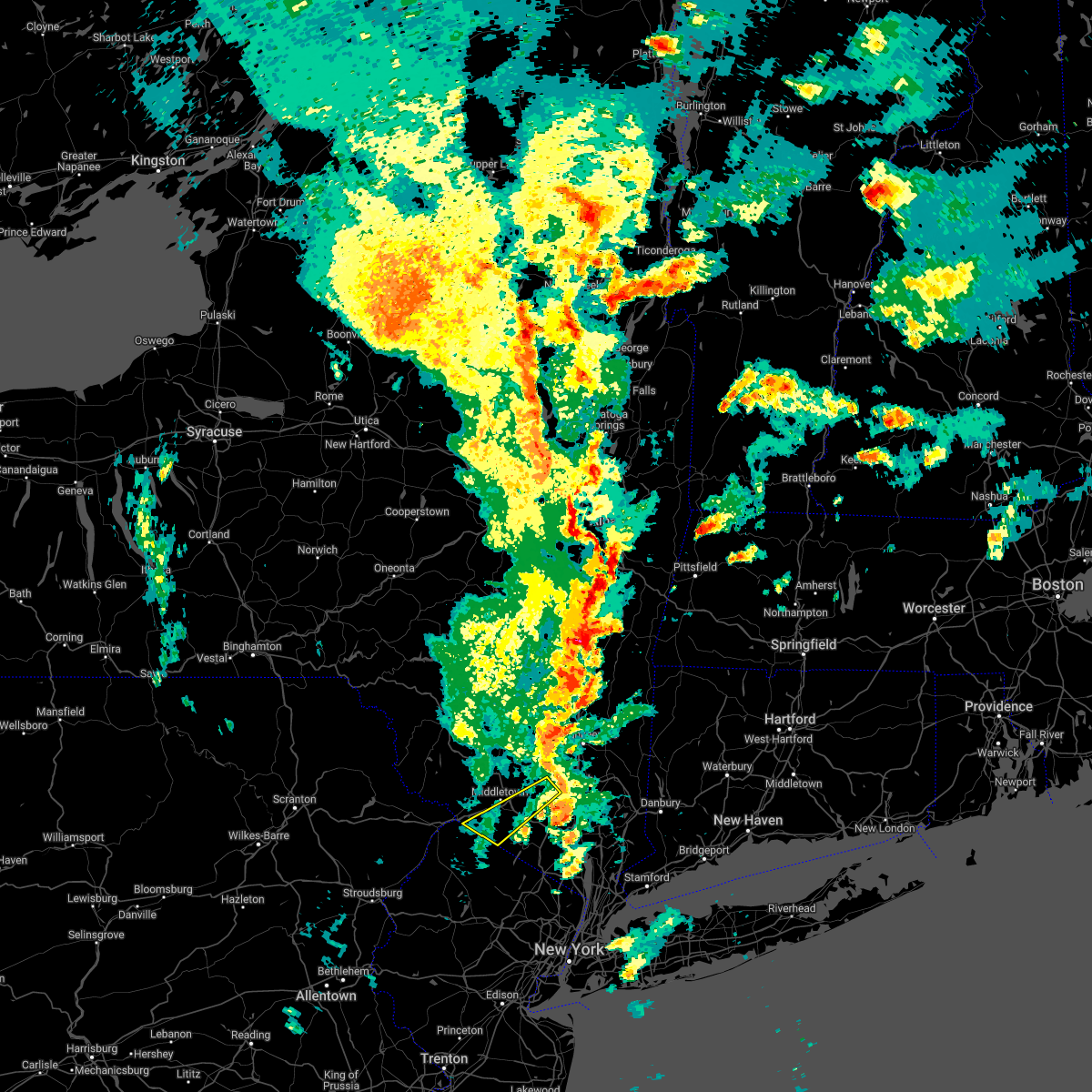
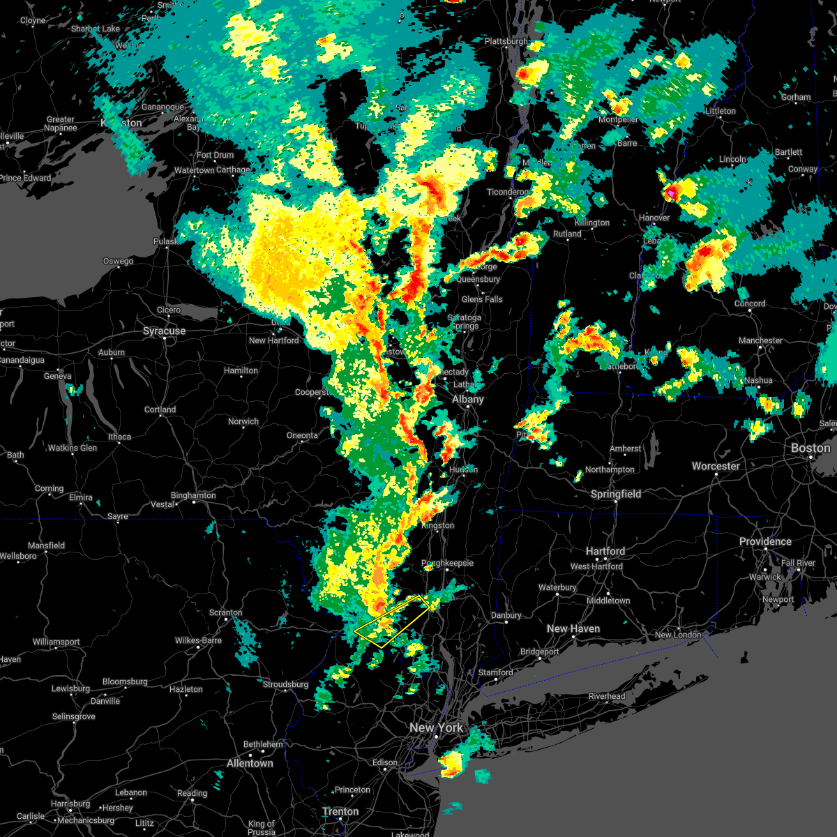
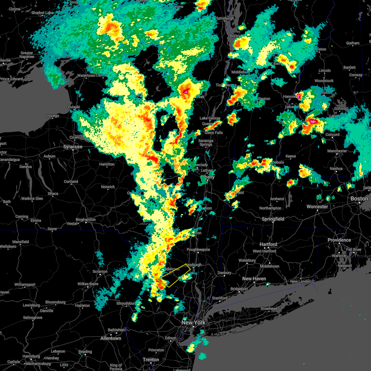
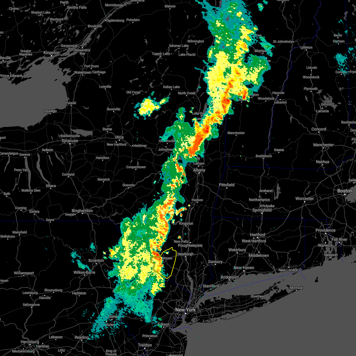
Hail Map for Unionville, NY
The Unionville, NY area has had 1 report of on-the-ground hail by trained spotters, and has been under severe weather warnings 13 times during the past 12 months. Doppler radar has detected hail at or near Unionville, NY on 20 occasions, including 2 occasions during the past year.
| Name: | Unionville, NY |
| Where Located: | 51.5 miles NW of Brooklyn, NY |
| Map: | Google Map for Unionville, NY |
| Population: | 612 |
| Housing Units: | 246 |
| More Info: | Search Google for Unionville, NY |
0
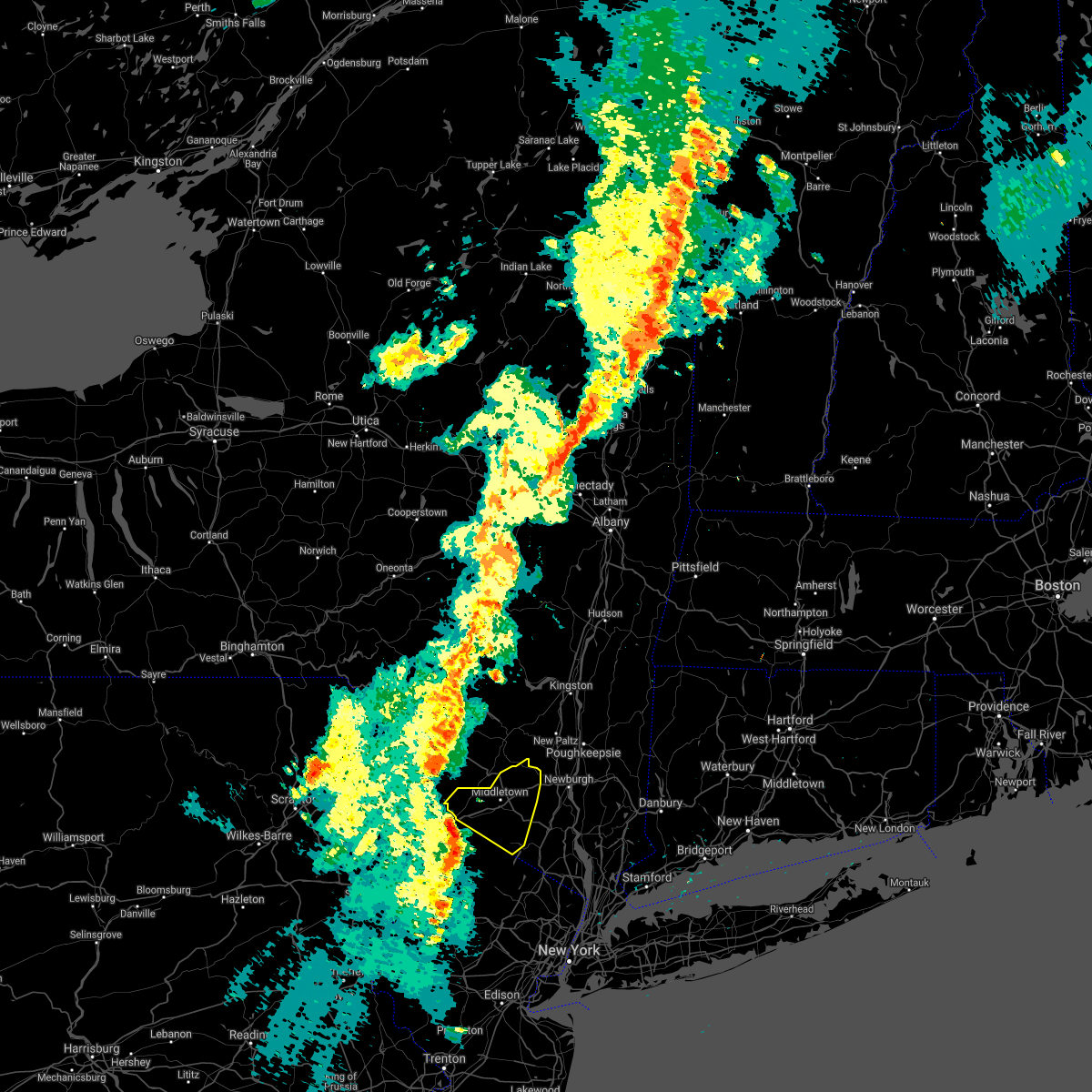
The Top Recent Hail Date for Unionville, NY is Tuesday, July 8, 2025 (19th out of 20)

Hail and Wind Damage Spotted near Unionville, NY
| Date / Time | Report Details |
|---|---|
| 7/8/2025 1:50 PM EDT |
 Svrokx the national weather service in upton ny has issued a * severe thunderstorm warning for, western passaic county in northeastern new jersey, south central orange county in southeastern new york, * until 245 pm edt. * at 150 pm edt, a severe thunderstorm was located over vernon valley, or 7 miles west of warwick, moving east at 15 mph (radar indicated). Hazards include 60 mph wind gusts and quarter size hail. Minor hail damage to vehicles is possible. expect wind damage to trees and power lines. this severe thunderstorm will be near, upper greenwood lake around 200 pm edt. warwick around 205 pm edt. Greenwood lake around 215 pm edt. Svrokx the national weather service in upton ny has issued a * severe thunderstorm warning for, western passaic county in northeastern new jersey, south central orange county in southeastern new york, * until 245 pm edt. * at 150 pm edt, a severe thunderstorm was located over vernon valley, or 7 miles west of warwick, moving east at 15 mph (radar indicated). Hazards include 60 mph wind gusts and quarter size hail. Minor hail damage to vehicles is possible. expect wind damage to trees and power lines. this severe thunderstorm will be near, upper greenwood lake around 200 pm edt. warwick around 205 pm edt. Greenwood lake around 215 pm edt.
|
| 5/3/2025 2:15 PM EDT |
 The storm which prompted the warning has weakened below severe limits, and has exited the warned area. therefore, the warning has been allowed to expire. a severe thunderstorm watch remains in effect until 800 pm edt for southeastern new york. to report severe weather, contact your nearest law enforcement agency. they will relay your report to the national weather service upton ny. The storm which prompted the warning has weakened below severe limits, and has exited the warned area. therefore, the warning has been allowed to expire. a severe thunderstorm watch remains in effect until 800 pm edt for southeastern new york. to report severe weather, contact your nearest law enforcement agency. they will relay your report to the national weather service upton ny.
|
| 5/3/2025 1:59 PM EDT |
 At 158 pm edt, a severe thunderstorm was located near unionville, or near middletown, moving east at 30 mph (radar indicated). Hazards include 60 mph wind gusts and penny size hail. Expect damage to trees and power lines. This severe storm will be near, middletown around 205 pm edt. At 158 pm edt, a severe thunderstorm was located near unionville, or near middletown, moving east at 30 mph (radar indicated). Hazards include 60 mph wind gusts and penny size hail. Expect damage to trees and power lines. This severe storm will be near, middletown around 205 pm edt.
|
| 5/3/2025 1:46 PM EDT | Multiple trees and powerlines dow in orange county NY, 1.4 miles SSE of Unionville, NY |
| 5/3/2025 1:32 PM EDT |
 Svrokx the national weather service in upton ny has issued a * severe thunderstorm warning for, northwestern orange county in southeastern new york, * until 215 pm edt. * at 132 pm edt, a severe thunderstorm was located over montague, moving east at 30 mph (radar indicated). Hazards include 60 mph wind gusts and penny size hail. Expect damage to trees and power lines. this severe thunderstorm will be near, port jervis around 135 pm edt. Middletown around 205 pm edt. Svrokx the national weather service in upton ny has issued a * severe thunderstorm warning for, northwestern orange county in southeastern new york, * until 215 pm edt. * at 132 pm edt, a severe thunderstorm was located over montague, moving east at 30 mph (radar indicated). Hazards include 60 mph wind gusts and penny size hail. Expect damage to trees and power lines. this severe thunderstorm will be near, port jervis around 135 pm edt. Middletown around 205 pm edt.
|
| 4/15/2025 4:40 PM EDT |
 At 439 pm edt, a severe thunderstorm was located near flatbrookville, or 12 miles southwest of montague, moving east at 45 mph (law enforcement. reports of a couple trees down in skytop and mountainhome). Hazards include 60 mph wind gusts and quarter size hail. Minor damage to vehicles is possible. wind damage to roofs, siding, trees, and power lines is possible. locations impacted include, flatbrookville, high point, blairstown, werry lake, millbrook, greendell, montague, newton, five points, pellettown, crandon lakes, marshalls creek, andover, echo lake, hidden lake, branchville, sussex, hainesville, shawnee, and allamuchy-panther valley. This includes interstate 80 in new jersey between mile markers 19 and 22. At 439 pm edt, a severe thunderstorm was located near flatbrookville, or 12 miles southwest of montague, moving east at 45 mph (law enforcement. reports of a couple trees down in skytop and mountainhome). Hazards include 60 mph wind gusts and quarter size hail. Minor damage to vehicles is possible. wind damage to roofs, siding, trees, and power lines is possible. locations impacted include, flatbrookville, high point, blairstown, werry lake, millbrook, greendell, montague, newton, five points, pellettown, crandon lakes, marshalls creek, andover, echo lake, hidden lake, branchville, sussex, hainesville, shawnee, and allamuchy-panther valley. This includes interstate 80 in new jersey between mile markers 19 and 22.
|
| 4/15/2025 4:26 PM EDT |
 At 425 pm edt, a shower capable of producing severe wind gusts was located near skytop, or 11 miles northeast of mount pocono, moving east at 45 mph (radar indicated). Hazards include 60 mph wind gusts and quarter size hail. Minor damage to vehicles is possible. wind damage to roofs, siding, trees, and power lines is possible. locations impacted include, high point, henryville, blairstown, werry lake, millbrook, greendell, skytop, mountainhome, alpine mountain, pellettown, crandon lakes, andover, hidden lake, branchville, sussex, hainesville, flatbrookville, cresco, canadensis, and montague. This includes interstate 80 in new jersey between mile markers 19 and 22. At 425 pm edt, a shower capable of producing severe wind gusts was located near skytop, or 11 miles northeast of mount pocono, moving east at 45 mph (radar indicated). Hazards include 60 mph wind gusts and quarter size hail. Minor damage to vehicles is possible. wind damage to roofs, siding, trees, and power lines is possible. locations impacted include, high point, henryville, blairstown, werry lake, millbrook, greendell, skytop, mountainhome, alpine mountain, pellettown, crandon lakes, andover, hidden lake, branchville, sussex, hainesville, flatbrookville, cresco, canadensis, and montague. This includes interstate 80 in new jersey between mile markers 19 and 22.
|
| 4/15/2025 4:07 PM EDT |
 Svrphi the national weather service in mount holly nj has issued a * severe thunderstorm warning for, sussex county in northwestern new jersey, northeastern warren county in northwestern new jersey, northern monroe county in northeastern pennsylvania, * until 500 pm edt. * at 407 pm edt, a severe thunderstorm was located over lehigh, or 10 miles northwest of mount pocono, moving east at 45 mph (radar indicated). Hazards include 60 mph wind gusts and quarter size hail. Minor damage to vehicles is possible. Wind damage to roofs, siding, trees, and power lines is possible. Svrphi the national weather service in mount holly nj has issued a * severe thunderstorm warning for, sussex county in northwestern new jersey, northeastern warren county in northwestern new jersey, northern monroe county in northeastern pennsylvania, * until 500 pm edt. * at 407 pm edt, a severe thunderstorm was located over lehigh, or 10 miles northwest of mount pocono, moving east at 45 mph (radar indicated). Hazards include 60 mph wind gusts and quarter size hail. Minor damage to vehicles is possible. Wind damage to roofs, siding, trees, and power lines is possible.
|
| 8/9/2024 4:57 PM EDT |
 The storm which prompted the warning has weakened below severe limits, and no longer appears capable of producing a tornado. therefore, the warning will be allowed to expire. however, gusty winds are still possible with this thunderstorm. a tornado watch remains in effect until 1000 pm edt for southeastern new york. The storm which prompted the warning has weakened below severe limits, and no longer appears capable of producing a tornado. therefore, the warning will be allowed to expire. however, gusty winds are still possible with this thunderstorm. a tornado watch remains in effect until 1000 pm edt for southeastern new york.
|
| 8/9/2024 4:35 PM EDT |
 Torokx the national weather service in upton ny has issued a * tornado warning for, central orange county in southeastern new york, * until 500 pm edt. * at 435 pm edt, a severe thunderstorm capable of producing a tornado was located near high point, or near matamoras, moving northeast at 45 mph (radar indicated rotation). Hazards include tornado. Flying debris will be dangerous to those caught without shelter. mobile homes will be damaged or destroyed. damage to roofs, windows, and vehicles will occur. tree damage is likely. this dangerous storm will be near, unionville around 440 pm edt. Middletown and howells around 455 pm edt. Torokx the national weather service in upton ny has issued a * tornado warning for, central orange county in southeastern new york, * until 500 pm edt. * at 435 pm edt, a severe thunderstorm capable of producing a tornado was located near high point, or near matamoras, moving northeast at 45 mph (radar indicated rotation). Hazards include tornado. Flying debris will be dangerous to those caught without shelter. mobile homes will be damaged or destroyed. damage to roofs, windows, and vehicles will occur. tree damage is likely. this dangerous storm will be near, unionville around 440 pm edt. Middletown and howells around 455 pm edt.
|
| 7/16/2024 5:57 PM EDT |
 At 557 pm edt, a severe thunderstorm was located near sussex, or 9 miles northwest of west milford, moving east at 45 mph (radar indicated). Hazards include 70 mph wind gusts and quarter size hail. Minor damage to vehicles is possible. expect considerable tree damage. wind damage is also likely to mobile homes, roofs, and outbuildings. Locations impacted include, franklin, hamburg, ogdensburg, sussex, branchville, pellettown, highland lake, vernon valley, and lake mohawk. At 557 pm edt, a severe thunderstorm was located near sussex, or 9 miles northwest of west milford, moving east at 45 mph (radar indicated). Hazards include 70 mph wind gusts and quarter size hail. Minor damage to vehicles is possible. expect considerable tree damage. wind damage is also likely to mobile homes, roofs, and outbuildings. Locations impacted include, franklin, hamburg, ogdensburg, sussex, branchville, pellettown, highland lake, vernon valley, and lake mohawk.
|
| 7/16/2024 5:55 PM EDT |
 Svrokx the national weather service in upton ny has issued a * severe thunderstorm warning for, western passaic county in northeastern new jersey, northern westchester county in southeastern new york, central orange county in southeastern new york, rockland county in southeastern new york, * until 645 pm edt. * at 554 pm edt, a severe thunderstorm was located near vernon valley, or 10 miles west of warwick, moving northeast at 45 mph (radar indicated). Hazards include 60 mph wind gusts and quarter size hail. Minor hail damage to vehicles is possible. expect wind damage to trees and power lines. this severe thunderstorm will be near, warwick around 605 pm edt. florida around 610 pm edt. monroe and chester around 615 pm edt. harriman around 620 pm edt. West point around 630 pm edt. Svrokx the national weather service in upton ny has issued a * severe thunderstorm warning for, western passaic county in northeastern new jersey, northern westchester county in southeastern new york, central orange county in southeastern new york, rockland county in southeastern new york, * until 645 pm edt. * at 554 pm edt, a severe thunderstorm was located near vernon valley, or 10 miles west of warwick, moving northeast at 45 mph (radar indicated). Hazards include 60 mph wind gusts and quarter size hail. Minor hail damage to vehicles is possible. expect wind damage to trees and power lines. this severe thunderstorm will be near, warwick around 605 pm edt. florida around 610 pm edt. monroe and chester around 615 pm edt. harriman around 620 pm edt. West point around 630 pm edt.
|
| 7/16/2024 5:45 PM EDT |
 At 545 pm edt, a severe thunderstorm was located over pellettown, or near newton, moving east at 45 mph (radar indicated). Hazards include 70 mph wind gusts and quarter size hail. Minor damage to vehicles is possible. expect considerable tree damage. wind damage is also likely to mobile homes, roofs, and outbuildings. Locations impacted include, newton, franklin, hamburg, ogdensburg, sussex, branchville, pellettown, crandon lakes, highland lake, vernon valley, and lake mohawk. At 545 pm edt, a severe thunderstorm was located over pellettown, or near newton, moving east at 45 mph (radar indicated). Hazards include 70 mph wind gusts and quarter size hail. Minor damage to vehicles is possible. expect considerable tree damage. wind damage is also likely to mobile homes, roofs, and outbuildings. Locations impacted include, newton, franklin, hamburg, ogdensburg, sussex, branchville, pellettown, crandon lakes, highland lake, vernon valley, and lake mohawk.
|
| 7/16/2024 5:41 PM EDT |
 Svrphi the national weather service in mount holly nj has issued a * severe thunderstorm warning for, sussex county in northwestern new jersey, * until 630 pm edt. * at 541 pm edt, a severe thunderstorm was located over branchville, or near newton, moving east at 45 mph (radar indicated). Hazards include 60 mph wind gusts and quarter size hail. Minor damage to vehicles is possible. Wind damage to roofs, siding, trees, and power lines is possible. Svrphi the national weather service in mount holly nj has issued a * severe thunderstorm warning for, sussex county in northwestern new jersey, * until 630 pm edt. * at 541 pm edt, a severe thunderstorm was located over branchville, or near newton, moving east at 45 mph (radar indicated). Hazards include 60 mph wind gusts and quarter size hail. Minor damage to vehicles is possible. Wind damage to roofs, siding, trees, and power lines is possible.
|
| 6/26/2024 8:06 PM EDT |
 At 806 pm edt, severe thunderstorms were located along a line extending from near warwick to near millington, moving east at 55 mph (radar indicated). Hazards include 70 mph wind gusts. Expect considerable tree damage. damage is likely to mobile homes, roofs, and outbuildings. locations impacted include, new brunswick, perth amboy, morristown, somerville, somerset, edison, east brunswick, carteret, dover, madison, middlesex, florham park, east hanover, lincoln park, bound brook, manville, kinnelon, chatham, boonton, and butler. this includes the following highways, new jersey turnpike between exits 10 and 13. interstate 78 in new jersey between mile markers 32 and 42. interstate 80 in new jersey between mile markers 33 and 47. interstate 287 in new jersey between mile markers 0 and 20, and between mile markers 24 and 54. Garden state parkway between mile markers 125 and 134. At 806 pm edt, severe thunderstorms were located along a line extending from near warwick to near millington, moving east at 55 mph (radar indicated). Hazards include 70 mph wind gusts. Expect considerable tree damage. damage is likely to mobile homes, roofs, and outbuildings. locations impacted include, new brunswick, perth amboy, morristown, somerville, somerset, edison, east brunswick, carteret, dover, madison, middlesex, florham park, east hanover, lincoln park, bound brook, manville, kinnelon, chatham, boonton, and butler. this includes the following highways, new jersey turnpike between exits 10 and 13. interstate 78 in new jersey between mile markers 32 and 42. interstate 80 in new jersey between mile markers 33 and 47. interstate 287 in new jersey between mile markers 0 and 20, and between mile markers 24 and 54. Garden state parkway between mile markers 125 and 134.
|
| 6/26/2024 8:06 PM EDT |
 the severe thunderstorm warning has been cancelled and is no longer in effect the severe thunderstorm warning has been cancelled and is no longer in effect
|
| 6/26/2024 8:00 PM EDT | Transformer and wires down on hilltop road. trees and wires down on ridge road and minisink turnpik in orange county NY, 0.1 miles WNW of Unionville, NY |
| 6/26/2024 7:59 PM EDT |
 At 759 pm edt, severe thunderstorms were located along a line extending from vernon valley to near martinsville, moving east at 55 mph (radar indicated). Hazards include 70 mph wind gusts. Expect considerable tree damage. damage is likely to mobile homes, roofs, and outbuildings. locations impacted include, new brunswick, perth amboy, morristown, somerville, newton, somerset, edison, east brunswick, bridgewater, carteret, dover, madison, hopatcong, middlesex, florham park, east hanover, lincoln park, bound brook, manville, and kinnelon. this includes the following highways, new jersey turnpike between exits 10 and 13. interstate 78 in new jersey between mile markers 20 and 42. interstate 80 in new jersey between mile markers 20 and 47. interstate 287 in new jersey between mile markers 0 and 54. Garden state parkway between mile markers 125 and 134. At 759 pm edt, severe thunderstorms were located along a line extending from vernon valley to near martinsville, moving east at 55 mph (radar indicated). Hazards include 70 mph wind gusts. Expect considerable tree damage. damage is likely to mobile homes, roofs, and outbuildings. locations impacted include, new brunswick, perth amboy, morristown, somerville, newton, somerset, edison, east brunswick, bridgewater, carteret, dover, madison, hopatcong, middlesex, florham park, east hanover, lincoln park, bound brook, manville, and kinnelon. this includes the following highways, new jersey turnpike between exits 10 and 13. interstate 78 in new jersey between mile markers 20 and 42. interstate 80 in new jersey between mile markers 20 and 47. interstate 287 in new jersey between mile markers 0 and 54. Garden state parkway between mile markers 125 and 134.
|
| 6/26/2024 7:58 PM EDT |
 The storms which prompted the warning are moving out of the area. therefore, the warning will be allowed to expire. however, small hail, gusty winds and heavy rain are still possible with these thunderstorms through 9 pm. a severe thunderstorm watch remains in effect until midnight edt for southeastern new york. to report severe weather, contact your nearest law enforcement agency. they will relay your report to the national weather service upton ny. The storms which prompted the warning are moving out of the area. therefore, the warning will be allowed to expire. however, small hail, gusty winds and heavy rain are still possible with these thunderstorms through 9 pm. a severe thunderstorm watch remains in effect until midnight edt for southeastern new york. to report severe weather, contact your nearest law enforcement agency. they will relay your report to the national weather service upton ny.
|
| 6/26/2024 7:37 PM EDT |
 Svrphi the national weather service in mount holly nj has issued a * severe thunderstorm warning for, hunterdon county in northwestern new jersey, morris county in northern new jersey, sussex county in northwestern new jersey, eastern warren county in northwestern new jersey, somerset county in northern new jersey, northeastern middlesex county in northern new jersey, * until 815 pm edt. * at 737 pm edt, severe thunderstorms were located along a line extending from near crandon lakes to near clinton, moving east at 55 mph (radar indicated). Hazards include 70 mph wind gusts. Expect considerable tree damage. Damage is likely to mobile homes, roofs, and outbuildings. Svrphi the national weather service in mount holly nj has issued a * severe thunderstorm warning for, hunterdon county in northwestern new jersey, morris county in northern new jersey, sussex county in northwestern new jersey, eastern warren county in northwestern new jersey, somerset county in northern new jersey, northeastern middlesex county in northern new jersey, * until 815 pm edt. * at 737 pm edt, severe thunderstorms were located along a line extending from near crandon lakes to near clinton, moving east at 55 mph (radar indicated). Hazards include 70 mph wind gusts. Expect considerable tree damage. Damage is likely to mobile homes, roofs, and outbuildings.
|
| 6/26/2024 7:32 PM EDT |
 At 732 pm edt, severe thunderstorms were located along a line extending from pecks pond to near flatbrookville, moving northeast at 60 mph (trained weather spotters). Hazards include 60 mph wind gusts. Damage to roofs, siding, trees, and power lines is possible. locations impacted include, newton, montague, franklin, hamburg, sussex, branchville, flatbrookville, high point, werry lake, millbrook, delaware water gap, vernon valley, five points, pellettown, crandon lakes, echo lake, highland lake, hainesville, shawnee, and marshalls creek. this includes the following highways, interstate 80 in pennsylvania near mile marker 314. Interstate 80 in new jersey between mile markers 0 and 2. At 732 pm edt, severe thunderstorms were located along a line extending from pecks pond to near flatbrookville, moving northeast at 60 mph (trained weather spotters). Hazards include 60 mph wind gusts. Damage to roofs, siding, trees, and power lines is possible. locations impacted include, newton, montague, franklin, hamburg, sussex, branchville, flatbrookville, high point, werry lake, millbrook, delaware water gap, vernon valley, five points, pellettown, crandon lakes, echo lake, highland lake, hainesville, shawnee, and marshalls creek. this includes the following highways, interstate 80 in pennsylvania near mile marker 314. Interstate 80 in new jersey between mile markers 0 and 2.
|
| 6/26/2024 7:14 PM EDT |
 At 714 pm edt, severe thunderstorms were located along a line extending from tobyhanna to analomink, moving northeast at 60 mph (trained weather spotters). Hazards include 60 mph wind gusts. Damage to roofs, siding, trees, and power lines is possible. locations impacted include, newton, montague, mount pocono, east stroudsburg, tobyhanna, franklin, hamburg, sussex, branchville, stormville, high point, henryville, werry lake, millbrook, delaware water gap, vernon valley, skytop, tannersville, mountainhome, and alpine mountain. this includes the following highways, interstate 80 in pennsylvania between mile markers 301 and 314. interstate 80 in new jersey between mile markers 0 and 2. Interstate 380 in pennsylvania between mile markers 5 and 13. At 714 pm edt, severe thunderstorms were located along a line extending from tobyhanna to analomink, moving northeast at 60 mph (trained weather spotters). Hazards include 60 mph wind gusts. Damage to roofs, siding, trees, and power lines is possible. locations impacted include, newton, montague, mount pocono, east stroudsburg, tobyhanna, franklin, hamburg, sussex, branchville, stormville, high point, henryville, werry lake, millbrook, delaware water gap, vernon valley, skytop, tannersville, mountainhome, and alpine mountain. this includes the following highways, interstate 80 in pennsylvania between mile markers 301 and 314. interstate 80 in new jersey between mile markers 0 and 2. Interstate 380 in pennsylvania between mile markers 5 and 13.
|
| 6/26/2024 7:14 PM EDT |
 the severe thunderstorm warning has been cancelled and is no longer in effect the severe thunderstorm warning has been cancelled and is no longer in effect
|
| 6/26/2024 7:13 PM EDT |
 Svrokx the national weather service in upton ny has issued a * severe thunderstorm warning for, western orange county in southeastern new york, * until 800 pm edt. * at 713 pm edt, severe thunderstorms were located along a line extending from near narrowsburg to near bushkill to delaware water gap, moving northeast at 35 mph (radar indicated). Hazards include 60 mph wind gusts and penny size hail. Expect damage to trees and power lines. Severe thunderstorms will be near, port jervis around 745 pm edt. Svrokx the national weather service in upton ny has issued a * severe thunderstorm warning for, western orange county in southeastern new york, * until 800 pm edt. * at 713 pm edt, severe thunderstorms were located along a line extending from near narrowsburg to near bushkill to delaware water gap, moving northeast at 35 mph (radar indicated). Hazards include 60 mph wind gusts and penny size hail. Expect damage to trees and power lines. Severe thunderstorms will be near, port jervis around 745 pm edt.
|
| 6/26/2024 6:59 PM EDT |
 Svrphi the national weather service in mount holly nj has issued a * severe thunderstorm warning for, sussex county in northwestern new jersey, northwestern warren county in northwestern new jersey, northeastern carbon county in northeastern pennsylvania, monroe county in northeastern pennsylvania, * until 745 pm edt. * at 659 pm edt, severe thunderstorms were located along a line extending from stoddartsville to gilbert, moving northeast at 60 mph (radar indicated). Hazards include 60 mph wind gusts. damage to roofs, siding, trees, and power lines is possible Svrphi the national weather service in mount holly nj has issued a * severe thunderstorm warning for, sussex county in northwestern new jersey, northwestern warren county in northwestern new jersey, northeastern carbon county in northeastern pennsylvania, monroe county in northeastern pennsylvania, * until 745 pm edt. * at 659 pm edt, severe thunderstorms were located along a line extending from stoddartsville to gilbert, moving northeast at 60 mph (radar indicated). Hazards include 60 mph wind gusts. damage to roofs, siding, trees, and power lines is possible
|
| 6/14/2024 5:37 PM EDT |
 The storm which prompted the warning has moved out of the area. therefore, the warning will be allowed to expire. a severe thunderstorm watch remains in effect until 900 pm edt for northwestern new jersey. remember, a severe thunderstorm warning still remains in effect for southeastern sussex county until 600 pm. The storm which prompted the warning has moved out of the area. therefore, the warning will be allowed to expire. a severe thunderstorm watch remains in effect until 900 pm edt for northwestern new jersey. remember, a severe thunderstorm warning still remains in effect for southeastern sussex county until 600 pm.
|
| 6/14/2024 5:02 PM EDT |
 Svrphi the national weather service in mount holly nj has issued a * severe thunderstorm warning for, northeastern sussex county in northwestern new jersey, * until 545 pm edt. * at 502 pm edt, a severe thunderstorm was located over hainesville, or near montague, moving east at 35 mph (radar indicated). Hazards include 60 mph wind gusts and quarter size hail. Minor damage to vehicles is possible. Wind damage to roofs, siding, trees, and power lines is possible. Svrphi the national weather service in mount holly nj has issued a * severe thunderstorm warning for, northeastern sussex county in northwestern new jersey, * until 545 pm edt. * at 502 pm edt, a severe thunderstorm was located over hainesville, or near montague, moving east at 35 mph (radar indicated). Hazards include 60 mph wind gusts and quarter size hail. Minor damage to vehicles is possible. Wind damage to roofs, siding, trees, and power lines is possible.
|
| 6/14/2024 4:52 PM EDT |
 The storms which prompted the warning have weakened below severe limits, and no longer pose an immediate threat to life or property. therefore, the warning will be allowed to expire. however gusty winds are still possible with these thunderstorms. The storms which prompted the warning have weakened below severe limits, and no longer pose an immediate threat to life or property. therefore, the warning will be allowed to expire. however gusty winds are still possible with these thunderstorms.
|
| 6/14/2024 4:48 PM EDT |
 At 447 pm edt, severe thunderstorms were located along a line extending from near milford to bangor, moving east at 40 mph (radar indicated). Hazards include 60 mph wind gusts. Damage to roofs, siding, trees, and power lines is possible. locations impacted include, newton, east stroudsburg, blairstown, bangor, pen argyl, sussex, hope, east bangor, branchville, werry lake, greendell, millbrook, delaware water gap, pellettown, crandon lakes, hainesville, great meadows-vienna, flatbrookville, allamuchy-panther valley, and five points. this includes the following highways, interstate 80 in pennsylvania between mile markers 310 and 314. Interstate 80 in new jersey between mile markers 0 and 19. At 447 pm edt, severe thunderstorms were located along a line extending from near milford to bangor, moving east at 40 mph (radar indicated). Hazards include 60 mph wind gusts. Damage to roofs, siding, trees, and power lines is possible. locations impacted include, newton, east stroudsburg, blairstown, bangor, pen argyl, sussex, hope, east bangor, branchville, werry lake, greendell, millbrook, delaware water gap, pellettown, crandon lakes, hainesville, great meadows-vienna, flatbrookville, allamuchy-panther valley, and five points. this includes the following highways, interstate 80 in pennsylvania between mile markers 310 and 314. Interstate 80 in new jersey between mile markers 0 and 19.
|
| 6/14/2024 4:25 PM EDT |
 At 425 pm edt, severe thunderstorms were located along a line extending from near skytop to gilbert, moving east at 35 mph (asos indicated. at 4:14 pm, mount pocono regional airport reported a gust of 58 mph). Hazards include 60 mph wind gusts. Damage to roofs, siding, trees, and power lines is possible. locations impacted include, newton, east stroudsburg, blairstown, bangor, pen argyl, sussex, hope, east bangor, branchville, andover, stormville, henryville, brodheadsville, werry lake, gilbert, greendell, millbrook, delaware water gap, tannersville, and mountainhome. this includes the following highways, interstate 80 in pennsylvania between mile markers 299 and 314. Interstate 80 in new jersey between mile markers 0 and 21. At 425 pm edt, severe thunderstorms were located along a line extending from near skytop to gilbert, moving east at 35 mph (asos indicated. at 4:14 pm, mount pocono regional airport reported a gust of 58 mph). Hazards include 60 mph wind gusts. Damage to roofs, siding, trees, and power lines is possible. locations impacted include, newton, east stroudsburg, blairstown, bangor, pen argyl, sussex, hope, east bangor, branchville, andover, stormville, henryville, brodheadsville, werry lake, gilbert, greendell, millbrook, delaware water gap, tannersville, and mountainhome. this includes the following highways, interstate 80 in pennsylvania between mile markers 299 and 314. Interstate 80 in new jersey between mile markers 0 and 21.
|
| 6/14/2024 4:14 PM EDT |
 Svrphi the national weather service in mount holly nj has issued a * severe thunderstorm warning for, sussex county in northwestern new jersey, northern warren county in northwestern new jersey, central monroe county in northeastern pennsylvania, northeastern northampton county in eastern pennsylvania, * until 500 pm edt. * at 414 pm edt, severe thunderstorms were located along a line extending from near skytop to near jonas, moving east at 45 mph (radar indicated). Hazards include 60 mph wind gusts. damage to roofs, siding, trees, and power lines is possible Svrphi the national weather service in mount holly nj has issued a * severe thunderstorm warning for, sussex county in northwestern new jersey, northern warren county in northwestern new jersey, central monroe county in northeastern pennsylvania, northeastern northampton county in eastern pennsylvania, * until 500 pm edt. * at 414 pm edt, severe thunderstorms were located along a line extending from near skytop to near jonas, moving east at 45 mph (radar indicated). Hazards include 60 mph wind gusts. damage to roofs, siding, trees, and power lines is possible
|
| 9/7/2023 7:06 PM EDT |
 The severe thunderstorm warning for northwestern morris and sussex counties will expire at 715 pm edt, the storms which prompted the warning have moved out of the area. therefore, the warning will be allowed to expire. a severe thunderstorm watch remains in effect until 900 pm edt for northern and northwestern new jersey. to report severe weather, contact your nearest law enforcement agency. they will relay your report to the national weather service mount holly nj. The severe thunderstorm warning for northwestern morris and sussex counties will expire at 715 pm edt, the storms which prompted the warning have moved out of the area. therefore, the warning will be allowed to expire. a severe thunderstorm watch remains in effect until 900 pm edt for northern and northwestern new jersey. to report severe weather, contact your nearest law enforcement agency. they will relay your report to the national weather service mount holly nj.
|
| 9/7/2023 7:02 PM EDT |
 At 702 pm edt, severe thunderstorms were located along a line extending from haven to highland lake, moving east at 20 mph (radar indicated). Hazards include 60 mph wind gusts. Expect damage to trees and power lines. severe thunderstorms will be near, middletown and warwick around 705 pm edt. florida around 710 pm edt. goshen and greenwood lake around 715 pm edt. chester around 725 pm edt. hail threat, radar indicated max hail size, <. 75 in wind threat, radar indicated max wind gust, 60 mph. At 702 pm edt, severe thunderstorms were located along a line extending from haven to highland lake, moving east at 20 mph (radar indicated). Hazards include 60 mph wind gusts. Expect damage to trees and power lines. severe thunderstorms will be near, middletown and warwick around 705 pm edt. florida around 710 pm edt. goshen and greenwood lake around 715 pm edt. chester around 725 pm edt. hail threat, radar indicated max hail size, <. 75 in wind threat, radar indicated max wind gust, 60 mph.
|
| 9/7/2023 6:52 PM EDT |
 At 651 pm edt, severe thunderstorms were located along a line extending from near high point to near budd lake, moving east at 35 mph (radar indicated). Hazards include 60 mph wind gusts and quarter size hail. Minor damage to vehicles is possible. wind damage to roofs, siding, trees, and power lines is possible. locations impacted include, newton, hopatcong, mount arlington, franklin, stanhope, hamburg, netcong, ogdensburg, sussex, andover, high point, lake mohawk, vernon valley, pellettown, budd lake and highland lake. this includes interstate 80 in new jersey between mile markers 24 and 28. hail threat, radar indicated max hail size, 1. 00 in wind threat, radar indicated max wind gust, 60 mph. At 651 pm edt, severe thunderstorms were located along a line extending from near high point to near budd lake, moving east at 35 mph (radar indicated). Hazards include 60 mph wind gusts and quarter size hail. Minor damage to vehicles is possible. wind damage to roofs, siding, trees, and power lines is possible. locations impacted include, newton, hopatcong, mount arlington, franklin, stanhope, hamburg, netcong, ogdensburg, sussex, andover, high point, lake mohawk, vernon valley, pellettown, budd lake and highland lake. this includes interstate 80 in new jersey between mile markers 24 and 28. hail threat, radar indicated max hail size, 1. 00 in wind threat, radar indicated max wind gust, 60 mph.
|
| 9/7/2023 6:30 PM EDT |
 At 630 pm edt, a severe thunderstorm was located over five points, or 7 miles west of newton, moving northeast at 30 mph (radar indicated). Hazards include 60 mph wind gusts and quarter size hail. Minor damage to vehicles is possible. Wind damage to roofs, siding, trees, and power lines is possible. At 630 pm edt, a severe thunderstorm was located over five points, or 7 miles west of newton, moving northeast at 30 mph (radar indicated). Hazards include 60 mph wind gusts and quarter size hail. Minor damage to vehicles is possible. Wind damage to roofs, siding, trees, and power lines is possible.
|
| 7/27/2023 5:14 PM EDT |
 At 514 pm edt, severe thunderstorms were located along a line extending from near gardnertown to 6 miles west of new windsor to florida to near unionville, moving east at 45 mph (radar indicated). Hazards include 70 mph wind gusts and quarter size hail. Minor hail damage to vehicles is possible. expect considerable tree damage. Wind damage is also likely to mobile homes, roofs, and outbuildings. At 514 pm edt, severe thunderstorms were located along a line extending from near gardnertown to 6 miles west of new windsor to florida to near unionville, moving east at 45 mph (radar indicated). Hazards include 70 mph wind gusts and quarter size hail. Minor hail damage to vehicles is possible. expect considerable tree damage. Wind damage is also likely to mobile homes, roofs, and outbuildings.
|
| 7/14/2023 7:18 PM EDT |
 At 717 pm edt, a severe thunderstorm was located over unionville, or 8 miles west of warwick, moving northeast at 20 mph (radar indicated). Hazards include 60 mph wind gusts and quarter size hail. Minor damage to vehicles is possible. wind damage to roofs, siding, trees, and power lines is possible. locations impacted include, franklin, hamburg, ogdensburg, sussex, pellettown, highland lake and vernon valley. hail threat, radar indicated max hail size, 1. 00 in wind threat, radar indicated max wind gust, 60 mph. At 717 pm edt, a severe thunderstorm was located over unionville, or 8 miles west of warwick, moving northeast at 20 mph (radar indicated). Hazards include 60 mph wind gusts and quarter size hail. Minor damage to vehicles is possible. wind damage to roofs, siding, trees, and power lines is possible. locations impacted include, franklin, hamburg, ogdensburg, sussex, pellettown, highland lake and vernon valley. hail threat, radar indicated max hail size, 1. 00 in wind threat, radar indicated max wind gust, 60 mph.
|
| 7/14/2023 7:03 PM EDT |
 At 703 pm edt, a severe thunderstorm was located over sussex, or 11 miles west of warwick, moving northeast at 20 mph (radar indicated). Hazards include 60 mph wind gusts and quarter size hail. Minor damage to vehicles is possible. Wind damage to roofs, siding, trees, and power lines is possible. At 703 pm edt, a severe thunderstorm was located over sussex, or 11 miles west of warwick, moving northeast at 20 mph (radar indicated). Hazards include 60 mph wind gusts and quarter size hail. Minor damage to vehicles is possible. Wind damage to roofs, siding, trees, and power lines is possible.
|
| 7/13/2023 10:37 PM EDT |
 The severe thunderstorm warning for northeastern sussex county will expire at 1045 pm edt, the storm which prompted the warning is moving out of the area. therefore, the warning will be allowed to expire. The severe thunderstorm warning for northeastern sussex county will expire at 1045 pm edt, the storm which prompted the warning is moving out of the area. therefore, the warning will be allowed to expire.
|
| 7/13/2023 10:26 PM EDT |
 At 1026 pm edt, severe thunderstorms were located along a line extending from unionville to warwick, moving east at 25 mph (radar indicated). Hazards include 60 mph wind gusts and quarter size hail. Minor hail damage to vehicles is possible. expect wind damage to trees and power lines. these severe storms will be near, warwick and greenwood lake around 1030 pm edt. middletown around 1045 pm edt. florida around 1050 pm edt. chester around 1100 pm edt. hail threat, radar indicated max hail size, 1. 00 in wind threat, radar indicated max wind gust, 60 mph. At 1026 pm edt, severe thunderstorms were located along a line extending from unionville to warwick, moving east at 25 mph (radar indicated). Hazards include 60 mph wind gusts and quarter size hail. Minor hail damage to vehicles is possible. expect wind damage to trees and power lines. these severe storms will be near, warwick and greenwood lake around 1030 pm edt. middletown around 1045 pm edt. florida around 1050 pm edt. chester around 1100 pm edt. hail threat, radar indicated max hail size, 1. 00 in wind threat, radar indicated max wind gust, 60 mph.
|
| 7/13/2023 10:19 PM EDT |
 At 1018 pm edt, a severe thunderstorm was located near sussex, or 8 miles southeast of matamoras, moving east at 30 mph (radar indicated). Hazards include 60 mph wind gusts and quarter size hail. Minor damage to vehicles is possible. wind damage to roofs, siding, trees, and power lines is possible. locations impacted include, sussex, highland lake, vernon valley and high point. hail threat, radar indicated max hail size, 1. 00 in wind threat, radar indicated max wind gust, 60 mph. At 1018 pm edt, a severe thunderstorm was located near sussex, or 8 miles southeast of matamoras, moving east at 30 mph (radar indicated). Hazards include 60 mph wind gusts and quarter size hail. Minor damage to vehicles is possible. wind damage to roofs, siding, trees, and power lines is possible. locations impacted include, sussex, highland lake, vernon valley and high point. hail threat, radar indicated max hail size, 1. 00 in wind threat, radar indicated max wind gust, 60 mph.
|
| 7/13/2023 10:01 PM EDT |
 At 1000 pm edt, severe thunderstorms were located along a line extending from montague to near vernon valley, moving east at 30 mph (radar indicated). Hazards include 60 mph wind gusts and quarter size hail. Minor hail damage to vehicles is possible. expect wind damage to trees and power lines. severe thunderstorms will be near, warwick and unionville around 1020 pm edt. greenwood lake around 1025 pm edt. middletown around 1040 pm edt. chester and florida around 1045 pm edt. hail threat, radar indicated max hail size, 1. 00 in wind threat, radar indicated max wind gust, 60 mph. At 1000 pm edt, severe thunderstorms were located along a line extending from montague to near vernon valley, moving east at 30 mph (radar indicated). Hazards include 60 mph wind gusts and quarter size hail. Minor hail damage to vehicles is possible. expect wind damage to trees and power lines. severe thunderstorms will be near, warwick and unionville around 1020 pm edt. greenwood lake around 1025 pm edt. middletown around 1040 pm edt. chester and florida around 1045 pm edt. hail threat, radar indicated max hail size, 1. 00 in wind threat, radar indicated max wind gust, 60 mph.
|
| 7/13/2023 9:57 PM EDT |
 At 956 pm edt, a severe thunderstorm was located over hainesville, or near montague, moving east at 35 mph (radar indicated). Hazards include 60 mph wind gusts and quarter size hail. Minor damage to vehicles is possible. Wind damage to roofs, siding, trees, and power lines is possible. At 956 pm edt, a severe thunderstorm was located over hainesville, or near montague, moving east at 35 mph (radar indicated). Hazards include 60 mph wind gusts and quarter size hail. Minor damage to vehicles is possible. Wind damage to roofs, siding, trees, and power lines is possible.
|
| 7/13/2023 8:58 PM EDT |
 At 858 pm edt, a severe thunderstorm was located over unionville, or 9 miles southeast of matamoras, moving east at 25 mph (radar indicated). Hazards include 60 mph wind gusts and quarter size hail. Minor hail damage to vehicles is possible. expect wind damage to trees and power lines. this severe thunderstorm will be near, warwick and florida around 925 pm edt. chester and greenwood lake around 935 pm edt. monroe around 945 pm edt. hail threat, radar indicated max hail size, 1. 00 in wind threat, radar indicated max wind gust, 60 mph. At 858 pm edt, a severe thunderstorm was located over unionville, or 9 miles southeast of matamoras, moving east at 25 mph (radar indicated). Hazards include 60 mph wind gusts and quarter size hail. Minor hail damage to vehicles is possible. expect wind damage to trees and power lines. this severe thunderstorm will be near, warwick and florida around 925 pm edt. chester and greenwood lake around 935 pm edt. monroe around 945 pm edt. hail threat, radar indicated max hail size, 1. 00 in wind threat, radar indicated max wind gust, 60 mph.
|
| 7/13/2023 8:57 PM EDT | Tree down on wires on mcmullen roa in orange county NY, 0.9 miles SW of Unionville, NY |
| 1/1/0001 12:00 AM | Tree down on wires near jacobs road and route in orange county NY, 2.6 miles SW of Unionville, NY |
| 7/13/2023 8:41 PM EDT |
 At 841 pm edt, a severe thunderstorm was located over high point, or near matamoras, moving east at 30 mph (radar indicated). Hazards include 60 mph wind gusts and quarter size hail. Minor hail damage to vehicles is possible. expect wind damage to trees and power lines. this severe storm will be near, unionville around 850 pm edt. hail threat, radar indicated max hail size, 1. 00 in wind threat, radar indicated max wind gust, 60 mph. At 841 pm edt, a severe thunderstorm was located over high point, or near matamoras, moving east at 30 mph (radar indicated). Hazards include 60 mph wind gusts and quarter size hail. Minor hail damage to vehicles is possible. expect wind damage to trees and power lines. this severe storm will be near, unionville around 850 pm edt. hail threat, radar indicated max hail size, 1. 00 in wind threat, radar indicated max wind gust, 60 mph.
|
| 7/13/2023 8:14 PM EDT |
 At 814 pm edt, a severe thunderstorm was located near greeley, or 9 miles west of montague, moving east at 15 mph (radar indicated). Hazards include 60 mph wind gusts and quarter size hail. Minor hail damage to vehicles is possible. expect wind damage to trees and power lines. this severe thunderstorm will be near, port jervis and huguenot around 900 pm edt. hail threat, radar indicated max hail size, 1. 00 in wind threat, radar indicated max wind gust, 60 mph. At 814 pm edt, a severe thunderstorm was located near greeley, or 9 miles west of montague, moving east at 15 mph (radar indicated). Hazards include 60 mph wind gusts and quarter size hail. Minor hail damage to vehicles is possible. expect wind damage to trees and power lines. this severe thunderstorm will be near, port jervis and huguenot around 900 pm edt. hail threat, radar indicated max hail size, 1. 00 in wind threat, radar indicated max wind gust, 60 mph.
|
| 5/16/2022 4:25 PM EDT |
 The severe thunderstorm warning for central orange county will expire at 430 pm edt, the storm which prompted the warning has weakened below severe limits, and has exited the warned area. therefore, the warning will be allowed to expire. a severe thunderstorm watch remains in effect until 800 pm edt for southeastern new york. The severe thunderstorm warning for central orange county will expire at 430 pm edt, the storm which prompted the warning has weakened below severe limits, and has exited the warned area. therefore, the warning will be allowed to expire. a severe thunderstorm watch remains in effect until 800 pm edt for southeastern new york.
|
| 5/16/2022 4:06 PM EDT |
 At 406 pm edt, a severe thunderstorm was located near wallkill, or near walden, moving northeast at 60 mph (radar indicated). Hazards include 60 mph wind gusts and penny size hail. Expect damage to trees and power lines. This severe thunderstorm will remain over mainly rural areas of central orange county. At 406 pm edt, a severe thunderstorm was located near wallkill, or near walden, moving northeast at 60 mph (radar indicated). Hazards include 60 mph wind gusts and penny size hail. Expect damage to trees and power lines. This severe thunderstorm will remain over mainly rural areas of central orange county.
|
| 5/16/2022 4:05 PM EDT | Tree and wire down on a home on goodridge roa in orange county NY, 2 miles SE of Unionville, NY |
| 5/16/2022 3:45 PM EDT | Corrects time of previous report: tree and wire down on a home on goodridge roa in orange county NY, 2 miles SE of Unionville, NY |
| 5/16/2022 3:40 PM EDT |
 At 340 pm edt, a severe thunderstorm was located near unionville, or 9 miles southwest of middletown, moving northeast at 60 mph (radar indicated). Hazards include 60 mph wind gusts and penny size hail. Expect damage to trees and power lines. this severe thunderstorm will be near, florida around 345 pm edt. Goshen around 350 pm edt. At 340 pm edt, a severe thunderstorm was located near unionville, or 9 miles southwest of middletown, moving northeast at 60 mph (radar indicated). Hazards include 60 mph wind gusts and penny size hail. Expect damage to trees and power lines. this severe thunderstorm will be near, florida around 345 pm edt. Goshen around 350 pm edt.
|
| 3/31/2022 8:29 PM EDT |
 At 828 pm edt, severe thunderstorms were located along a line extending from adhesively to millbrook, moving northeast at 50 mph (radar indicated). Hazards include 60 mph wind gusts. Damage to roofs, siding, trees, and power lines is possible. locations impacted include, easton, montague, forks, east stroudsburg, wilson, blairstown, nazareth, bangor, pen argyl, wind gap, bath, belvidere, belfast, west easton, tatamy, east bangor, branchville, steuben, glendon and stormville. this includes the following highways, interstate 78 in pennsylvania between mile markers 72 and 73. interstate 80 in pennsylvania between mile markers 310 and 314. interstate 80 in new jersey between mile markers 0 and 12. hail threat, radar indicated max hail size, <. 75 in wind threat, radar indicated max wind gust, 60 mph. At 828 pm edt, severe thunderstorms were located along a line extending from adhesively to millbrook, moving northeast at 50 mph (radar indicated). Hazards include 60 mph wind gusts. Damage to roofs, siding, trees, and power lines is possible. locations impacted include, easton, montague, forks, east stroudsburg, wilson, blairstown, nazareth, bangor, pen argyl, wind gap, bath, belvidere, belfast, west easton, tatamy, east bangor, branchville, steuben, glendon and stormville. this includes the following highways, interstate 78 in pennsylvania between mile markers 72 and 73. interstate 80 in pennsylvania between mile markers 310 and 314. interstate 80 in new jersey between mile markers 0 and 12. hail threat, radar indicated max hail size, <. 75 in wind threat, radar indicated max wind gust, 60 mph.
|
| 3/31/2022 8:04 PM EDT |
 At 803 pm edt, severe thunderstorms were located along a line extending from near pecks pond to kresgeville, moving northeast at 75 mph (radar indicated). Hazards include 60 mph wind gusts. damage to roofs, siding, trees, and power lines is possible At 803 pm edt, severe thunderstorms were located along a line extending from near pecks pond to kresgeville, moving northeast at 75 mph (radar indicated). Hazards include 60 mph wind gusts. damage to roofs, siding, trees, and power lines is possible
|
| 3/7/2022 8:46 PM EST |
 At 844 pm est, severe showers and embedded thunderstorms were located along a line extending from near vernon valley to near clinton to royersford, moving east at 50 mph. this line has a history of producing areas of wind damage (trained weather spotters). Hazards include 70 mph wind gusts. Expect considerable tree damage. damage is likely to mobile homes, roofs, and outbuildings. locations impacted include, easton, morristown, somerville, newton, bridgewater, pottstown, dover, lansdale, madison, hopatcong, florham park, east hanover, lincoln park, kinnelon, hackettstown, quakertown, perkasie, doylestown, byram and boonton. this includes the following highways, northeast extension between mile markers 25 and 45. interstate 78 in new jersey between mile markers 0 and 37. interstate 80 in new jersey between mile markers 12 and 47. interstate 287 in new jersey between mile markers 16 and 54. thunderstorm damage threat, considerable hail threat, radar indicated max hail size, <. 75 in wind threat, radar indicated max wind gust, 70 mph. At 844 pm est, severe showers and embedded thunderstorms were located along a line extending from near vernon valley to near clinton to royersford, moving east at 50 mph. this line has a history of producing areas of wind damage (trained weather spotters). Hazards include 70 mph wind gusts. Expect considerable tree damage. damage is likely to mobile homes, roofs, and outbuildings. locations impacted include, easton, morristown, somerville, newton, bridgewater, pottstown, dover, lansdale, madison, hopatcong, florham park, east hanover, lincoln park, kinnelon, hackettstown, quakertown, perkasie, doylestown, byram and boonton. this includes the following highways, northeast extension between mile markers 25 and 45. interstate 78 in new jersey between mile markers 0 and 37. interstate 80 in new jersey between mile markers 12 and 47. interstate 287 in new jersey between mile markers 16 and 54. thunderstorm damage threat, considerable hail threat, radar indicated max hail size, <. 75 in wind threat, radar indicated max wind gust, 70 mph.
|
| 3/7/2022 8:36 PM EST |
 At 835 pm est, severe thunderstorms were located along a line extending from lanesville to hartwood to near hope to near emmaus to near birdsboro, moving east at 60 mph (radar indicated). Hazards include 60 mph wind gusts. Expect damage to trees and power lines. these severe storms will be near, cuddebackville and otisville around 840 pm est. howells around 845 pm est. middletown around 850 pm est. montgomery around 855 pm est. walden around 900 pm est. bloomingdale and fairfield around 905 pm est. pompton lakes around 910 pm est. hail threat, radar indicated max hail size, <. 75 in wind threat, radar indicated max wind gust, 60 mph. At 835 pm est, severe thunderstorms were located along a line extending from lanesville to hartwood to near hope to near emmaus to near birdsboro, moving east at 60 mph (radar indicated). Hazards include 60 mph wind gusts. Expect damage to trees and power lines. these severe storms will be near, cuddebackville and otisville around 840 pm est. howells around 845 pm est. middletown around 850 pm est. montgomery around 855 pm est. walden around 900 pm est. bloomingdale and fairfield around 905 pm est. pompton lakes around 910 pm est. hail threat, radar indicated max hail size, <. 75 in wind threat, radar indicated max wind gust, 60 mph.
|
| 3/7/2022 8:00 PM EST |
 At 759 pm est, severe thunderstorms were located along a line extending from near downsville to near prompton to beltzville state park to near bernville to near manheim, moving east at 60 mph (radar indicated). Hazards include 60 mph wind gusts. Expect damage to trees and power lines. severe thunderstorms will be near, cuddebackville around 835 pm est. otisville around 840 pm est. middletown and howells around 845 pm est. walden and montgomery around 855 pm est. pompton lakes and bloomingdale around 900 pm est. hail threat, radar indicated max hail size, <. 75 in wind threat, radar indicated max wind gust, 60 mph. At 759 pm est, severe thunderstorms were located along a line extending from near downsville to near prompton to beltzville state park to near bernville to near manheim, moving east at 60 mph (radar indicated). Hazards include 60 mph wind gusts. Expect damage to trees and power lines. severe thunderstorms will be near, cuddebackville around 835 pm est. otisville around 840 pm est. middletown and howells around 845 pm est. walden and montgomery around 855 pm est. pompton lakes and bloomingdale around 900 pm est. hail threat, radar indicated max hail size, <. 75 in wind threat, radar indicated max wind gust, 60 mph.
|
| 8/12/2021 4:28 PM EDT |
 At 427 pm edt, severe thunderstorms were located along a line extending from unionville to near kinnelon to hackettstown, moving east at 55 mph (radar indicated). Hazards include 60 mph wind gusts. Expect damage to trees and power lines. locations impacted include, new city, west milford, monsey, nanuet, ramsey, ringwood, haverstraw, pompton lakes, suffern, warwick, sloatsburg, pearl river, bloomingdale, greenwood lake and pomona. hail threat, radar indicated max hail size, <. 75 in wind threat, radar indicated max wind gust, 60 mph. At 427 pm edt, severe thunderstorms were located along a line extending from unionville to near kinnelon to hackettstown, moving east at 55 mph (radar indicated). Hazards include 60 mph wind gusts. Expect damage to trees and power lines. locations impacted include, new city, west milford, monsey, nanuet, ramsey, ringwood, haverstraw, pompton lakes, suffern, warwick, sloatsburg, pearl river, bloomingdale, greenwood lake and pomona. hail threat, radar indicated max hail size, <. 75 in wind threat, radar indicated max wind gust, 60 mph.
|
| 8/12/2021 4:07 PM EDT |
 At 406 pm edt, severe thunderstorms were located along a line extending from montague to near branchville to blairstown, moving east at 40 mph (radar indicated). Hazards include 60 mph wind gusts. expect damage to trees and power lines At 406 pm edt, severe thunderstorms were located along a line extending from montague to near branchville to blairstown, moving east at 40 mph (radar indicated). Hazards include 60 mph wind gusts. expect damage to trees and power lines
|
| 7/27/2021 6:07 PM EDT |
 At 607 pm edt, a severe thunderstorm was located near unionville, or 9 miles southeast of matamoras, moving east at 25 mph (radar indicated). Hazards include 60 mph wind gusts and penny size hail. damage to roofs, siding, trees, and power lines is possible At 607 pm edt, a severe thunderstorm was located near unionville, or 9 miles southeast of matamoras, moving east at 25 mph (radar indicated). Hazards include 60 mph wind gusts and penny size hail. damage to roofs, siding, trees, and power lines is possible
|
| 7/16/2021 6:05 PM EDT |
 The severe thunderstorm warning for northern sussex county will expire at 615 pm edt, the storm which prompted the warning has weakened below severe limits, and no longer poses an immediate threat to life or property. therefore, the warning will be allowed to expire. however gusty winds are still possible with this thunderstorm. The severe thunderstorm warning for northern sussex county will expire at 615 pm edt, the storm which prompted the warning has weakened below severe limits, and no longer poses an immediate threat to life or property. therefore, the warning will be allowed to expire. however gusty winds are still possible with this thunderstorm.
|
| 7/16/2021 5:44 PM EDT |
 At 544 pm edt, a severe thunderstorm was located over vernon valley, or 9 miles west of warwick, moving east at 20 mph (radar indicated). Hazards include 60 mph wind gusts and penny size hail. Damage to roofs, siding, trees, and power lines is possible. Locations impacted include, hamburg, sussex, branchville, pellettown, vernon valley, hainesville and highland lake. At 544 pm edt, a severe thunderstorm was located over vernon valley, or 9 miles west of warwick, moving east at 20 mph (radar indicated). Hazards include 60 mph wind gusts and penny size hail. Damage to roofs, siding, trees, and power lines is possible. Locations impacted include, hamburg, sussex, branchville, pellettown, vernon valley, hainesville and highland lake.
|
| 7/16/2021 5:29 PM EDT |
 At 529 pm edt, a severe thunderstorm was located over sussex, or 10 miles southeast of montague, moving southeast at 15 mph (radar indicated). Hazards include 60 mph wind gusts and quarter size hail. Minor damage to vehicles is possible. Wind damage to roofs, siding, trees, and power lines is possible. At 529 pm edt, a severe thunderstorm was located over sussex, or 10 miles southeast of montague, moving southeast at 15 mph (radar indicated). Hazards include 60 mph wind gusts and quarter size hail. Minor damage to vehicles is possible. Wind damage to roofs, siding, trees, and power lines is possible.
|
| 7/6/2021 5:50 PM EDT |
 At 550 pm edt, severe thunderstorms were located along a line extending from near highland lake to budd lake to near kunkletown, moving east at 45 mph (radar indicated). Hazards include 70 mph wind gusts and quarter size hail. Minor damage to vehicles is possible. expect considerable tree damage. wind damage is also likely to mobile homes, roofs, and outbuildings. locations impacted include, easton, newton, dover, hopatcong, forks, kinnelon, east stroudsburg, hackettstown, boonton, wilson, butler, wharton, washington, rockaway, blairstown, nazareth, bangor, mount arlington, franklin and jim thorpe. this includes the following highways, northeast extension between mile markers 79 and 86. interstate 80 in pennsylvania between mile markers 305 and 314. Interstate 80 in new jersey between mile markers 0 and 42. At 550 pm edt, severe thunderstorms were located along a line extending from near highland lake to budd lake to near kunkletown, moving east at 45 mph (radar indicated). Hazards include 70 mph wind gusts and quarter size hail. Minor damage to vehicles is possible. expect considerable tree damage. wind damage is also likely to mobile homes, roofs, and outbuildings. locations impacted include, easton, newton, dover, hopatcong, forks, kinnelon, east stroudsburg, hackettstown, boonton, wilson, butler, wharton, washington, rockaway, blairstown, nazareth, bangor, mount arlington, franklin and jim thorpe. this includes the following highways, northeast extension between mile markers 79 and 86. interstate 80 in pennsylvania between mile markers 305 and 314. Interstate 80 in new jersey between mile markers 0 and 42.
|
| 6/21/2021 9:12 PM EDT |
 At 912 pm edt, severe thunderstorms were located along a line extending from haven to howells to near middletown to 6 miles north of vernon valley to near unionville, moving northeast at 45 mph (radar indicated). Hazards include 60 mph wind gusts. Expect damage to trees and power lines. these severe storms will be near, middletown and howells around 915 pm edt. goshen and chester around 930 pm edt. montgomery around 935 pm edt. Walden around 940 pm edt. At 912 pm edt, severe thunderstorms were located along a line extending from haven to howells to near middletown to 6 miles north of vernon valley to near unionville, moving northeast at 45 mph (radar indicated). Hazards include 60 mph wind gusts. Expect damage to trees and power lines. these severe storms will be near, middletown and howells around 915 pm edt. goshen and chester around 930 pm edt. montgomery around 935 pm edt. Walden around 940 pm edt.
|
| 6/21/2021 8:47 PM EDT |
 At 847 pm edt, severe thunderstorms were located along a line extending from near matamoras to high point to near sussex to pellettown to near branchville, moving northeast at 30 mph (radar indicated). Hazards include 60 mph wind gusts. Expect damage to trees and power lines. severe thunderstorms will be near, port jervis around 855 pm edt. huguenot and unionville around 900 pm edt. cuddebackville around 910 pm edt. otisville around 915 pm edt. middletown and howells around 920 pm edt. Warwick and goshen around 930 pm edt. At 847 pm edt, severe thunderstorms were located along a line extending from near matamoras to high point to near sussex to pellettown to near branchville, moving northeast at 30 mph (radar indicated). Hazards include 60 mph wind gusts. Expect damage to trees and power lines. severe thunderstorms will be near, port jervis around 855 pm edt. huguenot and unionville around 900 pm edt. cuddebackville around 910 pm edt. otisville around 915 pm edt. middletown and howells around 920 pm edt. Warwick and goshen around 930 pm edt.
|
| 6/14/2021 7:02 PM EDT |
 At 701 pm edt, severe thunderstorms were located along a line extending from florida to near highland lake to near green pond to mendham, moving east at 40 mph (radar indicated. a couple of reports of power lines down have been received from sussex county). Hazards include 60 mph wind gusts. Damage to roofs, siding, trees, and power lines is possible. locations impacted include, morristown, dover, madison, hopatcong, florham park, east hanover, lincoln park, kinnelon, chatham, boonton, butler, wharton, rockaway, morris plains, mount arlington, franklin, mendham, mountain lakes, riverdale and hamburg. people at the morris county mega site should seek safe shelter immediately! this includes the following highways, interstate 80 in new jersey between mile markers 29 and 48. Interstate 287 in new jersey between mile markers 26 and 54. At 701 pm edt, severe thunderstorms were located along a line extending from florida to near highland lake to near green pond to mendham, moving east at 40 mph (radar indicated. a couple of reports of power lines down have been received from sussex county). Hazards include 60 mph wind gusts. Damage to roofs, siding, trees, and power lines is possible. locations impacted include, morristown, dover, madison, hopatcong, florham park, east hanover, lincoln park, kinnelon, chatham, boonton, butler, wharton, rockaway, morris plains, mount arlington, franklin, mendham, mountain lakes, riverdale and hamburg. people at the morris county mega site should seek safe shelter immediately! this includes the following highways, interstate 80 in new jersey between mile markers 29 and 48. Interstate 287 in new jersey between mile markers 26 and 54.
|
| 6/14/2021 6:48 PM EDT |
 At 647 pm edt, severe thunderstorms were located along a line extending from near unionville to near franklin to near hopatcong to near long valley, moving east at 45 mph (radar indicated). Hazards include 60 mph wind gusts. damage to roofs, siding, trees, and power lines is possible At 647 pm edt, severe thunderstorms were located along a line extending from near unionville to near franklin to near hopatcong to near long valley, moving east at 45 mph (radar indicated). Hazards include 60 mph wind gusts. damage to roofs, siding, trees, and power lines is possible
|
| 4/21/2021 12:51 PM EDT |
 At 1251 pm edt, a severe thunderstorm was located over flatbrookville, or 9 miles west of newton, moving northeast at 35 mph (radar indicated). Hazards include 60 mph wind gusts and quarter size hail. Minor damage to vehicles is possible. Wind damage to roofs, siding, trees, and power lines is possible. At 1251 pm edt, a severe thunderstorm was located over flatbrookville, or 9 miles west of newton, moving northeast at 35 mph (radar indicated). Hazards include 60 mph wind gusts and quarter size hail. Minor damage to vehicles is possible. Wind damage to roofs, siding, trees, and power lines is possible.
|
| 11/15/2020 7:57 PM EST |
 At 757 pm est, severe thunderstorms were located along a line extending from 6 miles northwest of wallkill to near franklin to chester to near bridgewater to near doylestown, moving east at 55 mph (radar indicated). Hazards include 60 mph wind gusts. Expect damage to trees and power lines. severe thunderstorms will be near, west milford around 800 pm est. upper greenwood lake around 805 pm est. plainfield and ringwood around 810 pm est. summit and millburn around 815 pm est. orange and monsey around 820 pm est. newark and paterson around 825 pm est. jersey city and passaic around 830 pm est. hoboken and hackensack around 835 pm est. mott haven and nanuet around 840 pm est. yonkers and east tremont around 845 pm est. new rochelle and white plains around 850 pm est. Todt hill and port richmond around 855 pm est. At 757 pm est, severe thunderstorms were located along a line extending from 6 miles northwest of wallkill to near franklin to chester to near bridgewater to near doylestown, moving east at 55 mph (radar indicated). Hazards include 60 mph wind gusts. Expect damage to trees and power lines. severe thunderstorms will be near, west milford around 800 pm est. upper greenwood lake around 805 pm est. plainfield and ringwood around 810 pm est. summit and millburn around 815 pm est. orange and monsey around 820 pm est. newark and paterson around 825 pm est. jersey city and passaic around 830 pm est. hoboken and hackensack around 835 pm est. mott haven and nanuet around 840 pm est. yonkers and east tremont around 845 pm est. new rochelle and white plains around 850 pm est. Todt hill and port richmond around 855 pm est.
|
| 8/25/2020 4:52 PM EDT |
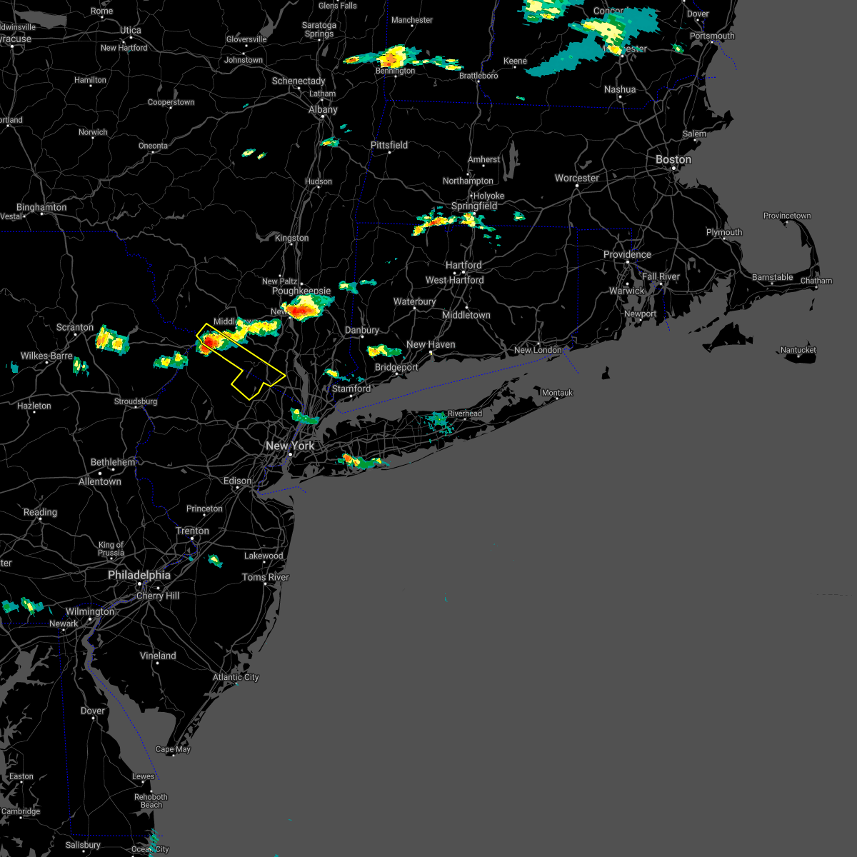 At 451 pm edt, a severe thunderstorm was located over high point, or near port jervis, moving southeast at 40 mph (radar indicated). Hazards include 60 mph wind gusts and penny size hail. Expect damage to trees and power lines. this severe thunderstorm will be near, unionville around 500 pm edt. warwick around 515 pm edt. west milford and greenwood lake around 520 pm edt. Ringwood and sloatsburg around 530 pm edt. At 451 pm edt, a severe thunderstorm was located over high point, or near port jervis, moving southeast at 40 mph (radar indicated). Hazards include 60 mph wind gusts and penny size hail. Expect damage to trees and power lines. this severe thunderstorm will be near, unionville around 500 pm edt. warwick around 515 pm edt. west milford and greenwood lake around 520 pm edt. Ringwood and sloatsburg around 530 pm edt.
|
| 7/22/2020 3:29 PM EDT |
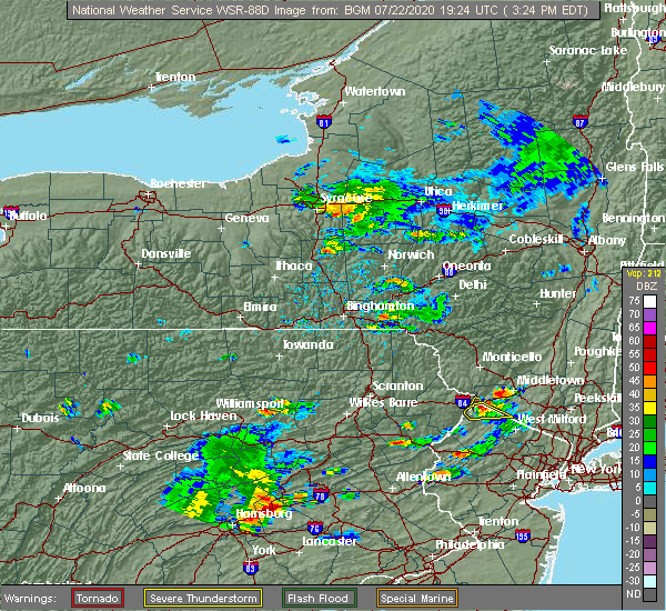 At 328 pm edt, a severe thunderstorm was located near high point, moving northeast at 30 mph (law enforcement). Hazards include 60 mph wind gusts and quarter size hail. Minor damage to vehicles is possible. wind damage to roofs, siding, trees, and power lines is possible. Locations impacted include, high point. At 328 pm edt, a severe thunderstorm was located near high point, moving northeast at 30 mph (law enforcement). Hazards include 60 mph wind gusts and quarter size hail. Minor damage to vehicles is possible. wind damage to roofs, siding, trees, and power lines is possible. Locations impacted include, high point.
|
| 7/22/2020 3:27 PM EDT |
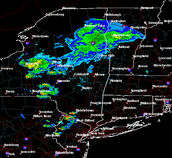 At 318 pm edt, a severe thunderstorm was located over high point, or near matamoras, moving northeast at 50 mph (radar indicated). Hazards include 60 mph wind gusts and quarter size hail. Minor hail damage to vehicles is possible. expect wind damage to trees and power lines. this severe thunderstorm will be near, middletown around 335 pm edt. goshen and chester around 340 pm edt. walden and montgomery around 350 pm edt. gardnertown around 400 pm edt. Newburgh around 405 pm edt. At 318 pm edt, a severe thunderstorm was located over high point, or near matamoras, moving northeast at 50 mph (radar indicated). Hazards include 60 mph wind gusts and quarter size hail. Minor hail damage to vehicles is possible. expect wind damage to trees and power lines. this severe thunderstorm will be near, middletown around 335 pm edt. goshen and chester around 340 pm edt. walden and montgomery around 350 pm edt. gardnertown around 400 pm edt. Newburgh around 405 pm edt.
|
| 7/22/2020 3:20 PM EDT |
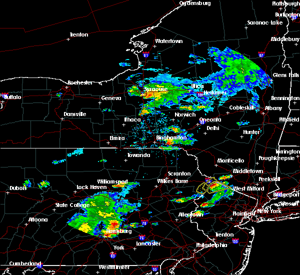 At 319 pm edt, a severe thunderstorm was located near montague, moving northeast at 35 mph (law enforcement). Hazards include 70 mph wind gusts and half dollar size hail. Minor damage to vehicles is possible. expect considerable tree damage. wind damage is also likely to mobile homes, roofs, and outbuildings. Locations impacted include, montague, vernon valley, high point and hainesville. At 319 pm edt, a severe thunderstorm was located near montague, moving northeast at 35 mph (law enforcement). Hazards include 70 mph wind gusts and half dollar size hail. Minor damage to vehicles is possible. expect considerable tree damage. wind damage is also likely to mobile homes, roofs, and outbuildings. Locations impacted include, montague, vernon valley, high point and hainesville.
|
| 7/22/2020 3:04 PM EDT |
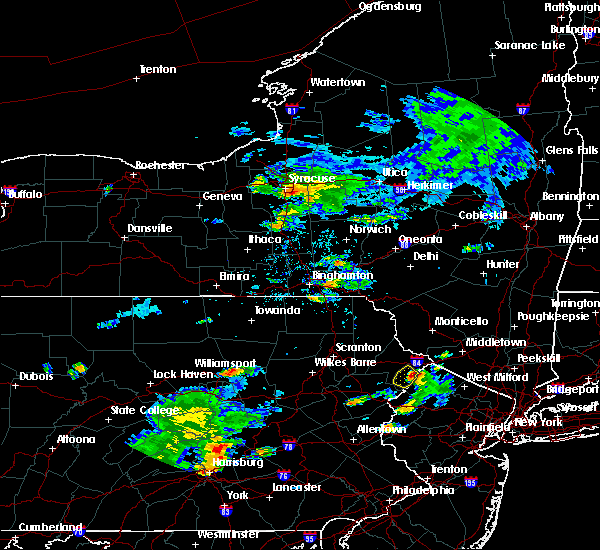 At 303 pm edt, a severe thunderstorm was located over dingmans ferry, or 7 miles southwest of montague, moving northeast at 30 mph (radar indicated). Hazards include 70 mph wind gusts and quarter size hail. Minor damage to vehicles is possible. expect considerable tree damage. Wind damage is also likely to mobile homes, roofs, and outbuildings. At 303 pm edt, a severe thunderstorm was located over dingmans ferry, or 7 miles southwest of montague, moving northeast at 30 mph (radar indicated). Hazards include 70 mph wind gusts and quarter size hail. Minor damage to vehicles is possible. expect considerable tree damage. Wind damage is also likely to mobile homes, roofs, and outbuildings.
|
| 7/3/2020 7:08 PM EDT |
 The severe thunderstorm warning for northeastern sussex county will expire at 715 pm edt, the storm which prompted the warning has weakened below severe limits, and no longer poses an immediate threat to life or property. therefore, the warning will be allowed to expire. however, gusty winds and heavy rain are still possible with this thunderstorm. several reports of power lines down have been received in the vernon valley and sussex areas. The severe thunderstorm warning for northeastern sussex county will expire at 715 pm edt, the storm which prompted the warning has weakened below severe limits, and no longer poses an immediate threat to life or property. therefore, the warning will be allowed to expire. however, gusty winds and heavy rain are still possible with this thunderstorm. several reports of power lines down have been received in the vernon valley and sussex areas.
|
| 7/3/2020 6:50 PM EDT |
 At 650 pm edt, a severe thunderstorm was located over vernon valley, or 9 miles northwest of west milford, moving south at 30 mph (radar indicated). Hazards include 60 mph wind gusts and quarter size hail. Minor damage to vehicles is possible. wind damage to roofs, siding, trees, and power lines is possible. Locations impacted include, montague, franklin, hamburg, ogdensburg, sussex, branchville, high point, pellettown, highland lake and vernon valley. At 650 pm edt, a severe thunderstorm was located over vernon valley, or 9 miles northwest of west milford, moving south at 30 mph (radar indicated). Hazards include 60 mph wind gusts and quarter size hail. Minor damage to vehicles is possible. wind damage to roofs, siding, trees, and power lines is possible. Locations impacted include, montague, franklin, hamburg, ogdensburg, sussex, branchville, high point, pellettown, highland lake and vernon valley.
|
| 7/3/2020 6:35 PM EDT |
 At 635 pm edt, a severe thunderstorm was located over unionville, or 8 miles southeast of matamoras, moving south at 30 mph (radar indicated). Hazards include 60 mph wind gusts and quarter size hail. Minor damage to vehicles is possible. Wind damage to roofs, siding, trees, and power lines is possible. At 635 pm edt, a severe thunderstorm was located over unionville, or 8 miles southeast of matamoras, moving south at 30 mph (radar indicated). Hazards include 60 mph wind gusts and quarter size hail. Minor damage to vehicles is possible. Wind damage to roofs, siding, trees, and power lines is possible.
|
| 7/3/2020 6:18 PM EDT |
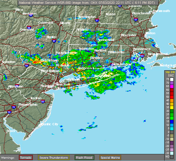 At 617 pm edt, a severe thunderstorm was located near otisville, or near port jervis, moving south at 20 mph (radar indicated). Hazards include quarter size hail. Minor damage to vehicles is possible. this severe thunderstorm will be near, unionville around 635 pm edt. Warwick around 650 pm edt. At 617 pm edt, a severe thunderstorm was located near otisville, or near port jervis, moving south at 20 mph (radar indicated). Hazards include quarter size hail. Minor damage to vehicles is possible. this severe thunderstorm will be near, unionville around 635 pm edt. Warwick around 650 pm edt.
|
| 6/28/2020 4:29 PM EDT |
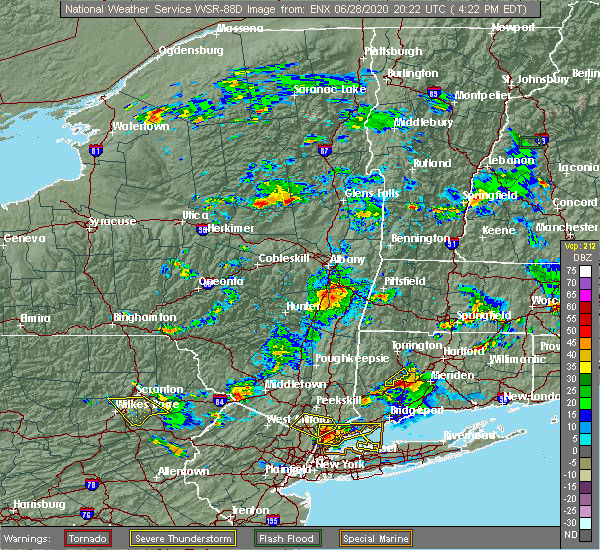 At 428 pm edt, a severe thunderstorm was located near port jervis, moving east at 25 mph (radar indicated). Hazards include 60 mph wind gusts and quarter size hail. Hail damage to vehicles is possible. expect wind damage to trees and power lines. this severe thunderstorm will be near, unionville around 440 pm edt. Warwick and chester around 500 pm edt. At 428 pm edt, a severe thunderstorm was located near port jervis, moving east at 25 mph (radar indicated). Hazards include 60 mph wind gusts and quarter size hail. Hail damage to vehicles is possible. expect wind damage to trees and power lines. this severe thunderstorm will be near, unionville around 440 pm edt. Warwick and chester around 500 pm edt.
|
| 6/28/2020 2:07 PM EDT |
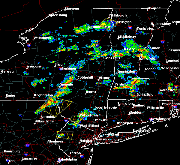 The severe thunderstorm warning for central orange county will expire at 215 pm edt, the storm which prompted the warning has weakened below severe limits, and no longer poses an immediate threat to life or property. therefore, the warning will be allowed to expire. however small hail, gusty winds and heavy rain are still possible with this thunderstorm. a severe thunderstorm watch remains in effect until 800 pm edt for southeastern new york. to report severe weather, contact your nearest law enforcement agency. they will relay your report to the national weather service upton ny. The severe thunderstorm warning for central orange county will expire at 215 pm edt, the storm which prompted the warning has weakened below severe limits, and no longer poses an immediate threat to life or property. therefore, the warning will be allowed to expire. however small hail, gusty winds and heavy rain are still possible with this thunderstorm. a severe thunderstorm watch remains in effect until 800 pm edt for southeastern new york. to report severe weather, contact your nearest law enforcement agency. they will relay your report to the national weather service upton ny.
|
| 6/28/2020 1:39 PM EDT |
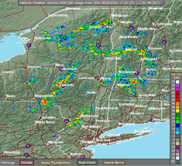 At 138 pm edt, a severe thunderstorm was located near unionville, or near port jervis, moving east at 15 mph (radar indicated). Hazards include 60 mph wind gusts and golf ball size hail. Minor damage to vehicles is possible. wind damage to roofs, siding, trees, and power lines is possible. This severe thunderstorm will be near, unionville around 150 pm edt. At 138 pm edt, a severe thunderstorm was located near unionville, or near port jervis, moving east at 15 mph (radar indicated). Hazards include 60 mph wind gusts and golf ball size hail. Minor damage to vehicles is possible. wind damage to roofs, siding, trees, and power lines is possible. This severe thunderstorm will be near, unionville around 150 pm edt.
|
| 6/3/2020 7:30 PM EDT |
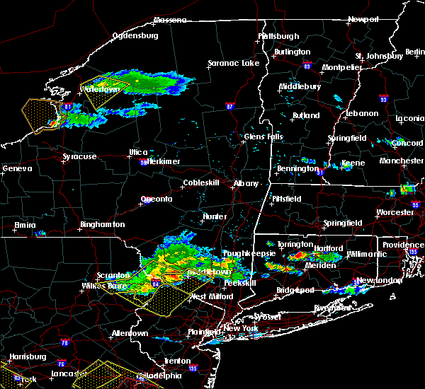 At 730 pm edt, severe thunderstorms were located along a line extending from near bloomingburg to port jervis to near pecks pond, moving southeast at 45 mph (radar indicated). Hazards include 60 mph wind gusts and penny size hail. Expect damage to trees and power lines. these severe storms will be near, middletown around 735 pm edt. walden and goshen around 740 pm edt. chester around 745 pm edt. florida around 750 pm edt. Warwick around 755 pm edt. At 730 pm edt, severe thunderstorms were located along a line extending from near bloomingburg to port jervis to near pecks pond, moving southeast at 45 mph (radar indicated). Hazards include 60 mph wind gusts and penny size hail. Expect damage to trees and power lines. these severe storms will be near, middletown around 735 pm edt. walden and goshen around 740 pm edt. chester around 745 pm edt. florida around 750 pm edt. Warwick around 755 pm edt.
|
| 6/3/2020 6:58 PM EDT |
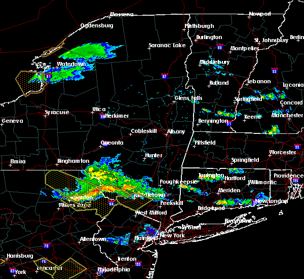 At 657 pm edt, severe thunderstorms were located along a line extending from near white lake to near narrowsburg to mount cobb, moving southeast at 45 mph (radar indicated). Hazards include 60 mph wind gusts and penny size hail. Expect damage to trees and power lines. severe thunderstorms will be near, port jervis around 725 pm edt. middletown around 730 pm edt. walden and goshen around 740 pm edt. chester around 745 pm edt. florida around 750 pm edt. Warwick around 755 pm edt. At 657 pm edt, severe thunderstorms were located along a line extending from near white lake to near narrowsburg to mount cobb, moving southeast at 45 mph (radar indicated). Hazards include 60 mph wind gusts and penny size hail. Expect damage to trees and power lines. severe thunderstorms will be near, port jervis around 725 pm edt. middletown around 730 pm edt. walden and goshen around 740 pm edt. chester around 745 pm edt. florida around 750 pm edt. Warwick around 755 pm edt.
|
| 10/31/2019 11:55 PM EDT |
 At 1155 pm edt, a severe thunderstorm was located over unionville, or 7 miles southeast of matamoras, moving northeast at 90 mph (radar indicated). Hazards include 60 mph wind gusts. Expect damage to trees and power lines. this severe thunderstorm will be near, florida around 1200 am edt. middletown and goshen around 1205 am edt. Walden and montgomery around 1210 am edt. At 1155 pm edt, a severe thunderstorm was located over unionville, or 7 miles southeast of matamoras, moving northeast at 90 mph (radar indicated). Hazards include 60 mph wind gusts. Expect damage to trees and power lines. this severe thunderstorm will be near, florida around 1200 am edt. middletown and goshen around 1205 am edt. Walden and montgomery around 1210 am edt.
|
| 10/31/2019 11:34 PM EDT |
 At 1134 pm edt, a severe thunderstorm was located over bloomingburg, or 7 miles north of middletown, moving northeast at 40 mph (radar indicated). Hazards include 60 mph wind gusts. Expect damage to trees and power lines. This severe storm will be near, walden and montgomery around 1145 pm edt. At 1134 pm edt, a severe thunderstorm was located over bloomingburg, or 7 miles north of middletown, moving northeast at 40 mph (radar indicated). Hazards include 60 mph wind gusts. Expect damage to trees and power lines. This severe storm will be near, walden and montgomery around 1145 pm edt.
|
| 10/31/2019 10:54 PM EDT |
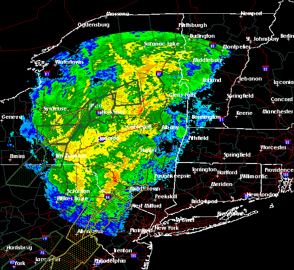 At 1053 pm edt, a severe thunderstorm was located near milford, or near montague, moving northeast at 40 mph (radar indicated). Hazards include 60 mph wind gusts. Expect damage to trees and power lines. this severe thunderstorm will be near, port jervis around 1105 pm edt. middletown around 1125 pm edt. Walden and montgomery around 1145 pm edt. At 1053 pm edt, a severe thunderstorm was located near milford, or near montague, moving northeast at 40 mph (radar indicated). Hazards include 60 mph wind gusts. Expect damage to trees and power lines. this severe thunderstorm will be near, port jervis around 1105 pm edt. middletown around 1125 pm edt. Walden and montgomery around 1145 pm edt.
|
| 8/8/2019 6:15 PM EDT |
 At 614 pm edt, severe thunderstorms were located along a line extending from near hopewell junction to near new windsor to near vernon valley, moving southeast at 45 mph. this line of storms has a history of bringing down trees and power lines (radar indicated). Hazards include 60 mph wind gusts. Expect damage to trees and power lines. severe thunderstorms will be near, newburgh and new windsor around 620 pm edt. west point around 625 pm edt. monroe and cold spring around 630 pm edt. sherman and sloatsburg around 635 pm edt. new fairfield around 640 pm edt. danbury and monsey around 645 pm edt. new city and lake carmel around 650 pm edt. haverstraw and brewster around 655 pm edt. ossining and upper nyack around 700 pm edt. ridgefield around 705 pm edt. mount kisco around 710 pm edt. Redding and bedford around 715 pm edt. At 614 pm edt, severe thunderstorms were located along a line extending from near hopewell junction to near new windsor to near vernon valley, moving southeast at 45 mph. this line of storms has a history of bringing down trees and power lines (radar indicated). Hazards include 60 mph wind gusts. Expect damage to trees and power lines. severe thunderstorms will be near, newburgh and new windsor around 620 pm edt. west point around 625 pm edt. monroe and cold spring around 630 pm edt. sherman and sloatsburg around 635 pm edt. new fairfield around 640 pm edt. danbury and monsey around 645 pm edt. new city and lake carmel around 650 pm edt. haverstraw and brewster around 655 pm edt. ossining and upper nyack around 700 pm edt. ridgefield around 705 pm edt. mount kisco around 710 pm edt. Redding and bedford around 715 pm edt.
|
| 5/19/2019 8:52 PM EDT |
 The severe thunderstorm warning for passaic, northwestern bergen, orange and rockland counties will expire at 900 pm edt, the storms which prompted the warning is weakening below severe limits, and will exit the warned area shortly. therefore, the warning will be allowed to expire. however gusty winds in excess of 40 mph are still possible with these thunderstorms through 930pm. The severe thunderstorm warning for passaic, northwestern bergen, orange and rockland counties will expire at 900 pm edt, the storms which prompted the warning is weakening below severe limits, and will exit the warned area shortly. therefore, the warning will be allowed to expire. however gusty winds in excess of 40 mph are still possible with these thunderstorms through 930pm.
|
| 5/19/2019 8:26 PM EDT |
 At 825 pm edt, severe thunderstorms were located along a line extending from near howells to highland lake to andover, moving east at 40 mph (radar indicated). Hazards include 60 mph wind gusts. Expect damage to trees and power lines. these severe storms will be near, middletown and west milford around 830 pm edt. warwick and goshen around 835 pm edt. ringwood and greenwood lake around 840 pm edt. sloatsburg and montgomery around 845 pm edt. suffern around 850 pm edt. bloomingdale around 855 pm edt. Wayne and pompton lakes around 900 pm edt. At 825 pm edt, severe thunderstorms were located along a line extending from near howells to highland lake to andover, moving east at 40 mph (radar indicated). Hazards include 60 mph wind gusts. Expect damage to trees and power lines. these severe storms will be near, middletown and west milford around 830 pm edt. warwick and goshen around 835 pm edt. ringwood and greenwood lake around 840 pm edt. sloatsburg and montgomery around 845 pm edt. suffern around 850 pm edt. bloomingdale around 855 pm edt. Wayne and pompton lakes around 900 pm edt.
|
| 5/19/2019 8:07 PM EDT |
 At 806 pm edt, severe thunderstorms were located along a line extending from millrift to branchville to greendell, moving east at 30 mph (radar indicated). Hazards include 60 mph wind gusts. Expect damage to trees and power lines. severe thunderstorms will be near, port jervis around 810 pm edt. huguenot around 815 pm edt. cuddebackville around 820 pm edt. otisville around 825 pm edt. howells around 835 pm edt. middletown and west milford around 840 pm edt. warwick and florida around 845 pm edt. goshen around 850 pm edt. ringwood and chester around 855 pm edt. Wayne and pompton lakes around 900 pm edt. At 806 pm edt, severe thunderstorms were located along a line extending from millrift to branchville to greendell, moving east at 30 mph (radar indicated). Hazards include 60 mph wind gusts. Expect damage to trees and power lines. severe thunderstorms will be near, port jervis around 810 pm edt. huguenot around 815 pm edt. cuddebackville around 820 pm edt. otisville around 825 pm edt. howells around 835 pm edt. middletown and west milford around 840 pm edt. warwick and florida around 845 pm edt. goshen around 850 pm edt. ringwood and chester around 855 pm edt. Wayne and pompton lakes around 900 pm edt.
|
| 4/15/2019 3:36 AM EDT |
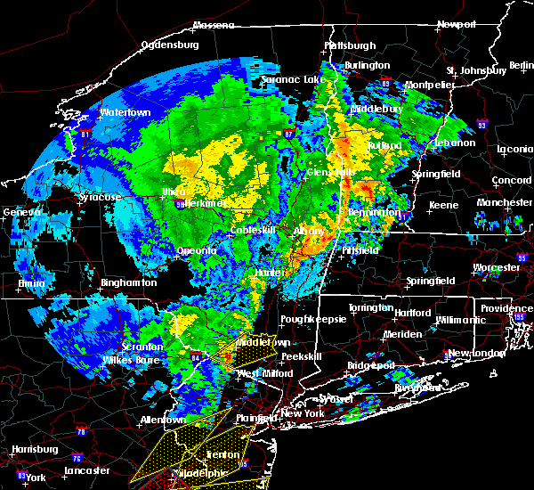 At 336 am edt, a severe thunderstorm was located over unionville, or 8 miles southeast of matamoras, moving northeast at 55 mph (radar indicated). Hazards include 60 mph wind gusts and quarter size hail. Minor hail damage to vehicles is possible. expect wind damage to trees and power lines. this severe thunderstorm will be near, florida around 345 am edt. middletown and goshen around 350 am edt. montgomery around 400 am edt. walden and new windsor around 405 am edt. Newburgh and gardnertown around 410 am edt. At 336 am edt, a severe thunderstorm was located over unionville, or 8 miles southeast of matamoras, moving northeast at 55 mph (radar indicated). Hazards include 60 mph wind gusts and quarter size hail. Minor hail damage to vehicles is possible. expect wind damage to trees and power lines. this severe thunderstorm will be near, florida around 345 am edt. middletown and goshen around 350 am edt. montgomery around 400 am edt. walden and new windsor around 405 am edt. Newburgh and gardnertown around 410 am edt.
|
| 10/2/2018 7:23 PM EDT |
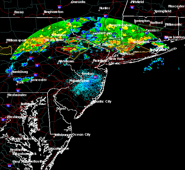 At 722 pm edt, a severe thunderstorm was located near pecks pond, or 14 miles west of montague, moving east at 25 mph (radar indicated). Hazards include 60 mph wind gusts. damage to roofs, siding, trees, and power lines is possible At 722 pm edt, a severe thunderstorm was located near pecks pond, or 14 miles west of montague, moving east at 25 mph (radar indicated). Hazards include 60 mph wind gusts. damage to roofs, siding, trees, and power lines is possible
|
| 5/15/2018 4:38 PM EDT |
 At 437 pm edt, severe thunderstorms were located along a line extending from lake carmel to near west point to victory gardens to washington to near coffeetown, moving east at 45 mph. these are very dangerous storms (the new york state mesonet site at beacon reported winds of 78 mph at 420 pm). Hazards include 80 mph wind gusts and penny size hail. Flying debris will be dangerous to those caught without shelter. mobile homes will be heavily damaged. expect considerable damage to roofs, windows, and vehicles. extensive tree damage and power outages are likely. Locations impacted include, yonkers, paterson, stamford, waterbury, danbury, passaic, white plains, wayne, bloomfield, hackensack, shelton, new city, naugatuck, orange and newburgh. At 437 pm edt, severe thunderstorms were located along a line extending from lake carmel to near west point to victory gardens to washington to near coffeetown, moving east at 45 mph. these are very dangerous storms (the new york state mesonet site at beacon reported winds of 78 mph at 420 pm). Hazards include 80 mph wind gusts and penny size hail. Flying debris will be dangerous to those caught without shelter. mobile homes will be heavily damaged. expect considerable damage to roofs, windows, and vehicles. extensive tree damage and power outages are likely. Locations impacted include, yonkers, paterson, stamford, waterbury, danbury, passaic, white plains, wayne, bloomfield, hackensack, shelton, new city, naugatuck, orange and newburgh.
|
| 5/15/2018 4:06 PM EDT |
 At 405 pm edt, severe thunderstorms were located along a line extending from near wallkill to near high point to near dingmans ferry to stormville to near tamaqua, moving east at 110 mph (radar indicated). Hazards include 70 mph wind gusts and quarter size hail. Minor hail damage to vehicles is possible. expect considerable tree damage. wind damage is also likely to mobile homes, roofs, and outbuildings. Locations that could be impacted include, yonkers, paterson, stamford, waterbury, danbury, passaic, white plains, wayne, bloomfield, hackensack, shelton, new city, naugatuck, orange and newburgh. At 405 pm edt, severe thunderstorms were located along a line extending from near wallkill to near high point to near dingmans ferry to stormville to near tamaqua, moving east at 110 mph (radar indicated). Hazards include 70 mph wind gusts and quarter size hail. Minor hail damage to vehicles is possible. expect considerable tree damage. wind damage is also likely to mobile homes, roofs, and outbuildings. Locations that could be impacted include, yonkers, paterson, stamford, waterbury, danbury, passaic, white plains, wayne, bloomfield, hackensack, shelton, new city, naugatuck, orange and newburgh.
|
| 5/15/2018 3:34 PM EDT |
 At 331 pm edt, severe thunderstorms were located along a line extending from hazel to near lava to new boston-morea, moving east at 70 mph (radar indicated). Hazards include 70 mph wind gusts and quarter size hail. Minor hail damage to vehicles is possible. expect considerable tree damage. wind damage is also likely to mobile homes, roofs, and outbuildings. severe thunderstorms will be near, howells around 350 pm edt. montgomery around 400 pm edt. walden around 405 pm edt. newburgh and new windsor around 410 pm edt. fahnestock state park around 420 pm edt. lake carmel around 425 pm edt. brookfield and new fairfield around 435 pm edt. danbury and newtown around 440 pm edt. summit and southbury around 450 pm edt. waterbury and naugatuck around 455 pm edt. Bloomfield and rutherford around 500 pm edt. At 331 pm edt, severe thunderstorms were located along a line extending from hazel to near lava to new boston-morea, moving east at 70 mph (radar indicated). Hazards include 70 mph wind gusts and quarter size hail. Minor hail damage to vehicles is possible. expect considerable tree damage. wind damage is also likely to mobile homes, roofs, and outbuildings. severe thunderstorms will be near, howells around 350 pm edt. montgomery around 400 pm edt. walden around 405 pm edt. newburgh and new windsor around 410 pm edt. fahnestock state park around 420 pm edt. lake carmel around 425 pm edt. brookfield and new fairfield around 435 pm edt. danbury and newtown around 440 pm edt. summit and southbury around 450 pm edt. waterbury and naugatuck around 455 pm edt. Bloomfield and rutherford around 500 pm edt.
|
| 8/2/2017 3:43 PM EDT |
 At 343 pm edt, severe thunderstorms were located along a line extending from near vernon valley to near walden, moving southeast at 10 mph (radar indicated). Hazards include 60 mph wind gusts and penny size hail. Expect damage to roofs, siding, and trees. these severe storms will be near, gardnertown around 405 pm edt. warwick around 410 pm edt. Newburgh and new windsor around 415 pm edt. At 343 pm edt, severe thunderstorms were located along a line extending from near vernon valley to near walden, moving southeast at 10 mph (radar indicated). Hazards include 60 mph wind gusts and penny size hail. Expect damage to roofs, siding, and trees. these severe storms will be near, gardnertown around 405 pm edt. warwick around 410 pm edt. Newburgh and new windsor around 415 pm edt.
|
| 8/2/2017 3:13 PM EDT |
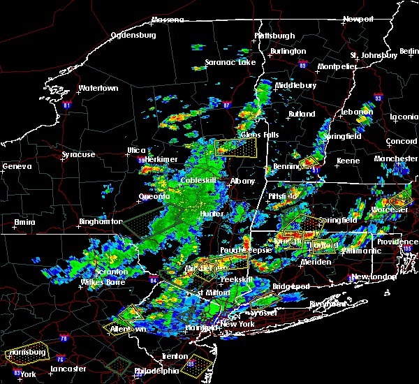 At 313 pm edt, severe thunderstorms were located along a line extending from near vernon valley to modena, moving southeast at 5 mph (radar indicated). Hazards include 60 mph wind gusts and quarter size hail. Hail damage to vehicles is expected. expect wind damage to roofs, siding, and trees. severe thunderstorms will be near, unionville around 320 pm edt. walden and warwick around 410 pm edt. Newburgh and gardnertown around 415 pm edt. At 313 pm edt, severe thunderstorms were located along a line extending from near vernon valley to modena, moving southeast at 5 mph (radar indicated). Hazards include 60 mph wind gusts and quarter size hail. Hail damage to vehicles is expected. expect wind damage to roofs, siding, and trees. severe thunderstorms will be near, unionville around 320 pm edt. walden and warwick around 410 pm edt. Newburgh and gardnertown around 415 pm edt.
|
| 6/19/2017 4:31 PM EDT |
 At 430 pm edt, a severe thunderstorm was located over hamburg, or 10 miles northeast of newton, moving northeast at 45 mph (radar indicated). Hazards include 60 mph wind gusts and penny size hail. Expect damage to roofs, siding, and trees. this severe thunderstorm will be near, unionville around 440 pm edt. upper greenwood lake around 445 pm edt. warwick and greenwood lake around 450 pm edt. florida around 455 pm edt. goshen and chester around 500 pm edt. monroe and harriman around 505 pm edt. Newburgh and west point around 515 pm edt. At 430 pm edt, a severe thunderstorm was located over hamburg, or 10 miles northeast of newton, moving northeast at 45 mph (radar indicated). Hazards include 60 mph wind gusts and penny size hail. Expect damage to roofs, siding, and trees. this severe thunderstorm will be near, unionville around 440 pm edt. upper greenwood lake around 445 pm edt. warwick and greenwood lake around 450 pm edt. florida around 455 pm edt. goshen and chester around 500 pm edt. monroe and harriman around 505 pm edt. Newburgh and west point around 515 pm edt.
|
| 6/19/2017 4:31 PM EDT |
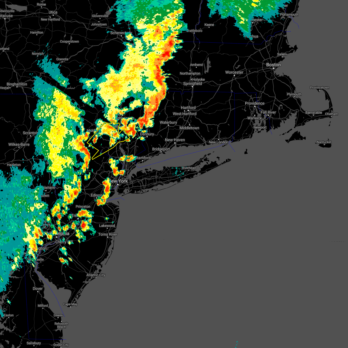 At 430 pm edt, a severe thunderstorm was located over hamburg, or 10 miles northeast of newton, moving northeast at 45 mph (radar indicated). Hazards include 60 mph wind gusts and penny size hail. Expect damage to roofs, siding, and trees. this severe thunderstorm will be near, unionville around 440 pm edt. upper greenwood lake around 445 pm edt. warwick and greenwood lake around 450 pm edt. florida around 455 pm edt. goshen and chester around 500 pm edt. monroe and harriman around 505 pm edt. Newburgh and west point around 515 pm edt. At 430 pm edt, a severe thunderstorm was located over hamburg, or 10 miles northeast of newton, moving northeast at 45 mph (radar indicated). Hazards include 60 mph wind gusts and penny size hail. Expect damage to roofs, siding, and trees. this severe thunderstorm will be near, unionville around 440 pm edt. upper greenwood lake around 445 pm edt. warwick and greenwood lake around 450 pm edt. florida around 455 pm edt. goshen and chester around 500 pm edt. monroe and harriman around 505 pm edt. Newburgh and west point around 515 pm edt.
|
| 2/25/2017 5:27 PM EST |
 At 525 pm est, severe thunderstorms were located along a line extending from woodridge to near unionville to near highland lake to near succasunna, moving northeast at 75 mph (radar indicated. at 454 pm, winds gusted to 55 mph at blairstown in northwest new jersey). Hazards include 60 mph wind gusts and penny size hail. Expect damage to roofs, siding, and trees. these severe storms will be near, middletown and howells around 530 pm est. warwick and goshen around 535 pm est. monroe and chester around 540 pm est. West milford and ringwood around 545 pm est. At 525 pm est, severe thunderstorms were located along a line extending from woodridge to near unionville to near highland lake to near succasunna, moving northeast at 75 mph (radar indicated. at 454 pm, winds gusted to 55 mph at blairstown in northwest new jersey). Hazards include 60 mph wind gusts and penny size hail. Expect damage to roofs, siding, and trees. these severe storms will be near, middletown and howells around 530 pm est. warwick and goshen around 535 pm est. monroe and chester around 540 pm est. West milford and ringwood around 545 pm est.
|
| 2/25/2017 5:20 PM EST | Trees down along pine hill road in minisin in orange county NY, 0.8 miles SSE of Unionville, NY |
| 2/25/2017 5:02 PM EST |
 At 500 pm est, severe thunderstorms were located along a line extending from shohola to near milford to flatbrookville to near oxford to pipersville, moving northeast at 65 mph (radar indicated). Hazards include 60 mph wind gusts. Expect damage to roofs, siding, and trees. severe thunderstorms will be near, port jervis and huguenot around 510 pm est. cuddebackville and otisville around 515 pm est. unionville around 525 pm est. west milford around 530 pm est. middletown and goshen around 535 pm est. warwick and greenwood lake around 540 pm est. Monroe and walden around 545 pm est. At 500 pm est, severe thunderstorms were located along a line extending from shohola to near milford to flatbrookville to near oxford to pipersville, moving northeast at 65 mph (radar indicated). Hazards include 60 mph wind gusts. Expect damage to roofs, siding, and trees. severe thunderstorms will be near, port jervis and huguenot around 510 pm est. cuddebackville and otisville around 515 pm est. unionville around 525 pm est. west milford around 530 pm est. middletown and goshen around 535 pm est. warwick and greenwood lake around 540 pm est. Monroe and walden around 545 pm est.
|
| 7/25/2016 5:49 PM EDT |
 At 547 pm edt, severe thunderstorms were located along a line extending from near unionville to near sussex to near andover, moving east at 40 mph (radar indicated). Hazards include 60 mph wind gusts and penny size hail. Expect damage to roofs. siding. and trees. severe thunderstorms will be near, warwick and florida around 600 pm edt. chester and upper greenwood lake around 605 pm edt. ringwood and greenwood lake around 610 pm edt. west milford, monroe and sloatsburg around 615 pm edt. suffern, bloomingdale, and harriman around 620 pm edt. pompton lakes and monsey around 625 pm edt. wayne, ramsey and pomona around 630 pm edt. Other locations impacted by these severe thunderstorms include hillburn, airmont, west haverstraw, viola, new hempstead, mount ivy, highland mills, highland falls, kiryas joel and central valley. At 547 pm edt, severe thunderstorms were located along a line extending from near unionville to near sussex to near andover, moving east at 40 mph (radar indicated). Hazards include 60 mph wind gusts and penny size hail. Expect damage to roofs. siding. and trees. severe thunderstorms will be near, warwick and florida around 600 pm edt. chester and upper greenwood lake around 605 pm edt. ringwood and greenwood lake around 610 pm edt. west milford, monroe and sloatsburg around 615 pm edt. suffern, bloomingdale, and harriman around 620 pm edt. pompton lakes and monsey around 625 pm edt. wayne, ramsey and pomona around 630 pm edt. Other locations impacted by these severe thunderstorms include hillburn, airmont, west haverstraw, viola, new hempstead, mount ivy, highland mills, highland falls, kiryas joel and central valley.
|
| 6/5/2016 5:39 PM EDT |
 At 538 pm edt, severe thunderstorms were located along a line extending from near grahamsville to branchville, moving northeast at 45 mph (radar indicated). Hazards include 60 mph wind gusts. Expect damage to roofs. siding. and trees. severe thunderstorms will be near, unionville around 555 pm edt. warwick and florida around 610 pm edt. goshen and chester around 615 pm edt. monroe around 620 pm edt. montgomery around 625 pm edt. walden around 630 pm edt. new windsor around 635 pm edt. newburgh and gardnertown around 640 pm edt. Other locations impacted by these severe thunderstorms include washingtonville, central valley, maybrook, orange lake, balmville, cornwall on hudson, pine bush, highland mills, firthcliffe and kiryas joel. At 538 pm edt, severe thunderstorms were located along a line extending from near grahamsville to branchville, moving northeast at 45 mph (radar indicated). Hazards include 60 mph wind gusts. Expect damage to roofs. siding. and trees. severe thunderstorms will be near, unionville around 555 pm edt. warwick and florida around 610 pm edt. goshen and chester around 615 pm edt. monroe around 620 pm edt. montgomery around 625 pm edt. walden around 630 pm edt. new windsor around 635 pm edt. newburgh and gardnertown around 640 pm edt. Other locations impacted by these severe thunderstorms include washingtonville, central valley, maybrook, orange lake, balmville, cornwall on hudson, pine bush, highland mills, firthcliffe and kiryas joel.
|
| 2/24/2016 11:00 PM EST |
 At 1058 pm est, doppler radar indicated a severe thunderstorms moving across the warning area capable of producing damaging winds in excess of 60 mph. these storms were moving northeast at 0 to 50 mph. locations impacted include, white plains, newburgh, middletown, ossining, peekskill, haverstraw, tarrytown, mount kisco, dobbs ferry, port jervis, monroe, walden, nyack, warwick, goshen, sloatsburg, cold spring, nanuet, new city and north tarrytown. At 1058 pm est, doppler radar indicated a severe thunderstorms moving across the warning area capable of producing damaging winds in excess of 60 mph. these storms were moving northeast at 0 to 50 mph. locations impacted include, white plains, newburgh, middletown, ossining, peekskill, haverstraw, tarrytown, mount kisco, dobbs ferry, port jervis, monroe, walden, nyack, warwick, goshen, sloatsburg, cold spring, nanuet, new city and north tarrytown.
|
| 2/24/2016 10:35 PM EST |
 At 1032 pm est, doppler radar indicated an area of thunderstorms capable of producing damaging winds in excess of 60 mph. this activity will move across much of the lower hudson valley of new york. other locations impacted by this severe thunderstorm include west haverstraw, pleasantville, west nyack, balmville, highland mills, spring valley, thiells, irvington, grand view-on-huds and new hempstead. expect strong winds and heavy downpours with this activity. At 1032 pm est, doppler radar indicated an area of thunderstorms capable of producing damaging winds in excess of 60 mph. this activity will move across much of the lower hudson valley of new york. other locations impacted by this severe thunderstorm include west haverstraw, pleasantville, west nyack, balmville, highland mills, spring valley, thiells, irvington, grand view-on-huds and new hempstead. expect strong winds and heavy downpours with this activity.
|
| 6/23/2015 3:28 PM EDT | The severe thunderstorm warning for passaic, northwestern bergen, rockland and orange counties will expire at 330 pm edt, the severe thunderstorm which prompted the warning will move out of the warned area soon. therefore the warning will be allowed to expire. |
| 6/23/2015 3:28 PM EDT | The severe thunderstorm warning for passaic, northwestern bergen, rockland and orange counties will expire at 330 pm edt, the severe thunderstorm which prompted the warning will move out of the warned area soon. therefore the warning will be allowed to expire. |
| 6/23/2015 3:08 PM EDT |
 At 307 pm edt, doppler radar indicated a line of severe thunderstorms capable of producing damaging winds in excess of 60 mph. these storms were located along a line extending from near unionville to near vernon valley to highland lake to near green pond to lake telemark, moving east at 75 mph. locations impacted include, rockaway, franklin, mountain lakes, hamburg, ogdensburg, sussex, unionville, vernon valley, highland lake, lake telemark, green pond and white meadow lake. At 307 pm edt, doppler radar indicated a line of severe thunderstorms capable of producing damaging winds in excess of 60 mph. these storms were located along a line extending from near unionville to near vernon valley to highland lake to near green pond to lake telemark, moving east at 75 mph. locations impacted include, rockaway, franklin, mountain lakes, hamburg, ogdensburg, sussex, unionville, vernon valley, highland lake, lake telemark, green pond and white meadow lake.
|
| 6/23/2015 3:03 PM EDT |
 At 303 pm edt, doppler radar indicated a severe thunderstorm capable of producing damaging winds in excess of 60 mph. this storm was located over hamburg, or 9 miles west of west milford, moving east at 60 mph. penny size hail may also accompany the damaging winds. locations impacted include, paterson, wayne, middletown, west milford, ridgewood, ramsey, ringwood, pompton lakes, suffern, port jervis, monroe, walden, warwick, goshen, sloatsburg, hawthorne, bloomingdale, chester, montgomery and greenwood lake. At 303 pm edt, doppler radar indicated a severe thunderstorm capable of producing damaging winds in excess of 60 mph. this storm was located over hamburg, or 9 miles west of west milford, moving east at 60 mph. penny size hail may also accompany the damaging winds. locations impacted include, paterson, wayne, middletown, west milford, ridgewood, ramsey, ringwood, pompton lakes, suffern, port jervis, monroe, walden, warwick, goshen, sloatsburg, hawthorne, bloomingdale, chester, montgomery and greenwood lake.
|
| 6/23/2015 2:43 PM EDT |
 At 242 pm edt, doppler radar indicated an area of severe thunderstorms capable of producing damaging winds in excess of 60 mph. this storm was located over flatbrookville, or 11 miles west of newton, and moving east at 55 mph. penny size hail may also accompany the damaging winds. At 242 pm edt, doppler radar indicated an area of severe thunderstorms capable of producing damaging winds in excess of 60 mph. this storm was located over flatbrookville, or 11 miles west of newton, and moving east at 55 mph. penny size hail may also accompany the damaging winds.
|
| 7/2/2014 3:50 PM EDT | Wires were knocked down and arcing reported on oil city road. time estimated by rada in orange county NY, 2.6 miles WNW of Unionville, NY |
| 7/7/2013 3:01 PM EDT | Quarter sized hail reported 3 miles SSW of Unionville, NY, quarter sized hail observed in westtown. |
Hail Maps for Unionville, NY
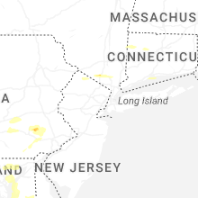


Connect with Interactive Hail Maps