

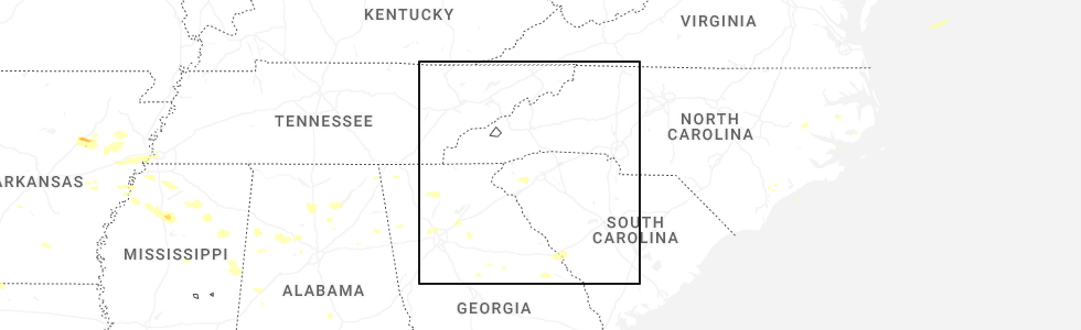
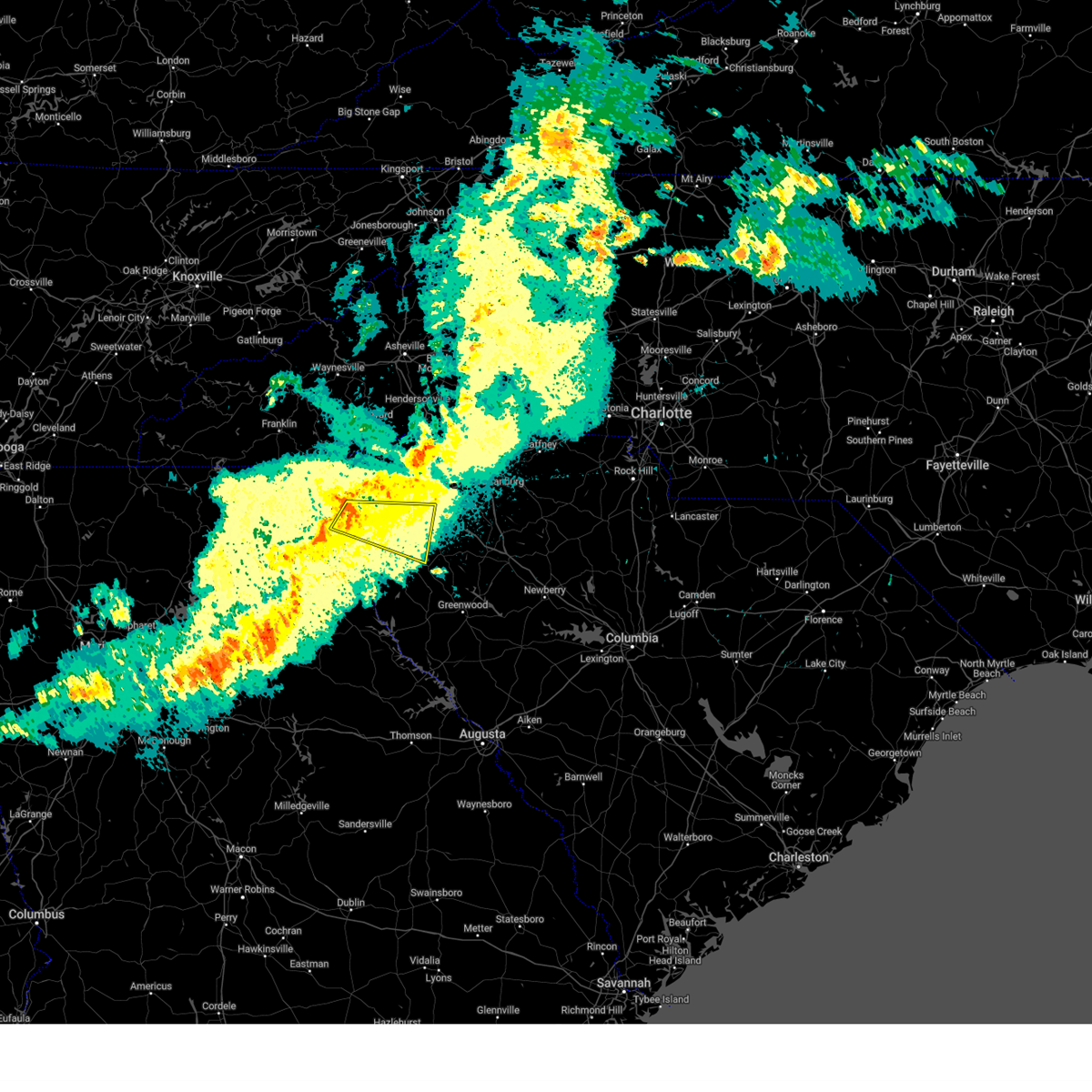
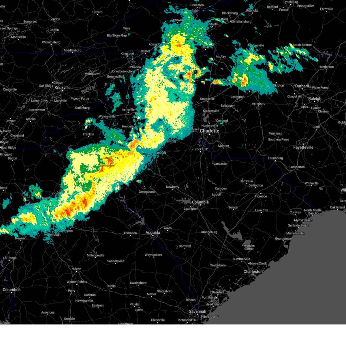
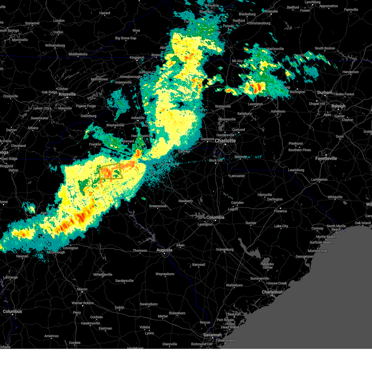
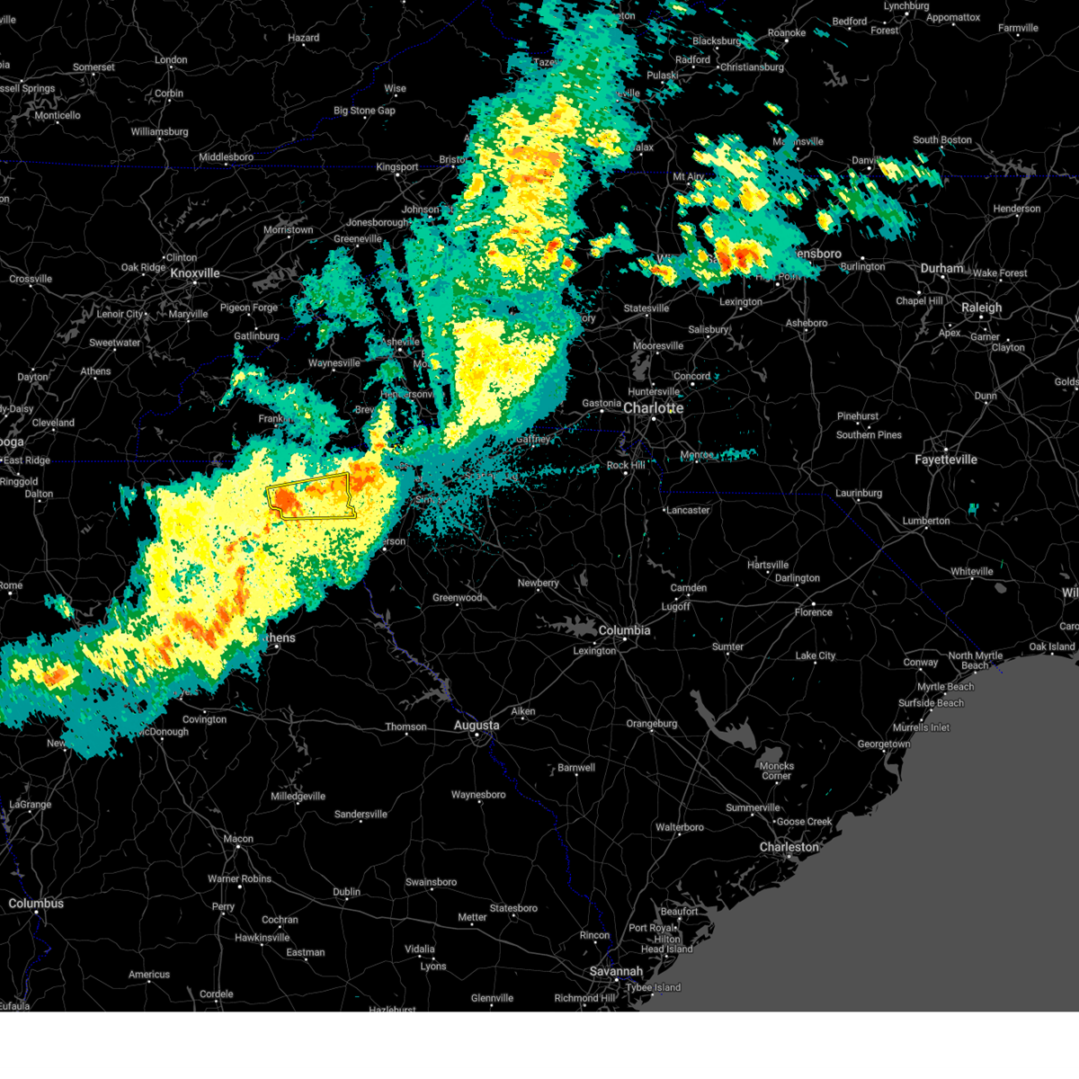
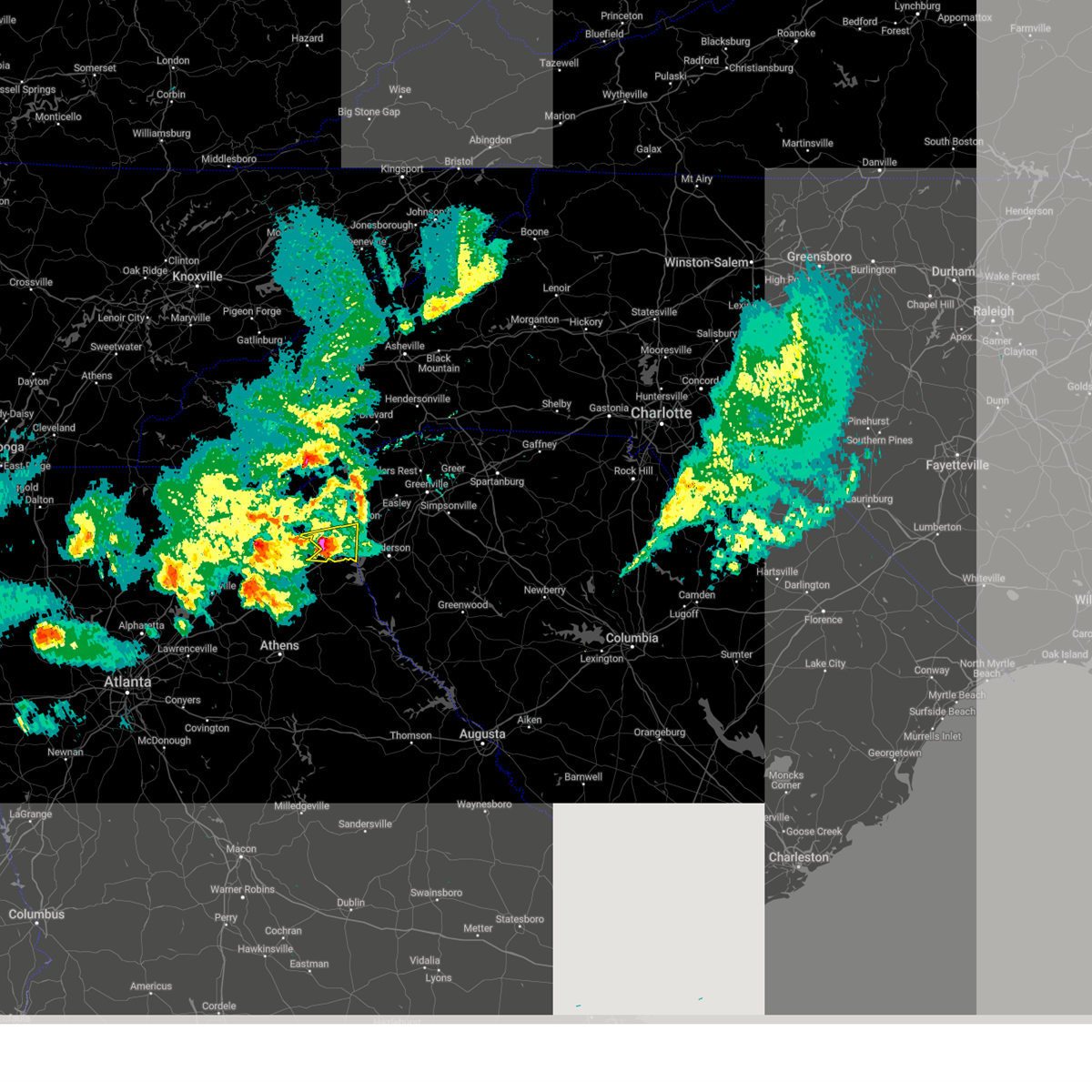
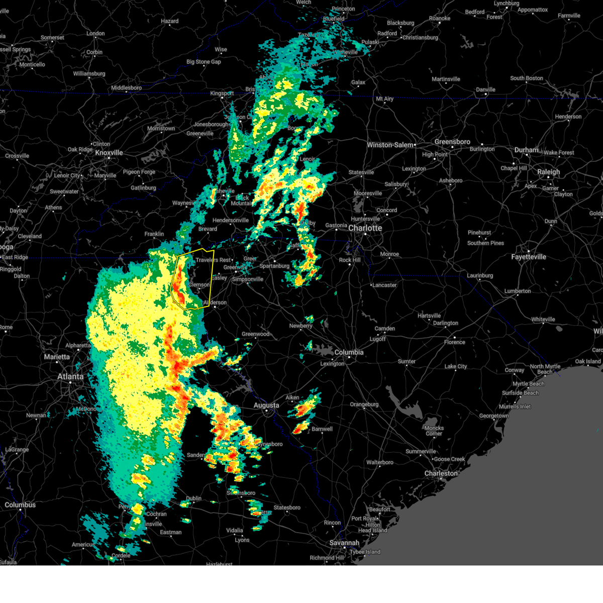
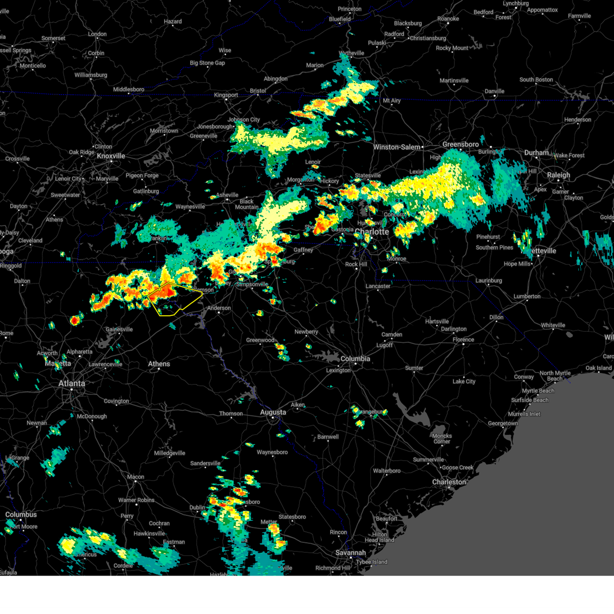
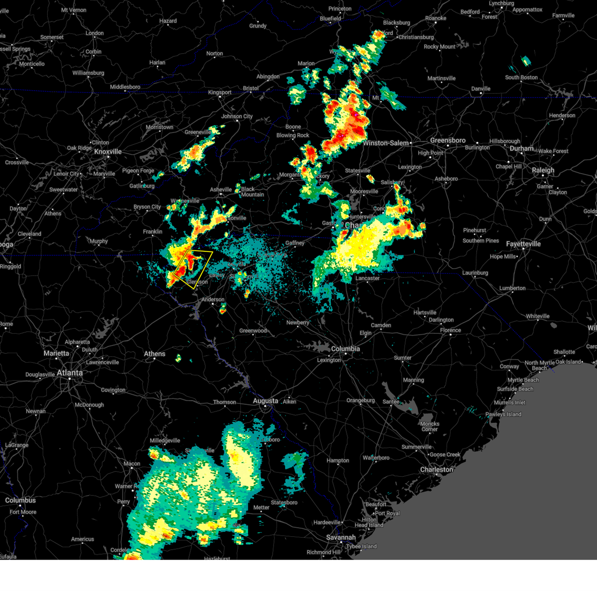
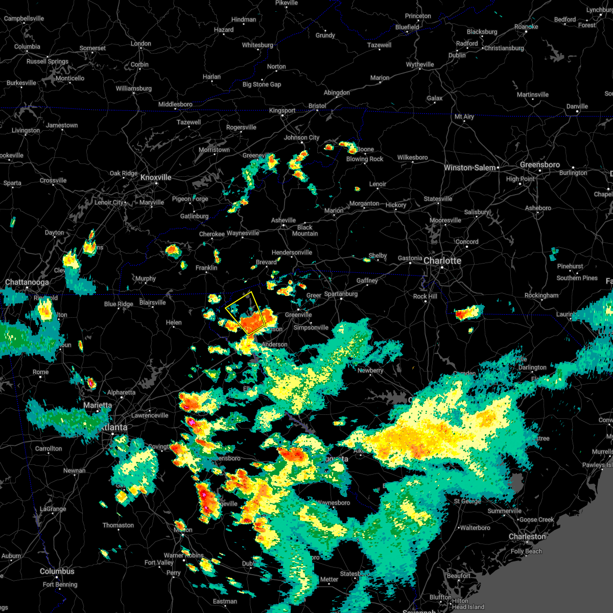
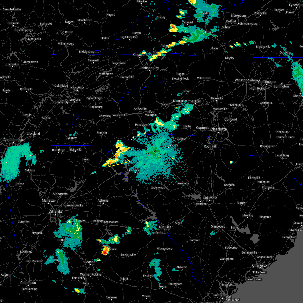
Hail Map for Utica, SC
The Utica, SC area has had 0 reports of on-the-ground hail by trained spotters, and has been under severe weather warnings 29 times during the past 12 months. Doppler radar has detected hail at or near Utica, SC on 34 occasions, including 3 occasions during the past year.
| Name: | Utica, SC |
| Where Located: | 21.5 miles WSW of Greenville, SC |
| Map: | Google Map for Utica, SC |
| Population: | 1489 |
| Housing Units: | 716 |
| More Info: | Search Google for Utica, SC |
0
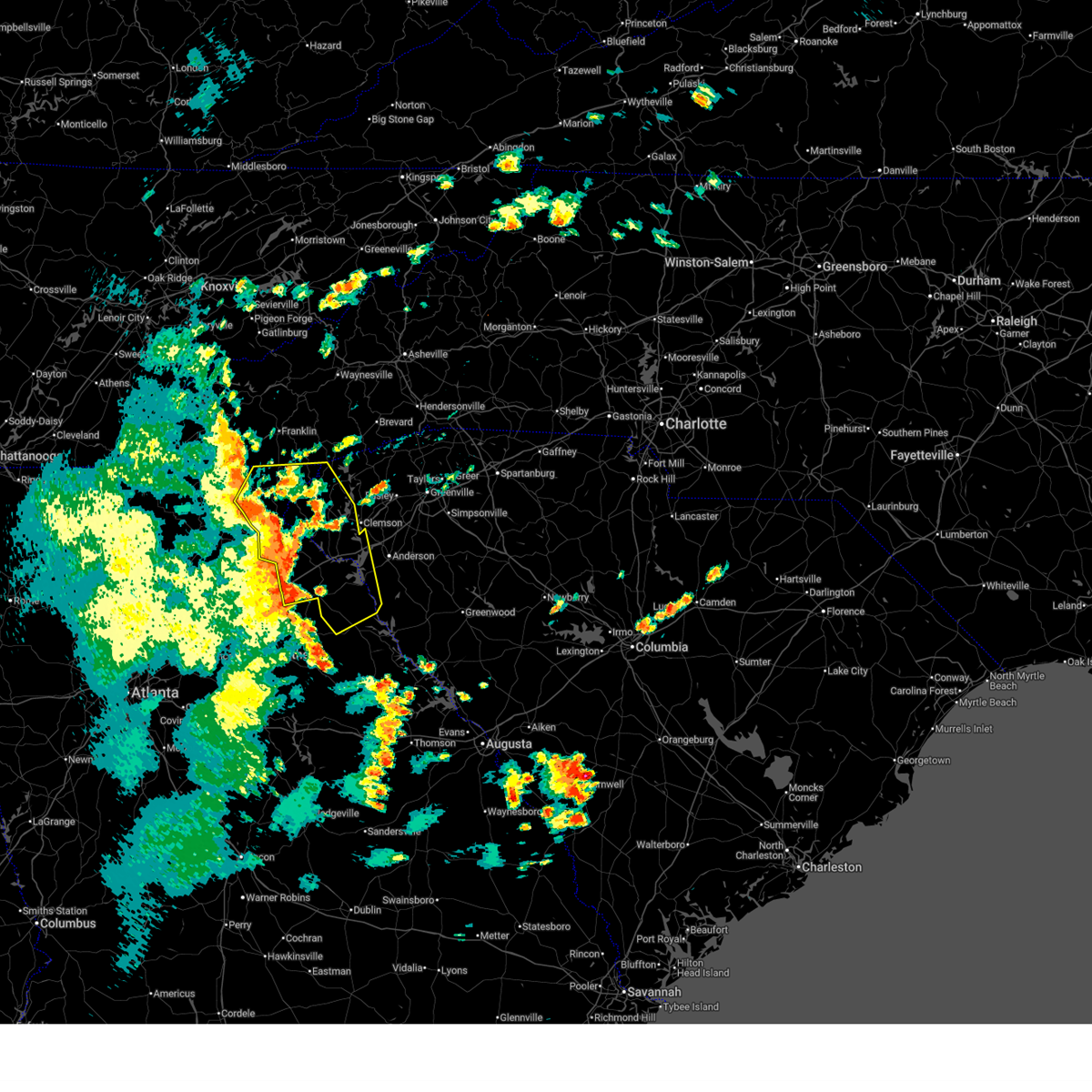
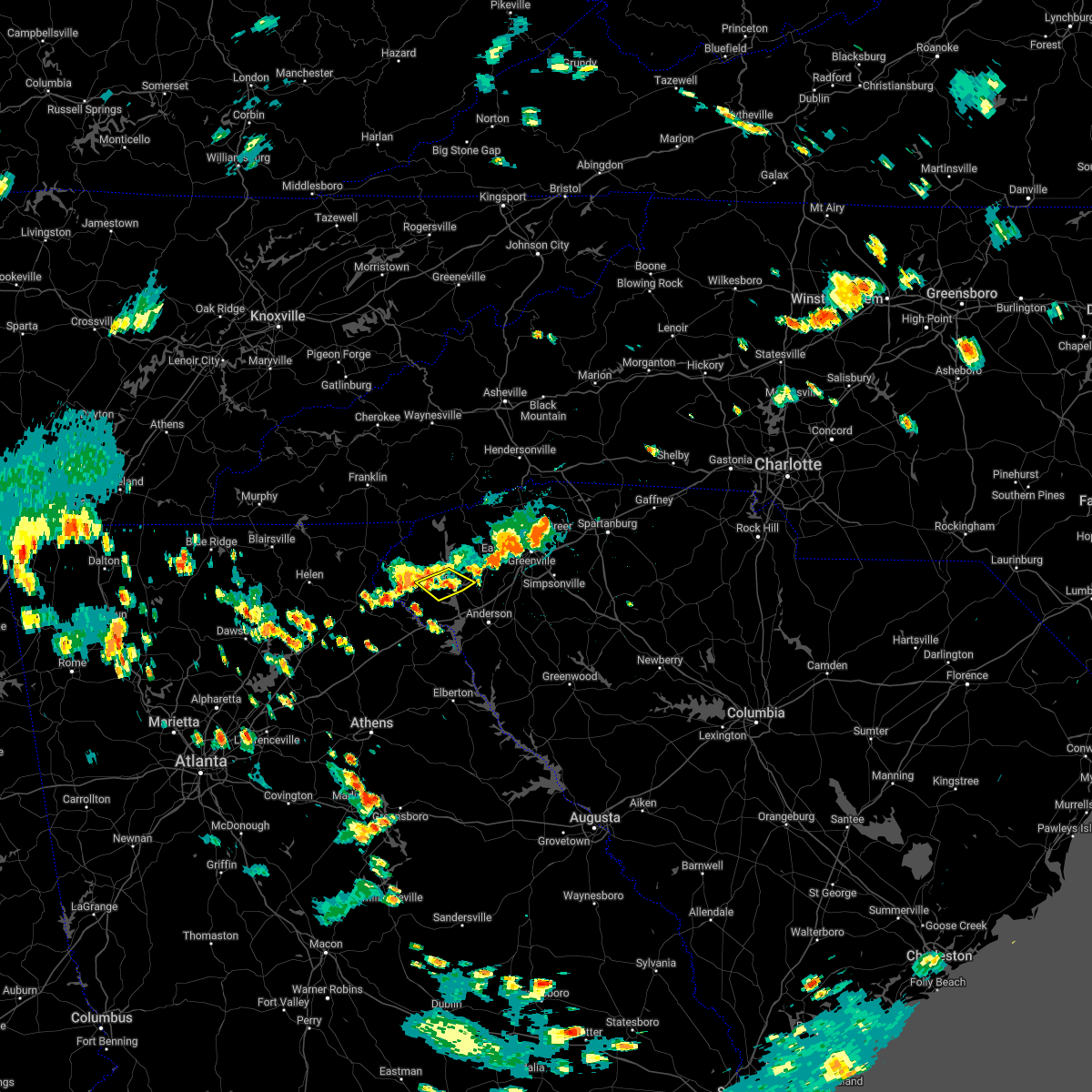
The Top Recent Hail Date for Utica, SC is Saturday, June 7, 2025 (34th out of 34)
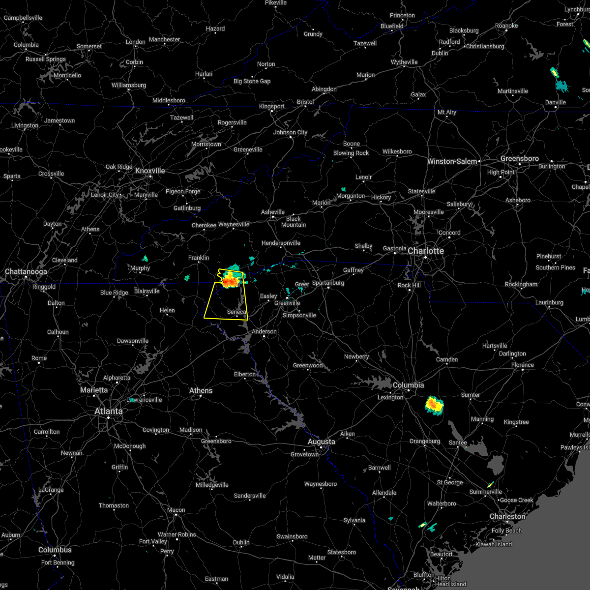
Hail and Wind Damage Spotted near Utica, SC
| Date / Time | Report Details |
|---|---|
| 6/26/2025 5:24 PM EDT | Svrgsp the national weather service in greenville-spartanburg has issued a * severe thunderstorm warning for, central oconee county in upstate south carolina, * until 615 pm edt. * at 523 pm edt, a severe thunderstorm was located near walhalla, moving west at 10 mph (radar indicated). Hazards include 60 mph wind gusts and nickel size hail. expect damage to trees and power lines |
| 6/17/2025 8:12 PM EDT |
 Svrgsp the national weather service in greenville-spartanburg has issued a * severe thunderstorm warning for, north central elbert county in northeastern georgia, central hart county in northeastern georgia, transylvania county in western north carolina, henderson county in western north carolina, southwestern polk county in western north carolina, greenville county in upstate south carolina, anderson county in upstate south carolina, pickens county in upstate south carolina, northwestern abbeville county in upstate south carolina, oconee county in upstate south carolina, * until 915 pm edt. * at 812 pm edt, severe thunderstorms were located along a line extending from 14 miles north of walhalla to 5 miles west of pickens to 9 miles northeast of elberton, moving northeast at 35 mph (radar indicated). Hazards include 60 mph wind gusts. expect damage to trees and power lines Svrgsp the national weather service in greenville-spartanburg has issued a * severe thunderstorm warning for, north central elbert county in northeastern georgia, central hart county in northeastern georgia, transylvania county in western north carolina, henderson county in western north carolina, southwestern polk county in western north carolina, greenville county in upstate south carolina, anderson county in upstate south carolina, pickens county in upstate south carolina, northwestern abbeville county in upstate south carolina, oconee county in upstate south carolina, * until 915 pm edt. * at 812 pm edt, severe thunderstorms were located along a line extending from 14 miles north of walhalla to 5 miles west of pickens to 9 miles northeast of elberton, moving northeast at 35 mph (radar indicated). Hazards include 60 mph wind gusts. expect damage to trees and power lines
|
| 6/17/2025 7:44 PM EDT |
 At 744 pm edt, severe thunderstorms were located along a line extending from 6 miles west of clayton to 6 miles southeast of toccoa to 5 miles east of danielsville, moving northeast at 40 mph (radar indicated). Hazards include 60 mph wind gusts. Expect damage to trees and power lines. Locations impacted include, toccoa, seneca, hartwell, walhalla, clayton, carnesville, royston, westminster, reed creek, and lavonia. At 744 pm edt, severe thunderstorms were located along a line extending from 6 miles west of clayton to 6 miles southeast of toccoa to 5 miles east of danielsville, moving northeast at 40 mph (radar indicated). Hazards include 60 mph wind gusts. Expect damage to trees and power lines. Locations impacted include, toccoa, seneca, hartwell, walhalla, clayton, carnesville, royston, westminster, reed creek, and lavonia.
|
| 6/17/2025 7:11 PM EDT |
 Svrgsp the national weather service in greenville-spartanburg has issued a * severe thunderstorm warning for, franklin county in northeastern georgia, stephens county in northeastern georgia, northwestern elbert county in northeastern georgia, habersham county in northeastern georgia, rabun county in northeastern georgia, hart county in northeastern georgia, southwestern anderson county in upstate south carolina, oconee county in upstate south carolina, * until 815 pm edt. * at 710 pm edt, severe thunderstorms were located along a line extending from 8 miles north of cleveland to near homer to near athens, moving northeast at 35 mph (radar indicated). Hazards include 60 mph wind gusts. expect damage to trees and power lines Svrgsp the national weather service in greenville-spartanburg has issued a * severe thunderstorm warning for, franklin county in northeastern georgia, stephens county in northeastern georgia, northwestern elbert county in northeastern georgia, habersham county in northeastern georgia, rabun county in northeastern georgia, hart county in northeastern georgia, southwestern anderson county in upstate south carolina, oconee county in upstate south carolina, * until 815 pm edt. * at 710 pm edt, severe thunderstorms were located along a line extending from 8 miles north of cleveland to near homer to near athens, moving northeast at 35 mph (radar indicated). Hazards include 60 mph wind gusts. expect damage to trees and power lines
|
| 6/7/2025 7:15 PM EDT |
 Svrgsp the national weather service in greenville-spartanburg has issued a * severe thunderstorm warning for, northwestern anderson county in upstate south carolina, pickens county in upstate south carolina, oconee county in upstate south carolina, * until 800 pm edt. * at 714 pm edt, severe thunderstorms were located along a line extending from 8 miles northwest of walhalla to 11 miles northwest of hartwell, moving east at 45 mph (radar indicated). Hazards include 60 mph wind gusts. expect damage to trees and power lines Svrgsp the national weather service in greenville-spartanburg has issued a * severe thunderstorm warning for, northwestern anderson county in upstate south carolina, pickens county in upstate south carolina, oconee county in upstate south carolina, * until 800 pm edt. * at 714 pm edt, severe thunderstorms were located along a line extending from 8 miles northwest of walhalla to 11 miles northwest of hartwell, moving east at 45 mph (radar indicated). Hazards include 60 mph wind gusts. expect damage to trees and power lines
|
| 5/21/2025 1:52 AM EDT |
 Svrgsp the national weather service in greenville-spartanburg has issued a * severe thunderstorm warning for, south central greenville county in upstate south carolina, northern anderson county in upstate south carolina, southern pickens county in upstate south carolina, east central oconee county in upstate south carolina, * until 230 am edt. * at 151 am edt, a severe thunderstorm was located near seneca, moving east at 50 mph (radar indicated). Hazards include 60 mph wind gusts. expect damage to trees and power lines Svrgsp the national weather service in greenville-spartanburg has issued a * severe thunderstorm warning for, south central greenville county in upstate south carolina, northern anderson county in upstate south carolina, southern pickens county in upstate south carolina, east central oconee county in upstate south carolina, * until 230 am edt. * at 151 am edt, a severe thunderstorm was located near seneca, moving east at 50 mph (radar indicated). Hazards include 60 mph wind gusts. expect damage to trees and power lines
|
| 5/21/2025 1:49 AM EDT |
 At 148 am edt, a severe thunderstorm was located 5 miles east of walhalla, moving east at 45 mph (radar indicated). Hazards include 60 mph wind gusts. Expect damage to trees and power lines. Locations impacted include, seneca, walhalla, and lake keowee. At 148 am edt, a severe thunderstorm was located 5 miles east of walhalla, moving east at 45 mph (radar indicated). Hazards include 60 mph wind gusts. Expect damage to trees and power lines. Locations impacted include, seneca, walhalla, and lake keowee.
|
| 5/21/2025 1:37 AM EDT |
 the severe thunderstorm warning has been cancelled and is no longer in effect the severe thunderstorm warning has been cancelled and is no longer in effect
|
| 5/21/2025 1:37 AM EDT |
 At 136 am edt, a severe thunderstorm was located near walhalla, moving east at 45 mph (radar indicated). Hazards include 60 mph wind gusts. Expect damage to trees and power lines. Locations impacted include, mountain rest, seneca, walhalla, long creek, salem, oconee state park, lake keowee, and westminster. At 136 am edt, a severe thunderstorm was located near walhalla, moving east at 45 mph (radar indicated). Hazards include 60 mph wind gusts. Expect damage to trees and power lines. Locations impacted include, mountain rest, seneca, walhalla, long creek, salem, oconee state park, lake keowee, and westminster.
|
| 5/21/2025 1:25 AM EDT |
 Svrgsp the national weather service in greenville-spartanburg has issued a * severe thunderstorm warning for, south central rabun county in northeastern georgia, central oconee county in upstate south carolina, * until 200 am edt. * at 125 am edt, a severe thunderstorm was located 10 miles southeast of clayton, or 5 miles northeast of tallulah gorge state park, moving east at 45 mph (radar indicated). Hazards include 60 mph wind gusts. expect damage to trees and power lines Svrgsp the national weather service in greenville-spartanburg has issued a * severe thunderstorm warning for, south central rabun county in northeastern georgia, central oconee county in upstate south carolina, * until 200 am edt. * at 125 am edt, a severe thunderstorm was located 10 miles southeast of clayton, or 5 miles northeast of tallulah gorge state park, moving east at 45 mph (radar indicated). Hazards include 60 mph wind gusts. expect damage to trees and power lines
|
| 5/2/2025 2:16 PM EDT | Svrgsp the national weather service in greenville-spartanburg has issued a * severe thunderstorm warning for, central anderson county in upstate south carolina, southwestern pickens county in upstate south carolina, southeastern oconee county in upstate south carolina, * until 300 pm edt. * at 216 pm edt, a severe thunderstorm was located 5 miles southwest of seneca, moving east at 25 mph (radar indicated). Hazards include 60 mph wind gusts and quarter size hail. Minor hail damage to vehicles is expected. Expect wind damage to trees and power lines. |
| 4/10/2025 7:34 PM EDT |
 the severe thunderstorm warning has been cancelled and is no longer in effect the severe thunderstorm warning has been cancelled and is no longer in effect
|
| 4/10/2025 7:34 PM EDT |
 At 733 pm edt, a severe thunderstorm was located 9 miles south of seneca, or 6 miles northeast of tugaloo state park, moving east at 30 mph (radar indicated). Hazards include 60 mph wind gusts and quarter size hail. Minor hail damage to vehicles is expected. expect wind damage to trees and power lines. Locations impacted include, townville, tugaloo state park, fair play, gumlog, oakway, martin, seneca, and lake hartwell. At 733 pm edt, a severe thunderstorm was located 9 miles south of seneca, or 6 miles northeast of tugaloo state park, moving east at 30 mph (radar indicated). Hazards include 60 mph wind gusts and quarter size hail. Minor hail damage to vehicles is expected. expect wind damage to trees and power lines. Locations impacted include, townville, tugaloo state park, fair play, gumlog, oakway, martin, seneca, and lake hartwell.
|
| 4/10/2025 7:15 PM EDT |
 Svrgsp the national weather service in greenville-spartanburg has issued a * severe thunderstorm warning for, northeastern franklin county in northeastern georgia, southeastern stephens county in northeastern georgia, west central anderson county in upstate south carolina, southern oconee county in upstate south carolina, * until 800 pm edt. * at 715 pm edt, a severe thunderstorm was located 11 miles east of toccoa, or 4 miles north of gumlog, moving east at 30 mph (radar indicated). Hazards include 60 mph wind gusts and quarter size hail. Minor hail damage to vehicles is expected. Expect wind damage to trees and power lines. Svrgsp the national weather service in greenville-spartanburg has issued a * severe thunderstorm warning for, northeastern franklin county in northeastern georgia, southeastern stephens county in northeastern georgia, west central anderson county in upstate south carolina, southern oconee county in upstate south carolina, * until 800 pm edt. * at 715 pm edt, a severe thunderstorm was located 11 miles east of toccoa, or 4 miles north of gumlog, moving east at 30 mph (radar indicated). Hazards include 60 mph wind gusts and quarter size hail. Minor hail damage to vehicles is expected. Expect wind damage to trees and power lines.
|
| 3/31/2025 2:41 PM EDT |
 At 241 pm edt, severe thunderstorms were located along a line extending from 15 miles northwest of pickens to 4 miles north of seneca to 11 miles southwest of clemson, moving northeast at 45 mph (radar indicated). Hazards include 70 mph wind gusts. Expect considerable tree damage. damage is likely to mobile homes, roofs, and outbuildings. Locations impacted include, norris, townville, sandy springs, seneca, pendleton, lake keowee, central, jocassee gorges, nine times, and liberty. At 241 pm edt, severe thunderstorms were located along a line extending from 15 miles northwest of pickens to 4 miles north of seneca to 11 miles southwest of clemson, moving northeast at 45 mph (radar indicated). Hazards include 70 mph wind gusts. Expect considerable tree damage. damage is likely to mobile homes, roofs, and outbuildings. Locations impacted include, norris, townville, sandy springs, seneca, pendleton, lake keowee, central, jocassee gorges, nine times, and liberty.
|
| 3/31/2025 2:31 PM EDT |
 the severe thunderstorm warning has been cancelled and is no longer in effect the severe thunderstorm warning has been cancelled and is no longer in effect
|
| 3/31/2025 2:31 PM EDT |
 At 230 pm edt, severe thunderstorms were located along a line extending from 20 miles west of pickens to 5 miles south of walhalla to 11 miles northwest of hartwell, moving northeast at 45 mph (radar indicated). Hazards include 70 mph wind gusts. Expect considerable tree damage. damage is likely to mobile homes, roofs, and outbuildings. Locations impacted include, westminster, bad creek, central, jocassee gorges, liberty, pickens, oakway, clemson, six mile, and devils fork state park. At 230 pm edt, severe thunderstorms were located along a line extending from 20 miles west of pickens to 5 miles south of walhalla to 11 miles northwest of hartwell, moving northeast at 45 mph (radar indicated). Hazards include 70 mph wind gusts. Expect considerable tree damage. damage is likely to mobile homes, roofs, and outbuildings. Locations impacted include, westminster, bad creek, central, jocassee gorges, liberty, pickens, oakway, clemson, six mile, and devils fork state park.
|
| 3/31/2025 2:25 PM EDT | At 224 pm edt, severe thunderstorms were located along a line extending from 17 miles east of clayton to 9 miles southwest of walhalla to 9 miles northeast of carnesville, moving east at 40 mph (radar indicated). Hazards include 60 mph wind gusts. Expect damage to trees and power lines. Locations impacted include, westminster, bad creek, avalon, gumlog, central, jocassee gorges, liberty, pickens, oakway, and clemson. |
| 3/31/2025 2:25 PM EDT | the severe thunderstorm warning has been cancelled and is no longer in effect |
| 3/31/2025 2:11 PM EDT |
 Svrgsp the national weather service in greenville-spartanburg has issued a * severe thunderstorm warning for, franklin county in northeastern georgia, stephens county in northeastern georgia, eastern rabun county in northeastern georgia, northern hart county in northeastern georgia, northwestern anderson county in upstate south carolina, pickens county in upstate south carolina, oconee county in upstate south carolina, * until 315 pm edt. * at 210 pm edt, severe thunderstorms were located along a line extending from 10 miles northeast of clayton to 5 miles northeast of toccoa to 5 miles west of carnesville, moving northeast at 45 mph (radar indicated). Hazards include 60 mph wind gusts. expect damage to trees and power lines Svrgsp the national weather service in greenville-spartanburg has issued a * severe thunderstorm warning for, franklin county in northeastern georgia, stephens county in northeastern georgia, eastern rabun county in northeastern georgia, northern hart county in northeastern georgia, northwestern anderson county in upstate south carolina, pickens county in upstate south carolina, oconee county in upstate south carolina, * until 315 pm edt. * at 210 pm edt, severe thunderstorms were located along a line extending from 10 miles northeast of clayton to 5 miles northeast of toccoa to 5 miles west of carnesville, moving northeast at 45 mph (radar indicated). Hazards include 60 mph wind gusts. expect damage to trees and power lines
|
| 2/16/2025 5:42 AM EST |
 The storm which prompted the warning has weakened below severe limits, and no longer appears capable of producing a tornado. therefore, the warning will be allowed to expire. however, gusty winds are still possible with this thunderstorm. The storm which prompted the warning has weakened below severe limits, and no longer appears capable of producing a tornado. therefore, the warning will be allowed to expire. however, gusty winds are still possible with this thunderstorm.
|
| 2/16/2025 5:27 AM EST | At 527 am est, a severe thunderstorm capable of producing a tornado was located 12 miles south of seneca, or near tugaloo state park, moving east at 65 mph (radar indicated rotation). Hazards include tornado. Flying debris will be dangerous to those caught without shelter. mobile homes will be damaged or destroyed. damage to roofs, windows, and vehicles will occur. tree damage is likely. this dangerous storm will be near, lake hartwell around 530 am est. northlake around 540 am est. Other locations impacted by this tornadic thunderstorm include fair play, townville, sandy springs, and oakway. |
| 2/16/2025 5:27 AM EST | the tornado warning has been cancelled and is no longer in effect |
| 2/16/2025 5:26 AM EST | Svrgsp the national weather service in greenville-spartanburg has issued a * severe thunderstorm warning for, eastern franklin county in northeastern georgia, northwestern elbert county in northeastern georgia, hart county in northeastern georgia, greenville county in upstate south carolina, anderson county in upstate south carolina, west central abbeville county in upstate south carolina, pickens county in upstate south carolina, eastern oconee county in upstate south carolina, * until 600 am est. * at 526 am est, severe thunderstorms were located along a line extending from 12 miles northwest of pickens to 10 miles northwest of hartwell to 3 miles southwest of danielsville, moving northeast at 75 mph (radar indicated). Hazards include 60 mph wind gusts. expect damage to trees and power lines |
| 2/16/2025 5:14 AM EST | the severe thunderstorm warning has been cancelled and is no longer in effect |
| 2/16/2025 5:14 AM EST | At 513 am est, a severe thunderstorm was located 5 miles east of toccoa, moving northeast at 75 mph (radar indicated). Hazards include 60 mph wind gusts. Expect damage to trees and power lines. Locations impacted include, clemson, toccoa, seneca, pendleton, westminster, lavonia, gumlog, martin, avalon, and tugaloo state park. |
| 2/16/2025 5:10 AM EST | Torgsp the national weather service in greenville-spartanburg has issued a * tornado warning for, northern franklin county in northeastern georgia, stephens county in northeastern georgia, northwestern hart county in northeastern georgia, northwestern anderson county in upstate south carolina, southwestern pickens county in upstate south carolina, southeastern oconee county in upstate south carolina, * until 545 am est. * at 510 am est, a severe thunderstorm capable of producing a tornado was located 8 miles northwest of carnesville, moving east at 70 mph (radar indicated rotation). Hazards include tornado. Expect damage to mobile homes, roofs, and vehicles. this dangerous storm will be near, gumlog, martin, avalon, lake hartwell, and tugaloo state park around 520 am est. Other locations impacted by this dangerous thunderstorm include fair play, townville, sandy springs, eastanolee, and oakway. |
| 2/16/2025 5:04 AM EST | Svrgsp the national weather service in greenville-spartanburg has issued a * severe thunderstorm warning for, northern franklin county in northeastern georgia, stephens county in northeastern georgia, south central habersham county in northeastern georgia, northwestern hart county in northeastern georgia, west central anderson county in upstate south carolina, southwestern pickens county in upstate south carolina, southern oconee county in upstate south carolina, * until 530 am est. * at 504 am est, a severe thunderstorm was located 7 miles northeast of homer, or 6 miles southeast of mount airy, moving east at 70 mph (radar indicated). Hazards include 60 mph wind gusts. expect damage to trees and power lines |
| 12/29/2024 6:43 AM EST | Svrgsp the national weather service in greenville-spartanburg has issued a * severe thunderstorm warning for, central hart county in northeastern georgia, central greenville county in upstate south carolina, anderson county in upstate south carolina, pickens county in upstate south carolina, southeastern oconee county in upstate south carolina, * until 800 am est. * at 643 am est, severe thunderstorms were located along a line extending from near walhalla to 10 miles south of seneca to 9 miles southwest of hartwell, moving east at 40 mph (radar indicated). Hazards include 60 mph wind gusts. expect damage to trees and power lines |
| 7/7/2024 6:10 PM EDT |
 The storm which prompted the warning has weakened below severe limits, and has exited the warned area. therefore, the warning will be allowed to expire. The storm which prompted the warning has weakened below severe limits, and has exited the warned area. therefore, the warning will be allowed to expire.
|
| 7/7/2024 5:32 PM EDT |
 Svrgsp the national weather service in greenville-spartanburg has issued a * severe thunderstorm warning for, stephens county in northeastern georgia, east central habersham county in northeastern georgia, southern oconee county in upstate south carolina, * until 615 pm edt. * at 532 pm edt, a severe thunderstorm was located 9 miles northeast of toccoa, or 7 miles west of westminster, moving southeast at 10 mph (radar indicated). Hazards include 60 mph wind gusts and nickel size hail. expect damage to trees and power lines Svrgsp the national weather service in greenville-spartanburg has issued a * severe thunderstorm warning for, stephens county in northeastern georgia, east central habersham county in northeastern georgia, southern oconee county in upstate south carolina, * until 615 pm edt. * at 532 pm edt, a severe thunderstorm was located 9 miles northeast of toccoa, or 7 miles west of westminster, moving southeast at 10 mph (radar indicated). Hazards include 60 mph wind gusts and nickel size hail. expect damage to trees and power lines
|
| 5/26/2024 7:56 PM EDT |
 the severe thunderstorm warning has been cancelled and is no longer in effect the severe thunderstorm warning has been cancelled and is no longer in effect
|
| 5/26/2024 7:31 PM EDT |
 Svrgsp the national weather service in greenville-spartanburg has issued a * severe thunderstorm warning for, northwestern anderson county in upstate south carolina, central pickens county in upstate south carolina, east central oconee county in upstate south carolina, * until 830 pm edt. * at 731 pm edt, a severe thunderstorm was located near clemson, moving northeast at 30 mph (radar indicated). Hazards include 60 mph wind gusts and quarter size hail. Minor hail damage to vehicles is expected. Expect wind damage to trees and power lines. Svrgsp the national weather service in greenville-spartanburg has issued a * severe thunderstorm warning for, northwestern anderson county in upstate south carolina, central pickens county in upstate south carolina, east central oconee county in upstate south carolina, * until 830 pm edt. * at 731 pm edt, a severe thunderstorm was located near clemson, moving northeast at 30 mph (radar indicated). Hazards include 60 mph wind gusts and quarter size hail. Minor hail damage to vehicles is expected. Expect wind damage to trees and power lines.
|
| 5/9/2024 1:16 AM EDT |
 At 116 am edt, severe thunderstorms were located along a line extending from 4 miles east of walhalla to 12 miles east of toccoa to 9 miles north of homer, moving east at 40 mph (radar indicated). Hazards include 60 mph wind gusts and quarter size hail. Minor hail damage to vehicles is expected. expect wind damage to trees and power lines. Locations impacted include, toccoa, seneca, walhalla, clarkesville, cornelia, baldwin, westminster, reed creek, lavonia, and gumlog. At 116 am edt, severe thunderstorms were located along a line extending from 4 miles east of walhalla to 12 miles east of toccoa to 9 miles north of homer, moving east at 40 mph (radar indicated). Hazards include 60 mph wind gusts and quarter size hail. Minor hail damage to vehicles is expected. expect wind damage to trees and power lines. Locations impacted include, toccoa, seneca, walhalla, clarkesville, cornelia, baldwin, westminster, reed creek, lavonia, and gumlog.
|
| 5/9/2024 1:16 AM EDT |
 the severe thunderstorm warning has been cancelled and is no longer in effect the severe thunderstorm warning has been cancelled and is no longer in effect
|
| 5/9/2024 12:52 AM EDT |
 Svrgsp the national weather service in greenville-spartanburg has issued a * severe thunderstorm warning for, northern franklin county in northeastern georgia, stephens county in northeastern georgia, habersham county in northeastern georgia, southwestern rabun county in northeastern georgia, northern hart county in northeastern georgia, west central anderson county in upstate south carolina, southwestern pickens county in upstate south carolina, oconee county in upstate south carolina, * until 200 am edt. * at 1252 am edt, a severe thunderstorm was located 8 miles northeast of cleveland, or 4 miles east of helen, moving east at 45 mph (radar indicated). Hazards include 60 mph wind gusts and nickel size hail. expect damage to trees and power lines Svrgsp the national weather service in greenville-spartanburg has issued a * severe thunderstorm warning for, northern franklin county in northeastern georgia, stephens county in northeastern georgia, habersham county in northeastern georgia, southwestern rabun county in northeastern georgia, northern hart county in northeastern georgia, west central anderson county in upstate south carolina, southwestern pickens county in upstate south carolina, oconee county in upstate south carolina, * until 200 am edt. * at 1252 am edt, a severe thunderstorm was located 8 miles northeast of cleveland, or 4 miles east of helen, moving east at 45 mph (radar indicated). Hazards include 60 mph wind gusts and nickel size hail. expect damage to trees and power lines
|
| 5/6/2024 4:49 PM EDT |
 the severe thunderstorm warning has been cancelled and is no longer in effect the severe thunderstorm warning has been cancelled and is no longer in effect
|
| 5/6/2024 4:49 PM EDT |
 At 448 pm edt, a severe thunderstorm was located 4 miles southwest of seneca, moving northeast at 15 mph (radar indicated). Hazards include quarter size hail. Minor damage to vehicles is expected. Locations impacted include, seneca, westminster, townville, oakway, lake keowee, and lake hartwell. At 448 pm edt, a severe thunderstorm was located 4 miles southwest of seneca, moving northeast at 15 mph (radar indicated). Hazards include quarter size hail. Minor damage to vehicles is expected. Locations impacted include, seneca, westminster, townville, oakway, lake keowee, and lake hartwell.
|
| 5/6/2024 4:22 PM EDT |
 Svrgsp the national weather service in greenville-spartanburg has issued a * severe thunderstorm warning for, southeastern stephens county in northeastern georgia, northwestern anderson county in upstate south carolina, southern oconee county in upstate south carolina, * until 515 pm edt. * at 421 pm edt, a severe thunderstorm was located 10 miles southwest of seneca, or 5 miles south of westminster, moving northeast at 15 mph (radar indicated). Hazards include 60 mph wind gusts and quarter size hail. Minor hail damage to vehicles is expected. Expect wind damage to trees and power lines. Svrgsp the national weather service in greenville-spartanburg has issued a * severe thunderstorm warning for, southeastern stephens county in northeastern georgia, northwestern anderson county in upstate south carolina, southern oconee county in upstate south carolina, * until 515 pm edt. * at 421 pm edt, a severe thunderstorm was located 10 miles southwest of seneca, or 5 miles south of westminster, moving northeast at 15 mph (radar indicated). Hazards include 60 mph wind gusts and quarter size hail. Minor hail damage to vehicles is expected. Expect wind damage to trees and power lines.
|
| 9/7/2023 9:41 PM EDT |
 The severe thunderstorm warning for northwestern pickens and northeastern oconee counties will expire at 945 pm edt, the storm which prompted the warning has weakened below severe limits, and no longer poses an immediate threat to life or property. therefore, the warning will be allowed to expire. The severe thunderstorm warning for northwestern pickens and northeastern oconee counties will expire at 945 pm edt, the storm which prompted the warning has weakened below severe limits, and no longer poses an immediate threat to life or property. therefore, the warning will be allowed to expire.
|
| 9/7/2023 8:55 PM EDT |
 At 855 pm edt, a severe thunderstorm was located near lake keowee, or 8 miles west of pickens, moving east at 30 mph (radar indicated). Hazards include 60 mph wind gusts and quarter size hail. Minor hail damage to vehicles is expected. Expect wind damage to trees and power lines. At 855 pm edt, a severe thunderstorm was located near lake keowee, or 8 miles west of pickens, moving east at 30 mph (radar indicated). Hazards include 60 mph wind gusts and quarter size hail. Minor hail damage to vehicles is expected. Expect wind damage to trees and power lines.
|
| 8/24/2023 4:18 PM EDT |
 At 418 pm edt, a severe thunderstorm was located 4 miles southwest of walhalla, or near westminster, moving southeast at 15 mph (radar indicated). Hazards include 60 mph wind gusts and penny size hail. expect damage to trees and power lines At 418 pm edt, a severe thunderstorm was located 4 miles southwest of walhalla, or near westminster, moving southeast at 15 mph (radar indicated). Hazards include 60 mph wind gusts and penny size hail. expect damage to trees and power lines
|
| 8/7/2023 4:13 PM EDT |
 At 413 pm edt, severe thunderstorms were located along a line extending from 7 miles south of seneca to 8 miles northwest of hartwell to 7 miles east of carnesville, moving east at 45 mph (radar indicated). Hazards include 60 mph wind gusts and quarter size hail. Minor hail damage to vehicles is expected. Expect wind damage to trees and power lines. At 413 pm edt, severe thunderstorms were located along a line extending from 7 miles south of seneca to 8 miles northwest of hartwell to 7 miles east of carnesville, moving east at 45 mph (radar indicated). Hazards include 60 mph wind gusts and quarter size hail. Minor hail damage to vehicles is expected. Expect wind damage to trees and power lines.
|
| 7/4/2023 7:40 PM EDT |
 At 740 pm edt, a severe thunderstorm was located near walhalla, moving southeast at 15 mph (radar indicated). Hazards include 60 mph wind gusts and quarter size hail. Minor hail damage to vehicles is expected. expect wind damage to trees and power lines. locations impacted include, seneca, walhalla, westminster and oakway. hail threat, radar indicated max hail size, 1. 00 in wind threat, radar indicated max wind gust, 60 mph. At 740 pm edt, a severe thunderstorm was located near walhalla, moving southeast at 15 mph (radar indicated). Hazards include 60 mph wind gusts and quarter size hail. Minor hail damage to vehicles is expected. expect wind damage to trees and power lines. locations impacted include, seneca, walhalla, westminster and oakway. hail threat, radar indicated max hail size, 1. 00 in wind threat, radar indicated max wind gust, 60 mph.
|
| 7/4/2023 7:23 PM EDT |
 At 723 pm edt, a severe thunderstorm was located 6 miles west of walhalla, moving southeast at 10 mph (radar indicated). Hazards include 60 mph wind gusts and quarter size hail. Minor hail damage to vehicles is expected. Expect wind damage to trees and power lines. At 723 pm edt, a severe thunderstorm was located 6 miles west of walhalla, moving southeast at 10 mph (radar indicated). Hazards include 60 mph wind gusts and quarter size hail. Minor hail damage to vehicles is expected. Expect wind damage to trees and power lines.
|
| 7/2/2023 8:33 PM EDT |
 At 832 pm edt, severe thunderstorms were located along a line extending from near walhalla to near seneca to 12 miles north of hartwell, moving northeast at 35 mph (radar indicated). Hazards include 60 mph wind gusts and nickel size hail. Expect damage to trees and power lines. locations impacted include, seneca, townville, fair play, oakway, westminster, walhalla and lake hartwell. hail threat, radar indicated max hail size, 0. 88 in wind threat, radar indicated max wind gust, 60 mph. At 832 pm edt, severe thunderstorms were located along a line extending from near walhalla to near seneca to 12 miles north of hartwell, moving northeast at 35 mph (radar indicated). Hazards include 60 mph wind gusts and nickel size hail. Expect damage to trees and power lines. locations impacted include, seneca, townville, fair play, oakway, westminster, walhalla and lake hartwell. hail threat, radar indicated max hail size, 0. 88 in wind threat, radar indicated max wind gust, 60 mph.
|
| 7/2/2023 8:03 PM EDT |
 At 803 pm edt, severe thunderstorms were located along a line extending from 4 miles north of toccoa to 13 miles southwest of walhalla to 4 miles north of carnesville, moving northeast at 35 mph (radar indicated). Hazards include 60 mph wind gusts and nickel size hail. expect damage to trees and power lines At 803 pm edt, severe thunderstorms were located along a line extending from 4 miles north of toccoa to 13 miles southwest of walhalla to 4 miles north of carnesville, moving northeast at 35 mph (radar indicated). Hazards include 60 mph wind gusts and nickel size hail. expect damage to trees and power lines
|
| 5/16/2023 4:25 PM EDT |
 At 425 pm edt, a severe thunderstorm was located near seneca, moving east at 35 mph (radar indicated). Hazards include 60 mph wind gusts and quarter size hail. Minor hail damage to vehicles is expected. Expect wind damage to trees and power lines. At 425 pm edt, a severe thunderstorm was located near seneca, moving east at 35 mph (radar indicated). Hazards include 60 mph wind gusts and quarter size hail. Minor hail damage to vehicles is expected. Expect wind damage to trees and power lines.
|
| 3/3/2023 6:01 PM EST |
 At 601 pm est, a severe thunderstorm was located 5 miles southwest of seneca, or near westminster, moving northeast at 80 mph (radar indicated). Hazards include 60 mph wind gusts. expect damage to trees and power lines At 601 pm est, a severe thunderstorm was located 5 miles southwest of seneca, or near westminster, moving northeast at 80 mph (radar indicated). Hazards include 60 mph wind gusts. expect damage to trees and power lines
|
| 3/3/2023 5:14 PM EST |
 At 513 pm est, severe thunderstorms were located along a line extending from 7 miles north of clarkesville georgia to 11 miles north of homer georgia, moving northeast at 70 mph (radar indicated). Hazards include 60 mph wind gusts and penny size hail. expect damage to trees and power lines At 513 pm est, severe thunderstorms were located along a line extending from 7 miles north of clarkesville georgia to 11 miles north of homer georgia, moving northeast at 70 mph (radar indicated). Hazards include 60 mph wind gusts and penny size hail. expect damage to trees and power lines
|
| 2/27/2023 6:22 PM EST |
 At 621 pm est, a severe thunderstorm capable of producing a tornado was located near seneca, moving east at 45 mph (radar indicated rotation). Hazards include tornado. Flying debris will be dangerous to those caught without shelter. mobile homes will be damaged or destroyed. damage to roofs, windows, and vehicles will occur. tree damage is likely. this dangerous storm will be near, central, six mile and pendleton around 630 pm est. Easley, liberty and norris around 640 pm est. At 621 pm est, a severe thunderstorm capable of producing a tornado was located near seneca, moving east at 45 mph (radar indicated rotation). Hazards include tornado. Flying debris will be dangerous to those caught without shelter. mobile homes will be damaged or destroyed. damage to roofs, windows, and vehicles will occur. tree damage is likely. this dangerous storm will be near, central, six mile and pendleton around 630 pm est. Easley, liberty and norris around 640 pm est.
|
| 8/28/2022 4:27 PM EDT | At 427 pm edt, a severe thunderstorm was located 7 miles south of seneca, moving west at 20 mph (radar indicated). Hazards include 60 mph wind gusts and quarter size hail. Minor hail damage to vehicles is expected. expect wind damage to trees and power lines. locations impacted include, clemson, seneca, walhalla, pendleton, westminster, lake hartwell, townville, sandy springs, fair play and oakway. hail threat, radar indicated max hail size, 1. 00 in wind threat, radar indicated max wind gust, 60 mph. |
| 8/28/2022 4:08 PM EDT | At 407 pm edt, a severe thunderstorm was located 6 miles south of clemson, or 4 miles southwest of pendleton, moving west at 15 mph (radar indicated). Hazards include 60 mph wind gusts and quarter size hail. Minor hail damage to vehicles is expected. Expect wind damage to trees and power lines. |
| 8/3/2022 7:09 PM EDT |
 The severe thunderstorm warning for southwestern pickens and northeastern oconee counties will expire at 715 pm edt, the storm which prompted the warning has weakened below severe limits, and no longer poses an immediate threat to life or property. therefore, the warning will be allowed to expire. however gusty winds are still possible with this thunderstorm. The severe thunderstorm warning for southwestern pickens and northeastern oconee counties will expire at 715 pm edt, the storm which prompted the warning has weakened below severe limits, and no longer poses an immediate threat to life or property. therefore, the warning will be allowed to expire. however gusty winds are still possible with this thunderstorm.
|
| 8/3/2022 6:53 PM EDT |
 At 653 pm edt, a severe thunderstorm was located 7 miles east of walhalla, or 4 miles southwest of lake keowee, moving northwest at 15 mph (radar indicated). Hazards include 60 mph wind gusts and penny size hail. Expect damage to trees and power lines. locations impacted include, seneca, walhalla, central, six mile, salem, lake keowee, lake jocassee, devils fork state park, keowee toxaway state park and oconee state park. hail threat, radar indicated max hail size, 0. 75 in wind threat, radar indicated max wind gust, 60 mph. At 653 pm edt, a severe thunderstorm was located 7 miles east of walhalla, or 4 miles southwest of lake keowee, moving northwest at 15 mph (radar indicated). Hazards include 60 mph wind gusts and penny size hail. Expect damage to trees and power lines. locations impacted include, seneca, walhalla, central, six mile, salem, lake keowee, lake jocassee, devils fork state park, keowee toxaway state park and oconee state park. hail threat, radar indicated max hail size, 0. 75 in wind threat, radar indicated max wind gust, 60 mph.
|
| 8/3/2022 6:31 PM EDT |
 At 631 pm edt, a severe thunderstorm was located 5 miles northeast of seneca, moving northwest at 15 mph (radar indicated). Hazards include 60 mph wind gusts and penny size hail. expect damage to trees and power lines At 631 pm edt, a severe thunderstorm was located 5 miles northeast of seneca, moving northwest at 15 mph (radar indicated). Hazards include 60 mph wind gusts and penny size hail. expect damage to trees and power lines
|
| 7/20/2022 3:59 PM EDT |
 At 359 pm edt, a severe thunderstorm was located 4 miles south of seneca, moving southeast at 30 mph (radar indicated). Hazards include 60 mph wind gusts and quarter size hail. Minor hail damage to vehicles is expected. Expect wind damage to trees and power lines. At 359 pm edt, a severe thunderstorm was located 4 miles south of seneca, moving southeast at 30 mph (radar indicated). Hazards include 60 mph wind gusts and quarter size hail. Minor hail damage to vehicles is expected. Expect wind damage to trees and power lines.
|
| 7/7/2022 3:21 PM EDT |
 At 320 pm edt, a severe thunderstorm was located near clemson, moving southeast at 15 mph (radar indicated). Hazards include 60 mph wind gusts and quarter size hail. Minor hail damage to vehicles is expected. expect wind damage to trees and power lines. locations impacted include, clemson, seneca and central. hail threat, radar indicated max hail size, 1. 00 in wind threat, radar indicated max wind gust, 60 mph. At 320 pm edt, a severe thunderstorm was located near clemson, moving southeast at 15 mph (radar indicated). Hazards include 60 mph wind gusts and quarter size hail. Minor hail damage to vehicles is expected. expect wind damage to trees and power lines. locations impacted include, clemson, seneca and central. hail threat, radar indicated max hail size, 1. 00 in wind threat, radar indicated max wind gust, 60 mph.
|
| 7/7/2022 2:55 PM EDT |
 At 255 pm edt, severe thunderstorms were located along a line extending from 13 miles northeast of toccoa to near walhalla, moving southeast at 10 mph. new storms could form south of this line and quickly become severe as well (radar indicated). Hazards include 60 mph wind gusts and quarter size hail. Minor hail damage to vehicles is expected. Expect wind damage to trees and power lines. At 255 pm edt, severe thunderstorms were located along a line extending from 13 miles northeast of toccoa to near walhalla, moving southeast at 10 mph. new storms could form south of this line and quickly become severe as well (radar indicated). Hazards include 60 mph wind gusts and quarter size hail. Minor hail damage to vehicles is expected. Expect wind damage to trees and power lines.
|
| 6/17/2022 4:55 PM EDT |
 At 455 pm edt, a severe thunderstorm was located 5 miles west of seneca, or near westminster, moving southeast at 30 mph (radar indicated). Hazards include 60 mph wind gusts and quarter size hail. Minor hail damage to vehicles is expected. Expect wind damage to trees and power lines. At 455 pm edt, a severe thunderstorm was located 5 miles west of seneca, or near westminster, moving southeast at 30 mph (radar indicated). Hazards include 60 mph wind gusts and quarter size hail. Minor hail damage to vehicles is expected. Expect wind damage to trees and power lines.
|
| 6/17/2022 3:35 PM EDT |
 At 334 pm edt, a severe thunderstorm was located 4 miles southeast of walhalla, moving southeast at 15 mph (radar indicated). Hazards include 60 mph wind gusts and quarter size hail. Minor hail damage to vehicles is expected. Expect wind damage to trees and power lines. At 334 pm edt, a severe thunderstorm was located 4 miles southeast of walhalla, moving southeast at 15 mph (radar indicated). Hazards include 60 mph wind gusts and quarter size hail. Minor hail damage to vehicles is expected. Expect wind damage to trees and power lines.
|
| 6/13/2022 6:31 PM EDT |
 At 630 pm edt, a severe thunderstorm was located 10 miles north of walhalla, or 4 miles northwest of salem, moving south at 25 mph (radar indicated). Hazards include 60 mph wind gusts and quarter size hail. Minor hail damage to vehicles is expected. Expect wind damage to trees and power lines. At 630 pm edt, a severe thunderstorm was located 10 miles north of walhalla, or 4 miles northwest of salem, moving south at 25 mph (radar indicated). Hazards include 60 mph wind gusts and quarter size hail. Minor hail damage to vehicles is expected. Expect wind damage to trees and power lines.
|
| 4/7/2022 3:20 AM EDT |
 At 320 am edt, a severe thunderstorm was located near walhalla, moving northeast at 45 mph (radar indicated). Hazards include 60 mph wind gusts and quarter size hail. Minor hail damage to vehicles is expected. Expect wind damage to trees and power lines. At 320 am edt, a severe thunderstorm was located near walhalla, moving northeast at 45 mph (radar indicated). Hazards include 60 mph wind gusts and quarter size hail. Minor hail damage to vehicles is expected. Expect wind damage to trees and power lines.
|
| 8/17/2021 12:30 PM EDT |
 At 1230 pm edt, a severe thunderstorm capable of producing a tornado was located 4 miles southeast of seneca, moving north at 25 mph (radar indicated rotation). Hazards include tornado. Flying debris will be dangerous to those caught without shelter. mobile homes will be damaged or destroyed. damage to roofs, windows, and vehicles will occur. tree damage is likely. this dangerous storm will be near, central around 1240 pm edt. walhalla and six mile around 100 pm edt. salem, lake keowee, devils fork state park, keowee toxaway state park and lake jocassee around 110 pm edt. Other locations impacted by this dangerous thunderstorm include nine times. At 1230 pm edt, a severe thunderstorm capable of producing a tornado was located 4 miles southeast of seneca, moving north at 25 mph (radar indicated rotation). Hazards include tornado. Flying debris will be dangerous to those caught without shelter. mobile homes will be damaged or destroyed. damage to roofs, windows, and vehicles will occur. tree damage is likely. this dangerous storm will be near, central around 1240 pm edt. walhalla and six mile around 100 pm edt. salem, lake keowee, devils fork state park, keowee toxaway state park and lake jocassee around 110 pm edt. Other locations impacted by this dangerous thunderstorm include nine times.
|
| 8/10/2021 7:51 PM EDT |
 The severe thunderstorm warning for west central anderson and southeastern oconee counties will expire at 800 pm edt, the storm which prompted the warning has weakened below severe limits, and has exited the warned area. therefore, the warning will be allowed to expire. The severe thunderstorm warning for west central anderson and southeastern oconee counties will expire at 800 pm edt, the storm which prompted the warning has weakened below severe limits, and has exited the warned area. therefore, the warning will be allowed to expire.
|
| 8/10/2021 7:27 PM EDT |
 At 727 pm edt, a severe thunderstorm was located 5 miles south of seneca, moving southeast at 10 mph (radar indicated). Hazards include 60 mph wind gusts and quarter size hail. Minor hail damage to vehicles is expected. expect wind damage to trees and power lines. locations impacted include, seneca, fair play, townville, oakway, westminster and lake hartwell. hail threat, radar indicated max hail size, 1. 00 in wind threat, radar indicated max wind gust, 60 mph. At 727 pm edt, a severe thunderstorm was located 5 miles south of seneca, moving southeast at 10 mph (radar indicated). Hazards include 60 mph wind gusts and quarter size hail. Minor hail damage to vehicles is expected. expect wind damage to trees and power lines. locations impacted include, seneca, fair play, townville, oakway, westminster and lake hartwell. hail threat, radar indicated max hail size, 1. 00 in wind threat, radar indicated max wind gust, 60 mph.
|
| 8/10/2021 7:11 PM EDT |
 At 711 pm edt, a severe thunderstorm was located 4 miles southwest of seneca, moving southeast at 10 mph (radar indicated). Hazards include 60 mph wind gusts and quarter size hail. Minor hail damage to vehicles is expected. Expect wind damage to trees and power lines. At 711 pm edt, a severe thunderstorm was located 4 miles southwest of seneca, moving southeast at 10 mph (radar indicated). Hazards include 60 mph wind gusts and quarter size hail. Minor hail damage to vehicles is expected. Expect wind damage to trees and power lines.
|
| 5/28/2021 8:54 PM EDT |
 At 853 pm edt, severe thunderstorms were located along a line extending from 8 miles north of walhalla to 10 miles northwest of hartwell, moving east at 45 mph (radar indicated). Hazards include 60 mph wind gusts. expect damage to trees and power lines At 853 pm edt, severe thunderstorms were located along a line extending from 8 miles north of walhalla to 10 miles northwest of hartwell, moving east at 45 mph (radar indicated). Hazards include 60 mph wind gusts. expect damage to trees and power lines
|
| 4/8/2021 11:05 PM EDT |
 The severe thunderstorm warning for central anderson, southwestern pickens and southeastern oconee counties will expire at 1115 pm edt, the storm which prompted the warning has weakened below severe limits, and no longer poses an immediate threat to life or property. therefore the warning will be allowed to expire. if you observed large hail or wind damage, please report it to the national weather service greenville-spartanburg by calling toll free, 1, 800, 2 6 7, 8 1 0 1, or by posting on our facebook page, or tweet it using hashtag nwsgsp. your message should describe the event and the specific location where it occurred. The severe thunderstorm warning for central anderson, southwestern pickens and southeastern oconee counties will expire at 1115 pm edt, the storm which prompted the warning has weakened below severe limits, and no longer poses an immediate threat to life or property. therefore the warning will be allowed to expire. if you observed large hail or wind damage, please report it to the national weather service greenville-spartanburg by calling toll free, 1, 800, 2 6 7, 8 1 0 1, or by posting on our facebook page, or tweet it using hashtag nwsgsp. your message should describe the event and the specific location where it occurred.
|
| 4/8/2021 10:30 PM EDT |
 At 1029 pm edt, a severe thunderstorm was located 4 miles southeast of seneca, moving east at 25 mph (radar indicated). Hazards include 60 mph wind gusts and quarter size hail. Minor hail damage to vehicles is expected. Expect wind damage to trees and power lines. At 1029 pm edt, a severe thunderstorm was located 4 miles southeast of seneca, moving east at 25 mph (radar indicated). Hazards include 60 mph wind gusts and quarter size hail. Minor hail damage to vehicles is expected. Expect wind damage to trees and power lines.
|
| 3/26/2021 2:10 AM EDT |
 At 210 am edt, a severe thunderstorm was located 8 miles southwest of pickens, or near six mile, moving east at 45 mph (radar indicated). Hazards include 60 mph wind gusts. Expect damage to trees and power lines. Locations impacted include, seneca, walhalla, pickens, central, liberty, norris, six mile, salem, lake keowee and jocassee gorges. At 210 am edt, a severe thunderstorm was located 8 miles southwest of pickens, or near six mile, moving east at 45 mph (radar indicated). Hazards include 60 mph wind gusts. Expect damage to trees and power lines. Locations impacted include, seneca, walhalla, pickens, central, liberty, norris, six mile, salem, lake keowee and jocassee gorges.
|
| 3/26/2021 1:55 AM EDT |
 At 155 am edt, a severe thunderstorm was located near walhalla, moving east at 50 mph (radar indicated). Hazards include 60 mph wind gusts. expect damage to trees and power lines At 155 am edt, a severe thunderstorm was located near walhalla, moving east at 50 mph (radar indicated). Hazards include 60 mph wind gusts. expect damage to trees and power lines
|
| 8/28/2020 9:27 PM EDT |
 At 927 pm edt, a severe thunderstorm was located 5 miles south of walhalla, or near westminster, moving northeast at 20 mph (radar indicated). Hazards include 60 mph wind gusts. Expect damage to trees and power lines. Locations impacted include, seneca, walhalla, westminster, salem, clemson and lake keowee. At 927 pm edt, a severe thunderstorm was located 5 miles south of walhalla, or near westminster, moving northeast at 20 mph (radar indicated). Hazards include 60 mph wind gusts. Expect damage to trees and power lines. Locations impacted include, seneca, walhalla, westminster, salem, clemson and lake keowee.
|
| 8/28/2020 9:12 PM EDT |
 At 912 pm edt, a severe thunderstorm was located 9 miles northeast of toccoa, or 5 miles west of westminster, moving northeast at 20 mph (radar indicated). Hazards include 60 mph wind gusts. expect damage to trees and power lines At 912 pm edt, a severe thunderstorm was located 9 miles northeast of toccoa, or 5 miles west of westminster, moving northeast at 20 mph (radar indicated). Hazards include 60 mph wind gusts. expect damage to trees and power lines
|
| 8/11/2020 3:37 PM EDT |
 At 336 pm edt, a severe thunderstorm was located near clemson, moving southeast at 15 mph (radar indicated). Hazards include 60 mph wind gusts and penny size hail. expect damage to trees and power lines At 336 pm edt, a severe thunderstorm was located near clemson, moving southeast at 15 mph (radar indicated). Hazards include 60 mph wind gusts and penny size hail. expect damage to trees and power lines
|
| 8/2/2020 7:01 PM EDT |
 At 659 pm edt, a severe thunderstorm was located near seneca, moving north at 20 mph (radar indicated). Hazards include 60 mph wind gusts. Expect damage to trees and power lines. locations impacted include, seneca and lake keowee. This storm has weakened considerably over the past few minutes, and the warning may soon be cancelled. At 659 pm edt, a severe thunderstorm was located near seneca, moving north at 20 mph (radar indicated). Hazards include 60 mph wind gusts. Expect damage to trees and power lines. locations impacted include, seneca and lake keowee. This storm has weakened considerably over the past few minutes, and the warning may soon be cancelled.
|
| 8/2/2020 6:50 PM EDT |
 At 650 pm edt, a severe thunderstorm was located near seneca, moving northeast at 25 mph (radar indicated). Hazards include 60 mph wind gusts and penny size hail. Expect damage to trees and power lines. Locations impacted include, seneca, oakway and lake keowee. At 650 pm edt, a severe thunderstorm was located near seneca, moving northeast at 25 mph (radar indicated). Hazards include 60 mph wind gusts and penny size hail. Expect damage to trees and power lines. Locations impacted include, seneca, oakway and lake keowee.
|
| 8/2/2020 6:39 PM EDT |
 At 638 pm edt, a severe thunderstorm was located 6 miles south of seneca, moving northeast at 20 mph (radar indicated). Hazards include 60 mph wind gusts and quarter size hail. Minor hail damage to vehicles is expected. expect wind damage to trees and power lines. Locations impacted include, seneca, fair play, oakway, townville and lake keowee. At 638 pm edt, a severe thunderstorm was located 6 miles south of seneca, moving northeast at 20 mph (radar indicated). Hazards include 60 mph wind gusts and quarter size hail. Minor hail damage to vehicles is expected. expect wind damage to trees and power lines. Locations impacted include, seneca, fair play, oakway, townville and lake keowee.
|
| 8/2/2020 6:30 PM EDT |
 At 629 pm edt, a severe thunderstorm was located 9 miles southwest of seneca, or 5 miles northeast of tugaloo state park, moving northeast at 25 mph (radar indicated). Hazards include 60 mph wind gusts and quarter size hail. Minor hail damage to vehicles is expected. Expect wind damage to trees and power lines. At 629 pm edt, a severe thunderstorm was located 9 miles southwest of seneca, or 5 miles northeast of tugaloo state park, moving northeast at 25 mph (radar indicated). Hazards include 60 mph wind gusts and quarter size hail. Minor hail damage to vehicles is expected. Expect wind damage to trees and power lines.
|
| 6/21/2020 6:42 PM EDT |
 At 642 pm edt, a severe thunderstorm was located 8 miles east of carnesville, or near bowersville, moving northeast at 25 mph (radar indicated). Hazards include 60 mph wind gusts and quarter size hail. Minor hail damage to vehicles is expected. Expect wind damage to trees and power lines. At 642 pm edt, a severe thunderstorm was located 8 miles east of carnesville, or near bowersville, moving northeast at 25 mph (radar indicated). Hazards include 60 mph wind gusts and quarter size hail. Minor hail damage to vehicles is expected. Expect wind damage to trees and power lines.
|
| 6/14/2020 5:38 PM EDT |
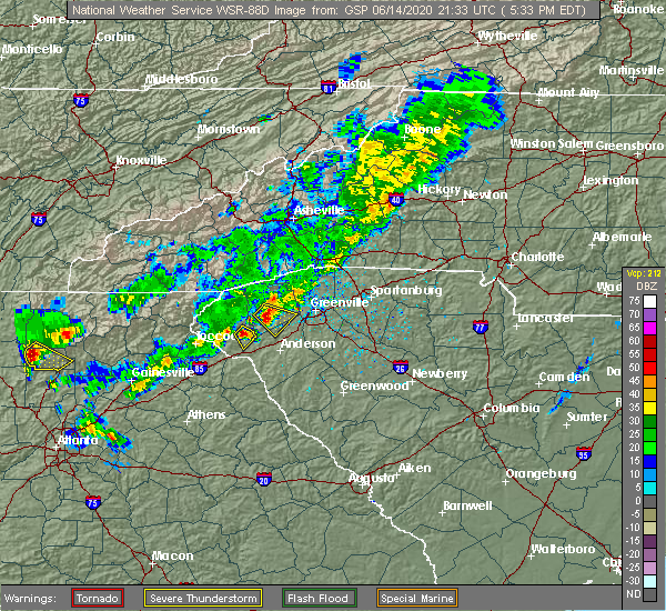 At 538 pm edt, a severe thunderstorm was located near seneca, and is nearly stationary (radar indicated). Hazards include 60 mph wind gusts and quarter size hail. Minor hail damage to vehicles is expected. Expect wind damage to trees and power lines. At 538 pm edt, a severe thunderstorm was located near seneca, and is nearly stationary (radar indicated). Hazards include 60 mph wind gusts and quarter size hail. Minor hail damage to vehicles is expected. Expect wind damage to trees and power lines.
|
| 5/5/2020 2:16 AM EDT |
 At 215 am edt, severe thunderstorms were located along a line extending from 10 miles west of pickens to 3 miles southeast of clemson to 6 miles north of hartwell, moving east at 45 mph (radar indicated). Hazards include 60 mph wind gusts and quarter size hail. Minor hail damage to vehicles is expected. expect wind damage to trees and power lines. Locations impacted include, greenville downtown, anderson, easley, clemson, seneca, pickens, greenville eastside, west greenville, greer and mauldin. At 215 am edt, severe thunderstorms were located along a line extending from 10 miles west of pickens to 3 miles southeast of clemson to 6 miles north of hartwell, moving east at 45 mph (radar indicated). Hazards include 60 mph wind gusts and quarter size hail. Minor hail damage to vehicles is expected. expect wind damage to trees and power lines. Locations impacted include, greenville downtown, anderson, easley, clemson, seneca, pickens, greenville eastside, west greenville, greer and mauldin.
|
| 5/5/2020 2:00 AM EDT |
 At 159 am edt, severe thunderstorms were located along a line extending from 14 miles north of walhalla to 3 miles northeast of seneca to 7 miles northwest of hartwell, moving east at 65 mph (radar indicated). Hazards include 60 mph wind gusts and quarter size hail. Minor hail damage to vehicles is expected. Expect wind damage to trees and power lines. At 159 am edt, severe thunderstorms were located along a line extending from 14 miles north of walhalla to 3 miles northeast of seneca to 7 miles northwest of hartwell, moving east at 65 mph (radar indicated). Hazards include 60 mph wind gusts and quarter size hail. Minor hail damage to vehicles is expected. Expect wind damage to trees and power lines.
|
| 5/5/2020 1:52 AM EDT |
 At 150 am edt, severe thunderstorms were located along a line extending from near clayton to 12 miles southwest of walhalla to 7 miles south of toccoa, moving east at 60 mph. another line of strong thunderstorms in oconee county south carolina was being overtaken by the severe thunderstorms moving out of georgia (radar indicated). Hazards include 60 mph wind gusts and quarter size hail. Minor hail damage to vehicles is expected. expect wind damage to trees and power lines. Locations impacted include, toccoa, seneca, hartwell, walhalla, clayton, clarkesville, carnesville, cornelia, baldwin and royston. At 150 am edt, severe thunderstorms were located along a line extending from near clayton to 12 miles southwest of walhalla to 7 miles south of toccoa, moving east at 60 mph. another line of strong thunderstorms in oconee county south carolina was being overtaken by the severe thunderstorms moving out of georgia (radar indicated). Hazards include 60 mph wind gusts and quarter size hail. Minor hail damage to vehicles is expected. expect wind damage to trees and power lines. Locations impacted include, toccoa, seneca, hartwell, walhalla, clayton, clarkesville, carnesville, cornelia, baldwin and royston.
|
| 5/5/2020 1:24 AM EDT |
 At 123 am edt, severe thunderstorms were located along a line extending from 6 miles southwest of hiawassee to near cleveland to 8 miles northeast of gainesville, moving east at 70 mph (radar indicated). Hazards include 60 mph wind gusts and quarter size hail. Minor hail damage to vehicles is expected. Expect wind damage to trees and power lines. At 123 am edt, severe thunderstorms were located along a line extending from 6 miles southwest of hiawassee to near cleveland to 8 miles northeast of gainesville, moving east at 70 mph (radar indicated). Hazards include 60 mph wind gusts and quarter size hail. Minor hail damage to vehicles is expected. Expect wind damage to trees and power lines.
|
| 4/13/2020 3:33 AM EDT |
 At 333 am edt, a confirmed large and extremely dangerous tornado was located near clemson, moving northeast at 65 mph. this is a particularly dangerous situation. take cover now! (radar confirmed tornado). Hazards include damaging tornado. You are in a life-threatening situation. flying debris may be deadly to those caught without shelter. mobile homes will be destroyed. considerable damage to homes, businesses, and vehicles is likely and complete destruction is possible. the tornado will be near, norris and liberty around 340 am edt. Easley around 350 am edt. At 333 am edt, a confirmed large and extremely dangerous tornado was located near clemson, moving northeast at 65 mph. this is a particularly dangerous situation. take cover now! (radar confirmed tornado). Hazards include damaging tornado. You are in a life-threatening situation. flying debris may be deadly to those caught without shelter. mobile homes will be destroyed. considerable damage to homes, businesses, and vehicles is likely and complete destruction is possible. the tornado will be near, norris and liberty around 340 am edt. Easley around 350 am edt.
|
| 4/13/2020 3:23 AM EDT |
 At 323 am edt, a severe thunderstorm capable of producing a tornado was located 6 miles southwest of seneca, or 4 miles southeast of westminster, moving east at 60 mph (radar indicated rotation). Hazards include tornado. Flying debris will be dangerous to those caught without shelter. mobile homes will be damaged or destroyed. damage to roofs, windows, and vehicles will occur. tree damage is likely. this dangerous storm will be near, clemson, central, pendleton, lake hartwell and norris around 340 am edt. easley and liberty around 350 am edt. Other locations impacted by this dangerous thunderstorm include oakway. At 323 am edt, a severe thunderstorm capable of producing a tornado was located 6 miles southwest of seneca, or 4 miles southeast of westminster, moving east at 60 mph (radar indicated rotation). Hazards include tornado. Flying debris will be dangerous to those caught without shelter. mobile homes will be damaged or destroyed. damage to roofs, windows, and vehicles will occur. tree damage is likely. this dangerous storm will be near, clemson, central, pendleton, lake hartwell and norris around 340 am edt. easley and liberty around 350 am edt. Other locations impacted by this dangerous thunderstorm include oakway.
|
| 4/13/2020 3:13 AM EDT |
 At 312 am edt, severe thunderstorms were located along a line extending from 12 miles northeast of clayton to 4 miles east of toccoa to 5 miles northeast of commerce, moving east at 55 mph (radar indicated). Hazards include 60 mph wind gusts and quarter size hail. Minor hail damage to vehicles is expected. Expect wind damage to trees and power lines. At 312 am edt, severe thunderstorms were located along a line extending from 12 miles northeast of clayton to 4 miles east of toccoa to 5 miles northeast of commerce, moving east at 55 mph (radar indicated). Hazards include 60 mph wind gusts and quarter size hail. Minor hail damage to vehicles is expected. Expect wind damage to trees and power lines.
|
| 2/13/2020 7:28 AM EST |
 At 727 am est, severe thunderstorms were located along a line extending from 11 miles southwest of brevard to 4 miles east of walhalla to 9 miles east of toccoa, moving northeast at 65 mph (radar indicated). Hazards include 60 mph wind gusts. expect damage to trees and power lines At 727 am est, severe thunderstorms were located along a line extending from 11 miles southwest of brevard to 4 miles east of walhalla to 9 miles east of toccoa, moving northeast at 65 mph (radar indicated). Hazards include 60 mph wind gusts. expect damage to trees and power lines
|
| 2/13/2020 7:15 AM EST |
 At 714 am est, severe thunderstorms were located along a line extending from 13 miles east of clayton to 10 miles west of walhalla to near toccoa, moving east at 45 mph (radar indicated). Hazards include 60 mph wind gusts. Expect damage to trees and power lines. Locations impacted include, toccoa, seneca, walhalla, westminster, salem, lake keowee, devils fork state park, oconee state park, mountain rest and long creek. At 714 am est, severe thunderstorms were located along a line extending from 13 miles east of clayton to 10 miles west of walhalla to near toccoa, moving east at 45 mph (radar indicated). Hazards include 60 mph wind gusts. Expect damage to trees and power lines. Locations impacted include, toccoa, seneca, walhalla, westminster, salem, lake keowee, devils fork state park, oconee state park, mountain rest and long creek.
|
| 2/13/2020 6:46 AM EST |
 At 645 am est, severe thunderstorms were located along a line extending from 11 miles southwest of clayton to 5 miles northwest of clarkesville to 8 miles southeast of cleveland, moving east at 45 mph (radar indicated). Hazards include 60 mph wind gusts. expect damage to trees and power lines At 645 am est, severe thunderstorms were located along a line extending from 11 miles southwest of clayton to 5 miles northwest of clarkesville to 8 miles southeast of cleveland, moving east at 45 mph (radar indicated). Hazards include 60 mph wind gusts. expect damage to trees and power lines
|
| 1/11/2020 7:39 PM EST |
 At 739 pm est, severe thunderstorms were located along a line extending from 3 miles northeast of seneca to 8 miles north of danielsville, moving east at 25 mph (radar indicated). Hazards include 60 mph wind gusts. expect damage to trees and power lines At 739 pm est, severe thunderstorms were located along a line extending from 3 miles northeast of seneca to 8 miles north of danielsville, moving east at 25 mph (radar indicated). Hazards include 60 mph wind gusts. expect damage to trees and power lines
|
| 1/11/2020 7:02 PM EST |
 At 701 pm est, severe thunderstorms were located along a line extending from 17 miles northwest of pickens to 8 miles northeast of walhalla to 7 miles southeast of toccoa, moving east at 45 mph (radar indicated). Hazards include 60 mph wind gusts. Expect damage to trees and power lines. locations impacted include, clemson, toccoa, seneca, walhalla, pickens, carnesville, central, royston, westminster and lavonia. A tornado watch remains in effect until midnight est for northeastern georgia, western north carolina, and upstate south carolina. At 701 pm est, severe thunderstorms were located along a line extending from 17 miles northwest of pickens to 8 miles northeast of walhalla to 7 miles southeast of toccoa, moving east at 45 mph (radar indicated). Hazards include 60 mph wind gusts. Expect damage to trees and power lines. locations impacted include, clemson, toccoa, seneca, walhalla, pickens, carnesville, central, royston, westminster and lavonia. A tornado watch remains in effect until midnight est for northeastern georgia, western north carolina, and upstate south carolina.
|
| 1/11/2020 6:42 PM EST |
 At 641 pm est, severe thunderstorms were located along a line extending from 16 miles northeast of clayton to 4 miles northwest of walhalla to 6 miles south of toccoa, moving east at 45 mph (radar indicated). Hazards include 60 mph wind gusts and penny size hail. expect damage to trees and power lines At 641 pm est, severe thunderstorms were located along a line extending from 16 miles northeast of clayton to 4 miles northwest of walhalla to 6 miles south of toccoa, moving east at 45 mph (radar indicated). Hazards include 60 mph wind gusts and penny size hail. expect damage to trees and power lines
|
| 10/31/2019 2:35 PM EDT |
 At 234 pm edt, severe thunderstorms were located along a line extending from 13 miles west of pickens to 7 miles southwest of seneca to 5 miles north of danielsville, moving east at 45 mph (radar indicated). Hazards include 60 mph wind gusts. expect damage to trees and power lines At 234 pm edt, severe thunderstorms were located along a line extending from 13 miles west of pickens to 7 miles southwest of seneca to 5 miles north of danielsville, moving east at 45 mph (radar indicated). Hazards include 60 mph wind gusts. expect damage to trees and power lines
|
| 10/31/2019 2:35 PM EDT |
 The national weather service in greenville-spartanburg has issued a * severe thunderstorm warning for. eastern franklin county in northeastern georgia. northwestern elbert county in northeastern georgia. hart county in northeastern georgia. Northwestern greenville county in upstate south carolina. The national weather service in greenville-spartanburg has issued a * severe thunderstorm warning for. eastern franklin county in northeastern georgia. northwestern elbert county in northeastern georgia. hart county in northeastern georgia. Northwestern greenville county in upstate south carolina.
|
| 10/31/2019 2:28 PM EDT |
 At 227 pm edt, severe thunderstorms were located along a line extending from 5 miles northwest of walhalla to 9 miles southwest of seneca to 3 miles northeast of carnesville, moving east at 40 mph (radar indicated). Hazards include 60 mph wind gusts. Expect damage to trees and power lines. Locations impacted include, toccoa, seneca, walhalla, carnesville, westminster, lavonia, gumlog, martin, avalon and cashiers. At 227 pm edt, severe thunderstorms were located along a line extending from 5 miles northwest of walhalla to 9 miles southwest of seneca to 3 miles northeast of carnesville, moving east at 40 mph (radar indicated). Hazards include 60 mph wind gusts. Expect damage to trees and power lines. Locations impacted include, toccoa, seneca, walhalla, carnesville, westminster, lavonia, gumlog, martin, avalon and cashiers.
|
| 10/31/2019 2:14 PM EDT |
 At 214 pm edt, severe thunderstorms were located along a line extending from 8 miles east of clayton to 6 miles northeast of toccoa to 7 miles northwest of carnesville, moving northeast at 45 mph (radar indicated). Hazards include 60 mph wind gusts. Expect damage to trees and power lines. Locations impacted include, toccoa, seneca, walhalla, clayton, carnesville, cornelia, westminster, lavonia, gumlog and mount airy. At 214 pm edt, severe thunderstorms were located along a line extending from 8 miles east of clayton to 6 miles northeast of toccoa to 7 miles northwest of carnesville, moving northeast at 45 mph (radar indicated). Hazards include 60 mph wind gusts. Expect damage to trees and power lines. Locations impacted include, toccoa, seneca, walhalla, clayton, carnesville, cornelia, westminster, lavonia, gumlog and mount airy.
|
| 10/31/2019 1:56 PM EDT |
 At 155 pm edt, severe thunderstorms were located along a line extending from 7 miles southwest of clayton to near clarkesville to 6 miles west of homer, moving northeast at 50 mph (radar indicated). Hazards include 60 mph wind gusts. expect damage to trees and power lines At 155 pm edt, severe thunderstorms were located along a line extending from 7 miles southwest of clayton to near clarkesville to 6 miles west of homer, moving northeast at 50 mph (radar indicated). Hazards include 60 mph wind gusts. expect damage to trees and power lines
|
| 8/19/2019 5:20 PM EDT |
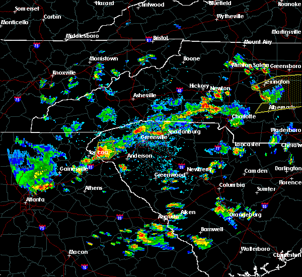 At 452 pm edt, a severe thunderstorm was located near seneca, and is nearly stationary (radar indicated). Hazards include 60 mph wind gusts and quarter size hail. Minor hail damage to vehicles is expected. Expect wind damage to trees and power lines. At 452 pm edt, a severe thunderstorm was located near seneca, and is nearly stationary (radar indicated). Hazards include 60 mph wind gusts and quarter size hail. Minor hail damage to vehicles is expected. Expect wind damage to trees and power lines.
|
| 8/19/2019 5:20 PM EDT |
 The severe thunderstorm warning for east central stephens and southeastern oconee counties will expire at 530 pm edt, the storm which prompted the warning has weakened below severe limits, and has exited the warned area. therefore the warning will be allowed to expire. however gusty winds and heavy rain are still possible with this thunderstorm. The severe thunderstorm warning for east central stephens and southeastern oconee counties will expire at 530 pm edt, the storm which prompted the warning has weakened below severe limits, and has exited the warned area. therefore the warning will be allowed to expire. however gusty winds and heavy rain are still possible with this thunderstorm.
|
| 8/19/2019 4:52 PM EDT |
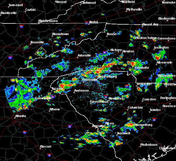 The national weather service in greenville-spartanburg has issued a * severe thunderstorm warning for. east central stephens county in northeastern georgia. southeastern oconee county in upstate south carolina. until 530 pm edt. At 452 pm edt, a severe thunderstorm was located near seneca, and. The national weather service in greenville-spartanburg has issued a * severe thunderstorm warning for. east central stephens county in northeastern georgia. southeastern oconee county in upstate south carolina. until 530 pm edt. At 452 pm edt, a severe thunderstorm was located near seneca, and.
|
| 8/19/2019 4:28 PM EDT |
 A severe thunderstorm warning remains in effect until 445 pm edt for northwestern anderson. southwestern pickens and east central oconee counties. at 428 pm edt, a severe thunderstorm was located near clemson, and is nearly stationary. hazard. 60 mph wind gusts and quarter size hail. A severe thunderstorm warning remains in effect until 445 pm edt for northwestern anderson. southwestern pickens and east central oconee counties. at 428 pm edt, a severe thunderstorm was located near clemson, and is nearly stationary. hazard. 60 mph wind gusts and quarter size hail.
|
| 8/19/2019 4:00 PM EDT |
 At 400 pm edt, a severe thunderstorm was located near clemson, or near pendleton, and is nearly stationary (radar indicated). Hazards include 60 mph wind gusts and quarter size hail. Minor hail damage to vehicles is expected. Expect wind damage to trees and power lines. At 400 pm edt, a severe thunderstorm was located near clemson, or near pendleton, and is nearly stationary (radar indicated). Hazards include 60 mph wind gusts and quarter size hail. Minor hail damage to vehicles is expected. Expect wind damage to trees and power lines.
|
| 6/27/2019 11:34 PM EDT |
 At 1133 pm edt, a severe thunderstorm was located near seneca, moving west at 20 mph (radar indicated). Hazards include 60 mph wind gusts and quarter size hail. Minor hail damage to vehicles is expected. Expect wind damage to trees and power lines. At 1133 pm edt, a severe thunderstorm was located near seneca, moving west at 20 mph (radar indicated). Hazards include 60 mph wind gusts and quarter size hail. Minor hail damage to vehicles is expected. Expect wind damage to trees and power lines.
|
| 6/27/2019 11:34 PM EDT |
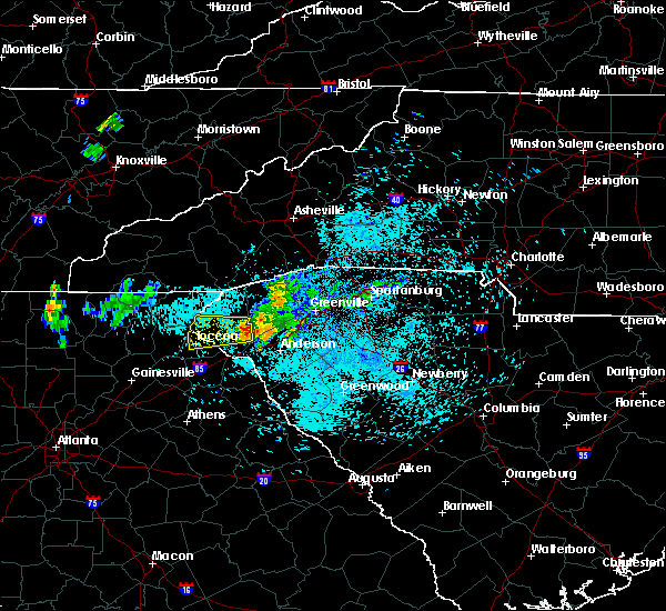 At 1133 pm edt, a severe thunderstorm was located near seneca, moving west at 20 mph (radar indicated). Hazards include 60 mph wind gusts and quarter size hail. Minor hail damage to vehicles is expected. Expect wind damage to trees and power lines. At 1133 pm edt, a severe thunderstorm was located near seneca, moving west at 20 mph (radar indicated). Hazards include 60 mph wind gusts and quarter size hail. Minor hail damage to vehicles is expected. Expect wind damage to trees and power lines.
|
| 6/22/2019 2:40 AM EDT |
 The severe thunderstorm warning for eastern franklin, elbert, hart, anderson, southwestern pickens, southwestern abbeville and southeastern oconee counties will expire at 245 am edt, the storm which prompted the warning has moved out of the area. therefore the warning will be allowed to expire. however gusty winds and heavy rain are still possible with this thunderstorm. a severe thunderstorm watch remains in effect until 500 am edt for northeastern georgia, and upstate south carolina. The severe thunderstorm warning for eastern franklin, elbert, hart, anderson, southwestern pickens, southwestern abbeville and southeastern oconee counties will expire at 245 am edt, the storm which prompted the warning has moved out of the area. therefore the warning will be allowed to expire. however gusty winds and heavy rain are still possible with this thunderstorm. a severe thunderstorm watch remains in effect until 500 am edt for northeastern georgia, and upstate south carolina.
|
| 6/22/2019 2:36 AM EDT |
 The severe thunderstorm warning for franklin, southeastern stephens, western hart, west central anderson and southeastern oconee counties will expire at 245 am edt, the storm which prompted the warning has moved out of the area. therefore the warning will be allowed to expire. a severe thunderstorm watch remains in effect until 500 am edt for northeastern georgia, and upstate south carolina. The severe thunderstorm warning for franklin, southeastern stephens, western hart, west central anderson and southeastern oconee counties will expire at 245 am edt, the storm which prompted the warning has moved out of the area. therefore the warning will be allowed to expire. a severe thunderstorm watch remains in effect until 500 am edt for northeastern georgia, and upstate south carolina.
|
| 6/22/2019 2:13 AM EDT |
 At 213 am edt, a severe thunderstorm was located 6 miles east of hartwell, moving east at 30 mph (radar indicated). Hazards include 60 mph wind gusts and quarter size hail. Minor hail damage to vehicles is expected. expect wind damage to trees and power lines. Locations impacted include, anderson, clemson, seneca, elberton, hartwell, carnesville, homeland park, belton, northlake and pendleton. At 213 am edt, a severe thunderstorm was located 6 miles east of hartwell, moving east at 30 mph (radar indicated). Hazards include 60 mph wind gusts and quarter size hail. Minor hail damage to vehicles is expected. expect wind damage to trees and power lines. Locations impacted include, anderson, clemson, seneca, elberton, hartwell, carnesville, homeland park, belton, northlake and pendleton.
|
| 6/22/2019 2:11 AM EDT |
 At 210 am edt, a severe thunderstorm was located 4 miles northwest of hartwell, or 4 miles southwest of reed creek, moving east at 20 mph (radar indicated). Hazards include 60 mph wind gusts and quarter size hail. Minor hail damage to vehicles is expected. expect wind damage to trees and power lines. Locations impacted include, seneca, walhalla, carnesville, royston, westminster, lavonia, gumlog, canon, franklin springs and bowersville. At 210 am edt, a severe thunderstorm was located 4 miles northwest of hartwell, or 4 miles southwest of reed creek, moving east at 20 mph (radar indicated). Hazards include 60 mph wind gusts and quarter size hail. Minor hail damage to vehicles is expected. expect wind damage to trees and power lines. Locations impacted include, seneca, walhalla, carnesville, royston, westminster, lavonia, gumlog, canon, franklin springs and bowersville.
|
| 6/22/2019 1:57 AM EDT |
 At 157 am edt, a severe thunderstorm was located near hartwell, moving east at 30 mph (radar indicated). Hazards include 60 mph wind gusts and nickel size hail. expect damage to trees and power lines At 157 am edt, a severe thunderstorm was located near hartwell, moving east at 30 mph (radar indicated). Hazards include 60 mph wind gusts and nickel size hail. expect damage to trees and power lines
|
| 6/22/2019 1:39 AM EDT |
 At 139 am edt, a severe thunderstorm was located 5 miles northeast of carnesville, or near martin, moving east at 20 mph (radar indicated). Hazards include 60 mph wind gusts and nickel size hail. expect damage to trees and power lines At 139 am edt, a severe thunderstorm was located 5 miles northeast of carnesville, or near martin, moving east at 20 mph (radar indicated). Hazards include 60 mph wind gusts and nickel size hail. expect damage to trees and power lines
|
| 5/4/2019 3:37 PM EDT |
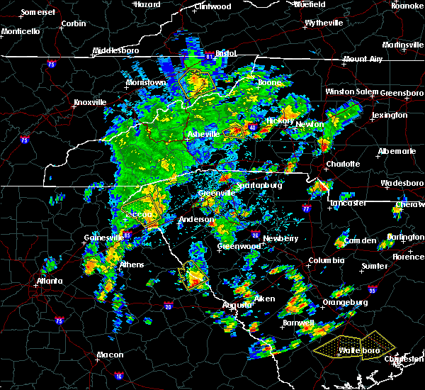 The severe thunderstorm warning for oconee county will expire at 345 pm edt, the storm which prompted the warning has weakened below severe limits, and has exited the warned area. therefore the warning will be allowed to expire. however gusty winds are still possible with this thunderstorm. The severe thunderstorm warning for oconee county will expire at 345 pm edt, the storm which prompted the warning has weakened below severe limits, and has exited the warned area. therefore the warning will be allowed to expire. however gusty winds are still possible with this thunderstorm.
|
| 5/4/2019 3:27 PM EDT |
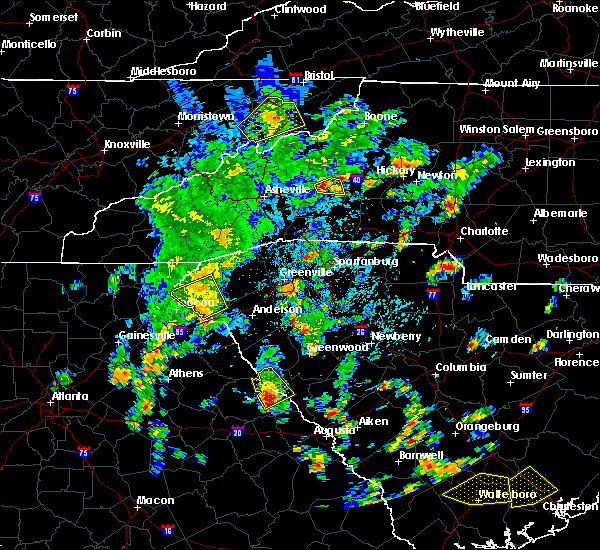 At 327 pm edt, a severe thunderstorm was located near seneca, moving northeast at 40 mph (radar indicated). Hazards include 60 mph wind gusts. Expect damage to trees and power lines. Locations impacted include, seneca, walhalla, westminster, long creek, oakway, tallulah gorge state park and lake keowee. At 327 pm edt, a severe thunderstorm was located near seneca, moving northeast at 40 mph (radar indicated). Hazards include 60 mph wind gusts. Expect damage to trees and power lines. Locations impacted include, seneca, walhalla, westminster, long creek, oakway, tallulah gorge state park and lake keowee.
|
| 5/4/2019 2:57 PM EDT |
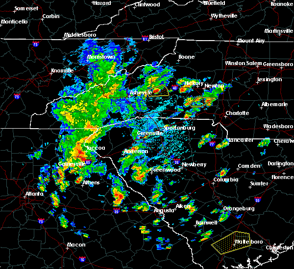 At 257 pm edt, a severe thunderstorm was located near toccoa, moving northeast at 40 mph (radar indicated). Hazards include 60 mph wind gusts. expect damage to trees and power lines At 257 pm edt, a severe thunderstorm was located near toccoa, moving northeast at 40 mph (radar indicated). Hazards include 60 mph wind gusts. expect damage to trees and power lines
|
| 4/19/2019 10:27 AM EDT |
 At 1026 am edt, severe thunderstorms were located along a line extending from 5 miles northeast of walhalla to 7 miles southeast of seneca, moving northeast at 50 mph (radar indicated). Hazards include 60 mph wind gusts and penny size hail. expect damage to trees and power lines At 1026 am edt, severe thunderstorms were located along a line extending from 5 miles northeast of walhalla to 7 miles southeast of seneca, moving northeast at 50 mph (radar indicated). Hazards include 60 mph wind gusts and penny size hail. expect damage to trees and power lines
|
| 4/19/2019 10:13 AM EDT |
 At 1013 am edt, a severe thunderstorm was located 11 miles northeast of carnesville, or over gumlog, moving northeast at 30 mph (radar indicated). Hazards include 60 mph wind gusts. Expect damage to trees and power lines. Locations impacted include, seneca, townville, fair play, oakway, sandy springs, westminster, lake hartwell and reed creek. At 1013 am edt, a severe thunderstorm was located 11 miles northeast of carnesville, or over gumlog, moving northeast at 30 mph (radar indicated). Hazards include 60 mph wind gusts. Expect damage to trees and power lines. Locations impacted include, seneca, townville, fair play, oakway, sandy springs, westminster, lake hartwell and reed creek.
|
| 4/19/2019 9:52 AM EDT |
 At 952 am edt, a severe thunderstorm was located near carnesville, moving northeast at 35 mph (radar indicated). Hazards include 60 mph wind gusts. expect damage to trees and power lines At 952 am edt, a severe thunderstorm was located near carnesville, moving northeast at 35 mph (radar indicated). Hazards include 60 mph wind gusts. expect damage to trees and power lines
|
| 4/19/2019 9:07 AM EDT |
 The severe thunderstorm warning for west central anderson and southeastern oconee counties will expire at 915 am edt, the storm which prompted the warning has weakened below severe limits, and has exited the warned area. therefore the warning will be allowed to expire. The severe thunderstorm warning for west central anderson and southeastern oconee counties will expire at 915 am edt, the storm which prompted the warning has weakened below severe limits, and has exited the warned area. therefore the warning will be allowed to expire.
|
| 4/19/2019 8:47 AM EDT |
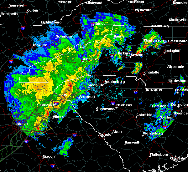 At 846 am edt, a severe thunderstorm was located 8 miles southwest of seneca, or 5 miles north of tugaloo state park, moving northeast at 40 mph (radar indicated). Hazards include 60 mph wind gusts. Expect damage to trees and power lines. Locations impacted include, seneca, westminster, townville, fair play, oakway, pendleton, lake hartwell and lake keowee. At 846 am edt, a severe thunderstorm was located 8 miles southwest of seneca, or 5 miles north of tugaloo state park, moving northeast at 40 mph (radar indicated). Hazards include 60 mph wind gusts. Expect damage to trees and power lines. Locations impacted include, seneca, westminster, townville, fair play, oakway, pendleton, lake hartwell and lake keowee.
|
| 4/19/2019 8:42 AM EDT |
 At 841 am edt, a severe thunderstorm was located near seneca, moving northeast at 40 mph (radar indicated). Hazards include 60 mph wind gusts. expect damage to trees and power lines At 841 am edt, a severe thunderstorm was located near seneca, moving northeast at 40 mph (radar indicated). Hazards include 60 mph wind gusts. expect damage to trees and power lines
|
| 4/19/2019 8:23 AM EDT |
 At 822 am edt, a severe thunderstorm was located 6 miles northeast of carnesville, or near martin, moving northeast at 40 mph (radar indicated). Hazards include 60 mph wind gusts. expect damage to trees and power lines At 822 am edt, a severe thunderstorm was located 6 miles northeast of carnesville, or near martin, moving northeast at 40 mph (radar indicated). Hazards include 60 mph wind gusts. expect damage to trees and power lines
|
| 4/14/2019 2:12 PM EDT |
 At 211 pm edt, a severe thunderstorm was located near clemson, moving northeast at 45 mph (radar indicated). Hazards include 60 mph wind gusts and quarter size hail. Minor hail damage to vehicles is expected. Expect wind damage to trees and power lines. At 211 pm edt, a severe thunderstorm was located near clemson, moving northeast at 45 mph (radar indicated). Hazards include 60 mph wind gusts and quarter size hail. Minor hail damage to vehicles is expected. Expect wind damage to trees and power lines.
|
| 4/14/2019 1:59 PM EDT |
 At 158 pm edt, a severe thunderstorm was located near easley, moving northeast at 45 mph (radar indicated). Hazards include 60 mph wind gusts and quarter size hail. Minor hail damage to vehicles is expected. expect wind damage to trees and power lines. locations impacted include, seneca, westminster, gumlog, martin, avalon, tugaloo state park, townville, oakway, fair play and eastanolee. A tornado watch remains in effect until 700 pm edt for northeastern georgia, and upstate south carolina. At 158 pm edt, a severe thunderstorm was located near easley, moving northeast at 45 mph (radar indicated). Hazards include 60 mph wind gusts and quarter size hail. Minor hail damage to vehicles is expected. expect wind damage to trees and power lines. locations impacted include, seneca, westminster, gumlog, martin, avalon, tugaloo state park, townville, oakway, fair play and eastanolee. A tornado watch remains in effect until 700 pm edt for northeastern georgia, and upstate south carolina.
|
| 4/14/2019 1:31 PM EDT |
 At 131 pm edt, a severe thunderstorm was located 11 miles southwest of seneca, or 4 miles north of tugaloo state park, moving northeast at 45 mph (radar indicated). Hazards include 60 mph wind gusts and quarter size hail. Minor hail damage to vehicles is expected. Expect wind damage to trees and power lines. At 131 pm edt, a severe thunderstorm was located 11 miles southwest of seneca, or 4 miles north of tugaloo state park, moving northeast at 45 mph (radar indicated). Hazards include 60 mph wind gusts and quarter size hail. Minor hail damage to vehicles is expected. Expect wind damage to trees and power lines.
|
| 4/9/2019 1:38 PM EDT |
 At 138 pm edt, a severe thunderstorm was located near walhalla, moving northeast at 25 mph (radar indicated). Hazards include 60 mph wind gusts and quarter size hail. Minor hail damage to vehicles is expected. expect wind damage to trees and power lines. Locations impacted include, seneca, walhalla, central, westminster, norris, six mile, salem, lake keowee, oconee state park and clemson. At 138 pm edt, a severe thunderstorm was located near walhalla, moving northeast at 25 mph (radar indicated). Hazards include 60 mph wind gusts and quarter size hail. Minor hail damage to vehicles is expected. expect wind damage to trees and power lines. Locations impacted include, seneca, walhalla, central, westminster, norris, six mile, salem, lake keowee, oconee state park and clemson.
|
| 4/9/2019 1:32 PM EDT |
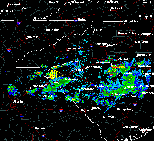 At 132 pm edt, a severe thunderstorm was located near walhalla, moving northeast at 25 mph (radar indicated). Hazards include 60 mph wind gusts and half dollar size hail. Minor hail damage to vehicles is expected. expect wind damage to trees and power lines. Locations impacted include, clemson, seneca, walhalla, central, westminster, norris, six mile, salem, lake keowee and oakway. At 132 pm edt, a severe thunderstorm was located near walhalla, moving northeast at 25 mph (radar indicated). Hazards include 60 mph wind gusts and half dollar size hail. Minor hail damage to vehicles is expected. expect wind damage to trees and power lines. Locations impacted include, clemson, seneca, walhalla, central, westminster, norris, six mile, salem, lake keowee and oakway.
|
| 4/9/2019 1:27 PM EDT |
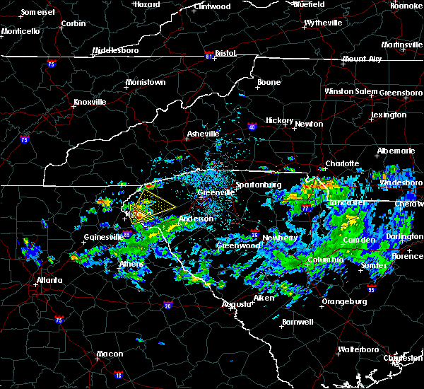 At 127 pm edt, a severe thunderstorm was located 5 miles south of walhalla, or near westminster, moving northeast at 25 mph (radar indicated). Hazards include 60 mph wind gusts and quarter size hail. Minor hail damage to vehicles is expected. Expect wind damage to trees and power lines. At 127 pm edt, a severe thunderstorm was located 5 miles south of walhalla, or near westminster, moving northeast at 25 mph (radar indicated). Hazards include 60 mph wind gusts and quarter size hail. Minor hail damage to vehicles is expected. Expect wind damage to trees and power lines.
|
| 9/27/2018 6:00 PM EDT |
 At 559 pm edt, severe thunderstorms were located along a line extending from 4 miles southeast of homer to 6 miles northeast of lexington, moving northeast at 45 mph (radar indicated). Hazards include 60 mph wind gusts and penny size hail. expect damage to trees and power lines At 559 pm edt, severe thunderstorms were located along a line extending from 4 miles southeast of homer to 6 miles northeast of lexington, moving northeast at 45 mph (radar indicated). Hazards include 60 mph wind gusts and penny size hail. expect damage to trees and power lines
|
| 9/10/2018 3:47 PM EDT |
 At 347 pm edt, a severe thunderstorm was located near clemson, or near central, moving northeast at 20 mph (radar indicated). Hazards include 60 mph wind gusts and quarter size hail. Minor hail damage to vehicles is expected. Expect wind damage to trees and power lines. At 347 pm edt, a severe thunderstorm was located near clemson, or near central, moving northeast at 20 mph (radar indicated). Hazards include 60 mph wind gusts and quarter size hail. Minor hail damage to vehicles is expected. Expect wind damage to trees and power lines.
|
| 9/10/2018 3:27 PM EDT |
 At 327 pm edt, a severe thunderstorm was located 10 miles south of clemson, or 4 miles northwest of lake hartwell, moving northeast at 15 mph (radar indicated). Hazards include 60 mph wind gusts and quarter size hail. Minor hail damage to vehicles is expected. expect wind damage to trees and power lines. Locations impacted include, homeland park, reed creek, anderson airport, lake hartwell, townville, sandy springs, oakway, fair play, pendleton and sadlers creek state park. At 327 pm edt, a severe thunderstorm was located 10 miles south of clemson, or 4 miles northwest of lake hartwell, moving northeast at 15 mph (radar indicated). Hazards include 60 mph wind gusts and quarter size hail. Minor hail damage to vehicles is expected. expect wind damage to trees and power lines. Locations impacted include, homeland park, reed creek, anderson airport, lake hartwell, townville, sandy springs, oakway, fair play, pendleton and sadlers creek state park.
|
| 9/10/2018 3:14 PM EDT |
 At 314 pm edt, a severe thunderstorm was located 10 miles north of hartwell, or 5 miles north of reed creek, moving northeast at 15 mph (radar indicated). Hazards include 60 mph wind gusts and quarter size hail. Minor hail damage to vehicles is expected. Expect wind damage to trees and power lines. At 314 pm edt, a severe thunderstorm was located 10 miles north of hartwell, or 5 miles north of reed creek, moving northeast at 15 mph (radar indicated). Hazards include 60 mph wind gusts and quarter size hail. Minor hail damage to vehicles is expected. Expect wind damage to trees and power lines.
|
| 8/8/2018 2:53 PM EDT |
 The severe thunderstorm warning for southwestern pickens and east central oconee counties will expire at 300 pm edt, the storm which prompted the warning has weakened below severe limits, and no longer poses an immediate threat to life or property. therefore the warning will be allowed to expire. if you observed large hail or wind damage, please report it to the national weather service greenville-spartanburg by calling toll free, 1, 800, 2 6 7, 8 1 0 1, or by posting on our facebook page, or tweet it using hashtag nwsgsp. your message should describe the event and the specific location where it occurred. The severe thunderstorm warning for southwestern pickens and east central oconee counties will expire at 300 pm edt, the storm which prompted the warning has weakened below severe limits, and no longer poses an immediate threat to life or property. therefore the warning will be allowed to expire. if you observed large hail or wind damage, please report it to the national weather service greenville-spartanburg by calling toll free, 1, 800, 2 6 7, 8 1 0 1, or by posting on our facebook page, or tweet it using hashtag nwsgsp. your message should describe the event and the specific location where it occurred.
|
| 8/8/2018 2:47 PM EDT |
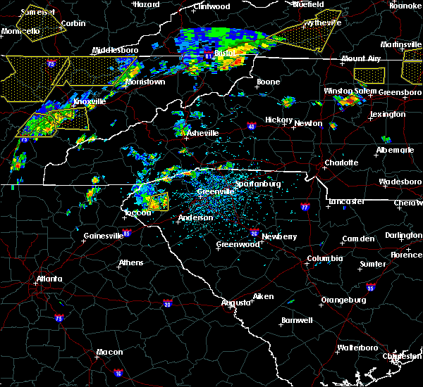 At 246 pm edt, a severe thunderstorm was located 4 miles northeast of seneca, moving east at 20 mph (radar indicated). Hazards include 60 mph wind gusts and penny size hail. Expect damage to trees and power lines. Locations impacted include, clemson, seneca, central, six mile and lake keowee. At 246 pm edt, a severe thunderstorm was located 4 miles northeast of seneca, moving east at 20 mph (radar indicated). Hazards include 60 mph wind gusts and penny size hail. Expect damage to trees and power lines. Locations impacted include, clemson, seneca, central, six mile and lake keowee.
|
| 8/8/2018 2:17 PM EDT |
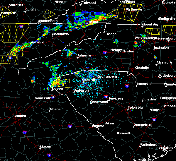 At 217 pm edt, a severe thunderstorm was located over walhalla, moving east at 20 mph (radar indicated). Hazards include 60 mph wind gusts and quarter size hail. Minor hail damage to vehicles is expected. Expect wind damage to trees and power lines. At 217 pm edt, a severe thunderstorm was located over walhalla, moving east at 20 mph (radar indicated). Hazards include 60 mph wind gusts and quarter size hail. Minor hail damage to vehicles is expected. Expect wind damage to trees and power lines.
|
| 8/7/2018 6:23 PM EDT |
 At 623 pm edt, a severe thunderstorm was located near clemson, moving southeast at 15 mph (radar indicated). Hazards include 60 mph wind gusts and quarter size hail. Minor hail damage to vehicles is expected. expect wind damage to trees and power lines. Locations impacted include, clemson, seneca, central, northlake, pendleton, norris, townville, sandy springs, anderson airport and six mile. At 623 pm edt, a severe thunderstorm was located near clemson, moving southeast at 15 mph (radar indicated). Hazards include 60 mph wind gusts and quarter size hail. Minor hail damage to vehicles is expected. expect wind damage to trees and power lines. Locations impacted include, clemson, seneca, central, northlake, pendleton, norris, townville, sandy springs, anderson airport and six mile.
|
| 8/7/2018 6:01 PM EDT |
 The national weather service in greenville-spartanburg has issued a * severe thunderstorm warning for. northwestern anderson county in upstate south carolina. southwestern pickens county in upstate south carolina. southeastern oconee county in upstate south carolina. Until 645 pm edt. The national weather service in greenville-spartanburg has issued a * severe thunderstorm warning for. northwestern anderson county in upstate south carolina. southwestern pickens county in upstate south carolina. southeastern oconee county in upstate south carolina. Until 645 pm edt.
|
| 8/7/2018 5:45 PM EDT |
 At 545 pm edt, a severe thunderstorm was located 4 miles northwest of clemson, moving southeast at 20 mph (radar indicated). Hazards include 60 mph wind gusts and quarter size hail. Minor hail damage to vehicles is expected. expect wind damage to trees and power lines. Locations impacted include, clemson, seneca, walhalla, central, westminster, norris, six mile, fair play, oakway and liberty. At 545 pm edt, a severe thunderstorm was located 4 miles northwest of clemson, moving southeast at 20 mph (radar indicated). Hazards include 60 mph wind gusts and quarter size hail. Minor hail damage to vehicles is expected. expect wind damage to trees and power lines. Locations impacted include, clemson, seneca, walhalla, central, westminster, norris, six mile, fair play, oakway and liberty.
|
| 8/7/2018 5:17 PM EDT |
 At 516 pm edt, a severe thunderstorm was located near walhalla, moving east at 15 mph (radar indicated). Hazards include 60 mph wind gusts and quarter size hail. Minor hail damage to vehicles is expected. Expect wind damage to trees and power lines. At 516 pm edt, a severe thunderstorm was located near walhalla, moving east at 15 mph (radar indicated). Hazards include 60 mph wind gusts and quarter size hail. Minor hail damage to vehicles is expected. Expect wind damage to trees and power lines.
|
| 8/6/2018 5:11 PM EDT |
 At 511 pm edt, severe thunderstorms were located along a line extending from 6 miles north of anderson to 5 miles southeast of toccoa, moving south at 10 mph (radar indicated). Hazards include 60 mph wind gusts and quarter size hail. Minor hail damage to vehicles is expected. expect wind damage to trees and power lines. Locations impacted include, anderson, clemson, toccoa, seneca, hartwell, carnesville, homeland park, northlake, pendleton and westminster. At 511 pm edt, severe thunderstorms were located along a line extending from 6 miles north of anderson to 5 miles southeast of toccoa, moving south at 10 mph (radar indicated). Hazards include 60 mph wind gusts and quarter size hail. Minor hail damage to vehicles is expected. expect wind damage to trees and power lines. Locations impacted include, anderson, clemson, toccoa, seneca, hartwell, carnesville, homeland park, northlake, pendleton and westminster.
|
| 8/6/2018 4:51 PM EDT |
 At 451 pm edt, severe thunderstorms were located along a line extending from 6 miles southwest of easley to 5 miles east of toccoa, moving south at 15 mph (radar indicated). Hazards include 60 mph wind gusts and quarter size hail. Minor hail damage to vehicles is expected. Expect wind damage to trees and power lines. At 451 pm edt, severe thunderstorms were located along a line extending from 6 miles southwest of easley to 5 miles east of toccoa, moving south at 15 mph (radar indicated). Hazards include 60 mph wind gusts and quarter size hail. Minor hail damage to vehicles is expected. Expect wind damage to trees and power lines.
|
| 7/21/2018 9:22 PM EDT |
 At 922 pm edt, a severe thunderstorm was located near seneca, moving southeast at 30 mph (radar indicated). Hazards include 60 mph wind gusts and quarter size hail. Minor hail damage to vehicles is expected. Expect wind damage to trees and power lines. At 922 pm edt, a severe thunderstorm was located near seneca, moving southeast at 30 mph (radar indicated). Hazards include 60 mph wind gusts and quarter size hail. Minor hail damage to vehicles is expected. Expect wind damage to trees and power lines.
|
| 7/21/2018 6:46 PM EDT |
 At 646 pm edt, a severe thunderstorm was located 7 miles southwest of seneca, or 5 miles southeast of westminster, moving east at 20 mph (radar indicated). Hazards include 60 mph wind gusts and quarter size hail. Minor hail damage to vehicles is expected. expect wind damage to trees and power lines. Locations impacted include, seneca, westminster, gumlog, tugaloo state park, fair play and oakway. At 646 pm edt, a severe thunderstorm was located 7 miles southwest of seneca, or 5 miles southeast of westminster, moving east at 20 mph (radar indicated). Hazards include 60 mph wind gusts and quarter size hail. Minor hail damage to vehicles is expected. expect wind damage to trees and power lines. Locations impacted include, seneca, westminster, gumlog, tugaloo state park, fair play and oakway.
|
| 7/21/2018 6:26 PM EDT |
 At 625 pm edt, a severe thunderstorm was located 10 miles east of toccoa, or 4 miles southwest of westminster, moving east at 20 mph (radar indicated). Hazards include 60 mph wind gusts and quarter size hail. Minor hail damage to vehicles is expected. Expect wind damage to trees and power lines. At 625 pm edt, a severe thunderstorm was located 10 miles east of toccoa, or 4 miles southwest of westminster, moving east at 20 mph (radar indicated). Hazards include 60 mph wind gusts and quarter size hail. Minor hail damage to vehicles is expected. Expect wind damage to trees and power lines.
|
| 6/27/2018 3:56 PM EDT |
 At 356 pm edt, a severe thunderstorm was located 4 miles south of clemson, or near pendleton, moving east at 25 mph (radar indicated). Hazards include 60 mph wind gusts and quarter size hail. Minor hail damage to vehicles is expected. expect wind damage to trees and power lines. Locations impacted include, clemson, seneca, walhalla, central, northlake, pendleton, westminster, norris, anderson airport and lake hartwell. At 356 pm edt, a severe thunderstorm was located 4 miles south of clemson, or near pendleton, moving east at 25 mph (radar indicated). Hazards include 60 mph wind gusts and quarter size hail. Minor hail damage to vehicles is expected. expect wind damage to trees and power lines. Locations impacted include, clemson, seneca, walhalla, central, northlake, pendleton, westminster, norris, anderson airport and lake hartwell.
|
| 6/27/2018 3:43 PM EDT |
 The national weather service in greenville-spartanburg has issued a * severe thunderstorm warning for. northwestern anderson county in upstate south carolina. southwestern pickens county in upstate south carolina. southern oconee county in upstate south carolina. Until 430 pm edt. The national weather service in greenville-spartanburg has issued a * severe thunderstorm warning for. northwestern anderson county in upstate south carolina. southwestern pickens county in upstate south carolina. southern oconee county in upstate south carolina. Until 430 pm edt.
|
| 6/27/2018 3:16 PM EDT |
 At 315 pm edt, a severe thunderstorm was located 7 miles southwest of walhalla, or 4 miles northwest of westminster, moving east at 20 mph (radar indicated). Hazards include 60 mph wind gusts and quarter size hail. Minor hail damage to vehicles is expected. expect wind damage to trees and power lines. Locations impacted include, clemson, seneca, walhalla, central, westminster, norris, long creek, fair play, oakway and townville. At 315 pm edt, a severe thunderstorm was located 7 miles southwest of walhalla, or 4 miles northwest of westminster, moving east at 20 mph (radar indicated). Hazards include 60 mph wind gusts and quarter size hail. Minor hail damage to vehicles is expected. expect wind damage to trees and power lines. Locations impacted include, clemson, seneca, walhalla, central, westminster, norris, long creek, fair play, oakway and townville.
|
| 6/27/2018 3:03 PM EDT |
 At 302 pm edt, a severe thunderstorm was located 10 miles northeast of toccoa, or 7 miles west of westminster, moving east at 25 mph (radar indicated). Hazards include 60 mph wind gusts and quarter size hail. Minor hail damage to vehicles is expected. Expect wind damage to trees and power lines. At 302 pm edt, a severe thunderstorm was located 10 miles northeast of toccoa, or 7 miles west of westminster, moving east at 25 mph (radar indicated). Hazards include 60 mph wind gusts and quarter size hail. Minor hail damage to vehicles is expected. Expect wind damage to trees and power lines.
|
| 6/27/2018 3:03 PM EDT |
 The national weather service in greenville-spartanburg has issued a * severe thunderstorm warning for. central stephens county in northeastern georgia. east central habersham county in northeastern georgia. southwestern pickens county in upstate south carolina. Oconee county in upstate south carolina. The national weather service in greenville-spartanburg has issued a * severe thunderstorm warning for. central stephens county in northeastern georgia. east central habersham county in northeastern georgia. southwestern pickens county in upstate south carolina. Oconee county in upstate south carolina.
|
| 6/26/2018 3:54 PM EDT |
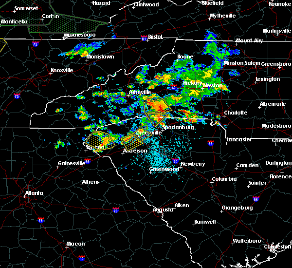 The severe thunderstorm warning for southwestern pickens and oconee counties will expire at 400 pm edt, the storms which prompted the warning have weakened below severe limits, and no longer pose an immediate threat to life or property. therefore the warning will be allowed to expire. however, gusty winds are still possible with these thunderstorms. The severe thunderstorm warning for southwestern pickens and oconee counties will expire at 400 pm edt, the storms which prompted the warning have weakened below severe limits, and no longer pose an immediate threat to life or property. therefore the warning will be allowed to expire. however, gusty winds are still possible with these thunderstorms.
|
| 6/26/2018 3:39 PM EDT |
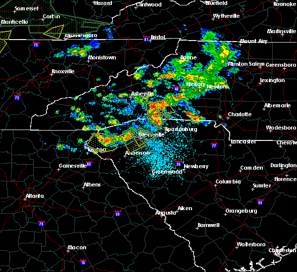 At 338 pm edt, severe thunderstorms were located along a line extending from 13 miles east of clayton to near walhalla to 8 miles northwest of clemson, and are nearly stationary (radar indicated). Hazards include 60 mph wind gusts and quarter size hail. Minor hail damage to vehicles is expected. expect wind damage to trees and power lines. Locations impacted include, clemson, seneca, walhalla, westminster, salem, lake keowee, oconee state park, mountain rest, long creek and oakway. At 338 pm edt, severe thunderstorms were located along a line extending from 13 miles east of clayton to near walhalla to 8 miles northwest of clemson, and are nearly stationary (radar indicated). Hazards include 60 mph wind gusts and quarter size hail. Minor hail damage to vehicles is expected. expect wind damage to trees and power lines. Locations impacted include, clemson, seneca, walhalla, westminster, salem, lake keowee, oconee state park, mountain rest, long creek and oakway.
|
| 6/26/2018 3:16 PM EDT |
 At 315 pm edt, severe thunderstorms were located along a line extending from 13 miles east of clayton to 3 miles north of walhalla to 9 miles north of seneca, and are nearly stationary (radar indicated). Hazards include 60 mph wind gusts and quarter size hail. Minor hail damage to vehicles is expected. Expect wind damage to trees and power lines. At 315 pm edt, severe thunderstorms were located along a line extending from 13 miles east of clayton to 3 miles north of walhalla to 9 miles north of seneca, and are nearly stationary (radar indicated). Hazards include 60 mph wind gusts and quarter size hail. Minor hail damage to vehicles is expected. Expect wind damage to trees and power lines.
|
| 6/26/2018 3:16 PM EDT |
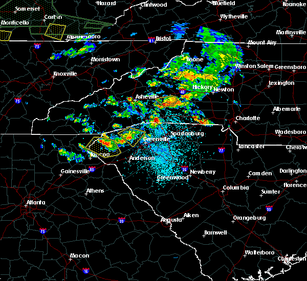 At 315 pm edt, severe thunderstorms were located along a line extending from 13 miles east of clayton to 3 miles north of walhalla to 9 miles north of seneca, and are nearly stationary (radar indicated). Hazards include 60 mph wind gusts and quarter size hail. Minor hail damage to vehicles is expected. Expect wind damage to trees and power lines. At 315 pm edt, severe thunderstorms were located along a line extending from 13 miles east of clayton to 3 miles north of walhalla to 9 miles north of seneca, and are nearly stationary (radar indicated). Hazards include 60 mph wind gusts and quarter size hail. Minor hail damage to vehicles is expected. Expect wind damage to trees and power lines.
|
| 6/25/2018 5:59 PM EDT |
 At 558 pm edt, severe thunderstorms were located along a line extending from 8 miles northeast of greenville downtown to 3 miles northwest of anderson to 5 miles southeast of carnesville, moving southeast at 45 mph (radar indicated). Hazards include 60 mph wind gusts and quarter size hail. Minor hail damage to vehicles is expected. Expect wind damage to trees and power lines. At 558 pm edt, severe thunderstorms were located along a line extending from 8 miles northeast of greenville downtown to 3 miles northwest of anderson to 5 miles southeast of carnesville, moving southeast at 45 mph (radar indicated). Hazards include 60 mph wind gusts and quarter size hail. Minor hail damage to vehicles is expected. Expect wind damage to trees and power lines.
|
| 6/25/2018 5:59 PM EDT |
 The national weather service in greenville-spartanburg has issued a * severe thunderstorm warning for. franklin county in northeastern georgia. southeastern stephens county in northeastern georgia. northwestern elbert county in northeastern georgia. Hart county in northeastern georgia. The national weather service in greenville-spartanburg has issued a * severe thunderstorm warning for. franklin county in northeastern georgia. southeastern stephens county in northeastern georgia. northwestern elbert county in northeastern georgia. Hart county in northeastern georgia.
|
| 6/25/2018 5:48 PM EDT |
 At 548 pm edt, severe thunderstorms were located along a line extending from near pickens to 5 miles south of seneca to 4 miles northeast of carnesville, moving east at 30 mph (radar indicated). Hazards include 60 mph wind gusts and quarter size hail. Minor hail damage to vehicles is expected. expect wind damage to trees and power lines. Locations impacted include, clemson, toccoa, seneca, walhalla, pickens, central, pendleton, liberty, westminster and slater-marietta. At 548 pm edt, severe thunderstorms were located along a line extending from near pickens to 5 miles south of seneca to 4 miles northeast of carnesville, moving east at 30 mph (radar indicated). Hazards include 60 mph wind gusts and quarter size hail. Minor hail damage to vehicles is expected. expect wind damage to trees and power lines. Locations impacted include, clemson, toccoa, seneca, walhalla, pickens, central, pendleton, liberty, westminster and slater-marietta.
|
| 6/25/2018 5:13 PM EDT |
 At 512 pm edt, severe thunderstorms were located along a line extending from 12 miles northwest of pickens to 7 miles southwest of walhalla to 6 miles southwest of toccoa, moving southeast at 30 mph (radar indicated). Hazards include 60 mph wind gusts and quarter size hail. Minor hail damage to vehicles is expected. Expect wind damage to trees and power lines. At 512 pm edt, severe thunderstorms were located along a line extending from 12 miles northwest of pickens to 7 miles southwest of walhalla to 6 miles southwest of toccoa, moving southeast at 30 mph (radar indicated). Hazards include 60 mph wind gusts and quarter size hail. Minor hail damage to vehicles is expected. Expect wind damage to trees and power lines.
|
| 6/24/2018 4:36 PM EDT |
 At 436 pm edt, severe thunderstorms were located along a line extending from 14 miles west of brevard to 13 miles northwest of pickens to 3 miles southeast of walhalla, moving east at 40 mph (radar indicated). Hazards include 60 mph wind gusts. expect damage to trees and power lines At 436 pm edt, severe thunderstorms were located along a line extending from 14 miles west of brevard to 13 miles northwest of pickens to 3 miles southeast of walhalla, moving east at 40 mph (radar indicated). Hazards include 60 mph wind gusts. expect damage to trees and power lines
|
| 6/23/2018 4:45 PM EDT |
 A severe thunderstorm warning remains in effect until 515 pm edt for transylvania. jackson. southeastern haywood. pickens and oconee counties. At 444 pm edt, severe thunderstorms were located along a line extending from 11 miles southeast of sylva to 14 miles northwest of pickens to near seneca, moving east at 45 mph. A severe thunderstorm warning remains in effect until 515 pm edt for transylvania. jackson. southeastern haywood. pickens and oconee counties. At 444 pm edt, severe thunderstorms were located along a line extending from 11 miles southeast of sylva to 14 miles northwest of pickens to near seneca, moving east at 45 mph.
|
| 6/23/2018 4:45 PM EDT |
 At 420 pm edt, severe thunderstorms were located along a line extending from 6 miles north of franklin to 9 miles northeast of clayton to 4 miles west of toccoa, moving east at 50 mph (radar indicated). Hazards include 60 mph wind gusts. expect damage to trees and power lines At 420 pm edt, severe thunderstorms were located along a line extending from 6 miles north of franklin to 9 miles northeast of clayton to 4 miles west of toccoa, moving east at 50 mph (radar indicated). Hazards include 60 mph wind gusts. expect damage to trees and power lines
|
| 6/23/2018 4:22 PM EDT |
 The national weather service in greenville-spartanburg has issued a * severe thunderstorm warning for. stephens county in northeastern georgia. southeastern habersham county in northeastern georgia. eastern rabun county in northeastern georgia. Eastern macon county in western north carolina. The national weather service in greenville-spartanburg has issued a * severe thunderstorm warning for. stephens county in northeastern georgia. southeastern habersham county in northeastern georgia. eastern rabun county in northeastern georgia. Eastern macon county in western north carolina.
|
| 6/23/2018 4:22 PM EDT |
 At 420 pm edt, severe thunderstorms were located along a line extending from 6 miles north of franklin to 9 miles northeast of clayton to 4 miles west of toccoa, moving east at 50 mph (radar indicated). Hazards include 60 mph wind gusts. expect damage to trees and power lines At 420 pm edt, severe thunderstorms were located along a line extending from 6 miles north of franklin to 9 miles northeast of clayton to 4 miles west of toccoa, moving east at 50 mph (radar indicated). Hazards include 60 mph wind gusts. expect damage to trees and power lines
|
| 6/2/2018 4:36 PM EDT |
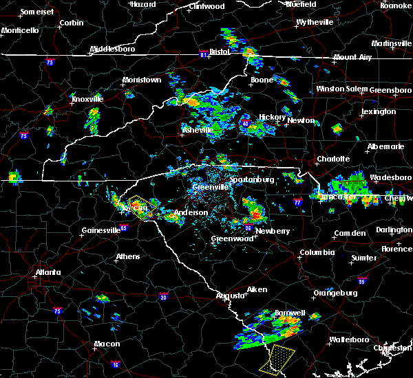 At 436 pm edt, a severe thunderstorm was located 8 miles southwest of walhalla, or near westminster, moving south at 10 mph (radar indicated). Hazards include 60 mph wind gusts and quarter size hail. Minor hail damage to vehicles is expected. expect wind damage to trees and power lines. Locations impacted include, seneca, westminster, oakway and walhalla. At 436 pm edt, a severe thunderstorm was located 8 miles southwest of walhalla, or near westminster, moving south at 10 mph (radar indicated). Hazards include 60 mph wind gusts and quarter size hail. Minor hail damage to vehicles is expected. expect wind damage to trees and power lines. Locations impacted include, seneca, westminster, oakway and walhalla.
|
| 6/2/2018 4:19 PM EDT |
 At 419 pm edt, a severe thunderstorm was located 4 miles southwest of walhalla, moving southeast at 10 mph (radar indicated). Hazards include 60 mph wind gusts and quarter size hail. Minor hail damage to vehicles is expected. Expect wind damage to trees and power lines. At 419 pm edt, a severe thunderstorm was located 4 miles southwest of walhalla, moving southeast at 10 mph (radar indicated). Hazards include 60 mph wind gusts and quarter size hail. Minor hail damage to vehicles is expected. Expect wind damage to trees and power lines.
|
| 6/1/2018 5:11 PM EDT |
 At 511 pm edt, a severe thunderstorm was located 6 miles northwest of carnesville, or 6 miles west of martin, moving east at 45 mph (radar indicated). Hazards include 60 mph wind gusts and quarter size hail. Minor hail damage to vehicles is expected. Expect wind damage to trees and power lines. At 511 pm edt, a severe thunderstorm was located 6 miles northwest of carnesville, or 6 miles west of martin, moving east at 45 mph (radar indicated). Hazards include 60 mph wind gusts and quarter size hail. Minor hail damage to vehicles is expected. Expect wind damage to trees and power lines.
|
| 5/31/2018 3:45 PM EDT |
 At 345 pm edt, a severe thunderstorm was located 5 miles north of clemson, or near six mile, moving east at 20 mph (radar indicated). Hazards include 60 mph wind gusts. expect damage to trees and power lines At 345 pm edt, a severe thunderstorm was located 5 miles north of clemson, or near six mile, moving east at 20 mph (radar indicated). Hazards include 60 mph wind gusts. expect damage to trees and power lines
|
| 4/26/2018 10:05 PM EDT |
 At 957 pm edt, a severe thunderstorm was located 6 miles southwest of seneca, or 5 miles southeast of westminster, moving east at 15 mph (radar indicated). Hazards include 60 mph wind gusts and quarter size hail. Minor hail damage to vehicles is expected. Expect wind damage to trees and power lines. At 957 pm edt, a severe thunderstorm was located 6 miles southwest of seneca, or 5 miles southeast of westminster, moving east at 15 mph (radar indicated). Hazards include 60 mph wind gusts and quarter size hail. Minor hail damage to vehicles is expected. Expect wind damage to trees and power lines.
|
| 4/26/2018 9:57 PM EDT |
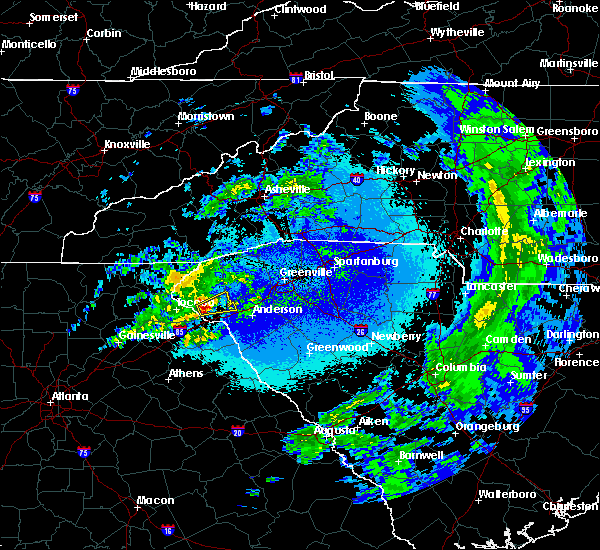 The national weather service in greenville-spartanburg has issued a * severe thunderstorm warning for. northwestern anderson county in upstate south carolina. southeastern oconee county in upstate south carolina. until 1045 pm edt. At 957 pm edt, a severe thunderstorm was located 6 miles southwest. The national weather service in greenville-spartanburg has issued a * severe thunderstorm warning for. northwestern anderson county in upstate south carolina. southeastern oconee county in upstate south carolina. until 1045 pm edt. At 957 pm edt, a severe thunderstorm was located 6 miles southwest.
|
| 3/17/2018 10:39 PM EDT |
 The severe thunderstorm warning for north central anderson, southern pickens and east central oconee counties will expire at 1045 pm edt, the storm which prompted the warning has weakened below severe limits, and no longer poses an immediate threat to life or property. therefore the warning will be allowed to expire. however gusty winds are still possible with this thunderstorm. if you observed large hail or wind damage, please report it to the national weather service greenville-spartanburg by calling toll free, 1, 800, 2 6 7, 8 1 0 1, or by posting on our facebook page, or tweet it using hashtag nwsgsp. your message should describe the event and the specific location where it occurred. remember, a severe thunderstorm warning still remains in effect for extreme western anderson county until 1100 pm edt. The severe thunderstorm warning for north central anderson, southern pickens and east central oconee counties will expire at 1045 pm edt, the storm which prompted the warning has weakened below severe limits, and no longer poses an immediate threat to life or property. therefore the warning will be allowed to expire. however gusty winds are still possible with this thunderstorm. if you observed large hail or wind damage, please report it to the national weather service greenville-spartanburg by calling toll free, 1, 800, 2 6 7, 8 1 0 1, or by posting on our facebook page, or tweet it using hashtag nwsgsp. your message should describe the event and the specific location where it occurred. remember, a severe thunderstorm warning still remains in effect for extreme western anderson county until 1100 pm edt.
|
| 3/17/2018 10:23 PM EDT |
 At 1022 pm edt, a severe thunderstorm was located 7 miles north of clemson, or over six mile, moving east at 40 mph (radar indicated). Hazards include 60 mph wind gusts. Expect damage to trees and power lines. Locations impacted include, easley, clemson, seneca, central, pendleton, liberty, norris, six mile, lake keowee and sandy springs. At 1022 pm edt, a severe thunderstorm was located 7 miles north of clemson, or over six mile, moving east at 40 mph (radar indicated). Hazards include 60 mph wind gusts. Expect damage to trees and power lines. Locations impacted include, easley, clemson, seneca, central, pendleton, liberty, norris, six mile, lake keowee and sandy springs.
|
| 3/17/2018 10:02 PM EDT |
 At 1001 pm edt, a severe thunderstorm was located near walhalla, moving east at 35 mph (radar indicated). Hazards include 60 mph wind gusts and penny size hail. expect damage to trees and power lines At 1001 pm edt, a severe thunderstorm was located near walhalla, moving east at 35 mph (radar indicated). Hazards include 60 mph wind gusts and penny size hail. expect damage to trees and power lines
|
| 7/27/2017 4:31 PM EDT |
 At 431 pm edt, a severe thunderstorm was located 9 miles north of walhalla, or near oconee state park, moving southeast at 10 mph (radar indicated). Hazards include 60 mph wind gusts. Expect damage to trees and power lines. Locations impacted include, seneca, walhalla, norris, six mile, salem, lake keowee, jocassee gorges, lake jocassee, devils fork state park and keowee toxaway state park. At 431 pm edt, a severe thunderstorm was located 9 miles north of walhalla, or near oconee state park, moving southeast at 10 mph (radar indicated). Hazards include 60 mph wind gusts. Expect damage to trees and power lines. Locations impacted include, seneca, walhalla, norris, six mile, salem, lake keowee, jocassee gorges, lake jocassee, devils fork state park and keowee toxaway state park.
|
| 7/27/2017 4:17 PM EDT |
 At 417 pm edt, a severe thunderstorm was located 11 miles north of walhalla, or near salem, moving southeast at 20 mph (radar indicated). Hazards include 60 mph wind gusts. expect damage to trees and power lines At 417 pm edt, a severe thunderstorm was located 11 miles north of walhalla, or near salem, moving southeast at 20 mph (radar indicated). Hazards include 60 mph wind gusts. expect damage to trees and power lines
|
| 7/23/2017 4:06 PM EDT |
 At 406 pm edt, a severe thunderstorm was located near clemson, moving southeast at 20 mph (radar indicated). Hazards include 60 mph wind gusts and penny size hail. expect damage to trees and power lines At 406 pm edt, a severe thunderstorm was located near clemson, moving southeast at 20 mph (radar indicated). Hazards include 60 mph wind gusts and penny size hail. expect damage to trees and power lines
|
| 7/6/2017 3:38 PM EDT |
 At 337 pm edt, a severe thunderstorm was located 11 miles southwest of seneca, or near tugaloo state park, moving northeast at 30 mph (radar indicated). Hazards include 60 mph wind gusts and penny size hail. Expect damage to trees and power lines. Locations impacted include, hartwell, carnesville, homeland park, royston, reed creek, lavonia, gumlog, canon, franklin springs and bowersville. At 337 pm edt, a severe thunderstorm was located 11 miles southwest of seneca, or near tugaloo state park, moving northeast at 30 mph (radar indicated). Hazards include 60 mph wind gusts and penny size hail. Expect damage to trees and power lines. Locations impacted include, hartwell, carnesville, homeland park, royston, reed creek, lavonia, gumlog, canon, franklin springs and bowersville.
|
| 7/6/2017 3:10 PM EDT |
 At 309 pm edt, a severe thunderstorm was located 6 miles north of carnesville, or 5 miles west of martin, moving northeast at 25 mph (radar indicated). Hazards include 60 mph wind gusts and penny size hail. expect damage to trees and power lines At 309 pm edt, a severe thunderstorm was located 6 miles north of carnesville, or 5 miles west of martin, moving northeast at 25 mph (radar indicated). Hazards include 60 mph wind gusts and penny size hail. expect damage to trees and power lines
|
| 6/23/2017 9:45 PM EDT |
 At 944 pm edt, rain showers capable of producing damaging winds were located along a line extending from 5 miles west of seneca, to 12 miles southwest of clemson to 9 miles northwest of hartwell, moving east at 45 mph (radar indicated). Hazards include 60 mph wind gusts. Expect damage to trees and power lines. Locations impacted include, clemson, seneca, central, northlake, pendleton, westminster, reed creek, norris, anderson airport and lake hartwell. At 944 pm edt, rain showers capable of producing damaging winds were located along a line extending from 5 miles west of seneca, to 12 miles southwest of clemson to 9 miles northwest of hartwell, moving east at 45 mph (radar indicated). Hazards include 60 mph wind gusts. Expect damage to trees and power lines. Locations impacted include, clemson, seneca, central, northlake, pendleton, westminster, reed creek, norris, anderson airport and lake hartwell.
|
| 6/23/2017 9:26 PM EDT |
 At 926 pm edt, rain showers capable of producing damaging winds were located along a line extending from 4 miles east of toccoa to near carnesville, moving east at 40 mph (radar indicated). Hazards include 60 mph wind gusts. expect damage to trees and power lines At 926 pm edt, rain showers capable of producing damaging winds were located along a line extending from 4 miles east of toccoa to near carnesville, moving east at 40 mph (radar indicated). Hazards include 60 mph wind gusts. expect damage to trees and power lines
|
| 5/28/2017 1:06 AM EDT |
 The severe thunderstorm warning for stephens, habersham, pickens and oconee counties will expire at 115 am edt, the storms which prompted the warning have weakened below severe limits, and have exited the warned area. therefore the warning will be allowed to expire. however gusty winds are still possible with these thunderstorms. a severe thunderstorm watch remains in effect until 200 am edt for western north carolina. a severe thunderstorm watch also remains in effect until 600 am edt for northeastern georgia, and upstate south carolina. The severe thunderstorm warning for stephens, habersham, pickens and oconee counties will expire at 115 am edt, the storms which prompted the warning have weakened below severe limits, and have exited the warned area. therefore the warning will be allowed to expire. however gusty winds are still possible with these thunderstorms. a severe thunderstorm watch remains in effect until 200 am edt for western north carolina. a severe thunderstorm watch also remains in effect until 600 am edt for northeastern georgia, and upstate south carolina.
|
| 5/28/2017 12:46 AM EDT |
 At 1246 am edt, severe thunderstorms were located along a line extending from 8 miles southwest of pickens to 10 miles south of cleveland, moving southeast at 40 mph (radar indicated). Hazards include 60 mph wind gusts and penny size hail. Expect damage to trees and power lines. Locations impacted include, easley, clemson, toccoa, seneca, walhalla, pickens, clarkesville, central, cornelia and liberty. At 1246 am edt, severe thunderstorms were located along a line extending from 8 miles southwest of pickens to 10 miles south of cleveland, moving southeast at 40 mph (radar indicated). Hazards include 60 mph wind gusts and penny size hail. Expect damage to trees and power lines. Locations impacted include, easley, clemson, toccoa, seneca, walhalla, pickens, clarkesville, central, cornelia and liberty.
|
| 5/28/2017 12:11 AM EDT |
 At 1211 am edt, severe thunderstorms were located along a line extending from 19 miles southwest of brevard to 11 miles south of blairsville, moving southeast at 45 mph (radar indicated). Hazards include 60 mph wind gusts and penny size hail. expect damage to trees and power lines At 1211 am edt, severe thunderstorms were located along a line extending from 19 miles southwest of brevard to 11 miles south of blairsville, moving southeast at 45 mph (radar indicated). Hazards include 60 mph wind gusts and penny size hail. expect damage to trees and power lines
|
| 4/5/2017 11:57 PM EDT |
 At 1157 pm edt, a severe thunderstorm was located 10 miles north of easley, or 5 miles southwest of slater-marietta, moving northeast at 60 mph (radar indicated). Hazards include 60 mph wind gusts and quarter size hail. Hail damage to vehicles is expected. expect wind damage to roofs, siding, and trees. Locations impacted include, greenville downtown, easley, clemson, pickens, west greenville, taylors, berea, welcome, travelers rest and central. At 1157 pm edt, a severe thunderstorm was located 10 miles north of easley, or 5 miles southwest of slater-marietta, moving northeast at 60 mph (radar indicated). Hazards include 60 mph wind gusts and quarter size hail. Hail damage to vehicles is expected. expect wind damage to roofs, siding, and trees. Locations impacted include, greenville downtown, easley, clemson, pickens, west greenville, taylors, berea, welcome, travelers rest and central.
|
| 4/5/2017 11:55 PM EDT |
 At 1154 pm edt, severe thunderstorms were located along a line extending from 6 miles west of seneca to 6 miles southwest of hartwell to 7 miles east of danielsville, moving east at 55 mph (radar indicated). Hazards include golf ball size hail and 60 mph wind gusts. a brief tornado cannot be ruled out. People and animals outdoors will be injured. expect hail damage to roofs, siding, windows, and vehicles. Expect wind damage to roofs, siding, and trees. At 1154 pm edt, severe thunderstorms were located along a line extending from 6 miles west of seneca to 6 miles southwest of hartwell to 7 miles east of danielsville, moving east at 55 mph (radar indicated). Hazards include golf ball size hail and 60 mph wind gusts. a brief tornado cannot be ruled out. People and animals outdoors will be injured. expect hail damage to roofs, siding, windows, and vehicles. Expect wind damage to roofs, siding, and trees.
|
| 4/5/2017 11:55 PM EDT |
 At 1215 am edt, severe thunderstorms were located along a line extending from 6 miles southwest of easley to 5 miles south of anderson to 13 miles northeast of elberton, moving east at 75 mph (radar indicated). Hazards include ping pong ball size hail and 60 mph wind gusts. People and animals outdoors will be injured. expect hail and wind damage to roofs, siding, windows, vehicles, and trees. Locations impacted include, anderson, easley, homeland park, powdersville, piedmont, belton, williamston, northlake, honea path and liberty. At 1215 am edt, severe thunderstorms were located along a line extending from 6 miles southwest of easley to 5 miles south of anderson to 13 miles northeast of elberton, moving east at 75 mph (radar indicated). Hazards include ping pong ball size hail and 60 mph wind gusts. People and animals outdoors will be injured. expect hail and wind damage to roofs, siding, windows, vehicles, and trees. Locations impacted include, anderson, easley, homeland park, powdersville, piedmont, belton, williamston, northlake, honea path and liberty.
|
| 4/5/2017 11:37 PM EDT |
 At 1137 pm edt, a severe thunderstorm was located 5 miles southwest of pickens, or near six mile, moving northeast at 60 mph (radar indicated). Hazards include 60 mph wind gusts and quarter size hail. Hail damage to vehicles is expected. Expect wind damage to roofs, siding, and trees. At 1137 pm edt, a severe thunderstorm was located 5 miles southwest of pickens, or near six mile, moving northeast at 60 mph (radar indicated). Hazards include 60 mph wind gusts and quarter size hail. Hail damage to vehicles is expected. Expect wind damage to roofs, siding, and trees.
|
| 3/21/2017 6:41 PM EDT |
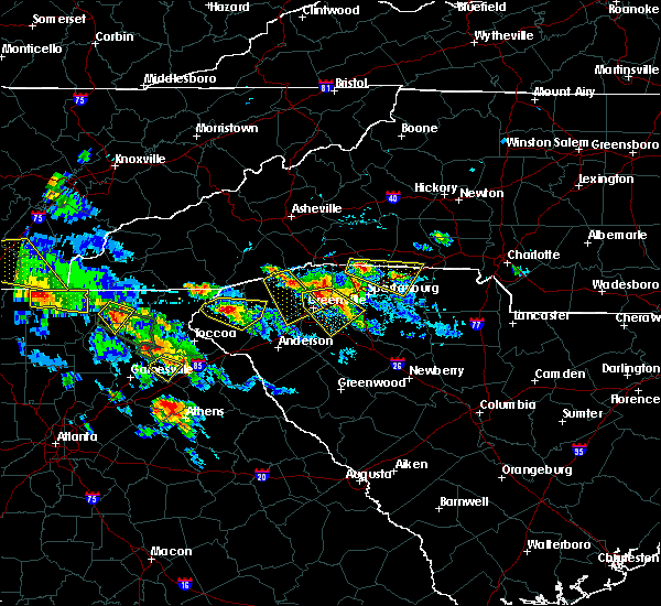 At 640 pm edt, a severe thunderstorm was located near walhalla, moving southeast at 10 mph (radar indicated). Hazards include half dollar size hail. Damage to vehicles is expected. Locations impacted include, seneca, walhalla, six mile, salem, lake keowee and oconee state park. At 640 pm edt, a severe thunderstorm was located near walhalla, moving southeast at 10 mph (radar indicated). Hazards include half dollar size hail. Damage to vehicles is expected. Locations impacted include, seneca, walhalla, six mile, salem, lake keowee and oconee state park.
|
| 3/21/2017 6:15 PM EDT |
 At 615 pm edt, a severe thunderstorm was located near walhalla, moving east at 10 mph (radar indicated). Hazards include quarter size hail. damage to vehicles is expected At 615 pm edt, a severe thunderstorm was located near walhalla, moving east at 10 mph (radar indicated). Hazards include quarter size hail. damage to vehicles is expected
|
| 3/21/2017 5:35 PM EDT |
 At 534 pm edt, a severe thunderstorm was located 6 miles northeast of seneca, or 5 miles southwest of six mile, moving east at 10 mph (radar indicated). Hazards include quarter size hail. Damage to vehicles is expected. Locations impacted include, clemson, seneca, walhalla, central, pendleton, norris, six mile, liberty, lake keowee and lake hartwell. At 534 pm edt, a severe thunderstorm was located 6 miles northeast of seneca, or 5 miles southwest of six mile, moving east at 10 mph (radar indicated). Hazards include quarter size hail. Damage to vehicles is expected. Locations impacted include, clemson, seneca, walhalla, central, pendleton, norris, six mile, liberty, lake keowee and lake hartwell.
|
| 3/21/2017 5:05 PM EDT |
 At 505 pm edt, a severe thunderstorm was located near walhalla, moving southeast at 15 mph (radar indicated). Hazards include half dollar size hail. damage to vehicles is expected At 505 pm edt, a severe thunderstorm was located near walhalla, moving southeast at 15 mph (radar indicated). Hazards include half dollar size hail. damage to vehicles is expected
|
| 3/1/2017 5:50 PM EST |
 At 550 pm est, severe thunderstorms were located along a line extending from 3 miles southeast of walhalla to 7 miles east of carnesville, moving northeast at 60 mph (radar indicated). Hazards include 60 mph wind gusts and quarter size hail. Hail damage to vehicles is expected. Expect wind damage to roofs, siding and trees. At 550 pm est, severe thunderstorms were located along a line extending from 3 miles southeast of walhalla to 7 miles east of carnesville, moving northeast at 60 mph (radar indicated). Hazards include 60 mph wind gusts and quarter size hail. Hail damage to vehicles is expected. Expect wind damage to roofs, siding and trees.
|
| 3/1/2017 5:44 PM EST |
 At 544 pm est, a severe thunderstorm was located near carnesville, moving east at 45 mph (radar indicated). Hazards include 60 mph wind gusts and quarter size hail. Hail damage to vehicles is expected. expect wind damage to roofs, siding and trees. Locations impacted include, seneca, walhalla, carnesville, westminster, lavonia, gumlog, lake keowee, tugaloo state park, fair play and oakway. At 544 pm est, a severe thunderstorm was located near carnesville, moving east at 45 mph (radar indicated). Hazards include 60 mph wind gusts and quarter size hail. Hail damage to vehicles is expected. expect wind damage to roofs, siding and trees. Locations impacted include, seneca, walhalla, carnesville, westminster, lavonia, gumlog, lake keowee, tugaloo state park, fair play and oakway.
|
| 3/1/2017 5:33 PM EST |
 At 533 pm est, a severe thunderstorm was located near toccoa, moving northeast at 55 mph (radar indicated). Hazards include 60 mph wind gusts and quarter size hail. Hail damage to vehicles is expected. expect wind damage to roofs, siding and trees. Locations impacted include, toccoa, seneca, walhalla, carnesville, westminster, lavonia, gumlog, martin, avalon and lake keowee. At 533 pm est, a severe thunderstorm was located near toccoa, moving northeast at 55 mph (radar indicated). Hazards include 60 mph wind gusts and quarter size hail. Hail damage to vehicles is expected. expect wind damage to roofs, siding and trees. Locations impacted include, toccoa, seneca, walhalla, carnesville, westminster, lavonia, gumlog, martin, avalon and lake keowee.
|
| 3/1/2017 5:09 PM EST |
 At 509 pm est, a severe thunderstorm was located 9 miles northwest of homer, or near alto, moving northeast at 65 mph (radar indicated). Hazards include 60 mph wind gusts and penny size hail. Expect damage to roofs. Siding and trees. At 509 pm est, a severe thunderstorm was located 9 miles northwest of homer, or near alto, moving northeast at 65 mph (radar indicated). Hazards include 60 mph wind gusts and penny size hail. Expect damage to roofs. Siding and trees.
|
| 11/30/2016 3:59 PM EST |
 At 359 pm est, severe thunderstorms were located along a line extending from 11 miles northwest of pickens to 6 miles south of clemson to near hartwell to 9 miles north of elberton to 4 miles southwest of lexington, moving east at 40 mph (radar indicated). Hazards include 60 mph wind gusts. Expect damage to roofs. Siding and trees. At 359 pm est, severe thunderstorms were located along a line extending from 11 miles northwest of pickens to 6 miles south of clemson to near hartwell to 9 miles north of elberton to 4 miles southwest of lexington, moving east at 40 mph (radar indicated). Hazards include 60 mph wind gusts. Expect damage to roofs. Siding and trees.
|
| 11/30/2016 3:38 PM EST |
 At 338 pm est, severe thunderstorms were located along a line extending from 5 miles south of walhalla to 8 miles southwest of hartwell to 3 miles southeast of athens, moving east at 40 mph (radar indicated). Hazards include 60 mph wind gusts. Expect damage to roofs. siding and trees. Locations impacted include, anderson, seneca, elberton, hartwell, carnesville, homeland park, belton, williamston, northlake and pendleton. At 338 pm est, severe thunderstorms were located along a line extending from 5 miles south of walhalla to 8 miles southwest of hartwell to 3 miles southeast of athens, moving east at 40 mph (radar indicated). Hazards include 60 mph wind gusts. Expect damage to roofs. siding and trees. Locations impacted include, anderson, seneca, elberton, hartwell, carnesville, homeland park, belton, williamston, northlake and pendleton.
|
| 11/30/2016 3:27 PM EST |
 At 327 pm est, severe thunderstorms were located along a line extending from 20 miles northwest of pickens to near walhalla to 7 miles southeast of toccoa, moving east at 55 mph (radar indicated). Hazards include 60 mph wind gusts. Expect damage to roofs. Siding and trees. At 327 pm est, severe thunderstorms were located along a line extending from 20 miles northwest of pickens to near walhalla to 7 miles southeast of toccoa, moving east at 55 mph (radar indicated). Hazards include 60 mph wind gusts. Expect damage to roofs. Siding and trees.
|
| 11/30/2016 3:16 PM EST |
 At 316 pm est, severe thunderstorms were located along a line extending from 8 miles southwest of toccoa to 6 miles northwest of danielsville to 7 miles north of athens, moving northeast at 60 mph (radar indicated). Hazards include 60 mph wind gusts. Expect damage to roofs. Siding and trees. At 316 pm est, severe thunderstorms were located along a line extending from 8 miles southwest of toccoa to 6 miles northwest of danielsville to 7 miles north of athens, moving northeast at 60 mph (radar indicated). Hazards include 60 mph wind gusts. Expect damage to roofs. Siding and trees.
|
| 9/27/2016 4:04 PM EDT |
 At 404 pm edt, a severe thunderstorm was located 6 miles south of clemson, or 5 miles southwest of pendleton, moving east at 20 mph (radar indicated). Hazards include 60 mph wind gusts. Expect damage to roofs. siding and trees. Locations impacted include, clemson, seneca, central, northlake, pendleton, anderson airport, lake hartwell, townville, sandy springs and oakway. At 404 pm edt, a severe thunderstorm was located 6 miles south of clemson, or 5 miles southwest of pendleton, moving east at 20 mph (radar indicated). Hazards include 60 mph wind gusts. Expect damage to roofs. siding and trees. Locations impacted include, clemson, seneca, central, northlake, pendleton, anderson airport, lake hartwell, townville, sandy springs and oakway.
|
| 9/27/2016 3:50 PM EDT |
 At 350 pm edt, a severe thunderstorm was located 5 miles south of seneca, moving east at 20 mph (radar indicated). Hazards include 60 mph wind gusts and quarter size hail. Hail damage to vehicles is expected. expect wind damage to roofs, siding and trees. Locations impacted include, clemson, seneca, central, northlake, pendleton, westminster, anderson airport, lake hartwell, sandy springs and townville. At 350 pm edt, a severe thunderstorm was located 5 miles south of seneca, moving east at 20 mph (radar indicated). Hazards include 60 mph wind gusts and quarter size hail. Hail damage to vehicles is expected. expect wind damage to roofs, siding and trees. Locations impacted include, clemson, seneca, central, northlake, pendleton, westminster, anderson airport, lake hartwell, sandy springs and townville.
|
| 9/27/2016 3:37 PM EDT |
 At 337 pm edt, a severe thunderstorm was located 5 miles southwest of seneca, moving east at 20 mph (radar indicated). Hazards include 60 mph wind gusts and quarter size hail. Hail damage to vehicles is expected. Expect wind damage to roofs, siding and trees. At 337 pm edt, a severe thunderstorm was located 5 miles southwest of seneca, moving east at 20 mph (radar indicated). Hazards include 60 mph wind gusts and quarter size hail. Hail damage to vehicles is expected. Expect wind damage to roofs, siding and trees.
|
| 7/8/2016 8:56 PM EDT |
 At 855 pm edt, severe thunderstorms were located along a line extending from 8 miles northeast of hendersonville to 7 miles east of hartwell, moving east at 35 mph (radar indicated). Hazards include 60 mph wind gusts and quarter size hail. Hail damage to vehicles is expected. Expect wind damage to roofs, siding and trees. At 855 pm edt, severe thunderstorms were located along a line extending from 8 miles northeast of hendersonville to 7 miles east of hartwell, moving east at 35 mph (radar indicated). Hazards include 60 mph wind gusts and quarter size hail. Hail damage to vehicles is expected. Expect wind damage to roofs, siding and trees.
|
| 6/30/2016 4:40 PM EDT |
 At 439 pm edt, a severe thunderstorm was located 4 miles southwest of clemson, or 4 miles west of pendleton, moving north at 15 mph (radar indicated). Hazards include 60 mph wind gusts and quarter size hail. Hail damage to vehicles is expected. Expect wind damage to roofs, siding and trees. At 439 pm edt, a severe thunderstorm was located 4 miles southwest of clemson, or 4 miles west of pendleton, moving north at 15 mph (radar indicated). Hazards include 60 mph wind gusts and quarter size hail. Hail damage to vehicles is expected. Expect wind damage to roofs, siding and trees.
|
| 5/30/2016 4:31 PM EDT |
 At 431 pm edt, a severe thunderstorm was located near walhalla, moving southeast at 15 mph (radar indicated). Hazards include 60 mph wind gusts and quarter size hail. Hail damage to vehicles is expected. expect wind damage to roofs, siding and trees. Locations impacted include, seneca, walhalla, westminster, oakway and lake keowee. At 431 pm edt, a severe thunderstorm was located near walhalla, moving southeast at 15 mph (radar indicated). Hazards include 60 mph wind gusts and quarter size hail. Hail damage to vehicles is expected. expect wind damage to roofs, siding and trees. Locations impacted include, seneca, walhalla, westminster, oakway and lake keowee.
|
| 5/30/2016 4:18 PM EDT |
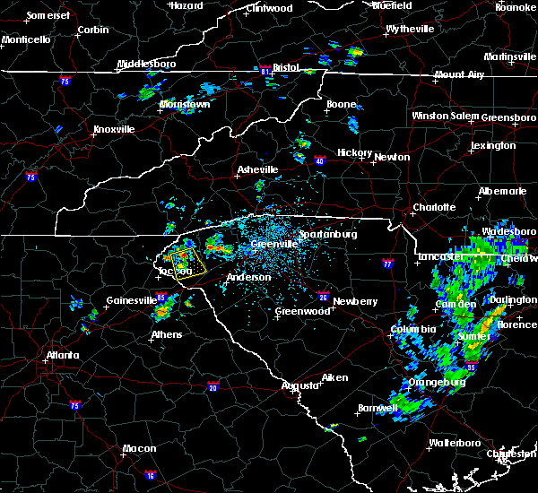 At 417 pm edt, a severe thunderstorm was located over walhalla, moving south at 15 mph (radar indicated). Hazards include 60 mph wind gusts and quarter size hail. Hail damage to vehicles is expected. Expect wind damage to roofs, siding and trees. At 417 pm edt, a severe thunderstorm was located over walhalla, moving south at 15 mph (radar indicated). Hazards include 60 mph wind gusts and quarter size hail. Hail damage to vehicles is expected. Expect wind damage to roofs, siding and trees.
|
| 5/12/2016 3:35 PM EDT |
 At 335 pm edt, a severe thunderstorm was located 4 miles northeast of seneca, moving east at 15 mph (radar indicated). Hazards include 60 mph wind gusts. Expect damage to roofs. siding and trees. Locations impacted include, clemson, seneca and central. At 335 pm edt, a severe thunderstorm was located 4 miles northeast of seneca, moving east at 15 mph (radar indicated). Hazards include 60 mph wind gusts. Expect damage to roofs. siding and trees. Locations impacted include, clemson, seneca and central.
|
| 5/12/2016 3:18 PM EDT |
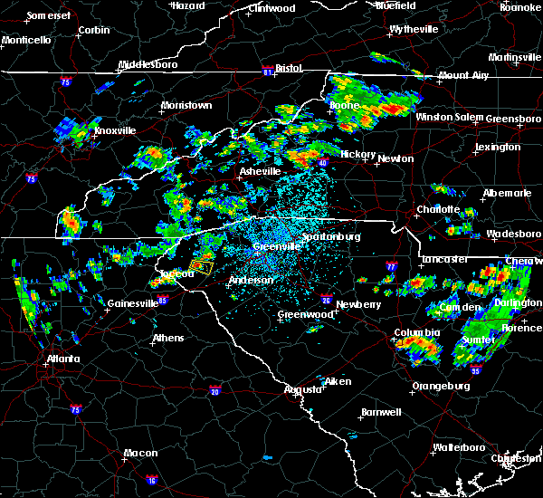 At 317 pm edt, a severe thunderstorm was located near seneca, moving east at 15 mph (radar indicated). Hazards include 60 mph wind gusts and quarter size hail. Hail damage to vehicles is expected. Expect wind damage to roofs, siding and trees. At 317 pm edt, a severe thunderstorm was located near seneca, moving east at 15 mph (radar indicated). Hazards include 60 mph wind gusts and quarter size hail. Hail damage to vehicles is expected. Expect wind damage to roofs, siding and trees.
|
| 5/11/2016 2:47 PM EDT |
 At 247 pm edt, a severe thunderstorm was located 8 miles northeast of toccoa, or 5 miles west of westminster, moving southeast at 20 mph (radar indicated). Hazards include 60 mph wind gusts and quarter size hail. Hail damage to vehicles is expected. Expect wind damage to roofs, siding and trees. At 247 pm edt, a severe thunderstorm was located 8 miles northeast of toccoa, or 5 miles west of westminster, moving southeast at 20 mph (radar indicated). Hazards include 60 mph wind gusts and quarter size hail. Hail damage to vehicles is expected. Expect wind damage to roofs, siding and trees.
|
| 8/11/2015 6:48 PM EDT |
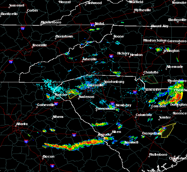 At 648 pm edt, doppler radar indicated a severe thunderstorm capable of producing quarter size hail and damaging winds in excess of 60 mph. this storm was located near clemson, moving southeast at 20 mph. locations impacted include, clemson, central, pendleton, townville, seneca, sandy springs, lake hartwell and lake keowee. At 648 pm edt, doppler radar indicated a severe thunderstorm capable of producing quarter size hail and damaging winds in excess of 60 mph. this storm was located near clemson, moving southeast at 20 mph. locations impacted include, clemson, central, pendleton, townville, seneca, sandy springs, lake hartwell and lake keowee.
|
| 8/11/2015 6:29 PM EDT |
 At 628 pm edt, doppler radar indicated a severe thunderstorm capable of producing quarter size hail and damaging winds in excess of 60 mph. this storm was located 5 miles northeast of seneca, and moving southeast at 20 mph. * locations in the warning include, clemson, seneca, central, pendleton, norris, six mile, townville, lake keowee, sandy springs and walhalla. At 628 pm edt, doppler radar indicated a severe thunderstorm capable of producing quarter size hail and damaging winds in excess of 60 mph. this storm was located 5 miles northeast of seneca, and moving southeast at 20 mph. * locations in the warning include, clemson, seneca, central, pendleton, norris, six mile, townville, lake keowee, sandy springs and walhalla.
|
| 8/10/2015 6:03 PM EDT |
 At 602 pm edt, emergency management reported a line of severe thunderstorms producing damaging winds in excess of 60 mph. these storms were located along a line extending from 15 miles north of walhalla to 11 miles northwest of hartwell, moving east at 40 mph. locations impacted include, anderson, easley, clemson, toccoa, seneca, hartwell, walhalla, pickens, carnesville and homeland park. At 602 pm edt, emergency management reported a line of severe thunderstorms producing damaging winds in excess of 60 mph. these storms were located along a line extending from 15 miles north of walhalla to 11 miles northwest of hartwell, moving east at 40 mph. locations impacted include, anderson, easley, clemson, toccoa, seneca, hartwell, walhalla, pickens, carnesville and homeland park.
|
| 8/10/2015 5:27 PM EDT |
 At 526 pm edt, emergency management reported a line of severe thunderstorms producing damaging winds in excess of 60 mph. these storms were located along a line extending from 6 miles northwest of clayton to 9 miles southwest of toccoa, and moving east at 40 mph. * locations in the warning include, anderson, easley, clemson, toccoa, seneca, hartwell, walhalla, pickens, clayton and clarkesville. At 526 pm edt, emergency management reported a line of severe thunderstorms producing damaging winds in excess of 60 mph. these storms were located along a line extending from 6 miles northwest of clayton to 9 miles southwest of toccoa, and moving east at 40 mph. * locations in the warning include, anderson, easley, clemson, toccoa, seneca, hartwell, walhalla, pickens, clayton and clarkesville.
|
| 8/10/2015 4:46 PM EDT |
 At 446 pm edt, doppler radar indicated a severe thunderstorm capable of producing quarter size hail and damaging winds in excess of 60 mph. this storm was located 5 miles northeast of seneca, moving east at 25 mph. locations impacted include, clemson, seneca, walhalla, central, northlake, pendleton, westminster, norris, anderson airport and oakway. At 446 pm edt, doppler radar indicated a severe thunderstorm capable of producing quarter size hail and damaging winds in excess of 60 mph. this storm was located 5 miles northeast of seneca, moving east at 25 mph. locations impacted include, clemson, seneca, walhalla, central, northlake, pendleton, westminster, norris, anderson airport and oakway.
|
| 8/10/2015 4:25 PM EDT |
 At 425 pm edt, doppler radar indicated a severe thunderstorm capable of producing quarter size hail and damaging winds in excess of 60 mph. this storm was located 6 miles south of walhalla, or near westminster, and moving east at 25 mph. * locations in the warning include, clemson, seneca, walhalla, central, northlake, pendleton, westminster, norris, anderson airport and oakway. At 425 pm edt, doppler radar indicated a severe thunderstorm capable of producing quarter size hail and damaging winds in excess of 60 mph. this storm was located 6 miles south of walhalla, or near westminster, and moving east at 25 mph. * locations in the warning include, clemson, seneca, walhalla, central, northlake, pendleton, westminster, norris, anderson airport and oakway.
|
| 8/6/2015 4:51 PM EDT |
 At 450 pm edt, doppler radar indicated a severe thunderstorm capable of producing damaging winds in excess of 60 mph. this storm was located 5 miles southwest of seneca, or 4 miles southeast of westminster, and moving northeast at 40 mph. nickel size hail may also accompany the damaging winds. * locations in the warning include, seneca, walhalla, westminster, fair play, oakway, townville and lake keowee. At 450 pm edt, doppler radar indicated a severe thunderstorm capable of producing damaging winds in excess of 60 mph. this storm was located 5 miles southwest of seneca, or 4 miles southeast of westminster, and moving northeast at 40 mph. nickel size hail may also accompany the damaging winds. * locations in the warning include, seneca, walhalla, westminster, fair play, oakway, townville and lake keowee.
|
| 7/18/2015 5:26 PM EDT |
 At 526 pm edt, doppler radar indicated a line of severe thunderstorms capable of producing quarter size hail and damaging winds in excess of 60 mph. these storms were located along a line extending from 5 miles southeast of easley to 4 miles northeast of clemson to near seneca, moving south at 20 mph. locations impacted include, anderson, clemson, seneca, powdersville, central, williamston, northlake, pendleton, liberty and west pelzer. At 526 pm edt, doppler radar indicated a line of severe thunderstorms capable of producing quarter size hail and damaging winds in excess of 60 mph. these storms were located along a line extending from 5 miles southeast of easley to 4 miles northeast of clemson to near seneca, moving south at 20 mph. locations impacted include, anderson, clemson, seneca, powdersville, central, williamston, northlake, pendleton, liberty and west pelzer.
|
| 7/18/2015 5:08 PM EDT |
 At 507 pm edt, doppler radar indicated a line of severe thunderstorms capable of producing quarter size hail and damaging winds in excess of 60 mph. these storms were located along a line extending from 4 miles southeast of easley to 7 miles north of clemson to near seneca, and moving south at 15 mph. * locations in the warning include, anderson, easley, clemson, seneca, powdersville, central, williamston, northlake, pendleton and liberty. At 507 pm edt, doppler radar indicated a line of severe thunderstorms capable of producing quarter size hail and damaging winds in excess of 60 mph. these storms were located along a line extending from 4 miles southeast of easley to 7 miles north of clemson to near seneca, and moving south at 15 mph. * locations in the warning include, anderson, easley, clemson, seneca, powdersville, central, williamston, northlake, pendleton and liberty.
|
| 7/14/2015 7:35 PM EDT |
 At 734 pm edt, doppler radar indicated a line of severe thunderstorms with a history of producing damaging winds in excess of 60 mph. these storms were located along a line extending from 6 miles east of clemson to 8 miles east of carnesville to 7 miles west of homer, moving southeast at 25 mph. locations impacted include, anderson, clemson, toccoa, seneca, hartwell, carnesville, homeland park, central, lake hartwell, williamston and cornelia. At 734 pm edt, doppler radar indicated a line of severe thunderstorms with a history of producing damaging winds in excess of 60 mph. these storms were located along a line extending from 6 miles east of clemson to 8 miles east of carnesville to 7 miles west of homer, moving southeast at 25 mph. locations impacted include, anderson, clemson, toccoa, seneca, hartwell, carnesville, homeland park, central, lake hartwell, williamston and cornelia.
|
| 7/14/2015 7:07 PM EDT |
 At 705 pm edt, doppler radar indicated a line of severe thunderstorms with a history of producing damaging winds of up to 70 mph. these storms were located along a line extending from 5 miles northeast of walhalla to 5 miles south of toccoa to 9 miles southwest of clarkesville, moving south at 45 mph. locations impacted include, anderson, clemson, toccoa, seneca, hartwell, walhalla, clarkesville, carnesville, lake keowee, lake hartwell, homeland park and central. At 705 pm edt, doppler radar indicated a line of severe thunderstorms with a history of producing damaging winds of up to 70 mph. these storms were located along a line extending from 5 miles northeast of walhalla to 5 miles south of toccoa to 9 miles southwest of clarkesville, moving south at 45 mph. locations impacted include, anderson, clemson, toccoa, seneca, hartwell, walhalla, clarkesville, carnesville, lake keowee, lake hartwell, homeland park and central.
|
| 7/14/2015 6:48 PM EDT |
 At 646 pm edt, doppler radar indicated a line of severe thunderstorms with a history of producing damaging winds up to 60 mph. these storms were located along a line extending from 17 miles southeast of franklin to 8 miles east of clayton to 8 miles northwest of clarkesville, and moving southeast at 40 mph. At 646 pm edt, doppler radar indicated a line of severe thunderstorms with a history of producing damaging winds up to 60 mph. these storms were located along a line extending from 17 miles southeast of franklin to 8 miles east of clayton to 8 miles northwest of clarkesville, and moving southeast at 40 mph.
|
| 7/2/2015 2:07 PM EDT |
 The severe thunderstorm warning for southeastern oconee and southwestern pickens counties will expire at 215 pm edt, the line of storms which prompted the warning have weakened below severe limits, and no longer poses an immediate threat to life or property. therefore the warning will be allowed to expire. however gusty winds and heavy rain are still possible with these thunderstorms near the anderson county line. The severe thunderstorm warning for southeastern oconee and southwestern pickens counties will expire at 215 pm edt, the line of storms which prompted the warning have weakened below severe limits, and no longer poses an immediate threat to life or property. therefore the warning will be allowed to expire. however gusty winds and heavy rain are still possible with these thunderstorms near the anderson county line.
|
| 7/2/2015 2:01 PM EDT |
 At 201 pm edt, doppler radar indicated a line of severe thunderstorms capable of producing damaging winds in excess of 60 mph. these storms were located along a line extending from 5 miles north of clemson to 5 miles south of seneca, moving east at 30 mph. locations impacted include, clemson, seneca, central, norris, fair play, oakway, liberty, townville and lake keowee. At 201 pm edt, doppler radar indicated a line of severe thunderstorms capable of producing damaging winds in excess of 60 mph. these storms were located along a line extending from 5 miles north of clemson to 5 miles south of seneca, moving east at 30 mph. locations impacted include, clemson, seneca, central, norris, fair play, oakway, liberty, townville and lake keowee.
|
| 7/2/2015 1:39 PM EDT |
 At 138 pm edt, doppler radar indicated a line of severe thunderstorms capable of producing quarter size hail and damaging winds in excess of 60 mph. these storms were located along a line extending from 5 miles northeast of walhalla to 9 miles northeast of toccoa, moving east at 30 mph. locations impacted include, clemson, seneca, walhalla, central, liberty, westminster, norris, six mile, fair play and oakway. At 138 pm edt, doppler radar indicated a line of severe thunderstorms capable of producing quarter size hail and damaging winds in excess of 60 mph. these storms were located along a line extending from 5 miles northeast of walhalla to 9 miles northeast of toccoa, moving east at 30 mph. locations impacted include, clemson, seneca, walhalla, central, liberty, westminster, norris, six mile, fair play and oakway.
|
| 7/2/2015 1:31 PM EDT |
 At 130 pm edt, doppler radar indicated a line of severe thunderstorms capable of producing damaging winds in excess of 60 mph. these storms were located along a line extending from 3 miles north of walhalla to 8 miles northeast of toccoa, and moving east at 30 mph. At 130 pm edt, doppler radar indicated a line of severe thunderstorms capable of producing damaging winds in excess of 60 mph. these storms were located along a line extending from 3 miles north of walhalla to 8 miles northeast of toccoa, and moving east at 30 mph.
|
| 6/30/2015 1:11 PM EDT |
 At 111 pm edt, doppler radar indicated a severe thunderstorm with a history of producing damaging winds in excess of 60 mph. this storm was located 6 miles southwest of seneca, or 4 miles southeast of westminster, moving east at 30 mph. penny size hail may also accompany the damaging winds. locations impacted include, seneca, westminster, oakway, townville and lake keowee. At 111 pm edt, doppler radar indicated a severe thunderstorm with a history of producing damaging winds in excess of 60 mph. this storm was located 6 miles southwest of seneca, or 4 miles southeast of westminster, moving east at 30 mph. penny size hail may also accompany the damaging winds. locations impacted include, seneca, westminster, oakway, townville and lake keowee.
|
| 6/30/2015 12:50 PM EDT |
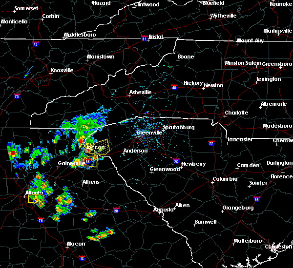 At 1248 pm edt, doppler radar indicated a severe thunderstorm with a history of producing damaging winds in excess of 60 mph. this storm was located 4 miles northeast of toccoa, moving east at 30 mph. penny size hail may also accompany the damaging winds. this storm blew down multiple trees in the mount airy area. locations impacted include, toccoa, seneca, westminster, oakway, townville, fair play and lake keowee. At 1248 pm edt, doppler radar indicated a severe thunderstorm with a history of producing damaging winds in excess of 60 mph. this storm was located 4 miles northeast of toccoa, moving east at 30 mph. penny size hail may also accompany the damaging winds. this storm blew down multiple trees in the mount airy area. locations impacted include, toccoa, seneca, westminster, oakway, townville, fair play and lake keowee.
|
| 6/30/2015 12:31 PM EDT |
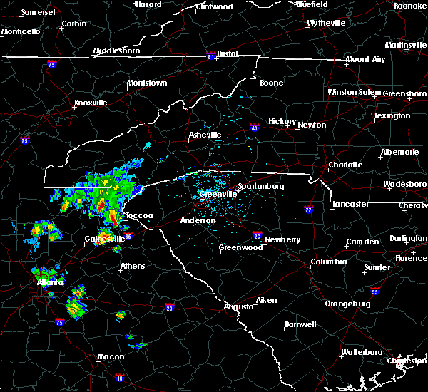 At 1230 pm edt, doppler radar indicated a severe thunderstorm capable of producing damaging winds in excess of 60 mph. this storm was located 5 miles west of toccoa, and moving east at 30 mph. At 1230 pm edt, doppler radar indicated a severe thunderstorm capable of producing damaging winds in excess of 60 mph. this storm was located 5 miles west of toccoa, and moving east at 30 mph.
|
| 6/3/2015 7:38 PM EDT | At 737 pm edt, doppler radar indicated a severe thunderstorm capable of producing quarter size hail and damaging winds in excess of 60 mph. this storm was located 10 miles south of seneca, or near oakway, moving south at 5 mph. locations impacted include, seneca, westminster, oakway and fair play. |
| 6/3/2015 7:14 PM EDT | At 713 pm edt, doppler radar indicated a severe thunderstorm capable of producing large damaging hail up to golf ball size and damaging winds in excess of 60 mph. this storm was located 7 miles southwest of seneca, or over oakway, moving south at 5 mph. locations impacted include, seneca, westminster, oakway and fair play. |
| 6/3/2015 6:56 PM EDT | At 655 pm edt, doppler radar indicated a severe thunderstorm capable of producing quarter size hail and damaging winds in excess of 60 mph. this storm was located 7 miles southwest of seneca, or 6 miles southeast of westminster, and moving south at 5 mph. |
| 5/26/2015 7:20 PM EDT | At 720 pm edt, doppler radar indicated a line of severe thunderstorms capable of producing damaging winds in excess of 60 mph. these storms were located along a line extending from 8 miles north of walhalla to 5 miles north of clemson, moving north at 25 mph. penny size hail may also accompany the damaging winds. locations impacted include, clemson, seneca, walhalla, pickens, central, norris, six mile, salem, lake keowee and keowee toxaway state park. |
| 5/26/2015 7:05 PM EDT | At 705 pm edt, doppler radar indicated a line of severe thunderstorms capable of producing damaging winds in excess of 60 mph. these storms were located along a line extending from walhalla to near clemson, moving north at 25 mph. penny size hail may also accompany the damaging winds. locations impacted include, clemson, seneca, walhalla, pickens, central, westminster, norris, six mile, salem and lake keowee. |
| 5/26/2015 6:42 PM EDT | At 641 pm edt, doppler radar indicated a severe thunderstorm capable of producing quarter size hail and damaging winds in excess of 60 mph. this storm was located near seneca, and moving north at 25 mph. |
| 4/20/2015 3:26 PM EDT | At 325 pm edt, national weather service doppler radar indicated a severe thunderstorm capable of producing quarter size hail, and destructive winds in excess of 70 mph. this storm was located 6 miles northeast of martin, or 13 miles east of toccoa, and moving east at 35 mph. * the severe thunderstorm will be near, fair play by 335 pm edt, 7 miles south of seneca by 340 pm edt, sandy springs, pendleton and clemson by 355 pm edt, 7 miles south of central and 9 miles south of norris by 400 pm edt, 6 miles northwest of williamston and 7 miles southwest of piedmont by 415 pm edt,. |
| 4/20/2015 3:26 PM EDT | At 325 pm edt, national weather service doppler radar indicated a severe thunderstorm capable of producing quarter size hail, and destructive winds in excess of 70 mph. this storm was located 6 miles northeast of martin, or 13 miles east of toccoa, and moving east at 35 mph. * the severe thunderstorm will be near, fair play by 335 pm edt, 7 miles south of seneca by 340 pm edt, sandy springs, pendleton and clemson by 355 pm edt, 7 miles south of central and 9 miles south of norris by 400 pm edt, 6 miles northwest of williamston and 7 miles southwest of piedmont by 415 pm edt,. |
| 1/1/0001 12:00 AM | One small tree down at coneross campground and some campers reported awning damag in oconee county SC, 4.8 miles NNW of Utica, SC |
| 1/1/0001 12:00 AM | 2 trees down on power lines north of townvill in oconee county SC, 4.8 miles NNW of Utica, SC |
Hail Maps for Utica, SC
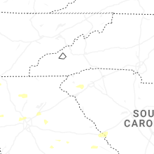


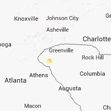


Connect with Interactive Hail Maps