

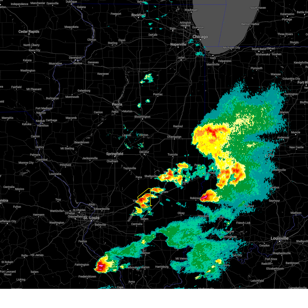
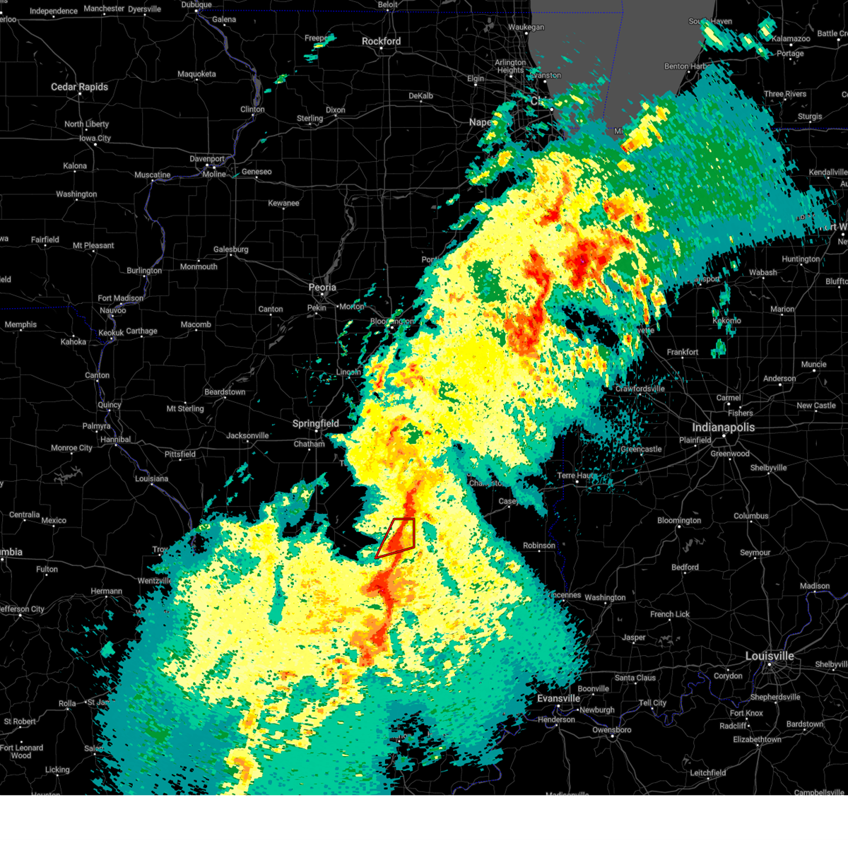
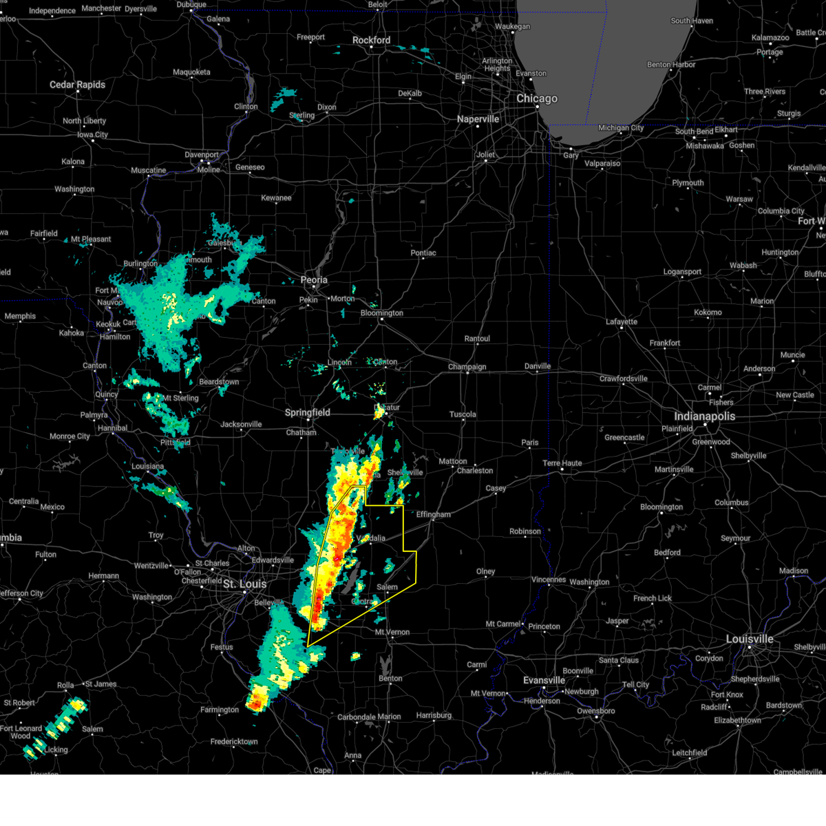
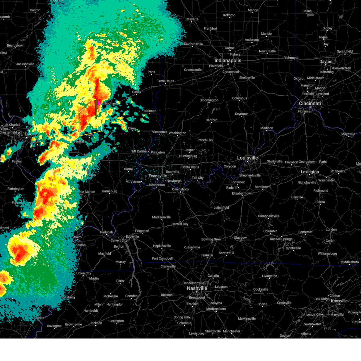
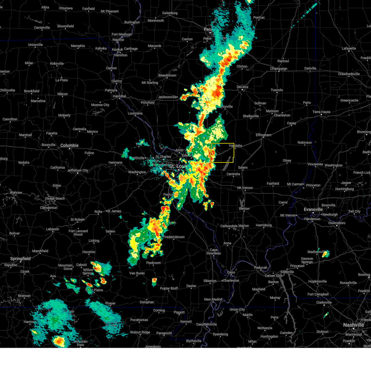
Hail Map for Vandalia, IL
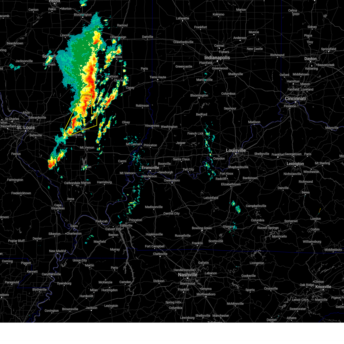
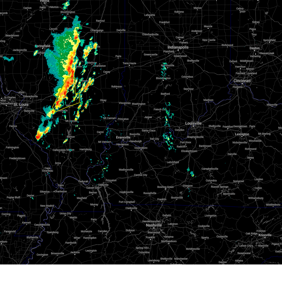
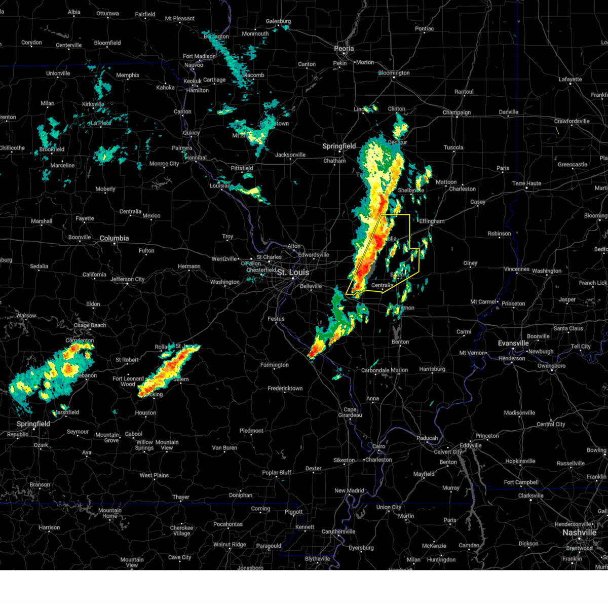
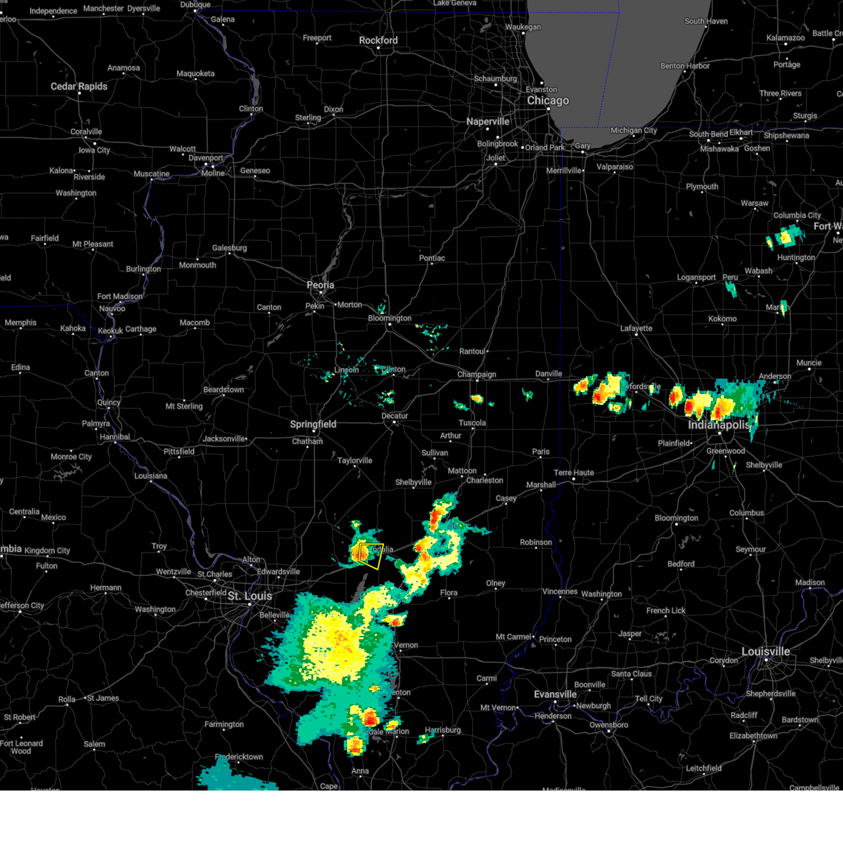
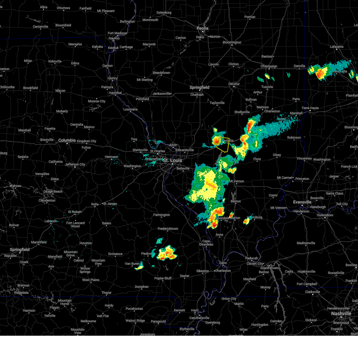
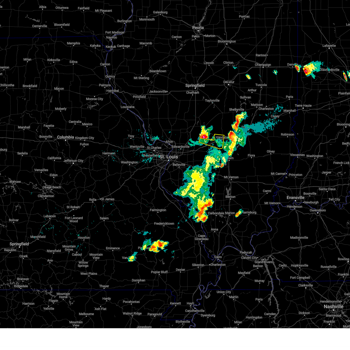
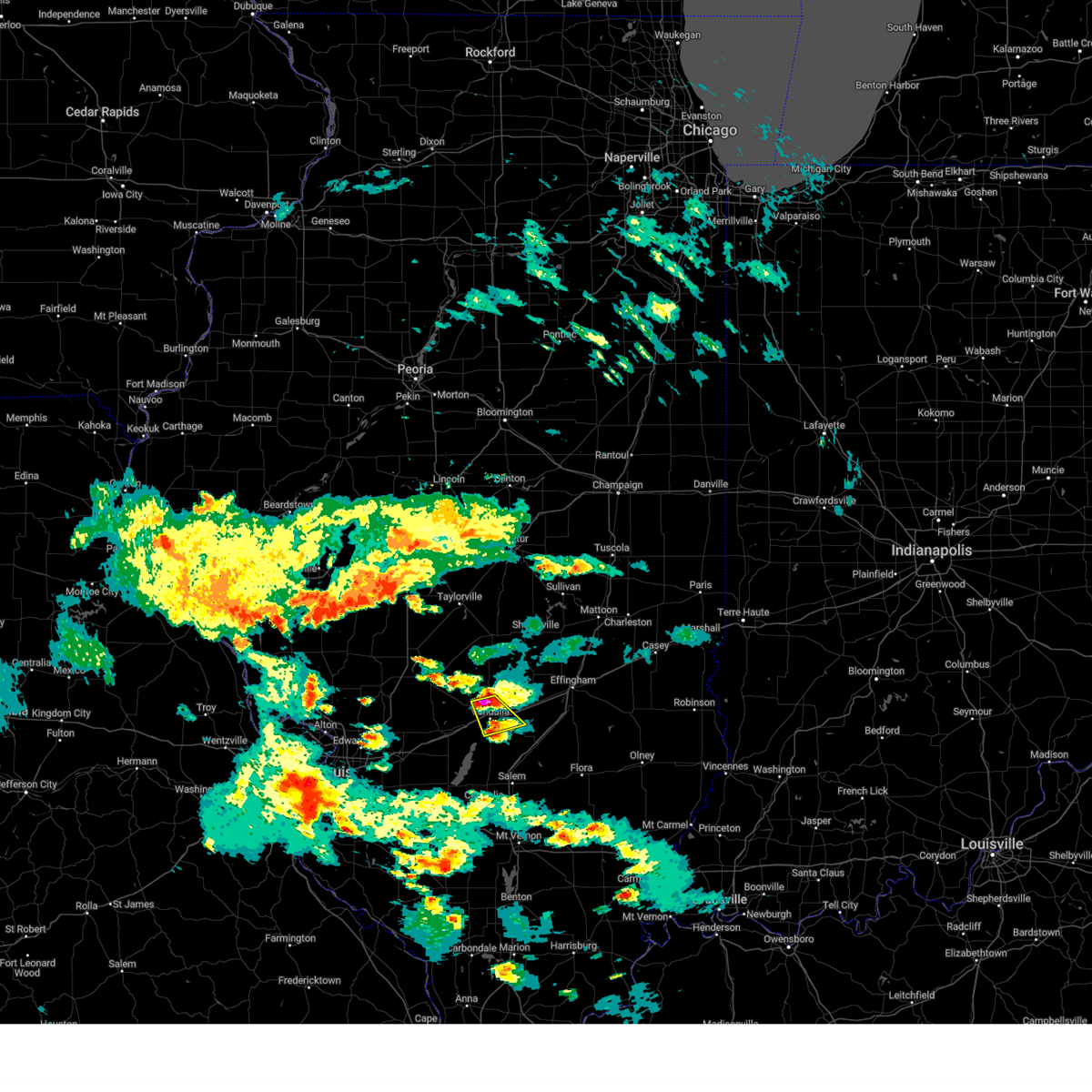
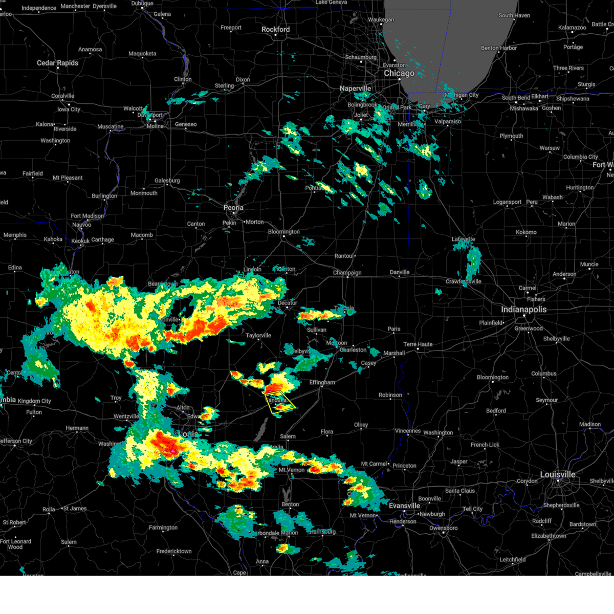
The Vandalia, IL area has had 2 reports of on-the-ground hail by trained spotters, and has been under severe weather warnings 38 times during the past 12 months. Doppler radar has detected hail at or near Vandalia, IL on 74 occasions, including 7 occasions during the past year.
| Name: | Vandalia, IL |
| Where Located: | 52.7 miles SW of Mattoon, IL |
| Map: | Google Map for Vandalia, IL |
| Population: | 7042 |
| Housing Units: | 2667 |
| More Info: | Search Google for Vandalia, IL |
5
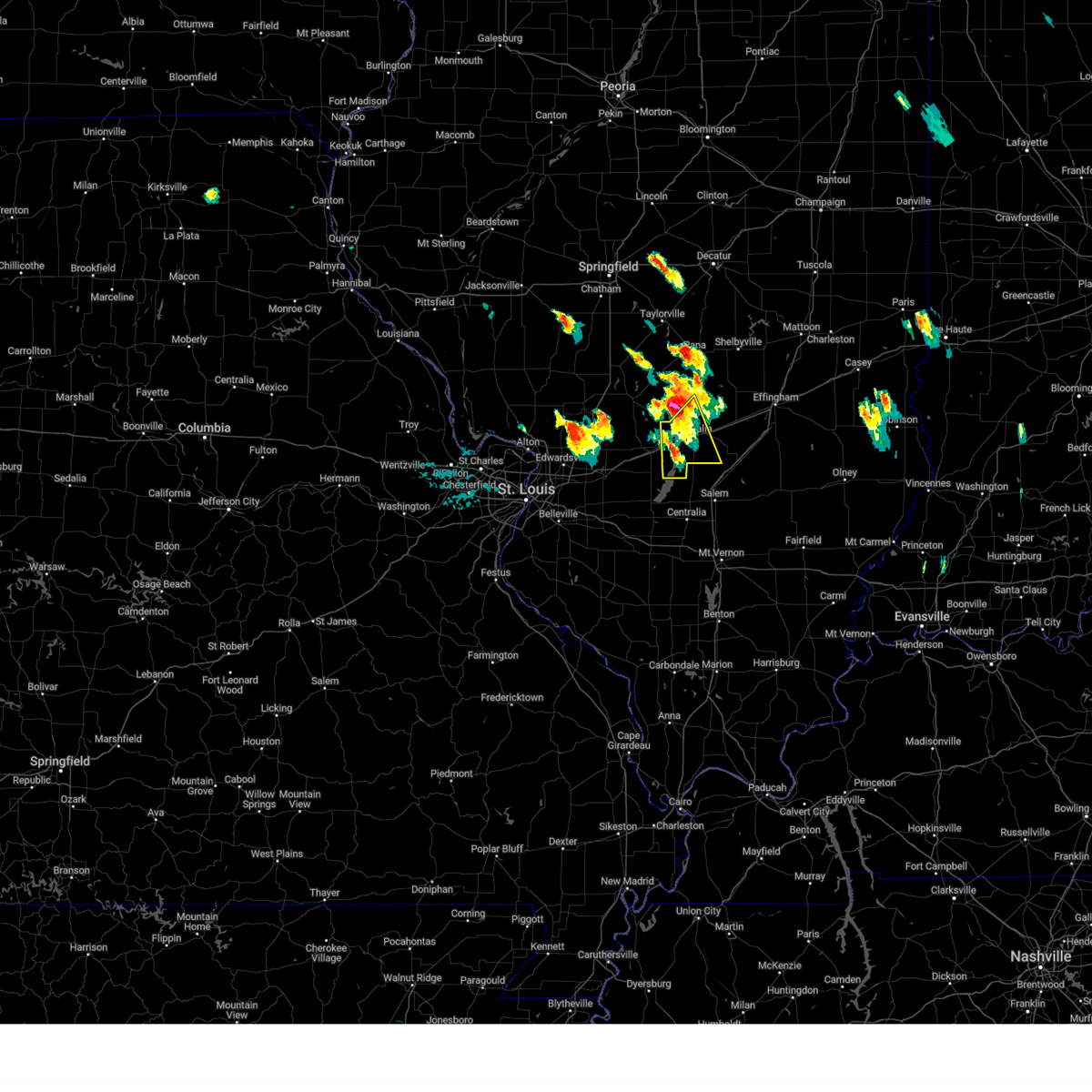
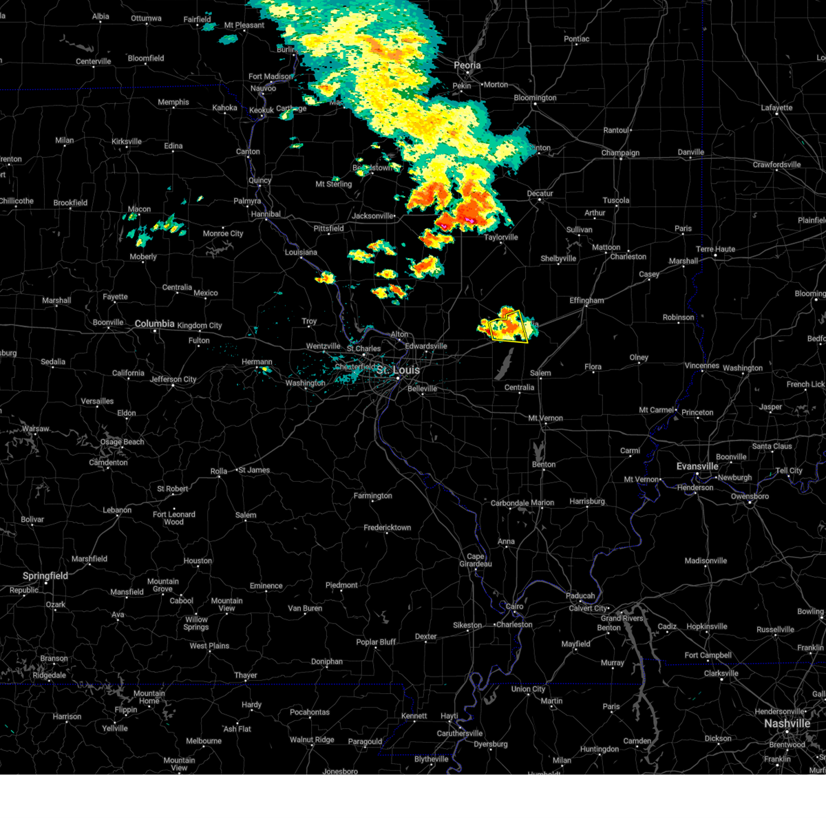
The Top Recent Hail Date for Vandalia, IL is Friday, March 14, 2025 (2nd out of 74)

Hail and Wind Damage Spotted near Vandalia, IL
| Date / Time | Report Details |
|---|---|
| 5/16/2025 5:20 PM CDT |
 Svrlsx the national weather service in st louis has issued a * severe thunderstorm warning for, central fayette county in south central illinois, * until 600 pm cdt. * at 520 pm cdt, a severe thunderstorm was located near brownstown, or near vandalia, moving east at 55 mph (radar indicated). Hazards include 60 mph wind gusts and half dollar size hail. Hail damage to vehicles is expected. Expect wind damage to roofs, siding, and trees. Svrlsx the national weather service in st louis has issued a * severe thunderstorm warning for, central fayette county in south central illinois, * until 600 pm cdt. * at 520 pm cdt, a severe thunderstorm was located near brownstown, or near vandalia, moving east at 55 mph (radar indicated). Hazards include 60 mph wind gusts and half dollar size hail. Hail damage to vehicles is expected. Expect wind damage to roofs, siding, and trees.
|
| 5/16/2025 3:14 PM CDT | Svrlsx the national weather service in st louis has issued a * severe thunderstorm warning for, southeastern bond county in south central illinois, northeastern clinton county in south central illinois, southwestern fayette county in south central illinois, northwestern marion county in south central illinois, * until 400 pm cdt. * at 314 pm cdt, a severe thunderstorm was located near beaver creek, or 6 miles north of carlyle, moving northeast at 40 mph (radar indicated). Hazards include 60 mph wind gusts and quarter size hail. Hail damage to vehicles is expected. Expect wind damage to roofs, siding, and trees. |
| 4/30/2025 7:16 PM CDT |
 The storm which prompted the warning has moved out of the area. therefore, the warning has been allowed to expire. a tornado warning still remains in effect for fayette county. a tornado watch remains in effect until 1000 pm cdt for a portion of south central illinois. The storm which prompted the warning has moved out of the area. therefore, the warning has been allowed to expire. a tornado warning still remains in effect for fayette county. a tornado watch remains in effect until 1000 pm cdt for a portion of south central illinois.
|
| 4/30/2025 7:01 PM CDT |
 the tornado warning has been cancelled and is no longer in effect the tornado warning has been cancelled and is no longer in effect
|
| 4/30/2025 7:01 PM CDT |
 At 701 pm cdt, a severe thunderstorm capable of producing a tornado was located 7 miles south of brownstown, or 8 miles southeast of vandalia, moving northeast at 25 mph (radar indicated rotation). Hazards include tornado and quarter size hail. Flying debris will be dangerous to those caught without shelter. mobile homes will be damaged or destroyed. damage to roofs, windows and vehicles will occur. tree damage is likely. other locations impacted by the tornado include st. paul and st. peter. This includes interstate 70 in illinois near exit 68. At 701 pm cdt, a severe thunderstorm capable of producing a tornado was located 7 miles south of brownstown, or 8 miles southeast of vandalia, moving northeast at 25 mph (radar indicated rotation). Hazards include tornado and quarter size hail. Flying debris will be dangerous to those caught without shelter. mobile homes will be damaged or destroyed. damage to roofs, windows and vehicles will occur. tree damage is likely. other locations impacted by the tornado include st. paul and st. peter. This includes interstate 70 in illinois near exit 68.
|
| 4/30/2025 6:50 PM CDT |
 At 650 pm cdt, a severe thunderstorm capable of producing a tornado was located over shobonier, or 9 miles south of vandalia, moving northeast at 25 mph (radar indicated rotation). Hazards include tornado and half dollar size hail. Flying debris will be dangerous to those caught without shelter. mobile homes will be damaged or destroyed. damage to roofs, windows and vehicles will occur. tree damage is likely. other locations impacted by the tornado include vernon, st. paul and st. peter. This includes interstate 70 in illinois between exits 63 and 68. At 650 pm cdt, a severe thunderstorm capable of producing a tornado was located over shobonier, or 9 miles south of vandalia, moving northeast at 25 mph (radar indicated rotation). Hazards include tornado and half dollar size hail. Flying debris will be dangerous to those caught without shelter. mobile homes will be damaged or destroyed. damage to roofs, windows and vehicles will occur. tree damage is likely. other locations impacted by the tornado include vernon, st. paul and st. peter. This includes interstate 70 in illinois between exits 63 and 68.
|
| 4/30/2025 6:30 PM CDT | Torlsx the national weather service in st louis has issued a * tornado warning for, southern fayette county in south central illinois, northwestern marion county in south central illinois, * until 715 pm cdt. * at 630 pm cdt, a severe thunderstorm capable of producing a tornado was located near patoka, or 14 miles southeast of greenville, moving northeast at 25 mph (radar indicated rotation). Hazards include tornado and quarter size hail. Flying debris will be dangerous to those caught without shelter. mobile homes will be damaged or destroyed. damage to roofs, windows and vehicles will occur. tree damage is likely. this tornado will be near, patoka around 635 pm cdt. other locations impacted by the tornado include pittsburg, vernon, st. paul and st. peter. This includes interstate 70 in illinois between exits 61 and 68. |
| 4/2/2025 6:12 PM CDT | The storm which prompted the warning has moved out of the area. therefore, the warning will be allowed to expire. a tornado watch remains in effect until 700 pm cdt for a portion of south central illinois. |
| 4/2/2025 5:50 PM CDT |
 At 550 pm cdt, a severe thunderstorm capable of producing a tornado was located near brownstown, or 6 miles northeast of vandalia, moving northeast at 75 mph (radar indicated rotation). Hazards include tornado. Flying debris will be dangerous to those caught without shelter. mobile homes will be damaged or destroyed. damage to roofs, windows and vehicles will occur. tree damage is likely. this tornadic storm will remain over mainly rural areas of northern fayette county. This includes interstate 70 in illinois between exits 61 and 63. At 550 pm cdt, a severe thunderstorm capable of producing a tornado was located near brownstown, or 6 miles northeast of vandalia, moving northeast at 75 mph (radar indicated rotation). Hazards include tornado. Flying debris will be dangerous to those caught without shelter. mobile homes will be damaged or destroyed. damage to roofs, windows and vehicles will occur. tree damage is likely. this tornadic storm will remain over mainly rural areas of northern fayette county. This includes interstate 70 in illinois between exits 61 and 63.
|
| 4/2/2025 5:42 PM CDT | the severe thunderstorm warning has been cancelled and is no longer in effect |
| 4/2/2025 5:42 PM CDT | At 542 pm cdt, a severe thunderstorm was located over shobonier, or 6 miles south of vandalia, moving northeast at 65 mph (radar indicated). Hazards include 60 mph wind gusts and small hail. Expect damage to roofs, siding, and trees. other locations impacted by the severe thunderstorm include pittsburg, hagerstown, avena and st. james. This includes interstate 70 in illinois between exits 61 and 76. |
| 4/2/2025 5:40 PM CDT | At 540 pm cdt, a severe thunderstorm capable of producing a tornado was located near ramsey, or 13 miles north of vandalia, moving northeast at 65 mph (radar indicated rotation). Hazards include tornado. Flying debris will be dangerous to those caught without shelter. mobile homes will be damaged or destroyed. damage to roofs, windows and vehicles will occur. tree damage is likely. this tornadic storm will remain over mainly rural areas of northern fayette county. This includes interstate 70 in illinois between exits 61 and 63. |
| 4/2/2025 5:38 PM CDT | Torlsx the national weather service in st louis has issued a * tornado warning for, southern fayette county in south central illinois, * until 630 pm cdt. * at 538 pm cdt, a severe thunderstorm capable of producing a tornado was located 5 miles west of shobonier, or 10 miles southwest of vandalia, moving northeast at 65 mph (radar indicated rotation). Hazards include tornado. Flying debris will be dangerous to those caught without shelter. mobile homes will be damaged or destroyed. damage to roofs, windows and vehicles will occur. tree damage is likely. this tornado will be near, mulberry grove around 540 pm cdt. shobonier and vandalia around 545 pm cdt. other locations impacted by the tornado include pittsburg, hagerstown, st. paul, avena, st. james and loogootee. this includes the following highways, interstate 70 in illinois between exits 68 and 76. Interstate 57 in illinois near exit 135. |
| 4/2/2025 5:35 PM CDT | At 535 pm cdt, a severe thunderstorm was located near tamalco, or 8 miles southeast of greenville, moving northeast at 65 mph. another severe thunderstorm was also located near bayle city, also moving northeast at 65 mph (radar indicated). Hazards include 60 mph wind gusts and small hail. Expect damage to roofs, siding, and trees. other locations impacted by the severe thunderstorm include keyesport, pleasant mound, pittsburg, hagerstown, avena and st. james. this includes the following state parks, ramsey lake state park. This includes interstate 70 in illinois between exits 52 and 76. |
| 4/2/2025 5:35 PM CDT | the severe thunderstorm warning has been cancelled and is no longer in effect |
| 4/2/2025 5:32 PM CDT | At 532 pm cdt, a severe thunderstorm capable of producing a tornado was located near vandalia, moving northeast at 65 mph (radar indicated rotation). Hazards include tornado. Flying debris will be dangerous to those caught without shelter. mobile homes will be damaged or destroyed. damage to roofs, windows and vehicles will occur. tree damage is likely. this tornado will be near, mulberry grove around 525 pm cdt. other locations impacted by the tornado include hagerstown, shafter, bingham and bayle city. this includes the following state parks, ramsey lake state park. This includes interstate 70 in illinois between exits 61 and 63. |
| 4/2/2025 5:32 PM CDT | the tornado warning has been cancelled and is no longer in effect |
| 4/2/2025 5:16 PM CDT | Torlsx the national weather service in st louis has issued a * tornado warning for, northeastern bond county in south central illinois, northern fayette county in south central illinois, southeastern montgomery county in south central illinois, * until 600 pm cdt. * at 516 pm cdt, a confirmed tornado was located over greenville, moving northeast at 60 mph (law enforcement confirmed tornado). Hazards include damaging tornado. Flying debris will be dangerous to those caught without shelter. mobile homes will be damaged or destroyed. damage to roofs, windows and vehicles will occur. tree damage is likely. this tornado will be near, greenville and woburn around 520 pm cdt. mulberry grove around 525 pm cdt. other locations impacted by the tornado include smithboro, pleasant mound, dudleyville, shafter, hagerstown, bayle city, bingham and avena. this includes the following state parks, ramsey lake state park. This includes interstate 70 in illinois between exits 45 and 76. |
| 4/2/2025 5:11 PM CDT | Svrlsx the national weather service in st louis has issued a * severe thunderstorm warning for, bond county in south central illinois, fayette county in south central illinois, southeastern montgomery county in south central illinois, * until 615 pm cdt. * at 511 pm cdt, a severe thunderstorm was located over pocahontas, or 8 miles southwest of greenville, moving northeast at 60 mph (radar indicated). Hazards include 60 mph wind gusts and small hail. expect damage to roofs, siding, and trees |
| 3/30/2025 12:56 PM CDT |
 The storms which prompted the warning have weakened below severe limits, and no longer pose an immediate threat to life or property. therefore, the warning will be allowed to expire. however, small hail and gusty winds are still possible with these thunderstorms. a tornado watch remains in effect until 700 pm cdt sunday for a portion of south central illinois. The storms which prompted the warning have weakened below severe limits, and no longer pose an immediate threat to life or property. therefore, the warning will be allowed to expire. however, small hail and gusty winds are still possible with these thunderstorms. a tornado watch remains in effect until 700 pm cdt sunday for a portion of south central illinois.
|
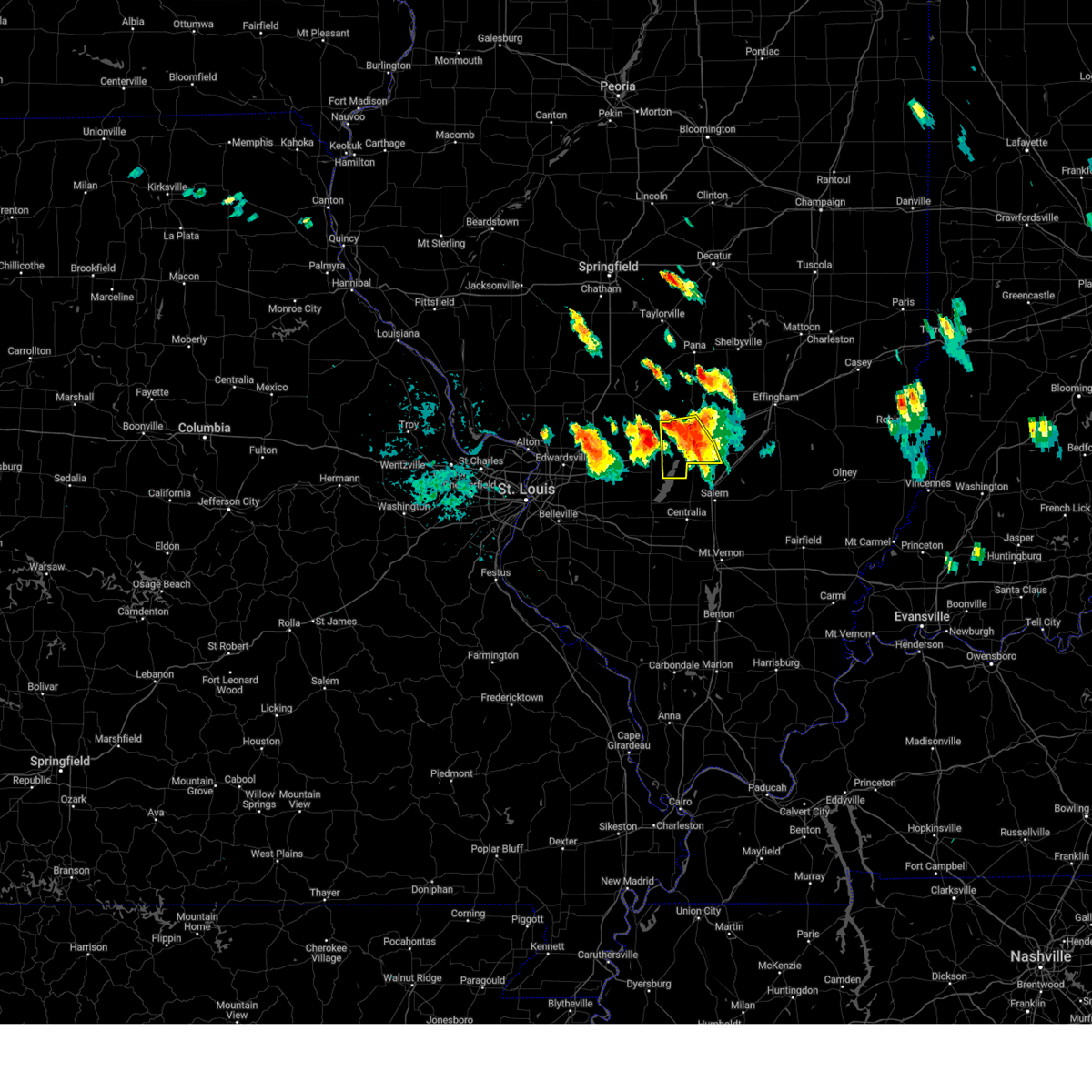
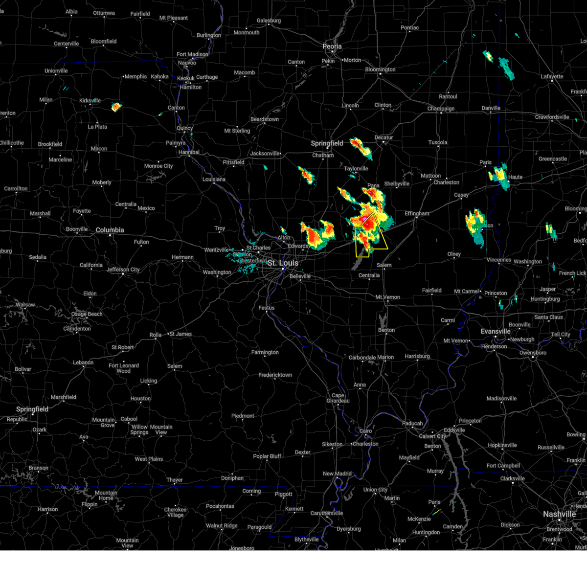
| 3/30/2025 12:47 PM CDT |
 At 1247 pm cdt, severe thunderstorms were located along a line from 19 miles north of wrights corner to over boulder, or along a line from 24 miles east of nokomis to 10 miles east of carlyle, moving northeast at 45 mph (radar indicated). Hazards include 60 mph wind gusts and quarter size hail. Hail damage to vehicles is expected. expect wind damage to roofs, siding, and trees. locations impacted include, salem, vandalia, carlyle, st. elmo, sandoval, odin, kinmundy, brownstown, patoka, tamalco, farina, omega, shobonier, fairman, boulder, stephen forbes station, shattuc, wrights corner, avena and tonti. this includes the following state parks, carlyle lake recreational area. this includes the following highways, interstate 70 in illinois between exits 61 and 76. Interstate 57 in illinois between exits 127 and 135. At 1247 pm cdt, severe thunderstorms were located along a line from 19 miles north of wrights corner to over boulder, or along a line from 24 miles east of nokomis to 10 miles east of carlyle, moving northeast at 45 mph (radar indicated). Hazards include 60 mph wind gusts and quarter size hail. Hail damage to vehicles is expected. expect wind damage to roofs, siding, and trees. locations impacted include, salem, vandalia, carlyle, st. elmo, sandoval, odin, kinmundy, brownstown, patoka, tamalco, farina, omega, shobonier, fairman, boulder, stephen forbes station, shattuc, wrights corner, avena and tonti. this includes the following state parks, carlyle lake recreational area. this includes the following highways, interstate 70 in illinois between exits 61 and 76. Interstate 57 in illinois between exits 127 and 135.
|
| 3/30/2025 12:30 PM CDT |
 the severe thunderstorm warning has been cancelled and is no longer in effect the severe thunderstorm warning has been cancelled and is no longer in effect
|
| 3/30/2025 12:30 PM CDT |
 At 1230 pm cdt, severe thunderstorms were located along a line from 16 miles north of ramsey to over carlyle, or along a line from 14 miles east of nokomis to over carlyle, moving northeast at 60 mph (radar indicated). Hazards include 60 mph wind gusts and quarter size hail. Hail damage to vehicles is expected. expect wind damage to roofs, siding, and trees. locations impacted include, centralia, salem, vandalia, carlyle, st. elmo, sandoval, wamac, central city, odin, beckemeyer, ramsey, kinmundy, brownstown, irvington, mulberry grove, patoka, tamalco, farina, omega and beaver creek. this includes the following state parks, ramsey lake state park and carlyle lake recreational area. this includes the following highways, interstate 70 in illinois between exits 52 and 76. Interstate 57 in illinois between exits 116 and 135. At 1230 pm cdt, severe thunderstorms were located along a line from 16 miles north of ramsey to over carlyle, or along a line from 14 miles east of nokomis to over carlyle, moving northeast at 60 mph (radar indicated). Hazards include 60 mph wind gusts and quarter size hail. Hail damage to vehicles is expected. expect wind damage to roofs, siding, and trees. locations impacted include, centralia, salem, vandalia, carlyle, st. elmo, sandoval, wamac, central city, odin, beckemeyer, ramsey, kinmundy, brownstown, irvington, mulberry grove, patoka, tamalco, farina, omega and beaver creek. this includes the following state parks, ramsey lake state park and carlyle lake recreational area. this includes the following highways, interstate 70 in illinois between exits 52 and 76. Interstate 57 in illinois between exits 116 and 135.
|
| 3/30/2025 12:17 PM CDT |
 Svrlsx the national weather service in st louis has issued a * severe thunderstorm warning for, bond county in south central illinois, clinton county in south central illinois, fayette county in south central illinois, marion county in south central illinois, southeastern montgomery county in south central illinois, northwestern washington county in south central illinois, * until 100 pm cdt. * at 1217 pm cdt, severe thunderstorms were located along a line from 7 miles northwest of ramsey to near okawville, or along a line from 7 miles southeast of nokomis to 9 miles south of breese, moving northeast at 60 mph (radar indicated). Hazards include 60 mph wind gusts and quarter size hail. Hail damage to vehicles is expected. Expect wind damage to roofs, siding, and trees. Svrlsx the national weather service in st louis has issued a * severe thunderstorm warning for, bond county in south central illinois, clinton county in south central illinois, fayette county in south central illinois, marion county in south central illinois, southeastern montgomery county in south central illinois, northwestern washington county in south central illinois, * until 100 pm cdt. * at 1217 pm cdt, severe thunderstorms were located along a line from 7 miles northwest of ramsey to near okawville, or along a line from 7 miles southeast of nokomis to 9 miles south of breese, moving northeast at 60 mph (radar indicated). Hazards include 60 mph wind gusts and quarter size hail. Hail damage to vehicles is expected. Expect wind damage to roofs, siding, and trees.
|
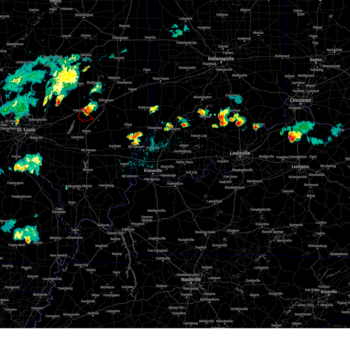
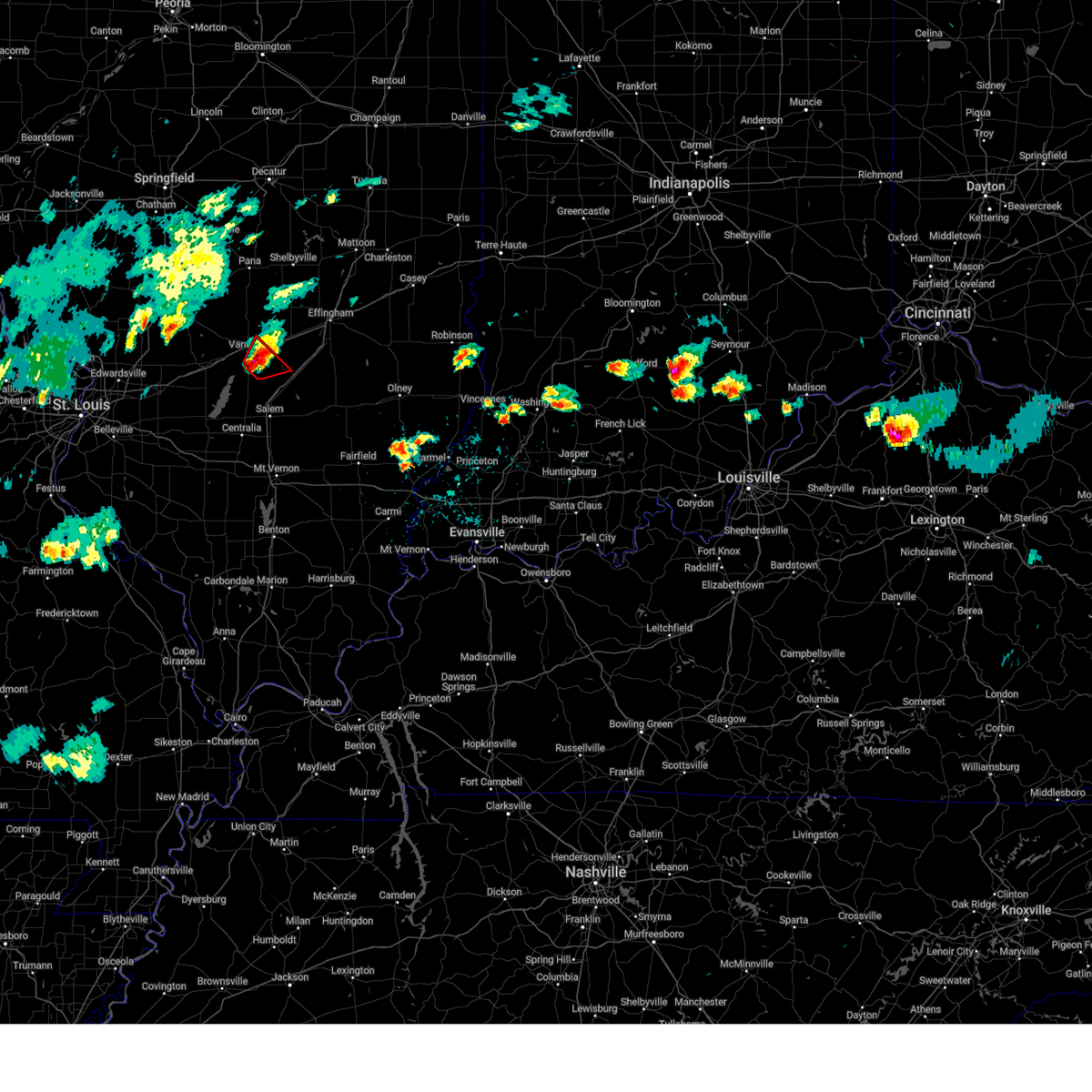
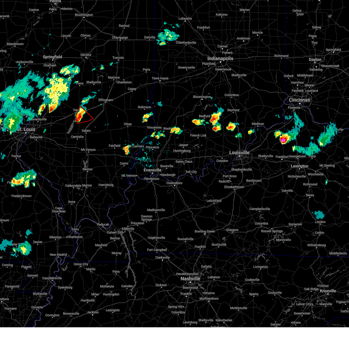
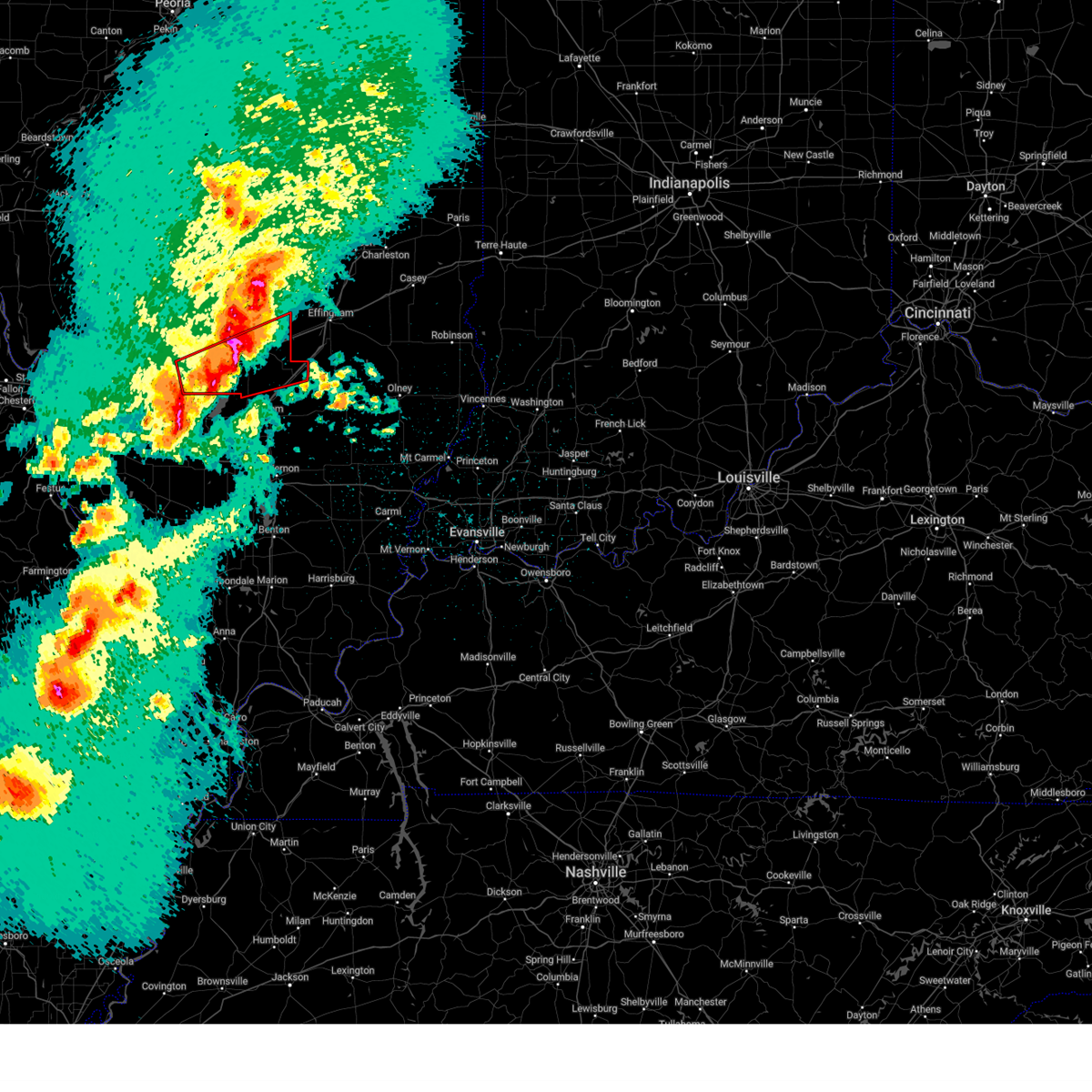
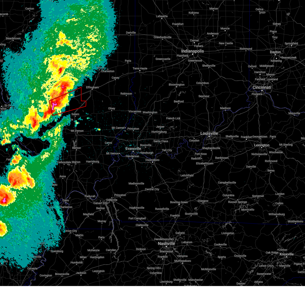
| 3/14/2025 11:51 PM CDT | Fayette county ema reporting multiple lines down in vandali in fayette county IL, 0.5 miles WNW of Vandalia, IL |
| 3/14/2025 11:39 PM CDT |
 At 1139 pm cdt, severe thunderstorms were located along a line from 17 miles northeast of wrights corner to over fairman, or along a line from 30 miles east of nokomis to 10 miles north of centralia, moving northeast at 60 mph (radar indicated). Hazards include 70 mph wind gusts and quarter size hail. Hail damage to vehicles is expected. expect considerable tree damage. wind damage is also likely to mobile homes, roofs, and outbuildings. this severe thunderstorm will be near, brownstown, shobonier and vandalia around 1125 pm cdt. st. elmo, wrights corner and patoka around 1130 pm cdt. other locations impacted by the severe thunderstorm include avena, vernon, st. james, st. paul, loogootee, st. peter, alma and la clede. this includes the following highways, interstate 70 in illinois between exits 61 and 76. Interstate 57 in illinois between exits 127 and 135. At 1139 pm cdt, severe thunderstorms were located along a line from 17 miles northeast of wrights corner to over fairman, or along a line from 30 miles east of nokomis to 10 miles north of centralia, moving northeast at 60 mph (radar indicated). Hazards include 70 mph wind gusts and quarter size hail. Hail damage to vehicles is expected. expect considerable tree damage. wind damage is also likely to mobile homes, roofs, and outbuildings. this severe thunderstorm will be near, brownstown, shobonier and vandalia around 1125 pm cdt. st. elmo, wrights corner and patoka around 1130 pm cdt. other locations impacted by the severe thunderstorm include avena, vernon, st. james, st. paul, loogootee, st. peter, alma and la clede. this includes the following highways, interstate 70 in illinois between exits 61 and 76. Interstate 57 in illinois between exits 127 and 135.
|
| 3/14/2025 11:37 PM CDT |
 Torlsx the national weather service in st louis has issued a * tornado warning for, central fayette county in south central illinois, * until midnight cdt. * at 1137 pm cdt, a severe thunderstorm capable of producing a tornado was located near shobonier, or 7 miles southeast of vandalia, moving northeast at 75 mph (radar indicated rotation). Hazards include tornado and quarter size hail. Flying debris will be dangerous to those caught without shelter. mobile homes will be damaged or destroyed. damage to roofs, windows and vehicles will occur. tree damage is likely. this tornado will be near, vandalia and shobonier around 1140 pm cdt. st. elmo and brownstown around 1145 pm cdt. other locations impacted by the tornado include st. paul, avena, st. james and loogootee. This includes interstate 70 in illinois between exits 68 and 76. Torlsx the national weather service in st louis has issued a * tornado warning for, central fayette county in south central illinois, * until midnight cdt. * at 1137 pm cdt, a severe thunderstorm capable of producing a tornado was located near shobonier, or 7 miles southeast of vandalia, moving northeast at 75 mph (radar indicated rotation). Hazards include tornado and quarter size hail. Flying debris will be dangerous to those caught without shelter. mobile homes will be damaged or destroyed. damage to roofs, windows and vehicles will occur. tree damage is likely. this tornado will be near, vandalia and shobonier around 1140 pm cdt. st. elmo and brownstown around 1145 pm cdt. other locations impacted by the tornado include st. paul, avena, st. james and loogootee. This includes interstate 70 in illinois between exits 68 and 76.
|
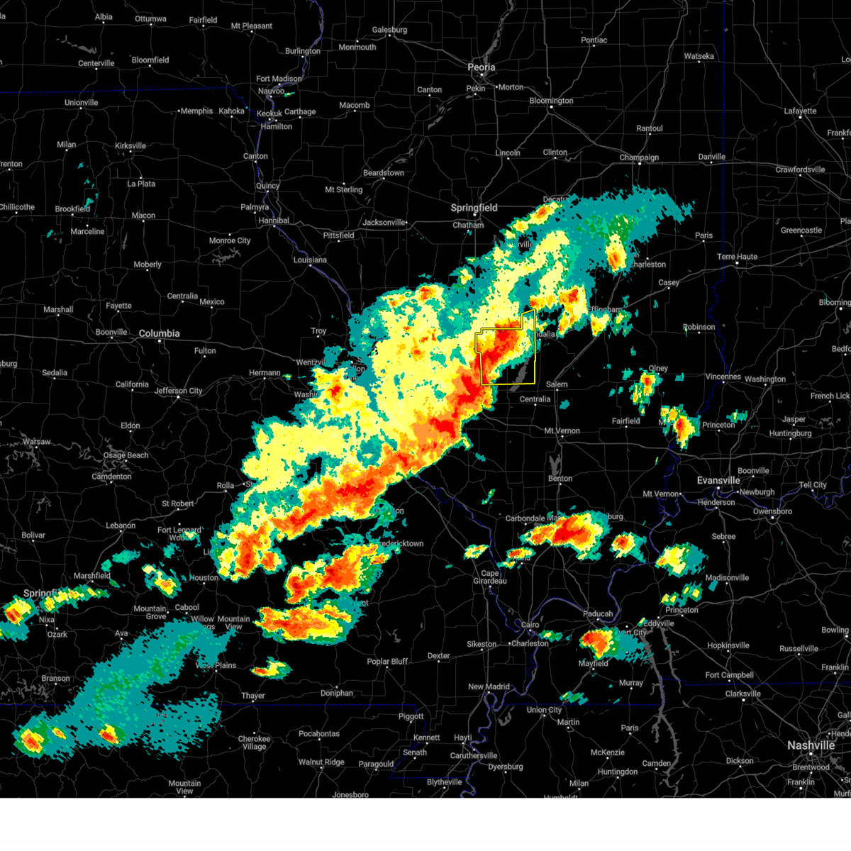
| 3/14/2025 11:25 PM CDT |
 Svrlsx the national weather service in st louis has issued a * severe thunderstorm warning for, fayette county in south central illinois, northern marion county in south central illinois, * until 1215 am cdt. * at 1125 pm cdt, severe thunderstorms were located along a line from 10 miles northwest of wrights corner to near carlyle, or along a line from 18 miles east of nokomis to near carlyle, moving northeast at 60 mph (trained spotters reported. at 11:15 pm golf ball sized hail was reported in vandalia, il). Hazards include 70 mph wind gusts and ping pong ball size hail. People and animals outdoors will be injured. expect hail damage to roofs, siding, windows, and vehicles. expect considerable tree damage. Wind damage is also likely to mobile homes, roofs, and outbuildings. Svrlsx the national weather service in st louis has issued a * severe thunderstorm warning for, fayette county in south central illinois, northern marion county in south central illinois, * until 1215 am cdt. * at 1125 pm cdt, severe thunderstorms were located along a line from 10 miles northwest of wrights corner to near carlyle, or along a line from 18 miles east of nokomis to near carlyle, moving northeast at 60 mph (trained spotters reported. at 11:15 pm golf ball sized hail was reported in vandalia, il). Hazards include 70 mph wind gusts and ping pong ball size hail. People and animals outdoors will be injured. expect hail damage to roofs, siding, windows, and vehicles. expect considerable tree damage. Wind damage is also likely to mobile homes, roofs, and outbuildings.
|
| 3/14/2025 11:22 PM CDT | Golf Ball sized hail reported 0.5 miles WNW of Vandalia, IL |
| 3/14/2025 11:17 PM CDT |
 the tornado warning has been cancelled and is no longer in effect the tornado warning has been cancelled and is no longer in effect
|
| 3/14/2025 11:17 PM CDT |
 At 1117 pm cdt, a severe thunderstorm capable of producing a tornado was located over shobonier, or 6 miles south of vandalia, moving northeast at 65 mph (radar indicated rotation). Hazards include tornado and half dollar size hail. Flying debris will be dangerous to those caught without shelter. mobile homes will be damaged or destroyed. damage to roofs, windows and vehicles will occur. tree damage is likely. this tornado will be near, pocahontas around 1055 pm cdt. beaver creek around 1100 pm cdt. other locations impacted by the tornado include pierron, dudleyville, pleasant mound, keyesport, smithboro, pittsburg, hagerstown, vernon, st. paul and avena. this includes the following highways, interstate 70 in illinois between exits 36 and 76. Interstate 57 in illinois near exit 135. At 1117 pm cdt, a severe thunderstorm capable of producing a tornado was located over shobonier, or 6 miles south of vandalia, moving northeast at 65 mph (radar indicated rotation). Hazards include tornado and half dollar size hail. Flying debris will be dangerous to those caught without shelter. mobile homes will be damaged or destroyed. damage to roofs, windows and vehicles will occur. tree damage is likely. this tornado will be near, pocahontas around 1055 pm cdt. beaver creek around 1100 pm cdt. other locations impacted by the tornado include pierron, dudleyville, pleasant mound, keyesport, smithboro, pittsburg, hagerstown, vernon, st. paul and avena. this includes the following highways, interstate 70 in illinois between exits 36 and 76. Interstate 57 in illinois near exit 135.
|
| 3/14/2025 10:55 PM CDT |
 Torlsx the national weather service in st louis has issued a * tornado warning for, bond county in south central illinois, northeastern clinton county in south central illinois, fayette county in south central illinois, northern marion county in south central illinois, * until 1130 pm cdt. * at 1055 pm cdt, a severe thunderstorm capable of producing a tornado was located near beaver creek, or 7 miles northwest of carlyle, moving northeast at 50 mph (radar indicated rotation). Hazards include tornado and golf ball size hail. Flying debris will be dangerous to those caught without shelter. mobile homes will be damaged or destroyed. damage to roofs, windows and vehicles will occur. tree damage is likely. this tornado will be near, jamestown around 1055 pm cdt. beaver creek around 1100 pm cdt. other locations impacted by the tornado include stolletown, dudleyville, keyesport, pleasant mound, smithboro, pittsburg, vernon, hagerstown and st. paul. this includes the following state parks, carlyle lake recreational area. this includes the following highways, interstate 70 in illinois between exits 36 and 76. Interstate 57 in illinois near exit 135. Torlsx the national weather service in st louis has issued a * tornado warning for, bond county in south central illinois, northeastern clinton county in south central illinois, fayette county in south central illinois, northern marion county in south central illinois, * until 1130 pm cdt. * at 1055 pm cdt, a severe thunderstorm capable of producing a tornado was located near beaver creek, or 7 miles northwest of carlyle, moving northeast at 50 mph (radar indicated rotation). Hazards include tornado and golf ball size hail. Flying debris will be dangerous to those caught without shelter. mobile homes will be damaged or destroyed. damage to roofs, windows and vehicles will occur. tree damage is likely. this tornado will be near, jamestown around 1055 pm cdt. beaver creek around 1100 pm cdt. other locations impacted by the tornado include stolletown, dudleyville, keyesport, pleasant mound, smithboro, pittsburg, vernon, hagerstown and st. paul. this includes the following state parks, carlyle lake recreational area. this includes the following highways, interstate 70 in illinois between exits 36 and 76. Interstate 57 in illinois near exit 135.
|
| 7/30/2024 4:47 PM CDT |
 the severe thunderstorm warning has been cancelled and is no longer in effect the severe thunderstorm warning has been cancelled and is no longer in effect
|
| 7/30/2024 4:47 PM CDT |
 At 447 pm cdt, severe thunderstorms were located along a line extending from effingham to near mulberry grove, moving southeast at 40 mph (radar indicated). Hazards include 60 mph wind gusts and quarter size hail. Hail damage to vehicles is expected. expect wind damage to roofs, siding, and trees. locations impacted include, vandalia, st. elmo, brownstown, mulberry grove, farina, wrights corner, shobonier, avena, la clede, pittsburg, shafter, st. peter, loogootee, st. james, st. paul, and hagerstown. this includes the following highways, interstate 70 in illinois between exits 61 and 76. Interstate 57 in illinois near exit 135. At 447 pm cdt, severe thunderstorms were located along a line extending from effingham to near mulberry grove, moving southeast at 40 mph (radar indicated). Hazards include 60 mph wind gusts and quarter size hail. Hail damage to vehicles is expected. expect wind damage to roofs, siding, and trees. locations impacted include, vandalia, st. elmo, brownstown, mulberry grove, farina, wrights corner, shobonier, avena, la clede, pittsburg, shafter, st. peter, loogootee, st. james, st. paul, and hagerstown. this includes the following highways, interstate 70 in illinois between exits 61 and 76. Interstate 57 in illinois near exit 135.
|
| 7/30/2024 4:38 PM CDT |
 At 437 pm cdt, severe thunderstorms were located along a line extending from near shumway to near woburn, moving east at 40 mph (radar indicated). Hazards include 60 mph wind gusts and quarter size hail. Hail damage to vehicles is expected. expect wind damage to roofs, siding, and trees. locations impacted include, vandalia, st. elmo and brownstown. this includes the following highways, interstate 70 in illinois between exits 45 and 76. Interstate 57 in illinois near exit 135. At 437 pm cdt, severe thunderstorms were located along a line extending from near shumway to near woburn, moving east at 40 mph (radar indicated). Hazards include 60 mph wind gusts and quarter size hail. Hail damage to vehicles is expected. expect wind damage to roofs, siding, and trees. locations impacted include, vandalia, st. elmo and brownstown. this includes the following highways, interstate 70 in illinois between exits 45 and 76. Interstate 57 in illinois near exit 135.
|
| 7/30/2024 4:38 PM CDT |
 the severe thunderstorm warning has been cancelled and is no longer in effect the severe thunderstorm warning has been cancelled and is no longer in effect
|
| 7/30/2024 4:20 PM CDT | Svrlsx the national weather service in st louis has issued a * severe thunderstorm warning for, eastern bond county in south central illinois, fayette county in south central illinois, southern montgomery county in south central illinois, * until 515 pm cdt. * at 419 pm cdt, severe thunderstorms were located along a line extending from near cowden to near reno, moving southeast at 40 mph (radar indicated). Hazards include 60 mph wind gusts and quarter size hail. Hail damage to vehicles is expected. expect wind damage to roofs, siding, and trees. severe thunderstorms will be near, vandalia, van burensburg, wrights corner, and woburn around 425 pm cdt. mulberry grove around 430 pm cdt. greenville, st. elmo, and brownstown around 435 pm cdt. other locations in the path of these severe thunderstorms include shobonier and farina. this includes the following highways, interstate 70 in illinois between exits 45 and 76. interstate 57 in illinois near exit 135. This also includes ramsey lake state park. |
| 7/29/2024 8:32 PM CDT |
 At 832 pm cdt, a severe thunderstorm was located near mulberry grove, moving south at 35 mph (radar indicated). Hazards include ping pong ball size hail and 60 mph wind gusts. People and animals outdoors will be injured. expect hail damage to roofs, siding, windows, and vehicles. expect wind damage to roofs, siding, and trees. locations impacted include, vandalia, mulberry grove, tamalco, shobonier, pleasant mound, pittsburg, shafter, keyesport, st. paul, and hagerstown. This includes interstate 70 in illinois between exits 52 and 68. At 832 pm cdt, a severe thunderstorm was located near mulberry grove, moving south at 35 mph (radar indicated). Hazards include ping pong ball size hail and 60 mph wind gusts. People and animals outdoors will be injured. expect hail damage to roofs, siding, windows, and vehicles. expect wind damage to roofs, siding, and trees. locations impacted include, vandalia, mulberry grove, tamalco, shobonier, pleasant mound, pittsburg, shafter, keyesport, st. paul, and hagerstown. This includes interstate 70 in illinois between exits 52 and 68.
|
| 7/29/2024 8:15 PM CDT |
 At 815 pm cdt, a severe thunderstorm was located near van burensburg, moving southeast at 30 mph (radar indicated). Hazards include golf ball size hail and 60 mph wind gusts. People and animals outdoors will be injured. expect hail damage to roofs, siding, windows, and vehicles. expect wind damage to roofs, siding, and trees. locations impacted include, vandalia, ramsey, mulberry grove, tamalco, shobonier, pleasant mound, pittsburg, shafter, keyesport, st. paul, and hagerstown. This includes interstate 70 in illinois between exits 52 and 68. At 815 pm cdt, a severe thunderstorm was located near van burensburg, moving southeast at 30 mph (radar indicated). Hazards include golf ball size hail and 60 mph wind gusts. People and animals outdoors will be injured. expect hail damage to roofs, siding, windows, and vehicles. expect wind damage to roofs, siding, and trees. locations impacted include, vandalia, ramsey, mulberry grove, tamalco, shobonier, pleasant mound, pittsburg, shafter, keyesport, st. paul, and hagerstown. This includes interstate 70 in illinois between exits 52 and 68.
|
| 7/29/2024 8:09 PM CDT |
 Svrlsx the national weather service in st louis has issued a * severe thunderstorm warning for, eastern bond county in south central illinois, western fayette county in south central illinois, * until 900 pm cdt. * at 809 pm cdt, a severe thunderstorm was located over van burensburg, moving southeast at 30 mph (radar indicated). Hazards include 60 mph wind gusts and half dollar size hail. Hail damage to vehicles is expected. Expect wind damage to roofs, siding, and trees. Svrlsx the national weather service in st louis has issued a * severe thunderstorm warning for, eastern bond county in south central illinois, western fayette county in south central illinois, * until 900 pm cdt. * at 809 pm cdt, a severe thunderstorm was located over van burensburg, moving southeast at 30 mph (radar indicated). Hazards include 60 mph wind gusts and half dollar size hail. Hail damage to vehicles is expected. Expect wind damage to roofs, siding, and trees.
|
| 5/26/2024 6:46 PM CDT |
 the severe thunderstorm warning has been cancelled and is no longer in effect the severe thunderstorm warning has been cancelled and is no longer in effect
|
| 5/26/2024 6:46 PM CDT |
 At 646 pm cdt, a severe thunderstorm was located near vandalia, moving east at 40 mph (radar indicated). Hazards include 60 mph wind gusts and quarter size hail. Hail damage to vehicles is expected. expect wind damage to roofs, siding, and trees. this severe thunderstorm will remain over mainly rural areas of northern clinton, bond and western fayette counties, including the following locations, shafter, pittsburg, pierron, dudleyville, old ripley, stolletown, bayle city, bingham, smithboro, and pleasant mound. this also includes carlyle lake recreational area. This includes interstate 70 in illinois between exits 36 and 52. At 646 pm cdt, a severe thunderstorm was located near vandalia, moving east at 40 mph (radar indicated). Hazards include 60 mph wind gusts and quarter size hail. Hail damage to vehicles is expected. expect wind damage to roofs, siding, and trees. this severe thunderstorm will remain over mainly rural areas of northern clinton, bond and western fayette counties, including the following locations, shafter, pittsburg, pierron, dudleyville, old ripley, stolletown, bayle city, bingham, smithboro, and pleasant mound. this also includes carlyle lake recreational area. This includes interstate 70 in illinois between exits 36 and 52.
|
| 5/26/2024 6:16 PM CDT |
 Svrlsx the national weather service in st louis has issued a * severe thunderstorm warning for, northern clinton county in south central illinois, bond county in south central illinois, eastern madison county in southwestern illinois, western fayette county in south central illinois, * until 715 pm cdt. * at 616 pm cdt, a severe thunderstorm was located over pocahontas, moving east at 40 mph (radar indicated). Hazards include 60 mph wind gusts and quarter size hail. Hail damage to vehicles is expected. expect wind damage to roofs, siding, and trees. this severe thunderstorm will be near, greenville around 620 pm cdt. mulberry grove around 630 pm cdt. this includes the following highways, interstate 70 in illinois between exits 24 and 52. interstate 55 in illinois between exits 30 and 37. This also includes carlyle lake recreational area. Svrlsx the national weather service in st louis has issued a * severe thunderstorm warning for, northern clinton county in south central illinois, bond county in south central illinois, eastern madison county in southwestern illinois, western fayette county in south central illinois, * until 715 pm cdt. * at 616 pm cdt, a severe thunderstorm was located over pocahontas, moving east at 40 mph (radar indicated). Hazards include 60 mph wind gusts and quarter size hail. Hail damage to vehicles is expected. expect wind damage to roofs, siding, and trees. this severe thunderstorm will be near, greenville around 620 pm cdt. mulberry grove around 630 pm cdt. this includes the following highways, interstate 70 in illinois between exits 24 and 52. interstate 55 in illinois between exits 30 and 37. This also includes carlyle lake recreational area.
|
| 5/4/2024 6:22 PM CDT |
 The storms which prompted the warning have weakened below severe limits, and no longer pose an immediate threat to life or property. therefore, the warning will be allowed to expire. The storms which prompted the warning have weakened below severe limits, and no longer pose an immediate threat to life or property. therefore, the warning will be allowed to expire.
|
| 5/4/2024 6:16 PM CDT |
 At 616 pm cdt, severe thunderstorms were located along a line extending from near woburn to near beaver creek, moving east at 20 mph (radar indicated). Hazards include 60 mph wind gusts and penny size hail. Expect damage to roofs, siding, and trees. these severe storms will be near, greenville, mulberry grove, tamalco, and woburn around 620 pm cdt. This includes interstate 70 in illinois between exits 41 and 52. At 616 pm cdt, severe thunderstorms were located along a line extending from near woburn to near beaver creek, moving east at 20 mph (radar indicated). Hazards include 60 mph wind gusts and penny size hail. Expect damage to roofs, siding, and trees. these severe storms will be near, greenville, mulberry grove, tamalco, and woburn around 620 pm cdt. This includes interstate 70 in illinois between exits 41 and 52.
|
| 5/4/2024 6:00 PM CDT |
 Svrlsx the national weather service in st louis has issued a * severe thunderstorm warning for, bond county in south central illinois, southwestern fayette county in south central illinois, * until 630 pm cdt. * at 559 pm cdt, severe thunderstorms were located along a line extending from near reno to near jamestown, moving east at 20 mph (radar indicated). Hazards include 60 mph wind gusts and penny size hail. expect damage to roofs, siding, and trees Svrlsx the national weather service in st louis has issued a * severe thunderstorm warning for, bond county in south central illinois, southwestern fayette county in south central illinois, * until 630 pm cdt. * at 559 pm cdt, severe thunderstorms were located along a line extending from near reno to near jamestown, moving east at 20 mph (radar indicated). Hazards include 60 mph wind gusts and penny size hail. expect damage to roofs, siding, and trees
|
| 4/18/2024 6:41 PM CDT |
 Torlsx the national weather service in st louis has issued a * tornado warning for, fayette county in south central illinois, * until 730 pm cdt. * at 641 pm cdt, severe thunderstorms capable of producing a tornado were located along a line extending from near coffeen to near woburn to greenville to jamestown, moving east at 45 mph (radar indicated rotation). Hazards include tornado. Flying debris will be dangerous to those caught without shelter. mobile homes will be damaged or destroyed. damage to roofs, windows, and vehicles will occur. tree damage is likely. these dangerous storms will be near, vandalia around 655 pm cdt. ramsey and shobonier around 700 pm cdt. other locations in the path of these tornadic storms include brownstown, herrick, st. elmo and wrights corner. this also includes ramsey lake state park. this includes the following highways, interstate 70 in illinois between exits 61 and 76. Interstate 57 in illinois near exit 135. Torlsx the national weather service in st louis has issued a * tornado warning for, fayette county in south central illinois, * until 730 pm cdt. * at 641 pm cdt, severe thunderstorms capable of producing a tornado were located along a line extending from near coffeen to near woburn to greenville to jamestown, moving east at 45 mph (radar indicated rotation). Hazards include tornado. Flying debris will be dangerous to those caught without shelter. mobile homes will be damaged or destroyed. damage to roofs, windows, and vehicles will occur. tree damage is likely. these dangerous storms will be near, vandalia around 655 pm cdt. ramsey and shobonier around 700 pm cdt. other locations in the path of these tornadic storms include brownstown, herrick, st. elmo and wrights corner. this also includes ramsey lake state park. this includes the following highways, interstate 70 in illinois between exits 61 and 76. Interstate 57 in illinois near exit 135.
|
| 3/14/2024 5:46 PM CDT |
 At 545 pm cdt, a severe thunderstorm was located near ramsey, moving northeast at 50 mph (at 540 pm, trained weather spotters reported golf ball sized hail in coffeen, il). Hazards include golf ball size hail and 60 mph wind gusts. People and animals outdoors will be injured. expect hail damage to roofs, siding, windows, and vehicles. expect wind damage to roofs, siding, and trees. locations impacted include, vandalia, greenville, hillsboro, st. elmo, ramsey, pocahontas, brownstown, taylor springs, coffeen, mulberry grove, tamalco, sorento, beaver creek, shobonier, woburn, van burensburg, reno, avena, pleasant mound, and pierron. this also includes ramsey lake state park. This includes interstate 70 in illinois between exits 36 and 76. At 545 pm cdt, a severe thunderstorm was located near ramsey, moving northeast at 50 mph (at 540 pm, trained weather spotters reported golf ball sized hail in coffeen, il). Hazards include golf ball size hail and 60 mph wind gusts. People and animals outdoors will be injured. expect hail damage to roofs, siding, windows, and vehicles. expect wind damage to roofs, siding, and trees. locations impacted include, vandalia, greenville, hillsboro, st. elmo, ramsey, pocahontas, brownstown, taylor springs, coffeen, mulberry grove, tamalco, sorento, beaver creek, shobonier, woburn, van burensburg, reno, avena, pleasant mound, and pierron. this also includes ramsey lake state park. This includes interstate 70 in illinois between exits 36 and 76.
|
| 3/14/2024 5:07 PM CDT |
 Svrlsx the national weather service in st louis has issued a * severe thunderstorm warning for, bond county in south central illinois, fayette county in south central illinois, southern montgomery county in south central illinois, * until 600 pm cdt. * at 506 pm cdt, a severe thunderstorm was located over pocahontas, moving northeast at 50 mph (at 455 pm, trained weather spotters reported up to golf ball sized hail in edwardsville, il/). Hazards include golf ball size hail and 60 mph wind gusts. People and animals outdoors will be injured. expect hail damage to roofs, siding, windows, and vehicles. Expect wind damage to roofs, siding, and trees. Svrlsx the national weather service in st louis has issued a * severe thunderstorm warning for, bond county in south central illinois, fayette county in south central illinois, southern montgomery county in south central illinois, * until 600 pm cdt. * at 506 pm cdt, a severe thunderstorm was located over pocahontas, moving northeast at 50 mph (at 455 pm, trained weather spotters reported up to golf ball sized hail in edwardsville, il/). Hazards include golf ball size hail and 60 mph wind gusts. People and animals outdoors will be injured. expect hail damage to roofs, siding, windows, and vehicles. Expect wind damage to roofs, siding, and trees.
|
| 3/14/2024 8:56 AM CDT |
 The storms which prompted the warning have weakened below severe limits, and have exited the warned area. therefore, the warning will be allowed to expire. a severe thunderstorm watch remains in effect until noon cdt for south central and southwestern illinois. The storms which prompted the warning have weakened below severe limits, and have exited the warned area. therefore, the warning will be allowed to expire. a severe thunderstorm watch remains in effect until noon cdt for south central and southwestern illinois.
|
| 3/14/2024 8:44 AM CDT |
 the severe thunderstorm warning has been cancelled and is no longer in effect the severe thunderstorm warning has been cancelled and is no longer in effect
|
| 3/14/2024 8:44 AM CDT |
 At 844 am cdt, severe thunderstorms were located along a line extending from near coffeen to near trenton, moving northeast at 50 mph (radar indicated). Hazards include 60 mph wind gusts. Expect damage to roofs, siding, and trees. locations impacted include, vandalia, greenville, breese, carlyle, aviston, st. rose, beckemeyer, pocahontas, mulberry grove, tamalco, beaver creek, woburn, boulder, shattuc, jamestown, pleasant mound, pierron, pittsburg, shafter, and keyesport. this also includes carlyle lake recreational area. This includes interstate 70 in illinois between exits 41 and 61. At 844 am cdt, severe thunderstorms were located along a line extending from near coffeen to near trenton, moving northeast at 50 mph (radar indicated). Hazards include 60 mph wind gusts. Expect damage to roofs, siding, and trees. locations impacted include, vandalia, greenville, breese, carlyle, aviston, st. rose, beckemeyer, pocahontas, mulberry grove, tamalco, beaver creek, woburn, boulder, shattuc, jamestown, pleasant mound, pierron, pittsburg, shafter, and keyesport. this also includes carlyle lake recreational area. This includes interstate 70 in illinois between exits 41 and 61.
|
| 3/14/2024 8:19 AM CDT |
 Svrlsx the national weather service in st louis has issued a * severe thunderstorm warning for, clinton county in south central illinois, bond county in south central illinois, eastern madison county in southwestern illinois, southwestern fayette county in south central illinois, northeastern st. clair county in southwestern illinois, * until 900 am cdt. * at 818 am cdt, severe thunderstorms were located along a line extending from livingston to belleville, moving northeast at 50 mph (radar indicated). Hazards include 60 mph wind gusts. expect damage to roofs, siding, and trees Svrlsx the national weather service in st louis has issued a * severe thunderstorm warning for, clinton county in south central illinois, bond county in south central illinois, eastern madison county in southwestern illinois, southwestern fayette county in south central illinois, northeastern st. clair county in southwestern illinois, * until 900 am cdt. * at 818 am cdt, severe thunderstorms were located along a line extending from livingston to belleville, moving northeast at 50 mph (radar indicated). Hazards include 60 mph wind gusts. expect damage to roofs, siding, and trees
|
| 8/6/2023 8:54 PM CDT |
 At 853 pm cdt, a severe thunderstorm was located near shobonier, moving east at 35 mph (radar indicated). Hazards include 60 mph wind gusts and quarter size hail. Hail damage to vehicles is expected. Expect wind damage to roofs, siding, and trees. At 853 pm cdt, a severe thunderstorm was located near shobonier, moving east at 35 mph (radar indicated). Hazards include 60 mph wind gusts and quarter size hail. Hail damage to vehicles is expected. Expect wind damage to roofs, siding, and trees.
|
| 8/6/2023 6:51 PM CDT |
 At 651 pm cdt, a severe thunderstorm was located near brownstown, moving east at 35 mph (radar indicated). Hazards include 60 mph wind gusts and half dollar size hail. Hail damage to vehicles is expected. Expect wind damage to roofs, siding, and trees. At 651 pm cdt, a severe thunderstorm was located near brownstown, moving east at 35 mph (radar indicated). Hazards include 60 mph wind gusts and half dollar size hail. Hail damage to vehicles is expected. Expect wind damage to roofs, siding, and trees.
|
| 8/6/2023 6:32 PM CDT |
 At 631 pm cdt, a severe thunderstorm was located near vandalia, moving east at 25 mph (radar indicated). Hazards include 60 mph wind gusts and quarter size hail. Hail damage to vehicles is expected. expect wind damage to roofs, siding, and trees. locations impacted include, shafter and hagerstown. this includes interstate 70 in illinois near exit 61. hail threat, radar indicated max hail size, 1. 00 in wind threat, radar indicated max wind gust, 60 mph. At 631 pm cdt, a severe thunderstorm was located near vandalia, moving east at 25 mph (radar indicated). Hazards include 60 mph wind gusts and quarter size hail. Hail damage to vehicles is expected. expect wind damage to roofs, siding, and trees. locations impacted include, shafter and hagerstown. this includes interstate 70 in illinois near exit 61. hail threat, radar indicated max hail size, 1. 00 in wind threat, radar indicated max wind gust, 60 mph.
|
| 8/6/2023 6:12 PM CDT |
 At 612 pm cdt, a severe thunderstorm was located over woburn, moving east at 25 mph (radar indicated). Hazards include 60 mph wind gusts and quarter size hail. Hail damage to vehicles is expected. Expect wind damage to roofs, siding, and trees. At 612 pm cdt, a severe thunderstorm was located over woburn, moving east at 25 mph (radar indicated). Hazards include 60 mph wind gusts and quarter size hail. Hail damage to vehicles is expected. Expect wind damage to roofs, siding, and trees.
|
| 7/29/2023 5:50 PM CDT | Large tree fell on a power lin in fayette county IL, 5.1 miles NNW of Vandalia, IL |
| 7/29/2023 5:43 PM CDT |
 At 542 pm cdt, severe thunderstorms were located along a line extending from 6 miles northwest of vandalia to near fairman to rend lake area, moving east at 25 mph (radar indicated). Hazards include 60 mph wind gusts. Expect damage to roofs, siding, and trees. severe thunderstorms will be near, salem and vandalia around 550 pm cdt. brownstown around 555 pm cdt. this includes the following highways, interstate 70 in illinois between exits 61 and 68. interstate 57 in illinois between exits 109 and 135. hail threat, radar indicated max hail size, <. 75 in wind threat, radar indicated max wind gust, 60 mph. At 542 pm cdt, severe thunderstorms were located along a line extending from 6 miles northwest of vandalia to near fairman to rend lake area, moving east at 25 mph (radar indicated). Hazards include 60 mph wind gusts. Expect damage to roofs, siding, and trees. severe thunderstorms will be near, salem and vandalia around 550 pm cdt. brownstown around 555 pm cdt. this includes the following highways, interstate 70 in illinois between exits 61 and 68. interstate 57 in illinois between exits 109 and 135. hail threat, radar indicated max hail size, <. 75 in wind threat, radar indicated max wind gust, 60 mph.
|
| 7/29/2023 5:25 PM CDT |
 At 524 pm cdt, severe thunderstorms were located along a line extending from near mulberry grove to wamac to near du quoin, moving east at 40 mph (radar indicated). Hazards include 70 mph wind gusts and quarter size hail. Hail damage to vehicles is expected. expect considerable tree damage. wind damage is also likely to mobile homes, roofs, and outbuildings. these severe storms will be near, centralia, salem, vandalia, centralia, sandoval, wamac, central city, odin, irvington, and patoka around 530 pm cdt. other locations in the path of these severe thunderstorms include kinmundy, farina, omega, stephen forbes station and helm. this also includes carlyle lake recreational area. this includes the following highways, interstate 70 in illinois between exits 36 and 68. interstate 57 in illinois between exits 109 and 135. interstate 64 in illinois between exits 41 and 61. thunderstorm damage threat, considerable hail threat, radar indicated max hail size, 1. 00 in wind threat, radar indicated max wind gust, 70 mph. At 524 pm cdt, severe thunderstorms were located along a line extending from near mulberry grove to wamac to near du quoin, moving east at 40 mph (radar indicated). Hazards include 70 mph wind gusts and quarter size hail. Hail damage to vehicles is expected. expect considerable tree damage. wind damage is also likely to mobile homes, roofs, and outbuildings. these severe storms will be near, centralia, salem, vandalia, centralia, sandoval, wamac, central city, odin, irvington, and patoka around 530 pm cdt. other locations in the path of these severe thunderstorms include kinmundy, farina, omega, stephen forbes station and helm. this also includes carlyle lake recreational area. this includes the following highways, interstate 70 in illinois between exits 36 and 68. interstate 57 in illinois between exits 109 and 135. interstate 64 in illinois between exits 41 and 61. thunderstorm damage threat, considerable hail threat, radar indicated max hail size, 1. 00 in wind threat, radar indicated max wind gust, 70 mph.
|
| 7/29/2023 5:18 PM CDT |
 At 517 pm cdt, severe thunderstorms were located along a line extending from near mulberry grove to near wamac to near pinckneyville, moving east at 40 mph (radar indicated). Hazards include 70 mph wind gusts and quarter size hail. Hail damage to vehicles is expected. expect considerable tree damage. wind damage is also likely to mobile homes, roofs, and outbuildings. locations impacted include, centralia, centralia, sandoval, wamac, central city, irvington, mulberry grove, ashley, shattuc, boulder, odin, patoka, fairman, salem, vandalia, shobonier, kinmundy, farina, omega, stephen forbes station and helm. this also includes carlyle lake recreational area. this includes the following highways, interstate 70 in illinois between exits 24 and 68. interstate 55 in illinois near exit 37. interstate 57 in illinois between exits 109 and 135. interstate 64 in illinois between exits 34 and 61. thunderstorm damage threat, considerable hail threat, radar indicated max hail size, 1. 00 in wind threat, radar indicated max wind gust, 70 mph. At 517 pm cdt, severe thunderstorms were located along a line extending from near mulberry grove to near wamac to near pinckneyville, moving east at 40 mph (radar indicated). Hazards include 70 mph wind gusts and quarter size hail. Hail damage to vehicles is expected. expect considerable tree damage. wind damage is also likely to mobile homes, roofs, and outbuildings. locations impacted include, centralia, centralia, sandoval, wamac, central city, irvington, mulberry grove, ashley, shattuc, boulder, odin, patoka, fairman, salem, vandalia, shobonier, kinmundy, farina, omega, stephen forbes station and helm. this also includes carlyle lake recreational area. this includes the following highways, interstate 70 in illinois between exits 24 and 68. interstate 55 in illinois near exit 37. interstate 57 in illinois between exits 109 and 135. interstate 64 in illinois between exits 34 and 61. thunderstorm damage threat, considerable hail threat, radar indicated max hail size, 1. 00 in wind threat, radar indicated max wind gust, 70 mph.
|
| 7/29/2023 4:47 PM CDT |
 At 447 pm cdt, severe thunderstorms were located along a line extending from near alhambra to albers to near bremen, moving east at 40 mph (radar indicated). Hazards include 70 mph wind gusts and quarter size hail. Hail damage to vehicles is expected. expect considerable tree damage. wind damage is also likely to mobile homes, roofs, and outbuildings. severe thunderstorms will be near, breese, sparta, steeleville, aviston, okawville, st. rose, germantown, percy, coulterville, and tilden around 450 pm cdt. beckemeyer around 455 pm cdt. greenville, carlyle, nashville, beaver creek, and reno around 500 pm cdt. other locations in the path of these severe thunderstorms include tamalco, centralia, wamac, irvington, mulberry grove, shattuc, boulder, centralia, sandoval, central city, ashley, odin, patoka, fairman, salem and shobonier. this includes the following highways, interstate 70 in illinois between exits 24 and 68. interstate 55 in illinois near exit 37. interstate 57 in illinois between exits 109 and 135. interstate 64 in illinois between exits 34 and 61. interstate 55 in missouri between exits 141 and 154. this also includes hawn state park, felix valle house state park, and carlyle lake recreational area. thunderstorm damage threat, considerable hail threat, radar indicated max hail size, 1. 00 in wind threat, radar indicated max wind gust, 70 mph. At 447 pm cdt, severe thunderstorms were located along a line extending from near alhambra to albers to near bremen, moving east at 40 mph (radar indicated). Hazards include 70 mph wind gusts and quarter size hail. Hail damage to vehicles is expected. expect considerable tree damage. wind damage is also likely to mobile homes, roofs, and outbuildings. severe thunderstorms will be near, breese, sparta, steeleville, aviston, okawville, st. rose, germantown, percy, coulterville, and tilden around 450 pm cdt. beckemeyer around 455 pm cdt. greenville, carlyle, nashville, beaver creek, and reno around 500 pm cdt. other locations in the path of these severe thunderstorms include tamalco, centralia, wamac, irvington, mulberry grove, shattuc, boulder, centralia, sandoval, central city, ashley, odin, patoka, fairman, salem and shobonier. this includes the following highways, interstate 70 in illinois between exits 24 and 68. interstate 55 in illinois near exit 37. interstate 57 in illinois between exits 109 and 135. interstate 64 in illinois between exits 34 and 61. interstate 55 in missouri between exits 141 and 154. this also includes hawn state park, felix valle house state park, and carlyle lake recreational area. thunderstorm damage threat, considerable hail threat, radar indicated max hail size, 1. 00 in wind threat, radar indicated max wind gust, 70 mph.
|
| 7/16/2023 5:29 PM CDT |
 At 529 pm cdt, a severe thunderstorm was located near vandalia, moving east at 35 mph (radar indicated). Hazards include 60 mph wind gusts. Expect damage to roofs, siding, and trees. locations impacted include, vandalia, mulberry grove, shafter, and hagerstown. this includes interstate 70 in illinois between exits 61 and 63. hail threat, radar indicated max hail size, <. 75 in wind threat, radar indicated max wind gust, 60 mph. At 529 pm cdt, a severe thunderstorm was located near vandalia, moving east at 35 mph (radar indicated). Hazards include 60 mph wind gusts. Expect damage to roofs, siding, and trees. locations impacted include, vandalia, mulberry grove, shafter, and hagerstown. this includes interstate 70 in illinois between exits 61 and 63. hail threat, radar indicated max hail size, <. 75 in wind threat, radar indicated max wind gust, 60 mph.
|
| 7/16/2023 5:24 PM CDT |
 At 524 pm cdt, a severe thunderstorm was located near mulberry grove, moving east at 40 mph (radar indicated). Hazards include 60 mph wind gusts and nickel size hail. Expect damage to roofs, siding, and trees. locations impacted include, vandalia, mulberry grove, shobonier, woburn, pittsburg, shafter, and hagerstown. this includes interstate 70 in illinois between exits 52 and 63. hail threat, radar indicated max hail size, 0. 88 in wind threat, radar indicated max wind gust, 60 mph. At 524 pm cdt, a severe thunderstorm was located near mulberry grove, moving east at 40 mph (radar indicated). Hazards include 60 mph wind gusts and nickel size hail. Expect damage to roofs, siding, and trees. locations impacted include, vandalia, mulberry grove, shobonier, woburn, pittsburg, shafter, and hagerstown. this includes interstate 70 in illinois between exits 52 and 63. hail threat, radar indicated max hail size, 0. 88 in wind threat, radar indicated max wind gust, 60 mph.
|
| 7/16/2023 5:08 PM CDT |
 At 508 pm cdt, a severe thunderstorm was located near reno, moving east at 35 mph (radar indicated). Hazards include 60 mph wind gusts and half dollar size hail. Hail damage to vehicles is expected. Expect wind damage to roofs, siding, and trees. At 508 pm cdt, a severe thunderstorm was located near reno, moving east at 35 mph (radar indicated). Hazards include 60 mph wind gusts and half dollar size hail. Hail damage to vehicles is expected. Expect wind damage to roofs, siding, and trees.
|
| 6/29/2023 1:31 PM CDT |
 At 131 pm cdt, severe thunderstorms were located along a line extending from near effingham to 6 miles northwest of farina to near tamalco, moving east at 55 mph (radar indicated). Hazards include 70 mph wind gusts and quarter size hail. Hail damage to vehicles is expected. expect considerable tree damage. wind damage is also likely to mobile homes, roofs, and outbuildings. locations impacted include, salem, vandalia, st. elmo, kinmundy, brownstown, mulberry grove, patoka, farina, omega, stephen forbes station, shobonier, avena, tonti, la clede, pittsburg, iuka, st. peter, alma, vernon, and loogootee. this includes the following highways, interstate 70 in illinois between exits 61 and 76. Interstate 57 in illinois between exits 127 and 135. At 131 pm cdt, severe thunderstorms were located along a line extending from near effingham to 6 miles northwest of farina to near tamalco, moving east at 55 mph (radar indicated). Hazards include 70 mph wind gusts and quarter size hail. Hail damage to vehicles is expected. expect considerable tree damage. wind damage is also likely to mobile homes, roofs, and outbuildings. locations impacted include, salem, vandalia, st. elmo, kinmundy, brownstown, mulberry grove, patoka, farina, omega, stephen forbes station, shobonier, avena, tonti, la clede, pittsburg, iuka, st. peter, alma, vernon, and loogootee. this includes the following highways, interstate 70 in illinois between exits 61 and 76. Interstate 57 in illinois between exits 127 and 135.
|
| 6/29/2023 1:15 PM CDT |
 At 114 pm cdt, severe thunderstorms were located along a line extending from near stewardson to near brownstown to near beaver creek, moving east at 60 mph (radar indicated). Hazards include 70 mph wind gusts and quarter size hail. Hail damage to vehicles is expected. expect considerable tree damage. wind damage is also likely to mobile homes, roofs, and outbuildings. locations impacted include, st. elmo, brownstown, tamalco, shobonier, patoka, farina, kinmundy, omega and stephen forbes station. this also includes ramsey lake state park. this includes the following highways, interstate 70 in illinois between exits 41 and 76. Interstate 57 in illinois between exits 127 and 135. At 114 pm cdt, severe thunderstorms were located along a line extending from near stewardson to near brownstown to near beaver creek, moving east at 60 mph (radar indicated). Hazards include 70 mph wind gusts and quarter size hail. Hail damage to vehicles is expected. expect considerable tree damage. wind damage is also likely to mobile homes, roofs, and outbuildings. locations impacted include, st. elmo, brownstown, tamalco, shobonier, patoka, farina, kinmundy, omega and stephen forbes station. this also includes ramsey lake state park. this includes the following highways, interstate 70 in illinois between exits 41 and 76. Interstate 57 in illinois between exits 127 and 135.
|
| 6/29/2023 12:53 PM CDT |
 At 1252 pm cdt, severe thunderstorms were located along a line extending from pana to coffeen to alhambra, moving east at 60 mph (at 1241 pm, broadcast media reported estimated wind gusts of 60 mph in litchfield, illinois). Hazards include 60 mph wind gusts and quarter size hail. Hail damage to vehicles is expected. expect wind damage to roofs, siding, and trees. severe thunderstorms will be near, van burensburg around 1255 pm cdt. greenville, ramsey, and woburn around 100 pm cdt. vandalia and mulberry grove around 105 pm cdt. wrights corner around 110 pm cdt. other locations in the path of these severe thunderstorms include st. elmo, brownstown, tamalco, shobonier, patoka, kinmundy, farina and salem. this includes the following highways, interstate 70 in illinois between exits 41 and 76. interstate 57 in illinois between exits 127 and 135. This also includes ramsey lake state park. At 1252 pm cdt, severe thunderstorms were located along a line extending from pana to coffeen to alhambra, moving east at 60 mph (at 1241 pm, broadcast media reported estimated wind gusts of 60 mph in litchfield, illinois). Hazards include 60 mph wind gusts and quarter size hail. Hail damage to vehicles is expected. expect wind damage to roofs, siding, and trees. severe thunderstorms will be near, van burensburg around 1255 pm cdt. greenville, ramsey, and woburn around 100 pm cdt. vandalia and mulberry grove around 105 pm cdt. wrights corner around 110 pm cdt. other locations in the path of these severe thunderstorms include st. elmo, brownstown, tamalco, shobonier, patoka, kinmundy, farina and salem. this includes the following highways, interstate 70 in illinois between exits 41 and 76. interstate 57 in illinois between exits 127 and 135. This also includes ramsey lake state park.
|
| 5/14/2023 6:54 PM CDT |
 At 654 pm cdt, a severe thunderstorm was located over vandalia, moving southeast at 20 mph (radar indicated). Hazards include 60 mph wind gusts and quarter size hail. Hail damage to vehicles is expected. expect wind damage to roofs, siding, and trees. locations impacted include, vandalia and hagerstown. this includes interstate 70 in illinois between exits 61 and 68. hail threat, radar indicated max hail size, 1. 00 in wind threat, radar indicated max wind gust, 60 mph. At 654 pm cdt, a severe thunderstorm was located over vandalia, moving southeast at 20 mph (radar indicated). Hazards include 60 mph wind gusts and quarter size hail. Hail damage to vehicles is expected. expect wind damage to roofs, siding, and trees. locations impacted include, vandalia and hagerstown. this includes interstate 70 in illinois between exits 61 and 68. hail threat, radar indicated max hail size, 1. 00 in wind threat, radar indicated max wind gust, 60 mph.
|
| 5/14/2023 6:36 PM CDT |
 At 636 pm cdt, a severe thunderstorm was located over vandalia, moving southeast at 15 mph (radar indicated). Hazards include ping pong ball size hail and 60 mph wind gusts. People and animals outdoors will be injured. expect hail damage to roofs, siding, windows, and vehicles. expect wind damage to roofs, siding, and trees. locations impacted include, vandalia, brownstown, and shafter. this includes interstate 70 in illinois between exits 61 and 68. hail threat, radar indicated max hail size, 1. 50 in wind threat, radar indicated max wind gust, 60 mph. At 636 pm cdt, a severe thunderstorm was located over vandalia, moving southeast at 15 mph (radar indicated). Hazards include ping pong ball size hail and 60 mph wind gusts. People and animals outdoors will be injured. expect hail damage to roofs, siding, windows, and vehicles. expect wind damage to roofs, siding, and trees. locations impacted include, vandalia, brownstown, and shafter. this includes interstate 70 in illinois between exits 61 and 68. hail threat, radar indicated max hail size, 1. 50 in wind threat, radar indicated max wind gust, 60 mph.
|
| 5/14/2023 6:23 PM CDT |
 At 623 pm cdt, a severe thunderstorm was located 5 miles northwest of vandalia, moving southeast at 15 mph (radar indicated). Hazards include 60 mph wind gusts and quarter size hail. Hail damage to vehicles is expected. Expect wind damage to roofs, siding, and trees. At 623 pm cdt, a severe thunderstorm was located 5 miles northwest of vandalia, moving southeast at 15 mph (radar indicated). Hazards include 60 mph wind gusts and quarter size hail. Hail damage to vehicles is expected. Expect wind damage to roofs, siding, and trees.
|
| 4/15/2023 8:39 PM CDT |
 The severe thunderstorm warning for northern fayette county will expire at 845 pm cdt, the storm which prompted the warning has weakened below severe limits, and no longer poses an immediate threat to life or property. therefore, the warning will be allowed to expire. however, gusty winds are still possible with this thunderstorm. a tornado watch remains in effect until 1000 pm cdt for south central illinois. The severe thunderstorm warning for northern fayette county will expire at 845 pm cdt, the storm which prompted the warning has weakened below severe limits, and no longer poses an immediate threat to life or property. therefore, the warning will be allowed to expire. however, gusty winds are still possible with this thunderstorm. a tornado watch remains in effect until 1000 pm cdt for south central illinois.
|
| 4/15/2023 8:21 PM CDT |
 At 821 pm cdt, a severe thunderstorm was located near ramsey, moving northeast at 55 mph (radar indicated). Hazards include 60 mph wind gusts and penny size hail. Expect damage to roofs, siding, and trees. locations impacted include, vandalia, st. elmo, ramsey, brownstown, wrights corner, avena, herrick, bayle city, and st. james. this also includes ramsey lake state park. This includes interstate 70 in illinois between exits 61 and 76. At 821 pm cdt, a severe thunderstorm was located near ramsey, moving northeast at 55 mph (radar indicated). Hazards include 60 mph wind gusts and penny size hail. Expect damage to roofs, siding, and trees. locations impacted include, vandalia, st. elmo, ramsey, brownstown, wrights corner, avena, herrick, bayle city, and st. james. this also includes ramsey lake state park. This includes interstate 70 in illinois between exits 61 and 76.
|
| 4/15/2023 8:16 PM CDT |
 At 815 pm cdt, a severe thunderstorm was located over vandalia, moving northeast at 45 mph (radar indicated). Hazards include 60 mph wind gusts and penny size hail. Expect damage to roofs, siding, and trees. locations impacted include, vandalia, st. elmo, ramsey, brownstown, farina, wrights corner, shobonier, avena, la clede, shafter, herrick, st. peter, bingham, loogootee, st. james, st. paul, bayle city, and hagerstown. this also includes ramsey lake state park. this includes the following highways, interstate 70 in illinois between exits 61 and 76. Interstate 57 in illinois near exit 135. At 815 pm cdt, a severe thunderstorm was located over vandalia, moving northeast at 45 mph (radar indicated). Hazards include 60 mph wind gusts and penny size hail. Expect damage to roofs, siding, and trees. locations impacted include, vandalia, st. elmo, ramsey, brownstown, farina, wrights corner, shobonier, avena, la clede, shafter, herrick, st. peter, bingham, loogootee, st. james, st. paul, bayle city, and hagerstown. this also includes ramsey lake state park. this includes the following highways, interstate 70 in illinois between exits 61 and 76. Interstate 57 in illinois near exit 135.
|
| 4/15/2023 7:54 PM CDT |
 At 753 pm cdt, a severe thunderstorm was located over woburn, moving northeast at 50 mph (radar indicated). Hazards include 60 mph wind gusts and quarter size hail. Hail damage to vehicles is expected. Expect wind damage to roofs, siding, and trees. At 753 pm cdt, a severe thunderstorm was located over woburn, moving northeast at 50 mph (radar indicated). Hazards include 60 mph wind gusts and quarter size hail. Hail damage to vehicles is expected. Expect wind damage to roofs, siding, and trees.
|
| 2/22/2023 3:19 PM CST |
 At 319 pm cst, severe thunderstorms were located along a line extending from near brownstown to 6 miles south of st. elmo to near kinmundy, moving east at 65 mph (radar indicated). Hazards include 60 mph wind gusts. Expect damage to roofs, siding, and trees. these severe thunderstorms will remain over mainly rural areas of northwestern marion and central fayette counties, including the following locations: st. peter, alma, la clede, loogootee, st. james, st. paul, avena, brubaker, tonti and selmaville. this includes the following highways, interstate 70 in illinois between exits 68 and 76. Interstate 57 in illinois between exits 116 and 135. At 319 pm cst, severe thunderstorms were located along a line extending from near brownstown to 6 miles south of st. elmo to near kinmundy, moving east at 65 mph (radar indicated). Hazards include 60 mph wind gusts. Expect damage to roofs, siding, and trees. these severe thunderstorms will remain over mainly rural areas of northwestern marion and central fayette counties, including the following locations: st. peter, alma, la clede, loogootee, st. james, st. paul, avena, brubaker, tonti and selmaville. this includes the following highways, interstate 70 in illinois between exits 68 and 76. Interstate 57 in illinois between exits 116 and 135.
|
| 2/22/2023 3:09 PM CST |
 At 309 pm cst, severe thunderstorms were located along a line extending from near vandalia to shobonier to fairman, moving east at 55 mph (radar indicated). Hazards include 60 mph wind gusts. Expect damage to roofs, siding, and trees. these severe thunderstorms will remain over mainly rural areas of northeastern clinton, marion and fayette counties, including the following locations: alma, la clede, loogootee, st. james, shafter, pittsburg, st. paul, avena, selmaville and vernon. this includes the following highways, interstate 70 in illinois between exits 61 and 76. Interstate 57 in illinois between exits 116 and 135. At 309 pm cst, severe thunderstorms were located along a line extending from near vandalia to shobonier to fairman, moving east at 55 mph (radar indicated). Hazards include 60 mph wind gusts. Expect damage to roofs, siding, and trees. these severe thunderstorms will remain over mainly rural areas of northeastern clinton, marion and fayette counties, including the following locations: alma, la clede, loogootee, st. james, shafter, pittsburg, st. paul, avena, selmaville and vernon. this includes the following highways, interstate 70 in illinois between exits 61 and 76. Interstate 57 in illinois between exits 116 and 135.
|
| 2/22/2023 2:51 PM CST |
 At 250 pm cst, severe thunderstorms were located along a line extending from near reno to near beaver creek to beckemeyer, moving east at 55 mph (radar indicated). Hazards include 60 mph wind gusts. Expect damage to roofs, siding, and trees. these severe thunderstorms will remain over mainly rural areas of northeastern clinton, eastern bond, marion, fayette and northeastern washington counties, including the following locations, alma, loogootee, huey, pittsburg, covington, selmaville, dudleyville, st. peter, brubaker and hagerstown. this includes the following highways, interstate 70 in illinois between exits 41 and 76. interstate 57 in illinois between exits 116 and 135. This also includes carlyle lake recreational area. At 250 pm cst, severe thunderstorms were located along a line extending from near reno to near beaver creek to beckemeyer, moving east at 55 mph (radar indicated). Hazards include 60 mph wind gusts. Expect damage to roofs, siding, and trees. these severe thunderstorms will remain over mainly rural areas of northeastern clinton, eastern bond, marion, fayette and northeastern washington counties, including the following locations, alma, loogootee, huey, pittsburg, covington, selmaville, dudleyville, st. peter, brubaker and hagerstown. this includes the following highways, interstate 70 in illinois between exits 41 and 76. interstate 57 in illinois between exits 116 and 135. This also includes carlyle lake recreational area.
|
| 8/3/2022 6:15 PM CDT |
 At 614 pm cdt, severe thunderstorms were located along a line extending from near brownstown to germantown, moving east at 35 mph (radar indicated). Hazards include 60 mph wind gusts. Expect damage to roofs, siding, and trees. these severe thunderstorms will remain over areas of clinton, southeastern bond, northwestern marion, central fayette and northeastern washington counties, including the following locations: bartelso, alma, la clede, loogootee, st. james, huey, hoffman, pittsburg, st. paul and avena. this includes the following highways, interstate 70 in illinois between exits 63 and 76. interstate 57 in illinois between exits 116 and 135. this also includes carlyle lake recreational area. hail threat, radar indicated max hail size, <. 75 in wind threat, observed max wind gust, 60 mph. At 614 pm cdt, severe thunderstorms were located along a line extending from near brownstown to germantown, moving east at 35 mph (radar indicated). Hazards include 60 mph wind gusts. Expect damage to roofs, siding, and trees. these severe thunderstorms will remain over areas of clinton, southeastern bond, northwestern marion, central fayette and northeastern washington counties, including the following locations: bartelso, alma, la clede, loogootee, st. james, huey, hoffman, pittsburg, st. paul and avena. this includes the following highways, interstate 70 in illinois between exits 63 and 76. interstate 57 in illinois between exits 116 and 135. this also includes carlyle lake recreational area. hail threat, radar indicated max hail size, <. 75 in wind threat, observed max wind gust, 60 mph.
|
| 8/3/2022 6:04 PM CDT |
 At 604 pm cdt, severe thunderstorms were located along a line extending from near ramsey to st. rose to new baden, moving southeast at 30 mph (trained weather spotters). Hazards include 60 mph wind gusts. Expect damage to roofs, siding, and trees. locations impacted include, vandalia, greenville, breese, new baden, carlyle, trenton, aviston, okawville, st. rose, germantown, albers, beckemeyer, ramsey, brownstown, mulberry grove, tamalco, beaver creek, shobonier, woburn and new memphis. this also includes ramsey lake state park and carlyle lake recreational area. this includes the following highways, interstate 70 in illinois between exits 41 and 68. interstate 64 in illinois between exits 34 and 41. hail threat, radar indicated max hail size, <. 75 in wind threat, radar indicated max wind gust, 60 mph. At 604 pm cdt, severe thunderstorms were located along a line extending from near ramsey to st. rose to new baden, moving southeast at 30 mph (trained weather spotters). Hazards include 60 mph wind gusts. Expect damage to roofs, siding, and trees. locations impacted include, vandalia, greenville, breese, new baden, carlyle, trenton, aviston, okawville, st. rose, germantown, albers, beckemeyer, ramsey, brownstown, mulberry grove, tamalco, beaver creek, shobonier, woburn and new memphis. this also includes ramsey lake state park and carlyle lake recreational area. this includes the following highways, interstate 70 in illinois between exits 41 and 68. interstate 64 in illinois between exits 34 and 41. hail threat, radar indicated max hail size, <. 75 in wind threat, radar indicated max wind gust, 60 mph.
|
| 8/3/2022 5:49 PM CDT |
 At 549 pm cdt, severe thunderstorms were located along a line extending from 6 miles west of ramsey to near highland to near trenton, moving east at 35 mph (trained weather spotters). Hazards include 60 mph wind gusts. Expect damage to roofs, siding, and trees. locations impacted include, ramsey, germantown, beaver creek, beckemeyer, carlyle, tamalco and boulder. this also includes ramsey lake state park and carlyle lake recreational area. this includes the following highways, interstate 70 in illinois between exits 24 and 68. interstate 64 in illinois between exits 19 and 41. hail threat, observed max hail size, <. 75 in wind threat, radar indicated max wind gust, 60 mph. At 549 pm cdt, severe thunderstorms were located along a line extending from 6 miles west of ramsey to near highland to near trenton, moving east at 35 mph (trained weather spotters). Hazards include 60 mph wind gusts. Expect damage to roofs, siding, and trees. locations impacted include, ramsey, germantown, beaver creek, beckemeyer, carlyle, tamalco and boulder. this also includes ramsey lake state park and carlyle lake recreational area. this includes the following highways, interstate 70 in illinois between exits 24 and 68. interstate 64 in illinois between exits 19 and 41. hail threat, observed max hail size, <. 75 in wind threat, radar indicated max wind gust, 60 mph.
|
| 8/3/2022 5:34 PM CDT |
 At 534 pm cdt, severe thunderstorms were located along a line extending from near reno to near lebanon, moving southeast at 30 mph (radar indicated). Hazards include 60 mph wind gusts and nickel size hail. Expect damage to roofs, siding, and trees. severe thunderstorms will be near, new baden and trenton around 545 pm cdt. greenville, aviston, woburn and van burensburg around 550 pm cdt. other locations in the path of these severe thunderstorms include breese, albers, new memphis, germantown, mulberry grove, okawville and shobonier. this includes the following highways, interstate 70 in illinois between exits 24 and 68. interstate 64 in illinois between exits 19 and 41. this also includes ramsey lake state park and carlyle lake recreational area. hail threat, radar indicated max hail size, 0. 88 in wind threat, radar indicated max wind gust, 60 mph. At 534 pm cdt, severe thunderstorms were located along a line extending from near reno to near lebanon, moving southeast at 30 mph (radar indicated). Hazards include 60 mph wind gusts and nickel size hail. Expect damage to roofs, siding, and trees. severe thunderstorms will be near, new baden and trenton around 545 pm cdt. greenville, aviston, woburn and van burensburg around 550 pm cdt. other locations in the path of these severe thunderstorms include breese, albers, new memphis, germantown, mulberry grove, okawville and shobonier. this includes the following highways, interstate 70 in illinois between exits 24 and 68. interstate 64 in illinois between exits 19 and 41. this also includes ramsey lake state park and carlyle lake recreational area. hail threat, radar indicated max hail size, 0. 88 in wind threat, radar indicated max wind gust, 60 mph.
|
| 7/8/2022 8:40 PM CDT |
 At 840 pm cdt, severe thunderstorms were located along a line extending from near brownstown to near shobonier to near beaver creek, moving southeast at 45 mph (radar indicated). Hazards include 60 mph wind gusts. Expect damage to roofs, siding, and trees. severe thunderstorms will be near, patoka around 850 pm cdt. fairman and boulder around 855 pm cdt. sandoval, odin, farina and shattuc around 900 pm cdt. other locations in the path of these severe thunderstorms include salem, kinmundy, centralia, wamac, central city, stephen forbes station, centralia and omega. this includes the following highways, interstate 70 in illinois between exits 41 and 45, and between exits 63 and 76. interstate 57 in illinois between exits 116 and 135. this also includes carlyle lake recreational area. hail threat, radar indicated max hail size, <. 75 in wind threat, radar indicated max wind gust, 60 mph. At 840 pm cdt, severe thunderstorms were located along a line extending from near brownstown to near shobonier to near beaver creek, moving southeast at 45 mph (radar indicated). Hazards include 60 mph wind gusts. Expect damage to roofs, siding, and trees. severe thunderstorms will be near, patoka around 850 pm cdt. fairman and boulder around 855 pm cdt. sandoval, odin, farina and shattuc around 900 pm cdt. other locations in the path of these severe thunderstorms include salem, kinmundy, centralia, wamac, central city, stephen forbes station, centralia and omega. this includes the following highways, interstate 70 in illinois between exits 41 and 45, and between exits 63 and 76. interstate 57 in illinois between exits 116 and 135. this also includes carlyle lake recreational area. hail threat, radar indicated max hail size, <. 75 in wind threat, radar indicated max wind gust, 60 mph.
|
| 7/8/2022 8:33 PM CDT |
 At 833 pm cdt, severe thunderstorms were located along a line extending from near ramsey to near mulberry grove to near greenville, moving southeast at 25 mph (radar indicated). Hazards include 60 mph wind gusts. Expect damage to roofs, siding, and trees. these severe storms will be near, vandalia around 840 pm cdt. this also includes ramsey lake state park. this includes interstate 70 in illinois between exits 41 and 63. hail threat, radar indicated max hail size, <. 75 in wind threat, radar indicated max wind gust, 60 mph. At 833 pm cdt, severe thunderstorms were located along a line extending from near ramsey to near mulberry grove to near greenville, moving southeast at 25 mph (radar indicated). Hazards include 60 mph wind gusts. Expect damage to roofs, siding, and trees. these severe storms will be near, vandalia around 840 pm cdt. this also includes ramsey lake state park. this includes interstate 70 in illinois between exits 41 and 63. hail threat, radar indicated max hail size, <. 75 in wind threat, radar indicated max wind gust, 60 mph.
|
| 7/8/2022 8:30 PM CDT | Power poles snapped on highway 185. time estimate in fayette county IL, 5 miles ESE of Vandalia, IL |
| 7/8/2022 8:25 PM CDT |
 At 825 pm cdt, a severe thunderstorm capable of producing a tornado was located near ramsey, moving southeast at 15 mph (radar indicated rotation). Hazards include tornado. Flying debris will be dangerous to those caught without shelter. mobile homes will be damaged or destroyed. damage to roofs, windows, and vehicles will occur. tree damage is likely. this dangerous storm will be near, vandalia around 840 pm cdt. other locations in the path of this tornadic thunderstorm include st. elmo and brownstown. This includes interstate 70 in illinois between exits 63 and 76. At 825 pm cdt, a severe thunderstorm capable of producing a tornado was located near ramsey, moving southeast at 15 mph (radar indicated rotation). Hazards include tornado. Flying debris will be dangerous to those caught without shelter. mobile homes will be damaged or destroyed. damage to roofs, windows, and vehicles will occur. tree damage is likely. this dangerous storm will be near, vandalia around 840 pm cdt. other locations in the path of this tornadic thunderstorm include st. elmo and brownstown. This includes interstate 70 in illinois between exits 63 and 76.
|
| 7/8/2022 8:20 PM CDT |
 At 820 pm cdt, severe thunderstorms were located along a line extending from near ramsey to near van burensburg to near reno, moving southeast at 30 mph (radar indicated). Hazards include 60 mph wind gusts. Expect damage to roofs, siding, and trees. these severe storms will be near, ramsey and mulberry grove around 825 pm cdt. other locations in the path of these severe thunderstorms include vandalia and beaver creek. this also includes ramsey lake state park. this includes interstate 70 in illinois between exits 41 and 63. hail threat, radar indicated max hail size, <. 75 in wind threat, radar indicated max wind gust, 60 mph. At 820 pm cdt, severe thunderstorms were located along a line extending from near ramsey to near van burensburg to near reno, moving southeast at 30 mph (radar indicated). Hazards include 60 mph wind gusts. Expect damage to roofs, siding, and trees. these severe storms will be near, ramsey and mulberry grove around 825 pm cdt. other locations in the path of these severe thunderstorms include vandalia and beaver creek. this also includes ramsey lake state park. this includes interstate 70 in illinois between exits 41 and 63. hail threat, radar indicated max hail size, <. 75 in wind threat, radar indicated max wind gust, 60 mph.
|
| 7/8/2022 8:05 PM CDT |
 At 805 pm cdt, severe thunderstorms were located along a line extending from 6 miles east of nokomis to near coffeen to reno, moving southeast at 25 mph (radar indicated). Hazards include 60 mph wind gusts. Expect damage to roofs, siding, and trees. severe thunderstorms will be near, van burensburg around 815 pm cdt. woburn around 820 pm cdt. greenville and ramsey around 825 pm cdt. other locations in the path of these severe thunderstorms include mulberry grove, vandalia and beaver creek. this includes interstate 70 in illinois between exits 41 and 63. this also includes ramsey lake state park. hail threat, radar indicated max hail size, <. 75 in wind threat, radar indicated max wind gust, 60 mph. At 805 pm cdt, severe thunderstorms were located along a line extending from 6 miles east of nokomis to near coffeen to reno, moving southeast at 25 mph (radar indicated). Hazards include 60 mph wind gusts. Expect damage to roofs, siding, and trees. severe thunderstorms will be near, van burensburg around 815 pm cdt. woburn around 820 pm cdt. greenville and ramsey around 825 pm cdt. other locations in the path of these severe thunderstorms include mulberry grove, vandalia and beaver creek. this includes interstate 70 in illinois between exits 41 and 63. this also includes ramsey lake state park. hail threat, radar indicated max hail size, <. 75 in wind threat, radar indicated max wind gust, 60 mph.
|
| 6/17/2022 6:05 AM CDT |
 At 605 am cdt, severe thunderstorms were located along a line extending from near brownstown to near shattuc, moving east at 35 mph (trained weather spotters). Hazards include 70 mph wind gusts and nickel size hail. Expect considerable tree damage. damage is likely to mobile homes, roofs, and outbuildings. locations impacted include, brownstown, st. elmo, fairman, wrights corner, odin, salem and helm. this also includes carlyle lake recreational area. this includes the following highways, interstate 70 in illinois between exits 61 and 76. interstate 57 in illinois between exits 109 and 135. interstate 64 in illinois between exits 41 and 61. thunderstorm damage threat, considerable hail threat, radar indicated max hail size, 0. 88 in wind threat, radar indicated max wind gust, 70 mph. At 605 am cdt, severe thunderstorms were located along a line extending from near brownstown to near shattuc, moving east at 35 mph (trained weather spotters). Hazards include 70 mph wind gusts and nickel size hail. Expect considerable tree damage. damage is likely to mobile homes, roofs, and outbuildings. locations impacted include, brownstown, st. elmo, fairman, wrights corner, odin, salem and helm. this also includes carlyle lake recreational area. this includes the following highways, interstate 70 in illinois between exits 61 and 76. interstate 57 in illinois between exits 109 and 135. interstate 64 in illinois between exits 41 and 61. thunderstorm damage threat, considerable hail threat, radar indicated max hail size, 0. 88 in wind threat, radar indicated max wind gust, 70 mph.
|
| 6/17/2022 5:32 AM CDT |
 At 532 am cdt, severe thunderstorms were located along a line extending from near coffeen to aviston, moving east at 35 mph (trained weather spotters). Hazards include 70 mph wind gusts and nickel size hail. Expect considerable tree damage. damage is likely to mobile homes, roofs, and outbuildings. severe thunderstorms will be near, carlyle and beckemeyer around 550 am cdt. other locations in the path of these severe thunderstorms include ramsey, vandalia, brownstown, shattuc, centralia, sandoval, wamac, central city, fairman, wrights corner, st. elmo, odin and salem. this includes the following highways, interstate 70 in illinois between exits 61 and 76. interstate 57 in illinois between exits 109 and 135. interstate 64 in illinois between exits 34 and 61. this also includes ramsey lake state park and carlyle lake recreational area. thunderstorm damage threat, considerable hail threat, radar indicated max hail size, 0. 88 in wind threat, radar indicated max wind gust, 70 mph. At 532 am cdt, severe thunderstorms were located along a line extending from near coffeen to aviston, moving east at 35 mph (trained weather spotters). Hazards include 70 mph wind gusts and nickel size hail. Expect considerable tree damage. damage is likely to mobile homes, roofs, and outbuildings. severe thunderstorms will be near, carlyle and beckemeyer around 550 am cdt. other locations in the path of these severe thunderstorms include ramsey, vandalia, brownstown, shattuc, centralia, sandoval, wamac, central city, fairman, wrights corner, st. elmo, odin and salem. this includes the following highways, interstate 70 in illinois between exits 61 and 76. interstate 57 in illinois between exits 109 and 135. interstate 64 in illinois between exits 34 and 61. this also includes ramsey lake state park and carlyle lake recreational area. thunderstorm damage threat, considerable hail threat, radar indicated max hail size, 0. 88 in wind threat, radar indicated max wind gust, 70 mph.
|
| 5/19/2022 6:42 PM CDT |
 At 642 pm cdt, severe thunderstorms were located along a line extending from near kinmundy to 6 miles southwest of bluford, moving east at 45 mph (radar indicated). Hazards include 60 mph wind gusts. Expect damage to roofs, siding, and trees. locations impacted include, kinmundy, farina, omega and stephen forbes station. this also includes ramsey lake state park. this includes the following highways, interstate 70 in illinois between exits 61 and 76. Interstate 57 in illinois between exits 109 and 135. At 642 pm cdt, severe thunderstorms were located along a line extending from near kinmundy to 6 miles southwest of bluford, moving east at 45 mph (radar indicated). Hazards include 60 mph wind gusts. Expect damage to roofs, siding, and trees. locations impacted include, kinmundy, farina, omega and stephen forbes station. this also includes ramsey lake state park. this includes the following highways, interstate 70 in illinois between exits 61 and 76. Interstate 57 in illinois between exits 109 and 135.
|
| 5/19/2022 6:12 PM CDT |
 At 611 pm cdt, severe thunderstorms were located along a line extending from near tamalco to near tamaroa, moving east at 45 mph (radar indicated). Hazards include 60 mph wind gusts. Expect damage to roofs, siding, and trees. severe thunderstorms will be near, fairman around 625 pm cdt. patoka and shobonier around 630 pm cdt. other locations in the path of these severe thunderstorms include kinmundy, farina, omega and stephen forbes station. this includes the following highways, interstate 70 in illinois between exits 52 and 76. interstate 57 in illinois between exits 109 and 135. This also includes ramsey lake state park. At 611 pm cdt, severe thunderstorms were located along a line extending from near tamalco to near tamaroa, moving east at 45 mph (radar indicated). Hazards include 60 mph wind gusts. Expect damage to roofs, siding, and trees. severe thunderstorms will be near, fairman around 625 pm cdt. patoka and shobonier around 630 pm cdt. other locations in the path of these severe thunderstorms include kinmundy, farina, omega and stephen forbes station. this includes the following highways, interstate 70 in illinois between exits 52 and 76. interstate 57 in illinois between exits 109 and 135. This also includes ramsey lake state park.
|
| 5/19/2022 1:40 PM CDT |
 The severe thunderstorm warning for fayette county will expire at 145 pm cdt, the storm which prompted the warning has weakened below severe limits, and no longer poses an immediate threat to life or property. therefore, the warning will be allowed to expire. however small hail, gusty winds and heavy rain are still possible with this thunderstorm. The severe thunderstorm warning for fayette county will expire at 145 pm cdt, the storm which prompted the warning has weakened below severe limits, and no longer poses an immediate threat to life or property. therefore, the warning will be allowed to expire. however small hail, gusty winds and heavy rain are still possible with this thunderstorm.
|
| 5/19/2022 1:26 PM CDT |
 At 126 pm cdt, a severe thunderstorm was located near vandalia, moving east at 45 mph (radar indicated). Hazards include 60 mph wind gusts and nickel size hail. Expect damage to roofs, siding, and trees. locations impacted include, brownstown, st. elmo and wrights corner. this also includes ramsey lake state park. this includes interstate 70 in illinois between exits 61 and 76. hail threat, radar indicated max hail size, 0. 88 in wind threat, radar indicated max wind gust, 60 mph. At 126 pm cdt, a severe thunderstorm was located near vandalia, moving east at 45 mph (radar indicated). Hazards include 60 mph wind gusts and nickel size hail. Expect damage to roofs, siding, and trees. locations impacted include, brownstown, st. elmo and wrights corner. this also includes ramsey lake state park. this includes interstate 70 in illinois between exits 61 and 76. hail threat, radar indicated max hail size, 0. 88 in wind threat, radar indicated max wind gust, 60 mph.
|
| 5/19/2022 1:03 PM CDT |
 At 103 pm cdt, a severe thunderstorm was located over woburn, moving east at 50 mph (radar indicated). Hazards include 60 mph wind gusts and nickel size hail. Expect damage to roofs, siding, and trees. this severe thunderstorm will be near, mulberry grove and van burensburg around 110 pm cdt. vandalia around 120 pm cdt. other locations in the path of this severe thunderstorm include ramsey, brownstown, st. elmo and wrights corner. this includes interstate 70 in illinois between exits 52 and 76. this also includes ramsey lake state park. hail threat, radar indicated max hail size, 0. 88 in wind threat, radar indicated max wind gust, 60 mph. At 103 pm cdt, a severe thunderstorm was located over woburn, moving east at 50 mph (radar indicated). Hazards include 60 mph wind gusts and nickel size hail. Expect damage to roofs, siding, and trees. this severe thunderstorm will be near, mulberry grove and van burensburg around 110 pm cdt. vandalia around 120 pm cdt. other locations in the path of this severe thunderstorm include ramsey, brownstown, st. elmo and wrights corner. this includes interstate 70 in illinois between exits 52 and 76. this also includes ramsey lake state park. hail threat, radar indicated max hail size, 0. 88 in wind threat, radar indicated max wind gust, 60 mph.
|
| 10/24/2021 10:13 PM CDT |
 At 1013 pm cdt, severe thunderstorms were located along a line extending from near pocahontas to near jamestown to beckemeyer, moving east at 50 mph (radar indicated). Hazards include 60 mph wind gusts. Expect damage to roofs, siding, and trees. severe thunderstorms will be near, mulberry grove and boulder around 1030 pm cdt. other locations in the path of these severe thunderstorms include fairman, vandalia, patoka, shobonier, brownstown, st. elmo, kinmundy, farina and wrights corner. this includes the following highways, interstate 70 in illinois between exits 61 and 76. interstate 57 in illinois between exits 127 and 135. This also includes carlyle lake recreational area. At 1013 pm cdt, severe thunderstorms were located along a line extending from near pocahontas to near jamestown to beckemeyer, moving east at 50 mph (radar indicated). Hazards include 60 mph wind gusts. Expect damage to roofs, siding, and trees. severe thunderstorms will be near, mulberry grove and boulder around 1030 pm cdt. other locations in the path of these severe thunderstorms include fairman, vandalia, patoka, shobonier, brownstown, st. elmo, kinmundy, farina and wrights corner. this includes the following highways, interstate 70 in illinois between exits 61 and 76. interstate 57 in illinois between exits 127 and 135. This also includes carlyle lake recreational area.
|
| 6/28/2021 4:15 PM CDT |
 At 414 pm cdt, a severe thunderstorm was located near ramsey, moving northeast at 25 mph (radar indicated). Hazards include 60 mph wind gusts and penny size hail. Expect damage to roofs, siding, and trees. locations impacted include, wrights corner. this also includes ramsey lake state park. This includes interstate 70 in illinois between exits 61 and 63. At 414 pm cdt, a severe thunderstorm was located near ramsey, moving northeast at 25 mph (radar indicated). Hazards include 60 mph wind gusts and penny size hail. Expect damage to roofs, siding, and trees. locations impacted include, wrights corner. this also includes ramsey lake state park. This includes interstate 70 in illinois between exits 61 and 63.
|
| 6/28/2021 4:02 PM CDT |
 At 402 pm cdt, a severe thunderstorm was located near ramsey, moving northeast at 25 mph (radar indicated). Hazards include 60 mph wind gusts and penny size hail. Expect damage to roofs, siding, and trees. this severe storm will be near, ramsey around 405 pm cdt. this also includes ramsey lake state park. This includes interstate 70 in illinois between exits 61 and 63. At 402 pm cdt, a severe thunderstorm was located near ramsey, moving northeast at 25 mph (radar indicated). Hazards include 60 mph wind gusts and penny size hail. Expect damage to roofs, siding, and trees. this severe storm will be near, ramsey around 405 pm cdt. this also includes ramsey lake state park. This includes interstate 70 in illinois between exits 61 and 63.
|
| 6/28/2021 3:54 PM CDT |
 At 354 pm cdt, a severe thunderstorm was located near ramsey, moving northeast at 25 mph (radar indicated). Hazards include 60 mph wind gusts and penny size hail. Expect damage to roofs, siding, and trees. this severe thunderstorm will be near, ramsey around 405 pm cdt. this includes interstate 70 in illinois between exits 61 and 63. This also includes ramsey lake state park. At 354 pm cdt, a severe thunderstorm was located near ramsey, moving northeast at 25 mph (radar indicated). Hazards include 60 mph wind gusts and penny size hail. Expect damage to roofs, siding, and trees. this severe thunderstorm will be near, ramsey around 405 pm cdt. this includes interstate 70 in illinois between exits 61 and 63. This also includes ramsey lake state park.
|
| 5/27/2021 2:31 PM CDT |
 At 231 pm cdt, severe thunderstorms were located along a line extending from near brownstown to 6 miles west of kinmundy to near carlyle, moving east at 30 mph (radar indicated). Hazards include 60 mph wind gusts and nickel size hail. Expect damage to roofs, siding, and trees. severe thunderstorms will be near, kinmundy and boulder around 245 pm cdt. farina and omega around 250 pm cdt. other locations in the path of these severe thunderstorms include centralia, wamac, central city, stephen forbes station, sandoval, fairman, odin and salem. this includes the following highways, interstate 70 in illinois between exits 61 and 68. interstate 57 in illinois between exits 109 and 135. This also includes carlyle lake recreational area. At 231 pm cdt, severe thunderstorms were located along a line extending from near brownstown to 6 miles west of kinmundy to near carlyle, moving east at 30 mph (radar indicated). Hazards include 60 mph wind gusts and nickel size hail. Expect damage to roofs, siding, and trees. severe thunderstorms will be near, kinmundy and boulder around 245 pm cdt. farina and omega around 250 pm cdt. other locations in the path of these severe thunderstorms include centralia, wamac, central city, stephen forbes station, sandoval, fairman, odin and salem. this includes the following highways, interstate 70 in illinois between exits 61 and 68. interstate 57 in illinois between exits 109 and 135. This also includes carlyle lake recreational area.
|
| 5/16/2021 11:17 PM CDT |
 At 1117 pm cdt, severe thunderstorms were located along a line extending from 7 miles west of ramsey to mulberry grove, moving east at 40 mph (radar indicated). Hazards include 60 mph wind gusts and nickel size hail. Expect damage to roofs, siding, and trees. these severe thunderstorms will remain over mainly rural areas of northeastern bond, northwestern fayette and southeastern montgomery counties, including the following locations, bayle city, fillmore, bingham, chapman, shafter and hagerstown. This includes interstate 70 in illinois near exit 52. At 1117 pm cdt, severe thunderstorms were located along a line extending from 7 miles west of ramsey to mulberry grove, moving east at 40 mph (radar indicated). Hazards include 60 mph wind gusts and nickel size hail. Expect damage to roofs, siding, and trees. these severe thunderstorms will remain over mainly rural areas of northeastern bond, northwestern fayette and southeastern montgomery counties, including the following locations, bayle city, fillmore, bingham, chapman, shafter and hagerstown. This includes interstate 70 in illinois near exit 52.
|
| 5/16/2021 10:58 PM CDT |
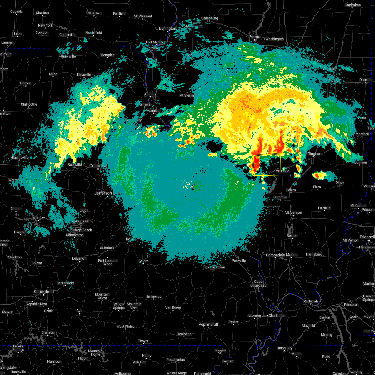 At 1057 pm cdt, severe thunderstorms were located along a line extending from schram city to near pocahontas, moving east at 30 mph (radar indicated). Hazards include 60 mph wind gusts and nickel size hail. Expect damage to roofs, siding, and trees. severe thunderstorms will be near, coffeen around 1105 pm cdt. woburn around 1115 pm cdt. other locations in the path of these severe thunderstorms include mulberry grove and van burensburg. This includes interstate 70 in illinois between exits 45 and 52. At 1057 pm cdt, severe thunderstorms were located along a line extending from schram city to near pocahontas, moving east at 30 mph (radar indicated). Hazards include 60 mph wind gusts and nickel size hail. Expect damage to roofs, siding, and trees. severe thunderstorms will be near, coffeen around 1105 pm cdt. woburn around 1115 pm cdt. other locations in the path of these severe thunderstorms include mulberry grove and van burensburg. This includes interstate 70 in illinois between exits 45 and 52.
|
| 3/27/2021 8:21 PM CDT |
 At 818 pm cdt, severe thunderstorms were located along a line extending from near altamont to 6 miles southwest of kinmundy to near ashley, moving east at 50 mph (radar indicated). Hazards include 60 mph wind gusts. expect damage to roofs, siding, and trees At 818 pm cdt, severe thunderstorms were located along a line extending from near altamont to 6 miles southwest of kinmundy to near ashley, moving east at 50 mph (radar indicated). Hazards include 60 mph wind gusts. expect damage to roofs, siding, and trees
|
| 3/27/2021 8:05 PM CDT |
 At 804 pm cdt, severe thunderstorms were located along a line extending from 6 miles northwest of brownstown to near shobonier to near nashville, moving east at 40 mph (public. numerous trees and powerlines were reported snapped in st. jacobs, il and south of pocahontas, il). Hazards include 60 mph wind gusts and quarter size hail. Hail damage to vehicles is expected. expect wind damage to roofs, siding, and trees. locations impacted include, centralia, vandalia, breese, carlyle, nashville, okawville, st. elmo, sandoval, germantown, wamac, central city, odin, beckemeyer, brownstown, irvington, mulberry grove, patoka, tamalco, beaver creek and shobonier. this also includes carlyle lake recreational area. this includes the following highways, interstate 70 in illinois between exits 52 and 76. Interstate 64 in illinois between exits 41 and 61. At 804 pm cdt, severe thunderstorms were located along a line extending from 6 miles northwest of brownstown to near shobonier to near nashville, moving east at 40 mph (public. numerous trees and powerlines were reported snapped in st. jacobs, il and south of pocahontas, il). Hazards include 60 mph wind gusts and quarter size hail. Hail damage to vehicles is expected. expect wind damage to roofs, siding, and trees. locations impacted include, centralia, vandalia, breese, carlyle, nashville, okawville, st. elmo, sandoval, germantown, wamac, central city, odin, beckemeyer, brownstown, irvington, mulberry grove, patoka, tamalco, beaver creek and shobonier. this also includes carlyle lake recreational area. this includes the following highways, interstate 70 in illinois between exits 52 and 76. Interstate 64 in illinois between exits 41 and 61.
|
| 3/27/2021 8:01 PM CDT |
 At 801 pm cdt, a severe thunderstorm capable of producing a tornado was located near shobonier, moving east at 35 mph (radar indicated rotation). Hazards include tornado and quarter size hail. Flying debris will be dangerous to those caught without shelter. mobile homes will be damaged or destroyed. damage to roofs, windows, and vehicles will occur. tree damage is likely. this dangerous storm will be near, vandalia and shobonier around 810 pm cdt. brownstown around 825 pm cdt. other locations impacted by this tornadic thunderstorm include st. peter, loogootee, st. james, pittsburg, st. paul, hagerstown and vernon. This includes interstate 70 in illinois between exits 68 and 76. At 801 pm cdt, a severe thunderstorm capable of producing a tornado was located near shobonier, moving east at 35 mph (radar indicated rotation). Hazards include tornado and quarter size hail. Flying debris will be dangerous to those caught without shelter. mobile homes will be damaged or destroyed. damage to roofs, windows, and vehicles will occur. tree damage is likely. this dangerous storm will be near, vandalia and shobonier around 810 pm cdt. brownstown around 825 pm cdt. other locations impacted by this tornadic thunderstorm include st. peter, loogootee, st. james, pittsburg, st. paul, hagerstown and vernon. This includes interstate 70 in illinois between exits 68 and 76.
|
| 3/27/2021 7:45 PM CDT |
 At 744 pm cdt, a severe thunderstorm capable of producing a tornado was located near tamalco, moving east at 40 mph (radar indicated rotation). Hazards include tornado and quarter size hail. Flying debris will be dangerous to those caught without shelter. mobile homes will be damaged or destroyed. damage to roofs, windows, and vehicles will occur. tree damage is likely. this dangerous storm will be near, mulberry grove around 755 pm cdt. patoka and shobonier around 805 pm cdt. other locations impacted by this tornadic thunderstorm include st. peter, loogootee, st. james, smithboro, pleasant mound, pittsburg, st. paul, keyesport, hagerstown and vernon. This includes interstate 70 in illinois between exits 41 and 52, and between exits 68 and 76. At 744 pm cdt, a severe thunderstorm capable of producing a tornado was located near tamalco, moving east at 40 mph (radar indicated rotation). Hazards include tornado and quarter size hail. Flying debris will be dangerous to those caught without shelter. mobile homes will be damaged or destroyed. damage to roofs, windows, and vehicles will occur. tree damage is likely. this dangerous storm will be near, mulberry grove around 755 pm cdt. patoka and shobonier around 805 pm cdt. other locations impacted by this tornadic thunderstorm include st. peter, loogootee, st. james, smithboro, pleasant mound, pittsburg, st. paul, keyesport, hagerstown and vernon. This includes interstate 70 in illinois between exits 41 and 52, and between exits 68 and 76.
|
| 3/27/2021 7:43 PM CDT |
 At 742 pm cdt, severe thunderstorms were located along a line extending from van burensburg to near beaver creek to near lively grove, moving east at 40 mph (public. numerous trees and powerlines were reported snapped in st. jacobs and south of pocahontas). Hazards include 60 mph wind gusts and quarter size hail. Hail damage to vehicles is expected. Expect wind damage to roofs, siding, and trees. At 742 pm cdt, severe thunderstorms were located along a line extending from van burensburg to near beaver creek to near lively grove, moving east at 40 mph (public. numerous trees and powerlines were reported snapped in st. jacobs and south of pocahontas). Hazards include 60 mph wind gusts and quarter size hail. Hail damage to vehicles is expected. Expect wind damage to roofs, siding, and trees.
|
| 8/10/2020 5:53 PM CDT |
 The severe thunderstorm warning for bond, fayette and southern montgomery counties will expire at 600 pm cdt, the storms which prompted the warning have weakened below severe limits, and no longer pose an immediate threat to life or property. therefore, the warning will be allowed to expire. however gusty winds are still possible with these thunderstorms. a severe thunderstorm watch remains in effect until 1000 pm cdt for south central and southwestern illinois. The severe thunderstorm warning for bond, fayette and southern montgomery counties will expire at 600 pm cdt, the storms which prompted the warning have weakened below severe limits, and no longer pose an immediate threat to life or property. therefore, the warning will be allowed to expire. however gusty winds are still possible with these thunderstorms. a severe thunderstorm watch remains in effect until 1000 pm cdt for south central and southwestern illinois.
|
| 8/10/2020 5:43 PM CDT |
 At 543 pm cdt, severe thunderstorms were located along a line extending from near teutopolis to near woburn, moving southeast at 45 mph (radar indicated). Hazards include 60 mph wind gusts and nickel size hail. Expect damage to roofs, siding, and trees. locations impacted include, vandalia, greenville, hillsboro, st. elmo, ramsey, pocahontas, brownstown, taylor springs, coffeen, mulberry grove, schram city, tamalco, farina, sorento, beaver creek, shobonier, woburn, wrights corner, van burensburg and reno. this also includes ramsey lake state park. this includes the following highways, interstate 70 in illinois between exits 36 and 76. Interstate 57 in illinois near exit 135. At 543 pm cdt, severe thunderstorms were located along a line extending from near teutopolis to near woburn, moving southeast at 45 mph (radar indicated). Hazards include 60 mph wind gusts and nickel size hail. Expect damage to roofs, siding, and trees. locations impacted include, vandalia, greenville, hillsboro, st. elmo, ramsey, pocahontas, brownstown, taylor springs, coffeen, mulberry grove, schram city, tamalco, farina, sorento, beaver creek, shobonier, woburn, wrights corner, van burensburg and reno. this also includes ramsey lake state park. this includes the following highways, interstate 70 in illinois between exits 36 and 76. Interstate 57 in illinois near exit 135.
|
| 8/10/2020 5:19 PM CDT |
 At 519 pm cdt, severe thunderstorms were located along a line extending from near cowden to near litchfield, moving southeast at 45 mph (radar indicated). Hazards include 60 mph wind gusts and quarter size hail. Hail damage to vehicles is expected. Expect wind damage to roofs, siding, and trees. At 519 pm cdt, severe thunderstorms were located along a line extending from near cowden to near litchfield, moving southeast at 45 mph (radar indicated). Hazards include 60 mph wind gusts and quarter size hail. Hail damage to vehicles is expected. Expect wind damage to roofs, siding, and trees.
|
| 7/15/2020 6:13 PM CDT |
 At 613 pm cdt, severe thunderstorms were located along a line extending from near cowden to near wamac, moving east at 50 mph (radar indicated). Hazards include 70 mph wind gusts. Expect considerable tree damage. damage is likely to mobile homes, roofs, and outbuildings. locations impacted include, centralia, salem, st. elmo, sandoval, wamac, central city, odin, kinmundy, brownstown, patoka, farina, omega, stephen forbes station, shobonier, fairman, wrights corner, helm, avena, tonti and la clede. this includes the following highways, interstate 70 in illinois between exits 68 and 76. Interstate 57 in illinois between exits 109 and 135. At 613 pm cdt, severe thunderstorms were located along a line extending from near cowden to near wamac, moving east at 50 mph (radar indicated). Hazards include 70 mph wind gusts. Expect considerable tree damage. damage is likely to mobile homes, roofs, and outbuildings. locations impacted include, centralia, salem, st. elmo, sandoval, wamac, central city, odin, kinmundy, brownstown, patoka, farina, omega, stephen forbes station, shobonier, fairman, wrights corner, helm, avena, tonti and la clede. this includes the following highways, interstate 70 in illinois between exits 68 and 76. Interstate 57 in illinois between exits 109 and 135.
|
| 7/15/2020 6:05 PM CDT | Power lines down on south side of vandalia. time estimated from rada in fayette county IL, 1 miles NNW of Vandalia, IL |
| 7/15/2020 6:01 PM CDT | Large tree down north of vandalia. time estimated from rada in fayette county IL, 1.9 miles SSW of Vandalia, IL |
| 7/15/2020 6:01 PM CDT |
 At 600 pm cdt, severe thunderstorms were located along a line extending from near ramsey to 8 miles north of nashville, moving east at 50 mph (radar indicated). Hazards include 70 mph wind gusts. Expect considerable tree damage. Damage is likely to mobile homes, roofs, and outbuildings. At 600 pm cdt, severe thunderstorms were located along a line extending from near ramsey to 8 miles north of nashville, moving east at 50 mph (radar indicated). Hazards include 70 mph wind gusts. Expect considerable tree damage. Damage is likely to mobile homes, roofs, and outbuildings.
|
| 7/15/2020 5:43 PM CDT |
 At 543 pm cdt, severe thunderstorms were located along a line extending from near pana to 7 miles northeast of ramsey to mulberry grove, moving east at 55 mph (radar indicated). Hazards include 70 mph wind gusts. Expect considerable tree damage. damage is likely to mobile homes, roofs, and outbuildings. locations impacted include, vandalia, greenville, st. elmo, ramsey, brownstown, mulberry grove, wrights corner, avena, pleasant mound, pittsburg, shafter, herrick, smithboro, loogootee, st. james, bayle city and hagerstown. this also includes ramsey lake state park. This includes interstate 70 in illinois between exits 45 and 76. At 543 pm cdt, severe thunderstorms were located along a line extending from near pana to 7 miles northeast of ramsey to mulberry grove, moving east at 55 mph (radar indicated). Hazards include 70 mph wind gusts. Expect considerable tree damage. damage is likely to mobile homes, roofs, and outbuildings. locations impacted include, vandalia, greenville, st. elmo, ramsey, brownstown, mulberry grove, wrights corner, avena, pleasant mound, pittsburg, shafter, herrick, smithboro, loogootee, st. james, bayle city and hagerstown. this also includes ramsey lake state park. This includes interstate 70 in illinois between exits 45 and 76.
|
| 7/15/2020 5:30 PM CDT |
 At 530 pm cdt, severe thunderstorms were located along a line extending from witt to near ramsey to near van burensburg, moving northeast at 55 mph (radar indicated). Hazards include 70 mph wind gusts. Expect considerable tree damage. Damage is likely to mobile homes, roofs, and outbuildings. At 530 pm cdt, severe thunderstorms were located along a line extending from witt to near ramsey to near van burensburg, moving northeast at 55 mph (radar indicated). Hazards include 70 mph wind gusts. Expect considerable tree damage. Damage is likely to mobile homes, roofs, and outbuildings.
|
| 7/15/2020 5:16 PM CDT |
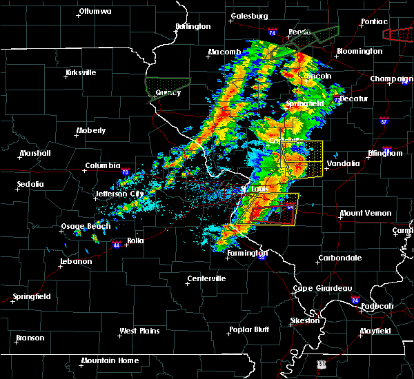 At 515 pm cdt, severe thunderstorms were located along a line extending from hillsboro to near coffeen to near greenville, moving east at 50 mph (trained weather spotters). Hazards include 70 mph wind gusts. Expect considerable tree damage. damage is likely to mobile homes, roofs, and outbuildings. locations impacted include, greenville, mulberry grove, sorento, woburn, van burensburg, reno, shafter, panama, donnellson, smithboro, old ripley, walshville and hagerstown. This includes interstate 70 in illinois between exits 41 and 52. At 515 pm cdt, severe thunderstorms were located along a line extending from hillsboro to near coffeen to near greenville, moving east at 50 mph (trained weather spotters). Hazards include 70 mph wind gusts. Expect considerable tree damage. damage is likely to mobile homes, roofs, and outbuildings. locations impacted include, greenville, mulberry grove, sorento, woburn, van burensburg, reno, shafter, panama, donnellson, smithboro, old ripley, walshville and hagerstown. This includes interstate 70 in illinois between exits 41 and 52.
|
| 7/15/2020 5:08 PM CDT |
 At 508 pm cdt, severe thunderstorms were located along a line extending from near litchfield to near reno to near pocahontas, moving northeast at 55 mph (trained weather spotters). Hazards include 70 mph wind gusts. Expect considerable tree damage. damage is likely to mobile homes, roofs, and outbuildings. locations impacted include, greenville, st. rose, pocahontas, mulberry grove, tamalco, sorento, beaver creek, woburn, boulder, van burensburg, reno, jamestown, pleasant mound, pierron, pittsburg, shafter, keyesport, panama, donnellson and smithboro. this also includes carlyle lake recreational area. This includes interstate 70 in illinois between exits 36 and 52. At 508 pm cdt, severe thunderstorms were located along a line extending from near litchfield to near reno to near pocahontas, moving northeast at 55 mph (trained weather spotters). Hazards include 70 mph wind gusts. Expect considerable tree damage. damage is likely to mobile homes, roofs, and outbuildings. locations impacted include, greenville, st. rose, pocahontas, mulberry grove, tamalco, sorento, beaver creek, woburn, boulder, van burensburg, reno, jamestown, pleasant mound, pierron, pittsburg, shafter, keyesport, panama, donnellson and smithboro. this also includes carlyle lake recreational area. This includes interstate 70 in illinois between exits 36 and 52.
|
| 7/15/2020 4:48 PM CDT |
 At 447 pm cdt, a severe thunderstorm was located near alhambra, moving east at 55 mph (trained weather spotters). Hazards include 70 mph wind gusts. Expect considerable tree damage. Damage is likely to mobile homes, roofs, and outbuildings. At 447 pm cdt, a severe thunderstorm was located near alhambra, moving east at 55 mph (trained weather spotters). Hazards include 70 mph wind gusts. Expect considerable tree damage. Damage is likely to mobile homes, roofs, and outbuildings.
|
| 4/8/2020 7:25 PM CDT |
 At 724 pm cdt, a severe thunderstorm was located over brownstown, moving east at 40 mph (radar indicated). Hazards include 60 mph wind gusts and quarter size hail. Hail damage to vehicles is expected. expect wind damage to roofs, siding, and trees. locations impacted include, vandalia, st. elmo, ramsey, brownstown, mulberry grove, wrights corner, avena, shafter, bingham, loogootee, st. james, bayle city and hagerstown. this also includes ramsey lake state park. This includes interstate 70 in illinois between exits 61 and 76. At 724 pm cdt, a severe thunderstorm was located over brownstown, moving east at 40 mph (radar indicated). Hazards include 60 mph wind gusts and quarter size hail. Hail damage to vehicles is expected. expect wind damage to roofs, siding, and trees. locations impacted include, vandalia, st. elmo, ramsey, brownstown, mulberry grove, wrights corner, avena, shafter, bingham, loogootee, st. james, bayle city and hagerstown. this also includes ramsey lake state park. This includes interstate 70 in illinois between exits 61 and 76.
|
| 4/8/2020 7:00 PM CDT |
 At 700 pm cdt, a severe thunderstorm was located over van burensburg, moving east at 40 mph (radar indicated). Hazards include 60 mph wind gusts and quarter size hail. Hail damage to vehicles is expected. Expect wind damage to roofs, siding, and trees. At 700 pm cdt, a severe thunderstorm was located over van burensburg, moving east at 40 mph (radar indicated). Hazards include 60 mph wind gusts and quarter size hail. Hail damage to vehicles is expected. Expect wind damage to roofs, siding, and trees.
|
| 3/27/2020 3:31 AM CDT |
 At 330 am cdt, a severe thunderstorm was located near reno, moving east at 60 mph (public). Hazards include quarter size hail. damage to vehicles is expected At 330 am cdt, a severe thunderstorm was located near reno, moving east at 60 mph (public). Hazards include quarter size hail. damage to vehicles is expected
|
| 6/5/2019 5:42 PM CDT |
 The severe thunderstorm warning for bond and fayette counties will expire at 545 pm cdt, the storms which prompted the warning have weakened below severe limits, and no longer pose an immediate threat to life or property. therefore, the warning will be allowed to expire. however gusty winds are still possible with these thunderstorms. a severe thunderstorm watch remains in effect until 1000 pm cdt for south central and southwestern illinois. The severe thunderstorm warning for bond and fayette counties will expire at 545 pm cdt, the storms which prompted the warning have weakened below severe limits, and no longer pose an immediate threat to life or property. therefore, the warning will be allowed to expire. however gusty winds are still possible with these thunderstorms. a severe thunderstorm watch remains in effect until 1000 pm cdt for south central and southwestern illinois.
|
| 6/5/2019 5:29 PM CDT |
 A severe thunderstorm warning remains in effect until 545 pm cdt for bond and fayette counties. at 528 pm cdt, severe thunderstorms were located along a line extending from near cowden to near van burensburg to near reno, moving southeast at 40 mph. hazard. 60 mph wind gusts. A severe thunderstorm warning remains in effect until 545 pm cdt for bond and fayette counties. at 528 pm cdt, severe thunderstorms were located along a line extending from near cowden to near van burensburg to near reno, moving southeast at 40 mph. hazard. 60 mph wind gusts.
|
| 6/5/2019 5:16 PM CDT |
 At 516 pm cdt, severe thunderstorms were located along a line extending from near tower hill to sorento, moving southeast at 25 mph (radar indicated). Hazards include 60 mph wind gusts. Expect damage to roofs, siding, and trees. locations impacted include, vandalia, greenville, hillsboro, st. elmo, ramsey, pocahontas, brownstown, taylor springs, coffeen, mulberry grove, schram city, sorento, shobonier, woburn, wrights corner, van burensburg, reno, avena, pleasant mound and pierron. this also includes ramsey lake state park. This includes interstate 70 in illinois between exits 36 and 76. At 516 pm cdt, severe thunderstorms were located along a line extending from near tower hill to sorento, moving southeast at 25 mph (radar indicated). Hazards include 60 mph wind gusts. Expect damage to roofs, siding, and trees. locations impacted include, vandalia, greenville, hillsboro, st. elmo, ramsey, pocahontas, brownstown, taylor springs, coffeen, mulberry grove, schram city, sorento, shobonier, woburn, wrights corner, van burensburg, reno, avena, pleasant mound and pierron. this also includes ramsey lake state park. This includes interstate 70 in illinois between exits 36 and 76.
|
| 6/5/2019 4:56 PM CDT |
 At 456 pm cdt, severe thunderstorms were located along a line extending from pana to near taylor springs, moving southeast at 25 mph (radar indicated). Hazards include 60 mph wind gusts. expect damage to roofs, siding, and trees At 456 pm cdt, severe thunderstorms were located along a line extending from pana to near taylor springs, moving southeast at 25 mph (radar indicated). Hazards include 60 mph wind gusts. expect damage to roofs, siding, and trees
|
| 5/29/2019 6:45 PM CDT | Several planes flipped over at vandalia municipal airport. also... 8 to 9 power poles snapped off and a hanger was damage in fayette county IL, 3.5 miles ESE of Vandalia, IL |
| 5/23/2019 3:54 AM CDT |
 At 354 am cdt, a severe thunderstorm capable of producing a tornado was located near tamalco, moving east at 40 mph (radar indicated rotation). Hazards include tornado. Flying debris will be dangerous to those caught without shelter. mobile homes will be damaged or destroyed. damage to roofs, windows, and vehicles will occur. tree damage is likely. this dangerous storm will be near, patoka and shobonier around 415 am cdt. farina around 430 am cdt. other locations impacted by this tornadic thunderstorm include st. peter, loogootee, st. james, pleasant mound, pittsburg, st. paul, vernon and keyesport. This includes interstate 70 in illinois near exit 45, and between exits 68 and 76. At 354 am cdt, a severe thunderstorm capable of producing a tornado was located near tamalco, moving east at 40 mph (radar indicated rotation). Hazards include tornado. Flying debris will be dangerous to those caught without shelter. mobile homes will be damaged or destroyed. damage to roofs, windows, and vehicles will occur. tree damage is likely. this dangerous storm will be near, patoka and shobonier around 415 am cdt. farina around 430 am cdt. other locations impacted by this tornadic thunderstorm include st. peter, loogootee, st. james, pleasant mound, pittsburg, st. paul, vernon and keyesport. This includes interstate 70 in illinois near exit 45, and between exits 68 and 76.
|
| 5/23/2019 3:48 AM CDT |
 At 348 am cdt, a severe thunderstorm was located over mulberry grove, moving east at 50 mph (radar indicated). Hazards include 60 mph wind gusts and nickel size hail. Expect damage to roofs, siding, and trees. locations impacted include, vandalia, greenville, st. elmo, ramsey, brownstown, mulberry grove, wrights corner, woburn, van burensburg, avena, shafter, fillmore, bingham, bayle city and hagerstown. this also includes ramsey lake state park. This includes interstate 70 in illinois between exits 52 and 76. At 348 am cdt, a severe thunderstorm was located over mulberry grove, moving east at 50 mph (radar indicated). Hazards include 60 mph wind gusts and nickel size hail. Expect damage to roofs, siding, and trees. locations impacted include, vandalia, greenville, st. elmo, ramsey, brownstown, mulberry grove, wrights corner, woburn, van burensburg, avena, shafter, fillmore, bingham, bayle city and hagerstown. this also includes ramsey lake state park. This includes interstate 70 in illinois between exits 52 and 76.
|
| 5/23/2019 3:35 AM CDT |
 At 335 am cdt, a severe thunderstorm was located near reno, moving east at 40 mph (radar indicated). Hazards include quarter size hail. Damage to vehicles is expected. locations impacted include, vandalia, greenville, st. elmo, ramsey, brownstown, coffeen, mulberry grove, sorento, wrights corner, woburn, van burensburg, reno, avena, shafter, panama, fillmore, donnellson, smithboro, old ripley and bingham. this also includes ramsey lake state park. This includes interstate 70 in illinois between exits 52 and 76. At 335 am cdt, a severe thunderstorm was located near reno, moving east at 40 mph (radar indicated). Hazards include quarter size hail. Damage to vehicles is expected. locations impacted include, vandalia, greenville, st. elmo, ramsey, brownstown, coffeen, mulberry grove, sorento, wrights corner, woburn, van burensburg, reno, avena, shafter, panama, fillmore, donnellson, smithboro, old ripley and bingham. this also includes ramsey lake state park. This includes interstate 70 in illinois between exits 52 and 76.
|
| 5/23/2019 3:02 AM CDT |
 At 302 am cdt, a severe thunderstorm was located over sorento, moving east at 45 mph (radar indicated). Hazards include quarter size hail. damage to vehicles is expected At 302 am cdt, a severe thunderstorm was located over sorento, moving east at 45 mph (radar indicated). Hazards include quarter size hail. damage to vehicles is expected
|
| 5/21/2019 4:11 PM CDT |
 A severe thunderstorm warning remains in effect until 930 pm cdt for northern fayette county. at 911 pm cdt, severe thunderstorms were located along a line extending from near pana to 7 miles northeast of ramsey to brownstown, moving northeast at 35 mph. hazard. 60 mph wind gusts and quarter size hail. A severe thunderstorm warning remains in effect until 930 pm cdt for northern fayette county. at 911 pm cdt, severe thunderstorms were located along a line extending from near pana to 7 miles northeast of ramsey to brownstown, moving northeast at 35 mph. hazard. 60 mph wind gusts and quarter size hail.
|
| 5/21/2019 3:51 PM CDT |
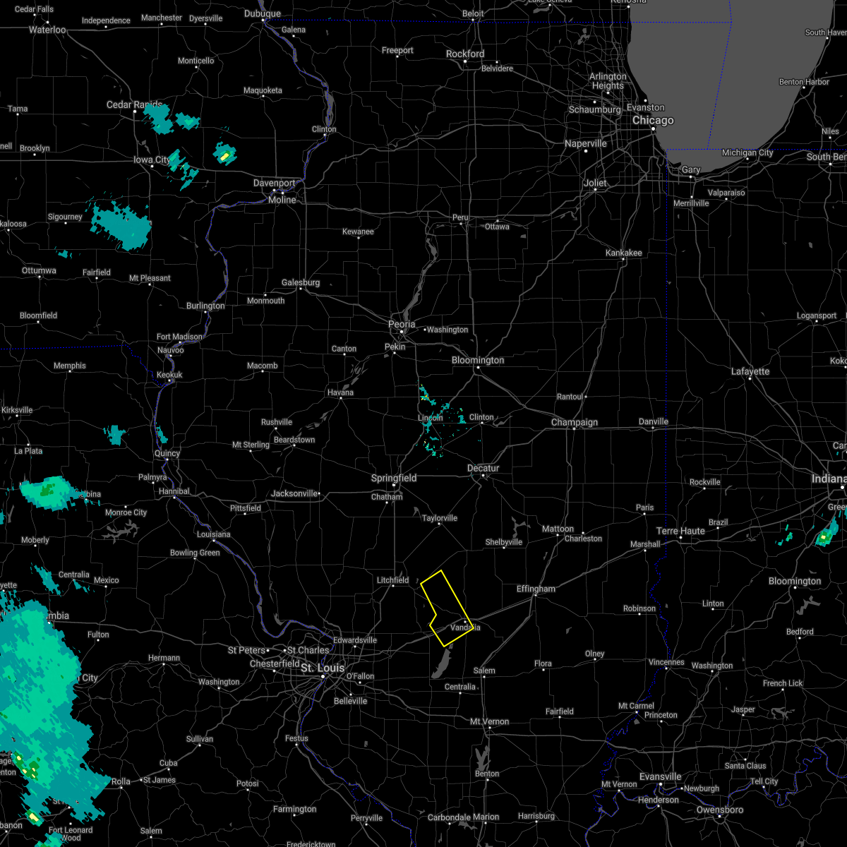 At 851 pm cdt, a severe thunderstorm was located over ramsey, moving northeast at 40 mph (radar indicated). Hazards include 60 mph wind gusts and quarter size hail. Hail damage to vehicles is expected. expect wind damage to roofs, siding, and trees. locations impacted include, vandalia, mulberry grove, woburn, van burensburg, pleasant mound, pittsburg, irving, shafter, fillmore, smithboro, bingham, chapman and hagerstown. This includes interstate 70 in illinois between exits 52 and 63. At 851 pm cdt, a severe thunderstorm was located over ramsey, moving northeast at 40 mph (radar indicated). Hazards include 60 mph wind gusts and quarter size hail. Hail damage to vehicles is expected. expect wind damage to roofs, siding, and trees. locations impacted include, vandalia, mulberry grove, woburn, van burensburg, pleasant mound, pittsburg, irving, shafter, fillmore, smithboro, bingham, chapman and hagerstown. This includes interstate 70 in illinois between exits 52 and 63.
|
| 5/21/2019 3:45 PM CDT |
 At 844 pm cdt, severe thunderstorms were located along a line extending from witt to near van burensburg to near shobonier, moving northeast at 35 mph (radar indicated). Hazards include 60 mph wind gusts and quarter size hail. Hail damage to vehicles is expected. Expect wind damage to roofs, siding, and trees. At 844 pm cdt, severe thunderstorms were located along a line extending from witt to near van burensburg to near shobonier, moving northeast at 35 mph (radar indicated). Hazards include 60 mph wind gusts and quarter size hail. Hail damage to vehicles is expected. Expect wind damage to roofs, siding, and trees.
|
| 5/21/2019 3:40 PM CDT |
 At 840 pm cdt, a severe thunderstorm was located over van burensburg, moving east at 40 mph (radar indicated). Hazards include 60 mph wind gusts and quarter size hail. Hail damage to vehicles is expected. expect wind damage to roofs, siding, and trees. locations impacted include, vandalia, greenville, mulberry grove, beaver creek, woburn, van burensburg, pleasant mound, pittsburg, irving, shafter, fillmore, smithboro, bingham, chapman, dudleyville and hagerstown. This includes interstate 70 in illinois between exits 41 and 63. At 840 pm cdt, a severe thunderstorm was located over van burensburg, moving east at 40 mph (radar indicated). Hazards include 60 mph wind gusts and quarter size hail. Hail damage to vehicles is expected. expect wind damage to roofs, siding, and trees. locations impacted include, vandalia, greenville, mulberry grove, beaver creek, woburn, van burensburg, pleasant mound, pittsburg, irving, shafter, fillmore, smithboro, bingham, chapman, dudleyville and hagerstown. This includes interstate 70 in illinois between exits 41 and 63.
|
| 5/21/2019 3:27 PM CDT |
 At 826 pm cdt, a severe thunderstorm capable of producing a tornado was located over beckemeyer, moving northeast at 40 mph (radar indicated rotation). Hazards include tornado. Flying debris will be dangerous to those caught without shelter. mobile homes will be damaged or destroyed. damage to roofs, windows, and vehicles will occur. Tree damage is likely. At 826 pm cdt, a severe thunderstorm capable of producing a tornado was located over beckemeyer, moving northeast at 40 mph (radar indicated rotation). Hazards include tornado. Flying debris will be dangerous to those caught without shelter. mobile homes will be damaged or destroyed. damage to roofs, windows, and vehicles will occur. Tree damage is likely.
|
| 5/21/2019 3:08 PM CDT |
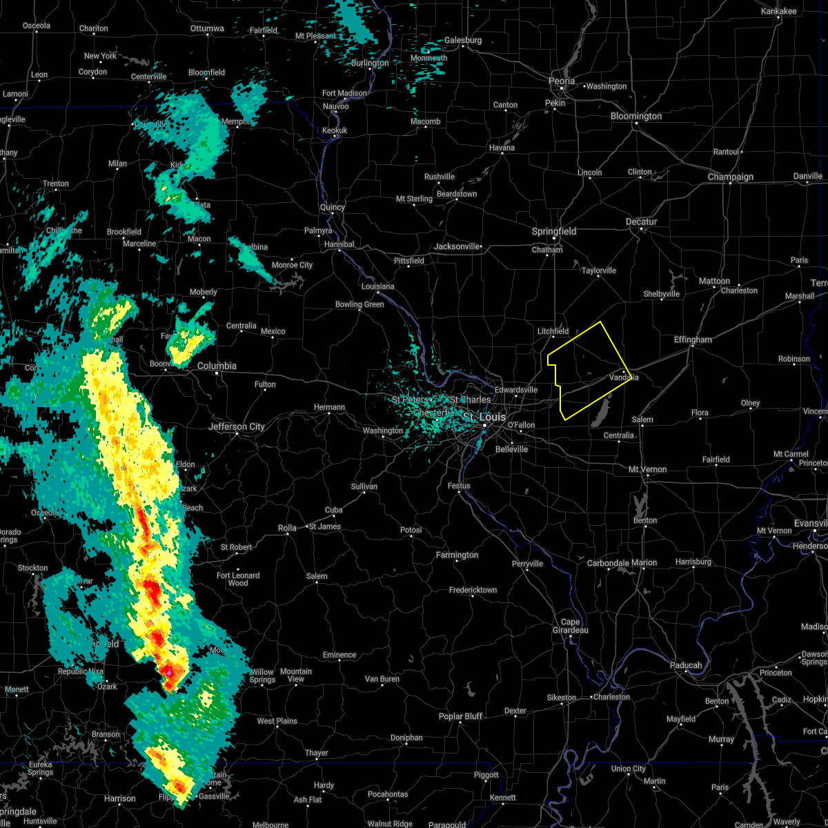 At 807 pm cdt, a severe thunderstorm was located near pocahontas, moving northeast at 40 mph (radar indicated). Hazards include 60 mph wind gusts and quarter size hail. Hail damage to vehicles is expected. Expect wind damage to roofs, siding, and trees. At 807 pm cdt, a severe thunderstorm was located near pocahontas, moving northeast at 40 mph (radar indicated). Hazards include 60 mph wind gusts and quarter size hail. Hail damage to vehicles is expected. Expect wind damage to roofs, siding, and trees.
|
| 4/18/2019 2:23 AM CDT |
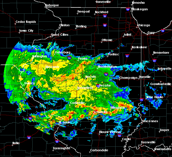 The severe thunderstorm warning for southwestern fayette county will expire at 230 am cdt, the storm which prompted the warning has weakened below severe limits, and no longer poses an immediate threat to life or property. therefore, the warning will be allowed to expire. however small hail and heavy rain are still possible with this thunderstorm. The severe thunderstorm warning for southwestern fayette county will expire at 230 am cdt, the storm which prompted the warning has weakened below severe limits, and no longer poses an immediate threat to life or property. therefore, the warning will be allowed to expire. however small hail and heavy rain are still possible with this thunderstorm.
|
| 4/18/2019 2:10 AM CDT |
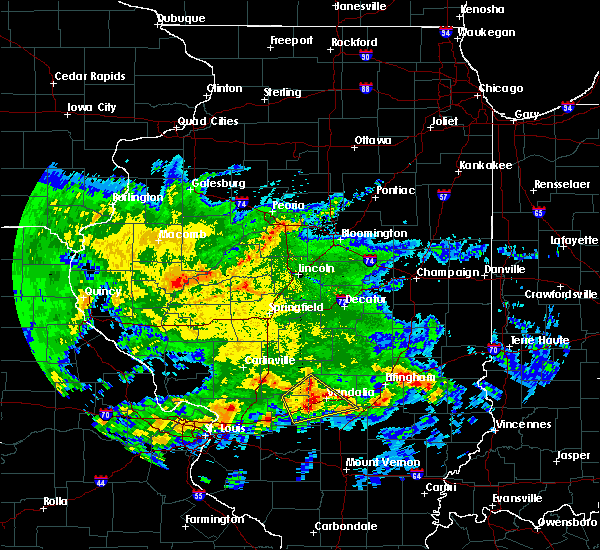 At 210 am cdt, a severe thunderstorm was located near vandalia, moving northeast at 65 mph (radar indicated). Hazards include quarter size hail. Damage to vehicles is expected. locations impacted include, vandalia, brownstown, mulberry grove, shobonier, pittsburg, shafter, loogootee, hagerstown and bayle city. This includes interstate 70 in illinois between exits 61 and 68. At 210 am cdt, a severe thunderstorm was located near vandalia, moving northeast at 65 mph (radar indicated). Hazards include quarter size hail. Damage to vehicles is expected. locations impacted include, vandalia, brownstown, mulberry grove, shobonier, pittsburg, shafter, loogootee, hagerstown and bayle city. This includes interstate 70 in illinois between exits 61 and 68.
|
| 4/18/2019 2:00 AM CDT |
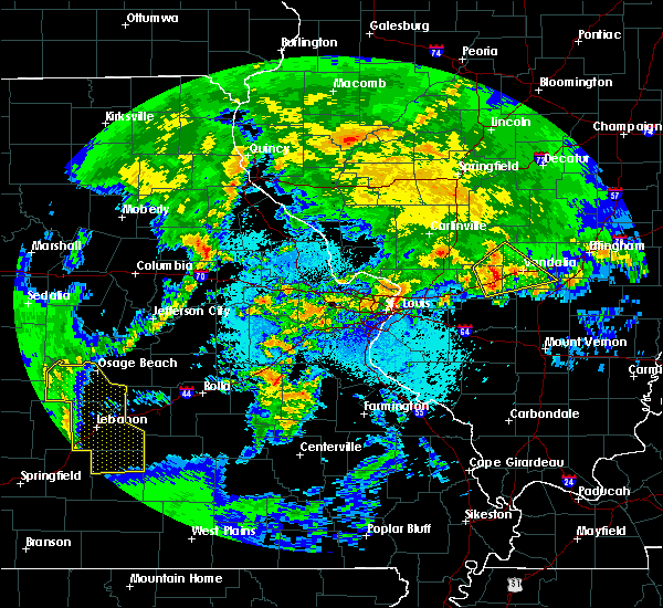 At 159 am cdt, a severe thunderstorm was located over greenville, moving northeast at 55 mph (radar indicated). Hazards include quarter size hail. Damage to vehicles is expected. locations impacted include, vandalia, greenville, brownstown, coffeen, mulberry grove, beaver creek, shobonier, woburn, van burensburg, pleasant mound, pittsburg, shafter, fillmore, donnellson, smithboro, bingham, chapman, loogootee, dudleyville and bayle city. This includes interstate 70 in illinois between exits 45 and 68. At 159 am cdt, a severe thunderstorm was located over greenville, moving northeast at 55 mph (radar indicated). Hazards include quarter size hail. Damage to vehicles is expected. locations impacted include, vandalia, greenville, brownstown, coffeen, mulberry grove, beaver creek, shobonier, woburn, van burensburg, pleasant mound, pittsburg, shafter, fillmore, donnellson, smithboro, bingham, chapman, loogootee, dudleyville and bayle city. This includes interstate 70 in illinois between exits 45 and 68.
|
| 4/18/2019 1:47 AM CDT |
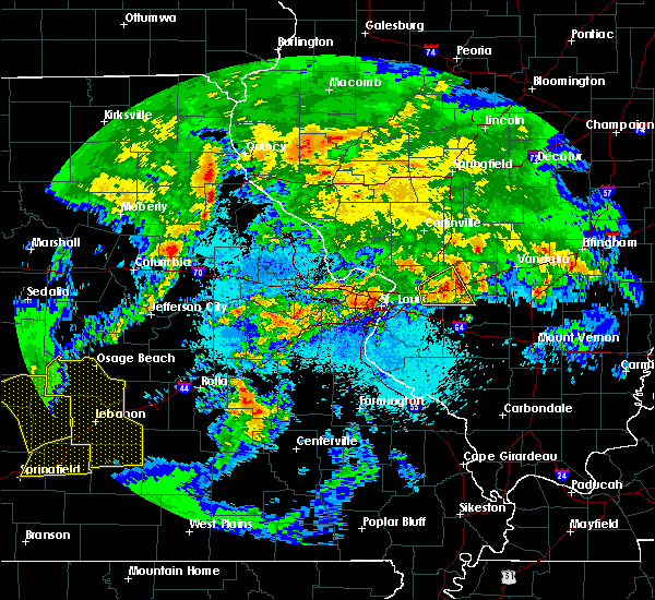 At 147 am cdt, a severe thunderstorm was located over pocahontas, moving northeast at 55 mph (radar indicated). Hazards include quarter size hail. damage to vehicles is expected At 147 am cdt, a severe thunderstorm was located over pocahontas, moving northeast at 55 mph (radar indicated). Hazards include quarter size hail. damage to vehicles is expected
|
| 8/17/2018 2:18 AM CDT |
 At 217 am cdt, a severe thunderstorm was located over vandalia, moving east at 35 mph (radar indicated). Hazards include 60 mph wind gusts. Expect damage to roofs, siding, and trees. locations impacted include, vandalia, greenville, mulberry grove, shobonier, woburn, pleasant mound, pittsburg, shafter, smithboro and hagerstown. This includes interstate 70 in illinois between exits 41 and 63. At 217 am cdt, a severe thunderstorm was located over vandalia, moving east at 35 mph (radar indicated). Hazards include 60 mph wind gusts. Expect damage to roofs, siding, and trees. locations impacted include, vandalia, greenville, mulberry grove, shobonier, woburn, pleasant mound, pittsburg, shafter, smithboro and hagerstown. This includes interstate 70 in illinois between exits 41 and 63.
|
| 8/17/2018 1:55 AM CDT |
 At 155 am cdt, a severe thunderstorm was located over woburn, moving east at 35 mph (radar indicated). Hazards include 60 mph wind gusts. expect damage to roofs, siding, and trees At 155 am cdt, a severe thunderstorm was located over woburn, moving east at 35 mph (radar indicated). Hazards include 60 mph wind gusts. expect damage to roofs, siding, and trees
|
| 6/28/2018 6:06 PM CDT |
 A severe thunderstorm warning remains in effect until 645 pm cdt for bond county in south central illinois. monroe county in southwestern illinois. southeastern montgomery county in south central illinois. st. clair county in southwestern illinois. clinton and northern washington counties in south central illinois. southeastern madison county in southwestern illinois. Marion and. A severe thunderstorm warning remains in effect until 645 pm cdt for bond county in south central illinois. monroe county in southwestern illinois. southeastern montgomery county in south central illinois. st. clair county in southwestern illinois. clinton and northern washington counties in south central illinois. southeastern madison county in southwestern illinois. Marion and.
|
| 6/28/2018 6:06 PM CDT |
 At 605 pm cdt, severe thunderstorms were located along a line extending from 6 miles east of cowden to near mulberry grove to highland to st. louis, moving south at 35 mph (trained weather spotters. numerous trees and power lines have been reported down across the area). Hazards include 60 mph wind gusts. Expect damage to roofs, siding, and trees. locations impacted include, st. louis, chesterfield, belleville, university city, ballwin, granite city, o`fallon, kirkwood, maryland heights, east st. louis, collinsville, edwardsville, webster groves, ferguson, arnold, manchester, creve coeur, fairview heights, overland and clayton. this also includes scott joplin historic site, mastodon historic site, carlyle lake recreational area, and horseshoe lake state park. this includes the following highways, interstate 70 in illinois between exits 21 and 76. interstate 55 in illinois near exit 23. interstate 57 in illinois between exits 116 and 135. interstate 64 in illinois between exits 9 and 41. interstate 44 in missouri between exits 272 and 277. Interstate 55 in missouri between exits 187 and 191. At 605 pm cdt, severe thunderstorms were located along a line extending from 6 miles east of cowden to near mulberry grove to highland to st. louis, moving south at 35 mph (trained weather spotters. numerous trees and power lines have been reported down across the area). Hazards include 60 mph wind gusts. Expect damage to roofs, siding, and trees. locations impacted include, st. louis, chesterfield, belleville, university city, ballwin, granite city, o`fallon, kirkwood, maryland heights, east st. louis, collinsville, edwardsville, webster groves, ferguson, arnold, manchester, creve coeur, fairview heights, overland and clayton. this also includes scott joplin historic site, mastodon historic site, carlyle lake recreational area, and horseshoe lake state park. this includes the following highways, interstate 70 in illinois between exits 21 and 76. interstate 55 in illinois near exit 23. interstate 57 in illinois between exits 116 and 135. interstate 64 in illinois between exits 9 and 41. interstate 44 in missouri between exits 272 and 277. Interstate 55 in missouri between exits 187 and 191.
|
| 6/28/2018 5:22 PM CDT |
 At 521 pm cdt, severe thunderstorms were located along a line extending from near taylorville to witt to near carlinville to near orchard farms, moving southeast at 60 mph (trained weather spotters. numerous trees and power lines have been reported down when this line of storms moved through parts of missouri and illinois). Hazards include 60 mph wind gusts. expect damage to roofs, siding, and trees At 521 pm cdt, severe thunderstorms were located along a line extending from near taylorville to witt to near carlinville to near orchard farms, moving southeast at 60 mph (trained weather spotters. numerous trees and power lines have been reported down when this line of storms moved through parts of missouri and illinois). Hazards include 60 mph wind gusts. expect damage to roofs, siding, and trees
|
| 5/31/2018 10:59 AM CDT |
 A severe thunderstorm warning remains in effect until 1115 am cdt for northern marion and southern fayette counties. at 1059 am cdt, severe thunderstorms were located along a line extending from vandalia to 6 miles southeast of salem, moving east at 35 mph. hazard. 60 mph wind gusts and quarter size hail. A severe thunderstorm warning remains in effect until 1115 am cdt for northern marion and southern fayette counties. at 1059 am cdt, severe thunderstorms were located along a line extending from vandalia to 6 miles southeast of salem, moving east at 35 mph. hazard. 60 mph wind gusts and quarter size hail.
|
| 5/31/2018 10:47 AM CDT |
 At 1047 am cdt, severe thunderstorms were located along a line extending from near mulberry grove to near salem, moving east at 35 mph (radar indicated). Hazards include 60 mph wind gusts and quarter size hail. Hail damage to vehicles is expected. expect wind damage to roofs, siding, and trees. locations impacted include, salem, vandalia, sandoval, odin, kinmundy, brownstown, patoka, farina, omega, stephen forbes station, shobonier, fairman, tonti, la clede, pittsburg, iuka, st. peter, alma, vernon and loogootee. this includes the following highways, interstate 70 in illinois between exits 61 and 68. Interstate 57 in illinois between exits 116 and 135. At 1047 am cdt, severe thunderstorms were located along a line extending from near mulberry grove to near salem, moving east at 35 mph (radar indicated). Hazards include 60 mph wind gusts and quarter size hail. Hail damage to vehicles is expected. expect wind damage to roofs, siding, and trees. locations impacted include, salem, vandalia, sandoval, odin, kinmundy, brownstown, patoka, farina, omega, stephen forbes station, shobonier, fairman, tonti, la clede, pittsburg, iuka, st. peter, alma, vernon and loogootee. this includes the following highways, interstate 70 in illinois between exits 61 and 68. Interstate 57 in illinois between exits 116 and 135.
|
| 5/31/2018 10:36 AM CDT |
 At 1036 am cdt, severe thunderstorms were located along a line extending from near mulberry grove to central city, moving east at 35 mph (radar indicated). Hazards include 60 mph wind gusts and quarter size hail. Hail damage to vehicles is expected. Expect wind damage to roofs, siding, and trees. At 1036 am cdt, severe thunderstorms were located along a line extending from near mulberry grove to central city, moving east at 35 mph (radar indicated). Hazards include 60 mph wind gusts and quarter size hail. Hail damage to vehicles is expected. Expect wind damage to roofs, siding, and trees.
|
| 5/20/2018 7:05 AM CDT |
 At 705 am cdt, a severe thunderstorm was located over mulberry grove, moving east at 25 mph (radar indicated). Hazards include 60 mph wind gusts and quarter size hail. Hail damage to vehicles is expected. expect wind damage to roofs, siding, and trees. locations impacted include, vandalia, greenville, mulberry grove, woburn, van burensburg, pleasant mound, pittsburg, shafter, donnellson, smithboro, bingham, dudleyville, bayle city and hagerstown. This includes interstate 70 in illinois between exits 41 and 61. At 705 am cdt, a severe thunderstorm was located over mulberry grove, moving east at 25 mph (radar indicated). Hazards include 60 mph wind gusts and quarter size hail. Hail damage to vehicles is expected. expect wind damage to roofs, siding, and trees. locations impacted include, vandalia, greenville, mulberry grove, woburn, van burensburg, pleasant mound, pittsburg, shafter, donnellson, smithboro, bingham, dudleyville, bayle city and hagerstown. This includes interstate 70 in illinois between exits 41 and 61.
|
| 5/20/2018 6:49 AM CDT |
 At 648 am cdt, a severe thunderstorm was located over woburn, moving east at 35 mph (radar indicated). Hazards include 60 mph wind gusts and quarter size hail. Hail damage to vehicles is expected. expect wind damage to roofs, siding, and trees. locations impacted include, vandalia, greenville, pocahontas, mulberry grove, sorento, woburn, van burensburg, reno, pleasant mound, pittsburg, shafter, panama, donnellson, smithboro, old ripley, bingham, bayle city and hagerstown. This includes interstate 70 in illinois between exits 36 and 61. At 648 am cdt, a severe thunderstorm was located over woburn, moving east at 35 mph (radar indicated). Hazards include 60 mph wind gusts and quarter size hail. Hail damage to vehicles is expected. expect wind damage to roofs, siding, and trees. locations impacted include, vandalia, greenville, pocahontas, mulberry grove, sorento, woburn, van burensburg, reno, pleasant mound, pittsburg, shafter, panama, donnellson, smithboro, old ripley, bingham, bayle city and hagerstown. This includes interstate 70 in illinois between exits 36 and 61.
|
| 5/20/2018 6:35 AM CDT |
 At 635 am cdt, a severe thunderstorm was located over reno, moving east at 25 mph (radar indicated). Hazards include 60 mph wind gusts and quarter size hail. Hail damage to vehicles is expected. Expect wind damage to roofs, siding, and trees. At 635 am cdt, a severe thunderstorm was located over reno, moving east at 25 mph (radar indicated). Hazards include 60 mph wind gusts and quarter size hail. Hail damage to vehicles is expected. Expect wind damage to roofs, siding, and trees.
|
| 5/14/2018 7:07 PM CDT |
 At 707 pm cdt, severe thunderstorms were located along a line extending from near nokomis to near beckemeyer, moving east at 40 mph (radar indicated). Hazards include 60 mph wind gusts. expect damage to roofs, siding, and trees At 707 pm cdt, severe thunderstorms were located along a line extending from near nokomis to near beckemeyer, moving east at 40 mph (radar indicated). Hazards include 60 mph wind gusts. expect damage to roofs, siding, and trees
|
| 11/18/2017 10:56 AM CST |
 At 1056 am cst, a severe thunderstorm was located near shobonier, moving east at 65 mph (radar indicated). Hazards include 60 mph wind gusts and nickel size hail. expect damage to roofs, siding, and trees At 1056 am cst, a severe thunderstorm was located near shobonier, moving east at 65 mph (radar indicated). Hazards include 60 mph wind gusts and nickel size hail. expect damage to roofs, siding, and trees
|
| 8/3/2017 6:45 PM CDT |
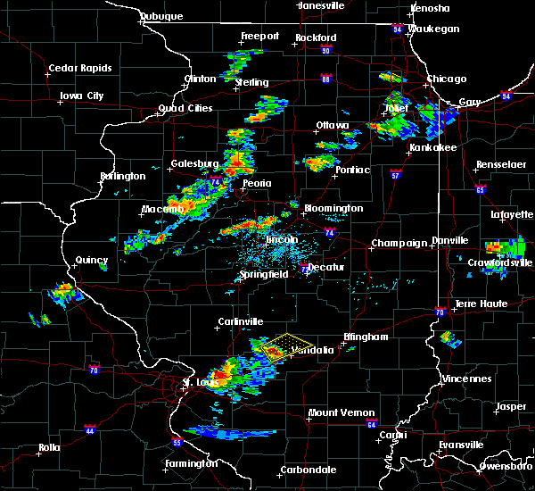 At 645 pm cdt, a severe thunderstorm was located over van burensburg, moving northeast at 25 mph (radar indicated). Hazards include 60 mph wind gusts and quarter size hail. Hail damage to vehicles is expected. Expect wind damage to roofs, siding, and trees. At 645 pm cdt, a severe thunderstorm was located over van burensburg, moving northeast at 25 mph (radar indicated). Hazards include 60 mph wind gusts and quarter size hail. Hail damage to vehicles is expected. Expect wind damage to roofs, siding, and trees.
|
| 7/23/2017 4:53 AM CDT |
 At 453 am cdt, severe thunderstorms were located along a line extending from near st. elmo to 10 miles north of mount vernon, moving east at 50 mph (radar indicated). Hazards include 70 mph wind gusts and penny size hail. Expect considerable tree damage. damage is likely to mobile homes, roofs, and outbuildings. locations impacted include, centralia, salem, vandalia, sandoval, wamac, central city, odin, kinmundy, brownstown, patoka, farina, omega, stephen forbes station, shobonier, fairman, helm, tonti, la clede, iuka and junction city. this includes the following highways, interstate 70 in illinois between exits 61 and 68. Interstate 57 in illinois between exits 109 and 135. At 453 am cdt, severe thunderstorms were located along a line extending from near st. elmo to 10 miles north of mount vernon, moving east at 50 mph (radar indicated). Hazards include 70 mph wind gusts and penny size hail. Expect considerable tree damage. damage is likely to mobile homes, roofs, and outbuildings. locations impacted include, centralia, salem, vandalia, sandoval, wamac, central city, odin, kinmundy, brownstown, patoka, farina, omega, stephen forbes station, shobonier, fairman, helm, tonti, la clede, iuka and junction city. this includes the following highways, interstate 70 in illinois between exits 61 and 68. Interstate 57 in illinois between exits 109 and 135.
|
| 7/23/2017 4:28 AM CDT |
 At 427 am cdt, severe thunderstorms were located along a line extending from farmersville to near witt to van burensburg, moving east at 45 mph (radar indicated). Hazards include 60 mph wind gusts. Expect damage to roofs, siding, and trees. locations impacted include, vandalia, litchfield, hillsboro, nokomis, st. elmo, ramsey, raymond, witt, taylor springs, coffeen, schram city, wrights corner, van burensburg, avena, irving, herrick, fillmore, coalton, butler and ohlman. this also includes ramsey lake state park and lake lou yaeger. this includes the following highways, interstate 70 in illinois near exit 76. Interstate 55 in illinois between exits 60 and 63. At 427 am cdt, severe thunderstorms were located along a line extending from farmersville to near witt to van burensburg, moving east at 45 mph (radar indicated). Hazards include 60 mph wind gusts. Expect damage to roofs, siding, and trees. locations impacted include, vandalia, litchfield, hillsboro, nokomis, st. elmo, ramsey, raymond, witt, taylor springs, coffeen, schram city, wrights corner, van burensburg, avena, irving, herrick, fillmore, coalton, butler and ohlman. this also includes ramsey lake state park and lake lou yaeger. this includes the following highways, interstate 70 in illinois near exit 76. Interstate 55 in illinois between exits 60 and 63.
|
| 7/23/2017 4:24 AM CDT |
 At 424 am cdt, severe thunderstorms were located along a line extending from near woburn to nashville, moving east at 35 mph (trained weather spotters). Hazards include 70 mph wind gusts and penny size hail. Expect considerable tree damage. Damage is likely to mobile homes, roofs, and outbuildings. At 424 am cdt, severe thunderstorms were located along a line extending from near woburn to nashville, moving east at 35 mph (trained weather spotters). Hazards include 70 mph wind gusts and penny size hail. Expect considerable tree damage. Damage is likely to mobile homes, roofs, and outbuildings.
|
| 7/23/2017 4:08 AM CDT |
 At 408 am cdt, severe thunderstorms were located along a line extending from near palmyra to near litchfield to near sorento, moving east at 45 mph (radar indicated). Hazards include 60 mph wind gusts and penny size hail. expect damage to roofs, siding, and trees At 408 am cdt, severe thunderstorms were located along a line extending from near palmyra to near litchfield to near sorento, moving east at 45 mph (radar indicated). Hazards include 60 mph wind gusts and penny size hail. expect damage to roofs, siding, and trees
|
| 7/10/2017 11:20 PM CDT |
 The severe thunderstorm warning for northeastern bond, northwestern fayette and montgomery counties will expire at 1130 pm cdt, the storm which prompted the warning has weakened below severe limits, and no longer poses an immediate threat to life or property. therefore the warning will be allowed to expire. The severe thunderstorm warning for northeastern bond, northwestern fayette and montgomery counties will expire at 1130 pm cdt, the storm which prompted the warning has weakened below severe limits, and no longer poses an immediate threat to life or property. therefore the warning will be allowed to expire.
|
| 7/10/2017 10:52 PM CDT |
 At 1052 pm cdt, a severe thunderstorm was located 7 miles northwest of pana, moving southeast at 40 mph (radar indicated). Hazards include 60 mph wind gusts and nickel size hail. Expect damage to roofs, siding, and trees. locations impacted include, vandalia, greenville, hillsboro, nokomis, ramsey, raymond, witt, white oak, farmersville, taylor springs, coffeen, mulberry grove, schram city, woburn, wrights corner, van burensburg, irving, shafter, herrick and fillmore. this also includes ramsey lake state park. This includes interstate 70 in illinois between exits 45 and 63. At 1052 pm cdt, a severe thunderstorm was located 7 miles northwest of pana, moving southeast at 40 mph (radar indicated). Hazards include 60 mph wind gusts and nickel size hail. Expect damage to roofs, siding, and trees. locations impacted include, vandalia, greenville, hillsboro, nokomis, ramsey, raymond, witt, white oak, farmersville, taylor springs, coffeen, mulberry grove, schram city, woburn, wrights corner, van burensburg, irving, shafter, herrick and fillmore. this also includes ramsey lake state park. This includes interstate 70 in illinois between exits 45 and 63.
|
| 7/10/2017 10:28 PM CDT |
 At 1028 pm cdt, a severe thunderstorm was located over kincaid, moving southeast at 60 mph (radar indicated). Hazards include 60 mph wind gusts and nickel size hail. expect damage to roofs, siding, and trees At 1028 pm cdt, a severe thunderstorm was located over kincaid, moving southeast at 60 mph (radar indicated). Hazards include 60 mph wind gusts and nickel size hail. expect damage to roofs, siding, and trees
|
| 5/19/2017 6:24 AM CDT |
 At 623 am cdt, severe thunderstorms were located along a line extending from white oak to near beaver creek, moving northeast at 65 mph (trained weather spotters). Hazards include 60 mph wind gusts. Expect damage to roofs, siding, and trees. locations impacted include, greenville, litchfield, hillsboro, nokomis, ramsey, raymond, witt, white oak, pocahontas, farmersville, taylor springs, coffeen, mulberry grove, schram city, tamalco, sorento, beaver creek, woburn, van burensburg and reno. this also includes ramsey lake state park and lake lou yaeger. this includes the following highways, interstate 70 in illinois between exits 36 and 52. Interstate 55 in illinois between exits 60 and 63. At 623 am cdt, severe thunderstorms were located along a line extending from white oak to near beaver creek, moving northeast at 65 mph (trained weather spotters). Hazards include 60 mph wind gusts. Expect damage to roofs, siding, and trees. locations impacted include, greenville, litchfield, hillsboro, nokomis, ramsey, raymond, witt, white oak, pocahontas, farmersville, taylor springs, coffeen, mulberry grove, schram city, tamalco, sorento, beaver creek, woburn, van burensburg and reno. this also includes ramsey lake state park and lake lou yaeger. this includes the following highways, interstate 70 in illinois between exits 36 and 52. Interstate 55 in illinois between exits 60 and 63.
|
| 5/19/2017 6:02 AM CDT |
 At 601 am cdt, severe thunderstorms were located along a line extending from near palmyra to near st. rose, moving northeast at 45 mph. these are very dangerous storms (trained weather spotters). Hazards include 80 mph wind gusts. Flying debris will be dangerous to those caught without shelter. mobile homes will be heavily damaged. expect considerable damage to roofs, windows, and vehicles. extensive tree damage and power outages are likely. locations impacted include, greenville, litchfield, hillsboro, carlinville, staunton, virden, gillespie, nokomis, girard, mount olive, bunker hill, benld, ramsey, raymond, witt, white oak, pocahontas, farmersville, palmyra and taylor springs. this also includes ramsey lake state park, beaver dam state park, and lake lou yaeger. this includes the following highways, interstate 70 in illinois between exits 36 and 52. Interstate 55 in illinois between exits 41 and 63. At 601 am cdt, severe thunderstorms were located along a line extending from near palmyra to near st. rose, moving northeast at 45 mph. these are very dangerous storms (trained weather spotters). Hazards include 80 mph wind gusts. Flying debris will be dangerous to those caught without shelter. mobile homes will be heavily damaged. expect considerable damage to roofs, windows, and vehicles. extensive tree damage and power outages are likely. locations impacted include, greenville, litchfield, hillsboro, carlinville, staunton, virden, gillespie, nokomis, girard, mount olive, bunker hill, benld, ramsey, raymond, witt, white oak, pocahontas, farmersville, palmyra and taylor springs. this also includes ramsey lake state park, beaver dam state park, and lake lou yaeger. this includes the following highways, interstate 70 in illinois between exits 36 and 52. Interstate 55 in illinois between exits 41 and 63.
|
| 5/19/2017 5:36 AM CDT |
 At 536 am cdt, severe thunderstorms were located along a line extending from near carrollton to mascoutah, moving northeast at 60 mph. these are very dangerous storms (radar indicated). Hazards include 80 mph wind gusts. Flying debris will be dangerous to those caught without shelter. mobile homes will be heavily damaged. expect considerable damage to roofs, windows, and vehicles. Extensive tree damage and power outages are likely. At 536 am cdt, severe thunderstorms were located along a line extending from near carrollton to mascoutah, moving northeast at 60 mph. these are very dangerous storms (radar indicated). Hazards include 80 mph wind gusts. Flying debris will be dangerous to those caught without shelter. mobile homes will be heavily damaged. expect considerable damage to roofs, windows, and vehicles. Extensive tree damage and power outages are likely.
|
| 4/29/2017 5:53 PM CDT |
 At 553 pm cdt, severe thunderstorms were located along a line extending from near ramsey to near vandalia to fairman, moving east at 35 mph (radar indicated). Hazards include 60 mph wind gusts and quarter size hail. Hail damage to vehicles is expected. expect wind damage to roofs, siding, and trees. locations impacted include, vandalia, st. elmo, ramsey, kinmundy, brownstown, patoka, farina, omega, fairman, wrights corner, stephen forbes station, shobonier, avena, tonti, la clede, herrick, st. peter, alma, vernon and loogootee. this also includes ramsey lake state park. this includes the following highways, interstate 70 in illinois between exits 61 and 76. Interstate 57 in illinois between exits 127 and 135. At 553 pm cdt, severe thunderstorms were located along a line extending from near ramsey to near vandalia to fairman, moving east at 35 mph (radar indicated). Hazards include 60 mph wind gusts and quarter size hail. Hail damage to vehicles is expected. expect wind damage to roofs, siding, and trees. locations impacted include, vandalia, st. elmo, ramsey, kinmundy, brownstown, patoka, farina, omega, fairman, wrights corner, stephen forbes station, shobonier, avena, tonti, la clede, herrick, st. peter, alma, vernon and loogootee. this also includes ramsey lake state park. this includes the following highways, interstate 70 in illinois between exits 61 and 76. Interstate 57 in illinois between exits 127 and 135.
|
| 4/29/2017 5:29 PM CDT |
 At 529 pm cdt, severe thunderstorms were located along a line extending from near ramsey to near mulberry grove to beckemeyer, moving east at 35 mph (radar indicated). Hazards include 60 mph wind gusts and quarter size hail. Hail damage to vehicles is expected. Expect wind damage to roofs, siding, and trees. At 529 pm cdt, severe thunderstorms were located along a line extending from near ramsey to near mulberry grove to beckemeyer, moving east at 35 mph (radar indicated). Hazards include 60 mph wind gusts and quarter size hail. Hail damage to vehicles is expected. Expect wind damage to roofs, siding, and trees.
|
| 3/30/2017 2:23 PM CDT |
 At 223 pm cdt, a severe thunderstorm was located near ramsey, moving east at 35 mph (radar indicated). Hazards include 60 mph wind gusts and quarter size hail. Hail damage to vehicles is expected. Expect wind damage to roofs, siding, and trees. At 223 pm cdt, a severe thunderstorm was located near ramsey, moving east at 35 mph (radar indicated). Hazards include 60 mph wind gusts and quarter size hail. Hail damage to vehicles is expected. Expect wind damage to roofs, siding, and trees.
|
| 10/19/2016 7:49 PM CDT |
 At 749 pm cdt, a severe thunderstorm was located near vandalia, moving east at 45 mph (radar indicated). Hazards include quarter size hail. damage to vehicles is expected At 749 pm cdt, a severe thunderstorm was located near vandalia, moving east at 45 mph (radar indicated). Hazards include quarter size hail. damage to vehicles is expected
|
| 7/13/2016 5:11 PM CDT | The severe thunderstorm warning for southeastern montgomery. fayette and marion counties will expire at 515 pm cdt. the storms which prompted the warning have moved out of the area. therefore the warning will be allowed to expire. however gusty winds are still possible with these thunderstorms. A severe thunderstorm watch remains in effect until 900 pm cdt for. |
| 7/13/2016 4:58 PM CDT |
 At 458 pm cdt, severe thunderstorms were located along a line extending from near findlay to near bluford, moving east at 60 mph (trained weather spotters. this storm has a long history of damaging winds of 60 to 70 mph). Hazards include 70 mph wind gusts. Expect considerable tree damage. damage is likely to mobile homes, roofs, and outbuildings. locations impacted include, centralia, salem, vandalia, nokomis, st. elmo, sandoval, wamac, central city, odin, ramsey, witt, kinmundy, brownstown, patoka, farina, omega, stephen forbes station, fairman, wrights corner and helm. this also includes ramsey lake state park. this includes the following highways, interstate 70 in illinois between exits 61 and 76. Interstate 57 in illinois between exits 109 and 135. At 458 pm cdt, severe thunderstorms were located along a line extending from near findlay to near bluford, moving east at 60 mph (trained weather spotters. this storm has a long history of damaging winds of 60 to 70 mph). Hazards include 70 mph wind gusts. Expect considerable tree damage. damage is likely to mobile homes, roofs, and outbuildings. locations impacted include, centralia, salem, vandalia, nokomis, st. elmo, sandoval, wamac, central city, odin, ramsey, witt, kinmundy, brownstown, patoka, farina, omega, stephen forbes station, fairman, wrights corner and helm. this also includes ramsey lake state park. this includes the following highways, interstate 70 in illinois between exits 61 and 76. Interstate 57 in illinois between exits 109 and 135.
|
| 7/13/2016 4:47 PM CDT |
 At 445 pm cdt, severe thunderstorms were located along a line extending from near tower hill to near woodlawn, moving east at 60 mph (trained weather spotters. this storm has a long history of damaging winds of 60 to 70 mph). Hazards include 70 mph wind gusts. Expect considerable tree damage. damage is likely to mobile homes, roofs, and outbuildings. locations impacted include, centralia, salem, vandalia, greenville, carlyle, nashville, nokomis, st. elmo, sandoval, wamac, central city, odin, ramsey, witt, kinmundy, brownstown, coffeen, irvington, mulberry grove and patoka. this also includes ramsey lake state park and carlyle lake recreational area. this includes the following highways, interstate 70 in illinois between exits 45 and 76. interstate 57 in illinois between exits 109 and 135. Interstate 64 in illinois between exits 50 and 61. At 445 pm cdt, severe thunderstorms were located along a line extending from near tower hill to near woodlawn, moving east at 60 mph (trained weather spotters. this storm has a long history of damaging winds of 60 to 70 mph). Hazards include 70 mph wind gusts. Expect considerable tree damage. damage is likely to mobile homes, roofs, and outbuildings. locations impacted include, centralia, salem, vandalia, greenville, carlyle, nashville, nokomis, st. elmo, sandoval, wamac, central city, odin, ramsey, witt, kinmundy, brownstown, coffeen, irvington, mulberry grove and patoka. this also includes ramsey lake state park and carlyle lake recreational area. this includes the following highways, interstate 70 in illinois between exits 45 and 76. interstate 57 in illinois between exits 109 and 135. Interstate 64 in illinois between exits 50 and 61.
|
| 7/13/2016 4:45 PM CDT | Trees down on us hwy 51. time estimated from radar in fayette county IL, 0.7 miles SW of Vandalia, IL |
| 7/13/2016 4:43 PM CDT | Trees and power lines down in fayette county IL, 0.7 miles SW of Vandalia, IL |
| 7/13/2016 4:20 PM CDT |
 At 420 pm cdt, severe thunderstorms were located along a line extending from morrisonville to 6 miles east of coulterville, moving east at 60 mph (trained weather spotters. numerous reports of wind damage and measured wind gusts of 60 to 70 mph). Hazards include 70 mph wind gusts. Expect considerable tree damage. Damage is likely to mobile homes, roofs, and outbuildings. At 420 pm cdt, severe thunderstorms were located along a line extending from morrisonville to 6 miles east of coulterville, moving east at 60 mph (trained weather spotters. numerous reports of wind damage and measured wind gusts of 60 to 70 mph). Hazards include 70 mph wind gusts. Expect considerable tree damage. Damage is likely to mobile homes, roofs, and outbuildings.
|
| 6/26/2016 6:19 PM CDT |
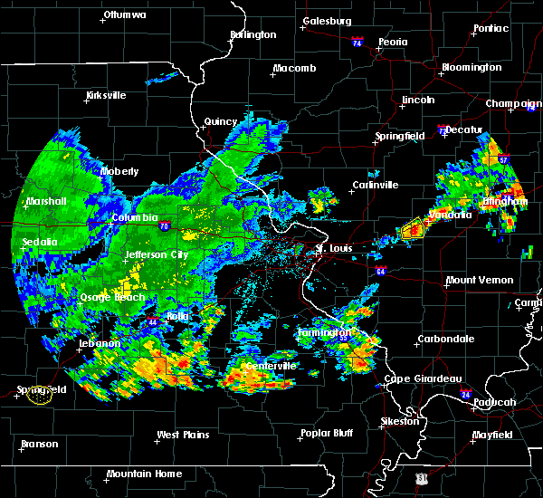 At 619 pm cdt, a severe thunderstorm was located over mulberry grove, moving east at 25 mph (radar indicated). Hazards include 60 mph wind gusts and nickel size hail. Expect damage to roofs. siding. and trees. locations impacted include, greenville, mulberry grove, pleasant mound, pittsburg, shafter, smithboro and hagerstown. This includes interstate 70 in illinois near exit 52. At 619 pm cdt, a severe thunderstorm was located over mulberry grove, moving east at 25 mph (radar indicated). Hazards include 60 mph wind gusts and nickel size hail. Expect damage to roofs. siding. and trees. locations impacted include, greenville, mulberry grove, pleasant mound, pittsburg, shafter, smithboro and hagerstown. This includes interstate 70 in illinois near exit 52.
|
| 6/26/2016 6:02 PM CDT |
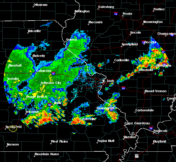 At 602 pm cdt, a severe thunderstorm was located over greenville, moving east at 20 mph (radar indicated). Hazards include 60 mph wind gusts and nickel size hail. Expect damage to roofs. siding. And trees. At 602 pm cdt, a severe thunderstorm was located over greenville, moving east at 20 mph (radar indicated). Hazards include 60 mph wind gusts and nickel size hail. Expect damage to roofs. siding. And trees.
|
| 5/11/2016 3:55 PM CDT |
 The severe thunderstorm warning for washington, clinton, bond and southwestern fayette counties will expire at 400 pm cdt, the storm which prompted the warning has weakened below severe limits, and have exited the warned area. therefore the warning will be allowed to expire. a severe thunderstorm watch remains in effect until 700 pm cdt for southwestern illinois. The severe thunderstorm warning for washington, clinton, bond and southwestern fayette counties will expire at 400 pm cdt, the storm which prompted the warning has weakened below severe limits, and have exited the warned area. therefore the warning will be allowed to expire. a severe thunderstorm watch remains in effect until 700 pm cdt for southwestern illinois.
|
| 5/11/2016 3:43 PM CDT |
 At 342 pm cdt, a severe thunderstorm was located near omega, moving east at 55 mph (radar indicated). Hazards include 70 mph wind gusts and quarter size hail. this storm has a history of damaging winds. Hail damage to vehicles is expected. expect considerable tree damage. Wind damage is also likely to mobile homes, roofs, and outbuildings. At 342 pm cdt, a severe thunderstorm was located near omega, moving east at 55 mph (radar indicated). Hazards include 70 mph wind gusts and quarter size hail. this storm has a history of damaging winds. Hail damage to vehicles is expected. expect considerable tree damage. Wind damage is also likely to mobile homes, roofs, and outbuildings.
|
| 5/11/2016 3:38 PM CDT |
 At 338 pm cdt, a severe thunderstorm was located near omega, moving east at 35 mph (radar indicated). Hazards include 70 mph wind gusts and half dollar size hail. Hail damage to vehicles is expected. expect considerable tree damage. wind damage is also likely to mobile homes, roofs, and outbuildings. locations impacted include, centralia, salem, vandalia, sandoval, wamac, central city, odin, kinmundy, brownstown, patoka, farina, omega, stephen forbes station, fairman, helm, shobonier, avena, tonti, la clede and iuka. this includes the following highways, interstate 70 in illinois between exits 63 and 68. Interstate 57 in illinois between exits 109 and 135. At 338 pm cdt, a severe thunderstorm was located near omega, moving east at 35 mph (radar indicated). Hazards include 70 mph wind gusts and half dollar size hail. Hail damage to vehicles is expected. expect considerable tree damage. wind damage is also likely to mobile homes, roofs, and outbuildings. locations impacted include, centralia, salem, vandalia, sandoval, wamac, central city, odin, kinmundy, brownstown, patoka, farina, omega, stephen forbes station, fairman, helm, shobonier, avena, tonti, la clede and iuka. this includes the following highways, interstate 70 in illinois between exits 63 and 68. Interstate 57 in illinois between exits 109 and 135.
|
| 5/11/2016 3:22 PM CDT |
 At 322 pm cdt, a severe thunderstorm was located near salem, moving east at 50 mph (radar indicated). Hazards include 60 mph wind gusts and half dollar size hail. Hail damage to vehicles is expected. expect wind damage to roofs, siding, and trees. locations impacted include, centralia, salem, vandalia, sandoval, wamac, central city, odin, kinmundy, brownstown, patoka, farina, omega, stephen forbes station, fairman, helm, shobonier, avena, tonti, la clede and iuka. this includes the following highways, interstate 70 in illinois between exits 63 and 68. Interstate 57 in illinois between exits 109 and 135. At 322 pm cdt, a severe thunderstorm was located near salem, moving east at 50 mph (radar indicated). Hazards include 60 mph wind gusts and half dollar size hail. Hail damage to vehicles is expected. expect wind damage to roofs, siding, and trees. locations impacted include, centralia, salem, vandalia, sandoval, wamac, central city, odin, kinmundy, brownstown, patoka, farina, omega, stephen forbes station, fairman, helm, shobonier, avena, tonti, la clede and iuka. this includes the following highways, interstate 70 in illinois between exits 63 and 68. Interstate 57 in illinois between exits 109 and 135.
|
| 5/11/2016 3:13 PM CDT |
 At 313 pm cdt, a severe thunderstorm was located over carlyle, moving east at 55 mph (radar indicated). Hazards include 70 mph wind gusts and ping pong ball size hail. People and animals outdoors will be injured. expect hail damage to roofs, siding, windows, and vehicles. expect considerable tree damage. Wind damage is also likely to mobile homes, roofs, and outbuildings. At 313 pm cdt, a severe thunderstorm was located over carlyle, moving east at 55 mph (radar indicated). Hazards include 70 mph wind gusts and ping pong ball size hail. People and animals outdoors will be injured. expect hail damage to roofs, siding, windows, and vehicles. expect considerable tree damage. Wind damage is also likely to mobile homes, roofs, and outbuildings.
|
| 5/11/2016 3:02 PM CDT |
 At 302 pm cdt, a severe thunderstorm was located near boulder, moving east at 55 mph. this is a very dangerous storm (radar indicated). Hazards include 80 mph wind gusts and ping pong ball size hail. Flying debris will be dangerous to those caught without shelter. mobile homes will be heavily damaged. expect considerable damage to roofs, windows, and vehicles. Extensive tree damage and power outages are likely. At 302 pm cdt, a severe thunderstorm was located near boulder, moving east at 55 mph. this is a very dangerous storm (radar indicated). Hazards include 80 mph wind gusts and ping pong ball size hail. Flying debris will be dangerous to those caught without shelter. mobile homes will be heavily damaged. expect considerable damage to roofs, windows, and vehicles. Extensive tree damage and power outages are likely.
|
| 5/11/2016 2:58 PM CDT |
 At 258 pm cdt, severe thunderstorms were located along a line extending from near beaver creek to nashville, moving east at 55 mph (trained weather spotters). Hazards include 70 mph wind gusts and ping pong ball size hail. People and animals outdoors will be injured. expect hail damage to roofs, siding, windows, and vehicles. expect considerable tree damage. wind damage is also likely to mobile homes, roofs, and outbuildings. locations impacted include, highland, vandalia, greenville, breese, new baden, carlyle, nashville, centralia, trenton, aviston, okawville, st. rose, germantown, albers, wamac, beckemeyer, livingston, pocahontas, lively grove and alhambra. this also includes carlyle lake recreational area. this includes the following highways, interstate 70 in illinois between exits 30 and 61. interstate 55 in illinois near exit 37. Interstate 64 in illinois between exits 34 and 61. At 258 pm cdt, severe thunderstorms were located along a line extending from near beaver creek to nashville, moving east at 55 mph (trained weather spotters). Hazards include 70 mph wind gusts and ping pong ball size hail. People and animals outdoors will be injured. expect hail damage to roofs, siding, windows, and vehicles. expect considerable tree damage. wind damage is also likely to mobile homes, roofs, and outbuildings. locations impacted include, highland, vandalia, greenville, breese, new baden, carlyle, nashville, centralia, trenton, aviston, okawville, st. rose, germantown, albers, wamac, beckemeyer, livingston, pocahontas, lively grove and alhambra. this also includes carlyle lake recreational area. this includes the following highways, interstate 70 in illinois between exits 30 and 61. interstate 55 in illinois near exit 37. Interstate 64 in illinois between exits 34 and 61.
|
| 5/11/2016 2:42 PM CDT |
 At 242 pm cdt, severe thunderstorms were located along a line extending from near pocahontas to near okawville, moving east at 60 mph (radar indicated). Hazards include 70 mph wind gusts and half dollar size hail. Hail damage to vehicles is expected. expect considerable tree damage. wind damage is also likely to mobile homes, roofs, and outbuildings. locations impacted include, highland, vandalia, greenville, breese, new baden, carlyle, nashville, centralia, trenton, aviston, okawville, st. rose, germantown, albers, wamac, beckemeyer, livingston, pocahontas, lively grove and alhambra. this also includes carlyle lake recreational area. this includes the following highways, interstate 70 in illinois between exits 30 and 61. interstate 55 in illinois near exit 37. Interstate 64 in illinois between exits 34 and 61. At 242 pm cdt, severe thunderstorms were located along a line extending from near pocahontas to near okawville, moving east at 60 mph (radar indicated). Hazards include 70 mph wind gusts and half dollar size hail. Hail damage to vehicles is expected. expect considerable tree damage. wind damage is also likely to mobile homes, roofs, and outbuildings. locations impacted include, highland, vandalia, greenville, breese, new baden, carlyle, nashville, centralia, trenton, aviston, okawville, st. rose, germantown, albers, wamac, beckemeyer, livingston, pocahontas, lively grove and alhambra. this also includes carlyle lake recreational area. this includes the following highways, interstate 70 in illinois between exits 30 and 61. interstate 55 in illinois near exit 37. Interstate 64 in illinois between exits 34 and 61.
|
| 5/11/2016 2:32 PM CDT |
 At 232 pm cdt, severe thunderstorms were located along a line extending from near alhambra to 6 miles northeast of new athens, moving east at 55 mph (radar indicated). Hazards include 60 mph wind gusts and half dollar size hail. Hail damage to vehicles is expected. Expect wind damage to roofs, siding, and trees. At 232 pm cdt, severe thunderstorms were located along a line extending from near alhambra to 6 miles northeast of new athens, moving east at 55 mph (radar indicated). Hazards include 60 mph wind gusts and half dollar size hail. Hail damage to vehicles is expected. Expect wind damage to roofs, siding, and trees.
|
| 5/7/2016 5:31 PM CDT |
 At 530 pm cdt, severe thunderstorms were located along a line extending from near st. elmo to 8 miles south of beckemeyer, moving southeast at 55 mph (trained weather spotters). Hazards include 70 mph wind gusts. Expect considerable tree damage. damage is likely to mobile homes, roofs, and outbuildings. locations impacted include, vandalia, greenville, breese, carlyle, centralia, st. elmo, germantown, albers, wamac, beckemeyer, ramsey, brownstown, mulberry grove, tamalco, farina, beaver creek, boulder, wrights corner, shobonier and shattuc. this also includes ramsey lake state park and carlyle lake recreational area. this includes the following highways, interstate 70 in illinois between exits 45 and 76. interstate 57 in illinois near exit 135. Interstate 64 in illinois near exit 34. At 530 pm cdt, severe thunderstorms were located along a line extending from near st. elmo to 8 miles south of beckemeyer, moving southeast at 55 mph (trained weather spotters). Hazards include 70 mph wind gusts. Expect considerable tree damage. damage is likely to mobile homes, roofs, and outbuildings. locations impacted include, vandalia, greenville, breese, carlyle, centralia, st. elmo, germantown, albers, wamac, beckemeyer, ramsey, brownstown, mulberry grove, tamalco, farina, beaver creek, boulder, wrights corner, shobonier and shattuc. this also includes ramsey lake state park and carlyle lake recreational area. this includes the following highways, interstate 70 in illinois between exits 45 and 76. interstate 57 in illinois near exit 135. Interstate 64 in illinois near exit 34.
|
| 5/7/2016 5:20 PM CDT |
 At 519 pm cdt, severe thunderstorms were located along a line extending from 6 miles west of wrights corner to albers, moving east at 60 mph (trained weather spotters). Hazards include 70 mph wind gusts. Expect considerable tree damage. damage is likely to mobile homes, roofs, and outbuildings. locations impacted include, belleville, o`fallon, shiloh, highland, mascoutah, vandalia, greenville, breese, lebanon, new baden, carlyle, scott afb, centralia, trenton, aviston, st. elmo, st. rose, germantown, albers and wamac. this also includes ramsey lake state park and carlyle lake recreational area. this includes the following highways, interstate 70 in illinois between exits 30 and 76. interstate 57 in illinois near exit 135. Interstate 64 in illinois between exits 19 and 34. At 519 pm cdt, severe thunderstorms were located along a line extending from 6 miles west of wrights corner to albers, moving east at 60 mph (trained weather spotters). Hazards include 70 mph wind gusts. Expect considerable tree damage. damage is likely to mobile homes, roofs, and outbuildings. locations impacted include, belleville, o`fallon, shiloh, highland, mascoutah, vandalia, greenville, breese, lebanon, new baden, carlyle, scott afb, centralia, trenton, aviston, st. elmo, st. rose, germantown, albers and wamac. this also includes ramsey lake state park and carlyle lake recreational area. this includes the following highways, interstate 70 in illinois between exits 30 and 76. interstate 57 in illinois near exit 135. Interstate 64 in illinois between exits 19 and 34.
|
| 5/7/2016 5:15 PM CDT | Three large trees down. time estimate in fayette county IL, 0.7 miles SW of Vandalia, IL |
| 5/7/2016 4:58 PM CDT |
 At 457 pm cdt, severe thunderstorms were located along a line extending from 6 miles southeast of witt to near caseyville, moving southeast at 55 mph (trained weather spotters). Hazards include 70 mph wind gusts. Expect considerable tree damage. Damage is likely to mobile homes, roofs, and outbuildings. At 457 pm cdt, severe thunderstorms were located along a line extending from 6 miles southeast of witt to near caseyville, moving southeast at 55 mph (trained weather spotters). Hazards include 70 mph wind gusts. Expect considerable tree damage. Damage is likely to mobile homes, roofs, and outbuildings.
|
| 12/23/2015 9:42 AM CST | The severe thunderstorm warning for northeastern bond, southeastern montgomery and fayette counties will expire at 945 am cst, the storms which prompted the warning have weakened below severe limits, and no longer pose an immediate threat to life or property. therefore the warning will be allowed to expire. however gusty winds are still possible with these thunderstorms. a tornado watch remains in effect until 500 pm cst for south central illinois. to report severe weather, contact your nearest law enforcement agency. they will relay your report to the national weather service st louis. |
| 12/23/2015 9:20 AM CST | A severe thunderstorm warning remains in effect until 945 am cst for northeastern bond. southeastern montgomery and fayette counties. at 919 am cst. severe thunderstorms were located along a line extending from nokomis to near ramsey to near mulberry grove. Moving northeast at 55 mph. |
| 12/23/2015 9:06 AM CST | At 905 am cst, severe thunderstorms were located along a line extending from near raymond to coffeen to near greenville, moving northeast at 70 mph (radar indicated). Hazards include 60 mph wind gusts. Expect damage to roofs. siding and trees. locations impacted include, vandalia, greenville, litchfield, hillsboro, nokomis, st. elmo, ramsey, raymond, witt, white oak, pocahontas, brownstown, farmersville, taylor springs, coffeen, mulberry grove, schram city, wrights corner, reno and woburn. this warning also includes ramsey lake state park and lake lou yaeger. this includes the following highways, interstate 70 in illinois between exits 36 and 76. Interstate 55 in illinois between exits 60 and 63. |
| 12/23/2015 8:50 AM CST | At 849 am cst, severe thunderstorms were located along a line extending from east gillespie to near alhambra to highland, moving northeast at 70 mph (radar indicated). Hazards include 60 mph wind gusts. Expect damage to roofs. Siding and trees. |
| 5/24/2015 10:59 PM CDT | At 1056 pm cdt, severe thunderstorms were located along a line extending from 6 miles northwest of nokomis to shobonier, and moving east at 25 mph (radar indicated). Hazards include 70 mph wind gusts. Expect considerable tree damage. Damage is likely to mobile homes, roofs and outbuildings. |
| 5/24/2015 10:45 PM CDT | At 1042 pm cdt, severe thunderstorms were located along a line extending from 5 miles northeast of hillsboro to tamalco, and moving northeast at 45 mph (radar indicated). Hazards include 70 mph wind gusts. Expect considerable tree damage. damage is likely to mobile homes, roofs and outbuildings. locations impacted include, vandalia, van burensburg, witt, patoka, shobonier, ramsey, brownstown, kinmundy, st. elmo, wrights corner, pittsburg, chapman, fillmore, shafter, hagerstown, bingham, vernon, bayle city, st. paul and avena. this warning includes carlyle lake recreational area and ramsey lake state park. this warning also includes, interstate 70 in illinois from exit 36 to exit 76. Interstate 57 near exit 127. |
| 5/24/2015 10:33 PM CDT | At 1031 pm cdt, severe thunderstorms were located along a line extending from hillsboro to carlyle, and moving northeast at 45 mph (radar indicated). Hazards include 60 mph wind gusts. Expect damage to roofs. siding and trees. locations impacted include, greenville, centralia, vandalia, salem, coffeen, woburn, tamalco, witt, shattuc, mulberry grove, boulder, central city, van burensburg, sandoval, fairman, odin, patoka, shobonier, ramsey and brownstown. this warning includes carlyle lake recreational area and ramsey lake state park. this warning also includes, interstate 70 in illinois from exit 30 to exit 76. Interstate 57 from exit 109 to exit 127. |
| 5/24/2015 10:15 PM CDT | At 1012 pm cdt, severe thunderstorms were located along a line extending from litchfield to 6 miles west of nashville, and moving northeast at 45 mph (radar indicated). Hazards include 60 mph wind gusts. Expect damage to roofs. Siding and trees. |
| 4/9/2015 7:54 PM CDT | The national weather service in st louis has issued a * severe thunderstorm warning for. northeastern bond county in south central illinois. northern fayette county in south central illinois. southern montgomery county in south central illinois. Until 845 pm cdt. |
| 5/31/2013 9:30 PM CDT | Tree limb blown down 1 mile north of vandalia on route 51 in fayette county IL, 1.9 miles SSW of Vandalia, IL |
| 9/5/2012 9:52 AM CDT | Trees down just north of bluff city... east of vandali in fayette county IL, 3.2 miles W of Vandalia, IL |
| 9/5/2012 9:30 AM CDT | At the intersection of 2300n and 875e... antenna was blown over and 4-6 inch limbs were blown off a maple tre in fayette county IL, 6.7 miles S of Vandalia, IL |
| 8/16/2012 4:00 PM CDT | Trees down on the north side of tow in fayette county IL, 0.7 miles SW of Vandalia, IL |
| 4/28/2012 5:50 PM CDT | Golf Ball sized hail reported 12.1 miles NW of Vandalia, IL |
| 1/1/0001 12:00 AM | 6 inch diameter tree blown down and 4 inch branches broken in fayette county IL, 0.7 miles SW of Vandalia, IL |
Hail Maps for Vandalia, IL

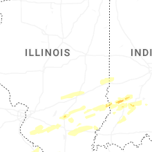


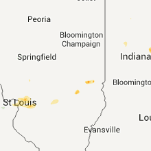


Connect with Interactive Hail Maps