

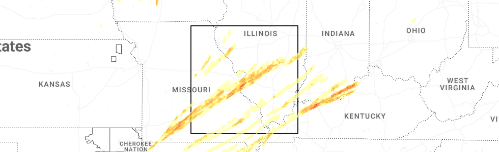
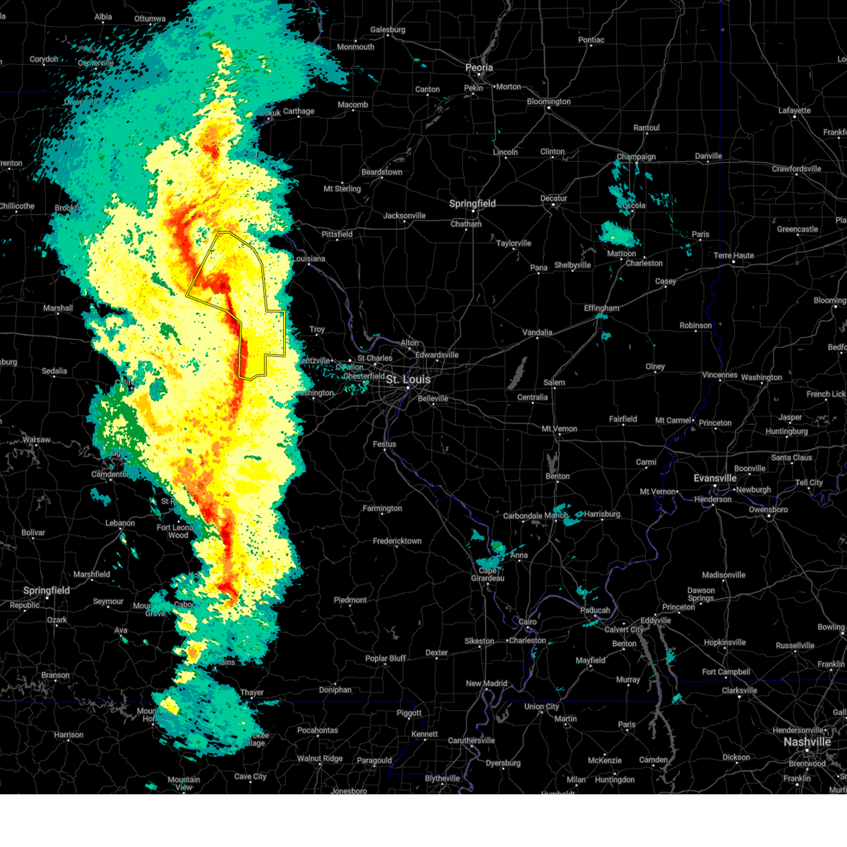
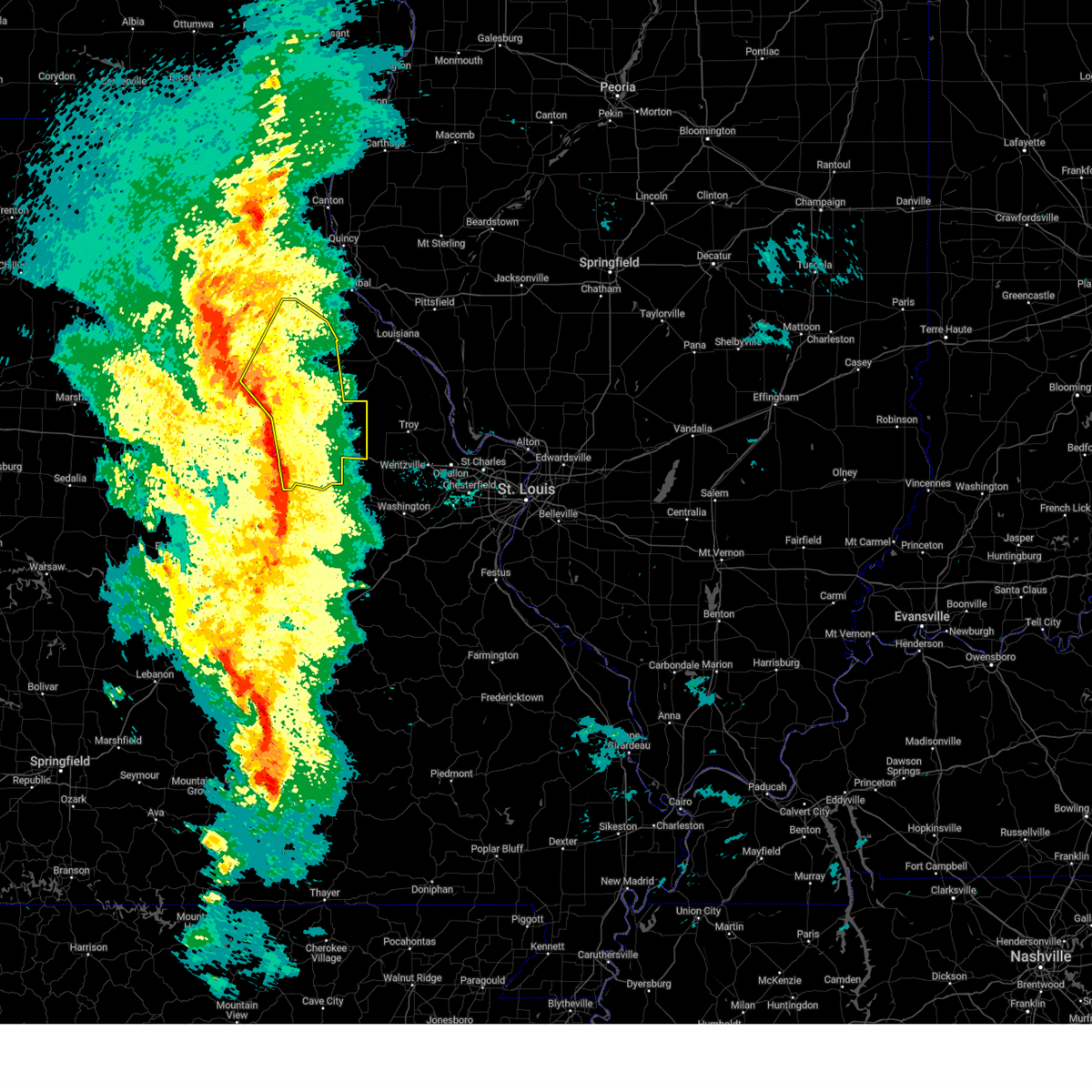
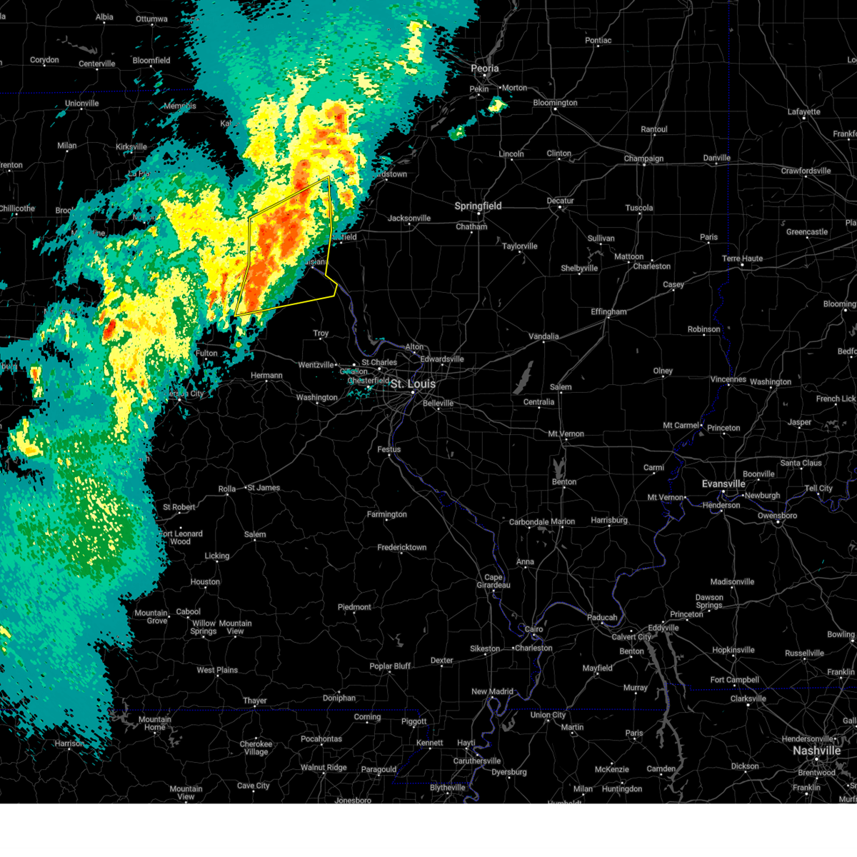
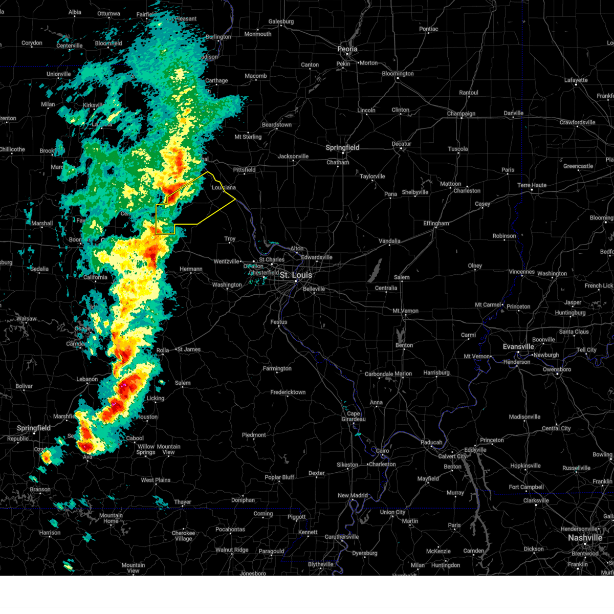
Hail Map for Vandalia, MO
The Vandalia, MO area has had 7 reports of on-the-ground hail by trained spotters, and has been under severe weather warnings 15 times during the past 12 months. Doppler radar has detected hail at or near Vandalia, MO on 50 occasions, including 2 occasions during the past year.
| Name: | Vandalia, MO |
| Where Located: | 51.8 miles ENE of Columbia, MO |
| Map: | Google Map for Vandalia, MO |
| Population: | 3899 |
| Housing Units: | 1295 |
| More Info: | Search Google for Vandalia, MO |
0
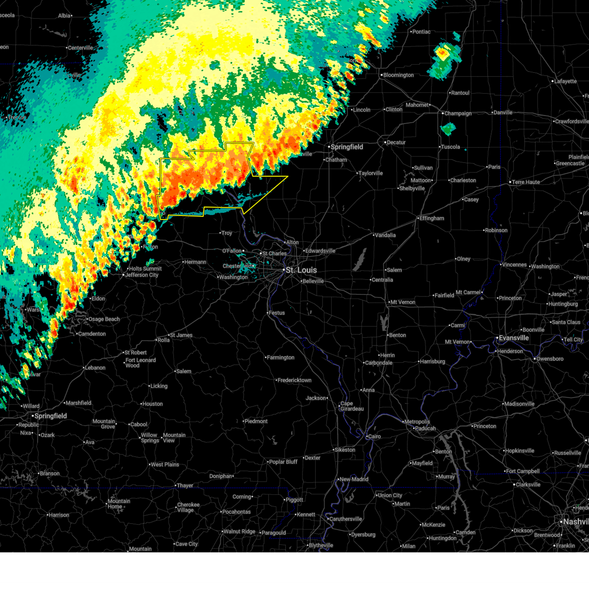
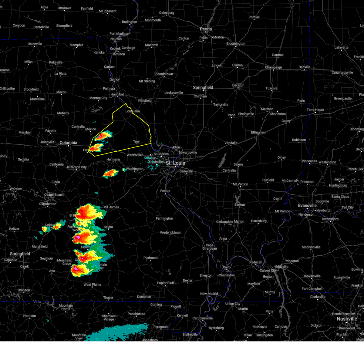
The Top Recent Hail Date for Vandalia, MO is Friday, March 14, 2025 (25th out of 50)
Hail and Wind Damage Spotted near Vandalia, MO
| Date / Time | Report Details |
|---|---|
| 7/11/2025 10:59 PM CDT |
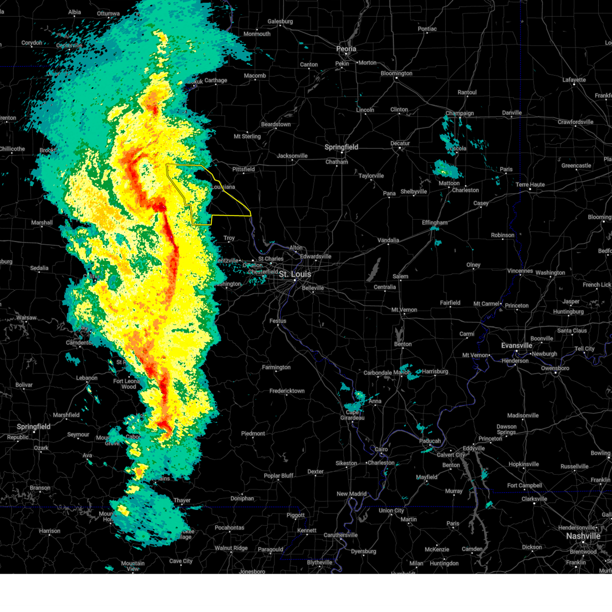
 The storms which prompted the warning have weakened below severe limits, and no longer pose an immediate threat to life or property. therefore, the warning will be allowed to expire. however, gusty winds and heavy rain are still possible with these thunderstorms. The storms which prompted the warning have weakened below severe limits, and no longer pose an immediate threat to life or property. therefore, the warning will be allowed to expire. however, gusty winds and heavy rain are still possible with these thunderstorms.
|
| 7/11/2025 10:35 PM CDT |
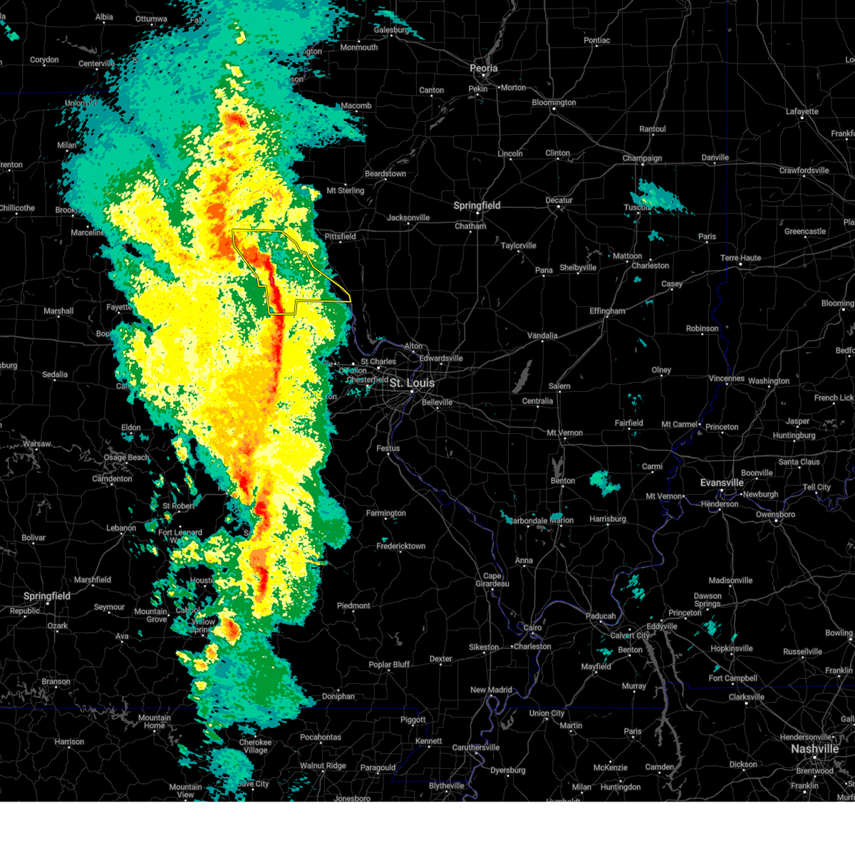
 At 1035 pm cdt, severe thunderstorms were located along a line from 10 miles northwest of white hall to over laddonia, or along a line from 10 miles northwest of white hall to 7 miles southwest of vandalia, moving south at 25 mph (law enforcement reported tree damage in hannibal, mo and highway 79 in eastern ralls county). Hazards include 60 mph wind gusts. Expect damage to roofs, siding, and trees. this severe thunderstorm will be near, atlas, spencerburg, pittsfield, perry, frankford, griggsville and center around 1015 pm cdt. louisiana and pike around 1020 pm cdt. other locations impacted by the severe thunderstorm include detroit, summer hill, rockport, new hartford, valley city, ashburn, el dara, time, martinsburg and independence. This includes interstate 72 between exits 10 and 35. At 1035 pm cdt, severe thunderstorms were located along a line from 10 miles northwest of white hall to over laddonia, or along a line from 10 miles northwest of white hall to 7 miles southwest of vandalia, moving south at 25 mph (law enforcement reported tree damage in hannibal, mo and highway 79 in eastern ralls county). Hazards include 60 mph wind gusts. Expect damage to roofs, siding, and trees. this severe thunderstorm will be near, atlas, spencerburg, pittsfield, perry, frankford, griggsville and center around 1015 pm cdt. louisiana and pike around 1020 pm cdt. other locations impacted by the severe thunderstorm include detroit, summer hill, rockport, new hartford, valley city, ashburn, el dara, time, martinsburg and independence. This includes interstate 72 between exits 10 and 35.
|
| 7/11/2025 10:15 PM CDT |
 Svrlsx the national weather service in st louis has issued a * severe thunderstorm warning for, northwestern calhoun county in southwestern illinois, northern greene county in southwestern illinois, pike county in west central illinois, eastern audrain county in central missouri, pike county in northeastern missouri, ralls county in northeastern missouri, * until 1100 pm cdt. * at 1015 pm cdt, severe thunderstorms were located along a line from 9 miles southeast of griggsville to near perry, or along a line from 12 miles east of pittsfield to 9 miles east of santa fe, moving south at 20 mph (law enforcement reported tree damage was reported in hannibal, mo and highway 79 in eastern ralls county). Hazards include 60 mph wind gusts. Expect damage to roofs, siding, and trees. this severe thunderstorm will be near, atlas, spencerburg, pittsfield, louisiana, perry, frankford, griggsville and center around 1015 pm cdt. pike around 1020 pm cdt. other locations impacted by the severe thunderstorm include detroit, summer hill, rockport, new hartford, valley city, ashburn, el dara, independence, milton and martinsburg. This includes interstate 72 between exits 10 and 35. Svrlsx the national weather service in st louis has issued a * severe thunderstorm warning for, northwestern calhoun county in southwestern illinois, northern greene county in southwestern illinois, pike county in west central illinois, eastern audrain county in central missouri, pike county in northeastern missouri, ralls county in northeastern missouri, * until 1100 pm cdt. * at 1015 pm cdt, severe thunderstorms were located along a line from 9 miles southeast of griggsville to near perry, or along a line from 12 miles east of pittsfield to 9 miles east of santa fe, moving south at 20 mph (law enforcement reported tree damage was reported in hannibal, mo and highway 79 in eastern ralls county). Hazards include 60 mph wind gusts. Expect damage to roofs, siding, and trees. this severe thunderstorm will be near, atlas, spencerburg, pittsfield, louisiana, perry, frankford, griggsville and center around 1015 pm cdt. pike around 1020 pm cdt. other locations impacted by the severe thunderstorm include detroit, summer hill, rockport, new hartford, valley city, ashburn, el dara, independence, milton and martinsburg. This includes interstate 72 between exits 10 and 35.
|
| 5/16/2025 1:17 PM CDT |
 Svrlsx the national weather service in st louis has issued a * severe thunderstorm warning for, southeastern audrain county in central missouri, northeastern callaway county in central missouri, lincoln county in east central missouri, montgomery county in east central missouri, north central warren county in east central missouri, pike county in northeastern missouri, * until 230 pm cdt. * at 117 pm cdt, a severe thunderstorm was located over martinsburg, or 6 miles west of wellsville, moving northeast at 50 mph (radar indicated). Hazards include 60 mph wind gusts and half dollar size hail. Hail damage to vehicles is expected. Expect wind damage to roofs, siding, and trees. Svrlsx the national weather service in st louis has issued a * severe thunderstorm warning for, southeastern audrain county in central missouri, northeastern callaway county in central missouri, lincoln county in east central missouri, montgomery county in east central missouri, north central warren county in east central missouri, pike county in northeastern missouri, * until 230 pm cdt. * at 117 pm cdt, a severe thunderstorm was located over martinsburg, or 6 miles west of wellsville, moving northeast at 50 mph (radar indicated). Hazards include 60 mph wind gusts and half dollar size hail. Hail damage to vehicles is expected. Expect wind damage to roofs, siding, and trees.
|
| 4/20/2025 6:16 PM CDT |
 At 616 pm cdt, severe thunderstorms were located along a line from near spaulding to near bellflower, or along a line from 10 miles southeast of monroe city to 11 miles northeast of montgomery city, moving northeast at 60 mph (trained spotters reported. at 6:10 pm a 63 mph wind gust was reported at vandalia, mo). Hazards include 70 mph wind gusts. Expect considerable tree damage. damage is likely to mobile homes, roofs, and outbuildings. this severe thunderstorm will be near, vandalia around 610 pm cdt. other locations impacted by the severe thunderstorm include the landing, st. Clement, ashley, cyrene, saverton, ilasco, edgewood and ashburn. At 616 pm cdt, severe thunderstorms were located along a line from near spaulding to near bellflower, or along a line from 10 miles southeast of monroe city to 11 miles northeast of montgomery city, moving northeast at 60 mph (trained spotters reported. at 6:10 pm a 63 mph wind gust was reported at vandalia, mo). Hazards include 70 mph wind gusts. Expect considerable tree damage. damage is likely to mobile homes, roofs, and outbuildings. this severe thunderstorm will be near, vandalia around 610 pm cdt. other locations impacted by the severe thunderstorm include the landing, st. Clement, ashley, cyrene, saverton, ilasco, edgewood and ashburn.
|
| 4/20/2025 6:11 PM CDT |
 Torlsx the national weather service in st louis has issued a * tornado warning for, northwestern pike county in west central illinois, northwestern pike county in northeastern missouri, central ralls county in northeastern missouri, * until 700 pm cdt. * at 611 pm cdt, a severe thunderstorm capable of producing a tornado was located near vandalia, moving northeast at 70 mph (radar indicated rotation). Hazards include tornado. Flying debris will be dangerous to those caught without shelter. mobile homes will be damaged or destroyed. damage to roofs, windows and vehicles will occur. tree damage is likely. this tornado will be near, spencerburg, curryville and vandalia around 615 pm cdt. frankford around 620 pm cdt. other locations impacted by the tornado include ashburn, saverton, ilasco, new canton, kinderhook, hull, el dara and baylis. This includes interstate 72 between exits 10 and 20. Torlsx the national weather service in st louis has issued a * tornado warning for, northwestern pike county in west central illinois, northwestern pike county in northeastern missouri, central ralls county in northeastern missouri, * until 700 pm cdt. * at 611 pm cdt, a severe thunderstorm capable of producing a tornado was located near vandalia, moving northeast at 70 mph (radar indicated rotation). Hazards include tornado. Flying debris will be dangerous to those caught without shelter. mobile homes will be damaged or destroyed. damage to roofs, windows and vehicles will occur. tree damage is likely. this tornado will be near, spencerburg, curryville and vandalia around 615 pm cdt. frankford around 620 pm cdt. other locations impacted by the tornado include ashburn, saverton, ilasco, new canton, kinderhook, hull, el dara and baylis. This includes interstate 72 between exits 10 and 20.
|
| 4/20/2025 6:10 PM CDT | Vandalia mo ag sit in audrain county MO, 1.4 miles ENE of Vandalia, MO |
| 4/20/2025 6:03 PM CDT |
 Svrlsx the national weather service in st louis has issued a * severe thunderstorm warning for, pike county in northeastern missouri, ralls county in northeastern missouri, * until 645 pm cdt. * at 603 pm cdt, severe thunderstorms were located along a line from over perry to over new florence, or along a line from 8 miles northeast of santa fe to 5 miles southeast of montgomery city, moving northeast at 60 mph (radar indicated). Hazards include 70 mph wind gusts. Expect considerable tree damage. damage is likely to mobile homes, roofs, and outbuildings. this severe thunderstorm will be near, vandalia around 610 pm cdt. other locations impacted by the severe thunderstorm include the landing, st. Clement, ashley, cyrene, saverton, ilasco, edgewood and ashburn. Svrlsx the national weather service in st louis has issued a * severe thunderstorm warning for, pike county in northeastern missouri, ralls county in northeastern missouri, * until 645 pm cdt. * at 603 pm cdt, severe thunderstorms were located along a line from over perry to over new florence, or along a line from 8 miles northeast of santa fe to 5 miles southeast of montgomery city, moving northeast at 60 mph (radar indicated). Hazards include 70 mph wind gusts. Expect considerable tree damage. damage is likely to mobile homes, roofs, and outbuildings. this severe thunderstorm will be near, vandalia around 610 pm cdt. other locations impacted by the severe thunderstorm include the landing, st. Clement, ashley, cyrene, saverton, ilasco, edgewood and ashburn.
|
| 4/20/2025 5:59 PM CDT |
 the severe thunderstorm warning has been cancelled and is no longer in effect the severe thunderstorm warning has been cancelled and is no longer in effect
|
| 4/20/2025 5:59 PM CDT |
 At 559 pm cdt, severe thunderstorms were located along a line from 5 miles east of paris to over mineola, or along a line from 5 miles east of paris to 7 miles south of montgomery city, moving northeast at 60 mph (radar indicated). Hazards include 70 mph wind gusts. Expect considerable tree damage. damage is likely to mobile homes, roofs, and outbuildings. this severe thunderstorm will be near, mexico around 535 pm cdt. other locations impacted by the severe thunderstorm include rush hill, americus, danville, florida, stoutsville, high hill, middletown, the landing and indian creek. this includes the following state parks, graham cave state park and mark twain lake recreational area. This includes interstate 70 in missouri between exits 170 and 183. At 559 pm cdt, severe thunderstorms were located along a line from 5 miles east of paris to over mineola, or along a line from 5 miles east of paris to 7 miles south of montgomery city, moving northeast at 60 mph (radar indicated). Hazards include 70 mph wind gusts. Expect considerable tree damage. damage is likely to mobile homes, roofs, and outbuildings. this severe thunderstorm will be near, mexico around 535 pm cdt. other locations impacted by the severe thunderstorm include rush hill, americus, danville, florida, stoutsville, high hill, middletown, the landing and indian creek. this includes the following state parks, graham cave state park and mark twain lake recreational area. This includes interstate 70 in missouri between exits 170 and 183.
|
| 4/20/2025 5:47 PM CDT |
 the severe thunderstorm warning has been cancelled and is no longer in effect the severe thunderstorm warning has been cancelled and is no longer in effect
|
| 4/20/2025 5:47 PM CDT |
 At 547 pm cdt, severe thunderstorms were located along a line from 9 miles southwest of paris to 6 miles northeast of chamois, or along a line from 9 miles southwest of paris to 14 miles southeast of fulton, moving northeast at 60 mph (radar indicated). Hazards include 70 mph wind gusts. Expect considerable tree damage. damage is likely to mobile homes, roofs, and outbuildings. this severe thunderstorm will be near, mexico around 535 pm cdt. chamois around 540 pm cdt. other locations impacted by the severe thunderstorm include thompson, reform, vandiver, portland, rush hill, benton city, americus, danville, florida and stoutsville. this includes the following state parks, graham cave state park and mark twain lake recreational area. This includes interstate 70 in missouri between exits 155 and 183. At 547 pm cdt, severe thunderstorms were located along a line from 9 miles southwest of paris to 6 miles northeast of chamois, or along a line from 9 miles southwest of paris to 14 miles southeast of fulton, moving northeast at 60 mph (radar indicated). Hazards include 70 mph wind gusts. Expect considerable tree damage. damage is likely to mobile homes, roofs, and outbuildings. this severe thunderstorm will be near, mexico around 535 pm cdt. chamois around 540 pm cdt. other locations impacted by the severe thunderstorm include thompson, reform, vandiver, portland, rush hill, benton city, americus, danville, florida and stoutsville. this includes the following state parks, graham cave state park and mark twain lake recreational area. This includes interstate 70 in missouri between exits 155 and 183.
|
| 4/20/2025 5:30 PM CDT | Svrlsx the national weather service in st louis has issued a * severe thunderstorm warning for, audrain county in central missouri, northeastern boone county in central missouri, eastern callaway county in central missouri, montgomery county in east central missouri, eastern monroe county in northeastern missouri, southwestern ralls county in northeastern missouri, * until 615 pm cdt. * at 530 pm cdt, severe thunderstorms were located along a line from near sturgeon to 10 miles northwest of linn, or along a line from 10 miles west of centralia to 10 miles northwest of linn, moving northeast at 60 mph (trained spotters reported. at 5:26 pm a 66 mph wind gust was observed at jefferson city). Hazards include 70 mph wind gusts. Expect considerable tree damage. damage is likely to mobile homes, roofs, and outbuildings. this severe thunderstorm will be near, centralia and mexico around 535 pm cdt. auxvasse and chamois around 540 pm cdt. other locations impacted by the severe thunderstorm include mokane, steedman, thompson, reform, vandiver, portland, rush hill, benton city, americus and danville. this includes the following state parks, graham cave state park and mark twain lake recreational area. This includes interstate 70 in missouri between exits 155 and 183. |
| 4/2/2025 8:45 AM CDT |
 At 845 am cdt, severe thunderstorms were located along a line from near payson to 6 miles south of vandalia, or along a line from 11 miles south of quincy regional airport to 6 miles south of vandalia, moving east at 60 mph (radar indicated). Hazards include 60 mph wind gusts and small hail. Expect damage to roofs, siding, and trees. locations impacted include, hannibal, bowling green, vandalia, palmyra, louisiana, barry, payson, new london, clayton, atlas, fall creek, eolia, laddonia, center, clarksville, beverly, frankford, farber, pike and rensselaer. this includes the following state parks, siloam springs state park. this includes the following highways, interstate 72 between exits 4 and 20. Interstate 172 near exit 2. At 845 am cdt, severe thunderstorms were located along a line from near payson to 6 miles south of vandalia, or along a line from 11 miles south of quincy regional airport to 6 miles south of vandalia, moving east at 60 mph (radar indicated). Hazards include 60 mph wind gusts and small hail. Expect damage to roofs, siding, and trees. locations impacted include, hannibal, bowling green, vandalia, palmyra, louisiana, barry, payson, new london, clayton, atlas, fall creek, eolia, laddonia, center, clarksville, beverly, frankford, farber, pike and rensselaer. this includes the following state parks, siloam springs state park. this includes the following highways, interstate 72 between exits 4 and 20. Interstate 172 near exit 2.
|
| 4/2/2025 8:27 AM CDT | Svrlsx the national weather service in st louis has issued a * severe thunderstorm warning for, southern adams county in west central illinois, western pike county in west central illinois, eastern audrain county in central missouri, southeastern marion county in northeastern missouri, pike county in northeastern missouri, ralls county in northeastern missouri, * until 915 am cdt. * at 827 am cdt, severe thunderstorms were located along a line from near hannibal to 6 miles northwest of martinsburg, or along a line from near hannibal to 8 miles east of mexico, moving east at 60 mph (radar indicated). Hazards include 60 mph wind gusts and small hail. expect damage to roofs, siding, and trees |
| 3/14/2025 7:26 PM CDT |
 Svrlsx the national weather service in st louis has issued a * severe thunderstorm warning for, eastern audrain county in central missouri, pike county in northeastern missouri, southern ralls county in northeastern missouri, * until 815 pm cdt. * at 726 pm cdt, a severe thunderstorm was located 5 miles northwest of martinsburg, or 8 miles east of mexico, moving northeast at 65 mph (radar indicated). Hazards include 60 mph wind gusts and small hail. Expect damage to roofs, siding, and trees. this severe thunderstorm will be near, martinsburg and mexico around 730 pm cdt. laddonia around 735 pm cdt. Other locations impacted by the severe thunderstorm include rush hill, benton city and ashburn. Svrlsx the national weather service in st louis has issued a * severe thunderstorm warning for, eastern audrain county in central missouri, pike county in northeastern missouri, southern ralls county in northeastern missouri, * until 815 pm cdt. * at 726 pm cdt, a severe thunderstorm was located 5 miles northwest of martinsburg, or 8 miles east of mexico, moving northeast at 65 mph (radar indicated). Hazards include 60 mph wind gusts and small hail. Expect damage to roofs, siding, and trees. this severe thunderstorm will be near, martinsburg and mexico around 730 pm cdt. laddonia around 735 pm cdt. Other locations impacted by the severe thunderstorm include rush hill, benton city and ashburn.
|
| 6/25/2024 5:46 PM CDT |
 The storms which prompted the warning have moved out of ralls, pike, and audrain counties. the area impacting lincoln county has weakened. a new warning has been issued for northern montgomery county. therefore, the original warning will be allowed to expire. The storms which prompted the warning have moved out of ralls, pike, and audrain counties. the area impacting lincoln county has weakened. a new warning has been issued for northern montgomery county. therefore, the original warning will be allowed to expire.
|
| 6/25/2024 5:29 PM CDT |
 the severe thunderstorm warning has been cancelled and is no longer in effect the severe thunderstorm warning has been cancelled and is no longer in effect
|
| 6/25/2024 5:29 PM CDT |
 At 529 pm cdt, severe thunderstorms were located along a line extending from near bowling green to near laddonia, moving southeast at 20 mph (radar indicated). Hazards include 60 mph wind gusts. Expect damage to roofs, siding, and trees. Locations impacted include, new hartford and eolia. At 529 pm cdt, severe thunderstorms were located along a line extending from near bowling green to near laddonia, moving southeast at 20 mph (radar indicated). Hazards include 60 mph wind gusts. Expect damage to roofs, siding, and trees. Locations impacted include, new hartford and eolia.
|
| 6/25/2024 5:18 PM CDT | A few large mature trees blown down. several tree limbs have knocked down power line in audrain county MO, 0.1 miles NE of Vandalia, MO |
| 6/25/2024 5:12 PM CDT | A few large trees and limbs down in vandali in audrain county MO, 0.4 miles W of Vandalia, MO |
| 6/25/2024 4:53 PM CDT |
 Svrlsx the national weather service in st louis has issued a * severe thunderstorm warning for, southern ralls county in northeastern missouri, northern lincoln county in east central missouri, eastern audrain county in central missouri, northern montgomery county in east central missouri, southeastern monroe county in northeastern missouri, pike county in northeastern missouri, * until 545 pm cdt. * at 453 pm cdt, severe thunderstorms were located over mainly rural areas of ralls and pike counties0 , moving southeast at 45 mph (radar indicated). Hazards include 60 mph wind gusts. Expect damage to roofs, siding, and trees. severe thunderstorms will be near, laddonia and new hartford around 500 pm cdt. eolia around 505 pm cdt. Other locations in the path of these severe thunderstorms include buell, davis and bellflower. Svrlsx the national weather service in st louis has issued a * severe thunderstorm warning for, southern ralls county in northeastern missouri, northern lincoln county in east central missouri, eastern audrain county in central missouri, northern montgomery county in east central missouri, southeastern monroe county in northeastern missouri, pike county in northeastern missouri, * until 545 pm cdt. * at 453 pm cdt, severe thunderstorms were located over mainly rural areas of ralls and pike counties0 , moving southeast at 45 mph (radar indicated). Hazards include 60 mph wind gusts. Expect damage to roofs, siding, and trees. severe thunderstorms will be near, laddonia and new hartford around 500 pm cdt. eolia around 505 pm cdt. Other locations in the path of these severe thunderstorms include buell, davis and bellflower.
|
| 6/13/2024 8:48 PM CDT |
 the severe thunderstorm warning has been cancelled and is no longer in effect the severe thunderstorm warning has been cancelled and is no longer in effect
|
| 6/13/2024 8:48 PM CDT |
 the severe thunderstorm warning has been cancelled and is no longer in effect the severe thunderstorm warning has been cancelled and is no longer in effect
|
| 6/13/2024 8:33 PM CDT |
 At 833 pm cdt, severe thunderstorms were located along a line extending from near center to near perry to near santa fe, moving southeast at 30 mph (radar indicated). Hazards include 60 mph wind gusts and nickel size hail. Expect damage to roofs, siding, and trees. locations impacted include, vandalia, santa fe, perry, center, spaulding, stoutsville, the landing, florida, and indian creek. This also includes mark twain lake recreational area. At 833 pm cdt, severe thunderstorms were located along a line extending from near center to near perry to near santa fe, moving southeast at 30 mph (radar indicated). Hazards include 60 mph wind gusts and nickel size hail. Expect damage to roofs, siding, and trees. locations impacted include, vandalia, santa fe, perry, center, spaulding, stoutsville, the landing, florida, and indian creek. This also includes mark twain lake recreational area.
|
| 6/13/2024 8:32 PM CDT |
 At 832 pm cdt, severe thunderstorms were located along a line extending from near center to near perry, moving southeast at 30 mph (radar indicated). Hazards include 60 mph wind gusts and nickel size hail. Expect damage to roofs, siding, and trees. locations impacted include, vandalia, santa fe, perry, center, spaulding, stoutsville, the landing, and florida. This also includes mark twain lake recreational area. At 832 pm cdt, severe thunderstorms were located along a line extending from near center to near perry, moving southeast at 30 mph (radar indicated). Hazards include 60 mph wind gusts and nickel size hail. Expect damage to roofs, siding, and trees. locations impacted include, vandalia, santa fe, perry, center, spaulding, stoutsville, the landing, and florida. This also includes mark twain lake recreational area.
|
| 6/13/2024 8:21 PM CDT |
 Svrlsx the national weather service in st louis has issued a * severe thunderstorm warning for, ralls county in northeastern missouri, southeastern monroe county in northeastern missouri, * until 915 pm cdt. * at 821 pm cdt, severe thunderstorms were located along a line extending from near center to near perry to 7 miles north of santa fe, moving southeast at 30 mph (radar indicated). Hazards include 70 mph wind gusts and nickel size hail. Expect considerable tree damage. Damage is likely to mobile homes, roofs, and outbuildings. Svrlsx the national weather service in st louis has issued a * severe thunderstorm warning for, ralls county in northeastern missouri, southeastern monroe county in northeastern missouri, * until 915 pm cdt. * at 821 pm cdt, severe thunderstorms were located along a line extending from near center to near perry to 7 miles north of santa fe, moving southeast at 30 mph (radar indicated). Hazards include 70 mph wind gusts and nickel size hail. Expect considerable tree damage. Damage is likely to mobile homes, roofs, and outbuildings.
|
| 6/13/2024 7:54 PM CDT |
 Svrlsx the national weather service in st louis has issued a * severe thunderstorm warning for, ralls county in northeastern missouri, eastern monroe county in northeastern missouri, * until 900 pm cdt. * at 754 pm cdt, severe thunderstorms were located along a line extending from near monroe city to 11 miles south of warren to near granville, moving southeast at 30 mph (radar indicated). Hazards include 60 mph wind gusts and quarter size hail. Hail damage to vehicles is expected. Expect wind damage to roofs, siding, and trees. Svrlsx the national weather service in st louis has issued a * severe thunderstorm warning for, ralls county in northeastern missouri, eastern monroe county in northeastern missouri, * until 900 pm cdt. * at 754 pm cdt, severe thunderstorms were located along a line extending from near monroe city to 11 miles south of warren to near granville, moving southeast at 30 mph (radar indicated). Hazards include 60 mph wind gusts and quarter size hail. Hail damage to vehicles is expected. Expect wind damage to roofs, siding, and trees.
|
| 5/7/2024 3:37 AM CDT |
 The storms which prompted the warning have moved out of the area. therefore, the warning will be allowed to expire. however, heavy rain is still possible with these thunderstorms. a tornado watch remains in effect until 800 am cdt for central, northeastern and east central missouri. The storms which prompted the warning have moved out of the area. therefore, the warning will be allowed to expire. however, heavy rain is still possible with these thunderstorms. a tornado watch remains in effect until 800 am cdt for central, northeastern and east central missouri.
|
| 5/7/2024 3:14 AM CDT |
 the tornado warning has been cancelled and is no longer in effect the tornado warning has been cancelled and is no longer in effect
|
| 5/7/2024 3:12 AM CDT |
 At 312 am cdt, severe thunderstorms were located along a line extending from 7 miles south of vandalia to near hermann, moving east at 35 mph (radar indicated). Hazards include 60 mph wind gusts. Expect damage to roofs, siding, and trees. locations impacted include, vandalia, montgomery city, wellsville, new florence, jonesburg, laddonia, bellflower, farber, martinsburg, buell, big spring, mineola, high hill, middletown, rhineland, mckittrick, danville, and americus. this also includes graham cave state park. This includes interstate 70 in missouri between exits 170 and 183. At 312 am cdt, severe thunderstorms were located along a line extending from 7 miles south of vandalia to near hermann, moving east at 35 mph (radar indicated). Hazards include 60 mph wind gusts. Expect damage to roofs, siding, and trees. locations impacted include, vandalia, montgomery city, wellsville, new florence, jonesburg, laddonia, bellflower, farber, martinsburg, buell, big spring, mineola, high hill, middletown, rhineland, mckittrick, danville, and americus. this also includes graham cave state park. This includes interstate 70 in missouri between exits 170 and 183.
|
| 5/7/2024 3:12 AM CDT |
 the severe thunderstorm warning has been cancelled and is no longer in effect the severe thunderstorm warning has been cancelled and is no longer in effect
|
| 5/7/2024 2:57 AM CDT |
 Torlsx the national weather service in st louis has issued a * tornado warning for, southwestern ralls county in northeastern missouri, northeastern audrain county in central missouri, * until 330 am cdt. * at 257 am cdt, a severe thunderstorm capable of producing a tornado was located over laddonia, moving northeast at 50 mph (radar indicated rotation). Hazards include tornado. Flying debris will be dangerous to those caught without shelter. mobile homes will be damaged or destroyed. damage to roofs, windows, and vehicles will occur. tree damage is likely. this dangerous storm will be near, laddonia and farber around 300 am cdt. Vandalia around 305 am cdt. Torlsx the national weather service in st louis has issued a * tornado warning for, southwestern ralls county in northeastern missouri, northeastern audrain county in central missouri, * until 330 am cdt. * at 257 am cdt, a severe thunderstorm capable of producing a tornado was located over laddonia, moving northeast at 50 mph (radar indicated rotation). Hazards include tornado. Flying debris will be dangerous to those caught without shelter. mobile homes will be damaged or destroyed. damage to roofs, windows, and vehicles will occur. tree damage is likely. this dangerous storm will be near, laddonia and farber around 300 am cdt. Vandalia around 305 am cdt.
|
| 5/7/2024 2:41 AM CDT |
 Svrlsx the national weather service in st louis has issued a * severe thunderstorm warning for, audrain county in central missouri, montgomery county in east central missouri, eastern callaway county in central missouri, * until 345 am cdt. * at 241 am cdt, severe thunderstorms were located along a line extending from near mexico to 6 miles southwest of chamois, moving east at 40 mph (radar indicated). Hazards include 60 mph wind gusts. expect damage to roofs, siding, and trees Svrlsx the national weather service in st louis has issued a * severe thunderstorm warning for, audrain county in central missouri, montgomery county in east central missouri, eastern callaway county in central missouri, * until 345 am cdt. * at 241 am cdt, severe thunderstorms were located along a line extending from near mexico to 6 miles southwest of chamois, moving east at 40 mph (radar indicated). Hazards include 60 mph wind gusts. expect damage to roofs, siding, and trees
|
| 4/18/2024 2:52 PM CDT |
 At 252 pm cdt, a severe thunderstorm was located near center, moving east at 30 mph (radar indicated). Hazards include ping pong ball size hail and 60 mph wind gusts. People and animals outdoors will be injured. expect hail damage to roofs, siding, windows, and vehicles. expect wind damage to roofs, siding, and trees. Locations impacted include, bowling green, vandalia, louisiana, new london, perry, center, clarksville, frankford, curryville, tarrants, spencerburg, and ashburn. At 252 pm cdt, a severe thunderstorm was located near center, moving east at 30 mph (radar indicated). Hazards include ping pong ball size hail and 60 mph wind gusts. People and animals outdoors will be injured. expect hail damage to roofs, siding, windows, and vehicles. expect wind damage to roofs, siding, and trees. Locations impacted include, bowling green, vandalia, louisiana, new london, perry, center, clarksville, frankford, curryville, tarrants, spencerburg, and ashburn.
|
| 4/18/2024 2:51 PM CDT |
 At 251 pm cdt, a severe thunderstorm was located near mexico, moving northeast at 40 mph (radar indicated). Hazards include 60 mph wind gusts and quarter size hail. Hail damage to vehicles is expected. expect wind damage to roofs, siding, and trees. Locations impacted include, mexico, vandalia, laddonia, farber, martinsburg, rush hill, benton city, vandiver, and thompson. At 251 pm cdt, a severe thunderstorm was located near mexico, moving northeast at 40 mph (radar indicated). Hazards include 60 mph wind gusts and quarter size hail. Hail damage to vehicles is expected. expect wind damage to roofs, siding, and trees. Locations impacted include, mexico, vandalia, laddonia, farber, martinsburg, rush hill, benton city, vandiver, and thompson.
|
| 4/18/2024 2:51 PM CDT |
 the severe thunderstorm warning has been cancelled and is no longer in effect the severe thunderstorm warning has been cancelled and is no longer in effect
|
| 4/18/2024 2:42 PM CDT |
 Svrlsx the national weather service in st louis has issued a * severe thunderstorm warning for, northeastern boone county in central missouri, audrain county in central missouri, * until 330 pm cdt. * at 242 pm cdt, a severe thunderstorm was located near centralia, moving northeast at 40 mph (radar indicated). Hazards include 60 mph wind gusts and quarter size hail. Hail damage to vehicles is expected. Expect wind damage to roofs, siding, and trees. Svrlsx the national weather service in st louis has issued a * severe thunderstorm warning for, northeastern boone county in central missouri, audrain county in central missouri, * until 330 pm cdt. * at 242 pm cdt, a severe thunderstorm was located near centralia, moving northeast at 40 mph (radar indicated). Hazards include 60 mph wind gusts and quarter size hail. Hail damage to vehicles is expected. Expect wind damage to roofs, siding, and trees.
|
| 4/18/2024 2:42 PM CDT |
 Svrlsx the national weather service in st louis has issued a * severe thunderstorm warning for, ralls county in northeastern missouri, northern pike county in northeastern missouri, * until 345 pm cdt. * at 241 pm cdt, a severe thunderstorm was located near center, moving northeast at 35 mph (radar indicated). Hazards include 60 mph wind gusts and quarter size hail. Hail damage to vehicles is expected. Expect wind damage to roofs, siding, and trees. Svrlsx the national weather service in st louis has issued a * severe thunderstorm warning for, ralls county in northeastern missouri, northern pike county in northeastern missouri, * until 345 pm cdt. * at 241 pm cdt, a severe thunderstorm was located near center, moving northeast at 35 mph (radar indicated). Hazards include 60 mph wind gusts and quarter size hail. Hail damage to vehicles is expected. Expect wind damage to roofs, siding, and trees.
|
| 3/14/2024 3:29 PM CDT |
 Svrlsx the national weather service in st louis has issued a * severe thunderstorm warning for, south central ralls county in northeastern missouri, northeastern audrain county in central missouri, southwestern pike county in northeastern missouri, * until 415 pm cdt. * at 329 pm cdt, a severe thunderstorm was located near laddonia, moving east at 40 mph (radar indicated). Hazards include ping pong ball size hail and 60 mph wind gusts. People and animals outdoors will be injured. expect hail damage to roofs, siding, windows, and vehicles. Expect wind damage to roofs, siding, and trees. Svrlsx the national weather service in st louis has issued a * severe thunderstorm warning for, south central ralls county in northeastern missouri, northeastern audrain county in central missouri, southwestern pike county in northeastern missouri, * until 415 pm cdt. * at 329 pm cdt, a severe thunderstorm was located near laddonia, moving east at 40 mph (radar indicated). Hazards include ping pong ball size hail and 60 mph wind gusts. People and animals outdoors will be injured. expect hail damage to roofs, siding, windows, and vehicles. Expect wind damage to roofs, siding, and trees.
|
| 8/26/2023 8:20 AM CDT |
 At 820 am cdt, a severe thunderstorm was located near new hartford, moving southeast at 50 mph (radar indicated). Hazards include 60 mph wind gusts. Expect damage to roofs, siding, and trees. locations impacted include, vandalia, laddonia, farber, new hartford, middletown, st. clement, and ashley. hail threat, radar indicated max hail size, <. 75 in wind threat, radar indicated max wind gust, 60 mph. At 820 am cdt, a severe thunderstorm was located near new hartford, moving southeast at 50 mph (radar indicated). Hazards include 60 mph wind gusts. Expect damage to roofs, siding, and trees. locations impacted include, vandalia, laddonia, farber, new hartford, middletown, st. clement, and ashley. hail threat, radar indicated max hail size, <. 75 in wind threat, radar indicated max wind gust, 60 mph.
|
| 8/26/2023 8:06 AM CDT |
 At 806 am cdt, a severe thunderstorm was located over farber, moving southeast at 50 mph (radar indicated). Hazards include 60 mph wind gusts. Expect damage to roofs, siding, and trees. locations impacted include, bowling green, vandalia, perry, laddonia, farber, curryville, tarrants, new hartford, middletown, rush hill, st. clement, and ashley. hail threat, radar indicated max hail size, <. 75 in wind threat, radar indicated max wind gust, 60 mph. At 806 am cdt, a severe thunderstorm was located over farber, moving southeast at 50 mph (radar indicated). Hazards include 60 mph wind gusts. Expect damage to roofs, siding, and trees. locations impacted include, bowling green, vandalia, perry, laddonia, farber, curryville, tarrants, new hartford, middletown, rush hill, st. clement, and ashley. hail threat, radar indicated max hail size, <. 75 in wind threat, radar indicated max wind gust, 60 mph.
|
| 8/26/2023 7:51 AM CDT |
 At 750 am cdt, a severe thunderstorm was located near laddonia, moving southeast at 60 mph (radar indicated). Hazards include 60 mph wind gusts. expect damage to roofs, siding, and trees At 750 am cdt, a severe thunderstorm was located near laddonia, moving southeast at 60 mph (radar indicated). Hazards include 60 mph wind gusts. expect damage to roofs, siding, and trees
|
| 8/12/2023 3:21 AM CDT |
 At 320 am cdt, severe thunderstorms were located along a line extending from near perry to near laddonia to near shamrock to near auxvasse, moving east at 45 mph (radar indicated. at a measured wind gust of 61 mph was reported at 316 am at the mexico airport). Hazards include 70 mph wind gusts and penny size hail. Expect considerable tree damage. Damage is likely to mobile homes, roofs, and outbuildings. At 320 am cdt, severe thunderstorms were located along a line extending from near perry to near laddonia to near shamrock to near auxvasse, moving east at 45 mph (radar indicated. at a measured wind gust of 61 mph was reported at 316 am at the mexico airport). Hazards include 70 mph wind gusts and penny size hail. Expect considerable tree damage. Damage is likely to mobile homes, roofs, and outbuildings.
|
| 8/12/2023 2:57 AM CDT |
 At 257 am cdt, a severe thunderstorm was located near new hartford, moving southeast at 15 mph (radar indicated). Hazards include golf ball size hail and 60 mph wind gusts. People and animals outdoors will be injured. expect hail damage to roofs, siding, windows, and vehicles. expect wind damage to roofs, siding, and trees. locations impacted include, bowling green, vandalia, eolia, curryville, tarrants, spencerburg, new hartford, edgewood, cyrene, st. clement, and ashley. thunderstorm damage threat, considerable hail threat, radar indicated max hail size, 1. 75 in wind threat, radar indicated max wind gust, 60 mph. At 257 am cdt, a severe thunderstorm was located near new hartford, moving southeast at 15 mph (radar indicated). Hazards include golf ball size hail and 60 mph wind gusts. People and animals outdoors will be injured. expect hail damage to roofs, siding, windows, and vehicles. expect wind damage to roofs, siding, and trees. locations impacted include, bowling green, vandalia, eolia, curryville, tarrants, spencerburg, new hartford, edgewood, cyrene, st. clement, and ashley. thunderstorm damage threat, considerable hail threat, radar indicated max hail size, 1. 75 in wind threat, radar indicated max wind gust, 60 mph.
|
| 8/12/2023 2:48 AM CDT |
 At 248 am cdt, a severe thunderstorm was located near curryville, moving southeast at 15 mph (radar indicated). Hazards include 60 mph wind gusts and half dollar size hail. Hail damage to vehicles is expected. expect wind damage to roofs, siding, and trees. locations impacted include, bowling green, vandalia, eolia, curryville, tarrants, spencerburg, new hartford, edgewood, cyrene, st. clement, and ashley. hail threat, radar indicated max hail size, 1. 25 in wind threat, radar indicated max wind gust, 60 mph. At 248 am cdt, a severe thunderstorm was located near curryville, moving southeast at 15 mph (radar indicated). Hazards include 60 mph wind gusts and half dollar size hail. Hail damage to vehicles is expected. expect wind damage to roofs, siding, and trees. locations impacted include, bowling green, vandalia, eolia, curryville, tarrants, spencerburg, new hartford, edgewood, cyrene, st. clement, and ashley. hail threat, radar indicated max hail size, 1. 25 in wind threat, radar indicated max wind gust, 60 mph.
|
| 8/12/2023 2:27 AM CDT |
 At 227 am cdt, a severe thunderstorm was located over curryville, moving southeast at 25 mph (radar indicated). Hazards include 60 mph wind gusts and half dollar size hail. Hail damage to vehicles is expected. Expect wind damage to roofs, siding, and trees. At 227 am cdt, a severe thunderstorm was located over curryville, moving southeast at 25 mph (radar indicated). Hazards include 60 mph wind gusts and half dollar size hail. Hail damage to vehicles is expected. Expect wind damage to roofs, siding, and trees.
|
| 7/29/2023 2:25 PM CDT |
 The severe thunderstorm warning for western ralls, shelby, western marion and monroe counties will expire at 230 pm cdt, the storms which prompted the warning have weakened below severe limits, and no longer pose an immediate threat to life or property. therefore, the warning will be allowed to expire. however, gusty winds are still possible with these thunderstorms. a severe thunderstorm watch remains in effect until 700 pm cdt for central and northeastern missouri. The severe thunderstorm warning for western ralls, shelby, western marion and monroe counties will expire at 230 pm cdt, the storms which prompted the warning have weakened below severe limits, and no longer pose an immediate threat to life or property. therefore, the warning will be allowed to expire. however, gusty winds are still possible with these thunderstorms. a severe thunderstorm watch remains in effect until 700 pm cdt for central and northeastern missouri.
|
| 7/29/2023 2:20 PM CDT |
 At 219 pm cdt, severe thunderstorms were located along a line extending from 6 miles west of spencerburg to 6 miles southeast of vandalia to near big spring to 6 miles northeast of linn, moving east at 40 mph (radar indicated. at 211 pm, tree damage was reported in wellsville). Hazards include 60 mph wind gusts and quarter size hail. Hail damage to vehicles is expected. expect wind damage to roofs, siding, and trees. these severe storms will be near, hermann, jonesburg, bellflower, curryville, new hartford, and spencerburg around 225 pm cdt. mount sterling and swiss around 230 pm cdt. other locations in the path of these severe thunderstorms include warrenton, bowling green, truesdale, hawk point, tarrants, drake, wright city, new haven, davis, innsbrook, eolia, treloar, troy and louisiana. this also includes deutschheim historic site and cuivre river state park. this includes interstate 70 in missouri between exits 170 and 200. hail threat, radar indicated max hail size, 1. 00 in wind threat, observed max wind gust, 60 mph. At 219 pm cdt, severe thunderstorms were located along a line extending from 6 miles west of spencerburg to 6 miles southeast of vandalia to near big spring to 6 miles northeast of linn, moving east at 40 mph (radar indicated. at 211 pm, tree damage was reported in wellsville). Hazards include 60 mph wind gusts and quarter size hail. Hail damage to vehicles is expected. expect wind damage to roofs, siding, and trees. these severe storms will be near, hermann, jonesburg, bellflower, curryville, new hartford, and spencerburg around 225 pm cdt. mount sterling and swiss around 230 pm cdt. other locations in the path of these severe thunderstorms include warrenton, bowling green, truesdale, hawk point, tarrants, drake, wright city, new haven, davis, innsbrook, eolia, treloar, troy and louisiana. this also includes deutschheim historic site and cuivre river state park. this includes interstate 70 in missouri between exits 170 and 200. hail threat, radar indicated max hail size, 1. 00 in wind threat, observed max wind gust, 60 mph.
|
| 7/29/2023 2:12 PM CDT |
 At 212 pm cdt, severe thunderstorms were located along a line extending from near perry to near farber to near mineola to near linn, moving east at 40 mph (radar indicated). Hazards include 60 mph wind gusts and quarter size hail. Hail damage to vehicles is expected. expect wind damage to roofs, siding, and trees. severe thunderstorms will be near, vandalia, montgomery city, new florence, buell, and big spring around 215 pm cdt. bellflower around 220 pm cdt. hermann, jonesburg, curryville, new hartford, spencerburg, and mount sterling around 225 pm cdt. swiss around 230 pm cdt. other locations in the path of these severe thunderstorms include warrenton, bowling green, hawk point, drake, truesdale, tarrants, wright city, new haven, davis, innsbrook, eolia, treloar and troy. this includes interstate 70 in missouri between exits 170 and 200. this also includes deutschheim historic site and cuivre river state park. hail threat, radar indicated max hail size, 1. 00 in wind threat, radar indicated max wind gust, 60 mph. At 212 pm cdt, severe thunderstorms were located along a line extending from near perry to near farber to near mineola to near linn, moving east at 40 mph (radar indicated). Hazards include 60 mph wind gusts and quarter size hail. Hail damage to vehicles is expected. expect wind damage to roofs, siding, and trees. severe thunderstorms will be near, vandalia, montgomery city, new florence, buell, and big spring around 215 pm cdt. bellflower around 220 pm cdt. hermann, jonesburg, curryville, new hartford, spencerburg, and mount sterling around 225 pm cdt. swiss around 230 pm cdt. other locations in the path of these severe thunderstorms include warrenton, bowling green, hawk point, drake, truesdale, tarrants, wright city, new haven, davis, innsbrook, eolia, treloar and troy. this includes interstate 70 in missouri between exits 170 and 200. this also includes deutschheim historic site and cuivre river state park. hail threat, radar indicated max hail size, 1. 00 in wind threat, radar indicated max wind gust, 60 mph.
|
| 7/29/2023 2:08 PM CDT |
 At 207 pm cdt, severe thunderstorms were located along a line extending from near atlanta to near santa fe, moving east at 30 mph (radar indicated). Hazards include 60 mph wind gusts. Expect damage to roofs, siding, and trees. locations impacted include, shelbina, paris, santa fe and shelbyville. this also includes union covered bridge historic site and mark twain lake recreational area. hail threat, radar indicated max hail size, <. 75 in wind threat, radar indicated max wind gust, 60 mph. At 207 pm cdt, severe thunderstorms were located along a line extending from near atlanta to near santa fe, moving east at 30 mph (radar indicated). Hazards include 60 mph wind gusts. Expect damage to roofs, siding, and trees. locations impacted include, shelbina, paris, santa fe and shelbyville. this also includes union covered bridge historic site and mark twain lake recreational area. hail threat, radar indicated max hail size, <. 75 in wind threat, radar indicated max wind gust, 60 mph.
|
| 7/29/2023 2:05 PM CDT |
 At 205 pm cdt, severe thunderstorms were located along a line extending from near wellsville to 7 miles southwest of chamois, moving east at 40 mph (radar indicated). Hazards include 70 mph wind gusts and quarter size hail. Hail damage to vehicles is expected. expect considerable tree damage. wind damage is also likely to mobile homes, roofs, and outbuildings. these severe storms will be near, montgomery city, new florence, buell, and mineola around 210 pm cdt. other locations in the path of these severe thunderstorms include bellflower, big spring, hermann, jonesburg, mount sterling, swiss and drake. this also includes deutschheim historic site and graham cave state park. this includes interstate 70 in missouri between exits 148 and 183. thunderstorm damage threat, considerable hail threat, radar indicated max hail size, 1. 00 in wind threat, radar indicated max wind gust, 70 mph. At 205 pm cdt, severe thunderstorms were located along a line extending from near wellsville to 7 miles southwest of chamois, moving east at 40 mph (radar indicated). Hazards include 70 mph wind gusts and quarter size hail. Hail damage to vehicles is expected. expect considerable tree damage. wind damage is also likely to mobile homes, roofs, and outbuildings. these severe storms will be near, montgomery city, new florence, buell, and mineola around 210 pm cdt. other locations in the path of these severe thunderstorms include bellflower, big spring, hermann, jonesburg, mount sterling, swiss and drake. this also includes deutschheim historic site and graham cave state park. this includes interstate 70 in missouri between exits 148 and 183. thunderstorm damage threat, considerable hail threat, radar indicated max hail size, 1. 00 in wind threat, radar indicated max wind gust, 70 mph.
|
| 7/29/2023 1:53 PM CDT |
 At 152 pm cdt, severe thunderstorms were located along a line extending from near martinsburg to 8 miles northwest of linn, moving east at 50 mph (trained weather spotters. at 150 pm estimated wind gusts of 60 mph were reported in mexico). Hazards include 70 mph wind gusts. Expect considerable tree damage. damage is likely to mobile homes, roofs, and outbuildings. locations impacted include, montgomery city, wellsville, chamois, mineola, new florence, buell, bellflower, big spring, hermann, jonesburg and swiss. this also includes deutschheim historic site and graham cave state park. this includes interstate 70 in missouri between exits 148 and 183. thunderstorm damage threat, considerable hail threat, radar indicated max hail size, <. 75 in wind threat, observed max wind gust, 70 mph. At 152 pm cdt, severe thunderstorms were located along a line extending from near martinsburg to 8 miles northwest of linn, moving east at 50 mph (trained weather spotters. at 150 pm estimated wind gusts of 60 mph were reported in mexico). Hazards include 70 mph wind gusts. Expect considerable tree damage. damage is likely to mobile homes, roofs, and outbuildings. locations impacted include, montgomery city, wellsville, chamois, mineola, new florence, buell, bellflower, big spring, hermann, jonesburg and swiss. this also includes deutschheim historic site and graham cave state park. this includes interstate 70 in missouri between exits 148 and 183. thunderstorm damage threat, considerable hail threat, radar indicated max hail size, <. 75 in wind threat, observed max wind gust, 70 mph.
|
| 7/29/2023 1:46 PM CDT |
 At 145 pm cdt, severe thunderstorms were located along a line extending from 6 miles northwest of atlanta to 9 miles southwest of paris, moving east at 30 mph (radar indicated). Hazards include 60 mph wind gusts. Expect damage to roofs, siding, and trees. severe thunderstorms will be near, clarence, woodlawn, and maud around 150 pm cdt. paris and granville around 155 pm cdt. other locations in the path of these severe thunderstorms include santa fe and shelbina. this also includes union covered bridge historic site and mark twain lake recreational area. hail threat, radar indicated max hail size, <. 75 in wind threat, radar indicated max wind gust, 60 mph. At 145 pm cdt, severe thunderstorms were located along a line extending from 6 miles northwest of atlanta to 9 miles southwest of paris, moving east at 30 mph (radar indicated). Hazards include 60 mph wind gusts. Expect damage to roofs, siding, and trees. severe thunderstorms will be near, clarence, woodlawn, and maud around 150 pm cdt. paris and granville around 155 pm cdt. other locations in the path of these severe thunderstorms include santa fe and shelbina. this also includes union covered bridge historic site and mark twain lake recreational area. hail threat, radar indicated max hail size, <. 75 in wind threat, radar indicated max wind gust, 60 mph.
|
| 7/29/2023 1:36 PM CDT |
 At 136 pm cdt, severe thunderstorms were located along a line extending from near mexico to holts summit, moving southeast at 50 mph (radar indicated). Hazards include 70 mph wind gusts. Expect considerable tree damage. damage is likely to mobile homes, roofs, and outbuildings. severe thunderstorms will be near, fulton, mexico, and auxvasse around 140 pm cdt. martinsburg, williamsburg, and shamrock around 150 pm cdt. wellsville and chamois around 155 pm cdt. other locations in the path of these severe thunderstorms include montgomery city, mineola, new florence, buell and big spring. this includes interstate 70 in missouri between exits 148 and 183. this also includes deutschheim historic site and graham cave state park. thunderstorm damage threat, considerable hail threat, radar indicated max hail size, <. 75 in wind threat, radar indicated max wind gust, 70 mph. At 136 pm cdt, severe thunderstorms were located along a line extending from near mexico to holts summit, moving southeast at 50 mph (radar indicated). Hazards include 70 mph wind gusts. Expect considerable tree damage. damage is likely to mobile homes, roofs, and outbuildings. severe thunderstorms will be near, fulton, mexico, and auxvasse around 140 pm cdt. martinsburg, williamsburg, and shamrock around 150 pm cdt. wellsville and chamois around 155 pm cdt. other locations in the path of these severe thunderstorms include montgomery city, mineola, new florence, buell and big spring. this includes interstate 70 in missouri between exits 148 and 183. this also includes deutschheim historic site and graham cave state park. thunderstorm damage threat, considerable hail threat, radar indicated max hail size, <. 75 in wind threat, radar indicated max wind gust, 70 mph.
|
| 6/30/2023 7:22 PM CDT |
 At 722 pm cdt, a severe thunderstorm was located near buell, moving east at 25 mph (trained weather spotters reported ping pong ball sized hail south of middletown). Hazards include ping pong ball size hail and 60 mph wind gusts. People and animals outdoors will be injured. expect hail damage to roofs, siding, windows, and vehicles. expect wind damage to roofs, siding, and trees. locations impacted include, vandalia, davis, bellflower, buell, new hartford, silex, middletown, truxton, whiteside, cave, olney, and ashley. hail threat, radar indicated max hail size, 1. 50 in wind threat, radar indicated max wind gust, 60 mph. At 722 pm cdt, a severe thunderstorm was located near buell, moving east at 25 mph (trained weather spotters reported ping pong ball sized hail south of middletown). Hazards include ping pong ball size hail and 60 mph wind gusts. People and animals outdoors will be injured. expect hail damage to roofs, siding, windows, and vehicles. expect wind damage to roofs, siding, and trees. locations impacted include, vandalia, davis, bellflower, buell, new hartford, silex, middletown, truxton, whiteside, cave, olney, and ashley. hail threat, radar indicated max hail size, 1. 50 in wind threat, radar indicated max wind gust, 60 mph.
|
| 6/30/2023 7:14 PM CDT |
 At 714 pm cdt, a severe thunderstorm was located near buell, moving east at 25 mph (radar indicated). Hazards include 60 mph wind gusts and half dollar size hail. Hail damage to vehicles is expected. Expect wind damage to roofs, siding, and trees. At 714 pm cdt, a severe thunderstorm was located near buell, moving east at 25 mph (radar indicated). Hazards include 60 mph wind gusts and half dollar size hail. Hail damage to vehicles is expected. Expect wind damage to roofs, siding, and trees.
|
| 6/29/2023 11:01 AM CDT |
 At 1100 am cdt, severe thunderstorms were located along a line extending from fall creek to near new london to near perry, moving southeast at 50 mph (radar indicated). Hazards include 60 mph wind gusts and quarter size hail. Hail damage to vehicles is expected. Expect wind damage to roofs, siding, and trees. At 1100 am cdt, severe thunderstorms were located along a line extending from fall creek to near new london to near perry, moving southeast at 50 mph (radar indicated). Hazards include 60 mph wind gusts and quarter size hail. Hail damage to vehicles is expected. Expect wind damage to roofs, siding, and trees.
|
| 5/8/2023 3:28 AM CDT |
 At 327 am cdt, a severe thunderstorm was located over wellsville, moving southeast at 45 mph (radar indicated. at 315 am a 58 mph wind gust was reported at mexico memorial airport). Hazards include 60 mph wind gusts and penny size hail. Expect damage to roofs, siding, and trees. locations impacted include, vandalia, wellsville, laddonia, bellflower, farber, martinsburg, buell, new hartford, middletown, and ashley. hail threat, radar indicated max hail size, 0. 75 in wind threat, observed max wind gust, 60 mph. At 327 am cdt, a severe thunderstorm was located over wellsville, moving southeast at 45 mph (radar indicated. at 315 am a 58 mph wind gust was reported at mexico memorial airport). Hazards include 60 mph wind gusts and penny size hail. Expect damage to roofs, siding, and trees. locations impacted include, vandalia, wellsville, laddonia, bellflower, farber, martinsburg, buell, new hartford, middletown, and ashley. hail threat, radar indicated max hail size, 0. 75 in wind threat, observed max wind gust, 60 mph.
|
| 5/8/2023 3:13 AM CDT |
 At 313 am cdt, a severe thunderstorm was located over laddonia, moving southeast at 40 mph (radar indicated). Hazards include 60 mph wind gusts and penny size hail. expect damage to roofs, siding, and trees At 313 am cdt, a severe thunderstorm was located over laddonia, moving southeast at 40 mph (radar indicated). Hazards include 60 mph wind gusts and penny size hail. expect damage to roofs, siding, and trees
|
| 4/20/2023 2:08 PM CDT | Quarter sized hail reported 0.1 miles NE of Vandalia, MO, reported at shell oil. nickle to quarter size reported. |
| 4/20/2023 2:05 PM CDT |
 At 205 pm cdt, a severe thunderstorm was located over vandalia, moving northeast at 50 mph (emergency management reported golf ball size hail in laddonia). Hazards include golf ball size hail and 60 mph wind gusts. People and animals outdoors will be injured. expect hail damage to roofs, siding, windows, and vehicles. expect wind damage to roofs, siding, and trees. Locations impacted include, bowling green, vandalia, louisiana, clarksville, frankford, farber, curryville, tarrants, spencerburg, and ashburn. At 205 pm cdt, a severe thunderstorm was located over vandalia, moving northeast at 50 mph (emergency management reported golf ball size hail in laddonia). Hazards include golf ball size hail and 60 mph wind gusts. People and animals outdoors will be injured. expect hail damage to roofs, siding, windows, and vehicles. expect wind damage to roofs, siding, and trees. Locations impacted include, bowling green, vandalia, louisiana, clarksville, frankford, farber, curryville, tarrants, spencerburg, and ashburn.
|
| 4/20/2023 1:59 PM CDT |
 At 159 pm cdt, a severe thunderstorm was located over farber, moving east at 50 mph (radar indicated). Hazards include golf ball size hail and 60 mph wind gusts. People and animals outdoors will be injured. expect hail damage to roofs, siding, windows, and vehicles. Expect wind damage to roofs, siding, and trees. At 159 pm cdt, a severe thunderstorm was located over farber, moving east at 50 mph (radar indicated). Hazards include golf ball size hail and 60 mph wind gusts. People and animals outdoors will be injured. expect hail damage to roofs, siding, windows, and vehicles. Expect wind damage to roofs, siding, and trees.
|
| 4/5/2023 4:29 AM CDT |
 At 429 am cdt, a severe thunderstorm was located near shamrock, moving northeast at 70 mph (radar indicated). Hazards include 60 mph wind gusts and quarter size hail. Hail damage to vehicles is expected. expect wind damage to roofs, siding, and trees. this severe thunderstorm will be near, martinsburg around 435 am cdt. wellsville and laddonia around 440 am cdt. farber around 445 am cdt. other locations in the path of this severe thunderstorm include vandalia, curryville, spencerburg, bowling green, tarrants and louisiana. hail threat, radar indicated max hail size, 1. 00 in wind threat, radar indicated max wind gust, 60 mph. At 429 am cdt, a severe thunderstorm was located near shamrock, moving northeast at 70 mph (radar indicated). Hazards include 60 mph wind gusts and quarter size hail. Hail damage to vehicles is expected. expect wind damage to roofs, siding, and trees. this severe thunderstorm will be near, martinsburg around 435 am cdt. wellsville and laddonia around 440 am cdt. farber around 445 am cdt. other locations in the path of this severe thunderstorm include vandalia, curryville, spencerburg, bowling green, tarrants and louisiana. hail threat, radar indicated max hail size, 1. 00 in wind threat, radar indicated max wind gust, 60 mph.
|
| 3/31/2023 4:30 PM CDT | Ping Pong Ball sized hail reported 0.1 miles NE of Vandalia, MO |
| 6/17/2022 3:49 AM CDT |
 At 349 am cdt, severe thunderstorms were located along a line extending from near fall creek to near frankford to near martinsburg, moving east at 65 mph (trained weather spotters reported trees down and power out in hannibal). Hazards include 70 mph wind gusts. Expect considerable tree damage. damage is likely to mobile homes, roofs, and outbuildings. these severe storms will be near, bowling green and tarrants around 355 am cdt. other locations in the path of these severe thunderstorms include louisiana, barry, beverly, pike, atlas, clarksville, new hartford, pittsfield, pleasant hill and eolia. this also includes siloam springs state park. this includes the following highways, interstate 172 between exits 2 and 10. interstate 72 between exits 4 and 31. thunderstorm damage threat, considerable hail threat, radar indicated max hail size, <. 75 in wind threat, radar indicated max wind gust, 70 mph. At 349 am cdt, severe thunderstorms were located along a line extending from near fall creek to near frankford to near martinsburg, moving east at 65 mph (trained weather spotters reported trees down and power out in hannibal). Hazards include 70 mph wind gusts. Expect considerable tree damage. damage is likely to mobile homes, roofs, and outbuildings. these severe storms will be near, bowling green and tarrants around 355 am cdt. other locations in the path of these severe thunderstorms include louisiana, barry, beverly, pike, atlas, clarksville, new hartford, pittsfield, pleasant hill and eolia. this also includes siloam springs state park. this includes the following highways, interstate 172 between exits 2 and 10. interstate 72 between exits 4 and 31. thunderstorm damage threat, considerable hail threat, radar indicated max hail size, <. 75 in wind threat, radar indicated max wind gust, 70 mph.
|
| 6/17/2022 3:38 AM CDT |
 At 337 am cdt, severe thunderstorms were located along a line extending from near palmyra to near center to near mexico, moving east at 50 mph (a missouri mesonet in monroe city sited reported a wind gust of 74 mph). Hazards include 70 mph wind gusts and penny size hail. Expect considerable tree damage. damage is likely to mobile homes, roofs, and outbuildings. severe thunderstorms will be near, hannibal and spencerburg around 345 am cdt. fall creek, frankford and curryville around 350 am cdt. wellsville around 355 am cdt. other locations in the path of these severe thunderstorms include bowling green, tarrants, louisiana, barry, pike, buell, atlas, clarksville and pittsfield. this includes the following highways, interstate 172 between exits 2 and 10. interstate 72 between exits 4 and 31. this also includes siloam springs state park. thunderstorm damage threat, considerable hail threat, radar indicated max hail size, 0. 75 in wind threat, radar indicated max wind gust, 70 mph. At 337 am cdt, severe thunderstorms were located along a line extending from near palmyra to near center to near mexico, moving east at 50 mph (a missouri mesonet in monroe city sited reported a wind gust of 74 mph). Hazards include 70 mph wind gusts and penny size hail. Expect considerable tree damage. damage is likely to mobile homes, roofs, and outbuildings. severe thunderstorms will be near, hannibal and spencerburg around 345 am cdt. fall creek, frankford and curryville around 350 am cdt. wellsville around 355 am cdt. other locations in the path of these severe thunderstorms include bowling green, tarrants, louisiana, barry, pike, buell, atlas, clarksville and pittsfield. this includes the following highways, interstate 172 between exits 2 and 10. interstate 72 between exits 4 and 31. this also includes siloam springs state park. thunderstorm damage threat, considerable hail threat, radar indicated max hail size, 0. 75 in wind threat, radar indicated max wind gust, 70 mph.
|
| 6/17/2022 3:31 AM CDT |
 At 331 am cdt, severe thunderstorms were located along a line extending from 7 miles south of monroe city to near santa fe to near sturgeon, moving east at 45 mph (radar indicated). Hazards include 60 mph wind gusts and nickel size hail. Expect damage to roofs, siding, and trees. locations impacted include, mexico, vandalia, monroe city, paris, santa fe, perry, laddonia, center, farber, martinsburg, rensselaer, spaulding, hunnewell, rush hill, benton city, vandiver, stoutsville, the landing, florida and indian creek. this also includes union covered bridge historic site and mark twain lake recreational area. hail threat, radar indicated max hail size, 0. 88 in wind threat, radar indicated max wind gust, 60 mph. At 331 am cdt, severe thunderstorms were located along a line extending from 7 miles south of monroe city to near santa fe to near sturgeon, moving east at 45 mph (radar indicated). Hazards include 60 mph wind gusts and nickel size hail. Expect damage to roofs, siding, and trees. locations impacted include, mexico, vandalia, monroe city, paris, santa fe, perry, laddonia, center, farber, martinsburg, rensselaer, spaulding, hunnewell, rush hill, benton city, vandiver, stoutsville, the landing, florida and indian creek. this also includes union covered bridge historic site and mark twain lake recreational area. hail threat, radar indicated max hail size, 0. 88 in wind threat, radar indicated max wind gust, 60 mph.
|
| 6/17/2022 3:21 AM CDT |
 At 321 am cdt, severe thunderstorms were located along a line extending from 8 miles southwest of monroe city to near paris to near clark, moving east at 45 mph (radar indicated). Hazards include 60 mph wind gusts and nickel size hail. Expect damage to roofs, siding, and trees. locations impacted include, paris, monroe city, santa fe, perry, center, rensselaer, spaulding, mexico and vandalia. this also includes union covered bridge historic site and mark twain lake recreational area. hail threat, radar indicated max hail size, 0. 88 in wind threat, radar indicated max wind gust, 60 mph. At 321 am cdt, severe thunderstorms were located along a line extending from 8 miles southwest of monroe city to near paris to near clark, moving east at 45 mph (radar indicated). Hazards include 60 mph wind gusts and nickel size hail. Expect damage to roofs, siding, and trees. locations impacted include, paris, monroe city, santa fe, perry, center, rensselaer, spaulding, mexico and vandalia. this also includes union covered bridge historic site and mark twain lake recreational area. hail threat, radar indicated max hail size, 0. 88 in wind threat, radar indicated max wind gust, 60 mph.
|
| 6/17/2022 3:02 AM CDT |
 At 301 am cdt, severe thunderstorms were located along a line extending from near shelbina to near madison to near higbee, moving southeast at 45 mph (the moberly asos reported a 58 mph wind gust). Hazards include 60 mph wind gusts and penny size hail. Expect damage to roofs, siding, and trees. severe thunderstorms will be near, shelbina, madison, woodlawn and maud around 305 am cdt. granville around 310 am cdt. paris around 320 am cdt. other locations in the path of these severe thunderstorms include santa fe, mexico, perry, laddonia and center. this also includes union covered bridge historic site and mark twain lake recreational area. hail threat, radar indicated max hail size, 0. 75 in wind threat, radar indicated max wind gust, 60 mph. At 301 am cdt, severe thunderstorms were located along a line extending from near shelbina to near madison to near higbee, moving southeast at 45 mph (the moberly asos reported a 58 mph wind gust). Hazards include 60 mph wind gusts and penny size hail. Expect damage to roofs, siding, and trees. severe thunderstorms will be near, shelbina, madison, woodlawn and maud around 305 am cdt. granville around 310 am cdt. paris around 320 am cdt. other locations in the path of these severe thunderstorms include santa fe, mexico, perry, laddonia and center. this also includes union covered bridge historic site and mark twain lake recreational area. hail threat, radar indicated max hail size, 0. 75 in wind threat, radar indicated max wind gust, 60 mph.
|
| 6/8/2022 4:25 AM CDT |
 The severe thunderstorm warning for ralls, audrain and eastern monroe counties will expire at 430 am cdt, the storm which prompted the warning has weakened below severe limits, and no longer poses an immediate threat to life or property. therefore, the warning will be allowed to expire. a severe thunderstorm watch remains in effect until 500 am cdt for central and east central missouri. The severe thunderstorm warning for ralls, audrain and eastern monroe counties will expire at 430 am cdt, the storm which prompted the warning has weakened below severe limits, and no longer poses an immediate threat to life or property. therefore, the warning will be allowed to expire. a severe thunderstorm watch remains in effect until 500 am cdt for central and east central missouri.
|
| 6/8/2022 4:17 AM CDT |
 At 417 am cdt, severe thunderstorms were located along a line extending from near paris to near mexico, moving northeast at 45 mph (radar indicated). Hazards include 60 mph wind gusts. Expect damage to roofs, siding, and trees. locations impacted include, mexico, vandalia, monroe city, paris, santa fe, perry, laddonia, center, farber, rush hill, benton city, vandiver, stoutsville, the landing, florida, indian creek and thompson. This also includes mark twain lake recreational area. At 417 am cdt, severe thunderstorms were located along a line extending from near paris to near mexico, moving northeast at 45 mph (radar indicated). Hazards include 60 mph wind gusts. Expect damage to roofs, siding, and trees. locations impacted include, mexico, vandalia, monroe city, paris, santa fe, perry, laddonia, center, farber, rush hill, benton city, vandiver, stoutsville, the landing, florida, indian creek and thompson. This also includes mark twain lake recreational area.
|
| 6/8/2022 4:02 AM CDT |
 At 401 am cdt, severe thunderstorms were located along a line extending from 8 miles southeast of madison to 6 miles northwest of auxvasse, moving northeast at 60 mph (radar indicated). Hazards include 60 mph wind gusts. Expect damage to roofs, siding, and trees. locations impacted include, mexico, paris, santa fe, perry, laddonia, farber, vandalia and center. This also includes union covered bridge historic site and mark twain lake recreational area. At 401 am cdt, severe thunderstorms were located along a line extending from 8 miles southeast of madison to 6 miles northwest of auxvasse, moving northeast at 60 mph (radar indicated). Hazards include 60 mph wind gusts. Expect damage to roofs, siding, and trees. locations impacted include, mexico, paris, santa fe, perry, laddonia, farber, vandalia and center. This also includes union covered bridge historic site and mark twain lake recreational area.
|
| 6/8/2022 3:47 AM CDT |
 At 347 am cdt, severe thunderstorms were located along a line extending from clark to near murry, moving northeast at 60 mph (radar indicated). Hazards include 60 mph wind gusts. Expect damage to roofs, siding, and trees. severe thunderstorms will be near, madison around 400 am cdt. other locations in the path of these severe thunderstorms include mexico, paris, laddonia, farber, vandalia and monroe city. this includes interstate 70 in missouri between exits 133 and 137. This also includes union covered bridge historic site and mark twain lake recreational area. At 347 am cdt, severe thunderstorms were located along a line extending from clark to near murry, moving northeast at 60 mph (radar indicated). Hazards include 60 mph wind gusts. Expect damage to roofs, siding, and trees. severe thunderstorms will be near, madison around 400 am cdt. other locations in the path of these severe thunderstorms include mexico, paris, laddonia, farber, vandalia and monroe city. this includes interstate 70 in missouri between exits 133 and 137. This also includes union covered bridge historic site and mark twain lake recreational area.
|
| 10/24/2021 6:57 PM CDT |
 At 657 pm cdt, a severe thunderstorm was located over laddonia, moving northeast at 40 mph (radar indicated). Hazards include 60 mph wind gusts and nickel size hail. Expect damage to roofs, siding, and trees. this severe storm will be near, farber around 705 pm cdt. Other locations in the path of this severe thunderstorm include vandalia. At 657 pm cdt, a severe thunderstorm was located over laddonia, moving northeast at 40 mph (radar indicated). Hazards include 60 mph wind gusts and nickel size hail. Expect damage to roofs, siding, and trees. this severe storm will be near, farber around 705 pm cdt. Other locations in the path of this severe thunderstorm include vandalia.
|
| 10/24/2021 6:47 PM CDT |
 At 647 pm cdt, a severe thunderstorm was located near mexico, moving northeast at 40 mph (radar indicated). Hazards include 60 mph wind gusts and nickel size hail. Expect damage to roofs, siding, and trees. this severe storm will be near, martinsburg around 655 pm cdt. Other locations in the path of this severe thunderstorm include laddonia, farber and vandalia. At 647 pm cdt, a severe thunderstorm was located near mexico, moving northeast at 40 mph (radar indicated). Hazards include 60 mph wind gusts and nickel size hail. Expect damage to roofs, siding, and trees. this severe storm will be near, martinsburg around 655 pm cdt. Other locations in the path of this severe thunderstorm include laddonia, farber and vandalia.
|
| 10/24/2021 6:36 PM CDT |
 At 636 pm cdt, a severe thunderstorm was located near mexico, moving northeast at 40 mph (radar indicated). Hazards include 60 mph wind gusts and nickel size hail. Expect damage to roofs, siding, and trees. this severe thunderstorm will be near, martinsburg around 655 pm cdt. Other locations in the path of this severe thunderstorm include laddonia, farber and vandalia. At 636 pm cdt, a severe thunderstorm was located near mexico, moving northeast at 40 mph (radar indicated). Hazards include 60 mph wind gusts and nickel size hail. Expect damage to roofs, siding, and trees. this severe thunderstorm will be near, martinsburg around 655 pm cdt. Other locations in the path of this severe thunderstorm include laddonia, farber and vandalia.
|
| 10/24/2021 4:49 PM CDT |
 At 449 pm cdt, a severe thunderstorm was located over spencerburg, moving northeast at 55 mph (radar indicated). Hazards include 60 mph wind gusts. Expect damage to roofs, siding, and trees. this severe thunderstorm will be near, bowling green and frankford around 455 pm cdt. tarrants around 500 pm cdt. other locations in the path of this severe thunderstorm include louisiana, pike, atlas and pittsfield. This includes interstate 72 between exits 31 and 35. At 449 pm cdt, a severe thunderstorm was located over spencerburg, moving northeast at 55 mph (radar indicated). Hazards include 60 mph wind gusts. Expect damage to roofs, siding, and trees. this severe thunderstorm will be near, bowling green and frankford around 455 pm cdt. tarrants around 500 pm cdt. other locations in the path of this severe thunderstorm include louisiana, pike, atlas and pittsfield. This includes interstate 72 between exits 31 and 35.
|
| 9/20/2021 10:27 PM CDT |
 At 1027 pm cdt, severe thunderstorms were located along a line extending from 6 miles south of monroe city to near perry to 7 miles north of farber, moving east at 45 mph (radar indicated). Hazards include 60 mph wind gusts and penny size hail. Expect damage to roofs, siding, and trees. locations impacted include, vandalia, monroe city, santa fe, perry, center, farber, stoutsville, the landing, florida and indian creek. this also includes mark twain lake recreational area. hail threat, radar indicated max hail size, 0. 75 in wind threat, radar indicated max wind gust, 60 mph. At 1027 pm cdt, severe thunderstorms were located along a line extending from 6 miles south of monroe city to near perry to 7 miles north of farber, moving east at 45 mph (radar indicated). Hazards include 60 mph wind gusts and penny size hail. Expect damage to roofs, siding, and trees. locations impacted include, vandalia, monroe city, santa fe, perry, center, farber, stoutsville, the landing, florida and indian creek. this also includes mark twain lake recreational area. hail threat, radar indicated max hail size, 0. 75 in wind threat, radar indicated max wind gust, 60 mph.
|
| 9/20/2021 10:12 PM CDT |
 At 1012 pm cdt, severe thunderstorms were located along a line extending from near paris to near santa fe, moving east at 50 mph (radar indicated). Hazards include 60 mph wind gusts and penny size hail. Expect damage to roofs, siding, and trees. locations impacted include, perry, farber, monroe city, vandalia and center. this also includes union covered bridge historic site and mark twain lake recreational area. hail threat, radar indicated max hail size, 0. 75 in wind threat, radar indicated max wind gust, 60 mph. At 1012 pm cdt, severe thunderstorms were located along a line extending from near paris to near santa fe, moving east at 50 mph (radar indicated). Hazards include 60 mph wind gusts and penny size hail. Expect damage to roofs, siding, and trees. locations impacted include, perry, farber, monroe city, vandalia and center. this also includes union covered bridge historic site and mark twain lake recreational area. hail threat, radar indicated max hail size, 0. 75 in wind threat, radar indicated max wind gust, 60 mph.
|
| 9/20/2021 9:56 PM CDT |
 At 956 pm cdt, severe thunderstorms were located along a line extending from near madison to 10 miles south of paris to near centralia, moving east at 50 mph (radar indicated). Hazards include 60 mph wind gusts and penny size hail. Expect damage to roofs, siding, and trees. severe thunderstorms will be near, paris and santa fe around 1010 pm cdt. other locations in the path of these severe thunderstorms include perry, farber, vandalia and center. this also includes union covered bridge historic site and mark twain lake recreational area. hail threat, radar indicated max hail size, 0. 75 in wind threat, radar indicated max wind gust, 60 mph. At 956 pm cdt, severe thunderstorms were located along a line extending from near madison to 10 miles south of paris to near centralia, moving east at 50 mph (radar indicated). Hazards include 60 mph wind gusts and penny size hail. Expect damage to roofs, siding, and trees. severe thunderstorms will be near, paris and santa fe around 1010 pm cdt. other locations in the path of these severe thunderstorms include perry, farber, vandalia and center. this also includes union covered bridge historic site and mark twain lake recreational area. hail threat, radar indicated max hail size, 0. 75 in wind threat, radar indicated max wind gust, 60 mph.
|
| 8/12/2021 5:02 PM CDT |
 At 501 pm cdt, severe thunderstorms were located along a line extending from near center to near farber to near mexico, moving east at 45 mph (mexico awos reported 62 mph winds with these storms). Hazards include 60 mph wind gusts and penny size hail. Expect damage to roofs, siding, and trees. these severe storms will be near, center and farber around 505 pm cdt. vandalia and martinsburg around 510 pm cdt. other locations in the path of these severe thunderstorms include wellsville, curryville, spencerburg, montgomery city, frankford, buell, new hartford, bowling green, bellflower, tarrants, louisiana, eolia and pike. this also includes mark twain lake recreational area. hail threat, radar indicated max hail size, 0. 75 in wind threat, radar indicated max wind gust, 60 mph. At 501 pm cdt, severe thunderstorms were located along a line extending from near center to near farber to near mexico, moving east at 45 mph (mexico awos reported 62 mph winds with these storms). Hazards include 60 mph wind gusts and penny size hail. Expect damage to roofs, siding, and trees. these severe storms will be near, center and farber around 505 pm cdt. vandalia and martinsburg around 510 pm cdt. other locations in the path of these severe thunderstorms include wellsville, curryville, spencerburg, montgomery city, frankford, buell, new hartford, bowling green, bellflower, tarrants, louisiana, eolia and pike. this also includes mark twain lake recreational area. hail threat, radar indicated max hail size, 0. 75 in wind threat, radar indicated max wind gust, 60 mph.
|
| 8/12/2021 4:50 PM CDT |
 At 450 pm cdt, severe thunderstorms were located along a line extending from 7 miles northwest of perry to near santa fe to near mexico, moving east at 45 mph (radar indicated). Hazards include 60 mph wind gusts and penny size hail. Expect damage to roofs, siding, and trees. severe thunderstorms will be near, perry around 455 pm cdt. laddonia around 500 pm cdt. center and farber around 505 pm cdt. vandalia and martinsburg around 510 pm cdt. other locations in the path of these severe thunderstorms include wellsville, frankford, curryville, spencerburg, montgomery city, buell, new hartford, bowling green, bellflower and tarrants. this also includes mark twain lake recreational area. hail threat, radar indicated max hail size, 0. 75 in wind threat, radar indicated max wind gust, 60 mph. At 450 pm cdt, severe thunderstorms were located along a line extending from 7 miles northwest of perry to near santa fe to near mexico, moving east at 45 mph (radar indicated). Hazards include 60 mph wind gusts and penny size hail. Expect damage to roofs, siding, and trees. severe thunderstorms will be near, perry around 455 pm cdt. laddonia around 500 pm cdt. center and farber around 505 pm cdt. vandalia and martinsburg around 510 pm cdt. other locations in the path of these severe thunderstorms include wellsville, frankford, curryville, spencerburg, montgomery city, buell, new hartford, bowling green, bellflower and tarrants. this also includes mark twain lake recreational area. hail threat, radar indicated max hail size, 0. 75 in wind threat, radar indicated max wind gust, 60 mph.
|
| 7/29/2021 7:24 PM CDT |
 At 722 pm cdt, severe thunderstorms were located along a line extending from 6 miles east of paris to near perry, moving southeast at 10 mph (radar indicated). Hazards include 60 mph wind gusts and penny size hail. Expect damage to roofs, siding, and trees. locations impacted include, perry and santa fe. This also includes mark twain lake recreational area. At 722 pm cdt, severe thunderstorms were located along a line extending from 6 miles east of paris to near perry, moving southeast at 10 mph (radar indicated). Hazards include 60 mph wind gusts and penny size hail. Expect damage to roofs, siding, and trees. locations impacted include, perry and santa fe. This also includes mark twain lake recreational area.
|
| 7/29/2021 7:06 PM CDT |
 At 705 pm cdt, severe thunderstorms were located along a line extending from 6 miles northeast of paris to near perry to near spencerburg, moving southeast at 10 mph (radar indicated). Hazards include 60 mph wind gusts and quarter size hail. Hail damage to vehicles is expected. expect wind damage to roofs, siding, and trees. severe thunderstorms will be near, spencerburg around 710 pm cdt. other locations in the path of these severe thunderstorms include perry, vandalia, curryville and santa fe. This also includes mark twain lake recreational area. At 705 pm cdt, severe thunderstorms were located along a line extending from 6 miles northeast of paris to near perry to near spencerburg, moving southeast at 10 mph (radar indicated). Hazards include 60 mph wind gusts and quarter size hail. Hail damage to vehicles is expected. expect wind damage to roofs, siding, and trees. severe thunderstorms will be near, spencerburg around 710 pm cdt. other locations in the path of these severe thunderstorms include perry, vandalia, curryville and santa fe. This also includes mark twain lake recreational area.
|
| 7/9/2021 10:51 PM CDT |
 At 1050 pm cdt, a severe thunderstorm was located 7 miles west of new hartford, moving south at 35 mph (trained weather spotters). Hazards include 70 mph wind gusts and quarter size hail. Hail damage to vehicles is expected. expect considerable tree damage. wind damage is also likely to mobile homes, roofs, and outbuildings. locations impacted include, mexico, bowling green, vandalia, louisiana, santa fe, perry, eolia, laddonia, farber, curryville, tarrants, spencerburg, new hartford, rush hill, whiteside, vandiver, edgewood, st. Clement, cyrene and ashley. At 1050 pm cdt, a severe thunderstorm was located 7 miles west of new hartford, moving south at 35 mph (trained weather spotters). Hazards include 70 mph wind gusts and quarter size hail. Hail damage to vehicles is expected. expect considerable tree damage. wind damage is also likely to mobile homes, roofs, and outbuildings. locations impacted include, mexico, bowling green, vandalia, louisiana, santa fe, perry, eolia, laddonia, farber, curryville, tarrants, spencerburg, new hartford, rush hill, whiteside, vandiver, edgewood, st. Clement, cyrene and ashley.
|
| 7/9/2021 10:37 PM CDT |
 At 1036 pm cdt, a severe thunderstorm was located over vandalia, moving south at 35 mph (trained weather spotters reported power poles down in eastern rural monroe city). Hazards include 70 mph wind gusts and quarter size hail. Hail damage to vehicles is expected. expect considerable tree damage. wind damage is also likely to mobile homes, roofs, and outbuildings. locations impacted include, mexico, bowling green, vandalia, louisiana, santa fe, perry, eolia, laddonia, center, frankford, farber, curryville, tarrants, spencerburg, new hartford, rush hill, whiteside, vandiver, edgewood and st. clement. This also includes mark twain lake recreational area. At 1036 pm cdt, a severe thunderstorm was located over vandalia, moving south at 35 mph (trained weather spotters reported power poles down in eastern rural monroe city). Hazards include 70 mph wind gusts and quarter size hail. Hail damage to vehicles is expected. expect considerable tree damage. wind damage is also likely to mobile homes, roofs, and outbuildings. locations impacted include, mexico, bowling green, vandalia, louisiana, santa fe, perry, eolia, laddonia, center, frankford, farber, curryville, tarrants, spencerburg, new hartford, rush hill, whiteside, vandiver, edgewood and st. clement. This also includes mark twain lake recreational area.
|
| 7/9/2021 10:22 PM CDT |
 At 1021 pm cdt, a severe thunderstorm was located near center, moving south at 35 mph (trained weather spotters reported trees down in the mark twain lake area). Hazards include 70 mph wind gusts and quarter size hail. Hail damage to vehicles is expected. expect considerable tree damage. wind damage is also likely to mobile homes, roofs, and outbuildings. locations impacted include, vandalia, farber and new hartford. This also includes mark twain lake recreational area. At 1021 pm cdt, a severe thunderstorm was located near center, moving south at 35 mph (trained weather spotters reported trees down in the mark twain lake area). Hazards include 70 mph wind gusts and quarter size hail. Hail damage to vehicles is expected. expect considerable tree damage. wind damage is also likely to mobile homes, roofs, and outbuildings. locations impacted include, vandalia, farber and new hartford. This also includes mark twain lake recreational area.
|
| 7/9/2021 10:10 PM CDT |
 At 1010 pm cdt, a severe thunderstorm was located near center, moving south at 35 mph (radar indicated). Hazards include 60 mph wind gusts and quarter size hail. Hail damage to vehicles is expected. expect wind damage to roofs, siding, and trees. this severe thunderstorm will be near, perry and center around 1015 pm cdt. other locations in the path of this severe thunderstorm include vandalia and farber. This also includes mark twain lake recreational area. At 1010 pm cdt, a severe thunderstorm was located near center, moving south at 35 mph (radar indicated). Hazards include 60 mph wind gusts and quarter size hail. Hail damage to vehicles is expected. expect wind damage to roofs, siding, and trees. this severe thunderstorm will be near, perry and center around 1015 pm cdt. other locations in the path of this severe thunderstorm include vandalia and farber. This also includes mark twain lake recreational area.
|
| 6/25/2021 12:20 AM CDT |
 At 1220 am cdt, a severe thunderstorm capable of producing a tornado was located over vandalia, moving east at 35 mph (radar indicated rotation). Hazards include tornado. Flying debris will be dangerous to those caught without shelter. mobile homes will be damaged or destroyed. damage to roofs, windows, and vehicles will occur. tree damage is likely. Locations impacted include, curryville, bowling green, tarrants and clarksville. At 1220 am cdt, a severe thunderstorm capable of producing a tornado was located over vandalia, moving east at 35 mph (radar indicated rotation). Hazards include tornado. Flying debris will be dangerous to those caught without shelter. mobile homes will be damaged or destroyed. damage to roofs, windows, and vehicles will occur. tree damage is likely. Locations impacted include, curryville, bowling green, tarrants and clarksville.
|
| 6/25/2021 12:17 AM CDT |
 At 1216 am cdt, severe thunderstorms were located along a line extending from near mendon to 6 miles southeast of fall creek to near curryville to near martinsburg, moving east at 65 mph (radar indicated). Hazards include 60 mph wind gusts. Expect damage to roofs, siding, and trees. severe thunderstorms will be near, mendon around 1220 am cdt. bowling green, barry and camp point around 1225 am cdt. golden, beverly and tarrants around 1230 am cdt. other locations in the path of these severe thunderstorms include griggsville, clarksville, pleasant hill, eolia, belleview and elsberry. this includes the following highways, interstate 172 near exit 2, and between exits 14 and 19. interstate 72 between exits 4 and 35. This also includes siloam springs state park. At 1216 am cdt, severe thunderstorms were located along a line extending from near mendon to 6 miles southeast of fall creek to near curryville to near martinsburg, moving east at 65 mph (radar indicated). Hazards include 60 mph wind gusts. Expect damage to roofs, siding, and trees. severe thunderstorms will be near, mendon around 1220 am cdt. bowling green, barry and camp point around 1225 am cdt. golden, beverly and tarrants around 1230 am cdt. other locations in the path of these severe thunderstorms include griggsville, clarksville, pleasant hill, eolia, belleview and elsberry. this includes the following highways, interstate 172 near exit 2, and between exits 14 and 19. interstate 72 between exits 4 and 35. This also includes siloam springs state park.
|
| 6/25/2021 12:09 AM CDT |
 At 1209 am cdt, a severe thunderstorm capable of producing a tornado was located over farber, moving east at 50 mph (radar indicated rotation). Hazards include tornado. Flying debris will be dangerous to those caught without shelter. mobile homes will be damaged or destroyed. damage to roofs, windows, and vehicles will occur. tree damage is likely. this dangerous storm will be near, vandalia around 1215 am cdt. curryville around 1225 am cdt. Other locations in the path of this tornadic thunderstorm include bowling green, tarrants, louisiana and clarksville. At 1209 am cdt, a severe thunderstorm capable of producing a tornado was located over farber, moving east at 50 mph (radar indicated rotation). Hazards include tornado. Flying debris will be dangerous to those caught without shelter. mobile homes will be damaged or destroyed. damage to roofs, windows, and vehicles will occur. tree damage is likely. this dangerous storm will be near, vandalia around 1215 am cdt. curryville around 1225 am cdt. Other locations in the path of this tornadic thunderstorm include bowling green, tarrants, louisiana and clarksville.
|
| 6/25/2021 12:05 AM CDT |
 At 1205 am cdt, a severe thunderstorm capable of producing a tornado was located near perry, moving east at 50 mph (radar indicated rotation). Hazards include tornado. Flying debris will be dangerous to those caught without shelter. mobile homes will be damaged or destroyed. damage to roofs, windows, and vehicles will occur. tree damage is likely. Locations impacted include, vandalia and farber. At 1205 am cdt, a severe thunderstorm capable of producing a tornado was located near perry, moving east at 50 mph (radar indicated rotation). Hazards include tornado. Flying debris will be dangerous to those caught without shelter. mobile homes will be damaged or destroyed. damage to roofs, windows, and vehicles will occur. tree damage is likely. Locations impacted include, vandalia and farber.
|
| 6/24/2021 11:52 PM CDT |
 At 1151 pm cdt, severe thunderstorms were located along a line extending from canton to near maywood to near rensselaer to 7 miles northeast of mexico, moving east at 45 mph (radar indicated). Hazards include 60 mph wind gusts. Expect damage to roofs, siding, and trees. locations impacted include, palmyra, canton, la grange, rensselaer, quincy, spaulding, new london, laddonia, mendon, fall creek, farber, vandalia, quincy regional airport, payson, camp point, golden, barry, beverly and clayton. this also includes wakonda state park, mark twain lake recreational area, and siloam springs state park. this includes the following highways, interstate 172 between exits 2 and 19. Interstate 72 between exits 4 and 20. At 1151 pm cdt, severe thunderstorms were located along a line extending from canton to near maywood to near rensselaer to 7 miles northeast of mexico, moving east at 45 mph (radar indicated). Hazards include 60 mph wind gusts. Expect damage to roofs, siding, and trees. locations impacted include, palmyra, canton, la grange, rensselaer, quincy, spaulding, new london, laddonia, mendon, fall creek, farber, vandalia, quincy regional airport, payson, camp point, golden, barry, beverly and clayton. this also includes wakonda state park, mark twain lake recreational area, and siloam springs state park. this includes the following highways, interstate 172 between exits 2 and 19. Interstate 72 between exits 4 and 20.
|
| 6/24/2021 11:52 PM CDT |
 At 1152 pm cdt, a severe thunderstorm capable of producing a tornado was located over santa fe, moving east at 50 mph (radar indicated rotation). Hazards include tornado. Flying debris will be dangerous to those caught without shelter. mobile homes will be damaged or destroyed. damage to roofs, windows, and vehicles will occur. tree damage is likely. Locations impacted include, perry, farber and vandalia. At 1152 pm cdt, a severe thunderstorm capable of producing a tornado was located over santa fe, moving east at 50 mph (radar indicated rotation). Hazards include tornado. Flying debris will be dangerous to those caught without shelter. mobile homes will be damaged or destroyed. damage to roofs, windows, and vehicles will occur. tree damage is likely. Locations impacted include, perry, farber and vandalia.
|
| 6/24/2021 11:42 PM CDT |
 At 1142 pm cdt, a severe thunderstorm capable of producing a tornado was located 8 miles southwest of santa fe, moving east at 40 mph (radar indicated rotation). Hazards include tornado. Flying debris will be dangerous to those caught without shelter. mobile homes will be damaged or destroyed. damage to roofs, windows, and vehicles will occur. tree damage is likely. this dangerous storm will be near, santa fe around 1155 pm cdt. Other locations in the path of this tornadic thunderstorm include perry, vandalia and farber. At 1142 pm cdt, a severe thunderstorm capable of producing a tornado was located 8 miles southwest of santa fe, moving east at 40 mph (radar indicated rotation). Hazards include tornado. Flying debris will be dangerous to those caught without shelter. mobile homes will be damaged or destroyed. damage to roofs, windows, and vehicles will occur. tree damage is likely. this dangerous storm will be near, santa fe around 1155 pm cdt. Other locations in the path of this tornadic thunderstorm include perry, vandalia and farber.
|
| 6/24/2021 11:35 PM CDT |
 At 1135 pm cdt, a severe thunderstorm capable of producing a tornado was located 9 miles northeast of centralia, moving east at 50 mph (radar indicated rotation). Hazards include tornado. Flying debris will be dangerous to those caught without shelter. mobile homes will be damaged or destroyed. damage to roofs, windows, and vehicles will occur. tree damage is likely. this dangerous storm will be near, santa fe around 1150 pm cdt. Other locations in the path of this tornadic thunderstorm include perry, farber, vandalia and center. At 1135 pm cdt, a severe thunderstorm capable of producing a tornado was located 9 miles northeast of centralia, moving east at 50 mph (radar indicated rotation). Hazards include tornado. Flying debris will be dangerous to those caught without shelter. mobile homes will be damaged or destroyed. damage to roofs, windows, and vehicles will occur. tree damage is likely. this dangerous storm will be near, santa fe around 1150 pm cdt. Other locations in the path of this tornadic thunderstorm include perry, farber, vandalia and center.
|
| 6/24/2021 11:29 PM CDT |
 At 1129 pm cdt, severe thunderstorms were located along a line extending from near la belle to near steffenville to near shelbina to near centralia, moving east at 45 mph (radar indicated). Hazards include 60 mph wind gusts. Expect damage to roofs, siding, and trees. severe thunderstorms will be near, lewistown around 1135 pm cdt. warren, ewing and philadelphia around 1140 pm cdt. monroe city and maywood around 1145 pm cdt. other locations in the path of these severe thunderstorms include mexico, santa fe, palmyra, canton, la grange, rensselaer, spaulding, quincy, new london, laddonia, farber, mendon and fall creek. this includes the following highways, interstate 172 between exits 2 and 19. interstate 72 between exits 4 and 20. This also includes wakonda state park, union covered bridge historic site, mark twain lake recreational area, and siloam springs state park. At 1129 pm cdt, severe thunderstorms were located along a line extending from near la belle to near steffenville to near shelbina to near centralia, moving east at 45 mph (radar indicated). Hazards include 60 mph wind gusts. Expect damage to roofs, siding, and trees. severe thunderstorms will be near, lewistown around 1135 pm cdt. warren, ewing and philadelphia around 1140 pm cdt. monroe city and maywood around 1145 pm cdt. other locations in the path of these severe thunderstorms include mexico, santa fe, palmyra, canton, la grange, rensselaer, spaulding, quincy, new london, laddonia, farber, mendon and fall creek. this includes the following highways, interstate 172 between exits 2 and 19. interstate 72 between exits 4 and 20. This also includes wakonda state park, union covered bridge historic site, mark twain lake recreational area, and siloam springs state park.
|
| 6/20/2021 10:36 PM CDT |
 At 1035 pm cdt, severe thunderstorms were located along a line extending from near eolia to near buell, moving east at 50 mph (radar indicated). Hazards include 70 mph wind gusts and quarter size hail. Hail damage to vehicles is expected. expect considerable tree damage. wind damage is also likely to mobile homes, roofs, and outbuildings. These severe thunderstorms will remain over mainly rural areas of southwestern ralls county in northeastern missouri, northeastern boone and audrain counties in central missouri, northern montgomery county in east central missouri and southwestern pike counties in northeastern missouri, including the following locations, benton city, middletown, vandiver, ashley, thompson and rush hill. At 1035 pm cdt, severe thunderstorms were located along a line extending from near eolia to near buell, moving east at 50 mph (radar indicated). Hazards include 70 mph wind gusts and quarter size hail. Hail damage to vehicles is expected. expect considerable tree damage. wind damage is also likely to mobile homes, roofs, and outbuildings. These severe thunderstorms will remain over mainly rural areas of southwestern ralls county in northeastern missouri, northeastern boone and audrain counties in central missouri, northern montgomery county in east central missouri and southwestern pike counties in northeastern missouri, including the following locations, benton city, middletown, vandiver, ashley, thompson and rush hill.
|
| 6/20/2021 10:10 PM CDT |
 At 1010 pm cdt, severe thunderstorms were located along a line extending from vandalia to near mexico, moving east at 50 mph (radar indicated). Hazards include 70 mph wind gusts and quarter size hail. Hail damage to vehicles is expected. expect considerable tree damage. wind damage is also likely to mobile homes, roofs, and outbuildings. severe thunderstorms will be near, vandalia and farber around 1015 pm cdt. martinsburg and new hartford around 1025 pm cdt. wellsville around 1030 pm cdt. Other locations in the path of these severe thunderstorms include buell. At 1010 pm cdt, severe thunderstorms were located along a line extending from vandalia to near mexico, moving east at 50 mph (radar indicated). Hazards include 70 mph wind gusts and quarter size hail. Hail damage to vehicles is expected. expect considerable tree damage. wind damage is also likely to mobile homes, roofs, and outbuildings. severe thunderstorms will be near, vandalia and farber around 1015 pm cdt. martinsburg and new hartford around 1025 pm cdt. wellsville around 1030 pm cdt. Other locations in the path of these severe thunderstorms include buell.
|
| 6/19/2021 6:54 PM CDT |
 At 654 pm cdt, a severe thunderstorm was located 8 miles south of monroe city, moving east at 25 mph (radar indicated). Hazards include 60 mph wind gusts and quarter size hail. Hail damage to vehicles is expected. expect wind damage to roofs, siding, and trees. this severe thunderstorm will be near, perry around 710 pm cdt. other locations in the path of this severe thunderstorm include spaulding, center and new london. This also includes mark twain lake recreational area. At 654 pm cdt, a severe thunderstorm was located 8 miles south of monroe city, moving east at 25 mph (radar indicated). Hazards include 60 mph wind gusts and quarter size hail. Hail damage to vehicles is expected. expect wind damage to roofs, siding, and trees. this severe thunderstorm will be near, perry around 710 pm cdt. other locations in the path of this severe thunderstorm include spaulding, center and new london. This also includes mark twain lake recreational area.
|
| 11/10/2020 1:08 PM CST |
 At 108 pm cst, severe thunderstorms were located along a line extending from near maywood to near monroe city to near santa fe, moving east at 30 mph (radar indicated). Hazards include 60 mph wind gusts. Expect damage to roofs, siding, and trees. locations impacted include, hannibal, vandalia, palmyra, monroe city, santa fe, new london, perry, center, farber, rensselaer, spaulding, taylor, saverton, the landing, florida and ilasco. This also includes mark twain lake recreational area. At 108 pm cst, severe thunderstorms were located along a line extending from near maywood to near monroe city to near santa fe, moving east at 30 mph (radar indicated). Hazards include 60 mph wind gusts. Expect damage to roofs, siding, and trees. locations impacted include, hannibal, vandalia, palmyra, monroe city, santa fe, new london, perry, center, farber, rensselaer, spaulding, taylor, saverton, the landing, florida and ilasco. This also includes mark twain lake recreational area.
|
| 11/10/2020 12:55 PM CST |
 At 1254 pm cst, severe thunderstorms were located along a line extending from near maywood to near monroe city to 8 miles southwest of santa fe, moving east at 35 mph (radar indicated). Hazards include 60 mph wind gusts. expect damage to roofs, siding, and trees At 1254 pm cst, severe thunderstorms were located along a line extending from near maywood to near monroe city to 8 miles southwest of santa fe, moving east at 35 mph (radar indicated). Hazards include 60 mph wind gusts. expect damage to roofs, siding, and trees
|
| 7/15/2020 9:40 AM CDT |
 The severe thunderstorm warning for southwestern ralls county in northeastern missouri, northeastern audrain county in central missouri and northwestern pike counties in northeastern missouri will expire at 945 am cdt, the storm which prompted the warning has weakened below severe limits, and no longer poses an immediate threat to life or property. therefore, the warning will be allowed to expire. The severe thunderstorm warning for southwestern ralls county in northeastern missouri, northeastern audrain county in central missouri and northwestern pike counties in northeastern missouri will expire at 945 am cdt, the storm which prompted the warning has weakened below severe limits, and no longer poses an immediate threat to life or property. therefore, the warning will be allowed to expire.
|
| 7/15/2020 9:29 AM CDT |
 At 929 am cdt, a severe thunderstorm was located near vandalia, moving northeast at 30 mph (radar indicated). Hazards include 60 mph wind gusts and penny size hail. Expect damage to roofs, siding, and trees. Locations impacted include, vandalia, frankford, farber, curryville and spencerburg. At 929 am cdt, a severe thunderstorm was located near vandalia, moving northeast at 30 mph (radar indicated). Hazards include 60 mph wind gusts and penny size hail. Expect damage to roofs, siding, and trees. Locations impacted include, vandalia, frankford, farber, curryville and spencerburg.
|
| 7/15/2020 9:17 AM CDT |
 At 916 am cdt, a severe thunderstorm was located near perry, moving east at 35 mph (radar indicated). Hazards include 60 mph wind gusts and penny size hail. Expect damage to roofs, siding, and trees. Locations impacted include, vandalia, perry, laddonia, frankford, farber, curryville, spencerburg and new hartford. At 916 am cdt, a severe thunderstorm was located near perry, moving east at 35 mph (radar indicated). Hazards include 60 mph wind gusts and penny size hail. Expect damage to roofs, siding, and trees. Locations impacted include, vandalia, perry, laddonia, frankford, farber, curryville, spencerburg and new hartford.
|
| 7/15/2020 8:59 AM CDT |
 At 859 am cdt, a severe thunderstorm was located near santa fe, moving east at 35 mph (radar indicated). Hazards include 60 mph wind gusts and quarter size hail. Hail damage to vehicles is expected. Expect wind damage to roofs, siding, and trees. At 859 am cdt, a severe thunderstorm was located near santa fe, moving east at 35 mph (radar indicated). Hazards include 60 mph wind gusts and quarter size hail. Hail damage to vehicles is expected. Expect wind damage to roofs, siding, and trees.
|
| 6/3/2020 6:29 PM CDT |
 At 629 pm cdt, a severe thunderstorm was located over vandalia, moving southeast at 15 mph (radar indicated). Hazards include 60 mph wind gusts and quarter size hail. Hail damage to vehicles is expected. expect wind damage to roofs, siding, and trees. Locations impacted include, vandalia, laddonia, farber and new hartford. At 629 pm cdt, a severe thunderstorm was located over vandalia, moving southeast at 15 mph (radar indicated). Hazards include 60 mph wind gusts and quarter size hail. Hail damage to vehicles is expected. expect wind damage to roofs, siding, and trees. Locations impacted include, vandalia, laddonia, farber and new hartford.
|
| 6/3/2020 6:07 PM CDT |
 At 607 pm cdt, a severe thunderstorm was located near farber, moving east at 15 mph (radar indicated). Hazards include 60 mph wind gusts and quarter size hail. Hail damage to vehicles is expected. expect wind damage to roofs, siding, and trees. Locations impacted include, vandalia, perry, laddonia, farber and new hartford. At 607 pm cdt, a severe thunderstorm was located near farber, moving east at 15 mph (radar indicated). Hazards include 60 mph wind gusts and quarter size hail. Hail damage to vehicles is expected. expect wind damage to roofs, siding, and trees. Locations impacted include, vandalia, perry, laddonia, farber and new hartford.
|
| 6/3/2020 5:53 PM CDT |
 At 552 pm cdt, a severe thunderstorm was located near perry, moving southeast at 15 mph (radar indicated). Hazards include 60 mph wind gusts and quarter size hail. Hail damage to vehicles is expected. Expect wind damage to roofs, siding, and trees. At 552 pm cdt, a severe thunderstorm was located near perry, moving southeast at 15 mph (radar indicated). Hazards include 60 mph wind gusts and quarter size hail. Hail damage to vehicles is expected. Expect wind damage to roofs, siding, and trees.
|
| 4/28/2020 5:09 PM CDT |
 At 509 pm cdt, a severe thunderstorm was located near santa fe, moving east at 30 mph (radar indicated). Hazards include 60 mph wind gusts and half dollar size hail. Hail damage to vehicles is expected. Expect wind damage to roofs, siding, and trees. At 509 pm cdt, a severe thunderstorm was located near santa fe, moving east at 30 mph (radar indicated). Hazards include 60 mph wind gusts and half dollar size hail. Hail damage to vehicles is expected. Expect wind damage to roofs, siding, and trees.
|
| 6/28/2019 3:14 PM CDT |
 At 313 pm cdt, severe thunderstorms were located along a line extending from near louisiana to near farber, moving south at 20 mph (radar indicated). Hazards include 60 mph wind gusts and quarter size hail. Hail damage to vehicles is expected. Expect wind damage to roofs, siding, and trees. At 313 pm cdt, severe thunderstorms were located along a line extending from near louisiana to near farber, moving south at 20 mph (radar indicated). Hazards include 60 mph wind gusts and quarter size hail. Hail damage to vehicles is expected. Expect wind damage to roofs, siding, and trees.
|
| 6/21/2019 10:22 AM CDT |
 A severe thunderstorm warning remains in effect until 1045 am cdt for southeastern boone and southeastern audrain counties in central missouri. montgomery county in east central missouri. callaway county in central missouri and southwestern pike counties in northeastern missouri. At 1022 am cdt, severe thunderstorms were located along a line. A severe thunderstorm warning remains in effect until 1045 am cdt for southeastern boone and southeastern audrain counties in central missouri. montgomery county in east central missouri. callaway county in central missouri and southwestern pike counties in northeastern missouri. At 1022 am cdt, severe thunderstorms were located along a line.
|
| 6/21/2019 10:17 AM CDT |
 At 1017 am cdt, severe thunderstorms capable of producing both tornadoes and extensive straight line wind damage were located along a line extending from near new london to near spencerburg, moving northeast at 60 mph (radar indicated rotation). Hazards include tornado. Flying debris will be dangerous to those caught without shelter. mobile homes will be damaged or destroyed. damage to roofs, windows, and vehicles will occur. tree damage is likely. these dangerous storms will be near, bowling green around 1025 am cdt. tarrants around 1030 am cdt. louisiana around 1035 am cdt. Other locations impacted by these tornadic storms include ashburn. At 1017 am cdt, severe thunderstorms capable of producing both tornadoes and extensive straight line wind damage were located along a line extending from near new london to near spencerburg, moving northeast at 60 mph (radar indicated rotation). Hazards include tornado. Flying debris will be dangerous to those caught without shelter. mobile homes will be damaged or destroyed. damage to roofs, windows, and vehicles will occur. tree damage is likely. these dangerous storms will be near, bowling green around 1025 am cdt. tarrants around 1030 am cdt. louisiana around 1035 am cdt. Other locations impacted by these tornadic storms include ashburn.
|
| 6/21/2019 10:06 AM CDT |
 At 1005 am cdt, severe thunderstorms were located along a line extending from near laddonia to near easley, moving east at 40 mph (trained weather spotters reported trees down in columbia and quarter size hail in rocheport). Hazards include 60 mph wind gusts and quarter size hail. Hail damage to vehicles is expected. expect wind damage to roofs, siding, and trees. locations impacted include, columbia, jefferson city, fulton, mexico, vandalia, ashland, holts summit, montgomery city, wellsville, columbia regional airport, wardsville, hallsville, st. martins, auxvasse, taos, new florence, new bloomfield, laddonia, bellflower and jamestown. this also includes rock bridge state park, clarks hill/norton historic site, jewell cemetery historic site, jefferson landing historic site, and graham cave state park. This includes interstate 70 in missouri between exits 124 and 175. At 1005 am cdt, severe thunderstorms were located along a line extending from near laddonia to near easley, moving east at 40 mph (trained weather spotters reported trees down in columbia and quarter size hail in rocheport). Hazards include 60 mph wind gusts and quarter size hail. Hail damage to vehicles is expected. expect wind damage to roofs, siding, and trees. locations impacted include, columbia, jefferson city, fulton, mexico, vandalia, ashland, holts summit, montgomery city, wellsville, columbia regional airport, wardsville, hallsville, st. martins, auxvasse, taos, new florence, new bloomfield, laddonia, bellflower and jamestown. this also includes rock bridge state park, clarks hill/norton historic site, jewell cemetery historic site, jefferson landing historic site, and graham cave state park. This includes interstate 70 in missouri between exits 124 and 175.
|
| 6/21/2019 9:43 AM CDT |
 At 943 am cdt, severe thunderstorms were located along a line extending from 9 miles west of santa fe to 8 miles east of bunceton, moving east at 55 mph (radar indicated). Hazards include 60 mph wind gusts and quarter size hail. Hail damage to vehicles is expected. Expect wind damage to roofs, siding, and trees. At 943 am cdt, severe thunderstorms were located along a line extending from 9 miles west of santa fe to 8 miles east of bunceton, moving east at 55 mph (radar indicated). Hazards include 60 mph wind gusts and quarter size hail. Hail damage to vehicles is expected. Expect wind damage to roofs, siding, and trees.
|
| 6/5/2019 5:54 PM CDT |
 At 554 pm cdt, severe thunderstorms were located along a line extending from 6 miles south of madison to near santa fe to near perry, moving southeast at 35 mph (radar indicated). Hazards include 60 mph wind gusts and penny size hail. Expect damage to roofs, siding, and trees. locations impacted include, mexico, bowling green, vandalia, paris, santa fe, perry, madison, laddonia, center, farber, curryville, spencerburg, new hartford, rush hill, holliday, stoutsville, st. clement, the landing, florida and ashley. This also includes union covered bridge historic site and mark twain lake recreational area. At 554 pm cdt, severe thunderstorms were located along a line extending from 6 miles south of madison to near santa fe to near perry, moving southeast at 35 mph (radar indicated). Hazards include 60 mph wind gusts and penny size hail. Expect damage to roofs, siding, and trees. locations impacted include, mexico, bowling green, vandalia, paris, santa fe, perry, madison, laddonia, center, farber, curryville, spencerburg, new hartford, rush hill, holliday, stoutsville, st. clement, the landing, florida and ashley. This also includes union covered bridge historic site and mark twain lake recreational area.
|
| 6/5/2019 5:33 PM CDT |
 At 532 pm cdt, severe thunderstorms were located along a line extending from near woodlawn to 8 miles northeast of paris to spaulding, moving southeast at 40 mph (radar indicated). Hazards include 60 mph wind gusts and penny size hail. expect damage to roofs, siding, and trees At 532 pm cdt, severe thunderstorms were located along a line extending from near woodlawn to 8 miles northeast of paris to spaulding, moving southeast at 40 mph (radar indicated). Hazards include 60 mph wind gusts and penny size hail. expect damage to roofs, siding, and trees
|
| 6/1/2019 7:41 PM CDT |
 At 741 pm cdt, a severe thunderstorm was located near new hartford, moving southeast at 35 mph (radar indicated). Hazards include 60 mph wind gusts and quarter size hail. Hail damage to vehicles is expected. expect wind damage to roofs, siding, and trees. Locations impacted include, vandalia, new hartford, middletown, olney and ashley. At 741 pm cdt, a severe thunderstorm was located near new hartford, moving southeast at 35 mph (radar indicated). Hazards include 60 mph wind gusts and quarter size hail. Hail damage to vehicles is expected. expect wind damage to roofs, siding, and trees. Locations impacted include, vandalia, new hartford, middletown, olney and ashley.
|
| 6/1/2019 7:23 PM CDT |
 At 723 pm cdt, a severe thunderstorm was located near farber, moving southeast at 30 mph (radar indicated). Hazards include 60 mph wind gusts and quarter size hail. Hail damage to vehicles is expected. Expect wind damage to roofs, siding, and trees. At 723 pm cdt, a severe thunderstorm was located near farber, moving southeast at 30 mph (radar indicated). Hazards include 60 mph wind gusts and quarter size hail. Hail damage to vehicles is expected. Expect wind damage to roofs, siding, and trees.
|
| 6/1/2019 7:22 PM CDT | Large tree blown down onto highway 154 just east of intersection with idaho roa in ralls county MO, 7.1 miles ESE of Vandalia, MO |
| 6/1/2019 7:05 PM CDT |
 At 705 pm cdt, a severe thunderstorm was located over perry, moving southeast at 35 mph (radar indicated). Hazards include 60 mph wind gusts and quarter size hail. Hail damage to vehicles is expected. expect wind damage to roofs, siding, and trees. locations impacted include, vandalia, perry, laddonia, farber, curryville, st. Clement and ashley. At 705 pm cdt, a severe thunderstorm was located over perry, moving southeast at 35 mph (radar indicated). Hazards include 60 mph wind gusts and quarter size hail. Hail damage to vehicles is expected. expect wind damage to roofs, siding, and trees. locations impacted include, vandalia, perry, laddonia, farber, curryville, st. Clement and ashley.
|
| 6/1/2019 6:35 PM CDT |
 At 634 pm cdt, severe thunderstorms were located along a line extending from near paris to near perry, moving southeast at 30 mph (radar indicated). Hazards include 60 mph wind gusts and quarter size hail. Hail damage to vehicles is expected. Expect wind damage to roofs, siding, and trees. At 634 pm cdt, severe thunderstorms were located along a line extending from near paris to near perry, moving southeast at 30 mph (radar indicated). Hazards include 60 mph wind gusts and quarter size hail. Hail damage to vehicles is expected. Expect wind damage to roofs, siding, and trees.
|
| 6/1/2019 6:28 PM CDT |
 At 626 pm cdt, severe thunderstorms were located along a line extending from near clarksville to near curryville, moving southeast at 25 mph (radar indicated). Hazards include golf ball size hail and 60 mph wind gusts. People and animals outdoors will be injured. expect hail damage to roofs, siding, windows, and vehicles. expect wind damage to roofs, siding, and trees. locations impacted include, bowling green, vandalia, louisiana, elsberry, eolia, clarksville, frankford, curryville, tarrants, spencerburg, new hartford, silex, hamburg, truxton, paynesville, whiteside, annada, edgewood, mozier and st. Clement. At 626 pm cdt, severe thunderstorms were located along a line extending from near clarksville to near curryville, moving southeast at 25 mph (radar indicated). Hazards include golf ball size hail and 60 mph wind gusts. People and animals outdoors will be injured. expect hail damage to roofs, siding, windows, and vehicles. expect wind damage to roofs, siding, and trees. locations impacted include, bowling green, vandalia, louisiana, elsberry, eolia, clarksville, frankford, curryville, tarrants, spencerburg, new hartford, silex, hamburg, truxton, paynesville, whiteside, annada, edgewood, mozier and st. Clement.
|
| 6/1/2019 6:12 PM CDT |
 At 611 pm cdt, a severe thunderstorm was located over spencerburg, moving southeast at 25 mph (radar indicated). Hazards include ping pong ball size hail and 60 mph wind gusts. People and animals outdoors will be injured. expect hail damage to roofs, siding, windows, and vehicles. Expect wind damage to roofs, siding, and trees. At 611 pm cdt, a severe thunderstorm was located over spencerburg, moving southeast at 25 mph (radar indicated). Hazards include ping pong ball size hail and 60 mph wind gusts. People and animals outdoors will be injured. expect hail damage to roofs, siding, windows, and vehicles. Expect wind damage to roofs, siding, and trees.
|
| 5/22/2019 10:33 PM CDT |
 At 1033 pm cdt, severe thunderstorms were located along a line extending from near new london to near spencerburg to near curryville, moving northeast at 60 mph (radar indicated). Hazards include 70 mph wind gusts. Expect considerable tree damage. damage is likely to mobile homes, roofs, and outbuildings. locations impacted include, hannibal, bowling green, vandalia, louisiana, new london, perry, laddonia, center, clarksville, frankford, farber, curryville, tarrants, spencerburg, rush hill, saverton, st. Clement, ilasco and ashburn. At 1033 pm cdt, severe thunderstorms were located along a line extending from near new london to near spencerburg to near curryville, moving northeast at 60 mph (radar indicated). Hazards include 70 mph wind gusts. Expect considerable tree damage. damage is likely to mobile homes, roofs, and outbuildings. locations impacted include, hannibal, bowling green, vandalia, louisiana, new london, perry, laddonia, center, clarksville, frankford, farber, curryville, tarrants, spencerburg, rush hill, saverton, st. Clement, ilasco and ashburn.
|
| 5/22/2019 10:13 PM CDT |
 At 1013 pm cdt, a severe thunderstorm capable of producing a tornado was located over laddonia, moving east at 55 mph (radar indicated rotation). Hazards include tornado and quarter size hail. Flying debris will be dangerous to those caught without shelter. mobile homes will be damaged or destroyed. damage to roofs, windows, and vehicles will occur. tree damage is likely. This dangerous storm will be near, vandalia around 1025 pm cdt. At 1013 pm cdt, a severe thunderstorm capable of producing a tornado was located over laddonia, moving east at 55 mph (radar indicated rotation). Hazards include tornado and quarter size hail. Flying debris will be dangerous to those caught without shelter. mobile homes will be damaged or destroyed. damage to roofs, windows, and vehicles will occur. tree damage is likely. This dangerous storm will be near, vandalia around 1025 pm cdt.
|
| 5/22/2019 10:12 PM CDT |
 At 1012 pm cdt, severe thunderstorms were located along a line extending from near santa fe to near laddonia to 7 miles northwest of martinsburg, moving northeast at 60 mph (radar indicated). Hazards include 70 mph wind gusts. Expect considerable tree damage. Damage is likely to mobile homes, roofs, and outbuildings. At 1012 pm cdt, severe thunderstorms were located along a line extending from near santa fe to near laddonia to 7 miles northwest of martinsburg, moving northeast at 60 mph (radar indicated). Hazards include 70 mph wind gusts. Expect considerable tree damage. Damage is likely to mobile homes, roofs, and outbuildings.
|
| 5/22/2019 10:03 PM CDT |
 At 1003 pm cdt, a severe thunderstorm capable of producing a tornado was located near mexico, moving east at 60 mph (radar indicated rotation). Hazards include tornado and quarter size hail. Flying debris will be dangerous to those caught without shelter. mobile homes will be damaged or destroyed. damage to roofs, windows, and vehicles will occur. tree damage is likely. this dangerous storm will be near, laddonia around 1010 pm cdt. farber around 1015 pm cdt. vandalia around 1020 pm cdt. Other locations impacted by this tornadic thunderstorm include benton city, vandiver, thompson and rush hill. At 1003 pm cdt, a severe thunderstorm capable of producing a tornado was located near mexico, moving east at 60 mph (radar indicated rotation). Hazards include tornado and quarter size hail. Flying debris will be dangerous to those caught without shelter. mobile homes will be damaged or destroyed. damage to roofs, windows, and vehicles will occur. tree damage is likely. this dangerous storm will be near, laddonia around 1010 pm cdt. farber around 1015 pm cdt. vandalia around 1020 pm cdt. Other locations impacted by this tornadic thunderstorm include benton city, vandiver, thompson and rush hill.
|
| 5/22/2019 9:37 PM CDT |
 At 936 pm cdt, a confirmed tornado was located north of columbia moving toward hallsville at 50 mph (weather spotters confirmed a tornado north of columbia). Hazards include damaging tornado and quarter size hail. Flying debris will be dangerous to those caught without shelter. mobile homes will be damaged or destroyed. damage to roofs, windows, and vehicles will occur. tree damage is likely. the tornado will be near, centralia around 950 pm cdt. mexico around 1005 pm cdt. laddonia and martinsburg around 1020 pm cdt. wellsville and farber around 1025 pm cdt. Other locations impacted by this tornadic thunderstorm include benton city, middletown, vandiver, hatton, thompson and rush hill. At 936 pm cdt, a confirmed tornado was located north of columbia moving toward hallsville at 50 mph (weather spotters confirmed a tornado north of columbia). Hazards include damaging tornado and quarter size hail. Flying debris will be dangerous to those caught without shelter. mobile homes will be damaged or destroyed. damage to roofs, windows, and vehicles will occur. tree damage is likely. the tornado will be near, centralia around 950 pm cdt. mexico around 1005 pm cdt. laddonia and martinsburg around 1020 pm cdt. wellsville and farber around 1025 pm cdt. Other locations impacted by this tornadic thunderstorm include benton city, middletown, vandiver, hatton, thompson and rush hill.
|
| 5/21/2019 5:27 PM CDT |
 A tornado warning remains in effect until 600 pm cdt for western lincoln county in east central missouri. eastern audrain county in central missouri. montgomery. central warren counties in east central missouri and southwestern pike counties in northeastern missouri. At 527 pm cdt, severe thunderstorms capable of producing tornadoes. A tornado warning remains in effect until 600 pm cdt for western lincoln county in east central missouri. eastern audrain county in central missouri. montgomery. central warren counties in east central missouri and southwestern pike counties in northeastern missouri. At 527 pm cdt, severe thunderstorms capable of producing tornadoes.
|
| 5/21/2019 5:12 PM CDT |
 The national weather service in st louis has issued a * tornado warning for. western lincoln county in east central missouri. eastern audrain county in central missouri. montgomery county in east central missouri. Northeastern callaway county in central missouri. The national weather service in st louis has issued a * tornado warning for. western lincoln county in east central missouri. eastern audrain county in central missouri. montgomery county in east central missouri. Northeastern callaway county in central missouri.
|
| 5/18/2019 6:30 PM CDT |
 At 628 pm cdt, severe thunderstorms were located along a line extending from auxvasse to near rosebud, moving east at 45 mph (trained weather spotters reported wind gusts to 62 mph earlier this evening near jefferson city). Hazards include 60 mph wind gusts. Expect damage to roofs, siding, and trees. locations impacted include, mexico, centralia, vandalia, montgomery city, hermann, wellsville, auxvasse, sturgeon, new florence, jonesburg, laddonia, bellflower, farber, martinsburg, shamrock, buell, swiss, big spring, williamsburg and mineola. this also includes deutschheim historic site and graham cave state park. This includes interstate 70 in missouri between exits 148 and 183. At 628 pm cdt, severe thunderstorms were located along a line extending from auxvasse to near rosebud, moving east at 45 mph (trained weather spotters reported wind gusts to 62 mph earlier this evening near jefferson city). Hazards include 60 mph wind gusts. Expect damage to roofs, siding, and trees. locations impacted include, mexico, centralia, vandalia, montgomery city, hermann, wellsville, auxvasse, sturgeon, new florence, jonesburg, laddonia, bellflower, farber, martinsburg, shamrock, buell, swiss, big spring, williamsburg and mineola. this also includes deutschheim historic site and graham cave state park. This includes interstate 70 in missouri between exits 148 and 183.
|
| 5/18/2019 6:05 PM CDT |
 The national weather service in st louis has issued a * severe thunderstorm warning for. northeastern boone county in central missouri. audrain county in central missouri. montgomery county in east central missouri. Callaway county in central missouri. The national weather service in st louis has issued a * severe thunderstorm warning for. northeastern boone county in central missouri. audrain county in central missouri. montgomery county in east central missouri. Callaway county in central missouri.
|
| 8/16/2018 9:44 PM CDT |
 At 943 pm cdt, a severe thunderstorm was located near vandalia, moving east at 35 mph (radar indicated). Hazards include 60 mph wind gusts and quarter size hail. Hail damage to vehicles is expected. Expect wind damage to roofs, siding, and trees. At 943 pm cdt, a severe thunderstorm was located near vandalia, moving east at 35 mph (radar indicated). Hazards include 60 mph wind gusts and quarter size hail. Hail damage to vehicles is expected. Expect wind damage to roofs, siding, and trees.
|
| 8/16/2018 9:29 PM CDT |
 At 929 pm cdt, a severe thunderstorm was located over perry, moving east at 35 mph (radar indicated). Hazards include 60 mph wind gusts and quarter size hail. Hail damage to vehicles is expected. expect wind damage to roofs, siding, and trees. locations impacted include, perry, center and florida. This also includes mark twain lake recreational area. At 929 pm cdt, a severe thunderstorm was located over perry, moving east at 35 mph (radar indicated). Hazards include 60 mph wind gusts and quarter size hail. Hail damage to vehicles is expected. expect wind damage to roofs, siding, and trees. locations impacted include, perry, center and florida. This also includes mark twain lake recreational area.
|
| 8/16/2018 9:12 PM CDT |
 The national weather service in st louis has issued a * severe thunderstorm warning for. southwestern ralls county in northeastern missouri. southeastern monroe county in northeastern missouri. until 945 pm cdt. At 911 pm cdt, a severe thunderstorm was located near santa fe,. The national weather service in st louis has issued a * severe thunderstorm warning for. southwestern ralls county in northeastern missouri. southeastern monroe county in northeastern missouri. until 945 pm cdt. At 911 pm cdt, a severe thunderstorm was located near santa fe,.
|
| 8/7/2018 1:11 AM CDT |
 The severe thunderstorm warning for eastern audrain and northwestern montgomery counties will expire at 115 am cdt, the storms which prompted the warning have moved out of the area. therefore, the warning will be allowed to expire. The severe thunderstorm warning for eastern audrain and northwestern montgomery counties will expire at 115 am cdt, the storms which prompted the warning have moved out of the area. therefore, the warning will be allowed to expire.
|
| 8/7/2018 12:55 AM CDT |
 At 1253 am cdt, severe thunderstorms were located along a line extending from near farber to near shamrock, moving east at 50 mph (law enforcement). Hazards include 70 mph wind gusts and penny size hail. Hail damage to vehicles is expected. expect considerable tree damage. wind damage is also likely to mobile homes, roofs, and outbuildings. Locations impacted include, vandalia, montgomery city, wellsville, laddonia, farber, martinsburg and middletown. At 1253 am cdt, severe thunderstorms were located along a line extending from near farber to near shamrock, moving east at 50 mph (law enforcement). Hazards include 70 mph wind gusts and penny size hail. Hail damage to vehicles is expected. expect considerable tree damage. wind damage is also likely to mobile homes, roofs, and outbuildings. Locations impacted include, vandalia, montgomery city, wellsville, laddonia, farber, martinsburg and middletown.
|
| 8/7/2018 12:34 AM CDT |
 At 1233 am cdt, severe thunderstorms were located along a line extending from 6 miles west of laddonia to near auxvasse, moving east at 35 mph (law enforcement). Hazards include 70 mph wind gusts and quarter size hail. Hail damage to vehicles is expected. expect considerable tree damage. wind damage is also likely to mobile homes, roofs, and outbuildings. locations impacted include, mexico, vandalia, montgomery city, wellsville, auxvasse, laddonia, farber, martinsburg, shamrock, williamsburg, middletown, rush hill, benton city, vandiver and thompson. this also includes graham cave state park. This includes interstate 70 in missouri between exits 155 and 161. At 1233 am cdt, severe thunderstorms were located along a line extending from 6 miles west of laddonia to near auxvasse, moving east at 35 mph (law enforcement). Hazards include 70 mph wind gusts and quarter size hail. Hail damage to vehicles is expected. expect considerable tree damage. wind damage is also likely to mobile homes, roofs, and outbuildings. locations impacted include, mexico, vandalia, montgomery city, wellsville, auxvasse, laddonia, farber, martinsburg, shamrock, williamsburg, middletown, rush hill, benton city, vandiver and thompson. this also includes graham cave state park. This includes interstate 70 in missouri between exits 155 and 161.
|
| 8/7/2018 12:21 AM CDT |
 At 1221 am cdt, severe thunderstorms were located along a line extending from 7 miles southwest of santa fe to 6 miles northwest of auxvasse, moving east at 35 mph (radar indicated). Hazards include 60 mph wind gusts and quarter size hail. Hail damage to vehicles is expected. Expect wind damage to roofs, siding, and trees. At 1221 am cdt, severe thunderstorms were located along a line extending from 7 miles southwest of santa fe to 6 miles northwest of auxvasse, moving east at 35 mph (radar indicated). Hazards include 60 mph wind gusts and quarter size hail. Hail damage to vehicles is expected. Expect wind damage to roofs, siding, and trees.
|
| 6/28/2018 9:20 AM CDT |
 At 919 am cdt, a severe thunderstorm was located over vandalia, moving southeast at 25 mph (radar indicated). Hazards include quarter size hail. Damage to vehicles is expected. Locations impacted include, vandalia, laddonia and farber. At 919 am cdt, a severe thunderstorm was located over vandalia, moving southeast at 25 mph (radar indicated). Hazards include quarter size hail. Damage to vehicles is expected. Locations impacted include, vandalia, laddonia and farber.
|
| 6/28/2018 9:03 AM CDT |
 At 903 am cdt, a severe thunderstorm was located near perry, moving southeast at 25 mph (radar indicated). Hazards include quarter size hail. Damage to vehicles is expected. Locations impacted include, vandalia, perry, laddonia, farber, curryville and spencerburg. At 903 am cdt, a severe thunderstorm was located near perry, moving southeast at 25 mph (radar indicated). Hazards include quarter size hail. Damage to vehicles is expected. Locations impacted include, vandalia, perry, laddonia, farber, curryville and spencerburg.
|
| 6/28/2018 8:53 AM CDT |
 At 853 am cdt, a severe thunderstorm was located over perry, moving southeast at 25 mph (radar indicated). Hazards include quarter size hail. damage to vehicles is expected At 853 am cdt, a severe thunderstorm was located over perry, moving southeast at 25 mph (radar indicated). Hazards include quarter size hail. damage to vehicles is expected
|
| 6/28/2018 7:34 AM CDT |
 At 734 am cdt, a severe thunderstorm was located near perry, moving southeast at 20 mph (radar indicated). Hazards include quarter size hail. damage to vehicles is expected At 734 am cdt, a severe thunderstorm was located near perry, moving southeast at 20 mph (radar indicated). Hazards include quarter size hail. damage to vehicles is expected
|
| 6/14/2018 3:52 PM CDT |
 The severe thunderstorm warning for southwestern ralls county in northeastern missouri, eastern audrain county in central missouri, northwestern montgomery county in east central missouri, southeastern monroe and southwestern pike counties in northeastern missouri will expire at 400 pm cdt, the storms which prompted the warning have weakened below severe limits, and no longer pose an immediate threat to life or property. therefore, the warning will be allowed to expire. however small hail, gusty winds and heavy rain are still possible with these thunderstorms. remember, a severe thunderstorm warning still remains in effect for parts of northwest and western montgomery county. The severe thunderstorm warning for southwestern ralls county in northeastern missouri, eastern audrain county in central missouri, northwestern montgomery county in east central missouri, southeastern monroe and southwestern pike counties in northeastern missouri will expire at 400 pm cdt, the storms which prompted the warning have weakened below severe limits, and no longer pose an immediate threat to life or property. therefore, the warning will be allowed to expire. however small hail, gusty winds and heavy rain are still possible with these thunderstorms. remember, a severe thunderstorm warning still remains in effect for parts of northwest and western montgomery county.
|
| 6/14/2018 3:12 PM CDT |
 At 311 pm cdt, severe thunderstorms were located along a line extending from near spencerburg to near laddonia, moving southeast at 20 mph (radar indicated). Hazards include 60 mph wind gusts and quarter size hail. Hail damage to vehicles is expected. Expect wind damage to roofs, siding, and trees. At 311 pm cdt, severe thunderstorms were located along a line extending from near spencerburg to near laddonia, moving southeast at 20 mph (radar indicated). Hazards include 60 mph wind gusts and quarter size hail. Hail damage to vehicles is expected. Expect wind damage to roofs, siding, and trees.
|
| 6/2/2018 8:56 AM CDT |
 At 856 am cdt, severe thunderstorms were located along a line extending from 7 miles east of hannibal to near bowling green to near buell, moving east at 25 mph (radar indicated). Hazards include 60 mph wind gusts and quarter size hail. Hail damage to vehicles is expected. expect wind damage to roofs, siding, and trees. locations impacted include, hannibal, bowling green, vandalia, louisiana, elsberry, wellsville, barry, new london, atlas, eolia, center, clarksville, frankford, farber, martinsburg, pike, curryville, new hartford, tarrants and spencerburg. This includes interstate 72 between exits 10 and 20. At 856 am cdt, severe thunderstorms were located along a line extending from 7 miles east of hannibal to near bowling green to near buell, moving east at 25 mph (radar indicated). Hazards include 60 mph wind gusts and quarter size hail. Hail damage to vehicles is expected. expect wind damage to roofs, siding, and trees. locations impacted include, hannibal, bowling green, vandalia, louisiana, elsberry, wellsville, barry, new london, atlas, eolia, center, clarksville, frankford, farber, martinsburg, pike, curryville, new hartford, tarrants and spencerburg. This includes interstate 72 between exits 10 and 20.
|
| 6/2/2018 8:32 AM CDT |
 At 831 am cdt, severe thunderstorms were located along a line extending from near hannibal to near spencerburg to near wellsville, moving northeast at 40 mph (radar indicated). Hazards include 60 mph wind gusts and quarter size hail. Hail damage to vehicles is expected. Expect wind damage to roofs, siding, and trees. At 831 am cdt, severe thunderstorms were located along a line extending from near hannibal to near spencerburg to near wellsville, moving northeast at 40 mph (radar indicated). Hazards include 60 mph wind gusts and quarter size hail. Hail damage to vehicles is expected. Expect wind damage to roofs, siding, and trees.
|
| 5/14/2018 4:43 PM CDT | No damage reported so fa in audrain county MO, 0.1 miles NE of Vandalia, MO |
| 5/14/2018 4:33 PM CDT | Two 12 inch diameter tree limbs blown down on to county road 532 near highway in audrain county MO, 4.2 miles N of Vandalia, MO |
| 5/14/2018 4:33 PM CDT | 3 to 5 inch tree limbs blown onto intersection of highways w and k. also... a 15 inch diameter dead tree was blown over in this locatio in audrain county MO, 7.7 miles N of Vandalia, MO |
| 5/14/2018 4:16 PM CDT |
 At 415 pm cdt, severe thunderstorms were located along a line extending from near laddonia to near williamsburg, moving east at 40 mph (trained weather spotters). Hazards include 70 mph wind gusts and half dollar size hail. Hail damage to vehicles is expected. expect considerable tree damage. Wind damage is also likely to mobile homes, roofs, and outbuildings. At 415 pm cdt, severe thunderstorms were located along a line extending from near laddonia to near williamsburg, moving east at 40 mph (trained weather spotters). Hazards include 70 mph wind gusts and half dollar size hail. Hail damage to vehicles is expected. expect considerable tree damage. Wind damage is also likely to mobile homes, roofs, and outbuildings.
|
| 5/3/2018 1:28 AM CDT |
 At 127 am cdt, severe thunderstorms were located along a line extending from farber to near montgomery city, moving east at 40 mph (radar indicated). Hazards include 60 mph wind gusts and penny size hail. Expect damage to roofs, siding, and trees. Locations impacted include, vandalia, montgomery city, wellsville, bellflower, farber, curryville, buell, new hartford and middletown. At 127 am cdt, severe thunderstorms were located along a line extending from farber to near montgomery city, moving east at 40 mph (radar indicated). Hazards include 60 mph wind gusts and penny size hail. Expect damage to roofs, siding, and trees. Locations impacted include, vandalia, montgomery city, wellsville, bellflower, farber, curryville, buell, new hartford and middletown.
|
| 5/3/2018 1:10 AM CDT |
 At 109 am cdt, severe thunderstorms were located along a line extending from 7 miles south of santa fe to near shamrock, moving east at 40 mph (radar indicated). Hazards include 60 mph wind gusts and penny size hail. expect damage to roofs, siding, and trees At 109 am cdt, severe thunderstorms were located along a line extending from 7 miles south of santa fe to near shamrock, moving east at 40 mph (radar indicated). Hazards include 60 mph wind gusts and penny size hail. expect damage to roofs, siding, and trees
|
| 7/23/2017 1:49 AM CDT |
 At 149 am cdt, severe thunderstorms were located along a line extending from 8 miles south of monroe city to near martinsburg, moving east at 40 mph (radar indicated). Hazards include 60 mph wind gusts and quarter size hail. Hail damage to vehicles is expected. Expect wind damage to roofs, siding, and trees. At 149 am cdt, severe thunderstorms were located along a line extending from 8 miles south of monroe city to near martinsburg, moving east at 40 mph (radar indicated). Hazards include 60 mph wind gusts and quarter size hail. Hail damage to vehicles is expected. Expect wind damage to roofs, siding, and trees.
|
| 4/26/2017 3:34 AM CDT |
 At 333 am cdt, a severe thunderstorm was located over laddonia, moving northeast at 45 mph (radar indicated). Hazards include 60 mph wind gusts and quarter size hail. Hail damage to vehicles is expected. Expect wind damage to roofs, siding, and trees. At 333 am cdt, a severe thunderstorm was located over laddonia, moving northeast at 45 mph (radar indicated). Hazards include 60 mph wind gusts and quarter size hail. Hail damage to vehicles is expected. Expect wind damage to roofs, siding, and trees.
|
| 3/6/2017 11:11 PM CST |
 At 1111 pm cst, severe thunderstorms were located along a line extending from 6 miles north of tarrants to near wellsville to near rich fountain, moving east at 60 mph (radar indicated). Hazards include 60 mph wind gusts and quarter size hail. Hail damage to vehicles is expected. expect wind damage to roofs, siding, and trees. locations impacted include, jefferson city, washington, fulton, troy, warrenton, bowling green, vandalia, louisiana, holts summit, wright city, montgomery city, owensville, hermann, new haven, linn, wellsville, belle, gerald, davis and marthasville. this also includes deutschheim historic site, clarks hill/norton historic site, and graham cave state park. this includes interstate 70 in missouri between exits 155 and 200. A tornado watch remains in effect until 400 am cst for southwestern and west central illinois, and central, northeastern and east central missouri. At 1111 pm cst, severe thunderstorms were located along a line extending from 6 miles north of tarrants to near wellsville to near rich fountain, moving east at 60 mph (radar indicated). Hazards include 60 mph wind gusts and quarter size hail. Hail damage to vehicles is expected. expect wind damage to roofs, siding, and trees. locations impacted include, jefferson city, washington, fulton, troy, warrenton, bowling green, vandalia, louisiana, holts summit, wright city, montgomery city, owensville, hermann, new haven, linn, wellsville, belle, gerald, davis and marthasville. this also includes deutschheim historic site, clarks hill/norton historic site, and graham cave state park. this includes interstate 70 in missouri between exits 155 and 200. A tornado watch remains in effect until 400 am cst for southwestern and west central illinois, and central, northeastern and east central missouri.
|
| 3/6/2017 10:55 PM CST |
 At 1054 pm cst, severe thunderstorms were located along a line extending from vandalia to 7 miles northwest of chamois to near st. thomas, moving east at 80 mph (radar indicated). Hazards include 60 mph wind gusts and quarter size hail. Hail damage to vehicles is expected. Expect wind damage to roofs, siding, and trees. At 1054 pm cst, severe thunderstorms were located along a line extending from vandalia to 7 miles northwest of chamois to near st. thomas, moving east at 80 mph (radar indicated). Hazards include 60 mph wind gusts and quarter size hail. Hail damage to vehicles is expected. Expect wind damage to roofs, siding, and trees.
|
| 3/6/2017 10:37 PM CST |
 At 1036 pm cst, severe thunderstorms were located along a line extending from near santa fe to 7 miles northeast of columbia regional airport to near high point, moving east at 55 mph (radar indicated). Hazards include 70 mph wind gusts and ping pong ball size hail. People and animals outdoors will be injured. expect hail damage to roofs, siding, windows, and vehicles. expect considerable tree damage. wind damage is also likely to mobile homes, roofs, and outbuildings. locations impacted include, columbia, jefferson city, fulton, mexico, california, centralia, vandalia, ashland, holts summit, columbia regional airport, wardsville, hallsville, st. martins, auxvasse, taos, russellville, new bloomfield, laddonia, jamestown and lake mykee town. this also includes rock bridge state park, finger lakes state park, clarks hill/norton historic site, jewell cemetery historic site, and jefferson landing historic site. this includes interstate 70 in missouri between exits 124 and 161. A tornado watch remains in effect until 400 am cst for central, northeastern and east central missouri. At 1036 pm cst, severe thunderstorms were located along a line extending from near santa fe to 7 miles northeast of columbia regional airport to near high point, moving east at 55 mph (radar indicated). Hazards include 70 mph wind gusts and ping pong ball size hail. People and animals outdoors will be injured. expect hail damage to roofs, siding, windows, and vehicles. expect considerable tree damage. wind damage is also likely to mobile homes, roofs, and outbuildings. locations impacted include, columbia, jefferson city, fulton, mexico, california, centralia, vandalia, ashland, holts summit, columbia regional airport, wardsville, hallsville, st. martins, auxvasse, taos, russellville, new bloomfield, laddonia, jamestown and lake mykee town. this also includes rock bridge state park, finger lakes state park, clarks hill/norton historic site, jewell cemetery historic site, and jefferson landing historic site. this includes interstate 70 in missouri between exits 124 and 161. A tornado watch remains in effect until 400 am cst for central, northeastern and east central missouri.
|
| 3/6/2017 10:20 PM CST |
 At 1020 pm cst, severe thunderstorms were located along a line extending from 7 miles north of centralia to near columbia to 7 miles south of clarksburg, moving east at 45 mph (radar indicated). Hazards include 60 mph wind gusts and quarter size hail. Hail damage to vehicles is expected. expect wind damage to roofs, siding, and trees. locations impacted include, columbia, jefferson city, fulton, mexico, california, centralia, vandalia, ashland, tipton, holts summit, columbia regional airport, wardsville, hallsville, st. martins, auxvasse, taos, sturgeon, russellville, new bloomfield and laddonia. this also includes rock bridge state park, finger lakes state park, clarks hill/norton historic site, jewell cemetery historic site, and jefferson landing historic site. this includes interstate 70 in missouri between exits 117 and 161. A tornado watch remains in effect until 400 am cst for central, northeastern and east central missouri. At 1020 pm cst, severe thunderstorms were located along a line extending from 7 miles north of centralia to near columbia to 7 miles south of clarksburg, moving east at 45 mph (radar indicated). Hazards include 60 mph wind gusts and quarter size hail. Hail damage to vehicles is expected. expect wind damage to roofs, siding, and trees. locations impacted include, columbia, jefferson city, fulton, mexico, california, centralia, vandalia, ashland, tipton, holts summit, columbia regional airport, wardsville, hallsville, st. martins, auxvasse, taos, sturgeon, russellville, new bloomfield and laddonia. this also includes rock bridge state park, finger lakes state park, clarks hill/norton historic site, jewell cemetery historic site, and jefferson landing historic site. this includes interstate 70 in missouri between exits 117 and 161. A tornado watch remains in effect until 400 am cst for central, northeastern and east central missouri.
|
| 3/6/2017 10:06 PM CST |
 At 1005 pm cst, severe thunderstorms were located along a line extending from near kahoka to near granville, moving east at 55 mph (trained weather spotters. trained spotters reported winds near 60 mph near the knox and shelby county line). Hazards include 60 mph wind gusts and quarter size hail. Hail damage to vehicles is expected. expect wind damage to roofs, siding, and trees. locations impacted include, hannibal, palmyra, monroe city, canton, shelbina, paris, santa fe, warren, new london, la grange, perry, la belle, madison, shelbyville, lewistown, center, ewing, rensselaer, maywood and spaulding. this also includes wakonda state park, union covered bridge historic site, and mark twain lake recreational area. A tornado watch remains in effect until 400 am cst for west central illinois, and central and northeastern missouri. At 1005 pm cst, severe thunderstorms were located along a line extending from near kahoka to near granville, moving east at 55 mph (trained weather spotters. trained spotters reported winds near 60 mph near the knox and shelby county line). Hazards include 60 mph wind gusts and quarter size hail. Hail damage to vehicles is expected. expect wind damage to roofs, siding, and trees. locations impacted include, hannibal, palmyra, monroe city, canton, shelbina, paris, santa fe, warren, new london, la grange, perry, la belle, madison, shelbyville, lewistown, center, ewing, rensselaer, maywood and spaulding. this also includes wakonda state park, union covered bridge historic site, and mark twain lake recreational area. A tornado watch remains in effect until 400 am cst for west central illinois, and central and northeastern missouri.
|
| 3/6/2017 9:54 PM CST |
 At 953 pm cst, severe thunderstorms were located along a line extending from near huntsville to near otterville, moving east at 55 mph (radar indicated). Hazards include 60 mph wind gusts and nickel size hail. expect damage to roofs, siding, and trees At 953 pm cst, severe thunderstorms were located along a line extending from near huntsville to near otterville, moving east at 55 mph (radar indicated). Hazards include 60 mph wind gusts and nickel size hail. expect damage to roofs, siding, and trees
|
| 3/6/2017 9:33 PM CST |
 At 932 pm cst, severe thunderstorms were located along a line extending from near memphis to 9 miles northwest of huntsville, moving east at 55 mph (radar indicated). Hazards include 60 mph wind gusts and quarter size hail. Hail damage to vehicles is expected. Expect wind damage to roofs, siding, and trees. At 932 pm cst, severe thunderstorms were located along a line extending from near memphis to 9 miles northwest of huntsville, moving east at 55 mph (radar indicated). Hazards include 60 mph wind gusts and quarter size hail. Hail damage to vehicles is expected. Expect wind damage to roofs, siding, and trees.
|
| 7/13/2016 1:48 PM CDT |
 At 148 pm cdt, severe thunderstorms were located along a line extending from near rensselaer to near williamsburg to st. thomas, moving east at 50 mph (trained weather spotters). Hazards include 60 mph wind gusts. Expect damage to roofs. siding. and trees. locations impacted include, jefferson city, hannibal, fulton, mexico, bowling green, vandalia, ashland, holts summit, montgomery city, owensville, monroe city, hermann, linn, wellsville, santa fe, belle, wardsville, gerald, st. martins and auxvasse. this also includes deutschheim historic site, clarks hill/norton historic site, jefferson landing historic site, graham cave state park, and mark twain lake recreational area. this includes the following highways, interstate 72 near exit 10. Interstate 70 in missouri between exits 133 and 183. At 148 pm cdt, severe thunderstorms were located along a line extending from near rensselaer to near williamsburg to st. thomas, moving east at 50 mph (trained weather spotters). Hazards include 60 mph wind gusts. Expect damage to roofs. siding. and trees. locations impacted include, jefferson city, hannibal, fulton, mexico, bowling green, vandalia, ashland, holts summit, montgomery city, owensville, monroe city, hermann, linn, wellsville, santa fe, belle, wardsville, gerald, st. martins and auxvasse. this also includes deutschheim historic site, clarks hill/norton historic site, jefferson landing historic site, graham cave state park, and mark twain lake recreational area. this includes the following highways, interstate 72 near exit 10. Interstate 70 in missouri between exits 133 and 183.
|
| 7/13/2016 1:40 PM CDT |
 At 139 pm cdt, severe thunderstorms were located along a line extending from near monroe city to near fulton to hickory hill, moving east at 45 mph (trained weather spotters. numerous reports of trees and tree limbs down and power lines down). Hazards include 60 mph wind gusts. Expect damage to roofs. siding. And trees. At 139 pm cdt, severe thunderstorms were located along a line extending from near monroe city to near fulton to hickory hill, moving east at 45 mph (trained weather spotters. numerous reports of trees and tree limbs down and power lines down). Hazards include 60 mph wind gusts. Expect damage to roofs. siding. And trees.
|
| 7/7/2016 7:52 AM CDT |
 At 752 am cdt, severe thunderstorms were located along a line extending from near frankford to near jonesburg to 7 miles southwest of mount sterling, moving east at 35 mph (radar indicated). Hazards include 70 mph wind gusts. Expect considerable tree damage. damage is likely to mobile homes, roofs, and outbuildings. locations impacted include, hannibal, washington, troy, warrenton, bowling green, vandalia, louisiana, wright city, montgomery city, owensville, monroe city, hermann, new haven, linn, wellsville, belle, gerald, davis, marthasville and new london. this also includes deutschheim historic site, clarks hill/norton historic site, and graham cave state park. This includes interstate 70 in missouri between exits 161 and 200. At 752 am cdt, severe thunderstorms were located along a line extending from near frankford to near jonesburg to 7 miles southwest of mount sterling, moving east at 35 mph (radar indicated). Hazards include 70 mph wind gusts. Expect considerable tree damage. damage is likely to mobile homes, roofs, and outbuildings. locations impacted include, hannibal, washington, troy, warrenton, bowling green, vandalia, louisiana, wright city, montgomery city, owensville, monroe city, hermann, new haven, linn, wellsville, belle, gerald, davis, marthasville and new london. this also includes deutschheim historic site, clarks hill/norton historic site, and graham cave state park. This includes interstate 70 in missouri between exits 161 and 200.
|
| 7/7/2016 7:29 AM CDT |
 At 728 am cdt, severe thunderstorms were located along a line extending from near perry to near williamsburg to near westphalia, moving east at 60 mph (radar indicated). Hazards include 70 mph wind gusts. Expect considerable tree damage. damage is likely to mobile homes, roofs, and outbuildings. locations impacted include, hannibal, washington, troy, warrenton, bowling green, vandalia, louisiana, wright city, montgomery city, owensville, monroe city, hermann, new haven, linn, wellsville, belle, gerald, davis, marthasville and new london. this also includes deutschheim historic site and graham cave state park. This includes interstate 70 in missouri between exits 155 and 200. At 728 am cdt, severe thunderstorms were located along a line extending from near perry to near williamsburg to near westphalia, moving east at 60 mph (radar indicated). Hazards include 70 mph wind gusts. Expect considerable tree damage. damage is likely to mobile homes, roofs, and outbuildings. locations impacted include, hannibal, washington, troy, warrenton, bowling green, vandalia, louisiana, wright city, montgomery city, owensville, monroe city, hermann, new haven, linn, wellsville, belle, gerald, davis, marthasville and new london. this also includes deutschheim historic site and graham cave state park. This includes interstate 70 in missouri between exits 155 and 200.
|
| 7/7/2016 7:06 AM CDT |
 At 705 am cdt, severe thunderstorms were located along a line extending from near granville to 8 miles northwest of fulton to near russellville, moving east at 60 mph (public reported damage in northern boone county). Hazards include 60 mph wind gusts. Expect damage to roofs. siding. And trees. At 705 am cdt, severe thunderstorms were located along a line extending from near granville to 8 miles northwest of fulton to near russellville, moving east at 60 mph (public reported damage in northern boone county). Hazards include 60 mph wind gusts. Expect damage to roofs. siding. And trees.
|
| 5/11/2016 8:02 PM CDT |
 At 801 pm cdt, a severe thunderstorm was located near laddonia, moving northeast at 30 mph (radar indicated). Hazards include 60 mph wind gusts and quarter size hail. Hail damage to vehicles is expected. expect wind damage to roofs, siding, and trees. Locations impacted include, vandalia, santa fe, perry, laddonia, center and farber. At 801 pm cdt, a severe thunderstorm was located near laddonia, moving northeast at 30 mph (radar indicated). Hazards include 60 mph wind gusts and quarter size hail. Hail damage to vehicles is expected. expect wind damage to roofs, siding, and trees. Locations impacted include, vandalia, santa fe, perry, laddonia, center and farber.
|
| 5/11/2016 7:33 PM CDT |
 At 733 pm cdt, a severe thunderstorm was located over mexico, moving northeast at 25 mph (radar indicated). Hazards include 60 mph wind gusts and quarter size hail. Hail damage to vehicles is expected. Expect wind damage to roofs, siding, and trees. At 733 pm cdt, a severe thunderstorm was located over mexico, moving northeast at 25 mph (radar indicated). Hazards include 60 mph wind gusts and quarter size hail. Hail damage to vehicles is expected. Expect wind damage to roofs, siding, and trees.
|
| 5/11/2016 6:45 PM CDT |
 At 645 pm cdt, a severe thunderstorm was located near new hartford, moving east at 35 mph (radar indicated). Hazards include 60 mph wind gusts and quarter size hail. Hail damage to vehicles is expected. expect wind damage to roofs, siding, and trees. locations impacted include, bowling green, vandalia, louisiana, wellsville, curryville, tarrants, new hartford, middletown, olney, st. Clement, ashley and cyrene. At 645 pm cdt, a severe thunderstorm was located near new hartford, moving east at 35 mph (radar indicated). Hazards include 60 mph wind gusts and quarter size hail. Hail damage to vehicles is expected. expect wind damage to roofs, siding, and trees. locations impacted include, bowling green, vandalia, louisiana, wellsville, curryville, tarrants, new hartford, middletown, olney, st. Clement, ashley and cyrene.
|
| 5/11/2016 6:23 PM CDT |
 At 623 pm cdt, a severe thunderstorm was located 7 miles southwest of new hartford, moving east at 30 mph (radar indicated). Hazards include ping pong ball size hail and 60 mph wind gusts. People and animals outdoors will be injured. expect hail damage to roofs, siding, windows, and vehicles. expect wind damage to roofs, siding, and trees. locations impacted include, bowling green, vandalia, louisiana, wellsville, laddonia, farber, martinsburg, curryville, tarrants, new hartford, middletown, rush hill, benton city, ashley, olney, st. Clement and cyrene. At 623 pm cdt, a severe thunderstorm was located 7 miles southwest of new hartford, moving east at 30 mph (radar indicated). Hazards include ping pong ball size hail and 60 mph wind gusts. People and animals outdoors will be injured. expect hail damage to roofs, siding, windows, and vehicles. expect wind damage to roofs, siding, and trees. locations impacted include, bowling green, vandalia, louisiana, wellsville, laddonia, farber, martinsburg, curryville, tarrants, new hartford, middletown, rush hill, benton city, ashley, olney, st. Clement and cyrene.
|
| 5/11/2016 6:09 PM CDT |
 At 608 pm cdt, a severe thunderstorm was located near wellsville, moving east at 40 mph. a second severe thunderstorm was located near new hartford moving east at 30 mph (radar indicated). Hazards include golf ball size hail and 60 mph wind gusts. People and animals outdoors will be injured. expect hail damage to roofs, siding, windows, and vehicles. expect wind damage to roofs, siding, and trees. locations impacted include, bowling green, vandalia, louisiana, wellsville, laddonia, farber, martinsburg, curryville, tarrants, new hartford, middletown, rush hill, benton city, ashley, olney, st. Clement and cyrene. At 608 pm cdt, a severe thunderstorm was located near wellsville, moving east at 40 mph. a second severe thunderstorm was located near new hartford moving east at 30 mph (radar indicated). Hazards include golf ball size hail and 60 mph wind gusts. People and animals outdoors will be injured. expect hail damage to roofs, siding, windows, and vehicles. expect wind damage to roofs, siding, and trees. locations impacted include, bowling green, vandalia, louisiana, wellsville, laddonia, farber, martinsburg, curryville, tarrants, new hartford, middletown, rush hill, benton city, ashley, olney, st. Clement and cyrene.
|
| 5/11/2016 5:56 PM CDT |
 At 556 pm cdt, a severe thunderstorm was located near martinsburg, moving east at 30 mph (radar indicated. this storm has a history of large hail). Hazards include 60 mph wind gusts and half dollar size hail. Hail damage to vehicles is expected. Expect wind damage to roofs, siding, and trees. At 556 pm cdt, a severe thunderstorm was located near martinsburg, moving east at 30 mph (radar indicated. this storm has a history of large hail). Hazards include 60 mph wind gusts and half dollar size hail. Hail damage to vehicles is expected. Expect wind damage to roofs, siding, and trees.
|
| 5/11/2016 5:39 PM CDT |
 At 539 pm cdt, a severe thunderstorm was located near mexico, moving east at 30 mph (trained weather spotters reported golf ball size hail in mexico). Hazards include golf ball size hail and 60 mph wind gusts. People and animals outdoors will be injured. expect hail damage to roofs, siding, windows, and vehicles. expect wind damage to roofs, siding, and trees. Locations impacted include, mexico, vandalia, wellsville, laddonia, farber, martinsburg, curryville, new hartford, middletown, rush hill, benton city, vandiver and thompson. At 539 pm cdt, a severe thunderstorm was located near mexico, moving east at 30 mph (trained weather spotters reported golf ball size hail in mexico). Hazards include golf ball size hail and 60 mph wind gusts. People and animals outdoors will be injured. expect hail damage to roofs, siding, windows, and vehicles. expect wind damage to roofs, siding, and trees. Locations impacted include, mexico, vandalia, wellsville, laddonia, farber, martinsburg, curryville, new hartford, middletown, rush hill, benton city, vandiver and thompson.
|
| 5/11/2016 5:28 PM CDT |
 At 528 pm cdt, a severe thunderstorm was located over mexico, moving northeast at 35 mph (trained weather spotters reported quarter size hail just southwest of mexico). Hazards include 60 mph wind gusts and quarter size hail. Hail damage to vehicles is expected. expect wind damage to roofs, siding, and trees. Locations impacted include, mexico, vandalia, wellsville, laddonia, farber, martinsburg, curryville, new hartford, middletown, rush hill, benton city, vandiver and thompson. At 528 pm cdt, a severe thunderstorm was located over mexico, moving northeast at 35 mph (trained weather spotters reported quarter size hail just southwest of mexico). Hazards include 60 mph wind gusts and quarter size hail. Hail damage to vehicles is expected. expect wind damage to roofs, siding, and trees. Locations impacted include, mexico, vandalia, wellsville, laddonia, farber, martinsburg, curryville, new hartford, middletown, rush hill, benton city, vandiver and thompson.
|
| 5/11/2016 5:16 PM CDT |
 At 516 pm cdt, a severe thunderstorm was located near mexico, moving east at 45 mph (radar indicated). Hazards include ping pong ball size hail and 60 mph wind gusts. People and animals outdoors will be injured. expect hail damage to roofs, siding, windows, and vehicles. Expect wind damage to roofs, siding, and trees. At 516 pm cdt, a severe thunderstorm was located near mexico, moving east at 45 mph (radar indicated). Hazards include ping pong ball size hail and 60 mph wind gusts. People and animals outdoors will be injured. expect hail damage to roofs, siding, windows, and vehicles. Expect wind damage to roofs, siding, and trees.
|
| 5/11/2016 11:17 AM CDT |
 At 1117 am cdt, a severe thunderstorm was located near buell, moving east at 30 mph (trained weather spotters). Hazards include 60 mph wind gusts and half dollar size hail. Hail damage to vehicles is expected. expect wind damage to roofs, siding, and trees. Locations impacted include, vandalia, wellsville, bellflower, farber, buell, new hartford and middletown. At 1117 am cdt, a severe thunderstorm was located near buell, moving east at 30 mph (trained weather spotters). Hazards include 60 mph wind gusts and half dollar size hail. Hail damage to vehicles is expected. expect wind damage to roofs, siding, and trees. Locations impacted include, vandalia, wellsville, bellflower, farber, buell, new hartford and middletown.
|
| 5/11/2016 10:52 AM CDT |
 At 1051 am cdt, a severe thunderstorm was located near martinsburg, moving east at 30 mph (trained weather spotters reported quarter size hail with this storm). Hazards include 60 mph wind gusts and half dollar size hail. Hail damage to vehicles is expected. Expect wind damage to roofs, siding, and trees. At 1051 am cdt, a severe thunderstorm was located near martinsburg, moving east at 30 mph (trained weather spotters reported quarter size hail with this storm). Hazards include 60 mph wind gusts and half dollar size hail. Hail damage to vehicles is expected. Expect wind damage to roofs, siding, and trees.
|
| 7/19/2015 5:05 AM CDT |
 At 505 am cdt, severe thunderstorms were located along a line extending from near curryville to 7 miles northeast of wellsville to near shamrock, moving southeast at 45 mph (radar indicated). Hazards include 60 mph wind gusts and quarter size hail. Hail damage to vehicles is expected. Expect wind damage to roofs, siding and trees. At 505 am cdt, severe thunderstorms were located along a line extending from near curryville to 7 miles northeast of wellsville to near shamrock, moving southeast at 45 mph (radar indicated). Hazards include 60 mph wind gusts and quarter size hail. Hail damage to vehicles is expected. Expect wind damage to roofs, siding and trees.
|
| 6/25/2015 8:15 PM CDT | Trees and limbs down in audrain county MO, 0.1 miles NE of Vandalia, MO |
| 6/25/2015 8:02 PM CDT |
 At 800 pm cdt, a severe thunderstorm was located near farber, and moving southeast at 45 mph (radar indicated). Hazards include 60 mph wind gusts and nickel size hail. Expect damage to roofs. Siding and trees. At 800 pm cdt, a severe thunderstorm was located near farber, and moving southeast at 45 mph (radar indicated). Hazards include 60 mph wind gusts and nickel size hail. Expect damage to roofs. Siding and trees.
|
| 6/21/2015 11:16 AM CDT |
 At 1113 am cdt, a severe thunderstorm was located near laddonia, and moving east at 30 mph (radar indicated). Hazards include 60 mph wind gusts and quarter size hail. Hail damage to vehicles is expected. expect wind damage to roofs, siding and trees. Locations impacted include, vandalia, buell, bellflower, new hartford and middletown. At 1113 am cdt, a severe thunderstorm was located near laddonia, and moving east at 30 mph (radar indicated). Hazards include 60 mph wind gusts and quarter size hail. Hail damage to vehicles is expected. expect wind damage to roofs, siding and trees. Locations impacted include, vandalia, buell, bellflower, new hartford and middletown.
|
| 6/21/2015 10:56 AM CDT |
 At 1051 am cdt, a severe thunderstorm was located 7 miles north of mexico, and moving east at 35 mph (radar indicated). Hazards include 60 mph wind gusts and quarter size hail. Hail damage to vehicles is expected. Expect wind damage to roofs, siding and trees. At 1051 am cdt, a severe thunderstorm was located 7 miles north of mexico, and moving east at 35 mph (radar indicated). Hazards include 60 mph wind gusts and quarter size hail. Hail damage to vehicles is expected. Expect wind damage to roofs, siding and trees.
|
| 6/8/2015 6:08 PM CDT | At 606 pm cdt, a severe thunderstorm was located near vandalia, and moving southeast at 30 mph (radar indicated). Hazards include quarter size hail. damage to vehicles is expected |
| 6/8/2015 6:01 PM CDT | Quarter sized hail reported 0.1 miles NE of Vandalia, MO |
| 6/8/2015 6:01 PM CDT | Wind was strong enough to push two cars into each other. public report relayed via krc in audrain county MO, 0.1 miles NE of Vandalia, MO |
| 4/9/2015 5:19 PM CDT | The national weather service in st louis has issued a * severe thunderstorm warning for. south central pike county in west central illinois. east central audrain county in central missouri. north central lincoln county in east central missouri. Pike county in northeast missouri. |
| 4/9/2015 5:19 PM CDT | The national weather service in st louis has issued a * severe thunderstorm warning for. south central pike county in west central illinois. east central audrain county in central missouri. north central lincoln county in east central missouri. Pike county in northeast missouri. |
| 4/9/2015 4:43 PM CDT | A severe thunderstorm warning remains in effect for northeastern audrain county in central missouri. and ralls and northwestern pike counties in northeast missouri until 515 pm cdt. at 441 pm cdt. a severe thunderstorm was located near farber. and moving northeast at 55 mph. hazard. 60 mph wind gusts and quarter size hail. |
| 4/9/2015 4:37 PM CDT | A severe thunderstorm warning remains in effect for northeastern audrain county in central missouri. and ralls. western pike and southeastern monroe counties in northeast missouri until 515 pm cdt. at 434 pm cdt. a severe thunderstorm was located 6 miles northwest of laddonia. And moving northeast at 55 mph. |
| 4/9/2015 4:31 PM CDT | The national weather service in st louis has issued a * severe thunderstorm warning for. northeastern audrain county in central missouri. southeastern monroe county in northeast missouri. western pike county in northeast missouri. Ralls county in northeast missouri. |
| 7/8/2014 12:00 AM CDT | Roof lifted off a building with debris in the air. time estimated from rada in audrain county MO, 0.1 miles NE of Vandalia, MO |
| 7/7/2014 11:58 PM CDT | Trees and power lines down. shed destroye in audrain county MO, 0.1 miles NE of Vandalia, MO |
| 1/1/0001 12:00 AM | Golf Ball sized hail reported 2.8 miles N of Vandalia, MO |
| 1/1/0001 12:00 AM | Golf Ball sized hail reported 0.1 miles NE of Vandalia, MO |
| 1/1/0001 12:00 AM | Quarter sized hail reported 2.8 miles N of Vandalia, MO |
| 1/1/0001 12:00 AM | Quarter sized hail reported 0.1 miles NE of Vandalia, MO, hail was mostly one half inch...with some one inch in diameter mixed in |
Hail Maps for Vandalia, MO


Connect with Interactive Hail Maps