

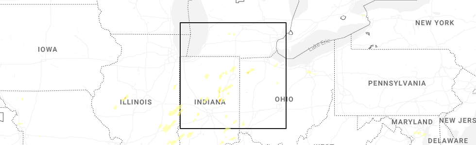
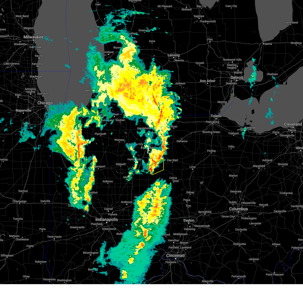
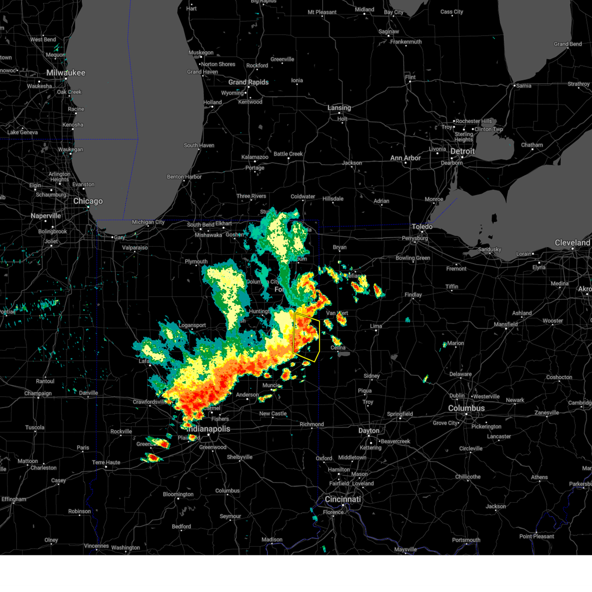
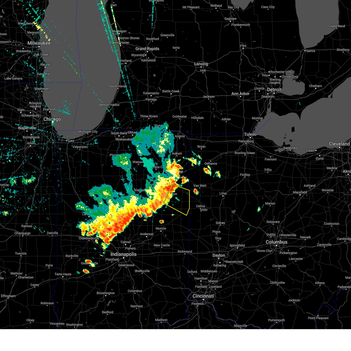
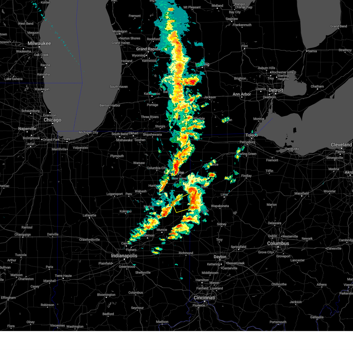
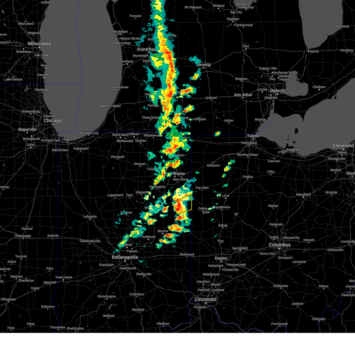
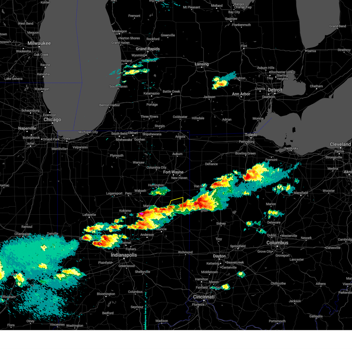
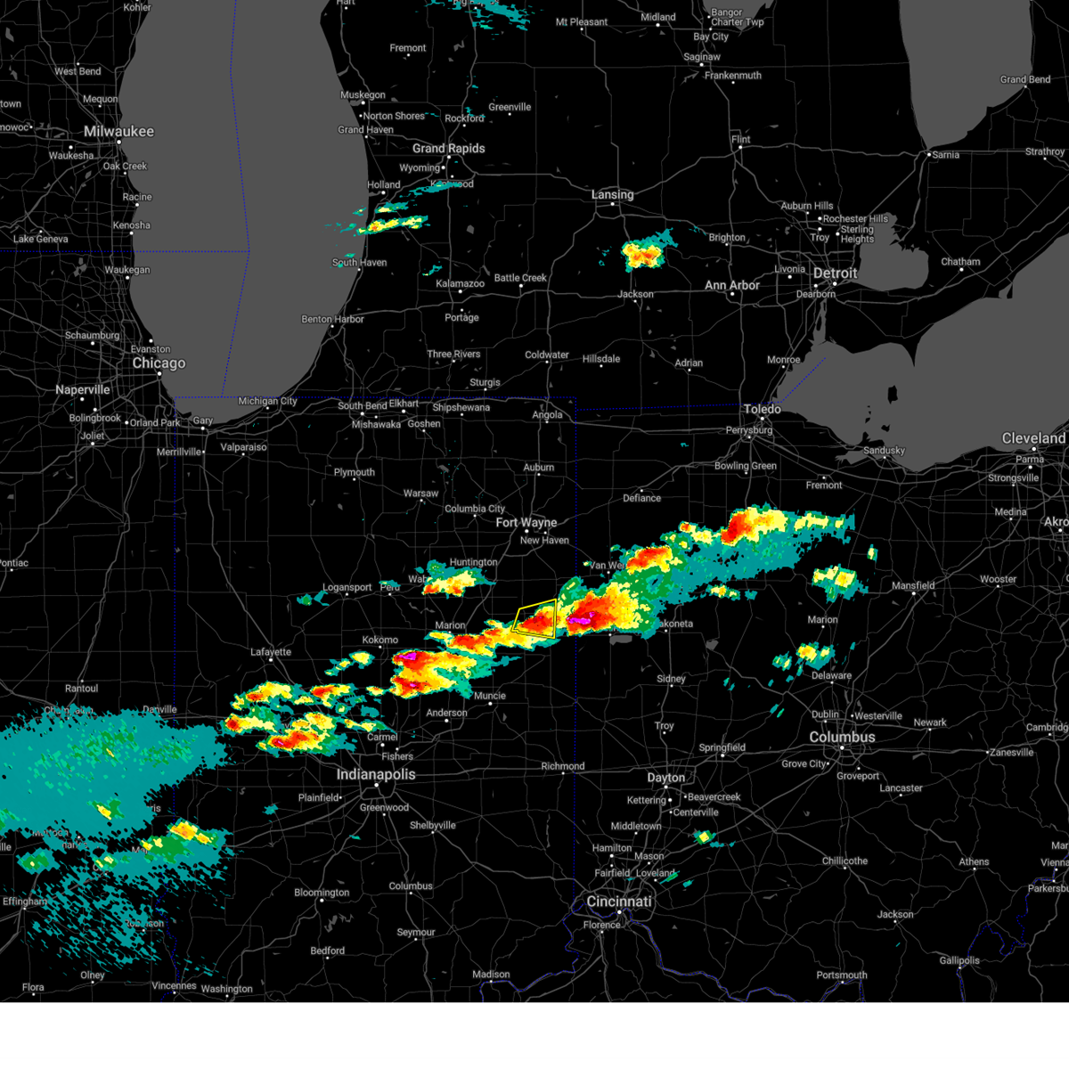
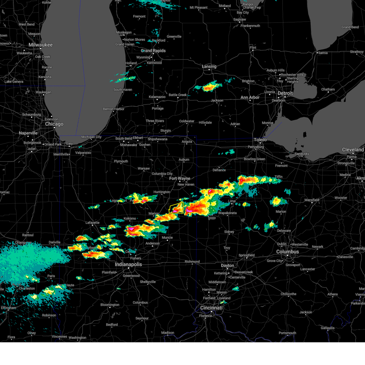
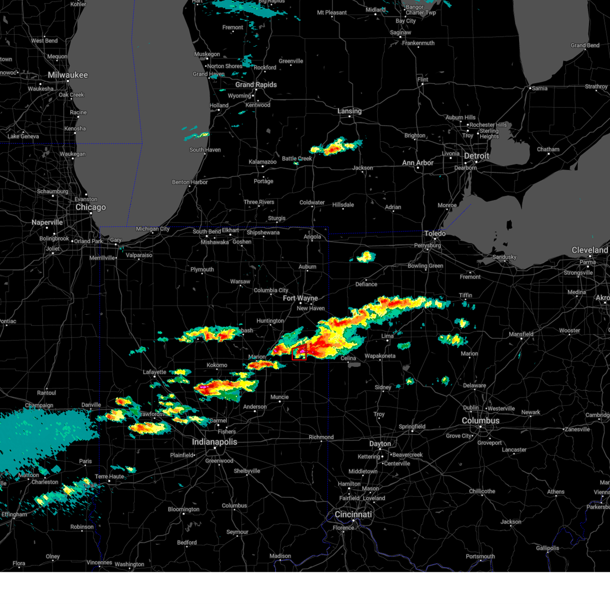
Hail Map for Vera Cruz, IN
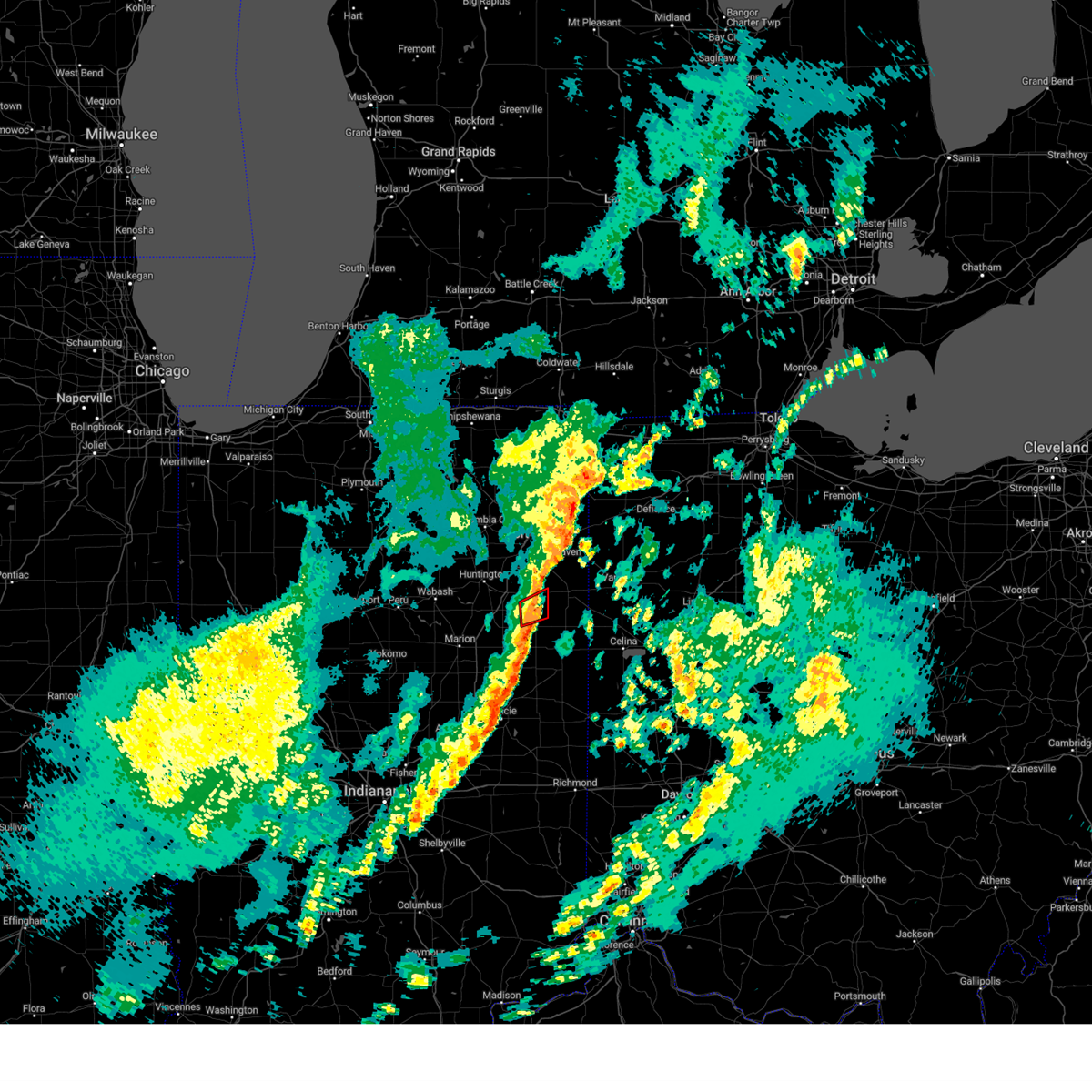
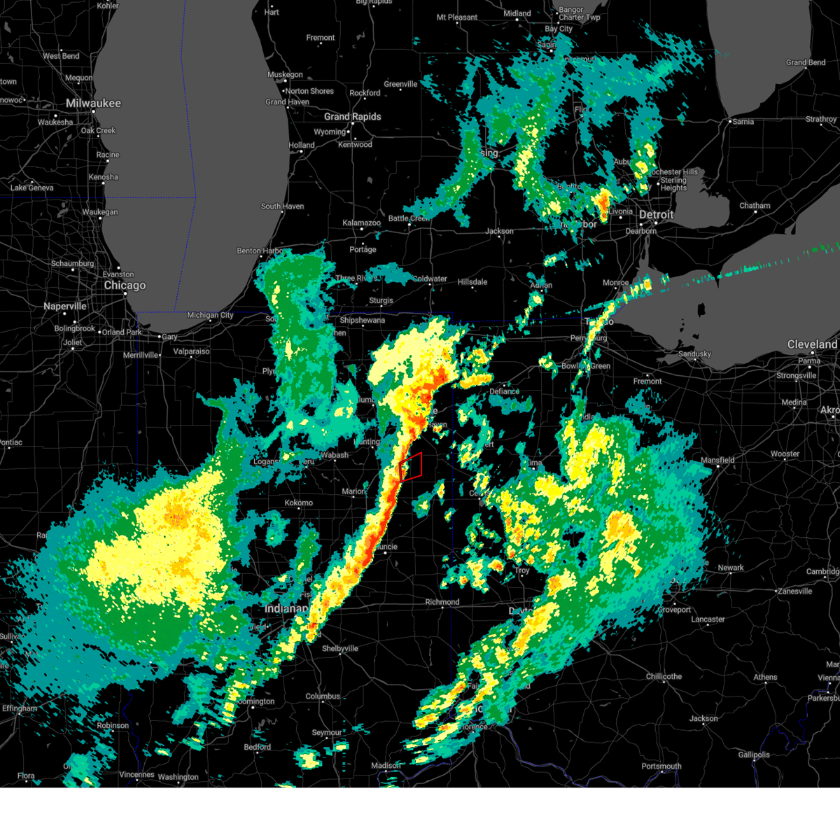
The Vera Cruz, IN area has had 0 reports of on-the-ground hail by trained spotters, and has been under severe weather warnings 24 times during the past 12 months. Doppler radar has detected hail at or near Vera Cruz, IN on 41 occasions, including 2 occasions during the past year.
| Name: | Vera Cruz, IN |
| Where Located: | 25.8 miles S of Fort Wayne, IN |
| Map: | Google Map for Vera Cruz, IN |
| Population: | 80 |
| Housing Units: | 32 |
| More Info: | Search Google for Vera Cruz, IN |
0
The Top Recent Hail Date for Vera Cruz, IN is Wednesday, June 18, 2025 (31st out of 41)
Hail and Wind Damage Spotted near Vera Cruz, IN
| Date / Time | Report Details |
|---|---|
| 6/26/2025 3:20 PM EDT | The storms which prompted the warning have weakened below severe limits, and no longer pose an immediate threat to life or property. therefore, the warning will be allowed to expire. however, gusty winds are still possible with these thunderstorms. to report severe weather, contact your nearest law enforcement agency. they will relay your report to the national weather service northern indiana. |
| 6/26/2025 3:13 PM EDT |
 At 313 pm edt, severe thunderstorms were located along a line extending from 7 miles north of montpelier to near portland, moving east at 25 mph (radar indicated). Hazards include 60 mph wind gusts. Expect damage to roofs, siding, and trees. Locations impacted include, bluffton, berne, montpelier, geneva, pennville, westchester, nottingham, bryant, poneto, vera cruz, travisville, ceylon, wellsburg, reiffsburg, dillman, petroleum, keystone, linn grove, domestic, and fiat. At 313 pm edt, severe thunderstorms were located along a line extending from 7 miles north of montpelier to near portland, moving east at 25 mph (radar indicated). Hazards include 60 mph wind gusts. Expect damage to roofs, siding, and trees. Locations impacted include, bluffton, berne, montpelier, geneva, pennville, westchester, nottingham, bryant, poneto, vera cruz, travisville, ceylon, wellsburg, reiffsburg, dillman, petroleum, keystone, linn grove, domestic, and fiat.
|
| 6/26/2025 2:55 PM EDT | Svriwx the national weather service in northern indiana has issued a * severe thunderstorm warning for, northern blackford county in east central indiana, southern wells county in northeastern indiana, southwestern adams county in northeastern indiana, northern jay county in east central indiana, * until 330 pm edt. * at 255 pm edt, a severe thunderstorm was located over montpelier, or 7 miles northeast of hartford city, moving northeast at 20 mph (radar indicated). Hazards include 60 mph wind gusts and quarter size hail. Hail damage to vehicles is expected. Expect wind damage to roofs, siding, and trees. |
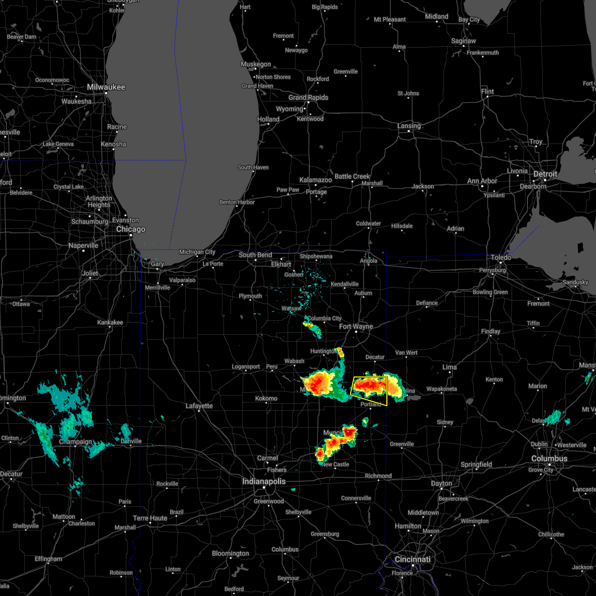
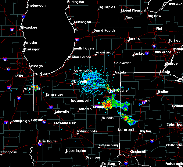
| 6/18/2025 5:52 PM EDT | Svriwx the national weather service in northern indiana has issued a * severe thunderstorm warning for, southeastern allen county in northeastern indiana, eastern wells county in northeastern indiana, adams county in northeastern indiana, jay county in east central indiana, southwestern paulding county in west central ohio, van wert county in west central ohio, * until 630 pm edt. * at 552 pm edt, severe thunderstorms were located along a line extending from ossian to near monroe to near portland, moving northeast at 60 mph (radar indicated). Hazards include 60 mph wind gusts and penny size hail. expect damage to roofs, siding, and trees |
| 6/18/2025 5:31 PM EDT | Svriwx the national weather service in northern indiana has issued a * severe thunderstorm warning for, southeastern huntington county in northeastern indiana, wells county in northeastern indiana, * until 600 pm edt. * at 530 pm edt, a severe thunderstorm was located 8 miles northeast of van buren, or 12 miles west of bluffton, moving northeast at 50 mph (radar indicated). Hazards include 60 mph wind gusts and quarter size hail. Hail damage to vehicles is expected. Expect wind damage to roofs, siding, and trees. |
| 5/16/2025 8:13 PM EDT | the severe thunderstorm warning has been cancelled and is no longer in effect |
| 5/16/2025 8:13 PM EDT | At 813 pm edt, severe thunderstorms were located along a line extending from 6 miles east of ossian to near fort recovery, moving northeast at 70 mph (radar indicated). Hazards include 60 mph wind gusts. Expect damage to roofs, siding, and trees. locations impacted include, bluffton, decatur, portland, berne, ossian, redkey, geneva, markle, monroe, westchester, center, preble, nottingham, zanesville, uniondale, bryant, poneto, salamonia, vera cruz, and trinity. This includes interstate 69 in indiana near mile marker 293. |
| 5/16/2025 7:41 PM EDT | Svriwx the national weather service in northern indiana has issued a * severe thunderstorm warning for, grant county in central indiana, huntington county in northeastern indiana, blackford county in east central indiana, wells county in northeastern indiana, adams county in northeastern indiana, jay county in east central indiana, * until 845 pm edt. * at 741 pm edt, severe thunderstorms were located along a line extending from la fontaine to near muncie, moving northeast at 55 mph (radar indicated). Hazards include 60 mph wind gusts. expect damage to roofs, siding, and trees |
| 4/2/2025 10:19 PM EDT | Svriwx the national weather service in northern indiana has issued a * severe thunderstorm warning for, southeastern wells county in northeastern indiana, adams county in northeastern indiana, southwestern van wert county in west central ohio, * until 1115 pm edt. * at 1018 pm edt, severe thunderstorms were located along a line extending from near van buren to near pennville to near redkey to near winchester, moving northeast at 80 mph (radar indicated). Hazards include 70 mph wind gusts and quarter size hail. Hail damage to vehicles is expected. expect considerable tree damage. Wind damage is also likely to mobile homes, roofs, and outbuildings. |
| 3/30/2025 5:52 PM EDT | The storms which prompted the warning have weakened below severe limits, and have exited the warned area. therefore, the warning will be allowed to expire. however, gusty winds are still possible with these thunderstorms. a tornado watch remains in effect until 800 pm edt for central, north central and northeastern indiana. a severe thunderstorm watch remains in effect until 1000 pm edt for west central ohio. remember, a severe thunderstorm warning still remains in effect for allen, deklab, and steuben counties. |
| 3/30/2025 5:36 PM EDT |
 At 535 pm edt, severe thunderstorms were located along a line extending from 6 miles east of reading to near van wert, moving east at 115 mph (radar indicated). Hazards include 70 mph wind gusts and quarter size hail. Hail damage to vehicles is expected. expect considerable tree damage. wind damage is also likely to mobile homes, roofs, and outbuildings. locations impacted include, preble, yoder, angola, alvarado, fairfield center, aboite, liberty center, hamilton lake, laotto, zulu, big long lake, tocsin, salem center, helmer, kingsland, rivare, metz, sedan, bowerstown, and dunfee. this includes the following highways, interstate 469 between mile markers 0 and 30. interstate 69 in indiana between mile markers 270 and 355. Interstate 80 in indiana between mile markers 146 and 156. At 535 pm edt, severe thunderstorms were located along a line extending from 6 miles east of reading to near van wert, moving east at 115 mph (radar indicated). Hazards include 70 mph wind gusts and quarter size hail. Hail damage to vehicles is expected. expect considerable tree damage. wind damage is also likely to mobile homes, roofs, and outbuildings. locations impacted include, preble, yoder, angola, alvarado, fairfield center, aboite, liberty center, hamilton lake, laotto, zulu, big long lake, tocsin, salem center, helmer, kingsland, rivare, metz, sedan, bowerstown, and dunfee. this includes the following highways, interstate 469 between mile markers 0 and 30. interstate 69 in indiana between mile markers 270 and 355. Interstate 80 in indiana between mile markers 146 and 156.
|
| 3/30/2025 5:36 PM EDT |
 the severe thunderstorm warning has been cancelled and is no longer in effect the severe thunderstorm warning has been cancelled and is no longer in effect
|
| 3/30/2025 5:05 PM EDT |
 Svriwx the national weather service in northern indiana has issued a * severe thunderstorm warning for, southeastern elkhart county in north central indiana, wabash county in north central indiana, noble county in northeastern indiana, northern grant county in central indiana, whitley county in northeastern indiana, huntington county in northeastern indiana, eastern kosciusko county in north central indiana, southern lagrange county in northeastern indiana, steuben county in northeastern indiana, allen county in northeastern indiana, de kalb county in northeastern indiana, wells county in northeastern indiana, northern adams county in northeastern indiana, * until 600 pm edt. * at 504 pm edt, severe thunderstorms were located along a line extending from millersburg to 6 miles northwest of van buren, moving east at 115 mph (radar indicated). Hazards include 70 mph wind gusts and quarter size hail. Hail damage to vehicles is expected. expect considerable tree damage. Wind damage is also likely to mobile homes, roofs, and outbuildings. Svriwx the national weather service in northern indiana has issued a * severe thunderstorm warning for, southeastern elkhart county in north central indiana, wabash county in north central indiana, noble county in northeastern indiana, northern grant county in central indiana, whitley county in northeastern indiana, huntington county in northeastern indiana, eastern kosciusko county in north central indiana, southern lagrange county in northeastern indiana, steuben county in northeastern indiana, allen county in northeastern indiana, de kalb county in northeastern indiana, wells county in northeastern indiana, northern adams county in northeastern indiana, * until 600 pm edt. * at 504 pm edt, severe thunderstorms were located along a line extending from millersburg to 6 miles northwest of van buren, moving east at 115 mph (radar indicated). Hazards include 70 mph wind gusts and quarter size hail. Hail damage to vehicles is expected. expect considerable tree damage. Wind damage is also likely to mobile homes, roofs, and outbuildings.
|
| 3/19/2025 9:58 PM EDT |
 The storm which prompted the warning has moved out of the area. therefore, the warning will be allowed to expire. a severe thunderstorm watch remains in effect until 100 am edt for northeastern indiana, and west central ohio. The storm which prompted the warning has moved out of the area. therefore, the warning will be allowed to expire. a severe thunderstorm watch remains in effect until 100 am edt for northeastern indiana, and west central ohio.
|
| 3/19/2025 9:43 PM EDT |
 Svriwx the national weather service in northern indiana has issued a * severe thunderstorm warning for, east central wells county in northeastern indiana, central adams county in northeastern indiana, * until 1000 pm edt. * at 942 pm edt, a severe thunderstorm was located near monroe, or near berne, moving northeast at 55 mph (radar indicated). Hazards include 60 mph wind gusts and penny size hail. expect damage to roofs, siding, and trees Svriwx the national weather service in northern indiana has issued a * severe thunderstorm warning for, east central wells county in northeastern indiana, central adams county in northeastern indiana, * until 1000 pm edt. * at 942 pm edt, a severe thunderstorm was located near monroe, or near berne, moving northeast at 55 mph (radar indicated). Hazards include 60 mph wind gusts and penny size hail. expect damage to roofs, siding, and trees
|
| 7/16/2024 1:27 AM EDT |
 The storms which prompted the warning have weakened below severe limits. therefore, the warning will be allowed to expire. however, gusty winds to 50 to 55 mph are still possible with these storms through 145 am edt. a severe thunderstorm watch remains in effect until 500 am edt for central, northeastern and east central indiana, and west central ohio. The storms which prompted the warning have weakened below severe limits. therefore, the warning will be allowed to expire. however, gusty winds to 50 to 55 mph are still possible with these storms through 145 am edt. a severe thunderstorm watch remains in effect until 500 am edt for central, northeastern and east central indiana, and west central ohio.
|
| 7/16/2024 1:14 AM EDT |
 At 114 am edt, severe thunderstorms were located along a line extending from near decatur to 7 miles west of geneva, moving east at 60 mph (radar indicated). Hazards include 60 mph wind gusts. Expect damage to roofs, siding, and trees. locations impacted include, bluffton, decatur, berne, ossian, geneva, markle, van buren, monroe, warren, preble, nottingham, zanesville, uniondale, poneto, vera cruz, mcnatts, landess, wellsburg, murray, and liberty center. This includes interstate 69 in indiana between mile markers 268 and 293. At 114 am edt, severe thunderstorms were located along a line extending from near decatur to 7 miles west of geneva, moving east at 60 mph (radar indicated). Hazards include 60 mph wind gusts. Expect damage to roofs, siding, and trees. locations impacted include, bluffton, decatur, berne, ossian, geneva, markle, van buren, monroe, warren, preble, nottingham, zanesville, uniondale, poneto, vera cruz, mcnatts, landess, wellsburg, murray, and liberty center. This includes interstate 69 in indiana between mile markers 268 and 293.
|
| 7/16/2024 1:14 AM EDT |
 the severe thunderstorm warning has been cancelled and is no longer in effect the severe thunderstorm warning has been cancelled and is no longer in effect
|
| 7/16/2024 12:50 AM EDT |
 Svriwx the national weather service in northern indiana has issued a * severe thunderstorm warning for, southeastern wabash county in north central indiana, northeastern grant county in central indiana, huntington county in northeastern indiana, wells county in northeastern indiana, adams county in northeastern indiana, * until 130 am edt. * at 1250 am edt, severe thunderstorms were located along a line extending from near huntington to near van buren, moving east at 70 mph (radar indicated). Hazards include 60 mph wind gusts. expect damage to roofs, siding, and trees Svriwx the national weather service in northern indiana has issued a * severe thunderstorm warning for, southeastern wabash county in north central indiana, northeastern grant county in central indiana, huntington county in northeastern indiana, wells county in northeastern indiana, adams county in northeastern indiana, * until 130 am edt. * at 1250 am edt, severe thunderstorms were located along a line extending from near huntington to near van buren, moving east at 70 mph (radar indicated). Hazards include 60 mph wind gusts. expect damage to roofs, siding, and trees
|
| 7/14/2024 1:26 PM EDT |
 At 126 pm edt, a severe thunderstorm was located near berne, moving southeast at 40 mph (radar indicated). Hazards include 70 mph wind gusts. Expect considerable tree damage. damage is likely to mobile homes, roofs, and outbuildings. Locations impacted include, decatur, berne, geneva, monroe, westchester, preble, bryant, vera cruz, magley, trinity, craigville, ceylon, peterson, monmouth, linn grove, domestic, new corydon, rivare, curryville, and pleasant mills. At 126 pm edt, a severe thunderstorm was located near berne, moving southeast at 40 mph (radar indicated). Hazards include 70 mph wind gusts. Expect considerable tree damage. damage is likely to mobile homes, roofs, and outbuildings. Locations impacted include, decatur, berne, geneva, monroe, westchester, preble, bryant, vera cruz, magley, trinity, craigville, ceylon, peterson, monmouth, linn grove, domestic, new corydon, rivare, curryville, and pleasant mills.
|
| 7/14/2024 1:11 PM EDT |
 Svriwx the national weather service in northern indiana has issued a * severe thunderstorm warning for, eastern wells county in northeastern indiana, adams county in northeastern indiana, northeastern jay county in east central indiana, * until 145 pm edt. * at 111 pm edt, a severe thunderstorm was located over bluffton, moving southeast at 40 mph (radar indicated). Hazards include 70 mph wind gusts. Expect considerable tree damage. Damage is likely to mobile homes, roofs, and outbuildings. Svriwx the national weather service in northern indiana has issued a * severe thunderstorm warning for, eastern wells county in northeastern indiana, adams county in northeastern indiana, northeastern jay county in east central indiana, * until 145 pm edt. * at 111 pm edt, a severe thunderstorm was located over bluffton, moving southeast at 40 mph (radar indicated). Hazards include 70 mph wind gusts. Expect considerable tree damage. Damage is likely to mobile homes, roofs, and outbuildings.
|
| 7/14/2024 1:02 PM EDT |
 At 102 pm edt, a severe thunderstorm was located near bluffton, moving southeast at 50 mph (radar indicated). Hazards include 70 mph wind gusts. Expect considerable tree damage. damage is likely to mobile homes, roofs, and outbuildings. locations impacted include, bluffton, ossian, markle, warren, lancaster, nottingham, zanesville, uniondale, poneto, vera cruz, wellsburg, murray, liberty center, mount zion, buckeye, tocsin, majenica, domestic, kingsland, and travisville. This includes interstate 69 in indiana between mile markers 276 and 293. At 102 pm edt, a severe thunderstorm was located near bluffton, moving southeast at 50 mph (radar indicated). Hazards include 70 mph wind gusts. Expect considerable tree damage. damage is likely to mobile homes, roofs, and outbuildings. locations impacted include, bluffton, ossian, markle, warren, lancaster, nottingham, zanesville, uniondale, poneto, vera cruz, wellsburg, murray, liberty center, mount zion, buckeye, tocsin, majenica, domestic, kingsland, and travisville. This includes interstate 69 in indiana between mile markers 276 and 293.
|
| 7/14/2024 1:02 PM EDT |
 the severe thunderstorm warning has been cancelled and is no longer in effect the severe thunderstorm warning has been cancelled and is no longer in effect
|
| 7/14/2024 12:52 PM EDT |
 Svriwx the national weather service in northern indiana has issued a * severe thunderstorm warning for, southwestern allen county in northeastern indiana, eastern huntington county in northeastern indiana, wells county in northeastern indiana, * until 115 pm edt. * at 1251 pm edt, a severe thunderstorm was located near markle, or 8 miles southeast of huntington, moving southeast at 50 mph (radar indicated). Hazards include 60 mph wind gusts. expect damage to roofs, siding, and trees Svriwx the national weather service in northern indiana has issued a * severe thunderstorm warning for, southwestern allen county in northeastern indiana, eastern huntington county in northeastern indiana, wells county in northeastern indiana, * until 115 pm edt. * at 1251 pm edt, a severe thunderstorm was located near markle, or 8 miles southeast of huntington, moving southeast at 50 mph (radar indicated). Hazards include 60 mph wind gusts. expect damage to roofs, siding, and trees
|
| 4/17/2024 1:31 PM EDT |
 the severe thunderstorm warning has been cancelled and is no longer in effect the severe thunderstorm warning has been cancelled and is no longer in effect
|
| 4/17/2024 1:03 PM EDT |
 Svriwx the national weather service in northern indiana has issued a * severe thunderstorm warning for, southeastern wells county in northeastern indiana, southern adams county in northeastern indiana, northeastern jay county in east central indiana, * until 145 pm edt. * at 102 pm edt, a severe thunderstorm was located near pennville, or 9 miles southwest of berne, moving northeast at 40 mph (radar indicated). Hazards include 60 mph wind gusts and quarter size hail. Hail damage to vehicles is expected. Expect wind damage to roofs, siding, and trees. Svriwx the national weather service in northern indiana has issued a * severe thunderstorm warning for, southeastern wells county in northeastern indiana, southern adams county in northeastern indiana, northeastern jay county in east central indiana, * until 145 pm edt. * at 102 pm edt, a severe thunderstorm was located near pennville, or 9 miles southwest of berne, moving northeast at 40 mph (radar indicated). Hazards include 60 mph wind gusts and quarter size hail. Hail damage to vehicles is expected. Expect wind damage to roofs, siding, and trees.
|
| 3/14/2024 6:52 PM EDT |
 The severe thunderstorm which prompted the warning has weakened and moved out of the warned area. therefore, the warning will be allowed to expire. a tornado watch remains in effect until midnight edt for northeastern and east central indiana. The severe thunderstorm which prompted the warning has weakened and moved out of the warned area. therefore, the warning will be allowed to expire. a tornado watch remains in effect until midnight edt for northeastern and east central indiana.
|
| 3/14/2024 6:40 PM EDT |
 Svriwx the national weather service in northern indiana has issued a * severe thunderstorm warning for, southeastern wells county in northeastern indiana, southwestern adams county in northeastern indiana, northwestern jay county in east central indiana, * until 700 pm edt. * at 640 pm edt, a severe thunderstorm was located 7 miles west of geneva, or 7 miles west of berne, moving east at 65 mph (radar indicated). Hazards include 60 mph wind gusts and half dollar size hail. Hail damage to vehicles is expected. Expect wind damage to roofs, siding, and trees. Svriwx the national weather service in northern indiana has issued a * severe thunderstorm warning for, southeastern wells county in northeastern indiana, southwestern adams county in northeastern indiana, northwestern jay county in east central indiana, * until 700 pm edt. * at 640 pm edt, a severe thunderstorm was located 7 miles west of geneva, or 7 miles west of berne, moving east at 65 mph (radar indicated). Hazards include 60 mph wind gusts and half dollar size hail. Hail damage to vehicles is expected. Expect wind damage to roofs, siding, and trees.
|
| 3/14/2024 6:30 PM EDT |
 Svriwx the national weather service in northern indiana has issued a * severe thunderstorm warning for, southeastern wells county in northeastern indiana, * until 645 pm edt. * at 630 pm edt, a severe thunderstorm was located near montpelier, or 7 miles southwest of bluffton, moving east at 60 mph (radar indicated). Hazards include 60 mph wind gusts and half dollar size hail. Hail damage to vehicles is expected. Expect wind damage to roofs, siding, and trees. Svriwx the national weather service in northern indiana has issued a * severe thunderstorm warning for, southeastern wells county in northeastern indiana, * until 645 pm edt. * at 630 pm edt, a severe thunderstorm was located near montpelier, or 7 miles southwest of bluffton, moving east at 60 mph (radar indicated). Hazards include 60 mph wind gusts and half dollar size hail. Hail damage to vehicles is expected. Expect wind damage to roofs, siding, and trees.
|
| 3/14/2024 6:21 PM EDT |
 At 621 pm edt, a severe thunderstorm capable of producing a tornado was located 7 miles northeast of montpelier, or 8 miles south of bluffton, moving east at 40 mph (radar indicated rotation). Hazards include tornado, two inch hail, and 60 mph wind gusts. Flying debris will be dangerous to those caught without shelter. mobile homes will be damaged or destroyed. damage to roofs, windows, and vehicles will occur. tree damage is likely. Locations impacted include, nottingham, poneto, vera cruz, domestic, wellsburg, reiffsburg, and petroleum. At 621 pm edt, a severe thunderstorm capable of producing a tornado was located 7 miles northeast of montpelier, or 8 miles south of bluffton, moving east at 40 mph (radar indicated rotation). Hazards include tornado, two inch hail, and 60 mph wind gusts. Flying debris will be dangerous to those caught without shelter. mobile homes will be damaged or destroyed. damage to roofs, windows, and vehicles will occur. tree damage is likely. Locations impacted include, nottingham, poneto, vera cruz, domestic, wellsburg, reiffsburg, and petroleum.
|
| 3/14/2024 6:14 PM EDT |
 Toriwx the national weather service in northern indiana has issued a * tornado warning for, southeastern wells county in northeastern indiana, * until 645 pm edt. * at 614 pm edt, a severe thunderstorm capable of producing a tornado was located near montpelier, or 9 miles southwest of bluffton, moving east at 40 mph (radar indicated rotation). Hazards include tornado and ping pong ball size hail. Flying debris will be dangerous to those caught without shelter. mobile homes will be damaged or destroyed. damage to roofs, windows, and vehicles will occur. tree damage is likely. This tornadic thunderstorm will remain over mainly rural areas of southeastern wells county, including the following locations, nottingham, poneto, keystone, vera cruz, domestic, wellsburg, reiffsburg, dillman, and petroleum. Toriwx the national weather service in northern indiana has issued a * tornado warning for, southeastern wells county in northeastern indiana, * until 645 pm edt. * at 614 pm edt, a severe thunderstorm capable of producing a tornado was located near montpelier, or 9 miles southwest of bluffton, moving east at 40 mph (radar indicated rotation). Hazards include tornado and ping pong ball size hail. Flying debris will be dangerous to those caught without shelter. mobile homes will be damaged or destroyed. damage to roofs, windows, and vehicles will occur. tree damage is likely. This tornadic thunderstorm will remain over mainly rural areas of southeastern wells county, including the following locations, nottingham, poneto, keystone, vera cruz, domestic, wellsburg, reiffsburg, dillman, and petroleum.
|
| 3/14/2024 6:04 PM EDT |
 At 603 pm edt, a severe thunderstorm was located near bluffton, moving east at 45 mph (a storm chaser reported quarter inch hail in bluffton as of 6:02 pm edt). Hazards include 60 mph wind gusts and half dollar size hail. Hail damage to vehicles is expected. expect wind damage to roofs, siding, and trees. locations impacted include, bluffton, decatur, berne, monroe, warren, poneto, vera cruz, mcnatts, travisville, craigville, wellsburg, reiffsburg, liberty center, mount zion, peterson, plum tree, north oaks, buckeye, linn grove, and rockford. This includes interstate 69 in indiana between mile markers 278 and 279. At 603 pm edt, a severe thunderstorm was located near bluffton, moving east at 45 mph (a storm chaser reported quarter inch hail in bluffton as of 6:02 pm edt). Hazards include 60 mph wind gusts and half dollar size hail. Hail damage to vehicles is expected. expect wind damage to roofs, siding, and trees. locations impacted include, bluffton, decatur, berne, monroe, warren, poneto, vera cruz, mcnatts, travisville, craigville, wellsburg, reiffsburg, liberty center, mount zion, peterson, plum tree, north oaks, buckeye, linn grove, and rockford. This includes interstate 69 in indiana between mile markers 278 and 279.
|
| 3/14/2024 6:04 PM EDT |
 At 604 pm edt, a severe thunderstorm was located near van buren, or 14 miles west of bluffton, moving east at 40 mph (storm chasers reported quarter size hail in bluffton). Hazards include 60 mph wind gusts and half dollar size hail. Hail damage to vehicles is expected. expect wind damage to roofs, siding, and trees. locations impacted include, bluffton, van buren, warren, nottingham, poneto, vera cruz, mcnatts, travisville, craigville, wellsburg, reiffsburg, liberty center, mount zion, dillman, petroleum, plum tree, north oaks, buckeye, keystone, and rockford. This includes interstate 69 in indiana between mile markers 268 and 280. At 604 pm edt, a severe thunderstorm was located near van buren, or 14 miles west of bluffton, moving east at 40 mph (storm chasers reported quarter size hail in bluffton). Hazards include 60 mph wind gusts and half dollar size hail. Hail damage to vehicles is expected. expect wind damage to roofs, siding, and trees. locations impacted include, bluffton, van buren, warren, nottingham, poneto, vera cruz, mcnatts, travisville, craigville, wellsburg, reiffsburg, liberty center, mount zion, dillman, petroleum, plum tree, north oaks, buckeye, keystone, and rockford. This includes interstate 69 in indiana between mile markers 268 and 280.
|
| 3/14/2024 5:58 PM EDT |
 At 558 pm edt, a severe thunderstorm was located over bluffton, moving east at 45 mph (radar indicated). Hazards include 60 mph wind gusts and quarter size hail. Hail damage to vehicles is expected. expect wind damage to roofs, siding, and trees. locations impacted include, bluffton, decatur, berne, monroe, warren, poneto, vera cruz, mcnatts, travisville, craigville, wellsburg, reiffsburg, liberty center, mount zion, peterson, plum tree, north oaks, buckeye, linn grove, and rockford. This includes interstate 69 in indiana between mile markers 278 and 279. At 558 pm edt, a severe thunderstorm was located over bluffton, moving east at 45 mph (radar indicated). Hazards include 60 mph wind gusts and quarter size hail. Hail damage to vehicles is expected. expect wind damage to roofs, siding, and trees. locations impacted include, bluffton, decatur, berne, monroe, warren, poneto, vera cruz, mcnatts, travisville, craigville, wellsburg, reiffsburg, liberty center, mount zion, peterson, plum tree, north oaks, buckeye, linn grove, and rockford. This includes interstate 69 in indiana between mile markers 278 and 279.
|
| 3/14/2024 5:57 PM EDT |
 Svriwx the national weather service in northern indiana has issued a * severe thunderstorm warning for, northeastern grant county in central indiana, southern huntington county in northeastern indiana, wells county in northeastern indiana, * until 630 pm edt. * at 556 pm edt, a severe thunderstorm was located over van buren, or 10 miles northeast of marion, moving east at 40 mph (radar indicated). Hazards include 60 mph wind gusts and quarter size hail. Hail damage to vehicles is expected. Expect wind damage to roofs, siding, and trees. Svriwx the national weather service in northern indiana has issued a * severe thunderstorm warning for, northeastern grant county in central indiana, southern huntington county in northeastern indiana, wells county in northeastern indiana, * until 630 pm edt. * at 556 pm edt, a severe thunderstorm was located over van buren, or 10 miles northeast of marion, moving east at 40 mph (radar indicated). Hazards include 60 mph wind gusts and quarter size hail. Hail damage to vehicles is expected. Expect wind damage to roofs, siding, and trees.
|
| 3/14/2024 5:49 PM EDT |
 Svriwx the national weather service in northern indiana has issued a * severe thunderstorm warning for, southeastern huntington county in northeastern indiana, central wells county in northeastern indiana, central adams county in northeastern indiana, * until 615 pm edt. * at 549 pm edt, a severe thunderstorm was located 7 miles south of markle, or 8 miles west of bluffton, moving east at 45 mph (radar indicated). Hazards include 60 mph wind gusts and quarter size hail. Hail damage to vehicles is expected. Expect wind damage to roofs, siding, and trees. Svriwx the national weather service in northern indiana has issued a * severe thunderstorm warning for, southeastern huntington county in northeastern indiana, central wells county in northeastern indiana, central adams county in northeastern indiana, * until 615 pm edt. * at 549 pm edt, a severe thunderstorm was located 7 miles south of markle, or 8 miles west of bluffton, moving east at 45 mph (radar indicated). Hazards include 60 mph wind gusts and quarter size hail. Hail damage to vehicles is expected. Expect wind damage to roofs, siding, and trees.
|
| 3/14/2024 5:31 PM EDT |
 At 530 pm edt, a severe thunderstorm was located 7 miles south of markle, or 10 miles west of bluffton, moving east at 70 mph (radar indicated). Hazards include 60 mph wind gusts and quarter size hail. Hail damage to vehicles is expected. expect wind damage to roofs, siding, and trees. locations impacted include, marion, bluffton, van buren, warren, lancaster, uniondale, poneto, mount etna, vera cruz, mcnatts, landess, wellsburg, murray, liberty center, mount zion, buckeye, tocsin, majenica, banquo, and kingsland. This includes interstate 69 in indiana between mile markers 266 and 284. At 530 pm edt, a severe thunderstorm was located 7 miles south of markle, or 10 miles west of bluffton, moving east at 70 mph (radar indicated). Hazards include 60 mph wind gusts and quarter size hail. Hail damage to vehicles is expected. expect wind damage to roofs, siding, and trees. locations impacted include, marion, bluffton, van buren, warren, lancaster, uniondale, poneto, mount etna, vera cruz, mcnatts, landess, wellsburg, murray, liberty center, mount zion, buckeye, tocsin, majenica, banquo, and kingsland. This includes interstate 69 in indiana between mile markers 266 and 284.
|
| 3/14/2024 5:21 PM EDT |
 Svriwx the national weather service in northern indiana has issued a * severe thunderstorm warning for, southeastern wabash county in north central indiana, northern grant county in central indiana, southern huntington county in northeastern indiana, wells county in northeastern indiana, * until 545 pm edt. * at 519 pm edt, a severe thunderstorm was located near la fontaine, or 8 miles north of marion, moving east at 65 mph (radar indicated). Hazards include 60 mph wind gusts and quarter size hail. Hail damage to vehicles is expected. Expect wind damage to roofs, siding, and trees. Svriwx the national weather service in northern indiana has issued a * severe thunderstorm warning for, southeastern wabash county in north central indiana, northern grant county in central indiana, southern huntington county in northeastern indiana, wells county in northeastern indiana, * until 545 pm edt. * at 519 pm edt, a severe thunderstorm was located near la fontaine, or 8 miles north of marion, moving east at 65 mph (radar indicated). Hazards include 60 mph wind gusts and quarter size hail. Hail damage to vehicles is expected. Expect wind damage to roofs, siding, and trees.
|
| 3/14/2024 12:36 PM EDT |
 Svriwx the national weather service in northern indiana has issued a * severe thunderstorm warning for, eastern wells county in northeastern indiana, adams county in northeastern indiana, southwestern van wert county in west central ohio, * until 100 pm edt. * at 1236 pm edt, a severe thunderstorm was located over bluffton, moving southeast at 50 mph (radar indicated). Hazards include 60 mph wind gusts and quarter size hail. Hail damage to vehicles is expected. Expect wind damage to roofs, siding, and trees. Svriwx the national weather service in northern indiana has issued a * severe thunderstorm warning for, eastern wells county in northeastern indiana, adams county in northeastern indiana, southwestern van wert county in west central ohio, * until 100 pm edt. * at 1236 pm edt, a severe thunderstorm was located over bluffton, moving southeast at 50 mph (radar indicated). Hazards include 60 mph wind gusts and quarter size hail. Hail damage to vehicles is expected. Expect wind damage to roofs, siding, and trees.
|
| 7/29/2023 2:47 AM EDT |
 At 247 am edt, severe thunderstorms were located along a line extending from near fort wayne to near ossian to 6 miles north of van buren, moving east at 50 mph (radar indicated). Hazards include 60 mph wind gusts. expect damage to roofs, siding, and trees At 247 am edt, severe thunderstorms were located along a line extending from near fort wayne to near ossian to 6 miles north of van buren, moving east at 50 mph (radar indicated). Hazards include 60 mph wind gusts. expect damage to roofs, siding, and trees
|
| 6/15/2023 5:31 PM EDT |
 At 531 pm edt, a severe thunderstorm was located over bluffton, moving east at 25 mph (radar indicated). Hazards include 60 mph wind gusts and quarter size hail. Hail damage to vehicles is expected. Expect wind damage to roofs, siding, and trees. At 531 pm edt, a severe thunderstorm was located over bluffton, moving east at 25 mph (radar indicated). Hazards include 60 mph wind gusts and quarter size hail. Hail damage to vehicles is expected. Expect wind damage to roofs, siding, and trees.
|
| 4/5/2023 1:36 PM EDT |
 The severe thunderstorm warning for southern allen, southeastern grant, blackford, southeastern huntington, wells, adams and jay counties will expire at 145 pm edt, the storms which prompted the warning have moved out of the area. therefore, the warning will be allowed to expire. a tornado watch remains in effect until 400 pm edt for northeastern and east central indiana, and west central ohio. The severe thunderstorm warning for southern allen, southeastern grant, blackford, southeastern huntington, wells, adams and jay counties will expire at 145 pm edt, the storms which prompted the warning have moved out of the area. therefore, the warning will be allowed to expire. a tornado watch remains in effect until 400 pm edt for northeastern and east central indiana, and west central ohio.
|
| 4/5/2023 1:23 PM EDT |
 The tornado warning for east central wells county will expire at 130 pm edt, the storm which prompted the warning has moved out of the area. therefore, the warning will be allowed to expire. a tornado watch remains in effect until 400 pm edt for northeastern indiana. The tornado warning for east central wells county will expire at 130 pm edt, the storm which prompted the warning has moved out of the area. therefore, the warning will be allowed to expire. a tornado watch remains in effect until 400 pm edt for northeastern indiana.
|
| 4/5/2023 1:16 PM EDT |
 At 115 pm edt, a severe thunderstorm capable of producing a tornado was located over bluffton, moving northeast at 50 mph (radar indicated rotation). Hazards include tornado. Flying debris will be dangerous to those caught without shelter. mobile homes will be damaged or destroyed. damage to roofs, windows, and vehicles will occur. tree damage is likely. This tornadic thunderstorm will remain over mainly rural areas of east central wells county, including the following locations, north oaks, tocsin, vera cruz, travisville, craigville, murray, curryville and wellsburg. At 115 pm edt, a severe thunderstorm capable of producing a tornado was located over bluffton, moving northeast at 50 mph (radar indicated rotation). Hazards include tornado. Flying debris will be dangerous to those caught without shelter. mobile homes will be damaged or destroyed. damage to roofs, windows, and vehicles will occur. tree damage is likely. This tornadic thunderstorm will remain over mainly rural areas of east central wells county, including the following locations, north oaks, tocsin, vera cruz, travisville, craigville, murray, curryville and wellsburg.
|
| 4/5/2023 1:13 PM EDT |
 At 113 pm edt, severe thunderstorms were located along a line extending from near new haven to near hartford city, moving northeast at 80 mph (radar indicated). Hazards include 60 mph wind gusts. Expect damage to roofs, siding, and trees. locations impacted include, fort wayne, new haven, bluffton, decatur, portland, hartford city, berne, ossian, dunkirk, montpelier, woodburn, redkey, geneva, monroeville, markle, monroe, pennville, matthews, westchester and center. this includes the following highways, interstate 469 between mile markers 0 and 7, and between mile markers 9 and 23. Interstate 69 in indiana between mile markers 299 and 302, and between mile markers 304 and 306. At 113 pm edt, severe thunderstorms were located along a line extending from near new haven to near hartford city, moving northeast at 80 mph (radar indicated). Hazards include 60 mph wind gusts. Expect damage to roofs, siding, and trees. locations impacted include, fort wayne, new haven, bluffton, decatur, portland, hartford city, berne, ossian, dunkirk, montpelier, woodburn, redkey, geneva, monroeville, markle, monroe, pennville, matthews, westchester and center. this includes the following highways, interstate 469 between mile markers 0 and 7, and between mile markers 9 and 23. Interstate 69 in indiana between mile markers 299 and 302, and between mile markers 304 and 306.
|
| 4/5/2023 1:05 PM EDT |
 At 105 pm edt, a severe thunderstorm capable of producing a tornado was located 8 miles south of markle, or 8 miles west of bluffton, moving northeast at 50 mph (radar indicated rotation). Hazards include tornado. Flying debris will be dangerous to those caught without shelter. mobile homes will be damaged or destroyed. damage to roofs, windows, and vehicles will occur. tree damage is likely. This dangerous storm will be near, bluffton around 115 pm edt. At 105 pm edt, a severe thunderstorm capable of producing a tornado was located 8 miles south of markle, or 8 miles west of bluffton, moving northeast at 50 mph (radar indicated rotation). Hazards include tornado. Flying debris will be dangerous to those caught without shelter. mobile homes will be damaged or destroyed. damage to roofs, windows, and vehicles will occur. tree damage is likely. This dangerous storm will be near, bluffton around 115 pm edt.
|
| 4/5/2023 12:54 PM EDT |
 At 1254 pm edt, severe thunderstorms were located along a line extending from near markle to alexandria, moving northeast at 80 mph (radar indicated). Hazards include 60 mph wind gusts. expect damage to roofs, siding, and trees At 1254 pm edt, severe thunderstorms were located along a line extending from near markle to alexandria, moving northeast at 80 mph (radar indicated). Hazards include 60 mph wind gusts. expect damage to roofs, siding, and trees
|
| 7/23/2022 9:06 AM EDT |
 At 906 am edt, severe thunderstorms were located along a line extending from near decatur to near bluffton, moving southeast at 45 mph (radar indicated). Hazards include 70 mph wind gusts. Expect considerable tree damage. Damage is likely to mobile homes, roofs, and outbuildings. At 906 am edt, severe thunderstorms were located along a line extending from near decatur to near bluffton, moving southeast at 45 mph (radar indicated). Hazards include 70 mph wind gusts. Expect considerable tree damage. Damage is likely to mobile homes, roofs, and outbuildings.
|
| 6/13/2022 11:07 PM EDT |
 The severe thunderstorm warning for southeastern allen, southeastern wells, adams and southwestern van wert counties will expire at 1115 pm edt, the storms which prompted the warning was moving out of the area. therefore, the warning will be allowed to expire. however gusty winds and heavy rain are still possible with these thunderstorms through 1130 pm edt. a severe thunderstorm watch remains in effect until midnight edt for northeastern and east central indiana, and west central ohio. The severe thunderstorm warning for southeastern allen, southeastern wells, adams and southwestern van wert counties will expire at 1115 pm edt, the storms which prompted the warning was moving out of the area. therefore, the warning will be allowed to expire. however gusty winds and heavy rain are still possible with these thunderstorms through 1130 pm edt. a severe thunderstorm watch remains in effect until midnight edt for northeastern and east central indiana, and west central ohio.
|
| 6/13/2022 10:51 PM EDT |
 At 1051 pm edt, severe thunderstorms were located along a line extending from near monroeville to decatur to near bluffton, moving southeast at 35 mph. these are destructive storms! (radar indicated). Hazards include 80 mph wind gusts. Flying debris will be dangerous to those caught without shelter. mobile homes will be heavily damaged. expect considerable damage to roofs, windows, and vehicles. extensive tree damage and power outages are likely. locations impacted include, bluffton, decatur, berne, geneva, monroeville, monroe, middlebury, preble, nottingham, willshire, wren, vera cruz, peterson, dull, tocsin, domestic, rivare, schumm, magley and craigville. thunderstorm damage threat, destructive hail threat, radar indicated max hail size, <. 75 in wind threat, radar indicated max wind gust, 80 mph. At 1051 pm edt, severe thunderstorms were located along a line extending from near monroeville to decatur to near bluffton, moving southeast at 35 mph. these are destructive storms! (radar indicated). Hazards include 80 mph wind gusts. Flying debris will be dangerous to those caught without shelter. mobile homes will be heavily damaged. expect considerable damage to roofs, windows, and vehicles. extensive tree damage and power outages are likely. locations impacted include, bluffton, decatur, berne, geneva, monroeville, monroe, middlebury, preble, nottingham, willshire, wren, vera cruz, peterson, dull, tocsin, domestic, rivare, schumm, magley and craigville. thunderstorm damage threat, destructive hail threat, radar indicated max hail size, <. 75 in wind threat, radar indicated max wind gust, 80 mph.
|
| 6/13/2022 10:27 PM EDT |
 At 1026 pm edt, severe thunderstorms were located along a line extending from near fort wayne to 7 miles north of ossian to 6 miles north of markle, moving southeast at 55 mph. these are destructive storms! (radar indicated). Hazards include 80 mph wind gusts. Flying debris will be dangerous to those caught without shelter. mobile homes will be heavily damaged. expect considerable damage to roofs, windows, and vehicles. Extensive tree damage and power outages are likely. At 1026 pm edt, severe thunderstorms were located along a line extending from near fort wayne to 7 miles north of ossian to 6 miles north of markle, moving southeast at 55 mph. these are destructive storms! (radar indicated). Hazards include 80 mph wind gusts. Flying debris will be dangerous to those caught without shelter. mobile homes will be heavily damaged. expect considerable damage to roofs, windows, and vehicles. Extensive tree damage and power outages are likely.
|
| 3/23/2022 2:04 PM EDT |
 At 204 pm edt, severe thunderstorms were located along a line extending from bluffton to 8 miles northeast of montpelier, moving northeast at 30 mph (radar indicated). Hazards include 60 mph wind gusts and quarter size hail. Hail damage to vehicles is expected. Expect wind damage to roofs, siding, and trees. At 204 pm edt, severe thunderstorms were located along a line extending from bluffton to 8 miles northeast of montpelier, moving northeast at 30 mph (radar indicated). Hazards include 60 mph wind gusts and quarter size hail. Hail damage to vehicles is expected. Expect wind damage to roofs, siding, and trees.
|
| 3/6/2022 3:21 AM EST |
 At 321 am est, severe thunderstorms were located along a line extending from near auburn to near monroeville to near matthews, moving east at 80 mph (radar indicated). Hazards include 70 mph wind gusts. Expect considerable tree damage. Damage is likely to mobile homes, roofs, and outbuildings. At 321 am est, severe thunderstorms were located along a line extending from near auburn to near monroeville to near matthews, moving east at 80 mph (radar indicated). Hazards include 70 mph wind gusts. Expect considerable tree damage. Damage is likely to mobile homes, roofs, and outbuildings.
|
| 8/11/2021 2:53 PM EDT |
 At 253 pm edt, severe thunderstorms were located along a line extending from near holgate to near elida to celina, moving east at 45 mph (radar indicated). Hazards include 60 mph wind gusts and penny size hail. Expect damage to roofs, siding, and trees. locations impacted include, defiance, van wert, berne, geneva, convoy, monroe, ohio city, westchester, oakwood, middlebury, nottingham, middle point, grover hill, willshire, scott, melrose, bryant, wren, venedocia and vera cruz. hail threat, radar indicated max hail size, 0. 75 in wind threat, radar indicated max wind gust, 60 mph. At 253 pm edt, severe thunderstorms were located along a line extending from near holgate to near elida to celina, moving east at 45 mph (radar indicated). Hazards include 60 mph wind gusts and penny size hail. Expect damage to roofs, siding, and trees. locations impacted include, defiance, van wert, berne, geneva, convoy, monroe, ohio city, westchester, oakwood, middlebury, nottingham, middle point, grover hill, willshire, scott, melrose, bryant, wren, venedocia and vera cruz. hail threat, radar indicated max hail size, 0. 75 in wind threat, radar indicated max wind gust, 60 mph.
|
| 8/11/2021 2:36 PM EDT |
 At 236 pm edt, severe thunderstorms were located along a line extending from 6 miles northeast of antwerp to near ohio city to near geneva, moving southeast at 40 mph (radar indicated). Hazards include 60 mph wind gusts and penny size hail. Expect damage to roofs, siding, and trees. locations impacted include, fort wayne, defiance, new haven, van wert, bluffton, decatur, berne, hicksville, ossian, paulding, antwerp, woodburn, geneva, monroeville, payne, markle, convoy, monroe, ohio city and westchester. this includes the following highways, interstate 469 near mile marker 6, and between mile markers 9 and 23. interstate 69 in indiana between mile markers 276 and 282. hail threat, radar indicated max hail size, 0. 75 in wind threat, radar indicated max wind gust, 60 mph. At 236 pm edt, severe thunderstorms were located along a line extending from 6 miles northeast of antwerp to near ohio city to near geneva, moving southeast at 40 mph (radar indicated). Hazards include 60 mph wind gusts and penny size hail. Expect damage to roofs, siding, and trees. locations impacted include, fort wayne, defiance, new haven, van wert, bluffton, decatur, berne, hicksville, ossian, paulding, antwerp, woodburn, geneva, monroeville, payne, markle, convoy, monroe, ohio city and westchester. this includes the following highways, interstate 469 near mile marker 6, and between mile markers 9 and 23. interstate 69 in indiana between mile markers 276 and 282. hail threat, radar indicated max hail size, 0. 75 in wind threat, radar indicated max wind gust, 60 mph.
|
| 8/11/2021 2:14 PM EDT |
 At 214 pm edt, severe thunderstorms were located along a line extending from st. joe to near decatur to 7 miles north of montpelier, moving southeast at 40 mph (radar indicated). Hazards include 60 mph wind gusts and penny size hail. expect damage to roofs, siding, and trees At 214 pm edt, severe thunderstorms were located along a line extending from st. joe to near decatur to 7 miles north of montpelier, moving southeast at 40 mph (radar indicated). Hazards include 60 mph wind gusts and penny size hail. expect damage to roofs, siding, and trees
|
| 8/11/2021 1:48 PM EDT |
 At 148 pm edt, severe thunderstorms were located along a line extending from near avilla to 8 miles northwest of ossian to near la fontaine, moving east at 55 mph (radar indicated). Hazards include 60 mph wind gusts and penny size hail. expect damage to roofs, siding, and trees At 148 pm edt, severe thunderstorms were located along a line extending from near avilla to 8 miles northwest of ossian to near la fontaine, moving east at 55 mph (radar indicated). Hazards include 60 mph wind gusts and penny size hail. expect damage to roofs, siding, and trees
|
| 6/18/2021 3:34 PM EDT |
 At 333 pm edt, a severe thunderstorm was located near berne, moving east at 35 mph (radar indicated). Hazards include 60 mph wind gusts and half dollar size hail. Hail damage to vehicles is expected. Expect wind damage to roofs, siding, and trees. At 333 pm edt, a severe thunderstorm was located near berne, moving east at 35 mph (radar indicated). Hazards include 60 mph wind gusts and half dollar size hail. Hail damage to vehicles is expected. Expect wind damage to roofs, siding, and trees.
|
| 7/19/2020 2:31 PM EDT |
 At 230 pm edt, severe thunderstorms were located along a line extending from 8 miles north of huntington to 6 miles southwest of markle to near fairmount, moving east at 57 mph (radar indicated). Hazards include 60 mph wind gusts. Expect damage to roofs, siding, and trees. Locations impacted include, fort wayne, marion, huntington, bluffton, hartford city, gas city, upland, ossian, fairmount, montpelier, jonesboro, andrews, markle, van buren, matthews, aboite, roanoke, warren, lancaster and nottingham. At 230 pm edt, severe thunderstorms were located along a line extending from 8 miles north of huntington to 6 miles southwest of markle to near fairmount, moving east at 57 mph (radar indicated). Hazards include 60 mph wind gusts. Expect damage to roofs, siding, and trees. Locations impacted include, fort wayne, marion, huntington, bluffton, hartford city, gas city, upland, ossian, fairmount, montpelier, jonesboro, andrews, markle, van buren, matthews, aboite, roanoke, warren, lancaster and nottingham.
|
| 7/19/2020 2:22 PM EDT |
 At 222 pm edt, severe thunderstorms were located along a line extending from near south whitley to 8 miles south of huntington to 6 miles southwest of fairmount, moving east at 60 mph (radar indicated). Hazards include 60 mph wind gusts. Expect damage to roofs, siding, and trees. Locations impacted include, fort wayne, marion, huntington, new haven, bluffton, hartford city, north manchester, gas city, berne, upland, ossian, fairmount, dunkirk, montpelier, jonesboro, redkey, geneva, sweetser, andrews and markle. At 222 pm edt, severe thunderstorms were located along a line extending from near south whitley to 8 miles south of huntington to 6 miles southwest of fairmount, moving east at 60 mph (radar indicated). Hazards include 60 mph wind gusts. Expect damage to roofs, siding, and trees. Locations impacted include, fort wayne, marion, huntington, new haven, bluffton, hartford city, north manchester, gas city, berne, upland, ossian, fairmount, dunkirk, montpelier, jonesboro, redkey, geneva, sweetser, andrews and markle.
|
| 7/19/2020 2:12 PM EDT |
 At 212 pm edt, severe thunderstorms were located along a line extending from north manchester to 6 miles north of la fontaine to near windfall city, moving east at 60 mph (radar indicated). Hazards include 60 mph wind gusts. Expect damage to roofs, siding, and trees. Locations impacted include, fort wayne, marion, huntington, new haven, wabash, bluffton, hartford city, north manchester, gas city, berne, upland, ossian, fairmount, dunkirk, montpelier, jonesboro, redkey, geneva, sweetser and andrews. At 212 pm edt, severe thunderstorms were located along a line extending from north manchester to 6 miles north of la fontaine to near windfall city, moving east at 60 mph (radar indicated). Hazards include 60 mph wind gusts. Expect damage to roofs, siding, and trees. Locations impacted include, fort wayne, marion, huntington, new haven, wabash, bluffton, hartford city, north manchester, gas city, berne, upland, ossian, fairmount, dunkirk, montpelier, jonesboro, redkey, geneva, sweetser and andrews.
|
| 7/19/2020 1:58 PM EDT |
 At 158 pm edt, severe thunderstorms were located along a line extending from near akron to near wabash to 6 miles west of windfall city, moving east at 60 mph (radar indicated). Hazards include 60 mph wind gusts. expect damage to roofs, siding, and trees At 158 pm edt, severe thunderstorms were located along a line extending from near akron to near wabash to 6 miles west of windfall city, moving east at 60 mph (radar indicated). Hazards include 60 mph wind gusts. expect damage to roofs, siding, and trees
|
| 7/12/2020 1:06 PM EDT |
 At 1252 pm edt, a severe thunderstorm was located near bluffton, moving southeast at 20 mph (radar indicated). Hazards include 60 mph wind gusts. Damage to roofs, siding, and trees possible. Locations impacted include, bluffton, poneto, vera cruz, travisville, domestic, wellsburg, reiffsburg, petroleum and liberty center. At 1252 pm edt, a severe thunderstorm was located near bluffton, moving southeast at 20 mph (radar indicated). Hazards include 60 mph wind gusts. Damage to roofs, siding, and trees possible. Locations impacted include, bluffton, poneto, vera cruz, travisville, domestic, wellsburg, reiffsburg, petroleum and liberty center.
|
| 7/12/2020 12:53 PM EDT |
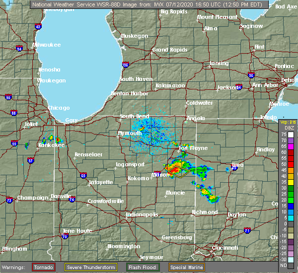 At 1252 pm edt, a severe thunderstorm was located near bluffton, moving southeast at 20 mph (radar indicated). Hazards include 60 mph wind gusts. Damage to roofs, siding, and trees possible. Locations impacted include, bluffton, poneto, vera cruz, travisville, domestic, wellsburg, reiffsburg, petroleum and liberty center. At 1252 pm edt, a severe thunderstorm was located near bluffton, moving southeast at 20 mph (radar indicated). Hazards include 60 mph wind gusts. Damage to roofs, siding, and trees possible. Locations impacted include, bluffton, poneto, vera cruz, travisville, domestic, wellsburg, reiffsburg, petroleum and liberty center.
|
| 7/12/2020 12:42 PM EDT |
 At 1241 pm edt, a severe thunderstorm was located over bluffton, moving southeast at 25 mph (radar indicated). Hazards include 60 mph wind gusts. expect damage to roofs, siding, and trees At 1241 pm edt, a severe thunderstorm was located over bluffton, moving southeast at 25 mph (radar indicated). Hazards include 60 mph wind gusts. expect damage to roofs, siding, and trees
|
| 6/10/2020 4:27 PM EDT |
 At 427 pm edt, a severe thunderstorm was located over montpelier, or 10 miles northeast of hartford city, moving northeast at 60 mph (radar indicated). Hazards include 60 mph wind gusts and quarter size hail. Hail damage to vehicles is expected. expect wind damage to roofs, siding, and trees. Locations impacted include, bluffton, montpelier, markle, nottingham, uniondale, poneto, vera cruz, mcnatts, wellsburg, murray, liberty center, mount zion, buckeye, tocsin, keystone, kingsland, travisville, craigville, reiffsburg and dillman. At 427 pm edt, a severe thunderstorm was located over montpelier, or 10 miles northeast of hartford city, moving northeast at 60 mph (radar indicated). Hazards include 60 mph wind gusts and quarter size hail. Hail damage to vehicles is expected. expect wind damage to roofs, siding, and trees. Locations impacted include, bluffton, montpelier, markle, nottingham, uniondale, poneto, vera cruz, mcnatts, wellsburg, murray, liberty center, mount zion, buckeye, tocsin, keystone, kingsland, travisville, craigville, reiffsburg and dillman.
|
| 6/10/2020 4:09 PM EDT |
 At 409 pm edt, a severe thunderstorm was located near matthews, or 9 miles northwest of muncie, moving north at 55 mph (radar indicated). Hazards include 60 mph wind gusts and quarter size hail. Hail damage to vehicles is expected. Expect wind damage to roofs, siding, and trees. At 409 pm edt, a severe thunderstorm was located near matthews, or 9 miles northwest of muncie, moving north at 55 mph (radar indicated). Hazards include 60 mph wind gusts and quarter size hail. Hail damage to vehicles is expected. Expect wind damage to roofs, siding, and trees.
|
| 6/10/2020 3:29 PM EDT |
 At 329 pm edt, a severe thunderstorm was located near ossian, moving northeast at 75 mph (radar indicated). Hazards include 70 mph wind gusts and quarter size hail. Hail damage to vehicles is expected. expect considerable tree damage. wind damage is also likely to mobile homes, roofs, and outbuildings. this severe storm will be near, new haven around 340 pm edt. fort wayne around 345 pm edt. Other locations impacted by this severe thunderstorm include mcnatts, preble, yoder, poneto, aboite, wellsburg, edgerton in allen county, murray, liberty center and mount zion. At 329 pm edt, a severe thunderstorm was located near ossian, moving northeast at 75 mph (radar indicated). Hazards include 70 mph wind gusts and quarter size hail. Hail damage to vehicles is expected. expect considerable tree damage. wind damage is also likely to mobile homes, roofs, and outbuildings. this severe storm will be near, new haven around 340 pm edt. fort wayne around 345 pm edt. Other locations impacted by this severe thunderstorm include mcnatts, preble, yoder, poneto, aboite, wellsburg, edgerton in allen county, murray, liberty center and mount zion.
|
| 6/10/2020 3:09 PM EDT |
 At 309 pm edt, a severe thunderstorm was located near van buren, or 9 miles northeast of upland, moving north at 75 mph (radar indicated). Hazards include 70 mph wind gusts and quarter size hail. Hail damage to vehicles is expected. expect considerable tree damage. wind damage is also likely to mobile homes, roofs, and outbuildings. this severe thunderstorm will be near, bluffton around 320 pm edt. markle around 325 pm edt. ossian around 330 pm edt. fort wayne around 345 pm edt. other locations impacted by this severe thunderstorm include nottingham, mcnatts, preble, yoder, landess, aboite, wellsburg, edgerton in allen county, liberty center and zulu. this includes the following highways, interstate 469 between mile markers 0 and 21. Interstate 69 in indiana between mile markers 252 and 305. At 309 pm edt, a severe thunderstorm was located near van buren, or 9 miles northeast of upland, moving north at 75 mph (radar indicated). Hazards include 70 mph wind gusts and quarter size hail. Hail damage to vehicles is expected. expect considerable tree damage. wind damage is also likely to mobile homes, roofs, and outbuildings. this severe thunderstorm will be near, bluffton around 320 pm edt. markle around 325 pm edt. ossian around 330 pm edt. fort wayne around 345 pm edt. other locations impacted by this severe thunderstorm include nottingham, mcnatts, preble, yoder, landess, aboite, wellsburg, edgerton in allen county, liberty center and zulu. this includes the following highways, interstate 469 between mile markers 0 and 21. Interstate 69 in indiana between mile markers 252 and 305.
|
| 6/1/2019 11:23 PM EDT |
 The severe thunderstorm warning for southeastern allen, east central wells and adams counties will expire at 1130 pm edt, the storms which prompted the warning have moved out of the warned. therefore, the warning will be allowed to expire. gusty winds to 50 mph and small hail will be possible through 1145 pm edt. The severe thunderstorm warning for southeastern allen, east central wells and adams counties will expire at 1130 pm edt, the storms which prompted the warning have moved out of the warned. therefore, the warning will be allowed to expire. gusty winds to 50 mph and small hail will be possible through 1145 pm edt.
|
| 6/1/2019 11:12 PM EDT |
 At 1112 pm edt, severe thunderstorms were located along a line extending from monroeville to near decatur to near berne, moving east at 45 mph (radar indicated). Hazards include 60 mph wind gusts and quarter size hail. Hail damage to vehicles is expected. expect wind damage to roofs, siding, and trees. Locations impacted include, bluffton, decatur, monroeville, monroe, preble, vera cruz, magley, craigville, peterson, monmouth, hoagland, rivare, curryville and pleasant mills. At 1112 pm edt, severe thunderstorms were located along a line extending from monroeville to near decatur to near berne, moving east at 45 mph (radar indicated). Hazards include 60 mph wind gusts and quarter size hail. Hail damage to vehicles is expected. expect wind damage to roofs, siding, and trees. Locations impacted include, bluffton, decatur, monroeville, monroe, preble, vera cruz, magley, craigville, peterson, monmouth, hoagland, rivare, curryville and pleasant mills.
|
| 6/1/2019 11:04 PM EDT |
 At 1104 pm edt, severe thunderstorms were located along a line extending from 7 miles west of monroeville to near decatur to near bluffton, moving east at 50 mph (radar indicated). Hazards include 60 mph wind gusts and nickel size hail. Expect damage to roofs, siding, and trees. Locations impacted include, bluffton, decatur, ossian, monroeville, monroe, middletown, preble, uniondale, vera cruz, magley, yoder, craigville, poe, murray, peterson, monmouth, north oaks, tocsin, hoagland and rockford. At 1104 pm edt, severe thunderstorms were located along a line extending from 7 miles west of monroeville to near decatur to near bluffton, moving east at 50 mph (radar indicated). Hazards include 60 mph wind gusts and nickel size hail. Expect damage to roofs, siding, and trees. Locations impacted include, bluffton, decatur, ossian, monroeville, monroe, middletown, preble, uniondale, vera cruz, magley, yoder, craigville, poe, murray, peterson, monmouth, north oaks, tocsin, hoagland and rockford.
|
| 6/1/2019 10:50 PM EDT |
 At 1050 pm edt, severe thunderstorms were located along a line extending from near ossian to 7 miles west of bluffton, moving northeast at 55 mph (radar indicated). Hazards include 60 mph wind gusts and quarter size hail. Hail damage to vehicles is expected. Expect wind damage to roofs, siding, and trees. At 1050 pm edt, severe thunderstorms were located along a line extending from near ossian to 7 miles west of bluffton, moving northeast at 55 mph (radar indicated). Hazards include 60 mph wind gusts and quarter size hail. Hail damage to vehicles is expected. Expect wind damage to roofs, siding, and trees.
|
| 5/28/2019 5:05 PM EDT |
 The severe thunderstorm warning for southeastern huntington, northeastern wells and western adams counties will expire at 515 pm edt, the storm which prompted the warning has moved out of the area. therefore, the warning will be allowed to expire. however heavy rain is still possible with this thunderstorm. a severe thunderstorm watch remains in effect until 800 pm edt for northeastern indiana. The severe thunderstorm warning for southeastern huntington, northeastern wells and western adams counties will expire at 515 pm edt, the storm which prompted the warning has moved out of the area. therefore, the warning will be allowed to expire. however heavy rain is still possible with this thunderstorm. a severe thunderstorm watch remains in effect until 800 pm edt for northeastern indiana.
|
| 5/28/2019 4:46 PM EDT |
 At 445 pm edt, a severe thunderstorm was located near markle, or 10 miles west of bluffton, moving east at 50 mph (trained weather spotters reported nickel sized hail at 440 pm edt 2 miles north of majenica). Hazards include 60 mph wind gusts and nickel size hail. expect damage to roofs, siding, and trees At 445 pm edt, a severe thunderstorm was located near markle, or 10 miles west of bluffton, moving east at 50 mph (trained weather spotters reported nickel sized hail at 440 pm edt 2 miles north of majenica). Hazards include 60 mph wind gusts and nickel size hail. expect damage to roofs, siding, and trees
|
| 5/27/2019 9:00 PM EDT |
 At 859 pm edt, a severe thunderstorm capable of producing a tornado was located over bluffton, moving east at 20 mph (radar indicated rotation). Hazards include tornado. Flying debris will be dangerous to those caught without shelter. mobile homes will be damaged or destroyed. damage to roofs, windows, and vehicles will occur. tree damage is likely. This tornadic thunderstorm will remain over mainly rural areas of east central wells and west central adams counties, including the following locations, vera cruz and craigville. At 859 pm edt, a severe thunderstorm capable of producing a tornado was located over bluffton, moving east at 20 mph (radar indicated rotation). Hazards include tornado. Flying debris will be dangerous to those caught without shelter. mobile homes will be damaged or destroyed. damage to roofs, windows, and vehicles will occur. tree damage is likely. This tornadic thunderstorm will remain over mainly rural areas of east central wells and west central adams counties, including the following locations, vera cruz and craigville.
|
| 5/27/2019 8:45 PM EDT |
 At 844 pm edt, a severe thunderstorm was located near bluffton, moving east at 25 mph (radar indicated). Hazards include half dollar size hail. Damage to vehicles is expected. this severe storm will be near, bluffton around 850 pm edt. Other locations impacted by this severe thunderstorm include north oaks, tocsin, vera cruz, travisville, rockford, craigville, kingsland, uniondale, murray and liberty center. At 844 pm edt, a severe thunderstorm was located near bluffton, moving east at 25 mph (radar indicated). Hazards include half dollar size hail. Damage to vehicles is expected. this severe storm will be near, bluffton around 850 pm edt. Other locations impacted by this severe thunderstorm include north oaks, tocsin, vera cruz, travisville, rockford, craigville, kingsland, uniondale, murray and liberty center.
|
| 5/27/2019 8:15 PM EDT |
 At 815 pm edt, a severe thunderstorm was located 7 miles southwest of markle, or 8 miles south of huntington, moving east at 25 mph (radar indicated). Hazards include quarter size hail. Damage to vehicles is expected. this severe thunderstorm will be near, markle around 835 pm edt. bluffton around 845 pm edt. ossian around 855 pm edt. other locations impacted by this severe thunderstorm include travisville, craigville, lancaster, uniondale, murray, liberty center, plum tree, north oaks, buckeye and tocsin. this includes interstate 69 in indiana between mile markers 275 and 287. A tornado watch remains in effect until 1000 pm edt for northeastern indiana. At 815 pm edt, a severe thunderstorm was located 7 miles southwest of markle, or 8 miles south of huntington, moving east at 25 mph (radar indicated). Hazards include quarter size hail. Damage to vehicles is expected. this severe thunderstorm will be near, markle around 835 pm edt. bluffton around 845 pm edt. ossian around 855 pm edt. other locations impacted by this severe thunderstorm include travisville, craigville, lancaster, uniondale, murray, liberty center, plum tree, north oaks, buckeye and tocsin. this includes interstate 69 in indiana between mile markers 275 and 287. A tornado watch remains in effect until 1000 pm edt for northeastern indiana.
|
| 5/23/2019 5:52 AM EDT |
 At 551 am edt, severe thunderstorms were located along a line extending from near payne to 7 miles west of ohio city to portland, moving east at 65 mph (radar indicated). Hazards include 70 mph wind gusts and penny size hail. Expect considerable tree damage. damage is likely to mobile homes, roofs, and outbuildings. Locations impacted include, decatur, berne, dunkirk, redkey, geneva, monroeville, monroe, pennville, center, preble, dixon, bryant, vera cruz, ceylon, peterson, monmouth, hoagland, linn grove, domestic and rivare. At 551 am edt, severe thunderstorms were located along a line extending from near payne to 7 miles west of ohio city to portland, moving east at 65 mph (radar indicated). Hazards include 70 mph wind gusts and penny size hail. Expect considerable tree damage. damage is likely to mobile homes, roofs, and outbuildings. Locations impacted include, decatur, berne, dunkirk, redkey, geneva, monroeville, monroe, pennville, center, preble, dixon, bryant, vera cruz, ceylon, peterson, monmouth, hoagland, linn grove, domestic and rivare.
|
| 5/23/2019 5:32 AM EDT |
 A severe thunderstorm warning remains in effect until 600 am edt for southern allen. eastern grant. blackford. southeastern huntington. wells. adams and western jay counties. At 531 am edt, severe thunderstorms were located along a line extending from near new haven to bluffton to near hartford city, moving east at 50 mph. A severe thunderstorm warning remains in effect until 600 am edt for southern allen. eastern grant. blackford. southeastern huntington. wells. adams and western jay counties. At 531 am edt, severe thunderstorms were located along a line extending from near new haven to bluffton to near hartford city, moving east at 50 mph.
|
| 5/23/2019 5:03 AM EDT |
 At 503 am edt, severe thunderstorms were located along a line extending from 9 miles south of columbia city to 7 miles south of andrews to near windfall city, moving east at 65 mph (radar indicated). Hazards include 70 mph wind gusts and penny size hail. Expect considerable tree damage. Damage is likely to mobile homes, roofs, and outbuildings. At 503 am edt, severe thunderstorms were located along a line extending from 9 miles south of columbia city to 7 miles south of andrews to near windfall city, moving east at 65 mph (radar indicated). Hazards include 70 mph wind gusts and penny size hail. Expect considerable tree damage. Damage is likely to mobile homes, roofs, and outbuildings.
|
| 5/16/2019 10:08 PM EDT |
 At 1008 pm edt, a severe thunderstorm was located near bluffton, moving east at 30 mph (radar indicated). Hazards include 60 mph wind gusts and quarter size hail. Hail damage to vehicles is expected. expect wind damage to roofs, siding, and trees. Locations impacted include, bluffton, decatur, berne, geneva, monroe, preble, vera cruz, magley, travisville, craigville, ceylon, murray, reiffsburg, peterson, north oaks, tocsin, linn grove, kingsland, rivare and curryville. At 1008 pm edt, a severe thunderstorm was located near bluffton, moving east at 30 mph (radar indicated). Hazards include 60 mph wind gusts and quarter size hail. Hail damage to vehicles is expected. expect wind damage to roofs, siding, and trees. Locations impacted include, bluffton, decatur, berne, geneva, monroe, preble, vera cruz, magley, travisville, craigville, ceylon, murray, reiffsburg, peterson, north oaks, tocsin, linn grove, kingsland, rivare and curryville.
|
| 5/16/2019 9:52 PM EDT |
 At 952 pm edt, a severe thunderstorm was located near ossian, moving east at 25 mph (radar indicated). Hazards include golf ball size hail and 60 mph wind gusts. People and animals outdoors will be injured. expect hail damage to roofs, siding, windows, and vehicles. Expect wind damage to roofs, siding, and trees. At 952 pm edt, a severe thunderstorm was located near ossian, moving east at 25 mph (radar indicated). Hazards include golf ball size hail and 60 mph wind gusts. People and animals outdoors will be injured. expect hail damage to roofs, siding, windows, and vehicles. Expect wind damage to roofs, siding, and trees.
|
| 7/20/2018 4:00 PM EDT |
 At 359 pm edt, a severe thunderstorm was located near berne, moving northeast at 45 mph (radar indicated). Hazards include 60 mph wind gusts and penny size hail. Expect damage to roofs, siding, and trees. locations impacted include, bluffton, hartford city, berne, ossian, montpelier, geneva, monroe, pennville, preble, nottingham, uniondale, bryant, shamrock lakes, poneto, vera cruz, mcnatts, trinity, wellsburg, murray and liberty center. A tornado watch remains in effect until 600 pm edt for central, northeastern and east central indiana. At 359 pm edt, a severe thunderstorm was located near berne, moving northeast at 45 mph (radar indicated). Hazards include 60 mph wind gusts and penny size hail. Expect damage to roofs, siding, and trees. locations impacted include, bluffton, hartford city, berne, ossian, montpelier, geneva, monroe, pennville, preble, nottingham, uniondale, bryant, shamrock lakes, poneto, vera cruz, mcnatts, trinity, wellsburg, murray and liberty center. A tornado watch remains in effect until 600 pm edt for central, northeastern and east central indiana.
|
| 7/20/2018 3:40 PM EDT |
 At 339 pm edt, a line of severe thunderstorms were located from near pleasant plain to just south of hartford city, moving northeast at 45 mph (radar indicated). Hazards include 60 mph wind gusts and penny size hail. expect damage to roofs, siding, and trees At 339 pm edt, a line of severe thunderstorms were located from near pleasant plain to just south of hartford city, moving northeast at 45 mph (radar indicated). Hazards include 60 mph wind gusts and penny size hail. expect damage to roofs, siding, and trees
|
| 11/5/2017 3:59 PM EDT |
 At 259 pm est, severe thunderstorms were located along a line extending from 6 miles east of ossian to 6 miles northwest of muncie, moving east at 55 mph (radar indicated). Hazards include 60 mph wind gusts. expect damage to roofs, siding, and trees At 259 pm est, severe thunderstorms were located along a line extending from 6 miles east of ossian to 6 miles northwest of muncie, moving east at 55 mph (radar indicated). Hazards include 60 mph wind gusts. expect damage to roofs, siding, and trees
|
| 7/7/2017 11:15 AM EDT |
 At 1115 am edt, a severe thunderstorm was located over bluffton, moving southeast at 25 mph (radar indicated). Hazards include 60 mph wind gusts and nickel size hail. expect damage to roofs, siding, and trees At 1115 am edt, a severe thunderstorm was located over bluffton, moving southeast at 25 mph (radar indicated). Hazards include 60 mph wind gusts and nickel size hail. expect damage to roofs, siding, and trees
|
| 6/18/2017 2:00 AM EDT |
 At 159 am edt, severe thunderstorms were located along a line extending from near van buren to near montpelier to near matthews, moving east at 45 mph (radar indicated). Hazards include 60 mph wind gusts. Expect damage to roofs, siding, and trees. Locations impacted include, portland, hartford city, berne, dunkirk, montpelier, redkey, geneva, pennville, westchester, center, nottingham, bryant, shamrock lakes, poneto, salamonia, vera cruz, mcnatts, trinity, wellsburg and brice. At 159 am edt, severe thunderstorms were located along a line extending from near van buren to near montpelier to near matthews, moving east at 45 mph (radar indicated). Hazards include 60 mph wind gusts. Expect damage to roofs, siding, and trees. Locations impacted include, portland, hartford city, berne, dunkirk, montpelier, redkey, geneva, pennville, westchester, center, nottingham, bryant, shamrock lakes, poneto, salamonia, vera cruz, mcnatts, trinity, wellsburg and brice.
|
| 6/18/2017 1:39 AM EDT |
 At 139 am edt, severe thunderstorms were located along a line extending from 7 miles northeast of la fontaine to near gas city to near fairmount, moving east at 45 mph (radar indicated). Hazards include 60 mph wind gusts. expect damage to roofs, siding, and trees At 139 am edt, severe thunderstorms were located along a line extending from 7 miles northeast of la fontaine to near gas city to near fairmount, moving east at 45 mph (radar indicated). Hazards include 60 mph wind gusts. expect damage to roofs, siding, and trees
|
| 5/28/2017 7:44 PM EDT |
 At 743 pm edt, a severe thunderstorm was located near markle, or 10 miles west of bluffton, moving east at 20 mph (radar indicated). Hazards include 60 mph wind gusts and quarter size hail. Hail damage to vehicles is possible. Wind damage to roofs, siding, and trees is also possible. At 743 pm edt, a severe thunderstorm was located near markle, or 10 miles west of bluffton, moving east at 20 mph (radar indicated). Hazards include 60 mph wind gusts and quarter size hail. Hail damage to vehicles is possible. Wind damage to roofs, siding, and trees is also possible.
|
| 5/28/2017 7:17 PM EDT |
 The national weather service in northern indiana has issued a * severe thunderstorm warning for. southern huntington county in northeastern indiana. central wells county in northeastern indiana. Until 800 pm edt * at 716 pm edt, a severe thunderstorm was located 7 miles southeast. The national weather service in northern indiana has issued a * severe thunderstorm warning for. southern huntington county in northeastern indiana. central wells county in northeastern indiana. Until 800 pm edt * at 716 pm edt, a severe thunderstorm was located 7 miles southeast.
|
| 4/26/2017 8:59 PM EDT |
 At 859 pm edt, a severe thunderstorm was located near montpelier, or 11 miles southwest of bluffton, moving northeast at 50 mph (radar indicated). Hazards include 60 mph wind gusts and penny size hail. expect damage to roofs, siding, and trees At 859 pm edt, a severe thunderstorm was located near montpelier, or 11 miles southwest of bluffton, moving northeast at 50 mph (radar indicated). Hazards include 60 mph wind gusts and penny size hail. expect damage to roofs, siding, and trees
|
| 3/30/2017 5:53 PM EDT |
 At 550 pm edt, a severe thunderstorm was located over montpelier, or near hartford city, moving northeast at 40 mph (trained weather spotters). Hazards include ping pong ball size hail and 60 mph wind gusts. People and animals outdoors will be injured. expect hail damage to roofs, siding, windows, and vehicles. expect wind damage to roofs, siding, and trees. locations impacted include, bluffton, hartford city, berne, upland, montpelier, geneva, pennville, matthews, nottingham, fowlerton, shamrock lakes, poneto, vera cruz, wellsburg, liberty center, mount zion, mill grove, keystone, domestic and balbec. trained spotters reported dime size hail 3 to 4 inches deep covering the ground in hartford city. hail up to ping pong size is still possible with this storm. reports of funnel clouds and a possible tornado have also been reported near the delaware and blackford county line. this includes interstate 69 in indiana between mile markers 252 and 255. A tornado watch remains in effect until 1000 pm edt for central, northeastern and east central indiana. At 550 pm edt, a severe thunderstorm was located over montpelier, or near hartford city, moving northeast at 40 mph (trained weather spotters). Hazards include ping pong ball size hail and 60 mph wind gusts. People and animals outdoors will be injured. expect hail damage to roofs, siding, windows, and vehicles. expect wind damage to roofs, siding, and trees. locations impacted include, bluffton, hartford city, berne, upland, montpelier, geneva, pennville, matthews, nottingham, fowlerton, shamrock lakes, poneto, vera cruz, wellsburg, liberty center, mount zion, mill grove, keystone, domestic and balbec. trained spotters reported dime size hail 3 to 4 inches deep covering the ground in hartford city. hail up to ping pong size is still possible with this storm. reports of funnel clouds and a possible tornado have also been reported near the delaware and blackford county line. this includes interstate 69 in indiana between mile markers 252 and 255. A tornado watch remains in effect until 1000 pm edt for central, northeastern and east central indiana.
|
| 3/30/2017 5:30 PM EDT |
 At 529 pm edt, a severe thunderstorm was located near matthews, or 8 miles south of upland, moving northeast at 40 mph (trained weather spotters). Hazards include ping pong ball size hail and 60 mph wind gusts. People and animals outdoors will be injured. expect hail damage to roofs, siding, windows, and vehicles. Expect wind damage to roofs, siding, and trees. At 529 pm edt, a severe thunderstorm was located near matthews, or 8 miles south of upland, moving northeast at 40 mph (trained weather spotters). Hazards include ping pong ball size hail and 60 mph wind gusts. People and animals outdoors will be injured. expect hail damage to roofs, siding, windows, and vehicles. Expect wind damage to roofs, siding, and trees.
|
| 3/1/2017 3:17 AM EST |
 At 316 am est, a severe thunderstorm was located near bluffton, moving east at 90 mph (radar indicated). Hazards include 60 mph wind gusts and quarter size hail. Hail damage to vehicles is expected. expect wind damage to roofs, siding, and trees. locations impacted include, bluffton, decatur, berne, ossian, montpelier, geneva, markle, van buren, monroe, middletown, warren, preble, nottingham, uniondale, poneto, vera cruz, mcnatts, yoder, wellsburg and murray. this includes the following highways, interstate 469 near mile marker 1, and between mile markers 4 and 6. interstate 69 in indiana between mile markers 262 and 264. A tornado watch remains in effect until 700 am est for central, northeastern and east central indiana. At 316 am est, a severe thunderstorm was located near bluffton, moving east at 90 mph (radar indicated). Hazards include 60 mph wind gusts and quarter size hail. Hail damage to vehicles is expected. expect wind damage to roofs, siding, and trees. locations impacted include, bluffton, decatur, berne, ossian, montpelier, geneva, markle, van buren, monroe, middletown, warren, preble, nottingham, uniondale, poneto, vera cruz, mcnatts, yoder, wellsburg and murray. this includes the following highways, interstate 469 near mile marker 1, and between mile markers 4 and 6. interstate 69 in indiana between mile markers 262 and 264. A tornado watch remains in effect until 700 am est for central, northeastern and east central indiana.
|
| 3/1/2017 2:59 AM EST |
 At 258 am est, a severe thunderstorm was located near la fontaine, or near marion, moving east at 75 mph (radar indicated). Hazards include 60 mph wind gusts and quarter size hail. Hail damage to vehicles is expected. Expect wind damage to roofs, siding, and trees. At 258 am est, a severe thunderstorm was located near la fontaine, or near marion, moving east at 75 mph (radar indicated). Hazards include 60 mph wind gusts and quarter size hail. Hail damage to vehicles is expected. Expect wind damage to roofs, siding, and trees.
|
| 11/18/2016 6:42 PM EST |
 At 642 pm est, a severe thunderstorm was located 8 miles northeast of van buren, or 11 miles southwest of bluffton, moving northeast at 70 mph (radar indicated). Hazards include 60 mph wind gusts. Expect damage to roofs. siding. and trees. this severe thunderstorm will be near, bluffton around 650 pm est. ossian around 655 pm est. decatur around 700 pm est. monroeville around 705 pm est. other locations impacted by this severe thunderstorm include vera cruz, domestic, dixon, liberty center, travisville, yoder, dillman, reiffsburg, nottingham and rockford. this includes the following highways, interstate 469 between mile markers 0 and 2, between mile markers 4 and 6, and between mile markers 9 and 15. Interstate 69 in indiana between mile markers 272 and 294. At 642 pm est, a severe thunderstorm was located 8 miles northeast of van buren, or 11 miles southwest of bluffton, moving northeast at 70 mph (radar indicated). Hazards include 60 mph wind gusts. Expect damage to roofs. siding. and trees. this severe thunderstorm will be near, bluffton around 650 pm est. ossian around 655 pm est. decatur around 700 pm est. monroeville around 705 pm est. other locations impacted by this severe thunderstorm include vera cruz, domestic, dixon, liberty center, travisville, yoder, dillman, reiffsburg, nottingham and rockford. this includes the following highways, interstate 469 between mile markers 0 and 2, between mile markers 4 and 6, and between mile markers 9 and 15. Interstate 69 in indiana between mile markers 272 and 294.
|
| 8/24/2016 5:34 PM EDT |
 At 534 pm edt, a confirmed tornado was located 8 miles west of geneva, or 8 miles west of berne, moving east at 25 mph (weather spotters confirmed tornado). Hazards include damaging tornado. Flying debris will be dangerous to those caught without shelter. mobile homes will be damaged or destroyed. damage to roofs, windows, and vehicles will occur. tree damage is likely. this tornado will be near, berne and geneva around 555 pm edt. monroe around 600 pm edt. Other locations impacted by this tornadic thunderstorm include reiffsburg, nottingham, vera cruz, linn grove, petroleum, ceylon and domestic. At 534 pm edt, a confirmed tornado was located 8 miles west of geneva, or 8 miles west of berne, moving east at 25 mph (weather spotters confirmed tornado). Hazards include damaging tornado. Flying debris will be dangerous to those caught without shelter. mobile homes will be damaged or destroyed. damage to roofs, windows, and vehicles will occur. tree damage is likely. this tornado will be near, berne and geneva around 555 pm edt. monroe around 600 pm edt. Other locations impacted by this tornadic thunderstorm include reiffsburg, nottingham, vera cruz, linn grove, petroleum, ceylon and domestic.
|
| 8/24/2016 5:25 PM EDT |
 At 524 pm edt, a confirmed tornado was located near montpelier, or 9 miles south of bluffton, moving east at 25 mph (weather spotters confirmed tornado). Hazards include damaging tornado. Flying debris will be dangerous to those caught without shelter. mobile homes will be damaged or destroyed. damage to roofs, windows, and vehicles will occur. tree damage is likely. the tornado will be near, berne and geneva around 555 pm edt. monroe around 600 pm edt. Other locations impacted by this tornadic thunderstorm include dillman, keystone, reiffsburg, nottingham, vera cruz, linn grove, petroleum, poneto, ceylon and domestic. At 524 pm edt, a confirmed tornado was located near montpelier, or 9 miles south of bluffton, moving east at 25 mph (weather spotters confirmed tornado). Hazards include damaging tornado. Flying debris will be dangerous to those caught without shelter. mobile homes will be damaged or destroyed. damage to roofs, windows, and vehicles will occur. tree damage is likely. the tornado will be near, berne and geneva around 555 pm edt. monroe around 600 pm edt. Other locations impacted by this tornadic thunderstorm include dillman, keystone, reiffsburg, nottingham, vera cruz, linn grove, petroleum, poneto, ceylon and domestic.
|
| 7/21/2016 6:24 PM EDT | The severe thunderstorm warning for jay, southern adams and southeastern wells counties will expire at 630 pm edt, the storms which prompted the warning have weakened below severe limits, and no longer pose an immediate threat to life or property. therefore the warning will be allowed to expire at 630 pm edt. |
| 7/21/2016 5:38 PM EDT |
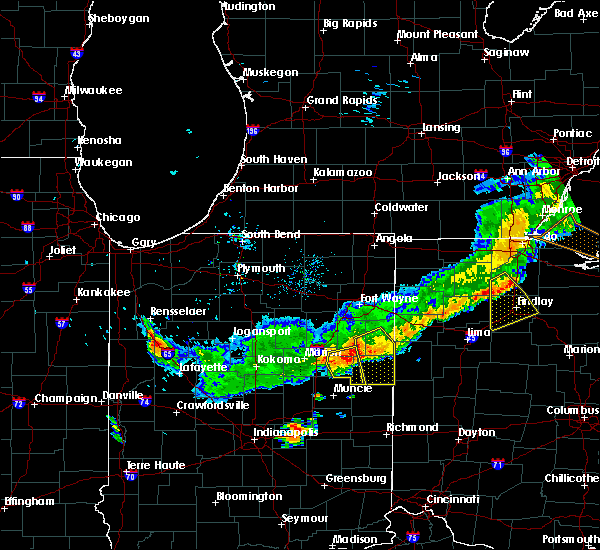 At 538 pm edt, severe thunderstorms were located along a line extending from 6 miles east of geneva to near pennville, moving south at 30 mph (radar indicated). Hazards include 60 mph wind gusts and penny size hail. Expect damage to roofs. siding and trees. these severe storms will be near, portland around 555 pm edt. Other locations impacted by these severe thunderstorms include liber, bryant, collett, powers, vera cruz, trinity, linn grove, bellfountain, domestic and bluff point. At 538 pm edt, severe thunderstorms were located along a line extending from 6 miles east of geneva to near pennville, moving south at 30 mph (radar indicated). Hazards include 60 mph wind gusts and penny size hail. Expect damage to roofs. siding and trees. these severe storms will be near, portland around 555 pm edt. Other locations impacted by these severe thunderstorms include liber, bryant, collett, powers, vera cruz, trinity, linn grove, bellfountain, domestic and bluff point.
|
| 7/21/2016 5:12 PM EDT |
 At 512 pm edt, a severe thunderstorm was located near monroe, or 7 miles northwest of berne, moving southeast at 30 mph (radar indicated). Hazards include 60 mph wind gusts and nickel size hail. Expect damage to roofs. siding and trees. this severe thunderstorm will be near, monroe around 515 pm edt. berne around 525 pm edt. geneva around 535 pm edt. portland around 550 pm edt. Other locations impacted by this severe thunderstorm include liber, bryant, vera cruz, trinity, domestic, brice, reiffsburg, westchester, petroleum and new mount pleasant. At 512 pm edt, a severe thunderstorm was located near monroe, or 7 miles northwest of berne, moving southeast at 30 mph (radar indicated). Hazards include 60 mph wind gusts and nickel size hail. Expect damage to roofs. siding and trees. this severe thunderstorm will be near, monroe around 515 pm edt. berne around 525 pm edt. geneva around 535 pm edt. portland around 550 pm edt. Other locations impacted by this severe thunderstorm include liber, bryant, vera cruz, trinity, domestic, brice, reiffsburg, westchester, petroleum and new mount pleasant.
|
| 6/23/2016 12:52 AM EDT |
 At 1251 am edt, a severe thunderstorm was located 7 miles south of huntington, moving southeast at 40 mph (radar indicated). Hazards include 60 mph wind gusts. Expect damage to roofs. siding and trees. this severe thunderstorm will be near, bluffton around 110 am edt. other locations impacted by this severe thunderstorm include vera cruz, pleasant plain, mount zion, domestic, mount etna, majenica, wellsburg, liberty center, travisville and plum tree. this includes interstate 69 in indiana between mile markers 272 and 286. A tornado watch remains in effect until 500 am edt for northeastern indiana. At 1251 am edt, a severe thunderstorm was located 7 miles south of huntington, moving southeast at 40 mph (radar indicated). Hazards include 60 mph wind gusts. Expect damage to roofs. siding and trees. this severe thunderstorm will be near, bluffton around 110 am edt. other locations impacted by this severe thunderstorm include vera cruz, pleasant plain, mount zion, domestic, mount etna, majenica, wellsburg, liberty center, travisville and plum tree. this includes interstate 69 in indiana between mile markers 272 and 286. A tornado watch remains in effect until 500 am edt for northeastern indiana.
|
| 3/27/2016 6:32 PM EDT |
 At 631 pm edt, a severe thunderstorm was located near ossian, moving northeast at 50 mph (radar indicated). Hazards include ping pong ball size hail and 60 mph wind gusts. People and animals outdoors will be injured. expect hail damage to roofs, siding, windows and vehicles. expect wind damage to roofs, siding and trees. locations impacted include, fort wayne, new haven, bluffton, decatur, ossian, monroeville, markle, monroe, middletown, preble, zanesville, uniondale, vera cruz, liberty center, travisville, yoder, rockford, hessen cassel, peterson and zulu. this includes the following highways, interstate 469 between mile markers 0 and 22, and near mile marker 30. Interstate 69 in indiana between mile markers 294 and 307, and between mile markers 311 and 314. At 631 pm edt, a severe thunderstorm was located near ossian, moving northeast at 50 mph (radar indicated). Hazards include ping pong ball size hail and 60 mph wind gusts. People and animals outdoors will be injured. expect hail damage to roofs, siding, windows and vehicles. expect wind damage to roofs, siding and trees. locations impacted include, fort wayne, new haven, bluffton, decatur, ossian, monroeville, markle, monroe, middletown, preble, zanesville, uniondale, vera cruz, liberty center, travisville, yoder, rockford, hessen cassel, peterson and zulu. this includes the following highways, interstate 469 between mile markers 0 and 22, and near mile marker 30. Interstate 69 in indiana between mile markers 294 and 307, and between mile markers 311 and 314.
|
| 3/27/2016 6:17 PM EDT |
 At 617 pm edt, a severe thunderstorm was located near markle, or 10 miles west of bluffton, moving northeast at 50 mph (radar indicated). Hazards include ping pong ball size hail and 60 mph wind gusts. People and animals outdoors will be injured. expect hail damage to roofs, siding, windows and vehicles. Expect wind damage to roofs, siding and trees. At 617 pm edt, a severe thunderstorm was located near markle, or 10 miles west of bluffton, moving northeast at 50 mph (radar indicated). Hazards include ping pong ball size hail and 60 mph wind gusts. People and animals outdoors will be injured. expect hail damage to roofs, siding, windows and vehicles. Expect wind damage to roofs, siding and trees.
|
| 7/18/2015 8:36 PM EDT |
 At 836 pm edt, severe thunderstorms were located along a line extending from 6 miles northeast of ossian to near markle, moving east at 35 mph (radar indicated). Hazards include 60 mph wind gusts. Expect damage to roofs. Siding and trees. At 836 pm edt, severe thunderstorms were located along a line extending from 6 miles northeast of ossian to near markle, moving east at 35 mph (radar indicated). Hazards include 60 mph wind gusts. Expect damage to roofs. Siding and trees.
|
| 6/12/2015 12:30 PM EDT |
 At 1229 pm edt, a severe thunderstorm was located near bluffton, moving east at 45 mph (radar indicated). Hazards include 60 mph wind gusts. Expect damage to roofs. Siding and trees. At 1229 pm edt, a severe thunderstorm was located near bluffton, moving east at 45 mph (radar indicated). Hazards include 60 mph wind gusts. Expect damage to roofs. Siding and trees.
|
| 5/30/2015 3:26 PM EDT | The severe thunderstorm warning for southern wells county will expire at 330 pm edt/230 pm cdt/, the storm which prompted the warning has weakened below severe limits. therefore, the severe thunderstorm warning for southern wells county will be allowed to expire at 330 pm edt. however, heavy rain is still expected through 400 pm edt that may cause ponding of water on roadways. |
| 5/30/2015 3:06 PM EDT | At 305 pm edt, a severe thunderstorm was located 6 miles north of montpelier, and moving east at 20 mph (radar indicated). Hazards include 60 mph wind gusts. Expect damage to roofs. siding and trees. Locations impacted include, bluffton, dillman, liberty center, poneto, wellsburg, travisville, petroleum, reiffsburg, domestic and vera cruz. |
| 5/30/2015 2:46 PM EDT | At 245 pm edt, a severe thunderstorm was located 5 miles northwest of montpelier, and moving east at 25 mph (radar indicated). Hazards include 60 mph wind gusts and nickel size hail. Expect damage to roofs. siding and trees. Locations impacted include, bluffton, montpelier, mount zion, keystone, dillman, liberty center, poneto, wellsburg, balbec, fiat, travisville, nottingham, petroleum, reiffsburg, domestic and vera cruz. |
| 5/30/2015 2:25 PM EDT | At 221 pm edt, a severe thunderstorm was located near van buren, and moving east at 25 mph (radar indicated). Hazards include 60 mph wind gusts and penny size hail. Expect damage to roofs. Siding and trees. |
| 11/17/2013 4:17 PM EST | Power outages across the area in wells county IN, 2.2 miles N of Vera Cruz, IN |
Hail Maps for Vera Cruz, IN


Connect with Interactive Hail Maps