

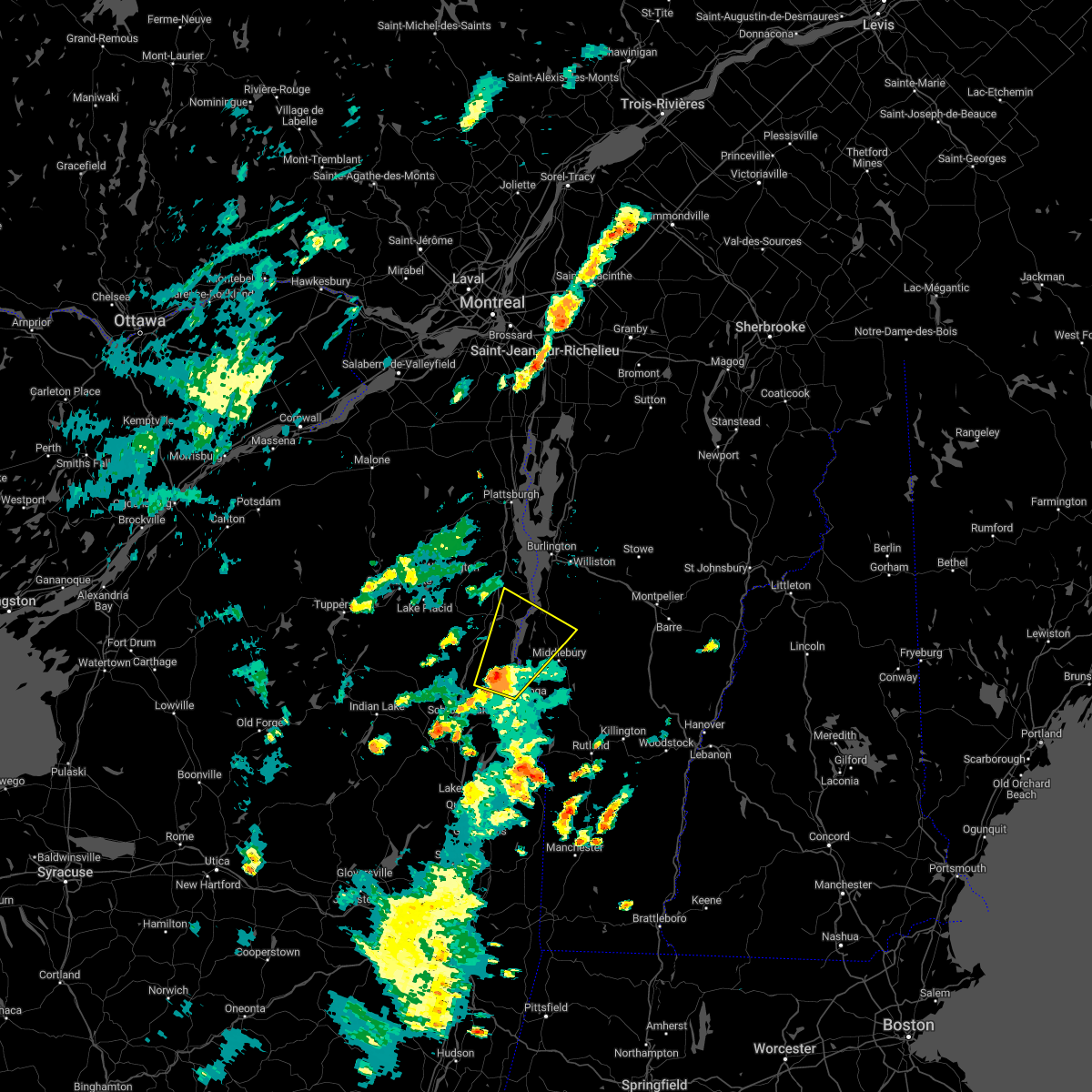
Hail Map for Vergennes, VT
The Vergennes, VT area has had 7 reports of on-the-ground hail by trained spotters, and has been under severe weather warnings 21 times during the past 12 months. Doppler radar has detected hail at or near Vergennes, VT on 23 occasions, including 1 occasion during the past year.
| Name: | Vergennes, VT |
| Where Located: | 21.3 miles S of Burlington, VT |
| Map: | Google Map for Vergennes, VT |
| Population: | 2588 |
| Housing Units: | 1072 |
| More Info: | Search Google for Vergennes, VT |
0
The Top Recent Hail Date for Vergennes, VT is Sunday, August 4, 2024 (23rd out of 23)

Hail and Wind Damage Spotted near Vergennes, VT
| Date / Time | Report Details |
|---|---|
| 8/4/2024 5:46 PM EDT |
 A new severe thunderstorm warning has been issued to replace this warning. the threat for gusty winds, hail, frequent lightning, and torrential rainfall continues. A new severe thunderstorm warning has been issued to replace this warning. the threat for gusty winds, hail, frequent lightning, and torrential rainfall continues.
|
| 8/4/2024 5:29 PM EDT |
 the severe thunderstorm warning has been cancelled and is no longer in effect the severe thunderstorm warning has been cancelled and is no longer in effect
|
| 8/4/2024 5:29 PM EDT |
 At 529 pm edt, a severe thunderstorm was located over weybridge, moving east at 20 mph (radar indicated). Hazards include 60 mph wind gusts and penny size hail. Expect damage to trees and powerlines. Locations impacted include, vergennes, middlebury, addison, weybridge, waltham, new haven, bristol, panton, ferrisburgh, lincoln, cornwall, bridport, ripton, starksboro, east middlebury, new haven mills, west lincoln, new haven junction, south starksboro, and brooksville. At 529 pm edt, a severe thunderstorm was located over weybridge, moving east at 20 mph (radar indicated). Hazards include 60 mph wind gusts and penny size hail. Expect damage to trees and powerlines. Locations impacted include, vergennes, middlebury, addison, weybridge, waltham, new haven, bristol, panton, ferrisburgh, lincoln, cornwall, bridport, ripton, starksboro, east middlebury, new haven mills, west lincoln, new haven junction, south starksboro, and brooksville.
|
| 8/4/2024 5:05 PM EDT |
 Svrbtv the national weather service in burlington has issued a * severe thunderstorm warning for, east central essex county in northern new york, northwestern addison county in central vermont, * until 545 pm edt. * at 505 pm edt, a severe thunderstorm was located over potash point, moving east at 20 mph (radar indicated). Hazards include 60 mph wind gusts and penny size hail. expect damage to trees and powerlines Svrbtv the national weather service in burlington has issued a * severe thunderstorm warning for, east central essex county in northern new york, northwestern addison county in central vermont, * until 545 pm edt. * at 505 pm edt, a severe thunderstorm was located over potash point, moving east at 20 mph (radar indicated). Hazards include 60 mph wind gusts and penny size hail. expect damage to trees and powerlines
|
| 7/30/2024 5:39 PM EDT | The storm which prompted the warning has weakened below severe limits, and no longer poses an immediate threat to life or property. therefore, the warning will be allowed to expire. |
| 7/30/2024 5:18 PM EDT |
 At 517 pm edt, a severe thunderstorm was located over button bay, moving east at 10 mph (law enforcement. at 357 pm, a tree was reported down on moriah road). Hazards include 60 mph wind gusts and penny size hail. Expect damage to trees and powerlines. locations impacted include, vergennes, middlebury, essex, westport, ferrisburg, charlotte, weybridge, waltham, new haven, panton, mt. Philo state park, addison, kingsland bay state park, ferrisburgh, monkton, fort cassin point, mcneil cove, owls head bay, sloop island, and wings point. At 517 pm edt, a severe thunderstorm was located over button bay, moving east at 10 mph (law enforcement. at 357 pm, a tree was reported down on moriah road). Hazards include 60 mph wind gusts and penny size hail. Expect damage to trees and powerlines. locations impacted include, vergennes, middlebury, essex, westport, ferrisburg, charlotte, weybridge, waltham, new haven, panton, mt. Philo state park, addison, kingsland bay state park, ferrisburgh, monkton, fort cassin point, mcneil cove, owls head bay, sloop island, and wings point.
|
| 7/30/2024 4:51 PM EDT | The storm which prompted the warning has moved out of the area. therefore, the warning will be allowed to expire. |
| 7/30/2024 4:50 PM EDT | Svrbtv the national weather service in burlington has issued a * severe thunderstorm warning for, east central essex county in northern new york, northwestern addison county in central vermont, southwestern chittenden county in northwestern vermont, * until 545 pm edt. * at 449 pm edt, a severe thunderstorm was located over cole bay, moving east at 10 mph (radar indicated). Hazards include 60 mph wind gusts and penny size hail. expect damage to trees and powerlines |
| 7/30/2024 4:29 PM EDT |
 At 428 pm edt, a severe thunderstorm was located over cole bay, moving northeast at 15 mph (radar indicated). Hazards include 60 mph wind gusts and penny size hail. Expect damage to trees and powerlines. Locations impacted include, vergennes, moriah, westport, panton, port henry, addison, d a r state park, waltham, ferrisburgh, new haven, owls head bay, north west bay, mud island, potash bay, louis clearing bay, fields bay, moriah center, south bay in essex county, cold spring bay, and witherbee. At 428 pm edt, a severe thunderstorm was located over cole bay, moving northeast at 15 mph (radar indicated). Hazards include 60 mph wind gusts and penny size hail. Expect damage to trees and powerlines. Locations impacted include, vergennes, moriah, westport, panton, port henry, addison, d a r state park, waltham, ferrisburgh, new haven, owls head bay, north west bay, mud island, potash bay, louis clearing bay, fields bay, moriah center, south bay in essex county, cold spring bay, and witherbee.
|
| 7/30/2024 3:57 PM EDT |
 Svrbtv the national weather service in burlington has issued a * severe thunderstorm warning for, east central essex county in northern new york, northwestern addison county in central vermont, * until 500 pm edt. * at 357 pm edt, a severe thunderstorm was located over witherbee, moving northeast at 15 mph (radar indicated). Hazards include 60 mph wind gusts and penny size hail. expect damage to trees and powerlines Svrbtv the national weather service in burlington has issued a * severe thunderstorm warning for, east central essex county in northern new york, northwestern addison county in central vermont, * until 500 pm edt. * at 357 pm edt, a severe thunderstorm was located over witherbee, moving northeast at 15 mph (radar indicated). Hazards include 60 mph wind gusts and penny size hail. expect damage to trees and powerlines
|
| 7/10/2024 7:08 PM EDT |
 The storm which prompted the warning has moved out of the area. therefore, the warning will be allowed to expire. a tornado watch remains in effect until 900 pm edt for northern new york, and central and northwestern vermont. to report severe weather, contact your nearest law enforcement agency. they will relay your report to the national weather service burlington. remember, a severe thunderstorm warning still remains in effect for addison and chittenden counties!. The storm which prompted the warning has moved out of the area. therefore, the warning will be allowed to expire. a tornado watch remains in effect until 900 pm edt for northern new york, and central and northwestern vermont. to report severe weather, contact your nearest law enforcement agency. they will relay your report to the national weather service burlington. remember, a severe thunderstorm warning still remains in effect for addison and chittenden counties!.
|
| 7/10/2024 6:56 PM EDT |
 At 656 pm edt, a severe thunderstorm was located over waltham, moving east at 30 mph (radar indicated). Hazards include 60 mph wind gusts. Expect damage to trees and powerlines. locations impacted include, vergennes, middlebury, westport, ferrisburg, weybridge, waltham, bristol, monkton ridge, monkton, monkton boro, new haven, panton, mt. Philo state park, port henry, addison, kingsland bay state park, d a r state park, bridport, ferrisburgh, and hinesburg. At 656 pm edt, a severe thunderstorm was located over waltham, moving east at 30 mph (radar indicated). Hazards include 60 mph wind gusts. Expect damage to trees and powerlines. locations impacted include, vergennes, middlebury, westport, ferrisburg, weybridge, waltham, bristol, monkton ridge, monkton, monkton boro, new haven, panton, mt. Philo state park, port henry, addison, kingsland bay state park, d a r state park, bridport, ferrisburgh, and hinesburg.
|
| 7/10/2024 6:33 PM EDT |
 Svrbtv the national weather service in burlington has issued a * severe thunderstorm warning for, southeastern essex county in northern new york, northwestern addison county in central vermont, southwestern chittenden county in northwestern vermont, * until 715 pm edt. * at 632 pm edt, a severe thunderstorm was located over craig harbor, moving east at 30 mph (radar indicated). Hazards include 60 mph wind gusts. expect damage to trees and powerlines Svrbtv the national weather service in burlington has issued a * severe thunderstorm warning for, southeastern essex county in northern new york, northwestern addison county in central vermont, southwestern chittenden county in northwestern vermont, * until 715 pm edt. * at 632 pm edt, a severe thunderstorm was located over craig harbor, moving east at 30 mph (radar indicated). Hazards include 60 mph wind gusts. expect damage to trees and powerlines
|
| 7/10/2024 6:24 PM EDT |
 The storm which prompted the warning has moved out of the area. therefore, the warning will be allowed to expire. a tornado watch remains in effect until 900 pm edt for northern new york, and central, southern and northwestern vermont. remember, a new severe thunderstorm warning still remains in effect!. The storm which prompted the warning has moved out of the area. therefore, the warning will be allowed to expire. a tornado watch remains in effect until 900 pm edt for northern new york, and central, southern and northwestern vermont. remember, a new severe thunderstorm warning still remains in effect!.
|
| 7/10/2024 6:09 PM EDT |
 At 609 pm edt, a severe thunderstorm was located over new haven mills, moving northeast at 40 mph (radar indicated). Hazards include 60 mph wind gusts. Expect damage to trees and powerlines. Locations impacted include, middlebury, vergennes, moriah, crown point, cornwall, weybridge, waltham, salisbury, bristol, lincoln, orwell, whiting, new haven, granville, port henry, addison, hancock, shoreham, warren, and d a r state park. At 609 pm edt, a severe thunderstorm was located over new haven mills, moving northeast at 40 mph (radar indicated). Hazards include 60 mph wind gusts. Expect damage to trees and powerlines. Locations impacted include, middlebury, vergennes, moriah, crown point, cornwall, weybridge, waltham, salisbury, bristol, lincoln, orwell, whiting, new haven, granville, port henry, addison, hancock, shoreham, warren, and d a r state park.
|
| 7/10/2024 5:42 PM EDT | The storm which prompted the warning has weakened below severe limits, and no longer poses an immediate threat to life or property. therefore, the warning will be allowed to expire. a tornado watch remains in effect until 900 pm edt for central and northwestern vermont. |
| 7/10/2024 5:38 PM EDT |
 Svrbtv the national weather service in burlington has issued a * severe thunderstorm warning for, southeastern essex county in northern new york, western orange county in central vermont, addison county in central vermont, southeastern chittenden county in northwestern vermont, northern windsor county in southern vermont, southwestern washington county in central vermont, * until 630 pm edt. * at 538 pm edt, a severe thunderstorm was located over crown point, moving northeast at 40 mph (radar indicated). Hazards include 60 mph wind gusts. expect damage to trees and powerlines Svrbtv the national weather service in burlington has issued a * severe thunderstorm warning for, southeastern essex county in northern new york, western orange county in central vermont, addison county in central vermont, southeastern chittenden county in northwestern vermont, northern windsor county in southern vermont, southwestern washington county in central vermont, * until 630 pm edt. * at 538 pm edt, a severe thunderstorm was located over crown point, moving northeast at 40 mph (radar indicated). Hazards include 60 mph wind gusts. expect damage to trees and powerlines
|
| 7/10/2024 5:16 PM EDT |
 At 516 pm edt, a severe thunderstorm was located over south hinesburg, moving northeast at 35 mph (radar indicated). Hazards include 60 mph wind gusts. Expect damage to trees and powerlines. locations impacted include, vergennes, morrisville, johnson village, charlotte, waltham, stowe, monkton ridge, waterbury village, monkton, monkton boro, hyde park, worcester, middlesex, bolton, richmond, mt. philo state park, underhill, jericho, hinesburg, and st. George. At 516 pm edt, a severe thunderstorm was located over south hinesburg, moving northeast at 35 mph (radar indicated). Hazards include 60 mph wind gusts. Expect damage to trees and powerlines. locations impacted include, vergennes, morrisville, johnson village, charlotte, waltham, stowe, monkton ridge, waterbury village, monkton, monkton boro, hyde park, worcester, middlesex, bolton, richmond, mt. philo state park, underhill, jericho, hinesburg, and st. George.
|
| 7/10/2024 4:54 PM EDT |
 the severe thunderstorm warning has been cancelled and is no longer in effect the severe thunderstorm warning has been cancelled and is no longer in effect
|
| 7/10/2024 4:51 PM EDT |
 Svrbtv the national weather service in burlington has issued a * severe thunderstorm warning for, central lamoille county in northwestern vermont, north central addison county in central vermont, central chittenden county in northwestern vermont, northern washington county in central vermont, * until 545 pm edt. * at 451 pm edt, a severe thunderstorm was located over button bay, moving northeast at 30 mph (radar indicated). Hazards include 60 mph wind gusts. expect damage to trees and powerlines Svrbtv the national weather service in burlington has issued a * severe thunderstorm warning for, central lamoille county in northwestern vermont, north central addison county in central vermont, central chittenden county in northwestern vermont, northern washington county in central vermont, * until 545 pm edt. * at 451 pm edt, a severe thunderstorm was located over button bay, moving northeast at 30 mph (radar indicated). Hazards include 60 mph wind gusts. expect damage to trees and powerlines
|
| 7/10/2024 4:31 PM EDT |
 Svrbtv the national weather service in burlington has issued a * severe thunderstorm warning for, northeastern essex county in northern new york, northwestern addison county in central vermont, southwestern chittenden county in northwestern vermont, * until 515 pm edt. * at 430 pm edt, a severe thunderstorm was located near elizabethtown, moving northeast at 25 mph (radar indicated). Hazards include 60 mph wind gusts and penny size hail. expect damage to trees and powerlines Svrbtv the national weather service in burlington has issued a * severe thunderstorm warning for, northeastern essex county in northern new york, northwestern addison county in central vermont, southwestern chittenden county in northwestern vermont, * until 515 pm edt. * at 430 pm edt, a severe thunderstorm was located near elizabethtown, moving northeast at 25 mph (radar indicated). Hazards include 60 mph wind gusts and penny size hail. expect damage to trees and powerlines
|
| 6/23/2024 2:03 PM EDT |
 At 203 pm edt, a severe thunderstorm was located over north ferrisburgh, moving northeast at 40 mph (radar indicated). Hazards include 60 mph wind gusts and penny size hail. Expect damage to trees and powerlines. locations impacted include, vergennes, essex, westport, monkton ridge, monkton, monkton boro, hinesburg, st. george, starksboro, ferrisburg, charlotte, waltham, fayston, panton, bolton, richmond, mt. Philo state park, jericho, huntington, and kingsland bay state park. At 203 pm edt, a severe thunderstorm was located over north ferrisburgh, moving northeast at 40 mph (radar indicated). Hazards include 60 mph wind gusts and penny size hail. Expect damage to trees and powerlines. locations impacted include, vergennes, essex, westport, monkton ridge, monkton, monkton boro, hinesburg, st. george, starksboro, ferrisburg, charlotte, waltham, fayston, panton, bolton, richmond, mt. Philo state park, jericho, huntington, and kingsland bay state park.
|
| 6/23/2024 1:43 PM EDT |
 This severe thunderstorm warning has been replaced by a new severe thunderstorm warning. a tornado watch remains in effect until 800 pm edt for northern new york, and central vermont. remember, a severe thunderstorm warning still remains in effect for essex county in new york and addison and chittenden county in vermont. This severe thunderstorm warning has been replaced by a new severe thunderstorm warning. a tornado watch remains in effect until 800 pm edt for northern new york, and central vermont. remember, a severe thunderstorm warning still remains in effect for essex county in new york and addison and chittenden county in vermont.
|
| 6/23/2024 1:41 PM EDT |
 Svrbtv the national weather service in burlington has issued a * severe thunderstorm warning for, east central essex county in northern new york, northwestern addison county in central vermont, southern chittenden county in northwestern vermont, west central washington county in central vermont, * until 230 pm edt. * at 140 pm edt, a severe thunderstorm was located over westport, moving northeast at 45 mph (radar indicated). Hazards include 60 mph wind gusts and penny size hail. expect damage to trees and powerlines Svrbtv the national weather service in burlington has issued a * severe thunderstorm warning for, east central essex county in northern new york, northwestern addison county in central vermont, southern chittenden county in northwestern vermont, west central washington county in central vermont, * until 230 pm edt. * at 140 pm edt, a severe thunderstorm was located over westport, moving northeast at 45 mph (radar indicated). Hazards include 60 mph wind gusts and penny size hail. expect damage to trees and powerlines
|
| 6/23/2024 1:37 PM EDT |
 At 137 pm edt, a severe thunderstorm was located over wadhams, moving northeast at 45 mph (radar indicated). Hazards include 60 mph wind gusts and penny size hail. Expect damage to trees and powerlines. Locations impacted include, vergennes, westport, elizabethtown, panton, kingsland bay state park, ferrisburgh, waltham, lewis, fort cassin point, north west bay, mud island, porter bay, louis clearing bay, fields bay, new russia, south bay in essex county, cold spring bay, kings bay state park, witherbee, and underwood. At 137 pm edt, a severe thunderstorm was located over wadhams, moving northeast at 45 mph (radar indicated). Hazards include 60 mph wind gusts and penny size hail. Expect damage to trees and powerlines. Locations impacted include, vergennes, westport, elizabethtown, panton, kingsland bay state park, ferrisburgh, waltham, lewis, fort cassin point, north west bay, mud island, porter bay, louis clearing bay, fields bay, new russia, south bay in essex county, cold spring bay, kings bay state park, witherbee, and underwood.
|
| 6/23/2024 1:19 PM EDT |
 the severe thunderstorm warning has been cancelled and is no longer in effect the severe thunderstorm warning has been cancelled and is no longer in effect
|
| 6/23/2024 1:19 PM EDT |
 At 119 pm edt, a severe thunderstorm was located over underwood, moving northeast at 45 mph (radar indicated). Hazards include 60 mph wind gusts and penny size hail. Expect damage to trees and powerlines. Locations impacted include, vergennes, westport, elizabethtown, keene, keene valley, panton, kingsland bay state park, ferrisburgh, mount marcy, waltham, lewis, fort cassin point, north west bay, mud island, porter bay, louis clearing bay, fields bay, deerhead, new russia, and south bay in essex county. At 119 pm edt, a severe thunderstorm was located over underwood, moving northeast at 45 mph (radar indicated). Hazards include 60 mph wind gusts and penny size hail. Expect damage to trees and powerlines. Locations impacted include, vergennes, westport, elizabethtown, keene, keene valley, panton, kingsland bay state park, ferrisburgh, mount marcy, waltham, lewis, fort cassin point, north west bay, mud island, porter bay, louis clearing bay, fields bay, deerhead, new russia, and south bay in essex county.
|
| 6/23/2024 1:05 PM EDT |
 Svrbtv the national weather service in burlington has issued a * severe thunderstorm warning for, southeastern franklin county in northern new york, central essex county in northern new york, northwestern addison county in central vermont, * until 145 pm edt. * at 105 pm edt, a severe thunderstorm was located over mount marcy, moving northeast at 50 mph (radar indicated). Hazards include 60 mph wind gusts and penny size hail. expect damage to trees and powerlines Svrbtv the national weather service in burlington has issued a * severe thunderstorm warning for, southeastern franklin county in northern new york, central essex county in northern new york, northwestern addison county in central vermont, * until 145 pm edt. * at 105 pm edt, a severe thunderstorm was located over mount marcy, moving northeast at 50 mph (radar indicated). Hazards include 60 mph wind gusts and penny size hail. expect damage to trees and powerlines
|
| 6/20/2024 1:48 PM EDT |
 the severe thunderstorm warning has been cancelled and is no longer in effect the severe thunderstorm warning has been cancelled and is no longer in effect
|
| 6/20/2024 1:15 PM EDT |
 The severe thunderstorm which prompted the warning has been reissued. therefore, this warning will be allowed to expire. a severe thunderstorm watch remains in effect until 800 pm edt for northern new york, and central vermont. remember, a severe thunderstorm warning still remains in effect for essex and addison counties until 200 pm edt. The severe thunderstorm which prompted the warning has been reissued. therefore, this warning will be allowed to expire. a severe thunderstorm watch remains in effect until 800 pm edt for northern new york, and central vermont. remember, a severe thunderstorm warning still remains in effect for essex and addison counties until 200 pm edt.
|
| 6/20/2024 1:13 PM EDT |
 Svrbtv the national weather service in burlington has issued a * severe thunderstorm warning for, eastern essex county in northern new york, northwestern addison county in central vermont, * until 200 pm edt. * at 112 pm edt, a severe thunderstorm was located over addison, moving east at 10 mph (radar indicated). Hazards include 60 mph wind gusts and penny size hail. expect damage to trees and powerlines Svrbtv the national weather service in burlington has issued a * severe thunderstorm warning for, eastern essex county in northern new york, northwestern addison county in central vermont, * until 200 pm edt. * at 112 pm edt, a severe thunderstorm was located over addison, moving east at 10 mph (radar indicated). Hazards include 60 mph wind gusts and penny size hail. expect damage to trees and powerlines
|
| 6/20/2024 1:03 PM EDT |
 At 103 pm edt, a severe thunderstorm was located over addison, moving east at 15 mph (radar indicated). Hazards include 60 mph wind gusts and penny size hail. Expect damage to trees and powerlines. Locations impacted include, middlebury, vergennes, port henry, ferrisburg, addison, weybridge, waltham, d a r state park, monkton, monkton boro, new haven, panton, bristol, bridport, ferrisburgh, cornwall, ripton, owls head bay, mud island, and plumies point. At 103 pm edt, a severe thunderstorm was located over addison, moving east at 15 mph (radar indicated). Hazards include 60 mph wind gusts and penny size hail. Expect damage to trees and powerlines. Locations impacted include, middlebury, vergennes, port henry, ferrisburg, addison, weybridge, waltham, d a r state park, monkton, monkton boro, new haven, panton, bristol, bridport, ferrisburgh, cornwall, ripton, owls head bay, mud island, and plumies point.
|
| 6/20/2024 12:38 PM EDT |
 Svrbtv the national weather service in burlington has issued a * severe thunderstorm warning for, east central essex county in northern new york, northwestern addison county in central vermont, * until 115 pm edt. * at 1237 pm edt, a severe thunderstorm was located over craig harbor, moving east at 15 mph (radar indicated). Hazards include 60 mph wind gusts and penny size hail. expect damage to trees and powerlines Svrbtv the national weather service in burlington has issued a * severe thunderstorm warning for, east central essex county in northern new york, northwestern addison county in central vermont, * until 115 pm edt. * at 1237 pm edt, a severe thunderstorm was located over craig harbor, moving east at 15 mph (radar indicated). Hazards include 60 mph wind gusts and penny size hail. expect damage to trees and powerlines
|
| 6/7/2024 3:57 PM EDT | Half Dollar sized hail reported 3.5 miles NNW of Vergennes, VT |
| 6/7/2024 3:55 PM EDT |
 Svrbtv the national weather service in burlington has issued a * severe thunderstorm warning for, east central essex county in northern new york, central addison county in central vermont, southern chittenden county in northwestern vermont, west central washington county in central vermont, * until 445 pm edt. * at 354 pm edt, a severe thunderstorm was located over waltham, moving east at 20 mph (radar indicated). Hazards include 60 mph wind gusts and quarter size hail. Minor hail damage to vehicles is possible. Expect wind damage to trees and powerlines. Svrbtv the national weather service in burlington has issued a * severe thunderstorm warning for, east central essex county in northern new york, central addison county in central vermont, southern chittenden county in northwestern vermont, west central washington county in central vermont, * until 445 pm edt. * at 354 pm edt, a severe thunderstorm was located over waltham, moving east at 20 mph (radar indicated). Hazards include 60 mph wind gusts and quarter size hail. Minor hail damage to vehicles is possible. Expect wind damage to trees and powerlines.
|
| 4/12/2024 4:08 PM EDT |
 Svrbtv the national weather service in burlington has issued a * severe thunderstorm warning for, southeastern clinton county in northern new york, northeastern essex county in northern new york, northwestern addison county in central vermont, southern grand isle county in northwestern vermont, chittenden county in northwestern vermont, * until 500 pm edt. * at 408 pm edt, severe thunderstorms were located along a line extending from lewis to louis clearing bay to near weybridge, moving north at 45 mph (radar indicated). Hazards include 60 mph wind gusts and quarter size hail. Minor hail damage to vehicles is possible. Expect wind damage to trees and powerlines. Svrbtv the national weather service in burlington has issued a * severe thunderstorm warning for, southeastern clinton county in northern new york, northeastern essex county in northern new york, northwestern addison county in central vermont, southern grand isle county in northwestern vermont, chittenden county in northwestern vermont, * until 500 pm edt. * at 408 pm edt, severe thunderstorms were located along a line extending from lewis to louis clearing bay to near weybridge, moving north at 45 mph (radar indicated). Hazards include 60 mph wind gusts and quarter size hail. Minor hail damage to vehicles is possible. Expect wind damage to trees and powerlines.
|
| 9/7/2023 4:36 PM EDT |
 The severe thunderstorm warning for northeastern clinton, lamoille, northern addison, grand isle, chittenden, western washington and franklin counties will expire at 445 pm edt, the storms which prompted the warning have moved out of the warned area. therefore, the warning will be allowed to expire. The severe thunderstorm warning for northeastern clinton, lamoille, northern addison, grand isle, chittenden, western washington and franklin counties will expire at 445 pm edt, the storms which prompted the warning have moved out of the warned area. therefore, the warning will be allowed to expire.
|
| 9/7/2023 3:40 PM EDT | At 340 pm edt, severe thunderstorms were located along a line extending from near shad island to jericho village to near weybridge, moving east at 25 mph (radar indicated). Hazards include 60 mph wind gusts and quarter size hail. Minor hail damage to vehicles is possible. Expect wind damage to trees and powerlines. |
| 9/7/2023 3:40 PM EDT | At 340 pm edt, severe thunderstorms were located along a line extending from near shad island to jericho village to near weybridge, moving east at 25 mph (radar indicated). Hazards include 60 mph wind gusts and quarter size hail. Minor hail damage to vehicles is possible. Expect wind damage to trees and powerlines. |
| 9/7/2023 3:30 PM EDT |
 At 329 pm edt, severe thunderstorms were located along a line extending from grand isle to south burlington to weybridge, moving east at 25 mph (radar indicated). Hazards include 60 mph wind gusts and quarter size hail. Minor hail damage to vehicles is possible. expect wind damage to trees and powerlines. locations impacted include, essex junction, south burlington, burlington international airport, burlington, vergennes, middlebury, weybridge, winooski, monkton ridge, monkton, westford, monkton boro, colchester, essex junction village, fairfax, williston, new haven, georgia, hinesburg, and st. george. hail threat, radar indicated max hail size, 1. 00 in wind threat, radar indicated max wind gust, 60 mph. At 329 pm edt, severe thunderstorms were located along a line extending from grand isle to south burlington to weybridge, moving east at 25 mph (radar indicated). Hazards include 60 mph wind gusts and quarter size hail. Minor hail damage to vehicles is possible. expect wind damage to trees and powerlines. locations impacted include, essex junction, south burlington, burlington international airport, burlington, vergennes, middlebury, weybridge, winooski, monkton ridge, monkton, westford, monkton boro, colchester, essex junction village, fairfax, williston, new haven, georgia, hinesburg, and st. george. hail threat, radar indicated max hail size, 1. 00 in wind threat, radar indicated max wind gust, 60 mph.
|
| 9/7/2023 2:48 PM EDT |
 At 248 pm edt, severe thunderstorms were located along a line extending from morrisonville to near willsboro bay to moriah, moving east at 25 mph (radar indicated). Hazards include 60 mph wind gusts and quarter size hail. Minor hail damage to vehicles is possible. Expect wind damage to trees and powerlines. At 248 pm edt, severe thunderstorms were located along a line extending from morrisonville to near willsboro bay to moriah, moving east at 25 mph (radar indicated). Hazards include 60 mph wind gusts and quarter size hail. Minor hail damage to vehicles is possible. Expect wind damage to trees and powerlines.
|
| 8/4/2023 1:54 PM EDT |
 At 154 pm edt, a severe thunderstorm was located over waltham, moving east at 15 mph (law enforcement reported one inch hail in basin harbor and trees down in button bay state park). Hazards include 60 mph wind gusts and quarter size hail. Minor hail damage to vehicles is possible. expect wind damage to trees and powerlines. locations impacted include, vergennes, middlebury, ferrisburg, waltham, new haven, panton, ferrisburgh, weybridge, bristol, monkton, starksboro, addison, east monkton, mud island, spaulding bay, new haven junction, arnold bay, white bay, brooksville, and rock island. hail threat, observed max hail size, 1. 00 in wind threat, observed max wind gust, 60 mph. At 154 pm edt, a severe thunderstorm was located over waltham, moving east at 15 mph (law enforcement reported one inch hail in basin harbor and trees down in button bay state park). Hazards include 60 mph wind gusts and quarter size hail. Minor hail damage to vehicles is possible. expect wind damage to trees and powerlines. locations impacted include, vergennes, middlebury, ferrisburg, waltham, new haven, panton, ferrisburgh, weybridge, bristol, monkton, starksboro, addison, east monkton, mud island, spaulding bay, new haven junction, arnold bay, white bay, brooksville, and rock island. hail threat, observed max hail size, 1. 00 in wind threat, observed max wind gust, 60 mph.
|
| 8/4/2023 1:31 PM EDT | Quarter sized hail reported 5.6 miles ESE of Vergennes, VT, measured by trooper in basin harbor. |
| 8/4/2023 1:26 PM EDT |
 At 126 pm edt, a severe thunderstorm was located over button bay, moving east at 15 mph (radar indicated). Hazards include 60 mph wind gusts and quarter size hail. Minor hail damage to vehicles is possible. Expect wind damage to trees and powerlines. At 126 pm edt, a severe thunderstorm was located over button bay, moving east at 15 mph (radar indicated). Hazards include 60 mph wind gusts and quarter size hail. Minor hail damage to vehicles is possible. Expect wind damage to trees and powerlines.
|
| 8/3/2023 7:11 PM EDT |
 The severe thunderstorm warning for east central essex, northern addison, southeastern chittenden and southwestern washington counties will expire at 715 pm edt, the storm which prompted the warning has moved out of the area. therefore, the warning will be allowed to expire. to report severe weather, contact your nearest law enforcement agency. they will relay your report to the national weather service burlington. remember, a severe thunderstorm warning still remains in effect for parts of addison county. The severe thunderstorm warning for east central essex, northern addison, southeastern chittenden and southwestern washington counties will expire at 715 pm edt, the storm which prompted the warning has moved out of the area. therefore, the warning will be allowed to expire. to report severe weather, contact your nearest law enforcement agency. they will relay your report to the national weather service burlington. remember, a severe thunderstorm warning still remains in effect for parts of addison county.
|
| 8/3/2023 6:55 PM EDT |
 At 654 pm edt, a severe thunderstorm was located over camels hump state park, moving east at 25 mph (radar indicated). Hazards include 60 mph wind gusts and quarter size hail. Minor hail damage to vehicles is possible. expect wind damage to trees and powerlines. locations impacted include, vergennes, westport, ferrisburg, waltham, bristol, lincoln, monkton, waitsfield, monkton boro, fayston, new haven, panton, warren, starksboro, roxbury, buels gore, ferrisburgh, duxbury, addison, and huntington. hail threat, radar indicated max hail size, 1. 00 in wind threat, radar indicated max wind gust, 60 mph. At 654 pm edt, a severe thunderstorm was located over camels hump state park, moving east at 25 mph (radar indicated). Hazards include 60 mph wind gusts and quarter size hail. Minor hail damage to vehicles is possible. expect wind damage to trees and powerlines. locations impacted include, vergennes, westport, ferrisburg, waltham, bristol, lincoln, monkton, waitsfield, monkton boro, fayston, new haven, panton, warren, starksboro, roxbury, buels gore, ferrisburgh, duxbury, addison, and huntington. hail threat, radar indicated max hail size, 1. 00 in wind threat, radar indicated max wind gust, 60 mph.
|
| 8/3/2023 6:20 PM EDT |
 At 620 pm edt, a severe thunderstorm was located over ferrisburg, moving east at 25 mph (radar indicated). Hazards include 60 mph wind gusts and quarter size hail. Minor hail damage to vehicles is possible. Expect wind damage to trees and powerlines. At 620 pm edt, a severe thunderstorm was located over ferrisburg, moving east at 25 mph (radar indicated). Hazards include 60 mph wind gusts and quarter size hail. Minor hail damage to vehicles is possible. Expect wind damage to trees and powerlines.
|
| 7/24/2023 1:52 PM EDT |
 At 152 pm edt, a severe thunderstorm was located over mineville, moving northeast at 20 mph (radar indicated). Hazards include 60 mph wind gusts and quarter size hail. Minor hail damage to vehicles is possible. Expect wind damage to trees and powerlines. At 152 pm edt, a severe thunderstorm was located over mineville, moving northeast at 20 mph (radar indicated). Hazards include 60 mph wind gusts and quarter size hail. Minor hail damage to vehicles is possible. Expect wind damage to trees and powerlines.
|
| 7/13/2023 6:22 PM EDT |
 At 618 pm edt, a severe thunderstorm was located over bolton, moving northeast at 45 mph (public reported trees down near williston with this storm). Hazards include 60 mph wind gusts and quarter size hail. Minor hail damage to vehicles is possible. expect wind damage to trees and powerlines. locations impacted include, vergennes, montpelier, morrisville, johnson village, calais, cambridge, monkton ridge, waterbury village, monkton, westford, monkton boro, williston, worcester, middlesex, hinesburg, st. george, morrisville village, woodbury, moretown, and starksboro. hail threat, radar indicated max hail size, 1. 00 in wind threat, radar indicated max wind gust, 60 mph. At 618 pm edt, a severe thunderstorm was located over bolton, moving northeast at 45 mph (public reported trees down near williston with this storm). Hazards include 60 mph wind gusts and quarter size hail. Minor hail damage to vehicles is possible. expect wind damage to trees and powerlines. locations impacted include, vergennes, montpelier, morrisville, johnson village, calais, cambridge, monkton ridge, waterbury village, monkton, westford, monkton boro, williston, worcester, middlesex, hinesburg, st. george, morrisville village, woodbury, moretown, and starksboro. hail threat, radar indicated max hail size, 1. 00 in wind threat, radar indicated max wind gust, 60 mph.
|
| 7/13/2023 5:55 PM EDT |
 At 555 pm edt, a severe thunderstorm was located over hinesburg, moving northeast at 45 mph (radar indicated). Hazards include 60 mph wind gusts and quarter size hail. Minor hail damage to vehicles is possible. Expect wind damage to trees and powerlines. At 555 pm edt, a severe thunderstorm was located over hinesburg, moving northeast at 45 mph (radar indicated). Hazards include 60 mph wind gusts and quarter size hail. Minor hail damage to vehicles is possible. Expect wind damage to trees and powerlines.
|
| 7/13/2023 5:14 PM EDT |
 At 514 pm edt, a severe thunderstorm was located over pharoah mountain, moving northeast at 40 mph (radar indicated). Hazards include 60 mph wind gusts and quarter size hail. Minor hail damage to vehicles is possible. Expect wind damage to trees and powerlines. At 514 pm edt, a severe thunderstorm was located over pharoah mountain, moving northeast at 40 mph (radar indicated). Hazards include 60 mph wind gusts and quarter size hail. Minor hail damage to vehicles is possible. Expect wind damage to trees and powerlines.
|
| 7/13/2023 3:20 PM EDT |
 At 320 pm edt, a severe thunderstorm was located over witherbee, moving northeast at 35 mph (radar indicated). Hazards include 60 mph wind gusts and quarter size hail. Minor hail damage to vehicles is possible. Expect wind damage to trees and powerlines. At 320 pm edt, a severe thunderstorm was located over witherbee, moving northeast at 35 mph (radar indicated). Hazards include 60 mph wind gusts and quarter size hail. Minor hail damage to vehicles is possible. Expect wind damage to trees and powerlines.
|
| 7/7/2023 12:38 PM EDT |
 At 1236 pm edt, a severe thunderstorm was located over louis clearing bay, moving east at 15 mph (law enforcement. at 11:54 am, law enforcement reported trees down on wires in wadham). Hazards include 60 mph wind gusts and quarter size hail. Minor hail damage to vehicles is possible. expect wind damage to trees and powerlines. locations impacted include, vergennes, essex, westport, ferrisburg, charlotte, waltham, bristol, monkton ridge, monkton, monkton boro, new haven, panton, mt. philo state park, kingsland bay state park, starksboro, ferrisburgh, addison, hinesburg, huntington, and fort cassin point. hail threat, radar indicated max hail size, 1. 00 in wind threat, radar indicated max wind gust, 60 mph. At 1236 pm edt, a severe thunderstorm was located over louis clearing bay, moving east at 15 mph (law enforcement. at 11:54 am, law enforcement reported trees down on wires in wadham). Hazards include 60 mph wind gusts and quarter size hail. Minor hail damage to vehicles is possible. expect wind damage to trees and powerlines. locations impacted include, vergennes, essex, westport, ferrisburg, charlotte, waltham, bristol, monkton ridge, monkton, monkton boro, new haven, panton, mt. philo state park, kingsland bay state park, starksboro, ferrisburgh, addison, hinesburg, huntington, and fort cassin point. hail threat, radar indicated max hail size, 1. 00 in wind threat, radar indicated max wind gust, 60 mph.
|
| 7/7/2023 12:15 PM EDT |
 At 1214 pm edt, a severe thunderstorm was located over hunter bay, moving east at 10 mph (radar indicated). Hazards include 60 mph wind gusts and quarter size hail. Minor hail damage to vehicles is possible. Expect wind damage to trees and powerlines. At 1214 pm edt, a severe thunderstorm was located over hunter bay, moving east at 10 mph (radar indicated). Hazards include 60 mph wind gusts and quarter size hail. Minor hail damage to vehicles is possible. Expect wind damage to trees and powerlines.
|
| 7/7/2023 11:50 AM EDT |
 At 1149 am edt, a severe thunderstorm was located over lewis, moving east at 15 mph (radar indicated). Hazards include 60 mph wind gusts and quarter size hail. Minor hail damage to vehicles is possible. expect wind damage to trees and powerlines. locations impacted include, essex, willsboro, westport, elizabethtown, kingsland bay state park, ferrisburgh, lewis, fort cassin point, snake den harbor, ship point, summer point, hunter bay, north west bay, diamond island, cannon point, porter bay, partridge harbor, louis clearing bay, fields bay, and deerhead. hail threat, radar indicated max hail size, 1. 00 in wind threat, radar indicated max wind gust, 60 mph. At 1149 am edt, a severe thunderstorm was located over lewis, moving east at 15 mph (radar indicated). Hazards include 60 mph wind gusts and quarter size hail. Minor hail damage to vehicles is possible. expect wind damage to trees and powerlines. locations impacted include, essex, willsboro, westport, elizabethtown, kingsland bay state park, ferrisburgh, lewis, fort cassin point, snake den harbor, ship point, summer point, hunter bay, north west bay, diamond island, cannon point, porter bay, partridge harbor, louis clearing bay, fields bay, and deerhead. hail threat, radar indicated max hail size, 1. 00 in wind threat, radar indicated max wind gust, 60 mph.
|
| 7/7/2023 11:30 AM EDT |
 At 1129 am edt, a severe thunderstorm was located over elizabethtown, moving east at 15 mph (radar indicated). Hazards include 60 mph wind gusts and quarter size hail. Minor hail damage to vehicles is possible. Expect wind damage to trees and powerlines. At 1129 am edt, a severe thunderstorm was located over elizabethtown, moving east at 15 mph (radar indicated). Hazards include 60 mph wind gusts and quarter size hail. Minor hail damage to vehicles is possible. Expect wind damage to trees and powerlines.
|
| 8/30/2022 4:44 PM EDT |
 At 444 pm edt, a severe thunderstorm was located over sloop island, moving northeast at 35 mph (public). Hazards include 70 mph wind gusts and ping pong ball size hail. People and animals outdoors will be injured. expect hail damage to roofs, siding, windows, and vehicles. expect considerable tree damage. wind damage is also likely to mobile homes, roofs, and outbuildings. locations impacted include, essex junction, south burlington, burlington international airport, burlington, vergennes, willsboro, winooski, monkton ridge, monkton, monkton boro, colchester, essex junction village, williston, hinesburg, st. george, shelburne, ferrisburg, charlotte, waltham and south hero. thunderstorm damage threat, considerable hail threat, radar indicated max hail size, 1. 50 in wind threat, observed max wind gust, 70 mph. At 444 pm edt, a severe thunderstorm was located over sloop island, moving northeast at 35 mph (public). Hazards include 70 mph wind gusts and ping pong ball size hail. People and animals outdoors will be injured. expect hail damage to roofs, siding, windows, and vehicles. expect considerable tree damage. wind damage is also likely to mobile homes, roofs, and outbuildings. locations impacted include, essex junction, south burlington, burlington international airport, burlington, vergennes, willsboro, winooski, monkton ridge, monkton, monkton boro, colchester, essex junction village, williston, hinesburg, st. george, shelburne, ferrisburg, charlotte, waltham and south hero. thunderstorm damage threat, considerable hail threat, radar indicated max hail size, 1. 50 in wind threat, observed max wind gust, 70 mph.
|
| 8/30/2022 4:36 PM EDT |
 At 436 pm edt, a severe thunderstorm was located over grog harbor, moving northeast at 35 mph (public). Hazards include 70 mph wind gusts and ping pong ball size hail. People and animals outdoors will be injured. expect hail damage to roofs, siding, windows, and vehicles. expect considerable tree damage. Wind damage is also likely to mobile homes, roofs, and outbuildings. At 436 pm edt, a severe thunderstorm was located over grog harbor, moving northeast at 35 mph (public). Hazards include 70 mph wind gusts and ping pong ball size hail. People and animals outdoors will be injured. expect hail damage to roofs, siding, windows, and vehicles. expect considerable tree damage. Wind damage is also likely to mobile homes, roofs, and outbuildings.
|
| 8/30/2022 4:28 PM EDT |
 At 428 pm edt, a severe thunderstorm was located over craig harbor, moving northeast at 35 mph (public). Hazards include 60 mph wind gusts and nickel size hail. Expect damage to trees and powerlines. locations impacted include, vergennes, moriah, crown point, westport, ferrisburg, weybridge, waltham, new haven, panton, port henry, addison, kingsland bay state park, d a r state park, bridport, ferrisburgh, bristol, monkton, fort cassin point, owls head bay and north west bay. hail threat, radar indicated max hail size, 0. 88 in wind threat, observed max wind gust, 60 mph. At 428 pm edt, a severe thunderstorm was located over craig harbor, moving northeast at 35 mph (public). Hazards include 60 mph wind gusts and nickel size hail. Expect damage to trees and powerlines. locations impacted include, vergennes, moriah, crown point, westport, ferrisburg, weybridge, waltham, new haven, panton, port henry, addison, kingsland bay state park, d a r state park, bridport, ferrisburgh, bristol, monkton, fort cassin point, owls head bay and north west bay. hail threat, radar indicated max hail size, 0. 88 in wind threat, observed max wind gust, 60 mph.
|
| 8/30/2022 4:10 PM EDT |
 At 410 pm edt, a severe thunderstorm was located near crown point center, moving northeast at 35 mph (radar indicated). Hazards include 60 mph wind gusts and quarter size hail. Minor hail damage to vehicles is possible. Expect wind damage to trees and powerlines. At 410 pm edt, a severe thunderstorm was located near crown point center, moving northeast at 35 mph (radar indicated). Hazards include 60 mph wind gusts and quarter size hail. Minor hail damage to vehicles is possible. Expect wind damage to trees and powerlines.
|
| 7/21/2022 3:45 PM EDT | Tree downed near route 7 on the charlotte and ferrisburg town lin in chittenden county VT, 6.4 miles S of Vergennes, VT |
| 7/21/2022 3:45 PM EDT | Reports of snapped trees along greenbush r in chittenden county VT, 7 miles S of Vergennes, VT |
| 7/18/2022 6:52 PM EDT | Trees and property damage from photos received near the intersection of route 17 and 22 in addison county VT, 6.5 miles NNE of Vergennes, VT |
| 10/16/2021 3:03 PM EDT |
 At 302 pm edt, severe thunderstorms were located along a line extending from williston to near cornwall to shoreham, moving east at 45 mph. multiple reports of trees down have been reported with these storms (emergency management). Hazards include 60 mph wind gusts. Expect damage to trees and powerlines. Locations impacted include, essex junction, middlebury, vergennes, montpelier, south burlington, morrisville, johnson village, cornwall, braintree hill, weybridge, cambridge, salisbury, monkton ridge, waterbury village, lincoln, orwell, monkton, westford, monkton boro and hyde park. At 302 pm edt, severe thunderstorms were located along a line extending from williston to near cornwall to shoreham, moving east at 45 mph. multiple reports of trees down have been reported with these storms (emergency management). Hazards include 60 mph wind gusts. Expect damage to trees and powerlines. Locations impacted include, essex junction, middlebury, vergennes, montpelier, south burlington, morrisville, johnson village, cornwall, braintree hill, weybridge, cambridge, salisbury, monkton ridge, waterbury village, lincoln, orwell, monkton, westford, monkton boro and hyde park.
|
| 10/16/2021 2:40 PM EDT |
 At 239 pm edt, severe thunderstorms were located along a line extending from boquet river point to ironville to near pharoah mountain, moving east at 45 mph. there have been reports of downed trees near schroon lake in association with these storms (emergency management). Hazards include 60 mph wind gusts. expect damage to trees and powerlines At 239 pm edt, severe thunderstorms were located along a line extending from boquet river point to ironville to near pharoah mountain, moving east at 45 mph. there have been reports of downed trees near schroon lake in association with these storms (emergency management). Hazards include 60 mph wind gusts. expect damage to trees and powerlines
|
| 7/20/2021 8:11 PM EDT |
 At 808 pm edt, a line of severe thunderstorms over northern and central vermont was located along a line extending from near east richford to near wolcott to ainsworth state park to near pittsfield, moving east at 30 mph (radar indicated). Hazards include 60 mph wind gusts and quarter size hail. Expect wind damage to trees and powerlines. minor hail damage to vehicles is possible. these storms have a history of producing wind damage and power outages. locations impacted include, barre, montpelier, island pond, lyndon, st. Johnsbury, middlebury, newport city, vergennes, crown point, morrisville, enosburg falls, orleans, derby center, charleston, braintree hill, glover, waterbury village, montgomery center, websterville and orwell. At 808 pm edt, a line of severe thunderstorms over northern and central vermont was located along a line extending from near east richford to near wolcott to ainsworth state park to near pittsfield, moving east at 30 mph (radar indicated). Hazards include 60 mph wind gusts and quarter size hail. Expect wind damage to trees and powerlines. minor hail damage to vehicles is possible. these storms have a history of producing wind damage and power outages. locations impacted include, barre, montpelier, island pond, lyndon, st. Johnsbury, middlebury, newport city, vergennes, crown point, morrisville, enosburg falls, orleans, derby center, charleston, braintree hill, glover, waterbury village, montgomery center, websterville and orwell.
|
| 7/20/2021 7:32 PM EDT |
 At 730 pm edt, a line of severe thunderstorms over western vermont was located along a line extending from near east franklin to stowe to east warren to mossy point, moving east at 40 mph (radar indicated). Hazards include 60 mph wind gusts and quarter size hail. Expect wind damage to trees and powerlines. minor hail damage to vehicles is possible. This line of storms has a history of producing wind damage and power outages. At 730 pm edt, a line of severe thunderstorms over western vermont was located along a line extending from near east franklin to stowe to east warren to mossy point, moving east at 40 mph (radar indicated). Hazards include 60 mph wind gusts and quarter size hail. Expect wind damage to trees and powerlines. minor hail damage to vehicles is possible. This line of storms has a history of producing wind damage and power outages.
|
| 7/20/2021 7:06 PM EDT |
 At 704 pm edt, a line of severe thunderstorms over northwest vermont and essex county new york was located along a line extending from shad island to south burlington to near chilson, new york moving east at 35 mph (radar indicated). Hazards include 60 mph wind gusts and quarter size hail. Expect wind damage to trees and powerlines. minor hail damage to vehicles is possible. Locations impacted include, essex junction, plattsburgh international airport, burlington, burlington international airport, plattsburgh, middlebury, south burlington, vergennes, peru, beekmantown, moriah, chazy, willsboro, crown point, morrisville, enosburg falls, westport, elizabethtown, champlain and waterbury village. At 704 pm edt, a line of severe thunderstorms over northwest vermont and essex county new york was located along a line extending from shad island to south burlington to near chilson, new york moving east at 35 mph (radar indicated). Hazards include 60 mph wind gusts and quarter size hail. Expect wind damage to trees and powerlines. minor hail damage to vehicles is possible. Locations impacted include, essex junction, plattsburgh international airport, burlington, burlington international airport, plattsburgh, middlebury, south burlington, vergennes, peru, beekmantown, moriah, chazy, willsboro, crown point, morrisville, enosburg falls, westport, elizabethtown, champlain and waterbury village.
|
| 7/20/2021 6:31 PM EDT |
 At 630 pm edt, a line of severe thunderstorms over northeast new york was located along a line extending from near perry mills to near harkness to 9 miles west of schroon falls, moving east at 40 mph (radar indicated). Hazards include 60 mph wind gusts and quarter size hail. Expect wind damage to trees and powerlines. Minor hail damage to vehicles is possible. At 630 pm edt, a line of severe thunderstorms over northeast new york was located along a line extending from near perry mills to near harkness to 9 miles west of schroon falls, moving east at 40 mph (radar indicated). Hazards include 60 mph wind gusts and quarter size hail. Expect wind damage to trees and powerlines. Minor hail damage to vehicles is possible.
|
| 6/21/2021 4:15 PM EDT |
 At 415 pm edt, a severe thunderstorm was located over south starksboro, moving northeast at 30 mph (radar indicated). Hazards include 60 mph wind gusts and quarter size hail. Minor hail damage to vehicles is possible. Expect wind damage to trees and powerlines. At 415 pm edt, a severe thunderstorm was located over south starksboro, moving northeast at 30 mph (radar indicated). Hazards include 60 mph wind gusts and quarter size hail. Minor hail damage to vehicles is possible. Expect wind damage to trees and powerlines.
|
| 6/21/2021 3:55 PM EDT | Trees and powerlines down near addison and chimney poin in addison county VT, 6.5 miles NNE of Vergennes, VT |
| 6/21/2021 3:54 PM EDT | 8-10 inch diamter branches snapped off trees on private property near wilmarth road in addison county VT, 8.5 miles NNE of Vergennes, VT |
| 6/21/2021 3:54 PM EDT |
 At 353 pm edt, a severe thunderstorm was located over new haven junction, moving northeast at 35 mph (radar indicated). Hazards include 60 mph wind gusts and quarter size hail. Minor hail damage to vehicles is possible. expect wind damage to trees and powerlines. locations impacted include, middlebury, vergennes, crown point, cornwall, weybridge, monkton ridge, lincoln, monkton, monkton boro, williston, new haven, port henry, addison, hinesburg, st. George, starksboro, ferrisburg, charlotte, waltham and bristol. At 353 pm edt, a severe thunderstorm was located over new haven junction, moving northeast at 35 mph (radar indicated). Hazards include 60 mph wind gusts and quarter size hail. Minor hail damage to vehicles is possible. expect wind damage to trees and powerlines. locations impacted include, middlebury, vergennes, crown point, cornwall, weybridge, monkton ridge, lincoln, monkton, monkton boro, williston, new haven, port henry, addison, hinesburg, st. George, starksboro, ferrisburg, charlotte, waltham and bristol.
|
| 6/21/2021 3:33 PM EDT |
 At 333 pm edt, a severe thunderstorm was located over d a r state park, moving northeast at 35 mph (radar indicated). Hazards include 60 mph wind gusts and quarter size hail. Minor hail damage to vehicles is possible. expect wind damage to trees and powerlines. locations impacted include, middlebury, vergennes, south burlington, moriah, crown point, westport, cornwall, weybridge, monkton ridge, lincoln, monkton, monkton boro, williston, new haven, port henry, addison, hinesburg, st. George, starksboro and ferrisburg. At 333 pm edt, a severe thunderstorm was located over d a r state park, moving northeast at 35 mph (radar indicated). Hazards include 60 mph wind gusts and quarter size hail. Minor hail damage to vehicles is possible. expect wind damage to trees and powerlines. locations impacted include, middlebury, vergennes, south burlington, moriah, crown point, westport, cornwall, weybridge, monkton ridge, lincoln, monkton, monkton boro, williston, new haven, port henry, addison, hinesburg, st. George, starksboro and ferrisburg.
|
| 6/21/2021 3:13 PM EDT |
 At 312 pm edt, a severe thunderstorm was located near ironville, moving northeast at 35 mph (radar indicated). Hazards include 60 mph wind gusts and quarter size hail. Minor hail damage to vehicles is possible. Expect wind damage to trees and powerlines. At 312 pm edt, a severe thunderstorm was located near ironville, moving northeast at 35 mph (radar indicated). Hazards include 60 mph wind gusts and quarter size hail. Minor hail damage to vehicles is possible. Expect wind damage to trees and powerlines.
|
| 5/26/2021 3:52 PM EDT |
 At 352 pm edt, a severe thunderstorm was located over bristol, moving east at 50 mph (radar indicated). Hazards include 60 mph wind gusts and quarter size hail. Minor hail damage to vehicles is possible. Expect wind damage to trees and powerlines. At 352 pm edt, a severe thunderstorm was located over bristol, moving east at 50 mph (radar indicated). Hazards include 60 mph wind gusts and quarter size hail. Minor hail damage to vehicles is possible. Expect wind damage to trees and powerlines.
|
| 3/26/2021 1:58 PM EDT |
 The severe thunderstorm warning for eastern essex, southwestern lamoille, northwestern orange, addison, northern rutland, chittenden, northwestern windsor and western washington counties will expire at 200 pm edt, the storms which prompted the warning have moved east of the area and are now covered by another warning. therefore, the original warning will be allowed to expire. a severe thunderstorm watch remains in effect until 400 pm edt for northern new york, and central, southern and northwestern vermont. The severe thunderstorm warning for eastern essex, southwestern lamoille, northwestern orange, addison, northern rutland, chittenden, northwestern windsor and western washington counties will expire at 200 pm edt, the storms which prompted the warning have moved east of the area and are now covered by another warning. therefore, the original warning will be allowed to expire. a severe thunderstorm watch remains in effect until 400 pm edt for northern new york, and central, southern and northwestern vermont.
|
| 3/26/2021 1:37 PM EDT |
 At 137 pm edt, severe thunderstorms were located along a line extending from near st. george to east middlebury to hortonia, moving east at 50 mph (radar indicated). Hazards include 60 mph wind gusts. Expect damage to trees and powerlines. Locations impacted include, essex junction, burlington international airport, middlebury, south burlington, burlington, vergennes, rutland, braintree hill, killington, salisbury, waterbury village, orwell, essex junction village, middlesex, addison, shoreham, ripton, shelburne, charlotte and waltham. At 137 pm edt, severe thunderstorms were located along a line extending from near st. george to east middlebury to hortonia, moving east at 50 mph (radar indicated). Hazards include 60 mph wind gusts. Expect damage to trees and powerlines. Locations impacted include, essex junction, burlington international airport, middlebury, south burlington, burlington, vergennes, rutland, braintree hill, killington, salisbury, waterbury village, orwell, essex junction village, middlesex, addison, shoreham, ripton, shelburne, charlotte and waltham.
|
| 3/26/2021 1:11 PM EDT |
 At 110 pm edt, severe thunderstorms were located along a line extending from deerhead to near ironville to near pharoah mountain, moving east at 50 mph (radar indicated). Hazards include 60 mph wind gusts. expect damage to trees and powerlines At 110 pm edt, severe thunderstorms were located along a line extending from deerhead to near ironville to near pharoah mountain, moving east at 50 mph (radar indicated). Hazards include 60 mph wind gusts. expect damage to trees and powerlines
|
| 10/10/2020 5:58 PM EDT | Trees down on powerlines in addison county VT, 2.9 miles S of Vergennes, VT |
| 10/10/2020 5:56 PM EDT |
 At 556 pm edt, a severe thunderstorm was located over north ferrisburgh, moving east at 60 mph (radar indicated). Hazards include 70 mph wind gusts and ping pong ball size hail. People and animals outdoors will be injured. expect hail damage to roofs, siding, windows, and vehicles. expect considerable tree damage. wind damage is also likely to mobile homes, roofs, and outbuildings. Locations impacted include, vergennes, essex, westport, monkton ridge, waterbury village, lincoln, monkton, monkton boro, new haven, middlesex, hinesburg, moretown, starksboro, ferrisburg, charlotte, waltham, bristol, waitsfield, fayston and panton. At 556 pm edt, a severe thunderstorm was located over north ferrisburgh, moving east at 60 mph (radar indicated). Hazards include 70 mph wind gusts and ping pong ball size hail. People and animals outdoors will be injured. expect hail damage to roofs, siding, windows, and vehicles. expect considerable tree damage. wind damage is also likely to mobile homes, roofs, and outbuildings. Locations impacted include, vergennes, essex, westport, monkton ridge, waterbury village, lincoln, monkton, monkton boro, new haven, middlesex, hinesburg, moretown, starksboro, ferrisburg, charlotte, waltham, bristol, waitsfield, fayston and panton.
|
| 10/10/2020 5:41 PM EDT |
 At 540 pm edt, a severe thunderstorm was located over wadhams, moving east at 60 mph (radar indicated). Hazards include 70 mph wind gusts and ping pong ball size hail. People and animals outdoors will be injured. expect hail damage to roofs, siding, windows, and vehicles. expect considerable tree damage. wind damage is also likely to mobile homes, roofs, and outbuildings. Locations impacted include, vergennes, essex, westport, elizabethtown, monkton ridge, waterbury village, lincoln, monkton, monkton boro, new haven, middlesex, hinesburg, moretown, starksboro, ferrisburg, charlotte, waltham, bristol, waitsfield and fayston. At 540 pm edt, a severe thunderstorm was located over wadhams, moving east at 60 mph (radar indicated). Hazards include 70 mph wind gusts and ping pong ball size hail. People and animals outdoors will be injured. expect hail damage to roofs, siding, windows, and vehicles. expect considerable tree damage. wind damage is also likely to mobile homes, roofs, and outbuildings. Locations impacted include, vergennes, essex, westport, elizabethtown, monkton ridge, waterbury village, lincoln, monkton, monkton boro, new haven, middlesex, hinesburg, moretown, starksboro, ferrisburg, charlotte, waltham, bristol, waitsfield and fayston.
|
| 10/10/2020 5:23 PM EDT |
 At 522 pm edt, a severe thunderstorm was located over keene, moving east at 60 mph (radar indicated). Hazards include 60 mph wind gusts and quarter size hail. Minor hail damage to vehicles is possible. Expect wind damage to trees and powerlines. At 522 pm edt, a severe thunderstorm was located over keene, moving east at 60 mph (radar indicated). Hazards include 60 mph wind gusts and quarter size hail. Minor hail damage to vehicles is possible. Expect wind damage to trees and powerlines.
|
| 7/13/2020 1:19 PM EDT |
 At 119 pm edt, a severe thunderstorm was located over ferrisburgh, moving east at 10 mph (radar indicated). Hazards include 60 mph wind gusts. Expect damage to trees and powerlines. Locations impacted include, vergennes, ferrisburg, addison, waltham, panton, ferrisburgh, kingsland bay state park, weybridge, monkton, new haven, bridport, fort cassin point, young bay, ship point, summer point, mud island, diamond island, porter bay, potash bay and fields bay. At 119 pm edt, a severe thunderstorm was located over ferrisburgh, moving east at 10 mph (radar indicated). Hazards include 60 mph wind gusts. Expect damage to trees and powerlines. Locations impacted include, vergennes, ferrisburg, addison, waltham, panton, ferrisburgh, kingsland bay state park, weybridge, monkton, new haven, bridport, fort cassin point, young bay, ship point, summer point, mud island, diamond island, porter bay, potash bay and fields bay.
|
| 7/13/2020 12:55 PM EDT |
 At 1254 pm edt, a severe thunderstorm was located over cold spring bay, moving east at 10 mph (radar indicated). Hazards include 60 mph wind gusts and penny size hail. expect damage to trees and powerlines At 1254 pm edt, a severe thunderstorm was located over cold spring bay, moving east at 10 mph (radar indicated). Hazards include 60 mph wind gusts and penny size hail. expect damage to trees and powerlines
|
| 5/29/2020 6:05 PM EDT |
 At 604 pm edt, a severe thunderstorm was located over hunter bay, moving northeast at 40 mph (radar indicated). Hazards include 60 mph wind gusts. Expect damage to trees and powerlines. locations impacted include, vergennes, essex, moriah, willsboro, westport, elizabethtown, monkton ridge, monkton, monkton boro, port henry, addison, hinesburg, starksboro, ferrisburg, charlotte, waltham, panton, mt. Philo state park, kingsland bay state park and d a r state park. At 604 pm edt, a severe thunderstorm was located over hunter bay, moving northeast at 40 mph (radar indicated). Hazards include 60 mph wind gusts. Expect damage to trees and powerlines. locations impacted include, vergennes, essex, moriah, willsboro, westport, elizabethtown, monkton ridge, monkton, monkton boro, port henry, addison, hinesburg, starksboro, ferrisburg, charlotte, waltham, panton, mt. Philo state park, kingsland bay state park and d a r state park.
|
| 5/29/2020 5:46 PM EDT |
 At 546 pm edt, a severe thunderstorm was located over witherbee, moving northeast at 40 mph (radar indicated). Hazards include 60 mph wind gusts. expect damage to trees and powerlines At 546 pm edt, a severe thunderstorm was located over witherbee, moving northeast at 40 mph (radar indicated). Hazards include 60 mph wind gusts. expect damage to trees and powerlines
|
| 3/20/2020 4:04 PM EDT |
 At 404 pm edt, severe thunderstorms were located along a line extending from williston to port henry, moving east at 55 mph (radar indicated). Hazards include 60 mph wind gusts. Expect damage to trees and powerlines. Locations impacted include, middlebury, vergennes, essex, moriah, crown point, westport, salisbury, orwell, addison, shoreham, ripton, charlotte, waltham, bristol, waitsfield, fayston, warren, d a r state park, brandon and buels gore. At 404 pm edt, severe thunderstorms were located along a line extending from williston to port henry, moving east at 55 mph (radar indicated). Hazards include 60 mph wind gusts. Expect damage to trees and powerlines. Locations impacted include, middlebury, vergennes, essex, moriah, crown point, westport, salisbury, orwell, addison, shoreham, ripton, charlotte, waltham, bristol, waitsfield, fayston, warren, d a r state park, brandon and buels gore.
|
| 3/20/2020 3:43 PM EDT |
 At 343 pm edt, severe thunderstorms were located along a line extending from bluff point to mount marcy, moving east at 65 mph (radar indicated). Hazards include 60 mph wind gusts. expect damage to trees and powerlines At 343 pm edt, severe thunderstorms were located along a line extending from bluff point to mount marcy, moving east at 65 mph (radar indicated). Hazards include 60 mph wind gusts. expect damage to trees and powerlines
|
| 8/7/2019 7:32 PM EDT |
 At 732 pm edt, a severe thunderstorm was located over north ferrisburgh, moving north at 25 mph (radar indicated). Hazards include 60 mph wind gusts and quarter size hail. Minor hail damage to vehicles is possible. expect wind damage to trees and powerlines. locations impacted include, south burlington, vergennes, burlington, middlebury, weybridge, monkton ridge, waterbury village, monkton, monkton boro, williston, new haven, addison, hinesburg, st. George, starksboro, shelburne, ferrisburg, charlotte, waltham and bristol. At 732 pm edt, a severe thunderstorm was located over north ferrisburgh, moving north at 25 mph (radar indicated). Hazards include 60 mph wind gusts and quarter size hail. Minor hail damage to vehicles is possible. expect wind damage to trees and powerlines. locations impacted include, south burlington, vergennes, burlington, middlebury, weybridge, monkton ridge, waterbury village, monkton, monkton boro, williston, new haven, addison, hinesburg, st. George, starksboro, shelburne, ferrisburg, charlotte, waltham and bristol.
|
| 8/7/2019 7:04 PM EDT |
 At 704 pm edt, a severe thunderstorm was located over addison, moving northeast at 25 mph (radar indicated). Hazards include 60 mph wind gusts and quarter size hail. Minor hail damage to vehicles is possible. Expect wind damage to trees and powerlines. At 704 pm edt, a severe thunderstorm was located over addison, moving northeast at 25 mph (radar indicated). Hazards include 60 mph wind gusts and quarter size hail. Minor hail damage to vehicles is possible. Expect wind damage to trees and powerlines.
|
| 6/26/2019 6:17 PM EDT |
 At 616 pm edt, a severe thunderstorm was located over bristol, moving east at 80 mph (radar indicated). Hazards include 60 mph wind gusts and penny size hail. Expect damage to trees and powerlines. Locations impacted include, vergennes, middlebury, ferrisburg, addison, weybridge, waltham, kingsland bay state park, bristol, monkton, starksboro, new haven, panton, ferrisburgh, lincoln, ripton, owls head bay, mud island, west lincoln, potash bay and white bay. At 616 pm edt, a severe thunderstorm was located over bristol, moving east at 80 mph (radar indicated). Hazards include 60 mph wind gusts and penny size hail. Expect damage to trees and powerlines. Locations impacted include, vergennes, middlebury, ferrisburg, addison, weybridge, waltham, kingsland bay state park, bristol, monkton, starksboro, new haven, panton, ferrisburgh, lincoln, ripton, owls head bay, mud island, west lincoln, potash bay and white bay.
|
| 6/26/2019 5:40 PM EDT |
 At 539 pm edt, a severe thunderstorm was located over spaulding bay, moving east at 25 mph (radar indicated). Hazards include 60 mph wind gusts and quarter size hail. Minor hail damage to vehicles is possible. Expect wind damage to trees and powerlines. At 539 pm edt, a severe thunderstorm was located over spaulding bay, moving east at 25 mph (radar indicated). Hazards include 60 mph wind gusts and quarter size hail. Minor hail damage to vehicles is possible. Expect wind damage to trees and powerlines.
|
| 6/18/2018 4:31 PM EDT |
 At 430 pm edt, severe thunderstorms were located along a line extending from near huntington to near east monkton to westport, moving east at 45 mph (radar indicated). Hazards include 60 mph wind gusts and penny size hail. expect damage to trees and powerlines At 430 pm edt, severe thunderstorms were located along a line extending from near huntington to near east monkton to westport, moving east at 45 mph (radar indicated). Hazards include 60 mph wind gusts and penny size hail. expect damage to trees and powerlines
|
| 6/18/2018 3:37 PM EDT |
 At 336 pm edt, severe thunderstorms were located along a line extending from near willsboro bay to lake placid, moving east at 45 mph (radar indicated). Hazards include 60 mph wind gusts and penny size hail. expect damage to trees and powerlines At 336 pm edt, severe thunderstorms were located along a line extending from near willsboro bay to lake placid, moving east at 45 mph (radar indicated). Hazards include 60 mph wind gusts and penny size hail. expect damage to trees and powerlines
|
| 5/4/2018 7:47 PM EDT |
 At 744 pm edt, severe thunderstorms were located along a line extending from jericho to richmond to mineville, moving east at 40 mph (public reported 1" hail 5 miles southeast of essex junction at 735 pm and multiple trees down in shelburne). Hazards include 60 mph wind gusts and quarter size hail. Minor hail damage to vehicles is possible. expect wind damage to trees and powerlines. locations impacted include, essex junction, barre, burlington international airport, montpelier, south burlington, burlington, vergennes, middlebury, essex, moriah, willsboro, morrisville, westport, elizabethtown, waterbury village, websterville, essex junction village, worcester, middlesex and marshfield. A tornado watch remains in effect until 1000 pm edt for northern new york, and central, northeastern and northwestern vermont. At 744 pm edt, severe thunderstorms were located along a line extending from jericho to richmond to mineville, moving east at 40 mph (public reported 1" hail 5 miles southeast of essex junction at 735 pm and multiple trees down in shelburne). Hazards include 60 mph wind gusts and quarter size hail. Minor hail damage to vehicles is possible. expect wind damage to trees and powerlines. locations impacted include, essex junction, barre, burlington international airport, montpelier, south burlington, burlington, vergennes, middlebury, essex, moriah, willsboro, morrisville, westport, elizabethtown, waterbury village, websterville, essex junction village, worcester, middlesex and marshfield. A tornado watch remains in effect until 1000 pm edt for northern new york, and central, northeastern and northwestern vermont.
|
| 5/4/2018 7:29 PM EDT |
 At 729 pm edt, a severe thunderstorm was located over shelburne falls, moving east at 40 mph (radar indicated). Hazards include 60 mph wind gusts and quarter size hail. Minor hail damage to vehicles is possible. Expect wind damage to trees and powerlines. At 729 pm edt, a severe thunderstorm was located over shelburne falls, moving east at 40 mph (radar indicated). Hazards include 60 mph wind gusts and quarter size hail. Minor hail damage to vehicles is possible. Expect wind damage to trees and powerlines.
|
| 5/4/2018 6:44 PM EDT |
 At 643 pm edt, a severe thunderstorm was located over barney point, moving east at 60 mph. this is a very dangerous storm (radar indicated). Hazards include 80 mph wind gusts and ping pong ball size hail. Flying debris will be dangerous to those caught without shelter. mobile homes will be heavily damaged. expect considerable damage to roofs, windows, and vehicles. extensive tree damage and power outages are likely. locations impacted include, essex junction, burlington international airport, south burlington, burlington, vergennes, middlebury, willsboro, westport, elizabethtown, keene, westford, colchester, essex junction village, au sable forks, addison, jay in essex county, shelburne, charlotte, waltham and cambridge village. A tornado watch remains in effect until 1000 pm edt for northern new york, and central and northwestern vermont. At 643 pm edt, a severe thunderstorm was located over barney point, moving east at 60 mph. this is a very dangerous storm (radar indicated). Hazards include 80 mph wind gusts and ping pong ball size hail. Flying debris will be dangerous to those caught without shelter. mobile homes will be heavily damaged. expect considerable damage to roofs, windows, and vehicles. extensive tree damage and power outages are likely. locations impacted include, essex junction, burlington international airport, south burlington, burlington, vergennes, middlebury, willsboro, westport, elizabethtown, keene, westford, colchester, essex junction village, au sable forks, addison, jay in essex county, shelburne, charlotte, waltham and cambridge village. A tornado watch remains in effect until 1000 pm edt for northern new york, and central and northwestern vermont.
|
| 5/4/2018 6:24 PM EDT |
 At 623 pm edt, a severe thunderstorm was located near keene, moving east at 50 mph (radar indicated). Hazards include 60 mph wind gusts and quarter size hail. Minor hail damage to vehicles is possible. Expect wind damage to trees and powerlines. At 623 pm edt, a severe thunderstorm was located near keene, moving east at 50 mph (radar indicated). Hazards include 60 mph wind gusts and quarter size hail. Minor hail damage to vehicles is possible. Expect wind damage to trees and powerlines.
|
| 8/22/2017 6:05 PM EDT | Roof blown off 40 by 60 foot building. roof also blown off smaller barn. debris all around the are in addison county VT, 0.8 miles NW of Vergennes, VT |
| 8/22/2017 6:00 PM EDT | Trees down across roa in addison county VT, 2.5 miles NW of Vergennes, VT |
| 8/22/2017 6:00 PM EDT |
 At 600 pm edt, severe thunderstorms were located along a line extending from near appletree point to twilight bay to waltham, moving northeast at 35 mph (radar indicated). Hazards include 60 mph wind gusts. expect damage to trees and powerlines At 600 pm edt, severe thunderstorms were located along a line extending from near appletree point to twilight bay to waltham, moving northeast at 35 mph (radar indicated). Hazards include 60 mph wind gusts. expect damage to trees and powerlines
|
| 8/12/2017 6:18 PM EDT | Trees down on power line in addison county VT, 2.9 miles S of Vergennes, VT |
| 8/12/2017 6:00 PM EDT | Trees down on power line in addison county VT, 0.2 miles SSW of Vergennes, VT |
| 8/12/2017 6:00 PM EDT |
 The national weather service in burlington has issued a * severe thunderstorm warning for. southwestern lamoille county in northwestern vermont. northwestern addison county in central vermont. chittenden county in northwestern vermont. Western washington county in central vermont. The national weather service in burlington has issued a * severe thunderstorm warning for. southwestern lamoille county in northwestern vermont. northwestern addison county in central vermont. chittenden county in northwestern vermont. Western washington county in central vermont.
|
| 6/27/2017 1:53 PM EDT |
 At 551 pm edt, a severe thunderstorm was located over barber point, moving east at 25 mph (public reported golf ball hail 3 miles east of elizabethtown at 535 pm). Hazards include 60 mph wind gusts and half dollar size hail. Minor hail damage to vehicles is possible. expect wind damage to trees and powerlines. locations impacted include, vergennes, middlebury, essex, moriah, westport, weybridge, monkton ridge, lincoln, monkton, monkton boro, new haven, port henry, addison, hinesburg, st. George, starksboro, ferrisburg, charlotte, waltham and bristol. At 551 pm edt, a severe thunderstorm was located over barber point, moving east at 25 mph (public reported golf ball hail 3 miles east of elizabethtown at 535 pm). Hazards include 60 mph wind gusts and half dollar size hail. Minor hail damage to vehicles is possible. expect wind damage to trees and powerlines. locations impacted include, vergennes, middlebury, essex, moriah, westport, weybridge, monkton ridge, lincoln, monkton, monkton boro, new haven, port henry, addison, hinesburg, st. George, starksboro, ferrisburg, charlotte, waltham and bristol.
|
| 6/27/2017 1:38 PM EDT |
 At 537 pm edt, a severe thunderstorm was located over cole bay, moving east at 25 mph (radar indicated). Hazards include 60 mph wind gusts and quarter size hail. Minor hail damage to vehicles is possible. expect wind damage to trees and powerlines. locations impacted include, vergennes, middlebury, essex, moriah, westport, elizabethtown, weybridge, monkton ridge, lincoln, monkton, monkton boro, new haven, port henry, addison, hinesburg, st. George, starksboro, ferrisburg, charlotte and waltham. At 537 pm edt, a severe thunderstorm was located over cole bay, moving east at 25 mph (radar indicated). Hazards include 60 mph wind gusts and quarter size hail. Minor hail damage to vehicles is possible. expect wind damage to trees and powerlines. locations impacted include, vergennes, middlebury, essex, moriah, westport, elizabethtown, weybridge, monkton ridge, lincoln, monkton, monkton boro, new haven, port henry, addison, hinesburg, st. George, starksboro, ferrisburg, charlotte and waltham.
|
| 6/27/2017 1:10 PM EDT |
 At 510 pm edt, a severe thunderstorm was located over underwood, moving east at 25 mph (radar indicated). Hazards include 60 mph wind gusts and quarter size hail. Minor hail damage to vehicles is possible. Expect wind damage to trees and powerlines. At 510 pm edt, a severe thunderstorm was located over underwood, moving east at 25 mph (radar indicated). Hazards include 60 mph wind gusts and quarter size hail. Minor hail damage to vehicles is possible. Expect wind damage to trees and powerlines.
|
| 5/31/2017 3:29 PM EDT | Trees down on wires in richmond in addison county VT, 0.2 miles SSW of Vergennes, VT |
| 5/31/2017 3:14 PM EDT |
 At 314 pm edt, severe thunderstorms were located along a line extending from near waterville to starksboro to near waltham, moving east at 35 mph (radar indicated). Hazards include 60 mph wind gusts and quarter size hail. Minor hail damage to vehicles is possible. Expect wind damage to trees and powerlines. At 314 pm edt, severe thunderstorms were located along a line extending from near waterville to starksboro to near waltham, moving east at 35 mph (radar indicated). Hazards include 60 mph wind gusts and quarter size hail. Minor hail damage to vehicles is possible. Expect wind damage to trees and powerlines.
|
| 5/18/2017 6:35 PM EDT |
 At 634 pm edt, a severe thunderstorm was located over waltham, moving east at 45 mph (radar indicated). Hazards include ping pong ball size hail and 60 mph wind gusts. People and animals outdoors will be injured. expect hail damage to roofs, siding, windows, and vehicles. expect wind damage to trees and powerlines. Locations impacted include, middlebury, vergennes, ferrisburg, weybridge, waltham, bristol, monkton ridge, lincoln, monkton, waitsfield, monkton boro, fayston, new haven, granville, huntington, kingsland bay state park, warren, ripton, duxbury and starksboro. At 634 pm edt, a severe thunderstorm was located over waltham, moving east at 45 mph (radar indicated). Hazards include ping pong ball size hail and 60 mph wind gusts. People and animals outdoors will be injured. expect hail damage to roofs, siding, windows, and vehicles. expect wind damage to trees and powerlines. Locations impacted include, middlebury, vergennes, ferrisburg, weybridge, waltham, bristol, monkton ridge, lincoln, monkton, waitsfield, monkton boro, fayston, new haven, granville, huntington, kingsland bay state park, warren, ripton, duxbury and starksboro.
|
| 5/18/2017 6:27 PM EDT | Quarter sized hail reported 5.9 miles NNE of Vergennes, VT |
| 5/18/2017 6:26 PM EDT |
 At 625 pm edt, a severe thunderstorm was located over potash bay, moving east at 40 mph (radar indicated). Hazards include ping pong ball size hail and 60 mph wind gusts. People and animals outdoors will be injured. expect hail damage to roofs, siding, windows, and vehicles. expect wind damage to trees and powerlines. Locations impacted include, middlebury, vergennes, westport, cornwall, weybridge, monkton ridge, lincoln, monkton, monkton boro, new haven, granville, port henry, addison, hancock, ripton, starksboro, ferrisburg, waltham, bristol and waitsfield. At 625 pm edt, a severe thunderstorm was located over potash bay, moving east at 40 mph (radar indicated). Hazards include ping pong ball size hail and 60 mph wind gusts. People and animals outdoors will be injured. expect hail damage to roofs, siding, windows, and vehicles. expect wind damage to trees and powerlines. Locations impacted include, middlebury, vergennes, westport, cornwall, weybridge, monkton ridge, lincoln, monkton, monkton boro, new haven, granville, port henry, addison, hancock, ripton, starksboro, ferrisburg, waltham, bristol and waitsfield.
|
| 5/18/2017 6:18 PM EDT | House knocked off of foundation on potash bay r in addison county VT, 9.2 miles NE of Vergennes, VT |
| 5/18/2017 6:07 PM EDT |
 At 606 pm edt, a severe thunderstorm was located over underwood, moving east at 45 mph (radar indicated). Hazards include 60 mph wind gusts and quarter size hail. Minor hail damage to vehicles is possible. Expect wind damage to trees and powerlines. At 606 pm edt, a severe thunderstorm was located over underwood, moving east at 45 mph (radar indicated). Hazards include 60 mph wind gusts and quarter size hail. Minor hail damage to vehicles is possible. Expect wind damage to trees and powerlines.
|
| 5/1/2017 8:49 PM EDT |
 At 848 pm edt, severe thunderstorms were located along a line extending from near harkness to st. huberts to near south schroon, moving east at 50 mph (radar indicated). Hazards include 60 mph wind gusts. Expect damage to roofs, siding, and trees. Locations impacted include, plattsburgh international airport, essex, peru, willsboro, crown point, westport, wilmington, elizabethtown, minerva, schroon lake, au sable forks, mount marcy, jay in essex county, ferrisburg, clayburg, keene valley, port kent, kingsland bay state park, d a r state park and crown point center. At 848 pm edt, severe thunderstorms were located along a line extending from near harkness to st. huberts to near south schroon, moving east at 50 mph (radar indicated). Hazards include 60 mph wind gusts. Expect damage to roofs, siding, and trees. Locations impacted include, plattsburgh international airport, essex, peru, willsboro, crown point, westport, wilmington, elizabethtown, minerva, schroon lake, au sable forks, mount marcy, jay in essex county, ferrisburg, clayburg, keene valley, port kent, kingsland bay state park, d a r state park and crown point center.
|
| 5/1/2017 8:22 PM EDT |
 At 821 pm edt, severe thunderstorms were located along a line extending from near loon lake to near coreys to near long lake, moving east at 50 mph (radar indicated). Hazards include 60 mph wind gusts. expect damage to roofs, siding, and trees At 821 pm edt, severe thunderstorms were located along a line extending from near loon lake to near coreys to near long lake, moving east at 50 mph (radar indicated). Hazards include 60 mph wind gusts. expect damage to roofs, siding, and trees
|
| 8/16/2016 11:00 PM EDT | Trees down...on rt 22a next to addison county stor in addison county VT, 5.9 miles NNE of Vergennes, VT |
| 8/16/2016 10:45 PM EDT |
 At 1045 pm edt, severe thunderstorms were located along a line extending from east charlotte to weybridge to near steep bay, moving southeast at 15 mph (radar indicated). Hazards include 60 mph wind gusts. Expect damage to roofs. siding. And trees. At 1045 pm edt, severe thunderstorms were located along a line extending from east charlotte to weybridge to near steep bay, moving southeast at 15 mph (radar indicated). Hazards include 60 mph wind gusts. Expect damage to roofs. siding. And trees.
|
| 8/16/2016 10:40 PM EDT |
 At 1039 pm edt, severe thunderstorms were located along a line extending from north ferrisburgh to bridport to pharoah mountain, moving east at 40 mph (radar indicated). Hazards include 60 mph wind gusts. Expect damage to roofs. siding. And trees. At 1039 pm edt, severe thunderstorms were located along a line extending from north ferrisburgh to bridport to pharoah mountain, moving east at 40 mph (radar indicated). Hazards include 60 mph wind gusts. Expect damage to roofs. siding. And trees.
|
| 7/23/2016 4:05 PM EDT |
 At 405 pm edt, a severe thunderstorm was located near ripton, moving south at 40 mph (radar indicated). Hazards include 60 mph wind gusts and quarter size hail. Hail damage to vehicles is expected. expect wind damage to roofs, siding, and trees. Locations impacted include, brandon, bristol, essex, addison, randolph, hinesburg, richmond, charlotte, ferrisburgh, bethel, monkton, huntington, starksboro, new haven, waitsfield, warren, moretown, fayston, brookfield and tunbridge. At 405 pm edt, a severe thunderstorm was located near ripton, moving south at 40 mph (radar indicated). Hazards include 60 mph wind gusts and quarter size hail. Hail damage to vehicles is expected. expect wind damage to roofs, siding, and trees. Locations impacted include, brandon, bristol, essex, addison, randolph, hinesburg, richmond, charlotte, ferrisburgh, bethel, monkton, huntington, starksboro, new haven, waitsfield, warren, moretown, fayston, brookfield and tunbridge.
|
| 7/23/2016 3:35 PM EDT |
 At 335 pm edt, a severe thunderstorm was located over east charlotte, moving south at 40 mph (radar indicated). Hazards include 60 mph wind gusts and quarter size hail. Hail damage to vehicles is expected. Expect wind damage to roofs, siding, and trees. At 335 pm edt, a severe thunderstorm was located over east charlotte, moving south at 40 mph (radar indicated). Hazards include 60 mph wind gusts and quarter size hail. Hail damage to vehicles is expected. Expect wind damage to roofs, siding, and trees.
|
| 7/23/2016 12:26 AM EDT |
 The severe thunderstorm warning for east central essex, northern windsor, orange, south central lamoille, southeastern chittenden, washington, addison, southern caledonia and northern rutland counties will expire at 1230 am edt, the storms which prompted the warning have weakened below severe limits, and will exit the warned area by 1230 am. therefore the warning will be allowed to expire. The severe thunderstorm warning for east central essex, northern windsor, orange, south central lamoille, southeastern chittenden, washington, addison, southern caledonia and northern rutland counties will expire at 1230 am edt, the storms which prompted the warning have weakened below severe limits, and will exit the warned area by 1230 am. therefore the warning will be allowed to expire.
|
| 7/22/2016 11:40 PM EDT |
 At 1139 pm edt, severe thunderstorms were located along a line extending from marshfield to east middlebury, moving east at 35 mph (radar indicated). Hazards include 60 mph wind gusts and quarter size hail. Hail damage to vehicles is expected. expect wind damage to roofs, siding, and trees. Locations impacted include, barre, montpelier, bristol, chelsea, addison, orange, randolph, stowe, norwich, williamstown, berlin, bradford, royalton, east montpelier, bethel, monkton, huntington, starksboro, middlesex and new haven. At 1139 pm edt, severe thunderstorms were located along a line extending from marshfield to east middlebury, moving east at 35 mph (radar indicated). Hazards include 60 mph wind gusts and quarter size hail. Hail damage to vehicles is expected. expect wind damage to roofs, siding, and trees. Locations impacted include, barre, montpelier, bristol, chelsea, addison, orange, randolph, stowe, norwich, williamstown, berlin, bradford, royalton, east montpelier, bethel, monkton, huntington, starksboro, middlesex and new haven.
|
| 7/22/2016 10:58 PM EDT |
 The severe thunderstorm warning for southern clinton, southeastern st. lawrence, southern franklin, essex, central chittenden and northwestern addison counties will expire at 1100 pm edt, the storms which prompted the warning will move out of the area. therefore the warning will be allowed to expire but a new severe thunderstorm warning has been issued for portions of eastern essex county new york eastward across vermont. The severe thunderstorm warning for southern clinton, southeastern st. lawrence, southern franklin, essex, central chittenden and northwestern addison counties will expire at 1100 pm edt, the storms which prompted the warning will move out of the area. therefore the warning will be allowed to expire but a new severe thunderstorm warning has been issued for portions of eastern essex county new york eastward across vermont.
|
| 7/22/2016 10:56 PM EDT |
 At 1054 pm edt, severe thunderstorms were located along a line extending from burlington to near lake placid, moving east at 40 mph. other isolated severe thunderstorms are ahead of this line across central vermont also moving east at 40 mph (radar indicated). Hazards include 60 mph wind gusts and quarter size hail. Hail damage to vehicles is expected. Expect wind damage to roofs, siding, and trees. At 1054 pm edt, severe thunderstorms were located along a line extending from burlington to near lake placid, moving east at 40 mph. other isolated severe thunderstorms are ahead of this line across central vermont also moving east at 40 mph (radar indicated). Hazards include 60 mph wind gusts and quarter size hail. Hail damage to vehicles is expected. Expect wind damage to roofs, siding, and trees.
|
| 7/22/2016 10:06 PM EDT |
 At 1004 pm edt, severe thunderstorms were located along a line extending from saranac to near gale, moving southeast at 35 mph (radar indicated). Hazards include 60 mph wind gusts and quarter size hail. Hail damage to vehicles is expected. Expect wind damage to roofs, siding, and trees. At 1004 pm edt, severe thunderstorms were located along a line extending from saranac to near gale, moving southeast at 35 mph (radar indicated). Hazards include 60 mph wind gusts and quarter size hail. Hail damage to vehicles is expected. Expect wind damage to roofs, siding, and trees.
|
| 7/7/2016 2:03 PM EDT | Lareg tree broke pole causing power outage in addison county VT, 0.2 miles SSW of Vergennes, VT |
| 7/7/2016 1:42 PM EDT |
 At 141 pm edt, a severe thunderstorm was located over panton, moving east at 5 mph (radar indicated). Hazards include quarter size hail. Damage to vehicles is expected. locations impacted include, addison, ferrisburgh, monkton, new haven, westport, weybridge, panton, ferrisburg, monkton boro, kingsland bay state park, waltham, partridge harbor, louis clearing bay, moore point, potash bay, mile point, arnold bay, button bay, cold spring bay and furnace point. At 141 pm edt, a severe thunderstorm was located over panton, moving east at 5 mph (radar indicated). Hazards include quarter size hail. Damage to vehicles is expected. locations impacted include, addison, ferrisburgh, monkton, new haven, westport, weybridge, panton, ferrisburg, monkton boro, kingsland bay state park, waltham, partridge harbor, louis clearing bay, moore point, potash bay, mile point, arnold bay, button bay, cold spring bay and furnace point.
|
| 7/7/2016 1:18 PM EDT |
 At 118 pm edt, a severe thunderstorm was located over westport, moving east at 5 mph (radar indicated). Hazards include quarter size hail. damage to vehicles is expected At 118 pm edt, a severe thunderstorm was located over westport, moving east at 5 mph (radar indicated). Hazards include quarter size hail. damage to vehicles is expected
|
| 6/29/2016 2:13 PM EDT |
 At 213 pm edt, a severe thunderstorm was located over monkton, moving east at 20 mph (radar indicated). Hazards include quarter size hail. damage to vehicles is expected At 213 pm edt, a severe thunderstorm was located over monkton, moving east at 20 mph (radar indicated). Hazards include quarter size hail. damage to vehicles is expected
|
| 5/29/2016 5:24 PM EDT |
 At 523 pm edt, a severe thunderstorm was located over ferrisburg, moving northeast at 35 mph (radar indicated). Hazards include 60 mph wind gusts. Expect damage to roofs. siding. and trees. locations impacted include, south burlington, burlington international airport, essex, addison, williston, shelburne, hinesburg, richmond, charlotte, ferrisburgh, willsboro, crown point, monkton, huntington, starksboro, new haven, westport, port henry, bolton and elizabethtown. At 523 pm edt, a severe thunderstorm was located over ferrisburg, moving northeast at 35 mph (radar indicated). Hazards include 60 mph wind gusts. Expect damage to roofs. siding. and trees. locations impacted include, south burlington, burlington international airport, essex, addison, williston, shelburne, hinesburg, richmond, charlotte, ferrisburgh, willsboro, crown point, monkton, huntington, starksboro, new haven, westport, port henry, bolton and elizabethtown.
|
| 5/29/2016 5:00 PM EDT |
 At 459 pm edt, a severe thunderstorm was located near port henry, moving northeast at 15 mph (radar indicated). Hazards include 60 mph wind gusts. Expect damage to roofs. siding. And trees. At 459 pm edt, a severe thunderstorm was located near port henry, moving northeast at 15 mph (radar indicated). Hazards include 60 mph wind gusts. Expect damage to roofs. siding. And trees.
|
| 8/4/2015 12:13 PM EDT |
 At 1212 pm edt, doppler radar indicated a severe thunderstorm capable of producing quarter size hail and damaging winds in excess of 60 mph. this storm was located over weybridge, and moving east at 25 mph. * locations to be impacted include, bristol, addison, starksboro, new haven, lincoln, cornwall, weybridge, ripton, waltham, east middlebury, west lincoln, bread loaf, hollands pasture island, east monkton, new haven junction, south starksboro, south lincoln, new haven mills and brooksville. At 1212 pm edt, doppler radar indicated a severe thunderstorm capable of producing quarter size hail and damaging winds in excess of 60 mph. this storm was located over weybridge, and moving east at 25 mph. * locations to be impacted include, bristol, addison, starksboro, new haven, lincoln, cornwall, weybridge, ripton, waltham, east middlebury, west lincoln, bread loaf, hollands pasture island, east monkton, new haven junction, south starksboro, south lincoln, new haven mills and brooksville.
|
| 7/21/2015 1:46 PM EDT |
 At 145 pm edt, doppler radar indicated a line of severe thunderstorms capable of producing quarter size hail and destructive winds in excess of 70 mph. these storms were located along a line extending from near colchester to near essex to near elizabethtown, moving east at 30 mph. locations impacted include, south burlington, colchester, essex junction, bristol, burlington international airport, essex, addison, williston, winooski, shelburne, jericho, hinesburg, fairfax, richmond, charlotte, underhill, ferrisburgh, westford, willsboro and monkton. At 145 pm edt, doppler radar indicated a line of severe thunderstorms capable of producing quarter size hail and destructive winds in excess of 70 mph. these storms were located along a line extending from near colchester to near essex to near elizabethtown, moving east at 30 mph. locations impacted include, south burlington, colchester, essex junction, bristol, burlington international airport, essex, addison, williston, winooski, shelburne, jericho, hinesburg, fairfax, richmond, charlotte, underhill, ferrisburgh, westford, willsboro and monkton.
|
| 7/21/2015 1:17 PM EDT |
 At 116 pm edt, doppler radar indicated a line of severe thunderstorms capable of producing quarter size hail and damaging winds in excess of 60 mph. these storms were located along a line extending from peru to near jay in essex county to near mount marcy, and moving east at 30 mph. * locations to be impacted include, south burlington, colchester, essex junction, bristol, plattsburgh international airport, burlington international airport, essex, addison, williston, winooski, shelburne, peru, jericho, hinesburg, fairfax, richmond, charlotte, underhill, ferrisburgh and westford. At 116 pm edt, doppler radar indicated a line of severe thunderstorms capable of producing quarter size hail and damaging winds in excess of 60 mph. these storms were located along a line extending from peru to near jay in essex county to near mount marcy, and moving east at 30 mph. * locations to be impacted include, south burlington, colchester, essex junction, bristol, plattsburgh international airport, burlington international airport, essex, addison, williston, winooski, shelburne, peru, jericho, hinesburg, fairfax, richmond, charlotte, underhill, ferrisburgh and westford.
|
| 7/20/2015 1:24 AM EDT |
 At 123 am edt, doppler radar indicated a severe thunderstorm capable of producing quarter size hail and damaging winds in excess of 60 mph. this storm was located over starksboro, and moving east at 30 mph. * locations to be impacted include, barre, montpelier, bristol, addison, orange, hinesburg, williamstown, berlin, ferrisburgh, east montpelier, monkton, huntington, starksboro, middlesex, new haven, waitsfield, warren, moretown, fayston and brookfield. At 123 am edt, doppler radar indicated a severe thunderstorm capable of producing quarter size hail and damaging winds in excess of 60 mph. this storm was located over starksboro, and moving east at 30 mph. * locations to be impacted include, barre, montpelier, bristol, addison, orange, hinesburg, williamstown, berlin, ferrisburgh, east montpelier, monkton, huntington, starksboro, middlesex, new haven, waitsfield, warren, moretown, fayston and brookfield.
|
| 5/30/2015 7:18 PM EDT | At 718 pm edt, doppler radar indicated a severe thunderstorm capable of producing damaging winds in excess of 60 mph. this storm was located near monkton, moving east at 25 mph. locations impacted include, bristol, ferrisburgh, monkton, huntington, starksboro, new haven, lincoln, mt. philo state park, ferrisburg, monkton ridge, monkton boro, waltham, hanksville, west lincoln, huntington center, dean island, gardiner island, east monkton, thompsons point and south starksboro. |
| 5/30/2015 6:49 PM EDT | At 649 pm edt, doppler radar indicated a severe thunderstorm capable of producing quarter size hail and damaging winds in excess of 60 mph. this storm was located over westport, and moving east at 25 mph. * locations to be impacted include, bristol, addison, ferrisburgh, monkton, huntington, starksboro, new haven, westport, lincoln, weybridge, panton, ferrisburg, monkton boro, mt. philo state park, kingsland bay state park, monkton ridge, waltham, partridge harbor, louis clearing bay and moore point. |
| 5/30/2015 6:49 PM EDT | At 649 pm edt, doppler radar indicated a severe thunderstorm capable of producing quarter size hail and damaging winds in excess of 60 mph. this storm was located over westport, and moving east at 25 mph. * locations to be impacted include, bristol, addison, ferrisburgh, monkton, huntington, starksboro, new haven, westport, lincoln, weybridge, panton, ferrisburg, monkton boro, mt. philo state park, kingsland bay state park, monkton ridge, waltham, partridge harbor, louis clearing bay and moore point. |
| 5/30/2015 6:32 PM EDT | At 631 pm edt, doppler radar indicated a line of severe thunderstorms capable of producing damaging winds up to 60 mph. these storms were moving east at 35 mph. locations impacted include, hinesburg, charlotte, ferrisburgh, monkton, starksboro, st. george, mt. philo state park, kingsland bay state park, ferrisburg, monkton ridge, monkton boro, hawkins bay, east charlotte, kingsland bay, dean island, gardiner island, town farm bay, east monkton, mount philo state park and south hinesburg. |
| 5/30/2015 6:12 PM EDT | At 611 pm edt, doppler radar indicated a line of severe thunderstorms capable of producing damaging winds to 60 mph. the storms were located over essex, and moving east at 35 mph. * locations to be impacted include, essex, hinesburg, charlotte, ferrisburgh, monkton, starksboro, westport, st. george, ferrisburg, monkton boro, mt. philo state park, kingsland bay state park, monkton ridge, partridge harbor, louis clearing bay, boquet, east charlotte, picket island, dean island and wings point. |
| 5/30/2015 6:12 PM EDT | At 611 pm edt, doppler radar indicated a line of severe thunderstorms capable of producing damaging winds to 60 mph. the storms were located over essex, and moving east at 35 mph. * locations to be impacted include, essex, hinesburg, charlotte, ferrisburgh, monkton, starksboro, westport, st. george, ferrisburg, monkton boro, mt. philo state park, kingsland bay state park, monkton ridge, partridge harbor, louis clearing bay, boquet, east charlotte, picket island, dean island and wings point. |
| 5/27/2015 2:40 PM EDT | At 239 pm edt, doppler radar indicated a severe thunderstorm capable of producing quarter size hail and damaging winds in excess of 60 mph. this storm was located over addison, moving northeast at 35 mph. locations impacted include, ferrisburgh, panton, kingsland bay state park, ferrisburg, potash bay, north harbor, kingsland bay, porter bay, grosse point, gardiner island, mile point, arnold bay, ship point, button bay, owls head bay, spaulding bay, oven point, hawkins bay, white bay and diamond island. |
| 5/27/2015 2:28 PM EDT | At 228 pm edt, doppler radar indicated a severe thunderstorm capable of producing quarter size hail and damaging winds in excess of 60 mph. this storm was located over d a r state park, moving northeast at 35 mph. locations impacted include, essex, ferrisburgh, willsboro, westport, port henry, panton, ferrisburg, kingsland bay state park, moriah, partridge harbor, louis clearing bay, boquet, moore point, potash bay, boquet river point, witherbee, mile point, arnold bay, button bay and craig harbor. |
| 5/27/2015 2:28 PM EDT | At 228 pm edt, doppler radar indicated a severe thunderstorm capable of producing quarter size hail and damaging winds in excess of 60 mph. this storm was located over d a r state park, moving northeast at 35 mph. locations impacted include, essex, ferrisburgh, willsboro, westport, port henry, panton, ferrisburg, kingsland bay state park, moriah, partridge harbor, louis clearing bay, boquet, moore point, potash bay, boquet river point, witherbee, mile point, arnold bay, button bay and craig harbor. |
| 5/27/2015 2:12 PM EDT | At 212 pm edt, doppler radar indicated a severe thunderstorm capable of producing quarter size hail and damaging winds in excess of 60 mph. this storm was located 8 miles south of elizabethtown, moving northeast at 35 mph. locations impacted include, essex, ferrisburgh, willsboro, westport, port henry, elizabethtown, panton, ferrisburg, kingsland bay state park, moriah, lewis, partridge harbor, louis clearing bay, boquet, moore point, potash bay, boquet river point, witherbee, mile point and arnold bay. |
| 5/27/2015 2:12 PM EDT | At 212 pm edt, doppler radar indicated a severe thunderstorm capable of producing quarter size hail and damaging winds in excess of 60 mph. this storm was located 8 miles south of elizabethtown, moving northeast at 35 mph. locations impacted include, essex, ferrisburgh, willsboro, westport, port henry, elizabethtown, panton, ferrisburg, kingsland bay state park, moriah, lewis, partridge harbor, louis clearing bay, boquet, moore point, potash bay, boquet river point, witherbee, mile point and arnold bay. |
| 5/27/2015 1:53 PM EDT | At 152 pm edt, doppler radar indicated a severe thunderstorm capable of producing quarter size hail and damaging winds in excess of 60 mph. this storm was located 9 miles north of schroon lake, and moving northeast at 35 mph. * locations to be impacted include, essex, ferrisburgh, willsboro, westport, port henry, elizabethtown, panton, ferrisburg, kingsland bay state park, moriah, lewis, north hudson, partridge harbor, louis clearing bay, boquet, moore point, potash bay, boquet river point, witherbee and mile point. |
| 5/27/2015 1:53 PM EDT | At 152 pm edt, doppler radar indicated a severe thunderstorm capable of producing quarter size hail and damaging winds in excess of 60 mph. this storm was located 9 miles north of schroon lake, and moving northeast at 35 mph. * locations to be impacted include, essex, ferrisburgh, willsboro, westport, port henry, elizabethtown, panton, ferrisburg, kingsland bay state park, moriah, lewis, north hudson, partridge harbor, louis clearing bay, boquet, moore point, potash bay, boquet river point, witherbee and mile point. |
| 5/19/2015 2:54 PM EDT | At 253 pm edt, doppler radar indicated a line of severe thunderstorms capable of producing damaging winds in excess of 60 mph. these storms were located along a line extending from starksboro to bridport, and moving east at 25 mph. nickel size hail may also accompany the damaging winds. * locations to be impacted include, barre, bristol, addison, berlin, ferrisburgh, monkton, starksboro, new haven, waitsfield, warren, moretown, fayston, lincoln, bridport, cornwall, salisbury, leicester, weybridge, roxbury and panton. |
| 7/27/2014 5:18 PM EDT | Quarter sized hail reported 6.7 miles SSW of Vergennes, VT |
| 7/27/2014 5:10 PM EDT | Tree wires down on converse bay roa in chittenden county VT, 7 miles S of Vergennes, VT |
| 5/27/2014 3:30 PM EDT | Half Dollar sized hail reported 10.6 miles NNE of Vergennes, VT, trees down and half dollar sized hail |
| 8/11/2012 6:42 PM EDT | Trees down on loven lane in addison county VT, 5.8 miles S of Vergennes, VT |
| 1/1/0001 12:00 AM | 0.72 inches in 20 minutes in addison county VT, 1.2 miles N of Vergennes, VT |
| 1/1/0001 12:00 AM | Quarter sized hail reported 2 miles NNW of Vergennes, VT, large branch down |
| 1/1/0001 12:00 AM | Quarter sized hail reported 0.2 miles SSW of Vergennes, VT, dime to quarter size hail from 4...53 to 5...00pm |
| 1/1/0001 12:00 AM | Power lines down in addison blocking route 22a in addison county VT, 5.9 miles NNE of Vergennes, VT |
Hail Maps for Vergennes, VT


Connect with Interactive Hail Maps