

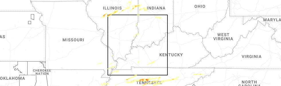
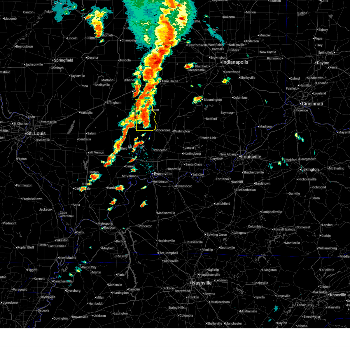
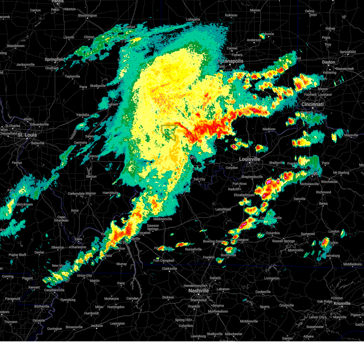
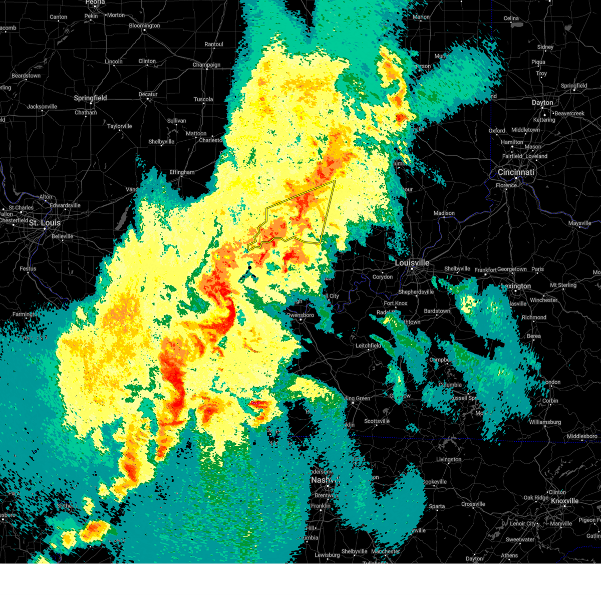
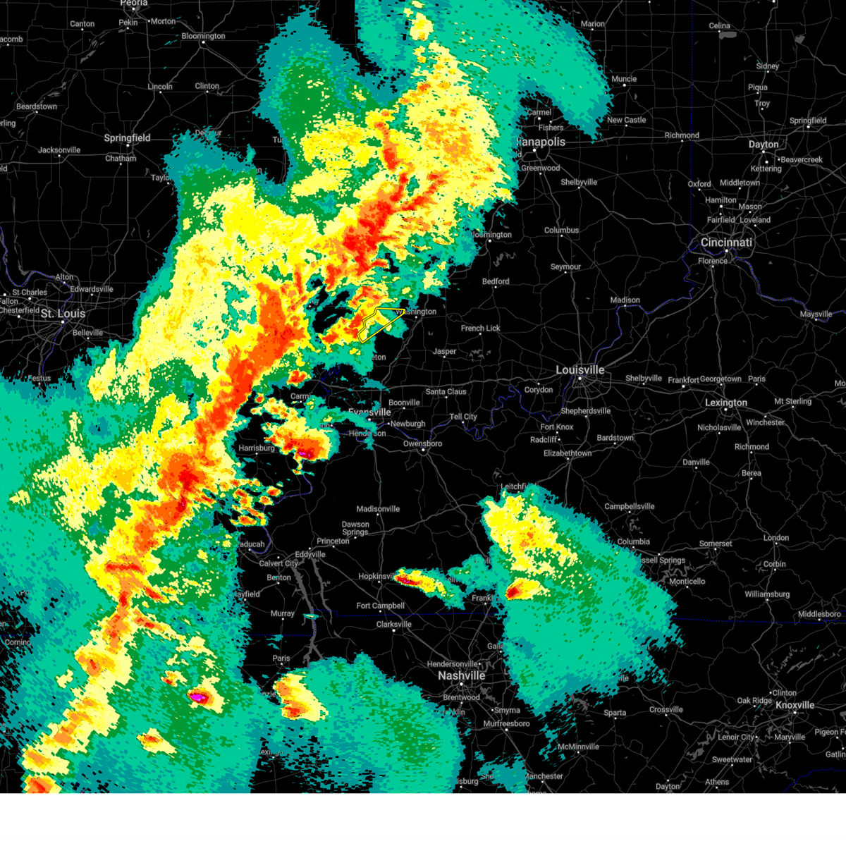
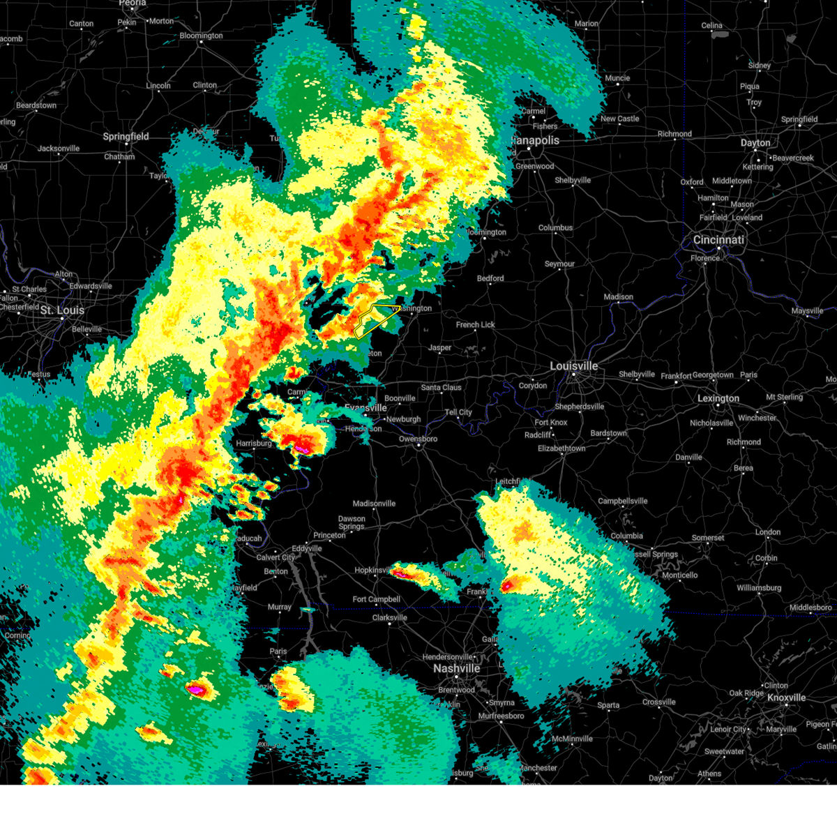
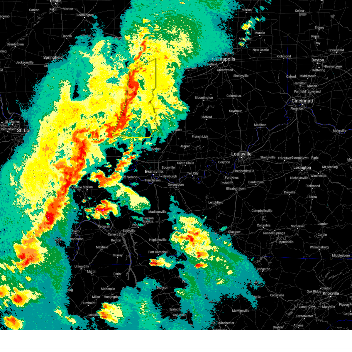
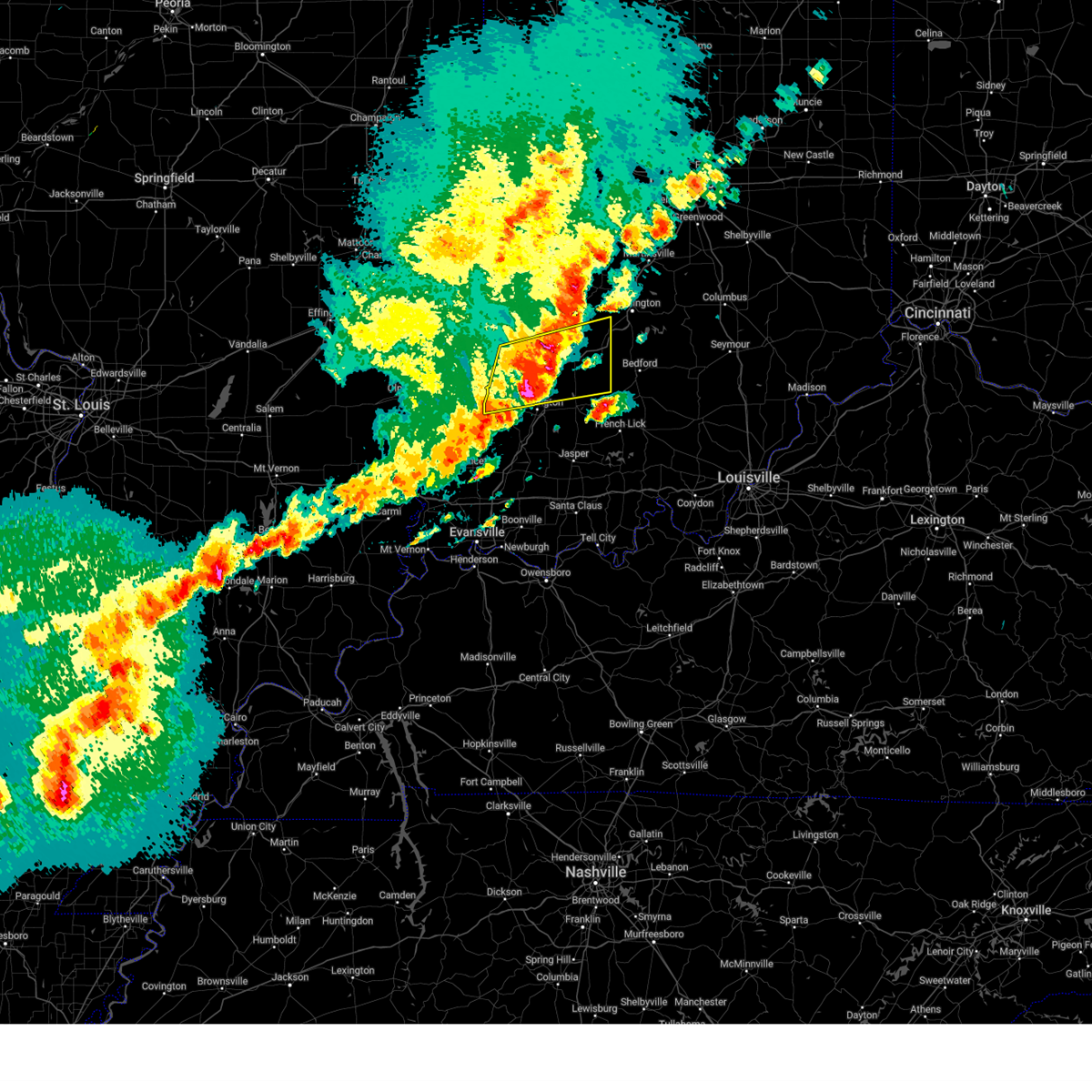
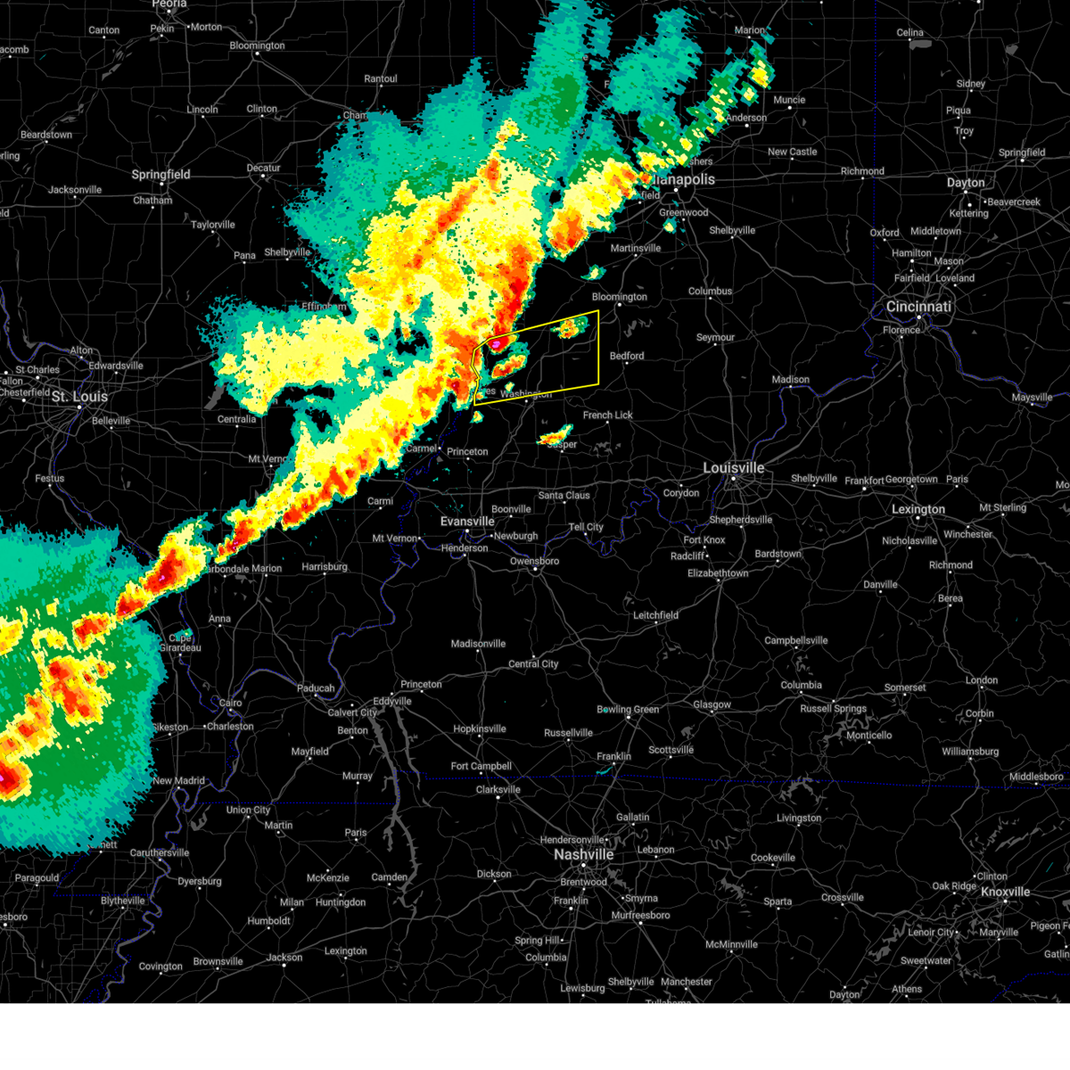
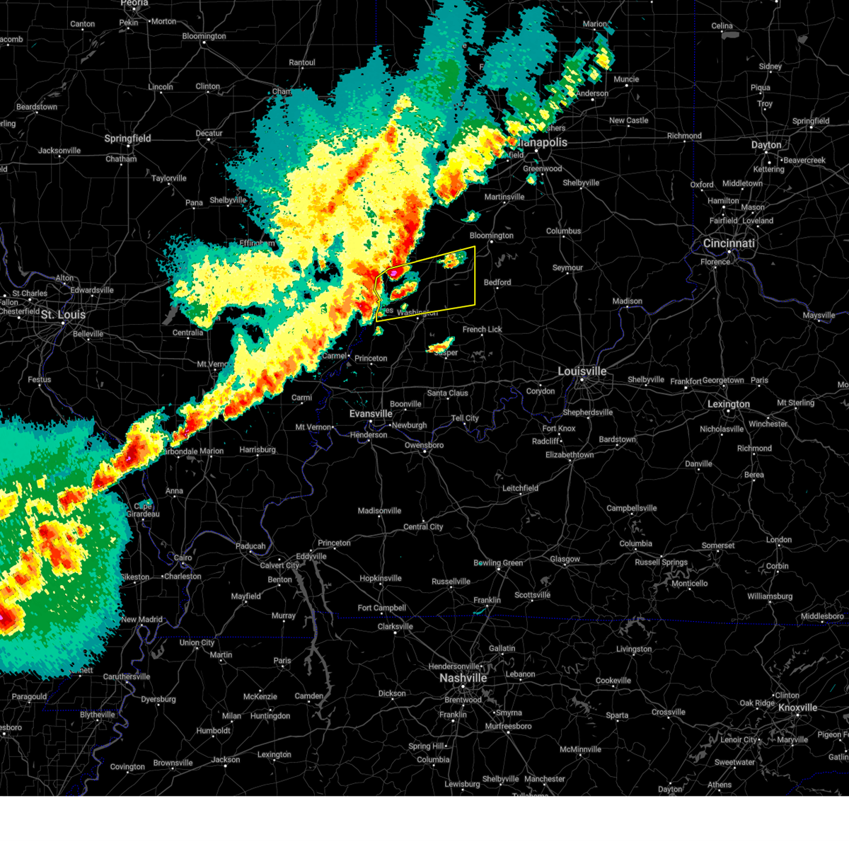
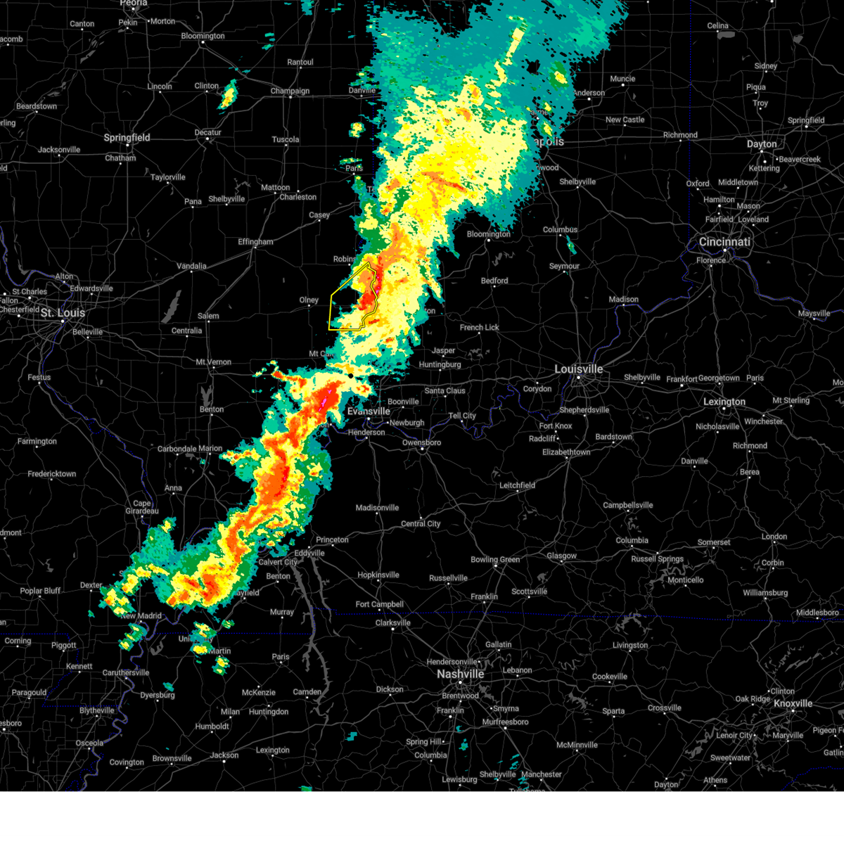
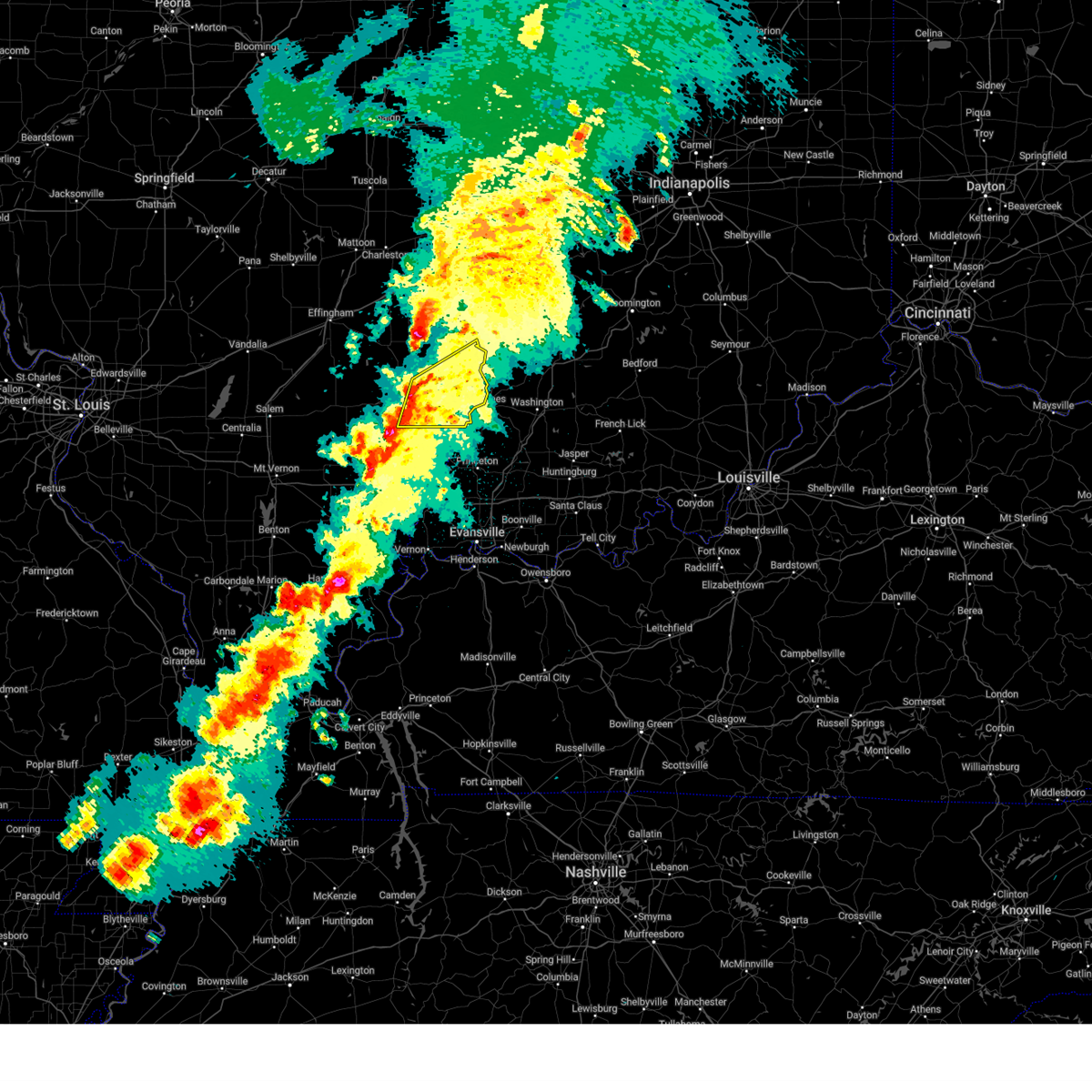
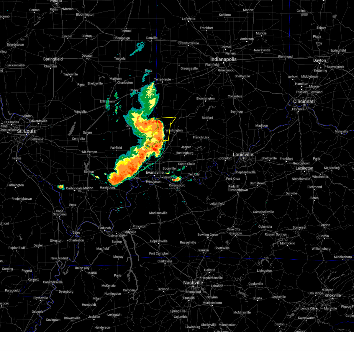
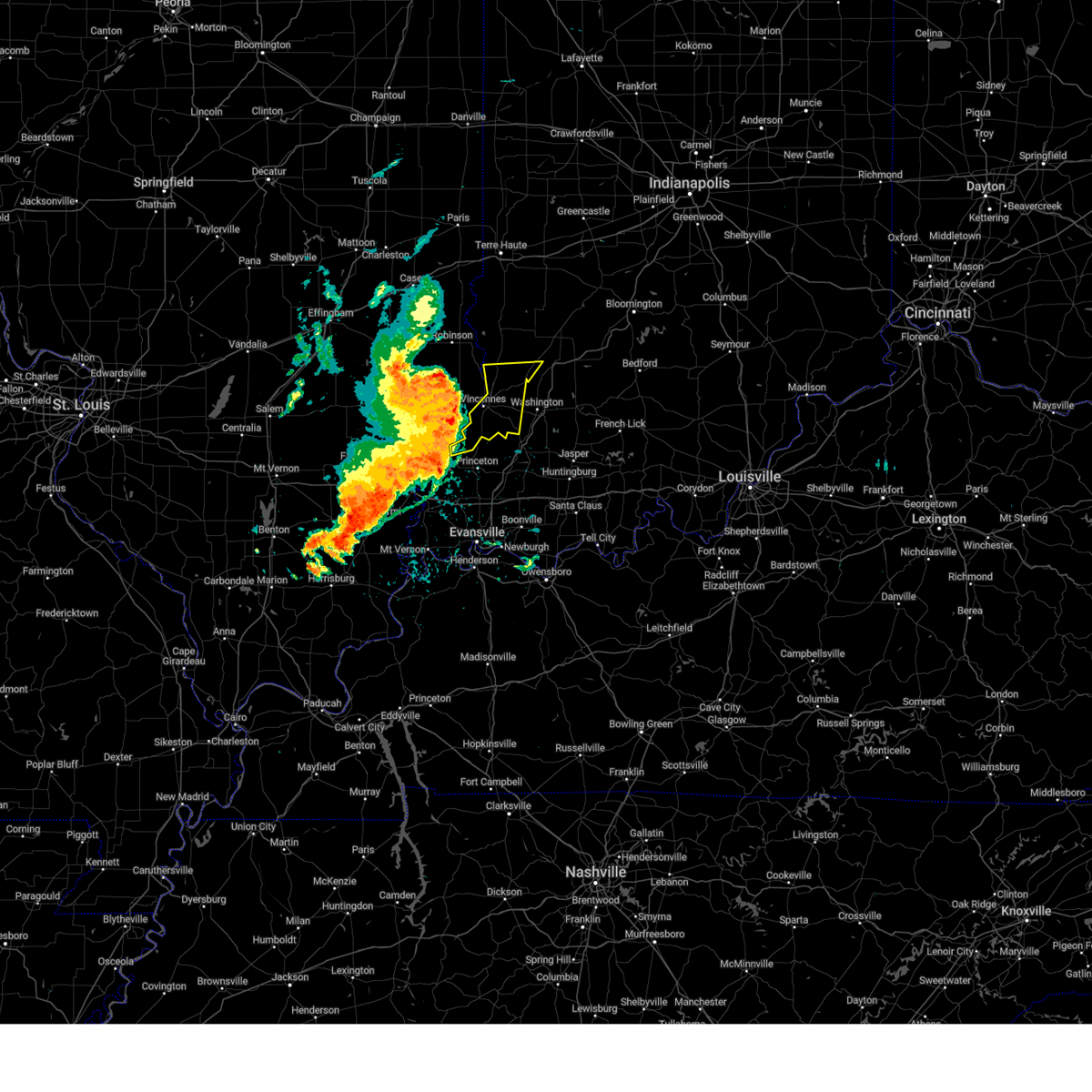
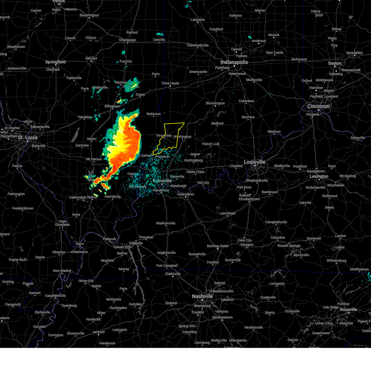
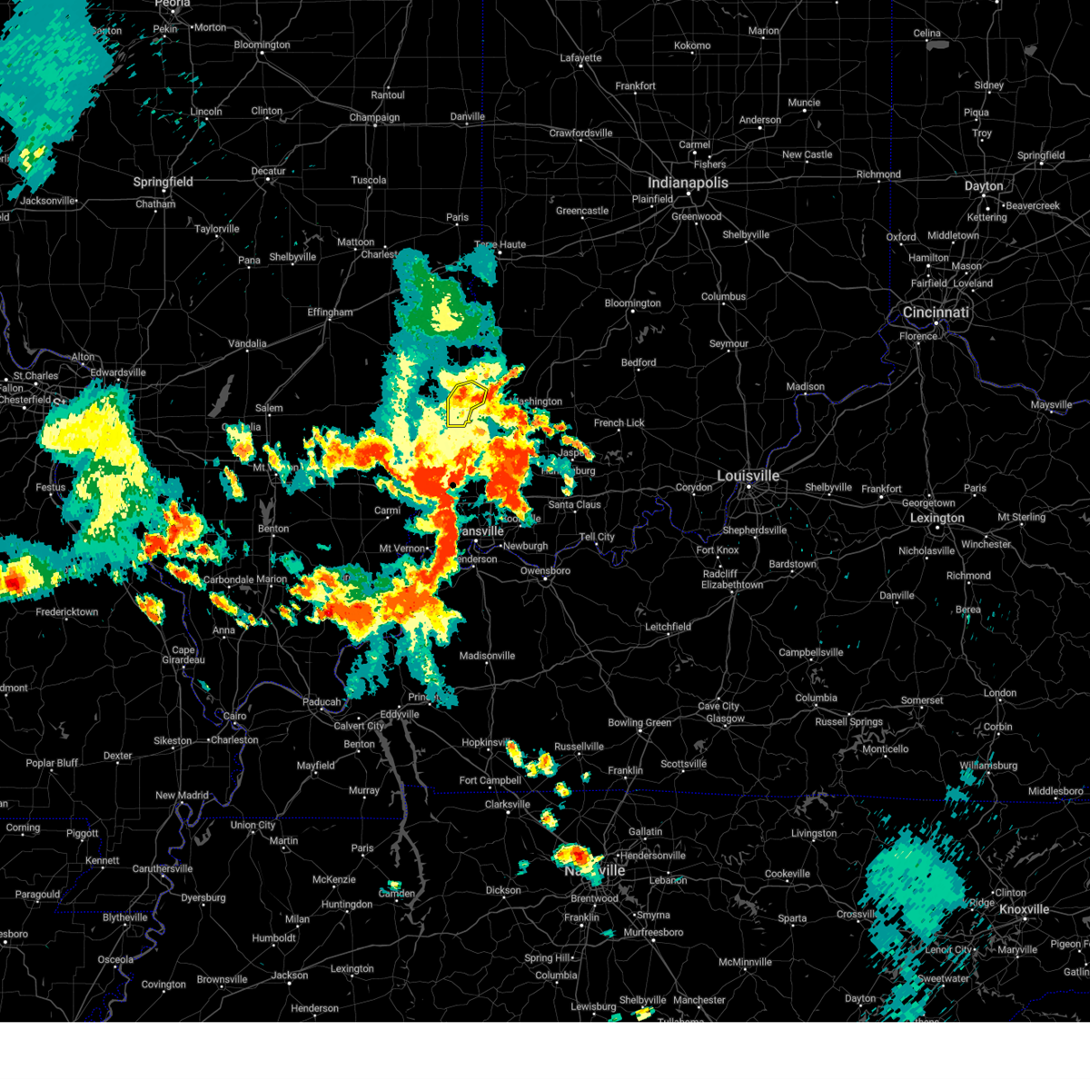
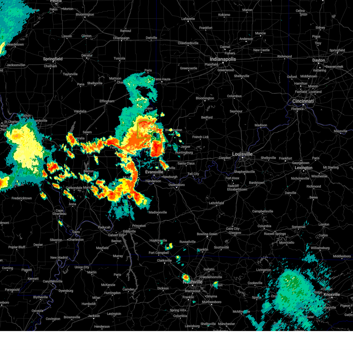
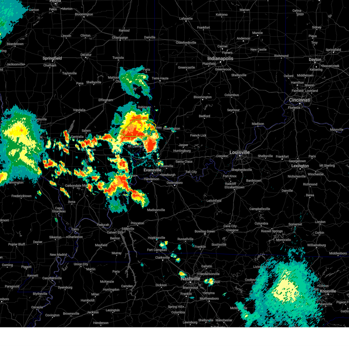
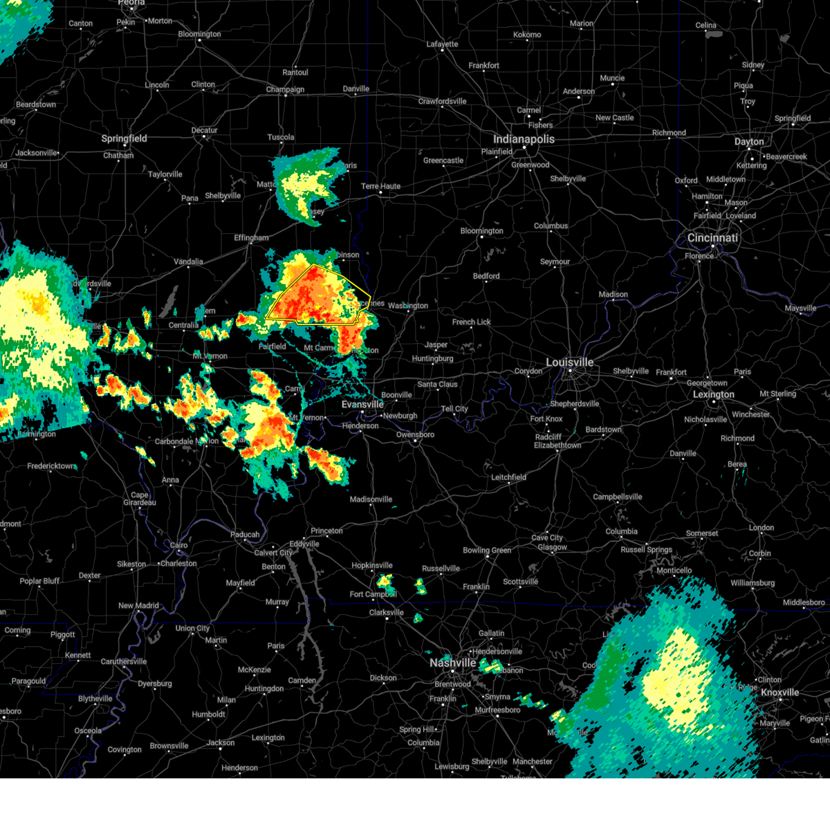
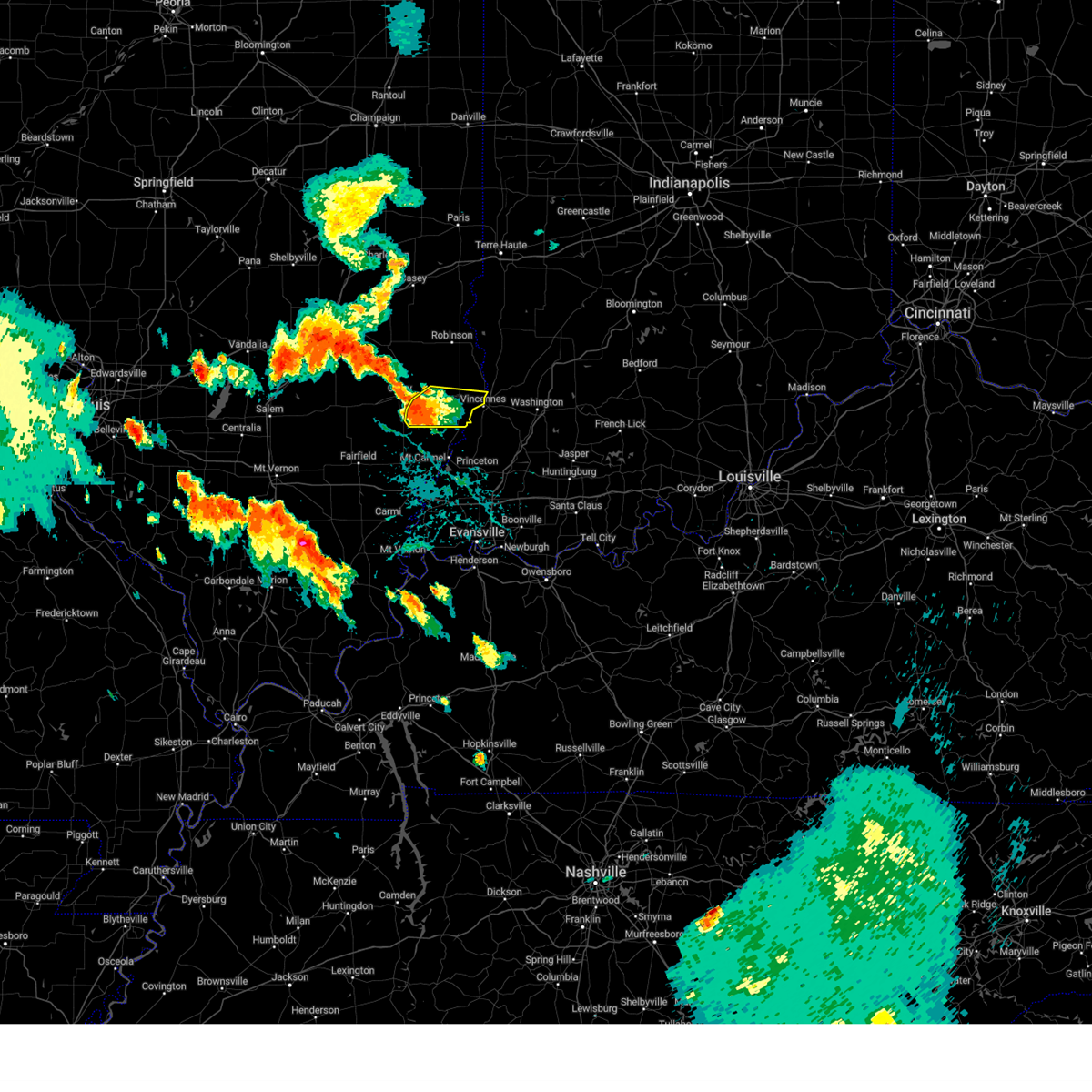
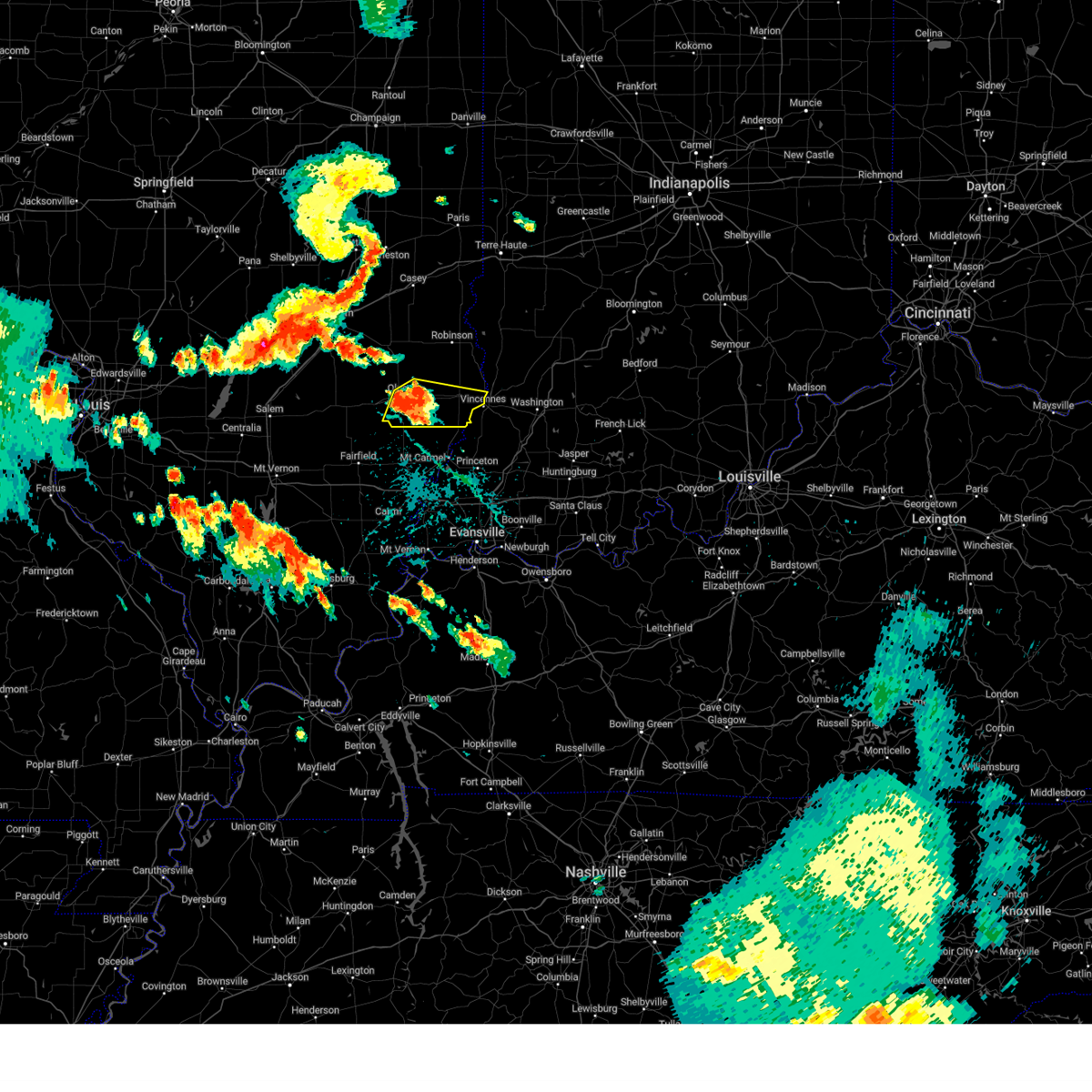
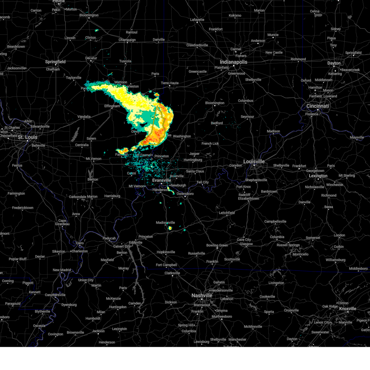
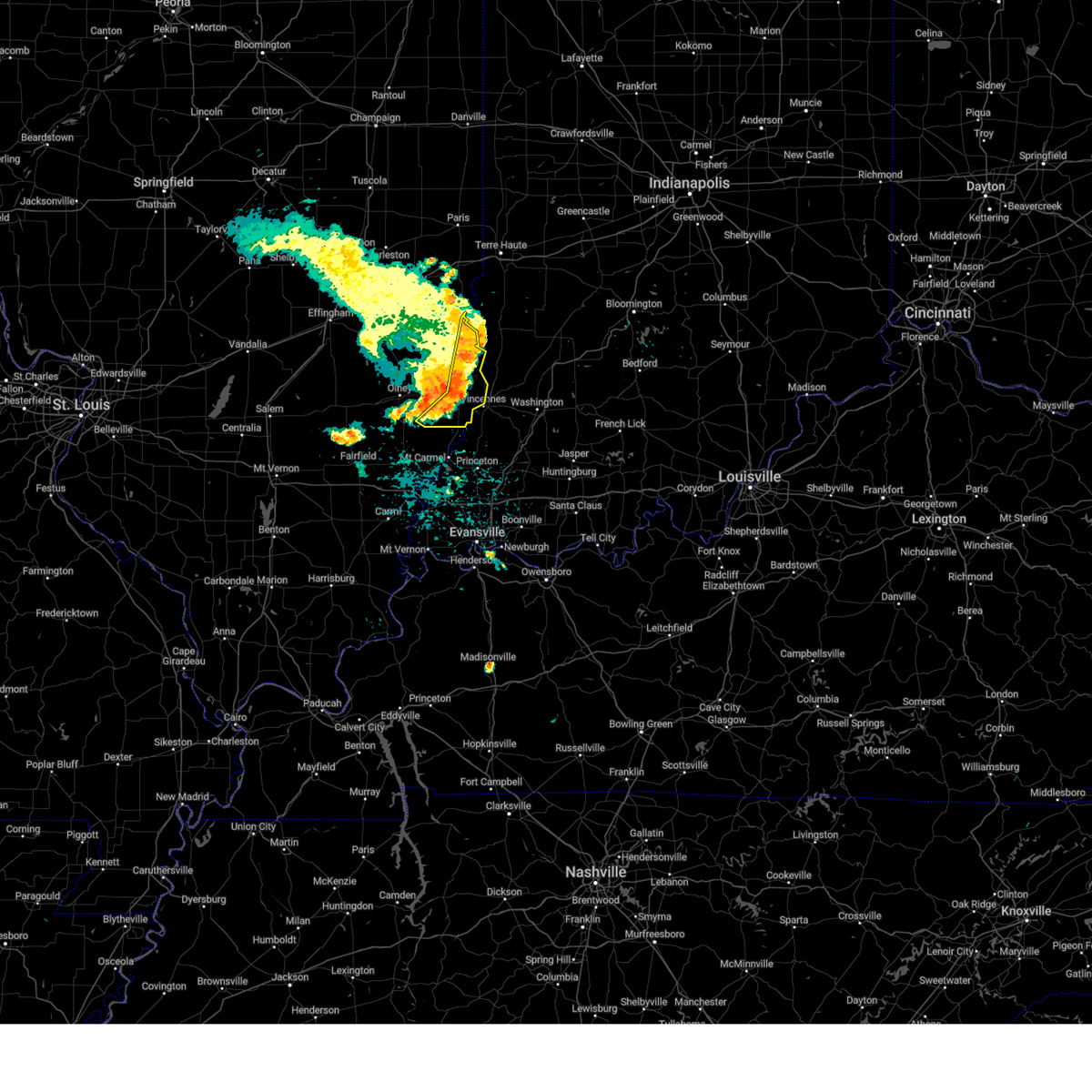
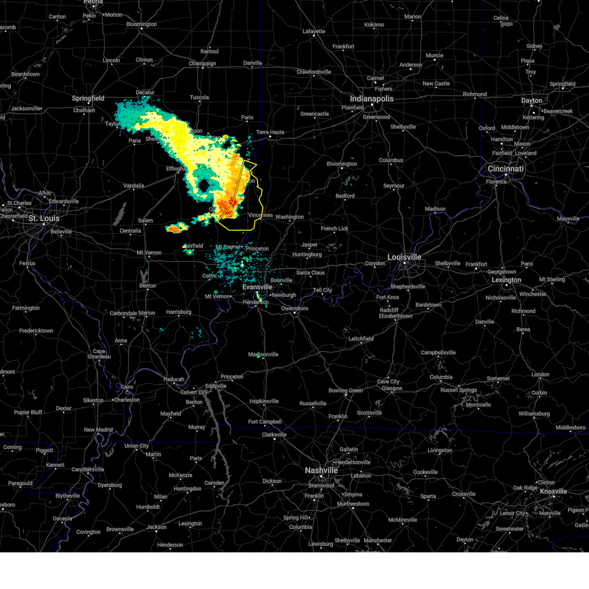
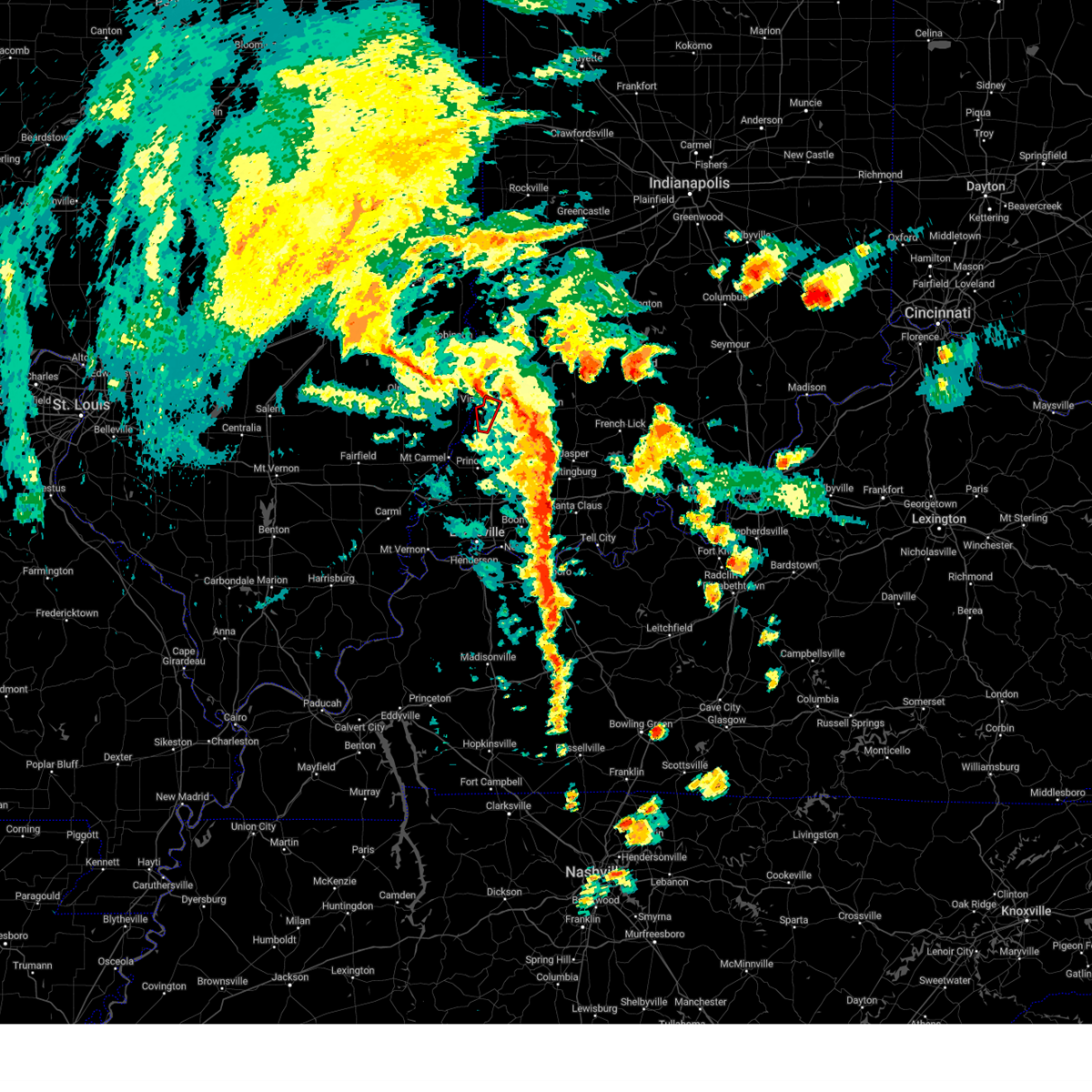
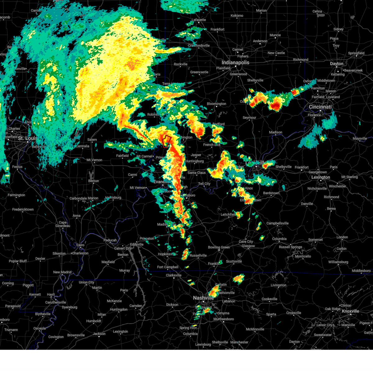
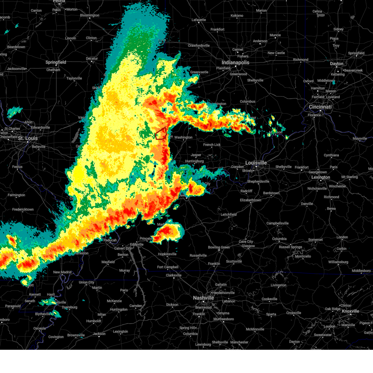
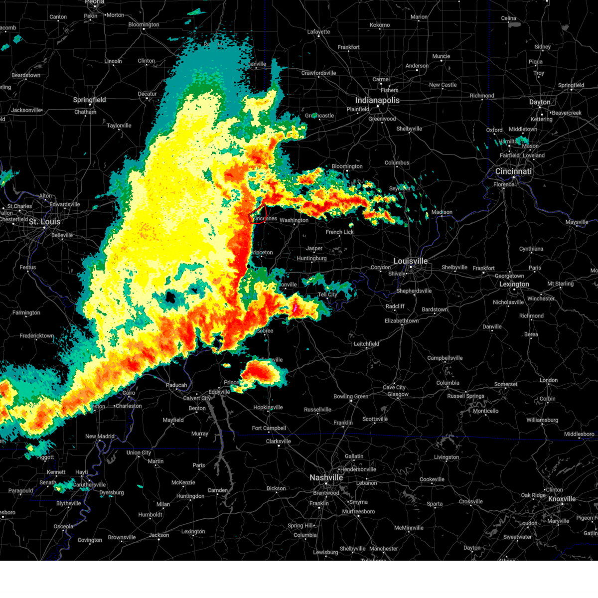
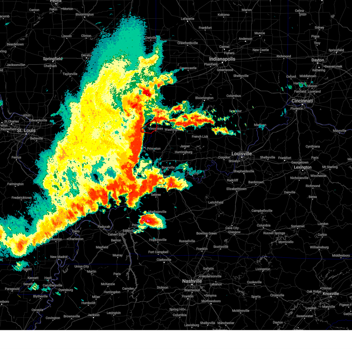
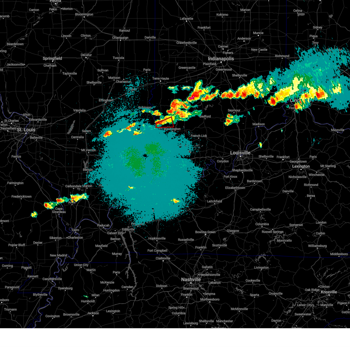
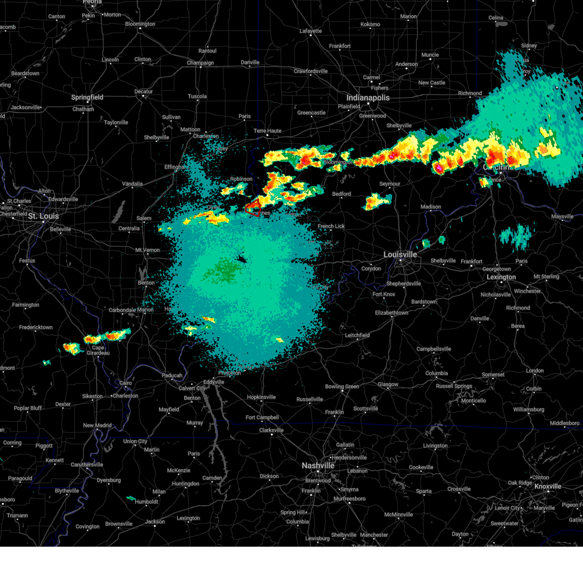
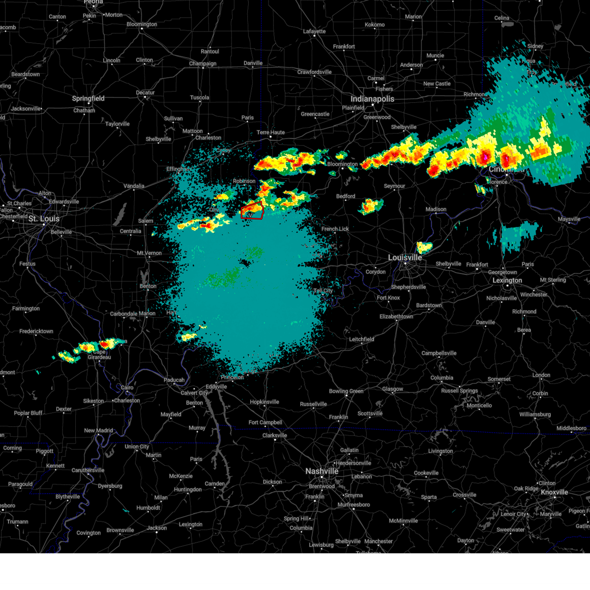
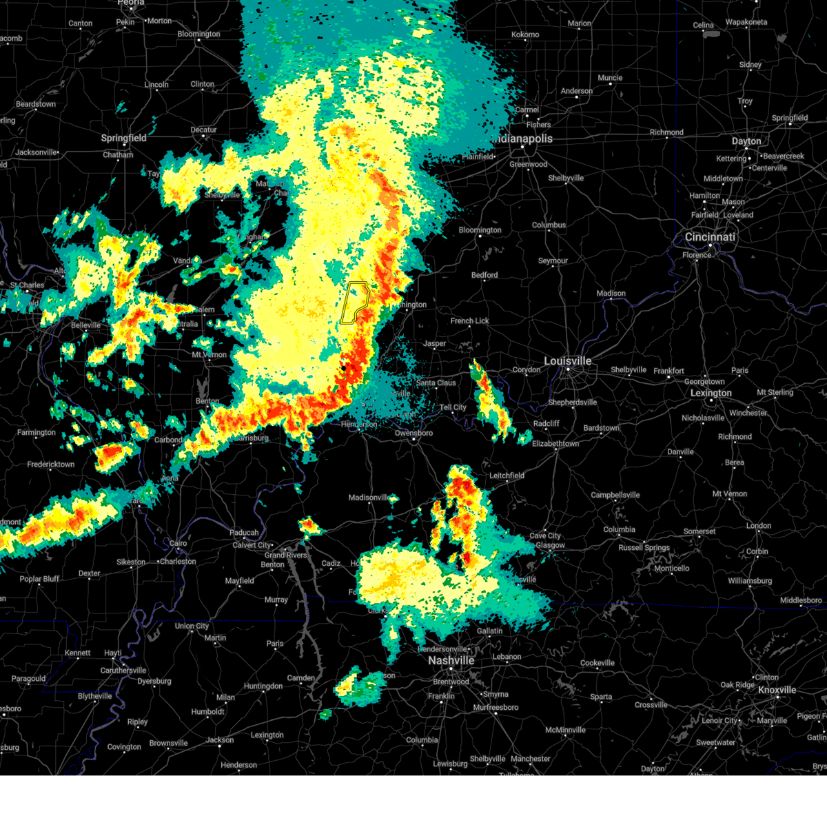
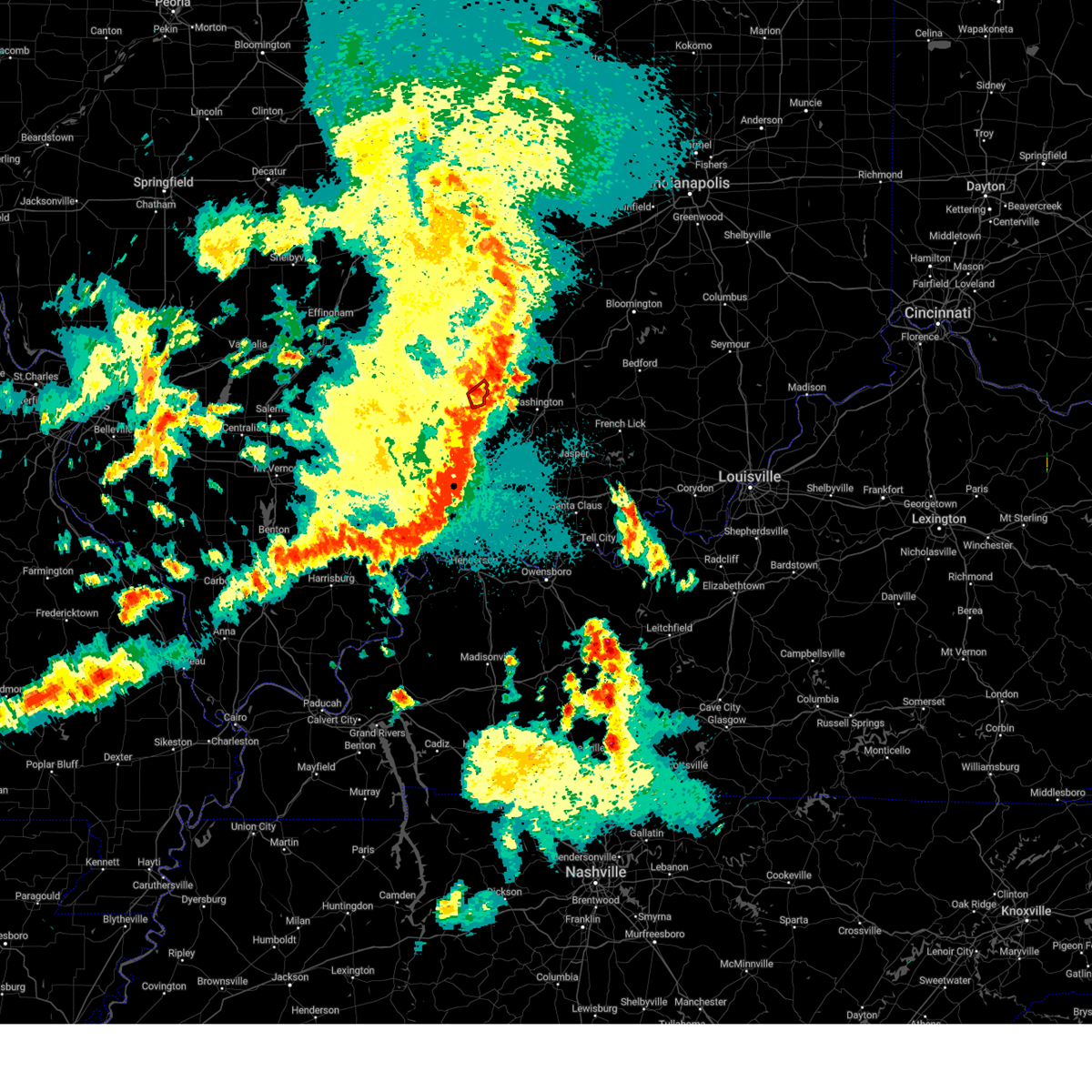
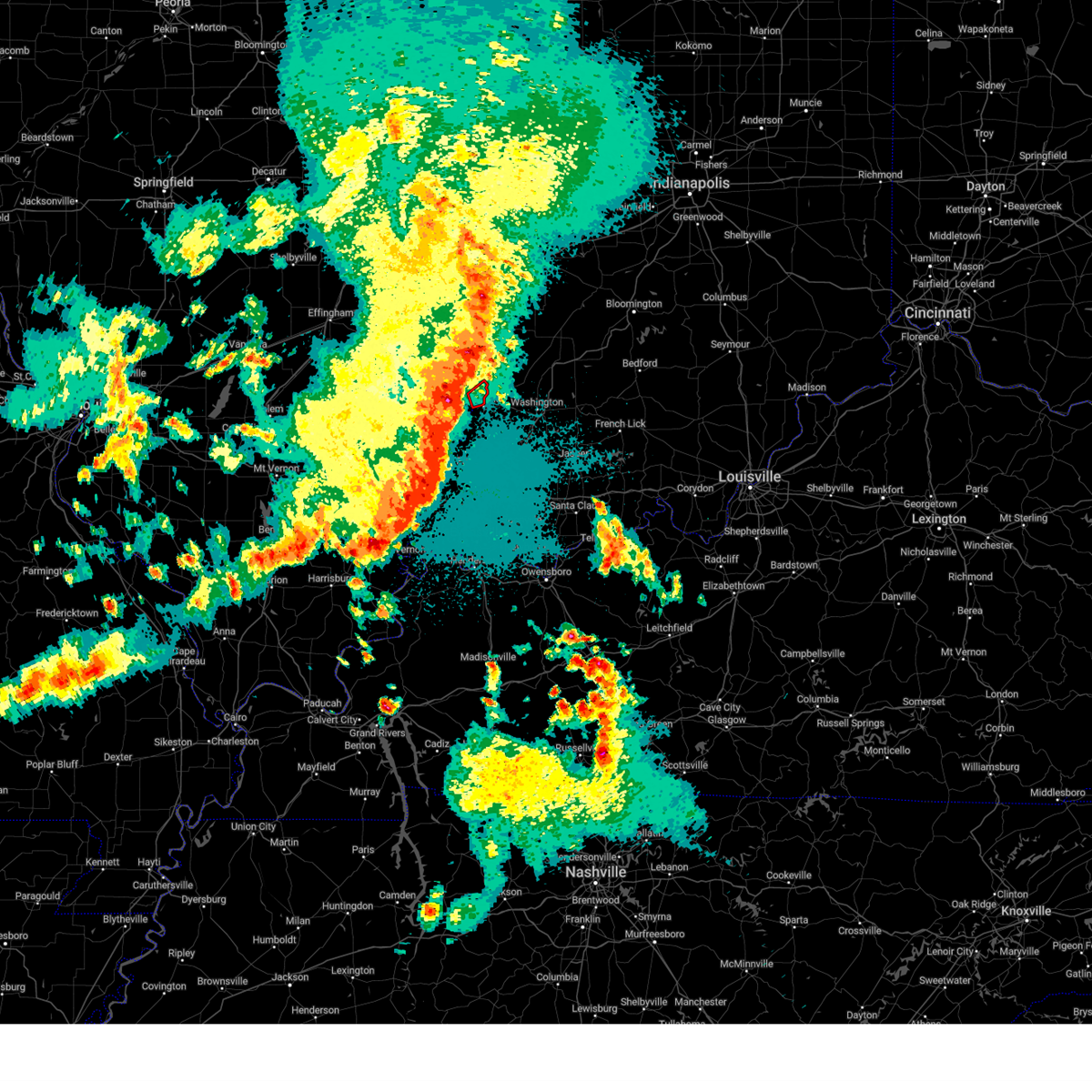
Hail Map for Vincennes, IN
The Vincennes, IN area has had 16 reports of on-the-ground hail by trained spotters, and has been under severe weather warnings 53 times during the past 12 months. Doppler radar has detected hail at or near Vincennes, IN on 77 occasions, including 5 occasions during the past year.
| Name: | Vincennes, IN |
| Where Located: | 48.7 miles N of Evansville, IN |
| Map: | Google Map for Vincennes, IN |
| Population: | 18423 |
| Housing Units: | 8259 |
| More Info: | Search Google for Vincennes, IN |
2
The Top Recent Hail Date for Vincennes, IN is Tuesday, May 20, 2025 (14th out of 77)
Hail and Wind Damage Spotted near Vincennes, IN
| Date / Time | Report Details |
|---|---|
| 6/18/2025 3:57 PM EDT | the severe thunderstorm warning has been cancelled and is no longer in effect |
| 6/18/2025 3:57 PM EDT | At 357 pm edt, severe thunderstorms were located along a line extending from 10 miles southwest of spencer to 7 miles east of washington, moving east at 45 mph (radar indicated). Hazards include 70 mph wind gusts and quarter size hail. Hail damage to vehicles is expected. expect considerable tree damage. wind damage is also likely to mobile homes, roofs, and outbuildings. Locations impacted include, vincennes, washington, linton, bloomfield, bicknell, jasonville, worthington, odon, dugger, lyons, elnora, monroe city, wheatland, plainville, sandborn, montgomery, edwardsport, switz city, decker, and newberry. |
| 6/18/2025 3:56 PM EDT | Tree or tree limb blown down by thunderstorm wind in knox county IN, 0.5 miles ENE of Vincennes, IN |
| 6/18/2025 2:46 PM CDT | The storm which prompted the warning has moved out of the area. therefore, the warning has been allowed to expire. however, gusty winds are still possible with this thunderstorm. a tornado watch remains in effect until 400 pm cdt for southeastern and east central illinois. |
| 6/18/2025 3:26 PM EDT | Tree blown down by thunderstorm wind in knox county IN, 1.2 miles ESE of Vincennes, IN |
| 6/18/2025 3:26 PM EDT |
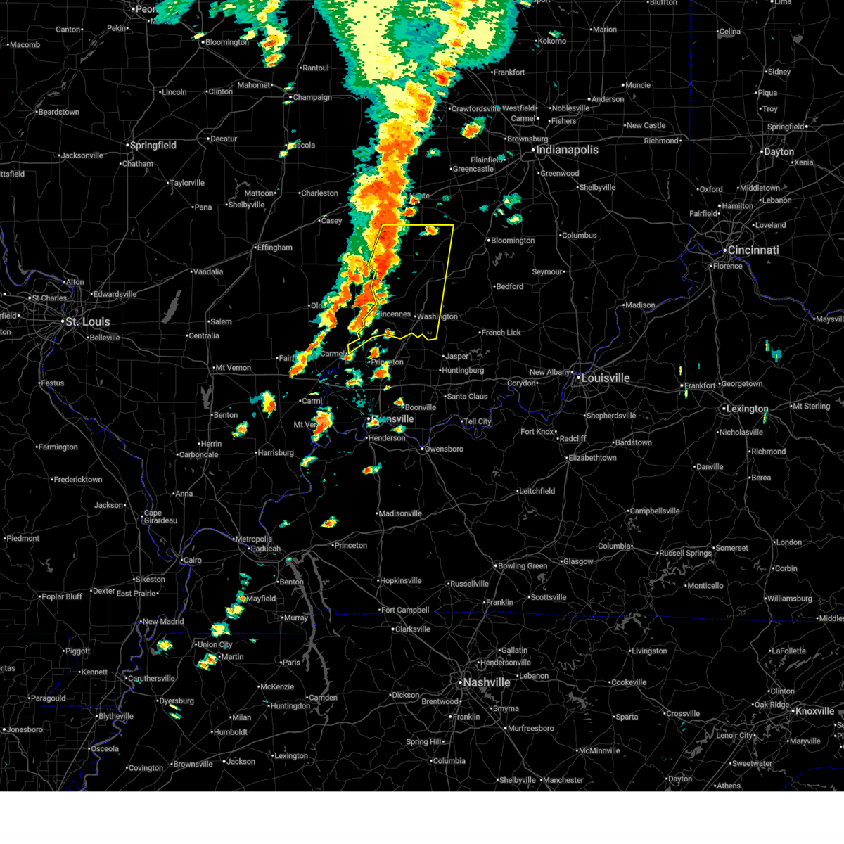 Svrind the national weather service in indianapolis has issued a * severe thunderstorm warning for, south central vigo county in west central indiana, sullivan county in southwestern indiana, knox county in southwestern indiana, southwestern clay county in west central indiana, southwestern owen county in west central indiana, greene county in southwestern indiana, daviess county in southwestern indiana, * until 415 pm edt. * at 325 pm edt, severe thunderstorms were located along a line extending from 12 miles north of sullivan to 7 miles northeast of vincennes, moving east at 30 mph (radar indicated). Hazards include 70 mph wind gusts and quarter size hail. Hail damage to vehicles is expected. expect considerable tree damage. Wind damage is also likely to mobile homes, roofs, and outbuildings. Svrind the national weather service in indianapolis has issued a * severe thunderstorm warning for, south central vigo county in west central indiana, sullivan county in southwestern indiana, knox county in southwestern indiana, southwestern clay county in west central indiana, southwestern owen county in west central indiana, greene county in southwestern indiana, daviess county in southwestern indiana, * until 415 pm edt. * at 325 pm edt, severe thunderstorms were located along a line extending from 12 miles north of sullivan to 7 miles northeast of vincennes, moving east at 30 mph (radar indicated). Hazards include 70 mph wind gusts and quarter size hail. Hail damage to vehicles is expected. expect considerable tree damage. Wind damage is also likely to mobile homes, roofs, and outbuildings.
|
| 6/18/2025 2:23 PM CDT | Svrilx the national weather service in lincoln has issued a * severe thunderstorm warning for, eastern lawrence county in southeastern illinois, southeastern crawford county in east central illinois, * until 245 pm cdt. * at 223 pm cdt, a severe thunderstorm was located over russellville, or 8 miles north of vincennes, moving northeast at 40 mph (radar indicated). Hazards include 60 mph wind gusts. Expect damage to roofs, siding, and trees. This severe thunderstorm will remain over mainly rural areas of eastern lawrence and southeastern crawford counties, including the following locations, pinkstaff and billett. |
| 6/18/2025 3:21 PM EDT | Numerous reports of trees down across vincennes. time estimate in knox county IN, 1 miles E of Vincennes, IN |
| 6/18/2025 2:08 PM CDT |
 Svrilx the national weather service in lincoln has issued a * severe thunderstorm warning for, southeastern lawrence county in southeastern illinois, * until 230 pm cdt. * at 207 pm cdt, a severe thunderstorm was located near st. francisville, or 9 miles south of lawrenceville, moving northeast at 40 mph (radar indicated). Hazards include 60 mph wind gusts. Expect damage to roofs, siding, and trees. this severe thunderstorm will be near, lawrenceville around 215 pm cdt. Lawrenceville vincennes airport around 220 pm cdt. Svrilx the national weather service in lincoln has issued a * severe thunderstorm warning for, southeastern lawrence county in southeastern illinois, * until 230 pm cdt. * at 207 pm cdt, a severe thunderstorm was located near st. francisville, or 9 miles south of lawrenceville, moving northeast at 40 mph (radar indicated). Hazards include 60 mph wind gusts. Expect damage to roofs, siding, and trees. this severe thunderstorm will be near, lawrenceville around 215 pm cdt. Lawrenceville vincennes airport around 220 pm cdt.
|
| 6/18/2025 3:07 PM EDT |
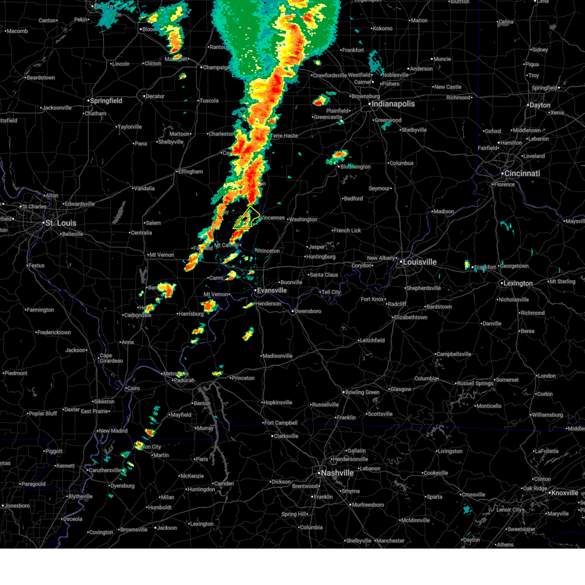
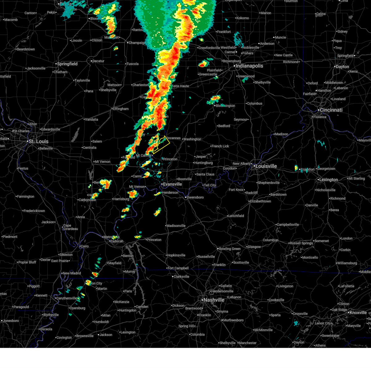 Svrind the national weather service in indianapolis has issued a * severe thunderstorm warning for, southwestern knox county in southwestern indiana, * until 345 pm edt. * at 307 pm edt, a severe thunderstorm was located near lancaster, or near mount carmel, moving northeast at 45 mph (radar indicated). Hazards include 60 mph wind gusts and quarter size hail. Hail damage to vehicles is expected. Expect wind damage to roofs, siding, and trees. Svrind the national weather service in indianapolis has issued a * severe thunderstorm warning for, southwestern knox county in southwestern indiana, * until 345 pm edt. * at 307 pm edt, a severe thunderstorm was located near lancaster, or near mount carmel, moving northeast at 45 mph (radar indicated). Hazards include 60 mph wind gusts and quarter size hail. Hail damage to vehicles is expected. Expect wind damage to roofs, siding, and trees.
|
| 6/18/2025 1:56 PM CDT |
 Svrilx the national weather service in lincoln has issued a * severe thunderstorm warning for, lawrence county in southeastern illinois, crawford county in east central illinois, * until 215 pm cdt. * at 156 pm cdt, severe thunderstorms were located along a line extending from 6 miles northwest of hutsonville to near flat rock to near lawrenceville, moving northeast at 50 mph (radar indicated). Hazards include 60 mph wind gusts. Expect damage to roofs, siding, and trees. Severe thunderstorms will be near, palestine, hutsonville, russellville, and lawrenceville vincennes airport around 200 pm cdt. Svrilx the national weather service in lincoln has issued a * severe thunderstorm warning for, lawrence county in southeastern illinois, crawford county in east central illinois, * until 215 pm cdt. * at 156 pm cdt, severe thunderstorms were located along a line extending from 6 miles northwest of hutsonville to near flat rock to near lawrenceville, moving northeast at 50 mph (radar indicated). Hazards include 60 mph wind gusts. Expect damage to roofs, siding, and trees. Severe thunderstorms will be near, palestine, hutsonville, russellville, and lawrenceville vincennes airport around 200 pm cdt.
|
| 4/29/2025 5:36 PM EDT |
 The storm which prompted the warning has moved out of the area. therefore, the warning will be allowed to expire. however, gusty winds and heavy rain are still possible with this thunderstorm. a severe thunderstorm watch remains in effect until 900 pm edt for southwestern indiana. The storm which prompted the warning has moved out of the area. therefore, the warning will be allowed to expire. however, gusty winds and heavy rain are still possible with this thunderstorm. a severe thunderstorm watch remains in effect until 900 pm edt for southwestern indiana.
|
| 4/29/2025 5:26 PM EDT | At 525 pm edt, a severe thunderstorm was located near washington, or 8 miles northeast of petersburg, moving east at 40 mph (radar indicated). Hazards include 60 mph wind gusts. Expect damage to roofs, siding, and trees. Locations impacted include, edwardsport, bicknell, wheatland, and bruceville. |
| 4/29/2025 5:09 PM EDT | At 509 pm edt, a severe thunderstorm was located 7 miles northwest of petersburg, moving east at 40 mph (radar indicated). Hazards include 60 mph wind gusts. Expect damage to roofs, siding, and trees. Locations impacted include, monroe city, decker, edwardsport, vincennes university, vincennes, bicknell, wheatland, and bruceville. |
| 4/29/2025 5:02 PM EDT | At 501 pm edt, a severe thunderstorm was located 9 miles south of vincennes, moving east at 55 mph (radar indicated). Hazards include 60 mph wind gusts. Expect damage to roofs, siding, and trees. Locations impacted include, monroe city, decker, edwardsport, vincennes university, vincennes, bicknell, wheatland, and bruceville. |
| 4/29/2025 4:58 PM EDT | Tree down on hart street roa in knox county IN, 7.1 miles NW of Vincennes, IN |
| 4/29/2025 4:51 PM EDT | Svrind the national weather service in indianapolis has issued a * severe thunderstorm warning for, knox county in southwestern indiana, * until 545 pm edt. * at 450 pm edt, a severe thunderstorm was located 7 miles northeast of albion, moving east at 40 mph (radar indicated). Hazards include 60 mph wind gusts. expect damage to roofs, siding, and trees |
| 4/2/2025 10:10 PM EDT | Tree down near 5th and broadway. time very roughly estimated from rada in knox county IN, 1.6 miles E of Vincennes, IN |
| 4/2/2025 9:40 PM EDT |
 At 939 pm edt, severe thunderstorms were located along a line extending from 6 miles southwest of bloomfield to near washington, moving east at 40 mph (radar indicated). Hazards include 70 mph wind gusts and penny size hail. Expect considerable tree damage. damage is likely to mobile homes, roofs, and outbuildings. Locations impacted include, newberry, cannelburg, loogootee, bicknell, montgomery, west boggs lake, crane, freelandville, alfordsville, burns city, washington, sandborn, bruceville, monroe city, decker, odon, edwardsport, vincennes university, vincennes, and elnora. At 939 pm edt, severe thunderstorms were located along a line extending from 6 miles southwest of bloomfield to near washington, moving east at 40 mph (radar indicated). Hazards include 70 mph wind gusts and penny size hail. Expect considerable tree damage. damage is likely to mobile homes, roofs, and outbuildings. Locations impacted include, newberry, cannelburg, loogootee, bicknell, montgomery, west boggs lake, crane, freelandville, alfordsville, burns city, washington, sandborn, bruceville, monroe city, decker, odon, edwardsport, vincennes university, vincennes, and elnora.
|
| 4/2/2025 9:40 PM EDT |
 the severe thunderstorm warning has been cancelled and is no longer in effect the severe thunderstorm warning has been cancelled and is no longer in effect
|
| 4/2/2025 9:38 PM EDT | Trees and power lines dow in knox county IN, 3.3 miles W of Vincennes, IN |
| 4/2/2025 9:18 PM EDT | Storm damage reported in knox county IN, 2.2 miles N of Vincennes, IN |
| 4/2/2025 9:10 PM EDT | Svrind the national weather service in indianapolis has issued a * severe thunderstorm warning for, southeastern sullivan county in southwestern indiana, knox county in southwestern indiana, western martin county in southwestern indiana, southern greene county in southwestern indiana, daviess county in southwestern indiana, * until 1000 pm edt. * at 909 pm edt, severe thunderstorms were located along a line extending from 7 miles southeast of russellville to near patoka, moving northeast at 60 mph (radar indicated). Hazards include 70 mph wind gusts and penny size hail. Expect considerable tree damage. Damage is likely to mobile homes, roofs, and outbuildings. |
| 4/2/2025 8:54 PM EDT | At 854 pm edt, a severe thunderstorm was located 8 miles east of greencastle, or 27 miles southeast of crawfordsville, moving northeast at 75 mph (radar indicated). Hazards include 70 mph wind gusts and quarter size hail. Hail damage to vehicles is expected. expect considerable tree damage. wind damage is also likely to mobile homes, roofs, and outbuildings. locations impacted include, newberry, pittsboro, bicknell, smithville, plainfield, fillmore, crane, carlisle, freedom, farmersburg, reelsville, vincennes university, dugger, elnora, pimento, pleasantville, brazil, worthington, martinsville, and eminence. this includes the following highways, interstate 65 between mile markers 131 and 132. interstate 70 between mile markers 13 and 67. Interstate 74 between mile markers 59 and 68. |
| 4/2/2025 8:43 PM EDT | Svrind the national weather service in indianapolis has issued a * severe thunderstorm warning for, southeastern vigo county in west central indiana, monroe county in south central indiana, morgan county in central indiana, northern knox county in southwestern indiana, owen county in west central indiana, northern martin county in southwestern indiana, south central boone county in central indiana, northwestern lawrence county in south central indiana, southern putnam county in west central indiana, northern daviess county in southwestern indiana, sullivan county in southwestern indiana, hendricks county in central indiana, clay county in west central indiana, greene county in southwestern indiana, * until 930 pm edt. * at 843 pm edt, severe thunderstorms were located along a line extending from 8 miles east of brazil to 14 miles north of linton to 7 miles southeast of russellville, moving east at 70 mph (radar indicated). Hazards include 70 mph wind gusts and half dollar size hail. Hail damage to vehicles is expected. expect considerable tree damage. Wind damage is also likely to mobile homes, roofs, and outbuildings. |
| 4/2/2025 8:30 PM EDT |
 At 829 pm edt, a severe thunderstorm was located near st. francisville, or near vincennes, moving northeast at 55 mph (radar indicated). Hazards include 60 mph wind gusts and quarter size hail. Hail damage to vehicles is expected. expect wind damage to roofs, siding, and trees. Locations impacted include, vincennes university, vincennes, and wheatland. At 829 pm edt, a severe thunderstorm was located near st. francisville, or near vincennes, moving northeast at 55 mph (radar indicated). Hazards include 60 mph wind gusts and quarter size hail. Hail damage to vehicles is expected. expect wind damage to roofs, siding, and trees. Locations impacted include, vincennes university, vincennes, and wheatland.
|
| 4/2/2025 8:30 PM EDT |
 the severe thunderstorm warning has been cancelled and is no longer in effect the severe thunderstorm warning has been cancelled and is no longer in effect
|
| 4/2/2025 7:23 PM CDT | Svrilx the national weather service in lincoln has issued a * severe thunderstorm warning for, lawrence county in southeastern illinois, crawford county in east central illinois, southeastern edgar county in east central illinois, eastern jasper county in southeastern illinois, clark county in east central illinois, eastern richland county in southeastern illinois, * until 800 pm cdt. * at 723 pm cdt, severe thunderstorms were located along a line extending from 8 miles southeast of marshall to near lawrenceville, moving northeast at 75 mph (radar indicated). Hazards include 70 mph wind gusts and quarter size hail. Hail damage to vehicles is expected. expect considerable tree damage. wind damage is also likely to mobile homes, roofs, and outbuildings. severe thunderstorms will be near, russellville around 730 pm cdt. This includes interstate 70 between mile markers 135 and 137, and between mile markers 139 and 154. |
| 4/2/2025 8:19 PM EDT | At 819 pm edt, severe thunderstorms were located along a line extending from 7 miles south of newport to near terre haute to near sullivan, moving northeast at 70 mph (radar indicated). Hazards include 70 mph wind gusts and penny size hail. Expect considerable tree damage. damage is likely to mobile homes, roofs, and outbuildings. locations impacted include, bicknell, carlisle, farmersburg, reelsville, vincennes university, dugger, pimento, pleasantville, brazil, terre haute, knightsville, fontanet, blanford, universal, coal city, seelyville, bowling green, mecca, harmony, and shelburn. This includes interstate 70 between mile markers 1 and 35. |
| 4/2/2025 8:12 PM EDT | Svrind the national weather service in indianapolis has issued a * severe thunderstorm warning for, southern knox county in southwestern indiana, west central daviess county in southwestern indiana, * until 845 pm edt. * at 812 pm edt, a severe thunderstorm was located near mount carmel, moving northeast at 45 mph (radar indicated). Hazards include 60 mph wind gusts and quarter size hail. Hail damage to vehicles is expected. Expect wind damage to roofs, siding, and trees. |
| 4/2/2025 7:11 PM CDT | At 710 pm cdt, severe thunderstorms were located along a line extending from near edgar county airport to 8 miles north of hutsonville to near sumner, moving east at 65 mph (radar indicated). Hazards include 70 mph wind gusts and half dollar size hail. Hail damage to vehicles is expected. expect considerable tree damage. wind damage is also likely to mobile homes, roofs, and outbuildings. these severe storms will be near, flat rock, robinson, palestine, sumner, hutsonville, and bridgeport around 715 pm cdt. lawrenceville and lawrenceville vincennes airport around 720 pm cdt. russellville around 725 pm cdt. vincennes around 830 pm edt. other locations impacted by these severe thunderstorms include wakefield, isabel, new hebron, edgar, clarksville, west york, annapolis, york, pinkstaff, and yale. This includes interstate 70 between mile markers 120 and 154. |
| 4/2/2025 8:00 PM EDT | Svrind the national weather service in indianapolis has issued a * severe thunderstorm warning for, vigo county in west central indiana, sullivan county in southwestern indiana, northeastern knox county in southwestern indiana, clay county in west central indiana, northwestern owen county in west central indiana, parke county in west central indiana, western greene county in southwestern indiana, southern vermillion county in west central indiana, western putnam county in west central indiana, northwestern daviess county in southwestern indiana, * until 845 pm edt. * at 759 pm edt, severe thunderstorms were located along a line extending from near kansas to near marshall to near olney, moving east at 60 mph (radar indicated). Hazards include 70 mph wind gusts and penny size hail. Expect considerable tree damage. Damage is likely to mobile homes, roofs, and outbuildings. |
| 4/2/2025 6:49 PM CDT |
 Svrilx the national weather service in lincoln has issued a * severe thunderstorm warning for, eastern coles county in east central illinois, lawrence county in southeastern illinois, crawford county in east central illinois, edgar county in east central illinois, jasper county in southeastern illinois, clark county in east central illinois, richland county in southeastern illinois, eastern cumberland county in east central illinois, southeastern clay county in south central illinois, * until 730 pm cdt. * at 649 pm cdt, severe thunderstorms were located along a line extending from near ashmore to near hidalgo to near clay city, moving east at 50 mph (radar indicated). Hazards include 70 mph wind gusts and quarter size hail. Hail damage to vehicles is expected. expect considerable tree damage. wind damage is also likely to mobile homes, roofs, and outbuildings. severe thunderstorms will be near, olney noble airport, ste. marie, westfield, willow hill, casey, noble, kansas, and martinsville around 655 pm cdt. olney and oblong around 700 pm cdt. marshall and paris around 705 pm cdt. other locations in the path of these severe thunderstorms include edgar county airport, chauncey, robinson, vermilion, sumner and hutsonville. This includes interstate 70 between mile markers 120 and 154. Svrilx the national weather service in lincoln has issued a * severe thunderstorm warning for, eastern coles county in east central illinois, lawrence county in southeastern illinois, crawford county in east central illinois, edgar county in east central illinois, jasper county in southeastern illinois, clark county in east central illinois, richland county in southeastern illinois, eastern cumberland county in east central illinois, southeastern clay county in south central illinois, * until 730 pm cdt. * at 649 pm cdt, severe thunderstorms were located along a line extending from near ashmore to near hidalgo to near clay city, moving east at 50 mph (radar indicated). Hazards include 70 mph wind gusts and quarter size hail. Hail damage to vehicles is expected. expect considerable tree damage. wind damage is also likely to mobile homes, roofs, and outbuildings. severe thunderstorms will be near, olney noble airport, ste. marie, westfield, willow hill, casey, noble, kansas, and martinsville around 655 pm cdt. olney and oblong around 700 pm cdt. marshall and paris around 705 pm cdt. other locations in the path of these severe thunderstorms include edgar county airport, chauncey, robinson, vermilion, sumner and hutsonville. This includes interstate 70 between mile markers 120 and 154.
|
| 3/30/2025 6:24 PM EDT |
 At 624 pm edt, a severe thunderstorm was located 9 miles northeast of washington, or 22 miles northeast of petersburg, moving east at 45 mph (trained weather spotters). Hazards include 70 mph wind gusts and quarter size hail. Hail damage to vehicles is expected. expect considerable tree damage. wind damage is also likely to mobile homes, roofs, and outbuildings. Locations impacted include, newberry, lyons, bicknell, west boggs lake, crane, carlisle, burns city, sandborn, elnora, pleasantville, plainville, bloomfield, indian springs, oaktown, linton, freelandville, bruceville, odon, edwardsport, and vincennes. At 624 pm edt, a severe thunderstorm was located 9 miles northeast of washington, or 22 miles northeast of petersburg, moving east at 45 mph (trained weather spotters). Hazards include 70 mph wind gusts and quarter size hail. Hail damage to vehicles is expected. expect considerable tree damage. wind damage is also likely to mobile homes, roofs, and outbuildings. Locations impacted include, newberry, lyons, bicknell, west boggs lake, crane, carlisle, burns city, sandborn, elnora, pleasantville, plainville, bloomfield, indian springs, oaktown, linton, freelandville, bruceville, odon, edwardsport, and vincennes.
|
| 3/30/2025 6:07 PM EDT |
 At 607 pm edt, a severe thunderstorm was located 10 miles east of russellville, or 12 miles northeast of vincennes, moving east at 45 mph (trained weather spotters). Hazards include 70 mph wind gusts and quarter size hail. Hail damage to vehicles is expected. expect considerable tree damage. wind damage is also likely to mobile homes, roofs, and outbuildings. spotters report trees down from this storm. Locations impacted include, newberry, lyons, bicknell, west boggs lake, crane, carlisle, burns city, sandborn, elnora, pleasantville, plainville, bloomfield, indian springs, oaktown, linton, freelandville, bruceville, odon, edwardsport, and vincennes. At 607 pm edt, a severe thunderstorm was located 10 miles east of russellville, or 12 miles northeast of vincennes, moving east at 45 mph (trained weather spotters). Hazards include 70 mph wind gusts and quarter size hail. Hail damage to vehicles is expected. expect considerable tree damage. wind damage is also likely to mobile homes, roofs, and outbuildings. spotters report trees down from this storm. Locations impacted include, newberry, lyons, bicknell, west boggs lake, crane, carlisle, burns city, sandborn, elnora, pleasantville, plainville, bloomfield, indian springs, oaktown, linton, freelandville, bruceville, odon, edwardsport, and vincennes.
|
| 3/30/2025 5:59 PM EDT |
 Svrind the national weather service in indianapolis has issued a * severe thunderstorm warning for, southeastern sullivan county in southwestern indiana, northeastern knox county in southwestern indiana, northern martin county in southwestern indiana, greene county in southwestern indiana, northern daviess county in southwestern indiana, * until 645 pm edt. * at 558 pm edt, a severe thunderstorm was located near vincennes, moving east at 40 mph (radar indicated). Hazards include 70 mph wind gusts and quarter size hail. Hail damage to vehicles is expected. expect considerable tree damage. Wind damage is also likely to mobile homes, roofs, and outbuildings. Svrind the national weather service in indianapolis has issued a * severe thunderstorm warning for, southeastern sullivan county in southwestern indiana, northeastern knox county in southwestern indiana, northern martin county in southwestern indiana, greene county in southwestern indiana, northern daviess county in southwestern indiana, * until 645 pm edt. * at 558 pm edt, a severe thunderstorm was located near vincennes, moving east at 40 mph (radar indicated). Hazards include 70 mph wind gusts and quarter size hail. Hail damage to vehicles is expected. expect considerable tree damage. Wind damage is also likely to mobile homes, roofs, and outbuildings.
|
| 3/15/2025 2:28 AM CDT |
 The storms which prompted the warning have moved out of the area. therefore, the warning will be allowed to expire. however, gusty winds and heavy rain are still possible with these thunderstorms. a tornado watch remains in effect until 300 am cdt for southeastern and east central illinois. The storms which prompted the warning have moved out of the area. therefore, the warning will be allowed to expire. however, gusty winds and heavy rain are still possible with these thunderstorms. a tornado watch remains in effect until 300 am cdt for southeastern and east central illinois.
|
| 3/15/2025 2:15 AM CDT | At 215 am cdt, severe thunderstorms were located along a line extending from near flat rock to near lancaster, moving northeast at 50 mph (radar indicated). Hazards include 60 mph wind gusts and quarter size hail. Hail damage to vehicles is expected. expect wind damage to roofs, siding, and trees. these severe storms will be near, st. francisville, lawrenceville vincennes airport, lawrenceville, and russellville around 220 am cdt. vincennes around 325 am edt. Other locations impacted by these severe thunderstorms include birds, billett, pinkstaff, red hills state park, and mount carmel airport. |
| 3/15/2025 2:15 AM CDT | the severe thunderstorm warning has been cancelled and is no longer in effect |
| 3/15/2025 3:12 AM EDT | Svrind the national weather service in indianapolis has issued a * severe thunderstorm warning for, sullivan county in southwestern indiana, northwestern knox county in southwestern indiana, * until 400 am edt. * at 311 am edt, severe thunderstorms were located along a line extending from palestine to near flat rock to bridgeport to lancaster, moving northeast at 65 mph (radar indicated). Hazards include 70 mph wind gusts and quarter size hail. Hail damage to vehicles is expected. expect considerable tree damage. Wind damage is also likely to mobile homes, roofs, and outbuildings. |
| 3/15/2025 1:48 AM CDT |
 Svrilx the national weather service in lincoln has issued a * severe thunderstorm warning for, lawrence county in southeastern illinois, southeastern crawford county in east central illinois, eastern richland county in southeastern illinois, * until 230 am cdt. * at 148 am cdt, severe thunderstorms were located along a line extending from chauncey to near parkersburg, moving northeast at 65 mph (radar indicated). Hazards include 60 mph wind gusts and quarter size hail. Hail damage to vehicles is expected. expect wind damage to roofs, siding, and trees. severe thunderstorms will be near, flat rock, chauncey, and sumner around 155 am cdt. palestine around 200 am cdt. Bridgeport around 205 am cdt. Svrilx the national weather service in lincoln has issued a * severe thunderstorm warning for, lawrence county in southeastern illinois, southeastern crawford county in east central illinois, eastern richland county in southeastern illinois, * until 230 am cdt. * at 148 am cdt, severe thunderstorms were located along a line extending from chauncey to near parkersburg, moving northeast at 65 mph (radar indicated). Hazards include 60 mph wind gusts and quarter size hail. Hail damage to vehicles is expected. expect wind damage to roofs, siding, and trees. severe thunderstorms will be near, flat rock, chauncey, and sumner around 155 am cdt. palestine around 200 am cdt. Bridgeport around 205 am cdt.
|
| 8/1/2024 2:45 PM EDT |
 At 244 pm edt, a severe thunderstorm was located 7 miles northeast of vincennes, moving east at 40 mph (radar indicated). Hazards include 60 mph wind gusts. Expect damage to roofs, siding, and trees. Locations impacted include, vincennes, bicknell, oaktown, monroe city, wheatland, bruceville, sandborn, edwardsport, decker, vincennes university, and freelandville. At 244 pm edt, a severe thunderstorm was located 7 miles northeast of vincennes, moving east at 40 mph (radar indicated). Hazards include 60 mph wind gusts. Expect damage to roofs, siding, and trees. Locations impacted include, vincennes, bicknell, oaktown, monroe city, wheatland, bruceville, sandborn, edwardsport, decker, vincennes university, and freelandville.
|
| 8/1/2024 2:34 PM EDT | Tree downed. time estimated from rada in knox county IN, 2 miles SSW of Vincennes, IN |
| 8/1/2024 2:24 PM EDT |
 At 224 pm edt, a severe thunderstorm was located near lawrenceville, moving east at 45 mph (radar indicated). Hazards include 70 mph wind gusts. Expect considerable tree damage. damage is likely to mobile homes, roofs, and outbuildings. Locations impacted include, vincennes, bicknell, oaktown, monroe city, wheatland, bruceville, sandborn, edwardsport, decker, vincennes university, and freelandville. At 224 pm edt, a severe thunderstorm was located near lawrenceville, moving east at 45 mph (radar indicated). Hazards include 70 mph wind gusts. Expect considerable tree damage. damage is likely to mobile homes, roofs, and outbuildings. Locations impacted include, vincennes, bicknell, oaktown, monroe city, wheatland, bruceville, sandborn, edwardsport, decker, vincennes university, and freelandville.
|
| 8/1/2024 2:03 PM EDT |
 Svrind the national weather service in indianapolis has issued a * severe thunderstorm warning for, knox county in southwestern indiana, * until 300 pm edt. * at 203 pm edt, a severe thunderstorm was located near west salem, or 13 miles northwest of mount carmel, moving east at 45 mph (radar indicated). Hazards include 70 mph wind gusts. Expect considerable tree damage. Damage is likely to mobile homes, roofs, and outbuildings. Svrind the national weather service in indianapolis has issued a * severe thunderstorm warning for, knox county in southwestern indiana, * until 300 pm edt. * at 203 pm edt, a severe thunderstorm was located near west salem, or 13 miles northwest of mount carmel, moving east at 45 mph (radar indicated). Hazards include 70 mph wind gusts. Expect considerable tree damage. Damage is likely to mobile homes, roofs, and outbuildings.
|
| 7/30/2024 6:21 PM CDT |
 the severe thunderstorm warning has been cancelled and is no longer in effect the severe thunderstorm warning has been cancelled and is no longer in effect
|
| 7/30/2024 6:19 PM CDT |
 At 619 pm cdt, a severe thunderstorm was located over lawrenceville, moving southeast at 30 mph (radar indicated). Hazards include 60 mph wind gusts. Expect damage to roofs, siding, and trees. this severe storm will be near, vincennes around 730 pm edt. Other locations impacted by this severe thunderstorm include billett and mount carmel airport. At 619 pm cdt, a severe thunderstorm was located over lawrenceville, moving southeast at 30 mph (radar indicated). Hazards include 60 mph wind gusts. Expect damage to roofs, siding, and trees. this severe storm will be near, vincennes around 730 pm edt. Other locations impacted by this severe thunderstorm include billett and mount carmel airport.
|
| 7/30/2024 6:08 PM CDT |
 the severe thunderstorm warning has been cancelled and is no longer in effect the severe thunderstorm warning has been cancelled and is no longer in effect
|
| 7/30/2024 6:08 PM CDT |
 At 608 pm cdt, severe thunderstorms were located along a line extending from near chauncey to near lancaster, moving southeast at 25 mph (radar indicated). Hazards include 60 mph wind gusts and quarter size hail. Hail damage to vehicles is expected. expect wind damage to roofs, siding, and trees. these severe storms will be near, lawrenceville and bridgeport around 615 pm cdt. st. francisville and lawrenceville vincennes airport around 625 pm cdt. vincennes around 735 pm edt. Other locations impacted by these severe thunderstorms include birds, billett, pinkstaff, red hills state park, and mount carmel airport. At 608 pm cdt, severe thunderstorms were located along a line extending from near chauncey to near lancaster, moving southeast at 25 mph (radar indicated). Hazards include 60 mph wind gusts and quarter size hail. Hail damage to vehicles is expected. expect wind damage to roofs, siding, and trees. these severe storms will be near, lawrenceville and bridgeport around 615 pm cdt. st. francisville and lawrenceville vincennes airport around 625 pm cdt. vincennes around 735 pm edt. Other locations impacted by these severe thunderstorms include birds, billett, pinkstaff, red hills state park, and mount carmel airport.
|
| 7/30/2024 6:00 PM CDT |
 the severe thunderstorm warning has been cancelled and is no longer in effect the severe thunderstorm warning has been cancelled and is no longer in effect
|
| 7/30/2024 6:00 PM CDT |
 At 600 pm cdt, severe thunderstorms were located along a line extending from near chauncey to near parkersburg, moving southeast at 25 mph (radar indicated). Hazards include 60 mph wind gusts and quarter size hail. Hail damage to vehicles is expected. expect wind damage to roofs, siding, and trees. these severe storms will be near, sumner and parkersburg around 605 pm cdt. bridgeport around 610 pm cdt. lawrenceville around 615 pm cdt. lawrenceville vincennes airport around 630 pm cdt. st. francisville around 635 pm cdt. vincennes around 740 pm edt. Other locations impacted by these severe thunderstorms include billett, calhoun, pinkstaff, red hills state park, mount carmel airport, birds, and claremont. At 600 pm cdt, severe thunderstorms were located along a line extending from near chauncey to near parkersburg, moving southeast at 25 mph (radar indicated). Hazards include 60 mph wind gusts and quarter size hail. Hail damage to vehicles is expected. expect wind damage to roofs, siding, and trees. these severe storms will be near, sumner and parkersburg around 605 pm cdt. bridgeport around 610 pm cdt. lawrenceville around 615 pm cdt. lawrenceville vincennes airport around 630 pm cdt. st. francisville around 635 pm cdt. vincennes around 740 pm edt. Other locations impacted by these severe thunderstorms include billett, calhoun, pinkstaff, red hills state park, mount carmel airport, birds, and claremont.
|
| 7/30/2024 5:50 PM CDT |
 At 550 pm cdt, severe thunderstorms were located along a line extending from near chauncey to near noble, moving southeast at 20 mph (radar indicated). Hazards include 60 mph wind gusts and quarter size hail. Hail damage to vehicles is expected. expect wind damage to roofs, siding, and trees. these severe storms will be near, olney and chauncey around 555 pm cdt. parkersburg around 600 pm cdt. sumner around 610 pm cdt. bridgeport around 625 pm cdt. Other locations impacted by these severe thunderstorms include billett, calhoun, dundas, pinkstaff, red hills state park, mount carmel airport, birds, hardinville, west liberty, and claremont. At 550 pm cdt, severe thunderstorms were located along a line extending from near chauncey to near noble, moving southeast at 20 mph (radar indicated). Hazards include 60 mph wind gusts and quarter size hail. Hail damage to vehicles is expected. expect wind damage to roofs, siding, and trees. these severe storms will be near, olney and chauncey around 555 pm cdt. parkersburg around 600 pm cdt. sumner around 610 pm cdt. bridgeport around 625 pm cdt. Other locations impacted by these severe thunderstorms include billett, calhoun, dundas, pinkstaff, red hills state park, mount carmel airport, birds, hardinville, west liberty, and claremont.
|
| 7/30/2024 5:50 PM CDT |
 the severe thunderstorm warning has been cancelled and is no longer in effect the severe thunderstorm warning has been cancelled and is no longer in effect
|
| 7/30/2024 5:45 PM CDT |
 Svrilx the national weather service in lincoln has issued a * severe thunderstorm warning for, lawrence county in southeastern illinois, southwestern crawford county in east central illinois, southeastern jasper county in southeastern illinois, richland county in southeastern illinois, southeastern clay county in south central illinois, * until 645 pm cdt. * at 545 pm cdt, severe thunderstorms were located along a line extending from near ste. marie to near noble, moving southeast at 20 mph (radar indicated). Hazards include 60 mph wind gusts and quarter size hail. Hail damage to vehicles is expected. expect wind damage to roofs, siding, and trees. severe thunderstorms will be near, olney and chauncey around 550 pm cdt. parkersburg around 600 pm cdt. Other locations in the path of these severe thunderstorms include sumner, bridgeport and lawrenceville. Svrilx the national weather service in lincoln has issued a * severe thunderstorm warning for, lawrence county in southeastern illinois, southwestern crawford county in east central illinois, southeastern jasper county in southeastern illinois, richland county in southeastern illinois, southeastern clay county in south central illinois, * until 645 pm cdt. * at 545 pm cdt, severe thunderstorms were located along a line extending from near ste. marie to near noble, moving southeast at 20 mph (radar indicated). Hazards include 60 mph wind gusts and quarter size hail. Hail damage to vehicles is expected. expect wind damage to roofs, siding, and trees. severe thunderstorms will be near, olney and chauncey around 550 pm cdt. parkersburg around 600 pm cdt. Other locations in the path of these severe thunderstorms include sumner, bridgeport and lawrenceville.
|
| 7/30/2024 5:09 PM CDT |
 At 509 pm cdt, a severe thunderstorm was located near parkersburg, or 9 miles southeast of olney, moving southeast at 20 mph (public). Hazards include 60 mph wind gusts and quarter size hail. Hail damage to vehicles is expected. expect wind damage to roofs, siding, and trees. locations impacted include, lawrenceville, sumner, bridgeport, st. Francisville, lawrenceville vincennes airport, claremont, calhoun, billett, red hills state park, and mount carmel airport. At 509 pm cdt, a severe thunderstorm was located near parkersburg, or 9 miles southeast of olney, moving southeast at 20 mph (public). Hazards include 60 mph wind gusts and quarter size hail. Hail damage to vehicles is expected. expect wind damage to roofs, siding, and trees. locations impacted include, lawrenceville, sumner, bridgeport, st. Francisville, lawrenceville vincennes airport, claremont, calhoun, billett, red hills state park, and mount carmel airport.
|
| 7/30/2024 4:54 PM CDT |
 Svrilx the national weather service in lincoln has issued a * severe thunderstorm warning for, lawrence county in southeastern illinois, eastern richland county in southeastern illinois, * until 545 pm cdt. * at 453 pm cdt, a severe thunderstorm was located 2 miles south of olney, moving southeast at 20 mph (public). Hazards include 60 mph wind gusts and quarter size hail. Hail damage to vehicles is expected. expect wind damage to roofs, siding, and trees. This severe thunderstorm will remain over mainly rural areas of lawrence and eastern richland counties, including the following locations, billett, calhoun, claremont, red hills state park, and mount carmel airport. Svrilx the national weather service in lincoln has issued a * severe thunderstorm warning for, lawrence county in southeastern illinois, eastern richland county in southeastern illinois, * until 545 pm cdt. * at 453 pm cdt, a severe thunderstorm was located 2 miles south of olney, moving southeast at 20 mph (public). Hazards include 60 mph wind gusts and quarter size hail. Hail damage to vehicles is expected. expect wind damage to roofs, siding, and trees. This severe thunderstorm will remain over mainly rural areas of lawrence and eastern richland counties, including the following locations, billett, calhoun, claremont, red hills state park, and mount carmel airport.
|
| 7/30/2024 10:30 AM CDT |
 The leading edge of the winds which prompted the warning has moved out of the area. therefore, the warning will be allowed to expire. however, gusty winds and heavy rain are still possible with these thunderstorms. a severe thunderstorm watch remains in effect until noon cdt for southeastern and east central illinois. The leading edge of the winds which prompted the warning has moved out of the area. therefore, the warning will be allowed to expire. however, gusty winds and heavy rain are still possible with these thunderstorms. a severe thunderstorm watch remains in effect until noon cdt for southeastern and east central illinois.
|
| 7/30/2024 11:28 AM EDT | Tree down on hous in knox county IN, 0.5 miles ENE of Vincennes, IN |
| 7/30/2024 10:21 AM CDT |
 At 1021 am cdt, severe thunderstorms were located along a line extending from near palestine to lawrenceville vincennes airport to 6 miles northeast of lancaster, moving southeast at 45 mph (radar indicated). Hazards include 60 mph wind gusts. Expect damage to roofs, siding, and trees. these severe storms will be near, st. francisville, russellville, and lawrenceville vincennes airport around 1025 am cdt. vincennes around 1125 am edt. Other locations impacted by these severe thunderstorms include billett, duncanville, pinkstaff, trimble, mount carmel airport, birds, crawford county airport, and merom. At 1021 am cdt, severe thunderstorms were located along a line extending from near palestine to lawrenceville vincennes airport to 6 miles northeast of lancaster, moving southeast at 45 mph (radar indicated). Hazards include 60 mph wind gusts. Expect damage to roofs, siding, and trees. these severe storms will be near, st. francisville, russellville, and lawrenceville vincennes airport around 1025 am cdt. vincennes around 1125 am edt. Other locations impacted by these severe thunderstorms include billett, duncanville, pinkstaff, trimble, mount carmel airport, birds, crawford county airport, and merom.
|
| 7/30/2024 10:21 AM CDT |
 the severe thunderstorm warning has been cancelled and is no longer in effect the severe thunderstorm warning has been cancelled and is no longer in effect
|
| 7/30/2024 10:11 AM CDT |
 Svrilx the national weather service in lincoln has issued a * severe thunderstorm warning for, lawrence county in southeastern illinois, crawford county in east central illinois, southeastern clark county in east central illinois, southeastern richland county in southeastern illinois, * until 1030 am cdt. * at 1011 am cdt, severe thunderstorms were located along a line extending from near palestine to near lawrenceville to near sumner, moving southeast at 45 mph (radar indicated). Hazards include 60 mph wind gusts. Expect damage to roofs, siding, and trees. severe thunderstorms will be near, lawrenceville, bridgeport, palestine, flat rock, and lawrenceville vincennes airport around 1015 am cdt. Russellville around 1020 am cdt. Svrilx the national weather service in lincoln has issued a * severe thunderstorm warning for, lawrence county in southeastern illinois, crawford county in east central illinois, southeastern clark county in east central illinois, southeastern richland county in southeastern illinois, * until 1030 am cdt. * at 1011 am cdt, severe thunderstorms were located along a line extending from near palestine to near lawrenceville to near sumner, moving southeast at 45 mph (radar indicated). Hazards include 60 mph wind gusts. Expect damage to roofs, siding, and trees. severe thunderstorms will be near, lawrenceville, bridgeport, palestine, flat rock, and lawrenceville vincennes airport around 1015 am cdt. Russellville around 1020 am cdt.
|
| 7/30/2024 11:06 AM EDT |
 Svrind the national weather service in indianapolis has issued a * severe thunderstorm warning for, sullivan county in southwestern indiana, knox county in southwestern indiana, western greene county in southwestern indiana, * until 1145 am edt. * at 1106 am edt, severe thunderstorms were located along a line extending from 8 miles northwest of hutsonville to sumner, moving southeast at 50 mph (radar indicated). Hazards include 60 mph wind gusts and penny size hail. expect damage to roofs, siding, and trees Svrind the national weather service in indianapolis has issued a * severe thunderstorm warning for, sullivan county in southwestern indiana, knox county in southwestern indiana, western greene county in southwestern indiana, * until 1145 am edt. * at 1106 am edt, severe thunderstorms were located along a line extending from 8 miles northwest of hutsonville to sumner, moving southeast at 50 mph (radar indicated). Hazards include 60 mph wind gusts and penny size hail. expect damage to roofs, siding, and trees
|
| 7/9/2024 7:41 PM EDT |
 The storm which prompted the warning has weakened below severe limits, and has exited the warned area. therefore, the warning will be allowed to expire. a tornado watch remains in effect until midnight edt for southwestern indiana. The storm which prompted the warning has weakened below severe limits, and has exited the warned area. therefore, the warning will be allowed to expire. a tornado watch remains in effect until midnight edt for southwestern indiana.
|
| 7/9/2024 7:17 PM EDT |
 Torind the national weather service in indianapolis has issued a * tornado warning for, central knox county in southwestern indiana, * until 745 pm edt. * at 717 pm edt, a tornado producing storm was located near st. francisville, or near vincennes, moving north at 30 mph (radar confirmed tornado). Hazards include damaging tornado. Flying debris will be dangerous to those caught without shelter. mobile homes will be damaged or destroyed. damage to roofs, windows, and vehicles will occur. Tree damage is likely. Torind the national weather service in indianapolis has issued a * tornado warning for, central knox county in southwestern indiana, * until 745 pm edt. * at 717 pm edt, a tornado producing storm was located near st. francisville, or near vincennes, moving north at 30 mph (radar confirmed tornado). Hazards include damaging tornado. Flying debris will be dangerous to those caught without shelter. mobile homes will be damaged or destroyed. damage to roofs, windows, and vehicles will occur. Tree damage is likely.
|
| 7/9/2024 7:06 PM EDT |
 Svrind the national weather service in indianapolis has issued a * severe thunderstorm warning for, central knox county in southwestern indiana, southwestern daviess county in southwestern indiana, * until 745 pm edt. * at 706 pm edt, severe thunderstorms were located along a line extending from near vincennes to near oakland city, moving northeast at 30 mph (radar indicated). Hazards include 60 mph wind gusts. expect damage to roofs, siding, and trees Svrind the national weather service in indianapolis has issued a * severe thunderstorm warning for, central knox county in southwestern indiana, southwestern daviess county in southwestern indiana, * until 745 pm edt. * at 706 pm edt, severe thunderstorms were located along a line extending from near vincennes to near oakland city, moving northeast at 30 mph (radar indicated). Hazards include 60 mph wind gusts. expect damage to roofs, siding, and trees
|
| 7/4/2024 8:15 AM CDT |
 the severe thunderstorm warning has been cancelled and is no longer in effect the severe thunderstorm warning has been cancelled and is no longer in effect
|
| 7/4/2024 8:05 AM CDT |
 At 804 am cdt, a severe thunderstorm was located near bridgeport, or 8 miles southwest of lawrenceville, moving northeast at 40 mph (radar indicated). Hazards include 60 mph wind gusts. Expect damage to roofs, siding, and trees. this severe storm will be near, lawrenceville and bridgeport around 810 am cdt. lawrenceville vincennes airport around 820 am cdt. vincennes around 925 am edt. Other locations impacted by this severe thunderstorm include birds, billett, pinkstaff, red hills state park, and mount carmel airport. At 804 am cdt, a severe thunderstorm was located near bridgeport, or 8 miles southwest of lawrenceville, moving northeast at 40 mph (radar indicated). Hazards include 60 mph wind gusts. Expect damage to roofs, siding, and trees. this severe storm will be near, lawrenceville and bridgeport around 810 am cdt. lawrenceville vincennes airport around 820 am cdt. vincennes around 925 am edt. Other locations impacted by this severe thunderstorm include birds, billett, pinkstaff, red hills state park, and mount carmel airport.
|
| 7/4/2024 8:05 AM CDT |
 the severe thunderstorm warning has been cancelled and is no longer in effect the severe thunderstorm warning has been cancelled and is no longer in effect
|
| 7/4/2024 7:51 AM CDT |
 Svrilx the national weather service in lincoln has issued a * severe thunderstorm warning for, lawrence county in southeastern illinois, southeastern crawford county in east central illinois, southeastern richland county in southeastern illinois, * until 830 am cdt. * at 750 am cdt, a severe thunderstorm was located near lancaster, or 12 miles southeast of olney, moving northeast at 35 mph (radar indicated). Hazards include 60 mph wind gusts. Expect damage to roofs, siding, and trees. this severe thunderstorm will be near, bridgeport around 810 am cdt. Other locations in the path of this severe thunderstorm include lawrenceville. Svrilx the national weather service in lincoln has issued a * severe thunderstorm warning for, lawrence county in southeastern illinois, southeastern crawford county in east central illinois, southeastern richland county in southeastern illinois, * until 830 am cdt. * at 750 am cdt, a severe thunderstorm was located near lancaster, or 12 miles southeast of olney, moving northeast at 35 mph (radar indicated). Hazards include 60 mph wind gusts. Expect damage to roofs, siding, and trees. this severe thunderstorm will be near, bridgeport around 810 am cdt. Other locations in the path of this severe thunderstorm include lawrenceville.
|
| 6/25/2024 3:34 PM CDT |
 the severe thunderstorm warning has been cancelled and is no longer in effect the severe thunderstorm warning has been cancelled and is no longer in effect
|
| 6/25/2024 3:20 PM CDT |
 At 320 pm cdt, a severe thunderstorm was located over st. francisville, or 8 miles south of lawrenceville, moving southeast at 25 mph (emergency management). Hazards include 60 mph wind gusts and nickel size hail. Expect damage to roofs, siding, and trees. locations impacted include, lawrenceville, bridgeport, st. Francisville, billett, and mount carmel airport. At 320 pm cdt, a severe thunderstorm was located over st. francisville, or 8 miles south of lawrenceville, moving southeast at 25 mph (emergency management). Hazards include 60 mph wind gusts and nickel size hail. Expect damage to roofs, siding, and trees. locations impacted include, lawrenceville, bridgeport, st. Francisville, billett, and mount carmel airport.
|
| 6/25/2024 3:08 PM CDT |
 Svrilx the national weather service in lincoln has issued a * severe thunderstorm warning for, central lawrence county in southeastern illinois, * until 345 pm cdt. * at 308 pm cdt, a severe thunderstorm was located near vincennes, moving southeast at 30 mph (emergency management. at 3:00 pm, a 60 mph wind gust was measured in lawrenceville). Hazards include 60 mph wind gusts and quarter size hail. Hail damage to vehicles is expected. expect wind damage to roofs, siding, and trees. This severe thunderstorm will remain over mainly rural areas of central lawrence county, including the following locations, billett and mount carmel airport. Svrilx the national weather service in lincoln has issued a * severe thunderstorm warning for, central lawrence county in southeastern illinois, * until 345 pm cdt. * at 308 pm cdt, a severe thunderstorm was located near vincennes, moving southeast at 30 mph (emergency management. at 3:00 pm, a 60 mph wind gust was measured in lawrenceville). Hazards include 60 mph wind gusts and quarter size hail. Hail damage to vehicles is expected. expect wind damage to roofs, siding, and trees. This severe thunderstorm will remain over mainly rural areas of central lawrence county, including the following locations, billett and mount carmel airport.
|
| 6/25/2024 4:05 PM EDT | A utility line was blown down by thunderstorm winds near 6th street and sycamore stree in knox county IN, 1 miles E of Vincennes, IN |
| 5/26/2024 8:55 PM CDT |
 The storm which prompted the warning has weakened below severe limits, and has exited the warned area. therefore, the warning will be allowed to expire. however, heavy rain is still possible with this thunderstorm. to report severe weather, contact your nearest law enforcement agency. they will relay your report to the national weather service lincoln. The storm which prompted the warning has weakened below severe limits, and has exited the warned area. therefore, the warning will be allowed to expire. however, heavy rain is still possible with this thunderstorm. to report severe weather, contact your nearest law enforcement agency. they will relay your report to the national weather service lincoln.
|
| 5/26/2024 8:45 PM CDT |
 At 845 pm cdt, a severe thunderstorm capable of producing a tornado was located near lawrenceville, moving east at 50 mph (radar indicated rotation). Hazards include tornado. Flying debris will be dangerous to those caught without shelter. mobile homes will be damaged or destroyed. damage to roofs, windows, and vehicles will occur. tree damage is likely. This tornadic thunderstorm will remain over mainly rural areas of northeastern lawrence county. At 845 pm cdt, a severe thunderstorm capable of producing a tornado was located near lawrenceville, moving east at 50 mph (radar indicated rotation). Hazards include tornado. Flying debris will be dangerous to those caught without shelter. mobile homes will be damaged or destroyed. damage to roofs, windows, and vehicles will occur. tree damage is likely. This tornadic thunderstorm will remain over mainly rural areas of northeastern lawrence county.
|
| 5/26/2024 8:38 PM CDT |
 At 838 pm cdt, a severe thunderstorm capable of producing a tornado was located over bridgeport, or near lawrenceville, moving east at 40 mph (radar indicated rotation). Hazards include tornado. Flying debris will be dangerous to those caught without shelter. mobile homes will be damaged or destroyed. damage to roofs, windows, and vehicles will occur. tree damage is likely. this dangerous storm will be near, lawrenceville and lawrenceville vincennes airport around 845 pm cdt. Other locations impacted by this tornadic thunderstorm include pinkstaff, billett, and red hills state park. At 838 pm cdt, a severe thunderstorm capable of producing a tornado was located over bridgeport, or near lawrenceville, moving east at 40 mph (radar indicated rotation). Hazards include tornado. Flying debris will be dangerous to those caught without shelter. mobile homes will be damaged or destroyed. damage to roofs, windows, and vehicles will occur. tree damage is likely. this dangerous storm will be near, lawrenceville and lawrenceville vincennes airport around 845 pm cdt. Other locations impacted by this tornadic thunderstorm include pinkstaff, billett, and red hills state park.
|
| 5/26/2024 9:30 PM EDT |
 Svrind the national weather service in indianapolis has issued a * severe thunderstorm warning for, sullivan county in southwestern indiana, knox county in southwestern indiana, western greene county in southwestern indiana, western daviess county in southwestern indiana, * until 1015 pm edt. * at 930 pm edt, severe thunderstorms were located along a line extending from near willow hill to 6 miles southeast of oblong to near chauncey to grayville, moving east at 50 mph (radar indicated). Hazards include 70 mph wind gusts and nickel size hail. Expect considerable tree damage. Damage is likely to mobile homes, roofs, and outbuildings. Svrind the national weather service in indianapolis has issued a * severe thunderstorm warning for, sullivan county in southwestern indiana, knox county in southwestern indiana, western greene county in southwestern indiana, western daviess county in southwestern indiana, * until 1015 pm edt. * at 930 pm edt, severe thunderstorms were located along a line extending from near willow hill to 6 miles southeast of oblong to near chauncey to grayville, moving east at 50 mph (radar indicated). Hazards include 70 mph wind gusts and nickel size hail. Expect considerable tree damage. Damage is likely to mobile homes, roofs, and outbuildings.
|
| 5/26/2024 8:30 PM CDT |
 Torilx the national weather service in lincoln has issued a * tornado warning for, lawrence county in southeastern illinois, * until 900 pm cdt. * at 830 pm cdt, a severe thunderstorm capable of producing a tornado was located near sumner, or 9 miles southwest of lawrenceville, moving east at 45 mph (radar indicated rotation). Hazards include tornado. Flying debris will be dangerous to those caught without shelter. mobile homes will be damaged or destroyed. damage to roofs, windows, and vehicles will occur. tree damage is likely. this dangerous storm will be near, bridgeport around 835 pm cdt. Lawrenceville around 840 pm cdt. Torilx the national weather service in lincoln has issued a * tornado warning for, lawrence county in southeastern illinois, * until 900 pm cdt. * at 830 pm cdt, a severe thunderstorm capable of producing a tornado was located near sumner, or 9 miles southwest of lawrenceville, moving east at 45 mph (radar indicated rotation). Hazards include tornado. Flying debris will be dangerous to those caught without shelter. mobile homes will be damaged or destroyed. damage to roofs, windows, and vehicles will occur. tree damage is likely. this dangerous storm will be near, bridgeport around 835 pm cdt. Lawrenceville around 840 pm cdt.
|
| 5/8/2024 10:15 PM EDT |
 The storms which prompted the warning have weakened below severe limits, and no longer pose an immediate threat to life or property. therefore, the warning will be allowed to expire. however, gusty winds and heavy rain are still possible with these thunderstorms. The storms which prompted the warning have weakened below severe limits, and no longer pose an immediate threat to life or property. therefore, the warning will be allowed to expire. however, gusty winds and heavy rain are still possible with these thunderstorms.
|
| 5/8/2024 9:57 PM EDT |
 At 957 pm edt, severe thunderstorms were located along a line extending from near washington to 8 miles northwest of jasper to lynnville, moving east at 55 mph (radar indicated). Hazards include 60 mph wind gusts. Expect damage to roofs, siding, and trees. Locations impacted include, vincennes, washington, monroe city, wheatland, montgomery, cannelburg, alfordsville, west boggs lake, and glendale fishery. At 957 pm edt, severe thunderstorms were located along a line extending from near washington to 8 miles northwest of jasper to lynnville, moving east at 55 mph (radar indicated). Hazards include 60 mph wind gusts. Expect damage to roofs, siding, and trees. Locations impacted include, vincennes, washington, monroe city, wheatland, montgomery, cannelburg, alfordsville, west boggs lake, and glendale fishery.
|
| 5/8/2024 9:49 PM EDT |
 At 948 pm edt, severe thunderstorms were located along a line extending from 8 miles northeast of vincennes to near petersburg to 6 miles west of lynnville, moving east at 60 mph (radar indicated). Hazards include 60 mph wind gusts. Expect damage to roofs, siding, and trees. Locations impacted include, vincennes, washington, bicknell, monroe city, wheatland, bruceville, plainville, montgomery, edwardsport, decker, cannelburg, alfordsville, west boggs lake, vincennes university, and glendale fishery. At 948 pm edt, severe thunderstorms were located along a line extending from 8 miles northeast of vincennes to near petersburg to 6 miles west of lynnville, moving east at 60 mph (radar indicated). Hazards include 60 mph wind gusts. Expect damage to roofs, siding, and trees. Locations impacted include, vincennes, washington, bicknell, monroe city, wheatland, bruceville, plainville, montgomery, edwardsport, decker, cannelburg, alfordsville, west boggs lake, vincennes university, and glendale fishery.
|
| 5/8/2024 9:39 PM EDT |
 At 939 pm edt, severe thunderstorms were located along a line extending from near lawrenceville vincennes airport to 6 miles west of petersburg to haubstadt, moving east at 55 mph (trained weather spotters). Hazards include 70 mph wind gusts. Expect considerable tree damage. damage is likely to mobile homes, roofs, and outbuildings. Locations impacted include, vincennes, monroe city, wheatland, bruceville, washington, bicknell, glendale fishery, montgomery, cannelburg, alfordsville and west boggs lake. At 939 pm edt, severe thunderstorms were located along a line extending from near lawrenceville vincennes airport to 6 miles west of petersburg to haubstadt, moving east at 55 mph (trained weather spotters). Hazards include 70 mph wind gusts. Expect considerable tree damage. damage is likely to mobile homes, roofs, and outbuildings. Locations impacted include, vincennes, monroe city, wheatland, bruceville, washington, bicknell, glendale fishery, montgomery, cannelburg, alfordsville and west boggs lake.
|
| 5/8/2024 9:12 PM EDT |
 Svrind the national weather service in indianapolis has issued a * severe thunderstorm warning for, knox county in southwestern indiana, daviess county in southwestern indiana, * until 1015 pm edt. * at 911 pm edt, severe thunderstorms were located along a line extending from near olney to near mount carmel to near grayville, moving east at 60 mph (trained weather spotters). Hazards include 70 mph wind gusts. Expect considerable tree damage. Damage is likely to mobile homes, roofs, and outbuildings. Svrind the national weather service in indianapolis has issued a * severe thunderstorm warning for, knox county in southwestern indiana, daviess county in southwestern indiana, * until 1015 pm edt. * at 911 pm edt, severe thunderstorms were located along a line extending from near olney to near mount carmel to near grayville, moving east at 60 mph (trained weather spotters). Hazards include 70 mph wind gusts. Expect considerable tree damage. Damage is likely to mobile homes, roofs, and outbuildings.
|
| 5/7/2024 9:44 PM CDT |
 The storm which prompted the warning has moved out of the area. therefore, the warning will be allowed to expire. a tornado watch remains in effect until 1100 pm cdt for southeastern illinois. The storm which prompted the warning has moved out of the area. therefore, the warning will be allowed to expire. a tornado watch remains in effect until 1100 pm cdt for southeastern illinois.
|
| 5/7/2024 10:42 PM EDT |
 Torind the national weather service in indianapolis has issued a * tornado warning for, northeastern knox county in southwestern indiana, northwestern daviess county in southwestern indiana, * until 1115 pm edt. * at 1042 pm edt, a severe thunderstorm capable of producing a tornado was located near russellville, or near vincennes, moving east at 25 mph (radar indicated rotation). Hazards include tornado. Flying debris will be dangerous to those caught without shelter. mobile homes will be damaged or destroyed. damage to roofs, windows, and vehicles will occur. Tree damage is likely. Torind the national weather service in indianapolis has issued a * tornado warning for, northeastern knox county in southwestern indiana, northwestern daviess county in southwestern indiana, * until 1115 pm edt. * at 1042 pm edt, a severe thunderstorm capable of producing a tornado was located near russellville, or near vincennes, moving east at 25 mph (radar indicated rotation). Hazards include tornado. Flying debris will be dangerous to those caught without shelter. mobile homes will be damaged or destroyed. damage to roofs, windows, and vehicles will occur. Tree damage is likely.
|
| 5/7/2024 10:38 PM EDT |
 Svrind the national weather service in indianapolis has issued a * severe thunderstorm warning for, northeastern knox county in southwestern indiana, northwestern daviess county in southwestern indiana, * until 1115 pm edt. * at 1037 pm edt, a severe thunderstorm was located near russellville, or 7 miles northeast of vincennes, moving east at 50 mph (radar indicated). Hazards include 70 mph wind gusts and quarter size hail. Hail damage to vehicles is expected. expect considerable tree damage. Wind damage is also likely to mobile homes, roofs, and outbuildings. Svrind the national weather service in indianapolis has issued a * severe thunderstorm warning for, northeastern knox county in southwestern indiana, northwestern daviess county in southwestern indiana, * until 1115 pm edt. * at 1037 pm edt, a severe thunderstorm was located near russellville, or 7 miles northeast of vincennes, moving east at 50 mph (radar indicated). Hazards include 70 mph wind gusts and quarter size hail. Hail damage to vehicles is expected. expect considerable tree damage. Wind damage is also likely to mobile homes, roofs, and outbuildings.
|
| 5/7/2024 9:29 PM CDT |
 At 929 pm cdt, a severe thunderstorm capable of producing a tornado was located over lawrenceville vincennes airport, or near lawrenceville, moving east at 30 mph (radar indicated rotation). Hazards include tornado. Flying debris will be dangerous to those caught without shelter. mobile homes will be damaged or destroyed. damage to roofs, windows, and vehicles will occur. tree damage is likely. This dangerous storm will be near, russellville around 935 pm cdt. At 929 pm cdt, a severe thunderstorm capable of producing a tornado was located over lawrenceville vincennes airport, or near lawrenceville, moving east at 30 mph (radar indicated rotation). Hazards include tornado. Flying debris will be dangerous to those caught without shelter. mobile homes will be damaged or destroyed. damage to roofs, windows, and vehicles will occur. tree damage is likely. This dangerous storm will be near, russellville around 935 pm cdt.
|
| 5/7/2024 9:20 PM CDT |
 Torilx the national weather service in lincoln has issued a * tornado warning for, northeastern lawrence county in southeastern illinois, * until 945 pm cdt. * at 920 pm cdt, a severe thunderstorm capable of producing a tornado was located over lawrenceville, moving east at 30 mph (radar indicated rotation). Hazards include tornado. Flying debris will be dangerous to those caught without shelter. mobile homes will be damaged or destroyed. damage to roofs, windows, and vehicles will occur. tree damage is likely. this dangerous storm will be near, lawrenceville vincennes airport around 925 pm cdt. Russellville around 930 pm cdt. Torilx the national weather service in lincoln has issued a * tornado warning for, northeastern lawrence county in southeastern illinois, * until 945 pm cdt. * at 920 pm cdt, a severe thunderstorm capable of producing a tornado was located over lawrenceville, moving east at 30 mph (radar indicated rotation). Hazards include tornado. Flying debris will be dangerous to those caught without shelter. mobile homes will be damaged or destroyed. damage to roofs, windows, and vehicles will occur. tree damage is likely. this dangerous storm will be near, lawrenceville vincennes airport around 925 pm cdt. Russellville around 930 pm cdt.
|
| 4/18/2024 9:14 PM CDT |
 the severe thunderstorm warning has been cancelled and is no longer in effect the severe thunderstorm warning has been cancelled and is no longer in effect
|
| 4/18/2024 10:14 PM EDT |
 Svrind the national weather service in indianapolis has issued a * severe thunderstorm warning for, southeastern sullivan county in southwestern indiana, knox county in southwestern indiana, martin county in southwestern indiana, greene county in southwestern indiana, daviess county in southwestern indiana, * until 1115 pm edt. * at 1013 pm edt, severe thunderstorms were located along a line extending from sullivan to 8 miles northeast of vincennes to princeton, moving east at 50 mph (radar indicated. wind damge has been reported in knox county). Hazards include 60 mph wind gusts. expect damage to roofs, siding, and trees Svrind the national weather service in indianapolis has issued a * severe thunderstorm warning for, southeastern sullivan county in southwestern indiana, knox county in southwestern indiana, martin county in southwestern indiana, greene county in southwestern indiana, daviess county in southwestern indiana, * until 1115 pm edt. * at 1013 pm edt, severe thunderstorms were located along a line extending from sullivan to 8 miles northeast of vincennes to princeton, moving east at 50 mph (radar indicated. wind damge has been reported in knox county). Hazards include 60 mph wind gusts. expect damage to roofs, siding, and trees
|
| 4/18/2024 10:13 PM EDT | Report of a semi overturned on us 41 near vincenne in knox county IN, 3.3 miles NNE of Vincennes, IN |
| 4/18/2024 10:08 PM EDT | Starting to get reports of trees and utility lines down within vincenne in knox county IN, 0.5 miles ENE of Vincennes, IN |
| 4/18/2024 9:06 PM CDT |
 At 906 pm cdt, severe thunderstorms were located along a line extending from 7 miles east of russellville to near st. francisville, moving east at 45 mph (radar indicated). Hazards include 60 mph wind gusts. Expect damage to roofs, siding, and trees. These severe thunderstorms will remain over mainly rural areas of eastern lawrence county, including the following locations, birds, billett, pinkstaff, and mount carmel airport. At 906 pm cdt, severe thunderstorms were located along a line extending from 7 miles east of russellville to near st. francisville, moving east at 45 mph (radar indicated). Hazards include 60 mph wind gusts. Expect damage to roofs, siding, and trees. These severe thunderstorms will remain over mainly rural areas of eastern lawrence county, including the following locations, birds, billett, pinkstaff, and mount carmel airport.
|
| 4/18/2024 9:05 PM CDT |
 The tornado threat has diminished and the tornado warning has been cancelled. however, damaging winds remain likely and a severe thunderstorm warning remains in effect for the area. a severe thunderstorm watch remains in effect until 200 am cdt for southeastern illinois. The tornado threat has diminished and the tornado warning has been cancelled. however, damaging winds remain likely and a severe thunderstorm warning remains in effect for the area. a severe thunderstorm watch remains in effect until 200 am cdt for southeastern illinois.
|
| 4/18/2024 9:00 PM CDT |
 Torilx the national weather service in lincoln has issued a * tornado warning for, east central lawrence county in southeastern illinois, * until 915 pm cdt. * at 859 pm cdt, a severe thunderstorm capable of producing a tornado was located near vincennes, moving east at 45 mph (radar indicated rotation). Hazards include tornado. Flying debris will be dangerous to those caught without shelter. mobile homes will be damaged or destroyed. damage to roofs, windows, and vehicles will occur. tree damage is likely. This tornadic thunderstorm will remain over mainly rural areas of east central lawrence county. Torilx the national weather service in lincoln has issued a * tornado warning for, east central lawrence county in southeastern illinois, * until 915 pm cdt. * at 859 pm cdt, a severe thunderstorm capable of producing a tornado was located near vincennes, moving east at 45 mph (radar indicated rotation). Hazards include tornado. Flying debris will be dangerous to those caught without shelter. mobile homes will be damaged or destroyed. damage to roofs, windows, and vehicles will occur. tree damage is likely. This tornadic thunderstorm will remain over mainly rural areas of east central lawrence county.
|
| 4/18/2024 9:59 PM EDT |
 At 959 pm edt, severe thunderstorms were located along a line extending from 8 miles southwest of terre haute to near palestine to mount carmel, moving east at 60 mph (radar indicated). Hazards include up to 60 mph wind gusts. Expect damage to roofs, siding, and trees. Locations impacted include, terre haute, vincennes, washington, linton, sullivan, bicknell, jasonville, shelburn, prairieton, prairie creek, farmersburg, dugger, clay city, hymera, lyons, fairbanks, carlisle, elnora, oaktown, and monroe city. At 959 pm edt, severe thunderstorms were located along a line extending from 8 miles southwest of terre haute to near palestine to mount carmel, moving east at 60 mph (radar indicated). Hazards include up to 60 mph wind gusts. Expect damage to roofs, siding, and trees. Locations impacted include, terre haute, vincennes, washington, linton, sullivan, bicknell, jasonville, shelburn, prairieton, prairie creek, farmersburg, dugger, clay city, hymera, lyons, fairbanks, carlisle, elnora, oaktown, and monroe city.
|
| 4/18/2024 8:53 PM CDT |
 Svrilx the national weather service in lincoln has issued a * severe thunderstorm warning for, central lawrence county in southeastern illinois, * until 930 pm cdt. * at 853 pm cdt, severe thunderstorms were located along a line extending from near russellville to near st. francisville, moving east at 45 mph (radar indicated). Hazards include 60 mph wind gusts. Expect damage to roofs, siding, and trees. severe thunderstorms will be near, st. Francisville and russellville around 900 pm cdt. Svrilx the national weather service in lincoln has issued a * severe thunderstorm warning for, central lawrence county in southeastern illinois, * until 930 pm cdt. * at 853 pm cdt, severe thunderstorms were located along a line extending from near russellville to near st. francisville, moving east at 45 mph (radar indicated). Hazards include 60 mph wind gusts. Expect damage to roofs, siding, and trees. severe thunderstorms will be near, st. Francisville and russellville around 900 pm cdt.
|
| 4/18/2024 8:49 PM CDT |
 At 849 pm cdt, severe thunderstorms were located along a line extending from near flat rock to near lancaster, moving east at 45 mph (radar indicated). Hazards include 60 mph wind gusts. Expect damage to roofs, siding, and trees. these severe storms will be near, st. francisville, russellville, and lawrenceville vincennes airport around 855 pm cdt. Other locations impacted by these severe thunderstorms include birds, billett, pinkstaff, red hills state park, and mount carmel airport. At 849 pm cdt, severe thunderstorms were located along a line extending from near flat rock to near lancaster, moving east at 45 mph (radar indicated). Hazards include 60 mph wind gusts. Expect damage to roofs, siding, and trees. these severe storms will be near, st. francisville, russellville, and lawrenceville vincennes airport around 855 pm cdt. Other locations impacted by these severe thunderstorms include birds, billett, pinkstaff, red hills state park, and mount carmel airport.
|
| 4/18/2024 8:49 PM CDT |
 the severe thunderstorm warning has been cancelled and is no longer in effect the severe thunderstorm warning has been cancelled and is no longer in effect
|
| 4/18/2024 9:38 PM EDT |
 At 936 pm edt, severe thunderstorms were located along a line extending from martinsville to robinson to parkersburg, moving east at 40 mph (radar indicated). Hazards include up to 60 mph wind gusts and penny size hail. Expect damage to roofs, siding, and trees. Locations impacted include, terre haute, vincennes, washington, linton, sullivan, bicknell, jasonville, shelburn, prairieton, prairie creek, farmersburg, dugger, clay city, hymera, lyons, fairbanks, carlisle, elnora, oaktown, and monroe city. At 936 pm edt, severe thunderstorms were located along a line extending from martinsville to robinson to parkersburg, moving east at 40 mph (radar indicated). Hazards include up to 60 mph wind gusts and penny size hail. Expect damage to roofs, siding, and trees. Locations impacted include, terre haute, vincennes, washington, linton, sullivan, bicknell, jasonville, shelburn, prairieton, prairie creek, farmersburg, dugger, clay city, hymera, lyons, fairbanks, carlisle, elnora, oaktown, and monroe city.
|
| 4/18/2024 8:34 PM CDT |
 At 833 pm cdt, severe thunderstorms were located along a line extending from near chauncey to parkersburg, moving east at 50 mph (radar indicated). Hazards include 60 mph wind gusts. Expect damage to roofs, siding, and trees. these severe storms will be near, lawrenceville, sumner, and bridgeport around 840 pm cdt. lawrenceville vincennes airport around 845 pm cdt. st. francisville and russellville around 850 pm cdt. vincennes around 955 pm edt. Other locations impacted by these severe thunderstorms include billett, calhoun, dundas, pinkstaff, red hills state park, mount carmel airport, birds, and claremont. At 833 pm cdt, severe thunderstorms were located along a line extending from near chauncey to parkersburg, moving east at 50 mph (radar indicated). Hazards include 60 mph wind gusts. Expect damage to roofs, siding, and trees. these severe storms will be near, lawrenceville, sumner, and bridgeport around 840 pm cdt. lawrenceville vincennes airport around 845 pm cdt. st. francisville and russellville around 850 pm cdt. vincennes around 955 pm edt. Other locations impacted by these severe thunderstorms include billett, calhoun, dundas, pinkstaff, red hills state park, mount carmel airport, birds, and claremont.
|
| 4/18/2024 9:20 PM EDT |
 Svrind the national weather service in indianapolis has issued a * severe thunderstorm warning for, vigo county in west central indiana, sullivan county in southwestern indiana, knox county in southwestern indiana, southwestern clay county in west central indiana, western greene county in southwestern indiana, northwestern daviess county in southwestern indiana, * until 1015 pm edt. * at 919 pm edt, severe thunderstorms were located along a line extending from charleston to near willow hill to noble, moving east at 50 mph (radar indicated). Hazards include 60 mph wind gusts and penny size hail. expect damage to roofs, siding, and trees Svrind the national weather service in indianapolis has issued a * severe thunderstorm warning for, vigo county in west central indiana, sullivan county in southwestern indiana, knox county in southwestern indiana, southwestern clay county in west central indiana, western greene county in southwestern indiana, northwestern daviess county in southwestern indiana, * until 1015 pm edt. * at 919 pm edt, severe thunderstorms were located along a line extending from charleston to near willow hill to noble, moving east at 50 mph (radar indicated). Hazards include 60 mph wind gusts and penny size hail. expect damage to roofs, siding, and trees
|
| 4/18/2024 8:02 PM CDT |
 Svrilx the national weather service in lincoln has issued a * severe thunderstorm warning for, lawrence county in southeastern illinois, richland county in southeastern illinois, * until 900 pm cdt. * at 802 pm cdt, severe thunderstorms were located along a line extending from 6 miles south of bogota to near flora, moving east at 50 mph (radar indicated). Hazards include 60 mph wind gusts. Expect damage to roofs, siding, and trees. severe thunderstorms will be near, noble and olney noble airport around 810 pm cdt. olney around 815 pm cdt. Other locations in the path of these severe thunderstorms include chauncey, parkersburg, sumner, bridgeport, lawrenceville, lawrenceville vincennes airport and russellville. Svrilx the national weather service in lincoln has issued a * severe thunderstorm warning for, lawrence county in southeastern illinois, richland county in southeastern illinois, * until 900 pm cdt. * at 802 pm cdt, severe thunderstorms were located along a line extending from 6 miles south of bogota to near flora, moving east at 50 mph (radar indicated). Hazards include 60 mph wind gusts. Expect damage to roofs, siding, and trees. severe thunderstorms will be near, noble and olney noble airport around 810 pm cdt. olney around 815 pm cdt. Other locations in the path of these severe thunderstorms include chauncey, parkersburg, sumner, bridgeport, lawrenceville, lawrenceville vincennes airport and russellville.
|
| 3/30/2024 9:02 PM EDT | Quarter sized hail reported 8.4 miles NNW of Vincennes, IN |
| 3/30/2024 8:57 PM EDT | Quarter sized hail reported 8 miles NNE of Vincennes, IN |
| 3/14/2024 10:12 PM EDT |
 At 1011 pm edt, severe thunderstorms were located along a line extending from 11 miles north of washington to near petersburg, moving east at 60 mph (radar indicated). Hazards include 60 mph wind gusts and quarter size hail. Hail damage to vehicles is expected. expect wind damage to roofs, siding, and trees. Locations impacted include, vincennes, washington, bicknell, odon, monroe city, wheatland, bruceville, plainville, montgomery, edwardsport, cannelburg, alfordsville, west boggs lake, and glendale fishery. At 1011 pm edt, severe thunderstorms were located along a line extending from 11 miles north of washington to near petersburg, moving east at 60 mph (radar indicated). Hazards include 60 mph wind gusts and quarter size hail. Hail damage to vehicles is expected. expect wind damage to roofs, siding, and trees. Locations impacted include, vincennes, washington, bicknell, odon, monroe city, wheatland, bruceville, plainville, montgomery, edwardsport, cannelburg, alfordsville, west boggs lake, and glendale fishery.
|
| 3/14/2024 9:10 PM CDT |
 The storm which prompted the warning has moved out of the area. therefore, the warning will be allowed to expire. however, gusty winds are still possible behind this thunderstorm. The storm which prompted the warning has moved out of the area. therefore, the warning will be allowed to expire. however, gusty winds are still possible behind this thunderstorm.
|
| 3/14/2024 9:59 PM EDT | Shed blown into roadway... time estimated from rada in knox county IN, 8.4 miles N of Vincennes, IN |
| 3/14/2024 9:30 PM EDT |
 Svrind the national weather service in indianapolis has issued a * severe thunderstorm warning for, knox county in southwestern indiana, daviess county in southwestern indiana, * until 1030 pm edt. * at 929 pm edt, severe thunderstorms were located along a line extending from near olney to near albion, moving east at 60 mph (radar indicated). Hazards include 60 mph wind gusts and quarter size hail. Hail damage to vehicles is expected. Expect wind damage to roofs, siding, and trees. Svrind the national weather service in indianapolis has issued a * severe thunderstorm warning for, knox county in southwestern indiana, daviess county in southwestern indiana, * until 1030 pm edt. * at 929 pm edt, severe thunderstorms were located along a line extending from near olney to near albion, moving east at 60 mph (radar indicated). Hazards include 60 mph wind gusts and quarter size hail. Hail damage to vehicles is expected. Expect wind damage to roofs, siding, and trees.
|
| 3/14/2024 8:15 PM CDT |
 Svrilx the national weather service in lincoln has issued a * severe thunderstorm warning for, lawrence county in southeastern illinois, eastern richland county in southeastern illinois, * until 915 pm cdt. * at 814 pm cdt, a severe thunderstorm was located over sumner, or 8 miles west of lawrenceville, moving east at 45 mph (radar indicated). Hazards include 60 mph wind gusts and half dollar size hail. Hail damage to vehicles is expected. expect wind damage to roofs, siding, and trees. this severe thunderstorm will be near, lawrenceville and bridgeport around 820 pm cdt. lawrenceville vincennes airport around 825 pm cdt. Other locations in the path of this severe thunderstorm include russellville. Svrilx the national weather service in lincoln has issued a * severe thunderstorm warning for, lawrence county in southeastern illinois, eastern richland county in southeastern illinois, * until 915 pm cdt. * at 814 pm cdt, a severe thunderstorm was located over sumner, or 8 miles west of lawrenceville, moving east at 45 mph (radar indicated). Hazards include 60 mph wind gusts and half dollar size hail. Hail damage to vehicles is expected. expect wind damage to roofs, siding, and trees. this severe thunderstorm will be near, lawrenceville and bridgeport around 820 pm cdt. lawrenceville vincennes airport around 825 pm cdt. Other locations in the path of this severe thunderstorm include russellville.
|
| 2/28/2024 2:21 AM EST |
 Svrind the national weather service in indianapolis has issued a * severe thunderstorm warning for, southeastern sullivan county in southwestern indiana, northeastern knox county in southwestern indiana, west central martin county in southwestern indiana, southwestern greene county in southwestern indiana, northern daviess county in southwestern indiana, * until 300 am est. * at 221 am est, a severe thunderstorm was located near russellville, or 8 miles northeast of lawrenceville, moving east at 65 mph (radar indicated). Hazards include 60 mph wind gusts and quarter size hail. Hail damage to vehicles is expected. expect wind damage to roofs, siding, and trees. this severe thunderstorm will be near, oaktown around 225 am est. freelandville around 235 am est. sandborn around 240 am est. Other locations in the path of this severe thunderstorm include lyons, elnora and newberry. Svrind the national weather service in indianapolis has issued a * severe thunderstorm warning for, southeastern sullivan county in southwestern indiana, northeastern knox county in southwestern indiana, west central martin county in southwestern indiana, southwestern greene county in southwestern indiana, northern daviess county in southwestern indiana, * until 300 am est. * at 221 am est, a severe thunderstorm was located near russellville, or 8 miles northeast of lawrenceville, moving east at 65 mph (radar indicated). Hazards include 60 mph wind gusts and quarter size hail. Hail damage to vehicles is expected. expect wind damage to roofs, siding, and trees. this severe thunderstorm will be near, oaktown around 225 am est. freelandville around 235 am est. sandborn around 240 am est. Other locations in the path of this severe thunderstorm include lyons, elnora and newberry.
|
| 8/6/2023 11:38 PM EDT |
 The severe thunderstorm warning for knox, martin and daviess counties will expire at 1145 pm edt, the storms which prompted the warning have weakened below severe limits, and no longer pose an immediate threat to life or property. therefore, the warning will be allowed to expire. however small hail, gusty winds and heavy rain are still possible with these thunderstorms. a tornado watch remains in effect until 500 am edt for south central and southwestern indiana. The severe thunderstorm warning for knox, martin and daviess counties will expire at 1145 pm edt, the storms which prompted the warning have weakened below severe limits, and no longer pose an immediate threat to life or property. therefore, the warning will be allowed to expire. however small hail, gusty winds and heavy rain are still possible with these thunderstorms. a tornado watch remains in effect until 500 am edt for south central and southwestern indiana.
|
| 8/6/2023 11:17 PM EDT |
 At 1117 pm edt, severe thunderstorms were located along a line extending from 7 miles north of shoals to near vincennes, moving east at 25 mph (radar indicated). Hazards include 60 mph wind gusts and quarter size hail. Hail damage to vehicles is expected. expect wind damage to roofs, siding, and trees. locations impacted include, vincennes, washington, shoals, bicknell, loogootee, odon, elnora, oaktown, monroe city, wheatland, bruceville, plainville, sandborn, montgomery, edwardsport, decker, crane, cannelburg, alfordsville and west boggs lake. hail threat, radar indicated max hail size, 1. 00 in wind threat, radar indicated max wind gust, 60 mph. At 1117 pm edt, severe thunderstorms were located along a line extending from 7 miles north of shoals to near vincennes, moving east at 25 mph (radar indicated). Hazards include 60 mph wind gusts and quarter size hail. Hail damage to vehicles is expected. expect wind damage to roofs, siding, and trees. locations impacted include, vincennes, washington, shoals, bicknell, loogootee, odon, elnora, oaktown, monroe city, wheatland, bruceville, plainville, sandborn, montgomery, edwardsport, decker, crane, cannelburg, alfordsville and west boggs lake. hail threat, radar indicated max hail size, 1. 00 in wind threat, radar indicated max wind gust, 60 mph.
|
| 8/6/2023 11:00 PM EDT |
 At 1100 pm edt, severe thunderstorms were located along a line extending from 8 miles northwest of shoals to near st. francisville, moving east at 35 mph (radar indicated). Hazards include 60 mph wind gusts and quarter size hail. Hail damage to vehicles is expected. expect wind damage to roofs, siding, and trees. locations impacted include, shoals, burns city, west boggs lake, indian springs, monroe city, wheatland, washington, montgomery, glendale fishery, loogootee, cannelburg and alfordsville. hail threat, radar indicated max hail size, 1. 00 in wind threat, radar indicated max wind gust, 60 mph. At 1100 pm edt, severe thunderstorms were located along a line extending from 8 miles northwest of shoals to near st. francisville, moving east at 35 mph (radar indicated). Hazards include 60 mph wind gusts and quarter size hail. Hail damage to vehicles is expected. expect wind damage to roofs, siding, and trees. locations impacted include, shoals, burns city, west boggs lake, indian springs, monroe city, wheatland, washington, montgomery, glendale fishery, loogootee, cannelburg and alfordsville. hail threat, radar indicated max hail size, 1. 00 in wind threat, radar indicated max wind gust, 60 mph.
|
| 8/6/2023 9:57 PM CDT |
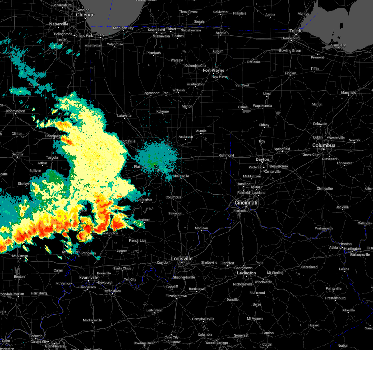 At 956 pm cdt, a severe thunderstorm was located near st. francisville, or near lawrenceville, moving east at 40 mph (radar indicated). Hazards include 60 mph wind gusts and quarter size hail. Hail damage to vehicles is expected. expect wind damage to roofs, siding, and trees. this severe thunderstorm will be near, vincennes around 1110 pm edt. hail threat, radar indicated max hail size, 1. 00 in wind threat, radar indicated max wind gust, 60 mph. At 956 pm cdt, a severe thunderstorm was located near st. francisville, or near lawrenceville, moving east at 40 mph (radar indicated). Hazards include 60 mph wind gusts and quarter size hail. Hail damage to vehicles is expected. expect wind damage to roofs, siding, and trees. this severe thunderstorm will be near, vincennes around 1110 pm edt. hail threat, radar indicated max hail size, 1. 00 in wind threat, radar indicated max wind gust, 60 mph.
|
| 8/6/2023 10:44 PM EDT |
 At 1044 pm edt, severe thunderstorms were located along a line extending from 7 miles northeast of washington to near lancaster, moving east at 30 mph (radar indicated). Hazards include 60 mph wind gusts and quarter size hail. Hail damage to vehicles is expected. expect wind damage to roofs, siding, and trees. severe thunderstorms will be near, montgomery and cannelburg around 1050 pm edt. loogootee, west boggs lake and burns city around 1100 pm edt. other locations in the path of these severe thunderstorms include shoals, decker, indian springs, lacy, vincennes university, monroe city, wheatland and washington. hail threat, radar indicated max hail size, 1. 00 in wind threat, radar indicated max wind gust, 60 mph. At 1044 pm edt, severe thunderstorms were located along a line extending from 7 miles northeast of washington to near lancaster, moving east at 30 mph (radar indicated). Hazards include 60 mph wind gusts and quarter size hail. Hail damage to vehicles is expected. expect wind damage to roofs, siding, and trees. severe thunderstorms will be near, montgomery and cannelburg around 1050 pm edt. loogootee, west boggs lake and burns city around 1100 pm edt. other locations in the path of these severe thunderstorms include shoals, decker, indian springs, lacy, vincennes university, monroe city, wheatland and washington. hail threat, radar indicated max hail size, 1. 00 in wind threat, radar indicated max wind gust, 60 mph.
|
| 8/6/2023 9:42 PM CDT |
 At 942 pm cdt, a severe thunderstorm was located over lawrenceville, moving northeast at 55 mph (radar indicated). Hazards include 60 mph wind gusts and quarter size hail. Hail damage to vehicles is expected. expect wind damage to roofs, siding, and trees. this severe storm will be near, birds around 945 pm cdt. Other locations in the path of this severe thunderstorm include vincennes and russellville. At 942 pm cdt, a severe thunderstorm was located over lawrenceville, moving northeast at 55 mph (radar indicated). Hazards include 60 mph wind gusts and quarter size hail. Hail damage to vehicles is expected. expect wind damage to roofs, siding, and trees. this severe storm will be near, birds around 945 pm cdt. Other locations in the path of this severe thunderstorm include vincennes and russellville.
|
| 8/6/2023 10:31 PM EDT |
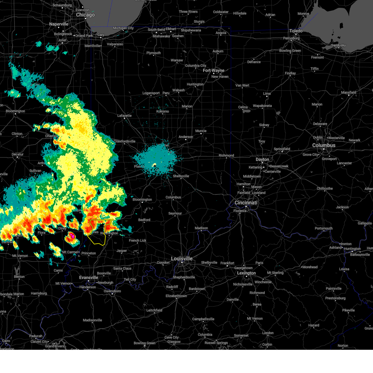 At 1031 pm edt, a severe thunderstorm was located near russellville, or 8 miles northeast of vincennes, moving east at 35 mph (radar indicated). Hazards include 60 mph wind gusts and quarter size hail. Hail damage to vehicles is expected. expect wind damage to roofs, siding, and trees. this severe storm will be near, bicknell and freelandville around 1040 pm edt. other locations in the path of this severe thunderstorm include wheatland and edwardsport. hail threat, radar indicated max hail size, 1. 00 in wind threat, radar indicated max wind gust, 60 mph. At 1031 pm edt, a severe thunderstorm was located near russellville, or 8 miles northeast of vincennes, moving east at 35 mph (radar indicated). Hazards include 60 mph wind gusts and quarter size hail. Hail damage to vehicles is expected. expect wind damage to roofs, siding, and trees. this severe storm will be near, bicknell and freelandville around 1040 pm edt. other locations in the path of this severe thunderstorm include wheatland and edwardsport. hail threat, radar indicated max hail size, 1. 00 in wind threat, radar indicated max wind gust, 60 mph.
|
| 8/6/2023 9:25 PM CDT |
 At 924 pm cdt, severe thunderstorms were located along a line extending from russellville to near parkersburg, moving east at 40 mph (radar indicated). Hazards include 60 mph wind gusts and quarter size hail. Hail damage to vehicles is expected. expect wind damage to roofs, siding, and trees. severe thunderstorms will be near, russellville around 930 pm cdt. sumner around 935 pm cdt. other locations in the path of these severe thunderstorms include lawrenceville, st. Francisville and vincennes. At 924 pm cdt, severe thunderstorms were located along a line extending from russellville to near parkersburg, moving east at 40 mph (radar indicated). Hazards include 60 mph wind gusts and quarter size hail. Hail damage to vehicles is expected. expect wind damage to roofs, siding, and trees. severe thunderstorms will be near, russellville around 930 pm cdt. sumner around 935 pm cdt. other locations in the path of these severe thunderstorms include lawrenceville, st. Francisville and vincennes.
|
| 8/6/2023 10:21 PM EDT |
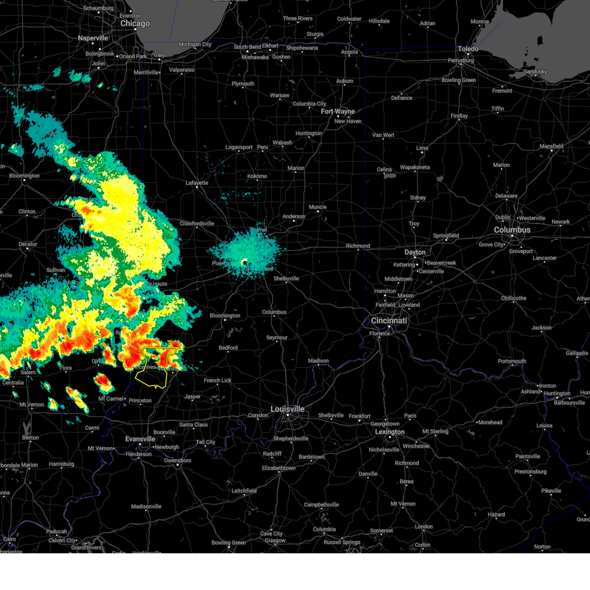 At 1020 pm edt, a severe thunderstorm was located 11 miles northwest of washington, or 14 miles northeast of vincennes, moving northeast at 25 mph (radar indicated. at 1004 pm edt, quarter size hail was reported near bruceville). Hazards include 60 mph wind gusts and quarter size hail. Hail damage to vehicles is expected. expect wind damage to roofs, siding, and trees. this severe storm will be near, edwardsport around 1025 pm edt. other locations in the path of this severe thunderstorm include sandborn. hail threat, radar indicated max hail size, 1. 00 in wind threat, radar indicated max wind gust, 60 mph. At 1020 pm edt, a severe thunderstorm was located 11 miles northwest of washington, or 14 miles northeast of vincennes, moving northeast at 25 mph (radar indicated. at 1004 pm edt, quarter size hail was reported near bruceville). Hazards include 60 mph wind gusts and quarter size hail. Hail damage to vehicles is expected. expect wind damage to roofs, siding, and trees. this severe storm will be near, edwardsport around 1025 pm edt. other locations in the path of this severe thunderstorm include sandborn. hail threat, radar indicated max hail size, 1. 00 in wind threat, radar indicated max wind gust, 60 mph.
|
| 8/6/2023 9:15 PM CDT |
 At 915 pm cdt, severe thunderstorms were located along a line extending from near birds to near lawrenceville, moving east at 35 mph (radar indicated). Hazards include 60 mph wind gusts and quarter size hail. Hail damage to vehicles is expected. expect wind damage to roofs, siding, and trees. Locations impacted include, vincennes, lawrenceville, sumner, flat rock, russellville, birds, billett, pinkstaff, red hills state park, petrolia and lawrenceville airport. At 915 pm cdt, severe thunderstorms were located along a line extending from near birds to near lawrenceville, moving east at 35 mph (radar indicated). Hazards include 60 mph wind gusts and quarter size hail. Hail damage to vehicles is expected. expect wind damage to roofs, siding, and trees. Locations impacted include, vincennes, lawrenceville, sumner, flat rock, russellville, birds, billett, pinkstaff, red hills state park, petrolia and lawrenceville airport.
|
| 8/6/2023 10:06 PM EDT |
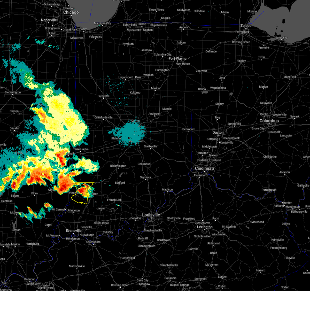 At 1006 pm edt, a severe thunderstorm was located 8 miles east of russellville, or 9 miles northeast of vincennes, moving northeast at 30 mph (trained weather spotters). Hazards include 60 mph wind gusts and quarter size hail. Hail damage to vehicles is expected. expect wind damage to roofs, siding, and trees. this severe storm will be near, bicknell around 1010 pm edt. edwardsport and freelandville around 1020 pm edt. other locations in the path of this severe thunderstorm include sandborn. hail threat, observed max hail size, 1. 00 in wind threat, radar indicated max wind gust, 60 mph. At 1006 pm edt, a severe thunderstorm was located 8 miles east of russellville, or 9 miles northeast of vincennes, moving northeast at 30 mph (trained weather spotters). Hazards include 60 mph wind gusts and quarter size hail. Hail damage to vehicles is expected. expect wind damage to roofs, siding, and trees. this severe storm will be near, bicknell around 1010 pm edt. edwardsport and freelandville around 1020 pm edt. other locations in the path of this severe thunderstorm include sandborn. hail threat, observed max hail size, 1. 00 in wind threat, radar indicated max wind gust, 60 mph.
|
| 8/6/2023 9:04 PM CDT |
 At 904 pm cdt, a severe thunderstorm was located near chauncey, or 8 miles northwest of lawrenceville, moving east at 30 mph (radar indicated). Hazards include 60 mph wind gusts and quarter size hail. Hail damage to vehicles is expected. expect wind damage to roofs, siding, and trees. Locations impacted include, lawrenceville, birds, russellville and vincennes. At 904 pm cdt, a severe thunderstorm was located near chauncey, or 8 miles northwest of lawrenceville, moving east at 30 mph (radar indicated). Hazards include 60 mph wind gusts and quarter size hail. Hail damage to vehicles is expected. expect wind damage to roofs, siding, and trees. Locations impacted include, lawrenceville, birds, russellville and vincennes.
|
| 8/6/2023 10:00 PM EDT |
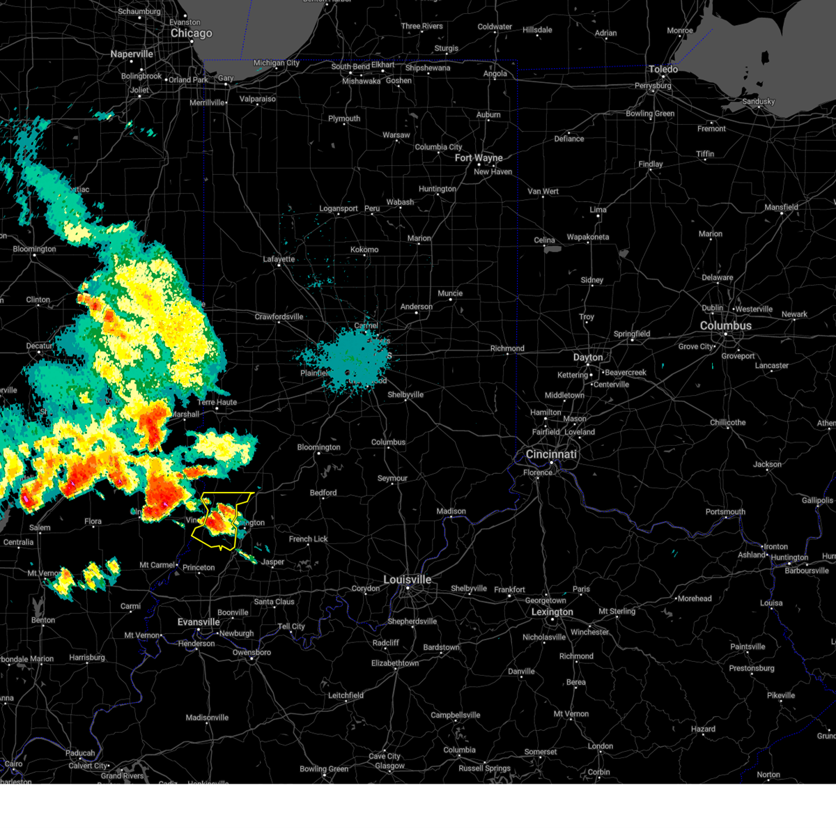 At 959 pm edt, a severe thunderstorm was located near vincennes, moving northeast at 25 mph (radar indicated). Hazards include 60 mph wind gusts and half dollar size hail. Hail damage to vehicles is expected. expect wind damage to roofs, siding, and trees. this severe thunderstorm will be near, oaktown around 1010 pm edt. bicknell around 1015 pm edt. other locations in the path of this severe thunderstorm include edwardsport, freelandville and sandborn. hail threat, radar indicated max hail size, 1. 25 in wind threat, radar indicated max wind gust, 60 mph. At 959 pm edt, a severe thunderstorm was located near vincennes, moving northeast at 25 mph (radar indicated). Hazards include 60 mph wind gusts and half dollar size hail. Hail damage to vehicles is expected. expect wind damage to roofs, siding, and trees. this severe thunderstorm will be near, oaktown around 1010 pm edt. bicknell around 1015 pm edt. other locations in the path of this severe thunderstorm include edwardsport, freelandville and sandborn. hail threat, radar indicated max hail size, 1. 25 in wind threat, radar indicated max wind gust, 60 mph.
|
| 8/6/2023 8:42 PM CDT |
 At 841 pm cdt, a severe thunderstorm was located near ste. marie, or 11 miles northeast of olney, moving east at 30 mph (radar indicated). Hazards include 60 mph wind gusts and quarter size hail. Hail damage to vehicles is expected. expect wind damage to roofs, siding, and trees. this severe thunderstorm will be near, chauncey and hardinville around 855 pm cdt. Other locations in the path of this severe thunderstorm include new hebron, lawrenceville, flat rock, birds and russellville. At 841 pm cdt, a severe thunderstorm was located near ste. marie, or 11 miles northeast of olney, moving east at 30 mph (radar indicated). Hazards include 60 mph wind gusts and quarter size hail. Hail damage to vehicles is expected. expect wind damage to roofs, siding, and trees. this severe thunderstorm will be near, chauncey and hardinville around 855 pm cdt. Other locations in the path of this severe thunderstorm include new hebron, lawrenceville, flat rock, birds and russellville.
|
| 7/2/2023 6:26 PM EDT | Knox county reports multiple trees down in sw vincenne in knox county IN, 1.6 miles NNE of Vincennes, IN |
| 7/2/2023 6:25 PM EDT | Knox county em reports tree/powerlines down along schoolhouse road on the west side of vincenne in knox county IN, 3.9 miles NE of Vincennes, IN |
| 7/2/2023 6:23 PM EDT |
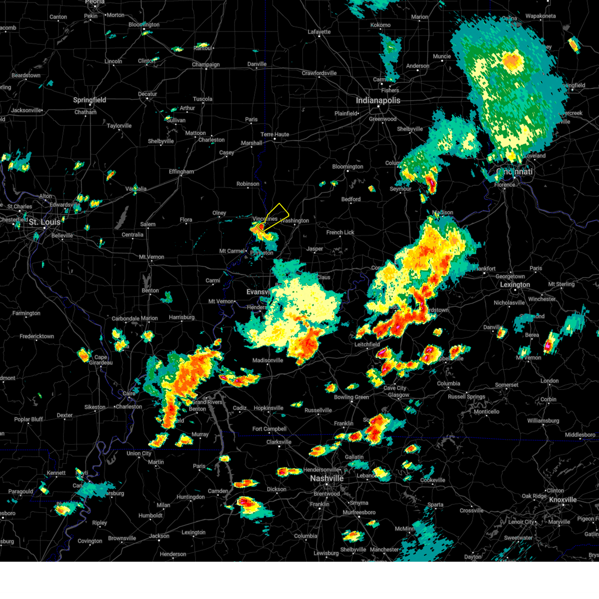 At 622 pm edt, a severe thunderstorm was located over vincennes, moving northeast at 45 mph (radar indicated). Hazards include 60 mph wind gusts and quarter size hail. Hail damage to vehicles is expected. expect wind damage to roofs, siding, and trees. this severe thunderstorm will be near, bruceville around 635 pm edt. other locations in the path of this severe thunderstorm include bicknell. hail threat, radar indicated max hail size, 1. 00 in wind threat, radar indicated max wind gust, 60 mph. At 622 pm edt, a severe thunderstorm was located over vincennes, moving northeast at 45 mph (radar indicated). Hazards include 60 mph wind gusts and quarter size hail. Hail damage to vehicles is expected. expect wind damage to roofs, siding, and trees. this severe thunderstorm will be near, bruceville around 635 pm edt. other locations in the path of this severe thunderstorm include bicknell. hail threat, radar indicated max hail size, 1. 00 in wind threat, radar indicated max wind gust, 60 mph.
|
| 7/1/2023 7:53 PM EDT |
 At 752 pm edt, severe thunderstorms were located along a line extending from 15 miles east of vincennes to near washington to near petersburg, moving northeast at 50 mph (emergency management). Hazards include 70 mph wind gusts and penny size hail. Expect considerable tree damage. damage is likely to mobile homes, roofs, and outbuildings. severe thunderstorms will be near, plainville around 800 pm edt. elnora, montgomery, cannelburg and glendale fishery around 805 pm edt. loogootee, odon, alfordsville and west boggs lake around 810 pm edt. other locations in the path of these severe thunderstorms include burns city, shoals, crane, lacy and indian springs. thunderstorm damage threat, considerable hail threat, radar indicated max hail size, 0. 75 in wind threat, observed max wind gust, 70 mph. At 752 pm edt, severe thunderstorms were located along a line extending from 15 miles east of vincennes to near washington to near petersburg, moving northeast at 50 mph (emergency management). Hazards include 70 mph wind gusts and penny size hail. Expect considerable tree damage. damage is likely to mobile homes, roofs, and outbuildings. severe thunderstorms will be near, plainville around 800 pm edt. elnora, montgomery, cannelburg and glendale fishery around 805 pm edt. loogootee, odon, alfordsville and west boggs lake around 810 pm edt. other locations in the path of these severe thunderstorms include burns city, shoals, crane, lacy and indian springs. thunderstorm damage threat, considerable hail threat, radar indicated max hail size, 0. 75 in wind threat, observed max wind gust, 70 mph.
|
| 7/1/2023 7:40 PM EDT |
 At 739 pm edt, severe thunderstorms were located along a line extending from near flat rock to russellville to near vincennes to 6 miles northwest of petersburg to 6 miles north of oakland city, moving northeast at 55 mph (emergency management). Hazards include 70 mph wind gusts and penny size hail. Expect considerable tree damage. damage is likely to mobile homes, roofs, and outbuildings. locations impacted include, oaktown, wheatland, bicknell, carlisle, edwardsport, freelandville, washington, sullivan, plainville, pleasantville, paxton, dugger, elnora, sandborn and linton. thunderstorm damage threat, considerable hail threat, radar indicated max hail size, 0. 75 in wind threat, observed max wind gust, 70 mph. At 739 pm edt, severe thunderstorms were located along a line extending from near flat rock to russellville to near vincennes to 6 miles northwest of petersburg to 6 miles north of oakland city, moving northeast at 55 mph (emergency management). Hazards include 70 mph wind gusts and penny size hail. Expect considerable tree damage. damage is likely to mobile homes, roofs, and outbuildings. locations impacted include, oaktown, wheatland, bicknell, carlisle, edwardsport, freelandville, washington, sullivan, plainville, pleasantville, paxton, dugger, elnora, sandborn and linton. thunderstorm damage threat, considerable hail threat, radar indicated max hail size, 0. 75 in wind threat, observed max wind gust, 70 mph.
|
| 7/1/2023 7:37 PM EDT | Knox county em estimates 70mph winds at intersection of us-41 and in-241 near decke in knox county IN, 8.6 miles NNE of Vincennes, IN |
| 7/1/2023 7:18 PM EDT |
 At 718 pm edt, severe thunderstorms were located along a line extending from near sumner to near lawrenceville to near st. francisville to near mount carmel to near owensville, moving northeast at 55 mph (radar indicated). Hazards include 70 mph wind gusts and penny size hail. Expect considerable tree damage. damage is likely to mobile homes, roofs, and outbuildings. severe thunderstorms will be near, decker and vincennes university around 730 pm edt. vincennes around 735 pm edt. other locations in the path of these severe thunderstorms include oaktown, bruceville, bicknell, monroe city, carlisle, wheatland, edwardsport, paxton, freelandville, sullivan, sandborn, pleasantville, washington, linton, dugger, elnora and plainville. thunderstorm damage threat, considerable hail threat, radar indicated max hail size, 0. 75 in wind threat, radar indicated max wind gust, 70 mph. At 718 pm edt, severe thunderstorms were located along a line extending from near sumner to near lawrenceville to near st. francisville to near mount carmel to near owensville, moving northeast at 55 mph (radar indicated). Hazards include 70 mph wind gusts and penny size hail. Expect considerable tree damage. damage is likely to mobile homes, roofs, and outbuildings. severe thunderstorms will be near, decker and vincennes university around 730 pm edt. vincennes around 735 pm edt. other locations in the path of these severe thunderstorms include oaktown, bruceville, bicknell, monroe city, carlisle, wheatland, edwardsport, paxton, freelandville, sullivan, sandborn, pleasantville, washington, linton, dugger, elnora and plainville. thunderstorm damage threat, considerable hail threat, radar indicated max hail size, 0. 75 in wind threat, radar indicated max wind gust, 70 mph.
|
| 6/29/2023 7:28 PM EDT |
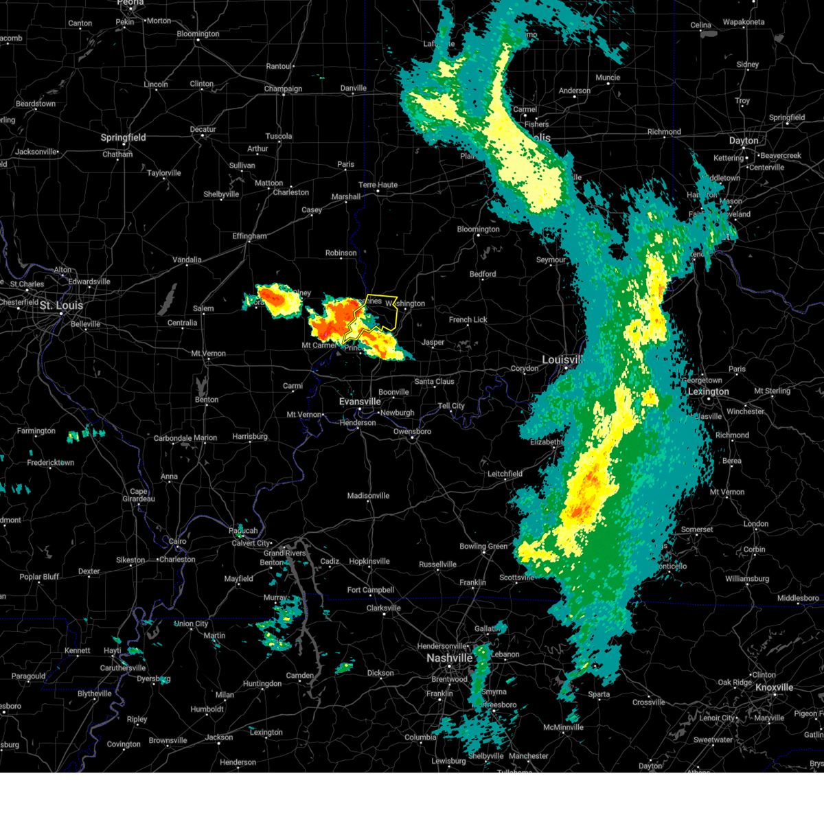 At 727 pm edt, severe thunderstorms were located along a line extending from vincennes to near mount carmel, moving east at 40 mph (radar indicated). Hazards include 60 mph wind gusts and quarter size hail. Hail damage to vehicles is expected. expect wind damage to roofs, siding, and trees. severe thunderstorms will be near, vincennes and vincennes university around 735 pm edt. monroe city around 740 pm edt. wheatland and decker around 745 pm edt. hail threat, radar indicated max hail size, 1. 00 in wind threat, radar indicated max wind gust, 60 mph. At 727 pm edt, severe thunderstorms were located along a line extending from vincennes to near mount carmel, moving east at 40 mph (radar indicated). Hazards include 60 mph wind gusts and quarter size hail. Hail damage to vehicles is expected. expect wind damage to roofs, siding, and trees. severe thunderstorms will be near, vincennes and vincennes university around 735 pm edt. monroe city around 740 pm edt. wheatland and decker around 745 pm edt. hail threat, radar indicated max hail size, 1. 00 in wind threat, radar indicated max wind gust, 60 mph.
|
| 6/29/2023 3:06 PM EDT |
 At 305 pm edt, severe thunderstorms were located along a line extending from 7 miles south of terre haute to hardinville, moving east at 85 mph (radar indicated). Hazards include 70 mph wind gusts and quarter size hail. Hail damage to vehicles is expected. expect considerable tree damage. wind damage is also likely to mobile homes, roofs, and outbuildings. severe thunderstorms will be near, clay city around 315 pm edt. oaktown and coal city around 320 pm edt. bruceville, freedom and freelandville around 325 pm edt. other locations in the path of these severe thunderstorms include bicknell, wheatland, edwardsport, washington, ellettsville, plainville, solsberry, bloomington, montgomery, cannelburg, whitehall, indiana university, shoals, loogootee, alfordsville, west boggs lake, smithville, lacy and fairfax state recreation area. thunderstorm damage threat, considerable hail threat, radar indicated max hail size, 1. 00 in wind threat, radar indicated max wind gust, 70 mph. At 305 pm edt, severe thunderstorms were located along a line extending from 7 miles south of terre haute to hardinville, moving east at 85 mph (radar indicated). Hazards include 70 mph wind gusts and quarter size hail. Hail damage to vehicles is expected. expect considerable tree damage. wind damage is also likely to mobile homes, roofs, and outbuildings. severe thunderstorms will be near, clay city around 315 pm edt. oaktown and coal city around 320 pm edt. bruceville, freedom and freelandville around 325 pm edt. other locations in the path of these severe thunderstorms include bicknell, wheatland, edwardsport, washington, ellettsville, plainville, solsberry, bloomington, montgomery, cannelburg, whitehall, indiana university, shoals, loogootee, alfordsville, west boggs lake, smithville, lacy and fairfax state recreation area. thunderstorm damage threat, considerable hail threat, radar indicated max hail size, 1. 00 in wind threat, radar indicated max wind gust, 70 mph.
|
| 6/29/2023 1:58 PM CDT |
 At 157 pm cdt, severe thunderstorms were located along a line extending from near annapolis to near bogota to xenia, moving southeast at 45 mph (radar indicated). Hazards include 60 mph wind gusts and quarter size hail. Hail damage to vehicles is expected. expect wind damage to roofs, siding, and trees. locations impacted include, oblong, eaton, dundas, west liberty, olney, robinson, claremont, calhoun, new hebron, hardinville, palestine, parkersburg, flat rock, birds, russellville and vincennes. hail threat, radar indicated max hail size, 1. 00 in wind threat, radar indicated max wind gust, 60 mph. At 157 pm cdt, severe thunderstorms were located along a line extending from near annapolis to near bogota to xenia, moving southeast at 45 mph (radar indicated). Hazards include 60 mph wind gusts and quarter size hail. Hail damage to vehicles is expected. expect wind damage to roofs, siding, and trees. locations impacted include, oblong, eaton, dundas, west liberty, olney, robinson, claremont, calhoun, new hebron, hardinville, palestine, parkersburg, flat rock, birds, russellville and vincennes. hail threat, radar indicated max hail size, 1. 00 in wind threat, radar indicated max wind gust, 60 mph.
|
| 6/29/2023 1:30 PM CDT |
 At 129 pm cdt, severe thunderstorms were located along a line extending from near montrose to near edgewood to near boulder, moving southeast at 55 mph (radar indicated). Hazards include 60 mph wind gusts and quarter size hail. Hail damage to vehicles is expected. expect wind damage to roofs, siding, and trees. severe thunderstorms will be near, wheeler around 140 pm cdt. louisville around 145 pm cdt. other locations in the path of these severe thunderstorms include newton, flora, clay city, willow hill, sailor springs, bogota, ste. marie, dundas, west liberty, schnell, olney, chauncey, sumner and claremont. hail threat, radar indicated max hail size, 1. 00 in wind threat, radar indicated max wind gust, 60 mph. At 129 pm cdt, severe thunderstorms were located along a line extending from near montrose to near edgewood to near boulder, moving southeast at 55 mph (radar indicated). Hazards include 60 mph wind gusts and quarter size hail. Hail damage to vehicles is expected. expect wind damage to roofs, siding, and trees. severe thunderstorms will be near, wheeler around 140 pm cdt. louisville around 145 pm cdt. other locations in the path of these severe thunderstorms include newton, flora, clay city, willow hill, sailor springs, bogota, ste. marie, dundas, west liberty, schnell, olney, chauncey, sumner and claremont. hail threat, radar indicated max hail size, 1. 00 in wind threat, radar indicated max wind gust, 60 mph.
|
| 6/29/2023 6:37 AM CDT |
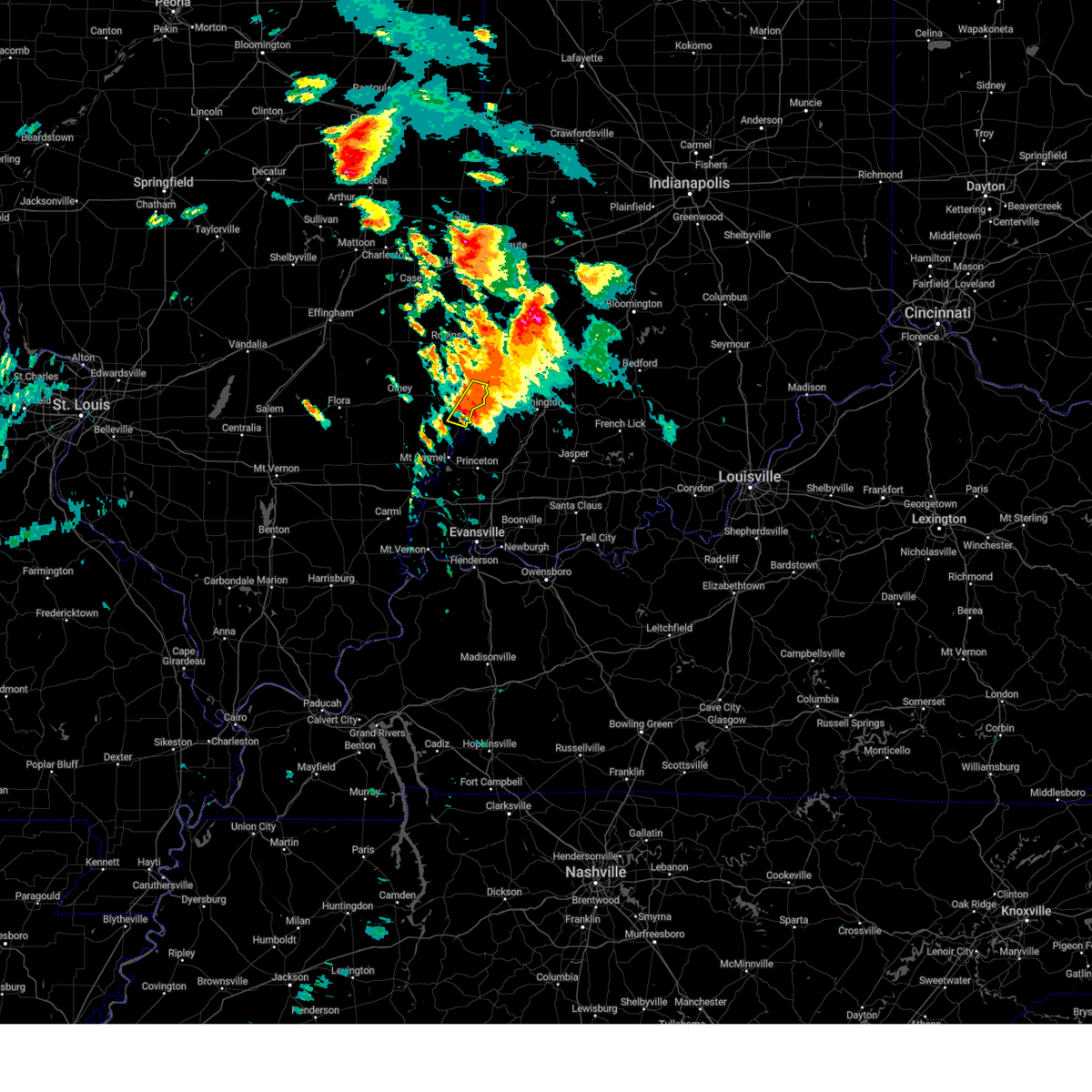 At 633 am cdt, a severe thunderstorm was located near vincennes, moving east at 25 mph (radar indicated). Hazards include half dollar size hail. Damage to vehicles is expected. this severe thunderstorm will remain over mainly rural areas of eastern lawrence county, including the following locations, billett, lawrenceville airport and mount carmel airport. hail threat, radar indicated max hail size, 1. 25 in wind threat, radar indicated max wind gust, <50 mph. At 633 am cdt, a severe thunderstorm was located near vincennes, moving east at 25 mph (radar indicated). Hazards include half dollar size hail. Damage to vehicles is expected. this severe thunderstorm will remain over mainly rural areas of eastern lawrence county, including the following locations, billett, lawrenceville airport and mount carmel airport. hail threat, radar indicated max hail size, 1. 25 in wind threat, radar indicated max wind gust, <50 mph.
|
| 6/29/2023 7:37 AM EDT |
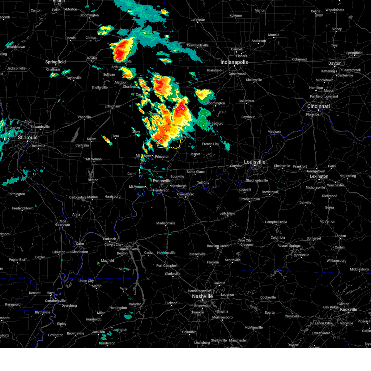 At 737 am edt, a severe thunderstorm was located near vincennes, moving east at 40 mph (radar indicated). Hazards include 60 mph wind gusts and quarter size hail. Hail damage to vehicles is expected. expect wind damage to roofs, siding, and trees. locations impacted include, monroe city. hail threat, radar indicated max hail size, 1. 00 in wind threat, radar indicated max wind gust, 60 mph. At 737 am edt, a severe thunderstorm was located near vincennes, moving east at 40 mph (radar indicated). Hazards include 60 mph wind gusts and quarter size hail. Hail damage to vehicles is expected. expect wind damage to roofs, siding, and trees. locations impacted include, monroe city. hail threat, radar indicated max hail size, 1. 00 in wind threat, radar indicated max wind gust, 60 mph.
|
| 6/29/2023 7:17 AM EDT |
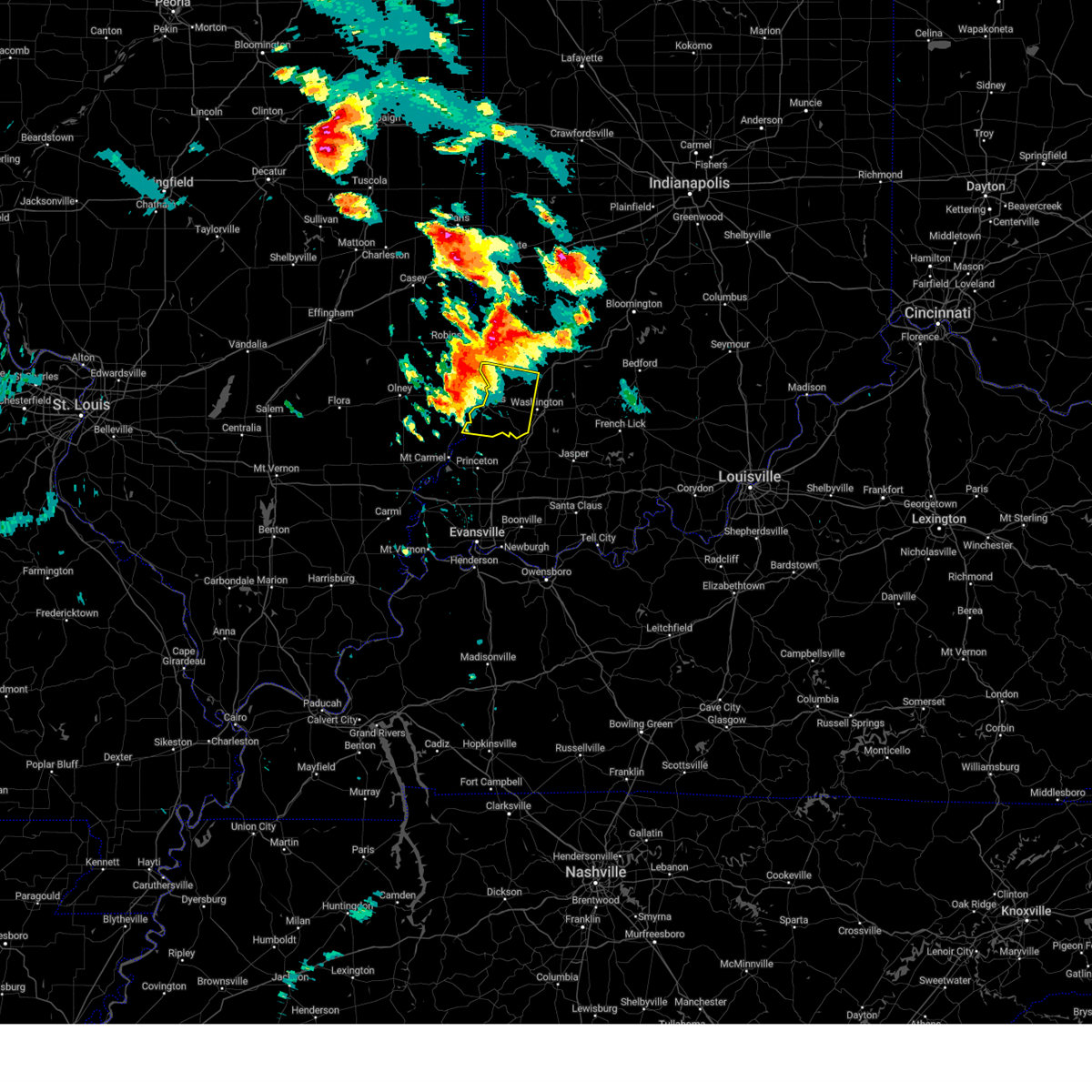 At 717 am edt, a severe thunderstorm was located near lawrenceville, moving east at 25 mph (radar indicated). Hazards include 60 mph wind gusts and quarter size hail. Hail damage to vehicles is expected. expect wind damage to roofs, siding, and trees. this severe thunderstorm will be near, vincennes and vincennes university around 730 am edt. other locations in the path of this severe thunderstorm include monroe city and wheatland. hail threat, radar indicated max hail size, 1. 00 in wind threat, radar indicated max wind gust, 60 mph. At 717 am edt, a severe thunderstorm was located near lawrenceville, moving east at 25 mph (radar indicated). Hazards include 60 mph wind gusts and quarter size hail. Hail damage to vehicles is expected. expect wind damage to roofs, siding, and trees. this severe thunderstorm will be near, vincennes and vincennes university around 730 am edt. other locations in the path of this severe thunderstorm include monroe city and wheatland. hail threat, radar indicated max hail size, 1. 00 in wind threat, radar indicated max wind gust, 60 mph.
|
| 6/29/2023 6:11 AM CDT |
 At 611 am cdt, a severe thunderstorm was located over lawrenceville, moving east at 25 mph (radar indicated). Hazards include half dollar size hail. Damage to vehicles is expected. this severe thunderstorm will be near, lawrenceville around 615 am cdt. st. francisville around 630 am cdt. hail threat, radar indicated max hail size, 1. 25 in wind threat, radar indicated max wind gust, <50 mph. At 611 am cdt, a severe thunderstorm was located over lawrenceville, moving east at 25 mph (radar indicated). Hazards include half dollar size hail. Damage to vehicles is expected. this severe thunderstorm will be near, lawrenceville around 615 am cdt. st. francisville around 630 am cdt. hail threat, radar indicated max hail size, 1. 25 in wind threat, radar indicated max wind gust, <50 mph.
|
| 2/22/2023 4:52 PM CST |
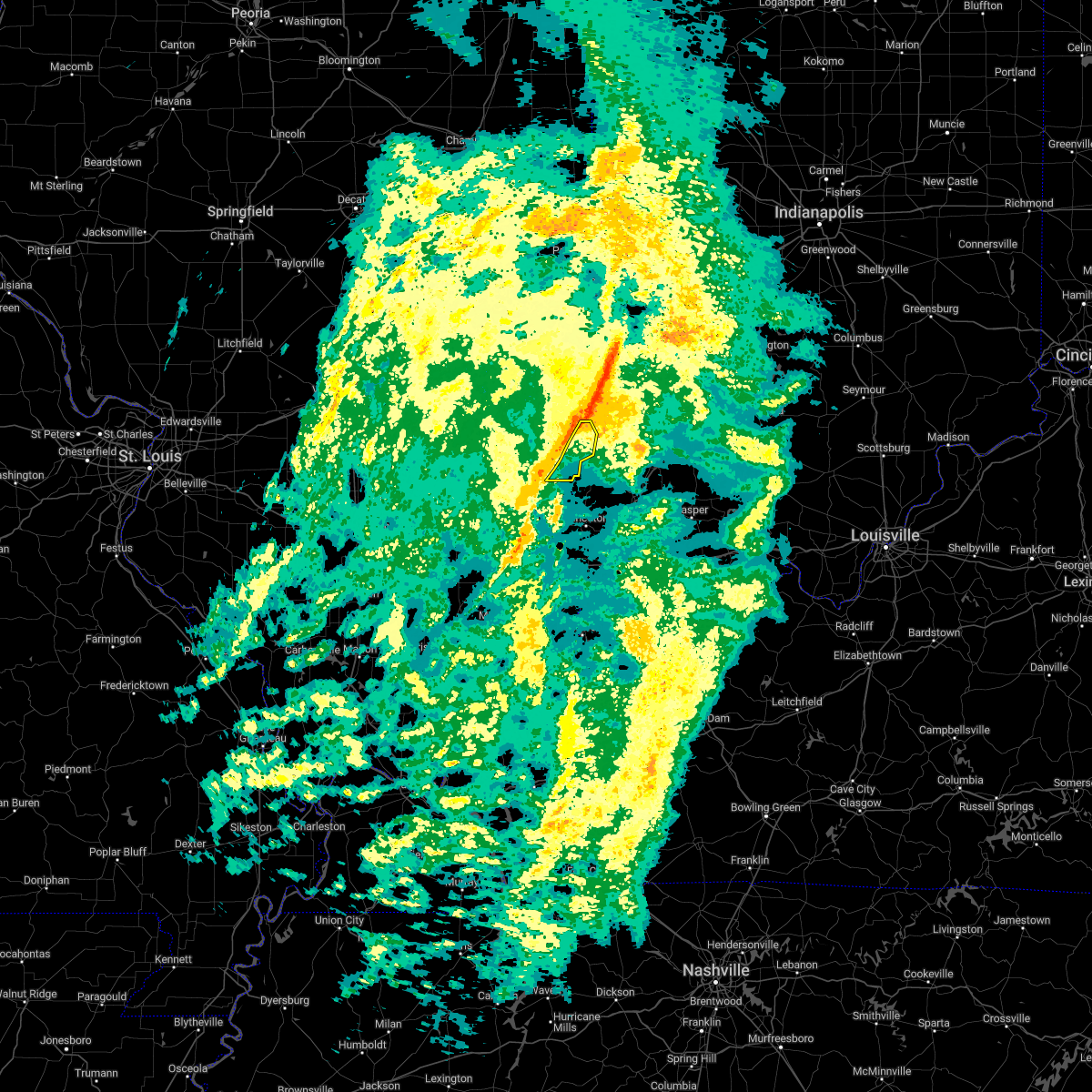 At 451 pm cst, severe thunderstorms were located along a line extending from russellville to near st. francisville, moving east at 40 mph (radar indicated). Hazards include 60 mph wind gusts. Expect damage to roofs, siding, and trees. locations impacted include, vincennes, lawrenceville, st. francisville, russellville, billett, mount carmel airport and lawrenceville airport. hail threat, radar indicated max hail size, <. 75 in wind threat, radar indicated max wind gust, 60 mph. At 451 pm cst, severe thunderstorms were located along a line extending from russellville to near st. francisville, moving east at 40 mph (radar indicated). Hazards include 60 mph wind gusts. Expect damage to roofs, siding, and trees. locations impacted include, vincennes, lawrenceville, st. francisville, russellville, billett, mount carmel airport and lawrenceville airport. hail threat, radar indicated max hail size, <. 75 in wind threat, radar indicated max wind gust, 60 mph.
|
| 2/22/2023 4:38 PM CST |
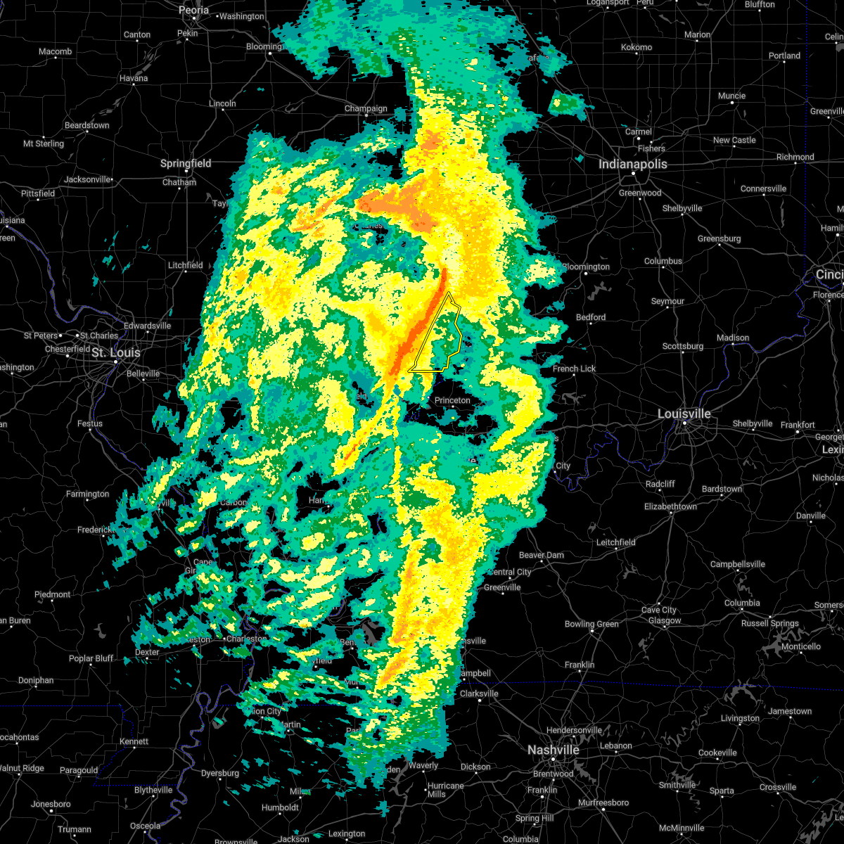 At 438 pm cst, severe thunderstorms were located along a line extending from near hutsonville to near lawrenceville, moving east at 45 mph (radar indicated). Hazards include 60 mph wind gusts. Expect damage to roofs, siding, and trees. locations impacted include, vincennes. hail threat, radar indicated max hail size, <. 75 in wind threat, radar indicated max wind gust, 60 mph. At 438 pm cst, severe thunderstorms were located along a line extending from near hutsonville to near lawrenceville, moving east at 45 mph (radar indicated). Hazards include 60 mph wind gusts. Expect damage to roofs, siding, and trees. locations impacted include, vincennes. hail threat, radar indicated max hail size, <. 75 in wind threat, radar indicated max wind gust, 60 mph.
|
| 2/22/2023 4:25 PM CST |
 At 425 pm cst, severe thunderstorms were located along a line extending from near hutsonville to near sumner, moving east at 45 mph (radar indicated). Hazards include 60 mph wind gusts. Expect damage to roofs, siding, and trees. these severe storms will be near, robinson and hutsonville around 430 pm cst. other locations in the path of these severe thunderstorms include lawrenceville, russellville and vincennes. hail threat, radar indicated max hail size, <. 75 in wind threat, radar indicated max wind gust, 60 mph. At 425 pm cst, severe thunderstorms were located along a line extending from near hutsonville to near sumner, moving east at 45 mph (radar indicated). Hazards include 60 mph wind gusts. Expect damage to roofs, siding, and trees. these severe storms will be near, robinson and hutsonville around 430 pm cst. other locations in the path of these severe thunderstorms include lawrenceville, russellville and vincennes. hail threat, radar indicated max hail size, <. 75 in wind threat, radar indicated max wind gust, 60 mph.
|
| 2/22/2023 4:11 PM CST |
 At 411 pm cst, severe thunderstorms were located along a line extending from near hazel dell to near ste. marie to near schnell, moving east at 45 mph (radar indicated). Hazards include 60 mph wind gusts. Expect damage to roofs, siding, and trees. severe thunderstorms will be near, hardinville and chauncey around 425 pm cst. annapolis and eaton around 430 pm cst. other locations in the path of these severe thunderstorms include robinson, new hebron, sumner, hutsonville, flat rock, birds, russellville, st. francisville and vincennes. hail threat, radar indicated max hail size, <. 75 in wind threat, radar indicated max wind gust, 60 mph. At 411 pm cst, severe thunderstorms were located along a line extending from near hazel dell to near ste. marie to near schnell, moving east at 45 mph (radar indicated). Hazards include 60 mph wind gusts. Expect damage to roofs, siding, and trees. severe thunderstorms will be near, hardinville and chauncey around 425 pm cst. annapolis and eaton around 430 pm cst. other locations in the path of these severe thunderstorms include robinson, new hebron, sumner, hutsonville, flat rock, birds, russellville, st. francisville and vincennes. hail threat, radar indicated max hail size, <. 75 in wind threat, radar indicated max wind gust, 60 mph.
|
| 2/9/2023 5:19 AM CST |
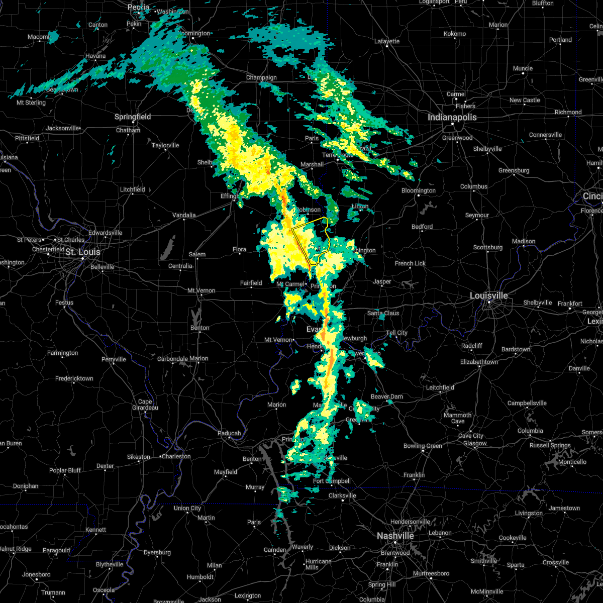 At 518 am cst, a severe thunderstorm was located over lawrenceville, moving northeast at 50 mph (radar indicated). Hazards include 60 mph wind gusts. Expect damage to roofs, siding, and trees. this severe thunderstorm will be near, vincennes around 625 am est. russellville around 530 am cst. hail threat, radar indicated max hail size, <. 75 in wind threat, radar indicated max wind gust, 60 mph. At 518 am cst, a severe thunderstorm was located over lawrenceville, moving northeast at 50 mph (radar indicated). Hazards include 60 mph wind gusts. Expect damage to roofs, siding, and trees. this severe thunderstorm will be near, vincennes around 625 am est. russellville around 530 am cst. hail threat, radar indicated max hail size, <. 75 in wind threat, radar indicated max wind gust, 60 mph.
|
| 7/24/2022 8:00 PM EDT | Time is roughly estimated from radar. a tree was blown down onto n old us 4 in knox county IN, 2.7 miles SSW of Vincennes, IN |
| 7/24/2022 8:00 PM EDT | Time is roughly estimated from radar. a tree was blown down onto east stagecoach roa in knox county IN, 4.8 miles NW of Vincennes, IN |
| 6/17/2022 8:42 AM EDT |
 At 842 am edt, severe thunderstorms were located along a line extending from 7 miles east of russellville to 9 miles west of petersburg, moving east at 45 mph. this line recently produced estimated 60 mph winds in decker (radar indicated). Hazards include 60 mph wind gusts. Expect damage to roofs, siding, and trees. severe thunderstorms will be near, bicknell around 850 am edt. edwardsport around 855 am edt. plainville around 900 am edt. other locations in the path of these severe thunderstorms include montgomery, glendale fishery, cannelburg, loogootee and west boggs lake. hail threat, radar indicated max hail size, <. 75 in wind threat, observed max wind gust, 60 mph. At 842 am edt, severe thunderstorms were located along a line extending from 7 miles east of russellville to 9 miles west of petersburg, moving east at 45 mph. this line recently produced estimated 60 mph winds in decker (radar indicated). Hazards include 60 mph wind gusts. Expect damage to roofs, siding, and trees. severe thunderstorms will be near, bicknell around 850 am edt. edwardsport around 855 am edt. plainville around 900 am edt. other locations in the path of these severe thunderstorms include montgomery, glendale fishery, cannelburg, loogootee and west boggs lake. hail threat, radar indicated max hail size, <. 75 in wind threat, observed max wind gust, 60 mph.
|
| 6/17/2022 8:32 AM EDT |
 At 832 am edt, severe thunderstorms were located along a line extending from near vincennes to 7 miles northeast of patoka to cynthiana, moving east at 55 mph (radar indicated). Hazards include 60 mph wind gusts and quarter size hail. Hail damage to vehicles is expected. expect wind damage to roofs, siding, and trees. locations impacted include, bruceville, bicknell, monroe city, wheatland and edwardsport. hail threat, radar indicated max hail size, 1. 00 in wind threat, radar indicated max wind gust, 60 mph. At 832 am edt, severe thunderstorms were located along a line extending from near vincennes to 7 miles northeast of patoka to cynthiana, moving east at 55 mph (radar indicated). Hazards include 60 mph wind gusts and quarter size hail. Hail damage to vehicles is expected. expect wind damage to roofs, siding, and trees. locations impacted include, bruceville, bicknell, monroe city, wheatland and edwardsport. hail threat, radar indicated max hail size, 1. 00 in wind threat, radar indicated max wind gust, 60 mph.
|
| 6/17/2022 7:15 AM CDT |
 At 713 am cdt, severe thunderstorms were located along a line extending from chauncey to near lancaster, moving east at 40 mph (radar indicated). Hazards include 60 mph wind gusts. Expect damage to roofs, siding, and trees. locations impacted include, vincennes, lawrenceville, sumner, st. francisville, flat rock, russellville, new hebron, chauncey, birds, hardinville, pinkstaff, petrolia, lawrenceville airport, billett, red hills state park, helena and mount carmel airport. hail threat, radar indicated max hail size, <. 75 in wind threat, observed max wind gust, 60 mph. At 713 am cdt, severe thunderstorms were located along a line extending from chauncey to near lancaster, moving east at 40 mph (radar indicated). Hazards include 60 mph wind gusts. Expect damage to roofs, siding, and trees. locations impacted include, vincennes, lawrenceville, sumner, st. francisville, flat rock, russellville, new hebron, chauncey, birds, hardinville, pinkstaff, petrolia, lawrenceville airport, billett, red hills state park, helena and mount carmel airport. hail threat, radar indicated max hail size, <. 75 in wind threat, observed max wind gust, 60 mph.
|
| 6/17/2022 8:10 AM EDT |
 At 809 am edt, severe thunderstorms were located along a line extending from near sumner to near lancaster to near grayville, moving east at 55 mph (radar indicated). Hazards include 60 mph wind gusts and quarter size hail. Hail damage to vehicles is expected. expect wind damage to roofs, siding, and trees. severe thunderstorms will be near, vincennes university around 825 am edt. other locations in the path of these severe thunderstorms include vincennes, decker, bruceville, bicknell, monroe city, wheatland and edwardsport. hail threat, radar indicated max hail size, 1. 00 in wind threat, radar indicated max wind gust, 60 mph. At 809 am edt, severe thunderstorms were located along a line extending from near sumner to near lancaster to near grayville, moving east at 55 mph (radar indicated). Hazards include 60 mph wind gusts and quarter size hail. Hail damage to vehicles is expected. expect wind damage to roofs, siding, and trees. severe thunderstorms will be near, vincennes university around 825 am edt. other locations in the path of these severe thunderstorms include vincennes, decker, bruceville, bicknell, monroe city, wheatland and edwardsport. hail threat, radar indicated max hail size, 1. 00 in wind threat, radar indicated max wind gust, 60 mph.
|
| 6/17/2022 7:03 AM CDT |
 At 702 am cdt, severe thunderstorms were located along a line extending from near chauncey to parkersburg, moving east at 45 mph (radar indicated. at 655 am, a 58 mph wind gust was reported at the olney noble airport). Hazards include 60 mph wind gusts. Expect damage to roofs, siding, and trees. locations impacted include, chauncey, hardinville, new hebron, lawrenceville, flat rock, birds, st. francisville, russellville and vincennes. hail threat, radar indicated max hail size, <. 75 in wind threat, observed max wind gust, 60 mph. At 702 am cdt, severe thunderstorms were located along a line extending from near chauncey to parkersburg, moving east at 45 mph (radar indicated. at 655 am, a 58 mph wind gust was reported at the olney noble airport). Hazards include 60 mph wind gusts. Expect damage to roofs, siding, and trees. locations impacted include, chauncey, hardinville, new hebron, lawrenceville, flat rock, birds, st. francisville, russellville and vincennes. hail threat, radar indicated max hail size, <. 75 in wind threat, observed max wind gust, 60 mph.
|
| 6/17/2022 6:44 AM CDT |
 At 644 am cdt, severe thunderstorms were located along a line extending from near bogota to near schnell, moving east at 45 mph (radar indicated). Hazards include 60 mph wind gusts and penny size hail. Expect damage to roofs, siding, and trees. severe thunderstorms will be near, dundas and west liberty around 650 am cdt. olney and ste. marie around 655 am cdt. other locations in the path of these severe thunderstorms include parkersburg, calhoun, chauncey, hardinville, lawrenceville, flat rock, new hebron, birds, st. francisville and russellville. hail threat, radar indicated max hail size, 0. 75 in wind threat, radar indicated max wind gust, 60 mph. At 644 am cdt, severe thunderstorms were located along a line extending from near bogota to near schnell, moving east at 45 mph (radar indicated). Hazards include 60 mph wind gusts and penny size hail. Expect damage to roofs, siding, and trees. severe thunderstorms will be near, dundas and west liberty around 650 am cdt. olney and ste. marie around 655 am cdt. other locations in the path of these severe thunderstorms include parkersburg, calhoun, chauncey, hardinville, lawrenceville, flat rock, new hebron, birds, st. francisville and russellville. hail threat, radar indicated max hail size, 0. 75 in wind threat, radar indicated max wind gust, 60 mph.
|
| 5/21/2022 1:18 PM CDT |
 At 118 pm cdt, severe thunderstorms were located along a line extending from near flat rock to near russellville to near st. francisville, moving east at 30 mph (radar indicated). Hazards include 60 mph wind gusts and quarter size hail. Hail damage to vehicles is expected. expect wind damage to roofs, siding, and trees. locations impacted include, russellville and vincennes. hail threat, radar indicated max hail size, 1. 00 in wind threat, radar indicated max wind gust, 60 mph. At 118 pm cdt, severe thunderstorms were located along a line extending from near flat rock to near russellville to near st. francisville, moving east at 30 mph (radar indicated). Hazards include 60 mph wind gusts and quarter size hail. Hail damage to vehicles is expected. expect wind damage to roofs, siding, and trees. locations impacted include, russellville and vincennes. hail threat, radar indicated max hail size, 1. 00 in wind threat, radar indicated max wind gust, 60 mph.
|
| 5/21/2022 12:47 PM CDT |
 At 1246 pm cdt, severe thunderstorms were located along a line extending from near chauncey to near sumner to 6 miles northwest of lancaster, moving northeast at 40 mph (radar indicated). Hazards include 60 mph wind gusts and quarter size hail. Hail damage to vehicles is expected. expect wind damage to roofs, siding, and trees. severe thunderstorms will be near, chauncey around 1250 pm cdt. lawrenceville around 105 pm cdt. other locations in the path of these severe thunderstorms include flat rock, birds, st. francisville, russellville and vincennes. hail threat, radar indicated max hail size, 1. 00 in wind threat, radar indicated max wind gust, 60 mph. At 1246 pm cdt, severe thunderstorms were located along a line extending from near chauncey to near sumner to 6 miles northwest of lancaster, moving northeast at 40 mph (radar indicated). Hazards include 60 mph wind gusts and quarter size hail. Hail damage to vehicles is expected. expect wind damage to roofs, siding, and trees. severe thunderstorms will be near, chauncey around 1250 pm cdt. lawrenceville around 105 pm cdt. other locations in the path of these severe thunderstorms include flat rock, birds, st. francisville, russellville and vincennes. hail threat, radar indicated max hail size, 1. 00 in wind threat, radar indicated max wind gust, 60 mph.
|
| 5/19/2022 10:08 PM CDT |
 At 1007 pm cdt, severe thunderstorms were located along a line extending from vincennes to 10 miles northwest of petersburg, moving east at 45 mph (radar indicated). Hazards include 60 mph wind gusts. Expect damage to roofs, siding, and trees. locations impacted include, russellville and billett. hail threat, radar indicated max hail size, <. 75 in wind threat, radar indicated max wind gust, 60 mph. At 1007 pm cdt, severe thunderstorms were located along a line extending from vincennes to 10 miles northwest of petersburg, moving east at 45 mph (radar indicated). Hazards include 60 mph wind gusts. Expect damage to roofs, siding, and trees. locations impacted include, russellville and billett. hail threat, radar indicated max hail size, <. 75 in wind threat, radar indicated max wind gust, 60 mph.
|
| 5/19/2022 11:08 PM EDT |
 At 1108 pm edt, severe thunderstorms were located along a line extending from near vincennes to near petersburg, moving east at 55 mph (radar indicated). Hazards include 70 mph wind gusts. Expect considerable tree damage. damage is likely to mobile homes, roofs, and outbuildings. Locations impacted include, vincennes, bicknell, monroe city, wheatland, bruceville and vincennes university. At 1108 pm edt, severe thunderstorms were located along a line extending from near vincennes to near petersburg, moving east at 55 mph (radar indicated). Hazards include 70 mph wind gusts. Expect considerable tree damage. damage is likely to mobile homes, roofs, and outbuildings. Locations impacted include, vincennes, bicknell, monroe city, wheatland, bruceville and vincennes university.
|
| 5/19/2022 11:07 PM EDT |
 At 1106 pm edt, severe thunderstorms were located along a line extending from near vincennes to 8 miles west of washington to petersburg, moving northeast at 65 mph (radar indicated). Hazards include 70 mph wind gusts. Expect considerable tree damage. damage is likely to mobile homes, roofs, and outbuildings. severe thunderstorms will be near, washington, bicknell and glendale fishery around 1115 pm edt. montgomery, edwardsport, alfordsville and freelandville around 1120 pm edt. loogootee, plainville, sandborn and cannelburg around 1125 pm edt. Other locations in the path of these severe thunderstorms include elnora, west boggs lake, shoals, odon, newberry, lacy, burns city, crane, indian springs and owensburg. At 1106 pm edt, severe thunderstorms were located along a line extending from near vincennes to 8 miles west of washington to petersburg, moving northeast at 65 mph (radar indicated). Hazards include 70 mph wind gusts. Expect considerable tree damage. damage is likely to mobile homes, roofs, and outbuildings. severe thunderstorms will be near, washington, bicknell and glendale fishery around 1115 pm edt. montgomery, edwardsport, alfordsville and freelandville around 1120 pm edt. loogootee, plainville, sandborn and cannelburg around 1125 pm edt. Other locations in the path of these severe thunderstorms include elnora, west boggs lake, shoals, odon, newberry, lacy, burns city, crane, indian springs and owensburg.
|
| 5/19/2022 11:00 PM EDT | Semi truck blown over on us 41 near firemen r in knox county IN, 8.6 miles NNE of Vincennes, IN |
| 5/19/2022 9:54 PM CDT |
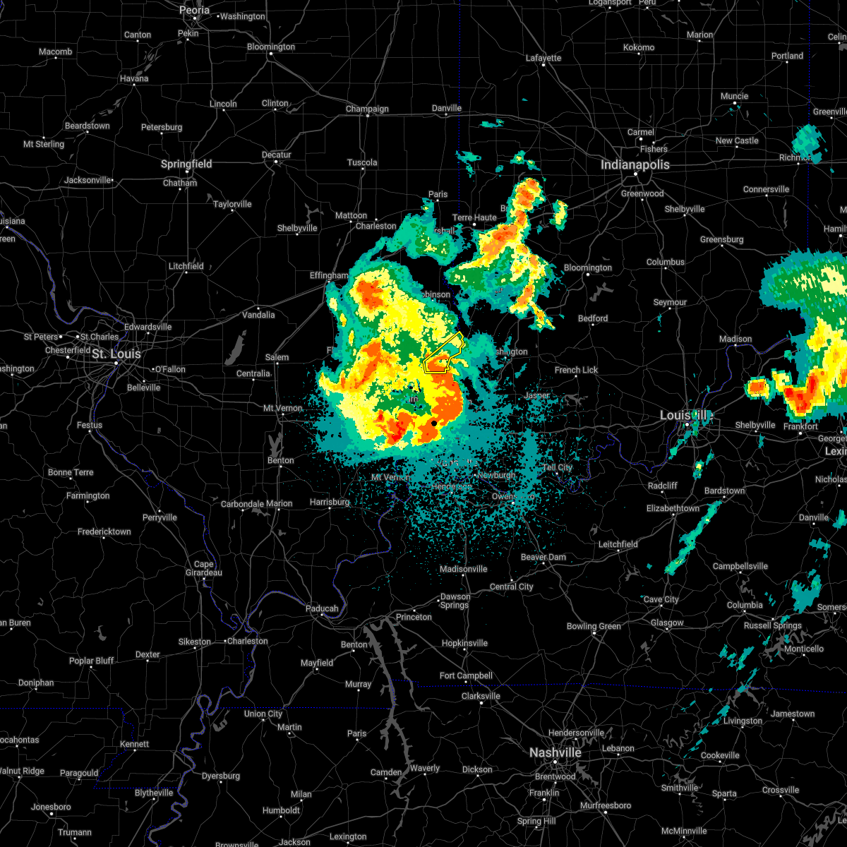 At 953 pm cdt, severe thunderstorms were located along a line extending from near st. francisville to 8 miles southwest of vincennes, moving east at 45 mph (radar indicated). Hazards include 60 mph wind gusts. Expect damage to roofs, siding, and trees. These severe thunderstorms will remain over mainly rural areas of southeastern lawrence county, including the following locations, billett, lawrenceville airport and mount carmel airport. At 953 pm cdt, severe thunderstorms were located along a line extending from near st. francisville to 8 miles southwest of vincennes, moving east at 45 mph (radar indicated). Hazards include 60 mph wind gusts. Expect damage to roofs, siding, and trees. These severe thunderstorms will remain over mainly rural areas of southeastern lawrence county, including the following locations, billett, lawrenceville airport and mount carmel airport.
|
| 5/19/2022 9:45 PM CDT |
 At 1045 pm edt, a confirmed tornado was located near patoka, or near mount carmel, moving northeast at 60 mph (radar confirmed tornado). Hazards include damaging tornado. Flying debris will be dangerous to those caught without shelter. mobile homes will be damaged or destroyed. damage to roofs, windows, and vehicles will occur. tree damage is likely. This tornado will be near, decker around 1055 pm edt. At 1045 pm edt, a confirmed tornado was located near patoka, or near mount carmel, moving northeast at 60 mph (radar confirmed tornado). Hazards include damaging tornado. Flying debris will be dangerous to those caught without shelter. mobile homes will be damaged or destroyed. damage to roofs, windows, and vehicles will occur. tree damage is likely. This tornado will be near, decker around 1055 pm edt.
|
| 5/19/2022 9:39 PM CDT |
 At 939 pm cdt, severe thunderstorms were located along a line extending from near lancaster to mount carmel, moving east at 40 mph (radar indicated). Hazards include 60 mph wind gusts. Expect damage to roofs, siding, and trees. severe thunderstorms will be near, st. Francisville around 955 pm cdt. At 939 pm cdt, severe thunderstorms were located along a line extending from near lancaster to mount carmel, moving east at 40 mph (radar indicated). Hazards include 60 mph wind gusts. Expect damage to roofs, siding, and trees. severe thunderstorms will be near, st. Francisville around 955 pm cdt.
|
| 5/19/2022 10:38 PM EDT |
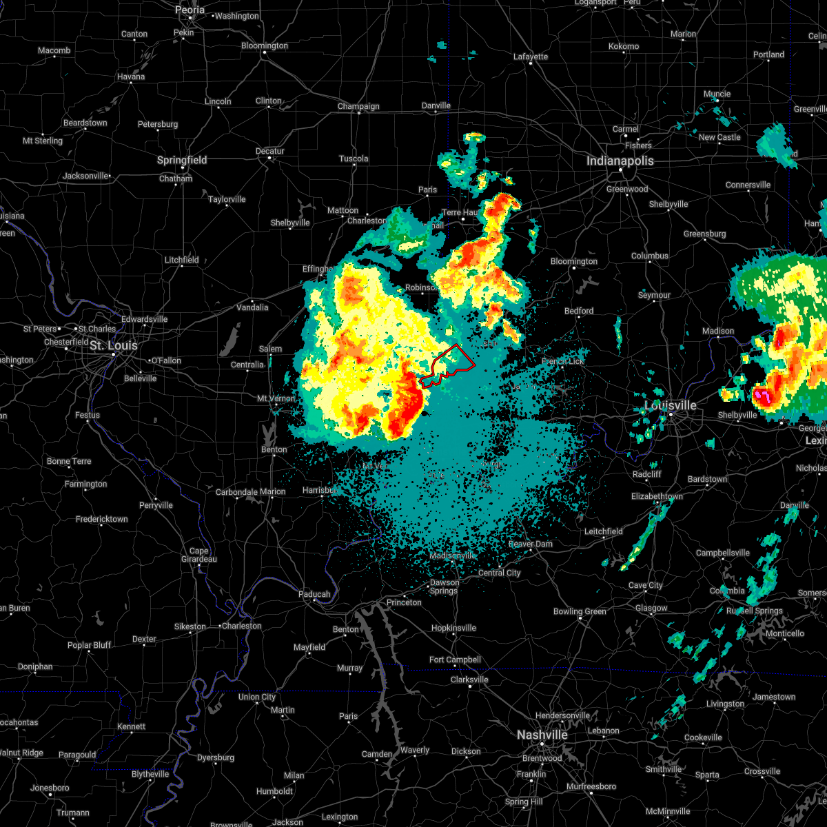 At 1038 pm edt, a severe thunderstorm capable of producing a tornado was located over mount carmel, moving northeast at 50 mph (radar indicated rotation). Hazards include tornado. Flying debris will be dangerous to those caught without shelter. mobile homes will be damaged or destroyed. damage to roofs, windows, and vehicles will occur. tree damage is likely. this dangerous storm will be near, decker around 1055 pm edt. Other locations in the path of this tornadic thunderstorm include vincennes. At 1038 pm edt, a severe thunderstorm capable of producing a tornado was located over mount carmel, moving northeast at 50 mph (radar indicated rotation). Hazards include tornado. Flying debris will be dangerous to those caught without shelter. mobile homes will be damaged or destroyed. damage to roofs, windows, and vehicles will occur. tree damage is likely. this dangerous storm will be near, decker around 1055 pm edt. Other locations in the path of this tornadic thunderstorm include vincennes.
|
| 5/19/2022 10:36 PM EDT |
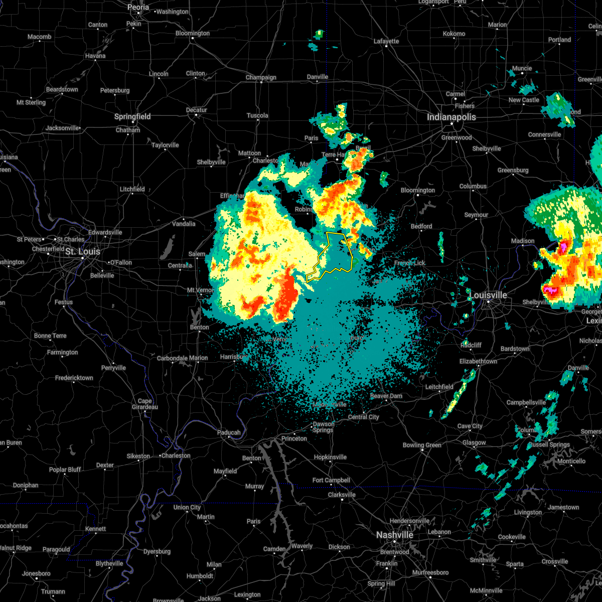 At 1036 pm edt, severe thunderstorms were located along a line extending from lancaster to near mount carmel, moving northeast at 50 mph (radar indicated). Hazards include 70 mph wind gusts. Expect considerable tree damage. Damage is likely to mobile homes, roofs, and outbuildings. At 1036 pm edt, severe thunderstorms were located along a line extending from lancaster to near mount carmel, moving northeast at 50 mph (radar indicated). Hazards include 70 mph wind gusts. Expect considerable tree damage. Damage is likely to mobile homes, roofs, and outbuildings.
|
| 5/19/2022 5:52 PM EDT | Quarter sized hail reported 7.1 miles W of Vincennes, IN |
| 5/19/2022 5:46 PM EDT |
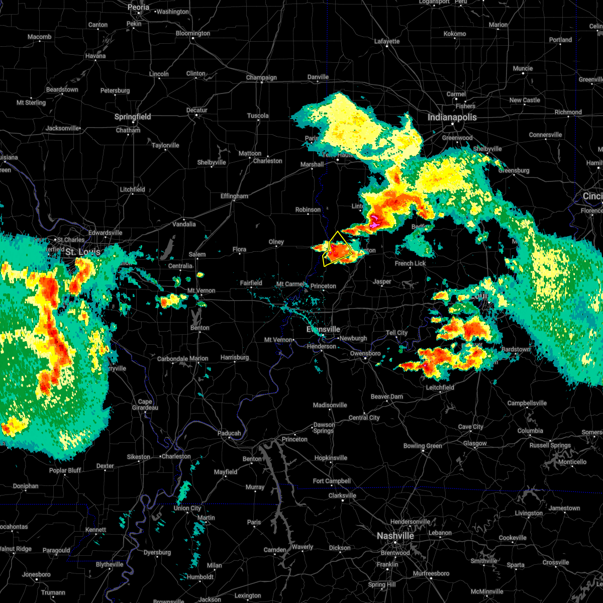 At 545 pm edt, a severe thunderstorm was located near vincennes, moving northeast at 30 mph (radar indicated). Hazards include 60 mph wind gusts and quarter size hail. Hail damage to vehicles is expected. expect wind damage to roofs, siding, and trees. this severe storm will be near, bruceville around 550 pm edt. hail threat, radar indicated max hail size, 1. 00 in wind threat, radar indicated max wind gust, 60 mph. At 545 pm edt, a severe thunderstorm was located near vincennes, moving northeast at 30 mph (radar indicated). Hazards include 60 mph wind gusts and quarter size hail. Hail damage to vehicles is expected. expect wind damage to roofs, siding, and trees. this severe storm will be near, bruceville around 550 pm edt. hail threat, radar indicated max hail size, 1. 00 in wind threat, radar indicated max wind gust, 60 mph.
|
| 5/19/2022 5:45 PM EDT | Ping Pong Ball sized hail reported 1.3 miles NE of Vincennes, IN |
| 5/19/2022 5:40 PM EDT | Quarter sized hail reported 0.5 miles ENE of Vincennes, IN |
| 5/19/2022 5:30 PM EDT |
 At 530 pm edt, a severe thunderstorm was located near vincennes, moving northeast at 30 mph (radar indicated). Hazards include 60 mph wind gusts and quarter size hail. Hail damage to vehicles is expected. expect wind damage to roofs, siding, and trees. this severe thunderstorm will be near, vincennes and vincennes university around 540 pm edt. bruceville around 550 pm edt. other locations in the path of this severe thunderstorm include oaktown. hail threat, radar indicated max hail size, 1. 00 in wind threat, radar indicated max wind gust, 60 mph. At 530 pm edt, a severe thunderstorm was located near vincennes, moving northeast at 30 mph (radar indicated). Hazards include 60 mph wind gusts and quarter size hail. Hail damage to vehicles is expected. expect wind damage to roofs, siding, and trees. this severe thunderstorm will be near, vincennes and vincennes university around 540 pm edt. bruceville around 550 pm edt. other locations in the path of this severe thunderstorm include oaktown. hail threat, radar indicated max hail size, 1. 00 in wind threat, radar indicated max wind gust, 60 mph.
|
| 3/30/2022 8:27 PM EDT |
 At 826 pm edt, a severe thunderstorm was located near petersburg, moving east at 45 mph (radar indicated). Hazards include 60 mph wind gusts. Expect damage to roofs, siding, and trees. locations impacted include, vincennes, bicknell, monroe city, wheatland, bruceville, decker, freelandville and vincennes university. Additional information, local ema witnessed rotation within this line of convective showers. At 826 pm edt, a severe thunderstorm was located near petersburg, moving east at 45 mph (radar indicated). Hazards include 60 mph wind gusts. Expect damage to roofs, siding, and trees. locations impacted include, vincennes, bicknell, monroe city, wheatland, bruceville, decker, freelandville and vincennes university. Additional information, local ema witnessed rotation within this line of convective showers.
|
| 3/30/2022 8:11 PM EDT |
 At 811 pm edt, a severe thunderstorm was located 7 miles north of patoka, or 11 miles north of princeton, moving northeast at 45 mph (radar indicated). Hazards include 60 mph wind gusts. Expect damage to roofs, siding, and trees. Locations impacted include, vincennes, bicknell, monroe city, wheatland, bruceville, decker, vincennes university and freelandville. At 811 pm edt, a severe thunderstorm was located 7 miles north of patoka, or 11 miles north of princeton, moving northeast at 45 mph (radar indicated). Hazards include 60 mph wind gusts. Expect damage to roofs, siding, and trees. Locations impacted include, vincennes, bicknell, monroe city, wheatland, bruceville, decker, vincennes university and freelandville.
|
| 3/30/2022 6:58 PM CDT |
 At 658 pm cdt, a severe thunderstorm was located near lawrenceville, moving northeast at 45 mph (radar indicated). Hazards include 60 mph wind gusts. Expect damage to roofs, siding, and trees. this severe thunderstorm will be near, birds around 710 pm cdt. other locations in the path of this severe thunderstorm include russellville. hail threat, radar indicated max hail size, <. 75 in wind threat, radar indicated max wind gust, 60 mph. At 658 pm cdt, a severe thunderstorm was located near lawrenceville, moving northeast at 45 mph (radar indicated). Hazards include 60 mph wind gusts. Expect damage to roofs, siding, and trees. this severe thunderstorm will be near, birds around 710 pm cdt. other locations in the path of this severe thunderstorm include russellville. hail threat, radar indicated max hail size, <. 75 in wind threat, radar indicated max wind gust, 60 mph.
|
| 3/30/2022 7:53 PM EDT |
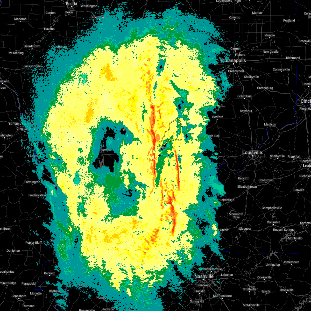 At 752 pm edt, a severe thunderstorm was located over mount carmel, moving northeast at 45 mph (radar indicated). Hazards include 60 mph wind gusts. expect damage to roofs, siding, and trees At 752 pm edt, a severe thunderstorm was located over mount carmel, moving northeast at 45 mph (radar indicated). Hazards include 60 mph wind gusts. expect damage to roofs, siding, and trees
|
| 8/12/2021 7:01 PM EDT | Tree limbs 4 to 6 inches in diameter downed near vincenne in knox county IN, 0.5 miles ENE of Vincennes, IN |
| 8/12/2021 6:30 PM EDT |
 At 629 pm edt, severe thunderstorms were located along a line extending from 12 miles southeast of terre haute to 6 miles northeast of lancaster, moving southeast at 25 mph (radar indicated). Hazards include 60 mph wind gusts and quarter size hail. Hail damage to vehicles is expected. Expect wind damage to roofs, siding, and trees. At 629 pm edt, severe thunderstorms were located along a line extending from 12 miles southeast of terre haute to 6 miles northeast of lancaster, moving southeast at 25 mph (radar indicated). Hazards include 60 mph wind gusts and quarter size hail. Hail damage to vehicles is expected. Expect wind damage to roofs, siding, and trees.
|
| 7/29/2021 9:04 PM EDT | 2-3 inch diameter tree reported down on us 41 at camp arthur r in knox county IN, 3.5 miles SSW of Vincennes, IN |
| 3/27/2021 9:18 PM CDT |
 At 918 pm cdt, severe thunderstorms were located along a line extending from 6 miles west of annapolis to clay city, moving east at 35 mph (radar indicated). Hazards include 60 mph wind gusts and nickel size hail. Expect damage to roofs, siding, and trees. locations impacted include, vincennes, olney, robinson, lawrenceville, sumner, oblong, palestine, clay city, st. francisville, noble, hutsonville, flat rock, ste. Marie, willow hill, parkersburg, claremont, calhoun, russellville, new hebron and chauncey. At 918 pm cdt, severe thunderstorms were located along a line extending from 6 miles west of annapolis to clay city, moving east at 35 mph (radar indicated). Hazards include 60 mph wind gusts and nickel size hail. Expect damage to roofs, siding, and trees. locations impacted include, vincennes, olney, robinson, lawrenceville, sumner, oblong, palestine, clay city, st. francisville, noble, hutsonville, flat rock, ste. Marie, willow hill, parkersburg, claremont, calhoun, russellville, new hebron and chauncey.
|
| 3/27/2021 9:02 PM CDT |
 At 902 pm cdt, severe thunderstorms were located along a line extending from near hidalgo to near flora, moving east at 40 mph (radar indicated). Hazards include 60 mph wind gusts and nickel size hail. expect damage to roofs, siding, and trees At 902 pm cdt, severe thunderstorms were located along a line extending from near hidalgo to near flora, moving east at 40 mph (radar indicated). Hazards include 60 mph wind gusts and nickel size hail. expect damage to roofs, siding, and trees
|
| 10/23/2020 4:26 PM EDT |
 The severe thunderstorm warning for knox and western daviess counties will expire at 430 pm edt, the storm which prompted the warning has weakened below severe limits, and no longer poses an immediate threat to life or property. therefore, the warning will be allowed to expire. however heavy rain is still possible with this thunderstorm. The severe thunderstorm warning for knox and western daviess counties will expire at 430 pm edt, the storm which prompted the warning has weakened below severe limits, and no longer poses an immediate threat to life or property. therefore, the warning will be allowed to expire. however heavy rain is still possible with this thunderstorm.
|
| 10/23/2020 4:02 PM EDT |
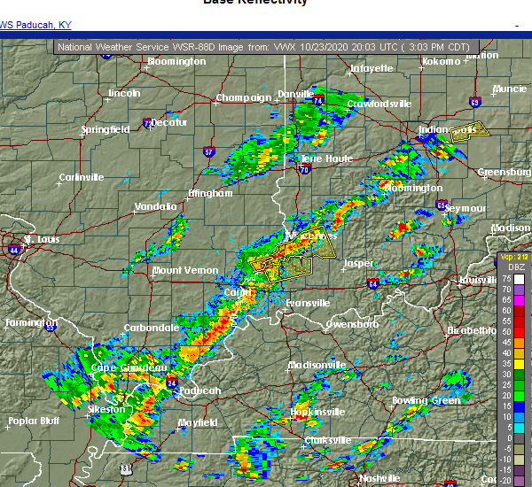 At 402 pm edt, a severe thunderstorm was located 7 miles west of washington, or 10 miles east of vincennes, moving east at 30 mph. largest hail reported so far has been pea sized (radar indicated). Hazards include 60 mph wind gusts and quarter size hail. Hail damage to vehicles is expected. expect wind damage to roofs, siding, and trees. Locations impacted include, vincennes, washington, bicknell, monroe city, wheatland, plainville, edwardsport, decker and glendale fishery. At 402 pm edt, a severe thunderstorm was located 7 miles west of washington, or 10 miles east of vincennes, moving east at 30 mph. largest hail reported so far has been pea sized (radar indicated). Hazards include 60 mph wind gusts and quarter size hail. Hail damage to vehicles is expected. expect wind damage to roofs, siding, and trees. Locations impacted include, vincennes, washington, bicknell, monroe city, wheatland, plainville, edwardsport, decker and glendale fishery.
|
| 10/23/2020 3:44 PM EDT |
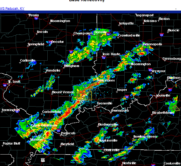 At 344 pm edt, a severe thunderstorm was located near vincennes, moving east at 30 mph (radar indicated). Hazards include 60 mph wind gusts and quarter size hail. Hail damage to vehicles is expected. Expect wind damage to roofs, siding, and trees. At 344 pm edt, a severe thunderstorm was located near vincennes, moving east at 30 mph (radar indicated). Hazards include 60 mph wind gusts and quarter size hail. Hail damage to vehicles is expected. Expect wind damage to roofs, siding, and trees.
|
| 10/23/2020 2:11 PM CDT |
 At 211 pm cdt, a severe thunderstorm was located over lawrenceville, moving east at 20 mph (radar indicated). Hazards include 60 mph wind gusts and quarter size hail. Hail damage to vehicles is expected. Expect wind damage to roofs, siding, and trees. At 211 pm cdt, a severe thunderstorm was located over lawrenceville, moving east at 20 mph (radar indicated). Hazards include 60 mph wind gusts and quarter size hail. Hail damage to vehicles is expected. Expect wind damage to roofs, siding, and trees.
|
| 7/15/2020 7:50 PM CDT |
 At 750 pm cdt, severe thunderstorms were located along a line extending from near casey to clay city, moving east at 45 mph (radar indicated). Hazards include 60 mph wind gusts. Expect damage to roofs, siding, and trees. locations impacted include, vincennes, olney, robinson, flora, lawrenceville, marshall, sumner, oblong, palestine, martinsville, louisville, clay city, st. francisville, noble, hutsonville, flat rock, parkersburg, claremont, calhoun and sailor springs. This includes interstate 70 between mile markers 132 and 138. At 750 pm cdt, severe thunderstorms were located along a line extending from near casey to clay city, moving east at 45 mph (radar indicated). Hazards include 60 mph wind gusts. Expect damage to roofs, siding, and trees. locations impacted include, vincennes, olney, robinson, flora, lawrenceville, marshall, sumner, oblong, palestine, martinsville, louisville, clay city, st. francisville, noble, hutsonville, flat rock, parkersburg, claremont, calhoun and sailor springs. This includes interstate 70 between mile markers 132 and 138.
|
| 7/15/2020 7:36 PM CDT |
 At 735 pm cdt, severe thunderstorms were located along a line extending from near greenup to near flora, moving east at 10 mph (radar indicated). Hazards include 60 mph wind gusts. Expect damage to roofs, siding, and trees. locations impacted include, vincennes, olney, robinson, flora, lawrenceville, marshall, newton, toledo, sumner, casey, greenup, oblong, palestine, martinsville, louisville, clay city, st. francisville, noble, hutsonville and flat rock. This includes interstate 70 between mile markers 108 and 138. At 735 pm cdt, severe thunderstorms were located along a line extending from near greenup to near flora, moving east at 10 mph (radar indicated). Hazards include 60 mph wind gusts. Expect damage to roofs, siding, and trees. locations impacted include, vincennes, olney, robinson, flora, lawrenceville, marshall, newton, toledo, sumner, casey, greenup, oblong, palestine, martinsville, louisville, clay city, st. francisville, noble, hutsonville and flat rock. This includes interstate 70 between mile markers 108 and 138.
|
| 7/15/2020 7:04 PM CDT |
 At 703 pm cdt, severe thunderstorms were located along a line extending from near montrose to near flora, moving east at 45 mph (radar indicated). Hazards include 60 mph wind gusts and penny size hail. expect damage to roofs, siding, and trees At 703 pm cdt, severe thunderstorms were located along a line extending from near montrose to near flora, moving east at 45 mph (radar indicated). Hazards include 60 mph wind gusts and penny size hail. expect damage to roofs, siding, and trees
|
| 7/11/2020 9:30 PM EDT |
 At 929 pm edt, a severe thunderstorm was located near vincennes, moving southeast at 30 mph (radar indicated). Hazards include 60 mph wind gusts and quarter size hail. Hail damage to vehicles is expected. Expect wind damage to roofs, siding, and trees. At 929 pm edt, a severe thunderstorm was located near vincennes, moving southeast at 30 mph (radar indicated). Hazards include 60 mph wind gusts and quarter size hail. Hail damage to vehicles is expected. Expect wind damage to roofs, siding, and trees.
|
| 5/17/2020 6:28 PM CDT |
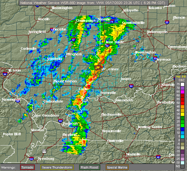 At 728 pm edt, a severe thunderstorm was located near russellville, or 10 miles north of vincennes, moving northeast at 35 mph (radar indicated). Hazards include 60 mph wind gusts and penny size hail. Expect damage to roofs, siding, and trees. Locations impacted include, vincennes, bicknell, carlisle, oaktown, bruceville, edwardsport, vincennes university, freelandville and paxton. At 728 pm edt, a severe thunderstorm was located near russellville, or 10 miles north of vincennes, moving northeast at 35 mph (radar indicated). Hazards include 60 mph wind gusts and penny size hail. Expect damage to roofs, siding, and trees. Locations impacted include, vincennes, bicknell, carlisle, oaktown, bruceville, edwardsport, vincennes university, freelandville and paxton.
|
| 5/17/2020 6:16 PM CDT |
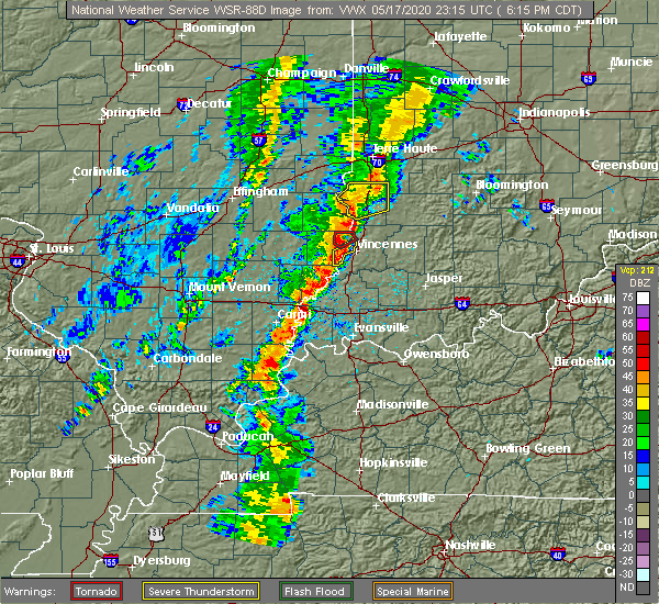 At 715 pm edt, a severe thunderstorm was located near russellville, or near vincennes, moving northeast at 30 mph (radar indicated). Hazards include 60 mph wind gusts. expect damage to roofs, siding, and trees At 715 pm edt, a severe thunderstorm was located near russellville, or near vincennes, moving northeast at 30 mph (radar indicated). Hazards include 60 mph wind gusts. expect damage to roofs, siding, and trees
|
| 5/17/2020 6:11 PM CDT |
 At 611 pm cdt, a severe thunderstorm was located near st. francisville, or near vincennes, moving northeast at 35 mph (radar indicated). Hazards include 60 mph wind gusts and penny size hail. expect damage to roofs, siding, and trees At 611 pm cdt, a severe thunderstorm was located near st. francisville, or near vincennes, moving northeast at 35 mph (radar indicated). Hazards include 60 mph wind gusts and penny size hail. expect damage to roofs, siding, and trees
|
| 4/8/2020 9:28 PM EDT | Multiple reports of structural and tree damage in various locations in vincenne in knox county IN, 0.5 miles ENE of Vincennes, IN |
| 4/8/2020 9:18 PM EDT | Report from mping: 3-inch tree limbs broken; power poles broke in knox county IN, 5.8 miles WSW of Vincennes, IN |
| 4/8/2020 9:18 PM EDT | Quarter sized hail reported 5.8 miles WSW of Vincennes, IN, report from mping: quarter (1.00 in.). |
| 4/8/2020 9:16 PM EDT |
 At 915 pm edt, severe thunderstorms were located along a line extending from near nashville to 9 miles north of shoals to petersburg, moving east at 60 mph. these are very dangerous storms (radar indicated). Hazards include 80 mph wind gusts and quarter size hail. Flying debris will be dangerous to those caught without shelter. mobile homes will be heavily damaged. expect considerable damage to roofs, windows, and vehicles. extensive tree damage and power outages are likely. locations impacted include, bloomington, columbus, vincennes, seymour, bedford, washington, brownstown, bloomfield, nashville, shoals, ellettsville, mitchell, bicknell, loogootee, odon, oolitic, medora, elnora, monroe city and elizabethtown. This includes interstate 65 between mile markers 54 and 68. At 915 pm edt, severe thunderstorms were located along a line extending from near nashville to 9 miles north of shoals to petersburg, moving east at 60 mph. these are very dangerous storms (radar indicated). Hazards include 80 mph wind gusts and quarter size hail. Flying debris will be dangerous to those caught without shelter. mobile homes will be heavily damaged. expect considerable damage to roofs, windows, and vehicles. extensive tree damage and power outages are likely. locations impacted include, bloomington, columbus, vincennes, seymour, bedford, washington, brownstown, bloomfield, nashville, shoals, ellettsville, mitchell, bicknell, loogootee, odon, oolitic, medora, elnora, monroe city and elizabethtown. This includes interstate 65 between mile markers 54 and 68.
|
| 4/8/2020 9:09 PM EDT | Semi blown off roa in knox county IN, 2.7 miles NE of Vincennes, IN |
| 4/8/2020 8:59 PM EDT | Power flashes near 6th s in knox county IN, 0.8 miles SE of Vincennes, IN |
| 4/8/2020 8:59 PM EDT |
 At 859 pm edt, severe thunderstorms were located along a line extending from 7 miles northwest of bloomington to 11 miles south of linton to near st. francisville, moving southeast at 60 mph. these are very dangerous storms (radar indicated). Hazards include 80 mph wind gusts and quarter size hail. Flying debris will be dangerous to those caught without shelter. mobile homes will be heavily damaged. expect considerable damage to roofs, windows, and vehicles. Extensive tree damage and power outages are likely. At 859 pm edt, severe thunderstorms were located along a line extending from 7 miles northwest of bloomington to 11 miles south of linton to near st. francisville, moving southeast at 60 mph. these are very dangerous storms (radar indicated). Hazards include 80 mph wind gusts and quarter size hail. Flying debris will be dangerous to those caught without shelter. mobile homes will be heavily damaged. expect considerable damage to roofs, windows, and vehicles. Extensive tree damage and power outages are likely.
|
| 4/8/2020 8:24 PM EDT |
 At 824 pm edt, a severe thunderstorm was located near sullivan, or 19 miles northeast of robinson, moving southeast at 55 mph (radar indicated). Hazards include 60 mph wind gusts and quarter size hail. Hail damage to vehicles is expected. Expect wind damage to roofs, siding, and trees. At 824 pm edt, a severe thunderstorm was located near sullivan, or 19 miles northeast of robinson, moving southeast at 55 mph (radar indicated). Hazards include 60 mph wind gusts and quarter size hail. Hail damage to vehicles is expected. Expect wind damage to roofs, siding, and trees.
|
| 3/27/2020 5:32 AM EDT |
 At 532 am edt, a severe thunderstorm was located near birds, or 7 miles northeast of lawrenceville, moving east at 40 mph (radar indicated). Hazards include quarter size hail. damage to vehicles is expected At 532 am edt, a severe thunderstorm was located near birds, or 7 miles northeast of lawrenceville, moving east at 40 mph (radar indicated). Hazards include quarter size hail. damage to vehicles is expected
|
| 3/27/2020 4:25 AM CDT |
 At 425 am cdt, a severe thunderstorm was located near birds, or near lawrenceville, moving east at 60 mph (radar indicated). Hazards include quarter size hail. Damage to vehicles is expected. Locations impacted include, vincennes, lawrenceville, flat rock, russellville, chauncey, birds, hardinville, billett, pinkstaff, red hills state park, petrolia and lawrenceville airport. At 425 am cdt, a severe thunderstorm was located near birds, or near lawrenceville, moving east at 60 mph (radar indicated). Hazards include quarter size hail. Damage to vehicles is expected. Locations impacted include, vincennes, lawrenceville, flat rock, russellville, chauncey, birds, hardinville, billett, pinkstaff, red hills state park, petrolia and lawrenceville airport.
|
| 3/27/2020 4:02 AM CDT |
 At 402 am cdt, a severe thunderstorm was located over dundas, or near olney, moving east at 55 mph (radar indicated). Hazards include quarter size hail. damage to vehicles is expected At 402 am cdt, a severe thunderstorm was located over dundas, or near olney, moving east at 55 mph (radar indicated). Hazards include quarter size hail. damage to vehicles is expected
|
| 8/22/2019 1:13 AM EDT |
 The severe thunderstorm warning for knox and west central daviess counties will expire at 115 am edt, the storm which prompted the warning has weakened below severe limits, and no longer poses an immediate threat to life or property. therefore, the warning will be allowed to expire. however heavy rain and frequent lightning are still possible with this thunderstorm. when thunder roars, go indoors!. The severe thunderstorm warning for knox and west central daviess counties will expire at 115 am edt, the storm which prompted the warning has weakened below severe limits, and no longer poses an immediate threat to life or property. therefore, the warning will be allowed to expire. however heavy rain and frequent lightning are still possible with this thunderstorm. when thunder roars, go indoors!.
|
| 8/22/2019 1:07 AM EDT | Emergency manager reports trees down near old us 50 and overhead roa in knox county IN, 3.8 miles W of Vincennes, IN |
| 8/22/2019 1:04 AM EDT |
 At 103 am edt, a severe thunderstorm was located near vincennes, moving east at 25 mph (radar indicated). Hazards include 60 mph wind gusts. Expect damage to roofs, siding, and trees. Locations impacted include, vincennes, bicknell, oaktown, monroe city, wheatland, bruceville, edwardsport and freelandville. At 103 am edt, a severe thunderstorm was located near vincennes, moving east at 25 mph (radar indicated). Hazards include 60 mph wind gusts. Expect damage to roofs, siding, and trees. Locations impacted include, vincennes, bicknell, oaktown, monroe city, wheatland, bruceville, edwardsport and freelandville.
|
| 8/22/2019 1:03 AM EDT | Emergency management reports trees down; power outage in knox county IN, 2 miles S of Vincennes, IN |
| 8/22/2019 12:49 AM EDT |
 At 1249 am edt, a severe thunderstorm was located over vincennes, moving east at 30 mph (radar indicated). Hazards include 60 mph wind gusts. expect damage to roofs, siding, and trees At 1249 am edt, a severe thunderstorm was located over vincennes, moving east at 30 mph (radar indicated). Hazards include 60 mph wind gusts. expect damage to roofs, siding, and trees
|
| 8/20/2019 2:50 PM EDT |
 At 249 pm edt, severe thunderstorms were located along a line extending from 6 miles southeast of bloomington to 10 miles north of shoals to 6 miles west of petersburg, moving east at 50 mph (radar indicated). Hazards include 60 mph wind gusts. Expect damage to roofs, siding, and trees. Locations impacted include, bloomington, vincennes, washington, bloomfield, shoals, ellettsville, bicknell, loogootee, odon, lyons, elnora, monroe city, wheatland, bruceville, plainville, sandborn, montgomery, edwardsport, switz city and decker. At 249 pm edt, severe thunderstorms were located along a line extending from 6 miles southeast of bloomington to 10 miles north of shoals to 6 miles west of petersburg, moving east at 50 mph (radar indicated). Hazards include 60 mph wind gusts. Expect damage to roofs, siding, and trees. Locations impacted include, bloomington, vincennes, washington, bloomfield, shoals, ellettsville, bicknell, loogootee, odon, lyons, elnora, monroe city, wheatland, bruceville, plainville, sandborn, montgomery, edwardsport, switz city and decker.
|
| 8/20/2019 2:30 PM EDT |
 At 229 pm edt, a severe thunderstorm was located 9 miles southwest of linton, or 22 miles northeast of vincennes, moving east at 45 mph (radar indicated). Hazards include 60 mph wind gusts and penny size hail. expect damage to roofs, siding, and trees At 229 pm edt, a severe thunderstorm was located 9 miles southwest of linton, or 22 miles northeast of vincennes, moving east at 45 mph (radar indicated). Hazards include 60 mph wind gusts and penny size hail. expect damage to roofs, siding, and trees
|
| 8/13/2019 1:38 AM EDT |
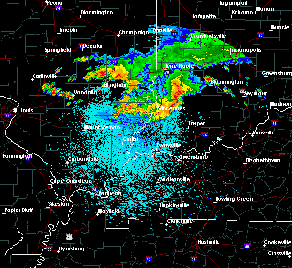 The severe thunderstorm warning for southern sullivan and knox counties will expire at 145 am edt, the severe thunderstorm which prompted the warning has moved out of the warned area. therefore, the warning will be allowed to expire. a tornado watch remains in effect until 400 am edt for southwestern indiana. The severe thunderstorm warning for southern sullivan and knox counties will expire at 145 am edt, the severe thunderstorm which prompted the warning has moved out of the warned area. therefore, the warning will be allowed to expire. a tornado watch remains in effect until 400 am edt for southwestern indiana.
|
| 8/13/2019 1:29 AM EDT | Large tree down on robinson road between anson road and mount zion road. time estimated from rada in knox county IN, 5.6 miles WNW of Vincennes, IN |
| 8/13/2019 12:26 AM CDT |
 The severe thunderstorm warning for lawrence, southeastern crawford and southeastern richland counties will expire at 1230 am cdt, the storms which prompted the warning have moved out of the area. therefore, the warning will be allowed to expire. however gusty winds and heavy rain are still possible with these thunderstorms. a tornado watch remains in effect until 300 am cdt for southeastern and east central illinois. The severe thunderstorm warning for lawrence, southeastern crawford and southeastern richland counties will expire at 1230 am cdt, the storms which prompted the warning have moved out of the area. therefore, the warning will be allowed to expire. however gusty winds and heavy rain are still possible with these thunderstorms. a tornado watch remains in effect until 300 am cdt for southeastern and east central illinois.
|
| 8/13/2019 1:18 AM EDT |
 At 117 am edt, a severe thunderstorm was located 8 miles east of russellville, or 11 miles northeast of vincennes, moving southeast at 40 mph (radar indicated). Hazards include 60 mph wind gusts. Expect damage to roofs, siding, and trees. Locations impacted include, vincennes, bicknell, carlisle, oaktown, monroe city, wheatland, bruceville, edwardsport, vincennes university, pleasantville and freelandville. At 117 am edt, a severe thunderstorm was located 8 miles east of russellville, or 11 miles northeast of vincennes, moving southeast at 40 mph (radar indicated). Hazards include 60 mph wind gusts. Expect damage to roofs, siding, and trees. Locations impacted include, vincennes, bicknell, carlisle, oaktown, monroe city, wheatland, bruceville, edwardsport, vincennes university, pleasantville and freelandville.
|
| 8/13/2019 12:13 AM CDT |
 At 1213 am cdt, severe thunderstorms were located along a line extending from near russellville to near lancaster, moving southeast at 40 mph (radar indicated). Hazards include 60 mph wind gusts and quarter size hail. Hail damage to vehicles is expected. expect wind damage to roofs, siding, and trees. locations impacted include, vincennes, olney, lawrenceville, sumner, palestine, st. Francisville, flat rock, claremont, calhoun, russellville, chauncey, birds, merom, pinkstaff, petrolia, lawrenceville airport, billett, red hills state park, helena and mount carmel airport. At 1213 am cdt, severe thunderstorms were located along a line extending from near russellville to near lancaster, moving southeast at 40 mph (radar indicated). Hazards include 60 mph wind gusts and quarter size hail. Hail damage to vehicles is expected. expect wind damage to roofs, siding, and trees. locations impacted include, vincennes, olney, lawrenceville, sumner, palestine, st. Francisville, flat rock, claremont, calhoun, russellville, chauncey, birds, merom, pinkstaff, petrolia, lawrenceville airport, billett, red hills state park, helena and mount carmel airport.
|
| 8/13/2019 12:06 AM CDT |
 At 1205 am cdt, severe thunderstorms were located along a line extending from 6 miles southeast of palestine to near claremont, moving southeast at 40 mph (radar indicated). Hazards include 60 mph wind gusts and quarter size hail. Hail damage to vehicles is expected. expect wind damage to roofs, siding, and trees. locations impacted include, vincennes, olney, robinson, lawrenceville, sumner, palestine, st. Francisville, hutsonville, flat rock, claremont, calhoun, russellville, new hebron, chauncey, hardinville, birds, dundas, west union, york and darwin. At 1205 am cdt, severe thunderstorms were located along a line extending from 6 miles southeast of palestine to near claremont, moving southeast at 40 mph (radar indicated). Hazards include 60 mph wind gusts and quarter size hail. Hail damage to vehicles is expected. expect wind damage to roofs, siding, and trees. locations impacted include, vincennes, olney, robinson, lawrenceville, sumner, palestine, st. Francisville, hutsonville, flat rock, claremont, calhoun, russellville, new hebron, chauncey, hardinville, birds, dundas, west union, york and darwin.
|
| 8/13/2019 12:56 AM EDT |
 At 1255 am edt, a severe thunderstorm was located near palestine, or 11 miles east of robinson, moving southeast at 50 mph (radar indicated). Hazards include 60 mph wind gusts. expect damage to roofs, siding, and trees At 1255 am edt, a severe thunderstorm was located near palestine, or 11 miles east of robinson, moving southeast at 50 mph (radar indicated). Hazards include 60 mph wind gusts. expect damage to roofs, siding, and trees
|
| 8/12/2019 11:50 PM CDT |
 At 1149 pm cdt, severe thunderstorms were located along a line extending from hardinville to 6 miles south of bogota, moving southeast at 45 mph (radar indicated). Hazards include 60 mph wind gusts and quarter size hail. Hail damage to vehicles is expected. Expect wind damage to roofs, siding, and trees. At 1149 pm cdt, severe thunderstorms were located along a line extending from hardinville to 6 miles south of bogota, moving southeast at 45 mph (radar indicated). Hazards include 60 mph wind gusts and quarter size hail. Hail damage to vehicles is expected. Expect wind damage to roofs, siding, and trees.
|
| 6/30/2019 7:53 PM EDT |
 At 753 pm edt, a severe thunderstorm was located near vincennes, moving south at 30 mph (radar indicated). Hazards include 70 mph wind gusts. Expect considerable tree damage. damage is likely to mobile homes, roofs, and outbuildings. Locations impacted include, vincennes, washington, monroe city, wheatland, montgomery, decker, alfordsville, vincennes university and glendale fishery. At 753 pm edt, a severe thunderstorm was located near vincennes, moving south at 30 mph (radar indicated). Hazards include 70 mph wind gusts. Expect considerable tree damage. damage is likely to mobile homes, roofs, and outbuildings. Locations impacted include, vincennes, washington, monroe city, wheatland, montgomery, decker, alfordsville, vincennes university and glendale fishery.
|
| 6/30/2019 6:49 PM CDT |
 A severe thunderstorm warning remains in effect until 700 pm cdt for lawrence county. at 648 pm cdt, a severe thunderstorm was located near lawrenceville, moving south at 20 mph. hazard. 60 mph wind gusts and penny size hail. source. Radar indicated. A severe thunderstorm warning remains in effect until 700 pm cdt for lawrence county. at 648 pm cdt, a severe thunderstorm was located near lawrenceville, moving south at 20 mph. hazard. 60 mph wind gusts and penny size hail. source. Radar indicated.
|
| 6/30/2019 7:45 PM EDT |
 At 743 pm edt, a severe thunderstorm was located near vincennes, moving south at 30 mph (radar indicated). Hazards include 70 mph wind gusts. Expect considerable tree damage. Damage is likely to mobile homes, roofs, and outbuildings. At 743 pm edt, a severe thunderstorm was located near vincennes, moving south at 30 mph (radar indicated). Hazards include 70 mph wind gusts. Expect considerable tree damage. Damage is likely to mobile homes, roofs, and outbuildings.
|
| 6/30/2019 6:37 PM CDT |
 At 636 pm cdt, a severe thunderstorm was located over lawrenceville, moving south at 35 mph (radar indicated). Hazards include 60 mph wind gusts and penny size hail. Expect damage to roofs, siding, and trees. locations impacted include, vincennes, lawrenceville, sumner, st. Francisville, russellville, chauncey, birds, pinkstaff, petrolia, lawrenceville airport, billett, red hills state park, helena and mount carmel airport. At 636 pm cdt, a severe thunderstorm was located over lawrenceville, moving south at 35 mph (radar indicated). Hazards include 60 mph wind gusts and penny size hail. Expect damage to roofs, siding, and trees. locations impacted include, vincennes, lawrenceville, sumner, st. Francisville, russellville, chauncey, birds, pinkstaff, petrolia, lawrenceville airport, billett, red hills state park, helena and mount carmel airport.
|
| 6/30/2019 7:36 PM EDT | Several trees and utility lines down throughout knox county in the bicknell... bruceville... edwardsport... and vincennes areas. time closely approximate in knox county IN, 0.5 miles ENE of Vincennes, IN |
| 6/30/2019 7:35 PM EDT |
 At 735 pm edt, a severe thunderstorm was located 10 miles southeast of washington, or 14 miles east of petersburg, moving south at 15 mph (radar indicated). Hazards include 60 mph wind gusts. Expect damage to roofs, siding, and trees. Locations impacted include, vincennes, bedford, washington, shoals, mitchell, bicknell, loogootee, odon, oolitic, carlisle, elnora, oaktown, monroe city, wheatland, bruceville, plainville, sandborn, montgomery, edwardsport and decker. At 735 pm edt, a severe thunderstorm was located 10 miles southeast of washington, or 14 miles east of petersburg, moving south at 15 mph (radar indicated). Hazards include 60 mph wind gusts. Expect damage to roofs, siding, and trees. Locations impacted include, vincennes, bedford, washington, shoals, mitchell, bicknell, loogootee, odon, oolitic, carlisle, elnora, oaktown, monroe city, wheatland, bruceville, plainville, sandborn, montgomery, edwardsport and decker.
|
| 6/30/2019 7:18 PM EDT |
 At 717 pm edt, a severe thunderstorm was located 8 miles east of washington, or 17 miles northeast of petersburg, moving southwest at 20 mph (radar indicated). Hazards include 60 mph wind gusts. Expect damage to roofs, siding, and trees. Locations impacted include, vincennes, bedford, washington, sullivan, shoals, mitchell, bicknell, loogootee, odon, shelburn, oolitic, dugger, hymera, carlisle, elnora, oaktown, monroe city, wheatland, bruceville and plainville. At 717 pm edt, a severe thunderstorm was located 8 miles east of washington, or 17 miles northeast of petersburg, moving southwest at 20 mph (radar indicated). Hazards include 60 mph wind gusts. Expect damage to roofs, siding, and trees. Locations impacted include, vincennes, bedford, washington, sullivan, shoals, mitchell, bicknell, loogootee, odon, shelburn, oolitic, dugger, hymera, carlisle, elnora, oaktown, monroe city, wheatland, bruceville and plainville.
|
| 6/30/2019 6:17 PM CDT |
 At 617 pm cdt, a severe thunderstorm was located near birds, or near lawrenceville, moving south at 40 mph (radar indicated). Hazards include 60 mph wind gusts and penny size hail. expect damage to roofs, siding, and trees At 617 pm cdt, a severe thunderstorm was located near birds, or near lawrenceville, moving south at 40 mph (radar indicated). Hazards include 60 mph wind gusts and penny size hail. expect damage to roofs, siding, and trees
|
| 6/30/2019 6:56 PM EDT |
 At 656 pm edt, a severe thunderstorm was located 10 miles north of shoals, or 15 miles west of bedford, moving south at 10 mph (radar indicated). Hazards include 60 mph wind gusts. expect damage to roofs, siding, and trees At 656 pm edt, a severe thunderstorm was located 10 miles north of shoals, or 15 miles west of bedford, moving south at 10 mph (radar indicated). Hazards include 60 mph wind gusts. expect damage to roofs, siding, and trees
|
| 6/21/2019 5:05 PM EDT |
 At 505 pm edt, severe thunderstorms were located along a line extending from 10 miles north of sullivan to 8 miles west of petersburg, moving southeast at 40 mph (radar indicated). Hazards include 60 mph wind gusts. Expect damage to roofs, siding, and trees. Locations impacted include, vincennes, washington, linton, sullivan, bicknell, jasonville, shelburn, farmersburg, dugger, hymera, lyons, fairbanks, carlisle, elnora, oaktown, monroe city, wheatland, bruceville, plainville and sandborn. At 505 pm edt, severe thunderstorms were located along a line extending from 10 miles north of sullivan to 8 miles west of petersburg, moving southeast at 40 mph (radar indicated). Hazards include 60 mph wind gusts. Expect damage to roofs, siding, and trees. Locations impacted include, vincennes, washington, linton, sullivan, bicknell, jasonville, shelburn, farmersburg, dugger, hymera, lyons, fairbanks, carlisle, elnora, oaktown, monroe city, wheatland, bruceville, plainville and sandborn.
|
| 6/21/2019 4:42 PM EDT |
 The national weather service in indianapolis has issued a * severe thunderstorm warning for. south central vigo county in west central indiana. sullivan county in southwestern indiana. knox county in southwestern indiana. Southwestern clay county in west central indiana. The national weather service in indianapolis has issued a * severe thunderstorm warning for. south central vigo county in west central indiana. sullivan county in southwestern indiana. knox county in southwestern indiana. Southwestern clay county in west central indiana.
|
| 2/7/2019 12:12 PM EST |
 The tornado warning for central knox county will expire at 1215 pm est, the tornado threat has diminished and the tornado warning has been cancelled. however, large hail and damaging winds remain likely and a severe thunderstorm warning remains in effect for the area. remember, a severe thunderstorm warning still remains in effect for knox county until 1215 pm. The tornado warning for central knox county will expire at 1215 pm est, the tornado threat has diminished and the tornado warning has been cancelled. however, large hail and damaging winds remain likely and a severe thunderstorm warning remains in effect for the area. remember, a severe thunderstorm warning still remains in effect for knox county until 1215 pm.
|
| 2/7/2019 12:05 PM EST |
 At 1204 pm est, a confirmed tornado was located 7 miles southeast of vincennes, moving northeast at 45 mph (law enforcement confirmed tornado. at 1158 am, a tornado was reported 3 miles north of decker). Hazards include damaging tornado. Flying debris will be dangerous to those caught without shelter. mobile homes will be damaged or destroyed. damage to roofs, windows, and vehicles will occur. tree damage is likely. This tornadic thunderstorm will remain over mainly rural areas of central knox county. At 1204 pm est, a confirmed tornado was located 7 miles southeast of vincennes, moving northeast at 45 mph (law enforcement confirmed tornado. at 1158 am, a tornado was reported 3 miles north of decker). Hazards include damaging tornado. Flying debris will be dangerous to those caught without shelter. mobile homes will be damaged or destroyed. damage to roofs, windows, and vehicles will occur. tree damage is likely. This tornadic thunderstorm will remain over mainly rural areas of central knox county.
|
| 2/7/2019 12:03 PM EST | Damage to/downed high tension power line in knox county IN, 11.1 miles NNE of Vincennes, IN |
| 2/7/2019 11:59 AM EST |
 At 1158 am est, severe thunderstorms were located along a line extending from near russellville to 7 miles southeast of vincennes to fort branch, moving northeast at 65 mph (radar indicated). Hazards include 60 mph wind gusts. Expect damage to roofs, siding, and trees. Locations impacted include, vincennes, washington, bicknell, elnora, monroe city, wheatland, bruceville, plainville, montgomery, edwardsport, decker and vincennes university. At 1158 am est, severe thunderstorms were located along a line extending from near russellville to 7 miles southeast of vincennes to fort branch, moving northeast at 65 mph (radar indicated). Hazards include 60 mph wind gusts. Expect damage to roofs, siding, and trees. Locations impacted include, vincennes, washington, bicknell, elnora, monroe city, wheatland, bruceville, plainville, montgomery, edwardsport, decker and vincennes university.
|
| 2/7/2019 11:58 AM EST | Location approximate. report of semi overturned from strong thunderstorm wind in knox county IN, 10.7 miles NNE of Vincennes, IN |
| 2/7/2019 11:56 AM EST |
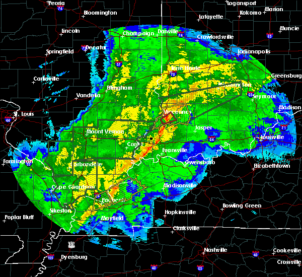 At 1155 am est, a severe thunderstorm capable of producing a tornado was located near vincennes, moving northeast at 50 mph (radar indicated rotation). Hazards include tornado. Flying debris will be dangerous to those caught without shelter. mobile homes will be damaged or destroyed. damage to roofs, windows, and vehicles will occur. tree damage is likely. This dangerous storm will be near, monroe city around 1205 pm est. At 1155 am est, a severe thunderstorm capable of producing a tornado was located near vincennes, moving northeast at 50 mph (radar indicated rotation). Hazards include tornado. Flying debris will be dangerous to those caught without shelter. mobile homes will be damaged or destroyed. damage to roofs, windows, and vehicles will occur. tree damage is likely. This dangerous storm will be near, monroe city around 1205 pm est.
|
| 2/7/2019 11:53 AM EST |
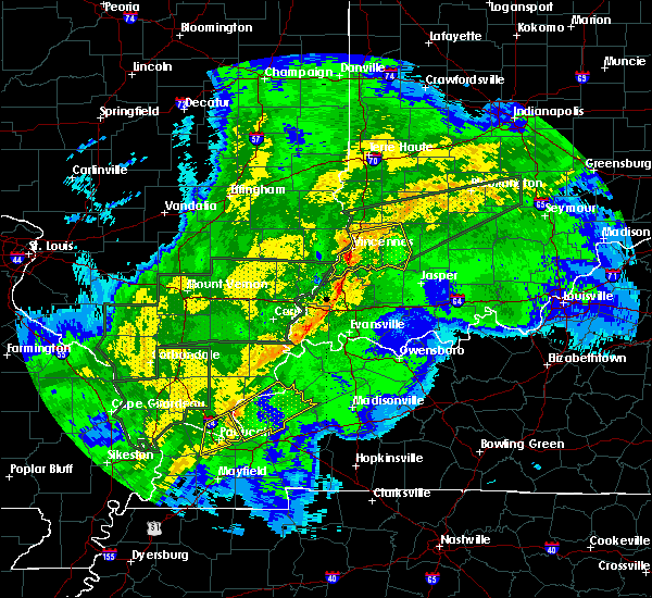 At 1155 am est, a severe thunderstorm capable of producing a tornado was located near vincennes, moving northeast at 50 mph (radar indicated rotation). Hazards include tornado. Flying debris will be dangerous to those caught without shelter. mobile homes will be damaged or destroyed. damage to roofs, windows, and vehicles will occur. tree damage is likely. This dangerous storm will be near, monroe city around 1205 pm est. At 1155 am est, a severe thunderstorm capable of producing a tornado was located near vincennes, moving northeast at 50 mph (radar indicated rotation). Hazards include tornado. Flying debris will be dangerous to those caught without shelter. mobile homes will be damaged or destroyed. damage to roofs, windows, and vehicles will occur. tree damage is likely. This dangerous storm will be near, monroe city around 1205 pm est.
|
| 2/7/2019 11:48 AM EST |
 At 1148 am est, severe thunderstorms were located along a line extending from near birds to 7 miles southeast of st. francisville to cynthiana, moving east at 65 mph (radar indicated). Hazards include 60 mph wind gusts. expect damage to roofs, siding, and trees At 1148 am est, severe thunderstorms were located along a line extending from near birds to 7 miles southeast of st. francisville to cynthiana, moving east at 65 mph (radar indicated). Hazards include 60 mph wind gusts. expect damage to roofs, siding, and trees
|
| 7/14/2018 3:57 PM CDT |
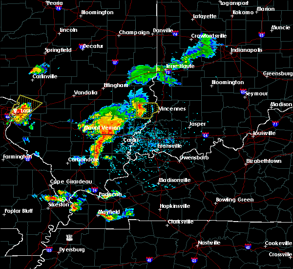 At 356 pm cdt, a severe thunderstorm was located over lawrenceville, moving southeast at 30 mph (radar indicated). Hazards include 60 mph wind gusts and penny size hail. Expect damage to roofs, siding, and trees. locations impacted include, vincennes, lawrenceville, sumner, st. Francisville, russellville, chauncey, birds, pinkstaff, petrolia, lawrenceville airport, billett, red hills state park, helena and mount carmel airport. At 356 pm cdt, a severe thunderstorm was located over lawrenceville, moving southeast at 30 mph (radar indicated). Hazards include 60 mph wind gusts and penny size hail. Expect damage to roofs, siding, and trees. locations impacted include, vincennes, lawrenceville, sumner, st. Francisville, russellville, chauncey, birds, pinkstaff, petrolia, lawrenceville airport, billett, red hills state park, helena and mount carmel airport.
|
| 7/14/2018 3:23 PM CDT |
 At 323 pm cdt, a severe thunderstorm was located near dundas, or 8 miles northeast of olney, moving southeast at 30 mph (radar indicated). Hazards include 60 mph wind gusts and quarter size hail. Hail damage to vehicles is expected. Expect wind damage to roofs, siding, and trees. At 323 pm cdt, a severe thunderstorm was located near dundas, or 8 miles northeast of olney, moving southeast at 30 mph (radar indicated). Hazards include 60 mph wind gusts and quarter size hail. Hail damage to vehicles is expected. Expect wind damage to roofs, siding, and trees.
|
| 7/5/2018 6:48 PM CDT |
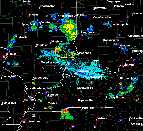 At 648 pm cdt, a severe thunderstorm was located over lawrenceville, moving southeast at 20 mph (radar indicated). Hazards include 60 mph wind gusts and quarter size hail. Hail damage to vehicles is expected. Expect wind damage to roofs, siding, and trees. At 648 pm cdt, a severe thunderstorm was located over lawrenceville, moving southeast at 20 mph (radar indicated). Hazards include 60 mph wind gusts and quarter size hail. Hail damage to vehicles is expected. Expect wind damage to roofs, siding, and trees.
|
| 6/11/2018 7:30 PM CDT |
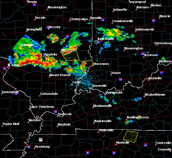 At 730 pm cdt, a severe thunderstorm was located over lawrenceville, moving east at 25 mph (radar indicated). Hazards include 60 mph wind gusts and quarter size hail. Hail damage to vehicles is expected. Expect wind damage to roofs, siding, and trees. At 730 pm cdt, a severe thunderstorm was located over lawrenceville, moving east at 25 mph (radar indicated). Hazards include 60 mph wind gusts and quarter size hail. Hail damage to vehicles is expected. Expect wind damage to roofs, siding, and trees.
|
| 6/10/2018 5:40 PM EDT |
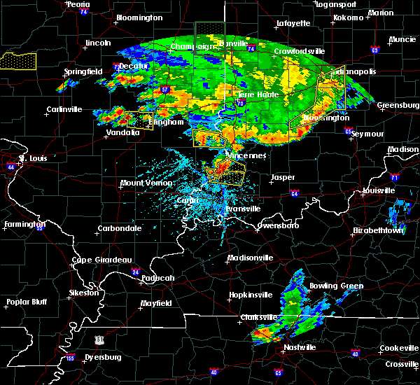 At 540 pm edt, a severe thunderstorm was located near st. francisville, or 11 miles south of vincennes, moving east at 25 mph (radar indicated). Hazards include 60 mph wind gusts and quarter size hail. Hail damage to vehicles is expected. expect wind damage to roofs, siding, and trees. Locations impacted include, vincennes, monroe city, decker and vincennes university. At 540 pm edt, a severe thunderstorm was located near st. francisville, or 11 miles south of vincennes, moving east at 25 mph (radar indicated). Hazards include 60 mph wind gusts and quarter size hail. Hail damage to vehicles is expected. expect wind damage to roofs, siding, and trees. Locations impacted include, vincennes, monroe city, decker and vincennes university.
|
| 6/10/2018 5:28 PM EDT |
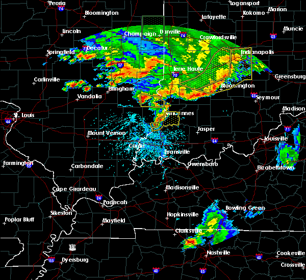 At 527 pm edt, a severe thunderstorm was located over st. francisville, or 7 miles southwest of vincennes, moving east at 15 mph (radar indicated). Hazards include 60 mph wind gusts and quarter size hail. Hail damage to vehicles is expected. expect wind damage to roofs, siding, and trees. Locations impacted include, vincennes, monroe city, wheatland, bruceville, decker and vincennes university. At 527 pm edt, a severe thunderstorm was located over st. francisville, or 7 miles southwest of vincennes, moving east at 15 mph (radar indicated). Hazards include 60 mph wind gusts and quarter size hail. Hail damage to vehicles is expected. expect wind damage to roofs, siding, and trees. Locations impacted include, vincennes, monroe city, wheatland, bruceville, decker and vincennes university.
|
| 6/10/2018 5:14 PM EDT |
 At 514 pm edt, a severe thunderstorm was located near st. francisville, or near vincennes, moving east at 25 mph (radar indicated). Hazards include 60 mph wind gusts and quarter size hail. Hail damage to vehicles is expected. Expect wind damage to roofs, siding, and trees. At 514 pm edt, a severe thunderstorm was located near st. francisville, or near vincennes, moving east at 25 mph (radar indicated). Hazards include 60 mph wind gusts and quarter size hail. Hail damage to vehicles is expected. Expect wind damage to roofs, siding, and trees.
|
| 6/9/2018 3:24 PM EDT | Several tree limbs and some utility lines down across vincennes in various locations. time estimated from rada in knox county IN, 0.5 miles ENE of Vincennes, IN |
| 5/31/2018 12:58 PM EDT |
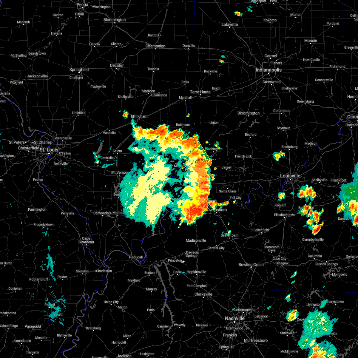 The severe thunderstorm warning for central knox county will expire at 100 pm edt, the storm which prompted the warning has moved out of the area. therefore the warning will be allowed to expire. a severe thunderstorm watch remains in effect until 600 pm edt for southwestern indiana. The severe thunderstorm warning for central knox county will expire at 100 pm edt, the storm which prompted the warning has moved out of the area. therefore the warning will be allowed to expire. a severe thunderstorm watch remains in effect until 600 pm edt for southwestern indiana.
|
| 5/31/2018 12:45 PM EDT | Estimated 60 mph wind in knox county IN, 2.2 miles W of Vincennes, IN |
| 5/31/2018 12:42 PM EDT | Numerous trees down across vincennes. time estimated via rada in knox county IN, 1 miles E of Vincennes, IN |
| 5/31/2018 12:42 PM EDT | Tree down at interection of niblack and main. time estimated via radar. relayed via amateur radi in knox county IN, 3 miles NE of Vincennes, IN |
| 5/31/2018 12:34 PM EDT |
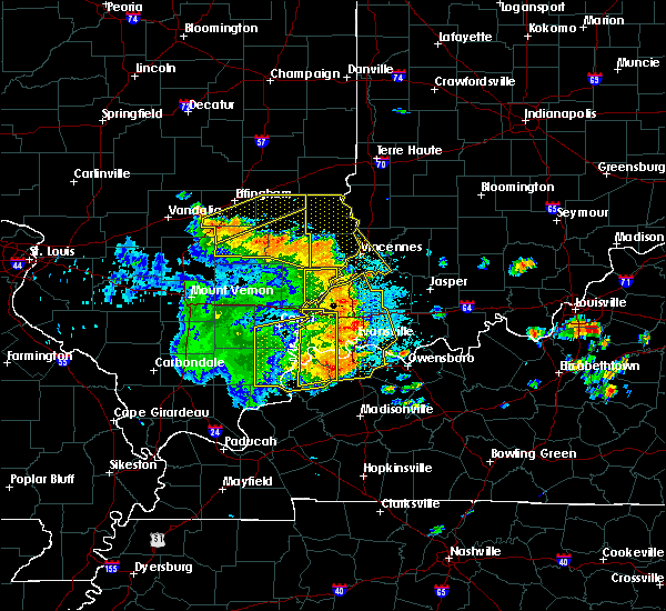 At 1234 pm edt, a severe thunderstorm was located near st. francisville, or 9 miles south of vincennes, moving northeast at 55 mph (radar indicated). Hazards include 60 mph wind gusts. Expect damage to roofs, siding, and trees. Locations impacted include, vincennes, russellville, monroe city, bruceville, decker and vincennes university. At 1234 pm edt, a severe thunderstorm was located near st. francisville, or 9 miles south of vincennes, moving northeast at 55 mph (radar indicated). Hazards include 60 mph wind gusts. Expect damage to roofs, siding, and trees. Locations impacted include, vincennes, russellville, monroe city, bruceville, decker and vincennes university.
|
| 5/31/2018 12:22 PM EDT |
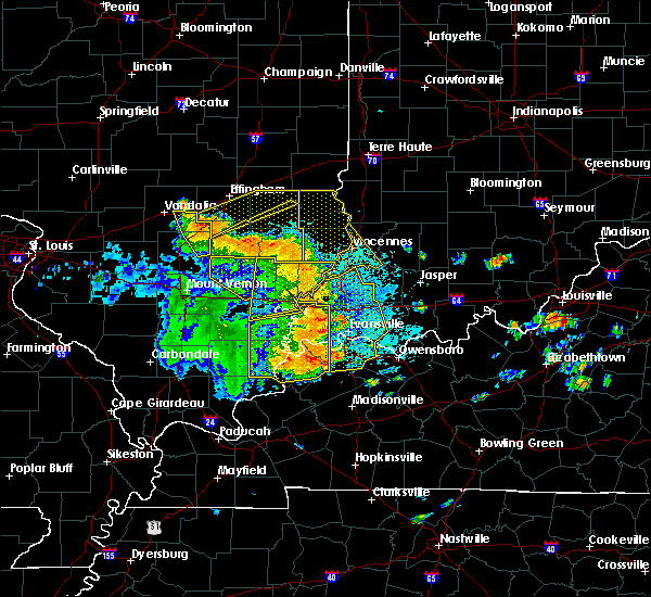 At 1221 pm edt, a severe thunderstorm was located near mount carmel, moving northeast at 60 mph (radar indicated). Hazards include 60 mph wind gusts. Expect damage to roofs, siding, and trees. Locations impacted include, vincennes, russellville, monroe city, bruceville, decker and vincennes university. At 1221 pm edt, a severe thunderstorm was located near mount carmel, moving northeast at 60 mph (radar indicated). Hazards include 60 mph wind gusts. Expect damage to roofs, siding, and trees. Locations impacted include, vincennes, russellville, monroe city, bruceville, decker and vincennes university.
|
| 5/31/2018 12:08 PM EDT |
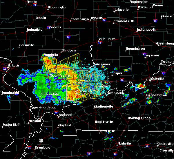 At 1208 pm edt, a severe thunderstorm was located over albion, moving northeast at 45 mph (radar indicated). Hazards include 60 mph wind gusts. expect damage to roofs, siding, and trees At 1208 pm edt, a severe thunderstorm was located over albion, moving northeast at 45 mph (radar indicated). Hazards include 60 mph wind gusts. expect damage to roofs, siding, and trees
|
| 4/3/2018 1:45 PM EDT | Quarter sized hail reported 0.5 miles ENE of Vincennes, IN, size was slightly bigger than 1 inch. approximate location. delayed report. |
| 4/3/2018 1:45 PM EDT | Golf Ball sized hail reported 1.6 miles E of Vincennes, IN, approximate location (given as smith and scott). |
| 4/3/2018 1:42 PM EDT |
 At 142 pm edt, a severe thunderstorm was located near vincennes, moving northeast at 55 mph. at 137 pm edt, quarter sized hail was reported on the vincennes university campus (public). Hazards include 60 mph wind gusts and quarter size hail. Hail damage to vehicles is expected. expect wind damage to roofs, siding, and trees. locations impacted include, vincennes, linton, russellville, bicknell, lyons, elnora, oaktown, bruceville, sandborn, edwardsport, newberry, freelandville and pleasantville. A tornado watch remains in effect until 800 pm edt for southwestern indiana. At 142 pm edt, a severe thunderstorm was located near vincennes, moving northeast at 55 mph. at 137 pm edt, quarter sized hail was reported on the vincennes university campus (public). Hazards include 60 mph wind gusts and quarter size hail. Hail damage to vehicles is expected. expect wind damage to roofs, siding, and trees. locations impacted include, vincennes, linton, russellville, bicknell, lyons, elnora, oaktown, bruceville, sandborn, edwardsport, newberry, freelandville and pleasantville. A tornado watch remains in effect until 800 pm edt for southwestern indiana.
|
| 4/3/2018 1:40 PM EDT | Ping Pong Ball sized hail reported 1.6 miles E of Vincennes, IN, time approximate. |
| 4/3/2018 1:37 PM EDT | Quarter sized hail reported 1.2 miles ESE of Vincennes, IN, hail a bit bigger than quarters. |
| 4/3/2018 1:32 PM EDT |
 At 132 pm edt, a severe thunderstorm was located near st. francisville, or near vincennes, moving northeast at 55 mph (radar indicated). Hazards include 60 mph wind gusts and quarter size hail. Hail damage to vehicles is expected. Expect wind damage to roofs, siding, and trees. At 132 pm edt, a severe thunderstorm was located near st. francisville, or near vincennes, moving northeast at 55 mph (radar indicated). Hazards include 60 mph wind gusts and quarter size hail. Hail damage to vehicles is expected. Expect wind damage to roofs, siding, and trees.
|
| 7/23/2017 6:41 AM CDT |
 At 618 am cdt, severe thunderstorms were located along a line extending from near annapolis to near washington, moving east at 35 mph (trained weather spotters). Hazards include 60 mph wind gusts. Expect damage to roofs, siding, and trees. locations impacted include, vincennes, robinson, lawrenceville, sumner, oblong, palestine, st. Francisville, hutsonville, flat rock, russellville, new hebron, chauncey, annapolis, hardinville, birds, eaton, merom, stoy, pinkstaff and crawford county airport. At 618 am cdt, severe thunderstorms were located along a line extending from near annapolis to near washington, moving east at 35 mph (trained weather spotters). Hazards include 60 mph wind gusts. Expect damage to roofs, siding, and trees. locations impacted include, vincennes, robinson, lawrenceville, sumner, oblong, palestine, st. Francisville, hutsonville, flat rock, russellville, new hebron, chauncey, annapolis, hardinville, birds, eaton, merom, stoy, pinkstaff and crawford county airport.
|
| 7/23/2017 6:19 AM CDT |
 At 618 am cdt, severe thunderstorms were located along a line extending from near annapolis to near washington, moving east at 35 mph (trained weather spotters). Hazards include 60 mph wind gusts. Expect damage to roofs, siding, and trees. locations impacted include, vincennes, robinson, lawrenceville, sumner, oblong, palestine, st. Francisville, hutsonville, flat rock, russellville, new hebron, chauncey, annapolis, hardinville, birds, eaton, merom, stoy, pinkstaff and crawford county airport. At 618 am cdt, severe thunderstorms were located along a line extending from near annapolis to near washington, moving east at 35 mph (trained weather spotters). Hazards include 60 mph wind gusts. Expect damage to roofs, siding, and trees. locations impacted include, vincennes, robinson, lawrenceville, sumner, oblong, palestine, st. Francisville, hutsonville, flat rock, russellville, new hebron, chauncey, annapolis, hardinville, birds, eaton, merom, stoy, pinkstaff and crawford county airport.
|
| 7/23/2017 7:12 AM EDT |
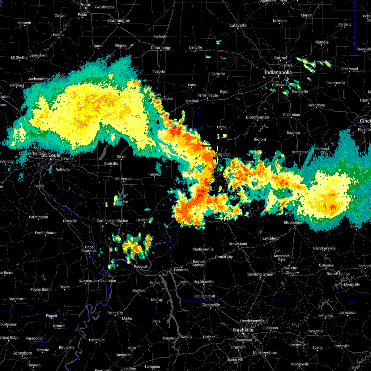 The severe thunderstorm warning for knox county will expire at 715 am edt, the storms which prompted the warning have weakened below severe limits, and no longer pose an immediate threat to life or property. therefore the warning will be allowed to expire. however gusty winds are still possible with these thunderstorms. The severe thunderstorm warning for knox county will expire at 715 am edt, the storms which prompted the warning have weakened below severe limits, and no longer pose an immediate threat to life or property. therefore the warning will be allowed to expire. however gusty winds are still possible with these thunderstorms.
|
| 7/23/2017 7:02 AM EDT | Emergency manager reports a tree down near old us 50 and hyde park drive. time estimated from rada in knox county IN, 1.7 miles W of Vincennes, IN |
| 7/23/2017 7:00 AM EDT | Emergency manager reports large tree down near intersection of 3rd st and shelby st in vincennes. time estimated from rada in knox county IN, 1.6 miles E of Vincennes, IN |
| 7/23/2017 5:58 AM CDT |
 At 557 am cdt, severe thunderstorms were located along a line extending from near montrose to near vincennes to haubstadt, moving east at 50 mph (trained weather spotters). Hazards include 60 mph wind gusts. expect damage to roofs, siding, and trees At 557 am cdt, severe thunderstorms were located along a line extending from near montrose to near vincennes to haubstadt, moving east at 50 mph (trained weather spotters). Hazards include 60 mph wind gusts. expect damage to roofs, siding, and trees
|
| 7/23/2017 6:52 AM EDT |
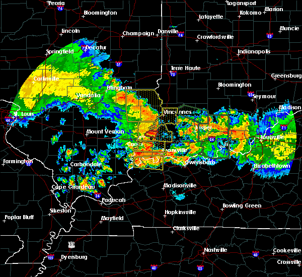 At 651 am edt, severe thunderstorms were located along a line extending from near chauncey to near st. francisville to near poseyville, moving east at 60 mph (radar indicated). Hazards include 70 mph wind gusts and penny size hail. Expect considerable tree damage. damage is likely to mobile homes, roofs, and outbuildings. Locations impacted include, vincennes, bicknell, monroe city, wheatland, bruceville, edwardsport, decker and vincennes university. At 651 am edt, severe thunderstorms were located along a line extending from near chauncey to near st. francisville to near poseyville, moving east at 60 mph (radar indicated). Hazards include 70 mph wind gusts and penny size hail. Expect considerable tree damage. damage is likely to mobile homes, roofs, and outbuildings. Locations impacted include, vincennes, bicknell, monroe city, wheatland, bruceville, edwardsport, decker and vincennes university.
|
| 7/23/2017 5:42 AM CDT |
 At 541 am cdt, severe thunderstorms were located along a line extending from near willow hill to near chauncey to near mount carmel, moving east at 55 mph (trained weather spotters). Hazards include 60 mph wind gusts. Expect damage to roofs, siding, and trees. locations impacted include, vincennes, olney, robinson, lawrenceville, newton, sumner, oblong, palestine, st. francisville, hutsonville, flat rock, ste. Marie, willow hill, parkersburg, claremont, calhoun, russellville, new hebron, chauncey and hardinville. At 541 am cdt, severe thunderstorms were located along a line extending from near willow hill to near chauncey to near mount carmel, moving east at 55 mph (trained weather spotters). Hazards include 60 mph wind gusts. Expect damage to roofs, siding, and trees. locations impacted include, vincennes, olney, robinson, lawrenceville, newton, sumner, oblong, palestine, st. francisville, hutsonville, flat rock, ste. Marie, willow hill, parkersburg, claremont, calhoun, russellville, new hebron, chauncey and hardinville.
|
| 7/23/2017 6:37 AM EDT |
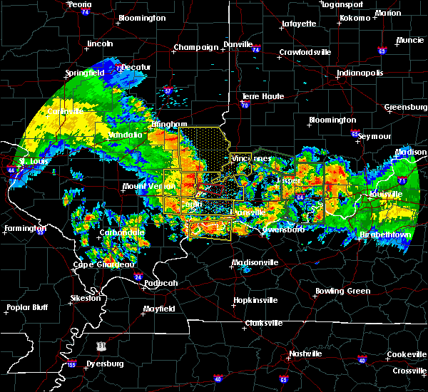 At 636 am edt, severe thunderstorms were located along a line extending from near dundas to lancaster to near crossville, moving east at 60 mph (radar indicated). Hazards include 70 mph wind gusts and penny size hail. Expect considerable tree damage. Damage is likely to mobile homes, roofs, and outbuildings. At 636 am edt, severe thunderstorms were located along a line extending from near dundas to lancaster to near crossville, moving east at 60 mph (radar indicated). Hazards include 70 mph wind gusts and penny size hail. Expect considerable tree damage. Damage is likely to mobile homes, roofs, and outbuildings.
|
| 7/23/2017 5:16 AM CDT |
 At 515 am cdt, severe thunderstorms were located along a line extending from near dieterich to near ingraham to 7 miles east of fairfield, moving east at 55 mph (radar indicated). Hazards include 60 mph wind gusts. expect damage to roofs, siding, and trees At 515 am cdt, severe thunderstorms were located along a line extending from near dieterich to near ingraham to 7 miles east of fairfield, moving east at 55 mph (radar indicated). Hazards include 60 mph wind gusts. expect damage to roofs, siding, and trees
|
| 5/27/2017 5:17 PM CDT |
 At 516 pm cdt, a severe thunderstorm was located near parkersburg, or 9 miles south of olney, moving east at 40 mph (radar indicated). Hazards include 60 mph wind gusts and quarter size hail. Hail damage to vehicles is expected. Expect wind damage to roofs, siding, and trees. At 516 pm cdt, a severe thunderstorm was located near parkersburg, or 9 miles south of olney, moving east at 40 mph (radar indicated). Hazards include 60 mph wind gusts and quarter size hail. Hail damage to vehicles is expected. Expect wind damage to roofs, siding, and trees.
|
| 5/18/2017 6:06 PM EDT |
 The severe thunderstorm warning for central knox county will expire at 615 pm edt, the storm which prompted the warning has weakened below severe limits, and no longer poses an immediate threat to life or property. therefore the warning will be allowed to expire. The severe thunderstorm warning for central knox county will expire at 615 pm edt, the storm which prompted the warning has weakened below severe limits, and no longer poses an immediate threat to life or property. therefore the warning will be allowed to expire.
|
| 5/18/2017 5:51 PM EDT |
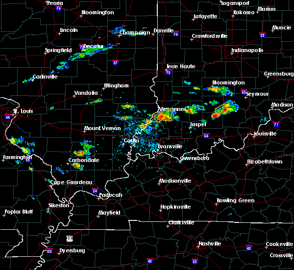 At 550 pm edt, a severe thunderstorm was located 7 miles south of vincennes, moving east at 30 mph (radar indicated). Hazards include half dollar size hail. Damage to vehicles is expected. Locations impacted include, vincennes, monroe city, wheatland and decker. At 550 pm edt, a severe thunderstorm was located 7 miles south of vincennes, moving east at 30 mph (radar indicated). Hazards include half dollar size hail. Damage to vehicles is expected. Locations impacted include, vincennes, monroe city, wheatland and decker.
|
| 5/18/2017 5:45 PM EDT | Quarter sized hail reported 9.6 miles NNE of Vincennes, IN |
| 5/18/2017 5:31 PM EDT |
 At 531 pm edt, a severe thunderstorm was located near st. francisville, or 9 miles southwest of vincennes, moving east at 25 mph (radar indicated). Hazards include quarter size hail. damage to vehicles is expected At 531 pm edt, a severe thunderstorm was located near st. francisville, or 9 miles southwest of vincennes, moving east at 25 mph (radar indicated). Hazards include quarter size hail. damage to vehicles is expected
|
| 4/29/2017 8:15 PM CDT |
 At 813 pm cdt, severe thunderstorms were located along a line extending from clinton to 10 miles south of terre haute to sumner, moving east at 30 mph (trained weather spotters). Hazards include 60 mph wind gusts and quarter size hail. Hail damage to vehicles is expected. expect wind damage to roofs, siding, and trees. locations impacted include, vincennes, olney, robinson, lawrenceville, marshall, sumner, oblong, palestine, st. francisville, hutsonville, flat rock, vermilion, parkersburg, claremont, calhoun, russellville, new hebron, chauncey, annapolis and hardinville. This includes interstate 70 between mile markers 145 and 154. At 813 pm cdt, severe thunderstorms were located along a line extending from clinton to 10 miles south of terre haute to sumner, moving east at 30 mph (trained weather spotters). Hazards include 60 mph wind gusts and quarter size hail. Hail damage to vehicles is expected. expect wind damage to roofs, siding, and trees. locations impacted include, vincennes, olney, robinson, lawrenceville, marshall, sumner, oblong, palestine, st. francisville, hutsonville, flat rock, vermilion, parkersburg, claremont, calhoun, russellville, new hebron, chauncey, annapolis and hardinville. This includes interstate 70 between mile markers 145 and 154.
|
| 4/29/2017 7:44 PM CDT |
 At 743 pm cdt, severe thunderstorms were located along a line extending from paris to near west union to near noble, moving east at 30 mph (trained weather spotters). Hazards include 60 mph wind gusts and quarter size hail. Hail damage to vehicles is expected. Expect wind damage to roofs, siding, and trees. At 743 pm cdt, severe thunderstorms were located along a line extending from paris to near west union to near noble, moving east at 30 mph (trained weather spotters). Hazards include 60 mph wind gusts and quarter size hail. Hail damage to vehicles is expected. Expect wind damage to roofs, siding, and trees.
|
| 4/5/2017 4:55 PM EDT |
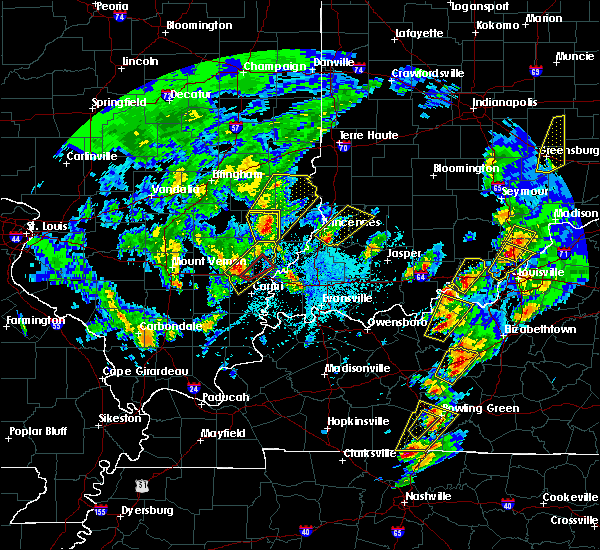 At 454 pm edt, a severe thunderstorm was located 7 miles southeast of vincennes, moving northeast at 50 mph (radar indicated). Hazards include 60 mph wind gusts and quarter size hail. Hail damage to vehicles is expected. expect wind damage to roofs, siding, and trees. Locations impacted include, vincennes, bicknell, monroe city, wheatland, bruceville, plainville, edwardsport and freelandville. At 454 pm edt, a severe thunderstorm was located 7 miles southeast of vincennes, moving northeast at 50 mph (radar indicated). Hazards include 60 mph wind gusts and quarter size hail. Hail damage to vehicles is expected. expect wind damage to roofs, siding, and trees. Locations impacted include, vincennes, bicknell, monroe city, wheatland, bruceville, plainville, edwardsport and freelandville.
|
| 4/5/2017 4:41 PM EDT |
 At 439 pm edt, a severe thunderstorm was located near patoka, or 8 miles north of princeton in gibson county, moving northeast at 50 mph. at 433 pm, a funnel cloud was reported 2 ssw of patoka (radar indicated). Hazards include 60 mph wind gusts and quarter size hail. Hail damage to vehicles is expected. Expect wind damage to roofs, siding, and trees. At 439 pm edt, a severe thunderstorm was located near patoka, or 8 miles north of princeton in gibson county, moving northeast at 50 mph. at 433 pm, a funnel cloud was reported 2 ssw of patoka (radar indicated). Hazards include 60 mph wind gusts and quarter size hail. Hail damage to vehicles is expected. Expect wind damage to roofs, siding, and trees.
|
| 3/30/2017 5:03 PM EDT |
 At 502 pm edt, a severe thunderstorm was located 7 miles southeast of vincennes, moving northeast at 50 mph (radar indicated). Hazards include 60 mph wind gusts and quarter size hail. Hail damage to vehicles is expected. Expect wind damage to roofs, siding, and trees. At 502 pm edt, a severe thunderstorm was located 7 miles southeast of vincennes, moving northeast at 50 mph (radar indicated). Hazards include 60 mph wind gusts and quarter size hail. Hail damage to vehicles is expected. Expect wind damage to roofs, siding, and trees.
|
| 8/28/2016 11:10 PM EDT | Tree down on meier circle. no damage to property. time estimate in knox county IN, 0.5 miles ENE of Vincennes, IN |
| 8/28/2016 11:07 PM EDT |
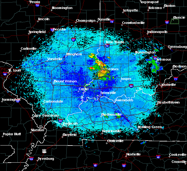 At 1107 pm edt, a severe thunderstorm was located over vincennes, moving northwest at 25 mph. the storm had weakened since 11 pm edt (radar indicated). Hazards include 60 mph wind gusts and quarter size hail. Hail damage to vehicles is expected. expect wind damage to roofs, siding, and trees. Locations impacted include, vincennes, russellville, bruceville and vincennes university. At 1107 pm edt, a severe thunderstorm was located over vincennes, moving northwest at 25 mph. the storm had weakened since 11 pm edt (radar indicated). Hazards include 60 mph wind gusts and quarter size hail. Hail damage to vehicles is expected. expect wind damage to roofs, siding, and trees. Locations impacted include, vincennes, russellville, bruceville and vincennes university.
|
| 8/28/2016 10:52 PM EDT |
 At 1052 pm edt, a severe thunderstorm was located over vincennes, moving northwest at 25 mph (radar indicated). Hazards include 60 mph wind gusts and quarter size hail. Hail damage to vehicles is expected. Expect wind damage to roofs, siding, and trees. At 1052 pm edt, a severe thunderstorm was located over vincennes, moving northwest at 25 mph (radar indicated). Hazards include 60 mph wind gusts and quarter size hail. Hail damage to vehicles is expected. Expect wind damage to roofs, siding, and trees.
|
| 7/13/2016 7:39 PM EDT |
 The severe thunderstorm warning for central knox, west central clay, eastern sullivan, southwestern parke, vigo and southern vermillion counties will expire at 745 pm edt, the storms which prompted the warning have moved out of the area. therefore, the warning will be allowed to expire. a severe thunderstorm watch remains in effect until 100 am edt for west central and southwestern indiana. to report severe weather, contact your nearest law enforcement agency. they will relay your report to the national weather service indianapolis. time, mot, loc 2337z 223deg 134kt 4003 8721 3873 8718. The severe thunderstorm warning for central knox, west central clay, eastern sullivan, southwestern parke, vigo and southern vermillion counties will expire at 745 pm edt, the storms which prompted the warning have moved out of the area. therefore, the warning will be allowed to expire. a severe thunderstorm watch remains in effect until 100 am edt for west central and southwestern indiana. to report severe weather, contact your nearest law enforcement agency. they will relay your report to the national weather service indianapolis. time, mot, loc 2337z 223deg 134kt 4003 8721 3873 8718.
|
| 7/13/2016 7:24 PM EDT |
 At 723 pm edt, severe thunderstorms were located along a line extending from 6 miles southeast of veedersburg to near washington, moving northeast at 155 mph (radar indicated). Hazards include 60 mph wind gusts. Expect damage to roofs. siding. and trees. locations impacted include, terre haute, vincennes, clinton, sullivan, rockville, bicknell, west terre haute, fairview park, shelburn, farmersburg, seelyville, montezuma, dugger, hymera, rosedale, carlisle, dana, monroe city, wheatland and universal. this includes interstate 70 between mile markers 5 and 17. Time, mot, loc 2323z 223deg 134kt 4003 8721 3873 8718. At 723 pm edt, severe thunderstorms were located along a line extending from 6 miles southeast of veedersburg to near washington, moving northeast at 155 mph (radar indicated). Hazards include 60 mph wind gusts. Expect damage to roofs. siding. and trees. locations impacted include, terre haute, vincennes, clinton, sullivan, rockville, bicknell, west terre haute, fairview park, shelburn, farmersburg, seelyville, montezuma, dugger, hymera, rosedale, carlisle, dana, monroe city, wheatland and universal. this includes interstate 70 between mile markers 5 and 17. Time, mot, loc 2323z 223deg 134kt 4003 8721 3873 8718.
|
| 7/13/2016 7:16 PM EDT |
 At 716 pm edt, severe thunderstorms were located along a line extending from near newport to 7 miles northwest of petersburg, moving northeast at 55 mph (radar indicated). Hazards include 60 mph wind gusts. Expect damage to roofs. siding. and trees. locations impacted include, terre haute, vincennes, clinton, sullivan, rockville, russellville, bicknell, west terre haute, fairview park, shelburn, prairieton, prairie creek, farmersburg, seelyville, montezuma, dugger, hymera, fairbanks, rosedale and carlisle. This includes interstate 70 between mile markers 1 and 17. At 716 pm edt, severe thunderstorms were located along a line extending from near newport to 7 miles northwest of petersburg, moving northeast at 55 mph (radar indicated). Hazards include 60 mph wind gusts. Expect damage to roofs. siding. and trees. locations impacted include, terre haute, vincennes, clinton, sullivan, rockville, russellville, bicknell, west terre haute, fairview park, shelburn, prairieton, prairie creek, farmersburg, seelyville, montezuma, dugger, hymera, fairbanks, rosedale and carlisle. This includes interstate 70 between mile markers 1 and 17.
|
| 7/13/2016 7:07 PM EDT |
 At 706 pm edt, a severe thunderstorm was located 9 miles east of west union, or 15 miles southeast of marshall, moving northeast at 155 mph (radar indicated). Hazards include 60 mph wind gusts. Expect damage to roofs. siding. And trees. At 706 pm edt, a severe thunderstorm was located 9 miles east of west union, or 15 miles southeast of marshall, moving northeast at 155 mph (radar indicated). Hazards include 60 mph wind gusts. Expect damage to roofs. siding. And trees.
|
| 7/13/2016 5:26 PM CDT |
 At 525 pm cdt, severe thunderstorms were located along a line extending from near jewett to near schnell, moving east at 55 mph (radar indicated). Hazards include 60 mph wind gusts. Expect damage to roofs. siding. And trees. At 525 pm cdt, severe thunderstorms were located along a line extending from near jewett to near schnell, moving east at 55 mph (radar indicated). Hazards include 60 mph wind gusts. Expect damage to roofs. siding. And trees.
|
| 7/6/2016 10:48 AM EDT | Tree downed on power lines at parkinson s in knox county IN, 0.5 miles ENE of Vincennes, IN |
| 7/6/2016 10:20 AM EDT |
 At 1019 am edt, a severe thunderstorm was located over vincennes, moving southeast at 40 mph (radar indicated). Hazards include 60 mph wind gusts. Expect damage to roofs. siding. and trees. Locations impacted include, vincennes, bicknell, monroe city, wheatland, sandborn, edwardsport and decker. At 1019 am edt, a severe thunderstorm was located over vincennes, moving southeast at 40 mph (radar indicated). Hazards include 60 mph wind gusts. Expect damage to roofs. siding. and trees. Locations impacted include, vincennes, bicknell, monroe city, wheatland, sandborn, edwardsport and decker.
|
| 7/6/2016 9:10 AM CDT |
 At 910 am cdt, severe thunderstorms were located along a line extending from near vincennes to near lancaster, moving southeast at 25 mph (radar indicated). Hazards include 60 mph wind gusts. Expect damage to roofs. siding. and trees. locations impacted include, vincennes, lawrenceville, st. Francisville, russellville, mount carmel airport, billett, lawrenceville airport and helena. At 910 am cdt, severe thunderstorms were located along a line extending from near vincennes to near lancaster, moving southeast at 25 mph (radar indicated). Hazards include 60 mph wind gusts. Expect damage to roofs. siding. and trees. locations impacted include, vincennes, lawrenceville, st. Francisville, russellville, mount carmel airport, billett, lawrenceville airport and helena.
|
| 7/6/2016 10:08 AM EDT |
 At 1007 am edt, a severe thunderstorm was located over vincennes, moving southeast at 45 mph (radar indicated). Hazards include 60 mph wind gusts. Expect damage to roofs. siding. And trees. At 1007 am edt, a severe thunderstorm was located over vincennes, moving southeast at 45 mph (radar indicated). Hazards include 60 mph wind gusts. Expect damage to roofs. siding. And trees.
|
| 7/6/2016 8:57 AM CDT |
 At 857 am cdt, severe thunderstorms were located along a line extending from near russellville to near lancaster, moving southeast at 35 mph (radar indicated). Hazards include 60 mph wind gusts. Expect damage to roofs. siding. And trees. At 857 am cdt, severe thunderstorms were located along a line extending from near russellville to near lancaster, moving southeast at 35 mph (radar indicated). Hazards include 60 mph wind gusts. Expect damage to roofs. siding. And trees.
|
| 6/15/2016 5:59 PM EDT |
 At 559 pm edt, severe thunderstorms were located along a line extending from 6 miles north of washington to near vincennes, moving southeast at 35 mph (radar indicated). Hazards include 60 mph wind gusts. Expect damage to roofs. siding. and trees. Locations impacted include, vincennes, washington, russellville, bicknell, loogootee, oaktown, monroe city, wheatland, bruceville, plainville, sandborn, montgomery, edwardsport, decker, cannelburg, freelandville and vincennes university. At 559 pm edt, severe thunderstorms were located along a line extending from 6 miles north of washington to near vincennes, moving southeast at 35 mph (radar indicated). Hazards include 60 mph wind gusts. Expect damage to roofs. siding. and trees. Locations impacted include, vincennes, washington, russellville, bicknell, loogootee, oaktown, monroe city, wheatland, bruceville, plainville, sandborn, montgomery, edwardsport, decker, cannelburg, freelandville and vincennes university.
|
| 6/15/2016 5:44 PM EDT |
 At 544 pm edt, severe thunderstorms were located along a line extending from 9 miles southeast of sullivan to near russellville, moving southeast at 45 mph (radar indicated). Hazards include 60 mph wind gusts. Expect damage to roofs. siding. And trees. At 544 pm edt, severe thunderstorms were located along a line extending from 9 miles southeast of sullivan to near russellville, moving southeast at 45 mph (radar indicated). Hazards include 60 mph wind gusts. Expect damage to roofs. siding. And trees.
|
| 5/11/2016 6:45 PM EDT | Large healthy tree down in knox county IN, 5.9 miles NNW of Vincennes, IN |
| 5/11/2016 6:30 PM EDT | Storm damage reported in knox county IN, 2.2 miles W of Vincennes, IN |
| 5/11/2016 6:28 PM EDT |
 At 627 pm edt, a severe thunderstorm was located near vincennes, moving east at 25 mph (radar indicated). Hazards include 60 mph wind gusts and quarter size hail. Hail damage to vehicles is expected. Expect wind damage to roofs, siding, and trees. At 627 pm edt, a severe thunderstorm was located near vincennes, moving east at 25 mph (radar indicated). Hazards include 60 mph wind gusts and quarter size hail. Hail damage to vehicles is expected. Expect wind damage to roofs, siding, and trees.
|
| 5/11/2016 5:26 PM CDT |
 At 525 pm cdt, a severe thunderstorm was located near lawrenceville, moving northeast at 15 mph (radar indicated). Hazards include 60 mph wind gusts and quarter size hail. Hail damage to vehicles is expected. Expect wind damage to roofs, siding, and trees. At 525 pm cdt, a severe thunderstorm was located near lawrenceville, moving northeast at 15 mph (radar indicated). Hazards include 60 mph wind gusts and quarter size hail. Hail damage to vehicles is expected. Expect wind damage to roofs, siding, and trees.
|
| 5/11/2016 4:23 PM CDT |
 At 423 pm cdt, a severe thunderstorm was located over lawrenceville, moving northeast at 15 mph (radar indicated). Hazards include 60 mph wind gusts and quarter size hail. Hail damage to vehicles is expected. expect wind damage to roofs, siding, and trees. Locations impacted include, vincennes, lawrenceville, sumner, flat rock, claremont, russellville, birds, petrolia, billett, helena, pinkstaff, red hills state park and lawrenceville airport. At 423 pm cdt, a severe thunderstorm was located over lawrenceville, moving northeast at 15 mph (radar indicated). Hazards include 60 mph wind gusts and quarter size hail. Hail damage to vehicles is expected. expect wind damage to roofs, siding, and trees. Locations impacted include, vincennes, lawrenceville, sumner, flat rock, claremont, russellville, birds, petrolia, billett, helena, pinkstaff, red hills state park and lawrenceville airport.
|
| 5/11/2016 4:00 PM CDT |
 At 400 pm cdt, a severe thunderstorm was located near sumner, or 6 miles west of lawrenceville, moving northeast at 25 mph (radar indicated). Hazards include 60 mph wind gusts and quarter size hail. Hail damage to vehicles is expected. Expect wind damage to roofs, siding, and trees. At 400 pm cdt, a severe thunderstorm was located near sumner, or 6 miles west of lawrenceville, moving northeast at 25 mph (radar indicated). Hazards include 60 mph wind gusts and quarter size hail. Hail damage to vehicles is expected. Expect wind damage to roofs, siding, and trees.
|
| 5/7/2016 8:05 PM EDT | Utility lines down on state road 61 between vincennes and monroe city in knox county IN, 4.4 miles W of Vincennes, IN |
| 5/7/2016 8:02 PM EDT | Trees down on or near us 41 in knox county IN, 3.5 miles SW of Vincennes, IN |
| 5/7/2016 8:00 PM EDT | Tree fell onto a house on roher road causing damage to the corner of the second floor. the house is believed to be vacan in knox county IN, 7.7 miles N of Vincennes, IN |
| 5/7/2016 7:47 PM EDT |
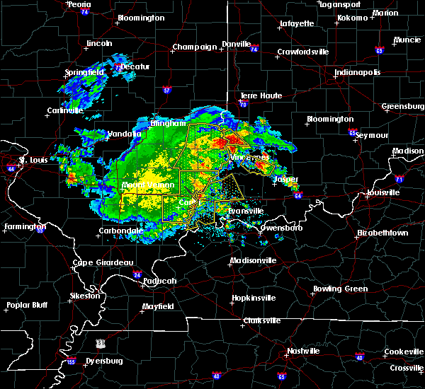 At 747 pm edt, a severe thunderstorm was located 7 miles southeast of palestine, or 13 miles east of robinson, moving southeast at 30 mph (radar indicated). Hazards include 60 mph wind gusts and quarter size hail. Hail damage to vehicles is expected. Expect wind damage to roofs, siding, and trees. At 747 pm edt, a severe thunderstorm was located 7 miles southeast of palestine, or 13 miles east of robinson, moving southeast at 30 mph (radar indicated). Hazards include 60 mph wind gusts and quarter size hail. Hail damage to vehicles is expected. Expect wind damage to roofs, siding, and trees.
|
| 5/1/2016 8:32 PM CDT |
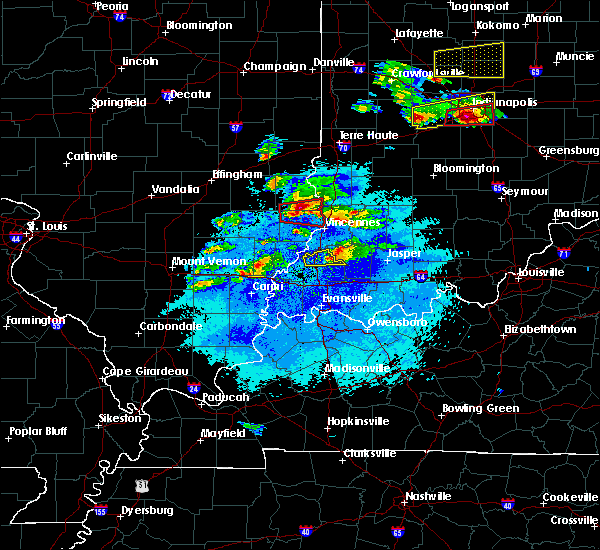 At 831 pm cdt, a severe thunderstorm capable of producing a tornado was located over birds, or 5 miles north of lawrenceville, moving east at 50 mph (radar indicated rotation). Hazards include tornado and tennis ball size hail. Flying debris will be dangerous to those caught without shelter. mobile homes will be damaged or destroyed. damage to roofs, windows, and vehicles will occur. tree damage is likely. this dangerous storm will be near, russellville around 840 pm cdt. Other locations impacted by this tornadic thunderstorm include lawrenceville airport and pinkstaff. At 831 pm cdt, a severe thunderstorm capable of producing a tornado was located over birds, or 5 miles north of lawrenceville, moving east at 50 mph (radar indicated rotation). Hazards include tornado and tennis ball size hail. Flying debris will be dangerous to those caught without shelter. mobile homes will be damaged or destroyed. damage to roofs, windows, and vehicles will occur. tree damage is likely. this dangerous storm will be near, russellville around 840 pm cdt. Other locations impacted by this tornadic thunderstorm include lawrenceville airport and pinkstaff.
|
| 5/1/2016 8:23 PM CDT |
 At 823 pm cdt, a severe thunderstorm capable of producing a tornado was located near chauncey, or 8 miles northwest of lawrenceville, moving east at 45 mph (radar indicated rotation). Hazards include tornado and tennis ball size hail. Flying debris will be dangerous to those caught without shelter. mobile homes will be damaged or destroyed. damage to roofs, windows, and vehicles will occur. tree damage is likely. this dangerous storm will be near, lawrenceville and flat rock around 830 pm cdt. birds around 835 pm cdt. russellville around 945 pm edt. Other locations impacted by this tornadic thunderstorm include petrolia, pinkstaff and lawrenceville airport. At 823 pm cdt, a severe thunderstorm capable of producing a tornado was located near chauncey, or 8 miles northwest of lawrenceville, moving east at 45 mph (radar indicated rotation). Hazards include tornado and tennis ball size hail. Flying debris will be dangerous to those caught without shelter. mobile homes will be damaged or destroyed. damage to roofs, windows, and vehicles will occur. tree damage is likely. this dangerous storm will be near, lawrenceville and flat rock around 830 pm cdt. birds around 835 pm cdt. russellville around 945 pm edt. Other locations impacted by this tornadic thunderstorm include petrolia, pinkstaff and lawrenceville airport.
|
| 5/1/2016 8:10 PM CDT |
 At 810 pm cdt, a severe thunderstorm capable of producing a tornado was located 5 miles east of dundas, or 8 miles northeast of olney, moving east at 50 mph (radar indicated rotation). Hazards include tornado and tennis ball size hail. Flying debris will be dangerous to those caught without shelter. mobile homes will be damaged or destroyed. damage to roofs, windows, and vehicles will occur. tree damage is likely. this dangerous storm will be near, chauncey around 815 pm cdt. hardinville around 820 pm cdt. lawrenceville around 825 pm cdt. flat rock and birds around 830 pm cdt. russellville around 940 pm edt. Other locations impacted by this tornadic thunderstorm include petrolia, pinkstaff, lawrenceville airport and red hills state park. At 810 pm cdt, a severe thunderstorm capable of producing a tornado was located 5 miles east of dundas, or 8 miles northeast of olney, moving east at 50 mph (radar indicated rotation). Hazards include tornado and tennis ball size hail. Flying debris will be dangerous to those caught without shelter. mobile homes will be damaged or destroyed. damage to roofs, windows, and vehicles will occur. tree damage is likely. this dangerous storm will be near, chauncey around 815 pm cdt. hardinville around 820 pm cdt. lawrenceville around 825 pm cdt. flat rock and birds around 830 pm cdt. russellville around 940 pm edt. Other locations impacted by this tornadic thunderstorm include petrolia, pinkstaff, lawrenceville airport and red hills state park.
|
| 4/26/2016 6:55 PM EDT |
 The severe thunderstorm warning for southwestern greene, knox, southeastern sullivan, northwestern martin and daviess counties will expire at 700 pm edt, the storms which prompted the warning have weakened below severe limits, and no longer pose an immediate threat to life or property. therefore the warning will be allowed to expire. however gusty winds are still possible with these thunderstorms. a severe thunderstorm watch remains in effect until 1100 pm edt for southwestern indiana. The severe thunderstorm warning for southwestern greene, knox, southeastern sullivan, northwestern martin and daviess counties will expire at 700 pm edt, the storms which prompted the warning have weakened below severe limits, and no longer pose an immediate threat to life or property. therefore the warning will be allowed to expire. however gusty winds are still possible with these thunderstorms. a severe thunderstorm watch remains in effect until 1100 pm edt for southwestern indiana.
|
| 4/26/2016 6:42 PM EDT |
 At 641 pm edt, severe thunderstorms were located along a line extending from near russellville to near washington, moving northeast at 25 mph (radar indicated). Hazards include 60 mph wind gusts and penny size hail. Expect damage to roofs. siding. and trees. Locations impacted include, vincennes, washington, linton, bicknell, odon, dugger, lyons, elnora, oaktown, monroe city, wheatland, bruceville, plainville, sandborn, montgomery, edwardsport, newberry, crane, pleasantville and west boggs lake. At 641 pm edt, severe thunderstorms were located along a line extending from near russellville to near washington, moving northeast at 25 mph (radar indicated). Hazards include 60 mph wind gusts and penny size hail. Expect damage to roofs. siding. and trees. Locations impacted include, vincennes, washington, linton, bicknell, odon, dugger, lyons, elnora, oaktown, monroe city, wheatland, bruceville, plainville, sandborn, montgomery, edwardsport, newberry, crane, pleasantville and west boggs lake.
|
| 4/26/2016 6:28 PM EDT |
 At 628 pm edt, severe thunderstorms were located along a line extending from near vincennes to 6 miles northwest of petersburg, moving northeast at 25 mph (radar indicated). Hazards include 60 mph wind gusts and nickel size hail. Expect damage to roofs. siding. And trees. At 628 pm edt, severe thunderstorms were located along a line extending from near vincennes to 6 miles northwest of petersburg, moving northeast at 25 mph (radar indicated). Hazards include 60 mph wind gusts and nickel size hail. Expect damage to roofs. siding. And trees.
|
| 12/23/2015 2:35 PM EST | Semi blown over on near us41 north of decker in knox county IN, 7.1 miles N of Vincennes, IN |
| 12/23/2015 2:15 PM EST | At 214 pm est, severe thunderstorms were located along a line extending from 6 miles northeast of palestine to 6 miles northeast of patoka, moving east at 55 mph (radar indicated). Hazards include 60 mph wind gusts. Expect damage to roofs. siding and trees. locations impacted include, vincennes, washington, linton, sullivan, russellville, bicknell, jasonville, dugger, lyons, carlisle, elnora, oaktown, monroe city, wheatland, bruceville, plainville, sandborn, montgomery, edwardsport and decker. A tornado watch remains in effect until 900 pm est for southwestern indiana. |
| 12/23/2015 1:13 PM CST | The severe thunderstorm warning for southeastern crawford and lawrence counties will expire at 115 pm cst, the storms which prompted the warning have moved out of the area. therefore the warning will be allowed to expire. however gusty winds are still possible with these thunderstorms. a tornado watch remains in effect until 500 pm cst for southeastern illinois. |
| 12/23/2015 2:12 PM EST | At 212 pm est, severe thunderstorms capable of producing both tornadoes and extensive straight line wind damage were located near vincennes, moving northeast at 60 mph (radar indicated rotation). Hazards include tornado. Flying debris will be dangerous to those caught without shelter. mobile homes will be damaged or destroyed. damage to roofs, windows and vehicles will occur. tree damage is likely. these dangerous storms will be near, vincennes around 220 pm est. washington around 230 pm est. Other locations impacted by this tornadic thunderstorm include decker, plainville, edwardsport, bicknell, monroe city and wheatland. |
| 12/23/2015 1:02 PM CST | At 102 pm cst, severe thunderstorms were located along a line extending from near flat rock to near st. francisville, moving northeast at 75 mph (radar indicated). Hazards include 60 mph wind gusts. Expect damage to roofs. siding and trees. locations impacted include, vincennes, lawrenceville, sumner, palestine, st. francisville, flat rock, russellville, new hebron, chauncey, birds, merom, petrolia, billett, helena, crawford county airport, mount carmel airport, pinkstaff, lawrenceville airport and red hills state park. A tornado watch remains in effect until 500 pm cst for southeastern illinois. |
| 12/23/2015 1:57 PM EST | At 156 pm est, severe thunderstorms were located along a line extending from robinson to near mount carmel, moving east at 60 mph (radar indicated). Hazards include 60 mph wind gusts. Expect damage to roofs. Siding and trees. |
| 12/23/2015 12:53 PM CST | At 1252 pm cst, severe thunderstorms were located along a line extending from chauncey to near lancaster, moving northeast at 70 mph (radar indicated). Hazards include 60 mph wind gusts. Expect damage to roofs. siding and trees. locations impacted include, vincennes, lawrenceville, sumner, palestine, st. francisville, flat rock, russellville, new hebron, chauncey, birds, merom, petrolia, billett, helena, crawford county airport, mount carmel airport, pinkstaff, lawrenceville airport and red hills state park. A tornado watch remains in effect until 500 pm cst for southeastern illinois. |
| 12/23/2015 12:41 PM CST | The national weather service in lincoln has issued a * severe thunderstorm warning for. southeastern crawford county in east central illinois. southeastern richland county in southeastern illinois. lawrence county in southeastern illinois. Until 115 pm cst. |
| 7/14/2015 5:41 AM EDT |
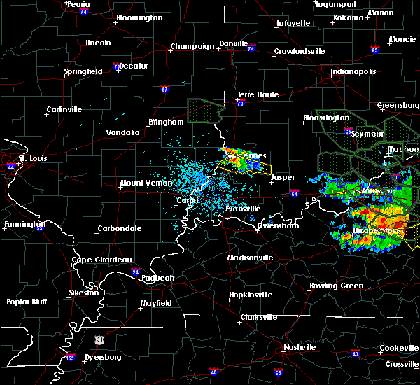 At 539 am edt, a severe thunderstorm was located 6 miles east of vincennes, and moving southeast at 45 mph (radar indicated). Hazards include 60 mph wind gusts and nickel size hail. Expect damage to roofs. Siding and trees. At 539 am edt, a severe thunderstorm was located 6 miles east of vincennes, and moving southeast at 45 mph (radar indicated). Hazards include 60 mph wind gusts and nickel size hail. Expect damage to roofs. Siding and trees.
|
| 6/19/2015 4:01 PM EDT |
 At 359 pm edt, a severe thunderstorm capable of producing a tornado was located 6 miles southeast of russellville, and moving northeast at 15 mph (radar indicated rotation). Hazards include tornado. Flying debris will be dangerous to those caught without shelter. mobile homes will be damaged or destroyed. damage to roofs, windows and vehicles will occur. tree damage is likely. Locations impacted include, oaktown, bicknell, freelandville, edwardsport, sandborn, plainville, pleasantville and elnora. At 359 pm edt, a severe thunderstorm capable of producing a tornado was located 6 miles southeast of russellville, and moving northeast at 15 mph (radar indicated rotation). Hazards include tornado. Flying debris will be dangerous to those caught without shelter. mobile homes will be damaged or destroyed. damage to roofs, windows and vehicles will occur. tree damage is likely. Locations impacted include, oaktown, bicknell, freelandville, edwardsport, sandborn, plainville, pleasantville and elnora.
|
| 6/19/2015 3:52 PM EDT |
 At 350 pm edt, a severe thunderstorm capable of producing a tornado was located near russellville, and moving northeast at 15 mph (radar indicated rotation). Hazards include tornado. Flying debris will be dangerous to those caught without shelter. mobile homes will be damaged or destroyed. damage to roofs, windows and vehicles will occur. tree damage is likely. This dangerous storm will affect mainly rural areas of northeastern knox, northwestern daviess, southeastern sullivan and southwestern greene counties, including the following locations, bruceville, oaktown, bicknell and freelandville. At 350 pm edt, a severe thunderstorm capable of producing a tornado was located near russellville, and moving northeast at 15 mph (radar indicated rotation). Hazards include tornado. Flying debris will be dangerous to those caught without shelter. mobile homes will be damaged or destroyed. damage to roofs, windows and vehicles will occur. tree damage is likely. This dangerous storm will affect mainly rural areas of northeastern knox, northwestern daviess, southeastern sullivan and southwestern greene counties, including the following locations, bruceville, oaktown, bicknell and freelandville.
|
| 5/30/2015 6:41 PM EDT | The severe thunderstorm warning for knox county will expire at 645 pm edt, the storm which prompted the warning has moved out of the warned area. |
| 5/30/2015 6:28 PM EDT | At 626 pm edt, a severe thunderstorm was located near russellville, and moving north at 35 mph (radar indicated). Hazards include 60 mph wind gusts. Expect damage to roofs. siding and trees. Locations impacted include, bicknell, edwardsport, oaktown and freelandville. |
| 5/30/2015 6:25 PM EDT | Power line downed at hebert road in vincenne in knox county IN, 0.5 miles ENE of Vincennes, IN |
| 5/30/2015 6:12 PM EDT | At 609 pm edt, a severe thunderstorm was located near vincennes, and moving north at 35 mph (radar indicated). Hazards include 60 mph wind gusts. Expect damage to roofs. Siding and trees. |
| 4/8/2015 5:18 PM EDT | A severe thunderstorm warning remains in effect for knox county until 545 pm edt. at 516 pm edt. a severe thunderstorm was located near st. francisville. and moving east at 25 mph. hazard. 60 mph wind gusts and quarter size hail. source. Radar indicated. |
| 4/8/2015 5:06 PM EDT | The national weather service in indianapolis has issued a * severe thunderstorm warning for. knox county in southwest indiana. until 545 pm edt * at 502 pm edt. a severe thunderstorm was located near st. francisville. And moving east at 25 mph. |
| 4/8/2015 3:41 PM CDT | The national weather service in lincoln has issued a * severe thunderstorm warning for. southern lawrence county in southeast illinois. until 430 pm cdt * at 338 pm cdt. a severe thunderstorm was located 7 miles northeast of west salem. And moving east at 35 mph. |
| 4/8/2015 3:01 PM CDT | The national weather service in lincoln has issued a * severe thunderstorm warning for. southern lawrence county in southeast illinois. southeastern richland county in southeast illinois. until 345 pm cdt * at 259 pm cdt. A severe thunderstorm was located 5 miles northeast. |
| 4/8/2015 3:52 PM EDT | A severe thunderstorm warning remains in effect for southern knox county until 415 pm edt. at 349 pm edt. a severe thunderstorm was located near st. francisville. and moving east at 25 mph. hazard. 60 mph wind gusts and half dollar size hail. source. Radar indicated. |
| 4/8/2015 2:48 PM CDT | A severe thunderstorm warning remains in effect for southeastern richland and southern lawrence counties until 300 pm cdt. at 246 pm cdt. a severe thunderstorm was located near parkersburg. and moving east at 35 mph. hazard. 60 mph wind gusts and quarter size hail. source. Radar indicated. |
| 4/8/2015 3:35 PM EDT | The national weather service in indianapolis has issued a * severe thunderstorm warning for. southern knox county in southwest indiana. until 415 pm edt * at 331 pm edt. a severe thunderstorm was located 5 miles south of bridgeport. And moving east at 25 mph. |
| 4/8/2015 2:25 PM CDT | The national weather service in lincoln has issued a * severe thunderstorm warning for. lawrence county in southeast illinois. southern richland county in southeast illinois. until 300 pm cdt * at 222 pm cdt. A severe thunderstorm was located 6 miles south. |
| 4/8/2015 2:07 PM CDT | A severe thunderstorm warning remains in effect for southern richland and lawrence counties until 230 pm cdt. at 203 pm cdt. a severe thunderstorm was located 6 miles east of calhoun. and moving northeast at 30 mph. A second severe thunderstorm will move into southern richland county from wayne county by 215 pm. |
| 4/8/2015 1:48 PM CDT | The national weather service in lincoln has issued a * severe thunderstorm warning for. lawrence county in southeast illinois. southern richland county in southeast illinois. until 230 pm cdt * at 147 pm cdt. A severe thunderstorm was located near. |
| 9/1/2013 12:15 AM EDT | Tree down at camp arthur rd and smith rd. also some utility lines down around the county in knox county IN, 0.5 miles ENE of Vincennes, IN |
| 9/1/2013 12:12 AM EDT | Limbs down in knox county IN, 0.5 miles ENE of Vincennes, IN |
| 9/1/2013 12:10 AM EDT | Trees down on old hwy 41 north of vincennes and south of oaktown in knox county IN, 4.2 miles SSW of Vincennes, IN |
| 7/13/2013 8:10 PM EDT | Tree down near knights of columbus in vincennes in knox county IN, 0.5 miles ENE of Vincennes, IN |
| 7/13/2013 8:10 PM EDT | Tree down at s 15th st by the grain elevator in knox county IN, 2.6 miles NE of Vincennes, IN |
| 6/26/2013 5:51 PM EDT | 4 inch diameter tree limb downed in the 500 block of church street. time estimated from rada in knox county IN, 0.5 miles ENE of Vincennes, IN |
| 6/18/2013 5:33 PM EDT | Trees downed in vincenne in knox county IN, 0.5 miles ENE of Vincennes, IN |
| 6/17/2013 6:45 PM EDT | Large tree fell on house around 1100 block of sycamore street in knox county IN, 0.5 miles ENE of Vincennes, IN |
| 6/17/2013 6:35 PM EDT | Tree limbs down...approx 10 around and 5 feet lon in knox county IN, 0.5 miles ENE of Vincennes, IN |
| 6/17/2013 6:35 PM EDT | Tree limbs down...approx 10 inches around and 5 feet long in knox county IN, 0.5 miles ENE of Vincennes, IN |
| 6/17/2013 6:35 PM EDT | Vincennes fire department responding to 843 state street for tree down on a house that caused structural damage. time estimate in knox county IN, 0.5 miles ENE of Vincennes, IN |
| 5/30/2013 5:37 PM EDT | Solid mature maple tree uprooted at hart and 5th...several other trees down in same area in knox county IN, 0.5 miles ENE of Vincennes, IN |
| 4/16/2013 10:20 PM EDT | Quarter sized hail reported 0.5 miles ENE of Vincennes, IN, ground nearly covered like snow |
| 4/16/2013 10:19 PM EDT | Golf Ball sized hail reported 0.5 miles ENE of Vincennes, IN, currently falling at the emergency dispatch center in vincennes. |
| 4/16/2013 10:18 PM EDT | Quarter sized hail reported 0.5 miles ENE of Vincennes, IN, currently falling in vincennes. |
| 1/30/2013 12:15 AM EST | Tree went through a house. time estimated from radar and report received on web eo in knox county IN, 0.5 miles ENE of Vincennes, IN |
| 1/29/2013 11:15 PM CST | Tree blown down across u.s. 5 in lawrence county IL, 4.9 miles E of Vincennes, IN |
| 8/16/2012 6:30 PM EDT | Trees down at 80 west 15 street in knox county IN, 0.5 miles ENE of Vincennes, IN |
| 7/1/2012 6:55 PM EDT | Numerous trees down. estimated winds 65-70 mp in knox county IN, 0.5 miles ENE of Vincennes, IN |
| 7/1/2012 6:50 PM EDT | Numerous trees and power lines down throughout vincennes. roof collapse on an apartment building on autumn ridge lane. time estimated from radar and previous report in knox county IN, 0.5 miles ENE of Vincennes, IN |
| 5/1/2012 7:13 PM EDT | Quarter sized hail reported 10.4 miles W of Vincennes, IN |
| 4/28/2012 10:27 PM EDT | One tree down blocking road in knox county IN, 0.5 miles ENE of Vincennes, IN |
| 4/28/2012 5:48 PM EDT | Storm damage reported in knox county IN, 0.5 miles ENE of Vincennes, IN |
| 3/30/2012 7:36 PM EDT | Quarter sized hail reported 2.7 miles S of Vincennes, IN |
| 1/1/0001 12:00 AM | Several tree limbs down and a trampoline wrapped around a tree and fence. damage likely from winds near 45 to 50 mp in knox county IN, 3.3 miles W of Vincennes, IN |
| 1/1/0001 12:00 AM | A tree fell on a mobile home on ewing avenue...temporarily trapping the occupant. possible injury. time estimated based on rada in knox county IN, 0.5 miles ENE of Vincennes, IN |
| 1/1/0001 12:00 AM | Storm damage reported in knox county IN, 4.4 miles W of Vincennes, IN |
| 1/1/0001 12:00 AM | Trees reported down around vincenne in knox county IN, 0.5 miles ENE of Vincennes, IN |
| 1/1/0001 12:00 AM | Numerous trees and power lines down across the county in knox county IN, 4.4 miles W of Vincennes, IN |
| 1/1/0001 12:00 AM | Storm damage reported in knox county IN, 0.5 miles ENE of Vincennes, IN |
Hail Maps for Vincennes, IN


Connect with Interactive Hail Maps