

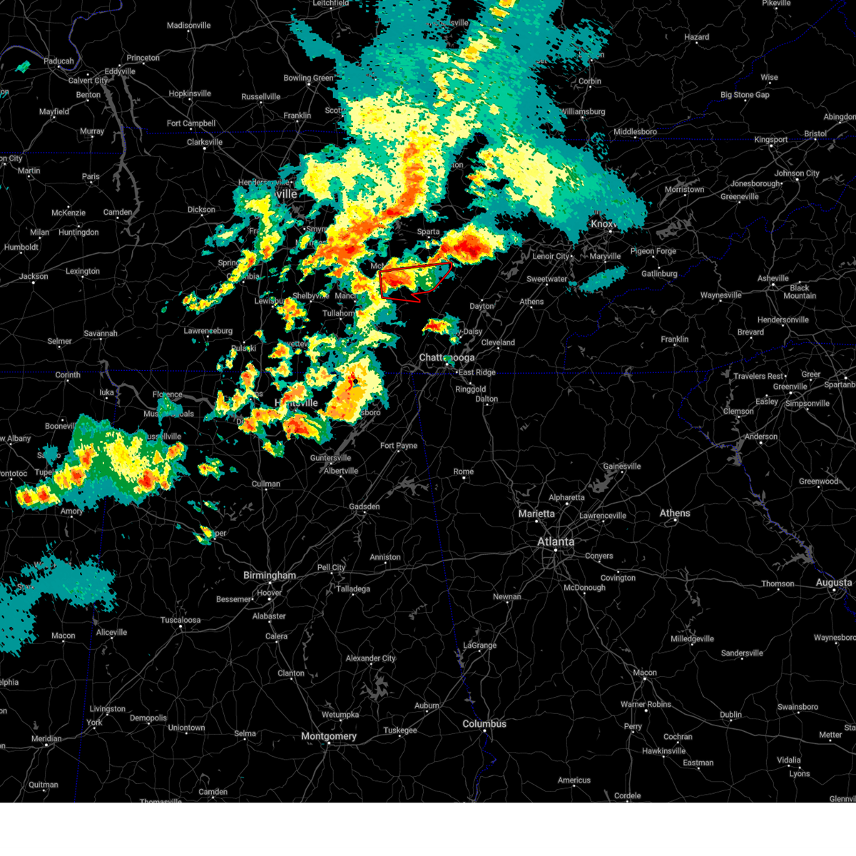
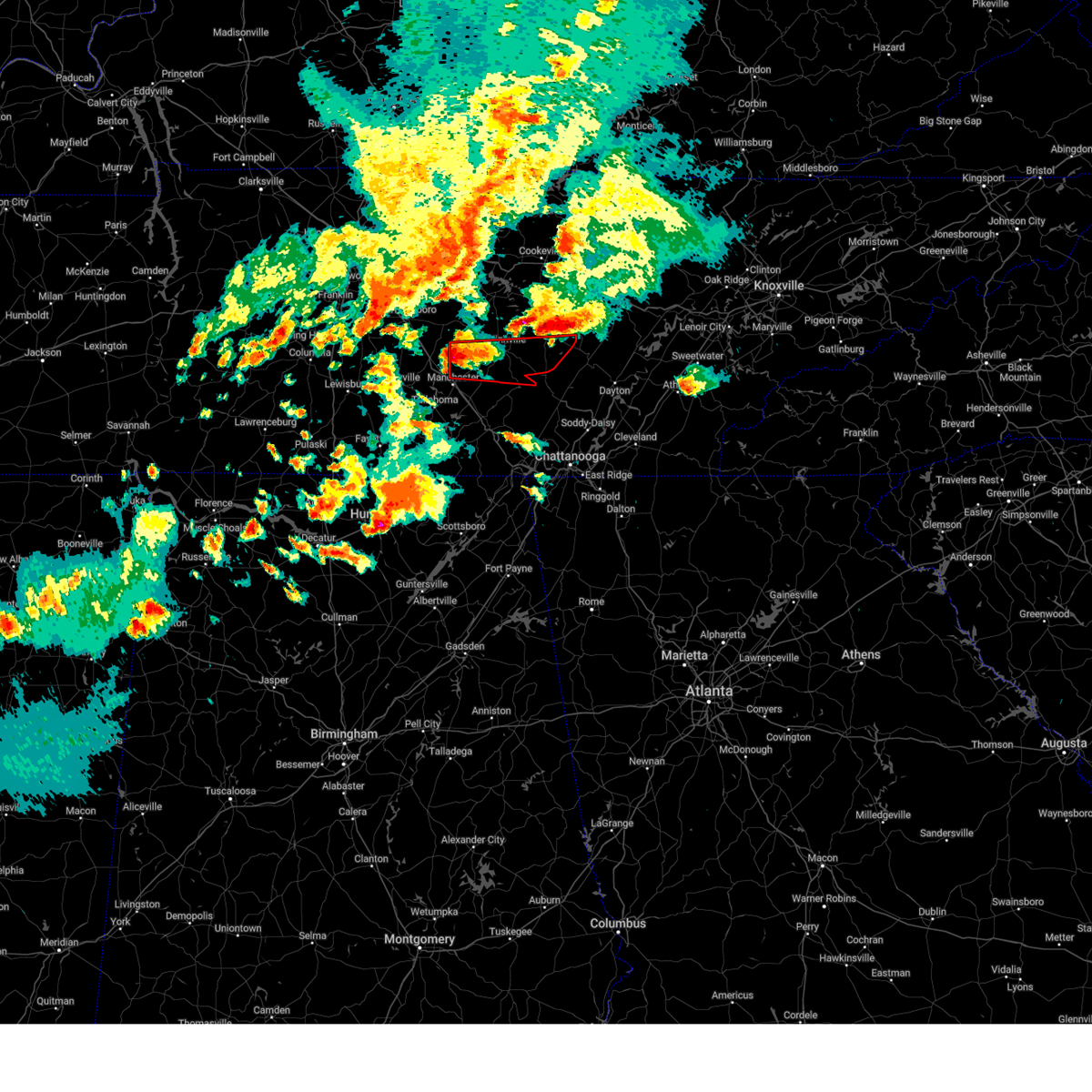
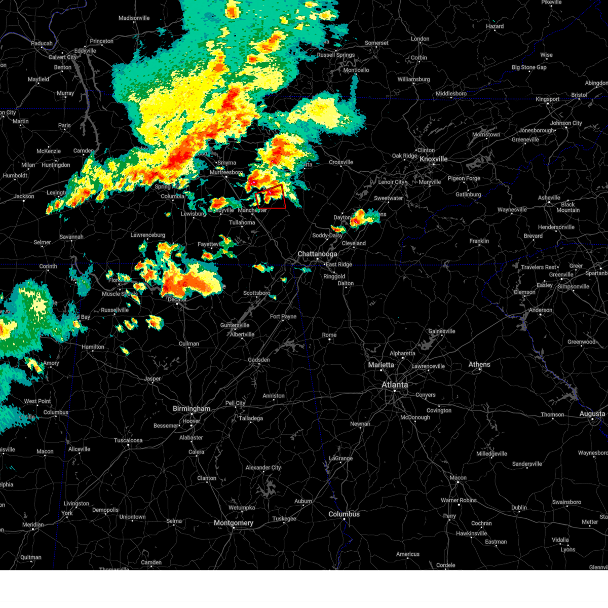
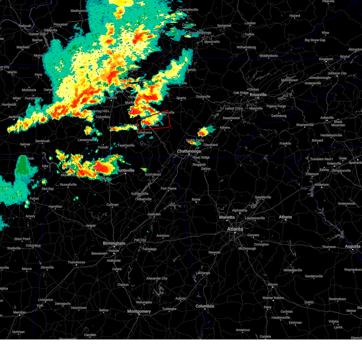
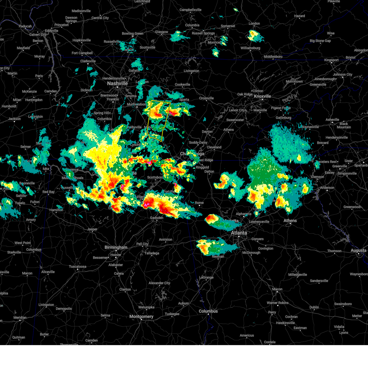
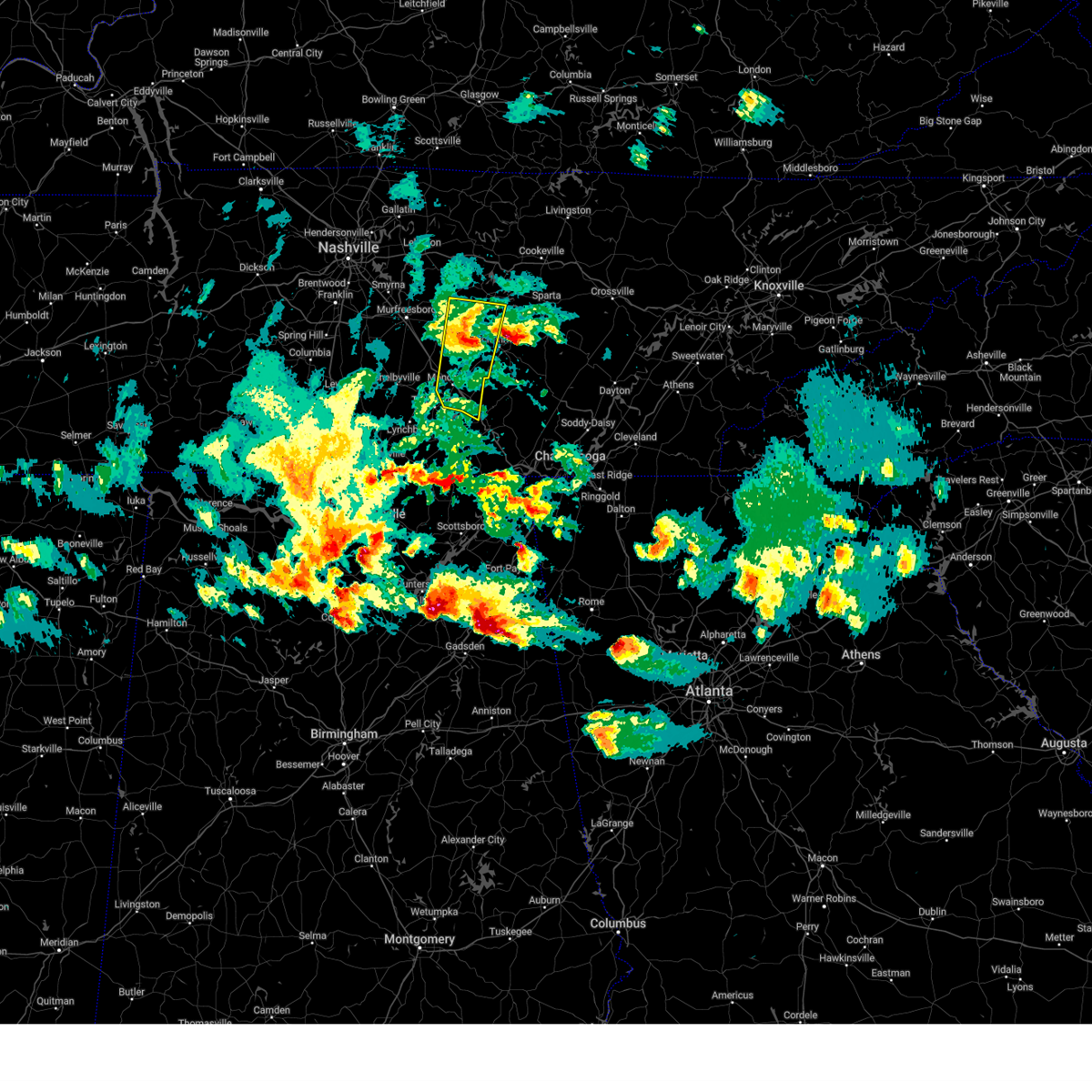
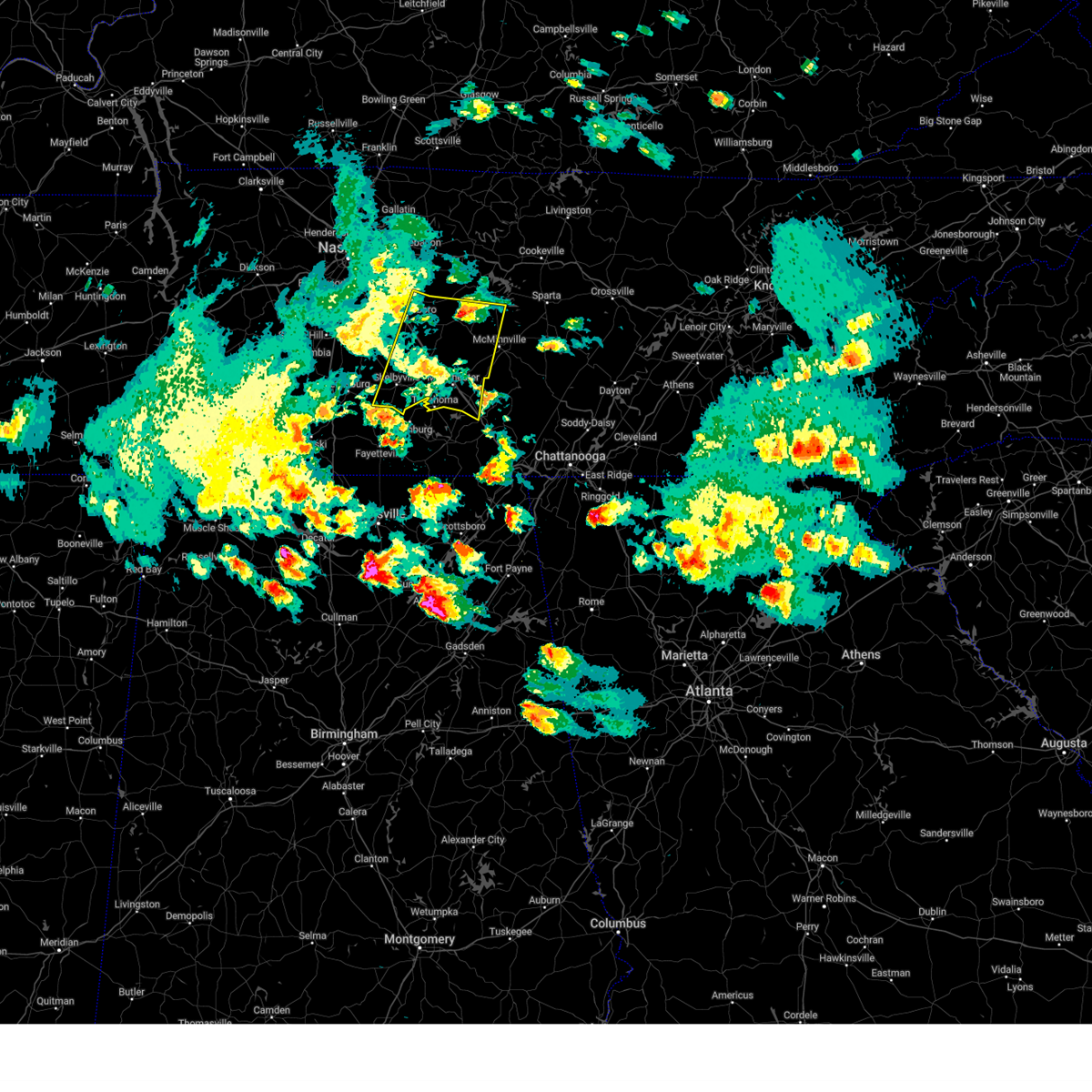
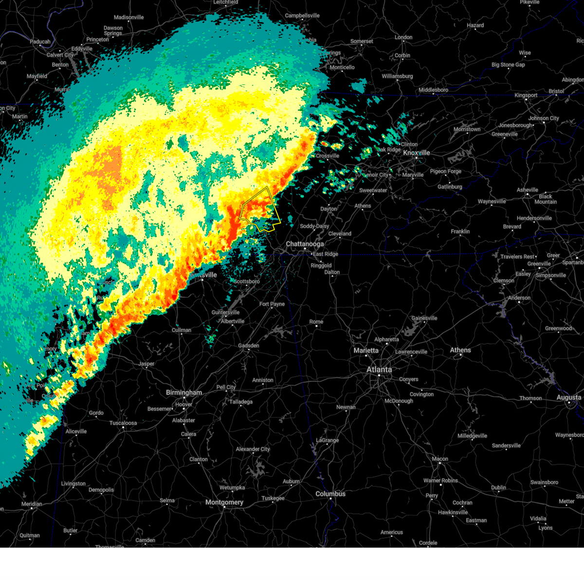
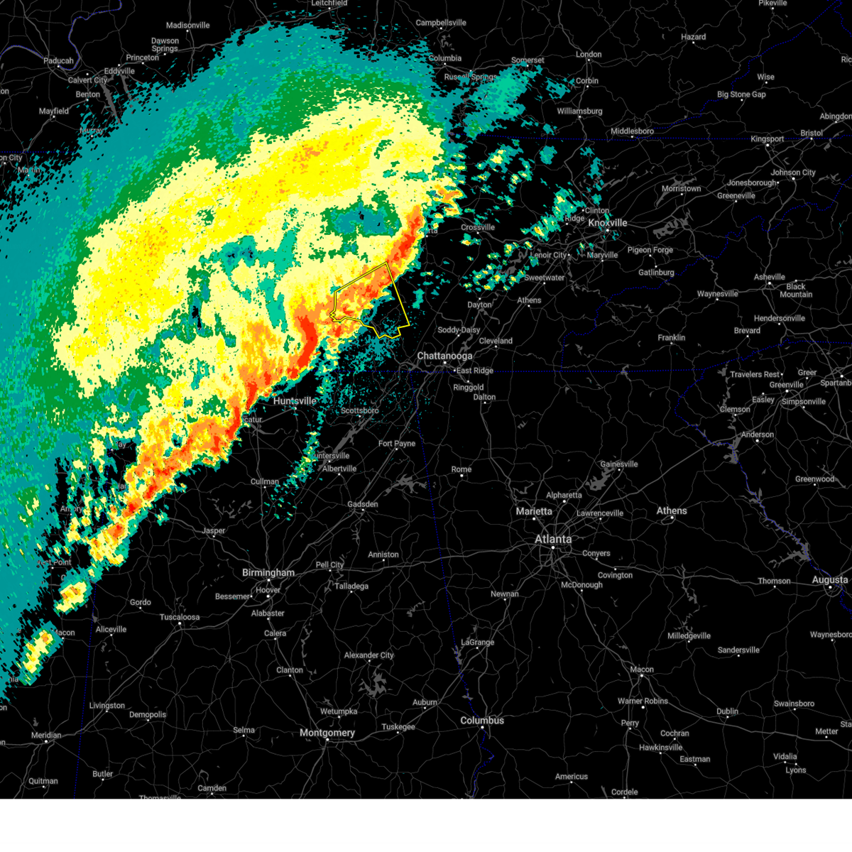
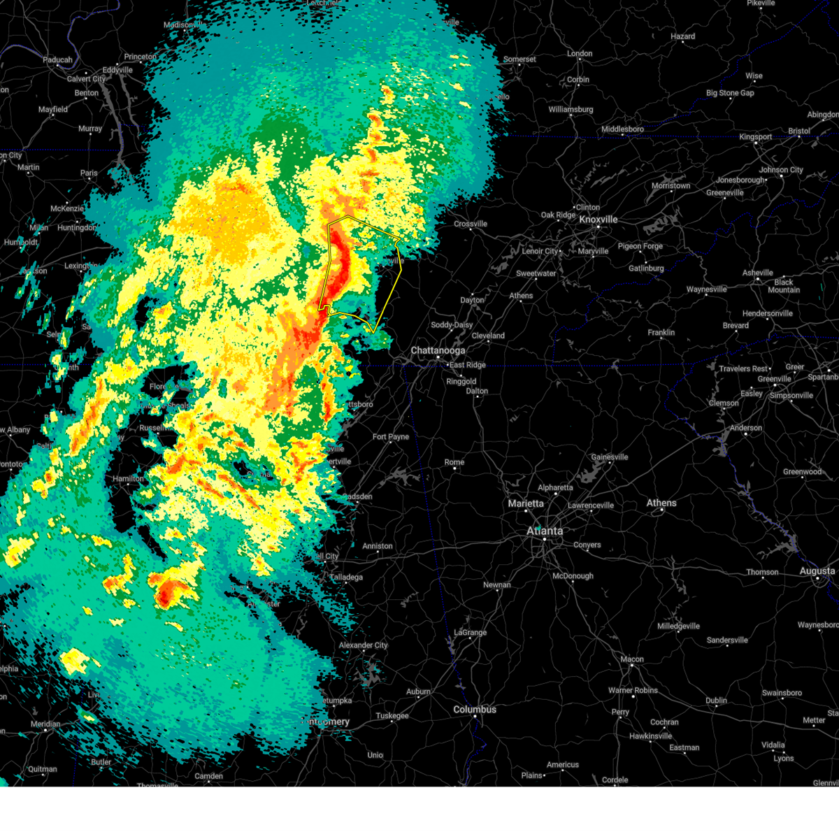
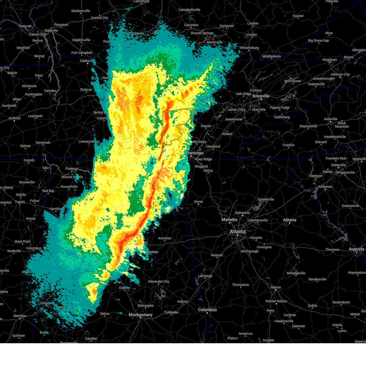
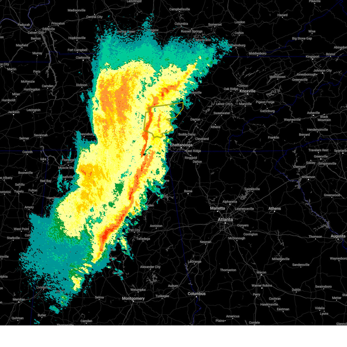
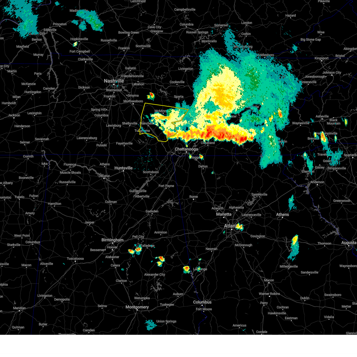
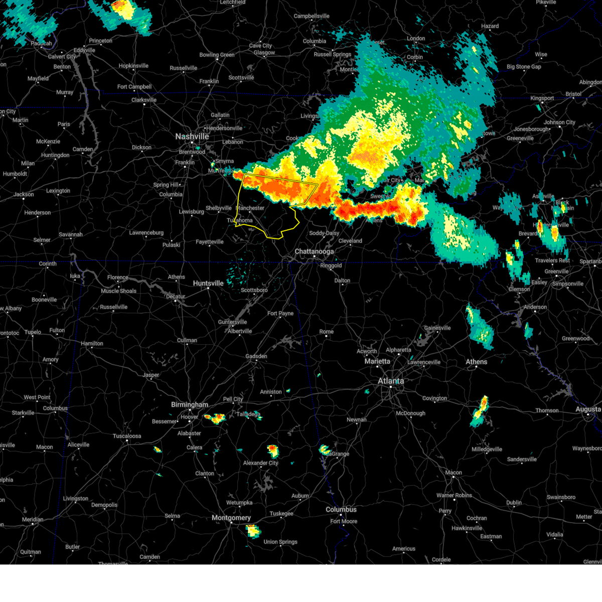
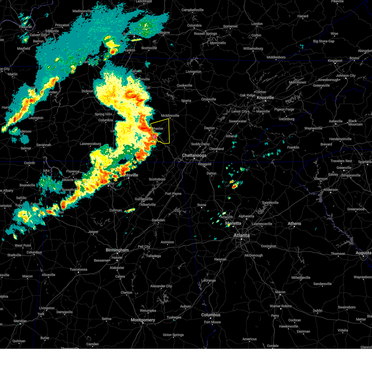
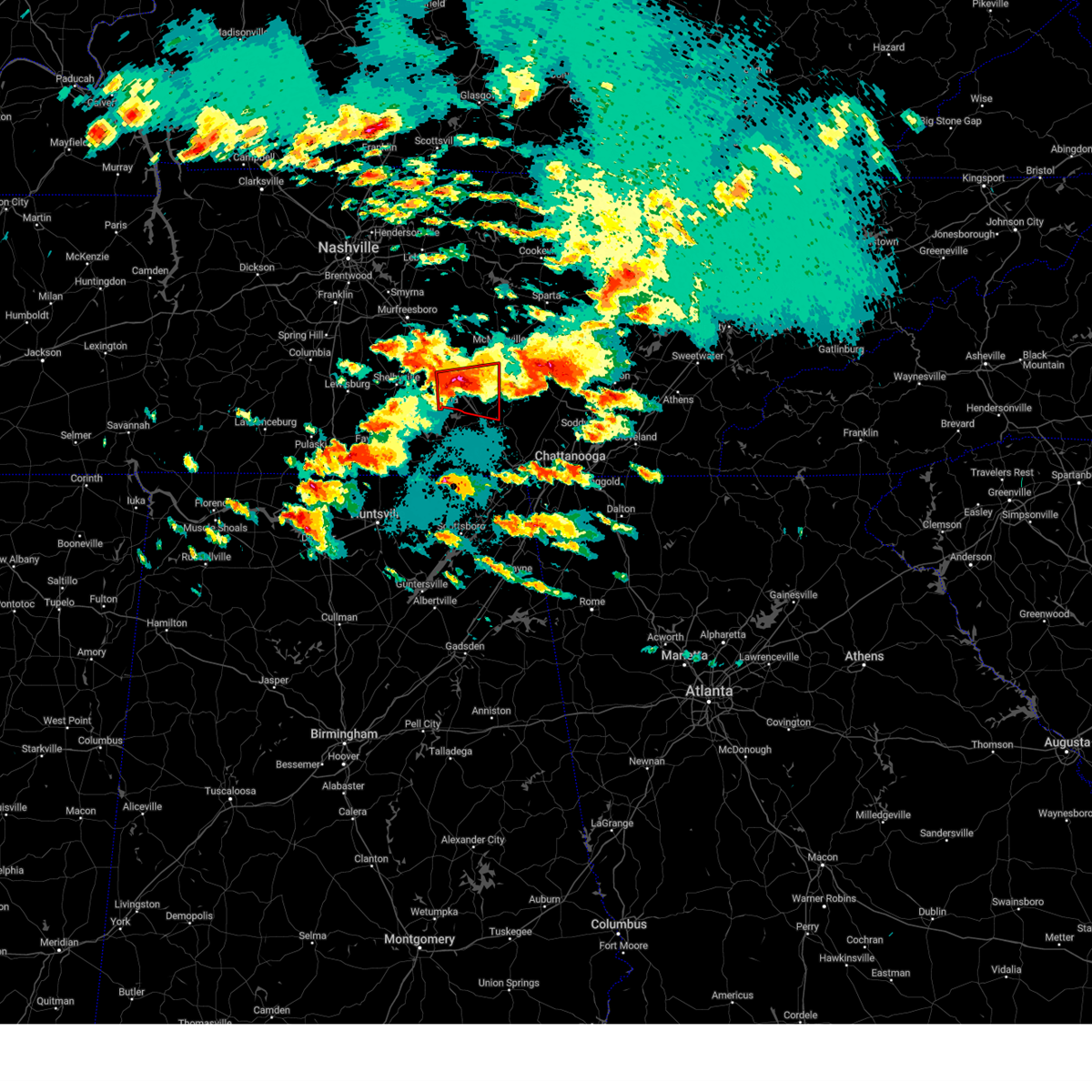
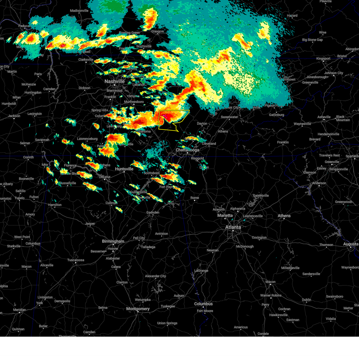
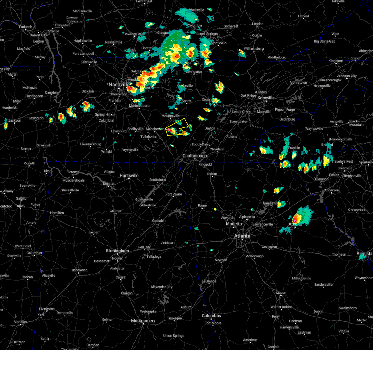
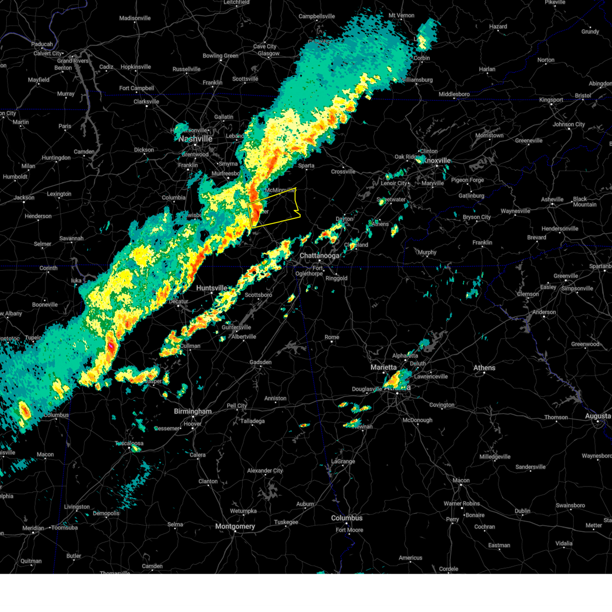
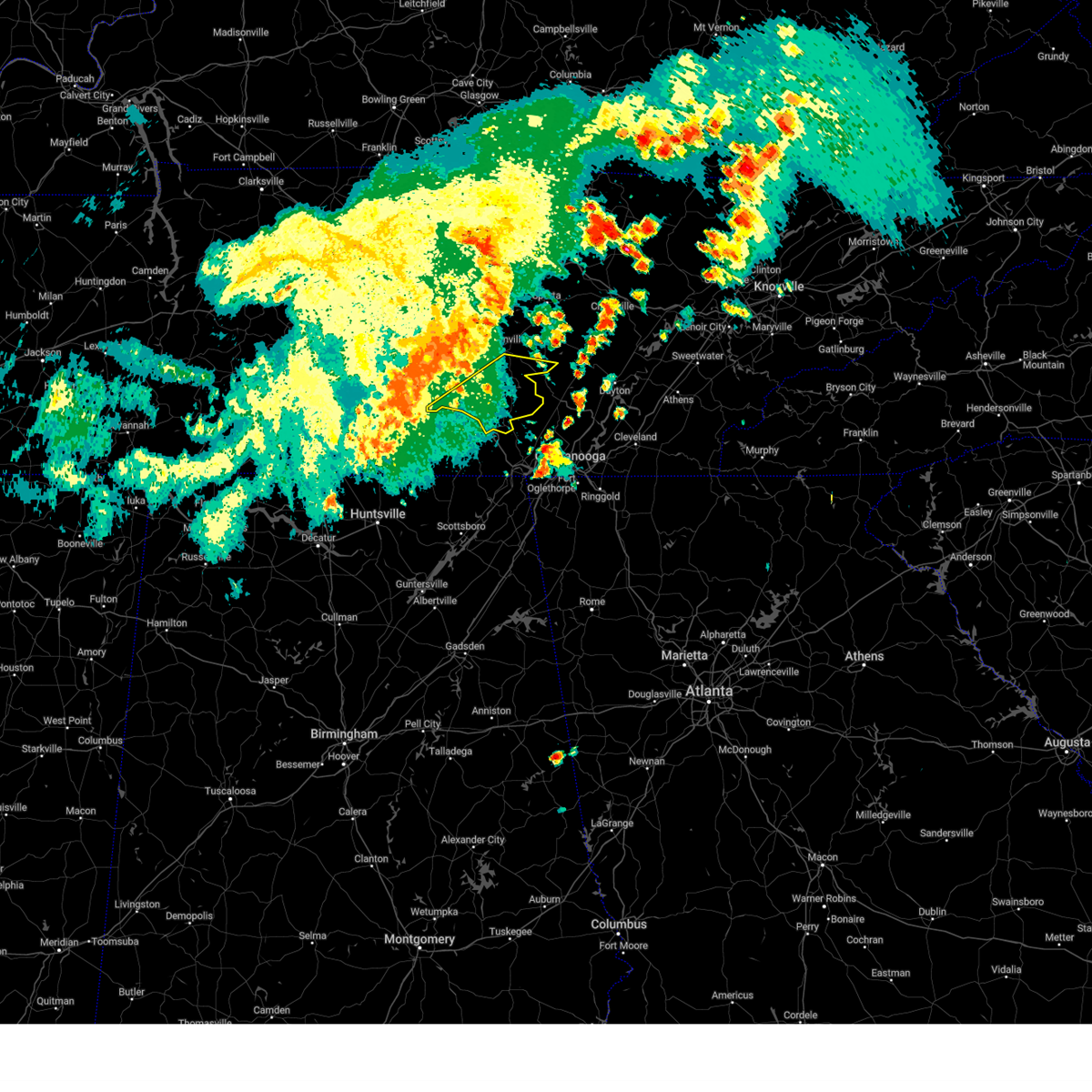
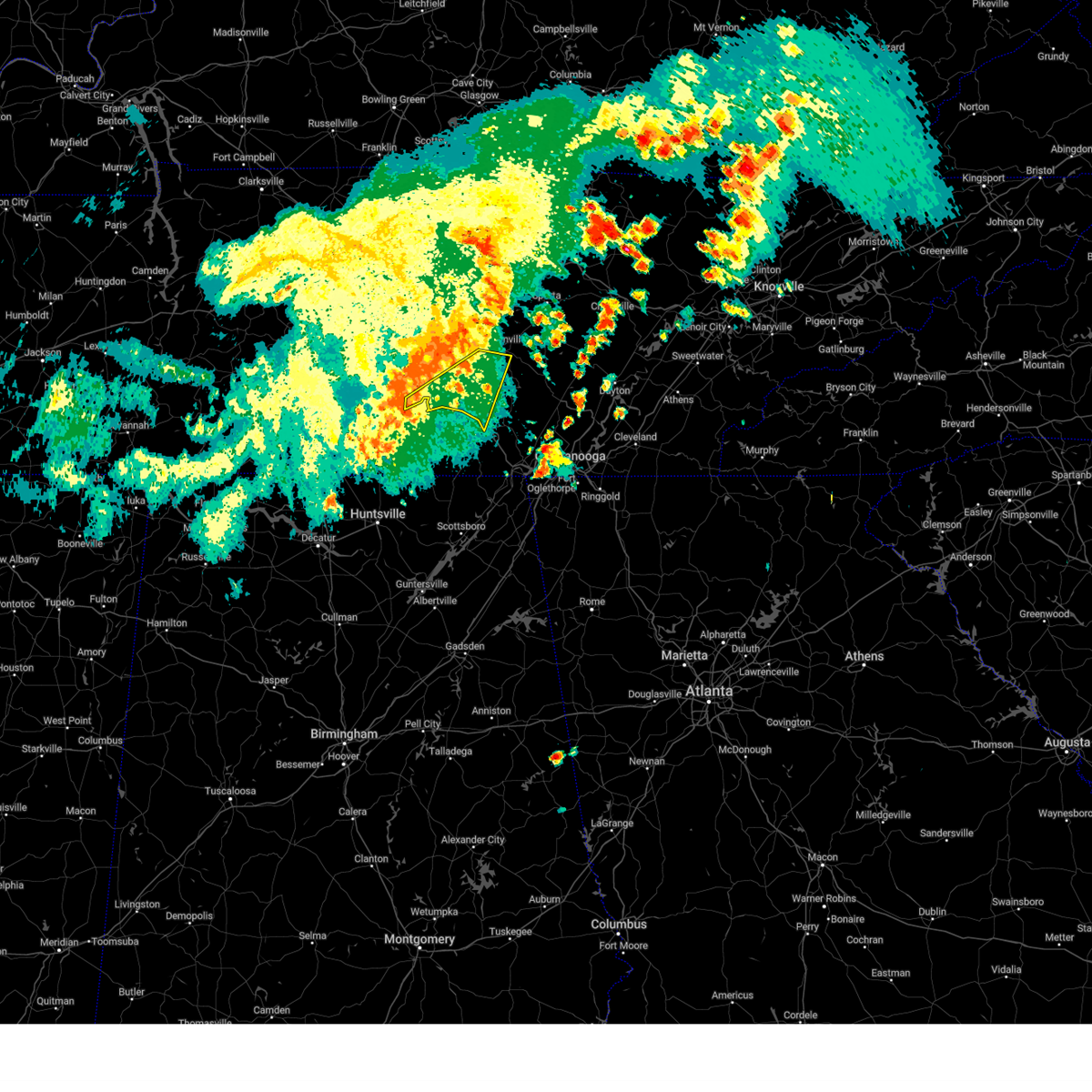
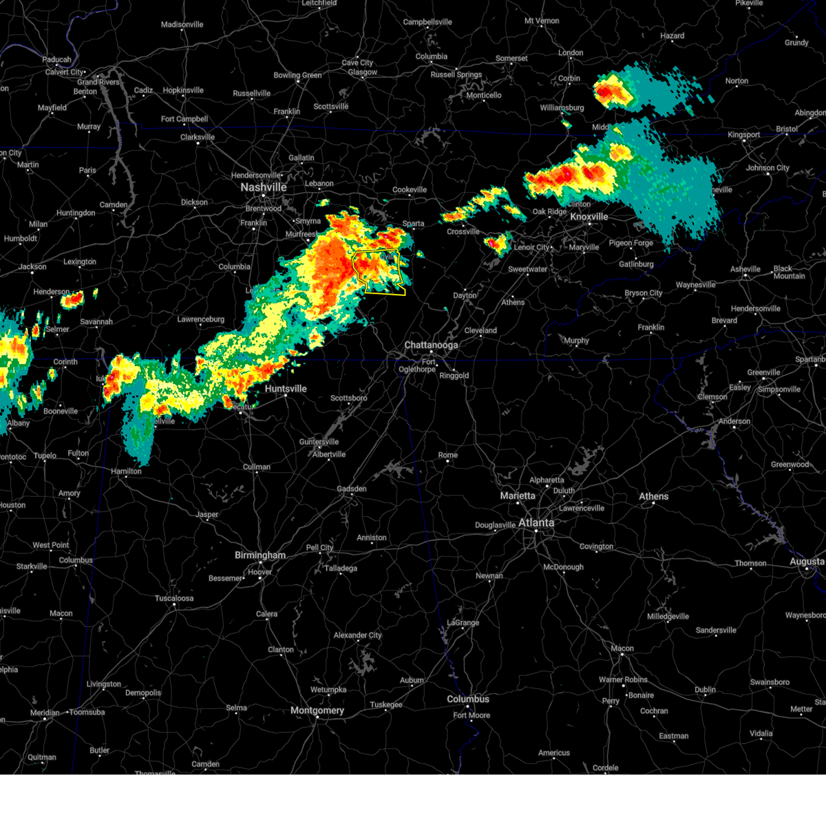
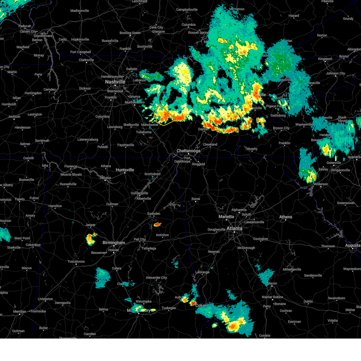
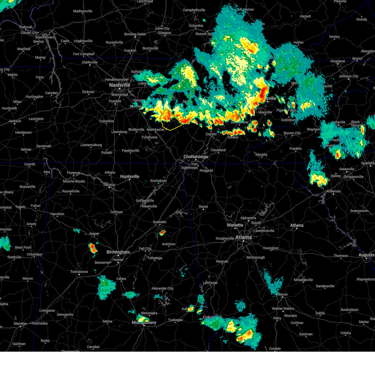
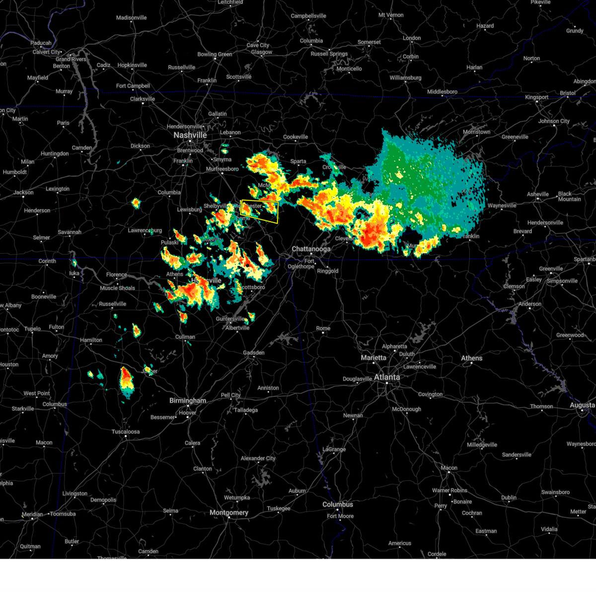
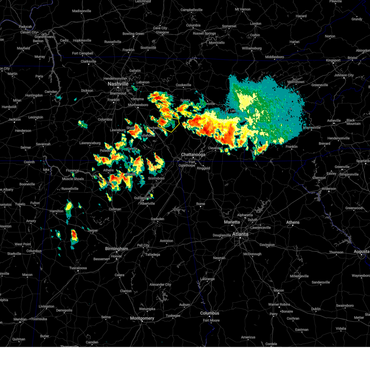
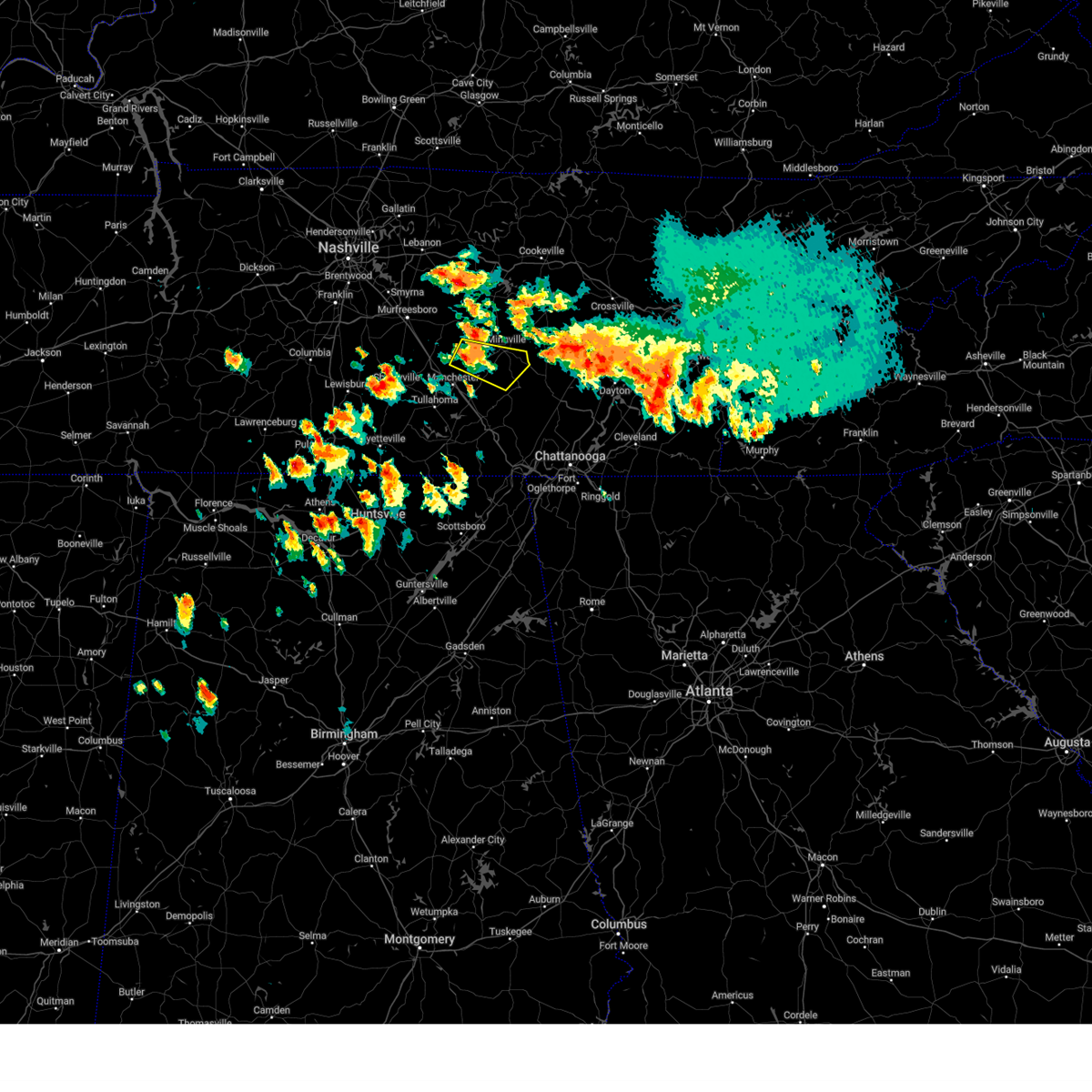
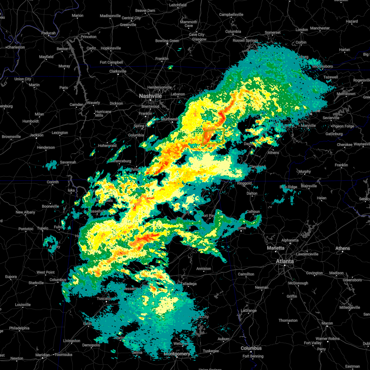
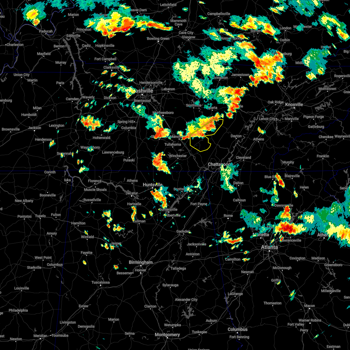
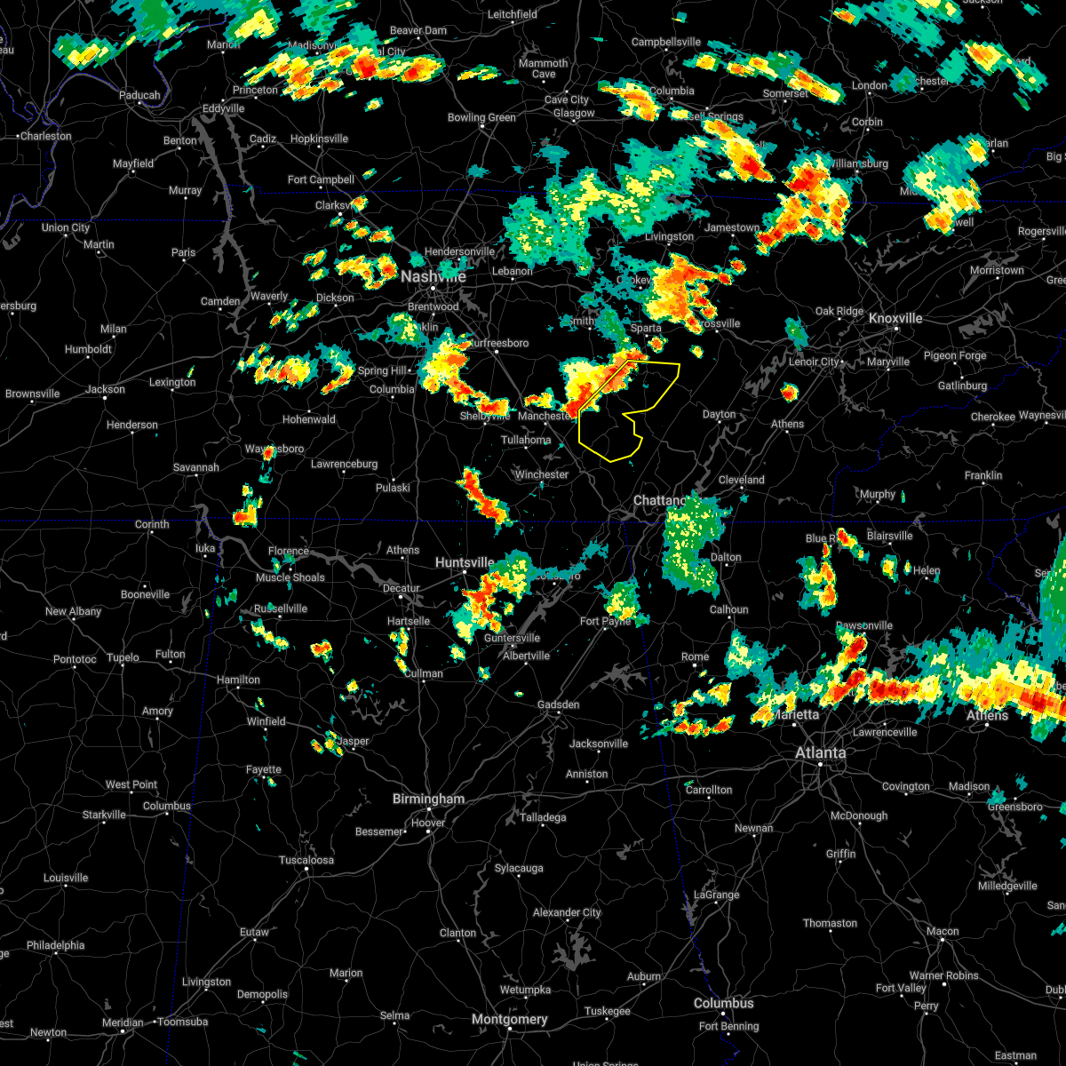
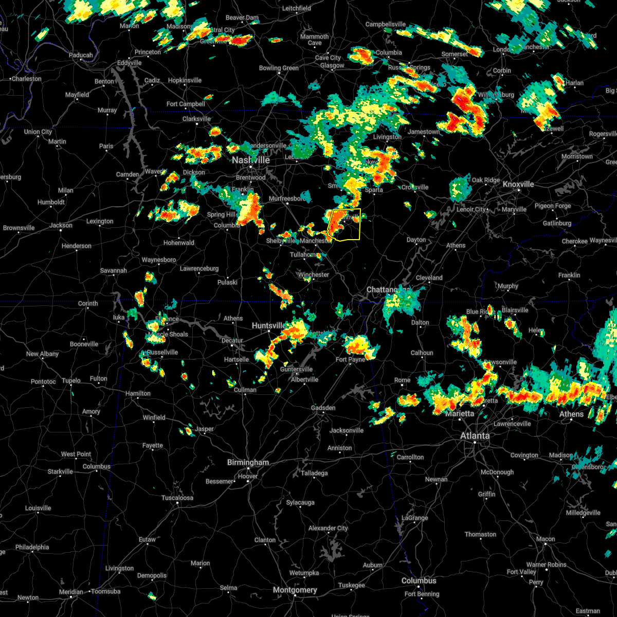
Hail Map for Viola, TN
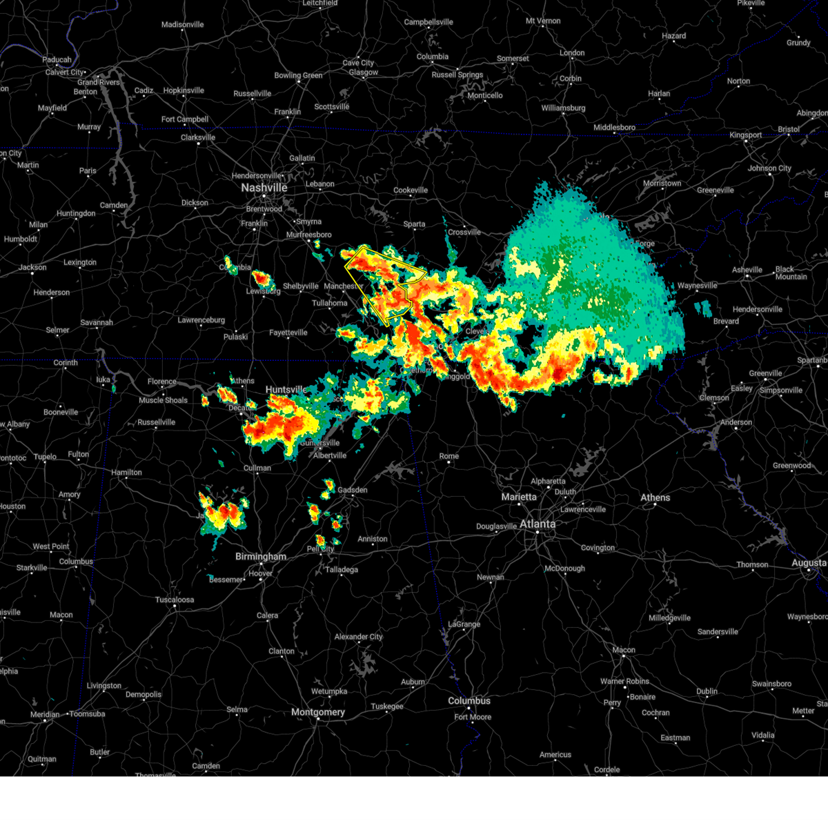
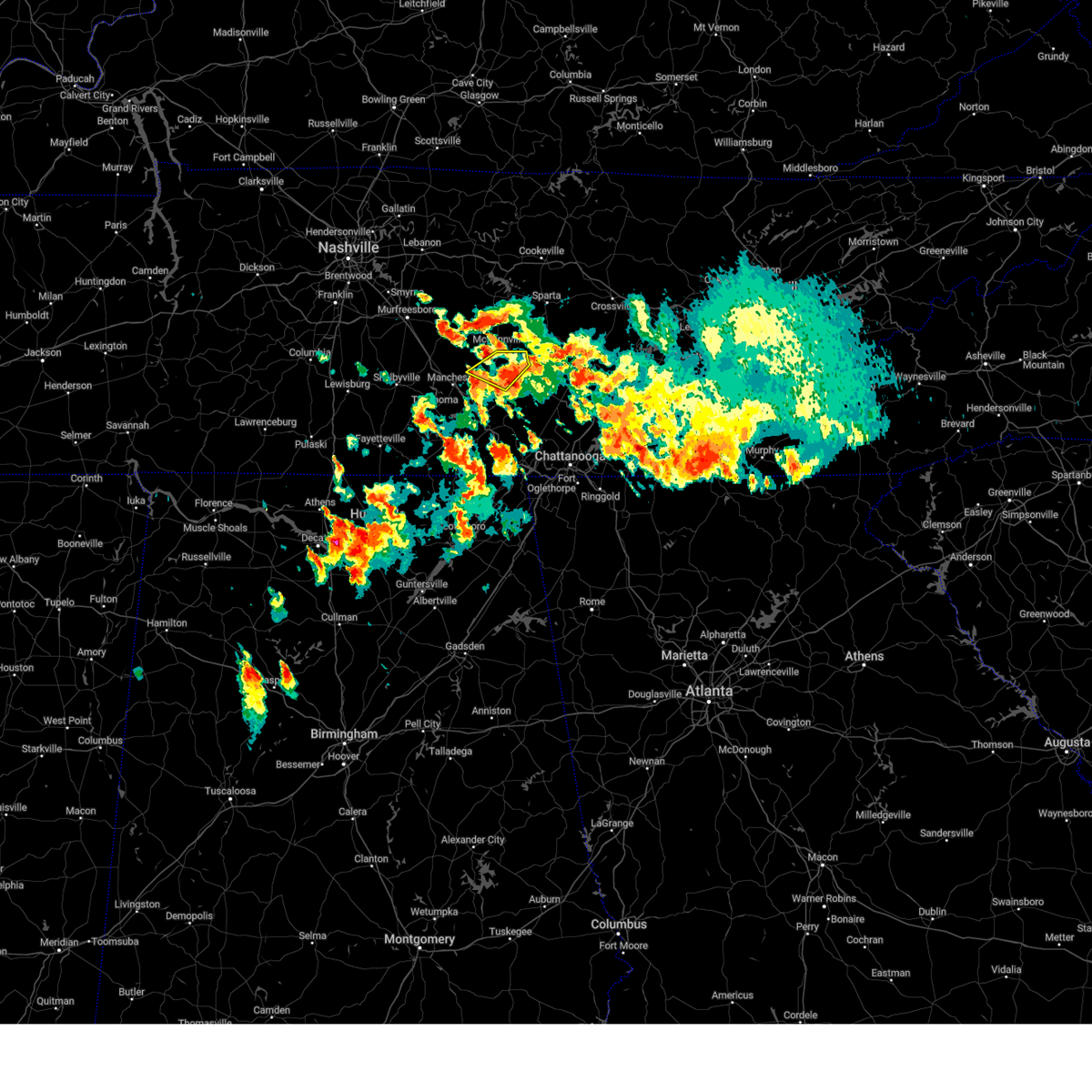
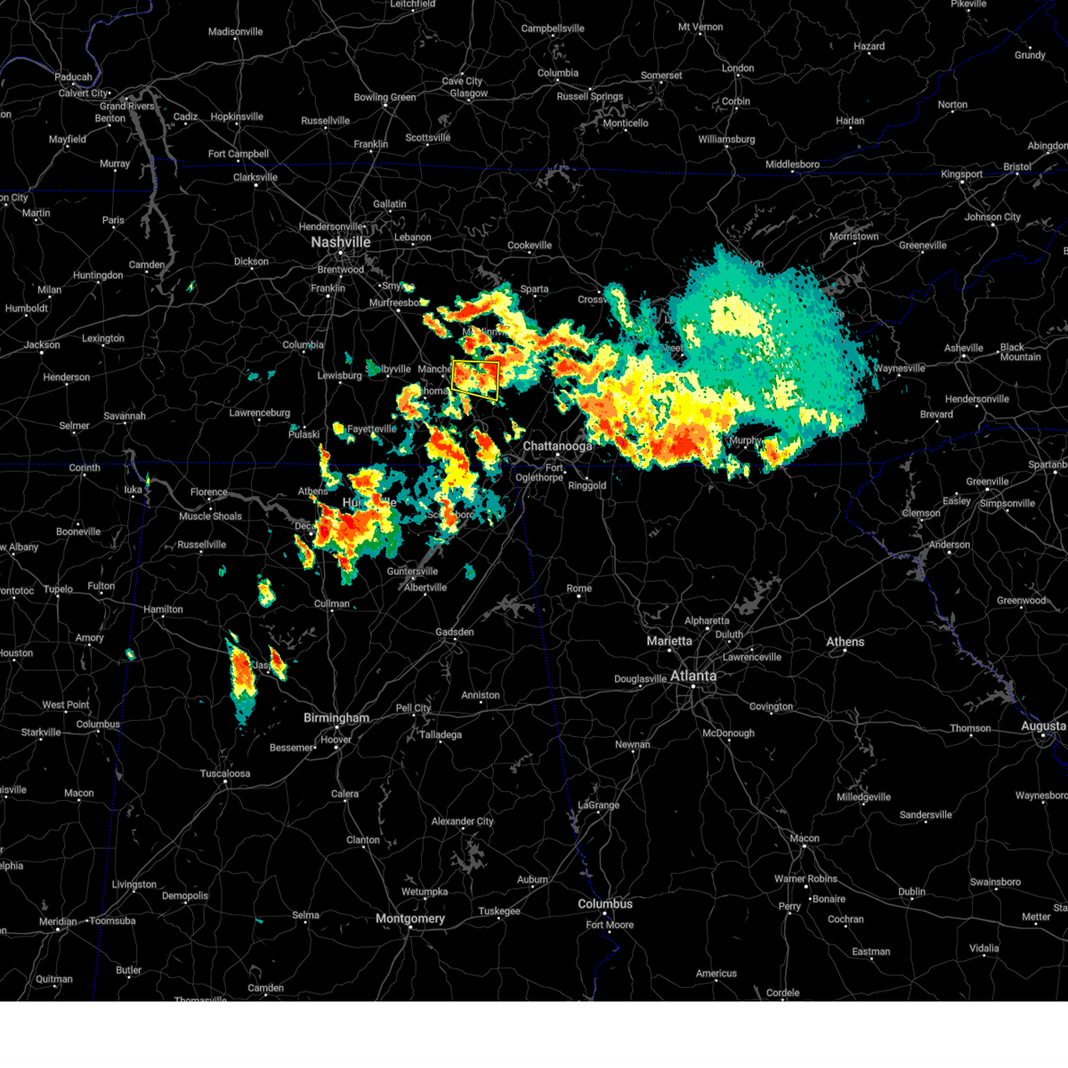
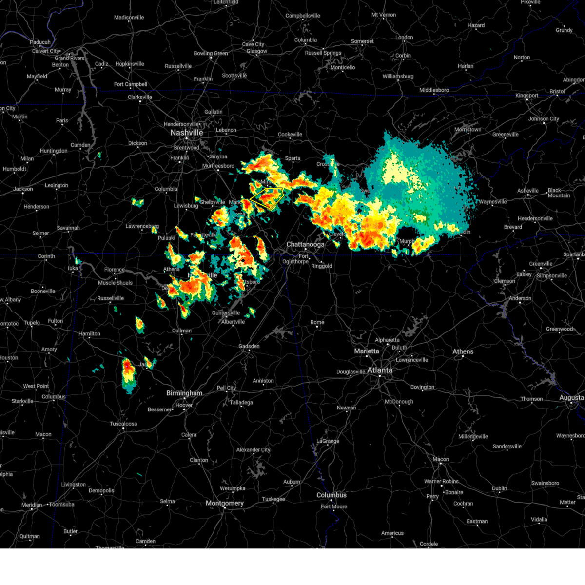
The Viola, TN area has had 0 reports of on-the-ground hail by trained spotters, and has been under severe weather warnings 34 times during the past 12 months. Doppler radar has detected hail at or near Viola, TN on 40 occasions, including 1 occasion during the past year.
| Name: | Viola, TN |
| Where Located: | 46 miles NW of Chattanooga, TN |
| Map: | Google Map for Viola, TN |
| Population: | 131 |
| Housing Units: | 67 |
| More Info: | Search Google for Viola, TN |
0
The Top Recent Hail Date for Viola, TN is Tuesday, May 20, 2025 (20th out of 40)

Hail and Wind Damage Spotted near Viola, TN
| Date / Time | Report Details |
|---|---|
| 6/7/2025 3:34 PM CDT |
 the severe thunderstorm warning has been cancelled and is no longer in effect the severe thunderstorm warning has been cancelled and is no longer in effect
|
| 6/7/2025 3:34 PM CDT |
 At 334 pm cdt, severe thunderstorms were located along a line extending from 8 miles south of mcminnville to 14 miles northwest of dunlap to near gruetli-laager, moving northeast at 45 mph (radar indicated). Hazards include 60 mph wind gusts and penny size hail. Expect damage to roofs, siding, and trees. Locations impacted include, gruetli-laager, tracy city, altamont, coalmont, palmer, beersheba springs, viola, and fiery gizzard state park. At 334 pm cdt, severe thunderstorms were located along a line extending from 8 miles south of mcminnville to 14 miles northwest of dunlap to near gruetli-laager, moving northeast at 45 mph (radar indicated). Hazards include 60 mph wind gusts and penny size hail. Expect damage to roofs, siding, and trees. Locations impacted include, gruetli-laager, tracy city, altamont, coalmont, palmer, beersheba springs, viola, and fiery gizzard state park.
|
| 6/7/2025 3:26 PM CDT |
 At 326 pm cdt, severe thunderstorms were located along a line extending from 11 miles northeast of manchester to 11 miles north of tracy city to near gruetli-laager, moving east at 55 mph (radar indicated). Hazards include 60 mph wind gusts and penny size hail. Expect damage to roofs, siding, and trees. locations impacted include, mcminnville, gruetli-laager, tracy city, monteagle, altamont, coalmont, morrison, palmer, beersheba springs, viola, summitville, and fiery gizzard state park. This includes interstate 24 between mile markers 134 and 136. At 326 pm cdt, severe thunderstorms were located along a line extending from 11 miles northeast of manchester to 11 miles north of tracy city to near gruetli-laager, moving east at 55 mph (radar indicated). Hazards include 60 mph wind gusts and penny size hail. Expect damage to roofs, siding, and trees. locations impacted include, mcminnville, gruetli-laager, tracy city, monteagle, altamont, coalmont, morrison, palmer, beersheba springs, viola, summitville, and fiery gizzard state park. This includes interstate 24 between mile markers 134 and 136.
|
| 6/7/2025 3:11 PM CDT |
 the severe thunderstorm warning has been cancelled and is no longer in effect the severe thunderstorm warning has been cancelled and is no longer in effect
|
| 6/7/2025 3:11 PM CDT |
 At 311 pm cdt, severe thunderstorms were located along a line extending from 14 miles south of woodbury to manchester to 8 miles northeast of estill springs, moving east at 45 mph (radar indicated). Hazards include 60 mph wind gusts and penny size hail. Expect damage to roofs, siding, and trees. locations impacted include, mcminnville, manchester, gruetli-laager, tracy city, monteagle, altamont, coalmont, morrison, palmer, beersheba springs, viola, summitville, hillsboro, pelham, arnold afb, and fiery gizzard state park. This includes interstate 24 between mile markers 100 and 136. At 311 pm cdt, severe thunderstorms were located along a line extending from 14 miles south of woodbury to manchester to 8 miles northeast of estill springs, moving east at 45 mph (radar indicated). Hazards include 60 mph wind gusts and penny size hail. Expect damage to roofs, siding, and trees. locations impacted include, mcminnville, manchester, gruetli-laager, tracy city, monteagle, altamont, coalmont, morrison, palmer, beersheba springs, viola, summitville, hillsboro, pelham, arnold afb, and fiery gizzard state park. This includes interstate 24 between mile markers 100 and 136.
|
| 6/7/2025 2:58 PM CDT |
 Svrohx the national weather service in nashville has issued a * severe thunderstorm warning for, warren county in middle tennessee, coffee county in middle tennessee, southeastern bedford county in middle tennessee, grundy county in middle tennessee, * until 400 pm cdt. * at 258 pm cdt, severe thunderstorms were located along a line extending from 11 miles northeast of shelbyville to tullahoma, moving east at 40 mph (radar indicated). Hazards include 60 mph wind gusts and penny size hail. expect damage to roofs, siding, and trees Svrohx the national weather service in nashville has issued a * severe thunderstorm warning for, warren county in middle tennessee, coffee county in middle tennessee, southeastern bedford county in middle tennessee, grundy county in middle tennessee, * until 400 pm cdt. * at 258 pm cdt, severe thunderstorms were located along a line extending from 11 miles northeast of shelbyville to tullahoma, moving east at 40 mph (radar indicated). Hazards include 60 mph wind gusts and penny size hail. expect damage to roofs, siding, and trees
|
| 5/20/2025 7:33 PM CDT |
 the tornado warning has been cancelled and is no longer in effect the tornado warning has been cancelled and is no longer in effect
|
| 5/20/2025 7:33 PM CDT |
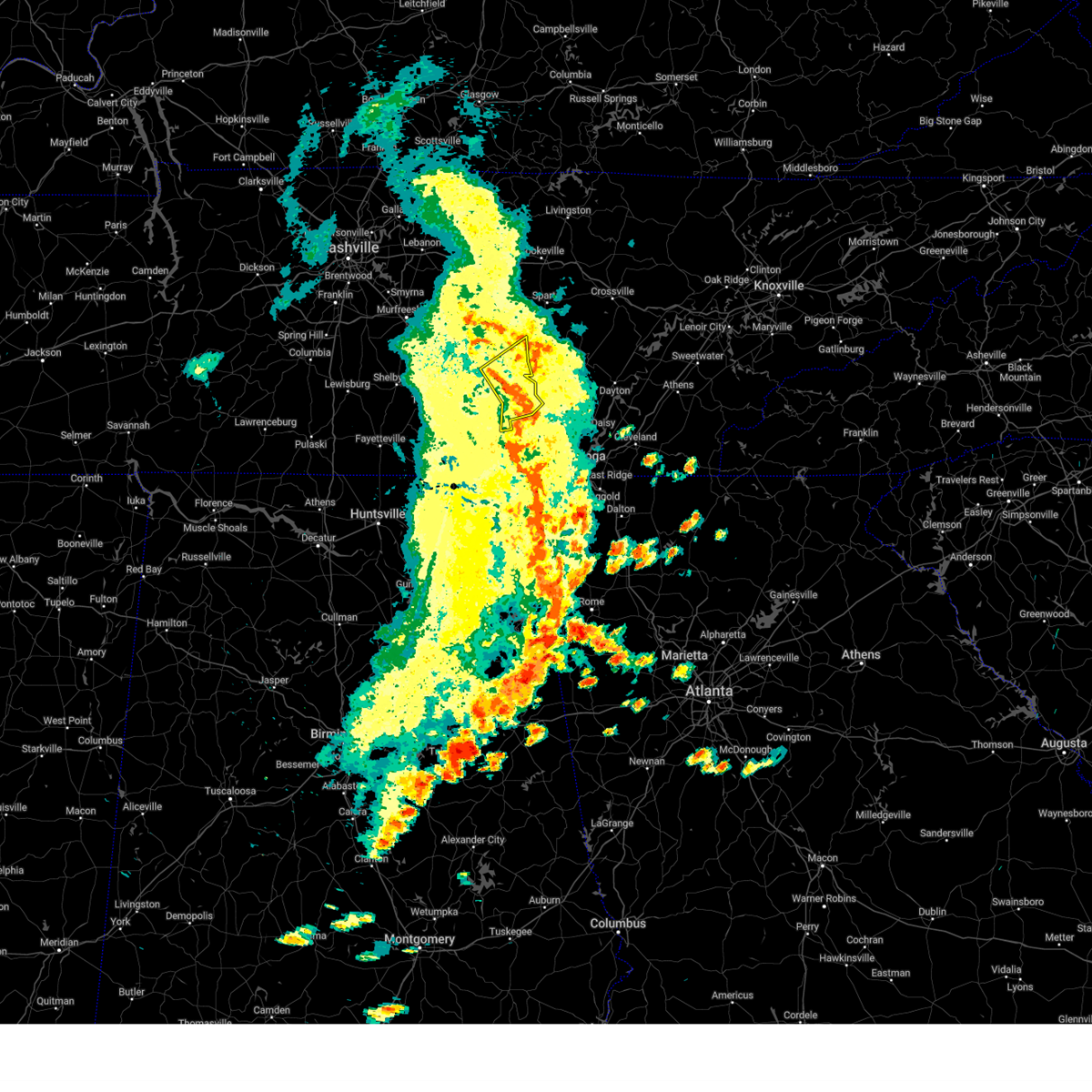
 At 733 pm cdt, a severe thunderstorm capable of producing a tornado was located 9 miles south of mcminnville, moving east at 35 mph (radar indicated rotation). Hazards include tornado and half dollar size hail. Flying debris will be dangerous to those caught without shelter. mobile homes will be damaged or destroyed. damage to roofs, windows, and vehicles will occur. tree damage is likely. Locations impacted include, viola, mcminnville, fall creek falls state park, and spencer. At 733 pm cdt, a severe thunderstorm capable of producing a tornado was located 9 miles south of mcminnville, moving east at 35 mph (radar indicated rotation). Hazards include tornado and half dollar size hail. Flying debris will be dangerous to those caught without shelter. mobile homes will be damaged or destroyed. damage to roofs, windows, and vehicles will occur. tree damage is likely. Locations impacted include, viola, mcminnville, fall creek falls state park, and spencer.
|
| 5/20/2025 7:06 PM CDT |
 Torohx the national weather service in nashville has issued a * tornado warning for, van buren county in middle tennessee, warren county in middle tennessee, northeastern coffee county in middle tennessee, northern grundy county in middle tennessee, south central cannon county in middle tennessee, * until 800 pm cdt. * at 706 pm cdt, a severe thunderstorm capable of producing a tornado was located near summitville, or 8 miles northeast of manchester, moving east at 40 mph (radar indicated rotation). Hazards include tornado and ping pong ball size hail. Flying debris will be dangerous to those caught without shelter. mobile homes will be damaged or destroyed. damage to roofs, windows, and vehicles will occur. Tree damage is likely. Torohx the national weather service in nashville has issued a * tornado warning for, van buren county in middle tennessee, warren county in middle tennessee, northeastern coffee county in middle tennessee, northern grundy county in middle tennessee, south central cannon county in middle tennessee, * until 800 pm cdt. * at 706 pm cdt, a severe thunderstorm capable of producing a tornado was located near summitville, or 8 miles northeast of manchester, moving east at 40 mph (radar indicated rotation). Hazards include tornado and ping pong ball size hail. Flying debris will be dangerous to those caught without shelter. mobile homes will be damaged or destroyed. damage to roofs, windows, and vehicles will occur. Tree damage is likely.
|
| 5/20/2025 6:14 PM CDT |
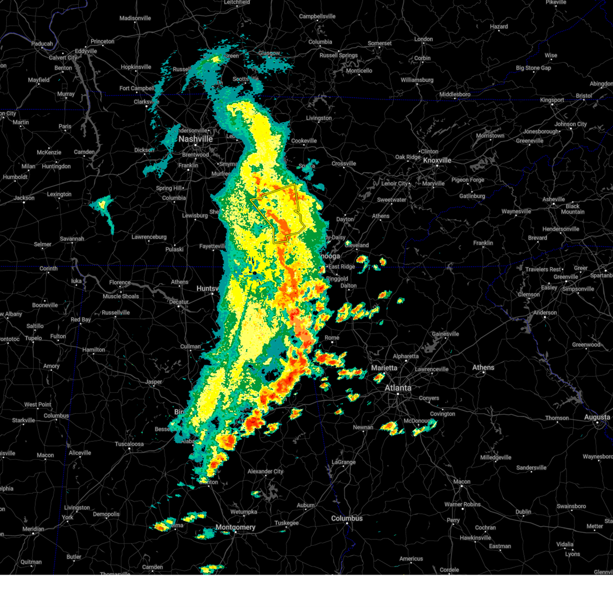
 At 614 pm cdt, a severe thunderstorm capable of producing a tornado was located near morrison, or 10 miles southwest of mcminnville, moving east at 45 mph (radar indicated rotation). Hazards include tornado and half dollar size hail. Flying debris will be dangerous to those caught without shelter. mobile homes will be damaged or destroyed. damage to roofs, windows, and vehicles will occur. tree damage is likely. Locations impacted include, mcminnville, morrison, summitville, viola, and centertown. At 614 pm cdt, a severe thunderstorm capable of producing a tornado was located near morrison, or 10 miles southwest of mcminnville, moving east at 45 mph (radar indicated rotation). Hazards include tornado and half dollar size hail. Flying debris will be dangerous to those caught without shelter. mobile homes will be damaged or destroyed. damage to roofs, windows, and vehicles will occur. tree damage is likely. Locations impacted include, mcminnville, morrison, summitville, viola, and centertown.
|
| 5/20/2025 6:14 PM CDT |
 the tornado warning has been cancelled and is no longer in effect the tornado warning has been cancelled and is no longer in effect
|
| 5/20/2025 5:48 PM CDT |
 Torohx the national weather service in nashville has issued a * tornado warning for, southwestern warren county in middle tennessee, central coffee county in middle tennessee, east central bedford county in middle tennessee, northwestern grundy county in middle tennessee, south central cannon county in middle tennessee, * until 630 pm cdt. * at 548 pm cdt, a severe thunderstorm capable of producing a tornado was located 9 miles west of manchester, moving east at 35 mph (radar indicated rotation). Hazards include tornado and ping pong ball size hail. Flying debris will be dangerous to those caught without shelter. mobile homes will be damaged or destroyed. damage to roofs, windows, and vehicles will occur. tree damage is likely. this dangerous storm will be near, manchester around 555 pm cdt. Other locations impacted by this tornadic thunderstorm include morrison, beechgrove, normandy, viola, summitville, wartrace, bell buckle, centertown, and altamont. Torohx the national weather service in nashville has issued a * tornado warning for, southwestern warren county in middle tennessee, central coffee county in middle tennessee, east central bedford county in middle tennessee, northwestern grundy county in middle tennessee, south central cannon county in middle tennessee, * until 630 pm cdt. * at 548 pm cdt, a severe thunderstorm capable of producing a tornado was located 9 miles west of manchester, moving east at 35 mph (radar indicated rotation). Hazards include tornado and ping pong ball size hail. Flying debris will be dangerous to those caught without shelter. mobile homes will be damaged or destroyed. damage to roofs, windows, and vehicles will occur. tree damage is likely. this dangerous storm will be near, manchester around 555 pm cdt. Other locations impacted by this tornadic thunderstorm include morrison, beechgrove, normandy, viola, summitville, wartrace, bell buckle, centertown, and altamont.
|
| 4/10/2025 6:30 PM CDT |
 At 630 pm cdt, severe thunderstorms were located along a line extending from near smithville to 6 miles northeast of estill springs, moving east at 40 mph (radar indicated). Hazards include 60 mph wind gusts. Expect damage to roofs, siding, and trees. locations impacted include, woodbury, morrison, hillsboro, centertown, manchester, viola, summitville, auburntown, arnold afb, and mcminnville. This includes interstate 24 between mile markers 104 and 126. At 630 pm cdt, severe thunderstorms were located along a line extending from near smithville to 6 miles northeast of estill springs, moving east at 40 mph (radar indicated). Hazards include 60 mph wind gusts. Expect damage to roofs, siding, and trees. locations impacted include, woodbury, morrison, hillsboro, centertown, manchester, viola, summitville, auburntown, arnold afb, and mcminnville. This includes interstate 24 between mile markers 104 and 126.
|
| 4/10/2025 6:30 PM CDT |
 the severe thunderstorm warning has been cancelled and is no longer in effect the severe thunderstorm warning has been cancelled and is no longer in effect
|
| 4/10/2025 5:52 PM CDT |
 Svrohx the national weather service in nashville has issued a * severe thunderstorm warning for, southwestern de kalb county in middle tennessee, southeastern rutherford county in middle tennessee, western warren county in middle tennessee, coffee county in middle tennessee, bedford county in middle tennessee, cannon county in middle tennessee, * until 645 pm cdt. * at 551 pm cdt, severe thunderstorms were located along a line extending from near walterhill to near petersburg, moving east at 25 mph (radar indicated). Hazards include 60 mph wind gusts. expect damage to roofs, siding, and trees Svrohx the national weather service in nashville has issued a * severe thunderstorm warning for, southwestern de kalb county in middle tennessee, southeastern rutherford county in middle tennessee, western warren county in middle tennessee, coffee county in middle tennessee, bedford county in middle tennessee, cannon county in middle tennessee, * until 645 pm cdt. * at 551 pm cdt, severe thunderstorms were located along a line extending from near walterhill to near petersburg, moving east at 25 mph (radar indicated). Hazards include 60 mph wind gusts. expect damage to roofs, siding, and trees
|
| 4/6/2025 12:44 AM CDT |
 At 1244 am cdt, severe thunderstorms were located along a line extending from near manchester to near cowan, moving east at 55 mph (radar indicated). Hazards include 60 mph wind gusts and penny size hail. Expect damage to roofs, siding, and trees. locations impacted include, monteagle, altamont, coalmont, hillsboro, pelham, tracy city, viola, gruetli-laager, manchester, beersheba springs, arnold afb, mcminnville, fiery gizzard state park, and woods reservoir. This includes interstate 24 between mile markers 112 and 135. At 1244 am cdt, severe thunderstorms were located along a line extending from near manchester to near cowan, moving east at 55 mph (radar indicated). Hazards include 60 mph wind gusts and penny size hail. Expect damage to roofs, siding, and trees. locations impacted include, monteagle, altamont, coalmont, hillsboro, pelham, tracy city, viola, gruetli-laager, manchester, beersheba springs, arnold afb, mcminnville, fiery gizzard state park, and woods reservoir. This includes interstate 24 between mile markers 112 and 135.
|
| 4/6/2025 12:24 AM CDT |
 Svrohx the national weather service in nashville has issued a * severe thunderstorm warning for, southwestern warren county in middle tennessee, coffee county in middle tennessee, grundy county in middle tennessee, * until 115 am cdt. * at 1224 am cdt, severe thunderstorms were located along a line extending from near tullahoma to near huntland, moving northeast at 50 mph (radar indicated). Hazards include 60 mph wind gusts and penny size hail. expect damage to roofs, siding, and trees Svrohx the national weather service in nashville has issued a * severe thunderstorm warning for, southwestern warren county in middle tennessee, coffee county in middle tennessee, grundy county in middle tennessee, * until 115 am cdt. * at 1224 am cdt, severe thunderstorms were located along a line extending from near tullahoma to near huntland, moving northeast at 50 mph (radar indicated). Hazards include 60 mph wind gusts and penny size hail. expect damage to roofs, siding, and trees
|
| 3/31/2025 2:36 AM CDT |
 The storms which prompted the warning have weakened below severe limits, and no longer pose an immediate threat to life or property. therefore, the warning will be allowed to expire. a tornado watch remains in effect until 300 am cdt for middle tennessee. The storms which prompted the warning have weakened below severe limits, and no longer pose an immediate threat to life or property. therefore, the warning will be allowed to expire. a tornado watch remains in effect until 300 am cdt for middle tennessee.
|
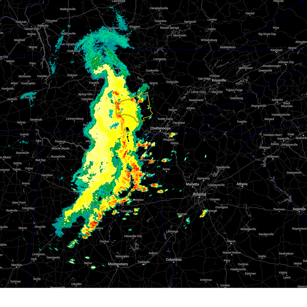
| 3/31/2025 2:29 AM CDT | At 228 am cdt, severe thunderstorms were located along a line extending from 8 miles east of pikeville to 7 miles west of dayton to near gruetli-laager to monteagle, moving southeast at 35 mph (radar indicated). Hazards include 60 mph wind gusts and penny size hail. Expect damage to roofs, siding, and trees. Locations impacted include, coalmont, palmer, fall creek falls state park, altamont, gruetli-laager, viola, beersheba springs, and spencer. |
| 3/31/2025 2:29 AM CDT | the severe thunderstorm warning has been cancelled and is no longer in effect |
| 3/31/2025 1:46 AM CDT | Svrohx the national weather service in nashville has issued a * severe thunderstorm warning for, van buren county in middle tennessee, southern warren county in middle tennessee, southeastern coffee county in middle tennessee, grundy county in middle tennessee, * until 245 am cdt. * at 146 am cdt, severe thunderstorms were located along a line extending from near spencer to 16 miles west of pikeville to near manchester to near tullahoma, moving southeast at 35 mph (radar indicated). Hazards include 60 mph wind gusts and penny size hail. expect damage to roofs, siding, and trees |
| 3/15/2025 4:20 PM CDT | At 419 pm cdt, severe thunderstorms were located along a line extending from near smithville to 6 miles north of mcminnville to 11 miles east of manchester, moving east at 45 mph (radar indicated). Hazards include 60 mph wind gusts and penny size hail. Expect damage to roofs, siding, and trees. Locations impacted include, viola, mcminnville, morrison, and altamont. |
| 3/15/2025 4:20 PM CDT | the severe thunderstorm warning has been cancelled and is no longer in effect |
| 3/15/2025 4:10 PM CDT |
 At 409 pm cdt, severe thunderstorms were located along a line extending from 6 miles west of smithville to near mcminnville to 9 miles east of manchester, moving east at 55 mph (radar indicated). Hazards include 60 mph wind gusts and penny size hail. Expect damage to roofs, siding, and trees. locations impacted include, morrison, centertown, tullahoma, summitville, woodbury, mcminnville, hillsboro, pelham, manchester, viola, altamont, monteagle, and arnold afb. This includes interstate 24 between mile markers 104 and 133. At 409 pm cdt, severe thunderstorms were located along a line extending from 6 miles west of smithville to near mcminnville to 9 miles east of manchester, moving east at 55 mph (radar indicated). Hazards include 60 mph wind gusts and penny size hail. Expect damage to roofs, siding, and trees. locations impacted include, morrison, centertown, tullahoma, summitville, woodbury, mcminnville, hillsboro, pelham, manchester, viola, altamont, monteagle, and arnold afb. This includes interstate 24 between mile markers 104 and 133.
|
| 3/15/2025 4:10 PM CDT |
 the severe thunderstorm warning has been cancelled and is no longer in effect the severe thunderstorm warning has been cancelled and is no longer in effect
|
| 3/15/2025 3:55 PM CDT |
 At 355 pm cdt, severe thunderstorms were located along a line extending from 10 miles south of watertown to 7 miles southeast of woodbury to near manchester, moving east at 55 mph (radar indicated). Hazards include 60 mph wind gusts and penny size hail. Expect damage to roofs, siding, and trees. locations impacted include, morrison, centertown, tullahoma, beechgrove, raus, summitville, auburntown, woodbury, mcminnville, hillsboro, pelham, manchester, bradyville, normandy, milton, viola, readyville, liberty, altamont, and monteagle. This includes interstate 24 between mile markers 95 and 133. At 355 pm cdt, severe thunderstorms were located along a line extending from 10 miles south of watertown to 7 miles southeast of woodbury to near manchester, moving east at 55 mph (radar indicated). Hazards include 60 mph wind gusts and penny size hail. Expect damage to roofs, siding, and trees. locations impacted include, morrison, centertown, tullahoma, beechgrove, raus, summitville, auburntown, woodbury, mcminnville, hillsboro, pelham, manchester, bradyville, normandy, milton, viola, readyville, liberty, altamont, and monteagle. This includes interstate 24 between mile markers 95 and 133.
|
| 3/15/2025 3:38 PM CDT | Svrohx the national weather service in nashville has issued a * severe thunderstorm warning for, southern de kalb county in middle tennessee, eastern rutherford county in middle tennessee, warren county in middle tennessee, coffee county in middle tennessee, southeastern wilson county in middle tennessee, eastern bedford county in middle tennessee, western grundy county in middle tennessee, cannon county in middle tennessee, * until 430 pm cdt. * at 338 pm cdt, severe thunderstorms were located along a line extending from murfreesboro to 15 miles northeast of shelbyville to near lynchburg, moving east at 55 mph (radar indicated). Hazards include 60 mph wind gusts and penny size hail. expect damage to roofs, siding, and trees |
| 2/16/2025 1:21 AM CST |
 At 121 am cst, severe thunderstorms were located along a line extending from near mcminnville to 7 miles northwest of tracy city, moving northeast at 55 mph (radar indicated). Hazards include 60 mph wind gusts. Expect damage to roofs, siding, and trees. locations impacted include, mcminnville, spencer, gruetli-laager, tracy city, monteagle, altamont, coalmont, palmer, beersheba springs, viola, fall creek falls state park, pelham, and fiery gizzard state park. This includes interstate 24 between mile markers 128 and 135. At 121 am cst, severe thunderstorms were located along a line extending from near mcminnville to 7 miles northwest of tracy city, moving northeast at 55 mph (radar indicated). Hazards include 60 mph wind gusts. Expect damage to roofs, siding, and trees. locations impacted include, mcminnville, spencer, gruetli-laager, tracy city, monteagle, altamont, coalmont, palmer, beersheba springs, viola, fall creek falls state park, pelham, and fiery gizzard state park. This includes interstate 24 between mile markers 128 and 135.
|
| 2/16/2025 1:21 AM CST |
 the severe thunderstorm warning has been cancelled and is no longer in effect the severe thunderstorm warning has been cancelled and is no longer in effect
|
| 2/16/2025 1:07 AM CST |
 Svrohx the national weather service in nashville has issued a * severe thunderstorm warning for, van buren county in middle tennessee, warren county in middle tennessee, eastern coffee county in middle tennessee, grundy county in middle tennessee, * until 145 am cst. * at 107 am cst, severe thunderstorms were located along a line extending from 6 miles west of mcminnville to 6 miles northeast of decherd, moving northeast at 50 mph (radar indicated). Hazards include 60 mph wind gusts. expect damage to roofs, siding, and trees Svrohx the national weather service in nashville has issued a * severe thunderstorm warning for, van buren county in middle tennessee, warren county in middle tennessee, eastern coffee county in middle tennessee, grundy county in middle tennessee, * until 145 am cst. * at 107 am cst, severe thunderstorms were located along a line extending from 6 miles west of mcminnville to 6 miles northeast of decherd, moving northeast at 50 mph (radar indicated). Hazards include 60 mph wind gusts. expect damage to roofs, siding, and trees
|
| 7/30/2024 5:06 PM CDT |
 The storms which prompted the warning have weakened below severe limits, and no longer pose an immediate threat to life or property. therefore, the warning will be allowed to expire. a severe thunderstorm watch remains in effect until 800 pm cdt for middle tennessee. to report severe weather, contact your nearest law enforcement agency. they will relay your report to the national weather service nashville. The storms which prompted the warning have weakened below severe limits, and no longer pose an immediate threat to life or property. therefore, the warning will be allowed to expire. a severe thunderstorm watch remains in effect until 800 pm cdt for middle tennessee. to report severe weather, contact your nearest law enforcement agency. they will relay your report to the national weather service nashville.
|
| 7/30/2024 4:37 PM CDT |
 the severe thunderstorm warning has been cancelled and is no longer in effect the severe thunderstorm warning has been cancelled and is no longer in effect
|
| 7/30/2024 4:37 PM CDT |
 At 437 pm cdt, severe thunderstorms were located along a line extending from bell buckle to fall creek falls, moving southeast at 40 mph (radar indicated). Hazards include 60 mph wind gusts and quarter size hail. Hail damage to vehicles is expected. expect wind damage to roofs, siding, and trees. locations impacted include, mcminnville, manchester, woodbury, spencer, tullahoma, gruetli-laager, tracy city, monteagle, altamont, coalmont, morrison, palmer, beersheba springs, centertown, viola, summitville, fall creek falls state park, hillsboro, pelham, and bradyville. This includes interstate 24 between mile markers 101 and 136. At 437 pm cdt, severe thunderstorms were located along a line extending from bell buckle to fall creek falls, moving southeast at 40 mph (radar indicated). Hazards include 60 mph wind gusts and quarter size hail. Hail damage to vehicles is expected. expect wind damage to roofs, siding, and trees. locations impacted include, mcminnville, manchester, woodbury, spencer, tullahoma, gruetli-laager, tracy city, monteagle, altamont, coalmont, morrison, palmer, beersheba springs, centertown, viola, summitville, fall creek falls state park, hillsboro, pelham, and bradyville. This includes interstate 24 between mile markers 101 and 136.
|
| 7/30/2024 4:10 PM CDT |
 Svrohx the national weather service in nashville has issued a * severe thunderstorm warning for, southeastern rutherford county in middle tennessee, van buren county in middle tennessee, warren county in middle tennessee, coffee county in middle tennessee, bedford county in middle tennessee, grundy county in middle tennessee, cannon county in middle tennessee, * until 515 pm cdt. * at 409 pm cdt, severe thunderstorms were located along a line extending from murfreesboro to spencer, moving south at 30 mph (radar indicated). Hazards include 60 mph wind gusts and quarter size hail. Hail damage to vehicles is expected. Expect wind damage to roofs, siding, and trees. Svrohx the national weather service in nashville has issued a * severe thunderstorm warning for, southeastern rutherford county in middle tennessee, van buren county in middle tennessee, warren county in middle tennessee, coffee county in middle tennessee, bedford county in middle tennessee, grundy county in middle tennessee, cannon county in middle tennessee, * until 515 pm cdt. * at 409 pm cdt, severe thunderstorms were located along a line extending from murfreesboro to spencer, moving south at 30 mph (radar indicated). Hazards include 60 mph wind gusts and quarter size hail. Hail damage to vehicles is expected. Expect wind damage to roofs, siding, and trees.
|
| 5/22/2024 7:07 PM CDT |
 Svrohx the national weather service in nashville has issued a * severe thunderstorm warning for, van buren county in middle tennessee, southern warren county in middle tennessee, northwestern grundy county in middle tennessee, * until 745 pm cdt. * at 707 pm cdt, a severe thunderstorm was located 7 miles south of mcminnville, moving east at 50 mph (radar indicated). Hazards include 60 mph wind gusts and penny size hail. expect damage to roofs, siding, and trees Svrohx the national weather service in nashville has issued a * severe thunderstorm warning for, van buren county in middle tennessee, southern warren county in middle tennessee, northwestern grundy county in middle tennessee, * until 745 pm cdt. * at 707 pm cdt, a severe thunderstorm was located 7 miles south of mcminnville, moving east at 50 mph (radar indicated). Hazards include 60 mph wind gusts and penny size hail. expect damage to roofs, siding, and trees
|
| 5/14/2024 6:14 PM CDT |
 the severe thunderstorm warning has been cancelled and is no longer in effect the severe thunderstorm warning has been cancelled and is no longer in effect
|
| 5/14/2024 5:52 PM CDT |
 Svrohx the national weather service in nashville has issued a * severe thunderstorm warning for, southwestern warren county in middle tennessee, coffee county in middle tennessee, western grundy county in middle tennessee, * until 630 pm cdt. * at 552 pm cdt, severe thunderstorms were located along a line extending from 13 miles north of tullahoma to 6 miles south of manchester, moving northeast at 40 mph (radar indicated). Hazards include 60 mph wind gusts. expect damage to roofs, siding, and trees Svrohx the national weather service in nashville has issued a * severe thunderstorm warning for, southwestern warren county in middle tennessee, coffee county in middle tennessee, western grundy county in middle tennessee, * until 630 pm cdt. * at 552 pm cdt, severe thunderstorms were located along a line extending from 13 miles north of tullahoma to 6 miles south of manchester, moving northeast at 40 mph (radar indicated). Hazards include 60 mph wind gusts. expect damage to roofs, siding, and trees
|
| 5/9/2024 4:32 AM CDT |
 the severe thunderstorm warning has been cancelled and is no longer in effect the severe thunderstorm warning has been cancelled and is no longer in effect
|
| 5/9/2024 4:06 AM CDT |
 Svrohx the national weather service in nashville has issued a * severe thunderstorm warning for, south central warren county in middle tennessee, southeastern coffee county in middle tennessee, grundy county in middle tennessee, * until 445 am cdt. * at 406 am cdt, a severe thunderstorm was located 9 miles north of monteagle, or 14 miles southeast of manchester, moving east at 60 mph (radar indicated). Hazards include 60 mph wind gusts and quarter size hail. Hail damage to vehicles is expected. Expect wind damage to roofs, siding, and trees. Svrohx the national weather service in nashville has issued a * severe thunderstorm warning for, south central warren county in middle tennessee, southeastern coffee county in middle tennessee, grundy county in middle tennessee, * until 445 am cdt. * at 406 am cdt, a severe thunderstorm was located 9 miles north of monteagle, or 14 miles southeast of manchester, moving east at 60 mph (radar indicated). Hazards include 60 mph wind gusts and quarter size hail. Hail damage to vehicles is expected. Expect wind damage to roofs, siding, and trees.
|
| 5/8/2024 8:41 PM CDT |
 Torohx the national weather service in nashville has issued a * tornado warning for, southeastern warren county in middle tennessee, southeastern coffee county in middle tennessee, grundy county in middle tennessee, * until 930 pm cdt. * at 841 pm cdt, a severe thunderstorm capable of producing a tornado was located 9 miles north of monteagle, or 13 miles southeast of manchester, moving east at 30 mph (radar indicated rotation). Hazards include tornado and quarter size hail. Flying debris will be dangerous to those caught without shelter. mobile homes will be damaged or destroyed. damage to roofs, windows, and vehicles will occur. tree damage is likely. this dangerous storm will be near, gruetli-laager around 855 pm cdt. other locations impacted by this tornadic thunderstorm include coalmont, palmer, hillsboro, pelham, altamont, viola, and beersheba springs. This includes interstate 24 between mile markers 121 and 129. Torohx the national weather service in nashville has issued a * tornado warning for, southeastern warren county in middle tennessee, southeastern coffee county in middle tennessee, grundy county in middle tennessee, * until 930 pm cdt. * at 841 pm cdt, a severe thunderstorm capable of producing a tornado was located 9 miles north of monteagle, or 13 miles southeast of manchester, moving east at 30 mph (radar indicated rotation). Hazards include tornado and quarter size hail. Flying debris will be dangerous to those caught without shelter. mobile homes will be damaged or destroyed. damage to roofs, windows, and vehicles will occur. tree damage is likely. this dangerous storm will be near, gruetli-laager around 855 pm cdt. other locations impacted by this tornadic thunderstorm include coalmont, palmer, hillsboro, pelham, altamont, viola, and beersheba springs. This includes interstate 24 between mile markers 121 and 129.
|
| 5/8/2024 8:31 PM CDT |
 the severe thunderstorm warning has been cancelled and is no longer in effect the severe thunderstorm warning has been cancelled and is no longer in effect
|
| 5/8/2024 8:31 PM CDT |
 At 830 pm cdt, a severe thunderstorm was located near manchester, moving east at 45 mph (trained weather spotters). Hazards include 60 mph wind gusts and half dollar size hail. Hail damage to vehicles is expected. expect wind damage to roofs, siding, and trees. locations impacted include, mcminnville, manchester, tullahoma, altamont, coalmont, morrison, viola, hillsboro, beechgrove, and summitville. This includes interstate 24 between mile markers 97 and 123. At 830 pm cdt, a severe thunderstorm was located near manchester, moving east at 45 mph (trained weather spotters). Hazards include 60 mph wind gusts and half dollar size hail. Hail damage to vehicles is expected. expect wind damage to roofs, siding, and trees. locations impacted include, mcminnville, manchester, tullahoma, altamont, coalmont, morrison, viola, hillsboro, beechgrove, and summitville. This includes interstate 24 between mile markers 97 and 123.
|
| 5/8/2024 8:19 PM CDT |
 Torohx the national weather service in nashville has issued a * tornado warning for, southwestern warren county in middle tennessee, coffee county in middle tennessee, northwestern grundy county in middle tennessee, * until 845 pm cdt. * at 819 pm cdt, a severe thunderstorm capable of producing a tornado was located over manchester, moving east at 25 mph (radar indicated rotation). Hazards include tornado and golf ball size hail. Flying debris will be dangerous to those caught without shelter. mobile homes will be damaged or destroyed. damage to roofs, windows, and vehicles will occur. tree damage is likely. this dangerous storm will be near, manchester around 825 pm cdt. other locations impacted by this tornadic thunderstorm include pelham, viola, hillsboro, summitville, arnold afb, and altamont. This includes interstate 24 between mile markers 104 and 126. Torohx the national weather service in nashville has issued a * tornado warning for, southwestern warren county in middle tennessee, coffee county in middle tennessee, northwestern grundy county in middle tennessee, * until 845 pm cdt. * at 819 pm cdt, a severe thunderstorm capable of producing a tornado was located over manchester, moving east at 25 mph (radar indicated rotation). Hazards include tornado and golf ball size hail. Flying debris will be dangerous to those caught without shelter. mobile homes will be damaged or destroyed. damage to roofs, windows, and vehicles will occur. tree damage is likely. this dangerous storm will be near, manchester around 825 pm cdt. other locations impacted by this tornadic thunderstorm include pelham, viola, hillsboro, summitville, arnold afb, and altamont. This includes interstate 24 between mile markers 104 and 126.
|
| 5/8/2024 8:14 PM CDT |
 At 814 pm cdt, a severe thunderstorm was located near manchester, moving east at 45 mph (trained weather spotters). Hazards include golf ball size hail and 60 mph wind gusts. People and animals outdoors will be injured. expect hail damage to roofs, siding, windows, and vehicles. expect wind damage to roofs, siding, and trees. locations impacted include, shelbyville, mcminnville, manchester, tullahoma, altamont, coalmont, morrison, wartrace, bell buckle, normandy, viola, beechgrove, raus, summitville, deason, and hillsboro. This includes interstate 24 between mile markers 97 and 123. At 814 pm cdt, a severe thunderstorm was located near manchester, moving east at 45 mph (trained weather spotters). Hazards include golf ball size hail and 60 mph wind gusts. People and animals outdoors will be injured. expect hail damage to roofs, siding, windows, and vehicles. expect wind damage to roofs, siding, and trees. locations impacted include, shelbyville, mcminnville, manchester, tullahoma, altamont, coalmont, morrison, wartrace, bell buckle, normandy, viola, beechgrove, raus, summitville, deason, and hillsboro. This includes interstate 24 between mile markers 97 and 123.
|
| 5/8/2024 8:07 PM CDT |
 Svrohx the national weather service in nashville has issued a * severe thunderstorm warning for, southwestern warren county in middle tennessee, coffee county in middle tennessee, eastern bedford county in middle tennessee, northwestern grundy county in middle tennessee, * until 845 pm cdt. * at 807 pm cdt, a severe thunderstorm was located 9 miles north of tullahoma, or 10 miles east of shelbyville, moving east at 45 mph (radar indicated). Hazards include 60 mph wind gusts and half dollar size hail. Hail damage to vehicles is expected. Expect wind damage to roofs, siding, and trees. Svrohx the national weather service in nashville has issued a * severe thunderstorm warning for, southwestern warren county in middle tennessee, coffee county in middle tennessee, eastern bedford county in middle tennessee, northwestern grundy county in middle tennessee, * until 845 pm cdt. * at 807 pm cdt, a severe thunderstorm was located 9 miles north of tullahoma, or 10 miles east of shelbyville, moving east at 45 mph (radar indicated). Hazards include 60 mph wind gusts and half dollar size hail. Hail damage to vehicles is expected. Expect wind damage to roofs, siding, and trees.
|
| 5/8/2024 7:48 PM CDT |
 Svrohx the national weather service in nashville has issued a * severe thunderstorm warning for, van buren county in middle tennessee, southeastern warren county in middle tennessee, northern grundy county in middle tennessee, * until 815 pm cdt. * at 748 pm cdt, a severe thunderstorm was located 9 miles south of mcminnville, moving east at 50 mph (radar indicated). Hazards include 60 mph wind gusts and quarter size hail. Hail damage to vehicles is expected. Expect wind damage to roofs, siding, and trees. Svrohx the national weather service in nashville has issued a * severe thunderstorm warning for, van buren county in middle tennessee, southeastern warren county in middle tennessee, northern grundy county in middle tennessee, * until 815 pm cdt. * at 748 pm cdt, a severe thunderstorm was located 9 miles south of mcminnville, moving east at 50 mph (radar indicated). Hazards include 60 mph wind gusts and quarter size hail. Hail damage to vehicles is expected. Expect wind damage to roofs, siding, and trees.
|
| 5/6/2024 5:35 PM CDT |
 At 534 pm cdt, a severe thunderstorm was located 8 miles north of manchester, moving southeast at 25 mph (radar indicated). Hazards include 60 mph wind gusts and quarter size hail. Hail damage to vehicles is expected. expect wind damage to roofs, siding, and trees. locations impacted include, manchester, morrison, viola, and summitville. This includes interstate 24 between mile markers 107 and 119. At 534 pm cdt, a severe thunderstorm was located 8 miles north of manchester, moving southeast at 25 mph (radar indicated). Hazards include 60 mph wind gusts and quarter size hail. Hail damage to vehicles is expected. expect wind damage to roofs, siding, and trees. locations impacted include, manchester, morrison, viola, and summitville. This includes interstate 24 between mile markers 107 and 119.
|
| 5/6/2024 5:35 PM CDT |
 the severe thunderstorm warning has been cancelled and is no longer in effect the severe thunderstorm warning has been cancelled and is no longer in effect
|
| 5/6/2024 5:20 PM CDT |
 Svrohx the national weather service in nashville has issued a * severe thunderstorm warning for, southwestern warren county in middle tennessee, central coffee county in middle tennessee, southwestern cannon county in middle tennessee, * until 600 pm cdt. * at 520 pm cdt, a severe thunderstorm was located 12 miles north of manchester, moving southeast at 25 mph (radar indicated). Hazards include 60 mph wind gusts and quarter size hail. Hail damage to vehicles is expected. Expect wind damage to roofs, siding, and trees. Svrohx the national weather service in nashville has issued a * severe thunderstorm warning for, southwestern warren county in middle tennessee, central coffee county in middle tennessee, southwestern cannon county in middle tennessee, * until 600 pm cdt. * at 520 pm cdt, a severe thunderstorm was located 12 miles north of manchester, moving southeast at 25 mph (radar indicated). Hazards include 60 mph wind gusts and quarter size hail. Hail damage to vehicles is expected. Expect wind damage to roofs, siding, and trees.
|
| 5/6/2024 2:29 PM CDT |
 Svrohx the national weather service in nashville has issued a * severe thunderstorm warning for, southwestern van buren county in middle tennessee, southeastern warren county in middle tennessee, northern grundy county in middle tennessee, * until 315 pm cdt. * at 229 pm cdt, a severe thunderstorm was located 11 miles northwest of gruetli-laager, or 13 miles south of mcminnville, moving east at 20 mph (radar indicated). Hazards include 60 mph wind gusts and quarter size hail. Hail damage to vehicles is expected. Expect wind damage to roofs, siding, and trees. Svrohx the national weather service in nashville has issued a * severe thunderstorm warning for, southwestern van buren county in middle tennessee, southeastern warren county in middle tennessee, northern grundy county in middle tennessee, * until 315 pm cdt. * at 229 pm cdt, a severe thunderstorm was located 11 miles northwest of gruetli-laager, or 13 miles south of mcminnville, moving east at 20 mph (radar indicated). Hazards include 60 mph wind gusts and quarter size hail. Hail damage to vehicles is expected. Expect wind damage to roofs, siding, and trees.
|
| 12/9/2023 8:21 PM CST |
 At 820 pm cst, a severe thunderstorm was located over manchester, moving east at 45 mph (radar indicated). Hazards include 60 mph wind gusts and quarter size hail. Hail damage to vehicles is expected. Expect wind damage to roofs, siding, and trees. At 820 pm cst, a severe thunderstorm was located over manchester, moving east at 45 mph (radar indicated). Hazards include 60 mph wind gusts and quarter size hail. Hail damage to vehicles is expected. Expect wind damage to roofs, siding, and trees.
|
| 8/12/2023 1:10 PM CDT |
 At 109 pm cdt, severe thunderstorms were located along a line extending from mcminnville to near tullahoma, moving east at 55 mph (radar indicated). Hazards include 60 mph wind gusts. expect damage to roofs, siding, and trees At 109 pm cdt, severe thunderstorms were located along a line extending from mcminnville to near tullahoma, moving east at 55 mph (radar indicated). Hazards include 60 mph wind gusts. expect damage to roofs, siding, and trees
|
| 8/12/2023 1:04 PM CDT |
 At 104 pm cdt, severe thunderstorms were located along a line extending from near mcminnville to near lynchburg, moving east at 50 mph (radar indicated). Hazards include 60 mph wind gusts. Expect damage to roofs, siding, and trees. locations impacted include, mcminnville, manchester, tullahoma, monteagle, altamont, morrison, normandy, viola, raus, summitville, hillsboro, pelham and arnold afb. this includes interstate 24 between mile markers 106 and 131. hail threat, radar indicated max hail size, <. 75 in wind threat, radar indicated max wind gust, 60 mph. At 104 pm cdt, severe thunderstorms were located along a line extending from near mcminnville to near lynchburg, moving east at 50 mph (radar indicated). Hazards include 60 mph wind gusts. Expect damage to roofs, siding, and trees. locations impacted include, mcminnville, manchester, tullahoma, monteagle, altamont, morrison, normandy, viola, raus, summitville, hillsboro, pelham and arnold afb. this includes interstate 24 between mile markers 106 and 131. hail threat, radar indicated max hail size, <. 75 in wind threat, radar indicated max wind gust, 60 mph.
|
| 8/12/2023 12:51 PM CDT |
 At 1250 pm cdt, severe thunderstorms were located along a line extending from centertown to petersburg, moving east at 50 mph (radar indicated). Hazards include 60 mph wind gusts. Expect damage to roofs, siding, and trees. locations impacted include, shelbyville, mcminnville, manchester, tullahoma, monteagle, altamont, morrison, wartrace, normandy, viola, beechgrove, raus, summitville, hillsboro, pelham and arnold afb. this includes interstate 24 between mile markers 97 and 131. hail threat, radar indicated max hail size, <. 75 in wind threat, radar indicated max wind gust, 60 mph. At 1250 pm cdt, severe thunderstorms were located along a line extending from centertown to petersburg, moving east at 50 mph (radar indicated). Hazards include 60 mph wind gusts. Expect damage to roofs, siding, and trees. locations impacted include, shelbyville, mcminnville, manchester, tullahoma, monteagle, altamont, morrison, wartrace, normandy, viola, beechgrove, raus, summitville, hillsboro, pelham and arnold afb. this includes interstate 24 between mile markers 97 and 131. hail threat, radar indicated max hail size, <. 75 in wind threat, radar indicated max wind gust, 60 mph.
|
| 8/12/2023 12:29 PM CDT |
 At 1228 pm cdt, severe thunderstorms were located along a line extending from murfreesboro to near lewisburg, moving east at 50 mph (radar indicated). Hazards include 60 mph wind gusts. expect damage to roofs, siding, and trees At 1228 pm cdt, severe thunderstorms were located along a line extending from murfreesboro to near lewisburg, moving east at 50 mph (radar indicated). Hazards include 60 mph wind gusts. expect damage to roofs, siding, and trees
|
| 8/7/2023 12:08 PM CDT |
 At 1207 pm cdt, a severe thunderstorm was located near mcminnville, moving east at 55 mph (radar indicated). Hazards include 70 mph wind gusts and penny size hail. Expect considerable tree damage. Damage is likely to mobile homes, roofs, and outbuildings. At 1207 pm cdt, a severe thunderstorm was located near mcminnville, moving east at 55 mph (radar indicated). Hazards include 70 mph wind gusts and penny size hail. Expect considerable tree damage. Damage is likely to mobile homes, roofs, and outbuildings.
|
| 8/7/2023 12:04 PM CDT |
 At 1203 pm cdt, a severe thunderstorm was located near mcminnville, moving east at 55 mph (radar indicated). Hazards include 70 mph wind gusts and penny size hail. Expect considerable tree damage. damage is likely to mobile homes, roofs, and outbuildings. locations impacted include, mcminnville, altamont, morrison, beersheba springs, centertown and viola. thunderstorm damage threat, considerable hail threat, radar indicated max hail size, 0. 75 in wind threat, radar indicated max wind gust, 70 mph. At 1203 pm cdt, a severe thunderstorm was located near mcminnville, moving east at 55 mph (radar indicated). Hazards include 70 mph wind gusts and penny size hail. Expect considerable tree damage. damage is likely to mobile homes, roofs, and outbuildings. locations impacted include, mcminnville, altamont, morrison, beersheba springs, centertown and viola. thunderstorm damage threat, considerable hail threat, radar indicated max hail size, 0. 75 in wind threat, radar indicated max wind gust, 70 mph.
|
| 8/7/2023 11:51 AM CDT |
 At 1150 am cdt, a severe thunderstorm was located 10 miles north of manchester, moving east at 55 mph (radar indicated). Hazards include 70 mph wind gusts and penny size hail. Expect considerable tree damage. damage is likely to mobile homes, roofs, and outbuildings. locations impacted include, mcminnville, manchester, altamont, morrison, beersheba springs, centertown, viola, bradyville, beechgrove and summitville. this includes interstate 24 between mile markers 97 and 112. thunderstorm damage threat, considerable hail threat, radar indicated max hail size, 0. 75 in wind threat, radar indicated max wind gust, 70 mph. At 1150 am cdt, a severe thunderstorm was located 10 miles north of manchester, moving east at 55 mph (radar indicated). Hazards include 70 mph wind gusts and penny size hail. Expect considerable tree damage. damage is likely to mobile homes, roofs, and outbuildings. locations impacted include, mcminnville, manchester, altamont, morrison, beersheba springs, centertown, viola, bradyville, beechgrove and summitville. this includes interstate 24 between mile markers 97 and 112. thunderstorm damage threat, considerable hail threat, radar indicated max hail size, 0. 75 in wind threat, radar indicated max wind gust, 70 mph.
|
| 8/7/2023 11:44 AM CDT |
 At 1144 am cdt, a severe thunderstorm was located 9 miles north of manchester, moving east at 55 mph (radar indicated). Hazards include 70 mph wind gusts and penny size hail. Expect considerable tree damage. damage is likely to mobile homes, roofs, and outbuildings. locations impacted include, mcminnville, manchester, altamont, morrison, wartrace, bell buckle, beersheba springs, centertown, viola, bradyville, beechgrove and summitville. this includes interstate 24 between mile markers 91 and 111. thunderstorm damage threat, considerable hail threat, radar indicated max hail size, 0. 75 in wind threat, radar indicated max wind gust, 70 mph. At 1144 am cdt, a severe thunderstorm was located 9 miles north of manchester, moving east at 55 mph (radar indicated). Hazards include 70 mph wind gusts and penny size hail. Expect considerable tree damage. damage is likely to mobile homes, roofs, and outbuildings. locations impacted include, mcminnville, manchester, altamont, morrison, wartrace, bell buckle, beersheba springs, centertown, viola, bradyville, beechgrove and summitville. this includes interstate 24 between mile markers 91 and 111. thunderstorm damage threat, considerable hail threat, radar indicated max hail size, 0. 75 in wind threat, radar indicated max wind gust, 70 mph.
|
| 8/7/2023 11:37 AM CDT |
 At 1137 am cdt, a severe thunderstorm was located 12 miles northeast of shelbyville, moving east at 55 mph (radar indicated). Hazards include 60 mph wind gusts and penny size hail. expect damage to roofs, siding, and trees At 1137 am cdt, a severe thunderstorm was located 12 miles northeast of shelbyville, moving east at 55 mph (radar indicated). Hazards include 60 mph wind gusts and penny size hail. expect damage to roofs, siding, and trees
|
| 7/29/2023 6:27 PM CDT |
 The severe thunderstorm warning for warren county will expire at 630 pm cdt, the storm which prompted the warning has weakened below severe limits, and no longer poses an immediate threat to life or property. therefore, the warning will be allowed to expire. however gusty winds are still possible with this thunderstorm. The severe thunderstorm warning for warren county will expire at 630 pm cdt, the storm which prompted the warning has weakened below severe limits, and no longer poses an immediate threat to life or property. therefore, the warning will be allowed to expire. however gusty winds are still possible with this thunderstorm.
|
| 7/29/2023 6:12 PM CDT |
 At 611 pm cdt, a severe thunderstorm was located near mcminnville, moving southeast at 30 mph (radar indicated). Hazards include 60 mph wind gusts. Expect damage to roofs, siding, and trees. locations impacted include, mcminnville, morrison, centertown and viola. hail threat, radar indicated max hail size, <. 75 in wind threat, radar indicated max wind gust, 60 mph. At 611 pm cdt, a severe thunderstorm was located near mcminnville, moving southeast at 30 mph (radar indicated). Hazards include 60 mph wind gusts. Expect damage to roofs, siding, and trees. locations impacted include, mcminnville, morrison, centertown and viola. hail threat, radar indicated max hail size, <. 75 in wind threat, radar indicated max wind gust, 60 mph.
|
| 7/29/2023 5:57 PM CDT |
 At 556 pm cdt, a severe thunderstorm was located 7 miles southeast of woodbury, moving southeast at 30 mph (radar indicated). Hazards include 60 mph wind gusts. expect damage to roofs, siding, and trees At 556 pm cdt, a severe thunderstorm was located 7 miles southeast of woodbury, moving southeast at 30 mph (radar indicated). Hazards include 60 mph wind gusts. expect damage to roofs, siding, and trees
|
| 7/20/2023 2:42 PM CDT |
 The severe thunderstorm warning for eastern coffee, van buren, southern warren and grundy counties will expire at 245 pm cdt, the storms which prompted the warning have weakened below severe limits, and no longer pose an immediate threat to life or property. therefore, the warning will be allowed to expire. however gusty winds and heavy rain are still possible with these thunderstorms. a severe thunderstorm watch remains in effect until 700 pm cdt for middle tennessee. The severe thunderstorm warning for eastern coffee, van buren, southern warren and grundy counties will expire at 245 pm cdt, the storms which prompted the warning have weakened below severe limits, and no longer pose an immediate threat to life or property. therefore, the warning will be allowed to expire. however gusty winds and heavy rain are still possible with these thunderstorms. a severe thunderstorm watch remains in effect until 700 pm cdt for middle tennessee.
|
| 7/20/2023 2:23 PM CDT |
 At 222 pm cdt, severe thunderstorms were located along a line extending from near spencer to 12 miles east of manchester, moving southeast at 50 mph (radar indicated). Hazards include 60 mph wind gusts and nickel size hail. Expect damage to roofs, siding, and trees. locations impacted include, mcminnville, manchester, spencer, gruetli-laager, tracy city, monteagle, altamont, coalmont, morrison, palmer, beersheba springs, viola, summitville, fall creek falls state park, hillsboro, pelham and fiery gizzard state park. this includes interstate 24 between mile markers 127 and 128. hail threat, radar indicated max hail size, 0. 88 in wind threat, radar indicated max wind gust, 60 mph. At 222 pm cdt, severe thunderstorms were located along a line extending from near spencer to 12 miles east of manchester, moving southeast at 50 mph (radar indicated). Hazards include 60 mph wind gusts and nickel size hail. Expect damage to roofs, siding, and trees. locations impacted include, mcminnville, manchester, spencer, gruetli-laager, tracy city, monteagle, altamont, coalmont, morrison, palmer, beersheba springs, viola, summitville, fall creek falls state park, hillsboro, pelham and fiery gizzard state park. this includes interstate 24 between mile markers 127 and 128. hail threat, radar indicated max hail size, 0. 88 in wind threat, radar indicated max wind gust, 60 mph.
|
| 7/20/2023 2:17 PM CDT |
 At 217 pm cdt, severe thunderstorms were located along a line extending from 6 miles northwest of spencer to 9 miles northeast of manchester, moving southeast at 45 mph (radar indicated). Hazards include 60 mph wind gusts and nickel size hail. Expect damage to roofs, siding, and trees. locations impacted include, mcminnville, manchester, sparta, spencer, gruetli-laager, tracy city, monteagle, altamont, coalmont, morrison, palmer, doyle, beersheba springs, centertown, viola, virgin falls state natural area, rock island state park, summitville, fall creek falls state park and hillsboro. hail threat, radar indicated max hail size, 0. 88 in wind threat, radar indicated max wind gust, 60 mph. At 217 pm cdt, severe thunderstorms were located along a line extending from 6 miles northwest of spencer to 9 miles northeast of manchester, moving southeast at 45 mph (radar indicated). Hazards include 60 mph wind gusts and nickel size hail. Expect damage to roofs, siding, and trees. locations impacted include, mcminnville, manchester, sparta, spencer, gruetli-laager, tracy city, monteagle, altamont, coalmont, morrison, palmer, doyle, beersheba springs, centertown, viola, virgin falls state natural area, rock island state park, summitville, fall creek falls state park and hillsboro. hail threat, radar indicated max hail size, 0. 88 in wind threat, radar indicated max wind gust, 60 mph.
|
| 7/20/2023 2:11 PM CDT |
 At 211 pm cdt, severe thunderstorms were located along a line extending from 9 miles northwest of spencer to 9 miles northeast of manchester, moving southeast at 45 mph (radar indicated). Hazards include 70 mph wind gusts and quarter size hail. Hail damage to vehicles is expected. expect considerable tree damage. Wind damage is also likely to mobile homes, roofs, and outbuildings. At 211 pm cdt, severe thunderstorms were located along a line extending from 9 miles northwest of spencer to 9 miles northeast of manchester, moving southeast at 45 mph (radar indicated). Hazards include 70 mph wind gusts and quarter size hail. Hail damage to vehicles is expected. expect considerable tree damage. Wind damage is also likely to mobile homes, roofs, and outbuildings.
|
| 7/20/2023 2:03 PM CDT |
 At 202 pm cdt, severe thunderstorms were located along a line extending from 8 miles southeast of smithville to 9 miles south of woodbury, moving southeast at 45 mph (radar indicated). Hazards include 70 mph wind gusts and nickel size hail. Expect considerable tree damage. damage is likely to mobile homes, roofs, and outbuildings. locations impacted include, mcminnville, sparta, smithville, woodbury, morrison, doyle, centertown, viola, bakers crossroads, bradyville, rock island state park and summitville. thunderstorm damage threat, considerable hail threat, radar indicated max hail size, 0. 88 in wind threat, radar indicated max wind gust, 70 mph. At 202 pm cdt, severe thunderstorms were located along a line extending from 8 miles southeast of smithville to 9 miles south of woodbury, moving southeast at 45 mph (radar indicated). Hazards include 70 mph wind gusts and nickel size hail. Expect considerable tree damage. damage is likely to mobile homes, roofs, and outbuildings. locations impacted include, mcminnville, sparta, smithville, woodbury, morrison, doyle, centertown, viola, bakers crossroads, bradyville, rock island state park and summitville. thunderstorm damage threat, considerable hail threat, radar indicated max hail size, 0. 88 in wind threat, radar indicated max wind gust, 70 mph.
|
| 7/20/2023 1:50 PM CDT |
 At 149 pm cdt, severe thunderstorms were located along a line extending from 8 miles southeast of gordonsville to near woodbury, moving southeast at 50 mph (radar indicated). Hazards include 70 mph wind gusts and nickel size hail. Expect considerable tree damage. damage is likely to mobile homes, roofs, and outbuildings. locations impacted include, mcminnville, sparta, smithville, woodbury, alexandria, morrison, doyle, dowelltown, liberty, auburntown, centertown, viola, bakers crossroads, burgess falls state park, rock island state park, summitville, center hill lake, bradyville and edgar evans state park. this includes interstate 40 between mile markers 267 and 276. thunderstorm damage threat, considerable hail threat, radar indicated max hail size, 0. 88 in wind threat, radar indicated max wind gust, 70 mph. At 149 pm cdt, severe thunderstorms were located along a line extending from 8 miles southeast of gordonsville to near woodbury, moving southeast at 50 mph (radar indicated). Hazards include 70 mph wind gusts and nickel size hail. Expect considerable tree damage. damage is likely to mobile homes, roofs, and outbuildings. locations impacted include, mcminnville, sparta, smithville, woodbury, alexandria, morrison, doyle, dowelltown, liberty, auburntown, centertown, viola, bakers crossroads, burgess falls state park, rock island state park, summitville, center hill lake, bradyville and edgar evans state park. this includes interstate 40 between mile markers 267 and 276. thunderstorm damage threat, considerable hail threat, radar indicated max hail size, 0. 88 in wind threat, radar indicated max wind gust, 70 mph.
|
| 7/20/2023 1:35 PM CDT |
 At 134 pm cdt, severe thunderstorms were located along a line extending from near gordonsville to near murfreesboro, moving southeast at 50 mph (radar indicated). Hazards include 70 mph wind gusts and nickel size hail. Expect considerable tree damage. Damage is likely to mobile homes, roofs, and outbuildings. At 134 pm cdt, severe thunderstorms were located along a line extending from near gordonsville to near murfreesboro, moving southeast at 50 mph (radar indicated). Hazards include 70 mph wind gusts and nickel size hail. Expect considerable tree damage. Damage is likely to mobile homes, roofs, and outbuildings.
|
| 7/18/2023 5:38 PM CDT |
 The severe thunderstorm warning for de kalb, central coffee, van buren, warren, northwestern grundy, white, putnam and cannon counties will expire at 545 pm cdt, the storms which prompted the warning have weakened below severe limits, and no longer pose an immediate threat to life or property. therefore, the warning will be allowed to expire. however gusty winds and heavy rain are still possible with these thunderstorms. a severe thunderstorm watch remains in effect until 800 pm cdt for middle tennessee. The severe thunderstorm warning for de kalb, central coffee, van buren, warren, northwestern grundy, white, putnam and cannon counties will expire at 545 pm cdt, the storms which prompted the warning have weakened below severe limits, and no longer pose an immediate threat to life or property. therefore, the warning will be allowed to expire. however gusty winds and heavy rain are still possible with these thunderstorms. a severe thunderstorm watch remains in effect until 800 pm cdt for middle tennessee.
|
| 7/18/2023 5:27 PM CDT |
 At 526 pm cdt, severe thunderstorms were located along a line extending from 6 miles southwest of baxter to near smithville to 12 miles north of manchester, moving east at 50 mph (radar indicated). Hazards include 60 mph wind gusts and penny size hail. Expect damage to roofs, siding, and trees. locations impacted include, cookeville, mcminnville, manchester, sparta, smithville, woodbury, spencer, algood, monterey, gruetli-laager, baxter, altamont, alexandria, coalmont, morrison, doyle, beersheba springs, dowelltown, liberty and auburntown. this includes the following highways, interstate 40 between mile markers 268 and 305. interstate 24 between mile markers 97 and 113. hail threat, radar indicated max hail size, 0. 75 in wind threat, radar indicated max wind gust, 60 mph. At 526 pm cdt, severe thunderstorms were located along a line extending from 6 miles southwest of baxter to near smithville to 12 miles north of manchester, moving east at 50 mph (radar indicated). Hazards include 60 mph wind gusts and penny size hail. Expect damage to roofs, siding, and trees. locations impacted include, cookeville, mcminnville, manchester, sparta, smithville, woodbury, spencer, algood, monterey, gruetli-laager, baxter, altamont, alexandria, coalmont, morrison, doyle, beersheba springs, dowelltown, liberty and auburntown. this includes the following highways, interstate 40 between mile markers 268 and 305. interstate 24 between mile markers 97 and 113. hail threat, radar indicated max hail size, 0. 75 in wind threat, radar indicated max wind gust, 60 mph.
|
| 7/18/2023 5:15 PM CDT |
 At 515 pm cdt, severe thunderstorms were located along a line extending from near gordonsville to 7 miles north of woodbury to 12 miles southeast of murfreesboro, moving southeast at 40 mph (radar indicated). Hazards include 60 mph wind gusts and penny size hail. Expect damage to roofs, siding, and trees. locations impacted include, murfreesboro, cookeville, mcminnville, manchester, sparta, smithville, woodbury, spencer, algood, monterey, gruetli-laager, watertown, baxter, gordonsville, hickman, south carthage, altamont, alexandria, coalmont and morrison. this includes the following highways, interstate 40 between mile markers 247 and 305. interstate 24 between mile markers 81 and 113. hail threat, radar indicated max hail size, 0. 75 in wind threat, radar indicated max wind gust, 60 mph. At 515 pm cdt, severe thunderstorms were located along a line extending from near gordonsville to 7 miles north of woodbury to 12 miles southeast of murfreesboro, moving southeast at 40 mph (radar indicated). Hazards include 60 mph wind gusts and penny size hail. Expect damage to roofs, siding, and trees. locations impacted include, murfreesboro, cookeville, mcminnville, manchester, sparta, smithville, woodbury, spencer, algood, monterey, gruetli-laager, watertown, baxter, gordonsville, hickman, south carthage, altamont, alexandria, coalmont and morrison. this includes the following highways, interstate 40 between mile markers 247 and 305. interstate 24 between mile markers 81 and 113. hail threat, radar indicated max hail size, 0. 75 in wind threat, radar indicated max wind gust, 60 mph.
|
| 7/18/2023 5:00 PM CDT |
 At 459 pm cdt, severe thunderstorms were located along a line extending from near gordonsville to 7 miles east of watertown to 10 miles south of murfreesboro, moving east at 50 mph (radar indicated). Hazards include 60 mph wind gusts and penny size hail. expect damage to roofs, siding, and trees At 459 pm cdt, severe thunderstorms were located along a line extending from near gordonsville to 7 miles east of watertown to 10 miles south of murfreesboro, moving east at 50 mph (radar indicated). Hazards include 60 mph wind gusts and penny size hail. expect damage to roofs, siding, and trees
|
| 7/2/2023 2:27 PM CDT |
 The severe thunderstorm warning for central coffee, warren, northwestern grundy and south central cannon counties will expire at 230 pm cdt, the storm which prompted the warning has weakened below severe limits, and no longer poses an immediate threat to life or property. therefore, the warning will be allowed to expire. however gusty winds are still possible with this thunderstorm. a severe thunderstorm watch remains in effect until 800 pm cdt for middle tennessee. a severe thunderstorm watch also remains in effect until 800 pm cdt for middle tennessee. The severe thunderstorm warning for central coffee, warren, northwestern grundy and south central cannon counties will expire at 230 pm cdt, the storm which prompted the warning has weakened below severe limits, and no longer poses an immediate threat to life or property. therefore, the warning will be allowed to expire. however gusty winds are still possible with this thunderstorm. a severe thunderstorm watch remains in effect until 800 pm cdt for middle tennessee. a severe thunderstorm watch also remains in effect until 800 pm cdt for middle tennessee.
|
| 7/2/2023 2:13 PM CDT |
 At 213 pm cdt, a severe thunderstorm was located 11 miles northeast of manchester, moving east at 55 mph (radar indicated). Hazards include 60 mph wind gusts. Expect damage to roofs, siding, and trees. locations impacted include, mcminnville, manchester, morrison, centertown, viola and summitville. this includes interstate 24 between mile markers 108 and 116. hail threat, radar indicated max hail size, <. 75 in wind threat, radar indicated max wind gust, 60 mph. At 213 pm cdt, a severe thunderstorm was located 11 miles northeast of manchester, moving east at 55 mph (radar indicated). Hazards include 60 mph wind gusts. Expect damage to roofs, siding, and trees. locations impacted include, mcminnville, manchester, morrison, centertown, viola and summitville. this includes interstate 24 between mile markers 108 and 116. hail threat, radar indicated max hail size, <. 75 in wind threat, radar indicated max wind gust, 60 mph.
|
| 7/2/2023 2:04 PM CDT |
 At 204 pm cdt, a severe thunderstorm was located near manchester, moving east at 55 mph (radar indicated). Hazards include 60 mph wind gusts. expect damage to roofs, siding, and trees At 204 pm cdt, a severe thunderstorm was located near manchester, moving east at 55 mph (radar indicated). Hazards include 60 mph wind gusts. expect damage to roofs, siding, and trees
|
| 6/25/2023 3:32 PM CDT |
 At 331 pm cdt, a severe thunderstorm was located 11 miles south of mcminnville, moving southeast at 35 mph (radar indicated). Hazards include 60 mph wind gusts and quarter size hail. Hail damage to vehicles is expected. expect wind damage to roofs, siding, and trees. locations impacted include, mcminnville, gruetli-laager, tracy city, altamont, coalmont, palmer, beersheba springs and viola. hail threat, radar indicated max hail size, 1. 00 in wind threat, radar indicated max wind gust, 60 mph. At 331 pm cdt, a severe thunderstorm was located 11 miles south of mcminnville, moving southeast at 35 mph (radar indicated). Hazards include 60 mph wind gusts and quarter size hail. Hail damage to vehicles is expected. expect wind damage to roofs, siding, and trees. locations impacted include, mcminnville, gruetli-laager, tracy city, altamont, coalmont, palmer, beersheba springs and viola. hail threat, radar indicated max hail size, 1. 00 in wind threat, radar indicated max wind gust, 60 mph.
|
| 6/25/2023 3:14 PM CDT |
 At 314 pm cdt, a severe thunderstorm was located 7 miles southwest of mcminnville, moving southeast at 35 mph (radar indicated). Hazards include 60 mph wind gusts and quarter size hail. Hail damage to vehicles is expected. Expect wind damage to roofs, siding, and trees. At 314 pm cdt, a severe thunderstorm was located 7 miles southwest of mcminnville, moving southeast at 35 mph (radar indicated). Hazards include 60 mph wind gusts and quarter size hail. Hail damage to vehicles is expected. Expect wind damage to roofs, siding, and trees.
|
| 6/25/2023 2:43 PM CDT |
 The severe thunderstorm warning for east central coffee, southern warren and northwestern grundy counties will expire at 245 pm cdt, the storm which prompted the warning has moved out of the area. therefore, the warning will be allowed to expire. a severe thunderstorm watch remains in effect until 600 pm cdt for middle tennessee. The severe thunderstorm warning for east central coffee, southern warren and northwestern grundy counties will expire at 245 pm cdt, the storm which prompted the warning has moved out of the area. therefore, the warning will be allowed to expire. a severe thunderstorm watch remains in effect until 600 pm cdt for middle tennessee.
|
| 6/25/2023 2:39 PM CDT |
 At 239 pm cdt, a severe thunderstorm was located 7 miles east of manchester, moving east at 25 mph (radar indicated). Hazards include 60 mph wind gusts and quarter size hail. Hail damage to vehicles is expected. expect wind damage to roofs, siding, and trees. locations impacted include, altamont, viola, hillsboro and summitville. this includes interstate 24 between mile markers 117 and 118. hail threat, radar indicated max hail size, 1. 00 in wind threat, radar indicated max wind gust, 60 mph. At 239 pm cdt, a severe thunderstorm was located 7 miles east of manchester, moving east at 25 mph (radar indicated). Hazards include 60 mph wind gusts and quarter size hail. Hail damage to vehicles is expected. expect wind damage to roofs, siding, and trees. locations impacted include, altamont, viola, hillsboro and summitville. this includes interstate 24 between mile markers 117 and 118. hail threat, radar indicated max hail size, 1. 00 in wind threat, radar indicated max wind gust, 60 mph.
|
| 6/25/2023 2:34 PM CDT |
 At 233 pm cdt, a severe thunderstorm was located 8 miles south of mcminnville, moving east at 20 mph (radar indicated). Hazards include 60 mph wind gusts and quarter size hail. Hail damage to vehicles is expected. expect wind damage to roofs, siding, and trees. locations impacted include, mcminnville, altamont, morrison and viola. hail threat, radar indicated max hail size, 1. 00 in wind threat, radar indicated max wind gust, 60 mph. At 233 pm cdt, a severe thunderstorm was located 8 miles south of mcminnville, moving east at 20 mph (radar indicated). Hazards include 60 mph wind gusts and quarter size hail. Hail damage to vehicles is expected. expect wind damage to roofs, siding, and trees. locations impacted include, mcminnville, altamont, morrison and viola. hail threat, radar indicated max hail size, 1. 00 in wind threat, radar indicated max wind gust, 60 mph.
|
| 6/25/2023 2:25 PM CDT |
 At 224 pm cdt, a severe thunderstorm was located over manchester, moving east at 25 mph (radar indicated). Hazards include 60 mph wind gusts and quarter size hail. Hail damage to vehicles is expected. Expect wind damage to roofs, siding, and trees. At 224 pm cdt, a severe thunderstorm was located over manchester, moving east at 25 mph (radar indicated). Hazards include 60 mph wind gusts and quarter size hail. Hail damage to vehicles is expected. Expect wind damage to roofs, siding, and trees.
|
| 6/25/2023 2:10 PM CDT |
 At 210 pm cdt, a severe thunderstorm was located 8 miles southwest of mcminnville, moving east at 20 mph (radar indicated). Hazards include 60 mph wind gusts and quarter size hail. Hail damage to vehicles is expected. expect wind damage to roofs, siding, and trees. locations impacted include, mcminnville, altamont, morrison, viola and summitville. hail threat, radar indicated max hail size, 1. 00 in wind threat, radar indicated max wind gust, 60 mph. At 210 pm cdt, a severe thunderstorm was located 8 miles southwest of mcminnville, moving east at 20 mph (radar indicated). Hazards include 60 mph wind gusts and quarter size hail. Hail damage to vehicles is expected. expect wind damage to roofs, siding, and trees. locations impacted include, mcminnville, altamont, morrison, viola and summitville. hail threat, radar indicated max hail size, 1. 00 in wind threat, radar indicated max wind gust, 60 mph.
|
| 6/25/2023 1:58 PM CDT |
 At 158 pm cdt, a severe thunderstorm was located 10 miles southwest of mcminnville, moving east at 20 mph (radar indicated). Hazards include 60 mph wind gusts and quarter size hail. Hail damage to vehicles is expected. Expect wind damage to roofs, siding, and trees. At 158 pm cdt, a severe thunderstorm was located 10 miles southwest of mcminnville, moving east at 20 mph (radar indicated). Hazards include 60 mph wind gusts and quarter size hail. Hail damage to vehicles is expected. Expect wind damage to roofs, siding, and trees.
|
| 2/16/2023 6:10 PM CST |
 At 610 pm cst, a severe thunderstorm was located 7 miles south of mcminnville, moving east at 35 mph (radar indicated). Hazards include 60 mph wind gusts. expect damage to roofs, siding, and trees At 610 pm cst, a severe thunderstorm was located 7 miles south of mcminnville, moving east at 35 mph (radar indicated). Hazards include 60 mph wind gusts. expect damage to roofs, siding, and trees
|
| 7/7/2022 4:31 PM CDT |
 At 430 pm cdt, severe thunderstorms were located along a line extending from 8 miles east of spencer to near beersheba springs, moving east at 25 mph (trained weather spotters). Hazards include 60 mph wind gusts and penny size hail. Expect damage to roofs, siding, and trees. locations impacted include, spencer, gruetli-laager, altamont, coalmont, palmer, beersheba springs, viola and fall creek falls state park. hail threat, radar indicated max hail size, 0. 75 in wind threat, observed max wind gust, 60 mph. At 430 pm cdt, severe thunderstorms were located along a line extending from 8 miles east of spencer to near beersheba springs, moving east at 25 mph (trained weather spotters). Hazards include 60 mph wind gusts and penny size hail. Expect damage to roofs, siding, and trees. locations impacted include, spencer, gruetli-laager, altamont, coalmont, palmer, beersheba springs, viola and fall creek falls state park. hail threat, radar indicated max hail size, 0. 75 in wind threat, observed max wind gust, 60 mph.
|
| 7/7/2022 4:07 PM CDT |
 At 407 pm cdt, severe thunderstorms were located along a line extending from near spencer to viola, moving east at 15 mph (radar indicated). Hazards include 60 mph wind gusts and penny size hail. expect damage to roofs, siding, and trees At 407 pm cdt, severe thunderstorms were located along a line extending from near spencer to viola, moving east at 15 mph (radar indicated). Hazards include 60 mph wind gusts and penny size hail. expect damage to roofs, siding, and trees
|
| 7/7/2022 3:48 PM CDT |
 At 348 pm cdt, a severe thunderstorm was located near mcminnville, moving east at 15 mph (radar indicated). Hazards include 60 mph wind gusts and penny size hail. expect damage to roofs, siding, and trees At 348 pm cdt, a severe thunderstorm was located near mcminnville, moving east at 15 mph (radar indicated). Hazards include 60 mph wind gusts and penny size hail. expect damage to roofs, siding, and trees
|
| 4/13/2022 8:55 PM CDT |
 At 855 pm cdt, severe thunderstorms were located along a line extending from 6 miles south of baxter to 9 miles southeast of manchester, moving east at 65 mph (radar indicated). Hazards include 70 mph wind gusts. Expect considerable tree damage. Damage is likely to mobile homes, roofs, and outbuildings. At 855 pm cdt, severe thunderstorms were located along a line extending from 6 miles south of baxter to 9 miles southeast of manchester, moving east at 65 mph (radar indicated). Hazards include 70 mph wind gusts. Expect considerable tree damage. Damage is likely to mobile homes, roofs, and outbuildings.
|
| 4/13/2022 8:47 PM CDT |
 At 847 pm cdt, severe thunderstorms were located along a line extending from near smithville to 8 miles southeast of woodbury to near estill springs, moving east at 55 mph (radar indicated). Hazards include 70 mph wind gusts. Expect considerable tree damage. damage is likely to mobile homes, roofs, and outbuildings. locations impacted include, mcminnville, manchester, sparta, smithville, woodbury, spencer, tullahoma, gruetli-laager, tracy city, monteagle, altamont, coalmont, morrison, doyle, beersheba springs, liberty, centertown, viola, rock island state park and summitville. this includes interstate 24 between mile markers 104 and 134. thunderstorm damage threat, considerable hail threat, radar indicated max hail size, <. 75 in wind threat, radar indicated max wind gust, 70 mph. At 847 pm cdt, severe thunderstorms were located along a line extending from near smithville to 8 miles southeast of woodbury to near estill springs, moving east at 55 mph (radar indicated). Hazards include 70 mph wind gusts. Expect considerable tree damage. damage is likely to mobile homes, roofs, and outbuildings. locations impacted include, mcminnville, manchester, sparta, smithville, woodbury, spencer, tullahoma, gruetli-laager, tracy city, monteagle, altamont, coalmont, morrison, doyle, beersheba springs, liberty, centertown, viola, rock island state park and summitville. this includes interstate 24 between mile markers 104 and 134. thunderstorm damage threat, considerable hail threat, radar indicated max hail size, <. 75 in wind threat, radar indicated max wind gust, 70 mph.
|
| 4/13/2022 8:27 PM CDT |
 At 826 pm cdt, severe thunderstorms were located along a line extending from 8 miles southwest of watertown to 11 miles southeast of murfreesboro to near lynchburg, moving east at 55 mph (radar indicated). Hazards include 70 mph wind gusts. Expect considerable tree damage. Damage is likely to mobile homes, roofs, and outbuildings. At 826 pm cdt, severe thunderstorms were located along a line extending from 8 miles southwest of watertown to 11 miles southeast of murfreesboro to near lynchburg, moving east at 55 mph (radar indicated). Hazards include 70 mph wind gusts. Expect considerable tree damage. Damage is likely to mobile homes, roofs, and outbuildings.
|
| 3/30/2022 11:33 PM CDT |
 At 1133 pm cdt, a severe thunderstorm was located 8 miles north of manchester, moving northeast at 65 mph (radar indicated). Hazards include 60 mph wind gusts. expect damage to roofs, siding, and trees At 1133 pm cdt, a severe thunderstorm was located 8 miles north of manchester, moving northeast at 65 mph (radar indicated). Hazards include 60 mph wind gusts. expect damage to roofs, siding, and trees
|
| 1/1/2022 6:05 PM CST |
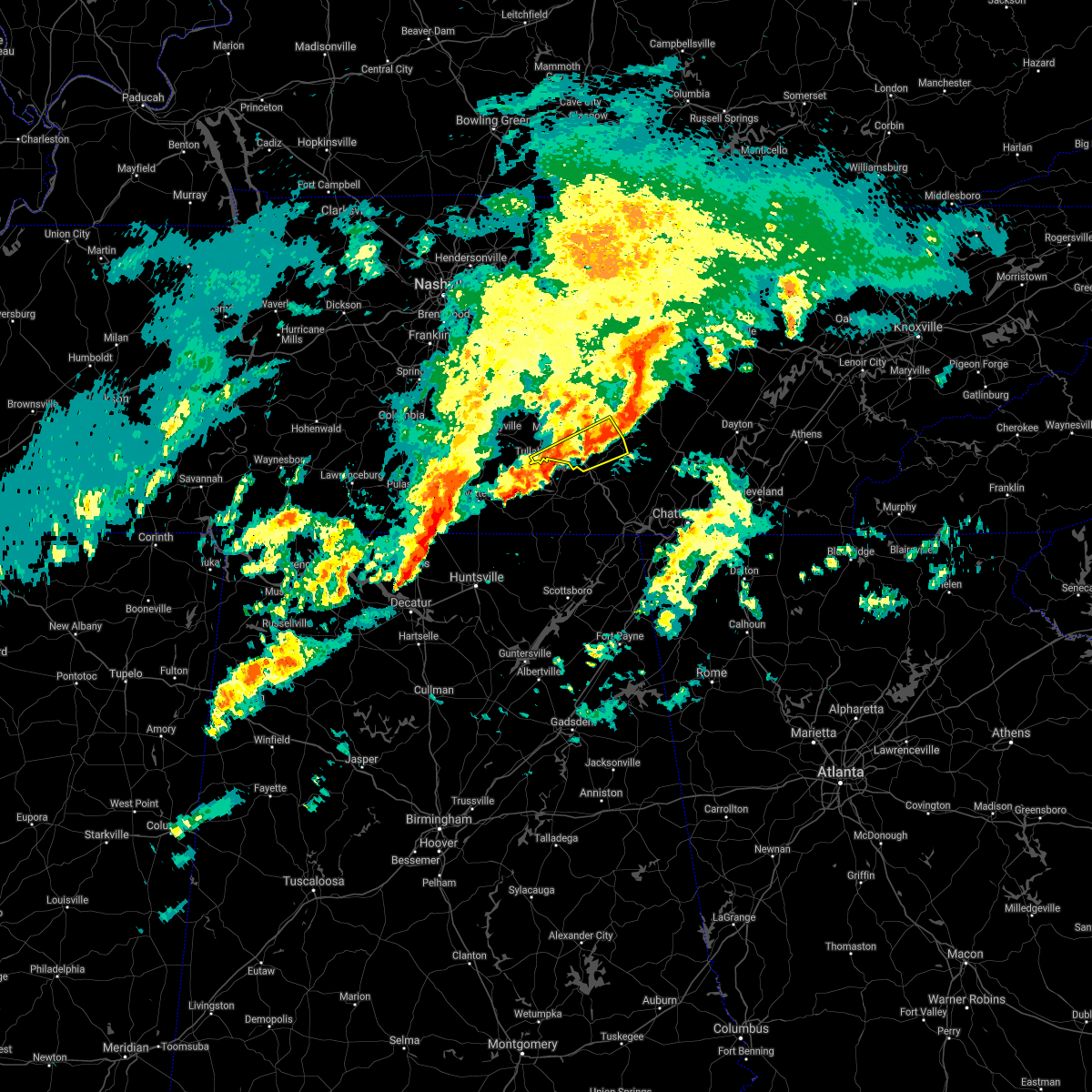 At 604 pm cst, severe thunderstorms were located along a line extending from 8 miles east of manchester to 10 miles northeast of decherd to estill springs, moving northeast at 60 mph (radar indicated). Hazards include 60 mph wind gusts. Expect damage to roofs, siding, and trees. locations impacted include, manchester, tullahoma, gruetli-laager, altamont, coalmont, beersheba springs, viola, hillsboro, arnold afb and woods reservoir. this includes interstate 24 between mile markers 114 and 126. hail threat, radar indicated max hail size, <. 75 in wind threat, radar indicated max wind gust, 60 mph. At 604 pm cst, severe thunderstorms were located along a line extending from 8 miles east of manchester to 10 miles northeast of decherd to estill springs, moving northeast at 60 mph (radar indicated). Hazards include 60 mph wind gusts. Expect damage to roofs, siding, and trees. locations impacted include, manchester, tullahoma, gruetli-laager, altamont, coalmont, beersheba springs, viola, hillsboro, arnold afb and woods reservoir. this includes interstate 24 between mile markers 114 and 126. hail threat, radar indicated max hail size, <. 75 in wind threat, radar indicated max wind gust, 60 mph.
|
| 1/1/2022 5:51 PM CST |
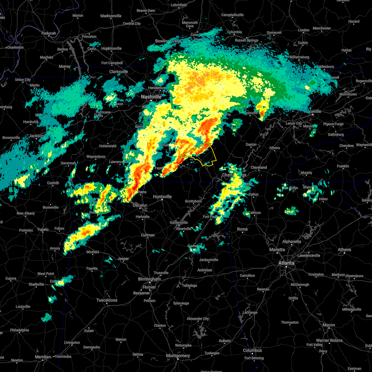 At 551 pm cst, severe thunderstorms were located along a line extending from near manchester to near estill springs to near tims ford lake, moving northeast at 60 mph (radar indicated). Hazards include 60 mph wind gusts. expect damage to roofs, siding, and trees At 551 pm cst, severe thunderstorms were located along a line extending from near manchester to near estill springs to near tims ford lake, moving northeast at 60 mph (radar indicated). Hazards include 60 mph wind gusts. expect damage to roofs, siding, and trees
|
| 1/1/2022 5:39 PM CST |
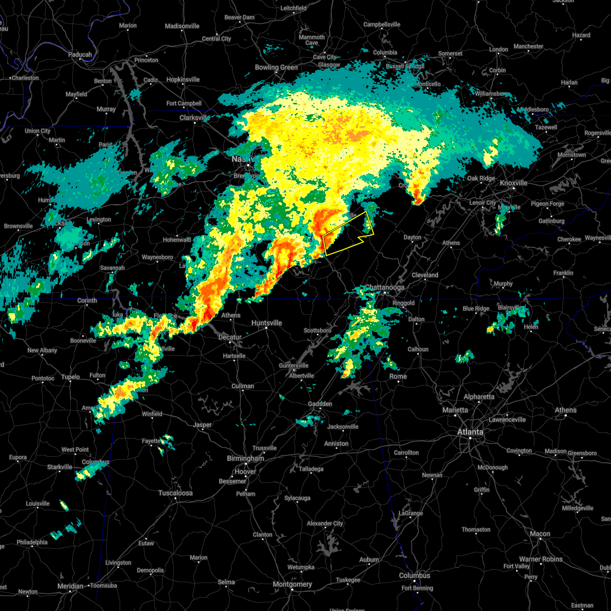 At 539 pm cst, a severe thunderstorm was located 10 miles east of manchester, moving northeast at 55 mph (radar indicated). Hazards include 60 mph wind gusts. expect damage to roofs, siding, and trees At 539 pm cst, a severe thunderstorm was located 10 miles east of manchester, moving northeast at 55 mph (radar indicated). Hazards include 60 mph wind gusts. expect damage to roofs, siding, and trees
|
| 1/1/2022 5:21 PM CST |
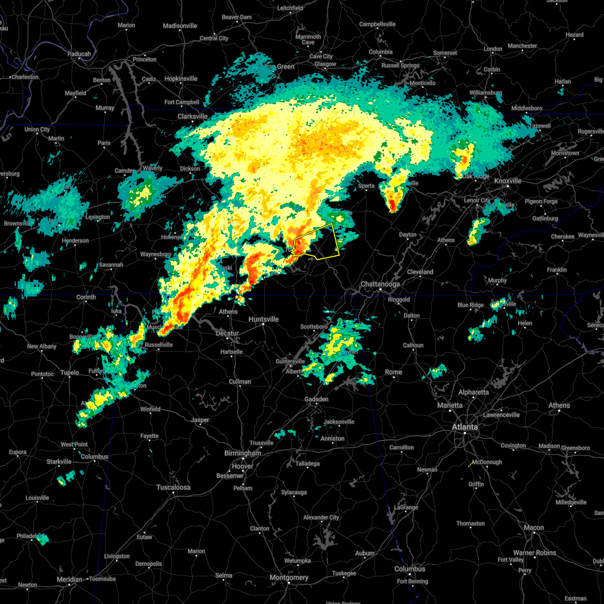 At 520 pm cst, a severe thunderstorm was located near manchester, moving east at 45 mph (radar indicated). Hazards include 60 mph wind gusts. Expect damage to roofs, siding, and trees. locations impacted include, manchester, tullahoma, altamont, morrison, viola, hillsboro, summitville, arnold afb and woods reservoir. this includes interstate 24 between mile markers 107 and 125. hail threat, radar indicated max hail size, <. 75 in wind threat, radar indicated max wind gust, 60 mph. At 520 pm cst, a severe thunderstorm was located near manchester, moving east at 45 mph (radar indicated). Hazards include 60 mph wind gusts. Expect damage to roofs, siding, and trees. locations impacted include, manchester, tullahoma, altamont, morrison, viola, hillsboro, summitville, arnold afb and woods reservoir. this includes interstate 24 between mile markers 107 and 125. hail threat, radar indicated max hail size, <. 75 in wind threat, radar indicated max wind gust, 60 mph.
|
| 1/1/2022 5:08 PM CST |
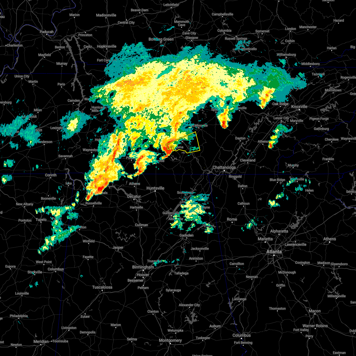 At 508 pm cst, a severe thunderstorm was located near tullahoma, or 7 miles northeast of lynchburg, moving east at 45 mph (radar indicated). Hazards include 60 mph wind gusts. expect damage to roofs, siding, and trees At 508 pm cst, a severe thunderstorm was located near tullahoma, or 7 miles northeast of lynchburg, moving east at 45 mph (radar indicated). Hazards include 60 mph wind gusts. expect damage to roofs, siding, and trees
|
| 12/6/2021 7:59 AM CST |
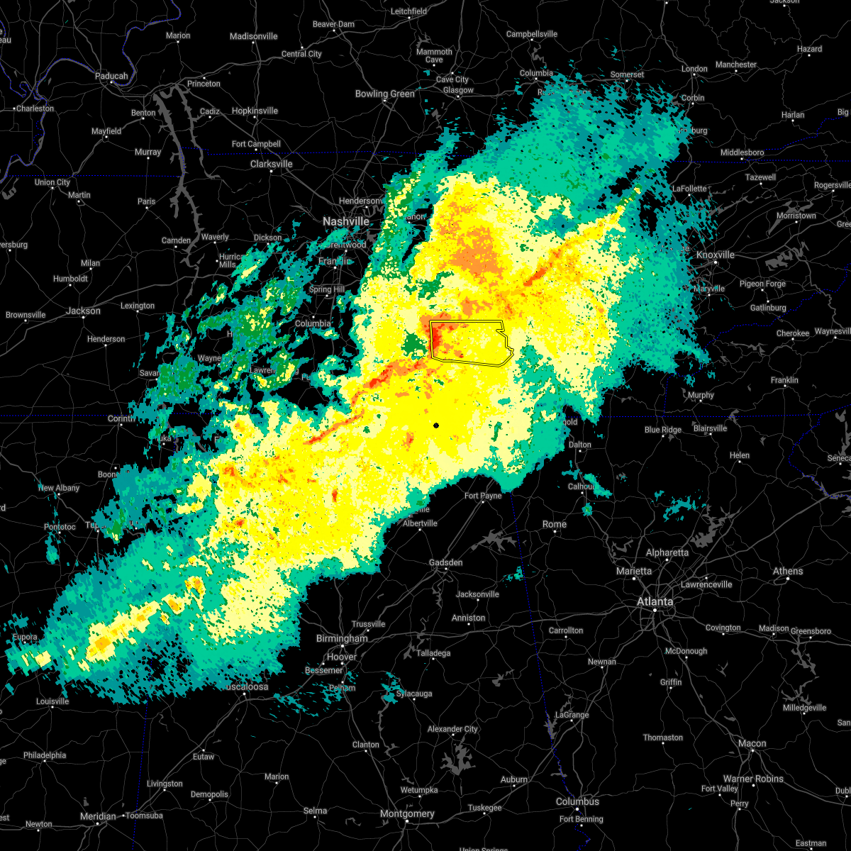 At 759 am cst, a severe thunderstorm was located near manchester, moving east at 55 mph (radar indicated). Hazards include 60 mph wind gusts. expect damage to roofs, siding, and trees At 759 am cst, a severe thunderstorm was located near manchester, moving east at 55 mph (radar indicated). Hazards include 60 mph wind gusts. expect damage to roofs, siding, and trees
|
| 8/1/2021 12:10 AM CDT |
 At 1210 am cdt, severe thunderstorms were located along a line extending from near mcminnville to near estill springs, moving east at 45 mph (radar indicated). Hazards include 60 mph wind gusts. Expect damage to roofs, siding, and trees. locations impacted include, mcminnville, manchester, tullahoma, gruetli-laager, tracy city, monteagle, altamont, coalmont, morrison, palmer, beersheba springs, centertown, viola, summitville, hillsboro, pelham, arnold afb and fiery gizzard state park. This includes interstate 24 between mile markers 104 and 134. At 1210 am cdt, severe thunderstorms were located along a line extending from near mcminnville to near estill springs, moving east at 45 mph (radar indicated). Hazards include 60 mph wind gusts. Expect damage to roofs, siding, and trees. locations impacted include, mcminnville, manchester, tullahoma, gruetli-laager, tracy city, monteagle, altamont, coalmont, morrison, palmer, beersheba springs, centertown, viola, summitville, hillsboro, pelham, arnold afb and fiery gizzard state park. This includes interstate 24 between mile markers 104 and 134.
|
| 7/31/2021 11:55 PM CDT |
 At 1154 pm cdt, severe thunderstorms were located along a line extending from centertown to near lynchburg, moving east at 45 mph (radar indicated). Hazards include 60 mph wind gusts. expect damage to roofs, siding, and trees At 1154 pm cdt, severe thunderstorms were located along a line extending from centertown to near lynchburg, moving east at 45 mph (radar indicated). Hazards include 60 mph wind gusts. expect damage to roofs, siding, and trees
|
| 5/6/2021 7:01 PM CDT |
 At 701 pm cdt, severe thunderstorms were located along a line extending from 6 miles north of mcminnville to decherd, moving east at 50 mph (radar indicated). Hazards include 60 mph wind gusts. Expect damage to roofs, siding, and trees. locations impacted include, mcminnville, manchester, monteagle, altamont, morrison, viola, hillsboro, pelham, summitville and arnold afb. This includes interstate 24 between mile markers 107 and 134. At 701 pm cdt, severe thunderstorms were located along a line extending from 6 miles north of mcminnville to decherd, moving east at 50 mph (radar indicated). Hazards include 60 mph wind gusts. Expect damage to roofs, siding, and trees. locations impacted include, mcminnville, manchester, monteagle, altamont, morrison, viola, hillsboro, pelham, summitville and arnold afb. This includes interstate 24 between mile markers 107 and 134.
|
| 5/6/2021 6:48 PM CDT |
 At 648 pm cdt, severe thunderstorms were located along a line extending from 6 miles southeast of woodbury to near tims ford lake, moving east at 50 mph (radar indicated). Hazards include 60 mph wind gusts. Expect damage to roofs, siding, and trees. locations impacted include, mcminnville, manchester, tullahoma, monteagle, altamont, morrison, normandy, viola, beechgrove, summitville, hillsboro, pelham and arnold afb. This includes interstate 24 between mile markers 96 and 134. At 648 pm cdt, severe thunderstorms were located along a line extending from 6 miles southeast of woodbury to near tims ford lake, moving east at 50 mph (radar indicated). Hazards include 60 mph wind gusts. Expect damage to roofs, siding, and trees. locations impacted include, mcminnville, manchester, tullahoma, monteagle, altamont, morrison, normandy, viola, beechgrove, summitville, hillsboro, pelham and arnold afb. This includes interstate 24 between mile markers 96 and 134.
|
| 5/6/2021 6:27 PM CDT |
 At 626 pm cdt, severe thunderstorms were located along a line extending from 10 miles southeast of murfreesboro to near fayetteville, moving east at 50 mph (radar indicated). Hazards include 60 mph wind gusts. expect damage to roofs, siding, and trees At 626 pm cdt, severe thunderstorms were located along a line extending from 10 miles southeast of murfreesboro to near fayetteville, moving east at 50 mph (radar indicated). Hazards include 60 mph wind gusts. expect damage to roofs, siding, and trees
|
| 5/4/2021 7:53 AM CDT |
 At 753 am cdt, severe thunderstorms were located along a line extending from 6 miles southeast of smithville to near tullahoma, moving east at 50 mph (radar indicated). Hazards include 60 mph wind gusts. expect damage to roofs, siding, and trees At 753 am cdt, severe thunderstorms were located along a line extending from 6 miles southeast of smithville to near tullahoma, moving east at 50 mph (radar indicated). Hazards include 60 mph wind gusts. expect damage to roofs, siding, and trees
|
| 4/24/2021 5:34 PM CDT |
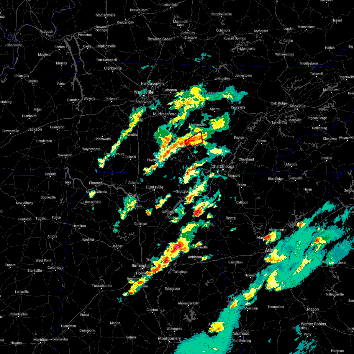 At 534 pm cdt, a severe thunderstorm capable of producing a tornado was located 9 miles south of mcminnville, moving northeast at 35 mph (radar indicated rotation). Hazards include tornado. Flying debris will be dangerous to those caught without shelter. mobile homes will be damaged or destroyed. damage to roofs, windows, and vehicles will occur. tree damage is likely. locations impacted include, altamont, beersheba springs, viola and hillsboro. This includes interstate 24 between mile markers 121 and 122. At 534 pm cdt, a severe thunderstorm capable of producing a tornado was located 9 miles south of mcminnville, moving northeast at 35 mph (radar indicated rotation). Hazards include tornado. Flying debris will be dangerous to those caught without shelter. mobile homes will be damaged or destroyed. damage to roofs, windows, and vehicles will occur. tree damage is likely. locations impacted include, altamont, beersheba springs, viola and hillsboro. This includes interstate 24 between mile markers 121 and 122.
|
| 4/24/2021 5:22 PM CDT |
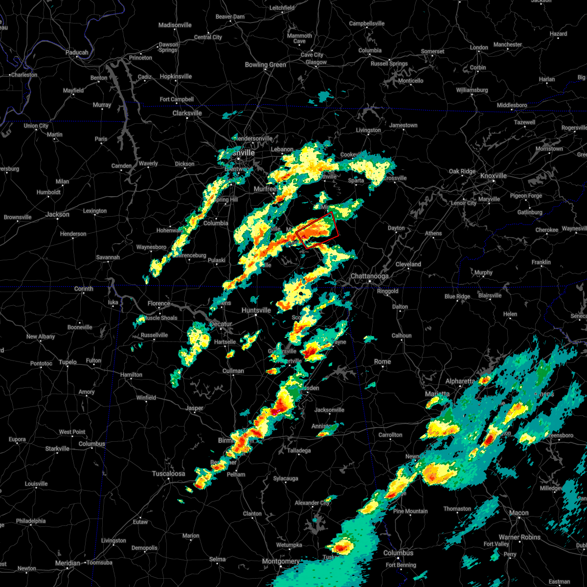 At 521 pm cdt, a severe thunderstorm capable of producing a tornado was located near manchester, moving northeast at 35 mph (radar indicated rotation). Hazards include tornado. Flying debris will be dangerous to those caught without shelter. mobile homes will be damaged or destroyed. damage to roofs, windows, and vehicles will occur. tree damage is likely. this tornadic thunderstorm will remain over mainly rural areas of southwestern warren, southeastern coffee and northwestern grundy counties, including the following locations, altamont, viola, hillsboro, beersheba springs, summitville and morrison. This includes interstate 24 between mile markers 110 and 122. At 521 pm cdt, a severe thunderstorm capable of producing a tornado was located near manchester, moving northeast at 35 mph (radar indicated rotation). Hazards include tornado. Flying debris will be dangerous to those caught without shelter. mobile homes will be damaged or destroyed. damage to roofs, windows, and vehicles will occur. tree damage is likely. this tornadic thunderstorm will remain over mainly rural areas of southwestern warren, southeastern coffee and northwestern grundy counties, including the following locations, altamont, viola, hillsboro, beersheba springs, summitville and morrison. This includes interstate 24 between mile markers 110 and 122.
|
| 5/3/2020 5:34 PM CDT |
 At 534 pm cdt, severe thunderstorms were located along a line extending from 12 miles east of manchester to near monteagle to near huntland, moving southeast at 70 mph (radar indicated). Hazards include 60 mph wind gusts and penny size hail. Expect damage to roofs, siding, and trees. locations impacted include, manchester, tullahoma, gruetli-laager, tracy city, monteagle, altamont, coalmont, morrison, palmer, beersheba springs, viola, summitville, hillsboro, pelham, arnold afb and fiery gizzard state park. This includes interstate 24 between mile markers 108 and 135. At 534 pm cdt, severe thunderstorms were located along a line extending from 12 miles east of manchester to near monteagle to near huntland, moving southeast at 70 mph (radar indicated). Hazards include 60 mph wind gusts and penny size hail. Expect damage to roofs, siding, and trees. locations impacted include, manchester, tullahoma, gruetli-laager, tracy city, monteagle, altamont, coalmont, morrison, palmer, beersheba springs, viola, summitville, hillsboro, pelham, arnold afb and fiery gizzard state park. This includes interstate 24 between mile markers 108 and 135.
|
| 5/3/2020 5:06 PM CDT |
 At 506 pm cdt, severe thunderstorms were located along a line extending from 10 miles south of murfreesboro to near shelbyville to 9 miles west of fayetteville, moving southeast at 70 mph (radar indicated). Hazards include 70 mph wind gusts and penny size hail. Expect considerable tree damage. Damage is likely to mobile homes, roofs, and outbuildings. At 506 pm cdt, severe thunderstorms were located along a line extending from 10 miles south of murfreesboro to near shelbyville to 9 miles west of fayetteville, moving southeast at 70 mph (radar indicated). Hazards include 70 mph wind gusts and penny size hail. Expect considerable tree damage. Damage is likely to mobile homes, roofs, and outbuildings.
|
| 3/29/2020 2:03 AM CDT |
 At 203 am cdt, severe thunderstorms were located along a line extending from 8 miles east of woodbury to near manchester, moving east at 80 mph (radar indicated). Hazards include 70 mph wind gusts and nickel size hail. Expect considerable tree damage. Damage is likely to mobile homes, roofs, and outbuildings. At 203 am cdt, severe thunderstorms were located along a line extending from 8 miles east of woodbury to near manchester, moving east at 80 mph (radar indicated). Hazards include 70 mph wind gusts and nickel size hail. Expect considerable tree damage. Damage is likely to mobile homes, roofs, and outbuildings.
|
| 1/11/2020 2:02 PM CST |
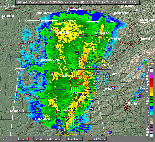 At 201 pm cst, a severe thunderstorm was located near gruetli-laager, or 18 miles east of manchester, moving east at 60 mph (radar indicated). Hazards include 60 mph wind gusts. expect damage to roofs, siding, and trees At 201 pm cst, a severe thunderstorm was located near gruetli-laager, or 18 miles east of manchester, moving east at 60 mph (radar indicated). Hazards include 60 mph wind gusts. expect damage to roofs, siding, and trees
|
| 8/6/2019 9:07 PM CDT |
 At 907 pm cdt, severe thunderstorms were located along a line extending from 8 miles northwest of woodbury to 6 miles east of spring hill, moving southeast at 40 mph (radar indicated). Hazards include 60 mph wind gusts. expect damage to roofs, siding, and trees At 907 pm cdt, severe thunderstorms were located along a line extending from 8 miles northwest of woodbury to 6 miles east of spring hill, moving southeast at 40 mph (radar indicated). Hazards include 60 mph wind gusts. expect damage to roofs, siding, and trees
|
| 6/21/2019 9:12 PM CDT |
 At 912 pm cdt, severe thunderstorms were located along a line extending from 6 miles northeast of mcminnville to 11 miles northeast of manchester to tullahoma, moving southeast at 45 mph (radar indicated). Hazards include 70 mph wind gusts and nickel size hail. Expect considerable tree damage. Damage is likely to mobile homes, roofs, and outbuildings. At 912 pm cdt, severe thunderstorms were located along a line extending from 6 miles northeast of mcminnville to 11 miles northeast of manchester to tullahoma, moving southeast at 45 mph (radar indicated). Hazards include 70 mph wind gusts and nickel size hail. Expect considerable tree damage. Damage is likely to mobile homes, roofs, and outbuildings.
|
| 6/19/2019 10:04 PM CDT |
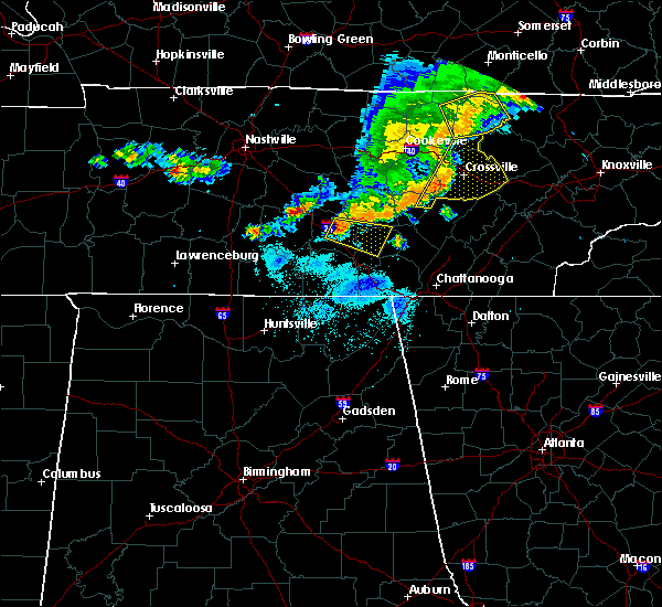 At 1003 pm cdt, a severe thunderstorm was located near manchester, moving east at 35 mph (radar indicated). Hazards include 60 mph wind gusts and quarter size hail. Hail damage to vehicles is expected. Expect wind damage to roofs, siding, and trees. At 1003 pm cdt, a severe thunderstorm was located near manchester, moving east at 35 mph (radar indicated). Hazards include 60 mph wind gusts and quarter size hail. Hail damage to vehicles is expected. Expect wind damage to roofs, siding, and trees.
|
| 6/19/2019 9:19 PM CDT |
 At 919 pm cdt, severe thunderstorms were located along a line extending from 6 miles southeast of smithville to near mcminnville to near shelbyville, moving east at 35 mph (trained weather spotters). Hazards include 60 mph wind gusts and penny size hail. Expect damage to roofs, siding, and trees. locations impacted include, shelbyville, mcminnville, manchester, smithville, morrison, wartrace, bell buckle, centertown, viola, christiana, rock island state park, beechgrove, fosterville, summitville and deason. This includes interstate 24 between mile markers 90 and 111. At 919 pm cdt, severe thunderstorms were located along a line extending from 6 miles southeast of smithville to near mcminnville to near shelbyville, moving east at 35 mph (trained weather spotters). Hazards include 60 mph wind gusts and penny size hail. Expect damage to roofs, siding, and trees. locations impacted include, shelbyville, mcminnville, manchester, smithville, morrison, wartrace, bell buckle, centertown, viola, christiana, rock island state park, beechgrove, fosterville, summitville and deason. This includes interstate 24 between mile markers 90 and 111.
|
| 6/19/2019 8:56 PM CDT |
 At 855 pm cdt, severe thunderstorms were located along a line extending from liberty to near woodbury to unionville, moving east at 35 mph (trained weather spotters. at 850 pm cdt...numerous trees and power lines were reportedly blown down with these storms across rutherford county). Hazards include 60 mph wind gusts and quarter size hail. Hail damage to vehicles is expected. Expect wind damage to roofs, siding, and trees. At 855 pm cdt, severe thunderstorms were located along a line extending from liberty to near woodbury to unionville, moving east at 35 mph (trained weather spotters. at 850 pm cdt...numerous trees and power lines were reportedly blown down with these storms across rutherford county). Hazards include 60 mph wind gusts and quarter size hail. Hail damage to vehicles is expected. Expect wind damage to roofs, siding, and trees.
|
| 7/5/2018 5:58 PM CDT |
 At 558 pm cdt, a severe thunderstorm was located near irving college, or 9 miles southeast of mcminnville, moving southwest at 15 mph (radar indicated). Hazards include 60 mph wind gusts and penny size hail. expect damage to roofs, siding, and trees At 558 pm cdt, a severe thunderstorm was located near irving college, or 9 miles southeast of mcminnville, moving southwest at 15 mph (radar indicated). Hazards include 60 mph wind gusts and penny size hail. expect damage to roofs, siding, and trees
|
| 5/5/2018 12:07 PM CDT |
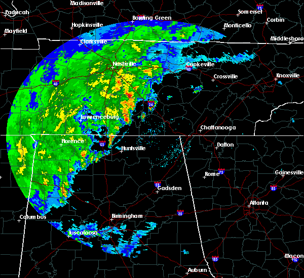 At 1206 pm cdt, a severe thunderstorm was located over manchester, moving northeast at 15 mph (radar indicated). Hazards include 60 mph wind gusts and quarter size hail. Hail damage to vehicles is expected. Expect wind damage to roofs, siding, and trees. At 1206 pm cdt, a severe thunderstorm was located over manchester, moving northeast at 15 mph (radar indicated). Hazards include 60 mph wind gusts and quarter size hail. Hail damage to vehicles is expected. Expect wind damage to roofs, siding, and trees.
|
| 4/5/2017 4:54 PM CDT |
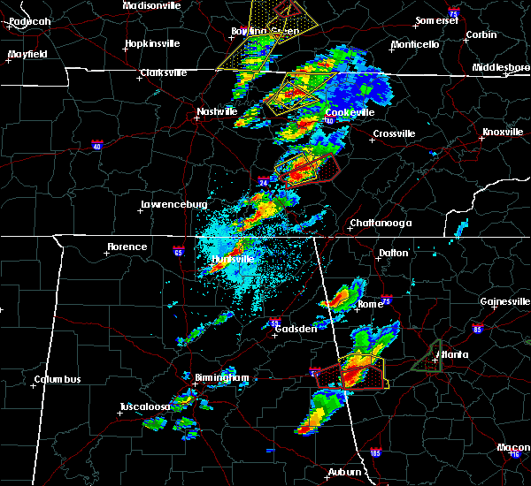 At 454 pm cdt, a severe thunderstorm capable of producing a tornado was located 10 miles south of mcminnville, moving northeast at 40 mph (radar indicated rotation). Hazards include tornado and quarter size hail. Flying debris will be dangerous to those caught without shelter. mobile homes will be damaged or destroyed. damage to roofs, windows, and vehicles will occur. tree damage is likely. this dangerous storm will be near, spencer around 530 pm cdt. Other locations impacted by this tornadic thunderstorm include viola, morrison and fall creek falls state park. At 454 pm cdt, a severe thunderstorm capable of producing a tornado was located 10 miles south of mcminnville, moving northeast at 40 mph (radar indicated rotation). Hazards include tornado and quarter size hail. Flying debris will be dangerous to those caught without shelter. mobile homes will be damaged or destroyed. damage to roofs, windows, and vehicles will occur. tree damage is likely. this dangerous storm will be near, spencer around 530 pm cdt. Other locations impacted by this tornadic thunderstorm include viola, morrison and fall creek falls state park.
|
| 4/5/2017 4:50 PM CDT |
 At 449 pm cdt, a severe thunderstorm was located near mcminnville, moving northeast at 40 mph (radar indicated). Hazards include 60 mph wind gusts and quarter size hail. Hail damage to vehicles is expected. expect wind damage to roofs, siding, and trees. locations impacted include, mcminnville, morrison, centertown and viola. A tornado watch remains in effect until 900 pm cdt for middle tennessee. At 449 pm cdt, a severe thunderstorm was located near mcminnville, moving northeast at 40 mph (radar indicated). Hazards include 60 mph wind gusts and quarter size hail. Hail damage to vehicles is expected. expect wind damage to roofs, siding, and trees. locations impacted include, mcminnville, morrison, centertown and viola. A tornado watch remains in effect until 900 pm cdt for middle tennessee.
|
| 4/5/2017 4:29 PM CDT |
 At 429 pm cdt, a severe thunderstorm was located near manchester, moving northeast at 40 mph (radar indicated). Hazards include golf ball size hail and 60 mph wind gusts. People and animals outdoors will be injured. expect hail damage to roofs, siding, windows, and vehicles. Expect wind damage to roofs, siding, and trees. At 429 pm cdt, a severe thunderstorm was located near manchester, moving northeast at 40 mph (radar indicated). Hazards include golf ball size hail and 60 mph wind gusts. People and animals outdoors will be injured. expect hail damage to roofs, siding, windows, and vehicles. Expect wind damage to roofs, siding, and trees.
|
| 3/21/2017 5:29 PM CDT |
 At 528 pm cdt, a severe thunderstorm was located over mcminnville, moving east at 55 mph (radar indicated). Hazards include 70 mph wind gusts and quarter size hail. Hail damage to vehicles is expected. expect considerable tree damage. Wind damage is also likely to mobile homes, roofs, and outbuildings. At 528 pm cdt, a severe thunderstorm was located over mcminnville, moving east at 55 mph (radar indicated). Hazards include 70 mph wind gusts and quarter size hail. Hail damage to vehicles is expected. expect considerable tree damage. Wind damage is also likely to mobile homes, roofs, and outbuildings.
|
| 3/21/2017 5:00 PM CDT |
 At 500 pm cdt, a severe thunderstorm was located 9 miles southwest of woodbury, moving east at 50 mph (radar indicated). Hazards include 70 mph wind gusts and quarter size hail. Hail damage to vehicles is expected. expect considerable tree damage. Wind damage is also likely to mobile homes, roofs, and outbuildings. At 500 pm cdt, a severe thunderstorm was located 9 miles southwest of woodbury, moving east at 50 mph (radar indicated). Hazards include 70 mph wind gusts and quarter size hail. Hail damage to vehicles is expected. expect considerable tree damage. Wind damage is also likely to mobile homes, roofs, and outbuildings.
|
| 3/10/2017 12:11 AM CST |
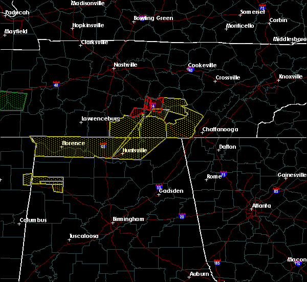 At 1211 am cst, a severe thunderstorm was located 11 miles southwest of mcminnville, moving east at 50 mph (radar indicated). Hazards include two inch hail and 60 mph wind gusts. People and animals outdoors will be injured. expect hail damage to roofs, siding, windows, and vehicles. Expect wind damage to roofs, siding, and trees. At 1211 am cst, a severe thunderstorm was located 11 miles southwest of mcminnville, moving east at 50 mph (radar indicated). Hazards include two inch hail and 60 mph wind gusts. People and animals outdoors will be injured. expect hail damage to roofs, siding, windows, and vehicles. Expect wind damage to roofs, siding, and trees.
|
| 12/18/2016 1:30 AM CST |
 At 129 am cst, a severe thunderstorm capable of producing a tornado was located 8 miles north of manchester, moving northeast at 65 mph (radar indicated rotation). Hazards include tornado. Flying debris will be dangerous to those caught without shelter. mobile homes will be damaged or destroyed. damage to roofs, windows, and vehicles will occur. tree damage is likely. this dangerous storm will be near, mcminnville around 145 am cst. Other locations impacted by this tornadic thunderstorm include summitville, morrison, beechgrove, centertown and viola. At 129 am cst, a severe thunderstorm capable of producing a tornado was located 8 miles north of manchester, moving northeast at 65 mph (radar indicated rotation). Hazards include tornado. Flying debris will be dangerous to those caught without shelter. mobile homes will be damaged or destroyed. damage to roofs, windows, and vehicles will occur. tree damage is likely. this dangerous storm will be near, mcminnville around 145 am cst. Other locations impacted by this tornadic thunderstorm include summitville, morrison, beechgrove, centertown and viola.
|
| 12/18/2016 1:20 AM CST |
 At 120 am cst, a severe thunderstorm capable of producing a tornado was located 9 miles east of shelbyville, moving northeast at 65 mph (radar indicated rotation). Hazards include tornado. Flying debris will be dangerous to those caught without shelter. mobile homes will be damaged or destroyed. damage to roofs, windows, and vehicles will occur. tree damage is likely. this dangerous storm will be near, manchester around 130 am cst. mcminnville around 145 am cst. Other locations impacted by this tornadic thunderstorm include raus, summitville, morrison, wartrace, normandy, beechgrove, centertown, viola and bell buckle. At 120 am cst, a severe thunderstorm capable of producing a tornado was located 9 miles east of shelbyville, moving northeast at 65 mph (radar indicated rotation). Hazards include tornado. Flying debris will be dangerous to those caught without shelter. mobile homes will be damaged or destroyed. damage to roofs, windows, and vehicles will occur. tree damage is likely. this dangerous storm will be near, manchester around 130 am cst. mcminnville around 145 am cst. Other locations impacted by this tornadic thunderstorm include raus, summitville, morrison, wartrace, normandy, beechgrove, centertown, viola and bell buckle.
|
| 11/29/2016 9:54 PM CST |
 At 953 pm cst, a severe thunderstorm capable of producing a tornado was located 7 miles southwest of mcminnville, moving northeast at 30 mph (radar indicated rotation). Hazards include tornado. Flying debris will be dangerous to those caught without shelter. mobile homes will be damaged or destroyed. damage to roofs, windows, and vehicles will occur. tree damage is likely. Locations impacted include, morrison and viola. At 953 pm cst, a severe thunderstorm capable of producing a tornado was located 7 miles southwest of mcminnville, moving northeast at 30 mph (radar indicated rotation). Hazards include tornado. Flying debris will be dangerous to those caught without shelter. mobile homes will be damaged or destroyed. damage to roofs, windows, and vehicles will occur. tree damage is likely. Locations impacted include, morrison and viola.
|
| 11/29/2016 9:42 PM CST |
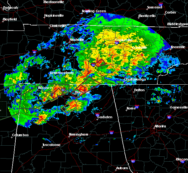 At 941 pm cst, a severe thunderstorm capable of producing a tornado was located 8 miles northeast of manchester, or near viola, moving northeast at 30 mph (radar indicated rotation). Hazards include tornado. Flying debris will be dangerous to those caught without shelter. mobile homes will be damaged or destroyed. damage to roofs, windows, and vehicles will occur. tree damage is likely. Locations impacted include, morrison, viola and summitville. At 941 pm cst, a severe thunderstorm capable of producing a tornado was located 8 miles northeast of manchester, or near viola, moving northeast at 30 mph (radar indicated rotation). Hazards include tornado. Flying debris will be dangerous to those caught without shelter. mobile homes will be damaged or destroyed. damage to roofs, windows, and vehicles will occur. tree damage is likely. Locations impacted include, morrison, viola and summitville.
|
| 11/29/2016 9:27 PM CST |
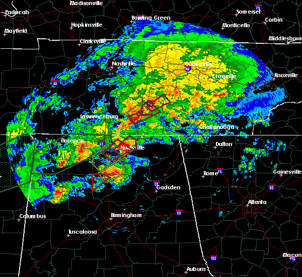 At 926 pm cst, a severe thunderstorm capable of producing a tornado was located over manchester, moving northeast at 35 mph (radar indicated rotation. at 915 pm...this storm produced a confirmed tornado with damage near tullahoma). Hazards include tornado. Flying debris will be dangerous to those caught without shelter. mobile homes will be damaged or destroyed. damage to roofs, windows, and vehicles will occur. tree damage is likely. This tornadic thunderstorm will remain over mainly rural areas of southwestern warren and northeastern coffee counties, including the following locations: viola, summitville and morrison. At 926 pm cst, a severe thunderstorm capable of producing a tornado was located over manchester, moving northeast at 35 mph (radar indicated rotation. at 915 pm...this storm produced a confirmed tornado with damage near tullahoma). Hazards include tornado. Flying debris will be dangerous to those caught without shelter. mobile homes will be damaged or destroyed. damage to roofs, windows, and vehicles will occur. tree damage is likely. This tornadic thunderstorm will remain over mainly rural areas of southwestern warren and northeastern coffee counties, including the following locations: viola, summitville and morrison.
|
| 7/8/2016 10:35 PM CDT |
 At 1034 pm cdt, severe thunderstorms were located along a line extending from near spencer to near altamont, moving east at 40 mph (radar indicated). Hazards include 60 mph wind gusts and penny size hail. Expect damage to roofs. siding. and trees. locations impacted include, mcminnville, spencer, gruetli-laager, altamont, coalmont, morrison, palmer, doyle, beersheba springs, centertown, viola, fall creek falls state park, summitville, rock island state park, indian rock lake and fall creek falls s. P At 1034 pm cdt, severe thunderstorms were located along a line extending from near spencer to near altamont, moving east at 40 mph (radar indicated). Hazards include 60 mph wind gusts and penny size hail. Expect damage to roofs. siding. and trees. locations impacted include, mcminnville, spencer, gruetli-laager, altamont, coalmont, morrison, palmer, doyle, beersheba springs, centertown, viola, fall creek falls state park, summitville, rock island state park, indian rock lake and fall creek falls s. P
|
| 7/8/2016 9:56 PM CDT |
 At 956 pm cdt, severe thunderstorms were located along a line extending from near smithville to 11 miles south of woodbury, moving east at 50 mph (radar indicated). Hazards include 60 mph wind gusts and penny size hail. Expect damage to roofs. siding. And trees. At 956 pm cdt, severe thunderstorms were located along a line extending from near smithville to 11 miles south of woodbury, moving east at 50 mph (radar indicated). Hazards include 60 mph wind gusts and penny size hail. Expect damage to roofs. siding. And trees.
|
| 7/6/2016 6:06 PM CDT |
 At 606 pm cdt, severe thunderstorms were located along a line extending from near mcminnville to near manchester, moving southeast at 30 mph (radar indicated). Hazards include 60 mph wind gusts and penny size hail. Expect damage to roofs. siding. and trees. Locations impacted include, mcminnville, manchester, morrison, centertown, viola, summitville and beechgrove. At 606 pm cdt, severe thunderstorms were located along a line extending from near mcminnville to near manchester, moving southeast at 30 mph (radar indicated). Hazards include 60 mph wind gusts and penny size hail. Expect damage to roofs. siding. and trees. Locations impacted include, mcminnville, manchester, morrison, centertown, viola, summitville and beechgrove.
|
| 7/6/2016 5:41 PM CDT |
 At 541 pm cdt, severe thunderstorms were located along a line extending from centertown to bell buckle, moving southeast at 30 mph (radar indicated). Hazards include 60 mph wind gusts and penny size hail. Expect damage to roofs. siding. And trees. At 541 pm cdt, severe thunderstorms were located along a line extending from centertown to bell buckle, moving southeast at 30 mph (radar indicated). Hazards include 60 mph wind gusts and penny size hail. Expect damage to roofs. siding. And trees.
|
| 6/15/2016 6:15 PM CDT |
 At 615 pm cdt, severe thunderstorms were located along a line extending from near pikeville to near monteagle, moving southeast at 35 mph (radar indicated). Hazards include 60 mph wind gusts. Expect damage to roofs. siding. and trees. locations impacted include, manchester, spencer, tullahoma, gruetli-laager, tracy city, monteagle, altamont, coalmont, palmer, beersheba springs, viola, fall creek falls state park, pelham, hillsboro, arnold afb, fall creek falls s. p. and fiery gizzard s. P At 615 pm cdt, severe thunderstorms were located along a line extending from near pikeville to near monteagle, moving southeast at 35 mph (radar indicated). Hazards include 60 mph wind gusts. Expect damage to roofs. siding. and trees. locations impacted include, manchester, spencer, tullahoma, gruetli-laager, tracy city, monteagle, altamont, coalmont, palmer, beersheba springs, viola, fall creek falls state park, pelham, hillsboro, arnold afb, fall creek falls s. p. and fiery gizzard s. P
|
| 6/15/2016 5:54 PM CDT |
 At 554 pm cdt, severe thunderstorms were located along a line extending from near spencer to 8 miles southeast of manchester, moving southeast at 35 mph (radar indicated). Hazards include 60 mph wind gusts. Expect damage to roofs. siding. And trees. At 554 pm cdt, severe thunderstorms were located along a line extending from near spencer to 8 miles southeast of manchester, moving southeast at 35 mph (radar indicated). Hazards include 60 mph wind gusts. Expect damage to roofs. siding. And trees.
|
| 6/15/2016 5:27 PM CDT |
 At 527 pm cdt, severe thunderstorms were located along a line extending from 9 miles southeast of woodbury to 10 miles northwest of manchester to shelbyville, moving southeast at 40 mph (radar indicated). Hazards include 60 mph wind gusts. Expect damage to roofs. siding. And trees. At 527 pm cdt, severe thunderstorms were located along a line extending from 9 miles southeast of woodbury to 10 miles northwest of manchester to shelbyville, moving southeast at 40 mph (radar indicated). Hazards include 60 mph wind gusts. Expect damage to roofs. siding. And trees.
|
| 4/30/2016 6:47 PM CDT |
 At 646 pm cdt, a severe thunderstorm was located near mcminnville, moving northeast at 45 mph (radar indicated). Hazards include 60 mph wind gusts and quarter size hail. Hail damage to vehicles is expected. expect wind damage to roofs, siding, and trees. Locations impacted include, mcminnville, altamont, morrison, centertown, viola and summitville. At 646 pm cdt, a severe thunderstorm was located near mcminnville, moving northeast at 45 mph (radar indicated). Hazards include 60 mph wind gusts and quarter size hail. Hail damage to vehicles is expected. expect wind damage to roofs, siding, and trees. Locations impacted include, mcminnville, altamont, morrison, centertown, viola and summitville.
|
| 4/30/2016 6:28 PM CDT |
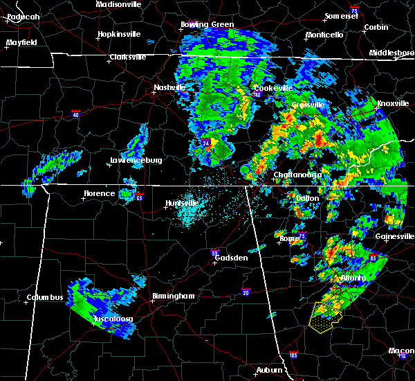 At 627 pm cdt, a severe thunderstorm was located over manchester, moving northeast at 45 mph (radar indicated). Hazards include 60 mph wind gusts and quarter size hail. Hail damage to vehicles is expected. Expect wind damage to roofs, siding, and trees. At 627 pm cdt, a severe thunderstorm was located over manchester, moving northeast at 45 mph (radar indicated). Hazards include 60 mph wind gusts and quarter size hail. Hail damage to vehicles is expected. Expect wind damage to roofs, siding, and trees.
|
| 4/27/2016 7:44 PM CDT |
 At 742 pm cdt, a severe thunderstorm was located 10 miles southwest of mcminnville, moving northeast at 40 mph (media reports indicate at 713 pm...a tree was blown down onto a car north of tullahoma). Hazards include 60 mph wind gusts. Expect damage to roofs. siding. and trees. Locations impacted include, mcminnville, manchester, altamont, morrison, centertown, viola and summitville. At 742 pm cdt, a severe thunderstorm was located 10 miles southwest of mcminnville, moving northeast at 40 mph (media reports indicate at 713 pm...a tree was blown down onto a car north of tullahoma). Hazards include 60 mph wind gusts. Expect damage to roofs. siding. and trees. Locations impacted include, mcminnville, manchester, altamont, morrison, centertown, viola and summitville.
|
| 4/27/2016 7:32 PM CDT |
 At 731 pm cdt, a severe thunderstorm was located over manchester, moving northeast at 45 mph (radar indicated). Hazards include 60 mph wind gusts. Expect damage to roofs. siding. And trees. At 731 pm cdt, a severe thunderstorm was located over manchester, moving northeast at 45 mph (radar indicated). Hazards include 60 mph wind gusts. Expect damage to roofs. siding. And trees.
|
| 7/14/2015 4:35 PM CDT |
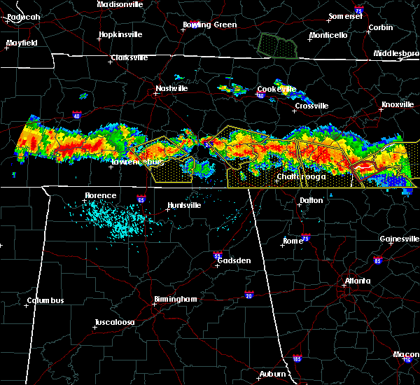 At 434 pm cdt, a severe thunderstorm was located 7 miles north of gruetli-laager, or 15 miles northwest of dunlap, moving southeast at 40 mph (trained weather spotters). Hazards include 70 mph wind gusts and quarter size hail. Hail damage to vehicles is expected. expect considerable tree damage. wind damage is also likely to mobile homes, roofs and outbuildings. this severe storm will be near, gruetli-laager around 445 pm cdt. other locations impacted by this severe thunderstorm include palmer, beersheba springs, coalmont, morrison, summitville, viola, altamont, hillsboro, centertown and fall creek falls s. P At 434 pm cdt, a severe thunderstorm was located 7 miles north of gruetli-laager, or 15 miles northwest of dunlap, moving southeast at 40 mph (trained weather spotters). Hazards include 70 mph wind gusts and quarter size hail. Hail damage to vehicles is expected. expect considerable tree damage. wind damage is also likely to mobile homes, roofs and outbuildings. this severe storm will be near, gruetli-laager around 445 pm cdt. other locations impacted by this severe thunderstorm include palmer, beersheba springs, coalmont, morrison, summitville, viola, altamont, hillsboro, centertown and fall creek falls s. P
|
| 7/14/2015 4:12 PM CDT |
 At 412 pm cdt, a severe thunderstorm was located near mcminnville, moving southeast at 40 mph (radar indicated). Hazards include 70 mph wind gusts and quarter size hail. Hail damage to vehicles is expected. expect considerable tree damage. wind damage is also likely to mobile homes, roofs and outbuildings. this severe thunderstorm will be near, gruetli-laager around 445 pm cdt. other locations impacted by this severe thunderstorm include palmer, beersheba springs, coalmont, morrison, summitville, viola, altamont, hillsboro, centertown and fall creek falls s. P At 412 pm cdt, a severe thunderstorm was located near mcminnville, moving southeast at 40 mph (radar indicated). Hazards include 70 mph wind gusts and quarter size hail. Hail damage to vehicles is expected. expect considerable tree damage. wind damage is also likely to mobile homes, roofs and outbuildings. this severe thunderstorm will be near, gruetli-laager around 445 pm cdt. other locations impacted by this severe thunderstorm include palmer, beersheba springs, coalmont, morrison, summitville, viola, altamont, hillsboro, centertown and fall creek falls s. P
|
| 5/25/2015 2:59 PM CDT | At 259 pm cdt, a severe thunderstorm was located 10 miles south of mcminnville, and moving northeast at 15 mph (radar indicated). Hazards include 60 mph wind gusts and penny size hail. Expect damage to roofs. siding and trees. The severe thunderstorm will be near, mcminnville around 325 pm cdt. |
| 5/25/2015 2:59 PM CDT | At 259 pm cdt, a severe thunderstorm was located 10 miles south of mcminnville, and moving northeast at 15 mph (radar indicated). Hazards include 60 mph wind gusts and penny size hail. Expect damage to roofs. siding and trees. The severe thunderstorm will be near, mcminnville around 325 pm cdt. |
| 4/3/2015 7:04 PM CDT | A severe thunderstorm warning remains in effect for northeastern grundy. eastern warren and van buren counties until 730 pm cdt. at 700 pm cdt. a severe thunderstorm was located 8 miles southwest of spencer. and moving east at 50 mph. hazard. 70 mph wind gusts and penny size hail. source. Radar indicated. |
| 4/3/2015 6:41 PM CDT | The national weather service in nashville has issued a * severe thunderstorm warning for. north central coffee county in middle tennessee. northeastern grundy county in middle tennessee. van buren county in middle tennessee. Warren county in middle tennessee. |
| 4/3/2015 6:35 PM CDT | A severe thunderstorm warning remains in effect for northern coffee. cannon and western warren counties until 700 pm cdt. at 633 pm cdt. a severe thunderstorm was located 10 miles southeast of woodbury. and moving east at 50 mph. hazard. 60 mph wind gusts and quarter size hail. source. Radar indicated. |
| 4/3/2015 6:14 PM CDT | The national weather service in nashville has issued a * severe thunderstorm warning for. cannon county in middle tennessee. northern coffee county in middle tennessee. southeastern rutherford county in middle tennessee. Western warren county in middle tennessee. |
| 1/1/0001 12:00 AM | Power line blown down in roadway and hail of unknown size reported in warren county TN, 0.2 miles SSE of Viola, TN |
| 1/1/0001 12:00 AM | Numerous trees were blown down. damage concentrated near viola in the southwest part of the count in warren county TN, 0.2 miles SSE of Viola, TN |
Hail Maps for Viola, TN


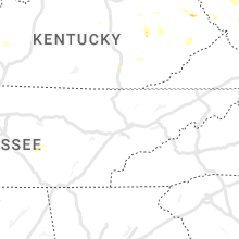


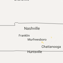


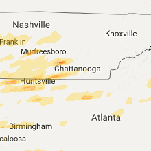


Connect with Interactive Hail Maps