

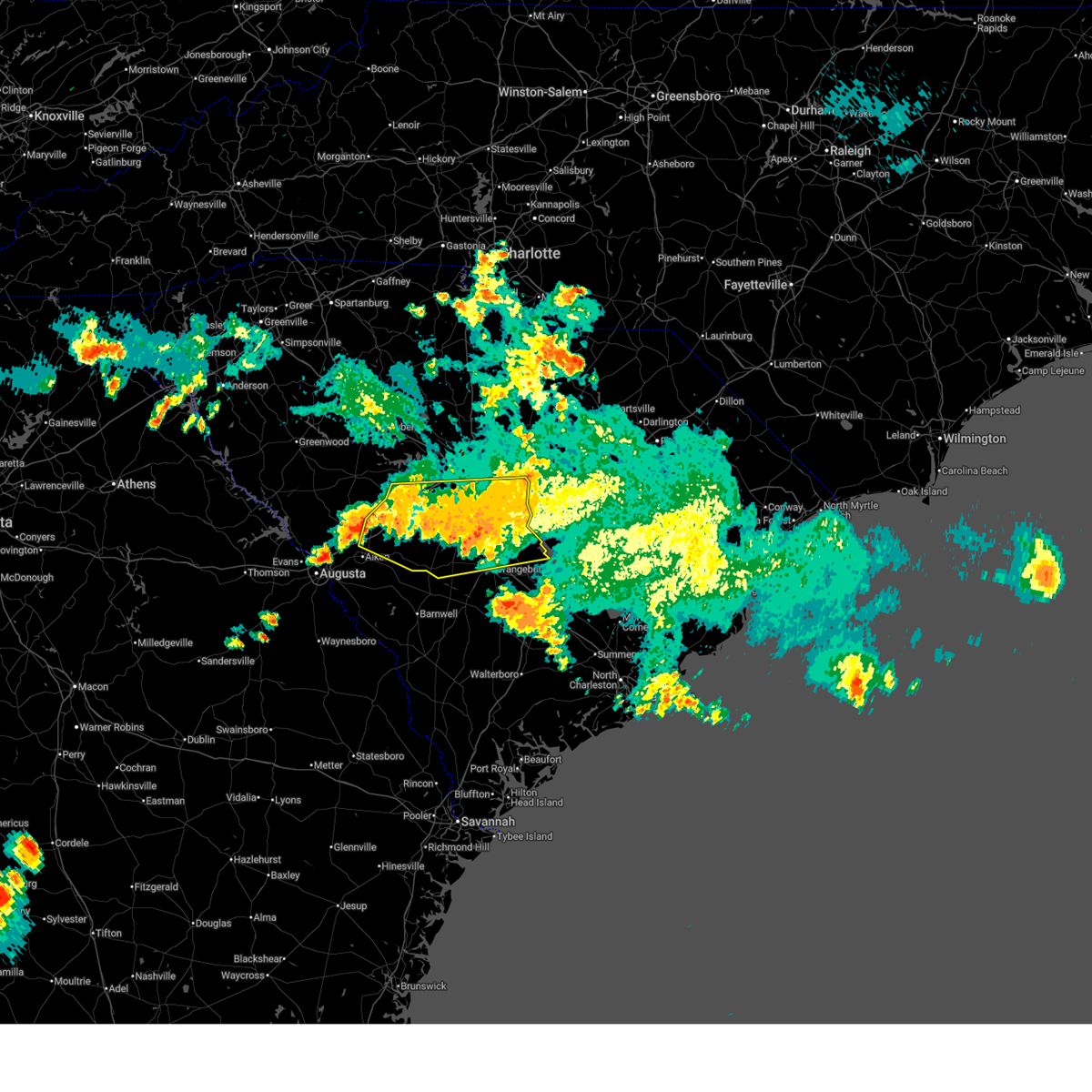
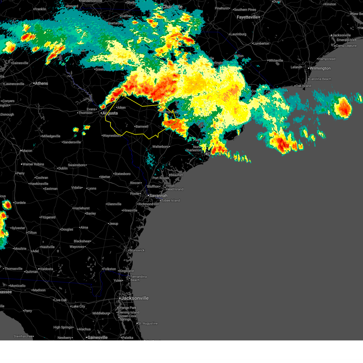
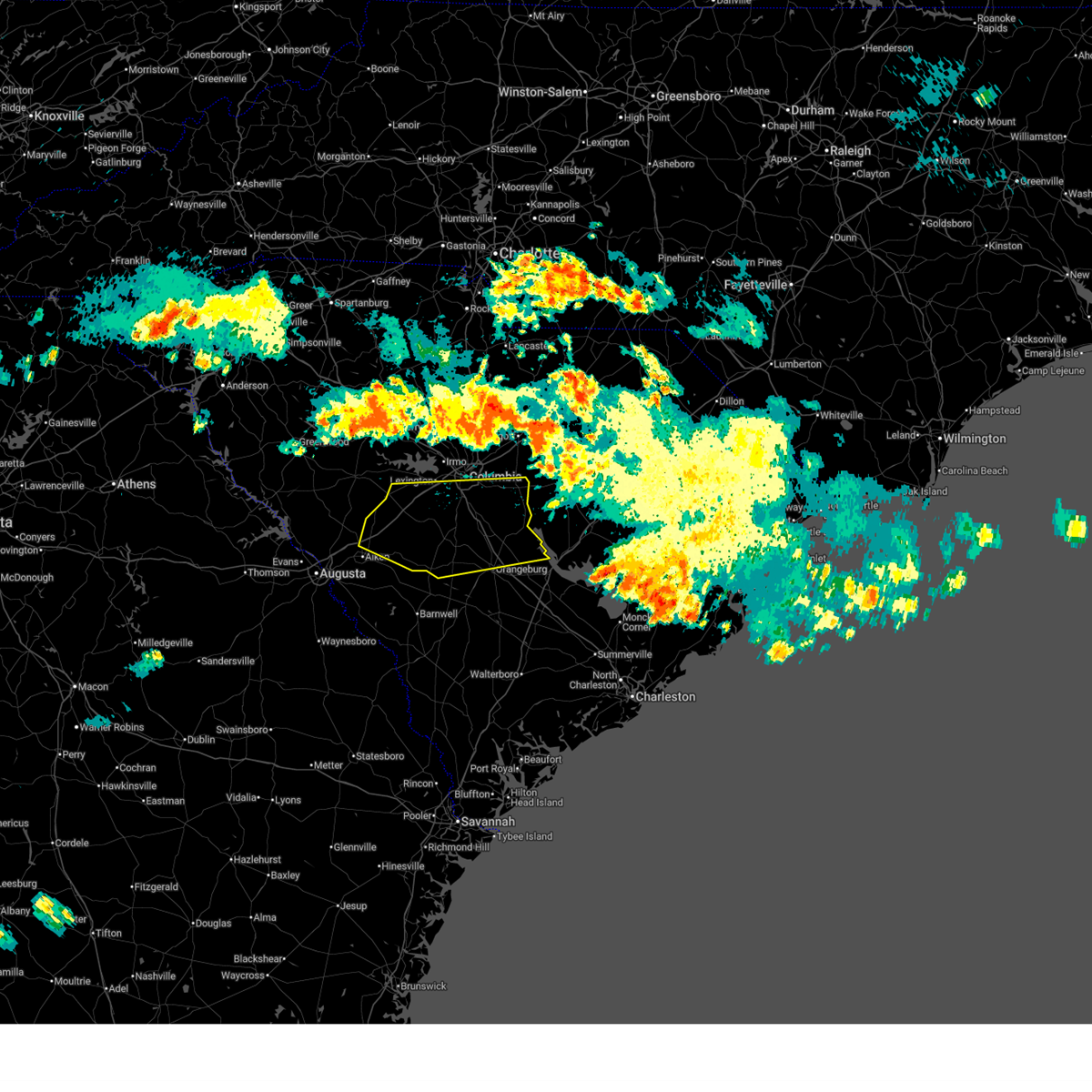
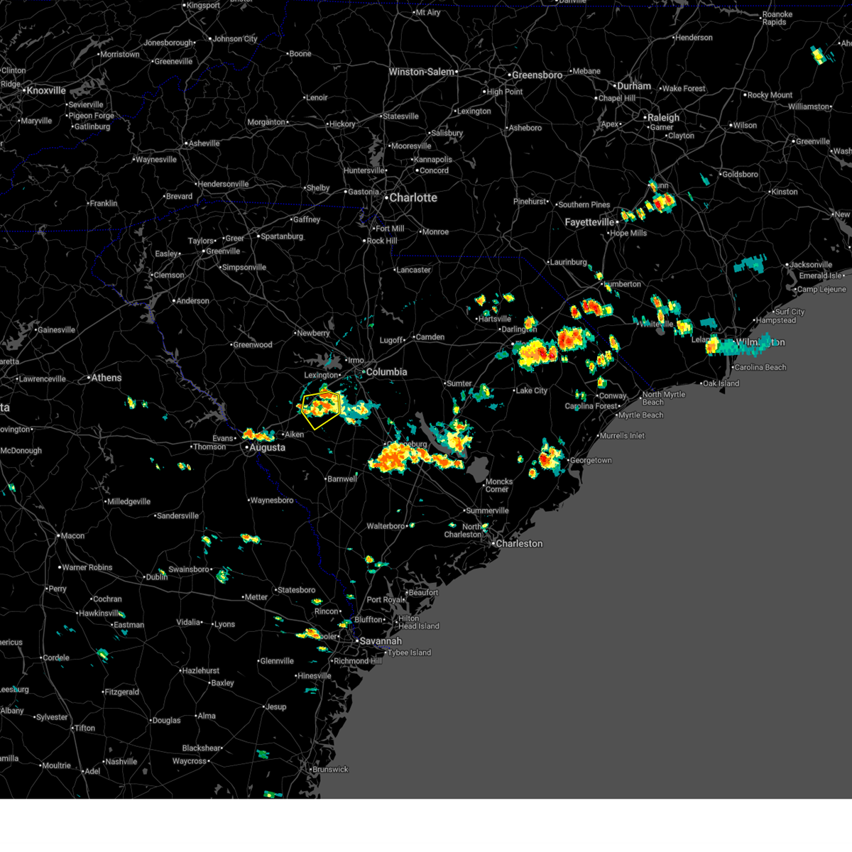
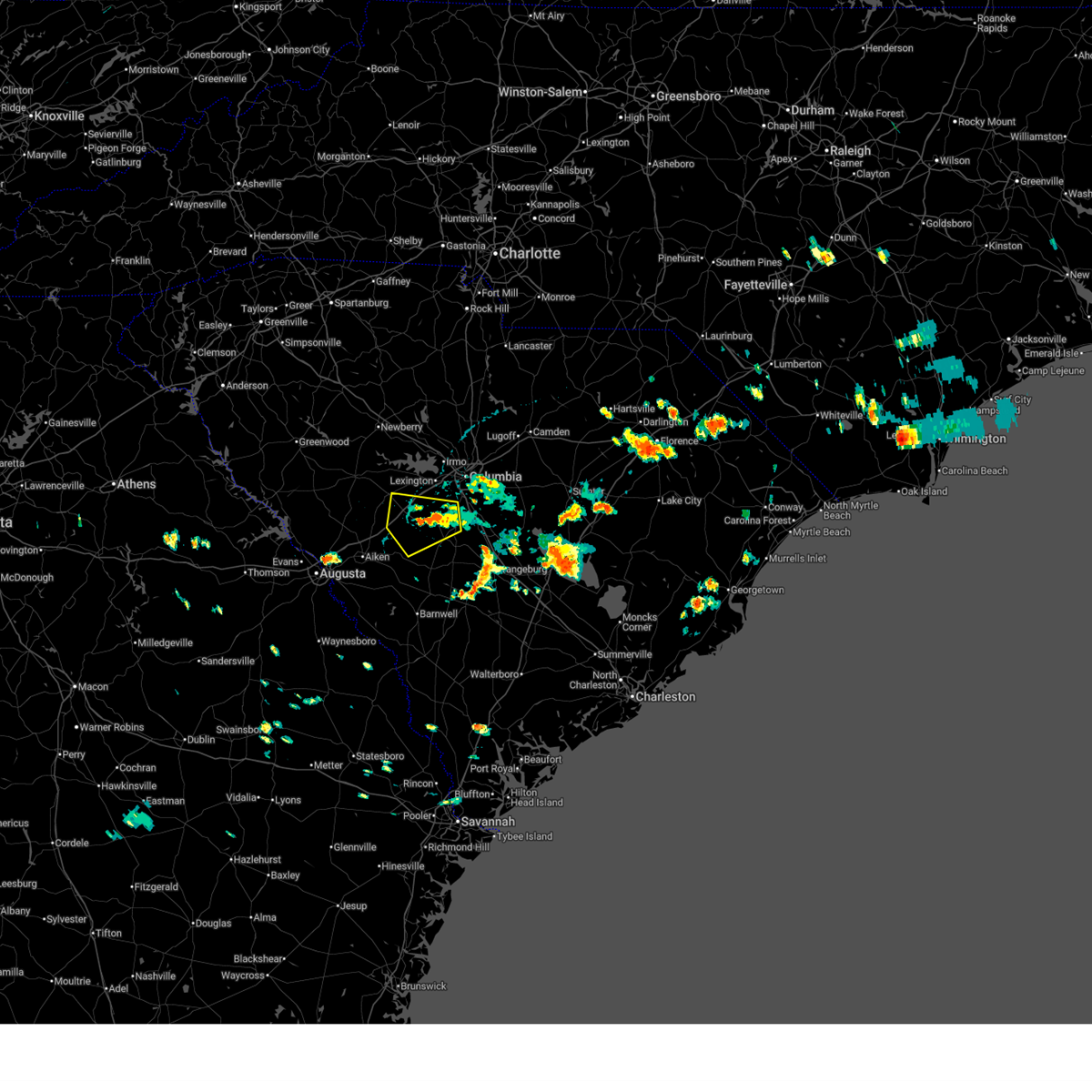
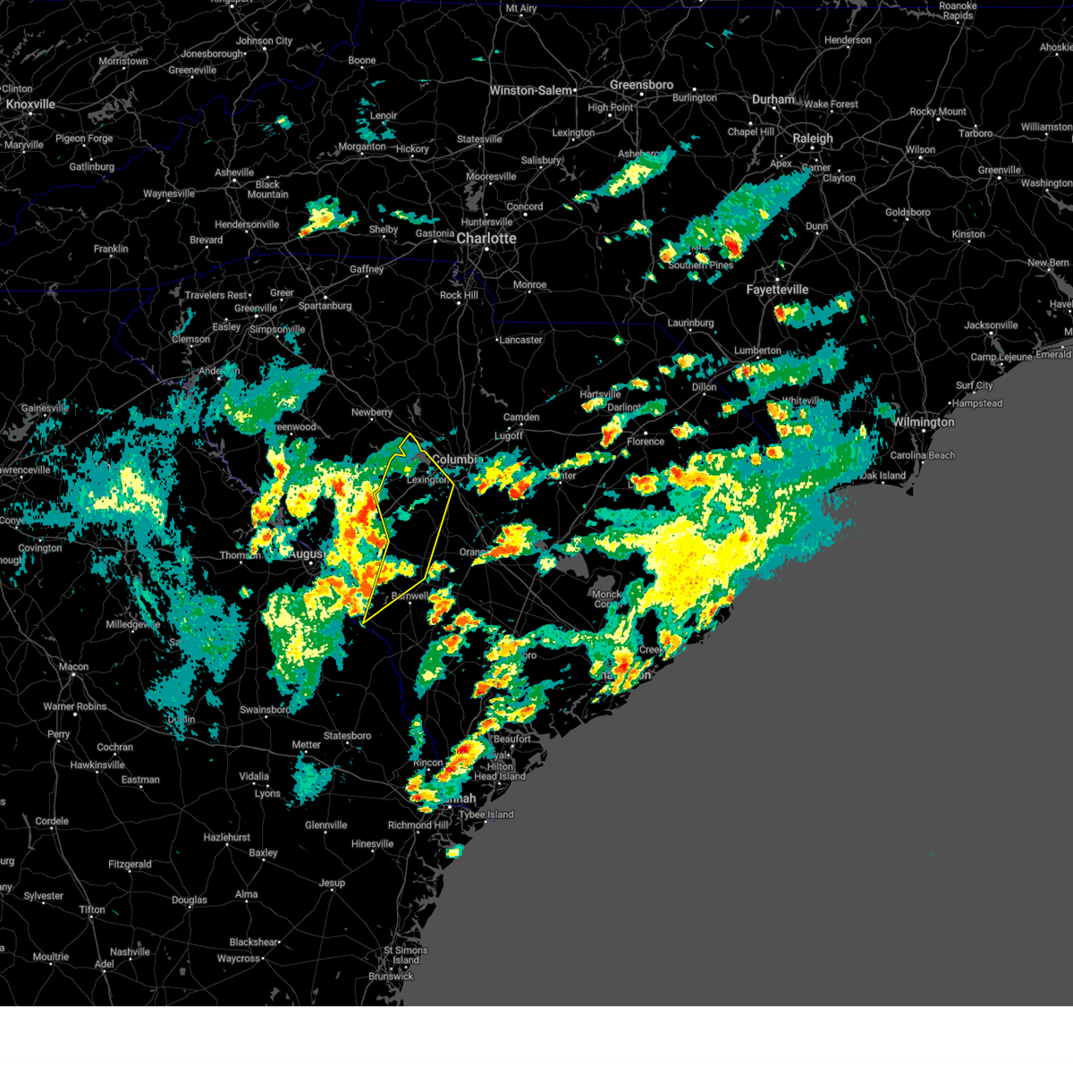
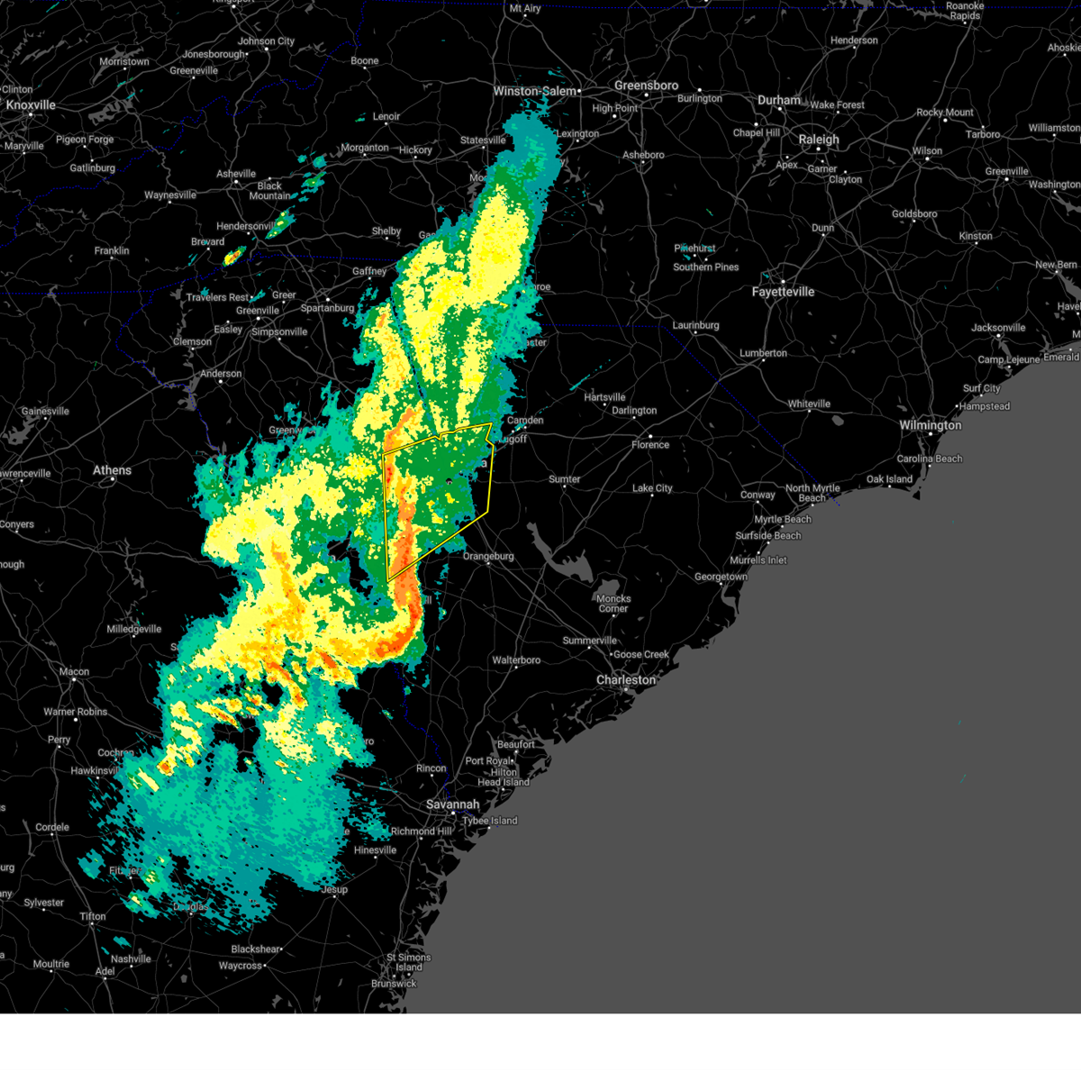
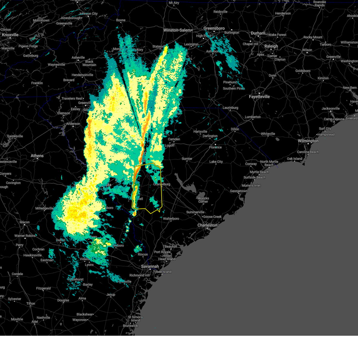
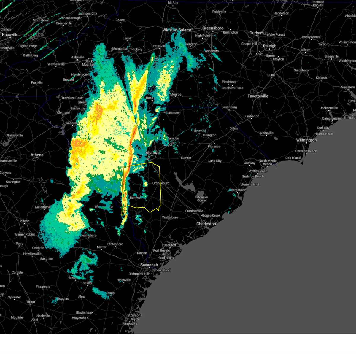
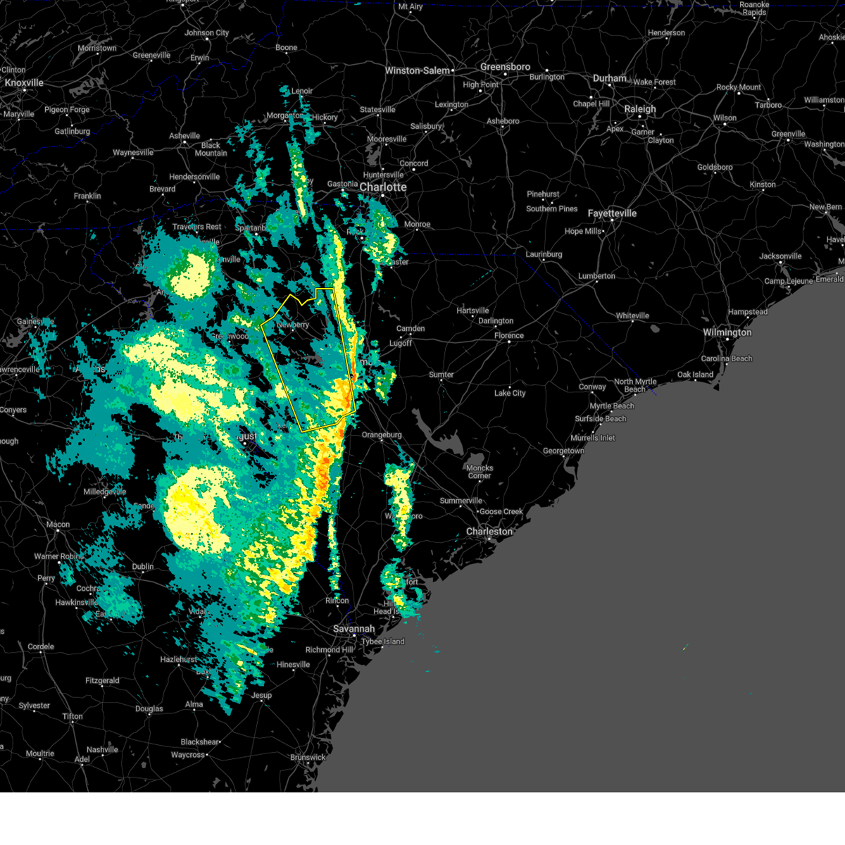
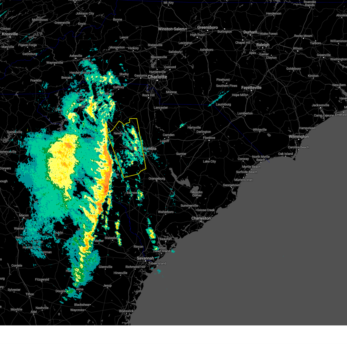
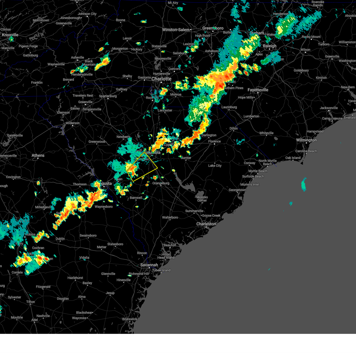
Hail Map for Wagener, SC
The Wagener, SC area has had 2 reports of on-the-ground hail by trained spotters, and has been under severe weather warnings 38 times during the past 12 months. Doppler radar has detected hail at or near Wagener, SC on 43 occasions, including 1 occasion during the past year.
| Name: | Wagener, SC |
| Where Located: | 37.2 miles ENE of Augusta, GA |
| Map: | Google Map for Wagener, SC |
| Population: | 797 |
| Housing Units: | 378 |
| More Info: | Search Google for Wagener, SC |
0
The Top Recent Hail Date for Wagener, SC is Wednesday, July 9, 2025 (40th out of 43)

Hail and Wind Damage Spotted near Wagener, SC
| Date / Time | Report Details |
|---|---|
| 7/9/2025 5:04 PM EDT | At 504 pm edt, a severe thunderstorm was located 11 miles southwest of gaston, or 17 miles south of red bank, moving northeast at 10 mph (radar indicated). Hazards include 60 mph wind gusts and penny size hail. Expect damage to trees and powerlines. Locations impacted include, swansea, wagener, north, pelion, salley, neeses, perry, woodford, livingston, perry airport, lexington county airport at pelion, peachtree rock, and thor. |
| 7/9/2025 4:45 PM EDT | Svrcae the national weather service in columbia has issued a * severe thunderstorm warning for, northwestern calhoun county in central south carolina, southeastern lexington county in central south carolina, east central aiken county in central south carolina, northwestern orangeburg county in central south carolina, * until 530 pm edt. * at 445 pm edt, a severe thunderstorm was located 13 miles east of aiken state park, or 20 miles north of denmark, moving northeast at 10 mph (radar indicated). Hazards include 60 mph wind gusts and penny size hail. expect damage to trees and powerlines |
| 6/25/2025 9:29 PM EDT |
 The storms which prompted the warning have moved out of the area. therefore, the warning will be allowed to expire. however, heavy rain is still possible with these thunderstorms. a severe thunderstorm watch remains in effect until midnight edt for central south carolina. The storms which prompted the warning have moved out of the area. therefore, the warning will be allowed to expire. however, heavy rain is still possible with these thunderstorms. a severe thunderstorm watch remains in effect until midnight edt for central south carolina.
|
| 6/25/2025 9:20 PM EDT |
 Svrcae the national weather service in columbia has issued a * severe thunderstorm warning for, barnwell county in central south carolina, bamberg county in central south carolina, aiken county in central south carolina, orangeburg county in central south carolina, * until 1015 pm edt. * at 919 pm edt, severe thunderstorms were located along a line extending from near orangeburg to 11 miles northeast of blackville to near aiken mall, moving south at 30 mph (radar indicated). Hazards include 60 mph wind gusts and penny size hail. expect damage to trees and powerlines Svrcae the national weather service in columbia has issued a * severe thunderstorm warning for, barnwell county in central south carolina, bamberg county in central south carolina, aiken county in central south carolina, orangeburg county in central south carolina, * until 1015 pm edt. * at 919 pm edt, severe thunderstorms were located along a line extending from near orangeburg to 11 miles northeast of blackville to near aiken mall, moving south at 30 mph (radar indicated). Hazards include 60 mph wind gusts and penny size hail. expect damage to trees and powerlines
|
| 6/25/2025 8:27 PM EDT |
 Svrcae the national weather service in columbia has issued a * severe thunderstorm warning for, calhoun county in central south carolina, lexington county in central south carolina, northeastern aiken county in central south carolina, northern orangeburg county in central south carolina, southeastern richland county in central south carolina, * until 930 pm edt. * at 827 pm edt, severe thunderstorms were located along a line extending from near horrel hill to near batesburg-leesville, moving southeast at 35 mph (radar indicated). Hazards include 60 mph wind gusts. expect damage to trees and powerlines Svrcae the national weather service in columbia has issued a * severe thunderstorm warning for, calhoun county in central south carolina, lexington county in central south carolina, northeastern aiken county in central south carolina, northern orangeburg county in central south carolina, southeastern richland county in central south carolina, * until 930 pm edt. * at 827 pm edt, severe thunderstorms were located along a line extending from near horrel hill to near batesburg-leesville, moving southeast at 35 mph (radar indicated). Hazards include 60 mph wind gusts. expect damage to trees and powerlines
|
| 6/11/2025 4:03 PM EDT | Trained spotter reported significant crop damage to a corn field with a photo of all stalks crushed to the ground from a downburst. also pea sized hail occurred. time e in aiken county SC, 7.9 miles SE of Wagener, SC |
| 6/11/2025 4:00 PM EDT |
 At 400 pm edt, a severe thunderstorm was located 13 miles north of aiken state park, or 14 miles southeast of batesburg-leesville, moving west at 10 mph (radar indicated). Hazards include 60 mph wind gusts. Expect damage to trees and powerlines. locations impacted include, wagener, pelion, thor, steedman, new holland, samaria fire station, cedar pond campground, and lexington county airport at pelion. This includes interstate 20 in south carolina between mile markers 31 and 42. At 400 pm edt, a severe thunderstorm was located 13 miles north of aiken state park, or 14 miles southeast of batesburg-leesville, moving west at 10 mph (radar indicated). Hazards include 60 mph wind gusts. Expect damage to trees and powerlines. locations impacted include, wagener, pelion, thor, steedman, new holland, samaria fire station, cedar pond campground, and lexington county airport at pelion. This includes interstate 20 in south carolina between mile markers 31 and 42.
|
| 6/11/2025 3:24 PM EDT |
 Svrcae the national weather service in columbia has issued a * severe thunderstorm warning for, southwestern lexington county in central south carolina, northeastern aiken county in central south carolina, * until 415 pm edt. * at 324 pm edt, a severe thunderstorm was located 13 miles west of gaston, or 13 miles south of red bank, moving west at 10 mph (radar indicated). Hazards include 60 mph wind gusts and nickel size hail. expect damage to trees and powerlines Svrcae the national weather service in columbia has issued a * severe thunderstorm warning for, southwestern lexington county in central south carolina, northeastern aiken county in central south carolina, * until 415 pm edt. * at 324 pm edt, a severe thunderstorm was located 13 miles west of gaston, or 13 miles south of red bank, moving west at 10 mph (radar indicated). Hazards include 60 mph wind gusts and nickel size hail. expect damage to trees and powerlines
|
| 6/7/2025 9:09 PM EDT |
 Svrcae the national weather service in columbia has issued a * severe thunderstorm warning for, central calhoun county in central south carolina, barnwell county in central south carolina, bamberg county in central south carolina, southeastern lexington county in central south carolina, eastern aiken county in central south carolina, orangeburg county in central south carolina, * until 1000 pm edt. * at 908 pm edt, severe thunderstorms were located along a line extending from 8 miles north of aiken state park to near savannah river site, moving east at 50 mph (radar indicated). Hazards include 60 mph wind gusts. these storms have a history of producing widespread damaging winds. expect damage to trees and powerlines Svrcae the national weather service in columbia has issued a * severe thunderstorm warning for, central calhoun county in central south carolina, barnwell county in central south carolina, bamberg county in central south carolina, southeastern lexington county in central south carolina, eastern aiken county in central south carolina, orangeburg county in central south carolina, * until 1000 pm edt. * at 908 pm edt, severe thunderstorms were located along a line extending from 8 miles north of aiken state park to near savannah river site, moving east at 50 mph (radar indicated). Hazards include 60 mph wind gusts. these storms have a history of producing widespread damaging winds. expect damage to trees and powerlines
|
| 6/7/2025 9:04 PM EDT |
 the severe thunderstorm warning has been cancelled and is no longer in effect the severe thunderstorm warning has been cancelled and is no longer in effect
|
| 6/7/2025 9:04 PM EDT |
 At 904 pm edt, severe thunderstorms were located along a line extending from 6 miles southeast of ridge spring to near millett, moving east at 45 mph (radar indicated). Hazards include 60 mph wind gusts and penny size hail. Expect damage to trees and powerlines. locations impacted include, aiken, barnwell, savannah river site, aiken mall, plant vogtle, williston, blackville, new ellenton, jackson, sardis, usc aiken, aiken municipal airport, citizens park, aiken state park, barnwell state park, gloverville, wagener, pelion, springfield, and hilda. This includes interstate 20 in south carolina between mile markers 14 and 28. At 904 pm edt, severe thunderstorms were located along a line extending from 6 miles southeast of ridge spring to near millett, moving east at 45 mph (radar indicated). Hazards include 60 mph wind gusts and penny size hail. Expect damage to trees and powerlines. locations impacted include, aiken, barnwell, savannah river site, aiken mall, plant vogtle, williston, blackville, new ellenton, jackson, sardis, usc aiken, aiken municipal airport, citizens park, aiken state park, barnwell state park, gloverville, wagener, pelion, springfield, and hilda. This includes interstate 20 in south carolina between mile markers 14 and 28.
|
| 6/7/2025 8:36 PM EDT |
 Svrcae the national weather service in columbia has issued a * severe thunderstorm warning for, central burke county in east central georgia, eastern richmond county in east central georgia, southeastern edgefield county in central south carolina, barnwell county in central south carolina, south central lexington county in central south carolina, aiken county in central south carolina, western orangeburg county in central south carolina, * until 915 pm edt. * at 836 pm edt, severe thunderstorms were located along a line extending from near edgefield to alexander, moving east at 45 mph (radar indicated). Hazards include 60 mph wind gusts and penny size hail. expect damage to trees and powerlines Svrcae the national weather service in columbia has issued a * severe thunderstorm warning for, central burke county in east central georgia, eastern richmond county in east central georgia, southeastern edgefield county in central south carolina, barnwell county in central south carolina, south central lexington county in central south carolina, aiken county in central south carolina, western orangeburg county in central south carolina, * until 915 pm edt. * at 836 pm edt, severe thunderstorms were located along a line extending from near edgefield to alexander, moving east at 45 mph (radar indicated). Hazards include 60 mph wind gusts and penny size hail. expect damage to trees and powerlines
|
| 5/30/2025 4:10 PM EDT |
 Svrcae the national weather service in columbia has issued a * severe thunderstorm warning for, calhoun county in central south carolina, northeastern barnwell county in central south carolina, southeastern lexington county in central south carolina, central aiken county in central south carolina, northwestern orangeburg county in central south carolina, southeastern richland county in central south carolina, * until 500 pm edt. * at 409 pm edt, severe thunderstorms were located along a line extending from columbia metro airport to 7 miles northeast of aiken state park to near clearwater, moving east at 35 mph (radar indicated). Hazards include 60 mph wind gusts and quarter size hail. Hail damage to vehicles is expected. Expect wind damage to trees and powerlines. Svrcae the national weather service in columbia has issued a * severe thunderstorm warning for, calhoun county in central south carolina, northeastern barnwell county in central south carolina, southeastern lexington county in central south carolina, central aiken county in central south carolina, northwestern orangeburg county in central south carolina, southeastern richland county in central south carolina, * until 500 pm edt. * at 409 pm edt, severe thunderstorms were located along a line extending from columbia metro airport to 7 miles northeast of aiken state park to near clearwater, moving east at 35 mph (radar indicated). Hazards include 60 mph wind gusts and quarter size hail. Hail damage to vehicles is expected. Expect wind damage to trees and powerlines.
|
| 5/30/2025 3:56 PM EDT |
 the severe thunderstorm warning has been cancelled and is no longer in effect the severe thunderstorm warning has been cancelled and is no longer in effect
|
| 5/30/2025 3:56 PM EDT |
 At 355 pm edt, severe thunderstorms were located along a line extending from near lexington to near aiken municipal airport to near grovetown, moving east at 50 mph (radar indicated). Hazards include 60 mph wind gusts. Expect damage to trees and powerlines. locations impacted include, columbia, aiken, north augusta, lexington, west columbia, cayce, grovetown, evans, forest acres, thomson, batesburg-leesville, oak grove, fort eisenhower, augusta, clearwater, martinez, aiken mall, red bank, belvedere, and st. andrews. this includes the following highways, interstate 126 between mile markers 1 and 3. interstate 20 in georgia between mile markers 167 and 201. interstate 20 in south carolina between mile markers 0 and 62. interstate 26 between mile markers 109 and 118. interstate 520 in georgia between mile markers 1 and 15. interstate 520 in south carolina between mile markers 16 and 23. Interstate 77 between mile markers 0 and 5, and between mile markers 10 and 11. At 355 pm edt, severe thunderstorms were located along a line extending from near lexington to near aiken municipal airport to near grovetown, moving east at 50 mph (radar indicated). Hazards include 60 mph wind gusts. Expect damage to trees and powerlines. locations impacted include, columbia, aiken, north augusta, lexington, west columbia, cayce, grovetown, evans, forest acres, thomson, batesburg-leesville, oak grove, fort eisenhower, augusta, clearwater, martinez, aiken mall, red bank, belvedere, and st. andrews. this includes the following highways, interstate 126 between mile markers 1 and 3. interstate 20 in georgia between mile markers 167 and 201. interstate 20 in south carolina between mile markers 0 and 62. interstate 26 between mile markers 109 and 118. interstate 520 in georgia between mile markers 1 and 15. interstate 520 in south carolina between mile markers 16 and 23. Interstate 77 between mile markers 0 and 5, and between mile markers 10 and 11.
|
| 5/30/2025 3:34 PM EDT |
 Svrcae the national weather service in columbia has issued a * severe thunderstorm warning for, mcduffie county in east central georgia, columbia county in east central georgia, richmond county in east central georgia, southeastern newberry county in central south carolina, central edgefield county in central south carolina, lexington county in central south carolina, eastern saluda county in central south carolina, aiken county in central south carolina, southeastern mccormick county in central south carolina, central richland county in central south carolina, * until 415 pm edt. * at 333 pm edt, severe thunderstorms were located along a line extending from 7 miles north of batesburg-leesville to 9 miles northwest of belvedere to thomson-mcduffie county airport, moving east at 35 mph (radar indicated). Hazards include 60 mph wind gusts. expect damage to trees and powerlines Svrcae the national weather service in columbia has issued a * severe thunderstorm warning for, mcduffie county in east central georgia, columbia county in east central georgia, richmond county in east central georgia, southeastern newberry county in central south carolina, central edgefield county in central south carolina, lexington county in central south carolina, eastern saluda county in central south carolina, aiken county in central south carolina, southeastern mccormick county in central south carolina, central richland county in central south carolina, * until 415 pm edt. * at 333 pm edt, severe thunderstorms were located along a line extending from 7 miles north of batesburg-leesville to 9 miles northwest of belvedere to thomson-mcduffie county airport, moving east at 35 mph (radar indicated). Hazards include 60 mph wind gusts. expect damage to trees and powerlines
|
| 5/29/2025 4:26 PM EDT |
 At 425 pm edt, severe thunderstorms were located along a line extending from 6 miles northeast of batesburg-leesville to 12 miles northeast of aiken state park to 8 miles east of savannah river site, moving northeast at 25 mph (radar indicated). Hazards include 60 mph wind gusts. Expect damage to trees and powerlines. locations impacted include, lexington, cayce, batesburg-leesville, oak grove, highway 6 at lake murray dam, red bank, williston, blackville, south congaree, pine ridge, gaston, sc state farmer's market, columbia metro airport, aiken state park, chapin, wagener, pelion, gilbert, springfield, and summit. This includes interstate 20 in south carolina between mile markers 31 and 60. At 425 pm edt, severe thunderstorms were located along a line extending from 6 miles northeast of batesburg-leesville to 12 miles northeast of aiken state park to 8 miles east of savannah river site, moving northeast at 25 mph (radar indicated). Hazards include 60 mph wind gusts. Expect damage to trees and powerlines. locations impacted include, lexington, cayce, batesburg-leesville, oak grove, highway 6 at lake murray dam, red bank, williston, blackville, south congaree, pine ridge, gaston, sc state farmer's market, columbia metro airport, aiken state park, chapin, wagener, pelion, gilbert, springfield, and summit. This includes interstate 20 in south carolina between mile markers 31 and 60.
|
| 5/29/2025 4:14 PM EDT |
 At 413 pm edt, severe thunderstorms were located along a line extending from near batesburg-leesville to 7 miles northeast of aiken state park to near savannah river site, moving northeast at 25 mph (radar indicated). Hazards include 60 mph wind gusts and penny size hail. Expect damage to trees and powerlines. locations impacted include, lexington, cayce, batesburg-leesville, oak grove, highway 6 at lake murray dam, red bank, williston, blackville, south congaree, pine ridge, gaston, sc state farmer's market, columbia metro airport, aiken state park, chapin, wagener, pelion, gilbert, springfield, and summit. this includes interstate 20 in south carolina between mile markers 31 and 60. This line produced 65 mph winds at a sensor 200 feet above the ground at the savannah river site. At 413 pm edt, severe thunderstorms were located along a line extending from near batesburg-leesville to 7 miles northeast of aiken state park to near savannah river site, moving northeast at 25 mph (radar indicated). Hazards include 60 mph wind gusts and penny size hail. Expect damage to trees and powerlines. locations impacted include, lexington, cayce, batesburg-leesville, oak grove, highway 6 at lake murray dam, red bank, williston, blackville, south congaree, pine ridge, gaston, sc state farmer's market, columbia metro airport, aiken state park, chapin, wagener, pelion, gilbert, springfield, and summit. this includes interstate 20 in south carolina between mile markers 31 and 60. This line produced 65 mph winds at a sensor 200 feet above the ground at the savannah river site.
|
| 5/29/2025 4:04 PM EDT |
 Svrcae the national weather service in columbia has issued a * severe thunderstorm warning for, central barnwell county in central south carolina, lexington county in central south carolina, eastern aiken county in central south carolina, northwestern orangeburg county in central south carolina, * until 445 pm edt. * at 404 pm edt, severe thunderstorms were located along a line extending from near batesburg-leesville to near aiken state park to near savannah river site, moving northeast at 25 mph (radar indicated). Hazards include 60 mph wind gusts and penny size hail. expect damage to trees and powerlines Svrcae the national weather service in columbia has issued a * severe thunderstorm warning for, central barnwell county in central south carolina, lexington county in central south carolina, eastern aiken county in central south carolina, northwestern orangeburg county in central south carolina, * until 445 pm edt. * at 404 pm edt, severe thunderstorms were located along a line extending from near batesburg-leesville to near aiken state park to near savannah river site, moving northeast at 25 mph (radar indicated). Hazards include 60 mph wind gusts and penny size hail. expect damage to trees and powerlines
|
| 3/31/2025 4:21 PM EDT | At 421 pm edt, severe thunderstorms were located along a line extending from near newberry county airport to 7 miles northeast of batesburg-leesville to near citizens park, moving east at 50 mph (radar indicated). Hazards include 60 mph wind gusts. Expect damage to trees and powerlines. locations impacted include, newberry, little mountain, cedar grove fire station, bundrick island, putnam's landing, salley, savannah river site badge office, summit, jackson, batesburg-leesville, lexington, aiken mall, camp kinard, perry, new holland, samaria fire station, cedar pond campground, perry airport, stoney hill, and chapin. this includes the following highways, interstate 20 in south carolina between mile markers 20 and 59. Interstate 26 between mile markers 77 and 91. |
| 3/31/2025 4:21 PM EDT | the severe thunderstorm warning has been cancelled and is no longer in effect |
| 3/31/2025 4:07 PM EDT |
 At 406 pm edt, severe thunderstorms were located along a line extending from near saluda to near aiken municipal airport to near jackson, moving east at 45 mph (radar indicated). Hazards include 60 mph wind gusts. Expect damage to trees and powerlines. locations impacted include, little mountain, cedar grove fire station, savannah river site badge office, summit, batesburg-leesville, johnston, camp kinard, edgefield county airport, new holland, samaria fire station, saluda, stoney hill, harmony, hopeland gardens, prosperity, burnettown, dreher island state park, williston, lake murray shores, and circle fire station. this includes the following highways, interstate 20 in south carolina between mile markers 10 and 59. Interstate 26 between mile markers 77 and 91. At 406 pm edt, severe thunderstorms were located along a line extending from near saluda to near aiken municipal airport to near jackson, moving east at 45 mph (radar indicated). Hazards include 60 mph wind gusts. Expect damage to trees and powerlines. locations impacted include, little mountain, cedar grove fire station, savannah river site badge office, summit, batesburg-leesville, johnston, camp kinard, edgefield county airport, new holland, samaria fire station, saluda, stoney hill, harmony, hopeland gardens, prosperity, burnettown, dreher island state park, williston, lake murray shores, and circle fire station. this includes the following highways, interstate 20 in south carolina between mile markers 10 and 59. Interstate 26 between mile markers 77 and 91.
|
| 3/31/2025 4:07 PM EDT |
 the severe thunderstorm warning has been cancelled and is no longer in effect the severe thunderstorm warning has been cancelled and is no longer in effect
|
| 3/31/2025 3:45 PM EDT |
 Svrcae the national weather service in columbia has issued a * severe thunderstorm warning for, central richmond county in east central georgia, southern newberry county in central south carolina, edgefield county in central south carolina, northeastern barnwell county in central south carolina, lexington county in central south carolina, saluda county in central south carolina, aiken county in central south carolina, northwestern orangeburg county in central south carolina, * until 445 pm edt. * at 345 pm edt, severe thunderstorms were located along a line extending from 8 miles south of ninety six historic site to near edgefield to near south augusta, moving east at 45 mph (radar indicated). Hazards include 60 mph wind gusts. expect damage to trees and powerlines Svrcae the national weather service in columbia has issued a * severe thunderstorm warning for, central richmond county in east central georgia, southern newberry county in central south carolina, edgefield county in central south carolina, northeastern barnwell county in central south carolina, lexington county in central south carolina, saluda county in central south carolina, aiken county in central south carolina, northwestern orangeburg county in central south carolina, * until 445 pm edt. * at 345 pm edt, severe thunderstorms were located along a line extending from 8 miles south of ninety six historic site to near edgefield to near south augusta, moving east at 45 mph (radar indicated). Hazards include 60 mph wind gusts. expect damage to trees and powerlines
|
| 3/16/2025 7:26 AM EDT |
 The storm which prompted the warning has moved out of the area. therefore, the warning will be allowed to expire. a tornado watch remains in effect until 1000 am edt for east central georgia, and central south carolina. a tornado watch also remains in effect until 200 pm edt for central south carolina. remember, a severe thunderstorm warning still remains in effect for lexington and aiken counties until 830am. The storm which prompted the warning has moved out of the area. therefore, the warning will be allowed to expire. a tornado watch remains in effect until 1000 am edt for east central georgia, and central south carolina. a tornado watch also remains in effect until 200 pm edt for central south carolina. remember, a severe thunderstorm warning still remains in effect for lexington and aiken counties until 830am.
|
| 3/16/2025 7:25 AM EDT |
 Svrcae the national weather service in columbia has issued a * severe thunderstorm warning for, south central newberry county in central south carolina, northwestern calhoun county in central south carolina, lexington county in central south carolina, east central saluda county in central south carolina, northeastern aiken county in central south carolina, northwestern orangeburg county in central south carolina, central richland county in central south carolina, * until 830 am edt. * at 724 am edt, severe thunderstorms were located along a line extending from near dreher island state park to near williston, moving northeast at 40 mph (radar indicated). Hazards include 60 mph wind gusts. expect damage to trees and powerlines Svrcae the national weather service in columbia has issued a * severe thunderstorm warning for, south central newberry county in central south carolina, northwestern calhoun county in central south carolina, lexington county in central south carolina, east central saluda county in central south carolina, northeastern aiken county in central south carolina, northwestern orangeburg county in central south carolina, central richland county in central south carolina, * until 830 am edt. * at 724 am edt, severe thunderstorms were located along a line extending from near dreher island state park to near williston, moving northeast at 40 mph (radar indicated). Hazards include 60 mph wind gusts. expect damage to trees and powerlines
|
| 3/16/2025 6:58 AM EDT |
 At 658 am edt, a severe thunderstorm was located near aiken municipal airport, or 10 miles northeast of aiken, moving northeast at 50 mph (radar indicated). Hazards include 60 mph wind gusts. Expect damage to trees and powerlines. locations impacted include, cedar grove fire station, saluda co sheriff's office, salley, savannah river site badge office, summit, jackson, batesburg-leesville, johnston, aiken mall, camp kinard, perry, edgefield county airport, vaucluse, new holland, samaria fire station, saluda, cedar pond campground, perry airport, harmony, and hopeland gardens. This includes interstate 20 in south carolina between mile markers 9 and 47. At 658 am edt, a severe thunderstorm was located near aiken municipal airport, or 10 miles northeast of aiken, moving northeast at 50 mph (radar indicated). Hazards include 60 mph wind gusts. Expect damage to trees and powerlines. locations impacted include, cedar grove fire station, saluda co sheriff's office, salley, savannah river site badge office, summit, jackson, batesburg-leesville, johnston, aiken mall, camp kinard, perry, edgefield county airport, vaucluse, new holland, samaria fire station, saluda, cedar pond campground, perry airport, harmony, and hopeland gardens. This includes interstate 20 in south carolina between mile markers 9 and 47.
|
| 3/16/2025 6:58 AM EDT |
 the severe thunderstorm warning has been cancelled and is no longer in effect the severe thunderstorm warning has been cancelled and is no longer in effect
|
| 3/16/2025 6:42 AM EDT |
 Svrcae the national weather service in columbia has issued a * severe thunderstorm warning for, east central columbia county in east central georgia, north central burke county in east central georgia, eastern richmond county in east central georgia, south central newberry county in central south carolina, central edgefield county in central south carolina, southwestern lexington county in central south carolina, saluda county in central south carolina, aiken county in central south carolina, * until 730 am edt. * at 641 am edt, a severe thunderstorm was located over aiken, moving northeast at 55 mph (radar indicated). Hazards include 60 mph wind gusts. expect damage to trees and powerlines Svrcae the national weather service in columbia has issued a * severe thunderstorm warning for, east central columbia county in east central georgia, north central burke county in east central georgia, eastern richmond county in east central georgia, south central newberry county in central south carolina, central edgefield county in central south carolina, southwestern lexington county in central south carolina, saluda county in central south carolina, aiken county in central south carolina, * until 730 am edt. * at 641 am edt, a severe thunderstorm was located over aiken, moving northeast at 55 mph (radar indicated). Hazards include 60 mph wind gusts. expect damage to trees and powerlines
|
| 3/5/2025 8:08 AM EST |
 The storms which prompted the warning have weakened below severe limits, and no longer pose an immediate threat to life or property. therefore, the warning will be allowed to expire. a tornado watch remains in effect until 100 pm est for central south carolina. remember, a severe thunderstorm warning still remains in effect for northeastern lexington county until 8:30am. The storms which prompted the warning have weakened below severe limits, and no longer pose an immediate threat to life or property. therefore, the warning will be allowed to expire. a tornado watch remains in effect until 100 pm est for central south carolina. remember, a severe thunderstorm warning still remains in effect for northeastern lexington county until 8:30am.
|
| 3/5/2025 7:46 AM EST |
 the severe thunderstorm warning has been cancelled and is no longer in effect the severe thunderstorm warning has been cancelled and is no longer in effect
|
| 3/5/2025 7:46 AM EST |
 At 745 am est, severe thunderstorms were located along a line extending from 7 miles south of red bank to 6 miles south of barnwell, moving northeast at 45 mph (radar indicated). Hazards include 60 mph wind gusts. Expect damage to trees and powerlines. locations impacted include, govan, salley, elko, olar, wagener, gaston, hilda, thor, ehrhardt, perry, prince of orange mall, edisto, north, aiken gopher tortoise heritage preserve, perry airport, cope, new zion, lexington county airport at pelion, livingston, and lexington acres pond. This includes interstate 26 between mile markers 119 and 139. At 745 am est, severe thunderstorms were located along a line extending from 7 miles south of red bank to 6 miles south of barnwell, moving northeast at 45 mph (radar indicated). Hazards include 60 mph wind gusts. Expect damage to trees and powerlines. locations impacted include, govan, salley, elko, olar, wagener, gaston, hilda, thor, ehrhardt, perry, prince of orange mall, edisto, north, aiken gopher tortoise heritage preserve, perry airport, cope, new zion, lexington county airport at pelion, livingston, and lexington acres pond. This includes interstate 26 between mile markers 119 and 139.
|
| 3/5/2025 7:25 AM EST |
 Svrcae the national weather service in columbia has issued a * severe thunderstorm warning for, east central burke county in east central georgia, northwestern calhoun county in central south carolina, barnwell county in central south carolina, bamberg county in central south carolina, southern lexington county in central south carolina, eastern aiken county in central south carolina, western orangeburg county in central south carolina, * until 815 am est. * at 724 am est, severe thunderstorms were located along a line extending from 9 miles southeast of batesburg-leesville to near millett, moving east at 40 mph (radar indicated). Hazards include 60 mph wind gusts. expect damage to trees and powerlines Svrcae the national weather service in columbia has issued a * severe thunderstorm warning for, east central burke county in east central georgia, northwestern calhoun county in central south carolina, barnwell county in central south carolina, bamberg county in central south carolina, southern lexington county in central south carolina, eastern aiken county in central south carolina, western orangeburg county in central south carolina, * until 815 am est. * at 724 am est, severe thunderstorms were located along a line extending from 9 miles southeast of batesburg-leesville to near millett, moving east at 40 mph (radar indicated). Hazards include 60 mph wind gusts. expect damage to trees and powerlines
|
| 2/16/2025 7:30 AM EST | Svrcae the national weather service in columbia has issued a * severe thunderstorm warning for, burke county in east central georgia, southeastern richmond county in east central georgia, southern calhoun county in central south carolina, barnwell county in central south carolina, bamberg county in central south carolina, aiken county in central south carolina, western orangeburg county in central south carolina, * until 830 am est. * at 730 am est, severe thunderstorms were located along a line extending from 6 miles northeast of aiken municipal airport to near summertown, moving east at 45 mph (radar indicated). Hazards include 60 mph wind gusts. expect damage to trees and powerlines |
| 12/29/2024 8:59 AM EST |
 The storms which prompted the warning have moved out of the area. therefore, the warning will be allowed to expire. to report severe weather, contact your nearest law enforcement agency. they will relay your report to the national weather service columbia. The storms which prompted the warning have moved out of the area. therefore, the warning will be allowed to expire. to report severe weather, contact your nearest law enforcement agency. they will relay your report to the national weather service columbia.
|
| 12/29/2024 8:03 AM EST |
 Svrcae the national weather service in columbia has issued a * severe thunderstorm warning for, western fairfield county in central south carolina, newberry county in central south carolina, lexington county in central south carolina, eastern saluda county in central south carolina, northeastern aiken county in central south carolina, northwestern richland county in central south carolina, * until 900 am est. * at 802 am est, severe thunderstorms were located along a line extending from 7 miles northeast of lake greenwood state park to graniteville, moving northeast at 50 mph (radar indicated). Hazards include 60 mph wind gusts. expect damage to trees and powerlines Svrcae the national weather service in columbia has issued a * severe thunderstorm warning for, western fairfield county in central south carolina, newberry county in central south carolina, lexington county in central south carolina, eastern saluda county in central south carolina, northeastern aiken county in central south carolina, northwestern richland county in central south carolina, * until 900 am est. * at 802 am est, severe thunderstorms were located along a line extending from 7 miles northeast of lake greenwood state park to graniteville, moving northeast at 50 mph (radar indicated). Hazards include 60 mph wind gusts. expect damage to trees and powerlines
|
| 8/3/2024 4:43 PM EDT |
 Svrcae the national weather service in columbia has issued a * severe thunderstorm warning for, northwestern calhoun county in central south carolina, southern lexington county in central south carolina, northeastern aiken county in central south carolina, * until 530 pm edt. * at 443 pm edt, a severe thunderstorm was located 10 miles northeast of aiken state park, or 17 miles southeast of batesburg-leesville, moving northeast at 30 mph (radar indicated). Hazards include 60 mph wind gusts. expect damage to trees and powerlines Svrcae the national weather service in columbia has issued a * severe thunderstorm warning for, northwestern calhoun county in central south carolina, southern lexington county in central south carolina, northeastern aiken county in central south carolina, * until 530 pm edt. * at 443 pm edt, a severe thunderstorm was located 10 miles northeast of aiken state park, or 17 miles southeast of batesburg-leesville, moving northeast at 30 mph (radar indicated). Hazards include 60 mph wind gusts. expect damage to trees and powerlines
|
| 8/3/2024 4:31 PM EDT |
 At 431 pm edt, a severe thunderstorm was located 12 miles north of aiken state park, or 13 miles south of batesburg-leesville, moving northeast at 30 mph (radar indicated). Hazards include 60 mph wind gusts. Expect damage to trees and powerlines. locations impacted include, batesburg-leesville, aiken state park, swansea, wagener, pelion, gilbert, summit, monetta, perry, perry airport, lexington county airport at pelion, fredonia, murray, thor, camp kinard, steedman, kneece, new holland, samaria fire station, and cedar pond campground. This includes interstate 20 in south carolina between mile markers 26 and 48. At 431 pm edt, a severe thunderstorm was located 12 miles north of aiken state park, or 13 miles south of batesburg-leesville, moving northeast at 30 mph (radar indicated). Hazards include 60 mph wind gusts. Expect damage to trees and powerlines. locations impacted include, batesburg-leesville, aiken state park, swansea, wagener, pelion, gilbert, summit, monetta, perry, perry airport, lexington county airport at pelion, fredonia, murray, thor, camp kinard, steedman, kneece, new holland, samaria fire station, and cedar pond campground. This includes interstate 20 in south carolina between mile markers 26 and 48.
|
| 8/3/2024 4:07 PM EDT |
 Svrcae the national weather service in columbia has issued a * severe thunderstorm warning for, southwestern lexington county in central south carolina, northeastern aiken county in central south carolina, * until 445 pm edt. * at 407 pm edt, a severe thunderstorm was located over aiken municipal airport, or 8 miles north of aiken, moving northeast at 30 mph (radar indicated). Hazards include 60 mph wind gusts. expect damage to trees and powerlines Svrcae the national weather service in columbia has issued a * severe thunderstorm warning for, southwestern lexington county in central south carolina, northeastern aiken county in central south carolina, * until 445 pm edt. * at 407 pm edt, a severe thunderstorm was located over aiken municipal airport, or 8 miles north of aiken, moving northeast at 30 mph (radar indicated). Hazards include 60 mph wind gusts. expect damage to trees and powerlines
|
| 5/15/2024 5:05 PM EDT | Sc dept. of public safety reported a tree down on convent church rd. near the intersection of lawson rd. time estimated by rada in lexington county SC, 5.2 miles S of Wagener, SC |
| 5/15/2024 4:46 PM EDT |
 Svrcae the national weather service in columbia has issued a * severe thunderstorm warning for, east central edgefield county in central south carolina, northeastern barnwell county in central south carolina, southern lexington county in central south carolina, central aiken county in central south carolina, northwestern orangeburg county in central south carolina, * until 530 pm edt. * at 445 pm edt, a severe thunderstorm was located over aiken municipal airport, or 7 miles northeast of aiken, moving east at 40 mph (radar indicated). Hazards include 60 mph wind gusts and quarter size hail. Hail damage to vehicles is expected. Expect wind damage to trees and powerlines. Svrcae the national weather service in columbia has issued a * severe thunderstorm warning for, east central edgefield county in central south carolina, northeastern barnwell county in central south carolina, southern lexington county in central south carolina, central aiken county in central south carolina, northwestern orangeburg county in central south carolina, * until 530 pm edt. * at 445 pm edt, a severe thunderstorm was located over aiken municipal airport, or 7 miles northeast of aiken, moving east at 40 mph (radar indicated). Hazards include 60 mph wind gusts and quarter size hail. Hail damage to vehicles is expected. Expect wind damage to trees and powerlines.
|
| 5/9/2024 11:09 AM EDT |
 the severe thunderstorm warning has been cancelled and is no longer in effect the severe thunderstorm warning has been cancelled and is no longer in effect
|
| 5/9/2024 10:50 AM EDT |
 At 1050 am edt, a severe thunderstorm was located 7 miles east of aiken municipal airport, or 13 miles northeast of aiken, moving east at 40 mph (radar indicated). Hazards include 60 mph wind gusts and penny size hail. Expect damage to trees and powerlines. locations impacted include, aiken, aiken mall, new ellenton, citizens park, aiken state park, aiken municipal airport, swansea, wagener, salley, perry, windsor, aiken gopher tortoise heritage preserve, perry airport, hopeland gardens, thor, and new holland. This includes interstate 20 in south carolina between mile markers 23 and 35. At 1050 am edt, a severe thunderstorm was located 7 miles east of aiken municipal airport, or 13 miles northeast of aiken, moving east at 40 mph (radar indicated). Hazards include 60 mph wind gusts and penny size hail. Expect damage to trees and powerlines. locations impacted include, aiken, aiken mall, new ellenton, citizens park, aiken state park, aiken municipal airport, swansea, wagener, salley, perry, windsor, aiken gopher tortoise heritage preserve, perry airport, hopeland gardens, thor, and new holland. This includes interstate 20 in south carolina between mile markers 23 and 35.
|
| 5/9/2024 10:50 AM EDT |
 the severe thunderstorm warning has been cancelled and is no longer in effect the severe thunderstorm warning has been cancelled and is no longer in effect
|
| 5/9/2024 10:30 AM EDT |
 Svrcae the national weather service in columbia has issued a * severe thunderstorm warning for, southeastern edgefield county in central south carolina, lexington county in central south carolina, aiken county in central south carolina, * until 1130 am edt. * at 1029 am edt, severe thunderstorms were located along a line extending from batesburg-leesville to near edgefield county airport to near belvedere, moving southeast at 40 mph (radar indicated). Hazards include 60 mph wind gusts and penny size hail. expect damage to trees and powerlines Svrcae the national weather service in columbia has issued a * severe thunderstorm warning for, southeastern edgefield county in central south carolina, lexington county in central south carolina, aiken county in central south carolina, * until 1130 am edt. * at 1029 am edt, severe thunderstorms were located along a line extending from batesburg-leesville to near edgefield county airport to near belvedere, moving southeast at 40 mph (radar indicated). Hazards include 60 mph wind gusts and penny size hail. expect damage to trees and powerlines
|
| 5/9/2024 4:26 AM EDT |
 At 426 am edt, severe thunderstorms were located along a line extending from near poinsett state park to 10 miles northwest of orangeburg, moving east at 45 mph (radar indicated). Hazards include 60 mph wind gusts. Expect damage to trees and powerlines. locations impacted include, sumter, orangeburg, south sumter, mcentire air base, brookdale, st. matthews, eastover, orangeburg county airport, congaree national park, hopkins, claflin college, horrel hill, south carolina state university, sandy run, gadsden, millwood, poinsett state park, edisto gardens, mulberry, and swansea. this includes the following highways, interstate 20 in south carolina between mile markers 25 and 26. interstate 26 between mile markers 123 and 150. Interstate 95 between mile markers 133 and 137. At 426 am edt, severe thunderstorms were located along a line extending from near poinsett state park to 10 miles northwest of orangeburg, moving east at 45 mph (radar indicated). Hazards include 60 mph wind gusts. Expect damage to trees and powerlines. locations impacted include, sumter, orangeburg, south sumter, mcentire air base, brookdale, st. matthews, eastover, orangeburg county airport, congaree national park, hopkins, claflin college, horrel hill, south carolina state university, sandy run, gadsden, millwood, poinsett state park, edisto gardens, mulberry, and swansea. this includes the following highways, interstate 20 in south carolina between mile markers 25 and 26. interstate 26 between mile markers 123 and 150. Interstate 95 between mile markers 133 and 137.
|
| 5/9/2024 3:57 AM EDT |
 Svrcae the national weather service in columbia has issued a * severe thunderstorm warning for, calhoun county in central south carolina, northwestern clarendon county in central south carolina, southern lexington county in central south carolina, southern sumter county in central south carolina, northeastern aiken county in central south carolina, northwestern orangeburg county in central south carolina, southeastern richland county in central south carolina, * until 500 am edt. * at 357 am edt, severe thunderstorms were located along a line extending from near forest acres to 12 miles southeast of batesburg-leesville, moving east at 45 mph (radar indicated). Hazards include 60 mph wind gusts. expect damage to trees and powerlines Svrcae the national weather service in columbia has issued a * severe thunderstorm warning for, calhoun county in central south carolina, northwestern clarendon county in central south carolina, southern lexington county in central south carolina, southern sumter county in central south carolina, northeastern aiken county in central south carolina, northwestern orangeburg county in central south carolina, southeastern richland county in central south carolina, * until 500 am edt. * at 357 am edt, severe thunderstorms were located along a line extending from near forest acres to 12 miles southeast of batesburg-leesville, moving east at 45 mph (radar indicated). Hazards include 60 mph wind gusts. expect damage to trees and powerlines
|
| 4/19/2024 10:27 AM EDT |
 The storms which prompted the warning have weakened below severe limits, and no longer pose an immediate threat to life or property. therefore, the warning will be allowed to expire. The storms which prompted the warning have weakened below severe limits, and no longer pose an immediate threat to life or property. therefore, the warning will be allowed to expire.
|
| 4/19/2024 10:07 AM EDT |
 At 1006 am edt, severe thunderstorms were located along a line extending from near dreher island state park to 9 miles southeast of batesburg-leesville to 9 miles north of aiken state park, moving east at 35 mph (radar indicated). Hazards include 60 mph wind gusts and penny size hail. Expect damage to trees and powerlines. locations impacted include, lexington, west columbia, cayce, irmo, batesburg-leesville, st. andrews, oak grove, highway 6 at lake murray dam, red bank, south congaree, pine ridge, gaston, harbison state forest, columbia metro airport, swansea, wagener, pelion, gilbert, summit, and salley. this includes the following highways, interstate 126 between mile markers 0 and 1. interstate 20 in south carolina between mile markers 25 and 65. Interstate 26 between mile markers 101 and 114. At 1006 am edt, severe thunderstorms were located along a line extending from near dreher island state park to 9 miles southeast of batesburg-leesville to 9 miles north of aiken state park, moving east at 35 mph (radar indicated). Hazards include 60 mph wind gusts and penny size hail. Expect damage to trees and powerlines. locations impacted include, lexington, west columbia, cayce, irmo, batesburg-leesville, st. andrews, oak grove, highway 6 at lake murray dam, red bank, south congaree, pine ridge, gaston, harbison state forest, columbia metro airport, swansea, wagener, pelion, gilbert, summit, and salley. this includes the following highways, interstate 126 between mile markers 0 and 1. interstate 20 in south carolina between mile markers 25 and 65. Interstate 26 between mile markers 101 and 114.
|
| 4/19/2024 10:07 AM EDT |
 the severe thunderstorm warning has been cancelled and is no longer in effect the severe thunderstorm warning has been cancelled and is no longer in effect
|
| 4/19/2024 9:37 AM EDT |
 Svrcae the national weather service in columbia has issued a * severe thunderstorm warning for, east central edgefield county in central south carolina, lexington county in central south carolina, southeastern saluda county in central south carolina, northeastern aiken county in central south carolina, northwestern richland county in central south carolina, * until 1030 am edt. * at 937 am edt, severe thunderstorms were located along a line extending from 6 miles northeast of saluda to ridge spring to near aiken municipal airport, moving east at 35 mph (radar indicated). Hazards include 60 mph wind gusts and penny size hail. expect damage to trees and powerlines Svrcae the national weather service in columbia has issued a * severe thunderstorm warning for, east central edgefield county in central south carolina, lexington county in central south carolina, southeastern saluda county in central south carolina, northeastern aiken county in central south carolina, northwestern richland county in central south carolina, * until 1030 am edt. * at 937 am edt, severe thunderstorms were located along a line extending from 6 miles northeast of saluda to ridge spring to near aiken municipal airport, moving east at 35 mph (radar indicated). Hazards include 60 mph wind gusts and penny size hail. expect damage to trees and powerlines
|
| 2/28/2024 6:36 PM EST | At 636 pm est, severe thunderstorms were located along a line extending from 8 miles south of batesburg-leesville to near wrens, moving southeast at 30 mph (radar indicated). Hazards include 60 mph wind gusts. Expect damage to trees and powerlines. locations impacted include, aiken, north augusta, waynesboro, savannah river site, aiken mall, fort eisenhower, augusta, plant vogtle, clearwater, belvedere, hephzibah, williston, new ellenton, jackson, glendale, gough, south augusta, midtown, summerville, and augusta mall. this includes the following highways, interstate 20 in south carolina near mile marker 8, and between mile markers 11 and 36. interstate 520 in georgia between mile markers 2 and 15. Interstate 520 in south carolina between mile markers 16 and 22. |
| 2/28/2024 6:18 PM EST | Svrcae the national weather service in columbia has issued a * severe thunderstorm warning for, southeastern mcduffie county in east central georgia, southern columbia county in east central georgia, northwestern burke county in east central georgia, richmond county in east central georgia, southern edgefield county in central south carolina, central barnwell county in central south carolina, southeastern saluda county in central south carolina, aiken county in central south carolina, northwestern orangeburg county in central south carolina, * until 715 pm est. * at 617 pm est, severe thunderstorms were located along a line extending from near batesburg-leesville to 6 miles north of stapleton, moving southeast at 30 mph (radar indicated). Hazards include 60 mph wind gusts. expect damage to trees and powerlines |
| 1/9/2024 1:46 PM EST |
 At 145 pm est, severe thunderstorms were located along a line extending from 8 miles southwest of red bank to 7 miles west of williston, moving northeast at 70 mph (radar indicated). Hazards include 70 mph wind gusts. Expect considerable tree damage. damage is likely to mobile homes, roofs, and outbuildings. Locations impacted include, aiken, savannah river site, plant vogtle, aiken mall, new ellenton, jackson, sardis, alexander, citizens park, aiken state park, wagener, pelion, girard, windsor, aiken gopher tortoise heritage preserve, hopeland gardens, savannah river site badge office, savannah river site h canyon, savannah river site k complex, and shell bluff landing. At 145 pm est, severe thunderstorms were located along a line extending from 8 miles southwest of red bank to 7 miles west of williston, moving northeast at 70 mph (radar indicated). Hazards include 70 mph wind gusts. Expect considerable tree damage. damage is likely to mobile homes, roofs, and outbuildings. Locations impacted include, aiken, savannah river site, plant vogtle, aiken mall, new ellenton, jackson, sardis, alexander, citizens park, aiken state park, wagener, pelion, girard, windsor, aiken gopher tortoise heritage preserve, hopeland gardens, savannah river site badge office, savannah river site h canyon, savannah river site k complex, and shell bluff landing.
|
| 1/9/2024 1:12 PM EST |
 At 111 pm est, severe thunderstorms were located along a line extending from near belvedere to near gough, moving northeast at 70 mph (radar indicated). Hazards include 70 mph wind gusts. Expect considerable tree damage. Damage is likely to mobile homes, roofs, and outbuildings. At 111 pm est, severe thunderstorms were located along a line extending from near belvedere to near gough, moving northeast at 70 mph (radar indicated). Hazards include 70 mph wind gusts. Expect considerable tree damage. Damage is likely to mobile homes, roofs, and outbuildings.
|
| 8/7/2023 7:43 PM EDT |
 The severe thunderstorm warning for northwestern calhoun, southern lexington and aiken counties will expire at 745 pm edt, the storm which prompted the warning has weakened below severe limits, and has exited the warned area. therefore, the warning will be allowed to expire. a severe thunderstorm watch remains in effect until midnight edt for east central georgia, and central south carolina. The severe thunderstorm warning for northwestern calhoun, southern lexington and aiken counties will expire at 745 pm edt, the storm which prompted the warning has weakened below severe limits, and has exited the warned area. therefore, the warning will be allowed to expire. a severe thunderstorm watch remains in effect until midnight edt for east central georgia, and central south carolina.
|
| 8/7/2023 7:26 PM EDT |
 At 726 pm edt, a severe thunderstorm was located 12 miles east of aiken state park, or 18 miles northwest of denmark, moving east at 40 mph (radar indicated). Hazards include 60 mph wind gusts. Expect damage to trees and powerlines. locations impacted include, aiken, cayce, aiken mall, south congaree, pine ridge, new ellenton, jackson, gaston, sc state farmer`s market, sandy run, citizens park, aiken state park, swansea, wagener, pelion, salley, perry, windsor, savannah river site badge office, and thor. this includes the following highways, interstate 26 between mile markers 114 and 129. interstate 77 between mile markers 0 and 1. hail threat, radar indicated max hail size, <. 75 in wind threat, radar indicated max wind gust, 60 mph. At 726 pm edt, a severe thunderstorm was located 12 miles east of aiken state park, or 18 miles northwest of denmark, moving east at 40 mph (radar indicated). Hazards include 60 mph wind gusts. Expect damage to trees and powerlines. locations impacted include, aiken, cayce, aiken mall, south congaree, pine ridge, new ellenton, jackson, gaston, sc state farmer`s market, sandy run, citizens park, aiken state park, swansea, wagener, pelion, salley, perry, windsor, savannah river site badge office, and thor. this includes the following highways, interstate 26 between mile markers 114 and 129. interstate 77 between mile markers 0 and 1. hail threat, radar indicated max hail size, <. 75 in wind threat, radar indicated max wind gust, 60 mph.
|
| 8/7/2023 6:40 PM EDT |
 The severe thunderstorm warning for northwestern calhoun, southeastern lexington, northeastern aiken and south central richland counties will expire at 645 pm edt, the storms which prompted the warning have moved out of the area. therefore, the warning will be allowed to expire. a severe thunderstorm watch remains in effect until midnight edt for central south carolina. remember, a severe thunderstorm warning still remains in effect for all of lexington and aiken counties until 745pm. The severe thunderstorm warning for northwestern calhoun, southeastern lexington, northeastern aiken and south central richland counties will expire at 645 pm edt, the storms which prompted the warning have moved out of the area. therefore, the warning will be allowed to expire. a severe thunderstorm watch remains in effect until midnight edt for central south carolina. remember, a severe thunderstorm warning still remains in effect for all of lexington and aiken counties until 745pm.
|
| 8/7/2023 6:39 PM EDT |
 At 638 pm edt, a severe thunderstorm was located over gloverville, or near clearwater, moving east at 40 mph (radar indicated). Hazards include 70 mph wind gusts. Expect considerable tree damage. Damage is likely to mobile homes, roofs, and outbuildings. At 638 pm edt, a severe thunderstorm was located over gloverville, or near clearwater, moving east at 40 mph (radar indicated). Hazards include 70 mph wind gusts. Expect considerable tree damage. Damage is likely to mobile homes, roofs, and outbuildings.
|
| 8/7/2023 6:23 PM EDT |
 At 623 pm edt, severe thunderstorms were located along a line extending from five points to near gaston to 9 miles north of aiken state park, moving east at 45 mph (radar indicated). Hazards include 60 mph wind gusts and penny size hail. Expect damage to trees and powerlines. locations impacted include, columbia, lexington, west columbia, cayce, red bank, oak grove, south congaree, pine ridge, gaston, hopkins, horrel hill, sc state farmer`s market, columbia metro airport, sc state fair grounds, sandy run, swansea, wagener, pelion, cayce riverwalk, and thor. this includes the following highways, interstate 20 in south carolina between mile markers 52 and 57. interstate 26 between mile markers 111 and 129. interstate 77 between mile markers 0 and 10. hail threat, radar indicated max hail size, 0. 75 in wind threat, radar indicated max wind gust, 60 mph. At 623 pm edt, severe thunderstorms were located along a line extending from five points to near gaston to 9 miles north of aiken state park, moving east at 45 mph (radar indicated). Hazards include 60 mph wind gusts and penny size hail. Expect damage to trees and powerlines. locations impacted include, columbia, lexington, west columbia, cayce, red bank, oak grove, south congaree, pine ridge, gaston, hopkins, horrel hill, sc state farmer`s market, columbia metro airport, sc state fair grounds, sandy run, swansea, wagener, pelion, cayce riverwalk, and thor. this includes the following highways, interstate 20 in south carolina between mile markers 52 and 57. interstate 26 between mile markers 111 and 129. interstate 77 between mile markers 0 and 10. hail threat, radar indicated max hail size, 0. 75 in wind threat, radar indicated max wind gust, 60 mph.
|
| 8/7/2023 6:11 PM EDT |
 At 611 pm edt, severe thunderstorms were located along a line extending from oak grove to 7 miles south of red bank to near aiken municipal airport, moving east at 45 mph (radar indicated). Hazards include 70 mph wind gusts and penny size hail. Expect considerable tree damage. damage is likely to mobile homes, roofs, and outbuildings. locations impacted include, columbia, lexington, west columbia, cayce, red bank, oak grove, south congaree, pine ridge, gaston, hopkins, horrel hill, sc state farmer`s market, columbia metro airport, sc state fair grounds, west columbia riverwalk, sandy run, swansea, wagener, pelion, and cayce riverwalk. this includes the following highways, interstate 20 in south carolina between mile markers 43 and 58. interstate 26 between mile markers 111 and 129. interstate 77 between mile markers 0 and 10. thunderstorm damage threat, considerable hail threat, radar indicated max hail size, 0. 75 in wind threat, radar indicated max wind gust, 70 mph. At 611 pm edt, severe thunderstorms were located along a line extending from oak grove to 7 miles south of red bank to near aiken municipal airport, moving east at 45 mph (radar indicated). Hazards include 70 mph wind gusts and penny size hail. Expect considerable tree damage. damage is likely to mobile homes, roofs, and outbuildings. locations impacted include, columbia, lexington, west columbia, cayce, red bank, oak grove, south congaree, pine ridge, gaston, hopkins, horrel hill, sc state farmer`s market, columbia metro airport, sc state fair grounds, west columbia riverwalk, sandy run, swansea, wagener, pelion, and cayce riverwalk. this includes the following highways, interstate 20 in south carolina between mile markers 43 and 58. interstate 26 between mile markers 111 and 129. interstate 77 between mile markers 0 and 10. thunderstorm damage threat, considerable hail threat, radar indicated max hail size, 0. 75 in wind threat, radar indicated max wind gust, 70 mph.
|
| 8/7/2023 6:07 PM EDT |
 At 606 pm edt, severe thunderstorms were located along a line extending from oak grove to 8 miles southwest of red bank to aiken municipal airport, moving east at 45 mph (radar indicated). Hazards include 60 mph wind gusts and penny size hail. Expect damage to trees and powerlines. locations impacted include, columbia, lexington, west columbia, cayce, red bank, oak grove, south congaree, pine ridge, gaston, hopkins, horrel hill, sc state farmer`s market, columbia metro airport, sc state fair grounds, west columbia riverwalk, sandy run, aiken municipal airport, swansea, wagener, and pelion. this includes the following highways, interstate 20 in south carolina between mile markers 20 and 33, and between mile markers 43 and 58. interstate 26 between mile markers 111 and 129. interstate 77 between mile markers 0 and 10. hail threat, radar indicated max hail size, 0. 75 in wind threat, radar indicated max wind gust, 60 mph. At 606 pm edt, severe thunderstorms were located along a line extending from oak grove to 8 miles southwest of red bank to aiken municipal airport, moving east at 45 mph (radar indicated). Hazards include 60 mph wind gusts and penny size hail. Expect damage to trees and powerlines. locations impacted include, columbia, lexington, west columbia, cayce, red bank, oak grove, south congaree, pine ridge, gaston, hopkins, horrel hill, sc state farmer`s market, columbia metro airport, sc state fair grounds, west columbia riverwalk, sandy run, aiken municipal airport, swansea, wagener, and pelion. this includes the following highways, interstate 20 in south carolina between mile markers 20 and 33, and between mile markers 43 and 58. interstate 26 between mile markers 111 and 129. interstate 77 between mile markers 0 and 10. hail threat, radar indicated max hail size, 0. 75 in wind threat, radar indicated max wind gust, 60 mph.
|
| 8/7/2023 5:54 PM EDT |
 At 553 pm edt, severe thunderstorms were located along a line extending from near red bank to 9 miles southeast of batesburg-leesville to near graniteville, moving east at 45 mph (radar indicated). Hazards include 60 mph wind gusts and penny size hail. expect damage to trees and powerlines At 553 pm edt, severe thunderstorms were located along a line extending from near red bank to 9 miles southeast of batesburg-leesville to near graniteville, moving east at 45 mph (radar indicated). Hazards include 60 mph wind gusts and penny size hail. expect damage to trees and powerlines
|
| 7/20/2023 9:12 PM EDT |
 At 911 pm edt, severe thunderstorms were located along a line extending from 14 miles northeast of aiken state park to near barnwell to near perkins, moving southeast at 65 mph (radar indicated). Hazards include 60 mph wind gusts. expect damage to trees and powerlines At 911 pm edt, severe thunderstorms were located along a line extending from 14 miles northeast of aiken state park to near barnwell to near perkins, moving southeast at 65 mph (radar indicated). Hazards include 60 mph wind gusts. expect damage to trees and powerlines
|
| 7/20/2023 8:54 PM EDT |
 At 853 pm edt, severe thunderstorms were located along a line extending from near ridge spring to near savannah river site to near waynesboro, moving east at 60 mph (radar indicated). Hazards include 60 mph wind gusts. Expect damage to trees and powerlines. locations impacted include, aiken, waynesboro, barnwell, denmark, savannah river site, aiken mall, plant vogtle, hephzibah, williston, blackville, new ellenton, jackson, sardis, midville, gough, citizens park, barnwell state park, alexander, burke county airport and mcbean. this includes interstate 20 in south carolina between mile markers 24 and 41. hail threat, radar indicated max hail size, <. 75 in wind threat, radar indicated max wind gust, 60 mph. At 853 pm edt, severe thunderstorms were located along a line extending from near ridge spring to near savannah river site to near waynesboro, moving east at 60 mph (radar indicated). Hazards include 60 mph wind gusts. Expect damage to trees and powerlines. locations impacted include, aiken, waynesboro, barnwell, denmark, savannah river site, aiken mall, plant vogtle, hephzibah, williston, blackville, new ellenton, jackson, sardis, midville, gough, citizens park, barnwell state park, alexander, burke county airport and mcbean. this includes interstate 20 in south carolina between mile markers 24 and 41. hail threat, radar indicated max hail size, <. 75 in wind threat, radar indicated max wind gust, 60 mph.
|
| 7/20/2023 8:29 PM EDT |
 At 829 pm edt, severe thunderstorms were located along a line extending from near saluda to near glendale to near wrens, moving east at 60 mph (radar indicated). Hazards include 60 mph wind gusts. expect damage to trees and powerlines At 829 pm edt, severe thunderstorms were located along a line extending from near saluda to near glendale to near wrens, moving east at 60 mph (radar indicated). Hazards include 60 mph wind gusts. expect damage to trees and powerlines
|
| 6/27/2023 1:06 AM EDT |
 At 105 am edt, severe thunderstorms were located along a line extending from near gaston to near aiken municipal airport to near graniteville, moving southeast at 15 mph (radar indicated). Hazards include 60 mph wind gusts and quarter size hail. Hail damage to vehicles is expected. expect wind damage to trees and powerlines. locations impacted include, aiken, aiken mall, new ellenton, gaston, usc aiken, aiken municipal airport, citizens park, gloverville, aiken state park, graniteville, burnettown, swansea, wagener, pelion, salley, perry, woodford, windsor, thor and vaucluse. this includes the following highways, interstate 20 in south carolina between mile markers 7 and 35. interstate 26 between mile markers 124 and 131. hail threat, radar indicated max hail size, 1. 00 in wind threat, radar indicated max wind gust, 60 mph. At 105 am edt, severe thunderstorms were located along a line extending from near gaston to near aiken municipal airport to near graniteville, moving southeast at 15 mph (radar indicated). Hazards include 60 mph wind gusts and quarter size hail. Hail damage to vehicles is expected. expect wind damage to trees and powerlines. locations impacted include, aiken, aiken mall, new ellenton, gaston, usc aiken, aiken municipal airport, citizens park, gloverville, aiken state park, graniteville, burnettown, swansea, wagener, pelion, salley, perry, woodford, windsor, thor and vaucluse. this includes the following highways, interstate 20 in south carolina between mile markers 7 and 35. interstate 26 between mile markers 124 and 131. hail threat, radar indicated max hail size, 1. 00 in wind threat, radar indicated max wind gust, 60 mph.
|
| 6/27/2023 12:44 AM EDT |
 At 1244 am edt, severe thunderstorms were located along a line extending from near red bank to near aiken municipal airport to near clarks hill recreation area, moving southeast at 15 mph (radar indicated). Hazards include 60 mph wind gusts and quarter size hail. Hail damage to vehicles is expected. Expect wind damage to trees and powerlines. At 1244 am edt, severe thunderstorms were located along a line extending from near red bank to near aiken municipal airport to near clarks hill recreation area, moving southeast at 15 mph (radar indicated). Hazards include 60 mph wind gusts and quarter size hail. Hail damage to vehicles is expected. Expect wind damage to trees and powerlines.
|
| 6/27/2023 12:18 AM EDT |
 At 1217 am edt, a cluster of severe thunderstorms was located between parksville and gilbert, moving east at 30 mph (radar indicated). Hazards include 60 mph wind gusts and quarter size hail. Hail damage to vehicles is expected. expect wind damage to trees and powerlines. locations impacted include, lexington, cayce, batesburg-leesville, red bank, oak grove, edgefield, johnston, south congaree, ridge spring, saluda county airport, edgefield county airport, columbia metro airport, aiken municipal airport, swansea, wagener, pelion, gilbert, summit, monetta and perry. this includes interstate 20 in south carolina between mile markers 20 and 57. hail threat, radar indicated max hail size, 1. 00 in wind threat, radar indicated max wind gust, 60 mph. At 1217 am edt, a cluster of severe thunderstorms was located between parksville and gilbert, moving east at 30 mph (radar indicated). Hazards include 60 mph wind gusts and quarter size hail. Hail damage to vehicles is expected. expect wind damage to trees and powerlines. locations impacted include, lexington, cayce, batesburg-leesville, red bank, oak grove, edgefield, johnston, south congaree, ridge spring, saluda county airport, edgefield county airport, columbia metro airport, aiken municipal airport, swansea, wagener, pelion, gilbert, summit, monetta and perry. this includes interstate 20 in south carolina between mile markers 20 and 57. hail threat, radar indicated max hail size, 1. 00 in wind threat, radar indicated max wind gust, 60 mph.
|
| 6/26/2023 11:56 PM EDT |
 At 1154 pm edt, a cluster of severe thunderstorms was located between mccormick and batesburg-leesville, moving east at 30 mph (radar indicated). Hazards include 60 mph wind gusts and quarter size hail. Hail damage to vehicles is expected. Expect wind damage to trees and powerlines. At 1154 pm edt, a cluster of severe thunderstorms was located between mccormick and batesburg-leesville, moving east at 30 mph (radar indicated). Hazards include 60 mph wind gusts and quarter size hail. Hail damage to vehicles is expected. Expect wind damage to trees and powerlines.
|
| 3/26/2023 10:44 PM EDT |
 At 1044 pm edt, a severe thunderstorm capable of producing a tornado was located 11 miles northeast of aiken state park, or 18 miles southwest of red bank, moving east at 30 mph (radar indicated rotation). Hazards include tornado and half dollar size hail. Flying debris will be dangerous to those caught without shelter. mobile homes will be damaged or destroyed. damage to roofs, windows, and vehicles will occur. Tree damage is likely. At 1044 pm edt, a severe thunderstorm capable of producing a tornado was located 11 miles northeast of aiken state park, or 18 miles southwest of red bank, moving east at 30 mph (radar indicated rotation). Hazards include tornado and half dollar size hail. Flying debris will be dangerous to those caught without shelter. mobile homes will be damaged or destroyed. damage to roofs, windows, and vehicles will occur. Tree damage is likely.
|
| 3/26/2023 8:58 AM EDT |
 At 858 am edt, a severe thunderstorm was located 11 miles northeast of aiken state park, or 16 miles southeast of batesburg-leesville, moving northeast at 40 mph (radar indicated). Hazards include 60 mph wind gusts and quarter size hail. Hail damage to vehicles is expected. Expect wind damage to trees and powerlines. At 858 am edt, a severe thunderstorm was located 11 miles northeast of aiken state park, or 16 miles southeast of batesburg-leesville, moving northeast at 40 mph (radar indicated). Hazards include 60 mph wind gusts and quarter size hail. Hail damage to vehicles is expected. Expect wind damage to trees and powerlines.
|
| 1/4/2023 10:32 AM EST |
 At 1031 am est, a severe thunderstorm capable of producing a tornado was located 10 miles northeast of aiken state park, or 21 miles south of red bank, moving east at 45 mph (radar indicated rotation). Hazards include tornado. Flying debris will be dangerous to those caught without shelter. mobile homes will be damaged or destroyed. damage to roofs, windows, and vehicles will occur. tree damage is likely. this tornadic thunderstorm will remain over mainly rural areas of west central calhoun, southeastern lexington, east central aiken and northwestern orangeburg counties, including the following locations, perry airport, thor, perry, salley, north, wagener, woodford, swansea and livingston. This includes interstate 26 between mile markers 127 and 130. At 1031 am est, a severe thunderstorm capable of producing a tornado was located 10 miles northeast of aiken state park, or 21 miles south of red bank, moving east at 45 mph (radar indicated rotation). Hazards include tornado. Flying debris will be dangerous to those caught without shelter. mobile homes will be damaged or destroyed. damage to roofs, windows, and vehicles will occur. tree damage is likely. this tornadic thunderstorm will remain over mainly rural areas of west central calhoun, southeastern lexington, east central aiken and northwestern orangeburg counties, including the following locations, perry airport, thor, perry, salley, north, wagener, woodford, swansea and livingston. This includes interstate 26 between mile markers 127 and 130.
|
| 1/4/2023 10:28 AM EST | Aiken county em reports damage to property on springflower rd near wagener rd. possible tornad in aiken county SC, 0.9 miles ENE of Wagener, SC |
| 1/4/2023 10:17 AM EST |
 At 1017 am est, severe thunderstorms were located along a line extending from 10 miles southeast of ridge spring to near savannah river site to near sardis, moving east at 45 mph (law enforcement reported multiple trees down in burke county). Hazards include 70 mph wind gusts. Expect considerable tree damage. damage is likely to mobile homes, roofs, and outbuildings. locations impacted include, aiken, barnwell, savannah river site, aiken mall, plant vogtle, williston, blackville, new ellenton, sardis, aiken municipal airport, citizens park, aiken state park, barnwell state park, wagener, pelion, springfield, hilda, salley, snelling and perry. This includes interstate 20 in south carolina between mile markers 20 and 35. At 1017 am est, severe thunderstorms were located along a line extending from 10 miles southeast of ridge spring to near savannah river site to near sardis, moving east at 45 mph (law enforcement reported multiple trees down in burke county). Hazards include 70 mph wind gusts. Expect considerable tree damage. damage is likely to mobile homes, roofs, and outbuildings. locations impacted include, aiken, barnwell, savannah river site, aiken mall, plant vogtle, williston, blackville, new ellenton, sardis, aiken municipal airport, citizens park, aiken state park, barnwell state park, wagener, pelion, springfield, hilda, salley, snelling and perry. This includes interstate 20 in south carolina between mile markers 20 and 35.
|
| 1/4/2023 9:56 AM EST |
 At 956 am est, severe thunderstorms were located along a line extending from near edgefield county airport to near jackson to near perkins, moving east at 45 mph (radar indicated). Hazards include 60 mph wind gusts. expect damage to trees and powerlines At 956 am est, severe thunderstorms were located along a line extending from near edgefield county airport to near jackson to near perkins, moving east at 45 mph (radar indicated). Hazards include 60 mph wind gusts. expect damage to trees and powerlines
|
| 8/3/2022 3:57 PM EDT |
 The severe thunderstorm warning for northeastern aiken county will expire at 400 pm edt, the storm which prompted the warning has weakened below severe limits, and has exited the warned area. therefore, the warning will be allowed to expire. however gusty winds are still possible with this thunderstorm. The severe thunderstorm warning for northeastern aiken county will expire at 400 pm edt, the storm which prompted the warning has weakened below severe limits, and has exited the warned area. therefore, the warning will be allowed to expire. however gusty winds are still possible with this thunderstorm.
|
| 8/3/2022 3:51 PM EDT |
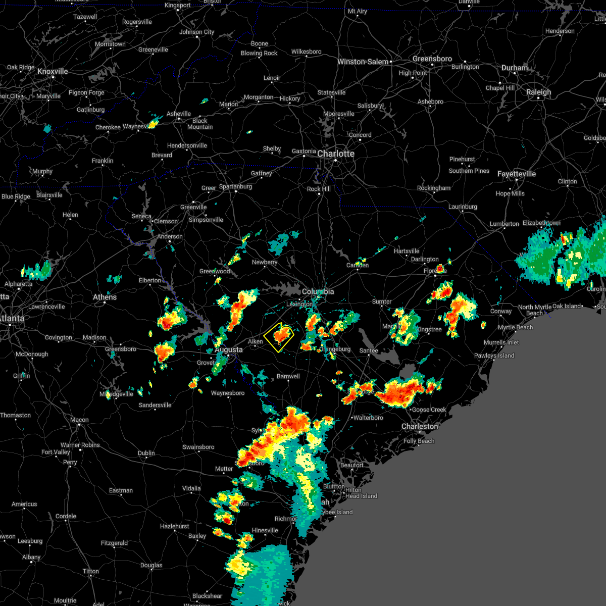 At 351 pm edt, a severe thunderstorm was located 8 miles north of aiken state park, or 16 miles south of batesburg-leesville, moving northwest at 15 mph (radar indicated). Hazards include 60 mph wind gusts. Expect damage to trees and powerlines. locations impacted include, aiken state park, wagener and new holland. hail threat, radar indicated max hail size, <. 75 in wind threat, radar indicated max wind gust, 60 mph. At 351 pm edt, a severe thunderstorm was located 8 miles north of aiken state park, or 16 miles south of batesburg-leesville, moving northwest at 15 mph (radar indicated). Hazards include 60 mph wind gusts. Expect damage to trees and powerlines. locations impacted include, aiken state park, wagener and new holland. hail threat, radar indicated max hail size, <. 75 in wind threat, radar indicated max wind gust, 60 mph.
|
| 8/3/2022 3:37 PM EDT |
 At 336 pm edt, a severe thunderstorm was located near aiken state park, or 17 miles northeast of aiken, moving northwest at 15 mph (radar indicated). Hazards include 60 mph wind gusts. expect damage to trees and powerlines At 336 pm edt, a severe thunderstorm was located near aiken state park, or 17 miles northeast of aiken, moving northwest at 15 mph (radar indicated). Hazards include 60 mph wind gusts. expect damage to trees and powerlines
|
| 7/19/2022 9:37 PM EDT |
 The severe thunderstorm warning for central aiken and western orangeburg counties will expire at 945 pm edt, the storm which prompted the warning has weakened below severe limits, and no longer poses an immediate threat to life or property. therefore, the warning will be allowed to expire. The severe thunderstorm warning for central aiken and western orangeburg counties will expire at 945 pm edt, the storm which prompted the warning has weakened below severe limits, and no longer poses an immediate threat to life or property. therefore, the warning will be allowed to expire.
|
| 7/19/2022 9:20 PM EDT |
 At 920 pm edt, a severe thunderstorm was located over aiken state park, or 13 miles east of aiken mall, moving east at 35 mph (radar indicated). Hazards include 60 mph wind gusts. Expect damage to trees and powerlines. locations impacted include, aiken, aiken mall, new ellenton, jackson, citizens park, aiken municipal airport, aiken state park, wagener, windsor, aiken gopher tortoise heritage preserve, hopeland gardens, savannah river site badge office, boyd pond park and new holland. this includes interstate 20 in south carolina between mile markers 21 and 31. hail threat, radar indicated max hail size, <. 75 in wind threat, radar indicated max wind gust, 60 mph. At 920 pm edt, a severe thunderstorm was located over aiken state park, or 13 miles east of aiken mall, moving east at 35 mph (radar indicated). Hazards include 60 mph wind gusts. Expect damage to trees and powerlines. locations impacted include, aiken, aiken mall, new ellenton, jackson, citizens park, aiken municipal airport, aiken state park, wagener, windsor, aiken gopher tortoise heritage preserve, hopeland gardens, savannah river site badge office, boyd pond park and new holland. this includes interstate 20 in south carolina between mile markers 21 and 31. hail threat, radar indicated max hail size, <. 75 in wind threat, radar indicated max wind gust, 60 mph.
|
| 7/19/2022 9:03 PM EDT |
 At 903 pm edt, a severe thunderstorm was located over citizens park, or over aiken mall, moving east at 25 mph (radar indicated). Hazards include 60 mph wind gusts and penny size hail. Expect damage to trees and powerlines. locations impacted include, aiken, north augusta, aiken mall, clearwater, belvedere, new ellenton, jackson, usc aiken, citizens park, aiken municipal airport, gloverville, aiken state park, graniteville, burnettown, wagener, windsor, savannah river site badge office, savannah bluffs heritage preserve, vaucluse and new holland. this includes the following highways, interstate 20 in south carolina between mile markers 1 and 35. interstate 520 in south carolina between mile markers 16 and 23. hail threat, radar indicated max hail size, 0. 75 in wind threat, radar indicated max wind gust, 60 mph. At 903 pm edt, a severe thunderstorm was located over citizens park, or over aiken mall, moving east at 25 mph (radar indicated). Hazards include 60 mph wind gusts and penny size hail. Expect damage to trees and powerlines. locations impacted include, aiken, north augusta, aiken mall, clearwater, belvedere, new ellenton, jackson, usc aiken, citizens park, aiken municipal airport, gloverville, aiken state park, graniteville, burnettown, wagener, windsor, savannah river site badge office, savannah bluffs heritage preserve, vaucluse and new holland. this includes the following highways, interstate 20 in south carolina between mile markers 1 and 35. interstate 520 in south carolina between mile markers 16 and 23. hail threat, radar indicated max hail size, 0. 75 in wind threat, radar indicated max wind gust, 60 mph.
|
| 7/19/2022 8:43 PM EDT |
 At 842 pm edt, severe thunderstorms were located along a line extending from near hamilton branch state park to south augusta, moving east at 45 mph (radar indicated). Hazards include 60 mph wind gusts and penny size hail. expect damage to trees and powerlines At 842 pm edt, severe thunderstorms were located along a line extending from near hamilton branch state park to south augusta, moving east at 45 mph (radar indicated). Hazards include 60 mph wind gusts and penny size hail. expect damage to trees and powerlines
|
| 7/8/2022 5:33 PM EDT |
 At 532 pm edt, a severe thunderstorm was located 12 miles southwest of gaston, or 18 miles south of red bank, moving south at 5 mph (radar indicated). Hazards include 60 mph wind gusts and penny size hail. expect damage to trees and powerlines At 532 pm edt, a severe thunderstorm was located 12 miles southwest of gaston, or 18 miles south of red bank, moving south at 5 mph (radar indicated). Hazards include 60 mph wind gusts and penny size hail. expect damage to trees and powerlines
|
| 7/7/2022 6:56 PM EDT |
 At 655 pm edt, severe thunderstorms were located along a line extending from near ridge spring to harlem, moving southeast at 20 mph (radar indicated). Hazards include 60 mph wind gusts. Expect damage to trees and powerlines. locations impacted include, aiken, north augusta, grovetown, evans, batesburg-leesville, fort gordon, augusta, clearwater, martinez, aiken mall, belvedere, edgefield, hephzibah, harlem, johnston, new ellenton, jackson, ridge spring, glendale and south augusta. this includes the following highways, interstate 20 in georgia between mile markers 178 and 201. interstate 20 in south carolina between mile markers 0 and 42. interstate 520 in georgia between mile markers 1 and 15. interstate 520 in south carolina between mile markers 16 and 23. hail threat, radar indicated max hail size, <. 75 in wind threat, radar indicated max wind gust, 60 mph. At 655 pm edt, severe thunderstorms were located along a line extending from near ridge spring to harlem, moving southeast at 20 mph (radar indicated). Hazards include 60 mph wind gusts. Expect damage to trees and powerlines. locations impacted include, aiken, north augusta, grovetown, evans, batesburg-leesville, fort gordon, augusta, clearwater, martinez, aiken mall, belvedere, edgefield, hephzibah, harlem, johnston, new ellenton, jackson, ridge spring, glendale and south augusta. this includes the following highways, interstate 20 in georgia between mile markers 178 and 201. interstate 20 in south carolina between mile markers 0 and 42. interstate 520 in georgia between mile markers 1 and 15. interstate 520 in south carolina between mile markers 16 and 23. hail threat, radar indicated max hail size, <. 75 in wind threat, radar indicated max wind gust, 60 mph.
|
| 7/7/2022 6:41 PM EDT |
 At 640 pm edt, severe thunderstorms were located along a line extending from near ridge spring to near thomson, moving southeast at 20 mph (radar indicated). Hazards include 60 mph wind gusts. Expect damage to trees and powerlines. locations impacted include, aiken, north augusta, grovetown, evans, thomson, batesburg-leesville, fort gordon, augusta, clearwater, martinez, aiken mall, belvedere, edgefield, hephzibah, harlem, johnston, new ellenton, jackson, ridge spring and glendale. this includes the following highways, interstate 20 in georgia between mile markers 170 and 201. interstate 20 in south carolina between mile markers 0 and 42. interstate 520 in georgia between mile markers 1 and 15. interstate 520 in south carolina between mile markers 16 and 23. hail threat, radar indicated max hail size, <. 75 in wind threat, radar indicated max wind gust, 60 mph. At 640 pm edt, severe thunderstorms were located along a line extending from near ridge spring to near thomson, moving southeast at 20 mph (radar indicated). Hazards include 60 mph wind gusts. Expect damage to trees and powerlines. locations impacted include, aiken, north augusta, grovetown, evans, thomson, batesburg-leesville, fort gordon, augusta, clearwater, martinez, aiken mall, belvedere, edgefield, hephzibah, harlem, johnston, new ellenton, jackson, ridge spring and glendale. this includes the following highways, interstate 20 in georgia between mile markers 170 and 201. interstate 20 in south carolina between mile markers 0 and 42. interstate 520 in georgia between mile markers 1 and 15. interstate 520 in south carolina between mile markers 16 and 23. hail threat, radar indicated max hail size, <. 75 in wind threat, radar indicated max wind gust, 60 mph.
|
| 7/7/2022 6:25 PM EDT |
 At 624 pm edt, severe thunderstorms were located along a line extending from near saluda county airport to near thomson, moving southeast at 20 mph. additional widespread strong to severe thunderstorms are developing ahead of the line of storms (mccormick county emergency management reported trees down). Hazards include 60 mph wind gusts. expect damage to trees and powerlines At 624 pm edt, severe thunderstorms were located along a line extending from near saluda county airport to near thomson, moving southeast at 20 mph. additional widespread strong to severe thunderstorms are developing ahead of the line of storms (mccormick county emergency management reported trees down). Hazards include 60 mph wind gusts. expect damage to trees and powerlines
|
| 7/6/2022 6:25 PM EDT |
 The severe thunderstorm warning for southeastern lexington, northeastern aiken and northwestern orangeburg counties will expire at 630 pm edt, the storm which prompted the warning has weakened below severe limits, and no longer poses an immediate threat to life or property. therefore, the warning will be allowed to expire. however gusty winds are still possible with this thunderstorm. a severe thunderstorm watch remains in effect until 1100 pm edt for central south carolina. The severe thunderstorm warning for southeastern lexington, northeastern aiken and northwestern orangeburg counties will expire at 630 pm edt, the storm which prompted the warning has weakened below severe limits, and no longer poses an immediate threat to life or property. therefore, the warning will be allowed to expire. however gusty winds are still possible with this thunderstorm. a severe thunderstorm watch remains in effect until 1100 pm edt for central south carolina.
|
| 7/6/2022 6:14 PM EDT |
 At 614 pm edt, a severe thunderstorm was located 14 miles southwest of gaston, or 17 miles south of red bank, moving north at 10 mph (radar indicated). Hazards include 60 mph wind gusts and quarter size hail. Hail damage to vehicles is expected. expect wind damage to trees and powerlines. locations impacted include, swansea, wagener, pelion, perry, perry airport, thor and lexington county airport at pelion. hail threat, radar indicated max hail size, 1. 00 in wind threat, radar indicated max wind gust, 60 mph. At 614 pm edt, a severe thunderstorm was located 14 miles southwest of gaston, or 17 miles south of red bank, moving north at 10 mph (radar indicated). Hazards include 60 mph wind gusts and quarter size hail. Hail damage to vehicles is expected. expect wind damage to trees and powerlines. locations impacted include, swansea, wagener, pelion, perry, perry airport, thor and lexington county airport at pelion. hail threat, radar indicated max hail size, 1. 00 in wind threat, radar indicated max wind gust, 60 mph.
|
| 7/6/2022 6:03 PM EDT |
 At 603 pm edt, a severe thunderstorm was located 14 miles southwest of gaston, or 18 miles south of red bank, moving east at 5 mph (radar indicated). Hazards include 60 mph wind gusts and quarter size hail. Hail damage to vehicles is expected. expect wind damage to trees and powerlines. locations impacted include, swansea, wagener, pelion, perry, perry airport, thor and lexington county airport at pelion. hail threat, radar indicated max hail size, 1. 00 in wind threat, radar indicated max wind gust, 60 mph. At 603 pm edt, a severe thunderstorm was located 14 miles southwest of gaston, or 18 miles south of red bank, moving east at 5 mph (radar indicated). Hazards include 60 mph wind gusts and quarter size hail. Hail damage to vehicles is expected. expect wind damage to trees and powerlines. locations impacted include, swansea, wagener, pelion, perry, perry airport, thor and lexington county airport at pelion. hail threat, radar indicated max hail size, 1. 00 in wind threat, radar indicated max wind gust, 60 mph.
|
| 7/6/2022 5:53 PM EDT |
 At 553 pm edt, a severe thunderstorm was located 13 miles northeast of aiken state park, or 19 miles south of red bank, and is nearly stationary (radar indicated). Hazards include 60 mph wind gusts and quarter size hail. Hail damage to vehicles is expected. expect wind damage to trees and powerlines. locations impacted include, swansea, wagener, pelion, perry, perry airport, thor and lexington county airport at pelion. hail threat, radar indicated max hail size, 1. 00 in wind threat, radar indicated max wind gust, 60 mph. At 553 pm edt, a severe thunderstorm was located 13 miles northeast of aiken state park, or 19 miles south of red bank, and is nearly stationary (radar indicated). Hazards include 60 mph wind gusts and quarter size hail. Hail damage to vehicles is expected. expect wind damage to trees and powerlines. locations impacted include, swansea, wagener, pelion, perry, perry airport, thor and lexington county airport at pelion. hail threat, radar indicated max hail size, 1. 00 in wind threat, radar indicated max wind gust, 60 mph.
|
| 7/6/2022 5:48 PM EDT |
 At 548 pm edt, a severe thunderstorm was located 13 miles northeast of aiken state park, or 18 miles south of red bank, moving north at 10 mph (radar indicated). Hazards include 60 mph wind gusts and penny size hail. expect damage to trees and powerlines At 548 pm edt, a severe thunderstorm was located 13 miles northeast of aiken state park, or 18 miles south of red bank, moving north at 10 mph (radar indicated). Hazards include 60 mph wind gusts and penny size hail. expect damage to trees and powerlines
|
| 6/17/2022 7:26 PM EDT |
 At 725 pm edt, a severe thunderstorm was located over aiken state park, or 15 miles east of aiken, moving southeast at 30 mph (radar indicated). Hazards include 60 mph wind gusts and quarter size hail. Hail damage to vehicles is expected. Expect wind damage to trees and powerlines. At 725 pm edt, a severe thunderstorm was located over aiken state park, or 15 miles east of aiken, moving southeast at 30 mph (radar indicated). Hazards include 60 mph wind gusts and quarter size hail. Hail damage to vehicles is expected. Expect wind damage to trees and powerlines.
|
| 6/16/2022 6:59 PM EDT |
 At 659 pm edt, a severe thunderstorm was located 7 miles east of aiken municipal airport, or 11 miles northeast of aiken, moving east at 20 mph (radar indicated). Hazards include 60 mph wind gusts and quarter size hail. Hail damage to vehicles is expected. Expect wind damage to trees and powerlines. At 659 pm edt, a severe thunderstorm was located 7 miles east of aiken municipal airport, or 11 miles northeast of aiken, moving east at 20 mph (radar indicated). Hazards include 60 mph wind gusts and quarter size hail. Hail damage to vehicles is expected. Expect wind damage to trees and powerlines.
|
| 5/23/2022 11:03 AM EDT |
 At 1102 am edt, a severe thunderstorm was located near edgefield county airport, or 9 miles northeast of belvedere, moving northeast at 35 mph (radar indicated). Hazards include 60 mph wind gusts and penny size hail. expect damage to trees and powerlines At 1102 am edt, a severe thunderstorm was located near edgefield county airport, or 9 miles northeast of belvedere, moving northeast at 35 mph (radar indicated). Hazards include 60 mph wind gusts and penny size hail. expect damage to trees and powerlines
|
| 5/22/2022 8:20 PM EDT | Aiken dispatch reported a tree down in roadway on columbia rd in wagener. time estimate in aiken county SC, 0.5 miles NW of Wagener, SC |
| 5/22/2022 8:20 PM EDT | Aiken dispatch reported a tree down on carriage lane dr and wagener rd. time estimate in aiken county SC, 1 miles WNW of Wagener, SC |
| 5/22/2022 8:03 PM EDT |
 At 803 pm edt, a severe thunderstorm was located near citizens park, or 7 miles east of aiken mall, moving northeast at 25 mph (radar indicated). Hazards include 60 mph wind gusts and quarter size hail. Hail damage to vehicles is expected. expect wind damage to trees and powerlines. locations impacted include, aiken state park, wagener, perry, windsor, perry airport and new holland. hail threat, radar indicated max hail size, 1. 00 in wind threat, radar indicated max wind gust, 60 mph. At 803 pm edt, a severe thunderstorm was located near citizens park, or 7 miles east of aiken mall, moving northeast at 25 mph (radar indicated). Hazards include 60 mph wind gusts and quarter size hail. Hail damage to vehicles is expected. expect wind damage to trees and powerlines. locations impacted include, aiken state park, wagener, perry, windsor, perry airport and new holland. hail threat, radar indicated max hail size, 1. 00 in wind threat, radar indicated max wind gust, 60 mph.
|
| 5/22/2022 7:42 PM EDT |
 At 742 pm edt, a severe thunderstorm was located over new ellenton, or near aiken mall, moving northeast at 25 mph (radar indicated). Hazards include 60 mph wind gusts and quarter size hail. Hail damage to vehicles is expected. Expect wind damage to trees and powerlines. At 742 pm edt, a severe thunderstorm was located over new ellenton, or near aiken mall, moving northeast at 25 mph (radar indicated). Hazards include 60 mph wind gusts and quarter size hail. Hail damage to vehicles is expected. Expect wind damage to trees and powerlines.
|
| 5/6/2022 5:43 PM EDT |
 The severe thunderstorm warning for northeastern edgefield, southwestern lexington, northeastern aiken and saluda counties will expire at 545 pm edt, the storms which prompted the warning have moved out of the area. therefore, the warning will be allowed to expire. a severe thunderstorm watch remains in effect until 1000 pm edt for central south carolina. The severe thunderstorm warning for northeastern edgefield, southwestern lexington, northeastern aiken and saluda counties will expire at 545 pm edt, the storms which prompted the warning have moved out of the area. therefore, the warning will be allowed to expire. a severe thunderstorm watch remains in effect until 1000 pm edt for central south carolina.
|
| 5/6/2022 5:33 PM EDT |
 At 533 pm edt, severe thunderstorms were located along a line extending from near batesburg-leesville to 6 miles southwest of gaston, moving northeast at 70 mph (radar indicated). Hazards include 70 mph wind gusts and half dollar size hail. Hail damage to vehicles is expected. expect considerable tree damage. wind damage is also likely to mobile homes, roofs, and outbuildings. locations impacted include, batesburg-leesville, edgefield, saluda, johnston, ridge spring, saluda county airport, aiken state park, wagener, pelion, monetta, ward, strom thurmond high school, saluda co sheriff`s office, good hope, northside fire station main, thor, emory, camp kinard, new holland and samaria fire station. this includes interstate 20 in south carolina between mile markers 22 and 44. thunderstorm damage threat, considerable hail threat, observed max hail size, 1. 25 in wind threat, observed max wind gust, 70 mph. At 533 pm edt, severe thunderstorms were located along a line extending from near batesburg-leesville to 6 miles southwest of gaston, moving northeast at 70 mph (radar indicated). Hazards include 70 mph wind gusts and half dollar size hail. Hail damage to vehicles is expected. expect considerable tree damage. wind damage is also likely to mobile homes, roofs, and outbuildings. locations impacted include, batesburg-leesville, edgefield, saluda, johnston, ridge spring, saluda county airport, aiken state park, wagener, pelion, monetta, ward, strom thurmond high school, saluda co sheriff`s office, good hope, northside fire station main, thor, emory, camp kinard, new holland and samaria fire station. this includes interstate 20 in south carolina between mile markers 22 and 44. thunderstorm damage threat, considerable hail threat, observed max hail size, 1. 25 in wind threat, observed max wind gust, 70 mph.
|
| 5/6/2022 5:10 PM EDT |
 At 509 pm edt, severe thunderstorms were located along a line extending from johnston to near aiken state park, moving northeast at 70 mph (radar indicated). Hazards include 70 mph wind gusts and half dollar size hail. Hail damage to vehicles is expected. expect considerable tree damage. Wind damage is also likely to mobile homes, roofs, and outbuildings. At 509 pm edt, severe thunderstorms were located along a line extending from johnston to near aiken state park, moving northeast at 70 mph (radar indicated). Hazards include 70 mph wind gusts and half dollar size hail. Hail damage to vehicles is expected. expect considerable tree damage. Wind damage is also likely to mobile homes, roofs, and outbuildings.
|
| 4/26/2022 3:15 PM EDT |
 At 314 pm edt, a severe thunderstorm was located 9 miles north of aiken state park, or 15 miles south of batesburg-leesville, moving east at 40 mph (radar indicated). Hazards include 60 mph wind gusts and quarter size hail. Hail damage to vehicles is expected. expect wind damage to trees and powerlines. locations impacted include, wagener, perry, perry airport, steedman, new holland and cedar pond campground. this includes interstate 20 in south carolina between mile markers 29 and 38. hail threat, radar indicated max hail size, 1. 00 in wind threat, radar indicated max wind gust, 60 mph. At 314 pm edt, a severe thunderstorm was located 9 miles north of aiken state park, or 15 miles south of batesburg-leesville, moving east at 40 mph (radar indicated). Hazards include 60 mph wind gusts and quarter size hail. Hail damage to vehicles is expected. expect wind damage to trees and powerlines. locations impacted include, wagener, perry, perry airport, steedman, new holland and cedar pond campground. this includes interstate 20 in south carolina between mile markers 29 and 38. hail threat, radar indicated max hail size, 1. 00 in wind threat, radar indicated max wind gust, 60 mph.
|
| 4/26/2022 2:56 PM EDT |
 At 256 pm edt, a severe thunderstorm was located over aiken municipal airport, or 8 miles northeast of aiken, moving east at 30 mph (radar indicated). Hazards include 60 mph wind gusts and quarter size hail. Hail damage to vehicles is expected. Expect wind damage to trees and powerlines. At 256 pm edt, a severe thunderstorm was located over aiken municipal airport, or 8 miles northeast of aiken, moving east at 30 mph (radar indicated). Hazards include 60 mph wind gusts and quarter size hail. Hail damage to vehicles is expected. Expect wind damage to trees and powerlines.
|
| 4/5/2022 6:23 PM EDT |
 The severe thunderstorm warning for central barnwell, central aiken and western orangeburg counties will expire at 630 pm edt, the storm which prompted the warning has moved out of the area. therefore, the warning will be allowed to expire but a severe thunderstorm warning is still in effect in aiken, barnwell and orangeburg counties. a tornado watch remains in effect until 900 pm edt for east central georgia, and central south carolina. The severe thunderstorm warning for central barnwell, central aiken and western orangeburg counties will expire at 630 pm edt, the storm which prompted the warning has moved out of the area. therefore, the warning will be allowed to expire but a severe thunderstorm warning is still in effect in aiken, barnwell and orangeburg counties. a tornado watch remains in effect until 900 pm edt for east central georgia, and central south carolina.
|
| 4/5/2022 6:09 PM EDT |
 At 608 pm edt, severe thunderstorms were located along a line extending from 11 miles southwest of red bank to near barnwell state park, moving east at 50 mph (radar indicated). Hazards include 60 mph wind gusts. expect damage to trees and powerlines At 608 pm edt, severe thunderstorms were located along a line extending from 11 miles southwest of red bank to near barnwell state park, moving east at 50 mph (radar indicated). Hazards include 60 mph wind gusts. expect damage to trees and powerlines
|
| 4/5/2022 6:05 PM EDT |
 At 604 pm edt, a severe thunderstorm was located near aiken state park, or 10 miles east of aiken mall, moving northeast at 40 mph (radar indicated). Hazards include 60 mph wind gusts. Expect damage to trees and powerlines. Locations impacted include, aiken, savannah river site, williston, new ellenton, jackson, citizens park, aiken state park, wagener, perry, elko, windsor, aiken gopher tortoise heritage preserve, perry airport, savannah river site badge office and savannah river site h canyon. At 604 pm edt, a severe thunderstorm was located near aiken state park, or 10 miles east of aiken mall, moving northeast at 40 mph (radar indicated). Hazards include 60 mph wind gusts. Expect damage to trees and powerlines. Locations impacted include, aiken, savannah river site, williston, new ellenton, jackson, citizens park, aiken state park, wagener, perry, elko, windsor, aiken gopher tortoise heritage preserve, perry airport, savannah river site badge office and savannah river site h canyon.
|
| 4/5/2022 5:43 PM EDT |
 At 543 pm edt, a severe thunderstorm was located near new ellenton, or 7 miles southwest of aiken mall, moving northeast at 40 mph (radar indicated). Hazards include 60 mph wind gusts. expect damage to trees and powerlines At 543 pm edt, a severe thunderstorm was located near new ellenton, or 7 miles southwest of aiken mall, moving northeast at 40 mph (radar indicated). Hazards include 60 mph wind gusts. expect damage to trees and powerlines
|
| 8/17/2021 9:21 PM EDT |
 At 919 pm edt, a severe thunderstorm was located 9 miles north of aiken state park, or 15 miles south of batesburg-leesville, moving northeast at 30 mph. sc dot reports downed trees about 8 miles sw of wagener (radar indicated). Hazards include 60 mph wind gusts. Expect damage to roofs, siding, and trees. locations impacted include, aiken state park, wagener, perry, perry airport and new holland. hail threat, radar indicated max hail size, <. 75 in wind threat, observed max wind gust, 60 mph. At 919 pm edt, a severe thunderstorm was located 9 miles north of aiken state park, or 15 miles south of batesburg-leesville, moving northeast at 30 mph. sc dot reports downed trees about 8 miles sw of wagener (radar indicated). Hazards include 60 mph wind gusts. Expect damage to roofs, siding, and trees. locations impacted include, aiken state park, wagener, perry, perry airport and new holland. hail threat, radar indicated max hail size, <. 75 in wind threat, observed max wind gust, 60 mph.
|
| 8/17/2021 9:01 PM EDT | Sc highway patrol reported tree down in roadway at flowing well road and coleman bridge road. time estimated by rada in aiken county SC, 9.4 miles ENE of Wagener, SC |
| 8/17/2021 8:40 PM EDT |
 At 840 pm edt, a severe thunderstorm was located over new ellenton, or near aiken mall, moving northeast at 35 mph (radar indicated). Hazards include 60 mph wind gusts. expect damage to roofs, siding, and trees At 840 pm edt, a severe thunderstorm was located over new ellenton, or near aiken mall, moving northeast at 35 mph (radar indicated). Hazards include 60 mph wind gusts. expect damage to roofs, siding, and trees
|
| 8/10/2021 5:52 PM EDT |
 At 552 pm edt, a severe thunderstorm was located 11 miles southeast of ridge spring, or 11 miles south of batesburg-leesville, moving east at 15 mph (radar indicated). Hazards include 60 mph wind gusts and penny size hail. expect damage to roofs, siding, and trees At 552 pm edt, a severe thunderstorm was located 11 miles southeast of ridge spring, or 11 miles south of batesburg-leesville, moving east at 15 mph (radar indicated). Hazards include 60 mph wind gusts and penny size hail. expect damage to roofs, siding, and trees
|
| 7/18/2021 9:09 PM EDT |
 At 906 pm edt, severe thunderstorms were located along a line extending from ridge spring to 11 miles north of blackville, moving northeast at 30 mph (radar indicated). Hazards include 60 mph wind gusts. Expect damage to roofs, siding, and trees. locations impacted include, aiken, lexington, batesburg-leesville, red bank, edgefield, saluda, johnston, gaston, ridge spring, edgefield county airport, saluda county airport, aiken municipal airport, aiken state park, swansea, wagener, north, pelion, gilbert, summit and salley. This includes interstate 20 in south carolina between mile markers 14 and 54. At 906 pm edt, severe thunderstorms were located along a line extending from ridge spring to 11 miles north of blackville, moving northeast at 30 mph (radar indicated). Hazards include 60 mph wind gusts. Expect damage to roofs, siding, and trees. locations impacted include, aiken, lexington, batesburg-leesville, red bank, edgefield, saluda, johnston, gaston, ridge spring, edgefield county airport, saluda county airport, aiken municipal airport, aiken state park, swansea, wagener, north, pelion, gilbert, summit and salley. This includes interstate 20 in south carolina between mile markers 14 and 54.
|
| 7/18/2021 8:31 PM EDT |
 At 831 pm edt, severe thunderstorms were located along a line extending from near graniteville to near barnwell, moving northeast at 40 mph (radar indicated). Hazards include 60 mph wind gusts. expect damage to roofs, siding, and trees At 831 pm edt, severe thunderstorms were located along a line extending from near graniteville to near barnwell, moving northeast at 40 mph (radar indicated). Hazards include 60 mph wind gusts. expect damage to roofs, siding, and trees
|
| 6/20/2021 2:25 PM EDT |
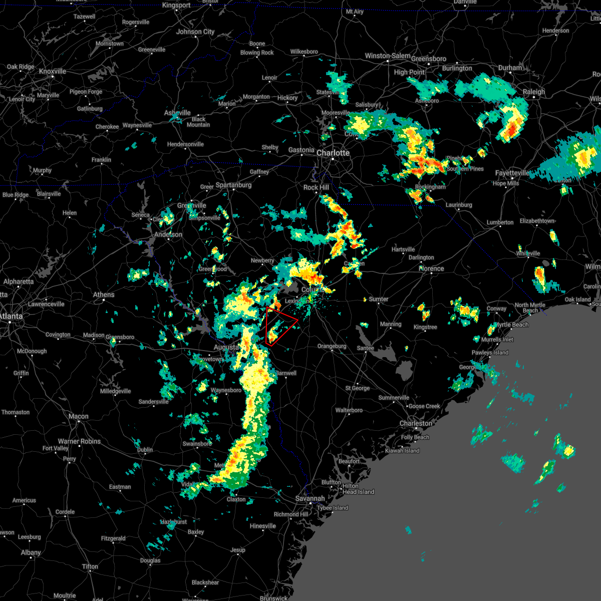 At 225 pm edt, a severe thunderstorm capable of producing a tornado was located over aiken state park, or 11 miles east of aiken, moving northeast at 30 mph (radar indicated rotation). Hazards include tornado. Flying debris will be dangerous to those caught without shelter. mobile homes will be damaged or destroyed. damage to roofs, windows, and vehicles will occur. tree damage is likely. this tornadic thunderstorm will remain over mainly rural areas of southwestern lexington, northeastern aiken and southeastern saluda counties, including the following locations, steedman, new holland, samaria fire station, cedar pond campground, pelion and wagener. This includes interstate 20 in south carolina between mile markers 29 and 40. At 225 pm edt, a severe thunderstorm capable of producing a tornado was located over aiken state park, or 11 miles east of aiken, moving northeast at 30 mph (radar indicated rotation). Hazards include tornado. Flying debris will be dangerous to those caught without shelter. mobile homes will be damaged or destroyed. damage to roofs, windows, and vehicles will occur. tree damage is likely. this tornadic thunderstorm will remain over mainly rural areas of southwestern lexington, northeastern aiken and southeastern saluda counties, including the following locations, steedman, new holland, samaria fire station, cedar pond campground, pelion and wagener. This includes interstate 20 in south carolina between mile markers 29 and 40.
|
| 5/4/2021 6:28 PM EDT |
 The severe thunderstorm warning for northern burke, richmond, barnwell, southeastern lexington, aiken and northwestern orangeburg counties will expire at 630 pm edt, the storms which prompted the warning have weakened below severe limits or have exited the warned area. therefore, the warning will be allowed to expire. however gusty winds and heavy rain are still possible with these thunderstorms. a severe thunderstorm watch remains in effect until 900 pm edt for east central georgia, and central south carolina. to report severe weather, contact your nearest law enforcement agency. they will relay your report to the national weather service columbia. The severe thunderstorm warning for northern burke, richmond, barnwell, southeastern lexington, aiken and northwestern orangeburg counties will expire at 630 pm edt, the storms which prompted the warning have weakened below severe limits or have exited the warned area. therefore, the warning will be allowed to expire. however gusty winds and heavy rain are still possible with these thunderstorms. a severe thunderstorm watch remains in effect until 900 pm edt for east central georgia, and central south carolina. to report severe weather, contact your nearest law enforcement agency. they will relay your report to the national weather service columbia.
|
| 5/4/2021 5:57 PM EDT |
 At 529 pm edt, severe thunderstorms were located along a line extending from 8 miles southwest of red bank to near hephzibah, moving southeast at 25 mph. additional isolated severe thunderstorms were also located ahead of this line (radar indicated). Hazards include 60 mph wind gusts. expect damage to roofs, siding, and trees At 529 pm edt, severe thunderstorms were located along a line extending from 8 miles southwest of red bank to near hephzibah, moving southeast at 25 mph. additional isolated severe thunderstorms were also located ahead of this line (radar indicated). Hazards include 60 mph wind gusts. expect damage to roofs, siding, and trees
|
| 5/4/2021 5:57 PM EDT |
 At 556 pm edt, severe thunderstorms were located along a line extending from 11 miles northwest of orangeburg to near hephzibah, moving southeast at 30 mph (radar indicated). Hazards include 60 mph wind gusts. Expect damage to roofs, siding, and trees. locations impacted include, aiken, north augusta, waynesboro, savannah river site, aiken mall, plant vogtle, clearwater, hephzibah, williston, blackville, new ellenton, jackson, gaston, south augusta, citizens park, augusta regional airport, alexander, burke county airport, mcbean and gloverville. this includes the following highways, interstate 520 in georgia between mile markers 6 and 15. Interstate 520 in south carolina near mile marker 16. At 556 pm edt, severe thunderstorms were located along a line extending from 11 miles northwest of orangeburg to near hephzibah, moving southeast at 30 mph (radar indicated). Hazards include 60 mph wind gusts. Expect damage to roofs, siding, and trees. locations impacted include, aiken, north augusta, waynesboro, savannah river site, aiken mall, plant vogtle, clearwater, hephzibah, williston, blackville, new ellenton, jackson, gaston, south augusta, citizens park, augusta regional airport, alexander, burke county airport, mcbean and gloverville. this includes the following highways, interstate 520 in georgia between mile markers 6 and 15. Interstate 520 in south carolina near mile marker 16.
|
| 5/4/2021 5:30 PM EDT |
 At 529 pm edt, severe thunderstorms were located along a line extending from 8 miles southwest of red bank to near hephzibah, moving southeast at 25 mph. additional isolated severe thunderstorms were also located ahead of this line (radar indicated). Hazards include 60 mph wind gusts. expect damage to roofs, siding, and trees At 529 pm edt, severe thunderstorms were located along a line extending from 8 miles southwest of red bank to near hephzibah, moving southeast at 25 mph. additional isolated severe thunderstorms were also located ahead of this line (radar indicated). Hazards include 60 mph wind gusts. expect damage to roofs, siding, and trees
|
| 3/28/2021 3:25 PM EDT | The aiken county em reported trees down on homes in and around the town of wagene in aiken county SC, 0.5 miles NW of Wagener, SC |
| 7/21/2020 3:50 PM EDT |
 At 350 pm edt, a severe thunderstorm was located 10 miles northeast of aiken municipal airport, or 13 miles south of batesburg-leesville, and is nearly stationary (radar indicated). Hazards include 60 mph wind gusts. Expect damage to roofs, siding, and trees. locations impacted include, batesburg-leesville, ridge spring, aiken municipal airport, wagener, gilbert, summit, monetta, cedar grove fire station, fredonia, murray, camp kinard, delmar, hibernia, steedman, kneece, new holland, samaria fire station and cedar pond campground. This includes interstate 20 in south carolina between mile markers 19 and 48. At 350 pm edt, a severe thunderstorm was located 10 miles northeast of aiken municipal airport, or 13 miles south of batesburg-leesville, and is nearly stationary (radar indicated). Hazards include 60 mph wind gusts. Expect damage to roofs, siding, and trees. locations impacted include, batesburg-leesville, ridge spring, aiken municipal airport, wagener, gilbert, summit, monetta, cedar grove fire station, fredonia, murray, camp kinard, delmar, hibernia, steedman, kneece, new holland, samaria fire station and cedar pond campground. This includes interstate 20 in south carolina between mile markers 19 and 48.
|
| 7/21/2020 3:38 PM EDT |
 At 338 pm edt, a severe thunderstorm was located 8 miles southeast of ridge spring, or 8 miles south of batesburg-leesville, and is nearly stationary (radar indicated). Hazards include 60 mph wind gusts and penny size hail. Expect damage to roofs, siding, and trees. locations impacted include, batesburg-leesville, red bank, ridge spring, aiken municipal airport, wagener, pelion, gilbert, summit, monetta, cedar grove fire station, south shore marina, oswald park, bundrick island, murray, camp kinard, delmar, hollow creek public park, new holland, samaria fire station and cedar pond campground. This includes interstate 20 in south carolina between mile markers 19 and 52. At 338 pm edt, a severe thunderstorm was located 8 miles southeast of ridge spring, or 8 miles south of batesburg-leesville, and is nearly stationary (radar indicated). Hazards include 60 mph wind gusts and penny size hail. Expect damage to roofs, siding, and trees. locations impacted include, batesburg-leesville, red bank, ridge spring, aiken municipal airport, wagener, pelion, gilbert, summit, monetta, cedar grove fire station, south shore marina, oswald park, bundrick island, murray, camp kinard, delmar, hollow creek public park, new holland, samaria fire station and cedar pond campground. This includes interstate 20 in south carolina between mile markers 19 and 52.
|
| 7/21/2020 3:18 PM EDT |
 At 318 pm edt, a severe thunderstorm was located near batesburg-leesville, and is nearly stationary (radar indicated). Hazards include 60 mph wind gusts and penny size hail. expect damage to roofs, siding, and trees At 318 pm edt, a severe thunderstorm was located near batesburg-leesville, and is nearly stationary (radar indicated). Hazards include 60 mph wind gusts and penny size hail. expect damage to roofs, siding, and trees
|
| 6/28/2020 8:51 PM EDT |
 At 851 pm edt, a severe thunderstorm was located near aiken municipal airport, or 11 miles northeast of aiken, moving southeast at 25 mph (radar indicated). Hazards include 60 mph wind gusts. Expect damage to roofs, siding, and trees. locations impacted include, aiken, edgefield, johnston, ridge spring, usc aiken, edgefield county airport, citizens park, aiken municipal airport, aiken state park, wagener, salley, monetta, perry, trenton, windsor, strom thurmond high school, thor, vaucluse, new holland and edgefield federal correction institution. This includes interstate 20 in south carolina between mile markers 13 and 38. At 851 pm edt, a severe thunderstorm was located near aiken municipal airport, or 11 miles northeast of aiken, moving southeast at 25 mph (radar indicated). Hazards include 60 mph wind gusts. Expect damage to roofs, siding, and trees. locations impacted include, aiken, edgefield, johnston, ridge spring, usc aiken, edgefield county airport, citizens park, aiken municipal airport, aiken state park, wagener, salley, monetta, perry, trenton, windsor, strom thurmond high school, thor, vaucluse, new holland and edgefield federal correction institution. This includes interstate 20 in south carolina between mile markers 13 and 38.
|
| 6/28/2020 8:38 PM EDT |
 At 838 pm edt, a severe thunderstorm was located near aiken municipal airport, or 12 miles north of aiken, moving southeast at 25 mph (radar indicated). Hazards include 60 mph wind gusts. expect damage to roofs, siding, and trees At 838 pm edt, a severe thunderstorm was located near aiken municipal airport, or 12 miles north of aiken, moving southeast at 25 mph (radar indicated). Hazards include 60 mph wind gusts. expect damage to roofs, siding, and trees
|
| 6/27/2020 8:05 PM EDT |
 At 805 pm edt, severe thunderstorms were located along a line extending from 9 miles northeast of aiken state park to 6 miles south of williston to near plant vogtle, moving east at 50 mph (radar indicated). Hazards include 60 mph wind gusts. Expect damage to roofs, siding, and trees. locations impacted include, orangeburg, barnwell, bamberg, denmark, savannah river site, plant vogtle, brookdale, williston, blackville, branchville, claflin college, south carolina state university, orangeburg county airport, barnwell state park, rivers bridge state park, edisto gardens, wagener, north, ehrhardt and springfield. This includes interstate 26 between mile markers 142 and 147. At 805 pm edt, severe thunderstorms were located along a line extending from 9 miles northeast of aiken state park to 6 miles south of williston to near plant vogtle, moving east at 50 mph (radar indicated). Hazards include 60 mph wind gusts. Expect damage to roofs, siding, and trees. locations impacted include, orangeburg, barnwell, bamberg, denmark, savannah river site, plant vogtle, brookdale, williston, blackville, branchville, claflin college, south carolina state university, orangeburg county airport, barnwell state park, rivers bridge state park, edisto gardens, wagener, north, ehrhardt and springfield. This includes interstate 26 between mile markers 142 and 147.
|
| 6/27/2020 7:42 PM EDT |
 At 742 pm edt, severe thunderstorms were located along a line extending from near edgefield county airport to near jackson to 9 miles north of gough, moving east at 40 mph (radar indicated). Hazards include 60 mph wind gusts. expect damage to roofs, siding, and trees At 742 pm edt, severe thunderstorms were located along a line extending from near edgefield county airport to near jackson to 9 miles north of gough, moving east at 40 mph (radar indicated). Hazards include 60 mph wind gusts. expect damage to roofs, siding, and trees
|
| 4/13/2020 6:02 AM EDT |
 At 601 am edt, a severe thunderstorm was located over sandy run, or 9 miles southeast of cayce, moving northeast at 70 mph (radar indicated). Hazards include 70 mph wind gusts and penny size hail. Expect considerable tree damage. Damage is likely to mobile homes, roofs, and outbuildings. At 601 am edt, a severe thunderstorm was located over sandy run, or 9 miles southeast of cayce, moving northeast at 70 mph (radar indicated). Hazards include 70 mph wind gusts and penny size hail. Expect considerable tree damage. Damage is likely to mobile homes, roofs, and outbuildings.
|
| 4/13/2020 5:37 AM EDT |
 At 537 am edt, a confirmed large and extremely dangerous tornado was located 7 miles southwest of williston, or 10 miles northeast of savannah river site, moving northeast at 45 mph. this is a particularly dangerous situation. take cover now! (radar confirmed tornado). Hazards include damaging tornado. You are in a life-threatening situation. flying debris may be deadly to those caught without shelter. mobile homes will be destroyed. considerable damage to homes, businesses, and vehicles is likely and complete destruction is possible. the tornado will be near, williston around 545 am edt. blackville around 555 am edt. Other locations impacted by this tornadic thunderstorm include aiken gopher tortoise heritage preserve, perry airport, perry, norway, springfield, windsor, livingston, salley, elko and neeses. At 537 am edt, a confirmed large and extremely dangerous tornado was located 7 miles southwest of williston, or 10 miles northeast of savannah river site, moving northeast at 45 mph. this is a particularly dangerous situation. take cover now! (radar confirmed tornado). Hazards include damaging tornado. You are in a life-threatening situation. flying debris may be deadly to those caught without shelter. mobile homes will be destroyed. considerable damage to homes, businesses, and vehicles is likely and complete destruction is possible. the tornado will be near, williston around 545 am edt. blackville around 555 am edt. Other locations impacted by this tornadic thunderstorm include aiken gopher tortoise heritage preserve, perry airport, perry, norway, springfield, windsor, livingston, salley, elko and neeses.
|
| 2/6/2020 4:01 PM EST |
 At 400 pm est, severe thunderstorms were located along a line extending from irmo to jackson, moving northeast at 70 mph (radar indicated). Hazards include 60 mph wind gusts. Expect damage to roofs, siding, and trees. locations impacted include, aiken, waynesboro, aiken mall, plant vogtle, hephzibah, new ellenton, jackson, gough, citizens park, augusta regional airport, burke county airport, usc aiken, aiken municipal airport, mcbean, gloverville, aiken state park, burnettown, wagener, pelion and gilbert. This includes interstate 20 in south carolina between mile markers 19 and 51. At 400 pm est, severe thunderstorms were located along a line extending from irmo to jackson, moving northeast at 70 mph (radar indicated). Hazards include 60 mph wind gusts. Expect damage to roofs, siding, and trees. locations impacted include, aiken, waynesboro, aiken mall, plant vogtle, hephzibah, new ellenton, jackson, gough, citizens park, augusta regional airport, burke county airport, usc aiken, aiken municipal airport, mcbean, gloverville, aiken state park, burnettown, wagener, pelion and gilbert. This includes interstate 20 in south carolina between mile markers 19 and 51.
|
| 2/6/2020 3:38 PM EST |
 At 337 pm est, severe thunderstorms were located along a line extending from near batesburg-leesville to near gough, moving northeast at 70 mph (radar indicated). Hazards include 60 mph wind gusts. expect damage to roofs, siding, and trees At 337 pm est, severe thunderstorms were located along a line extending from near batesburg-leesville to near gough, moving northeast at 70 mph (radar indicated). Hazards include 60 mph wind gusts. expect damage to roofs, siding, and trees
|
| 2/6/2020 3:23 PM EST |
 A severe thunderstorm warning remains in effect until 345 pm est for central edgefield. western lexington. northern aiken and southeastern saluda counties. At 323 pm est, severe thunderstorms were located along a line extending from near monticello to near lexington to 7 miles southeast of batesburg-leesville, moving northeast at 70 mph. A severe thunderstorm warning remains in effect until 345 pm est for central edgefield. western lexington. northern aiken and southeastern saluda counties. At 323 pm est, severe thunderstorms were located along a line extending from near monticello to near lexington to 7 miles southeast of batesburg-leesville, moving northeast at 70 mph.
|
| 2/6/2020 2:59 PM EST |
 At 259 pm est, severe thunderstorms were located along a line extending from 8 miles southwest of prosperity to near ridge spring to near usc aiken, moving northeast at 70 mph (radar indicated). Hazards include 60 mph wind gusts. expect damage to roofs, siding, and trees At 259 pm est, severe thunderstorms were located along a line extending from 8 miles southwest of prosperity to near ridge spring to near usc aiken, moving northeast at 70 mph (radar indicated). Hazards include 60 mph wind gusts. expect damage to roofs, siding, and trees
|
| 1/11/2020 10:24 PM EST |
 At 1022 pm est, likely severe thunderstorms extended from the columbia area southwards to along the aiken and orangeburg county line. movement was northeast near 70 mph (radar indicated). Hazards include 60 mph wind gusts. expect damage to roofs, siding, and trees At 1022 pm est, likely severe thunderstorms extended from the columbia area southwards to along the aiken and orangeburg county line. movement was northeast near 70 mph (radar indicated). Hazards include 60 mph wind gusts. expect damage to roofs, siding, and trees
|
| 1/11/2020 10:13 PM EST |
 At 1012 pm est, severe thunderstorms were located along a line extending from 12 miles southwest of gaston to near perkins, moving northeast at 50 mph (law enforcement reported multiple trees and power lines down). Hazards include 60 mph wind gusts. Expect damage to roofs, siding, and trees. locations impacted include, aiken, waynesboro, savannah river site, aiken mall, plant vogtle, williston, new ellenton, jackson, alexander, burke county airport, usc aiken, citizens park, aiken municipal airport, aiken state park, gloverville, wagener, pelion, salley, perry and girard. This includes interstate 20 in south carolina between mile markers 22 and 40. At 1012 pm est, severe thunderstorms were located along a line extending from 12 miles southwest of gaston to near perkins, moving northeast at 50 mph (law enforcement reported multiple trees and power lines down). Hazards include 60 mph wind gusts. Expect damage to roofs, siding, and trees. locations impacted include, aiken, waynesboro, savannah river site, aiken mall, plant vogtle, williston, new ellenton, jackson, alexander, burke county airport, usc aiken, citizens park, aiken municipal airport, aiken state park, gloverville, wagener, pelion, salley, perry and girard. This includes interstate 20 in south carolina between mile markers 22 and 40.
|
| 1/11/2020 9:46 PM EST |
 At 946 pm est, severe thunderstorms were located along a line extending from near johnston to near waynesboro, moving northeast at 50 mph (radar indicated). Hazards include 60 mph wind gusts. expect damage to roofs, siding, and trees At 946 pm est, severe thunderstorms were located along a line extending from near johnston to near waynesboro, moving northeast at 50 mph (radar indicated). Hazards include 60 mph wind gusts. expect damage to roofs, siding, and trees
|
| 1/3/2020 6:39 PM EST |
 At 639 pm est, a severe thunderstorm was located 9 miles northeast of aiken state park, or 16 miles south of batesburg-leesville, moving northeast at 55 mph (radar indicated). Hazards include 60 mph wind gusts. Expect damage to roofs, siding, and trees. locations impacted include, aiken state park, wagener, salley, perry, perry airport, thor, steedman, new holland, samaria fire station and cedar pond campground. This includes interstate 20 in south carolina between mile markers 29 and 43. At 639 pm est, a severe thunderstorm was located 9 miles northeast of aiken state park, or 16 miles south of batesburg-leesville, moving northeast at 55 mph (radar indicated). Hazards include 60 mph wind gusts. Expect damage to roofs, siding, and trees. locations impacted include, aiken state park, wagener, salley, perry, perry airport, thor, steedman, new holland, samaria fire station and cedar pond campground. This includes interstate 20 in south carolina between mile markers 29 and 43.
|
| 1/3/2020 6:27 PM EST |
 At 627 pm est, a severe thunderstorm was located near aiken municipal airport, or 7 miles east of aiken, moving northeast at 55 mph (radar indicated). Hazards include 60 mph wind gusts. Expect damage to roofs, siding, and trees. locations impacted include, aiken, aiken mall, new ellenton, usc aiken, citizens park, aiken municipal airport, aiken state park, wagener, salley, perry, windsor, perry airport, hopeland gardens, thor, camp kinard, steedman, new holland, samaria fire station and cedar pond campground. This includes interstate 20 in south carolina between mile markers 17 and 43. At 627 pm est, a severe thunderstorm was located near aiken municipal airport, or 7 miles east of aiken, moving northeast at 55 mph (radar indicated). Hazards include 60 mph wind gusts. Expect damage to roofs, siding, and trees. locations impacted include, aiken, aiken mall, new ellenton, usc aiken, citizens park, aiken municipal airport, aiken state park, wagener, salley, perry, windsor, perry airport, hopeland gardens, thor, camp kinard, steedman, new holland, samaria fire station and cedar pond campground. This includes interstate 20 in south carolina between mile markers 17 and 43.
|
| 1/3/2020 6:19 PM EST |
 At 618 pm est, a severe thunderstorm was located over aiken mall, moving northeast at 45 mph (radar indicated). Hazards include 60 mph wind gusts. expect damage to roofs, siding, and trees At 618 pm est, a severe thunderstorm was located over aiken mall, moving northeast at 45 mph (radar indicated). Hazards include 60 mph wind gusts. expect damage to roofs, siding, and trees
|
| 10/31/2019 6:17 PM EDT |
 At 616 pm edt, severe thunderstorms were located along a line extending from 9 miles southeast of batesburg-leesville to near hiltonia, moving southeast at 35 mph (radar indicated). Hazards include 60 mph wind gusts. Expect damage to roofs, siding, and trees. locations impacted include, barnwell, savannah river site, plant vogtle, williston, new ellenton, sardis, aiken state park, wagener, snelling, elko, girard, windsor, aiken gopher tortoise heritage preserve, savannah river site h canyon, savannah river site k complex, camp kinard, steedman, new holland, samaria fire station and cedar pond campground. This includes interstate 20 in south carolina between mile markers 33 and 46. At 616 pm edt, severe thunderstorms were located along a line extending from 9 miles southeast of batesburg-leesville to near hiltonia, moving southeast at 35 mph (radar indicated). Hazards include 60 mph wind gusts. Expect damage to roofs, siding, and trees. locations impacted include, barnwell, savannah river site, plant vogtle, williston, new ellenton, sardis, aiken state park, wagener, snelling, elko, girard, windsor, aiken gopher tortoise heritage preserve, savannah river site h canyon, savannah river site k complex, camp kinard, steedman, new holland, samaria fire station and cedar pond campground. This includes interstate 20 in south carolina between mile markers 33 and 46.
|
| 10/31/2019 5:56 PM EDT |
 At 555 pm edt, severe thunderstorms were located along a line extending from near batesburg-leesville to near sardis, moving southeast at 35 mph (radar indicated). Hazards include 60 mph wind gusts. Expect damage to roofs, siding, and trees. locations impacted include, aiken, batesburg-leesville, barnwell, savannah river site, aiken mall, plant vogtle, williston, new ellenton, jackson, sardis, alexander, citizens park, aiken municipal airport, aiken state park, wagener, snelling, monetta, elko, girard and windsor. This includes interstate 20 in south carolina between mile markers 20 and 46. At 555 pm edt, severe thunderstorms were located along a line extending from near batesburg-leesville to near sardis, moving southeast at 35 mph (radar indicated). Hazards include 60 mph wind gusts. Expect damage to roofs, siding, and trees. locations impacted include, aiken, batesburg-leesville, barnwell, savannah river site, aiken mall, plant vogtle, williston, new ellenton, jackson, sardis, alexander, citizens park, aiken municipal airport, aiken state park, wagener, snelling, monetta, elko, girard and windsor. This includes interstate 20 in south carolina between mile markers 20 and 46.
|
| 10/31/2019 5:25 PM EDT |
 At 525 pm edt, severe thunderstorms were located along a line extending from 6 miles southeast of saluda to burke county airport, moving southeast at 35 mph (radar indicated). Hazards include 60 mph wind gusts. expect damage to roofs, siding, and trees At 525 pm edt, severe thunderstorms were located along a line extending from 6 miles southeast of saluda to burke county airport, moving southeast at 35 mph (radar indicated). Hazards include 60 mph wind gusts. expect damage to roofs, siding, and trees
|
| 6/22/2019 4:38 AM EDT |
 The severe thunderstorm warning for southwestern fairfield, lexington and central aiken counties will expire at 445 am edt, the storms which prompted the warning have moved out of the area. therefore, the warning will be allowed to expire. to report severe weather, contact your nearest law enforcement agency. they will relay your report to the national weather service columbia. The severe thunderstorm warning for southwestern fairfield, lexington and central aiken counties will expire at 445 am edt, the storms which prompted the warning have moved out of the area. therefore, the warning will be allowed to expire. to report severe weather, contact your nearest law enforcement agency. they will relay your report to the national weather service columbia.
|
| 6/22/2019 4:11 AM EDT |
 At 410 am edt, severe thunderstorms were located along a line extending from near oak grove to near new ellenton, moving east at 30 mph (radar indicated). Hazards include 70 mph wind gusts. Expect considerable tree damage. damage is likely to mobile homes, roofs, and outbuildings. locations impacted include, columbia, aiken, lexington, west columbia, cayce, irmo, springdale, aiken mall, lake murray dam, oak grove, red bank, st. andrews, south congaree, pine ridge, new ellenton, gaston, west columbia riverwalk, citizens park, usc aiken and riverbanks zoo. this includes the following highways, interstate 126 between mile markers 0 and 2. interstate 20 in south carolina between mile markers 24 and 64. interstate 26 between mile markers 24 and 64, between mile markers 24 and 64. Interstate 77 between mile markers 0 and 2. At 410 am edt, severe thunderstorms were located along a line extending from near oak grove to near new ellenton, moving east at 30 mph (radar indicated). Hazards include 70 mph wind gusts. Expect considerable tree damage. damage is likely to mobile homes, roofs, and outbuildings. locations impacted include, columbia, aiken, lexington, west columbia, cayce, irmo, springdale, aiken mall, lake murray dam, oak grove, red bank, st. andrews, south congaree, pine ridge, new ellenton, gaston, west columbia riverwalk, citizens park, usc aiken and riverbanks zoo. this includes the following highways, interstate 126 between mile markers 0 and 2. interstate 20 in south carolina between mile markers 24 and 64. interstate 26 between mile markers 24 and 64, between mile markers 24 and 64. Interstate 77 between mile markers 0 and 2.
|
| 6/22/2019 3:44 AM EDT |
 At 343 am edt, severe thunderstorms were located along a line extending from near batesburg-leesville to graniteville, moving east at 50 mph (radar indicated). Hazards include 60 mph wind gusts and penny size hail. expect damage to roofs, siding, and trees At 343 am edt, severe thunderstorms were located along a line extending from near batesburg-leesville to graniteville, moving east at 50 mph (radar indicated). Hazards include 60 mph wind gusts and penny size hail. expect damage to roofs, siding, and trees
|
| 6/20/2019 4:54 PM EDT |
 At 454 pm edt, severe thunderstorms were located along a line extending from near sandy run to glendale, moving east at 40 mph (radar indicated). Hazards include 60 mph wind gusts and penny size hail. expect damage to roofs, siding, and trees At 454 pm edt, severe thunderstorms were located along a line extending from near sandy run to glendale, moving east at 40 mph (radar indicated). Hazards include 60 mph wind gusts and penny size hail. expect damage to roofs, siding, and trees
|
| 6/8/2019 8:28 PM EDT |
 At 828 pm edt, a severe thunderstorm was located over aiken municipal airport, or near aiken, moving northeast at 30 mph (radar indicated). Hazards include 60 mph wind gusts. Expect damage to roofs, siding, and trees. locations impacted include, aiken, aiken municipal airport, citizens park, edgefield county airport, usc aiken, wagener, monetta, trenton, hopeland gardens, vaucluse and new holland. this includes the following highways, interstate 20 in south carolina between mile markers 13 and 37. Interstate 26. At 828 pm edt, a severe thunderstorm was located over aiken municipal airport, or near aiken, moving northeast at 30 mph (radar indicated). Hazards include 60 mph wind gusts. Expect damage to roofs, siding, and trees. locations impacted include, aiken, aiken municipal airport, citizens park, edgefield county airport, usc aiken, wagener, monetta, trenton, hopeland gardens, vaucluse and new holland. this includes the following highways, interstate 20 in south carolina between mile markers 13 and 37. Interstate 26.
|
| 6/8/2019 8:10 PM EDT |
 At 809 pm edt, a severe thunderstorm was located over graniteville, or near aiken, moving northeast at 30 mph (radar indicated). Hazards include 60 mph wind gusts. expect damage to roofs, siding, and trees At 809 pm edt, a severe thunderstorm was located over graniteville, or near aiken, moving northeast at 30 mph (radar indicated). Hazards include 60 mph wind gusts. expect damage to roofs, siding, and trees
|
| 6/8/2019 3:52 PM EDT |
 At 352 pm edt, a severe thunderstorm was located 11 miles southwest of gaston, or 16 miles south of red bank, moving north at 25 mph (radar indicated). Hazards include 60 mph wind gusts and quarter size hail. Hail damage to vehicles is expected. expect wind damage to roofs, siding, and trees. Locations impacted include, swansea, wagener, north, pelion, neeses, perry, woodford, livingston, perry airport and thor. At 352 pm edt, a severe thunderstorm was located 11 miles southwest of gaston, or 16 miles south of red bank, moving north at 25 mph (radar indicated). Hazards include 60 mph wind gusts and quarter size hail. Hail damage to vehicles is expected. expect wind damage to roofs, siding, and trees. Locations impacted include, swansea, wagener, north, pelion, neeses, perry, woodford, livingston, perry airport and thor.
|
| 6/8/2019 3:25 PM EDT |
 At 324 pm edt, a severe thunderstorm was located 12 miles north of blackville, or 15 miles north of denmark, moving north at 25 mph (radar indicated). Hazards include 60 mph wind gusts and quarter size hail. Hail damage to vehicles is expected. Expect wind damage to roofs, siding, and trees. At 324 pm edt, a severe thunderstorm was located 12 miles north of blackville, or 15 miles north of denmark, moving north at 25 mph (radar indicated). Hazards include 60 mph wind gusts and quarter size hail. Hail damage to vehicles is expected. Expect wind damage to roofs, siding, and trees.
|
| 5/4/2019 6:21 PM EDT |
 The severe thunderstorm warning for northeastern aiken county will expire at 630 pm edt, the storm which prompted the warning has weakened below severe limits, and no longer poses an immediate threat to life or property. therefore, the warning will be allowed to expire. however gusty winds are still possible with this thunderstorm. The severe thunderstorm warning for northeastern aiken county will expire at 630 pm edt, the storm which prompted the warning has weakened below severe limits, and no longer poses an immediate threat to life or property. therefore, the warning will be allowed to expire. however gusty winds are still possible with this thunderstorm.
|
| 5/4/2019 6:05 PM EDT |
 At 604 pm edt, a severe thunderstorm was located over aiken municipal airport, or near aiken, moving northeast at 25 mph (radar indicated). Hazards include 60 mph wind gusts and quarter size hail. Hail damage to vehicles is expected. Expect wind damage to roofs, siding, and trees. At 604 pm edt, a severe thunderstorm was located over aiken municipal airport, or near aiken, moving northeast at 25 mph (radar indicated). Hazards include 60 mph wind gusts and quarter size hail. Hail damage to vehicles is expected. Expect wind damage to roofs, siding, and trees.
|
| 8/5/2018 4:56 PM EDT |
 The severe thunderstorm warning for northeastern barnwell, southern lexington, northeastern aiken and northwestern orangeburg counties will expire at 500 pm edt, the storms which prompted the warning have weakened below severe limits, and no longer pose an immediate threat to life or property. therefore, the warning will be allowed to expire. however gusty winds and frequent lightning strikes are still possible with these thunderstorms. to report severe weather, contact your nearest law enforcement agency. they will relay your report to the national weather service columbia. The severe thunderstorm warning for northeastern barnwell, southern lexington, northeastern aiken and northwestern orangeburg counties will expire at 500 pm edt, the storms which prompted the warning have weakened below severe limits, and no longer pose an immediate threat to life or property. therefore, the warning will be allowed to expire. however gusty winds and frequent lightning strikes are still possible with these thunderstorms. to report severe weather, contact your nearest law enforcement agency. they will relay your report to the national weather service columbia.
|
| 8/5/2018 4:18 PM EDT |
 At 417 pm edt, severe thunderstorms were located along a line extending from 10 miles southwest of red bank to 7 miles east of aiken, moving south at 10 mph (radar indicated). Hazards include 60 mph wind gusts and penny size hail. expect damage to roofs, siding, and trees At 417 pm edt, severe thunderstorms were located along a line extending from 10 miles southwest of red bank to 7 miles east of aiken, moving south at 10 mph (radar indicated). Hazards include 60 mph wind gusts and penny size hail. expect damage to roofs, siding, and trees
|
| 6/25/2018 8:06 PM EDT |
 At 806 pm edt, a severe thunderstorm was located 10 miles southeast of wrens, or 13 miles west of waynesboro, moving east at 20 mph (radar indicated). Hazards include 60 mph wind gusts and quarter size hail. Hail damage to vehicles is expected. Expect wind damage to roofs, siding, and trees. At 806 pm edt, a severe thunderstorm was located 10 miles southeast of wrens, or 13 miles west of waynesboro, moving east at 20 mph (radar indicated). Hazards include 60 mph wind gusts and quarter size hail. Hail damage to vehicles is expected. Expect wind damage to roofs, siding, and trees.
|
| 6/10/2018 12:42 PM EDT |
 At 1239 pm edt, a likely severe thunderstorm was located in the area from near new holland to just west of the wagener and perry of northern aiken county. movement was southeast near 15 mph (radar indicated). Hazards include 60 mph wind gusts and quarter size hail. Hail damage to vehicles is expected. expect wind damage to roofs, siding, and trees. Locations impacted include, wagener, salley and perry. At 1239 pm edt, a likely severe thunderstorm was located in the area from near new holland to just west of the wagener and perry of northern aiken county. movement was southeast near 15 mph (radar indicated). Hazards include 60 mph wind gusts and quarter size hail. Hail damage to vehicles is expected. expect wind damage to roofs, siding, and trees. Locations impacted include, wagener, salley and perry.
|
| 6/10/2018 12:40 PM EDT | Sc highway patrol reported power lines down near the intersection of aiken road and louie stree in aiken county SC, 0.4 miles NNE of Wagener, SC |
| 6/10/2018 12:36 PM EDT |
 The national weather service in columbia has issued a * severe thunderstorm warning for. north and northeastern aiken county in central south carolina. until 130 pm edt. At 1236 pm edt, a severe thunderstorm was located 17 miles south of batesburg-leesville, or 17 miles southeast of batesburg, moving. The national weather service in columbia has issued a * severe thunderstorm warning for. north and northeastern aiken county in central south carolina. until 130 pm edt. At 1236 pm edt, a severe thunderstorm was located 17 miles south of batesburg-leesville, or 17 miles southeast of batesburg, moving.
|
| 6/3/2018 11:38 PM EDT |
 At 1134 pm edt, thunderstorms extended from near gaston southwestward into western aiken county. movement was eastward near 25 mph. the storm near gaston was strongest. a weakened trend has occurred but gusts of 40 to 60 mph and hail up to the size of quarters are still possible, especially with the storm moving toward the sandy run area of northwest calhoun county (radar indicated). Hazards include 60 mph wind gusts and quarter size hail. Hail damage to vehicles is expected. expect wind damage to roofs, siding, and trees. locations impacted include, aiken, south congaree, pine ridge, new ellenton, gaston, gloverville, burnettown, wagener, pelion, perry and windsor. This includes interstate 20 in south carolina between mile markers 17 and 35. At 1134 pm edt, thunderstorms extended from near gaston southwestward into western aiken county. movement was eastward near 25 mph. the storm near gaston was strongest. a weakened trend has occurred but gusts of 40 to 60 mph and hail up to the size of quarters are still possible, especially with the storm moving toward the sandy run area of northwest calhoun county (radar indicated). Hazards include 60 mph wind gusts and quarter size hail. Hail damage to vehicles is expected. expect wind damage to roofs, siding, and trees. locations impacted include, aiken, south congaree, pine ridge, new ellenton, gaston, gloverville, burnettown, wagener, pelion, perry and windsor. This includes interstate 20 in south carolina between mile markers 17 and 35.
|
| 6/3/2018 11:07 PM EDT |
 At 1105 pm edt, radar indicated severe thunderstorms in the batesburg-leesville area and in the johnston area. movement was southeast near 30 mph. the area just south of gilbert and the area from trenton to eureka are most threatened by these storms (radar indicated). Hazards include 60 mph wind gusts and quarter size hail. Hail damage to vehicles is expected. expect wind damage to roofs, siding, and trees. locations impacted include, aiken, batesburg, red bank, belvedere, batesburg-leesville, edgefield, johnston, south congaree, pine ridge, new ellenton, gaston, ridge spring, leesville, gloverville, burnettown, wagener, pelion, gilbert, summit and monetta. this includes the following highways, interstate 20 in south carolina between mile markers 4 and 54. interstate 26 near mile marker 120. Interstate 520 in south carolina between mile markers 22 and 23. At 1105 pm edt, radar indicated severe thunderstorms in the batesburg-leesville area and in the johnston area. movement was southeast near 30 mph. the area just south of gilbert and the area from trenton to eureka are most threatened by these storms (radar indicated). Hazards include 60 mph wind gusts and quarter size hail. Hail damage to vehicles is expected. expect wind damage to roofs, siding, and trees. locations impacted include, aiken, batesburg, red bank, belvedere, batesburg-leesville, edgefield, johnston, south congaree, pine ridge, new ellenton, gaston, ridge spring, leesville, gloverville, burnettown, wagener, pelion, gilbert, summit and monetta. this includes the following highways, interstate 20 in south carolina between mile markers 4 and 54. interstate 26 near mile marker 120. Interstate 520 in south carolina between mile markers 22 and 23.
|
| 6/3/2018 11:01 PM EDT |
 At 1101 pm edt, a severe thunderstorm was located 9 miles southeast of leesville, or 10 miles southwest of red bank, moving southeast at 30 mph (radar indicated). Hazards include 60 mph wind gusts and quarter size hail. Hail damage to vehicles is expected. Expect wind damage to roofs, siding, and trees. At 1101 pm edt, a severe thunderstorm was located 9 miles southeast of leesville, or 10 miles southwest of red bank, moving southeast at 30 mph (radar indicated). Hazards include 60 mph wind gusts and quarter size hail. Hail damage to vehicles is expected. Expect wind damage to roofs, siding, and trees.
|
| 6/1/2018 6:59 PM EDT |
 At 659 pm edt, a severe thunderstorm was located 7 miles east of aiken, moving northeast at 25 mph (radar indicated). Hazards include 60 mph wind gusts and penny size hail. expect damage to roofs, siding, and trees At 659 pm edt, a severe thunderstorm was located 7 miles east of aiken, moving northeast at 25 mph (radar indicated). Hazards include 60 mph wind gusts and penny size hail. expect damage to roofs, siding, and trees
|
| 6/1/2018 6:30 PM EDT | Tree in roadway at new holland road and kirkland street. reported by sc highway patrol at 1850. time estimated from rada in aiken county SC, 7.3 miles ESE of Wagener, SC |
| 4/15/2018 1:55 PM EDT | Spotter relayed report of multiple trees down and power outage on kirkland road in new holland. resident estimated 50 mph winds or higher before taking cove in aiken county SC, 7.3 miles ESE of Wagener, SC |
| 4/15/2018 1:42 PM EDT |
 At 141 pm edt, severe thunderstorms were located along a line extending from 6 miles northwest of ridge spring to 14 miles east of aiken to near williston, moving northeast at 55 mph (law enforcement reported damaging wind gusts and downed trees with this line of storms). Hazards include 70 mph wind gusts. Expect considerable tree damage. Damage is likely to mobile homes, roofs, and outbuildings. At 141 pm edt, severe thunderstorms were located along a line extending from 6 miles northwest of ridge spring to 14 miles east of aiken to near williston, moving northeast at 55 mph (law enforcement reported damaging wind gusts and downed trees with this line of storms). Hazards include 70 mph wind gusts. Expect considerable tree damage. Damage is likely to mobile homes, roofs, and outbuildings.
|
| 3/1/2018 4:04 PM EST |
 At 402 pm est, showers with wind gusts of 40 to 60 mph were in central aiken county moving eastward near 50 mph (radar indicated). Hazards include 60 mph wind gusts. Expect damage to roofs, siding, and trees. Locations impacted include, aiken, new ellenton, wagener, perry and windsor. At 402 pm est, showers with wind gusts of 40 to 60 mph were in central aiken county moving eastward near 50 mph (radar indicated). Hazards include 60 mph wind gusts. Expect damage to roofs, siding, and trees. Locations impacted include, aiken, new ellenton, wagener, perry and windsor.
|
| 3/1/2018 3:49 PM EST |
 At 348 pm est, showers or thunderstorms were western aiken county moving eastward near 45 mph. the storms likely contained wind gusts near 60 mph (radar indicated). Hazards include 60 mph wind gusts. expect damage to roofs, siding, and trees At 348 pm est, showers or thunderstorms were western aiken county moving eastward near 45 mph. the storms likely contained wind gusts near 60 mph (radar indicated). Hazards include 60 mph wind gusts. expect damage to roofs, siding, and trees
|
| 7/25/2017 7:41 PM EDT | Trees down at old 96 indian trail and winding roa in aiken county SC, 4.1 miles ESE of Wagener, SC |
| 7/25/2017 7:38 PM EDT |
 At 737 pm edt, a severe thunderstorm was located 14 miles southeast of ridge spring, or 15 miles northeast of aiken, moving west at 15 mph (radar indicated). Hazards include 60 mph wind gusts and penny size hail. Expect damage to roofs, siding, and trees. Locations impacted include, wagener, pelion, salley, perry and windsor. At 737 pm edt, a severe thunderstorm was located 14 miles southeast of ridge spring, or 15 miles northeast of aiken, moving west at 15 mph (radar indicated). Hazards include 60 mph wind gusts and penny size hail. Expect damage to roofs, siding, and trees. Locations impacted include, wagener, pelion, salley, perry and windsor.
|
| 7/25/2017 7:26 PM EDT | Trees down at old 96 indian trail and winding road. time based on rada in aiken county SC, 4.1 miles ESE of Wagener, SC |
| 7/25/2017 7:20 PM EDT |
 At 719 pm edt, a severe thunderstorm was located 17 miles south of batesburg-leesville, or 17 miles southeast of batesburg, moving west at 15 mph (radar indicated). Hazards include 60 mph wind gusts and penny size hail. Expect damage to roofs, siding, and trees. locations impacted include, wagener, pelion, salley, perry and windsor. Trees have been reported down in southern lexington county east of pelion. At 719 pm edt, a severe thunderstorm was located 17 miles south of batesburg-leesville, or 17 miles southeast of batesburg, moving west at 15 mph (radar indicated). Hazards include 60 mph wind gusts and penny size hail. Expect damage to roofs, siding, and trees. locations impacted include, wagener, pelion, salley, perry and windsor. Trees have been reported down in southern lexington county east of pelion.
|
| 7/25/2017 6:53 PM EDT |
 At 653 pm edt, a severe thunderstorm was located 14 miles southwest of gaston, or 17 miles south of red bank, moving southwest at 15 mph (radar indicated). Hazards include 60 mph wind gusts and quarter size hail. Hail damage to vehicles is expected. Expect wind damage to roofs, siding, and trees. At 653 pm edt, a severe thunderstorm was located 14 miles southwest of gaston, or 17 miles south of red bank, moving southwest at 15 mph (radar indicated). Hazards include 60 mph wind gusts and quarter size hail. Hail damage to vehicles is expected. Expect wind damage to roofs, siding, and trees.
|
| 7/23/2017 8:03 PM EDT |
 At 802 pm edt, a severe thunderstorm was located near gaston, or 13 miles south of red bank, moving east at 20 mph (radar indicated). Hazards include 60 mph wind gusts and quarter size hail. Hail damage to vehicles is expected. Expect wind damage to roofs, siding, and trees. At 802 pm edt, a severe thunderstorm was located near gaston, or 13 miles south of red bank, moving east at 20 mph (radar indicated). Hazards include 60 mph wind gusts and quarter size hail. Hail damage to vehicles is expected. Expect wind damage to roofs, siding, and trees.
|
| 7/23/2017 6:54 PM EDT |
 At 653 pm edt, a severe thunderstorm was located near gloverville, or near clearwater, moving east at 10 mph (radar indicated). Hazards include 60 mph wind gusts and quarter size hail. Hail damage to vehicles is expected. expect wind damage to roofs, siding, and trees. Locations impacted include, aiken, north augusta, clearwater, belvedere, williston, new ellenton, gloverville, burnettown, swansea, wagener, north, pelion, springfield, salley, neeses, monetta, perry, woodford, livingston and windsor. At 653 pm edt, a severe thunderstorm was located near gloverville, or near clearwater, moving east at 10 mph (radar indicated). Hazards include 60 mph wind gusts and quarter size hail. Hail damage to vehicles is expected. expect wind damage to roofs, siding, and trees. Locations impacted include, aiken, north augusta, clearwater, belvedere, williston, new ellenton, gloverville, burnettown, swansea, wagener, north, pelion, springfield, salley, neeses, monetta, perry, woodford, livingston and windsor.
|
| 7/23/2017 6:49 PM EDT |
 At 648 pm edt, a severe thunderstorm was located over clearwater, moving east at 10 mph (radar indicated). Hazards include 60 mph wind gusts and quarter size hail. Hail damage to vehicles is expected. Expect wind damage to roofs, siding, and trees. At 648 pm edt, a severe thunderstorm was located over clearwater, moving east at 10 mph (radar indicated). Hazards include 60 mph wind gusts and quarter size hail. Hail damage to vehicles is expected. Expect wind damage to roofs, siding, and trees.
|
| 7/15/2017 5:53 PM EDT |
 At 551 pm edt, thunderstorms extended from northeast aiken county around wagener to near pelion. movement was northeast near 10 mph. some of the storms likely contained wind gusts near 60 mph (radar indicated). Hazards include 60 mph wind gusts. expect damage to roofs, siding, and trees At 551 pm edt, thunderstorms extended from northeast aiken county around wagener to near pelion. movement was northeast near 10 mph. some of the storms likely contained wind gusts near 60 mph (radar indicated). Hazards include 60 mph wind gusts. expect damage to roofs, siding, and trees
|
| 7/8/2017 7:49 PM EDT |
 At 748 pm edt, severe thunderstorms were located along a line extending from near new ellenton to 6 miles southeast of st. matthews, moving east at 15 mph (radar indicated). Hazards include 60 mph wind gusts and quarter size hail. Hail damage to vehicles is expected. Expect wind damage to roofs, siding, and trees. At 748 pm edt, severe thunderstorms were located along a line extending from near new ellenton to 6 miles southeast of st. matthews, moving east at 15 mph (radar indicated). Hazards include 60 mph wind gusts and quarter size hail. Hail damage to vehicles is expected. Expect wind damage to roofs, siding, and trees.
|
| 7/7/2017 8:02 PM EDT |
 At 802 pm edt, a severe thunderstorm was located 10 miles east of aiken, moving east at 25 mph (radar indicated). Hazards include 60 mph wind gusts and quarter size hail. Hail damage to vehicles is expected. expect wind damage to roofs, siding, and trees. Locations impacted include, aiken, gaston, gloverville, wagener, pelion and perry. At 802 pm edt, a severe thunderstorm was located 10 miles east of aiken, moving east at 25 mph (radar indicated). Hazards include 60 mph wind gusts and quarter size hail. Hail damage to vehicles is expected. expect wind damage to roofs, siding, and trees. Locations impacted include, aiken, gaston, gloverville, wagener, pelion and perry.
|
| 7/7/2017 7:32 PM EDT |
 At 732 pm edt, severe thunderstorms were located along a line extending from near gloverville to 17 miles north of williston, moving northeast at 15 mph (radar indicated). Hazards include 60 mph wind gusts and quarter size hail. Hail damage to vehicles is expected. Expect wind damage to roofs, siding, and trees. At 732 pm edt, severe thunderstorms were located along a line extending from near gloverville to 17 miles north of williston, moving northeast at 15 mph (radar indicated). Hazards include 60 mph wind gusts and quarter size hail. Hail damage to vehicles is expected. Expect wind damage to roofs, siding, and trees.
|
| 7/7/2017 7:25 PM EDT |
 At 725 pm edt, a severe thunderstorm was located 16 miles north of williston, or 20 miles southeast of batesburg, moving northeast at 25 mph (radar indicated). Hazards include 60 mph wind gusts and quarter size hail. Expect damage to roofs, siding, and trees. Locations impacted include, wagener, springfield, salley, neeses, perry, livingston and windsor. At 725 pm edt, a severe thunderstorm was located 16 miles north of williston, or 20 miles southeast of batesburg, moving northeast at 25 mph (radar indicated). Hazards include 60 mph wind gusts and quarter size hail. Expect damage to roofs, siding, and trees. Locations impacted include, wagener, springfield, salley, neeses, perry, livingston and windsor.
|
| 7/7/2017 6:55 PM EDT |
 At 654 pm edt, a severe thunderstorm was located 7 miles northwest of williston, or 13 miles east of aiken, moving northeast at 15 mph (radar indicated). Hazards include 60 mph wind gusts and nickel size hail. expect damage to roofs, siding, and trees At 654 pm edt, a severe thunderstorm was located 7 miles northwest of williston, or 13 miles east of aiken, moving northeast at 15 mph (radar indicated). Hazards include 60 mph wind gusts and nickel size hail. expect damage to roofs, siding, and trees
|
| 7/7/2017 4:14 PM EDT |
 At 413 pm edt, a severe thunderstorm was located 10 miles southwest of gaston, or 15 miles south of red bank, moving east at 45 mph (radar indicated). Hazards include 60 mph wind gusts and penny size hail. Expect damage to roofs, siding, and trees. Locations impacted include, wagener, pelion, springfield, salley and perry. At 413 pm edt, a severe thunderstorm was located 10 miles southwest of gaston, or 15 miles south of red bank, moving east at 45 mph (radar indicated). Hazards include 60 mph wind gusts and penny size hail. Expect damage to roofs, siding, and trees. Locations impacted include, wagener, pelion, springfield, salley and perry.
|
| 7/7/2017 3:41 PM EDT |
 At 340 pm edt, a severe thunderstorm was located near ridge spring, or 13 miles southwest of batesburg, moving east at 45 mph (radar indicated). Hazards include 60 mph wind gusts and penny size hail. expect damage to roofs, siding, and trees At 340 pm edt, a severe thunderstorm was located near ridge spring, or 13 miles southwest of batesburg, moving east at 45 mph (radar indicated). Hazards include 60 mph wind gusts and penny size hail. expect damage to roofs, siding, and trees
|
| 7/6/2017 6:38 PM EDT |
 The severe thunderstorm warning for north central barnwell, east central aiken and northwestern orangeburg counties will expire at 645 pm edt, the storms which prompted the warning have weakened. therefore, the warning will be allowed to expire. however gusty winds and brief heavy rain are still possible with these thunderstorms. to report severe weather, contact your nearest law enforcement agency. they will relay your report to the national weather service columbia. The severe thunderstorm warning for north central barnwell, east central aiken and northwestern orangeburg counties will expire at 645 pm edt, the storms which prompted the warning have weakened. therefore, the warning will be allowed to expire. however gusty winds and brief heavy rain are still possible with these thunderstorms. to report severe weather, contact your nearest law enforcement agency. they will relay your report to the national weather service columbia.
|
| 7/6/2017 6:19 PM EDT |
 At 617 pm edt, severe thunderstorms were located along a line extending from 15 miles south of gaston to near williston, moving east at 15 mph (radar indicated). Hazards include 60 mph wind gusts and quarter size hail. Hail damage to vehicles is expected. expect wind damage to roofs, siding, and trees. Locations impacted include, wagener, springfield, salley, neeses, perry, livingston and windsor. At 617 pm edt, severe thunderstorms were located along a line extending from 15 miles south of gaston to near williston, moving east at 15 mph (radar indicated). Hazards include 60 mph wind gusts and quarter size hail. Hail damage to vehicles is expected. expect wind damage to roofs, siding, and trees. Locations impacted include, wagener, springfield, salley, neeses, perry, livingston and windsor.
|
| 7/6/2017 5:52 PM EDT |
 At 551 pm edt, a severe thunderstorm was located 9 miles north of williston, or 18 miles east of aiken, moving east at 15 mph (radar indicated). Hazards include 60 mph wind gusts, quarter size hail, and heavy rain. Hail damage to vehicles is expected. Expect wind damage to roofs, siding, and trees. At 551 pm edt, a severe thunderstorm was located 9 miles north of williston, or 18 miles east of aiken, moving east at 15 mph (radar indicated). Hazards include 60 mph wind gusts, quarter size hail, and heavy rain. Hail damage to vehicles is expected. Expect wind damage to roofs, siding, and trees.
|
| 6/30/2017 6:25 PM EDT |
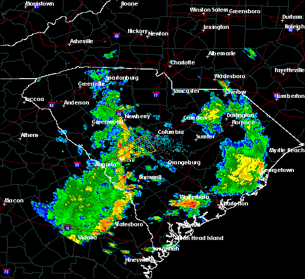 At 624 pm edt, a severe thunderstorm was located 10 miles south of batesburg, moving northeast at 35 mph. this storm has a history of producing damaging winds. trees have been reported down in north augusta (radar indicated). Hazards include 60 mph wind gusts. Expect damage to roofs, siding, and trees. Locations impacted include, lexington, red bank, gaston, swansea, wagener, pelion, gilbert and summit. At 624 pm edt, a severe thunderstorm was located 10 miles south of batesburg, moving northeast at 35 mph. this storm has a history of producing damaging winds. trees have been reported down in north augusta (radar indicated). Hazards include 60 mph wind gusts. Expect damage to roofs, siding, and trees. Locations impacted include, lexington, red bank, gaston, swansea, wagener, pelion, gilbert and summit.
|
| 6/30/2017 6:10 PM EDT |
 At 610 pm edt, a severe thunderstorm was located 9 miles south of ridge spring, or 12 miles northeast of aiken, moving northeast at 35 mph (radar indicated). Hazards include 60 mph wind gusts. expect damage to roofs, siding, and trees At 610 pm edt, a severe thunderstorm was located 9 miles south of ridge spring, or 12 miles northeast of aiken, moving northeast at 35 mph (radar indicated). Hazards include 60 mph wind gusts. expect damage to roofs, siding, and trees
|
| 6/15/2017 9:30 PM EDT | Schp reports two trees on roadways--one on state park rd near hwy 302... and the other on wagontong rd near holstein r in aiken county SC, 2.8 miles ENE of Wagener, SC |
| 5/29/2017 8:30 PM EDT |
 At 829 pm edt, a severe thunderstorm was located 10 miles west of gaston, or 10 miles south of red bank, moving east at 50 mph (radar indicated). Hazards include 60 mph wind gusts and nickel size hail. Expect damage to roofs, siding, and trees. Locations impacted include, cayce, south congaree, pine ridge, gaston, swansea, wagener and pelion. At 829 pm edt, a severe thunderstorm was located 10 miles west of gaston, or 10 miles south of red bank, moving east at 50 mph (radar indicated). Hazards include 60 mph wind gusts and nickel size hail. Expect damage to roofs, siding, and trees. Locations impacted include, cayce, south congaree, pine ridge, gaston, swansea, wagener and pelion.
|
| 5/29/2017 8:16 PM EDT |
 At 816 pm edt, a severe thunderstorm was located 12 miles south of batesburg-leesville, or 12 miles south of batesburg, moving east at 50 mph (radar indicated). Hazards include 60 mph wind gusts and nickel size hail. expect damage to roofs, siding, and trees At 816 pm edt, a severe thunderstorm was located 12 miles south of batesburg-leesville, or 12 miles south of batesburg, moving east at 50 mph (radar indicated). Hazards include 60 mph wind gusts and nickel size hail. expect damage to roofs, siding, and trees
|
| 5/24/2017 11:48 PM EDT |
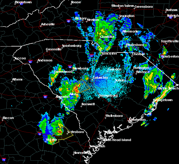 At 1145 pm edt, a severe thunderstorm was located 8 miles south of batesburg or along interstate 26 near the lexington and aiken county line. movement was northeast at 35 mph. the interstate 26 area of southwest lexington county is in the path of this hail producing storm (radar indicated). Hazards include 40 to 60 mph wind gusts and quarter size hail. Hail damage to vehicles is expected. wind damage to roofs, siding, and trees possible. Locations impacted include, red bank, wagener, pelion, gilbert and summit. At 1145 pm edt, a severe thunderstorm was located 8 miles south of batesburg or along interstate 26 near the lexington and aiken county line. movement was northeast at 35 mph. the interstate 26 area of southwest lexington county is in the path of this hail producing storm (radar indicated). Hazards include 40 to 60 mph wind gusts and quarter size hail. Hail damage to vehicles is expected. wind damage to roofs, siding, and trees possible. Locations impacted include, red bank, wagener, pelion, gilbert and summit.
|
| 5/24/2017 11:35 PM EDT |
 At 1132 pm edt, a severe thunderstorm was located 8 miles south of ridge spring, or 13 miles northeast of aiken, moving northeast at 35 mph (radar indicated). Hazards include 40 to 60 mph wind gusts and quarter size hail. Hail damage to vehicles is expected. Expect wind damage to roofs, siding, and trees possible. At 1132 pm edt, a severe thunderstorm was located 8 miles south of ridge spring, or 13 miles northeast of aiken, moving northeast at 35 mph (radar indicated). Hazards include 40 to 60 mph wind gusts and quarter size hail. Hail damage to vehicles is expected. Expect wind damage to roofs, siding, and trees possible.
|
| 4/5/2017 3:25 PM EDT |
 The severe thunderstorm warning for northeastern barnwell, aiken and northwestern orangeburg counties will expire at 330 pm edt, the storms which prompted the warning have moved out of the area. therefore the warning will be allowed to expire. however gusty winds and heavy rain are still possible with these thunderstorms. a tornado watch remains in effect until 800 pm edt for east central georgia, and central south carolina. The severe thunderstorm warning for northeastern barnwell, aiken and northwestern orangeburg counties will expire at 330 pm edt, the storms which prompted the warning have moved out of the area. therefore the warning will be allowed to expire. however gusty winds and heavy rain are still possible with these thunderstorms. a tornado watch remains in effect until 800 pm edt for east central georgia, and central south carolina.
|
| 4/5/2017 2:32 PM EDT |
 At 232 pm edt, severe thunderstorms were located along a line extending from 14 miles southwest of red bank to 6 miles west of new ellenton, moving east at 30 mph (radar indicated). Hazards include 70 mph wind gusts and ping pong ball size hail. People and animals outdoors will be injured. expect hail damage to roofs, siding, windows, and vehicles. expect considerable tree damage. Wind damage is also likely to mobile homes, roofs, and outbuildings. At 232 pm edt, severe thunderstorms were located along a line extending from 14 miles southwest of red bank to 6 miles west of new ellenton, moving east at 30 mph (radar indicated). Hazards include 70 mph wind gusts and ping pong ball size hail. People and animals outdoors will be injured. expect hail damage to roofs, siding, windows, and vehicles. expect considerable tree damage. Wind damage is also likely to mobile homes, roofs, and outbuildings.
|
| 4/3/2017 4:32 PM EDT |
 At 432 pm edt, severe thunderstorms were located along a line extending from 10 miles southeast of batesburg-leesville to near appleton, moving east at 35 mph (radar indicated). Hazards include 70 mph wind gusts and quarter size hail. Hail damage to vehicles is expected. expect considerable tree damage. Wind damage is also likely to mobile homes, roofs, and outbuildings. At 432 pm edt, severe thunderstorms were located along a line extending from 10 miles southeast of batesburg-leesville to near appleton, moving east at 35 mph (radar indicated). Hazards include 70 mph wind gusts and quarter size hail. Hail damage to vehicles is expected. expect considerable tree damage. Wind damage is also likely to mobile homes, roofs, and outbuildings.
|
| 4/3/2017 4:03 PM EDT |
 At 402 pm edt, severe thunderstorms were located along a line extending from 9 miles north of aiken to near millett, moving northeast at 60 mph (damage reports). Hazards include 70 mph wind gusts and quarter size hail. Hail damage to vehicles is expected. expect considerable tree damage. wind damage is also likely to mobile homes, roofs, and outbuildings. locations impacted include, aiken, barnwell, savannah river site, clearwater, williston, blackville, new ellenton, jackson, sardis, gloverville, burnettown, wagener, gilbert, hilda, summit, salley, snelling, perry, kline and elko. wind damage has been reported in north augusta and clearwater with this line of severe thunderstorms. A tornado watch remains in effect until 900 pm edt for east central georgia, and central south carolina. At 402 pm edt, severe thunderstorms were located along a line extending from 9 miles north of aiken to near millett, moving northeast at 60 mph (damage reports). Hazards include 70 mph wind gusts and quarter size hail. Hail damage to vehicles is expected. expect considerable tree damage. wind damage is also likely to mobile homes, roofs, and outbuildings. locations impacted include, aiken, barnwell, savannah river site, clearwater, williston, blackville, new ellenton, jackson, sardis, gloverville, burnettown, wagener, gilbert, hilda, summit, salley, snelling, perry, kline and elko. wind damage has been reported in north augusta and clearwater with this line of severe thunderstorms. A tornado watch remains in effect until 900 pm edt for east central georgia, and central south carolina.
|
| 4/3/2017 3:57 PM EDT |
 At 357 pm edt, severe thunderstorms were located along a line extending from 8 miles north of aiken to 6 miles west of millett, moving northeast at 60 mph (radar indicated). Hazards include 70 mph wind gusts and quarter size hail. Hail damage to vehicles is expected. expect considerable tree damage. Wind damage is also likely to mobile homes, roofs, and outbuildings. At 357 pm edt, severe thunderstorms were located along a line extending from 8 miles north of aiken to 6 miles west of millett, moving northeast at 60 mph (radar indicated). Hazards include 70 mph wind gusts and quarter size hail. Hail damage to vehicles is expected. expect considerable tree damage. Wind damage is also likely to mobile homes, roofs, and outbuildings.
|
| 3/21/2017 11:51 PM EDT |
 The severe thunderstorm warning for south central lexington, central aiken and west central orangeburg counties will expire at midnight edt, the storms which prompted the warning have weakened below severe limits, and no longer pose an immediate threat to life or property. therefore the warning will be allowed to expire. a severe thunderstorm watch remains in effect until 200 am edt for central south carolina. The severe thunderstorm warning for south central lexington, central aiken and west central orangeburg counties will expire at midnight edt, the storms which prompted the warning have weakened below severe limits, and no longer pose an immediate threat to life or property. therefore the warning will be allowed to expire. a severe thunderstorm watch remains in effect until 200 am edt for central south carolina.
|
| 3/21/2017 11:28 PM EDT |
 At 1128 pm edt, severe thunderstorms were located along a line extending from 9 miles north of aiken to near savannah river site, moving northeast at 50 mph (radar indicated). Hazards include 60 mph wind gusts. expect damage to roofs, siding, and trees At 1128 pm edt, severe thunderstorms were located along a line extending from 9 miles north of aiken to near savannah river site, moving northeast at 50 mph (radar indicated). Hazards include 60 mph wind gusts. expect damage to roofs, siding, and trees
|
| 3/21/2017 10:31 PM EDT |
 At 1030 pm edt, a severe thunderstorm was located near aiken, moving east at 35 mph (radar indicated). Hazards include 70 mph wind gusts. Expect considerable tree damage. Damage is likely to mobile homes, roofs, and outbuildings. At 1030 pm edt, a severe thunderstorm was located near aiken, moving east at 35 mph (radar indicated). Hazards include 70 mph wind gusts. Expect considerable tree damage. Damage is likely to mobile homes, roofs, and outbuildings.
|
| 8/1/2016 8:41 PM EDT |
 At 841 pm edt, severe thunderstorms were located along a line extending from near cayce to 15 miles southwest of gaston, moving southeast at 15 mph (radar indicated). Hazards include 60 mph wind gusts and penny size hail. Expect damage to roofs. siding. And trees. At 841 pm edt, severe thunderstorms were located along a line extending from near cayce to 15 miles southwest of gaston, moving southeast at 15 mph (radar indicated). Hazards include 60 mph wind gusts and penny size hail. Expect damage to roofs. siding. And trees.
|
| 8/1/2016 8:26 PM EDT |
 At 826 pm edt, severe thunderstorms were located along a line extending from 17 miles south of batesburg-leesville to near new ellenton, moving east at 25 mph (radar indicated). Hazards include 60 mph wind gusts. Expect damage to roofs. siding. and trees. Locations impacted include, aiken, new ellenton, gloverville, wagener, salley, perry and windsor. At 826 pm edt, severe thunderstorms were located along a line extending from 17 miles south of batesburg-leesville to near new ellenton, moving east at 25 mph (radar indicated). Hazards include 60 mph wind gusts. Expect damage to roofs. siding. and trees. Locations impacted include, aiken, new ellenton, gloverville, wagener, salley, perry and windsor.
|
| 8/1/2016 8:08 PM EDT |
 At 808 pm edt, severe thunderstorms were located along a line extending from 14 miles southeast of ridge spring to near clearwater, moving southeast at 15 mph (radar indicated). Hazards include 60 mph wind gusts and penny size hail. Expect damage to roofs. siding. And trees. At 808 pm edt, severe thunderstorms were located along a line extending from 14 miles southeast of ridge spring to near clearwater, moving southeast at 15 mph (radar indicated). Hazards include 60 mph wind gusts and penny size hail. Expect damage to roofs. siding. And trees.
|
| 7/5/2016 5:05 PM EDT |
 At 504 pm edt, severe thunderstorms were located along a line extending from 8 miles northeast of winnsboro to 15 miles southeast of batesburg-leesville, moving northeast at 75 mph (radar indicated). Hazards include 60 mph wind gusts. Expect damage to roofs. siding. And trees. At 504 pm edt, severe thunderstorms were located along a line extending from 8 miles northeast of winnsboro to 15 miles southeast of batesburg-leesville, moving northeast at 75 mph (radar indicated). Hazards include 60 mph wind gusts. Expect damage to roofs. siding. And trees.
|
| 6/17/2016 3:24 PM EDT |
 At 323 pm edt, a severe thunderstorm was located 10 miles northeast of williston, or 19 miles northwest of denmark, moving east at 40 mph (radar indicated). Hazards include 70 mph wind gusts and half dollar size hail. Hail damage to vehicles is expected. expect considerable tree damage. wind damage is also likely to mobile homes, roofs, and outbuildings. locations impacted include, orangeburg, bamberg, denmark, brookdale, williston, blackville, new ellenton, st. Matthews, holly hill, branchville, bowman, elloree, santee, swansea, wagener, north, pelion, springfield, hilda and cameron. At 323 pm edt, a severe thunderstorm was located 10 miles northeast of williston, or 19 miles northwest of denmark, moving east at 40 mph (radar indicated). Hazards include 70 mph wind gusts and half dollar size hail. Hail damage to vehicles is expected. expect considerable tree damage. wind damage is also likely to mobile homes, roofs, and outbuildings. locations impacted include, orangeburg, bamberg, denmark, brookdale, williston, blackville, new ellenton, st. Matthews, holly hill, branchville, bowman, elloree, santee, swansea, wagener, north, pelion, springfield, hilda and cameron.
|
| 6/17/2016 3:13 PM EDT |
 At 313 pm edt, a severe thunderstorm was located near bowman, or 9 miles southeast of orangeburg, moving east at 30 mph (radar indicated). Hazards include 60 mph wind gusts and quarter size hail. Hail damage to vehicles is expected. expect wind damage to roofs, siding, and trees. locations impacted include, orangeburg, bamberg, denmark, brookdale, williston, blackville, new ellenton, st. Matthews, holly hill, branchville, bowman, elloree, santee, swansea, wagener, north, pelion, springfield, hilda and cameron. At 313 pm edt, a severe thunderstorm was located near bowman, or 9 miles southeast of orangeburg, moving east at 30 mph (radar indicated). Hazards include 60 mph wind gusts and quarter size hail. Hail damage to vehicles is expected. expect wind damage to roofs, siding, and trees. locations impacted include, orangeburg, bamberg, denmark, brookdale, williston, blackville, new ellenton, st. Matthews, holly hill, branchville, bowman, elloree, santee, swansea, wagener, north, pelion, springfield, hilda and cameron.
|
| 6/17/2016 2:43 PM EDT |
 At 243 pm edt, a severe thunderstorm was located 9 miles north of bamberg, moving east at 30 mph (radar indicated). Hazards include 60 mph wind gusts and quarter size hail. Hail damage to vehicles is expected. Expect wind damage to roofs, siding, and trees. At 243 pm edt, a severe thunderstorm was located 9 miles north of bamberg, moving east at 30 mph (radar indicated). Hazards include 60 mph wind gusts and quarter size hail. Hail damage to vehicles is expected. Expect wind damage to roofs, siding, and trees.
|
| 6/14/2016 3:23 PM EDT |
 At 323 pm edt, a severe thunderstorm was located near gaston, or 12 miles south of red bank, moving east at 10 mph (radar indicated). Hazards include 60 mph wind gusts and penny size hail. Expect damage to roofs. siding. and trees. Locations impacted include, gaston, swansea, wagener, north, pelion, neeses, perry, woodford and livingston. At 323 pm edt, a severe thunderstorm was located near gaston, or 12 miles south of red bank, moving east at 10 mph (radar indicated). Hazards include 60 mph wind gusts and penny size hail. Expect damage to roofs. siding. and trees. Locations impacted include, gaston, swansea, wagener, north, pelion, neeses, perry, woodford and livingston.
|
| 6/14/2016 3:07 PM EDT |
 At 306 pm edt, a severe thunderstorm was located 8 miles southwest of gaston, or 11 miles south of red bank, moving east at 10 mph (radar indicated). Hazards include 60 mph wind gusts. Expect damage to roofs. siding. And trees. At 306 pm edt, a severe thunderstorm was located 8 miles southwest of gaston, or 11 miles south of red bank, moving east at 10 mph (radar indicated). Hazards include 60 mph wind gusts. Expect damage to roofs. siding. And trees.
|
| 5/3/2016 6:04 PM EDT |
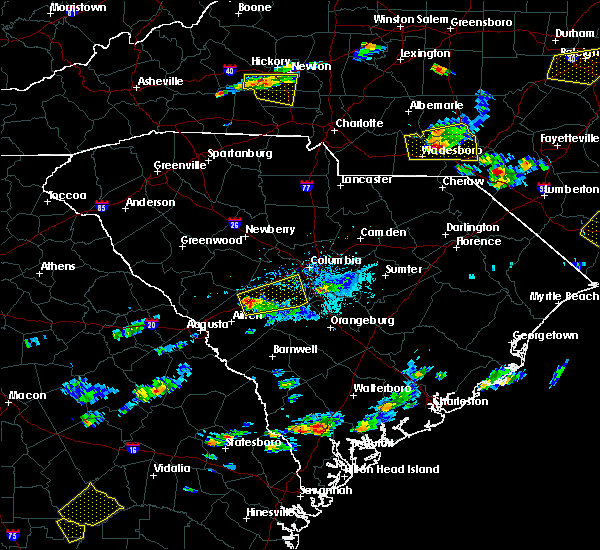 At 603 pm edt, a severe thunderstorm was located 11 miles southeast of ridge spring, or 13 miles south of batesburg, moving east at 40 mph (radar indicated). Hazards include 60 mph wind gusts and quarter size hail. Hail damage to vehicles is expected. Expect wind damage to roofs, siding, and trees. At 603 pm edt, a severe thunderstorm was located 11 miles southeast of ridge spring, or 13 miles south of batesburg, moving east at 40 mph (radar indicated). Hazards include 60 mph wind gusts and quarter size hail. Hail damage to vehicles is expected. Expect wind damage to roofs, siding, and trees.
|
| 4/1/2016 3:59 PM EDT |
 At 357 pm edt, doppler radar indicated a severe thunderstorm capable of producing damaging winds in excess of 60 mph. the strongest winds were moving across southwest lexington county between pelion and batesburg-leesville. this storm was located 9 miles west of gaston, or 11 miles south of red bank, moving northeast at 45 mph. locations impacted include, columbia, lexington, west columbia, cayce, irmo, forest acres, springdale, st. andrews, batesburg, dentsville, oak grove, woodfields, red bank, batesburg-leesville, south congaree, pine ridge, gaston, arcadia lakes, eastover and ridge spring. At 357 pm edt, doppler radar indicated a severe thunderstorm capable of producing damaging winds in excess of 60 mph. the strongest winds were moving across southwest lexington county between pelion and batesburg-leesville. this storm was located 9 miles west of gaston, or 11 miles south of red bank, moving northeast at 45 mph. locations impacted include, columbia, lexington, west columbia, cayce, irmo, forest acres, springdale, st. andrews, batesburg, dentsville, oak grove, woodfields, red bank, batesburg-leesville, south congaree, pine ridge, gaston, arcadia lakes, eastover and ridge spring.
|
| 4/1/2016 3:45 PM EDT |
 At 345 pm edt, doppler radar indicated a severe thunderstorm capable of producing damaging winds in excess of 60 mph. this storm was located 17 miles southeast of leesville, or 18 miles southeast of batesburg, and moving northeast at 45 mph. At 345 pm edt, doppler radar indicated a severe thunderstorm capable of producing damaging winds in excess of 60 mph. this storm was located 17 miles southeast of leesville, or 18 miles southeast of batesburg, and moving northeast at 45 mph.
|
| 2/3/2016 2:03 PM EST |
 At 201 pm est, doppler radar indicated a severe thunderstorm capable of producing damaging winds in excess of 60 mph. this storm was located over red bank, moving east-northeast at 40 mph. locations impacted include, columbia, aiken, lexington, west columbia, cayce, irmo, forest acres, winnsboro, springdale, st. andrews, batesburg, oak grove, red bank, dentsville, batesburg-leesville, south congaree, pine ridge, gaston, ridge spring and leesville. At 201 pm est, doppler radar indicated a severe thunderstorm capable of producing damaging winds in excess of 60 mph. this storm was located over red bank, moving east-northeast at 40 mph. locations impacted include, columbia, aiken, lexington, west columbia, cayce, irmo, forest acres, winnsboro, springdale, st. andrews, batesburg, oak grove, red bank, dentsville, batesburg-leesville, south congaree, pine ridge, gaston, ridge spring and leesville.
|
| 2/3/2016 1:40 PM EST |
 At 139 pm est, doppler radar indicated a severe thunderstorm capable of producing damaging winds in excess of 60 mph. this storm was located near leesville, or near batesburg, moving east at 40 mph. locations impacted include, columbia, aiken, lexington, west columbia, cayce, irmo, forest acres, winnsboro, springdale, st. andrews, batesburg, oak grove, red bank, dentsville, batesburg-leesville, south congaree, pine ridge, gaston, ridge spring and leesville. At 139 pm est, doppler radar indicated a severe thunderstorm capable of producing damaging winds in excess of 60 mph. this storm was located near leesville, or near batesburg, moving east at 40 mph. locations impacted include, columbia, aiken, lexington, west columbia, cayce, irmo, forest acres, winnsboro, springdale, st. andrews, batesburg, oak grove, red bank, dentsville, batesburg-leesville, south congaree, pine ridge, gaston, ridge spring and leesville.
|
| 2/3/2016 1:25 PM EST |
 At 124 pm est, doppler radar indicated a severe thunderstorm capable of producing damaging winds in excess of 60 mph. this storm was located over ridge spring, or 9 miles southwest of batesburg, and moving east-northeast at 45 mph. At 124 pm est, doppler radar indicated a severe thunderstorm capable of producing damaging winds in excess of 60 mph. this storm was located over ridge spring, or 9 miles southwest of batesburg, and moving east-northeast at 45 mph.
|
| 12/24/2015 4:45 PM EST |
 At 445 pm est, doppler radar indicated a severe thunderstorm capable of producing destructive winds in excess of 70 mph. this storm was located near edgefield, or 13 miles north of belvedere, and moving east at 50 mph. At 445 pm est, doppler radar indicated a severe thunderstorm capable of producing destructive winds in excess of 70 mph. this storm was located near edgefield, or 13 miles north of belvedere, and moving east at 50 mph.
|
| 8/6/2015 5:48 PM EDT |
 At 548 pm edt, doppler radar indicated a line of severe thunderstorms capable of producing damaging winds in excess of 60 mph. these storms were located along a line extending from 8 miles south of prosperity to near garfield, and moving east at 25 mph. At 548 pm edt, doppler radar indicated a line of severe thunderstorms capable of producing damaging winds in excess of 60 mph. these storms were located along a line extending from 8 miles south of prosperity to near garfield, and moving east at 25 mph.
|
| 8/6/2015 4:50 PM EDT |
 At 449 pm edt, doppler radar indicated an area of severe thunderstorms over the csra capable of producing damaging winds in excess of 60 mph. these storms were moving east at 30 mph. At 449 pm edt, doppler radar indicated an area of severe thunderstorms over the csra capable of producing damaging winds in excess of 60 mph. these storms were moving east at 30 mph.
|
| 7/20/2015 9:08 PM EDT |
 At 904 pm edt, doppler radar indicated severe thunderstorms capable of producing quarter size hail and damaging winds in excess of 60 mph. multiple storms are located in eastern aiken county and northeastern barnwell county, moving east at 15 mph. locations impacted include, aiken, williston, new ellenton, elko and windsor. At 904 pm edt, doppler radar indicated severe thunderstorms capable of producing quarter size hail and damaging winds in excess of 60 mph. multiple storms are located in eastern aiken county and northeastern barnwell county, moving east at 15 mph. locations impacted include, aiken, williston, new ellenton, elko and windsor.
|
| 7/20/2015 8:40 PM EDT |
 At 839 pm edt, doppler radar indicated a severe thunderstorm capable of producing quarter size hail and damaging winds in excess of 60 mph. this storm was located just west of new ellenton, and moving east at 15 mph. At 839 pm edt, doppler radar indicated a severe thunderstorm capable of producing quarter size hail and damaging winds in excess of 60 mph. this storm was located just west of new ellenton, and moving east at 15 mph.
|
| 7/19/2015 7:26 PM EDT |
 At 725 pm edt, doppler radar indicated a line of severe thunderstorms capable of producing damaging winds in excess of 60 mph. these storms were located along a line extending from 8 miles south of lugoff to 6 miles south of ridge spring, and moving southeast at 15 mph. * these severe thunderstorms will remain over mainly rural areas of northeastern barnwell, calhoun, central aiken, lexington, southwestern sumter, south central kershaw, southeastern richland, east central edgefield and northwestern orangeburg counties, including the following locations, salley, wedgewood, woodford, springfield, pelion, livingston, wagener, neeses, gilbert and swansea. At 725 pm edt, doppler radar indicated a line of severe thunderstorms capable of producing damaging winds in excess of 60 mph. these storms were located along a line extending from 8 miles south of lugoff to 6 miles south of ridge spring, and moving southeast at 15 mph. * these severe thunderstorms will remain over mainly rural areas of northeastern barnwell, calhoun, central aiken, lexington, southwestern sumter, south central kershaw, southeastern richland, east central edgefield and northwestern orangeburg counties, including the following locations, salley, wedgewood, woodford, springfield, pelion, livingston, wagener, neeses, gilbert and swansea.
|
| 7/2/2015 4:41 PM EDT |
 At 441 pm edt, doppler radar indicated a line of severe thunderstorms capable of producing damaging winds in excess of 60 mph. these storms were located along a line extending from 13 miles southeast of leesville to grovetown, and moving southeast at 40 mph. At 441 pm edt, doppler radar indicated a line of severe thunderstorms capable of producing damaging winds in excess of 60 mph. these storms were located along a line extending from 13 miles southeast of leesville to grovetown, and moving southeast at 40 mph.
|
| 6/27/2015 6:14 PM EDT |
 At 613 pm edt, doppler radar indicated a line of severe thunderstorms capable of producing damaging winds in excess of 60 mph. these storms were located along a line extending from near dentsville to columbia to near wagener, and moving east at 40 mph. At 613 pm edt, doppler radar indicated a line of severe thunderstorms capable of producing damaging winds in excess of 60 mph. these storms were located along a line extending from near dentsville to columbia to near wagener, and moving east at 40 mph.
|
| 6/27/2015 6:02 PM EDT |
 At 601 pm edt, doppler radar indicated a line of severe thunderstorms capable of producing damaging winds in excess of 60 mph. these storms were located along a line extending from st. andrews to south congaree to 17 miles southwest of gaston, moving east at 45 mph. locations impacted include, columbia, lexington, west columbia, cayce, irmo, forest acres, springdale, st. andrews, dentsville, oak grove, woodfields, red bank, south congaree, pine ridge, gaston, arcadia lakes, eastover, fort jackson, woodfield and five points. At 601 pm edt, doppler radar indicated a line of severe thunderstorms capable of producing damaging winds in excess of 60 mph. these storms were located along a line extending from st. andrews to south congaree to 17 miles southwest of gaston, moving east at 45 mph. locations impacted include, columbia, lexington, west columbia, cayce, irmo, forest acres, springdale, st. andrews, dentsville, oak grove, woodfields, red bank, south congaree, pine ridge, gaston, arcadia lakes, eastover, fort jackson, woodfield and five points.
|
| 6/27/2015 5:42 PM EDT |
 At 541 pm edt, doppler radar indicated a line of severe thunderstorms capable of producing damaging winds in excess of 60 mph. these storms were located along a line extending from 8 miles northwest of lexington to 12 miles south of batesburg-leesville, and moving east at 40 mph. At 541 pm edt, doppler radar indicated a line of severe thunderstorms capable of producing damaging winds in excess of 60 mph. these storms were located along a line extending from 8 miles northwest of lexington to 12 miles south of batesburg-leesville, and moving east at 40 mph.
|
| 6/24/2015 6:14 PM EDT |
 At 613 pm edt, doppler radar indicated multiple severe thunderstorms capable of producing quarter size hail and damaging winds in excess of 60 mph. the strongest storms are located near batesburg-leesville and pelion, moving north at 10 mph. At 613 pm edt, doppler radar indicated multiple severe thunderstorms capable of producing quarter size hail and damaging winds in excess of 60 mph. the strongest storms are located near batesburg-leesville and pelion, moving north at 10 mph.
|
| 6/22/2015 3:43 PM EDT |
 At 343 pm edt, doppler radar indicated a severe thunderstorm capable of producing quarter size hail and damaging winds in excess of 60 mph. this storm was located 13 miles southeast of ridge spring, or 13 miles northeast of aiken, and moving east at 15 mph. At 343 pm edt, doppler radar indicated a severe thunderstorm capable of producing quarter size hail and damaging winds in excess of 60 mph. this storm was located 13 miles southeast of ridge spring, or 13 miles northeast of aiken, and moving east at 15 mph.
|
| 6/18/2015 2:57 PM EDT | At 256 pm edt, doppler radar indicated a line of severe thunderstorms capable of producing quarter size hail and damaging winds in excess of 60 mph. these storms were located along a line extending from mulberry to 9 miles east of aiken, and moving east northeast at 20 mph. |
| 6/18/2015 2:07 PM EDT | At 207 pm edt, doppler radar indicated a severe thunderstorm capable of producing quarter size hail and damaging winds in excess of 60 mph. this storm was located 10 miles northeast of williston, or 16 miles northwest of denmark, and moving northeast at 20 mph. |
| 6/1/2015 2:17 PM EDT | At 212 pm edt, doppler radar indicated thunderstorms extending from kershaw county southward into southern lexington county. storms near camdan, swansea, and near the fairfield and richland county line near interstate 77, were likely severe with wind gusts of 40 to 60 mph and quarter-size hail. storm movement was northeast near 15 mph. a small interior room on the lowest flood usually offers the best protection from severe thunderstorms. |
| 6/1/2015 2:06 PM EDT | At 204 pm edt, doppler radar indicated thunderstorms, some of which were likely severe with wind gusts of 40 to 60 mph. the storms extended from southern lexington county northward into fairfield and kershaw counties. movement was northeast near 15 mph. |
| 4/19/2015 4:42 PM EDT | At 439 pm edt, national weather service doppler radar indicated a line of severe thunderstorms capable of producing damaging winds in excess of 60 mph. these storms were located along a line extending from 19 miles north of blackville to 25 miles south of denmark, or along a line extending from 20 miles east of aiken to 7 miles northwest of hampton, and moving northeast at 30 mph. * some communities in the warning area include st. matthews, orangeburg, gaston, denmark, brookdale, branchville, bowman, blackville and bamberg. |
| 4/19/2015 4:42 PM EDT | this alert has expired |
| 4/19/2015 4:02 PM EDT | At 359 pm edt, national weather service doppler radar indicated a severe thunderstorm. this storm was located 7 miles south of savannah river site, and moving northeast at 45 mph. * some communities in the warning area include savannah river site, williston, denmark, blackville and barnwell. |
| 4/10/2015 7:10 PM EDT | A severe thunderstorm warning remains in effect until 730 pm edt for aiken and lexington counties. at 705 pm edt. a severe thunderstorm was reported capable of producing quarter size hail. and damaging winds in excess of 60 mph. this storm was located near interstate 20 and state road 39. this was near new holland. Movement was east at 30 mph. |
| 4/10/2015 6:53 PM EDT | A severe thunderstorm warning remains in effect until 730 pm edt for aiken and lexington counties. at 651 pm edt. national weather service doppler radar continued to indicate a severe thunderstorm capable of producing quarter size hail. and damaging winds in excess of 60 mph. This storm was just northwest of new holland and moving east at 30 mph. |
| 4/10/2015 6:41 PM EDT | The national weather service in columbia has issued a * severe thunderstorm warning for. Eastern edgefield county in central south carolina southwestern lexington county in central south carolina northern aiken county in central south carolina * until 730 pm edt. |
| 4/8/2015 9:52 PM EDT | A severe thunderstorm warning remains in effect until 1015 pm edt for aiken county. at 945 pm edt. national weather service doppler radar continued to indicate a severe thunderstorm capable of producing quarter size hail and damaging winds in excess of 60 mph. this storm was in the state road 302 area between kitchings mill and wagener. Movement was. |
| 4/8/2015 9:43 PM EDT | The national weather service in columbia has issued a * severe thunderstorm warning for. eastern aiken county in central south carolina * until 1015 pm edt * at 940 pm edt. national weather service doppler radar indicated a severe thunderstorm capable of producing quarter size hail. And. |
| 11/23/2014 7:30 PM EST | Sc highway patrol reported trees down at the intersection of wagener road and south dixie roa in aiken county SC, 0.5 miles NW of Wagener, SC |
| 7/17/2013 2:58 PM EDT | Quarter sized hail reported 7.6 miles SSE of Wagener, SC |
| 7/17/2013 2:50 PM EDT | Quarter sized hail reported 7.6 miles SSE of Wagener, SC |
| 3/18/2013 8:05 PM EDT | Trees down near wagene in aiken county SC, 0.5 miles NW of Wagener, SC |
| 7/27/2012 3:57 PM EDT | Highway patrol reported a tree in the roadway at kennedy pond road and trotter roa in aiken county SC, 7.4 miles ENE of Wagener, SC |
| 7/27/2012 3:32 PM EDT | Highway patrol reported a tree down across the roadway at the intersection of camp rawls road and magpie stree in aiken county SC, 7.2 miles E of Wagener, SC |
| 1/1/0001 12:00 AM | Highway dept reports large tree down across new holland road. time estimated by rada in aiken county SC, 6.6 miles SE of Wagener, SC |
Hail Maps for Wagener, SC
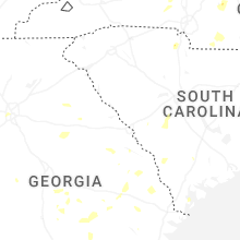


Connect with Interactive Hail Maps