

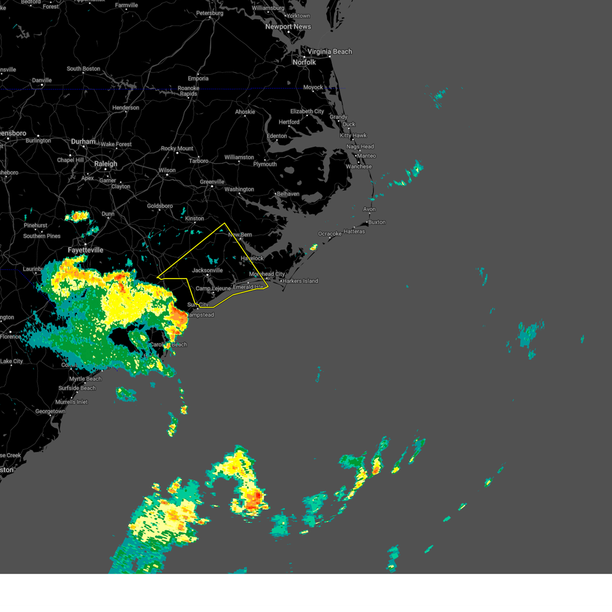
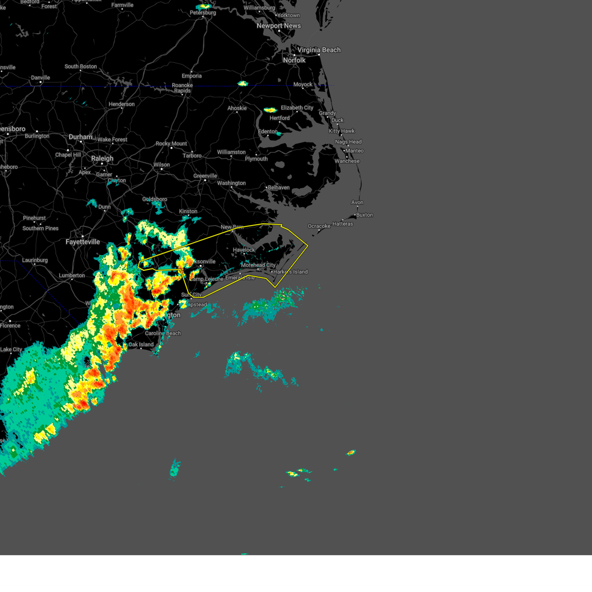
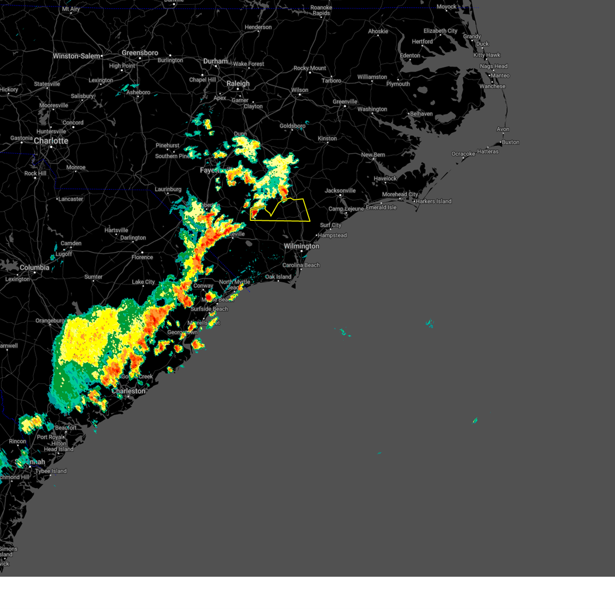
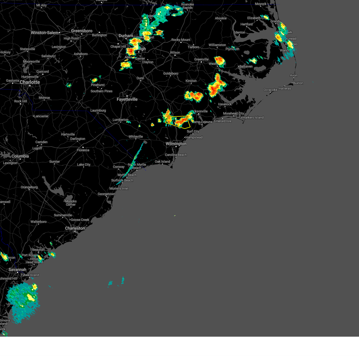
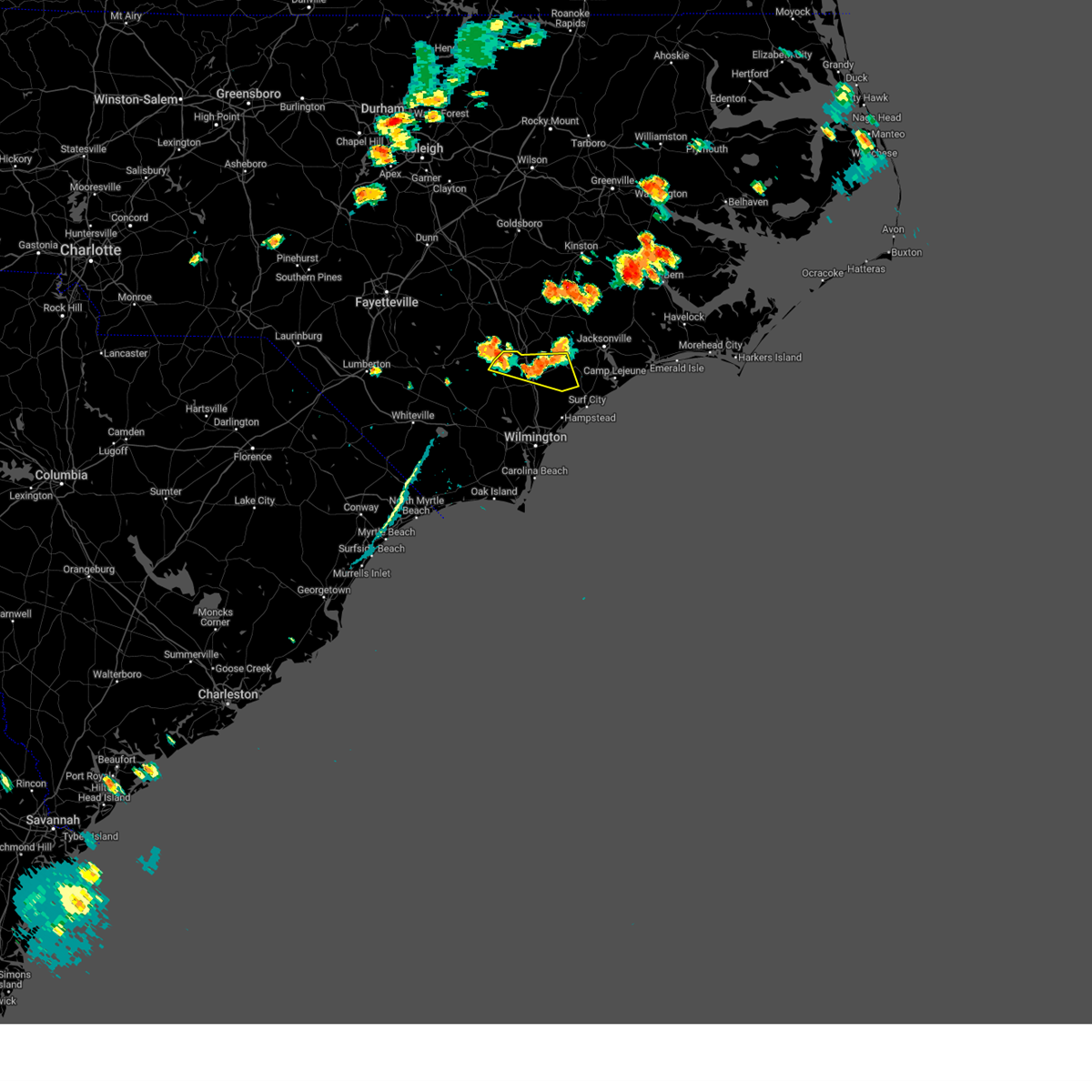
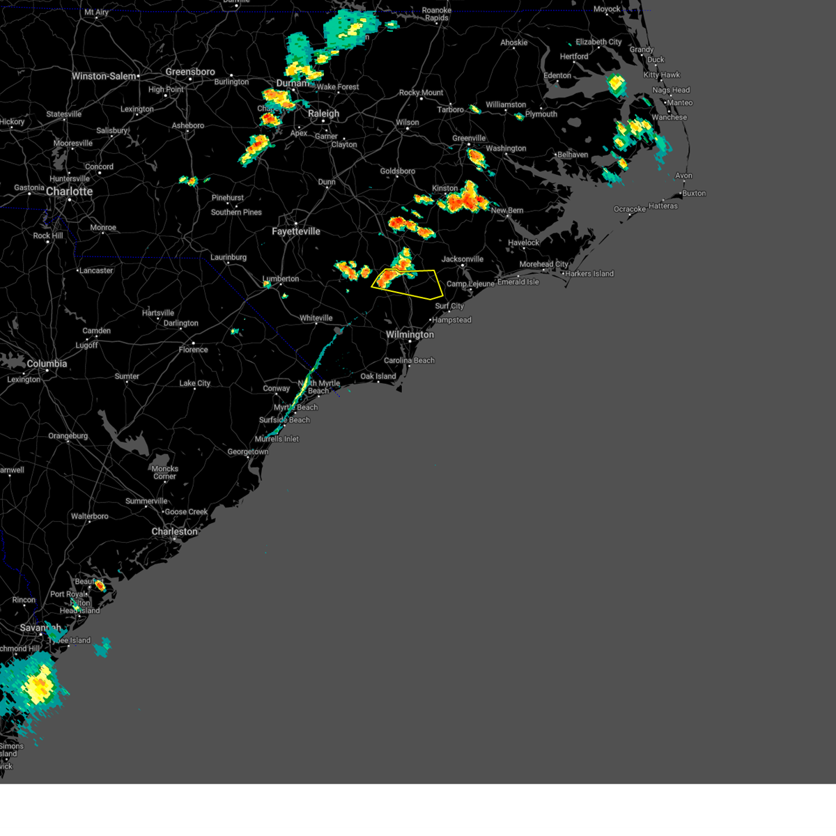
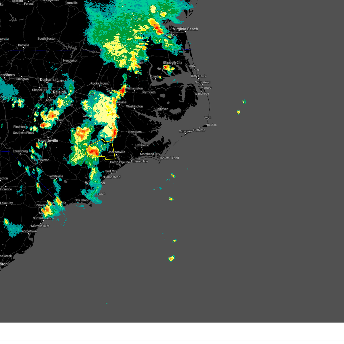
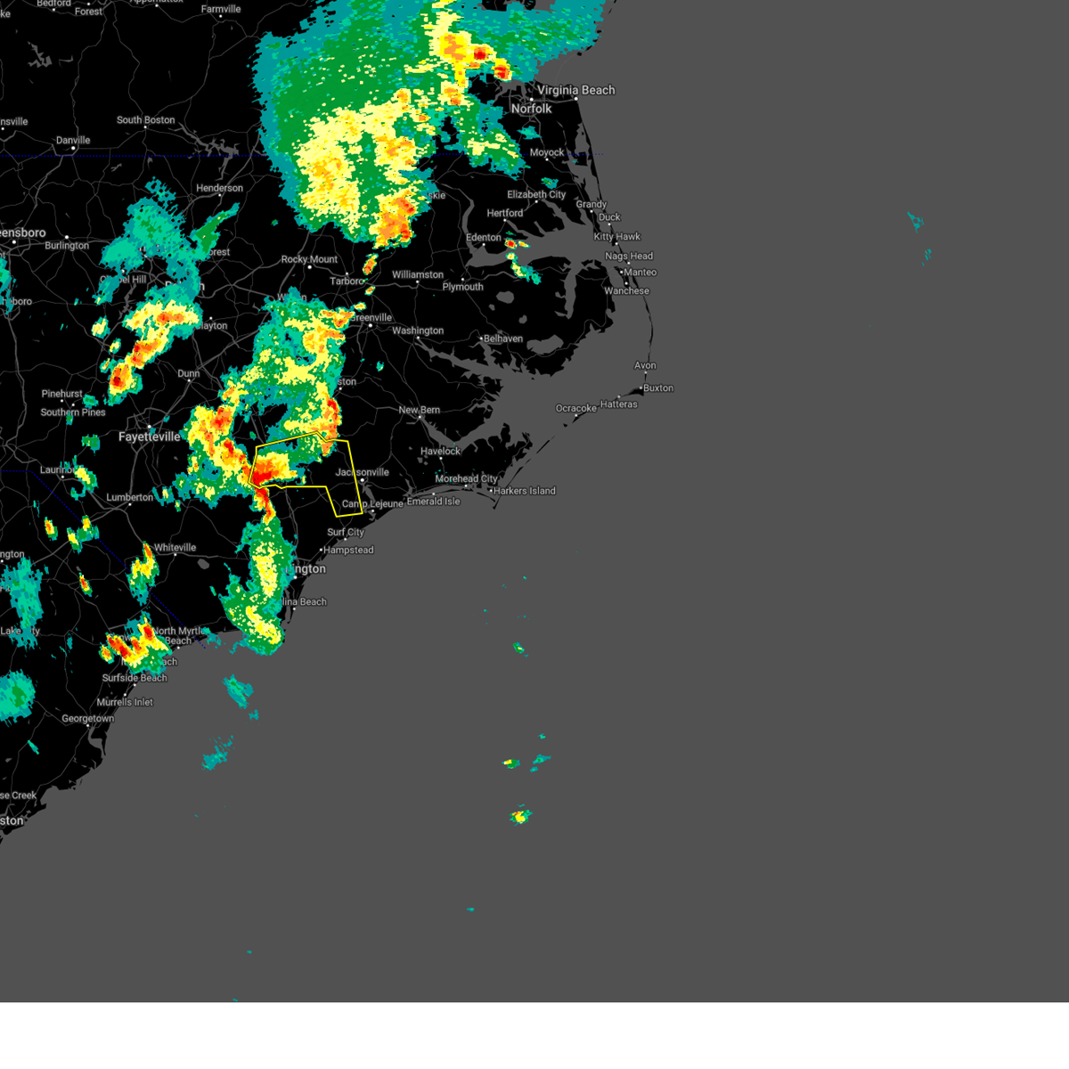
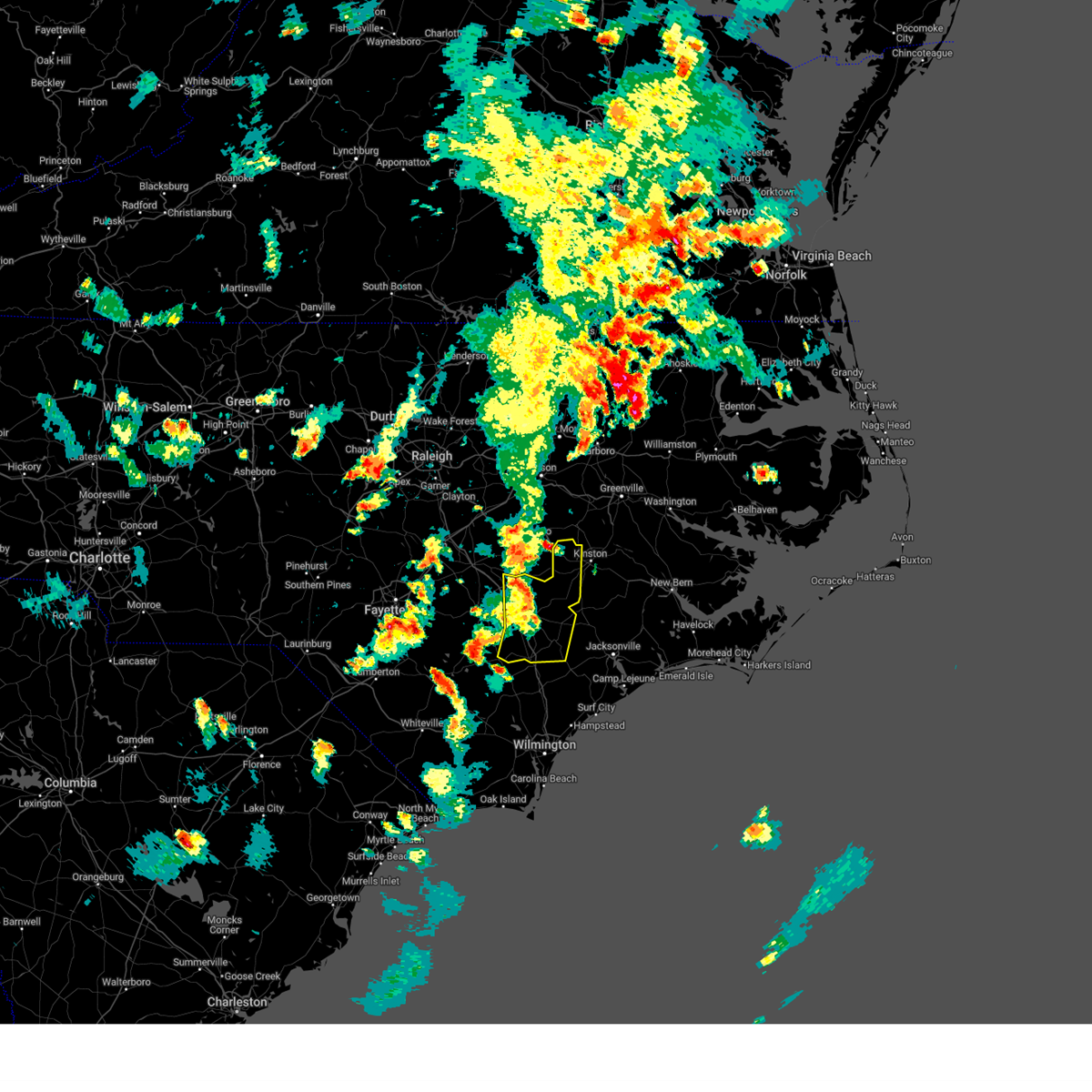
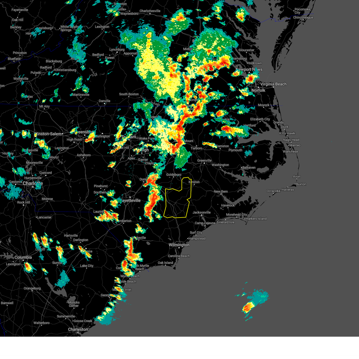
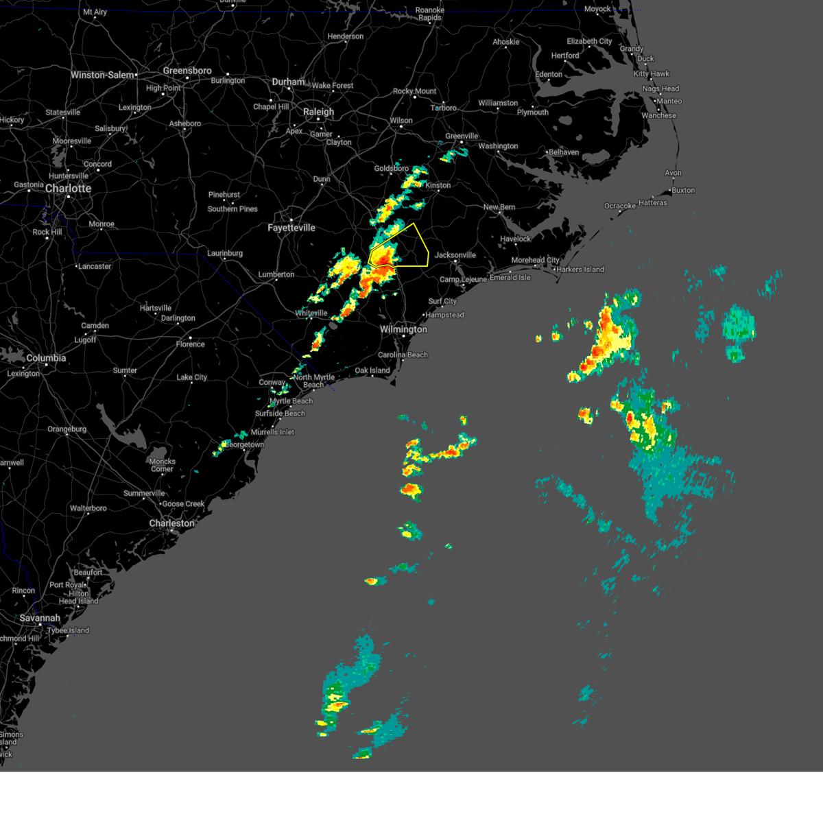
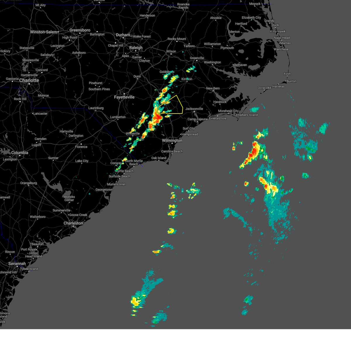
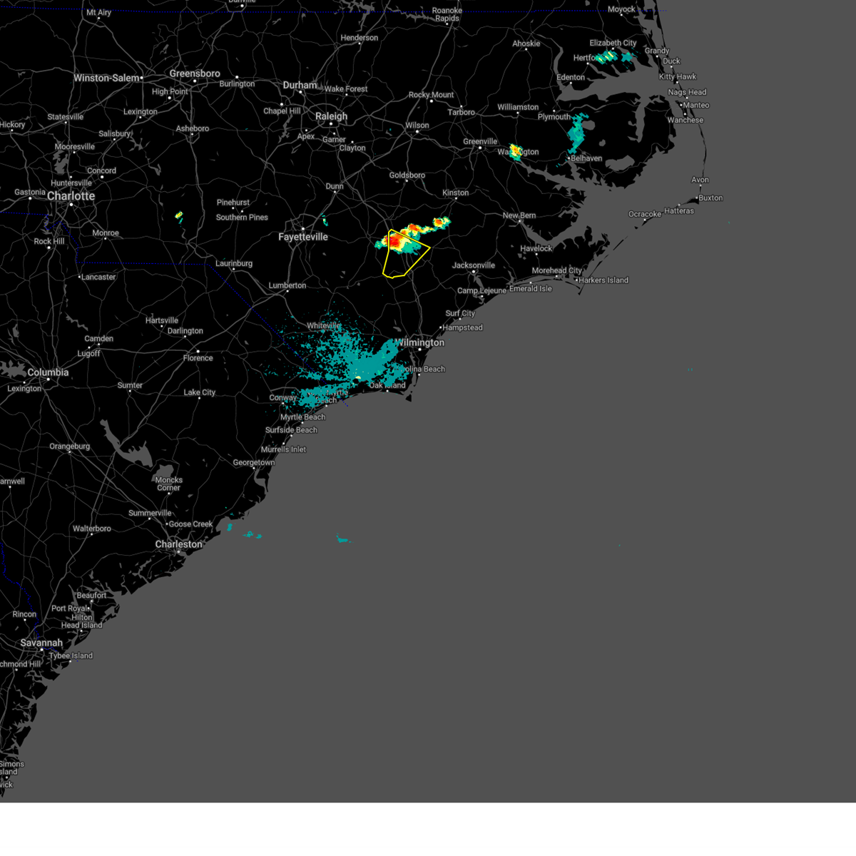
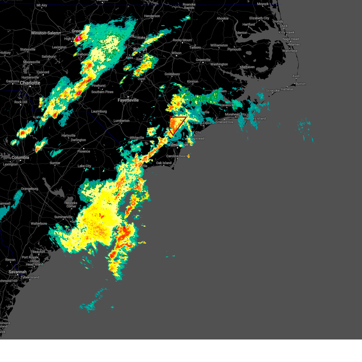
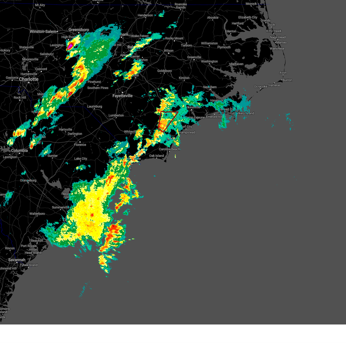
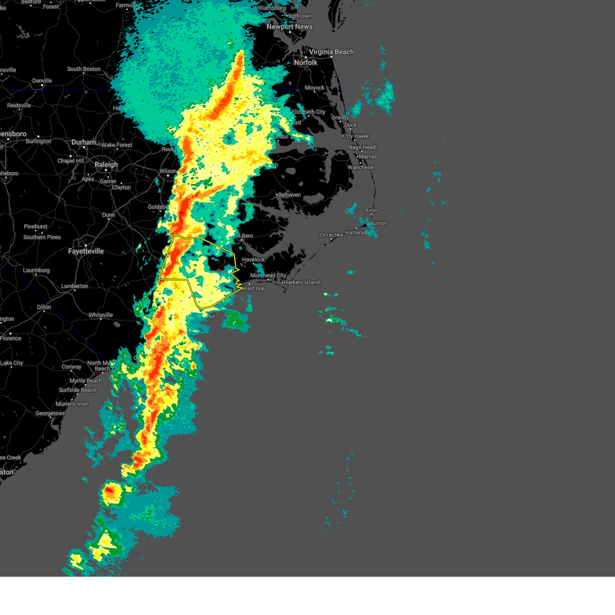
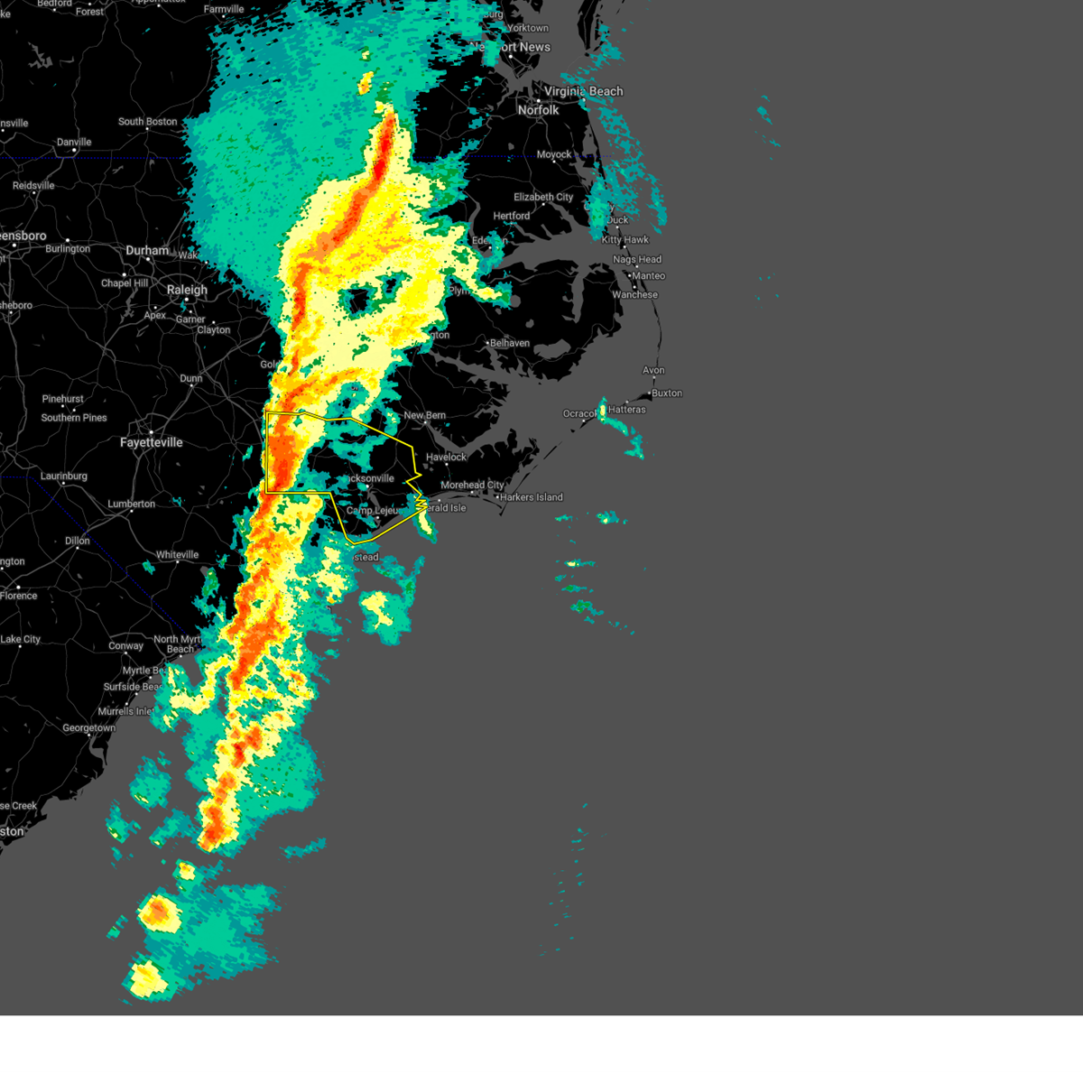
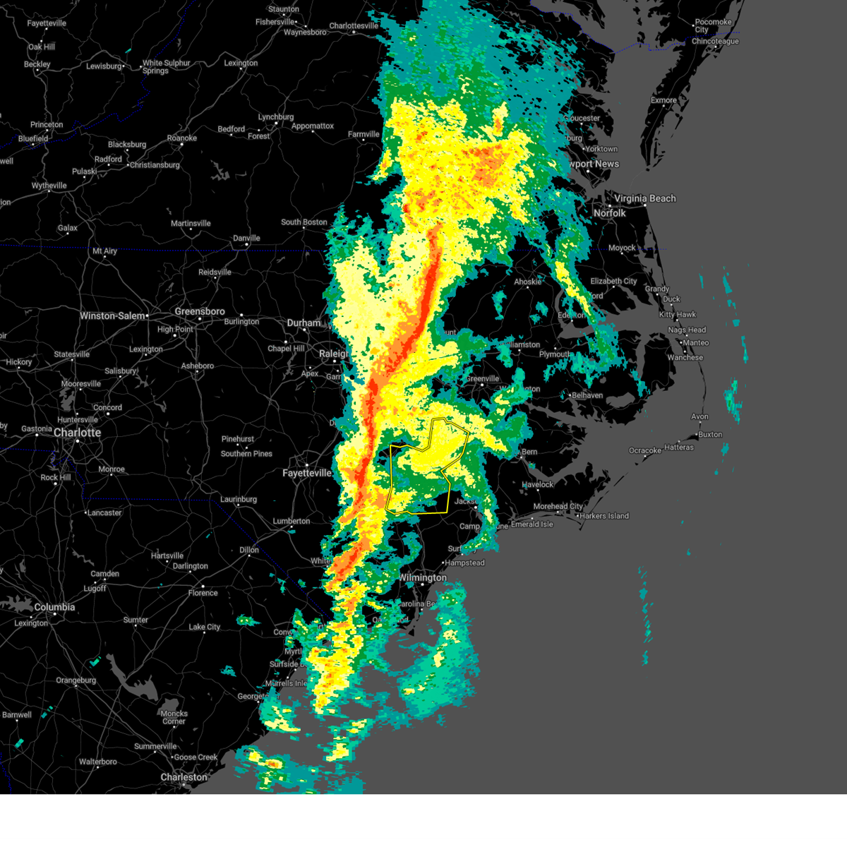
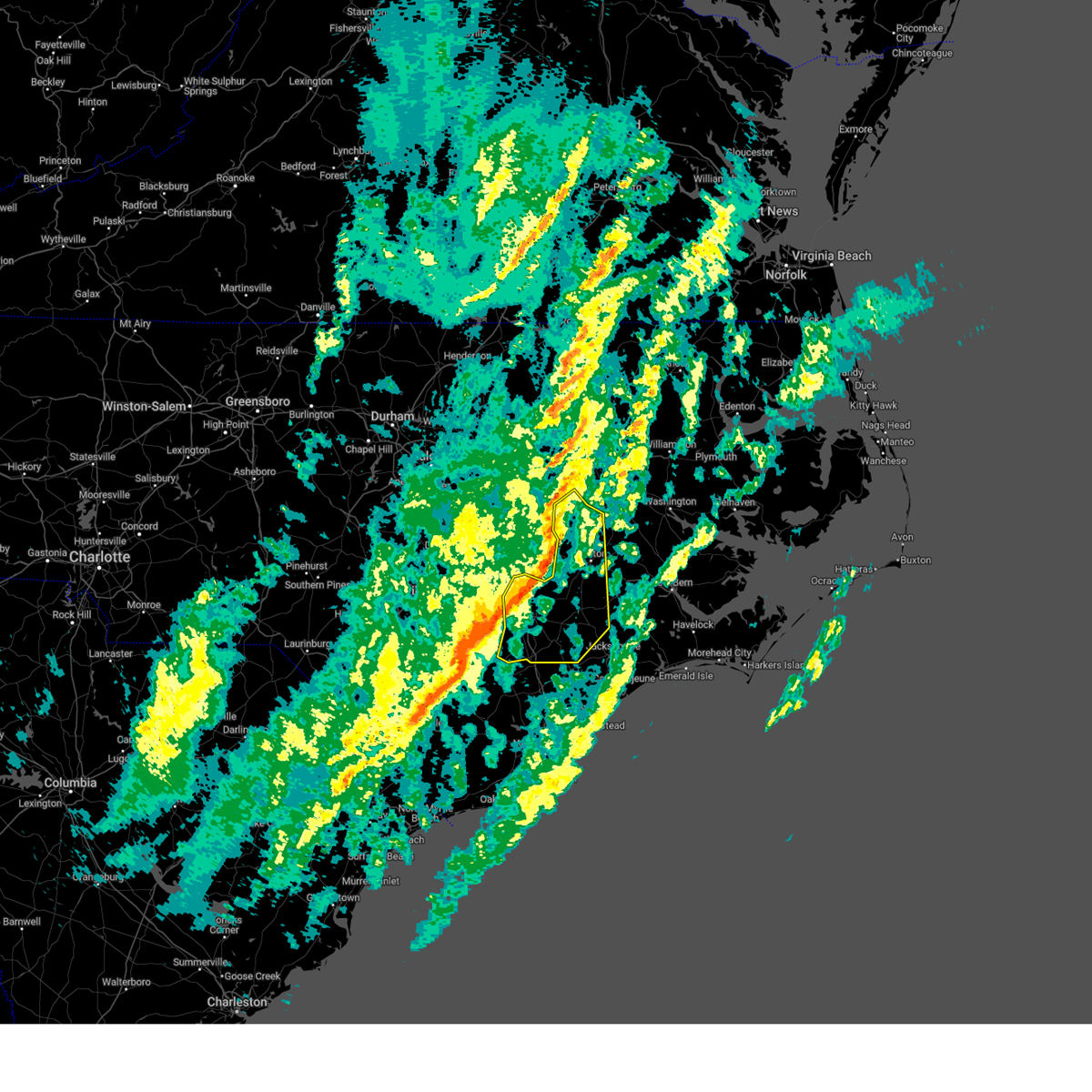
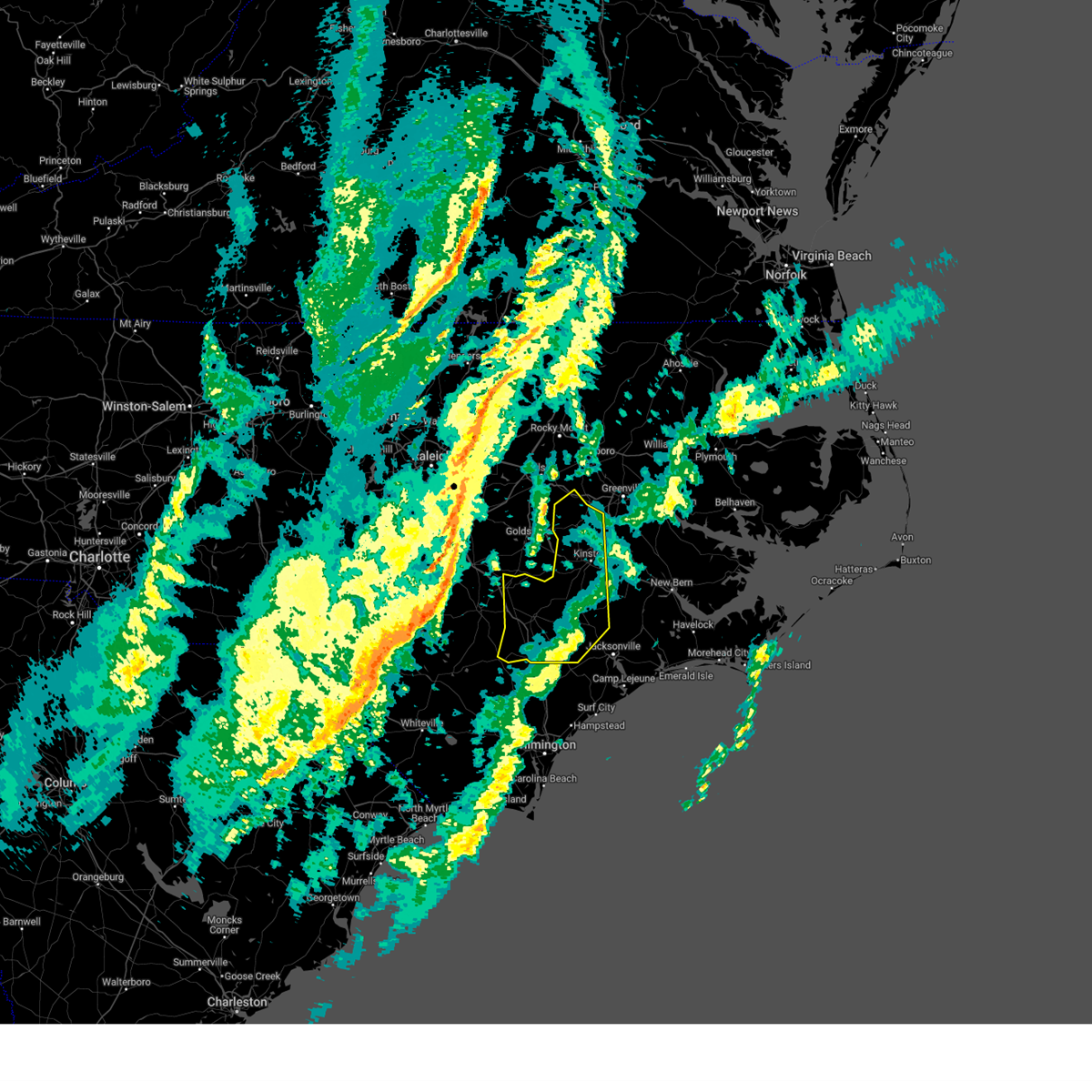
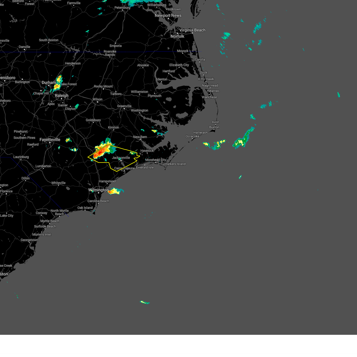
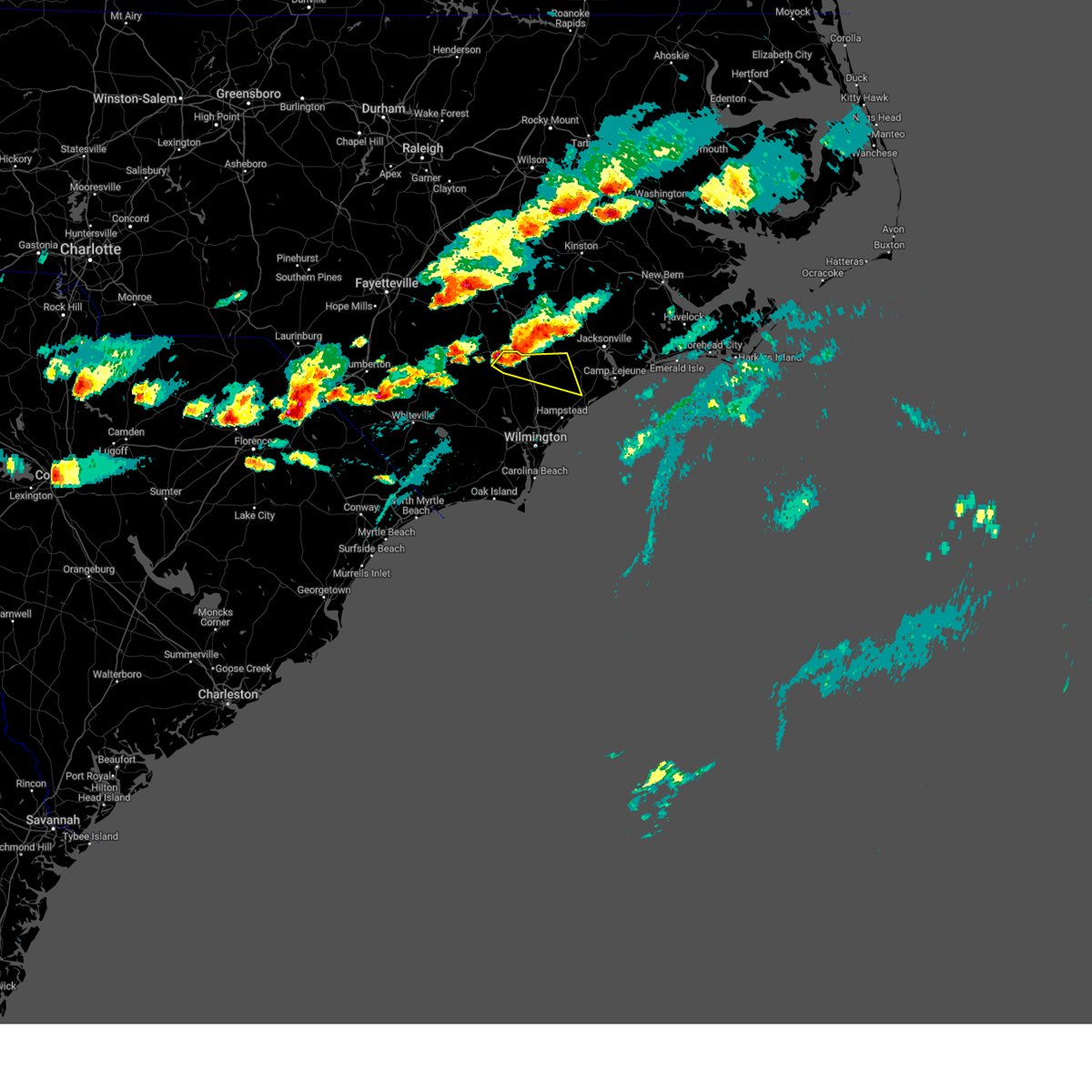
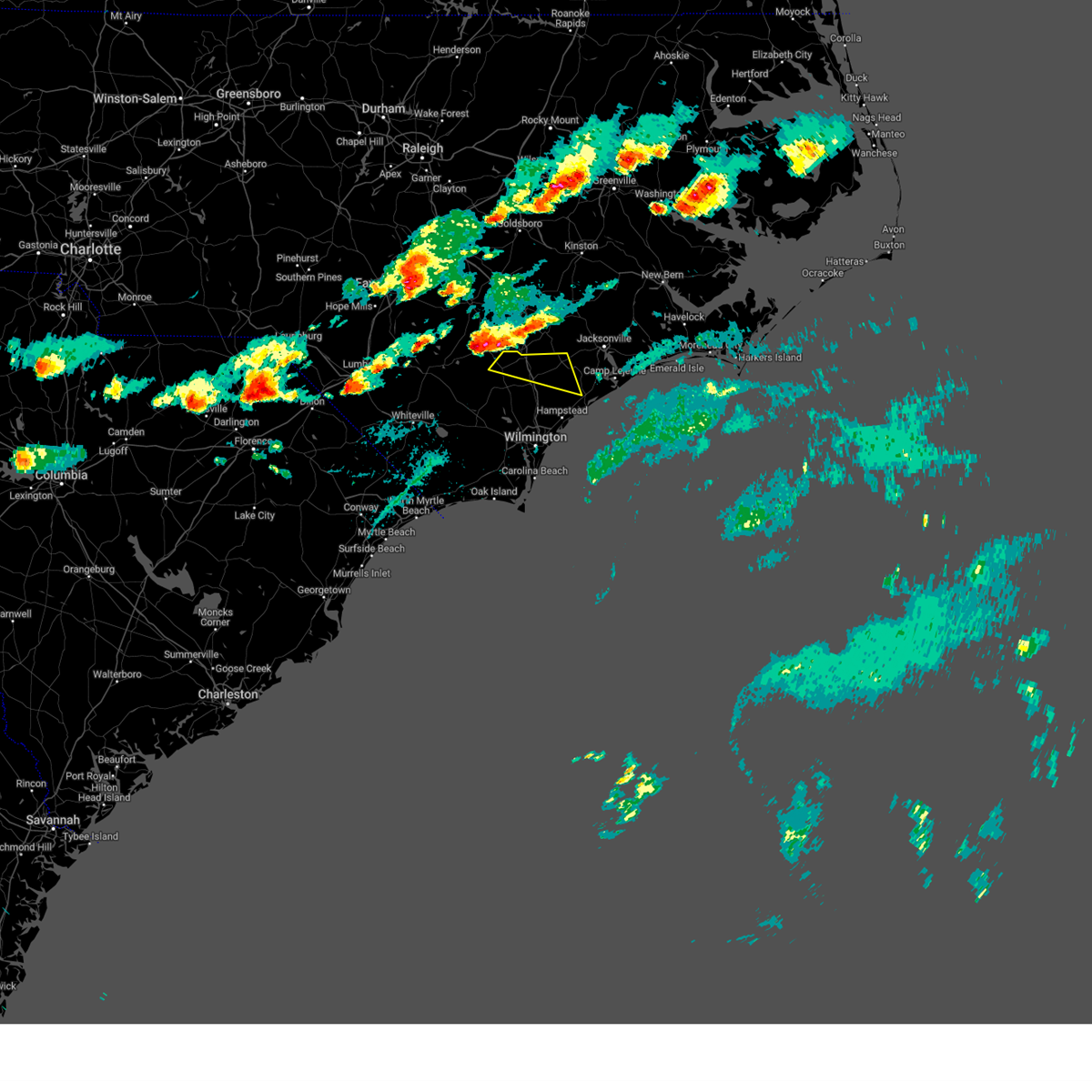
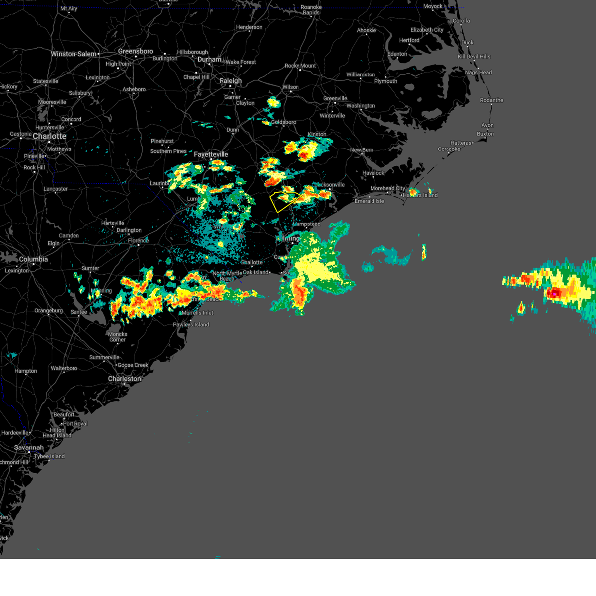
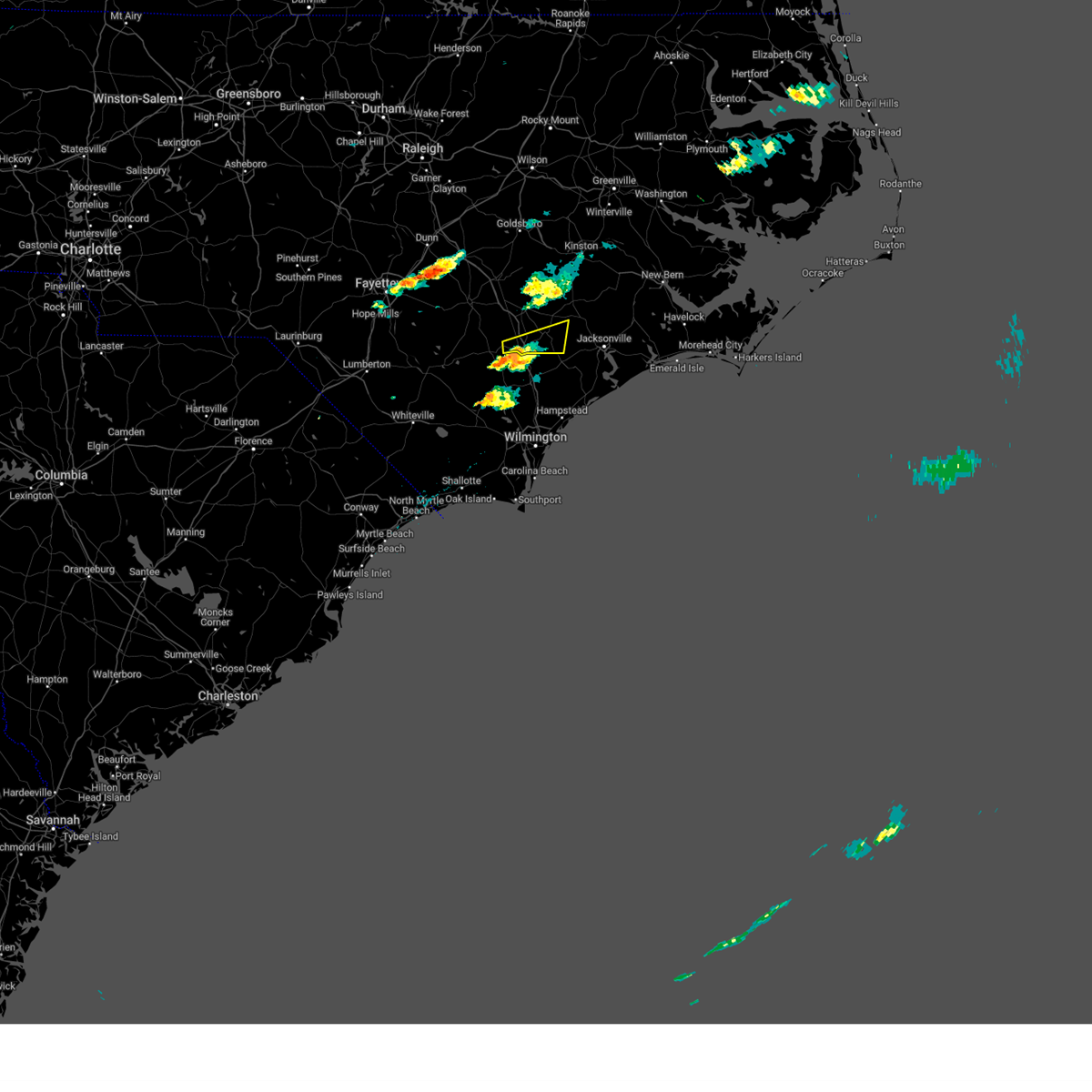
Hail Map for Wallace, NC
The Wallace, NC area has had 2 reports of on-the-ground hail by trained spotters, and has been under severe weather warnings 30 times during the past 12 months. Doppler radar has detected hail at or near Wallace, NC on 51 occasions, including 4 occasions during the past year.
| Name: | Wallace, NC |
| Where Located: | 35 miles N of Wilmington, NC |
| Map: | Google Map for Wallace, NC |
| Population: | 3880 |
| Housing Units: | 1815 |
| More Info: | Search Google for Wallace, NC |
2
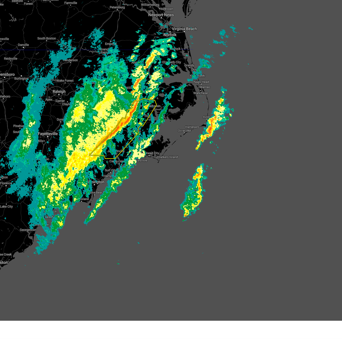
The Top Recent Hail Date for Wallace, NC is Wednesday, May 14, 2025 (6th out of 51)

Hail and Wind Damage Spotted near Wallace, NC
| Date / Time | Report Details |
|---|---|
| 6/10/2025 2:02 PM EDT |
 Svrmhx the national weather service in newport has issued a * severe thunderstorm warning for, jones county in eastern north carolina, southwestern craven county in eastern north carolina, onslow county in eastern north carolina, southeastern duplin county in eastern north carolina, southwestern carteret county in eastern north carolina, * until 245 pm edt. * at 201 pm edt, a severe thunderstorm was located over topsail beach, or near surf city, moving northeast at 55 mph (radar indicated). Hazards include 60 mph wind gusts. expect damage to roofs, siding, and trees Svrmhx the national weather service in newport has issued a * severe thunderstorm warning for, jones county in eastern north carolina, southwestern craven county in eastern north carolina, onslow county in eastern north carolina, southeastern duplin county in eastern north carolina, southwestern carteret county in eastern north carolina, * until 245 pm edt. * at 201 pm edt, a severe thunderstorm was located over topsail beach, or near surf city, moving northeast at 55 mph (radar indicated). Hazards include 60 mph wind gusts. expect damage to roofs, siding, and trees
|
| 6/8/2025 2:10 PM EDT |
 Svrmhx the national weather service in newport has issued a * severe thunderstorm warning for, southeastern jones county in eastern north carolina, southeastern craven county in eastern north carolina, onslow county in eastern north carolina, southern duplin county in eastern north carolina, carteret county in eastern north carolina, southern pamlico county in eastern north carolina, * until 330 pm edt. * at 209 pm edt, severe thunderstorms were located along a line extending from near maple hill to ogden, moving east at 55 mph (radar indicated). Hazards include 60 mph wind gusts and quarter size hail. Hail damage to vehicles is expected. Expect wind damage to roofs, siding, and trees. Svrmhx the national weather service in newport has issued a * severe thunderstorm warning for, southeastern jones county in eastern north carolina, southeastern craven county in eastern north carolina, onslow county in eastern north carolina, southern duplin county in eastern north carolina, carteret county in eastern north carolina, southern pamlico county in eastern north carolina, * until 330 pm edt. * at 209 pm edt, severe thunderstorms were located along a line extending from near maple hill to ogden, moving east at 55 mph (radar indicated). Hazards include 60 mph wind gusts and quarter size hail. Hail damage to vehicles is expected. Expect wind damage to roofs, siding, and trees.
|
| 6/8/2025 1:20 PM EDT |
 Svrilm the national weather service in wilmington has issued a * severe thunderstorm warning for, northwestern pender county in southeastern north carolina, eastern bladen county in southeastern north carolina, * until 215 pm edt. * at 120 pm edt, a severe thunderstorm was located over lagoon, or 12 miles east of elizabethtown, moving east at 35 mph (radar indicated). Hazards include 60 mph wind gusts and quarter size hail. Minor hail damage to vehicles is possible. Expect wind damage to trees and power lines. Svrilm the national weather service in wilmington has issued a * severe thunderstorm warning for, northwestern pender county in southeastern north carolina, eastern bladen county in southeastern north carolina, * until 215 pm edt. * at 120 pm edt, a severe thunderstorm was located over lagoon, or 12 miles east of elizabethtown, moving east at 35 mph (radar indicated). Hazards include 60 mph wind gusts and quarter size hail. Minor hail damage to vehicles is possible. Expect wind damage to trees and power lines.
|
| 6/7/2025 5:48 PM EDT |
 At 548 pm edt, severe thunderstorms were located along a line extending from penderlea to near maple hill, moving east at 30 mph (radar indicated). Hazards include 60 mph wind gusts and quarter size hail. Minor hail damage to vehicles is possible. expect wind damage to trees and power lines. Locations impacted include, penderlea, white stocking, murray town, maple hill, willard, and watha. At 548 pm edt, severe thunderstorms were located along a line extending from penderlea to near maple hill, moving east at 30 mph (radar indicated). Hazards include 60 mph wind gusts and quarter size hail. Minor hail damage to vehicles is possible. expect wind damage to trees and power lines. Locations impacted include, penderlea, white stocking, murray town, maple hill, willard, and watha.
|
| 6/7/2025 5:34 PM EDT |
 At 533 pm edt, severe thunderstorms were located along a broken line extending from near harrells to about 5 miles west of maple hill, moving east at 25 mph (radar indicated). Hazards include 60 mph wind gusts. Expect wind damage to trees and power lines. Locations impacted include, penderlea, white stocking, murray town, maple hill, willard, and watha. At 533 pm edt, severe thunderstorms were located along a broken line extending from near harrells to about 5 miles west of maple hill, moving east at 25 mph (radar indicated). Hazards include 60 mph wind gusts. Expect wind damage to trees and power lines. Locations impacted include, penderlea, white stocking, murray town, maple hill, willard, and watha.
|
| 6/7/2025 5:12 PM EDT |
 Svrilm the national weather service in wilmington has issued a * severe thunderstorm warning for, northern pender county in southeastern north carolina, * until 615 pm edt. * at 511 pm edt, severe thunderstorms were located along a line extending from near harrells to wallace, moving east at 30 mph (radar indicated). Hazards include 60 mph wind gusts and penny size hail. expect wind damage to trees and power lines Svrilm the national weather service in wilmington has issued a * severe thunderstorm warning for, northern pender county in southeastern north carolina, * until 615 pm edt. * at 511 pm edt, severe thunderstorms were located along a line extending from near harrells to wallace, moving east at 30 mph (radar indicated). Hazards include 60 mph wind gusts and penny size hail. expect wind damage to trees and power lines
|
| 5/14/2025 6:32 PM EDT |
 At 632 pm edt, severe thunderstorms were located along a line extending from near rose hill to near murray town, moving northeast at 30 mph (radar indicated). Hazards include 60 mph wind gusts and quarter size hail. Hail damage to vehicles is expected. expect wind damage to roofs, siding, and trees. Locations impacted include, jacksonville, wallace, rose hill, richlands, beulaville, cypress creek, catherine lake, chinquapin, potters hill, petersburg, albert j ellis airport, richlands south, greenevers, lyman, haws run, and teachey. At 632 pm edt, severe thunderstorms were located along a line extending from near rose hill to near murray town, moving northeast at 30 mph (radar indicated). Hazards include 60 mph wind gusts and quarter size hail. Hail damage to vehicles is expected. expect wind damage to roofs, siding, and trees. Locations impacted include, jacksonville, wallace, rose hill, richlands, beulaville, cypress creek, catherine lake, chinquapin, potters hill, petersburg, albert j ellis airport, richlands south, greenevers, lyman, haws run, and teachey.
|
| 5/14/2025 6:09 PM EDT |
 Svrmhx the national weather service in newport has issued a * severe thunderstorm warning for, western onslow county in eastern north carolina, duplin county in eastern north carolina, * until 715 pm edt. * at 609 pm edt, severe thunderstorms were located along a line extending from near harrells to near wards corner, moving northeast at 30 mph (radar indicated). Hazards include 60 mph wind gusts and quarter size hail. Hail damage to vehicles is expected. Expect wind damage to roofs, siding, and trees. Svrmhx the national weather service in newport has issued a * severe thunderstorm warning for, western onslow county in eastern north carolina, duplin county in eastern north carolina, * until 715 pm edt. * at 609 pm edt, severe thunderstorms were located along a line extending from near harrells to near wards corner, moving northeast at 30 mph (radar indicated). Hazards include 60 mph wind gusts and quarter size hail. Hail damage to vehicles is expected. Expect wind damage to roofs, siding, and trees.
|
| 5/14/2025 5:20 PM EDT |
 At 520 pm edt, severe thunderstorms were located along a line extending from 7 miles southwest of walnut creek to near harrells, moving east at 40 mph (radar indicated). Hazards include 60 mph wind gusts and quarter size hail. Hail damage to vehicles is expected. expect wind damage to roofs, siding, and trees. Locations impacted include, kinston, wallace, warsaw, la grange, mount olive, kornegay, rose hill, beulaville, deep run, bowdens, beautancus, kenansville, chinquapin, potters hill, institute, albertson, harrells, sarecta, faison, and magnolia. At 520 pm edt, severe thunderstorms were located along a line extending from 7 miles southwest of walnut creek to near harrells, moving east at 40 mph (radar indicated). Hazards include 60 mph wind gusts and quarter size hail. Hail damage to vehicles is expected. expect wind damage to roofs, siding, and trees. Locations impacted include, kinston, wallace, warsaw, la grange, mount olive, kornegay, rose hill, beulaville, deep run, bowdens, beautancus, kenansville, chinquapin, potters hill, institute, albertson, harrells, sarecta, faison, and magnolia.
|
| 5/14/2025 4:24 PM EDT |
 Svrmhx the national weather service in newport has issued a * severe thunderstorm warning for, western lenoir county in eastern north carolina, duplin county in eastern north carolina, * until 545 pm edt. * at 424 pm edt, severe thunderstorms were located along a line extending from 13 miles south of smithfield to 8 miles east of ammon, moving east at 30 mph (radar indicated). Hazards include 60 mph wind gusts and quarter size hail. Hail damage to vehicles is expected. Expect wind damage to roofs, siding, and trees. Svrmhx the national weather service in newport has issued a * severe thunderstorm warning for, western lenoir county in eastern north carolina, duplin county in eastern north carolina, * until 545 pm edt. * at 424 pm edt, severe thunderstorms were located along a line extending from 13 miles south of smithfield to 8 miles east of ammon, moving east at 30 mph (radar indicated). Hazards include 60 mph wind gusts and quarter size hail. Hail damage to vehicles is expected. Expect wind damage to roofs, siding, and trees.
|
| 5/4/2025 3:29 PM EDT |
 The storm which prompted the warning has weakened below severe limits, and no longer poses an immediate threat to life or property. therefore, the warning will be allowed to expire. however, small hail and gusty winds are still possible with this thunderstorm. The storm which prompted the warning has weakened below severe limits, and no longer poses an immediate threat to life or property. therefore, the warning will be allowed to expire. however, small hail and gusty winds are still possible with this thunderstorm.
|
| 5/4/2025 3:16 PM EDT |
 At 316 pm edt, a severe thunderstorm was located near chinquapin, or 9 miles northeast of wallace, moving northeast at 35 mph (radar indicated). Hazards include 60 mph wind gusts and nickel size hail. Expect damage to roofs, siding, and trees. Locations impacted include, wallace, cypress creek, chinquapin, teachey, beulaville, lyman, rose hill, greenevers, and sarecta. At 316 pm edt, a severe thunderstorm was located near chinquapin, or 9 miles northeast of wallace, moving northeast at 35 mph (radar indicated). Hazards include 60 mph wind gusts and nickel size hail. Expect damage to roofs, siding, and trees. Locations impacted include, wallace, cypress creek, chinquapin, teachey, beulaville, lyman, rose hill, greenevers, and sarecta.
|
| 5/4/2025 3:03 PM EDT |
 At 303 pm edt, a severe thunderstorm was located over wallace, moving northeast at 30 mph (radar indicated). Hazards include 60 mph wind gusts and quarter size hail. Hail damage to vehicles is expected. expect wind damage to roofs, siding, and trees. Locations impacted include, wallace, cypress creek, chinquapin, teachey, beulaville, lyman, rose hill, greenevers, sarecta, and harrells. At 303 pm edt, a severe thunderstorm was located over wallace, moving northeast at 30 mph (radar indicated). Hazards include 60 mph wind gusts and quarter size hail. Hail damage to vehicles is expected. expect wind damage to roofs, siding, and trees. Locations impacted include, wallace, cypress creek, chinquapin, teachey, beulaville, lyman, rose hill, greenevers, sarecta, and harrells.
|
| 5/4/2025 2:45 PM EDT |
 Svrmhx the national weather service in newport has issued a * severe thunderstorm warning for, southern duplin county in eastern north carolina, * until 330 pm edt. * at 245 pm edt, a severe thunderstorm was located near harrells, or 10 miles southwest of wallace, moving northeast at 25 mph (radar indicated). Hazards include 60 mph wind gusts and quarter size hail. Hail damage to vehicles is expected. Expect wind damage to roofs, siding, and trees. Svrmhx the national weather service in newport has issued a * severe thunderstorm warning for, southern duplin county in eastern north carolina, * until 330 pm edt. * at 245 pm edt, a severe thunderstorm was located near harrells, or 10 miles southwest of wallace, moving northeast at 25 mph (radar indicated). Hazards include 60 mph wind gusts and quarter size hail. Hail damage to vehicles is expected. Expect wind damage to roofs, siding, and trees.
|
| 4/26/2025 9:41 PM EDT |
 The storm which prompted the warning has weakened below severe limits, and no longer poses an immediate threat to life or property. therefore, the warning will be allowed to expire. to report severe weather, contact your nearest law enforcement agency. they will relay your report to the national weather service newport. The storm which prompted the warning has weakened below severe limits, and no longer poses an immediate threat to life or property. therefore, the warning will be allowed to expire. to report severe weather, contact your nearest law enforcement agency. they will relay your report to the national weather service newport.
|
| 4/26/2025 9:17 PM EDT |
 At 917 pm edt, a severe thunderstorm was located near rose hill, or 7 miles south of warsaw, moving southeast at 20 mph (radar indicated). Hazards include 60 mph wind gusts and quarter size hail. Hail damage to vehicles is expected. expect wind damage to roofs, siding, and trees. Locations impacted include, rose hill, teachey, magnolia, greenevers, kenansville, and wallace. At 917 pm edt, a severe thunderstorm was located near rose hill, or 7 miles south of warsaw, moving southeast at 20 mph (radar indicated). Hazards include 60 mph wind gusts and quarter size hail. Hail damage to vehicles is expected. expect wind damage to roofs, siding, and trees. Locations impacted include, rose hill, teachey, magnolia, greenevers, kenansville, and wallace.
|
| 4/26/2025 8:58 PM EDT |
 Svrmhx the national weather service in newport has issued a * severe thunderstorm warning for, southwestern duplin county in eastern north carolina, * until 945 pm edt. * at 858 pm edt, a severe thunderstorm was located near warsaw, moving southeast at 20 mph (radar indicated). Hazards include 60 mph wind gusts and quarter size hail. Hail damage to vehicles is expected. Expect wind damage to roofs, siding, and trees. Svrmhx the national weather service in newport has issued a * severe thunderstorm warning for, southwestern duplin county in eastern north carolina, * until 945 pm edt. * at 858 pm edt, a severe thunderstorm was located near warsaw, moving southeast at 20 mph (radar indicated). Hazards include 60 mph wind gusts and quarter size hail. Hail damage to vehicles is expected. Expect wind damage to roofs, siding, and trees.
|
| 3/16/2025 7:54 PM EDT |
 The storm which prompted the warning has weakened below severe limits, and has exited the warned area. therefore, the warning will be allowed to expire. please send your reports of hail and/or wind damage, including trees or large limbs downed, by calling the national weather service office in wilmington at 1-800-697-3901. The storm which prompted the warning has weakened below severe limits, and has exited the warned area. therefore, the warning will be allowed to expire. please send your reports of hail and/or wind damage, including trees or large limbs downed, by calling the national weather service office in wilmington at 1-800-697-3901.
|
| 3/16/2025 7:44 PM EDT |
 Svrmhx the national weather service in newport has issued a * severe thunderstorm warning for, west central jones county in eastern north carolina, south central lenoir county in eastern north carolina, northwestern onslow county in eastern north carolina, southeastern duplin county in eastern north carolina, * until 830 pm edt. * at 743 pm edt, a severe thunderstorm was located near willard, or near wallace, moving northeast at 45 mph (radar indicated). Hazards include 60 mph wind gusts. expect damage to roofs, siding, and trees Svrmhx the national weather service in newport has issued a * severe thunderstorm warning for, west central jones county in eastern north carolina, south central lenoir county in eastern north carolina, northwestern onslow county in eastern north carolina, southeastern duplin county in eastern north carolina, * until 830 pm edt. * at 743 pm edt, a severe thunderstorm was located near willard, or near wallace, moving northeast at 45 mph (radar indicated). Hazards include 60 mph wind gusts. expect damage to roofs, siding, and trees
|
| 3/16/2025 7:37 PM EDT |
 At 737 pm edt, a severe thunderstorm capable of producing a tornado was located near murray town, or near burgaw, moving northeast at 45 mph (radar indicated rotation). Hazards include tornado. Flying debris will be dangerous to those caught without shelter. mobile homes will be damaged or destroyed. damage to roofs, windows, and vehicles will occur. tree damage is likely. This tornadic thunderstorm will remain over mainly rural areas of north central pender county, including the following locations, watha. At 737 pm edt, a severe thunderstorm capable of producing a tornado was located near murray town, or near burgaw, moving northeast at 45 mph (radar indicated rotation). Hazards include tornado. Flying debris will be dangerous to those caught without shelter. mobile homes will be damaged or destroyed. damage to roofs, windows, and vehicles will occur. tree damage is likely. This tornadic thunderstorm will remain over mainly rural areas of north central pender county, including the following locations, watha.
|
| 3/16/2025 7:30 PM EDT |
 At 730 pm edt, a severe thunderstorm capable of producing a tornado was located near malpass corner, or near burgaw, moving northeast at 40 mph (radar indicated rotation). Hazards include tornado. Flying debris will be dangerous to those caught without shelter. mobile homes will be damaged or destroyed. damage to roofs, windows, and vehicles will occur. tree damage is likely. this dangerous storm will be near, burgaw and murray town around 735 pm edt. other locations impacted by this tornadic thunderstorm include watha, pender memorial hospital, and st. Helena. At 730 pm edt, a severe thunderstorm capable of producing a tornado was located near malpass corner, or near burgaw, moving northeast at 40 mph (radar indicated rotation). Hazards include tornado. Flying debris will be dangerous to those caught without shelter. mobile homes will be damaged or destroyed. damage to roofs, windows, and vehicles will occur. tree damage is likely. this dangerous storm will be near, burgaw and murray town around 735 pm edt. other locations impacted by this tornadic thunderstorm include watha, pender memorial hospital, and st. Helena.
|
| 3/16/2025 7:24 PM EDT |
 Torilm the national weather service in wilmington has issued a * tornado warning for, western pender county in southeastern north carolina, * until 800 pm edt. * at 723 pm edt, a severe thunderstorm capable of producing a tornado was located over malpass corner, or 8 miles southwest of burgaw, moving northeast at 45 mph (radar indicated rotation). Hazards include tornado. Flying debris will be dangerous to those caught without shelter. mobile homes will be damaged or destroyed. damage to roofs, windows, and vehicles will occur. tree damage is likely. this dangerous storm will be near, burgaw around 730 pm edt. murray town around 735 pm edt. other locations impacted by this tornadic thunderstorm include watha, pender memorial hospital, and st. helena. This includes interstate 40 between mile markers 388 and 402. Torilm the national weather service in wilmington has issued a * tornado warning for, western pender county in southeastern north carolina, * until 800 pm edt. * at 723 pm edt, a severe thunderstorm capable of producing a tornado was located over malpass corner, or 8 miles southwest of burgaw, moving northeast at 45 mph (radar indicated rotation). Hazards include tornado. Flying debris will be dangerous to those caught without shelter. mobile homes will be damaged or destroyed. damage to roofs, windows, and vehicles will occur. tree damage is likely. this dangerous storm will be near, burgaw around 730 pm edt. murray town around 735 pm edt. other locations impacted by this tornadic thunderstorm include watha, pender memorial hospital, and st. helena. This includes interstate 40 between mile markers 388 and 402.
|
| 3/5/2025 3:04 PM EST |
 At 304 pm est, severe thunderstorms were located along a line extending from near wyse fork to topsail, moving northeast at 80 mph (radar indicated). Hazards include 70 mph wind gusts. Expect considerable tree damage. damage is likely to mobile homes, roofs, and outbuildings. Locations impacted include, belgrade, new river station, albert j ellis airport, hargetts crossroads, haws run, hubert, deppe, pumpkin center, richlands, loco vfd, kornegay, piney green, pink hill, sneads ferry, potters hill, petersburg, hammocks beach, phillips crossroads, albertson, and hammocks beach state park. At 304 pm est, severe thunderstorms were located along a line extending from near wyse fork to topsail, moving northeast at 80 mph (radar indicated). Hazards include 70 mph wind gusts. Expect considerable tree damage. damage is likely to mobile homes, roofs, and outbuildings. Locations impacted include, belgrade, new river station, albert j ellis airport, hargetts crossroads, haws run, hubert, deppe, pumpkin center, richlands, loco vfd, kornegay, piney green, pink hill, sneads ferry, potters hill, petersburg, hammocks beach, phillips crossroads, albertson, and hammocks beach state park.
|
| 3/5/2025 2:42 PM EST |
 Svrmhx the national weather service in newport has issued a * severe thunderstorm warning for, jones county in eastern north carolina, southwestern lenoir county in eastern north carolina, onslow county in eastern north carolina, duplin county in eastern north carolina, * until 345 pm est. * at 242 pm est, severe thunderstorms were located along a line extending from near kenansville to near mill creek, moving northeast at 80 mph (radar indicated). Hazards include 70 mph wind gusts. Expect considerable tree damage. Damage is likely to mobile homes, roofs, and outbuildings. Svrmhx the national weather service in newport has issued a * severe thunderstorm warning for, jones county in eastern north carolina, southwestern lenoir county in eastern north carolina, onslow county in eastern north carolina, duplin county in eastern north carolina, * until 345 pm est. * at 242 pm est, severe thunderstorms were located along a line extending from near kenansville to near mill creek, moving northeast at 80 mph (radar indicated). Hazards include 70 mph wind gusts. Expect considerable tree damage. Damage is likely to mobile homes, roofs, and outbuildings.
|
| 3/5/2025 2:06 PM EST |
 Svrmhx the national weather service in newport has issued a * severe thunderstorm warning for, lenoir county in eastern north carolina, duplin county in eastern north carolina, * until 245 pm est. * at 205 pm est, severe thunderstorms were located along a line extending from clinton to near lagoon, moving northeast at 75 mph (radar indicated). Hazards include 70 mph wind gusts. Expect considerable tree damage. Damage is likely to mobile homes, roofs, and outbuildings. Svrmhx the national weather service in newport has issued a * severe thunderstorm warning for, lenoir county in eastern north carolina, duplin county in eastern north carolina, * until 245 pm est. * at 205 pm est, severe thunderstorms were located along a line extending from clinton to near lagoon, moving northeast at 75 mph (radar indicated). Hazards include 70 mph wind gusts. Expect considerable tree damage. Damage is likely to mobile homes, roofs, and outbuildings.
|
| 2/16/2025 11:06 AM EST |
 At 1105 am est, severe thunderstorms were located along a line extending from near old ford to 6 miles south of fort barnwell to near willard, moving east at 45 mph (trained weather spotters). Hazards include 60 mph wind gusts. Expect damage to roofs, siding, and trees. Locations impacted include, jacksonville, new bern, washington, wallace, pumpkin center, new river station, river road, half moon, james city, trent woods, river bend, phillips crossroads, belhaven, richlands, ransomville, pinetown, pungo, blounts creek, maysville, and vanceboro. At 1105 am est, severe thunderstorms were located along a line extending from near old ford to 6 miles south of fort barnwell to near willard, moving east at 45 mph (trained weather spotters). Hazards include 60 mph wind gusts. Expect damage to roofs, siding, and trees. Locations impacted include, jacksonville, new bern, washington, wallace, pumpkin center, new river station, river road, half moon, james city, trent woods, river bend, phillips crossroads, belhaven, richlands, ransomville, pinetown, pungo, blounts creek, maysville, and vanceboro.
|
| 2/16/2025 11:06 AM EST |
 the severe thunderstorm warning has been cancelled and is no longer in effect the severe thunderstorm warning has been cancelled and is no longer in effect
|
| 2/16/2025 10:44 AM EST |
 Svrmhx the national weather service in newport has issued a * severe thunderstorm warning for, jones county in eastern north carolina, central lenoir county in eastern north carolina, craven county in eastern north carolina, central pitt county in eastern north carolina, northern onslow county in eastern north carolina, beaufort county in eastern north carolina, southern duplin county in eastern north carolina, * until 1130 am est. * at 1043 am est, severe thunderstorms were located along a line extending from dowdy ficklen stadium to near deep run to near harrells, moving east at 50 mph (trained weather spotters). Hazards include 60 mph wind gusts. expect damage to roofs, siding, and trees Svrmhx the national weather service in newport has issued a * severe thunderstorm warning for, jones county in eastern north carolina, central lenoir county in eastern north carolina, craven county in eastern north carolina, central pitt county in eastern north carolina, northern onslow county in eastern north carolina, beaufort county in eastern north carolina, southern duplin county in eastern north carolina, * until 1130 am est. * at 1043 am est, severe thunderstorms were located along a line extending from dowdy ficklen stadium to near deep run to near harrells, moving east at 50 mph (trained weather spotters). Hazards include 60 mph wind gusts. expect damage to roofs, siding, and trees
|
| 2/16/2025 10:26 AM EST |
 At 1025 am est, severe thunderstorms were located along a line extending from near snow hill to near kornegay to 6 miles northwest of harrells, moving east at 65 mph (radar indicated). Hazards include 60 mph wind gusts. Expect damage to roofs, siding, and trees. Locations impacted include, kinston, wallace, warsaw, la grange, mount olive, kornegay, rose hill, snow hill, richlands, beulaville, deep run, bowdens, cypress creek, beautancus, comfort, kenansville, chinquapin, dawson, potters hill, and graingers. At 1025 am est, severe thunderstorms were located along a line extending from near snow hill to near kornegay to 6 miles northwest of harrells, moving east at 65 mph (radar indicated). Hazards include 60 mph wind gusts. Expect damage to roofs, siding, and trees. Locations impacted include, kinston, wallace, warsaw, la grange, mount olive, kornegay, rose hill, snow hill, richlands, beulaville, deep run, bowdens, cypress creek, beautancus, comfort, kenansville, chinquapin, dawson, potters hill, and graingers.
|
| 2/16/2025 9:41 AM EST |
 Svrmhx the national weather service in newport has issued a * severe thunderstorm warning for, northwestern jones county in eastern north carolina, greene county in eastern north carolina, lenoir county in eastern north carolina, northwestern onslow county in eastern north carolina, duplin county in eastern north carolina, * until 1045 am est. * at 940 am est, severe thunderstorms were located along a line extending from 6 miles southeast of benson to near jerome to near fairmont, moving east at 55 mph (radar indicated). Hazards include 60 mph wind gusts. expect damage to roofs, siding, and trees Svrmhx the national weather service in newport has issued a * severe thunderstorm warning for, northwestern jones county in eastern north carolina, greene county in eastern north carolina, lenoir county in eastern north carolina, northwestern onslow county in eastern north carolina, duplin county in eastern north carolina, * until 1045 am est. * at 940 am est, severe thunderstorms were located along a line extending from 6 miles southeast of benson to near jerome to near fairmont, moving east at 55 mph (radar indicated). Hazards include 60 mph wind gusts. expect damage to roofs, siding, and trees
|
| 5/24/2024 4:31 PM EDT |
 Svrmhx the national weather service in newport has issued a * severe thunderstorm warning for, southern jones county in eastern north carolina, onslow county in eastern north carolina, southern duplin county in eastern north carolina, * until 530 pm edt. * at 430 pm edt, severe thunderstorms were located along a line extending from near potters hill to near wallace, moving east at 25 mph (radar indicated). Hazards include golf ball size hail and 60 mph wind gusts. People and animals outdoors will be injured. expect hail damage to roofs, siding, windows, and vehicles. Expect wind damage to roofs, siding, and trees. Svrmhx the national weather service in newport has issued a * severe thunderstorm warning for, southern jones county in eastern north carolina, onslow county in eastern north carolina, southern duplin county in eastern north carolina, * until 530 pm edt. * at 430 pm edt, severe thunderstorms were located along a line extending from near potters hill to near wallace, moving east at 25 mph (radar indicated). Hazards include golf ball size hail and 60 mph wind gusts. People and animals outdoors will be injured. expect hail damage to roofs, siding, windows, and vehicles. Expect wind damage to roofs, siding, and trees.
|
| 5/15/2024 6:13 PM EDT |
 the severe thunderstorm warning has been cancelled and is no longer in effect the severe thunderstorm warning has been cancelled and is no longer in effect
|
| 5/15/2024 6:05 PM EDT |
 At 604 pm edt, a severe thunderstorm was located 7 miles west of rose hill, or 11 miles northwest of wallace, moving southeast at 25 mph (radar indicated). Hazards include 60 mph wind gusts and quarter size hail. Hail damage to vehicles is expected. expect wind damage to roofs, siding, and trees. Locations impacted include, wallace, rose hill, harrells, and teachey. At 604 pm edt, a severe thunderstorm was located 7 miles west of rose hill, or 11 miles northwest of wallace, moving southeast at 25 mph (radar indicated). Hazards include 60 mph wind gusts and quarter size hail. Hail damage to vehicles is expected. expect wind damage to roofs, siding, and trees. Locations impacted include, wallace, rose hill, harrells, and teachey.
|
| 5/15/2024 5:34 PM EDT |
 Svrmhx the national weather service in newport has issued a * severe thunderstorm warning for, southern duplin county in eastern north carolina, * until 645 pm edt. * at 533 pm edt, a severe thunderstorm was located near clinton, moving southeast at 20 mph (radar indicated). Hazards include golf ball size hail and 70 mph wind gusts. People and animals outdoors will be injured. expect hail damage to roofs, siding, windows, and vehicles. expect considerable tree damage. Wind damage is also likely to mobile homes, roofs, and outbuildings. Svrmhx the national weather service in newport has issued a * severe thunderstorm warning for, southern duplin county in eastern north carolina, * until 645 pm edt. * at 533 pm edt, a severe thunderstorm was located near clinton, moving southeast at 20 mph (radar indicated). Hazards include golf ball size hail and 70 mph wind gusts. People and animals outdoors will be injured. expect hail damage to roofs, siding, windows, and vehicles. expect considerable tree damage. Wind damage is also likely to mobile homes, roofs, and outbuildings.
|
| 5/10/2024 5:00 PM EDT |
 At 500 pm edt, severe thunderstorms were located along a line extending from near willard to near harrells, moving southeast at 35 mph (radar indicated). Hazards include 60 mph wind gusts and quarter size hail. Minor hail damage to vehicles is possible. expect wind damage to trees and power lines. these severe storms will be near, willard and penderlea around 505 pm edt. murray town and maple hill around 510 pm edt. white stocking around 515 pm edt. Other locations impacted by these severe thunderstorms include watha. At 500 pm edt, severe thunderstorms were located along a line extending from near willard to near harrells, moving southeast at 35 mph (radar indicated). Hazards include 60 mph wind gusts and quarter size hail. Minor hail damage to vehicles is possible. expect wind damage to trees and power lines. these severe storms will be near, willard and penderlea around 505 pm edt. murray town and maple hill around 510 pm edt. white stocking around 515 pm edt. Other locations impacted by these severe thunderstorms include watha.
|
| 5/10/2024 4:36 PM EDT |
 Svrilm the national weather service in wilmington has issued a * severe thunderstorm warning for, northern pender county in southeastern north carolina, * until 530 pm edt. * at 436 pm edt, a severe thunderstorm was located over harrells, or 12 miles west of wallace, moving east at 35 mph (radar indicated). Hazards include 60 mph wind gusts and quarter size hail. Minor hail damage to vehicles is possible. expect wind damage to trees and power lines. this severe thunderstorm will be near, penderlea around 450 pm edt. willard around 455 pm edt. maple hill around 520 pm edt. Other locations impacted by this severe thunderstorm include watha. Svrilm the national weather service in wilmington has issued a * severe thunderstorm warning for, northern pender county in southeastern north carolina, * until 530 pm edt. * at 436 pm edt, a severe thunderstorm was located over harrells, or 12 miles west of wallace, moving east at 35 mph (radar indicated). Hazards include 60 mph wind gusts and quarter size hail. Minor hail damage to vehicles is possible. expect wind damage to trees and power lines. this severe thunderstorm will be near, penderlea around 450 pm edt. willard around 455 pm edt. maple hill around 520 pm edt. Other locations impacted by this severe thunderstorm include watha.
|
| 5/10/2024 4:25 PM EDT |
 Svrmhx the national weather service in newport has issued a * severe thunderstorm warning for, southern duplin county in eastern north carolina, * until 515 pm edt. * at 425 pm edt, a severe thunderstorm was located 7 miles west of harrells, or 16 miles south of clinton, moving east at 35 mph (radar indicated). Hazards include 60 mph wind gusts and quarter size hail. Hail damage to vehicles is expected. Expect wind damage to roofs, siding, and trees. Svrmhx the national weather service in newport has issued a * severe thunderstorm warning for, southern duplin county in eastern north carolina, * until 515 pm edt. * at 425 pm edt, a severe thunderstorm was located 7 miles west of harrells, or 16 miles south of clinton, moving east at 35 mph (radar indicated). Hazards include 60 mph wind gusts and quarter size hail. Hail damage to vehicles is expected. Expect wind damage to roofs, siding, and trees.
|
| 5/8/2024 7:50 PM EDT |
 At 750 pm edt, a severe thunderstorm was located near chinquapin, or 9 miles northeast of wallace, moving east at 30 mph (radar indicated). Hazards include 60 mph wind gusts and quarter size hail. Hail damage to vehicles is expected. expect wind damage to roofs, siding, and trees. Locations impacted include, wallace, rose hill, beulaville, cypress creek, kenansville, chinquapin, harrells, magnolia, greenevers, lyman, and teachey. At 750 pm edt, a severe thunderstorm was located near chinquapin, or 9 miles northeast of wallace, moving east at 30 mph (radar indicated). Hazards include 60 mph wind gusts and quarter size hail. Hail damage to vehicles is expected. expect wind damage to roofs, siding, and trees. Locations impacted include, wallace, rose hill, beulaville, cypress creek, kenansville, chinquapin, harrells, magnolia, greenevers, lyman, and teachey.
|
| 5/8/2024 7:29 PM EDT |
 Svrmhx the national weather service in newport has issued a * severe thunderstorm warning for, southern duplin county in eastern north carolina, * until 815 pm edt. * at 728 pm edt, a severe thunderstorm was located near warsaw, moving east at 25 mph (radar indicated). Hazards include 60 mph wind gusts and quarter size hail. Hail damage to vehicles is expected. Expect wind damage to roofs, siding, and trees. Svrmhx the national weather service in newport has issued a * severe thunderstorm warning for, southern duplin county in eastern north carolina, * until 815 pm edt. * at 728 pm edt, a severe thunderstorm was located near warsaw, moving east at 25 mph (radar indicated). Hazards include 60 mph wind gusts and quarter size hail. Hail damage to vehicles is expected. Expect wind damage to roofs, siding, and trees.
|
| 4/21/2024 12:35 AM EDT |
 The storm has weakened below severe limits, and no longer poses an immediate threat to life or property. please send your reports of hail and/or wind damage, including trees or large limbs downed, by calling the national weather service office in wilmington at 1-800-697-3901. The storm has weakened below severe limits, and no longer poses an immediate threat to life or property. please send your reports of hail and/or wind damage, including trees or large limbs downed, by calling the national weather service office in wilmington at 1-800-697-3901.
|
| 4/21/2024 12:29 AM EDT |
 At 1229 am edt, a severe thunderstorm was located over willard, or near wallace, moving southeast at 20 mph (radar indicated). Hazards include 60 mph wind gusts and quarter size hail. Minor hail damage to vehicles is possible. expect wind damage to trees and power lines. Locations impacted include, penderlea, willard, and watha. At 1229 am edt, a severe thunderstorm was located over willard, or near wallace, moving southeast at 20 mph (radar indicated). Hazards include 60 mph wind gusts and quarter size hail. Minor hail damage to vehicles is possible. expect wind damage to trees and power lines. Locations impacted include, penderlea, willard, and watha.
|
| 4/21/2024 12:25 AM EDT |
 The storm which prompted the warning has moved out of the area. therefore, the warning will be allowed to expire. The storm which prompted the warning has moved out of the area. therefore, the warning will be allowed to expire.
|
| 4/21/2024 12:16 AM EDT |
 At 1216 am edt, a severe thunderstorm was located near wallace, moving southeast at 20 mph (radar indicated). Hazards include 60 mph wind gusts and half dollar size hail. Minor hail damage to vehicles is possible. expect wind damage to trees and power lines. Locations impacted include, penderlea, wards corner, willard, and watha. At 1216 am edt, a severe thunderstorm was located near wallace, moving southeast at 20 mph (radar indicated). Hazards include 60 mph wind gusts and half dollar size hail. Minor hail damage to vehicles is possible. expect wind damage to trees and power lines. Locations impacted include, penderlea, wards corner, willard, and watha.
|
| 4/21/2024 12:09 AM EDT |
 At 1208 am edt, a severe thunderstorm was located near rose hill, or near wallace, moving southeast at 20 mph (radar indicated). Hazards include two inch hail and 60 mph wind gusts. People and animals outdoors will be injured. expect hail damage to roofs, siding, windows, and vehicles. expect wind damage to roofs, siding, and trees. Locations impacted include, wallace, harrells, and teachey. At 1208 am edt, a severe thunderstorm was located near rose hill, or near wallace, moving southeast at 20 mph (radar indicated). Hazards include two inch hail and 60 mph wind gusts. People and animals outdoors will be injured. expect hail damage to roofs, siding, windows, and vehicles. expect wind damage to roofs, siding, and trees. Locations impacted include, wallace, harrells, and teachey.
|
| 4/21/2024 12:05 AM EDT |
 Svrilm the national weather service in wilmington has issued a * severe thunderstorm warning for, northwestern pender county in southeastern north carolina, * until 1245 am edt. * at 1205 am edt, a severe thunderstorm was located near harrells, or 7 miles west of wallace, moving southeast at 20 mph (radar indicated). Hazards include 60 mph wind gusts and half dollar size hail. Minor hail damage to vehicles is possible. Expect wind damage to trees and power lines. Svrilm the national weather service in wilmington has issued a * severe thunderstorm warning for, northwestern pender county in southeastern north carolina, * until 1245 am edt. * at 1205 am edt, a severe thunderstorm was located near harrells, or 7 miles west of wallace, moving southeast at 20 mph (radar indicated). Hazards include 60 mph wind gusts and half dollar size hail. Minor hail damage to vehicles is possible. Expect wind damage to trees and power lines.
|
| 4/20/2024 11:58 PM EDT |
 At 1158 pm edt, a severe thunderstorm was located near harrells, or 10 miles west of wallace, moving southeast at 20 mph (radar indicated). Hazards include ping pong ball size hail and 60 mph wind gusts. People and animals outdoors will be injured. expect hail damage to roofs, siding, windows, and vehicles. expect wind damage to roofs, siding, and trees. Locations impacted include, wallace, rose hill, harrells, greenevers, and teachey. At 1158 pm edt, a severe thunderstorm was located near harrells, or 10 miles west of wallace, moving southeast at 20 mph (radar indicated). Hazards include ping pong ball size hail and 60 mph wind gusts. People and animals outdoors will be injured. expect hail damage to roofs, siding, windows, and vehicles. expect wind damage to roofs, siding, and trees. Locations impacted include, wallace, rose hill, harrells, greenevers, and teachey.
|
| 4/20/2024 11:42 PM EDT |
 Svrmhx the national weather service in newport has issued a * severe thunderstorm warning for, southwestern duplin county in eastern north carolina, * until 1230 am edt. * at 1142 pm edt, a severe thunderstorm was located 7 miles north of harrells, or 12 miles southeast of clinton, moving southeast at 20 mph (radar indicated). Hazards include two inch hail and 60 mph wind gusts. People and animals outdoors will be injured. expect hail damage to roofs, siding, windows, and vehicles. Expect wind damage to roofs, siding, and trees. Svrmhx the national weather service in newport has issued a * severe thunderstorm warning for, southwestern duplin county in eastern north carolina, * until 1230 am edt. * at 1142 pm edt, a severe thunderstorm was located 7 miles north of harrells, or 12 miles southeast of clinton, moving southeast at 20 mph (radar indicated). Hazards include two inch hail and 60 mph wind gusts. People and animals outdoors will be injured. expect hail damage to roofs, siding, windows, and vehicles. Expect wind damage to roofs, siding, and trees.
|
| 4/20/2024 5:15 PM EDT |
 Svrilm the national weather service in wilmington has issued a * severe thunderstorm warning for, northwestern pender county in southeastern north carolina, southeastern robeson county in southeastern north carolina, bladen county in southeastern north carolina, northwestern columbus county in southeastern north carolina, * until 630 pm edt. * at 513 pm edt, severe thunderstorms were located along a line extending from ammon to lumberton, moving southeast at 30 mph (public. golf ball size hail was recently reported near pembroke). Hazards include ping pong ball size hail and 60 mph wind gusts. People and animals outdoors will be injured. expect hail damage to roofs, siding, windows, and vehicles. Expect wind damage to trees and power lines. Svrilm the national weather service in wilmington has issued a * severe thunderstorm warning for, northwestern pender county in southeastern north carolina, southeastern robeson county in southeastern north carolina, bladen county in southeastern north carolina, northwestern columbus county in southeastern north carolina, * until 630 pm edt. * at 513 pm edt, severe thunderstorms were located along a line extending from ammon to lumberton, moving southeast at 30 mph (public. golf ball size hail was recently reported near pembroke). Hazards include ping pong ball size hail and 60 mph wind gusts. People and animals outdoors will be injured. expect hail damage to roofs, siding, windows, and vehicles. Expect wind damage to trees and power lines.
|
| 4/12/2024 8:05 PM EDT |
 The storms which prompted the warning have moved out of the area. therefore, the warning will be allowed to expire. however, gusty winds are still possible with these thunderstorms. The storms which prompted the warning have moved out of the area. therefore, the warning will be allowed to expire. however, gusty winds are still possible with these thunderstorms.
|
| 4/12/2024 7:47 PM EDT |
 At 746 pm edt, severe thunderstorms were located along a line extending from near deep run to beulaville to near murray town, moving east at 50 mph (automated weather stations. these thunderstorms have a history of producing 60 mph wind gusts and tree damage). Hazards include 60 mph wind gusts. Expect damage to roofs, siding, and trees. Locations impacted include, wallace, warsaw, kornegay, rose hill, beulaville, bowdens, cypress creek, beautancus, kenansville, chinquapin, potters hill, albertson, harrells, sarecta, faison, magnolia, greenevers, lyman, and teachey. At 746 pm edt, severe thunderstorms were located along a line extending from near deep run to beulaville to near murray town, moving east at 50 mph (automated weather stations. these thunderstorms have a history of producing 60 mph wind gusts and tree damage). Hazards include 60 mph wind gusts. Expect damage to roofs, siding, and trees. Locations impacted include, wallace, warsaw, kornegay, rose hill, beulaville, bowdens, cypress creek, beautancus, kenansville, chinquapin, potters hill, albertson, harrells, sarecta, faison, magnolia, greenevers, lyman, and teachey.
|
| 4/12/2024 7:12 PM EDT |
 Svrmhx the national weather service in newport has issued a * severe thunderstorm warning for, duplin county in eastern north carolina, * until 815 pm edt. * at 711 pm edt, severe thunderstorms were located along a line extending from near clinton to 12 miles northwest of harrells to near lagoon, moving east at 50 mph (automated weather sensors. these thunderstorms have a history of producing wind gusts in excess of 60 mph, and wind damage). Hazards include 60 mph wind gusts. expect damage to roofs, siding, and trees Svrmhx the national weather service in newport has issued a * severe thunderstorm warning for, duplin county in eastern north carolina, * until 815 pm edt. * at 711 pm edt, severe thunderstorms were located along a line extending from near clinton to 12 miles northwest of harrells to near lagoon, moving east at 50 mph (automated weather sensors. these thunderstorms have a history of producing wind gusts in excess of 60 mph, and wind damage). Hazards include 60 mph wind gusts. expect damage to roofs, siding, and trees
|
| 1/9/2024 7:55 PM EST |
 At 755 pm est, severe thunderstorms were located along a line extending from snow hill to near petersburg to near edgecomb, moving east at 80 mph (radar indicated). Hazards include 70 mph wind gusts. Expect considerable tree damage. damage is likely to mobile homes, roofs, and outbuildings. locations impacted include, jacksonville, new bern, kinston, havelock, wallace, la grange, pumpkin center, piney green, new river station, half moon, camp lejeune center, james city, trent woods, river bend, swansboro, grifton, phillips crossroads, hubert, kornegay, and snow hill. thunderstorm damage threat, considerable hail threat, radar indicated max hail size, <. 75 in wind threat, radar indicated max wind gust, 70 mph. At 755 pm est, severe thunderstorms were located along a line extending from snow hill to near petersburg to near edgecomb, moving east at 80 mph (radar indicated). Hazards include 70 mph wind gusts. Expect considerable tree damage. damage is likely to mobile homes, roofs, and outbuildings. locations impacted include, jacksonville, new bern, kinston, havelock, wallace, la grange, pumpkin center, piney green, new river station, half moon, camp lejeune center, james city, trent woods, river bend, swansboro, grifton, phillips crossroads, hubert, kornegay, and snow hill. thunderstorm damage threat, considerable hail threat, radar indicated max hail size, <. 75 in wind threat, radar indicated max wind gust, 70 mph.
|
| 1/9/2024 7:51 PM EST |
 At 751 pm est, severe thunderstorms were located along a line extending from near snow hill to near pleasant hill to near edgecomb, moving east at 80 mph (radar indicated). Hazards include 70 mph wind gusts. Expect considerable tree damage. Damage is likely to mobile homes, roofs, and outbuildings. At 751 pm est, severe thunderstorms were located along a line extending from near snow hill to near pleasant hill to near edgecomb, moving east at 80 mph (radar indicated). Hazards include 70 mph wind gusts. Expect considerable tree damage. Damage is likely to mobile homes, roofs, and outbuildings.
|
| 1/9/2024 7:30 PM EST |
 At 728 pm est, severe thunderstorms were located along a line extending from near bowdens to 12 miles south of holden beach, moving east at 45 mph. the wilmington international airport recently observed a gust to 73 miles per hour. these are destructive storms for new hanover and pender counties (radar confirmed by automated surface observing station). Hazards include 80 mph wind gusts. Flying debris will be dangerous to those caught without shelter. mobile homes will be heavily damaged. expect considerable damage to roofs, windows, and vehicles. extensive tree damage and power outages are likely. Locations impacted include, wilmington, leland, oak island, carolina beach, burgaw, shallotte, sunset beach, wrightsville beach, kure beach, surf city, holden beach, ocean isle beach, caswell beach, bald head island, snows cut, south masonboro island, ocean crest pier, figure eight island, yaupon beach, and rich inlet. At 728 pm est, severe thunderstorms were located along a line extending from near bowdens to 12 miles south of holden beach, moving east at 45 mph. the wilmington international airport recently observed a gust to 73 miles per hour. these are destructive storms for new hanover and pender counties (radar confirmed by automated surface observing station). Hazards include 80 mph wind gusts. Flying debris will be dangerous to those caught without shelter. mobile homes will be heavily damaged. expect considerable damage to roofs, windows, and vehicles. extensive tree damage and power outages are likely. Locations impacted include, wilmington, leland, oak island, carolina beach, burgaw, shallotte, sunset beach, wrightsville beach, kure beach, surf city, holden beach, ocean isle beach, caswell beach, bald head island, snows cut, south masonboro island, ocean crest pier, figure eight island, yaupon beach, and rich inlet.
|
| 1/9/2024 7:18 PM EST |
 At 718 pm est, severe thunderstorms were located along a line extending from near bowdens to 13 miles south of ocean isle beach, moving east at 40 mph (radar indicated). Hazards include 70 mph wind gusts. Expect considerable tree damage. damage is likely to mobile homes, roofs, and outbuildings. Locations impacted include, wilmington, leland, oak island, carolina beach, burgaw, shallotte, sunset beach, wrightsville beach, kure beach, surf city, holden beach, ocean isle beach, caswell beach, bald head island, snows cut, south masonboro island, ocean crest pier, figure eight island, yaupon beach, and rich inlet. At 718 pm est, severe thunderstorms were located along a line extending from near bowdens to 13 miles south of ocean isle beach, moving east at 40 mph (radar indicated). Hazards include 70 mph wind gusts. Expect considerable tree damage. damage is likely to mobile homes, roofs, and outbuildings. Locations impacted include, wilmington, leland, oak island, carolina beach, burgaw, shallotte, sunset beach, wrightsville beach, kure beach, surf city, holden beach, ocean isle beach, caswell beach, bald head island, snows cut, south masonboro island, ocean crest pier, figure eight island, yaupon beach, and rich inlet.
|
| 1/9/2024 7:01 PM EST |
 At 701 pm est, severe thunderstorms were located along a line extending from 7 miles southwest of warsaw to 9 miles south of cherry grove beach, moving east at 45 mph (radar indicated). Hazards include 70 mph wind gusts. Expect considerable tree damage. damage is likely to mobile homes, roofs, and outbuildings. Locations impacted include, wilmington, north myrtle beach, leland, oak island, carolina beach, burgaw, shallotte, sunset beach, wrightsville beach, kure beach, surf city, holden beach, ocean isle beach, caswell beach, bald head island, snows cut, little river entrance, south masonboro island, ocean crest pier, and figure eight island. At 701 pm est, severe thunderstorms were located along a line extending from 7 miles southwest of warsaw to 9 miles south of cherry grove beach, moving east at 45 mph (radar indicated). Hazards include 70 mph wind gusts. Expect considerable tree damage. damage is likely to mobile homes, roofs, and outbuildings. Locations impacted include, wilmington, north myrtle beach, leland, oak island, carolina beach, burgaw, shallotte, sunset beach, wrightsville beach, kure beach, surf city, holden beach, ocean isle beach, caswell beach, bald head island, snows cut, little river entrance, south masonboro island, ocean crest pier, and figure eight island.
|
| 1/9/2024 6:54 PM EST |
 At 652 pm est, severe thunderstorms were located along a line extending from near smithfield to near clinton to near elizabethtown, moving east at 50 mph (radar indicated). Hazards include 70 mph wind gusts. these storms have a history of producing wind damage across central north carolina. Expect considerable tree damage. Damage is likely to mobile homes, roofs, and outbuildings. At 652 pm est, severe thunderstorms were located along a line extending from near smithfield to near clinton to near elizabethtown, moving east at 50 mph (radar indicated). Hazards include 70 mph wind gusts. these storms have a history of producing wind damage across central north carolina. Expect considerable tree damage. Damage is likely to mobile homes, roofs, and outbuildings.
|
| 1/9/2024 6:23 PM EST |
 At 623 pm est, a severe thunderstorm was located near lagoon, or 15 miles east of elizabethtown, moving northeast at 65 mph (radar indicated). Hazards include 60 mph wind gusts. expect wind damage to trees and power lines At 623 pm est, a severe thunderstorm was located near lagoon, or 15 miles east of elizabethtown, moving northeast at 65 mph (radar indicated). Hazards include 60 mph wind gusts. expect wind damage to trees and power lines
|
| 1/9/2024 4:40 PM EST |
 At 440 pm est, a severe thunderstorm was located over penderlea, or 7 miles northwest of burgaw, moving northeast at 60 mph (radar indicated). Hazards include 60 mph wind gusts. Expect wind damage to trees and power lines. locations impacted include, penderlea, willard, and watha. hail threat, radar indicated max hail size, <. 75 in wind threat, radar indicated max wind gust, 60 mph. At 440 pm est, a severe thunderstorm was located over penderlea, or 7 miles northwest of burgaw, moving northeast at 60 mph (radar indicated). Hazards include 60 mph wind gusts. Expect wind damage to trees and power lines. locations impacted include, penderlea, willard, and watha. hail threat, radar indicated max hail size, <. 75 in wind threat, radar indicated max wind gust, 60 mph.
|
| 1/9/2024 4:32 PM EST |
 At 432 pm est, a severe thunderstorm was located over malpass corner, or 10 miles west of burgaw, moving northeast at 60 mph (radar indicated). Hazards include 60 mph wind gusts. expect wind damage to trees and power lines At 432 pm est, a severe thunderstorm was located over malpass corner, or 10 miles west of burgaw, moving northeast at 60 mph (radar indicated). Hazards include 60 mph wind gusts. expect wind damage to trees and power lines
|
| 1/9/2024 4:23 PM EST |
 The severe thunderstorm warning for western pender, southeastern bladen, north central brunswick and northeastern columbus counties will expire at 430 pm est, the storm which prompted the warning has weakened below severe limits, and has exited the warned area. therefore, the warning will be allowed to expire. however, gusty winds are still possible with this thunderstorm. a tornado watch remains in effect until 900 pm est for southeastern north carolina. The severe thunderstorm warning for western pender, southeastern bladen, north central brunswick and northeastern columbus counties will expire at 430 pm est, the storm which prompted the warning has weakened below severe limits, and has exited the warned area. therefore, the warning will be allowed to expire. however, gusty winds are still possible with this thunderstorm. a tornado watch remains in effect until 900 pm est for southeastern north carolina.
|
| 1/9/2024 4:05 PM EST |
 At 405 pm est, a severe thunderstorm was located near rowan, or 16 miles west of burgaw, moving northeast at 60 mph (radar indicated). Hazards include 60 mph wind gusts. Expect wind damage to trees and power lines. locations impacted include, rowan, northwest, sandyfield, penderlea, point caswell, honey island, montague, rooks, malpass corner, willard, kelly, currie, freeman, wards corner, the borough, delco, riegelwood, bolton, east arcadia, and atkinson. hail threat, radar indicated max hail size, <. 75 in wind threat, radar indicated max wind gust, 60 mph. At 405 pm est, a severe thunderstorm was located near rowan, or 16 miles west of burgaw, moving northeast at 60 mph (radar indicated). Hazards include 60 mph wind gusts. Expect wind damage to trees and power lines. locations impacted include, rowan, northwest, sandyfield, penderlea, point caswell, honey island, montague, rooks, malpass corner, willard, kelly, currie, freeman, wards corner, the borough, delco, riegelwood, bolton, east arcadia, and atkinson. hail threat, radar indicated max hail size, <. 75 in wind threat, radar indicated max wind gust, 60 mph.
|
| 1/9/2024 3:52 PM EST |
 At 352 pm est, a severe thunderstorm was located over sandyfield, or 19 miles northwest of leland, moving northeast at 60 mph (radar indicated). Hazards include 60 mph wind gusts. Expect wind damage to trees and power lines. locations impacted include, rowan, lake waccamaw, northwest, sandyfield, penderlea, makatoka, point caswell, freeland, exum, currie, wards corner, ash, the borough, riegelwood, carvers, honey island, montague, rooks, malpass corner, and willard. hail threat, radar indicated max hail size, <. 75 in wind threat, radar indicated max wind gust, 60 mph. At 352 pm est, a severe thunderstorm was located over sandyfield, or 19 miles northwest of leland, moving northeast at 60 mph (radar indicated). Hazards include 60 mph wind gusts. Expect wind damage to trees and power lines. locations impacted include, rowan, lake waccamaw, northwest, sandyfield, penderlea, makatoka, point caswell, freeland, exum, currie, wards corner, ash, the borough, riegelwood, carvers, honey island, montague, rooks, malpass corner, and willard. hail threat, radar indicated max hail size, <. 75 in wind threat, radar indicated max wind gust, 60 mph.
|
| 1/9/2024 3:34 PM EST |
 At 333 pm est, a severe thunderstorm was located over exum, or 12 miles north of shallotte, moving northeast at 60 mph (radar indicated). Hazards include 60 mph wind gusts. expect wind damage to trees and power lines At 333 pm est, a severe thunderstorm was located over exum, or 12 miles north of shallotte, moving northeast at 60 mph (radar indicated). Hazards include 60 mph wind gusts. expect wind damage to trees and power lines
|
| 12/17/2023 3:38 PM EST |
 The severe thunderstorm warning for duplin county will expire at 345 pm est, the storms which prompted the warning have weakened below severe limits, and no longer pose an immediate threat to life or property. therefore, the warning will be allowed to expire. however, gusty winds and heavy rain are still possible with these thunderstorms. a tornado watch remains in effect until 800 pm est for eastern north carolina. The severe thunderstorm warning for duplin county will expire at 345 pm est, the storms which prompted the warning have weakened below severe limits, and no longer pose an immediate threat to life or property. therefore, the warning will be allowed to expire. however, gusty winds and heavy rain are still possible with these thunderstorms. a tornado watch remains in effect until 800 pm est for eastern north carolina.
|
| 12/17/2023 3:05 PM EST |
 At 304 pm est, severe thunderstorms were located along a line extending from near harrells to 6 miles north of rowan to near kelly, moving northeast at 40 mph (radar indicated). Hazards include 60 mph wind gusts. expect damage to roofs, siding, and trees At 304 pm est, severe thunderstorms were located along a line extending from near harrells to 6 miles north of rowan to near kelly, moving northeast at 40 mph (radar indicated). Hazards include 60 mph wind gusts. expect damage to roofs, siding, and trees
|
| 12/17/2023 2:39 PM EST |
 At 239 pm est, severe thunderstorms were located along a line extending from elizabethtown to near council, moving north at 80 mph (radar indicated). Hazards include 60 mph wind gusts. expect wind damage to trees and power lines At 239 pm est, severe thunderstorms were located along a line extending from elizabethtown to near council, moving north at 80 mph (radar indicated). Hazards include 60 mph wind gusts. expect wind damage to trees and power lines
|
| 8/10/2023 5:45 PM EDT |
 At 545 pm edt, a severe thunderstorm was located over willard, or near wallace, moving east at 40 mph (radar indicated). Hazards include 60 mph wind gusts. Expect wind damage to trees and power lines. locations impacted include, penderlea, murray town, maple hill, willard, and watha. hail threat, radar indicated max hail size, <. 75 in wind threat, radar indicated max wind gust, 60 mph. At 545 pm edt, a severe thunderstorm was located over willard, or near wallace, moving east at 40 mph (radar indicated). Hazards include 60 mph wind gusts. Expect wind damage to trees and power lines. locations impacted include, penderlea, murray town, maple hill, willard, and watha. hail threat, radar indicated max hail size, <. 75 in wind threat, radar indicated max wind gust, 60 mph.
|
| 8/10/2023 5:33 PM EDT |
 At 533 pm edt, a severe thunderstorm was located over willard, or over wallace, moving east at 35 mph (radar indicated). Hazards include 60 mph wind gusts. expect damage to roofs, siding, and trees At 533 pm edt, a severe thunderstorm was located over willard, or over wallace, moving east at 35 mph (radar indicated). Hazards include 60 mph wind gusts. expect damage to roofs, siding, and trees
|
| 8/10/2023 5:29 PM EDT |
 At 529 pm edt, a severe thunderstorm was located near harrells, or 10 miles southwest of wallace, moving east at 35 mph (radar indicated). Hazards include 60 mph wind gusts. expect wind damage to trees and power lines At 529 pm edt, a severe thunderstorm was located near harrells, or 10 miles southwest of wallace, moving east at 35 mph (radar indicated). Hazards include 60 mph wind gusts. expect wind damage to trees and power lines
|
| 8/7/2023 9:03 PM EDT |
 At 903 pm edt, a severe thunderstorm was located over longwood, or 10 miles north of sunset beach, moving east at 55 mph (radar indicated). Hazards include 60 mph wind gusts and penny size hail. expect wind damage to trees and power lines At 903 pm edt, a severe thunderstorm was located over longwood, or 10 miles north of sunset beach, moving east at 55 mph (radar indicated). Hazards include 60 mph wind gusts and penny size hail. expect wind damage to trees and power lines
|
| 8/7/2023 8:50 PM EDT |
 At 849 pm edt, severe thunderstorms were located along a line extending from near lizzie to 6 miles northwest of deep run to willard, moving east at 55 mph (radar indicated). Hazards include 60 mph wind gusts. expect damage to roofs, siding, and trees At 849 pm edt, severe thunderstorms were located along a line extending from near lizzie to 6 miles northwest of deep run to willard, moving east at 55 mph (radar indicated). Hazards include 60 mph wind gusts. expect damage to roofs, siding, and trees
|
| 8/7/2023 8:36 PM EDT |
 At 836 pm edt, severe thunderstorms were located along a line extending from goldsboro to near beautancus to near harrells, moving east at 55 mph (radar indicated). Hazards include 60 mph wind gusts. Expect damage to roofs, siding, and trees. locations impacted include, kinston, wallace, warsaw, la grange, mount olive, kornegay, rose hill, snow hill, beulaville, deep run, bowdens, beautancus, kenansville, chinquapin, dawson, potters hill, graingers, institute, jason and maury. hail threat, radar indicated max hail size, <. 75 in wind threat, observed max wind gust, 60 mph. At 836 pm edt, severe thunderstorms were located along a line extending from goldsboro to near beautancus to near harrells, moving east at 55 mph (radar indicated). Hazards include 60 mph wind gusts. Expect damage to roofs, siding, and trees. locations impacted include, kinston, wallace, warsaw, la grange, mount olive, kornegay, rose hill, snow hill, beulaville, deep run, bowdens, beautancus, kenansville, chinquapin, dawson, potters hill, graingers, institute, jason and maury. hail threat, radar indicated max hail size, <. 75 in wind threat, observed max wind gust, 60 mph.
|
| 8/7/2023 8:03 PM EDT |
 At 802 pm edt, severe thunderstorms were located along a line extending from near smithfield to 12 miles northwest of clinton to near ammon, moving east at 40 mph (radar indicated. at fayetteville 60 mph winds were reported at 735 pm edt). Hazards include 60 mph wind gusts. expect damage to roofs, siding, and trees At 802 pm edt, severe thunderstorms were located along a line extending from near smithfield to 12 miles northwest of clinton to near ammon, moving east at 40 mph (radar indicated. at fayetteville 60 mph winds were reported at 735 pm edt). Hazards include 60 mph wind gusts. expect damage to roofs, siding, and trees
|
| 7/14/2023 1:14 PM EDT |
 At 113 pm edt, a severe thunderstorm capable of producing a tornado was located near rose hill, or near wallace, moving east at 15 mph (radar indicated rotation). Hazards include tornado. Flying debris will be dangerous to those caught without shelter. mobile homes will be damaged or destroyed. damage to roofs, windows, and vehicles will occur. tree damage is likely. this dangerous storm will be near, rose hill around 125 pm edt. wallace around 140 pm edt. Other locations impacted by this tornadic thunderstorm include magnolia, greenevers and teachey. At 113 pm edt, a severe thunderstorm capable of producing a tornado was located near rose hill, or near wallace, moving east at 15 mph (radar indicated rotation). Hazards include tornado. Flying debris will be dangerous to those caught without shelter. mobile homes will be damaged or destroyed. damage to roofs, windows, and vehicles will occur. tree damage is likely. this dangerous storm will be near, rose hill around 125 pm edt. wallace around 140 pm edt. Other locations impacted by this tornadic thunderstorm include magnolia, greenevers and teachey.
|
| 7/14/2023 12:54 PM EDT |
 At 1253 pm edt, a severe thunderstorm capable of producing a tornado was located near harrells, or 11 miles northwest of wallace, moving northeast at 15 mph (radar indicated rotation). Hazards include tornado. Flying debris will be dangerous to those caught without shelter. mobile homes will be damaged or destroyed. damage to roofs, windows, and vehicles will occur. tree damage is likely. this dangerous storm will be near, rose hill around 130 pm edt. Other locations impacted by this tornadic thunderstorm include magnolia, greenevers and teachey. At 1253 pm edt, a severe thunderstorm capable of producing a tornado was located near harrells, or 11 miles northwest of wallace, moving northeast at 15 mph (radar indicated rotation). Hazards include tornado. Flying debris will be dangerous to those caught without shelter. mobile homes will be damaged or destroyed. damage to roofs, windows, and vehicles will occur. tree damage is likely. this dangerous storm will be near, rose hill around 130 pm edt. Other locations impacted by this tornadic thunderstorm include magnolia, greenevers and teachey.
|
| 7/14/2023 12:48 PM EDT |
 At 1248 pm edt, a severe thunderstorm was located near harrells, or 12 miles northwest of wallace, moving east at 15 mph (radar indicated). Hazards include 70 mph wind gusts and penny size hail. Expect considerable tree damage. Damage is likely to mobile homes, roofs, and outbuildings. At 1248 pm edt, a severe thunderstorm was located near harrells, or 12 miles northwest of wallace, moving east at 15 mph (radar indicated). Hazards include 70 mph wind gusts and penny size hail. Expect considerable tree damage. Damage is likely to mobile homes, roofs, and outbuildings.
|
| 7/9/2023 4:08 PM EDT |
 At 408 pm edt, severe thunderstorms were located along a line extending from near wyse fork to near chinquapin to near burgaw, moving east at 40 mph (radar indicated). Hazards include 60 mph wind gusts and nickel size hail. Expect damage to roofs, siding, and trees. Locations impacted include, jacksonville, kinston, north topsail beach, wallace, new river station, pumpkin center, piney green, half moon, camp lejeune center, swansboro, phillips crossroads, hubert, kornegay, richlands, beulaville, deep run, maysville, catherine lake, folkstone and silverdale. At 408 pm edt, severe thunderstorms were located along a line extending from near wyse fork to near chinquapin to near burgaw, moving east at 40 mph (radar indicated). Hazards include 60 mph wind gusts and nickel size hail. Expect damage to roofs, siding, and trees. Locations impacted include, jacksonville, kinston, north topsail beach, wallace, new river station, pumpkin center, piney green, half moon, camp lejeune center, swansboro, phillips crossroads, hubert, kornegay, richlands, beulaville, deep run, maysville, catherine lake, folkstone and silverdale.
|
| 7/9/2023 3:56 PM EDT |
 The severe thunderstorm warning for northwestern pender, eastern bladen and northeastern columbus counties will expire at 400 pm edt, the storms which prompted the warning are likely below severe limits. therefore, the warning will be allowed to expire. however gusty winds and heavy rain are still possible and the storms could still re-strengthen. a severe thunderstorm watch remains in effect until 800 pm edt for southeastern north carolina. to report severe weather, contact your nearest law enforcement agency. they will relay your report to the national weather service wilmington. The severe thunderstorm warning for northwestern pender, eastern bladen and northeastern columbus counties will expire at 400 pm edt, the storms which prompted the warning are likely below severe limits. therefore, the warning will be allowed to expire. however gusty winds and heavy rain are still possible and the storms could still re-strengthen. a severe thunderstorm watch remains in effect until 800 pm edt for southeastern north carolina. to report severe weather, contact your nearest law enforcement agency. they will relay your report to the national weather service wilmington.
|
| 7/9/2023 3:47 PM EDT |
 At 347 pm edt, severe thunderstorms were located along a line extending from near la grange to near rose hill to near rowan, moving east at 45 mph (radar indicated). Hazards include 60 mph wind gusts and nickel size hail. expect damage to roofs, siding, and trees At 347 pm edt, severe thunderstorms were located along a line extending from near la grange to near rose hill to near rowan, moving east at 45 mph (radar indicated). Hazards include 60 mph wind gusts and nickel size hail. expect damage to roofs, siding, and trees
|
| 7/9/2023 3:41 PM EDT |
 At 340 pm edt, severe thunderstorms were located along a line extending from near rose hill to near hallsboro, moving east at 40 mph (radar indicated). Hazards include 60 mph wind gusts. Expect wind damage to trees and power lines. locations impacted include, rowan, sandyfield, penderlea, carvers, point caswell, lisbon, lagoon, elkton, rooks, emerson, council, willard, kelly, currie, freeman, wards corner, delco, riegelwood, white lake and bolton. hail threat, radar indicated max hail size, <. 75 in wind threat, radar indicated max wind gust, 60 mph. At 340 pm edt, severe thunderstorms were located along a line extending from near rose hill to near hallsboro, moving east at 40 mph (radar indicated). Hazards include 60 mph wind gusts. Expect wind damage to trees and power lines. locations impacted include, rowan, sandyfield, penderlea, carvers, point caswell, lisbon, lagoon, elkton, rooks, emerson, council, willard, kelly, currie, freeman, wards corner, delco, riegelwood, white lake and bolton. hail threat, radar indicated max hail size, <. 75 in wind threat, radar indicated max wind gust, 60 mph.
|
| 7/9/2023 3:30 PM EDT |
 At 330 pm edt, severe thunderstorms were located along a line extending from 7 miles northeast of tarboro to near institute to near harrells, moving southeast at 40 mph (radar indicated). Hazards include 60 mph wind gusts and nickel size hail. Expect damage to roofs, siding, and trees. Locations impacted include, greenville, kinston, winterville, ayden, farmville, wallace, warsaw, la grange, mount olive, bethel, grifton, kornegay, stokes, rose hill, snow hill, bell arthur, robersonville, beulaville, deep run and house. At 330 pm edt, severe thunderstorms were located along a line extending from 7 miles northeast of tarboro to near institute to near harrells, moving southeast at 40 mph (radar indicated). Hazards include 60 mph wind gusts and nickel size hail. Expect damage to roofs, siding, and trees. Locations impacted include, greenville, kinston, winterville, ayden, farmville, wallace, warsaw, la grange, mount olive, bethel, grifton, kornegay, stokes, rose hill, snow hill, bell arthur, robersonville, beulaville, deep run and house.
|
| 7/9/2023 3:08 PM EDT |
 At 307 pm edt, severe thunderstorms were located along a line extending from near ammon to near bladenboro, moving east at 45 mph (radar indicated). Hazards include 60 mph wind gusts. expect wind damage to trees and power lines At 307 pm edt, severe thunderstorms were located along a line extending from near ammon to near bladenboro, moving east at 45 mph (radar indicated). Hazards include 60 mph wind gusts. expect wind damage to trees and power lines
|
| 7/9/2023 2:52 PM EDT |
 At 251 pm edt, severe thunderstorms were located along a line extending from near dortches to near fremont to near clinton, moving east at 40 mph (radar indicated). Hazards include 60 mph wind gusts and nickel size hail. expect damage to roofs, siding, and trees At 251 pm edt, severe thunderstorms were located along a line extending from near dortches to near fremont to near clinton, moving east at 40 mph (radar indicated). Hazards include 60 mph wind gusts and nickel size hail. expect damage to roofs, siding, and trees
|
| 7/5/2023 4:40 PM EDT |
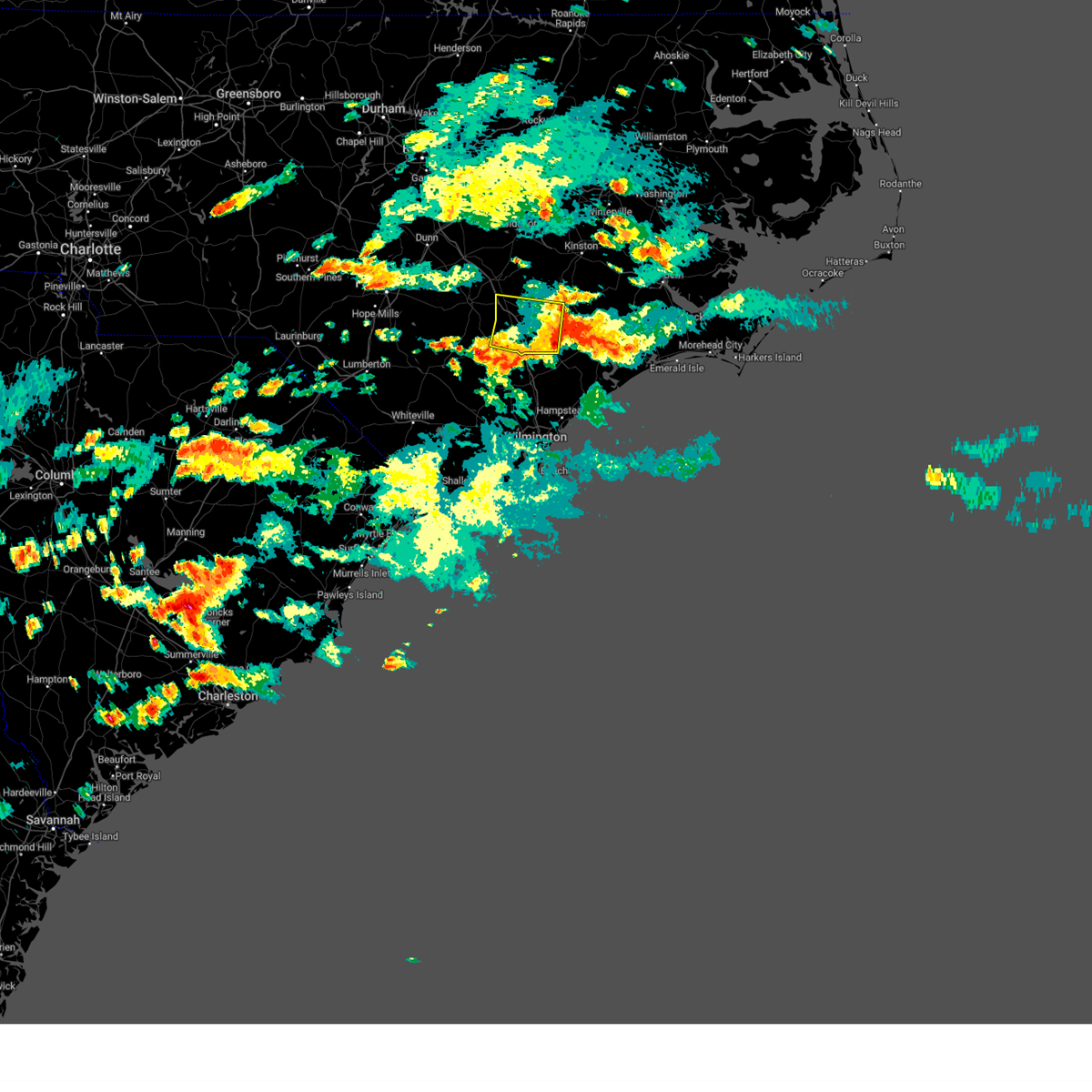 The severe thunderstorm warning for duplin county will expire at 445 pm edt, the storm which prompted the warning has weakened below severe limits, and no longer poses an immediate threat to life or property. therefore, the warning will be allowed to expire. however heavy rain is still possible with this thunderstorm. The severe thunderstorm warning for duplin county will expire at 445 pm edt, the storm which prompted the warning has weakened below severe limits, and no longer poses an immediate threat to life or property. therefore, the warning will be allowed to expire. however heavy rain is still possible with this thunderstorm.
|
| 7/5/2023 4:14 PM EDT | Trees down. time estimated from rada in duplin county NC, 0.3 miles WNW of Wallace, NC |
| 7/5/2023 3:58 PM EDT |
 At 358 pm edt, a severe thunderstorm was located near rose hill, or 9 miles north of wallace, moving east at 15 mph (radar indicated). Hazards include 60 mph wind gusts and quarter size hail. Hail damage to vehicles is expected. Expect wind damage to roofs, siding, and trees. At 358 pm edt, a severe thunderstorm was located near rose hill, or 9 miles north of wallace, moving east at 15 mph (radar indicated). Hazards include 60 mph wind gusts and quarter size hail. Hail damage to vehicles is expected. Expect wind damage to roofs, siding, and trees.
|
| 6/27/2023 1:04 AM EDT |
 At 104 am edt, severe thunderstorms were located along a line extending from near yeatesville to kellum, moving east at 45 mph (radar indicated). Hazards include 60 mph wind gusts and quarter size hail. Hail damage to vehicles is expected. expect wind damage to roofs, siding, and trees. locations impacted include, jacksonville, new bern, washington, wallace, pumpkin center, piney green, new river station, river road, half moon, james city, trent woods, river bend, phillips crossroads, richlands, pinetown, beulaville, blounts creek, maysville, vanceboro and askins. hail threat, radar indicated max hail size, 1. 00 in wind threat, radar indicated max wind gust, 60 mph. At 104 am edt, severe thunderstorms were located along a line extending from near yeatesville to kellum, moving east at 45 mph (radar indicated). Hazards include 60 mph wind gusts and quarter size hail. Hail damage to vehicles is expected. expect wind damage to roofs, siding, and trees. locations impacted include, jacksonville, new bern, washington, wallace, pumpkin center, piney green, new river station, river road, half moon, james city, trent woods, river bend, phillips crossroads, richlands, pinetown, beulaville, blounts creek, maysville, vanceboro and askins. hail threat, radar indicated max hail size, 1. 00 in wind threat, radar indicated max wind gust, 60 mph.
|
| 6/27/2023 12:44 AM EDT | Trees and power lines down. time estimated based on rada in duplin county NC, 1.1 miles NE of Wallace, NC |
| 6/27/2023 12:13 AM EDT |
 At 1212 am edt, severe thunderstorms were located along a line extending from near bell arthur to near rose hill, moving east at 45 mph (radar indicated). Hazards include 60 mph wind gusts and quarter size hail. Hail damage to vehicles is expected. Expect wind damage to roofs, siding, and trees. At 1212 am edt, severe thunderstorms were located along a line extending from near bell arthur to near rose hill, moving east at 45 mph (radar indicated). Hazards include 60 mph wind gusts and quarter size hail. Hail damage to vehicles is expected. Expect wind damage to roofs, siding, and trees.
|
| 4/30/2023 3:17 PM EDT |
 At 315 pm edt, severe thunderstorms were located along a line extending from wards corner to little river entrance, moving east at 40 mph (radar indicated). Hazards include 60 mph wind gusts and quarter size hail. Minor hail damage to vehicles is possible. expect wind damage to trees and power lines. locations impacted include, wilmington, leland, oak island, burgaw, shallotte, sunset beach, holden beach, ocean isle beach, ocean crest pier, boiling spring lakes, st. james, northwest, sandyfield, penderlea, makatoka, point caswell, hightsville, long creek, exum and seaside. hail threat, radar indicated max hail size, 1. 00 in wind threat, radar indicated max wind gust, 60 mph. At 315 pm edt, severe thunderstorms were located along a line extending from wards corner to little river entrance, moving east at 40 mph (radar indicated). Hazards include 60 mph wind gusts and quarter size hail. Minor hail damage to vehicles is possible. expect wind damage to trees and power lines. locations impacted include, wilmington, leland, oak island, burgaw, shallotte, sunset beach, holden beach, ocean isle beach, ocean crest pier, boiling spring lakes, st. james, northwest, sandyfield, penderlea, makatoka, point caswell, hightsville, long creek, exum and seaside. hail threat, radar indicated max hail size, 1. 00 in wind threat, radar indicated max wind gust, 60 mph.
|
| 4/30/2023 2:49 PM EDT |
 At 249 pm edt, severe thunderstorms were located along a line extending from near rowan to near barefoot landing area of north myrtle beach, moving east at 40 mph (radar indicated). Hazards include 60 mph wind gusts and quarter size hail. Minor hail damage to vehicles is possible. Expect wind damage to trees and power lines. At 249 pm edt, severe thunderstorms were located along a line extending from near rowan to near barefoot landing area of north myrtle beach, moving east at 40 mph (radar indicated). Hazards include 60 mph wind gusts and quarter size hail. Minor hail damage to vehicles is possible. Expect wind damage to trees and power lines.
|
| 8/1/2022 5:04 PM EDT |
 The national weather service in newport has issued a * severe thunderstorm warning for. jones county in eastern north carolina. southwestern lenoir county in eastern north carolina. onslow county in eastern north carolina. Southeastern duplin county in eastern north carolina. The national weather service in newport has issued a * severe thunderstorm warning for. jones county in eastern north carolina. southwestern lenoir county in eastern north carolina. onslow county in eastern north carolina. Southeastern duplin county in eastern north carolina.
|
| 7/10/2022 12:10 AM EDT |
 The severe thunderstorm warning for southwestern duplin county will expire at 1215 am edt, the storm which prompted the warning has weakened below severe limits, and no longer poses an immediate threat to life or property. therefore, the warning will be allowed to expire. however heavy rain is still possible with this thunderstorm. The severe thunderstorm warning for southwestern duplin county will expire at 1215 am edt, the storm which prompted the warning has weakened below severe limits, and no longer poses an immediate threat to life or property. therefore, the warning will be allowed to expire. however heavy rain is still possible with this thunderstorm.
|
| 7/10/2022 12:04 AM EDT |
 At 1204 am edt, a severe thunderstorm was located near wallace, moving east at 35 mph (radar indicated). Hazards include 60 mph wind gusts and penny size hail. Expect damage to roofs, siding, and trees. locations impacted include, wallace, warsaw, rose hill, kenansville, harrells, magnolia, greenevers and teachey. hail threat, radar indicated max hail size, 0. 75 in wind threat, radar indicated max wind gust, 60 mph. At 1204 am edt, a severe thunderstorm was located near wallace, moving east at 35 mph (radar indicated). Hazards include 60 mph wind gusts and penny size hail. Expect damage to roofs, siding, and trees. locations impacted include, wallace, warsaw, rose hill, kenansville, harrells, magnolia, greenevers and teachey. hail threat, radar indicated max hail size, 0. 75 in wind threat, radar indicated max wind gust, 60 mph.
|
| 7/9/2022 11:55 PM EDT |
 At 1155 pm edt, a severe thunderstorm was located near rose hill, or near wallace, moving east at 35 mph (radar indicated). Hazards include 60 mph wind gusts and penny size hail. Expect damage to roofs, siding, and trees. Locations impacted include, wallace, warsaw, rose hill, kenansville, harrells, magnolia, greenevers and teachey. At 1155 pm edt, a severe thunderstorm was located near rose hill, or near wallace, moving east at 35 mph (radar indicated). Hazards include 60 mph wind gusts and penny size hail. Expect damage to roofs, siding, and trees. Locations impacted include, wallace, warsaw, rose hill, kenansville, harrells, magnolia, greenevers and teachey.
|
| 7/9/2022 11:36 PM EDT |
 At 1136 pm edt, a severe thunderstorm was located near harrells, or 16 miles west of wallace, moving east at 35 mph (radar indicated). Hazards include 60 mph wind gusts and penny size hail. expect damage to roofs, siding, and trees At 1136 pm edt, a severe thunderstorm was located near harrells, or 16 miles west of wallace, moving east at 35 mph (radar indicated). Hazards include 60 mph wind gusts and penny size hail. expect damage to roofs, siding, and trees
|
| 6/17/2022 9:06 PM EDT |
 At 905 pm edt, severe thunderstorms were located along a line extending from murray town to near exum to near pee dee crossroads, moving southeast at 45 mph (radar indicated). Hazards include 60 mph wind gusts. Expect wind damage to trees and power lines. locations impacted include, conway, leland, whiteville, burgaw, red hill, horry, iredell, rowan, tabor city, loris, chadbourn, bethel, johnsonville, lake waccamaw, northwest, sandyfield, hickory grove, penderlea, makatoka and maple hill. hail threat, radar indicated max hail size, <. 75 in wind threat, radar indicated max wind gust, 60 mph. At 905 pm edt, severe thunderstorms were located along a line extending from murray town to near exum to near pee dee crossroads, moving southeast at 45 mph (radar indicated). Hazards include 60 mph wind gusts. Expect wind damage to trees and power lines. locations impacted include, conway, leland, whiteville, burgaw, red hill, horry, iredell, rowan, tabor city, loris, chadbourn, bethel, johnsonville, lake waccamaw, northwest, sandyfield, hickory grove, penderlea, makatoka and maple hill. hail threat, radar indicated max hail size, <. 75 in wind threat, radar indicated max wind gust, 60 mph.
|
| 6/17/2022 8:52 PM EDT |
 At 851 pm edt, severe thunderstorms were located along a line extending from near goose creek state park to near askins to near petersburg to near penderlea, moving southeast at 40 mph (radar indicated). Hazards include 60 mph wind gusts and quarter size hail. Hail damage to vehicles is expected. Expect wind damage to roofs, siding, and trees. At 851 pm edt, severe thunderstorms were located along a line extending from near goose creek state park to near askins to near petersburg to near penderlea, moving southeast at 40 mph (radar indicated). Hazards include 60 mph wind gusts and quarter size hail. Hail damage to vehicles is expected. Expect wind damage to roofs, siding, and trees.
|
| 6/17/2022 8:46 PM EDT |
 At 845 pm edt, severe thunderstorms were located along a line extending from near penderlea to near redbug to near gresham, moving southeast at 45 mph (radar indicated). Hazards include 60 mph wind gusts. expect wind damage to trees and power lines At 845 pm edt, severe thunderstorms were located along a line extending from near penderlea to near redbug to near gresham, moving southeast at 45 mph (radar indicated). Hazards include 60 mph wind gusts. expect wind damage to trees and power lines
|
| 6/17/2022 8:46 PM EDT |
 At 845 pm edt, severe thunderstorms were located along a line extending from near goose creek state park to 7 miles southwest of tuscarora to richlands to near wallace, moving southeast at 45 mph (radar indicated). Hazards include 60 mph wind gusts and quarter size hail. Hail damage to vehicles is expected. expect wind damage to roofs, siding, and trees. locations impacted include, jacksonville, new bern, washington, wallace, pumpkin center, piney green, new river station, river road, half moon, camp lejeune center, james city, trent woods, river bend, stella, swansboro, phillips crossroads, hubert, rose hill, richlands and beulaville. hail threat, radar indicated max hail size, 1. 00 in wind threat, radar indicated max wind gust, 60 mph. At 845 pm edt, severe thunderstorms were located along a line extending from near goose creek state park to 7 miles southwest of tuscarora to richlands to near wallace, moving southeast at 45 mph (radar indicated). Hazards include 60 mph wind gusts and quarter size hail. Hail damage to vehicles is expected. expect wind damage to roofs, siding, and trees. locations impacted include, jacksonville, new bern, washington, wallace, pumpkin center, piney green, new river station, river road, half moon, camp lejeune center, james city, trent woods, river bend, stella, swansboro, phillips crossroads, hubert, rose hill, richlands and beulaville. hail threat, radar indicated max hail size, 1. 00 in wind threat, radar indicated max wind gust, 60 mph.
|
| 6/17/2022 8:46 PM EDT |
 At 845 pm edt, severe thunderstorms were located along a line extending from near penderlea to near redbug to near gresham, moving southeast at 45 mph (radar indicated). Hazards include 60 mph wind gusts. expect wind damage to trees and power lines At 845 pm edt, severe thunderstorms were located along a line extending from near penderlea to near redbug to near gresham, moving southeast at 45 mph (radar indicated). Hazards include 60 mph wind gusts. expect wind damage to trees and power lines
|
| 6/17/2022 8:37 PM EDT |
 At 835 pm edt, severe thunderstorms were located along a line extending from near washington to near phillips crossroads to near potters hill to near harrells, moving southeast at 40 mph (radar indicated). Hazards include 60 mph wind gusts. Expect damage to roofs, siding, and trees. locations impacted include, jacksonville, new bern, washington, wallace, pumpkin center, piney green, new river station, river road, half moon, camp lejeune center, james city, trent woods, river bend, stella, swansboro, phillips crossroads, hubert, rose hill, richlands and beulaville. hail threat, radar indicated max hail size, <. 75 in wind threat, radar indicated max wind gust, 60 mph. At 835 pm edt, severe thunderstorms were located along a line extending from near washington to near phillips crossroads to near potters hill to near harrells, moving southeast at 40 mph (radar indicated). Hazards include 60 mph wind gusts. Expect damage to roofs, siding, and trees. locations impacted include, jacksonville, new bern, washington, wallace, pumpkin center, piney green, new river station, river road, half moon, camp lejeune center, james city, trent woods, river bend, stella, swansboro, phillips crossroads, hubert, rose hill, richlands and beulaville. hail threat, radar indicated max hail size, <. 75 in wind threat, radar indicated max wind gust, 60 mph.
|
| 6/17/2022 8:09 PM EDT |
 At 808 pm edt, severe thunderstorms were located along a line extending from pactolus to near wyse fork to near kornegay to near rose hill, moving southeast at 45 mph (radar indicated). Hazards include 60 mph wind gusts. expect damage to roofs, siding, and trees At 808 pm edt, severe thunderstorms were located along a line extending from pactolus to near wyse fork to near kornegay to near rose hill, moving southeast at 45 mph (radar indicated). Hazards include 60 mph wind gusts. expect damage to roofs, siding, and trees
|
| 6/17/2022 8:06 PM EDT |
 At 805 pm edt, severe thunderstorms were located along a line extending from near greenville to near kinston to near kenansville, moving southeast at 60 mph (radar indicated). Hazards include 60 mph wind gusts. Expect damage to roofs, siding, and trees. locations impacted include, greenville, kinston, washington, winterville, ayden, farmville, wallace, warsaw, la grange, mount olive, grifton, phillips crossroads, kornegay, rose hill, snow hill, bell arthur, beulaville, deep run, house and shelmerdine. hail threat, radar indicated max hail size, <. 75 in wind threat, radar indicated max wind gust, 60 mph. At 805 pm edt, severe thunderstorms were located along a line extending from near greenville to near kinston to near kenansville, moving southeast at 60 mph (radar indicated). Hazards include 60 mph wind gusts. Expect damage to roofs, siding, and trees. locations impacted include, greenville, kinston, washington, winterville, ayden, farmville, wallace, warsaw, la grange, mount olive, grifton, phillips crossroads, kornegay, rose hill, snow hill, bell arthur, beulaville, deep run, house and shelmerdine. hail threat, radar indicated max hail size, <. 75 in wind threat, radar indicated max wind gust, 60 mph.
|
| 6/17/2022 7:24 PM EDT |
 At 723 pm edt, severe thunderstorms were located along a line extending from 7 miles southeast of wilson to 6 miles northwest of goldsboro to 12 miles southeast of godwin, moving southeast at 50 mph (radar indicated). Hazards include 60 mph wind gusts. expect damage to roofs, siding, and trees At 723 pm edt, severe thunderstorms were located along a line extending from 7 miles southeast of wilson to 6 miles northwest of goldsboro to 12 miles southeast of godwin, moving southeast at 50 mph (radar indicated). Hazards include 60 mph wind gusts. expect damage to roofs, siding, and trees
|
| 4/26/2022 6:23 PM EDT |
 At 623 pm edt, severe thunderstorms were located along a line extending from near kinston to near willard, moving east at 45 mph (radar indicated). Hazards include 60 mph wind gusts and quarter size hail. Hail damage to vehicles is expected. expect wind damage to roofs, siding, and trees. locations impacted include, jacksonville, wallace, half moon, phillips crossroads, kornegay, rose hill, richlands, beulaville, catherine lake, cypress creek, comfort, kenansville, fort barnwell, chinquapin, potters hill, petersburg, pleasant hill, wyse fork, albertson and harrells. hail threat, radar indicated max hail size, 1. 00 in wind threat, radar indicated max wind gust, 60 mph. At 623 pm edt, severe thunderstorms were located along a line extending from near kinston to near willard, moving east at 45 mph (radar indicated). Hazards include 60 mph wind gusts and quarter size hail. Hail damage to vehicles is expected. expect wind damage to roofs, siding, and trees. locations impacted include, jacksonville, wallace, half moon, phillips crossroads, kornegay, rose hill, richlands, beulaville, catherine lake, cypress creek, comfort, kenansville, fort barnwell, chinquapin, potters hill, petersburg, pleasant hill, wyse fork, albertson and harrells. hail threat, radar indicated max hail size, 1. 00 in wind threat, radar indicated max wind gust, 60 mph.
|
| 4/26/2022 5:53 PM EDT |
 At 553 pm edt, severe thunderstorms were located along a line extending from near mount olive to 7 miles southwest of harrells, moving east at 45 mph (radar indicated). Hazards include 60 mph wind gusts and quarter size hail. Hail damage to vehicles is expected. Expect wind damage to roofs, siding, and trees. At 553 pm edt, severe thunderstorms were located along a line extending from near mount olive to 7 miles southwest of harrells, moving east at 45 mph (radar indicated). Hazards include 60 mph wind gusts and quarter size hail. Hail damage to vehicles is expected. Expect wind damage to roofs, siding, and trees.
|
| 3/12/2022 9:55 AM EST |
 The severe thunderstorm warning for northwestern new hanover, pender, southeastern bladen, central brunswick, eastern columbus and east central horry counties will expire at 1000 am est, the storms which prompted the warning have moved out of the area. therefore, the warning will be allowed to expire. however gusty winds are still possible behind these thunderstorms. The severe thunderstorm warning for northwestern new hanover, pender, southeastern bladen, central brunswick, eastern columbus and east central horry counties will expire at 1000 am est, the storms which prompted the warning have moved out of the area. therefore, the warning will be allowed to expire. however gusty winds are still possible behind these thunderstorms.
|
| 3/12/2022 9:20 AM EST |
 At 919 am est, severe thunderstorms were located along a line extending from near plymouth to near blounts creek to near potters hill, moving northeast at 90 mph (radar indicated). Hazards include 70 mph wind gusts. Expect considerable tree damage. damage is likely to mobile homes, roofs, and outbuildings. locations impacted include, jacksonville, new bern, havelock, washington, wallace, pumpkin center, river road, half moon, james city, trent woods, river bend, phillips crossroads, belhaven, richlands, ransomville, pinetown, pungo, beulaville, blounts creek and pamlico beach. thunderstorm damage threat, considerable hail threat, radar indicated max hail size, <. 75 in wind threat, radar indicated max wind gust, 70 mph. At 919 am est, severe thunderstorms were located along a line extending from near plymouth to near blounts creek to near potters hill, moving northeast at 90 mph (radar indicated). Hazards include 70 mph wind gusts. Expect considerable tree damage. damage is likely to mobile homes, roofs, and outbuildings. locations impacted include, jacksonville, new bern, havelock, washington, wallace, pumpkin center, river road, half moon, james city, trent woods, river bend, phillips crossroads, belhaven, richlands, ransomville, pinetown, pungo, beulaville, blounts creek and pamlico beach. thunderstorm damage threat, considerable hail threat, radar indicated max hail size, <. 75 in wind threat, radar indicated max wind gust, 70 mph.
|
| 3/12/2022 9:15 AM EST |
 At 914 am est, severe thunderstorms were located along a line extending from penderlea to near longs, moving east at 60 mph (radar indicated). Hazards include 70 mph wind gusts. Expect considerable tree damage. Damage is likely to mobile homes, roofs, and outbuildings. At 914 am est, severe thunderstorms were located along a line extending from penderlea to near longs, moving east at 60 mph (radar indicated). Hazards include 70 mph wind gusts. Expect considerable tree damage. Damage is likely to mobile homes, roofs, and outbuildings.
|
| 3/12/2022 9:01 AM EST |
 At 900 am est, severe thunderstorms were located along a line extending from near pactolus to near wyse fork to near wallace, moving northeast at 80 mph (radar indicated). Hazards include 60 mph wind gusts. expect damage to roofs, siding, and trees At 900 am est, severe thunderstorms were located along a line extending from near pactolus to near wyse fork to near wallace, moving northeast at 80 mph (radar indicated). Hazards include 60 mph wind gusts. expect damage to roofs, siding, and trees
|
| 3/12/2022 8:51 AM EST |
 At 850 am est, severe thunderstorms were located along a line extending from graingers to near chinquapin, moving east at 70 mph (radar indicated). Hazards include 60 mph wind gusts. Expect damage to roofs, siding, and trees. Locations impacted include, kinston, wallace, grifton, phillips crossroads, kornegay, rose hill, richlands, beulaville, deep run, cypress creek, comfort, kenansville, fort barnwell, chinquapin, dawson, potters hill, graingers, petersburg, pleasant hill and wyse fork. At 850 am est, severe thunderstorms were located along a line extending from graingers to near chinquapin, moving east at 70 mph (radar indicated). Hazards include 60 mph wind gusts. Expect damage to roofs, siding, and trees. Locations impacted include, kinston, wallace, grifton, phillips crossroads, kornegay, rose hill, richlands, beulaville, deep run, cypress creek, comfort, kenansville, fort barnwell, chinquapin, dawson, potters hill, graingers, petersburg, pleasant hill and wyse fork.
|
| 3/12/2022 8:27 AM EST |
 At 826 am est, severe thunderstorms were located along a line extending from 6 miles east of mount olive to near harrells, moving east at 70 mph (radar indicated). Hazards include 60 mph wind gusts. expect damage to roofs, siding, and trees At 826 am est, severe thunderstorms were located along a line extending from 6 miles east of mount olive to near harrells, moving east at 70 mph (radar indicated). Hazards include 60 mph wind gusts. expect damage to roofs, siding, and trees
|
| 1/3/2022 8:07 AM EST |
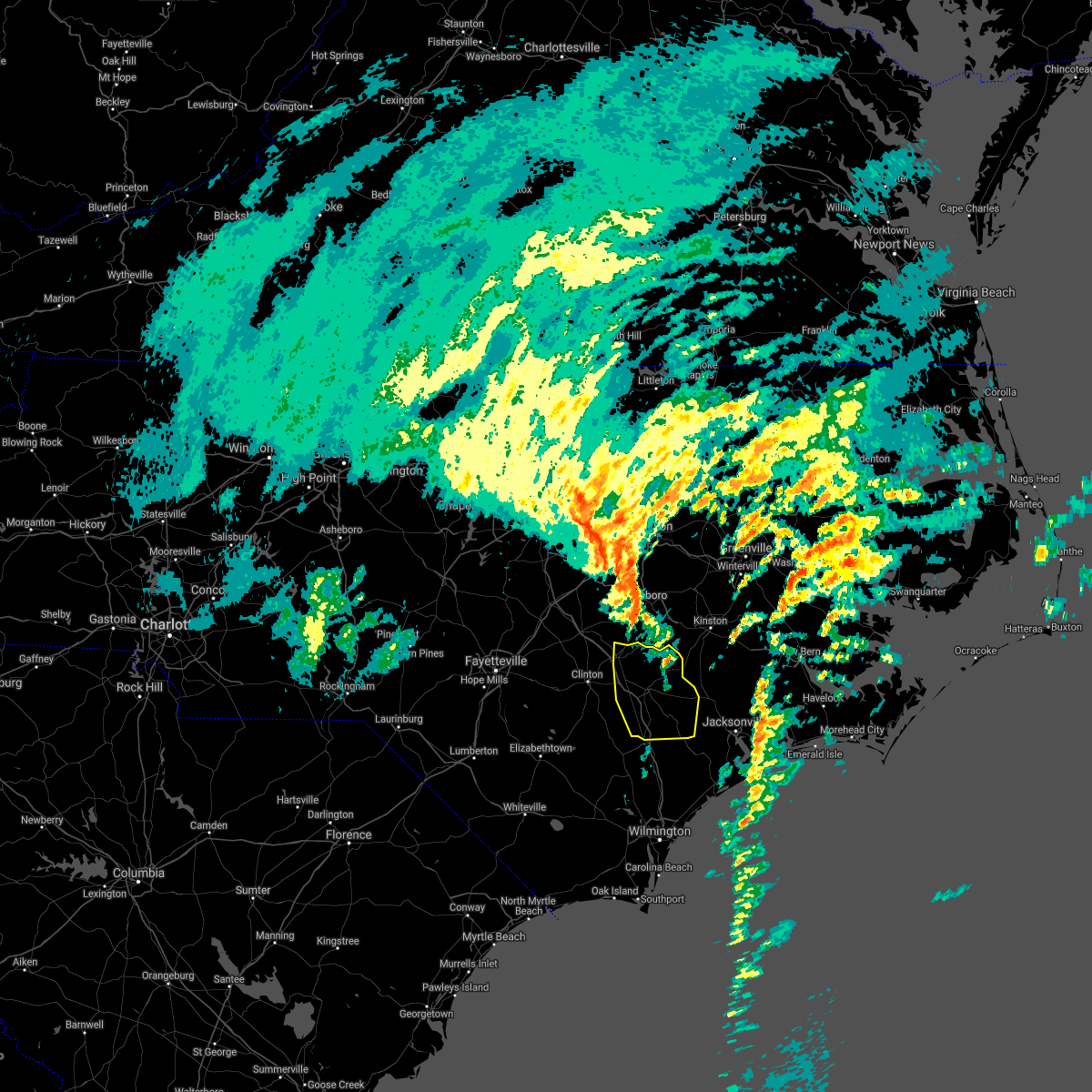 The severe thunderstorm warning for duplin county will expire at 815 am est, the storms which prompted the warning have weakened below severe limits, and have exited the warned area. therefore, the warning will be allowed to expire. a tornado watch remains in effect until 1100 am est for eastern north carolina. The severe thunderstorm warning for duplin county will expire at 815 am est, the storms which prompted the warning have weakened below severe limits, and have exited the warned area. therefore, the warning will be allowed to expire. a tornado watch remains in effect until 1100 am est for eastern north carolina.
|
| 1/3/2022 7:46 AM EST |
 At 745 am est, severe thunderstorms were located along a line extending from 8 miles west of mount olive to near warsaw to near wallace, moving northeast at 55 mph (radar indicated). Hazards include 60 mph wind gusts. Expect damage to roofs, siding, and trees. locations impacted include, wallace, warsaw, mount olive, kornegay, rose hill, beulaville, bowdens, cypress creek, beautancus, kenansville, chinquapin, potters hill, albertson, sarecta, faison, magnolia, greenevers, calypso, lyman and teachey. hail threat, radar indicated max hail size, <. 75 in wind threat, radar indicated max wind gust, 60 mph. At 745 am est, severe thunderstorms were located along a line extending from 8 miles west of mount olive to near warsaw to near wallace, moving northeast at 55 mph (radar indicated). Hazards include 60 mph wind gusts. Expect damage to roofs, siding, and trees. locations impacted include, wallace, warsaw, mount olive, kornegay, rose hill, beulaville, bowdens, cypress creek, beautancus, kenansville, chinquapin, potters hill, albertson, sarecta, faison, magnolia, greenevers, calypso, lyman and teachey. hail threat, radar indicated max hail size, <. 75 in wind threat, radar indicated max wind gust, 60 mph.
|
| 1/3/2022 7:24 AM EST |
 At 724 am est, severe thunderstorms were located along a line extending from 7 miles southeast of godwin to 9 miles south of clinton to near kelly, moving east at 55 mph (radar indicated). Hazards include 60 mph wind gusts. expect damage to roofs, siding, and trees At 724 am est, severe thunderstorms were located along a line extending from 7 miles southeast of godwin to 9 miles south of clinton to near kelly, moving east at 55 mph (radar indicated). Hazards include 60 mph wind gusts. expect damage to roofs, siding, and trees
|
| 1/3/2022 6:50 AM EST |
 At 649 am est, severe thunderstorms were located along a line extending from rex to nixonville, moving east at 50 mph (radar indicated). Hazards include 60 mph wind gusts. expect wind damage to trees and power lines At 649 am est, severe thunderstorms were located along a line extending from rex to nixonville, moving east at 50 mph (radar indicated). Hazards include 60 mph wind gusts. expect wind damage to trees and power lines
|
| 7/28/2021 7:17 PM EDT |
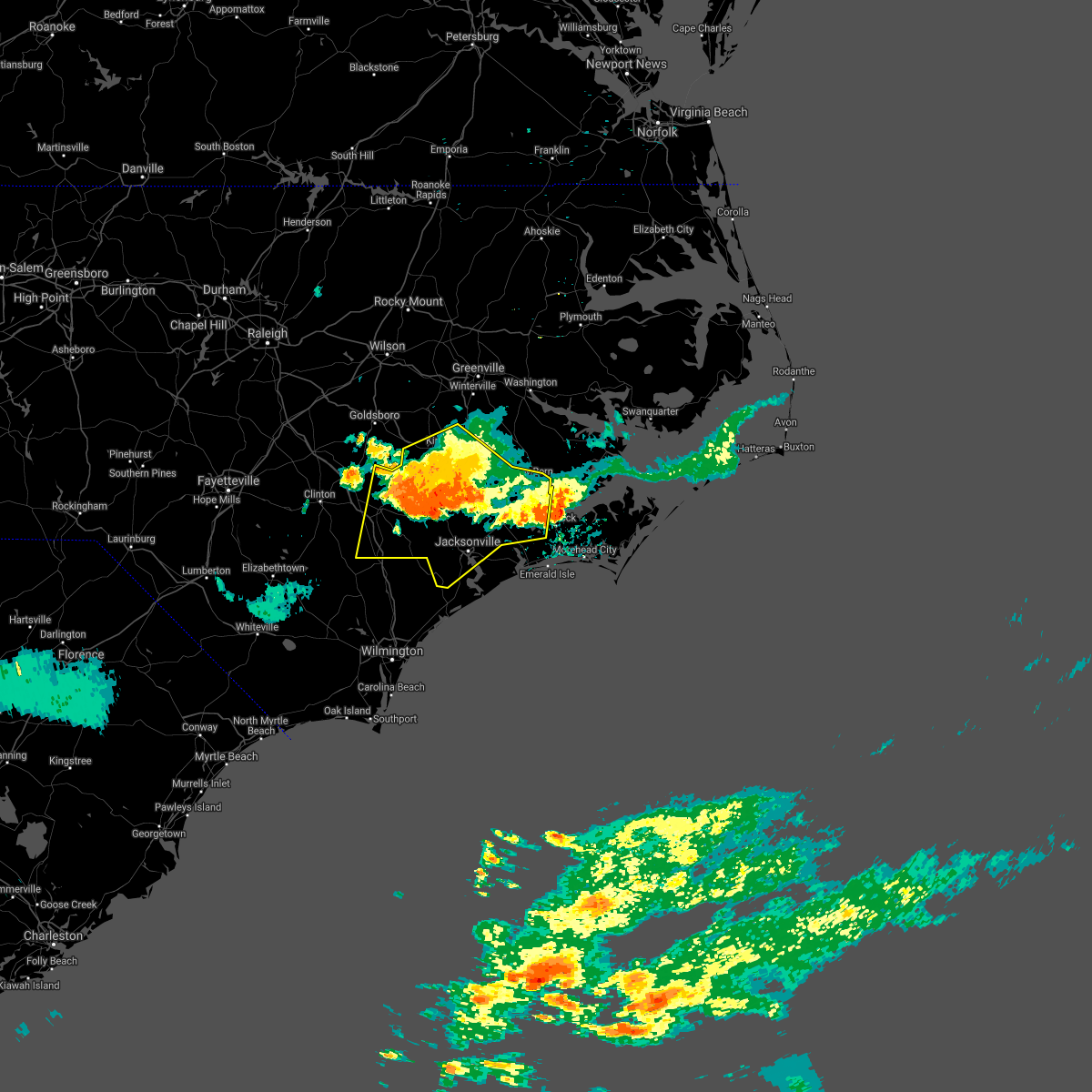 At 717 pm edt, severe thunderstorms were located along a line extending from near potters hill to 6 miles southwest of tuscarora to near catfish lake, moving east at 30 mph (radar indicated). Hazards include 60 mph wind gusts and quarter size hail. Hail damage to vehicles is expected. expect wind damage to roofs, siding, and trees. Locations impacted include, jacksonville, new bern, kinston, havelock, wallace, pumpkin center, piney green, new river station, half moon, camp lejeune center, james city, trent woods, river bend, grifton, phillips crossroads, kornegay, rose hill, richlands, beulaville and deep run. At 717 pm edt, severe thunderstorms were located along a line extending from near potters hill to 6 miles southwest of tuscarora to near catfish lake, moving east at 30 mph (radar indicated). Hazards include 60 mph wind gusts and quarter size hail. Hail damage to vehicles is expected. expect wind damage to roofs, siding, and trees. Locations impacted include, jacksonville, new bern, kinston, havelock, wallace, pumpkin center, piney green, new river station, half moon, camp lejeune center, james city, trent woods, river bend, grifton, phillips crossroads, kornegay, rose hill, richlands, beulaville and deep run.
|
| 7/28/2021 6:39 PM EDT |
 At 638 pm edt, severe thunderstorms were located along a line extending from 6 miles south of la grange to near graingers to near river bend, moving south at 30 mph (radar indicated). Hazards include 60 mph wind gusts and quarter size hail. Hail damage to vehicles is expected. Expect wind damage to roofs, siding, and trees. At 638 pm edt, severe thunderstorms were located along a line extending from 6 miles south of la grange to near graingers to near river bend, moving south at 30 mph (radar indicated). Hazards include 60 mph wind gusts and quarter size hail. Hail damage to vehicles is expected. Expect wind damage to roofs, siding, and trees.
|
| 6/2/2021 5:14 PM EDT |
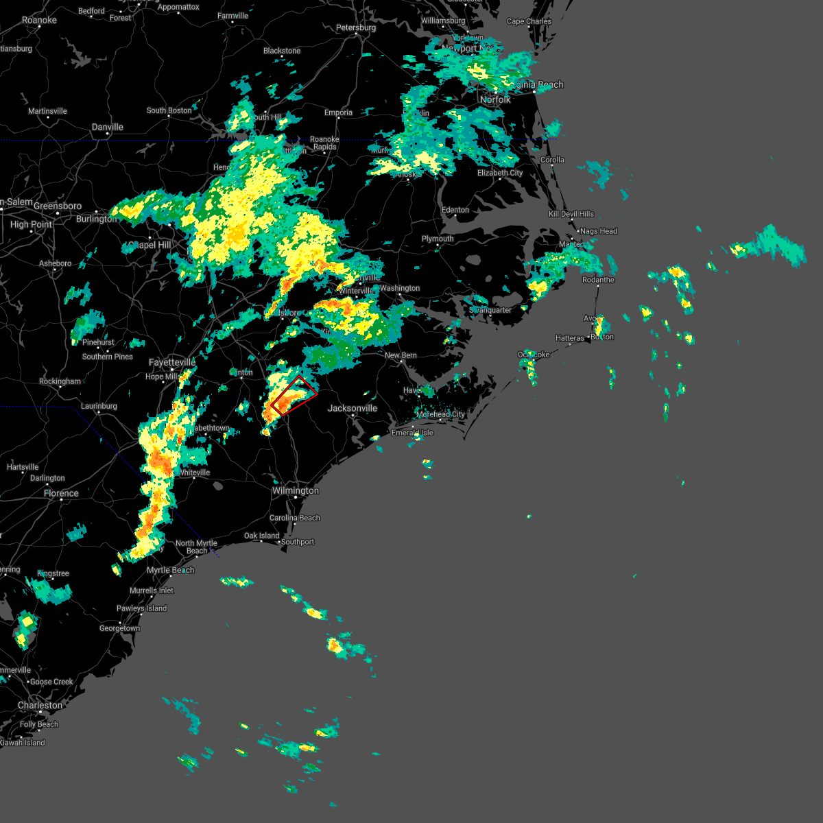 At 514 pm edt, a confirmed tornado was located near wallace, moving northeast at 20 mph (law enforcement confirmed tornado). Hazards include damaging tornado. Flying debris will be dangerous to those caught without shelter. mobile homes will be damaged or destroyed. damage to roofs, windows, and vehicles will occur. Tree damage is likely. At 514 pm edt, a confirmed tornado was located near wallace, moving northeast at 20 mph (law enforcement confirmed tornado). Hazards include damaging tornado. Flying debris will be dangerous to those caught without shelter. mobile homes will be damaged or destroyed. damage to roofs, windows, and vehicles will occur. Tree damage is likely.
|
| 6/2/2021 5:00 PM EDT |
 At 459 pm edt, a confirmed tornado was located near wallace, moving northeast at 12 mph (law enforcement confirmed tornado). Hazards include damaging tornado. Flying debris will be dangerous to those caught without shelter. mobile homes will be damaged or destroyed. damage to roofs, windows, and vehicles will occur. tree damage is likely. Locations impacted include, wallace, rose hill, magnolia, greenevers and teachey. At 459 pm edt, a confirmed tornado was located near wallace, moving northeast at 12 mph (law enforcement confirmed tornado). Hazards include damaging tornado. Flying debris will be dangerous to those caught without shelter. mobile homes will be damaged or destroyed. damage to roofs, windows, and vehicles will occur. tree damage is likely. Locations impacted include, wallace, rose hill, magnolia, greenevers and teachey.
|
| 6/2/2021 4:45 PM EDT |
 At 444 pm edt, a severe thunderstorm capable of producing a tornado was located near wallace, moving northeast at 15 mph (radar indicated rotation). Hazards include tornado. Flying debris will be dangerous to those caught without shelter. mobile homes will be damaged or destroyed. damage to roofs, windows, and vehicles will occur. Tree damage is likely. At 444 pm edt, a severe thunderstorm capable of producing a tornado was located near wallace, moving northeast at 15 mph (radar indicated rotation). Hazards include tornado. Flying debris will be dangerous to those caught without shelter. mobile homes will be damaged or destroyed. damage to roofs, windows, and vehicles will occur. Tree damage is likely.
|
| 3/27/2021 8:37 PM EDT |
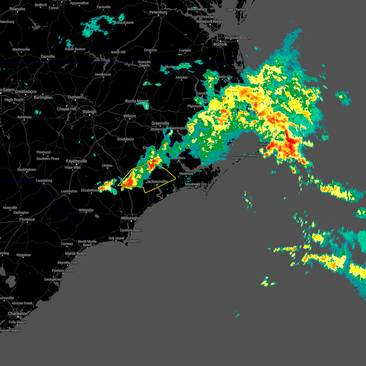 At 837 pm edt, severe thunderstorms were located along a line extending from near comfort to beulaville to near wallace, moving east at 35 mph (radar indicated). Hazards include 60 mph wind gusts and quarter size hail. Hail damage to vehicles is expected. expect wind damage to roofs, siding, and trees. Locations impacted include, jacksonville, wallace, new river station, pumpkin center, piney green, half moon, rose hill, richlands, beulaville, maysville, catherine lake, kellum, cypress creek, comfort, chinquapin, belgrade, potters hill, petersburg, pleasant hill and albert j ellis airport. At 837 pm edt, severe thunderstorms were located along a line extending from near comfort to beulaville to near wallace, moving east at 35 mph (radar indicated). Hazards include 60 mph wind gusts and quarter size hail. Hail damage to vehicles is expected. expect wind damage to roofs, siding, and trees. Locations impacted include, jacksonville, wallace, new river station, pumpkin center, piney green, half moon, rose hill, richlands, beulaville, maysville, catherine lake, kellum, cypress creek, comfort, chinquapin, belgrade, potters hill, petersburg, pleasant hill and albert j ellis airport.
|
| 3/27/2021 8:20 PM EDT |
 At 819 pm edt, severe thunderstorms were located along a line extending from near pleasant hill to kenansville to near rose hill, moving east at 30 mph (radar indicated). Hazards include 60 mph wind gusts and quarter size hail. Hail damage to vehicles is expected. expect wind damage to roofs, siding, and trees. Locations impacted include, jacksonville, wallace, warsaw, new river station, pumpkin center, piney green, half moon, kornegay, rose hill, richlands, beulaville, maysville, catherine lake, kellum, cypress creek, comfort, kenansville, chinquapin, belgrade and potters hill. At 819 pm edt, severe thunderstorms were located along a line extending from near pleasant hill to kenansville to near rose hill, moving east at 30 mph (radar indicated). Hazards include 60 mph wind gusts and quarter size hail. Hail damage to vehicles is expected. expect wind damage to roofs, siding, and trees. Locations impacted include, jacksonville, wallace, warsaw, new river station, pumpkin center, piney green, half moon, kornegay, rose hill, richlands, beulaville, maysville, catherine lake, kellum, cypress creek, comfort, kenansville, chinquapin, belgrade and potters hill.
|
| 3/27/2021 8:09 PM EDT |
 At 809 pm edt, severe thunderstorms were located along a line extending from near fort barnwell to potters hill to 8 miles west of harrells, moving east at 35 mph (radar indicated). Hazards include 60 mph wind gusts and quarter size hail. Hail damage to vehicles is expected. expect wind damage to roofs, siding, and trees. Locations impacted include, jacksonville, new bern, kinston, wallace, warsaw, pumpkin center, piney green, new river station, half moon, james city, trent woods, river bend, grifton, phillips crossroads, kornegay, rose hill, richlands, beulaville, deep run and maysville. At 809 pm edt, severe thunderstorms were located along a line extending from near fort barnwell to potters hill to 8 miles west of harrells, moving east at 35 mph (radar indicated). Hazards include 60 mph wind gusts and quarter size hail. Hail damage to vehicles is expected. expect wind damage to roofs, siding, and trees. Locations impacted include, jacksonville, new bern, kinston, wallace, warsaw, pumpkin center, piney green, new river station, half moon, james city, trent woods, river bend, grifton, phillips crossroads, kornegay, rose hill, richlands, beulaville, deep run and maysville.
|
| 3/27/2021 7:44 PM EDT |
 At 743 pm edt, severe thunderstorms were located along a line extending from near kinston to near beautancus to near ammon, moving east at 35 mph (radar indicated). Hazards include two inch hail and 70 mph wind gusts. People and animals outdoors will be injured. expect hail damage to roofs, siding, windows, and vehicles. expect considerable tree damage. Wind damage is also likely to mobile homes, roofs, and outbuildings. At 743 pm edt, severe thunderstorms were located along a line extending from near kinston to near beautancus to near ammon, moving east at 35 mph (radar indicated). Hazards include two inch hail and 70 mph wind gusts. People and animals outdoors will be injured. expect hail damage to roofs, siding, windows, and vehicles. expect considerable tree damage. Wind damage is also likely to mobile homes, roofs, and outbuildings.
|
| 3/27/2021 6:48 PM EDT |
 At 647 pm edt, a severe thunderstorm was located near kenansville, or 10 miles north of wallace, moving northeast at 40 mph (trained weather spotters. at 645 pm, a trained spotter reported up to tennis ball size hail near rose hill). Hazards include tennis ball size hail and 60 mph wind gusts. People and animals outdoors will be injured. expect hail damage to roofs, siding, windows, and vehicles. expect wind damage to roofs, siding, and trees. Locations impacted include, wallace, kornegay, rose hill, beulaville, cypress creek, kenansville, chinquapin, potters hill, harrells, sarecta, magnolia, greenevers, lyman and teachey. At 647 pm edt, a severe thunderstorm was located near kenansville, or 10 miles north of wallace, moving northeast at 40 mph (trained weather spotters. at 645 pm, a trained spotter reported up to tennis ball size hail near rose hill). Hazards include tennis ball size hail and 60 mph wind gusts. People and animals outdoors will be injured. expect hail damage to roofs, siding, windows, and vehicles. expect wind damage to roofs, siding, and trees. Locations impacted include, wallace, kornegay, rose hill, beulaville, cypress creek, kenansville, chinquapin, potters hill, harrells, sarecta, magnolia, greenevers, lyman and teachey.
|
| 3/27/2021 6:28 PM EDT |
 At 627 pm edt, a severe thunderstorm was located near harrells, or near wallace, moving northeast at 40 mph (radar indicated). Hazards include 60 mph wind gusts and quarter size hail. Hail damage to vehicles is expected. Expect wind damage to roofs, siding, and trees. At 627 pm edt, a severe thunderstorm was located near harrells, or near wallace, moving northeast at 40 mph (radar indicated). Hazards include 60 mph wind gusts and quarter size hail. Hail damage to vehicles is expected. Expect wind damage to roofs, siding, and trees.
|
| 12/24/2020 5:02 PM EST |
 The national weather service in newport has issued a * severe thunderstorm warning for. west central jones county in eastern north carolina. greene county in eastern north carolina. western lenoir county in eastern north carolina. Western pitt county in eastern north carolina. The national weather service in newport has issued a * severe thunderstorm warning for. west central jones county in eastern north carolina. greene county in eastern north carolina. western lenoir county in eastern north carolina. Western pitt county in eastern north carolina.
|
| 12/24/2020 5:02 PM EST |
 At 501 pm est, severe thunderstorms were located along a line extending from 6 miles southwest of mount olive to exum, moving northeast at 25 mph (radar indicated). Hazards include 60 mph wind gusts. expect damage to roofs, siding, and trees At 501 pm est, severe thunderstorms were located along a line extending from 6 miles southwest of mount olive to exum, moving northeast at 25 mph (radar indicated). Hazards include 60 mph wind gusts. expect damage to roofs, siding, and trees
|
| 6/20/2020 7:07 PM EDT |
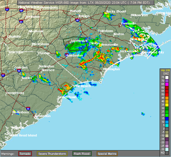 The severe thunderstorm warning for northwestern pender county will expire at 715 pm edt, the storm which prompted the warning has weakened below severe limits, and no longer poses an immediate threat to life or property. therefore, the warning will be allowed to expire. however small hail and gusty winds are still possible with this thunderstorm. The severe thunderstorm warning for northwestern pender county will expire at 715 pm edt, the storm which prompted the warning has weakened below severe limits, and no longer poses an immediate threat to life or property. therefore, the warning will be allowed to expire. however small hail and gusty winds are still possible with this thunderstorm.
|
| 6/20/2020 6:49 PM EDT |
 At 648 pm edt, a severe thunderstorm was located near penderlea, or near wallace, moving east at 10 mph. at 637 pm edt, pender county em reported quarter-sized hail near the town of penderlea (emergency management). Hazards include 60 mph wind gusts and quarter size hail. Minor hail damage to vehicles is possible. expect wind damage to trees and power lines. locations impacted include, burgaw, penderlea, murray town, ashton, willard, st. Helena, watha and pender memorial hospital. At 648 pm edt, a severe thunderstorm was located near penderlea, or near wallace, moving east at 10 mph. at 637 pm edt, pender county em reported quarter-sized hail near the town of penderlea (emergency management). Hazards include 60 mph wind gusts and quarter size hail. Minor hail damage to vehicles is possible. expect wind damage to trees and power lines. locations impacted include, burgaw, penderlea, murray town, ashton, willard, st. Helena, watha and pender memorial hospital.
|
| 6/20/2020 6:35 PM EDT |
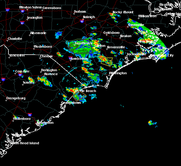 At 635 pm edt, a severe thunderstorm was located over penderlea, or near wallace, moving east at 10 mph (radar indicated). Hazards include 60 mph wind gusts and quarter size hail. Minor hail damage to vehicles is possible. Expect wind damage to trees and power lines. At 635 pm edt, a severe thunderstorm was located over penderlea, or near wallace, moving east at 10 mph (radar indicated). Hazards include 60 mph wind gusts and quarter size hail. Minor hail damage to vehicles is possible. Expect wind damage to trees and power lines.
|
| 5/22/2020 7:29 PM EDT |
 At 727 pm edt, severe thunderstorms were located along a line extending from 14 miles southeast of benson to rose hill to sandyfield, moving east at 45 mph (radar indicated). Hazards include 60 mph wind gusts. Expect damage to roofs, siding, and trees. Locations impacted include, jacksonville, kinston, wallace, warsaw, la grange, half moon, mount olive, phillips crossroads, kornegay, rose hill, richlands, beulaville, deep run, catherine lake, bowdens, cypress creek, beautancus, comfort, kenansville and chinquapin. At 727 pm edt, severe thunderstorms were located along a line extending from 14 miles southeast of benson to rose hill to sandyfield, moving east at 45 mph (radar indicated). Hazards include 60 mph wind gusts. Expect damage to roofs, siding, and trees. Locations impacted include, jacksonville, kinston, wallace, warsaw, la grange, half moon, mount olive, phillips crossroads, kornegay, rose hill, richlands, beulaville, deep run, catherine lake, bowdens, cypress creek, beautancus, comfort, kenansville and chinquapin.
|
| 5/22/2020 7:05 PM EDT |
 At 704 pm edt, severe thunderstorms were located along a line extending from 12 miles southeast of dunn to 8 miles northwest of harrells to near elkton, moving east at 50 mph (radar indicated). Hazards include 60 mph wind gusts. expect damage to roofs, siding, and trees At 704 pm edt, severe thunderstorms were located along a line extending from 12 miles southeast of dunn to 8 miles northwest of harrells to near elkton, moving east at 50 mph (radar indicated). Hazards include 60 mph wind gusts. expect damage to roofs, siding, and trees
|
| 4/13/2020 9:24 AM EDT |
 The severe thunderstorm warning for northwestern new hanover, pender, southeastern bladen, central brunswick and southeastern columbus counties will expire at 930 am edt, the storm which prompted the warning has moved out of the area. therefore, the warning will be allowed to expire. a tornado watch remains in effect until noon edt for southeastern north carolina, and northeastern south carolina. remember, a tornado warning still remains in effect for portions of pender county until 9:45 am edt. remember, a severe thunderstorm warning still remains in effect for portions of pender, new hanover, and brunswick county until 9:45 am edt. The severe thunderstorm warning for northwestern new hanover, pender, southeastern bladen, central brunswick and southeastern columbus counties will expire at 930 am edt, the storm which prompted the warning has moved out of the area. therefore, the warning will be allowed to expire. a tornado watch remains in effect until noon edt for southeastern north carolina, and northeastern south carolina. remember, a tornado warning still remains in effect for portions of pender county until 9:45 am edt. remember, a severe thunderstorm warning still remains in effect for portions of pender, new hanover, and brunswick county until 9:45 am edt.
|
| 4/13/2020 9:12 AM EDT |
 At 912 am edt, severe thunderstorms were located along a line extending from near stokes to near pleasant hill to near murray town, moving east at 30 mph (radar indicated). Hazards include 60 mph wind gusts. Expect damage to roofs, siding, and trees. locations impacted include, greenville, jacksonville, kinston, winterville, williamston, ayden, wallace, half moon, grifton, phillips crossroads, kornegay, stokes, rose hill, richlands, robersonville, beulaville, deep run, catherine lake, house and shelmerdine. A tornado watch remains in effect until noon edt for eastern north carolina. At 912 am edt, severe thunderstorms were located along a line extending from near stokes to near pleasant hill to near murray town, moving east at 30 mph (radar indicated). Hazards include 60 mph wind gusts. Expect damage to roofs, siding, and trees. locations impacted include, greenville, jacksonville, kinston, winterville, williamston, ayden, wallace, half moon, grifton, phillips crossroads, kornegay, stokes, rose hill, richlands, robersonville, beulaville, deep run, catherine lake, house and shelmerdine. A tornado watch remains in effect until noon edt for eastern north carolina.
|
| 4/13/2020 9:06 AM EDT |
 At 906 am edt, a severe thunderstorm was located over point caswell, or 16 miles southwest of burgaw, moving northeast at 65 mph (radar indicated). Hazards include 60 mph wind gusts. Expect wind damage to trees and power lines. Locations impacted include, leland, burgaw, shallotte, sunset beach, iredell, carolina shores, calabash, northwest, sandyfield, penderlea, makatoka, point caswell, freeland, maple hill, long creek, exum, longwood, ashton, rocky point and currie. At 906 am edt, a severe thunderstorm was located over point caswell, or 16 miles southwest of burgaw, moving northeast at 65 mph (radar indicated). Hazards include 60 mph wind gusts. Expect wind damage to trees and power lines. Locations impacted include, leland, burgaw, shallotte, sunset beach, iredell, carolina shores, calabash, northwest, sandyfield, penderlea, makatoka, point caswell, freeland, maple hill, long creek, exum, longwood, ashton, rocky point and currie.
|
| 4/13/2020 8:51 AM EDT |
 At 850 am edt, severe thunderstorms were located along a line extending from 9 miles southeast of wilson to near kenansville to near sandyfield, moving east at 50 mph (radar indicated). Hazards include 60 mph wind gusts. Expect damage to roofs, siding, and trees. locations impacted include, greenville, jacksonville, kinston, winterville, williamston, ayden, farmville, wallace, warsaw, la grange, half moon, mount olive, bethel, grifton, phillips crossroads, kornegay, stokes, rose hill, snow hill and richlands. A tornado watch remains in effect until noon edt for eastern north carolina. At 850 am edt, severe thunderstorms were located along a line extending from 9 miles southeast of wilson to near kenansville to near sandyfield, moving east at 50 mph (radar indicated). Hazards include 60 mph wind gusts. Expect damage to roofs, siding, and trees. locations impacted include, greenville, jacksonville, kinston, winterville, williamston, ayden, farmville, wallace, warsaw, la grange, half moon, mount olive, bethel, grifton, phillips crossroads, kornegay, stokes, rose hill, snow hill and richlands. A tornado watch remains in effect until noon edt for eastern north carolina.
|
| 4/13/2020 8:42 AM EDT |
 At 842 am edt, a severe thunderstorm was located over crusoe island, or 12 miles southeast of whiteville, moving northeast at 65 mph (radar indicated). Hazards include 60 mph wind gusts. expect wind damage to trees and power lines At 842 am edt, a severe thunderstorm was located over crusoe island, or 12 miles southeast of whiteville, moving northeast at 65 mph (radar indicated). Hazards include 60 mph wind gusts. expect wind damage to trees and power lines
|
| 4/13/2020 8:29 AM EDT |
 At 827 am edt, severe thunderstorms were located along a line extending from 7 miles west of fremont to near clinton to near abbottsburg, moving east at 40 mph (radar indicated). Hazards include 60 mph wind gusts. expect damage to roofs, siding, and trees At 827 am edt, severe thunderstorms were located along a line extending from 7 miles west of fremont to near clinton to near abbottsburg, moving east at 40 mph (radar indicated). Hazards include 60 mph wind gusts. expect damage to roofs, siding, and trees
|
| 4/6/2020 8:01 PM EDT |
 At 800 pm edt, a severe thunderstorm was located over kenansville, or near warsaw, moving southeast at 35 mph (radar indicated). Hazards include 60 mph wind gusts and quarter size hail. Hail damage to vehicles is expected. Expect wind damage to roofs, siding, and trees. At 800 pm edt, a severe thunderstorm was located over kenansville, or near warsaw, moving southeast at 35 mph (radar indicated). Hazards include 60 mph wind gusts and quarter size hail. Hail damage to vehicles is expected. Expect wind damage to roofs, siding, and trees.
|
| 9/5/2019 1:14 PM EDT |
 At 114 pm edt, a severe thunderstorm capable of producing a tornado was located over white stocking, or 8 miles northeast of burgaw, moving northwest at 40 mph (radar indicated rotation). Hazards include tornado. Expect damage to mobile homes, roofs, and vehicles. this dangerous storm will be near, murray town around 120 pm edt. willard and penderlea around 130 pm edt. Other locations impacted by this tornadic thunderstorm include watha. At 114 pm edt, a severe thunderstorm capable of producing a tornado was located over white stocking, or 8 miles northeast of burgaw, moving northwest at 40 mph (radar indicated rotation). Hazards include tornado. Expect damage to mobile homes, roofs, and vehicles. this dangerous storm will be near, murray town around 120 pm edt. willard and penderlea around 130 pm edt. Other locations impacted by this tornadic thunderstorm include watha.
|
| 9/5/2019 1:05 PM EDT |
 At 104 pm edt, a severe thunderstorm capable of producing a tornado was located in the holly shelter gameland, or 11 miles east of burgaw, moving northwest at 45 mph (radar indicated rotation). Hazards include tornado. Expect damage to mobile homes, roofs, and vehicles. this dangerous storm will be near, white stocking around 110 pm edt. murray town around 115 pm edt. willard and penderlea around 125 pm edt. other locations impacted by this tornadic thunderstorm include watha. This includes interstate 40 between mile markers 388 and 396. At 104 pm edt, a severe thunderstorm capable of producing a tornado was located in the holly shelter gameland, or 11 miles east of burgaw, moving northwest at 45 mph (radar indicated rotation). Hazards include tornado. Expect damage to mobile homes, roofs, and vehicles. this dangerous storm will be near, white stocking around 110 pm edt. murray town around 115 pm edt. willard and penderlea around 125 pm edt. other locations impacted by this tornadic thunderstorm include watha. This includes interstate 40 between mile markers 388 and 396.
|
| 9/5/2019 11:17 AM EDT |
 At 1116 am edt, a severe thunderstorm capable of producing a tornado was located near chinquapin, or 9 miles east of wallace, moving northwest at 35 mph (radar indicated rotation). Hazards include tornado. Flying debris will be dangerous to those caught without shelter. mobile homes will be damaged or destroyed. damage to roofs, windows, and vehicles will occur. tree damage is likely. Locations impacted include, wallace, rose hill, beulaville, chinquapin, sarecta, greenevers and lyman. At 1116 am edt, a severe thunderstorm capable of producing a tornado was located near chinquapin, or 9 miles east of wallace, moving northwest at 35 mph (radar indicated rotation). Hazards include tornado. Flying debris will be dangerous to those caught without shelter. mobile homes will be damaged or destroyed. damage to roofs, windows, and vehicles will occur. tree damage is likely. Locations impacted include, wallace, rose hill, beulaville, chinquapin, sarecta, greenevers and lyman.
|
| 9/5/2019 10:49 AM EDT |
 At 1047 am edt, a severe thunderstorm capable of producing a tornado was located near maple hill, or 9 miles southwest of new river station, moving northwest at 35 mph (radar indicated rotation). Hazards include tornado. Flying debris will be dangerous to those caught without shelter. mobile homes will be damaged or destroyed. damage to roofs, windows, and vehicles will occur. Tree damage is likely. At 1047 am edt, a severe thunderstorm capable of producing a tornado was located near maple hill, or 9 miles southwest of new river station, moving northwest at 35 mph (radar indicated rotation). Hazards include tornado. Flying debris will be dangerous to those caught without shelter. mobile homes will be damaged or destroyed. damage to roofs, windows, and vehicles will occur. Tree damage is likely.
|
| 9/5/2019 9:55 AM EDT |
 At 955 am edt, a severe thunderstorm capable of producing a tornado was located near catherine lake, or 7 miles west of new river station, moving northwest at 40 mph (radar indicated rotation). Hazards include tornado. Flying debris will be dangerous to those caught without shelter. mobile homes will be damaged or destroyed. damage to roofs, windows, and vehicles will occur. Tree damage is likely. At 955 am edt, a severe thunderstorm capable of producing a tornado was located near catherine lake, or 7 miles west of new river station, moving northwest at 40 mph (radar indicated rotation). Hazards include tornado. Flying debris will be dangerous to those caught without shelter. mobile homes will be damaged or destroyed. damage to roofs, windows, and vehicles will occur. Tree damage is likely.
|
| 5/30/2019 8:54 PM EDT |
 At 853 pm edt, severe thunderstorms were located along a line extending from near clinton to fort barnwell, moving east at 45 mph (radar indicated). Hazards include 60 mph wind gusts. expect damage to roofs, siding, and trees At 853 pm edt, severe thunderstorms were located along a line extending from near clinton to fort barnwell, moving east at 45 mph (radar indicated). Hazards include 60 mph wind gusts. expect damage to roofs, siding, and trees
|
| 4/19/2019 6:08 PM EDT |
 At 608 pm edt, severe thunderstorms were located along a line extending from near kenansville to 16 miles southeast of topsail beach, moving northeast at 55 mph (radar indicated). Hazards include 60 mph wind gusts. Expect wind damage to trees and power lines. Locations impacted include, wilmington, leland, oak island, carolina beach, burgaw, wrightsville beach, kure beach, surf city, caswell beach, bald head island, snows cut, rich inlet, south masonboro island, figure eight island, yaupon beach, north masonboro island, hampstead, boiling spring lakes, southport and topsail beach. At 608 pm edt, severe thunderstorms were located along a line extending from near kenansville to 16 miles southeast of topsail beach, moving northeast at 55 mph (radar indicated). Hazards include 60 mph wind gusts. Expect wind damage to trees and power lines. Locations impacted include, wilmington, leland, oak island, carolina beach, burgaw, wrightsville beach, kure beach, surf city, caswell beach, bald head island, snows cut, rich inlet, south masonboro island, figure eight island, yaupon beach, north masonboro island, hampstead, boiling spring lakes, southport and topsail beach.
|
| 4/19/2019 5:49 PM EDT |
 At 549 pm edt, severe thunderstorms were located along a line extending from near rose hill to 10 miles southeast of north masonboro island, moving northeast at 55 mph (radar indicated). Hazards include 60 mph wind gusts. Expect wind damage to trees and power lines. Locations impacted include, wilmington, leland, oak island, carolina beach, burgaw, wrightsville beach, kure beach, surf city, caswell beach, bald head island, snows cut, rich inlet, south masonboro island, figure eight island, yaupon beach, north masonboro island, hampstead, boiling spring lakes, southport and topsail beach. At 549 pm edt, severe thunderstorms were located along a line extending from near rose hill to 10 miles southeast of north masonboro island, moving northeast at 55 mph (radar indicated). Hazards include 60 mph wind gusts. Expect wind damage to trees and power lines. Locations impacted include, wilmington, leland, oak island, carolina beach, burgaw, wrightsville beach, kure beach, surf city, caswell beach, bald head island, snows cut, rich inlet, south masonboro island, figure eight island, yaupon beach, north masonboro island, hampstead, boiling spring lakes, southport and topsail beach.
|
| 4/19/2019 5:34 PM EDT |
 At 533 pm edt, severe thunderstorms were located along a line extending from 8 miles southwest of fremont to near lagoon, moving northeast at 60 mph (radar indicated). Hazards include 60 mph wind gusts and quarter size hail. Hail damage to vehicles is expected. Expect wind damage to roofs, siding, and trees. At 533 pm edt, severe thunderstorms were located along a line extending from 8 miles southwest of fremont to near lagoon, moving northeast at 60 mph (radar indicated). Hazards include 60 mph wind gusts and quarter size hail. Hail damage to vehicles is expected. Expect wind damage to roofs, siding, and trees.
|
| 4/19/2019 5:25 PM EDT |
 At 524 pm edt, severe thunderstorms were located along a line extending from 9 miles north of lagoon to southport, moving northeast at 55 mph (radar indicated). Hazards include 60 mph wind gusts. expect wind damage to trees and power lines At 524 pm edt, severe thunderstorms were located along a line extending from 9 miles north of lagoon to southport, moving northeast at 55 mph (radar indicated). Hazards include 60 mph wind gusts. expect wind damage to trees and power lines
|
| 10/11/2018 8:19 AM EDT |
 At 819 am edt, a severe thunderstorm capable of producing a tornado was located near long creek, or 9 miles south of burgaw, moving north at 45 mph (radar indicated rotation). Hazards include tornado. expect damage to mobile homes, roofs, and vehicles At 819 am edt, a severe thunderstorm capable of producing a tornado was located near long creek, or 9 miles south of burgaw, moving north at 45 mph (radar indicated rotation). Hazards include tornado. expect damage to mobile homes, roofs, and vehicles
|
| 9/16/2018 10:01 PM EDT |
 The national weather service in newport has issued a * tornado warning for. southwestern duplin county in eastern north carolina. until 1030 pm edt. at 1000 pm edt. a severe thunderstorm capable of producing a tornado was located near willard, or near wallace. Moving north at. The national weather service in newport has issued a * tornado warning for. southwestern duplin county in eastern north carolina. until 1030 pm edt. at 1000 pm edt. a severe thunderstorm capable of producing a tornado was located near willard, or near wallace. Moving north at.
|
| 9/15/2018 11:24 AM EDT |
 At 1123 am edt, a severe thunderstorm capable of producing a tornado was located over penderlea, or near wallace, moving northwest at 40 mph (radar indicated rotation). Hazards include tornado. Flying debris will be dangerous to those caught without shelter. mobile homes will be damaged or destroyed. damage to roofs, windows, and vehicles will occur. tree damage is likely. locations impacted include, penderlea, willard and watha. This includes interstate 40 between mile markers 393 and 396. At 1123 am edt, a severe thunderstorm capable of producing a tornado was located over penderlea, or near wallace, moving northwest at 40 mph (radar indicated rotation). Hazards include tornado. Flying debris will be dangerous to those caught without shelter. mobile homes will be damaged or destroyed. damage to roofs, windows, and vehicles will occur. tree damage is likely. locations impacted include, penderlea, willard and watha. This includes interstate 40 between mile markers 393 and 396.
|
| 9/15/2018 11:12 AM EDT |
 At 1112 am edt, a severe thunderstorm capable of producing a tornado was located over burgaw, moving northwest at 45 mph (radar indicated rotation). Hazards include tornado. expect damage to mobile homes, roofs, and vehicles At 1112 am edt, a severe thunderstorm capable of producing a tornado was located over burgaw, moving northwest at 45 mph (radar indicated rotation). Hazards include tornado. expect damage to mobile homes, roofs, and vehicles
|
| 7/23/2018 1:16 AM EDT |
 At 115 am edt, a severe thunderstorm was located near burgaw, moving north at 45 mph (radar indicated). Hazards include 60 mph wind gusts. Expect wind damage to trees and power lines. locations impacted include, burgaw, white stocking, rocky point, maple hill, murray town, ashton, willard, st. helena, watha and pender memorial hospital. This includes interstate 40 between mile markers 388 and 408. At 115 am edt, a severe thunderstorm was located near burgaw, moving north at 45 mph (radar indicated). Hazards include 60 mph wind gusts. Expect wind damage to trees and power lines. locations impacted include, burgaw, white stocking, rocky point, maple hill, murray town, ashton, willard, st. helena, watha and pender memorial hospital. This includes interstate 40 between mile markers 388 and 408.
|
| 7/23/2018 12:57 AM EDT |
 The national weather service in wilmington has issued a * severe thunderstorm warning for. new hanover county in southeastern north carolina. pender county in southeastern north carolina. until 200 am edt. At 1257 am edt, a severe thunderstorm was located over wilmington,. The national weather service in wilmington has issued a * severe thunderstorm warning for. new hanover county in southeastern north carolina. pender county in southeastern north carolina. until 200 am edt. At 1257 am edt, a severe thunderstorm was located over wilmington,.
|
| 6/24/2018 10:50 PM EDT |
 At 1050 pm edt, a severe thunderstorm was located over murray town, or near burgaw, moving southeast at 30 mph (radar indicated). Hazards include 60 mph wind gusts. expect damage to trees and power lines At 1050 pm edt, a severe thunderstorm was located over murray town, or near burgaw, moving southeast at 30 mph (radar indicated). Hazards include 60 mph wind gusts. expect damage to trees and power lines
|
| 4/15/2018 11:14 PM EDT |
 At 1114 pm edt, severe thunderstorms were located along a line extending from near mount olive to near kenansville to murray town, moving northeast at 35 mph (radar indicated). Hazards include 60 mph wind gusts. Expect damage to roofs, siding, and trees. locations impacted include, wallace, kornegay, beulaville, beautancus, kenansville, chinquapin, albertson, sarecta, greenevers and lyman. A tornado watch remains in effect until 300 am edt for eastern north carolina. At 1114 pm edt, severe thunderstorms were located along a line extending from near mount olive to near kenansville to murray town, moving northeast at 35 mph (radar indicated). Hazards include 60 mph wind gusts. Expect damage to roofs, siding, and trees. locations impacted include, wallace, kornegay, beulaville, beautancus, kenansville, chinquapin, albertson, sarecta, greenevers and lyman. A tornado watch remains in effect until 300 am edt for eastern north carolina.
|
| 4/15/2018 10:55 PM EDT |
 At 1054 pm edt, severe thunderstorms were located along a line extending from near mount olive to 6 miles northwest of rose hill to near wards corner, moving northeast at 45 mph (radar indicated). Hazards include 60 mph wind gusts. Expect damage to roofs, siding, and trees. locations impacted include, wallace, warsaw, mount olive, kornegay, rose hill, beulaville, bowdens, beautancus, kenansville, chinquapin, albertson, sarecta, faison, magnolia, greenevers, calypso, lyman and teachey. A tornado watch remains in effect until 300 am edt for eastern north carolina. At 1054 pm edt, severe thunderstorms were located along a line extending from near mount olive to 6 miles northwest of rose hill to near wards corner, moving northeast at 45 mph (radar indicated). Hazards include 60 mph wind gusts. Expect damage to roofs, siding, and trees. locations impacted include, wallace, warsaw, mount olive, kornegay, rose hill, beulaville, bowdens, beautancus, kenansville, chinquapin, albertson, sarecta, faison, magnolia, greenevers, calypso, lyman and teachey. A tornado watch remains in effect until 300 am edt for eastern north carolina.
|
| 4/15/2018 10:30 PM EDT |
 At 1029 pm edt, severe thunderstorms were located along a line extending from 12 miles north of clinton to 8 miles northwest of harrells to near rooks, moving northeast at 30 mph (radar indicated). Hazards include 60 mph wind gusts. expect damage to roofs, siding, and trees At 1029 pm edt, severe thunderstorms were located along a line extending from 12 miles north of clinton to 8 miles northwest of harrells to near rooks, moving northeast at 30 mph (radar indicated). Hazards include 60 mph wind gusts. expect damage to roofs, siding, and trees
|
| 3/1/2018 6:19 PM EST |
 At 619 pm est, severe thunderstorms were located along a line extending from near graingers to near deep run to near wallace, moving east at 60 mph (radar indicated). Hazards include 60 mph wind gusts and penny size hail. Expect damage to roofs, siding, and trees. Locations impacted include, jacksonville, kinston, wallace, half moon, grifton, phillips crossroads, kornegay, rose hill, richlands, beulaville, deep run, catherine lake, cypress creek, comfort, kenansville, fort barnwell, chinquapin, jasper, dawson and potters hill. At 619 pm est, severe thunderstorms were located along a line extending from near graingers to near deep run to near wallace, moving east at 60 mph (radar indicated). Hazards include 60 mph wind gusts and penny size hail. Expect damage to roofs, siding, and trees. Locations impacted include, jacksonville, kinston, wallace, half moon, grifton, phillips crossroads, kornegay, rose hill, richlands, beulaville, deep run, catherine lake, cypress creek, comfort, kenansville, fort barnwell, chinquapin, jasper, dawson and potters hill.
|
| 3/1/2018 6:12 PM EST |
 At 612 pm est, strong to severe thunderstorms were located along a line extending from near atkinson, delco, and pireway, moving east at 50 55 mph. although this line has shown some weakening, a few locations in the warned area may still receive a wind gust to 60 mph (radar indicated). Hazards include 60 mph wind gusts. Some downed trees and power lines possible. Locations impacted include, burgaw, shallotte, lake waccamaw, penderlea, makatoka, long creek, exum, longwood, currie, winnabow, and rooks. At 612 pm est, strong to severe thunderstorms were located along a line extending from near atkinson, delco, and pireway, moving east at 50 55 mph. although this line has shown some weakening, a few locations in the warned area may still receive a wind gust to 60 mph (radar indicated). Hazards include 60 mph wind gusts. Some downed trees and power lines possible. Locations impacted include, burgaw, shallotte, lake waccamaw, penderlea, makatoka, long creek, exum, longwood, currie, winnabow, and rooks.
|
| 3/1/2018 5:56 PM EST |
 At 556 pm est, severe thunderstorms were located along a line extending from near walnut creek to beautancus to 7 miles west of harrells, moving east at 60 mph (radar indicated). Hazards include 60 mph wind gusts and quarter size hail. Hail damage to vehicles is expected. Expect wind damage to roofs, siding, and trees. At 556 pm est, severe thunderstorms were located along a line extending from near walnut creek to beautancus to 7 miles west of harrells, moving east at 60 mph (radar indicated). Hazards include 60 mph wind gusts and quarter size hail. Hail damage to vehicles is expected. Expect wind damage to roofs, siding, and trees.
|
| 3/1/2018 5:44 PM EST |
 At 543 pm est, severe thunderstorms were located along a line extending from 7 miles east of ammon to near elizabethtown, clarkton, whiteville and green sea, moving east at 50 to 55 mph. this line of storms has a history of producing wind damage (radar indicated). Hazards include 60 mph wind gusts. expect downed trees and power lines in those areas that receive the highest winds At 543 pm est, severe thunderstorms were located along a line extending from 7 miles east of ammon to near elizabethtown, clarkton, whiteville and green sea, moving east at 50 to 55 mph. this line of storms has a history of producing wind damage (radar indicated). Hazards include 60 mph wind gusts. expect downed trees and power lines in those areas that receive the highest winds
|
| 8/23/2017 8:07 PM EDT |
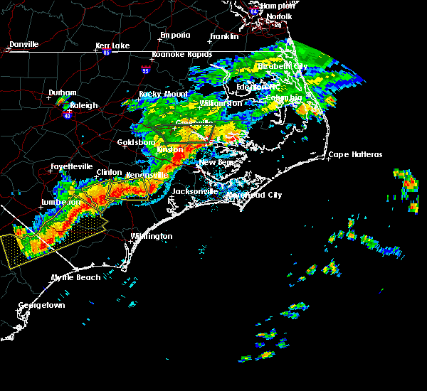 At 806 pm edt, a severe thunderstorm was located near rose hill, or 8 miles north of wallace, moving east at 40 mph (radar indicated). Hazards include quarter size hail. damage to vehicles is expected At 806 pm edt, a severe thunderstorm was located near rose hill, or 8 miles north of wallace, moving east at 40 mph (radar indicated). Hazards include quarter size hail. damage to vehicles is expected
|
| 7/7/2017 6:43 PM EDT |
 At 643 pm edt, a severe thunderstorm was located near harrells, or 11 miles southwest of wallace, moving east at 25 mph (radar indicated). Hazards include 60 mph wind gusts. expect wind damage to trees and power lines At 643 pm edt, a severe thunderstorm was located near harrells, or 11 miles southwest of wallace, moving east at 25 mph (radar indicated). Hazards include 60 mph wind gusts. expect wind damage to trees and power lines
|
| 6/24/2017 7:12 PM EDT |
 At 712 pm edt, severe thunderstorms were located along a line extending from near beulaville to near harrells, moving east at 40 mph (radar indicated). Hazards include 60 mph wind gusts and quarter size hail. Hail damage to vehicles is expected. Expect wind damage to roofs, siding, and trees. At 712 pm edt, severe thunderstorms were located along a line extending from near beulaville to near harrells, moving east at 40 mph (radar indicated). Hazards include 60 mph wind gusts and quarter size hail. Hail damage to vehicles is expected. Expect wind damage to roofs, siding, and trees.
|
| 5/30/2017 12:20 AM EDT |
 At 1219 am edt, a severe thunderstorm was located over wallace, moving east at 35 mph (radar indicated). Hazards include 60 mph wind gusts and quarter size hail. Hail damage to vehicles is expected. expect wind damage to roofs, siding, and trees. Locations impacted include, wallace, rose hill, greenevers and teachey. At 1219 am edt, a severe thunderstorm was located over wallace, moving east at 35 mph (radar indicated). Hazards include 60 mph wind gusts and quarter size hail. Hail damage to vehicles is expected. expect wind damage to roofs, siding, and trees. Locations impacted include, wallace, rose hill, greenevers and teachey.
|
| 5/29/2017 11:53 PM EDT |
 At 1152 pm edt, a severe thunderstorm was located 8 miles west of harrells, or 16 miles northeast of elizabethtown, moving east at 35 mph (radar indicated). Hazards include 60 mph wind gusts and quarter size hail. Hail damage to vehicles is expected. Expect wind damage to roofs, siding, and trees. At 1152 pm edt, a severe thunderstorm was located 8 miles west of harrells, or 16 miles northeast of elizabethtown, moving east at 35 mph (radar indicated). Hazards include 60 mph wind gusts and quarter size hail. Hail damage to vehicles is expected. Expect wind damage to roofs, siding, and trees.
|
| 5/5/2017 5:36 AM EDT |
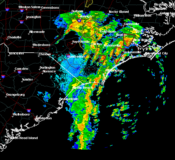 At 535 am edt, a severe thunderstorm capable of producing a tornado was located near wards corner, or near burgaw, moving north at 45 mph (radar indicated rotation). Hazards include tornado. Flying debris will be dangerous to those caught without shelter. mobile homes will be damaged or destroyed. damage to roofs, windows, and vehicles will occur. tree damage is likely. locations impacted include, burgaw, penderlea, wards corner, willard and watha. This includes interstate 40 between mile markers 388 and 396. At 535 am edt, a severe thunderstorm capable of producing a tornado was located near wards corner, or near burgaw, moving north at 45 mph (radar indicated rotation). Hazards include tornado. Flying debris will be dangerous to those caught without shelter. mobile homes will be damaged or destroyed. damage to roofs, windows, and vehicles will occur. tree damage is likely. locations impacted include, burgaw, penderlea, wards corner, willard and watha. This includes interstate 40 between mile markers 388 and 396.
|
| 5/5/2017 5:28 AM EDT |
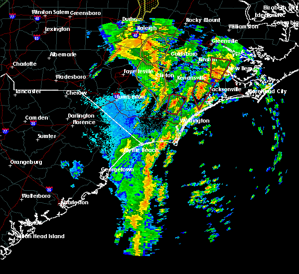 At 527 am edt, a severe thunderstorm capable of producing a tornado was located over montague, or 10 miles southwest of burgaw, moving north at 45 mph (radar indicated rotation). Hazards include tornado. Flying debris will be dangerous to those caught without shelter. mobile homes will be damaged or destroyed. damage to roofs, windows, and vehicles will occur. tree damage is likely. locations impacted include, burgaw, penderlea, long creek, murray town, malpass corner, montague, willard, currie, wards corner, the borough, white stocking, st. helena, watha and pender memorial hospital. This includes interstate 40 between mile markers 388 and 403. At 527 am edt, a severe thunderstorm capable of producing a tornado was located over montague, or 10 miles southwest of burgaw, moving north at 45 mph (radar indicated rotation). Hazards include tornado. Flying debris will be dangerous to those caught without shelter. mobile homes will be damaged or destroyed. damage to roofs, windows, and vehicles will occur. tree damage is likely. locations impacted include, burgaw, penderlea, long creek, murray town, malpass corner, montague, willard, currie, wards corner, the borough, white stocking, st. helena, watha and pender memorial hospital. This includes interstate 40 between mile markers 388 and 403.
|
| 5/5/2017 5:13 AM EDT |
 At 513 am edt, a severe thunderstorm capable of producing a tornado was located near the borough, or 11 miles north of leland, moving north at 45 mph (radar indicated rotation). Hazards include tornado. expect damage to mobile homes, roofs, and vehicles At 513 am edt, a severe thunderstorm capable of producing a tornado was located near the borough, or 11 miles north of leland, moving north at 45 mph (radar indicated rotation). Hazards include tornado. expect damage to mobile homes, roofs, and vehicles
|
| 3/18/2017 8:15 PM EDT |
 At 815 pm edt, a severe thunderstorm was located near malpass corner, or near burgaw, moving east at 40 mph (radar indicated). Hazards include 60 mph wind gusts and quarter size hail. Hail damage to vehicles is expected. expect wind damage to roofs, siding, and trees. locations impacted include, burgaw, hampstead, topsail beach, white stocking, penderlea, maple hill, long creek, murray town, malpass corner, ashton, willard, rocky point, topsail, wards corner, scotts hill, woodside, edgecomb, castle hayne, st. Helena and watha. At 815 pm edt, a severe thunderstorm was located near malpass corner, or near burgaw, moving east at 40 mph (radar indicated). Hazards include 60 mph wind gusts and quarter size hail. Hail damage to vehicles is expected. expect wind damage to roofs, siding, and trees. locations impacted include, burgaw, hampstead, topsail beach, white stocking, penderlea, maple hill, long creek, murray town, malpass corner, ashton, willard, rocky point, topsail, wards corner, scotts hill, woodside, edgecomb, castle hayne, st. Helena and watha.
|
| 3/18/2017 7:45 PM EDT |
 At 745 pm edt, a severe thunderstorm was located near lagoon, or 15 miles east of elizabethtown, moving east at 40 mph (law enforcement). Hazards include 60 mph wind gusts and quarter size hail. Hail damage to vehicles is expected. Expect wind damage to roofs, siding, and trees. At 745 pm edt, a severe thunderstorm was located near lagoon, or 15 miles east of elizabethtown, moving east at 40 mph (law enforcement). Hazards include 60 mph wind gusts and quarter size hail. Hail damage to vehicles is expected. Expect wind damage to roofs, siding, and trees.
|
| 7/31/2016 4:02 PM EDT |
 At 402 pm edt, a severe thunderstorm was located over point caswell, or 16 miles west of burgaw, moving northeast at 25 mph (radar indicated). Hazards include 60 mph wind gusts and quarter size hail. Hail damage to vehicles is expected. expect wind damage to roofs, siding, and trees. Locations impacted include, rowan, sandyfield, freeman, montague, currie, the borough, malpass corner, delco, wards corner, kelly, rooks, willard, riegelwood, penderlea, point caswell, east arcadia, atkinson and watha. At 402 pm edt, a severe thunderstorm was located over point caswell, or 16 miles west of burgaw, moving northeast at 25 mph (radar indicated). Hazards include 60 mph wind gusts and quarter size hail. Hail damage to vehicles is expected. expect wind damage to roofs, siding, and trees. Locations impacted include, rowan, sandyfield, freeman, montague, currie, the borough, malpass corner, delco, wards corner, kelly, rooks, willard, riegelwood, penderlea, point caswell, east arcadia, atkinson and watha.
|
| 7/31/2016 3:43 PM EDT |
 At 343 pm edt, a severe thunderstorm was located over sandyfield, or 16 miles northwest of leland, moving northeast at 25 mph (radar indicated). Hazards include 60 mph wind gusts and quarter size hail. Hail damage to vehicles is expected. Expect wind damage to roofs, siding, and trees. At 343 pm edt, a severe thunderstorm was located over sandyfield, or 16 miles northwest of leland, moving northeast at 25 mph (radar indicated). Hazards include 60 mph wind gusts and quarter size hail. Hail damage to vehicles is expected. Expect wind damage to roofs, siding, and trees.
|
| 7/15/2016 5:41 PM EDT |
 At 540 pm edt, a severe thunderstorm was located near kenansville, or 7 miles southeast of warsaw, moving east at 30 mph (radar indicated). Hazards include 60 mph wind gusts and nickel size hail. Expect damage to roofs. siding. and trees. Locations impacted include, wallace, warsaw, rose hill, beulaville, kenansville, harrells, magnolia, greenevers and teachey. At 540 pm edt, a severe thunderstorm was located near kenansville, or 7 miles southeast of warsaw, moving east at 30 mph (radar indicated). Hazards include 60 mph wind gusts and nickel size hail. Expect damage to roofs. siding. and trees. Locations impacted include, wallace, warsaw, rose hill, beulaville, kenansville, harrells, magnolia, greenevers and teachey.
|
| 7/15/2016 5:25 PM EDT |
 At 525 pm edt, a severe thunderstorm was located near kenansville, or 7 miles southeast of warsaw, moving east at 30 mph (radar indicated). Hazards include 60 mph wind gusts and quarter size hail. Hail damage to vehicles is expected. Expect wind damage to roofs, siding, and trees. At 525 pm edt, a severe thunderstorm was located near kenansville, or 7 miles southeast of warsaw, moving east at 30 mph (radar indicated). Hazards include 60 mph wind gusts and quarter size hail. Hail damage to vehicles is expected. Expect wind damage to roofs, siding, and trees.
|
| 7/8/2016 11:30 PM EDT |
 At 1130 pm edt, a severe thunderstorm was located near penderlea, or 11 miles southwest of wallace, moving east at 35 mph (radar indicated). Hazards include 60 mph wind gusts and penny size hail. Expect damage to roofs. siding. And trees. At 1130 pm edt, a severe thunderstorm was located near penderlea, or 11 miles southwest of wallace, moving east at 35 mph (radar indicated). Hazards include 60 mph wind gusts and penny size hail. Expect damage to roofs. siding. And trees.
|
| 7/8/2016 10:31 PM EDT |
 At 1030 pm edt, severe thunderstorms were located along a line extending from 7 miles northwest of ocracoke ferry terminal to 7 miles north of morehead city to near half moon, moving southeast at 45 mph (law enforcement indicated). Hazards include 60 mph wind gusts. Expect damage to roofs. siding. and trees. Locations impacted include, jacksonville, new bern, havelock, morehead city, newport, wallace, warsaw, camp lejeune center, pumpkin center, half moon, new river station, piney green, james city, mount olive, swansboro, cape carteret, rose hill, richlands, pine knoll shores and beulaville. At 1030 pm edt, severe thunderstorms were located along a line extending from 7 miles northwest of ocracoke ferry terminal to 7 miles north of morehead city to near half moon, moving southeast at 45 mph (law enforcement indicated). Hazards include 60 mph wind gusts. Expect damage to roofs. siding. and trees. Locations impacted include, jacksonville, new bern, havelock, morehead city, newport, wallace, warsaw, camp lejeune center, pumpkin center, half moon, new river station, piney green, james city, mount olive, swansboro, cape carteret, rose hill, richlands, pine knoll shores and beulaville.
|
| 7/8/2016 10:14 PM EDT |
 At 1012 pm edt, severe thunderstorms were located along a line extending from 7 miles east of swan quarter ferry terminal to near neuse forest to 8 miles north of richlands, moving southeast at 45 mph. a gust to 58 mph was recorded at the the coastal carolina regional airport in new bern (radar indicated). Hazards include 60 mph wind gusts. Expect damage to roofs. siding. and trees. Locations impacted include, jacksonville, new bern, havelock, morehead city, newport, wallace, warsaw, camp lejeune center, pumpkin center, half moon, new river station, piney green, james city, mount olive, trent woods, river bend, swansboro, cape carteret, rose hill and richlands. At 1012 pm edt, severe thunderstorms were located along a line extending from 7 miles east of swan quarter ferry terminal to near neuse forest to 8 miles north of richlands, moving southeast at 45 mph. a gust to 58 mph was recorded at the the coastal carolina regional airport in new bern (radar indicated). Hazards include 60 mph wind gusts. Expect damage to roofs. siding. and trees. Locations impacted include, jacksonville, new bern, havelock, morehead city, newport, wallace, warsaw, camp lejeune center, pumpkin center, half moon, new river station, piney green, james city, mount olive, trent woods, river bend, swansboro, cape carteret, rose hill and richlands.
|
| 7/8/2016 9:41 PM EDT |
 At 940 pm edt, severe thunderstorms were located along a line extending from 8 miles east of belhaven to 7 miles northwest of new bern to 6 miles south of walnut creek, moving southeast at 40 mph (radar indicated). Hazards include 60 mph wind gusts. Expect damage to roofs. siding. And trees. At 940 pm edt, severe thunderstorms were located along a line extending from 8 miles east of belhaven to 7 miles northwest of new bern to 6 miles south of walnut creek, moving southeast at 40 mph (radar indicated). Hazards include 60 mph wind gusts. Expect damage to roofs. siding. And trees.
|
| 6/14/2016 6:52 PM EDT |
 At 652 pm edt, a severe thunderstorm was located over wallace, moving east at 15 mph (radar indicated). Hazards include 60 mph wind gusts and quarter size hail. Hail damage to vehicles is expected. expect wind damage to roofs, siding, and trees. Locations impacted include, wallace. At 652 pm edt, a severe thunderstorm was located over wallace, moving east at 15 mph (radar indicated). Hazards include 60 mph wind gusts and quarter size hail. Hail damage to vehicles is expected. expect wind damage to roofs, siding, and trees. Locations impacted include, wallace.
|
| 6/14/2016 6:45 PM EDT | Media received reports of a few trees down and quarter size hail near wallace. time estimated from rada in duplin county NC, 1.1 miles NE of Wallace, NC |
| 6/14/2016 6:43 PM EDT | Quarter sized hail reported 1.1 miles NE of Wallace, NC, ham radio report relayed by wfo ilm |
| 6/14/2016 6:33 PM EDT |
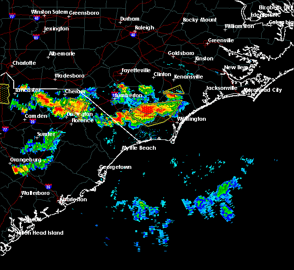 At 632 pm edt, a severe thunderstorm was located over wallace, moving northeast at 15 mph (radar indicated). Hazards include golf ball size hail and 60 mph wind gusts. People and animals outdoors will be injured. expect hail damage to roofs, siding, windows, and vehicles. Expect wind damage to roofs, siding, and trees. At 632 pm edt, a severe thunderstorm was located over wallace, moving northeast at 15 mph (radar indicated). Hazards include golf ball size hail and 60 mph wind gusts. People and animals outdoors will be injured. expect hail damage to roofs, siding, windows, and vehicles. Expect wind damage to roofs, siding, and trees.
|
| 5/3/2016 9:22 PM EDT |
 At 921 pm edt, a severe thunderstorm was located near white stocking, or 9 miles northeast of burgaw, moving east at 40 mph (radar indicated). Hazards include 60 mph wind gusts and quarter size hail. Hail damage to vehicles is expected. expect wind damage to roofs, siding, and trees. Locations impacted include, burgaw, willard, murray town, maple hill, white stocking, penderlea, watha and pender memorial hospital. At 921 pm edt, a severe thunderstorm was located near white stocking, or 9 miles northeast of burgaw, moving east at 40 mph (radar indicated). Hazards include 60 mph wind gusts and quarter size hail. Hail damage to vehicles is expected. expect wind damage to roofs, siding, and trees. Locations impacted include, burgaw, willard, murray town, maple hill, white stocking, penderlea, watha and pender memorial hospital.
|
| 5/3/2016 8:55 PM EDT |
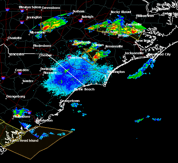 At 854 pm edt, a severe thunderstorm was located near penderlea, or 8 miles southwest of wallace, moving east at 40 mph (radar indicated). Hazards include 60 mph wind gusts and quarter size hail. Hail damage to vehicles is expected. Expect wind damage to roofs, siding, and trees. At 854 pm edt, a severe thunderstorm was located near penderlea, or 8 miles southwest of wallace, moving east at 40 mph (radar indicated). Hazards include 60 mph wind gusts and quarter size hail. Hail damage to vehicles is expected. Expect wind damage to roofs, siding, and trees.
|
| 4/7/2016 7:53 AM EDT |
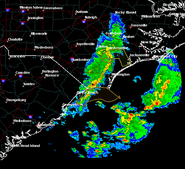 At 753 am edt, doppler radar indicated a severe thunderstorm capable of producing quarter size hail and damaging winds in excess of 60 mph. this storm was located over wallace, moving northeast at 45 mph. locations impacted include, willard, penderlea and watha. this includes interstate 40 between mile markers 389 and 394. At 753 am edt, doppler radar indicated a severe thunderstorm capable of producing quarter size hail and damaging winds in excess of 60 mph. this storm was located over wallace, moving northeast at 45 mph. locations impacted include, willard, penderlea and watha. this includes interstate 40 between mile markers 389 and 394.
|
| 4/7/2016 7:46 AM EDT |
 At 746 am edt, doppler radar indicated a severe thunderstorm capable of producing quarter size hail and damaging winds in excess of 60 mph. this storm was located near penderlea, or near wallace, moving northeast at 45 mph. locations impacted include, willard, wards corner, penderlea, atkinson and watha. this includes interstate 40 between mile markers 389 and 394. At 746 am edt, doppler radar indicated a severe thunderstorm capable of producing quarter size hail and damaging winds in excess of 60 mph. this storm was located near penderlea, or near wallace, moving northeast at 45 mph. locations impacted include, willard, wards corner, penderlea, atkinson and watha. this includes interstate 40 between mile markers 389 and 394.
|
| 4/7/2016 7:41 AM EDT |
 At 740 am edt, doppler radar indicated a severe thunderstorm capable of producing quarter size hail and damaging winds in excess of 60 mph. this storm was located near harrells, or 11 miles southwest of wallace, moving northeast at 45 mph. locations impacted include, rowan, rooks, willard, wards corner, penderlea, kelly, atkinson and watha. this includes interstate 40 between mile markers 389 and 394. At 740 am edt, doppler radar indicated a severe thunderstorm capable of producing quarter size hail and damaging winds in excess of 60 mph. this storm was located near harrells, or 11 miles southwest of wallace, moving northeast at 45 mph. locations impacted include, rowan, rooks, willard, wards corner, penderlea, kelly, atkinson and watha. this includes interstate 40 between mile markers 389 and 394.
|
| 4/7/2016 7:37 AM EDT |
 At 736 am edt, doppler radar indicated a severe thunderstorm capable of producing damaging winds in excess of 60 mph. this storm was located near penderlea, or 9 miles southwest of wallace, and moving northeast at 55 mph. At 736 am edt, doppler radar indicated a severe thunderstorm capable of producing damaging winds in excess of 60 mph. this storm was located near penderlea, or 9 miles southwest of wallace, and moving northeast at 55 mph.
|
| 4/7/2016 7:17 AM EDT |
 At 717 am edt, doppler radar indicated a severe thunderstorm capable of producing quarter size hail and damaging winds in excess of 60 mph. this storm was located over lagoon, or 10 miles southeast of elizabethtown, and moving northeast at 45 mph. At 717 am edt, doppler radar indicated a severe thunderstorm capable of producing quarter size hail and damaging winds in excess of 60 mph. this storm was located over lagoon, or 10 miles southeast of elizabethtown, and moving northeast at 45 mph.
|
| 12/23/2015 8:41 AM EST | At 840 am est, doppler radar indicated a severe thunderstorm capable of producing a tornado. this dangerous storm was located between harrells and rose hill, moving northeast at 30 mph. locations impacted include, wallace, warsaw, rose hill, beulaville, kenansville, harrells, magnolia, greenevers and teachey. |
| 12/23/2015 8:25 AM EST | At 822 am est, doppler radar indicated a severe thunderstorm capable of producing a tornado. the storm has weakened slightly but is still capable of producing strong wind gusts or a brief tornado. this dangerous storm was located near harrells, or near wallace, moving northeast at 40 mph. locations impacted include, wallace, warsaw, rose hill, beulaville, kenansville, harrells, magnolia, greenevers and teachey. |
| 12/23/2015 8:06 AM EST | At 805 am est, doppler radar indicated a severe thunderstorm capable of producing a tornado. this dangerous storm was located 7 miles southwest of harrells, or 17 miles west of wallace, and moving northeast at 40 mph. |
| 9/4/2015 8:26 PM EDT |
 The severe thunderstorm warning for northwestern pender county will expire at 830 pm edt, the storm which prompted the warning has weakened below severe limits, and no longer poses an immediate threat to life or property. therefore the warning will be allowed to expire. however gusty winds and heavy rain are still expected with this thunderstorm. The severe thunderstorm warning for northwestern pender county will expire at 830 pm edt, the storm which prompted the warning has weakened below severe limits, and no longer poses an immediate threat to life or property. therefore the warning will be allowed to expire. however gusty winds and heavy rain are still expected with this thunderstorm.
|
| 9/4/2015 8:00 PM EDT |
 At 800 pm edt, doppler radar indicated a severe thunderstorm capable of producing quarter size hail and damaging winds in excess of 60 mph. this storm was located over burgaw, moving south at 5 mph. this storm was beginning to slow down and weaken and was producing very heavy rainfall. locations impacted include, burgaw, malpass corner, murray town, white stocking, wards corner, rocky point, rooks, willard, ashton, penderlea, currie, long creek, st. helena, atkinson, watha and pender memorial hospital. this includes interstate 40 between mile markers 388 and 410. At 800 pm edt, doppler radar indicated a severe thunderstorm capable of producing quarter size hail and damaging winds in excess of 60 mph. this storm was located over burgaw, moving south at 5 mph. this storm was beginning to slow down and weaken and was producing very heavy rainfall. locations impacted include, burgaw, malpass corner, murray town, white stocking, wards corner, rocky point, rooks, willard, ashton, penderlea, currie, long creek, st. helena, atkinson, watha and pender memorial hospital. this includes interstate 40 between mile markers 388 and 410.
|
| 9/4/2015 7:27 PM EDT |
 At 727 pm edt, doppler radar indicated a severe thunderstorm capable of producing quarter size hail and damaging winds in excess of 60 mph. this storm was located over murray town, or near burgaw, and moving south at 10 mph. At 727 pm edt, doppler radar indicated a severe thunderstorm capable of producing quarter size hail and damaging winds in excess of 60 mph. this storm was located over murray town, or near burgaw, and moving south at 10 mph.
|
| 8/6/2015 6:22 PM EDT |
 At 622 pm edt, doppler radar indicated a severe thunderstorm capable of producing quarter size hail and damaging winds in excess of 60 mph. this storm was located near rowan, or 16 miles southwest of wallace, and moving east at 15 mph. At 622 pm edt, doppler radar indicated a severe thunderstorm capable of producing quarter size hail and damaging winds in excess of 60 mph. this storm was located near rowan, or 16 miles southwest of wallace, and moving east at 15 mph.
|
| 7/23/2015 2:17 PM EDT |
 At 216 pm edt, doppler radar indicated a severe thunderstorm capable of producing quarter size hail and damaging winds in excess of 60 mph. this storm was located over rooks, or 12 miles west of burgaw, and moving east at 25 mph. At 216 pm edt, doppler radar indicated a severe thunderstorm capable of producing quarter size hail and damaging winds in excess of 60 mph. this storm was located over rooks, or 12 miles west of burgaw, and moving east at 25 mph.
|
| 7/23/2015 1:33 PM EDT |
 At 131 pm edt, doppler radar indicated a line of severe thunderstorms capable of producing quarter size hail and destructive winds in excess of 70 mph. these storms were located along a line extending from 8 miles southeast of mount olive to rose hill, and moving east at 25 mph. At 131 pm edt, doppler radar indicated a line of severe thunderstorms capable of producing quarter size hail and destructive winds in excess of 70 mph. these storms were located along a line extending from 8 miles southeast of mount olive to rose hill, and moving east at 25 mph.
|
| 7/23/2015 1:18 PM EDT |
 At 118 pm edt, doppler radar indicated a severe thunderstorm capable of producing quarter size hail and damaging winds in excess of 60 mph. this storm was located near penderlea, or 11 miles west of burgaw, and moving east at 25 mph. At 118 pm edt, doppler radar indicated a severe thunderstorm capable of producing quarter size hail and damaging winds in excess of 60 mph. this storm was located near penderlea, or 11 miles west of burgaw, and moving east at 25 mph.
|
| 5/21/2015 4:27 PM EDT | At 426 pm edt, doppler radar indicated a line of severe thunderstorms capable of producing quarter size hail and damaging winds in excess of 60 mph. these storms were located along a line extending from 14 miles southwest of kinston to beulaville to near wards corner, and moving east at 25 mph. |
| 8/22/2013 5:35 PM EDT | Half Dollar sized hail reported 2.9 miles WSW of Wallace, NC, several reports of quarter to half dollar size hail along hwy-41 near the i-40 exchange |
| 8/22/2013 5:35 PM EDT | Numerous trees down along the rivenbark town rd area in duplin county NC, 3.7 miles SW of Wallace, NC |
| 1/1/0001 12:00 AM | Trees down along with powerlines and transformer on e. southerland st in duplin county NC, 1.1 miles NE of Wallace, NC |
| 1/1/0001 12:00 AM | Trees down along with powerlines and transformer on frank cottle rd in duplin county NC, 1.1 miles NE of Wallace, NC |
Hail Maps for Wallace, NC


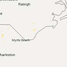


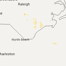


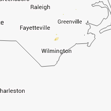


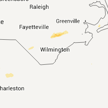


Connect with Interactive Hail Maps