

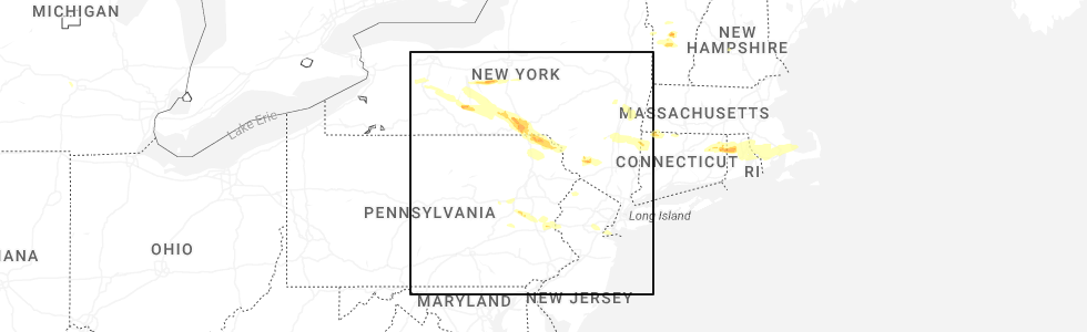
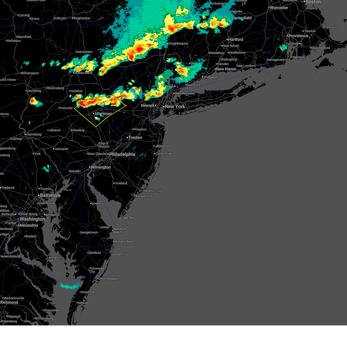
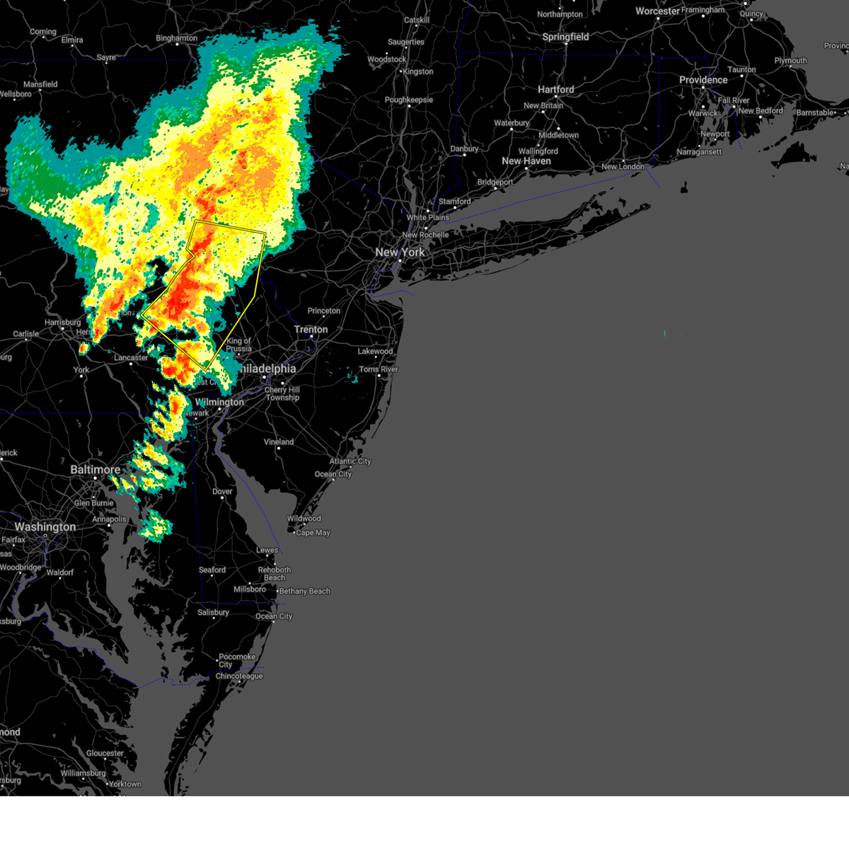
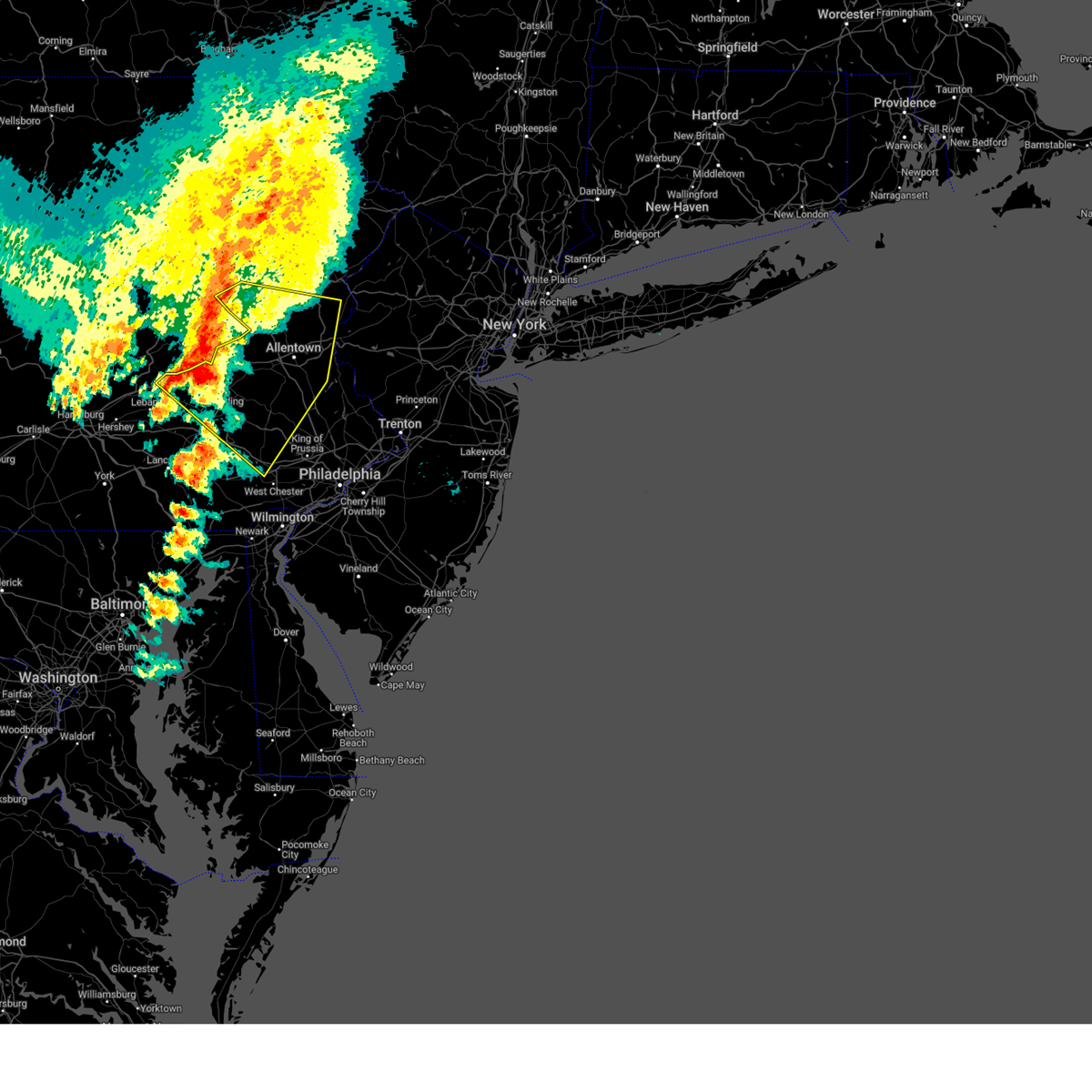
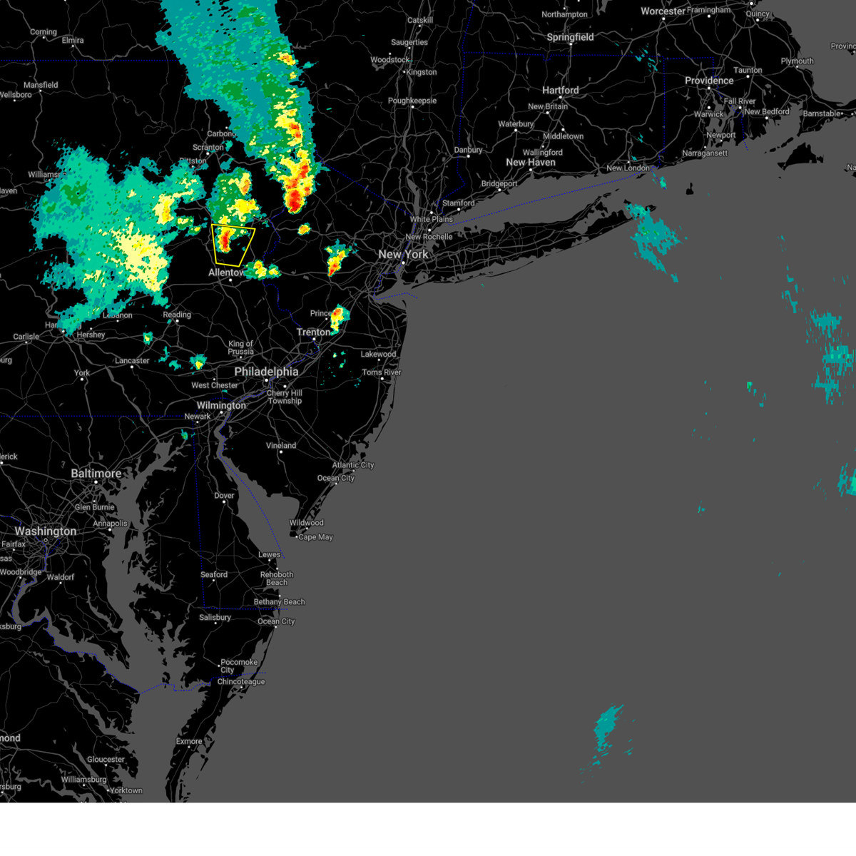
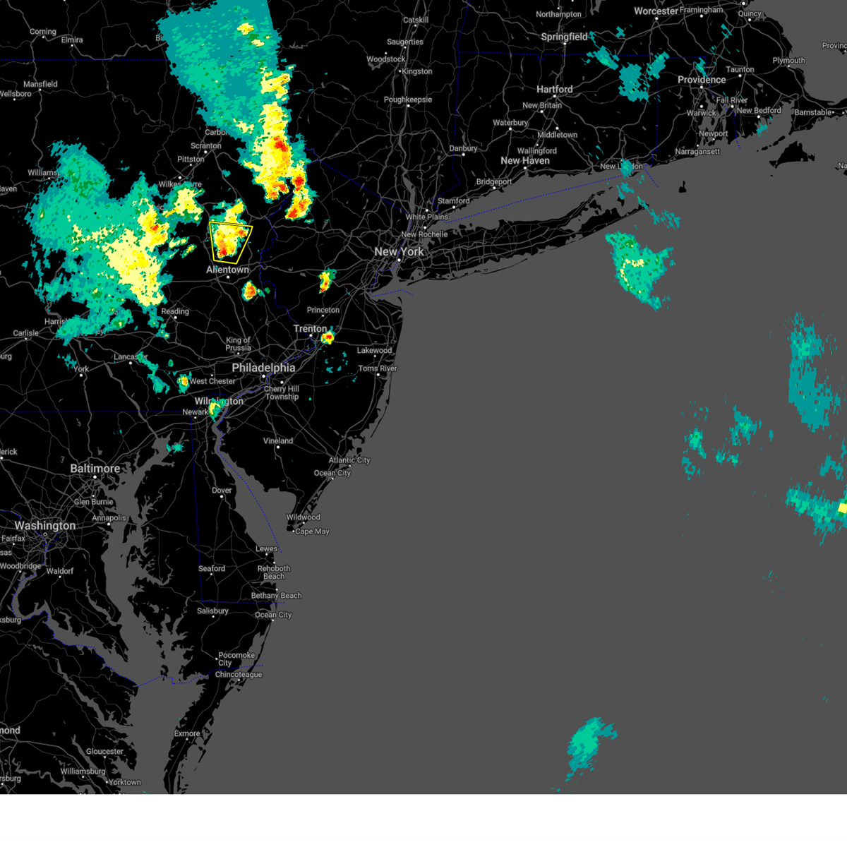
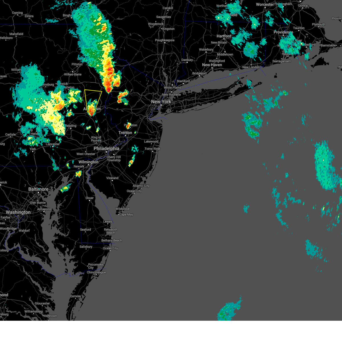
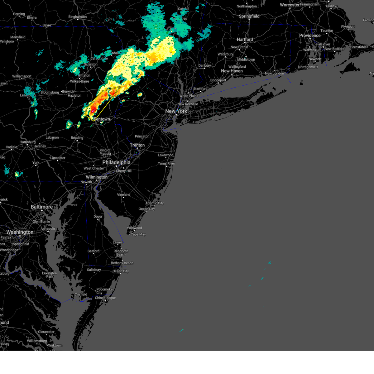
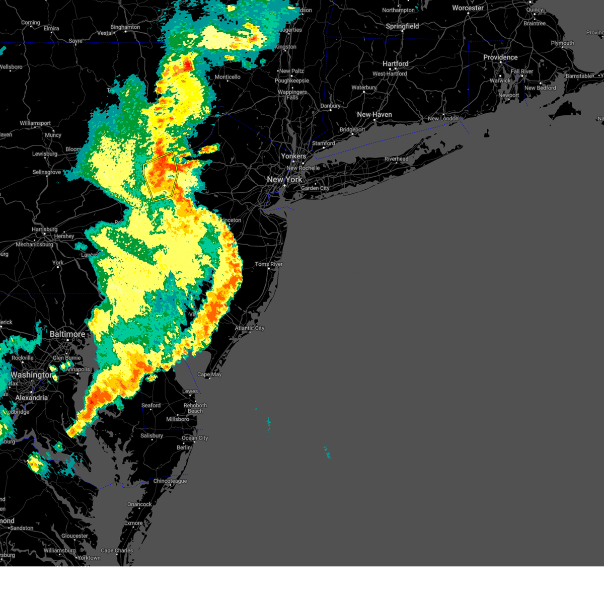
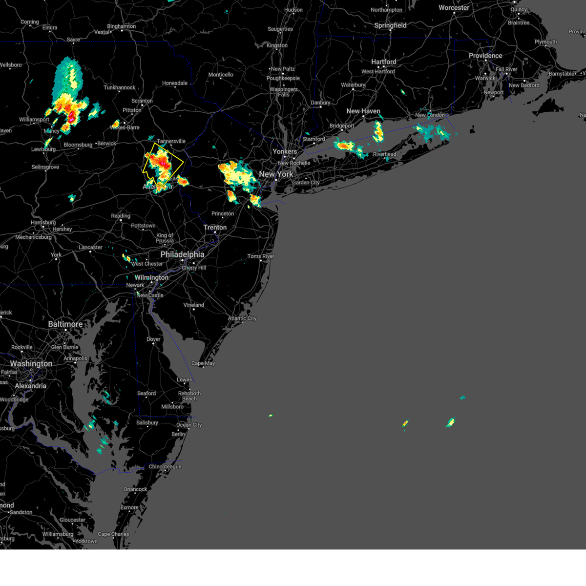
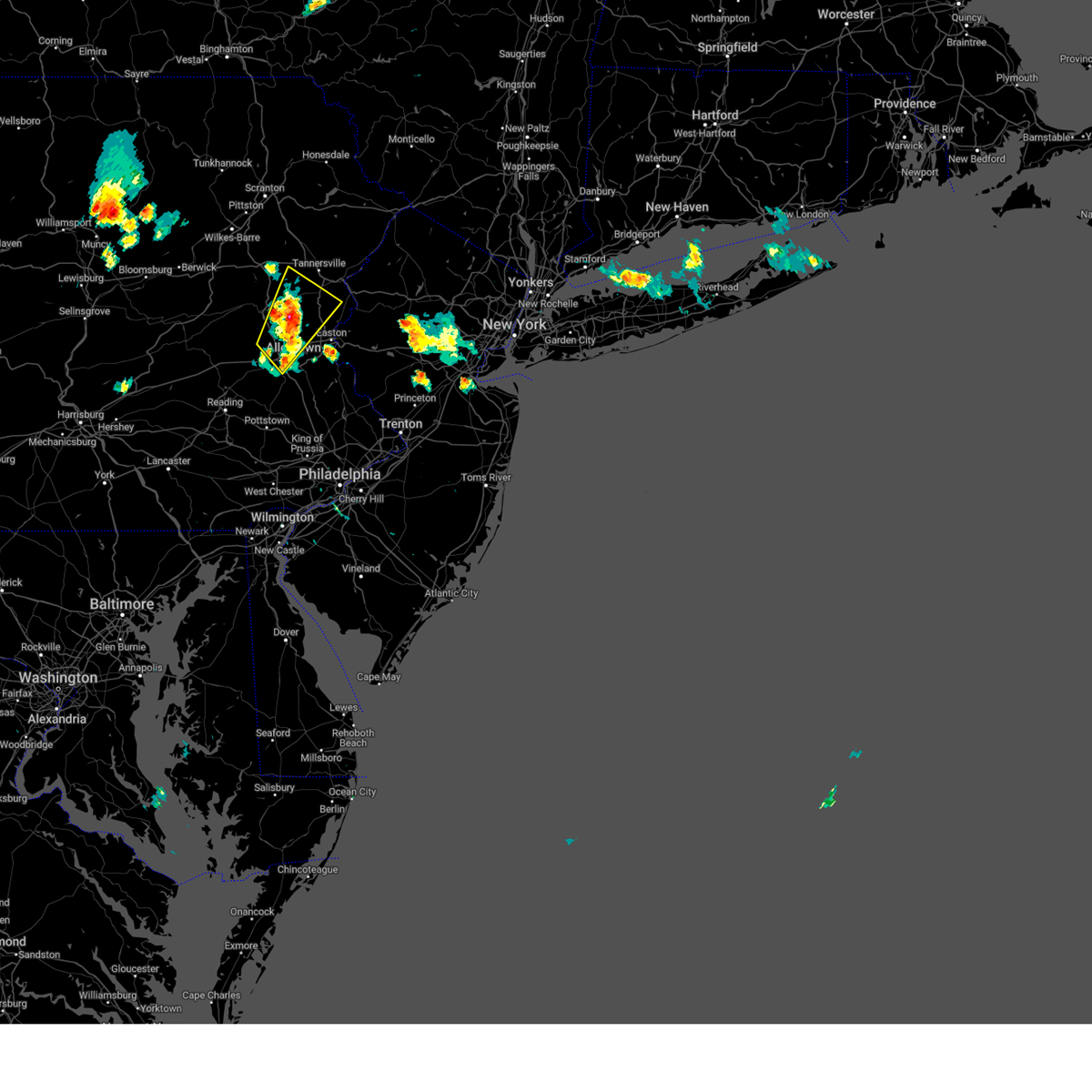
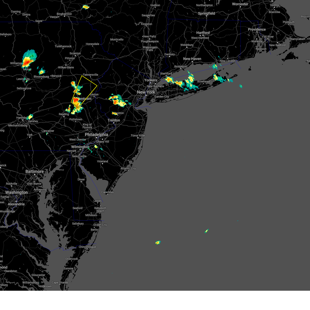
Hail Map for Walnutport, PA
The Walnutport, PA area has had 1 report of on-the-ground hail by trained spotters, and has been under severe weather warnings 16 times during the past 12 months. Doppler radar has detected hail at or near Walnutport, PA on 25 occasions, including 1 occasion during the past year.
| Name: | Walnutport, PA |
| Where Located: | 45.7 miles S of Scranton, PA |
| Map: | Google Map for Walnutport, PA |
| Population: | 2070 |
| Housing Units: | 888 |
| More Info: | Search Google for Walnutport, PA |
3
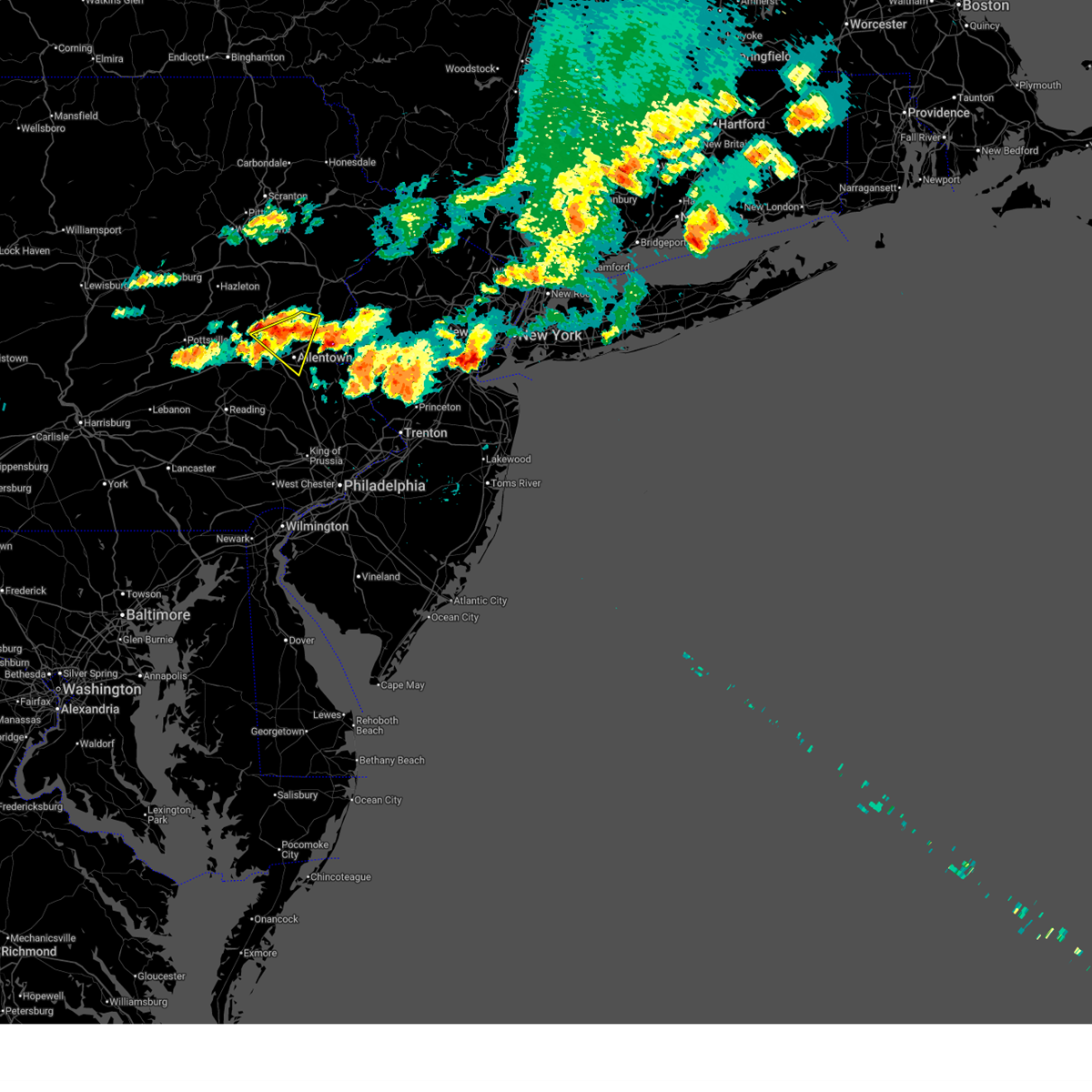
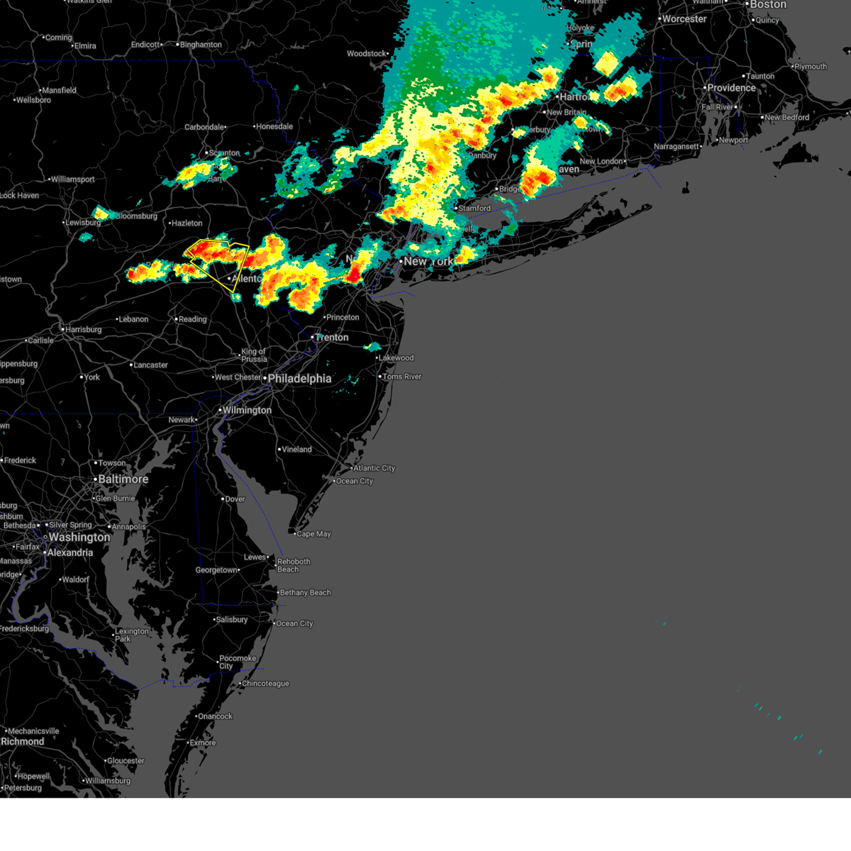
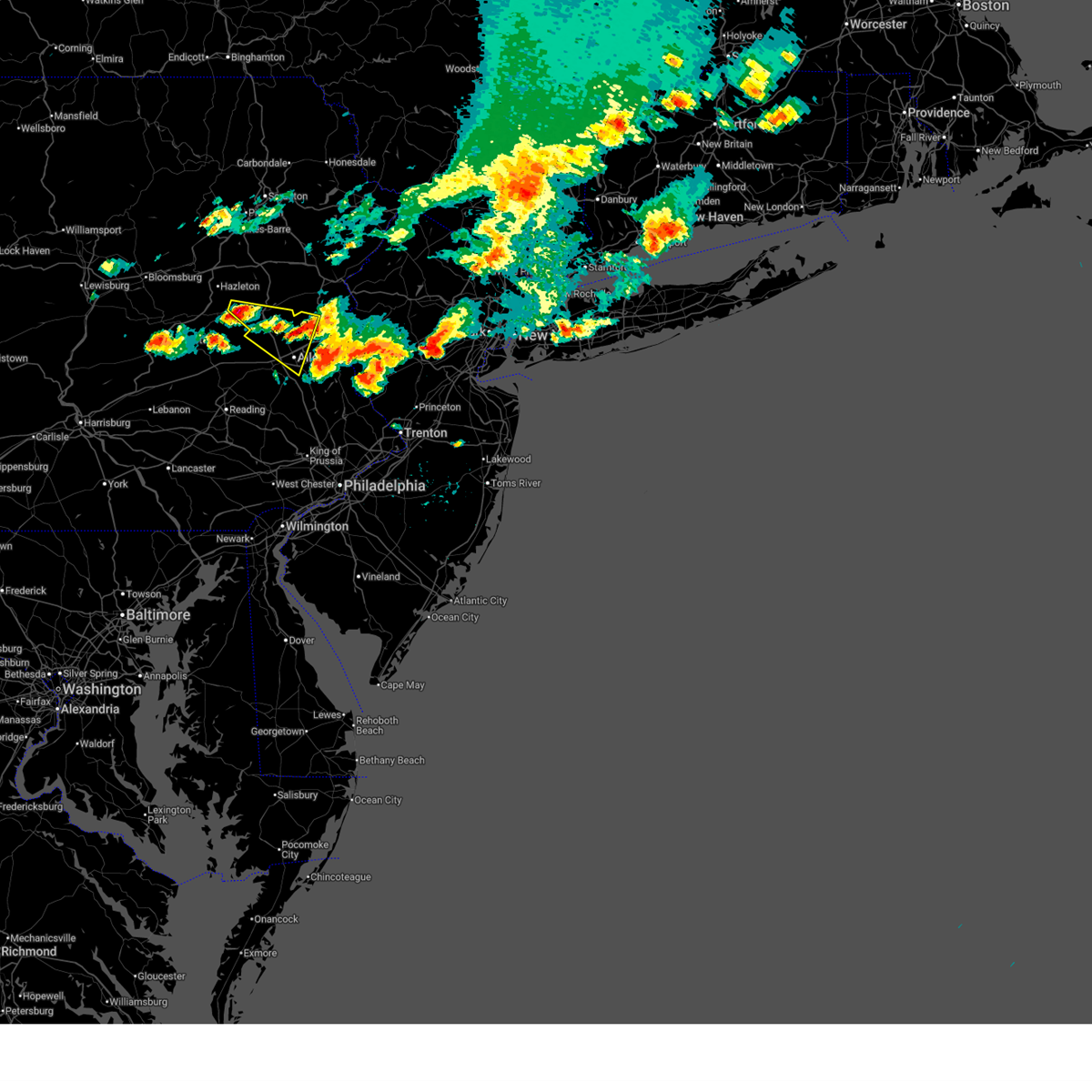
The Top Recent Hail Date for Walnutport, PA is Thursday, July 3, 2025 (5th out of 25)
Hail and Wind Damage Spotted near Walnutport, PA
| Date / Time | Report Details |
|---|---|
| 7/3/2025 6:23 PM EDT |
 the severe thunderstorm warning has been cancelled and is no longer in effect the severe thunderstorm warning has been cancelled and is no longer in effect
|
| 7/3/2025 6:23 PM EDT |
 At 623 pm edt, a severe thunderstorm was located over northampton, or 7 miles northwest of allentown, moving east at 30 mph (radar indicated). Hazards include 60 mph wind gusts and nickel size hail. Damage to roofs, siding, trees, and power lines is possible. Locations impacted include, allentown, bethlehem, emmaus, northampton, slatington, bath, walnutport, steuben, neffs, coffeetown, berlinsville, jordan valley, beersville, emerald, schnecksville, catasauqua, fountain hill, coplay, north catasauqua, and chapman. At 623 pm edt, a severe thunderstorm was located over northampton, or 7 miles northwest of allentown, moving east at 30 mph (radar indicated). Hazards include 60 mph wind gusts and nickel size hail. Damage to roofs, siding, trees, and power lines is possible. Locations impacted include, allentown, bethlehem, emmaus, northampton, slatington, bath, walnutport, steuben, neffs, coffeetown, berlinsville, jordan valley, beersville, emerald, schnecksville, catasauqua, fountain hill, coplay, north catasauqua, and chapman.
|
| 7/3/2025 6:07 PM EDT |
 At 607 pm edt, a severe thunderstorm was located near jordan valley, or near lehighton, moving east at 30 mph (radar indicated). Hazards include 60 mph wind gusts and quarter size hail. Minor damage to vehicles is possible. wind damage to roofs, siding, trees, and power lines is possible. Locations impacted include, allentown, lehighton, bethlehem, emmaus, northampton, palmerton, slatington, bath, walnutport, steuben, new mahoning, neffs, coffeetown, berlinsville, emerald, danielsville, jordan valley, beersville, schnecksville, and catasauqua. At 607 pm edt, a severe thunderstorm was located near jordan valley, or near lehighton, moving east at 30 mph (radar indicated). Hazards include 60 mph wind gusts and quarter size hail. Minor damage to vehicles is possible. wind damage to roofs, siding, trees, and power lines is possible. Locations impacted include, allentown, lehighton, bethlehem, emmaus, northampton, palmerton, slatington, bath, walnutport, steuben, new mahoning, neffs, coffeetown, berlinsville, emerald, danielsville, jordan valley, beersville, schnecksville, and catasauqua.
|
| 7/3/2025 5:56 PM EDT |
 Svrphi the national weather service in mount holly nj has issued a * severe thunderstorm warning for, central lehigh county in eastern pennsylvania, southern carbon county in northeastern pennsylvania, southwestern northampton county in eastern pennsylvania, * until 645 pm edt. * at 555 pm edt, a severe thunderstorm was located over new mahoning, or near lehighton, moving east at 30 mph (radar indicated). Hazards include 60 mph wind gusts and half dollar size hail. Minor damage to vehicles is possible. Wind damage to roofs, siding, trees, and power lines is possible. Svrphi the national weather service in mount holly nj has issued a * severe thunderstorm warning for, central lehigh county in eastern pennsylvania, southern carbon county in northeastern pennsylvania, southwestern northampton county in eastern pennsylvania, * until 645 pm edt. * at 555 pm edt, a severe thunderstorm was located over new mahoning, or near lehighton, moving east at 30 mph (radar indicated). Hazards include 60 mph wind gusts and half dollar size hail. Minor damage to vehicles is possible. Wind damage to roofs, siding, trees, and power lines is possible.
|
| 7/3/2025 5:11 PM EDT |
 At 511 pm edt, severe thunderstorms were located along a line extending from washington to harmony to beersville to near new tripoli, moving southeast at 30 mph (radar indicated). Hazards include 60 mph wind gusts and quarter size hail. Minor damage to vehicles is possible. wind damage to roofs, siding, trees, and power lines is possible. Locations impacted include, allentown, easton, bethlehem, forks, emmaus, northampton, quakertown, wilson, washington, hellertown, nazareth, palmerton, bangor, slatington, high bridge, pen argyl, wind gap, bath, belvidere, and harmony. At 511 pm edt, severe thunderstorms were located along a line extending from washington to harmony to beersville to near new tripoli, moving southeast at 30 mph (radar indicated). Hazards include 60 mph wind gusts and quarter size hail. Minor damage to vehicles is possible. wind damage to roofs, siding, trees, and power lines is possible. Locations impacted include, allentown, easton, bethlehem, forks, emmaus, northampton, quakertown, wilson, washington, hellertown, nazareth, palmerton, bangor, slatington, high bridge, pen argyl, wind gap, bath, belvidere, and harmony.
|
| 7/3/2025 4:59 PM EDT |
 At 459 pm edt, severe thunderstorms were located along a line extending from near belvidere to belfast to walnutport to snyders, moving southeast at 30 mph (radar indicated). Hazards include 60 mph wind gusts and quarter size hail. Minor damage to vehicles is possible. wind damage to roofs, siding, trees, and power lines is possible. Locations impacted include, allentown, easton, lehighton, bethlehem, forks, emmaus, northampton, quakertown, wilson, washington, hellertown, nazareth, palmerton, bangor, jim thorpe, slatington, high bridge, pen argyl, nesquehoning, and wind gap. At 459 pm edt, severe thunderstorms were located along a line extending from near belvidere to belfast to walnutport to snyders, moving southeast at 30 mph (radar indicated). Hazards include 60 mph wind gusts and quarter size hail. Minor damage to vehicles is possible. wind damage to roofs, siding, trees, and power lines is possible. Locations impacted include, allentown, easton, lehighton, bethlehem, forks, emmaus, northampton, quakertown, wilson, washington, hellertown, nazareth, palmerton, bangor, jim thorpe, slatington, high bridge, pen argyl, nesquehoning, and wind gap.
|
| 7/3/2025 4:41 PM EDT |
 Svrphi the national weather service in mount holly nj has issued a * severe thunderstorm warning for, northwestern hunterdon county in northwestern new jersey, southwestern warren county in northwestern new jersey, lehigh county in eastern pennsylvania, southern carbon county in northeastern pennsylvania, northwestern bucks county in southeastern pennsylvania, southwestern monroe county in northeastern pennsylvania, northampton county in eastern pennsylvania, * until 530 pm edt. * at 440 pm edt, severe thunderstorms were located along a line extending from near saylorsburg to rossland to near lehighton to hometown, moving southeast at 30 mph (radar indicated). Hazards include 60 mph wind gusts and quarter size hail. Minor damage to vehicles is possible. Wind damage to roofs, siding, trees, and power lines is possible. Svrphi the national weather service in mount holly nj has issued a * severe thunderstorm warning for, northwestern hunterdon county in northwestern new jersey, southwestern warren county in northwestern new jersey, lehigh county in eastern pennsylvania, southern carbon county in northeastern pennsylvania, northwestern bucks county in southeastern pennsylvania, southwestern monroe county in northeastern pennsylvania, northampton county in eastern pennsylvania, * until 530 pm edt. * at 440 pm edt, severe thunderstorms were located along a line extending from near saylorsburg to rossland to near lehighton to hometown, moving southeast at 30 mph (radar indicated). Hazards include 60 mph wind gusts and quarter size hail. Minor damage to vehicles is possible. Wind damage to roofs, siding, trees, and power lines is possible.
|
| 5/16/2025 11:04 AM EDT |
 At 1103 am edt, severe thunderstorms were located along a line extending from near beersville to near ancient oaks to 6 miles northeast of birdsboro, moving east at 40 mph (law enforcement. at 1100 am edt, a downed tree and building collapse was reported in exeter township in berks county). Hazards include 60 mph wind gusts and quarter size hail. Minor damage to vehicles is possible. wind damage to roofs, siding, trees, and power lines is possible. Locations impacted include, allentown, reading, easton, bethlehem, pottstown, forks, emmaus, wyomissing, northampton, quakertown, wilson, downingtown, hellertown, nazareth, palmerton, bangor, birdsboro, kutztown, royersford, and slatington. At 1103 am edt, severe thunderstorms were located along a line extending from near beersville to near ancient oaks to 6 miles northeast of birdsboro, moving east at 40 mph (law enforcement. at 1100 am edt, a downed tree and building collapse was reported in exeter township in berks county). Hazards include 60 mph wind gusts and quarter size hail. Minor damage to vehicles is possible. wind damage to roofs, siding, trees, and power lines is possible. Locations impacted include, allentown, reading, easton, bethlehem, pottstown, forks, emmaus, wyomissing, northampton, quakertown, wilson, downingtown, hellertown, nazareth, palmerton, bangor, birdsboro, kutztown, royersford, and slatington.
|
| 5/16/2025 10:48 AM EDT |
 At 1048 am edt, severe thunderstorms were located along a line extending from near palmerton to near claussville to laureldale, moving east at 40 mph (radar indicated). Hazards include 60 mph wind gusts and quarter size hail. Minor damage to vehicles is possible. wind damage to roofs, siding, trees, and power lines is possible. Locations impacted include, allentown, reading, easton, lehighton, bethlehem, pottstown, forks, emmaus, wyomissing, northampton, quakertown, wilson, downingtown, hellertown, nazareth, palmerton, bangor, birdsboro, kutztown, and jim thorpe. At 1048 am edt, severe thunderstorms were located along a line extending from near palmerton to near claussville to laureldale, moving east at 40 mph (radar indicated). Hazards include 60 mph wind gusts and quarter size hail. Minor damage to vehicles is possible. wind damage to roofs, siding, trees, and power lines is possible. Locations impacted include, allentown, reading, easton, lehighton, bethlehem, pottstown, forks, emmaus, wyomissing, northampton, quakertown, wilson, downingtown, hellertown, nazareth, palmerton, bangor, birdsboro, kutztown, and jim thorpe.
|
| 5/16/2025 10:24 AM EDT |
 Svrphi the national weather service in mount holly nj has issued a * severe thunderstorm warning for, berks county in eastern pennsylvania, lehigh county in eastern pennsylvania, northwestern montgomery county in southeastern pennsylvania, carbon county in northeastern pennsylvania, northwestern bucks county in southeastern pennsylvania, north central chester county in southeastern pennsylvania, southwestern monroe county in northeastern pennsylvania, northampton county in eastern pennsylvania, * until 1130 am edt. * at 1024 am edt, severe thunderstorms were located along a line extending from near hazleton to near mckeansburg to near strausstown, moving east at 40 mph (radar indicated). Hazards include 60 mph wind gusts and quarter size hail. Minor damage to vehicles is possible. Wind damage to roofs, siding, trees, and power lines is possible. Svrphi the national weather service in mount holly nj has issued a * severe thunderstorm warning for, berks county in eastern pennsylvania, lehigh county in eastern pennsylvania, northwestern montgomery county in southeastern pennsylvania, carbon county in northeastern pennsylvania, northwestern bucks county in southeastern pennsylvania, north central chester county in southeastern pennsylvania, southwestern monroe county in northeastern pennsylvania, northampton county in eastern pennsylvania, * until 1130 am edt. * at 1024 am edt, severe thunderstorms were located along a line extending from near hazleton to near mckeansburg to near strausstown, moving east at 40 mph (radar indicated). Hazards include 60 mph wind gusts and quarter size hail. Minor damage to vehicles is possible. Wind damage to roofs, siding, trees, and power lines is possible.
|
| 5/6/2025 5:36 PM EDT |
 The storm which prompted the warning has weakened below severe limits, and no longer poses an immediate threat to life or property. therefore, the warning has been allowed to expire. however small hail, gusty winds and heavy rain are still possible with this thunderstorm. a severe thunderstorm watch remains in effect until 800 pm edt for eastern and northeastern pennsylvania. to report severe weather, contact your nearest law enforcement agency. they will relay your report to the national weather service mount holly nj. The storm which prompted the warning has weakened below severe limits, and no longer poses an immediate threat to life or property. therefore, the warning has been allowed to expire. however small hail, gusty winds and heavy rain are still possible with this thunderstorm. a severe thunderstorm watch remains in effect until 800 pm edt for eastern and northeastern pennsylvania. to report severe weather, contact your nearest law enforcement agency. they will relay your report to the national weather service mount holly nj.
|
| 5/6/2025 5:20 PM EDT |
 At 520 pm edt, a severe thunderstorm was located over danielsville, or 12 miles east of lehighton, moving north at 35 mph (radar indicated). Hazards include 60 mph wind gusts and quarter size hail. Minor damage to vehicles is possible. wind damage to roofs, siding, trees, and power lines is possible. Locations impacted include, walnutport, chapman, brodheadsville, danielsville, kunkletown, beltzville state park, effort, saylorsburg, gilbert, bath, rossland, trachsville, berlinsville, fiddletown, penn forest reservoir, beersville, kresgeville, palmerton, and northampton. At 520 pm edt, a severe thunderstorm was located over danielsville, or 12 miles east of lehighton, moving north at 35 mph (radar indicated). Hazards include 60 mph wind gusts and quarter size hail. Minor damage to vehicles is possible. wind damage to roofs, siding, trees, and power lines is possible. Locations impacted include, walnutport, chapman, brodheadsville, danielsville, kunkletown, beltzville state park, effort, saylorsburg, gilbert, bath, rossland, trachsville, berlinsville, fiddletown, penn forest reservoir, beersville, kresgeville, palmerton, and northampton.
|
| 5/6/2025 5:01 PM EDT |
 At 501 pm edt, a severe thunderstorm was located over northampton, or near allentown, moving north at 25 mph (radar indicated). Hazards include 60 mph wind gusts and quarter size hail. Minor damage to vehicles is possible. wind damage to roofs, siding, trees, and power lines is possible. Locations impacted include, brodheadsville, kunkletown, effort, gilbert, coffeetown, hokendauqua, bath, rossland, trachsville, berlinsville, north catasauqua, catasauqua, kresgeville, chapman, allentown, danielsville, coplay, fullerton, beltzville state park, and saylorsburg. At 501 pm edt, a severe thunderstorm was located over northampton, or near allentown, moving north at 25 mph (radar indicated). Hazards include 60 mph wind gusts and quarter size hail. Minor damage to vehicles is possible. wind damage to roofs, siding, trees, and power lines is possible. Locations impacted include, brodheadsville, kunkletown, effort, gilbert, coffeetown, hokendauqua, bath, rossland, trachsville, berlinsville, north catasauqua, catasauqua, kresgeville, chapman, allentown, danielsville, coplay, fullerton, beltzville state park, and saylorsburg.
|
| 5/6/2025 4:44 PM EDT | Svrphi the national weather service in mount holly nj has issued a * severe thunderstorm warning for, eastern lehigh county in eastern pennsylvania, southeastern carbon county in northeastern pennsylvania, southwestern monroe county in northeastern pennsylvania, southwestern northampton county in eastern pennsylvania, * until 530 pm edt. * at 444 pm edt, a severe thunderstorm was located over emmaus, or near allentown, moving north at 40 mph (radar indicated). Hazards include 60 mph wind gusts and quarter size hail. Minor damage to vehicles is possible. Wind damage to roofs, siding, trees, and power lines is possible. |
| 4/29/2025 8:50 PM EDT | The storms which prompted the warning have weakened below severe limits, and no longer pose an immediate threat to life or property. therefore, the warning will be allowed to expire. |
| 4/29/2025 8:15 PM EDT | Svrphi the national weather service in mount holly nj has issued a * severe thunderstorm warning for, northern berks county in eastern pennsylvania, lehigh county in eastern pennsylvania, carbon county in northeastern pennsylvania, monroe county in northeastern pennsylvania, northwestern northampton county in eastern pennsylvania, * until 900 pm edt. * at 814 pm edt, severe thunderstorms were located along a line extending from sweet valley to near nuremburg to near pine grove, moving east at 70 mph (radar indicated). Hazards include 60 mph wind gusts. damage to roofs, siding, trees, and power lines is possible |
| 6/30/2024 3:08 PM EDT |
 the severe thunderstorm warning has been cancelled and is no longer in effect the severe thunderstorm warning has been cancelled and is no longer in effect
|
| 6/30/2024 3:08 PM EDT |
 At 308 pm edt, a severe thunderstorm was located over danielsville, or 10 miles east of lehighton, moving east at 40 mph (radar indicated). Hazards include 60 mph wind gusts and quarter size hail. Minor damage to vehicles is possible. wind damage to roofs, siding, trees, and power lines is possible. Locations impacted include, northampton, nazareth, palmerton, pen argyl, wind gap, bath, walnutport, belfast, steuben, danielsville, kunkletown, rossland, berlinsville, beersville, kresgeville, stockertown, chapman, trachsville, fiddletown, and eastlawn gardens. At 308 pm edt, a severe thunderstorm was located over danielsville, or 10 miles east of lehighton, moving east at 40 mph (radar indicated). Hazards include 60 mph wind gusts and quarter size hail. Minor damage to vehicles is possible. wind damage to roofs, siding, trees, and power lines is possible. Locations impacted include, northampton, nazareth, palmerton, pen argyl, wind gap, bath, walnutport, belfast, steuben, danielsville, kunkletown, rossland, berlinsville, beersville, kresgeville, stockertown, chapman, trachsville, fiddletown, and eastlawn gardens.
|
| 6/30/2024 2:45 PM EDT |
 Svrphi the national weather service in mount holly nj has issued a * severe thunderstorm warning for, northern lehigh county in eastern pennsylvania, southern carbon county in northeastern pennsylvania, southwestern monroe county in northeastern pennsylvania, western northampton county in eastern pennsylvania, * until 330 pm edt. * at 245 pm edt, a severe thunderstorm was located over new mahoning, or near lehighton, moving east at 30 mph (radar indicated). Hazards include 60 mph wind gusts and quarter size hail. Minor damage to vehicles is possible. Wind damage to roofs, siding, trees, and power lines is possible. Svrphi the national weather service in mount holly nj has issued a * severe thunderstorm warning for, northern lehigh county in eastern pennsylvania, southern carbon county in northeastern pennsylvania, southwestern monroe county in northeastern pennsylvania, western northampton county in eastern pennsylvania, * until 330 pm edt. * at 245 pm edt, a severe thunderstorm was located over new mahoning, or near lehighton, moving east at 30 mph (radar indicated). Hazards include 60 mph wind gusts and quarter size hail. Minor damage to vehicles is possible. Wind damage to roofs, siding, trees, and power lines is possible.
|
| 6/29/2024 7:13 PM EDT |
 At 713 pm edt, severe thunderstorms were located along a line extending from near jordan valley to near coffeetown to topton to near leesport, moving east at 40 mph (radar indicated). Hazards include 60 mph wind gusts. Damage to roofs, siding, trees, and power lines is possible. locations impacted include, allentown, easton, bethlehem, forks, emmaus, northampton, quakertown, wilson, hellertown, nazareth, slatington, fleetwood, east greenville, bath, walnutport, topton, leesport, ferndale, west easton, and tatamy. this includes the following highways, northeast extension between mile markers 40 and 71. Interstate 78 in pennsylvania between mile markers 46 and 76. At 713 pm edt, severe thunderstorms were located along a line extending from near jordan valley to near coffeetown to topton to near leesport, moving east at 40 mph (radar indicated). Hazards include 60 mph wind gusts. Damage to roofs, siding, trees, and power lines is possible. locations impacted include, allentown, easton, bethlehem, forks, emmaus, northampton, quakertown, wilson, hellertown, nazareth, slatington, fleetwood, east greenville, bath, walnutport, topton, leesport, ferndale, west easton, and tatamy. this includes the following highways, northeast extension between mile markers 40 and 71. Interstate 78 in pennsylvania between mile markers 46 and 76.
|
| 6/29/2024 7:13 PM EDT |
 the severe thunderstorm warning has been cancelled and is no longer in effect the severe thunderstorm warning has been cancelled and is no longer in effect
|
| 6/29/2024 6:54 PM EDT |
 Svrphi the national weather service in mount holly nj has issued a * severe thunderstorm warning for, northeastern berks county in eastern pennsylvania, lehigh county in eastern pennsylvania, northwestern montgomery county in southeastern pennsylvania, south central carbon county in northeastern pennsylvania, northwestern bucks county in southeastern pennsylvania, southwestern northampton county in eastern pennsylvania, * until 745 pm edt. * at 654 pm edt, severe thunderstorms were located along a line extending from near tamaqua to wanamakers to near shoemakersville to bernville, moving east at 40 mph (radar indicated). Hazards include 60 mph wind gusts. damage to roofs, siding, trees, and power lines is possible Svrphi the national weather service in mount holly nj has issued a * severe thunderstorm warning for, northeastern berks county in eastern pennsylvania, lehigh county in eastern pennsylvania, northwestern montgomery county in southeastern pennsylvania, south central carbon county in northeastern pennsylvania, northwestern bucks county in southeastern pennsylvania, southwestern northampton county in eastern pennsylvania, * until 745 pm edt. * at 654 pm edt, severe thunderstorms were located along a line extending from near tamaqua to wanamakers to near shoemakersville to bernville, moving east at 40 mph (radar indicated). Hazards include 60 mph wind gusts. damage to roofs, siding, trees, and power lines is possible
|
| 6/26/2024 6:49 PM EDT |
 At 649 pm edt, severe thunderstorms were located along a line extending from west wyoming to beltzville state park to near fleetwood, moving northeast at 50 mph (emergency management). Hazards include 60 mph wind gusts. Damage to roofs, siding, trees, and power lines is possible. locations impacted include, allentown, lehighton, bethlehem, emmaus, northampton, tobyhanna, palmerton, kutztown, jim thorpe, slatington, fleetwood, bath, walnutport, topton, bally, lyons, neffs, pocono pines, coffeetown, and lake harmony. this includes the following highways, northeast extension between mile markers 49 and 97. interstate 78 in pennsylvania between mile markers 41 and 60. interstate 80 in pennsylvania between mile markers 278 and 299. Interstate 380 in pennsylvania between mile markers 0 and 13. At 649 pm edt, severe thunderstorms were located along a line extending from west wyoming to beltzville state park to near fleetwood, moving northeast at 50 mph (emergency management). Hazards include 60 mph wind gusts. Damage to roofs, siding, trees, and power lines is possible. locations impacted include, allentown, lehighton, bethlehem, emmaus, northampton, tobyhanna, palmerton, kutztown, jim thorpe, slatington, fleetwood, bath, walnutport, topton, bally, lyons, neffs, pocono pines, coffeetown, and lake harmony. this includes the following highways, northeast extension between mile markers 49 and 97. interstate 78 in pennsylvania between mile markers 41 and 60. interstate 80 in pennsylvania between mile markers 278 and 299. Interstate 380 in pennsylvania between mile markers 0 and 13.
|
| 6/26/2024 6:35 PM EDT |
 At 634 pm edt, severe thunderstorms were located along a line extending from near muhlenberg to new mahoning to spring ridge, moving northeast at 50 mph (emergency management). Hazards include 60 mph wind gusts. Damage to roofs, siding, trees, and power lines is possible. locations impacted include, allentown, reading, lehighton, bethlehem, emmaus, wyomissing, northampton, tobyhanna, palmerton, kutztown, jim thorpe, hamburg, slatington, fleetwood, sinking spring, laureldale, nesquehoning, bath, weatherly, and walnutport. this includes the following highways, northeast extension between mile markers 49 and 97. interstate 78 in pennsylvania between mile markers 28 and 60. interstate 80 in pennsylvania between mile markers 278 and 299. interstate 380 in pennsylvania between mile markers 0 and 13. Interstate 176 in pennsylvania near mile marker 11. At 634 pm edt, severe thunderstorms were located along a line extending from near muhlenberg to new mahoning to spring ridge, moving northeast at 50 mph (emergency management). Hazards include 60 mph wind gusts. Damage to roofs, siding, trees, and power lines is possible. locations impacted include, allentown, reading, lehighton, bethlehem, emmaus, wyomissing, northampton, tobyhanna, palmerton, kutztown, jim thorpe, hamburg, slatington, fleetwood, sinking spring, laureldale, nesquehoning, bath, weatherly, and walnutport. this includes the following highways, northeast extension between mile markers 49 and 97. interstate 78 in pennsylvania between mile markers 28 and 60. interstate 80 in pennsylvania between mile markers 278 and 299. interstate 380 in pennsylvania between mile markers 0 and 13. Interstate 176 in pennsylvania near mile marker 11.
|
| 6/26/2024 6:14 PM EDT |
 Svrphi the national weather service in mount holly nj has issued a * severe thunderstorm warning for, berks county in eastern pennsylvania, lehigh county in eastern pennsylvania, carbon county in northeastern pennsylvania, western monroe county in northeastern pennsylvania, west central northampton county in eastern pennsylvania, * until 700 pm edt. * at 613 pm edt, severe thunderstorms were located along a line extending from near rohrsburg to renningers to brickerville, moving northeast at 50 mph (radar indicated). Hazards include 60 mph wind gusts. damage to roofs, siding, trees, and power lines is possible Svrphi the national weather service in mount holly nj has issued a * severe thunderstorm warning for, berks county in eastern pennsylvania, lehigh county in eastern pennsylvania, carbon county in northeastern pennsylvania, western monroe county in northeastern pennsylvania, west central northampton county in eastern pennsylvania, * until 700 pm edt. * at 613 pm edt, severe thunderstorms were located along a line extending from near rohrsburg to renningers to brickerville, moving northeast at 50 mph (radar indicated). Hazards include 60 mph wind gusts. damage to roofs, siding, trees, and power lines is possible
|
| 6/14/2024 4:40 PM EDT |
 Svrphi the national weather service in mount holly nj has issued a * severe thunderstorm warning for, west central hunterdon county in northwestern new jersey, southwestern warren county in northwestern new jersey, lehigh county in eastern pennsylvania, northwestern bucks county in southeastern pennsylvania, southern northampton county in eastern pennsylvania, * until 530 pm edt. * at 440 pm edt, a severe thunderstorm was located over neffs, or 9 miles northwest of allentown, moving east at 30 mph (radar indicated). Hazards include 60 mph wind gusts. damage to roofs, siding, trees, and power lines is possible Svrphi the national weather service in mount holly nj has issued a * severe thunderstorm warning for, west central hunterdon county in northwestern new jersey, southwestern warren county in northwestern new jersey, lehigh county in eastern pennsylvania, northwestern bucks county in southeastern pennsylvania, southern northampton county in eastern pennsylvania, * until 530 pm edt. * at 440 pm edt, a severe thunderstorm was located over neffs, or 9 miles northwest of allentown, moving east at 30 mph (radar indicated). Hazards include 60 mph wind gusts. damage to roofs, siding, trees, and power lines is possible
|
| 5/27/2024 8:49 PM EDT |
 At 848 pm edt, a severe thunderstorm was located over berlinsville, or 9 miles southeast of lehighton, moving northeast at 30 mph (radar indicated). Hazards include 60 mph wind gusts. Damage to roofs, siding, trees, and power lines is possible. locations impacted include, northampton, slatington, bath, walnutport, berlinsville, danielsville, neffs, emerald, beersville, schnecksville, and chapman. This includes northeast extension between mile markers 64 and 71. At 848 pm edt, a severe thunderstorm was located over berlinsville, or 9 miles southeast of lehighton, moving northeast at 30 mph (radar indicated). Hazards include 60 mph wind gusts. Damage to roofs, siding, trees, and power lines is possible. locations impacted include, northampton, slatington, bath, walnutport, berlinsville, danielsville, neffs, emerald, beersville, schnecksville, and chapman. This includes northeast extension between mile markers 64 and 71.
|
| 5/27/2024 8:46 PM EDT |
 Svrphi the national weather service in mount holly nj has issued a * severe thunderstorm warning for, north central lehigh county in eastern pennsylvania, southeastern carbon county in northeastern pennsylvania, central monroe county in northeastern pennsylvania, northampton county in eastern pennsylvania, * until 930 pm edt. * at 846 pm edt, a severe thunderstorm was located over beltzville state park, or near lehighton, moving east at 35 mph (radar indicated). Hazards include 60 mph wind gusts. damage to roofs, siding, trees, and power lines is possible Svrphi the national weather service in mount holly nj has issued a * severe thunderstorm warning for, north central lehigh county in eastern pennsylvania, southeastern carbon county in northeastern pennsylvania, central monroe county in northeastern pennsylvania, northampton county in eastern pennsylvania, * until 930 pm edt. * at 846 pm edt, a severe thunderstorm was located over beltzville state park, or near lehighton, moving east at 35 mph (radar indicated). Hazards include 60 mph wind gusts. damage to roofs, siding, trees, and power lines is possible
|
| 5/27/2024 8:38 PM EDT |
 At 837 pm edt, a severe thunderstorm was located over jordan valley, or 9 miles south of lehighton, moving northeast at 35 mph (radar indicated). Hazards include 60 mph wind gusts. Damage to roofs, siding, trees, and power lines is possible. locations impacted include, bethlehem, northampton, slatington, bath, walnutport, steuben, danielsville, neffs, coffeetown, new tripoli, berlinsville, jordan valley, emerald, beersville, schnecksville, claussville, catasauqua, coplay, north catasauqua, and chapman. This includes northeast extension between mile markers 59 and 71. At 837 pm edt, a severe thunderstorm was located over jordan valley, or 9 miles south of lehighton, moving northeast at 35 mph (radar indicated). Hazards include 60 mph wind gusts. Damage to roofs, siding, trees, and power lines is possible. locations impacted include, bethlehem, northampton, slatington, bath, walnutport, steuben, danielsville, neffs, coffeetown, new tripoli, berlinsville, jordan valley, emerald, beersville, schnecksville, claussville, catasauqua, coplay, north catasauqua, and chapman. This includes northeast extension between mile markers 59 and 71.
|
| 5/27/2024 8:38 PM EDT |
 the severe thunderstorm warning has been cancelled and is no longer in effect the severe thunderstorm warning has been cancelled and is no longer in effect
|
| 5/27/2024 8:28 PM EDT |
 Svrphi the national weather service in mount holly nj has issued a * severe thunderstorm warning for, northeastern berks county in eastern pennsylvania, lehigh county in eastern pennsylvania, southwestern northampton county in eastern pennsylvania, * until 915 pm edt. * at 827 pm edt, a severe thunderstorm was located over lenhartsville, or 14 miles south of tamaqua, moving northeast at 35 mph (radar indicated). Hazards include 60 mph wind gusts. damage to roofs, siding, trees, and power lines is possible Svrphi the national weather service in mount holly nj has issued a * severe thunderstorm warning for, northeastern berks county in eastern pennsylvania, lehigh county in eastern pennsylvania, southwestern northampton county in eastern pennsylvania, * until 915 pm edt. * at 827 pm edt, a severe thunderstorm was located over lenhartsville, or 14 miles south of tamaqua, moving northeast at 35 mph (radar indicated). Hazards include 60 mph wind gusts. damage to roofs, siding, trees, and power lines is possible
|
| 5/23/2024 8:23 AM EDT | Some trees down on magellan drive in walnutport. time estimated from rada in northampton county PA, 2.3 miles NW of Walnutport, PA |
| 5/23/2024 8:21 AM EDT |
 Svrphi the national weather service in mount holly nj has issued a * severe thunderstorm warning for, central hunterdon county in northwestern new jersey, southwestern warren county in northwestern new jersey, lehigh county in eastern pennsylvania, southeastern carbon county in northeastern pennsylvania, northwestern bucks county in southeastern pennsylvania, south central monroe county in northeastern pennsylvania, northampton county in eastern pennsylvania, * until 900 am edt. * at 820 am edt, a severe thunderstorm was located over coffeetown, or near allentown, moving east at 55 mph (radar indicated). Hazards include 60 mph wind gusts and penny size hail. damage to roofs, siding, trees, and power lines is possible Svrphi the national weather service in mount holly nj has issued a * severe thunderstorm warning for, central hunterdon county in northwestern new jersey, southwestern warren county in northwestern new jersey, lehigh county in eastern pennsylvania, southeastern carbon county in northeastern pennsylvania, northwestern bucks county in southeastern pennsylvania, south central monroe county in northeastern pennsylvania, northampton county in eastern pennsylvania, * until 900 am edt. * at 820 am edt, a severe thunderstorm was located over coffeetown, or near allentown, moving east at 55 mph (radar indicated). Hazards include 60 mph wind gusts and penny size hail. damage to roofs, siding, trees, and power lines is possible
|
| 4/30/2024 7:48 PM EDT |
 At 747 pm edt, severe thunderstorms were located along a line extending from near beersville to coffeetown, moving east at 25 mph. quarter sized hail was recently reported in slatington (public). Hazards include 70 mph wind gusts and ping pong ball size hail. People and animals outdoors will be injured. expect hail damage to roofs, siding, windows, and vehicles. expect considerable tree damage. wind damage is also likely to mobile homes, roofs, and outbuildings. locations impacted include, allentown, easton, bethlehem, forks, emmaus, northampton, quakertown, wilson, hellertown, nazareth, palmerton, bangor, slatington, pen argyl, wind gap, bath, belvidere, harmony, alpha, and walnutport. this includes the following highways, northeast extension between mile markers 48 and 69. interstate 78 in pennsylvania between mile markers 49 and 76. Interstate 78 in new jersey between mile markers 0 and 2. At 747 pm edt, severe thunderstorms were located along a line extending from near beersville to coffeetown, moving east at 25 mph. quarter sized hail was recently reported in slatington (public). Hazards include 70 mph wind gusts and ping pong ball size hail. People and animals outdoors will be injured. expect hail damage to roofs, siding, windows, and vehicles. expect considerable tree damage. wind damage is also likely to mobile homes, roofs, and outbuildings. locations impacted include, allentown, easton, bethlehem, forks, emmaus, northampton, quakertown, wilson, hellertown, nazareth, palmerton, bangor, slatington, pen argyl, wind gap, bath, belvidere, harmony, alpha, and walnutport. this includes the following highways, northeast extension between mile markers 48 and 69. interstate 78 in pennsylvania between mile markers 49 and 76. Interstate 78 in new jersey between mile markers 0 and 2.
|
| 4/30/2024 7:38 PM EDT |
 Svrphi the national weather service in mount holly nj has issued a * severe thunderstorm warning for, southwestern warren county in northwestern new jersey, lehigh county in eastern pennsylvania, southeastern carbon county in northeastern pennsylvania, northwestern bucks county in southeastern pennsylvania, south central monroe county in northeastern pennsylvania, northampton county in eastern pennsylvania, * until 830 pm edt. * at 738 pm edt, severe thunderstorms were located along a line extending from danielsville to schnecksville, moving east at 25 mph (radar indicated). Hazards include ping pong ball size hail and 60 mph wind gusts. People and animals outdoors will be injured. expect hail damage to roofs, siding, windows, and vehicles. Wind damage to roofs, siding, trees, and power lines is possible. Svrphi the national weather service in mount holly nj has issued a * severe thunderstorm warning for, southwestern warren county in northwestern new jersey, lehigh county in eastern pennsylvania, southeastern carbon county in northeastern pennsylvania, northwestern bucks county in southeastern pennsylvania, south central monroe county in northeastern pennsylvania, northampton county in eastern pennsylvania, * until 830 pm edt. * at 738 pm edt, severe thunderstorms were located along a line extending from danielsville to schnecksville, moving east at 25 mph (radar indicated). Hazards include ping pong ball size hail and 60 mph wind gusts. People and animals outdoors will be injured. expect hail damage to roofs, siding, windows, and vehicles. Wind damage to roofs, siding, trees, and power lines is possible.
|
| 4/30/2024 7:35 PM EDT | Quarter sized hail reported 0.2 miles ESE of Walnutport, PA, updates previous hail report in slatington. |
| 4/30/2024 7:34 PM EDT |
 At 734 pm edt, severe thunderstorms were located along a line extending from analomink to berlinsville to schnecksville, moving east at 25 mph (radar indicated). Hazards include 60 mph wind gusts and quarter size hail. Minor damage to vehicles is possible. wind damage to roofs, siding, trees, and power lines is possible. locations impacted include, lehighton, palmerton, slatington, walnutport, henryville, brodheadsville, kunkletown, neffs, gilbert, coffeetown, tannersville, rossland, berlinsville, emerald, kresgeville, sun valley, jonas, reeders, danielsville, and beltzville state park. this includes the following highways, northeast extension between mile markers 61 and 79. interstate 80 in pennsylvania between mile markers 298 and 308. Interstate 380 in pennsylvania near mile marker 0. At 734 pm edt, severe thunderstorms were located along a line extending from analomink to berlinsville to schnecksville, moving east at 25 mph (radar indicated). Hazards include 60 mph wind gusts and quarter size hail. Minor damage to vehicles is possible. wind damage to roofs, siding, trees, and power lines is possible. locations impacted include, lehighton, palmerton, slatington, walnutport, henryville, brodheadsville, kunkletown, neffs, gilbert, coffeetown, tannersville, rossland, berlinsville, emerald, kresgeville, sun valley, jonas, reeders, danielsville, and beltzville state park. this includes the following highways, northeast extension between mile markers 61 and 79. interstate 80 in pennsylvania between mile markers 298 and 308. Interstate 380 in pennsylvania near mile marker 0.
|
| 4/30/2024 7:12 PM EDT |
 At 712 pm edt, severe thunderstorms were located along a line extending from meckesville to near new mahoning, moving southeast at 25 mph (radar indicated). Hazards include 60 mph wind gusts and quarter size hail. Minor damage to vehicles is possible. wind damage to roofs, siding, trees, and power lines is possible. locations impacted include, lehighton, mount pocono, palmerton, jim thorpe, slatington, nesquehoning, walnutport, neffs, coffeetown, lake harmony, tannersville, long pond, kresgeville, sun valley, reeders, beltzville state park, saylorsburg, mcmichael, penn forest reservoir, and schnecksville. this includes the following highways, northeast extension between mile markers 61 and 90. interstate 80 in pennsylvania between mile markers 288 and 308. Interstate 380 in pennsylvania between mile markers 0 and 2. At 712 pm edt, severe thunderstorms were located along a line extending from meckesville to near new mahoning, moving southeast at 25 mph (radar indicated). Hazards include 60 mph wind gusts and quarter size hail. Minor damage to vehicles is possible. wind damage to roofs, siding, trees, and power lines is possible. locations impacted include, lehighton, mount pocono, palmerton, jim thorpe, slatington, nesquehoning, walnutport, neffs, coffeetown, lake harmony, tannersville, long pond, kresgeville, sun valley, reeders, beltzville state park, saylorsburg, mcmichael, penn forest reservoir, and schnecksville. this includes the following highways, northeast extension between mile markers 61 and 90. interstate 80 in pennsylvania between mile markers 288 and 308. Interstate 380 in pennsylvania between mile markers 0 and 2.
|
| 4/30/2024 6:52 PM EDT |
 Svrphi the national weather service in mount holly nj has issued a * severe thunderstorm warning for, northwestern lehigh county in eastern pennsylvania, carbon county in northeastern pennsylvania, southern monroe county in northeastern pennsylvania, west central northampton county in eastern pennsylvania, * until 745 pm edt. * at 652 pm edt, severe thunderstorms were located along a line extending from blakeslee to nesquehoning, moving east at 25 mph (radar indicated). Hazards include 60 mph wind gusts and quarter size hail. Minor damage to vehicles is possible. Wind damage to roofs, siding, trees, and power lines is possible. Svrphi the national weather service in mount holly nj has issued a * severe thunderstorm warning for, northwestern lehigh county in eastern pennsylvania, carbon county in northeastern pennsylvania, southern monroe county in northeastern pennsylvania, west central northampton county in eastern pennsylvania, * until 745 pm edt. * at 652 pm edt, severe thunderstorms were located along a line extending from blakeslee to nesquehoning, moving east at 25 mph (radar indicated). Hazards include 60 mph wind gusts and quarter size hail. Minor damage to vehicles is possible. Wind damage to roofs, siding, trees, and power lines is possible.
|
| 9/7/2023 6:41 PM EDT |
 At 641 pm edt, a severe thunderstorm was located over northampton, or near allentown, moving northeast at 35 mph (radar indicated). Hazards include 60 mph wind gusts and quarter size hail. Minor damage to vehicles is possible. wind damage to roofs, siding, trees, and power lines is possible. locations impacted include, allentown, easton, bethlehem, forks, emmaus, northampton, wilson, hellertown, nazareth, slatington, bath, walnutport, belfast, tatamy, steuben, kunkletown, neffs, coffeetown, rossland and berlinsville. this includes the following highways, northeast extension between mile markers 59 and 67. interstate 78 in pennsylvania between mile markers 58 and 67. hail threat, radar indicated max hail size, 1. 00 in wind threat, radar indicated max wind gust, 60 mph. At 641 pm edt, a severe thunderstorm was located over northampton, or near allentown, moving northeast at 35 mph (radar indicated). Hazards include 60 mph wind gusts and quarter size hail. Minor damage to vehicles is possible. wind damage to roofs, siding, trees, and power lines is possible. locations impacted include, allentown, easton, bethlehem, forks, emmaus, northampton, wilson, hellertown, nazareth, slatington, bath, walnutport, belfast, tatamy, steuben, kunkletown, neffs, coffeetown, rossland and berlinsville. this includes the following highways, northeast extension between mile markers 59 and 67. interstate 78 in pennsylvania between mile markers 58 and 67. hail threat, radar indicated max hail size, 1. 00 in wind threat, radar indicated max wind gust, 60 mph.
|
| 9/7/2023 6:24 PM EDT |
 At 624 pm edt, a severe thunderstorm was located over ancient oaks, or 7 miles southwest of allentown, moving northeast at 35 mph (radar indicated). Hazards include 60 mph wind gusts and quarter size hail. Minor damage to vehicles is possible. Wind damage to roofs, siding, trees, and power lines is possible. At 624 pm edt, a severe thunderstorm was located over ancient oaks, or 7 miles southwest of allentown, moving northeast at 35 mph (radar indicated). Hazards include 60 mph wind gusts and quarter size hail. Minor damage to vehicles is possible. Wind damage to roofs, siding, trees, and power lines is possible.
|
| 9/7/2023 5:51 PM EDT |
 The severe thunderstorm warning for central berks, northwestern lehigh, carbon and west central monroe counties will expire at 600 pm edt, the storms which prompted the warning have moved out of the area. therefore, the warning will be allowed to expire. however small hail, gusty winds and heavy rain are still possible with these thunderstorms. a severe thunderstorm watch remains in effect until 900 pm edt for eastern and northeastern pennsylvania. to report severe weather, contact your nearest law enforcement agency. they will relay your report to the national weather service mount holly nj. remember, a severe thunderstorm warning still remains in effect for portions of lehigh, carbon, and monroe counties until 6:30 pm. The severe thunderstorm warning for central berks, northwestern lehigh, carbon and west central monroe counties will expire at 600 pm edt, the storms which prompted the warning have moved out of the area. therefore, the warning will be allowed to expire. however small hail, gusty winds and heavy rain are still possible with these thunderstorms. a severe thunderstorm watch remains in effect until 900 pm edt for eastern and northeastern pennsylvania. to report severe weather, contact your nearest law enforcement agency. they will relay your report to the national weather service mount holly nj. remember, a severe thunderstorm warning still remains in effect for portions of lehigh, carbon, and monroe counties until 6:30 pm.
|
| 9/7/2023 5:34 PM EDT |
 At 534 pm edt, severe thunderstorms were located along a line extending from near stoddartsville to christmans to near emerald, moving northeast at 35 mph (radar indicated). Hazards include 60 mph wind gusts and quarter size hail. Minor damage to vehicles is possible. Wind damage to roofs, siding, trees, and power lines is possible. At 534 pm edt, severe thunderstorms were located along a line extending from near stoddartsville to christmans to near emerald, moving northeast at 35 mph (radar indicated). Hazards include 60 mph wind gusts and quarter size hail. Minor damage to vehicles is possible. Wind damage to roofs, siding, trees, and power lines is possible.
|
| 9/7/2023 5:17 PM EDT |
 At 517 pm edt, severe thunderstorms were located along a line extending from near penobscot to near wanamakers to near adamstown, moving northeast at 20 mph (radar indicated). Hazards include 60 mph wind gusts and quarter size hail. Minor damage to vehicles is possible. Wind damage to roofs, siding, trees, and power lines is possible. At 517 pm edt, severe thunderstorms were located along a line extending from near penobscot to near wanamakers to near adamstown, moving northeast at 20 mph (radar indicated). Hazards include 60 mph wind gusts and quarter size hail. Minor damage to vehicles is possible. Wind damage to roofs, siding, trees, and power lines is possible.
|
| 8/7/2023 7:36 PM EDT |
 At 735 pm edt, severe thunderstorms were located along a line extending from sun valley to near beersville to near allentown, moving northeast at 30 mph (radar indicated). Hazards include 60 mph wind gusts and penny size hail. Damage to roofs, siding, trees, and power lines is possible. locations impacted include, allentown, bethlehem, northampton, nazareth, palmerton, jim thorpe, slatington, wind gap, bath, walnutport, steuben, brodheadsville, kunkletown, neffs, gilbert, coffeetown, rossland, berlinsville, emerald and kresgeville. people at the musikfest should seek safe shelter immediately! this includes the following highways, northeast extension between mile markers 56 and 82. interstate 78 in pennsylvania between mile markers 53 and 54. hail threat, radar indicated max hail size, 0. 75 in wind threat, radar indicated max wind gust, 60 mph. At 735 pm edt, severe thunderstorms were located along a line extending from sun valley to near beersville to near allentown, moving northeast at 30 mph (radar indicated). Hazards include 60 mph wind gusts and penny size hail. Damage to roofs, siding, trees, and power lines is possible. locations impacted include, allentown, bethlehem, northampton, nazareth, palmerton, jim thorpe, slatington, wind gap, bath, walnutport, steuben, brodheadsville, kunkletown, neffs, gilbert, coffeetown, rossland, berlinsville, emerald and kresgeville. people at the musikfest should seek safe shelter immediately! this includes the following highways, northeast extension between mile markers 56 and 82. interstate 78 in pennsylvania between mile markers 53 and 54. hail threat, radar indicated max hail size, 0. 75 in wind threat, radar indicated max wind gust, 60 mph.
|
| 8/7/2023 7:27 PM EDT |
 At 727 pm edt, severe thunderstorms were located along a line extending from lake harmony to kunkletown to near lehigh university, moving northeast at 20 mph (radar indicated). Hazards include 60 mph wind gusts and penny size hail. damage to roofs, siding, trees, and power lines is possible At 727 pm edt, severe thunderstorms were located along a line extending from lake harmony to kunkletown to near lehigh university, moving northeast at 20 mph (radar indicated). Hazards include 60 mph wind gusts and penny size hail. damage to roofs, siding, trees, and power lines is possible
|
| 8/7/2023 6:53 PM EDT |
 At 652 pm edt, severe thunderstorms were located along a line extending from near christmans to near claussville to near birdsboro, moving northeast at 25 mph (radar indicated). Hazards include 60 mph wind gusts and penny size hail. damage to roofs, siding, trees, and power lines is possible At 652 pm edt, severe thunderstorms were located along a line extending from near christmans to near claussville to near birdsboro, moving northeast at 25 mph (radar indicated). Hazards include 60 mph wind gusts and penny size hail. damage to roofs, siding, trees, and power lines is possible
|
| 6/26/2023 2:37 PM EDT |
 At 237 pm edt, a severe thunderstorm was located over danielsville, or 10 miles east of lehighton, moving northeast at 20 mph (radar indicated). Hazards include 60 mph wind gusts and quarter size hail. Minor damage to vehicles is possible. wind damage to roofs, siding, trees, and power lines is possible. locations impacted include, northampton, palmerton, slatington, bath, walnutport, belfast, danielsville, kunkletown, neffs, beltzville state park, new tripoli, rossland, berlinsville, penn forest reservoir, jordan valley, beersville, emerald, schnecksville, kresgeville and bowmanstown. this includes northeast extension between mile markers 64 and 74, and near mile marker 77. hail threat, radar indicated max hail size, 1. 00 in wind threat, radar indicated max wind gust, 60 mph. At 237 pm edt, a severe thunderstorm was located over danielsville, or 10 miles east of lehighton, moving northeast at 20 mph (radar indicated). Hazards include 60 mph wind gusts and quarter size hail. Minor damage to vehicles is possible. wind damage to roofs, siding, trees, and power lines is possible. locations impacted include, northampton, palmerton, slatington, bath, walnutport, belfast, danielsville, kunkletown, neffs, beltzville state park, new tripoli, rossland, berlinsville, penn forest reservoir, jordan valley, beersville, emerald, schnecksville, kresgeville and bowmanstown. this includes northeast extension between mile markers 64 and 74, and near mile marker 77. hail threat, radar indicated max hail size, 1. 00 in wind threat, radar indicated max wind gust, 60 mph.
|
| 6/26/2023 2:06 PM EDT |
 At 205 pm edt, a severe thunderstorm was located over schnecksville, or 11 miles south of lehighton, moving northeast at 20 mph (radar indicated). Hazards include 60 mph wind gusts and quarter size hail. Minor damage to vehicles is possible. Wind damage to roofs, siding, trees, and power lines is possible. At 205 pm edt, a severe thunderstorm was located over schnecksville, or 11 miles south of lehighton, moving northeast at 20 mph (radar indicated). Hazards include 60 mph wind gusts and quarter size hail. Minor damage to vehicles is possible. Wind damage to roofs, siding, trees, and power lines is possible.
|
| 6/26/2023 9:20 AM EDT |
 At 919 am edt, a severe thunderstorm was located over rossland, or 16 miles south of mount pocono, moving northeast at 30 mph (radar indicated). Hazards include 60 mph wind gusts and quarter size hail. Minor damage to vehicles is possible. wind damage to roofs, siding, trees, and power lines is possible. locations impacted include, northampton, nazareth, palmerton, bangor, pen argyl, wind gap, bath, walnutport, belfast, east bangor, steuben, brodheadsville, kunkletown, gilbert, pocono raceway, rossland, berlinsville, kresgeville, sun valley and jonas. hail threat, radar indicated max hail size, 1. 00 in wind threat, radar indicated max wind gust, 60 mph. At 919 am edt, a severe thunderstorm was located over rossland, or 16 miles south of mount pocono, moving northeast at 30 mph (radar indicated). Hazards include 60 mph wind gusts and quarter size hail. Minor damage to vehicles is possible. wind damage to roofs, siding, trees, and power lines is possible. locations impacted include, northampton, nazareth, palmerton, bangor, pen argyl, wind gap, bath, walnutport, belfast, east bangor, steuben, brodheadsville, kunkletown, gilbert, pocono raceway, rossland, berlinsville, kresgeville, sun valley and jonas. hail threat, radar indicated max hail size, 1. 00 in wind threat, radar indicated max wind gust, 60 mph.
|
| 6/26/2023 9:07 AM EDT |
 At 906 am edt, a severe thunderstorm was located over danielsville, or 12 miles east of lehighton, moving northeast at 30 mph (radar indicated). Hazards include 60 mph wind gusts and quarter size hail. Minor damage to vehicles is possible. wind damage to roofs, siding, trees, and power lines is possible. locations impacted include, allentown, bethlehem, northampton, nazareth, palmerton, bangor, slatington, pen argyl, wind gap, bath, walnutport, belfast, east bangor, steuben, brodheadsville, kunkletown, neffs, gilbert, pocono raceway and coffeetown. this includes the following highways, northeast extension between mile markers 54 and 71. interstate 78 in pennsylvania between mile markers 52 and 57. hail threat, radar indicated max hail size, 1. 00 in wind threat, radar indicated max wind gust, 60 mph. At 906 am edt, a severe thunderstorm was located over danielsville, or 12 miles east of lehighton, moving northeast at 30 mph (radar indicated). Hazards include 60 mph wind gusts and quarter size hail. Minor damage to vehicles is possible. wind damage to roofs, siding, trees, and power lines is possible. locations impacted include, allentown, bethlehem, northampton, nazareth, palmerton, bangor, slatington, pen argyl, wind gap, bath, walnutport, belfast, east bangor, steuben, brodheadsville, kunkletown, neffs, gilbert, pocono raceway and coffeetown. this includes the following highways, northeast extension between mile markers 54 and 71. interstate 78 in pennsylvania between mile markers 52 and 57. hail threat, radar indicated max hail size, 1. 00 in wind threat, radar indicated max wind gust, 60 mph.
|
| 6/26/2023 8:41 AM EDT |
 At 840 am edt, a severe thunderstorm was located over claussville, or 8 miles west of allentown, moving northeast at 30 mph (radar indicated). Hazards include 60 mph wind gusts and quarter size hail. Minor damage to vehicles is possible. Wind damage to roofs, siding, trees, and power lines is possible. At 840 am edt, a severe thunderstorm was located over claussville, or 8 miles west of allentown, moving northeast at 30 mph (radar indicated). Hazards include 60 mph wind gusts and quarter size hail. Minor damage to vehicles is possible. Wind damage to roofs, siding, trees, and power lines is possible.
|
| 4/22/2023 5:30 PM EDT |
 At 530 pm edt, severe thunderstorms were located along a line extending from near stoddartsville to zionsville, moving northeast at 45 mph (radar indicated). Hazards include 60 mph wind gusts. damage to roofs, siding, trees, and power lines is possible At 530 pm edt, severe thunderstorms were located along a line extending from near stoddartsville to zionsville, moving northeast at 45 mph (radar indicated). Hazards include 60 mph wind gusts. damage to roofs, siding, trees, and power lines is possible
|
| 4/22/2023 5:21 PM EDT |
 At 520 pm edt, severe thunderstorms were located along a line extending from white haven to near claussville, moving north at 45 mph (radar indicated). Hazards include 60 mph wind gusts and penny size hail. Damage to roofs, siding, trees, and power lines is possible. locations impacted include, lehighton, palmerton, jim thorpe, slatington, weatherly, walnutport, bally, bechtelsville, neffs, beltzville state park, coffeetown, jordan valley, ancient oaks, emerald, schnecksville, christmans, claussville, macungie, alburtis and bowmanstown. this includes the following highways, northeast extension between mile markers 55 and 97. interstate 78 in pennsylvania between mile markers 47 and 55. interstate 80 in pennsylvania between mile markers 277 and 284. hail threat, radar indicated max hail size, 0. 75 in wind threat, radar indicated max wind gust, 60 mph. At 520 pm edt, severe thunderstorms were located along a line extending from white haven to near claussville, moving north at 45 mph (radar indicated). Hazards include 60 mph wind gusts and penny size hail. Damage to roofs, siding, trees, and power lines is possible. locations impacted include, lehighton, palmerton, jim thorpe, slatington, weatherly, walnutport, bally, bechtelsville, neffs, beltzville state park, coffeetown, jordan valley, ancient oaks, emerald, schnecksville, christmans, claussville, macungie, alburtis and bowmanstown. this includes the following highways, northeast extension between mile markers 55 and 97. interstate 78 in pennsylvania between mile markers 47 and 55. interstate 80 in pennsylvania between mile markers 277 and 284. hail threat, radar indicated max hail size, 0. 75 in wind threat, radar indicated max wind gust, 60 mph.
|
| 4/22/2023 4:49 PM EDT |
 At 448 pm edt, severe thunderstorms were located along a line extending from near snyders to near birdsboro, moving north at 45 mph (radar indicated). Hazards include 60 mph wind gusts and penny size hail. damage to roofs, siding, trees, and power lines is possible At 448 pm edt, severe thunderstorms were located along a line extending from near snyders to near birdsboro, moving north at 45 mph (radar indicated). Hazards include 60 mph wind gusts and penny size hail. damage to roofs, siding, trees, and power lines is possible
|
| 4/1/2023 6:07 PM EDT |
 The severe thunderstorm warning for berks, lehigh and central northampton counties will expire at 615 pm edt, the storms which prompted the warning have moved out of the area. therefore, the warning will be allowed to expire. however gusty winds are still possible through this evening outside of any thunderstorms. a tornado watch remains in effect until 1000 pm edt for northwestern new jersey, and southeastern pennsylvania. a severe thunderstorm watch remains in effect until 800 pm edt for eastern pennsylvania. The severe thunderstorm warning for berks, lehigh and central northampton counties will expire at 615 pm edt, the storms which prompted the warning have moved out of the area. therefore, the warning will be allowed to expire. however gusty winds are still possible through this evening outside of any thunderstorms. a tornado watch remains in effect until 1000 pm edt for northwestern new jersey, and southeastern pennsylvania. a severe thunderstorm watch remains in effect until 800 pm edt for eastern pennsylvania.
|
| 4/1/2023 5:44 PM EDT |
 At 544 pm edt, severe thunderstorms were located along a line extending from allentown to near wyomissing, moving east at 45 mph (radar indicated). Hazards include 60 mph wind gusts and penny size hail. Damage to roofs, siding, trees, and power lines is possible. locations impacted include, allentown, reading, bethlehem, emmaus, wyomissing, northampton, wilson, nazareth, birdsboro, kutztown, fleetwood, sinking spring, laureldale, womelsdorf, bath, wernersville, walnutport, topton, robesonia and leesport. this includes the following highways, pennsylvania turnpike between mile markers 296 and 299. northeast extension between mile markers 49 and 67. interstate 78 in pennsylvania between mile markers 37 and 66. interstate 176 in pennsylvania between mile markers 1 and 11. hail threat, radar indicated max hail size, 0. 75 in wind threat, radar indicated max wind gust, 60 mph. At 544 pm edt, severe thunderstorms were located along a line extending from allentown to near wyomissing, moving east at 45 mph (radar indicated). Hazards include 60 mph wind gusts and penny size hail. Damage to roofs, siding, trees, and power lines is possible. locations impacted include, allentown, reading, bethlehem, emmaus, wyomissing, northampton, wilson, nazareth, birdsboro, kutztown, fleetwood, sinking spring, laureldale, womelsdorf, bath, wernersville, walnutport, topton, robesonia and leesport. this includes the following highways, pennsylvania turnpike between mile markers 296 and 299. northeast extension between mile markers 49 and 67. interstate 78 in pennsylvania between mile markers 37 and 66. interstate 176 in pennsylvania between mile markers 1 and 11. hail threat, radar indicated max hail size, 0. 75 in wind threat, radar indicated max wind gust, 60 mph.
|
| 4/1/2023 5:27 PM EDT |
 At 527 pm edt, severe thunderstorms were located along a line extending from near tuscarora to myerstown, moving east at 50 mph (radar indicated). Hazards include 60 mph wind gusts and penny size hail. damage to roofs, siding, trees, and power lines is possible At 527 pm edt, severe thunderstorms were located along a line extending from near tuscarora to myerstown, moving east at 50 mph (radar indicated). Hazards include 60 mph wind gusts and penny size hail. damage to roofs, siding, trees, and power lines is possible
|
| 8/22/2022 5:01 PM EDT | At 501 pm edt, a severe thunderstorm was located over northampton, or near allentown, moving east at 15 mph (radar indicated). Hazards include 60 mph wind gusts and quarter size hail. Minor damage to vehicles is possible. Wind damage to roofs, siding, trees, and power lines is possible. |
| 3/31/2022 8:14 PM EDT |
 At 813 pm edt, severe thunderstorms were located along a line extending from near danielsville to laureldale, moving northeast at 100 mph (law enforcement reported a tree down in perry township in berks county at 7:44 pm). Hazards include 60 mph wind gusts. damage to roofs, siding, trees, and power lines is possible At 813 pm edt, severe thunderstorms were located along a line extending from near danielsville to laureldale, moving northeast at 100 mph (law enforcement reported a tree down in perry township in berks county at 7:44 pm). Hazards include 60 mph wind gusts. damage to roofs, siding, trees, and power lines is possible
|
| 3/31/2022 8:04 PM EDT |
 At 803 pm edt, severe thunderstorms were located along a line extending from near pecks pond to kresgeville, moving northeast at 75 mph (radar indicated). Hazards include 60 mph wind gusts. damage to roofs, siding, trees, and power lines is possible At 803 pm edt, severe thunderstorms were located along a line extending from near pecks pond to kresgeville, moving northeast at 75 mph (radar indicated). Hazards include 60 mph wind gusts. damage to roofs, siding, trees, and power lines is possible
|
| 3/31/2022 7:54 PM EDT |
 At 754 pm edt, a severe thunderstorm was located over ancient oaks, or 7 miles southwest of allentown, moving east at 65 mph (radar indicated). Hazards include 60 mph wind gusts. Damage to roofs, siding, trees, and power lines is possible. locations impacted include, allentown, reading, lehighton, bethlehem, emmaus, wyomissing, northampton, palmerton, birdsboro, kutztown, jim thorpe, hamburg, slatington, fleetwood, sinking spring, laureldale, nesquehoning, womelsdorf, wernersville and walnutport. this includes the following highways, pennsylvania turnpike between mile markers 296 and 299. northeast extension between mile markers 49 and 83. interstate 78 in pennsylvania between mile markers 17 and 66. interstate 176 in pennsylvania between mile markers 1 and 11. hail threat, radar indicated max hail size, <. 75 in wind threat, radar indicated max wind gust, 60 mph. At 754 pm edt, a severe thunderstorm was located over ancient oaks, or 7 miles southwest of allentown, moving east at 65 mph (radar indicated). Hazards include 60 mph wind gusts. Damage to roofs, siding, trees, and power lines is possible. locations impacted include, allentown, reading, lehighton, bethlehem, emmaus, wyomissing, northampton, palmerton, birdsboro, kutztown, jim thorpe, hamburg, slatington, fleetwood, sinking spring, laureldale, nesquehoning, womelsdorf, wernersville and walnutport. this includes the following highways, pennsylvania turnpike between mile markers 296 and 299. northeast extension between mile markers 49 and 83. interstate 78 in pennsylvania between mile markers 17 and 66. interstate 176 in pennsylvania between mile markers 1 and 11. hail threat, radar indicated max hail size, <. 75 in wind threat, radar indicated max wind gust, 60 mph.
|
| 3/31/2022 7:27 PM EDT |
 At 726 pm edt, a severe thunderstorm was located over strausstown, or 10 miles northeast of myerstown, moving east at 65 mph (radar indicated). Hazards include 60 mph wind gusts. damage to roofs, siding, trees, and power lines is possible At 726 pm edt, a severe thunderstorm was located over strausstown, or 10 miles northeast of myerstown, moving east at 65 mph (radar indicated). Hazards include 60 mph wind gusts. damage to roofs, siding, trees, and power lines is possible
|
| 3/19/2022 6:43 PM EDT |
 At 643 pm edt, severe thunderstorms were located along a line extending from near arrowhead lake to near mount pocono to kunkletown, moving northeast at 40 mph (radar indicated). Hazards include 60 mph wind gusts and penny size hail. Damage to roofs, siding, trees, and power lines is possible. locations impacted include, mount pocono, tobyhanna, palmerton, slatington, walnutport, brodheadsville, kunkletown, pocono pines, gilbert, tannersville, rossland, berlinsville, long pond, emerald, kresgeville, sun valley, arrowhead lake, jonas, reeders and danielsville. this includes the following highways, northeast extension between mile markers 68 and 77. interstate 80 in pennsylvania between mile markers 291 and 302. interstate 380 in pennsylvania between mile markers 0 and 13. hail threat, radar indicated max hail size, 0. 75 in wind threat, radar indicated max wind gust, 60 mph. At 643 pm edt, severe thunderstorms were located along a line extending from near arrowhead lake to near mount pocono to kunkletown, moving northeast at 40 mph (radar indicated). Hazards include 60 mph wind gusts and penny size hail. Damage to roofs, siding, trees, and power lines is possible. locations impacted include, mount pocono, tobyhanna, palmerton, slatington, walnutport, brodheadsville, kunkletown, pocono pines, gilbert, tannersville, rossland, berlinsville, long pond, emerald, kresgeville, sun valley, arrowhead lake, jonas, reeders and danielsville. this includes the following highways, northeast extension between mile markers 68 and 77. interstate 80 in pennsylvania between mile markers 291 and 302. interstate 380 in pennsylvania between mile markers 0 and 13. hail threat, radar indicated max hail size, 0. 75 in wind threat, radar indicated max wind gust, 60 mph.
|
| 3/19/2022 6:36 PM EDT |
 At 635 pm edt, severe thunderstorms were located along a line extending from blakeslee to pocono raceway to lehighton, moving east at 40 mph (radar indicated). Hazards include 60 mph wind gusts and quarter size hail. Minor damage to vehicles is possible. wind damage to roofs, siding, trees, and power lines is possible. locations impacted include, lehighton, mount pocono, tobyhanna, palmerton, jim thorpe, slatington, walnutport, brodheadsville, kunkletown, pocono pines, gilbert, pocono raceway, lake harmony, tannersville, rossland, berlinsville, long pond, emerald, kresgeville and sun valley. this includes the following highways, northeast extension between mile markers 68 and 85. interstate 80 in pennsylvania between mile markers 283 and 302. interstate 380 in pennsylvania between mile markers 0 and 13. hail threat, radar indicated max hail size, 1. 00 in wind threat, radar indicated max wind gust, 60 mph. At 635 pm edt, severe thunderstorms were located along a line extending from blakeslee to pocono raceway to lehighton, moving east at 40 mph (radar indicated). Hazards include 60 mph wind gusts and quarter size hail. Minor damage to vehicles is possible. wind damage to roofs, siding, trees, and power lines is possible. locations impacted include, lehighton, mount pocono, tobyhanna, palmerton, jim thorpe, slatington, walnutport, brodheadsville, kunkletown, pocono pines, gilbert, pocono raceway, lake harmony, tannersville, rossland, berlinsville, long pond, emerald, kresgeville and sun valley. this includes the following highways, northeast extension between mile markers 68 and 85. interstate 80 in pennsylvania between mile markers 283 and 302. interstate 380 in pennsylvania between mile markers 0 and 13. hail threat, radar indicated max hail size, 1. 00 in wind threat, radar indicated max wind gust, 60 mph.
|
| 3/19/2022 6:20 PM EDT |
 At 620 pm edt, severe thunderstorms were located along a line extending from white haven to christmans to near new mahoning, moving east at 45 mph. this storm has a history of producing wind damage in schuylkill county near kulpmont (radar indicated). Hazards include 60 mph wind gusts and quarter size hail. Minor damage to vehicles is possible. wind damage to roofs, siding, trees, and power lines is possible. locations impacted include, lehighton, mount pocono, tobyhanna, palmerton, jim thorpe, slatington, nesquehoning, weatherly, walnutport, neffs, pocono pines, lake harmony, new tripoli, tannersville, long pond, kresgeville, sun valley, reeders, beltzville state park and mcmichael. this includes the following highways, northeast extension between mile markers 63 and 97. interstate 80 in pennsylvania between mile markers 277 and 302. Interstate 380 in pennsylvania between mile markers 0 and 13. At 620 pm edt, severe thunderstorms were located along a line extending from white haven to christmans to near new mahoning, moving east at 45 mph. this storm has a history of producing wind damage in schuylkill county near kulpmont (radar indicated). Hazards include 60 mph wind gusts and quarter size hail. Minor damage to vehicles is possible. wind damage to roofs, siding, trees, and power lines is possible. locations impacted include, lehighton, mount pocono, tobyhanna, palmerton, jim thorpe, slatington, nesquehoning, weatherly, walnutport, neffs, pocono pines, lake harmony, new tripoli, tannersville, long pond, kresgeville, sun valley, reeders, beltzville state park and mcmichael. this includes the following highways, northeast extension between mile markers 63 and 97. interstate 80 in pennsylvania between mile markers 277 and 302. Interstate 380 in pennsylvania between mile markers 0 and 13.
|
| 3/19/2022 6:13 PM EDT |
 At 611 pm edt, severe thunderstorms were located along a line extending from near freeland to near weatherly to near tamaqua, moving east at 40 mph. this storm has a history of producing wind damage in schuylkill county near kulpmont (radar indicated). Hazards include 60 mph wind gusts and quarter size hail. Minor damage to vehicles is possible. wind damage to roofs, siding, trees, and power lines is possible. locations impacted include, lehighton, mount pocono, tobyhanna, palmerton, jim thorpe, slatington, nesquehoning, weatherly, walnutport, neffs, pocono pines, lake harmony, new tripoli, tannersville, long pond, kresgeville, sun valley, reeders, beltzville state park and mcmichael. this includes the following highways, northeast extension between mile markers 63 and 97. interstate 80 in pennsylvania between mile markers 277 and 302. interstate 380 in pennsylvania between mile markers 0 and 13. hail threat, radar indicated max hail size, 1. 00 in wind threat, radar indicated max wind gust, 60 mph. At 611 pm edt, severe thunderstorms were located along a line extending from near freeland to near weatherly to near tamaqua, moving east at 40 mph. this storm has a history of producing wind damage in schuylkill county near kulpmont (radar indicated). Hazards include 60 mph wind gusts and quarter size hail. Minor damage to vehicles is possible. wind damage to roofs, siding, trees, and power lines is possible. locations impacted include, lehighton, mount pocono, tobyhanna, palmerton, jim thorpe, slatington, nesquehoning, weatherly, walnutport, neffs, pocono pines, lake harmony, new tripoli, tannersville, long pond, kresgeville, sun valley, reeders, beltzville state park and mcmichael. this includes the following highways, northeast extension between mile markers 63 and 97. interstate 80 in pennsylvania between mile markers 277 and 302. interstate 380 in pennsylvania between mile markers 0 and 13. hail threat, radar indicated max hail size, 1. 00 in wind threat, radar indicated max wind gust, 60 mph.
|
| 3/19/2022 5:52 PM EDT |
 At 551 pm edt, severe thunderstorms were located along a line extending from near conyngham to near sheppton to seltzer, moving east at 40 mph (radar indicated). Hazards include 60 mph wind gusts and quarter size hail. Minor damage to vehicles is possible. Wind damage to roofs, siding, trees, and power lines is possible. At 551 pm edt, severe thunderstorms were located along a line extending from near conyngham to near sheppton to seltzer, moving east at 40 mph (radar indicated). Hazards include 60 mph wind gusts and quarter size hail. Minor damage to vehicles is possible. Wind damage to roofs, siding, trees, and power lines is possible.
|
| 3/7/2022 7:52 PM EST |
 At 750 pm est, severe showers and embedded thunderstorms were located along a line extending from near prompton to near lehighton to near mount joy, moving east at 60 mph. this line has had a history of producing areas of wind damage (radar indicated). Hazards include 60 mph wind gusts. Damage to roofs, siding, trees, and power lines is possible. locations impacted include, allentown, reading, easton, lehighton, mount pocono, bethlehem, forks, emmaus, wyomissing, northampton, east stroudsburg, tobyhanna, wilson, hellertown, nazareth, palmerton, bangor, kutztown, jim thorpe and hamburg. this includes the following highways, northeast extension between mile markers 46 and 97. interstate 78 in pennsylvania near mile marker 8, and between mile markers 10 and 75. interstate 80 in pennsylvania between mile markers 278 and 314. interstate 380 in pennsylvania between mile markers 0 and 13. hail threat, radar indicated max hail size, <. 75 in wind threat, radar indicated max wind gust, 60 mph. At 750 pm est, severe showers and embedded thunderstorms were located along a line extending from near prompton to near lehighton to near mount joy, moving east at 60 mph. this line has had a history of producing areas of wind damage (radar indicated). Hazards include 60 mph wind gusts. Damage to roofs, siding, trees, and power lines is possible. locations impacted include, allentown, reading, easton, lehighton, mount pocono, bethlehem, forks, emmaus, wyomissing, northampton, east stroudsburg, tobyhanna, wilson, hellertown, nazareth, palmerton, bangor, kutztown, jim thorpe and hamburg. this includes the following highways, northeast extension between mile markers 46 and 97. interstate 78 in pennsylvania near mile marker 8, and between mile markers 10 and 75. interstate 80 in pennsylvania between mile markers 278 and 314. interstate 380 in pennsylvania between mile markers 0 and 13. hail threat, radar indicated max hail size, <. 75 in wind threat, radar indicated max wind gust, 60 mph.
|
| 3/7/2022 7:29 PM EST |
 At 727 pm est, severe showers and embedded thunderstorms were located along a line extending from near hop bottom to shenandoah to shiremanstown, moving east at 60 mph. this line has had a history of producing wind damage to the west (radar indicated). Hazards include 60 mph wind gusts. damage to roofs, siding, trees, and power lines is possible At 727 pm est, severe showers and embedded thunderstorms were located along a line extending from near hop bottom to shenandoah to shiremanstown, moving east at 60 mph. this line has had a history of producing wind damage to the west (radar indicated). Hazards include 60 mph wind gusts. damage to roofs, siding, trees, and power lines is possible
|
| 9/13/2021 9:04 PM EDT |
 At 904 pm edt, severe thunderstorms were located along a line extending from near oxford to near harmony to beersville to near new tripoli, moving east at 50 mph (radar indicated). Hazards include 60 mph wind gusts and quarter size hail. Minor damage to vehicles is possible. wind damage to roofs, siding, trees, and power lines is possible. locations impacted include, allentown, easton, lehighton, bethlehem, forks, emmaus, northampton, wilson, washington, hellertown, nazareth, palmerton, bangor, slatington, pen argyl, wind gap, bath, belvidere, harmony and oxford. this includes the following highways, northeast extension between mile markers 47 and 75. interstate 78 in pennsylvania between mile markers 45 and 76. interstate 78 in new jersey between mile markers 0 and 9. hail threat, radar indicated max hail size, 1. 00 in wind threat, radar indicated max wind gust, 60 mph. At 904 pm edt, severe thunderstorms were located along a line extending from near oxford to near harmony to beersville to near new tripoli, moving east at 50 mph (radar indicated). Hazards include 60 mph wind gusts and quarter size hail. Minor damage to vehicles is possible. wind damage to roofs, siding, trees, and power lines is possible. locations impacted include, allentown, easton, lehighton, bethlehem, forks, emmaus, northampton, wilson, washington, hellertown, nazareth, palmerton, bangor, slatington, pen argyl, wind gap, bath, belvidere, harmony and oxford. this includes the following highways, northeast extension between mile markers 47 and 75. interstate 78 in pennsylvania between mile markers 45 and 76. interstate 78 in new jersey between mile markers 0 and 9. hail threat, radar indicated max hail size, 1. 00 in wind threat, radar indicated max wind gust, 60 mph.
|
| 9/13/2021 8:41 PM EDT |
 At 840 pm edt, severe thunderstorms were located along a line extending from stormville to kresgeville to nesquehoning to tuscarora, moving east at 40 mph (radar indicated). Hazards include 60 mph wind gusts and quarter size hail. Minor damage to vehicles is possible. Wind damage to roofs, siding, trees, and power lines is possible. At 840 pm edt, severe thunderstorms were located along a line extending from stormville to kresgeville to nesquehoning to tuscarora, moving east at 40 mph (radar indicated). Hazards include 60 mph wind gusts and quarter size hail. Minor damage to vehicles is possible. Wind damage to roofs, siding, trees, and power lines is possible.
|
| 9/8/2021 8:52 PM EDT |
 The severe thunderstorm warning for north central berks, northwestern lehigh, southeastern carbon, central monroe and west central northampton counties will expire at 900 pm edt, the storms which prompted the warning have weakened below severe limits, and no longer pose an immediate threat to life or property. therefore, the warning will be allowed to expire. however gusty winds and heavy rain are still possible with these thunderstorms. a severe thunderstorm watch remains in effect until midnight edt for eastern and northeastern pennsylvania. The severe thunderstorm warning for north central berks, northwestern lehigh, southeastern carbon, central monroe and west central northampton counties will expire at 900 pm edt, the storms which prompted the warning have weakened below severe limits, and no longer pose an immediate threat to life or property. therefore, the warning will be allowed to expire. however gusty winds and heavy rain are still possible with these thunderstorms. a severe thunderstorm watch remains in effect until midnight edt for eastern and northeastern pennsylvania.
|
| 9/8/2021 8:38 PM EDT |
 At 837 pm edt, severe thunderstorms were located along a line extending from 7 miles northwest of bushkill to near reeders to near jordan valley, moving east at 35 mph (radar indicated). Hazards include 60 mph wind gusts and quarter size hail. Minor damage to vehicles is possible. wind damage to roofs, siding, trees, and power lines is possible. locations impacted include, lehighton, mount pocono, east stroudsburg, palmerton, hamburg, slatington, walnutport, lenhartsville, stormville, neffs, new tripoli, skytop, tannersville, kresgeville, sun valley, reeders, beltzville state park, saylorsburg, mcmichael and canadensis. this includes the following highways, northeast extension between mile markers 62 and 78. interstate 78 in pennsylvania between mile markers 33 and 47. interstate 80 in pennsylvania between mile markers 296 and 310. interstate 380 in pennsylvania between mile markers 0 and 2. hail threat, radar indicated max hail size, 1. 00 in wind threat, radar indicated max wind gust, 60 mph. At 837 pm edt, severe thunderstorms were located along a line extending from 7 miles northwest of bushkill to near reeders to near jordan valley, moving east at 35 mph (radar indicated). Hazards include 60 mph wind gusts and quarter size hail. Minor damage to vehicles is possible. wind damage to roofs, siding, trees, and power lines is possible. locations impacted include, lehighton, mount pocono, east stroudsburg, palmerton, hamburg, slatington, walnutport, lenhartsville, stormville, neffs, new tripoli, skytop, tannersville, kresgeville, sun valley, reeders, beltzville state park, saylorsburg, mcmichael and canadensis. this includes the following highways, northeast extension between mile markers 62 and 78. interstate 78 in pennsylvania between mile markers 33 and 47. interstate 80 in pennsylvania between mile markers 296 and 310. interstate 380 in pennsylvania between mile markers 0 and 2. hail threat, radar indicated max hail size, 1. 00 in wind threat, radar indicated max wind gust, 60 mph.
|
| 9/8/2021 8:18 PM EDT |
 At 818 pm edt, severe thunderstorms were located along a line extending from near paradise valley to penn forest reservoir to wanamakers, moving east at 30 mph (radar indicated). Hazards include 60 mph wind gusts and quarter size hail. Minor damage to vehicles is possible. wind damage to roofs, siding, trees, and power lines is possible. locations impacted include, lehighton, mount pocono, east stroudsburg, tobyhanna, palmerton, jim thorpe, hamburg, slatington, nesquehoning, walnutport, lenhartsville, stormville, neffs, pocono pines, new tripoli, skytop, tannersville, long pond, kresgeville and sun valley. this includes the following highways, northeast extension between mile markers 62 and 89. interstate 78 in pennsylvania between mile markers 33 and 47. interstate 80 in pennsylvania between mile markers 290 and 310. interstate 380 in pennsylvania between mile markers 0 and 7. hail threat, radar indicated max hail size, 1. 00 in wind threat, radar indicated max wind gust, 60 mph. At 818 pm edt, severe thunderstorms were located along a line extending from near paradise valley to penn forest reservoir to wanamakers, moving east at 30 mph (radar indicated). Hazards include 60 mph wind gusts and quarter size hail. Minor damage to vehicles is possible. wind damage to roofs, siding, trees, and power lines is possible. locations impacted include, lehighton, mount pocono, east stroudsburg, tobyhanna, palmerton, jim thorpe, hamburg, slatington, nesquehoning, walnutport, lenhartsville, stormville, neffs, pocono pines, new tripoli, skytop, tannersville, long pond, kresgeville and sun valley. this includes the following highways, northeast extension between mile markers 62 and 89. interstate 78 in pennsylvania between mile markers 33 and 47. interstate 80 in pennsylvania between mile markers 290 and 310. interstate 380 in pennsylvania between mile markers 0 and 7. hail threat, radar indicated max hail size, 1. 00 in wind threat, radar indicated max wind gust, 60 mph.
|
| 9/8/2021 7:59 PM EDT |
 At 759 pm edt, severe thunderstorms were located along a line extending from near pocono pines to near mckeansburg, moving east at 35 mph (radar indicated). Hazards include 60 mph wind gusts and quarter size hail. Minor damage to vehicles is possible. Wind damage to roofs, siding, trees, and power lines is possible. At 759 pm edt, severe thunderstorms were located along a line extending from near pocono pines to near mckeansburg, moving east at 35 mph (radar indicated). Hazards include 60 mph wind gusts and quarter size hail. Minor damage to vehicles is possible. Wind damage to roofs, siding, trees, and power lines is possible.
|
| 9/8/2021 7:44 PM EDT |
 At 743 pm edt, severe thunderstorms were located along a line extending from blakeslee to nesquehoning, moving east at 25 mph (radar indicated). Hazards include 60 mph wind gusts and quarter size hail. Minor damage to vehicles is possible. wind damage to roofs, siding, trees, and power lines is possible. locations impacted include, lehighton, mount pocono, northampton, tobyhanna, palmerton, jim thorpe, slatington, nesquehoning, weatherly, walnutport, neffs, pocono pines, lake harmony, new tripoli, skytop, tannersville, long pond, kresgeville, sun valley and reeders. this includes the following highways, northeast extension between mile markers 62 and 97. interstate 80 in pennsylvania between mile markers 277 and 306. interstate 380 in pennsylvania between mile markers 0 and 13. hail threat, radar indicated max hail size, 1. 00 in wind threat, radar indicated max wind gust, 60 mph. At 743 pm edt, severe thunderstorms were located along a line extending from blakeslee to nesquehoning, moving east at 25 mph (radar indicated). Hazards include 60 mph wind gusts and quarter size hail. Minor damage to vehicles is possible. wind damage to roofs, siding, trees, and power lines is possible. locations impacted include, lehighton, mount pocono, northampton, tobyhanna, palmerton, jim thorpe, slatington, nesquehoning, weatherly, walnutport, neffs, pocono pines, lake harmony, new tripoli, skytop, tannersville, long pond, kresgeville, sun valley and reeders. this includes the following highways, northeast extension between mile markers 62 and 97. interstate 80 in pennsylvania between mile markers 277 and 306. interstate 380 in pennsylvania between mile markers 0 and 13. hail threat, radar indicated max hail size, 1. 00 in wind threat, radar indicated max wind gust, 60 mph.
|
| 9/8/2021 7:17 PM EDT |
 At 717 pm edt, severe thunderstorms were located along a line extending from white haven to tamaqua, moving east at 35 mph (radar indicated). Hazards include 60 mph wind gusts and quarter size hail. Minor damage to vehicles is possible. Wind damage to roofs, siding, trees, and power lines is possible. At 717 pm edt, severe thunderstorms were located along a line extending from white haven to tamaqua, moving east at 35 mph (radar indicated). Hazards include 60 mph wind gusts and quarter size hail. Minor damage to vehicles is possible. Wind damage to roofs, siding, trees, and power lines is possible.
|
| 8/10/2021 4:33 PM EDT |
 At 432 pm edt, severe thunderstorms were located along a line extending from palmerton to emmaus to elverson, moving east at 35 mph (radar indicated). Hazards include 60 mph wind gusts. damage to roofs, siding, trees, and power lines is possible At 432 pm edt, severe thunderstorms were located along a line extending from palmerton to emmaus to elverson, moving east at 35 mph (radar indicated). Hazards include 60 mph wind gusts. damage to roofs, siding, trees, and power lines is possible
|
| 8/10/2021 4:21 PM EDT |
 At 421 pm edt, severe thunderstorms were located along a line extending from near hometown to claussville to wyomissing, moving east at 30 mph (radar indicated). Hazards include 60 mph wind gusts. Damage to roofs, siding, trees, and power lines is possible. locations impacted include, allentown, reading, lehighton, bethlehem, pottstown, emmaus, wyomissing, northampton, palmerton, birdsboro, kutztown, jim thorpe, slatington, fleetwood, sinking spring, laureldale, nesquehoning, weatherly, wernersville and walnutport. this includes the following highways, pennsylvania turnpike between mile markers 296 and 304. northeast extension between mile markers 48 and 83. interstate 78 in pennsylvania between mile markers 38 and 65. interstate 176 in pennsylvania between mile markers 1 and 11. hail threat, radar indicated max hail size, <. 75 in wind threat, radar indicated max wind gust, 60 mph. At 421 pm edt, severe thunderstorms were located along a line extending from near hometown to claussville to wyomissing, moving east at 30 mph (radar indicated). Hazards include 60 mph wind gusts. Damage to roofs, siding, trees, and power lines is possible. locations impacted include, allentown, reading, lehighton, bethlehem, pottstown, emmaus, wyomissing, northampton, palmerton, birdsboro, kutztown, jim thorpe, slatington, fleetwood, sinking spring, laureldale, nesquehoning, weatherly, wernersville and walnutport. this includes the following highways, pennsylvania turnpike between mile markers 296 and 304. northeast extension between mile markers 48 and 83. interstate 78 in pennsylvania between mile markers 38 and 65. interstate 176 in pennsylvania between mile markers 1 and 11. hail threat, radar indicated max hail size, <. 75 in wind threat, radar indicated max wind gust, 60 mph.
|
| 8/10/2021 4:01 PM EDT |
 At 401 pm edt, severe thunderstorms were located along a line extending from delano to near lenhartsville to near wernersville, moving east at 30 mph (radar indicated). Hazards include 60 mph wind gusts. damage to roofs, siding, trees, and power lines is possible At 401 pm edt, severe thunderstorms were located along a line extending from delano to near lenhartsville to near wernersville, moving east at 30 mph (radar indicated). Hazards include 60 mph wind gusts. damage to roofs, siding, trees, and power lines is possible
|
| 7/29/2021 4:55 PM EDT |
 At 454 pm edt, a severe thunderstorm was located over steuben, or near easton, moving east at 25 mph (emergency management). Hazards include 60 mph wind gusts. Damage to roofs, siding, trees, and power lines is possible. locations impacted include, allentown, easton, bethlehem, forks, emmaus, northampton, wilson, hellertown, nazareth, palmerton, bangor, slatington, pen argyl, wind gap, bath, harmony, alpha, walnutport, ferndale and belfast. this includes the following highways, northeast extension between mile markers 50 and 71. interstate 78 in pennsylvania between mile markers 51 and 76. Interstate 78 in new jersey between mile markers 0 and 4. At 454 pm edt, a severe thunderstorm was located over steuben, or near easton, moving east at 25 mph (emergency management). Hazards include 60 mph wind gusts. Damage to roofs, siding, trees, and power lines is possible. locations impacted include, allentown, easton, bethlehem, forks, emmaus, northampton, wilson, hellertown, nazareth, palmerton, bangor, slatington, pen argyl, wind gap, bath, harmony, alpha, walnutport, ferndale and belfast. this includes the following highways, northeast extension between mile markers 50 and 71. interstate 78 in pennsylvania between mile markers 51 and 76. Interstate 78 in new jersey between mile markers 0 and 4.
|
| 7/29/2021 4:31 PM EDT | Multiple trees down on timberline rd. possible tornado. time estimated from rada in northampton county PA, 2.1 miles S of Walnutport, PA |
| 7/29/2021 4:31 PM EDT | Multiple trees down on timberline rd. possible tornado. time estimated from rada in northampton county PA, 2.1 miles S of Walnutport, PA |
| 7/29/2021 4:30 PM EDT |
 At 429 pm edt, a severe thunderstorm was located over coffeetown, or 7 miles northwest of allentown, moving east at 25 mph (radar indicated). Hazards include 60 mph wind gusts. damage to roofs, siding, trees, and power lines is possible At 429 pm edt, a severe thunderstorm was located over coffeetown, or 7 miles northwest of allentown, moving east at 25 mph (radar indicated). Hazards include 60 mph wind gusts. damage to roofs, siding, trees, and power lines is possible
|
| 7/29/2021 4:28 PM EDT | Planes damaged at slatington airpor in lehigh county PA, 0.8 miles SSE of Walnutport, PA |
| 7/29/2021 4:27 PM EDT | Tree down and uprooted. time estimated by rada in lehigh county PA, 0.2 miles ESE of Walnutport, PA |
| 7/29/2021 4:27 PM EDT |
 At 426 pm edt, a severe thunderstorm capable of producing a tornado was located over slatington, or 7 miles southeast of lehighton, moving east at 25 mph (radar indicated rotation). Hazards include tornado. Flying debris will be dangerous to those caught without shelter. mobile homes will be damaged or destroyed. damage to roofs, windows, and vehicles will occur. Tree damage is likely. At 426 pm edt, a severe thunderstorm capable of producing a tornado was located over slatington, or 7 miles southeast of lehighton, moving east at 25 mph (radar indicated rotation). Hazards include tornado. Flying debris will be dangerous to those caught without shelter. mobile homes will be damaged or destroyed. damage to roofs, windows, and vehicles will occur. Tree damage is likely.
|
| 7/29/2021 4:03 PM EDT |
 At 403 pm edt, a severe thunderstorm capable of producing a tornado was located near wanamakers, or 14 miles southeast of tamaqua, moving east at 15 mph (radar indicated rotation). Hazards include tornado and quarter size hail. Flying debris will be dangerous to those caught without shelter. mobile homes will be damaged or destroyed. damage to roofs, windows, and vehicles will occur. Tree damage is likely. At 403 pm edt, a severe thunderstorm capable of producing a tornado was located near wanamakers, or 14 miles southeast of tamaqua, moving east at 15 mph (radar indicated rotation). Hazards include tornado and quarter size hail. Flying debris will be dangerous to those caught without shelter. mobile homes will be damaged or destroyed. damage to roofs, windows, and vehicles will occur. Tree damage is likely.
|
| 7/17/2021 3:38 PM EDT |
 The severe thunderstorm warning for central warren, north central lehigh, southeastern carbon, southwestern monroe and northampton counties will expire at 345 pm edt, the storm which prompted the warning has weakened below severe limits, and no longer poses an immediate threat to life or property. therefore, the warning will be allowed to expire. however gusty winds are still possible with this thunderstorm. a severe thunderstorm watch remains in effect until 1100 pm edt for northwestern new jersey, and eastern and northeastern pennsylvania. to report severe weather, contact your nearest law enforcement agency. they will relay your report to the national weather service mount holly nj. The severe thunderstorm warning for central warren, north central lehigh, southeastern carbon, southwestern monroe and northampton counties will expire at 345 pm edt, the storm which prompted the warning has weakened below severe limits, and no longer poses an immediate threat to life or property. therefore, the warning will be allowed to expire. however gusty winds are still possible with this thunderstorm. a severe thunderstorm watch remains in effect until 1100 pm edt for northwestern new jersey, and eastern and northeastern pennsylvania. to report severe weather, contact your nearest law enforcement agency. they will relay your report to the national weather service mount holly nj.
|
| 7/17/2021 3:23 PM EDT |
 At 322 pm edt, a severe thunderstorm was located over nazareth, or 7 miles northwest of easton, moving east at 30 mph (radar indicated). Hazards include 60 mph wind gusts and penny size hail. Damage to roofs, siding, trees, and power lines is possible. locations impacted include, bethlehem, northampton, nazareth, palmerton, bangor, slatington, pen argyl, wind gap, bath, walnutport, belfast, tatamy, east bangor, steuben, brodheadsville, kunkletown, gilbert, rossland, berlinsville and emerald. This includes northeast extension between mile markers 69 and 74, and between mile markers 76 and 78. At 322 pm edt, a severe thunderstorm was located over nazareth, or 7 miles northwest of easton, moving east at 30 mph (radar indicated). Hazards include 60 mph wind gusts and penny size hail. Damage to roofs, siding, trees, and power lines is possible. locations impacted include, bethlehem, northampton, nazareth, palmerton, bangor, slatington, pen argyl, wind gap, bath, walnutport, belfast, tatamy, east bangor, steuben, brodheadsville, kunkletown, gilbert, rossland, berlinsville and emerald. This includes northeast extension between mile markers 69 and 74, and between mile markers 76 and 78.
|
| 7/17/2021 3:06 PM EDT |
 At 306 pm edt, a severe thunderstorm was located over northampton, or near allentown, moving northeast at 30 mph (radar indicated). Hazards include 60 mph wind gusts and quarter size hail. Minor damage to vehicles is possible. Wind damage to roofs, siding, trees, and power lines is possible. At 306 pm edt, a severe thunderstorm was located over northampton, or near allentown, moving northeast at 30 mph (radar indicated). Hazards include 60 mph wind gusts and quarter size hail. Minor damage to vehicles is possible. Wind damage to roofs, siding, trees, and power lines is possible.
|
| 7/16/2021 5:53 PM EDT |
 The severe thunderstorm warning for northwestern lehigh, southeastern carbon, southwestern monroe and northwestern northampton counties will expire at 600 pm edt, the storm which prompted the warning has weakened below severe limits, and no longer poses an immediate threat to life or property. therefore, the warning will be allowed to expire. however gusty winds are still possible with this thunderstorm. The severe thunderstorm warning for northwestern lehigh, southeastern carbon, southwestern monroe and northwestern northampton counties will expire at 600 pm edt, the storm which prompted the warning has weakened below severe limits, and no longer poses an immediate threat to life or property. therefore, the warning will be allowed to expire. however gusty winds are still possible with this thunderstorm.
|
| 7/16/2021 5:41 PM EDT |
 At 540 pm edt, a severe thunderstorm was located over kresgeville, or 13 miles east of lehighton, moving east at 35 mph (radar indicated). Hazards include 60 mph wind gusts and penny size hail. Damage to roofs, siding, trees, and power lines is possible. locations impacted include, lehighton, palmerton, bangor, jim thorpe, slatington, pen argyl, wind gap, walnutport, stormville, brodheadsville, new mahoning, kunkletown, gilbert, tannersville, rossland, berlinsville, emerald, kresgeville, sun valley and jonas. this includes the following highways, northeast extension between mile markers 67 and 84. Interstate 80 in pennsylvania between mile markers 298 and 307. At 540 pm edt, a severe thunderstorm was located over kresgeville, or 13 miles east of lehighton, moving east at 35 mph (radar indicated). Hazards include 60 mph wind gusts and penny size hail. Damage to roofs, siding, trees, and power lines is possible. locations impacted include, lehighton, palmerton, bangor, jim thorpe, slatington, pen argyl, wind gap, walnutport, stormville, brodheadsville, new mahoning, kunkletown, gilbert, tannersville, rossland, berlinsville, emerald, kresgeville, sun valley and jonas. this includes the following highways, northeast extension between mile markers 67 and 84. Interstate 80 in pennsylvania between mile markers 298 and 307.
|
| 7/16/2021 5:21 PM EDT |
 At 520 pm edt, a severe thunderstorm was located over lehighton, moving east at 35 mph (radar indicated). Hazards include 60 mph wind gusts and quarter size hail. Minor damage to vehicles is possible. Wind damage to roofs, siding, trees, and power lines is possible. At 520 pm edt, a severe thunderstorm was located over lehighton, moving east at 35 mph (radar indicated). Hazards include 60 mph wind gusts and quarter size hail. Minor damage to vehicles is possible. Wind damage to roofs, siding, trees, and power lines is possible.
|
| 7/11/2021 10:58 PM EDT |
 The severe thunderstorm warning for north central lehigh, eastern carbon, western monroe and west central northampton counties will expire at 1100 pm edt, the storms which prompted the warning have weakened below severe limits, and no longer pose an immediate threat to life or property. therefore, the warning will be allowed to expire. however heavy rain is still possible with these thunderstorms. The severe thunderstorm warning for north central lehigh, eastern carbon, western monroe and west central northampton counties will expire at 1100 pm edt, the storms which prompted the warning have weakened below severe limits, and no longer pose an immediate threat to life or property. therefore, the warning will be allowed to expire. however heavy rain is still possible with these thunderstorms.
|
| 7/11/2021 10:51 PM EDT |
 At 1050 pm edt, severe thunderstorms were located along a line extending from gouldsboro to near neffs, moving east at 30 mph (radar indicated). Hazards include 60 mph wind gusts. Damage to roofs, siding, trees, and power lines is possible. locations impacted include, mount pocono, northampton, tobyhanna, palmerton, slatington, walnutport, brodheadsville, kunkletown, neffs, pocono pines, gilbert, pocono raceway, lake harmony, rossland, berlinsville, long pond, albrightsville, emerald, kresgeville and sun valley. this includes the following highways, northeast extension between mile markers 62 and 74, and between mile markers 76 and 82, and near mile marker 85. interstate 80 in pennsylvania between mile markers 287 and 300. Interstate 380 in pennsylvania between mile markers 0 and 13. At 1050 pm edt, severe thunderstorms were located along a line extending from gouldsboro to near neffs, moving east at 30 mph (radar indicated). Hazards include 60 mph wind gusts. Damage to roofs, siding, trees, and power lines is possible. locations impacted include, mount pocono, northampton, tobyhanna, palmerton, slatington, walnutport, brodheadsville, kunkletown, neffs, pocono pines, gilbert, pocono raceway, lake harmony, rossland, berlinsville, long pond, albrightsville, emerald, kresgeville and sun valley. this includes the following highways, northeast extension between mile markers 62 and 74, and between mile markers 76 and 82, and near mile marker 85. interstate 80 in pennsylvania between mile markers 287 and 300. Interstate 380 in pennsylvania between mile markers 0 and 13.
|
| 7/11/2021 10:43 PM EDT |
 At 1043 pm edt, severe thunderstorms were located along a line extending from near albrightsville to lehighton to wanamakers, moving east at 30 mph (radar indicated). Hazards include 60 mph wind gusts. Damage to roofs, siding, trees, and power lines is possible. locations impacted include, allentown, lehighton, mount pocono, northampton, tobyhanna, palmerton, jim thorpe, hamburg, slatington, weatherly, walnutport, lenhartsville, neffs, pocono pines, coffeetown, lake harmony, new tripoli, long pond, kresgeville and sun valley. this includes the following highways, northeast extension between mile markers 57 and 97. interstate 78 in pennsylvania between mile markers 33 and 53. interstate 80 in pennsylvania between mile markers 277 and 300. Interstate 380 in pennsylvania between mile markers 0 and 13. At 1043 pm edt, severe thunderstorms were located along a line extending from near albrightsville to lehighton to wanamakers, moving east at 30 mph (radar indicated). Hazards include 60 mph wind gusts. Damage to roofs, siding, trees, and power lines is possible. locations impacted include, allentown, lehighton, mount pocono, northampton, tobyhanna, palmerton, jim thorpe, hamburg, slatington, weatherly, walnutport, lenhartsville, neffs, pocono pines, coffeetown, lake harmony, new tripoli, long pond, kresgeville and sun valley. this includes the following highways, northeast extension between mile markers 57 and 97. interstate 78 in pennsylvania between mile markers 33 and 53. interstate 80 in pennsylvania between mile markers 277 and 300. Interstate 380 in pennsylvania between mile markers 0 and 13.
|
| 7/11/2021 10:22 PM EDT |
 At 1021 pm edt, severe thunderstorms were located along a line extending from near weatherly to near snyders to near hamburg, moving east at 30 mph (radar indicated). Hazards include 60 mph wind gusts. damage to roofs, siding, trees, and power lines is possible At 1021 pm edt, severe thunderstorms were located along a line extending from near weatherly to near snyders to near hamburg, moving east at 30 mph (radar indicated). Hazards include 60 mph wind gusts. damage to roofs, siding, trees, and power lines is possible
|
| 7/6/2021 6:26 PM EDT |
 At 625 pm edt, severe thunderstorms were located along a line extending from near long valley to clinton to near bethlehem, moving east at 40 mph (radar indicated). Hazards include 70 mph wind gusts and quarter size hail. Minor damage to vehicles is possible. expect considerable tree damage. wind damage is also likely to mobile homes, roofs, and outbuildings. locations impacted include, allentown, easton, somerville, bethlehem, bridgewater, forks, bound brook, manville, northampton, byram, wilson, washington, hellertown, nazareth, bangor, flemington, tinicum, high bridge, pen argyl and wind gap. this includes the following highways, northeast extension between mile markers 62 and 66. interstate 78 in pennsylvania between mile markers 63 and 76. interstate 78 in new jersey between mile markers 0 and 30. Interstate 287 in new jersey between mile markers 14 and 20. At 625 pm edt, severe thunderstorms were located along a line extending from near long valley to clinton to near bethlehem, moving east at 40 mph (radar indicated). Hazards include 70 mph wind gusts and quarter size hail. Minor damage to vehicles is possible. expect considerable tree damage. wind damage is also likely to mobile homes, roofs, and outbuildings. locations impacted include, allentown, easton, somerville, bethlehem, bridgewater, forks, bound brook, manville, northampton, byram, wilson, washington, hellertown, nazareth, bangor, flemington, tinicum, high bridge, pen argyl and wind gap. this includes the following highways, northeast extension between mile markers 62 and 66. interstate 78 in pennsylvania between mile markers 63 and 76. interstate 78 in new jersey between mile markers 0 and 30. Interstate 287 in new jersey between mile markers 14 and 20.
|
| 7/6/2021 6:07 PM EDT |
 At 605 pm edt, severe thunderstorms were located along a line extending from near oxford to belfast to near northampton, moving east at 35 mph. this storm has a history of producing quarter sized hail in northampton county (trained weather spotters). Hazards include 60 mph wind gusts and quarter size hail. Minor damage to vehicles is possible. wind damage to roofs, siding, trees, and power lines is possible. locations impacted include, allentown, easton, somerville, bethlehem, bridgewater, forks, bound brook, manville, northampton, byram, wilson, washington, hellertown, nazareth, bangor, flemington, tinicum, high bridge, pen argyl and wind gap. this includes the following highways, northeast extension between mile markers 62 and 66. interstate 78 in pennsylvania between mile markers 63 and 76. interstate 78 in new jersey between mile markers 0 and 30. Interstate 287 in new jersey between mile markers 14 and 20. At 605 pm edt, severe thunderstorms were located along a line extending from near oxford to belfast to near northampton, moving east at 35 mph. this storm has a history of producing quarter sized hail in northampton county (trained weather spotters). Hazards include 60 mph wind gusts and quarter size hail. Minor damage to vehicles is possible. wind damage to roofs, siding, trees, and power lines is possible. locations impacted include, allentown, easton, somerville, bethlehem, bridgewater, forks, bound brook, manville, northampton, byram, wilson, washington, hellertown, nazareth, bangor, flemington, tinicum, high bridge, pen argyl and wind gap. this includes the following highways, northeast extension between mile markers 62 and 66. interstate 78 in pennsylvania between mile markers 63 and 76. interstate 78 in new jersey between mile markers 0 and 30. Interstate 287 in new jersey between mile markers 14 and 20.
|
| 7/6/2021 5:55 PM EDT |
 At 555 pm edt, severe thunderstorms were located along a line extending from near hope to near belfast to coffeetown, moving east at 35 mph (radar indicated). Hazards include 60 mph wind gusts and quarter size hail. Minor damage to vehicles is possible. Wind damage to roofs, siding, trees, and power lines is possible. At 555 pm edt, severe thunderstorms were located along a line extending from near hope to near belfast to coffeetown, moving east at 35 mph (radar indicated). Hazards include 60 mph wind gusts and quarter size hail. Minor damage to vehicles is possible. Wind damage to roofs, siding, trees, and power lines is possible.
|
| 7/2/2021 6:25 PM EDT |
 The severe thunderstorm warning for north central lehigh, southeastern carbon, southwestern monroe and west central northampton counties will expire at 630 pm edt, the storm which prompted the warning has weakened below severe limits and is exiting the warned area. therefore, the warning will be allowed to expire. however gusty winds are still possible with this thunderstorm. to report severe weather, contact your nearest law enforcement agency. they will relay your report to the national weather service mount holly nj. The severe thunderstorm warning for north central lehigh, southeastern carbon, southwestern monroe and west central northampton counties will expire at 630 pm edt, the storm which prompted the warning has weakened below severe limits and is exiting the warned area. therefore, the warning will be allowed to expire. however gusty winds are still possible with this thunderstorm. to report severe weather, contact your nearest law enforcement agency. they will relay your report to the national weather service mount holly nj.
|
| 7/2/2021 6:13 PM EDT |
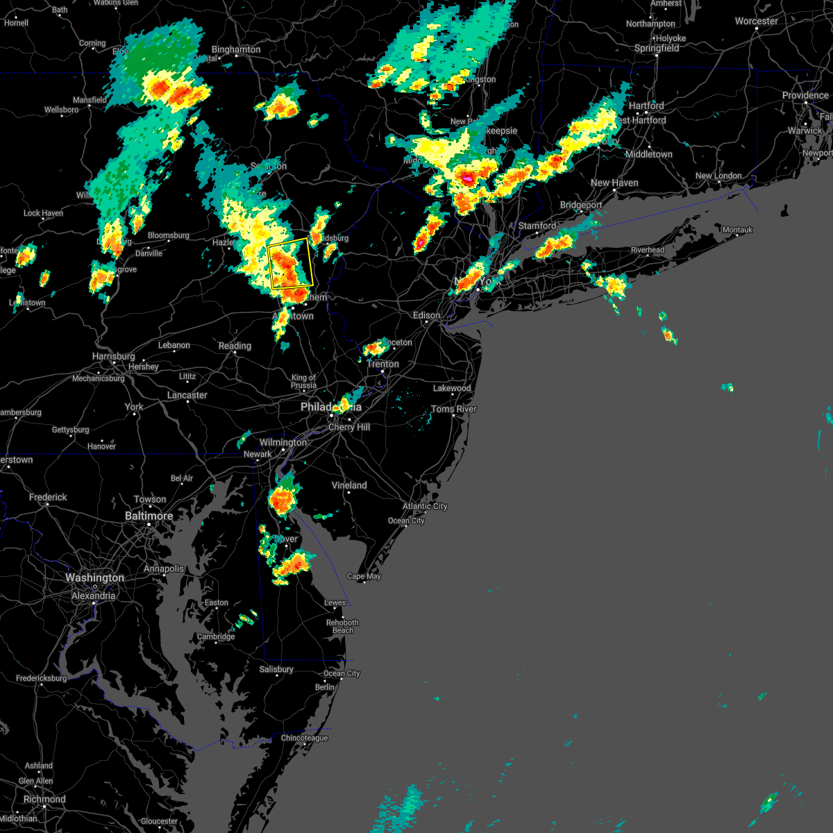 At 612 pm edt, a severe thunderstorm was located near kresgeville, or 10 miles east of lehighton, moving east at 20 mph (radar indicated). Hazards include 60 mph wind gusts. Damage to roofs, siding, trees, and power lines is possible. locations impacted include, nazareth, palmerton, slatington, bath, walnutport, brodheadsville, kunkletown, gilbert, rossland, berlinsville, kresgeville, sun valley, jonas, danielsville, beltzville state park, mcmichael, penn forest reservoir, beersville, christmans and emerald. This includes northeast extension between mile markers 67 and 69, near mile marker 78, and between mile markers 80 and 86. At 612 pm edt, a severe thunderstorm was located near kresgeville, or 10 miles east of lehighton, moving east at 20 mph (radar indicated). Hazards include 60 mph wind gusts. Damage to roofs, siding, trees, and power lines is possible. locations impacted include, nazareth, palmerton, slatington, bath, walnutport, brodheadsville, kunkletown, gilbert, rossland, berlinsville, kresgeville, sun valley, jonas, danielsville, beltzville state park, mcmichael, penn forest reservoir, beersville, christmans and emerald. This includes northeast extension between mile markers 67 and 69, near mile marker 78, and between mile markers 80 and 86.
|
| 7/2/2021 5:44 PM EDT |
 At 543 pm edt, a severe thunderstorm was located over lehighton, moving east at 15 mph (radar indicated). Hazards include 60 mph wind gusts and penny size hail. damage to roofs, siding, trees, and power lines is possible At 543 pm edt, a severe thunderstorm was located over lehighton, moving east at 15 mph (radar indicated). Hazards include 60 mph wind gusts and penny size hail. damage to roofs, siding, trees, and power lines is possible
|
| 6/21/2021 7:57 PM EDT |
 At 756 pm edt, severe thunderstorms were located along a line extending from near pocono raceway to near bath, moving northeast at 35 mph (law enforcement. numerous reports of power lines down and tree damage have been reported in carbon and northwestern lehigh counties). Hazards include 60 mph wind gusts and penny size hail. Damage to roofs, siding, trees, and power lines is possible. locations impacted include, allentown, easton, mount pocono, bethlehem, forks, emmaus, northampton, east stroudsburg, tobyhanna, wilson, nazareth, palmerton, bangor, slatington, pen argyl, wind gap, bath, belvidere, harmony and oxford. this includes the following highways, northeast extension between mile markers 53 and 70, and between mile markers 77 and 93. interstate 78 in pennsylvania between mile markers 52 and 60. interstate 80 in pennsylvania between mile markers 282 and 314. interstate 80 in new jersey between mile markers 0 and 10. Interstate 380 in pennsylvania between mile markers 0 and 13. At 756 pm edt, severe thunderstorms were located along a line extending from near pocono raceway to near bath, moving northeast at 35 mph (law enforcement. numerous reports of power lines down and tree damage have been reported in carbon and northwestern lehigh counties). Hazards include 60 mph wind gusts and penny size hail. Damage to roofs, siding, trees, and power lines is possible. locations impacted include, allentown, easton, mount pocono, bethlehem, forks, emmaus, northampton, east stroudsburg, tobyhanna, wilson, nazareth, palmerton, bangor, slatington, pen argyl, wind gap, bath, belvidere, harmony and oxford. this includes the following highways, northeast extension between mile markers 53 and 70, and between mile markers 77 and 93. interstate 78 in pennsylvania between mile markers 52 and 60. interstate 80 in pennsylvania between mile markers 282 and 314. interstate 80 in new jersey between mile markers 0 and 10. Interstate 380 in pennsylvania between mile markers 0 and 13.
|
| 6/21/2021 7:38 PM EDT |
 At 738 pm edt, severe thunderstorms were located along a line extending from near white haven to coffeetown, moving northeast at 35 mph (law enforcement. several reports of trees and wires down have been received from this line of storms). Hazards include 60 mph wind gusts and penny size hail. damage to roofs, siding, trees, and power lines is possible At 738 pm edt, severe thunderstorms were located along a line extending from near white haven to coffeetown, moving northeast at 35 mph (law enforcement. several reports of trees and wires down have been received from this line of storms). Hazards include 60 mph wind gusts and penny size hail. damage to roofs, siding, trees, and power lines is possible
|
| 6/21/2021 7:34 PM EDT |
 At 733 pm edt, severe thunderstorms were located along a line extending from near white haven to near topton, moving northeast at 30 mph (law enforcement). Hazards include 60 mph wind gusts and penny size hail. Damage to roofs, siding, trees, and power lines is possible. locations impacted include, lehighton, northampton, palmerton, kutztown, jim thorpe, slatington, nesquehoning, weatherly, walnutport, lenhartsville, new mahoning, neffs, coffeetown, new tripoli, berlinsville, emerald, claussville, danielsville, wanamakers and beltzville state park. this includes the following highways, northeast extension between mile markers 57 and 97. interstate 78 in pennsylvania between mile markers 36 and 53. Interstate 80 in pennsylvania between mile markers 277 and 283. At 733 pm edt, severe thunderstorms were located along a line extending from near white haven to near topton, moving northeast at 30 mph (law enforcement). Hazards include 60 mph wind gusts and penny size hail. Damage to roofs, siding, trees, and power lines is possible. locations impacted include, lehighton, northampton, palmerton, kutztown, jim thorpe, slatington, nesquehoning, weatherly, walnutport, lenhartsville, new mahoning, neffs, coffeetown, new tripoli, berlinsville, emerald, claussville, danielsville, wanamakers and beltzville state park. this includes the following highways, northeast extension between mile markers 57 and 97. interstate 78 in pennsylvania between mile markers 36 and 53. Interstate 80 in pennsylvania between mile markers 277 and 283.
|
| 6/21/2021 7:25 PM EDT | Report of wires down. time estimated from rada in northampton county PA, 0.8 miles SSW of Walnutport, PA |
| 6/21/2021 7:20 PM EDT |
 At 719 pm edt, severe thunderstorms were located along a line extending from near nesquehoning to near lenhartsville, moving northeast at 45 mph (law enforcement. several reports of trees and wires down have been received from western portions of berks county). Hazards include 60 mph wind gusts and penny size hail. Damage to roofs, siding, trees, and power lines is possible. locations impacted include, lehighton, northampton, palmerton, kutztown, jim thorpe, hamburg, slatington, fleetwood, nesquehoning, weatherly, walnutport, topton, leesport, shoemakersville, lyons, lenhartsville, new mahoning, neffs, coffeetown and new tripoli. this includes the following highways, northeast extension between mile markers 57 and 97. interstate 78 in pennsylvania between mile markers 30 and 54. Interstate 80 in pennsylvania between mile markers 277 and 283. At 719 pm edt, severe thunderstorms were located along a line extending from near nesquehoning to near lenhartsville, moving northeast at 45 mph (law enforcement. several reports of trees and wires down have been received from western portions of berks county). Hazards include 60 mph wind gusts and penny size hail. Damage to roofs, siding, trees, and power lines is possible. locations impacted include, lehighton, northampton, palmerton, kutztown, jim thorpe, hamburg, slatington, fleetwood, nesquehoning, weatherly, walnutport, topton, leesport, shoemakersville, lyons, lenhartsville, new mahoning, neffs, coffeetown and new tripoli. this includes the following highways, northeast extension between mile markers 57 and 97. interstate 78 in pennsylvania between mile markers 30 and 54. Interstate 80 in pennsylvania between mile markers 277 and 283.
|
| 6/21/2021 7:02 PM EDT |
 At 702 pm edt, severe thunderstorms were located along a line extending from nesquehoning to near kutztown, moving northeast at 30 mph (radar indicated). Hazards include 60 mph wind gusts and penny size hail. damage to roofs, siding, trees, and power lines is possible At 702 pm edt, severe thunderstorms were located along a line extending from nesquehoning to near kutztown, moving northeast at 30 mph (radar indicated). Hazards include 60 mph wind gusts and penny size hail. damage to roofs, siding, trees, and power lines is possible
|
| 6/14/2021 5:09 PM EDT |
 The severe thunderstorm warning for northwestern lehigh, carbon, southwestern monroe and west central northampton counties will expire at 515 pm edt, the storms which prompted the warning have weakened below severe limits, and no longer pose an immediate threat to life or property. therefore, the warning will be allowed to expire. however gusty winds and heavy rain are still possible with these thunderstorms. a severe thunderstorm watch remains in effect until 900 pm edt for eastern and northeastern pennsylvania. The severe thunderstorm warning for northwestern lehigh, carbon, southwestern monroe and west central northampton counties will expire at 515 pm edt, the storms which prompted the warning have weakened below severe limits, and no longer pose an immediate threat to life or property. therefore, the warning will be allowed to expire. however gusty winds and heavy rain are still possible with these thunderstorms. a severe thunderstorm watch remains in effect until 900 pm edt for eastern and northeastern pennsylvania.
|
| 6/14/2021 5:02 PM EDT |
 At 501 pm edt, severe thunderstorms were located along a line extending from near white haven to near jim thorpe to near tamaqua, moving east at 45 mph (radar indicated). Hazards include 60 mph wind gusts. Damage to roofs, siding, trees, and power lines is possible. locations impacted include, lehighton, palmerton, jim thorpe, slatington, nesquehoning, weatherly, walnutport, new mahoning, neffs, lake harmony, new tripoli, berlinsville, albrightsville, emerald, kresgeville, sun valley, claussville, jonas, meckesville and danielsville. this includes the following highways, northeast extension between mile markers 63 and 97. interstate 78 in pennsylvania between mile markers 46 and 47. Interstate 80 in pennsylvania between mile markers 277 and 290. At 501 pm edt, severe thunderstorms were located along a line extending from near white haven to near jim thorpe to near tamaqua, moving east at 45 mph (radar indicated). Hazards include 60 mph wind gusts. Damage to roofs, siding, trees, and power lines is possible. locations impacted include, lehighton, palmerton, jim thorpe, slatington, nesquehoning, weatherly, walnutport, new mahoning, neffs, lake harmony, new tripoli, berlinsville, albrightsville, emerald, kresgeville, sun valley, claussville, jonas, meckesville and danielsville. this includes the following highways, northeast extension between mile markers 63 and 97. interstate 78 in pennsylvania between mile markers 46 and 47. Interstate 80 in pennsylvania between mile markers 277 and 290.
|
| 6/14/2021 4:49 PM EDT |
 At 448 pm edt, severe thunderstorms were located along a line extending from near freeland to near weatherly to near tuscarora, moving east at 40 mph (radar indicated). Hazards include 60 mph wind gusts. Damage to roofs, siding, trees, and power lines is possible. locations impacted include, lehighton, palmerton, kutztown, jim thorpe, hamburg, slatington, fleetwood, nesquehoning, weatherly, walnutport, lenhartsville, new mahoning, neffs, lake harmony, new tripoli, berlinsville, albrightsville, emerald, kresgeville and sun valley. this includes the following highways, northeast extension between mile markers 63 and 97. interstate 78 in pennsylvania between mile markers 29 and 47. Interstate 80 in pennsylvania between mile markers 277 and 289. At 448 pm edt, severe thunderstorms were located along a line extending from near freeland to near weatherly to near tuscarora, moving east at 40 mph (radar indicated). Hazards include 60 mph wind gusts. Damage to roofs, siding, trees, and power lines is possible. locations impacted include, lehighton, palmerton, kutztown, jim thorpe, hamburg, slatington, fleetwood, nesquehoning, weatherly, walnutport, lenhartsville, new mahoning, neffs, lake harmony, new tripoli, berlinsville, albrightsville, emerald, kresgeville and sun valley. this includes the following highways, northeast extension between mile markers 63 and 97. interstate 78 in pennsylvania between mile markers 29 and 47. Interstate 80 in pennsylvania between mile markers 277 and 289.
|
| 6/14/2021 4:15 PM EDT |
 At 413 pm edt, severe thunderstorms were located along a line extending from near east berwick to rock glen to locustdale, moving east at 40 mph (radar indicated). Hazards include 60 mph wind gusts and penny size hail. damage to roofs, siding, trees, and power lines is possible At 413 pm edt, severe thunderstorms were located along a line extending from near east berwick to rock glen to locustdale, moving east at 40 mph (radar indicated). Hazards include 60 mph wind gusts and penny size hail. damage to roofs, siding, trees, and power lines is possible
|
| 6/9/2021 5:27 PM EDT |
 At 527 pm edt, a severe thunderstorm was located over hamburg, or 12 miles east of schuylkill haven, moving northwest at 15 mph (radar indicated). Hazards include 60 mph wind gusts and penny size hail. damage to roofs, siding, trees, and power lines is possible At 527 pm edt, a severe thunderstorm was located over hamburg, or 12 miles east of schuylkill haven, moving northwest at 15 mph (radar indicated). Hazards include 60 mph wind gusts and penny size hail. damage to roofs, siding, trees, and power lines is possible
|
| 11/15/2020 6:58 PM EST |
 At 657 pm est, intense showers and embedded severe thunderstorms were located along a line extending from near pecks pond to mcmichael to near allentown to gilbertsville to quarryville, moving east at 55 mph. this line may contain little or no lightning. do not wait until you hear thunder before taking cover (radar indicated). Hazards include 60 mph wind gusts. Damage to roofs, siding, trees, and power lines is possible. locations impacted include, allentown, reading, easton, mount pocono, bethlehem, forks, emmaus, northampton, east stroudsburg, tobyhanna, wilson, hellertown, nazareth, palmerton, bangor, birdsboro, slatington, fleetwood, pen argyl and wind gap. this includes the following highways, pennsylvania turnpike between mile markers 298 and 299. northeast extension between mile markers 46 and 70. interstate 78 in pennsylvania between mile markers 46 and 72. interstate 80 in pennsylvania between mile markers 292 and 314. interstate 380 in pennsylvania between mile markers 0 and 9. Interstate 176 in pennsylvania between mile markers 1 and 11. At 657 pm est, intense showers and embedded severe thunderstorms were located along a line extending from near pecks pond to mcmichael to near allentown to gilbertsville to quarryville, moving east at 55 mph. this line may contain little or no lightning. do not wait until you hear thunder before taking cover (radar indicated). Hazards include 60 mph wind gusts. Damage to roofs, siding, trees, and power lines is possible. locations impacted include, allentown, reading, easton, mount pocono, bethlehem, forks, emmaus, northampton, east stroudsburg, tobyhanna, wilson, hellertown, nazareth, palmerton, bangor, birdsboro, slatington, fleetwood, pen argyl and wind gap. this includes the following highways, pennsylvania turnpike between mile markers 298 and 299. northeast extension between mile markers 46 and 70. interstate 78 in pennsylvania between mile markers 46 and 72. interstate 80 in pennsylvania between mile markers 292 and 314. interstate 380 in pennsylvania between mile markers 0 and 9. Interstate 176 in pennsylvania between mile markers 1 and 11.
|
| 11/15/2020 6:29 PM EST |
 At 627 pm est, intense showers and some embedded severe thunderstorms were located along a line extending from near stoddartsville to near weatherly to near shoemakersville to reamstown to near shrewsbury, moving east at 50 mph. this line may contain little or no lightning. do not wait until you hear thunder before taking cover (radar indicated). Hazards include 60 mph wind gusts. Damage to roofs, siding, trees, and power lines is possible. locations impacted include, allentown, reading, easton, lehighton, mount pocono, bethlehem, forks, emmaus, wyomissing, northampton, east stroudsburg, tobyhanna, wilson, hellertown, nazareth, palmerton, bangor, birdsboro, kutztown and jim thorpe. this includes the following highways, pennsylvania turnpike between mile markers 296 and 299. northeast extension between mile markers 46 and 97. interstate 78 in pennsylvania between mile markers 10 and 72. interstate 80 in pennsylvania between mile markers 278 and 314. interstate 380 in pennsylvania between mile markers 0 and 13. Interstate 176 in pennsylvania between mile markers 1 and 11. At 627 pm est, intense showers and some embedded severe thunderstorms were located along a line extending from near stoddartsville to near weatherly to near shoemakersville to reamstown to near shrewsbury, moving east at 50 mph. this line may contain little or no lightning. do not wait until you hear thunder before taking cover (radar indicated). Hazards include 60 mph wind gusts. Damage to roofs, siding, trees, and power lines is possible. locations impacted include, allentown, reading, easton, lehighton, mount pocono, bethlehem, forks, emmaus, wyomissing, northampton, east stroudsburg, tobyhanna, wilson, hellertown, nazareth, palmerton, bangor, birdsboro, kutztown and jim thorpe. this includes the following highways, pennsylvania turnpike between mile markers 296 and 299. northeast extension between mile markers 46 and 97. interstate 78 in pennsylvania between mile markers 10 and 72. interstate 80 in pennsylvania between mile markers 278 and 314. interstate 380 in pennsylvania between mile markers 0 and 13. Interstate 176 in pennsylvania between mile markers 1 and 11.
|
| 11/15/2020 5:57 PM EST |
 At 555 pm est, intense showers and embedded severe thunderstorms were located along a line extending from pond hill to near lickdale to near lawn to near parkville, moving east at 45 mph. this line may contain little or no lightning. do not wait until you hear thunder before taking cover (radar indicated). Hazards include 60 mph wind gusts. damage to roofs, siding, trees, and power lines is possible At 555 pm est, intense showers and embedded severe thunderstorms were located along a line extending from pond hill to near lickdale to near lawn to near parkville, moving east at 45 mph. this line may contain little or no lightning. do not wait until you hear thunder before taking cover (radar indicated). Hazards include 60 mph wind gusts. damage to roofs, siding, trees, and power lines is possible
|
| 8/29/2020 7:07 PM EDT |
 At 706 pm edt, severe thunderstorms were located along a line extending from near columbia to near northampton, moving east at 35 mph (radar indicated). Hazards include 60 mph wind gusts and quarter size hail. Minor damage to vehicles is possible. wind damage to roofs, siding, trees, and power lines is possible. locations impacted include, allentown, easton, bethlehem, forks, emmaus, northampton, wilson, washington, hellertown, nazareth, bangor, slatington, pen argyl, wind gap, bath, belvidere, harmony, oxford, alpha and walnutport. this includes the following highways, northeast extension between mile markers 46 and 71. interstate 78 in pennsylvania between mile markers 45 and 76. Interstate 78 in new jersey between mile markers 0 and 7. At 706 pm edt, severe thunderstorms were located along a line extending from near columbia to near northampton, moving east at 35 mph (radar indicated). Hazards include 60 mph wind gusts and quarter size hail. Minor damage to vehicles is possible. wind damage to roofs, siding, trees, and power lines is possible. locations impacted include, allentown, easton, bethlehem, forks, emmaus, northampton, wilson, washington, hellertown, nazareth, bangor, slatington, pen argyl, wind gap, bath, belvidere, harmony, oxford, alpha and walnutport. this includes the following highways, northeast extension between mile markers 46 and 71. interstate 78 in pennsylvania between mile markers 45 and 76. Interstate 78 in new jersey between mile markers 0 and 7.
|
| 8/29/2020 6:26 PM EDT |
 At 625 pm edt, severe thunderstorms were located along a line extending from meckesville to tamaqua, moving east at 35 mph (radar indicated). Hazards include 60 mph wind gusts and quarter size hail. Minor damage to vehicles is possible. Wind damage to roofs, siding, trees, and power lines is possible. At 625 pm edt, severe thunderstorms were located along a line extending from meckesville to tamaqua, moving east at 35 mph (radar indicated). Hazards include 60 mph wind gusts and quarter size hail. Minor damage to vehicles is possible. Wind damage to roofs, siding, trees, and power lines is possible.
|
| 8/27/2020 8:23 PM EDT |
 The severe thunderstorm warning for central berks, lehigh, southeastern carbon and central northampton counties will expire at 830 pm edt, the storms which prompted the warning have moved out of the area. therefore, the warning will be allowed to expire. The severe thunderstorm warning for central berks, lehigh, southeastern carbon and central northampton counties will expire at 830 pm edt, the storms which prompted the warning have moved out of the area. therefore, the warning will be allowed to expire.
|
| 8/27/2020 8:17 PM EDT |
 At 817 pm edt, severe thunderstorms were located along a line extending from near berlinsville to near lenhartsville, moving east at 50 mph (radar indicated). Hazards include 60 mph wind gusts and penny size hail. Damage to roofs, siding, trees, and power lines is possible. locations impacted include, allentown, reading, lehighton, bethlehem, emmaus, wyomissing, northampton, nazareth, palmerton, kutztown, hamburg, slatington, fleetwood, laureldale, bath, walnutport, topton, leesport, belfast and shoemakersville. this includes the following highways, northeast extension between mile markers 52 and 76. Interstate 78 in pennsylvania between mile markers 30 and 60. At 817 pm edt, severe thunderstorms were located along a line extending from near berlinsville to near lenhartsville, moving east at 50 mph (radar indicated). Hazards include 60 mph wind gusts and penny size hail. Damage to roofs, siding, trees, and power lines is possible. locations impacted include, allentown, reading, lehighton, bethlehem, emmaus, wyomissing, northampton, nazareth, palmerton, kutztown, hamburg, slatington, fleetwood, laureldale, bath, walnutport, topton, leesport, belfast and shoemakersville. this includes the following highways, northeast extension between mile markers 52 and 76. Interstate 78 in pennsylvania between mile markers 30 and 60.
|
| 8/27/2020 7:51 PM EDT |
 At 751 pm edt, severe thunderstorms were located along a line extending from hometown to near friedensburg, moving east at 50 mph (radar indicated). Hazards include 60 mph wind gusts and penny size hail. damage to roofs, siding, trees, and power lines is possible At 751 pm edt, severe thunderstorms were located along a line extending from hometown to near friedensburg, moving east at 50 mph (radar indicated). Hazards include 60 mph wind gusts and penny size hail. damage to roofs, siding, trees, and power lines is possible
|
| 8/24/2020 1:26 PM EDT |
 At 126 pm edt, a severe thunderstorm was located over danielsville, or 9 miles east of lehighton, moving east at 10 mph (radar indicated). Hazards include 60 mph wind gusts and quarter size hail. Minor damage to vehicles is possible. wind damage to roofs, siding, trees, and power lines is possible. locations impacted include, northampton, palmerton, slatington, bath, walnutport, danielsville, kunkletown, saylorsburg, rossland, berlinsville, beersville, bowmanstown, chapman, trachsville and fiddletown. This includes northeast extension between mile markers 71 and 72. At 126 pm edt, a severe thunderstorm was located over danielsville, or 9 miles east of lehighton, moving east at 10 mph (radar indicated). Hazards include 60 mph wind gusts and quarter size hail. Minor damage to vehicles is possible. wind damage to roofs, siding, trees, and power lines is possible. locations impacted include, northampton, palmerton, slatington, bath, walnutport, danielsville, kunkletown, saylorsburg, rossland, berlinsville, beersville, bowmanstown, chapman, trachsville and fiddletown. This includes northeast extension between mile markers 71 and 72.
|
| 8/24/2020 1:15 PM EDT |
 At 115 pm edt, a severe thunderstorm was located over beltzville state park, or 7 miles east of lehighton, moving east at 10 mph (radar indicated). Hazards include 60 mph wind gusts and quarter size hail. Minor damage to vehicles is possible. Wind damage to roofs, siding, trees, and power lines is possible. At 115 pm edt, a severe thunderstorm was located over beltzville state park, or 7 miles east of lehighton, moving east at 10 mph (radar indicated). Hazards include 60 mph wind gusts and quarter size hail. Minor damage to vehicles is possible. Wind damage to roofs, siding, trees, and power lines is possible.
|
| 7/22/2020 5:11 PM EDT |
 The severe thunderstorm warning for northeastern berks, central lehigh, southeastern carbon and west central northampton counties will expire at 515 pm edt, the storms which prompted the warning have moved out of the area. therefore, the warning will be allowed to expire. however, gusty winds and heavy rain are still possible with these thunderstorms. a severe thunderstorm watch remains in effect until 1000 pm edt for eastern and northeastern pennsylvania. The severe thunderstorm warning for northeastern berks, central lehigh, southeastern carbon and west central northampton counties will expire at 515 pm edt, the storms which prompted the warning have moved out of the area. therefore, the warning will be allowed to expire. however, gusty winds and heavy rain are still possible with these thunderstorms. a severe thunderstorm watch remains in effect until 1000 pm edt for eastern and northeastern pennsylvania.
|
| 7/22/2020 4:59 PM EDT |
 At 431 pm edt, severe thunderstorms were located along a line extending from palmerton to shoemakersville, moving east at 15 mph (law enforcement). Hazards include 70 mph wind gusts and quarter size hail. Minor damage to vehicles is possible. expect considerable tree damage. wind damage is also likely to mobile homes, roofs, and outbuildings. locations impacted include, allentown, lehighton, northampton, palmerton, kutztown, hamburg, slatington, bath, walnutport, topton, shoemakersville, lyons, lenhartsville, neffs, coffeetown, new tripoli, berlinsville, emerald, claussville and danielsville. this includes the following highways, northeast extension between mile markers 57 and 78. Interstate 78 in pennsylvania between mile markers 33 and 54. At 431 pm edt, severe thunderstorms were located along a line extending from palmerton to shoemakersville, moving east at 15 mph (law enforcement). Hazards include 70 mph wind gusts and quarter size hail. Minor damage to vehicles is possible. expect considerable tree damage. wind damage is also likely to mobile homes, roofs, and outbuildings. locations impacted include, allentown, lehighton, northampton, palmerton, kutztown, hamburg, slatington, bath, walnutport, topton, shoemakersville, lyons, lenhartsville, neffs, coffeetown, new tripoli, berlinsville, emerald, claussville and danielsville. this includes the following highways, northeast extension between mile markers 57 and 78. Interstate 78 in pennsylvania between mile markers 33 and 54.
|
| 7/22/2020 4:31 PM EDT |
 At 431 pm edt, severe thunderstorms were located along a line extending from palmerton to shoemakersville, moving east at 15 mph (law enforcement). Hazards include 70 mph wind gusts and quarter size hail. Minor damage to vehicles is possible. expect considerable tree damage. wind damage is also likely to mobile homes, roofs, and outbuildings. locations impacted include, allentown, lehighton, northampton, palmerton, kutztown, hamburg, slatington, bath, walnutport, topton, shoemakersville, lyons, lenhartsville, neffs, coffeetown, new tripoli, berlinsville, emerald, claussville and danielsville. this includes the following highways, northeast extension between mile markers 57 and 78. Interstate 78 in pennsylvania between mile markers 33 and 54. At 431 pm edt, severe thunderstorms were located along a line extending from palmerton to shoemakersville, moving east at 15 mph (law enforcement). Hazards include 70 mph wind gusts and quarter size hail. Minor damage to vehicles is possible. expect considerable tree damage. wind damage is also likely to mobile homes, roofs, and outbuildings. locations impacted include, allentown, lehighton, northampton, palmerton, kutztown, hamburg, slatington, bath, walnutport, topton, shoemakersville, lyons, lenhartsville, neffs, coffeetown, new tripoli, berlinsville, emerald, claussville and danielsville. this includes the following highways, northeast extension between mile markers 57 and 78. Interstate 78 in pennsylvania between mile markers 33 and 54.
|
| 7/22/2020 4:10 PM EDT |
 At 409 pm edt, severe thunderstorms were located along a line extending from lehighton to near hamburg, moving east at 15 mph (radar indicated). Hazards include 60 mph wind gusts and quarter size hail. Minor damage to vehicles is possible. Wind damage to roofs, siding, trees, and power lines is possible. At 409 pm edt, severe thunderstorms were located along a line extending from lehighton to near hamburg, moving east at 15 mph (radar indicated). Hazards include 60 mph wind gusts and quarter size hail. Minor damage to vehicles is possible. Wind damage to roofs, siding, trees, and power lines is possible.
|
| 7/6/2020 5:29 PM EDT |
 At 529 pm edt, severe thunderstorms were located along a line extending from slatington to near new mahoning to near mcadoo, and are nearly stationary (radar indicated). Hazards include 60 mph wind gusts and quarter size hail. Minor damage to vehicles is possible. wind damage to roofs, siding, trees, and power lines is possible. locations impacted include, lehighton, palmerton, jim thorpe, slatington, nesquehoning, walnutport, danielsville, new mahoning, wanamakers, new tripoli, berlinsville, jordan valley, emerald, lansford, summit hill, bowmanstown, parryville, weissport, weissport east and tresckow. this includes the following highways, northeast extension between mile markers 66 and 77. Interstate 78 in pennsylvania between mile markers 40 and 43. At 529 pm edt, severe thunderstorms were located along a line extending from slatington to near new mahoning to near mcadoo, and are nearly stationary (radar indicated). Hazards include 60 mph wind gusts and quarter size hail. Minor damage to vehicles is possible. wind damage to roofs, siding, trees, and power lines is possible. locations impacted include, lehighton, palmerton, jim thorpe, slatington, nesquehoning, walnutport, danielsville, new mahoning, wanamakers, new tripoli, berlinsville, jordan valley, emerald, lansford, summit hill, bowmanstown, parryville, weissport, weissport east and tresckow. this includes the following highways, northeast extension between mile markers 66 and 77. Interstate 78 in pennsylvania between mile markers 40 and 43.
|
| 7/6/2020 5:00 PM EDT |
 At 459 pm edt, severe thunderstorms were located along a line extending from near jim thorpe to snyders, moving southeast at 5 mph (radar indicated). Hazards include 60 mph wind gusts and quarter size hail. Minor damage to vehicles is possible. Wind damage to roofs, siding, trees, and power lines is possible. At 459 pm edt, severe thunderstorms were located along a line extending from near jim thorpe to snyders, moving southeast at 5 mph (radar indicated). Hazards include 60 mph wind gusts and quarter size hail. Minor damage to vehicles is possible. Wind damage to roofs, siding, trees, and power lines is possible.
|
| 7/6/2020 4:39 PM EDT |
 At 417 pm edt, severe thunderstorms were located along a line extending from near christmans to near tamaqua, moving southeast at 10 mph (radar indicated). Hazards include 60 mph wind gusts and quarter size hail. Minor damage to vehicles is possible. wind damage to roofs, siding, trees, and power lines is possible. locations impacted include, lehighton, palmerton, jim thorpe, slatington, nesquehoning, weatherly, walnutport, new mahoning, kunkletown, neffs, gilbert, new tripoli, berlinsville, albrightsville, emerald, kresgeville, danielsville, wanamakers, beltzville state park and penn forest reservoir. This includes northeast extension between mile markers 64 and 93. At 417 pm edt, severe thunderstorms were located along a line extending from near christmans to near tamaqua, moving southeast at 10 mph (radar indicated). Hazards include 60 mph wind gusts and quarter size hail. Minor damage to vehicles is possible. wind damage to roofs, siding, trees, and power lines is possible. locations impacted include, lehighton, palmerton, jim thorpe, slatington, nesquehoning, weatherly, walnutport, new mahoning, kunkletown, neffs, gilbert, new tripoli, berlinsville, albrightsville, emerald, kresgeville, danielsville, wanamakers, beltzville state park and penn forest reservoir. This includes northeast extension between mile markers 64 and 93.
|
| 7/6/2020 4:31 PM EDT |
 At 431 pm edt, severe thunderstorms were located along a line extending from bath to near claussville, moving southeast at 10 mph (radar indicated). Hazards include 60 mph wind gusts and quarter size hail. Minor damage to vehicles is possible. Wind damage to roofs, siding, trees, and power lines is possible. At 431 pm edt, severe thunderstorms were located along a line extending from bath to near claussville, moving southeast at 10 mph (radar indicated). Hazards include 60 mph wind gusts and quarter size hail. Minor damage to vehicles is possible. Wind damage to roofs, siding, trees, and power lines is possible.
|
| 7/6/2020 4:17 PM EDT |
 At 417 pm edt, severe thunderstorms were located along a line extending from near christmans to near tamaqua, moving southeast at 10 mph (radar indicated). Hazards include 60 mph wind gusts and quarter size hail. Minor damage to vehicles is possible. wind damage to roofs, siding, trees, and power lines is possible. locations impacted include, lehighton, palmerton, jim thorpe, slatington, nesquehoning, weatherly, walnutport, new mahoning, kunkletown, neffs, gilbert, new tripoli, berlinsville, albrightsville, emerald, kresgeville, danielsville, wanamakers, beltzville state park and penn forest reservoir. This includes northeast extension between mile markers 64 and 93. At 417 pm edt, severe thunderstorms were located along a line extending from near christmans to near tamaqua, moving southeast at 10 mph (radar indicated). Hazards include 60 mph wind gusts and quarter size hail. Minor damage to vehicles is possible. wind damage to roofs, siding, trees, and power lines is possible. locations impacted include, lehighton, palmerton, jim thorpe, slatington, nesquehoning, weatherly, walnutport, new mahoning, kunkletown, neffs, gilbert, new tripoli, berlinsville, albrightsville, emerald, kresgeville, danielsville, wanamakers, beltzville state park and penn forest reservoir. This includes northeast extension between mile markers 64 and 93.
|
| 7/6/2020 3:56 PM EDT |
 At 355 pm edt, severe thunderstorms were located along a line extending from near gouldsboro state park to near jim thorpe to near tamaqua, moving southeast at 10 mph (radar indicated). Hazards include 60 mph wind gusts and quarter size hail. Minor damage to vehicles is possible. Wind damage to roofs, siding, trees, and power lines is possible. At 355 pm edt, severe thunderstorms were located along a line extending from near gouldsboro state park to near jim thorpe to near tamaqua, moving southeast at 10 mph (radar indicated). Hazards include 60 mph wind gusts and quarter size hail. Minor damage to vehicles is possible. Wind damage to roofs, siding, trees, and power lines is possible.
|
| 6/27/2020 3:01 PM EDT |
 The national weather service in mount holly nj has issued a * severe thunderstorm warning for. west central morris county in northern new jersey. northwestern hunterdon county in northwestern new jersey. southern warren county in northwestern new jersey. Lehigh county in eastern pennsylvania. The national weather service in mount holly nj has issued a * severe thunderstorm warning for. west central morris county in northern new jersey. northwestern hunterdon county in northwestern new jersey. southern warren county in northwestern new jersey. Lehigh county in eastern pennsylvania.
|
| 6/3/2020 11:40 AM EDT |
 The severe thunderstorm warning for northwestern hunterdon, southwestern warren, berks, lehigh, northwestern montgomery, southern carbon, northwestern bucks and northampton counties will expire at 1145 am edt, the storms which prompted the warning have moved out of the area. therefore, the warning will be allowed to expire. a new warning has been issued for portions of the area. a severe thunderstorm watch remains in effect until 300 pm edt for northwestern new jersey, and eastern, southeastern and northeastern pennsylvania. The severe thunderstorm warning for northwestern hunterdon, southwestern warren, berks, lehigh, northwestern montgomery, southern carbon, northwestern bucks and northampton counties will expire at 1145 am edt, the storms which prompted the warning have moved out of the area. therefore, the warning will be allowed to expire. a new warning has been issued for portions of the area. a severe thunderstorm watch remains in effect until 300 pm edt for northwestern new jersey, and eastern, southeastern and northeastern pennsylvania.
|
| 6/3/2020 11:23 AM EDT |
 At 1122 am edt, severe thunderstorms were located along a line extending from jim thorpe to lenhartsville to near bernville, moving east at 75 mph (radar indicated). Hazards include 60 mph wind gusts and penny size hail. Damage to roofs, siding, trees, and power lines is possible. locations impacted include, allentown, reading, easton, lehighton, bethlehem, pottstown, forks, emmaus, wyomissing, northampton, quakertown, perkasie, wilson, souderton, bedminster, washington, hellertown, nazareth, palmerton and birdsboro. this includes the following highways, interstate 78 in new jersey between mile markers 0 and 12. interstate 78 in pennsylvania between mile markers 10 and 76. northeast extension between exits a44 and a56. Interstate 176 in pennsylvania between mile markers 10 and 11. At 1122 am edt, severe thunderstorms were located along a line extending from jim thorpe to lenhartsville to near bernville, moving east at 75 mph (radar indicated). Hazards include 60 mph wind gusts and penny size hail. Damage to roofs, siding, trees, and power lines is possible. locations impacted include, allentown, reading, easton, lehighton, bethlehem, pottstown, forks, emmaus, wyomissing, northampton, quakertown, perkasie, wilson, souderton, bedminster, washington, hellertown, nazareth, palmerton and birdsboro. this includes the following highways, interstate 78 in new jersey between mile markers 0 and 12. interstate 78 in pennsylvania between mile markers 10 and 76. northeast extension between exits a44 and a56. Interstate 176 in pennsylvania between mile markers 10 and 11.
|
| 6/3/2020 11:04 AM EDT |
 At 1103 am edt, severe thunderstorms were located along a line extending from nuremburg to near friedensburg to fort indiantown gap, moving east at 75 mph (radar indicated). Hazards include 60 mph wind gusts and penny size hail. damage to roofs, siding, trees, and power lines is possible At 1103 am edt, severe thunderstorms were located along a line extending from nuremburg to near friedensburg to fort indiantown gap, moving east at 75 mph (radar indicated). Hazards include 60 mph wind gusts and penny size hail. damage to roofs, siding, trees, and power lines is possible
|
| 3/3/2020 8:39 PM EST |
 At 838 pm est, severe thunderstorms were located along a line extending from near schnecksville to near elverson to quarryville, moving east at 45 mph (radar indicated). Hazards include 60 mph wind gusts. damage to roofs, siding, trees, and power lines is possible At 838 pm est, severe thunderstorms were located along a line extending from near schnecksville to near elverson to quarryville, moving east at 45 mph (radar indicated). Hazards include 60 mph wind gusts. damage to roofs, siding, trees, and power lines is possible
|
| 2/7/2020 10:14 AM EST |
 At 1014 am est, severe thunderstorms were located along a line extending from old orchard to lansdale, moving northeast at 45 mph (radar indicated). Hazards include 70 mph wind gusts and penny size hail. Expect considerable tree damage. damage is likely to mobile homes, roofs, and outbuildings. locations impacted include, easton, bethlehem, lansdale, forks, east norriton, northampton, quakertown, perkasie, doylestown, byram, wilson, souderton, bedminster, washington, hellertown, nazareth, bangor, flemington, chalfont and tinicum. this includes the following highways, interstate 78 in new jersey between mile markers 0 and 17. interstate 80 in new jersey between mile markers 2 and 4. interstate 78 in pennsylvania between mile markers 65 and 76. Northeast extension between exits a31 and a44. At 1014 am est, severe thunderstorms were located along a line extending from old orchard to lansdale, moving northeast at 45 mph (radar indicated). Hazards include 70 mph wind gusts and penny size hail. Expect considerable tree damage. damage is likely to mobile homes, roofs, and outbuildings. locations impacted include, easton, bethlehem, lansdale, forks, east norriton, northampton, quakertown, perkasie, doylestown, byram, wilson, souderton, bedminster, washington, hellertown, nazareth, bangor, flemington, chalfont and tinicum. this includes the following highways, interstate 78 in new jersey between mile markers 0 and 17. interstate 80 in new jersey between mile markers 2 and 4. interstate 78 in pennsylvania between mile markers 65 and 76. Northeast extension between exits a31 and a44.
|
| 2/7/2020 9:43 AM EST |
 At 942 am est, severe thunderstorms were located along a line extending from near bally to near lionville-marchwood, moving northeast at 45 mph (radar indicated). Hazards include 70 mph wind gusts and penny size hail. Expect considerable tree damage. Damage is likely to mobile homes, roofs, and outbuildings. At 942 am est, severe thunderstorms were located along a line extending from near bally to near lionville-marchwood, moving northeast at 45 mph (radar indicated). Hazards include 70 mph wind gusts and penny size hail. Expect considerable tree damage. Damage is likely to mobile homes, roofs, and outbuildings.
|
| 10/31/2019 9:56 PM EDT |
 At 956 pm edt, severe thunderstorms were located along a line extending from near tobyhanna to near leesport, moving northeast at 65 mph (radar indicated). Hazards include 60 mph wind gusts. damage to roofs, siding, trees, and power lines is possible At 956 pm edt, severe thunderstorms were located along a line extending from near tobyhanna to near leesport, moving northeast at 65 mph (radar indicated). Hazards include 60 mph wind gusts. damage to roofs, siding, trees, and power lines is possible
|
| 10/31/2019 9:26 PM EDT |
 At 926 pm edt, severe thunderstorms were located along a line extending from near skytop to akron, moving northeast at 50 mph (radar indicated). Hazards include 60 mph wind gusts. Damage to roofs, siding, trees, and power lines is possible. locations impacted include, reading, lehighton, mount pocono, wyomissing, northampton, east stroudsburg, tobyhanna, palmerton, kutztown, jim thorpe, hamburg, slatington, fleetwood, sinking spring, laureldale, nesquehoning, womelsdorf, weatherly, wernersville and newmanstown. this includes the following highways, interstate 80 in pennsylvania between mile markers 277 and 310. Interstate 78 in pennsylvania between mile markers 10 and 53. At 926 pm edt, severe thunderstorms were located along a line extending from near skytop to akron, moving northeast at 50 mph (radar indicated). Hazards include 60 mph wind gusts. Damage to roofs, siding, trees, and power lines is possible. locations impacted include, reading, lehighton, mount pocono, wyomissing, northampton, east stroudsburg, tobyhanna, palmerton, kutztown, jim thorpe, hamburg, slatington, fleetwood, sinking spring, laureldale, nesquehoning, womelsdorf, weatherly, wernersville and newmanstown. this includes the following highways, interstate 80 in pennsylvania between mile markers 277 and 310. Interstate 78 in pennsylvania between mile markers 10 and 53.
|
| 10/31/2019 8:58 PM EDT |
 At 857 pm edt, severe thunderstorms were located along a line extending from albrightsville to windsor, moving northeast at 50 mph (radar indicated). Hazards include 60 mph wind gusts. damage to roofs, siding, trees, and power lines is possible At 857 pm edt, severe thunderstorms were located along a line extending from albrightsville to windsor, moving northeast at 50 mph (radar indicated). Hazards include 60 mph wind gusts. damage to roofs, siding, trees, and power lines is possible
|
| 8/22/2019 6:17 PM EDT |
 At 617 pm edt, a severe thunderstorm was located over jim thorpe, or near lehighton, moving east at 40 mph (radar indicated). Hazards include 60 mph wind gusts and penny size hail. Damage to roofs, siding, trees, and power lines is possible. Locations impacted include, lehighton, bethlehem, nazareth, palmerton, jim thorpe, pen argyl, wind gap, bath, weatherly, walnutport, belfast, steuben, stormville, brodheadsville, kunkletown, gilbert, rossland, berlinsville, albrightsville and kresgeville. At 617 pm edt, a severe thunderstorm was located over jim thorpe, or near lehighton, moving east at 40 mph (radar indicated). Hazards include 60 mph wind gusts and penny size hail. Damage to roofs, siding, trees, and power lines is possible. Locations impacted include, lehighton, bethlehem, nazareth, palmerton, jim thorpe, pen argyl, wind gap, bath, weatherly, walnutport, belfast, steuben, stormville, brodheadsville, kunkletown, gilbert, rossland, berlinsville, albrightsville and kresgeville.
|
| 8/22/2019 6:01 PM EDT |
 At 601 pm edt, a severe thunderstorm was located near nesquehoning, or near hazleton, moving east at 40 mph (radar indicated). Hazards include 60 mph wind gusts and penny size hail. damage to roofs, siding, trees, and power lines is possible At 601 pm edt, a severe thunderstorm was located near nesquehoning, or near hazleton, moving east at 40 mph (radar indicated). Hazards include 60 mph wind gusts and penny size hail. damage to roofs, siding, trees, and power lines is possible
|
| 8/7/2019 3:24 PM EDT |
 At 324 pm edt, a severe thunderstorm was located over coffeetown, or near allentown, moving northeast at 30 mph (radar indicated). Hazards include 60 mph wind gusts and quarter size hail. Minor damage to vehicles is possible. Wind damage to roofs, siding, trees, and power lines is possible. At 324 pm edt, a severe thunderstorm was located over coffeetown, or near allentown, moving northeast at 30 mph (radar indicated). Hazards include 60 mph wind gusts and quarter size hail. Minor damage to vehicles is possible. Wind damage to roofs, siding, trees, and power lines is possible.
|
| 7/22/2019 12:20 AM EDT |
 At 1220 am edt, a severe thunderstorm was located over bath, or 8 miles northeast of allentown, moving east at 30 mph (radar indicated). Hazards include 60 mph wind gusts and quarter size hail. Minor damage to vehicles is possible. wind damage to roofs, siding, trees, and power lines is possible. Locations impacted include, easton, bethlehem, forks, northampton, wilson, nazareth, palmerton, slatington, pen argyl, wind gap, bath, harmony, alpha, walnutport, belfast, west easton, tatamy, bloomsbury, steuben and glendon. At 1220 am edt, a severe thunderstorm was located over bath, or 8 miles northeast of allentown, moving east at 30 mph (radar indicated). Hazards include 60 mph wind gusts and quarter size hail. Minor damage to vehicles is possible. wind damage to roofs, siding, trees, and power lines is possible. Locations impacted include, easton, bethlehem, forks, northampton, wilson, nazareth, palmerton, slatington, pen argyl, wind gap, bath, harmony, alpha, walnutport, belfast, west easton, tatamy, bloomsbury, steuben and glendon.
|
| 7/22/2019 12:20 AM EDT |
 A severe thunderstorm warning remains in effect until 1230 am edt for southwestern warren. northern lehigh. southeastern carbon and northampton counties. at 1220 am edt, a severe thunderstorm was located over bath, or 8 miles northeast of allentown, moving east at 30 mph. hazard. 60 mph wind gusts and quarter size hail. A severe thunderstorm warning remains in effect until 1230 am edt for southwestern warren. northern lehigh. southeastern carbon and northampton counties. at 1220 am edt, a severe thunderstorm was located over bath, or 8 miles northeast of allentown, moving east at 30 mph. hazard. 60 mph wind gusts and quarter size hail.
|
| 7/22/2019 12:09 AM EDT |
 At 1209 am edt, severe thunderstorms were located along a line extending from near kunkletown to near yardley, moving east at 30 mph (radar indicated). Hazards include 60 mph wind gusts and quarter size hail. Minor damage to vehicles is possible. wind damage to roofs, siding, trees, and power lines is possible. Locations impacted include, allentown, trenton, easton, lehighton, bethlehem, ewing, forks, northampton, doylestown, byram, wilson, bedminster, hellertown, nazareth, palmerton, bangor, slatington, tinicum, pen argyl and wind gap. At 1209 am edt, severe thunderstorms were located along a line extending from near kunkletown to near yardley, moving east at 30 mph (radar indicated). Hazards include 60 mph wind gusts and quarter size hail. Minor damage to vehicles is possible. wind damage to roofs, siding, trees, and power lines is possible. Locations impacted include, allentown, trenton, easton, lehighton, bethlehem, ewing, forks, northampton, doylestown, byram, wilson, bedminster, hellertown, nazareth, palmerton, bangor, slatington, tinicum, pen argyl and wind gap.
|
| 7/21/2019 11:40 PM EDT |
 At 1140 pm edt, severe thunderstorms were located along a line extending from near beltzville state park to near chalfont, moving northeast at 30 mph (radar indicated). Hazards include 60 mph wind gusts and quarter size hail. Minor damage to vehicles is possible. Wind damage to roofs, siding, trees, and power lines is possible. At 1140 pm edt, severe thunderstorms were located along a line extending from near beltzville state park to near chalfont, moving northeast at 30 mph (radar indicated). Hazards include 60 mph wind gusts and quarter size hail. Minor damage to vehicles is possible. Wind damage to roofs, siding, trees, and power lines is possible.
|
| 7/21/2019 8:44 PM EDT |
 At 844 pm edt, severe thunderstorms were located along a line extending from kresgeville to near wanamakers, moving southeast at 25 mph (radar indicated). Hazards include 60 mph wind gusts and quarter size hail. Minor damage to vehicles is possible. Wind damage to roofs, siding, trees, and power lines is possible. At 844 pm edt, severe thunderstorms were located along a line extending from kresgeville to near wanamakers, moving southeast at 25 mph (radar indicated). Hazards include 60 mph wind gusts and quarter size hail. Minor damage to vehicles is possible. Wind damage to roofs, siding, trees, and power lines is possible.
|
| 7/21/2019 6:50 PM EDT |
 The national weather service in mount holly nj has issued a * severe thunderstorm warning for. northeastern lehigh county in eastern pennsylvania. southwestern northampton county in eastern pennsylvania. until 730 pm edt. At 649 pm edt, a severe thunderstorm was located over neffs, or 8. The national weather service in mount holly nj has issued a * severe thunderstorm warning for. northeastern lehigh county in eastern pennsylvania. southwestern northampton county in eastern pennsylvania. until 730 pm edt. At 649 pm edt, a severe thunderstorm was located over neffs, or 8.
|
| 7/6/2019 6:55 PM EDT |
 The severe thunderstorm warning for sussex, warren, berks, lehigh, southeastern carbon, monroe and northampton counties will expire at 700 pm edt, the storms which prompted the warning continue to move to the southeast. a new severe thunderstorm warning is in effect for these counties until 8:00 pm edt. to report severe weather, contact your nearest law enforcement agency. they will relay your report to the national weather service mount holly nj. The severe thunderstorm warning for sussex, warren, berks, lehigh, southeastern carbon, monroe and northampton counties will expire at 700 pm edt, the storms which prompted the warning continue to move to the southeast. a new severe thunderstorm warning is in effect for these counties until 8:00 pm edt. to report severe weather, contact your nearest law enforcement agency. they will relay your report to the national weather service mount holly nj.
|
| 7/6/2019 6:53 PM EDT |
 At 653 pm edt, severe thunderstorms were located along a line extending from near unionville to near nazareth to near cornwall, moving southeast at 25 mph (radar indicated). Hazards include 60 mph wind gusts. damage to roofs, siding, trees, and power lines is possible At 653 pm edt, severe thunderstorms were located along a line extending from near unionville to near nazareth to near cornwall, moving southeast at 25 mph (radar indicated). Hazards include 60 mph wind gusts. damage to roofs, siding, trees, and power lines is possible
|
| 7/6/2019 6:22 PM EDT |
 At 622 pm edt, severe thunderstorms were located along a line extending from near matamoras to beltzville state park to near palmyra, moving southeast at 30 mph (radar indicated). Hazards include 60 mph wind gusts. damage to roofs, siding, trees, and power lines is possible At 622 pm edt, severe thunderstorms were located along a line extending from near matamoras to beltzville state park to near palmyra, moving southeast at 30 mph (radar indicated). Hazards include 60 mph wind gusts. damage to roofs, siding, trees, and power lines is possible
|
| 6/29/2019 3:39 PM EDT |
 At 339 pm edt, severe thunderstorms were located along a line extending from pen argyl to zionsville to honey brook to near lionville-marchwood, moving southeast at 40 mph (public. several instances of wind damage have been reported in berks county). Hazards include 60 mph wind gusts and quarter size hail. Minor damage to vehicles is possible. wind damage to roofs, siding, trees, and power lines is possible. Locations impacted include, allentown, reading, easton, bethlehem, pottstown, forks, emmaus, wyomissing, northampton, wilson, hellertown, nazareth, bangor, birdsboro, kutztown, slatington, fleetwood, pen argyl, east greenville and wind gap. At 339 pm edt, severe thunderstorms were located along a line extending from pen argyl to zionsville to honey brook to near lionville-marchwood, moving southeast at 40 mph (public. several instances of wind damage have been reported in berks county). Hazards include 60 mph wind gusts and quarter size hail. Minor damage to vehicles is possible. wind damage to roofs, siding, trees, and power lines is possible. Locations impacted include, allentown, reading, easton, bethlehem, pottstown, forks, emmaus, wyomissing, northampton, wilson, hellertown, nazareth, bangor, birdsboro, kutztown, slatington, fleetwood, pen argyl, east greenville and wind gap.
|
| 6/29/2019 3:20 PM EDT |
 At 320 pm edt, severe thunderstorms were located along a line extending from near new mahoning to near kutztown to near wernersville to coatesville, moving east at 40 mph (radar indicated). Hazards include 60 mph wind gusts and quarter size hail. Minor damage to vehicles is possible. Wind damage to roofs, siding, trees, and power lines is possible. At 320 pm edt, severe thunderstorms were located along a line extending from near new mahoning to near kutztown to near wernersville to coatesville, moving east at 40 mph (radar indicated). Hazards include 60 mph wind gusts and quarter size hail. Minor damage to vehicles is possible. Wind damage to roofs, siding, trees, and power lines is possible.
|
| 6/28/2019 5:14 PM EDT |
 At 513 pm edt, severe thunderstorms were located along a line extending from steuben to near northampton to ancient oaks, moving southeast at 20 mph (radar indicated). Hazards include 60 mph wind gusts and quarter size hail. Minor damage to vehicles is possible. wind damage to roofs, siding, trees, and power lines is possible. Locations impacted include, allentown, easton, bethlehem, emmaus, northampton, hellertown, walnutport, steuben, neffs, coffeetown, zionsville, ancient oaks, lehigh university, claussville, schnecksville, old orchard, berlinsville, catasauqua, fountain hill and coplay. At 513 pm edt, severe thunderstorms were located along a line extending from steuben to near northampton to ancient oaks, moving southeast at 20 mph (radar indicated). Hazards include 60 mph wind gusts and quarter size hail. Minor damage to vehicles is possible. wind damage to roofs, siding, trees, and power lines is possible. Locations impacted include, allentown, easton, bethlehem, emmaus, northampton, hellertown, walnutport, steuben, neffs, coffeetown, zionsville, ancient oaks, lehigh university, claussville, schnecksville, old orchard, berlinsville, catasauqua, fountain hill and coplay.
|
| 6/28/2019 5:01 PM EDT |
 At 501 pm edt, a severe thunderstorm was located over claussville, or 9 miles west of allentown, moving southeast at 10 mph (radar indicated). Hazards include 60 mph wind gusts and penny size hail. damage to roofs, siding, trees, and power lines is possible At 501 pm edt, a severe thunderstorm was located over claussville, or 9 miles west of allentown, moving southeast at 10 mph (radar indicated). Hazards include 60 mph wind gusts and penny size hail. damage to roofs, siding, trees, and power lines is possible
|
| 5/29/2019 5:27 PM EDT |
 The severe thunderstorm warning for northeastern lehigh, southeastern carbon, central monroe and central northampton counties will expire at 530 pm edt, the storm which prompted the warning has moved out of the area. therefore, the warning will be allowed to expire. a tornado watch remains in effect until 800 pm edt for eastern and northeastern pennsylvania. to report severe weather, contact your nearest law enforcement agency. they will relay your report to the national weather service mount holly nj. The severe thunderstorm warning for northeastern lehigh, southeastern carbon, central monroe and central northampton counties will expire at 530 pm edt, the storm which prompted the warning has moved out of the area. therefore, the warning will be allowed to expire. a tornado watch remains in effect until 800 pm edt for eastern and northeastern pennsylvania. to report severe weather, contact your nearest law enforcement agency. they will relay your report to the national weather service mount holly nj.
|
| 5/29/2019 5:23 PM EDT |
 At 522 pm edt, severe thunderstorms were located along a line extending from near greendell to near birdsboro, moving east at 90 mph (radar indicated). Hazards include 60 mph wind gusts and quarter size hail. Minor damage to vehicles is possible. Wind damage to roofs, siding, trees, and power lines is possible. At 522 pm edt, severe thunderstorms were located along a line extending from near greendell to near birdsboro, moving east at 90 mph (radar indicated). Hazards include 60 mph wind gusts and quarter size hail. Minor damage to vehicles is possible. Wind damage to roofs, siding, trees, and power lines is possible.
|
| 5/29/2019 5:16 PM EDT |
 At 515 pm edt, severe thunderstorms were located along a line extending from allentown to near mountville, moving southeast at 55 mph (radar indicated). Hazards include 60 mph wind gusts and quarter size hail. Minor damage to vehicles is possible. wind damage to roofs, siding, trees, and power lines is possible. Locations impacted include, allentown, reading, bethlehem, pottstown, emmaus, wyomissing, northampton, birdsboro, kutztown, hamburg, slatington, fleetwood, sinking spring, laureldale, womelsdorf, wernersville, newmanstown, walnutport, topton and leesport. At 515 pm edt, severe thunderstorms were located along a line extending from allentown to near mountville, moving southeast at 55 mph (radar indicated). Hazards include 60 mph wind gusts and quarter size hail. Minor damage to vehicles is possible. wind damage to roofs, siding, trees, and power lines is possible. Locations impacted include, allentown, reading, bethlehem, pottstown, emmaus, wyomissing, northampton, birdsboro, kutztown, hamburg, slatington, fleetwood, sinking spring, laureldale, womelsdorf, wernersville, newmanstown, walnutport, topton and leesport.
|
| 5/29/2019 5:13 PM EDT |
 At 512 pm edt, a severe thunderstorm was located over gilbert, or 14 miles south of mount pocono, moving east at 30 mph (radar indicated). Hazards include 60 mph wind gusts and penny size hail. Damage to roofs, siding, trees, and power lines is possible. Locations impacted include, mount pocono, bethlehem, northampton, east stroudsburg, nazareth, palmerton, bangor, slatington, pen argyl, wind gap, bath, walnutport, belfast, tatamy, east bangor, steuben, delaware water gap, stormville, tannersville and kresgeville. At 512 pm edt, a severe thunderstorm was located over gilbert, or 14 miles south of mount pocono, moving east at 30 mph (radar indicated). Hazards include 60 mph wind gusts and penny size hail. Damage to roofs, siding, trees, and power lines is possible. Locations impacted include, mount pocono, bethlehem, northampton, east stroudsburg, nazareth, palmerton, bangor, slatington, pen argyl, wind gap, bath, walnutport, belfast, tatamy, east bangor, steuben, delaware water gap, stormville, tannersville and kresgeville.
|
| 5/29/2019 5:05 PM EDT | Wires down... along with large branches. time estimated from rada in northampton county PA, 3.5 miles WSW of Walnutport, PA |
| 5/29/2019 4:50 PM EDT |
 At 450 pm edt, severe thunderstorms were located along a line extending from near lehighton to near hummelstown, moving southeast at 50 mph (radar indicated). Hazards include 60 mph wind gusts and quarter size hail. Minor damage to vehicles is possible. Wind damage to roofs, siding, trees, and power lines is possible. At 450 pm edt, severe thunderstorms were located along a line extending from near lehighton to near hummelstown, moving southeast at 50 mph (radar indicated). Hazards include 60 mph wind gusts and quarter size hail. Minor damage to vehicles is possible. Wind damage to roofs, siding, trees, and power lines is possible.
|
| 5/29/2019 4:42 PM EDT |
 At 441 pm edt, a severe thunderstorm was located near white haven, or 11 miles north of lehighton, moving east at 30 mph (radar indicated). Hazards include 60 mph wind gusts and penny size hail. damage to roofs, siding, trees, and power lines is possible At 441 pm edt, a severe thunderstorm was located near white haven, or 11 miles north of lehighton, moving east at 30 mph (radar indicated). Hazards include 60 mph wind gusts and penny size hail. damage to roofs, siding, trees, and power lines is possible
|
| 5/29/2019 4:16 PM EDT |
 At 416 pm edt, a severe thunderstorm was located over jim thorpe, or near lehighton, moving east at 35 mph (radar indicated). Hazards include 60 mph wind gusts and half dollar size hail. Minor damage to vehicles is possible. Wind damage to roofs, siding, trees, and power lines is possible. At 416 pm edt, a severe thunderstorm was located over jim thorpe, or near lehighton, moving east at 35 mph (radar indicated). Hazards include 60 mph wind gusts and half dollar size hail. Minor damage to vehicles is possible. Wind damage to roofs, siding, trees, and power lines is possible.
|
| 5/29/2019 3:54 PM EDT |
 At 353 pm edt, a severe thunderstorm was located over palmerton, or near lehighton, moving east at 45 mph (radar indicated). Hazards include 60 mph wind gusts and half dollar size hail. Minor damage to vehicles is possible. wind damage to roofs, siding, trees, and power lines is possible. Locations impacted include, lehighton, bethlehem, northampton, wilson, nazareth, palmerton, jim thorpe, slatington, pen argyl, nesquehoning, wind gap, bath, walnutport, belfast, west easton, tatamy, steuben, new mahoning, kunkletown and neffs. At 353 pm edt, a severe thunderstorm was located over palmerton, or near lehighton, moving east at 45 mph (radar indicated). Hazards include 60 mph wind gusts and half dollar size hail. Minor damage to vehicles is possible. wind damage to roofs, siding, trees, and power lines is possible. Locations impacted include, lehighton, bethlehem, northampton, wilson, nazareth, palmerton, jim thorpe, slatington, pen argyl, nesquehoning, wind gap, bath, walnutport, belfast, west easton, tatamy, steuben, new mahoning, kunkletown and neffs.
|
| 5/29/2019 3:29 PM EDT |
 The national weather service in mount holly nj has issued a * severe thunderstorm warning for. northern lehigh county in eastern pennsylvania. southern carbon county in northeastern pennsylvania. southwestern monroe county in northeastern pennsylvania. Central northampton county in eastern pennsylvania. The national weather service in mount holly nj has issued a * severe thunderstorm warning for. northern lehigh county in eastern pennsylvania. southern carbon county in northeastern pennsylvania. southwestern monroe county in northeastern pennsylvania. Central northampton county in eastern pennsylvania.
|
| 5/19/2019 11:57 PM EDT |
 The severe thunderstorm warning for northern berks, northwestern lehigh, southern carbon, southwestern monroe and northwestern northampton counties will expire at midnight edt, the storm which prompted the warning has moved out of the area. therefore, the warning will be allowed to expire. however gusty winds and heavy rain are still possible with this thunderstorm. The severe thunderstorm warning for northern berks, northwestern lehigh, southern carbon, southwestern monroe and northwestern northampton counties will expire at midnight edt, the storm which prompted the warning has moved out of the area. therefore, the warning will be allowed to expire. however gusty winds and heavy rain are still possible with this thunderstorm.
|
| 5/19/2019 11:32 PM EDT |
 At 1131 pm edt, a line of severe thunderstorms was located over beersville, or 9 miles north of allentown, moving east at 55 mph (radar indicated). Hazards include 60 mph wind gusts and quarter size hail. Minor damage to vehicles is possible. wind damage to roofs, siding, trees, and power lines is possible. Locations impacted include, lehighton, northampton, palmerton, bangor, kutztown, jim thorpe, hamburg, slatington, pen argyl, nesquehoning, wind gap, walnutport, leesport, shoemakersville, east bangor, bernville, strausstown, lenhartsville, stormville and neffs. At 1131 pm edt, a line of severe thunderstorms was located over beersville, or 9 miles north of allentown, moving east at 55 mph (radar indicated). Hazards include 60 mph wind gusts and quarter size hail. Minor damage to vehicles is possible. wind damage to roofs, siding, trees, and power lines is possible. Locations impacted include, lehighton, northampton, palmerton, bangor, kutztown, jim thorpe, hamburg, slatington, pen argyl, nesquehoning, wind gap, walnutport, leesport, shoemakersville, east bangor, bernville, strausstown, lenhartsville, stormville and neffs.
|
| 5/19/2019 11:00 PM EDT |
 At 1100 pm edt, a severe thunderstorm was located over hamburg, or 10 miles east of schuylkill haven, moving east at 45 mph (radar indicated). Hazards include 60 mph wind gusts and quarter size hail. Minor damage to vehicles is possible. Wind damage to roofs, siding, trees, and power lines is possible. At 1100 pm edt, a severe thunderstorm was located over hamburg, or 10 miles east of schuylkill haven, moving east at 45 mph (radar indicated). Hazards include 60 mph wind gusts and quarter size hail. Minor damage to vehicles is possible. Wind damage to roofs, siding, trees, and power lines is possible.
|
| 8/17/2018 7:52 PM EDT |
 The severe thunderstorm warning for southeastern berks, northwestern montgomery, lehigh, southeastern carbon, northwestern bucks, northeastern chester, southwestern monroe and southwestern northampton counties will expire at 800 pm edt, the storms which prompted the warning have weakened below severe limits, and are exiting the warned area. therefore, the warning will be allowed to expire. however gusty winds and heavy rain are still possible with these thunderstorms. a severe thunderstorm watch remains in effect until 1100 pm edt for eastern and northeastern pennsylvania. to report severe weather, contact your nearest law enforcement agency. they will relay your report to the national weather service in mount holly nj. The severe thunderstorm warning for southeastern berks, northwestern montgomery, lehigh, southeastern carbon, northwestern bucks, northeastern chester, southwestern monroe and southwestern northampton counties will expire at 800 pm edt, the storms which prompted the warning have weakened below severe limits, and are exiting the warned area. therefore, the warning will be allowed to expire. however gusty winds and heavy rain are still possible with these thunderstorms. a severe thunderstorm watch remains in effect until 1100 pm edt for eastern and northeastern pennsylvania. to report severe weather, contact your nearest law enforcement agency. they will relay your report to the national weather service in mount holly nj.
|
| 8/17/2018 7:36 PM EDT |
 At 735 pm edt, severe thunderstorms were located along a line extending from meckesville to kunkletown to near emmaus to cedarville, moving northeast at 40 mph (public. several reports of downed trees have been received near reading during the past half hour). Hazards include 60 mph wind gusts. Damage to roofs, siding, trees, and power lines is possible. Locations impacted include, allentown, reading, bethlehem, pottstown, phoenixville, emmaus, wyomissing, northampton, quakertown, hellertown, nazareth, palmerton, birdsboro, kutztown, royersford, slatington, fleetwood, sinking spring, laureldale and trappe. At 735 pm edt, severe thunderstorms were located along a line extending from meckesville to kunkletown to near emmaus to cedarville, moving northeast at 40 mph (public. several reports of downed trees have been received near reading during the past half hour). Hazards include 60 mph wind gusts. Damage to roofs, siding, trees, and power lines is possible. Locations impacted include, allentown, reading, bethlehem, pottstown, phoenixville, emmaus, wyomissing, northampton, quakertown, hellertown, nazareth, palmerton, birdsboro, kutztown, royersford, slatington, fleetwood, sinking spring, laureldale and trappe.
|
| 8/17/2018 7:27 PM EDT |
 At 726 pm edt, severe thunderstorms were located along a line extending from near christmans to near danielsville to near ancient oaks to near new morgan, moving northeast at 35 mph (public. several reports of wind damage have been received from berks county during the past half hour). Hazards include 60 mph wind gusts. Damage to roofs, siding, trees, and power lines is possible. Locations impacted include, allentown, reading, lehighton, bethlehem, pottstown, phoenixville, emmaus, wyomissing, northampton, quakertown, hellertown, nazareth, palmerton, birdsboro, kutztown, jim thorpe, royersford, slatington, fleetwood and sinking spring. At 726 pm edt, severe thunderstorms were located along a line extending from near christmans to near danielsville to near ancient oaks to near new morgan, moving northeast at 35 mph (public. several reports of wind damage have been received from berks county during the past half hour). Hazards include 60 mph wind gusts. Damage to roofs, siding, trees, and power lines is possible. Locations impacted include, allentown, reading, lehighton, bethlehem, pottstown, phoenixville, emmaus, wyomissing, northampton, quakertown, hellertown, nazareth, palmerton, birdsboro, kutztown, jim thorpe, royersford, slatington, fleetwood and sinking spring.
|
| 8/17/2018 7:09 PM EDT |
 At 708 pm edt, severe thunderstorms were located along a line extending from lehighton to jordan valley to near fleetwood to terre hill, moving northeast at 35 mph (radar indicated). Hazards include 70 mph wind gusts. Expect considerable tree damage. Damage is likely to mobile homes, roofs, and outbuildings. At 708 pm edt, severe thunderstorms were located along a line extending from lehighton to jordan valley to near fleetwood to terre hill, moving northeast at 35 mph (radar indicated). Hazards include 70 mph wind gusts. Expect considerable tree damage. Damage is likely to mobile homes, roofs, and outbuildings.
|
| 8/1/2018 10:40 PM EDT |
 At 1039 pm edt, severe thunderstorms were located along a line extending from kunkletown to allentown to near bally, moving east at 40 mph (radar indicated). Hazards include 60 mph wind gusts. damage to roofs, siding, trees, and power lines is possible At 1039 pm edt, severe thunderstorms were located along a line extending from kunkletown to allentown to near bally, moving east at 40 mph (radar indicated). Hazards include 60 mph wind gusts. damage to roofs, siding, trees, and power lines is possible
|
| 7/4/2018 4:26 PM EDT |
 The severe thunderstorm warning for southwestern warren, northeastern berks, lehigh and northampton counties will expire at 430 pm edt, the storms which prompted the warning have weakened below severe limits, and no longer pose an immediate threat to life or property. therefore, the warning will be allowed to expire. however gusty winds and heavy rain are still possible with these thunderstorms. to report severe weather, contact your nearest law enforcement agency. they will relay your report to the national weather service in mount holly nj. The severe thunderstorm warning for southwestern warren, northeastern berks, lehigh and northampton counties will expire at 430 pm edt, the storms which prompted the warning have weakened below severe limits, and no longer pose an immediate threat to life or property. therefore, the warning will be allowed to expire. however gusty winds and heavy rain are still possible with these thunderstorms. to report severe weather, contact your nearest law enforcement agency. they will relay your report to the national weather service in mount holly nj.
|
| 7/4/2018 4:12 PM EDT |
 At 411 pm edt, severe thunderstorms were located along a line extending from near harmony to lenhartsville, moving west at 5 mph (radar indicated. several reports of wind damage have been received from northampton county). Hazards include 60 mph wind gusts and penny size hail. Damage to roofs, siding, trees, and power lines is possible. Locations impacted include, allentown, easton, bethlehem, forks, emmaus, northampton, wilson, hellertown, nazareth, kutztown, slatington, wind gap, bath, walnutport, topton, belfast, west easton, tatamy, riegelsville and steuben. At 411 pm edt, severe thunderstorms were located along a line extending from near harmony to lenhartsville, moving west at 5 mph (radar indicated. several reports of wind damage have been received from northampton county). Hazards include 60 mph wind gusts and penny size hail. Damage to roofs, siding, trees, and power lines is possible. Locations impacted include, allentown, easton, bethlehem, forks, emmaus, northampton, wilson, hellertown, nazareth, kutztown, slatington, wind gap, bath, walnutport, topton, belfast, west easton, tatamy, riegelsville and steuben.
|
| 7/4/2018 3:40 PM EDT |
 At 339 pm edt, severe thunderstorms were located along a line extending from harmony to near lenhartsville, moving west at 5 mph (radar indicated). Hazards include 60 mph wind gusts and penny size hail. damage to roofs, siding, trees, and power lines is possible At 339 pm edt, severe thunderstorms were located along a line extending from harmony to near lenhartsville, moving west at 5 mph (radar indicated). Hazards include 60 mph wind gusts and penny size hail. damage to roofs, siding, trees, and power lines is possible
|
| 6/18/2018 7:15 PM EDT |
 At 712 pm edt, severe thunderstorms were located along a line extending from near blairstown in new jersey to near northampton in pennsylvania , moving east at 35 mph (radar indicated). Hazards include 60 mph wind gusts. Damage to roofs, siding, trees, and power lines is possible. Locations impacted include, allentown, easton, newton, bethlehem, hopatcong, forks, northampton, hackettstown, wilson, washington, blairstown, hellertown, nazareth, bangor, mount arlington, slatington, stanhope, pen argyl, netcong and wind gap. At 712 pm edt, severe thunderstorms were located along a line extending from near blairstown in new jersey to near northampton in pennsylvania , moving east at 35 mph (radar indicated). Hazards include 60 mph wind gusts. Damage to roofs, siding, trees, and power lines is possible. Locations impacted include, allentown, easton, newton, bethlehem, hopatcong, forks, northampton, hackettstown, wilson, washington, blairstown, hellertown, nazareth, bangor, mount arlington, slatington, stanhope, pen argyl, netcong and wind gap.
|
| 6/18/2018 6:48 PM EDT |
 At 647 pm edt, severe thunderstorms were located along a line extending from near alpine mountain to near new mahoning, moving east at 35 mph (radar indicated). Hazards include 60 mph wind gusts. damage to roofs, siding, trees, and power lines is possible At 647 pm edt, severe thunderstorms were located along a line extending from near alpine mountain to near new mahoning, moving east at 35 mph (radar indicated). Hazards include 60 mph wind gusts. damage to roofs, siding, trees, and power lines is possible
|
| 5/15/2018 4:16 PM EDT |
 At 414 pm edt, a line of severe thunderstorms were located from near newton in sussex county new jersey southwest to near womelsdorf in berks county pennsylvania. the storms were moving east at 65 mph (radar indicated). Hazards include 70 mph wind gusts and quarter size hail. Minor damage to vehicles is possible. expect considerable tree damage. wind damage is also likely to mobile homes, roofs, and outbuildings. Locations impacted include, allentown, reading, easton, port jervis, newton, montague, bethlehem, dover, hopatcong, forks, emmaus, wyomissing, kinnelon, northampton, hackettstown, boonton, wilson, butler, wharton and washington. At 414 pm edt, a line of severe thunderstorms were located from near newton in sussex county new jersey southwest to near womelsdorf in berks county pennsylvania. the storms were moving east at 65 mph (radar indicated). Hazards include 70 mph wind gusts and quarter size hail. Minor damage to vehicles is possible. expect considerable tree damage. wind damage is also likely to mobile homes, roofs, and outbuildings. Locations impacted include, allentown, reading, easton, port jervis, newton, montague, bethlehem, dover, hopatcong, forks, emmaus, wyomissing, kinnelon, northampton, hackettstown, boonton, wilson, butler, wharton and washington.
|
| 5/15/2018 3:46 PM EDT |
 At 344 pm edt, an area of severe thunderstorms were moving east from the southern poconos and schuylkill county. th storms are moving east at around 65 mph (radar indicated). Hazards include 70 mph wind gusts and quarter size hail. Minor damage to vehicles is possible. expect considerable tree damage. Wind damage is also likely to mobile homes, roofs, and outbuildings. At 344 pm edt, an area of severe thunderstorms were moving east from the southern poconos and schuylkill county. th storms are moving east at around 65 mph (radar indicated). Hazards include 70 mph wind gusts and quarter size hail. Minor damage to vehicles is possible. expect considerable tree damage. Wind damage is also likely to mobile homes, roofs, and outbuildings.
|
| 9/5/2017 5:49 PM EDT |
 At 548 pm edt, severe thunderstorms were located along a line extending from near coffeetown to near fleetwood to near birdsboro, moving east-northeast at 40 mph (radar indicated). Hazards include 60 mph wind gusts and penny size hail. expect damage to trees and power lines At 548 pm edt, severe thunderstorms were located along a line extending from near coffeetown to near fleetwood to near birdsboro, moving east-northeast at 40 mph (radar indicated). Hazards include 60 mph wind gusts and penny size hail. expect damage to trees and power lines
|
| 9/5/2017 5:32 PM EDT |
 At 531 pm edt, severe thunderstorms were located along a line extending from sinking spring to kutztown to oxford, moving northeast at 30 mph (radar indicated). Hazards include 60 mph wind gusts and penny size hail. Expect damage to trees and power lines. Locations impacted include, allentown, reading, easton, bethlehem, forks, wyomissing, northampton, wilson, nazareth, bangor, kutztown, hamburg, fleetwood, sinking spring, laureldale, pen argyl, womelsdorf, wind gap, bath and belvidere. At 531 pm edt, severe thunderstorms were located along a line extending from sinking spring to kutztown to oxford, moving northeast at 30 mph (radar indicated). Hazards include 60 mph wind gusts and penny size hail. Expect damage to trees and power lines. Locations impacted include, allentown, reading, easton, bethlehem, forks, wyomissing, northampton, wilson, nazareth, bangor, kutztown, hamburg, fleetwood, sinking spring, laureldale, pen argyl, womelsdorf, wind gap, bath and belvidere.
|
| 9/5/2017 5:19 PM EDT |
 At 517 pm edt, severe thunderstorms were located along a line extending from claussville to near womelsdorf to near belvidere. storms are moving northeast along the line at around 30 mph (radar indicated). Hazards include 60 mph wind gusts and penny size hail. Expect damage to trees and power lines. Locations impacted include, allentown, reading, easton, lehighton, bethlehem, forks, wyomissing, northampton, wilson, nazareth, palmerton, bangor, kutztown, jim thorpe, hamburg, slatington, fleetwood, sinking spring, laureldale and pen argyl. At 517 pm edt, severe thunderstorms were located along a line extending from claussville to near womelsdorf to near belvidere. storms are moving northeast along the line at around 30 mph (radar indicated). Hazards include 60 mph wind gusts and penny size hail. Expect damage to trees and power lines. Locations impacted include, allentown, reading, easton, lehighton, bethlehem, forks, wyomissing, northampton, wilson, nazareth, palmerton, bangor, kutztown, jim thorpe, hamburg, slatington, fleetwood, sinking spring, laureldale and pen argyl.
|
| 9/5/2017 4:54 PM EDT |
 At 454 pm edt, severe thunderstorms were located along a line extending from near wernersville to near branchdale to near northampton, moving northeast at 30 mph (radar indicated). Hazards include 60 mph wind gusts and penny size hail. expect damage to trees and power lines At 454 pm edt, severe thunderstorms were located along a line extending from near wernersville to near branchdale to near northampton, moving northeast at 30 mph (radar indicated). Hazards include 60 mph wind gusts and penny size hail. expect damage to trees and power lines
|
| 9/5/2017 4:33 PM EDT |
 At 431 pm edt, severe thunderstorms were located along a line extending from near leesport to near claussville, moving northeast at 30 mph (radar and spotter indicated. at 405 pm, large hail to the size of quarters was reported in wernersville). Hazards include 60 mph wind gusts and penny size hail. Expect damage to trees and power lines. these severe storms will be near, claussville around 435 pm edt. ancient oaks around 440 pm edt. lenhartsville, coffeetown and schnecksville around 445 pm edt. allentown, emmaus, lyons and neffs around 450 pm edt. kutztown around 455 pm edt. bethlehem, northampton, bath, topton, steuben, beersville and lehigh university around 500 pm edt. Other locations impacted by these severe thunderstorms include wyomissing hills, chapman, west lawn, alburtis, coplay, fountain hill, fullerton, west reading, hokendauqua and bowmanstown. At 431 pm edt, severe thunderstorms were located along a line extending from near leesport to near claussville, moving northeast at 30 mph (radar and spotter indicated. at 405 pm, large hail to the size of quarters was reported in wernersville). Hazards include 60 mph wind gusts and penny size hail. Expect damage to trees and power lines. these severe storms will be near, claussville around 435 pm edt. ancient oaks around 440 pm edt. lenhartsville, coffeetown and schnecksville around 445 pm edt. allentown, emmaus, lyons and neffs around 450 pm edt. kutztown around 455 pm edt. bethlehem, northampton, bath, topton, steuben, beersville and lehigh university around 500 pm edt. Other locations impacted by these severe thunderstorms include wyomissing hills, chapman, west lawn, alburtis, coplay, fountain hill, fullerton, west reading, hokendauqua and bowmanstown.
|
| 9/5/2017 4:13 PM EDT |
 At 410 pm edt, a severe thunderstorm was located over wernersville, or 7 miles west of reading, moving northeast at 15 mph (radar indicated). Hazards include 60 mph wind gusts and nickel size hail. Expect damage to trees and power lines. this severe storm will be near, robesonia around 415 pm edt. spring ridge around 425 pm edt. wyomissing and fairview hgts around 430 pm edt. reading around 435 pm edt. laureldale and leesport around 440 pm edt. shoemakersville around 450 pm edt. kutztown, fleetwood and lyons around 500 pm edt. Other locations impacted by this severe thunderstorm include wyomissing hills, chapman, west lawn, alburtis, coplay, fountain hill, fullerton, west reading, hokendauqua and bowmanstown. At 410 pm edt, a severe thunderstorm was located over wernersville, or 7 miles west of reading, moving northeast at 15 mph (radar indicated). Hazards include 60 mph wind gusts and nickel size hail. Expect damage to trees and power lines. this severe storm will be near, robesonia around 415 pm edt. spring ridge around 425 pm edt. wyomissing and fairview hgts around 430 pm edt. reading around 435 pm edt. laureldale and leesport around 440 pm edt. shoemakersville around 450 pm edt. kutztown, fleetwood and lyons around 500 pm edt. Other locations impacted by this severe thunderstorm include wyomissing hills, chapman, west lawn, alburtis, coplay, fountain hill, fullerton, west reading, hokendauqua and bowmanstown.
|
| 9/5/2017 4:08 PM EDT |
 At 408 pm edt, a severe thunderstorm was located near wernersville, or 8 miles west of reading, moving northeast at 20 mph (radar indicated). Hazards include 60 mph wind gusts and penny size hail. expect damage to trees and power lines At 408 pm edt, a severe thunderstorm was located near wernersville, or 8 miles west of reading, moving northeast at 20 mph (radar indicated). Hazards include 60 mph wind gusts and penny size hail. expect damage to trees and power lines
|
| 8/22/2017 8:58 PM EDT |
 At 845 pm edt, severe thunderstorms were located along a line extending from kunkletown to near spring ridge, moving east at 55 mph (radar indicated). Hazards include golf ball size hail and 70 mph wind gusts. People and animals outdoors will be injured. expect hail damage to roofs, siding, windows, and vehicles. expect considerable tree damage. Wind damage is also likely to mobile homes, roofs, and outbuildings. At 845 pm edt, severe thunderstorms were located along a line extending from kunkletown to near spring ridge, moving east at 55 mph (radar indicated). Hazards include golf ball size hail and 70 mph wind gusts. People and animals outdoors will be injured. expect hail damage to roofs, siding, windows, and vehicles. expect considerable tree damage. Wind damage is also likely to mobile homes, roofs, and outbuildings.
|
| 8/22/2017 8:58 PM EDT |
 At 856 pm edt, severe thunderstorms were located along a line extending from pen argyl to near laureldale, moving east at 55 mph (radar indicated. a report from social media showed dime size hail in kutztown). Hazards include 70 mph wind gusts and ping pong ball size hail. People and animals outdoors will be injured. expect hail damage to roofs, siding, windows, and vehicles. expect considerable tree damage. wind damage is also likely to mobile homes, roofs, and outbuildings. Locations impacted include, allentown, reading, easton, bethlehem, norristown, pottstown, phoenixville, lansdale, west norriton, forks, east norriton, emmaus, wyomissing, northampton, quakertown, perkasie, doylestown, byram, wilson and souderton. At 856 pm edt, severe thunderstorms were located along a line extending from pen argyl to near laureldale, moving east at 55 mph (radar indicated. a report from social media showed dime size hail in kutztown). Hazards include 70 mph wind gusts and ping pong ball size hail. People and animals outdoors will be injured. expect hail damage to roofs, siding, windows, and vehicles. expect considerable tree damage. wind damage is also likely to mobile homes, roofs, and outbuildings. Locations impacted include, allentown, reading, easton, bethlehem, norristown, pottstown, phoenixville, lansdale, west norriton, forks, east norriton, emmaus, wyomissing, northampton, quakertown, perkasie, doylestown, byram, wilson and souderton.
|
| 8/22/2017 8:45 PM EDT |
 At 845 pm edt, severe thunderstorms were located along a line extending from kunkletown to near spring ridge, moving east at 55 mph (radar indicated). Hazards include golf ball size hail and 70 mph wind gusts. People and animals outdoors will be injured. expect hail damage to roofs, siding, windows, and vehicles. expect considerable tree damage. Wind damage is also likely to mobile homes, roofs, and outbuildings. At 845 pm edt, severe thunderstorms were located along a line extending from kunkletown to near spring ridge, moving east at 55 mph (radar indicated). Hazards include golf ball size hail and 70 mph wind gusts. People and animals outdoors will be injured. expect hail damage to roofs, siding, windows, and vehicles. expect considerable tree damage. Wind damage is also likely to mobile homes, roofs, and outbuildings.
|
| 8/22/2017 8:32 PM EDT |
 At 832 pm edt, severe thunderstorms were located along a line extending from near new mahoning to near bernville, moving east at 55 mph (radar indicated). Hazards include golf ball size hail and 70 mph wind gusts. People and animals outdoors will be injured. expect hail damage to roofs, siding, windows, and vehicles. expect considerable tree damage. wind damage is also likely to mobile homes, roofs, and outbuildings. Locations impacted include, allentown, reading, wyomissing, northampton, birdsboro, kutztown, hamburg, slatington, fleetwood, sinking spring, laureldale, womelsdorf, wernersville, newmanstown, walnutport, topton, leesport, shoemakersville, bernville and lyons. At 832 pm edt, severe thunderstorms were located along a line extending from near new mahoning to near bernville, moving east at 55 mph (radar indicated). Hazards include golf ball size hail and 70 mph wind gusts. People and animals outdoors will be injured. expect hail damage to roofs, siding, windows, and vehicles. expect considerable tree damage. wind damage is also likely to mobile homes, roofs, and outbuildings. Locations impacted include, allentown, reading, wyomissing, northampton, birdsboro, kutztown, hamburg, slatington, fleetwood, sinking spring, laureldale, womelsdorf, wernersville, newmanstown, walnutport, topton, leesport, shoemakersville, bernville and lyons.
|
| 8/22/2017 8:26 PM EDT |
 At 826 pm edt, severe thunderstorms were located along a line extending from near snyders to near womelsdorf, moving east at 55 mph (radar indicated. trees were also reported down in bethel). Hazards include 70 mph wind gusts and quarter size hail. Minor damage to vehicles is possible. expect considerable tree damage. wind damage is also likely to mobile homes, roofs, and outbuildings. Locations impacted include, allentown, reading, wyomissing, northampton, birdsboro, kutztown, hamburg, slatington, fleetwood, sinking spring, laureldale, womelsdorf, wernersville, newmanstown, walnutport, topton, leesport, shoemakersville, bernville and lyons. At 826 pm edt, severe thunderstorms were located along a line extending from near snyders to near womelsdorf, moving east at 55 mph (radar indicated. trees were also reported down in bethel). Hazards include 70 mph wind gusts and quarter size hail. Minor damage to vehicles is possible. expect considerable tree damage. wind damage is also likely to mobile homes, roofs, and outbuildings. Locations impacted include, allentown, reading, wyomissing, northampton, birdsboro, kutztown, hamburg, slatington, fleetwood, sinking spring, laureldale, womelsdorf, wernersville, newmanstown, walnutport, topton, leesport, shoemakersville, bernville and lyons.
|
| 8/22/2017 8:18 PM EDT |
 At 818 pm edt, severe thunderstorms were located along a line extending from near tamaqua to myerstown, moving east at 55 mph (radar indicated). Hazards include 60 mph wind gusts and quarter size hail. Minor damage to vehicles is possible. expect damage to trees and power lines. Locations impacted include, allentown, reading, wyomissing, northampton, birdsboro, kutztown, hamburg, slatington, fleetwood, sinking spring, laureldale, womelsdorf, wernersville, newmanstown, walnutport, topton, leesport, shoemakersville, bernville and lyons. At 818 pm edt, severe thunderstorms were located along a line extending from near tamaqua to myerstown, moving east at 55 mph (radar indicated). Hazards include 60 mph wind gusts and quarter size hail. Minor damage to vehicles is possible. expect damage to trees and power lines. Locations impacted include, allentown, reading, wyomissing, northampton, birdsboro, kutztown, hamburg, slatington, fleetwood, sinking spring, laureldale, womelsdorf, wernersville, newmanstown, walnutport, topton, leesport, shoemakersville, bernville and lyons.
|
| 8/22/2017 7:59 PM EDT |
 At 759 pm edt, severe thunderstorms were located along a line extending from girardville to near harper tavern, moving east at 55 mph (radar indicated). Hazards include 60 mph wind gusts and quarter size hail. Minor damage to vehicles is possible. Expect damage to trees and power lines. At 759 pm edt, severe thunderstorms were located along a line extending from girardville to near harper tavern, moving east at 55 mph (radar indicated). Hazards include 60 mph wind gusts and quarter size hail. Minor damage to vehicles is possible. Expect damage to trees and power lines.
|
| 8/19/2017 9:16 PM EDT |
 At 915 pm edt, severe thunderstorms were located along a line extending from beltzville state park to coffeetown to ancient oaks to near birdsboro, moving northeast at 40 mph (radar indicated). Hazards include 60 mph wind gusts. Expect damage to trees and power lines. Locations impacted include, allentown, easton, lehighton, bethlehem, pottstown, forks, emmaus, northampton, east stroudsburg, quakertown, perkasie, wilson, bedminster, hellertown, nazareth, palmerton, bangor, birdsboro, kutztown and jim thorpe. At 915 pm edt, severe thunderstorms were located along a line extending from beltzville state park to coffeetown to ancient oaks to near birdsboro, moving northeast at 40 mph (radar indicated). Hazards include 60 mph wind gusts. Expect damage to trees and power lines. Locations impacted include, allentown, easton, lehighton, bethlehem, pottstown, forks, emmaus, northampton, east stroudsburg, quakertown, perkasie, wilson, bedminster, hellertown, nazareth, palmerton, bangor, birdsboro, kutztown and jim thorpe.
|
| 8/19/2017 9:00 PM EDT |
 At 859 pm edt, severe thunderstorms were located along a line extending from near jordan valley to near claussville to near fleetwood to near new morgan, moving northeast at 40 mph (radar indicated). Hazards include 60 mph wind gusts. expect damage to trees and power lines At 859 pm edt, severe thunderstorms were located along a line extending from near jordan valley to near claussville to near fleetwood to near new morgan, moving northeast at 40 mph (radar indicated). Hazards include 60 mph wind gusts. expect damage to trees and power lines
|
| 8/3/2017 9:11 PM EDT |
 The severe thunderstorm warning for eastern lehigh and northampton counties will expire at 915 pm edt, the storm which prompted the warning has weakened below severe limits, and no longer poses an immediate threat to life or property. therefore the warning will be allowed to expire. however gusty winds and heavy rain are still possible with this thunderstorm. The severe thunderstorm warning for eastern lehigh and northampton counties will expire at 915 pm edt, the storm which prompted the warning has weakened below severe limits, and no longer poses an immediate threat to life or property. therefore the warning will be allowed to expire. however gusty winds and heavy rain are still possible with this thunderstorm.
|
| 8/3/2017 8:57 PM EDT |
 At 857 pm edt, a severe thunderstorm was located near coffeetown, or near allentown, moving northeast at 10 mph (radar indicated). Hazards include 60 mph wind gusts and quarter size hail. Minor damage to vehicles is possible. expect damage to trees and power lines. Locations impacted include, allentown, easton, bethlehem, forks, emmaus, northampton, wilson, hellertown, nazareth, wind gap, bath, walnutport, belfast, west easton, tatamy, steuben, glendon, neffs, coffeetown and lehigh university. At 857 pm edt, a severe thunderstorm was located near coffeetown, or near allentown, moving northeast at 10 mph (radar indicated). Hazards include 60 mph wind gusts and quarter size hail. Minor damage to vehicles is possible. expect damage to trees and power lines. Locations impacted include, allentown, easton, bethlehem, forks, emmaus, northampton, wilson, hellertown, nazareth, wind gap, bath, walnutport, belfast, west easton, tatamy, steuben, glendon, neffs, coffeetown and lehigh university.
|
| 8/3/2017 8:29 PM EDT |
 At 828 pm edt, a severe thunderstorm was located over allentown, moving northeast at 20 mph (radar indicated). Hazards include 60 mph wind gusts and quarter size hail. Minor damage to vehicles is possible. Expect damage to trees and power lines. At 828 pm edt, a severe thunderstorm was located over allentown, moving northeast at 20 mph (radar indicated). Hazards include 60 mph wind gusts and quarter size hail. Minor damage to vehicles is possible. Expect damage to trees and power lines.
|
| 7/20/2017 7:00 PM EDT |
 At 700 pm edt, severe thunderstorms were located along a line extending from near belfast to bethlehem to new mahoning, moving southeast at 35 mph (radar indicated). Hazards include 60 mph wind gusts. Expect damage to trees and power lines. severe thunderstorms will be near, bethlehem, hellertown, nazareth, bangor, pen argyl, wind gap, belfast, tatamy, east bangor and steuben around 705 pm edt. easton, forks, wilson, harmony, west easton and roxburg around 710 pm edt. riegelsville, glendon, pleasant valley, springtown and emerald around 715 pm edt. alpha, ferndale and pleasant valley around 720 pm edt. glen gardner, hampton, bloomsbury, claussville, revere, schnecksville and neffs around 725 pm edt. bedminster, milford, ottsville, coffeetown and erwinna around 730 pm edt. allentown, tinicum, clinton, dublin, frenchtown, pipersville and annandale around 735 pm edt. emmaus, byram, ancient oaks, gardenville and lumberville around 740 pm edt. Other locations impacted by these severe thunderstorms include churchville, hulmeville, hokendauqua, stockertown, eastlawn gardens, north catasauqua, village shires, freemansburg, new britain and roseto. At 700 pm edt, severe thunderstorms were located along a line extending from near belfast to bethlehem to new mahoning, moving southeast at 35 mph (radar indicated). Hazards include 60 mph wind gusts. Expect damage to trees and power lines. severe thunderstorms will be near, bethlehem, hellertown, nazareth, bangor, pen argyl, wind gap, belfast, tatamy, east bangor and steuben around 705 pm edt. easton, forks, wilson, harmony, west easton and roxburg around 710 pm edt. riegelsville, glendon, pleasant valley, springtown and emerald around 715 pm edt. alpha, ferndale and pleasant valley around 720 pm edt. glen gardner, hampton, bloomsbury, claussville, revere, schnecksville and neffs around 725 pm edt. bedminster, milford, ottsville, coffeetown and erwinna around 730 pm edt. allentown, tinicum, clinton, dublin, frenchtown, pipersville and annandale around 735 pm edt. emmaus, byram, ancient oaks, gardenville and lumberville around 740 pm edt. Other locations impacted by these severe thunderstorms include churchville, hulmeville, hokendauqua, stockertown, eastlawn gardens, north catasauqua, village shires, freemansburg, new britain and roseto.
|
| 7/20/2017 6:48 PM EDT |
 At 648 pm edt, severe thunderstorms were located along a line extending from saylorsburg to beersville to mcadoo, moving southeast at 35 mph (radar indicated). Hazards include 60 mph wind gusts. Expect damage to trees and power lines. these severe storms will be near, northampton, nazareth, pen argyl, wind gap, bath, saylorsburg, beersville and rossland around 655 pm edt. bethlehem, bangor, belfast and steuben around 700 pm edt. forks, wilson, west easton, tatamy, old orchard and lehigh university around 705 pm edt. easton, lehighton, harmony, glendon and roxburg around 710 pm edt. palmerton, slatington, alpha, walnutport, jordan valley, emerald, new tripoli and schnecksville around 715 pm edt. Other locations impacted by these severe thunderstorms include chapman, beaver meadows, coplay, fountain hill, fullerton, hokendauqua, stockertown, summit hill, bowmanstown and weissport. At 648 pm edt, severe thunderstorms were located along a line extending from saylorsburg to beersville to mcadoo, moving southeast at 35 mph (radar indicated). Hazards include 60 mph wind gusts. Expect damage to trees and power lines. these severe storms will be near, northampton, nazareth, pen argyl, wind gap, bath, saylorsburg, beersville and rossland around 655 pm edt. bethlehem, bangor, belfast and steuben around 700 pm edt. forks, wilson, west easton, tatamy, old orchard and lehigh university around 705 pm edt. easton, lehighton, harmony, glendon and roxburg around 710 pm edt. palmerton, slatington, alpha, walnutport, jordan valley, emerald, new tripoli and schnecksville around 715 pm edt. Other locations impacted by these severe thunderstorms include chapman, beaver meadows, coplay, fountain hill, fullerton, hokendauqua, stockertown, summit hill, bowmanstown and weissport.
|
| 7/20/2017 6:22 PM EDT |
 At 620 pm edt, severe thunderstorms were located along a line extending from albrightsville to drifton to near rock glen, moving southeast at 35 mph (radar indicated). Hazards include 60 mph wind gusts. Expect damage to trees and power lines. severe thunderstorms will be near, meckesville, albrightsville and christmans around 625 pm edt. weatherly, jonas, sun valley and penn forest reservoir around 630 pm edt. nesquehoning, kresgeville and mcmichael around 635 pm edt. jim thorpe, gilbert and brodheadsville around 640 pm edt. lehighton, rossland and kunkletown around 645 pm edt. saylorsburg and beltzville state park around 650 pm edt. palmerton, pen argyl and wind gap around 655 pm edt. nazareth, bangor, slatington, walnutport, belfast, berlinsville and emerald around 700 pm edt. Other locations impacted by these severe thunderstorms include effort, hokendauqua, stockertown, trachsville, weissport, parryville, eastlawn gardens, north catasauqua, freemansburg and merwinsburg. At 620 pm edt, severe thunderstorms were located along a line extending from albrightsville to drifton to near rock glen, moving southeast at 35 mph (radar indicated). Hazards include 60 mph wind gusts. Expect damage to trees and power lines. severe thunderstorms will be near, meckesville, albrightsville and christmans around 625 pm edt. weatherly, jonas, sun valley and penn forest reservoir around 630 pm edt. nesquehoning, kresgeville and mcmichael around 635 pm edt. jim thorpe, gilbert and brodheadsville around 640 pm edt. lehighton, rossland and kunkletown around 645 pm edt. saylorsburg and beltzville state park around 650 pm edt. palmerton, pen argyl and wind gap around 655 pm edt. nazareth, bangor, slatington, walnutport, belfast, berlinsville and emerald around 700 pm edt. Other locations impacted by these severe thunderstorms include effort, hokendauqua, stockertown, trachsville, weissport, parryville, eastlawn gardens, north catasauqua, freemansburg and merwinsburg.
|
| 7/1/2017 4:19 PM EDT |
 At 418 pm edt, a severe thunderstorm was located near claussville, or 10 miles west of allentown, moving east at 40 mph (radar indicated). Hazards include 60 mph wind gusts and quarter size hail. Minor damage to vehicles is possible. expect damage to trees and power lines. Locations impacted include, allentown, reading, bethlehem, emmaus, wyomissing, northampton, kutztown, hamburg, slatington, fleetwood, sinking spring, laureldale, womelsdorf, bath, wernersville, newmanstown, walnutport, topton, leesport and shoemakersville. At 418 pm edt, a severe thunderstorm was located near claussville, or 10 miles west of allentown, moving east at 40 mph (radar indicated). Hazards include 60 mph wind gusts and quarter size hail. Minor damage to vehicles is possible. expect damage to trees and power lines. Locations impacted include, allentown, reading, bethlehem, emmaus, wyomissing, northampton, kutztown, hamburg, slatington, fleetwood, sinking spring, laureldale, womelsdorf, bath, wernersville, newmanstown, walnutport, topton, leesport and shoemakersville.
|
| 7/1/2017 3:58 PM EDT |
 At 357 pm edt, a severe thunderstorm was located over shoemakersville, or 12 miles north of reading, moving northeast at 30 mph (radar indicated). Hazards include 60 mph wind gusts and quarter size hail. Minor damage to vehicles is possible. expect damage to trees and power lines. Locations impacted include, allentown, reading, bethlehem, emmaus, wyomissing, northampton, kutztown, hamburg, slatington, fleetwood, sinking spring, laureldale, womelsdorf, bath, wernersville, newmanstown, walnutport, topton, leesport and shoemakersville. At 357 pm edt, a severe thunderstorm was located over shoemakersville, or 12 miles north of reading, moving northeast at 30 mph (radar indicated). Hazards include 60 mph wind gusts and quarter size hail. Minor damage to vehicles is possible. expect damage to trees and power lines. Locations impacted include, allentown, reading, bethlehem, emmaus, wyomissing, northampton, kutztown, hamburg, slatington, fleetwood, sinking spring, laureldale, womelsdorf, bath, wernersville, newmanstown, walnutport, topton, leesport and shoemakersville.
|
| 7/1/2017 3:41 PM EDT |
 At 341 pm edt, a severe thunderstorm was located over fairview hgts, or 10 miles northwest of reading, moving east at 40 mph (radar indicated). Hazards include 60 mph wind gusts and nickel size hail. expect damage to trees and power lines At 341 pm edt, a severe thunderstorm was located over fairview hgts, or 10 miles northwest of reading, moving east at 40 mph (radar indicated). Hazards include 60 mph wind gusts and nickel size hail. expect damage to trees and power lines
|
| 2/25/2017 3:19 PM EST |
 At 318 pm est, severe thunderstorms were located along a line extending from strausstown to near fairview hgts, moving northeast at 55 mph (radar indicated). Hazards include 60 mph wind gusts and quarter size hail. Hail damage to vehicles is expected. expect wind damage to roofs, siding, and trees. severe thunderstorms will be near, hamburg and shoemakersville around 325 pm est. lenhartsville around 330 pm est. wanamakers around 340 pm est. jordan valley and new tripoli around 345 pm est. nesquehoning, new mahoning and emerald around 350 pm est. lehighton, palmerton, jim thorpe, slatington, weatherly and walnutport around 355 pm est. beltzville state park around 400 pm est. Other locations impacted by these severe thunderstorms include weissport, parryville, weissport east, centerport, lansford, summit hill and bowmanstown. At 318 pm est, severe thunderstorms were located along a line extending from strausstown to near fairview hgts, moving northeast at 55 mph (radar indicated). Hazards include 60 mph wind gusts and quarter size hail. Hail damage to vehicles is expected. expect wind damage to roofs, siding, and trees. severe thunderstorms will be near, hamburg and shoemakersville around 325 pm est. lenhartsville around 330 pm est. wanamakers around 340 pm est. jordan valley and new tripoli around 345 pm est. nesquehoning, new mahoning and emerald around 350 pm est. lehighton, palmerton, jim thorpe, slatington, weatherly and walnutport around 355 pm est. beltzville state park around 400 pm est. Other locations impacted by these severe thunderstorms include weissport, parryville, weissport east, centerport, lansford, summit hill and bowmanstown.
|
| 8/16/2016 5:39 PM EDT |
 At 538 pm edt, a severe thunderstorm was located over coffeetown, or 7 miles northwest of allentown, moving northeast at 45 mph (radar indicated). Hazards include 60 mph wind gusts. Expect damage to roofs. siding. and trees. locations impacted include, allentown, easton, bethlehem, emmaus, northampton, hellertown, nazareth, slatington, bath, walnutport, steuben, new tripoli, beersville, zionsville, claussville, berlinsville, schnecksville. Lehigh university, jordan valley and emerald. At 538 pm edt, a severe thunderstorm was located over coffeetown, or 7 miles northwest of allentown, moving northeast at 45 mph (radar indicated). Hazards include 60 mph wind gusts. Expect damage to roofs. siding. and trees. locations impacted include, allentown, easton, bethlehem, emmaus, northampton, hellertown, nazareth, slatington, bath, walnutport, steuben, new tripoli, beersville, zionsville, claussville, berlinsville, schnecksville. Lehigh university, jordan valley and emerald.
|
| 8/16/2016 5:19 PM EDT |
 At 519 pm edt, a severe thunderstorm was located over lenhartsville, or 16 miles north of reading, moving northeast at 40 mph (radar indicated). Hazards include 60 mph wind gusts. Expect damage to roofs. siding. And trees. At 519 pm edt, a severe thunderstorm was located over lenhartsville, or 16 miles north of reading, moving northeast at 40 mph (radar indicated). Hazards include 60 mph wind gusts. Expect damage to roofs. siding. And trees.
|
| 8/13/2016 8:00 PM EDT |
 At 800 pm edt, severe thunderstorms were located along a line extending from near northampton to near birdsboro, moving east at 20 mph (radar indicated). Hazards include 60 mph wind gusts. Expect damage to roofs. siding. and trees. Locations impacted include, allentown, reading, bethlehem, emmaus, wyomissing, northampton, birdsboro, kutztown, slatington, fleetwood, bath, walnutport, topton, bally, bechtelsville, lyons, beersville, claussville, schnecksville and neffs. At 800 pm edt, severe thunderstorms were located along a line extending from near northampton to near birdsboro, moving east at 20 mph (radar indicated). Hazards include 60 mph wind gusts. Expect damage to roofs. siding. and trees. Locations impacted include, allentown, reading, bethlehem, emmaus, wyomissing, northampton, birdsboro, kutztown, slatington, fleetwood, bath, walnutport, topton, bally, bechtelsville, lyons, beersville, claussville, schnecksville and neffs.
|
| 8/13/2016 7:30 PM EDT |
 At 729 pm edt, severe thunderstorms were located along a line extending from jordan valley to sinking spring, moving east at 20 mph (radar indicated). Hazards include 60 mph wind gusts. Expect damage to roofs. siding. And trees. At 729 pm edt, severe thunderstorms were located along a line extending from jordan valley to sinking spring, moving east at 20 mph (radar indicated). Hazards include 60 mph wind gusts. Expect damage to roofs. siding. And trees.
|
| 7/25/2016 5:43 PM EDT |
 At 542 pm edt, a severe thunderstorm was located over claussville, or 7 miles west of allentown, moving southeast at 50 mph (radar indicated). Hazards include 60 mph wind gusts and penny size hail. frequent cloud to ground lightning is occurring. Expect damage to roofs. siding. and trees. Locations impacted include, allentown, reading, easton, lehighton, bethlehem, emmaus, northampton, hellertown, palmerton, kutztown, jim thorpe, hamburg, slatington, fleetwood, laureldale, bath, walnutport, topton, leesport and shoemakersville. At 542 pm edt, a severe thunderstorm was located over claussville, or 7 miles west of allentown, moving southeast at 50 mph (radar indicated). Hazards include 60 mph wind gusts and penny size hail. frequent cloud to ground lightning is occurring. Expect damage to roofs. siding. and trees. Locations impacted include, allentown, reading, easton, lehighton, bethlehem, emmaus, northampton, hellertown, palmerton, kutztown, jim thorpe, hamburg, slatington, fleetwood, laureldale, bath, walnutport, topton, leesport and shoemakersville.
|
| 7/25/2016 5:19 PM EDT |
 At 518 pm edt, a severe thunderstorm was located over tuscarora, or near tamaqua, moving southeast at 45 mph (radar indicated). Hazards include 60 mph wind gusts and penny size hail. frequent cloud to ground lightning is occurring. Expect damage to roofs. siding. And trees. At 518 pm edt, a severe thunderstorm was located over tuscarora, or near tamaqua, moving southeast at 45 mph (radar indicated). Hazards include 60 mph wind gusts and penny size hail. frequent cloud to ground lightning is occurring. Expect damage to roofs. siding. And trees.
|
| 7/25/2016 3:52 PM EDT |
 At 351 pm edt, a severe thunderstorm was located over danielsville, or 10 miles east of lehighton, moving east at 40 mph (radar indicated). Hazards include 60 mph wind gusts and nickel size hail. Expect damage to roofs. siding. And trees. At 351 pm edt, a severe thunderstorm was located over danielsville, or 10 miles east of lehighton, moving east at 40 mph (radar indicated). Hazards include 60 mph wind gusts and nickel size hail. Expect damage to roofs. siding. And trees.
|
| 7/18/2016 2:52 PM EDT |
 At 252 pm edt, a severe thunderstorm was located over coffeetown, or near allentown, moving southeast at 30 mph (radar indicated). Hazards include 60 mph wind gusts and nickel size hail. Expect damage to roofs. siding. and trees. Locations impacted include, allentown, northampton, slatington, walnutport, new tripoli, jordan valley, claussville, emerald, schnecksville, neffs, ancient oaks, coffeetown, catasauqua, coplay, north catasauqua, alburtis, hokendauqua and fullerton. At 252 pm edt, a severe thunderstorm was located over coffeetown, or near allentown, moving southeast at 30 mph (radar indicated). Hazards include 60 mph wind gusts and nickel size hail. Expect damage to roofs. siding. and trees. Locations impacted include, allentown, northampton, slatington, walnutport, new tripoli, jordan valley, claussville, emerald, schnecksville, neffs, ancient oaks, coffeetown, catasauqua, coplay, north catasauqua, alburtis, hokendauqua and fullerton.
|
| 7/18/2016 2:28 PM EDT |
 At 227 pm edt, a severe thunderstorm was located near jordan valley, or 7 miles south of lehighton, moving southeast at 30 mph (radar indicated). Hazards include 60 mph wind gusts and nickel size hail. Expect damage to roofs. siding. And trees. At 227 pm edt, a severe thunderstorm was located near jordan valley, or 7 miles south of lehighton, moving southeast at 30 mph (radar indicated). Hazards include 60 mph wind gusts and nickel size hail. Expect damage to roofs. siding. And trees.
|
| 7/14/2016 2:04 PM EDT |
 The national weather service in mount holly nj has issued a * severe thunderstorm warning for. northwestern warren county in northwestern new jersey. northampton county in eastern pennsylvania. south central monroe county in northeastern pennsylvania. Southeastern carbon county in northeastern pennsylvania. The national weather service in mount holly nj has issued a * severe thunderstorm warning for. northwestern warren county in northwestern new jersey. northampton county in eastern pennsylvania. south central monroe county in northeastern pennsylvania. Southeastern carbon county in northeastern pennsylvania.
|
| 6/5/2016 4:52 PM EDT |
 At 451 pm edt, severe thunderstorms were located along a line extending from near kunkletown to near kutztown, moving east at 40 mph (radar indicated). Hazards include 60 mph wind gusts. Expect damage to roofs. siding. and trees. Locations impacted include, allentown, easton, lehighton, bethlehem, forks, emmaus, northampton, wilson, hellertown, nazareth, palmerton, bangor, kutztown, hamburg, slatington, fleetwood, pen argyl, wind gap, bath and belvidere. At 451 pm edt, severe thunderstorms were located along a line extending from near kunkletown to near kutztown, moving east at 40 mph (radar indicated). Hazards include 60 mph wind gusts. Expect damage to roofs. siding. and trees. Locations impacted include, allentown, easton, lehighton, bethlehem, forks, emmaus, northampton, wilson, hellertown, nazareth, palmerton, bangor, kutztown, hamburg, slatington, fleetwood, pen argyl, wind gap, bath and belvidere.
|
| 6/5/2016 4:29 PM EDT |
 At 429 pm edt, severe thunderstorms were located along a line extending from near emerald to near hamburg, moving east at 40 mph (radar indicated). Hazards include 60 mph wind gusts. Expect damage to roofs. siding. And trees. At 429 pm edt, severe thunderstorms were located along a line extending from near emerald to near hamburg, moving east at 40 mph (radar indicated). Hazards include 60 mph wind gusts. Expect damage to roofs. siding. And trees.
|
| 10/9/2015 3:46 PM EDT |
 At 345 pm edt, doppler radar indicated a line of severe thunderstorms capable of producing damaging winds in excess of 60 mph. these storms were located along a line extending from analomink to snyders, moving east at 35 mph. locations impacted include, allentown, lehighton, bethlehem, northampton, east stroudsburg, blairstown, nazareth, palmerton, bangor, jim thorpe, slatington, pen argyl, nesquehoning, wind gap, bath, weatherly, walnutport, hope, belfast and tatamy. At 345 pm edt, doppler radar indicated a line of severe thunderstorms capable of producing damaging winds in excess of 60 mph. these storms were located along a line extending from analomink to snyders, moving east at 35 mph. locations impacted include, allentown, lehighton, bethlehem, northampton, east stroudsburg, blairstown, nazareth, palmerton, bangor, jim thorpe, slatington, pen argyl, nesquehoning, wind gap, bath, weatherly, walnutport, hope, belfast and tatamy.
|
| 10/9/2015 3:17 PM EDT |
 At 316 pm edt, doppler radar indicated a line of severe thunderstorms capable of producing damaging winds in excess of 60 mph. these storms were located along a line extending from near pocono pines to locust lake state park, and moving east at 35 mph. At 316 pm edt, doppler radar indicated a line of severe thunderstorms capable of producing damaging winds in excess of 60 mph. these storms were located along a line extending from near pocono pines to locust lake state park, and moving east at 35 mph.
|
| 8/4/2015 2:19 AM EDT |
 At 218 am edt, doppler radar indicated a severe thunderstorm capable of producing quarter size hail and damaging winds in excess of 60 mph. this storm was located over neffs, or 9 miles northwest of allentown, moving east at 50 mph. locations impacted include, allentown, easton, lehighton, bethlehem, forks, northampton, wilson, nazareth, palmerton, slatington, wind gap, bath, walnutport, belfast, west easton, tatamy, steuben, glendon, new tripoli and beersville. At 218 am edt, doppler radar indicated a severe thunderstorm capable of producing quarter size hail and damaging winds in excess of 60 mph. this storm was located over neffs, or 9 miles northwest of allentown, moving east at 50 mph. locations impacted include, allentown, easton, lehighton, bethlehem, forks, northampton, wilson, nazareth, palmerton, slatington, wind gap, bath, walnutport, belfast, west easton, tatamy, steuben, glendon, new tripoli and beersville.
|
| 8/4/2015 1:54 AM EDT |
 At 153 am edt, doppler radar indicated a severe thunderstorm capable of producing quarter size hail and damaging winds in excess of 60 mph. this storm was located over hamburg, or 11 miles east of schuylkill haven, and moving east at 50 mph. At 153 am edt, doppler radar indicated a severe thunderstorm capable of producing quarter size hail and damaging winds in excess of 60 mph. this storm was located over hamburg, or 11 miles east of schuylkill haven, and moving east at 50 mph.
|
| 7/9/2015 7:12 PM EDT |
 At 711 pm edt, doppler radar indicated a line of severe thunderstorms capable of producing damaging winds in excess of 60 mph. these storms were located over new tripoli, or 12 miles south of lehighton, and moving east at 50 mph. At 711 pm edt, doppler radar indicated a line of severe thunderstorms capable of producing damaging winds in excess of 60 mph. these storms were located over new tripoli, or 12 miles south of lehighton, and moving east at 50 mph.
|
| 7/9/2015 6:35 PM EDT |
 At 634 pm edt, doppler radar indicated a severe thunderstorm capable of producing damaging winds in excess of 60 mph. this storm was located over ancient oaks, or near allentown, and moving east at 50 mph. At 634 pm edt, doppler radar indicated a severe thunderstorm capable of producing damaging winds in excess of 60 mph. this storm was located over ancient oaks, or near allentown, and moving east at 50 mph.
|
| 6/30/2015 2:21 PM EDT |
 At 218 pm edt, doppler radar indicated a severe thunderstorm capable of producing quarter size hail and damaging winds in excess of 60 mph. this storm was located over schnecksville, or 9 miles northwest of allentown, moving northeast at 35 mph. a funnel cloud has been reported in lehigh county. seek shelter immediately if in the path of this storm. act quickly and move to a place of safety in a sturdy structure, such as a basement or small interior room. this severe storm will be near, walnutport around 225 pm edt. northampton, palmerton and berlinsville around 230 pm edt. beersville and danielsville around 235 pm edt. bath around 240 pm edt. nazareth, kunkletown and kresgeville around 245 pm edt. belfast, rossland and gilbert around 250 pm edt. wind gap, saylorsburg and brodheadsville around 255 pm edt. bangor, pen argyl and east bangor around 300 pm edt. other locations impacted by this severe thunderstorm include hokendauqua, eastlawn gardens, north catasauqua, chapman, effort, roseto, fiddletown, fullerton, catasauqua and merwinsburg. At 218 pm edt, doppler radar indicated a severe thunderstorm capable of producing quarter size hail and damaging winds in excess of 60 mph. this storm was located over schnecksville, or 9 miles northwest of allentown, moving northeast at 35 mph. a funnel cloud has been reported in lehigh county. seek shelter immediately if in the path of this storm. act quickly and move to a place of safety in a sturdy structure, such as a basement or small interior room. this severe storm will be near, walnutport around 225 pm edt. northampton, palmerton and berlinsville around 230 pm edt. beersville and danielsville around 235 pm edt. bath around 240 pm edt. nazareth, kunkletown and kresgeville around 245 pm edt. belfast, rossland and gilbert around 250 pm edt. wind gap, saylorsburg and brodheadsville around 255 pm edt. bangor, pen argyl and east bangor around 300 pm edt. other locations impacted by this severe thunderstorm include hokendauqua, eastlawn gardens, north catasauqua, chapman, effort, roseto, fiddletown, fullerton, catasauqua and merwinsburg.
|
| 6/30/2015 2:13 PM EDT |
 At 212 pm edt, doppler radar indicated a severe thunderstorm capable of producing a tornado. this dangerous storm was located over claussville, or 10 miles west of allentown, and moving northeast at 20 mph. * this dangerous storm will be near, allentown, schnecksville and coffeetown around 230 pm edt. neffs around 235 pm edt. emerald around 240 pm edt. northampton, slatington and walnutport around 245 pm edt. other locations impacted by this tornadic thunderstorm include hokendauqua, fullerton, catasauqua, coplay and north catasauqua. At 212 pm edt, doppler radar indicated a severe thunderstorm capable of producing a tornado. this dangerous storm was located over claussville, or 10 miles west of allentown, and moving northeast at 20 mph. * this dangerous storm will be near, allentown, schnecksville and coffeetown around 230 pm edt. neffs around 235 pm edt. emerald around 240 pm edt. northampton, slatington and walnutport around 245 pm edt. other locations impacted by this tornadic thunderstorm include hokendauqua, fullerton, catasauqua, coplay and north catasauqua.
|
| 6/30/2015 2:05 PM EDT |
 At 204 pm edt, doppler radar indicated a severe thunderstorm capable of producing quarter size hail and damaging winds in excess of 60 mph. this storm was located near claussville, or 12 miles west of allentown, and moving northeast at 35 mph. At 204 pm edt, doppler radar indicated a severe thunderstorm capable of producing quarter size hail and damaging winds in excess of 60 mph. this storm was located near claussville, or 12 miles west of allentown, and moving northeast at 35 mph.
|
| 7/7/2012 5:45 PM EDT | Large limbs dow in northampton county PA, 0.2 miles ESE of Walnutport, PA |
Hail Maps for Walnutport, PA


Connect with Interactive Hail Maps