

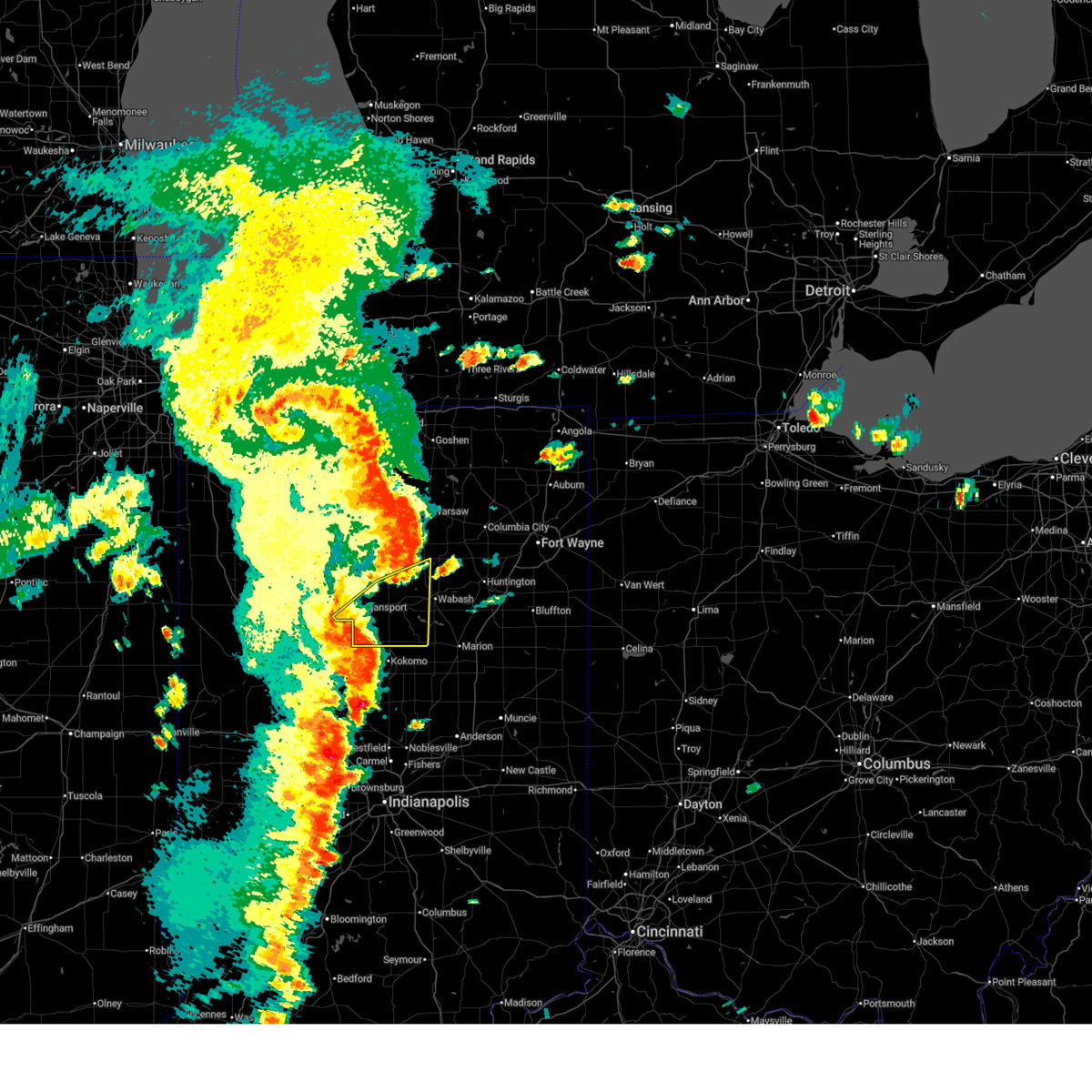
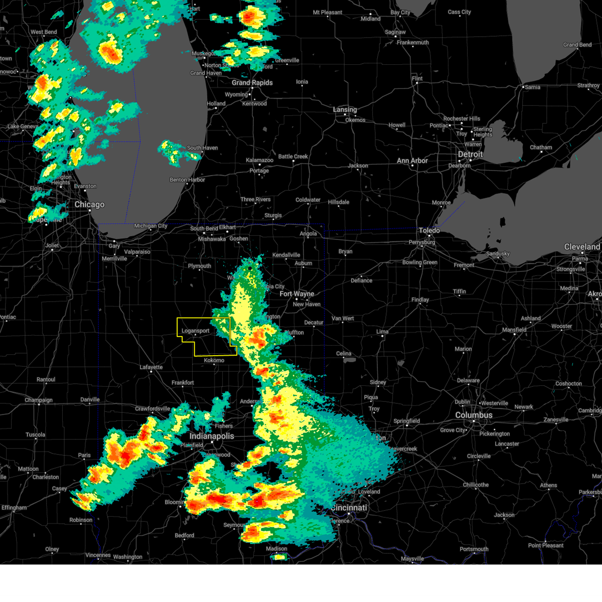
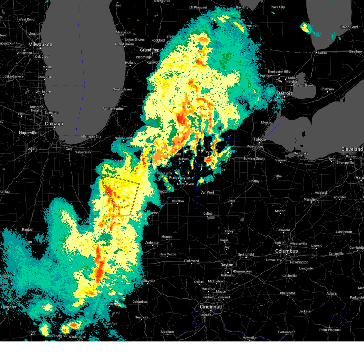
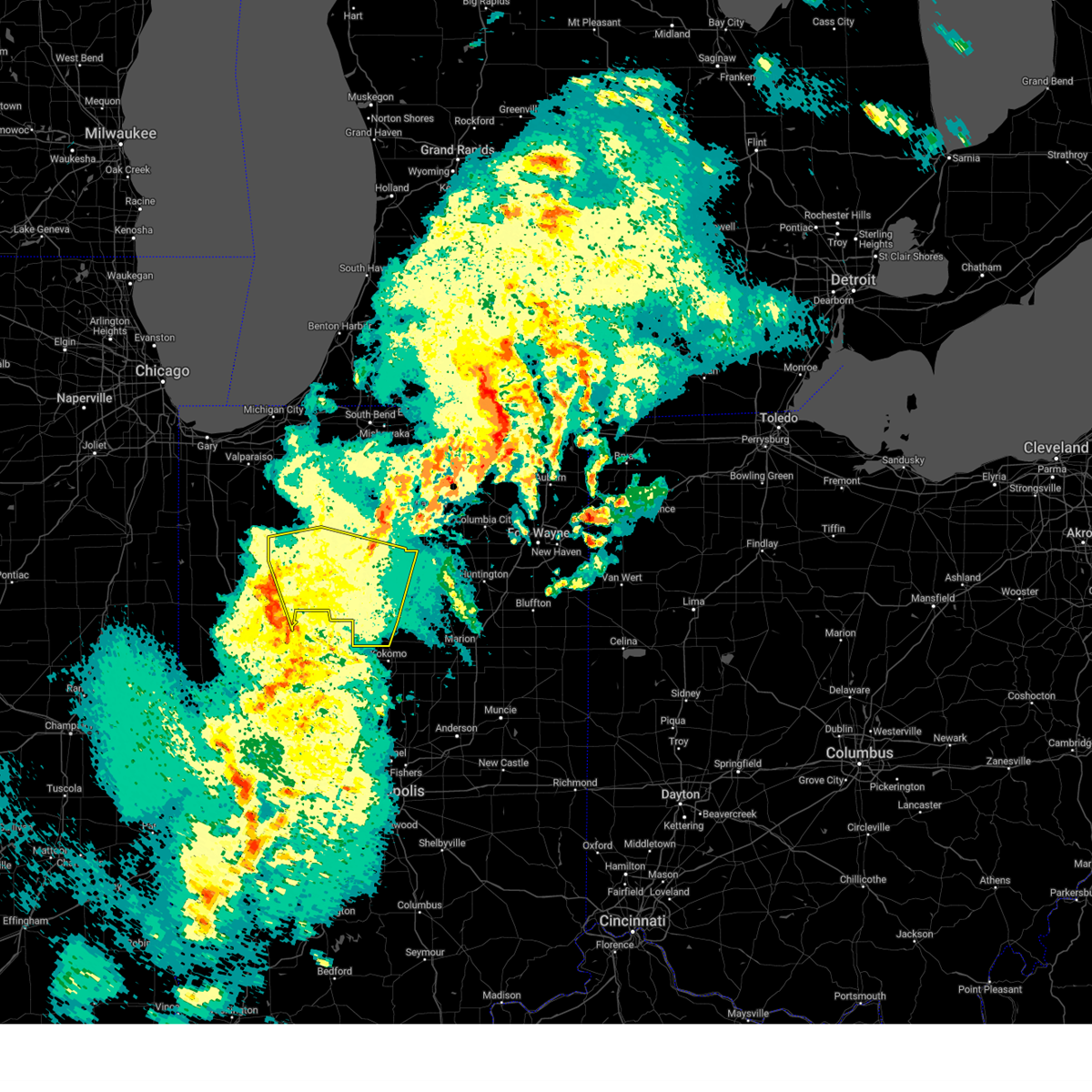
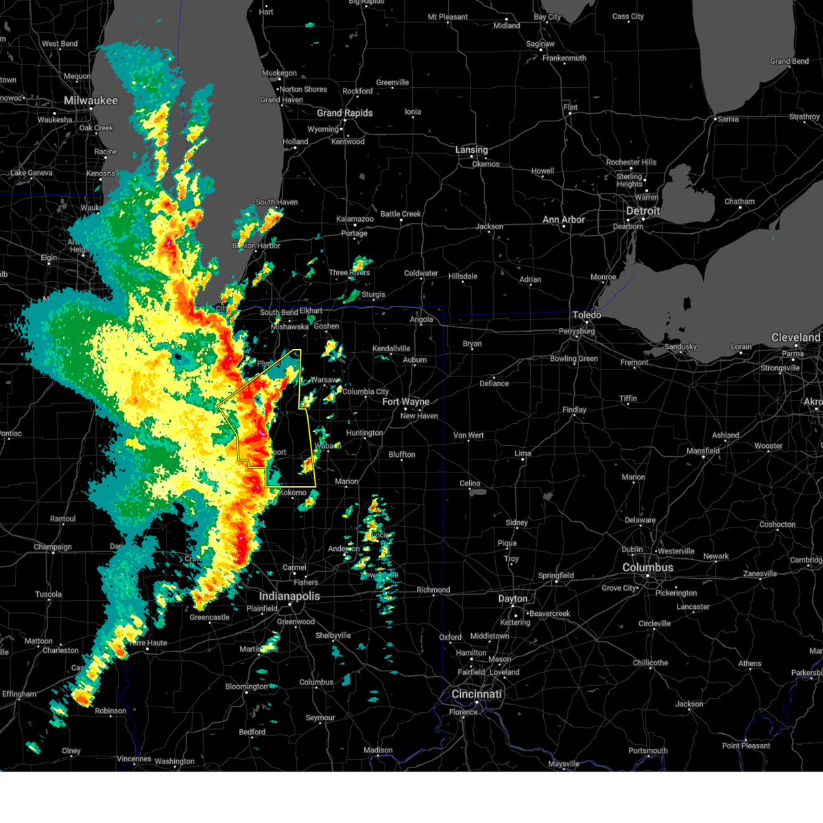
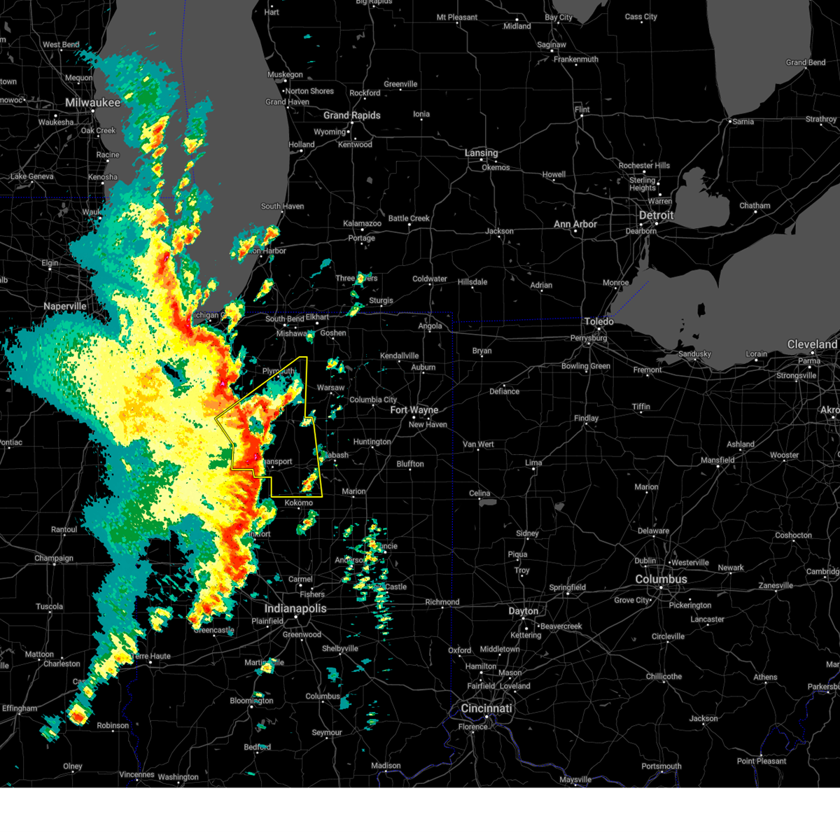
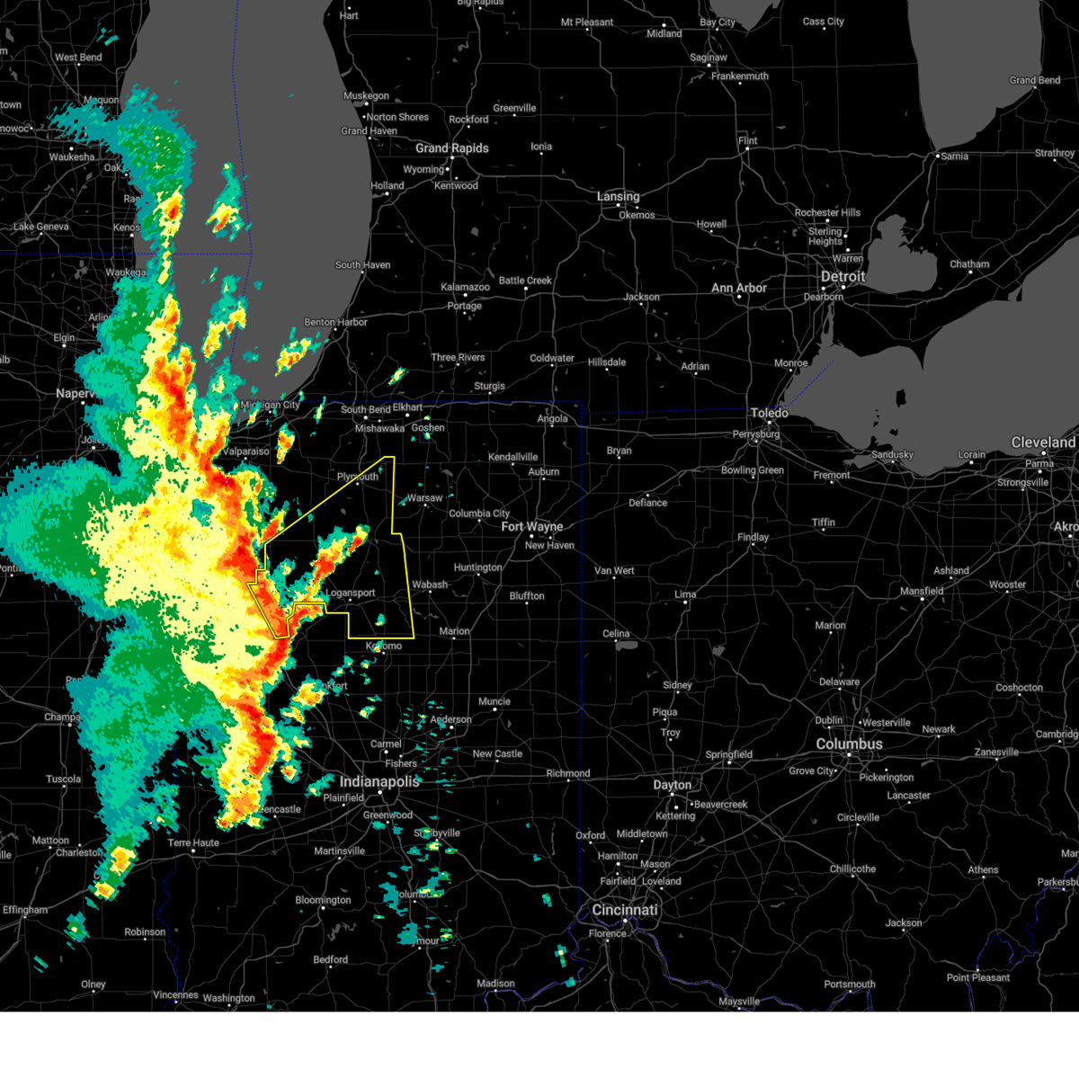
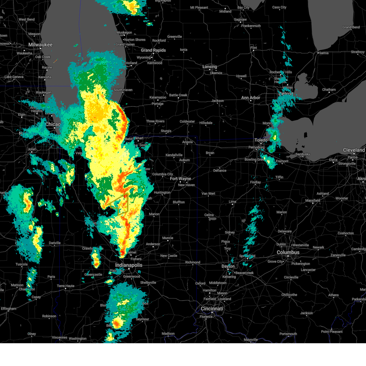
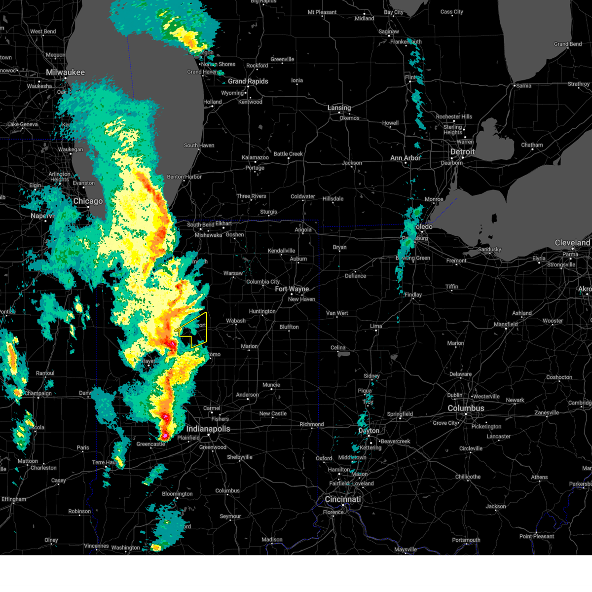
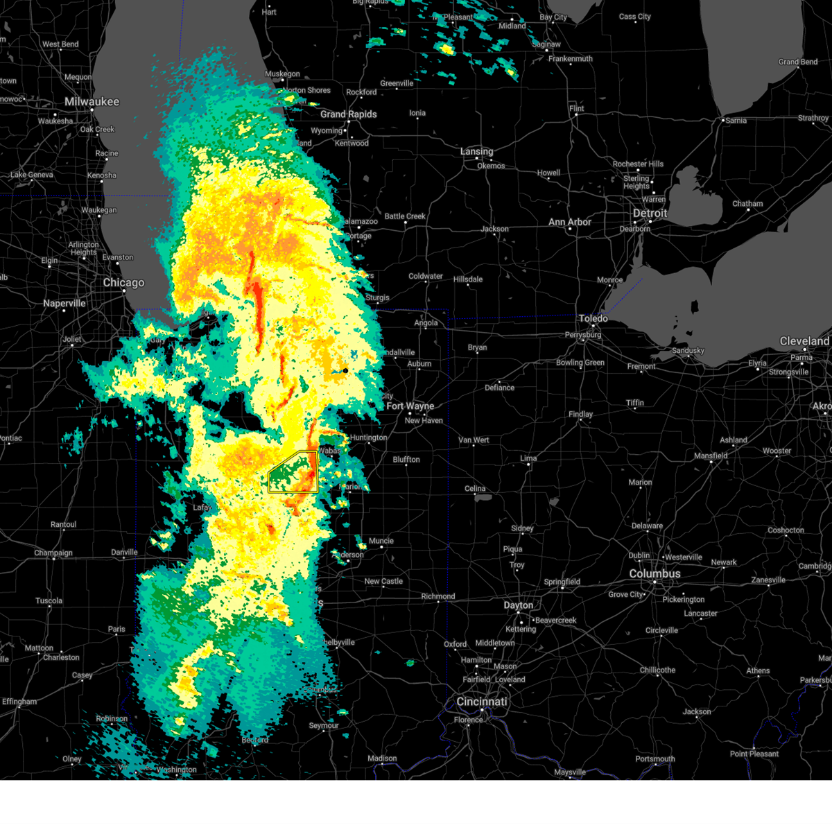
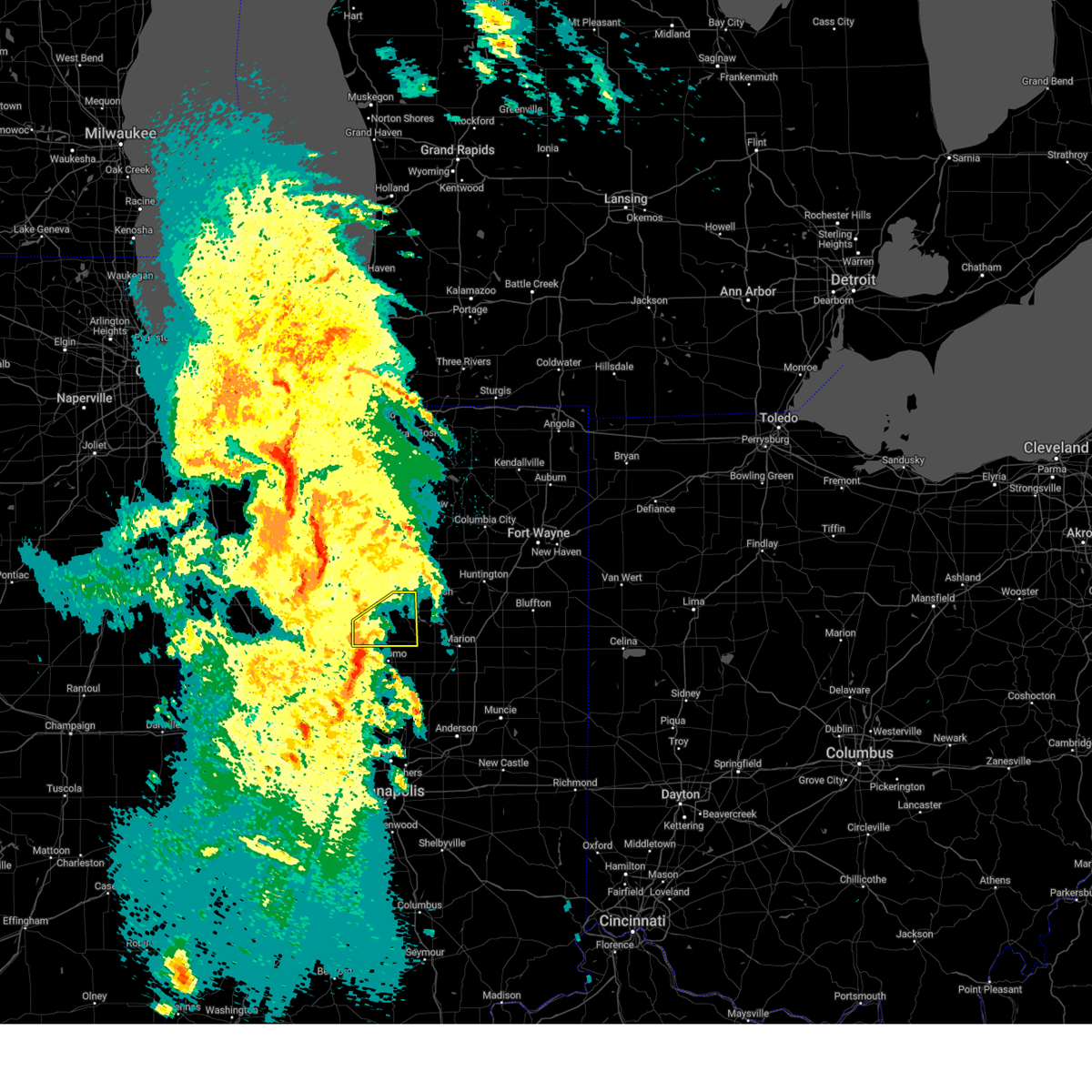
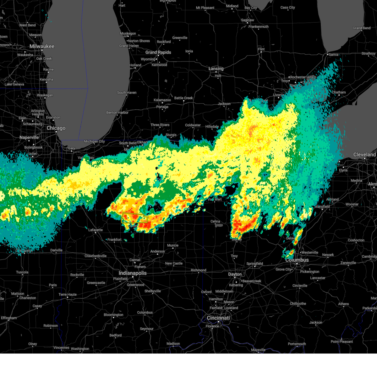
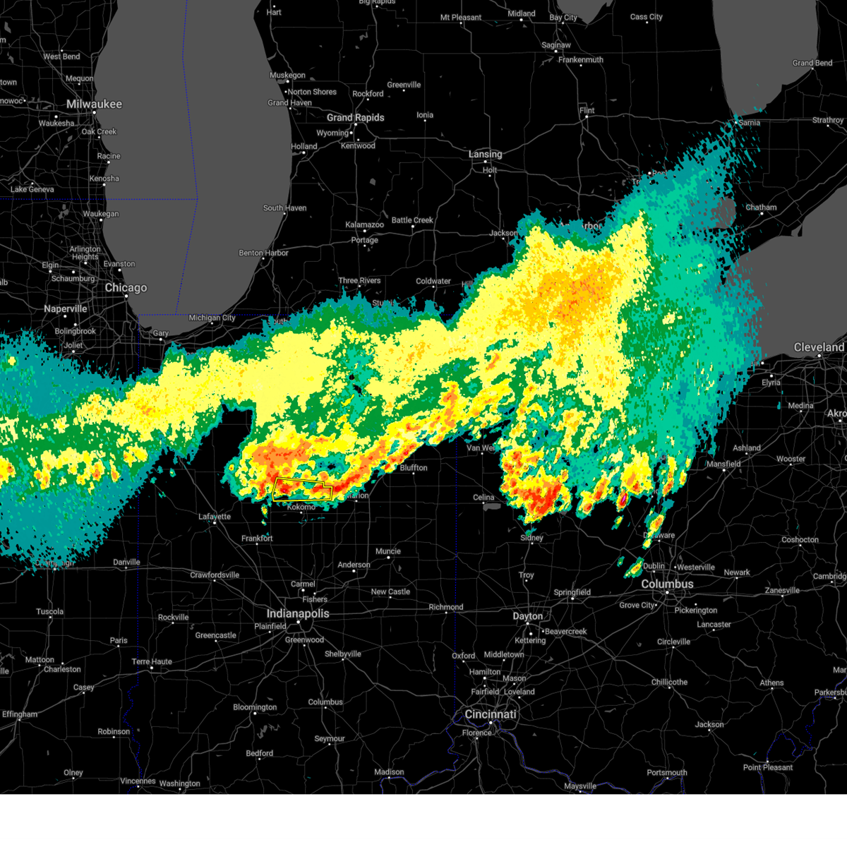
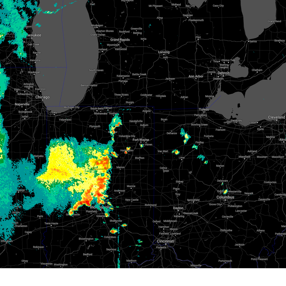
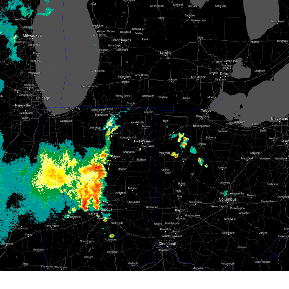
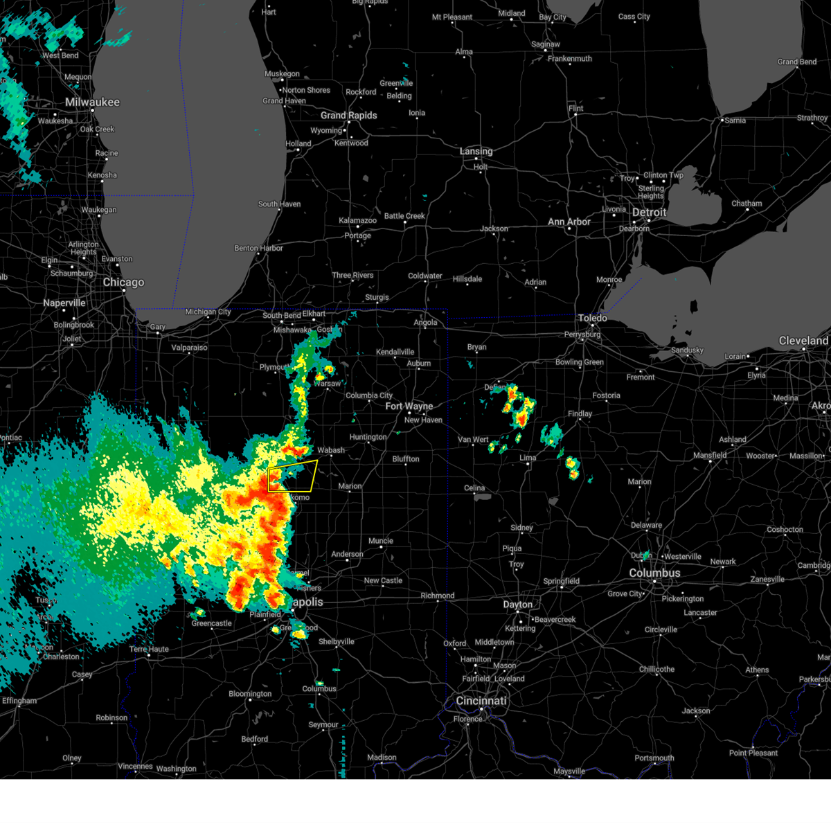
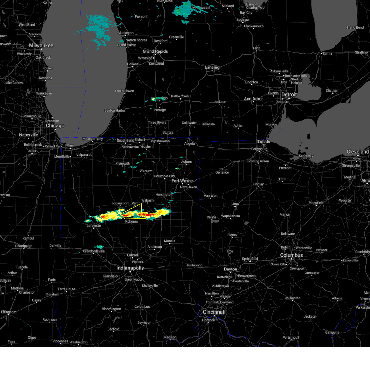
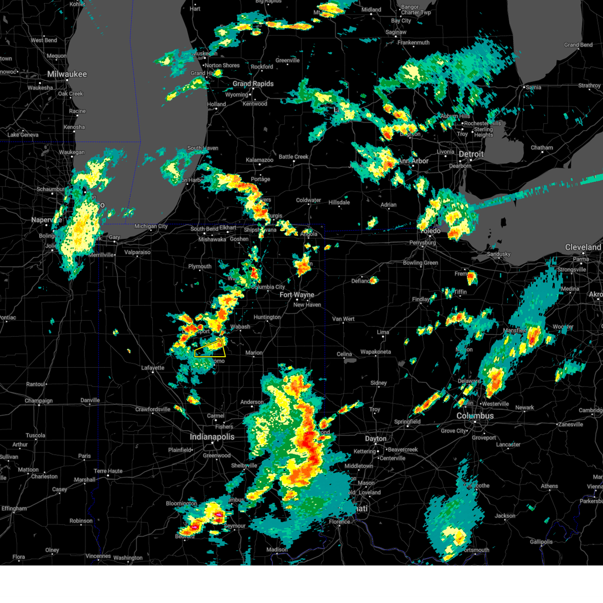
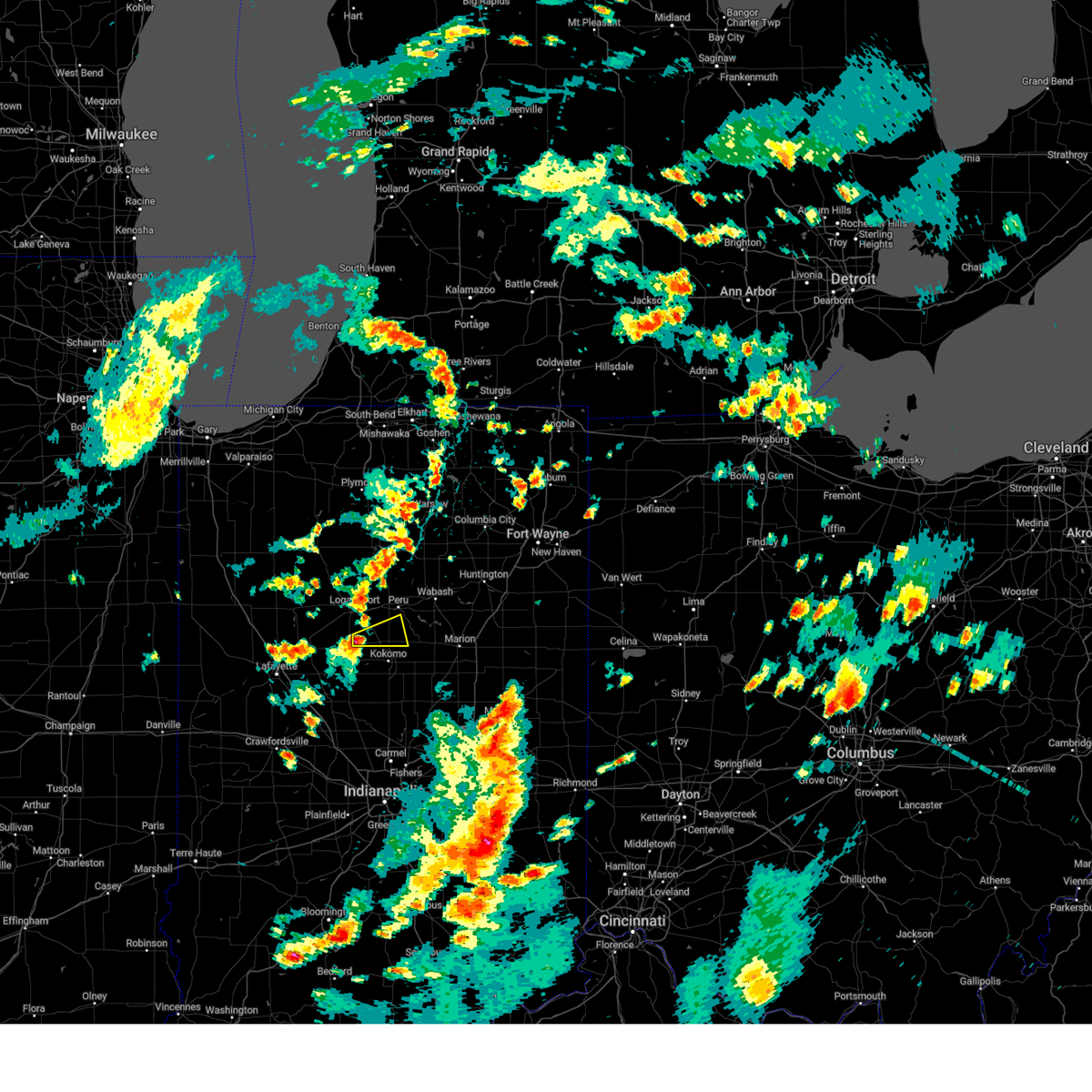
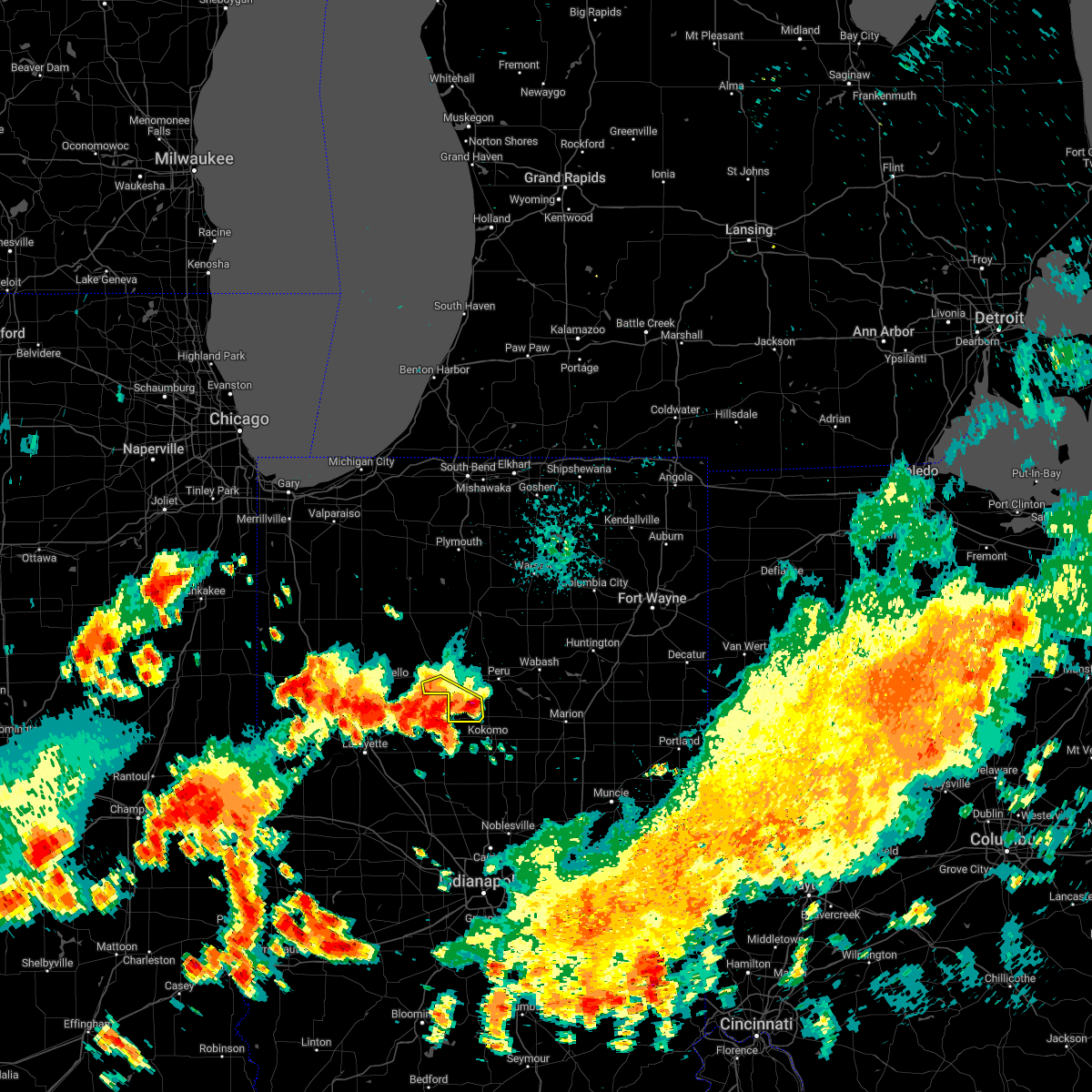
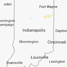
Hail Map for Walton, IN
The Walton, IN area has had 0 reports of on-the-ground hail by trained spotters, and has been under severe weather warnings 20 times during the past 12 months. Doppler radar has detected hail at or near Walton, IN on 36 occasions.
| Name: | Walton, IN |
| Where Located: | 62 miles N of Indianapolis, IN |
| Map: | Google Map for Walton, IN |
| Population: | 1049 |
| Housing Units: | 449 |
| More Info: | Search Google for Walton, IN |
0
The Top Recent Hail Date for Walton, IN is Tuesday, June 25, 2024 (27th out of 36)

Hail and Wind Damage Spotted near Walton, IN
| Date / Time | Report Details |
|---|---|
| 6/18/2025 4:22 PM EDT |
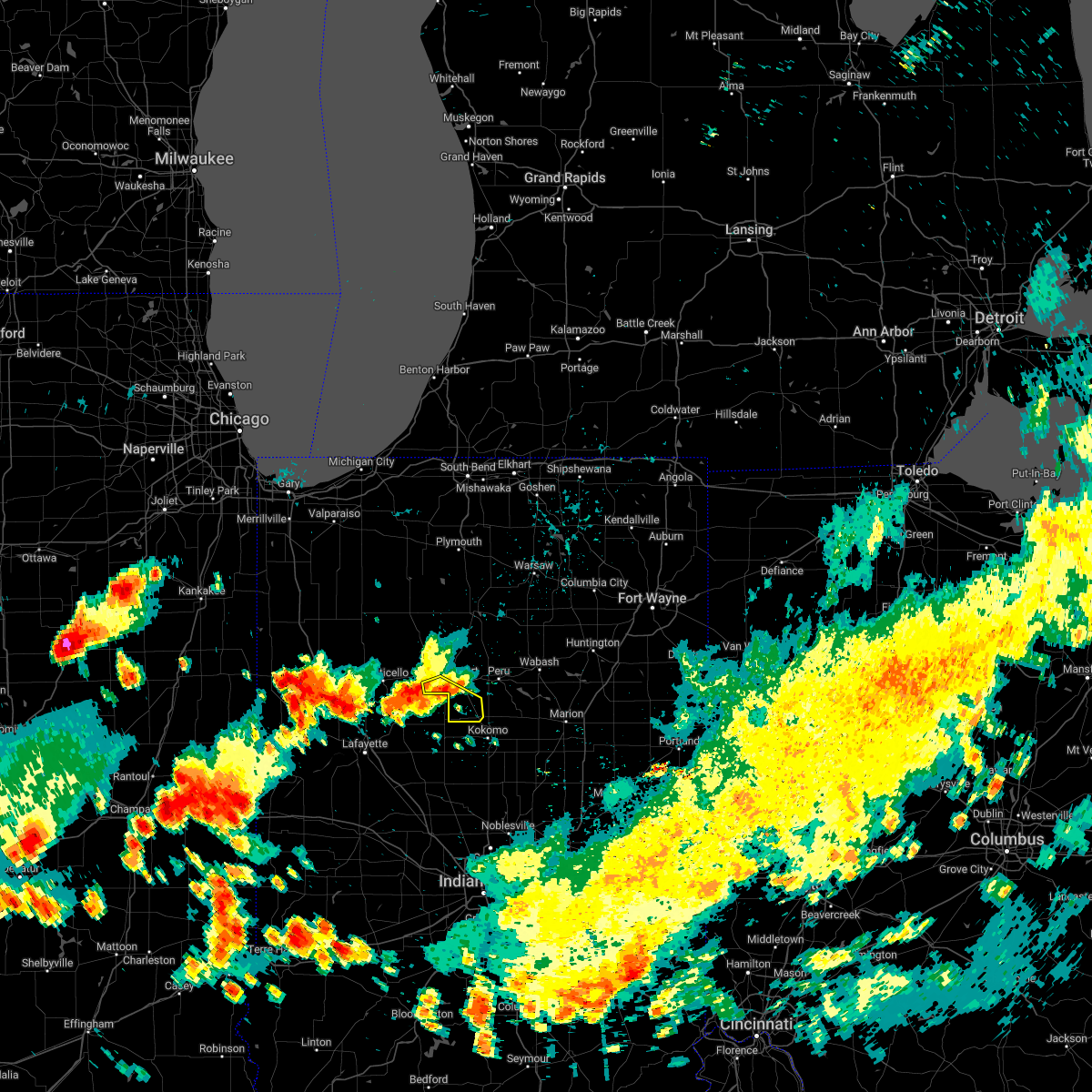
 Svriwx the national weather service in northern indiana has issued a * severe thunderstorm warning for, western wabash county in north central indiana, southeastern cass county in north central indiana, miami county in north central indiana, * until 500 pm edt. * at 422 pm edt, a severe thunderstorm was located over walton, or near grissom afb, moving northeast at 60 mph (radar indicated). Hazards include 60 mph wind gusts. expect damage to roofs, siding, and trees Svriwx the national weather service in northern indiana has issued a * severe thunderstorm warning for, western wabash county in north central indiana, southeastern cass county in north central indiana, miami county in north central indiana, * until 500 pm edt. * at 422 pm edt, a severe thunderstorm was located over walton, or near grissom afb, moving northeast at 60 mph (radar indicated). Hazards include 60 mph wind gusts. expect damage to roofs, siding, and trees
|
| 5/16/2025 7:42 PM EDT |
 The storm which prompted the warning has weakened below severe limits, and has exited the warned area. therefore, the warning will be allowed to expire. however, gusty winds are still possible with this thunderstorm. a severe thunderstorm watch remains in effect until midnight edt for central, north central and northwestern indiana. to report severe weather, contact your nearest law enforcement agency. they will relay your report to the national weather service northern indiana. The storm which prompted the warning has weakened below severe limits, and has exited the warned area. therefore, the warning will be allowed to expire. however, gusty winds are still possible with this thunderstorm. a severe thunderstorm watch remains in effect until midnight edt for central, north central and northwestern indiana. to report severe weather, contact your nearest law enforcement agency. they will relay your report to the national weather service northern indiana.
|
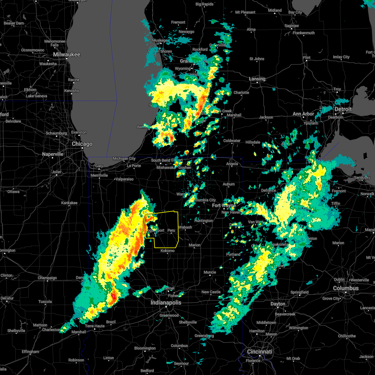
| 5/16/2025 7:17 PM EDT | At 716 pm edt, a severe thunderstorm was located near bunker hill, or near peru, moving northeast at 50 mph (radar indicated). Hazards include 60 mph wind gusts. these winds may exist well outside of the main storm. Expect damage to roofs, siding, and trees. Locations impacted include, logansport, peru, grissom afb, walton, bunker hill, royal center, mexico, lincoln, wells, galveston, miami, converse, erie, denver, amboy, onward, clymers, bennetts switch, leases corner, and deedsville. |
| 5/16/2025 6:48 PM EDT | Large tree and power line down in roadway on 6000 block of cr e 90 in cass county IN, 2.4 miles NNE of Walton, IN |
| 5/16/2025 6:46 PM EDT | Svriwx the national weather service in northern indiana has issued a * severe thunderstorm warning for, cass county in north central indiana, miami county in north central indiana, * until 745 pm edt. * at 646 pm edt, severe thunderstorms were located along a line extending from near brookston to 12 miles north of frankfort, moving northeast at 55 mph (radar indicated). Hazards include 60 mph wind gusts. expect damage to roofs, siding, and trees |
| 5/16/2025 6:43 PM EDT | Large tree down onto road along county road e 800 in cass county IN, 1.6 miles NE of Walton, IN |
| 4/2/2025 9:17 PM EDT | the severe thunderstorm warning has been cancelled and is no longer in effect |
| 4/2/2025 9:03 PM EDT |
 At 902 pm edt, severe thunderstorms were located along a line extending from 7 miles northeast of winamac to near walton to 13 miles southeast of delphi, moving northeast at 70 mph (radar indicated). Hazards include 60 mph wind gusts. Expect damage to roofs, siding, and trees. Locations impacted include, fulton, leiters ford, akron, beardstown, nyena lake, leases corner, deedsville, bunker hill, logansport, macy, hoover, lake bruce, star city, grissom afb, thornhope, kewanna, denver, lake manitou, lincoln, and royal center. At 902 pm edt, severe thunderstorms were located along a line extending from 7 miles northeast of winamac to near walton to 13 miles southeast of delphi, moving northeast at 70 mph (radar indicated). Hazards include 60 mph wind gusts. Expect damage to roofs, siding, and trees. Locations impacted include, fulton, leiters ford, akron, beardstown, nyena lake, leases corner, deedsville, bunker hill, logansport, macy, hoover, lake bruce, star city, grissom afb, thornhope, kewanna, denver, lake manitou, lincoln, and royal center.
|
| 4/2/2025 9:03 PM EDT |
 the severe thunderstorm warning has been cancelled and is no longer in effect the severe thunderstorm warning has been cancelled and is no longer in effect
|
| 4/2/2025 8:42 PM EDT |
 Svriwx the national weather service in northern indiana has issued a * severe thunderstorm warning for, northeastern white county in northwestern indiana, fulton county in north central indiana, pulaski county in northwestern indiana, cass county in north central indiana, western miami county in north central indiana, * until 930 pm edt. * at 842 pm edt, severe thunderstorms were located along a line extending from near monon to 6 miles southeast of delphi to 7 miles southeast of lafayette, moving northeast at 60 mph (radar indicated). Hazards include 60 mph wind gusts and quarter size hail. Hail damage to vehicles is expected. Expect wind damage to roofs, siding, and trees. Svriwx the national weather service in northern indiana has issued a * severe thunderstorm warning for, northeastern white county in northwestern indiana, fulton county in north central indiana, pulaski county in northwestern indiana, cass county in north central indiana, western miami county in north central indiana, * until 930 pm edt. * at 842 pm edt, severe thunderstorms were located along a line extending from near monon to 6 miles southeast of delphi to 7 miles southeast of lafayette, moving northeast at 60 mph (radar indicated). Hazards include 60 mph wind gusts and quarter size hail. Hail damage to vehicles is expected. Expect wind damage to roofs, siding, and trees.
|
| 3/30/2025 4:43 PM EDT | The storms which prompted the warning have moved out of the area. therefore, the warning will be allowed to expire. a tornado watch remains in effect until 800 pm edt for north central indiana. to report severe weather, contact your nearest law enforcement agency. they will relay your report to the national weather service northern indiana. |
| 3/30/2025 4:38 PM EDT | At 438 pm edt, severe thunderstorms were located along a line extending from near bremen to mentone, moving east at 85 mph. damage was reported in and around logansport at 420 pm (emergency management). Hazards include 70 mph wind gusts and nickel size hail. Expect considerable tree damage. damage is likely to mobile homes, roofs, and outbuildings. Locations impacted include, fulton, akron, bennetts switch, nyena lake, erie, deedsville, bunker hill, macy, hibbard, wawpecong, argos, tippecanoe, bremen, old tip town, hoover, peoria, grissom afb, tiosa, denver, and lake manitou. |
| 3/30/2025 4:38 PM EDT | the severe thunderstorm warning has been cancelled and is no longer in effect |
| 3/30/2025 4:33 PM EDT |
 Svriwx the national weather service in northern indiana has issued a * severe thunderstorm warning for, southern elkhart county in north central indiana, wabash county in north central indiana, noble county in northeastern indiana, northern grant county in central indiana, whitley county in northeastern indiana, huntington county in northeastern indiana, kosciusko county in north central indiana, cass county in north central indiana, southwestern lagrange county in northeastern indiana, fulton county in north central indiana, western wells county in northeastern indiana, miami county in north central indiana, marshall county in north central indiana, * until 530 pm edt. * at 433 pm edt, severe thunderstorms were located along a line extending from plymouth to near walton, moving northeast at 65 mph (radar indicated). Hazards include 70 mph wind gusts and nickel size hail. Expect considerable tree damage. Damage is likely to mobile homes, roofs, and outbuildings. Svriwx the national weather service in northern indiana has issued a * severe thunderstorm warning for, southern elkhart county in north central indiana, wabash county in north central indiana, noble county in northeastern indiana, northern grant county in central indiana, whitley county in northeastern indiana, huntington county in northeastern indiana, kosciusko county in north central indiana, cass county in north central indiana, southwestern lagrange county in northeastern indiana, fulton county in north central indiana, western wells county in northeastern indiana, miami county in north central indiana, marshall county in north central indiana, * until 530 pm edt. * at 433 pm edt, severe thunderstorms were located along a line extending from plymouth to near walton, moving northeast at 65 mph (radar indicated). Hazards include 70 mph wind gusts and nickel size hail. Expect considerable tree damage. Damage is likely to mobile homes, roofs, and outbuildings.
|
| 3/30/2025 4:22 PM EDT |
 At 422 pm edt/322 pm cdt/, severe thunderstorms were located along a line extending from near culver to 9 miles southwest of rochester, moving northeast at 85 mph. powerlines and trees have been reported down on the west side of logansport, in as of 420 pm edt (emergency management). Hazards include 70 mph wind gusts and nickel size hail. Expect considerable tree damage. damage is likely to mobile homes, roofs, and outbuildings. Locations impacted include, clymers, akron, beardstown, bennetts switch, nyena lake, erie, deedsville, macy, hibbard, tippecanoe, peoria, star city, tiosa, thornhope, lincoln, nead, talma, twin lakes, inwood, and rochester. At 422 pm edt/322 pm cdt/, severe thunderstorms were located along a line extending from near culver to 9 miles southwest of rochester, moving northeast at 85 mph. powerlines and trees have been reported down on the west side of logansport, in as of 420 pm edt (emergency management). Hazards include 70 mph wind gusts and nickel size hail. Expect considerable tree damage. damage is likely to mobile homes, roofs, and outbuildings. Locations impacted include, clymers, akron, beardstown, bennetts switch, nyena lake, erie, deedsville, macy, hibbard, tippecanoe, peoria, star city, tiosa, thornhope, lincoln, nead, talma, twin lakes, inwood, and rochester.
|
| 3/30/2025 4:11 PM EDT |
 At 411 pm edt/311 pm cdt/, severe thunderstorms were located along a line extending from near winamac to royal center, moving northeast at 75 mph (radar indicated). Hazards include 70 mph wind gusts and nickel size hail. Expect considerable tree damage. damage is likely to mobile homes, roofs, and outbuildings. Locations impacted include, clymers, akron, beardstown, bennetts switch, nyena lake, erie, deedsville, macy, hibbard, tippecanoe, peoria, star city, tiosa, thornhope, lincoln, nead, talma, twin lakes, inwood, and rochester. At 411 pm edt/311 pm cdt/, severe thunderstorms were located along a line extending from near winamac to royal center, moving northeast at 75 mph (radar indicated). Hazards include 70 mph wind gusts and nickel size hail. Expect considerable tree damage. damage is likely to mobile homes, roofs, and outbuildings. Locations impacted include, clymers, akron, beardstown, bennetts switch, nyena lake, erie, deedsville, macy, hibbard, tippecanoe, peoria, star city, tiosa, thornhope, lincoln, nead, talma, twin lakes, inwood, and rochester.
|
| 3/30/2025 3:54 PM EDT |
 Svriwx the national weather service in northern indiana has issued a * severe thunderstorm warning for, white county in northwestern indiana, fulton county in north central indiana, pulaski county in northwestern indiana, cass county in north central indiana, miami county in north central indiana, southeastern starke county in northwestern indiana, marshall county in north central indiana, * until 445 pm edt/345 pm cdt/. * at 354 pm edt/254 pm cdt/, severe thunderstorms were located along a line extending from near hanging grove to near brookston, moving northeast at 85 mph (radar indicated). Hazards include 70 mph wind gusts and nickel size hail. Expect considerable tree damage. Damage is likely to mobile homes, roofs, and outbuildings. Svriwx the national weather service in northern indiana has issued a * severe thunderstorm warning for, white county in northwestern indiana, fulton county in north central indiana, pulaski county in northwestern indiana, cass county in north central indiana, miami county in north central indiana, southeastern starke county in northwestern indiana, marshall county in north central indiana, * until 445 pm edt/345 pm cdt/. * at 354 pm edt/254 pm cdt/, severe thunderstorms were located along a line extending from near hanging grove to near brookston, moving northeast at 85 mph (radar indicated). Hazards include 70 mph wind gusts and nickel size hail. Expect considerable tree damage. Damage is likely to mobile homes, roofs, and outbuildings.
|
| 3/19/2025 8:07 PM EDT |
 The storm which prompted the warning has moved out of the area. therefore, the warning will be allowed to expire. a severe thunderstorm watch remains in effect until 100 am edt for north central indiana. The storm which prompted the warning has moved out of the area. therefore, the warning will be allowed to expire. a severe thunderstorm watch remains in effect until 100 am edt for north central indiana.
|
| 3/19/2025 7:38 PM EDT |
 Svriwx the national weather service in northern indiana has issued a * severe thunderstorm warning for, cass county in north central indiana, * until 815 pm edt. * at 738 pm edt, a severe thunderstorm was located near delphi, or 12 miles southeast of monticello, moving northeast at 60 mph (radar indicated). Hazards include 60 mph wind gusts and quarter size hail. Hail damage to vehicles is expected. Expect wind damage to roofs, siding, and trees. Svriwx the national weather service in northern indiana has issued a * severe thunderstorm warning for, cass county in north central indiana, * until 815 pm edt. * at 738 pm edt, a severe thunderstorm was located near delphi, or 12 miles southeast of monticello, moving northeast at 60 mph (radar indicated). Hazards include 60 mph wind gusts and quarter size hail. Hail damage to vehicles is expected. Expect wind damage to roofs, siding, and trees.
|
| 3/15/2025 3:52 AM EDT |
 The storms which prompted the warning have moved out of the area. therefore, the warning will be allowed to expire. a severe thunderstorm watch remains in effect until 900 am edt for north central indiana. to report severe weather, contact your nearest law enforcement agency. they will relay your report to the national weather service northern indiana. The storms which prompted the warning have moved out of the area. therefore, the warning will be allowed to expire. a severe thunderstorm watch remains in effect until 900 am edt for north central indiana. to report severe weather, contact your nearest law enforcement agency. they will relay your report to the national weather service northern indiana.
|
| 3/15/2025 3:24 AM EDT |
 Svriwx the national weather service in northern indiana has issued a * severe thunderstorm warning for, southeastern cass county in north central indiana, southwestern miami county in north central indiana, * until 400 am edt. * at 323 am edt, severe thunderstorms were located along a line extending from 6 miles west of walton to 8 miles northeast of frankfort, moving northeast at 50 mph (radar indicated). Hazards include 60 mph wind gusts. expect damage to roofs, siding, and trees Svriwx the national weather service in northern indiana has issued a * severe thunderstorm warning for, southeastern cass county in north central indiana, southwestern miami county in north central indiana, * until 400 am edt. * at 323 am edt, severe thunderstorms were located along a line extending from 6 miles west of walton to 8 miles northeast of frankfort, moving northeast at 50 mph (radar indicated). Hazards include 60 mph wind gusts. expect damage to roofs, siding, and trees
|
| 7/16/2024 12:40 AM EDT | Emergency manager reports tree downed at grace street between depot and main street in walton... indiana in cass count in cass county IN, 0.3 miles NW of Walton, IN |
| 7/16/2024 12:31 AM EDT | Tree down on grace st between depot and main street. reported by emergency manager. time estimated via rada in cass county IN, 0.3 miles NW of Walton, IN |
| 7/16/2024 12:10 AM EDT |
 Svriwx the national weather service in northern indiana has issued a * severe thunderstorm warning for, southern wabash county in north central indiana, western grant county in central indiana, cass county in north central indiana, miami county in north central indiana, * until 100 am edt. * at 1210 am edt, severe thunderstorms were located along a line extending from 6 miles east of royal center to 7 miles southeast of delphi, moving east at 55 mph (radar indicated). Hazards include 70 mph wind gusts. Expect considerable tree damage. Damage is likely to mobile homes, roofs, and outbuildings. Svriwx the national weather service in northern indiana has issued a * severe thunderstorm warning for, southern wabash county in north central indiana, western grant county in central indiana, cass county in north central indiana, miami county in north central indiana, * until 100 am edt. * at 1210 am edt, severe thunderstorms were located along a line extending from 6 miles east of royal center to 7 miles southeast of delphi, moving east at 55 mph (radar indicated). Hazards include 70 mph wind gusts. Expect considerable tree damage. Damage is likely to mobile homes, roofs, and outbuildings.
|
| 6/25/2024 11:32 AM EDT |
 the severe thunderstorm warning has been cancelled and is no longer in effect the severe thunderstorm warning has been cancelled and is no longer in effect
|
| 6/25/2024 11:19 AM EDT |
 Svriwx the national weather service in northern indiana has issued a * severe thunderstorm warning for, southeastern cass county in north central indiana, southern miami county in north central indiana, * until 1145 am edt. * at 1118 am edt, a severe thunderstorm was located over walton, or near grissom afb, moving east at 30 mph (radar indicated). Hazards include 60 mph wind gusts and quarter size hail. Hail damage to vehicles is expected. Expect wind damage to roofs, siding, and trees. Svriwx the national weather service in northern indiana has issued a * severe thunderstorm warning for, southeastern cass county in north central indiana, southern miami county in north central indiana, * until 1145 am edt. * at 1118 am edt, a severe thunderstorm was located over walton, or near grissom afb, moving east at 30 mph (radar indicated). Hazards include 60 mph wind gusts and quarter size hail. Hail damage to vehicles is expected. Expect wind damage to roofs, siding, and trees.
|
| 5/24/2024 6:27 PM EDT |
 The storms which prompted the warning have weakened. therefore, the warning will be allowed to expire. however, gusty winds and heavy rain are still possible with these thunderstorms. The storms which prompted the warning have weakened. therefore, the warning will be allowed to expire. however, gusty winds and heavy rain are still possible with these thunderstorms.
|
| 5/24/2024 6:17 PM EDT | Large tree branches down onto e co rd 1150 s (estimated 12 to 18 inches in diatemer in cass county IN, 5.9 miles NE of Walton, IN |
| 5/24/2024 6:17 PM EDT |
 At 617 pm edt, severe thunderstorms were located along a line extending from walton to near bunker hill, moving northeast at 60 mph (radar indicated). Hazards include 60 mph wind gusts. Expect damage to roofs, siding, and trees. Locations impacted include, peru, grissom afb, walton, bunker hill, lincoln, wells, galveston, miami, onward, bennetts switch, deacon, santa fe, wawpecong, peoria, and nead. At 617 pm edt, severe thunderstorms were located along a line extending from walton to near bunker hill, moving northeast at 60 mph (radar indicated). Hazards include 60 mph wind gusts. Expect damage to roofs, siding, and trees. Locations impacted include, peru, grissom afb, walton, bunker hill, lincoln, wells, galveston, miami, onward, bennetts switch, deacon, santa fe, wawpecong, peoria, and nead.
|
| 5/24/2024 6:03 PM EDT |
 Svriwx the national weather service in northern indiana has issued a * severe thunderstorm warning for, southeastern cass county in north central indiana, southwestern miami county in north central indiana, * until 630 pm edt. * at 603 pm edt, severe thunderstorms were located along a line extending from 12 miles east of delphi to near kokomo, moving northeast at 35 mph (radar indicated). Hazards include 60 mph wind gusts. expect damage to roofs, siding, and trees Svriwx the national weather service in northern indiana has issued a * severe thunderstorm warning for, southeastern cass county in north central indiana, southwestern miami county in north central indiana, * until 630 pm edt. * at 603 pm edt, severe thunderstorms were located along a line extending from 12 miles east of delphi to near kokomo, moving northeast at 35 mph (radar indicated). Hazards include 60 mph wind gusts. expect damage to roofs, siding, and trees
|
| 3/14/2024 5:16 PM EDT |
 Svriwx the national weather service in northern indiana has issued a * severe thunderstorm warning for, southeastern cass county in north central indiana, southern miami county in north central indiana, * until 545 pm edt. * at 515 pm edt, a severe thunderstorm was located near walton, or near grissom afb, moving east at 45 mph (radar indicated). Hazards include 60 mph wind gusts and quarter size hail. Hail damage to vehicles is expected. Expect wind damage to roofs, siding, and trees. Svriwx the national weather service in northern indiana has issued a * severe thunderstorm warning for, southeastern cass county in north central indiana, southern miami county in north central indiana, * until 545 pm edt. * at 515 pm edt, a severe thunderstorm was located near walton, or near grissom afb, moving east at 45 mph (radar indicated). Hazards include 60 mph wind gusts and quarter size hail. Hail damage to vehicles is expected. Expect wind damage to roofs, siding, and trees.
|
| 7/2/2023 5:39 PM EDT |
 The severe thunderstorm warning for southeastern cass and southwestern miami counties will expire at 545 pm edt, the storm which prompted the warning has weakened below severe limits, and no longer poses an immediate threat to life or property. therefore, the warning will be allowed to expire. gusty winds to 40 mph and brief heavy rain are possible east of bunker hill through 545 pm edt. a severe thunderstorm watch remains in effect until 900 pm edt for north central indiana. The severe thunderstorm warning for southeastern cass and southwestern miami counties will expire at 545 pm edt, the storm which prompted the warning has weakened below severe limits, and no longer poses an immediate threat to life or property. therefore, the warning will be allowed to expire. gusty winds to 40 mph and brief heavy rain are possible east of bunker hill through 545 pm edt. a severe thunderstorm watch remains in effect until 900 pm edt for north central indiana.
|
| 7/2/2023 5:07 PM EDT |
 At 506 pm edt, a severe thunderstorm was located 7 miles southwest of walton, or 11 miles southwest of grissom afb, moving east at 30 mph (radar indicated). Hazards include 60 mph wind gusts and quarter size hail. Hail damage to vehicles is expected. expect wind damage to roofs, siding, and trees. this severe thunderstorm will be near, walton around 520 pm edt. grissom afb around 530 pm edt. bunker hill around 535 pm edt. other locations impacted by this severe thunderstorm include wawpecong, bennetts switch, deacon, lincoln, miami and galveston. hail threat, radar indicated max hail size, 1. 00 in wind threat, radar indicated max wind gust, 60 mph. At 506 pm edt, a severe thunderstorm was located 7 miles southwest of walton, or 11 miles southwest of grissom afb, moving east at 30 mph (radar indicated). Hazards include 60 mph wind gusts and quarter size hail. Hail damage to vehicles is expected. expect wind damage to roofs, siding, and trees. this severe thunderstorm will be near, walton around 520 pm edt. grissom afb around 530 pm edt. bunker hill around 535 pm edt. other locations impacted by this severe thunderstorm include wawpecong, bennetts switch, deacon, lincoln, miami and galveston. hail threat, radar indicated max hail size, 1. 00 in wind threat, radar indicated max wind gust, 60 mph.
|
| 8/29/2022 8:52 PM EDT |
 The severe thunderstorm warning for southern cass county will expire at 900 pm edt, the storm which prompted the warning has weakened below severe limits, and no longer poses an immediate threat to life or property. therefore, the warning will be allowed to expire. The severe thunderstorm warning for southern cass county will expire at 900 pm edt, the storm which prompted the warning has weakened below severe limits, and no longer poses an immediate threat to life or property. therefore, the warning will be allowed to expire.
|
| 8/29/2022 8:33 PM EDT |
 At 831 pm edt, a severe thunderstorm was located 8 miles southwest of logansport, moving southeast at 30 mph (radar indicated). Hazards include 60 mph wind gusts. Expect damage to roofs, siding, and trees. locations impacted include, logansport, grissom afb, walton, lincoln, galveston, clymers and deacon. hail threat, radar indicated max hail size, <. 75 in wind threat, radar indicated max wind gust, 60 mph. At 831 pm edt, a severe thunderstorm was located 8 miles southwest of logansport, moving southeast at 30 mph (radar indicated). Hazards include 60 mph wind gusts. Expect damage to roofs, siding, and trees. locations impacted include, logansport, grissom afb, walton, lincoln, galveston, clymers and deacon. hail threat, radar indicated max hail size, <. 75 in wind threat, radar indicated max wind gust, 60 mph.
|
| 8/29/2022 8:11 PM EDT |
 At 810 pm edt, a severe thunderstorm was located near monticello, moving southeast at 30 mph (radar indicated). Hazards include 60 mph wind gusts and quarter size hail. Hail damage to vehicles is expected. Expect wind damage to roofs, siding, and trees. At 810 pm edt, a severe thunderstorm was located near monticello, moving southeast at 30 mph (radar indicated). Hazards include 60 mph wind gusts and quarter size hail. Hail damage to vehicles is expected. Expect wind damage to roofs, siding, and trees.
|
| 5/25/2022 7:41 PM EDT |
 The severe thunderstorm warning for southwestern fulton, cass and western miami counties will expire at 745 pm edt, the storm which prompted the warning has moved out of the area. therefore, the warning will be allowed to expire. The severe thunderstorm warning for southwestern fulton, cass and western miami counties will expire at 745 pm edt, the storm which prompted the warning has moved out of the area. therefore, the warning will be allowed to expire.
|
| 5/25/2022 7:10 PM EDT | Passed along a report from a private weather statio in cass county IN, 3.7 miles NNW of Walton, IN |
| 5/25/2022 7:00 PM EDT |
 At 659 pm edt, a severe thunderstorm was located near walton, or near grissom afb, moving north at 50 mph (radar indicated). Hazards include 60 mph wind gusts. expect damage to roofs, siding, and trees At 659 pm edt, a severe thunderstorm was located near walton, or near grissom afb, moving north at 50 mph (radar indicated). Hazards include 60 mph wind gusts. expect damage to roofs, siding, and trees
|
| 3/6/2022 2:14 AM EST |
 At 214 am est, severe thunderstorms were located along a line extending from near royal center to 8 miles northeast of delphi to 6 miles east of lafayette, moving east at 50 mph (radar indicated). Hazards include 60 mph wind gusts. expect damage to roofs, siding, and trees At 214 am est, severe thunderstorms were located along a line extending from near royal center to 8 miles northeast of delphi to 6 miles east of lafayette, moving east at 50 mph (radar indicated). Hazards include 60 mph wind gusts. expect damage to roofs, siding, and trees
|
| 10/11/2021 9:52 PM EDT |
 At 950 pm edt, a severe thunderstorm was located 11 miles west of kokomo, moving northeast at 55 mph (radar indicated). Hazards include 60 mph wind gusts. expect damage to roofs, siding, and trees At 950 pm edt, a severe thunderstorm was located 11 miles west of kokomo, moving northeast at 55 mph (radar indicated). Hazards include 60 mph wind gusts. expect damage to roofs, siding, and trees
|
| 10/11/2021 6:28 PM EDT |
 The severe thunderstorm warning for northeastern pulaski, fulton, cass, northwestern miami and south central starke counties will expire at 630 pm edt/530 pm cdt/, the storms which prompted the warning have moved out of the area. therefore, the warning will be allowed to expire. however heavy rain is still possible with these thunderstorms. The severe thunderstorm warning for northeastern pulaski, fulton, cass, northwestern miami and south central starke counties will expire at 630 pm edt/530 pm cdt/, the storms which prompted the warning have moved out of the area. therefore, the warning will be allowed to expire. however heavy rain is still possible with these thunderstorms.
|
| 10/11/2021 6:15 PM EDT |
 At 615 pm edt/515 pm cdt/, severe thunderstorms were located along a line extending from 7 miles southwest of culver to 9 miles east of winamac to near walton, moving north at 70 mph (radar indicated). Hazards include 60 mph wind gusts and quarter size hail. Hail damage to vehicles is expected. expect wind damage to roofs, siding, and trees. Locations impacted include, logansport, rochester, akron, walton, mexico, lincoln, kewanna, fulton, monterey, macy, onward, leiters ford, beardstown, nyena lake, leases corner, deedsville, delong, hoover, lake bruce and lake manitou. At 615 pm edt/515 pm cdt/, severe thunderstorms were located along a line extending from 7 miles southwest of culver to 9 miles east of winamac to near walton, moving north at 70 mph (radar indicated). Hazards include 60 mph wind gusts and quarter size hail. Hail damage to vehicles is expected. expect wind damage to roofs, siding, and trees. Locations impacted include, logansport, rochester, akron, walton, mexico, lincoln, kewanna, fulton, monterey, macy, onward, leiters ford, beardstown, nyena lake, leases corner, deedsville, delong, hoover, lake bruce and lake manitou.
|
| 10/11/2021 5:52 PM EDT |
 At 552 pm edt/452 pm cdt/, severe thunderstorms were located along a line extending from near monticello to near delphi to 11 miles northeast of frankfort, moving north at 65 mph (radar indicated). Hazards include 60 mph wind gusts and quarter size hail. Hail damage to vehicles is expected. Expect wind damage to roofs, siding, and trees. At 552 pm edt/452 pm cdt/, severe thunderstorms were located along a line extending from near monticello to near delphi to 11 miles northeast of frankfort, moving north at 65 mph (radar indicated). Hazards include 60 mph wind gusts and quarter size hail. Hail damage to vehicles is expected. Expect wind damage to roofs, siding, and trees.
|
| 6/25/2021 9:43 PM EDT |
 At 942 pm edt, a severe thunderstorm capable of producing a tornado was located over walton, or 7 miles west of grissom afb, moving northeast at 15 mph (radar indicated rotation). Hazards include tornado. Flying debris will be dangerous to those caught without shelter. mobile homes will be damaged or destroyed. damage to roofs, windows, and vehicles will occur. tree damage is likely. This dangerous storm will be near, walton around 955 pm edt. At 942 pm edt, a severe thunderstorm capable of producing a tornado was located over walton, or 7 miles west of grissom afb, moving northeast at 15 mph (radar indicated rotation). Hazards include tornado. Flying debris will be dangerous to those caught without shelter. mobile homes will be damaged or destroyed. damage to roofs, windows, and vehicles will occur. tree damage is likely. This dangerous storm will be near, walton around 955 pm edt.
|
| 6/25/2021 9:34 PM EDT |
 At 933 pm edt, a confirmed tornado was located near walton, or 8 miles southwest of grissom afb, moving northeast at 20 mph (weather spotters confirmed tornado). Hazards include damaging tornado. Flying debris will be dangerous to those caught without shelter. mobile homes will be damaged or destroyed. damage to roofs, windows, and vehicles will occur. tree damage is likely. Locations impacted include, walton, galveston and deacon. At 933 pm edt, a confirmed tornado was located near walton, or 8 miles southwest of grissom afb, moving northeast at 20 mph (weather spotters confirmed tornado). Hazards include damaging tornado. Flying debris will be dangerous to those caught without shelter. mobile homes will be damaged or destroyed. damage to roofs, windows, and vehicles will occur. tree damage is likely. Locations impacted include, walton, galveston and deacon.
|
| 6/25/2021 9:17 PM EDT |
 At 916 pm edt, a severe thunderstorm capable of producing a tornado was located 10 miles southwest of walton, or 14 miles south of logansport, moving northeast at 20 mph (radar indicated rotation). Hazards include tornado. Flying debris will be dangerous to those caught without shelter. mobile homes will be damaged or destroyed. damage to roofs, windows, and vehicles will occur. Tree damage is likely. At 916 pm edt, a severe thunderstorm capable of producing a tornado was located 10 miles southwest of walton, or 14 miles south of logansport, moving northeast at 20 mph (radar indicated rotation). Hazards include tornado. Flying debris will be dangerous to those caught without shelter. mobile homes will be damaged or destroyed. damage to roofs, windows, and vehicles will occur. Tree damage is likely.
|
| 8/10/2020 6:51 PM EDT |
 The severe thunderstorm warning for fulton, cass and western miami counties will expire at 700 pm edt, the storms which prompted the warning have moved out of the area. therefore, the warning will be allowed to expire. however gusty winds are still possible with these thunderstorms. a severe thunderstorm watch remains in effect until midnight edt for north central and northwestern indiana. The severe thunderstorm warning for fulton, cass and western miami counties will expire at 700 pm edt, the storms which prompted the warning have moved out of the area. therefore, the warning will be allowed to expire. however gusty winds are still possible with these thunderstorms. a severe thunderstorm watch remains in effect until midnight edt for north central and northwestern indiana.
|
| 8/10/2020 6:38 PM EDT |
 At 638 pm edt, severe thunderstorms were located along a line extending from 6 miles west of rochester to 7 miles west of mexico to near logansport, moving east at 50 mph. these are very dangerous storms (radar indicated). Hazards include 80 mph wind gusts and quarter size hail. Flying debris will be dangerous to those caught without shelter. mobile homes will be heavily damaged. expect considerable damage to roofs, windows, and vehicles. extensive tree damage and power outages are likely. these severe storms will be near, mexico around 645 pm edt. peru and grissom afb around 650 pm edt. bunker hill around 655 pm edt. Other locations impacted by these severe thunderstorms include clymers, fulton, bennetts switch, nyena lake, leases corner, deedsville, macy, hoover, tiosa and kewanna. At 638 pm edt, severe thunderstorms were located along a line extending from 6 miles west of rochester to 7 miles west of mexico to near logansport, moving east at 50 mph. these are very dangerous storms (radar indicated). Hazards include 80 mph wind gusts and quarter size hail. Flying debris will be dangerous to those caught without shelter. mobile homes will be heavily damaged. expect considerable damage to roofs, windows, and vehicles. extensive tree damage and power outages are likely. these severe storms will be near, mexico around 645 pm edt. peru and grissom afb around 650 pm edt. bunker hill around 655 pm edt. Other locations impacted by these severe thunderstorms include clymers, fulton, bennetts switch, nyena lake, leases corner, deedsville, macy, hoover, tiosa and kewanna.
|
| 8/10/2020 6:26 PM EDT |
 At 626 pm edt, severe thunderstorms were located along a line extending from near winamac to near royal center to 8 miles west of logansport, moving east at 50 mph. these are very dangerous storms (radar indicated). Hazards include 80 mph wind gusts and quarter size hail. Flying debris will be dangerous to those caught without shelter. mobile homes will be heavily damaged. expect considerable damage to roofs, windows, and vehicles. extensive tree damage and power outages are likely. these severe storms will be near, logansport around 635 pm edt. rochester, walton and mexico around 645 pm edt. peru, grissom afb and bunker hill around 650 pm edt. Other locations impacted by these severe thunderstorms include clymers, bennetts switch, nyena lake, deedsville, macy, star city, tiosa, thornhope, lincoln and nead. At 626 pm edt, severe thunderstorms were located along a line extending from near winamac to near royal center to 8 miles west of logansport, moving east at 50 mph. these are very dangerous storms (radar indicated). Hazards include 80 mph wind gusts and quarter size hail. Flying debris will be dangerous to those caught without shelter. mobile homes will be heavily damaged. expect considerable damage to roofs, windows, and vehicles. extensive tree damage and power outages are likely. these severe storms will be near, logansport around 635 pm edt. rochester, walton and mexico around 645 pm edt. peru, grissom afb and bunker hill around 650 pm edt. Other locations impacted by these severe thunderstorms include clymers, bennetts switch, nyena lake, deedsville, macy, star city, tiosa, thornhope, lincoln and nead.
|
| 8/10/2020 5:46 PM EDT |
 At 546 pm edt/446 pm cdt/, severe thunderstorms were located along a line extending from near gifford to near mccoysburg to near remington, moving east at 50 mph. these are very dangerous storms (radar indicated). Hazards include 80 mph wind gusts and quarter size hail. Flying debris will be dangerous to those caught without shelter. mobile homes will be heavily damaged. expect considerable damage to roofs, windows, and vehicles. extensive tree damage and power outages are likely. these severe storms will be near, monon around 555 pm edt. francesville and medaryville around 600 pm edt. monticello around 610 pm edt. winamac around 615 pm edt. royal center around 620 pm edt. logansport around 635 pm edt. rochester and walton around 640 pm edt. peru, grissom afb and mexico around 645 pm edt. Other locations impacted by these severe thunderstorms include clymers, beardstown, bennetts switch, smithson, nyena lake, deedsville, macy, clarks, star city and tiosa. At 546 pm edt/446 pm cdt/, severe thunderstorms were located along a line extending from near gifford to near mccoysburg to near remington, moving east at 50 mph. these are very dangerous storms (radar indicated). Hazards include 80 mph wind gusts and quarter size hail. Flying debris will be dangerous to those caught without shelter. mobile homes will be heavily damaged. expect considerable damage to roofs, windows, and vehicles. extensive tree damage and power outages are likely. these severe storms will be near, monon around 555 pm edt. francesville and medaryville around 600 pm edt. monticello around 610 pm edt. winamac around 615 pm edt. royal center around 620 pm edt. logansport around 635 pm edt. rochester and walton around 640 pm edt. peru, grissom afb and mexico around 645 pm edt. Other locations impacted by these severe thunderstorms include clymers, beardstown, bennetts switch, smithson, nyena lake, deedsville, macy, clarks, star city and tiosa.
|
| 8/10/2020 5:22 PM EDT |
 At 522 pm edt/422 pm cdt/, severe thunderstorms were located along a line extending from near conrad to brook to near raub, moving east at 50 mph. these are very dangerous storms (radar indicated). Hazards include 80 mph wind gusts and quarter size hail. Flying debris will be dangerous to those caught without shelter. mobile homes will be heavily damaged. expect considerable damage to roofs, windows, and vehicles. extensive tree damage and power outages are likely. severe thunderstorms will be near, wolcott around 550 pm edt. monon and medaryville around 555 pm edt. monticello, brookston and francesville around 600 pm edt. winamac and royal center around 615 pm edt. logansport around 630 pm edt. rochester and walton around 640 pm edt. peru, grissom afb and mexico around 645 pm edt. bunker hill around 650 pm edt. This includes interstate 65 between mile markers 185 and 198. At 522 pm edt/422 pm cdt/, severe thunderstorms were located along a line extending from near conrad to brook to near raub, moving east at 50 mph. these are very dangerous storms (radar indicated). Hazards include 80 mph wind gusts and quarter size hail. Flying debris will be dangerous to those caught without shelter. mobile homes will be heavily damaged. expect considerable damage to roofs, windows, and vehicles. extensive tree damage and power outages are likely. severe thunderstorms will be near, wolcott around 550 pm edt. monon and medaryville around 555 pm edt. monticello, brookston and francesville around 600 pm edt. winamac and royal center around 615 pm edt. logansport around 630 pm edt. rochester and walton around 640 pm edt. peru, grissom afb and mexico around 645 pm edt. bunker hill around 650 pm edt. This includes interstate 65 between mile markers 185 and 198.
|
| 6/10/2020 1:03 PM EDT |
 At 103 pm edt, a severe thunderstorm was located over peru, moving north at 55 mph. another severe thunderstorm was located over kokomo, also moving north at 55 mph (radar indicated). Hazards include 70 mph wind gusts and quarter size hail. Hail damage to vehicles is expected. expect considerable tree damage. wind damage is also likely to mobile homes, roofs, and outbuildings. Locations impacted include, peru, grissom afb, akron, walton, bunker hill, mexico, lincoln, wells, galveston, miami, erie, denver, roann, macy, onward, bennetts switch, deedsville, hoover, nead and chili. At 103 pm edt, a severe thunderstorm was located over peru, moving north at 55 mph. another severe thunderstorm was located over kokomo, also moving north at 55 mph (radar indicated). Hazards include 70 mph wind gusts and quarter size hail. Hail damage to vehicles is expected. expect considerable tree damage. wind damage is also likely to mobile homes, roofs, and outbuildings. Locations impacted include, peru, grissom afb, akron, walton, bunker hill, mexico, lincoln, wells, galveston, miami, erie, denver, roann, macy, onward, bennetts switch, deedsville, hoover, nead and chili.
|
| 6/10/2020 12:49 PM EDT |
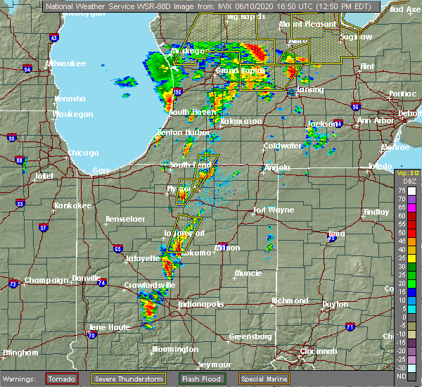 At 1249 pm edt, a severe thunderstorm was located over grissom afb, moving north at 60 mph (radar indicated). Hazards include 70 mph wind gusts and quarter size hail. Hail damage to vehicles is expected. expect considerable tree damage. Wind damage is also likely to mobile homes, roofs, and outbuildings. At 1249 pm edt, a severe thunderstorm was located over grissom afb, moving north at 60 mph (radar indicated). Hazards include 70 mph wind gusts and quarter size hail. Hail damage to vehicles is expected. expect considerable tree damage. Wind damage is also likely to mobile homes, roofs, and outbuildings.
|
| 5/27/2019 7:18 PM EDT |
 At 717 pm edt, a severe thunderstorm was located 7 miles south of royal center, or 9 miles west of logansport, moving east at 35 mph (radar indicated). Hazards include ping pong ball size hail. People and animals outdoors will be injured. Expect damage to roofs, siding, windows, and vehicles. At 717 pm edt, a severe thunderstorm was located 7 miles south of royal center, or 9 miles west of logansport, moving east at 35 mph (radar indicated). Hazards include ping pong ball size hail. People and animals outdoors will be injured. Expect damage to roofs, siding, windows, and vehicles.
|
| 5/26/2019 4:34 AM EDT |
 At 433 am edt, severe thunderstorms were located along a line extending from 6 miles east of logansport to near walton to 6 miles northwest of kokomo, moving east at 35 mph. the cass county airport in logansport recorded a 52 mph wind gust with this line of storms (radar indicated). Hazards include 60 mph wind gusts and penny size hail. expect damage to roofs, siding, and trees At 433 am edt, severe thunderstorms were located along a line extending from 6 miles east of logansport to near walton to 6 miles northwest of kokomo, moving east at 35 mph. the cass county airport in logansport recorded a 52 mph wind gust with this line of storms (radar indicated). Hazards include 60 mph wind gusts and penny size hail. expect damage to roofs, siding, and trees
|
| 5/23/2019 4:37 AM EDT |
 At 436 am edt, severe thunderstorms were located along a line extending from near warsaw to 6 miles northwest of north manchester to 11 miles east of frankfort, moving east at 65 mph (radar indicated). Hazards include 60 mph wind gusts. Expect damage to roofs, siding, and trees. Locations impacted include, marion, logansport, huntington, warsaw, peru, wabash, columbia city, rochester, north manchester, winona lake, tri-lakes, grissom afb, south whitley, sweetser, akron, andrews, walton, pierceton, mentone and swayzee. At 436 am edt, severe thunderstorms were located along a line extending from near warsaw to 6 miles northwest of north manchester to 11 miles east of frankfort, moving east at 65 mph (radar indicated). Hazards include 60 mph wind gusts. Expect damage to roofs, siding, and trees. Locations impacted include, marion, logansport, huntington, warsaw, peru, wabash, columbia city, rochester, north manchester, winona lake, tri-lakes, grissom afb, south whitley, sweetser, akron, andrews, walton, pierceton, mentone and swayzee.
|
| 5/23/2019 4:09 AM EDT |
 At 407 am edt, severe thunderstorms were located along a line extending from near culver to 9 miles northeast of royal center to 8 miles north of crawfordsville, moving east at 65 mph (radar indicated). Hazards include 70 mph wind gusts. Expect considerable tree damage. Damage is likely to mobile homes, roofs, and outbuildings. At 407 am edt, severe thunderstorms were located along a line extending from near culver to 9 miles northeast of royal center to 8 miles north of crawfordsville, moving east at 65 mph (radar indicated). Hazards include 70 mph wind gusts. Expect considerable tree damage. Damage is likely to mobile homes, roofs, and outbuildings.
|
| 5/19/2019 5:38 PM EDT |
 The severe thunderstorm warning for southeastern cass and miami counties will expire at 545 pm edt, the storms which prompted the warning have moved out of the area. therefore, the warning will be allowed to expire for southeastern cass county. a new severe thunderstorm warning has been issued for miami county until 6 pm edt. a severe thunderstorm watch remains in effect until 1000 pm edt for north central indiana. The severe thunderstorm warning for southeastern cass and miami counties will expire at 545 pm edt, the storms which prompted the warning have moved out of the area. therefore, the warning will be allowed to expire for southeastern cass county. a new severe thunderstorm warning has been issued for miami county until 6 pm edt. a severe thunderstorm watch remains in effect until 1000 pm edt for north central indiana.
|
| 5/19/2019 5:16 PM EDT |
 At 515 pm edt, severe thunderstorms were located along a line extending from 6 miles west of mexico to 10 miles north of frankfort, moving east at 55 mph. a 56 mph wind gust was recorded at the cass county airport as the storms passed (radar indicated). Hazards include 60 mph wind gusts and penny size hail. Expect damage to roofs, siding, and trees. Locations impacted include, logansport, peru, grissom afb, walton, bunker hill, mexico, lincoln, wells, galveston, miami, erie, denver, onward, chili, bennetts switch, deacon, new waverly, santa fe, wawpecong and hoover. At 515 pm edt, severe thunderstorms were located along a line extending from 6 miles west of mexico to 10 miles north of frankfort, moving east at 55 mph. a 56 mph wind gust was recorded at the cass county airport as the storms passed (radar indicated). Hazards include 60 mph wind gusts and penny size hail. Expect damage to roofs, siding, and trees. Locations impacted include, logansport, peru, grissom afb, walton, bunker hill, mexico, lincoln, wells, galveston, miami, erie, denver, onward, chili, bennetts switch, deacon, new waverly, santa fe, wawpecong and hoover.
|
| 5/19/2019 4:53 PM EDT |
 At 453 pm edt, severe thunderstorms were located along a line extending from 9 miles northeast of delphi to 7 miles southeast of lafayette, moving east at 55 mph (radar indicated). Hazards include 60 mph wind gusts and penny size hail. expect damage to roofs, siding, and trees At 453 pm edt, severe thunderstorms were located along a line extending from 9 miles northeast of delphi to 7 miles southeast of lafayette, moving east at 55 mph (radar indicated). Hazards include 60 mph wind gusts and penny size hail. expect damage to roofs, siding, and trees
|
| 10/6/2018 2:35 PM EDT |
 At 235 pm edt, a severe thunderstorm was located over walton, or near grissom afb, moving northeast at 35 mph (radar indicated). Hazards include 60 mph wind gusts and penny size hail. expect damage to roofs, siding, and trees At 235 pm edt, a severe thunderstorm was located over walton, or near grissom afb, moving northeast at 35 mph (radar indicated). Hazards include 60 mph wind gusts and penny size hail. expect damage to roofs, siding, and trees
|
| 8/20/2018 3:06 PM EDT |
 The severe thunderstorm warning for southeastern cass and southwestern miami counties will expire at 315 pm edt, the storm which prompted the warning has weakened below severe limits, and has exited the warned area. therefore, the warning will be allowed to expire. The severe thunderstorm warning for southeastern cass and southwestern miami counties will expire at 315 pm edt, the storm which prompted the warning has weakened below severe limits, and has exited the warned area. therefore, the warning will be allowed to expire.
|
| 8/20/2018 2:52 PM EDT |
 At 252 pm edt, a severe thunderstorm was located near mexico, or near peru, moving northeast at 30 mph (radar indicated). Hazards include 60 mph wind gusts. Expect damage to roofs, siding, and trees. Locations impacted include, logansport, grissom afb, walton, bunker hill, lincoln, galveston, miami, onward, new waverly, adamsboro, nead and anoka. At 252 pm edt, a severe thunderstorm was located near mexico, or near peru, moving northeast at 30 mph (radar indicated). Hazards include 60 mph wind gusts. Expect damage to roofs, siding, and trees. Locations impacted include, logansport, grissom afb, walton, bunker hill, lincoln, galveston, miami, onward, new waverly, adamsboro, nead and anoka.
|
| 8/20/2018 2:25 PM EDT |
 At 225 pm edt, a severe thunderstorm was located near walton, or 10 miles southwest of grissom afb, moving northeast at 30 mph (radar indicated). Hazards include 60 mph wind gusts and penny size hail. expect damage to roofs, siding, and trees At 225 pm edt, a severe thunderstorm was located near walton, or 10 miles southwest of grissom afb, moving northeast at 30 mph (radar indicated). Hazards include 60 mph wind gusts and penny size hail. expect damage to roofs, siding, and trees
|
| 6/7/2018 6:44 PM EDT |
 At 644 pm edt, a severe thunderstorm was located over logansport, moving east at 10 mph (radar indicated). Hazards include quarter size hail. damage to vehicles is expected At 644 pm edt, a severe thunderstorm was located over logansport, moving east at 10 mph (radar indicated). Hazards include quarter size hail. damage to vehicles is expected
|
| 7/10/2017 8:32 PM EDT |
 At 832 pm edt, a severe thunderstorm capable of producing a tornado was located 8 miles southwest of logansport, moving east at 20 mph (radar indicated rotation). Hazards include tornado. Flying debris will be dangerous to those caught without shelter. mobile homes will be damaged or destroyed. damage to roofs, windows, and vehicles will occur. tree damage is likely. this dangerous storm will be near, walton around 855 pm edt. grissom afb around 910 pm edt. Other locations impacted by this tornadic thunderstorm include deacon, lincoln and galveston. At 832 pm edt, a severe thunderstorm capable of producing a tornado was located 8 miles southwest of logansport, moving east at 20 mph (radar indicated rotation). Hazards include tornado. Flying debris will be dangerous to those caught without shelter. mobile homes will be damaged or destroyed. damage to roofs, windows, and vehicles will occur. tree damage is likely. this dangerous storm will be near, walton around 855 pm edt. grissom afb around 910 pm edt. Other locations impacted by this tornadic thunderstorm include deacon, lincoln and galveston.
|
| 7/10/2017 8:25 PM EDT |
 The tornado warning for southeastern cass county will expire at 830 pm edt, the storm which prompted the warning has weakened below severe limits, and no longer appears capable of producing a tornado. therefore the warning will be allowed to expire. a severe thunderstorm watch remains in effect until midnight edt for north central indiana. to report severe weather, contact your nearest law enforcement agency. they will relay your report to the national weather service northern indiana. The tornado warning for southeastern cass county will expire at 830 pm edt, the storm which prompted the warning has weakened below severe limits, and no longer appears capable of producing a tornado. therefore the warning will be allowed to expire. a severe thunderstorm watch remains in effect until midnight edt for north central indiana. to report severe weather, contact your nearest law enforcement agency. they will relay your report to the national weather service northern indiana.
|
| 7/10/2017 8:15 PM EDT |
 At 815 pm edt, a severe thunderstorm capable of producing a tornado was located over walton, or near grissom afb, moving east at 20 mph (radar indicated rotation). Hazards include tornado. Flying debris will be dangerous to those caught without shelter. mobile homes will be damaged or destroyed. damage to roofs, windows, and vehicles will occur. tree damage is likely. this dangerous storm will be near, grissom afb around 825 pm edt. Other locations impacted by this tornadic thunderstorm include lincoln and galveston. At 815 pm edt, a severe thunderstorm capable of producing a tornado was located over walton, or near grissom afb, moving east at 20 mph (radar indicated rotation). Hazards include tornado. Flying debris will be dangerous to those caught without shelter. mobile homes will be damaged or destroyed. damage to roofs, windows, and vehicles will occur. tree damage is likely. this dangerous storm will be near, grissom afb around 825 pm edt. Other locations impacted by this tornadic thunderstorm include lincoln and galveston.
|
| 7/10/2017 8:01 PM EDT |
 At 801 pm edt, a confirmed large and extremely dangerous tornado was located near walton, or 7 miles south of logansport, moving east at 20 mph. this is a particularly dangerous situation. take cover now! (radar confirmed tornado). Hazards include damaging tornado. You are in a life-threatening situation. flying debris may be deadly to those caught without shelter. mobile homes will be destroyed. considerable damage to homes, businesses, and vehicles is likely and complete destruction is possible. the tornado will be near, walton around 820 pm edt. grissom afb around 830 pm edt. Other locations impacted by this tornadic thunderstorm include deacon, lincoln and galveston. At 801 pm edt, a confirmed large and extremely dangerous tornado was located near walton, or 7 miles south of logansport, moving east at 20 mph. this is a particularly dangerous situation. take cover now! (radar confirmed tornado). Hazards include damaging tornado. You are in a life-threatening situation. flying debris may be deadly to those caught without shelter. mobile homes will be destroyed. considerable damage to homes, businesses, and vehicles is likely and complete destruction is possible. the tornado will be near, walton around 820 pm edt. grissom afb around 830 pm edt. Other locations impacted by this tornadic thunderstorm include deacon, lincoln and galveston.
|
| 7/10/2017 7:48 PM EDT |
 At 747 pm edt, a severe thunderstorm capable of producing a tornado was located 8 miles south of logansport, moving east at 20 mph (weather spotters reported funnel cloud over northeast carroll county at 745 pm edt). Hazards include tornado. Flying debris will be dangerous to those caught without shelter. mobile homes will be damaged or destroyed. damage to roofs, windows, and vehicles will occur. tree damage is likely. this dangerous storm will be near, walton around 810 pm edt. grissom afb around 820 pm edt. Other locations impacted by this tornadic thunderstorm include deacon, lincoln and galveston. At 747 pm edt, a severe thunderstorm capable of producing a tornado was located 8 miles south of logansport, moving east at 20 mph (weather spotters reported funnel cloud over northeast carroll county at 745 pm edt). Hazards include tornado. Flying debris will be dangerous to those caught without shelter. mobile homes will be damaged or destroyed. damage to roofs, windows, and vehicles will occur. tree damage is likely. this dangerous storm will be near, walton around 810 pm edt. grissom afb around 820 pm edt. Other locations impacted by this tornadic thunderstorm include deacon, lincoln and galveston.
|
| 11/18/2016 5:56 PM EST |
 The severe thunderstorm warning for miami, wabash and eastern cass counties will expire at 600 pm est, the storms which prompted the warning have weakened below severe limits, and no longer pose an immediate threat to life or property. therefore, the warning will be allowed to expire. The severe thunderstorm warning for miami, wabash and eastern cass counties will expire at 600 pm est, the storms which prompted the warning have weakened below severe limits, and no longer pose an immediate threat to life or property. therefore, the warning will be allowed to expire.
|
| 11/18/2016 5:24 PM EST |
 At 524 pm est, severe thunderstorms were located along a line extending from 10 miles northwest of mexico to 6 miles southwest of walton, moving northeast at 70 mph (radar indicated). Hazards include 60 mph wind gusts. Expect damage to roofs. siding. and trees. severe thunderstorms will be near, bunker hill around 535 pm est. peru and mexico around 540 pm est. wabash around 550 pm est. Other locations impacted by these severe thunderstorms include peoria, somerset, anoka, lagro, servia, new waverly, onward, urbana, lincoln and erie. At 524 pm est, severe thunderstorms were located along a line extending from 10 miles northwest of mexico to 6 miles southwest of walton, moving northeast at 70 mph (radar indicated). Hazards include 60 mph wind gusts. Expect damage to roofs. siding. and trees. severe thunderstorms will be near, bunker hill around 535 pm est. peru and mexico around 540 pm est. wabash around 550 pm est. Other locations impacted by these severe thunderstorms include peoria, somerset, anoka, lagro, servia, new waverly, onward, urbana, lincoln and erie.
|
| 8/28/2016 5:57 PM EDT |
 At 556 pm edt, a severe thunderstorm was located over bunker hill, or over grissom afb, moving southeast at 25 mph (radar indicated). Hazards include 60 mph wind gusts and quarter size hail. Hail damage to vehicles is expected. expect wind damage to roofs, siding, and trees. This severe thunderstorm will remain over mainly rural areas of southwestern miami and southeastern cass counties, including the following locations: miami, bennetts switch, wells, lincoln, new waverly, nead and onward. At 556 pm edt, a severe thunderstorm was located over bunker hill, or over grissom afb, moving southeast at 25 mph (radar indicated). Hazards include 60 mph wind gusts and quarter size hail. Hail damage to vehicles is expected. expect wind damage to roofs, siding, and trees. This severe thunderstorm will remain over mainly rural areas of southwestern miami and southeastern cass counties, including the following locations: miami, bennetts switch, wells, lincoln, new waverly, nead and onward.
|
| 8/28/2016 5:52 PM EDT | Reports of trees down in onward. estimated 6-12" diameter for tree in cass county IN, 3 miles SW of Walton, IN |
| 8/28/2016 5:46 PM EDT |
 At 545 pm edt, a severe thunderstorm was located over walton, or near grissom afb, moving southeast at 15 mph (radar indicated). Hazards include ping pong ball size hail and 60 mph wind gusts. People and animals outdoors will be injured. expect hail damage to roofs, siding, windows, and vehicles. expect wind damage to roofs, siding, and trees. this severe storm will be near, grissom afb around 600 pm edt. bunker hill around 610 pm edt. Other locations impacted by this severe thunderstorm include miami, bennetts switch, anoka, wells, lincoln, new waverly, nead, adamsboro and onward. At 545 pm edt, a severe thunderstorm was located over walton, or near grissom afb, moving southeast at 15 mph (radar indicated). Hazards include ping pong ball size hail and 60 mph wind gusts. People and animals outdoors will be injured. expect hail damage to roofs, siding, windows, and vehicles. expect wind damage to roofs, siding, and trees. this severe storm will be near, grissom afb around 600 pm edt. bunker hill around 610 pm edt. Other locations impacted by this severe thunderstorm include miami, bennetts switch, anoka, wells, lincoln, new waverly, nead, adamsboro and onward.
|
| 8/28/2016 5:32 PM EDT |
 The national weather service in northern indiana has issued a * severe thunderstorm warning for. southwestern miami county in north central indiana. southeastern cass county in north central indiana. until 615 pm edt * at 532 pm edt. A severe thunderstorm was located near. The national weather service in northern indiana has issued a * severe thunderstorm warning for. southwestern miami county in north central indiana. southeastern cass county in north central indiana. until 615 pm edt * at 532 pm edt. A severe thunderstorm was located near.
|
| 8/24/2016 5:46 PM EDT |
 At 546 pm edt, a severe thunderstorm capable of producing a tornado was located 10 miles southwest of walton, or 14 miles south of logansport, moving east at 30 mph (radar indicated rotation). Hazards include tornado. Flying debris will be dangerous to those caught without shelter. mobile homes will be damaged or destroyed. damage to roofs, windows, and vehicles will occur. tree damage is likely. this dangerous storm will be near, walton around 605 pm edt. grissom afb around 615 pm edt. Other locations impacted by this tornadic thunderstorm include deacon, galveston and lincoln. At 546 pm edt, a severe thunderstorm capable of producing a tornado was located 10 miles southwest of walton, or 14 miles south of logansport, moving east at 30 mph (radar indicated rotation). Hazards include tornado. Flying debris will be dangerous to those caught without shelter. mobile homes will be damaged or destroyed. damage to roofs, windows, and vehicles will occur. tree damage is likely. this dangerous storm will be near, walton around 605 pm edt. grissom afb around 615 pm edt. Other locations impacted by this tornadic thunderstorm include deacon, galveston and lincoln.
|
| 9/18/2015 10:57 PM EDT |
 At 1057 pm edt, a severe thunderstorm was located near logansport, moving east at 40 mph (radar indicated). Hazards include 60 mph wind gusts and penny size hail. Expect damage to roofs. siding and trees. This severe thunderstorm will remain over mainly rural areas of cass county, including the following locations, anoka, galveston, twelve mile, lucerne, new waverly, clymers, onward, metea, hoover and lincoln. At 1057 pm edt, a severe thunderstorm was located near logansport, moving east at 40 mph (radar indicated). Hazards include 60 mph wind gusts and penny size hail. Expect damage to roofs. siding and trees. This severe thunderstorm will remain over mainly rural areas of cass county, including the following locations, anoka, galveston, twelve mile, lucerne, new waverly, clymers, onward, metea, hoover and lincoln.
|
| 9/18/2015 10:31 PM EDT |
 At 1031 pm edt, a severe thunderstorm was located near royal center, or 10 miles west of logansport, moving east at 50 mph (radar indicated). Hazards include 60 mph wind gusts and penny size hail. Expect damage to roofs. siding and trees. this severe thunderstorm will be near, logansport around 1040 pm edt. Other locations impacted by this severe thunderstorm include lake cicott, anoka, twelve mile, galveston, new waverly, lucerne, clymers, onward, metea and hoover. At 1031 pm edt, a severe thunderstorm was located near royal center, or 10 miles west of logansport, moving east at 50 mph (radar indicated). Hazards include 60 mph wind gusts and penny size hail. Expect damage to roofs. siding and trees. this severe thunderstorm will be near, logansport around 1040 pm edt. Other locations impacted by this severe thunderstorm include lake cicott, anoka, twelve mile, galveston, new waverly, lucerne, clymers, onward, metea and hoover.
|
| 6/23/2015 3:32 AM EDT |
 At 332 am edt, a severe thunderstorm was located near walton, or near grissom afb, moving east at 45 mph (radar indicated). Hazards include 60 mph wind gusts. Expect damage to roofs. siding and trees. Locations impacted include, logansport, peru, grissom afb, walton, bunker hill, mexico, wells, flora, erie, onward, peoria, santa fe, nead, anoka, new waverly, hoover and adamsboro. At 332 am edt, a severe thunderstorm was located near walton, or near grissom afb, moving east at 45 mph (radar indicated). Hazards include 60 mph wind gusts. Expect damage to roofs. siding and trees. Locations impacted include, logansport, peru, grissom afb, walton, bunker hill, mexico, wells, flora, erie, onward, peoria, santa fe, nead, anoka, new waverly, hoover and adamsboro.
|
| 6/23/2015 3:15 AM EDT |
 At 315 am edt, a severe thunderstorm was located near logansport, moving east at 45 mph (radar indicated). Hazards include 60 mph wind gusts and quarter size hail. Hail damage to vehicles is expected. Expect wind damage to roofs, siding and trees. At 315 am edt, a severe thunderstorm was located near logansport, moving east at 45 mph (radar indicated). Hazards include 60 mph wind gusts and quarter size hail. Hail damage to vehicles is expected. Expect wind damage to roofs, siding and trees.
|
| 6/18/2015 4:23 PM EDT | At 422 pm edt, severe thunderstorms were located along a line extending from 9 miles northeast of royal center to near logansport, moving east at 35 mph (radar indicated). Hazards include 60 mph wind gusts. Damage to roofs. Siding and trees possible. |
| 7/10/2013 1:30 PM EDT | Widespread tree and power line damage from walton to onward from straight line wind in cass county IN, 0.3 miles NW of Walton, IN |
| 1/1/0001 12:00 AM | Storm damage reported in cass county IN, 4.5 miles ENE of Walton, IN |
Hail Maps for Walton, IN


Connect with Interactive Hail Maps