

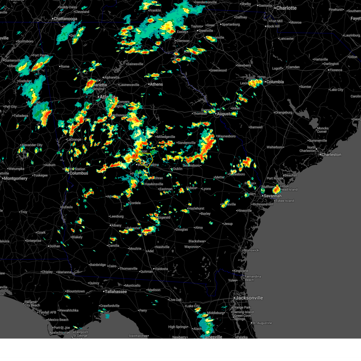
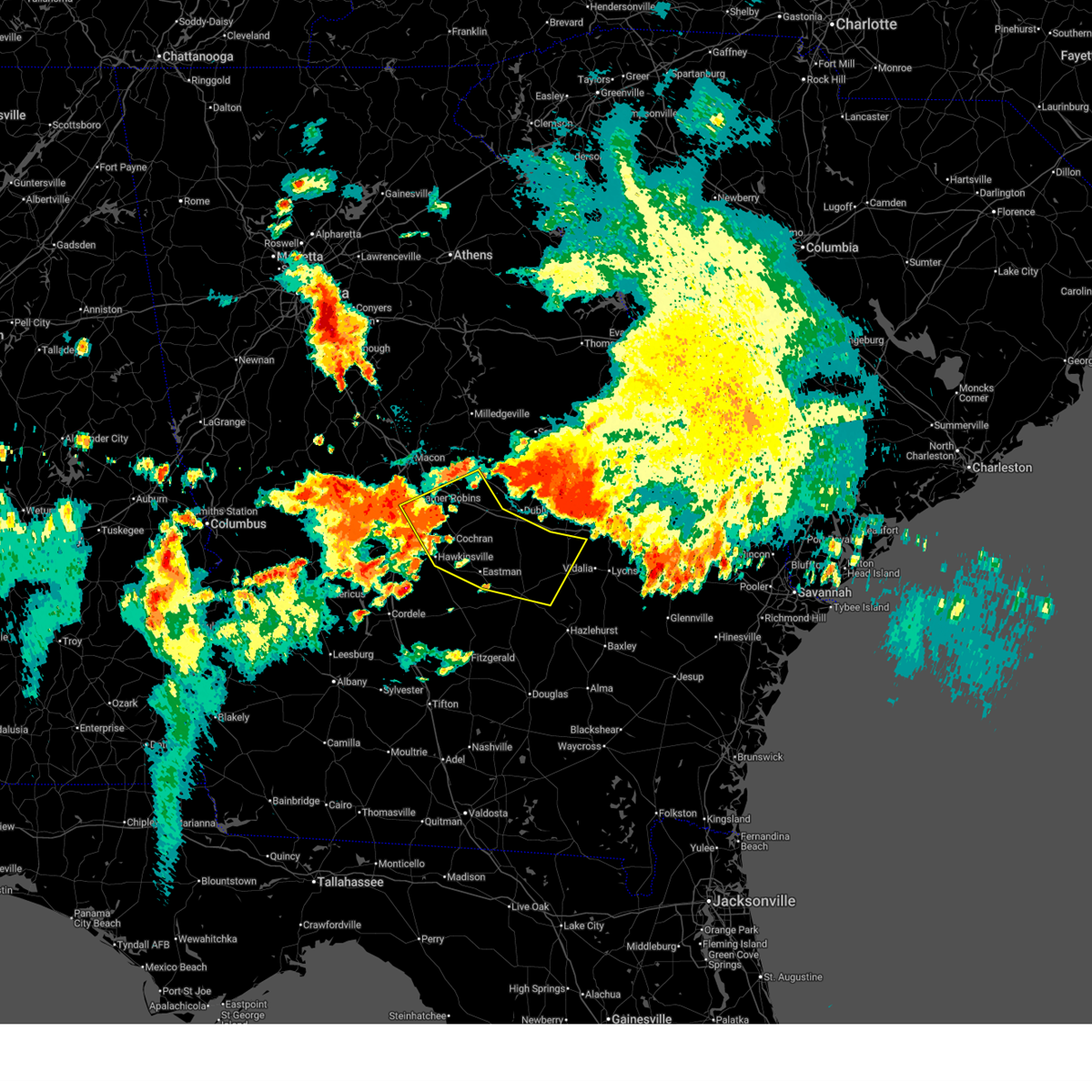
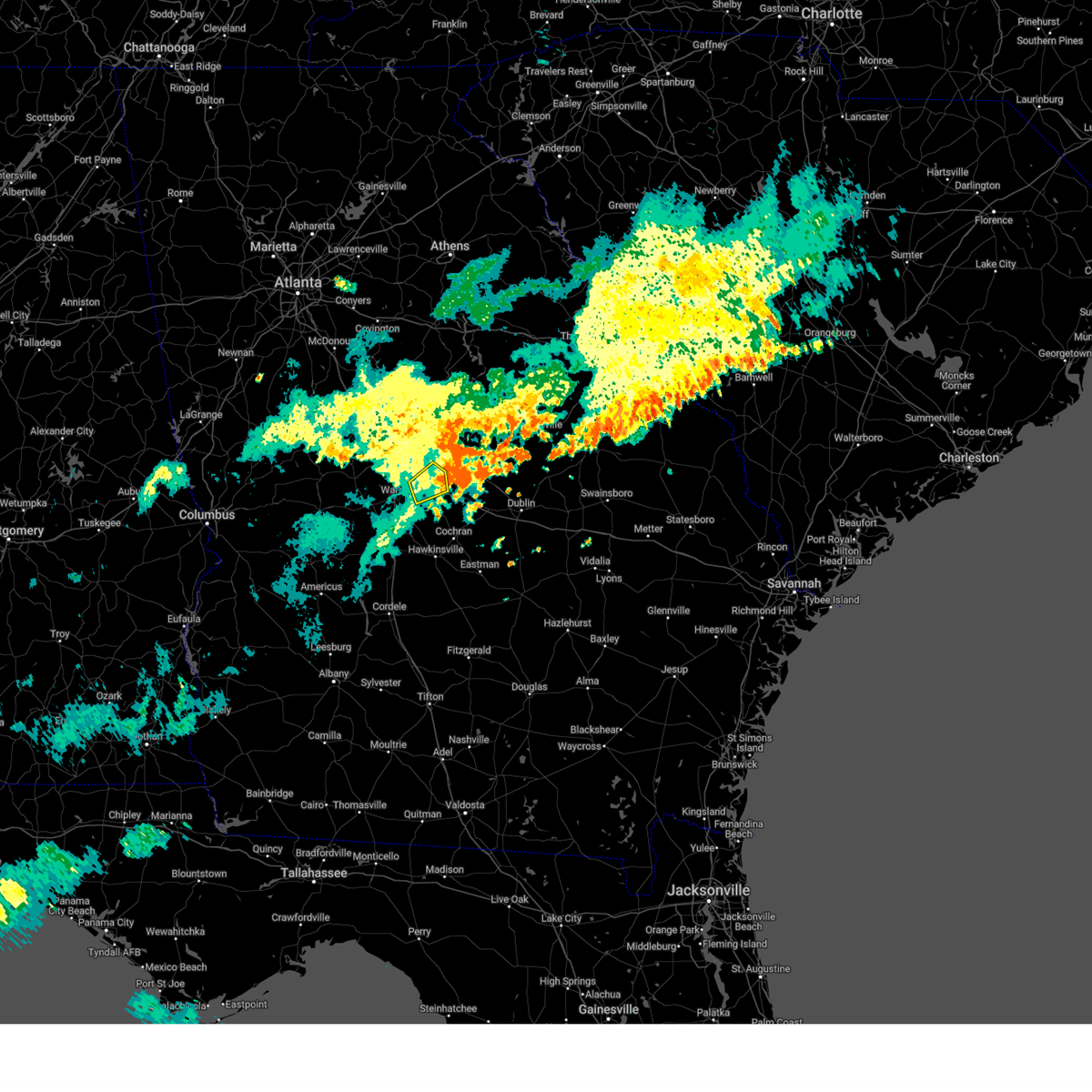
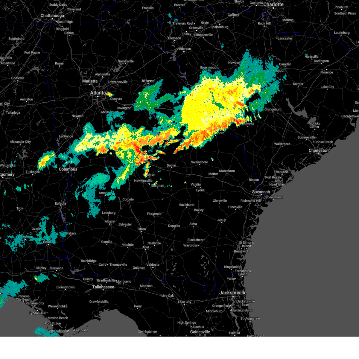
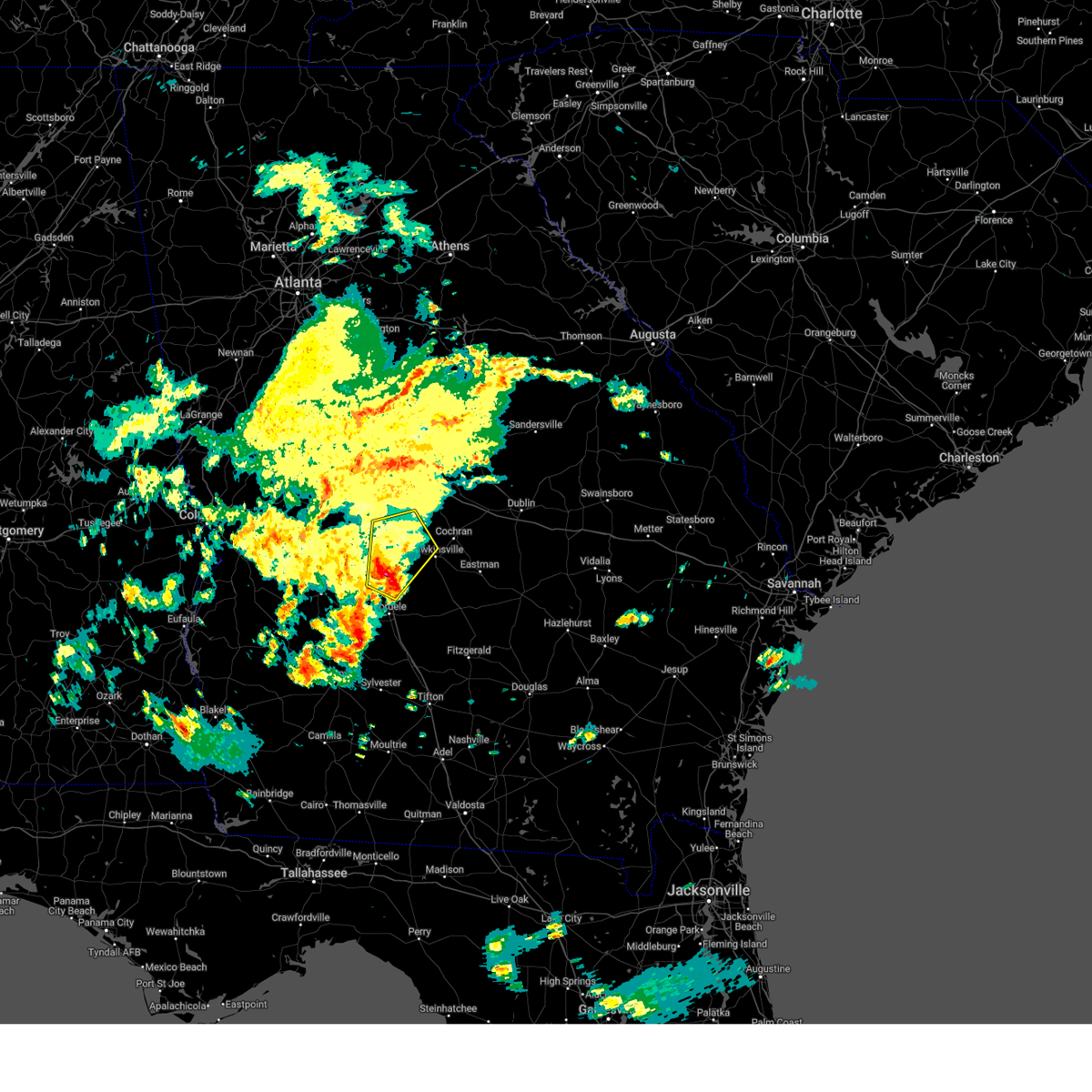
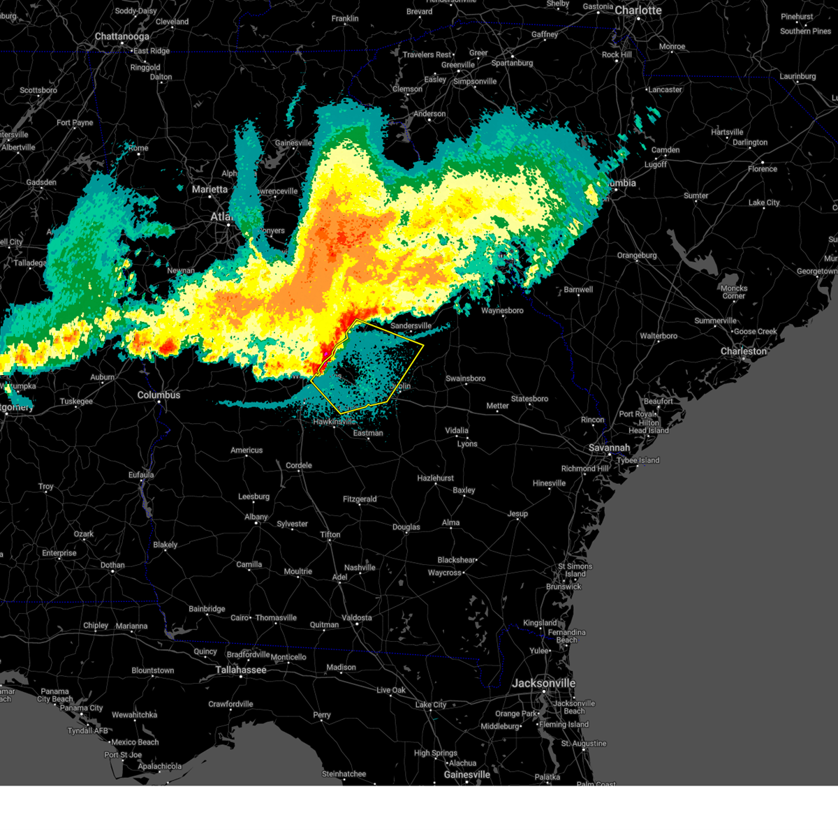
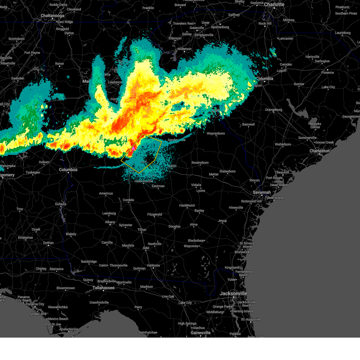
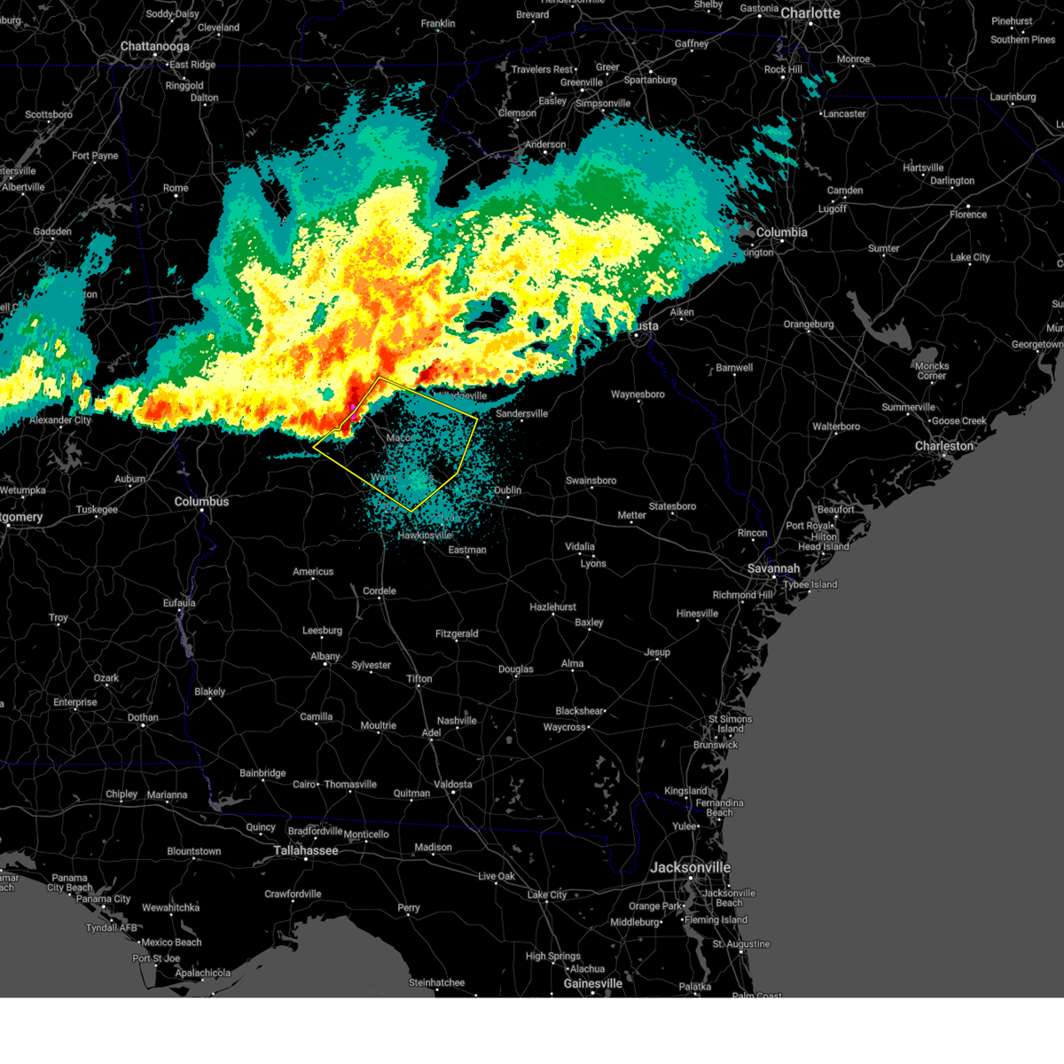
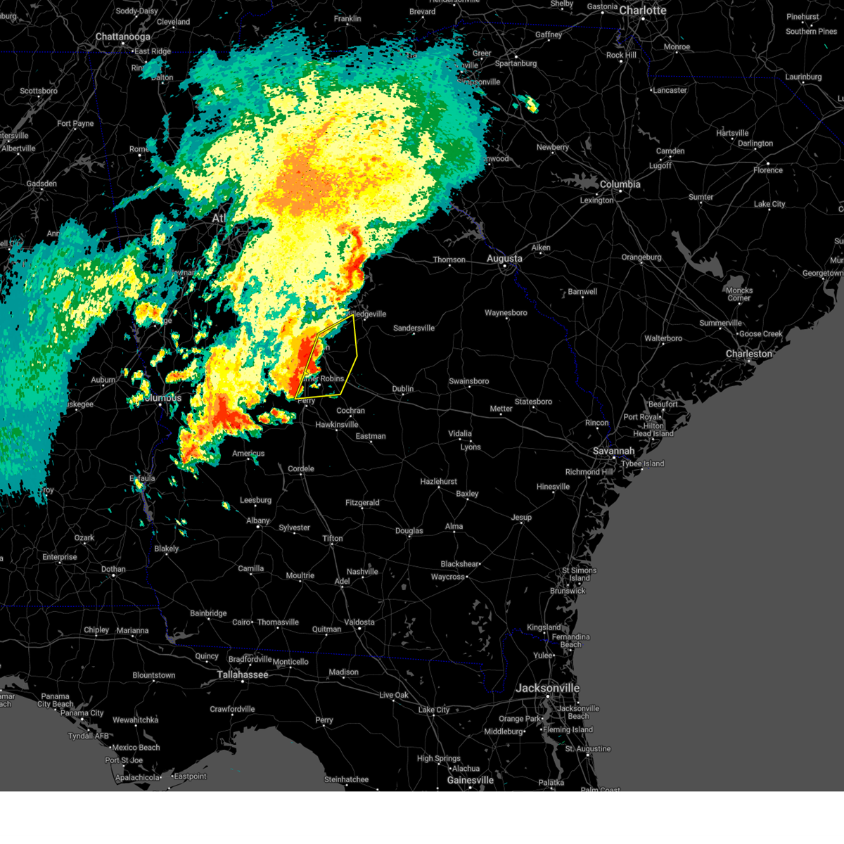
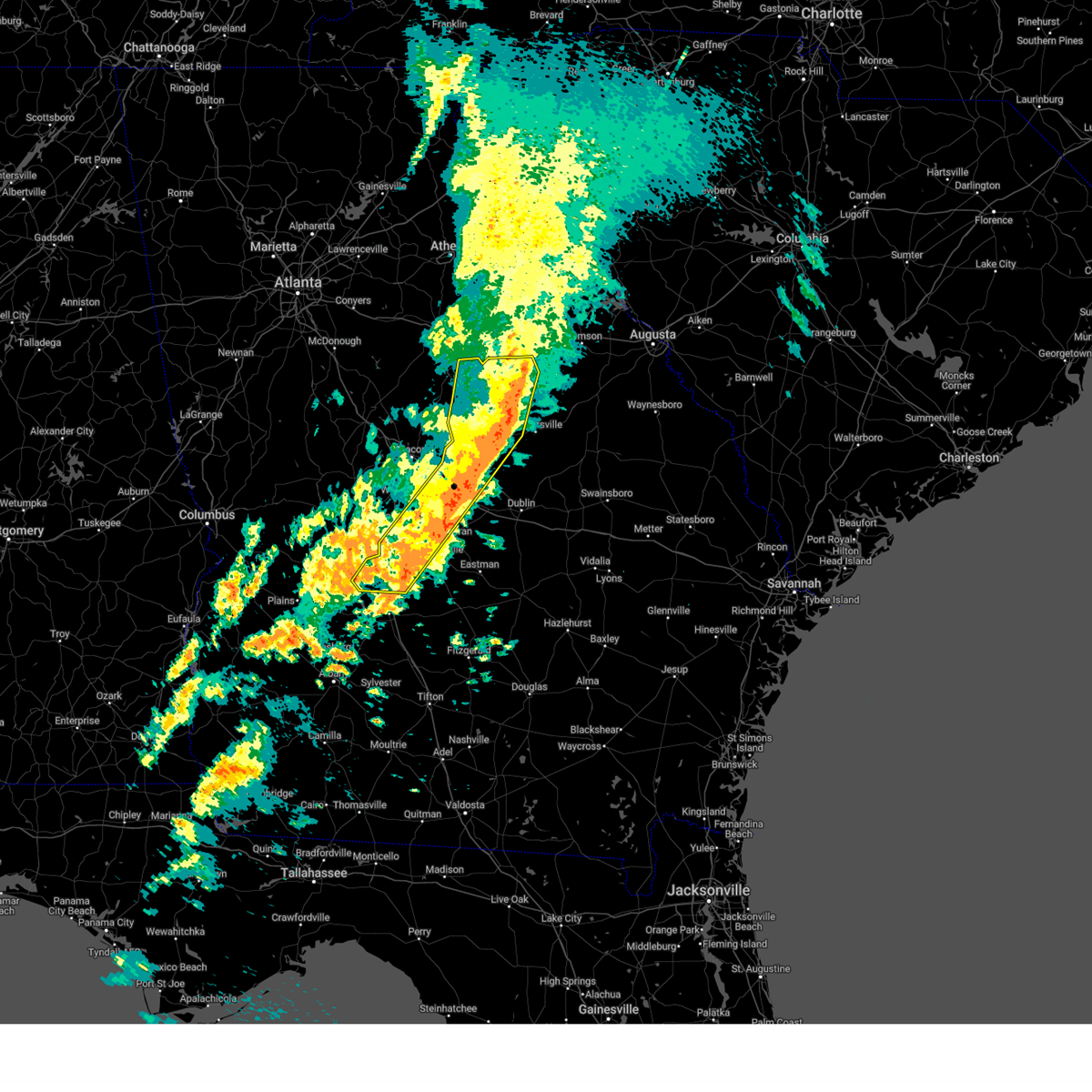
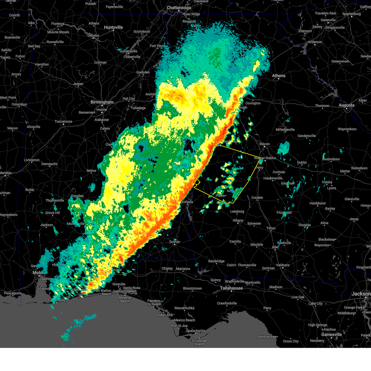
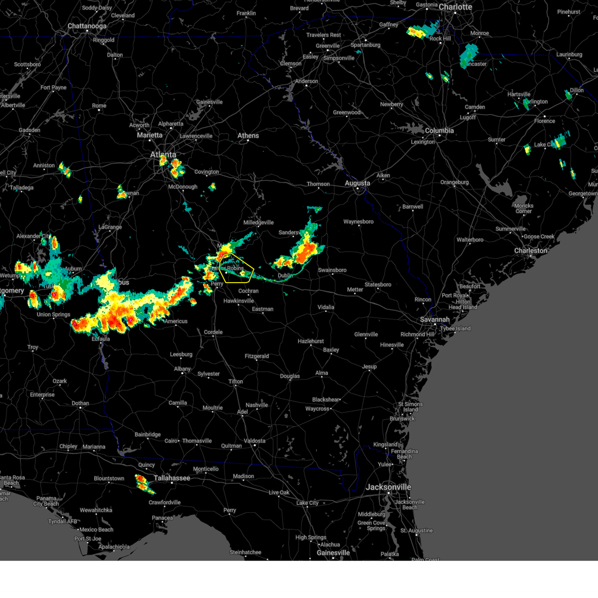
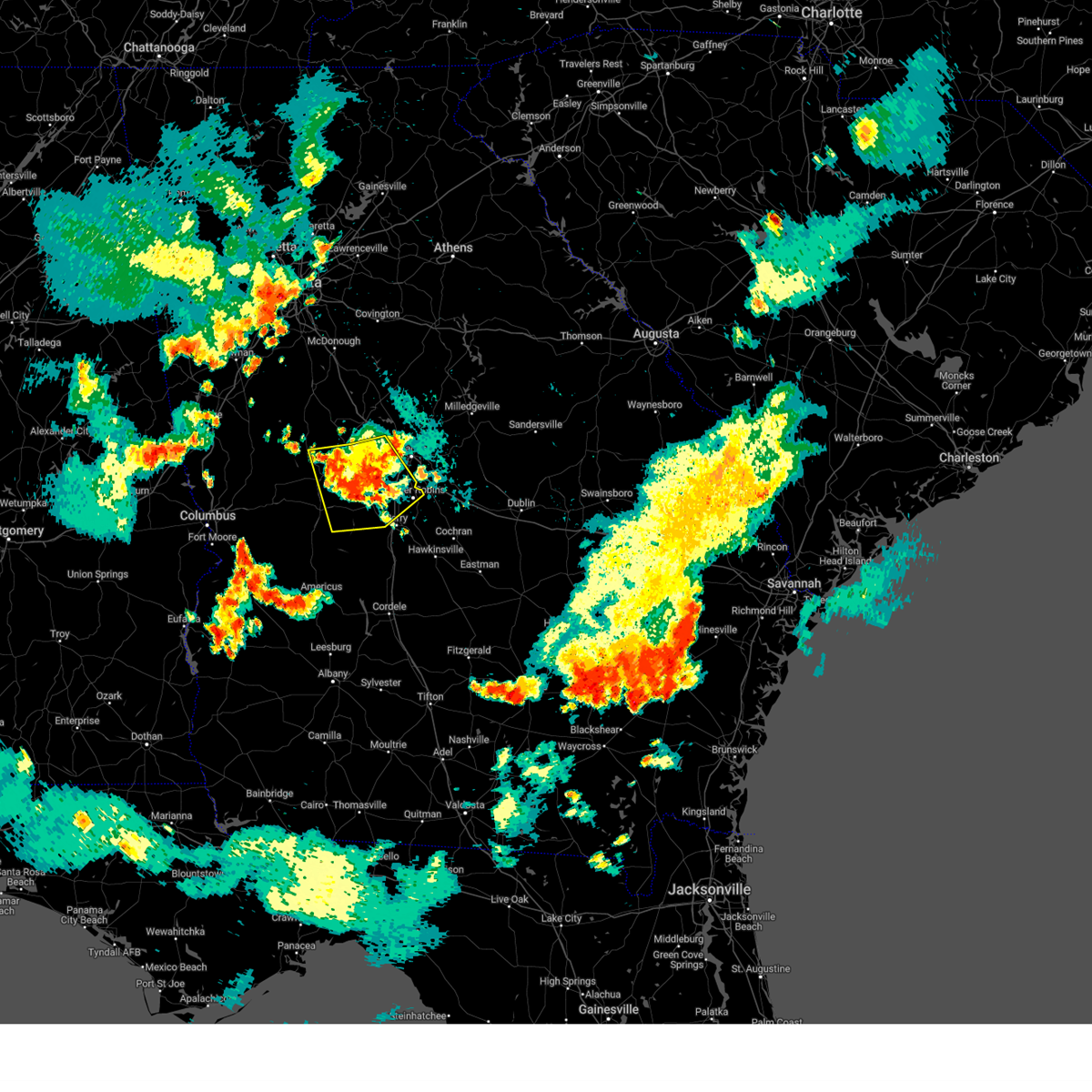
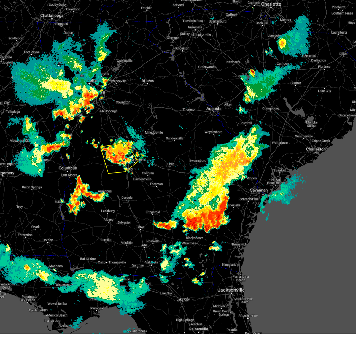
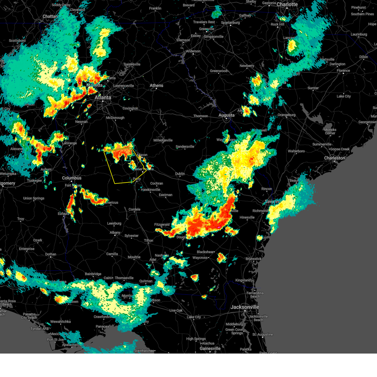
Hail Map for Warner Robins, GA
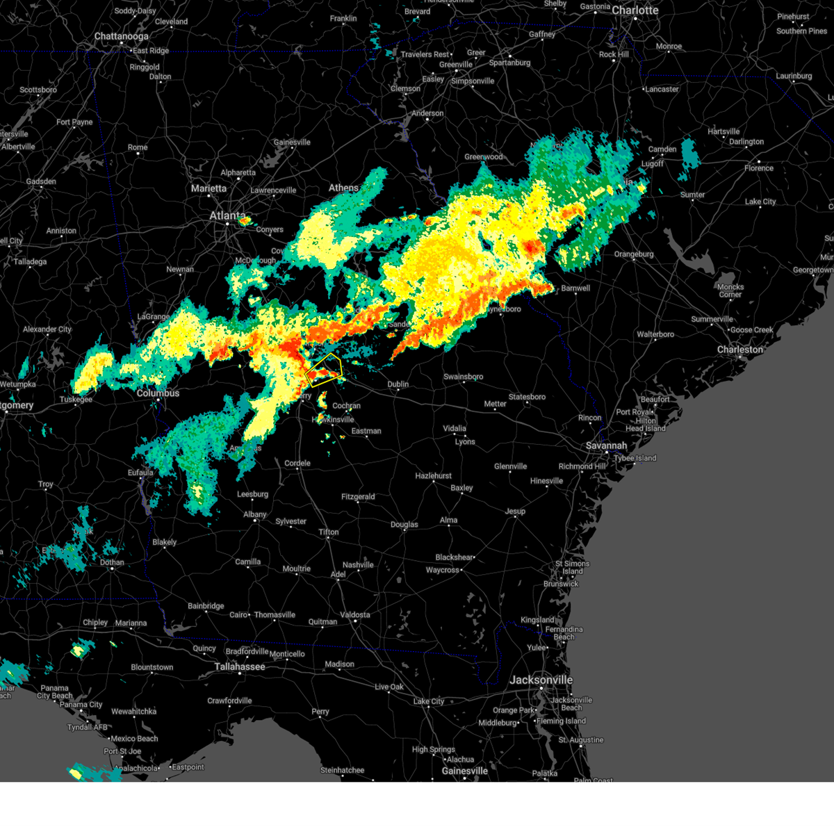
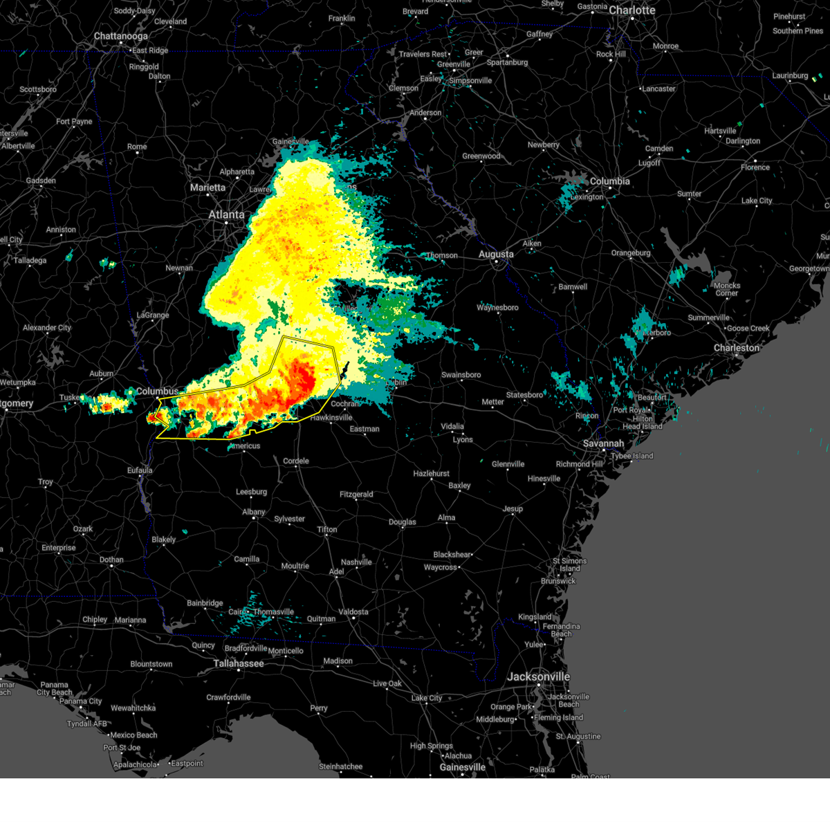
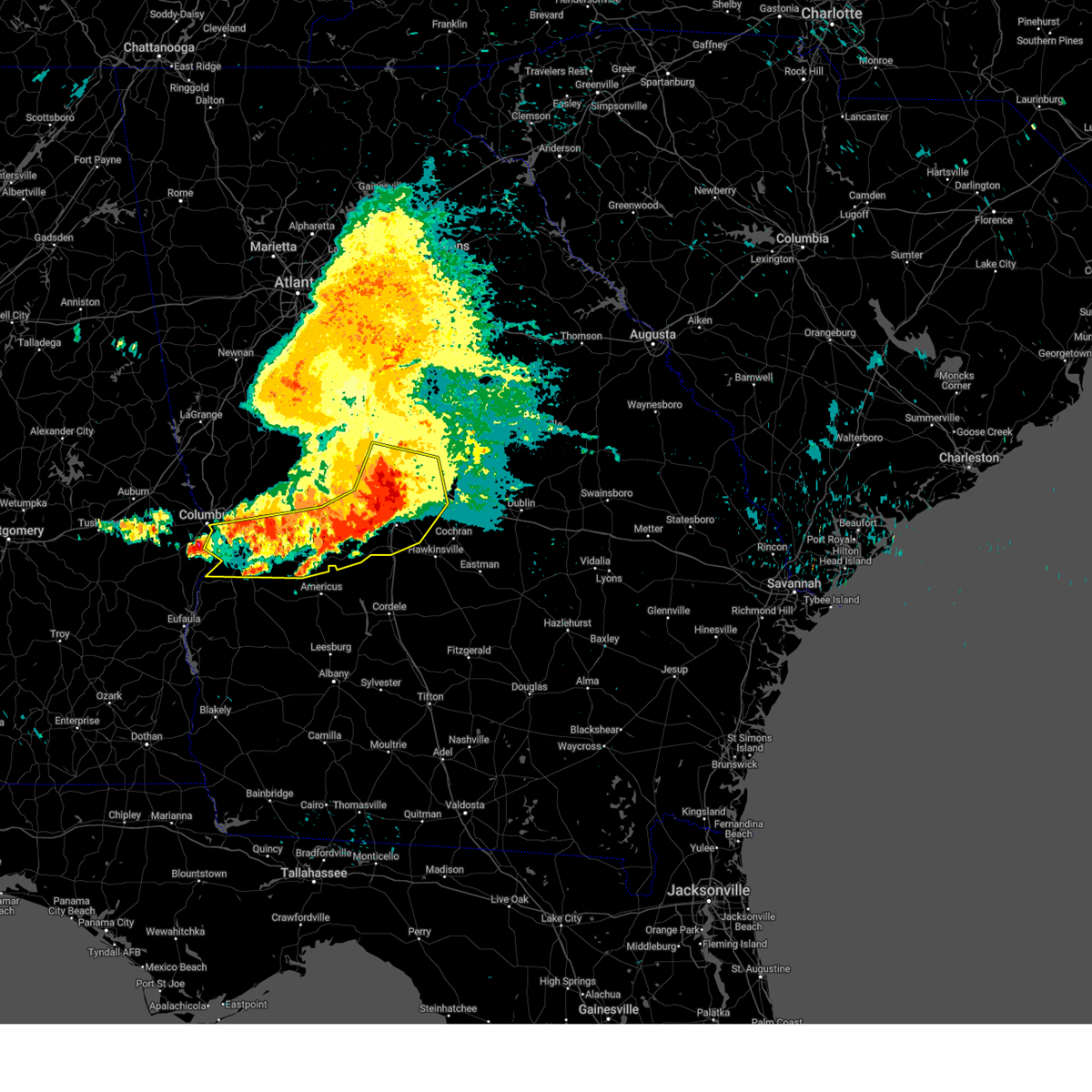
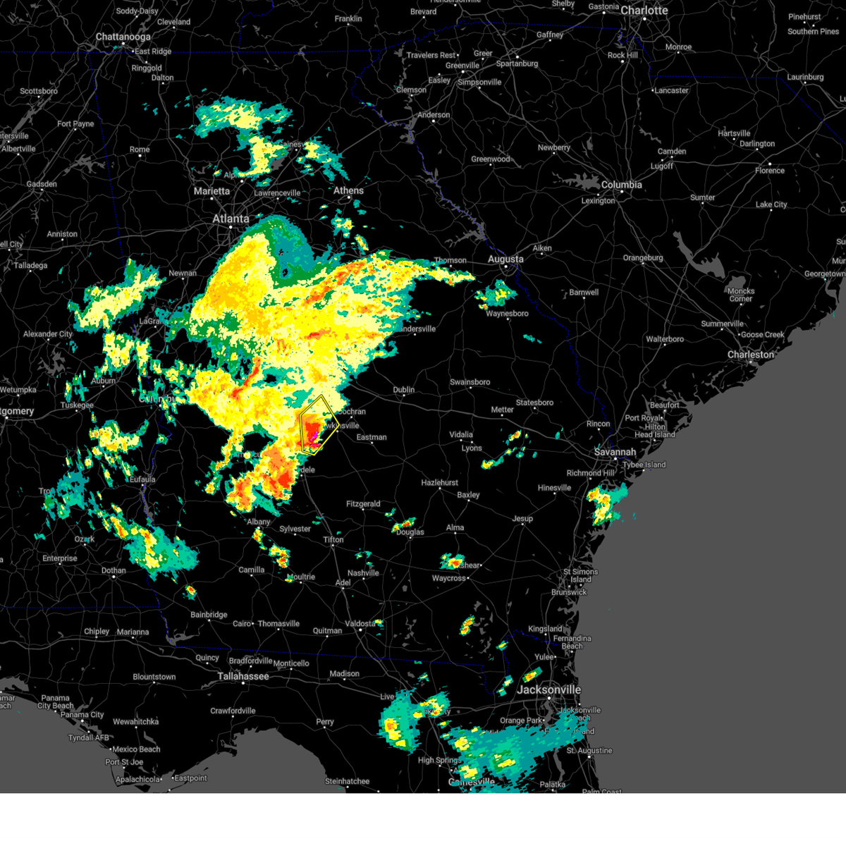
The Warner Robins, GA area has had 4 reports of on-the-ground hail by trained spotters, and has been under severe weather warnings 51 times during the past 12 months. Doppler radar has detected hail at or near Warner Robins, GA on 98 occasions, including 8 occasions during the past year.
| Name: | Warner Robins, GA |
| Where Located: | 88.7 miles NNW of Douglas, GA |
| Map: | Google Map for Warner Robins, GA |
| Population: | 66588 |
| Housing Units: | 29084 |
| More Info: | Search Google for Warner Robins, GA |
1
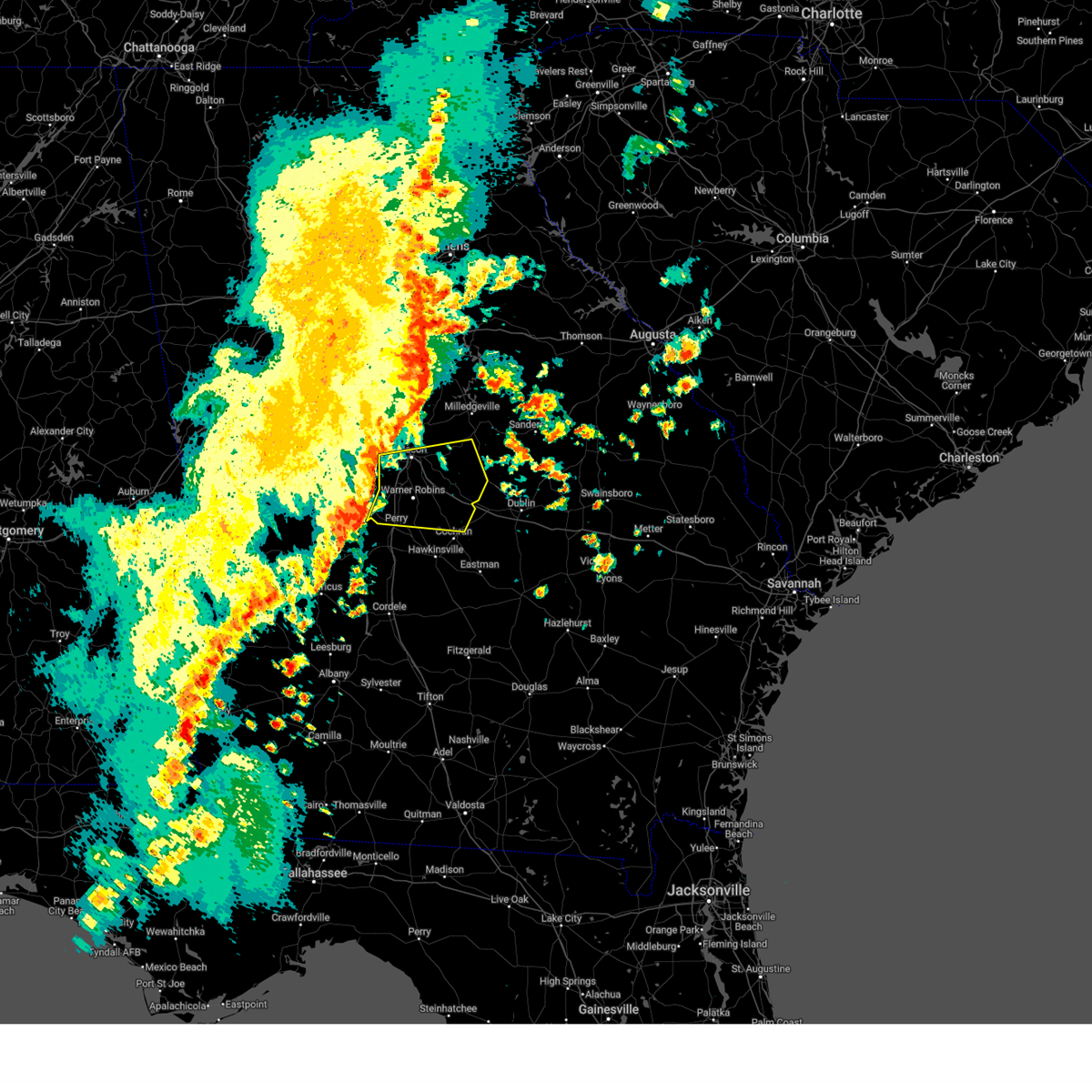
The Top Recent Hail Date for Warner Robins, GA is Monday, July 15, 2024 (11th out of 98)

Hail and Wind Damage Spotted near Warner Robins, GA
| Date / Time | Report Details |
|---|---|
| 7/10/2025 2:23 PM EDT |
 Svrffc the national weather service in peachtree city has issued a * severe thunderstorm warning for, southeastern bibb county in central georgia, central twiggs county in central georgia, * until 300 pm edt. * at 223 pm edt, a severe thunderstorm was located near huber, or 7 miles southeast of macon, moving east at 30 mph (radar indicated). Hazards include 60 mph wind gusts and dime size hail. expect damage to roofs, siding, and trees Svrffc the national weather service in peachtree city has issued a * severe thunderstorm warning for, southeastern bibb county in central georgia, central twiggs county in central georgia, * until 300 pm edt. * at 223 pm edt, a severe thunderstorm was located near huber, or 7 miles southeast of macon, moving east at 30 mph (radar indicated). Hazards include 60 mph wind gusts and dime size hail. expect damage to roofs, siding, and trees
|
| 6/26/2025 12:32 AM EDT |
 Svrffc the national weather service in peachtree city has issued a * severe thunderstorm warning for, southwestern wilkinson county in central georgia, laurens county in central georgia, dodge county in central georgia, central pulaski county in central georgia, southern twiggs county in central georgia, north central telfair county in central georgia, southwestern treutlen county in east central georgia, bleckley county in central georgia, eastern houston county in central georgia, wheeler county in central georgia, northwestern montgomery county in central georgia, * until 130 am edt. * at 1232 am edt, severe thunderstorms were located along a line extending from near danville to near dudley to near lowery to near zaidee, moving southwest at 30 mph (radar indicated). Hazards include 60 mph wind gusts and quarter size hail. Hail damage to vehicles is expected. Expect wind damage to roofs, siding, and trees. Svrffc the national weather service in peachtree city has issued a * severe thunderstorm warning for, southwestern wilkinson county in central georgia, laurens county in central georgia, dodge county in central georgia, central pulaski county in central georgia, southern twiggs county in central georgia, north central telfair county in central georgia, southwestern treutlen county in east central georgia, bleckley county in central georgia, eastern houston county in central georgia, wheeler county in central georgia, northwestern montgomery county in central georgia, * until 130 am edt. * at 1232 am edt, severe thunderstorms were located along a line extending from near danville to near dudley to near lowery to near zaidee, moving southwest at 30 mph (radar indicated). Hazards include 60 mph wind gusts and quarter size hail. Hail damage to vehicles is expected. Expect wind damage to roofs, siding, and trees.
|
| 6/25/2025 11:25 PM EDT | Svrffc the national weather service in peachtree city has issued a * severe thunderstorm warning for, southwestern twiggs county in central georgia, northeastern houston county in central georgia, * until midnight edt. * at 1125 pm edt, a severe thunderstorm was located over marion, or 7 miles southwest of jeffersonville, moving southwest at 15 mph (radar indicated). Hazards include 60 mph wind gusts and quarter size hail. Hail damage to vehicles is expected. Expect wind damage to roofs, siding, and trees. |
| 6/10/2025 12:02 AM EDT |
 The storm which prompted the warning has moved out of the area. therefore, the warning has been allowed to expire. however, gusty winds and frequent lightning are still possible with this thunderstorm. The storm which prompted the warning has moved out of the area. therefore, the warning has been allowed to expire. however, gusty winds and frequent lightning are still possible with this thunderstorm.
|
| 6/9/2025 11:50 PM EDT |
 At 1150 pm edt, a severe thunderstorm was located over fitzpatrick, or 7 miles northwest of jeffersonville, moving northeast at 20 mph (radar indicated). Hazards include 60 mph wind gusts. Expect damage to roofs, siding, and trees. Locations impacted include, warner robins, robins afb, marion, dry branch, robins air force base, bullard, elberta, middle georgia regional airport, fitzpatrick, ripley, and huber. At 1150 pm edt, a severe thunderstorm was located over fitzpatrick, or 7 miles northwest of jeffersonville, moving northeast at 20 mph (radar indicated). Hazards include 60 mph wind gusts. Expect damage to roofs, siding, and trees. Locations impacted include, warner robins, robins afb, marion, dry branch, robins air force base, bullard, elberta, middle georgia regional airport, fitzpatrick, ripley, and huber.
|
| 6/9/2025 11:33 PM EDT |
 Svrffc the national weather service in peachtree city has issued a * severe thunderstorm warning for, southeastern bibb county in central georgia, northwestern twiggs county in central georgia, northeastern houston county in central georgia, * until midnight edt. * at 1133 pm edt, a severe thunderstorm was located over huber, or 12 miles west of jeffersonville, moving northeast at 20 mph (radar indicated). Hazards include 60 mph wind gusts. expect damage to roofs, siding, and trees Svrffc the national weather service in peachtree city has issued a * severe thunderstorm warning for, southeastern bibb county in central georgia, northwestern twiggs county in central georgia, northeastern houston county in central georgia, * until midnight edt. * at 1133 pm edt, a severe thunderstorm was located over huber, or 12 miles west of jeffersonville, moving northeast at 20 mph (radar indicated). Hazards include 60 mph wind gusts. expect damage to roofs, siding, and trees
|
| 5/18/2025 11:03 AM EDT |
 The storms which prompted the warning have moved out of the area. therefore, the warning has been allowed to expire. a severe thunderstorm watch remains in effect until 100 pm edt for central and west central georgia. The storms which prompted the warning have moved out of the area. therefore, the warning has been allowed to expire. a severe thunderstorm watch remains in effect until 100 pm edt for central and west central georgia.
|
| 5/18/2025 10:47 AM EDT |
 the severe thunderstorm warning has been cancelled and is no longer in effect the severe thunderstorm warning has been cancelled and is no longer in effect
|
| 5/18/2025 10:47 AM EDT |
 At 1047 am edt, severe thunderstorms were located along a line extending from near lake tobesofkee to near skipperton to near saint louis to near garden valley to buena vista, moving east at 55 mph (radar indicated). Hazards include 60 mph wind gusts and quarter size hail. Hail damage to vehicles is expected. expect wind damage to roofs, siding, and trees. Locations impacted include, macon, perry, fort valley, buena vista, butler, ellaville, oglethorpe, cusseta, warner robins, centerville, byron, montezuma, marshallville, reynolds, ideal, payne, robins afb, payne city, north fort benning, and fort benning/lawson army air fld. At 1047 am edt, severe thunderstorms were located along a line extending from near lake tobesofkee to near skipperton to near saint louis to near garden valley to buena vista, moving east at 55 mph (radar indicated). Hazards include 60 mph wind gusts and quarter size hail. Hail damage to vehicles is expected. expect wind damage to roofs, siding, and trees. Locations impacted include, macon, perry, fort valley, buena vista, butler, ellaville, oglethorpe, cusseta, warner robins, centerville, byron, montezuma, marshallville, reynolds, ideal, payne, robins afb, payne city, north fort benning, and fort benning/lawson army air fld.
|
| 5/18/2025 10:46 AM EDT |
 Svrffc the national weather service in peachtree city has issued a * severe thunderstorm warning for, central laurens county in central georgia, dodge county in central georgia, southeastern marion county in west central georgia, southeastern bibb county in central georgia, houston county in central georgia, sumter county in west central georgia, northern crisp county in central georgia, southern wilkinson county in central georgia, southern macon county in west central georgia, pulaski county in central georgia, twiggs county in central georgia, northwestern wilcox county in central georgia, dooly county in central georgia, bleckley county in central georgia, east central webster county in west central georgia, schley county in west central georgia, * until 1130 am edt. * at 1045 am edt, severe thunderstorms were located along a line extending from near skipperton to centerville to near meadowdale to near whitewater state park to near buena vista, moving east at 55 mph (radar indicated). Hazards include 60 mph wind gusts. expect damage to roofs, siding, and trees Svrffc the national weather service in peachtree city has issued a * severe thunderstorm warning for, central laurens county in central georgia, dodge county in central georgia, southeastern marion county in west central georgia, southeastern bibb county in central georgia, houston county in central georgia, sumter county in west central georgia, northern crisp county in central georgia, southern wilkinson county in central georgia, southern macon county in west central georgia, pulaski county in central georgia, twiggs county in central georgia, northwestern wilcox county in central georgia, dooly county in central georgia, bleckley county in central georgia, east central webster county in west central georgia, schley county in west central georgia, * until 1130 am edt. * at 1045 am edt, severe thunderstorms were located along a line extending from near skipperton to centerville to near meadowdale to near whitewater state park to near buena vista, moving east at 55 mph (radar indicated). Hazards include 60 mph wind gusts. expect damage to roofs, siding, and trees
|
| 5/18/2025 10:11 AM EDT |
 Svrffc the national weather service in peachtree city has issued a * severe thunderstorm warning for, marion county in west central georgia, bibb county in central georgia, southeastern pike county in west central georgia, muscogee county in west central georgia, monroe county in central georgia, chattahoochee county in west central georgia, northern stewart county in west central georgia, eastern upson county in west central georgia, houston county in central georgia, central jones county in central georgia, southeastern harris county in west central georgia, macon county in west central georgia, western twiggs county in central georgia, northwestern webster county in west central georgia, peach county in central georgia, crawford county in central georgia, schley county in west central georgia, southern talbot county in west central georgia, taylor county in west central georgia, lamar county in west central georgia, * until 1100 am edt. * at 1011 am edt, severe thunderstorms were located along a line extending from piedmont to logtown to near howard to juniper to benning park, moving east at 55 mph (radar indicated). Hazards include 60 mph wind gusts and quarter size hail. Hail damage to vehicles is expected. Expect wind damage to roofs, siding, and trees. Svrffc the national weather service in peachtree city has issued a * severe thunderstorm warning for, marion county in west central georgia, bibb county in central georgia, southeastern pike county in west central georgia, muscogee county in west central georgia, monroe county in central georgia, chattahoochee county in west central georgia, northern stewart county in west central georgia, eastern upson county in west central georgia, houston county in central georgia, central jones county in central georgia, southeastern harris county in west central georgia, macon county in west central georgia, western twiggs county in central georgia, northwestern webster county in west central georgia, peach county in central georgia, crawford county in central georgia, schley county in west central georgia, southern talbot county in west central georgia, taylor county in west central georgia, lamar county in west central georgia, * until 1100 am edt. * at 1011 am edt, severe thunderstorms were located along a line extending from piedmont to logtown to near howard to juniper to benning park, moving east at 55 mph (radar indicated). Hazards include 60 mph wind gusts and quarter size hail. Hail damage to vehicles is expected. Expect wind damage to roofs, siding, and trees.
|
| 5/10/2025 6:25 PM EDT |
 At 625 pm edt, a severe thunderstorm was located over unadilla, or 10 miles north of vienna, moving northeast at 15 mph (radar indicated). Hazards include 60 mph wind gusts and quarter size hail. Hail damage to vehicles is expected. expect wind damage to roofs, siding, and trees. Locations impacted include, perry, hawkinsville, unadilla, pinehurst, hayneville, browndale, sand bed, grovania, mock springs, elko, grove park, kathleen, klondike, and clinchfield. At 625 pm edt, a severe thunderstorm was located over unadilla, or 10 miles north of vienna, moving northeast at 15 mph (radar indicated). Hazards include 60 mph wind gusts and quarter size hail. Hail damage to vehicles is expected. expect wind damage to roofs, siding, and trees. Locations impacted include, perry, hawkinsville, unadilla, pinehurst, hayneville, browndale, sand bed, grovania, mock springs, elko, grove park, kathleen, klondike, and clinchfield.
|
| 5/10/2025 6:25 PM EDT |
 the severe thunderstorm warning has been cancelled and is no longer in effect the severe thunderstorm warning has been cancelled and is no longer in effect
|
| 5/10/2025 6:02 PM EDT |
 Svrffc the national weather service in peachtree city has issued a * severe thunderstorm warning for, east central macon county in west central georgia, northwestern pulaski county in central georgia, dooly county in central georgia, southeastern peach county in central georgia, houston county in central georgia, * until 645 pm edt. * at 601 pm edt, a severe thunderstorm was located near pinehurst, or near vienna, moving northeast at 15 mph (radar indicated). Hazards include 60 mph wind gusts and quarter size hail. Hail damage to vehicles is expected. Expect wind damage to roofs, siding, and trees. Svrffc the national weather service in peachtree city has issued a * severe thunderstorm warning for, east central macon county in west central georgia, northwestern pulaski county in central georgia, dooly county in central georgia, southeastern peach county in central georgia, houston county in central georgia, * until 645 pm edt. * at 601 pm edt, a severe thunderstorm was located near pinehurst, or near vienna, moving northeast at 15 mph (radar indicated). Hazards include 60 mph wind gusts and quarter size hail. Hail damage to vehicles is expected. Expect wind damage to roofs, siding, and trees.
|
| 4/10/2025 11:11 PM EDT |
 Svrffc the national weather service in peachtree city has issued a * severe thunderstorm warning for, wilkinson county in central georgia, northwestern laurens county in central georgia, southern baldwin county in central georgia, twiggs county in central georgia, bleckley county in central georgia, southwestern washington county in east central georgia, northeastern houston county in central georgia, northwestern johnson county in east central georgia, * until midnight edt. * at 1111 pm edt, severe thunderstorms were located along a line extending from near milledgeville to centerville, moving southeast at 40 mph (radar indicated). Hazards include 60 mph wind gusts and quarter size hail. Hail damage to vehicles is expected. Expect wind damage to roofs, siding, and trees. Svrffc the national weather service in peachtree city has issued a * severe thunderstorm warning for, wilkinson county in central georgia, northwestern laurens county in central georgia, southern baldwin county in central georgia, twiggs county in central georgia, bleckley county in central georgia, southwestern washington county in east central georgia, northeastern houston county in central georgia, northwestern johnson county in east central georgia, * until midnight edt. * at 1111 pm edt, severe thunderstorms were located along a line extending from near milledgeville to centerville, moving southeast at 40 mph (radar indicated). Hazards include 60 mph wind gusts and quarter size hail. Hail damage to vehicles is expected. Expect wind damage to roofs, siding, and trees.
|
| 4/10/2025 11:00 PM EDT |
 the severe thunderstorm warning has been cancelled and is no longer in effect the severe thunderstorm warning has been cancelled and is no longer in effect
|
| 4/10/2025 11:00 PM EDT |
 At 1100 pm edt, severe thunderstorms were located along a line extending from near greenberry crossroads to dry branch to near centerville, moving southeast at 55 mph (radar indicated). Hazards include 60 mph wind gusts and quarter size hail. Hail damage to vehicles is expected. expect wind damage to roofs, siding, and trees. Locations impacted include, jeffersonville, postell, robins air force base, mountain springs, griswoldville, district path, wesleyan, powerville, skipperton, browns crossing, warner robins, kathleen, byron, gordon, gray, ivey, james, macon, jack brown estates, and coopers. At 1100 pm edt, severe thunderstorms were located along a line extending from near greenberry crossroads to dry branch to near centerville, moving southeast at 55 mph (radar indicated). Hazards include 60 mph wind gusts and quarter size hail. Hail damage to vehicles is expected. expect wind damage to roofs, siding, and trees. Locations impacted include, jeffersonville, postell, robins air force base, mountain springs, griswoldville, district path, wesleyan, powerville, skipperton, browns crossing, warner robins, kathleen, byron, gordon, gray, ivey, james, macon, jack brown estates, and coopers.
|
| 4/10/2025 10:29 PM EDT |
 Svrffc the national weather service in peachtree city has issued a * severe thunderstorm warning for, western wilkinson county in central georgia, southern baldwin county in central georgia, bibb county in central georgia, twiggs county in central georgia, monroe county in central georgia, east central upson county in west central georgia, northeastern peach county in central georgia, northeastern houston county in central georgia, northern crawford county in central georgia, jones county in central georgia, southwestern jasper county in central georgia, * until 1115 pm edt. * at 1028 pm edt, severe thunderstorms were located along a line extending from near juliette to near forsyth to near culloden, moving southeast at 55 mph (radar indicated). Hazards include 60 mph wind gusts and quarter size hail. Hail damage to vehicles is expected. Expect wind damage to roofs, siding, and trees. Svrffc the national weather service in peachtree city has issued a * severe thunderstorm warning for, western wilkinson county in central georgia, southern baldwin county in central georgia, bibb county in central georgia, twiggs county in central georgia, monroe county in central georgia, east central upson county in west central georgia, northeastern peach county in central georgia, northeastern houston county in central georgia, northern crawford county in central georgia, jones county in central georgia, southwestern jasper county in central georgia, * until 1115 pm edt. * at 1028 pm edt, severe thunderstorms were located along a line extending from near juliette to near forsyth to near culloden, moving southeast at 55 mph (radar indicated). Hazards include 60 mph wind gusts and quarter size hail. Hail damage to vehicles is expected. Expect wind damage to roofs, siding, and trees.
|
| 4/6/2025 5:45 PM EDT |
 Svrffc the national weather service in peachtree city has issued a * severe thunderstorm warning for, northwestern wilkinson county in central georgia, southwestern baldwin county in central georgia, eastern bibb county in central georgia, twiggs county in central georgia, northeastern peach county in central georgia, northeastern houston county in central georgia, southeastern jones county in central georgia, * until 630 pm edt. * at 544 pm edt, severe thunderstorms were located along a line extending from near arkwright to near miami valley, moving east at 25 mph (radar indicated). Hazards include 60 mph wind gusts and nickel size hail. expect damage to roofs, siding, and trees Svrffc the national weather service in peachtree city has issued a * severe thunderstorm warning for, northwestern wilkinson county in central georgia, southwestern baldwin county in central georgia, eastern bibb county in central georgia, twiggs county in central georgia, northeastern peach county in central georgia, northeastern houston county in central georgia, southeastern jones county in central georgia, * until 630 pm edt. * at 544 pm edt, severe thunderstorms were located along a line extending from near arkwright to near miami valley, moving east at 25 mph (radar indicated). Hazards include 60 mph wind gusts and nickel size hail. expect damage to roofs, siding, and trees
|
| 3/31/2025 2:29 PM EDT | the severe thunderstorm warning has been cancelled and is no longer in effect |
| 3/31/2025 2:29 PM EDT | At 229 pm edt, severe thunderstorms were located along a line extending from dry branch to marion to near sand bed, moving east at 45 mph (radar indicated). Hazards include 60 mph wind gusts. Expect damage to roofs, siding, and trees. Locations impacted include, jeffersonville, gordon, tarversville, allentown, bullard, mcintyre, robins afb, fitzpatrick, ripley, huber, royal, danville, district path, dry branch, myricks mill, cary, franklinton, marion, bonaire, and kathleen. |
| 3/31/2025 2:26 PM EDT | the tornado warning has been cancelled and is no longer in effect |
| 3/31/2025 2:26 PM EDT | At 226 pm edt, a severe thunderstorm capable of producing a tornado was located over huber, or 10 miles southeast of macon, moving northeast at 35 mph (radar indicated rotation). Hazards include tornado. Flying debris will be dangerous to those caught without shelter. mobile homes will be damaged or destroyed. damage to roofs, windows, and vehicles will occur. tree damage is likely. Locations impacted include, marion, fitzpatrick, ripley, huber, and jeffersonville. |
| 3/31/2025 2:20 PM EDT | Quarter sized hail reported 3.4 miles S of Warner Robins, GA, amateur radio operator relayed report of trees down on gawin road... badly damaging two vehicles. |
| 3/31/2025 2:20 PM EDT |
 At 220 pm edt, a severe thunderstorm capable of producing a tornado was located over middle georgia regional airport, or 10 miles south of macon, moving east at 35 mph (radar indicated rotation). Hazards include tornado. Flying debris will be dangerous to those caught without shelter. mobile homes will be damaged or destroyed. damage to roofs, windows, and vehicles will occur. tree damage is likely. Locations impacted include, elberta, middle georgia regional airport, marion, fitzpatrick, ripley, huber, robins air force base, jeffersonville, warner robins, and centerville. At 220 pm edt, a severe thunderstorm capable of producing a tornado was located over middle georgia regional airport, or 10 miles south of macon, moving east at 35 mph (radar indicated rotation). Hazards include tornado. Flying debris will be dangerous to those caught without shelter. mobile homes will be damaged or destroyed. damage to roofs, windows, and vehicles will occur. tree damage is likely. Locations impacted include, elberta, middle georgia regional airport, marion, fitzpatrick, ripley, huber, robins air force base, jeffersonville, warner robins, and centerville.
|
| 3/31/2025 2:20 PM EDT |
 the tornado warning has been cancelled and is no longer in effect the tornado warning has been cancelled and is no longer in effect
|
| 3/31/2025 2:15 PM EDT | Large tree down on telephone line in houston county GA, 3.4 miles S of Warner Robins, GA |
| 3/31/2025 2:15 PM EDT |
 Torffc the national weather service in peachtree city has issued a * tornado warning for, southeastern bibb county in central georgia, west central twiggs county in central georgia, northeastern peach county in central georgia, north central houston county in central georgia, * until 245 pm edt. * at 215 pm edt, a severe thunderstorm capable of producing a tornado was located over middle georgia regional airport, or 10 miles south of macon, moving east at 35 mph (radar indicated rotation). Hazards include tornado. Flying debris will be dangerous to those caught without shelter. mobile homes will be damaged or destroyed. damage to roofs, windows, and vehicles will occur. Tree damage is likely. Torffc the national weather service in peachtree city has issued a * tornado warning for, southeastern bibb county in central georgia, west central twiggs county in central georgia, northeastern peach county in central georgia, north central houston county in central georgia, * until 245 pm edt. * at 215 pm edt, a severe thunderstorm capable of producing a tornado was located over middle georgia regional airport, or 10 miles south of macon, moving east at 35 mph (radar indicated rotation). Hazards include tornado. Flying debris will be dangerous to those caught without shelter. mobile homes will be damaged or destroyed. damage to roofs, windows, and vehicles will occur. Tree damage is likely.
|
| 3/31/2025 2:14 PM EDT | Tree down along bedivere driv in houston county GA, 3.4 miles S of Warner Robins, GA |
| 3/31/2025 2:05 PM EDT |
 Svrffc the national weather service in peachtree city has issued a * severe thunderstorm warning for, western wilkinson county in central georgia, bibb county in central georgia, twiggs county in central georgia, northwestern bleckley county in central georgia, peach county in central georgia, northern houston county in central georgia, east central crawford county in central georgia, southeastern jones county in central georgia, * until 245 pm edt. * at 205 pm edt, severe thunderstorms were located along a line extending from near lake tobesofkee to byron to saint louis, moving east at 50 mph (radar indicated). Hazards include 60 mph wind gusts. expect damage to roofs, siding, and trees Svrffc the national weather service in peachtree city has issued a * severe thunderstorm warning for, western wilkinson county in central georgia, bibb county in central georgia, twiggs county in central georgia, northwestern bleckley county in central georgia, peach county in central georgia, northern houston county in central georgia, east central crawford county in central georgia, southeastern jones county in central georgia, * until 245 pm edt. * at 205 pm edt, severe thunderstorms were located along a line extending from near lake tobesofkee to byron to saint louis, moving east at 50 mph (radar indicated). Hazards include 60 mph wind gusts. expect damage to roofs, siding, and trees
|
| 3/16/2025 4:38 AM EDT |
 The storms which prompted the warning have moved out of the area. therefore, the warning will be allowed to expire. a tornado watch remains in effect until 1000 am edt for central and east central georgia. to report severe weather, contact your nearest law enforcement agency. they will relay your report to the national weather service peachtree city. The storms which prompted the warning have moved out of the area. therefore, the warning will be allowed to expire. a tornado watch remains in effect until 1000 am edt for central and east central georgia. to report severe weather, contact your nearest law enforcement agency. they will relay your report to the national weather service peachtree city.
|
| 3/16/2025 3:53 AM EDT |
 Svrffc the national weather service in peachtree city has issued a * severe thunderstorm warning for, wilkinson county in central georgia, baldwin county in central georgia, northwestern pulaski county in central georgia, twiggs county in central georgia, southeastern putnam county in central georgia, hancock county in east central georgia, dooly county in central georgia, northwestern bleckley county in central georgia, northwestern washington county in east central georgia, houston county in central georgia, * until 445 am edt. * at 353 am edt, severe thunderstorms were located along a line extending from rockville to near griswoldville to new era, moving east at 40 mph (radar indicated). Hazards include 60 mph wind gusts. expect damage to roofs, siding, and trees Svrffc the national weather service in peachtree city has issued a * severe thunderstorm warning for, wilkinson county in central georgia, baldwin county in central georgia, northwestern pulaski county in central georgia, twiggs county in central georgia, southeastern putnam county in central georgia, hancock county in east central georgia, dooly county in central georgia, northwestern bleckley county in central georgia, northwestern washington county in east central georgia, houston county in central georgia, * until 445 am edt. * at 353 am edt, severe thunderstorms were located along a line extending from rockville to near griswoldville to new era, moving east at 40 mph (radar indicated). Hazards include 60 mph wind gusts. expect damage to roofs, siding, and trees
|
| 3/16/2025 3:13 AM EDT |
 Svrffc the national weather service in peachtree city has issued a * severe thunderstorm warning for, bibb county in central georgia, southeastern monroe county in central georgia, central houston county in central georgia, jones county in central georgia, sumter county in west central georgia, macon county in west central georgia, western baldwin county in central georgia, northwestern twiggs county in central georgia, southern webster county in west central georgia, peach county in central georgia, crawford county in central georgia, schley county in west central georgia, southeastern taylor county in west central georgia, * until 400 am edt. * at 312 am edt, severe thunderstorms were located along a line extending from plant scherer to near lizella to leveretts, moving east at 35 mph (radar indicated). Hazards include 60 mph wind gusts. expect damage to roofs, siding, and trees Svrffc the national weather service in peachtree city has issued a * severe thunderstorm warning for, bibb county in central georgia, southeastern monroe county in central georgia, central houston county in central georgia, jones county in central georgia, sumter county in west central georgia, macon county in west central georgia, western baldwin county in central georgia, northwestern twiggs county in central georgia, southern webster county in west central georgia, peach county in central georgia, crawford county in central georgia, schley county in west central georgia, southeastern taylor county in west central georgia, * until 400 am edt. * at 312 am edt, severe thunderstorms were located along a line extending from plant scherer to near lizella to leveretts, moving east at 35 mph (radar indicated). Hazards include 60 mph wind gusts. expect damage to roofs, siding, and trees
|
| 2/16/2025 5:59 AM EST |
 Svrffc the national weather service in peachtree city has issued a * severe thunderstorm warning for, northern laurens county in central georgia, central bibb county in central georgia, hancock county in east central georgia, glascock county in east central georgia, northeastern houston county in central georgia, eastern jones county in central georgia, northwestern jefferson county in east central georgia, wilkinson county in central georgia, baldwin county in central georgia, southern warren county in east central georgia, twiggs county in central georgia, southeastern putnam county in central georgia, northeastern bleckley county in central georgia, northeastern peach county in central georgia, washington county in east central georgia, northwestern johnson county in east central georgia, * until 700 am est. * at 558 am est, severe thunderstorms were located along a line extending from near rockville to near james to jack brown estates, moving east at 55 mph (radar indicated). Hazards include 60 mph wind gusts. expect damage to roofs, siding, and trees Svrffc the national weather service in peachtree city has issued a * severe thunderstorm warning for, northern laurens county in central georgia, central bibb county in central georgia, hancock county in east central georgia, glascock county in east central georgia, northeastern houston county in central georgia, eastern jones county in central georgia, northwestern jefferson county in east central georgia, wilkinson county in central georgia, baldwin county in central georgia, southern warren county in east central georgia, twiggs county in central georgia, southeastern putnam county in central georgia, northeastern bleckley county in central georgia, northeastern peach county in central georgia, washington county in east central georgia, northwestern johnson county in east central georgia, * until 700 am est. * at 558 am est, severe thunderstorms were located along a line extending from near rockville to near james to jack brown estates, moving east at 55 mph (radar indicated). Hazards include 60 mph wind gusts. expect damage to roofs, siding, and trees
|
| 2/16/2025 5:55 AM EST |
 Svrffc the national weather service in peachtree city has issued a * severe thunderstorm warning for, southwestern laurens county in central georgia, dodge county in central georgia, houston county in central georgia, sumter county in west central georgia, crisp county in central georgia, macon county in west central georgia, pulaski county in central georgia, southern twiggs county in central georgia, wilcox county in central georgia, dooly county in central georgia, bleckley county in central georgia, southeastern webster county in west central georgia, peach county in central georgia, southeastern crawford county in central georgia, southeastern schley county in west central georgia, * until 700 am est. * at 555 am est, severe thunderstorms were located along a line extending from near jack brown estates to near montezuma to near croxton crossroads, moving southeast at 50 mph (radar indicated). Hazards include 60 mph wind gusts. expect damage to roofs, siding, and trees Svrffc the national weather service in peachtree city has issued a * severe thunderstorm warning for, southwestern laurens county in central georgia, dodge county in central georgia, houston county in central georgia, sumter county in west central georgia, crisp county in central georgia, macon county in west central georgia, pulaski county in central georgia, southern twiggs county in central georgia, wilcox county in central georgia, dooly county in central georgia, bleckley county in central georgia, southeastern webster county in west central georgia, peach county in central georgia, southeastern crawford county in central georgia, southeastern schley county in west central georgia, * until 700 am est. * at 555 am est, severe thunderstorms were located along a line extending from near jack brown estates to near montezuma to near croxton crossroads, moving southeast at 50 mph (radar indicated). Hazards include 60 mph wind gusts. expect damage to roofs, siding, and trees
|
| 2/16/2025 5:47 AM EST |
 At 546 am est, severe thunderstorms were located along a line extending from near reynolds to near bartlett to near plains, moving southeast at 45 mph (radar indicated). Hazards include 70 mph wind gusts. Expect considerable tree damage. damage is likely to mobile homes, roofs, and outbuildings. Locations impacted include, americus, fort valley, butler, ellaville, oglethorpe, roberta, preston, byron, montezuma, richland, marshallville, reynolds, plains, ideal, andersonville, smithville, sumter, putnam, murrays crossroads, and whitewater state park. At 546 am est, severe thunderstorms were located along a line extending from near reynolds to near bartlett to near plains, moving southeast at 45 mph (radar indicated). Hazards include 70 mph wind gusts. Expect considerable tree damage. damage is likely to mobile homes, roofs, and outbuildings. Locations impacted include, americus, fort valley, butler, ellaville, oglethorpe, roberta, preston, byron, montezuma, richland, marshallville, reynolds, plains, ideal, andersonville, smithville, sumter, putnam, murrays crossroads, and whitewater state park.
|
| 2/16/2025 5:47 AM EST |
 the severe thunderstorm warning has been cancelled and is no longer in effect the severe thunderstorm warning has been cancelled and is no longer in effect
|
| 2/16/2025 5:02 AM EST |
 Svrffc the national weather service in peachtree city has issued a * severe thunderstorm warning for, marion county in west central georgia, eastern muscogee county in west central georgia, chattahoochee county in west central georgia, northern stewart county in west central georgia, southern upson county in west central georgia, sumter county in west central georgia, southeastern harris county in west central georgia, macon county in west central georgia, webster county in west central georgia, peach county in central georgia, central crawford county in central georgia, schley county in west central georgia, talbot county in west central georgia, taylor county in west central georgia, * until 600 am est. * at 501 am est, severe thunderstorms were located along a line extending from woodland to near box springs to near jamestown/south fort moore, moving southeast at 45 mph (radar indicated). Hazards include 70 mph wind gusts. Expect considerable tree damage. Damage is likely to mobile homes, roofs, and outbuildings. Svrffc the national weather service in peachtree city has issued a * severe thunderstorm warning for, marion county in west central georgia, eastern muscogee county in west central georgia, chattahoochee county in west central georgia, northern stewart county in west central georgia, southern upson county in west central georgia, sumter county in west central georgia, southeastern harris county in west central georgia, macon county in west central georgia, webster county in west central georgia, peach county in central georgia, central crawford county in central georgia, schley county in west central georgia, talbot county in west central georgia, taylor county in west central georgia, * until 600 am est. * at 501 am est, severe thunderstorms were located along a line extending from woodland to near box springs to near jamestown/south fort moore, moving southeast at 45 mph (radar indicated). Hazards include 70 mph wind gusts. Expect considerable tree damage. Damage is likely to mobile homes, roofs, and outbuildings.
|
| 12/29/2024 5:31 AM EST |
 the severe thunderstorm warning has been cancelled and is no longer in effect the severe thunderstorm warning has been cancelled and is no longer in effect
|
| 12/29/2024 5:31 AM EST |
 At 530 am est, severe thunderstorms were located along a line extending from near rutledge to clinton to near lakewood, moving east at 55 mph (radar indicated). Hazards include 60 mph wind gusts. Expect damage to roofs, siding, and trees. Locations impacted include, macon, milledgeville, eatonton, madison, gray, monticello, jeffersonville, warner robins, centerville, byron, gordon, ivey, shady dale, payne, buckhead, robins afb, payne city, phoenix, meriwether, and marion. At 530 am est, severe thunderstorms were located along a line extending from near rutledge to clinton to near lakewood, moving east at 55 mph (radar indicated). Hazards include 60 mph wind gusts. Expect damage to roofs, siding, and trees. Locations impacted include, macon, milledgeville, eatonton, madison, gray, monticello, jeffersonville, warner robins, centerville, byron, gordon, ivey, shady dale, payne, buckhead, robins afb, payne city, phoenix, meriwether, and marion.
|
| 12/29/2024 5:18 AM EST |
 the severe thunderstorm warning has been cancelled and is no longer in effect the severe thunderstorm warning has been cancelled and is no longer in effect
|
| 12/29/2024 5:18 AM EST |
 At 518 am est, severe thunderstorms were located along a line extending from conyers to calvin to near monticello to near jarrell plantation to fort valley, moving northeast at 75 mph (radar indicated). Hazards include 60 mph wind gusts. Expect damage to roofs, siding, and trees. Locations impacted include, macon, milledgeville, conyers, monroe, covington, fort valley, eatonton, madison, gray, monticello, jeffersonville, warner robins, centerville, byron, social circle, oxford, gordon, porterdale, walnut grove, and ivey. At 518 am est, severe thunderstorms were located along a line extending from conyers to calvin to near monticello to near jarrell plantation to fort valley, moving northeast at 75 mph (radar indicated). Hazards include 60 mph wind gusts. Expect damage to roofs, siding, and trees. Locations impacted include, macon, milledgeville, conyers, monroe, covington, fort valley, eatonton, madison, gray, monticello, jeffersonville, warner robins, centerville, byron, social circle, oxford, gordon, porterdale, walnut grove, and ivey.
|
| 12/29/2024 4:53 AM EST |
 Svrffc the national weather service in peachtree city has issued a * severe thunderstorm warning for, bibb county in central georgia, monroe county in central georgia, northeastern houston county in central georgia, butts county in central georgia, jones county in central georgia, newton county in north central georgia, rockdale county in north central georgia, northwestern wilkinson county in central georgia, western baldwin county in central georgia, morgan county in north central georgia, twiggs county in central georgia, putnam county in central georgia, henry county in north central georgia, walton county in north central georgia, peach county in central georgia, crawford county in central georgia, jasper county in central georgia, northeastern taylor county in west central georgia, northeastern lamar county in west central georgia, * until 600 am est. * at 452 am est, severe thunderstorms were located along a line extending from stockbridge to high falls state park to brent to near reynolds, moving east at 50 mph (radar indicated). Hazards include 60 mph wind gusts. expect damage to roofs, siding, and trees Svrffc the national weather service in peachtree city has issued a * severe thunderstorm warning for, bibb county in central georgia, monroe county in central georgia, northeastern houston county in central georgia, butts county in central georgia, jones county in central georgia, newton county in north central georgia, rockdale county in north central georgia, northwestern wilkinson county in central georgia, western baldwin county in central georgia, morgan county in north central georgia, twiggs county in central georgia, putnam county in central georgia, henry county in north central georgia, walton county in north central georgia, peach county in central georgia, crawford county in central georgia, jasper county in central georgia, northeastern taylor county in west central georgia, northeastern lamar county in west central georgia, * until 600 am est. * at 452 am est, severe thunderstorms were located along a line extending from stockbridge to high falls state park to brent to near reynolds, moving east at 50 mph (radar indicated). Hazards include 60 mph wind gusts. expect damage to roofs, siding, and trees
|
| 8/18/2024 7:29 PM EDT |
 the severe thunderstorm warning has been cancelled and is no longer in effect the severe thunderstorm warning has been cancelled and is no longer in effect
|
| 8/18/2024 7:29 PM EDT |
 At 729 pm edt, a severe thunderstorm was located just northwest of bullard, or 10 miles west of jeffersonville, moving southeast at 35 mph (radar indicated). Hazards include 60 mph wind gusts and quarter size hail. Hail damage to vehicles is expected. expect wind damage to roofs, siding, and trees. Locations impacted include, jeffersonville, warner robins, centerville, robins afb, marion, tarversville, district path, robins air force base, bullard, bonaire, and huber. At 729 pm edt, a severe thunderstorm was located just northwest of bullard, or 10 miles west of jeffersonville, moving southeast at 35 mph (radar indicated). Hazards include 60 mph wind gusts and quarter size hail. Hail damage to vehicles is expected. expect wind damage to roofs, siding, and trees. Locations impacted include, jeffersonville, warner robins, centerville, robins afb, marion, tarversville, district path, robins air force base, bullard, bonaire, and huber.
|
| 8/18/2024 7:28 PM EDT |
 At 728 pm edt, a severe thunderstorm was located near perry, moving southeast at 25 mph (radar indicated). Hazards include 60 mph wind gusts and penny size hail. Expect damage to roofs, siding, and trees. Locations impacted include, perry, warner robins, hayneville, moss oak, meadowdale, sand bed, houston lake, grovania, grove park, kathleen, klondike, and clinchfield. At 728 pm edt, a severe thunderstorm was located near perry, moving southeast at 25 mph (radar indicated). Hazards include 60 mph wind gusts and penny size hail. Expect damage to roofs, siding, and trees. Locations impacted include, perry, warner robins, hayneville, moss oak, meadowdale, sand bed, houston lake, grovania, grove park, kathleen, klondike, and clinchfield.
|
| 8/18/2024 7:28 PM EDT |
 the severe thunderstorm warning has been cancelled and is no longer in effect the severe thunderstorm warning has been cancelled and is no longer in effect
|
| 8/18/2024 7:17 PM EDT |
 At 717 pm edt, a severe thunderstorm was located just north of middle georgia regional airport, or 8 miles south of macon, moving southeast at 30 mph (radar indicated). Hazards include 60 mph wind gusts and quarter size hail. Hail damage to vehicles is expected. expect wind damage to roofs, siding, and trees. Locations impacted include, macon, jeffersonville, warner robins, centerville, robins afb, marion, tarversville, robins air force base, bullard, rutland, huber, district path, elberta, middle georgia regional airport, bonaire, and ripley. At 717 pm edt, a severe thunderstorm was located just north of middle georgia regional airport, or 8 miles south of macon, moving southeast at 30 mph (radar indicated). Hazards include 60 mph wind gusts and quarter size hail. Hail damage to vehicles is expected. expect wind damage to roofs, siding, and trees. Locations impacted include, macon, jeffersonville, warner robins, centerville, robins afb, marion, tarversville, robins air force base, bullard, rutland, huber, district path, elberta, middle georgia regional airport, bonaire, and ripley.
|
| 8/18/2024 7:07 PM EDT |
 Svrffc the national weather service in peachtree city has issued a * severe thunderstorm warning for, eastern peach county in central georgia, southern houston county in central georgia, * until 745 pm edt. * at 707 pm edt, a severe thunderstorm was located over miami valley, or near fort valley, moving southeast at 30 mph (radar indicated). Hazards include 60 mph wind gusts and penny size hail. expect damage to roofs, siding, and trees Svrffc the national weather service in peachtree city has issued a * severe thunderstorm warning for, eastern peach county in central georgia, southern houston county in central georgia, * until 745 pm edt. * at 707 pm edt, a severe thunderstorm was located over miami valley, or near fort valley, moving southeast at 30 mph (radar indicated). Hazards include 60 mph wind gusts and penny size hail. expect damage to roofs, siding, and trees
|
| 8/18/2024 7:01 PM EDT |
 Svrffc the national weather service in peachtree city has issued a * severe thunderstorm warning for, central bibb county in central georgia, twiggs county in central georgia, northeastern houston county in central georgia, * until 745 pm edt. * at 700 pm edt, a severe thunderstorm was located near payne city, or just southwest of downtown macon, moving southeast at 35 mph (radar indicated). Hazards include 60 mph wind gusts and penny size hail. expect damage to roofs, siding, and trees Svrffc the national weather service in peachtree city has issued a * severe thunderstorm warning for, central bibb county in central georgia, twiggs county in central georgia, northeastern houston county in central georgia, * until 745 pm edt. * at 700 pm edt, a severe thunderstorm was located near payne city, or just southwest of downtown macon, moving southeast at 35 mph (radar indicated). Hazards include 60 mph wind gusts and penny size hail. expect damage to roofs, siding, and trees
|
| 7/29/2024 8:47 PM EDT |
 The storm which prompted the warning has weakened below severe limits, and no longer poses an immediate threat to life or property. therefore, the warning has been allowed to expire. however, gusty winds and heavy rain are still possible with this thunderstorm. to report severe weather, contact your nearest law enforcement agency. they will relay your report to the national weather service peachtree city. The storm which prompted the warning has weakened below severe limits, and no longer poses an immediate threat to life or property. therefore, the warning has been allowed to expire. however, gusty winds and heavy rain are still possible with this thunderstorm. to report severe weather, contact your nearest law enforcement agency. they will relay your report to the national weather service peachtree city.
|
| 7/29/2024 8:31 PM EDT |
 At 830 pm edt, a severe thunderstorm was located near knoxville, or near roberta, moving southeast at 25 mph (radar indicated). Hazards include 60 mph wind gusts and penny size hail. Expect damage to roofs, siding, and trees. Locations impacted include, macon, perry, fort valley, thomaston, roberta, warner robins, centerville, byron, marshallville, reynolds, culloden, robins afb, nakomis, lake tobesofkee, robins air force base, russellville, logtown, powerville, skipperton, and salem. At 830 pm edt, a severe thunderstorm was located near knoxville, or near roberta, moving southeast at 25 mph (radar indicated). Hazards include 60 mph wind gusts and penny size hail. Expect damage to roofs, siding, and trees. Locations impacted include, macon, perry, fort valley, thomaston, roberta, warner robins, centerville, byron, marshallville, reynolds, culloden, robins afb, nakomis, lake tobesofkee, robins air force base, russellville, logtown, powerville, skipperton, and salem.
|
| 7/29/2024 8:31 PM EDT |
 the severe thunderstorm warning has been cancelled and is no longer in effect the severe thunderstorm warning has been cancelled and is no longer in effect
|
| 7/29/2024 8:04 PM EDT |
 Svrffc the national weather service in peachtree city has issued a * severe thunderstorm warning for, northern macon county in west central georgia, western bibb county in central georgia, southern monroe county in central georgia, eastern upson county in west central georgia, peach county in central georgia, northwestern houston county in central georgia, crawford county in central georgia, eastern taylor county in west central georgia, southeastern lamar county in west central georgia, * until 845 pm edt. * at 803 pm edt, a severe thunderstorm was located near culloden, or 9 miles north of roberta, moving southeast at 25 mph (radar indicated). Hazards include 60 mph wind gusts and penny size hail. expect damage to roofs, siding, and trees Svrffc the national weather service in peachtree city has issued a * severe thunderstorm warning for, northern macon county in west central georgia, western bibb county in central georgia, southern monroe county in central georgia, eastern upson county in west central georgia, peach county in central georgia, northwestern houston county in central georgia, crawford county in central georgia, eastern taylor county in west central georgia, southeastern lamar county in west central georgia, * until 845 pm edt. * at 803 pm edt, a severe thunderstorm was located near culloden, or 9 miles north of roberta, moving southeast at 25 mph (radar indicated). Hazards include 60 mph wind gusts and penny size hail. expect damage to roofs, siding, and trees
|
| 5/27/2024 3:29 PM EDT |
 The storm which prompted the warning has weakened below severe limits, and no longer poses an immediate threat to life or property. therefore, the warning will be allowed to expire. however, gusty winds are still possible with this thunderstorm. a severe thunderstorm watch remains in effect until 1000 pm edt for central and west central georgia. to report severe weather, contact your nearest law enforcement agency. they will relay your report to the national weather service peachtree city. The storm which prompted the warning has weakened below severe limits, and no longer poses an immediate threat to life or property. therefore, the warning will be allowed to expire. however, gusty winds are still possible with this thunderstorm. a severe thunderstorm watch remains in effect until 1000 pm edt for central and west central georgia. to report severe weather, contact your nearest law enforcement agency. they will relay your report to the national weather service peachtree city.
|
| 5/27/2024 2:53 PM EDT |
 Svrffc the national weather service in peachtree city has issued a * severe thunderstorm warning for, northeastern macon county in west central georgia, south central bibb county in central georgia, peach county in central georgia, central houston county in central georgia, southeastern crawford county in central georgia, * until 330 pm edt. * at 253 pm edt, a severe thunderstorm was located near horns, or near roberta, moving east at 25 mph (radar indicated). Hazards include 60 mph wind gusts and quarter size hail. Hail damage to vehicles is expected. Expect wind damage to roofs, siding, and trees. Svrffc the national weather service in peachtree city has issued a * severe thunderstorm warning for, northeastern macon county in west central georgia, south central bibb county in central georgia, peach county in central georgia, central houston county in central georgia, southeastern crawford county in central georgia, * until 330 pm edt. * at 253 pm edt, a severe thunderstorm was located near horns, or near roberta, moving east at 25 mph (radar indicated). Hazards include 60 mph wind gusts and quarter size hail. Hail damage to vehicles is expected. Expect wind damage to roofs, siding, and trees.
|
| 5/27/2024 2:01 PM EDT |
 Svrffc the national weather service in peachtree city has issued a * severe thunderstorm warning for, central wilkinson county in central georgia, bibb county in central georgia, twiggs county in central georgia, northeastern peach county in central georgia, northeastern houston county in central georgia, northeastern crawford county in central georgia, * until 245 pm edt. * at 200 pm edt, a severe thunderstorm was located near lizella, or 11 miles southwest of macon, moving east at 50 mph (radar indicated). Hazards include 60 mph wind gusts and quarter size hail. Hail damage to vehicles is expected. Expect wind damage to roofs, siding, and trees. Svrffc the national weather service in peachtree city has issued a * severe thunderstorm warning for, central wilkinson county in central georgia, bibb county in central georgia, twiggs county in central georgia, northeastern peach county in central georgia, northeastern houston county in central georgia, northeastern crawford county in central georgia, * until 245 pm edt. * at 200 pm edt, a severe thunderstorm was located near lizella, or 11 miles southwest of macon, moving east at 50 mph (radar indicated). Hazards include 60 mph wind gusts and quarter size hail. Hail damage to vehicles is expected. Expect wind damage to roofs, siding, and trees.
|
| 5/9/2024 11:30 AM EDT |
 At 1129 am edt, a severe thunderstorm was located over nakomis, or near fort valley, moving east at 40 mph (radar indicated). Hazards include 60 mph wind gusts and quarter size hail. Hail damage to vehicles is expected. expect wind damage to roofs, siding, and trees. Locations impacted include, perry, fort valley, warner robins, byron, marshallville, saint louis, nakomis, powerville, lee pope, miami valley, and lakewood. At 1129 am edt, a severe thunderstorm was located over nakomis, or near fort valley, moving east at 40 mph (radar indicated). Hazards include 60 mph wind gusts and quarter size hail. Hail damage to vehicles is expected. expect wind damage to roofs, siding, and trees. Locations impacted include, perry, fort valley, warner robins, byron, marshallville, saint louis, nakomis, powerville, lee pope, miami valley, and lakewood.
|
| 5/9/2024 11:30 AM EDT |
 the severe thunderstorm warning has been cancelled and is no longer in effect the severe thunderstorm warning has been cancelled and is no longer in effect
|
| 5/9/2024 11:16 AM EDT |
 Svrffc the national weather service in peachtree city has issued a * severe thunderstorm warning for, northeastern macon county in west central georgia, peach county in central georgia, southern crawford county in central georgia, central taylor county in west central georgia, * until 1145 am edt. * at 1115 am edt, a severe thunderstorm was located over butler, moving east at 50 mph (radar indicated). Hazards include 60 mph wind gusts and quarter size hail. Hail damage to vehicles is expected. Expect wind damage to roofs, siding, and trees. Svrffc the national weather service in peachtree city has issued a * severe thunderstorm warning for, northeastern macon county in west central georgia, peach county in central georgia, southern crawford county in central georgia, central taylor county in west central georgia, * until 1145 am edt. * at 1115 am edt, a severe thunderstorm was located over butler, moving east at 50 mph (radar indicated). Hazards include 60 mph wind gusts and quarter size hail. Hail damage to vehicles is expected. Expect wind damage to roofs, siding, and trees.
|
| 4/20/2024 6:51 PM EDT |
 the severe thunderstorm warning has been cancelled and is no longer in effect the severe thunderstorm warning has been cancelled and is no longer in effect
|
| 4/20/2024 6:51 PM EDT |
 At 650 pm edt, severe thunderstorms were located along a line extending from macon to skipperton, moving east at 15 mph (radar indicated). Hazards include 60 mph wind gusts and quarter size hail. Hail damage to vehicles is expected. expect wind damage to roofs, siding, and trees. Locations impacted include, macon, payne, payne city, postell, lake tobesofkee, rutland, griswoldville, huber, cross keys, wesleyan, dry branch, lizella, skipperton, franklinton, middle georgia regional airport, and elberta. At 650 pm edt, severe thunderstorms were located along a line extending from macon to skipperton, moving east at 15 mph (radar indicated). Hazards include 60 mph wind gusts and quarter size hail. Hail damage to vehicles is expected. expect wind damage to roofs, siding, and trees. Locations impacted include, macon, payne, payne city, postell, lake tobesofkee, rutland, griswoldville, huber, cross keys, wesleyan, dry branch, lizella, skipperton, franklinton, middle georgia regional airport, and elberta.
|
| 4/20/2024 6:32 PM EDT |
 Svrffc the national weather service in peachtree city has issued a * severe thunderstorm warning for, bibb county in central georgia, northwestern twiggs county in central georgia, northeastern peach county in central georgia, north central houston county in central georgia, northeastern crawford county in central georgia, south central jones county in central georgia, * until 715 pm edt. * at 632 pm edt, severe thunderstorms were located along a line extending from near payne city to near jack brown estates, moving east at 15 mph (radar indicated). Hazards include 60 mph wind gusts and quarter size hail. Hail damage to vehicles is expected. Expect wind damage to roofs, siding, and trees. Svrffc the national weather service in peachtree city has issued a * severe thunderstorm warning for, bibb county in central georgia, northwestern twiggs county in central georgia, northeastern peach county in central georgia, north central houston county in central georgia, northeastern crawford county in central georgia, south central jones county in central georgia, * until 715 pm edt. * at 632 pm edt, severe thunderstorms were located along a line extending from near payne city to near jack brown estates, moving east at 15 mph (radar indicated). Hazards include 60 mph wind gusts and quarter size hail. Hail damage to vehicles is expected. Expect wind damage to roofs, siding, and trees.
|
| 4/3/2024 4:06 AM EDT |
 The storm which prompted the warning has moved out of the area. therefore, the warning will be allowed to expire. a tornado watch remains in effect until 800 am edt for central and west central georgia. remember, a tornado warning still remains in effect!. The storm which prompted the warning has moved out of the area. therefore, the warning will be allowed to expire. a tornado watch remains in effect until 800 am edt for central and west central georgia. remember, a tornado warning still remains in effect!.
|
| 4/3/2024 3:57 AM EDT |
 At 357 am edt, a severe thunderstorm capable of producing a tornado was located over bullard, or 11 miles west of jeffersonville, moving east at 50 mph (radar indicated rotation). Hazards include tornado. Flying debris will be dangerous to those caught without shelter. mobile homes will be damaged or destroyed. damage to roofs, windows, and vehicles will occur. tree damage is likely. Locations impacted include, jeffersonville, irwinton, warner robins, centerville, toomsboro, danville, allentown, robins afb, marion, robins air force base, bullard, nicklesville, ripley, district path, chappells mill, and elberta. At 357 am edt, a severe thunderstorm capable of producing a tornado was located over bullard, or 11 miles west of jeffersonville, moving east at 50 mph (radar indicated rotation). Hazards include tornado. Flying debris will be dangerous to those caught without shelter. mobile homes will be damaged or destroyed. damage to roofs, windows, and vehicles will occur. tree damage is likely. Locations impacted include, jeffersonville, irwinton, warner robins, centerville, toomsboro, danville, allentown, robins afb, marion, robins air force base, bullard, nicklesville, ripley, district path, chappells mill, and elberta.
|
| 4/3/2024 3:53 AM EDT |
 At 353 am edt, a confirmed tornado was located over robins air force base, or 13 miles west of jeffersonville, moving east at 60 mph (radar confirmed tornado). Hazards include damaging tornado. Flying debris will be dangerous to those caught without shelter. mobile homes will be damaged or destroyed. damage to roofs, windows, and vehicles will occur. tree damage is likely. Locations impacted include, jeffersonville, irwinton, warner robins, centerville, toomsboro, danville, allentown, robins afb, marion, robins air force base, bullard, nicklesville, ripley, district path, chappells mill, and elberta. At 353 am edt, a confirmed tornado was located over robins air force base, or 13 miles west of jeffersonville, moving east at 60 mph (radar confirmed tornado). Hazards include damaging tornado. Flying debris will be dangerous to those caught without shelter. mobile homes will be damaged or destroyed. damage to roofs, windows, and vehicles will occur. tree damage is likely. Locations impacted include, jeffersonville, irwinton, warner robins, centerville, toomsboro, danville, allentown, robins afb, marion, robins air force base, bullard, nicklesville, ripley, district path, chappells mill, and elberta.
|
| 4/3/2024 3:53 AM EDT |
 the tornado warning has been cancelled and is no longer in effect the tornado warning has been cancelled and is no longer in effect
|
| 4/3/2024 3:50 AM EDT |
 At 350 am edt, a confirmed tornado was located over robins air force base, or 13 miles northeast of perry, moving east at 60 mph (radar confirmed tornado). Hazards include damaging tornado. Flying debris will be dangerous to those caught without shelter. mobile homes will be damaged or destroyed. damage to roofs, windows, and vehicles will occur. tree damage is likely. Locations impacted include, jeffersonville, irwinton, warner robins, centerville, byron, toomsboro, danville, allentown, robins afb, marion, robins air force base, bullard, nicklesville, ripley, lakewood, district path, powerville, chappells mill, and elberta. At 350 am edt, a confirmed tornado was located over robins air force base, or 13 miles northeast of perry, moving east at 60 mph (radar confirmed tornado). Hazards include damaging tornado. Flying debris will be dangerous to those caught without shelter. mobile homes will be damaged or destroyed. damage to roofs, windows, and vehicles will occur. tree damage is likely. Locations impacted include, jeffersonville, irwinton, warner robins, centerville, byron, toomsboro, danville, allentown, robins afb, marion, robins air force base, bullard, nicklesville, ripley, lakewood, district path, powerville, chappells mill, and elberta.
|
| 4/3/2024 3:42 AM EDT |
 Torffc the national weather service in peachtree city has issued a * tornado warning for, southern wilkinson county in central georgia, northwestern laurens county in central georgia, central twiggs county in central georgia, northeastern peach county in central georgia, northeastern houston county in central georgia, * until 430 am edt. * at 342 am edt, a severe thunderstorm capable of producing a tornado was located over lakewood, or 8 miles east of fort valley, moving east at 60 mph (radar indicated rotation). Hazards include tornado. Flying debris will be dangerous to those caught without shelter. mobile homes will be damaged or destroyed. damage to roofs, windows, and vehicles will occur. Tree damage is likely. Torffc the national weather service in peachtree city has issued a * tornado warning for, southern wilkinson county in central georgia, northwestern laurens county in central georgia, central twiggs county in central georgia, northeastern peach county in central georgia, northeastern houston county in central georgia, * until 430 am edt. * at 342 am edt, a severe thunderstorm capable of producing a tornado was located over lakewood, or 8 miles east of fort valley, moving east at 60 mph (radar indicated rotation). Hazards include tornado. Flying debris will be dangerous to those caught without shelter. mobile homes will be damaged or destroyed. damage to roofs, windows, and vehicles will occur. Tree damage is likely.
|
| 4/3/2024 3:25 AM EDT |
 Svrffc the national weather service in peachtree city has issued a * severe thunderstorm warning for, southwestern wilkinson county in central georgia, northeastern macon county in west central georgia, southern bibb county in central georgia, twiggs county in central georgia, northeastern bleckley county in central georgia, peach county in central georgia, northern houston county in central georgia, central crawford county in central georgia, east central taylor county in west central georgia, * until 415 am edt. * at 325 am edt, a severe thunderstorm was located over lee pope, or near fort valley, moving east at 55 mph (radar indicated). Hazards include 60 mph wind gusts and penny size hail. expect damage to roofs, siding, and trees Svrffc the national weather service in peachtree city has issued a * severe thunderstorm warning for, southwestern wilkinson county in central georgia, northeastern macon county in west central georgia, southern bibb county in central georgia, twiggs county in central georgia, northeastern bleckley county in central georgia, peach county in central georgia, northern houston county in central georgia, central crawford county in central georgia, east central taylor county in west central georgia, * until 415 am edt. * at 325 am edt, a severe thunderstorm was located over lee pope, or near fort valley, moving east at 55 mph (radar indicated). Hazards include 60 mph wind gusts and penny size hail. expect damage to roofs, siding, and trees
|
| 1/9/2024 11:19 AM EST |
 At 1119 am est, severe thunderstorms were located along a line extending from robins afb to near magnolia to tippettville, moving northeast at 70 mph (radar indicated). Hazards include 60 mph wind gusts. expect damage to roofs, siding, and trees At 1119 am est, severe thunderstorms were located along a line extending from robins afb to near magnolia to tippettville, moving northeast at 70 mph (radar indicated). Hazards include 60 mph wind gusts. expect damage to roofs, siding, and trees
|
| 1/9/2024 10:54 AM EST |
 At 1053 am est, severe thunderstorms were located along a line extending from robins afb to dooling to warwick, moving northeast at 75 mph (radar indicated). Hazards include 60 mph wind gusts. Expect damage to roofs, siding, and trees. Locations impacted include, perry, cordele, cochran, hawkinsville, vienna, warner robins, unadilla, arabi, byromville, pineview, pinehurst, pitts, danville, montrose, lilly, allentown, dooling, robins afb, hayneville, and robins air force base. At 1053 am est, severe thunderstorms were located along a line extending from robins afb to dooling to warwick, moving northeast at 75 mph (radar indicated). Hazards include 60 mph wind gusts. Expect damage to roofs, siding, and trees. Locations impacted include, perry, cordele, cochran, hawkinsville, vienna, warner robins, unadilla, arabi, byromville, pineview, pinehurst, pitts, danville, montrose, lilly, allentown, dooling, robins afb, hayneville, and robins air force base.
|
| 1/9/2024 10:30 AM EST |
 At 1030 am est, severe thunderstorms were located along a line extending from near centerville to perry to near dooling to near huntington, moving northeast at 45 mph (radar indicated). Hazards include 60 mph wind gusts. expect damage to roofs, siding, and trees At 1030 am est, severe thunderstorms were located along a line extending from near centerville to perry to near dooling to near huntington, moving northeast at 45 mph (radar indicated). Hazards include 60 mph wind gusts. expect damage to roofs, siding, and trees
|
| 1/9/2024 10:17 AM EST |
 At 1016 am est, severe thunderstorms were located along a line extending from franklinton to near bullard to kathleen, moving northeast at 55 mph (radar indicated). Hazards include 60 mph wind gusts. expect damage to roofs, siding, and trees At 1016 am est, severe thunderstorms were located along a line extending from franklinton to near bullard to kathleen, moving northeast at 55 mph (radar indicated). Hazards include 60 mph wind gusts. expect damage to roofs, siding, and trees
|
| 1/9/2024 10:15 AM EST | Measured 68 mph wind gust at robins air force base per base emergency managemen in houston county GA, 5 miles WSW of Warner Robins, GA |
| 1/9/2024 10:11 AM EST |
 At 1010 am est, severe thunderstorms were located along a line extending from saint louis to near dooling to croxton crossroads, moving east at 90 mph (radar indicated). Hazards include 60 mph wind gusts. Expect damage to roofs, siding, and trees. locations impacted include, americus, perry, fort valley, oglethorpe, warner robins, centerville, byron, unadilla, montezuma, marshallville, byromville, leslie, andersonville, lilly, de soto, dooling, desoto, cobb, sumter, and lamar. hail threat, radar indicated max hail size, <. 75 in wind threat, radar indicated max wind gust, 60 mph. At 1010 am est, severe thunderstorms were located along a line extending from saint louis to near dooling to croxton crossroads, moving east at 90 mph (radar indicated). Hazards include 60 mph wind gusts. Expect damage to roofs, siding, and trees. locations impacted include, americus, perry, fort valley, oglethorpe, warner robins, centerville, byron, unadilla, montezuma, marshallville, byromville, leslie, andersonville, lilly, de soto, dooling, desoto, cobb, sumter, and lamar. hail threat, radar indicated max hail size, <. 75 in wind threat, radar indicated max wind gust, 60 mph.
|
| 1/9/2024 9:38 AM EST |
 At 938 am est, severe thunderstorms were located along a line extending from near wesley church to near rupert to leveretts, moving east at 55 mph (radar indicated). Hazards include 60 mph wind gusts. expect damage to roofs, siding, and trees At 938 am est, severe thunderstorms were located along a line extending from near wesley church to near rupert to leveretts, moving east at 55 mph (radar indicated). Hazards include 60 mph wind gusts. expect damage to roofs, siding, and trees
|
| 9/7/2023 7:20 PM EDT |
 At 720 pm edt, severe thunderstorms were located along a line extending from near saint louis to cochran, and are nearly stationary (radar indicated). Hazards include 60 mph wind gusts and quarter size hail. Hail damage to vehicles is expected. Expect wind damage to roofs, siding, and trees. At 720 pm edt, severe thunderstorms were located along a line extending from near saint louis to cochran, and are nearly stationary (radar indicated). Hazards include 60 mph wind gusts and quarter size hail. Hail damage to vehicles is expected. Expect wind damage to roofs, siding, and trees.
|
| 9/7/2023 6:37 PM EDT |
 The severe thunderstorm warning for southwestern wilkinson, southeastern bibb, twiggs and northeastern bleckley counties will expire at 645 pm edt, the storm which prompted the warning has weakened below severe limits, and no longer poses an immediate threat to life or property. therefore, the warning will be allowed to expire. remember, a severe thunderstorm warning still remains in effect for portions of eastern twiggs and northeastern bleckley counties until 715 pm edt. The severe thunderstorm warning for southwestern wilkinson, southeastern bibb, twiggs and northeastern bleckley counties will expire at 645 pm edt, the storm which prompted the warning has weakened below severe limits, and no longer poses an immediate threat to life or property. therefore, the warning will be allowed to expire. remember, a severe thunderstorm warning still remains in effect for portions of eastern twiggs and northeastern bleckley counties until 715 pm edt.
|
| 9/7/2023 6:22 PM EDT |
 At 622 pm edt, a severe thunderstorm was located near jeffersonville, moving east at 25 mph (radar indicated). Hazards include 60 mph wind gusts and quarter size hail. Hail damage to vehicles is expected. expect wind damage to roofs, siding, and trees. locations impacted include, jeffersonville, danville, allentown, marion, district path, bullard, fitzpatrick, ripley, huber, and elberta. hail threat, radar indicated max hail size, 1. 00 in wind threat, radar indicated max wind gust, 60 mph. At 622 pm edt, a severe thunderstorm was located near jeffersonville, moving east at 25 mph (radar indicated). Hazards include 60 mph wind gusts and quarter size hail. Hail damage to vehicles is expected. expect wind damage to roofs, siding, and trees. locations impacted include, jeffersonville, danville, allentown, marion, district path, bullard, fitzpatrick, ripley, huber, and elberta. hail threat, radar indicated max hail size, 1. 00 in wind threat, radar indicated max wind gust, 60 mph.
|
| 9/7/2023 5:57 PM EDT |
 The severe thunderstorm warning for northwestern pulaski, southwestern twiggs, west central bleckley and southeastern houston counties will expire at 600 pm edt, the storm which prompted the warning has moved out of the area. therefore, the warning will be allowed to expire. remember, a severe thunderstorm warning still remains in effect for portions of western bleckley and southeastern houston counties until 630 pm edt. The severe thunderstorm warning for northwestern pulaski, southwestern twiggs, west central bleckley and southeastern houston counties will expire at 600 pm edt, the storm which prompted the warning has moved out of the area. therefore, the warning will be allowed to expire. remember, a severe thunderstorm warning still remains in effect for portions of western bleckley and southeastern houston counties until 630 pm edt.
|
| 9/7/2023 5:53 PM EDT |
 At 553 pm edt, a severe thunderstorm was located over fitzpatrick, or 7 miles northwest of jeffersonville, moving east at 25 mph (radar indicated). Hazards include 60 mph wind gusts and quarter size hail. Hail damage to vehicles is expected. Expect wind damage to roofs, siding, and trees. At 553 pm edt, a severe thunderstorm was located over fitzpatrick, or 7 miles northwest of jeffersonville, moving east at 25 mph (radar indicated). Hazards include 60 mph wind gusts and quarter size hail. Hail damage to vehicles is expected. Expect wind damage to roofs, siding, and trees.
|
| 9/7/2023 5:44 PM EDT |
 At 543 pm edt, a severe thunderstorm was located over ocmulgee public fishing area, or 7 miles north of hawkinsville, moving east at 20 mph (public. at 520pm edt ping pong ball sized hail was reported northeast of perry). Hazards include ping pong ball size hail and 60 mph wind gusts. People and animals outdoors will be injured. expect hail damage to roofs, siding, windows, and vehicles. expect wind damage to roofs, siding, and trees. locations impacted include, perry, cochran, hawkinsville, warner robins, hayneville, tarversville, sand bed, houston lake, magnolia, ocmulgee public fishing area, paulk, porter, bonaire, kathleen, klondike, clinchfield, and coley station. hail threat, observed max hail size, 1. 50 in wind threat, radar indicated max wind gust, 60 mph. At 543 pm edt, a severe thunderstorm was located over ocmulgee public fishing area, or 7 miles north of hawkinsville, moving east at 20 mph (public. at 520pm edt ping pong ball sized hail was reported northeast of perry). Hazards include ping pong ball size hail and 60 mph wind gusts. People and animals outdoors will be injured. expect hail damage to roofs, siding, windows, and vehicles. expect wind damage to roofs, siding, and trees. locations impacted include, perry, cochran, hawkinsville, warner robins, hayneville, tarversville, sand bed, houston lake, magnolia, ocmulgee public fishing area, paulk, porter, bonaire, kathleen, klondike, clinchfield, and coley station. hail threat, observed max hail size, 1. 50 in wind threat, radar indicated max wind gust, 60 mph.
|
| 9/7/2023 5:41 PM EDT |
 At 541 pm edt, a severe thunderstorm was located over ocmulgee public fishing area, or 7 miles north of hawkinsville, moving east at 20 mph (radar indicated). Hazards include 60 mph wind gusts and quarter size hail. Hail damage to vehicles is expected. expect wind damage to roofs, siding, and trees. locations impacted include, perry, cochran, hawkinsville, warner robins, hayneville, tarversville, sand bed, houston lake, magnolia, ocmulgee public fishing area, paulk, porter, bonaire, kathleen, klondike, clinchfield, and coley station. hail threat, radar indicated max hail size, 1. 00 in wind threat, radar indicated max wind gust, 60 mph. At 541 pm edt, a severe thunderstorm was located over ocmulgee public fishing area, or 7 miles north of hawkinsville, moving east at 20 mph (radar indicated). Hazards include 60 mph wind gusts and quarter size hail. Hail damage to vehicles is expected. expect wind damage to roofs, siding, and trees. locations impacted include, perry, cochran, hawkinsville, warner robins, hayneville, tarversville, sand bed, houston lake, magnolia, ocmulgee public fishing area, paulk, porter, bonaire, kathleen, klondike, clinchfield, and coley station. hail threat, radar indicated max hail size, 1. 00 in wind threat, radar indicated max wind gust, 60 mph.
|
| 9/7/2023 5:34 PM EDT |
 At 534 pm edt, a severe thunderstorm was located near klondike, or 7 miles northwest of hawkinsville, moving east at 25 mph (radar indicated). Hazards include 60 mph wind gusts and quarter size hail. Hail damage to vehicles is expected. expect wind damage to roofs, siding, and trees. locations impacted include, perry, cochran, hawkinsville, warner robins, hayneville, coley station, tarversville, sand bed, houston lake, grovania, grove park, magnolia, ocmulgee public fishing area, paulk, porter, bonaire, kathleen, klondike, and clinchfield. hail threat, radar indicated max hail size, 1. 00 in wind threat, radar indicated max wind gust, 60 mph. At 534 pm edt, a severe thunderstorm was located near klondike, or 7 miles northwest of hawkinsville, moving east at 25 mph (radar indicated). Hazards include 60 mph wind gusts and quarter size hail. Hail damage to vehicles is expected. expect wind damage to roofs, siding, and trees. locations impacted include, perry, cochran, hawkinsville, warner robins, hayneville, coley station, tarversville, sand bed, houston lake, grovania, grove park, magnolia, ocmulgee public fishing area, paulk, porter, bonaire, kathleen, klondike, and clinchfield. hail threat, radar indicated max hail size, 1. 00 in wind threat, radar indicated max wind gust, 60 mph.
|
| 9/7/2023 5:13 PM EDT |
 At 513 pm edt, a severe thunderstorm was located over houston lake, or over perry, moving east at 20 mph (radar indicated). Hazards include 60 mph wind gusts and quarter size hail. Hail damage to vehicles is expected. Expect wind damage to roofs, siding, and trees. At 513 pm edt, a severe thunderstorm was located over houston lake, or over perry, moving east at 20 mph (radar indicated). Hazards include 60 mph wind gusts and quarter size hail. Hail damage to vehicles is expected. Expect wind damage to roofs, siding, and trees.
|
| 8/15/2023 6:04 PM EDT |
 At 603 pm edt, a severe thunderstorm was located over marion, or near jeffersonville, moving east at 25 mph (radar indicated). Hazards include 60 mph wind gusts and penny size hail. Expect damage to roofs, siding, and trees. locations impacted include, perry, warner robins, centerville, byron, robins afb, marion, tarversville, robins air force base, bullard, bonaire, and lakewood. hail threat, radar indicated max hail size, 0. 75 in wind threat, radar indicated max wind gust, 60 mph. At 603 pm edt, a severe thunderstorm was located over marion, or near jeffersonville, moving east at 25 mph (radar indicated). Hazards include 60 mph wind gusts and penny size hail. Expect damage to roofs, siding, and trees. locations impacted include, perry, warner robins, centerville, byron, robins afb, marion, tarversville, robins air force base, bullard, bonaire, and lakewood. hail threat, radar indicated max hail size, 0. 75 in wind threat, radar indicated max wind gust, 60 mph.
|
| 8/15/2023 5:28 PM EDT |
 At 528 pm edt, a severe thunderstorm was located over centerville, or 12 miles south of macon, moving east at 25 mph (radar indicated). Hazards include 60 mph wind gusts and penny size hail. expect damage to roofs, siding, and trees At 528 pm edt, a severe thunderstorm was located over centerville, or 12 miles south of macon, moving east at 25 mph (radar indicated). Hazards include 60 mph wind gusts and penny size hail. expect damage to roofs, siding, and trees
|
| 8/12/2023 8:50 PM EDT |
 At 850 pm edt, a severe thunderstorm was located over dry branch, or 9 miles southeast of macon, moving southeast at 20 mph (radar indicated). Hazards include 60 mph wind gusts. Expect damage to roofs, siding, and trees. locations impacted include, macon, jeffersonville, robins afb, marion, bullard, rutland, fitzpatrick, ripley, huber, cross keys, district path, dry branch, myricks mill, skipperton, franklinton, middle georgia regional airport, and elberta. hail threat, radar indicated max hail size, <. 75 in wind threat, radar indicated max wind gust, 60 mph. At 850 pm edt, a severe thunderstorm was located over dry branch, or 9 miles southeast of macon, moving southeast at 20 mph (radar indicated). Hazards include 60 mph wind gusts. Expect damage to roofs, siding, and trees. locations impacted include, macon, jeffersonville, robins afb, marion, bullard, rutland, fitzpatrick, ripley, huber, cross keys, district path, dry branch, myricks mill, skipperton, franklinton, middle georgia regional airport, and elberta. hail threat, radar indicated max hail size, <. 75 in wind threat, radar indicated max wind gust, 60 mph.
|
| 8/12/2023 8:45 PM EDT |
 At 844 pm edt, a severe thunderstorm was located over franklinton, or 7 miles southeast of macon, moving southeast at 20 mph (radar indicated). Hazards include 60 mph wind gusts. expect damage to roofs, siding, and trees At 844 pm edt, a severe thunderstorm was located over franklinton, or 7 miles southeast of macon, moving southeast at 20 mph (radar indicated). Hazards include 60 mph wind gusts. expect damage to roofs, siding, and trees
|
| 8/8/2023 5:40 PM EDT |
 At 540 pm edt, severe thunderstorms were located along a line extending from marion to near tarversville to near elko, moving east at 35 mph (radar indicated). Hazards include 60 mph wind gusts and quarter size hail. Hail damage to vehicles is expected. Expect wind damage to roofs, siding, and trees. At 540 pm edt, severe thunderstorms were located along a line extending from marion to near tarversville to near elko, moving east at 35 mph (radar indicated). Hazards include 60 mph wind gusts and quarter size hail. Hail damage to vehicles is expected. Expect wind damage to roofs, siding, and trees.
|
| 8/8/2023 5:35 PM EDT | Trees knocked down destroying a wooden fenc in houston county GA, 1.6 miles NNW of Warner Robins, GA |
| 8/8/2023 5:24 PM EDT |
 At 524 pm edt, a severe thunderstorm was located over lakewood, or 9 miles northeast of fort valley, moving east at 40 mph (radar indicated). Hazards include golf ball size hail and 70 mph wind gusts. People and animals outdoors will be injured. expect hail damage to roofs, siding, windows, and vehicles. expect considerable tree damage. wind damage is also likely to mobile homes, roofs, and outbuildings. locations impacted include, perry, fort valley, warner robins, centerville, byron, robins afb, robins air force base, sand bed, houston lake, lakewood, powerville, bonaire, miami valley, kathleen, and clinchfield. thunderstorm damage threat, considerable hail threat, radar indicated max hail size, 1. 75 in wind threat, radar indicated max wind gust, 70 mph. At 524 pm edt, a severe thunderstorm was located over lakewood, or 9 miles northeast of fort valley, moving east at 40 mph (radar indicated). Hazards include golf ball size hail and 70 mph wind gusts. People and animals outdoors will be injured. expect hail damage to roofs, siding, windows, and vehicles. expect considerable tree damage. wind damage is also likely to mobile homes, roofs, and outbuildings. locations impacted include, perry, fort valley, warner robins, centerville, byron, robins afb, robins air force base, sand bed, houston lake, lakewood, powerville, bonaire, miami valley, kathleen, and clinchfield. thunderstorm damage threat, considerable hail threat, radar indicated max hail size, 1. 75 in wind threat, radar indicated max wind gust, 70 mph.
|
| 8/8/2023 5:08 PM EDT |
 At 508 pm edt, a severe thunderstorm was located over lee pope, or near fort valley, moving east at 35 mph (radar indicated). Hazards include 60 mph wind gusts and quarter size hail. Hail damage to vehicles is expected. Expect wind damage to roofs, siding, and trees. At 508 pm edt, a severe thunderstorm was located over lee pope, or near fort valley, moving east at 35 mph (radar indicated). Hazards include 60 mph wind gusts and quarter size hail. Hail damage to vehicles is expected. Expect wind damage to roofs, siding, and trees.
|
| 8/7/2023 7:55 PM EDT | Tree down near the intersection of s houston lake rd and cohen walker r in houston county GA, 2.9 miles N of Warner Robins, GA |
| 8/7/2023 6:15 PM EDT | Multiple trees and powerlines reported down across the town of bonair in houston county GA, 4.5 miles NW of Warner Robins, GA |
| 8/7/2023 5:25 PM EDT | Corrects previous tstm wnd dmg report from 1 n bonaire. multiple trees and powerlines reported down across the town of bonair in houston county GA, 4.5 miles NW of Warner Robins, GA |
| 8/6/2023 5:16 PM EDT |
 At 516 pm edt, a severe thunderstorm was located near bullard, or 12 miles southwest of jeffersonville, moving southeast at 20 mph (radar indicated). Hazards include 60 mph wind gusts and quarter size hail. Hail damage to vehicles is expected. Expect wind damage to roofs, siding, and trees. At 516 pm edt, a severe thunderstorm was located near bullard, or 12 miles southwest of jeffersonville, moving southeast at 20 mph (radar indicated). Hazards include 60 mph wind gusts and quarter size hail. Hail damage to vehicles is expected. Expect wind damage to roofs, siding, and trees.
|
| 8/3/2023 7:45 PM EDT |
 At 744 pm edt, severe thunderstorms were located along a line extending from 6 miles west of hebron to near potterville, moving southeast at 45 mph (radar indicated). Hazards include 60 mph wind gusts. expect damage to roofs, siding, and trees At 744 pm edt, severe thunderstorms were located along a line extending from 6 miles west of hebron to near potterville, moving southeast at 45 mph (radar indicated). Hazards include 60 mph wind gusts. expect damage to roofs, siding, and trees
|
| 8/3/2023 7:08 PM EDT |
 At 708 pm edt, severe thunderstorms were located along a line extending from payne to near horns to near green island hills, moving southeast at 30 mph (radar indicated). Hazards include 60 mph wind gusts. expect damage to roofs, siding, and trees At 708 pm edt, severe thunderstorms were located along a line extending from payne to near horns to near green island hills, moving southeast at 30 mph (radar indicated). Hazards include 60 mph wind gusts. expect damage to roofs, siding, and trees
|
| 7/21/2023 9:22 PM EDT |
 At 922 pm edt, severe thunderstorms were located along a line extending from moss oak to near hayneville, moving east at 25 mph (radar indicated). Hazards include 60 mph wind gusts and penny size hail. Expect damage to roofs, siding, and trees. locations impacted include, perry, hayneville, moss oak, meadowdale, sand bed, houston lake, grovania, elko, grove park, henderson, kathleen and clinchfield. hail threat, radar indicated max hail size, 0. 75 in wind threat, radar indicated max wind gust, 60 mph. At 922 pm edt, severe thunderstorms were located along a line extending from moss oak to near hayneville, moving east at 25 mph (radar indicated). Hazards include 60 mph wind gusts and penny size hail. Expect damage to roofs, siding, and trees. locations impacted include, perry, hayneville, moss oak, meadowdale, sand bed, houston lake, grovania, elko, grove park, henderson, kathleen and clinchfield. hail threat, radar indicated max hail size, 0. 75 in wind threat, radar indicated max wind gust, 60 mph.
|
| 7/21/2023 9:17 PM EDT |
 At 917 pm edt, a severe thunderstorm was located over sand bed, or 7 miles east of perry, moving east at 20 mph (radar indicated). Hazards include 60 mph wind gusts and penny size hail. expect damage to roofs, siding, and trees At 917 pm edt, a severe thunderstorm was located over sand bed, or 7 miles east of perry, moving east at 20 mph (radar indicated). Hazards include 60 mph wind gusts and penny size hail. expect damage to roofs, siding, and trees
|
| 7/21/2023 9:02 PM EDT |
 At 901 pm edt, severe thunderstorms were located along a line extending from near saint louis to near perry, moving east at 25 mph (radar indicated). Hazards include 60 mph wind gusts and penny size hail. expect damage to roofs, siding, and trees At 901 pm edt, severe thunderstorms were located along a line extending from near saint louis to near perry, moving east at 25 mph (radar indicated). Hazards include 60 mph wind gusts and penny size hail. expect damage to roofs, siding, and trees
|
| 6/25/2023 8:27 PM EDT |
 At 826 pm edt, severe thunderstorms were located along a line extending from near tuckers crossroad to sand bed to garden valley, moving south at 55 mph (radar indicated). Hazards include 60 mph wind gusts. expect damage to roofs, siding, and trees At 826 pm edt, severe thunderstorms were located along a line extending from near tuckers crossroad to sand bed to garden valley, moving south at 55 mph (radar indicated). Hazards include 60 mph wind gusts. expect damage to roofs, siding, and trees
|
| 6/20/2023 7:39 PM EDT |
 At 738 pm edt, severe thunderstorms were located along a line extending from mountain springs to near rutland to near lee pope, moving east at 25 mph (radar indicated). Hazards include 60 mph wind gusts and penny size hail. expect damage to roofs, siding, and trees At 738 pm edt, severe thunderstorms were located along a line extending from mountain springs to near rutland to near lee pope, moving east at 25 mph (radar indicated). Hazards include 60 mph wind gusts and penny size hail. expect damage to roofs, siding, and trees
|
| 6/14/2023 5:50 PM EDT |
 The severe thunderstorm warning for southwestern twiggs and northeastern houston counties will expire at 600 pm edt, the storm which prompted the warning has weakened below severe limits, and no longer poses an immediate threat to life or property. therefore, the warning will be allowed to expire. The severe thunderstorm warning for southwestern twiggs and northeastern houston counties will expire at 600 pm edt, the storm which prompted the warning has weakened below severe limits, and no longer poses an immediate threat to life or property. therefore, the warning will be allowed to expire.
|
| 6/14/2023 5:17 PM EDT |
 At 517 pm edt, a severe thunderstorm was located over centerville, or 10 miles north of perry, moving east at 45 mph (radar indicated). Hazards include 60 mph wind gusts and quarter size hail. Hail damage to vehicles is expected. Expect wind damage to roofs, siding, and trees. At 517 pm edt, a severe thunderstorm was located over centerville, or 10 miles north of perry, moving east at 45 mph (radar indicated). Hazards include 60 mph wind gusts and quarter size hail. Hail damage to vehicles is expected. Expect wind damage to roofs, siding, and trees.
|
| 6/14/2023 9:40 AM EDT |
 At 940 am edt, a severe thunderstorm was located over fort valley, moving east at 40 mph (radar indicated). Hazards include 60 mph wind gusts. expect damage to roofs, siding, and trees At 940 am edt, a severe thunderstorm was located over fort valley, moving east at 40 mph (radar indicated). Hazards include 60 mph wind gusts. expect damage to roofs, siding, and trees
|
| 6/7/2023 5:07 PM EDT |
 At 507 pm edt, a severe thunderstorm was located over bonaire, or 9 miles northeast of perry, moving east at 20 mph (radar indicated). Hazards include 60 mph wind gusts and penny size hail. Expect damage to roofs, siding, and trees. locations impacted include, perry, warner robins, robins afb, hayneville, meadowdale, robins air force base, sand bed, houston lake, grovania, grove park, moss oak, elberta, bonaire, kathleen and clinchfield. hail threat, radar indicated max hail size, 0. 75 in wind threat, radar indicated max wind gust, 60 mph. At 507 pm edt, a severe thunderstorm was located over bonaire, or 9 miles northeast of perry, moving east at 20 mph (radar indicated). Hazards include 60 mph wind gusts and penny size hail. Expect damage to roofs, siding, and trees. locations impacted include, perry, warner robins, robins afb, hayneville, meadowdale, robins air force base, sand bed, houston lake, grovania, grove park, moss oak, elberta, bonaire, kathleen and clinchfield. hail threat, radar indicated max hail size, 0. 75 in wind threat, radar indicated max wind gust, 60 mph.
|
| 6/7/2023 4:45 PM EDT |
 At 444 pm edt, a severe thunderstorm was located over lakewood, or near fort valley, moving east at 20 mph (radar indicated). Hazards include 60 mph wind gusts and penny size hail. expect damage to roofs, siding, and trees At 444 pm edt, a severe thunderstorm was located over lakewood, or near fort valley, moving east at 20 mph (radar indicated). Hazards include 60 mph wind gusts and penny size hail. expect damage to roofs, siding, and trees
|
| 6/7/2023 4:35 PM EDT |
 At 434 pm edt, a severe thunderstorm was located over miami valley, or near fort valley, moving east at 25 mph (radar indicated). Hazards include 60 mph wind gusts. expect damage to roofs, siding, and trees At 434 pm edt, a severe thunderstorm was located over miami valley, or near fort valley, moving east at 25 mph (radar indicated). Hazards include 60 mph wind gusts. expect damage to roofs, siding, and trees
|
| 4/13/2023 9:21 PM EDT |
 The severe thunderstorm warning for southern houston county will expire at 930 pm edt, the storm which prompted the warning has weakened below severe limits, and no longer poses an immediate threat to life or property. therefore, the warning will be allowed to expire. heavy rain is still possible with this thunderstorm. The severe thunderstorm warning for southern houston county will expire at 930 pm edt, the storm which prompted the warning has weakened below severe limits, and no longer poses an immediate threat to life or property. therefore, the warning will be allowed to expire. heavy rain is still possible with this thunderstorm.
|
| 4/13/2023 8:41 PM EDT |
 At 841 pm edt, a severe thunderstorm was located over elko, or 9 miles south of perry, moving northeast at 20 mph (radar indicated). Hazards include 60 mph wind gusts and quarter size hail. Hail damage to vehicles is expected. Expect wind damage to roofs, siding, and trees. At 841 pm edt, a severe thunderstorm was located over elko, or 9 miles south of perry, moving northeast at 20 mph (radar indicated). Hazards include 60 mph wind gusts and quarter size hail. Hail damage to vehicles is expected. Expect wind damage to roofs, siding, and trees.
|
| 3/27/2023 11:41 AM EDT |
 At 1141 am edt, severe thunderstorms were located along a line extending from near fitzpatrick to marion to near bonaire, moving east at 55 mph (radar indicated). Hazards include 60 mph wind gusts and penny size hail. expect damage to roofs, siding, and trees At 1141 am edt, severe thunderstorms were located along a line extending from near fitzpatrick to marion to near bonaire, moving east at 55 mph (radar indicated). Hazards include 60 mph wind gusts and penny size hail. expect damage to roofs, siding, and trees
|
| 1/12/2023 6:50 PM EST |
 The severe thunderstorm warning for wilkinson, southeastern bibb, twiggs, northeastern peach and northeastern houston counties will expire at 700 pm est, the storms which prompted the warning have weakened below severe limits, and no longer pose an immediate threat to life or property. therefore, the warning will be allowed to expire. however gusty winds are still possible with these thunderstorms. a tornado watch remains in effect until 900 pm est for central and east central georgia. The severe thunderstorm warning for wilkinson, southeastern bibb, twiggs, northeastern peach and northeastern houston counties will expire at 700 pm est, the storms which prompted the warning have weakened below severe limits, and no longer pose an immediate threat to life or property. therefore, the warning will be allowed to expire. however gusty winds are still possible with these thunderstorms. a tornado watch remains in effect until 900 pm est for central and east central georgia.
|
| 1/12/2023 6:15 PM EST |
 At 614 pm est, severe thunderstorms were located along a line extending from near cross keys to lakewood, moving east at 60 mph (radar indicated). Hazards include 60 mph wind gusts. expect damage to roofs, siding, and trees At 614 pm est, severe thunderstorms were located along a line extending from near cross keys to lakewood, moving east at 60 mph (radar indicated). Hazards include 60 mph wind gusts. expect damage to roofs, siding, and trees
|
| 7/3/2022 5:05 PM EDT |
 At 505 pm edt, a severe thunderstorm was located over huber, or 7 miles southeast of macon, and is nearly stationary (radar indicated). Hazards include 60 mph wind gusts and quarter size hail. Hail damage to vehicles is expected. Expect wind damage to roofs, siding, and trees. At 505 pm edt, a severe thunderstorm was located over huber, or 7 miles southeast of macon, and is nearly stationary (radar indicated). Hazards include 60 mph wind gusts and quarter size hail. Hail damage to vehicles is expected. Expect wind damage to roofs, siding, and trees.
|
| 6/24/2022 9:23 PM EDT |
 At 923 pm edt, a severe thunderstorm was located over middle georgia regional airport, or 8 miles south of macon, and is nearly stationary (broadcast media reporting up to golf ball-sized hail). Hazards include 60 mph wind gusts and quarter size hail. Hail damage to vehicles is expected. expect wind damage to roofs, siding, and trees. locations impacted include, macon, warner robins, centerville, rutland, elberta, middle georgia regional airport and huber. hail threat, radar indicated max hail size, 1. 00 in wind threat, observed max wind gust, 60 mph. At 923 pm edt, a severe thunderstorm was located over middle georgia regional airport, or 8 miles south of macon, and is nearly stationary (broadcast media reporting up to golf ball-sized hail). Hazards include 60 mph wind gusts and quarter size hail. Hail damage to vehicles is expected. expect wind damage to roofs, siding, and trees. locations impacted include, macon, warner robins, centerville, rutland, elberta, middle georgia regional airport and huber. hail threat, radar indicated max hail size, 1. 00 in wind threat, observed max wind gust, 60 mph.
|
| 6/24/2022 9:12 PM EDT |
 At 912 pm edt, a severe thunderstorm was located over middle georgia regional airport, or 8 miles south of macon, and is nearly stationary (radar indicated). Hazards include 60 mph wind gusts and quarter size hail. Hail damage to vehicles is expected. expect wind damage to roofs, siding, and trees. locations impacted include, macon, warner robins, centerville, robins air force base, skipperton, rutland, elberta, middle georgia regional airport and huber. hail threat, radar indicated max hail size, 1. 00 in wind threat, observed max wind gust, 60 mph. At 912 pm edt, a severe thunderstorm was located over middle georgia regional airport, or 8 miles south of macon, and is nearly stationary (radar indicated). Hazards include 60 mph wind gusts and quarter size hail. Hail damage to vehicles is expected. expect wind damage to roofs, siding, and trees. locations impacted include, macon, warner robins, centerville, robins air force base, skipperton, rutland, elberta, middle georgia regional airport and huber. hail threat, radar indicated max hail size, 1. 00 in wind threat, observed max wind gust, 60 mph.
|
| 6/24/2022 8:45 PM EDT |
 At 843 pm edt, a severe thunderstorm was located over middle georgia regional airport, or 8 miles south of macon, and is nearly stationary (radar indicated. measured winds of 56 mph). Hazards include ping pong ball size hail and 60 mph wind gusts. People and animals outdoors will be injured. expect hail damage to roofs, siding, windows, and vehicles. Expect wind damage to roofs, siding, and trees. At 843 pm edt, a severe thunderstorm was located over middle georgia regional airport, or 8 miles south of macon, and is nearly stationary (radar indicated. measured winds of 56 mph). Hazards include ping pong ball size hail and 60 mph wind gusts. People and animals outdoors will be injured. expect hail damage to roofs, siding, windows, and vehicles. Expect wind damage to roofs, siding, and trees.
|
| 6/24/2022 8:35 PM EDT |
 At 835 pm edt, severe thunderstorms were located along a line extending from carsonville to unadilla, moving west at 15 mph (radar indicated). Hazards include 70 mph wind gusts and ping pong ball size hail. People and animals outdoors will be injured. expect hail damage to roofs, siding, windows, and vehicles. expect considerable tree damage. wind damage is also likely to mobile homes, roofs, and outbuildings. locations impacted include, macon, perry, fort valley, warner robins, centerville, byron, robins air force base, jack brown estates, rutland, lakewood, huber, powerville, skipperton, elberta, middle georgia regional airport and miami valley. thunderstorm damage threat, considerable hail threat, radar indicated max hail size, 1. 50 in wind threat, radar indicated max wind gust, 70 mph. At 835 pm edt, severe thunderstorms were located along a line extending from carsonville to unadilla, moving west at 15 mph (radar indicated). Hazards include 70 mph wind gusts and ping pong ball size hail. People and animals outdoors will be injured. expect hail damage to roofs, siding, windows, and vehicles. expect considerable tree damage. wind damage is also likely to mobile homes, roofs, and outbuildings. locations impacted include, macon, perry, fort valley, warner robins, centerville, byron, robins air force base, jack brown estates, rutland, lakewood, huber, powerville, skipperton, elberta, middle georgia regional airport and miami valley. thunderstorm damage threat, considerable hail threat, radar indicated max hail size, 1. 50 in wind threat, radar indicated max wind gust, 70 mph.
|
| 6/24/2022 8:29 PM EDT |
 At 829 pm edt, severe thunderstorms were located along a line extending from carsonville to near unadilla, moving west at 15 mph (radar indicated). Hazards include 70 mph wind gusts and ping pong ball size hail. People and animals outdoors will be injured. expect hail damage to roofs, siding, windows, and vehicles. expect considerable tree damage. wind damage is also likely to mobile homes, roofs, and outbuildings. locations impacted include, macon, perry, fort valley, roberta, warner robins, centerville, byron, payne, robins air force base, payne city, nakomis, lake tobesofkee, houston lake, powerville, skipperton, horns, miami valley, kathleen, jack brown estates and rutland. thunderstorm damage threat, considerable hail threat, radar indicated max hail size, 1. 50 in wind threat, radar indicated max wind gust, 70 mph. At 829 pm edt, severe thunderstorms were located along a line extending from carsonville to near unadilla, moving west at 15 mph (radar indicated). Hazards include 70 mph wind gusts and ping pong ball size hail. People and animals outdoors will be injured. expect hail damage to roofs, siding, windows, and vehicles. expect considerable tree damage. wind damage is also likely to mobile homes, roofs, and outbuildings. locations impacted include, macon, perry, fort valley, roberta, warner robins, centerville, byron, payne, robins air force base, payne city, nakomis, lake tobesofkee, houston lake, powerville, skipperton, horns, miami valley, kathleen, jack brown estates and rutland. thunderstorm damage threat, considerable hail threat, radar indicated max hail size, 1. 50 in wind threat, radar indicated max wind gust, 70 mph.
|
| 6/24/2022 8:04 PM EDT |
 At 803 pm edt, severe thunderstorms were located along a line extending from near salem to browndale, moving west at 15 mph (radar indicated). Hazards include 60 mph wind gusts and quarter size hail. Hail damage to vehicles is expected. Expect wind damage to roofs, siding, and trees. At 803 pm edt, severe thunderstorms were located along a line extending from near salem to browndale, moving west at 15 mph (radar indicated). Hazards include 60 mph wind gusts and quarter size hail. Hail damage to vehicles is expected. Expect wind damage to roofs, siding, and trees.
|
| 6/17/2022 7:31 PM EDT | A tree was downed onto highway 96 at waterford driv in houston county GA, 6.8 miles WNW of Warner Robins, GA |
| 6/17/2022 7:28 PM EDT |
 At 728 pm edt, a severe thunderstorm was located near bonaire, or 11 miles northeast of perry, moving southeast at 20 mph (radar indicated). Hazards include 60 mph wind gusts and penny size hail. expect damage to roofs, siding, and trees At 728 pm edt, a severe thunderstorm was located near bonaire, or 11 miles northeast of perry, moving southeast at 20 mph (radar indicated). Hazards include 60 mph wind gusts and penny size hail. expect damage to roofs, siding, and trees
|
| 6/15/2022 6:55 PM EDT |
 The severe thunderstorm warning for peach, central crawford and northeastern taylor counties will expire at 700 pm edt, the storm which prompted the warning has moved out of the area. therefore, the warning will be allowed to expire. a new warning has been issued to the south of the previous one in southern crawford county. The severe thunderstorm warning for peach, central crawford and northeastern taylor counties will expire at 700 pm edt, the storm which prompted the warning has moved out of the area. therefore, the warning will be allowed to expire. a new warning has been issued to the south of the previous one in southern crawford county.
|
| 6/15/2022 6:17 PM EDT |
 At 617 pm edt, a severe thunderstorm was located over miami valley, or near fort valley, moving northwest at 25 mph (radar indicated). Hazards include 60 mph wind gusts and quarter size hail. Hail damage to vehicles is expected. Expect wind damage to roofs, siding, and trees. At 617 pm edt, a severe thunderstorm was located over miami valley, or near fort valley, moving northwest at 25 mph (radar indicated). Hazards include 60 mph wind gusts and quarter size hail. Hail damage to vehicles is expected. Expect wind damage to roofs, siding, and trees.
|
| 6/14/2022 3:22 PM EDT |
 The severe thunderstorm warning for southern twiggs, northern bleckley and east central houston counties will expire at 330 pm edt, the storms which prompted the warning have weakened below severe limits, and no longer pose an immediate threat to life or property. therefore, the warning will be allowed to expire. however gusty winds and heavy rain are still possible with these thunderstorms. a severe thunderstorm watch remains in effect until 800 pm edt for central georgia. The severe thunderstorm warning for southern twiggs, northern bleckley and east central houston counties will expire at 330 pm edt, the storms which prompted the warning have weakened below severe limits, and no longer pose an immediate threat to life or property. therefore, the warning will be allowed to expire. however gusty winds and heavy rain are still possible with these thunderstorms. a severe thunderstorm watch remains in effect until 800 pm edt for central georgia.
|
| 6/14/2022 2:57 PM EDT |
 At 257 pm edt, severe thunderstorms were located along a line extending from kathleen to tarversville to cary, moving north at 5 mph (radar indicated). Hazards include 60 mph wind gusts and nickel size hail. expect damage to roofs, siding, and trees At 257 pm edt, severe thunderstorms were located along a line extending from kathleen to tarversville to cary, moving north at 5 mph (radar indicated). Hazards include 60 mph wind gusts and nickel size hail. expect damage to roofs, siding, and trees
|
| 5/6/2022 2:51 PM EDT |
 At 251 pm edt, a severe thunderstorm was located over klondike, or 7 miles northwest of hawkinsville, moving northeast at 45 mph (radar indicated). Hazards include 70 mph wind gusts and quarter size hail. Hail damage to vehicles is expected. expect considerable tree damage. Wind damage is also likely to mobile homes, roofs, and outbuildings. At 251 pm edt, a severe thunderstorm was located over klondike, or 7 miles northwest of hawkinsville, moving northeast at 45 mph (radar indicated). Hazards include 70 mph wind gusts and quarter size hail. Hail damage to vehicles is expected. expect considerable tree damage. Wind damage is also likely to mobile homes, roofs, and outbuildings.
|
| 5/4/2022 5:53 PM EDT |
 The severe thunderstorm warning for southeastern peach and central houston counties will expire at 600 pm edt, the storm which prompted the warning has weakened below severe limits, and no longer poses an immediate threat to life or property. therefore, the warning will be allowed to expire. however heavy rain is still possible with this thunderstorm. The severe thunderstorm warning for southeastern peach and central houston counties will expire at 600 pm edt, the storm which prompted the warning has weakened below severe limits, and no longer poses an immediate threat to life or property. therefore, the warning will be allowed to expire. however heavy rain is still possible with this thunderstorm.
|
| 5/4/2022 5:26 PM EDT |
 At 525 pm edt, a severe thunderstorm was located near miami valley, or near fort valley, moving southeast at 15 mph (radar indicated). Hazards include 60 mph wind gusts and quarter size hail. Hail damage to vehicles is expected. Expect wind damage to roofs, siding, and trees. At 525 pm edt, a severe thunderstorm was located near miami valley, or near fort valley, moving southeast at 15 mph (radar indicated). Hazards include 60 mph wind gusts and quarter size hail. Hail damage to vehicles is expected. Expect wind damage to roofs, siding, and trees.
|
| 5/4/2022 5:21 PM EDT | Storm damage reported in houston county GA, 5.2 miles SW of Warner Robins, GA |
| 4/6/2022 7:42 PM EDT |
 The severe thunderstorm warning for central houston county will expire at 745 pm edt, the storm which prompted the warning has weakened below severe limits, and has exited the warned area. therefore, the warning will be allowed to expire. however heavy rain is still possible with this thunderstorm. a tornado watch remains in effect until 1000 pm edt for central georgia. The severe thunderstorm warning for central houston county will expire at 745 pm edt, the storm which prompted the warning has weakened below severe limits, and has exited the warned area. therefore, the warning will be allowed to expire. however heavy rain is still possible with this thunderstorm. a tornado watch remains in effect until 1000 pm edt for central georgia.
|
| 4/6/2022 7:30 PM EDT |
 At 730 pm edt, a severe thunderstorm was located over perry, moving east at 25 mph (radar indicated). Hazards include ping pong ball size hail and 60 mph wind gusts. People and animals outdoors will be injured. expect hail damage to roofs, siding, windows, and vehicles. expect wind damage to roofs, siding, and trees. locations impacted include, perry, warner robins, hayneville, moss oak, meadowdale, sand bed, houston lake, grovania, grove park, kathleen and clinchfield. hail threat, radar indicated max hail size, 1. 50 in wind threat, radar indicated max wind gust, 60 mph. At 730 pm edt, a severe thunderstorm was located over perry, moving east at 25 mph (radar indicated). Hazards include ping pong ball size hail and 60 mph wind gusts. People and animals outdoors will be injured. expect hail damage to roofs, siding, windows, and vehicles. expect wind damage to roofs, siding, and trees. locations impacted include, perry, warner robins, hayneville, moss oak, meadowdale, sand bed, houston lake, grovania, grove park, kathleen and clinchfield. hail threat, radar indicated max hail size, 1. 50 in wind threat, radar indicated max wind gust, 60 mph.
|
| 4/6/2022 7:13 PM EDT |
 At 713 pm edt, a severe thunderstorm was located over saint louis, or near perry, moving east at 25 mph (radar indicated). Hazards include ping pong ball size hail and 60 mph wind gusts. People and animals outdoors will be injured. expect hail damage to roofs, siding, windows, and vehicles. Expect wind damage to roofs, siding, and trees. At 713 pm edt, a severe thunderstorm was located over saint louis, or near perry, moving east at 25 mph (radar indicated). Hazards include ping pong ball size hail and 60 mph wind gusts. People and animals outdoors will be injured. expect hail damage to roofs, siding, windows, and vehicles. Expect wind damage to roofs, siding, and trees.
|
| 4/6/2022 6:57 PM EDT |
 At 656 pm edt, a severe thunderstorm was located over jack brown estates, or 10 miles southwest of macon, moving east at 25 mph (radar indicated). Hazards include 60 mph wind gusts and quarter size hail. Hail damage to vehicles is expected. Expect wind damage to roofs, siding, and trees. At 656 pm edt, a severe thunderstorm was located over jack brown estates, or 10 miles southwest of macon, moving east at 25 mph (radar indicated). Hazards include 60 mph wind gusts and quarter size hail. Hail damage to vehicles is expected. Expect wind damage to roofs, siding, and trees.
|
| 4/6/2022 4:16 PM EDT |
 At 416 pm edt, a severe thunderstorm was located near robins air force base, or 13 miles south of macon, moving northeast at 20 mph (radar indicated). Hazards include golf ball size hail and 60 mph wind gusts. People and animals outdoors will be injured. expect hail damage to roofs, siding, windows, and vehicles. Expect wind damage to roofs, siding, and trees. At 416 pm edt, a severe thunderstorm was located near robins air force base, or 13 miles south of macon, moving northeast at 20 mph (radar indicated). Hazards include golf ball size hail and 60 mph wind gusts. People and animals outdoors will be injured. expect hail damage to roofs, siding, windows, and vehicles. Expect wind damage to roofs, siding, and trees.
|
| 4/6/2022 3:57 PM EDT |
 At 357 pm edt, a severe thunderstorm was located near warner robins, or 12 miles northeast of perry, moving northeast at 25 mph (radar indicated). Hazards include ping pong ball size hail and 60 mph wind gusts. People and animals outdoors will be injured. expect hail damage to roofs, siding, windows, and vehicles. expect wind damage to roofs, siding, and trees. locations impacted include, jeffersonville, warner robins, centerville, robins air force base, marion, bullard, fitzpatrick, ripley, huber, district path, dry branch, elberta, franklinton, middle georgia regional airport and bonaire. hail threat, radar indicated max hail size, 1. 50 in wind threat, radar indicated max wind gust, 60 mph. At 357 pm edt, a severe thunderstorm was located near warner robins, or 12 miles northeast of perry, moving northeast at 25 mph (radar indicated). Hazards include ping pong ball size hail and 60 mph wind gusts. People and animals outdoors will be injured. expect hail damage to roofs, siding, windows, and vehicles. expect wind damage to roofs, siding, and trees. locations impacted include, jeffersonville, warner robins, centerville, robins air force base, marion, bullard, fitzpatrick, ripley, huber, district path, dry branch, elberta, franklinton, middle georgia regional airport and bonaire. hail threat, radar indicated max hail size, 1. 50 in wind threat, radar indicated max wind gust, 60 mph.
|
| 4/6/2022 3:55 PM EDT | Quarter sized hail reported 1.1 miles W of Warner Robins, GA, report of 1" hail by trained spotter in warner robbins near burns drive and rusty road. |
| 4/6/2022 3:55 PM EDT | Golf Ball sized hail reported 1.6 miles NNE of Warner Robins, GA, picture via social media of golf ball sized hail in warner robbins. |
| 4/6/2022 3:33 PM EDT |
 At 333 pm edt, a severe thunderstorm was located over centerville, or 12 miles south of macon, moving east at 25 mph (radar indicated). Hazards include 60 mph wind gusts and half dollar size hail. Hail damage to vehicles is expected. Expect wind damage to roofs, siding, and trees. At 333 pm edt, a severe thunderstorm was located over centerville, or 12 miles south of macon, moving east at 25 mph (radar indicated). Hazards include 60 mph wind gusts and half dollar size hail. Hail damage to vehicles is expected. Expect wind damage to roofs, siding, and trees.
|
| 4/5/2022 3:52 PM EDT |
 At 352 pm edt, a confirmed large and extremely dangerous tornado was located over bonaire, or 11 miles northeast of perry, moving northeast at 40 mph. persons in bonaire and northeast should take shelter now!!! this is a particularly dangerous situation. take cover now! (radar confirmed tornado). Hazards include damaging tornado. You are in a life-threatening situation. flying debris may be deadly to those caught without shelter. mobile homes will be destroyed. considerable damage to homes, businesses, and vehicles is likely and complete destruction is possible. Locations impacted include, jeffersonville, warner robins, danville, robins air force base, marion, tarversville, district path, myricks mill, bullard, fitzpatrick, bonaire and ripley. At 352 pm edt, a confirmed large and extremely dangerous tornado was located over bonaire, or 11 miles northeast of perry, moving northeast at 40 mph. persons in bonaire and northeast should take shelter now!!! this is a particularly dangerous situation. take cover now! (radar confirmed tornado). Hazards include damaging tornado. You are in a life-threatening situation. flying debris may be deadly to those caught without shelter. mobile homes will be destroyed. considerable damage to homes, businesses, and vehicles is likely and complete destruction is possible. Locations impacted include, jeffersonville, warner robins, danville, robins air force base, marion, tarversville, district path, myricks mill, bullard, fitzpatrick, bonaire and ripley.
|
| 4/5/2022 3:51 PM EDT |
 At 351 pm edt, severe thunderstorms were located along a line extending from near blountsville to near rutland to houston lake, moving east at 30 mph (radar indicated). Hazards include 60 mph wind gusts and penny size hail. Expect damage to roofs, siding, and trees. locations impacted include, macon, milledgeville, gray, jeffersonville, warner robins, centerville, gordon, ivey, robins air force base, meriwether, marion, tarversville, postell, bradley, mountain springs, griswoldville, district path, browns crossing, ethridge and james. hail threat, radar indicated max hail size, 0. 75 in wind threat, radar indicated max wind gust, 60 mph. At 351 pm edt, severe thunderstorms were located along a line extending from near blountsville to near rutland to houston lake, moving east at 30 mph (radar indicated). Hazards include 60 mph wind gusts and penny size hail. Expect damage to roofs, siding, and trees. locations impacted include, macon, milledgeville, gray, jeffersonville, warner robins, centerville, gordon, ivey, robins air force base, meriwether, marion, tarversville, postell, bradley, mountain springs, griswoldville, district path, browns crossing, ethridge and james. hail threat, radar indicated max hail size, 0. 75 in wind threat, radar indicated max wind gust, 60 mph.
|
| 4/5/2022 3:50 PM EDT |
 At 349 pm edt, a severe thunderstorm capable of producing a tornado was located near bonaire, or 10 miles northeast of perry, moving northeast at 50 mph (radar indicated rotation). Hazards include tornado. Flying debris will be dangerous to those caught without shelter. mobile homes will be damaged or destroyed. damage to roofs, windows, and vehicles will occur. Tree damage is likely. At 349 pm edt, a severe thunderstorm capable of producing a tornado was located near bonaire, or 10 miles northeast of perry, moving northeast at 50 mph (radar indicated rotation). Hazards include tornado. Flying debris will be dangerous to those caught without shelter. mobile homes will be damaged or destroyed. damage to roofs, windows, and vehicles will occur. Tree damage is likely.
|
| 4/5/2022 3:45 PM EDT |
 At 344 pm edt, a severe thunderstorm capable of producing a tornado was located over houston lake, or between bonaire and perry, moving northeast at 55 mph (radar indicated rotation). Hazards include tornado. Flying debris will be dangerous to those caught without shelter. mobile homes will be damaged or destroyed. damage to roofs, windows, and vehicles will occur. tree damage is likely. Locations impacted include, warner robins, robins air force base, bonaire, sand bed, kathleen and houston lake. At 344 pm edt, a severe thunderstorm capable of producing a tornado was located over houston lake, or between bonaire and perry, moving northeast at 55 mph (radar indicated rotation). Hazards include tornado. Flying debris will be dangerous to those caught without shelter. mobile homes will be damaged or destroyed. damage to roofs, windows, and vehicles will occur. tree damage is likely. Locations impacted include, warner robins, robins air force base, bonaire, sand bed, kathleen and houston lake.
|
| 4/5/2022 3:35 PM EDT |
 At 334 pm edt, a severe thunderstorm capable of producing a tornado was located over moss oak, or near perry, moving northeast at 45 mph (radar indicated rotation). Hazards include tornado. Flying debris will be dangerous to those caught without shelter. mobile homes will be damaged or destroyed. damage to roofs, windows, and vehicles will occur. tree damage is likely. Locations impacted include, perry, warner robins, robins air force base, moss oak, meadowdale, sand bed, houston lake, bonaire, kathleen and clinchfield. At 334 pm edt, a severe thunderstorm capable of producing a tornado was located over moss oak, or near perry, moving northeast at 45 mph (radar indicated rotation). Hazards include tornado. Flying debris will be dangerous to those caught without shelter. mobile homes will be damaged or destroyed. damage to roofs, windows, and vehicles will occur. tree damage is likely. Locations impacted include, perry, warner robins, robins air force base, moss oak, meadowdale, sand bed, houston lake, bonaire, kathleen and clinchfield.
|
| 4/5/2022 3:28 PM EDT |
 At 328 pm edt, severe thunderstorms were located along a line extending from near wayside to jack brown estates to saint louis, moving east at 30 mph (radar indicated). Hazards include 60 mph wind gusts and penny size hail. expect damage to roofs, siding, and trees At 328 pm edt, severe thunderstorms were located along a line extending from near wayside to jack brown estates to saint louis, moving east at 30 mph (radar indicated). Hazards include 60 mph wind gusts and penny size hail. expect damage to roofs, siding, and trees
|
| 4/5/2022 3:27 PM EDT |
 At 326 pm edt, a severe thunderstorm capable of producing a tornado was located near henderson, or 10 miles southwest of perry another strong circulation was located 5 miles east of germany. both areas were moving northeast at 40 mph (radar indicated rotation). Hazards include tornado. Flying debris will be dangerous to those caught without shelter. mobile homes will be damaged or destroyed. damage to roofs, windows, and vehicles will occur. Tree damage is likely. At 326 pm edt, a severe thunderstorm capable of producing a tornado was located near henderson, or 10 miles southwest of perry another strong circulation was located 5 miles east of germany. both areas were moving northeast at 40 mph (radar indicated rotation). Hazards include tornado. Flying debris will be dangerous to those caught without shelter. mobile homes will be damaged or destroyed. damage to roofs, windows, and vehicles will occur. Tree damage is likely.
|
| 3/9/2022 10:11 AM EST |
 The severe thunderstorm warning for southwestern twiggs and northeastern houston counties will expire at 1015 am est, the storm which prompted the warning has moved out of the area. therefore, the warning will be allowed to expire. a tornado watch remains in effect until 100 pm est for central georgia. The severe thunderstorm warning for southwestern twiggs and northeastern houston counties will expire at 1015 am est, the storm which prompted the warning has moved out of the area. therefore, the warning will be allowed to expire. a tornado watch remains in effect until 100 pm est for central georgia.
|
| 3/9/2022 9:52 AM EST |
 At 952 am est, a severe thunderstorm was located over kathleen, or 9 miles northeast of perry, moving east at 30 mph (radar indicated). Hazards include 60 mph wind gusts. Expect damage to roofs, siding, and trees. Locations impacted include, warner robins, robins air force base, tarversville, sand bed, bullard, bonaire and kathleen. At 952 am est, a severe thunderstorm was located over kathleen, or 9 miles northeast of perry, moving east at 30 mph (radar indicated). Hazards include 60 mph wind gusts. Expect damage to roofs, siding, and trees. Locations impacted include, warner robins, robins air force base, tarversville, sand bed, bullard, bonaire and kathleen.
|
| 3/9/2022 9:38 AM EST |
 At 938 am est, a severe thunderstorm was located over perry, moving east at 45 mph (radar indicated). Hazards include 60 mph wind gusts. expect damage to roofs, siding, and trees At 938 am est, a severe thunderstorm was located over perry, moving east at 45 mph (radar indicated). Hazards include 60 mph wind gusts. expect damage to roofs, siding, and trees
|
| 12/30/2021 4:59 PM EST |
 At 458 pm est, severe thunderstorms were located along a line extending from near lizella to near plains, moving east at 45 mph (radar indicated). Hazards include 60 mph wind gusts and nickel size hail. expect damage to roofs, siding, and trees At 458 pm est, severe thunderstorms were located along a line extending from near lizella to near plains, moving east at 45 mph (radar indicated). Hazards include 60 mph wind gusts and nickel size hail. expect damage to roofs, siding, and trees
|
| 12/30/2021 4:37 PM EST |
 The severe thunderstorm warning for northeastern macon, peach and central houston counties will expire at 445 pm est, the storm which prompted the warning has moved out of the area. therefore, the warning will be allowed to expire. a severe thunderstorm watch remains in effect until 900 pm est for central and west central georgia. remember, a severe thunderstorm warning still remains in effect for eastern houston county. The severe thunderstorm warning for northeastern macon, peach and central houston counties will expire at 445 pm est, the storm which prompted the warning has moved out of the area. therefore, the warning will be allowed to expire. a severe thunderstorm watch remains in effect until 900 pm est for central and west central georgia. remember, a severe thunderstorm warning still remains in effect for eastern houston county.
|
| 12/30/2021 4:05 PM EST |
 At 405 pm est, a severe thunderstorm was located over saint louis, or near fort valley, moving east at 45 mph (radar indicated). Hazards include 60 mph wind gusts and quarter size hail. Hail damage to vehicles is expected. Expect wind damage to roofs, siding, and trees. At 405 pm est, a severe thunderstorm was located over saint louis, or near fort valley, moving east at 45 mph (radar indicated). Hazards include 60 mph wind gusts and quarter size hail. Hail damage to vehicles is expected. Expect wind damage to roofs, siding, and trees.
|
| 12/30/2021 3:07 PM EST |
 The severe thunderstorm warning for north central houston county will expire at 315 pm est, the storm which prompted the warning has moved out of the area. therefore, the warning will be allowed to expire. a severe thunderstorm watch remains in effect until 900 pm est for central georgia. to report severe weather, contact your nearest law enforcement agency. they will relay your report to the national weather service peachtree city. remember, a severe thunderstorm warning still remains in effect for northeast houston and twiggs counties. The severe thunderstorm warning for north central houston county will expire at 315 pm est, the storm which prompted the warning has moved out of the area. therefore, the warning will be allowed to expire. a severe thunderstorm watch remains in effect until 900 pm est for central georgia. to report severe weather, contact your nearest law enforcement agency. they will relay your report to the national weather service peachtree city. remember, a severe thunderstorm warning still remains in effect for northeast houston and twiggs counties.
|
| 12/30/2021 3:00 PM EST |
 At 259 pm est, a severe thunderstorm was located over elberta, or 13 miles south of macon, moving east at 35 mph (radar indicated). Hazards include 60 mph wind gusts and nickel size hail. Expect damage to roofs, siding, and trees. Locations impacted include, warner robins and centerville. At 259 pm est, a severe thunderstorm was located over elberta, or 13 miles south of macon, moving east at 35 mph (radar indicated). Hazards include 60 mph wind gusts and nickel size hail. Expect damage to roofs, siding, and trees. Locations impacted include, warner robins and centerville.
|
| 12/30/2021 2:59 PM EST |
 At 258 pm est, a severe thunderstorm was located over elberta, or 13 miles south of macon, moving east at 35 mph (radar indicated). Hazards include 60 mph wind gusts and penny size hail. expect damage to roofs, siding, and trees At 258 pm est, a severe thunderstorm was located over elberta, or 13 miles south of macon, moving east at 35 mph (radar indicated). Hazards include 60 mph wind gusts and penny size hail. expect damage to roofs, siding, and trees
|
| 12/30/2021 2:49 PM EST |
 At 248 pm est, a severe thunderstorm was located over powerville, or 8 miles northeast of fort valley, moving east at 35 mph (radar indicated). Hazards include 60 mph wind gusts and nickel size hail. Expect damage to roofs, siding, and trees. Locations impacted include, warner robins, centerville, byron, elberta and lakewood. At 248 pm est, a severe thunderstorm was located over powerville, or 8 miles northeast of fort valley, moving east at 35 mph (radar indicated). Hazards include 60 mph wind gusts and nickel size hail. Expect damage to roofs, siding, and trees. Locations impacted include, warner robins, centerville, byron, elberta and lakewood.
|
| 12/30/2021 2:31 PM EST |
 At 231 pm est, a severe thunderstorm was located over lee pope, or near fort valley, moving east at 35 mph (radar indicated). Hazards include 60 mph wind gusts and nickel size hail. expect damage to roofs, siding, and trees At 231 pm est, a severe thunderstorm was located over lee pope, or near fort valley, moving east at 35 mph (radar indicated). Hazards include 60 mph wind gusts and nickel size hail. expect damage to roofs, siding, and trees
|
| 8/26/2021 8:00 PM EDT | Numerous trees down near hwy 96 and old perry roa in houston county GA, 4.5 miles NW of Warner Robins, GA |
| 8/17/2021 5:06 AM EDT |
 At 505 am edt, a severe thunderstorm capable of producing a tornado was located near middle georgia regional airport, or 11 miles south of macon, moving north at 30 mph (radar indicated rotation). Hazards include tornado. Flying debris will be dangerous to those caught without shelter. mobile homes will be damaged or destroyed. damage to roofs, windows, and vehicles will occur. Tree damage is likely. At 505 am edt, a severe thunderstorm capable of producing a tornado was located near middle georgia regional airport, or 11 miles south of macon, moving north at 30 mph (radar indicated rotation). Hazards include tornado. Flying debris will be dangerous to those caught without shelter. mobile homes will be damaged or destroyed. damage to roofs, windows, and vehicles will occur. Tree damage is likely.
|
| 8/11/2021 7:25 PM EDT | A tree was downed onto power lines on bernard drive at oakview squar in houston county GA, 2.6 miles SW of Warner Robins, GA |
| 8/11/2021 7:25 PM EDT | A tree was downed on northside drive at sylvia plac in houston county GA, 3.5 miles SW of Warner Robins, GA |
| 8/11/2021 7:18 PM EDT |
 At 717 pm edt, a severe thunderstorm was located over elberta, or 13 miles south of macon, and is nearly stationary (radar indicated). Hazards include 60 mph wind gusts and quarter size hail. Hail damage to vehicles is expected. Expect wind damage to roofs, siding, and trees. At 717 pm edt, a severe thunderstorm was located over elberta, or 13 miles south of macon, and is nearly stationary (radar indicated). Hazards include 60 mph wind gusts and quarter size hail. Hail damage to vehicles is expected. Expect wind damage to roofs, siding, and trees.
|
| 7/23/2021 1:33 PM EDT |
 At 133 pm edt, a severe thunderstorm was located over robins air force base, or 13 miles northeast of perry, and is nearly stationary (radar indicated). Hazards include 60 mph wind gusts and quarter size hail. Hail damage to vehicles is expected. Expect wind damage to roofs, siding, and trees. At 133 pm edt, a severe thunderstorm was located over robins air force base, or 13 miles northeast of perry, and is nearly stationary (radar indicated). Hazards include 60 mph wind gusts and quarter size hail. Hail damage to vehicles is expected. Expect wind damage to roofs, siding, and trees.
|
| 5/4/2021 10:11 PM EDT |
 The severe thunderstorm warning for bibb, southeastern pike, monroe, eastern upson, houston, sumter, crisp, macon, western pulaski, dooly, peach, crawford and lamar counties will expire at 1015 pm edt, the storms which prompted the warning have weakened below severe limits, and no longer pose an immediate threat to life or property. therefore, the warning will be allowed to expire. however gusty winds and heavy rain are still possible with these thunderstorms. a severe thunderstorm watch remains in effect until 100 am edt for central and west central georgia. The severe thunderstorm warning for bibb, southeastern pike, monroe, eastern upson, houston, sumter, crisp, macon, western pulaski, dooly, peach, crawford and lamar counties will expire at 1015 pm edt, the storms which prompted the warning have weakened below severe limits, and no longer pose an immediate threat to life or property. therefore, the warning will be allowed to expire. however gusty winds and heavy rain are still possible with these thunderstorms. a severe thunderstorm watch remains in effect until 100 am edt for central and west central georgia.
|
| 5/4/2021 9:50 PM EDT |
 At 949 pm edt, severe thunderstorms were located along a line extending from meansville to near salem to montezuma to maddox, moving east at 45 mph (radar indicated). Hazards include 60 mph wind gusts and nickel size hail. expect damage to roofs, siding, and trees At 949 pm edt, severe thunderstorms were located along a line extending from meansville to near salem to montezuma to maddox, moving east at 45 mph (radar indicated). Hazards include 60 mph wind gusts and nickel size hail. expect damage to roofs, siding, and trees
|
| 5/3/2021 4:33 PM EDT | Several trees downed in warner robbins. one on coventry circle... one on heritage drive and another on ola d in houston county GA, 2.7 miles SSW of Warner Robins, GA |
| 5/3/2021 4:31 PM EDT | *** 1 fatal *** a tree fell onto a home. a resident of the home was killed by the tree in houston county GA, 3.8 miles WNW of Warner Robins, GA |
| 3/28/2021 3:14 PM EDT |
 At 314 pm edt, severe thunderstorms were located along a line extending from dry branch to near bullard to grove park, moving east at 50 mph (radar indicated). Hazards include 60 mph wind gusts. Expect damage to roofs, siding, and trees. Locations impacted include, macon, perry, cochran, hawkinsville, jeffersonville, irwinton, warner robins, centerville, gordon, chester, mcintyre, dexter, dudley, danville, montrose, allentown, robins air force base, marion, hayneville and houston lake. At 314 pm edt, severe thunderstorms were located along a line extending from dry branch to near bullard to grove park, moving east at 50 mph (radar indicated). Hazards include 60 mph wind gusts. Expect damage to roofs, siding, and trees. Locations impacted include, macon, perry, cochran, hawkinsville, jeffersonville, irwinton, warner robins, centerville, gordon, chester, mcintyre, dexter, dudley, danville, montrose, allentown, robins air force base, marion, hayneville and houston lake.
|
| 3/28/2021 2:53 PM EDT |
 At 253 pm edt, severe thunderstorms were located along a line extending from near jack brown estates to near winchester, moving east at 65 mph (radar indicated). Hazards include 60 mph wind gusts. expect damage to roofs, siding, and trees At 253 pm edt, severe thunderstorms were located along a line extending from near jack brown estates to near winchester, moving east at 65 mph (radar indicated). Hazards include 60 mph wind gusts. expect damage to roofs, siding, and trees
|
| 3/17/2021 8:21 PM EDT |
 At 821 pm edt, a severe thunderstorm was located over tarversville, or 10 miles southwest of jeffersonville, moving northeast at 40 mph (radar indicated). Hazards include 60 mph wind gusts and quarter size hail. Hail damage to vehicles is expected. expect wind damage to roofs, siding, and trees. Locations impacted include, jeffersonville, danville, marion, tarversville, district path, bullard, bonaire and kathleen. At 821 pm edt, a severe thunderstorm was located over tarversville, or 10 miles southwest of jeffersonville, moving northeast at 40 mph (radar indicated). Hazards include 60 mph wind gusts and quarter size hail. Hail damage to vehicles is expected. expect wind damage to roofs, siding, and trees. Locations impacted include, jeffersonville, danville, marion, tarversville, district path, bullard, bonaire and kathleen.
|
| 3/17/2021 8:01 PM EDT |
 At 800 pm edt, a severe thunderstorm was located over sand bed, or near perry, moving northeast at 40 mph (radar indicated). Hazards include 60 mph wind gusts and quarter size hail. Hail damage to vehicles is expected. Expect wind damage to roofs, siding, and trees. At 800 pm edt, a severe thunderstorm was located over sand bed, or near perry, moving northeast at 40 mph (radar indicated). Hazards include 60 mph wind gusts and quarter size hail. Hail damage to vehicles is expected. Expect wind damage to roofs, siding, and trees.
|
| 8/10/2020 5:34 PM EDT |
 At 533 pm edt, a severe thunderstorm was located over fitzpatrick, or 7 miles northwest of jeffersonville, moving southeast at 20 mph (radar indicated). Hazards include 60 mph wind gusts and penny size hail. Expect damage to roofs, siding, and trees. Locations impacted include, macon, gordon, ivey, dry branch, myricks mill, franklinton, middle georgia regional airport, fitzpatrick, ripley and huber. At 533 pm edt, a severe thunderstorm was located over fitzpatrick, or 7 miles northwest of jeffersonville, moving southeast at 20 mph (radar indicated). Hazards include 60 mph wind gusts and penny size hail. Expect damage to roofs, siding, and trees. Locations impacted include, macon, gordon, ivey, dry branch, myricks mill, franklinton, middle georgia regional airport, fitzpatrick, ripley and huber.
|
| 8/10/2020 5:07 PM EDT |
 At 507 pm edt, a severe thunderstorm was located near cross keys, or near macon, moving southeast at 15 mph (radar indicated). Hazards include 60 mph wind gusts and nickel size hail. expect damage to roofs, siding, and trees At 507 pm edt, a severe thunderstorm was located near cross keys, or near macon, moving southeast at 15 mph (radar indicated). Hazards include 60 mph wind gusts and nickel size hail. expect damage to roofs, siding, and trees
|
| 7/1/2020 1:03 PM EDT |
 At 103 pm edt, a severe thunderstorm was located over middle georgia regional airport, or 8 miles south of macon, moving east at 40 mph (radar indicated). Hazards include 60 mph wind gusts. Expect damage to roofs, siding, and trees. Locations impacted include, macon, jeffersonville, warner robins, centerville, byron, robins air force base, marion, tarversville, bullard, rutland, fitzpatrick, ripley, lakewood, huber, district path, dry branch, myricks mill, skipperton, elberta and franklinton. At 103 pm edt, a severe thunderstorm was located over middle georgia regional airport, or 8 miles south of macon, moving east at 40 mph (radar indicated). Hazards include 60 mph wind gusts. Expect damage to roofs, siding, and trees. Locations impacted include, macon, jeffersonville, warner robins, centerville, byron, robins air force base, marion, tarversville, bullard, rutland, fitzpatrick, ripley, lakewood, huber, district path, dry branch, myricks mill, skipperton, elberta and franklinton.
|
| 7/1/2020 12:45 PM EDT |
 At 1245 pm edt, a severe thunderstorm was located near jack brown estates, or 8 miles east of roberta, moving east at 40 mph (radar indicated). Hazards include 60 mph wind gusts. expect damage to roofs, siding, and trees At 1245 pm edt, a severe thunderstorm was located near jack brown estates, or 8 miles east of roberta, moving east at 40 mph (radar indicated). Hazards include 60 mph wind gusts. expect damage to roofs, siding, and trees
|
| 6/22/2020 5:48 PM EDT |
 At 547 pm edt, severe thunderstorms were located along a line extending from near arkwright to huber to near meadowdale, moving east at 35 mph (radar indicated). Hazards include 60 mph wind gusts. expect damage to roofs, siding, and trees At 547 pm edt, severe thunderstorms were located along a line extending from near arkwright to huber to near meadowdale, moving east at 35 mph (radar indicated). Hazards include 60 mph wind gusts. expect damage to roofs, siding, and trees
|
| 6/22/2020 5:18 PM EDT |
 At 518 pm edt, severe thunderstorms were located along a line extending from sandy point to powerville, moving northeast at 35 mph (radar indicated). Hazards include 60 mph wind gusts. expect damage to roofs, siding, and trees At 518 pm edt, severe thunderstorms were located along a line extending from sandy point to powerville, moving northeast at 35 mph (radar indicated). Hazards include 60 mph wind gusts. expect damage to roofs, siding, and trees
|
| 5/24/2020 8:34 PM EDT | Trees were reported down near the intersecion of lake joy rd and feagin mill r in houston county GA, 2.3 miles NE of Warner Robins, GA |
| 5/22/2020 8:06 PM EDT |
 The severe thunderstorm warning for southern houston county will expire at 815 pm edt, the storm which prompted the warning has moved out of the area. therefore, the warning will be allowed to expire. however, heavy rain and lightning are still possible through 845 pm. to report severe weather, contact your nearest law enforcement agency. they will relay your report to the national weather service peachtree city. The severe thunderstorm warning for southern houston county will expire at 815 pm edt, the storm which prompted the warning has moved out of the area. therefore, the warning will be allowed to expire. however, heavy rain and lightning are still possible through 845 pm. to report severe weather, contact your nearest law enforcement agency. they will relay your report to the national weather service peachtree city.
|
| 5/22/2020 7:59 PM EDT |
 At 759 pm edt, severe thunderstorms were located along a line extending from near warner robins to near bullard to near district path, moving northeast at 55 mph (radar indicated). Hazards include 60 mph wind gusts and nickel size hail. expect damage to roofs, siding, and trees At 759 pm edt, severe thunderstorms were located along a line extending from near warner robins to near bullard to near district path, moving northeast at 55 mph (radar indicated). Hazards include 60 mph wind gusts and nickel size hail. expect damage to roofs, siding, and trees
|
| 5/22/2020 7:46 PM EDT |
 At 745 pm edt, a severe thunderstorm was located over bonaire, or 11 miles northeast of perry, moving northeast at 45 mph (radar indicated). Hazards include 60 mph wind gusts and nickel size hail. Expect damage to roofs, siding, and trees. Locations impacted include, perry, hayneville, moss oak, meadowdale, sand bed, houston lake, grovania, elko, grove park, henderson, klondike and clinchfield. At 745 pm edt, a severe thunderstorm was located over bonaire, or 11 miles northeast of perry, moving northeast at 45 mph (radar indicated). Hazards include 60 mph wind gusts and nickel size hail. Expect damage to roofs, siding, and trees. Locations impacted include, perry, hayneville, moss oak, meadowdale, sand bed, houston lake, grovania, elko, grove park, henderson, klondike and clinchfield.
|
| 5/22/2020 7:29 PM EDT |
 At 728 pm edt, a severe thunderstorm was located over elko, or 8 miles south of perry, moving northeast at 45 mph (radar indicated). Hazards include 60 mph wind gusts and nickel size hail. expect damage to roofs, siding, and trees At 728 pm edt, a severe thunderstorm was located over elko, or 8 miles south of perry, moving northeast at 45 mph (radar indicated). Hazards include 60 mph wind gusts and nickel size hail. expect damage to roofs, siding, and trees
|
| 4/13/2020 3:15 AM EDT | A tree was reported down on a hom in houston county GA, 2 miles SSE of Warner Robins, GA |
| 4/13/2020 3:13 AM EDT |
 At 313 am edt, severe thunderstorms were located along a line extending from near willard to wayside to near postell to byron, moving east at 50 mph (radar indicated). Hazards include 60 mph wind gusts. Expect damage to roofs, siding, and trees. Locations impacted include, macon, milledgeville, eatonton, gray, jeffersonville, warner robins, centerville, byron, gordon, ivey, mcintyre, shady dale, robins air force base, phoenix, midway-hardwick, meriwether, marion, postell, wayside and allenwood. At 313 am edt, severe thunderstorms were located along a line extending from near willard to wayside to near postell to byron, moving east at 50 mph (radar indicated). Hazards include 60 mph wind gusts. Expect damage to roofs, siding, and trees. Locations impacted include, macon, milledgeville, eatonton, gray, jeffersonville, warner robins, centerville, byron, gordon, ivey, mcintyre, shady dale, robins air force base, phoenix, midway-hardwick, meriwether, marion, postell, wayside and allenwood.
|
| 4/13/2020 3:01 AM EDT |
 At 301 am edt, severe thunderstorms were located along a line extending from near powerville to near croxton crossroads, moving east at 55 mph (radar indicated). Hazards include 60 mph wind gusts. expect damage to roofs, siding, and trees At 301 am edt, severe thunderstorms were located along a line extending from near powerville to near croxton crossroads, moving east at 55 mph (radar indicated). Hazards include 60 mph wind gusts. expect damage to roofs, siding, and trees
|
| 4/13/2020 2:54 AM EDT |
 At 254 am edt, severe thunderstorms were located along a line extending from near mcelheneys crossroads to near bolingbroke to near lee pope, moving east at 45 mph (radar indicated). Hazards include 60 mph wind gusts. expect damage to roofs, siding, and trees At 254 am edt, severe thunderstorms were located along a line extending from near mcelheneys crossroads to near bolingbroke to near lee pope, moving east at 45 mph (radar indicated). Hazards include 60 mph wind gusts. expect damage to roofs, siding, and trees
|
| 1/11/2020 7:26 PM EST |
 At 726 pm est, a severe thunderstorm was located over rutland, or 7 miles south of macon, moving east at 60 mph (radar indicated). Hazards include 60 mph wind gusts. Expect damage to roofs, siding, and trees. Locations impacted include, macon, fort valley, warner robins, centerville, byron, payne, robins air force base, payne city, nakomis, lake tobesofkee, wesleyan, powerville, skipperton, horns, jack brown estates, bullard, rutland, lakewood, huber and cross keys. At 726 pm est, a severe thunderstorm was located over rutland, or 7 miles south of macon, moving east at 60 mph (radar indicated). Hazards include 60 mph wind gusts. Expect damage to roofs, siding, and trees. Locations impacted include, macon, fort valley, warner robins, centerville, byron, payne, robins air force base, payne city, nakomis, lake tobesofkee, wesleyan, powerville, skipperton, horns, jack brown estates, bullard, rutland, lakewood, huber and cross keys.
|
| 1/11/2020 7:14 PM EST |
 At 714 pm est, severe thunderstorms were located along a line extending from nakomis to near montezuma to near croxton crossroads, moving northeast at 60 mph (radar indicated). Hazards include 60 mph wind gusts. expect damage to roofs, siding, and trees At 714 pm est, severe thunderstorms were located along a line extending from nakomis to near montezuma to near croxton crossroads, moving northeast at 60 mph (radar indicated). Hazards include 60 mph wind gusts. expect damage to roofs, siding, and trees
|
| 1/11/2020 6:58 PM EST |
 At 657 pm est, a severe thunderstorm was located over reynolds, or 8 miles east of butler, moving east at 60 mph (radar indicated). Hazards include 60 mph wind gusts. expect damage to roofs, siding, and trees At 657 pm est, a severe thunderstorm was located over reynolds, or 8 miles east of butler, moving east at 60 mph (radar indicated). Hazards include 60 mph wind gusts. expect damage to roofs, siding, and trees
|
| 9/10/2019 4:29 PM EDT |
 The national weather service in peachtree city has issued a * severe thunderstorm warning for. northwestern pulaski county in central georgia. southwestern twiggs county in central georgia. southwestern bleckley county in central georgia. East central peach county in central georgia. The national weather service in peachtree city has issued a * severe thunderstorm warning for. northwestern pulaski county in central georgia. southwestern twiggs county in central georgia. southwestern bleckley county in central georgia. East central peach county in central georgia.
|
| 9/10/2019 3:20 PM EDT | A traffic light was damaged near the intersection of s. houston rd and brookwood dr south of warner robins... g in houston county GA, 1.7 miles SW of Warner Robins, GA |
| 8/24/2019 5:49 PM EDT |
 At 549 pm edt, a severe thunderstorm was located over skipperton, or 8 miles south of macon, and is nearly stationary (radar indicated). Hazards include 60 mph wind gusts and quarter size hail. Hail damage to vehicles is expected. Expect wind damage to roofs, siding, and trees. At 549 pm edt, a severe thunderstorm was located over skipperton, or 8 miles south of macon, and is nearly stationary (radar indicated). Hazards include 60 mph wind gusts and quarter size hail. Hail damage to vehicles is expected. Expect wind damage to roofs, siding, and trees.
|
| 8/1/2019 5:11 PM EDT |
 At 511 pm edt, a severe thunderstorm was located over rutland, or 7 miles south of macon, and is nearly stationary (radar indicated). Hazards include 60 mph wind gusts and quarter size hail. Hail damage to vehicles is expected. Expect wind damage to roofs, siding, and trees. At 511 pm edt, a severe thunderstorm was located over rutland, or 7 miles south of macon, and is nearly stationary (radar indicated). Hazards include 60 mph wind gusts and quarter size hail. Hail damage to vehicles is expected. Expect wind damage to roofs, siding, and trees.
|
| 7/19/2019 4:10 PM EDT | A few trees down near the intersection of loxley drive and penny lane in houston county GA, 3 miles E of Warner Robins, GA |
| 7/19/2019 3:46 PM EDT |
 At 346 pm edt, a severe thunderstorm was located over bonaire, or 12 miles northeast of perry, moving east at 15 mph (radar indicated). Hazards include 60 mph wind gusts and quarter size hail. Hail damage to vehicles is expected. Expect wind damage to roofs, siding, and trees. At 346 pm edt, a severe thunderstorm was located over bonaire, or 12 miles northeast of perry, moving east at 15 mph (radar indicated). Hazards include 60 mph wind gusts and quarter size hail. Hail damage to vehicles is expected. Expect wind damage to roofs, siding, and trees.
|
| 6/22/2019 9:07 PM EDT |
 At 907 pm edt, severe thunderstorms were located along a line extending from near klondike to vienna, moving southeast at 35 mph (radar indicated). Hazards include 60 mph wind gusts and quarter size hail. Hail damage to vehicles is expected. expect wind damage to roofs, siding, and trees. Locations impacted include, perry, unadilla, dooling, hayneville, sand bed, grovania, elko, grove park, moss oak, henderson, kathleen, klondike and clinchfield. At 907 pm edt, severe thunderstorms were located along a line extending from near klondike to vienna, moving southeast at 35 mph (radar indicated). Hazards include 60 mph wind gusts and quarter size hail. Hail damage to vehicles is expected. expect wind damage to roofs, siding, and trees. Locations impacted include, perry, unadilla, dooling, hayneville, sand bed, grovania, elko, grove park, moss oak, henderson, kathleen, klondike and clinchfield.
|
| 6/22/2019 8:52 PM EDT |
 At 852 pm edt, severe thunderstorms were located along a line extending from clinchfield to near byromville, moving southeast at 35 mph (radar indicated). Hazards include 60 mph wind gusts and quarter size hail. Hail damage to vehicles is expected. expect wind damage to roofs, siding, and trees. Locations impacted include, perry, warner robins, centerville, byron, unadilla, dooling, saint louis, hayneville, meadowdale, sand bed, houston lake, grovania, elko, grove park, lakewood, moss oak, bonaire, winchester, henderson and kathleen. At 852 pm edt, severe thunderstorms were located along a line extending from clinchfield to near byromville, moving southeast at 35 mph (radar indicated). Hazards include 60 mph wind gusts and quarter size hail. Hail damage to vehicles is expected. expect wind damage to roofs, siding, and trees. Locations impacted include, perry, warner robins, centerville, byron, unadilla, dooling, saint louis, hayneville, meadowdale, sand bed, houston lake, grovania, elko, grove park, lakewood, moss oak, bonaire, winchester, henderson and kathleen.
|
| 6/22/2019 8:34 PM EDT |
 At 834 pm edt, a severe thunderstorm was located over middle georgia regional airport, or 11 miles south of macon, moving east at 45 mph (radar indicated). Hazards include 60 mph wind gusts and quarter size hail. Hail damage to vehicles is expected. Expect wind damage to roofs, siding, and trees. At 834 pm edt, a severe thunderstorm was located over middle georgia regional airport, or 11 miles south of macon, moving east at 45 mph (radar indicated). Hazards include 60 mph wind gusts and quarter size hail. Hail damage to vehicles is expected. Expect wind damage to roofs, siding, and trees.
|
| 6/22/2019 8:24 PM EDT |
 At 824 pm edt, severe thunderstorms were located along a line extending from lakewood to near winchester, moving southeast at 35 mph (radar indicated). Hazards include 60 mph wind gusts and quarter size hail. Hail damage to vehicles is expected. Expect wind damage to roofs, siding, and trees. At 824 pm edt, severe thunderstorms were located along a line extending from lakewood to near winchester, moving southeast at 35 mph (radar indicated). Hazards include 60 mph wind gusts and quarter size hail. Hail damage to vehicles is expected. Expect wind damage to roofs, siding, and trees.
|
| 6/22/2019 7:47 PM EDT |
 At 747 pm edt, a severe thunderstorm was located over jack brown estates, or 10 miles north of fort valley, moving south at 15 mph (radar indicated). Hazards include ping pong ball size hail and 60 mph wind gusts. People and animals outdoors will be injured. expect hail damage to roofs, siding, windows, and vehicles. Expect wind damage to roofs, siding, and trees. At 747 pm edt, a severe thunderstorm was located over jack brown estates, or 10 miles north of fort valley, moving south at 15 mph (radar indicated). Hazards include ping pong ball size hail and 60 mph wind gusts. People and animals outdoors will be injured. expect hail damage to roofs, siding, windows, and vehicles. Expect wind damage to roofs, siding, and trees.
|
| 6/22/2019 7:39 PM EDT |
 At 739 pm edt, a severe thunderstorm was located over skipperton, or near macon, moving southeast at 15 mph (radar indicated). Hazards include 60 mph wind gusts and quarter size hail. Hail damage to vehicles is expected. expect wind damage to roofs, siding, and trees. Locations impacted include, macon, byron, lizella, jack brown estates, skipperton and rutland. At 739 pm edt, a severe thunderstorm was located over skipperton, or near macon, moving southeast at 15 mph (radar indicated). Hazards include 60 mph wind gusts and quarter size hail. Hail damage to vehicles is expected. expect wind damage to roofs, siding, and trees. Locations impacted include, macon, byron, lizella, jack brown estates, skipperton and rutland.
|
| 6/22/2019 7:13 PM EDT |
 At 713 pm edt, a severe thunderstorm was located over lake tobesofkee, or 8 miles west of macon, moving southeast at 15 mph (radar indicated). Hazards include 60 mph wind gusts and quarter size hail. Hail damage to vehicles is expected. Expect wind damage to roofs, siding, and trees. At 713 pm edt, a severe thunderstorm was located over lake tobesofkee, or 8 miles west of macon, moving southeast at 15 mph (radar indicated). Hazards include 60 mph wind gusts and quarter size hail. Hail damage to vehicles is expected. Expect wind damage to roofs, siding, and trees.
|
| 6/22/2019 4:23 PM EDT |
 The severe thunderstorm warning for southern twiggs county will expire at 430 pm edt, the storm which prompted the warning has moved out of the area. therefore, the warning will be allowed to expire. a severe thunderstorm watch remains in effect until 900 pm edt for central georgia. a severe thunderstorm watch also remains in effect until 1000 pm edt for central georgia. to report severe weather, contact your nearest law enforcement agency. they will relay your report to the national weather service peachtree city. The severe thunderstorm warning for southern twiggs county will expire at 430 pm edt, the storm which prompted the warning has moved out of the area. therefore, the warning will be allowed to expire. a severe thunderstorm watch remains in effect until 900 pm edt for central georgia. a severe thunderstorm watch also remains in effect until 1000 pm edt for central georgia. to report severe weather, contact your nearest law enforcement agency. they will relay your report to the national weather service peachtree city.
|
| 6/22/2019 4:10 PM EDT |
 At 410 pm edt, a severe thunderstorm was located over marion, or near jeffersonville, moving east at 10 mph (radar indicated). Hazards include 60 mph wind gusts and quarter size hail. Hail damage to vehicles is expected. expect wind damage to roofs, siding, and trees. Locations impacted include, jeffersonville, marion, fitzpatrick, bullard, ripley and huber. At 410 pm edt, a severe thunderstorm was located over marion, or near jeffersonville, moving east at 10 mph (radar indicated). Hazards include 60 mph wind gusts and quarter size hail. Hail damage to vehicles is expected. expect wind damage to roofs, siding, and trees. Locations impacted include, jeffersonville, marion, fitzpatrick, bullard, ripley and huber.
|
| 6/22/2019 3:49 PM EDT |
 At 348 pm edt, a severe thunderstorm was located over huber, or 9 miles southeast of macon, moving south at 15 mph (radar indicated). Hazards include 60 mph wind gusts and quarter size hail. Hail damage to vehicles is expected. Expect wind damage to roofs, siding, and trees. At 348 pm edt, a severe thunderstorm was located over huber, or 9 miles southeast of macon, moving south at 15 mph (radar indicated). Hazards include 60 mph wind gusts and quarter size hail. Hail damage to vehicles is expected. Expect wind damage to roofs, siding, and trees.
|
| 6/7/2019 5:14 PM EDT | Trees reported down on apartment buildings at the 100 block of tanya p in houston county GA, 3.1 miles SSW of Warner Robins, GA |
| 6/7/2019 5:14 PM EDT |
 At 514 pm edt, a severe thunderstorm was located over clinchfield, or 7 miles east of perry, moving northeast at 40 mph (radar indicated). Hazards include 60 mph wind gusts. expect damage to roofs, siding, and trees At 514 pm edt, a severe thunderstorm was located over clinchfield, or 7 miles east of perry, moving northeast at 40 mph (radar indicated). Hazards include 60 mph wind gusts. expect damage to roofs, siding, and trees
|
| 6/7/2019 5:12 PM EDT | A tree was reported down on a house in the 400 block of kingsbury circl in houston county GA, 2.6 miles SW of Warner Robins, GA |
| 5/11/2019 4:26 PM EDT |
 The national weather service in peachtree city has issued a * severe thunderstorm warning for. twiggs county in central georgia. northern bleckley county in central georgia. eastern houston county in central georgia. Until 500 pm edt. The national weather service in peachtree city has issued a * severe thunderstorm warning for. twiggs county in central georgia. northern bleckley county in central georgia. eastern houston county in central georgia. Until 500 pm edt.
|
| 5/11/2019 4:05 PM EDT |
 At 405 pm edt, a severe thunderstorm was located over unadilla, or 12 miles south of perry, moving northeast at 40 mph (radar indicated). Hazards include 60 mph wind gusts and nickel size hail. expect damage to roofs, siding, and trees At 405 pm edt, a severe thunderstorm was located over unadilla, or 12 miles south of perry, moving northeast at 40 mph (radar indicated). Hazards include 60 mph wind gusts and nickel size hail. expect damage to roofs, siding, and trees
|
| 5/4/2019 9:11 PM EDT |
 The severe thunderstorm warning for southeastern bibb, twiggs, northeastern peach and central houston counties will expire at 915 pm edt, the storm which prompted the warning has weakened below severe limits, and has exited the warned area. therefore, the warning will be allowed to expire. however gusty winds are still possible with this thunderstorm. The severe thunderstorm warning for southeastern bibb, twiggs, northeastern peach and central houston counties will expire at 915 pm edt, the storm which prompted the warning has weakened below severe limits, and has exited the warned area. therefore, the warning will be allowed to expire. however gusty winds are still possible with this thunderstorm.
|
| 5/4/2019 8:45 PM EDT |
 At 845 pm edt, a severe thunderstorm was located near bonaire, or 8 miles northeast of perry, moving northeast at 40 mph (radar indicated). Hazards include 60 mph wind gusts and penny size hail. Expect damage to roofs, siding, and trees. Locations impacted include, macon, perry, jeffersonville, warner robins, centerville, byron, danville, robins air force base, marion, tarversville, houston lake, district path, powerville, skipperton, miami valley, kathleen, sand bed, bullard, rutland and fitzpatrick. At 845 pm edt, a severe thunderstorm was located near bonaire, or 8 miles northeast of perry, moving northeast at 40 mph (radar indicated). Hazards include 60 mph wind gusts and penny size hail. Expect damage to roofs, siding, and trees. Locations impacted include, macon, perry, jeffersonville, warner robins, centerville, byron, danville, robins air force base, marion, tarversville, houston lake, district path, powerville, skipperton, miami valley, kathleen, sand bed, bullard, rutland and fitzpatrick.
|
| 5/4/2019 8:29 PM EDT |
 At 829 pm edt, a severe thunderstorm was located over meadowdale, or near perry, moving northeast at 40 mph (radar indicated). Hazards include 60 mph wind gusts and quarter size hail. Hail damage to vehicles is expected. Expect wind damage to roofs, siding, and trees. At 829 pm edt, a severe thunderstorm was located over meadowdale, or near perry, moving northeast at 40 mph (radar indicated). Hazards include 60 mph wind gusts and quarter size hail. Hail damage to vehicles is expected. Expect wind damage to roofs, siding, and trees.
|
| 4/14/2019 12:34 PM EDT |
 At 1232 pm edt, a severe thunderstorm was located over robins air force base, or 13 miles northeast of perry, moving northeast at 45 mph (emergency management. at 1219 pm edt, damaging winds were reported in south houston county with multiple trees down on s hwy 41). Hazards include 60 mph wind gusts. Expect damage to roofs, siding, and trees. Locations impacted include, jeffersonville, warner robins, robins air force base, marion, dry branch, myricks mill, bullard, fitzpatrick, bonaire, ripley and huber. At 1232 pm edt, a severe thunderstorm was located over robins air force base, or 13 miles northeast of perry, moving northeast at 45 mph (emergency management. at 1219 pm edt, damaging winds were reported in south houston county with multiple trees down on s hwy 41). Hazards include 60 mph wind gusts. Expect damage to roofs, siding, and trees. Locations impacted include, jeffersonville, warner robins, robins air force base, marion, dry branch, myricks mill, bullard, fitzpatrick, bonaire, ripley and huber.
|
| 4/14/2019 12:21 PM EDT |
 At 1220 pm edt, a severe thunderstorm was located over houston lake, or near perry, moving northeast at 45 mph (emergency management). Hazards include 60 mph wind gusts. expect damage to roofs, siding, and trees At 1220 pm edt, a severe thunderstorm was located over houston lake, or near perry, moving northeast at 45 mph (emergency management). Hazards include 60 mph wind gusts. expect damage to roofs, siding, and trees
|
| 3/25/2019 9:31 PM EDT |
 At 931 pm edt, a severe thunderstorm was located over bullard, or 11 miles southwest of jeffersonville, moving east at 45 mph (radar indicated). Hazards include 60 mph wind gusts and penny size hail. Expect damage to roofs, siding, and trees. Locations impacted include, jeffersonville, warner robins, centerville, robins air force base, marion, tarversville, bullard, houston lake, huber, district path, elberta, middle georgia regional airport, bonaire and kathleen. At 931 pm edt, a severe thunderstorm was located over bullard, or 11 miles southwest of jeffersonville, moving east at 45 mph (radar indicated). Hazards include 60 mph wind gusts and penny size hail. Expect damage to roofs, siding, and trees. Locations impacted include, jeffersonville, warner robins, centerville, robins air force base, marion, tarversville, bullard, houston lake, huber, district path, elberta, middle georgia regional airport, bonaire and kathleen.
|
| 3/25/2019 9:16 PM EDT |
 At 916 pm edt, a severe thunderstorm was located over centerville, or 11 miles northeast of fort valley, moving east at 50 mph (radar indicated). Hazards include 60 mph wind gusts and penny size hail. expect damage to roofs, siding, and trees At 916 pm edt, a severe thunderstorm was located over centerville, or 11 miles northeast of fort valley, moving east at 50 mph (radar indicated). Hazards include 60 mph wind gusts and penny size hail. expect damage to roofs, siding, and trees
|
| 3/3/2019 5:04 PM EST |
 At 504 pm est, a severe thunderstorm capable of producing a tornado was located over bonaire, moving east at 50 mph (radar indicated rotation). Hazards include tornado and quarter size hail. Flying debris will be dangerous to those caught without shelter. mobile homes will be damaged or destroyed. damage to roofs, windows, and vehicles will occur. tree damage is likely. Locations impacted include, perry, warner robins, robins air force base, marion, tarversville, sand bed, bullard, houston lake, bonaire and kathleen. At 504 pm est, a severe thunderstorm capable of producing a tornado was located over bonaire, moving east at 50 mph (radar indicated rotation). Hazards include tornado and quarter size hail. Flying debris will be dangerous to those caught without shelter. mobile homes will be damaged or destroyed. damage to roofs, windows, and vehicles will occur. tree damage is likely. Locations impacted include, perry, warner robins, robins air force base, marion, tarversville, sand bed, bullard, houston lake, bonaire and kathleen.
|
| 3/3/2019 4:56 PM EST |
 At 455 pm est, a large and extremely dangerous tornado was located near perry, moving east at 50 mph. this is a particularly dangerous situation. take cover now! (radar indicated rotation). Hazards include damaging tornado. You are in a life-threatening situation. flying debris may be deadly to those caught without shelter. mobile homes will be destroyed. considerable damage to homes, businesses, and vehicles is likely and complete destruction is possible. Locations impacted include, perry, warner robins, robins air force base, marion, coley station, tarversville, meadowdale, sand bed, bullard, houston lake, magnolia, lakewood, porter, bonaire, miami valley and kathleen. At 455 pm est, a large and extremely dangerous tornado was located near perry, moving east at 50 mph. this is a particularly dangerous situation. take cover now! (radar indicated rotation). Hazards include damaging tornado. You are in a life-threatening situation. flying debris may be deadly to those caught without shelter. mobile homes will be destroyed. considerable damage to homes, businesses, and vehicles is likely and complete destruction is possible. Locations impacted include, perry, warner robins, robins air force base, marion, coley station, tarversville, meadowdale, sand bed, bullard, houston lake, magnolia, lakewood, porter, bonaire, miami valley and kathleen.
|
| 3/3/2019 4:43 PM EST |
 At 442 pm est, a large and extremely dangerous tornado was located over marshallville, or near fort valley, moving east at 50 mph. this is a particularly dangerous situation. take cover now! (radar indicated rotation). Hazards include damaging tornado. You are in a life-threatening situation. flying debris may be deadly to those caught without shelter. mobile homes will be destroyed. considerable damage to homes, businesses, and vehicles is likely and complete destruction is possible. Locations impacted include, perry, fort valley, warner robins, marshallville, robins air force base, marion, saint louis, coley station, tarversville, meadowdale, sand bed, bullard, houston lake, magnolia, lakewood, moss oak, porter, bonaire, miami valley and kathleen. At 442 pm est, a large and extremely dangerous tornado was located over marshallville, or near fort valley, moving east at 50 mph. this is a particularly dangerous situation. take cover now! (radar indicated rotation). Hazards include damaging tornado. You are in a life-threatening situation. flying debris may be deadly to those caught without shelter. mobile homes will be destroyed. considerable damage to homes, businesses, and vehicles is likely and complete destruction is possible. Locations impacted include, perry, fort valley, warner robins, marshallville, robins air force base, marion, saint louis, coley station, tarversville, meadowdale, sand bed, bullard, houston lake, magnolia, lakewood, moss oak, porter, bonaire, miami valley and kathleen.
|
| 3/3/2019 4:39 PM EST |
 At 438 pm est, a severe thunderstorm capable of producing a tornado was located over marshallville, moving east at 50 mph (radar indicated rotation). Hazards include tornado and quarter size hail. Flying debris will be dangerous to those caught without shelter. mobile homes will be damaged or destroyed. damage to roofs, windows, and vehicles will occur. Tree damage is likely. At 438 pm est, a severe thunderstorm capable of producing a tornado was located over marshallville, moving east at 50 mph (radar indicated rotation). Hazards include tornado and quarter size hail. Flying debris will be dangerous to those caught without shelter. mobile homes will be damaged or destroyed. damage to roofs, windows, and vehicles will occur. Tree damage is likely.
|
| 3/3/2019 3:42 PM EST |
 At 341 pm est, a confirmed large and extremely dangerous tornado was located near huber, or southeast of macon, moving east at 50 mph. this is a particularly dangerous situation. take cover now! (weather spotters confirmed tornado). Hazards include damaging tornado. You are in a life-threatening situation. flying debris may be deadly to those caught without shelter. mobile homes will be destroyed. Considerable damage to homes, businesses, and vehicles is likely and complete destruction is possible. At 341 pm est, a confirmed large and extremely dangerous tornado was located near huber, or southeast of macon, moving east at 50 mph. this is a particularly dangerous situation. take cover now! (weather spotters confirmed tornado). Hazards include damaging tornado. You are in a life-threatening situation. flying debris may be deadly to those caught without shelter. mobile homes will be destroyed. Considerable damage to homes, businesses, and vehicles is likely and complete destruction is possible.
|
| 3/3/2019 3:30 PM EST |
 At 330 pm est, a confirmed large and extremely dangerous tornado was located over skipperton, or 7 miles south of macon, moving northeast at 60 mph. this is a particularly dangerous situation. take cover now! (weather spotters confirmed tornado). Hazards include damaging tornado. You are in a life-threatening situation. flying debris may be deadly to those caught without shelter. mobile homes will be destroyed. considerable damage to homes, businesses, and vehicles is likely and complete destruction is possible. Locations impacted include, macon, warner robins, centerville, byron, cross keys, skipperton, rutland, elberta, franklinton, middle georgia regional airport, huber and powerville. At 330 pm est, a confirmed large and extremely dangerous tornado was located over skipperton, or 7 miles south of macon, moving northeast at 60 mph. this is a particularly dangerous situation. take cover now! (weather spotters confirmed tornado). Hazards include damaging tornado. You are in a life-threatening situation. flying debris may be deadly to those caught without shelter. mobile homes will be destroyed. considerable damage to homes, businesses, and vehicles is likely and complete destruction is possible. Locations impacted include, macon, warner robins, centerville, byron, cross keys, skipperton, rutland, elberta, franklinton, middle georgia regional airport, huber and powerville.
|
| 3/3/2019 3:24 PM EST |
 At 323 pm est, a large and extremely dangerous tornado was located over jack brown estates, or 10 miles northeast of fort valley, moving northeast at 55 mph. this is a particularly dangerous situation. take cover now! (radar indicated rotation). Hazards include damaging tornado. You are in a life-threatening situation. flying debris may be deadly to those caught without shelter. mobile homes will be destroyed. considerable damage to homes, businesses, and vehicles is likely and complete destruction is possible. Locations impacted include, macon, fort valley, warner robins, centerville, byron, payne, payne city, lake tobesofkee, jack brown estates, rutland, huber, cross keys, wesleyan, lizella, powerville, skipperton, elberta, lee pope, franklinton and horns. At 323 pm est, a large and extremely dangerous tornado was located over jack brown estates, or 10 miles northeast of fort valley, moving northeast at 55 mph. this is a particularly dangerous situation. take cover now! (radar indicated rotation). Hazards include damaging tornado. You are in a life-threatening situation. flying debris may be deadly to those caught without shelter. mobile homes will be destroyed. considerable damage to homes, businesses, and vehicles is likely and complete destruction is possible. Locations impacted include, macon, fort valley, warner robins, centerville, byron, payne, payne city, lake tobesofkee, jack brown estates, rutland, huber, cross keys, wesleyan, lizella, powerville, skipperton, elberta, lee pope, franklinton and horns.
|
| 3/3/2019 3:11 PM EST |
 At 311 pm est, a severe thunderstorm capable of producing a tornado was located over lee pope, or near roberta, moving northeast at 55 mph (radar indicated rotation). Hazards include tornado. Flying debris will be dangerous to those caught without shelter. mobile homes will be damaged or destroyed. damage to roofs, windows, and vehicles will occur. Tree damage is likely. At 311 pm est, a severe thunderstorm capable of producing a tornado was located over lee pope, or near roberta, moving northeast at 55 mph (radar indicated rotation). Hazards include tornado. Flying debris will be dangerous to those caught without shelter. mobile homes will be damaged or destroyed. damage to roofs, windows, and vehicles will occur. Tree damage is likely.
|
| 2/12/2019 3:14 PM EST |
 At 314 pm est, a severe thunderstorm was located over middle georgia regional airport, or 9 miles south of macon, moving east at 40 mph (trained weather spotters). Hazards include 60 mph wind gusts. expect damage to roofs, siding, and trees At 314 pm est, a severe thunderstorm was located over middle georgia regional airport, or 9 miles south of macon, moving east at 40 mph (trained weather spotters). Hazards include 60 mph wind gusts. expect damage to roofs, siding, and trees
|
| 2/12/2019 2:52 PM EST |
 At 252 pm est, a severe thunderstorm was located near lee pope, or 7 miles north of fort valley, moving east at 45 mph (radar indicated). Hazards include 60 mph wind gusts. expect damage to roofs, siding, and trees At 252 pm est, a severe thunderstorm was located near lee pope, or 7 miles north of fort valley, moving east at 45 mph (radar indicated). Hazards include 60 mph wind gusts. expect damage to roofs, siding, and trees
|
| 11/7/2018 5:35 PM EST |
 At 535 pm est, severe thunderstorms were located along a line extending from near bolingbroke to jack brown estates, moving east at 45 mph (radar indicated). Hazards include 60 mph wind gusts. Expect damage to roofs, siding, and trees. Locations impacted include, macon, gray, byron, payne, payne city, marion, postell, lake tobesofkee, mountain springs, griswoldville, wesleyan, skipperton, arkwright, james, bolingbroke, jack brown estates, rutland, fitzpatrick, greenberry crossroads and clinton. At 535 pm est, severe thunderstorms were located along a line extending from near bolingbroke to jack brown estates, moving east at 45 mph (radar indicated). Hazards include 60 mph wind gusts. Expect damage to roofs, siding, and trees. Locations impacted include, macon, gray, byron, payne, payne city, marion, postell, lake tobesofkee, mountain springs, griswoldville, wesleyan, skipperton, arkwright, james, bolingbroke, jack brown estates, rutland, fitzpatrick, greenberry crossroads and clinton.
|
| 11/7/2018 5:24 PM EST |
 At 524 pm est, severe thunderstorms were located along a line extending from near forsyth to near horns, moving east at 45 mph (radar indicated). Hazards include 60 mph wind gusts. expect damage to roofs, siding, and trees At 524 pm est, severe thunderstorms were located along a line extending from near forsyth to near horns, moving east at 45 mph (radar indicated). Hazards include 60 mph wind gusts. expect damage to roofs, siding, and trees
|
| 8/9/2018 6:15 PM EDT | Large tree down in bonaire on church st at old perry rd in houston county GA, 5 miles NW of Warner Robins, GA |
| 8/8/2018 7:06 PM EDT |
 At 706 pm edt, a severe thunderstorm was located over lee pope, or near roberta, moving northeast at 10 mph (radar indicated). Hazards include 60 mph wind gusts and penny size hail. expect damage to roofs, siding, and trees At 706 pm edt, a severe thunderstorm was located over lee pope, or near roberta, moving northeast at 10 mph (radar indicated). Hazards include 60 mph wind gusts and penny size hail. expect damage to roofs, siding, and trees
|
| 8/7/2018 4:00 PM EDT | Unverified report of 1" hail on southern side of warner robins in houston county GA, 4.3 miles N of Warner Robins, GA |
| 7/22/2018 6:07 PM EDT |
 At 607 pm edt, a severe thunderstorm was located near magnolia, or 11 miles northwest of cochran, moving south at 20 mph (radar indicated). Hazards include 60 mph wind gusts and quarter size hail. Hail damage to vehicles is expected. Expect wind damage to roofs, siding, and trees. At 607 pm edt, a severe thunderstorm was located near magnolia, or 11 miles northwest of cochran, moving south at 20 mph (radar indicated). Hazards include 60 mph wind gusts and quarter size hail. Hail damage to vehicles is expected. Expect wind damage to roofs, siding, and trees.
|
| 7/22/2018 1:21 AM EDT |
 At 121 am edt, a severe thunderstorm was located over sandy point, or 7 miles northeast of roberta, moving east at 60 mph (radar indicated). Hazards include 60 mph wind gusts and quarter size hail. Hail damage to vehicles is expected. Expect wind damage to roofs, siding, and trees. At 121 am edt, a severe thunderstorm was located over sandy point, or 7 miles northeast of roberta, moving east at 60 mph (radar indicated). Hazards include 60 mph wind gusts and quarter size hail. Hail damage to vehicles is expected. Expect wind damage to roofs, siding, and trees.
|
| 6/22/2018 9:06 PM EDT |
 At 906 pm edt, a severe thunderstorm was located over butler, moving east at 40 mph (radar indicated). Hazards include 60 mph wind gusts. expect damage to roofs, siding, and trees At 906 pm edt, a severe thunderstorm was located over butler, moving east at 40 mph (radar indicated). Hazards include 60 mph wind gusts. expect damage to roofs, siding, and trees
|
| 6/3/2018 8:35 PM EDT |
 At 835 pm edt, a severe thunderstorm was located over wesleyan, or near macon, moving southeast at 25 mph (radar indicated). Hazards include 60 mph wind gusts and nickel size hail. expect damage to roofs, siding, and trees At 835 pm edt, a severe thunderstorm was located over wesleyan, or near macon, moving southeast at 25 mph (radar indicated). Hazards include 60 mph wind gusts and nickel size hail. expect damage to roofs, siding, and trees
|
| 6/2/2018 6:20 PM EDT | Tree down near hwy 129 and sandy run rd; just north of bonair in houston county GA, 3.8 miles WNW of Warner Robins, GA |
| 6/2/2018 5:59 PM EDT |
 At 559 pm edt, a severe thunderstorm was located over elberta, or 12 miles south of macon, moving south at 15 mph (radar indicated). Hazards include 60 mph wind gusts and quarter size hail. Hail damage to vehicles is expected. Expect wind damage to roofs, siding, and trees. At 559 pm edt, a severe thunderstorm was located over elberta, or 12 miles south of macon, moving south at 15 mph (radar indicated). Hazards include 60 mph wind gusts and quarter size hail. Hail damage to vehicles is expected. Expect wind damage to roofs, siding, and trees.
|
| 5/18/2018 2:30 PM EDT | A tree was reported down near the intersection of francis street and johns roa in houston county GA, 4 miles SW of Warner Robins, GA |
| 5/18/2018 2:25 PM EDT | A tree was reported down behind the med stop pavillion on houston roa in houston county GA, 2.2 miles SSW of Warner Robins, GA |
| 5/18/2018 2:24 PM EDT | A tree was reported down on a house along arrowhead trai in houston county GA, 0.8 miles SW of Warner Robins, GA |
| 4/15/2018 10:45 AM EDT |
 At 1044 am edt, a severe thunderstorm was located over perry, moving northeast at 40 mph (radar indicated). Hazards include 60 mph wind gusts. Expect damage to roofs, siding, and trees. Locations impacted include, perry, warner robins, robins air force base, hayneville, meadowdale, sand bed, houston lake, grovania, elko, grove park, moss oak, elberta, bonaire, henderson, kathleen and clinchfield. At 1044 am edt, a severe thunderstorm was located over perry, moving northeast at 40 mph (radar indicated). Hazards include 60 mph wind gusts. Expect damage to roofs, siding, and trees. Locations impacted include, perry, warner robins, robins air force base, hayneville, meadowdale, sand bed, houston lake, grovania, elko, grove park, moss oak, elberta, bonaire, henderson, kathleen and clinchfield.
|
| 4/15/2018 10:26 AM EDT |
 At 1026 am edt, a severe thunderstorm was located near dooling, or 10 miles east of oglethorpe, moving northeast at 40 mph (radar indicated). Hazards include 60 mph wind gusts. expect damage to roofs, siding, and trees At 1026 am edt, a severe thunderstorm was located near dooling, or 10 miles east of oglethorpe, moving northeast at 40 mph (radar indicated). Hazards include 60 mph wind gusts. expect damage to roofs, siding, and trees
|
| 3/1/2018 3:23 PM EST |
 At 322 pm est, a severe thunderstorm was located near the middle georgia regional airport, south of macon, moving east at 55 mph (radar indicated). Hazards include 60 mph wind gusts. expect damage to roofs, siding, and trees At 322 pm est, a severe thunderstorm was located near the middle georgia regional airport, south of macon, moving east at 55 mph (radar indicated). Hazards include 60 mph wind gusts. expect damage to roofs, siding, and trees
|
| 9/22/2017 6:28 PM EDT |
 At 628 pm edt, severe thunderstorms were located along a line extending from near franklinton to near lizella, moving southwest at 15 mph (radar indicated). Hazards include 60 mph wind gusts and quarter size hail. Hail damage to vehicles is expected. Expect wind damage to roofs, siding, and trees. At 628 pm edt, severe thunderstorms were located along a line extending from near franklinton to near lizella, moving southwest at 15 mph (radar indicated). Hazards include 60 mph wind gusts and quarter size hail. Hail damage to vehicles is expected. Expect wind damage to roofs, siding, and trees.
|
| 8/31/2017 1:54 PM EDT | Power lines down on 100 block of allen wa in houston county GA, 5 miles NW of Warner Robins, GA |
| 8/31/2017 1:50 PM EDT | Power lines down on the 200 block of n pleasant hill rd in houston county GA, 3 miles SW of Warner Robins, GA |
| 8/31/2017 1:50 PM EDT | Power lines down across the road at the 100 block of covey driv in houston county GA, 2.4 miles ESE of Warner Robins, GA |
| 8/31/2017 1:46 PM EDT |
 At 146 pm edt, a severe thunderstorm was located over bonaire, or 7 miles northeast of perry, moving northeast at 30 mph (radar indicated). Hazards include 60 mph wind gusts. Expect damage to roofs, siding, and trees. Locations impacted include, perry, warner robins, centerville, byron, robins air force base, meadowdale, sand bed, houston lake, grove park, lakewood, moss oak, elberta, bonaire, miami valley, kathleen and powerville. At 146 pm edt, a severe thunderstorm was located over bonaire, or 7 miles northeast of perry, moving northeast at 30 mph (radar indicated). Hazards include 60 mph wind gusts. Expect damage to roofs, siding, and trees. Locations impacted include, perry, warner robins, centerville, byron, robins air force base, meadowdale, sand bed, houston lake, grove park, lakewood, moss oak, elberta, bonaire, miami valley, kathleen and powerville.
|
| 8/31/2017 1:35 PM EDT |
 At 135 pm edt, a severe thunderstorm was located over perry, moving northeast at 30 mph (radar indicated). Hazards include 60 mph wind gusts. Expect damage to roofs, siding, and trees. Locations impacted include, perry, warner robins, centerville, byron, robins air force base, meadowdale, sand bed, houston lake, grove park, lakewood, powerville, moss oak, elberta, bonaire, miami valley, henderson and kathleen. At 135 pm edt, a severe thunderstorm was located over perry, moving northeast at 30 mph (radar indicated). Hazards include 60 mph wind gusts. Expect damage to roofs, siding, and trees. Locations impacted include, perry, warner robins, centerville, byron, robins air force base, meadowdale, sand bed, houston lake, grove park, lakewood, powerville, moss oak, elberta, bonaire, miami valley, henderson and kathleen.
|
| 8/31/2017 1:25 PM EDT |
 At 125 pm edt, a severe thunderstorm was located over saint louis, or near perry, moving northeast at 30 mph (radar indicated). Hazards include 60 mph wind gusts. expect damage to roofs, siding, and trees At 125 pm edt, a severe thunderstorm was located over saint louis, or near perry, moving northeast at 30 mph (radar indicated). Hazards include 60 mph wind gusts. expect damage to roofs, siding, and trees
|
| 7/26/2017 4:59 PM EDT |
 At 459 pm edt, severe thunderstorms were located along a line extending from near horns to miami valley to near kathleen, moving southwest at 15 mph (radar indicated). Hazards include 60 mph wind gusts. Expect damage to roofs, siding, and trees. Locations impacted include, perry, fort valley, warner robins, centerville, byron, marshallville, reynolds, robins air force base, saint louis, nakomis, meadowdale, sand bed, houston lake, lakewood, powerville, moss oak, lee pope, horns, bonaire and winchester. At 459 pm edt, severe thunderstorms were located along a line extending from near horns to miami valley to near kathleen, moving southwest at 15 mph (radar indicated). Hazards include 60 mph wind gusts. Expect damage to roofs, siding, and trees. Locations impacted include, perry, fort valley, warner robins, centerville, byron, marshallville, reynolds, robins air force base, saint louis, nakomis, meadowdale, sand bed, houston lake, lakewood, powerville, moss oak, lee pope, horns, bonaire and winchester.
|
| 7/26/2017 4:44 PM EDT |
 At 443 pm edt, severe thunderstorms were located along a line extending from near sandy point to powerville to near bonaire, moving southwest at 15 mph (radar indicated). Hazards include 60 mph wind gusts. expect damage to roofs, siding, and trees At 443 pm edt, severe thunderstorms were located along a line extending from near sandy point to powerville to near bonaire, moving southwest at 15 mph (radar indicated). Hazards include 60 mph wind gusts. expect damage to roofs, siding, and trees
|
| 7/1/2017 10:58 PM EDT | 66 mph wind gust observed at the warner robins awos in houston county GA, 5.2 miles SW of Warner Robins, GA |
| 6/15/2017 9:37 PM EDT |
 At 937 pm edt, a severe thunderstorm was located over bonaire, or 12 miles northeast of perry, moving northeast at 30 mph (radar indicated). Hazards include 60 mph wind gusts. expect damage to roofs, siding, and trees At 937 pm edt, a severe thunderstorm was located over bonaire, or 12 miles northeast of perry, moving northeast at 30 mph (radar indicated). Hazards include 60 mph wind gusts. expect damage to roofs, siding, and trees
|
| 6/15/2017 9:30 PM EDT |
 At 930 pm edt, a severe thunderstorm was located over houston lake, or near perry, moving northeast at 20 mph (radar indicated). Hazards include 60 mph wind gusts. Expect damage to roofs, siding, and trees. Locations impacted include, perry, warner robins, robins air force base, hayneville, meadowdale, sand bed, houston lake, bonaire, kathleen and clinchfield. At 930 pm edt, a severe thunderstorm was located over houston lake, or near perry, moving northeast at 20 mph (radar indicated). Hazards include 60 mph wind gusts. Expect damage to roofs, siding, and trees. Locations impacted include, perry, warner robins, robins air force base, hayneville, meadowdale, sand bed, houston lake, bonaire, kathleen and clinchfield.
|
| 6/15/2017 9:04 PM EDT |
 At 903 pm edt, a severe thunderstorm was located over grove park, or near perry, moving northeast at 15 mph (radar indicated). Hazards include 60 mph wind gusts. expect damage to roofs, siding, and trees At 903 pm edt, a severe thunderstorm was located over grove park, or near perry, moving northeast at 15 mph (radar indicated). Hazards include 60 mph wind gusts. expect damage to roofs, siding, and trees
|
| 4/23/2017 5:44 PM EDT |
 At 543 pm edt, a severe thunderstorm was located near kathleen, or 10 miles east of perry, moving northeast at 35 mph (radar indicated). Hazards include 60 mph wind gusts and nickel size hail. Expect damage to roofs, siding, and trees. Locations impacted include, perry, warner robins, robins air force base, royal, tarversville, sand bed, bullard, houston lake, bonaire, magnolia, kathleen and clinchfield. At 543 pm edt, a severe thunderstorm was located near kathleen, or 10 miles east of perry, moving northeast at 35 mph (radar indicated). Hazards include 60 mph wind gusts and nickel size hail. Expect damage to roofs, siding, and trees. Locations impacted include, perry, warner robins, robins air force base, royal, tarversville, sand bed, bullard, houston lake, bonaire, magnolia, kathleen and clinchfield.
|
| 4/23/2017 5:29 PM EDT |
 At 528 pm edt, a severe thunderstorm was located over perry, moving northeast at 35 mph (radar indicated). Hazards include 60 mph wind gusts and quarter size hail. Hail damage to vehicles is expected. Expect wind damage to roofs, siding, and trees. At 528 pm edt, a severe thunderstorm was located over perry, moving northeast at 35 mph (radar indicated). Hazards include 60 mph wind gusts and quarter size hail. Hail damage to vehicles is expected. Expect wind damage to roofs, siding, and trees.
|
| 4/23/2017 5:16 PM EDT |
 At 516 pm edt, a severe thunderstorm was located over moss oak, or near perry, moving northeast at 35 mph (radar indicated). Hazards include 60 mph wind gusts and nickel size hail. Expect damage to roofs, siding, and trees. Locations impacted include, perry, warner robins, marshallville, saint louis, meadowdale, houston lake, grovania, elko, grove park, moss oak, winchester, henderson and clinchfield. At 516 pm edt, a severe thunderstorm was located over moss oak, or near perry, moving northeast at 35 mph (radar indicated). Hazards include 60 mph wind gusts and nickel size hail. Expect damage to roofs, siding, and trees. Locations impacted include, perry, warner robins, marshallville, saint louis, meadowdale, houston lake, grovania, elko, grove park, moss oak, winchester, henderson and clinchfield.
|
| 4/23/2017 5:07 PM EDT |
 At 506 pm edt, a severe thunderstorm was located near winchester, or 10 miles northeast of oglethorpe, moving northeast at 35 mph (radar indicated). Hazards include 60 mph wind gusts and quarter size hail. Hail damage to vehicles is expected. Expect wind damage to roofs, siding, and trees. At 506 pm edt, a severe thunderstorm was located near winchester, or 10 miles northeast of oglethorpe, moving northeast at 35 mph (radar indicated). Hazards include 60 mph wind gusts and quarter size hail. Hail damage to vehicles is expected. Expect wind damage to roofs, siding, and trees.
|
| 4/3/2017 1:57 PM EDT | A wind gust of 80 mph was reported near the turner park neighborhood on robbins afb. also... greater than 2 inch in diameter tree limbs/branches were reported dow in houston county GA, 4.6 miles W of Warner Robins, GA |
| 4/3/2017 1:53 PM EDT |
 At 153 pm edt, severe thunderstorms were located along a line extending from franklinton to klondike, moving east at 45 mph (radar indicated). Hazards include 60 mph wind gusts. expect damage to roofs, siding, and trees At 153 pm edt, severe thunderstorms were located along a line extending from franklinton to klondike, moving east at 45 mph (radar indicated). Hazards include 60 mph wind gusts. expect damage to roofs, siding, and trees
|
| 4/3/2017 1:50 PM EDT | A large tree limb was reported on a houes near 13 green stree in houston county GA, 4.3 miles SW of Warner Robins, GA |
| 4/3/2017 1:37 PM EDT |
 At 137 pm edt, a severe squall line capable of producing both tornadoes and extensive straight line wind damage was located over centerville, or 12 miles south of macon, moving east at 30 mph (radar indicated rotation). Hazards include tornado. Flying debris will be dangerous to those caught without shelter. mobile homes will be damaged or destroyed. damage to roofs, windows, and vehicles will occur. tree damage is likely. Locations impacted include, warner robins, centerville, byron, robins air force base, elberta, middle georgia regional airport and huber. At 137 pm edt, a severe squall line capable of producing both tornadoes and extensive straight line wind damage was located over centerville, or 12 miles south of macon, moving east at 30 mph (radar indicated rotation). Hazards include tornado. Flying debris will be dangerous to those caught without shelter. mobile homes will be damaged or destroyed. damage to roofs, windows, and vehicles will occur. tree damage is likely. Locations impacted include, warner robins, centerville, byron, robins air force base, elberta, middle georgia regional airport and huber.
|
| 4/3/2017 1:28 PM EDT |
 At 128 pm edt, a severe thunderstorm was located over whitewater state park, or near oglethorpe, moving east at 40 mph (radar indicated). Hazards include 60 mph wind gusts and quarter size hail. Hail damage to vehicles is expected. Expect wind damage to roofs, siding, and trees. At 128 pm edt, a severe thunderstorm was located over whitewater state park, or near oglethorpe, moving east at 40 mph (radar indicated). Hazards include 60 mph wind gusts and quarter size hail. Hail damage to vehicles is expected. Expect wind damage to roofs, siding, and trees.
|
| 4/3/2017 1:22 PM EDT |
 At 121 pm edt, severe thunderstorms capable of producing both tornadoes and extensive straight line wind damage were located near powerville, or 7 miles north of fort valley, moving east at 40 mph (radar indicated rotation). Hazards include tornado. Flying debris will be dangerous to those caught without shelter. mobile homes will be damaged or destroyed. damage to roofs, windows, and vehicles will occur. Tree damage is likely. At 121 pm edt, severe thunderstorms capable of producing both tornadoes and extensive straight line wind damage were located near powerville, or 7 miles north of fort valley, moving east at 40 mph (radar indicated rotation). Hazards include tornado. Flying debris will be dangerous to those caught without shelter. mobile homes will be damaged or destroyed. damage to roofs, windows, and vehicles will occur. Tree damage is likely.
|
| 1/21/2017 12:33 PM EST |
 At 1232 pm est, a confirmed tornado was located over robins air force base, or 12 miles northeast of perry, moving east at 45 mph (weather spotters confirmed tornado). Hazards include damaging tornado. Flying debris will be dangerous to those caught without shelter. mobile homes will be damaged or destroyed. damage to roofs, windows, and vehicles will occur. tree damage is likely. Locations impacted include, warner robins, robins air force base, bonaire and bullard. At 1232 pm est, a confirmed tornado was located over robins air force base, or 12 miles northeast of perry, moving east at 45 mph (weather spotters confirmed tornado). Hazards include damaging tornado. Flying debris will be dangerous to those caught without shelter. mobile homes will be damaged or destroyed. damage to roofs, windows, and vehicles will occur. tree damage is likely. Locations impacted include, warner robins, robins air force base, bonaire and bullard.
|
| 1/21/2017 12:21 PM EST |
 At 1221 pm est, a severe thunderstorm capable of producing a tornado was located near houston lake, or near perry, moving east at 40 mph (radar indicated rotation). Hazards include tornado. Flying debris will be dangerous to those caught without shelter. mobile homes will be damaged or destroyed. damage to roofs, windows, and vehicles will occur. Tree damage is likely. At 1221 pm est, a severe thunderstorm capable of producing a tornado was located near houston lake, or near perry, moving east at 40 mph (radar indicated rotation). Hazards include tornado. Flying debris will be dangerous to those caught without shelter. mobile homes will be damaged or destroyed. damage to roofs, windows, and vehicles will occur. Tree damage is likely.
|
| 1/21/2017 12:16 PM EST |
 At 1216 pm est, a severe thunderstorm capable of producing a tornado was located near miami valley, or near perry, moving northeast at 50 mph (radar indicated rotation). Hazards include tornado. Flying debris will be dangerous to those caught without shelter. mobile homes will be damaged or destroyed. damage to roofs, windows, and vehicles will occur. tree damage is likely. Locations impacted include, perry. At 1216 pm est, a severe thunderstorm capable of producing a tornado was located near miami valley, or near perry, moving northeast at 50 mph (radar indicated rotation). Hazards include tornado. Flying debris will be dangerous to those caught without shelter. mobile homes will be damaged or destroyed. damage to roofs, windows, and vehicles will occur. tree damage is likely. Locations impacted include, perry.
|
| 1/21/2017 12:06 PM EST |
 At 1206 pm est, a severe thunderstorm capable of producing a tornado was located over marshallville, or 7 miles south of fort valley, moving east at 45 mph (radar indicated rotation). Hazards include tornado. Flying debris will be dangerous to those caught without shelter. mobile homes will be damaged or destroyed. damage to roofs, windows, and vehicles will occur. Tree damage is likely. At 1206 pm est, a severe thunderstorm capable of producing a tornado was located over marshallville, or 7 miles south of fort valley, moving east at 45 mph (radar indicated rotation). Hazards include tornado. Flying debris will be dangerous to those caught without shelter. mobile homes will be damaged or destroyed. damage to roofs, windows, and vehicles will occur. Tree damage is likely.
|
| 1/21/2017 12:04 PM EST |
 At 1203 pm est, a severe thunderstorm was located over marshallville, or 8 miles southwest of fort valley, moving northeast at 40 mph (radar indicated). Hazards include 60 mph wind gusts. expect damage to roofs, siding, and trees At 1203 pm est, a severe thunderstorm was located over marshallville, or 8 miles southwest of fort valley, moving northeast at 40 mph (radar indicated). Hazards include 60 mph wind gusts. expect damage to roofs, siding, and trees
|
| 7/21/2016 5:43 PM EDT | A large tree was blown onto a home in the woodbridge subdivisio in houston county GA, 2.8 miles ENE of Warner Robins, GA |
| 7/21/2016 5:35 PM EDT | A power line was downed on robins parkway just south of seventh stree in houston county GA, 4.1 miles W of Warner Robins, GA |
| 7/21/2016 5:35 PM EDT |
 At 535 pm edt, a severe thunderstorm was located near centerville, or 8 miles north of perry, moving southwest at 15 mph (radar indicated). Hazards include 60 mph wind gusts and quarter size hail. Hail damage to vehicles is expected. expect wind damage to roofs, siding, and trees. Other locations in the warning include but are not limited to perry, fort valley, warner robins, centerville, byron, robins air force base, bonaire, lakewood, houston lake, clinchfield, kathleen, powerville, sand bed and miami valley. At 535 pm edt, a severe thunderstorm was located near centerville, or 8 miles north of perry, moving southwest at 15 mph (radar indicated). Hazards include 60 mph wind gusts and quarter size hail. Hail damage to vehicles is expected. expect wind damage to roofs, siding, and trees. Other locations in the warning include but are not limited to perry, fort valley, warner robins, centerville, byron, robins air force base, bonaire, lakewood, houston lake, clinchfield, kathleen, powerville, sand bed and miami valley.
|
| 7/21/2016 2:32 PM EDT |
 At 231 pm edt, a severe thunderstorm was located over byron, or 11 miles northeast of fort valley, moving east at 10 mph (radar indicated). Hazards include 60 mph wind gusts. Expect damage to roofs. siding. and trees. Other locations in the warning include but are not limited to macon, warner robins, centerville, byron, elberta, skipperton, rutland, powerville, lakewood, middle georgia regional airport and jack brown estates. At 231 pm edt, a severe thunderstorm was located over byron, or 11 miles northeast of fort valley, moving east at 10 mph (radar indicated). Hazards include 60 mph wind gusts. Expect damage to roofs. siding. and trees. Other locations in the warning include but are not limited to macon, warner robins, centerville, byron, elberta, skipperton, rutland, powerville, lakewood, middle georgia regional airport and jack brown estates.
|
| 7/21/2016 2:08 PM EDT |
 At 208 pm edt, a severe thunderstorm was located near byron, or 10 miles north of fort valley, moving east at 10 mph (radar indicated). Hazards include 60 mph wind gusts and quarter size hail. Hail damage to vehicles is expected. expect wind damage to roofs, siding, and trees. Other locations in the warning include but are not limited to macon, warner robins, centerville, byron, elberta, skipperton, rutland, powerville, lakewood, middle georgia regional airport, jack brown estates and sandy point. At 208 pm edt, a severe thunderstorm was located near byron, or 10 miles north of fort valley, moving east at 10 mph (radar indicated). Hazards include 60 mph wind gusts and quarter size hail. Hail damage to vehicles is expected. expect wind damage to roofs, siding, and trees. Other locations in the warning include but are not limited to macon, warner robins, centerville, byron, elberta, skipperton, rutland, powerville, lakewood, middle georgia regional airport, jack brown estates and sandy point.
|
| 7/6/2016 3:37 PM EDT |
 At 337 pm edt, severe thunderstorms were located along a line extending from near gordon to near jeffersonville to near robins air force base, moving east at 20 mph (radar indicated). Hazards include 60 mph wind gusts. Expect damage to roofs. siding. and trees. Other locations in the warning include but are not limited to jeffersonville, irwinton, warner robins, gordon, mcintyre, toomsboro, danville, allentown, robins air force base, marion, district path, bonaire, tarversville, myricks mill, bullard, fitzpatrick and ripley. At 337 pm edt, severe thunderstorms were located along a line extending from near gordon to near jeffersonville to near robins air force base, moving east at 20 mph (radar indicated). Hazards include 60 mph wind gusts. Expect damage to roofs. siding. and trees. Other locations in the warning include but are not limited to jeffersonville, irwinton, warner robins, gordon, mcintyre, toomsboro, danville, allentown, robins air force base, marion, district path, bonaire, tarversville, myricks mill, bullard, fitzpatrick and ripley.
|
| 6/17/2016 5:15 PM EDT | Storm damage reported in houston county GA, 5 miles NW of Warner Robins, GA |
| 6/17/2016 5:12 PM EDT |
 At 512 pm edt, a severe thunderstorm was located near warner robins, or near perry, moving southeast at 35 mph (radar indicated). Hazards include 60 mph wind gusts. Expect damage to roofs. siding. and trees. Other locations in the warning include but are not limited to perry, warner robins, robins air force base, magnolia, bonaire, grovania, tarversville, hayneville, houston lake, clinchfield, kathleen, sand bed, klondike and ocmulgee public fishing area. At 512 pm edt, a severe thunderstorm was located near warner robins, or near perry, moving southeast at 35 mph (radar indicated). Hazards include 60 mph wind gusts. Expect damage to roofs. siding. and trees. Other locations in the warning include but are not limited to perry, warner robins, robins air force base, magnolia, bonaire, grovania, tarversville, hayneville, houston lake, clinchfield, kathleen, sand bed, klondike and ocmulgee public fishing area.
|
| 6/17/2016 4:34 PM EDT |
 At 434 pm edt, a severe thunderstorm was located over byron, or 8 miles northeast of fort valley, moving southeast at 35 mph (radar indicated). Hazards include 60 mph wind gusts. Expect damage to roofs. siding. and trees. Other locations in the warning include but are not limited to perry, warner robins, centerville, byron, bonaire, grovania, hayneville, lakewood, houston lake, grove park, clinchfield, kathleen, powerville, meadowdale, sand bed, miami valley and jack brown estates. At 434 pm edt, a severe thunderstorm was located over byron, or 8 miles northeast of fort valley, moving southeast at 35 mph (radar indicated). Hazards include 60 mph wind gusts. Expect damage to roofs. siding. and trees. Other locations in the warning include but are not limited to perry, warner robins, centerville, byron, bonaire, grovania, hayneville, lakewood, houston lake, grove park, clinchfield, kathleen, powerville, meadowdale, sand bed, miami valley and jack brown estates.
|
| 5/19/2016 4:39 PM EDT | The national weather service in peachtree city has issued a * severe thunderstorm warning for. southern bibb county in central georgia. western twiggs county in central georgia. northeastern peach county in central georgia. Northeastern houston county in central georgia. |
| 4/1/2016 7:54 AM EDT |
 At 753 am edt, a severe thunderstorm capable of producing a tornado was located over robins air force base, or 13 miles west of jeffersonville, moving east at 35 mph (radar indicated rotation). Hazards include tornado. Flying debris will be dangerous to those caught without shelter. mobile homes will be damaged or destroyed. damage to roofs, windows, and vehicles will occur. tree damage is likely. Other locations in the warning include but are not limited to warner robins, robins air force base and elberta. At 753 am edt, a severe thunderstorm capable of producing a tornado was located over robins air force base, or 13 miles west of jeffersonville, moving east at 35 mph (radar indicated rotation). Hazards include tornado. Flying debris will be dangerous to those caught without shelter. mobile homes will be damaged or destroyed. damage to roofs, windows, and vehicles will occur. tree damage is likely. Other locations in the warning include but are not limited to warner robins, robins air force base and elberta.
|
| 4/1/2016 7:30 AM EDT |
 At 730 am edt, a severe thunderstorm capable of producing a tornado was located over byron, or 7 miles northeast of fort valley, moving east at 35 mph (radar indicated rotation). Hazards include tornado. Flying debris will be dangerous to those caught without shelter. mobile homes will be damaged or destroyed. damage to roofs, windows, and vehicles will occur. Tree damage is likely. At 730 am edt, a severe thunderstorm capable of producing a tornado was located over byron, or 7 miles northeast of fort valley, moving east at 35 mph (radar indicated rotation). Hazards include tornado. Flying debris will be dangerous to those caught without shelter. mobile homes will be damaged or destroyed. damage to roofs, windows, and vehicles will occur. Tree damage is likely.
|
| 10/1/2015 8:40 PM EDT |
 At 839 pm edt, a severe thunderstorm was located 9 miles west of eastman, and is nearly stationary (radar indicated). Hazards include quarter size hail. Damage to vehicles is expected. Other locations in the warning include but are not limited to perry, warner robins, centerville, byron, robins air force base, bonaire, hayneville, lakewood, huber, houston lake, clinchfield, kathleen, elberta and sand bed. At 839 pm edt, a severe thunderstorm was located 9 miles west of eastman, and is nearly stationary (radar indicated). Hazards include quarter size hail. Damage to vehicles is expected. Other locations in the warning include but are not limited to perry, warner robins, centerville, byron, robins air force base, bonaire, hayneville, lakewood, huber, houston lake, clinchfield, kathleen, elberta and sand bed.
|
| 10/1/2015 8:19 PM EDT |
 At 819 pm edt, a severe thunderstorm was located 10 miles east of perry, moving north at 20 mph (radar indicated). Hazards include half dollar size hail. Damage to vehicles is expected. Other locations in the warning include but are not limited to perry, warner robins, centerville, byron, robins air force base, magnolia, bonaire, hayneville, lakewood, huber, houston lake, bullard, clinchfield, kathleen, elberta and sand bed. At 819 pm edt, a severe thunderstorm was located 10 miles east of perry, moving north at 20 mph (radar indicated). Hazards include half dollar size hail. Damage to vehicles is expected. Other locations in the warning include but are not limited to perry, warner robins, centerville, byron, robins air force base, magnolia, bonaire, hayneville, lakewood, huber, houston lake, bullard, clinchfield, kathleen, elberta and sand bed.
|
| 8/23/2015 11:05 AM EDT |
 At 1105 am edt, severe thunderstorms were located extending from near macon to near robins afb to near unadilla, moving east at 40 mph (radar indicated). Hazards include 60 mph wind gusts. Expect damage to roofs. siding and trees. Other locations in the warning include but are not limited to macon, milledgeville, perry, cochran, jeffersonville, irwinton, gordon, ivey, mcintyre, toomsboro, danville, allentown, midway-hardwick, marion, scottsboro, ocmulgee public fishing area, royal, cary, griswoldville and myricks mill. At 1105 am edt, severe thunderstorms were located extending from near macon to near robins afb to near unadilla, moving east at 40 mph (radar indicated). Hazards include 60 mph wind gusts. Expect damage to roofs. siding and trees. Other locations in the warning include but are not limited to macon, milledgeville, perry, cochran, jeffersonville, irwinton, gordon, ivey, mcintyre, toomsboro, danville, allentown, midway-hardwick, marion, scottsboro, ocmulgee public fishing area, royal, cary, griswoldville and myricks mill.
|
| 8/23/2015 10:37 AM EDT |
 At 1037 am edt, severe thunderstorms were located extending from near payne city to 8 miles southeast of marshallville, moving northeast at 35 mph (radar indicated). Hazards include 60 mph wind gusts. Expect damage to roofs. siding and trees. Other locations in the warning include but are not limited to macon, perry, warner robins, centerville, byron, payne, robins afb, payne city, marion, franklinton, lakewood, houston lake, griswoldville, postell, bullard, fitzpatrick, kathleen, elberta, moss oak and greenberry crossroads. At 1037 am edt, severe thunderstorms were located extending from near payne city to 8 miles southeast of marshallville, moving northeast at 35 mph (radar indicated). Hazards include 60 mph wind gusts. Expect damage to roofs. siding and trees. Other locations in the warning include but are not limited to macon, perry, warner robins, centerville, byron, payne, robins afb, payne city, marion, franklinton, lakewood, houston lake, griswoldville, postell, bullard, fitzpatrick, kathleen, elberta, moss oak and greenberry crossroads.
|
| 8/23/2015 10:18 AM EDT |
 At 1018 am edt, severe thunderstorms were located extending from 6 miles east of roberta to near fort valley to 6 miles northeast of ideal, moving east at 30 mph (radar indicated). Hazards include 60 mph wind gusts. Expect damage to roofs. siding and trees. Other locations in the warning include but are not limited to macon, perry, fort valley, warner robins, centerville, byron, marshallville, payne, skipperton, rutland, lee pope, lakewood, elberta, saint louis, powerville, cross keys, nakomis, sandy point, winchester and middle georgia regional airport. At 1018 am edt, severe thunderstorms were located extending from 6 miles east of roberta to near fort valley to 6 miles northeast of ideal, moving east at 30 mph (radar indicated). Hazards include 60 mph wind gusts. Expect damage to roofs. siding and trees. Other locations in the warning include but are not limited to macon, perry, fort valley, warner robins, centerville, byron, marshallville, payne, skipperton, rutland, lee pope, lakewood, elberta, saint louis, powerville, cross keys, nakomis, sandy point, winchester and middle georgia regional airport.
|
| 8/6/2015 4:33 PM EDT | 911 call center received report of several trees down on i-16 near mile marker 1 in twiggs county GA, 11.6 miles SW of Warner Robins, GA |
| 7/31/2015 4:28 PM EDT |
 At 428 pm edt, a severe thunderstorm was located near jeffersonville, moving southwest at 20 mph (radar indicated). Hazards include 60 mph wind gusts. Expect damage to roofs. siding and trees. Other locations in the warning include but are not limited to jeffersonville, warner robins, centerville, robins afb, marion, district path, bonaire, tarversville, huber, myricks mill, bullard, fitzpatrick, elberta, ripley, middle georgia regional airport and robins air force base. At 428 pm edt, a severe thunderstorm was located near jeffersonville, moving southwest at 20 mph (radar indicated). Hazards include 60 mph wind gusts. Expect damage to roofs. siding and trees. Other locations in the warning include but are not limited to jeffersonville, warner robins, centerville, robins afb, marion, district path, bonaire, tarversville, huber, myricks mill, bullard, fitzpatrick, elberta, ripley, middle georgia regional airport and robins air force base.
|
| 7/2/2015 4:36 PM EDT | 911 center reports numerous trees and powerlines down across northern houston county in the warner robins are in houston county GA, 2.6 miles SW of Warner Robins, GA |
| 7/2/2015 4:22 PM EDT |
 At 422 pm edt, a severe thunderstorm was located over robins afb, or 13 miles south of macon, moving east at 30 mph (radar indicated). Hazards include 60 mph wind gusts. Expect damage to roofs. siding and trees. Other locations in the warning include but are not limited to jeffersonville, irwinton, warner robins, centerville, gordon, ivey, mcintyre, dudley, danville, montrose, allentown, robins afb, marion, cary, myricks mill, bullard, fitzpatrick, elberta, ripley and middle georgia regional airport. At 422 pm edt, a severe thunderstorm was located over robins afb, or 13 miles south of macon, moving east at 30 mph (radar indicated). Hazards include 60 mph wind gusts. Expect damage to roofs. siding and trees. Other locations in the warning include but are not limited to jeffersonville, irwinton, warner robins, centerville, gordon, ivey, mcintyre, dudley, danville, montrose, allentown, robins afb, marion, cary, myricks mill, bullard, fitzpatrick, elberta, ripley and middle georgia regional airport.
|
| 6/27/2015 6:37 PM EDT |
 At 637 pm edt, a severe thunderstorm was located 8 miles west of payne city, or 10 miles west of macon, moving southeast at 45 mph (radar indicated). Hazards include 60 mph wind gusts. Expect damage to roofs. siding and trees. Other locations in the warning include but are not limited to macon, warner robins, centerville, byron, payne, robins afb, payne city, marion, dry branch, bonaire, skipperton, rutland, franklinton, huber, griswoldville, bullard, fitzpatrick, elberta, cross keys and ripley. At 637 pm edt, a severe thunderstorm was located 8 miles west of payne city, or 10 miles west of macon, moving southeast at 45 mph (radar indicated). Hazards include 60 mph wind gusts. Expect damage to roofs. siding and trees. Other locations in the warning include but are not limited to macon, warner robins, centerville, byron, payne, robins afb, payne city, marion, dry branch, bonaire, skipperton, rutland, franklinton, huber, griswoldville, bullard, fitzpatrick, elberta, cross keys and ripley.
|
| 6/18/2015 7:25 PM EDT | A few trees were reported down along with a storage building destroyed along highway 24 in houston county GA, 3 miles SW of Warner Robins, GA |
| 6/18/2015 7:06 PM EDT | At 706 pm edt, a severe thunderstorm was located over warner robins, or 12 miles south of macon, and is nearly stationary (radar indicated). Hazards include 60 mph wind gusts and quarter size hail. Hail damage to vehicles is expected. expect wind damage to roofs, siding and trees. Other locations in the warning include but are not limited to macon, warner robins, centerville, robins afb, elberta, middle georgia regional airport, huber and robins air force base. |
| 4/25/2015 6:56 PM EDT | At 656 pm edt, severe thunderstorms were located along a line extending from near perry to 7 miles southwest of allentown, moving east at 45 mph (radar indicated). Hazards include 60 mph wind gusts and half dollar size hail. Hail damage to vehicles is expected. expect wind damage to roofs, siding and trees. other locations in the warning include but are not limited to perry, cochran, hawkinsville, warner robins, chester, dudley, danville, montrose, allentown, ocmulgee public fishing area, royal, mobley crossing, rebie, hayneville, houston lake, cary, yonkers, clinchfield, kathleen and moss oak. 1. 25in. |
| 4/25/2015 6:45 PM EDT | At 644 pm edt, a severe thunderstorm was located near marshallville, or near fort valley, moving east at 55 mph (radar indicated). Hazards include 70 mph wind gusts and quarter size hail. Hail damage to vehicles is expected. expect considerable tree damage. wind damage is also likely to mobile homes, roofs and outbuildings. other locations in the warning include but are not limited to perry, fort valley, warner robins, marshallville, grove park, moss oak, saint louis, grovania, meadowdale, elko, houston lake and miami valley. 1. 00in. |
| 4/25/2015 6:30 PM EDT | At 629 pm edt, a severe thunderstorm was located over butler, moving east at 60 mph (radar indicated). Hazards include 60 mph wind gusts and quarter size hail. Hail damage to vehicles is expected. expect wind damage to roofs, siding and trees. other locations in the warning include but are not limited to perry, fort valley, warner robins, marshallville, reynolds, potterville, garden valley, grovania, hicks, houston lake, henderson, grove park, moss oak, saint louis, meadowdale, nakomis, winchester, elko and miami valley. 1. 00in. |
| 4/25/2015 6:25 PM EDT | At 624 pm edt, a severe thunderstorm was located near perry, moving east at 40 mph (radar indicated). Hazards include 60 mph wind gusts and quarter size hail. Hail damage to vehicles is expected. expect wind damage to roofs, siding and trees. other locations in the warning include but are not limited to macon, perry, fort valley, cochran, jeffersonville, warner robins, centerville, byron, robins afb, marion, royal, franklinton, lakewood, houston lake, myricks mill, bullard, fitzpatrick, clinchfield, kathleen and elberta. 1. 00in. |
| 4/25/2015 5:56 PM EDT | At 556 pm edt, a severe thunderstorm was located near fort valley, moving east at 40 mph (radar indicated). Hazards include 60 mph wind gusts and half dollar size hail. Hail damage to vehicles is expected. expect wind damage to roofs, siding and trees. other locations in the warning include but are not limited to macon, fort valley, roberta, warner robins, centerville, byron, skipperton, knoxville, powerville, lakewood, miami valley and jack brown estates. 1. 25in. |
| 4/25/2015 5:31 PM EDT | At 531 pm edt, a severe thunderstorm was located over perry, moving east at 30 mph (radar indicated). Hazards include 60 mph wind gusts and quarter size hail. Hail damage to vehicles is expected. expect wind damage to roofs, siding and trees. other locations in the warning include but are not limited to perry, warner robins, centerville, robins afb, bonaire, tarversville, lakewood, houston lake, bullard, grove park, clinchfield, kathleen, moss oak, meadowdale, miami valley, sand bed and robins air force base. 1. 00in. |
| 9/2/2014 6:15 PM EDT | Three trees were downed in bonaire. one tree and live powerlines fell onto a vehicle...entrapping the occupan in houston county GA, 5 miles NW of Warner Robins, GA |
| 6/30/2014 4:13 PM EDT | 1 tree down at intersection of avondale cir and hawkinsville rd in bibb county GA, 6.9 miles S of Warner Robins, GA |
| 6/28/2013 4:43 PM EDT | Trees down at houston rd and jones r in houston county GA, 2.6 miles SW of Warner Robins, GA |
| 6/24/2013 4:45 PM EDT | Numerous trees were blown down across the count in houston county GA, 2.6 miles SW of Warner Robins, GA |
| 4/28/2013 5:51 PM EDT | Media relayed a report of a tree down in warner robin in houston county GA, 2.6 miles SW of Warner Robins, GA |
| 4/19/2013 1:50 PM EDT | A couple of trees were blown down in the bonaire are in houston county GA, 5 miles NW of Warner Robins, GA |
| 3/18/2013 8:40 PM EDT | Emergency manager reports widespread trees down across the county. nearly all unincorporated areas are without powe in houston county GA, 2.6 miles SW of Warner Robins, GA |
| 3/18/2013 8:40 PM EDT | Emergency manager reports widespread trees down across the county. nearly all unincorporated areas are without powe in houston county GA, 3.4 miles NNW of Warner Robins, GA |
| 3/18/2013 7:42 PM EDT | Kmcn asos measured 52kt gus in bibb county GA, 6.8 miles S of Warner Robins, GA |
| 1/30/2013 4:45 PM EST | A carport was blown over on the north side of warner robins...and it damaged a pickup truck when it fell. additionally several small trees were blown down across the co in houston county GA, 5 miles SSW of Warner Robins, GA |
| 7/26/2012 7:20 PM EDT | Several trees reported down by broadcast media. time is based on rada in houston county GA, 2.6 miles SW of Warner Robins, GA |
| 7/1/2012 5:15 PM EDT | Quarter sized hail reported 4 miles NNE of Warner Robins, GA |
| 6/10/2012 6:26 PM EDT | Public reported 4 trees down in their yard on bear lake roa in houston county GA, 4.9 miles WNW of Warner Robins, GA |
| 6/10/2012 3:42 PM EDT | Emergency manager reported that three trees fell on a house along westeria drive. the trees caused moderate damage to the house including the roof to partially collapse in houston county GA, 4.3 miles WNW of Warner Robins, GA |
| 6/10/2012 3:40 PM EDT | The public reported several tree limbs broken by thunderstorm winds in the warner robins are in houston county GA, 2.6 miles SW of Warner Robins, GA |
| 1/1/0001 12:00 AM | One tree down on i-1 in twiggs county GA, 11.6 miles SW of Warner Robins, GA |
| 1/1/0001 12:00 AM | Several trees down on i-1 in twiggs county GA, 11.6 miles SW of Warner Robins, GA |
| 1/1/0001 12:00 AM | Two trees down on hwy 12 in twiggs county GA, 10.3 miles SW of Warner Robins, GA |
Hail Maps for Warner Robins, GA
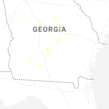

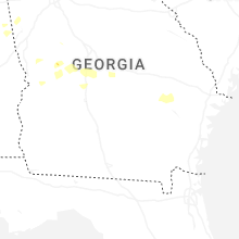

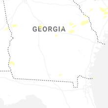


Connect with Interactive Hail Maps