

Hail Map for Waterloo, AL
The Waterloo, AL area has had 6 reports of on-the-ground hail by trained spotters, and has been under severe weather warnings 6 times during the past 12 months. Doppler radar has detected hail at or near Waterloo, AL on 54 occasions, including 1 occasion during the past year.
| Name: | Waterloo, AL |
| Where Located: | 23.5 miles WNW of Florence, AL |
| Map: | Google Map for Waterloo, AL |
| Population: | 203 |
| Housing Units: | 152 |
| More Info: | Search Google for Waterloo, AL |
0
The Top Recent Hail Date for Waterloo, AL is Friday, July 11, 2025 (24th out of 54)
Hail and Wind Damage Spotted near Waterloo, AL
| Date / Time | Report Details |
|---|---|
| 3/15/2026 9:51 PM CDT |
 Svrhun the national weather service in huntsville alabama has issued a * severe thunderstorm warning for, lauderdale county in northwestern alabama, colbert county in northwestern alabama, * until 1045 pm cdt. * at 951 pm cdt, severe thunderstorms were located along a line extending from 7 miles southeast of savannah to near booneville to troy, moving east at 50 mph (radar indicated). Hazards include 60 mph wind gusts and penny size hail. expect damage to roofs, siding, and trees Svrhun the national weather service in huntsville alabama has issued a * severe thunderstorm warning for, lauderdale county in northwestern alabama, colbert county in northwestern alabama, * until 1045 pm cdt. * at 951 pm cdt, severe thunderstorms were located along a line extending from 7 miles southeast of savannah to near booneville to troy, moving east at 50 mph (radar indicated). Hazards include 60 mph wind gusts and penny size hail. expect damage to roofs, siding, and trees
|
| 3/15/2026 9:41 PM CDT |
 the severe thunderstorm warning has been cancelled and is no longer in effect the severe thunderstorm warning has been cancelled and is no longer in effect
|
| 3/15/2026 9:25 PM CDT |
 the severe thunderstorm warning has been cancelled and is no longer in effect the severe thunderstorm warning has been cancelled and is no longer in effect
|
| 3/15/2026 9:25 PM CDT |
 At 925 pm cdt, a severe thunderstorm was located near j p coleman state park, moving east at 40 mph (radar indicated). Hazards include 60 mph wind gusts and quarter size hail. Hail damage to vehicles is expected. expect wind damage to roofs, siding, and trees. Locations impacted include, waterloo. At 925 pm cdt, a severe thunderstorm was located near j p coleman state park, moving east at 40 mph (radar indicated). Hazards include 60 mph wind gusts and quarter size hail. Hail damage to vehicles is expected. expect wind damage to roofs, siding, and trees. Locations impacted include, waterloo.
|
| 3/15/2026 9:11 PM CDT |
 Svrhun the national weather service in huntsville alabama has issued a * severe thunderstorm warning for, northern lauderdale county in northwestern alabama, northwestern colbert county in northwestern alabama, * until 1015 pm cdt. * at 910 pm cdt, a severe thunderstorm was located over j p coleman state park, moving east at 45 mph (radar indicated). Hazards include 60 mph wind gusts and nickel size hail. expect damage to roofs, siding, and trees Svrhun the national weather service in huntsville alabama has issued a * severe thunderstorm warning for, northern lauderdale county in northwestern alabama, northwestern colbert county in northwestern alabama, * until 1015 pm cdt. * at 910 pm cdt, a severe thunderstorm was located over j p coleman state park, moving east at 45 mph (radar indicated). Hazards include 60 mph wind gusts and nickel size hail. expect damage to roofs, siding, and trees
|
| 12/18/2025 5:33 PM CST |
 Svrhun the national weather service in huntsville alabama has issued a * severe thunderstorm warning for, central lauderdale county in northwestern alabama, colbert county in northwestern alabama, * until 630 pm cst. * at 532 pm cst, severe thunderstorms were located along a line extending from near iuka to near midway to tishomingo, moving east at 40 mph (radar indicated). Hazards include 60 mph wind gusts. expect damage to roofs, siding, and trees Svrhun the national weather service in huntsville alabama has issued a * severe thunderstorm warning for, central lauderdale county in northwestern alabama, colbert county in northwestern alabama, * until 630 pm cst. * at 532 pm cst, severe thunderstorms were located along a line extending from near iuka to near midway to tishomingo, moving east at 40 mph (radar indicated). Hazards include 60 mph wind gusts. expect damage to roofs, siding, and trees
|
| 6/26/2025 5:56 PM CDT | Tree down across lynnbrook d in lauderdale county AL, 10.2 miles WSW of Waterloo, AL |
| 6/7/2025 12:21 PM CDT |
 Svrhun the national weather service in huntsville alabama has issued a * severe thunderstorm warning for, lauderdale county in northwestern alabama, colbert county in northwestern alabama, franklin county in northwestern alabama, western lawrence county in northwestern alabama, * until 115 pm cdt. * at 1221 pm cdt, severe thunderstorms were located along a line extending from near corinth to near sandy springs to shannon, moving east at 50 mph (radar indicated). Hazards include 60 mph wind gusts. expect damage to roofs, siding, and trees Svrhun the national weather service in huntsville alabama has issued a * severe thunderstorm warning for, lauderdale county in northwestern alabama, colbert county in northwestern alabama, franklin county in northwestern alabama, western lawrence county in northwestern alabama, * until 115 pm cdt. * at 1221 pm cdt, severe thunderstorms were located along a line extending from near corinth to near sandy springs to shannon, moving east at 50 mph (radar indicated). Hazards include 60 mph wind gusts. expect damage to roofs, siding, and trees
|
| 6/6/2025 6:45 PM CDT |
 Svrhun the national weather service in huntsville alabama has issued a * severe thunderstorm warning for, northwestern lauderdale county in northwestern alabama, * until 745 pm cdt. * at 645 pm cdt, a severe thunderstorm was located over pickwick landing state park, moving east at 30 mph (radar indicated). Hazards include 60 mph wind gusts and quarter size hail. Hail damage to vehicles is expected. Expect wind damage to roofs, siding, and trees. Svrhun the national weather service in huntsville alabama has issued a * severe thunderstorm warning for, northwestern lauderdale county in northwestern alabama, * until 745 pm cdt. * at 645 pm cdt, a severe thunderstorm was located over pickwick landing state park, moving east at 30 mph (radar indicated). Hazards include 60 mph wind gusts and quarter size hail. Hail damage to vehicles is expected. Expect wind damage to roofs, siding, and trees.
|
| 5/25/2025 8:12 PM CDT |
 Svrhun the national weather service in huntsville alabama has issued a * severe thunderstorm warning for, lauderdale county in northwestern alabama, colbert county in northwestern alabama, franklin county in northwestern alabama, western lawrence county in northwestern alabama, * until 915 pm cdt. * at 812 pm cdt, severe thunderstorms were located along a line extending from 9 miles southeast of walnut grove to 8 miles east of tishomingo state park to near fulton, moving southeast at 35 mph (radar indicated). Hazards include 60 mph wind gusts and quarter size hail. Hail damage to vehicles is expected. Expect wind damage to roofs, siding, and trees. Svrhun the national weather service in huntsville alabama has issued a * severe thunderstorm warning for, lauderdale county in northwestern alabama, colbert county in northwestern alabama, franklin county in northwestern alabama, western lawrence county in northwestern alabama, * until 915 pm cdt. * at 812 pm cdt, severe thunderstorms were located along a line extending from 9 miles southeast of walnut grove to 8 miles east of tishomingo state park to near fulton, moving southeast at 35 mph (radar indicated). Hazards include 60 mph wind gusts and quarter size hail. Hail damage to vehicles is expected. Expect wind damage to roofs, siding, and trees.
|
| 5/25/2025 7:53 PM CDT |
 At 753 pm cdt, severe thunderstorms were located along a line extending from near walnut grove to near ecru, moving east at 35 mph (radar indicated). Hazards include two inch hail and 60 mph wind gusts. People and animals outdoors will be injured. expect hail damage to roofs, siding, windows, and vehicles. expect wind damage to roofs, siding, and trees. Locations impacted include, posey loop, atwood, florence, oakland, waterloo, lexington, tuscumbia, underwood-petersville, colbert heights, and cherokee. At 753 pm cdt, severe thunderstorms were located along a line extending from near walnut grove to near ecru, moving east at 35 mph (radar indicated). Hazards include two inch hail and 60 mph wind gusts. People and animals outdoors will be injured. expect hail damage to roofs, siding, windows, and vehicles. expect wind damage to roofs, siding, and trees. Locations impacted include, posey loop, atwood, florence, oakland, waterloo, lexington, tuscumbia, underwood-petersville, colbert heights, and cherokee.
|
| 5/25/2025 7:34 PM CDT |
 At 734 pm cdt, severe thunderstorms were located along a line extending from near pickwick landing state park to near pinedale, moving east at 35 mph (radar indicated). Hazards include ping pong ball size hail and 60 mph wind gusts. People and animals outdoors will be injured. expect hail damage to roofs, siding, windows, and vehicles. expect wind damage to roofs, siding, and trees. Locations impacted include, posey loop, atwood, florence, oakland, waterloo, lexington, tuscumbia, underwood-petersville, colbert heights, and cherokee. At 734 pm cdt, severe thunderstorms were located along a line extending from near pickwick landing state park to near pinedale, moving east at 35 mph (radar indicated). Hazards include ping pong ball size hail and 60 mph wind gusts. People and animals outdoors will be injured. expect hail damage to roofs, siding, windows, and vehicles. expect wind damage to roofs, siding, and trees. Locations impacted include, posey loop, atwood, florence, oakland, waterloo, lexington, tuscumbia, underwood-petersville, colbert heights, and cherokee.
|
| 5/25/2025 7:18 PM CDT |
 Svrhun the national weather service in huntsville alabama has issued a * severe thunderstorm warning for, lauderdale county in northwestern alabama, colbert county in northwestern alabama, franklin county in northwestern alabama, * until 815 pm cdt. * at 718 pm cdt, severe thunderstorms were located along a line extending from near shiloh to near cambridge, moving east at 35 mph (radar indicated). Hazards include quarter size hail. damage to vehicles is expected Svrhun the national weather service in huntsville alabama has issued a * severe thunderstorm warning for, lauderdale county in northwestern alabama, colbert county in northwestern alabama, franklin county in northwestern alabama, * until 815 pm cdt. * at 718 pm cdt, severe thunderstorms were located along a line extending from near shiloh to near cambridge, moving east at 35 mph (radar indicated). Hazards include quarter size hail. damage to vehicles is expected
|
| 5/20/2025 4:23 PM CDT |
 At 422 pm cdt, a severe thunderstorm was located near iuka, moving east at 40 mph (radar indicated). Hazards include two inch hail and 60 mph wind gusts. People and animals outdoors will be injured. expect hail damage to roofs, siding, windows, and vehicles. expect wind damage to roofs, siding, and trees. Locations impacted include, malone, mt hester, cherokee, florence, allsboro, riverton, wright, oakland, barton, and waterloo. At 422 pm cdt, a severe thunderstorm was located near iuka, moving east at 40 mph (radar indicated). Hazards include two inch hail and 60 mph wind gusts. People and animals outdoors will be injured. expect hail damage to roofs, siding, windows, and vehicles. expect wind damage to roofs, siding, and trees. Locations impacted include, malone, mt hester, cherokee, florence, allsboro, riverton, wright, oakland, barton, and waterloo.
|
| 5/20/2025 4:10 PM CDT |
 Svrhun the national weather service in huntsville alabama has issued a * severe thunderstorm warning for, central lauderdale county in northwestern alabama, northwestern colbert county in northwestern alabama, * until 500 pm cdt. * at 409 pm cdt, a severe thunderstorm was located near midway, or 9 miles southwest of iuka, moving east at 40 mph (radar indicated). Hazards include ping pong ball size hail and 60 mph wind gusts. People and animals outdoors will be injured. expect hail damage to roofs, siding, windows, and vehicles. Expect wind damage to roofs, siding, and trees. Svrhun the national weather service in huntsville alabama has issued a * severe thunderstorm warning for, central lauderdale county in northwestern alabama, northwestern colbert county in northwestern alabama, * until 500 pm cdt. * at 409 pm cdt, a severe thunderstorm was located near midway, or 9 miles southwest of iuka, moving east at 40 mph (radar indicated). Hazards include ping pong ball size hail and 60 mph wind gusts. People and animals outdoors will be injured. expect hail damage to roofs, siding, windows, and vehicles. Expect wind damage to roofs, siding, and trees.
|
| 5/20/2025 12:39 PM CDT |
 The tornado warning number 34 is still in effect. please refer to that bulletin for the latest severe weather information. The tornado warning number 34 is still in effect. please refer to that bulletin for the latest severe weather information.
|
| 5/20/2025 12:07 PM CDT |
 Torhun the national weather service in huntsville alabama has issued a * tornado warning for, northwestern lauderdale county in northwestern alabama, northwestern colbert county in northwestern alabama, * until 1245 pm cdt. * at 1207 pm cdt, a confirmed tornado was located 7 miles east of j p coleman state park, moving east at 25 mph (broadcast media confirmed tornado). Hazards include damaging tornado. Flying debris will be dangerous to those caught without shelter. mobile homes will be damaged or destroyed. damage to roofs, windows, and vehicles will occur. tree damage is likely. This tornadic thunderstorm will remain over mainly rural areas of northwestern lauderdale and northwestern colbert counties, including the following locations, riverton, wright, threet, zip city, and waterloo. Torhun the national weather service in huntsville alabama has issued a * tornado warning for, northwestern lauderdale county in northwestern alabama, northwestern colbert county in northwestern alabama, * until 1245 pm cdt. * at 1207 pm cdt, a confirmed tornado was located 7 miles east of j p coleman state park, moving east at 25 mph (broadcast media confirmed tornado). Hazards include damaging tornado. Flying debris will be dangerous to those caught without shelter. mobile homes will be damaged or destroyed. damage to roofs, windows, and vehicles will occur. tree damage is likely. This tornadic thunderstorm will remain over mainly rural areas of northwestern lauderdale and northwestern colbert counties, including the following locations, riverton, wright, threet, zip city, and waterloo.
|
| 5/20/2025 12:04 PM CDT |
 Torhun the national weather service in huntsville alabama has issued a * tornado warning for, northwestern lauderdale county in northwestern alabama, northwestern colbert county in northwestern alabama, * until 1245 pm cdt. * at 1203 pm cdt, a severe thunderstorm capable of producing a tornado was located near j p coleman state park, moving east at 25 mph (radar indicated rotation). Hazards include tornado. Flying debris will be dangerous to those caught without shelter. mobile homes will be damaged or destroyed. damage to roofs, windows, and vehicles will occur. tree damage is likely. This tornadic thunderstorm will remain over mainly rural areas of northwestern lauderdale and northwestern colbert counties, including the following locations, riverton, wright, threet, zip city, and waterloo. Torhun the national weather service in huntsville alabama has issued a * tornado warning for, northwestern lauderdale county in northwestern alabama, northwestern colbert county in northwestern alabama, * until 1245 pm cdt. * at 1203 pm cdt, a severe thunderstorm capable of producing a tornado was located near j p coleman state park, moving east at 25 mph (radar indicated rotation). Hazards include tornado. Flying debris will be dangerous to those caught without shelter. mobile homes will be damaged or destroyed. damage to roofs, windows, and vehicles will occur. tree damage is likely. This tornadic thunderstorm will remain over mainly rural areas of northwestern lauderdale and northwestern colbert counties, including the following locations, riverton, wright, threet, zip city, and waterloo.
|
| 5/19/2025 1:05 AM CDT |
 The storm which prompted the warning has weakened below severe limits, and no longer poses an immediate threat to life or property. therefore, the warning will be allowed to expire. however, gusty winds are still possible with this thunderstorm. The storm which prompted the warning has weakened below severe limits, and no longer poses an immediate threat to life or property. therefore, the warning will be allowed to expire. however, gusty winds are still possible with this thunderstorm.
|
| 5/19/2025 12:37 AM CDT |
 At 1237 am cdt, a severe thunderstorm was located near iuka, moving northeast at 20 mph (radar indicated). Hazards include 60 mph wind gusts and quarter size hail. Hail damage to vehicles is expected. expect wind damage to roofs, siding, and trees. Locations impacted include, malone, riverton, wright, margerum, waterloo, and allsboro. At 1237 am cdt, a severe thunderstorm was located near iuka, moving northeast at 20 mph (radar indicated). Hazards include 60 mph wind gusts and quarter size hail. Hail damage to vehicles is expected. expect wind damage to roofs, siding, and trees. Locations impacted include, malone, riverton, wright, margerum, waterloo, and allsboro.
|
| 5/19/2025 12:28 AM CDT |
 At 1228 am cdt, a severe thunderstorm was located near iuka, moving northeast at 20 mph (radar indicated). Hazards include two inch hail and 60 mph wind gusts. People and animals outdoors will be injured. expect hail damage to roofs, siding, windows, and vehicles. expect wind damage to roofs, siding, and trees. Locations impacted include, malone, riverton, wright, margerum, waterloo, and allsboro. At 1228 am cdt, a severe thunderstorm was located near iuka, moving northeast at 20 mph (radar indicated). Hazards include two inch hail and 60 mph wind gusts. People and animals outdoors will be injured. expect hail damage to roofs, siding, windows, and vehicles. expect wind damage to roofs, siding, and trees. Locations impacted include, malone, riverton, wright, margerum, waterloo, and allsboro.
|
| 5/19/2025 12:10 AM CDT |
 Svrhun the national weather service in huntsville alabama has issued a * severe thunderstorm warning for, northwestern lauderdale county in northwestern alabama, northwestern colbert county in northwestern alabama, * until 115 am cdt. * at 1210 am cdt, a severe thunderstorm was located over midway, or near iuka, moving northeast at 20 mph (radar indicated). Hazards include ping pong ball size hail and 60 mph wind gusts. People and animals outdoors will be injured. expect hail damage to roofs, siding, windows, and vehicles. Expect wind damage to roofs, siding, and trees. Svrhun the national weather service in huntsville alabama has issued a * severe thunderstorm warning for, northwestern lauderdale county in northwestern alabama, northwestern colbert county in northwestern alabama, * until 115 am cdt. * at 1210 am cdt, a severe thunderstorm was located over midway, or near iuka, moving northeast at 20 mph (radar indicated). Hazards include ping pong ball size hail and 60 mph wind gusts. People and animals outdoors will be injured. expect hail damage to roofs, siding, windows, and vehicles. Expect wind damage to roofs, siding, and trees.
|
| 5/8/2025 6:31 PM CDT |
 the severe thunderstorm warning has been cancelled and is no longer in effect the severe thunderstorm warning has been cancelled and is no longer in effect
|
| 5/8/2025 6:02 PM CDT |
 Svrhun the national weather service in huntsville alabama has issued a * severe thunderstorm warning for, central lauderdale county in northwestern alabama, central colbert county in northwestern alabama, * until 700 pm cdt. * at 602 pm cdt, a severe thunderstorm was located 10 miles north of cherokee, or 11 miles east of j p coleman state park, moving east at 25 mph (radar indicated). Hazards include 60 mph wind gusts and quarter size hail. Hail damage to vehicles is expected. Expect wind damage to roofs, siding, and trees. Svrhun the national weather service in huntsville alabama has issued a * severe thunderstorm warning for, central lauderdale county in northwestern alabama, central colbert county in northwestern alabama, * until 700 pm cdt. * at 602 pm cdt, a severe thunderstorm was located 10 miles north of cherokee, or 11 miles east of j p coleman state park, moving east at 25 mph (radar indicated). Hazards include 60 mph wind gusts and quarter size hail. Hail damage to vehicles is expected. Expect wind damage to roofs, siding, and trees.
|
| 4/5/2025 9:24 PM CDT |
 The storm which prompted the warning will soon move out of the area. therefore, the warning will be allowed to expire. however, gusty winds and heavy rain are still possible with this thunderstorm. additional warnings are expected as thunderstorms continue to track over northwest lauderdale and colbert counties. a tornado watch remains in effect until 300 am cdt for northwestern alabama. The storm which prompted the warning will soon move out of the area. therefore, the warning will be allowed to expire. however, gusty winds and heavy rain are still possible with this thunderstorm. additional warnings are expected as thunderstorms continue to track over northwest lauderdale and colbert counties. a tornado watch remains in effect until 300 am cdt for northwestern alabama.
|
| 4/5/2025 8:56 PM CDT |
 At 855 pm cdt, a severe thunderstorm was located near walnut grove, or near j p coleman state park, moving northeast at 35 mph (radar indicated). Hazards include 60 mph wind gusts. Expect damage to roofs, siding, and trees. Locations impacted include, riverton, wright, threet, and waterloo. At 855 pm cdt, a severe thunderstorm was located near walnut grove, or near j p coleman state park, moving northeast at 35 mph (radar indicated). Hazards include 60 mph wind gusts. Expect damage to roofs, siding, and trees. Locations impacted include, riverton, wright, threet, and waterloo.
|
| 4/5/2025 8:27 PM CDT |
 Svrhun the national weather service in huntsville alabama has issued a * severe thunderstorm warning for, northwestern lauderdale county in northwestern alabama, northwestern colbert county in northwestern alabama, * until 930 pm cdt. * at 826 pm cdt, a cluster of severe thunderstorms was located over leedy, or 10 miles west of iuka, moving northeast at 45 mph (radar indicated). Hazards include 60 mph wind gusts and nickel size hail. expect damage to roofs, siding, and trees Svrhun the national weather service in huntsville alabama has issued a * severe thunderstorm warning for, northwestern lauderdale county in northwestern alabama, northwestern colbert county in northwestern alabama, * until 930 pm cdt. * at 826 pm cdt, a cluster of severe thunderstorms was located over leedy, or 10 miles west of iuka, moving northeast at 45 mph (radar indicated). Hazards include 60 mph wind gusts and nickel size hail. expect damage to roofs, siding, and trees
|
| 4/3/2025 5:06 PM CDT |
 the tornado warning has been cancelled and is no longer in effect the tornado warning has been cancelled and is no longer in effect
|
| 4/3/2025 4:59 PM CDT |
 Torhun the national weather service in huntsville alabama has issued a * tornado warning for, northwestern lauderdale county in northwestern alabama, * until 530 pm cdt. * at 459 pm cdt, a confirmed tornado was located over j p coleman state park, moving east at 55 mph (public confirmed tornado). Hazards include damaging tornado and quarter size hail. Flying debris will be dangerous to those caught without shelter. mobile homes will be damaged or destroyed. damage to roofs, windows, and vehicles will occur. tree damage is likely. This tornadic thunderstorm will remain over mainly rural areas of northwestern lauderdale county, including the following locations, wright, waterloo, and threet. Torhun the national weather service in huntsville alabama has issued a * tornado warning for, northwestern lauderdale county in northwestern alabama, * until 530 pm cdt. * at 459 pm cdt, a confirmed tornado was located over j p coleman state park, moving east at 55 mph (public confirmed tornado). Hazards include damaging tornado and quarter size hail. Flying debris will be dangerous to those caught without shelter. mobile homes will be damaged or destroyed. damage to roofs, windows, and vehicles will occur. tree damage is likely. This tornadic thunderstorm will remain over mainly rural areas of northwestern lauderdale county, including the following locations, wright, waterloo, and threet.
|
| 4/3/2025 4:52 PM CDT |
 Torhun the national weather service in huntsville alabama has issued a * tornado warning for, northwestern lauderdale county in northwestern alabama, * until 500 pm cdt. * at 452 pm cdt, a confirmed tornado was located near pineflat, or 8 miles west of j p coleman state park, moving east at 55 mph (public confirmed tornado). Hazards include damaging tornado and quarter size hail. Flying debris will be dangerous to those caught without shelter. mobile homes will be damaged or destroyed. damage to roofs, windows, and vehicles will occur. tree damage is likely. This tornadic thunderstorm will remain over mainly rural areas of northwestern lauderdale county, including the following locations, wright and waterloo. Torhun the national weather service in huntsville alabama has issued a * tornado warning for, northwestern lauderdale county in northwestern alabama, * until 500 pm cdt. * at 452 pm cdt, a confirmed tornado was located near pineflat, or 8 miles west of j p coleman state park, moving east at 55 mph (public confirmed tornado). Hazards include damaging tornado and quarter size hail. Flying debris will be dangerous to those caught without shelter. mobile homes will be damaged or destroyed. damage to roofs, windows, and vehicles will occur. tree damage is likely. This tornadic thunderstorm will remain over mainly rural areas of northwestern lauderdale county, including the following locations, wright and waterloo.
|
| 4/2/2025 5:52 PM CDT |
 The storm which prompted the warning has weakened below severe limits, and has exited the warned area. therefore, the warning will be allowed to expire. The storm which prompted the warning has weakened below severe limits, and has exited the warned area. therefore, the warning will be allowed to expire.
|
| 4/2/2025 5:46 PM CDT |
 At 546 pm cdt, a severe thunderstorm was located 8 miles southeast of walnut grove, or 15 miles east of j p coleman state park, moving northeast at 45 mph (radar indicated). Hazards include 60 mph wind gusts and quarter size hail. Hail damage to vehicles is expected. expect wind damage to roofs, siding, and trees. Locations impacted include, wright, threet, oakland, and waterloo. At 546 pm cdt, a severe thunderstorm was located 8 miles southeast of walnut grove, or 15 miles east of j p coleman state park, moving northeast at 45 mph (radar indicated). Hazards include 60 mph wind gusts and quarter size hail. Hail damage to vehicles is expected. expect wind damage to roofs, siding, and trees. Locations impacted include, wright, threet, oakland, and waterloo.
|
| 4/2/2025 5:46 PM CDT |
 the severe thunderstorm warning has been cancelled and is no longer in effect the severe thunderstorm warning has been cancelled and is no longer in effect
|
| 4/2/2025 5:25 PM CDT |
 At 525 pm cdt, a severe thunderstorm was located near cherokee, or 8 miles east of iuka, moving northeast at 50 mph. nickle sized hail was observed in tishomingo county as the storm continues to intensify (radar indicated). Hazards include 60 mph wind gusts and quarter size hail. Hail damage to vehicles is expected. expect wind damage to roofs, siding, and trees. Locations impacted include, threet, zip city, mt hester, margerum, cherokee, riverton, wright, oakland, barton, and waterloo. At 525 pm cdt, a severe thunderstorm was located near cherokee, or 8 miles east of iuka, moving northeast at 50 mph. nickle sized hail was observed in tishomingo county as the storm continues to intensify (radar indicated). Hazards include 60 mph wind gusts and quarter size hail. Hail damage to vehicles is expected. expect wind damage to roofs, siding, and trees. Locations impacted include, threet, zip city, mt hester, margerum, cherokee, riverton, wright, oakland, barton, and waterloo.
|
| 4/2/2025 5:14 PM CDT |
 the severe thunderstorm warning has been cancelled and is no longer in effect the severe thunderstorm warning has been cancelled and is no longer in effect
|
| 4/2/2025 5:14 PM CDT |
 At 513 pm cdt, a severe thunderstorm was located near midway, or near iuka, moving northeast at 50 mph (radar indicated). Hazards include 60 mph wind gusts and quarter size hail. Hail damage to vehicles is expected. expect wind damage to roofs, siding, and trees. Locations impacted include, malone, posey loop, mt hester, cherokee, srygley church, allsboro, maud, riverton, wright, and oakland. At 513 pm cdt, a severe thunderstorm was located near midway, or near iuka, moving northeast at 50 mph (radar indicated). Hazards include 60 mph wind gusts and quarter size hail. Hail damage to vehicles is expected. expect wind damage to roofs, siding, and trees. Locations impacted include, malone, posey loop, mt hester, cherokee, srygley church, allsboro, maud, riverton, wright, and oakland.
|
| 4/2/2025 4:58 PM CDT |
 Svrhun the national weather service in huntsville alabama has issued a * severe thunderstorm warning for, western lauderdale county in northwestern alabama, western colbert county in northwestern alabama, northwestern franklin county in northwestern alabama, * until 600 pm cdt. * at 458 pm cdt, a severe thunderstorm was located near tishomingo state park, moving northeast at 50 mph (radar indicated). Hazards include 60 mph wind gusts and quarter size hail. Hail damage to vehicles is expected. Expect wind damage to roofs, siding, and trees. Svrhun the national weather service in huntsville alabama has issued a * severe thunderstorm warning for, western lauderdale county in northwestern alabama, western colbert county in northwestern alabama, northwestern franklin county in northwestern alabama, * until 600 pm cdt. * at 458 pm cdt, a severe thunderstorm was located near tishomingo state park, moving northeast at 50 mph (radar indicated). Hazards include 60 mph wind gusts and quarter size hail. Hail damage to vehicles is expected. Expect wind damage to roofs, siding, and trees.
|
| 4/2/2025 4:39 PM CDT |
 At 439 pm cdt, a severe thunderstorm was located near cherokee, or 10 miles east of iuka, moving northeast at 45 mph (radar indicated). Hazards include 60 mph wind gusts and quarter size hail. Hail damage to vehicles is expected. expect wind damage to roofs, siding, and trees. Locations impacted include, malone, posey loop, mt hester, cherokee, srygley church, allsboro, maud, riverton, wright, and oakland. At 439 pm cdt, a severe thunderstorm was located near cherokee, or 10 miles east of iuka, moving northeast at 45 mph (radar indicated). Hazards include 60 mph wind gusts and quarter size hail. Hail damage to vehicles is expected. expect wind damage to roofs, siding, and trees. Locations impacted include, malone, posey loop, mt hester, cherokee, srygley church, allsboro, maud, riverton, wright, and oakland.
|
| 4/2/2025 4:28 PM CDT |
 the severe thunderstorm warning has been cancelled and is no longer in effect the severe thunderstorm warning has been cancelled and is no longer in effect
|
| 4/2/2025 4:28 PM CDT |
 At 428 pm cdt, a severe thunderstorm was located near tishomingo state park, moving northeast at 45 mph (radar indicated). Hazards include ping pong ball size hail and 60 mph wind gusts. People and animals outdoors will be injured. expect hail damage to roofs, siding, windows, and vehicles. expect wind damage to roofs, siding, and trees. Locations impacted include, malone, posey loop, mt hester, cherokee, srygley church, allsboro, maud, riverton, wright, and oakland. At 428 pm cdt, a severe thunderstorm was located near tishomingo state park, moving northeast at 45 mph (radar indicated). Hazards include ping pong ball size hail and 60 mph wind gusts. People and animals outdoors will be injured. expect hail damage to roofs, siding, windows, and vehicles. expect wind damage to roofs, siding, and trees. Locations impacted include, malone, posey loop, mt hester, cherokee, srygley church, allsboro, maud, riverton, wright, and oakland.
|
| 4/2/2025 4:23 PM CDT |
 At 422 pm cdt, a severe thunderstorm was located over tishomingo state park, moving northeast at 45 mph (radar indicated). Hazards include ping pong ball size hail and 60 mph wind gusts. People and animals outdoors will be injured. expect hail damage to roofs, siding, windows, and vehicles. expect wind damage to roofs, siding, and trees. Locations impacted include, malone, posey loop, pogo, mt hester, cherokee, srygley church, allsboro, maud, riverton, and wright. At 422 pm cdt, a severe thunderstorm was located over tishomingo state park, moving northeast at 45 mph (radar indicated). Hazards include ping pong ball size hail and 60 mph wind gusts. People and animals outdoors will be injured. expect hail damage to roofs, siding, windows, and vehicles. expect wind damage to roofs, siding, and trees. Locations impacted include, malone, posey loop, pogo, mt hester, cherokee, srygley church, allsboro, maud, riverton, and wright.
|
| 4/2/2025 4:02 PM CDT |
 Svrhun the national weather service in huntsville alabama has issued a * severe thunderstorm warning for, western lauderdale county in northwestern alabama, western colbert county in northwestern alabama, northwestern franklin county in northwestern alabama, * until 500 pm cdt. * at 402 pm cdt, a severe thunderstorm was located near sandy springs, or 9 miles west of red bay, moving northeast at 45 mph (radar indicated). Hazards include ping pong ball size hail and 60 mph wind gusts. People and animals outdoors will be injured. expect hail damage to roofs, siding, windows, and vehicles. Expect wind damage to roofs, siding, and trees. Svrhun the national weather service in huntsville alabama has issued a * severe thunderstorm warning for, western lauderdale county in northwestern alabama, western colbert county in northwestern alabama, northwestern franklin county in northwestern alabama, * until 500 pm cdt. * at 402 pm cdt, a severe thunderstorm was located near sandy springs, or 9 miles west of red bay, moving northeast at 45 mph (radar indicated). Hazards include ping pong ball size hail and 60 mph wind gusts. People and animals outdoors will be injured. expect hail damage to roofs, siding, windows, and vehicles. Expect wind damage to roofs, siding, and trees.
|
| 3/31/2025 2:27 AM CDT |
 The severe thunderstorm which prompted the warning has weakened. therefore, the warning will be allowed to expire. however, small hail and gusty winds are still possible with this thunderstorm. a tornado watch remains in effect until 500 am cdt for north central and northwestern alabama. The severe thunderstorm which prompted the warning has weakened. therefore, the warning will be allowed to expire. however, small hail and gusty winds are still possible with this thunderstorm. a tornado watch remains in effect until 500 am cdt for north central and northwestern alabama.
|
| 3/31/2025 1:49 AM CDT |
 Svrhun the national weather service in huntsville alabama has issued a * severe thunderstorm warning for, lauderdale county in northwestern alabama, northern colbert county in northwestern alabama, * until 230 am cdt. * at 149 am cdt, a severe thunderstorm was located 8 miles north of cherokee, or 10 miles east of j p coleman state park, moving east at 35 mph (radar indicated). Hazards include quarter size hail. damage to vehicles is expected Svrhun the national weather service in huntsville alabama has issued a * severe thunderstorm warning for, lauderdale county in northwestern alabama, northern colbert county in northwestern alabama, * until 230 am cdt. * at 149 am cdt, a severe thunderstorm was located 8 miles north of cherokee, or 10 miles east of j p coleman state park, moving east at 35 mph (radar indicated). Hazards include quarter size hail. damage to vehicles is expected
|
| 3/31/2025 1:40 AM CDT |
 The storms which prompted the warning have weakened below severe limits, and no longer pose an immediate threat to life or property. therefore, the warning will be allowed to expire. however, gusty winds are still possible with these thunderstorms. a tornado watch remains in effect until 500 am cdt for northwestern alabama. The storms which prompted the warning have weakened below severe limits, and no longer pose an immediate threat to life or property. therefore, the warning will be allowed to expire. however, gusty winds are still possible with these thunderstorms. a tornado watch remains in effect until 500 am cdt for northwestern alabama.
|
| 3/31/2025 12:49 AM CDT |
 Svrhun the national weather service in huntsville alabama has issued a * severe thunderstorm warning for, northwestern lauderdale county in northwestern alabama, northwestern colbert county in northwestern alabama, * until 145 am cdt. * at 1248 am cdt, severe thunderstorms were located along a line extending from 7 miles southwest of shiloh to 8 miles northeast of ripley, moving east at 20 mph (radar indicated). Hazards include 60 mph wind gusts and quarter size hail. Hail damage to vehicles is expected. Expect wind damage to roofs, siding, and trees. Svrhun the national weather service in huntsville alabama has issued a * severe thunderstorm warning for, northwestern lauderdale county in northwestern alabama, northwestern colbert county in northwestern alabama, * until 145 am cdt. * at 1248 am cdt, severe thunderstorms were located along a line extending from 7 miles southwest of shiloh to 8 miles northeast of ripley, moving east at 20 mph (radar indicated). Hazards include 60 mph wind gusts and quarter size hail. Hail damage to vehicles is expected. Expect wind damage to roofs, siding, and trees.
|
| 3/15/2025 4:26 PM CDT |
 Svrhun the national weather service in huntsville alabama has issued a * severe thunderstorm warning for, lauderdale county in northwestern alabama, colbert county in northwestern alabama, franklin county in northwestern alabama, western lawrence county in northwestern alabama, * until 530 pm cdt. * at 425 pm cdt, severe thunderstorms were located along a line extending from 7 miles southeast of walnut grove to near red bay, moving east at 30 mph (radar indicated). Hazards include 60 mph wind gusts and quarter size hail. Hail damage to vehicles is expected. Expect wind damage to roofs, siding, and trees. Svrhun the national weather service in huntsville alabama has issued a * severe thunderstorm warning for, lauderdale county in northwestern alabama, colbert county in northwestern alabama, franklin county in northwestern alabama, western lawrence county in northwestern alabama, * until 530 pm cdt. * at 425 pm cdt, severe thunderstorms were located along a line extending from 7 miles southeast of walnut grove to near red bay, moving east at 30 mph (radar indicated). Hazards include 60 mph wind gusts and quarter size hail. Hail damage to vehicles is expected. Expect wind damage to roofs, siding, and trees.
|
| 3/15/2025 1:39 PM CDT |
 The storms which prompted the warning is still in the area. therefore, the warning will be allowed to expire with an additional severe thunderstorm warning issued in replacement. a tornado watch remains in effect until 800 pm cdt for north central and northwestern alabama. remember, a severe thunderstorm warning still remains in effect for portions of lauderdale, colbert, and franklin counties until 2:30 pm. remember, a tornado warning still remains in effect for franklin county until 2:15 pm. The storms which prompted the warning is still in the area. therefore, the warning will be allowed to expire with an additional severe thunderstorm warning issued in replacement. a tornado watch remains in effect until 800 pm cdt for north central and northwestern alabama. remember, a severe thunderstorm warning still remains in effect for portions of lauderdale, colbert, and franklin counties until 2:30 pm. remember, a tornado warning still remains in effect for franklin county until 2:15 pm.
|
| 3/15/2025 1:37 PM CDT |
 Svrhun the national weather service in huntsville alabama has issued a * severe thunderstorm warning for, central lauderdale county in northwestern alabama, colbert county in northwestern alabama, franklin county in northwestern alabama, * until 230 pm cdt. * at 136 pm cdt, severe thunderstorms were located along a line extending from 10 miles north of cherokee to 6 miles southeast of tishomingo state park to near tremont, moving northeast at 60 mph (radar indicated). Hazards include 60 mph wind gusts and quarter size hail. Hail damage to vehicles is expected. Expect wind damage to roofs, siding, and trees. Svrhun the national weather service in huntsville alabama has issued a * severe thunderstorm warning for, central lauderdale county in northwestern alabama, colbert county in northwestern alabama, franklin county in northwestern alabama, * until 230 pm cdt. * at 136 pm cdt, severe thunderstorms were located along a line extending from 10 miles north of cherokee to 6 miles southeast of tishomingo state park to near tremont, moving northeast at 60 mph (radar indicated). Hazards include 60 mph wind gusts and quarter size hail. Hail damage to vehicles is expected. Expect wind damage to roofs, siding, and trees.
|
| 3/15/2025 1:15 PM CDT |
 At 115 pm cdt, severe thunderstorms were located along a line extending from iuka to near burton to near fairview, moving east at 40 mph (radar indicated). Hazards include 60 mph wind gusts and quarter size hail. Hail damage to vehicles is expected. expect wind damage to roofs, siding, and trees. Locations impacted include, malone, posey loop, northwest alabama regional airport, atwood, littleville, florence, allsboro, riverton, wright, and tharptown. At 115 pm cdt, severe thunderstorms were located along a line extending from iuka to near burton to near fairview, moving east at 40 mph (radar indicated). Hazards include 60 mph wind gusts and quarter size hail. Hail damage to vehicles is expected. expect wind damage to roofs, siding, and trees. Locations impacted include, malone, posey loop, northwest alabama regional airport, atwood, littleville, florence, allsboro, riverton, wright, and tharptown.
|
| 3/15/2025 12:52 PM CDT |
 Svrhun the national weather service in huntsville alabama has issued a * severe thunderstorm warning for, western lauderdale county in northwestern alabama, colbert county in northwestern alabama, franklin county in northwestern alabama, * until 145 pm cdt. * at 1252 pm cdt, severe thunderstorms were located along a line extending from hinkle to near wheeler to near saltillo, moving east at 40 mph (radar indicated). Hazards include 60 mph wind gusts and quarter size hail. Hail damage to vehicles is expected. Expect wind damage to roofs, siding, and trees. Svrhun the national weather service in huntsville alabama has issued a * severe thunderstorm warning for, western lauderdale county in northwestern alabama, colbert county in northwestern alabama, franklin county in northwestern alabama, * until 145 pm cdt. * at 1252 pm cdt, severe thunderstorms were located along a line extending from hinkle to near wheeler to near saltillo, moving east at 40 mph (radar indicated). Hazards include 60 mph wind gusts and quarter size hail. Hail damage to vehicles is expected. Expect wind damage to roofs, siding, and trees.
|
| 5/27/2024 2:40 AM CDT |
 The storms which prompted the warning have weakened below severe limits, and no longer pose an immediate threat to life or property. therefore, the warning will be allowed to expire. a tornado watch remains in effect until 800 am cdt for north central and northwestern alabama. The storms which prompted the warning have weakened below severe limits, and no longer pose an immediate threat to life or property. therefore, the warning will be allowed to expire. a tornado watch remains in effect until 800 am cdt for north central and northwestern alabama.
|
| 5/27/2024 1:49 AM CDT |
 Svrhun the national weather service in huntsville alabama has issued a * severe thunderstorm warning for, lauderdale county in northwestern alabama, colbert county in northwestern alabama, franklin county in northwestern alabama, * until 245 am cdt. * at 148 am cdt, severe thunderstorms were located along a line extending from near savannah to 6 miles north of hinkle to near snow lake shores, moving southeast at 40 mph (radar indicated). Hazards include 60 mph wind gusts and quarter size hail. Hail damage to vehicles is expected. Expect wind damage to roofs, siding, and trees. Svrhun the national weather service in huntsville alabama has issued a * severe thunderstorm warning for, lauderdale county in northwestern alabama, colbert county in northwestern alabama, franklin county in northwestern alabama, * until 245 am cdt. * at 148 am cdt, severe thunderstorms were located along a line extending from near savannah to 6 miles north of hinkle to near snow lake shores, moving southeast at 40 mph (radar indicated). Hazards include 60 mph wind gusts and quarter size hail. Hail damage to vehicles is expected. Expect wind damage to roofs, siding, and trees.
|
| 12/9/2023 6:13 PM CST |
 The severe thunderstorm warning for northwestern lauderdale and northwestern colbert counties will expire at 615 pm cst, the storms which prompted the warning have weakened below severe limits, and no longer pose an immediate threat to life or property. therefore, the warning will be allowed to expire. however, small hail and gusty winds are still possible with these thunderstorms. a tornado watch remains in effect until 1100 pm cst for northwestern alabama. The severe thunderstorm warning for northwestern lauderdale and northwestern colbert counties will expire at 615 pm cst, the storms which prompted the warning have weakened below severe limits, and no longer pose an immediate threat to life or property. therefore, the warning will be allowed to expire. however, small hail and gusty winds are still possible with these thunderstorms. a tornado watch remains in effect until 1100 pm cst for northwestern alabama.
|
| 12/9/2023 5:49 PM CST |
 At 548 pm cst, severe thunderstorms were located along a line extending from pickwick landing state park to near j p coleman state park to near leedy, moving northeast at 40 mph (radar indicated). Hazards include 60 mph wind gusts and quarter size hail. Hail damage to vehicles is expected. Expect wind damage to roofs, siding, and trees. At 548 pm cst, severe thunderstorms were located along a line extending from pickwick landing state park to near j p coleman state park to near leedy, moving northeast at 40 mph (radar indicated). Hazards include 60 mph wind gusts and quarter size hail. Hail damage to vehicles is expected. Expect wind damage to roofs, siding, and trees.
|
| 12/9/2023 4:45 PM CST |
 At 444 pm cst, a severe thunderstorm was located near iuka, moving northeast at 45 mph (radar indicated). Hazards include 60 mph wind gusts and quarter size hail. Hail damage to vehicles is expected. Expect wind damage to roofs, siding, and trees. At 444 pm cst, a severe thunderstorm was located near iuka, moving northeast at 45 mph (radar indicated). Hazards include 60 mph wind gusts and quarter size hail. Hail damage to vehicles is expected. Expect wind damage to roofs, siding, and trees.
|
| 8/9/2023 2:11 PM CDT |
 At 211 pm cdt, severe thunderstorms were located along a line extending from 6 miles northeast of pickwick landing state park to near iuka to near thrashers, moving east at 45 mph (radar indicated). Hazards include 60 mph wind gusts. expect damage to roofs, siding, and trees At 211 pm cdt, severe thunderstorms were located along a line extending from 6 miles northeast of pickwick landing state park to near iuka to near thrashers, moving east at 45 mph (radar indicated). Hazards include 60 mph wind gusts. expect damage to roofs, siding, and trees
|
| 8/7/2023 10:28 AM CDT |
 At 1027 am cdt, a severe thunderstorm was located near walnut grove, or 9 miles east of j p coleman state park, moving east at 50 mph (radar indicated). Hazards include 60 mph wind gusts and nickel size hail. expect damage to roofs, siding, and trees At 1027 am cdt, a severe thunderstorm was located near walnut grove, or 9 miles east of j p coleman state park, moving east at 50 mph (radar indicated). Hazards include 60 mph wind gusts and nickel size hail. expect damage to roofs, siding, and trees
|
| 8/7/2023 10:00 AM CDT |
 At 1000 am cdt, severe thunderstorms were located along a line extending from savannah to near shiloh to near hinkle, moving southeast at 50 mph (radar indicated). Hazards include 60 mph wind gusts and quarter size hail. Hail damage to vehicles is expected. Expect wind damage to roofs, siding, and trees. At 1000 am cdt, severe thunderstorms were located along a line extending from savannah to near shiloh to near hinkle, moving southeast at 50 mph (radar indicated). Hazards include 60 mph wind gusts and quarter size hail. Hail damage to vehicles is expected. Expect wind damage to roofs, siding, and trees.
|
| 8/5/2023 7:12 PM CDT |
 At 712 pm cdt, severe thunderstorms were located along a line extending from walnut grove to red bay, moving east at 50 mph (radar indicated). Hazards include 60 mph wind gusts and nickel size hail. expect damage to roofs, siding, and trees At 712 pm cdt, severe thunderstorms were located along a line extending from walnut grove to red bay, moving east at 50 mph (radar indicated). Hazards include 60 mph wind gusts and nickel size hail. expect damage to roofs, siding, and trees
|
| 7/18/2023 7:16 PM CDT |
 At 715 pm cdt, a severe thunderstorm was located near walnut grove, or 8 miles northeast of j p coleman state park, and is nearly stationary (radar indicated). Hazards include 60 mph wind gusts and nickel size hail. Expect damage to roofs, siding, and trees. locations impacted include, florence, cherokee, st. florian, underwood-petersville, waterloo, mt hester, riverton, wright, barton and oakland. hail threat, radar indicated max hail size, 0. 88 in wind threat, radar indicated max wind gust, 60 mph. At 715 pm cdt, a severe thunderstorm was located near walnut grove, or 8 miles northeast of j p coleman state park, and is nearly stationary (radar indicated). Hazards include 60 mph wind gusts and nickel size hail. Expect damage to roofs, siding, and trees. locations impacted include, florence, cherokee, st. florian, underwood-petersville, waterloo, mt hester, riverton, wright, barton and oakland. hail threat, radar indicated max hail size, 0. 88 in wind threat, radar indicated max wind gust, 60 mph.
|
| 7/18/2023 6:50 PM CDT |
 At 649 pm cdt, a severe thunderstorm was located near savannah, moving southeast at 35 mph (radar indicated). Hazards include 60 mph wind gusts and nickel size hail. expect damage to roofs, siding, and trees At 649 pm cdt, a severe thunderstorm was located near savannah, moving southeast at 35 mph (radar indicated). Hazards include 60 mph wind gusts and nickel size hail. expect damage to roofs, siding, and trees
|
| 6/11/2023 7:22 PM CDT |
 The severe thunderstorm warning for western lauderdale and northwestern colbert counties will expire at 730 pm cdt, the storm which prompted the warning has weakened below severe limits, and has exited the warned area. therefore, the warning will be allowed to expire. a severe thunderstorm watch remains in effect until 200 am cdt for northwestern alabama. The severe thunderstorm warning for western lauderdale and northwestern colbert counties will expire at 730 pm cdt, the storm which prompted the warning has weakened below severe limits, and has exited the warned area. therefore, the warning will be allowed to expire. a severe thunderstorm watch remains in effect until 200 am cdt for northwestern alabama.
|
| 6/11/2023 7:05 PM CDT |
 At 704 pm cdt, a severe thunderstorm was located near j p coleman state park, moving east at 25 mph (radar indicated). Hazards include 60 mph wind gusts and quarter size hail. Hail damage to vehicles is expected. expect wind damage to roofs, siding, and trees. locations impacted include, waterloo, riverton and wright. hail threat, radar indicated max hail size, 1. 00 in wind threat, radar indicated max wind gust, 60 mph. At 704 pm cdt, a severe thunderstorm was located near j p coleman state park, moving east at 25 mph (radar indicated). Hazards include 60 mph wind gusts and quarter size hail. Hail damage to vehicles is expected. expect wind damage to roofs, siding, and trees. locations impacted include, waterloo, riverton and wright. hail threat, radar indicated max hail size, 1. 00 in wind threat, radar indicated max wind gust, 60 mph.
|
| 6/11/2023 6:50 PM CDT |
 At 650 pm cdt, a severe thunderstorm was located over j p coleman state park, moving east at 25 mph (radar indicated). Hazards include 60 mph wind gusts and quarter size hail. Hail damage to vehicles is expected. Expect wind damage to roofs, siding, and trees. At 650 pm cdt, a severe thunderstorm was located over j p coleman state park, moving east at 25 mph (radar indicated). Hazards include 60 mph wind gusts and quarter size hail. Hail damage to vehicles is expected. Expect wind damage to roofs, siding, and trees.
|
| 5/11/2023 7:00 PM CDT | Trees down at waterloo high schoo in lauderdale county AL, 0.5 miles SW of Waterloo, AL |
| 4/5/2023 4:12 PM CDT |
 At 412 pm cdt, a severe thunderstorm was located near j p coleman state park, moving northeast at 25 mph (radar indicated). Hazards include 60 mph wind gusts and quarter size hail. Hail damage to vehicles is expected. Expect wind damage to roofs, siding, and trees. At 412 pm cdt, a severe thunderstorm was located near j p coleman state park, moving northeast at 25 mph (radar indicated). Hazards include 60 mph wind gusts and quarter size hail. Hail damage to vehicles is expected. Expect wind damage to roofs, siding, and trees.
|
| 3/24/2023 10:32 PM CDT |
 At 1030 pm cdt, severe thunderstorms were located along a line extending from near cloverdale to near cherokee to near red bay, moving east at 45 mph (radar indicated). Hazards include 60 mph wind gusts and half dollar size hail. Hail damage to vehicles is expected. expect wind damage to roofs, siding, and trees. Locations impacted include, florence, muscle shoals, russellville, sheffield, tuscumbia, red bay, killen, cherokee, littleville and leighton. At 1030 pm cdt, severe thunderstorms were located along a line extending from near cloverdale to near cherokee to near red bay, moving east at 45 mph (radar indicated). Hazards include 60 mph wind gusts and half dollar size hail. Hail damage to vehicles is expected. expect wind damage to roofs, siding, and trees. Locations impacted include, florence, muscle shoals, russellville, sheffield, tuscumbia, red bay, killen, cherokee, littleville and leighton.
|
| 3/24/2023 10:14 PM CDT |
 At 1013 pm cdt, severe thunderstorms were located along a line extending from near waterloo to near iuka to near tishomingo to near belmont, moving east at 60 mph (radar indicated). Hazards include 60 mph wind gusts and quarter size hail. Hail damage to vehicles is expected. expect wind damage to roofs, siding, and trees. Locations impacted include, florence, muscle shoals, russellville, sheffield, tuscumbia, red bay, killen, cherokee, littleville and leighton. At 1013 pm cdt, severe thunderstorms were located along a line extending from near waterloo to near iuka to near tishomingo to near belmont, moving east at 60 mph (radar indicated). Hazards include 60 mph wind gusts and quarter size hail. Hail damage to vehicles is expected. expect wind damage to roofs, siding, and trees. Locations impacted include, florence, muscle shoals, russellville, sheffield, tuscumbia, red bay, killen, cherokee, littleville and leighton.
|
| 3/24/2023 10:05 PM CDT |
 At 1004 pm cdt, severe thunderstorms were located along a line extending from near waterloo to midway to burton, moving east at 50 mph (radar indicated). Hazards include 60 mph wind gusts and quarter size hail. Hail damage to vehicles is expected. Expect wind damage to roofs, siding, and trees. At 1004 pm cdt, severe thunderstorms were located along a line extending from near waterloo to midway to burton, moving east at 50 mph (radar indicated). Hazards include 60 mph wind gusts and quarter size hail. Hail damage to vehicles is expected. Expect wind damage to roofs, siding, and trees.
|
| 3/3/2023 9:27 AM CST |
 At 926 am cst, severe thunderstorms were located along a line extending from glen to near amory, moving northeast at 60 mph (radar indicated). Hazards include 60 mph wind gusts. expect damage to roofs, siding, and trees At 926 am cst, severe thunderstorms were located along a line extending from glen to near amory, moving northeast at 60 mph (radar indicated). Hazards include 60 mph wind gusts. expect damage to roofs, siding, and trees
|
| 3/1/2023 7:53 PM CST |
 At 753 pm cst, a severe thunderstorm capable of producing a tornado was located near iuka, moving east at 55 mph (radar indicated rotation). Hazards include tornado and quarter size hail. Flying debris will be dangerous to those caught without shelter. mobile homes will be damaged or destroyed. damage to roofs, windows, and vehicles will occur. tree damage is likely. this dangerous storm will be near, cherokee around 805 pm cst. sheffield and tuscumbia around 820 pm cst. florence, muscle shoals, st. florian and underwood-petersville around 825 pm cst. Other locations impacted by this tornadic thunderstorm include malone, pride landing, zip city, threet, mt hester, margerum, riverton, wright, barton and oakland. At 753 pm cst, a severe thunderstorm capable of producing a tornado was located near iuka, moving east at 55 mph (radar indicated rotation). Hazards include tornado and quarter size hail. Flying debris will be dangerous to those caught without shelter. mobile homes will be damaged or destroyed. damage to roofs, windows, and vehicles will occur. tree damage is likely. this dangerous storm will be near, cherokee around 805 pm cst. sheffield and tuscumbia around 820 pm cst. florence, muscle shoals, st. florian and underwood-petersville around 825 pm cst. Other locations impacted by this tornadic thunderstorm include malone, pride landing, zip city, threet, mt hester, margerum, riverton, wright, barton and oakland.
|
| 3/1/2023 7:32 PM CST |
 At 732 pm cst, a severe thunderstorm capable of producing a tornado was located near thrashers, or 8 miles northeast of booneville, moving east at 40 mph (radar indicated rotation). Hazards include tornado and quarter size hail. Flying debris will be dangerous to those caught without shelter. mobile homes will be damaged or destroyed. damage to roofs, windows, and vehicles will occur. tree damage is likely. This tornadic thunderstorm will remain over mainly rural areas of western lauderdale and western colbert counties, including the following locations, malone, posey loop, mt hester, allsboro, maud, riverton, wright, barton, waterloo and red rock. At 732 pm cst, a severe thunderstorm capable of producing a tornado was located near thrashers, or 8 miles northeast of booneville, moving east at 40 mph (radar indicated rotation). Hazards include tornado and quarter size hail. Flying debris will be dangerous to those caught without shelter. mobile homes will be damaged or destroyed. damage to roofs, windows, and vehicles will occur. tree damage is likely. This tornadic thunderstorm will remain over mainly rural areas of western lauderdale and western colbert counties, including the following locations, malone, posey loop, mt hester, allsboro, maud, riverton, wright, barton, waterloo and red rock.
|
| 2/16/2023 2:50 PM CST |
 At 249 pm cst, a severe thunderstorm capable of producing a tornado was located near j p coleman state park or over pickwick lake, moving northeast at 40 mph (radar indicated rotation). Hazards include tornado. Flying debris will be dangerous to those caught without shelter. mobile homes will be damaged or destroyed. damage to roofs, windows, and vehicles will occur. tree damage is likely. Locations impacted include, pickwick lake, waterloo, and wright. At 249 pm cst, a severe thunderstorm capable of producing a tornado was located near j p coleman state park or over pickwick lake, moving northeast at 40 mph (radar indicated rotation). Hazards include tornado. Flying debris will be dangerous to those caught without shelter. mobile homes will be damaged or destroyed. damage to roofs, windows, and vehicles will occur. tree damage is likely. Locations impacted include, pickwick lake, waterloo, and wright.
|
| 2/16/2023 2:44 PM CST |
 At 243 pm cst, a severe thunderstorm capable of producing a tornado was located near j p coleman state park, moving northeast at 45 mph (radar indicated rotation). Hazards include tornado. Flying debris will be dangerous to those caught without shelter. mobile homes will be damaged or destroyed. damage to roofs, windows, and vehicles will occur. tree damage is likely. Locations impacted include, pickwick lake, waterloo, and wright. At 243 pm cst, a severe thunderstorm capable of producing a tornado was located near j p coleman state park, moving northeast at 45 mph (radar indicated rotation). Hazards include tornado. Flying debris will be dangerous to those caught without shelter. mobile homes will be damaged or destroyed. damage to roofs, windows, and vehicles will occur. tree damage is likely. Locations impacted include, pickwick lake, waterloo, and wright.
|
| 2/16/2023 2:32 PM CST |
 At 232 pm cst, a severe thunderstorm capable of producing a tornado was located near pineflat, or 9 miles east of corinth, moving east at 40 mph (radar indicated rotation). Hazards include tornado. Flying debris will be dangerous to those caught without shelter. mobile homes will be damaged or destroyed. damage to roofs, windows, and vehicles will occur. tree damage is likely. This tornadic thunderstorm will remain over mainly rural areas of northwestern lauderdale county, including the following locations, pickwick lake, waterloo, and wright. At 232 pm cst, a severe thunderstorm capable of producing a tornado was located near pineflat, or 9 miles east of corinth, moving east at 40 mph (radar indicated rotation). Hazards include tornado. Flying debris will be dangerous to those caught without shelter. mobile homes will be damaged or destroyed. damage to roofs, windows, and vehicles will occur. tree damage is likely. This tornadic thunderstorm will remain over mainly rural areas of northwestern lauderdale county, including the following locations, pickwick lake, waterloo, and wright.
|
| 1/3/2023 10:14 AM CST |
 At 1013 am cst, severe thunderstorms were located along a line extending from near midway to 6 miles south of burton to near fairview, moving east at 45 mph (radar indicated). Hazards include 60 mph wind gusts. expect damage to roofs, siding, and trees At 1013 am cst, severe thunderstorms were located along a line extending from near midway to 6 miles south of burton to near fairview, moving east at 45 mph (radar indicated). Hazards include 60 mph wind gusts. expect damage to roofs, siding, and trees
|
| 5/25/2022 4:18 PM CDT | Tree reported down near waterloo boat ramp on county road 14 east of main street. tree also reported blown down on power lines in the same general are in lauderdale county AL, 0.5 miles SW of Waterloo, AL |
| 5/25/2022 4:12 PM CDT | Tree reported down in brush creek park. fire department was called to assist occupants from a vehicle blocked by a fallen tre in lauderdale county AL, 4.4 miles WNW of Waterloo, AL |
| 5/12/2022 3:10 PM CDT |
 At 310 pm cdt, a severe thunderstorm was located 8 miles north of cherokee, or 9 miles southeast of j p coleman state park, moving southwest at 20 mph (radar indicated). Hazards include 60 mph wind gusts and quarter size hail. Hail damage to vehicles is expected. Expect wind damage to roofs, siding, and trees. At 310 pm cdt, a severe thunderstorm was located 8 miles north of cherokee, or 9 miles southeast of j p coleman state park, moving southwest at 20 mph (radar indicated). Hazards include 60 mph wind gusts and quarter size hail. Hail damage to vehicles is expected. Expect wind damage to roofs, siding, and trees.
|
| 4/16/2022 12:43 AM CDT |
 At 1242 am cdt, a severe thunderstorm was located near j p coleman state park, moving east at 45 mph (radar indicated). Hazards include 60 mph wind gusts and penny size hail. expect damage to roofs, siding, and trees At 1242 am cdt, a severe thunderstorm was located near j p coleman state park, moving east at 45 mph (radar indicated). Hazards include 60 mph wind gusts and penny size hail. expect damage to roofs, siding, and trees
|
| 4/13/2022 7:05 PM CDT |
 At 705 pm cdt, severe thunderstorms were located along a line extending from collinwood to 10 miles southeast of walnut grove to 6 miles east of iuka to near midway, moving east at 55 mph (radar indicated). Hazards include 60 mph wind gusts and quarter size hail. Hail damage to vehicles is expected. expect wind damage to roofs, siding, and trees. locations impacted include, florence, muscle shoals, sheffield, tuscumbia, rogersville, killen, town creek, cherokee, lexington and leighton. hail threat, radar indicated max hail size, 1. 00 in wind threat, radar indicated max wind gust, 60 mph. At 705 pm cdt, severe thunderstorms were located along a line extending from collinwood to 10 miles southeast of walnut grove to 6 miles east of iuka to near midway, moving east at 55 mph (radar indicated). Hazards include 60 mph wind gusts and quarter size hail. Hail damage to vehicles is expected. expect wind damage to roofs, siding, and trees. locations impacted include, florence, muscle shoals, sheffield, tuscumbia, rogersville, killen, town creek, cherokee, lexington and leighton. hail threat, radar indicated max hail size, 1. 00 in wind threat, radar indicated max wind gust, 60 mph.
|
| 4/13/2022 6:36 PM CDT |
 At 635 pm cdt, severe thunderstorms were located along a line extending from 6 miles southwest of adamsville to 6 miles northeast of corinth to glen to near hinkle, moving east at 70 mph (radar indicated). Hazards include 60 mph wind gusts and quarter size hail. Hail damage to vehicles is expected. Expect wind damage to roofs, siding, and trees. At 635 pm cdt, severe thunderstorms were located along a line extending from 6 miles southwest of adamsville to 6 miles northeast of corinth to glen to near hinkle, moving east at 70 mph (radar indicated). Hazards include 60 mph wind gusts and quarter size hail. Hail damage to vehicles is expected. Expect wind damage to roofs, siding, and trees.
|
| 3/30/2022 7:42 PM CDT |
 The severe thunderstorm warning for western lauderdale, colbert and franklin counties will expire at 745 pm cdt, the storms which prompted the warning have moved out of the area. therefore, the warning will be allowed to expire. a tornado watch remains in effect until 100 am cdt for northwestern alabama. remember, a severe thunderstorm warning still remains in effect for portions of lauderdale, colbert, and franklin counties until 845 pm cdt. The severe thunderstorm warning for western lauderdale, colbert and franklin counties will expire at 745 pm cdt, the storms which prompted the warning have moved out of the area. therefore, the warning will be allowed to expire. a tornado watch remains in effect until 100 am cdt for northwestern alabama. remember, a severe thunderstorm warning still remains in effect for portions of lauderdale, colbert, and franklin counties until 845 pm cdt.
|
| 3/30/2022 7:14 PM CDT |
 At 714 pm cdt, severe thunderstorms were located along a line extending from 11 miles north of olive hill to 7 miles south of red bay, moving northeast at 60 mph (radar indicated). Hazards include 60 mph wind gusts. Expect damage to roofs, siding, and trees. Locations impacted include, florence, muscle shoals, russellville, sheffield, tuscumbia, red bay, phil campbell, cherokee, underwood-petersville and belgreen. At 714 pm cdt, severe thunderstorms were located along a line extending from 11 miles north of olive hill to 7 miles south of red bay, moving northeast at 60 mph (radar indicated). Hazards include 60 mph wind gusts. Expect damage to roofs, siding, and trees. Locations impacted include, florence, muscle shoals, russellville, sheffield, tuscumbia, red bay, phil campbell, cherokee, underwood-petersville and belgreen.
|
| 3/30/2022 6:47 PM CDT |
 At 646 pm cdt, severe thunderstorms were located along a line extending from near adamsville to near evergreen, moving northeast at 55 mph (radar indicated). Hazards include 60 mph wind gusts. expect damage to roofs, siding, and trees At 646 pm cdt, severe thunderstorms were located along a line extending from near adamsville to near evergreen, moving northeast at 55 mph (radar indicated). Hazards include 60 mph wind gusts. expect damage to roofs, siding, and trees
|
| 3/22/2022 4:48 PM CDT |
 At 448 pm cdt, severe thunderstorms were located along a line extending from 6 miles north of walnut grove to near russellville, moving north at 50 mph (radar indicated). Hazards include 60 mph wind gusts and nickel size hail. Expect damage to roofs, siding, and trees. Locations impacted include, florence, muscle shoals, russellville, sheffield, tuscumbia, phil campbell, killen, cherokee, littleville and leighton. At 448 pm cdt, severe thunderstorms were located along a line extending from 6 miles north of walnut grove to near russellville, moving north at 50 mph (radar indicated). Hazards include 60 mph wind gusts and nickel size hail. Expect damage to roofs, siding, and trees. Locations impacted include, florence, muscle shoals, russellville, sheffield, tuscumbia, phil campbell, killen, cherokee, littleville and leighton.
|
| 3/22/2022 4:27 PM CDT |
 At 426 pm cdt, severe thunderstorms were located along a line extending from near j p coleman state park to near hackleburg, moving north at 50 mph. this has a history of producing 60 mph winds and tree damage (radar indicated). Hazards include 60 mph wind gusts and nickel size hail. expect damage to roofs, siding, and trees At 426 pm cdt, severe thunderstorms were located along a line extending from near j p coleman state park to near hackleburg, moving north at 50 mph. this has a history of producing 60 mph winds and tree damage (radar indicated). Hazards include 60 mph wind gusts and nickel size hail. expect damage to roofs, siding, and trees
|
| 3/22/2022 4:11 PM CDT |
 At 410 pm cdt, severe thunderstorms were located along a line extending from near burnsville to 7 miles north of weston, moving north at 60 mph. a weather station in corinth has reported 60 mph winds associated with this storm (radar indicated). Hazards include 60 mph wind gusts. Expect damage to roofs, siding, and trees. Locations impacted include, russellville, red bay, cherokee, belgreen, vina, hodges, waterloo, malone, posey loop and atwood. At 410 pm cdt, severe thunderstorms were located along a line extending from near burnsville to 7 miles north of weston, moving north at 60 mph. a weather station in corinth has reported 60 mph winds associated with this storm (radar indicated). Hazards include 60 mph wind gusts. Expect damage to roofs, siding, and trees. Locations impacted include, russellville, red bay, cherokee, belgreen, vina, hodges, waterloo, malone, posey loop and atwood.
|
| 3/22/2022 3:51 PM CDT |
 At 350 pm cdt, severe thunderstorms were located along a line extending from 8 miles east of wheeler to near sulligent, moving north at 60 mph. this storm has a history of producing tree damage (radar indicated). Hazards include 60 mph wind gusts. expect damage to roofs, siding, and trees At 350 pm cdt, severe thunderstorms were located along a line extending from 8 miles east of wheeler to near sulligent, moving north at 60 mph. this storm has a history of producing tree damage (radar indicated). Hazards include 60 mph wind gusts. expect damage to roofs, siding, and trees
|
| 5/6/2021 4:56 PM CDT |
 At 455 pm cdt, severe thunderstorms were located along a line extending from 8 miles southwest of hohenwald to near walnut grove to 6 miles east of ripley, moving southeast at 35 mph (radar indicated). Hazards include 60 mph wind gusts and penny size hail. expect damage to roofs, siding, and trees At 455 pm cdt, severe thunderstorms were located along a line extending from 8 miles southwest of hohenwald to near walnut grove to 6 miles east of ripley, moving southeast at 35 mph (radar indicated). Hazards include 60 mph wind gusts and penny size hail. expect damage to roofs, siding, and trees
|
| 3/28/2021 12:58 AM CDT |
 At 1258 am cdt, severe thunderstorms were located along a line extending from 6 miles east of walnut grove to near iuka, moving east at 50 mph (radar indicated). Hazards include 60 mph wind gusts. Expect damage to roofs, siding, and trees. Locations impacted include, waterloo, riverton, wright and threet. At 1258 am cdt, severe thunderstorms were located along a line extending from 6 miles east of walnut grove to near iuka, moving east at 50 mph (radar indicated). Hazards include 60 mph wind gusts. Expect damage to roofs, siding, and trees. Locations impacted include, waterloo, riverton, wright and threet.
|
| 3/28/2021 12:31 AM CDT |
 At 1231 am cdt, severe thunderstorms were located along a line extending from pineflat to hinkle, moving east at 50 mph (radar indicated). Hazards include 60 mph wind gusts. expect damage to roofs, siding, and trees At 1231 am cdt, severe thunderstorms were located along a line extending from pineflat to hinkle, moving east at 50 mph (radar indicated). Hazards include 60 mph wind gusts. expect damage to roofs, siding, and trees
|
| 3/16/2021 1:45 AM CDT |
 At 145 am cdt, a severe thunderstorm was located over j p coleman state park, moving east at 45 mph (radar indicated). Hazards include 60 mph wind gusts and quarter size hail. Hail damage to vehicles is expected. Expect wind damage to roofs, siding, and trees. At 145 am cdt, a severe thunderstorm was located over j p coleman state park, moving east at 45 mph (radar indicated). Hazards include 60 mph wind gusts and quarter size hail. Hail damage to vehicles is expected. Expect wind damage to roofs, siding, and trees.
|
| 7/12/2020 10:23 AM CDT |
 At 1023 am cdt, a severe thunderstorm was located 7 miles east of j p coleman state park, moving east at 35 mph (radar indicated). Hazards include 60 mph wind gusts. Expect damage to roofs, siding, and trees. Locations impacted include, cherokee, waterloo, riverton and wright. At 1023 am cdt, a severe thunderstorm was located 7 miles east of j p coleman state park, moving east at 35 mph (radar indicated). Hazards include 60 mph wind gusts. Expect damage to roofs, siding, and trees. Locations impacted include, cherokee, waterloo, riverton and wright.
|
| 7/12/2020 9:59 AM CDT |
 At 958 am cdt, a severe thunderstorm was located near pickwick landing state park, moving south at 35 mph (radar indicated). Hazards include 60 mph wind gusts. expect damage to roofs, siding, and trees At 958 am cdt, a severe thunderstorm was located near pickwick landing state park, moving south at 35 mph (radar indicated). Hazards include 60 mph wind gusts. expect damage to roofs, siding, and trees
|
| 5/22/2020 7:09 PM CDT |
 At 709 pm cdt, a severe thunderstorm was located over pineflat, or near pickwick landing state park, moving southeast at 30 mph (radar indicated). Hazards include 60 mph wind gusts and quarter size hail. Hail damage to vehicles is expected. Expect wind damage to roofs, siding, and trees. At 709 pm cdt, a severe thunderstorm was located over pineflat, or near pickwick landing state park, moving southeast at 30 mph (radar indicated). Hazards include 60 mph wind gusts and quarter size hail. Hail damage to vehicles is expected. Expect wind damage to roofs, siding, and trees.
|
| 5/4/2020 8:26 PM CDT |
 At 825 pm cdt, severe thunderstorms were located along a line extending from 10 miles northeast of collinwood to 8 miles northeast of walnut grove to near savannah, moving southeast at 55 mph (radar indicated). Hazards include 60 mph wind gusts and half dollar size hail. Hail damage to vehicles is expected. Expect wind damage to roofs, siding, and trees. At 825 pm cdt, severe thunderstorms were located along a line extending from 10 miles northeast of collinwood to 8 miles northeast of walnut grove to near savannah, moving southeast at 55 mph (radar indicated). Hazards include 60 mph wind gusts and half dollar size hail. Hail damage to vehicles is expected. Expect wind damage to roofs, siding, and trees.
|
| 4/9/2020 1:09 AM CDT |
 At 108 am cdt, a severe thunderstorm was located 7 miles north of cherokee, or 12 miles east of j p coleman state park, moving southeast at 50 mph (radar indicated). Hazards include 60 mph wind gusts and quarter size hail. Hail damage to vehicles is expected. Expect wind damage to roofs, siding, and trees. At 108 am cdt, a severe thunderstorm was located 7 miles north of cherokee, or 12 miles east of j p coleman state park, moving southeast at 50 mph (radar indicated). Hazards include 60 mph wind gusts and quarter size hail. Hail damage to vehicles is expected. Expect wind damage to roofs, siding, and trees.
|
| 4/9/2020 1:03 AM CDT | Golf Ball sized hail reported 0.5 miles SW of Waterloo, AL |
| 4/9/2020 12:38 AM CDT |
 At 1237 am cdt, a severe thunderstorm was located near pineflat, or 7 miles southwest of pickwick landing state park, moving southeast at 60 mph (radar indicated). Hazards include 60 mph wind gusts and quarter size hail. Hail damage to vehicles is expected. Expect wind damage to roofs, siding, and trees. At 1237 am cdt, a severe thunderstorm was located near pineflat, or 7 miles southwest of pickwick landing state park, moving southeast at 60 mph (radar indicated). Hazards include 60 mph wind gusts and quarter size hail. Hail damage to vehicles is expected. Expect wind damage to roofs, siding, and trees.
|
| 4/9/2020 12:01 AM CDT |
 At 1200 am cdt, a severe thunderstorm was located over midway, or near iuka, moving southeast at 50 mph (radar indicated). Hazards include 60 mph wind gusts and penny size hail. expect damage to roofs, siding, and trees At 1200 am cdt, a severe thunderstorm was located over midway, or near iuka, moving southeast at 50 mph (radar indicated). Hazards include 60 mph wind gusts and penny size hail. expect damage to roofs, siding, and trees
|
| 2/5/2020 4:53 PM CST |
 At 453 pm cst, a severe thunderstorm was located 7 miles southwest of burton, or 9 miles southeast of booneville, moving northeast at 50 mph (radar indicated). Hazards include 60 mph wind gusts and penny size hail. expect damage to roofs, siding, and trees At 453 pm cst, a severe thunderstorm was located 7 miles southwest of burton, or 9 miles southeast of booneville, moving northeast at 50 mph (radar indicated). Hazards include 60 mph wind gusts and penny size hail. expect damage to roofs, siding, and trees
|
| 1/11/2020 7:50 AM CST | Tree down along county road 45 with live wires across the roa in lauderdale county AL, 0.3 miles NE of Waterloo, AL |
| 1/11/2020 7:44 AM CST |
 At 744 am cst, severe thunderstorms were located along a line extending from near walnut grove to 6 miles west of cherokee to near tishomingo state park, moving east at 40 mph (radar indicated). Hazards include 60 mph wind gusts. Expect damage to roofs, siding, and trees. locations impacted include, florence, muscle shoals, sheffield, tuscumbia, killen, cherokee, littleville, leighton, st. Florian and underwood-petersville. At 744 am cst, severe thunderstorms were located along a line extending from near walnut grove to 6 miles west of cherokee to near tishomingo state park, moving east at 40 mph (radar indicated). Hazards include 60 mph wind gusts. Expect damage to roofs, siding, and trees. locations impacted include, florence, muscle shoals, sheffield, tuscumbia, killen, cherokee, littleville, leighton, st. Florian and underwood-petersville.
|
| 1/11/2020 7:14 AM CST |
 At 713 am cst, severe thunderstorms were located along a line extending from near pineflat to near burton to 7 miles north of sandy springs, moving east at 40 mph (radar indicated). Hazards include 60 mph wind gusts. expect damage to roofs, siding, and trees At 713 am cst, severe thunderstorms were located along a line extending from near pineflat to near burton to 7 miles north of sandy springs, moving east at 40 mph (radar indicated). Hazards include 60 mph wind gusts. expect damage to roofs, siding, and trees
|
| 12/16/2019 3:59 PM CST |
 At 358 pm cst, severe thunderstorms were located along a line extending from jumpertown to 7 miles southwest of burton to near houston, moving east at 55 mph. this line of storms has a history of producing damaging wind gusts and tornadoes (radar indicated). Hazards include 60 mph wind gusts. expect damage to roofs, siding, and trees At 358 pm cst, severe thunderstorms were located along a line extending from jumpertown to 7 miles southwest of burton to near houston, moving east at 55 mph. this line of storms has a history of producing damaging wind gusts and tornadoes (radar indicated). Hazards include 60 mph wind gusts. expect damage to roofs, siding, and trees
|
| 11/30/2019 3:55 PM CST |
 The severe thunderstorm warning for central lauderdale and northwestern colbert counties will expire at 400 pm cst, the storm which prompted the warning has weakened below severe limits, and no longer poses an immediate threat to life or property. therefore, the warning will be allowed to expire. however small hail is still possible with this thunderstorm. The severe thunderstorm warning for central lauderdale and northwestern colbert counties will expire at 400 pm cst, the storm which prompted the warning has weakened below severe limits, and no longer poses an immediate threat to life or property. therefore, the warning will be allowed to expire. however small hail is still possible with this thunderstorm.
|
| 11/30/2019 3:31 PM CST |
 At 331 pm cst, a severe thunderstorm was located over tishomingo, or near tishomingo state park, moving northeast at 75 mph (radar indicated). Hazards include 60 mph wind gusts and quarter size hail. Hail damage to vehicles is expected. Expect wind damage to roofs, siding, and trees. At 331 pm cst, a severe thunderstorm was located over tishomingo, or near tishomingo state park, moving northeast at 75 mph (radar indicated). Hazards include 60 mph wind gusts and quarter size hail. Hail damage to vehicles is expected. Expect wind damage to roofs, siding, and trees.
|
| 8/13/2019 9:23 PM CDT |
 At 922 pm cdt, severe thunderstorms were located along a line extending from near town creek to near leighton to near sheffield to cherokee, moving south at 25 mph (radar indicated). Hazards include 60 mph wind gusts. Expect damage to roofs, siding, and trees. Locations impacted include, florence, muscle shoals, sheffield, tuscumbia, killen, town creek, cherokee, littleville, leighton and courtland. At 922 pm cdt, severe thunderstorms were located along a line extending from near town creek to near leighton to near sheffield to cherokee, moving south at 25 mph (radar indicated). Hazards include 60 mph wind gusts. Expect damage to roofs, siding, and trees. Locations impacted include, florence, muscle shoals, sheffield, tuscumbia, killen, town creek, cherokee, littleville, leighton and courtland.
|
| 8/13/2019 9:09 PM CDT |
 The national weather service in huntsville alabama has issued a * severe thunderstorm warning for. lauderdale county in northwestern alabama. colbert county in northwestern alabama. northwestern lawrence county in northwestern alabama. Until 945 pm cdt. The national weather service in huntsville alabama has issued a * severe thunderstorm warning for. lauderdale county in northwestern alabama. colbert county in northwestern alabama. northwestern lawrence county in northwestern alabama. Until 945 pm cdt.
|
| 8/7/2019 1:12 AM CDT |
 At 110 am cdt, severe thunderstorms were located along a line extending from near cherokee to underwood-petersville to killen, moving south at 25 mph (radar indicated). Hazards include 60 mph wind gusts. expect damage to roofs, siding, and trees At 110 am cdt, severe thunderstorms were located along a line extending from near cherokee to underwood-petersville to killen, moving south at 25 mph (radar indicated). Hazards include 60 mph wind gusts. expect damage to roofs, siding, and trees
|
| 7/30/2019 9:04 PM CDT |
 At 904 pm cdt, a severe thunderstorm was located over walnut grove, moving southwest at 10 mph (radar indicated). Hazards include 60 mph wind gusts. expect damage to roofs, siding, and trees At 904 pm cdt, a severe thunderstorm was located over walnut grove, moving southwest at 10 mph (radar indicated). Hazards include 60 mph wind gusts. expect damage to roofs, siding, and trees
|
| 6/22/2019 6:53 PM CDT |
 The severe thunderstorm warning for lauderdale, northwestern limestone, central colbert and northern lawrence counties will expire at 700 pm cdt, the storms which prompted the warning have weakened below severe limits, and no longer pose an immediate threat to life or property. therefore, the warning will be allowed to expire. however gusty winds and heavy rain are still possible with these thunderstorms. to report severe weather, contact your nearest law enforcement agency. they will relay your report to the national weather service huntsville alabama. The severe thunderstorm warning for lauderdale, northwestern limestone, central colbert and northern lawrence counties will expire at 700 pm cdt, the storms which prompted the warning have weakened below severe limits, and no longer pose an immediate threat to life or property. therefore, the warning will be allowed to expire. however gusty winds and heavy rain are still possible with these thunderstorms. to report severe weather, contact your nearest law enforcement agency. they will relay your report to the national weather service huntsville alabama.
|
| 6/22/2019 6:34 PM CDT |
 At 607 pm cdt, severe thunderstorms were located along a line extending from walnut grove to 9 miles east of lexington, moving southeast at 25 mph (radar indicated). Hazards include 60 mph wind gusts and penny size hail. expect damage to roofs, siding, and trees At 607 pm cdt, severe thunderstorms were located along a line extending from walnut grove to 9 miles east of lexington, moving southeast at 25 mph (radar indicated). Hazards include 60 mph wind gusts and penny size hail. expect damage to roofs, siding, and trees
|
| 6/22/2019 6:07 PM CDT |
 At 607 pm cdt, severe thunderstorms were located along a line extending from walnut grove to 9 miles east of lexington, moving southeast at 25 mph (radar indicated). Hazards include 60 mph wind gusts and penny size hail. expect damage to roofs, siding, and trees At 607 pm cdt, severe thunderstorms were located along a line extending from walnut grove to 9 miles east of lexington, moving southeast at 25 mph (radar indicated). Hazards include 60 mph wind gusts and penny size hail. expect damage to roofs, siding, and trees
|
| 6/21/2019 9:06 PM CDT | Multiple trees down in the waterloo and florence communitie in lauderdale county AL, 0.4 miles NW of Waterloo, AL |
| 6/21/2019 8:59 PM CDT |
 At 822 pm cdt, severe thunderstorms were located along a line extending from near shiloh to near summertown, moving southeast at 35 mph (radar indicated). Hazards include 60 mph wind gusts and penny size hail. expect damage to roofs, siding, and trees At 822 pm cdt, severe thunderstorms were located along a line extending from near shiloh to near summertown, moving southeast at 35 mph (radar indicated). Hazards include 60 mph wind gusts and penny size hail. expect damage to roofs, siding, and trees
|
| 6/21/2019 8:23 PM CDT |
 At 822 pm cdt, severe thunderstorms were located along a line extending from near shiloh to near summertown, moving southeast at 35 mph (radar indicated). Hazards include 60 mph wind gusts and penny size hail. expect damage to roofs, siding, and trees At 822 pm cdt, severe thunderstorms were located along a line extending from near shiloh to near summertown, moving southeast at 35 mph (radar indicated). Hazards include 60 mph wind gusts and penny size hail. expect damage to roofs, siding, and trees
|
| 6/16/2019 3:40 PM CDT | A couple of trees down on power lines. time estimated from rada in lauderdale county AL, 4.3 miles W of Waterloo, AL |
| 5/1/2019 5:13 PM CDT |
 At 513 pm cdt, severe thunderstorms were located along a line extending from 10 miles east of j p coleman state park to near cherokee, moving northeast at 45 mph (radar indicated). Hazards include 60 mph wind gusts and quarter size hail. Hail damage to vehicles is expected. Expect wind damage to roofs, siding, and trees. At 513 pm cdt, severe thunderstorms were located along a line extending from 10 miles east of j p coleman state park to near cherokee, moving northeast at 45 mph (radar indicated). Hazards include 60 mph wind gusts and quarter size hail. Hail damage to vehicles is expected. Expect wind damage to roofs, siding, and trees.
|
| 4/14/2019 12:32 AM CDT |
 At 1231 am cdt, severe thunderstorms were located along a line extending from cherokee to near detroit, moving northeast at 50 mph (radar indicated). Hazards include 60 mph wind gusts and quarter size hail. Hail damage to vehicles is expected. Expect wind damage to roofs, siding, and trees. At 1231 am cdt, severe thunderstorms were located along a line extending from cherokee to near detroit, moving northeast at 50 mph (radar indicated). Hazards include 60 mph wind gusts and quarter size hail. Hail damage to vehicles is expected. Expect wind damage to roofs, siding, and trees.
|
| 3/14/2019 1:13 PM CDT |
 At 113 pm cdt, a severe thunderstorm was located 9 miles east of j p coleman state park, moving northeast at 45 mph (radar indicated). Hazards include 60 mph wind gusts. Expect damage to roofs, siding, and trees. locations impacted include, waterloo, riverton, wright and threet. A tornado watch remains in effect until 700 pm cdt for northwestern alabama. At 113 pm cdt, a severe thunderstorm was located 9 miles east of j p coleman state park, moving northeast at 45 mph (radar indicated). Hazards include 60 mph wind gusts. Expect damage to roofs, siding, and trees. locations impacted include, waterloo, riverton, wright and threet. A tornado watch remains in effect until 700 pm cdt for northwestern alabama.
|
| 3/14/2019 12:55 PM CDT |
 At 1254 pm cdt, a severe thunderstorm was located over midway, or near iuka, moving northeast at 45 mph (radar indicated). Hazards include 60 mph wind gusts. expect damage to roofs, siding, and trees At 1254 pm cdt, a severe thunderstorm was located over midway, or near iuka, moving northeast at 45 mph (radar indicated). Hazards include 60 mph wind gusts. expect damage to roofs, siding, and trees
|
| 3/9/2019 5:39 PM CST |
 At 539 pm cst, a severe thunderstorm was located near wright, or 11 miles east of j p coleman state park, moving east at 35 mph (radar indicated). Hazards include 60 mph wind gusts. Expect damage to roofs, siding, and trees. locations impacted include, florence, st. florian, underwood-petersville, waterloo, zip city, threet, riverton, wright and oakland. A tornado watch remains in effect until 900 pm cst for north central and northwestern alabama. At 539 pm cst, a severe thunderstorm was located near wright, or 11 miles east of j p coleman state park, moving east at 35 mph (radar indicated). Hazards include 60 mph wind gusts. Expect damage to roofs, siding, and trees. locations impacted include, florence, st. florian, underwood-petersville, waterloo, zip city, threet, riverton, wright and oakland. A tornado watch remains in effect until 900 pm cst for north central and northwestern alabama.
|
| 3/9/2019 5:16 PM CST |
 At 516 pm cst, a severe thunderstorm was located near j p coleman state park, moving east at 50 mph (radar indicated). Hazards include 60 mph wind gusts and penny size hail. expect damage to roofs, siding, and trees At 516 pm cst, a severe thunderstorm was located near j p coleman state park, moving east at 50 mph (radar indicated). Hazards include 60 mph wind gusts and penny size hail. expect damage to roofs, siding, and trees
|
| 2/23/2019 4:58 PM CST |
 At 457 pm cst, a confirmed tornado was located over j p coleman state park, moving northeast at 45 mph (public confirmed tornado. there are multiple reports of a tornado on the ground in tishomingo county mississippi, and reports of structural damage). Hazards include damaging tornado. Flying debris will be dangerous to those caught without shelter. mobile homes will be damaged or destroyed. damage to roofs, windows, and vehicles will occur. tree damage is likely. Locations impacted include, waterloo. At 457 pm cst, a confirmed tornado was located over j p coleman state park, moving northeast at 45 mph (public confirmed tornado. there are multiple reports of a tornado on the ground in tishomingo county mississippi, and reports of structural damage). Hazards include damaging tornado. Flying debris will be dangerous to those caught without shelter. mobile homes will be damaged or destroyed. damage to roofs, windows, and vehicles will occur. tree damage is likely. Locations impacted include, waterloo.
|
| 2/23/2019 4:54 PM CST |
 At 453 pm cst, a confirmed tornado was located near burnsville mississippi, moving northeast at 45 mph (public confirmed tornado). Hazards include damaging tornado. Flying debris will be dangerous to those caught without shelter. mobile homes will be damaged or destroyed. damage to roofs, windows, and vehicles will occur. Tree damage is likely. At 453 pm cst, a confirmed tornado was located near burnsville mississippi, moving northeast at 45 mph (public confirmed tornado). Hazards include damaging tornado. Flying debris will be dangerous to those caught without shelter. mobile homes will be damaged or destroyed. damage to roofs, windows, and vehicles will occur. Tree damage is likely.
|
| 11/5/2018 11:25 PM CST | Tree down on county rd 14 near county rd in lauderdale county AL, 0.5 miles SW of Waterloo, AL |
| 11/5/2018 11:25 PM CST |
 The tornado warning for western lauderdale and northwestern colbert counties will expire at 1130 pm cst, the storm which prompted the warning has moved out of the area. therefore, the warning will be allowed to expire. however gusty winds and heavy rain are still possible with this thunderstorm. a tornado watch remains in effect until 600 am cst for northwestern alabama. a severe thunderstorm warning still remains in effect for portions of lauderdale and colbert counties until 1145 pm cst. The tornado warning for western lauderdale and northwestern colbert counties will expire at 1130 pm cst, the storm which prompted the warning has moved out of the area. therefore, the warning will be allowed to expire. however gusty winds and heavy rain are still possible with this thunderstorm. a tornado watch remains in effect until 600 am cst for northwestern alabama. a severe thunderstorm warning still remains in effect for portions of lauderdale and colbert counties until 1145 pm cst.
|
| 11/5/2018 10:55 PM CST |
 At 1054 pm cst, a severe thunderstorm capable of producing a tornado was located near iuka, moving east at 50 mph (radar indicated rotation). Hazards include tornado. Flying debris will be dangerous to those caught without shelter. mobile homes will be damaged or destroyed. damage to roofs, windows, and vehicles will occur. Tree damage is likely. At 1054 pm cst, a severe thunderstorm capable of producing a tornado was located near iuka, moving east at 50 mph (radar indicated rotation). Hazards include tornado. Flying debris will be dangerous to those caught without shelter. mobile homes will be damaged or destroyed. damage to roofs, windows, and vehicles will occur. Tree damage is likely.
|
| 11/5/2018 10:44 PM CST |
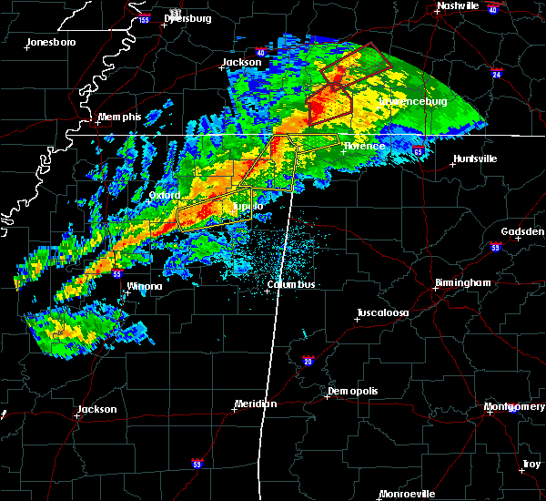 At 1044 pm cst, a severe thunderstorm was located near burnsville, or near j p coleman state park, moving east at 55 mph (radar indicated). Hazards include 60 mph wind gusts. expect damage to roofs, siding, and trees At 1044 pm cst, a severe thunderstorm was located near burnsville, or near j p coleman state park, moving east at 55 mph (radar indicated). Hazards include 60 mph wind gusts. expect damage to roofs, siding, and trees
|
| 11/1/2018 6:08 AM CDT |
 At 608 am cdt, severe thunderstorms were located along a line extending from walnut grove to 8 miles southeast of red bay, moving east at 50 mph (radar indicated). Hazards include 60 mph wind gusts. expect damage to roofs, siding, and trees At 608 am cdt, severe thunderstorms were located along a line extending from walnut grove to 8 miles southeast of red bay, moving east at 50 mph (radar indicated). Hazards include 60 mph wind gusts. expect damage to roofs, siding, and trees
|
| 11/1/2018 5:44 AM CDT |
 At 544 am cdt, severe thunderstorms were located along a line extending from pineflat to near tremont, moving east at 50 mph (radar indicated). Hazards include 60 mph wind gusts. expect damage to roofs, siding, and trees At 544 am cdt, severe thunderstorms were located along a line extending from pineflat to near tremont, moving east at 50 mph (radar indicated). Hazards include 60 mph wind gusts. expect damage to roofs, siding, and trees
|
| 6/23/2018 10:02 AM CDT |
 At 1001 am cdt, severe thunderstorms were located along a line extending from pineflat mississippi to 6 miles west of phil campbell, moving east at 30 mph (radar indicated). Hazards include 60 mph wind gusts. expect damage to roofs, siding, and trees At 1001 am cdt, severe thunderstorms were located along a line extending from pineflat mississippi to 6 miles west of phil campbell, moving east at 30 mph (radar indicated). Hazards include 60 mph wind gusts. expect damage to roofs, siding, and trees
|
| 6/21/2018 7:37 PM CDT |
 At 736 pm cdt, severe thunderstorms were located along a line extending from 10 miles northwest of underwood-petersville to near iuka, moving east at 40 mph (radar indicated). Hazards include 60 mph wind gusts. Expect damage to roofs, siding, and trees. Locations impacted include, florence, cherokee, underwood-petersville, waterloo, zip city, threet, mt hester, margerum, riverton and wright. At 736 pm cdt, severe thunderstorms were located along a line extending from 10 miles northwest of underwood-petersville to near iuka, moving east at 40 mph (radar indicated). Hazards include 60 mph wind gusts. Expect damage to roofs, siding, and trees. Locations impacted include, florence, cherokee, underwood-petersville, waterloo, zip city, threet, mt hester, margerum, riverton and wright.
|
| 6/21/2018 7:16 PM CDT |
 At 716 pm cdt, severe thunderstorms were located along a line extending from near walnut grove to leedy, moving east at 40 mph (radar indicated). Hazards include 60 mph wind gusts and penny size hail. expect damage to roofs, siding, and trees At 716 pm cdt, severe thunderstorms were located along a line extending from near walnut grove to leedy, moving east at 40 mph (radar indicated). Hazards include 60 mph wind gusts and penny size hail. expect damage to roofs, siding, and trees
|
| 4/14/2018 6:30 AM CDT |
 At 629 am cdt, severe thunderstorms were located along a line extending from near pineflat to near mantachie, moving north northeast at 25 mph (radar indicated). Hazards include 60 mph wind gusts and quarter size hail. Hail damage to vehicles is expected. Expect wind damage to roofs, siding, and trees. At 629 am cdt, severe thunderstorms were located along a line extending from near pineflat to near mantachie, moving north northeast at 25 mph (radar indicated). Hazards include 60 mph wind gusts and quarter size hail. Hail damage to vehicles is expected. Expect wind damage to roofs, siding, and trees.
|
| 4/3/2018 9:20 PM CDT | Lauderdale ema reports trees and utility lines down near waterloo. time est. by rada in lauderdale county AL, 0.5 miles SW of Waterloo, AL |
| 4/3/2018 9:14 PM CDT |
 At 914 pm cdt, severe thunderstorms were located along a line extending from near walnut grove to near tremont, moving east at 50 mph (radar indicated). Hazards include 60 mph wind gusts and penny size hail. Expect damage to roofs, siding, and trees. Locations impacted include, red bay, j p coleman state park, cherokee, belgreen, underwood-petersville, vina, hodges, waterloo, malone and posey loop. At 914 pm cdt, severe thunderstorms were located along a line extending from near walnut grove to near tremont, moving east at 50 mph (radar indicated). Hazards include 60 mph wind gusts and penny size hail. Expect damage to roofs, siding, and trees. Locations impacted include, red bay, j p coleman state park, cherokee, belgreen, underwood-petersville, vina, hodges, waterloo, malone and posey loop.
|
| 4/3/2018 8:54 PM CDT |
 At 851 pm cdt, severe thunderstorms were located along a line extending from near pickwick dam to near mantachie mississippi, moving east at 50 mph (radar indicated. at 820 pm cdt, there were reports of structural damage with this line of storms in new albany mississippi). Hazards include 60 mph wind gusts. expect damage to roofs, siding, and trees At 851 pm cdt, severe thunderstorms were located along a line extending from near pickwick dam to near mantachie mississippi, moving east at 50 mph (radar indicated. at 820 pm cdt, there were reports of structural damage with this line of storms in new albany mississippi). Hazards include 60 mph wind gusts. expect damage to roofs, siding, and trees
|
| 2/24/2018 11:19 PM CST |
 At 1117 pm cst, a severe thunderstorm was located 10 miles north of cherokee, or 13 miles east of j p coleman state park, moving northeast at 50 mph (radar indicated). Hazards include 60 mph wind gusts. Expect damage to roofs, siding, and trees. locations impacted include, florence, st. Florian, underwood-petersville, waterloo, zip city, threet, riverton, wright, eastport and oakland. At 1117 pm cst, a severe thunderstorm was located 10 miles north of cherokee, or 13 miles east of j p coleman state park, moving northeast at 50 mph (radar indicated). Hazards include 60 mph wind gusts. Expect damage to roofs, siding, and trees. locations impacted include, florence, st. Florian, underwood-petersville, waterloo, zip city, threet, riverton, wright, eastport and oakland.
|
| 2/24/2018 11:02 PM CST |
 At 1102 pm cst, a severe thunderstorm was located near iuka, moving northeast at 50 mph (radar indicated). Hazards include 60 mph wind gusts. expect damage to roofs, siding, and trees At 1102 pm cst, a severe thunderstorm was located near iuka, moving northeast at 50 mph (radar indicated). Hazards include 60 mph wind gusts. expect damage to roofs, siding, and trees
|
| 2/24/2018 10:50 PM CST |
 The severe thunderstorm warning for northwestern lauderdale and northwestern colbert counties will expire at 1100 pm cst, the storm which prompted the warning has weakened below severe limits, and no longer poses an immediate threat to life or property. therefore the warning will be allowed to expire. The severe thunderstorm warning for northwestern lauderdale and northwestern colbert counties will expire at 1100 pm cst, the storm which prompted the warning has weakened below severe limits, and no longer poses an immediate threat to life or property. therefore the warning will be allowed to expire.
|
| 2/24/2018 10:29 PM CST |
 At 1029 pm cst, a severe thunderstorm was located near burnsville, or near iuka, moving east at 55 mph (radar indicated). Hazards include 70 mph wind gusts. Expect considerable tree damage. Damage is likely to mobile homes, roofs, and outbuildings. At 1029 pm cst, a severe thunderstorm was located near burnsville, or near iuka, moving east at 55 mph (radar indicated). Hazards include 70 mph wind gusts. Expect considerable tree damage. Damage is likely to mobile homes, roofs, and outbuildings.
|
| 12/23/2017 5:01 AM CST |
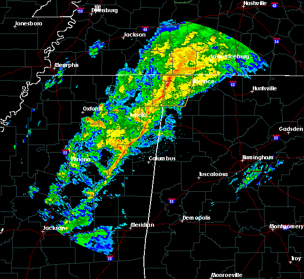 At 500 am cst, severe thunderstorms were located along a line extending from near walnut grove to near iuka to near tishomingo state park, moving east at 30 mph (radar indicated). Hazards include 60 to 70 mph wind gusts. expect damage to roofs, siding, and trees At 500 am cst, severe thunderstorms were located along a line extending from near walnut grove to near iuka to near tishomingo state park, moving east at 30 mph (radar indicated). Hazards include 60 to 70 mph wind gusts. expect damage to roofs, siding, and trees
|
| 11/18/2017 4:30 PM CST | Tree reported down along county road 14 and county road 87 in the waterloo are in lauderdale county AL, 9 miles W of Waterloo, AL |
| 7/3/2017 4:55 PM CDT |
 At 454 pm cdt, a cluster of severe thunderstorms was centered near iuka, moving northeast at 45 mph (radar indicated). Hazards include 60 mph wind gusts. expect damage to roofs, siding, and trees At 454 pm cdt, a cluster of severe thunderstorms was centered near iuka, moving northeast at 45 mph (radar indicated). Hazards include 60 mph wind gusts. expect damage to roofs, siding, and trees
|
| 5/28/2017 12:51 AM CDT |
 At 1250 am cdt, severe thunderstorms were located along a line extending from 8 miles northeast of cherokee to near sandy springs, moving southeast at 45 mph (radar indicated). Hazards include 70 mph wind gusts and quarter size hail. Hail damage to vehicles is expected. expect considerable tree damage. wind damage is also likely to mobile homes, roofs, and outbuildings. locations impacted include, florence, red bay, j p coleman state park, cherokee, st. Florian, underwood-petersville, waterloo, posey loop, oakland and barton. At 1250 am cdt, severe thunderstorms were located along a line extending from 8 miles northeast of cherokee to near sandy springs, moving southeast at 45 mph (radar indicated). Hazards include 70 mph wind gusts and quarter size hail. Hail damage to vehicles is expected. expect considerable tree damage. wind damage is also likely to mobile homes, roofs, and outbuildings. locations impacted include, florence, red bay, j p coleman state park, cherokee, st. Florian, underwood-petersville, waterloo, posey loop, oakland and barton.
|
| 5/28/2017 12:33 AM CDT |
 At 1232 am cdt, severe thunderstorms were located along a line extending from near walnut grove to near baldwyn, moving southeast at 45 mph (radar indicated). Hazards include 60 to 70 mph wind gusts and quarter size hail. Hail damage to vehicles is expected. expect considerable tree damage. Wind damage is also likely to mobile homes, roofs, and outbuildings. At 1232 am cdt, severe thunderstorms were located along a line extending from near walnut grove to near baldwyn, moving southeast at 45 mph (radar indicated). Hazards include 60 to 70 mph wind gusts and quarter size hail. Hail damage to vehicles is expected. expect considerable tree damage. Wind damage is also likely to mobile homes, roofs, and outbuildings.
|
| 3/27/2017 9:23 PM CDT |
 The severe thunderstorm warning for lauderdale and northern colbert counties will expire at 930 pm cdt, the storms which prompted the warning have moved out of the area. therefore, the warning will be allowed to expire. The severe thunderstorm warning for lauderdale and northern colbert counties will expire at 930 pm cdt, the storms which prompted the warning have moved out of the area. therefore, the warning will be allowed to expire.
|
| 3/27/2017 8:54 PM CDT |
 At 854 pm cdt, severe thunderstorms were located along a line extending from near lexington to near underwood-petersville to 9 miles north of cherokee, moving southeast at 15 mph (radar indicated). Hazards include 60 mph wind gusts and quarter size hail. Hail damage to vehicles is expected. expect wind damage to roofs, siding, and trees. locations impacted include, florence, rogersville, killen, lexington, st. Florian, underwood-petersville, anderson, waterloo, wright and riverton. At 854 pm cdt, severe thunderstorms were located along a line extending from near lexington to near underwood-petersville to 9 miles north of cherokee, moving southeast at 15 mph (radar indicated). Hazards include 60 mph wind gusts and quarter size hail. Hail damage to vehicles is expected. expect wind damage to roofs, siding, and trees. locations impacted include, florence, rogersville, killen, lexington, st. Florian, underwood-petersville, anderson, waterloo, wright and riverton.
|
| 3/27/2017 8:31 PM CDT |
 At 831 pm cdt, severe thunderstorms were located along a line extending from 6 miles southwest of loretto to 8 miles northwest of underwood-petersville to near j p coleman state park, moving southeast at 15 mph (radar indicated). Hazards include 60 mph wind gusts and quarter size hail. Hail damage to vehicles is expected. Expect wind damage to roofs, siding, and trees. At 831 pm cdt, severe thunderstorms were located along a line extending from 6 miles southwest of loretto to 8 miles northwest of underwood-petersville to near j p coleman state park, moving southeast at 15 mph (radar indicated). Hazards include 60 mph wind gusts and quarter size hail. Hail damage to vehicles is expected. Expect wind damage to roofs, siding, and trees.
|
| 3/10/2017 12:39 AM CST |
 The severe thunderstorm warning for northwestern madison, lauderdale, limestone, colbert and northern lawrence counties will expire at 1245 am cst, the storms which prompted the warning have weakened below severe limits, and no longer pose an immediate threat to life or property. therefore, the warning will be allowed to expire. a severe thunderstorm warning remains in effect for eastern madison county, al. a severe thunderstorm watch remains in effect until 400 am cst for north central, northeastern and northwestern alabama, and middle tennessee. The severe thunderstorm warning for northwestern madison, lauderdale, limestone, colbert and northern lawrence counties will expire at 1245 am cst, the storms which prompted the warning have weakened below severe limits, and no longer pose an immediate threat to life or property. therefore, the warning will be allowed to expire. a severe thunderstorm warning remains in effect for eastern madison county, al. a severe thunderstorm watch remains in effect until 400 am cst for north central, northeastern and northwestern alabama, and middle tennessee.
|
| 3/10/2017 12:00 AM CST |
 At 1159 pm cst, severe thunderstorms were located along a line extending from near tanner to near cherokee, moving south-southeast at 40 mph (radar indicated). Hazards include 60 mph wind gusts and quarter size hail. Hail damage to vehicles is expected. expect wind damage to roofs, siding, and trees. Locations impacted include, northwestern huntsville, madison, florence, athens, muscle shoals, sheffield, tuscumbia, j p coleman state park, meridianville and hazel green. At 1159 pm cst, severe thunderstorms were located along a line extending from near tanner to near cherokee, moving south-southeast at 40 mph (radar indicated). Hazards include 60 mph wind gusts and quarter size hail. Hail damage to vehicles is expected. expect wind damage to roofs, siding, and trees. Locations impacted include, northwestern huntsville, madison, florence, athens, muscle shoals, sheffield, tuscumbia, j p coleman state park, meridianville and hazel green.
|
| 3/9/2017 11:50 PM CST |
 At 1149 pm cst, severe thunderstorms were located along a line extending from near ardmore to 8 miles southeast of walnut grove, moving southwest at 85 mph (radar indicated). Hazards include 60 mph wind gusts and quarter size hail. Hail damage to vehicles is expected. Expect wind damage to roofs, siding, and trees. At 1149 pm cst, severe thunderstorms were located along a line extending from near ardmore to 8 miles southeast of walnut grove, moving southwest at 85 mph (radar indicated). Hazards include 60 mph wind gusts and quarter size hail. Hail damage to vehicles is expected. Expect wind damage to roofs, siding, and trees.
|
| 12/17/2016 11:43 PM CST | Trees down on power lines. time estimated from rada in lauderdale county AL, 6.3 miles SW of Waterloo, AL |
| 12/17/2016 11:38 PM CST | Trees down on power lines. time estimated from radar. time correcte in lauderdale county AL, 6.3 miles SW of Waterloo, AL |
| 12/17/2016 11:32 PM CST |
 At 1132 pm cst, a severe thunderstorm was located over j p coleman state park, moving east at 60 mph (radar indicated). Hazards include 70 mph wind gusts. Expect considerable tree damage. damage is likely to mobile homes, roofs, and outbuildings. locations impacted include, waterloo, eastport, wright and riverton. A tornado watch remains in effect until 300 am cst for northwestern alabama. At 1132 pm cst, a severe thunderstorm was located over j p coleman state park, moving east at 60 mph (radar indicated). Hazards include 70 mph wind gusts. Expect considerable tree damage. damage is likely to mobile homes, roofs, and outbuildings. locations impacted include, waterloo, eastport, wright and riverton. A tornado watch remains in effect until 300 am cst for northwestern alabama.
|
| 12/17/2016 11:27 PM CST |
 At 1127 pm cst, a severe thunderstorm capable of producing a tornado was located near midway, or near iuka, moving east at 45 mph (radar indicated rotation). Hazards include tornado. Flying debris will be dangerous to those caught without shelter. mobile homes will be damaged or destroyed. damage to roofs, windows, and vehicles will occur. tree damage is likely. this dangerous storm will be near, cherokee around 1150 pm cst. Other locations impacted by this tornadic thunderstorm include margerum, eastport, wright, threet and malone. At 1127 pm cst, a severe thunderstorm capable of producing a tornado was located near midway, or near iuka, moving east at 45 mph (radar indicated rotation). Hazards include tornado. Flying debris will be dangerous to those caught without shelter. mobile homes will be damaged or destroyed. damage to roofs, windows, and vehicles will occur. tree damage is likely. this dangerous storm will be near, cherokee around 1150 pm cst. Other locations impacted by this tornadic thunderstorm include margerum, eastport, wright, threet and malone.
|
| 12/17/2016 11:23 PM CST |
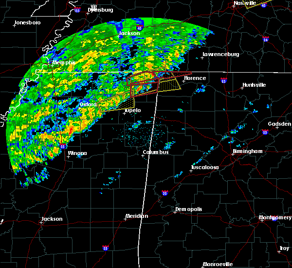 At 1123 pm cst, a severe thunderstorm capable of producing a tornado was located over j p coleman state park, moving east at 60 mph (radar indicated rotation). Hazards include tornado. Flying debris will be dangerous to those caught without shelter. mobile homes will be damaged or destroyed. damage to roofs, windows, and vehicles will occur. tree damage is likely. This tornadic thunderstorm will remain over mainly rural areas of northwestern lauderdale county, including the following locations: wright, zip city, threet, cloverdale and waterloo. At 1123 pm cst, a severe thunderstorm capable of producing a tornado was located over j p coleman state park, moving east at 60 mph (radar indicated rotation). Hazards include tornado. Flying debris will be dangerous to those caught without shelter. mobile homes will be damaged or destroyed. damage to roofs, windows, and vehicles will occur. tree damage is likely. This tornadic thunderstorm will remain over mainly rural areas of northwestern lauderdale county, including the following locations: wright, zip city, threet, cloverdale and waterloo.
|
| 12/17/2016 11:12 PM CST |
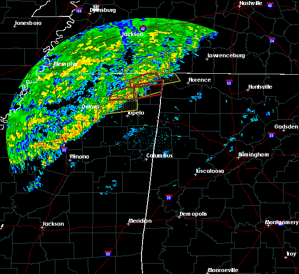 At 1111 pm cst, a severe thunderstorm was located near glen, or 8 miles south of corinth, moving northeast at 60 mph (radar indicated). Hazards include 70 mph wind gusts. Expect considerable tree damage. Damage is likely to mobile homes, roofs, and outbuildings. At 1111 pm cst, a severe thunderstorm was located near glen, or 8 miles south of corinth, moving northeast at 60 mph (radar indicated). Hazards include 70 mph wind gusts. Expect considerable tree damage. Damage is likely to mobile homes, roofs, and outbuildings.
|
| 8/26/2016 4:54 PM CDT |
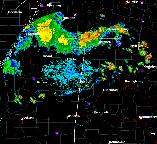 The severe thunderstorm warning for northwestern colbert and northwestern lauderdale counties will expire at 500 pm cdt, the strongest part of this storm which prompted the warning has exited the warned area. therefore, the warning has been cancelled. however gusty winds and frequent lightning are still possible with this thunderstorm. to report severe weather, contact your nearest law enforcement agency. they will relay your report to the national weather service huntsville alabama. The severe thunderstorm warning for northwestern colbert and northwestern lauderdale counties will expire at 500 pm cdt, the strongest part of this storm which prompted the warning has exited the warned area. therefore, the warning has been cancelled. however gusty winds and frequent lightning are still possible with this thunderstorm. to report severe weather, contact your nearest law enforcement agency. they will relay your report to the national weather service huntsville alabama.
|
| 8/26/2016 4:32 PM CDT |
 At 431 pm cdt, a severe thunderstorm was located 10 miles southeast of walnut grove, or 12 miles east of j p coleman state park, moving northwest at 25 mph (radar indicated). Hazards include 60 mph wind gusts. Expect damage to roofs. siding. And trees. At 431 pm cdt, a severe thunderstorm was located 10 miles southeast of walnut grove, or 12 miles east of j p coleman state park, moving northwest at 25 mph (radar indicated). Hazards include 60 mph wind gusts. Expect damage to roofs. siding. And trees.
|
| 8/26/2016 4:23 PM CDT |
 At 423 pm cdt, a severe thunderstorm was located 10 miles southeast of walnut grove, or 12 miles east of j p coleman state park, moving northwest at 25 mph (radar indicated). Hazards include 60 mph wind gusts. Expect damage to roofs. siding. and trees. Locations impacted include, florence, underwood-petersville, waterloo, eastport, wright, threet, riverton, cloverdale, pride landing and oakland. At 423 pm cdt, a severe thunderstorm was located 10 miles southeast of walnut grove, or 12 miles east of j p coleman state park, moving northwest at 25 mph (radar indicated). Hazards include 60 mph wind gusts. Expect damage to roofs. siding. and trees. Locations impacted include, florence, underwood-petersville, waterloo, eastport, wright, threet, riverton, cloverdale, pride landing and oakland.
|
| 8/26/2016 4:03 PM CDT |
 At 402 pm cdt, a severe thunderstorm was located 8 miles west of underwood-petersville, or 9 miles northwest of florence, moving northwest at 20 mph (radar indicated). Hazards include 60 mph wind gusts. Expect damage to roofs. siding. And trees. At 402 pm cdt, a severe thunderstorm was located 8 miles west of underwood-petersville, or 9 miles northwest of florence, moving northwest at 20 mph (radar indicated). Hazards include 60 mph wind gusts. Expect damage to roofs. siding. And trees.
|
| 8/4/2016 4:45 PM CDT |
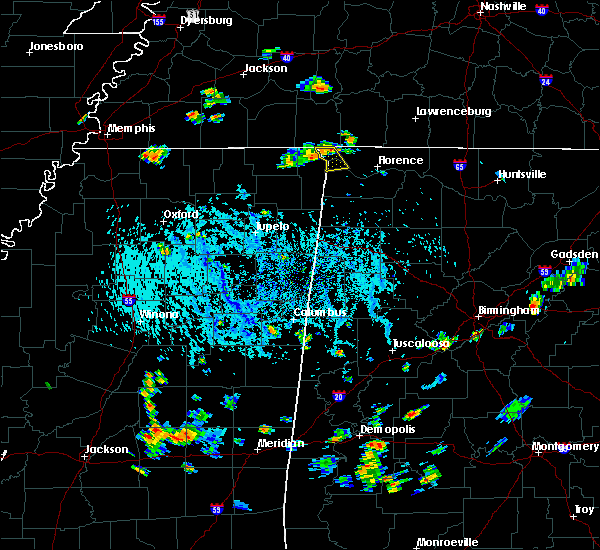 At 444 pm cdt, a severe thunderstorm was located over j p coleman state park, moving southeast at 15 mph (radar indicated). Hazards include 60 mph wind gusts and penny size hail. Expect damage to roofs. siding. and trees. Locations impacted include, waterloo, eastport, wright and riverton. At 444 pm cdt, a severe thunderstorm was located over j p coleman state park, moving southeast at 15 mph (radar indicated). Hazards include 60 mph wind gusts and penny size hail. Expect damage to roofs. siding. and trees. Locations impacted include, waterloo, eastport, wright and riverton.
|
| 8/4/2016 4:32 PM CDT |
 At 431 pm cdt, a severe thunderstorm was located near j p coleman state park, moving southeast at 15 mph (radar indicated). Hazards include 60 mph wind gusts. Expect damage to roofs. siding. And trees. At 431 pm cdt, a severe thunderstorm was located near j p coleman state park, moving southeast at 15 mph (radar indicated). Hazards include 60 mph wind gusts. Expect damage to roofs. siding. And trees.
|
| 7/30/2016 10:50 AM CDT | One large tree down at the intersection of county rd 40 and county rd in lauderdale county AL, 7.3 miles SW of Waterloo, AL |
| 6/3/2016 7:12 PM CDT | A few trees and powerlines reported down near 2390 county road 14 north of waterloo. time estimated by rada in lauderdale county AL, 5.3 miles S of Waterloo, AL |
| 6/3/2016 7:00 PM CDT | A couple of trees reported down along county road 14 in waterlo in lauderdale county AL, 0.5 miles SW of Waterloo, AL |
| 3/31/2016 4:57 PM CDT | The severe thunderstorm warning for northwestern lauderdale county will expire at 500 pm cdt, the storm which prompted the warning has moved into tennessee. therefore the warning will be allowed to expire at 5 pm. |
| 3/31/2016 4:42 PM CDT |
 At 441 pm cdt, a severe thunderstorm was located near walnut grove, or 3 miles northeast of waterloo, moving northeast at 50 mph (radar indicated). Hazards include 60 mph wind gusts and quarter size hail. Hail damage to vehicles is expected. expect wind damage to roofs, siding, and trees. Locations impacted include, waterloo, threet and wright. At 441 pm cdt, a severe thunderstorm was located near walnut grove, or 3 miles northeast of waterloo, moving northeast at 50 mph (radar indicated). Hazards include 60 mph wind gusts and quarter size hail. Hail damage to vehicles is expected. expect wind damage to roofs, siding, and trees. Locations impacted include, waterloo, threet and wright.
|
| 3/31/2016 4:28 PM CDT |
 At 427 pm cdt, a severe thunderstorm was located near j p coleman state park, moving east at 50 mph (radar indicated). Hazards include 60 mph wind gusts and half dollar size hail. Hail damage to vehicles is expected. Expect wind damage to roofs, siding, and trees. At 427 pm cdt, a severe thunderstorm was located near j p coleman state park, moving east at 50 mph (radar indicated). Hazards include 60 mph wind gusts and half dollar size hail. Hail damage to vehicles is expected. Expect wind damage to roofs, siding, and trees.
|
| 12/23/2015 7:00 PM CST | Small trees down along county road 54 between cr 14 and 21. time estimated from rada in lauderdale county AL, 3.2 miles S of Waterloo, AL |
| 12/23/2015 6:44 PM CST | At 643 pm cst, a severe thunderstorm capable of producing a tornado was located over burnsville, or 9 miles west of iuka, moving northeast at 50 mph (radar indicated rotation). Hazards include tornado. Flying debris will be dangerous to those caught without shelter. mobile homes will be damaged or destroyed. damage to roofs, windows and vehicles will occur. tree damage is likely. This tornadic thunderstorm will remain over mainly rural areas of northwestern lauderdale county, including the following locations, waterloo. |
| 6/19/2015 4:17 PM CDT |
 At 417 pm cdt, a severe thunderstorm was located near cherokee, or 9 miles east of iuka, moving northeast at 30 mph (radar indicated). Hazards include 60 mph wind gusts. Expect damage to roofs. Siding and trees. At 417 pm cdt, a severe thunderstorm was located near cherokee, or 9 miles east of iuka, moving northeast at 30 mph (radar indicated). Hazards include 60 mph wind gusts. Expect damage to roofs. Siding and trees.
|
| 3/31/2015 9:04 PM CDT | A severe thunderstorm warning remains in effect until 930 pm cdt for colbert and southwestern lauderdale counties. at 857 pm cdt. trained weather spotters reported a severe thunderstorm producing quarter size hail near tuscumbia. this storm was moving southeast at 25 mph. Locations impacted include. |
| 3/31/2015 7:41 PM CST | Quarter sized hail reported 2.5 miles NNE of Waterloo, AL, quarter sized hail covering the ground in riverton. |
| 3/31/2015 8:41 PM CDT | The national weather service in huntsville has issued a * severe thunderstorm warning for. colbert county in northwestern alabama. southwestern lauderdale county in northwestern alabama. until 930 pm cdt * at 839 pm cdt. Doppler radar indicated a severe thunderstorm. |
| 3/31/2015 7:08 PM CST | Golf Ball sized hail reported 0.5 miles SW of Waterloo, AL, golf ball sized hail reported in waterloo. relayed through twitter via broadcast media. |
| 3/31/2015 7:57 PM CDT | The national weather service in huntsville has issued a * severe thunderstorm warning for. northwestern colbert county in northwestern alabama. western lauderdale county in northwestern alabama. until 845 pm cdt * at 755 pm cdt. Doppler radar indicated a severe thunderstorm. |
| 3/31/2015 7:25 PM CDT | A severe thunderstorm warning remains in effect until 800 pm cdt for northwestern colbert and western lauderdale counties. at 724 pm cdt. trained weather spotters reported a severe thunderstorm producing golf ball size in waterloo. damaging winds in excess of 60 mph is also likely with this storm. this storm was located 8 miles east of j p coleman state park. Moving southeast at. |
| 3/31/2015 6:23 PM CST | Golf Ball sized hail reported 0.5 miles SW of Waterloo, AL, golf ball sized hail on main street. |
| 3/31/2015 7:12 PM CDT | The national weather service in huntsville has issued a * severe thunderstorm warning for. northwestern colbert county in northwestern alabama. western lauderdale county in northwestern alabama. until 800 pm cdt * at 712 pm cdt. Doppler radar indicated a severe thunderstorm. |
| 3/31/2015 7:00 PM CDT | A severe thunderstorm warning remains in effect until 715 pm cdt for northwestern colbert and northwestern lauderdale counties. at 659 pm cdt. doppler radar indicated a severe thunderstorm capable of producing quarter size hail and damaging winds in excess of 60 mph. this storm was located near walnut grove. or near j p coleman state park. Moving east at 15 mph. |
| 3/31/2015 6:42 PM CDT | A severe thunderstorm warning remains in effect until 715 pm cdt for northwestern colbert and northwestern lauderdale counties. at 642 pm cdt. doppler radar indicated a severe thunderstorm capable of producing quarter size hail. this storm was located near j p coleman state park. moving east at 20 mph. Locations impacted include. |
| 3/31/2015 6:26 PM CDT | The national weather service in huntsville has issued a * severe thunderstorm warning for. northwestern colbert county in northwestern alabama. northwestern lauderdale county in northwestern alabama. until 715 pm cdt * at 625 pm cdt. Doppler radar indicated a severe thunderstorm. |
| 3/31/2015 6:00 PM CDT | The national weather service in huntsville has issued a * severe thunderstorm warning for. northwestern colbert county in northwestern alabama. northwestern lauderdale county in northwestern alabama. until 630 pm cdt * at 559 pm cdt. Doppler radar indicated a severe thunderstorm. |
| 3/31/2015 6:12 AM CST | Quarter sized hail reported 0.5 miles SW of Waterloo, AL, quarter sized hail on nw side of waterloo. |
| 6/9/2014 8:25 PM CDT | Several trees were downed by thunderstorm wind in lauderdale county AL, 2.1 miles WSW of Waterloo, AL |
| 6/9/2014 8:20 PM CDT | Thunderstorm winds downed a tre in colbert county AL, 4.5 miles N of Waterloo, AL |
| 6/7/2014 6:42 PM CDT | Powerlines were reported dow in colbert county AL, 4.4 miles N of Waterloo, AL |
| 6/7/2014 6:42 PM CDT | Travel trailer was blown ove in colbert county AL, 4.5 miles N of Waterloo, AL |
| 12/21/2013 9:34 PM CST | Multiple trees reported down approaching waterloo on the westbound lan in lauderdale county AL, 0.5 miles SW of Waterloo, AL |
| 12/21/2013 8:58 PM CST | Cwop station dw9506 reported a wind gust to 63 mp in lauderdale county AL, 4.4 miles WSW of Waterloo, AL |
| 12/21/2013 8:55 PM CST | Tree reported down on riverton rose trai in colbert county AL, 5.1 miles N of Waterloo, AL |
| 7/18/2012 4:40 PM CDT | Several trees down in ne tishimingo county near jp coleman state park in tishomingo county MS, 6 miles E of Waterloo, AL |
| 6/11/2012 5:53 PM CDT | A tree was blown down onto a house on riverton rose trail. no injuries reporte in lauderdale county AL, 1.8 miles S of Waterloo, AL |
| 6/11/2012 5:37 PM CDT | Trees and powerlines were reported blown down on the riverton rose trai in colbert county AL, 3.3 miles NNE of Waterloo, AL |
| 1/1/0001 12:00 AM | Quarter sized hail reported 4.3 miles W of Waterloo, AL, dime to quarter hail at the intersection of county roads 8 and 14...east of waterloo. |
| 1/1/0001 12:00 AM | 2 trees down in lauderdale county AL, 0.5 miles SW of Waterloo, AL |
| 1/1/0001 12:00 AM | Trees were knocked down onto river rose trail. time and location estimate in colbert county AL, 5.8 miles N of Waterloo, AL |
| 1/1/0001 12:00 AM | Trees and powerlines dow in lauderdale county AL, 0.9 miles WNW of Waterloo, AL |
Hail Maps for Waterloo, AL


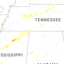


Connect with Interactive Hail Maps