

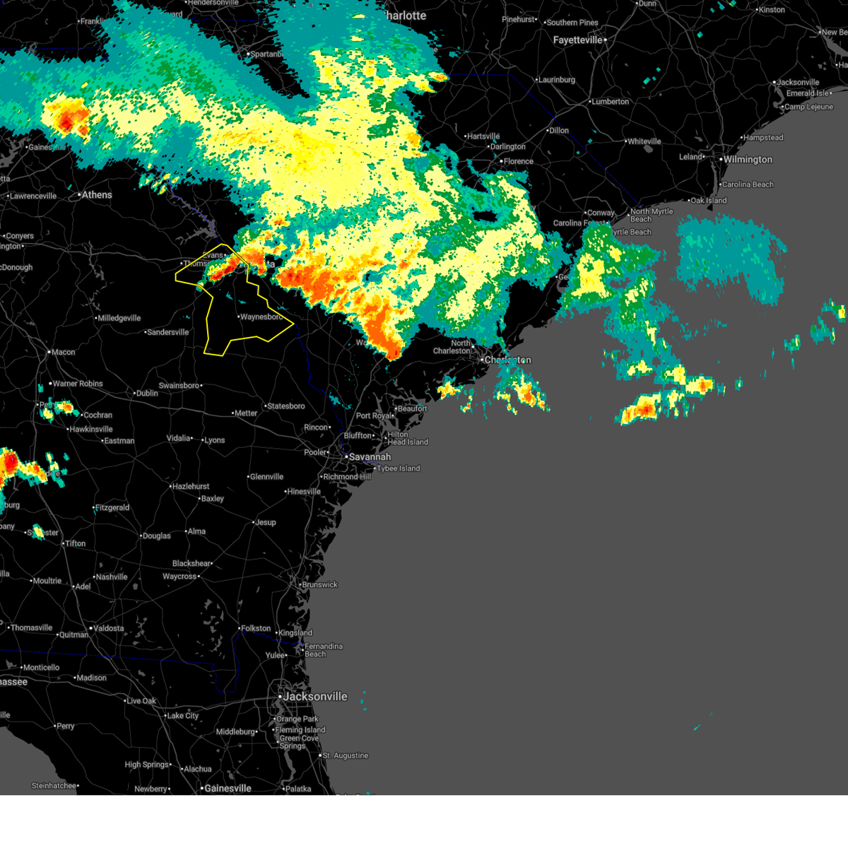
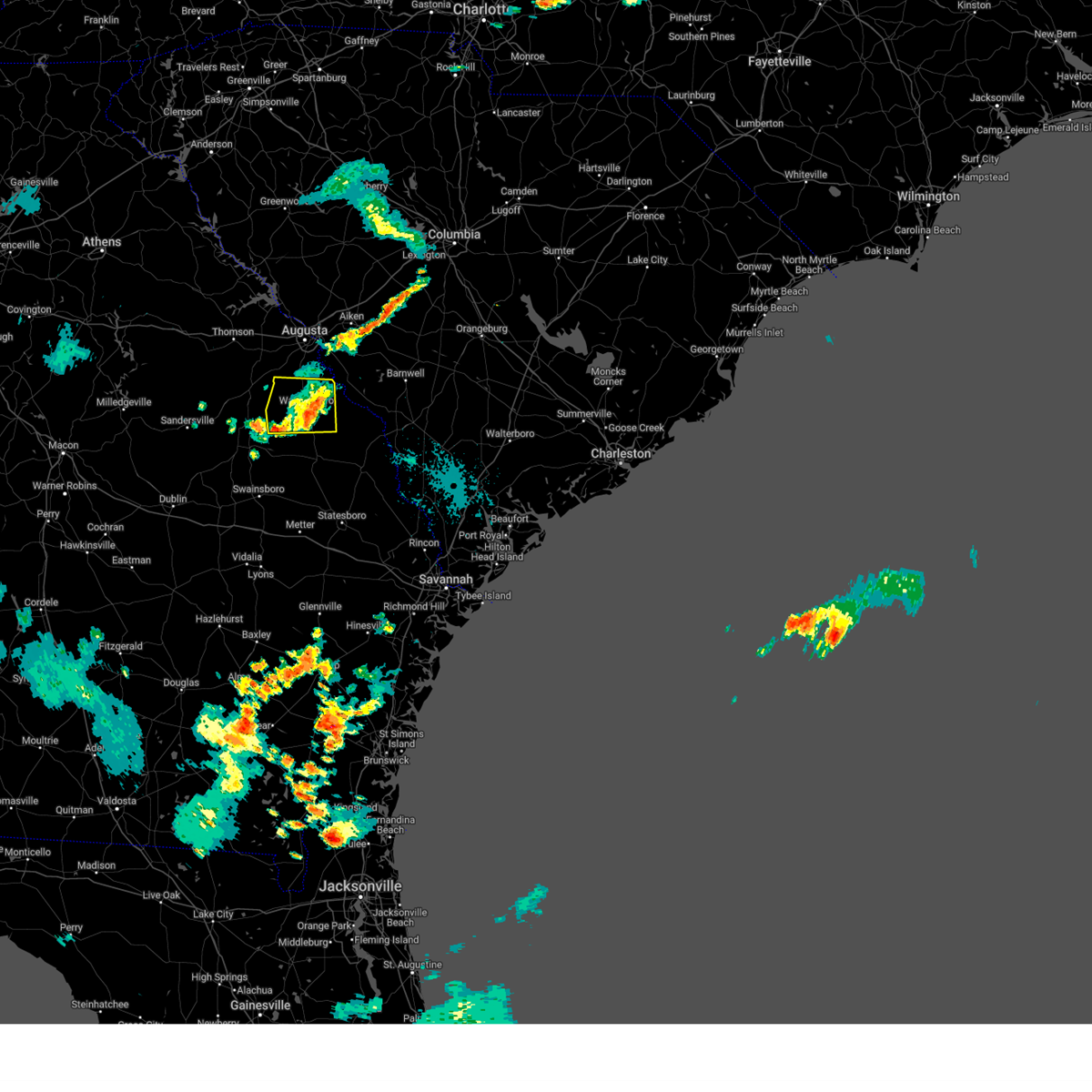
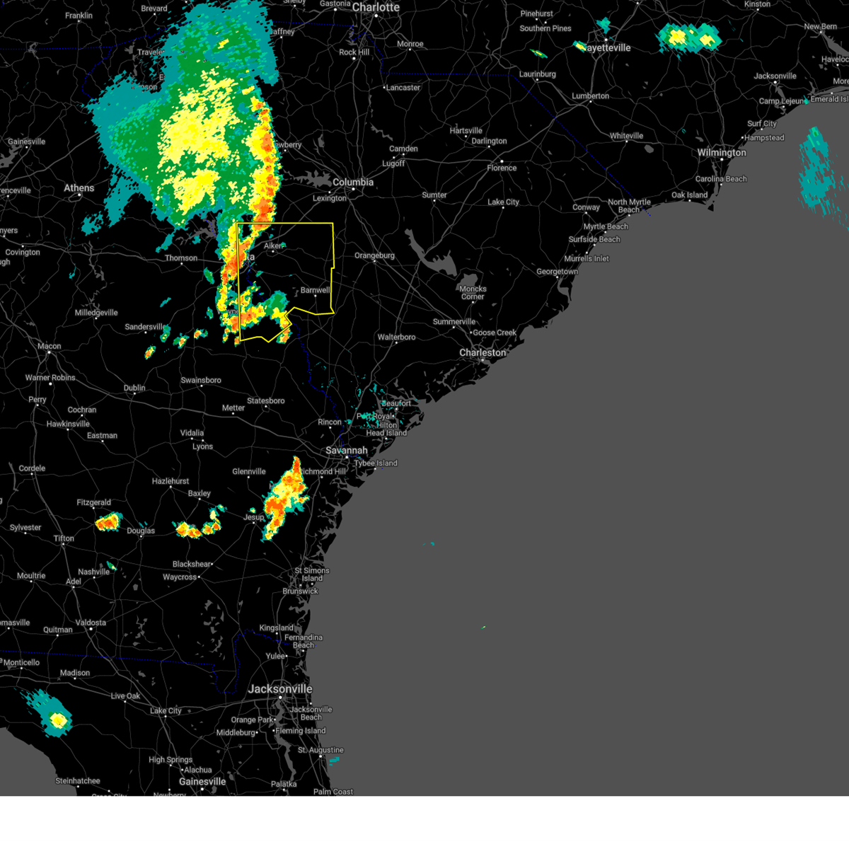
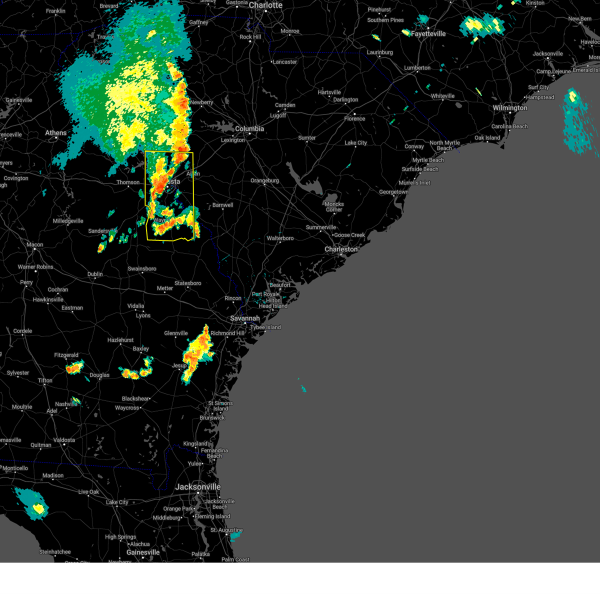
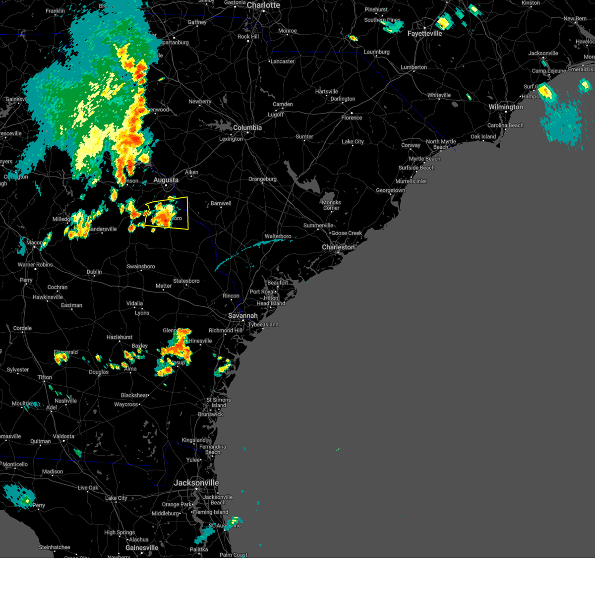
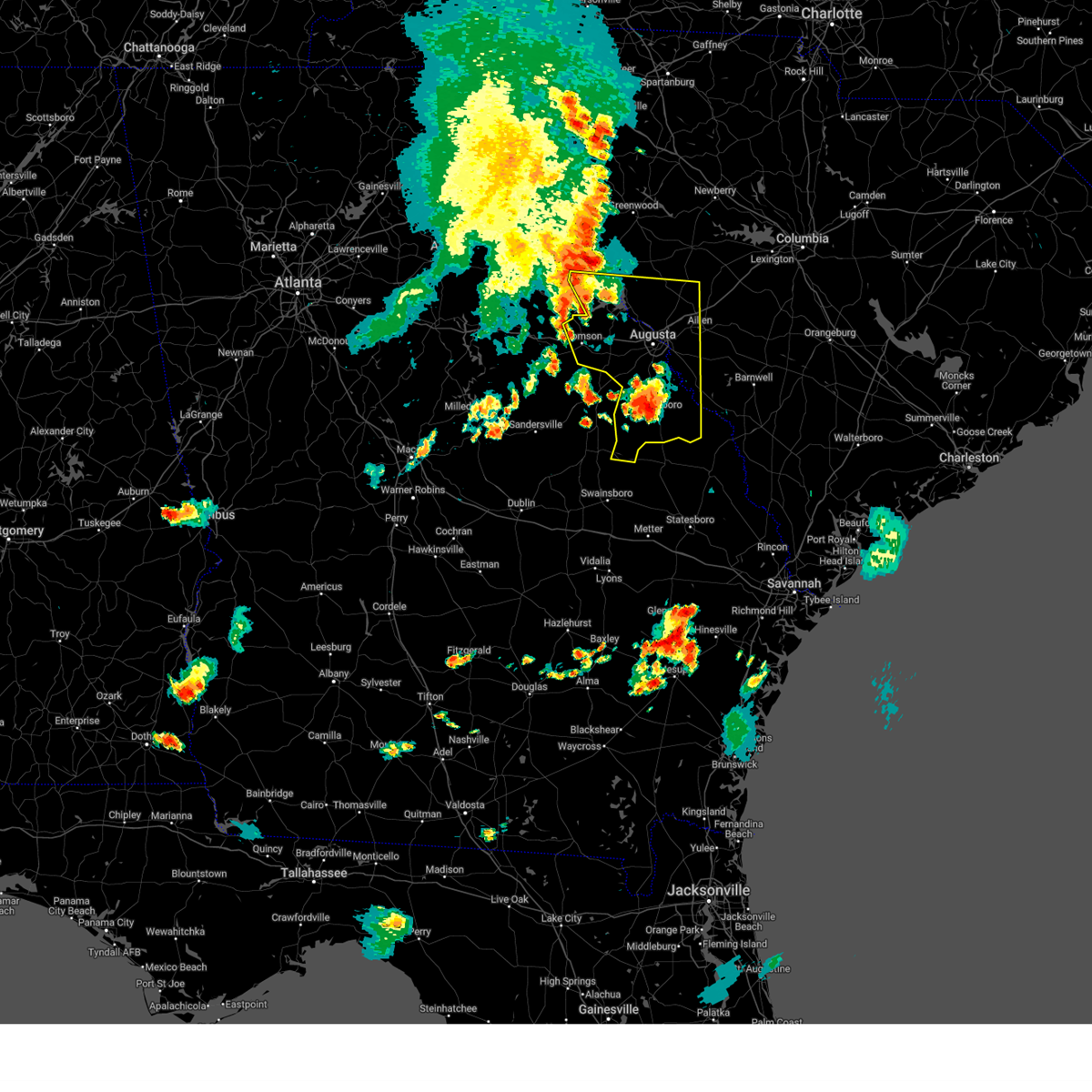
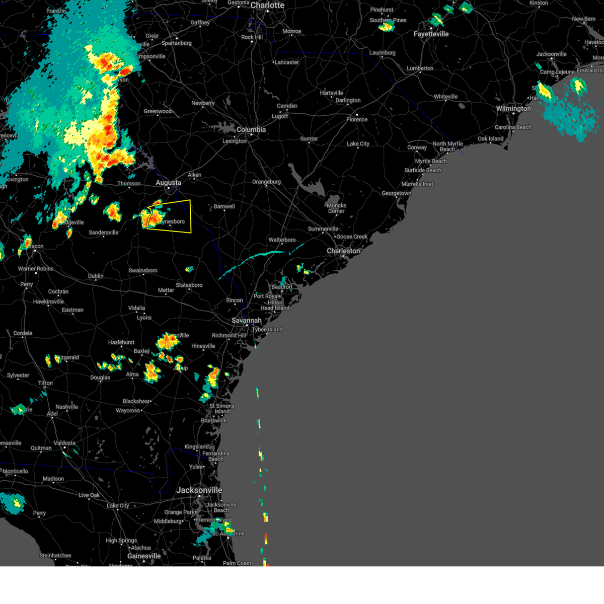
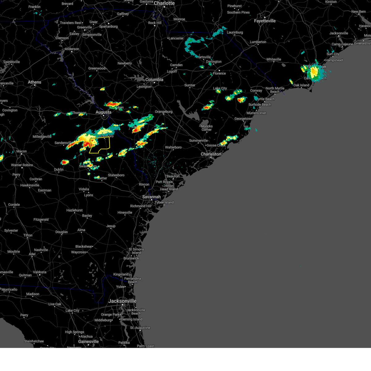
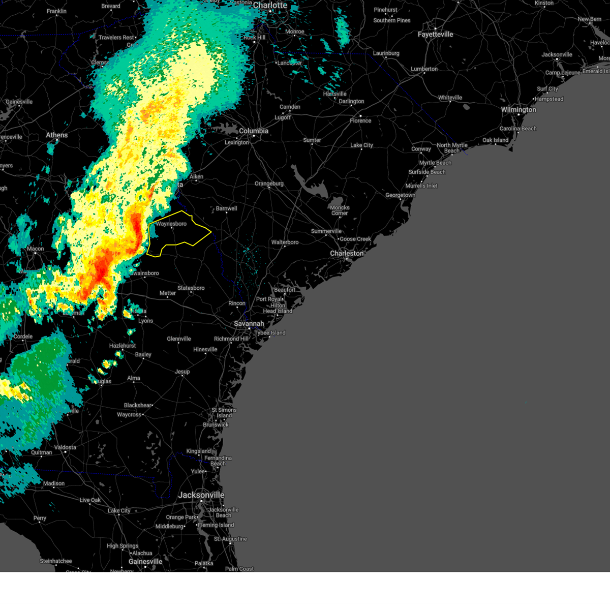
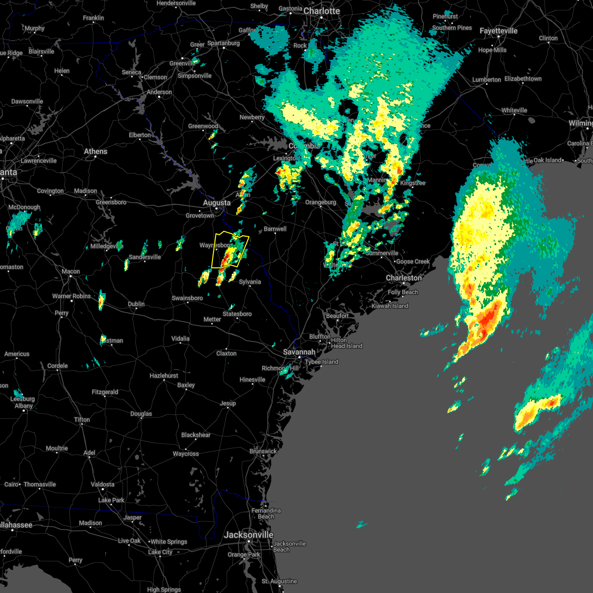
Hail Map for Waynesboro, GA
The Waynesboro, GA area has had 8 reports of on-the-ground hail by trained spotters, and has been under severe weather warnings 29 times during the past 12 months. Doppler radar has detected hail at or near Waynesboro, GA on 43 occasions, including 1 occasion during the past year.
| Name: | Waynesboro, GA |
| Where Located: | 26.6 miles S of Augusta, GA |
| Map: | Google Map for Waynesboro, GA |
| Population: | 5766 |
| Housing Units: | 2317 |
| More Info: | Search Google for Waynesboro, GA |
0
The Top Recent Hail Date for Waynesboro, GA is Wednesday, April 23, 2025 (42nd out of 43)

Hail and Wind Damage Spotted near Waynesboro, GA
| Date / Time | Report Details |
|---|---|
| 6/25/2025 10:09 PM EDT |
 Svrcae the national weather service in columbia has issued a * severe thunderstorm warning for, southeastern mcduffie county in east central georgia, central columbia county in east central georgia, burke county in east central georgia, richmond county in east central georgia, * until 1115 pm edt. * at 1009 pm edt, severe thunderstorms were located along a line extending from near ulmer to fort eisenhower, moving southwest at 55 mph (radar indicated). Hazards include 60 mph wind gusts and quarter size hail. Hail damage to vehicles is expected. Expect wind damage to trees and powerlines. Svrcae the national weather service in columbia has issued a * severe thunderstorm warning for, southeastern mcduffie county in east central georgia, central columbia county in east central georgia, burke county in east central georgia, richmond county in east central georgia, * until 1115 pm edt. * at 1009 pm edt, severe thunderstorms were located along a line extending from near ulmer to fort eisenhower, moving southwest at 55 mph (radar indicated). Hazards include 60 mph wind gusts and quarter size hail. Hail damage to vehicles is expected. Expect wind damage to trees and powerlines.
|
| 6/10/2025 9:24 PM EDT |
 The storm which prompted the warning has weakened below severe limits, and no longer poses an immediate threat to life or property. therefore, the warning will be allowed to expire. to report severe weather, contact your nearest law enforcement agency. they will relay your report to the national weather service columbia. The storm which prompted the warning has weakened below severe limits, and no longer poses an immediate threat to life or property. therefore, the warning will be allowed to expire. to report severe weather, contact your nearest law enforcement agency. they will relay your report to the national weather service columbia.
|
| 6/10/2025 9:11 PM EDT |
 At 911 pm edt, a severe thunderstorm was located over waynesboro, moving east at 30 mph (radar indicated). Hazards include 60 mph wind gusts. Expect damage to trees and powerlines. Locations impacted include, waynesboro, hephzibah, gough, alexander, burke county airport, keysville, vidette, shell bluff, di- lane wildlife management area, and rosier. At 911 pm edt, a severe thunderstorm was located over waynesboro, moving east at 30 mph (radar indicated). Hazards include 60 mph wind gusts. Expect damage to trees and powerlines. Locations impacted include, waynesboro, hephzibah, gough, alexander, burke county airport, keysville, vidette, shell bluff, di- lane wildlife management area, and rosier.
|
| 6/10/2025 9:03 PM EDT | Burke county dispatch reported a tree down along herndon rd. time estimated based on rada in burke county GA, 6.3 miles NNE of Waynesboro, GA |
| 6/10/2025 8:57 PM EDT | Burke county dispatch reported powerlines down at 1071 hwy 80 in burke county. time estimated based on rada in burke county GA, 3.4 miles E of Waynesboro, GA |
| 6/10/2025 8:41 PM EDT |
 Svrcae the national weather service in columbia has issued a * severe thunderstorm warning for, burke county in east central georgia, southern richmond county in east central georgia, * until 930 pm edt. * at 839 pm edt, a severe thunderstorm was located 7 miles west of hephzibah, or 12 miles southwest of fort eisenhower, moving east at 20 mph (radar indicated). Hazards include 60 mph wind gusts and penny size hail. expect damage to trees and powerlines Svrcae the national weather service in columbia has issued a * severe thunderstorm warning for, burke county in east central georgia, southern richmond county in east central georgia, * until 930 pm edt. * at 839 pm edt, a severe thunderstorm was located 7 miles west of hephzibah, or 12 miles southwest of fort eisenhower, moving east at 20 mph (radar indicated). Hazards include 60 mph wind gusts and penny size hail. expect damage to trees and powerlines
|
| 6/7/2025 8:36 PM EDT |
 Svrcae the national weather service in columbia has issued a * severe thunderstorm warning for, central burke county in east central georgia, eastern richmond county in east central georgia, southeastern edgefield county in central south carolina, barnwell county in central south carolina, south central lexington county in central south carolina, aiken county in central south carolina, western orangeburg county in central south carolina, * until 915 pm edt. * at 836 pm edt, severe thunderstorms were located along a line extending from near edgefield to alexander, moving east at 45 mph (radar indicated). Hazards include 60 mph wind gusts and penny size hail. expect damage to trees and powerlines Svrcae the national weather service in columbia has issued a * severe thunderstorm warning for, central burke county in east central georgia, eastern richmond county in east central georgia, southeastern edgefield county in central south carolina, barnwell county in central south carolina, south central lexington county in central south carolina, aiken county in central south carolina, western orangeburg county in central south carolina, * until 915 pm edt. * at 836 pm edt, severe thunderstorms were located along a line extending from near edgefield to alexander, moving east at 45 mph (radar indicated). Hazards include 60 mph wind gusts and penny size hail. expect damage to trees and powerlines
|
| 6/7/2025 8:26 PM EDT |
 the severe thunderstorm warning has been cancelled and is no longer in effect the severe thunderstorm warning has been cancelled and is no longer in effect
|
| 6/7/2025 8:26 PM EDT |
 At 825 pm edt, severe thunderstorms were located along a line extending from near hamilton branch state park to near gough, moving east at 40 mph (radar indicated). Hazards include 60 mph wind gusts. Expect damage to trees and powerlines. locations impacted include, aiken, north augusta, grovetown, evans, waynesboro, fort eisenhower, augusta, clearwater, martinez, plant vogtle, belvedere, edgefield, hephzibah, jackson, sardis, glendale, gough, south augusta, clarks hill recreation area, and edgefield county airport. this includes the following highways, interstate 20 in georgia between mile markers 184 and 201. interstate 20 in south carolina between mile markers 0 and 19. interstate 520 in georgia between mile markers 1 and 15. Interstate 520 in south carolina between mile markers 16 and 23. At 825 pm edt, severe thunderstorms were located along a line extending from near hamilton branch state park to near gough, moving east at 40 mph (radar indicated). Hazards include 60 mph wind gusts. Expect damage to trees and powerlines. locations impacted include, aiken, north augusta, grovetown, evans, waynesboro, fort eisenhower, augusta, clearwater, martinez, plant vogtle, belvedere, edgefield, hephzibah, jackson, sardis, glendale, gough, south augusta, clarks hill recreation area, and edgefield county airport. this includes the following highways, interstate 20 in georgia between mile markers 184 and 201. interstate 20 in south carolina between mile markers 0 and 19. interstate 520 in georgia between mile markers 1 and 15. Interstate 520 in south carolina between mile markers 16 and 23.
|
| 6/7/2025 7:58 PM EDT |
 The storm which prompted the warning is still within the area, and therefore, a new severe thunderstorm warning has been issued until 845pm! additional severe thunderstorms are expected to move in during this time as well. a severe thunderstorm watch remains in effect until midnight edt for east central georgia, and central south carolina. to report severe weather, contact your nearest law enforcement agency. they will relay your report to the national weather service columbia. The storm which prompted the warning is still within the area, and therefore, a new severe thunderstorm warning has been issued until 845pm! additional severe thunderstorms are expected to move in during this time as well. a severe thunderstorm watch remains in effect until midnight edt for east central georgia, and central south carolina. to report severe weather, contact your nearest law enforcement agency. they will relay your report to the national weather service columbia.
|
| 6/7/2025 7:53 PM EDT | Burke county dispatch reported a tree down blocking both lanes at thompson bridge rd and hwy 24. time estimated based on rada in burke county GA, 5.2 miles NW of Waynesboro, GA |
| 6/7/2025 7:53 PM EDT |
 Svrcae the national weather service in columbia has issued a * severe thunderstorm warning for, mcduffie county in east central georgia, columbia county in east central georgia, lincoln county in east central georgia, burke county in east central georgia, richmond county in east central georgia, edgefield county in central south carolina, southwestern barnwell county in central south carolina, western aiken county in central south carolina, southeastern mccormick county in central south carolina, * until 845 pm edt. * at 753 pm edt, severe thunderstorms were located along a line extending from lincolnton to near louisville, moving east at 40 mph (radar indicated). Hazards include 60 mph wind gusts. expect damage to trees and powerlines Svrcae the national weather service in columbia has issued a * severe thunderstorm warning for, mcduffie county in east central georgia, columbia county in east central georgia, lincoln county in east central georgia, burke county in east central georgia, richmond county in east central georgia, edgefield county in central south carolina, southwestern barnwell county in central south carolina, western aiken county in central south carolina, southeastern mccormick county in central south carolina, * until 845 pm edt. * at 753 pm edt, severe thunderstorms were located along a line extending from lincolnton to near louisville, moving east at 40 mph (radar indicated). Hazards include 60 mph wind gusts. expect damage to trees and powerlines
|
| 6/7/2025 7:36 PM EDT |
 At 735 pm edt, a severe thunderstorm was located 7 miles northeast of gough, or 7 miles northwest of waynesboro, moving east at 25 mph (radar indicated). Hazards include 60 mph wind gusts and quarter size hail. Hail damage to vehicles is expected. expect wind damage to trees and powerlines. Locations impacted include, waynesboro, plant vogtle, hephzibah, jackson, burke county airport, mcbean, gough, blythe, keysville, audubon's silver bluff sanctuary, pea patch aerodrome, bennock mill, shell bluff landing, shell bluff, and ellwood. At 735 pm edt, a severe thunderstorm was located 7 miles northeast of gough, or 7 miles northwest of waynesboro, moving east at 25 mph (radar indicated). Hazards include 60 mph wind gusts and quarter size hail. Hail damage to vehicles is expected. expect wind damage to trees and powerlines. Locations impacted include, waynesboro, plant vogtle, hephzibah, jackson, burke county airport, mcbean, gough, blythe, keysville, audubon's silver bluff sanctuary, pea patch aerodrome, bennock mill, shell bluff landing, shell bluff, and ellwood.
|
| 6/7/2025 7:17 PM EDT |
 Svrcae the national weather service in columbia has issued a * severe thunderstorm warning for, northwestern burke county in east central georgia, southeastern richmond county in east central georgia, southwestern aiken county in central south carolina, * until 800 pm edt. * at 716 pm edt, a severe thunderstorm was located near gough, or 13 miles northwest of waynesboro, moving east at 25 mph (radar indicated). Hazards include 60 mph wind gusts. expect damage to trees and powerlines Svrcae the national weather service in columbia has issued a * severe thunderstorm warning for, northwestern burke county in east central georgia, southeastern richmond county in east central georgia, southwestern aiken county in central south carolina, * until 800 pm edt. * at 716 pm edt, a severe thunderstorm was located near gough, or 13 miles northwest of waynesboro, moving east at 25 mph (radar indicated). Hazards include 60 mph wind gusts. expect damage to trees and powerlines
|
| 4/23/2025 2:57 PM EDT | Burke county dispatch reports tree down over the road in the 2500 block of porter carswell r in burke county GA, 5.9 miles N of Waynesboro, GA |
| 4/23/2025 2:43 PM EDT |
 The storm which prompted the warning has moved out of the area. therefore, the warning will be allowed to expire. the warning has been reissued for this storm! remember, a severe thunderstorm warning still remains in effect for southern burke county until 330pm!. The storm which prompted the warning has moved out of the area. therefore, the warning will be allowed to expire. the warning has been reissued for this storm! remember, a severe thunderstorm warning still remains in effect for southern burke county until 330pm!.
|
| 4/23/2025 2:42 PM EDT |
 Svrcae the national weather service in columbia has issued a * severe thunderstorm warning for, southwestern burke county in east central georgia, * until 330 pm edt. * at 242 pm edt, a severe thunderstorm was located 9 miles southwest of burke county airport, or 11 miles southwest of waynesboro, moving east at 15 mph (radar indicated). Hazards include 60 mph wind gusts and quarter size hail. Hail damage to vehicles is expected. Expect wind damage to trees and powerlines. Svrcae the national weather service in columbia has issued a * severe thunderstorm warning for, southwestern burke county in east central georgia, * until 330 pm edt. * at 242 pm edt, a severe thunderstorm was located 9 miles southwest of burke county airport, or 11 miles southwest of waynesboro, moving east at 15 mph (radar indicated). Hazards include 60 mph wind gusts and quarter size hail. Hail damage to vehicles is expected. Expect wind damage to trees and powerlines.
|
| 4/23/2025 2:29 PM EDT | Burke county dispatch reported tree down on rosier rd in between highways 305 and 5 in burke county GA, 13.5 miles NE of Waynesboro, GA |
| 4/23/2025 2:19 PM EDT |
 At 218 pm edt, a severe thunderstorm was located 8 miles south of gough, or 10 miles east of louisville, moving east at 10 mph (radar indicated). Hazards include 60 mph wind gusts and quarter size hail. Hail damage to vehicles is expected. expect wind damage to trees and powerlines. Locations impacted include, di-lane wildlife management area, gough, vidette, burke county airport, waynesboro, magruder, and rosier. At 218 pm edt, a severe thunderstorm was located 8 miles south of gough, or 10 miles east of louisville, moving east at 10 mph (radar indicated). Hazards include 60 mph wind gusts and quarter size hail. Hail damage to vehicles is expected. expect wind damage to trees and powerlines. Locations impacted include, di-lane wildlife management area, gough, vidette, burke county airport, waynesboro, magruder, and rosier.
|
| 4/23/2025 2:02 PM EDT |
 Svrcae the national weather service in columbia has issued a * severe thunderstorm warning for, southwestern burke county in east central georgia, * until 245 pm edt. * at 202 pm edt, a severe thunderstorm was located 7 miles south of gough, or 8 miles east of louisville, moving east at 15 mph (radar indicated). Hazards include 60 mph wind gusts and quarter size hail. Hail damage to vehicles is expected. Expect wind damage to trees and powerlines. Svrcae the national weather service in columbia has issued a * severe thunderstorm warning for, southwestern burke county in east central georgia, * until 245 pm edt. * at 202 pm edt, a severe thunderstorm was located 7 miles south of gough, or 8 miles east of louisville, moving east at 15 mph (radar indicated). Hazards include 60 mph wind gusts and quarter size hail. Hail damage to vehicles is expected. Expect wind damage to trees and powerlines.
|
| 3/31/2025 4:23 PM EDT |
 the severe thunderstorm warning has been cancelled and is no longer in effect the severe thunderstorm warning has been cancelled and is no longer in effect
|
| 3/31/2025 4:23 PM EDT |
 At 423 pm edt, severe thunderstorms were located along a line extending from near savannah river site to near sardis, moving east at 30 mph (radar indicated). Hazards include 60 mph wind gusts and nickel size hail. Expect damage to trees and powerlines. Locations impacted include, savannah river site, alexander, plant vogtle, sardis, girard, burke county airport, new ellenton, savannah river site badge office, jackson, kline, savannah river site h canyon, savannah river site k complex, shell bluff, shell bluff landing, snelling, waynesboro, and aiken. At 423 pm edt, severe thunderstorms were located along a line extending from near savannah river site to near sardis, moving east at 30 mph (radar indicated). Hazards include 60 mph wind gusts and nickel size hail. Expect damage to trees and powerlines. Locations impacted include, savannah river site, alexander, plant vogtle, sardis, girard, burke county airport, new ellenton, savannah river site badge office, jackson, kline, savannah river site h canyon, savannah river site k complex, shell bluff, shell bluff landing, snelling, waynesboro, and aiken.
|
| 3/31/2025 4:11 PM EDT |
 At 411 pm edt, severe thunderstorms were located along a line extending from near jackson to alexander, moving east at 50 mph (radar indicated). Hazards include 60 mph wind gusts and nickel size hail. Expect damage to trees and powerlines. Locations impacted include, savannah river site, alexander, plant vogtle, sardis, audubon's silver bluff sanctuary, girard, burke county airport, new ellenton, savannah river site badge office, jackson, waynesboro, kline, savannah river site h canyon, bennock mill, savannah river site k complex, shell bluff, shell bluff landing, snelling, boyd pond park, and gloverville. At 411 pm edt, severe thunderstorms were located along a line extending from near jackson to alexander, moving east at 50 mph (radar indicated). Hazards include 60 mph wind gusts and nickel size hail. Expect damage to trees and powerlines. Locations impacted include, savannah river site, alexander, plant vogtle, sardis, audubon's silver bluff sanctuary, girard, burke county airport, new ellenton, savannah river site badge office, jackson, waynesboro, kline, savannah river site h canyon, bennock mill, savannah river site k complex, shell bluff, shell bluff landing, snelling, boyd pond park, and gloverville.
|
| 3/31/2025 4:05 PM EDT | Dispatch reports a tree down at porter carswell rd and drake rd. time estimated based on rada in burke county GA, 10 miles N of Waynesboro, GA |
| 3/31/2025 3:27 PM EDT |
 Svrcae the national weather service in columbia has issued a * severe thunderstorm warning for, burke county in east central georgia, southeastern richmond county in east central georgia, southwestern barnwell county in central south carolina, southwestern aiken county in central south carolina, * until 430 pm edt. * at 327 pm edt, severe thunderstorms were located along a line extending from 6 miles southwest of hephzibah to near perkins, moving east at 30 mph (radar indicated). Hazards include 60 mph wind gusts and nickel size hail. expect damage to trees and powerlines Svrcae the national weather service in columbia has issued a * severe thunderstorm warning for, burke county in east central georgia, southeastern richmond county in east central georgia, southwestern barnwell county in central south carolina, southwestern aiken county in central south carolina, * until 430 pm edt. * at 327 pm edt, severe thunderstorms were located along a line extending from 6 miles southwest of hephzibah to near perkins, moving east at 30 mph (radar indicated). Hazards include 60 mph wind gusts and nickel size hail. expect damage to trees and powerlines
|
| 3/16/2025 6:29 AM EDT |
 Svrcae the national weather service in columbia has issued a * severe thunderstorm warning for, burke county in east central georgia, southeastern richmond county in east central georgia, barnwell county in central south carolina, south central aiken county in central south carolina, * until 715 am edt. * at 629 am edt, a severe thunderstorm was located over burke county airport, or near waynesboro, moving northeast at 55 mph (radar indicated). Hazards include 60 mph wind gusts. expect damage to trees and powerlines Svrcae the national weather service in columbia has issued a * severe thunderstorm warning for, burke county in east central georgia, southeastern richmond county in east central georgia, barnwell county in central south carolina, south central aiken county in central south carolina, * until 715 am edt. * at 629 am edt, a severe thunderstorm was located over burke county airport, or near waynesboro, moving northeast at 55 mph (radar indicated). Hazards include 60 mph wind gusts. expect damage to trees and powerlines
|
| 3/16/2025 5:39 AM EDT |
 Svrcae the national weather service in columbia has issued a * severe thunderstorm warning for, burke county in east central georgia, * until 630 am edt. * at 538 am edt, a severe thunderstorm was located near louisville, moving northeast at 55 mph (radar indicated). Hazards include 60 mph wind gusts. expect damage to trees and powerlines Svrcae the national weather service in columbia has issued a * severe thunderstorm warning for, burke county in east central georgia, * until 630 am edt. * at 538 am edt, a severe thunderstorm was located near louisville, moving northeast at 55 mph (radar indicated). Hazards include 60 mph wind gusts. expect damage to trees and powerlines
|
| 2/16/2025 7:32 AM EST | Burke county em reported trees down at highway 56 & steiner place. time estimated by rada in burke county GA, 7.8 miles NE of Waynesboro, GA |
| 2/16/2025 7:30 AM EST | Svrcae the national weather service in columbia has issued a * severe thunderstorm warning for, burke county in east central georgia, southeastern richmond county in east central georgia, southern calhoun county in central south carolina, barnwell county in central south carolina, bamberg county in central south carolina, aiken county in central south carolina, western orangeburg county in central south carolina, * until 830 am est. * at 730 am est, severe thunderstorms were located along a line extending from 6 miles northeast of aiken municipal airport to near summertown, moving east at 45 mph (radar indicated). Hazards include 60 mph wind gusts. expect damage to trees and powerlines |
| 2/16/2025 6:36 AM EST |
 Svrcae the national weather service in columbia has issued a * severe thunderstorm warning for, columbia county in east central georgia, burke county in east central georgia, southeastern mcduffie county in east central georgia, southeastern lincoln county in east central georgia, richmond county in east central georgia, fairfield county in central south carolina, newberry county in central south carolina, western lexington county in central south carolina, saluda county in central south carolina, aiken county in central south carolina, southeastern mccormick county in central south carolina, edgefield county in central south carolina, northwestern richland county in central south carolina, * until 730 am est. * at 635 am est, severe thunderstorms were located along a line extending from near clinton to near thomson-mcduffie county airport, moving east at 65 mph (radar indicated). Hazards include 60 mph wind gusts. expect damage to trees and powerlines Svrcae the national weather service in columbia has issued a * severe thunderstorm warning for, columbia county in east central georgia, burke county in east central georgia, southeastern mcduffie county in east central georgia, southeastern lincoln county in east central georgia, richmond county in east central georgia, fairfield county in central south carolina, newberry county in central south carolina, western lexington county in central south carolina, saluda county in central south carolina, aiken county in central south carolina, southeastern mccormick county in central south carolina, edgefield county in central south carolina, northwestern richland county in central south carolina, * until 730 am est. * at 635 am est, severe thunderstorms were located along a line extending from near clinton to near thomson-mcduffie county airport, moving east at 65 mph (radar indicated). Hazards include 60 mph wind gusts. expect damage to trees and powerlines
|
| 12/29/2024 7:26 AM EST |
 Svrcae the national weather service in columbia has issued a * severe thunderstorm warning for, burke county in east central georgia, southern richmond county in east central georgia, southwestern barnwell county in central south carolina, southwestern aiken county in central south carolina, * until 815 am est. * at 725 am est, a severe thunderstorm was located near gough, or 11 miles northeast of louisville, moving east at 45 mph (radar indicated). Hazards include 60 mph wind gusts. expect damage to trees and powerlines Svrcae the national weather service in columbia has issued a * severe thunderstorm warning for, burke county in east central georgia, southern richmond county in east central georgia, southwestern barnwell county in central south carolina, southwestern aiken county in central south carolina, * until 815 am est. * at 725 am est, a severe thunderstorm was located near gough, or 11 miles northeast of louisville, moving east at 45 mph (radar indicated). Hazards include 60 mph wind gusts. expect damage to trees and powerlines
|
| 8/29/2024 4:41 PM EDT | The storm which prompted the warning has weakened below severe limits, and no longer poses an immediate threat to life or property. therefore, the warning will be allowed to expire. |
| 8/29/2024 4:36 PM EDT | At 436 pm edt, a severe thunderstorm was located near perkins, or 10 miles northwest of millen, moving south at 15 mph (radar indicated). Hazards include 60 mph wind gusts. Expect damage to trees and powerlines. Locations impacted include, waynesboro, midville, alexander, burke county airport, di- lane wildlife management area, and magruder. |
| 8/29/2024 4:14 PM EDT |
 At 414 pm edt, a severe thunderstorm was located near burke county airport, or near waynesboro, moving south at 15 mph (radar indicated). Hazards include 60 mph wind gusts. Expect damage to trees and powerlines. Locations impacted include, waynesboro, plant vogtle, sardis, midville, alexander, burke county airport, vidette, di- lane wildlife management area, magruder, and rosier. At 414 pm edt, a severe thunderstorm was located near burke county airport, or near waynesboro, moving south at 15 mph (radar indicated). Hazards include 60 mph wind gusts. Expect damage to trees and powerlines. Locations impacted include, waynesboro, plant vogtle, sardis, midville, alexander, burke county airport, vidette, di- lane wildlife management area, magruder, and rosier.
|
| 8/29/2024 4:14 PM EDT |
 the severe thunderstorm warning has been cancelled and is no longer in effect the severe thunderstorm warning has been cancelled and is no longer in effect
|
| 8/29/2024 3:46 PM EDT |
 Svrcae the national weather service in columbia has issued a * severe thunderstorm warning for, burke county in east central georgia, southwestern barnwell county in central south carolina, * until 445 pm edt. * at 346 pm edt, a severe thunderstorm was located over burke county airport, or over waynesboro, moving south at 15 mph (radar indicated). Hazards include 60 mph wind gusts. expect damage to trees and powerlines Svrcae the national weather service in columbia has issued a * severe thunderstorm warning for, burke county in east central georgia, southwestern barnwell county in central south carolina, * until 445 pm edt. * at 346 pm edt, a severe thunderstorm was located over burke county airport, or over waynesboro, moving south at 15 mph (radar indicated). Hazards include 60 mph wind gusts. expect damage to trees and powerlines
|
| 6/10/2024 5:50 AM EDT | Burke county em reported trees down on allen chapel roa in burke county GA, 12.9 miles WSW of Waynesboro, GA |
| 6/10/2024 5:45 AM EDT | Burke county em reported a down tree blocking river road near hwy 8 in burke county GA, 12.3 miles SW of Waynesboro, GA |
| 6/10/2024 4:21 AM EDT |
 Svrcae the national weather service in columbia has issued a * severe thunderstorm warning for, southwestern burke county in east central georgia, * until 500 am edt. * at 420 am edt, a severe thunderstorm was located near midville, or 8 miles southeast of louisville, moving east at 35 mph (radar indicated). Hazards include 60 mph wind gusts and quarter size hail. Hail damage to vehicles is expected. Expect wind damage to trees and powerlines. Svrcae the national weather service in columbia has issued a * severe thunderstorm warning for, southwestern burke county in east central georgia, * until 500 am edt. * at 420 am edt, a severe thunderstorm was located near midville, or 8 miles southeast of louisville, moving east at 35 mph (radar indicated). Hazards include 60 mph wind gusts and quarter size hail. Hail damage to vehicles is expected. Expect wind damage to trees and powerlines.
|
| 6/4/2024 7:06 PM EDT |
 The storm which prompted the warning has weakened below severe limits, and no longer poses an immediate threat to life or property. therefore, the warning will be allowed to expire. however, small hail and gusty winds are still possible with this thunderstorm. to report severe weather, contact your nearest law enforcement agency. they will relay your report to the national weather service columbia. The storm which prompted the warning has weakened below severe limits, and no longer poses an immediate threat to life or property. therefore, the warning will be allowed to expire. however, small hail and gusty winds are still possible with this thunderstorm. to report severe weather, contact your nearest law enforcement agency. they will relay your report to the national weather service columbia.
|
| 6/4/2024 6:37 PM EDT |
 Svrcae the national weather service in columbia has issued a * severe thunderstorm warning for, northwestern burke county in east central georgia, * until 715 pm edt. * at 637 pm edt, a severe thunderstorm was located over gough, or 10 miles northeast of louisville, moving northeast at 20 mph (radar indicated). Hazards include 60 mph wind gusts and quarter size hail. Hail damage to vehicles is expected. Expect wind damage to trees and powerlines. Svrcae the national weather service in columbia has issued a * severe thunderstorm warning for, northwestern burke county in east central georgia, * until 715 pm edt. * at 637 pm edt, a severe thunderstorm was located over gough, or 10 miles northeast of louisville, moving northeast at 20 mph (radar indicated). Hazards include 60 mph wind gusts and quarter size hail. Hail damage to vehicles is expected. Expect wind damage to trees and powerlines.
|
| 2/28/2024 6:36 PM EST | At 636 pm est, severe thunderstorms were located along a line extending from 8 miles south of batesburg-leesville to near wrens, moving southeast at 30 mph (radar indicated). Hazards include 60 mph wind gusts. Expect damage to trees and powerlines. locations impacted include, aiken, north augusta, waynesboro, savannah river site, aiken mall, fort eisenhower, augusta, plant vogtle, clearwater, belvedere, hephzibah, williston, new ellenton, jackson, glendale, gough, south augusta, midtown, summerville, and augusta mall. this includes the following highways, interstate 20 in south carolina near mile marker 8, and between mile markers 11 and 36. interstate 520 in georgia between mile markers 2 and 15. Interstate 520 in south carolina between mile markers 16 and 22. |
| 2/28/2024 6:18 PM EST | Svrcae the national weather service in columbia has issued a * severe thunderstorm warning for, southeastern mcduffie county in east central georgia, southern columbia county in east central georgia, northwestern burke county in east central georgia, richmond county in east central georgia, southern edgefield county in central south carolina, central barnwell county in central south carolina, southeastern saluda county in central south carolina, aiken county in central south carolina, northwestern orangeburg county in central south carolina, * until 715 pm est. * at 617 pm est, severe thunderstorms were located along a line extending from near batesburg-leesville to 6 miles north of stapleton, moving southeast at 30 mph (radar indicated). Hazards include 60 mph wind gusts. expect damage to trees and powerlines |
| 1/9/2024 1:12 PM EST |
 At 111 pm est, severe thunderstorms were located along a line extending from near belvedere to near gough, moving northeast at 70 mph (radar indicated). Hazards include 70 mph wind gusts. Expect considerable tree damage. Damage is likely to mobile homes, roofs, and outbuildings. At 111 pm est, severe thunderstorms were located along a line extending from near belvedere to near gough, moving northeast at 70 mph (radar indicated). Hazards include 70 mph wind gusts. Expect considerable tree damage. Damage is likely to mobile homes, roofs, and outbuildings.
|
| 1/9/2024 12:47 PM EST |
 At 1247 pm est, severe thunderstorms were located along a line extending from near wrens to near nunez, moving east at 45 mph (radar indicated). Hazards include 70 mph wind gusts. Expect considerable tree damage. Damage is likely to mobile homes, roofs, and outbuildings. At 1247 pm est, severe thunderstorms were located along a line extending from near wrens to near nunez, moving east at 45 mph (radar indicated). Hazards include 70 mph wind gusts. Expect considerable tree damage. Damage is likely to mobile homes, roofs, and outbuildings.
|
| 7/20/2023 8:57 PM EDT | Burke dispatch reported trees down on clark place rd near hwy 24. time estimated by rada in burke county GA, 2.5 miles NW of Waynesboro, GA |
| 7/20/2023 8:54 PM EDT |
 At 853 pm edt, severe thunderstorms were located along a line extending from near ridge spring to near savannah river site to near waynesboro, moving east at 60 mph (radar indicated). Hazards include 60 mph wind gusts. Expect damage to trees and powerlines. locations impacted include, aiken, waynesboro, barnwell, denmark, savannah river site, aiken mall, plant vogtle, hephzibah, williston, blackville, new ellenton, jackson, sardis, midville, gough, citizens park, barnwell state park, alexander, burke county airport and mcbean. this includes interstate 20 in south carolina between mile markers 24 and 41. hail threat, radar indicated max hail size, <. 75 in wind threat, radar indicated max wind gust, 60 mph. At 853 pm edt, severe thunderstorms were located along a line extending from near ridge spring to near savannah river site to near waynesboro, moving east at 60 mph (radar indicated). Hazards include 60 mph wind gusts. Expect damage to trees and powerlines. locations impacted include, aiken, waynesboro, barnwell, denmark, savannah river site, aiken mall, plant vogtle, hephzibah, williston, blackville, new ellenton, jackson, sardis, midville, gough, citizens park, barnwell state park, alexander, burke county airport and mcbean. this includes interstate 20 in south carolina between mile markers 24 and 41. hail threat, radar indicated max hail size, <. 75 in wind threat, radar indicated max wind gust, 60 mph.
|
| 7/20/2023 8:47 PM EDT | Burke dispatch reported trees down on saxon rd near hwy 56. time estimated by rada in burke county GA, 7 miles SSW of Waynesboro, GA |
| 7/20/2023 8:39 PM EDT | Burke dispatch reported trees down on blount chapel rd near drone rd. time estimated by rada in burke county GA, 12.2 miles E of Waynesboro, GA |
| 7/20/2023 8:29 PM EDT |
 At 829 pm edt, severe thunderstorms were located along a line extending from near saluda to near glendale to near wrens, moving east at 60 mph (radar indicated). Hazards include 60 mph wind gusts. expect damage to trees and powerlines At 829 pm edt, severe thunderstorms were located along a line extending from near saluda to near glendale to near wrens, moving east at 60 mph (radar indicated). Hazards include 60 mph wind gusts. expect damage to trees and powerlines
|
| 7/19/2023 6:08 PM EDT |
 At 608 pm edt, a severe thunderstorm was located 7 miles southeast of gough, or 9 miles southwest of waynesboro, moving southeast at 20 mph (radar indicated). Hazards include 60 mph wind gusts and penny size hail. Expect damage to trees and powerlines. locations impacted include, waynesboro, alexander, burke county airport and di- lane wildlife management area. hail threat, radar indicated max hail size, 0. 75 in wind threat, radar indicated max wind gust, 60 mph. At 608 pm edt, a severe thunderstorm was located 7 miles southeast of gough, or 9 miles southwest of waynesboro, moving southeast at 20 mph (radar indicated). Hazards include 60 mph wind gusts and penny size hail. Expect damage to trees and powerlines. locations impacted include, waynesboro, alexander, burke county airport and di- lane wildlife management area. hail threat, radar indicated max hail size, 0. 75 in wind threat, radar indicated max wind gust, 60 mph.
|
| 7/19/2023 5:47 PM EDT |
 At 547 pm edt, a severe thunderstorm was located over gough, or 11 miles northeast of louisville, moving southeast at 20 mph (radar indicated). Hazards include 60 mph wind gusts and penny size hail. expect damage to trees and powerlines At 547 pm edt, a severe thunderstorm was located over gough, or 11 miles northeast of louisville, moving southeast at 20 mph (radar indicated). Hazards include 60 mph wind gusts and penny size hail. expect damage to trees and powerlines
|
| 6/7/2023 7:27 PM EDT |
 The severe thunderstorm warning for central burke county will expire at 730 pm edt, the storm which prompted the warning has weakened below severe limits, and no longer poses an immediate threat to life or property. therefore, the warning will be allowed to expire. The severe thunderstorm warning for central burke county will expire at 730 pm edt, the storm which prompted the warning has weakened below severe limits, and no longer poses an immediate threat to life or property. therefore, the warning will be allowed to expire.
|
| 6/7/2023 7:20 PM EDT |
 At 719 pm edt, a severe thunderstorm was located over waynesboro, moving east at 25 mph (radar indicated). Hazards include 60 mph wind gusts. Expect damage to trees and powerlines. locations impacted include, waynesboro, alexander, burke county airport and shell bluff. hail threat, radar indicated max hail size, <. 75 in wind threat, radar indicated max wind gust, 60 mph. At 719 pm edt, a severe thunderstorm was located over waynesboro, moving east at 25 mph (radar indicated). Hazards include 60 mph wind gusts. Expect damage to trees and powerlines. locations impacted include, waynesboro, alexander, burke county airport and shell bluff. hail threat, radar indicated max hail size, <. 75 in wind threat, radar indicated max wind gust, 60 mph.
|
| 6/7/2023 7:08 PM EDT |
 At 708 pm edt, a severe thunderstorm was located near waynesboro, moving east at 15 mph (radar indicated). Hazards include 70 mph wind gusts and quarter size hail. Hail damage to vehicles is expected. expect considerable tree damage. wind damage is also likely to mobile homes, roofs, and outbuildings. locations impacted include, waynesboro, alexander, burke county airport, shell bluff and di- lane wildlife management area. thunderstorm damage threat, considerable hail threat, radar indicated max hail size, 1. 00 in wind threat, radar indicated max wind gust, 70 mph. At 708 pm edt, a severe thunderstorm was located near waynesboro, moving east at 15 mph (radar indicated). Hazards include 70 mph wind gusts and quarter size hail. Hail damage to vehicles is expected. expect considerable tree damage. wind damage is also likely to mobile homes, roofs, and outbuildings. locations impacted include, waynesboro, alexander, burke county airport, shell bluff and di- lane wildlife management area. thunderstorm damage threat, considerable hail threat, radar indicated max hail size, 1. 00 in wind threat, radar indicated max wind gust, 70 mph.
|
| 6/7/2023 7:00 PM EDT | Multiple trees fell on shibar dr... including one that fell onto a house. time estimate in burke county GA, 8.9 miles ENE of Waynesboro, GA |
| 6/7/2023 6:56 PM EDT | Tree down on hills mill pond rd. time estimate in burke county GA, 11.6 miles ENE of Waynesboro, GA |
| 6/7/2023 6:55 PM EDT |
 At 654 pm edt, a severe thunderstorm was located near gough, or 9 miles west of waynesboro, moving east at 20 mph (radar indicated). Hazards include 70 mph wind gusts and quarter size hail. Hail damage to vehicles is expected. expect considerable tree damage. wind damage is also likely to mobile homes, roofs, and outbuildings. locations impacted include, waynesboro, alexander, gough, burke county airport, vidette, shell bluff and di-lane wildlife management area. thunderstorm damage threat, considerable hail threat, radar indicated max hail size, 1. 00 in wind threat, radar indicated max wind gust, 70 mph. At 654 pm edt, a severe thunderstorm was located near gough, or 9 miles west of waynesboro, moving east at 20 mph (radar indicated). Hazards include 70 mph wind gusts and quarter size hail. Hail damage to vehicles is expected. expect considerable tree damage. wind damage is also likely to mobile homes, roofs, and outbuildings. locations impacted include, waynesboro, alexander, gough, burke county airport, vidette, shell bluff and di-lane wildlife management area. thunderstorm damage threat, considerable hail threat, radar indicated max hail size, 1. 00 in wind threat, radar indicated max wind gust, 70 mph.
|
| 6/7/2023 6:44 PM EDT |
 At 644 pm edt, a severe thunderstorm was located near gough, or 11 miles west of waynesboro, moving east at 15 mph (radar indicated). Hazards include 60 mph wind gusts and penny size hail. expect damage to trees and powerlines At 644 pm edt, a severe thunderstorm was located near gough, or 11 miles west of waynesboro, moving east at 15 mph (radar indicated). Hazards include 60 mph wind gusts and penny size hail. expect damage to trees and powerlines
|
| 1/4/2023 10:05 AM EST |
 The severe thunderstorm warning for southeastern columbia, burke, richmond, southeastern edgefield and western aiken counties will expire at 1015 am est, the storms which prompted the warning have moved out of the area. therefore, the warning will be allowed to expire. a tornado watch remains in effect until 200 pm est for east central georgia, and central south carolina. remember, a severe thunderstorm warning still remains in effect for portions of aiken, burke, and richmond counties until 1045a!. The severe thunderstorm warning for southeastern columbia, burke, richmond, southeastern edgefield and western aiken counties will expire at 1015 am est, the storms which prompted the warning have moved out of the area. therefore, the warning will be allowed to expire. a tornado watch remains in effect until 200 pm est for east central georgia, and central south carolina. remember, a severe thunderstorm warning still remains in effect for portions of aiken, burke, and richmond counties until 1045a!.
|
| 1/4/2023 9:45 AM EST | Numerous trees and power lines down in general area of old waynesboro road off highway 5 in burke county GA, 5.4 miles SSW of Waynesboro, GA |
| 1/4/2023 9:44 AM EST |
 At 944 am est, severe thunderstorms were located along a line extending from near martinez to 7 miles southeast of gough, moving east at 45 mph (radar indicated). Hazards include 60 mph wind gusts. Expect damage to trees and powerlines. locations impacted include, aiken, north augusta, grovetown, evans, waynesboro, martinez, fort gordon, augusta, clearwater, belvedere, hephzibah, jackson, midville, glendale, gough, south augusta, midtown, summerville, augusta mall and daniel field. this includes the following highways, interstate 20 in georgia between mile markers 189 and 201. interstate 20 in south carolina between mile markers 0 and 16. interstate 520 in georgia between mile markers 1 and 15. Interstate 520 in south carolina between mile markers 16 and 23. At 944 am est, severe thunderstorms were located along a line extending from near martinez to 7 miles southeast of gough, moving east at 45 mph (radar indicated). Hazards include 60 mph wind gusts. Expect damage to trees and powerlines. locations impacted include, aiken, north augusta, grovetown, evans, waynesboro, martinez, fort gordon, augusta, clearwater, belvedere, hephzibah, jackson, midville, glendale, gough, south augusta, midtown, summerville, augusta mall and daniel field. this includes the following highways, interstate 20 in georgia between mile markers 189 and 201. interstate 20 in south carolina between mile markers 0 and 16. interstate 520 in georgia between mile markers 1 and 15. Interstate 520 in south carolina between mile markers 16 and 23.
|
| 1/4/2023 9:34 AM EST |
 At 934 am est, severe thunderstorms were located along a line extending from near evans to 8 miles south of gough, moving east at 45 mph (radar indicated). Hazards include 60 mph wind gusts. Expect damage to trees and powerlines. locations impacted include, aiken, north augusta, grovetown, evans, waynesboro, martinez, fort gordon, augusta, clearwater, belvedere, hephzibah, harlem, jackson, midville, glendale, gough, south augusta, midtown, summerville and augusta mall. this includes the following highways, interstate 20 in georgia between mile markers 183 and 201. interstate 20 in south carolina between mile markers 0 and 16. interstate 520 in georgia between mile markers 1 and 15. Interstate 520 in south carolina between mile markers 16 and 23. At 934 am est, severe thunderstorms were located along a line extending from near evans to 8 miles south of gough, moving east at 45 mph (radar indicated). Hazards include 60 mph wind gusts. Expect damage to trees and powerlines. locations impacted include, aiken, north augusta, grovetown, evans, waynesboro, martinez, fort gordon, augusta, clearwater, belvedere, hephzibah, harlem, jackson, midville, glendale, gough, south augusta, midtown, summerville and augusta mall. this includes the following highways, interstate 20 in georgia between mile markers 183 and 201. interstate 20 in south carolina between mile markers 0 and 16. interstate 520 in georgia between mile markers 1 and 15. Interstate 520 in south carolina between mile markers 16 and 23.
|
| 1/4/2023 9:21 AM EST |
 At 920 am est, severe thunderstorms were located along a line extending from near harlem to near wadley, moving east at 45 mph (radar indicated). Hazards include 60 mph wind gusts. expect damage to trees and powerlines At 920 am est, severe thunderstorms were located along a line extending from near harlem to near wadley, moving east at 45 mph (radar indicated). Hazards include 60 mph wind gusts. expect damage to trees and powerlines
|
| 9/1/2022 4:04 PM EDT |
 At 403 pm edt, a severe thunderstorm was located over burke county airport, or near waynesboro, moving northwest at 10 mph (radar indicated). Hazards include 60 mph wind gusts and quarter size hail. Hail damage to vehicles is expected. expect wind damage to trees and powerlines. locations impacted include, waynesboro, alexander, gough, burke county airport and di- lane wildlife management area. hail threat, radar indicated max hail size, 1. 00 in wind threat, radar indicated max wind gust, 60 mph. At 403 pm edt, a severe thunderstorm was located over burke county airport, or near waynesboro, moving northwest at 10 mph (radar indicated). Hazards include 60 mph wind gusts and quarter size hail. Hail damage to vehicles is expected. expect wind damage to trees and powerlines. locations impacted include, waynesboro, alexander, gough, burke county airport and di- lane wildlife management area. hail threat, radar indicated max hail size, 1. 00 in wind threat, radar indicated max wind gust, 60 mph.
|
| 9/1/2022 3:29 PM EDT |
 At 329 pm edt, a severe thunderstorm was located near gough, or 8 miles east of louisville, moving northwest at 10 mph (radar indicated). Hazards include 60 mph wind gusts and quarter size hail. Hail damage to vehicles is expected. Expect wind damage to trees and powerlines. At 329 pm edt, a severe thunderstorm was located near gough, or 8 miles east of louisville, moving northwest at 10 mph (radar indicated). Hazards include 60 mph wind gusts and quarter size hail. Hail damage to vehicles is expected. Expect wind damage to trees and powerlines.
|
| 6/17/2022 7:36 PM EDT |
 At 735 pm edt, a severe thunderstorm was located 7 miles northeast of waynesboro, moving southeast at 10 mph (radar indicated). Hazards include 60 mph wind gusts. Expect damage to trees and powerlines. locations impacted include, waynesboro, plant vogtle, sardis, alexander, girard, shell bluff and shell bluff landing. hail threat, radar indicated max hail size, <. 75 in wind threat, radar indicated max wind gust, 60 mph. At 735 pm edt, a severe thunderstorm was located 7 miles northeast of waynesboro, moving southeast at 10 mph (radar indicated). Hazards include 60 mph wind gusts. Expect damage to trees and powerlines. locations impacted include, waynesboro, plant vogtle, sardis, alexander, girard, shell bluff and shell bluff landing. hail threat, radar indicated max hail size, <. 75 in wind threat, radar indicated max wind gust, 60 mph.
|
| 6/17/2022 7:20 PM EDT | Burke county dispatch reported trees down in east waynesboro along cates-mead road. time estimated by rada in burke county GA, 3.5 miles WSW of Waynesboro, GA |
| 6/17/2022 7:11 PM EDT |
 At 710 pm edt, a severe thunderstorm was located near mcbean, or 7 miles north of waynesboro, moving southeast at 10 mph (radar indicated). Hazards include 60 mph wind gusts. expect damage to trees and powerlines At 710 pm edt, a severe thunderstorm was located near mcbean, or 7 miles north of waynesboro, moving southeast at 10 mph (radar indicated). Hazards include 60 mph wind gusts. expect damage to trees and powerlines
|
| 6/14/2022 12:05 PM EDT |
 The national weather service in columbia has issued a * severe thunderstorm warning for. burke county in east central georgia. western barnwell county in central south carolina. until 1245 pm edt. At 1204 pm edt, a severe thunderstorm was located over burke county. The national weather service in columbia has issued a * severe thunderstorm warning for. burke county in east central georgia. western barnwell county in central south carolina. until 1245 pm edt. At 1204 pm edt, a severe thunderstorm was located over burke county.
|
| 5/6/2022 4:28 PM EDT |
 At 427 pm edt, a severe thunderstorm was located over alexander, or 10 miles southwest of plant vogtle, moving northeast at 65 mph (radar indicated). Hazards include 60 mph wind gusts and quarter size hail. Hail damage to vehicles is expected. Expect wind damage to trees and powerlines. At 427 pm edt, a severe thunderstorm was located over alexander, or 10 miles southwest of plant vogtle, moving northeast at 65 mph (radar indicated). Hazards include 60 mph wind gusts and quarter size hail. Hail damage to vehicles is expected. Expect wind damage to trees and powerlines.
|
| 5/6/2022 4:27 PM EDT | Burke county dispatch reported widespread trees and powerlines down across the county. time estimated on rada in burke county GA, 0.4 miles NNW of Waynesboro, GA |
| 5/6/2022 4:03 PM EDT |
 At 402 pm edt, a severe thunderstorm was located over midville, or 14 miles north of swainsboro, moving northeast at 55 mph (radar indicated). Hazards include 60 mph wind gusts and quarter size hail. Hail damage to vehicles is expected. Expect wind damage to trees and powerlines. At 402 pm edt, a severe thunderstorm was located over midville, or 14 miles north of swainsboro, moving northeast at 55 mph (radar indicated). Hazards include 60 mph wind gusts and quarter size hail. Hail damage to vehicles is expected. Expect wind damage to trees and powerlines.
|
| 4/5/2022 6:23 PM EDT |
 The severe thunderstorm warning for central burke, southwestern barnwell and south central aiken counties will expire at 630 pm edt, the storm which prompted the warning has weakened below severe limits, and has exited the warned area. therefore, the warning will be allowed to expire. a tornado watch remains in effect until 900 pm edt for east central georgia, and central south carolina. The severe thunderstorm warning for central burke, southwestern barnwell and south central aiken counties will expire at 630 pm edt, the storm which prompted the warning has weakened below severe limits, and has exited the warned area. therefore, the warning will be allowed to expire. a tornado watch remains in effect until 900 pm edt for east central georgia, and central south carolina.
|
| 4/5/2022 5:58 PM EDT |
 The severe thunderstorm warning for east central columbia, burke, richmond and western barnwell counties will expire at 600 pm edt, the storms which prompted the warning have moved out of the area. therefore, the warning will be allowed to expire but a severe thunderstorm warning still remains in effect for eastern burke county. a tornado watch remains in effect until 900 pm edt for east central georgia, and central south carolina. The severe thunderstorm warning for east central columbia, burke, richmond and western barnwell counties will expire at 600 pm edt, the storms which prompted the warning have moved out of the area. therefore, the warning will be allowed to expire but a severe thunderstorm warning still remains in effect for eastern burke county. a tornado watch remains in effect until 900 pm edt for east central georgia, and central south carolina.
|
| 4/5/2022 5:56 PM EDT |
 At 556 pm edt, a severe thunderstorm was located near alexander, or near plant vogtle, moving northeast at 60 mph (radar indicated). Hazards include 60 mph wind gusts. expect damage to trees and powerlines At 556 pm edt, a severe thunderstorm was located near alexander, or near plant vogtle, moving northeast at 60 mph (radar indicated). Hazards include 60 mph wind gusts. expect damage to trees and powerlines
|
| 4/5/2022 5:37 PM EDT |
 At 537 pm edt, severe thunderstorms were located along a line extending from near belvedere to midville, moving northeast at 65 mph (radar indicated). Hazards include 60 mph wind gusts. Expect damage to trees and powerlines. locations impacted include, north augusta, evans, waynesboro, martinez, fort gordon, augusta, hephzibah, midville, glendale, gough, south augusta, midtown, summerville, augusta mall, daniel field, augusta regional airport, village plaza shopping center, augusta national golf club, alexander and burke county airport. this includes the following highways, interstate 20 in georgia between mile markers 195 and 201. interstate 520 in georgia between mile markers 1 and 14. hail threat, radar indicated max hail size, <. 75 in wind threat, radar indicated max wind gust, 60 mph. At 537 pm edt, severe thunderstorms were located along a line extending from near belvedere to midville, moving northeast at 65 mph (radar indicated). Hazards include 60 mph wind gusts. Expect damage to trees and powerlines. locations impacted include, north augusta, evans, waynesboro, martinez, fort gordon, augusta, hephzibah, midville, glendale, gough, south augusta, midtown, summerville, augusta mall, daniel field, augusta regional airport, village plaza shopping center, augusta national golf club, alexander and burke county airport. this includes the following highways, interstate 20 in georgia between mile markers 195 and 201. interstate 520 in georgia between mile markers 1 and 14. hail threat, radar indicated max hail size, <. 75 in wind threat, radar indicated max wind gust, 60 mph.
|
| 4/5/2022 5:10 PM EDT |
 At 510 pm edt, severe thunderstorms were located along a line extending from near harlem to 6 miles northwest of adrian, moving northeast at 65 mph (radar indicated). Hazards include 60 mph wind gusts. expect damage to trees and powerlines At 510 pm edt, severe thunderstorms were located along a line extending from near harlem to 6 miles northwest of adrian, moving northeast at 65 mph (radar indicated). Hazards include 60 mph wind gusts. expect damage to trees and powerlines
|
| 3/16/2022 5:46 PM EDT | Quarter sized hail reported 0.8 miles WSW of Waynesboro, GA, public report via twitter with one inch hail. time estimated from radar. |
| 3/16/2022 5:44 PM EDT |
 At 544 pm edt, a severe thunderstorm was located over burke county airport, or near waynesboro, moving north at 15 mph (radar indicated). Hazards include quarter size hail. damage to vehicles is expected At 544 pm edt, a severe thunderstorm was located over burke county airport, or near waynesboro, moving north at 15 mph (radar indicated). Hazards include quarter size hail. damage to vehicles is expected
|
| 3/16/2022 5:13 PM EDT |
 At 512 pm edt, a severe thunderstorm was located near alexander, or 7 miles southwest of plant vogtle, moving north at 20 mph (radar indicated). Hazards include 60 mph wind gusts and quarter size hail. Hail damage to vehicles is expected. Expect wind damage to trees and powerlines. At 512 pm edt, a severe thunderstorm was located near alexander, or 7 miles southwest of plant vogtle, moving north at 20 mph (radar indicated). Hazards include 60 mph wind gusts and quarter size hail. Hail damage to vehicles is expected. Expect wind damage to trees and powerlines.
|
| 5/4/2021 6:28 PM EDT |
 The severe thunderstorm warning for northern burke, richmond, barnwell, southeastern lexington, aiken and northwestern orangeburg counties will expire at 630 pm edt, the storms which prompted the warning have weakened below severe limits or have exited the warned area. therefore, the warning will be allowed to expire. however gusty winds and heavy rain are still possible with these thunderstorms. a severe thunderstorm watch remains in effect until 900 pm edt for east central georgia, and central south carolina. to report severe weather, contact your nearest law enforcement agency. they will relay your report to the national weather service columbia. The severe thunderstorm warning for northern burke, richmond, barnwell, southeastern lexington, aiken and northwestern orangeburg counties will expire at 630 pm edt, the storms which prompted the warning have weakened below severe limits or have exited the warned area. therefore, the warning will be allowed to expire. however gusty winds and heavy rain are still possible with these thunderstorms. a severe thunderstorm watch remains in effect until 900 pm edt for east central georgia, and central south carolina. to report severe weather, contact your nearest law enforcement agency. they will relay your report to the national weather service columbia.
|
| 5/4/2021 5:57 PM EDT |
 At 556 pm edt, severe thunderstorms were located along a line extending from 11 miles northwest of orangeburg to near hephzibah, moving southeast at 30 mph (radar indicated). Hazards include 60 mph wind gusts. Expect damage to roofs, siding, and trees. locations impacted include, aiken, north augusta, waynesboro, savannah river site, aiken mall, plant vogtle, clearwater, hephzibah, williston, blackville, new ellenton, jackson, gaston, south augusta, citizens park, augusta regional airport, alexander, burke county airport, mcbean and gloverville. this includes the following highways, interstate 520 in georgia between mile markers 6 and 15. Interstate 520 in south carolina near mile marker 16. At 556 pm edt, severe thunderstorms were located along a line extending from 11 miles northwest of orangeburg to near hephzibah, moving southeast at 30 mph (radar indicated). Hazards include 60 mph wind gusts. Expect damage to roofs, siding, and trees. locations impacted include, aiken, north augusta, waynesboro, savannah river site, aiken mall, plant vogtle, clearwater, hephzibah, williston, blackville, new ellenton, jackson, gaston, south augusta, citizens park, augusta regional airport, alexander, burke county airport, mcbean and gloverville. this includes the following highways, interstate 520 in georgia between mile markers 6 and 15. Interstate 520 in south carolina near mile marker 16.
|
| 5/4/2021 5:57 PM EDT |
 At 529 pm edt, severe thunderstorms were located along a line extending from 8 miles southwest of red bank to near hephzibah, moving southeast at 25 mph. additional isolated severe thunderstorms were also located ahead of this line (radar indicated). Hazards include 60 mph wind gusts. expect damage to roofs, siding, and trees At 529 pm edt, severe thunderstorms were located along a line extending from 8 miles southwest of red bank to near hephzibah, moving southeast at 25 mph. additional isolated severe thunderstorms were also located ahead of this line (radar indicated). Hazards include 60 mph wind gusts. expect damage to roofs, siding, and trees
|
| 5/4/2021 5:30 PM EDT |
 At 529 pm edt, severe thunderstorms were located along a line extending from 8 miles southwest of red bank to near hephzibah, moving southeast at 25 mph. additional isolated severe thunderstorms were also located ahead of this line (radar indicated). Hazards include 60 mph wind gusts. expect damage to roofs, siding, and trees At 529 pm edt, severe thunderstorms were located along a line extending from 8 miles southwest of red bank to near hephzibah, moving southeast at 25 mph. additional isolated severe thunderstorms were also located ahead of this line (radar indicated). Hazards include 60 mph wind gusts. expect damage to roofs, siding, and trees
|
| 5/3/2021 5:10 PM EDT | A large tree reported down and a pivot was overturned in a fiel in burke county GA, 5.1 miles NE of Waynesboro, GA |
| 5/3/2021 4:57 PM EDT |
 At 456 pm edt, a severe thunderstorm was located near burke county airport, or near waynesboro, moving east at 30 mph (radar indicated). Hazards include golf ball size hail and 60 mph wind gusts. People and animals outdoors will be injured. expect hail damage to roofs, siding, windows, and vehicles. expect wind damage to roofs, siding, and trees. Locations impacted include, waynesboro, sardis, alexander, burke county airport, shell bluff and di-lane wildlife management area. At 456 pm edt, a severe thunderstorm was located near burke county airport, or near waynesboro, moving east at 30 mph (radar indicated). Hazards include golf ball size hail and 60 mph wind gusts. People and animals outdoors will be injured. expect hail damage to roofs, siding, windows, and vehicles. expect wind damage to roofs, siding, and trees. Locations impacted include, waynesboro, sardis, alexander, burke county airport, shell bluff and di-lane wildlife management area.
|
| 5/3/2021 4:50 PM EDT | Burke co em reports multiple trees down along hwy 56 s between herndon road and story mill rd. time estimated by rada in burke county GA, 5.5 miles NE of Waynesboro, GA |
| 5/3/2021 4:27 PM EDT |
 At 427 pm edt, a severe thunderstorm was located near gough, or near louisville, moving east at 40 mph (radar indicated). Hazards include two inch hail and 60 mph wind gusts. People and animals outdoors will be injured. expect hail damage to roofs, siding, windows, and vehicles. Expect wind damage to roofs, siding, and trees. At 427 pm edt, a severe thunderstorm was located near gough, or near louisville, moving east at 40 mph (radar indicated). Hazards include two inch hail and 60 mph wind gusts. People and animals outdoors will be injured. expect hail damage to roofs, siding, windows, and vehicles. Expect wind damage to roofs, siding, and trees.
|
| 3/28/2021 5:01 PM EDT |
 At 501 pm edt, severe thunderstorms were located along a line extending from 6 miles northeast of waynesboro to perkins to near emmalane, moving east at 50 mph (radar indicated). Hazards include 60 mph wind gusts. Expect damage to roofs, siding, and trees. Locations impacted include, waynesboro, plant vogtle, sardis, midville, alexander, burke county airport, girard, shell bluff, shell bluff landing, di- lane wildlife management area and magruder. At 501 pm edt, severe thunderstorms were located along a line extending from 6 miles northeast of waynesboro to perkins to near emmalane, moving east at 50 mph (radar indicated). Hazards include 60 mph wind gusts. Expect damage to roofs, siding, and trees. Locations impacted include, waynesboro, plant vogtle, sardis, midville, alexander, burke county airport, girard, shell bluff, shell bluff landing, di- lane wildlife management area and magruder.
|
| 3/28/2021 4:27 PM EDT |
 At 427 pm edt, severe thunderstorms were located along a line extending from 6 miles south of wrens to wadley to 9 miles southeast of wrightsville, moving east at 55 mph (radar indicated). Hazards include 60 mph wind gusts. expect damage to roofs, siding, and trees At 427 pm edt, severe thunderstorms were located along a line extending from 6 miles south of wrens to wadley to 9 miles southeast of wrightsville, moving east at 55 mph (radar indicated). Hazards include 60 mph wind gusts. expect damage to roofs, siding, and trees
|
| 6/27/2020 7:42 PM EDT |
 At 742 pm edt, severe thunderstorms were located along a line extending from near edgefield county airport to near jackson to 9 miles north of gough, moving east at 40 mph (radar indicated). Hazards include 60 mph wind gusts. expect damage to roofs, siding, and trees At 742 pm edt, severe thunderstorms were located along a line extending from near edgefield county airport to near jackson to 9 miles north of gough, moving east at 40 mph (radar indicated). Hazards include 60 mph wind gusts. expect damage to roofs, siding, and trees
|
| 6/21/2020 10:25 PM EDT | Burke co dispatch reported trees down near botsford church rd and hwy 23. time estimate in burke county GA, 9.4 miles W of Waynesboro, GA |
| 4/13/2020 5:03 AM EDT |
 At 503 am edt, a confirmed tornado was located near mcbean, or 8 miles north of waynesboro, moving northeast at 60 mph (radar confirmed tornado). Hazards include damaging tornado. Flying debris will be dangerous to those caught without shelter. mobile homes will be damaged or destroyed. damage to roofs, windows, and vehicles will occur. tree damage is likely. This tornadic thunderstorm will remain over mainly rural areas of burke and southeastern richmond counties, including the following locations, shell bluff, shell bluff landing, di- lane wildlife management area, girard and bennock mill. At 503 am edt, a confirmed tornado was located near mcbean, or 8 miles north of waynesboro, moving northeast at 60 mph (radar confirmed tornado). Hazards include damaging tornado. Flying debris will be dangerous to those caught without shelter. mobile homes will be damaged or destroyed. damage to roofs, windows, and vehicles will occur. tree damage is likely. This tornadic thunderstorm will remain over mainly rural areas of burke and southeastern richmond counties, including the following locations, shell bluff, shell bluff landing, di- lane wildlife management area, girard and bennock mill.
|
| 4/13/2020 4:58 AM EDT |
 At 457 am edt, severe thunderstorms were located along a line extending from near hephzibah to near herndon, moving east at 50 mph (radar indicated). Hazards include 70 mph wind gusts and penny size hail. Expect considerable tree damage. Damage is likely to mobile homes, roofs, and outbuildings. At 457 am edt, severe thunderstorms were located along a line extending from near hephzibah to near herndon, moving east at 50 mph (radar indicated). Hazards include 70 mph wind gusts and penny size hail. Expect considerable tree damage. Damage is likely to mobile homes, roofs, and outbuildings.
|
| 4/13/2020 4:41 AM EDT |
 At 440 am edt, a severe thunderstorm capable of producing a tornado was located near wadley, or near louisville, moving northeast at 55 mph (radar indicated rotation). Hazards include tornado. Flying debris will be dangerous to those caught without shelter. mobile homes will be damaged or destroyed. damage to roofs, windows, and vehicles will occur. tree damage is likely. this dangerous storm will be near, gough around 450 am edt. waynesboro and burke county airport around 505 am edt. alexander around 510 am edt. plant vogtle around 515 am edt. Other locations impacted by this tornadic thunderstorm include shell bluff, shell bluff landing, di- lane wildlife management area, vidette, girard, magruder, bennock mill and rosier. At 440 am edt, a severe thunderstorm capable of producing a tornado was located near wadley, or near louisville, moving northeast at 55 mph (radar indicated rotation). Hazards include tornado. Flying debris will be dangerous to those caught without shelter. mobile homes will be damaged or destroyed. damage to roofs, windows, and vehicles will occur. tree damage is likely. this dangerous storm will be near, gough around 450 am edt. waynesboro and burke county airport around 505 am edt. alexander around 510 am edt. plant vogtle around 515 am edt. Other locations impacted by this tornadic thunderstorm include shell bluff, shell bluff landing, di- lane wildlife management area, vidette, girard, magruder, bennock mill and rosier.
|
| 4/13/2020 4:20 AM EDT |
 At 420 am edt, severe thunderstorms were located along a line extending from near mitchell to 6 miles east of east dublin, moving east at 55 mph (radar indicated). Hazards include 70 mph wind gusts and penny size hail. Expect considerable tree damage. Damage is likely to mobile homes, roofs, and outbuildings. At 420 am edt, severe thunderstorms were located along a line extending from near mitchell to 6 miles east of east dublin, moving east at 55 mph (radar indicated). Hazards include 70 mph wind gusts and penny size hail. Expect considerable tree damage. Damage is likely to mobile homes, roofs, and outbuildings.
|
| 3/18/2020 7:06 PM EDT |
 At 706 pm edt, a severe thunderstorm was located near burke county airport, or 7 miles southwest of waynesboro, moving east at 15 mph (radar indicated). Hazards include 60 mph wind gusts. Expect damage to roofs, siding, and trees. Locations impacted include, waynesboro, burke county airport and di- lane wildlife management area. At 706 pm edt, a severe thunderstorm was located near burke county airport, or 7 miles southwest of waynesboro, moving east at 15 mph (radar indicated). Hazards include 60 mph wind gusts. Expect damage to roofs, siding, and trees. Locations impacted include, waynesboro, burke county airport and di- lane wildlife management area.
|
| 3/18/2020 6:49 PM EDT |
 At 649 pm edt, a severe thunderstorm was located 8 miles southeast of gough, or 11 miles southwest of waynesboro, moving east at 15 mph (radar indicated). Hazards include 60 mph wind gusts and penny size hail. expect damage to roofs, siding, and trees At 649 pm edt, a severe thunderstorm was located 8 miles southeast of gough, or 11 miles southwest of waynesboro, moving east at 15 mph (radar indicated). Hazards include 60 mph wind gusts and penny size hail. expect damage to roofs, siding, and trees
|
| 2/6/2020 4:01 PM EST |
 At 400 pm est, severe thunderstorms were located along a line extending from irmo to jackson, moving northeast at 70 mph (radar indicated). Hazards include 60 mph wind gusts. Expect damage to roofs, siding, and trees. locations impacted include, aiken, waynesboro, aiken mall, plant vogtle, hephzibah, new ellenton, jackson, gough, citizens park, augusta regional airport, burke county airport, usc aiken, aiken municipal airport, mcbean, gloverville, aiken state park, burnettown, wagener, pelion and gilbert. This includes interstate 20 in south carolina between mile markers 19 and 51. At 400 pm est, severe thunderstorms were located along a line extending from irmo to jackson, moving northeast at 70 mph (radar indicated). Hazards include 60 mph wind gusts. Expect damage to roofs, siding, and trees. locations impacted include, aiken, waynesboro, aiken mall, plant vogtle, hephzibah, new ellenton, jackson, gough, citizens park, augusta regional airport, burke county airport, usc aiken, aiken municipal airport, mcbean, gloverville, aiken state park, burnettown, wagener, pelion and gilbert. This includes interstate 20 in south carolina between mile markers 19 and 51.
|
| 2/6/2020 3:38 PM EST |
 At 337 pm est, severe thunderstorms were located along a line extending from near batesburg-leesville to near gough, moving northeast at 70 mph (radar indicated). Hazards include 60 mph wind gusts. expect damage to roofs, siding, and trees At 337 pm est, severe thunderstorms were located along a line extending from near batesburg-leesville to near gough, moving northeast at 70 mph (radar indicated). Hazards include 60 mph wind gusts. expect damage to roofs, siding, and trees
|
| 1/11/2020 10:13 PM EST |
 At 1012 pm est, severe thunderstorms were located along a line extending from 12 miles southwest of gaston to near perkins, moving northeast at 50 mph (law enforcement reported multiple trees and power lines down). Hazards include 60 mph wind gusts. Expect damage to roofs, siding, and trees. locations impacted include, aiken, waynesboro, savannah river site, aiken mall, plant vogtle, williston, new ellenton, jackson, alexander, burke county airport, usc aiken, citizens park, aiken municipal airport, aiken state park, gloverville, wagener, pelion, salley, perry and girard. This includes interstate 20 in south carolina between mile markers 22 and 40. At 1012 pm est, severe thunderstorms were located along a line extending from 12 miles southwest of gaston to near perkins, moving northeast at 50 mph (law enforcement reported multiple trees and power lines down). Hazards include 60 mph wind gusts. Expect damage to roofs, siding, and trees. locations impacted include, aiken, waynesboro, savannah river site, aiken mall, plant vogtle, williston, new ellenton, jackson, alexander, burke county airport, usc aiken, citizens park, aiken municipal airport, aiken state park, gloverville, wagener, pelion, salley, perry and girard. This includes interstate 20 in south carolina between mile markers 22 and 40.
|
| 1/11/2020 9:46 PM EST |
 At 946 pm est, severe thunderstorms were located along a line extending from near johnston to near waynesboro, moving northeast at 50 mph (radar indicated). Hazards include 60 mph wind gusts. expect damage to roofs, siding, and trees At 946 pm est, severe thunderstorms were located along a line extending from near johnston to near waynesboro, moving northeast at 50 mph (radar indicated). Hazards include 60 mph wind gusts. expect damage to roofs, siding, and trees
|
| 1/3/2020 6:26 PM EST |
 At 626 pm est, a severe thunderstorm was located near gough, or 8 miles northwest of waynesboro, moving northeast at 20 mph (radar indicated). Hazards include 60 mph wind gusts. Expect damage to roofs, siding, and trees. Locations impacted include, waynesboro, plant vogtle, hephzibah, mcbean, girard, shell bluff, shell bluff landing and bennock mill. At 626 pm est, a severe thunderstorm was located near gough, or 8 miles northwest of waynesboro, moving northeast at 20 mph (radar indicated). Hazards include 60 mph wind gusts. Expect damage to roofs, siding, and trees. Locations impacted include, waynesboro, plant vogtle, hephzibah, mcbean, girard, shell bluff, shell bluff landing and bennock mill.
|
| 1/3/2020 6:17 PM EST |
 At 617 pm est, a severe thunderstorm was located over gough, or 11 miles west of waynesboro, moving northeast at 20 mph (radar indicated). Hazards include 70 mph wind gusts. Expect considerable tree damage. Damage is likely to mobile homes, roofs, and outbuildings. At 617 pm est, a severe thunderstorm was located over gough, or 11 miles west of waynesboro, moving northeast at 20 mph (radar indicated). Hazards include 70 mph wind gusts. Expect considerable tree damage. Damage is likely to mobile homes, roofs, and outbuildings.
|
| 10/31/2019 5:25 PM EDT |
 At 525 pm edt, severe thunderstorms were located along a line extending from 6 miles southeast of saluda to burke county airport, moving southeast at 35 mph (radar indicated). Hazards include 60 mph wind gusts. expect damage to roofs, siding, and trees At 525 pm edt, severe thunderstorms were located along a line extending from 6 miles southeast of saluda to burke county airport, moving southeast at 35 mph (radar indicated). Hazards include 60 mph wind gusts. expect damage to roofs, siding, and trees
|
| 10/31/2019 5:12 PM EDT |
 At 510 pm edt, severe thunderstorms were located along a line extending from clarks hill recreation area to near gough, moving northeast at 30 mph (radar indicated). Hazards include 60 mph wind gusts and penny size hail. Expect damage to roofs, siding, and trees. locations impacted include, north augusta, grovetown, evans, waynesboro, fort gordon, augusta, clearwater, martinez, belvedere, edgefield, hephzibah, glendale, gough, south augusta, clarks hill recreation area, summerville, augusta mall, daniel field, village plaza shopping center and augusta national golf club. this includes the following highways, interstate 20 in georgia between mile markers 186 and 201. interstate 20 in south carolina between mile markers 0 and 12. interstate 520 in georgia between mile markers 1 and 15. Interstate 520 in south carolina between mile markers 16 and 23. At 510 pm edt, severe thunderstorms were located along a line extending from clarks hill recreation area to near gough, moving northeast at 30 mph (radar indicated). Hazards include 60 mph wind gusts and penny size hail. Expect damage to roofs, siding, and trees. locations impacted include, north augusta, grovetown, evans, waynesboro, fort gordon, augusta, clearwater, martinez, belvedere, edgefield, hephzibah, glendale, gough, south augusta, clarks hill recreation area, summerville, augusta mall, daniel field, village plaza shopping center and augusta national golf club. this includes the following highways, interstate 20 in georgia between mile markers 186 and 201. interstate 20 in south carolina between mile markers 0 and 12. interstate 520 in georgia between mile markers 1 and 15. Interstate 520 in south carolina between mile markers 16 and 23.
|
| 10/31/2019 4:43 PM EDT |
 At 442 pm edt, severe thunderstorms were located along a line extending from near appling to near louisville, moving northeast at 50 mph (radar indicated). Hazards include 60 mph wind gusts and penny size hail. expect damage to roofs, siding, and trees At 442 pm edt, severe thunderstorms were located along a line extending from near appling to near louisville, moving northeast at 50 mph (radar indicated). Hazards include 60 mph wind gusts and penny size hail. expect damage to roofs, siding, and trees
|
| 6/22/2019 4:36 PM EDT | Corrects previous tstm wnd gst report from 5 nne waynesboro. skywarn spotter reported estimated winds of 58 mph... no hail... extremely heavy rain in burke county GA, 4.8 miles SSW of Waynesboro, GA |
| 6/22/2019 4:23 PM EDT |
 At 422 pm edt, severe thunderstorms were located along a line extending from 6 miles south of thomson to near millhaven, moving east at 40 mph (radar indicated). Hazards include 70 mph wind gusts and quarter size hail. Hail damage to vehicles is expected. expect considerable tree damage. Wind damage is also likely to mobile homes, roofs, and outbuildings. At 422 pm edt, severe thunderstorms were located along a line extending from 6 miles south of thomson to near millhaven, moving east at 40 mph (radar indicated). Hazards include 70 mph wind gusts and quarter size hail. Hail damage to vehicles is expected. expect considerable tree damage. Wind damage is also likely to mobile homes, roofs, and outbuildings.
|
| 6/22/2019 4:16 PM EDT | Burke county sheriff reported trees and power lines down in the town of waynesbor in burke county GA, 0.6 miles NE of Waynesboro, GA |
| 6/22/2019 3:57 PM EDT |
 At 356 pm edt, severe thunderstorms were located along a line extending from 6 miles south of thomson to near gough, moving east at 30 mph (radar indicated). Hazards include 70 mph wind gusts and quarter size hail. Hail damage to vehicles is expected. expect considerable tree damage. wind damage is also likely to mobile homes, roofs, and outbuildings. locations impacted include, grovetown, thomson, waynesboro, hephzibah, harlem, mcbean, gough, blythe, dearing, keysville, vidette, leitner lake conference center, liberty park community center, arties pond public fishing area, mcduffie county fire department, adamsville, bath-edie, pea patch aerodrome, mcduffie regional medical center and boneville. This includes interstate 20 in georgia between mile markers 180 and 188. At 356 pm edt, severe thunderstorms were located along a line extending from 6 miles south of thomson to near gough, moving east at 30 mph (radar indicated). Hazards include 70 mph wind gusts and quarter size hail. Hail damage to vehicles is expected. expect considerable tree damage. wind damage is also likely to mobile homes, roofs, and outbuildings. locations impacted include, grovetown, thomson, waynesboro, hephzibah, harlem, mcbean, gough, blythe, dearing, keysville, vidette, leitner lake conference center, liberty park community center, arties pond public fishing area, mcduffie county fire department, adamsville, bath-edie, pea patch aerodrome, mcduffie regional medical center and boneville. This includes interstate 20 in georgia between mile markers 180 and 188.
|
| 6/22/2019 3:39 PM EDT |
 At 338 pm edt, severe thunderstorms were located along a line extending from near warrenton to gough, moving east at 30 mph (radar indicated). Hazards include 70 mph wind gusts and penny size hail. Expect considerable tree damage. Damage is likely to mobile homes, roofs, and outbuildings. At 338 pm edt, severe thunderstorms were located along a line extending from near warrenton to gough, moving east at 30 mph (radar indicated). Hazards include 70 mph wind gusts and penny size hail. Expect considerable tree damage. Damage is likely to mobile homes, roofs, and outbuildings.
|
| 6/22/2019 4:58 AM EDT |
 The severe thunderstorm warning for burke county will expire at 500 am edt, the storms which prompted the warning have moved out of the area. therefore, the warning will be allowed to expire. to report severe weather, contact your nearest law enforcement agency. they will relay your report to the national weather service columbia. The severe thunderstorm warning for burke county will expire at 500 am edt, the storms which prompted the warning have moved out of the area. therefore, the warning will be allowed to expire. to report severe weather, contact your nearest law enforcement agency. they will relay your report to the national weather service columbia.
|
| 6/22/2019 4:31 AM EDT | Powerline down in the 5500 block of highway 56 south. time estimated based on rada in burke county GA, 11 miles NE of Waynesboro, GA |
| 6/22/2019 4:26 AM EDT |
 At 426 am edt, severe thunderstorms were located along a line extending from near plant vogtle to near gough, moving southeast at 65 mph (radar indicated). Hazards include 60 mph wind gusts and penny size hail. expect damage to roofs, siding, and trees At 426 am edt, severe thunderstorms were located along a line extending from near plant vogtle to near gough, moving southeast at 65 mph (radar indicated). Hazards include 60 mph wind gusts and penny size hail. expect damage to roofs, siding, and trees
|
| 6/20/2019 6:01 PM EDT |
 At 600 pm edt, severe thunderstorms were located along a line extending from williston to near waynesboro, moving east at 45 mph (radar indicated). Hazards include 70 mph wind gusts. Expect considerable tree damage. damage is likely to mobile homes, roofs, and outbuildings. Locations impacted include, waynesboro, barnwell, denmark, savannah river site, plant vogtle, williston, blackville, sardis, midville, alexander, burke county airport, barnwell state park, hilda, snelling, kline, elko, girard, vidette, govan and rosier. At 600 pm edt, severe thunderstorms were located along a line extending from williston to near waynesboro, moving east at 45 mph (radar indicated). Hazards include 70 mph wind gusts. Expect considerable tree damage. damage is likely to mobile homes, roofs, and outbuildings. Locations impacted include, waynesboro, barnwell, denmark, savannah river site, plant vogtle, williston, blackville, sardis, midville, alexander, burke county airport, barnwell state park, hilda, snelling, kline, elko, girard, vidette, govan and rosier.
|
| 6/20/2019 5:30 PM EDT |
 At 529 pm edt, severe thunderstorms were located along a line extending from near new ellenton to near gough, moving east at 45 mph (radar indicated). Hazards include 70 mph wind gusts. Expect considerable tree damage. Damage is likely to mobile homes, roofs, and outbuildings. At 529 pm edt, severe thunderstorms were located along a line extending from near new ellenton to near gough, moving east at 45 mph (radar indicated). Hazards include 70 mph wind gusts. Expect considerable tree damage. Damage is likely to mobile homes, roofs, and outbuildings.
|
| 6/20/2019 5:30 PM EDT |
 The national weather service in columbia has issued a * severe thunderstorm warning for. burke county in east central georgia. richmond county in east central georgia. barnwell county in central south carolina. West central bamberg county in central south carolina. The national weather service in columbia has issued a * severe thunderstorm warning for. burke county in east central georgia. richmond county in east central georgia. barnwell county in central south carolina. West central bamberg county in central south carolina.
|
| 6/20/2019 5:00 PM EDT |
 At 459 pm edt, severe thunderstorms were located along a line extending from belvedere to near gibson, moving east at 60 mph (radar indicated). Hazards include 70 mph wind gusts. Expect considerable tree damage. Damage is likely to mobile homes, roofs, and outbuildings. At 459 pm edt, severe thunderstorms were located along a line extending from belvedere to near gibson, moving east at 60 mph (radar indicated). Hazards include 70 mph wind gusts. Expect considerable tree damage. Damage is likely to mobile homes, roofs, and outbuildings.
|
| 5/5/2019 12:06 AM EDT |
 At 1205 am edt, severe thunderstorms were located along a line extending from grovetown to 7 miles south of hephzibah to 7 miles south of gough, moving northeast at 55 mph (radar indicated). Hazards include 60 mph wind gusts. Expect damage to roofs, siding, and trees. Locations impacted include, north augusta, waynesboro, fort gordon, augusta, martinez, hephzibah, glendale, gough, south augusta, midtown, summerville, augusta mall, daniel field, augusta regional airport, village plaza shopping center, augusta national golf club, mcbean, blythe, keysville and vidette. At 1205 am edt, severe thunderstorms were located along a line extending from grovetown to 7 miles south of hephzibah to 7 miles south of gough, moving northeast at 55 mph (radar indicated). Hazards include 60 mph wind gusts. Expect damage to roofs, siding, and trees. Locations impacted include, north augusta, waynesboro, fort gordon, augusta, martinez, hephzibah, glendale, gough, south augusta, midtown, summerville, augusta mall, daniel field, augusta regional airport, village plaza shopping center, augusta national golf club, mcbean, blythe, keysville and vidette.
|
| 5/4/2019 11:46 PM EDT |
 At 1146 pm edt, severe thunderstorms were located along a line extending from 6 miles north of stapleton to near gough to wadley, moving northeast at 55 mph (radar indicated). Hazards include 60 mph wind gusts. expect damage to roofs, siding, and trees At 1146 pm edt, severe thunderstorms were located along a line extending from 6 miles north of stapleton to near gough to wadley, moving northeast at 55 mph (radar indicated). Hazards include 60 mph wind gusts. expect damage to roofs, siding, and trees
|
| 4/19/2019 6:09 PM EDT |
 At 608 pm edt, thunderstorms extended from the augusta area southward to around waynesboro. movement was northeast at 35 mph. some of the storms likely contained wind gusts near 60 mph (radar indicated). Hazards include 60 mph wind gusts. Expect damage to roofs, siding, and trees. Locations impacted include, north augusta, evans, waynesboro, martinez, augusta, hephzibah, jackson, glendale, south augusta, midtown, summerville, augusta mall, daniel field, augusta regional airport, village plaza shopping center, augusta national golf club, mcbean, west end augusta, new savannah bluff lock & dam park and poverty hill. At 608 pm edt, thunderstorms extended from the augusta area southward to around waynesboro. movement was northeast at 35 mph. some of the storms likely contained wind gusts near 60 mph (radar indicated). Hazards include 60 mph wind gusts. Expect damage to roofs, siding, and trees. Locations impacted include, north augusta, evans, waynesboro, martinez, augusta, hephzibah, jackson, glendale, south augusta, midtown, summerville, augusta mall, daniel field, augusta regional airport, village plaza shopping center, augusta national golf club, mcbean, west end augusta, new savannah bluff lock & dam park and poverty hill.
|
| 4/19/2019 5:52 PM EDT |
 At 550 pm edt, a thunderstorm extended through western burke county into richmond county. some of the storms likely contained winds near 60 mph. movement was northeast near 40 mph (radar indicated). Hazards include 60 mph wind gusts. expect damage to roofs, siding, and trees At 550 pm edt, a thunderstorm extended through western burke county into richmond county. some of the storms likely contained winds near 60 mph. movement was northeast near 40 mph (radar indicated). Hazards include 60 mph wind gusts. expect damage to roofs, siding, and trees
|
| 4/19/2019 12:00 PM EDT |
 At 1159 am edt, severe thunderstorms were located along a line extending from near wrightsboro to near wrens to midville, moving north at 40 mph (radar indicated). Hazards include 60 mph wind gusts. Expect damage to roofs, siding, and trees. Locations impacted include, north augusta, grovetown, evans, thomson, waynesboro, fort gordon, augusta, martinez, plant vogtle, hephzibah, harlem, lincolnton, sardis, midville, glendale, gough, south augusta, elijah clark state park, mistletoe state park and summerville. At 1159 am edt, severe thunderstorms were located along a line extending from near wrightsboro to near wrens to midville, moving north at 40 mph (radar indicated). Hazards include 60 mph wind gusts. Expect damage to roofs, siding, and trees. Locations impacted include, north augusta, grovetown, evans, thomson, waynesboro, fort gordon, augusta, martinez, plant vogtle, hephzibah, harlem, lincolnton, sardis, midville, glendale, gough, south augusta, elijah clark state park, mistletoe state park and summerville.
|
| 4/19/2019 11:35 AM EDT |
 At 1134 am edt, severe thunderstorms were located along a line extending from 6 miles northeast of sharon to near louisville to oak park, moving northeast at 60 mph (radar indicated). Hazards include 60 mph wind gusts. expect damage to roofs, siding, and trees At 1134 am edt, severe thunderstorms were located along a line extending from 6 miles northeast of sharon to near louisville to oak park, moving northeast at 60 mph (radar indicated). Hazards include 60 mph wind gusts. expect damage to roofs, siding, and trees
|
| 3/3/2019 5:36 PM EST |
 At 536 pm est, a severe thunderstorm capable of producing a tornado was located near waynesboro, moving east at 40 mph (radar indicated rotation). Hazards include tornado and quarter size hail. Flying debris will be dangerous to those caught without shelter. mobile homes will be damaged or destroyed. damage to roofs, windows, and vehicles will occur. tree damage is likely. Locations impacted include, waynesboro, plant vogtle, alexander, burke county airport, girard, shell bluff and shell bluff landing. At 536 pm est, a severe thunderstorm capable of producing a tornado was located near waynesboro, moving east at 40 mph (radar indicated rotation). Hazards include tornado and quarter size hail. Flying debris will be dangerous to those caught without shelter. mobile homes will be damaged or destroyed. damage to roofs, windows, and vehicles will occur. tree damage is likely. Locations impacted include, waynesboro, plant vogtle, alexander, burke county airport, girard, shell bluff and shell bluff landing.
|
| 3/3/2019 5:28 PM EST |
 At 528 pm est, a severe thunderstorm capable of producing a tornado was located near gough, or 8 miles west of waynesboro, moving east at 50 mph (radar indicated rotation). Hazards include tornado and quarter size hail. Flying debris will be dangerous to those caught without shelter. mobile homes will be damaged or destroyed. damage to roofs, windows, and vehicles will occur. tree damage is likely. Locations impacted include, waynesboro, plant vogtle, alexander, burke county airport, girard, shell bluff and shell bluff landing. At 528 pm est, a severe thunderstorm capable of producing a tornado was located near gough, or 8 miles west of waynesboro, moving east at 50 mph (radar indicated rotation). Hazards include tornado and quarter size hail. Flying debris will be dangerous to those caught without shelter. mobile homes will be damaged or destroyed. damage to roofs, windows, and vehicles will occur. tree damage is likely. Locations impacted include, waynesboro, plant vogtle, alexander, burke county airport, girard, shell bluff and shell bluff landing.
|
| 3/3/2019 5:17 PM EST |
 At 516 pm est, a severe thunderstorm capable of producing a tornado was located near louisville, or 17 miles west of waynesboro, moving east at 65 mph (radar indicated rotation). Hazards include tornado and quarter size hail. Flying debris will be dangerous to those caught without shelter. mobile homes will be damaged or destroyed. damage to roofs, windows, and vehicles will occur. Tree damage is likely. At 516 pm est, a severe thunderstorm capable of producing a tornado was located near louisville, or 17 miles west of waynesboro, moving east at 65 mph (radar indicated rotation). Hazards include tornado and quarter size hail. Flying debris will be dangerous to those caught without shelter. mobile homes will be damaged or destroyed. damage to roofs, windows, and vehicles will occur. Tree damage is likely.
|
| 3/3/2019 3:27 PM EST |
 At 326 pm est, a severe thunderstorm was located over midville, or 22 miles southwest of waynesboro, moving northeast at 40 mph (radar indicated). Hazards include 60 mph wind gusts and quarter size hail. Hail damage to vehicles is expected. Expect wind damage to roofs, siding, and trees. At 326 pm est, a severe thunderstorm was located over midville, or 22 miles southwest of waynesboro, moving northeast at 40 mph (radar indicated). Hazards include 60 mph wind gusts and quarter size hail. Hail damage to vehicles is expected. Expect wind damage to roofs, siding, and trees.
|
| 7/3/2018 5:17 PM EDT |
 At 517 pm edt, a severe thunderstorm was located 9 miles southwest of waynesboro, moving southwest at 30 mph (radar indicated). Hazards include 60 mph wind gusts. Expect damage to roofs, siding, and trees. Locations impacted include, waynesboro, midville and vidette. At 517 pm edt, a severe thunderstorm was located 9 miles southwest of waynesboro, moving southwest at 30 mph (radar indicated). Hazards include 60 mph wind gusts. Expect damage to roofs, siding, and trees. Locations impacted include, waynesboro, midville and vidette.
|
| 7/3/2018 5:03 PM EDT | Tree down on house on highway 24 just outside the waynesboro city limit in burke county GA, 3 miles ENE of Waynesboro, GA |
| 7/3/2018 5:00 PM EDT | Tree down on house on park drive in waynesbor in burke county GA, 1.1 miles NNE of Waynesboro, GA |
| 7/3/2018 5:00 PM EDT | Tree down on house on pecan grove drive in waynesbor in burke county GA, 1.1 miles ENE of Waynesboro, GA |
| 7/3/2018 4:59 PM EDT |
 At 459 pm edt, a severe thunderstorm was located over waynesboro, moving southwest at 30 mph (radar indicated). Hazards include 60 mph wind gusts. expect damage to roofs, siding, and trees At 459 pm edt, a severe thunderstorm was located over waynesboro, moving southwest at 30 mph (radar indicated). Hazards include 60 mph wind gusts. expect damage to roofs, siding, and trees
|
| 6/25/2018 8:50 PM EDT | Burke county dispatch reported trees down on drone road at hwy 2 in burke county GA, 8.9 miles ENE of Waynesboro, GA |
| 6/25/2018 8:46 PM EDT |
 At 844 pm edt, a severe thunderstorm was located near waynesboro, moving east at 20 mph (radar indicated. burke county dispatch reported multiple trees down across the county associated with this storm). Hazards include 60 mph wind gusts and nickel size hail. expect damage to roofs, siding, and trees At 844 pm edt, a severe thunderstorm was located near waynesboro, moving east at 20 mph (radar indicated. burke county dispatch reported multiple trees down across the county associated with this storm). Hazards include 60 mph wind gusts and nickel size hail. expect damage to roofs, siding, and trees
|
| 6/25/2018 8:06 PM EDT |
 At 806 pm edt, a severe thunderstorm was located 10 miles southeast of wrens, or 13 miles west of waynesboro, moving east at 20 mph (radar indicated). Hazards include 60 mph wind gusts and quarter size hail. Hail damage to vehicles is expected. Expect wind damage to roofs, siding, and trees. At 806 pm edt, a severe thunderstorm was located 10 miles southeast of wrens, or 13 miles west of waynesboro, moving east at 20 mph (radar indicated). Hazards include 60 mph wind gusts and quarter size hail. Hail damage to vehicles is expected. Expect wind damage to roofs, siding, and trees.
|
| 6/24/2018 10:52 PM EDT |
 At 1051 pm edt, severe thunderstorms were located along a line extending from bowman to 10 miles north of blackville to near new ellenton to 7 miles south of hephzibah, moving southeast at 20 mph (radar indicated). Hazards include 60 mph wind gusts and quarter size hail. Hail damage to vehicles is expected. Expect wind damage to roofs, siding, and trees. At 1051 pm edt, severe thunderstorms were located along a line extending from bowman to 10 miles north of blackville to near new ellenton to 7 miles south of hephzibah, moving southeast at 20 mph (radar indicated). Hazards include 60 mph wind gusts and quarter size hail. Hail damage to vehicles is expected. Expect wind damage to roofs, siding, and trees.
|
| 6/16/2018 5:59 PM EDT |
 At 558 pm edt, a severe thunderstorm was located near hephzibah, or 8 miles northwest of waynesboro, moving west at 15 mph (radar indicated). Hazards include 60 mph wind gusts and quarter size hail. Hail damage to vehicles is expected. Expect wind damage to roofs, siding, and trees. At 558 pm edt, a severe thunderstorm was located near hephzibah, or 8 miles northwest of waynesboro, moving west at 15 mph (radar indicated). Hazards include 60 mph wind gusts and quarter size hail. Hail damage to vehicles is expected. Expect wind damage to roofs, siding, and trees.
|
| 6/11/2018 6:33 PM EDT | County dispatch reported trees down on liberty street in downtown waynesbor in burke county GA, 0.6 miles NE of Waynesboro, GA |
| 6/11/2018 5:50 PM EDT |
 At 548 pm edt, thunderstorm were along the richmond and burke county line moving south at 15 mph. some of the thunderstorms were likely severe especially near highway 25 in north burke county and near blythe (radar indicated). Hazards include 60 mph wind gusts and quarter size hail. Hail damage to vehicles is expected. Expect wind damage to roofs, siding, and trees. At 548 pm edt, thunderstorm were along the richmond and burke county line moving south at 15 mph. some of the thunderstorms were likely severe especially near highway 25 in north burke county and near blythe (radar indicated). Hazards include 60 mph wind gusts and quarter size hail. Hail damage to vehicles is expected. Expect wind damage to roofs, siding, and trees.
|
| 3/20/2018 3:04 AM EDT |
 At 302 am edt, a severe thunderstorm was in the idlewood area just south of waynesboro moving eastward near 45 mph and toward the alexander area. radar indications were close to the criteria for issuance of a tornado warning. this is a very dangerous storm (radar indicated). Hazards include 80 mph wind gusts. Flying debris will be dangerous to those caught without shelter. mobile homes will be heavily damaged. expect considerable damage to roofs, windows, and vehicles. extensive tree damage and power outages are likely. Locations impacted include, waynesboro, idlewood and alexander. At 302 am edt, a severe thunderstorm was in the idlewood area just south of waynesboro moving eastward near 45 mph and toward the alexander area. radar indications were close to the criteria for issuance of a tornado warning. this is a very dangerous storm (radar indicated). Hazards include 80 mph wind gusts. Flying debris will be dangerous to those caught without shelter. mobile homes will be heavily damaged. expect considerable damage to roofs, windows, and vehicles. extensive tree damage and power outages are likely. Locations impacted include, waynesboro, idlewood and alexander.
|
| 3/20/2018 2:53 AM EDT |
 At 251 am edt, a severe thunderstorm was located just west and southwest of waynesboro, moving east at 45 mph. radar indications were close to the criteria for issuance of a tornado warning. this is a dangerous storm (radar indicated). Hazards include 70 to 80 mph wind gusts. Expect considerable tree damage. damage is likely to mobile homes, roofs, and outbuildings. Locations impacted include, waynesboro and midville. At 251 am edt, a severe thunderstorm was located just west and southwest of waynesboro, moving east at 45 mph. radar indications were close to the criteria for issuance of a tornado warning. this is a dangerous storm (radar indicated). Hazards include 70 to 80 mph wind gusts. Expect considerable tree damage. damage is likely to mobile homes, roofs, and outbuildings. Locations impacted include, waynesboro and midville.
|
| 3/20/2018 2:43 AM EDT |
 At 241 am edt, there were strong radar indications of a severe thunderstorm in the rosier area of western burke county. movement was east near 45 mph (radar indicated). Hazards include 60 to 80 mph wind gusts. Expect damage to roofs, siding, and trees. Locations impacted include, waynesboro, midville and vidette. At 241 am edt, there were strong radar indications of a severe thunderstorm in the rosier area of western burke county. movement was east near 45 mph (radar indicated). Hazards include 60 to 80 mph wind gusts. Expect damage to roofs, siding, and trees. Locations impacted include, waynesboro, midville and vidette.
|
| 3/20/2018 2:26 AM EDT |
 At 225 am edt, likely severe thunderstorms were approaching the western border of burke county. movement was east near 45 mph (radar indicated). Hazards include 60 mph wind gusts. expect damage to roofs, siding, and trees At 225 am edt, likely severe thunderstorms were approaching the western border of burke county. movement was east near 45 mph (radar indicated). Hazards include 60 mph wind gusts. expect damage to roofs, siding, and trees
|
| 7/15/2017 6:45 PM EDT | Burke county dispatch reported trees down on bates rd. at clark place r in burke county GA, 3.6 miles W of Waynesboro, GA |
| 7/15/2017 6:35 PM EDT | Burke county dispatch reported powerlines down on hwy 56 between hwy 80 and old waynesboro r in burke county GA, 4.3 miles SW of Waynesboro, GA |
| 7/15/2017 6:19 PM EDT |
 At 618 pm edt, thunderstorms extended from southern richmond county southward to near waynesboro, moving northeast at 10 mph. some of the storms likely contained wind gusts near 60 mph (radar indicated). Hazards include 60 mph wind gusts. expect damage to roofs, siding, and trees At 618 pm edt, thunderstorms extended from southern richmond county southward to near waynesboro, moving northeast at 10 mph. some of the storms likely contained wind gusts near 60 mph (radar indicated). Hazards include 60 mph wind gusts. expect damage to roofs, siding, and trees
|
| 5/24/2017 4:27 PM EDT |
 At 427 pm edt, a likely severe thunderstorm was located near waynesboro, moving northeast at 40 mph (radar indicated). Hazards include 60 mph wind gusts and quarter size hail. Hail damage to vehicles is expected. expect wind damage to roofs, siding, and trees. locations impacted include, waynesboro. A tornado watch remains in effect until 600 pm edt for east central georgia. At 427 pm edt, a likely severe thunderstorm was located near waynesboro, moving northeast at 40 mph (radar indicated). Hazards include 60 mph wind gusts and quarter size hail. Hail damage to vehicles is expected. expect wind damage to roofs, siding, and trees. locations impacted include, waynesboro. A tornado watch remains in effect until 600 pm edt for east central georgia.
|
| 5/24/2017 4:15 PM EDT |
 At 413 pm edt, a severe thunderstorm was located between vidette and waynesboro, moving east-northeast at 40 mph (radar indicated). Hazards include 60 mph wind gusts and quarter size hail. Hail damage to vehicles is expected. Expect wind damage to roofs, siding, and trees. At 413 pm edt, a severe thunderstorm was located between vidette and waynesboro, moving east-northeast at 40 mph (radar indicated). Hazards include 60 mph wind gusts and quarter size hail. Hail damage to vehicles is expected. Expect wind damage to roofs, siding, and trees.
|
| 5/22/2017 5:42 PM EDT |
 At 540 pm edt, a severe thunderstorm was located about 8 miles northwest of waynesboro and just west of green cut, moving east at 15 mph (radar indicated). Hazards include 60 mph wind gusts and quarter size hail. Hail damage to vehicles is expected. expect wind damage to roofs, siding, and trees. This severe thunderstorm will remain over mainly rural areas of north-central burke county. At 540 pm edt, a severe thunderstorm was located about 8 miles northwest of waynesboro and just west of green cut, moving east at 15 mph (radar indicated). Hazards include 60 mph wind gusts and quarter size hail. Hail damage to vehicles is expected. expect wind damage to roofs, siding, and trees. This severe thunderstorm will remain over mainly rural areas of north-central burke county.
|
| 5/22/2017 5:37 PM EDT |
 At 537 pm edt, a severe thunderstorm was located just northwest of waynesboro, moving east-northeast at 15 mph (radar indicated). Hazards include 60 mph wind gusts and quarter size hail. Hail damage to vehicles is expected. expect wind damage to roofs, siding, and trees. This severe thunderstorm will remain over mainly rural areas of northwestern burke county. At 537 pm edt, a severe thunderstorm was located just northwest of waynesboro, moving east-northeast at 15 mph (radar indicated). Hazards include 60 mph wind gusts and quarter size hail. Hail damage to vehicles is expected. expect wind damage to roofs, siding, and trees. This severe thunderstorm will remain over mainly rural areas of northwestern burke county.
|
| 4/3/2017 3:48 PM EDT |
 At 347 pm edt, severe thunderstorms were located along a line extending from 13 miles south of batesburg-leesville to near savannah river site, moving northeast at 55 mph (radar indicated). Hazards include 70 mph wind gusts and quarter size hail. Hail damage to vehicles is expected. expect considerable tree damage. wind damage is also likely to mobile homes, roofs, and outbuildings. locations impacted include, aiken, north augusta, waynesboro, savannah river site, augusta, clearwater, belvedere, hephzibah, williston, new ellenton, jackson, sardis, midville, gloverville, burnettown, blythe, snelling, girard, windsor and vidette. a second line of strong to severe thunderstorms is located from august to waynesboro. A tornado watch remains in effect until 900 pm edt for east central georgia, and central south carolina. At 347 pm edt, severe thunderstorms were located along a line extending from 13 miles south of batesburg-leesville to near savannah river site, moving northeast at 55 mph (radar indicated). Hazards include 70 mph wind gusts and quarter size hail. Hail damage to vehicles is expected. expect considerable tree damage. wind damage is also likely to mobile homes, roofs, and outbuildings. locations impacted include, aiken, north augusta, waynesboro, savannah river site, augusta, clearwater, belvedere, hephzibah, williston, new ellenton, jackson, sardis, midville, gloverville, burnettown, blythe, snelling, girard, windsor and vidette. a second line of strong to severe thunderstorms is located from august to waynesboro. A tornado watch remains in effect until 900 pm edt for east central georgia, and central south carolina.
|
| 4/3/2017 3:26 PM EDT |
 At 325 pm edt, severe thunderstorms were located along a line extending from near aiken to 7 miles northwest of sardis, moving northeast at 55 mph (radar indicated). Hazards include 70 mph wind gusts and quarter size hail. Hail damage to vehicles is expected. expect considerable tree damage. wind damage is also likely to mobile homes, roofs, and outbuildings. locations impacted include, aiken, north augusta, waynesboro, savannah river site, augusta, clearwater, fort gordon, belvedere, hephzibah, williston, new ellenton, jackson, sardis, midville, gloverville, burnettown, blythe, keysville, snelling and girard. multiple lines of severe thunderstorms are moving through the warned area. small hail and possible tornadoes have already been reported this afternoon, as well as wind damage. A tornado watch remains in effect until 900 pm edt for east central georgia, and central south carolina. At 325 pm edt, severe thunderstorms were located along a line extending from near aiken to 7 miles northwest of sardis, moving northeast at 55 mph (radar indicated). Hazards include 70 mph wind gusts and quarter size hail. Hail damage to vehicles is expected. expect considerable tree damage. wind damage is also likely to mobile homes, roofs, and outbuildings. locations impacted include, aiken, north augusta, waynesboro, savannah river site, augusta, clearwater, fort gordon, belvedere, hephzibah, williston, new ellenton, jackson, sardis, midville, gloverville, burnettown, blythe, keysville, snelling and girard. multiple lines of severe thunderstorms are moving through the warned area. small hail and possible tornadoes have already been reported this afternoon, as well as wind damage. A tornado watch remains in effect until 900 pm edt for east central georgia, and central south carolina.
|
| 4/3/2017 3:07 PM EDT |
 At 307 pm edt, severe thunderstorms were located along a line extending from near jackson to near herndon, moving northeast at 55 mph (radar indicated). Hazards include 70 mph wind gusts and quarter size hail. Hail damage to vehicles is expected. expect considerable tree damage. Wind damage is also likely to mobile homes, roofs, and outbuildings. At 307 pm edt, severe thunderstorms were located along a line extending from near jackson to near herndon, moving northeast at 55 mph (radar indicated). Hazards include 70 mph wind gusts and quarter size hail. Hail damage to vehicles is expected. expect considerable tree damage. Wind damage is also likely to mobile homes, roofs, and outbuildings.
|
| 4/3/2017 3:04 PM EDT |
 At 303 pm edt, a severe thunderstorm capable of producing a tornado was located near waynesboro, moving northeast at 30 mph (radar indicated rotation). Hazards include tornado and quarter size hail. Flying debris will be dangerous to those caught without shelter. mobile homes will be damaged or destroyed. damage to roofs, windows, and vehicles will occur. tree damage is likely. locations impacted include, waynesboro. storm spotters reported a rotating wall cloud near waynesboro at 2:55 pm. Rotating wall clouds can be a precursor to tornado development. At 303 pm edt, a severe thunderstorm capable of producing a tornado was located near waynesboro, moving northeast at 30 mph (radar indicated rotation). Hazards include tornado and quarter size hail. Flying debris will be dangerous to those caught without shelter. mobile homes will be damaged or destroyed. damage to roofs, windows, and vehicles will occur. tree damage is likely. locations impacted include, waynesboro. storm spotters reported a rotating wall cloud near waynesboro at 2:55 pm. Rotating wall clouds can be a precursor to tornado development.
|
| 4/3/2017 2:58 PM EDT |
 At 257 pm edt, a severe thunderstorm capable of producing a tornado was located near waynesboro, moving northeast at 30 mph (radar indicated rotation). Hazards include tornado and quarter size hail. Flying debris will be dangerous to those caught without shelter. mobile homes will be damaged or destroyed. damage to roofs, windows, and vehicles will occur. tree damage is likely. This tornadic thunderstorm will remain over mainly rural areas of north central burke county. At 257 pm edt, a severe thunderstorm capable of producing a tornado was located near waynesboro, moving northeast at 30 mph (radar indicated rotation). Hazards include tornado and quarter size hail. Flying debris will be dangerous to those caught without shelter. mobile homes will be damaged or destroyed. damage to roofs, windows, and vehicles will occur. tree damage is likely. This tornadic thunderstorm will remain over mainly rural areas of north central burke county.
|
| 4/3/2017 2:47 PM EDT |
 At 247 pm edt, a severe thunderstorm capable of producing a tornado was located near waynesboro, moving northeast at 30 mph (radar indicated rotation). Hazards include tornado and quarter size hail. Flying debris will be dangerous to those caught without shelter. mobile homes will be damaged or destroyed. damage to roofs, windows, and vehicles will occur. tree damage is likely. This dangerous storm will be near, waynesboro around 255 pm edt. At 247 pm edt, a severe thunderstorm capable of producing a tornado was located near waynesboro, moving northeast at 30 mph (radar indicated rotation). Hazards include tornado and quarter size hail. Flying debris will be dangerous to those caught without shelter. mobile homes will be damaged or destroyed. damage to roofs, windows, and vehicles will occur. tree damage is likely. This dangerous storm will be near, waynesboro around 255 pm edt.
|
| 4/3/2017 2:41 PM EDT |
 At 241 pm edt, a severe thunderstorm capable of producing a tornado was located 7 miles southwest of waynesboro, moving northeast at 35 mph (radar indicated rotation). Hazards include tornado and quarter size hail. Flying debris will be dangerous to those caught without shelter. mobile homes will be damaged or destroyed. damage to roofs, windows, and vehicles will occur. tree damage is likely. This dangerous storm will be near, waynesboro around 255 pm edt. At 241 pm edt, a severe thunderstorm capable of producing a tornado was located 7 miles southwest of waynesboro, moving northeast at 35 mph (radar indicated rotation). Hazards include tornado and quarter size hail. Flying debris will be dangerous to those caught without shelter. mobile homes will be damaged or destroyed. damage to roofs, windows, and vehicles will occur. tree damage is likely. This dangerous storm will be near, waynesboro around 255 pm edt.
|
| 3/21/2017 11:16 PM EDT |
 At 1115 pm edt, severe thunderstorms were located along a line extending from 6 miles south of jackson to 7 miles northwest of perkins, moving southeast at 55 mph (radar indicated). Hazards include 60 mph wind gusts. Expect damage to roofs, siding, and trees. Locations impacted include, waynesboro. At 1115 pm edt, severe thunderstorms were located along a line extending from 6 miles south of jackson to 7 miles northwest of perkins, moving southeast at 55 mph (radar indicated). Hazards include 60 mph wind gusts. Expect damage to roofs, siding, and trees. Locations impacted include, waynesboro.
|
| 3/21/2017 10:45 PM EDT |
 At 1045 pm edt, a severe thunderstorm was located over evans, moving east at 50 mph (radar indicated). Hazards include 60 mph wind gusts. expect damage to roofs, siding, and trees At 1045 pm edt, a severe thunderstorm was located over evans, moving east at 50 mph (radar indicated). Hazards include 60 mph wind gusts. expect damage to roofs, siding, and trees
|
| 1/21/2017 3:11 PM EST |
 At 311 pm est, a severe thunderstorm was located 8 miles northeast of waynesboro, moving east at 35 mph (radar indicated). Hazards include 60 mph wind gusts and penny size hail. Expect damage to roofs, siding, and trees. this severe thunderstorm will remain over mainly rural areas of north central burke and south central richmond counties. A tornado watch remains in effect until 700 pm est for east central georgia. At 311 pm est, a severe thunderstorm was located 8 miles northeast of waynesboro, moving east at 35 mph (radar indicated). Hazards include 60 mph wind gusts and penny size hail. Expect damage to roofs, siding, and trees. this severe thunderstorm will remain over mainly rural areas of north central burke and south central richmond counties. A tornado watch remains in effect until 700 pm est for east central georgia.
|
| 1/21/2017 2:51 PM EST |
 At 251 pm est, a severe thunderstorm was located near waynesboro, moving northeast at 35 mph (radar indicated). Hazards include 60 mph wind gusts and penny size hail. Expect damage to roofs, siding, and trees. locations impacted include, waynesboro, hephzibah, sardis, blythe and keysville. A tornado watch remains in effect until 700 pm est for east central georgia. At 251 pm est, a severe thunderstorm was located near waynesboro, moving northeast at 35 mph (radar indicated). Hazards include 60 mph wind gusts and penny size hail. Expect damage to roofs, siding, and trees. locations impacted include, waynesboro, hephzibah, sardis, blythe and keysville. A tornado watch remains in effect until 700 pm est for east central georgia.
|
| 1/21/2017 2:40 PM EST | Two trees uprooted and two sheds destroyed on scrub oak r in burke county GA, 3.4 miles NW of Waynesboro, GA |
| 1/21/2017 2:39 PM EST |
 At 238 pm est, a severe thunderstorm was located near waynesboro, moving northeast at 40 mph (radar indicated). Hazards include 60 mph wind gusts and penny size hail. Expect damage to roofs, siding, and trees. locations impacted include, waynesboro, hephzibah, sardis, blythe, keysville and vidette. A tornado watch remains in effect until 700 pm est for east central georgia. At 238 pm est, a severe thunderstorm was located near waynesboro, moving northeast at 40 mph (radar indicated). Hazards include 60 mph wind gusts and penny size hail. Expect damage to roofs, siding, and trees. locations impacted include, waynesboro, hephzibah, sardis, blythe, keysville and vidette. A tornado watch remains in effect until 700 pm est for east central georgia.
|
| 1/21/2017 2:23 PM EST |
 At 223 pm est, a severe thunderstorm was located 10 miles west of waynesboro, moving east at 45 mph (radar indicated). Hazards include 60 mph wind gusts and penny size hail. expect damage to roofs, siding, and trees At 223 pm est, a severe thunderstorm was located 10 miles west of waynesboro, moving east at 45 mph (radar indicated). Hazards include 60 mph wind gusts and penny size hail. expect damage to roofs, siding, and trees
|
| 1/2/2017 10:52 PM EST |
 At 1051 pm est, a severe thunderstorm was located 8 miles southwest of jackson, or 12 miles south of augusta, moving northeast at 30 mph (radar indicated). Hazards include 60 mph wind gusts. expect damage to roofs, siding, and trees At 1051 pm est, a severe thunderstorm was located 8 miles southwest of jackson, or 12 miles south of augusta, moving northeast at 30 mph (radar indicated). Hazards include 60 mph wind gusts. expect damage to roofs, siding, and trees
|
| 9/11/2016 6:19 PM EDT |
 At 619 pm edt, a severe thunderstorm was located near herndon, or 17 miles southwest of waynesboro, moving northeast at 20 mph (radar indicated). Hazards include 60 mph wind gusts and quarter size hail. Hail damage to vehicles is expected. Expect wind damage to roofs, siding, and trees. At 619 pm edt, a severe thunderstorm was located near herndon, or 17 miles southwest of waynesboro, moving northeast at 20 mph (radar indicated). Hazards include 60 mph wind gusts and quarter size hail. Hail damage to vehicles is expected. Expect wind damage to roofs, siding, and trees.
|
| 7/9/2016 12:56 AM EDT |
 At 1254 am edt, severe thunderstorms were located along a line extending from near canadys to gifford to near woodcliff, moving southeast at 35 mph (radar indicated). Hazards include 60 mph wind gusts. Expect damage to roofs. siding. and trees. Locations impacted include, waynesboro, barnwell, bamberg, denmark, savannah river site, hephzibah, williston, blackville, jackson, branchville, sardis, midville, ehrhardt, hilda, keysville, rowesville, snelling, olar, kline and elko. At 1254 am edt, severe thunderstorms were located along a line extending from near canadys to gifford to near woodcliff, moving southeast at 35 mph (radar indicated). Hazards include 60 mph wind gusts. Expect damage to roofs. siding. and trees. Locations impacted include, waynesboro, barnwell, bamberg, denmark, savannah river site, hephzibah, williston, blackville, jackson, branchville, sardis, midville, ehrhardt, hilda, keysville, rowesville, snelling, olar, kline and elko.
|
| 7/9/2016 12:27 AM EDT |
 At 1227 am edt, severe thunderstorms were located along a line extending from 9 miles north of denmark to savannah river site to 8 miles east of wrens, moving southeast at 80 mph (radar indicated). Hazards include 60 mph wind gusts. Expect damage to roofs. siding. And trees. At 1227 am edt, severe thunderstorms were located along a line extending from 9 miles north of denmark to savannah river site to 8 miles east of wrens, moving southeast at 80 mph (radar indicated). Hazards include 60 mph wind gusts. Expect damage to roofs. siding. And trees.
|
| 7/8/2016 11:50 PM EDT |
 At 1150 pm edt, severe thunderstorms were located along a line extending from 9 miles northeast of aiken to near martinez to 7 miles south of thomson, moving east at 50 mph (radar indicated). Hazards include 60 mph wind gusts. Expect damage to roofs. siding. And trees. At 1150 pm edt, severe thunderstorms were located along a line extending from 9 miles northeast of aiken to near martinez to 7 miles south of thomson, moving east at 50 mph (radar indicated). Hazards include 60 mph wind gusts. Expect damage to roofs. siding. And trees.
|
| 7/6/2016 4:33 PM EDT |
 At 432 pm edt, severe thunderstorms were located along a line extending from near orangeburg to near barnwell to near perkins, moving southeast at 40 mph (radar indicated). Hazards include 60 mph wind gusts. Expect damage to roofs. siding. and trees. Locations impacted include, waynesboro, barnwell, bamberg, denmark, savannah river site, williston, blackville, branchville, sardis, bowman, ehrhardt, hilda, norway, rowesville, snelling, olar, kline, elko, cordova and girard. At 432 pm edt, severe thunderstorms were located along a line extending from near orangeburg to near barnwell to near perkins, moving southeast at 40 mph (radar indicated). Hazards include 60 mph wind gusts. Expect damage to roofs. siding. and trees. Locations impacted include, waynesboro, barnwell, bamberg, denmark, savannah river site, williston, blackville, branchville, sardis, bowman, ehrhardt, hilda, norway, rowesville, snelling, olar, kline, elko, cordova and girard.
|
| 7/6/2016 4:23 PM EDT |
 At 423 pm edt, severe thunderstorms were located along a line extending from near orangeburg to 9 miles east of savannah river site to near perkins, moving southeast at 40 mph (radar indicated). Hazards include 60 mph wind gusts. Expect damage to roofs. siding. And trees. At 423 pm edt, severe thunderstorms were located along a line extending from near orangeburg to 9 miles east of savannah river site to near perkins, moving southeast at 40 mph (radar indicated). Hazards include 60 mph wind gusts. Expect damage to roofs. siding. And trees.
|
| 7/5/2016 5:48 PM EDT |
 At 546 pm edt, thunderstorms covered much of burke and barnwell counties. movement was eastward near 35 mph. some of the storms likely contained wind gusts of 40 to 60 mph (radar indicated). Hazards include 60 mph wind gusts. Expect damage to roofs. siding. and trees. Locations impacted include, waynesboro, savannah river site, sardis, snelling and girard. At 546 pm edt, thunderstorms covered much of burke and barnwell counties. movement was eastward near 35 mph. some of the storms likely contained wind gusts of 40 to 60 mph (radar indicated). Hazards include 60 mph wind gusts. Expect damage to roofs. siding. and trees. Locations impacted include, waynesboro, savannah river site, sardis, snelling and girard.
|
| 7/5/2016 5:13 PM EDT |
 At 511 pm edt, an area of thunderstorms extended from around evans in columbia county southward through western burke county. movement was east-northeast near 35 mph. some of the storms likely contained wind gusts of 40 to 60 mph (radar indicated). Hazards include 60 mph wind gusts. Expect damage to roofs. siding. And trees. At 511 pm edt, an area of thunderstorms extended from around evans in columbia county southward through western burke county. movement was east-northeast near 35 mph. some of the storms likely contained wind gusts of 40 to 60 mph (radar indicated). Hazards include 60 mph wind gusts. Expect damage to roofs. siding. And trees.
|
| 7/5/2016 4:38 PM EDT |
 At 436 pm edt, a line of thunderstorms extended from just west of thomson in mcduffie county southward to just west of burke county. movement was eastward near 30 mph. some of the thunderstorms likely contained wind of 40 to 60 mph (radar indicated). Hazards include 60 mph wind gusts. Expect damage to roofs. siding. And trees. At 436 pm edt, a line of thunderstorms extended from just west of thomson in mcduffie county southward to just west of burke county. movement was eastward near 30 mph. some of the thunderstorms likely contained wind of 40 to 60 mph (radar indicated). Hazards include 60 mph wind gusts. Expect damage to roofs. siding. And trees.
|
| 6/17/2016 3:35 PM EDT |
 At 334 pm edt, a severe thunderstorm was located 10 miles northeast of waynesboro, moving southeast at 35 mph (radar indicated). Hazards include 60 mph wind gusts and quarter size hail. Hail damage to vehicles is expected. expect wind damage to roofs, siding, and trees. Locations impacted include, waynesboro, barnwell, savannah river site, hephzibah, new ellenton, sardis, midville, blythe, ehrhardt, hilda, keysville, snelling, olar, kline, girard, vidette and govan. At 334 pm edt, a severe thunderstorm was located 10 miles northeast of waynesboro, moving southeast at 35 mph (radar indicated). Hazards include 60 mph wind gusts and quarter size hail. Hail damage to vehicles is expected. expect wind damage to roofs, siding, and trees. Locations impacted include, waynesboro, barnwell, savannah river site, hephzibah, new ellenton, sardis, midville, blythe, ehrhardt, hilda, keysville, snelling, olar, kline, girard, vidette and govan.
|
| 6/17/2016 3:17 PM EDT |
 At 317 pm edt, a severe thunderstorm was located near millett, or 8 miles southeast of savannah river site, moving southeast at 30 mph (radar indicated). Hazards include 60 mph wind gusts and quarter size hail. Hail damage to vehicles is expected. Expect wind damage to roofs, siding, and trees. At 317 pm edt, a severe thunderstorm was located near millett, or 8 miles southeast of savannah river site, moving southeast at 30 mph (radar indicated). Hazards include 60 mph wind gusts and quarter size hail. Hail damage to vehicles is expected. Expect wind damage to roofs, siding, and trees.
|
| 5/3/2016 4:47 PM EDT |
 At 447 pm edt, a severe thunderstorm was located 9 miles north of herndon, or 11 miles southwest of waynesboro, moving east at 40 mph (radar indicated). Hazards include 60 mph wind gusts and quarter size hail. Hail damage to vehicles is expected. Expect wind damage to roofs, siding, and trees. At 447 pm edt, a severe thunderstorm was located 9 miles north of herndon, or 11 miles southwest of waynesboro, moving east at 40 mph (radar indicated). Hazards include 60 mph wind gusts and quarter size hail. Hail damage to vehicles is expected. Expect wind damage to roofs, siding, and trees.
|
| 5/3/2016 3:58 PM EDT | Golf Ball sized hail reported 10.2 miles WSW of Waynesboro, GA, golf ball size hail reported along hancock landing road. |
| 5/3/2016 3:41 PM EDT |
 At 341 pm edt, a severe thunderstorm was located 8 miles northeast of waynesboro, moving east at 45 mph (radar indicated). Hazards include 60 mph wind gusts and quarter size hail. Hail damage to vehicles is expected. Expect wind damage to roofs, siding, and trees. At 341 pm edt, a severe thunderstorm was located 8 miles northeast of waynesboro, moving east at 45 mph (radar indicated). Hazards include 60 mph wind gusts and quarter size hail. Hail damage to vehicles is expected. Expect wind damage to roofs, siding, and trees.
|
| 2/24/2016 5:44 AM EST |
 At 540 am est, doppler radar indicated a likely severe thunderstorm in the augusta area with winds of 40 to 60 mph. farther south across burke county there were numerous showers. many of these showers likely contained wind gusts near 40 mph, but some intensification may occur and stronger gusts may develop. storm movement was northeast at 35 mph. a small interior room on the lowest floor usually offers the best protection from severe thunderstorms. At 540 am est, doppler radar indicated a likely severe thunderstorm in the augusta area with winds of 40 to 60 mph. farther south across burke county there were numerous showers. many of these showers likely contained wind gusts near 40 mph, but some intensification may occur and stronger gusts may develop. storm movement was northeast at 35 mph. a small interior room on the lowest floor usually offers the best protection from severe thunderstorms.
|
| 2/24/2016 5:19 AM EST |
 At 515 am est, doppler radar indicated a developing severe thunderstorm near the burke and jefferson county line near the keysville and saint clair area. movement was northeast at 30 mph. At 515 am est, doppler radar indicated a developing severe thunderstorm near the burke and jefferson county line near the keysville and saint clair area. movement was northeast at 30 mph.
|
| 9/21/2015 5:00 PM EDT |
 At 500 pm edt, doppler radar indicated a severe thunderstorm capable of producing damaging winds in excess of 60 mph. this storm was located 10 miles east of louisville. this storm was nearly stationary. penny size hail may also accompany the damaging winds. At 500 pm edt, doppler radar indicated a severe thunderstorm capable of producing damaging winds in excess of 60 mph. this storm was located 10 miles east of louisville. this storm was nearly stationary. penny size hail may also accompany the damaging winds.
|
| 9/5/2015 2:38 PM EDT |
 At 238 pm edt, doppler radar indicated a severe thunderstorm capable of producing quarter size hail and damaging winds in excess of 60 mph. this storm was located near hephzibah, or 8 miles north of waynesboro, and moving southwest at 10 mph. At 238 pm edt, doppler radar indicated a severe thunderstorm capable of producing quarter size hail and damaging winds in excess of 60 mph. this storm was located near hephzibah, or 8 miles north of waynesboro, and moving southwest at 10 mph.
|
| 8/23/2015 1:03 PM EDT |
 At 1pm edt, doppler radar indicated a line of severe thunderstorms capable of producing damaging winds in excess of 60 mph. these storms were located along a line extending from near edgehill to 8 miles south of bartow, and moving east at 30 mph. At 1pm edt, doppler radar indicated a line of severe thunderstorms capable of producing damaging winds in excess of 60 mph. these storms were located along a line extending from near edgehill to 8 miles south of bartow, and moving east at 30 mph.
|
| 8/6/2015 5:48 PM EDT |
 At 548 pm edt, doppler radar indicated a line of severe thunderstorms capable of producing damaging winds in excess of 60 mph. these storms were located along a line extending from 8 miles south of prosperity to near garfield, and moving east at 25 mph. At 548 pm edt, doppler radar indicated a line of severe thunderstorms capable of producing damaging winds in excess of 60 mph. these storms were located along a line extending from 8 miles south of prosperity to near garfield, and moving east at 25 mph.
|
| 8/6/2015 4:50 PM EDT |
 At 449 pm edt, doppler radar indicated an area of severe thunderstorms over the csra capable of producing damaging winds in excess of 60 mph. these storms were moving east at 30 mph. At 449 pm edt, doppler radar indicated an area of severe thunderstorms over the csra capable of producing damaging winds in excess of 60 mph. these storms were moving east at 30 mph.
|
| 7/3/2015 1:05 PM EDT | Burke ema reported tree down on herndon rd at mccollough church rd. time estimate in burke county GA, 6.9 miles NNE of Waynesboro, GA |
| 7/3/2015 1:00 PM EDT |
 At 100 pm edt, doppler radar indicated a line of severe thunderstorms capable of producing damaging winds in excess of 60 mph. these storms were located along a line extending from 6 miles southwest of williston to 8 miles northeast of louisville to near wadley, moving southeast at 25 mph. locations impacted include, waynesboro, barnwell, savannah river site, sardis, midville, hilda, snelling, kline, girard, vidette and colemans lake. At 100 pm edt, doppler radar indicated a line of severe thunderstorms capable of producing damaging winds in excess of 60 mph. these storms were located along a line extending from 6 miles southwest of williston to 8 miles northeast of louisville to near wadley, moving southeast at 25 mph. locations impacted include, waynesboro, barnwell, savannah river site, sardis, midville, hilda, snelling, kline, girard, vidette and colemans lake.
|
| 7/3/2015 12:24 PM EDT |
 At 1224 pm edt, doppler radar indicated a line of severe thunderstorms capable of producing damaging winds in excess of 60 mph. these storms were located along a line extending from near augusta to 7 miles northeast of wrens to near sandersville, and moving east at 35 mph. At 1224 pm edt, doppler radar indicated a line of severe thunderstorms capable of producing damaging winds in excess of 60 mph. these storms were located along a line extending from near augusta to 7 miles northeast of wrens to near sandersville, and moving east at 35 mph.
|
| 7/2/2015 5:00 PM EDT |
 At 459 pm edt, doppler radar indicated a line of severe thunderstorms capable of producing damaging winds in excess of 60 mph. these storms were located along a line extending from near hephzibah to near midville, and moving east at 30 mph. At 459 pm edt, doppler radar indicated a line of severe thunderstorms capable of producing damaging winds in excess of 60 mph. these storms were located along a line extending from near hephzibah to near midville, and moving east at 30 mph.
|
| 6/27/2015 5:54 PM EDT |
 At 554 pm edt, doppler radar indicated a line of severe thunderstorms capable of producing damaging winds in excess of 60 mph. these storms were located along a line extending from north augusta to near jackson to near waynesboro, moving east at 35 mph. locations impacted include, aiken, north augusta, waynesboro, clearwater, belvedere, savannah river site, augusta, hephzibah, new ellenton, jackson, gloverville, burnettown and vidette. At 554 pm edt, doppler radar indicated a line of severe thunderstorms capable of producing damaging winds in excess of 60 mph. these storms were located along a line extending from north augusta to near jackson to near waynesboro, moving east at 35 mph. locations impacted include, aiken, north augusta, waynesboro, clearwater, belvedere, savannah river site, augusta, hephzibah, new ellenton, jackson, gloverville, burnettown and vidette.
|
| 6/27/2015 5:17 PM EDT |
 At 517 pm edt, doppler radar indicated a line of severe thunderstorms capable of producing damaging winds in excess of 60 mph. these storms were located along a line extending from near harlem to 6 miles west of hephzibah to 7 miles north of louisville, and moving east at 30 mph. At 517 pm edt, doppler radar indicated a line of severe thunderstorms capable of producing damaging winds in excess of 60 mph. these storms were located along a line extending from near harlem to 6 miles west of hephzibah to 7 miles north of louisville, and moving east at 30 mph.
|
| 6/9/2015 4:06 PM EDT |
 At 405 pm edt, doppler radar indicated a line of severe thunderstorms in mdcuffie and northern burke counties capable of producing quarter size hail and damaging winds in excess of 60 mph. these storms were moving east at 20 mph. At 405 pm edt, doppler radar indicated a line of severe thunderstorms in mdcuffie and northern burke counties capable of producing quarter size hail and damaging winds in excess of 60 mph. these storms were moving east at 20 mph.
|
| 4/19/2015 3:25 PM EDT | At 323 pm edt, national weather service doppler radar indicated a line of severe thunderstorms. these storms was located 7 miles southwest of waynesboro, and moving northeast at 45 mph. * some communities in the warning area include savannah river site, waynesboro, sardis, hephzibah, fort gordon, augusta, north augusta, new ellenton, jackson, clearwater, belvedere, barnwell, aiken and gloverville. |
| 4/19/2015 3:25 PM EDT | At 323 pm edt, national weather service doppler radar indicated a line of severe thunderstorms. these storms was located 7 miles southwest of waynesboro, and moving northeast at 45 mph. * some communities in the warning area include savannah river site, waynesboro, sardis, hephzibah, fort gordon, augusta, north augusta, new ellenton, jackson, clearwater, belvedere, barnwell, aiken and gloverville. |
| 5/25/2014 4:57 PM EDT | Quarter sized hail reported 8.2 miles WSW of Waynesboro, GA, mini mart in burke county reported up to quarter size hail. |
| 5/25/2014 4:35 PM EDT | Burke county dispatch reported powerlines down along hwy 80 northeast of waynesbor in burke county GA, 7 miles WSW of Waynesboro, GA |
| 2/21/2014 9:55 AM EST | Jefferson electric reported a fire on hwy 24 southeast of waynesboro from down powerline in burke county GA, 3.8 miles NW of Waynesboro, GA |
| 3/18/2013 9:06 PM EDT | Burke county emergency manager reported numerous trees down near herndon roa in burke county GA, 5.6 miles NNE of Waynesboro, GA |
| 3/5/2013 7:50 PM EST | Trees down at hwy 56 and dilane plantation r in burke county GA, 8.3 miles NE of Waynesboro, GA |
| 8/9/2012 6:35 PM EDT | Trees down on leonard circle in waynesboro in burke county GA, 1.1 miles ENE of Waynesboro, GA |
| 7/28/2012 8:44 PM EDT | One tree down at usher road north waynesboro in burke county GA, 0.4 miles NNW of Waynesboro, GA |
| 7/28/2012 8:44 PM EDT | One tree down at usher road north of waynesboro in burke county GA, 6.1 miles SSW of Waynesboro, GA |
| 7/27/2012 5:29 PM EDT | Sheriff dispatch reported several trees down along highway 56 between waynesboro and midvill in burke county GA, 9.2 miles NE of Waynesboro, GA |
| 7/1/2012 7:00 PM EDT | Waynesboro fire dept reported a tree across the road at martin luther king jr drive and west 8th stree in burke county GA, 0.4 miles NNW of Waynesboro, GA |
| 1/1/0001 12:00 AM | Burke county em reports 3 recreational vehicles flipped over...powerlines down and a large tree blown onto the roof of a house near seven oak road and hwy 23 in the she in burke county GA, 7.5 miles WSW of Waynesboro, GA |
| 1/1/0001 12:00 AM | Public report of storage building blown over in waynesboro - relayed by wrdw photo - time estimated with radar in burke county GA, 0.4 miles NNW of Waynesboro, GA |
| 1/1/0001 12:00 AM | Report from sherriffs office of a few trees down across county roadways in burke county GA, 0.4 miles NNW of Waynesboro, GA |
| 1/1/0001 12:00 AM | Quarter sized hail reported 12.3 miles SW of Waynesboro, GA, quarter size hail at shell bluff country store. |
| 1/1/0001 12:00 AM | Trees down thompson bridge road area in burke county GA, 7.7 miles WNW of Waynesboro, GA |
| 1/1/0001 12:00 AM | Trees down at hwys 23 and 80 in burke county GA, 6.5 miles SW of Waynesboro, GA |
| 1/1/0001 12:00 AM | Quarter sized hail reported 8.8 miles ENE of Waynesboro, GA, quarter sized hail reported by public |
| 1/1/0001 12:00 AM | Quarter sized hail reported 0.4 miles NNW of Waynesboro, GA |
| 1/1/0001 12:00 AM | Quarter sized hail reported 2.3 miles E of Waynesboro, GA |
| 1/1/0001 12:00 AM | Quarter sized hail reported 4.4 miles NNE of Waynesboro, GA, nickel to quarter size hail reported by the burke county sheriff. |
Hail Maps for Waynesboro, GA


Connect with Interactive Hail Maps