

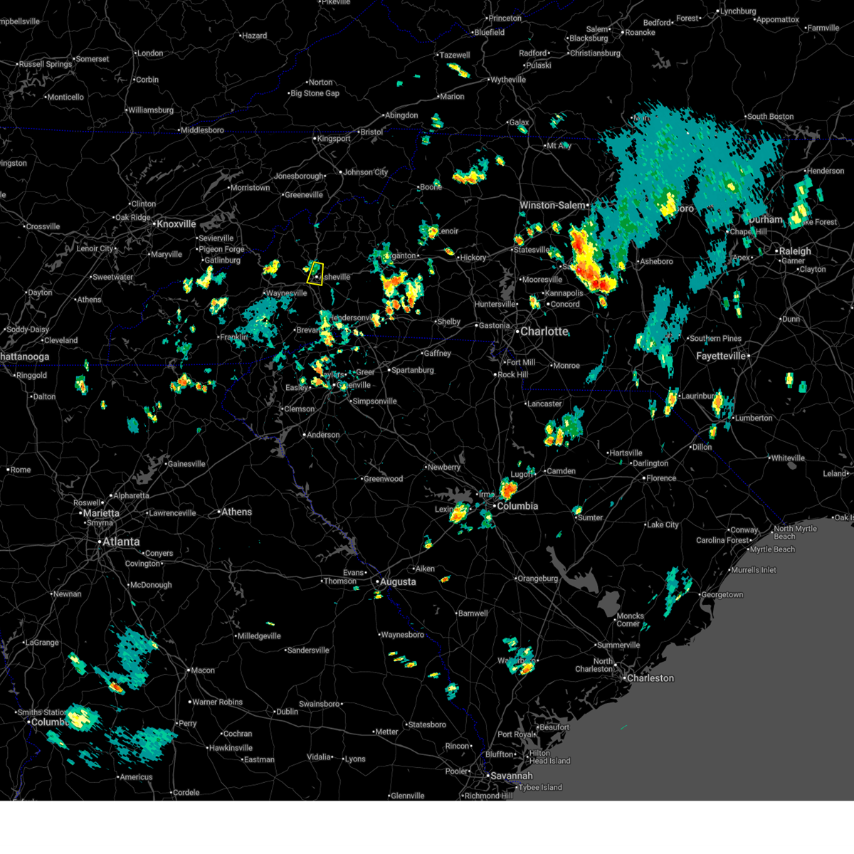
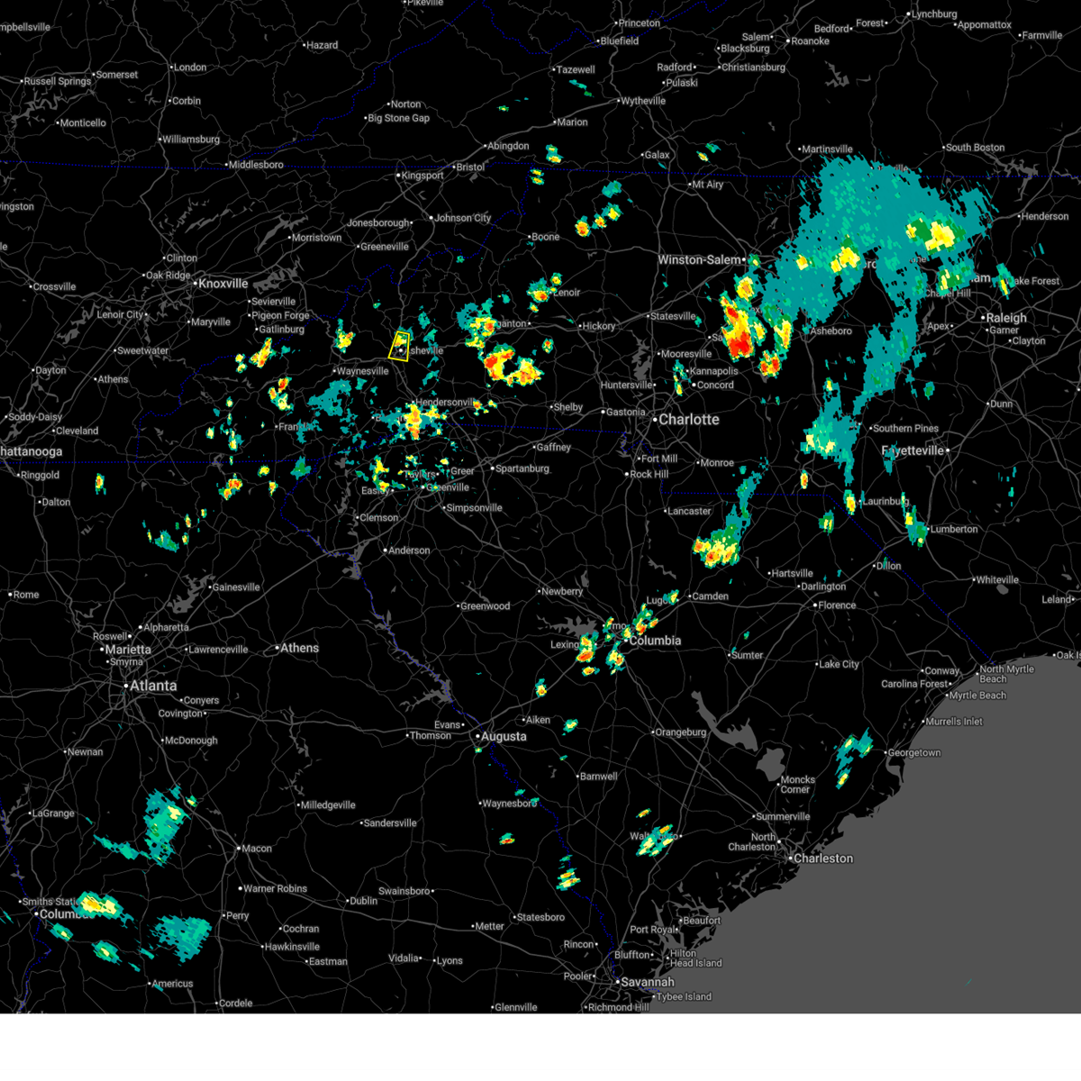
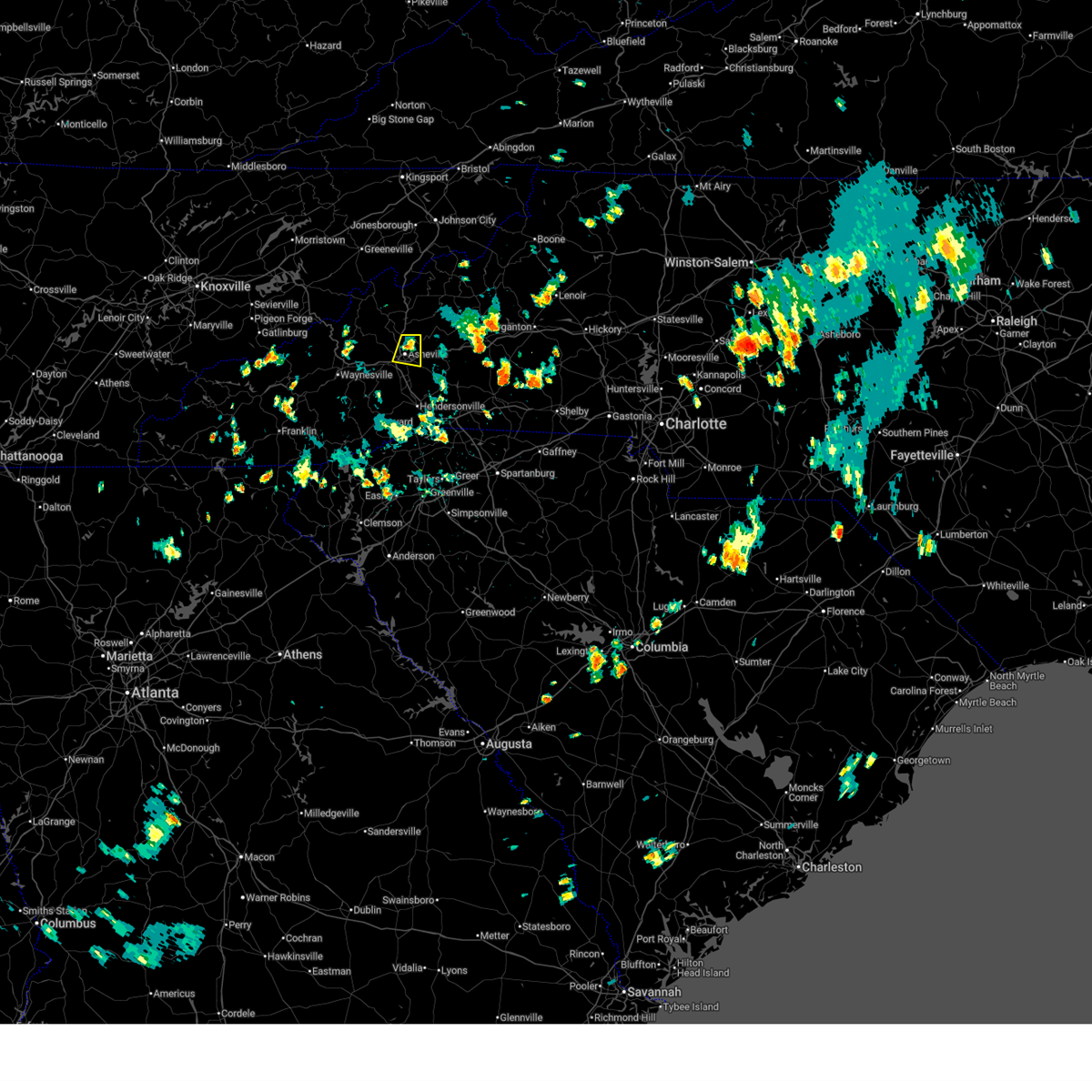
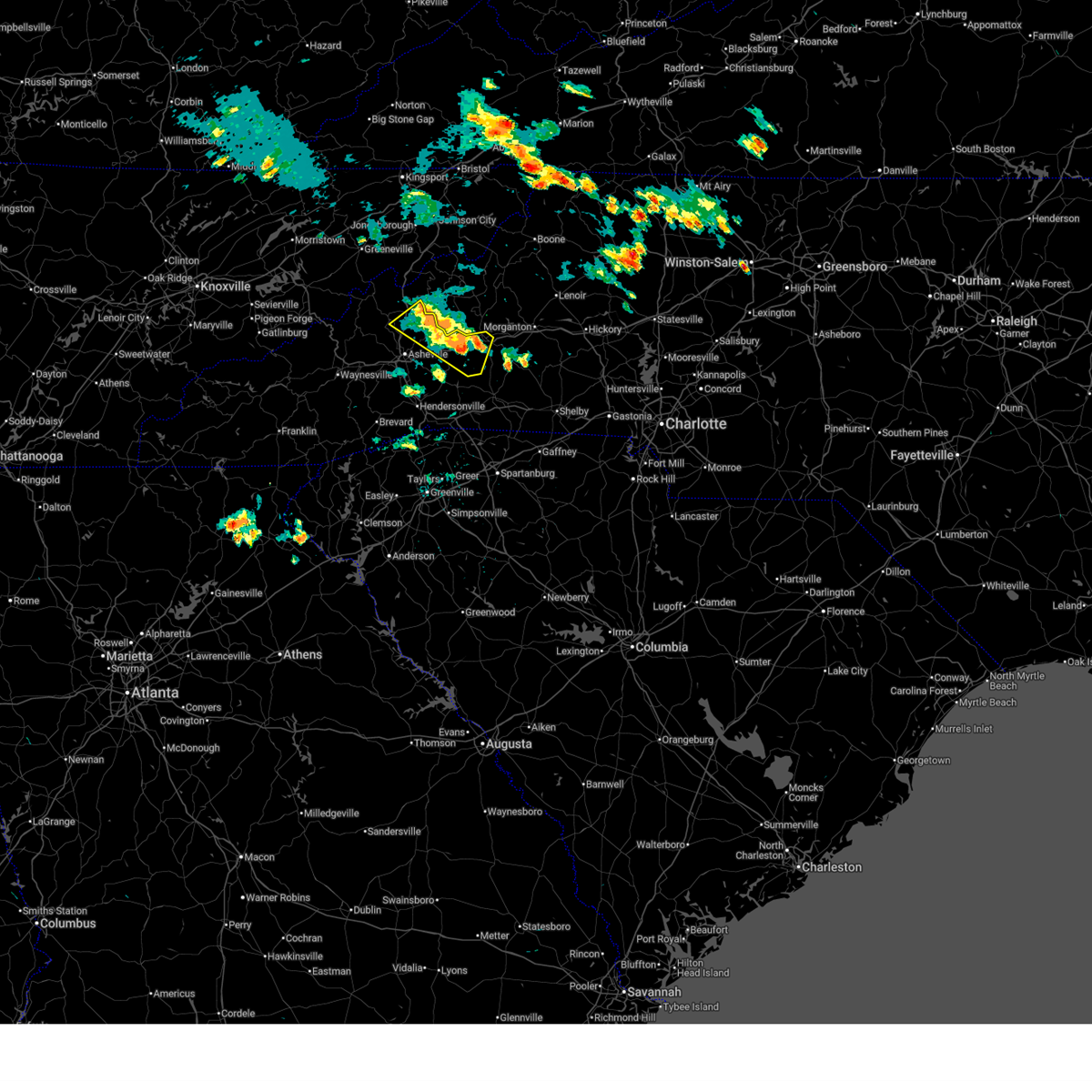
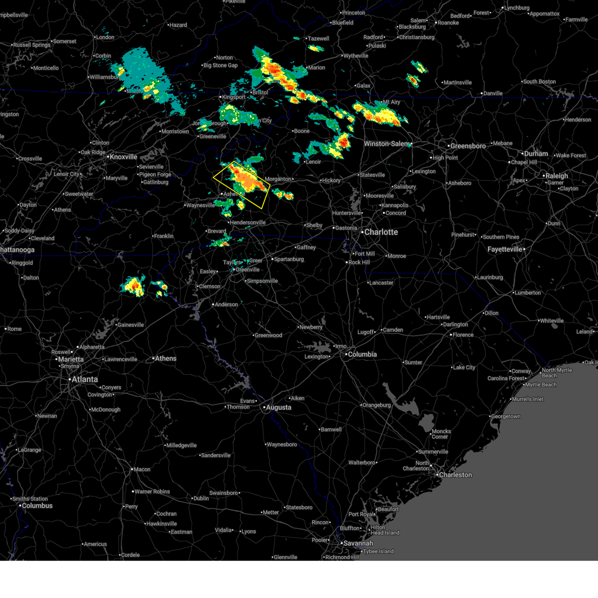
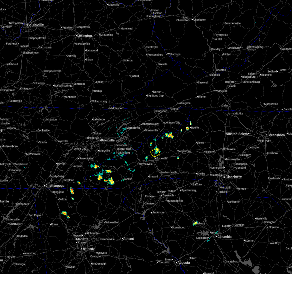
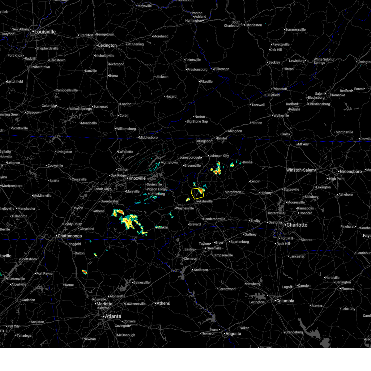
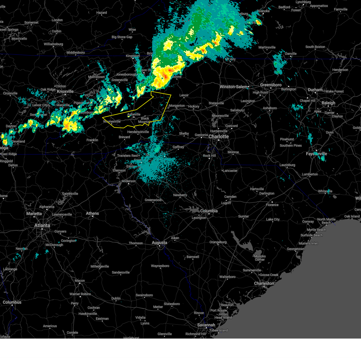
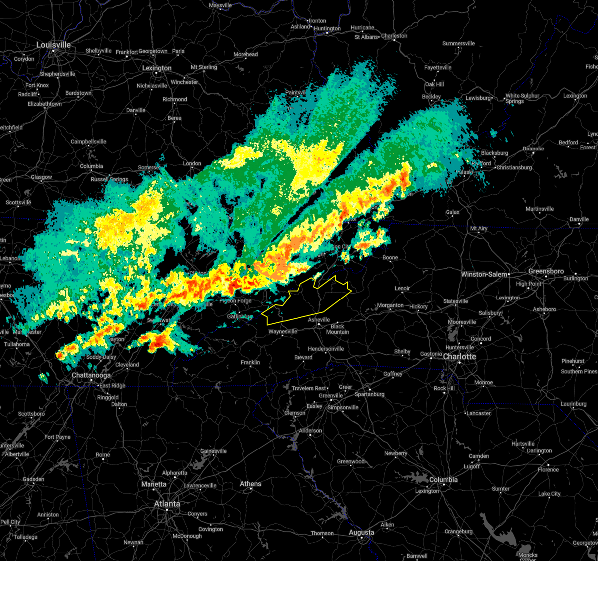
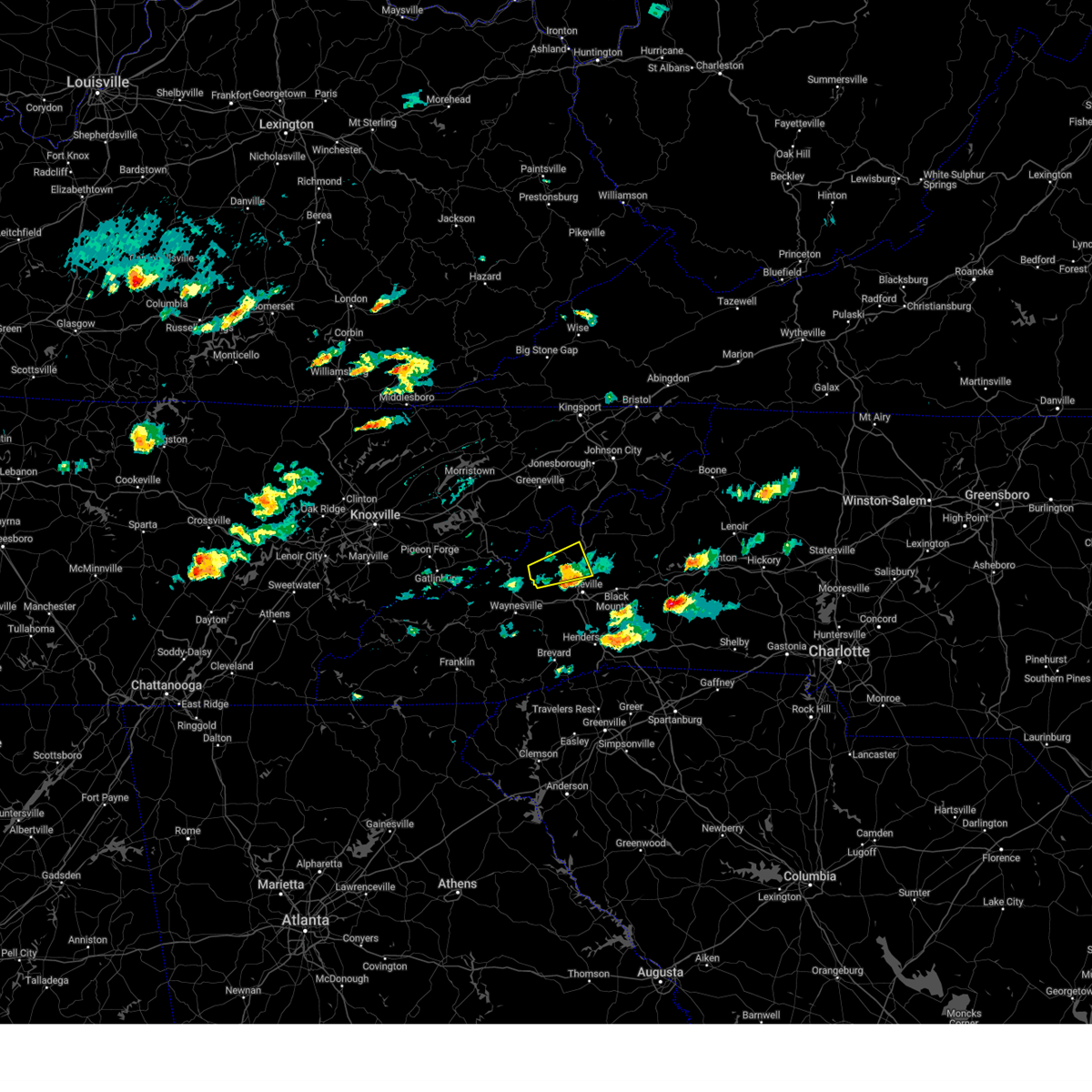
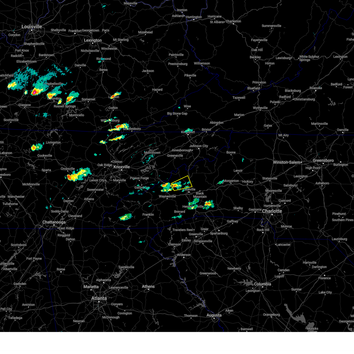
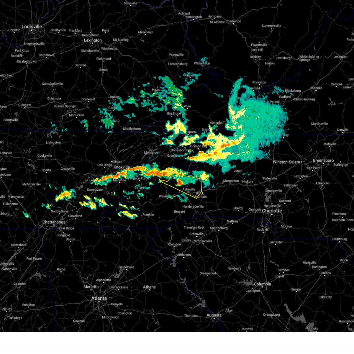
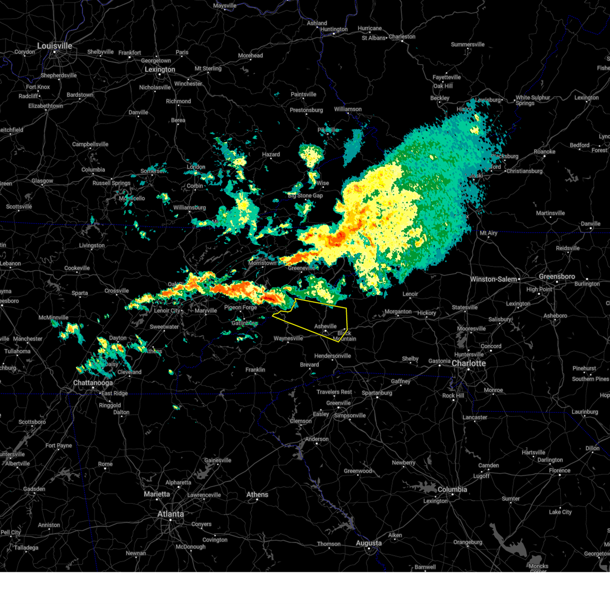
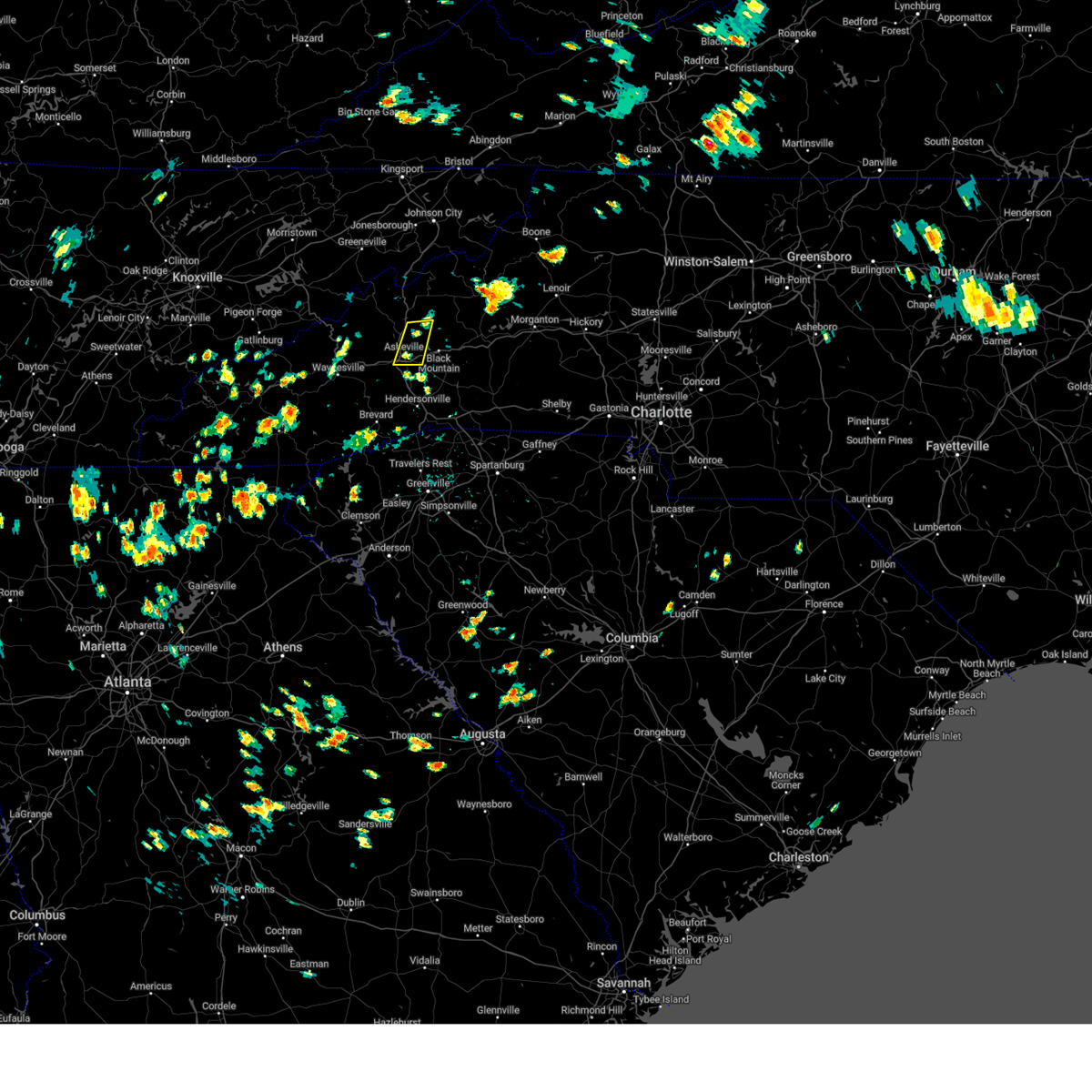
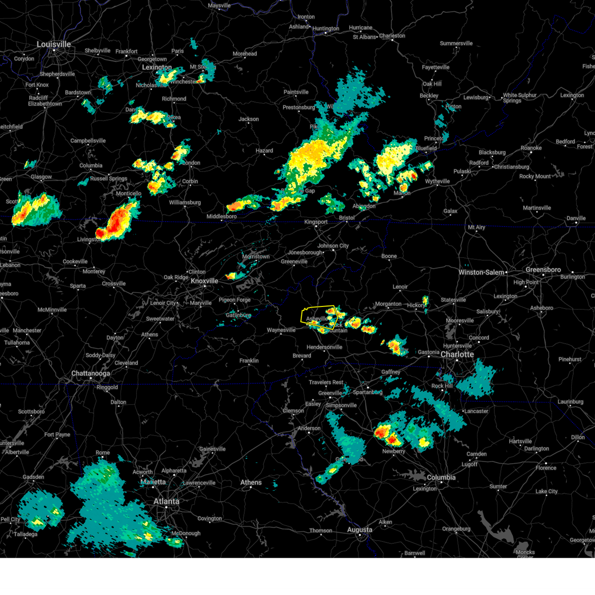
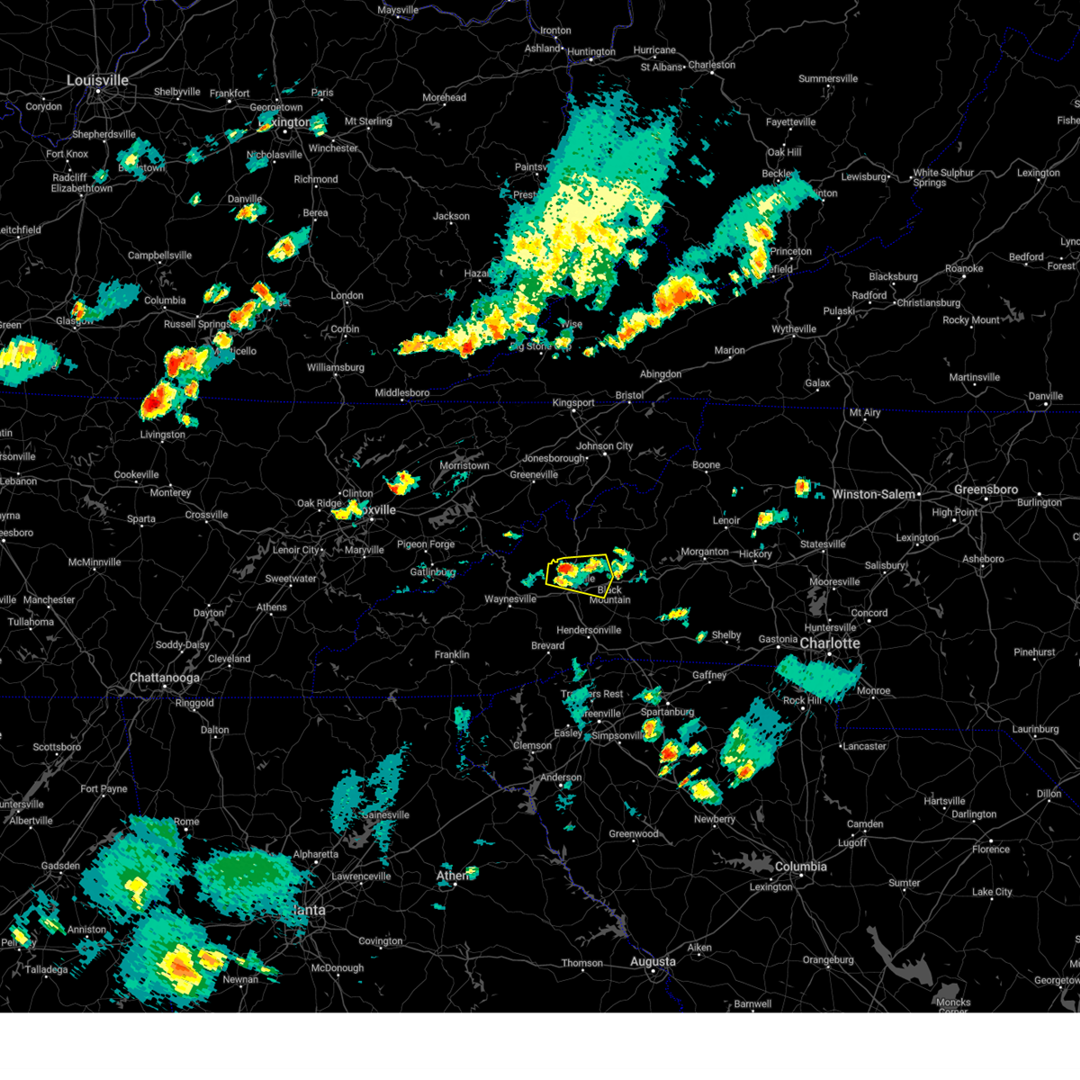
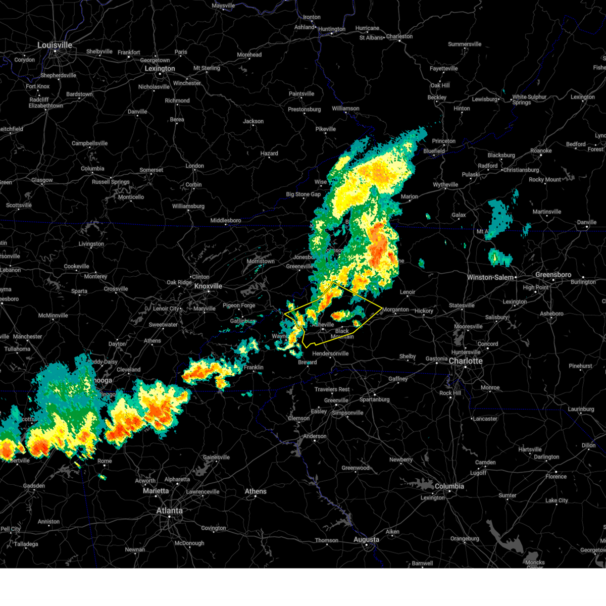
Hail Map for Weaverville, NC
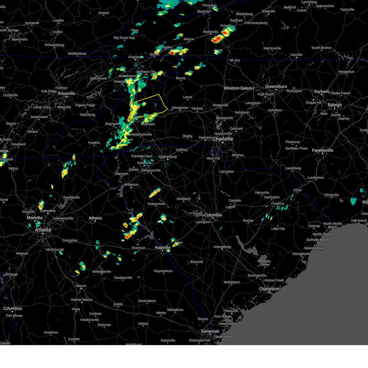
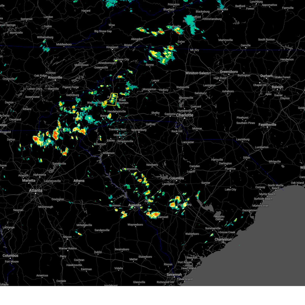
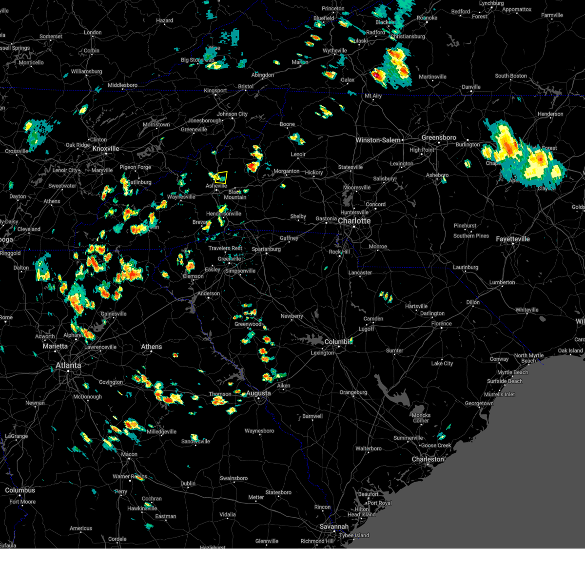
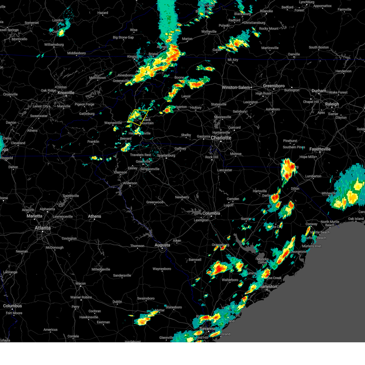
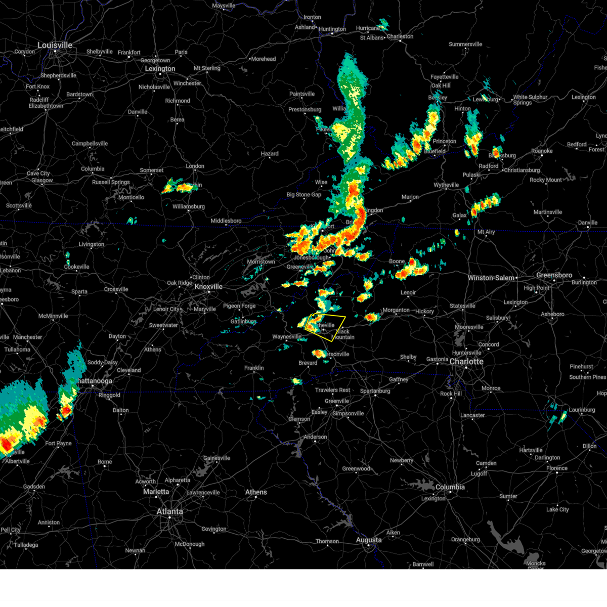
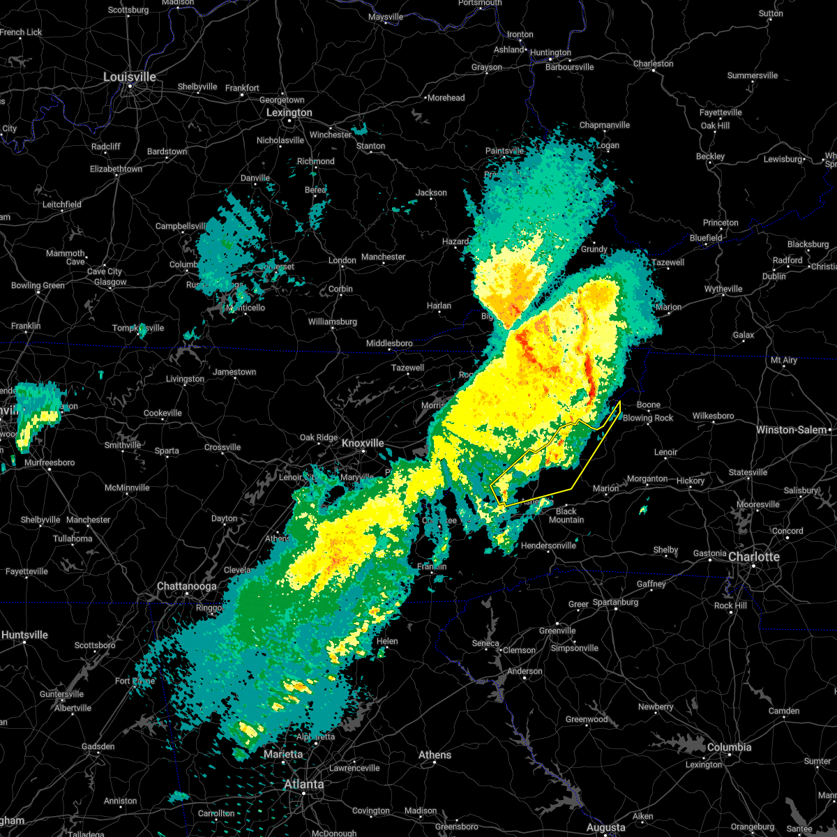
The Weaverville, NC area has had 9 reports of on-the-ground hail by trained spotters, and has been under severe weather warnings 30 times during the past 12 months. Doppler radar has detected hail at or near Weaverville, NC on 17 occasions, including 3 occasions during the past year.
| Name: | Weaverville, NC |
| Where Located: | 59.8 miles N of Greenville, SC |
| Map: | Google Map for Weaverville, NC |
| Population: | 3120 |
| Housing Units: | 1582 |
| More Info: | Search Google for Weaverville, NC |
1
The Top Recent Hail Date for Weaverville, NC is Saturday, August 17, 2024 (4th out of 17)

Hail and Wind Damage Spotted near Weaverville, NC
| Date / Time | Report Details |
|---|---|
| 6/28/2025 3:41 PM EDT |
 the severe thunderstorm warning has been cancelled and is no longer in effect the severe thunderstorm warning has been cancelled and is no longer in effect
|
| 6/28/2025 3:31 PM EDT |
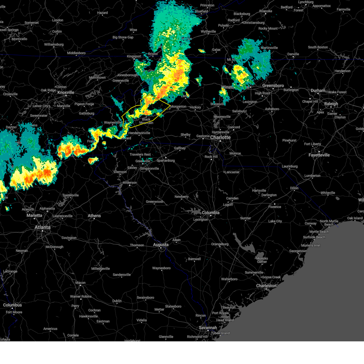
 At 331 pm edt, a severe thunderstorm was located near downtown asheville, or near north asheville, and is nearly stationary (radar indicated). Hazards include 60 mph wind gusts and quarter size hail. Minor hail damage to vehicles is expected. expect wind damage to trees and power lines. Locations impacted include, downtown asheville, east asheville, west asheville, north asheville, woodfin, weaverville, unc-asheville, and biltmore forest. At 331 pm edt, a severe thunderstorm was located near downtown asheville, or near north asheville, and is nearly stationary (radar indicated). Hazards include 60 mph wind gusts and quarter size hail. Minor hail damage to vehicles is expected. expect wind damage to trees and power lines. Locations impacted include, downtown asheville, east asheville, west asheville, north asheville, woodfin, weaverville, unc-asheville, and biltmore forest.
|
| 6/28/2025 3:12 PM EDT |
 Svrgsp the national weather service in greenville-spartanburg has issued a * severe thunderstorm warning for, central buncombe county in western north carolina, * until 400 pm edt. * at 312 pm edt, a severe thunderstorm was located near downtown asheville, or near north asheville, and is nearly stationary (radar indicated). Hazards include 60 mph wind gusts and quarter size hail. Minor hail damage to vehicles is expected. Expect wind damage to trees and power lines. Svrgsp the national weather service in greenville-spartanburg has issued a * severe thunderstorm warning for, central buncombe county in western north carolina, * until 400 pm edt. * at 312 pm edt, a severe thunderstorm was located near downtown asheville, or near north asheville, and is nearly stationary (radar indicated). Hazards include 60 mph wind gusts and quarter size hail. Minor hail damage to vehicles is expected. Expect wind damage to trees and power lines.
|
| 6/26/2025 2:25 PM EDT |
 the severe thunderstorm warning has been cancelled and is no longer in effect the severe thunderstorm warning has been cancelled and is no longer in effect
|
| 6/26/2025 2:25 PM EDT |
 At 224 pm edt, severe thunderstorms were located along a line extending from 10 miles southwest of burnsville to 20 miles south of spruce pine to 3 miles southwest of marion, moving southwest at 5 mph (radar indicated). Hazards include 60 mph wind gusts and quarter size hail. Minor hail damage to vehicles is expected. expect wind damage to trees and power lines. locations impacted include, marion, black mountain, old fort, the b. r. Parkway from east asheville to little switzerland, montreat, pleasant gardens, flat creek, sugar hill, and barnardsville. At 224 pm edt, severe thunderstorms were located along a line extending from 10 miles southwest of burnsville to 20 miles south of spruce pine to 3 miles southwest of marion, moving southwest at 5 mph (radar indicated). Hazards include 60 mph wind gusts and quarter size hail. Minor hail damage to vehicles is expected. expect wind damage to trees and power lines. locations impacted include, marion, black mountain, old fort, the b. r. Parkway from east asheville to little switzerland, montreat, pleasant gardens, flat creek, sugar hill, and barnardsville.
|
| 6/26/2025 2:11 PM EDT |
 Svrgsp the national weather service in greenville-spartanburg has issued a * severe thunderstorm warning for, southwestern mcdowell county in western north carolina, northwestern rutherford county in western north carolina, southeastern madison county in western north carolina, northeastern buncombe county in western north carolina, southern yancey county in western north carolina, * until 315 pm edt. * at 210 pm edt, severe thunderstorms were located along a line extending from 7 miles southwest of burnsville to 3 miles southwest of marion, and are nearly stationary (radar indicated). Hazards include 60 mph wind gusts and quarter size hail. Minor hail damage to vehicles is expected. Expect wind damage to trees and power lines. Svrgsp the national weather service in greenville-spartanburg has issued a * severe thunderstorm warning for, southwestern mcdowell county in western north carolina, northwestern rutherford county in western north carolina, southeastern madison county in western north carolina, northeastern buncombe county in western north carolina, southern yancey county in western north carolina, * until 315 pm edt. * at 210 pm edt, severe thunderstorms were located along a line extending from 7 miles southwest of burnsville to 3 miles southwest of marion, and are nearly stationary (radar indicated). Hazards include 60 mph wind gusts and quarter size hail. Minor hail damage to vehicles is expected. Expect wind damage to trees and power lines.
|
| 6/25/2025 3:38 PM EDT | Outages from storm damage near paint fork r in buncombe county NC, 6.3 miles SW of Weaverville, NC |
| 6/25/2025 3:29 PM EDT | Svrgsp the national weather service in greenville-spartanburg has issued a * severe thunderstorm warning for, northeastern buncombe county in western north carolina, southeastern yancey county in western north carolina, * until 415 pm edt. * at 328 pm edt, severe thunderstorms were located along a line extending from 8 miles south of burnsville to 9 miles southeast of marshall, and are nearly stationary (radar indicated). Hazards include 60 mph wind gusts and penny size hail. expect damage to trees and power lines |
| 6/24/2025 4:45 PM EDT |
 the severe thunderstorm warning has been cancelled and is no longer in effect the severe thunderstorm warning has been cancelled and is no longer in effect
|
| 6/24/2025 4:37 PM EDT |
 At 436 pm edt, a severe thunderstorm was located 8 miles north of downtown asheville, or near weaverville, moving west at 5 mph (radar indicated). Hazards include 60 mph wind gusts. Expect damage to trees and power lines. Locations impacted include, woodfin, weaverville, flat creek, and north asheville. At 436 pm edt, a severe thunderstorm was located 8 miles north of downtown asheville, or near weaverville, moving west at 5 mph (radar indicated). Hazards include 60 mph wind gusts. Expect damage to trees and power lines. Locations impacted include, woodfin, weaverville, flat creek, and north asheville.
|
| 6/24/2025 4:37 PM EDT |
 the severe thunderstorm warning has been cancelled and is no longer in effect the severe thunderstorm warning has been cancelled and is no longer in effect
|
| 6/24/2025 4:14 PM EDT |
 Svrgsp the national weather service in greenville-spartanburg has issued a * severe thunderstorm warning for, southeastern madison county in western north carolina, north central buncombe county in western north carolina, * until 500 pm edt. * at 413 pm edt, a severe thunderstorm was located 9 miles north of downtown asheville, or 4 miles northeast of weaverville, moving west at 10 mph (radar indicated). Hazards include 60 mph wind gusts. expect damage to trees and power lines Svrgsp the national weather service in greenville-spartanburg has issued a * severe thunderstorm warning for, southeastern madison county in western north carolina, north central buncombe county in western north carolina, * until 500 pm edt. * at 413 pm edt, a severe thunderstorm was located 9 miles north of downtown asheville, or 4 miles northeast of weaverville, moving west at 10 mph (radar indicated). Hazards include 60 mph wind gusts. expect damage to trees and power lines
|
| 5/17/2025 3:42 AM EDT |
 Svrgsp the national weather service in greenville-spartanburg has issued a * severe thunderstorm warning for, mcdowell county in western north carolina, southeastern mitchell county in western north carolina, southwestern avery county in western north carolina, buncombe county in western north carolina, central haywood county in western north carolina, southeastern yancey county in western north carolina, northwestern burke county in western north carolina, * until 430 am edt. * at 341 am edt, severe thunderstorms were located along a line extending from 5 miles northeast of burnsville to 13 miles northeast of downtown asheville to 8 miles north of waynesville, moving southeast at 45 mph (radar indicated). Hazards include 60 mph wind gusts and nickel size hail. expect damage to trees and power lines Svrgsp the national weather service in greenville-spartanburg has issued a * severe thunderstorm warning for, mcdowell county in western north carolina, southeastern mitchell county in western north carolina, southwestern avery county in western north carolina, buncombe county in western north carolina, central haywood county in western north carolina, southeastern yancey county in western north carolina, northwestern burke county in western north carolina, * until 430 am edt. * at 341 am edt, severe thunderstorms were located along a line extending from 5 miles northeast of burnsville to 13 miles northeast of downtown asheville to 8 miles north of waynesville, moving southeast at 45 mph (radar indicated). Hazards include 60 mph wind gusts and nickel size hail. expect damage to trees and power lines
|
| 5/17/2025 2:56 AM EDT |
 Svrgsp the national weather service in greenville-spartanburg has issued a * severe thunderstorm warning for, madison county in western north carolina, northwestern buncombe county in western north carolina, northwestern haywood county in western north carolina, yancey county in western north carolina, * until 400 am edt. * at 255 am edt, severe thunderstorms were located along a line extending from 8 miles south of greeneville to 10 miles east of newport to near sevierville, moving southeast at 35 mph (radar indicated). Hazards include 60 mph wind gusts and quarter size hail. Minor hail damage to vehicles is expected. Expect wind damage to trees and power lines. Svrgsp the national weather service in greenville-spartanburg has issued a * severe thunderstorm warning for, madison county in western north carolina, northwestern buncombe county in western north carolina, northwestern haywood county in western north carolina, yancey county in western north carolina, * until 400 am edt. * at 255 am edt, severe thunderstorms were located along a line extending from 8 miles south of greeneville to 10 miles east of newport to near sevierville, moving southeast at 35 mph (radar indicated). Hazards include 60 mph wind gusts and quarter size hail. Minor hail damage to vehicles is expected. Expect wind damage to trees and power lines.
|
| 5/8/2025 4:16 PM EDT | Svrgsp the national weather service in greenville-spartanburg has issued a * severe thunderstorm warning for, central buncombe county in western north carolina, * until 515 pm edt. * at 416 pm edt, a severe thunderstorm was located near downtown asheville, or over unc-asheville, moving east at 25 mph (radar indicated). Hazards include 60 mph wind gusts and quarter size hail. Minor hail damage to vehicles is expected. Expect wind damage to trees and power lines. |
| 5/8/2025 4:09 PM EDT |
 the severe thunderstorm warning has been cancelled and is no longer in effect the severe thunderstorm warning has been cancelled and is no longer in effect
|
| 5/8/2025 3:38 PM EDT |
 Svrgsp the national weather service in greenville-spartanburg has issued a * severe thunderstorm warning for, southern madison county in western north carolina, northwestern buncombe county in western north carolina, * until 445 pm edt. * at 337 pm edt, a severe thunderstorm was located 10 miles southwest of marshall, or 8 miles northwest of leicester, moving east at 15 mph (radar indicated). Hazards include ping pong ball size hail and 60 mph wind gusts. People and animals outdoors will be injured. expect hail damage to roofs, siding, windows, and vehicles. Expect wind damage to trees and power lines. Svrgsp the national weather service in greenville-spartanburg has issued a * severe thunderstorm warning for, southern madison county in western north carolina, northwestern buncombe county in western north carolina, * until 445 pm edt. * at 337 pm edt, a severe thunderstorm was located 10 miles southwest of marshall, or 8 miles northwest of leicester, moving east at 15 mph (radar indicated). Hazards include ping pong ball size hail and 60 mph wind gusts. People and animals outdoors will be injured. expect hail damage to roofs, siding, windows, and vehicles. Expect wind damage to trees and power lines.
|
| 2/6/2025 10:49 PM EST |
 Svrgsp the national weather service in greenville-spartanburg has issued a * severe thunderstorm warning for, southern madison county in western north carolina, buncombe county in western north carolina, north central haywood county in western north carolina, south central yancey county in western north carolina, * until 1130 pm est. * at 1048 pm est, a severe thunderstorm was located 15 miles west of marshall, or 9 miles southwest of hot springs, moving east at 45 mph (radar indicated). Hazards include 60 mph wind gusts and quarter size hail. Minor hail damage to vehicles is expected. Expect wind damage to trees and power lines. Svrgsp the national weather service in greenville-spartanburg has issued a * severe thunderstorm warning for, southern madison county in western north carolina, buncombe county in western north carolina, north central haywood county in western north carolina, south central yancey county in western north carolina, * until 1130 pm est. * at 1048 pm est, a severe thunderstorm was located 15 miles west of marshall, or 9 miles southwest of hot springs, moving east at 45 mph (radar indicated). Hazards include 60 mph wind gusts and quarter size hail. Minor hail damage to vehicles is expected. Expect wind damage to trees and power lines.
|
| 2/6/2025 10:09 PM EST |
 Svrgsp the national weather service in greenville-spartanburg has issued a * severe thunderstorm warning for, southern madison county in western north carolina, buncombe county in western north carolina, northeastern haywood county in western north carolina, south central yancey county in western north carolina, * until 1100 pm est. * at 1007 pm est, a severe thunderstorm was located near sevierville, moving east at 45 mph (radar indicated). Hazards include 60 mph wind gusts and quarter size hail. Minor hail damage to vehicles is expected. Expect wind damage to trees and power lines. Svrgsp the national weather service in greenville-spartanburg has issued a * severe thunderstorm warning for, southern madison county in western north carolina, buncombe county in western north carolina, northeastern haywood county in western north carolina, south central yancey county in western north carolina, * until 1100 pm est. * at 1007 pm est, a severe thunderstorm was located near sevierville, moving east at 45 mph (radar indicated). Hazards include 60 mph wind gusts and quarter size hail. Minor hail damage to vehicles is expected. Expect wind damage to trees and power lines.
|
| 9/24/2024 2:07 PM EDT | A report of a tree down on new stock roa in buncombe county NC, 5.1 miles S of Weaverville, NC |
| 9/24/2024 2:06 PM EDT |
 Svrgsp the national weather service in greenville-spartanburg has issued a * severe thunderstorm warning for, central mcdowell county in western north carolina, southeastern madison county in western north carolina, southeastern mitchell county in western north carolina, northeastern buncombe county in western north carolina, yancey county in western north carolina, * until 300 pm edt. * at 205 pm edt, a severe thunderstorm was located 11 miles east of marshall, or 5 miles northeast of weaverville, moving east at 35 mph (radar indicated). Hazards include 60 mph wind gusts and penny size hail. expect damage to trees and power lines Svrgsp the national weather service in greenville-spartanburg has issued a * severe thunderstorm warning for, central mcdowell county in western north carolina, southeastern madison county in western north carolina, southeastern mitchell county in western north carolina, northeastern buncombe county in western north carolina, yancey county in western north carolina, * until 300 pm edt. * at 205 pm edt, a severe thunderstorm was located 11 miles east of marshall, or 5 miles northeast of weaverville, moving east at 35 mph (radar indicated). Hazards include 60 mph wind gusts and penny size hail. expect damage to trees and power lines
|
| 8/31/2024 3:05 PM EDT |
 Svrgsp the national weather service in greenville-spartanburg has issued a * severe thunderstorm warning for, central buncombe county in western north carolina, * until 400 pm edt. * at 304 pm edt, a severe thunderstorm was located 4 miles southwest of downtown asheville, or near west asheville, and is nearly stationary (radar indicated). Hazards include 60 mph wind gusts and nickel size hail. expect damage to trees and power lines Svrgsp the national weather service in greenville-spartanburg has issued a * severe thunderstorm warning for, central buncombe county in western north carolina, * until 400 pm edt. * at 304 pm edt, a severe thunderstorm was located 4 miles southwest of downtown asheville, or near west asheville, and is nearly stationary (radar indicated). Hazards include 60 mph wind gusts and nickel size hail. expect damage to trees and power lines
|
| 8/30/2024 2:48 PM EDT | Several trees down in the weaverville are in buncombe county NC, 0.5 miles N of Weaverville, NC |
| 8/30/2024 2:47 PM EDT |
 the severe thunderstorm warning has been cancelled and is no longer in effect the severe thunderstorm warning has been cancelled and is no longer in effect
|
| 8/30/2024 2:41 PM EDT | Corrects time of previous tstm wnd dmg report from 1 sse weaverville. several trees down in the weaverville are in buncombe county NC, 0.5 miles N of Weaverville, NC |
| 8/30/2024 2:40 PM EDT |
 At 240 pm edt, a severe thunderstorm was located 8 miles northeast of downtown asheville, or near b.r. parkway-east asheville to craggy gardens, and is nearly stationary (radar indicated). Hazards include 60 mph wind gusts. Expect damage to trees and power lines. locations impacted include, weaverville, b. r. Parkway-east asheville to craggy gardens, barnardsville, and flat creek. At 240 pm edt, a severe thunderstorm was located 8 miles northeast of downtown asheville, or near b.r. parkway-east asheville to craggy gardens, and is nearly stationary (radar indicated). Hazards include 60 mph wind gusts. Expect damage to trees and power lines. locations impacted include, weaverville, b. r. Parkway-east asheville to craggy gardens, barnardsville, and flat creek.
|
| 8/30/2024 2:23 PM EDT |
 Svrgsp the national weather service in greenville-spartanburg has issued a * severe thunderstorm warning for, central buncombe county in western north carolina, * until 330 pm edt. * at 223 pm edt, a severe thunderstorm was located 8 miles northeast of downtown asheville, or near b.r. parkway-east asheville to craggy gardens, and is nearly stationary (radar indicated). Hazards include 60 mph wind gusts and nickel size hail. expect damage to trees and power lines Svrgsp the national weather service in greenville-spartanburg has issued a * severe thunderstorm warning for, central buncombe county in western north carolina, * until 330 pm edt. * at 223 pm edt, a severe thunderstorm was located 8 miles northeast of downtown asheville, or near b.r. parkway-east asheville to craggy gardens, and is nearly stationary (radar indicated). Hazards include 60 mph wind gusts and nickel size hail. expect damage to trees and power lines
|
| 8/17/2024 8:31 PM EDT |
 the severe thunderstorm warning has been cancelled and is no longer in effect the severe thunderstorm warning has been cancelled and is no longer in effect
|
| 8/17/2024 8:12 PM EDT | County official reports a couple trees blown down on moore stree in buncombe county NC, 0.5 miles ESE of Weaverville, NC |
| 8/17/2024 7:52 PM EDT |
 Svrgsp the national weather service in greenville-spartanburg has issued a * severe thunderstorm warning for, central buncombe county in western north carolina, * until 845 pm edt. * at 750 pm edt, a severe thunderstorm was located 8 miles south of marshall, or near leicester, moving east at 15 mph (radar indicated). Hazards include 60 mph wind gusts and quarter size hail. Minor hail damage to vehicles is expected. Expect wind damage to trees and power lines. Svrgsp the national weather service in greenville-spartanburg has issued a * severe thunderstorm warning for, central buncombe county in western north carolina, * until 845 pm edt. * at 750 pm edt, a severe thunderstorm was located 8 miles south of marshall, or near leicester, moving east at 15 mph (radar indicated). Hazards include 60 mph wind gusts and quarter size hail. Minor hail damage to vehicles is expected. Expect wind damage to trees and power lines.
|
| 8/16/2024 7:29 PM EDT |
 At 729 pm edt, severe thunderstorms were located along a line extending from 6 miles northeast of burnsville to 16 miles east of marshall to 9 miles west of downtown asheville, moving east at 25 mph (radar indicated). Hazards include 60 mph wind gusts and penny size hail. Expect damage to trees and power lines. Locations impacted include, downtown asheville, burnsville, east asheville, west asheville, north asheville, black mountain, woodfin, swannanoa, weaverville, and fairview in buncombe county. At 729 pm edt, severe thunderstorms were located along a line extending from 6 miles northeast of burnsville to 16 miles east of marshall to 9 miles west of downtown asheville, moving east at 25 mph (radar indicated). Hazards include 60 mph wind gusts and penny size hail. Expect damage to trees and power lines. Locations impacted include, downtown asheville, burnsville, east asheville, west asheville, north asheville, black mountain, woodfin, swannanoa, weaverville, and fairview in buncombe county.
|
| 8/16/2024 7:29 PM EDT |
 the severe thunderstorm warning has been cancelled and is no longer in effect the severe thunderstorm warning has been cancelled and is no longer in effect
|
| 8/16/2024 7:04 PM EDT |
 Svrgsp the national weather service in greenville-spartanburg has issued a * severe thunderstorm warning for, central mcdowell county in western north carolina, southern madison county in western north carolina, southeastern mitchell county in western north carolina, northeastern haywood county in western north carolina, buncombe county in western north carolina, yancey county in western north carolina, west central burke county in western north carolina, * until 800 pm edt. * at 704 pm edt, severe thunderstorms were located along a line extending from 6 miles northwest of burnsville to 9 miles east of marshall to 12 miles northeast of waynesville, moving east at 25 mph (radar indicated). Hazards include 60 mph wind gusts and penny size hail. expect damage to trees and power lines Svrgsp the national weather service in greenville-spartanburg has issued a * severe thunderstorm warning for, central mcdowell county in western north carolina, southern madison county in western north carolina, southeastern mitchell county in western north carolina, northeastern haywood county in western north carolina, buncombe county in western north carolina, yancey county in western north carolina, west central burke county in western north carolina, * until 800 pm edt. * at 704 pm edt, severe thunderstorms were located along a line extending from 6 miles northwest of burnsville to 9 miles east of marshall to 12 miles northeast of waynesville, moving east at 25 mph (radar indicated). Hazards include 60 mph wind gusts and penny size hail. expect damage to trees and power lines
|
| 8/2/2024 1:55 PM EDT |
 At 155 pm edt, a severe thunderstorm was located near downtown asheville, or near north asheville, moving southeast at 10 mph (radar indicated). Hazards include 60 mph wind gusts and penny size hail. Expect damage to trees and power lines. locations impacted include, downtown asheville, east asheville, west asheville, north asheville, woodfin, swannanoa, weaverville, biltmore forest, b. r. parkway-nc arboretum to east asheville, and b. r. Parkway-east asheville to craggy gardens. At 155 pm edt, a severe thunderstorm was located near downtown asheville, or near north asheville, moving southeast at 10 mph (radar indicated). Hazards include 60 mph wind gusts and penny size hail. Expect damage to trees and power lines. locations impacted include, downtown asheville, east asheville, west asheville, north asheville, woodfin, swannanoa, weaverville, biltmore forest, b. r. parkway-nc arboretum to east asheville, and b. r. Parkway-east asheville to craggy gardens.
|
| 8/2/2024 1:16 PM EDT |
 Svrgsp the national weather service in greenville-spartanburg has issued a * severe thunderstorm warning for, central buncombe county in western north carolina, * until 230 pm edt. * at 116 pm edt, a severe thunderstorm was located 7 miles northwest of downtown asheville, or near weaverville, moving east at 15 mph (radar indicated). Hazards include 60 mph wind gusts and penny size hail. expect damage to trees and power lines Svrgsp the national weather service in greenville-spartanburg has issued a * severe thunderstorm warning for, central buncombe county in western north carolina, * until 230 pm edt. * at 116 pm edt, a severe thunderstorm was located 7 miles northwest of downtown asheville, or near weaverville, moving east at 15 mph (radar indicated). Hazards include 60 mph wind gusts and penny size hail. expect damage to trees and power lines
|
| 6/9/2024 6:05 PM EDT |
 Svrgsp the national weather service in greenville-spartanburg has issued a * severe thunderstorm warning for, southern madison county in western north carolina, northern haywood county in western north carolina, buncombe county in western north carolina, * until 700 pm edt. * at 604 pm edt, severe thunderstorms were located along a line extending from 7 miles east of newport to 9 miles east of gatlinburg, moving southeast at 50 mph (radar indicated). Hazards include 70 mph wind gusts and penny size hail. Expect considerable tree damage. Damage is likely to mobile homes, roofs, and outbuildings. Svrgsp the national weather service in greenville-spartanburg has issued a * severe thunderstorm warning for, southern madison county in western north carolina, northern haywood county in western north carolina, buncombe county in western north carolina, * until 700 pm edt. * at 604 pm edt, severe thunderstorms were located along a line extending from 7 miles east of newport to 9 miles east of gatlinburg, moving southeast at 50 mph (radar indicated). Hazards include 70 mph wind gusts and penny size hail. Expect considerable tree damage. Damage is likely to mobile homes, roofs, and outbuildings.
|
| 5/27/2024 4:56 AM EDT |
 At 455 am edt, severe thunderstorms were located along a line extending from 12 miles west of burnsville to 6 miles south of marshall to 6 miles north of waynesville, moving east at 35 mph (radar indicated). Hazards include 60 mph wind gusts and penny size hail. Expect damage to trees and power lines. Locations impacted include, asheville, burnsville, marshall, woodfin, canton, and lake junaluska. At 455 am edt, severe thunderstorms were located along a line extending from 12 miles west of burnsville to 6 miles south of marshall to 6 miles north of waynesville, moving east at 35 mph (radar indicated). Hazards include 60 mph wind gusts and penny size hail. Expect damage to trees and power lines. Locations impacted include, asheville, burnsville, marshall, woodfin, canton, and lake junaluska.
|
| 5/27/2024 4:41 AM EDT |
 Svrgsp the national weather service in greenville-spartanburg has issued a * severe thunderstorm warning for, madison county in western north carolina, haywood county in western north carolina, central buncombe county in western north carolina, northwestern yancey county in western north carolina, * until 530 am edt. * at 441 am edt, severe thunderstorms were located along a line extending from 15 miles southwest of erwin to 5 miles southwest of marshall to 10 miles northwest of waynesville, moving east at 35 mph (radar indicated). Hazards include 60 mph wind gusts and penny size hail. expect damage to trees and power lines Svrgsp the national weather service in greenville-spartanburg has issued a * severe thunderstorm warning for, madison county in western north carolina, haywood county in western north carolina, central buncombe county in western north carolina, northwestern yancey county in western north carolina, * until 530 am edt. * at 441 am edt, severe thunderstorms were located along a line extending from 15 miles southwest of erwin to 5 miles southwest of marshall to 10 miles northwest of waynesville, moving east at 35 mph (radar indicated). Hazards include 60 mph wind gusts and penny size hail. expect damage to trees and power lines
|
| 5/26/2024 4:14 PM EDT |
 The storm which prompted the warning has weakened below severe limits, and no longer poses an immediate threat to life or property. therefore, the warning will be allowed to expire. however, gusty winds and heavy rain are still possible with thunderstorms across the northern part of buncombe county through 500 pm. a severe thunderstorm watch remains in effect until 900 pm edt for western north carolina. The storm which prompted the warning has weakened below severe limits, and no longer poses an immediate threat to life or property. therefore, the warning will be allowed to expire. however, gusty winds and heavy rain are still possible with thunderstorms across the northern part of buncombe county through 500 pm. a severe thunderstorm watch remains in effect until 900 pm edt for western north carolina.
|
| 5/26/2024 4:08 PM EDT | Social media report of trees down in the weaverville are in buncombe county NC, 0.7 miles NE of Weaverville, NC |
| 5/26/2024 3:58 PM EDT |
 At 357 pm edt, a severe thunderstorm was located 5 miles northwest of downtown asheville, or near woodfin, moving northeast at 20 mph (radar indicated). Hazards include 60 mph wind gusts. Expect damage to trees and power lines. Locations impacted include, woodfin, weaverville, leicester, flat creek, and north asheville. At 357 pm edt, a severe thunderstorm was located 5 miles northwest of downtown asheville, or near woodfin, moving northeast at 20 mph (radar indicated). Hazards include 60 mph wind gusts. Expect damage to trees and power lines. Locations impacted include, woodfin, weaverville, leicester, flat creek, and north asheville.
|
| 5/26/2024 3:41 PM EDT |
 the severe thunderstorm warning has been cancelled and is no longer in effect the severe thunderstorm warning has been cancelled and is no longer in effect
|
| 5/26/2024 3:41 PM EDT |
 At 340 pm edt, a severe thunderstorm was located 7 miles west of downtown asheville, or near leicester, moving northeast at 35 mph (radar indicated). Hazards include 60 mph wind gusts and quarter size hail. Minor hail damage to vehicles is expected. expect wind damage to trees and power lines. Locations impacted include, north asheville, woodfin, weaverville, leicester, unc-asheville, candler, flat creek, enka, and west asheville. At 340 pm edt, a severe thunderstorm was located 7 miles west of downtown asheville, or near leicester, moving northeast at 35 mph (radar indicated). Hazards include 60 mph wind gusts and quarter size hail. Minor hail damage to vehicles is expected. expect wind damage to trees and power lines. Locations impacted include, north asheville, woodfin, weaverville, leicester, unc-asheville, candler, flat creek, enka, and west asheville.
|
| 5/26/2024 3:33 PM EDT |
 Svrgsp the national weather service in greenville-spartanburg has issued a * severe thunderstorm warning for, east central haywood county in western north carolina, western buncombe county in western north carolina, * until 415 pm edt. * at 333 pm edt, a severe thunderstorm was located 12 miles northeast of waynesville, or near canton, moving northeast at 25 mph (radar indicated). Hazards include 60 mph wind gusts and quarter size hail. Minor hail damage to vehicles is expected. Expect wind damage to trees and power lines. Svrgsp the national weather service in greenville-spartanburg has issued a * severe thunderstorm warning for, east central haywood county in western north carolina, western buncombe county in western north carolina, * until 415 pm edt. * at 333 pm edt, a severe thunderstorm was located 12 miles northeast of waynesville, or near canton, moving northeast at 25 mph (radar indicated). Hazards include 60 mph wind gusts and quarter size hail. Minor hail damage to vehicles is expected. Expect wind damage to trees and power lines.
|
| 5/9/2024 12:35 AM EDT |
 The storm which prompted the warning has moved out of the area. therefore, the warning will be allowed to expire. a tornado watch remains in effect until 400 am edt for western north carolina. The storm which prompted the warning has moved out of the area. therefore, the warning will be allowed to expire. a tornado watch remains in effect until 400 am edt for western north carolina.
|
| 5/8/2024 11:56 PM EDT |
 Svrgsp the national weather service in greenville-spartanburg has issued a * severe thunderstorm warning for, southwestern mcdowell county in western north carolina, northeastern henderson county in western north carolina, east central haywood county in western north carolina, buncombe county in western north carolina, * until 1245 am edt. * at 1155 pm edt, a severe thunderstorm was located 8 miles west of downtown asheville, or near leicester, moving southeast at 45 mph (radar indicated). Hazards include 60 mph wind gusts. expect damage to trees and power lines Svrgsp the national weather service in greenville-spartanburg has issued a * severe thunderstorm warning for, southwestern mcdowell county in western north carolina, northeastern henderson county in western north carolina, east central haywood county in western north carolina, buncombe county in western north carolina, * until 1245 am edt. * at 1155 pm edt, a severe thunderstorm was located 8 miles west of downtown asheville, or near leicester, moving southeast at 45 mph (radar indicated). Hazards include 60 mph wind gusts. expect damage to trees and power lines
|
| 5/8/2024 11:49 PM EDT |
 the severe thunderstorm warning has been cancelled and is no longer in effect the severe thunderstorm warning has been cancelled and is no longer in effect
|
| 5/8/2024 11:49 PM EDT |
 At 1147 pm edt, severe thunderstorms were located along a line extending from 10 miles east of marshall to near bryson city to 11 miles east of robbinsville to 6 miles southeast of andrews, moving southeast at 40 mph (radar indicated). Hazards include 60 mph wind gusts. Expect damage to trees and power lines. Locations impacted include, sylva, waynesville, bryson city, marshall, cherokee, woodfin, canton, lake junaluska, weaverville, and mars hill. At 1147 pm edt, severe thunderstorms were located along a line extending from 10 miles east of marshall to near bryson city to 11 miles east of robbinsville to 6 miles southeast of andrews, moving southeast at 40 mph (radar indicated). Hazards include 60 mph wind gusts. Expect damage to trees and power lines. Locations impacted include, sylva, waynesville, bryson city, marshall, cherokee, woodfin, canton, lake junaluska, weaverville, and mars hill.
|
| 5/8/2024 11:15 PM EDT |
 Svrgsp the national weather service in greenville-spartanburg has issued a * severe thunderstorm warning for, western macon county in western north carolina, northwestern jackson county in western north carolina, madison county in western north carolina, swain county in western north carolina, graham county in western north carolina, haywood county in western north carolina, northern buncombe county in western north carolina, * until 1215 am edt. * at 1114 pm edt, severe thunderstorms were located along a line extending from 13 miles south of greeneville to 17 miles southeast of maryville to 12 miles northwest of robbinsville to 11 miles north of murphy, moving southeast at 35 mph (radar indicated). Hazards include 60 mph wind gusts. expect damage to trees and power lines Svrgsp the national weather service in greenville-spartanburg has issued a * severe thunderstorm warning for, western macon county in western north carolina, northwestern jackson county in western north carolina, madison county in western north carolina, swain county in western north carolina, graham county in western north carolina, haywood county in western north carolina, northern buncombe county in western north carolina, * until 1215 am edt. * at 1114 pm edt, severe thunderstorms were located along a line extending from 13 miles south of greeneville to 17 miles southeast of maryville to 12 miles northwest of robbinsville to 11 miles north of murphy, moving southeast at 35 mph (radar indicated). Hazards include 60 mph wind gusts. expect damage to trees and power lines
|
| 5/8/2024 2:34 PM EDT |
 the severe thunderstorm warning has been cancelled and is no longer in effect the severe thunderstorm warning has been cancelled and is no longer in effect
|
| 5/8/2024 2:16 PM EDT |
 the severe thunderstorm warning has been cancelled and is no longer in effect the severe thunderstorm warning has been cancelled and is no longer in effect
|
| 5/8/2024 2:16 PM EDT |
 At 215 pm edt, a severe thunderstorm was located 5 miles east of downtown asheville, or over warren wilson college, moving east at 40 mph (radar indicated). Hazards include 60 mph wind gusts and quarter size hail. Minor hail damage to vehicles is expected. expect wind damage to trees and power lines. Locations impacted include, downtown asheville, east asheville, arden, west asheville, north asheville, black mountain, woodfin, swannanoa, weaverville, and fairview in buncombe county. At 215 pm edt, a severe thunderstorm was located 5 miles east of downtown asheville, or over warren wilson college, moving east at 40 mph (radar indicated). Hazards include 60 mph wind gusts and quarter size hail. Minor hail damage to vehicles is expected. expect wind damage to trees and power lines. Locations impacted include, downtown asheville, east asheville, arden, west asheville, north asheville, black mountain, woodfin, swannanoa, weaverville, and fairview in buncombe county.
|
| 5/8/2024 1:50 PM EDT |
 Svrgsp the national weather service in greenville-spartanburg has issued a * severe thunderstorm warning for, southwestern madison county in western north carolina, east central haywood county in western north carolina, buncombe county in western north carolina, * until 245 pm edt. * at 150 pm edt, a severe thunderstorm was located 13 miles west of downtown asheville, or 5 miles northeast of canton, moving east at 45 mph (radar indicated). Hazards include 60 mph wind gusts and half dollar size hail. Minor hail damage to vehicles is expected. Expect wind damage to trees and power lines. Svrgsp the national weather service in greenville-spartanburg has issued a * severe thunderstorm warning for, southwestern madison county in western north carolina, east central haywood county in western north carolina, buncombe county in western north carolina, * until 245 pm edt. * at 150 pm edt, a severe thunderstorm was located 13 miles west of downtown asheville, or 5 miles northeast of canton, moving east at 45 mph (radar indicated). Hazards include 60 mph wind gusts and half dollar size hail. Minor hail damage to vehicles is expected. Expect wind damage to trees and power lines.
|
| 5/8/2024 1:27 PM EDT | Quarter sized hail reported 8.8 miles SSW of Weaverville, NC |
| 5/8/2024 1:13 PM EDT |
 At 113 pm edt, severe thunderstorms were located along a line extending from 5 miles southeast of erwin to 10 miles east of marshall to 13 miles west of downtown asheville, moving east at 40 mph (radar indicated). Hazards include two inch hail and 70 mph wind gusts. People and animals outdoors will be injured. expect hail damage to roofs, siding, windows, and vehicles. expect considerable tree damage. wind damage is also likely to mobile homes, roofs, and outbuildings. locations impacted include, burnsville, north asheville, woodfin, weaverville, leicester, mount mitchell state park, b. r. parkway-east asheville to craggy gardens, b. r. Parkway-craggy to little switzerland, montreat, and ramseytown. At 113 pm edt, severe thunderstorms were located along a line extending from 5 miles southeast of erwin to 10 miles east of marshall to 13 miles west of downtown asheville, moving east at 40 mph (radar indicated). Hazards include two inch hail and 70 mph wind gusts. People and animals outdoors will be injured. expect hail damage to roofs, siding, windows, and vehicles. expect considerable tree damage. wind damage is also likely to mobile homes, roofs, and outbuildings. locations impacted include, burnsville, north asheville, woodfin, weaverville, leicester, mount mitchell state park, b. r. parkway-east asheville to craggy gardens, b. r. Parkway-craggy to little switzerland, montreat, and ramseytown.
|
| 5/8/2024 1:04 PM EDT |
 Svrgsp the national weather service in greenville-spartanburg has issued a * severe thunderstorm warning for, northern buncombe county in western north carolina, yancey county in western north carolina, * until 200 pm edt. * at 104 pm edt, severe thunderstorms were located along a line extending from 3 miles south of erwin to 6 miles east of marshall to 14 miles northeast of waynesville, moving east at 40 mph (radar indicated). Hazards include golf ball size hail and 70 mph wind gusts. People and animals outdoors will be injured. expect hail damage to roofs, siding, windows, and vehicles. expect considerable tree damage. Wind damage is also likely to mobile homes, roofs, and outbuildings. Svrgsp the national weather service in greenville-spartanburg has issued a * severe thunderstorm warning for, northern buncombe county in western north carolina, yancey county in western north carolina, * until 200 pm edt. * at 104 pm edt, severe thunderstorms were located along a line extending from 3 miles south of erwin to 6 miles east of marshall to 14 miles northeast of waynesville, moving east at 40 mph (radar indicated). Hazards include golf ball size hail and 70 mph wind gusts. People and animals outdoors will be injured. expect hail damage to roofs, siding, windows, and vehicles. expect considerable tree damage. Wind damage is also likely to mobile homes, roofs, and outbuildings.
|
| 8/7/2023 3:56 PM EDT |
 At 356 pm edt, severe thunderstorms were located along a line extending from 6 miles south of blowing rock to 7 miles west of lenoir to 7 miles east of marion, moving east at 45 mph (radar indicated). Hazards include 70 mph wind gusts and quarter size hail. Minor hail damage to vehicles is expected. expect considerable tree damage. wind damage is also likely to mobile homes, roofs, and outbuildings. Locations impacted include, lenoir, spruce pine, burnsville, newland, gamewell, cajah`s mountain, glen alpine, banner elk, elk park and bakersville. At 356 pm edt, severe thunderstorms were located along a line extending from 6 miles south of blowing rock to 7 miles west of lenoir to 7 miles east of marion, moving east at 45 mph (radar indicated). Hazards include 70 mph wind gusts and quarter size hail. Minor hail damage to vehicles is expected. expect considerable tree damage. wind damage is also likely to mobile homes, roofs, and outbuildings. Locations impacted include, lenoir, spruce pine, burnsville, newland, gamewell, cajah`s mountain, glen alpine, banner elk, elk park and bakersville.
|
| 8/7/2023 3:50 PM EDT |
 At 349 pm edt, severe thunderstorms were located along a line extending from 4 miles north of downtown asheville to 8 miles northwest of brevard to 15 miles southeast of sylva, moving east at 50 mph (radar indicated). Hazards include 70 mph wind gusts and penny size hail. Expect considerable tree damage. damage is likely to mobile homes, roofs, and outbuildings. locations impacted include, downtown asheville, brevard, sylva, waynesville, burnsville, east asheville, arden, west asheville, north asheville and black mountain. thunderstorm damage threat, considerable hail threat, radar indicated max hail size, 0. 75 in wind threat, radar indicated max wind gust, 70 mph. At 349 pm edt, severe thunderstorms were located along a line extending from 4 miles north of downtown asheville to 8 miles northwest of brevard to 15 miles southeast of sylva, moving east at 50 mph (radar indicated). Hazards include 70 mph wind gusts and penny size hail. Expect considerable tree damage. damage is likely to mobile homes, roofs, and outbuildings. locations impacted include, downtown asheville, brevard, sylva, waynesville, burnsville, east asheville, arden, west asheville, north asheville and black mountain. thunderstorm damage threat, considerable hail threat, radar indicated max hail size, 0. 75 in wind threat, radar indicated max wind gust, 70 mph.
|
| 8/7/2023 3:34 PM EDT |
 At 334 pm edt, severe thunderstorms were located along a line extending from 14 miles southwest of marshall to 7 miles south of waynesville to 9 miles south of sylva, moving east at 50 mph (radar indicated). Hazards include 70 mph wind gusts and quarter size hail. Minor hail damage to vehicles is expected. expect considerable tree damage. Wind damage is also likely to mobile homes, roofs, and outbuildings. At 334 pm edt, severe thunderstorms were located along a line extending from 14 miles southwest of marshall to 7 miles south of waynesville to 9 miles south of sylva, moving east at 50 mph (radar indicated). Hazards include 70 mph wind gusts and quarter size hail. Minor hail damage to vehicles is expected. expect considerable tree damage. Wind damage is also likely to mobile homes, roofs, and outbuildings.
|
| 8/7/2023 3:30 PM EDT | Trees down on powerline in buncombe county NC, 4.2 miles WNW of Weaverville, NC |
| 8/7/2023 3:25 PM EDT |
 At 325 pm edt, severe thunderstorms were located along a line extending from 4 miles southwest of foscoe to 4 miles northeast of spruce pine to 8 miles southwest of burnsville, moving east at 40 mph (radar indicated). Hazards include 70 mph wind gusts and quarter size hail. Minor hail damage to vehicles is expected. expect considerable tree damage. Wind damage is also likely to mobile homes, roofs, and outbuildings. At 325 pm edt, severe thunderstorms were located along a line extending from 4 miles southwest of foscoe to 4 miles northeast of spruce pine to 8 miles southwest of burnsville, moving east at 40 mph (radar indicated). Hazards include 70 mph wind gusts and quarter size hail. Minor hail damage to vehicles is expected. expect considerable tree damage. Wind damage is also likely to mobile homes, roofs, and outbuildings.
|
| 8/7/2023 3:15 PM EDT |
 At 315 pm edt, severe thunderstorms were located along a line extending from 12 miles south of greeneville to 14 miles north of waynesville, moving east at 70 mph (radar indicated). Hazards include 70 mph wind gusts and quarter size hail. Minor hail damage to vehicles is expected. expect considerable tree damage. Wind damage is also likely to mobile homes, roofs, and outbuildings. At 315 pm edt, severe thunderstorms were located along a line extending from 12 miles south of greeneville to 14 miles north of waynesville, moving east at 70 mph (radar indicated). Hazards include 70 mph wind gusts and quarter size hail. Minor hail damage to vehicles is expected. expect considerable tree damage. Wind damage is also likely to mobile homes, roofs, and outbuildings.
|
| 7/29/2023 6:11 PM EDT |
 At 610 pm edt, severe thunderstorms were located along a line extending from 4 miles northeast of newland to 9 miles southwest of burnsville to 7 miles north of waynesville, moving east at 35 mph (radar indicated). Hazards include 60 mph wind gusts. expect damage to trees and power lines At 610 pm edt, severe thunderstorms were located along a line extending from 4 miles northeast of newland to 9 miles southwest of burnsville to 7 miles north of waynesville, moving east at 35 mph (radar indicated). Hazards include 60 mph wind gusts. expect damage to trees and power lines
|
| 6/26/2023 3:11 AM EDT |
 At 309 am edt, severe thunderstorms were located along a line extending from 13 miles south of greeneville to 14 miles east of gatlinburg in tennessee, moving southeast at 45 mph (radar indicated). Hazards include 60 mph wind gusts and penny size hail. expect damage to trees and power lines At 309 am edt, severe thunderstorms were located along a line extending from 13 miles south of greeneville to 14 miles east of gatlinburg in tennessee, moving southeast at 45 mph (radar indicated). Hazards include 60 mph wind gusts and penny size hail. expect damage to trees and power lines
|
| 3/3/2023 4:51 PM EST | Trees and power lines dow in buncombe county NC, 0.5 miles ESE of Weaverville, NC |
| 3/3/2023 4:41 PM EST |
 At 440 pm est, a severe thunderstorm was located 12 miles southwest of marshall, or 7 miles west of leicester, moving northeast at 70 mph (radar indicated). Hazards include 60 mph wind gusts. expect damage to trees and power lines At 440 pm est, a severe thunderstorm was located 12 miles southwest of marshall, or 7 miles west of leicester, moving northeast at 70 mph (radar indicated). Hazards include 60 mph wind gusts. expect damage to trees and power lines
|
| 1/12/2023 2:32 PM EST |
 At 229 pm est, severe thunderstorms were located along a line extending from 3 miles south of bristol tn to 7 miles east of elizabethton to 9 miles north of burnsville to 12 miles southwest of marshall, moving east at 60 mph. wind gusts over 60 mph have been confirmed with this line of storms in east tennessee (radar indicated). Hazards include 60 mph wind gusts. Expect damage to trees and power lines. locations impacted include, burnsville, marshall, weaverville, mars hill, elk park, bakersville, leicester, mount mitchell state park, buladean and bandana. hail threat, radar indicated max hail size, <. 75 in wind threat, observed max wind gust, 60 mph. At 229 pm est, severe thunderstorms were located along a line extending from 3 miles south of bristol tn to 7 miles east of elizabethton to 9 miles north of burnsville to 12 miles southwest of marshall, moving east at 60 mph. wind gusts over 60 mph have been confirmed with this line of storms in east tennessee (radar indicated). Hazards include 60 mph wind gusts. Expect damage to trees and power lines. locations impacted include, burnsville, marshall, weaverville, mars hill, elk park, bakersville, leicester, mount mitchell state park, buladean and bandana. hail threat, radar indicated max hail size, <. 75 in wind threat, observed max wind gust, 60 mph.
|
| 1/12/2023 2:08 PM EST |
 At 208 pm est, severe thunderstorms were located along a line extending from 7 miles south of kingsport to 5 miles northwest of erwin to 10 miles north of marshall to 11 miles north of waynesville, moving east at 60 mph (radar indicated). Hazards include 60 mph wind gusts. Expect damage to trees and power lines. locations impacted include, burnsville, marshall, weaverville, mars hill, hot springs, elk park, bakersville, leicester, mount mitchell state park and buladean. hail threat, radar indicated max hail size, <. 75 in wind threat, radar indicated max wind gust, 60 mph. At 208 pm est, severe thunderstorms were located along a line extending from 7 miles south of kingsport to 5 miles northwest of erwin to 10 miles north of marshall to 11 miles north of waynesville, moving east at 60 mph (radar indicated). Hazards include 60 mph wind gusts. Expect damage to trees and power lines. locations impacted include, burnsville, marshall, weaverville, mars hill, hot springs, elk park, bakersville, leicester, mount mitchell state park and buladean. hail threat, radar indicated max hail size, <. 75 in wind threat, radar indicated max wind gust, 60 mph.
|
| 1/12/2023 1:44 PM EST |
 At 144 pm est, severe thunderstorms were located along a line extending from 10 miles northwest of greeneville to 16 miles east of newport to 8 miles northeast of bryson city, moving east at 60 mph (radar indicated). Hazards include 70 mph wind gusts. Expect considerable tree damage. Damage is likely to mobile homes, roofs, and outbuildings. At 144 pm est, severe thunderstorms were located along a line extending from 10 miles northwest of greeneville to 16 miles east of newport to 8 miles northeast of bryson city, moving east at 60 mph (radar indicated). Hazards include 70 mph wind gusts. Expect considerable tree damage. Damage is likely to mobile homes, roofs, and outbuildings.
|
| 8/9/2022 4:10 PM EDT | 911 call center reported a tree blocking the roadway on dillingham roa in buncombe county NC, 8.1 miles WSW of Weaverville, NC |
| 7/23/2022 9:54 PM EDT |
 The severe thunderstorm warning for east central madison and northeastern buncombe counties will expire at 1000 pm edt, the storm which prompted the warning has weakened below severe limits, and no longer poses an immediate threat to life or property. therefore, the warning will be allowed to expire. however, gusty winds and heavy rain are still possible with this thunderstorm. The severe thunderstorm warning for east central madison and northeastern buncombe counties will expire at 1000 pm edt, the storm which prompted the warning has weakened below severe limits, and no longer poses an immediate threat to life or property. therefore, the warning will be allowed to expire. however, gusty winds and heavy rain are still possible with this thunderstorm.
|
| 7/23/2022 9:38 PM EDT |
 At 938 pm edt, a severe thunderstorm was located 9 miles east of downtown asheville, or near swannanoa, moving southeast at 15 mph (radar indicated). Hazards include 60 mph wind gusts and quarter size hail. Minor hail damage to vehicles is expected. expect wind damage to trees and power lines. locations impacted include, north asheville, black mountain, woodfin, weaverville, mars hill, b. r. parkway-east asheville to craggy gardens, barnardsville, flat creek and swannanoa. hail threat, radar indicated max hail size, 1. 00 in wind threat, radar indicated max wind gust, 60 mph. At 938 pm edt, a severe thunderstorm was located 9 miles east of downtown asheville, or near swannanoa, moving southeast at 15 mph (radar indicated). Hazards include 60 mph wind gusts and quarter size hail. Minor hail damage to vehicles is expected. expect wind damage to trees and power lines. locations impacted include, north asheville, black mountain, woodfin, weaverville, mars hill, b. r. parkway-east asheville to craggy gardens, barnardsville, flat creek and swannanoa. hail threat, radar indicated max hail size, 1. 00 in wind threat, radar indicated max wind gust, 60 mph.
|
| 7/23/2022 9:10 PM EDT |
 At 910 pm edt, a severe thunderstorm was located 12 miles north of downtown asheville, or 6 miles north of b.r. parkway-east asheville to craggy gardens, and is nearly stationary (radar indicated). Hazards include 60 mph wind gusts and quarter size hail. Minor hail damage to vehicles is expected. Expect wind damage to trees and power lines. At 910 pm edt, a severe thunderstorm was located 12 miles north of downtown asheville, or 6 miles north of b.r. parkway-east asheville to craggy gardens, and is nearly stationary (radar indicated). Hazards include 60 mph wind gusts and quarter size hail. Minor hail damage to vehicles is expected. Expect wind damage to trees and power lines.
|
| 7/23/2022 8:26 PM EDT | Four trees blown down near shepard branch road and south toward jenkins valley roa in buncombe county NC, 4.5 miles ESE of Weaverville, NC |
| 7/23/2022 8:19 PM EDT |
 At 819 pm edt, a severe thunderstorm was located 6 miles south of marshall, or 4 miles northeast of leicester, and is nearly stationary (radar indicated). Hazards include 60 mph wind gusts and quarter size hail. Minor hail damage to vehicles is expected. expect wind damage to trees and power lines. locations impacted include, downtown asheville, west asheville, north asheville, woodfin, weaverville, leicester, b. r. parkway-east asheville to craggy gardens, unc-asheville, enka and flat creek. hail threat, radar indicated max hail size, 1. 00 in wind threat, radar indicated max wind gust, 60 mph. At 819 pm edt, a severe thunderstorm was located 6 miles south of marshall, or 4 miles northeast of leicester, and is nearly stationary (radar indicated). Hazards include 60 mph wind gusts and quarter size hail. Minor hail damage to vehicles is expected. expect wind damage to trees and power lines. locations impacted include, downtown asheville, west asheville, north asheville, woodfin, weaverville, leicester, b. r. parkway-east asheville to craggy gardens, unc-asheville, enka and flat creek. hail threat, radar indicated max hail size, 1. 00 in wind threat, radar indicated max wind gust, 60 mph.
|
| 7/23/2022 8:07 PM EDT |
 At 807 pm edt, a severe thunderstorm was located 5 miles south of marshall, or 4 miles north of leicester, moving southeast at 5 mph (radar indicated). Hazards include 60 mph wind gusts and quarter size hail. Minor hail damage to vehicles is expected. Expect wind damage to trees and power lines. At 807 pm edt, a severe thunderstorm was located 5 miles south of marshall, or 4 miles north of leicester, moving southeast at 5 mph (radar indicated). Hazards include 60 mph wind gusts and quarter size hail. Minor hail damage to vehicles is expected. Expect wind damage to trees and power lines.
|
| 7/6/2022 5:26 PM EDT |
 At 526 pm edt, a severe thunderstorm was located near marshall, moving east at 15 mph (radar indicated). Hazards include 60 mph wind gusts and penny size hail. Expect damage to trees and power lines. locations impacted include, marshall, weaverville, mars hill, faust, walnut, canto, flat creek, wolf ridge, woodfin and b. r. parkway-east asheville to craggy gardens. hail threat, radar indicated max hail size, 0. 75 in wind threat, radar indicated max wind gust, 60 mph. At 526 pm edt, a severe thunderstorm was located near marshall, moving east at 15 mph (radar indicated). Hazards include 60 mph wind gusts and penny size hail. Expect damage to trees and power lines. locations impacted include, marshall, weaverville, mars hill, faust, walnut, canto, flat creek, wolf ridge, woodfin and b. r. parkway-east asheville to craggy gardens. hail threat, radar indicated max hail size, 0. 75 in wind threat, radar indicated max wind gust, 60 mph.
|
| 7/6/2022 5:02 PM EDT |
 At 501 pm edt, a severe thunderstorm was located 4 miles southwest of marshall, moving east at 15 mph (radar indicated). Hazards include 60 mph wind gusts and penny size hail. expect damage to trees and power lines At 501 pm edt, a severe thunderstorm was located 4 miles southwest of marshall, moving east at 15 mph (radar indicated). Hazards include 60 mph wind gusts and penny size hail. expect damage to trees and power lines
|
| 6/2/2022 2:05 PM EDT | Quarter sized hail reported 1.4 miles SE of Weaverville, NC, nickel to quarter size hail on weaver blvd. reported via facebook. |
| 5/19/2022 6:24 PM EDT |
 At 624 pm edt, a severe thunderstorm was located 9 miles east of marshall, or 4 miles south of mars hill, moving east at 5 mph (radar indicated). Hazards include 60 mph wind gusts and quarter size hail. Minor hail damage to vehicles is expected. Expect wind damage to trees and power lines. At 624 pm edt, a severe thunderstorm was located 9 miles east of marshall, or 4 miles south of mars hill, moving east at 5 mph (radar indicated). Hazards include 60 mph wind gusts and quarter size hail. Minor hail damage to vehicles is expected. Expect wind damage to trees and power lines.
|
| 7/17/2021 5:40 PM EDT |
 The severe thunderstorm warning for central buncombe county will expire at 545 pm edt, the storm which prompted the warning has weakened below severe limits, and no longer poses an immediate threat to life or property. therefore the warning will be allowed to expire. however gusty winds and heavy rain are still possible with this thunderstorm. The severe thunderstorm warning for central buncombe county will expire at 545 pm edt, the storm which prompted the warning has weakened below severe limits, and no longer poses an immediate threat to life or property. therefore the warning will be allowed to expire. however gusty winds and heavy rain are still possible with this thunderstorm.
|
| 7/17/2021 5:26 PM EDT |
 At 526 pm edt, a severe thunderstorm was located 6 miles east of downtown asheville, or near warren wilson college, moving east at 20 mph (radar indicated). Hazards include 60 mph wind gusts and quarter size hail. Minor hail damage to vehicles is expected. expect wind damage to trees and power lines. locations impacted include, downtown asheville, east asheville, north asheville, woodfin, swannanoa, weaverville, b. r. Parkway-east asheville to craggy gardens, unc-asheville, warren wilson college and barnardsville. At 526 pm edt, a severe thunderstorm was located 6 miles east of downtown asheville, or near warren wilson college, moving east at 20 mph (radar indicated). Hazards include 60 mph wind gusts and quarter size hail. Minor hail damage to vehicles is expected. expect wind damage to trees and power lines. locations impacted include, downtown asheville, east asheville, north asheville, woodfin, swannanoa, weaverville, b. r. Parkway-east asheville to craggy gardens, unc-asheville, warren wilson college and barnardsville.
|
| 7/17/2021 5:01 PM EDT |
 At 501 pm edt, a severe thunderstorm was located 5 miles northwest of downtown asheville, or near woodfin, moving east at 10 mph (radar indicated). Hazards include 60 mph wind gusts and quarter size hail. Minor hail damage to vehicles is expected. Expect wind damage to trees and power lines. At 501 pm edt, a severe thunderstorm was located 5 miles northwest of downtown asheville, or near woodfin, moving east at 10 mph (radar indicated). Hazards include 60 mph wind gusts and quarter size hail. Minor hail damage to vehicles is expected. Expect wind damage to trees and power lines.
|
| 1/11/2020 7:43 PM EST |
 The severe thunderstorm warning for central henderson and central buncombe counties will expire at 745 pm est, the storms which prompted the warning have moved out of the area. therefore the warning will be allowed to expire. a tornado watch remains in effect until midnight est for western north carolina, and upstate south carolina. The severe thunderstorm warning for central henderson and central buncombe counties will expire at 745 pm est, the storms which prompted the warning have moved out of the area. therefore the warning will be allowed to expire. a tornado watch remains in effect until midnight est for western north carolina, and upstate south carolina.
|
| 1/11/2020 7:30 PM EST |
 At 730 pm est, severe thunderstorms were located along a line extending from 5 miles south of marshall to 7 miles south of brevard, moving northeast at 15 mph (radar indicated). Hazards include 60 mph wind gusts. Expect damage to trees and power lines. locations impacted include, downtown asheville, hendersonville, east asheville, arden, west asheville, north asheville, mills river, woodfin, fletcher and flat rock. A tornado watch remains in effect until midnight est for western north carolina, and upstate south carolina. At 730 pm est, severe thunderstorms were located along a line extending from 5 miles south of marshall to 7 miles south of brevard, moving northeast at 15 mph (radar indicated). Hazards include 60 mph wind gusts. Expect damage to trees and power lines. locations impacted include, downtown asheville, hendersonville, east asheville, arden, west asheville, north asheville, mills river, woodfin, fletcher and flat rock. A tornado watch remains in effect until midnight est for western north carolina, and upstate south carolina.
|
| 1/11/2020 7:02 PM EST |
 At 702 pm est, severe thunderstorms were located along a line extending from 12 miles southwest of marshall to 13 miles southwest of brevard, moving northeast at 40 mph (radar indicated). Hazards include 60 mph wind gusts. expect damage to trees and power lines At 702 pm est, severe thunderstorms were located along a line extending from 12 miles southwest of marshall to 13 miles southwest of brevard, moving northeast at 40 mph (radar indicated). Hazards include 60 mph wind gusts. expect damage to trees and power lines
|
| 10/31/2019 3:02 PM EDT |
 At 301 pm edt, severe thunderstorms were located along a line extending from 8 miles west of downtown asheville to 5 miles northwest of brevard, moving northeast at 45 mph (radar indicated). Hazards include 60 mph wind gusts. Expect damage to trees and power lines. Locations impacted include, downtown asheville, east asheville, arden, west asheville, north asheville, mills river, woodfin, fletcher, swannanoa and etowah. At 301 pm edt, severe thunderstorms were located along a line extending from 8 miles west of downtown asheville to 5 miles northwest of brevard, moving northeast at 45 mph (radar indicated). Hazards include 60 mph wind gusts. Expect damage to trees and power lines. Locations impacted include, downtown asheville, east asheville, arden, west asheville, north asheville, mills river, woodfin, fletcher, swannanoa and etowah.
|
| 10/31/2019 2:42 PM EDT |
 At 242 pm edt, severe thunderstorms were located along a line extending from 6 miles east of waynesville to 11 miles northwest of brevard to 17 miles southeast of sylva, moving northeast at 45 mph (radar indicated). Hazards include 60 mph wind gusts. expect damage to trees and power lines At 242 pm edt, severe thunderstorms were located along a line extending from 6 miles east of waynesville to 11 miles northwest of brevard to 17 miles southeast of sylva, moving northeast at 45 mph (radar indicated). Hazards include 60 mph wind gusts. expect damage to trees and power lines
|
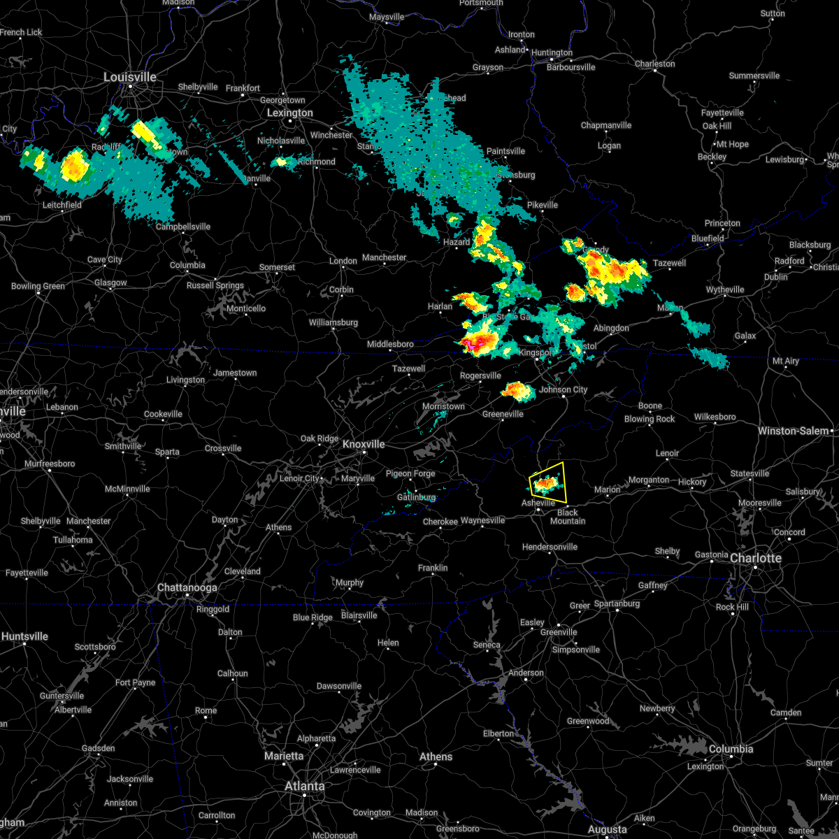
| 9/13/2019 4:36 PM EDT |
 The severe thunderstorm warning for southeastern madison and north central buncombe counties will expire at 445 pm edt, the storm which prompted the warning has weakened below severe limits, and no longer poses an immediate threat to life or property. therefore the warning will be allowed to expire. however heavy rain is still possible with this thunderstorm. if you observed large hail or wind damage, please report it to the national weather service greenville-spartanburg by calling toll free, 1, 800, 2 6 7, 8 1 0 1, or by posting on our facebook page, or tweet it using hashtag nwsgsp. your message should describe the event and the specific location where it occurred. The severe thunderstorm warning for southeastern madison and north central buncombe counties will expire at 445 pm edt, the storm which prompted the warning has weakened below severe limits, and no longer poses an immediate threat to life or property. therefore the warning will be allowed to expire. however heavy rain is still possible with this thunderstorm. if you observed large hail or wind damage, please report it to the national weather service greenville-spartanburg by calling toll free, 1, 800, 2 6 7, 8 1 0 1, or by posting on our facebook page, or tweet it using hashtag nwsgsp. your message should describe the event and the specific location where it occurred.
|
| 9/13/2019 4:06 PM EDT |
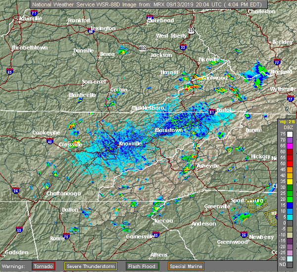 At 405 pm edt, a severe thunderstorm was located 5 miles east of marshall, or near mars hill, and is nearly stationary (radar indicated). Hazards include 60 mph wind gusts and penny size hail. expect damage to trees and power lines At 405 pm edt, a severe thunderstorm was located 5 miles east of marshall, or near mars hill, and is nearly stationary (radar indicated). Hazards include 60 mph wind gusts and penny size hail. expect damage to trees and power lines
|
| 8/13/2019 2:15 PM EDT |
 At 215 pm edt, severe thunderstorms were located along a line extending from 12 miles southwest of erwin to 17 miles west of burnsville to 5 miles southwest of marshall, moving southeast at 25 mph (radar indicated). Hazards include 60 mph wind gusts. Expect damage to trees and power lines. Locations impacted include, burnsville, marshall, swannanoa, weaverville, mars hill, ramseytown, green mountain, swiss and flat creek. At 215 pm edt, severe thunderstorms were located along a line extending from 12 miles southwest of erwin to 17 miles west of burnsville to 5 miles southwest of marshall, moving southeast at 25 mph (radar indicated). Hazards include 60 mph wind gusts. Expect damage to trees and power lines. Locations impacted include, burnsville, marshall, swannanoa, weaverville, mars hill, ramseytown, green mountain, swiss and flat creek.
|
| 8/13/2019 1:46 PM EDT |
 At 146 pm edt, a severe thunderstorm was located 13 miles south of greeneville, or 5 miles north of hot springs, moving southeast at 30 mph (radar indicated). Hazards include 60 mph wind gusts and penny size hail. expect damage to trees and power lines At 146 pm edt, a severe thunderstorm was located 13 miles south of greeneville, or 5 miles north of hot springs, moving southeast at 30 mph (radar indicated). Hazards include 60 mph wind gusts and penny size hail. expect damage to trees and power lines
|
| 6/22/2019 12:31 AM EDT |
 At 1231 am edt, severe thunderstorms were located along a line extending from 6 miles northwest of greeneville to 12 miles northwest of waynesville, moving southeast at 40 mph (radar indicated). Hazards include 60 mph wind gusts and nickel size hail. expect damage to trees and power lines At 1231 am edt, severe thunderstorms were located along a line extending from 6 miles northwest of greeneville to 12 miles northwest of waynesville, moving southeast at 40 mph (radar indicated). Hazards include 60 mph wind gusts and nickel size hail. expect damage to trees and power lines
|
| 8/30/2018 3:58 PM EDT |
 At 343 pm edt, a severe thunderstorm was located 12 miles east of marshall, or 6 miles north of b.r. parkway-east asheville to craggy gardens, and is nearly stationary (radar indicated). Hazards include 60 mph wind gusts and quarter size hail. Minor hail damage to vehicles is expected. Expect wind damage to trees and power lines. At 343 pm edt, a severe thunderstorm was located 12 miles east of marshall, or 6 miles north of b.r. parkway-east asheville to craggy gardens, and is nearly stationary (radar indicated). Hazards include 60 mph wind gusts and quarter size hail. Minor hail damage to vehicles is expected. Expect wind damage to trees and power lines.
|
| 8/30/2018 3:43 PM EDT |
 At 343 pm edt, a severe thunderstorm was located 12 miles east of marshall, or 6 miles north of b.r. parkway-east asheville to craggy gardens, and is nearly stationary (radar indicated). Hazards include 60 mph wind gusts and quarter size hail. Minor hail damage to vehicles is expected. Expect wind damage to trees and power lines. At 343 pm edt, a severe thunderstorm was located 12 miles east of marshall, or 6 miles north of b.r. parkway-east asheville to craggy gardens, and is nearly stationary (radar indicated). Hazards include 60 mph wind gusts and quarter size hail. Minor hail damage to vehicles is expected. Expect wind damage to trees and power lines.
|
| 7/20/2018 10:51 PM EDT |
 At 1050 pm edt, severe thunderstorms were located along a line extending from near johnson city to 6 miles south of newport, moving southeast at 40 mph (radar indicated). Hazards include 60 mph wind gusts and penny size hail. expect damage to trees and power lines At 1050 pm edt, severe thunderstorms were located along a line extending from near johnson city to 6 miles south of newport, moving southeast at 40 mph (radar indicated). Hazards include 60 mph wind gusts and penny size hail. expect damage to trees and power lines
|
| 6/26/2018 7:14 PM EDT |
 At 713 pm edt, severe thunderstorms were located along a line extending from near downtown asheville to 14 miles northwest of hendersonville to 9 miles northwest of brevard, moving southeast at 30 mph (radar indicated). Hazards include 60 mph wind gusts and quarter size hail. Minor hail damage to vehicles is expected. expect wind damage to trees and power lines. Locations impacted include, downtown asheville, waynesville, east asheville, arden, west asheville, north asheville, mills river, woodfin, fletcher and canton. At 713 pm edt, severe thunderstorms were located along a line extending from near downtown asheville to 14 miles northwest of hendersonville to 9 miles northwest of brevard, moving southeast at 30 mph (radar indicated). Hazards include 60 mph wind gusts and quarter size hail. Minor hail damage to vehicles is expected. expect wind damage to trees and power lines. Locations impacted include, downtown asheville, waynesville, east asheville, arden, west asheville, north asheville, mills river, woodfin, fletcher and canton.
|
| 6/26/2018 6:49 PM EDT |
 At 648 pm edt, severe thunderstorms were located along a line extending from near marshall to 13 miles west of downtown asheville to 3 miles northeast of waynesville, moving southeast at 30 mph (radar indicated). Hazards include 60 mph wind gusts and quarter size hail. Minor hail damage to vehicles is expected. Expect wind damage to trees and power lines. At 648 pm edt, severe thunderstorms were located along a line extending from near marshall to 13 miles west of downtown asheville to 3 miles northeast of waynesville, moving southeast at 30 mph (radar indicated). Hazards include 60 mph wind gusts and quarter size hail. Minor hail damage to vehicles is expected. Expect wind damage to trees and power lines.
|
| 6/26/2018 6:18 PM EDT |
 At 618 pm edt, severe thunderstorms were located along a line extending from 12 miles south of greeneville to 16 miles west of marshall, moving east at 20 mph (radar indicated). Hazards include 60 mph wind gusts and penny size hail. expect damage to trees and power lines At 618 pm edt, severe thunderstorms were located along a line extending from 12 miles south of greeneville to 16 miles west of marshall, moving east at 20 mph (radar indicated). Hazards include 60 mph wind gusts and penny size hail. expect damage to trees and power lines
|
| 6/25/2018 4:26 PM EDT |
 At 426 pm edt, severe thunderstorms were located along a line extending from near todd to 8 miles northeast of marion to 12 miles northeast of downtown asheville, moving east at 35 mph (radar indicated). Hazards include 60 mph wind gusts and quarter size hail. Minor hail damage to vehicles is expected. expect wind damage to trees and power lines. Locations impacted include, downtown asheville, marion, spruce pine, burnsville, newland, east asheville, west asheville, north asheville, black mountain and woodfin. At 426 pm edt, severe thunderstorms were located along a line extending from near todd to 8 miles northeast of marion to 12 miles northeast of downtown asheville, moving east at 35 mph (radar indicated). Hazards include 60 mph wind gusts and quarter size hail. Minor hail damage to vehicles is expected. expect wind damage to trees and power lines. Locations impacted include, downtown asheville, marion, spruce pine, burnsville, newland, east asheville, west asheville, north asheville, black mountain and woodfin.
|
| 6/25/2018 4:00 PM EDT |
 At 359 pm edt, severe thunderstorms were located along a line extending from 4 miles north of beech mountain to 11 miles northwest of marion to 6 miles south of marshall, moving east at 35 mph (radar indicated). Hazards include 60 mph wind gusts and quarter size hail. Minor hail damage to vehicles is expected. Expect wind damage to trees and power lines. At 359 pm edt, severe thunderstorms were located along a line extending from 4 miles north of beech mountain to 11 miles northwest of marion to 6 miles south of marshall, moving east at 35 mph (radar indicated). Hazards include 60 mph wind gusts and quarter size hail. Minor hail damage to vehicles is expected. Expect wind damage to trees and power lines.
|
| 6/25/2018 3:38 PM EDT |
 At 338 pm edt, a severe thunderstorm was located near downtown asheville, or near unc asheville, moving east at 15 mph (radar indicated). Hazards include 60 mph wind gusts and quarter size hail. Minor hail damage to vehicles is expected. expect wind damage to trees and power lines. locations impacted include, downtown asheville, east asheville, west asheville, north asheville, woodfin, weaverville, bent creek, leicester, unc asheville and b. r. Parkway-east asheville to craggy gardens. At 338 pm edt, a severe thunderstorm was located near downtown asheville, or near unc asheville, moving east at 15 mph (radar indicated). Hazards include 60 mph wind gusts and quarter size hail. Minor hail damage to vehicles is expected. expect wind damage to trees and power lines. locations impacted include, downtown asheville, east asheville, west asheville, north asheville, woodfin, weaverville, bent creek, leicester, unc asheville and b. r. Parkway-east asheville to craggy gardens.
|
| 6/25/2018 3:08 PM EDT |
 At 308 pm edt, a severe thunderstorm was located 9 miles west of downtown asheville, or near leicester, moving east at 15 mph (radar indicated). Hazards include 60 mph wind gusts and quarter size hail. Minor hail damage to vehicles is expected. Expect wind damage to trees and power lines. At 308 pm edt, a severe thunderstorm was located 9 miles west of downtown asheville, or near leicester, moving east at 15 mph (radar indicated). Hazards include 60 mph wind gusts and quarter size hail. Minor hail damage to vehicles is expected. Expect wind damage to trees and power lines.
|
| 6/24/2018 5:43 PM EDT |
 At 543 pm edt, a severe thunderstorm was located near downtown asheville, or over unc asheville, moving southeast at 15 mph (radar indicated). Hazards include 60 mph wind gusts and quarter size hail. Minor hail damage to vehicles is expected. expect wind damage to trees and power lines. Locations impacted include, downtown asheville, east asheville, west asheville, north asheville, black mountain, woodfin, swannanoa, weaverville, fairview in buncombe county and biltmore forest. At 543 pm edt, a severe thunderstorm was located near downtown asheville, or over unc asheville, moving southeast at 15 mph (radar indicated). Hazards include 60 mph wind gusts and quarter size hail. Minor hail damage to vehicles is expected. expect wind damage to trees and power lines. Locations impacted include, downtown asheville, east asheville, west asheville, north asheville, black mountain, woodfin, swannanoa, weaverville, fairview in buncombe county and biltmore forest.
|
| 6/24/2018 5:29 PM EDT |
 At 529 pm edt, a severe thunderstorm was located 7 miles northwest of downtown asheville, or near leicester, moving east at 15 mph (radar indicated). Hazards include 60 mph wind gusts and quarter size hail. Minor hail damage to vehicles is expected. Expect wind damage to trees and power lines. At 529 pm edt, a severe thunderstorm was located 7 miles northwest of downtown asheville, or near leicester, moving east at 15 mph (radar indicated). Hazards include 60 mph wind gusts and quarter size hail. Minor hail damage to vehicles is expected. Expect wind damage to trees and power lines.
|
| 5/31/2018 9:03 PM EDT |
 A severe thunderstorm warning remains in effect until 930 pm edt for southwestern mcdowell. northern henderson. east central haywood and buncombe counties. At 903 pm edt, a severe thunderstorm was located 10 miles southeast of downtown asheville, or near fairview in buncombe county, moving southeast at 25 mph. A severe thunderstorm warning remains in effect until 930 pm edt for southwestern mcdowell. northern henderson. east central haywood and buncombe counties. At 903 pm edt, a severe thunderstorm was located 10 miles southeast of downtown asheville, or near fairview in buncombe county, moving southeast at 25 mph.
|
| 5/31/2018 8:41 PM EDT |
 At 840 pm edt, severe thunderstorms were located along a line extending from 12 miles southwest of burnsville to 4 miles north of downtown asheville, moving southeast at 25 mph (radar indicated). Hazards include 60 mph wind gusts. expect damage to trees and power lines At 840 pm edt, severe thunderstorms were located along a line extending from 12 miles southwest of burnsville to 4 miles north of downtown asheville, moving southeast at 25 mph (radar indicated). Hazards include 60 mph wind gusts. expect damage to trees and power lines
|
| 5/31/2018 8:31 PM EDT |
 At 830 pm edt, a severe thunderstorm was located 6 miles south of marshall, or 4 miles north of leicester, moving southeast at 55 mph (radar indicated). Hazards include 60 mph wind gusts. Expect damage to trees and power lines. Locations impacted include, marshall, north asheville, woodfin, weaverville, mars hill, hot springs, leicester, max patch, faust and allenstand. At 830 pm edt, a severe thunderstorm was located 6 miles south of marshall, or 4 miles north of leicester, moving southeast at 55 mph (radar indicated). Hazards include 60 mph wind gusts. Expect damage to trees and power lines. Locations impacted include, marshall, north asheville, woodfin, weaverville, mars hill, hot springs, leicester, max patch, faust and allenstand.
|
| 5/31/2018 8:15 PM EDT |
 At 815 pm edt, a severe thunderstorm was located 8 miles northwest of marshall, or near hot springs, moving southeast at 30 mph (radar indicated). Hazards include 60 mph wind gusts. expect damage to trees and power lines At 815 pm edt, a severe thunderstorm was located 8 miles northwest of marshall, or near hot springs, moving southeast at 30 mph (radar indicated). Hazards include 60 mph wind gusts. expect damage to trees and power lines
|
| 9/5/2017 3:36 PM EDT |
 At 336 pm edt, a severe thunderstorm was located 5 miles east of downtown asheville, or over warren wilson college, moving east at 15 mph (radar indicated). Hazards include 60 mph wind gusts and quarter size hail. Minor hail damage to vehicles is expected. Expect wind damage to trees and power lines. At 336 pm edt, a severe thunderstorm was located 5 miles east of downtown asheville, or over warren wilson college, moving east at 15 mph (radar indicated). Hazards include 60 mph wind gusts and quarter size hail. Minor hail damage to vehicles is expected. Expect wind damage to trees and power lines.
|
| 7/18/2017 4:03 PM EDT |
 At 403 pm edt, a severe thunderstorm was located 12 miles east of downtown asheville, or over black mountain, moving west at 10 mph (radar indicated). Hazards include 60 mph wind gusts and quarter size hail. Minor hail damage to vehicles is expected. Expect wind damage to trees and power lines. At 403 pm edt, a severe thunderstorm was located 12 miles east of downtown asheville, or over black mountain, moving west at 10 mph (radar indicated). Hazards include 60 mph wind gusts and quarter size hail. Minor hail damage to vehicles is expected. Expect wind damage to trees and power lines.
|
| 7/14/2017 3:49 PM EDT |
 At 349 pm edt, a severe thunderstorm was located 4 miles east of downtown asheville, or near warren wilson college, moving east at 15 mph (radar indicated). Hazards include 60 mph wind gusts and quarter size hail. Minor hail damage to vehicles is expected. Expect wind damage to trees and power lines. At 349 pm edt, a severe thunderstorm was located 4 miles east of downtown asheville, or near warren wilson college, moving east at 15 mph (radar indicated). Hazards include 60 mph wind gusts and quarter size hail. Minor hail damage to vehicles is expected. Expect wind damage to trees and power lines.
|
| 5/28/2017 12:27 AM EDT |
 The severe thunderstorm warning for northeastern transylvania, western henderson, madison, buncombe and northwestern yancey counties will expire at 1230 am edt, the storms which prompted the warning have moved out of the area. therefore the warning will be allowed to expire. however gusty winds and heavy rain are still possible with these thunderstorms. a severe thunderstorm watch remains in effect until 200 am edt for western north carolina. a severe thunderstorm watch also remains in effect until 600 am edt for upstate south carolina. The severe thunderstorm warning for northeastern transylvania, western henderson, madison, buncombe and northwestern yancey counties will expire at 1230 am edt, the storms which prompted the warning have moved out of the area. therefore the warning will be allowed to expire. however gusty winds and heavy rain are still possible with these thunderstorms. a severe thunderstorm watch remains in effect until 200 am edt for western north carolina. a severe thunderstorm watch also remains in effect until 600 am edt for upstate south carolina.
|
| 5/27/2017 11:37 PM EDT |
 At 1136 pm edt, severe thunderstorms were located along a line extending from 5 miles west of greeneville to 4 miles northeast of sylva, moving east at 45 mph (radar indicated). Hazards include 60 mph wind gusts and nickel size hail. expect damage to trees and power lines At 1136 pm edt, severe thunderstorms were located along a line extending from 5 miles west of greeneville to 4 miles northeast of sylva, moving east at 45 mph (radar indicated). Hazards include 60 mph wind gusts and nickel size hail. expect damage to trees and power lines
|
| 5/19/2017 12:28 PM EDT |
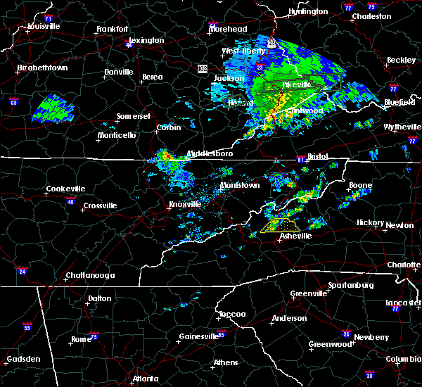 At 1227 pm edt, severe thunderstorms were located along a line extending from 3 miles east of marshall to 11 miles northwest of downtown asheville, moving east at 20 mph (radar indicated). Hazards include 60 mph wind gusts and quarter size hail. Minor hail damage to vehicles is expected. expect wind damage to trees and power lines. locations impacted include, weaverville, mars hill, canto, barnardsville, marshall, b. r. parkway-east asheville to craggy gardens and b. r. Parkway-craggy to little switzerland. At 1227 pm edt, severe thunderstorms were located along a line extending from 3 miles east of marshall to 11 miles northwest of downtown asheville, moving east at 20 mph (radar indicated). Hazards include 60 mph wind gusts and quarter size hail. Minor hail damage to vehicles is expected. expect wind damage to trees and power lines. locations impacted include, weaverville, mars hill, canto, barnardsville, marshall, b. r. parkway-east asheville to craggy gardens and b. r. Parkway-craggy to little switzerland.
|
| 5/19/2017 12:14 PM EDT |
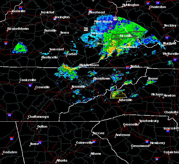 At 1214 pm edt, a severe thunderstorm was located near marshall, moving east at 30 mph (radar indicated). Hazards include 60 mph wind gusts and quarter size hail. Minor hail damage to vehicles is expected. Expect wind damage to trees and power lines. At 1214 pm edt, a severe thunderstorm was located near marshall, moving east at 30 mph (radar indicated). Hazards include 60 mph wind gusts and quarter size hail. Minor hail damage to vehicles is expected. Expect wind damage to trees and power lines.
|
| 7/27/2016 8:33 PM EDT |
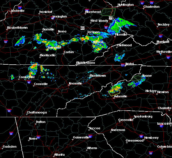 At 831 pm edt, severe thunderstorms were located along a line extending from 9 miles west of burnsville to near marshall, moving east at 15 mph (radar indicated). Hazards include 60 mph wind gusts and quarter size hail. Hail damage to vehicles is expected. expect wind damage to roofs, siding and trees. Locations impacted include, marshall, weaverville, mars hill, barnardsville and woodfin. At 831 pm edt, severe thunderstorms were located along a line extending from 9 miles west of burnsville to near marshall, moving east at 15 mph (radar indicated). Hazards include 60 mph wind gusts and quarter size hail. Hail damage to vehicles is expected. expect wind damage to roofs, siding and trees. Locations impacted include, marshall, weaverville, mars hill, barnardsville and woodfin.
|
| 7/27/2016 8:15 PM EDT |
 At 815 pm edt, severe thunderstorms were located along a line extending from 9 miles west of burnsville to near marshall, moving southeast at 15 mph (radar indicated). Hazards include 60 mph wind gusts and quarter size hail. Hail damage to vehicles is expected. expect wind damage to roofs, siding and trees. Locations impacted include, marshall, weaverville, mars hill, faust, barnardsville, swiss and woodfin. At 815 pm edt, severe thunderstorms were located along a line extending from 9 miles west of burnsville to near marshall, moving southeast at 15 mph (radar indicated). Hazards include 60 mph wind gusts and quarter size hail. Hail damage to vehicles is expected. expect wind damage to roofs, siding and trees. Locations impacted include, marshall, weaverville, mars hill, faust, barnardsville, swiss and woodfin.
|
| 7/27/2016 7:53 PM EDT |
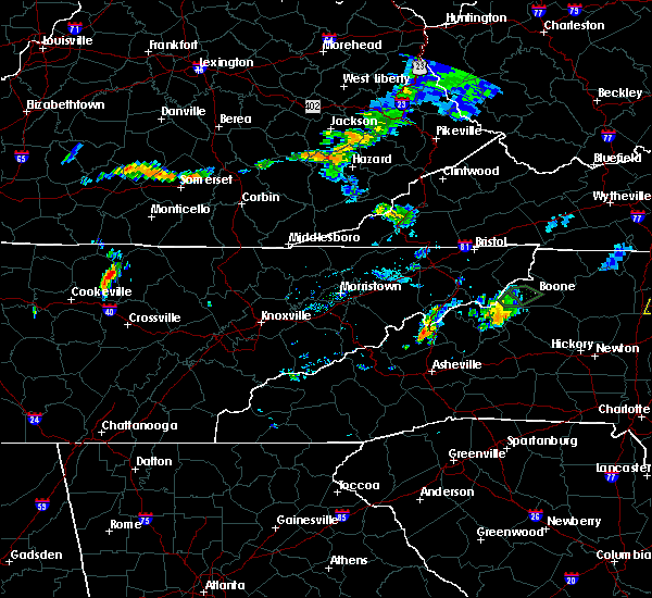 At 752 pm edt, a severe thunderstorm was located 5 miles northeast of marshall, or near mars hill, moving east at 15 mph (radar indicated). Hazards include 60 mph wind gusts and penny size hail. Expect damage to roofs. Siding and trees. At 752 pm edt, a severe thunderstorm was located 5 miles northeast of marshall, or near mars hill, moving east at 15 mph (radar indicated). Hazards include 60 mph wind gusts and penny size hail. Expect damage to roofs. Siding and trees.
|
| 7/14/2016 6:00 PM EDT | Strong winds blew down a sourwood tree onto a car. time estimated by radar dat in buncombe county NC, 0.5 miles ESE of Weaverville, NC |
| 7/7/2016 7:59 PM EDT |
 At 759 pm edt, severe thunderstorms were located along a line extending from 12 miles southwest of greeneville to 5 miles west of waynesville, moving southeast at 60 mph (radar indicated). Hazards include 60 mph wind gusts. Expect damage to roofs. Siding and trees. At 759 pm edt, severe thunderstorms were located along a line extending from 12 miles southwest of greeneville to 5 miles west of waynesville, moving southeast at 60 mph (radar indicated). Hazards include 60 mph wind gusts. Expect damage to roofs. Siding and trees.
|
| 7/6/2016 9:07 PM EDT |
 The severe thunderstorm warning for madison, west central yancey and northwestern buncombe counties will expire at 915 pm edt, the storm which prompted the warning has weakened below severe limits, and have exited the warned area. therefore the warning will be allowed to expire. The severe thunderstorm warning for madison, west central yancey and northwestern buncombe counties will expire at 915 pm edt, the storm which prompted the warning has weakened below severe limits, and have exited the warned area. therefore the warning will be allowed to expire.
|
| 7/6/2016 8:29 PM EDT |
 At 829 pm edt, a severe thunderstorm was located near marshall, moving southeast at 20 mph (radar indicated). Hazards include 60 mph wind gusts. Expect damage to roofs. Siding and trees. At 829 pm edt, a severe thunderstorm was located near marshall, moving southeast at 20 mph (radar indicated). Hazards include 60 mph wind gusts. Expect damage to roofs. Siding and trees.
|
| 5/1/2016 4:20 PM EDT | Quarter sized hail reported 6.8 miles WSW of Weaverville, NC |
| 5/1/2016 4:07 PM EDT |
 At 407 pm edt, a severe thunderstorm was located 9 miles east of marshall, or near mars hill, moving east at 20 mph (radar indicated). Hazards include 60 mph wind gusts and quarter size hail. Hail damage to vehicles is expected. Expect wind damage to roofs, siding and trees. At 407 pm edt, a severe thunderstorm was located 9 miles east of marshall, or near mars hill, moving east at 20 mph (radar indicated). Hazards include 60 mph wind gusts and quarter size hail. Hail damage to vehicles is expected. Expect wind damage to roofs, siding and trees.
|
| 7/13/2015 7:48 PM EDT |
 At 747 pm edt, doppler radar indicated a line of severe thunderstorms with a history of producing damaging winds in excess of 60 mph. these storms were located along a line extending from 7 miles south of burnsville to 10 miles north of downtown asheville to 5 miles southwest of marshall, moving southeast at 35 mph. penny size hail may also accompany the damaging winds. locations impacted include, asheville, marshall, black mountain, woodfin, swannanoa, weaverville, fairview in buncombe county, biltmore forest, bent creek and old fort. At 747 pm edt, doppler radar indicated a line of severe thunderstorms with a history of producing damaging winds in excess of 60 mph. these storms were located along a line extending from 7 miles south of burnsville to 10 miles north of downtown asheville to 5 miles southwest of marshall, moving southeast at 35 mph. penny size hail may also accompany the damaging winds. locations impacted include, asheville, marshall, black mountain, woodfin, swannanoa, weaverville, fairview in buncombe county, biltmore forest, bent creek and old fort.
|
| 7/13/2015 7:29 PM EDT |
 At 729 pm edt, doppler radar indicated a line of severe thunderstorms with a history of producing damaging winds in excess of 60 mph. these storms were located along a line extending from 4 miles west of burnsville to 3 miles northeast of marshall to 20 miles southeast of newport, and moving southeast at 35 mph. penny size hail may also accompany the damaging winds. At 729 pm edt, doppler radar indicated a line of severe thunderstorms with a history of producing damaging winds in excess of 60 mph. these storms were located along a line extending from 4 miles west of burnsville to 3 miles northeast of marshall to 20 miles southeast of newport, and moving southeast at 35 mph. penny size hail may also accompany the damaging winds.
|
| 6/19/2015 6:25 PM EDT |
 At 625 pm edt, doppler radar indicated a severe thunderstorm capable of producing quarter size hail and damaging winds in excess of 60 mph. this storm was located 9 miles southwest of west asheville, or near b.r. parkway, mount pisgah to the nc arboretum, moving northeast at 15 mph. locations impacted include, west asheville, east asheville, north asheville, downtown asheville, arden, asheville airport, skyland, mills river, woodfin and fletcher. At 625 pm edt, doppler radar indicated a severe thunderstorm capable of producing quarter size hail and damaging winds in excess of 60 mph. this storm was located 9 miles southwest of west asheville, or near b.r. parkway, mount pisgah to the nc arboretum, moving northeast at 15 mph. locations impacted include, west asheville, east asheville, north asheville, downtown asheville, arden, asheville airport, skyland, mills river, woodfin and fletcher.
|
| 6/19/2015 6:05 PM EDT |
 At 605 pm edt, doppler radar indicated a severe thunderstorm capable of producing quarter size hail and damaging winds in excess of 60 mph. this storm was located 11 miles southwest of west asheville, or near b.r. parkway, mount pisgah to the nc arboretum, and moving northeast at 15 mph. At 605 pm edt, doppler radar indicated a severe thunderstorm capable of producing quarter size hail and damaging winds in excess of 60 mph. this storm was located 11 miles southwest of west asheville, or near b.r. parkway, mount pisgah to the nc arboretum, and moving northeast at 15 mph.
|
| 5/27/2015 4:33 PM EDT | At 433 pm edt, doppler radar indicated a severe thunderstorm capable of producing quarter size hail and damaging winds in excess of 60 mph. this storm was located near marshall, and moving northeast at 20 mph. |
| 7/2/2014 6:29 PM EDT | Quarter sized hail reported 0.5 miles ESE of Weaverville, NC, dime to quarter size hail. |
| 7/2/2014 6:29 PM EDT | Tree down in yar in buncombe county NC, 0.5 miles ESE of Weaverville, NC |
| 7/2/2014 6:25 PM EDT | Quarter sized hail reported 1.7 miles NW of Weaverville, NC, nickle to quarter size hail. |
| 7/2/2014 6:22 PM EDT | Storm damage reported in buncombe county NC, 2.4 miles WNW of Weaverville, NC |
| 7/2/2014 6:22 PM EDT | Storm damage reported in buncombe county NC, 2.4 miles WNW of Weaverville, NC |
| 7/2/2014 6:05 PM EDT | Several limbs covering road and marble-sized hai in buncombe county NC, 1.4 miles SE of Weaverville, NC |
| 7/6/2012 4:36 PM EDT | Trees down on greenridge road...monticello road...new stock road...and gill branch roa in buncombe county NC, 2.3 miles SE of Weaverville, NC |
| 7/5/2012 5:40 PM EDT | One tree down near weaverville. time estimated by rada in buncombe county NC, 0.5 miles ESE of Weaverville, NC |
| 4/30/2012 9:30 PM EDT | Quarter sized hail reported 2.4 miles SW of Weaverville, NC |
| 4/30/2012 7:57 PM EDT | Half Dollar sized hail reported 2.3 miles ESE of Weaverville, NC, observed off of new stock rd. |
| 4/1/2012 4:50 PM EDT | Trees and power lines down along indian camp roa in buncombe county NC, 4.8 miles SSE of Weaverville, NC |
| 4/1/2012 4:45 PM EDT | Trees and powerlines down along monticello roa in buncombe county NC, 2.3 miles ESE of Weaverville, NC |
| 1/1/0001 12:00 AM | 1 tree down off clarks chapel r in buncombe county NC, 1.4 miles SE of Weaverville, NC |
| 1/1/0001 12:00 AM | In addition to the previously reported tree across clarks chapel road...other large limbs from other trees were also in the road. crops in the area were bent over to th in buncombe county NC, 1.4 miles SE of Weaverville, NC |
| 1/1/0001 12:00 AM | Jupiter fire department knew of at least 2 trees down under where the storm crossed. there were rumors of more trees down back on property of nearby residents. also had in buncombe county NC, 3 miles SSW of Weaverville, NC |
| 1/1/0001 12:00 AM | Quarter sized hail reported 9 miles WSW of Weaverville, NC, quarter hail. tree down on craggy gardens road. |
| 1/1/0001 12:00 AM | Quarter sized hail reported 2.2 miles E of Weaverville, NC |
Hail Maps for Weaverville, NC


Connect with Interactive Hail Maps