

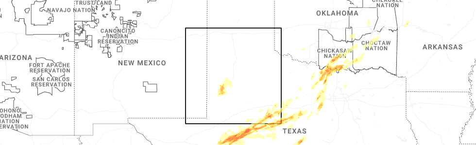
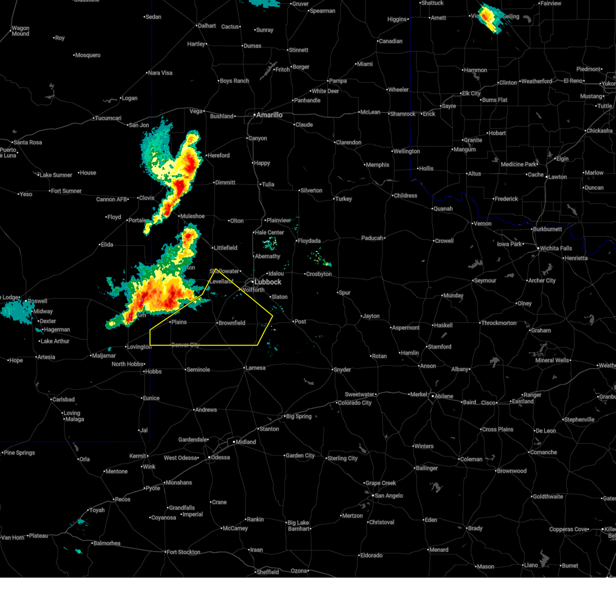
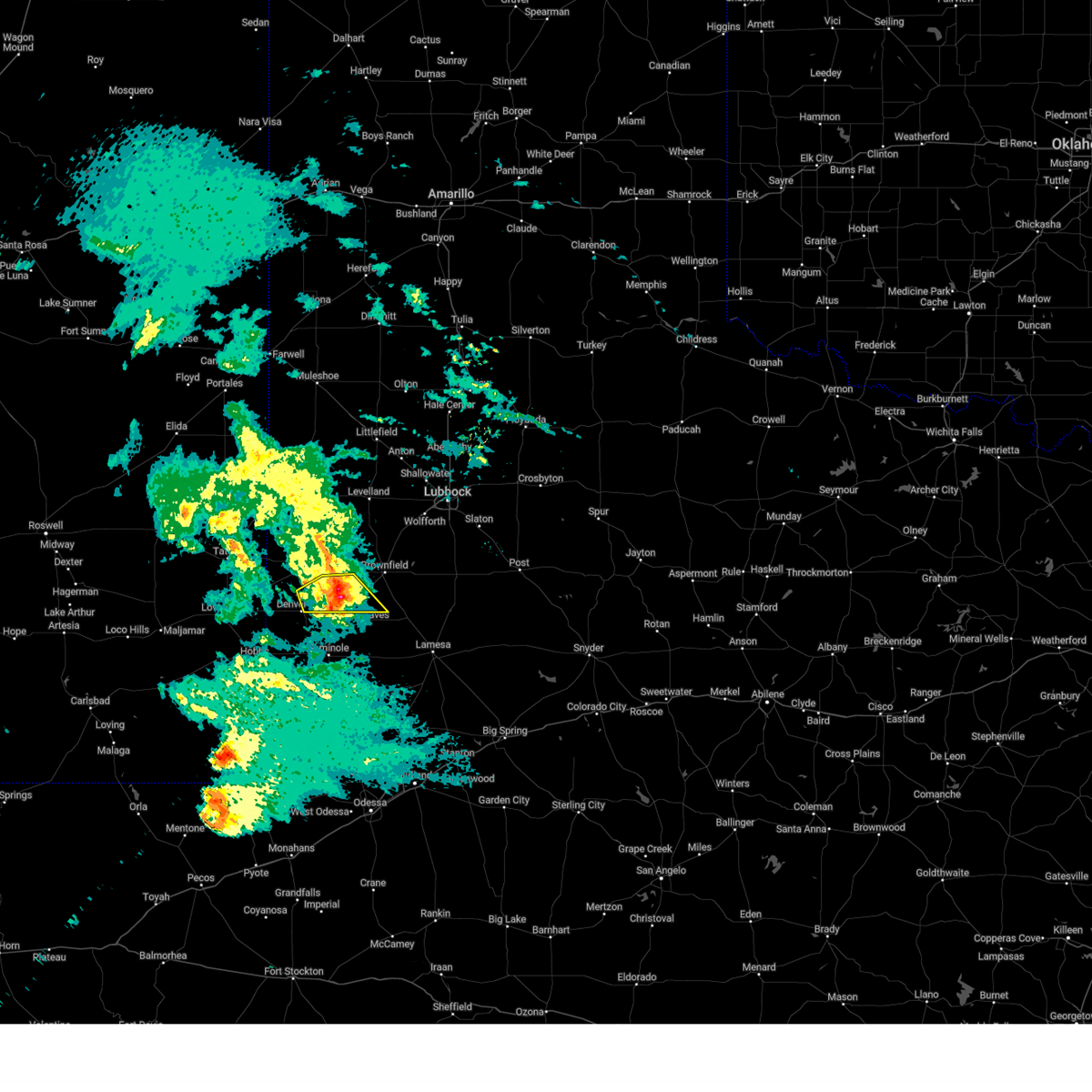
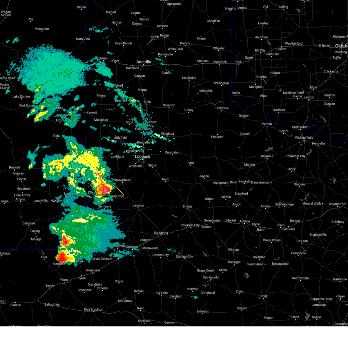
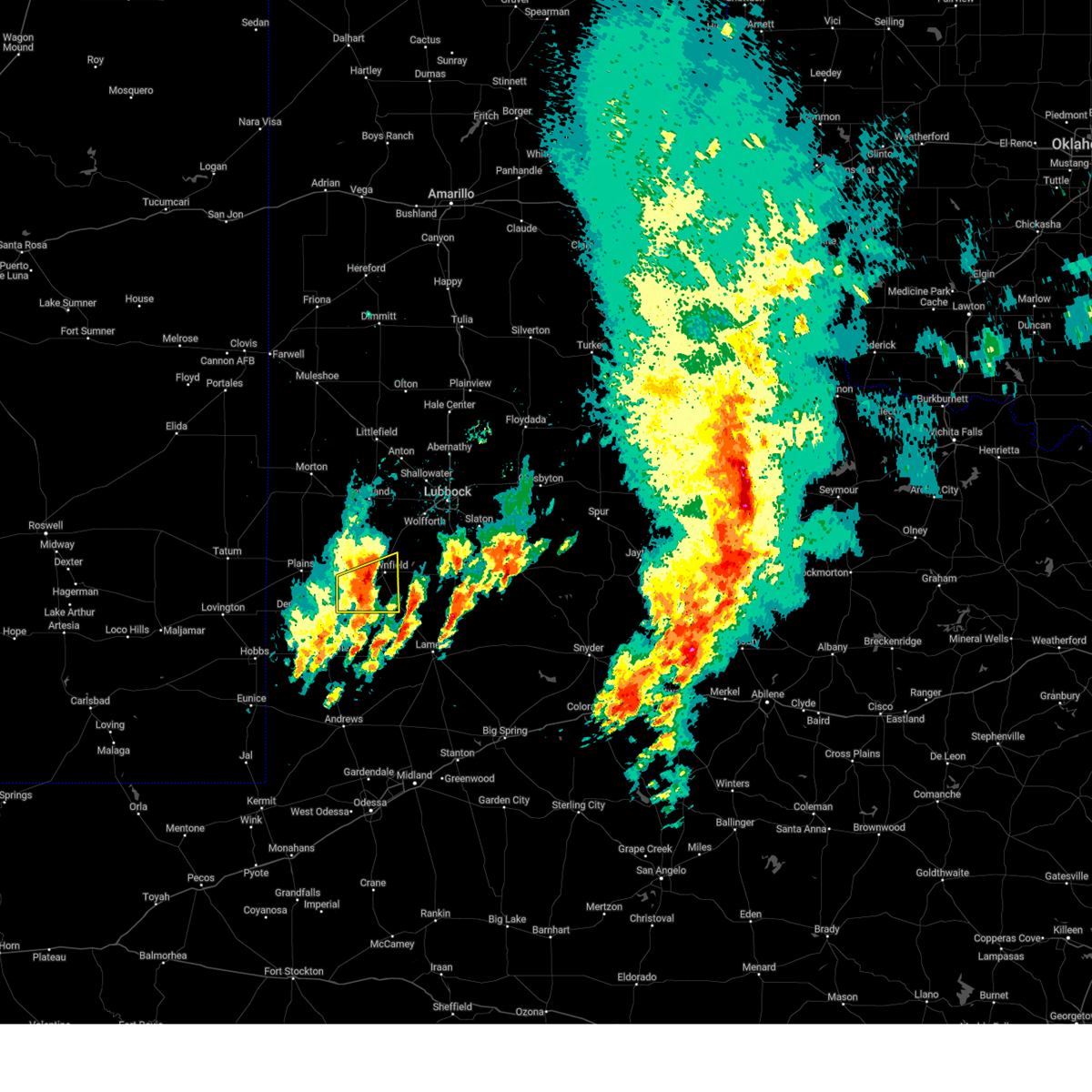
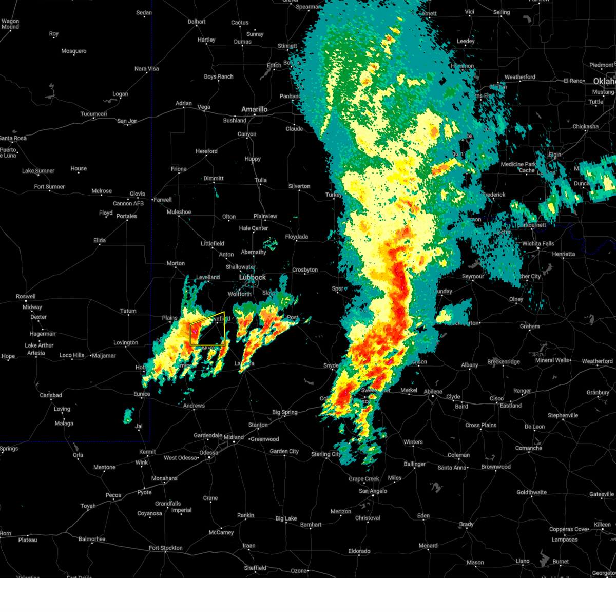
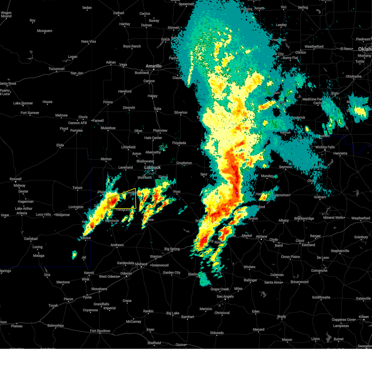
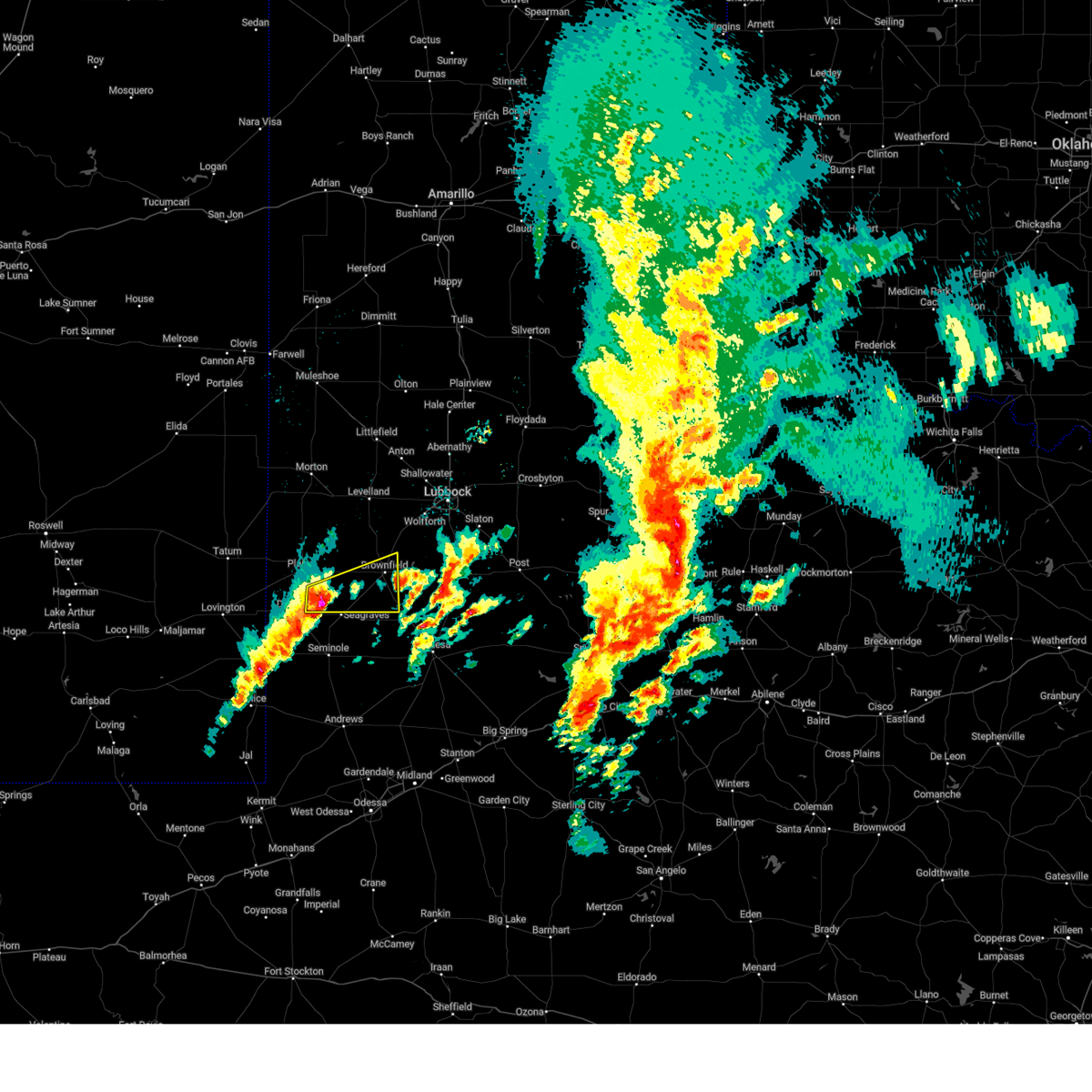
Hail Map for Wellman, TX
The Wellman, TX area has had 1 report of on-the-ground hail by trained spotters, and has been under severe weather warnings 22 times during the past 12 months. Doppler radar has detected hail at or near Wellman, TX on 73 occasions, including 7 occasions during the past year.
| Name: | Wellman, TX |
| Where Located: | 50.1 miles SW of Lubbock, TX |
| Map: | Google Map for Wellman, TX |
| Population: | 203 |
| Housing Units: | 93 |
| More Info: | Search Google for Wellman, TX |
3
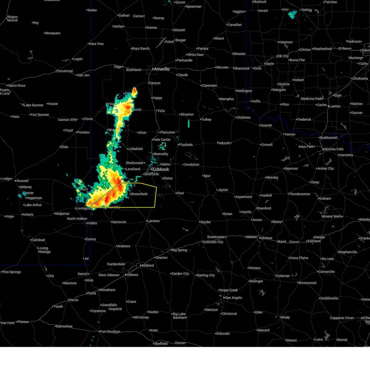
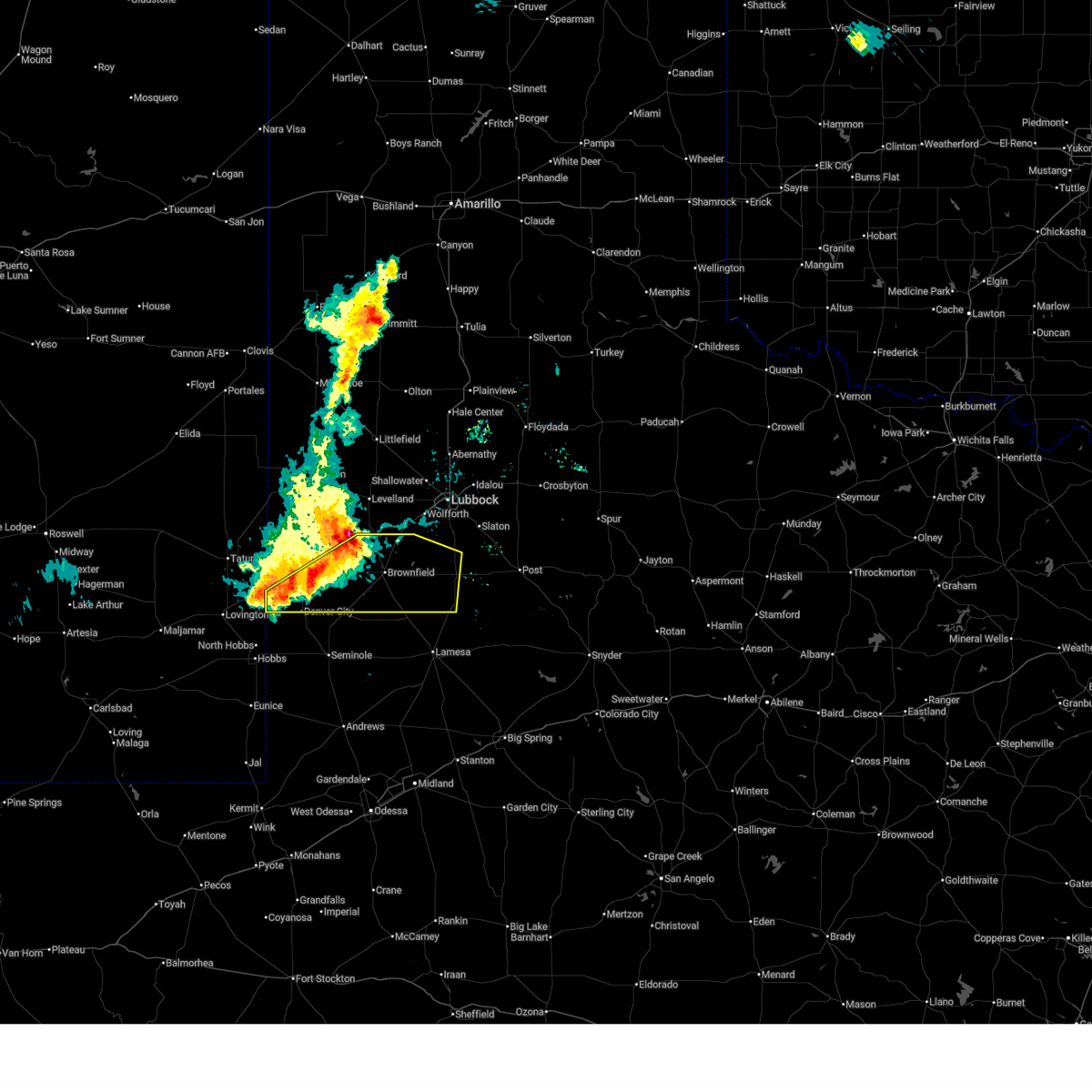
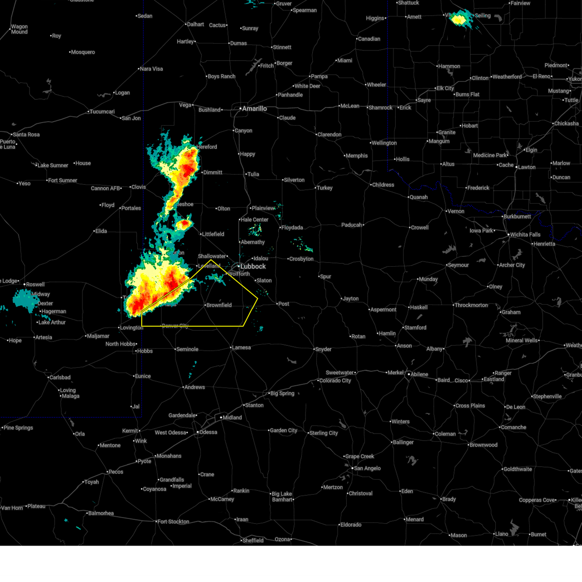
The Top Recent Hail Date for Wellman, TX is Saturday, April 19, 2025 (3rd out of 73)
Hail and Wind Damage Spotted near Wellman, TX
| Date / Time | Report Details |
|---|---|
| 6/13/2025 10:06 PM CDT |
 At 1005 pm cdt, severe thunderstorms were located along a line extending from 11 miles southwest of slide to 7 miles southeast of denver city, moving southeast at 40 mph (radar indicated). Hazards include 70 mph wind gusts. Expect considerable tree damage. damage is likely to mobile homes, roofs, and outbuildings. Locations impacted include, brownfield, denver city, tahoka, o'donnell, new moore, tokio, meadow, new home, and wellman. At 1005 pm cdt, severe thunderstorms were located along a line extending from 11 miles southwest of slide to 7 miles southeast of denver city, moving southeast at 40 mph (radar indicated). Hazards include 70 mph wind gusts. Expect considerable tree damage. damage is likely to mobile homes, roofs, and outbuildings. Locations impacted include, brownfield, denver city, tahoka, o'donnell, new moore, tokio, meadow, new home, and wellman.
|
| 6/13/2025 10:06 PM CDT |
 the severe thunderstorm warning has been cancelled and is no longer in effect the severe thunderstorm warning has been cancelled and is no longer in effect
|
| 6/13/2025 9:52 PM CDT |
 At 951 pm cdt, severe thunderstorms were located along a line extending from 11 miles southwest of slide to denver city, moving southeast at 35 mph (radar indicated). Hazards include 70 mph wind gusts. Expect considerable tree damage. damage is likely to mobile homes, roofs, and outbuildings. Locations impacted include, brownfield, denver city, tahoka, plains, o'donnell, locketville, new moore, tokio, meadow, new home, and wellman. At 951 pm cdt, severe thunderstorms were located along a line extending from 11 miles southwest of slide to denver city, moving southeast at 35 mph (radar indicated). Hazards include 70 mph wind gusts. Expect considerable tree damage. damage is likely to mobile homes, roofs, and outbuildings. Locations impacted include, brownfield, denver city, tahoka, plains, o'donnell, locketville, new moore, tokio, meadow, new home, and wellman.
|
| 6/13/2025 9:52 PM CDT |
 the severe thunderstorm warning has been cancelled and is no longer in effect the severe thunderstorm warning has been cancelled and is no longer in effect
|
| 6/13/2025 9:35 PM CDT |
 At 935 pm cdt, severe thunderstorms were located along a line extending from 7 miles southwest of reese center to 4 miles south of locketville to 8 miles west of denver city, moving southeast at 40 mph (radar indicated). Hazards include 70 mph wind gusts. Expect considerable tree damage. damage is likely to mobile homes, roofs, and outbuildings. Locations impacted include, lubbock, brownfield, denver city, tahoka, plains, wolfforth, o'donnell, new moore, tokio, locketville, slide, meadow, wilson, smyer, ropesville, new home, and wellman. At 935 pm cdt, severe thunderstorms were located along a line extending from 7 miles southwest of reese center to 4 miles south of locketville to 8 miles west of denver city, moving southeast at 40 mph (radar indicated). Hazards include 70 mph wind gusts. Expect considerable tree damage. damage is likely to mobile homes, roofs, and outbuildings. Locations impacted include, lubbock, brownfield, denver city, tahoka, plains, wolfforth, o'donnell, new moore, tokio, locketville, slide, meadow, wilson, smyer, ropesville, new home, and wellman.
|
| 6/13/2025 9:15 PM CDT |
 Svrlub the national weather service in lubbock texas has issued a * severe thunderstorm warning for, southwestern lubbock county in northwestern texas, lynn county in northwestern texas, terry county in northwestern texas, southeastern hockley county in northwestern texas, yoakum county in northwestern texas, * until 1015 pm cdt. * at 915 pm cdt, severe thunderstorms were located along a line extending from 6 miles southeast of whitharral to 5 miles southeast of sundown to 15 miles southeast of mcdonald, moving southeast at 40 mph (radar indicated). Hazards include 70 mph wind gusts. Expect considerable tree damage. Damage is likely to mobile homes, roofs, and outbuildings. Svrlub the national weather service in lubbock texas has issued a * severe thunderstorm warning for, southwestern lubbock county in northwestern texas, lynn county in northwestern texas, terry county in northwestern texas, southeastern hockley county in northwestern texas, yoakum county in northwestern texas, * until 1015 pm cdt. * at 915 pm cdt, severe thunderstorms were located along a line extending from 6 miles southeast of whitharral to 5 miles southeast of sundown to 15 miles southeast of mcdonald, moving southeast at 40 mph (radar indicated). Hazards include 70 mph wind gusts. Expect considerable tree damage. Damage is likely to mobile homes, roofs, and outbuildings.
|
| 5/26/2025 10:15 PM CDT |
 At 1014 pm cdt, a severe thunderstorm was located 10 miles south of brownfield, moving southeast at 35 mph (radar indicated). Hazards include golf ball size hail and 60 mph wind gusts. People and animals outdoors will be injured. expect hail damage to roofs, siding, windows, and vehicles. expect wind damage to roofs, siding, and trees. Locations impacted include, brownfield and wellman. At 1014 pm cdt, a severe thunderstorm was located 10 miles south of brownfield, moving southeast at 35 mph (radar indicated). Hazards include golf ball size hail and 60 mph wind gusts. People and animals outdoors will be injured. expect hail damage to roofs, siding, windows, and vehicles. expect wind damage to roofs, siding, and trees. Locations impacted include, brownfield and wellman.
|
| 5/26/2025 10:10 PM CDT |
 At 1010 pm cdt, a severe thunderstorm was located 10 miles southwest of brownfield, moving southeast at 35 mph (radar indicated). Hazards include ping pong ball size hail and 60 mph wind gusts. People and animals outdoors will be injured. expect hail damage to roofs, siding, windows, and vehicles. expect wind damage to roofs, siding, and trees. Locations impacted include, brownfield and wellman. At 1010 pm cdt, a severe thunderstorm was located 10 miles southwest of brownfield, moving southeast at 35 mph (radar indicated). Hazards include ping pong ball size hail and 60 mph wind gusts. People and animals outdoors will be injured. expect hail damage to roofs, siding, windows, and vehicles. expect wind damage to roofs, siding, and trees. Locations impacted include, brownfield and wellman.
|
| 5/26/2025 10:04 PM CDT |
 At 1003 pm cdt, a severe thunderstorm was located 5 miles southeast of tokio, or 13 miles west of brownfield, moving southeast at 30 mph (radar indicated). Hazards include ping pong ball size hail and 60 mph wind gusts. People and animals outdoors will be injured. expect hail damage to roofs, siding, windows, and vehicles. expect wind damage to roofs, siding, and trees. Locations impacted include, brownfield, tokio, and wellman. At 1003 pm cdt, a severe thunderstorm was located 5 miles southeast of tokio, or 13 miles west of brownfield, moving southeast at 30 mph (radar indicated). Hazards include ping pong ball size hail and 60 mph wind gusts. People and animals outdoors will be injured. expect hail damage to roofs, siding, windows, and vehicles. expect wind damage to roofs, siding, and trees. Locations impacted include, brownfield, tokio, and wellman.
|
| 5/26/2025 10:00 PM CDT |
 At 1000 pm cdt, a severe thunderstorm was located 5 miles southeast of tokio, or 12 miles north of seagraves, moving southeast at 30 mph (radar indicated). Hazards include 60 mph wind gusts and quarter size hail. Hail damage to vehicles is expected. expect wind damage to roofs, siding, and trees. Locations impacted include, brownfield, tokio, and wellman. At 1000 pm cdt, a severe thunderstorm was located 5 miles southeast of tokio, or 12 miles north of seagraves, moving southeast at 30 mph (radar indicated). Hazards include 60 mph wind gusts and quarter size hail. Hail damage to vehicles is expected. expect wind damage to roofs, siding, and trees. Locations impacted include, brownfield, tokio, and wellman.
|
| 5/26/2025 10:00 PM CDT |
 the severe thunderstorm warning has been cancelled and is no longer in effect the severe thunderstorm warning has been cancelled and is no longer in effect
|
| 5/26/2025 9:52 PM CDT |
 Svrlub the national weather service in lubbock texas has issued a * severe thunderstorm warning for, southern terry county in northwestern texas, southeastern yoakum county in northwestern texas, * until 1045 pm cdt. * at 951 pm cdt, a severe thunderstorm was located over tokio, or 13 miles east of plains, moving southeast at 30 mph (radar indicated). Hazards include 60 mph wind gusts and quarter size hail. Hail damage to vehicles is expected. Expect wind damage to roofs, siding, and trees. Svrlub the national weather service in lubbock texas has issued a * severe thunderstorm warning for, southern terry county in northwestern texas, southeastern yoakum county in northwestern texas, * until 1045 pm cdt. * at 951 pm cdt, a severe thunderstorm was located over tokio, or 13 miles east of plains, moving southeast at 30 mph (radar indicated). Hazards include 60 mph wind gusts and quarter size hail. Hail damage to vehicles is expected. Expect wind damage to roofs, siding, and trees.
|
| 5/4/2025 8:07 PM CDT |
 the severe thunderstorm warning has been cancelled and is no longer in effect the severe thunderstorm warning has been cancelled and is no longer in effect
|
| 5/4/2025 7:45 PM CDT |
 Svrlub the national weather service in lubbock texas has issued a * severe thunderstorm warning for, southwestern terry county in northwestern texas, southeastern yoakum county in northwestern texas, * until 830 pm cdt. * at 745 pm cdt, a severe thunderstorm was located 6 miles north of seagraves, moving southeast at 10 mph (radar indicated). Hazards include 60 mph wind gusts and quarter size hail. Hail damage to vehicles is expected. Expect wind damage to roofs, siding, and trees. Svrlub the national weather service in lubbock texas has issued a * severe thunderstorm warning for, southwestern terry county in northwestern texas, southeastern yoakum county in northwestern texas, * until 830 pm cdt. * at 745 pm cdt, a severe thunderstorm was located 6 miles north of seagraves, moving southeast at 10 mph (radar indicated). Hazards include 60 mph wind gusts and quarter size hail. Hail damage to vehicles is expected. Expect wind damage to roofs, siding, and trees.
|
| 4/30/2025 4:05 AM CDT |
 the severe thunderstorm warning has been cancelled and is no longer in effect the severe thunderstorm warning has been cancelled and is no longer in effect
|
| 4/30/2025 3:50 AM CDT |
 the severe thunderstorm warning has been cancelled and is no longer in effect the severe thunderstorm warning has been cancelled and is no longer in effect
|
| 4/30/2025 3:50 AM CDT |
 At 350 am cdt, a severe thunderstorm was located 7 miles southeast of tokio, or 11 miles north of seagraves, moving east at 25 mph (radar indicated). Hazards include 60 mph wind gusts and quarter size hail. Hail damage to vehicles is expected. expect wind damage to roofs, siding, and trees. Locations impacted include, wellman and brownfield. At 350 am cdt, a severe thunderstorm was located 7 miles southeast of tokio, or 11 miles north of seagraves, moving east at 25 mph (radar indicated). Hazards include 60 mph wind gusts and quarter size hail. Hail damage to vehicles is expected. expect wind damage to roofs, siding, and trees. Locations impacted include, wellman and brownfield.
|
| 4/30/2025 3:43 AM CDT |
 At 343 am cdt, a severe thunderstorm was located 6 miles south of tokio, or 9 miles north of seagraves, moving east at 30 mph (radar indicated). Hazards include 60 mph wind gusts and quarter size hail. Hail damage to vehicles is expected. expect wind damage to roofs, siding, and trees. Locations impacted include, wellman and brownfield. At 343 am cdt, a severe thunderstorm was located 6 miles south of tokio, or 9 miles north of seagraves, moving east at 30 mph (radar indicated). Hazards include 60 mph wind gusts and quarter size hail. Hail damage to vehicles is expected. expect wind damage to roofs, siding, and trees. Locations impacted include, wellman and brownfield.
|
| 4/30/2025 3:31 AM CDT |
 Svrlub the national weather service in lubbock texas has issued a * severe thunderstorm warning for, southern terry county in northwestern texas, southeastern yoakum county in northwestern texas, * until 430 am cdt. * at 331 am cdt, a severe thunderstorm was located 7 miles northwest of seagraves, moving east at 25 mph (radar indicated). Hazards include ping pong ball size hail and 60 mph wind gusts. People and animals outdoors will be injured. expect hail damage to roofs, siding, windows, and vehicles. Expect wind damage to roofs, siding, and trees. Svrlub the national weather service in lubbock texas has issued a * severe thunderstorm warning for, southern terry county in northwestern texas, southeastern yoakum county in northwestern texas, * until 430 am cdt. * at 331 am cdt, a severe thunderstorm was located 7 miles northwest of seagraves, moving east at 25 mph (radar indicated). Hazards include ping pong ball size hail and 60 mph wind gusts. People and animals outdoors will be injured. expect hail damage to roofs, siding, windows, and vehicles. Expect wind damage to roofs, siding, and trees.
|
| 4/30/2025 12:23 AM CDT | Svrlub the national weather service in lubbock texas has issued a * severe thunderstorm warning for, terry county in northwestern texas, * until 115 am cdt. * at 1223 am cdt, a severe thunderstorm was located near seagraves airport, or 4 miles northeast of seagraves, moving northeast at 30 mph (radar indicated). Hazards include 60 mph wind gusts and half dollar size hail. Hail damage to vehicles is expected. Expect wind damage to roofs, siding, and trees. |
| 4/28/2025 11:31 PM CDT |
 Svrlub the national weather service in lubbock texas has issued a * severe thunderstorm warning for, lynn county in northwestern texas, southeastern terry county in northwestern texas, southeastern hockley county in northwestern texas, * until 1230 am cdt. * at 1131 pm cdt, a severe thunderstorm was located 4 miles northwest of welch, or 14 miles southeast of brownfield, moving northeast at 40 mph (radar indicated). Hazards include 60 mph wind gusts and quarter size hail. Hail damage to vehicles is expected. Expect wind damage to roofs, siding, and trees. Svrlub the national weather service in lubbock texas has issued a * severe thunderstorm warning for, lynn county in northwestern texas, southeastern terry county in northwestern texas, southeastern hockley county in northwestern texas, * until 1230 am cdt. * at 1131 pm cdt, a severe thunderstorm was located 4 miles northwest of welch, or 14 miles southeast of brownfield, moving northeast at 40 mph (radar indicated). Hazards include 60 mph wind gusts and quarter size hail. Hail damage to vehicles is expected. Expect wind damage to roofs, siding, and trees.
|
| 4/19/2025 9:30 PM CDT |
 Svrlub the national weather service in lubbock texas has issued a * severe thunderstorm warning for, southwestern lubbock county in northwestern texas, lynn county in northwestern texas, terry county in northwestern texas, southeastern hockley county in northwestern texas, * until 1030 pm cdt. * at 929 pm cdt, severe thunderstorms were located along a line extending from 8 miles north of tokio to 7 miles southwest of brownfield to 11 miles east of seagraves airport, moving east at 50 mph (radar indicated). Hazards include 60 mph wind gusts and quarter size hail. Hail damage to vehicles is expected. Expect wind damage to roofs, siding, and trees. Svrlub the national weather service in lubbock texas has issued a * severe thunderstorm warning for, southwestern lubbock county in northwestern texas, lynn county in northwestern texas, terry county in northwestern texas, southeastern hockley county in northwestern texas, * until 1030 pm cdt. * at 929 pm cdt, severe thunderstorms were located along a line extending from 8 miles north of tokio to 7 miles southwest of brownfield to 11 miles east of seagraves airport, moving east at 50 mph (radar indicated). Hazards include 60 mph wind gusts and quarter size hail. Hail damage to vehicles is expected. Expect wind damage to roofs, siding, and trees.
|
| 6/16/2024 2:45 AM CDT |
 the severe thunderstorm warning has been cancelled and is no longer in effect the severe thunderstorm warning has been cancelled and is no longer in effect
|
| 6/16/2024 2:31 AM CDT |
 At 230 am cdt, severe thunderstorms were located along a line extending from 8 miles northeast of brownfield to 7 miles north of seagraves airport, moving east at 25 mph (radar indicated). Hazards include 60 mph wind gusts and quarter size hail. Hail damage to vehicles is expected. expect wind damage to roofs, siding, and trees. Locations impacted include, brownfield and wellman. At 230 am cdt, severe thunderstorms were located along a line extending from 8 miles northeast of brownfield to 7 miles north of seagraves airport, moving east at 25 mph (radar indicated). Hazards include 60 mph wind gusts and quarter size hail. Hail damage to vehicles is expected. expect wind damage to roofs, siding, and trees. Locations impacted include, brownfield and wellman.
|
| 6/16/2024 2:31 AM CDT |
 the severe thunderstorm warning has been cancelled and is no longer in effect the severe thunderstorm warning has been cancelled and is no longer in effect
|
| 6/16/2024 2:19 AM CDT |
 At 218 am cdt, severe thunderstorms were located along a line extending from 4 miles southeast of locketville to 6 miles southwest of tokio, moving east at 20 mph (radar indicated). Hazards include 60 mph wind gusts and quarter size hail. Hail damage to vehicles is expected. expect wind damage to roofs, siding, and trees. Locations impacted include, brownfield, tokio, meadow, and wellman. At 218 am cdt, severe thunderstorms were located along a line extending from 4 miles southeast of locketville to 6 miles southwest of tokio, moving east at 20 mph (radar indicated). Hazards include 60 mph wind gusts and quarter size hail. Hail damage to vehicles is expected. expect wind damage to roofs, siding, and trees. Locations impacted include, brownfield, tokio, meadow, and wellman.
|
| 6/16/2024 2:01 AM CDT |
 Svrlub the national weather service in lubbock texas has issued a * severe thunderstorm warning for, west central lynn county in northwestern texas, terry county in northwestern texas, east central yoakum county in northwestern texas, * until 300 am cdt. * at 201 am cdt, severe thunderstorms were located along a line extending from 4 miles west of locketville to 4 miles southeast of plains, moving east at 20 mph (radar indicated). Hazards include ping pong ball size hail and 60 mph wind gusts. People and animals outdoors will be injured. expect hail damage to roofs, siding, windows, and vehicles. Expect wind damage to roofs, siding, and trees. Svrlub the national weather service in lubbock texas has issued a * severe thunderstorm warning for, west central lynn county in northwestern texas, terry county in northwestern texas, east central yoakum county in northwestern texas, * until 300 am cdt. * at 201 am cdt, severe thunderstorms were located along a line extending from 4 miles west of locketville to 4 miles southeast of plains, moving east at 20 mph (radar indicated). Hazards include ping pong ball size hail and 60 mph wind gusts. People and animals outdoors will be injured. expect hail damage to roofs, siding, windows, and vehicles. Expect wind damage to roofs, siding, and trees.
|
| 6/15/2024 9:24 PM CDT |
 the severe thunderstorm warning has been cancelled and is no longer in effect the severe thunderstorm warning has been cancelled and is no longer in effect
|
| 6/15/2024 9:24 PM CDT |
 At 924 pm cdt, a severe thunderstorm was located 4 miles northeast of seagraves airport, or 6 miles northeast of seagraves, moving southeast at 25 mph (radar indicated). Hazards include 60 mph wind gusts and half dollar size hail. Hail damage to vehicles is expected. expect wind damage to roofs, siding, and trees. Locations impacted include, wellman. At 924 pm cdt, a severe thunderstorm was located 4 miles northeast of seagraves airport, or 6 miles northeast of seagraves, moving southeast at 25 mph (radar indicated). Hazards include 60 mph wind gusts and half dollar size hail. Hail damage to vehicles is expected. expect wind damage to roofs, siding, and trees. Locations impacted include, wellman.
|
| 6/15/2024 9:13 PM CDT |
 Svrlub the national weather service in lubbock texas has issued a * severe thunderstorm warning for, southwestern terry county in northwestern texas, southeastern yoakum county in northwestern texas, * until 945 pm cdt. * at 913 pm cdt, a severe thunderstorm was located 5 miles north of seagraves airport, or 6 miles north of seagraves, moving southeast at 20 mph (radar indicated). Hazards include ping pong ball size hail and 60 mph wind gusts. People and animals outdoors will be injured. expect hail damage to roofs, siding, windows, and vehicles. Expect wind damage to roofs, siding, and trees. Svrlub the national weather service in lubbock texas has issued a * severe thunderstorm warning for, southwestern terry county in northwestern texas, southeastern yoakum county in northwestern texas, * until 945 pm cdt. * at 913 pm cdt, a severe thunderstorm was located 5 miles north of seagraves airport, or 6 miles north of seagraves, moving southeast at 20 mph (radar indicated). Hazards include ping pong ball size hail and 60 mph wind gusts. People and animals outdoors will be injured. expect hail damage to roofs, siding, windows, and vehicles. Expect wind damage to roofs, siding, and trees.
|
| 6/15/2024 9:08 PM CDT |
 At 908 pm cdt, a severe thunderstorm was located 5 miles north of seagraves airport, or 6 miles north of seagraves, moving southeast at 15 mph (radar indicated). Hazards include 60 mph wind gusts and half dollar size hail. Hail damage to vehicles is expected. expect wind damage to roofs, siding, and trees. Locations impacted include, wellman. At 908 pm cdt, a severe thunderstorm was located 5 miles north of seagraves airport, or 6 miles north of seagraves, moving southeast at 15 mph (radar indicated). Hazards include 60 mph wind gusts and half dollar size hail. Hail damage to vehicles is expected. expect wind damage to roofs, siding, and trees. Locations impacted include, wellman.
|
| 6/15/2024 8:37 PM CDT |
 Svrlub the national weather service in lubbock texas has issued a * severe thunderstorm warning for, southwestern terry county in northwestern texas, east central yoakum county in northwestern texas, * until 915 pm cdt. * at 837 pm cdt, a severe thunderstorm was located 4 miles south of tokio, or 12 miles north of seagraves, moving southeast at 15 mph (radar indicated). Hazards include 60 mph wind gusts and half dollar size hail. Hail damage to vehicles is expected. Expect wind damage to roofs, siding, and trees. Svrlub the national weather service in lubbock texas has issued a * severe thunderstorm warning for, southwestern terry county in northwestern texas, east central yoakum county in northwestern texas, * until 915 pm cdt. * at 837 pm cdt, a severe thunderstorm was located 4 miles south of tokio, or 12 miles north of seagraves, moving southeast at 15 mph (radar indicated). Hazards include 60 mph wind gusts and half dollar size hail. Hail damage to vehicles is expected. Expect wind damage to roofs, siding, and trees.
|
| 6/10/2024 7:12 PM CDT |
 Svrlub the national weather service in lubbock texas has issued a * severe thunderstorm warning for, southern terry county in northwestern texas, * until 745 pm cdt. * at 711 pm cdt, a severe thunderstorm was located 8 miles northeast of seagraves airport, or 9 miles northeast of seagraves, moving east at 30 mph (radar indicated). Hazards include 60 mph wind gusts and quarter size hail. Hail damage to vehicles is expected. Expect wind damage to roofs, siding, and trees. Svrlub the national weather service in lubbock texas has issued a * severe thunderstorm warning for, southern terry county in northwestern texas, * until 745 pm cdt. * at 711 pm cdt, a severe thunderstorm was located 8 miles northeast of seagraves airport, or 9 miles northeast of seagraves, moving east at 30 mph (radar indicated). Hazards include 60 mph wind gusts and quarter size hail. Hail damage to vehicles is expected. Expect wind damage to roofs, siding, and trees.
|
| 6/10/2024 6:53 PM CDT |
 At 653 pm cdt, a severe thunderstorm was located 7 miles south of tokio, or 9 miles north of seagraves, moving east at 20 mph (radar indicated). Hazards include golf ball size hail and 60 mph wind gusts. People and animals outdoors will be injured. expect hail damage to roofs, siding, windows, and vehicles. expect wind damage to roofs, siding, and trees. Locations impacted include, wellman. At 653 pm cdt, a severe thunderstorm was located 7 miles south of tokio, or 9 miles north of seagraves, moving east at 20 mph (radar indicated). Hazards include golf ball size hail and 60 mph wind gusts. People and animals outdoors will be injured. expect hail damage to roofs, siding, windows, and vehicles. expect wind damage to roofs, siding, and trees. Locations impacted include, wellman.
|
| 6/10/2024 6:45 PM CDT |
 Svrlub the national weather service in lubbock texas has issued a * severe thunderstorm warning for, southwestern terry county in northwestern texas, southeastern yoakum county in northwestern texas, * until 715 pm cdt. * at 644 pm cdt, a severe thunderstorm was located 6 miles south of tokio, or 10 miles north of seagraves, moving east at 20 mph (radar indicated). Hazards include 60 mph wind gusts and quarter size hail. Hail damage to vehicles is expected. Expect wind damage to roofs, siding, and trees. Svrlub the national weather service in lubbock texas has issued a * severe thunderstorm warning for, southwestern terry county in northwestern texas, southeastern yoakum county in northwestern texas, * until 715 pm cdt. * at 644 pm cdt, a severe thunderstorm was located 6 miles south of tokio, or 10 miles north of seagraves, moving east at 20 mph (radar indicated). Hazards include 60 mph wind gusts and quarter size hail. Hail damage to vehicles is expected. Expect wind damage to roofs, siding, and trees.
|
| 5/31/2024 11:42 PM CDT |
 The storms which prompted the warning have weakened below severe limits, and no longer pose an immediate threat to life or property. therefore, the warning will be allowed to expire. however, gusty winds and heavy rain are still possible with these thunderstorms. a severe thunderstorm watch remains in effect until 300 am cdt for northwestern texas. The storms which prompted the warning have weakened below severe limits, and no longer pose an immediate threat to life or property. therefore, the warning will be allowed to expire. however, gusty winds and heavy rain are still possible with these thunderstorms. a severe thunderstorm watch remains in effect until 300 am cdt for northwestern texas.
|
| 5/31/2024 11:33 PM CDT |
 At 1133 pm cdt, severe thunderstorms were located along a line extending from 4 miles north of welch to 4 miles east of denver city, moving southeast at 25 mph (radar indicated). Hazards include 70 mph wind gusts and quarter size hail. Hail damage to vehicles is expected. expect considerable tree damage. wind damage is also likely to mobile homes, roofs, and outbuildings. Locations impacted include, brownfield, denver city, plains, tokio, and wellman. At 1133 pm cdt, severe thunderstorms were located along a line extending from 4 miles north of welch to 4 miles east of denver city, moving southeast at 25 mph (radar indicated). Hazards include 70 mph wind gusts and quarter size hail. Hail damage to vehicles is expected. expect considerable tree damage. wind damage is also likely to mobile homes, roofs, and outbuildings. Locations impacted include, brownfield, denver city, plains, tokio, and wellman.
|
| 5/31/2024 11:21 PM CDT |
 At 1120 pm cdt, severe thunderstorms were located along a line extending from 7 miles northwest of welch to 5 miles east of denver city, moving south at 25 mph (west texas mesonet station in brownfield reported a wind gust to 64 mph). Hazards include 70 mph wind gusts and quarter size hail. Hail damage to vehicles is expected. expect considerable tree damage. wind damage is also likely to mobile homes, roofs, and outbuildings. Locations impacted include, brownfield, denver city, plains, tokio, and wellman. At 1120 pm cdt, severe thunderstorms were located along a line extending from 7 miles northwest of welch to 5 miles east of denver city, moving south at 25 mph (west texas mesonet station in brownfield reported a wind gust to 64 mph). Hazards include 70 mph wind gusts and quarter size hail. Hail damage to vehicles is expected. expect considerable tree damage. wind damage is also likely to mobile homes, roofs, and outbuildings. Locations impacted include, brownfield, denver city, plains, tokio, and wellman.
|
| 5/31/2024 11:00 PM CDT |
 the severe thunderstorm warning has been cancelled and is no longer in effect the severe thunderstorm warning has been cancelled and is no longer in effect
|
| 5/31/2024 11:00 PM CDT |
 At 1059 pm cdt, severe thunderstorms were located along a line extending from brownfield to 9 miles southeast of plains, moving southeast at 30 mph (radar indicated). Hazards include 70 mph wind gusts and quarter size hail. Hail damage to vehicles is expected. expect considerable tree damage. wind damage is also likely to mobile homes, roofs, and outbuildings. Locations impacted include, brownfield, denver city, plains, tokio, and wellman. At 1059 pm cdt, severe thunderstorms were located along a line extending from brownfield to 9 miles southeast of plains, moving southeast at 30 mph (radar indicated). Hazards include 70 mph wind gusts and quarter size hail. Hail damage to vehicles is expected. expect considerable tree damage. wind damage is also likely to mobile homes, roofs, and outbuildings. Locations impacted include, brownfield, denver city, plains, tokio, and wellman.
|
| 5/31/2024 10:43 PM CDT |
 Svrlub the national weather service in lubbock texas has issued a * severe thunderstorm warning for, southwestern lynn county in northwestern texas, southeastern cochran county in northwestern texas, terry county in northwestern texas, southwestern hockley county in northwestern texas, eastern yoakum county in northwestern texas, * until 1145 pm cdt. * at 1043 pm cdt, severe thunderstorms were located along a line extending from 6 miles southeast of locketville to plains, moving south at 30 mph (radar indicated). Hazards include 70 mph wind gusts and quarter size hail. Hail damage to vehicles is expected. expect considerable tree damage. Wind damage is also likely to mobile homes, roofs, and outbuildings. Svrlub the national weather service in lubbock texas has issued a * severe thunderstorm warning for, southwestern lynn county in northwestern texas, southeastern cochran county in northwestern texas, terry county in northwestern texas, southwestern hockley county in northwestern texas, eastern yoakum county in northwestern texas, * until 1145 pm cdt. * at 1043 pm cdt, severe thunderstorms were located along a line extending from 6 miles southeast of locketville to plains, moving south at 30 mph (radar indicated). Hazards include 70 mph wind gusts and quarter size hail. Hail damage to vehicles is expected. expect considerable tree damage. Wind damage is also likely to mobile homes, roofs, and outbuildings.
|
| 5/30/2024 10:06 PM CDT |
 the severe thunderstorm warning has been cancelled and is no longer in effect the severe thunderstorm warning has been cancelled and is no longer in effect
|
| 5/30/2024 9:59 PM CDT |
 At 958 pm cdt, a severe thunderstorm was located 6 miles north of seagraves, moving southeast at 10 mph (radar indicated). Hazards include 60 mph wind gusts and quarter size hail. Hail damage to vehicles is expected. expect wind damage to roofs, siding, and trees. Locations impacted include, wellman. At 958 pm cdt, a severe thunderstorm was located 6 miles north of seagraves, moving southeast at 10 mph (radar indicated). Hazards include 60 mph wind gusts and quarter size hail. Hail damage to vehicles is expected. expect wind damage to roofs, siding, and trees. Locations impacted include, wellman.
|
| 5/30/2024 9:50 PM CDT |
 At 950 pm cdt, a severe thunderstorm was located 6 miles north of seagraves, moving southeast at 10 mph (radar indicated). Hazards include golf ball size hail and 60 mph wind gusts. People and animals outdoors will be injured. expect hail damage to roofs, siding, windows, and vehicles. expect wind damage to roofs, siding, and trees. Locations impacted include, wellman. At 950 pm cdt, a severe thunderstorm was located 6 miles north of seagraves, moving southeast at 10 mph (radar indicated). Hazards include golf ball size hail and 60 mph wind gusts. People and animals outdoors will be injured. expect hail damage to roofs, siding, windows, and vehicles. expect wind damage to roofs, siding, and trees. Locations impacted include, wellman.
|
| 5/30/2024 9:36 PM CDT |
 At 936 pm cdt, a severe thunderstorm was located 8 miles northwest of seagraves, moving southeast at 10 mph (radar indicated). Hazards include two inch hail and 60 mph wind gusts. People and animals outdoors will be injured. expect hail damage to roofs, siding, windows, and vehicles. expect wind damage to roofs, siding, and trees. Locations impacted include, wellman. At 936 pm cdt, a severe thunderstorm was located 8 miles northwest of seagraves, moving southeast at 10 mph (radar indicated). Hazards include two inch hail and 60 mph wind gusts. People and animals outdoors will be injured. expect hail damage to roofs, siding, windows, and vehicles. expect wind damage to roofs, siding, and trees. Locations impacted include, wellman.
|
| 5/30/2024 9:26 PM CDT |
 Svrlub the national weather service in lubbock texas has issued a * severe thunderstorm warning for, southwestern terry county in northwestern texas, southeastern yoakum county in northwestern texas, * until 1030 pm cdt. * at 926 pm cdt, a severe thunderstorm was located 8 miles southwest of tokio, or 10 miles northwest of seagraves, moving southeast at 10 mph (radar indicated). Hazards include tennis ball size hail and 60 mph wind gusts. People and animals outdoors will be injured. expect hail damage to roofs, siding, windows, and vehicles. Expect wind damage to roofs, siding, and trees. Svrlub the national weather service in lubbock texas has issued a * severe thunderstorm warning for, southwestern terry county in northwestern texas, southeastern yoakum county in northwestern texas, * until 1030 pm cdt. * at 926 pm cdt, a severe thunderstorm was located 8 miles southwest of tokio, or 10 miles northwest of seagraves, moving southeast at 10 mph (radar indicated). Hazards include tennis ball size hail and 60 mph wind gusts. People and animals outdoors will be injured. expect hail damage to roofs, siding, windows, and vehicles. Expect wind damage to roofs, siding, and trees.
|
| 5/30/2024 9:21 PM CDT |
 At 920 pm cdt, a severe thunderstorm was located 9 miles northwest of seagraves, moving southeast at 15 mph (radar indicated). Hazards include tennis ball size hail and 60 mph wind gusts. People and animals outdoors will be injured. expect hail damage to roofs, siding, windows, and vehicles. expect wind damage to roofs, siding, and trees. Locations impacted include, wellman. At 920 pm cdt, a severe thunderstorm was located 9 miles northwest of seagraves, moving southeast at 15 mph (radar indicated). Hazards include tennis ball size hail and 60 mph wind gusts. People and animals outdoors will be injured. expect hail damage to roofs, siding, windows, and vehicles. expect wind damage to roofs, siding, and trees. Locations impacted include, wellman.
|
| 5/30/2024 9:13 PM CDT |
 At 912 pm cdt, a severe thunderstorm was located 10 miles southwest of tokio, or 11 miles northeast of denver city, moving southeast at 15 mph (radar indicated). Hazards include tennis ball size hail and 60 mph wind gusts. People and animals outdoors will be injured. expect hail damage to roofs, siding, windows, and vehicles. expect wind damage to roofs, siding, and trees. Locations impacted include, denver city, tokio, and wellman. At 912 pm cdt, a severe thunderstorm was located 10 miles southwest of tokio, or 11 miles northeast of denver city, moving southeast at 15 mph (radar indicated). Hazards include tennis ball size hail and 60 mph wind gusts. People and animals outdoors will be injured. expect hail damage to roofs, siding, windows, and vehicles. expect wind damage to roofs, siding, and trees. Locations impacted include, denver city, tokio, and wellman.
|
| 5/30/2024 9:01 PM CDT |
 At 900 pm cdt, a severe thunderstorm was located 8 miles southeast of plains, moving southeast at 15 mph (radar indicated). Hazards include two inch hail and 60 mph wind gusts. People and animals outdoors will be injured. expect hail damage to roofs, siding, windows, and vehicles. expect wind damage to roofs, siding, and trees. Locations impacted include, denver city, tokio, and wellman. At 900 pm cdt, a severe thunderstorm was located 8 miles southeast of plains, moving southeast at 15 mph (radar indicated). Hazards include two inch hail and 60 mph wind gusts. People and animals outdoors will be injured. expect hail damage to roofs, siding, windows, and vehicles. expect wind damage to roofs, siding, and trees. Locations impacted include, denver city, tokio, and wellman.
|
| 5/30/2024 8:49 PM CDT |
 At 848 pm cdt, a severe thunderstorm was located 6 miles southeast of plains, moving southeast at 15 mph (radar indicated). Hazards include golf ball size hail and 60 mph wind gusts. People and animals outdoors will be injured. expect hail damage to roofs, siding, windows, and vehicles. expect wind damage to roofs, siding, and trees. Locations impacted include, denver city, tokio, and wellman. At 848 pm cdt, a severe thunderstorm was located 6 miles southeast of plains, moving southeast at 15 mph (radar indicated). Hazards include golf ball size hail and 60 mph wind gusts. People and animals outdoors will be injured. expect hail damage to roofs, siding, windows, and vehicles. expect wind damage to roofs, siding, and trees. Locations impacted include, denver city, tokio, and wellman.
|
| 5/30/2024 8:43 PM CDT |
 At 843 pm cdt, a severe thunderstorm was located 5 miles east of plains, moving southeast at 15 mph (radar indicated). Hazards include golf ball size hail and 60 mph wind gusts. People and animals outdoors will be injured. expect hail damage to roofs, siding, windows, and vehicles. expect wind damage to roofs, siding, and trees. Locations impacted include, denver city, plains, tokio, and wellman. At 843 pm cdt, a severe thunderstorm was located 5 miles east of plains, moving southeast at 15 mph (radar indicated). Hazards include golf ball size hail and 60 mph wind gusts. People and animals outdoors will be injured. expect hail damage to roofs, siding, windows, and vehicles. expect wind damage to roofs, siding, and trees. Locations impacted include, denver city, plains, tokio, and wellman.
|
| 5/30/2024 8:37 PM CDT |
 Svrlub the national weather service in lubbock texas has issued a * severe thunderstorm warning for, southwestern terry county in northwestern texas, southeastern yoakum county in northwestern texas, * until 930 pm cdt. * at 837 pm cdt, a severe thunderstorm was located near plains, moving southeast at 15 mph (radar indicated). Hazards include ping pong ball size hail and 60 mph wind gusts. People and animals outdoors will be injured. expect hail damage to roofs, siding, windows, and vehicles. Expect wind damage to roofs, siding, and trees. Svrlub the national weather service in lubbock texas has issued a * severe thunderstorm warning for, southwestern terry county in northwestern texas, southeastern yoakum county in northwestern texas, * until 930 pm cdt. * at 837 pm cdt, a severe thunderstorm was located near plains, moving southeast at 15 mph (radar indicated). Hazards include ping pong ball size hail and 60 mph wind gusts. People and animals outdoors will be injured. expect hail damage to roofs, siding, windows, and vehicles. Expect wind damage to roofs, siding, and trees.
|
| 5/28/2024 2:40 PM CDT |
 At 239 pm cdt, a severe thunderstorm was located 9 miles southwest of brownfield, moving northeast at 20 mph (public. quarter size hail was reported in wellman). Hazards include golf ball size hail and 60 mph wind gusts. People and animals outdoors will be injured. expect hail damage to roofs, siding, windows, and vehicles. expect wind damage to roofs, siding, and trees. Locations impacted include, brownfield and wellman. At 239 pm cdt, a severe thunderstorm was located 9 miles southwest of brownfield, moving northeast at 20 mph (public. quarter size hail was reported in wellman). Hazards include golf ball size hail and 60 mph wind gusts. People and animals outdoors will be injured. expect hail damage to roofs, siding, windows, and vehicles. expect wind damage to roofs, siding, and trees. Locations impacted include, brownfield and wellman.
|
| 5/28/2024 2:32 PM CDT |
 At 231 pm cdt, a severe thunderstorm was located 9 miles northeast of seagraves airport, or 11 miles northeast of seagraves, moving northeast at 20 mph (radar indicated). Hazards include golf ball size hail and 60 mph wind gusts. People and animals outdoors will be injured. expect hail damage to roofs, siding, windows, and vehicles. expect wind damage to roofs, siding, and trees. Locations impacted include, brownfield and wellman. At 231 pm cdt, a severe thunderstorm was located 9 miles northeast of seagraves airport, or 11 miles northeast of seagraves, moving northeast at 20 mph (radar indicated). Hazards include golf ball size hail and 60 mph wind gusts. People and animals outdoors will be injured. expect hail damage to roofs, siding, windows, and vehicles. expect wind damage to roofs, siding, and trees. Locations impacted include, brownfield and wellman.
|
| 5/28/2024 2:25 PM CDT | Quarter sized hail reported 0.2 miles S of Wellman, TX, up to ten minutes of hail ranging from pea to quarter size at southwest cotton growers. began around 225 pm and ended at 235 pm. |
| 5/28/2024 2:22 PM CDT |
 Svrlub the national weather service in lubbock texas has issued a * severe thunderstorm warning for, southern terry county in northwestern texas, * until 315 pm cdt. * at 222 pm cdt, a severe thunderstorm was located 6 miles northeast of seagraves airport, or 8 miles northeast of seagraves, moving northeast at 20 mph (radar indicated). Hazards include golf ball size hail and 60 mph wind gusts. People and animals outdoors will be injured. expect hail damage to roofs, siding, windows, and vehicles. Expect wind damage to roofs, siding, and trees. Svrlub the national weather service in lubbock texas has issued a * severe thunderstorm warning for, southern terry county in northwestern texas, * until 315 pm cdt. * at 222 pm cdt, a severe thunderstorm was located 6 miles northeast of seagraves airport, or 8 miles northeast of seagraves, moving northeast at 20 mph (radar indicated). Hazards include golf ball size hail and 60 mph wind gusts. People and animals outdoors will be injured. expect hail damage to roofs, siding, windows, and vehicles. Expect wind damage to roofs, siding, and trees.
|
| 5/1/2024 6:04 PM CDT | At 604 pm cdt, a severe thunderstorm was located 6 miles east of brownfield, moving north at 40 mph (west texas mesonet). Hazards include 60 mph wind gusts and quarter size hail. Hail damage to vehicles is expected. expect wind damage to roofs, siding, and trees. Locations impacted include, brownfield, tahoka, o'donnell, new moore, meadow, wilson, new home, and wellman. |
| 5/1/2024 5:43 PM CDT | Svrlub the national weather service in lubbock texas has issued a * severe thunderstorm warning for, lynn county in northwestern texas, northwestern garza county in northwestern texas, terry county in northwestern texas, * until 615 pm cdt. * at 542 pm cdt, a severe thunderstorm was located 8 miles west of welch, or 15 miles south of brownfield, moving north at 40 mph (radar indicated). Hazards include 60 mph wind gusts and quarter size hail. Hail damage to vehicles is expected. Expect wind damage to roofs, siding, and trees. |
| 6/2/2023 3:21 PM CDT |
 At 320 pm cdt, a severe thunderstorm was located 8 miles east of seagraves airport, or 10 miles east of seagraves, moving east at 20 mph (radar indicated). Hazards include 60 mph wind gusts and half dollar size hail. Hail damage to vehicles is expected. Expect wind damage to roofs, siding, and trees. At 320 pm cdt, a severe thunderstorm was located 8 miles east of seagraves airport, or 10 miles east of seagraves, moving east at 20 mph (radar indicated). Hazards include 60 mph wind gusts and half dollar size hail. Hail damage to vehicles is expected. Expect wind damage to roofs, siding, and trees.
|
| 5/25/2023 3:55 AM CDT |
 At 354 am cdt, a severe thunderstorm was located over seagraves airport, or near seagraves, moving southeast at 20 mph (radar indicated). Hazards include 60 mph wind gusts and quarter size hail. Hail damage to vehicles is expected. expect wind damage to roofs, siding, and trees. locations impacted include, tokio and wellman. hail threat, radar indicated max hail size, 1. 00 in wind threat, radar indicated max wind gust, 60 mph. At 354 am cdt, a severe thunderstorm was located over seagraves airport, or near seagraves, moving southeast at 20 mph (radar indicated). Hazards include 60 mph wind gusts and quarter size hail. Hail damage to vehicles is expected. expect wind damage to roofs, siding, and trees. locations impacted include, tokio and wellman. hail threat, radar indicated max hail size, 1. 00 in wind threat, radar indicated max wind gust, 60 mph.
|
| 5/25/2023 3:33 AM CDT |
 At 333 am cdt, a severe thunderstorm was located 5 miles northwest of seagraves, moving southeast at 30 mph (radar indicated). Hazards include 70 mph wind gusts and quarter size hail. Hail damage to vehicles is expected. expect considerable tree damage. wind damage is also likely to mobile homes, roofs, and outbuildings. locations impacted include, tokio and wellman. thunderstorm damage threat, considerable hail threat, radar indicated max hail size, 1. 00 in wind threat, radar indicated max wind gust, 70 mph. At 333 am cdt, a severe thunderstorm was located 5 miles northwest of seagraves, moving southeast at 30 mph (radar indicated). Hazards include 70 mph wind gusts and quarter size hail. Hail damage to vehicles is expected. expect considerable tree damage. wind damage is also likely to mobile homes, roofs, and outbuildings. locations impacted include, tokio and wellman. thunderstorm damage threat, considerable hail threat, radar indicated max hail size, 1. 00 in wind threat, radar indicated max wind gust, 70 mph.
|
| 5/25/2023 3:13 AM CDT |
 At 313 am cdt, a severe thunderstorm was located 7 miles southeast of plains, moving southeast at 30 mph (radar indicated). Hazards include 70 mph wind gusts and half dollar size hail. Hail damage to vehicles is expected. expect considerable tree damage. Wind damage is also likely to mobile homes, roofs, and outbuildings. At 313 am cdt, a severe thunderstorm was located 7 miles southeast of plains, moving southeast at 30 mph (radar indicated). Hazards include 70 mph wind gusts and half dollar size hail. Hail damage to vehicles is expected. expect considerable tree damage. Wind damage is also likely to mobile homes, roofs, and outbuildings.
|
| 5/25/2023 2:22 AM CDT |
 At 222 am cdt, a severe thunderstorm was located 6 miles southwest of brownfield, moving southeast at 20 mph (radar indicated). Hazards include ping pong ball size hail and 60 mph wind gusts. People and animals outdoors will be injured. expect hail damage to roofs, siding, windows, and vehicles. Expect wind damage to roofs, siding, and trees. At 222 am cdt, a severe thunderstorm was located 6 miles southwest of brownfield, moving southeast at 20 mph (radar indicated). Hazards include ping pong ball size hail and 60 mph wind gusts. People and animals outdoors will be injured. expect hail damage to roofs, siding, windows, and vehicles. Expect wind damage to roofs, siding, and trees.
|
| 5/25/2023 2:03 AM CDT |
 At 203 am cdt, a severe thunderstorm was located 5 miles west of brownfield, moving southeast at 20 mph (radar indicated). Hazards include golf ball size hail and 60 mph wind gusts. People and animals outdoors will be injured. expect hail damage to roofs, siding, windows, and vehicles. expect wind damage to roofs, siding, and trees. locations impacted include, brownfield and wellman. thunderstorm damage threat, considerable hail threat, radar indicated max hail size, 1. 75 in wind threat, radar indicated max wind gust, 60 mph. At 203 am cdt, a severe thunderstorm was located 5 miles west of brownfield, moving southeast at 20 mph (radar indicated). Hazards include golf ball size hail and 60 mph wind gusts. People and animals outdoors will be injured. expect hail damage to roofs, siding, windows, and vehicles. expect wind damage to roofs, siding, and trees. locations impacted include, brownfield and wellman. thunderstorm damage threat, considerable hail threat, radar indicated max hail size, 1. 75 in wind threat, radar indicated max wind gust, 60 mph.
|
| 5/25/2023 1:50 AM CDT |
 At 150 am cdt, a severe thunderstorm was located 7 miles northeast of tokio, or 11 miles west of brownfield, moving southeast at 20 mph (radar indicated). Hazards include golf ball size hail and 60 mph wind gusts. People and animals outdoors will be injured. expect hail damage to roofs, siding, windows, and vehicles. expect wind damage to roofs, siding, and trees. locations impacted include, brownfield, tokio and wellman. thunderstorm damage threat, considerable hail threat, radar indicated max hail size, 1. 75 in wind threat, radar indicated max wind gust, 60 mph. At 150 am cdt, a severe thunderstorm was located 7 miles northeast of tokio, or 11 miles west of brownfield, moving southeast at 20 mph (radar indicated). Hazards include golf ball size hail and 60 mph wind gusts. People and animals outdoors will be injured. expect hail damage to roofs, siding, windows, and vehicles. expect wind damage to roofs, siding, and trees. locations impacted include, brownfield, tokio and wellman. thunderstorm damage threat, considerable hail threat, radar indicated max hail size, 1. 75 in wind threat, radar indicated max wind gust, 60 mph.
|
| 5/25/2023 1:29 AM CDT |
 At 129 am cdt, a severe thunderstorm was located 9 miles north of tokio, or 17 miles northeast of plains, moving southeast at 20 mph (radar indicated). Hazards include golf ball size hail and 60 mph wind gusts. People and animals outdoors will be injured. expect hail damage to roofs, siding, windows, and vehicles. Expect wind damage to roofs, siding, and trees. At 129 am cdt, a severe thunderstorm was located 9 miles north of tokio, or 17 miles northeast of plains, moving southeast at 20 mph (radar indicated). Hazards include golf ball size hail and 60 mph wind gusts. People and animals outdoors will be injured. expect hail damage to roofs, siding, windows, and vehicles. Expect wind damage to roofs, siding, and trees.
|
| 5/2/2023 8:38 PM CDT |
 At 838 pm cdt, severe thunderstorms were located along a line extending from 4 miles southwest of sundown to 9 miles northeast of tokio to 9 miles northeast of seagraves airport, moving northeast at 25 mph (radar indicated). Hazards include 60 mph wind gusts and quarter size hail. Hail damage to vehicles is expected. expect wind damage to roofs, siding, and trees. locations impacted include, brownfield, sundown, and wellman. hail threat, radar indicated max hail size, 1. 00 in wind threat, radar indicated max wind gust, 60 mph. At 838 pm cdt, severe thunderstorms were located along a line extending from 4 miles southwest of sundown to 9 miles northeast of tokio to 9 miles northeast of seagraves airport, moving northeast at 25 mph (radar indicated). Hazards include 60 mph wind gusts and quarter size hail. Hail damage to vehicles is expected. expect wind damage to roofs, siding, and trees. locations impacted include, brownfield, sundown, and wellman. hail threat, radar indicated max hail size, 1. 00 in wind threat, radar indicated max wind gust, 60 mph.
|
| 5/2/2023 8:38 PM CDT |
 At 837 pm cdt, severe thunderstorms were located along a line extending from near sundown to 6 miles west of brownfield to 8 miles east of seagraves airport, moving northeast at 25 mph (radar indicated). Hazards include 60 mph wind gusts and quarter size hail. Hail damage to vehicles is expected. Expect wind damage to roofs, siding, and trees. At 837 pm cdt, severe thunderstorms were located along a line extending from near sundown to 6 miles west of brownfield to 8 miles east of seagraves airport, moving northeast at 25 mph (radar indicated). Hazards include 60 mph wind gusts and quarter size hail. Hail damage to vehicles is expected. Expect wind damage to roofs, siding, and trees.
|
| 5/2/2023 8:34 PM CDT |
 At 833 pm cdt, severe thunderstorms were located along a line extending from 6 miles southwest of sundown to 7 miles northeast of tokio to 7 miles northeast of seagraves airport, moving northeast at 25 mph (radar indicated). Hazards include 60 mph wind gusts and quarter size hail. Hail damage to vehicles is expected. expect wind damage to roofs, siding, and trees. locations impacted include, brownfield, sundown, and wellman. hail threat, radar indicated max hail size, 1. 00 in wind threat, radar indicated max wind gust, 60 mph. At 833 pm cdt, severe thunderstorms were located along a line extending from 6 miles southwest of sundown to 7 miles northeast of tokio to 7 miles northeast of seagraves airport, moving northeast at 25 mph (radar indicated). Hazards include 60 mph wind gusts and quarter size hail. Hail damage to vehicles is expected. expect wind damage to roofs, siding, and trees. locations impacted include, brownfield, sundown, and wellman. hail threat, radar indicated max hail size, 1. 00 in wind threat, radar indicated max wind gust, 60 mph.
|
| 5/2/2023 8:20 PM CDT |
 At 819 pm cdt, severe thunderstorms were located along a line extending from 11 miles southwest of sundown to near tokio to near seagraves airport, moving northeast at 25 mph (radar indicated). Hazards include 60 mph wind gusts and quarter size hail. Hail damage to vehicles is expected. expect wind damage to roofs, siding, and trees. locations impacted include, brownfield, sundown, tokio, and wellman. hail threat, radar indicated max hail size, 1. 00 in wind threat, radar indicated max wind gust, 60 mph. At 819 pm cdt, severe thunderstorms were located along a line extending from 11 miles southwest of sundown to near tokio to near seagraves airport, moving northeast at 25 mph (radar indicated). Hazards include 60 mph wind gusts and quarter size hail. Hail damage to vehicles is expected. expect wind damage to roofs, siding, and trees. locations impacted include, brownfield, sundown, tokio, and wellman. hail threat, radar indicated max hail size, 1. 00 in wind threat, radar indicated max wind gust, 60 mph.
|
| 5/2/2023 8:06 PM CDT |
 At 806 pm cdt, severe thunderstorms were located along a line extending from 10 miles northeast of plains to near tokio to 3 miles north of seagraves, moving northeast at 25 mph (radar indicated). Hazards include 60 mph wind gusts and quarter size hail. Hail damage to vehicles is expected. expect wind damage to roofs, siding, and trees. locations impacted include, brownfield, sundown, tokio, and wellman. hail threat, radar indicated max hail size, 1. 00 in wind threat, radar indicated max wind gust, 60 mph. At 806 pm cdt, severe thunderstorms were located along a line extending from 10 miles northeast of plains to near tokio to 3 miles north of seagraves, moving northeast at 25 mph (radar indicated). Hazards include 60 mph wind gusts and quarter size hail. Hail damage to vehicles is expected. expect wind damage to roofs, siding, and trees. locations impacted include, brownfield, sundown, tokio, and wellman. hail threat, radar indicated max hail size, 1. 00 in wind threat, radar indicated max wind gust, 60 mph.
|
| 5/2/2023 7:53 PM CDT |
 At 753 pm cdt, severe thunderstorms were located along a line extending from 5 miles southeast of bledsoe to 7 miles southwest of sundown to 6 miles west of brownfield, moving northeast at 30 mph (radar indicated). Hazards include 60 mph wind gusts and quarter size hail. Hail damage to vehicles is expected. expect wind damage to roofs, siding, and trees. locations impacted include, brownfield, sundown, tokio, and wellman. hail threat, radar indicated max hail size, 1. 00 in wind threat, radar indicated max wind gust, 60 mph. At 753 pm cdt, severe thunderstorms were located along a line extending from 5 miles southeast of bledsoe to 7 miles southwest of sundown to 6 miles west of brownfield, moving northeast at 30 mph (radar indicated). Hazards include 60 mph wind gusts and quarter size hail. Hail damage to vehicles is expected. expect wind damage to roofs, siding, and trees. locations impacted include, brownfield, sundown, tokio, and wellman. hail threat, radar indicated max hail size, 1. 00 in wind threat, radar indicated max wind gust, 60 mph.
|
| 5/2/2023 7:52 PM CDT |
 At 752 pm cdt, severe thunderstorms were located along a line extending from 7 miles northeast of plains to 6 miles southwest of tokio to 3 miles northwest of seagraves, moving northeast at 25 mph (radar indicated). Hazards include 60 mph wind gusts and quarter size hail. Hail damage to vehicles is expected. Expect wind damage to roofs, siding, and trees. At 752 pm cdt, severe thunderstorms were located along a line extending from 7 miles northeast of plains to 6 miles southwest of tokio to 3 miles northwest of seagraves, moving northeast at 25 mph (radar indicated). Hazards include 60 mph wind gusts and quarter size hail. Hail damage to vehicles is expected. Expect wind damage to roofs, siding, and trees.
|
| 5/2/2023 7:43 PM CDT |
 At 743 pm cdt, severe thunderstorms were located along a line extending from 5 miles south of bledsoe to 11 miles southwest of sundown to 9 miles southeast of tokio, moving northeast at 30 mph (radar indicated). Hazards include 60 mph wind gusts and quarter size hail. Hail damage to vehicles is expected. expect wind damage to roofs, siding, and trees. locations impacted include, brownfield, plains, sundown, lehman, tokio, and wellman. hail threat, radar indicated max hail size, 1. 00 in wind threat, radar indicated max wind gust, 60 mph. At 743 pm cdt, severe thunderstorms were located along a line extending from 5 miles south of bledsoe to 11 miles southwest of sundown to 9 miles southeast of tokio, moving northeast at 30 mph (radar indicated). Hazards include 60 mph wind gusts and quarter size hail. Hail damage to vehicles is expected. expect wind damage to roofs, siding, and trees. locations impacted include, brownfield, plains, sundown, lehman, tokio, and wellman. hail threat, radar indicated max hail size, 1. 00 in wind threat, radar indicated max wind gust, 60 mph.
|
| 5/2/2023 7:28 PM CDT |
 At 728 pm cdt, severe thunderstorms were located along a line extending from 11 miles south of bledsoe to 7 miles northeast of plains to 5 miles north of seagraves airport, moving northeast at 30 mph (radar indicated). Hazards include 60 mph wind gusts and quarter size hail. Hail damage to vehicles is expected. expect wind damage to roofs, siding, and trees. locations impacted include, brownfield, denver city, plains, sundown, tokio, lehman, and wellman. hail threat, radar indicated max hail size, 1. 00 in wind threat, radar indicated max wind gust, 60 mph. At 728 pm cdt, severe thunderstorms were located along a line extending from 11 miles south of bledsoe to 7 miles northeast of plains to 5 miles north of seagraves airport, moving northeast at 30 mph (radar indicated). Hazards include 60 mph wind gusts and quarter size hail. Hail damage to vehicles is expected. expect wind damage to roofs, siding, and trees. locations impacted include, brownfield, denver city, plains, sundown, tokio, lehman, and wellman. hail threat, radar indicated max hail size, 1. 00 in wind threat, radar indicated max wind gust, 60 mph.
|
| 5/2/2023 7:20 PM CDT |
 At 719 pm cdt, severe thunderstorms were located along a line extending from 12 miles northwest of bronco to 3 miles northeast of plains to 3 miles north of seagraves, moving northeast at 30 mph (radar indicated). Hazards include 60 mph wind gusts and quarter size hail. Hail damage to vehicles is expected. expect wind damage to roofs, siding, and trees. locations impacted include, brownfield, denver city, plains, sundown, bronco, tokio, lehman, and wellman. hail threat, radar indicated max hail size, 1. 00 in wind threat, radar indicated max wind gust, 60 mph. At 719 pm cdt, severe thunderstorms were located along a line extending from 12 miles northwest of bronco to 3 miles northeast of plains to 3 miles north of seagraves, moving northeast at 30 mph (radar indicated). Hazards include 60 mph wind gusts and quarter size hail. Hail damage to vehicles is expected. expect wind damage to roofs, siding, and trees. locations impacted include, brownfield, denver city, plains, sundown, bronco, tokio, lehman, and wellman. hail threat, radar indicated max hail size, 1. 00 in wind threat, radar indicated max wind gust, 60 mph.
|
| 5/2/2023 7:05 PM CDT |
 At 705 pm cdt, severe thunderstorms were located along a line extending from 8 miles northeast of tatum to near plains to 4 miles west of seagraves, moving northeast at 30 mph (radar indicated). Hazards include 60 mph wind gusts and quarter size hail. Hail damage to vehicles is expected. Expect wind damage to roofs, siding, and trees. At 705 pm cdt, severe thunderstorms were located along a line extending from 8 miles northeast of tatum to near plains to 4 miles west of seagraves, moving northeast at 30 mph (radar indicated). Hazards include 60 mph wind gusts and quarter size hail. Hail damage to vehicles is expected. Expect wind damage to roofs, siding, and trees.
|
| 6/3/2022 11:25 PM CDT |
 At 1125 pm cdt, a severe thunderstorm was located 8 miles north of plains, moving southeast at 40 mph (radar indicated). Hazards include 60 mph wind gusts and quarter size hail. Hail damage to vehicles is expected. Expect wind damage to roofs, siding, and trees. At 1125 pm cdt, a severe thunderstorm was located 8 miles north of plains, moving southeast at 40 mph (radar indicated). Hazards include 60 mph wind gusts and quarter size hail. Hail damage to vehicles is expected. Expect wind damage to roofs, siding, and trees.
|
| 6/3/2022 12:07 AM CDT |
 At 1206 am cdt, a severe thunderstorm was located 9 miles northwest of plains, moving east at 30 mph (radar indicated). Hazards include 60 mph wind gusts and nickel size hail. expect damage to roofs, siding, and trees At 1206 am cdt, a severe thunderstorm was located 9 miles northwest of plains, moving east at 30 mph (radar indicated). Hazards include 60 mph wind gusts and nickel size hail. expect damage to roofs, siding, and trees
|
| 5/24/2022 5:14 PM CDT |
 At 513 pm cdt, severe thunderstorms were located along a line extending from wolfforth to 6 miles east of tokio, moving east at 20 mph (radar indicated). Hazards include 70 mph wind gusts and quarter size hail. Hail damage to vehicles is expected. expect considerable tree damage. Wind damage is also likely to mobile homes, roofs, and outbuildings. At 513 pm cdt, severe thunderstorms were located along a line extending from wolfforth to 6 miles east of tokio, moving east at 20 mph (radar indicated). Hazards include 70 mph wind gusts and quarter size hail. Hail damage to vehicles is expected. expect considerable tree damage. Wind damage is also likely to mobile homes, roofs, and outbuildings.
|
| 5/24/2022 4:47 PM CDT |
 At 447 pm cdt, a severe thunderstorm was located 8 miles northeast of tokio, or 10 miles west of brownfield, moving east at 10 mph (radar indicated). Hazards include 60 mph wind gusts and quarter size hail. Hail damage to vehicles is expected. Expect wind damage to roofs, siding, and trees. At 447 pm cdt, a severe thunderstorm was located 8 miles northeast of tokio, or 10 miles west of brownfield, moving east at 10 mph (radar indicated). Hazards include 60 mph wind gusts and quarter size hail. Hail damage to vehicles is expected. Expect wind damage to roofs, siding, and trees.
|
| 5/16/2022 7:19 PM CDT |
 At 719 pm cdt, a severe thunderstorm was located 4 miles northeast of tokio, or 14 miles west of brownfield, moving northeast at 25 mph (radar indicated). Hazards include 60 mph wind gusts and penny size hail. Expect damage to roofs, siding, and trees. locations impacted include, levelland, brownfield, sundown, locketville, tokio, meadow, smyer, ropesville, wellman and opdyke west. hail threat, radar indicated max hail size, 0. 75 in wind threat, radar indicated max wind gust, 60 mph. At 719 pm cdt, a severe thunderstorm was located 4 miles northeast of tokio, or 14 miles west of brownfield, moving northeast at 25 mph (radar indicated). Hazards include 60 mph wind gusts and penny size hail. Expect damage to roofs, siding, and trees. locations impacted include, levelland, brownfield, sundown, locketville, tokio, meadow, smyer, ropesville, wellman and opdyke west. hail threat, radar indicated max hail size, 0. 75 in wind threat, radar indicated max wind gust, 60 mph.
|
| 5/16/2022 7:02 PM CDT |
 At 702 pm cdt, a severe thunderstorm was located over tokio, or 13 miles east of plains, moving northeast at 25 mph (radar indicated). Hazards include 60 mph wind gusts and penny size hail. expect damage to roofs, siding, and trees At 702 pm cdt, a severe thunderstorm was located over tokio, or 13 miles east of plains, moving northeast at 25 mph (radar indicated). Hazards include 60 mph wind gusts and penny size hail. expect damage to roofs, siding, and trees
|
| 5/1/2022 7:28 PM CDT |
 At 727 pm cdt, a severe thunderstorm was located 11 miles northwest of welch, or 11 miles south of brownfield, moving east at 25 mph (trained weather spotters). Hazards include golf ball size hail and 60 mph wind gusts. People and animals outdoors will be injured. expect hail damage to roofs, siding, windows, and vehicles. Expect wind damage to roofs, siding, and trees. At 727 pm cdt, a severe thunderstorm was located 11 miles northwest of welch, or 11 miles south of brownfield, moving east at 25 mph (trained weather spotters). Hazards include golf ball size hail and 60 mph wind gusts. People and animals outdoors will be injured. expect hail damage to roofs, siding, windows, and vehicles. Expect wind damage to roofs, siding, and trees.
|
| 5/1/2022 7:18 PM CDT |
 At 718 pm cdt, a severe thunderstorm was located 11 miles northwest of welch, or 12 miles south of brownfield, moving east at 25 mph (radar indicated). Hazards include two inch hail and 60 mph wind gusts. People and animals outdoors will be injured. expect hail damage to roofs, siding, windows, and vehicles. expect wind damage to roofs, siding, and trees. locations impacted include, brownfield and wellman. thunderstorm damage threat, considerable hail threat, radar indicated max hail size, 2. 00 in wind threat, radar indicated max wind gust, 60 mph. At 718 pm cdt, a severe thunderstorm was located 11 miles northwest of welch, or 12 miles south of brownfield, moving east at 25 mph (radar indicated). Hazards include two inch hail and 60 mph wind gusts. People and animals outdoors will be injured. expect hail damage to roofs, siding, windows, and vehicles. expect wind damage to roofs, siding, and trees. locations impacted include, brownfield and wellman. thunderstorm damage threat, considerable hail threat, radar indicated max hail size, 2. 00 in wind threat, radar indicated max wind gust, 60 mph.
|
| 5/1/2022 7:05 PM CDT |
 At 705 pm cdt, a severe thunderstorm was located 8 miles northeast of seagraves airport, or 10 miles northeast of seagraves, moving east at 25 mph (radar indicated). Hazards include two inch hail and 60 mph wind gusts. People and animals outdoors will be injured. expect hail damage to roofs, siding, windows, and vehicles. expect wind damage to roofs, siding, and trees. locations impacted include, brownfield and wellman. thunderstorm damage threat, considerable hail threat, radar indicated max hail size, 2. 00 in wind threat, radar indicated max wind gust, 60 mph. At 705 pm cdt, a severe thunderstorm was located 8 miles northeast of seagraves airport, or 10 miles northeast of seagraves, moving east at 25 mph (radar indicated). Hazards include two inch hail and 60 mph wind gusts. People and animals outdoors will be injured. expect hail damage to roofs, siding, windows, and vehicles. expect wind damage to roofs, siding, and trees. locations impacted include, brownfield and wellman. thunderstorm damage threat, considerable hail threat, radar indicated max hail size, 2. 00 in wind threat, radar indicated max wind gust, 60 mph.
|
| 5/1/2022 6:45 PM CDT |
 At 645 pm cdt, a severe thunderstorm was located 4 miles north of seagraves airport, or 6 miles northeast of seagraves, moving east at 30 mph (radar indicated). Hazards include tennis ball size hail and 60 mph wind gusts. People and animals outdoors will be injured. expect hail damage to roofs, siding, windows, and vehicles. Expect wind damage to roofs, siding, and trees. At 645 pm cdt, a severe thunderstorm was located 4 miles north of seagraves airport, or 6 miles northeast of seagraves, moving east at 30 mph (radar indicated). Hazards include tennis ball size hail and 60 mph wind gusts. People and animals outdoors will be injured. expect hail damage to roofs, siding, windows, and vehicles. Expect wind damage to roofs, siding, and trees.
|
| 5/1/2022 4:57 PM CDT |
 At 456 pm cdt, a severe thunderstorm was located 6 miles northeast of tokio, or 14 miles northwest of brownfield, moving northeast at 45 mph. another severe thunderstorm was located near wellman, moving northeast at 45 mph (radar indicated. golf ball size hail was also reported near tokio by storm spotters). Hazards include tennis ball size hail and 60 mph wind gusts. People and animals outdoors will be injured. expect hail damage to roofs, siding, windows, and vehicles. expect wind damage to roofs, siding, and trees. locations impacted include, brownfield, denver city, locketville, tokio and wellman. thunderstorm damage threat, considerable hail threat, radar indicated max hail size, 2. 50 in wind threat, radar indicated max wind gust, 60 mph. At 456 pm cdt, a severe thunderstorm was located 6 miles northeast of tokio, or 14 miles northwest of brownfield, moving northeast at 45 mph. another severe thunderstorm was located near wellman, moving northeast at 45 mph (radar indicated. golf ball size hail was also reported near tokio by storm spotters). Hazards include tennis ball size hail and 60 mph wind gusts. People and animals outdoors will be injured. expect hail damage to roofs, siding, windows, and vehicles. expect wind damage to roofs, siding, and trees. locations impacted include, brownfield, denver city, locketville, tokio and wellman. thunderstorm damage threat, considerable hail threat, radar indicated max hail size, 2. 50 in wind threat, radar indicated max wind gust, 60 mph.
|
| 5/1/2022 4:46 PM CDT |
 At 446 pm cdt, a severe thunderstorm was located over tokio, or 14 miles east of plains, moving northeast at 45 mph. this is a destructive storm for areas near tokio and wellman (radar indicated). Hazards include three inch hail and 60 mph wind gusts. People and animals outdoors will be severely injured. expect shattered windows, extensive damage to roofs, siding, and vehicles. locations impacted include, brownfield, denver city, locketville, tokio and wellman. thunderstorm damage threat, destructive hail threat, radar indicated max hail size, 3. 00 in wind threat, radar indicated max wind gust, 60 mph. At 446 pm cdt, a severe thunderstorm was located over tokio, or 14 miles east of plains, moving northeast at 45 mph. this is a destructive storm for areas near tokio and wellman (radar indicated). Hazards include three inch hail and 60 mph wind gusts. People and animals outdoors will be severely injured. expect shattered windows, extensive damage to roofs, siding, and vehicles. locations impacted include, brownfield, denver city, locketville, tokio and wellman. thunderstorm damage threat, destructive hail threat, radar indicated max hail size, 3. 00 in wind threat, radar indicated max wind gust, 60 mph.
|
| 5/1/2022 4:32 PM CDT |
 At 430 pm cdt, a severe thunderstorm was located 4 miles northwest of seagraves, moving northeast at 45 mph. this is a destructive storm for areas within 10 to 15 miles east and northeast of denver city (radar indicated). Hazards include three inch hail and 60 mph wind gusts. People and animals outdoors will be severely injured. expect shattered windows, extensive damage to roofs, siding, and vehicles. locations impacted include, brownfield, denver city, locketville, tokio and wellman. thunderstorm damage threat, destructive hail threat, radar indicated max hail size, 3. 00 in wind threat, radar indicated max wind gust, 60 mph. At 430 pm cdt, a severe thunderstorm was located 4 miles northwest of seagraves, moving northeast at 45 mph. this is a destructive storm for areas within 10 to 15 miles east and northeast of denver city (radar indicated). Hazards include three inch hail and 60 mph wind gusts. People and animals outdoors will be severely injured. expect shattered windows, extensive damage to roofs, siding, and vehicles. locations impacted include, brownfield, denver city, locketville, tokio and wellman. thunderstorm damage threat, destructive hail threat, radar indicated max hail size, 3. 00 in wind threat, radar indicated max wind gust, 60 mph.
|
| 5/1/2022 4:23 PM CDT |
 At 423 pm cdt, a severe thunderstorm was located 7 miles west of seagraves, moving northeast at 45 mph (radar indicated). Hazards include tennis ball size hail and 60 mph wind gusts. People and animals outdoors will be injured. expect hail damage to roofs, siding, windows, and vehicles. expect wind damage to roofs, siding, and trees. locations impacted include, brownfield, denver city, locketville, tokio and wellman. thunderstorm damage threat, considerable hail threat, radar indicated max hail size, 2. 50 in wind threat, radar indicated max wind gust, 60 mph. At 423 pm cdt, a severe thunderstorm was located 7 miles west of seagraves, moving northeast at 45 mph (radar indicated). Hazards include tennis ball size hail and 60 mph wind gusts. People and animals outdoors will be injured. expect hail damage to roofs, siding, windows, and vehicles. expect wind damage to roofs, siding, and trees. locations impacted include, brownfield, denver city, locketville, tokio and wellman. thunderstorm damage threat, considerable hail threat, radar indicated max hail size, 2. 50 in wind threat, radar indicated max wind gust, 60 mph.
|
| 5/1/2022 4:17 PM CDT |
 At 417 pm cdt, a severe thunderstorm was located 9 miles southeast of denver city, moving northeast at 45 mph (radar indicated). Hazards include ping pong ball size hail and 60 mph wind gusts. People and animals outdoors will be injured. expect hail damage to roofs, siding, windows, and vehicles. Expect wind damage to roofs, siding, and trees. At 417 pm cdt, a severe thunderstorm was located 9 miles southeast of denver city, moving northeast at 45 mph (radar indicated). Hazards include ping pong ball size hail and 60 mph wind gusts. People and animals outdoors will be injured. expect hail damage to roofs, siding, windows, and vehicles. Expect wind damage to roofs, siding, and trees.
|
| 6/26/2021 9:45 PM CDT |
 At 945 pm cdt, severe thunderstorms were located along a line extending from slide to 11 miles west of welch, moving east at 35 mph (radar indicated). Hazards include golf ball size hail and 70 mph wind gusts. People and animals outdoors will be injured. expect hail damage to roofs, siding, windows, and vehicles. expect considerable tree damage. wind damage is also likely to mobile homes, roofs, and outbuildings. Locations impacted include, lubbock, brownfield, slaton, wolfforth, shallowater, idalou, ransom canyon, new moore, lubbock south plains mall, lubbock international airport, texas tech university, slide, downtown lubbock, woodrow, reese center, new deal, wilson, buffalo springs, new home and wellman. At 945 pm cdt, severe thunderstorms were located along a line extending from slide to 11 miles west of welch, moving east at 35 mph (radar indicated). Hazards include golf ball size hail and 70 mph wind gusts. People and animals outdoors will be injured. expect hail damage to roofs, siding, windows, and vehicles. expect considerable tree damage. wind damage is also likely to mobile homes, roofs, and outbuildings. Locations impacted include, lubbock, brownfield, slaton, wolfforth, shallowater, idalou, ransom canyon, new moore, lubbock south plains mall, lubbock international airport, texas tech university, slide, downtown lubbock, woodrow, reese center, new deal, wilson, buffalo springs, new home and wellman.
|
| 6/26/2021 9:30 PM CDT |
 At 929 pm cdt, severe thunderstorms were located along a line extending from 3 miles southwest of wolfforth to 5 miles east of seagraves airport, moving east at 35 mph (golf ball size hail reported in abernathy at 917 pm cdt). Hazards include golf ball size hail and 70 mph wind gusts. People and animals outdoors will be injured. expect hail damage to roofs, siding, windows, and vehicles. expect considerable tree damage. wind damage is also likely to mobile homes, roofs, and outbuildings. Locations impacted include, lubbock, levelland, brownfield, slaton, abernathy, wolfforth, shallowater, idalou, anton, ransom canyon, new moore, lubbock south plains mall, locketville, slide, woodrow, reese center, lubbock international airport, texas tech university, downtown lubbock and new deal. At 929 pm cdt, severe thunderstorms were located along a line extending from 3 miles southwest of wolfforth to 5 miles east of seagraves airport, moving east at 35 mph (golf ball size hail reported in abernathy at 917 pm cdt). Hazards include golf ball size hail and 70 mph wind gusts. People and animals outdoors will be injured. expect hail damage to roofs, siding, windows, and vehicles. expect considerable tree damage. wind damage is also likely to mobile homes, roofs, and outbuildings. Locations impacted include, lubbock, levelland, brownfield, slaton, abernathy, wolfforth, shallowater, idalou, anton, ransom canyon, new moore, lubbock south plains mall, locketville, slide, woodrow, reese center, lubbock international airport, texas tech university, downtown lubbock and new deal.
|
| 6/26/2021 8:59 PM CDT |
 At 859 pm cdt, severe thunderstorms were located along a line extending from near levelland to 10 miles northeast of denver city, moving east at 35 mph (radar indicated). Hazards include 70 mph wind gusts and quarter size hail. Hail damage to vehicles is expected. expect considerable tree damage. Wind damage is also likely to mobile homes, roofs, and outbuildings. At 859 pm cdt, severe thunderstorms were located along a line extending from near levelland to 10 miles northeast of denver city, moving east at 35 mph (radar indicated). Hazards include 70 mph wind gusts and quarter size hail. Hail damage to vehicles is expected. expect considerable tree damage. Wind damage is also likely to mobile homes, roofs, and outbuildings.
|
| 6/26/2021 6:36 PM CDT |
 At 634 pm cdt, a severe thunderstorm was located 9 miles east of seagraves airport, or 11 miles east of seagraves, moving southeast at 25 mph (radar indicated). Hazards include tennis ball size hail and 60 mph wind gusts. this storm has also developed a haboob. People and animals outdoors will be injured. expect hail damage to roofs, siding, windows, and vehicles. expect wind damage to roofs, siding, and trees. Locations impacted include, wellman. At 634 pm cdt, a severe thunderstorm was located 9 miles east of seagraves airport, or 11 miles east of seagraves, moving southeast at 25 mph (radar indicated). Hazards include tennis ball size hail and 60 mph wind gusts. this storm has also developed a haboob. People and animals outdoors will be injured. expect hail damage to roofs, siding, windows, and vehicles. expect wind damage to roofs, siding, and trees. Locations impacted include, wellman.
|
| 6/26/2021 6:34 PM CDT |
 At 633 pm cdt, a severe thunderstorm was located 8 miles east of seagraves airport, or 10 miles east of seagraves, moving southeast at 25 mph (radar indicated). Hazards include tennis ball size hail and 60 mph wind gusts. People and animals outdoors will be injured. expect hail damage to roofs, siding, windows, and vehicles. expect wind damage to roofs, siding, and trees. Locations impacted include, wellman. At 633 pm cdt, a severe thunderstorm was located 8 miles east of seagraves airport, or 10 miles east of seagraves, moving southeast at 25 mph (radar indicated). Hazards include tennis ball size hail and 60 mph wind gusts. People and animals outdoors will be injured. expect hail damage to roofs, siding, windows, and vehicles. expect wind damage to roofs, siding, and trees. Locations impacted include, wellman.
|
| 6/26/2021 6:27 PM CDT |
 At 626 pm cdt, a severe thunderstorm was located 6 miles east of seagraves airport, or 8 miles east of seagraves, moving southeast at 20 mph (radar indicated). Hazards include tennis ball size hail and 60 mph wind gusts. People and animals outdoors will be injured. expect hail damage to roofs, siding, windows, and vehicles. expect wind damage to roofs, siding, and trees. Locations impacted include, wellman. At 626 pm cdt, a severe thunderstorm was located 6 miles east of seagraves airport, or 8 miles east of seagraves, moving southeast at 20 mph (radar indicated). Hazards include tennis ball size hail and 60 mph wind gusts. People and animals outdoors will be injured. expect hail damage to roofs, siding, windows, and vehicles. expect wind damage to roofs, siding, and trees. Locations impacted include, wellman.
|
| 6/26/2021 6:17 PM CDT |
 At 616 pm cdt, a severe thunderstorm was located 4 miles northeast of seagraves airport, or 6 miles northeast of seagraves, moving southeast at 25 mph (radar indicated). Hazards include two inch hail. People and animals outdoors will be injured. Expect damage to roofs, siding, windows, and vehicles. At 616 pm cdt, a severe thunderstorm was located 4 miles northeast of seagraves airport, or 6 miles northeast of seagraves, moving southeast at 25 mph (radar indicated). Hazards include two inch hail. People and animals outdoors will be injured. Expect damage to roofs, siding, windows, and vehicles.
|
| 5/15/2021 9:17 PM CDT |
 At 916 pm cdt, severe thunderstorms were located along a line extending from 4 miles east of spade to 6 miles northwest of shallowater to 3 miles north of wolfforth to 11 miles southeast of locketville to 3 miles northwest of welch, moving east at 20 mph (radar indicated). Hazards include 70 mph wind gusts and quarter size hail. Hail damage to vehicles is expected. expect considerable tree damage. wind damage is also likely to mobile homes, roofs, and outbuildings. Locations impacted include, lubbock, levelland, brownfield, slaton, abernathy, tahoka, wolfforth, shallowater, idalou, anton, ransom canyon, cotton center, new moore, spade, lubbock south plains mall, locketville, slide, woodrow, reese center and lubbock international airport. At 916 pm cdt, severe thunderstorms were located along a line extending from 4 miles east of spade to 6 miles northwest of shallowater to 3 miles north of wolfforth to 11 miles southeast of locketville to 3 miles northwest of welch, moving east at 20 mph (radar indicated). Hazards include 70 mph wind gusts and quarter size hail. Hail damage to vehicles is expected. expect considerable tree damage. wind damage is also likely to mobile homes, roofs, and outbuildings. Locations impacted include, lubbock, levelland, brownfield, slaton, abernathy, tahoka, wolfforth, shallowater, idalou, anton, ransom canyon, cotton center, new moore, spade, lubbock south plains mall, locketville, slide, woodrow, reese center and lubbock international airport.
|
| 5/15/2021 9:03 PM CDT |
 At 856 pm cdt, severe thunderstorms were located along a line extending from spade to 3 miles south of anton to 3 miles southwest of reese center to 6 miles southeast of locketville to 9 miles east of seagraves airport, moving east at 20 mph. a swath of enhanced winds near reese center will continue to move east into central lubbock county (radar indicated). Hazards include 70 mph wind gusts and quarter size hail. Hail damage to vehicles is expected. expect considerable tree damage. wind damage is also likely to mobile homes, roofs, and outbuildings. Locations impacted include, lubbock, levelland, brownfield, littlefield, slaton, denver city, abernathy, tahoka, wolfforth, shallowater, idalou, sundown, anton, ransom canyon, cotton center, new moore, spade, tokio, lubbock south plains mall and locketville. At 856 pm cdt, severe thunderstorms were located along a line extending from spade to 3 miles south of anton to 3 miles southwest of reese center to 6 miles southeast of locketville to 9 miles east of seagraves airport, moving east at 20 mph. a swath of enhanced winds near reese center will continue to move east into central lubbock county (radar indicated). Hazards include 70 mph wind gusts and quarter size hail. Hail damage to vehicles is expected. expect considerable tree damage. wind damage is also likely to mobile homes, roofs, and outbuildings. Locations impacted include, lubbock, levelland, brownfield, littlefield, slaton, denver city, abernathy, tahoka, wolfforth, shallowater, idalou, sundown, anton, ransom canyon, cotton center, new moore, spade, tokio, lubbock south plains mall and locketville.
|
| 5/15/2021 8:59 PM CDT |
 At 856 pm cdt, severe thunderstorms were located along a line extending from spade to 3 miles south of anton to 3 miles southwest of reese center to 6 miles southeast of locketville to 9 miles east of seagraves airport, moving east at 20 mph. a swath of enhanced winds near reese center will continue to move east into central lubbock county (radar indicated). Hazards include 70 mph wind gusts and quarter size hail. Hail damage to vehicles is expected. expect considerable tree damage. wind damage is also likely to mobile homes, roofs, and outbuildings. Locations impacted include, lubbock, levelland, brownfield, littlefield, slaton, denver city, abernathy, tahoka, wolfforth, shallowater, idalou, sundown, anton, ransom canyon, cotton center, new moore, spade, tokio, lubbock south plains mall and locketville. At 856 pm cdt, severe thunderstorms were located along a line extending from spade to 3 miles south of anton to 3 miles southwest of reese center to 6 miles southeast of locketville to 9 miles east of seagraves airport, moving east at 20 mph. a swath of enhanced winds near reese center will continue to move east into central lubbock county (radar indicated). Hazards include 70 mph wind gusts and quarter size hail. Hail damage to vehicles is expected. expect considerable tree damage. wind damage is also likely to mobile homes, roofs, and outbuildings. Locations impacted include, lubbock, levelland, brownfield, littlefield, slaton, denver city, abernathy, tahoka, wolfforth, shallowater, idalou, sundown, anton, ransom canyon, cotton center, new moore, spade, tokio, lubbock south plains mall and locketville.
|
| 5/15/2021 8:40 PM CDT |
 At 835 pm cdt, severe thunderstorms were located along a line extending from 6 miles west of littlefield to 6 miles west of whitharral to 9 miles west of reese center to 7 miles north of brownfield to 4 miles east of seagraves airport, moving east at 20 mph. a swath of enhanced winds just north of opdyke west will continue to move east into central hockley county (emergency management reported 1" sized hail in levelland). Hazards include 70 mph wind gusts and half dollar size hail. Hail damage to vehicles is expected. expect considerable tree damage. wind damage is also likely to mobile homes, roofs, and outbuildings. Locations impacted include, lubbock, levelland, brownfield, littlefield, slaton, denver city, abernathy, tahoka, plains, wolfforth, shallowater, idalou, sundown, anton, ransom canyon, cotton center, new moore, spade, tokio and lubbock south plains mall. At 835 pm cdt, severe thunderstorms were located along a line extending from 6 miles west of littlefield to 6 miles west of whitharral to 9 miles west of reese center to 7 miles north of brownfield to 4 miles east of seagraves airport, moving east at 20 mph. a swath of enhanced winds just north of opdyke west will continue to move east into central hockley county (emergency management reported 1" sized hail in levelland). Hazards include 70 mph wind gusts and half dollar size hail. Hail damage to vehicles is expected. expect considerable tree damage. wind damage is also likely to mobile homes, roofs, and outbuildings. Locations impacted include, lubbock, levelland, brownfield, littlefield, slaton, denver city, abernathy, tahoka, plains, wolfforth, shallowater, idalou, sundown, anton, ransom canyon, cotton center, new moore, spade, tokio and lubbock south plains mall.
|
| 5/15/2021 8:30 PM CDT |
 At 827 pm cdt, severe thunderstorms were located along a line extending from 6 miles northeast of pep to 9 miles west of whitharral to 7 miles east of levelland to 7 miles north of brownfield to seagraves airport, moving east at 20 mph (emergency management reported 1" sized hail in levelland). Hazards include 70 mph wind gusts and half dollar size hail. Hail damage to vehicles is expected. expect considerable tree damage. wind damage is also likely to mobile homes, roofs, and outbuildings. Locations impacted include, lubbock, levelland, brownfield, littlefield, slaton, denver city, abernathy, tahoka, plains, wolfforth, shallowater, idalou, sundown, anton, ransom canyon, cotton center, new moore, spade, tokio and lubbock south plains mall. At 827 pm cdt, severe thunderstorms were located along a line extending from 6 miles northeast of pep to 9 miles west of whitharral to 7 miles east of levelland to 7 miles north of brownfield to seagraves airport, moving east at 20 mph (emergency management reported 1" sized hail in levelland). Hazards include 70 mph wind gusts and half dollar size hail. Hail damage to vehicles is expected. expect considerable tree damage. wind damage is also likely to mobile homes, roofs, and outbuildings. Locations impacted include, lubbock, levelland, brownfield, littlefield, slaton, denver city, abernathy, tahoka, plains, wolfforth, shallowater, idalou, sundown, anton, ransom canyon, cotton center, new moore, spade, tokio and lubbock south plains mall.
|
| 5/15/2021 8:24 PM CDT |
 At 823 pm cdt, severe thunderstorms were located along a line extending from 6 miles northeast of pep to 9 miles west of whitharral to 6 miles east of levelland to 7 miles north of brownfield to seagraves airport, moving east at 20 mph (radar indicated). Hazards include 70 mph wind gusts and half dollar size hail. Hail damage to vehicles is expected. expect considerable tree damage. Wind damage is also likely to mobile homes, roofs, and outbuildings. At 823 pm cdt, severe thunderstorms were located along a line extending from 6 miles northeast of pep to 9 miles west of whitharral to 6 miles east of levelland to 7 miles north of brownfield to seagraves airport, moving east at 20 mph (radar indicated). Hazards include 70 mph wind gusts and half dollar size hail. Hail damage to vehicles is expected. expect considerable tree damage. Wind damage is also likely to mobile homes, roofs, and outbuildings.
|
| 5/15/2021 8:12 PM CDT |
 At 811 pm cdt, severe thunderstorms were located along a line extending from 4 miles southwest of pep to 5 miles north of sundown to 5 miles west of tokio to denver city, moving east at 35 mph (west texas mesonet. winds gusted to 60 mph at the plains mesonet). Hazards include 70 mph wind gusts and quarter size hail. Hail damage to vehicles is expected. expect considerable tree damage. wind damage is also likely to mobile homes, roofs, and outbuildings. Locations impacted include, levelland, brownfield, denver city, morton, sundown, anton, tokio, enochs, locketville, whitharral, pep, lehman, meadow, smyer, whiteface, ropesville, wellman and opdyke west. At 811 pm cdt, severe thunderstorms were located along a line extending from 4 miles southwest of pep to 5 miles north of sundown to 5 miles west of tokio to denver city, moving east at 35 mph (west texas mesonet. winds gusted to 60 mph at the plains mesonet). Hazards include 70 mph wind gusts and quarter size hail. Hail damage to vehicles is expected. expect considerable tree damage. wind damage is also likely to mobile homes, roofs, and outbuildings. Locations impacted include, levelland, brownfield, denver city, morton, sundown, anton, tokio, enochs, locketville, whitharral, pep, lehman, meadow, smyer, whiteface, ropesville, wellman and opdyke west.
|
| 5/15/2021 8:07 PM CDT |
 At 806 pm cdt, severe thunderstorms were located along a line extending from 6 miles southwest of pep to 7 miles north of sundown to 6 miles east of plains to 3 miles west of denver city, moving east at 35 mph (radar indicated). Hazards include 70 mph wind gusts and quarter size hail. Hail damage to vehicles is expected. expect considerable tree damage. wind damage is also likely to mobile homes, roofs, and outbuildings. Locations impacted include, levelland, brownfield, denver city, morton, sundown, anton, tokio, enochs, locketville, whitharral, pep, lehman, meadow, smyer, whiteface, ropesville, wellman and opdyke west. At 806 pm cdt, severe thunderstorms were located along a line extending from 6 miles southwest of pep to 7 miles north of sundown to 6 miles east of plains to 3 miles west of denver city, moving east at 35 mph (radar indicated). Hazards include 70 mph wind gusts and quarter size hail. Hail damage to vehicles is expected. expect considerable tree damage. wind damage is also likely to mobile homes, roofs, and outbuildings. Locations impacted include, levelland, brownfield, denver city, morton, sundown, anton, tokio, enochs, locketville, whitharral, pep, lehman, meadow, smyer, whiteface, ropesville, wellman and opdyke west.
|
| 5/15/2021 7:54 PM CDT |
 At 753 pm cdt, severe thunderstorms were located along a line extending from 5 miles northeast of morton to 8 miles southeast of lehman to near plains to 6 miles west of denver city, moving east at 30 mph (radar indicated). Hazards include golf ball size hail and 70 mph wind gusts. People and animals outdoors will be injured. expect hail damage to roofs, siding, windows, and vehicles. expect considerable tree damage. wind damage is also likely to mobile homes, roofs, and outbuildings. Locations impacted include, levelland, brownfield, denver city, morton, sundown, anton, tokio, enochs, locketville, whitharral, pep, lehman, meadow, smyer, whiteface, ropesville, wellman and opdyke west. At 753 pm cdt, severe thunderstorms were located along a line extending from 5 miles northeast of morton to 8 miles southeast of lehman to near plains to 6 miles west of denver city, moving east at 30 mph (radar indicated). Hazards include golf ball size hail and 70 mph wind gusts. People and animals outdoors will be injured. expect hail damage to roofs, siding, windows, and vehicles. expect considerable tree damage. wind damage is also likely to mobile homes, roofs, and outbuildings. Locations impacted include, levelland, brownfield, denver city, morton, sundown, anton, tokio, enochs, locketville, whitharral, pep, lehman, meadow, smyer, whiteface, ropesville, wellman and opdyke west.
|
| 5/15/2021 7:38 PM CDT |
 At 737 pm cdt, severe thunderstorms were located along a line extending from 4 miles southeast of maple to near denver city, moving east at 35 mph (radar indicated). Hazards include golf ball size hail and 70 mph wind gusts. People and animals outdoors will be injured. expect hail damage to roofs, siding, windows, and vehicles. expect considerable tree damage. Wind damage is also likely to mobile homes, roofs, and outbuildings. At 737 pm cdt, severe thunderstorms were located along a line extending from 4 miles southeast of maple to near denver city, moving east at 35 mph (radar indicated). Hazards include golf ball size hail and 70 mph wind gusts. People and animals outdoors will be injured. expect hail damage to roofs, siding, windows, and vehicles. expect considerable tree damage. Wind damage is also likely to mobile homes, roofs, and outbuildings.
|
| 5/15/2021 7:22 PM CDT |
 At 722 pm cdt, a severe thunderstorm was located 5 miles east of tokio, or 11 miles west of brownfield, moving northeast at 25 mph (radar indicated). Hazards include 60 mph wind gusts and quarter size hail. Hail damage to vehicles is expected. expect wind damage to roofs, siding, and trees. Locations impacted include, brownfield, tokio and wellman. At 722 pm cdt, a severe thunderstorm was located 5 miles east of tokio, or 11 miles west of brownfield, moving northeast at 25 mph (radar indicated). Hazards include 60 mph wind gusts and quarter size hail. Hail damage to vehicles is expected. expect wind damage to roofs, siding, and trees. Locations impacted include, brownfield, tokio and wellman.
|
| 5/15/2021 7:09 PM CDT |
 At 709 pm cdt, a severe thunderstorm was located 6 miles southeast of tokio, or 11 miles north of seagraves, moving northeast at 25 mph (radar indicated). Hazards include 60 mph wind gusts and quarter size hail. Hail damage to vehicles is expected. expect wind damage to roofs, siding, and trees. Locations impacted include, brownfield, tokio and wellman. At 709 pm cdt, a severe thunderstorm was located 6 miles southeast of tokio, or 11 miles north of seagraves, moving northeast at 25 mph (radar indicated). Hazards include 60 mph wind gusts and quarter size hail. Hail damage to vehicles is expected. expect wind damage to roofs, siding, and trees. Locations impacted include, brownfield, tokio and wellman.
|
| 5/15/2021 6:49 PM CDT |
 At 649 pm cdt, a severe thunderstorm was located 6 miles northwest of seagraves, moving northeast at 25 mph (radar indicated). Hazards include 60 mph wind gusts and quarter size hail. Hail damage to vehicles is expected. Expect wind damage to roofs, siding, and trees. At 649 pm cdt, a severe thunderstorm was located 6 miles northwest of seagraves, moving northeast at 25 mph (radar indicated). Hazards include 60 mph wind gusts and quarter size hail. Hail damage to vehicles is expected. Expect wind damage to roofs, siding, and trees.
|
| 5/7/2021 8:40 PM CDT |
 The severe thunderstorm warning for lubbock, northwestern lynn, southeastern cochran, southwestern floyd, terry, southern hockley, southeastern hale and yoakum counties will expire at 845 pm cdt, the storms which prompted the warning have weakened below severe limits, and no longer pose an immediate threat to life or property. therefore, the warning will be allowed to expire. however gusty winds, in excess of 50 mph, are still possible with these thunderstorms. The severe thunderstorm warning for lubbock, northwestern lynn, southeastern cochran, southwestern floyd, terry, southern hockley, southeastern hale and yoakum counties will expire at 845 pm cdt, the storms which prompted the warning have weakened below severe limits, and no longer pose an immediate threat to life or property. therefore, the warning will be allowed to expire. however gusty winds, in excess of 50 mph, are still possible with these thunderstorms.
|
| 5/7/2021 8:26 PM CDT |
 At 825 pm cdt, severe thunderstorms were located along a line extending from 6 miles southwest of petersburg to 5 miles northeast of seagraves airport, moving southeast at 35 mph (radar indicated). Hazards include 60 mph wind gusts. Expect damage to roofs, siding, and trees. Locations impacted include, lubbock, brownfield, denver city, abernathy, plains, wolfforth, shallowater, idalou, petersburg, tokio, locketville, slide, woodrow, reese center, lubbock international airport, texas tech university, new deal and meadow. At 825 pm cdt, severe thunderstorms were located along a line extending from 6 miles southwest of petersburg to 5 miles northeast of seagraves airport, moving southeast at 35 mph (radar indicated). Hazards include 60 mph wind gusts. Expect damage to roofs, siding, and trees. Locations impacted include, lubbock, brownfield, denver city, abernathy, plains, wolfforth, shallowater, idalou, petersburg, tokio, locketville, slide, woodrow, reese center, lubbock international airport, texas tech university, new deal and meadow.
|
| 5/7/2021 8:13 PM CDT |
 At 811 pm cdt, severe thunderstorms were located along a line extending from 3 miles northeast of abernathy to 6 miles north of seagraves airport, moving east at 35 mph (radar indicated. at 8 pm a 73 mph wind gust was measured by the levelland west texas mesonet located 4 miles south of town). Hazards include 70 mph wind gusts. Expect considerable tree damage. damage is likely to mobile homes, roofs, and outbuildings. Locations impacted include, lubbock, levelland, brownfield, denver city, abernathy, plains, wolfforth, shallowater, idalou, sundown, petersburg, anton, tokio, locketville, slide, woodrow, reese center, lubbock international airport and texas tech university. At 811 pm cdt, severe thunderstorms were located along a line extending from 3 miles northeast of abernathy to 6 miles north of seagraves airport, moving east at 35 mph (radar indicated. at 8 pm a 73 mph wind gust was measured by the levelland west texas mesonet located 4 miles south of town). Hazards include 70 mph wind gusts. Expect considerable tree damage. damage is likely to mobile homes, roofs, and outbuildings. Locations impacted include, lubbock, levelland, brownfield, denver city, abernathy, plains, wolfforth, shallowater, idalou, sundown, petersburg, anton, tokio, locketville, slide, woodrow, reese center, lubbock international airport and texas tech university.
|
| 5/7/2021 7:46 PM CDT |
 At 745 pm cdt, severe thunderstorms were located along a line extending from near spade to 6 miles south of plains, moving southeast at 35 mph (radar indicated). Hazards include 60 mph wind gusts. expect damage to roofs, siding, and trees At 745 pm cdt, severe thunderstorms were located along a line extending from near spade to 6 miles south of plains, moving southeast at 35 mph (radar indicated). Hazards include 60 mph wind gusts. expect damage to roofs, siding, and trees
|
| 5/3/2021 5:28 PM CDT |
 At 528 pm cdt, a severe thunderstorm was located over brownfield, moving east at 35 mph (radar indicated). Hazards include golf ball size hail and 60 mph wind gusts. People and animals outdoors will be injured. expect hail damage to roofs, siding, windows, and vehicles. expect wind damage to roofs, siding, and trees. Locations impacted include, brownfield and wellman. At 528 pm cdt, a severe thunderstorm was located over brownfield, moving east at 35 mph (radar indicated). Hazards include golf ball size hail and 60 mph wind gusts. People and animals outdoors will be injured. expect hail damage to roofs, siding, windows, and vehicles. expect wind damage to roofs, siding, and trees. Locations impacted include, brownfield and wellman.
|
| 5/3/2021 5:18 PM CDT |
 At 517 pm cdt, a severe thunderstorm was located 5 miles west of brownfield, moving east at 30 mph (radar indicated). Hazards include golf ball size hail and 60 mph wind gusts. People and animals outdoors will be injured. expect hail damage to roofs, siding, windows, and vehicles. expect wind damage to roofs, siding, and trees. Locations impacted include, brownfield and wellman. At 517 pm cdt, a severe thunderstorm was located 5 miles west of brownfield, moving east at 30 mph (radar indicated). Hazards include golf ball size hail and 60 mph wind gusts. People and animals outdoors will be injured. expect hail damage to roofs, siding, windows, and vehicles. expect wind damage to roofs, siding, and trees. Locations impacted include, brownfield and wellman.
|
| 5/3/2021 5:09 PM CDT |
 At 509 pm cdt, a severe thunderstorm was located 8 miles west of brownfield, moving east at 35 mph (radar indicated). Hazards include golf ball size hail and 60 mph wind gusts. People and animals outdoors will be injured. expect hail damage to roofs, siding, windows, and vehicles. expect wind damage to roofs, siding, and trees. Locations impacted include, brownfield, tokio and wellman. At 509 pm cdt, a severe thunderstorm was located 8 miles west of brownfield, moving east at 35 mph (radar indicated). Hazards include golf ball size hail and 60 mph wind gusts. People and animals outdoors will be injured. expect hail damage to roofs, siding, windows, and vehicles. expect wind damage to roofs, siding, and trees. Locations impacted include, brownfield, tokio and wellman.
|
| 5/3/2021 5:01 PM CDT |
 At 501 pm cdt, a severe thunderstorm was located 4 miles east of tokio, or 13 miles west of brownfield, moving east at 30 mph (radar indicated). Hazards include golf ball size hail and 60 mph wind gusts. People and animals outdoors will be injured. expect hail damage to roofs, siding, windows, and vehicles. expect wind damage to roofs, siding, and trees. Locations impacted include, brownfield, tokio, meadow and wellman. At 501 pm cdt, a severe thunderstorm was located 4 miles east of tokio, or 13 miles west of brownfield, moving east at 30 mph (radar indicated). Hazards include golf ball size hail and 60 mph wind gusts. People and animals outdoors will be injured. expect hail damage to roofs, siding, windows, and vehicles. expect wind damage to roofs, siding, and trees. Locations impacted include, brownfield, tokio, meadow and wellman.
|
| 5/3/2021 4:51 PM CDT |
 At 451 pm cdt, a severe thunderstorm was located over tokio, or 14 miles east of plains, moving east at 35 mph (radar indicated). Hazards include golf ball size hail and 60 mph wind gusts. People and animals outdoors will be injured. expect hail damage to roofs, siding, windows, and vehicles. Expect wind damage to roofs, siding, and trees. At 451 pm cdt, a severe thunderstorm was located over tokio, or 14 miles east of plains, moving east at 35 mph (radar indicated). Hazards include golf ball size hail and 60 mph wind gusts. People and animals outdoors will be injured. expect hail damage to roofs, siding, windows, and vehicles. Expect wind damage to roofs, siding, and trees.
|
| 6/22/2020 11:57 PM CDT |
 At 1156 pm cdt, severe thunderstorms were located along a line extending from 5 miles northwest of tokio to 7 miles west of tahoka, moving south at 30 mph (radar indicated). Hazards include 70 mph wind gusts. Expect considerable tree damage. Damage is likely to mobile homes, roofs, and outbuildings. At 1156 pm cdt, severe thunderstorms were located along a line extending from 5 miles northwest of tokio to 7 miles west of tahoka, moving south at 30 mph (radar indicated). Hazards include 70 mph wind gusts. Expect considerable tree damage. Damage is likely to mobile homes, roofs, and outbuildings.
|
| 5/11/2020 9:25 PM CDT |
 At 925 pm cdt, severe thunderstorms were located along a line extending from near lorenzo to 12 miles west of tahoka to 5 miles southeast of tokio, moving southeast at 40 mph (radar indicated). Hazards include golf ball size hail and 60 mph wind gusts. People and animals outdoors will be injured. expect hail damage to roofs, siding, windows, and vehicles. expect wind damage to roofs, siding, and trees. Locations impacted include, lubbock, brownfield, slaton, tahoka, wolfforth, idalou, sundown, lorenzo, ransom canyon, o`donnell, new moore, tokio, lubbock south plains mall, locketville, slide, woodrow, caprock, southland, texas tech university and lubbock international airport. At 925 pm cdt, severe thunderstorms were located along a line extending from near lorenzo to 12 miles west of tahoka to 5 miles southeast of tokio, moving southeast at 40 mph (radar indicated). Hazards include golf ball size hail and 60 mph wind gusts. People and animals outdoors will be injured. expect hail damage to roofs, siding, windows, and vehicles. expect wind damage to roofs, siding, and trees. Locations impacted include, lubbock, brownfield, slaton, tahoka, wolfforth, idalou, sundown, lorenzo, ransom canyon, o`donnell, new moore, tokio, lubbock south plains mall, locketville, slide, woodrow, caprock, southland, texas tech university and lubbock international airport.
|
| 5/11/2020 9:06 PM CDT |
 At 905 pm cdt, severe thunderstorms were located along a line extending from 3 miles southwest of petersburg to 11 miles west of slide to 6 miles northwest of tokio, moving southeast at 40 mph (radar indicated). Hazards include golf ball size hail and 60 mph wind gusts. People and animals outdoors will be injured. expect hail damage to roofs, siding, windows, and vehicles. expect wind damage to roofs, siding, and trees. Locations impacted include, lubbock, brownfield, slaton, abernathy, tahoka, wolfforth, shallowater, idalou, ralls, sundown, petersburg, lorenzo, ransom canyon, o`donnell, new moore, tokio, lubbock south plains mall, locketville, slide and woodrow. At 905 pm cdt, severe thunderstorms were located along a line extending from 3 miles southwest of petersburg to 11 miles west of slide to 6 miles northwest of tokio, moving southeast at 40 mph (radar indicated). Hazards include golf ball size hail and 60 mph wind gusts. People and animals outdoors will be injured. expect hail damage to roofs, siding, windows, and vehicles. expect wind damage to roofs, siding, and trees. Locations impacted include, lubbock, brownfield, slaton, abernathy, tahoka, wolfforth, shallowater, idalou, ralls, sundown, petersburg, lorenzo, ransom canyon, o`donnell, new moore, tokio, lubbock south plains mall, locketville, slide and woodrow.
|
| 5/11/2020 8:45 PM CDT |
 At 845 pm cdt, severe thunderstorms were located along a line extending from 5 miles southeast of hale center to 8 miles southeast of levelland to 15 miles north of plains, moving southeast at 40 mph (radar indicated). Hazards include golf ball size hail and 60 mph wind gusts. People and animals outdoors will be injured. expect hail damage to roofs, siding, windows, and vehicles. Expect wind damage to roofs, siding, and trees. At 845 pm cdt, severe thunderstorms were located along a line extending from 5 miles southeast of hale center to 8 miles southeast of levelland to 15 miles north of plains, moving southeast at 40 mph (radar indicated). Hazards include golf ball size hail and 60 mph wind gusts. People and animals outdoors will be injured. expect hail damage to roofs, siding, windows, and vehicles. Expect wind damage to roofs, siding, and trees.
|
| 9/29/2019 11:07 PM CDT |
 At 1106 pm cdt, a severe thunderstorm was located 6 miles northwest of brownfield, moving northeast at 40 mph (radar indicated). Hazards include 70 mph wind gusts. Expect considerable tree damage. Damage is likely to mobile homes, roofs, and outbuildings. At 1106 pm cdt, a severe thunderstorm was located 6 miles northwest of brownfield, moving northeast at 40 mph (radar indicated). Hazards include 70 mph wind gusts. Expect considerable tree damage. Damage is likely to mobile homes, roofs, and outbuildings.
|
| 8/16/2019 5:21 PM CDT |
 The severe thunderstorm warning for western lynn and central terry counties will expire at 530 pm cdt, the storm which prompted the warning has weakened below severe limits, and no longer poses an immediate threat to life or property. therefore, the warning will be allowed to expire. however gusty winds are still possible with this thunderstorm. The severe thunderstorm warning for western lynn and central terry counties will expire at 530 pm cdt, the storm which prompted the warning has weakened below severe limits, and no longer poses an immediate threat to life or property. therefore, the warning will be allowed to expire. however gusty winds are still possible with this thunderstorm.
|
| 8/16/2019 4:49 PM CDT |
 At 447 pm cdt, a severe thunderstorm was located 5 miles southwest of brownfield, moving east at 20 mph (radar indicated). Hazards include 60 mph wind gusts. expect damage to roofs, siding, and trees At 447 pm cdt, a severe thunderstorm was located 5 miles southwest of brownfield, moving east at 20 mph (radar indicated). Hazards include 60 mph wind gusts. expect damage to roofs, siding, and trees
|
| 7/3/2019 9:19 PM CDT |
 At 919 pm cdt, severe thunderstorms were located along a line extending from 6 miles southeast of tokio to 4 miles west of seagraves, moving east at 25 mph (radar indicated). Hazards include 60 mph wind gusts. Expect damage to roofs, siding, and trees. Locations impacted include, tokio and wellman. At 919 pm cdt, severe thunderstorms were located along a line extending from 6 miles southeast of tokio to 4 miles west of seagraves, moving east at 25 mph (radar indicated). Hazards include 60 mph wind gusts. Expect damage to roofs, siding, and trees. Locations impacted include, tokio and wellman.
|
| 7/3/2019 8:56 PM CDT |
 At 856 pm cdt, severe thunderstorms were located along a line extending from 4 miles southwest of tokio to denver city, moving east at 25 mph (radar indicated). Hazards include 70 mph wind gusts and quarter size hail. Hail damage to vehicles is expected. expect considerable tree damage. wind damage is also likely to mobile homes, roofs, and outbuildings. Locations impacted include, denver city, plains, tokio and wellman. At 856 pm cdt, severe thunderstorms were located along a line extending from 4 miles southwest of tokio to denver city, moving east at 25 mph (radar indicated). Hazards include 70 mph wind gusts and quarter size hail. Hail damage to vehicles is expected. expect considerable tree damage. wind damage is also likely to mobile homes, roofs, and outbuildings. Locations impacted include, denver city, plains, tokio and wellman.
|
| 7/3/2019 8:32 PM CDT |
 At 831 pm cdt, severe thunderstorms were located along a line extending from plains to 8 miles west of denver city, moving east at 20 mph. a second severe thunderstorm was located 15 miles northeast of plains, moving south at 15 mph (radar indicated. at 825 pm, the west texas mesonet site 3 miles north of plains reported a wind gust to 70 mph). Hazards include 70 mph wind gusts and quarter size hail. Hail damage to vehicles is expected. expect considerable tree damage. wind damage is also likely to mobile homes, roofs, and outbuildings. Locations impacted include, denver city, plains, tokio and wellman. At 831 pm cdt, severe thunderstorms were located along a line extending from plains to 8 miles west of denver city, moving east at 20 mph. a second severe thunderstorm was located 15 miles northeast of plains, moving south at 15 mph (radar indicated. at 825 pm, the west texas mesonet site 3 miles north of plains reported a wind gust to 70 mph). Hazards include 70 mph wind gusts and quarter size hail. Hail damage to vehicles is expected. expect considerable tree damage. wind damage is also likely to mobile homes, roofs, and outbuildings. Locations impacted include, denver city, plains, tokio and wellman.
|
| 7/3/2019 8:23 PM CDT |
 At 823 pm cdt, severe thunderstorms were located along a line extending from 3 miles north of plains to 10 miles west of denver city, moving east at 20 mph (radar indicated). Hazards include 60 mph wind gusts and quarter size hail. Hail damage to vehicles is expected. Expect wind damage to roofs, siding, and trees. At 823 pm cdt, severe thunderstorms were located along a line extending from 3 miles north of plains to 10 miles west of denver city, moving east at 20 mph (radar indicated). Hazards include 60 mph wind gusts and quarter size hail. Hail damage to vehicles is expected. Expect wind damage to roofs, siding, and trees.
|
| 6/18/2019 3:45 AM CDT |
 At 344 am cdt, a severe thunderstorm was located 11 miles west of welch, or 13 miles south of brownfield, moving east at 35 mph (radar indicated). Hazards include 60 mph wind gusts and quarter size hail. Hail damage to vehicles is expected. expect wind damage to roofs, siding, and trees. Locations impacted include, rural areas east of wellman over southern lynn county, including union. At 344 am cdt, a severe thunderstorm was located 11 miles west of welch, or 13 miles south of brownfield, moving east at 35 mph (radar indicated). Hazards include 60 mph wind gusts and quarter size hail. Hail damage to vehicles is expected. expect wind damage to roofs, siding, and trees. Locations impacted include, rural areas east of wellman over southern lynn county, including union.
|
| 6/18/2019 3:36 AM CDT |
 At 336 am cdt, a severe thunderstorm was located 8 miles northeast of seagraves airport, or 10 miles northeast of seagraves, moving east at 35 mph (radar indicated). Hazards include 60 mph wind gusts and half dollar size hail. Hail damage to vehicles is expected. expect wind damage to roofs, siding, and trees. Locations impacted include, wellman. At 336 am cdt, a severe thunderstorm was located 8 miles northeast of seagraves airport, or 10 miles northeast of seagraves, moving east at 35 mph (radar indicated). Hazards include 60 mph wind gusts and half dollar size hail. Hail damage to vehicles is expected. expect wind damage to roofs, siding, and trees. Locations impacted include, wellman.
|
| 6/18/2019 3:25 AM CDT |
 At 324 am cdt, a severe thunderstorm was located 4 miles north of seagraves airport, or 5 miles northeast of seagraves, moving east at 35 mph (radar indicated). Hazards include ping pong ball size hail and 60 mph wind gusts. People and animals outdoors will be injured. expect hail damage to roofs, siding, windows, and vehicles. expect wind damage to roofs, siding, and trees. Locations impacted include, wellman and highway 62 between wellman and seagraves. At 324 am cdt, a severe thunderstorm was located 4 miles north of seagraves airport, or 5 miles northeast of seagraves, moving east at 35 mph (radar indicated). Hazards include ping pong ball size hail and 60 mph wind gusts. People and animals outdoors will be injured. expect hail damage to roofs, siding, windows, and vehicles. expect wind damage to roofs, siding, and trees. Locations impacted include, wellman and highway 62 between wellman and seagraves.
|
| 6/18/2019 3:13 AM CDT |
 At 313 am cdt, a severe thunderstorm was located 7 miles northwest of seagraves, moving east at 35 mph (radar indicated). Hazards include golf ball size hail and 60 mph wind gusts. People and animals outdoors will be injured. expect hail damage to roofs, siding, windows, and vehicles. Expect wind damage to roofs, siding, and trees. At 313 am cdt, a severe thunderstorm was located 7 miles northwest of seagraves, moving east at 35 mph (radar indicated). Hazards include golf ball size hail and 60 mph wind gusts. People and animals outdoors will be injured. expect hail damage to roofs, siding, windows, and vehicles. Expect wind damage to roofs, siding, and trees.
|
| 6/18/2019 3:08 AM CDT |
 At 307 am cdt, a severe thunderstorm was located 9 miles northeast of denver city, moving east at 30 mph (radar indicated). Hazards include golf ball size hail and 60 mph wind gusts. People and animals outdoors will be injured. expect hail damage to roofs, siding, windows, and vehicles. expect wind damage to roofs, siding, and trees. Locations impacted include, tokio and wellman. At 307 am cdt, a severe thunderstorm was located 9 miles northeast of denver city, moving east at 30 mph (radar indicated). Hazards include golf ball size hail and 60 mph wind gusts. People and animals outdoors will be injured. expect hail damage to roofs, siding, windows, and vehicles. expect wind damage to roofs, siding, and trees. Locations impacted include, tokio and wellman.
|
| 6/18/2019 2:42 AM CDT |
 At 240 am cdt, a severe thunderstorm was located 9 miles northwest of denver city, moving east at 30 mph. a second severe thunderstorm had recently developed about 5 miles east of plains, also moving east at 30 mph (radar indicated). Hazards include golf ball size hail and 60 mph wind gusts. People and animals outdoors will be injured. expect hail damage to roofs, siding, windows, and vehicles. expect wind damage to roofs, siding, and trees. Locations impacted include, denver city, plains, bronco, tokio and wellman. At 240 am cdt, a severe thunderstorm was located 9 miles northwest of denver city, moving east at 30 mph. a second severe thunderstorm had recently developed about 5 miles east of plains, also moving east at 30 mph (radar indicated). Hazards include golf ball size hail and 60 mph wind gusts. People and animals outdoors will be injured. expect hail damage to roofs, siding, windows, and vehicles. expect wind damage to roofs, siding, and trees. Locations impacted include, denver city, plains, bronco, tokio and wellman.
|
| 6/18/2019 2:18 AM CDT |
 At 218 am cdt, a severe thunderstorm was located 9 miles southwest of bronco, or 15 miles southeast of tatum, moving east at 30 mph (radar indicated). Hazards include golf ball size hail and 60 mph wind gusts. People and animals outdoors will be injured. expect hail damage to roofs, siding, windows, and vehicles. Expect wind damage to roofs, siding, and trees. At 218 am cdt, a severe thunderstorm was located 9 miles southwest of bronco, or 15 miles southeast of tatum, moving east at 30 mph (radar indicated). Hazards include golf ball size hail and 60 mph wind gusts. People and animals outdoors will be injured. expect hail damage to roofs, siding, windows, and vehicles. Expect wind damage to roofs, siding, and trees.
|
| 6/17/2019 8:33 PM CDT |
 At 833 pm cdt, severe thunderstorms were located along a line extending from 4 miles west of tokio to 4 miles north of brownfield, moving northeast at 30 mph (radar indicated). Hazards include 70 mph wind gusts and ping pong ball size hail. People and animals outdoors will be injured. expect hail damage to roofs, siding, windows, and vehicles. expect considerable tree damage. wind damage is also likely to mobile homes, roofs, and outbuildings. Locations impacted include, brownfield, tokio, meadow and wellman. At 833 pm cdt, severe thunderstorms were located along a line extending from 4 miles west of tokio to 4 miles north of brownfield, moving northeast at 30 mph (radar indicated). Hazards include 70 mph wind gusts and ping pong ball size hail. People and animals outdoors will be injured. expect hail damage to roofs, siding, windows, and vehicles. expect considerable tree damage. wind damage is also likely to mobile homes, roofs, and outbuildings. Locations impacted include, brownfield, tokio, meadow and wellman.
|
| 6/17/2019 8:20 PM CDT |
 At 818 pm cdt, severe thunderstorms were located along a line extending from 6 miles northeast of denver city to 9 miles east of seagraves airport, moving north at 35 mph. an area of severe winds are indicated about 4 miles east of wellman. residents of brownfield should prepare for the possibility of damaging winds (radar indicated). Hazards include 70 mph wind gusts and half dollar size hail. Hail damage to vehicles is expected. expect considerable tree damage. wind damage is also likely to mobile homes, roofs, and outbuildings. Locations impacted include, brownfield, tokio, meadow and wellman. At 818 pm cdt, severe thunderstorms were located along a line extending from 6 miles northeast of denver city to 9 miles east of seagraves airport, moving north at 35 mph. an area of severe winds are indicated about 4 miles east of wellman. residents of brownfield should prepare for the possibility of damaging winds (radar indicated). Hazards include 70 mph wind gusts and half dollar size hail. Hail damage to vehicles is expected. expect considerable tree damage. wind damage is also likely to mobile homes, roofs, and outbuildings. Locations impacted include, brownfield, tokio, meadow and wellman.
|
| 6/17/2019 8:04 PM CDT |
 At 804 pm cdt, severe thunderstorms were located along a line extending from 7 miles southeast of denver city to 9 miles southeast of seagraves airport, moving northeast at 25 mph (radar indicated). Hazards include 60 mph wind gusts and half dollar size hail. Hail damage to vehicles is expected. Expect wind damage to roofs, siding, and trees. At 804 pm cdt, severe thunderstorms were located along a line extending from 7 miles southeast of denver city to 9 miles southeast of seagraves airport, moving northeast at 25 mph (radar indicated). Hazards include 60 mph wind gusts and half dollar size hail. Hail damage to vehicles is expected. Expect wind damage to roofs, siding, and trees.
|
| 5/23/2019 5:51 PM CDT |
 At 551 pm cdt, a severe thunderstorm was located 4 miles southeast of tokio, or 12 miles north of seagraves, moving northeast at 25 mph (radar indicated). Hazards include 60 mph wind gusts and half dollar size hail. Hail damage to vehicles is expected. expect wind damage to roofs, siding, and trees. Locations impacted include, tokio and wellman. At 551 pm cdt, a severe thunderstorm was located 4 miles southeast of tokio, or 12 miles north of seagraves, moving northeast at 25 mph (radar indicated). Hazards include 60 mph wind gusts and half dollar size hail. Hail damage to vehicles is expected. expect wind damage to roofs, siding, and trees. Locations impacted include, tokio and wellman.
|
| 5/23/2019 5:42 PM CDT |
 At 542 pm cdt, a severe thunderstorm was located 5 miles south of tokio, or 11 miles north of seagraves, moving northeast at 25 mph (radar indicated). Hazards include 60 mph wind gusts and half dollar size hail. Hail damage to vehicles is expected. expect wind damage to roofs, siding, and trees. Locations impacted include, tokio and wellman. At 542 pm cdt, a severe thunderstorm was located 5 miles south of tokio, or 11 miles north of seagraves, moving northeast at 25 mph (radar indicated). Hazards include 60 mph wind gusts and half dollar size hail. Hail damage to vehicles is expected. expect wind damage to roofs, siding, and trees. Locations impacted include, tokio and wellman.
|
| 5/23/2019 5:33 PM CDT |
 At 533 pm cdt, a severe thunderstorm was located 8 miles southwest of tokio, or 9 miles northwest of seagraves, moving northeast at 25 mph (radar indicated). Hazards include 60 mph wind gusts and half dollar size hail. Hail damage to vehicles is expected. Expect wind damage to roofs, siding, and trees. At 533 pm cdt, a severe thunderstorm was located 8 miles southwest of tokio, or 9 miles northwest of seagraves, moving northeast at 25 mph (radar indicated). Hazards include 60 mph wind gusts and half dollar size hail. Hail damage to vehicles is expected. Expect wind damage to roofs, siding, and trees.
|
| 5/3/2019 6:19 PM CDT |
 At 618 pm cdt, a severe thunderstorm was located 9 miles northeast of seagraves airport, or 10 miles northeast of seagraves, moving south at 20 mph (radar indicated). Hazards include golf ball size hail and 60 mph wind gusts. People and animals outdoors will be injured. expect hail damage to roofs, siding, windows, and vehicles. expect wind damage to roofs, siding, and trees. Locations impacted include, wellman. At 618 pm cdt, a severe thunderstorm was located 9 miles northeast of seagraves airport, or 10 miles northeast of seagraves, moving south at 20 mph (radar indicated). Hazards include golf ball size hail and 60 mph wind gusts. People and animals outdoors will be injured. expect hail damage to roofs, siding, windows, and vehicles. expect wind damage to roofs, siding, and trees. Locations impacted include, wellman.
|
| 5/3/2019 5:56 PM CDT |
 At 555 pm cdt, a severe thunderstorm was located near tokio, or 13 miles west of brownfield, moving southeast at 25 mph (radar indicated). Hazards include golf ball size hail and 60 mph wind gusts. People and animals outdoors will be injured. expect hail damage to roofs, siding, windows, and vehicles. expect wind damage to roofs, siding, and trees. Locations impacted include, tokio and wellman. At 555 pm cdt, a severe thunderstorm was located near tokio, or 13 miles west of brownfield, moving southeast at 25 mph (radar indicated). Hazards include golf ball size hail and 60 mph wind gusts. People and animals outdoors will be injured. expect hail damage to roofs, siding, windows, and vehicles. expect wind damage to roofs, siding, and trees. Locations impacted include, tokio and wellman.
|
| 5/3/2019 5:30 PM CDT |
 At 528 pm cdt, a severe thunderstorm was located 8 miles north of tokio, or 13 miles northeast of plains, moving southeast at 20 mph (radar indicated). Hazards include ping pong ball size hail and 60 mph wind gusts. People and animals outdoors will be injured. expect hail damage to roofs, siding, windows, and vehicles. expect wind damage to roofs, siding, and trees. Location impacted include, tokio. At 528 pm cdt, a severe thunderstorm was located 8 miles north of tokio, or 13 miles northeast of plains, moving southeast at 20 mph (radar indicated). Hazards include ping pong ball size hail and 60 mph wind gusts. People and animals outdoors will be injured. expect hail damage to roofs, siding, windows, and vehicles. expect wind damage to roofs, siding, and trees. Location impacted include, tokio.
|
| 6/3/2018 11:43 PM CDT |
 At 1141 pm cdt, a severe thunderstorm was located 8 miles southeast of tokio, or 12 miles southwest of brownfield, moving northeast at 35 mph (radar indicated. at 1130 pm, wind gusts were estimated to be over 70 mph south of wellman along farm to market 213). Hazards include 70 mph wind gusts. Expect considerable tree damage. damage is likely to mobile homes, roofs, and outbuildings. Locations impacted include, brownfield, new moore, tokio, meadow, wilson, new home and wellman. At 1141 pm cdt, a severe thunderstorm was located 8 miles southeast of tokio, or 12 miles southwest of brownfield, moving northeast at 35 mph (radar indicated. at 1130 pm, wind gusts were estimated to be over 70 mph south of wellman along farm to market 213). Hazards include 70 mph wind gusts. Expect considerable tree damage. damage is likely to mobile homes, roofs, and outbuildings. Locations impacted include, brownfield, new moore, tokio, meadow, wilson, new home and wellman.
|
| 6/3/2018 11:33 PM CDT |
 At 1133 pm cdt, a severe thunderstorm was located near seagraves airport, or 7 miles northeast of seagraves, moving northeast at 35 mph (radar indicated). Hazards include 70 mph wind gusts. Expect considerable tree damage. Damage is likely to mobile homes, roofs, and outbuildings. At 1133 pm cdt, a severe thunderstorm was located near seagraves airport, or 7 miles northeast of seagraves, moving northeast at 35 mph (radar indicated). Hazards include 70 mph wind gusts. Expect considerable tree damage. Damage is likely to mobile homes, roofs, and outbuildings.
|
| 5/17/2018 5:12 PM CDT |
 At 511 pm cdt, a severe thunderstorm was located 5 miles south of tokio, or 11 miles north of seagraves, moving northeast at 35 mph (radar indicated). Hazards include ping pong ball size hail and 60 mph wind gusts. People and animals outdoors will be injured. expect hail damage to roofs, siding, windows, and vehicles. Expect wind damage to roofs, siding, and trees. At 511 pm cdt, a severe thunderstorm was located 5 miles south of tokio, or 11 miles north of seagraves, moving northeast at 35 mph (radar indicated). Hazards include ping pong ball size hail and 60 mph wind gusts. People and animals outdoors will be injured. expect hail damage to roofs, siding, windows, and vehicles. Expect wind damage to roofs, siding, and trees.
|
| 8/7/2017 7:49 PM CDT |
 At 748 pm cdt, severe thunderstorms were located along a line extending from 7 miles south of tokio to 7 miles north of loop to new moore, moving south at 30 mph (radar indicated). Hazards include 60 mph wind gusts. Expect damage to roofs, siding, and trees. Locations impacted include, o`donnell, new moore and wellman. At 748 pm cdt, severe thunderstorms were located along a line extending from 7 miles south of tokio to 7 miles north of loop to new moore, moving south at 30 mph (radar indicated). Hazards include 60 mph wind gusts. Expect damage to roofs, siding, and trees. Locations impacted include, o`donnell, new moore and wellman.
|
| 8/7/2017 7:37 PM CDT |
 At 737 pm cdt, severe thunderstorms were located along a line extending from near tokio to 6 miles south of brownfield to 6 miles north of new moore, moving south at 25 mph (radar indicated). Hazards include 60 mph wind gusts. expect damage to roofs, siding, and trees At 737 pm cdt, severe thunderstorms were located along a line extending from near tokio to 6 miles south of brownfield to 6 miles north of new moore, moving south at 25 mph (radar indicated). Hazards include 60 mph wind gusts. expect damage to roofs, siding, and trees
|
| 7/4/2017 10:18 PM CDT |
 At 1017 pm cdt, severe thunderstorms were located along a line extending from near crosbyton to near grassland to new moore to 6 miles west of seagraves, moving southeast at 40 mph (radar indicated). Hazards include 60 mph wind gusts. Expect damage to roofs, siding, and trees. Locations impacted include, brownfield, slaton, post, denver city, tahoka, crosbyton, ralls, lorenzo, ransom canyon, o`donnell, grassland, new moore, cone, caprock, southland, wilson, new home and wellman. At 1017 pm cdt, severe thunderstorms were located along a line extending from near crosbyton to near grassland to new moore to 6 miles west of seagraves, moving southeast at 40 mph (radar indicated). Hazards include 60 mph wind gusts. Expect damage to roofs, siding, and trees. Locations impacted include, brownfield, slaton, post, denver city, tahoka, crosbyton, ralls, lorenzo, ransom canyon, o`donnell, grassland, new moore, cone, caprock, southland, wilson, new home and wellman.
|
| 7/4/2017 10:05 PM CDT |
 At 1004 pm cdt, severe thunderstorms were located along a line extending from 6 miles northwest of caprock to 9 miles southeast of woodrow to near welch to 6 miles southeast of denver city, moving southeast at 30 mph (radar indicated). Hazards include 60 mph wind gusts. Expect damage to roofs, siding, and trees. Locations impacted include, lubbock, brownfield, slaton, post, denver city, tahoka, crosbyton, idalou, ralls, lorenzo, ransom canyon, o`donnell, grassland, new moore, lubbock south plains mall, slide, woodrow, cone, caprock and texas tech university. At 1004 pm cdt, severe thunderstorms were located along a line extending from 6 miles northwest of caprock to 9 miles southeast of woodrow to near welch to 6 miles southeast of denver city, moving southeast at 30 mph (radar indicated). Hazards include 60 mph wind gusts. Expect damage to roofs, siding, and trees. Locations impacted include, lubbock, brownfield, slaton, post, denver city, tahoka, crosbyton, idalou, ralls, lorenzo, ransom canyon, o`donnell, grassland, new moore, lubbock south plains mall, slide, woodrow, cone, caprock and texas tech university.
|
| 7/4/2017 9:42 PM CDT |
 At 941 pm cdt, severe thunderstorms were located along a line extending from near idalou to near slide to 6 miles southwest of brownfield to near denver city, moving southeast at 30 mph (radar indicated). Hazards include 60 mph wind gusts and penny size hail. expect damage to roofs, siding, and trees At 941 pm cdt, severe thunderstorms were located along a line extending from near idalou to near slide to 6 miles southwest of brownfield to near denver city, moving southeast at 30 mph (radar indicated). Hazards include 60 mph wind gusts and penny size hail. expect damage to roofs, siding, and trees
|
| 7/1/2017 1:58 AM CDT |
 At 157 am cdt, a severe thunderstorm was located 9 miles northeast of locketville, or 12 miles southeast of levelland, moving east at 55 mph. this is a very dangerous storm (radar indicated). Hazards include 80 mph wind gusts and quarter size hail. Flying debris will be dangerous to those caught without shelter. mobile homes will be heavily damaged. expect considerable damage to roofs, windows, and vehicles. Extensive tree damage and power outages are likely. At 157 am cdt, a severe thunderstorm was located 9 miles northeast of locketville, or 12 miles southeast of levelland, moving east at 55 mph. this is a very dangerous storm (radar indicated). Hazards include 80 mph wind gusts and quarter size hail. Flying debris will be dangerous to those caught without shelter. mobile homes will be heavily damaged. expect considerable damage to roofs, windows, and vehicles. Extensive tree damage and power outages are likely.
|
| 4/12/2017 3:27 PM CDT |
 The severe thunderstorm warning for terry county will expire at 330 pm cdt, the storm which prompted the warning has weakened below severe limits, and no longer poses an immediate threat to life or property. therefore the warning will be allowed to expire. however heavy rain is still possible with this thunderstorm. a severe thunderstorm watch remains in effect until 900 pm cdt for northwestern texas. The severe thunderstorm warning for terry county will expire at 330 pm cdt, the storm which prompted the warning has weakened below severe limits, and no longer poses an immediate threat to life or property. therefore the warning will be allowed to expire. however heavy rain is still possible with this thunderstorm. a severe thunderstorm watch remains in effect until 900 pm cdt for northwestern texas.
|
| 4/12/2017 3:15 PM CDT |
 At 315 pm cdt, a severe thunderstorm was located 9 miles southwest of brownfield, moving northeast at 30 mph (radar indicated). Hazards include quarter size hail. Damage to vehicles is expected. Locations impacted include, brownfield and wellman. At 315 pm cdt, a severe thunderstorm was located 9 miles southwest of brownfield, moving northeast at 30 mph (radar indicated). Hazards include quarter size hail. Damage to vehicles is expected. Locations impacted include, brownfield and wellman.
|
| 4/12/2017 3:00 PM CDT |
 At 300 pm cdt, a severe thunderstorm was located near seagraves airport, or 8 miles northeast of seagraves, moving northeast at 30 mph (radar indicated). Hazards include quarter size hail. damage to vehicles is expected At 300 pm cdt, a severe thunderstorm was located near seagraves airport, or 8 miles northeast of seagraves, moving northeast at 30 mph (radar indicated). Hazards include quarter size hail. damage to vehicles is expected
|
| 4/12/2017 2:49 PM CDT |
 At 249 pm cdt, a severe thunderstorm was located near tokio, or 12 miles north of seagraves, moving northeast at 40 mph. golf ball sized hail has been reported 8 miles east of denver city (radar indicated). Hazards include golf ball size hail and 60 mph wind gusts. People and animals outdoors will be injured. expect hail damage to roofs, siding, windows, and vehicles. expect wind damage to roofs, siding, and trees. Locations impacted include, tokio and wellman. At 249 pm cdt, a severe thunderstorm was located near tokio, or 12 miles north of seagraves, moving northeast at 40 mph. golf ball sized hail has been reported 8 miles east of denver city (radar indicated). Hazards include golf ball size hail and 60 mph wind gusts. People and animals outdoors will be injured. expect hail damage to roofs, siding, windows, and vehicles. expect wind damage to roofs, siding, and trees. Locations impacted include, tokio and wellman.
|
| 4/12/2017 2:47 PM CDT |
 At 246 pm cdt, a severe thunderstorm was located near tokio, or 11 miles north of seagraves, moving northeast at 40 mph. golf ball sized hail has been reported 8 miles east of denver city (radar indicated). Hazards include golf ball size hail and 60 mph wind gusts. People and animals outdoors will be injured. expect hail damage to roofs, siding, windows, and vehicles. expect wind damage to roofs, siding, and trees. Locations impacted include, tokio and wellman. At 246 pm cdt, a severe thunderstorm was located near tokio, or 11 miles north of seagraves, moving northeast at 40 mph. golf ball sized hail has been reported 8 miles east of denver city (radar indicated). Hazards include golf ball size hail and 60 mph wind gusts. People and animals outdoors will be injured. expect hail damage to roofs, siding, windows, and vehicles. expect wind damage to roofs, siding, and trees. Locations impacted include, tokio and wellman.
|
| 4/12/2017 2:33 PM CDT |
 At 232 pm cdt, a severe thunderstorm was located 9 miles northwest of seagraves, moving northeast at 40 mph. large hail is possible along hwy 62 between seagraves and wellman (radar indicated). Hazards include two inch hail and 60 mph wind gusts. People and animals outdoors will be injured. expect hail damage to roofs, siding, windows, and vehicles. Expect wind damage to roofs, siding, and trees. At 232 pm cdt, a severe thunderstorm was located 9 miles northwest of seagraves, moving northeast at 40 mph. large hail is possible along hwy 62 between seagraves and wellman (radar indicated). Hazards include two inch hail and 60 mph wind gusts. People and animals outdoors will be injured. expect hail damage to roofs, siding, windows, and vehicles. Expect wind damage to roofs, siding, and trees.
|
| 1/1/2017 8:41 PM CST |
 At 840 pm cst, severe thunderstorms were located along a line extending from 7 miles south of sundown to 8 miles southwest of locketville to near ashmore, moving east at 50 mph (radar indicated). Hazards include 60 mph wind gusts. Expect damage to roofs, siding, and trees. Locations impacted include, brownfield, tokio, locketville, meadow and wellman. At 840 pm cst, severe thunderstorms were located along a line extending from 7 miles south of sundown to 8 miles southwest of locketville to near ashmore, moving east at 50 mph (radar indicated). Hazards include 60 mph wind gusts. Expect damage to roofs, siding, and trees. Locations impacted include, brownfield, tokio, locketville, meadow and wellman.
|
| 1/1/2017 8:33 PM CST |
 At 832 pm cst, severe thunderstorms were located along a line extending from 7 miles northwest of levelland to 8 miles west of sundown to 7 miles west of brownfield, moving northeast at 45 mph. data indicate that terry county has the highest risk of severe winds with this activity (radar indicated). Hazards include 70 mph wind gusts. Expect considerable tree damage. damage is likely to mobile homes, roofs, and outbuildings. Locations impacted include, levelland, brownfield, sundown, anton, whitharral, locketville, tokio, meadow, smyer, whiteface, ropesville, wellman and opdyke west. At 832 pm cst, severe thunderstorms were located along a line extending from 7 miles northwest of levelland to 8 miles west of sundown to 7 miles west of brownfield, moving northeast at 45 mph. data indicate that terry county has the highest risk of severe winds with this activity (radar indicated). Hazards include 70 mph wind gusts. Expect considerable tree damage. damage is likely to mobile homes, roofs, and outbuildings. Locations impacted include, levelland, brownfield, sundown, anton, whitharral, locketville, tokio, meadow, smyer, whiteface, ropesville, wellman and opdyke west.
|
| 1/1/2017 8:18 PM CST |
 At 817 pm cst, severe thunderstorms were located along a line extending from 6 miles southeast of lehman to 11 miles north of plains to 8 miles south of tokio, moving northeast at 45 mph. an area of low level circulation was located about 10 miles southwest of sundown (radar indicated). Hazards include 70 mph wind gusts. Expect considerable tree damage. Damage is likely to mobile homes, roofs, and outbuildings. At 817 pm cst, severe thunderstorms were located along a line extending from 6 miles southeast of lehman to 11 miles north of plains to 8 miles south of tokio, moving northeast at 45 mph. an area of low level circulation was located about 10 miles southwest of sundown (radar indicated). Hazards include 70 mph wind gusts. Expect considerable tree damage. Damage is likely to mobile homes, roofs, and outbuildings.
|
| 6/11/2016 8:50 PM CDT |
 At 849 pm cdt, a severe thunderstorm was located 7 miles south of tokio, or 9 miles north of seagraves, moving east at 20 mph (radar indicated). Hazards include 60 mph wind gusts and quarter size hail. Hail damage to vehicles is expected. expect wind damage to roofs, siding and trees. Locations impacted include, denver city and wellman. At 849 pm cdt, a severe thunderstorm was located 7 miles south of tokio, or 9 miles north of seagraves, moving east at 20 mph (radar indicated). Hazards include 60 mph wind gusts and quarter size hail. Hail damage to vehicles is expected. expect wind damage to roofs, siding and trees. Locations impacted include, denver city and wellman.
|
| 6/11/2016 7:58 PM CDT |
 At 758 pm cdt, a severe thunderstorm was located near plains, moving east at 20 mph (radar indicated). Hazards include 70 mph wind gusts and quarter size hail. Hail damage to vehicles is expected. expect considerable tree damage. Wind damage is also likely to mobile homes, roofs and outbuildings. At 758 pm cdt, a severe thunderstorm was located near plains, moving east at 20 mph (radar indicated). Hazards include 70 mph wind gusts and quarter size hail. Hail damage to vehicles is expected. expect considerable tree damage. Wind damage is also likely to mobile homes, roofs and outbuildings.
|
| 5/21/2016 8:16 PM CDT | The national weather service in lubbock has issued a * severe thunderstorm warning for. terry county in northwestern texas. until 915 pm cdt * at 815 pm cdt. a severe thunderstorm was located near seagraves. Moving northeast at 40 mph. |
| 4/21/2016 1:38 AM CDT |
 The severe thunderstorm warning for southern terry county will expire at 145 am cdt, the storms which prompted the warning are weakening below severe limits and no longer pose an immediate threat to life or property. heavy rain and minor flooding are still occurring with these thunderstorms. in just five minutes, a west texas mesonet near brownfield measured 0.31 inches of rain. this will create rapid ponding of water on roads. The severe thunderstorm warning for southern terry county will expire at 145 am cdt, the storms which prompted the warning are weakening below severe limits and no longer pose an immediate threat to life or property. heavy rain and minor flooding are still occurring with these thunderstorms. in just five minutes, a west texas mesonet near brownfield measured 0.31 inches of rain. this will create rapid ponding of water on roads.
|
| 4/21/2016 1:20 AM CDT |
 At 117 am cdt, a severe thunderstorm was located 5 miles southwest of brownfield, moving southeast at 25 mph (radar indicated). Hazards include quarter size hail. Damage to vehicles is expected. Locations impacted include, union, wellman, and brownfield. At 117 am cdt, a severe thunderstorm was located 5 miles southwest of brownfield, moving southeast at 25 mph (radar indicated). Hazards include quarter size hail. Damage to vehicles is expected. Locations impacted include, union, wellman, and brownfield.
|
| 4/21/2016 1:01 AM CDT |
 At 100 am cdt, a severe thunderstorm was located 11 miles west-northwest of brownfield, moving southeast at 30 mph (radar indicated). Hazards include quarter size hail. damage to vehicles is expected At 100 am cdt, a severe thunderstorm was located 11 miles west-northwest of brownfield, moving southeast at 30 mph (radar indicated). Hazards include quarter size hail. damage to vehicles is expected
|
| 8/21/2015 9:09 PM CDT | Xcel energy had transmission structions go down south of us 380 and fm 1780. lyntegar electric coop has one distribution pole down south of that intersection as wel in terry county TX, 12.3 miles SE of Wellman, TX |
| 6/13/2015 8:17 PM CDT |
 At 817 pm cdt, a severe thunderstorm was located near brownfield, moving northeast at 35 mph (radar indicated). Hazards include 60 mph wind gusts and penny size hail. Expect damage to roofs. siding and trees. Locations impacted include, brownfield, tokio and wellman. At 817 pm cdt, a severe thunderstorm was located near brownfield, moving northeast at 35 mph (radar indicated). Hazards include 60 mph wind gusts and penny size hail. Expect damage to roofs. siding and trees. Locations impacted include, brownfield, tokio and wellman.
|
| 6/13/2015 8:04 PM CDT |
 At 803 pm cdt, a severe thunderstorm was located 9 miles southwest of brownfield, moving northeast at 45 mph (radar indicated. at 750 pm a wind gusty of 74 mph was reported at the texas tech west texas mesonet station 1 mile southwest of seagraves). Hazards include 70 mph wind gusts and penny size hail. Expect considerable tree damage. damage is likely to mobile homes, roofs and outbuildings. Locations impacted include, brownfield, tokio and wellman. At 803 pm cdt, a severe thunderstorm was located 9 miles southwest of brownfield, moving northeast at 45 mph (radar indicated. at 750 pm a wind gusty of 74 mph was reported at the texas tech west texas mesonet station 1 mile southwest of seagraves). Hazards include 70 mph wind gusts and penny size hail. Expect considerable tree damage. damage is likely to mobile homes, roofs and outbuildings. Locations impacted include, brownfield, tokio and wellman.
|
| 6/13/2015 7:47 PM CDT |
 At 747 pm cdt, a severe thunderstorm was located near seagraves, moving northeast at 30 mph (radar indicated). Hazards include 70 mph wind gusts. Expect considerable tree damage. Damage is likely to mobile homes, roofs and outbuildings. At 747 pm cdt, a severe thunderstorm was located near seagraves, moving northeast at 30 mph (radar indicated). Hazards include 70 mph wind gusts. Expect considerable tree damage. Damage is likely to mobile homes, roofs and outbuildings.
|
| 6/12/2015 5:55 PM CDT |
 At 555 pm cdt, a severe thunderstorm was located near seagraves, moving southeast at 20 mph. this is a very dangerous storm (radar indicated). Hazards include baseball size hail and 70 mph wind gusts. People and animals outdoors will be severely injured. expect shattered windows, extensive damage to roofs, siding and vehicles. locations impacted include, wellman. A tornado watch remains in effect until 1000 pm cdt for northwestern texas. At 555 pm cdt, a severe thunderstorm was located near seagraves, moving southeast at 20 mph. this is a very dangerous storm (radar indicated). Hazards include baseball size hail and 70 mph wind gusts. People and animals outdoors will be severely injured. expect shattered windows, extensive damage to roofs, siding and vehicles. locations impacted include, wellman. A tornado watch remains in effect until 1000 pm cdt for northwestern texas.
|
| 6/12/2015 5:44 PM CDT |
 At 544 pm cdt, a severe thunderstorm was located near seagraves, moving southeast at 20 mph. this is a very dangerous storm (radar indicated). Hazards include baseball size hail and 70 mph wind gusts. People and animals outdoors will be severely injured. Expect shattered windows, extensive damage to roofs, siding and vehicles. At 544 pm cdt, a severe thunderstorm was located near seagraves, moving southeast at 20 mph. this is a very dangerous storm (radar indicated). Hazards include baseball size hail and 70 mph wind gusts. People and animals outdoors will be severely injured. Expect shattered windows, extensive damage to roofs, siding and vehicles.
|
| 6/12/2015 5:34 PM CDT |
 At 534 pm cdt, a severe thunderstorm was located near seagraves, moving east at 25 mph. this is a very dangerous storm (radar indicated). Hazards include baseball size hail and 70 mph wind gusts. People and animals outdoors will be severely injured. expect shattered windows, extensive damage to roofs, siding and vehicles. locations impacted include, wellman. A tornado watch remains in effect until 1000 pm cdt for northwestern texas. At 534 pm cdt, a severe thunderstorm was located near seagraves, moving east at 25 mph. this is a very dangerous storm (radar indicated). Hazards include baseball size hail and 70 mph wind gusts. People and animals outdoors will be severely injured. expect shattered windows, extensive damage to roofs, siding and vehicles. locations impacted include, wellman. A tornado watch remains in effect until 1000 pm cdt for northwestern texas.
|
| 6/12/2015 5:26 PM CDT |
 At 525 pm cdt, a severe thunderstorm was located 7 miles north of seagraves, moving east at 25 mph. this is a very dangerous storm (radar indicated). Hazards include baseball size hail and 70 mph wind gusts. People and animals outdoors will be severely injured. expect shattered windows, extensive damage to roofs, siding and vehicles. locations impacted include, wellman and south of tokio. A tornado watch remains in effect until 1000 pm cdt for northwestern texas. At 525 pm cdt, a severe thunderstorm was located 7 miles north of seagraves, moving east at 25 mph. this is a very dangerous storm (radar indicated). Hazards include baseball size hail and 70 mph wind gusts. People and animals outdoors will be severely injured. expect shattered windows, extensive damage to roofs, siding and vehicles. locations impacted include, wellman and south of tokio. A tornado watch remains in effect until 1000 pm cdt for northwestern texas.
|
| 6/12/2015 5:15 PM CDT |
 At 514 pm cdt, a severe thunderstorm was located 10 miles northeast of denver city, moving east at 25 mph. this is a very dangerous storm (radar indicated). Hazards include baseball size hail and 70 mph wind gusts. People and animals outdoors will be severely injured. Expect shattered windows, extensive damage to roofs, siding and vehicles. At 514 pm cdt, a severe thunderstorm was located 10 miles northeast of denver city, moving east at 25 mph. this is a very dangerous storm (radar indicated). Hazards include baseball size hail and 70 mph wind gusts. People and animals outdoors will be severely injured. Expect shattered windows, extensive damage to roofs, siding and vehicles.
|
| 5/29/2015 9:45 PM CDT | At 945 pm cdt, severe thunderstorms were located along a line extending from 9 miles southeast of morton to 9 miles northeast of plains to 6 miles north of higginbotham, moving southeast at 20 mph (radar indicated). Hazards include quarter size hail and 60 mph wind gusts. Hail damage to vehicles is expected. expect wind damage to roofs, siding and trees. Locations impacted include, levelland, brownfield, denver city, morton, plains, sundown, anton, whitharral, bledsoe, lehman, locketville, pep, tokio, bronco, meadow, smyer, whiteface, ropesville, wellman and opdyke west. |
| 5/29/2015 9:12 PM CDT | At 910 pm cdt, severe thunderstorms were located along a line extending from 8 miles southeast of bledsoe to near bronco to 6 miles south of lovington, moving southeast at 25 mph. portions of this line have had a history of producing tornadoes and large hail (radar indicated). Hazards include 60 mph wind gusts and quarter size hail. Hail damage to vehicles is expected. Expect wind damage to roofs, siding and trees. |
| 5/27/2015 8:45 PM CDT | At 843 pm cdt, a severe thunderstorm was located over higginbotham, or 9 miles southwest of denver city, moving northeast at 35 mph (radar indicated. at 821 pm 2 inch diameter hail was reported in hobbs with this storm). Hazards include two inch hail and 60 mph wind gusts. People and animals outdoors will be injured. expect hail damage to roofs, siding, windows and vehicles. Expect wind damage to roofs, siding and trees. |
| 4/8/2015 7:08 PM CDT | The national weather service in lubbock has issued a * severe thunderstorm warning for. eastern hockley county in northwestern texas. terry county in northwestern texas. lubbock county in northwestern texas. Lynn county in northwestern texas. |
| 6/5/2014 9:30 PM CDT | 6 power poles down west of wellman and north of fm 213. time estimate in terry county TX, 4.7 miles E of Wellman, TX |
| 6/5/2014 9:15 PM CDT | 6 power poles down west of wellman and north of fm 21 in terry county TX, 4.7 miles E of Wellman, TX |
Hail Maps for Wellman, TX
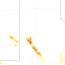
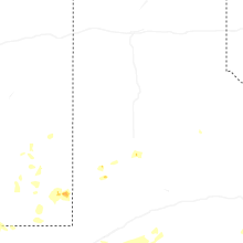
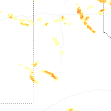


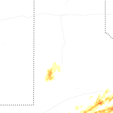


Connect with Interactive Hail Maps