

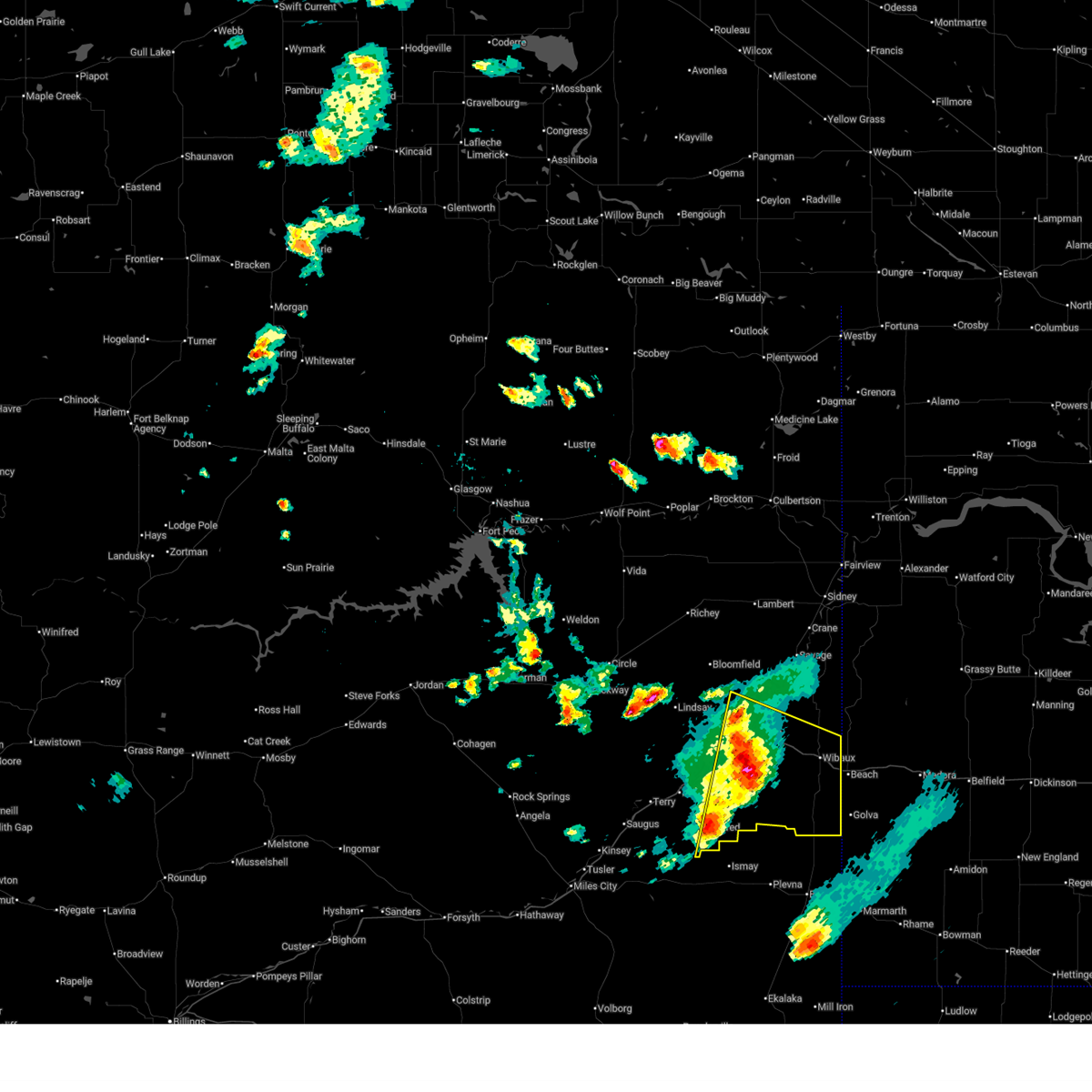
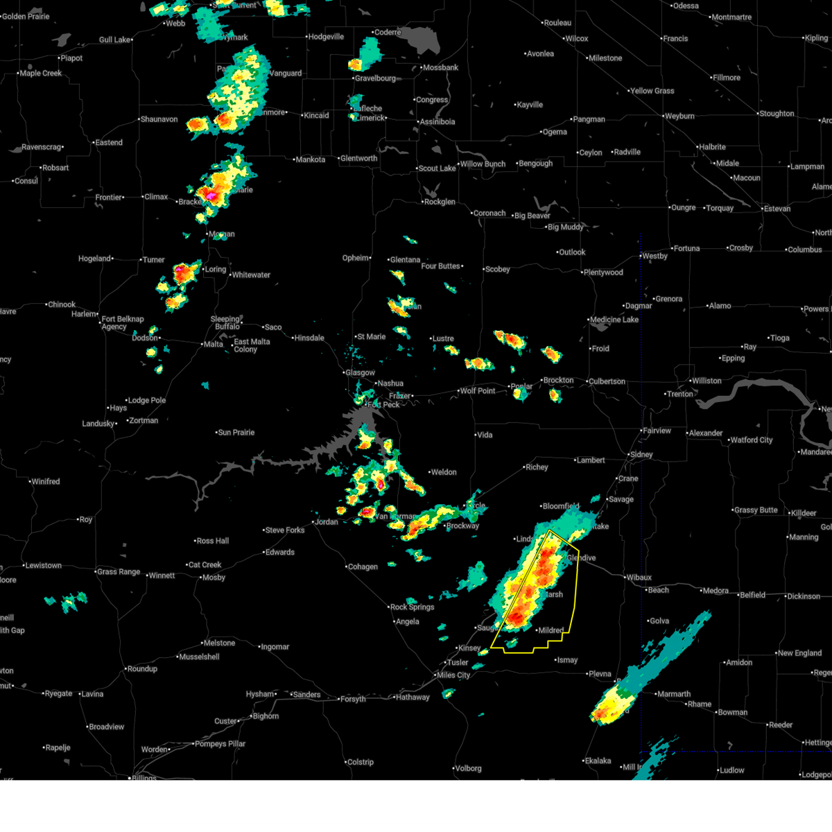
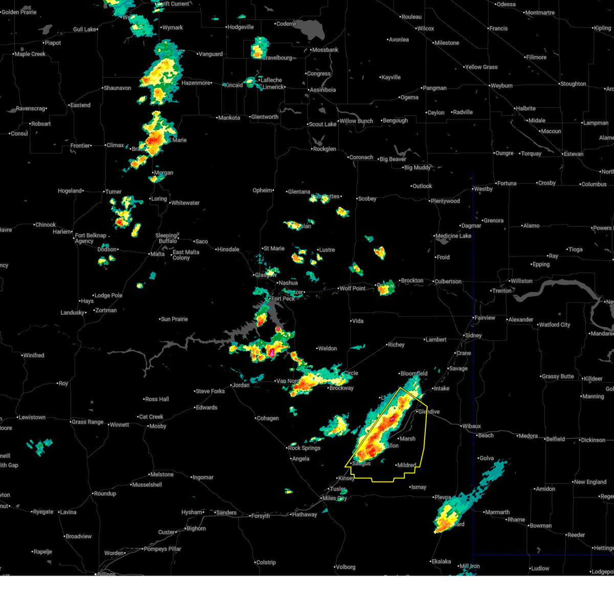
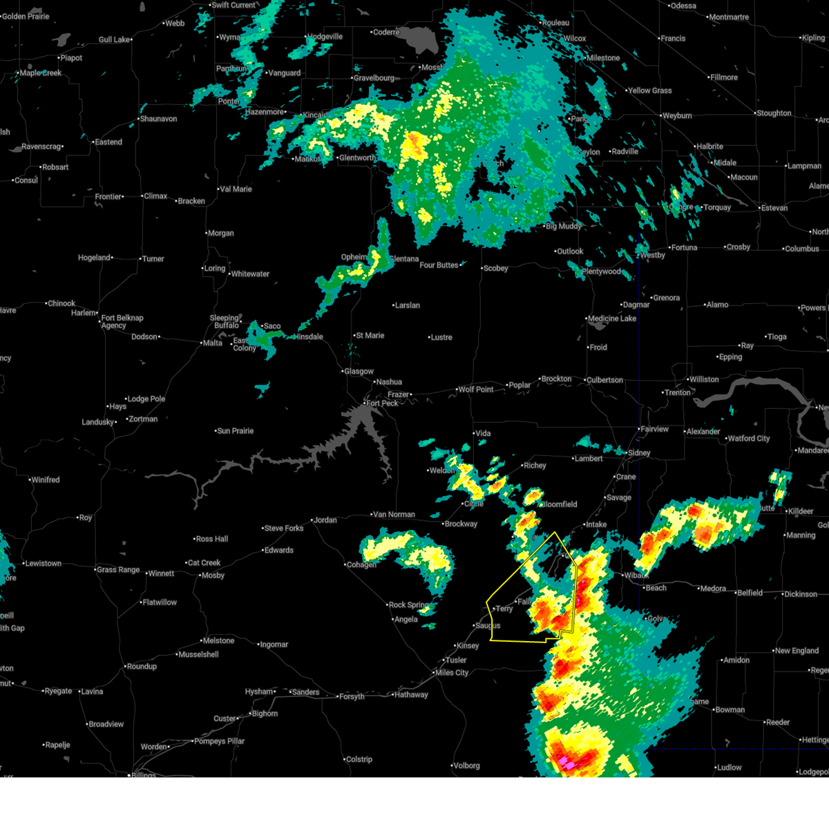
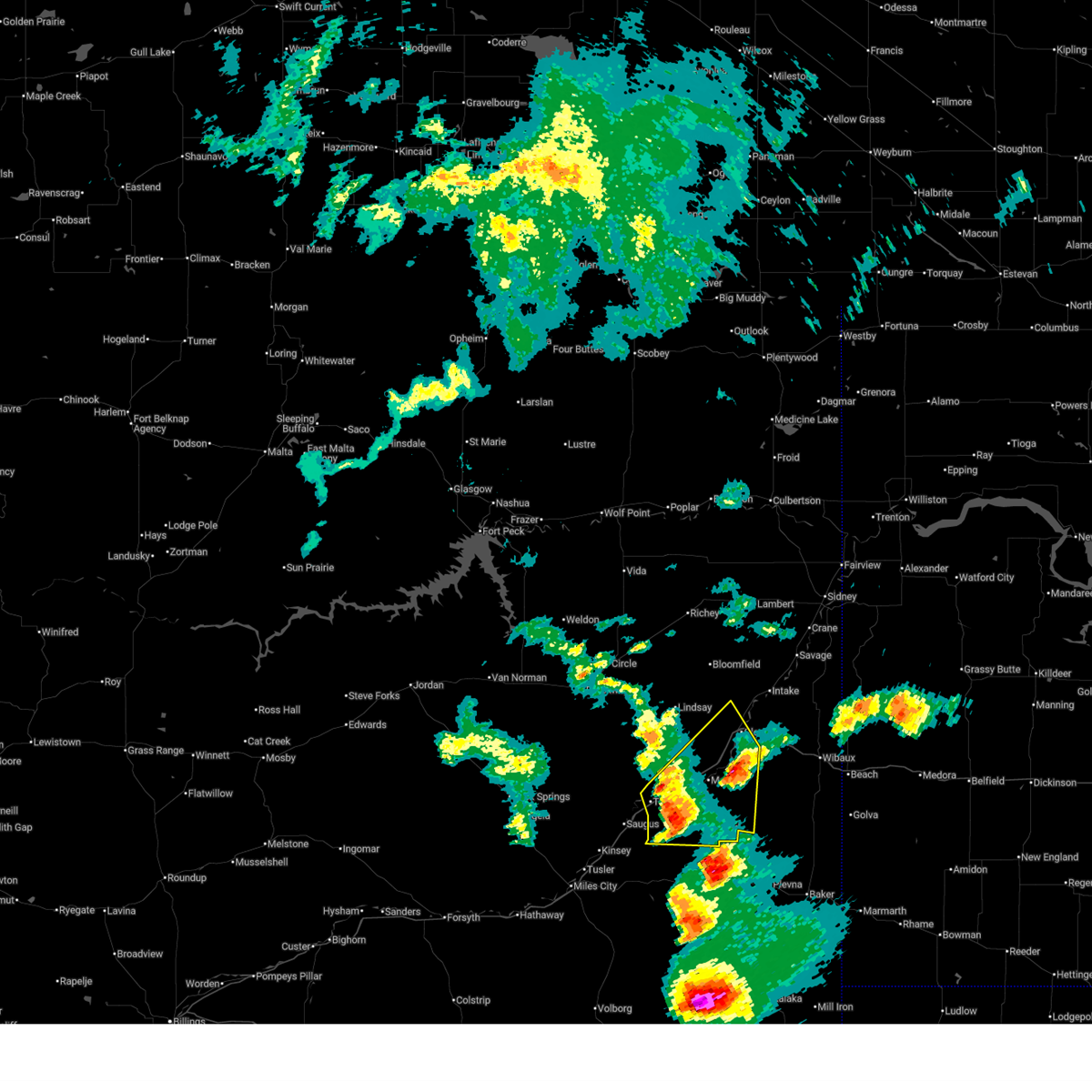
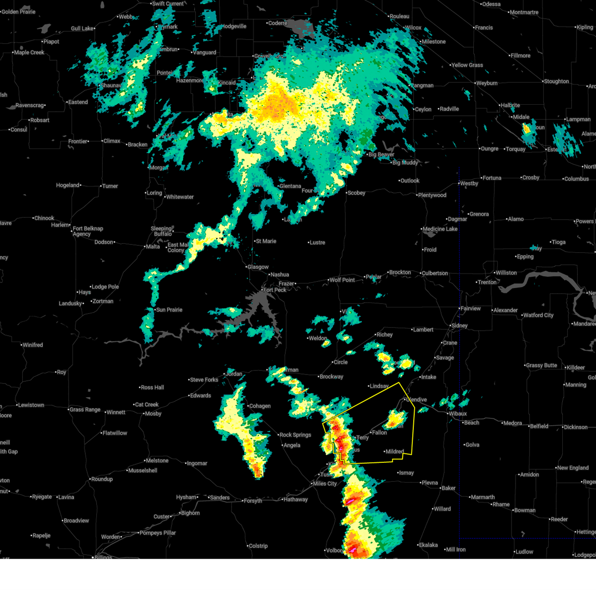
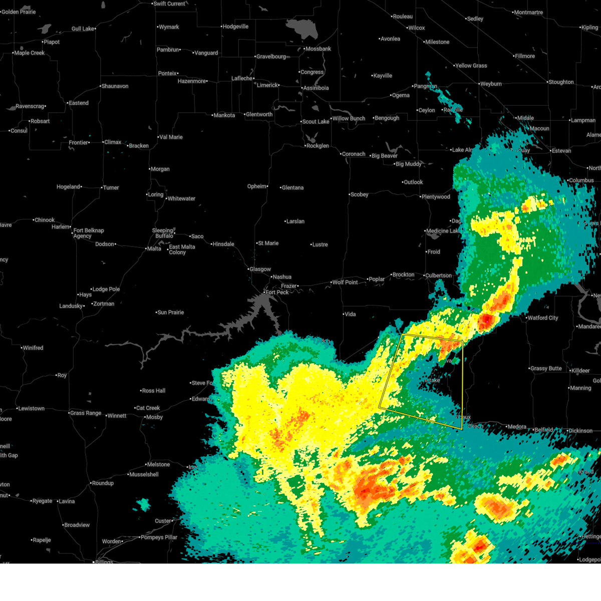
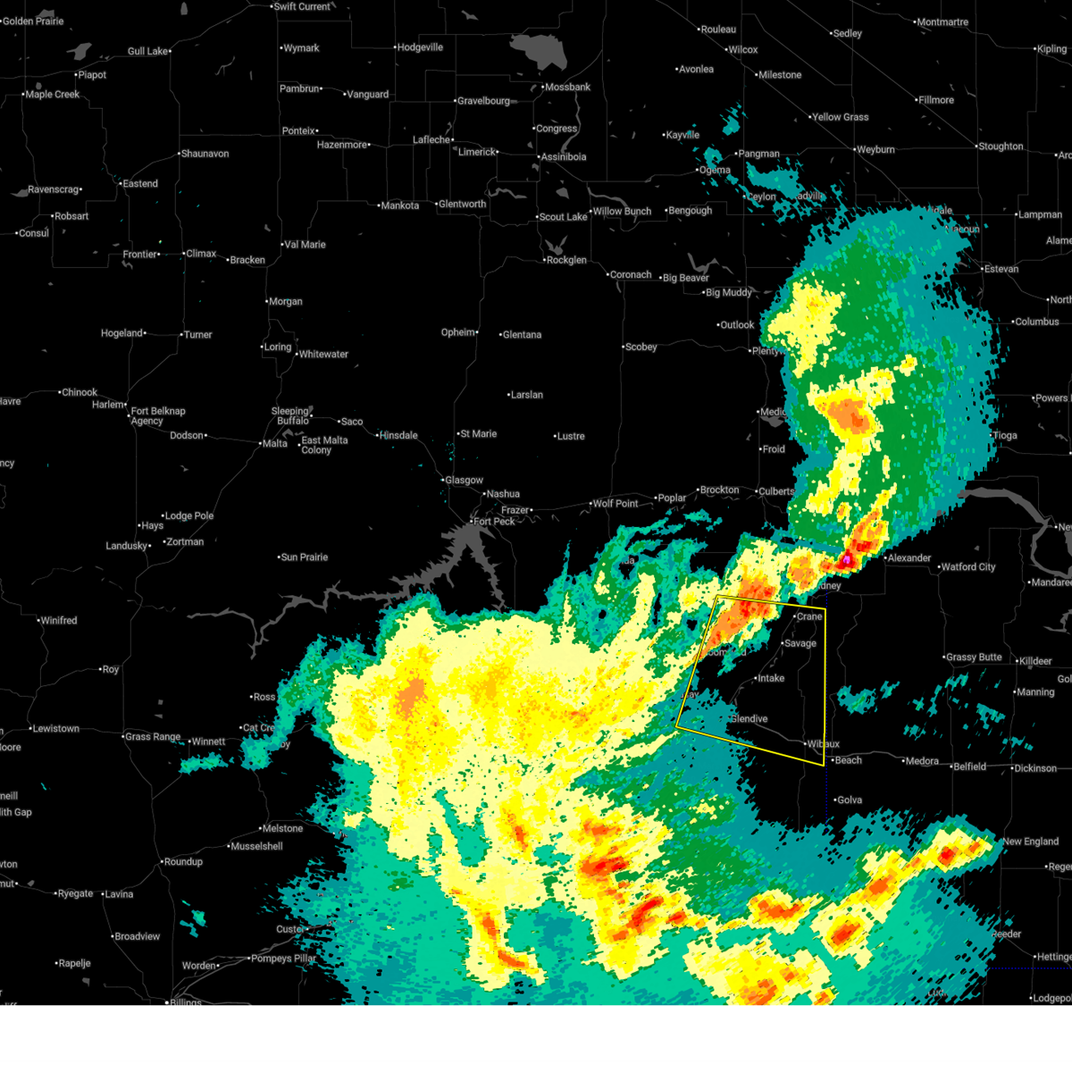
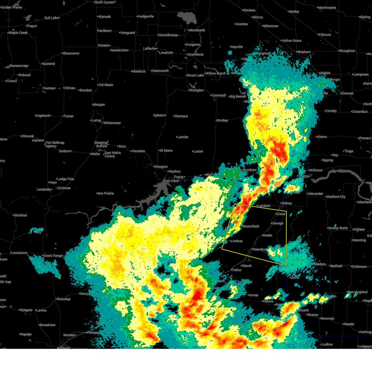
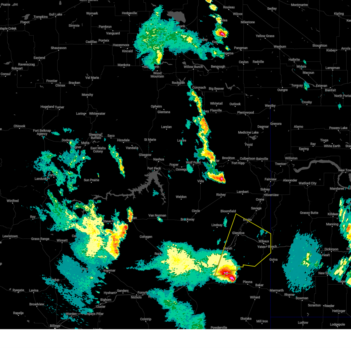
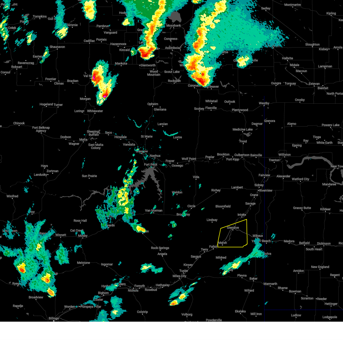
Hail Map for West Glendive, MT
The West Glendive, MT area has had 3 reports of on-the-ground hail by trained spotters, and has been under severe weather warnings 17 times during the past 12 months. Doppler radar has detected hail at or near West Glendive, MT on 32 occasions, including 2 occasions during the past year.
| Name: | West Glendive, MT |
| Where Located: | 71.1 miles NE of Miles City, MT |
| Map: | Google Map for West Glendive, MT |
| Population: | 1948 |
| Housing Units: | 851 |
| More Info: | Search Google for West Glendive, MT |
1
The Top Recent Hail Date for West Glendive, MT is Tuesday, September 17, 2024 (13th out of 32)

Hail and Wind Damage Spotted near West Glendive, MT
| Date / Time | Report Details |
|---|---|
| 6/25/2025 4:44 PM MDT |
 Svrggw the national weather service in glasgow has issued a * severe thunderstorm warning for, wibaux county in northeastern montana, southeastern prairie county in northeastern montana, southeastern dawson county in northeastern montana, * until 545 pm mdt. * at 444 pm mdt, a severe thunderstorm was located 16 miles southwest of wibaux, moving east at 15 mph (radar indicated). Hazards include 60 mph wind gusts and quarter size hail. Hail damage to vehicles is expected. Expect wind damage to roofs, siding, and trees. Svrggw the national weather service in glasgow has issued a * severe thunderstorm warning for, wibaux county in northeastern montana, southeastern prairie county in northeastern montana, southeastern dawson county in northeastern montana, * until 545 pm mdt. * at 444 pm mdt, a severe thunderstorm was located 16 miles southwest of wibaux, moving east at 15 mph (radar indicated). Hazards include 60 mph wind gusts and quarter size hail. Hail damage to vehicles is expected. Expect wind damage to roofs, siding, and trees.
|
| 6/25/2025 4:23 PM MDT |
 At 423 pm mdt, a severe thunderstorm was located 11 miles southeast of fallon, or 18 miles east of terry, moving east at 20 mph (radar indicated). Hazards include 60 mph wind gusts and quarter size hail. Hail damage to vehicles is expected. expect wind damage to roofs, siding, and trees. Locations impacted include, glendive, fallon, west glendive, hoyt, mildred, forest park, and marsh. At 423 pm mdt, a severe thunderstorm was located 11 miles southeast of fallon, or 18 miles east of terry, moving east at 20 mph (radar indicated). Hazards include 60 mph wind gusts and quarter size hail. Hail damage to vehicles is expected. expect wind damage to roofs, siding, and trees. Locations impacted include, glendive, fallon, west glendive, hoyt, mildred, forest park, and marsh.
|
| 6/25/2025 3:55 PM MDT |
 Svrggw the national weather service in glasgow has issued a * severe thunderstorm warning for, southeastern prairie county in northeastern montana, south central dawson county in northeastern montana, * until 500 pm mdt. * at 355 pm mdt, a severe thunderstorm was located near fallon, or 9 miles east of terry, moving east at 20 mph (radar indicated). Hazards include 60 mph wind gusts and quarter size hail. Hail damage to vehicles is expected. Expect wind damage to roofs, siding, and trees. Svrggw the national weather service in glasgow has issued a * severe thunderstorm warning for, southeastern prairie county in northeastern montana, south central dawson county in northeastern montana, * until 500 pm mdt. * at 355 pm mdt, a severe thunderstorm was located near fallon, or 9 miles east of terry, moving east at 20 mph (radar indicated). Hazards include 60 mph wind gusts and quarter size hail. Hail damage to vehicles is expected. Expect wind damage to roofs, siding, and trees.
|
| 6/20/2025 4:52 PM MDT |
 The storms which prompted the warning have weakened below severe limits, and have exited the warned area. therefore, the warning will be allowed to expire. however, small hail is still possible with these thunderstorms. a severe thunderstorm watch remains in effect until 900 pm mdt for northeastern montana. to report severe weather, contact your nearest law enforcement agency. they will relay your report to the national weather service glasgow. The storms which prompted the warning have weakened below severe limits, and have exited the warned area. therefore, the warning will be allowed to expire. however, small hail is still possible with these thunderstorms. a severe thunderstorm watch remains in effect until 900 pm mdt for northeastern montana. to report severe weather, contact your nearest law enforcement agency. they will relay your report to the national weather service glasgow.
|
| 6/20/2025 4:29 PM MDT |
 At 429 pm mdt, severe thunderstorms were located along a line extending from 12 miles south of lindsay to 7 miles northeast of fallon to 13 miles east of terry, moving northeast at 45 mph (radar indicated). Hazards include 60 mph wind gusts and quarter size hail. Hail damage to vehicles is expected. expect wind damage to roofs, siding, and trees. Locations impacted include, glendive, terry, fallon, west glendive, hoyt, mildred, forest park, and marsh. At 429 pm mdt, severe thunderstorms were located along a line extending from 12 miles south of lindsay to 7 miles northeast of fallon to 13 miles east of terry, moving northeast at 45 mph (radar indicated). Hazards include 60 mph wind gusts and quarter size hail. Hail damage to vehicles is expected. expect wind damage to roofs, siding, and trees. Locations impacted include, glendive, terry, fallon, west glendive, hoyt, mildred, forest park, and marsh.
|
| 6/20/2025 3:59 PM MDT |
 Svrggw the national weather service in glasgow has issued a * severe thunderstorm warning for, prairie county in northeastern montana, southwestern dawson county in northeastern montana, * until 500 pm mdt. * at 358 pm mdt, severe thunderstorms were located along a line extending from 19 miles west of fallon to near terry, moving northeast at 40 mph (radar indicated). Hazards include 60 mph wind gusts and quarter size hail. Hail damage to vehicles is expected. Expect wind damage to roofs, siding, and trees. Svrggw the national weather service in glasgow has issued a * severe thunderstorm warning for, prairie county in northeastern montana, southwestern dawson county in northeastern montana, * until 500 pm mdt. * at 358 pm mdt, severe thunderstorms were located along a line extending from 19 miles west of fallon to near terry, moving northeast at 40 mph (radar indicated). Hazards include 60 mph wind gusts and quarter size hail. Hail damage to vehicles is expected. Expect wind damage to roofs, siding, and trees.
|
| 6/15/2025 11:22 PM MDT |
 The storm which prompted the warning has weakened below severe limits, and no longer poses an immediate threat to life or property. therefore, the warning will be allowed to expire. however, gusty winds and heavy rain are still possible with this thunderstorm. a severe thunderstorm watch remains in effect until 100 am mdt for northeastern montana. The storm which prompted the warning has weakened below severe limits, and no longer poses an immediate threat to life or property. therefore, the warning will be allowed to expire. however, gusty winds and heavy rain are still possible with this thunderstorm. a severe thunderstorm watch remains in effect until 100 am mdt for northeastern montana.
|
| 6/15/2025 11:00 PM MDT |
 At 1059 pm mdt, a severe thunderstorm was located near savage, or 24 miles southwest of sidney, moving east at 40 mph (radar indicated). Hazards include 60 mph wind gusts. Expect damage to roofs, siding, and trees. Locations impacted include, hodges, forest park, savage, stipek, glendive, intake, west glendive, midway, burns, crane, yates, and wibaux. At 1059 pm mdt, a severe thunderstorm was located near savage, or 24 miles southwest of sidney, moving east at 40 mph (radar indicated). Hazards include 60 mph wind gusts. Expect damage to roofs, siding, and trees. Locations impacted include, hodges, forest park, savage, stipek, glendive, intake, west glendive, midway, burns, crane, yates, and wibaux.
|
| 6/15/2025 10:22 PM MDT |
 Svrggw the national weather service in glasgow has issued a * severe thunderstorm warning for, northeastern wibaux county in northeastern montana, dawson county in northeastern montana, southern richland county in northeastern montana, * until 1130 pm mdt. * at 1022 pm mdt, a severe thunderstorm was located over bloomfield, or 22 miles northwest of glendive, moving east at 40 mph (radar indicated). Hazards include 70 mph wind gusts. Expect considerable tree damage. Damage is likely to mobile homes, roofs, and outbuildings. Svrggw the national weather service in glasgow has issued a * severe thunderstorm warning for, northeastern wibaux county in northeastern montana, dawson county in northeastern montana, southern richland county in northeastern montana, * until 1130 pm mdt. * at 1022 pm mdt, a severe thunderstorm was located over bloomfield, or 22 miles northwest of glendive, moving east at 40 mph (radar indicated). Hazards include 70 mph wind gusts. Expect considerable tree damage. Damage is likely to mobile homes, roofs, and outbuildings.
|
| 9/12/2024 5:55 PM MDT |
 Svrggw the national weather service in glasgow has issued a * severe thunderstorm warning for, wibaux county in northeastern montana, southeastern prairie county in northeastern montana, southeastern dawson county in northeastern montana, * until 700 pm mdt. * at 554 pm mdt, a severe thunderstorm was located 25 miles southeast of fallon, or 27 miles southeast of terry, moving northeast at 60 mph (radar indicated). Hazards include 70 mph wind gusts and quarter size hail. Hail damage to vehicles is expected. expect considerable tree damage. Wind damage is also likely to mobile homes, roofs, and outbuildings. Svrggw the national weather service in glasgow has issued a * severe thunderstorm warning for, wibaux county in northeastern montana, southeastern prairie county in northeastern montana, southeastern dawson county in northeastern montana, * until 700 pm mdt. * at 554 pm mdt, a severe thunderstorm was located 25 miles southeast of fallon, or 27 miles southeast of terry, moving northeast at 60 mph (radar indicated). Hazards include 70 mph wind gusts and quarter size hail. Hail damage to vehicles is expected. expect considerable tree damage. Wind damage is also likely to mobile homes, roofs, and outbuildings.
|
| 8/21/2024 9:13 PM MDT |
 the severe thunderstorm warning has been cancelled and is no longer in effect the severe thunderstorm warning has been cancelled and is no longer in effect
|
| 8/21/2024 8:57 PM MDT |
 At 856 pm mdt, a severe thunderstorm was located near glendive, moving east at 25 mph (radar indicated). Hazards include 60 mph wind gusts and penny size hail. Expect damage to roofs, siding, and trees. Locations impacted include, glendive, west glendive, hoyt, marsh, and forest park. At 856 pm mdt, a severe thunderstorm was located near glendive, moving east at 25 mph (radar indicated). Hazards include 60 mph wind gusts and penny size hail. Expect damage to roofs, siding, and trees. Locations impacted include, glendive, west glendive, hoyt, marsh, and forest park.
|
| 8/21/2024 8:57 PM MDT |
 the severe thunderstorm warning has been cancelled and is no longer in effect the severe thunderstorm warning has been cancelled and is no longer in effect
|
| 8/21/2024 8:49 PM MDT |
 At 848 pm mdt, a severe thunderstorm was located near glendive, moving east at 25 mph (radar indicated). Hazards include 60 mph wind gusts and quarter size hail. Hail damage to vehicles is expected. expect wind damage to roofs, siding, and trees. Locations impacted include, glendive, terry, fallon, west glendive, hoyt, mildred, forest park, stipek, and marsh. At 848 pm mdt, a severe thunderstorm was located near glendive, moving east at 25 mph (radar indicated). Hazards include 60 mph wind gusts and quarter size hail. Hail damage to vehicles is expected. expect wind damage to roofs, siding, and trees. Locations impacted include, glendive, terry, fallon, west glendive, hoyt, mildred, forest park, stipek, and marsh.
|
| 8/21/2024 8:25 PM MDT |
 Svrggw the national weather service in glasgow has issued a * severe thunderstorm warning for, southwestern wibaux county in northeastern montana, eastern prairie county in northeastern montana, southern dawson county in northeastern montana, * until 930 pm mdt. * at 825 pm mdt, a severe thunderstorm was located 12 miles northeast of fallon, or 15 miles southwest of glendive, moving east at 25 mph (radar indicated). Hazards include 70 mph wind gusts and half dollar size hail. Hail damage to vehicles is expected. expect considerable tree damage. Wind damage is also likely to mobile homes, roofs, and outbuildings. Svrggw the national weather service in glasgow has issued a * severe thunderstorm warning for, southwestern wibaux county in northeastern montana, eastern prairie county in northeastern montana, southern dawson county in northeastern montana, * until 930 pm mdt. * at 825 pm mdt, a severe thunderstorm was located 12 miles northeast of fallon, or 15 miles southwest of glendive, moving east at 25 mph (radar indicated). Hazards include 70 mph wind gusts and half dollar size hail. Hail damage to vehicles is expected. expect considerable tree damage. Wind damage is also likely to mobile homes, roofs, and outbuildings.
|
| 8/21/2024 7:56 PM MDT |
 At 756 pm mdt, a severe thunderstorm was located 10 miles west of west glendive, or 12 miles west of glendive, moving northeast at 40 mph (radar indicated). Hazards include 60 mph wind gusts and half dollar size hail. Hail damage to vehicles is expected. expect wind damage to roofs, siding, and trees. Locations impacted include, glendive, west glendive, lindsay, hoyt, forest park, stipek, and marsh. At 756 pm mdt, a severe thunderstorm was located 10 miles west of west glendive, or 12 miles west of glendive, moving northeast at 40 mph (radar indicated). Hazards include 60 mph wind gusts and half dollar size hail. Hail damage to vehicles is expected. expect wind damage to roofs, siding, and trees. Locations impacted include, glendive, west glendive, lindsay, hoyt, forest park, stipek, and marsh.
|
| 8/21/2024 7:29 PM MDT |
 Svrggw the national weather service in glasgow has issued a * severe thunderstorm warning for, north central prairie county in northeastern montana, southwestern dawson county in northeastern montana, * until 830 pm mdt. * at 729 pm mdt, severe thunderstorms were located along a line extending from 10 miles northwest of lindsay to 10 miles north of terry, moving east at 30 mph (radar indicated). Hazards include 60 mph wind gusts and quarter size hail. Hail damage to vehicles is expected. Expect wind damage to roofs, siding, and trees. Svrggw the national weather service in glasgow has issued a * severe thunderstorm warning for, north central prairie county in northeastern montana, southwestern dawson county in northeastern montana, * until 830 pm mdt. * at 729 pm mdt, severe thunderstorms were located along a line extending from 10 miles northwest of lindsay to 10 miles north of terry, moving east at 30 mph (radar indicated). Hazards include 60 mph wind gusts and quarter size hail. Hail damage to vehicles is expected. Expect wind damage to roofs, siding, and trees.
|
| 6/27/2024 5:38 PM MDT |
 The storm which prompted the warning has weakened below severe limits, and has exited the warned area. therefore, the warning will be allowed to expire. however, gusty winds and heavy rain are still possible with this thunderstorm. a severe thunderstorm watch remains in effect until 800 pm mdt for northeastern montana. The storm which prompted the warning has weakened below severe limits, and has exited the warned area. therefore, the warning will be allowed to expire. however, gusty winds and heavy rain are still possible with this thunderstorm. a severe thunderstorm watch remains in effect until 800 pm mdt for northeastern montana.
|
| 6/27/2024 5:16 PM MDT |
 At 516 pm mdt, a severe thunderstorm was located 11 miles northeast of fallon, or 16 miles southwest of glendive, moving northeast at 25 mph (radar indicated). Hazards include 60 mph wind gusts and half dollar size hail. Hail damage to vehicles is expected. expect wind damage to roofs, siding, and trees. Locations impacted include, glendive, west glendive, hoyt, stipek, marsh, and forest park. At 516 pm mdt, a severe thunderstorm was located 11 miles northeast of fallon, or 16 miles southwest of glendive, moving northeast at 25 mph (radar indicated). Hazards include 60 mph wind gusts and half dollar size hail. Hail damage to vehicles is expected. expect wind damage to roofs, siding, and trees. Locations impacted include, glendive, west glendive, hoyt, stipek, marsh, and forest park.
|
| 6/27/2024 4:39 PM MDT |
 Svrggw the national weather service in glasgow has issued a * severe thunderstorm warning for, central prairie county in northeastern montana, southern dawson county in northeastern montana, * until 545 pm mdt. * at 439 pm mdt, a severe thunderstorm was located near terry, moving northeast at 25 mph (radar indicated). Hazards include 60 mph wind gusts and half dollar size hail. Hail damage to vehicles is expected. Expect wind damage to roofs, siding, and trees. Svrggw the national weather service in glasgow has issued a * severe thunderstorm warning for, central prairie county in northeastern montana, southern dawson county in northeastern montana, * until 545 pm mdt. * at 439 pm mdt, a severe thunderstorm was located near terry, moving northeast at 25 mph (radar indicated). Hazards include 60 mph wind gusts and half dollar size hail. Hail damage to vehicles is expected. Expect wind damage to roofs, siding, and trees.
|
| 6/15/2024 8:57 PM MDT |
 The storm which prompted the warning has weakened below severe limits, and no longer poses an immediate threat to life or property. therefore, the warning will be allowed to expire. however, gusty winds are still possible with this thunderstorm. The storm which prompted the warning has weakened below severe limits, and no longer poses an immediate threat to life or property. therefore, the warning will be allowed to expire. however, gusty winds are still possible with this thunderstorm.
|
| 6/15/2024 8:29 PM MDT |
 At 829 pm mdt, a severe thunderstorm was located near intake, or 9 miles northeast of glendive, moving east at 30 mph (radar indicated). Hazards include 60 mph wind gusts. Expect damage to roofs, siding, and trees. Locations impacted include, glendive, wibaux, intake, west glendive, hoyt, hodges, forest park, stipek, burns, and yates. At 829 pm mdt, a severe thunderstorm was located near intake, or 9 miles northeast of glendive, moving east at 30 mph (radar indicated). Hazards include 60 mph wind gusts. Expect damage to roofs, siding, and trees. Locations impacted include, glendive, wibaux, intake, west glendive, hoyt, hodges, forest park, stipek, burns, and yates.
|
| 6/15/2024 8:02 PM MDT |
 Svrggw the national weather service in glasgow has issued a * severe thunderstorm warning for, northern wibaux county in northeastern montana, southeastern richland county in northeastern montana, southern dawson county in northeastern montana, * until 900 pm mdt. * at 802 pm mdt, a severe thunderstorm was located 9 miles south of bloomfield, or 14 miles northwest of glendive, moving east at 30 mph (radar indicated). Hazards include 60 mph wind gusts. expect damage to roofs, siding, and trees Svrggw the national weather service in glasgow has issued a * severe thunderstorm warning for, northern wibaux county in northeastern montana, southeastern richland county in northeastern montana, southern dawson county in northeastern montana, * until 900 pm mdt. * at 802 pm mdt, a severe thunderstorm was located 9 miles south of bloomfield, or 14 miles northwest of glendive, moving east at 30 mph (radar indicated). Hazards include 60 mph wind gusts. expect damage to roofs, siding, and trees
|
| 7/11/2023 5:44 PM MDT |
 At 540 pm mdt, a severe thunderstorm was located 9 miles southwest of west glendive, or 10 miles southwest of glendive, moving southeast at 35 mph. a second severe thunderstorm is located south of saint phillip and moving to the southeast at 35 mph (radar indicated). Hazards include ping pong ball size hail and 60 mph wind gusts. People and animals outdoors will be injured. expect hail damage to roofs, siding, windows, and vehicles. Expect wind damage to roofs, siding, and trees. At 540 pm mdt, a severe thunderstorm was located 9 miles southwest of west glendive, or 10 miles southwest of glendive, moving southeast at 35 mph. a second severe thunderstorm is located south of saint phillip and moving to the southeast at 35 mph (radar indicated). Hazards include ping pong ball size hail and 60 mph wind gusts. People and animals outdoors will be injured. expect hail damage to roofs, siding, windows, and vehicles. Expect wind damage to roofs, siding, and trees.
|
| 7/11/2023 5:14 PM MDT |
 At 513 pm mdt, a severe thunderstorm was located 8 miles southwest of wibaux, moving east at 40 mph (radar indicated). Hazards include ping pong ball size hail and 60 mph wind gusts. People and animals outdoors will be injured. expect hail damage to roofs, siding, windows, and vehicles. expect wind damage to roofs, siding, and trees. locations impacted include, glendive, wibaux, west glendive, carlyle, hoyt, hodges, forest park, stipek, marsh, saint phillip and yates. hail threat, radar indicated max hail size, 1. 50 in wind threat, radar indicated max wind gust, 60 mph. At 513 pm mdt, a severe thunderstorm was located 8 miles southwest of wibaux, moving east at 40 mph (radar indicated). Hazards include ping pong ball size hail and 60 mph wind gusts. People and animals outdoors will be injured. expect hail damage to roofs, siding, windows, and vehicles. expect wind damage to roofs, siding, and trees. locations impacted include, glendive, wibaux, west glendive, carlyle, hoyt, hodges, forest park, stipek, marsh, saint phillip and yates. hail threat, radar indicated max hail size, 1. 50 in wind threat, radar indicated max wind gust, 60 mph.
|
| 7/11/2023 4:41 PM MDT |
 At 440 pm mdt, a severe thunderstorm was located 9 miles south of west glendive, or 9 miles south of glendive, moving southeast at 40 mph (radar indicated). Hazards include 60 mph wind gusts and half dollar size hail. Hail damage to vehicles is expected. Expect wind damage to roofs, siding, and trees. At 440 pm mdt, a severe thunderstorm was located 9 miles south of west glendive, or 9 miles south of glendive, moving southeast at 40 mph (radar indicated). Hazards include 60 mph wind gusts and half dollar size hail. Hail damage to vehicles is expected. Expect wind damage to roofs, siding, and trees.
|
| 7/11/2023 4:14 PM MDT | Ping Pong Ball sized hail reported 20.3 miles ESE of West Glendive, MT, ping pong ball size estimated with photo. |
| 6/20/2023 2:12 AM MDT |
 At 146 am mdt, a severe thunderstorm was located 15 miles southwest of lindsay, or 17 miles north of terry, moving northeast at 55 mph (radar indicated). Hazards include 60 mph wind gusts and nickel size hail. Expect damage to roofs, siding, and trees. locations impacted include, fallon, lindsay, west glendive, hoyt, marsh and mccloud. hail threat, radar indicated max hail size, 0. 88 in wind threat, radar indicated max wind gust, 60 mph. At 146 am mdt, a severe thunderstorm was located 15 miles southwest of lindsay, or 17 miles north of terry, moving northeast at 55 mph (radar indicated). Hazards include 60 mph wind gusts and nickel size hail. Expect damage to roofs, siding, and trees. locations impacted include, fallon, lindsay, west glendive, hoyt, marsh and mccloud. hail threat, radar indicated max hail size, 0. 88 in wind threat, radar indicated max wind gust, 60 mph.
|
| 6/20/2023 1:46 AM MDT |
 At 111 am mdt, a severe thunderstorm was located 19 miles north of miles city, moving northeast at 55 mph (radar indicated). Hazards include 60 mph wind gusts and half dollar size hail. Hail damage to vehicles is expected. Expect wind damage to roofs, siding, and trees. At 111 am mdt, a severe thunderstorm was located 19 miles north of miles city, moving northeast at 55 mph (radar indicated). Hazards include 60 mph wind gusts and half dollar size hail. Hail damage to vehicles is expected. Expect wind damage to roofs, siding, and trees.
|
| 6/20/2023 1:11 AM MDT |
 At 111 am mdt, a severe thunderstorm was located 19 miles north of miles city, moving northeast at 55 mph (radar indicated). Hazards include 60 mph wind gusts and half dollar size hail. Hail damage to vehicles is expected. Expect wind damage to roofs, siding, and trees. At 111 am mdt, a severe thunderstorm was located 19 miles north of miles city, moving northeast at 55 mph (radar indicated). Hazards include 60 mph wind gusts and half dollar size hail. Hail damage to vehicles is expected. Expect wind damage to roofs, siding, and trees.
|
| 6/8/2023 6:25 PM MDT |
 At 624 pm mdt, a severe thunderstorm was located near glendive, moving northwest at 10 mph (radar indicated). Hazards include 60 mph wind gusts and half dollar size hail. Hail damage to vehicles is expected. Expect wind damage to roofs, siding, and trees. At 624 pm mdt, a severe thunderstorm was located near glendive, moving northwest at 10 mph (radar indicated). Hazards include 60 mph wind gusts and half dollar size hail. Hail damage to vehicles is expected. Expect wind damage to roofs, siding, and trees.
|
| 6/4/2023 5:21 PM MDT |
 At 520 pm mdt, severe thunderstorms were located along a line extending from near east fairview to 17 miles southwest of terry, moving northwest at 25 mph (trained weather spotter reported an estimated wind gust of 60 mph at 5:20 pm). Hazards include 60 mph wind gusts and penny size hail. expect damage to roofs, siding, and trees At 520 pm mdt, severe thunderstorms were located along a line extending from near east fairview to 17 miles southwest of terry, moving northwest at 25 mph (trained weather spotter reported an estimated wind gust of 60 mph at 5:20 pm). Hazards include 60 mph wind gusts and penny size hail. expect damage to roofs, siding, and trees
|
| 5/27/2023 5:30 PM MDT |
 At 528 pm mdt, a severe thunderstorm was located 15 miles southeast of glendive, moving north at 30 mph (radar indicated). Hazards include 60 mph wind gusts and half dollar size hail. Hail damage to vehicles is expected. expect wind damage to roofs, siding, and trees. locations impacted include, glendive, wibaux, intake, west glendive, carlyle, hoyt, hodges, forest park, stipek, saint phillip and yates. hail threat, radar indicated max hail size, 1. 25 in wind threat, radar indicated max wind gust, 60 mph. At 528 pm mdt, a severe thunderstorm was located 15 miles southeast of glendive, moving north at 30 mph (radar indicated). Hazards include 60 mph wind gusts and half dollar size hail. Hail damage to vehicles is expected. expect wind damage to roofs, siding, and trees. locations impacted include, glendive, wibaux, intake, west glendive, carlyle, hoyt, hodges, forest park, stipek, saint phillip and yates. hail threat, radar indicated max hail size, 1. 25 in wind threat, radar indicated max wind gust, 60 mph.
|
| 5/27/2023 5:05 PM MDT |
 At 505 pm mdt, a severe thunderstorm was located 21 miles west of carlyle, or 21 miles northwest of baker, moving north at 50 mph (radar indicated). Hazards include 60 mph wind gusts and half dollar size hail. Hail damage to vehicles is expected. Expect wind damage to roofs, siding, and trees. At 505 pm mdt, a severe thunderstorm was located 21 miles west of carlyle, or 21 miles northwest of baker, moving north at 50 mph (radar indicated). Hazards include 60 mph wind gusts and half dollar size hail. Hail damage to vehicles is expected. Expect wind damage to roofs, siding, and trees.
|
| 5/25/2023 8:38 PM MDT |
 The severe thunderstorm warning for central dawson county will expire at 845 pm mdt, the storm which prompted the warning has weakened below severe limits, and no longer poses an immediate threat to life or property. therefore, the warning will be allowed to expire. remember, a severe thunderstorm warning still remains in effect for northern dawson county until 915 pm mdt. The severe thunderstorm warning for central dawson county will expire at 845 pm mdt, the storm which prompted the warning has weakened below severe limits, and no longer poses an immediate threat to life or property. therefore, the warning will be allowed to expire. remember, a severe thunderstorm warning still remains in effect for northern dawson county until 915 pm mdt.
|
| 5/25/2023 8:06 PM MDT |
 At 805 pm mdt, a severe thunderstorm was located near west glendive, or near glendive, moving north at 35 mph (radar indicated). Hazards include 60 mph wind gusts and quarter size hail. Hail damage to vehicles is expected. expect wind damage to roofs, siding, and trees. locations impacted include, glendive, west glendive, stipek and forest park. hail threat, observed max hail size, 1. 00 in wind threat, radar indicated max wind gust, 60 mph. At 805 pm mdt, a severe thunderstorm was located near west glendive, or near glendive, moving north at 35 mph (radar indicated). Hazards include 60 mph wind gusts and quarter size hail. Hail damage to vehicles is expected. expect wind damage to roofs, siding, and trees. locations impacted include, glendive, west glendive, stipek and forest park. hail threat, observed max hail size, 1. 00 in wind threat, radar indicated max wind gust, 60 mph.
|
| 5/25/2023 7:49 PM MDT |
 At 749 pm mdt, a severe thunderstorm was located over glendive, moving north at 20 mph (radar indicated). Hazards include 60 mph wind gusts and quarter size hail. Hail damage to vehicles is expected. Expect wind damage to roofs, siding, and trees. At 749 pm mdt, a severe thunderstorm was located over glendive, moving north at 20 mph (radar indicated). Hazards include 60 mph wind gusts and quarter size hail. Hail damage to vehicles is expected. Expect wind damage to roofs, siding, and trees.
|
| 7/10/2022 12:47 AM MDT |
 At 1247 am mdt, severe thunderstorms were located along a line extending from 8 miles southwest of wibaux to near baker, moving east at 50 mph (radar indicated). Hazards include 70 mph wind gusts and half dollar size hail. Hail damage to vehicles is expected. expect considerable tree damage. wind damage is also likely to mobile homes, roofs, and outbuildings. locations impacted include, glendive, wibaux, west glendive, intake, carlyle, hoyt, saint phillip, yates, hodges, mildred, forest park, stipek and marsh. thunderstorm damage threat, considerable hail threat, observed max hail size, 1. 25 in wind threat, observed max wind gust, 70 mph. At 1247 am mdt, severe thunderstorms were located along a line extending from 8 miles southwest of wibaux to near baker, moving east at 50 mph (radar indicated). Hazards include 70 mph wind gusts and half dollar size hail. Hail damage to vehicles is expected. expect considerable tree damage. wind damage is also likely to mobile homes, roofs, and outbuildings. locations impacted include, glendive, wibaux, west glendive, intake, carlyle, hoyt, saint phillip, yates, hodges, mildred, forest park, stipek and marsh. thunderstorm damage threat, considerable hail threat, observed max hail size, 1. 25 in wind threat, observed max wind gust, 70 mph.
|
| 7/10/2022 12:24 AM MDT |
 At 1222 am mdt, severe thunderstorms were located along a line extending from 13 miles east of fallon to 27 miles west of baker, moving east at 70 mph (radar indicated). Hazards include 70 mph wind gusts and half dollar size hail. Hail damage to vehicles is expected. expect considerable tree damage. Wind damage is also likely to mobile homes, roofs, and outbuildings. At 1222 am mdt, severe thunderstorms were located along a line extending from 13 miles east of fallon to 27 miles west of baker, moving east at 70 mph (radar indicated). Hazards include 70 mph wind gusts and half dollar size hail. Hail damage to vehicles is expected. expect considerable tree damage. Wind damage is also likely to mobile homes, roofs, and outbuildings.
|
| 7/9/2022 11:48 PM MDT |
 At 1148 pm mdt, severe thunderstorms were located along a line extending from 13 miles southwest of richey to 12 miles south of terry, moving east at 60 mph (radar indicated). Hazards include 70 mph wind gusts and half dollar size hail. Hail damage to vehicles is expected. expect considerable tree damage. wind damage is also likely to mobile homes, roofs, and outbuildings. locations impacted include, sidney, glendive, terry, wibaux, fallon, fairview, richey, savage, west glendive, intake, bloomfield, lambert, carlyle, lindsay, east fairview, enid, wooley, crane, mildred and calypso. thunderstorm damage threat, considerable hail threat, radar indicated max hail size, 1. 25 in wind threat, radar indicated max wind gust, 70 mph. At 1148 pm mdt, severe thunderstorms were located along a line extending from 13 miles southwest of richey to 12 miles south of terry, moving east at 60 mph (radar indicated). Hazards include 70 mph wind gusts and half dollar size hail. Hail damage to vehicles is expected. expect considerable tree damage. wind damage is also likely to mobile homes, roofs, and outbuildings. locations impacted include, sidney, glendive, terry, wibaux, fallon, fairview, richey, savage, west glendive, intake, bloomfield, lambert, carlyle, lindsay, east fairview, enid, wooley, crane, mildred and calypso. thunderstorm damage threat, considerable hail threat, radar indicated max hail size, 1. 25 in wind threat, radar indicated max wind gust, 70 mph.
|
| 7/9/2022 11:27 PM MDT |
 At 1126 pm mdt, severe thunderstorms were located along a line extending from 10 miles northwest of circle to 15 miles north of miles city, moving east at 60 mph (radar indicated). Hazards include 70 mph wind gusts and half dollar size hail. Hail damage to vehicles is expected. expect considerable tree damage. Wind damage is also likely to mobile homes, roofs, and outbuildings. At 1126 pm mdt, severe thunderstorms were located along a line extending from 10 miles northwest of circle to 15 miles north of miles city, moving east at 60 mph (radar indicated). Hazards include 70 mph wind gusts and half dollar size hail. Hail damage to vehicles is expected. expect considerable tree damage. Wind damage is also likely to mobile homes, roofs, and outbuildings.
|
| 7/9/2022 10:30 PM MDT |
 At 1030 pm mdt, severe thunderstorms were located along a line extending from 11 miles southwest of vida to 14 miles west of terry, moving east at 60 mph (radar indicated). Hazards include 70 mph wind gusts and half dollar size hail. Hail damage to vehicles is expected. expect considerable tree damage. Wind damage is also likely to mobile homes, roofs, and outbuildings. At 1030 pm mdt, severe thunderstorms were located along a line extending from 11 miles southwest of vida to 14 miles west of terry, moving east at 60 mph (radar indicated). Hazards include 70 mph wind gusts and half dollar size hail. Hail damage to vehicles is expected. expect considerable tree damage. Wind damage is also likely to mobile homes, roofs, and outbuildings.
|
| 7/9/2022 2:48 AM MDT | At 247 am mdt, a severe thunderstorm was located 12 miles south of brockway, or 21 miles south of circle, moving east at 40 mph (doppler radar indicated). Hazards include 60 mph wind gusts and quarter size hail. Hail damage to vehicles is expected. Expect wind damage to roofs, siding, and trees. |
| 7/9/2022 1:09 AM MDT | At 108 am mdt, severe thunderstorms were located along a line extending from 8 miles north of archer to 7 miles east of richey, moving east at 70 mph (radar indicated). Hazards include 60 mph wind gusts and penny size hail. Expect damage to roofs, siding, and trees. locations impacted include, sidney, glendive, plentywood, culbertson, wibaux, fairview, medicine lake, bainville, froid, westby, port of raymond, savage, west glendive, intake, lambert, reserve, raymond, enid, comertown and nohly. hail threat, radar indicated max hail size, 0. 75 in wind threat, observed max wind gust, 60 mph. |
| 7/9/2022 12:53 AM MDT | At 1252 am mdt, severe thunderstorms were located along a line extending from 6 miles north of redstone to near richey, moving east at 60 mph (radar indicated). Hazards include 60 mph wind gusts and nickel size hail. Expect considerable tree damage. damage is likely to mobile homes, roofs, and outbuildings. locations impacted include, sidney, glendive, plentywood, poplar, culbertson, wibaux, fairview, brockton, medicine lake, bainville, froid, richey, westby, archer, port of raymond, savage, west glendive, intake, bloomfield and lambert. thunderstorm damage threat, considerable hail threat, radar indicated max hail size, 0. 88 in wind threat, observed max wind gust, 70 mph. |
| 7/9/2022 12:38 AM MDT | At 1237 am mdt, severe thunderstorms were located along a line extending from 6 miles north of redstone to richey, moving east at 70 mph (radar indicated). Hazards include 60 mph wind gusts and nickel size hail. expect damage to roofs, siding, and trees |
| 7/6/2022 7:04 PM MDT |
 At 703 pm mdt, a severe thunderstorm was located near lindsay, or 18 miles west of glendive, moving northwest at 25 mph (radar indicated). Hazards include 60 mph wind gusts and quarter size hail. Hail damage to vehicles is expected. Expect wind damage to roofs, siding, and trees. At 703 pm mdt, a severe thunderstorm was located near lindsay, or 18 miles west of glendive, moving northwest at 25 mph (radar indicated). Hazards include 60 mph wind gusts and quarter size hail. Hail damage to vehicles is expected. Expect wind damage to roofs, siding, and trees.
|
| 7/5/2022 9:55 PM MDT |
 The severe thunderstorm warning for southeastern dawson county will expire at 1000 pm mdt, the storm which prompted the warning has weakened below severe limits, and no longer poses an immediate threat to life or property. therefore, the warning will be allowed to expire. however gusty winds and heavy rain are still possible with this thunderstorm. The severe thunderstorm warning for southeastern dawson county will expire at 1000 pm mdt, the storm which prompted the warning has weakened below severe limits, and no longer poses an immediate threat to life or property. therefore, the warning will be allowed to expire. however gusty winds and heavy rain are still possible with this thunderstorm.
|
| 7/5/2022 9:35 PM MDT |
 At 935 pm mdt, a severe thunderstorm was located over glendive, moving east at 40 mph (trained weather spotters). Hazards include 60 mph wind gusts. Expect damage to roofs, siding, and trees. locations impacted include, glendive, intake, west glendive, stipek and forest park. hail threat, radar indicated max hail size, <. 75 in wind threat, radar indicated max wind gust, 60 mph. At 935 pm mdt, a severe thunderstorm was located over glendive, moving east at 40 mph (trained weather spotters). Hazards include 60 mph wind gusts. Expect damage to roofs, siding, and trees. locations impacted include, glendive, intake, west glendive, stipek and forest park. hail threat, radar indicated max hail size, <. 75 in wind threat, radar indicated max wind gust, 60 mph.
|
| 7/5/2022 8:58 PM MDT |
 At 858 pm mdt, a severe thunderstorm was located near lindsay, or 21 miles west of glendive, moving east at 45 mph (trained weather spotters). Hazards include 60 mph wind gusts and quarter size hail. Hail damage to vehicles is expected. Expect wind damage to roofs, siding, and trees. At 858 pm mdt, a severe thunderstorm was located near lindsay, or 21 miles west of glendive, moving east at 45 mph (trained weather spotters). Hazards include 60 mph wind gusts and quarter size hail. Hail damage to vehicles is expected. Expect wind damage to roofs, siding, and trees.
|
| 7/3/2022 8:27 PM MDT |
 At 826 pm mdt, severe thunderstorms were located along a line extending from near intake to 21 miles west of carlyle, moving east at 45 mph (radar indicated). Hazards include 60 mph wind gusts and quarter size hail. Hail damage to vehicles is expected. expect wind damage to roofs, siding, and trees. locations impacted include, glendive, wibaux, intake, carlyle, hoyt, saint phillip, yates, hodges, mildred, stipek and marsh. hail threat, radar indicated max hail size, 1. 00 in wind threat, radar indicated max wind gust, 60 mph. At 826 pm mdt, severe thunderstorms were located along a line extending from near intake to 21 miles west of carlyle, moving east at 45 mph (radar indicated). Hazards include 60 mph wind gusts and quarter size hail. Hail damage to vehicles is expected. expect wind damage to roofs, siding, and trees. locations impacted include, glendive, wibaux, intake, carlyle, hoyt, saint phillip, yates, hodges, mildred, stipek and marsh. hail threat, radar indicated max hail size, 1. 00 in wind threat, radar indicated max wind gust, 60 mph.
|
| 7/3/2022 7:54 PM MDT |
 At 753 pm mdt, severe thunderstorms were located along a line extending from near bloomfield to 20 miles southeast of fallon, moving east at 40 mph (radar indicated). Hazards include 70 mph wind gusts and half dollar size hail. Hail damage to vehicles is expected. expect considerable tree damage. Wind damage is also likely to mobile homes, roofs, and outbuildings. At 753 pm mdt, severe thunderstorms were located along a line extending from near bloomfield to 20 miles southeast of fallon, moving east at 40 mph (radar indicated). Hazards include 70 mph wind gusts and half dollar size hail. Hail damage to vehicles is expected. expect considerable tree damage. Wind damage is also likely to mobile homes, roofs, and outbuildings.
|
| 7/3/2022 7:26 PM MDT |
 At 726 pm mdt, severe thunderstorms were located along a line extending from near richey to 7 miles south of bloomfield to 16 miles southeast of fallon, moving east at 30 mph (radar indicated). Hazards include 70 mph wind gusts and half dollar size hail. Hail damage to vehicles is expected. expect considerable tree damage. wind damage is also likely to mobile homes, roofs, and outbuildings. Locations impacted include, sidney, glendive, terry, wibaux, fallon, richey, savage, west glendive, intake, bloomfield, lambert, carlyle, lindsay, enid, wooley, crane, mildred, midway, hoyt and saint phillip. At 726 pm mdt, severe thunderstorms were located along a line extending from near richey to 7 miles south of bloomfield to 16 miles southeast of fallon, moving east at 30 mph (radar indicated). Hazards include 70 mph wind gusts and half dollar size hail. Hail damage to vehicles is expected. expect considerable tree damage. wind damage is also likely to mobile homes, roofs, and outbuildings. Locations impacted include, sidney, glendive, terry, wibaux, fallon, richey, savage, west glendive, intake, bloomfield, lambert, carlyle, lindsay, enid, wooley, crane, mildred, midway, hoyt and saint phillip.
|
| 7/3/2022 7:01 PM MDT |
 At 701 pm mdt, severe thunderstorms were located along a line extending from near vida to 6 miles northeast of lindsay to 13 miles west of west glendive, moving northeast at 45 mph (radar indicated). Hazards include 60 mph wind gusts and quarter size hail. Hail damage to vehicles is expected. Expect wind damage to roofs, siding, and trees. At 701 pm mdt, severe thunderstorms were located along a line extending from near vida to 6 miles northeast of lindsay to 13 miles west of west glendive, moving northeast at 45 mph (radar indicated). Hazards include 60 mph wind gusts and quarter size hail. Hail damage to vehicles is expected. Expect wind damage to roofs, siding, and trees.
|
| 6/24/2021 3:08 PM MDT |
 At 308 pm mdt, a severe thunderstorm was located over west glendive, or over glendive, moving east at 20 mph (glendive airport measured 64 mph). Hazards include 70 mph wind gusts and nickel size hail. Expect considerable tree damage. Damage is likely to mobile homes, roofs, and outbuildings. At 308 pm mdt, a severe thunderstorm was located over west glendive, or over glendive, moving east at 20 mph (glendive airport measured 64 mph). Hazards include 70 mph wind gusts and nickel size hail. Expect considerable tree damage. Damage is likely to mobile homes, roofs, and outbuildings.
|
| 6/8/2021 9:12 PM MDT |
 The severe thunderstorm warning for northwestern wibaux, eastern mccone, northern prairie, dawson and richland counties will expire at 915 pm mdt, the storms which prompted the warning have weakened below severe limits, and no longer pose an immediate threat to life or property. therefore, the warning will be allowed to expire. however gusty winds and heavy rain are still possible with these thunderstorms. a severe thunderstorm watch remains in effect until 1100 pm mdt for northeastern montana. to report severe weather, contact your nearest law enforcement agency. they will relay your report to the national weather service glasgow. The severe thunderstorm warning for northwestern wibaux, eastern mccone, northern prairie, dawson and richland counties will expire at 915 pm mdt, the storms which prompted the warning have weakened below severe limits, and no longer pose an immediate threat to life or property. therefore, the warning will be allowed to expire. however gusty winds and heavy rain are still possible with these thunderstorms. a severe thunderstorm watch remains in effect until 1100 pm mdt for northeastern montana. to report severe weather, contact your nearest law enforcement agency. they will relay your report to the national weather service glasgow.
|
| 6/8/2021 9:02 PM MDT |
 At 900 pm mdt, severe thunderstorms were located along a line extending from 6 miles east of wolf point to 12 miles north of richey to near circle to 14 miles northwest of terry, moving east at 25 mph (radar indicated). Hazards include 60 mph wind gusts and quarter size hail. Hail damage to vehicles is expected. expect wind damage to roofs, siding, and trees. Locations impacted include, glendive, circle, fallon, richey, bloomfield, savage, west glendive, brockway, lambert, vida, intake, lindsay, hoyt, enid, mccloud, crane, hodges, watkins, forest park and stipek. At 900 pm mdt, severe thunderstorms were located along a line extending from 6 miles east of wolf point to 12 miles north of richey to near circle to 14 miles northwest of terry, moving east at 25 mph (radar indicated). Hazards include 60 mph wind gusts and quarter size hail. Hail damage to vehicles is expected. expect wind damage to roofs, siding, and trees. Locations impacted include, glendive, circle, fallon, richey, bloomfield, savage, west glendive, brockway, lambert, vida, intake, lindsay, hoyt, enid, mccloud, crane, hodges, watkins, forest park and stipek.
|
| 6/8/2021 8:20 PM MDT |
 At 819 pm mdt, severe thunderstorms were located along a line extending from 10 miles southeast of frazer to near vida to 8 miles north of brockway to 12 miles north of miles city, moving east at 70 mph (radar indicated). Hazards include 60 mph wind gusts and quarter size hail. Hail damage to vehicles is expected. Expect wind damage to roofs, siding, and trees. At 819 pm mdt, severe thunderstorms were located along a line extending from 10 miles southeast of frazer to near vida to 8 miles north of brockway to 12 miles north of miles city, moving east at 70 mph (radar indicated). Hazards include 60 mph wind gusts and quarter size hail. Hail damage to vehicles is expected. Expect wind damage to roofs, siding, and trees.
|
| 8/20/2020 11:35 PM MDT |
 The severe thunderstorm warning for western wibaux, southeastern daniels, roosevelt, southwestern sheridan, prairie, dawson and richland counties will expire at 1145 pm mdt, the storms which prompted the warning have weakened below severe limits, and no longer pose an immediate threat to life or property. therefore, the warning will be allowed to expire. however gusty winds are still possible with these thunderstorms. The severe thunderstorm warning for western wibaux, southeastern daniels, roosevelt, southwestern sheridan, prairie, dawson and richland counties will expire at 1145 pm mdt, the storms which prompted the warning have weakened below severe limits, and no longer pose an immediate threat to life or property. therefore, the warning will be allowed to expire. however gusty winds are still possible with these thunderstorms.
|
| 8/20/2020 11:23 PM MDT |
 At 1122 pm mdt, severe thunderstorms were located along a line extending from 12 miles south of redstone to 10 miles northwest of culbertson to 9 miles south of lambert to 24 miles south of fallon, moving east at 45 mph (radar indicated). Hazards include 60 mph wind gusts. Expect damage to roofs, siding, and trees. Locations impacted include, glendive, poplar, culbertson, terry, fallon, brockton, medicine lake, froid, richey, savage, west glendive, intake, bloomfield, lambert, bredette, lindsay, enid, crane, mildred and mccabe. At 1122 pm mdt, severe thunderstorms were located along a line extending from 12 miles south of redstone to 10 miles northwest of culbertson to 9 miles south of lambert to 24 miles south of fallon, moving east at 45 mph (radar indicated). Hazards include 60 mph wind gusts. Expect damage to roofs, siding, and trees. Locations impacted include, glendive, poplar, culbertson, terry, fallon, brockton, medicine lake, froid, richey, savage, west glendive, intake, bloomfield, lambert, bredette, lindsay, enid, crane, mildred and mccabe.
|
| 8/20/2020 11:05 PM MDT |
 At 1104 pm mdt, severe thunderstorms were located along a line extending from 9 miles north of bredette to 6 miles north of brockton to 10 miles north of bloomfield to 20 miles south of terry, moving east at 45 mph (radar indicated). Hazards include 60 mph wind gusts. Expect damage to roofs, siding, and trees. Locations impacted include, glendive, wolf point, poplar, culbertson, circle, terry, fallon, brockton, medicine lake, froid, richey, savage, west glendive, brockway, intake, bloomfield, lambert, bredette, vida and lindsay. At 1104 pm mdt, severe thunderstorms were located along a line extending from 9 miles north of bredette to 6 miles north of brockton to 10 miles north of bloomfield to 20 miles south of terry, moving east at 45 mph (radar indicated). Hazards include 60 mph wind gusts. Expect damage to roofs, siding, and trees. Locations impacted include, glendive, wolf point, poplar, culbertson, circle, terry, fallon, brockton, medicine lake, froid, richey, savage, west glendive, brockway, intake, bloomfield, lambert, bredette, vida and lindsay.
|
| 8/20/2020 10:43 PM MDT |
 At 1039 pm mdt, severe thunderstorms were located along a line extending from 11 miles southeast of peerless to 11 miles northwest of poplar to 8 miles southwest of richey to 15 miles northeast of miles city, moving east at 45 mph (radar indicated). Hazards include 60 mph wind gusts. expect damage to roofs, siding, and trees At 1039 pm mdt, severe thunderstorms were located along a line extending from 11 miles southeast of peerless to 11 miles northwest of poplar to 8 miles southwest of richey to 15 miles northeast of miles city, moving east at 45 mph (radar indicated). Hazards include 60 mph wind gusts. expect damage to roofs, siding, and trees
|
| 7/23/2020 5:35 PM MDT |
 At 535 pm mdt, a severe thunderstorm was located near glendive, moving northeast at 30 mph (radar indicated). Hazards include 60 mph wind gusts and quarter size hail. Hail damage to vehicles is expected. Expect wind damage to roofs, siding, and trees. At 535 pm mdt, a severe thunderstorm was located near glendive, moving northeast at 30 mph (radar indicated). Hazards include 60 mph wind gusts and quarter size hail. Hail damage to vehicles is expected. Expect wind damage to roofs, siding, and trees.
|
| 7/23/2020 4:25 PM MDT |
 The severe thunderstorm warning for north central wibaux, eastern prairie and southeastern dawson counties will expire at 430 pm mdt, the storm which prompted the warning has weakened below severe limits, and no longer poses an immediate threat to life or property. therefore, the warning will be allowed to expire. however gusty winds are still possible with this thunderstorm. a severe thunderstorm watch remains in effect until 900 pm mdt for northeastern montana. The severe thunderstorm warning for north central wibaux, eastern prairie and southeastern dawson counties will expire at 430 pm mdt, the storm which prompted the warning has weakened below severe limits, and no longer poses an immediate threat to life or property. therefore, the warning will be allowed to expire. however gusty winds are still possible with this thunderstorm. a severe thunderstorm watch remains in effect until 900 pm mdt for northeastern montana.
|
| 7/23/2020 4:11 PM MDT |
 At 410 pm mdt, a severe thunderstorm was located near glendive, moving north at 35 mph (radar indicated). Hazards include 60 mph wind gusts and quarter size hail. Hail damage to vehicles is expected. expect wind damage to roofs, siding, and trees. Locations impacted include, glendive, intake, west glendive, hoyt, stipek and forest park. At 410 pm mdt, a severe thunderstorm was located near glendive, moving north at 35 mph (radar indicated). Hazards include 60 mph wind gusts and quarter size hail. Hail damage to vehicles is expected. expect wind damage to roofs, siding, and trees. Locations impacted include, glendive, intake, west glendive, hoyt, stipek and forest park.
|
| 7/23/2020 3:56 PM MDT |
 At 355 pm mdt, a severe thunderstorm was located near glendive, moving north at 35 mph (radar indicated). Hazards include 60 mph wind gusts and quarter size hail. Hail damage to vehicles is expected. expect wind damage to roofs, siding, and trees. Locations impacted include, glendive, wibaux, intake, west glendive, hoyt, hodges, forest park, stipek and yates. At 355 pm mdt, a severe thunderstorm was located near glendive, moving north at 35 mph (radar indicated). Hazards include 60 mph wind gusts and quarter size hail. Hail damage to vehicles is expected. expect wind damage to roofs, siding, and trees. Locations impacted include, glendive, wibaux, intake, west glendive, hoyt, hodges, forest park, stipek and yates.
|
| 7/23/2020 3:31 PM MDT |
 At 330 pm mdt, a severe thunderstorm was located 18 miles southwest of wibaux, moving north at 35 mph (radar indicated). Hazards include 60 mph wind gusts and quarter size hail. Hail damage to vehicles is expected. Expect wind damage to roofs, siding, and trees. At 330 pm mdt, a severe thunderstorm was located 18 miles southwest of wibaux, moving north at 35 mph (radar indicated). Hazards include 60 mph wind gusts and quarter size hail. Hail damage to vehicles is expected. Expect wind damage to roofs, siding, and trees.
|
| 7/7/2020 8:04 PM MDT |
 At 803 pm mdt, severe thunderstorms were located along a line extending from near bonetrail to near east fairview to west glendive, moving east at 60 mph (radar indicated). Hazards include 60 mph wind gusts. Expect damage to roofs, siding, and trees. Locations impacted include, sidney, glendive, culbertson, wibaux, fallon, fairview, bainville, froid, savage, west glendive, intake, lambert, carlyle, nohly, wooley, crane, mildred, mccabe, midway and hoyt. At 803 pm mdt, severe thunderstorms were located along a line extending from near bonetrail to near east fairview to west glendive, moving east at 60 mph (radar indicated). Hazards include 60 mph wind gusts. Expect damage to roofs, siding, and trees. Locations impacted include, sidney, glendive, culbertson, wibaux, fallon, fairview, bainville, froid, savage, west glendive, intake, lambert, carlyle, nohly, wooley, crane, mildred, mccabe, midway and hoyt.
|
| 7/7/2020 7:24 PM MDT |
 At 724 pm mdt, severe thunderstorms were located along a line extending from 9 miles southwest of froid to 12 miles northwest of lambert to 14 miles northwest of terry, moving east at 55 mph (radar indicated). Hazards include 70 mph wind gusts. Expect considerable tree damage. Damage is likely to mobile homes, roofs, and outbuildings. At 724 pm mdt, severe thunderstorms were located along a line extending from 9 miles southwest of froid to 12 miles northwest of lambert to 14 miles northwest of terry, moving east at 55 mph (radar indicated). Hazards include 70 mph wind gusts. Expect considerable tree damage. Damage is likely to mobile homes, roofs, and outbuildings.
|
| 7/7/2020 7:11 PM MDT |
 At 710 pm mdt, severe thunderstorms were located along a line extending from 6 miles east of froid to 10 miles northeast of lambert to 11 miles south of lindsay, moving east at 90 mph (radar indicated). Hazards include 60 mph wind gusts. Expect damage to roofs, siding, and trees. Locations impacted include, sidney, glendive, wolf point, poplar, culbertson, circle, fairview, brockton, bainville, froid, richey, savage, west glendive, brockway, skaar, intake, bloomfield, lambert, vida and lindsay. At 710 pm mdt, severe thunderstorms were located along a line extending from 6 miles east of froid to 10 miles northeast of lambert to 11 miles south of lindsay, moving east at 90 mph (radar indicated). Hazards include 60 mph wind gusts. Expect damage to roofs, siding, and trees. Locations impacted include, sidney, glendive, wolf point, poplar, culbertson, circle, fairview, brockton, bainville, froid, richey, savage, west glendive, brockway, skaar, intake, bloomfield, lambert, vida and lindsay.
|
| 7/7/2020 6:27 PM MDT |
 At 627 pm mdt, severe thunderstorms were located along a line extending from 12 miles north of wolf point to 14 miles southwest of vida to near hillside, moving east at 70 mph (radar indicated). Hazards include 70 mph wind gusts and quarter size hail. Hail damage to vehicles is expected. expect considerable tree damage. Wind damage is also likely to mobile homes, roofs, and outbuildings. At 627 pm mdt, severe thunderstorms were located along a line extending from 12 miles north of wolf point to 14 miles southwest of vida to near hillside, moving east at 70 mph (radar indicated). Hazards include 70 mph wind gusts and quarter size hail. Hail damage to vehicles is expected. expect considerable tree damage. Wind damage is also likely to mobile homes, roofs, and outbuildings.
|
| 8/11/2019 10:41 PM MDT |
 The severe thunderstorm warning for eastern prairie and southwestern dawson counties will expire at 1045 pm mdt, the storms which prompted the warning have moved out of the area. therefore, the warning will be allowed to expire. however, gusty winds are still possible with these thunderstorms. a severe thunderstorm watch remains in effect until 100 am mdt for northeastern montana. The severe thunderstorm warning for eastern prairie and southwestern dawson counties will expire at 1045 pm mdt, the storms which prompted the warning have moved out of the area. therefore, the warning will be allowed to expire. however, gusty winds are still possible with these thunderstorms. a severe thunderstorm watch remains in effect until 100 am mdt for northeastern montana.
|
| 8/11/2019 10:18 PM MDT |
 At 1017 pm mdt, severe thunderstorms were located along a line extending from 9 miles northwest of lindsay to 16 miles southwest of terry, moving east at 45 mph (radar indicated). Hazards include 60 mph wind gusts. Expect damage to roofs, siding, and trees. Locations impacted include, terry, fallon, lindsay, bloomfield, west glendive, hoyt, mildred, zero, calypso and marsh. At 1017 pm mdt, severe thunderstorms were located along a line extending from 9 miles northwest of lindsay to 16 miles southwest of terry, moving east at 45 mph (radar indicated). Hazards include 60 mph wind gusts. Expect damage to roofs, siding, and trees. Locations impacted include, terry, fallon, lindsay, bloomfield, west glendive, hoyt, mildred, zero, calypso and marsh.
|
| 8/11/2019 9:49 PM MDT |
 The national weather service in glasgow has issued a * severe thunderstorm warning for. southeastern mccone county in northeastern montana. prairie county in northeastern montana. southwestern dawson county in northeastern montana. Until 1045 pm mdt. The national weather service in glasgow has issued a * severe thunderstorm warning for. southeastern mccone county in northeastern montana. prairie county in northeastern montana. southwestern dawson county in northeastern montana. Until 1045 pm mdt.
|
| 7/30/2019 8:13 PM MDT |
 The severe thunderstorm warning for southeastern mccone, northern prairie and southwestern dawson counties will expire at 815 pm mdt, the storm which prompted the warning has weakened below severe limits, and no longer poses an immediate threat to life or property. therefore, the warning will be allowed to expire. however gusty winds are still possible with this thunderstorm. a severe thunderstorm watch remains in effect until midnight mdt for northeastern montana. The severe thunderstorm warning for southeastern mccone, northern prairie and southwestern dawson counties will expire at 815 pm mdt, the storm which prompted the warning has weakened below severe limits, and no longer poses an immediate threat to life or property. therefore, the warning will be allowed to expire. however gusty winds are still possible with this thunderstorm. a severe thunderstorm watch remains in effect until midnight mdt for northeastern montana.
|
| 7/30/2019 7:58 PM MDT |
 At 758 pm mdt, a severe thunderstorm was located 9 miles west of lindsay, or 15 miles southeast of circle, moving southeast at 15 mph (radar indicated). Hazards include 60 mph wind gusts and quarter size hail. Hail damage to vehicles is expected. expect wind damage to roofs, siding, and trees. Locations impacted include, glendive, west glendive, lindsay, hoyt, stipek and forest park. At 758 pm mdt, a severe thunderstorm was located 9 miles west of lindsay, or 15 miles southeast of circle, moving southeast at 15 mph (radar indicated). Hazards include 60 mph wind gusts and quarter size hail. Hail damage to vehicles is expected. expect wind damage to roofs, siding, and trees. Locations impacted include, glendive, west glendive, lindsay, hoyt, stipek and forest park.
|
| 7/30/2019 7:41 PM MDT |
 At 740 pm mdt, a severe thunderstorm was located 11 miles southeast of circle, moving southeast at 15 mph (radar indicated). Hazards include ping pong ball size hail and 60 mph wind gusts. People and animals outdoors will be injured. expect hail damage to roofs, siding, windows, and vehicles. expect wind damage to roofs, siding, and trees. Locations impacted include, glendive, bloomfield, west glendive, lindsay, hoyt, forest park and stipek. At 740 pm mdt, a severe thunderstorm was located 11 miles southeast of circle, moving southeast at 15 mph (radar indicated). Hazards include ping pong ball size hail and 60 mph wind gusts. People and animals outdoors will be injured. expect hail damage to roofs, siding, windows, and vehicles. expect wind damage to roofs, siding, and trees. Locations impacted include, glendive, bloomfield, west glendive, lindsay, hoyt, forest park and stipek.
|
| 7/30/2019 7:32 PM MDT | Quarter sized hail reported 20.3 miles ESE of West Glendive, MT, quarter sized hail associated with thunderstorm. |
| 7/30/2019 7:18 PM MDT |
 At 718 pm mdt, a severe thunderstorm was located near circle, moving southeast at 15 mph (radar indicated). Hazards include 60 mph wind gusts and half dollar size hail. Hail damage to vehicles is expected. Expect wind damage to roofs, siding, and trees. At 718 pm mdt, a severe thunderstorm was located near circle, moving southeast at 15 mph (radar indicated). Hazards include 60 mph wind gusts and half dollar size hail. Hail damage to vehicles is expected. Expect wind damage to roofs, siding, and trees.
|
| 7/14/2019 10:33 PM MDT |
 At 1033 pm mdt, a severe thunderstorm was located near west glendive, or 7 miles northwest of glendive, moving east at 50 mph (trained weather spotters). Hazards include 60 mph wind gusts. Expect damage to roofs, siding, and trees. Locations impacted include, glendive, bloomfield, intake, west glendive, hoyt, hodges, forest park, stipek, marsh and saint phillip. At 1033 pm mdt, a severe thunderstorm was located near west glendive, or 7 miles northwest of glendive, moving east at 50 mph (trained weather spotters). Hazards include 60 mph wind gusts. Expect damage to roofs, siding, and trees. Locations impacted include, glendive, bloomfield, intake, west glendive, hoyt, hodges, forest park, stipek, marsh and saint phillip.
|
| 7/14/2019 9:54 PM MDT |
 At 954 pm mdt, a severe thunderstorm was located 18 miles northwest of terry, moving east at 50 mph (radar indicated). Hazards include 60 mph wind gusts. expect damage to roofs, siding, and trees At 954 pm mdt, a severe thunderstorm was located 18 miles northwest of terry, moving east at 50 mph (radar indicated). Hazards include 60 mph wind gusts. expect damage to roofs, siding, and trees
|
| 6/28/2019 1:23 AM MDT |
 The severe thunderstorm warning for south central dawson county will expire at 130 am mdt, the storm which prompted the warning has moved out of the area. therefore, the warning will be allowed to expire. The severe thunderstorm warning for south central dawson county will expire at 130 am mdt, the storm which prompted the warning has moved out of the area. therefore, the warning will be allowed to expire.
|
| 6/28/2019 1:12 AM MDT |
 At 112 am mdt, a severe thunderstorm was located near west glendive, or near glendive, moving east at 30 mph (radar indicated). Hazards include 60 mph wind gusts and nickel size hail. Expect damage to roofs, siding, and trees. Locations impacted include, west glendive and forest park. At 112 am mdt, a severe thunderstorm was located near west glendive, or near glendive, moving east at 30 mph (radar indicated). Hazards include 60 mph wind gusts and nickel size hail. Expect damage to roofs, siding, and trees. Locations impacted include, west glendive and forest park.
|
| 6/28/2019 12:55 AM MDT |
 At 1255 am mdt, a severe thunderstorm was located 7 miles east of lindsay, or 14 miles northwest of glendive, moving east at 30 mph (radar indicated). Hazards include 60 mph wind gusts and nickel size hail. Expect damage to roofs, siding, and trees. Locations impacted include, west glendive, lindsay and forest park. At 1255 am mdt, a severe thunderstorm was located 7 miles east of lindsay, or 14 miles northwest of glendive, moving east at 30 mph (radar indicated). Hazards include 60 mph wind gusts and nickel size hail. Expect damage to roofs, siding, and trees. Locations impacted include, west glendive, lindsay and forest park.
|
| 6/28/2019 12:24 AM MDT |
 At 1224 am mdt, a severe thunderstorm was located 9 miles west of lindsay, or 17 miles southeast of circle, moving east at 30 mph (radar indicated). Hazards include 70 mph wind gusts and quarter size hail. Hail damage to vehicles is expected. expect considerable tree damage. Wind damage is also likely to mobile homes, roofs, and outbuildings. At 1224 am mdt, a severe thunderstorm was located 9 miles west of lindsay, or 17 miles southeast of circle, moving east at 30 mph (radar indicated). Hazards include 70 mph wind gusts and quarter size hail. Hail damage to vehicles is expected. expect considerable tree damage. Wind damage is also likely to mobile homes, roofs, and outbuildings.
|
| 8/3/2018 8:13 PM MDT |
 The severe thunderstorm warning for southwestern wibaux. southeastern mccone. eastern prairie and southern dawson counties will expire at 815 pm mdt. the gust front which prompted the warning has weakened below severe limits, and has exited the warned area. therefore, the warning will be allowed to expire. However gusty winds are still possible with. The severe thunderstorm warning for southwestern wibaux. southeastern mccone. eastern prairie and southern dawson counties will expire at 815 pm mdt. the gust front which prompted the warning has weakened below severe limits, and has exited the warned area. therefore, the warning will be allowed to expire. However gusty winds are still possible with.
|
| 8/3/2018 7:51 PM MDT |
 At 750 pm mdt, a gust front was producing wind gusts to around 60 mph, moving east northeast at 50 mph (public). Hazards include 60 mph wind gusts. Expect damage to roofs, siding, and trees. Locations impacted include, glendive, fallon, intake, west glendive, lindsay, hoyt, mildred, forest park, stipek and marsh. At 750 pm mdt, a gust front was producing wind gusts to around 60 mph, moving east northeast at 50 mph (public). Hazards include 60 mph wind gusts. Expect damage to roofs, siding, and trees. Locations impacted include, glendive, fallon, intake, west glendive, lindsay, hoyt, mildred, forest park, stipek and marsh.
|
| 8/3/2018 7:40 PM MDT |
 At 740 pm mdt, a gust front was located across western prairie county moving northeast at 50 mph (radar indicated). Hazards include 60 mph wind gusts. Expect damage to roofs, siding, and trees. Locations impacted include, glendive, terry, fallon, west glendive, intake, lindsay, hoyt, zero, mildred, calypso, forest park, stipek and marsh. At 740 pm mdt, a gust front was located across western prairie county moving northeast at 50 mph (radar indicated). Hazards include 60 mph wind gusts. Expect damage to roofs, siding, and trees. Locations impacted include, glendive, terry, fallon, west glendive, intake, lindsay, hoyt, zero, mildred, calypso, forest park, stipek and marsh.
|
| 8/3/2018 7:23 PM MDT |
 At 721 pm mdt, a gust front with little to no precipitation was located just east of miles city north to western prairie county, moving east northeast at 50 mph (radar indicated). Hazards include 70 mph wind gusts. Expect considerable tree damage. Damage is likely to mobile homes, roofs, and outbuildings. At 721 pm mdt, a gust front with little to no precipitation was located just east of miles city north to western prairie county, moving east northeast at 50 mph (radar indicated). Hazards include 70 mph wind gusts. Expect considerable tree damage. Damage is likely to mobile homes, roofs, and outbuildings.
|
| 7/3/2018 8:37 PM MDT |
 At 837 pm mdt, a severe thunderstorm was located 7 miles north of west glendive, or 8 miles north of glendive, moving northeast at 45 mph (radar indicated). Hazards include 60 mph wind gusts and quarter size hail. Hail damage to vehicles is expected. Expect wind damage to roofs, siding, and trees. At 837 pm mdt, a severe thunderstorm was located 7 miles north of west glendive, or 8 miles north of glendive, moving northeast at 45 mph (radar indicated). Hazards include 60 mph wind gusts and quarter size hail. Hail damage to vehicles is expected. Expect wind damage to roofs, siding, and trees.
|
| 7/3/2018 8:25 PM MDT |
 At 825 pm mdt, a severe thunderstorm was located over west glendive, or near glendive, moving east at 40 mph (radar indicated). Hazards include 60 mph wind gusts and quarter size hail. Hail damage to vehicles is expected. expect wind damage to roofs, siding, and trees. Locations impacted include, glendive, west glendive, stipek and forest park. At 825 pm mdt, a severe thunderstorm was located over west glendive, or near glendive, moving east at 40 mph (radar indicated). Hazards include 60 mph wind gusts and quarter size hail. Hail damage to vehicles is expected. expect wind damage to roofs, siding, and trees. Locations impacted include, glendive, west glendive, stipek and forest park.
|
| 7/3/2018 7:57 PM MDT |
 The national weather service in glasgow has issued a * severe thunderstorm warning for. northeastern prairie county in northeastern montana. southwestern dawson county in northeastern montana. until 900 pm mdt. At 756 pm mdt, a severe thunderstorm was located 10 miles south of. The national weather service in glasgow has issued a * severe thunderstorm warning for. northeastern prairie county in northeastern montana. southwestern dawson county in northeastern montana. until 900 pm mdt. At 756 pm mdt, a severe thunderstorm was located 10 miles south of.
|
| 6/28/2018 8:12 PM MDT |
 At 812 pm mdt, severe thunderstorms were located along a line extending from 9 miles west of west glendive to near fallon, moving east at 30 mph (radar indicated). Hazards include 70 mph wind gusts and quarter size hail. Hail damage to vehicles is expected. expect considerable tree damage. wind damage is also likely to mobile homes, roofs, and outbuildings. locations impacted include, glendive, terry, fallon, west glendive, hoyt, mildred, zero, calypso, forest park and marsh. A tornado watch remains in effect until 1100 pm mdt for northeastern montana. At 812 pm mdt, severe thunderstorms were located along a line extending from 9 miles west of west glendive to near fallon, moving east at 30 mph (radar indicated). Hazards include 70 mph wind gusts and quarter size hail. Hail damage to vehicles is expected. expect considerable tree damage. wind damage is also likely to mobile homes, roofs, and outbuildings. locations impacted include, glendive, terry, fallon, west glendive, hoyt, mildred, zero, calypso, forest park and marsh. A tornado watch remains in effect until 1100 pm mdt for northeastern montana.
|
| 6/28/2018 7:33 PM MDT |
 At 733 pm mdt, severe thunderstorms were located along a line extending from 9 miles southwest of lindsay to 12 miles west of terry, moving east at 30 mph (radar indicated). Hazards include 70 mph wind gusts and quarter size hail. Hail damage to vehicles is expected. expect considerable tree damage. Wind damage is also likely to mobile homes, roofs, and outbuildings. At 733 pm mdt, severe thunderstorms were located along a line extending from 9 miles southwest of lindsay to 12 miles west of terry, moving east at 30 mph (radar indicated). Hazards include 70 mph wind gusts and quarter size hail. Hail damage to vehicles is expected. expect considerable tree damage. Wind damage is also likely to mobile homes, roofs, and outbuildings.
|
| 5/26/2018 11:52 PM MDT |
 The severe thunderstorm warning for northeastern wibaux, southeastern mccone, northeastern prairie, southeastern richland and dawson counties will expire at midnight mdt, the storms which prompted the warning have weakened below severe limits, and no longer pose an immediate threat to life or property. therefore the warning will be allowed to expire. however, gusty winds and heavy rain are still possible with these thunderstorms. a severe thunderstorm watch remains in effect until 100 am mdt for northeastern montana. The severe thunderstorm warning for northeastern wibaux, southeastern mccone, northeastern prairie, southeastern richland and dawson counties will expire at midnight mdt, the storms which prompted the warning have weakened below severe limits, and no longer pose an immediate threat to life or property. therefore the warning will be allowed to expire. however, gusty winds and heavy rain are still possible with these thunderstorms. a severe thunderstorm watch remains in effect until 100 am mdt for northeastern montana.
|
| 5/26/2018 11:30 PM MDT |
 At 1128 pm mdt, a line of thunderstorms were located along a line extending from near fairview to 10 miles southwest of lindsay, moving southeast at 30 mph (doppler radar indicated). Hazards include 70 mph wind gusts. Expect considerable tree damage. damage is likely to mobile homes, roofs, and outbuildings. Locations impacted include, sidney, glendive, fallon, fairview, bloomfield, savage, west glendive, intake, lindsay, east fairview, hoyt, wooley, crane, forest park, stipek, marsh, midway and burns. At 1128 pm mdt, a line of thunderstorms were located along a line extending from near fairview to 10 miles southwest of lindsay, moving southeast at 30 mph (doppler radar indicated). Hazards include 70 mph wind gusts. Expect considerable tree damage. damage is likely to mobile homes, roofs, and outbuildings. Locations impacted include, sidney, glendive, fallon, fairview, bloomfield, savage, west glendive, intake, lindsay, east fairview, hoyt, wooley, crane, forest park, stipek, marsh, midway and burns.
|
| 5/26/2018 11:02 PM MDT |
 At 1100 pm mdt, severe thunderstorms were located along a line extending from 12 miles west of fort union trading post to 9 miles west of lindsay, moving southeast at 30 mph (asos measured 66 mph wind gust in sidney). Hazards include 70 mph wind gusts. Expect considerable tree damage. Damage is likely to mobile homes, roofs, and outbuildings. At 1100 pm mdt, severe thunderstorms were located along a line extending from 12 miles west of fort union trading post to 9 miles west of lindsay, moving southeast at 30 mph (asos measured 66 mph wind gust in sidney). Hazards include 70 mph wind gusts. Expect considerable tree damage. Damage is likely to mobile homes, roofs, and outbuildings.
|
| 5/23/2018 7:29 PM MDT |
 At 729 pm mdt, a severe thunderstorm was located 7 miles southeast of lindsay, or 15 miles west of glendive, moving northeast at 35 mph (radar indicated). Hazards include 60 mph wind gusts and half dollar size hail. Hail damage to vehicles is expected. expect wind damage to roofs, siding, and trees. This severe thunderstorm will remain over mainly rural areas of southwestern dawson county. At 729 pm mdt, a severe thunderstorm was located 7 miles southeast of lindsay, or 15 miles west of glendive, moving northeast at 35 mph (radar indicated). Hazards include 60 mph wind gusts and half dollar size hail. Hail damage to vehicles is expected. expect wind damage to roofs, siding, and trees. This severe thunderstorm will remain over mainly rural areas of southwestern dawson county.
|
| 5/23/2018 7:22 PM MDT |
 At 721 pm mdt, a severe thunderstorm was located 8 miles southeast of lindsay, or 17 miles west of glendive, moving northeast at 35 mph. trained spotters reported golf ball sized hail with this storm (trained weather spotters). Hazards include golf ball size hail and 60 mph wind gusts. People and animals outdoors will be injured. expect hail damage to roofs, siding, windows, and vehicles. expect wind damage to roofs, siding, and trees. This severe thunderstorm will remain over mainly rural areas of southwestern dawson county. At 721 pm mdt, a severe thunderstorm was located 8 miles southeast of lindsay, or 17 miles west of glendive, moving northeast at 35 mph. trained spotters reported golf ball sized hail with this storm (trained weather spotters). Hazards include golf ball size hail and 60 mph wind gusts. People and animals outdoors will be injured. expect hail damage to roofs, siding, windows, and vehicles. expect wind damage to roofs, siding, and trees. This severe thunderstorm will remain over mainly rural areas of southwestern dawson county.
|
| 5/23/2018 7:14 PM MDT |
 At 713 pm mdt, a severe thunderstorm was located 10 miles south of lindsay, or 20 miles west of glendive, moving northeast at 35 mph (radar indicated). Hazards include 60 mph wind gusts and quarter size hail. Hail damage to vehicles is expected. expect wind damage to roofs, siding, and trees. This severe thunderstorm will remain over mainly rural areas of southwestern dawson county. At 713 pm mdt, a severe thunderstorm was located 10 miles south of lindsay, or 20 miles west of glendive, moving northeast at 35 mph (radar indicated). Hazards include 60 mph wind gusts and quarter size hail. Hail damage to vehicles is expected. expect wind damage to roofs, siding, and trees. This severe thunderstorm will remain over mainly rural areas of southwestern dawson county.
|
| 5/23/2018 6:55 PM MDT |
 At 655 pm mdt, a severe thunderstorm was located 12 miles north of terry, moving northeast at 35 mph (radar indicated). Hazards include 60 mph wind gusts and quarter size hail. Hail damage to vehicles is expected. expect wind damage to roofs, siding, and trees. This severe thunderstorm will remain over mainly rural areas of central prairie and southwestern dawson counties. At 655 pm mdt, a severe thunderstorm was located 12 miles north of terry, moving northeast at 35 mph (radar indicated). Hazards include 60 mph wind gusts and quarter size hail. Hail damage to vehicles is expected. expect wind damage to roofs, siding, and trees. This severe thunderstorm will remain over mainly rural areas of central prairie and southwestern dawson counties.
|
| 4/29/2018 6:57 PM MDT |
 At 635 pm mdt, a severe thunderstorm was located 12 miles northeast of fallon, or 14 miles southwest of glendive, moving northeast at 30 mph (radar indicated). Hazards include 60 mph wind gusts and quarter size hail. Hail damage to vehicles is expected. expect wind damage to roofs, siding, and trees. Locations impacted include, glendive, west glendive, hoyt, marsh and forest park. At 635 pm mdt, a severe thunderstorm was located 12 miles northeast of fallon, or 14 miles southwest of glendive, moving northeast at 30 mph (radar indicated). Hazards include 60 mph wind gusts and quarter size hail. Hail damage to vehicles is expected. expect wind damage to roofs, siding, and trees. Locations impacted include, glendive, west glendive, hoyt, marsh and forest park.
|
| 4/29/2018 6:36 PM MDT |
 At 635 pm mdt, a severe thunderstorm was located 12 miles northeast of fallon, or 14 miles southwest of glendive, moving northeast at 30 mph (radar indicated). Hazards include 60 mph wind gusts and quarter size hail. Hail damage to vehicles is expected. expect wind damage to roofs, siding, and trees. Locations impacted include, glendive, west glendive, hoyt, marsh and forest park. At 635 pm mdt, a severe thunderstorm was located 12 miles northeast of fallon, or 14 miles southwest of glendive, moving northeast at 30 mph (radar indicated). Hazards include 60 mph wind gusts and quarter size hail. Hail damage to vehicles is expected. expect wind damage to roofs, siding, and trees. Locations impacted include, glendive, west glendive, hoyt, marsh and forest park.
|
| 4/29/2018 6:05 PM MDT |
 At 604 pm mdt, a severe thunderstorm was located over fallon, or 11 miles east of terry, moving north at 30 mph (radar indicated). Hazards include 60 mph wind gusts and half dollar size hail. Hail damage to vehicles is expected. Expect wind damage to roofs, siding, and trees. At 604 pm mdt, a severe thunderstorm was located over fallon, or 11 miles east of terry, moving north at 30 mph (radar indicated). Hazards include 60 mph wind gusts and half dollar size hail. Hail damage to vehicles is expected. Expect wind damage to roofs, siding, and trees.
|
| 7/19/2017 6:57 AM MDT |
 At 607 am mdt, a severe thunderstorm was located near lindsay, or 23 miles southeast of circle, moving east at 60 mph (radar indicated). Hazards include 60 mph wind gusts and quarter size hail. Hail damage to vehicles is expected. Expect wind damage to roofs, siding, and trees. At 607 am mdt, a severe thunderstorm was located near lindsay, or 23 miles southeast of circle, moving east at 60 mph (radar indicated). Hazards include 60 mph wind gusts and quarter size hail. Hail damage to vehicles is expected. Expect wind damage to roofs, siding, and trees.
|
| 7/19/2017 6:08 AM MDT |
 At 607 am mdt, a severe thunderstorm was located near lindsay, or 23 miles southeast of circle, moving east at 60 mph (radar indicated). Hazards include 60 mph wind gusts and quarter size hail. Hail damage to vehicles is expected. Expect wind damage to roofs, siding, and trees. At 607 am mdt, a severe thunderstorm was located near lindsay, or 23 miles southeast of circle, moving east at 60 mph (radar indicated). Hazards include 60 mph wind gusts and quarter size hail. Hail damage to vehicles is expected. Expect wind damage to roofs, siding, and trees.
|
| 7/11/2017 8:29 PM MDT |
 At 802 pm mdt, a severe thunderstorm was located 11 miles east of circle, moving southeast at 45 mph (radar indicated). Hazards include 60 mph wind gusts and half dollar size hail. Hail damage to vehicles is expected. Expect wind damage to roofs, siding, and trees. At 802 pm mdt, a severe thunderstorm was located 11 miles east of circle, moving southeast at 45 mph (radar indicated). Hazards include 60 mph wind gusts and half dollar size hail. Hail damage to vehicles is expected. Expect wind damage to roofs, siding, and trees.
|
| 7/11/2017 8:02 PM MDT |
 At 802 pm mdt, a severe thunderstorm was located 11 miles east of circle, moving southeast at 45 mph (radar indicated). Hazards include 60 mph wind gusts and half dollar size hail. Hail damage to vehicles is expected. Expect wind damage to roofs, siding, and trees. At 802 pm mdt, a severe thunderstorm was located 11 miles east of circle, moving southeast at 45 mph (radar indicated). Hazards include 60 mph wind gusts and half dollar size hail. Hail damage to vehicles is expected. Expect wind damage to roofs, siding, and trees.
|
| 9/2/2016 8:57 PM MDT |
 At 856 pm mdt, a severe thunderstorm was located near savage, or 19 miles southwest of sidney, moving northeast at 45 mph (trained weather spotters). Hazards include 60 mph wind gusts. Expect damage to roofs. siding. and trees. Locations impacted include, sidney, glendive, wibaux, fairview, richey, west glendive, intake, bloomfield, savage, lambert, lindsay, east fairview, yates, burns, stipek, enid, wooley, forest park, saint phillip and crane. At 856 pm mdt, a severe thunderstorm was located near savage, or 19 miles southwest of sidney, moving northeast at 45 mph (trained weather spotters). Hazards include 60 mph wind gusts. Expect damage to roofs. siding. and trees. Locations impacted include, sidney, glendive, wibaux, fairview, richey, west glendive, intake, bloomfield, savage, lambert, lindsay, east fairview, yates, burns, stipek, enid, wooley, forest park, saint phillip and crane.
|
| 9/2/2016 8:23 PM MDT |
 At 823 pm mdt, a severe thunderstorm was located near bloomfield, or 17 miles northwest of glendive, moving northeast at 45 mph (trained weather spotters). Hazards include 60 mph wind gusts. Expect damage to roofs. siding. And trees. At 823 pm mdt, a severe thunderstorm was located near bloomfield, or 17 miles northwest of glendive, moving northeast at 45 mph (trained weather spotters). Hazards include 60 mph wind gusts. Expect damage to roofs. siding. And trees.
|
| 7/30/2016 11:09 PM MDT |
 At 1108 pm mdt, a severe thunderstorm was located 12 miles east of circle, moving southeast at 35 mph (radar indicated). Hazards include 60 mph wind gusts and quarter size hail. Hail damage to vehicles is expected. Expect wind damage to roofs, siding, and trees. At 1108 pm mdt, a severe thunderstorm was located 12 miles east of circle, moving southeast at 35 mph (radar indicated). Hazards include 60 mph wind gusts and quarter size hail. Hail damage to vehicles is expected. Expect wind damage to roofs, siding, and trees.
|
| 7/22/2016 9:09 PM MDT |
 At 908 pm mdt, a severe thunderstorm was located over richey, or 29 miles northeast of circle, moving northeast at 50 mph (trained weather spotters. at 835 pm a 60 mph wind gust was reported 1 mile wsw of circle). Hazards include 60 mph wind gusts and quarter size hail. Hail damage to vehicles is expected. expect wind damage to roofs, siding, and trees. Locations impacted include, glendive, circle, richey, west glendive, bloomfield, lindsay, stipek, enid and forest park. At 908 pm mdt, a severe thunderstorm was located over richey, or 29 miles northeast of circle, moving northeast at 50 mph (trained weather spotters. at 835 pm a 60 mph wind gust was reported 1 mile wsw of circle). Hazards include 60 mph wind gusts and quarter size hail. Hail damage to vehicles is expected. expect wind damage to roofs, siding, and trees. Locations impacted include, glendive, circle, richey, west glendive, bloomfield, lindsay, stipek, enid and forest park.
|
| 7/22/2016 8:30 PM MDT |
 At 829 pm mdt, a severe thunderstorm was located near circle, moving northeast at 50 mph (radar indicated). Hazards include 60 mph wind gusts and quarter size hail. Hail damage to vehicles is expected. Expect wind damage to roofs, siding, and trees. At 829 pm mdt, a severe thunderstorm was located near circle, moving northeast at 50 mph (radar indicated). Hazards include 60 mph wind gusts and quarter size hail. Hail damage to vehicles is expected. Expect wind damage to roofs, siding, and trees.
|
| 7/22/2016 6:13 PM MDT |
 At 610 pm mdt, a severe thunderstorm was located 24 miles west of carlyle, or 26 miles northwest of baker, moving north at 25 mph (radar indicated. at 6pm hail of half dollars in size was reported by trained spotters in northwest fallon county). Hazards include 60 mph wind gusts and half dollar size hail. Hail damage to vehicles is expected. Expect wind damage to roofs, siding, and trees. At 610 pm mdt, a severe thunderstorm was located 24 miles west of carlyle, or 26 miles northwest of baker, moving north at 25 mph (radar indicated. at 6pm hail of half dollars in size was reported by trained spotters in northwest fallon county). Hazards include 60 mph wind gusts and half dollar size hail. Hail damage to vehicles is expected. Expect wind damage to roofs, siding, and trees.
|
| 7/14/2016 3:44 PM MDT |
 At 344 pm mdt, a severe thunderstorm was located over glendive, moving southeast at 25 mph (radar indicated). Hazards include quarter size hail. damage to vehicles is expected At 344 pm mdt, a severe thunderstorm was located over glendive, moving southeast at 25 mph (radar indicated). Hazards include quarter size hail. damage to vehicles is expected
|
| 7/10/2016 3:02 PM MDT |
 At 301 pm mdt, a severe thunderstorm was located near west glendive, or near glendive, moving north at 50 mph (radar indicated). Hazards include quarter size hail. Damage to vehicles is expected. Locations impacted include, glendive, west glendive, forest park, stipek and hoyt. At 301 pm mdt, a severe thunderstorm was located near west glendive, or near glendive, moving north at 50 mph (radar indicated). Hazards include quarter size hail. Damage to vehicles is expected. Locations impacted include, glendive, west glendive, forest park, stipek and hoyt.
|
| 7/10/2016 2:43 PM MDT |
 At 243 pm mdt, a severe thunderstorm was located 12 miles east of fallon, or 21 miles south of glendive, moving north at 50 mph (radar indicated). Hazards include quarter size hail. damage to vehicles is expected At 243 pm mdt, a severe thunderstorm was located 12 miles east of fallon, or 21 miles south of glendive, moving north at 50 mph (radar indicated). Hazards include quarter size hail. damage to vehicles is expected
|
| 7/6/2016 1:47 PM MDT |
 At 147 pm mdt, a severe thunderstorm was located 7 miles southwest of west glendive, or 9 miles southwest of glendive, moving east at 25 mph (trained weather spotters reported 1 inch hail 15 miles southwest of glendive between 1:00 and 1:15 pm mdt). Hazards include 60 mph wind gusts and quarter size hail. Hail damage to vehicles is expected. expect wind damage to roofs, siding, and trees. Locations impacted include, glendive, west glendive, intake, forest park and stipek. At 147 pm mdt, a severe thunderstorm was located 7 miles southwest of west glendive, or 9 miles southwest of glendive, moving east at 25 mph (trained weather spotters reported 1 inch hail 15 miles southwest of glendive between 1:00 and 1:15 pm mdt). Hazards include 60 mph wind gusts and quarter size hail. Hail damage to vehicles is expected. expect wind damage to roofs, siding, and trees. Locations impacted include, glendive, west glendive, intake, forest park and stipek.
|
| 7/6/2016 1:13 PM MDT |
 At 112 pm mdt, a severe thunderstorm was located 9 miles north of fallon, or 13 miles northeast of terry, moving east at 25 mph (radar indicated). Hazards include 60 mph wind gusts and quarter size hail. Hail damage to vehicles is expected. Expect wind damage to roofs, siding, and trees. At 112 pm mdt, a severe thunderstorm was located 9 miles north of fallon, or 13 miles northeast of terry, moving east at 25 mph (radar indicated). Hazards include 60 mph wind gusts and quarter size hail. Hail damage to vehicles is expected. Expect wind damage to roofs, siding, and trees.
|
| 7/2/2016 9:04 PM MDT |
 At 904 pm mdt, a severe thunderstorm was located over glendive, moving east at 50 mph (trained weather spotters). Hazards include ping pong ball size hail and 60 mph wind gusts. People and animals outdoors will be injured. expect hail damage to roofs, siding, windows, and vehicles. Expect wind damage to roofs, siding, and trees. At 904 pm mdt, a severe thunderstorm was located over glendive, moving east at 50 mph (trained weather spotters). Hazards include ping pong ball size hail and 60 mph wind gusts. People and animals outdoors will be injured. expect hail damage to roofs, siding, windows, and vehicles. Expect wind damage to roofs, siding, and trees.
|
| 6/24/2016 7:46 PM MDT |
 At 746 pm mdt, severe thunderstorms were located along a line extending from near richey to 9 miles west of west glendive, moving east at 55 mph (radar indicated). Hazards include 70 mph wind gusts and quarter size hail. Hail damage to vehicles is expected. expect considerable tree damage. Wind damage is also likely to mobile homes, roofs, and outbuildings. At 746 pm mdt, severe thunderstorms were located along a line extending from near richey to 9 miles west of west glendive, moving east at 55 mph (radar indicated). Hazards include 70 mph wind gusts and quarter size hail. Hail damage to vehicles is expected. expect considerable tree damage. Wind damage is also likely to mobile homes, roofs, and outbuildings.
|
| 6/11/2016 12:41 AM MDT | The severe thunderstorm warning for southern richland, dawson and northeastern wibaux counties will expire at 1245 am mdt, the storm which prompted the warning has moved out of the area. therefore the warning will be allowed to expire. a severe thunderstorm watch remains in effect until 200 am mdt for northeastern montana. |
| 6/11/2016 12:07 AM MDT |
 At 1206 am mdt, a severe thunderstorm was located near glendive, moving southeast at 35 mph (glendive airport at midnight). Hazards include 70 mph wind gusts. Expect considerable tree damage. damage is likely to mobile homes, roofs, and outbuildings. Locations impacted include, sidney, glendive, wibaux, richey, west glendive, intake, bloomfield, savage, lambert, lindsay, yates, burns, stipek, enid, wooley, forest park, crane, hodges and midway. At 1206 am mdt, a severe thunderstorm was located near glendive, moving southeast at 35 mph (glendive airport at midnight). Hazards include 70 mph wind gusts. Expect considerable tree damage. damage is likely to mobile homes, roofs, and outbuildings. Locations impacted include, sidney, glendive, wibaux, richey, west glendive, intake, bloomfield, savage, lambert, lindsay, yates, burns, stipek, enid, wooley, forest park, crane, hodges and midway.
|
| 6/10/2016 11:41 PM MDT |
 At 1140 pm mdt, a severe thunderstorm was located 8 miles northeast of bloomfield, or 27 miles north of glendive, moving east at 40 mph (trained weather spotters). Hazards include 60 mph wind gusts. Expect damage to roofs. siding. And trees. At 1140 pm mdt, a severe thunderstorm was located 8 miles northeast of bloomfield, or 27 miles north of glendive, moving east at 40 mph (trained weather spotters). Hazards include 60 mph wind gusts. Expect damage to roofs. siding. And trees.
|
| 6/10/2016 11:18 PM MDT |
 At 1118 pm mdt, a severe thunderstorm was located over bloomfield, or 23 miles north of glendive, moving northeast at 35 mph (radar indicated). Hazards include 60 mph wind gusts and quarter size hail. Hail damage to vehicles is expected. expect wind damage to roofs, siding, and trees. Locations impacted include, glendive, west glendive, bloomfield, lindsay, forest park and stipek. At 1118 pm mdt, a severe thunderstorm was located over bloomfield, or 23 miles north of glendive, moving northeast at 35 mph (radar indicated). Hazards include 60 mph wind gusts and quarter size hail. Hail damage to vehicles is expected. expect wind damage to roofs, siding, and trees. Locations impacted include, glendive, west glendive, bloomfield, lindsay, forest park and stipek.
|
| 6/10/2016 10:41 PM MDT |
 At 1040 pm mdt, a severe thunderstorm was located 12 miles northwest of lindsay, or 12 miles southeast of circle, moving east at 40 mph (radar indicated). Hazards include 60 mph wind gusts and quarter size hail. Hail damage to vehicles is expected. Expect wind damage to roofs, siding, and trees. At 1040 pm mdt, a severe thunderstorm was located 12 miles northwest of lindsay, or 12 miles southeast of circle, moving east at 40 mph (radar indicated). Hazards include 60 mph wind gusts and quarter size hail. Hail damage to vehicles is expected. Expect wind damage to roofs, siding, and trees.
|
| 6/10/2016 10:20 PM MDT |
 At 1020 pm mdt, a severe thunderstorm was located 14 miles east of circle, moving east at 40 mph (radar indicated). Hazards include 60 mph wind gusts and quarter size hail. Hail damage to vehicles is expected. expect wind damage to roofs, siding, and trees. Locations impacted include, glendive, circle, richey, west glendive, vida, brockway, intake, bloomfield, lambert, lindsay, stipek, enid, forest park, weldon and watkins. At 1020 pm mdt, a severe thunderstorm was located 14 miles east of circle, moving east at 40 mph (radar indicated). Hazards include 60 mph wind gusts and quarter size hail. Hail damage to vehicles is expected. expect wind damage to roofs, siding, and trees. Locations impacted include, glendive, circle, richey, west glendive, vida, brockway, intake, bloomfield, lambert, lindsay, stipek, enid, forest park, weldon and watkins.
|
| 6/10/2016 9:50 PM MDT |
 At 950 pm mdt, a severe thunderstorm was located 16 miles northwest of circle, moving east at 70 mph (radar indicated). Hazards include 60 mph wind gusts and quarter size hail. Hail damage to vehicles is expected. Expect wind damage to roofs, siding, and trees. At 950 pm mdt, a severe thunderstorm was located 16 miles northwest of circle, moving east at 70 mph (radar indicated). Hazards include 60 mph wind gusts and quarter size hail. Hail damage to vehicles is expected. Expect wind damage to roofs, siding, and trees.
|
| 6/9/2016 9:05 PM MDT |
 At 904 pm mdt, a severe thunderstorm was located over west glendive, or over glendive, moving east at 70 mph (trained weather spotters). Hazards include 70 mph wind gusts. Expect considerable tree damage. damage is likely to mobile homes, roofs, and outbuildings. Locations impacted include, glendive, terry, fallon, west glendive, intake, lindsay, stipek, forest park, zero, calypso, mccloud, hodges, marsh, mildred and hoyt. At 904 pm mdt, a severe thunderstorm was located over west glendive, or over glendive, moving east at 70 mph (trained weather spotters). Hazards include 70 mph wind gusts. Expect considerable tree damage. damage is likely to mobile homes, roofs, and outbuildings. Locations impacted include, glendive, terry, fallon, west glendive, intake, lindsay, stipek, forest park, zero, calypso, mccloud, hodges, marsh, mildred and hoyt.
|
| 6/9/2016 8:41 PM MDT |
 At 840 pm mdt, a severe thunderstorm was located 15 miles north of terry, moving east at 70 mph (trained weather spotters). Hazards include 70 mph wind gusts and quarter size hail. Hail damage to vehicles is expected. expect considerable tree damage. Wind damage is also likely to mobile homes, roofs, and outbuildings. At 840 pm mdt, a severe thunderstorm was located 15 miles north of terry, moving east at 70 mph (trained weather spotters). Hazards include 70 mph wind gusts and quarter size hail. Hail damage to vehicles is expected. expect considerable tree damage. Wind damage is also likely to mobile homes, roofs, and outbuildings.
|
| 6/9/2016 7:32 PM MDT |
 At 731 pm mdt, a severe thunderstorm was located near glendive, moving east at 45 mph. this is a very dangerous storm (trained weather spotters). Hazards include baseball size hail and 60 mph wind gusts. People and animals outdoors will be severely injured. expect shattered windows, extensive damage to roofs, siding, and vehicles. Locations impacted include, glendive, wibaux, west glendive, hodges, forest park and stipek. At 731 pm mdt, a severe thunderstorm was located near glendive, moving east at 45 mph. this is a very dangerous storm (trained weather spotters). Hazards include baseball size hail and 60 mph wind gusts. People and animals outdoors will be severely injured. expect shattered windows, extensive damage to roofs, siding, and vehicles. Locations impacted include, glendive, wibaux, west glendive, hodges, forest park and stipek.
|
| 6/9/2016 6:58 PM MDT |
 At 657 pm mdt, a severe thunderstorm was located 8 miles south of lindsay, or 21 miles north of terry, moving east at 45 mph (trained weather spotters). Hazards include golf ball size hail and 60 mph wind gusts. People and animals outdoors will be injured. expect hail damage to roofs, siding, windows, and vehicles. Expect wind damage to roofs, siding, and trees. At 657 pm mdt, a severe thunderstorm was located 8 miles south of lindsay, or 21 miles north of terry, moving east at 45 mph (trained weather spotters). Hazards include golf ball size hail and 60 mph wind gusts. People and animals outdoors will be injured. expect hail damage to roofs, siding, windows, and vehicles. Expect wind damage to roofs, siding, and trees.
|
| 9/5/2015 10:53 PM MDT |
 The severe thunderstorm warning for southeastern dawson and northeastern wibaux counties will expire at 1100 pm mdt, the storm which prompted the warning has weakened below severe limits, and no longer pose an immediate threat to life or property. therefore the warning will be allowed to expire. however gusty winds are still possible with this thunderstorm. a severe thunderstorm watch remains in effect until 100 am mdt for northeastern montana. remember, a severe thunderstorm warning still remains in effect for east central montana. The severe thunderstorm warning for southeastern dawson and northeastern wibaux counties will expire at 1100 pm mdt, the storm which prompted the warning has weakened below severe limits, and no longer pose an immediate threat to life or property. therefore the warning will be allowed to expire. however gusty winds are still possible with this thunderstorm. a severe thunderstorm watch remains in effect until 100 am mdt for northeastern montana. remember, a severe thunderstorm warning still remains in effect for east central montana.
|
| 9/5/2015 10:24 PM MDT |
 At 1023 pm mdt, a severe thunderstorm was located near glendive, moving east at 35 mph (radar indicated). Hazards include 60 mph wind gusts. Expect damage to roofs. Siding and trees. At 1023 pm mdt, a severe thunderstorm was located near glendive, moving east at 35 mph (radar indicated). Hazards include 60 mph wind gusts. Expect damage to roofs. Siding and trees.
|
| 9/5/2015 10:15 PM MDT | Glendive airport awos measured a 64 mph wind gus in dawson county MT, 1.6 miles SSW of West Glendive, MT |
| 7/27/2015 8:49 PM MDT |
 At 848 pm mdt, severe thunderstorms were located along a line extending from 13 miles south of brockway to 13 miles southeast of glendive, and moving northeast at 40 mph (radar indicated). Hazards include 60 mph wind gusts. Expect damage to roofs. siding and trees. severe thunderstorms will be near, glendive around 900 pm mdt. lindsay around 905 pm mdt. intake around 910 pm mdt. Other locations in the warning include forest park and stipek. At 848 pm mdt, severe thunderstorms were located along a line extending from 13 miles south of brockway to 13 miles southeast of glendive, and moving northeast at 40 mph (radar indicated). Hazards include 60 mph wind gusts. Expect damage to roofs. siding and trees. severe thunderstorms will be near, glendive around 900 pm mdt. lindsay around 905 pm mdt. intake around 910 pm mdt. Other locations in the warning include forest park and stipek.
|
| 7/27/2015 8:16 PM MDT |
 At 810 pm mdt, severe thunderstorms were located along a line extending from 20 miles east of hillside to 28 miles southeast of fallon, and moving northeast at 25 mph (radar indicated). Hazards include 60 mph wind gusts. Expect damage to roofs. siding and trees. severe thunderstorms will be near, terry around 825 pm mdt. fallon around 840 pm mdt. Other locations in the warning include calypso, mildred, mccloud, marsh and hoyt. At 810 pm mdt, severe thunderstorms were located along a line extending from 20 miles east of hillside to 28 miles southeast of fallon, and moving northeast at 25 mph (radar indicated). Hazards include 60 mph wind gusts. Expect damage to roofs. siding and trees. severe thunderstorms will be near, terry around 825 pm mdt. fallon around 840 pm mdt. Other locations in the warning include calypso, mildred, mccloud, marsh and hoyt.
|
| 7/27/2015 7:20 PM MDT |
 At 719 pm mdt, severe thunderstorms were located along a line extending from 8 miles northwest of bloomfield to 9 miles east of intake, and moving north at 35 mph (radar indicated). Hazards include 60 mph wind gusts. Expect damage to roofs. siding and trees. severe thunderstorms will be near, richey and savage around 740 pm mdt. Other locations in the warning include burns and midway. At 719 pm mdt, severe thunderstorms were located along a line extending from 8 miles northwest of bloomfield to 9 miles east of intake, and moving north at 35 mph (radar indicated). Hazards include 60 mph wind gusts. Expect damage to roofs. siding and trees. severe thunderstorms will be near, richey and savage around 740 pm mdt. Other locations in the warning include burns and midway.
|
| 7/27/2015 6:47 PM MDT |
 At 642 pm mdt, severe thunderstorms were located along a line extending from lindsay to 13 miles west of wibaux, and moving north at 45 mph (radar indicated). Hazards include 60 mph wind gusts. Expect damage to roofs. siding and trees. severe thunderstorms will be near, glendive around 655 pm. mdt. intake and bloomfield around 705 pm mdt. savage around 715 pm mdt. lambert around 730 pm mdt. Other locations in the warning include stipek, burns, midway, enid, crane and wooley. At 642 pm mdt, severe thunderstorms were located along a line extending from lindsay to 13 miles west of wibaux, and moving north at 45 mph (radar indicated). Hazards include 60 mph wind gusts. Expect damage to roofs. siding and trees. severe thunderstorms will be near, glendive around 655 pm. mdt. intake and bloomfield around 705 pm mdt. savage around 715 pm mdt. lambert around 730 pm mdt. Other locations in the warning include stipek, burns, midway, enid, crane and wooley.
|
| 7/27/2015 6:45 PM MDT | Storm damage reported in dawson county MT, 8.5 miles NNE of West Glendive, MT |
| 7/27/2015 6:37 PM MDT |
 At 635 pm mdt, severe thunderstorms were located along a line extending from 17 miles southeast of brockway to 13 miles northeast of fallon, and moving north at 30 mph (radar indicated). Hazards include quarter size hail. Damage to crops and plants is expected. some damage to vehicles is possible. Severe thunderstorms will be near, lindsay around 700 pm mdt. At 635 pm mdt, severe thunderstorms were located along a line extending from 17 miles southeast of brockway to 13 miles northeast of fallon, and moving north at 30 mph (radar indicated). Hazards include quarter size hail. Damage to crops and plants is expected. some damage to vehicles is possible. Severe thunderstorms will be near, lindsay around 700 pm mdt.
|
| 7/27/2015 6:09 PM MDT |
 At 608 pm mdt, severe thunderstorms were located along a line extending from 24 miles east of hillside to 12 miles southeast of terry, and moving north at 30 mph (radar indicated). Hazards include quarter size hail. Damage to crops and plants is expected. some damage to vehicles is possible. severe thunderstorms will be near, terry around 620 pm mdt. fallon around 635 pm mdt. lindsay and brockway around 715 pm mdt. Other locations in the warning include calypso, mccloud, marsh and hoyt. At 608 pm mdt, severe thunderstorms were located along a line extending from 24 miles east of hillside to 12 miles southeast of terry, and moving north at 30 mph (radar indicated). Hazards include quarter size hail. Damage to crops and plants is expected. some damage to vehicles is possible. severe thunderstorms will be near, terry around 620 pm mdt. fallon around 635 pm mdt. lindsay and brockway around 715 pm mdt. Other locations in the warning include calypso, mccloud, marsh and hoyt.
|
| 7/4/2015 3:01 PM MDT |
 At 259 pm mdt, a severe thunderstorm was located near fallon, and moving southeast at 40 mph (radar indicated). Hazards include 70 mph wind gusts and quarter size hail. Hail damage to crops and plants is expected. some damage to vehicles is possible. expect considerable tree damage. wind damage is also likely to mobile homes, roofs and outbuildings. The severe thunderstorm will affect mainly rural areas of eastern prairie, extreme west central wibaux and southern dawson counties, including the following locations, marsh. At 259 pm mdt, a severe thunderstorm was located near fallon, and moving southeast at 40 mph (radar indicated). Hazards include 70 mph wind gusts and quarter size hail. Hail damage to crops and plants is expected. some damage to vehicles is possible. expect considerable tree damage. wind damage is also likely to mobile homes, roofs and outbuildings. The severe thunderstorm will affect mainly rural areas of eastern prairie, extreme west central wibaux and southern dawson counties, including the following locations, marsh.
|
| 7/4/2015 2:35 PM MDT |
 At 232 pm mdt, a severe thunderstorm was located 12 miles north of terry, and moving southeast at 40 mph (radar indicated). Hazards include 70 mph wind gusts and quarter size hail. Hail damage to crops and plants is expected. some damage to vehicles is possible. expect considerable tree damage. wind damage is also likely to mobile homes, roofs and outbuildings. the severe thunderstorm will be near, fallon around 255 pm mdt. Other locations in the warning include marsh. At 232 pm mdt, a severe thunderstorm was located 12 miles north of terry, and moving southeast at 40 mph (radar indicated). Hazards include 70 mph wind gusts and quarter size hail. Hail damage to crops and plants is expected. some damage to vehicles is possible. expect considerable tree damage. wind damage is also likely to mobile homes, roofs and outbuildings. the severe thunderstorm will be near, fallon around 255 pm mdt. Other locations in the warning include marsh.
|
| 6/19/2015 4:15 PM MDT | At glendive airport in dawson county MT, 0.2 miles SW of West Glendive, MT |
| 6/19/2015 3:58 PM MDT |
 At 354 pm mdt, a severe thunderstorm was located 13 miles southeast of lindsay, and moving east at 40 mph (radar indicated). Hazards include 60 mph wind gusts and penny size hail. Expect damage to roofs. siding and trees. the severe thunderstorm will be near, glendive around 410 pm mdt. intake around 430 pm mdt. Other locations in the warning include forest park and stipek. At 354 pm mdt, a severe thunderstorm was located 13 miles southeast of lindsay, and moving east at 40 mph (radar indicated). Hazards include 60 mph wind gusts and penny size hail. Expect damage to roofs. siding and trees. the severe thunderstorm will be near, glendive around 410 pm mdt. intake around 430 pm mdt. Other locations in the warning include forest park and stipek.
|
| 9/17/2013 9:15 PM MDT | Sustained winds of 45 to 5 in dawson county MT, 3.9 miles ENE of West Glendive, MT |
| 7/20/2013 7:45 PM MDT | Golf Ball sized hail reported 20.3 miles ESE of West Glendive, MT, pea to golf ball sized hail...heavy rain. |
| 7/8/2013 5:45 PM MDT | Storm damage reported in dawson county MT, 0.4 miles ESE of West Glendive, MT |
| 7/8/2013 5:35 PM MDT | Free standing metal building with walls blown out near mile marker 208 on i94 with sheet metal blown a half mile down wind. manufactured home rolled over near same loca in dawson county MT, 2.3 miles E of West Glendive, MT |
| 8/13/2012 3:45 PM MDT | Measured at the glendive airport in dawson county MT, 2.7 miles SE of West Glendive, MT |
| 8/13/2012 3:39 PM MDT | Gust occured directly ahead of thunderstorm. recorded on a davis instrument. sustained winds between 50 and 55 were also recorde in dawson county MT, 3.9 miles ENE of West Glendive, MT |
Hail Maps for West Glendive, MT


Connect with Interactive Hail Maps