

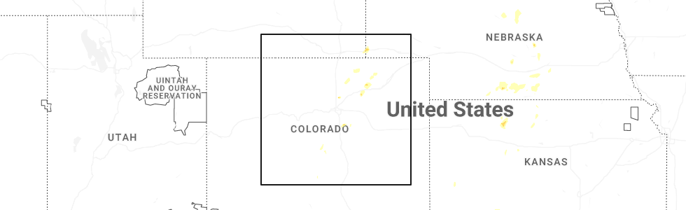
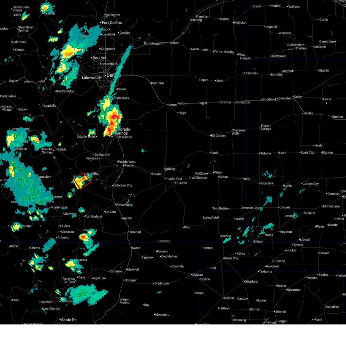
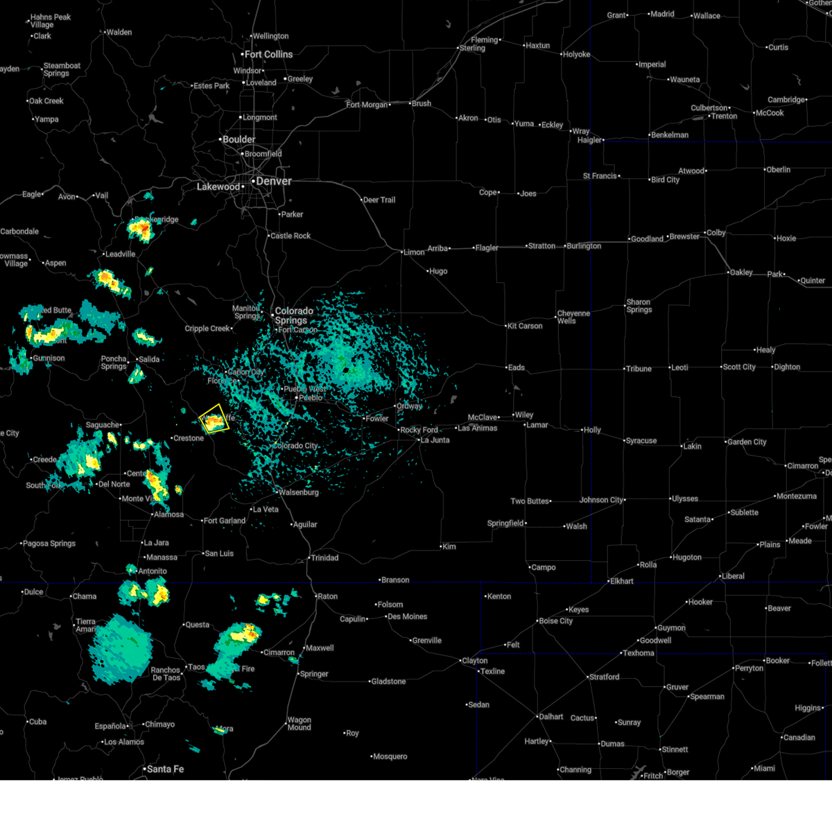
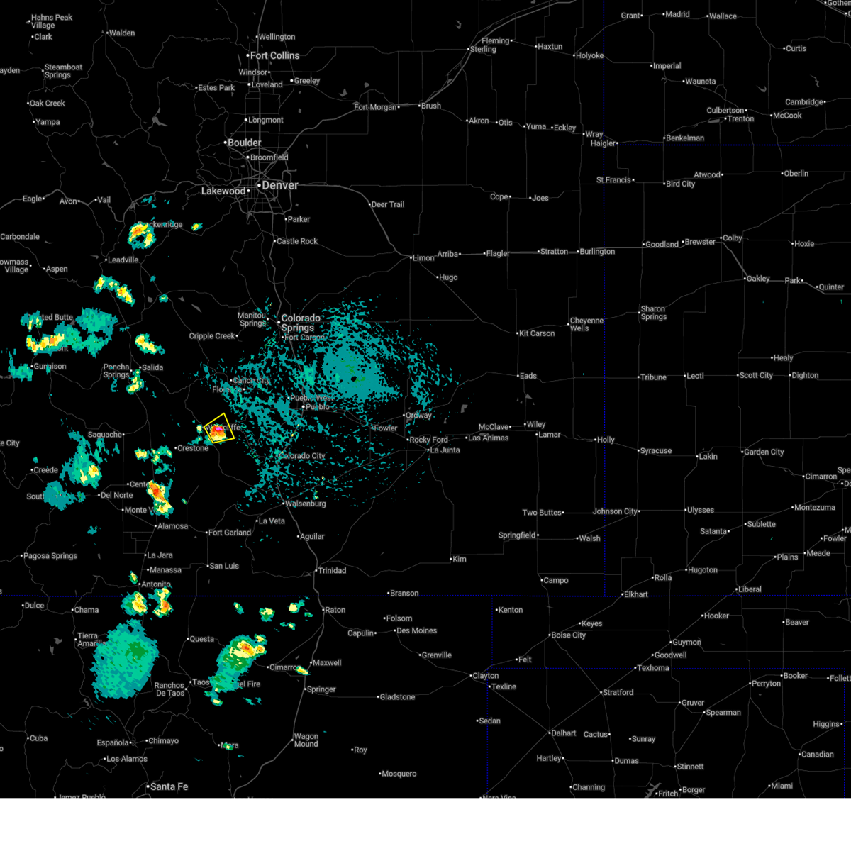
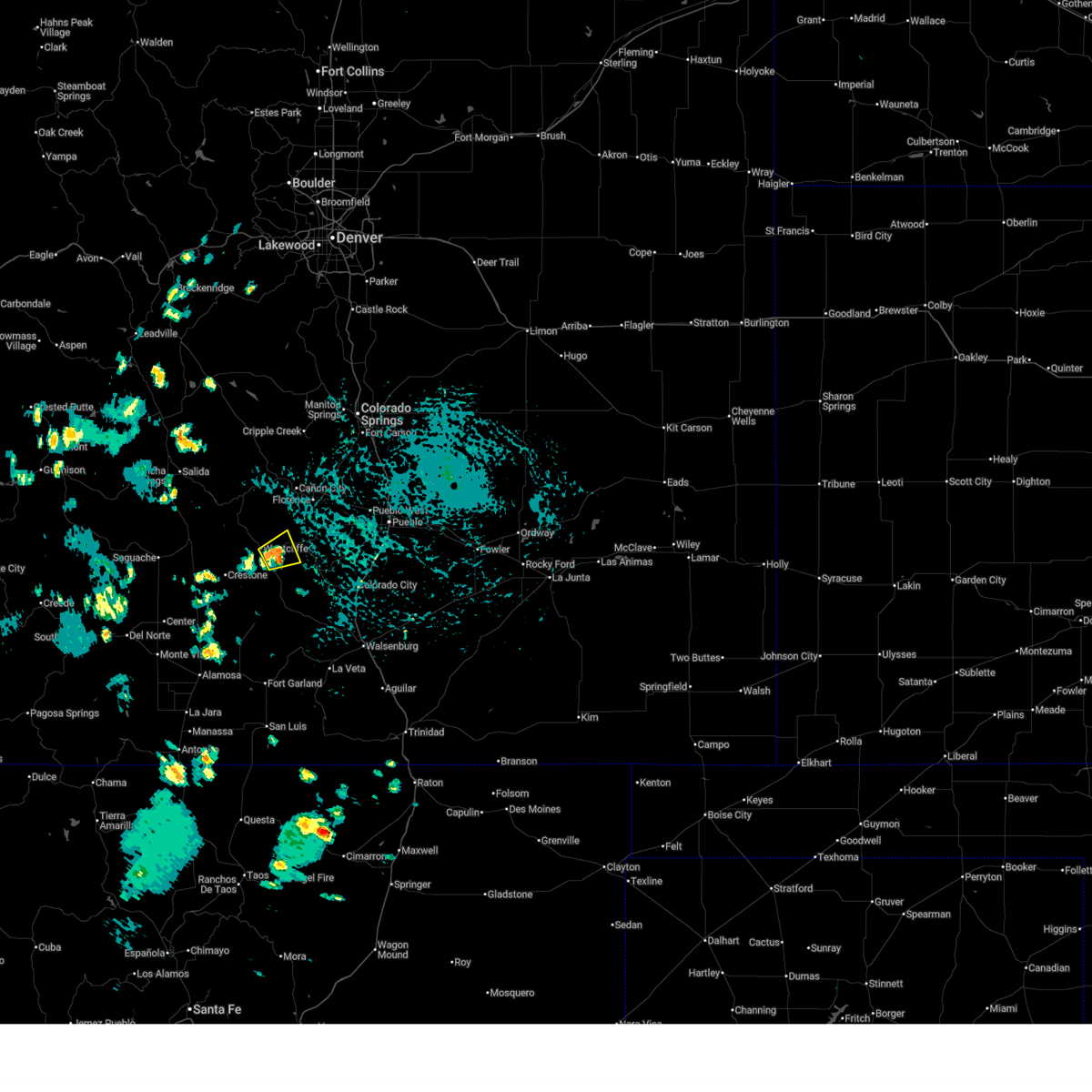
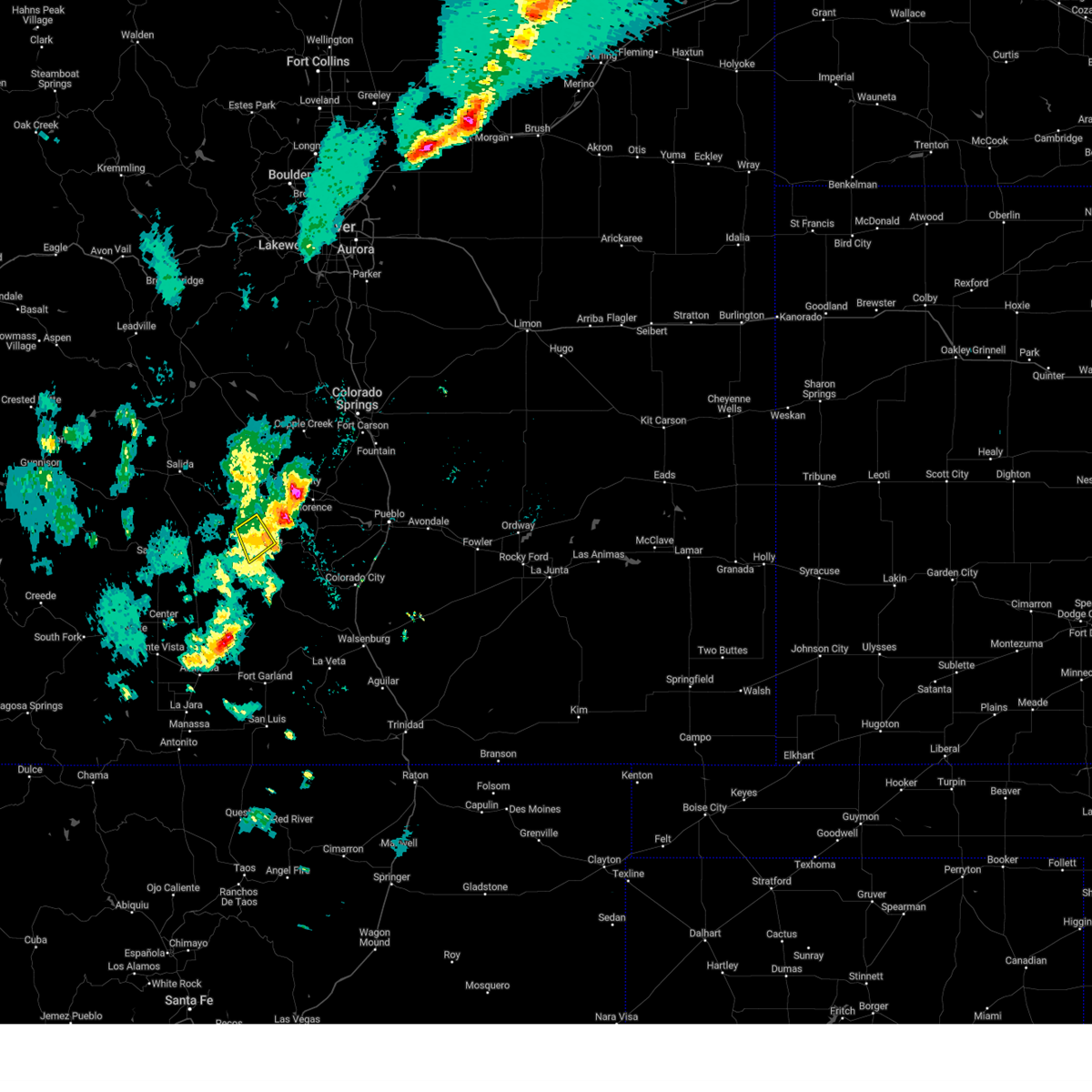
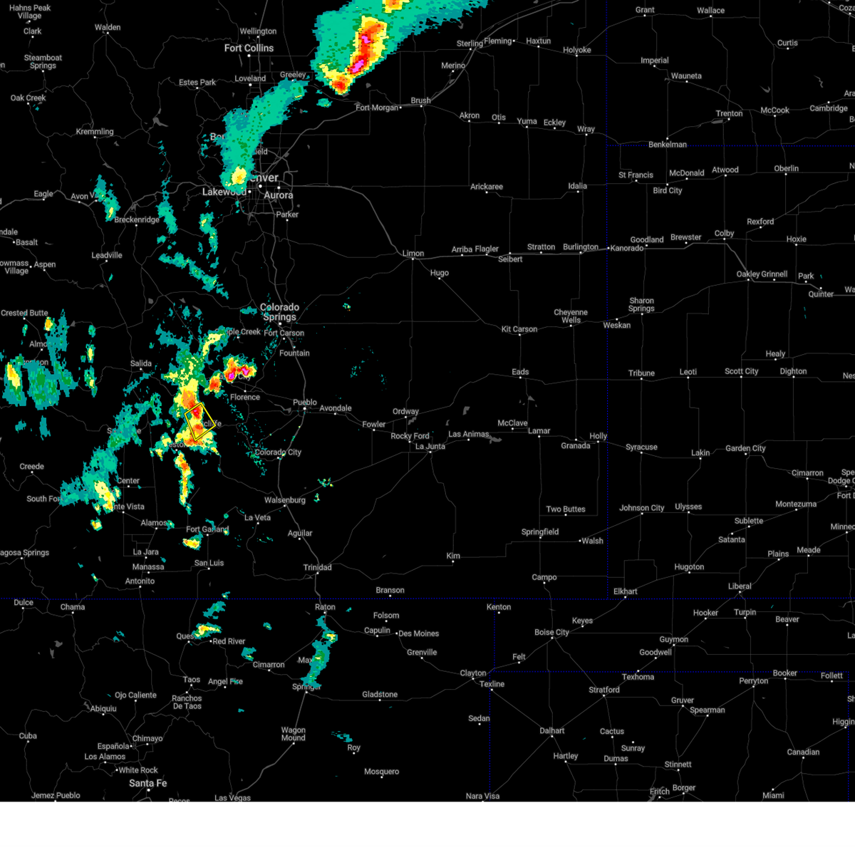
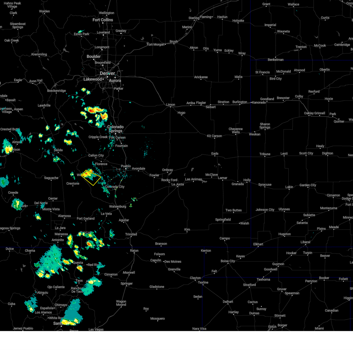
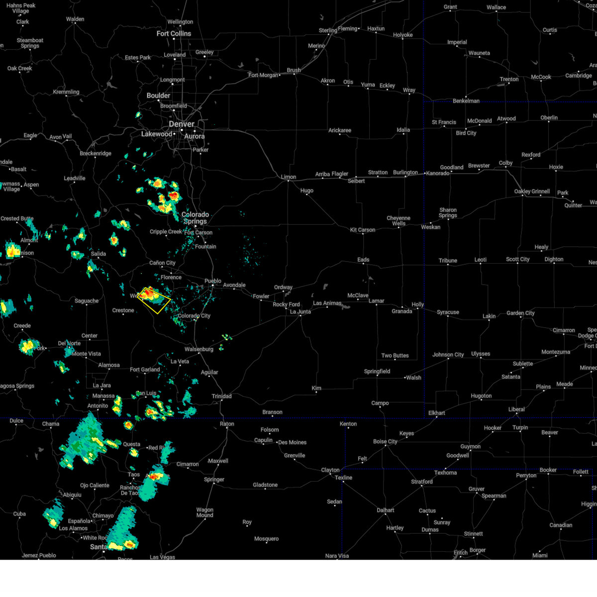
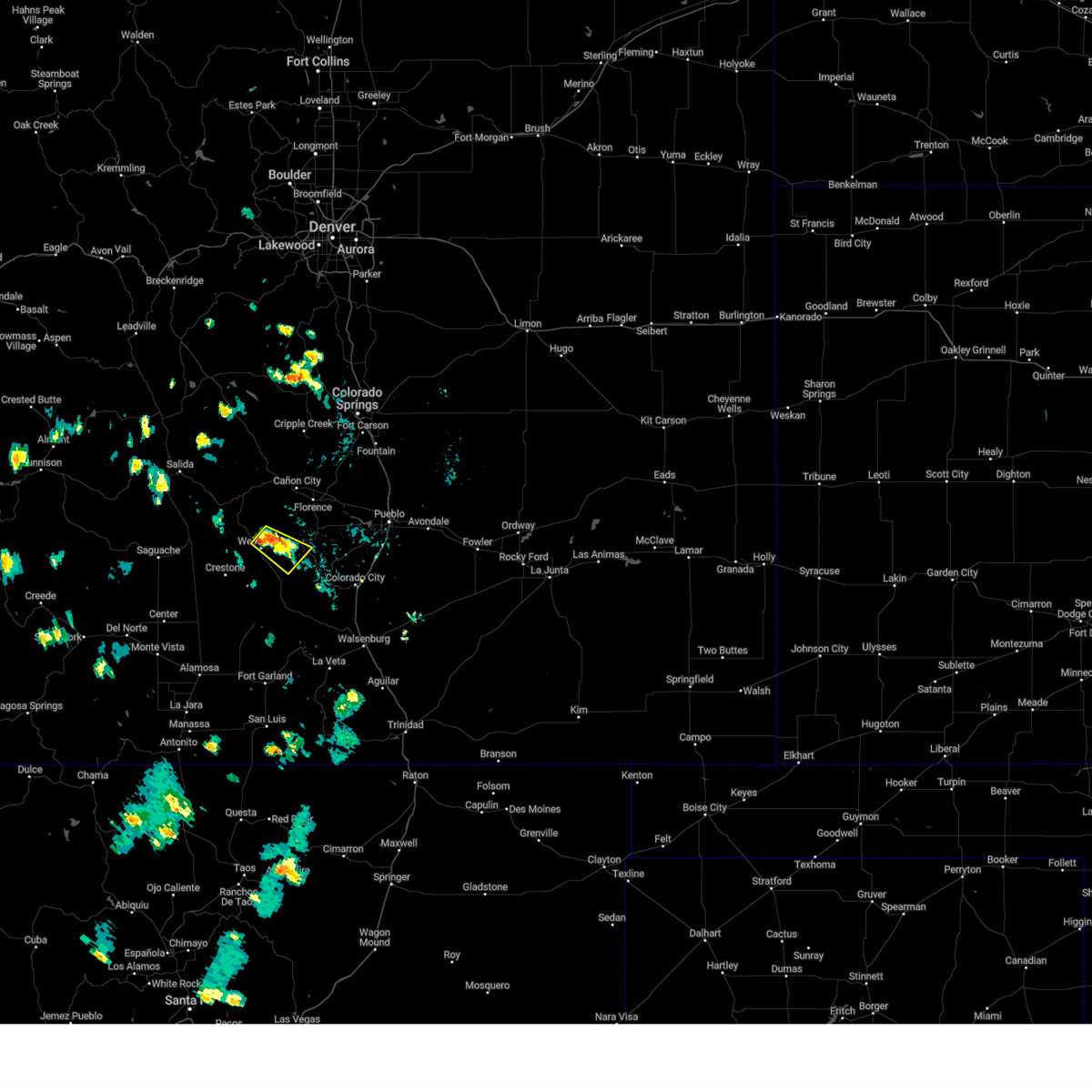
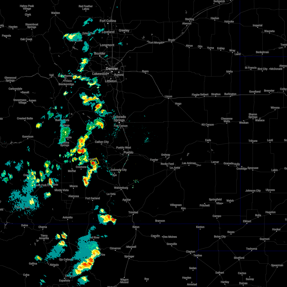
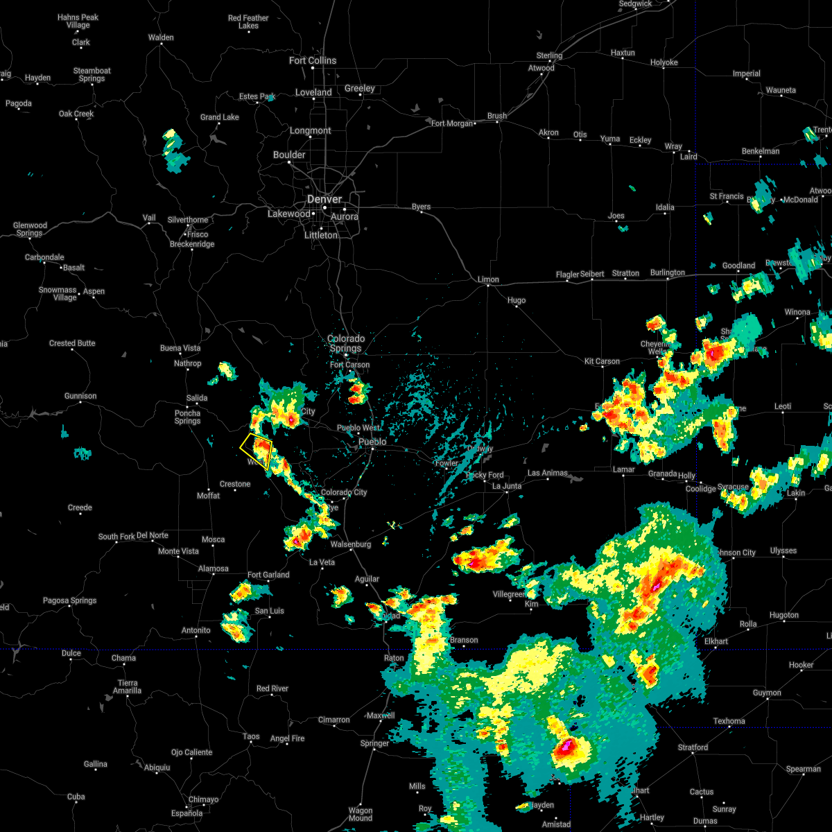
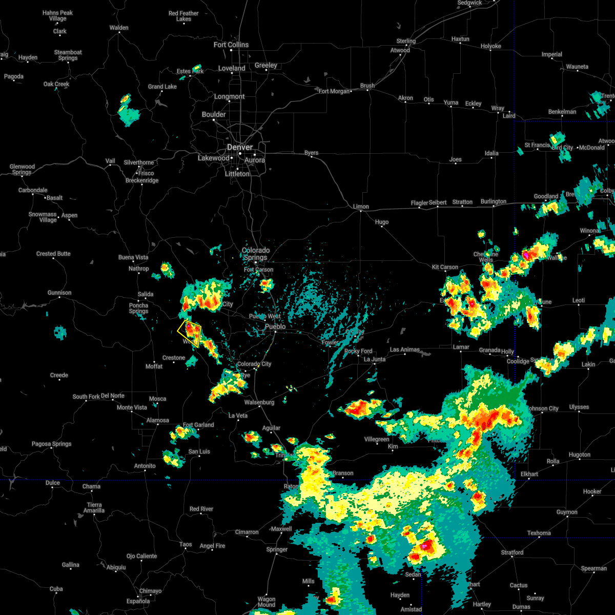
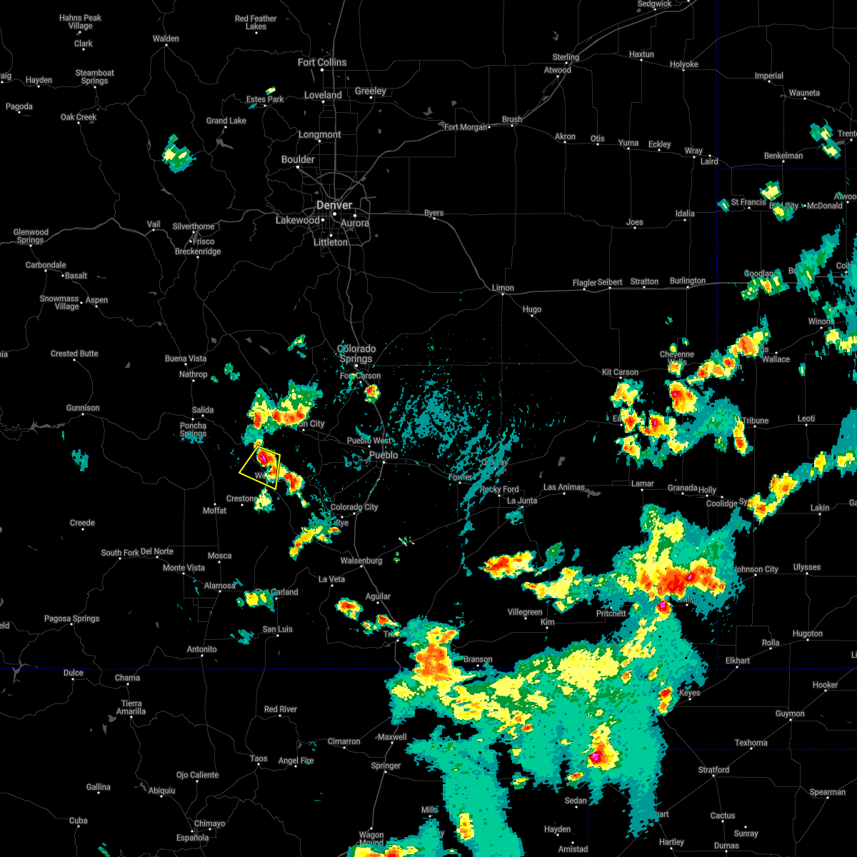
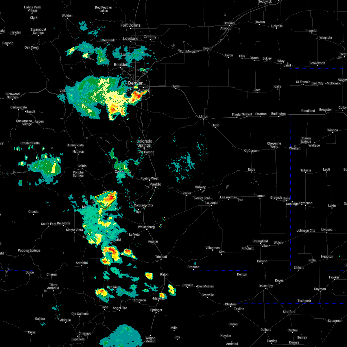
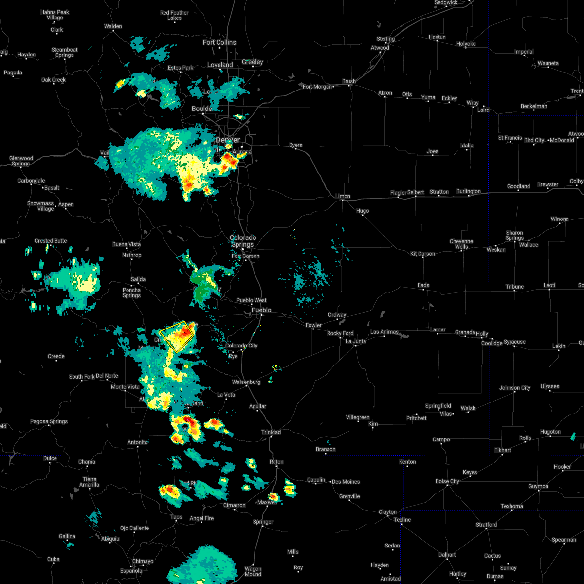
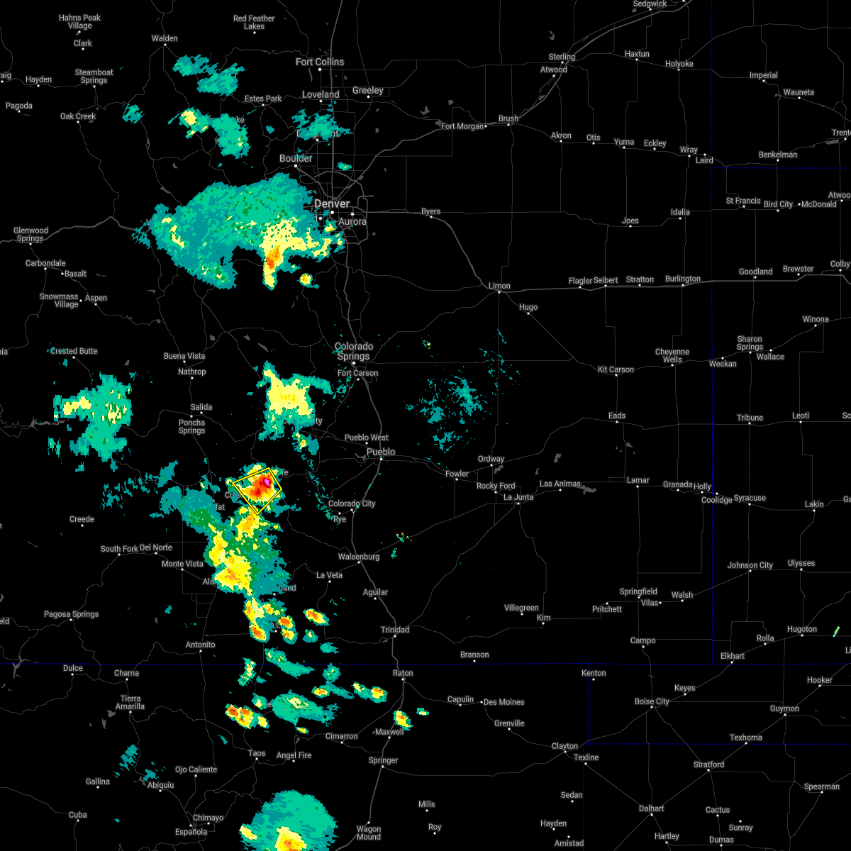
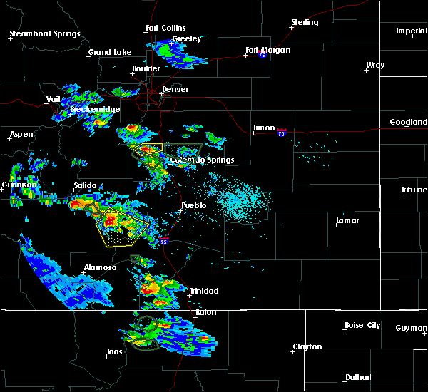
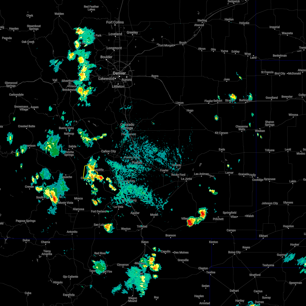
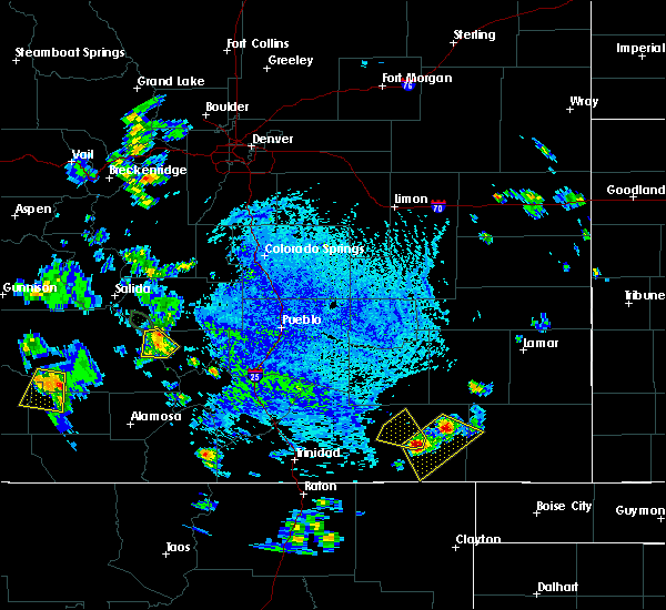
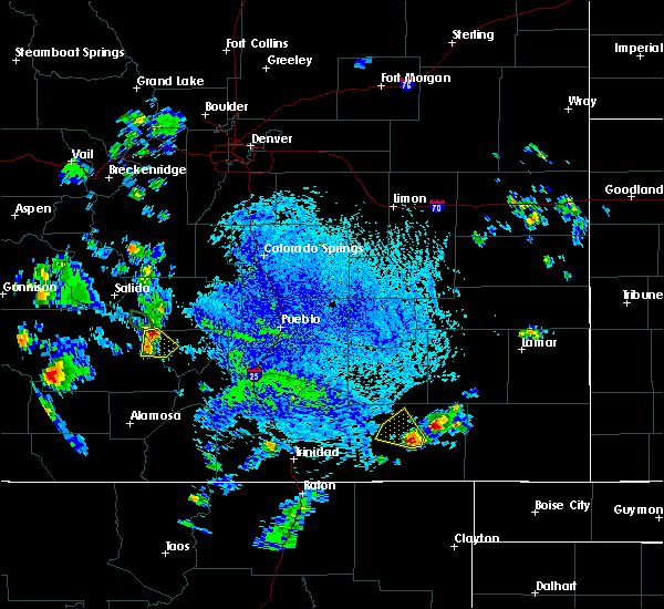
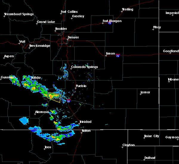
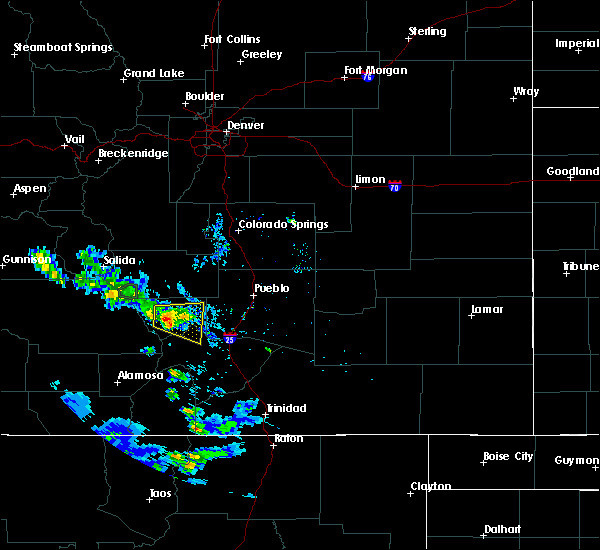
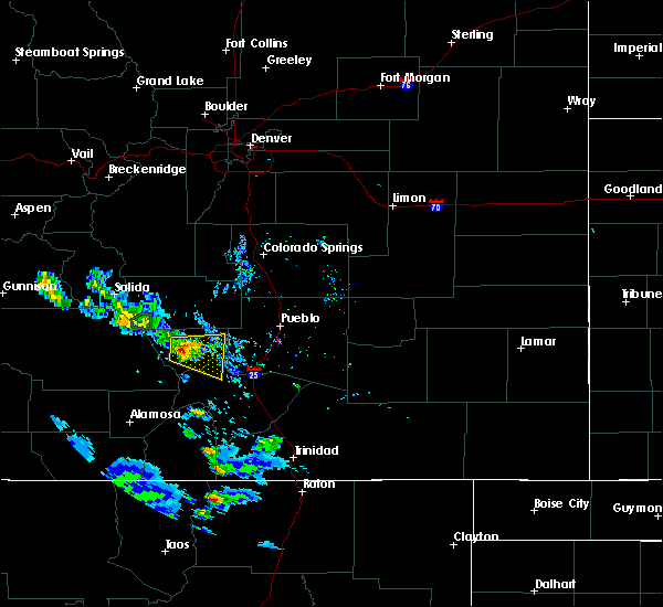
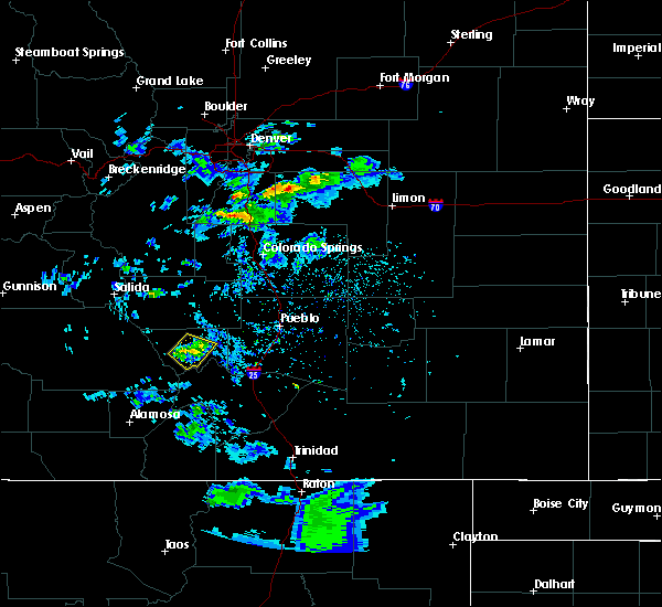
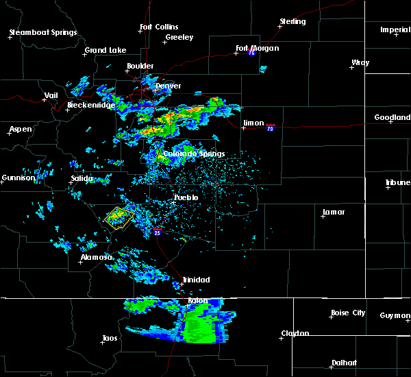
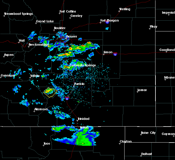
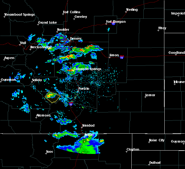
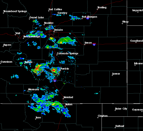
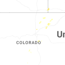
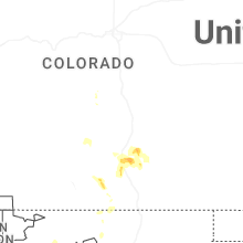
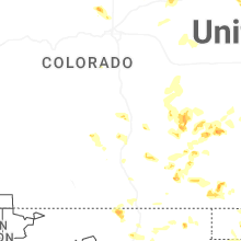
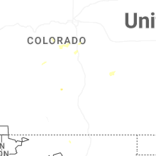
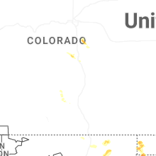
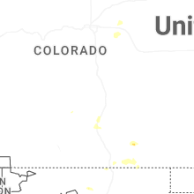
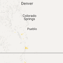
Hail Map for Westcliffe, CO
The Westcliffe, CO area has had 15 reports of on-the-ground hail by trained spotters, and has been under severe weather warnings 4 times during the past 12 months. Doppler radar has detected hail at or near Westcliffe, CO on 41 occasions, including 7 occasions during the past year.
| Name: | Westcliffe, CO |
| Where Located: | 47.4 miles WSW of Pueblo, CO |
| Map: | Google Map for Westcliffe, CO |
| Population: | 568 |
| Housing Units: | 288 |
| More Info: | Search Google for Westcliffe, CO |
0
The Top Recent Hail Date for Westcliffe, CO is Wednesday, June 3, 2026 (37th out of 41)
Hail and Wind Damage Spotted near Westcliffe, CO
| Date / Time | Report Details |
|---|---|
| 6/3/2026 3:07 PM MDT | Quarter sized hail reported 5.5 miles NNE of Westcliffe, CO, copious amounts of 3/4 inch to 1 inch hail fell at location. lasted about 25 mins. |
| 10/4/2025 1:20 PM MDT | Mesonet station aw342 highlands ranch occurred with decaying thunderstor in custer county CO, 15.4 miles NNW of Westcliffe, CO |
| 7/30/2025 3:09 PM MDT |
 Torpub the national weather service in pueblo has issued a * tornado warning for, southwestern custer county in southeastern colorado, east central saguache county in central colorado, * until 345 pm mdt. * at 309 pm mdt, a confirmed tornado was located 8 miles northeast of crestone peak, or 45 miles northeast of alamosa, moving southwest at 15 mph (weather spotters confirmed tornado). Hazards include damaging tornado. Flying debris will be dangerous to those caught without shelter. mobile homes will be damaged or destroyed. damage to roofs, windows, and vehicles will occur. tree damage is likely. the tornado will be near, great sand dunes around 325 pm mdt. Other locations impacted by this tornadic thunderstorm include westcliffe and silver cliff. Torpub the national weather service in pueblo has issued a * tornado warning for, southwestern custer county in southeastern colorado, east central saguache county in central colorado, * until 345 pm mdt. * at 309 pm mdt, a confirmed tornado was located 8 miles northeast of crestone peak, or 45 miles northeast of alamosa, moving southwest at 15 mph (weather spotters confirmed tornado). Hazards include damaging tornado. Flying debris will be dangerous to those caught without shelter. mobile homes will be damaged or destroyed. damage to roofs, windows, and vehicles will occur. tree damage is likely. the tornado will be near, great sand dunes around 325 pm mdt. Other locations impacted by this tornadic thunderstorm include westcliffe and silver cliff.
|
| 7/11/2025 6:45 PM MDT | Half Dollar sized hail reported 16.1 miles NW of Westcliffe, CO |
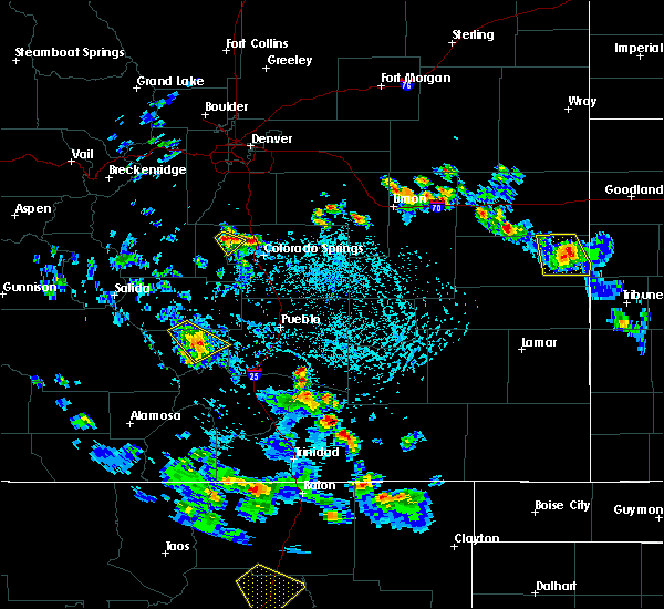
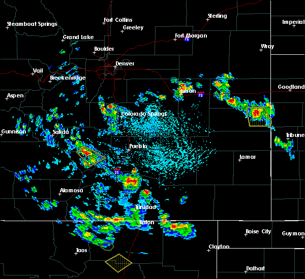
| 6/30/2025 2:32 PM MDT |
 the severe thunderstorm warning has been cancelled and is no longer in effect the severe thunderstorm warning has been cancelled and is no longer in effect
|
| 6/30/2025 2:21 PM MDT |
 At 220 pm mdt, a severe thunderstorm was located 19 miles northeast of crestone peak, or 38 miles west of pueblo, moving northeast at 10 mph (radar indicated). Hazards include 60 mph wind gusts and quarter size hail. Hail damage to vehicles is expected. expect wind damage to roofs, siding, and trees. Locations impacted include, silver cliff and rosita. At 220 pm mdt, a severe thunderstorm was located 19 miles northeast of crestone peak, or 38 miles west of pueblo, moving northeast at 10 mph (radar indicated). Hazards include 60 mph wind gusts and quarter size hail. Hail damage to vehicles is expected. expect wind damage to roofs, siding, and trees. Locations impacted include, silver cliff and rosita.
|
| 6/30/2025 2:09 PM MDT |
 Svrpub the national weather service in pueblo has issued a * severe thunderstorm warning for, central custer county in southeastern colorado, * until 245 pm mdt. * at 209 pm mdt, a severe thunderstorm was located 17 miles northeast of crestone peak, or 39 miles west of pueblo, moving northeast at 10 mph (radar indicated). Hazards include 60 mph wind gusts and quarter size hail. Hail damage to vehicles is expected. Expect wind damage to roofs, siding, and trees. Svrpub the national weather service in pueblo has issued a * severe thunderstorm warning for, central custer county in southeastern colorado, * until 245 pm mdt. * at 209 pm mdt, a severe thunderstorm was located 17 miles northeast of crestone peak, or 39 miles west of pueblo, moving northeast at 10 mph (radar indicated). Hazards include 60 mph wind gusts and quarter size hail. Hail damage to vehicles is expected. Expect wind damage to roofs, siding, and trees.
|
| 6/10/2024 5:29 PM MDT |
 The storm which prompted the warning has weakened below severe limits, and no longer poses an immediate threat to life or property. therefore, the warning will be allowed to expire. however, small hail and heavy rain are still possible with this thunderstorm. The storm which prompted the warning has weakened below severe limits, and no longer poses an immediate threat to life or property. therefore, the warning will be allowed to expire. however, small hail and heavy rain are still possible with this thunderstorm.
|
| 6/10/2024 5:01 PM MDT |
 Svrpub the national weather service in pueblo has issued a * severe thunderstorm warning for, south central fremont county in central colorado, north central custer county in southeastern colorado, * until 530 pm mdt. * at 501 pm mdt, a severe thunderstorm was located 13 miles south of texas creek, or 49 miles west of pueblo, moving southeast at 15 mph (radar indicated). Hazards include 60 mph wind gusts and quarter size hail. Hail damage to vehicles is expected. Expect wind damage to roofs, siding, and trees. Svrpub the national weather service in pueblo has issued a * severe thunderstorm warning for, south central fremont county in central colorado, north central custer county in southeastern colorado, * until 530 pm mdt. * at 501 pm mdt, a severe thunderstorm was located 13 miles south of texas creek, or 49 miles west of pueblo, moving southeast at 15 mph (radar indicated). Hazards include 60 mph wind gusts and quarter size hail. Hail damage to vehicles is expected. Expect wind damage to roofs, siding, and trees.
|
| 6/9/2024 1:55 PM MDT |
 The storm which prompted the warning has weakened below severe limits, and has exited the warned area. therefore, the warning will be allowed to expire. The storm which prompted the warning has weakened below severe limits, and has exited the warned area. therefore, the warning will be allowed to expire.
|
| 6/9/2024 1:42 PM MDT |
 At 141 pm mdt, a severe thunderstorm was located 17 miles southeast of texas creek, or 42 miles west of pueblo, moving northwest at 10 mph (radar indicated). Hazards include quarter size hail. Damage to vehicles is expected. Locations impacted include, silver cliff, westcliffe, and rosita. At 141 pm mdt, a severe thunderstorm was located 17 miles southeast of texas creek, or 42 miles west of pueblo, moving northwest at 10 mph (radar indicated). Hazards include quarter size hail. Damage to vehicles is expected. Locations impacted include, silver cliff, westcliffe, and rosita.
|
| 6/9/2024 1:28 PM MDT |
 Svrpub the national weather service in pueblo has issued a * severe thunderstorm warning for, central custer county in southeastern colorado, * until 200 pm mdt. * at 127 pm mdt, a severe thunderstorm was located 17 miles northeast of crestone peak, or 43 miles west of pueblo, moving southeast at 10 mph (radar indicated). Hazards include quarter size hail. damage to vehicles is expected Svrpub the national weather service in pueblo has issued a * severe thunderstorm warning for, central custer county in southeastern colorado, * until 200 pm mdt. * at 127 pm mdt, a severe thunderstorm was located 17 miles northeast of crestone peak, or 43 miles west of pueblo, moving southeast at 10 mph (radar indicated). Hazards include quarter size hail. damage to vehicles is expected
|
| 10/2/2023 6:31 AM MDT | Likely outflow from storms north of westcliff in custer county CO, 0.6 miles SSE of Westcliffe, CO |
| 7/21/2023 6:12 PM MDT | The severe thunderstorm warning for central custer county will expire at 615 pm mdt, the storm which prompted the warning has weakened below severe limits, and has exited the warned area. therefore, the warning will be allowed to expire. to report severe weather, contact your nearest law enforcement agency. they will relay your report to the national weather service pueblo colorado. |
| 7/21/2023 5:47 PM MDT | At 546 pm mdt, a severe thunderstorm was located 12 miles north of crestone peak, or 16 miles southeast of hayden pass burn scar, moving southeast at 10 mph (radar indicated). Hazards include quarter size hail. Damage to vehicles is expected. this severe thunderstorm will remain over mainly rural areas of central custer county, including the following locations, westcliffe and silver cliff. hail threat, radar indicated max hail size, 1. 00 in wind threat, radar indicated max wind gust, <50 mph. |
| 7/21/2021 4:05 PM MDT |
 At 404 pm mdt, a severe thunderstorm was located 13 miles northeast of crestone peak, or 16 miles west of junkins burn scar, and is nearly stationary (radar indicated). Hazards include quarter size hail. Damage to vehicles is expected. Locations impacted include, silver cliff, westcliffe and rosita. At 404 pm mdt, a severe thunderstorm was located 13 miles northeast of crestone peak, or 16 miles west of junkins burn scar, and is nearly stationary (radar indicated). Hazards include quarter size hail. Damage to vehicles is expected. Locations impacted include, silver cliff, westcliffe and rosita.
|
| 7/21/2021 3:44 PM MDT |
 At 344 pm mdt, a severe thunderstorm was located 12 miles northeast of crestone peak, or 17 miles west of junkins burn scar, and is nearly stationary (radar indicated). Hazards include half dollar size hail. damage to vehicles is expected At 344 pm mdt, a severe thunderstorm was located 12 miles northeast of crestone peak, or 17 miles west of junkins burn scar, and is nearly stationary (radar indicated). Hazards include half dollar size hail. damage to vehicles is expected
|
| 7/6/2021 4:09 PM MDT |
 The severe thunderstorm warning for south central fremont and north central custer counties will expire at 415 pm mdt, the storm which prompted the warning has weakened below severe limits, and no longer poses an immediate threat to life or property. therefore, the warning will be allowed to expire. however small hail and heavy rain are still possible with this thunderstorm. The severe thunderstorm warning for south central fremont and north central custer counties will expire at 415 pm mdt, the storm which prompted the warning has weakened below severe limits, and no longer poses an immediate threat to life or property. therefore, the warning will be allowed to expire. however small hail and heavy rain are still possible with this thunderstorm.
|
| 7/6/2021 4:03 PM MDT |
 At 403 pm mdt, a severe thunderstorm was located 7 miles southeast of texas creek, or 13 miles east of hayden pass burn scar, moving northeast at 5 mph (radar indicated). Hazards include 60 mph wind gusts and quarter size hail. Hail damage to vehicles is expected. expect wind damage to roofs, siding, and trees. Locations impacted include, silver cliff, westcliffe and hillside. At 403 pm mdt, a severe thunderstorm was located 7 miles southeast of texas creek, or 13 miles east of hayden pass burn scar, moving northeast at 5 mph (radar indicated). Hazards include 60 mph wind gusts and quarter size hail. Hail damage to vehicles is expected. expect wind damage to roofs, siding, and trees. Locations impacted include, silver cliff, westcliffe and hillside.
|
| 7/6/2021 3:50 PM MDT |
 At 350 pm mdt, a severe thunderstorm was located 9 miles south of texas creek, or 12 miles east of hayden pass burn scar, moving south at 15 mph (radar indicated). Hazards include 60 mph wind gusts and quarter size hail. Hail damage to vehicles is expected. Expect wind damage to roofs, siding, and trees. At 350 pm mdt, a severe thunderstorm was located 9 miles south of texas creek, or 12 miles east of hayden pass burn scar, moving south at 15 mph (radar indicated). Hazards include 60 mph wind gusts and quarter size hail. Hail damage to vehicles is expected. Expect wind damage to roofs, siding, and trees.
|
| 7/5/2021 4:57 PM MDT |
 The severe thunderstorm warning for western custer and east central saguache counties will expire at 500 pm mdt, the storm which prompted the warning has weakened below severe limits, and no longer poses an immediate threat to life or property. therefore, the warning will be allowed to expire. however small hail and heavy rain are still possible with this thunderstorm. The severe thunderstorm warning for western custer and east central saguache counties will expire at 500 pm mdt, the storm which prompted the warning has weakened below severe limits, and no longer poses an immediate threat to life or property. therefore, the warning will be allowed to expire. however small hail and heavy rain are still possible with this thunderstorm.
|
| 7/5/2021 4:51 PM MDT |
 At 451 pm mdt, a severe thunderstorm was located near crestone peak, or 19 miles southeast of hayden pass burn scar, and is nearly stationary (radar indicated). Hazards include 60 mph wind gusts and quarter size hail. Hail damage to vehicles is expected. expect wind damage to roofs, siding, and trees. Locations impacted include, crestone peak, silver cliff and westcliffe. At 451 pm mdt, a severe thunderstorm was located near crestone peak, or 19 miles southeast of hayden pass burn scar, and is nearly stationary (radar indicated). Hazards include 60 mph wind gusts and quarter size hail. Hail damage to vehicles is expected. expect wind damage to roofs, siding, and trees. Locations impacted include, crestone peak, silver cliff and westcliffe.
|
| 7/5/2021 4:34 PM MDT |
 At 433 pm mdt, a severe thunderstorm was located near crestone peak, or 19 miles southeast of hayden pass burn scar, and is nearly stationary (radar indicated). Hazards include 60 mph wind gusts and quarter size hail. Hail damage to vehicles is expected. Expect wind damage to roofs, siding, and trees. At 433 pm mdt, a severe thunderstorm was located near crestone peak, or 19 miles southeast of hayden pass burn scar, and is nearly stationary (radar indicated). Hazards include 60 mph wind gusts and quarter size hail. Hail damage to vehicles is expected. Expect wind damage to roofs, siding, and trees.
|
| 5/17/2021 11:55 AM MDT | Quarter sized hail reported 6.3 miles E of Westcliffe, CO, cocorahs report. |
| 6/23/2020 2:37 PM MDT |
 The severe thunderstorm warning for south central fremont, northeastern custer and west central pueblo counties will expire at 245 pm mdt, the storm which prompted the warning has weakened below severe limits, and no longer poses an immediate threat to life or property. therefore, the warning will be allowed to expire. however small hail, gusty winds and heavy rain are still possible with this thunderstorm. The severe thunderstorm warning for south central fremont, northeastern custer and west central pueblo counties will expire at 245 pm mdt, the storm which prompted the warning has weakened below severe limits, and no longer poses an immediate threat to life or property. therefore, the warning will be allowed to expire. however small hail, gusty winds and heavy rain are still possible with this thunderstorm.
|
| 6/23/2020 2:14 PM MDT |
 At 214 pm mdt, a severe thunderstorm was located 12 miles west of junkins burn scar, moving southeast at 20 mph (radar indicated). Hazards include 60 mph wind gusts and quarter size hail. Hail damage to vehicles is expected. expect wind damage to roofs, siding, and trees. Locations impacted include, junkins burn scar, silver cliff and rosita. At 214 pm mdt, a severe thunderstorm was located 12 miles west of junkins burn scar, moving southeast at 20 mph (radar indicated). Hazards include 60 mph wind gusts and quarter size hail. Hail damage to vehicles is expected. expect wind damage to roofs, siding, and trees. Locations impacted include, junkins burn scar, silver cliff and rosita.
|
| 6/23/2020 2:01 PM MDT |
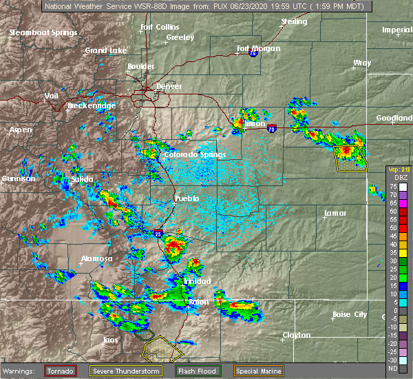 The national weather service in pueblo has issued a * severe thunderstorm warning for. south central fremont county in central colorado. northeastern custer county in southeastern colorado. west central pueblo county in southeastern colorado. Until 245 pm mdt. The national weather service in pueblo has issued a * severe thunderstorm warning for. south central fremont county in central colorado. northeastern custer county in southeastern colorado. west central pueblo county in southeastern colorado. Until 245 pm mdt.
|
| 6/6/2020 3:43 PM MDT |
 At 343 pm mdt, a severe thunderstorm was located 14 miles west of junkins burn scar, moving northeast at 50 mph (radar indicated). Hazards include 60 mph wind gusts and quarter size hail. Hail damage to vehicles is expected. Expect wind damage to roofs, siding, and trees. At 343 pm mdt, a severe thunderstorm was located 14 miles west of junkins burn scar, moving northeast at 50 mph (radar indicated). Hazards include 60 mph wind gusts and quarter size hail. Hail damage to vehicles is expected. Expect wind damage to roofs, siding, and trees.
|
| 6/6/2020 3:29 PM MDT |
 At 329 pm mdt, a severe thunderstorm was located 7 miles northeast of crestone peak, or 21 miles southeast of hayden pass burn scar, moving northeast at 55 mph (radar indicated). Hazards include 60 mph wind gusts and quarter size hail. Hail damage to vehicles is expected. Expect wind damage to roofs, siding, and trees. At 329 pm mdt, a severe thunderstorm was located 7 miles northeast of crestone peak, or 21 miles southeast of hayden pass burn scar, moving northeast at 55 mph (radar indicated). Hazards include 60 mph wind gusts and quarter size hail. Hail damage to vehicles is expected. Expect wind damage to roofs, siding, and trees.
|
| 7/22/2019 4:29 PM MDT |
 At 428 pm mdt, a severe thunderstorm capable of producing a tornado was located 15 miles northeast of crestone peak, or 19 miles southeast of hayden pass burn scar, and is nearly stationary (radar indicated rotation). Hazards include tornado. Expect damage to mobile homes, roofs, and vehicles. This tornadic thunderstorm will remain over mainly rural areas of north central custer county, including the following locations, westcliffe and silver cliff. At 428 pm mdt, a severe thunderstorm capable of producing a tornado was located 15 miles northeast of crestone peak, or 19 miles southeast of hayden pass burn scar, and is nearly stationary (radar indicated rotation). Hazards include tornado. Expect damage to mobile homes, roofs, and vehicles. This tornadic thunderstorm will remain over mainly rural areas of north central custer county, including the following locations, westcliffe and silver cliff.
|
| 8/7/2018 6:18 PM MDT | Quarter sized hail reported 9.7 miles NW of Westcliffe, CO |
| 8/7/2018 6:00 PM MDT | Quarter sized hail reported 7.7 miles WNW of Westcliffe, CO |
| 8/7/2018 5:46 PM MDT |
 At 545 pm mdt, a severe thunderstorm was located 12 miles northeast of crestone peak, or 45 miles west of pueblo, moving southeast at 200 mph (radar indicated). Hazards include 60 mph wind gusts and quarter size hail. Hail damage to vehicles is expected. Expect wind damage to roofs, siding, and trees. At 545 pm mdt, a severe thunderstorm was located 12 miles northeast of crestone peak, or 45 miles west of pueblo, moving southeast at 200 mph (radar indicated). Hazards include 60 mph wind gusts and quarter size hail. Hail damage to vehicles is expected. Expect wind damage to roofs, siding, and trees.
|
| 7/24/2018 5:15 PM MDT | Golf Ball sized hail reported 11.8 miles N of Westcliffe, CO |
| 7/24/2018 4:37 PM MDT | Quarter sized hail reported 7.1 miles NNW of Westcliffe, CO |
| 7/24/2018 4:25 PM MDT |
 At 424 pm mdt, a severe thunderstorm was located 7 miles northeast of crestone peak, or 45 miles northeast of alamosa, moving south at 25 mph (radar indicated). Hazards include golf ball size hail and 60 mph wind gusts. People and animals outdoors will be injured. expect hail damage to roofs, siding, windows, and vehicles. expect wind damage to roofs, siding, and trees. Locations impacted include, crestone peak, great sand dunes, silver cliff, westcliffe and rosita. At 424 pm mdt, a severe thunderstorm was located 7 miles northeast of crestone peak, or 45 miles northeast of alamosa, moving south at 25 mph (radar indicated). Hazards include golf ball size hail and 60 mph wind gusts. People and animals outdoors will be injured. expect hail damage to roofs, siding, windows, and vehicles. expect wind damage to roofs, siding, and trees. Locations impacted include, crestone peak, great sand dunes, silver cliff, westcliffe and rosita.
|
| 7/24/2018 4:14 PM MDT |
 At 414 pm mdt, a severe thunderstorm was located 12 miles north of crestone peak, or 50 miles west of pueblo, moving southeast at 15 mph (radar indicated). Hazards include golf ball size hail and 60 mph wind gusts. People and animals outdoors will be injured. expect hail damage to roofs, siding, windows, and vehicles. Expect wind damage to roofs, siding, and trees. At 414 pm mdt, a severe thunderstorm was located 12 miles north of crestone peak, or 50 miles west of pueblo, moving southeast at 15 mph (radar indicated). Hazards include golf ball size hail and 60 mph wind gusts. People and animals outdoors will be injured. expect hail damage to roofs, siding, windows, and vehicles. Expect wind damage to roofs, siding, and trees.
|
| 7/23/2018 2:43 PM MDT |
 The severe thunderstorm warning for southeastern fremont and eastern custer counties will expire at 245 pm mdt, the storm which prompted the warning has weakened below severe limits, and no longer poses an immediate threat to life or property. therefore, the warning will be allowed to expire. however heavy rain is still possible with this thunderstorm. a severe thunderstorm watch remains in effect until 700 pm mdt for central and southeastern colorado. The severe thunderstorm warning for southeastern fremont and eastern custer counties will expire at 245 pm mdt, the storm which prompted the warning has weakened below severe limits, and no longer poses an immediate threat to life or property. therefore, the warning will be allowed to expire. however heavy rain is still possible with this thunderstorm. a severe thunderstorm watch remains in effect until 700 pm mdt for central and southeastern colorado.
|
| 7/23/2018 2:23 PM MDT |
 At 222 pm mdt, a severe thunderstorm was located 15 miles southeast of texas creek, or 45 miles west of pueblo, moving southeast at 15 mph (radar indicated). Hazards include 60 mph wind gusts and half dollar size hail. Hail damage to vehicles is expected. expect wind damage to roofs, siding, and trees. Locations impacted include, florence, silver cliff, westcliffe and rosita. At 222 pm mdt, a severe thunderstorm was located 15 miles southeast of texas creek, or 45 miles west of pueblo, moving southeast at 15 mph (radar indicated). Hazards include 60 mph wind gusts and half dollar size hail. Hail damage to vehicles is expected. expect wind damage to roofs, siding, and trees. Locations impacted include, florence, silver cliff, westcliffe and rosita.
|
| 7/23/2018 2:15 PM MDT | Quarter sized hail reported 2.8 miles SSW of Westcliffe, CO, cu18 was mobile... said he observed plenty of pea sized hail... up to quarter sized hail. |
| 7/23/2018 2:13 PM MDT |
 At 213 pm mdt, a severe thunderstorm was located 12 miles south of texas creek, or 47 miles west of pueblo, moving southeast at 15 mph (radar indicated). Hazards include 60 mph wind gusts and quarter size hail. Hail damage to vehicles is expected. Expect wind damage to roofs, siding, and trees. At 213 pm mdt, a severe thunderstorm was located 12 miles south of texas creek, or 47 miles west of pueblo, moving southeast at 15 mph (radar indicated). Hazards include 60 mph wind gusts and quarter size hail. Hail damage to vehicles is expected. Expect wind damage to roofs, siding, and trees.
|
| 5/19/2018 3:10 PM MDT | Quarter sized hail reported 9.7 miles NW of Westcliffe, CO |
| 7/16/2017 4:28 PM MDT |
 The severe thunderstorm warning for northwestern custer and east central saguache counties will expire at 430 pm mdt, the storm which prompted the warning has weakened below severe limits, and no longer poses an immediate threat to life or property. therefore the warning will be allowed to expire. however small hail and gusty winds are still possible with this thunderstorm. The severe thunderstorm warning for northwestern custer and east central saguache counties will expire at 430 pm mdt, the storm which prompted the warning has weakened below severe limits, and no longer poses an immediate threat to life or property. therefore the warning will be allowed to expire. however small hail and gusty winds are still possible with this thunderstorm.
|
| 7/16/2017 4:17 PM MDT |
 At 416 pm mdt, a severe thunderstorm was located 10 miles northeast of crestone, or 47 miles north of alamosa, moving south at 15 mph (radar indicated). Hazards include 60 mph wind gusts and nickel size hail. Expect damage to roofs, siding, and trees. Locations impacted include, open country west of westcliffe. At 416 pm mdt, a severe thunderstorm was located 10 miles northeast of crestone, or 47 miles north of alamosa, moving south at 15 mph (radar indicated). Hazards include 60 mph wind gusts and nickel size hail. Expect damage to roofs, siding, and trees. Locations impacted include, open country west of westcliffe.
|
| 7/16/2017 3:47 PM MDT |
 At 346 pm mdt, a severe thunderstorm was located 10 miles south of cotopaxi, or 53 miles north of alamosa, moving south at 10 mph (radar indicated). Hazards include 60 mph wind gusts and quarter size hail. Hail damage to vehicles is expected. Expect wind damage to roofs, siding, and trees. At 346 pm mdt, a severe thunderstorm was located 10 miles south of cotopaxi, or 53 miles north of alamosa, moving south at 10 mph (radar indicated). Hazards include 60 mph wind gusts and quarter size hail. Hail damage to vehicles is expected. Expect wind damage to roofs, siding, and trees.
|
| 5/8/2017 4:35 PM MDT | Quarter sized hail reported 9.1 miles N of Westcliffe, CO |
| 8/20/2016 6:41 PM MDT |
 The severe thunderstorm warning for southeastern custer and north central huerfano counties will expire at 645 pm mdt, the storm which prompted the warning has weakened below severe limits, and no longer pose an immediate threat to life or property. therefore the warning will be allowed to expire. however small hail and heavy rain are still possible with this thunderstorm. The severe thunderstorm warning for southeastern custer and north central huerfano counties will expire at 645 pm mdt, the storm which prompted the warning has weakened below severe limits, and no longer pose an immediate threat to life or property. therefore the warning will be allowed to expire. however small hail and heavy rain are still possible with this thunderstorm.
|
| 8/20/2016 6:35 PM MDT | Quarter sized hail reported 6.4 miles NNW of Westcliffe, CO, . |
| 8/20/2016 6:30 PM MDT |
 At 629 pm mdt, a severe thunderstorm was located 11 miles east of crestone peak, or 44 miles southwest of pueblo, moving southeast at 25 mph (trained weather spotters). Hazards include quarter size hail. Damage to vehicles is expected. Locations impacted include, silver cliff and rosita. At 629 pm mdt, a severe thunderstorm was located 11 miles east of crestone peak, or 44 miles southwest of pueblo, moving southeast at 25 mph (trained weather spotters). Hazards include quarter size hail. Damage to vehicles is expected. Locations impacted include, silver cliff and rosita.
|
| 8/20/2016 6:20 PM MDT |
 At 620 pm mdt, a severe thunderstorm was located 10 miles northeast of crestone peak, or 46 miles west of pueblo, moving south at 15 mph (radar indicated). Hazards include 60 mph wind gusts and quarter size hail. Hail damage to vehicles is expected. expect wind damage to roofs, siding, and trees. Locations impacted include, silver cliff, westcliffe and rosita. At 620 pm mdt, a severe thunderstorm was located 10 miles northeast of crestone peak, or 46 miles west of pueblo, moving south at 15 mph (radar indicated). Hazards include 60 mph wind gusts and quarter size hail. Hail damage to vehicles is expected. expect wind damage to roofs, siding, and trees. Locations impacted include, silver cliff, westcliffe and rosita.
|
| 8/20/2016 6:05 PM MDT |
 At 605 pm mdt, a severe thunderstorm was located 11 miles northeast of crestone peak, or 46 miles west of pueblo, moving east at 15 mph (radar indicated). Hazards include 60 mph wind gusts and quarter size hail. Hail damage to vehicles is expected. Expect wind damage to roofs, siding, and trees. At 605 pm mdt, a severe thunderstorm was located 11 miles northeast of crestone peak, or 46 miles west of pueblo, moving east at 15 mph (radar indicated). Hazards include 60 mph wind gusts and quarter size hail. Hail damage to vehicles is expected. Expect wind damage to roofs, siding, and trees.
|
| 5/31/2016 4:55 PM MDT |
 The severe thunderstorm warning for central custer county will expire at 500 pm mdt, the storm which prompted the warning has weakened below severe limits, and no longer pose an immediate threat to life or property. therefore the warning will be allowed to expire. however small hail and heavy rain are still possible with this thunderstorm. The severe thunderstorm warning for central custer county will expire at 500 pm mdt, the storm which prompted the warning has weakened below severe limits, and no longer pose an immediate threat to life or property. therefore the warning will be allowed to expire. however small hail and heavy rain are still possible with this thunderstorm.
|
| 5/31/2016 4:42 PM MDT |
 At 442 pm mdt, a severe thunderstorm was located 13 miles northeast of crestone peak, or 44 miles west of pueblo, moving southeast at 15 mph (radar indicated). Hazards include quarter size hail. Damage to vehicles is expected. Locations impacted include, silver cliff, westcliffe and rosita. At 442 pm mdt, a severe thunderstorm was located 13 miles northeast of crestone peak, or 44 miles west of pueblo, moving southeast at 15 mph (radar indicated). Hazards include quarter size hail. Damage to vehicles is expected. Locations impacted include, silver cliff, westcliffe and rosita.
|
| 5/31/2016 4:30 PM MDT |
 At 430 pm mdt, a severe thunderstorm was located 11 miles northeast of crestone peak, or 46 miles west of pueblo, moving east at 15 mph (radar indicated). Hazards include 60 mph wind gusts and quarter size hail. Hail damage to vehicles is expected. expect wind damage to roofs, siding, and trees. Locations impacted include, silver cliff, westcliffe and rosita. At 430 pm mdt, a severe thunderstorm was located 11 miles northeast of crestone peak, or 46 miles west of pueblo, moving east at 15 mph (radar indicated). Hazards include 60 mph wind gusts and quarter size hail. Hail damage to vehicles is expected. expect wind damage to roofs, siding, and trees. Locations impacted include, silver cliff, westcliffe and rosita.
|
| 5/31/2016 4:18 PM MDT |
 At 418 pm mdt, a severe thunderstorm was located 11 miles northeast of crestone peak, or 48 miles west of pueblo, moving southeast at 15 mph (radar indicated). Hazards include 60 mph wind gusts and quarter size hail. Hail damage to vehicles is expected. Expect wind damage to roofs, siding, and trees. At 418 pm mdt, a severe thunderstorm was located 11 miles northeast of crestone peak, or 48 miles west of pueblo, moving southeast at 15 mph (radar indicated). Hazards include 60 mph wind gusts and quarter size hail. Hail damage to vehicles is expected. Expect wind damage to roofs, siding, and trees.
|
| 9/29/2015 6:00 PM MDT |
 At 600 pm mdt, a severe thunderstorm was located near texas creek, or 50 miles west of pueblo, moving southeast at 25 mph (radar indicated). Hazards include 60 mph wind gusts and quarter size hail. Hail damage to vehicles is expected. expect wind damage to roofs, siding and trees. Locations impacted include, westcliffe. At 600 pm mdt, a severe thunderstorm was located near texas creek, or 50 miles west of pueblo, moving southeast at 25 mph (radar indicated). Hazards include 60 mph wind gusts and quarter size hail. Hail damage to vehicles is expected. expect wind damage to roofs, siding and trees. Locations impacted include, westcliffe.
|
| 9/29/2015 5:51 PM MDT |
 At 551 pm mdt, a severe thunderstorm was located near texas creek, or 53 miles west of pueblo, moving southeast at 25 mph (radar indicated). Hazards include 60 mph wind gusts and quarter size hail. Hail damage to vehicles is expected. expect wind damage to roofs, siding and trees. Locations impacted include, cotopaxi, texas creek, westcliffe and hillside. At 551 pm mdt, a severe thunderstorm was located near texas creek, or 53 miles west of pueblo, moving southeast at 25 mph (radar indicated). Hazards include 60 mph wind gusts and quarter size hail. Hail damage to vehicles is expected. expect wind damage to roofs, siding and trees. Locations impacted include, cotopaxi, texas creek, westcliffe and hillside.
|
| 9/29/2015 5:42 PM MDT |
 At 541 pm mdt, a severe thunderstorm was located near cotopaxi, or 53 miles southwest of colorado springs, moving southeast at 30 mph (radar indicated). Hazards include 60 mph wind gusts and quarter size hail. Hail damage to vehicles is expected. expect wind damage to roofs, siding and trees. Locations impacted include, cotopaxi, texas creek, westcliffe and hillside. At 541 pm mdt, a severe thunderstorm was located near cotopaxi, or 53 miles southwest of colorado springs, moving southeast at 30 mph (radar indicated). Hazards include 60 mph wind gusts and quarter size hail. Hail damage to vehicles is expected. expect wind damage to roofs, siding and trees. Locations impacted include, cotopaxi, texas creek, westcliffe and hillside.
|
| 9/29/2015 5:31 PM MDT |
 At 531 pm mdt, a severe thunderstorm was located near howard, or 54 miles southwest of colorado springs, moving southeast at 25 mph (radar indicated). Hazards include 60 mph wind gusts and quarter size hail. Hail damage to vehicles is expected. Expect wind damage to roofs, siding and trees. At 531 pm mdt, a severe thunderstorm was located near howard, or 54 miles southwest of colorado springs, moving southeast at 25 mph (radar indicated). Hazards include 60 mph wind gusts and quarter size hail. Hail damage to vehicles is expected. Expect wind damage to roofs, siding and trees.
|
| 6/26/2015 6:14 PM MDT | Quarter sized hail reported 7.7 miles WNW of Westcliffe, CO |
| 6/7/2014 1:51 PM MDT | Quarter sized hail reported 7.7 miles WNW of Westcliffe, CO |
| 5/19/2012 5:47 PM MDT | Quarter sized hail reported 10.3 miles W of Westcliffe, CO |
| 5/13/2012 3:15 PM MDT | Quarter sized hail reported 0.3 miles WNW of Westcliffe, CO |
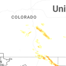
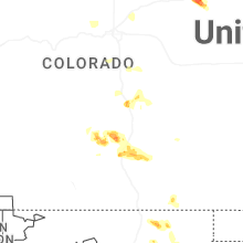
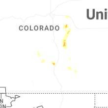
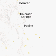
Hail Maps for Westcliffe, CO


Connect with Interactive Hail Maps