

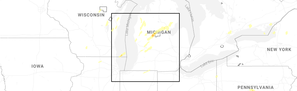
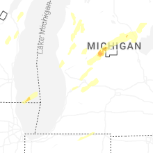
Hail Map for White Cloud, MI
The White Cloud, MI area has had 3 reports of on-the-ground hail by trained spotters, and has been under severe weather warnings 7 times during the past 12 months. Doppler radar has detected hail at or near White Cloud, MI on 30 occasions, including 1 occasion during the past year.
| Name: | White Cloud, MI |
| Where Located: | 40.9 miles N of Grand Rapids, MI |
| Map: | Google Map for White Cloud, MI |
| Population: | 1408 |
| Housing Units: | 537 |
| More Info: | Search Google for White Cloud, MI |
0
The Top Recent Hail Date for White Cloud, MI is Friday, May 16, 2025 (20th out of 30)
Hail and Wind Damage Spotted near White Cloud, MI
| Date / Time | Report Details |
|---|---|
| 5/16/2025 7:44 PM EDT | Svrgrr the national weather service in grand rapids has issued a * severe thunderstorm warning for, northeastern newaygo county in west central michigan, western osceola county in central michigan, lake county in west central michigan, northwestern mecosta county in central michigan, * until 915 pm edt. * at 744 pm edt, a severe thunderstorm was located near white cloud, moving northeast at 30 mph (radar indicated). Hazards include 60 mph wind gusts and penny size hail. expect damage to roofs, siding, and trees |
| 5/15/2025 9:52 PM EDT |
 Svrgrr the national weather service in grand rapids has issued a * severe thunderstorm warning for, kent county in southwestern michigan, newaygo county in west central michigan, * until 1115 pm edt. * at 951 pm edt, severe thunderstorms were located along a line extending from near shelby to 6 miles west of coopersville to 5 miles west of holland sp, moving east at 65 mph. these are destructive storms for kent and newaygo counties (radar indicated). Hazards include 80 mph wind gusts and penny size hail. Flying debris will be dangerous to those caught without shelter. mobile homes will be heavily damaged. expect considerable damage to roofs, windows, and vehicles. Extensive tree damage and power outages are likely. Svrgrr the national weather service in grand rapids has issued a * severe thunderstorm warning for, kent county in southwestern michigan, newaygo county in west central michigan, * until 1115 pm edt. * at 951 pm edt, severe thunderstorms were located along a line extending from near shelby to 6 miles west of coopersville to 5 miles west of holland sp, moving east at 65 mph. these are destructive storms for kent and newaygo counties (radar indicated). Hazards include 80 mph wind gusts and penny size hail. Flying debris will be dangerous to those caught without shelter. mobile homes will be heavily damaged. expect considerable damage to roofs, windows, and vehicles. Extensive tree damage and power outages are likely.
|
| 3/30/2025 6:39 PM EDT |
 The storms which prompted the warning are moving out of the area. therefore, the warning will be allowed to expire. a severe thunderstorm watch remains in effect until 900 pm edt for south central, central and southwestern michigan. The storms which prompted the warning are moving out of the area. therefore, the warning will be allowed to expire. a severe thunderstorm watch remains in effect until 900 pm edt for south central, central and southwestern michigan.
|
| 3/30/2025 6:19 PM EDT | At 618 pm edt, severe thunderstorms were located along a line extending from 10 miles southeast of baldwin to 7 miles east of greenville to 6 miles south of ionia, moving northeast at 75 mph. these are destructive storms for western and southern michigan (radar indicated). Hazards include 80 mph wind gusts and penny size hail. Flying debris will be dangerous to those caught without shelter. mobile homes will be heavily damaged. expect considerable damage to roofs, windows, and vehicles. extensive tree damage and power outages are likely. Locations impacted include, clarksville, cedar lake, stanton, vestaburg, wyman, orleans, langston, hawkins, lakeview, greenville, six lakes, pierson, woodville, sidney, sheridan, howard city, belding, carson city, bitely, ionia,. |
| 3/30/2025 6:02 PM EDT | At 601 pm edt, severe thunderstorms were located along a line extending from near hesperia to near freeport, moving east at 60 mph. these are destructive storms for western michigan (at 5:50 pm 80 mph winds were observed at grand rapids asos). Hazards include 80 mph wind gusts and penny size hail. Flying debris will be dangerous to those caught without shelter. mobile homes will be heavily damaged. expect considerable damage to roofs, windows, and vehicles. extensive tree damage and power outages are likely. Locations impacted include, clarksville, reeman, cedar lake, stanton, vestaburg, wyman, newaygo, orleans, langston, hawkins, lakeview, greenville, six lakes, pierson, woodville, sidney, sheridan, howard city, belding, carson city,. |
| 3/30/2025 5:48 PM EDT | Svrgrr the national weather service in grand rapids has issued a * severe thunderstorm warning for, newaygo county in west central michigan, ionia county in south central michigan, montcalm county in central michigan, * until 645 pm edt. * at 547 pm edt, severe thunderstorms were located along a line extending from 6 miles northeast of hart to near middleville, moving northeast at 85 mph (radar indicated). Hazards include 70 mph wind gusts and penny size hail. Expect considerable tree damage. Damage is likely to mobile homes, roofs, and outbuildings. |
| 8/27/2024 2:31 PM EDT |
 Svrgrr the national weather service in grand rapids has issued a * severe thunderstorm warning for, northeastern newaygo county in west central michigan, mecosta county in central michigan, * until 330 pm edt. * at 230 pm edt, a severe thunderstorm was located 10 miles west of big rapids, moving east at 30 mph (radar indicated). Hazards include 60 mph wind gusts. expect damage to roofs, siding, and trees Svrgrr the national weather service in grand rapids has issued a * severe thunderstorm warning for, northeastern newaygo county in west central michigan, mecosta county in central michigan, * until 330 pm edt. * at 230 pm edt, a severe thunderstorm was located 10 miles west of big rapids, moving east at 30 mph (radar indicated). Hazards include 60 mph wind gusts. expect damage to roofs, siding, and trees
|
| 5/20/2024 7:15 PM EDT |
 The storms which prompted the warning have moved out of the area. therefore, the warning will be allowed to expire. a severe thunderstorm watch remains in effect until 1000 pm edt for central and west central michigan. The storms which prompted the warning have moved out of the area. therefore, the warning will be allowed to expire. a severe thunderstorm watch remains in effect until 1000 pm edt for central and west central michigan.
|
| 5/20/2024 6:40 PM EDT |
 At 639 pm edt, severe thunderstorms were located along a line extending from 11 miles southeast of baldwin to near grant, moving east at 30 mph (radar indicated). Hazards include 60 mph wind gusts. Expect damage to roofs, siding, and trees. Locations impacted include, newaygo, white cloud, grant, croton, brohman, woodland park, hawkins, bitely, woodville, croton heights, wooster,. At 639 pm edt, severe thunderstorms were located along a line extending from 11 miles southeast of baldwin to near grant, moving east at 30 mph (radar indicated). Hazards include 60 mph wind gusts. Expect damage to roofs, siding, and trees. Locations impacted include, newaygo, white cloud, grant, croton, brohman, woodland park, hawkins, bitely, woodville, croton heights, wooster,.
|
| 5/20/2024 6:14 PM EDT |
 Svrgrr the national weather service in grand rapids has issued a * severe thunderstorm warning for, newaygo county in west central michigan, * until 715 pm edt. * at 614 pm edt, severe thunderstorms were located along a line extending from near hesperia to 6 miles west of grant, moving northeast at 30 mph (radar indicated). Hazards include 60 mph wind gusts. expect damage to roofs, siding, and trees Svrgrr the national weather service in grand rapids has issued a * severe thunderstorm warning for, newaygo county in west central michigan, * until 715 pm edt. * at 614 pm edt, severe thunderstorms were located along a line extending from near hesperia to 6 miles west of grant, moving northeast at 30 mph (radar indicated). Hazards include 60 mph wind gusts. expect damage to roofs, siding, and trees
|
| 6/29/2023 5:56 PM EDT |
 The severe thunderstorm warning for southeastern newaygo county will expire at 600 pm edt, the storm which prompted the warning has weakened below severe limits, and no longer poses an immediate threat to life or property. therefore, the warning will be allowed to expire. The severe thunderstorm warning for southeastern newaygo county will expire at 600 pm edt, the storm which prompted the warning has weakened below severe limits, and no longer poses an immediate threat to life or property. therefore, the warning will be allowed to expire.
|
| 6/29/2023 5:45 PM EDT | Quarter sized hail reported 0.4 miles NE of White Cloud, MI, report relayed via media. |
| 6/29/2023 5:16 PM EDT |
 At 515 pm edt, a severe thunderstorm was located near white cloud, moving northeast at 20 mph (radar indicated). Hazards include 60 mph wind gusts and quarter size hail. Hail damage to vehicles is expected. expect wind damage to roofs, siding, and trees. this severe thunderstorm will remain over mainly rural areas of southeastern newaygo county, including the following locations, woodville and wooster. hail threat, radar indicated max hail size, 1. 00 in wind threat, radar indicated max wind gust, 60 mph. At 515 pm edt, a severe thunderstorm was located near white cloud, moving northeast at 20 mph (radar indicated). Hazards include 60 mph wind gusts and quarter size hail. Hail damage to vehicles is expected. expect wind damage to roofs, siding, and trees. this severe thunderstorm will remain over mainly rural areas of southeastern newaygo county, including the following locations, woodville and wooster. hail threat, radar indicated max hail size, 1. 00 in wind threat, radar indicated max wind gust, 60 mph.
|
| 6/25/2023 4:36 PM EDT |
 At 435 pm edt, a severe thunderstorm was located over white cloud, moving north at 35 mph (radar indicated). Hazards include 60 mph wind gusts and penny size hail. expect damage to roofs, siding, and trees At 435 pm edt, a severe thunderstorm was located over white cloud, moving north at 35 mph (radar indicated). Hazards include 60 mph wind gusts and penny size hail. expect damage to roofs, siding, and trees
|
| 4/20/2023 8:38 PM EDT |
 At 838 pm edt, severe thunderstorms were located along a line extending from near shelby to near grand haven to near saugatuck, moving northeast at 25 mph (radar indicated). Hazards include 60 mph wind gusts and penny size hail. expect damage to roofs, siding, and trees At 838 pm edt, severe thunderstorms were located along a line extending from near shelby to near grand haven to near saugatuck, moving northeast at 25 mph (radar indicated). Hazards include 60 mph wind gusts and penny size hail. expect damage to roofs, siding, and trees
|
| 8/29/2022 3:01 PM EDT | At 301 pm edt, a severe thunderstorm was located near white cloud, moving east at 50 mph (radar indicated). Hazards include 60 mph wind gusts and quarter size hail. Hail damage to vehicles is expected. Expect wind damage to roofs, siding, and trees. |
| 8/3/2022 12:45 PM EDT | Multiple trees down. time estimated from rada in newaygo county MI, 9.5 miles S of White Cloud, MI |
| 5/11/2022 2:40 PM EDT |
 The severe thunderstorm warning for west central newaygo county will expire at 245 pm edt, the storm which prompted the warning for newaygo county has weakened below severe limits, and the warning will be allowed to expire at 245 pm edt. however, small hail, lightning, and flooding are still possible with this thunderstorm. The severe thunderstorm warning for west central newaygo county will expire at 245 pm edt, the storm which prompted the warning for newaygo county has weakened below severe limits, and the warning will be allowed to expire at 245 pm edt. however, small hail, lightning, and flooding are still possible with this thunderstorm.
|
| 5/11/2022 2:22 PM EDT |
 At 220 pm edt, a severe thunderstorm was located near white cloud, moving southwest at 20 mph (radar indicated. at 215 pm edt, trees were reported down north of white cloud). Hazards include 60 mph wind gusts and quarter size hail. Hail damage to vehicles is expected. expect wind damage to roofs, siding, and trees. locations impacted include, white cloud, fremont, hesperia, reeman, wooster, hail threat, radar indicated max hail size, 1. 00 in wind threat, radar indicated max wind gust, 60 mph. At 220 pm edt, a severe thunderstorm was located near white cloud, moving southwest at 20 mph (radar indicated. at 215 pm edt, trees were reported down north of white cloud). Hazards include 60 mph wind gusts and quarter size hail. Hail damage to vehicles is expected. expect wind damage to roofs, siding, and trees. locations impacted include, white cloud, fremont, hesperia, reeman, wooster, hail threat, radar indicated max hail size, 1. 00 in wind threat, radar indicated max wind gust, 60 mph.
|
| 5/11/2022 2:20 PM EDT | Trees down reported near/north of white cloud. pea size hail has also been reporte in newaygo county MI, 0.5 miles SSW of White Cloud, MI |
| 5/11/2022 2:04 PM EDT |
 At 204 pm edt, severe thunderstorms were located along a line extending from near hesperia to near white cloud, moving south at 15 mph (radar indicated). Hazards include golf ball size hail and 60 mph wind gusts. People and animals outdoors will be injured. expect hail damage to roofs, siding, windows, and vehicles. expect wind damage to roofs, siding, and trees. locations impacted include, newaygo, white cloud, fremont, hesperia, croton, brohman, reeman, woodville, croton heights, wooster, thunderstorm damage threat, considerable hail threat, radar indicated max hail size, 1. 75 in wind threat, radar indicated max wind gust, 60 mph. At 204 pm edt, severe thunderstorms were located along a line extending from near hesperia to near white cloud, moving south at 15 mph (radar indicated). Hazards include golf ball size hail and 60 mph wind gusts. People and animals outdoors will be injured. expect hail damage to roofs, siding, windows, and vehicles. expect wind damage to roofs, siding, and trees. locations impacted include, newaygo, white cloud, fremont, hesperia, croton, brohman, reeman, woodville, croton heights, wooster, thunderstorm damage threat, considerable hail threat, radar indicated max hail size, 1. 75 in wind threat, radar indicated max wind gust, 60 mph.
|
| 5/11/2022 1:58 PM EDT |
 At 158 pm edt, severe thunderstorms were located along a line extending from near hesperia to near white cloud, moving south at 15 mph (radar indicated). Hazards include 60 mph wind gusts and quarter size hail. Hail damage to vehicles is expected. Expect wind damage to roofs, siding, and trees. At 158 pm edt, severe thunderstorms were located along a line extending from near hesperia to near white cloud, moving south at 15 mph (radar indicated). Hazards include 60 mph wind gusts and quarter size hail. Hail damage to vehicles is expected. Expect wind damage to roofs, siding, and trees.
|
| 5/11/2022 1:45 PM EDT |
 At 145 pm edt, a severe thunderstorm was located near white cloud, moving south at 15 mph (radar indicated). Hazards include 60 mph wind gusts and penny size hail. Expect damage to roofs, siding, and trees. locations impacted include, white cloud, brohman, bitely, woodland park, woodville, wooster, hail threat, radar indicated max hail size, 0. 75 in wind threat, radar indicated max wind gust, 60 mph. At 145 pm edt, a severe thunderstorm was located near white cloud, moving south at 15 mph (radar indicated). Hazards include 60 mph wind gusts and penny size hail. Expect damage to roofs, siding, and trees. locations impacted include, white cloud, brohman, bitely, woodland park, woodville, wooster, hail threat, radar indicated max hail size, 0. 75 in wind threat, radar indicated max wind gust, 60 mph.
|
| 5/11/2022 1:17 PM EDT |
 At 117 pm edt, a severe thunderstorm was located 7 miles north of white cloud, moving southeast at 15 mph (radar indicated). Hazards include 60 mph wind gusts and quarter size hail. Hail damage to vehicles is expected. expect wind damage to roofs, siding, and trees. locations impacted include, white cloud, brohman, woodland park, hawkins, bitely, woodville, wooster, hail threat, radar indicated max hail size, 1. 00 in wind threat, radar indicated max wind gust, 60 mph. At 117 pm edt, a severe thunderstorm was located 7 miles north of white cloud, moving southeast at 15 mph (radar indicated). Hazards include 60 mph wind gusts and quarter size hail. Hail damage to vehicles is expected. expect wind damage to roofs, siding, and trees. locations impacted include, white cloud, brohman, woodland park, hawkins, bitely, woodville, wooster, hail threat, radar indicated max hail size, 1. 00 in wind threat, radar indicated max wind gust, 60 mph.
|
| 5/11/2022 12:55 PM EDT |
 At 1254 pm edt, a severe thunderstorm was located 11 miles north of white cloud, moving southeast at 15 mph (radar indicated). Hazards include 60 mph wind gusts and quarter size hail. Hail damage to vehicles is expected. Expect wind damage to roofs, siding, and trees. At 1254 pm edt, a severe thunderstorm was located 11 miles north of white cloud, moving southeast at 15 mph (radar indicated). Hazards include 60 mph wind gusts and quarter size hail. Hail damage to vehicles is expected. Expect wind damage to roofs, siding, and trees.
|
| 9/7/2021 2:41 PM EDT |
 At 241 pm edt, severe thunderstorms were located along a line extending from near clare to near canadian lakes to near grant, moving east at 50 mph (radar indicated). Hazards include 60 mph wind gusts and penny size hail. Expect damage to roofs, siding, and trees. locations impacted include, mount pleasant, big rapids, clare, newaygo, white cloud, fremont, shepherd, grant, morley, mecosta, rosebush, canadian lakes, lake isabella, croton, bridgeton, remus, millbrook, barryton, stanwood, brinton, hail threat, radar indicated max hail size, 0. 75 in wind threat, radar indicated max wind gust, 60 mph. At 241 pm edt, severe thunderstorms were located along a line extending from near clare to near canadian lakes to near grant, moving east at 50 mph (radar indicated). Hazards include 60 mph wind gusts and penny size hail. Expect damage to roofs, siding, and trees. locations impacted include, mount pleasant, big rapids, clare, newaygo, white cloud, fremont, shepherd, grant, morley, mecosta, rosebush, canadian lakes, lake isabella, croton, bridgeton, remus, millbrook, barryton, stanwood, brinton, hail threat, radar indicated max hail size, 0. 75 in wind threat, radar indicated max wind gust, 60 mph.
|
| 9/7/2021 2:20 PM EDT |
 At 219 pm edt, a severe thunderstorm was located over white cloud, moving east at 65 mph (radar indicated). Hazards include 60 mph wind gusts and penny size hail. expect damage to roofs, siding, and trees At 219 pm edt, a severe thunderstorm was located over white cloud, moving east at 65 mph (radar indicated). Hazards include 60 mph wind gusts and penny size hail. expect damage to roofs, siding, and trees
|
| 8/24/2021 4:43 PM EDT |
 At 443 pm edt, a severe thunderstorm was located near hesperia, or 12 miles northwest of white cloud, moving east at 30 mph (radar indicated). Hazards include 60 mph wind gusts. expect damage to roofs, siding, and trees At 443 pm edt, a severe thunderstorm was located near hesperia, or 12 miles northwest of white cloud, moving east at 30 mph (radar indicated). Hazards include 60 mph wind gusts. expect damage to roofs, siding, and trees
|
| 8/10/2021 10:02 PM EDT |
 At 1002 pm edt, severe thunderstorms were located along a line extending from 6 miles west of manistee to near fruitport to near fennville to near coloma, moving east at 55 mph (radar indicated). Hazards include 60 mph wind gusts. expect damage to roofs, siding, and trees At 1002 pm edt, severe thunderstorms were located along a line extending from 6 miles west of manistee to near fruitport to near fennville to near coloma, moving east at 55 mph (radar indicated). Hazards include 60 mph wind gusts. expect damage to roofs, siding, and trees
|
| 11/10/2020 8:55 PM EST |
 The severe thunderstorm warning for newaygo county will expire at 900 pm est, the storms which prompted the warning have moved out of the area. therefore, the warning will be allowed to expire. a severe thunderstorm watch remains in effect until midnight est for central and west central michigan. The severe thunderstorm warning for newaygo county will expire at 900 pm est, the storms which prompted the warning have moved out of the area. therefore, the warning will be allowed to expire. a severe thunderstorm watch remains in effect until midnight est for central and west central michigan.
|
| 11/10/2020 8:25 PM EST |
 At 825 pm est, severe thunderstorms were located along a line extending from 6 miles southwest of reed city to 5 miles west of grant, moving east at 35 mph (radar indicated). Hazards include 60 mph wind gusts. Expect damage to roofs, siding, and trees. Locations impacted include, newaygo, white cloud, fremont, grant, croton, bridgeton, hawkins, woodville, croton heights, wooster,. At 825 pm est, severe thunderstorms were located along a line extending from 6 miles southwest of reed city to 5 miles west of grant, moving east at 35 mph (radar indicated). Hazards include 60 mph wind gusts. Expect damage to roofs, siding, and trees. Locations impacted include, newaygo, white cloud, fremont, grant, croton, bridgeton, hawkins, woodville, croton heights, wooster,.
|
| 11/10/2020 7:59 PM EST |
 At 734 pm est, severe thunderstorms were located along a line extending from 7 miles northeast of hart to 19 miles southwest of muskegon, moving northeast at 65 mph (radar indicated). Hazards include 60 mph wind gusts. expect damage to roofs, siding, and trees At 734 pm est, severe thunderstorms were located along a line extending from 7 miles northeast of hart to 19 miles southwest of muskegon, moving northeast at 65 mph (radar indicated). Hazards include 60 mph wind gusts. expect damage to roofs, siding, and trees
|
| 11/10/2020 7:35 PM EST |
 At 734 pm est, severe thunderstorms were located along a line extending from 7 miles northeast of hart to 19 miles southwest of muskegon, moving northeast at 65 mph (radar indicated). Hazards include 60 mph wind gusts. expect damage to roofs, siding, and trees At 734 pm est, severe thunderstorms were located along a line extending from 7 miles northeast of hart to 19 miles southwest of muskegon, moving northeast at 65 mph (radar indicated). Hazards include 60 mph wind gusts. expect damage to roofs, siding, and trees
|
| 8/28/2020 3:16 PM EDT |
 At 315 pm edt, a severe thunderstorm was located near white cloud, moving east at 45 mph (radar indicated). Hazards include 60 mph wind gusts. expect damage to roofs, siding, and trees At 315 pm edt, a severe thunderstorm was located near white cloud, moving east at 45 mph (radar indicated). Hazards include 60 mph wind gusts. expect damage to roofs, siding, and trees
|
| 6/10/2020 12:50 PM EDT |
 At 1250 pm edt, severe thunderstorms were located along a line extending from near big rapids to near lakeview to 7 miles south of stanton, moving northeast at 60 mph (radar indicated). Hazards include 60 mph wind gusts. Expect damage to roofs, siding, and trees. Locations impacted include, big rapids, greenville, stanton, white cloud, howard city, edmore, carson city, lakeview, morley, mecosta, canadian lakes, croton, crystal, sidney, remus, millbrook, sheridan, paris, barryton, stanwood,. At 1250 pm edt, severe thunderstorms were located along a line extending from near big rapids to near lakeview to 7 miles south of stanton, moving northeast at 60 mph (radar indicated). Hazards include 60 mph wind gusts. Expect damage to roofs, siding, and trees. Locations impacted include, big rapids, greenville, stanton, white cloud, howard city, edmore, carson city, lakeview, morley, mecosta, canadian lakes, croton, crystal, sidney, remus, millbrook, sheridan, paris, barryton, stanwood,.
|
| 6/10/2020 12:09 PM EDT |
 At 1209 pm edt, severe thunderstorms were located along a line extending from near fruitport to near kentwood, moving northeast at 60 mph (radar indicated). Hazards include 60 mph wind gusts. expect damage to roofs, siding, and trees At 1209 pm edt, severe thunderstorms were located along a line extending from near fruitport to near kentwood, moving northeast at 60 mph (radar indicated). Hazards include 60 mph wind gusts. expect damage to roofs, siding, and trees
|
| 6/9/2020 11:45 PM EDT |
 At 1145 pm edt, a severe thunderstorm was located near newaygo, moving northeast at 35 mph (radar indicated). Hazards include 60 mph wind gusts. expect damage to roofs, siding, and trees At 1145 pm edt, a severe thunderstorm was located near newaygo, moving northeast at 35 mph (radar indicated). Hazards include 60 mph wind gusts. expect damage to roofs, siding, and trees
|
| 6/3/2020 12:30 AM EDT |
 At 1230 am edt, severe thunderstorms were located along a line extending from 7 miles northwest of reed city to 6 miles east of newaygo, moving east at 35 mph (radar indicated). Hazards include 60 mph wind gusts. Expect damage to roofs, siding, and trees. Locations impacted include, newaygo, white cloud, baldwin, fremont, hesperia, grant, luther, croton, bridgeton, chase, brohman, woodland park, hawkins, reeman, nirvana, wolf lake, woodville, idlewild, irons, bristol,. At 1230 am edt, severe thunderstorms were located along a line extending from 7 miles northwest of reed city to 6 miles east of newaygo, moving east at 35 mph (radar indicated). Hazards include 60 mph wind gusts. Expect damage to roofs, siding, and trees. Locations impacted include, newaygo, white cloud, baldwin, fremont, hesperia, grant, luther, croton, bridgeton, chase, brohman, woodland park, hawkins, reeman, nirvana, wolf lake, woodville, idlewild, irons, bristol,.
|
| 6/2/2020 11:43 PM EDT |
 At 1142 pm edt, severe thunderstorms were located along a line extending from 5 miles east of scottville to near whitehall, moving east at 50 mph (radar indicated). Hazards include 60 mph wind gusts. expect damage to roofs, siding, and trees At 1142 pm edt, severe thunderstorms were located along a line extending from 5 miles east of scottville to near whitehall, moving east at 50 mph (radar indicated). Hazards include 60 mph wind gusts. expect damage to roofs, siding, and trees
|
| 7/20/2019 3:40 PM EDT |
 The severe thunderstorm warning for newaygo county will expire at 345 pm edt, the storm which prompted the warning has moved out of the area. therefore, the warning will be allowed to expire. a severe thunderstorm watch remains in effect until 1000 pm edt for central and west central michigan. The severe thunderstorm warning for newaygo county will expire at 345 pm edt, the storm which prompted the warning has moved out of the area. therefore, the warning will be allowed to expire. a severe thunderstorm watch remains in effect until 1000 pm edt for central and west central michigan.
|
| 7/20/2019 3:07 PM EDT |
 At 306 pm edt, a severe thunderstorm was located near white cloud, moving east at 40 mph (radar indicated). Hazards include 60 mph wind gusts and penny size hail. radar indicates some rotation is occurring along the front of the line of storms. Expect damage to roofs, siding, and trees. Locations impacted include, newaygo, white cloud, fremont, hesperia, grant, croton, bridgeton, brohman, woodland park, hawkins, reeman, woodville, bitely, croton heights, wooster, brunswick,. At 306 pm edt, a severe thunderstorm was located near white cloud, moving east at 40 mph (radar indicated). Hazards include 60 mph wind gusts and penny size hail. radar indicates some rotation is occurring along the front of the line of storms. Expect damage to roofs, siding, and trees. Locations impacted include, newaygo, white cloud, fremont, hesperia, grant, croton, bridgeton, brohman, woodland park, hawkins, reeman, woodville, bitely, croton heights, wooster, brunswick,.
|
| 7/20/2019 2:46 PM EDT |
 At 246 pm edt, a severe thunderstorm was located near hesperia, or 15 miles northwest of white cloud, moving east at 40 mph (radar indicated). Hazards include 60 mph wind gusts and penny size hail. expect damage to roofs, siding, and trees At 246 pm edt, a severe thunderstorm was located near hesperia, or 15 miles northwest of white cloud, moving east at 40 mph (radar indicated). Hazards include 60 mph wind gusts and penny size hail. expect damage to roofs, siding, and trees
|
| 7/20/2019 1:38 AM EDT |
 The severe thunderstorm warning for newaygo county will expire at 145 am edt, the storms which prompted the warning have moved out of the area. therefore, the warning will be allowed to expire. however heavy rain is still possible with these thunderstorms. a severe thunderstorm watch remains in effect until 600 am edt for central and west central michigan. The severe thunderstorm warning for newaygo county will expire at 145 am edt, the storms which prompted the warning have moved out of the area. therefore, the warning will be allowed to expire. however heavy rain is still possible with these thunderstorms. a severe thunderstorm watch remains in effect until 600 am edt for central and west central michigan.
|
| 7/20/2019 1:10 AM EDT |
 At 110 am edt, severe thunderstorms were located along a line extending from near big rapids to near newaygo, moving east at 50 mph (radar indicated). Hazards include 60 mph wind gusts. Expect damage to roofs, siding, and trees. Locations impacted include, newaygo, white cloud, fremont, hesperia, grant, croton, bridgeton, reeman, woodville, croton heights, wooster,. At 110 am edt, severe thunderstorms were located along a line extending from near big rapids to near newaygo, moving east at 50 mph (radar indicated). Hazards include 60 mph wind gusts. Expect damage to roofs, siding, and trees. Locations impacted include, newaygo, white cloud, fremont, hesperia, grant, croton, bridgeton, reeman, woodville, croton heights, wooster,.
|
| 7/20/2019 12:39 AM EDT |
 At 1239 am edt, severe thunderstorms were located along a line extending from 5 miles northeast of baldwin to 9 miles east of hart, moving southeast at 50 mph (radar indicated). Hazards include 60 mph wind gusts. expect damage to roofs, siding, and trees At 1239 am edt, severe thunderstorms were located along a line extending from 5 miles northeast of baldwin to 9 miles east of hart, moving southeast at 50 mph (radar indicated). Hazards include 60 mph wind gusts. expect damage to roofs, siding, and trees
|
| 8/28/2018 7:48 PM EDT |
 At 748 pm edt, severe thunderstorms were located along a line extending from near mcbain to near reed city to 8 miles northeast of white cloud to near newaygo, moving east at 75 mph (radar indicated). Hazards include 60 mph wind gusts. Expect damage to roofs, siding, and trees. Locations impacted include, big rapids, newaygo, evart, white cloud, fremont, reed city, grant, marion, morley, mecosta, barryton, canadian lakes, croton, bridgeton, highland, chase, paris, hersey, le roy, tustin,. At 748 pm edt, severe thunderstorms were located along a line extending from near mcbain to near reed city to 8 miles northeast of white cloud to near newaygo, moving east at 75 mph (radar indicated). Hazards include 60 mph wind gusts. Expect damage to roofs, siding, and trees. Locations impacted include, big rapids, newaygo, evart, white cloud, fremont, reed city, grant, marion, morley, mecosta, barryton, canadian lakes, croton, bridgeton, highland, chase, paris, hersey, le roy, tustin,.
|
| 8/28/2018 7:45 PM EDT | Multiple trees dow in newaygo county MI, 6.5 miles SSW of White Cloud, MI |
| 8/28/2018 7:37 PM EDT |
 At 737 pm edt, severe thunderstorms were located along a line extending from mitchell state park to 9 miles southeast of baldwin to 6 miles northwest of white cloud to 7 miles west of fremont, moving east at 75 mph (radar indicated). Hazards include 60 mph wind gusts. Expect damage to roofs, siding, and trees. Locations impacted include, big rapids, newaygo, evart, white cloud, baldwin, fremont, reed city, hesperia, grant, marion, morley, mecosta, barryton, luther, canadian lakes, croton, bridgeton, highland, chase, paris,. At 737 pm edt, severe thunderstorms were located along a line extending from mitchell state park to 9 miles southeast of baldwin to 6 miles northwest of white cloud to 7 miles west of fremont, moving east at 75 mph (radar indicated). Hazards include 60 mph wind gusts. Expect damage to roofs, siding, and trees. Locations impacted include, big rapids, newaygo, evart, white cloud, baldwin, fremont, reed city, hesperia, grant, marion, morley, mecosta, barryton, luther, canadian lakes, croton, bridgeton, highland, chase, paris,.
|
| 8/28/2018 7:14 PM EDT |
 At 714 pm edt, severe thunderstorms were located along a line extending from near dublin to 7 miles east of hart to 5 miles south of shelby to 11 miles west of montague, moving east at 75 mph (radar indicated). Hazards include 60 mph wind gusts. expect damage to roofs, siding, and trees At 714 pm edt, severe thunderstorms were located along a line extending from near dublin to 7 miles east of hart to 5 miles south of shelby to 11 miles west of montague, moving east at 75 mph (radar indicated). Hazards include 60 mph wind gusts. expect damage to roofs, siding, and trees
|
| 8/26/2018 9:55 PM EDT |
 At 937 pm edt, a severe thunderstorm was located near fremont, or 11 miles west of newaygo, moving east at 45 mph (radar indicated). Hazards include 60 mph wind gusts. Expect damage to roofs, siding, and trees. this severe thunderstorm will be near, wooster around 950 pm edt. newaygo, white cloud and grant around 955 pm edt. Croton and croton heights around 1005 pm edt. At 937 pm edt, a severe thunderstorm was located near fremont, or 11 miles west of newaygo, moving east at 45 mph (radar indicated). Hazards include 60 mph wind gusts. Expect damage to roofs, siding, and trees. this severe thunderstorm will be near, wooster around 950 pm edt. newaygo, white cloud and grant around 955 pm edt. Croton and croton heights around 1005 pm edt.
|
| 8/26/2018 9:38 PM EDT |
 At 937 pm edt, a severe thunderstorm was located near fremont, or 11 miles west of newaygo, moving east at 45 mph (radar indicated). Hazards include 60 mph wind gusts. Expect damage to roofs, siding, and trees. this severe thunderstorm will be near, wooster around 950 pm edt. newaygo, white cloud and grant around 955 pm edt. Croton and croton heights around 1005 pm edt. At 937 pm edt, a severe thunderstorm was located near fremont, or 11 miles west of newaygo, moving east at 45 mph (radar indicated). Hazards include 60 mph wind gusts. Expect damage to roofs, siding, and trees. this severe thunderstorm will be near, wooster around 950 pm edt. newaygo, white cloud and grant around 955 pm edt. Croton and croton heights around 1005 pm edt.
|
| 7/1/2018 8:18 PM EDT |
 At 817 pm edt, severe thunderstorms were located along a line extending from near bristol to near white cloud, moving northeast at 45 mph (law enforcement). Hazards include 60 mph wind gusts. Expect damage to roofs, siding, and trees. Locations impacted include, white cloud, luther, chase, brohman, hawkins, nirvana, bristol, woodville, wooster,. At 817 pm edt, severe thunderstorms were located along a line extending from near bristol to near white cloud, moving northeast at 45 mph (law enforcement). Hazards include 60 mph wind gusts. Expect damage to roofs, siding, and trees. Locations impacted include, white cloud, luther, chase, brohman, hawkins, nirvana, bristol, woodville, wooster,.
|
| 7/1/2018 7:47 PM EDT |
 At 746 pm edt, severe thunderstorms were located along a line extending from near irons to 5 miles southwest of fremont, moving northeast at 50 mph (law enforcement). Hazards include 60 mph wind gusts. expect damage to roofs, siding, and trees At 746 pm edt, severe thunderstorms were located along a line extending from near irons to 5 miles southwest of fremont, moving northeast at 50 mph (law enforcement). Hazards include 60 mph wind gusts. expect damage to roofs, siding, and trees
|
| 8/20/2016 2:42 PM EDT |
 At 241 pm edt, a severe thunderstorm was located near fremont, moving northeast at 15 mph (radar indicated). Hazards include 60 mph wind gusts. Expect damage to roofs. siding. And trees. At 241 pm edt, a severe thunderstorm was located near fremont, moving northeast at 15 mph (radar indicated). Hazards include 60 mph wind gusts. Expect damage to roofs. siding. And trees.
|
| 12/24/2015 2:30 AM EST | Numerous trees and power lines down throughout newaygo county. at least 5000 without powe in newaygo county MI, 1.1 miles S of White Cloud, MI |
| 8/2/2015 8:11 PM EDT |
 At 808 pm edt, severe thunderstorm were located from near whitehall to newaygo, and moving east-southeast at 50 mph (radar indicated). Hazards include 60 mph wind gusts and quarter size hail. Hail damage to vehicles is expected. expect wind damage to roofs, siding and trees. Locations impacted include, newaygo, white cloud, fremont, whitehall, montague, lakewood club, grant, dalton, croton, holton, bridgeton, wooster, brunswick, twin lake, croton heights, reeman,. At 808 pm edt, severe thunderstorm were located from near whitehall to newaygo, and moving east-southeast at 50 mph (radar indicated). Hazards include 60 mph wind gusts and quarter size hail. Hail damage to vehicles is expected. expect wind damage to roofs, siding and trees. Locations impacted include, newaygo, white cloud, fremont, whitehall, montague, lakewood club, grant, dalton, croton, holton, bridgeton, wooster, brunswick, twin lake, croton heights, reeman,.
|
| 8/2/2015 7:31 PM EDT |
 At 731 pm edt, a severe thunderstorm was located 7 miles southwest of hart, moving east at 90 mph (radar indicated). Hazards include 60 mph wind gusts and quarter size hail. Hail damage to vehicles is expected. Expect wind damage to roofs, siding and trees. At 731 pm edt, a severe thunderstorm was located 7 miles southwest of hart, moving east at 90 mph (radar indicated). Hazards include 60 mph wind gusts and quarter size hail. Hail damage to vehicles is expected. Expect wind damage to roofs, siding and trees.
|
| 7/14/2015 1:09 AM EDT |
 The severe thunderstorm warning for newaygo, mecosta and northwestern montcalm counties will expire at 115 am edt, the storms which prompted the warning have moved out of the area. therefore the warning will be allowed to expire. The severe thunderstorm warning for newaygo, mecosta and northwestern montcalm counties will expire at 115 am edt, the storms which prompted the warning have moved out of the area. therefore the warning will be allowed to expire.
|
| 7/14/2015 12:39 AM EDT |
 At 1238 am edt, severe thunderstorms were located along a line extending from near reed city to 6 miles southeast of howard city, moving east at 45 mph (radar indicated). Hazards include 60 mph wind gusts. Expect damage to roofs. siding and trees. Locations impacted include, big rapids, newaygo, stanton, white cloud, howard city, edmore, lakeview, grant, morley, mecosta, barryton, canadian lakes, croton, paris, stanwood, mcbride, pierson, rodney, langston, six lakes,. At 1238 am edt, severe thunderstorms were located along a line extending from near reed city to 6 miles southeast of howard city, moving east at 45 mph (radar indicated). Hazards include 60 mph wind gusts. Expect damage to roofs. siding and trees. Locations impacted include, big rapids, newaygo, stanton, white cloud, howard city, edmore, lakeview, grant, morley, mecosta, barryton, canadian lakes, croton, paris, stanwood, mcbride, pierson, rodney, langston, six lakes,.
|
| 7/14/2015 12:27 AM EDT |
 At 1227 am edt, severe thunderstorms were located along a line extending from 7 miles southwest of reed city to 8 miles southwest of howard city, moving east at 40 mph (radar indicated). Hazards include 60 mph wind gusts. Expect damage to roofs. Siding and trees. At 1227 am edt, severe thunderstorms were located along a line extending from 7 miles southwest of reed city to 8 miles southwest of howard city, moving east at 40 mph (radar indicated). Hazards include 60 mph wind gusts. Expect damage to roofs. Siding and trees.
|
| 7/14/2015 12:20 AM EDT | Tree reported down on a car with people inside. relayed by ham radio operato in newaygo county MI, 7 miles WSW of White Cloud, MI |
| 4/9/2015 11:55 PM EDT | A severe thunderstorm warning remains in effect for central newaygo. northwestern montcalm and mecosta counties until 1230 am edt. at 1154 pm edt. severe thunderstorms were located along a line extending from tubbs lake to morley to 6 miles south of croton heights. And moving northeast at 50 mph. |
| 4/9/2015 11:28 PM EDT | The national weather service in grand rapids has issued a * severe thunderstorm warning for. mecosta county in central michigan. northwestern montcalm county in central michigan. central newaygo county in west central michigan. Until 1230 am edt. |
| 8/1/2014 3:10 PM EDT | Golf Ball sized hail reported 5.7 miles SW of White Cloud, MI, up to golf ball size hail though most hail was smaller. |
| 7/31/2012 12:58 AM EDT | Reports of trees and power lines down in white cloud and areas north...and also in the city of newayg in newaygo county MI, 1.1 miles S of White Cloud, MI |
| 7/31/2012 12:37 AM EDT | Hanger door blown off at white cloud airport. many trees and branches down across the area. most trees were rotted with the largest trees up to one and a half feet in d in newaygo county MI, 1.1 miles S of White Cloud, MI |
| 7/31/2012 12:37 AM EDT | Wzzm tv viewer reports a large tree branch down. lost powe in newaygo county MI, 3.9 miles SW of White Cloud, MI |
| 7/31/2012 12:30 AM EDT | Trees blocking road east of white cloud on m20. time estimated from rada in newaygo county MI, 2.5 miles WSW of White Cloud, MI |
| 7/5/2012 1:44 AM EDT | Numerous trees down in big prarie and goodwell townships in newaygo county MI, 8.3 miles W of White Cloud, MI |
| 1/1/0001 12:00 AM | Quarter sized hail reported 2 miles SSE of White Cloud, MI |
Hail Maps for White Cloud, MI


Connect with Interactive Hail Maps