

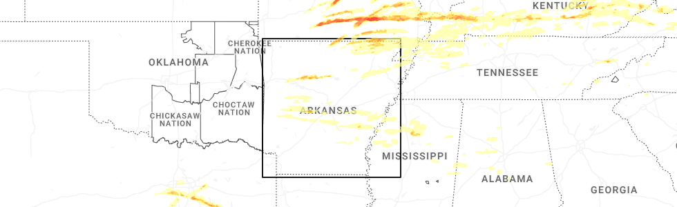
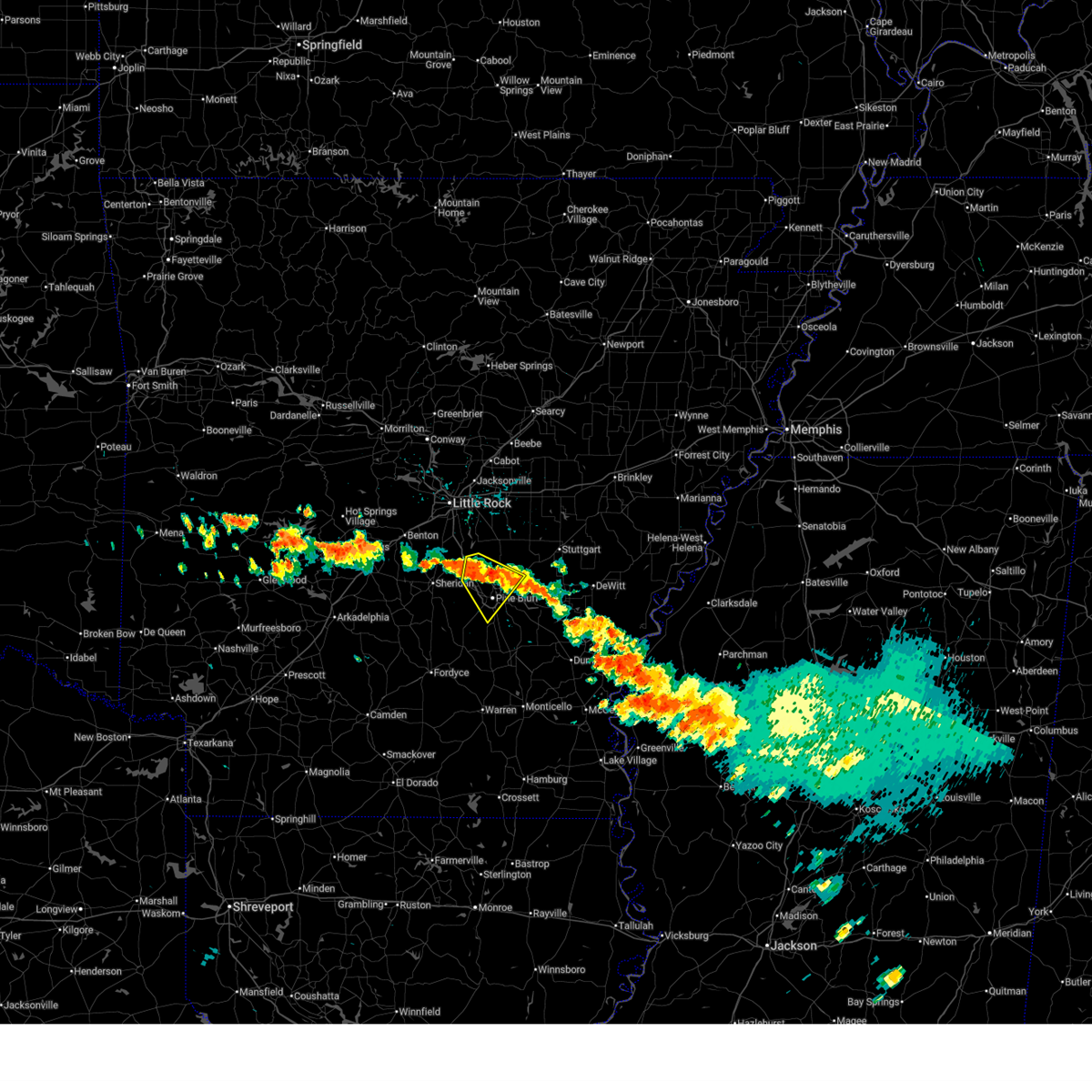
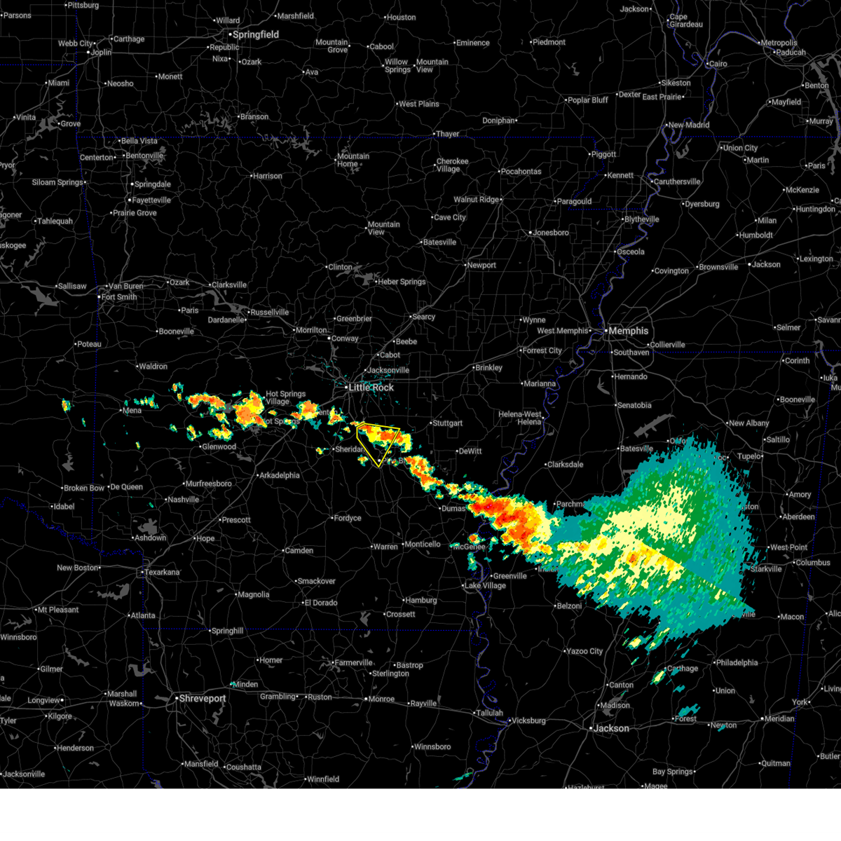
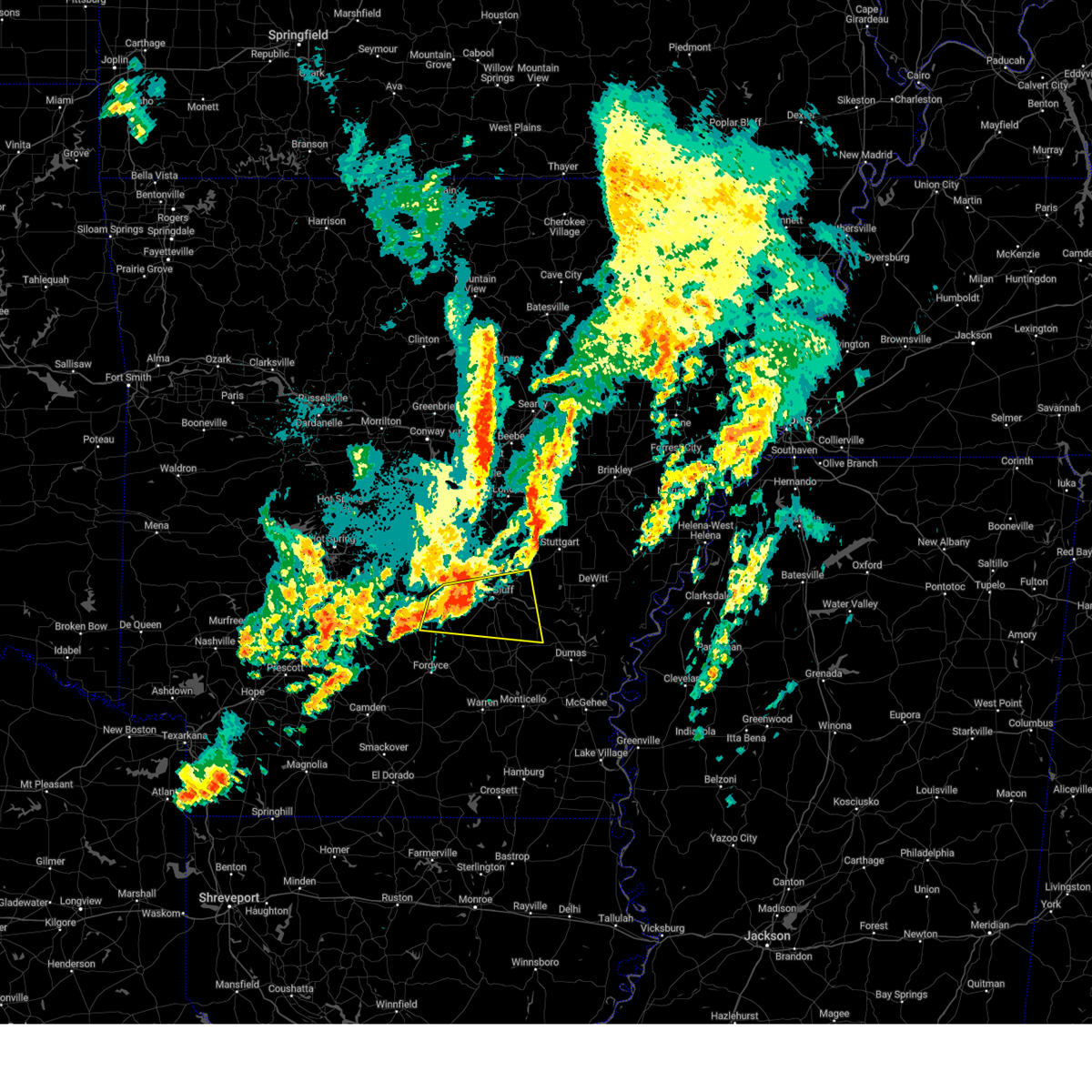
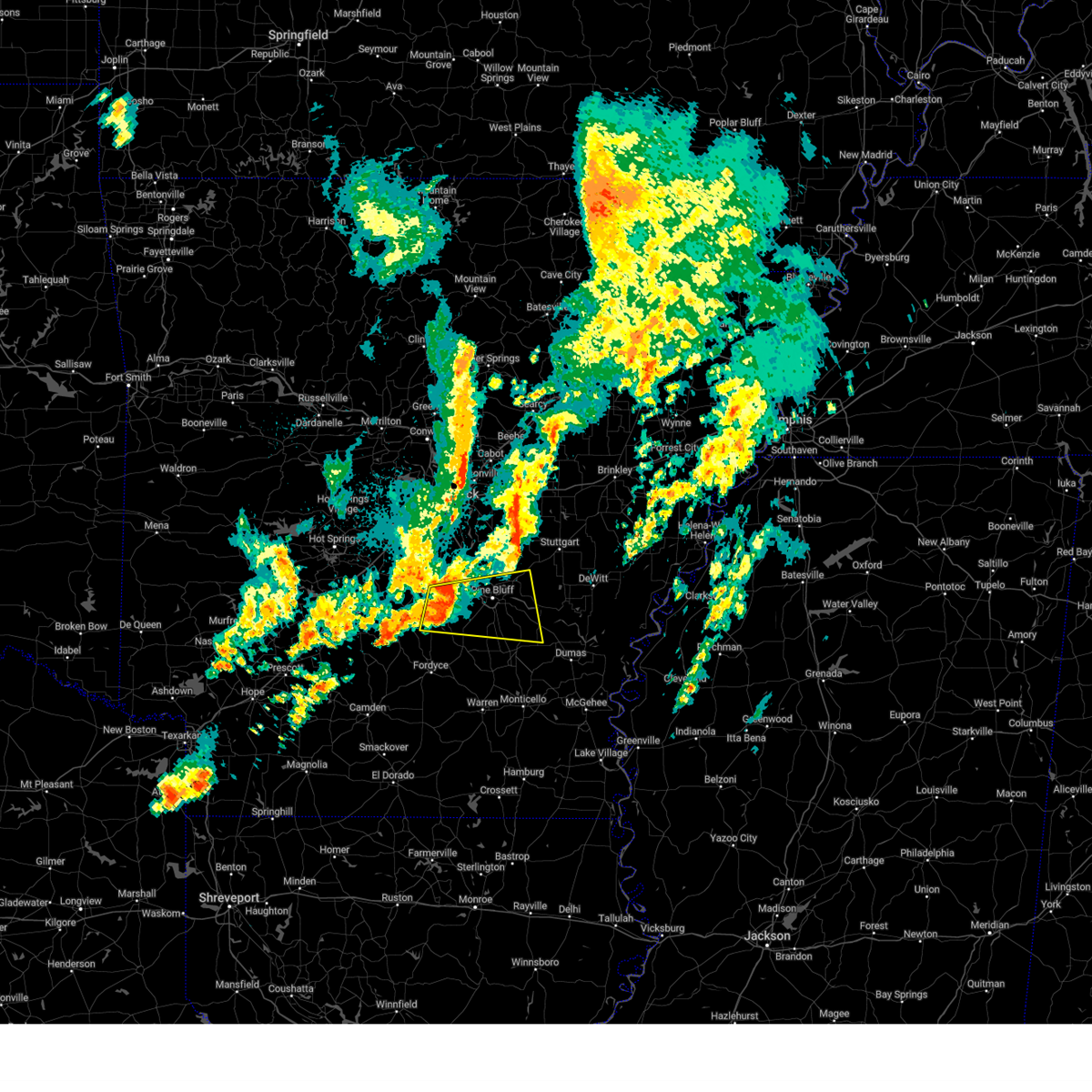
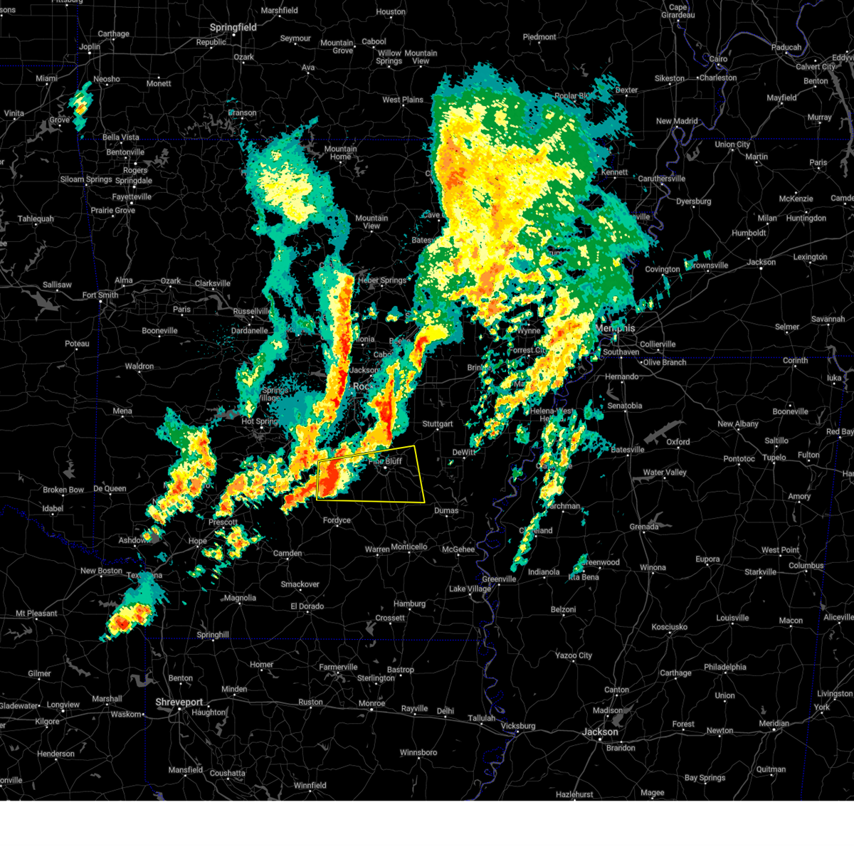
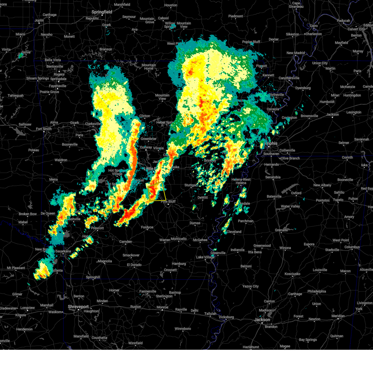
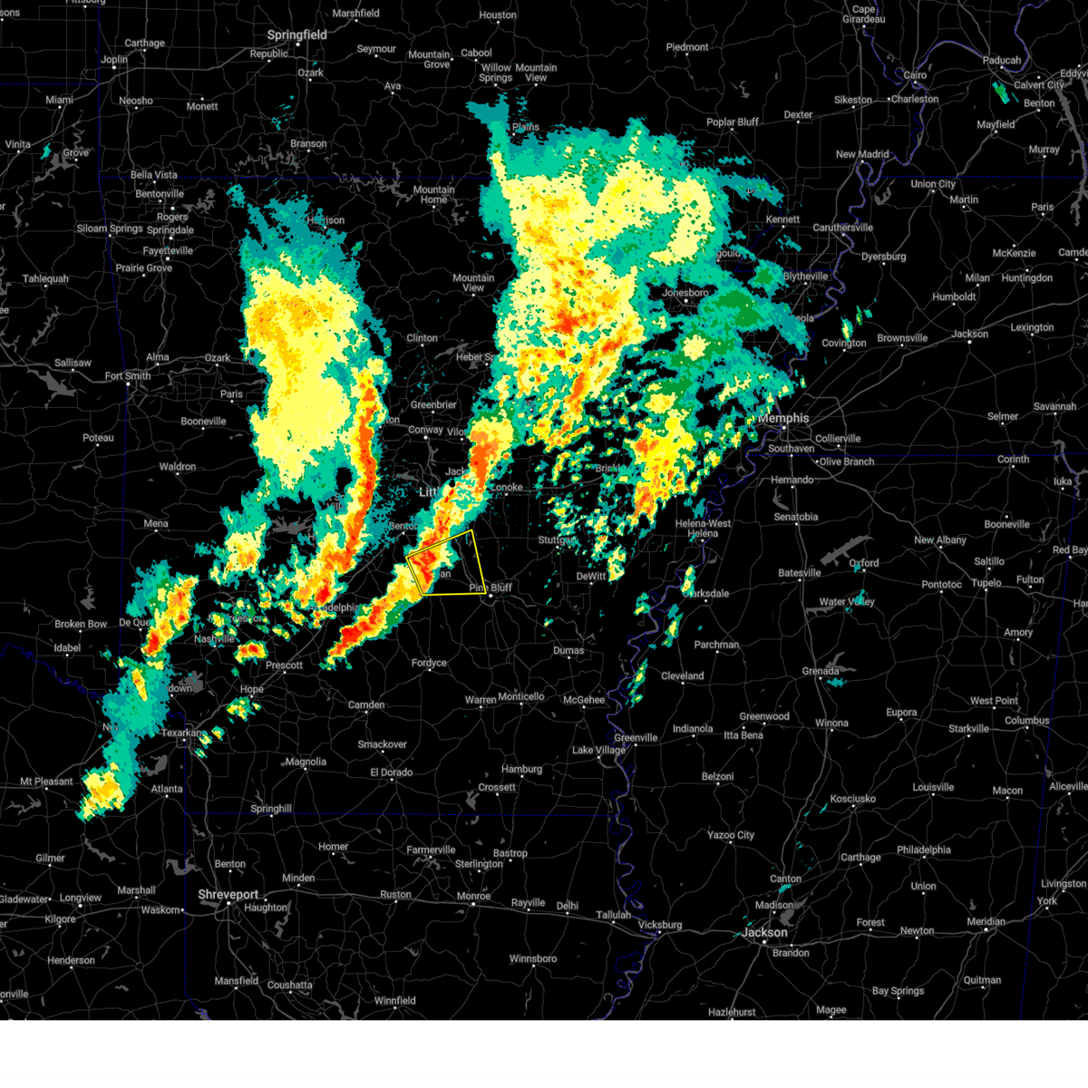
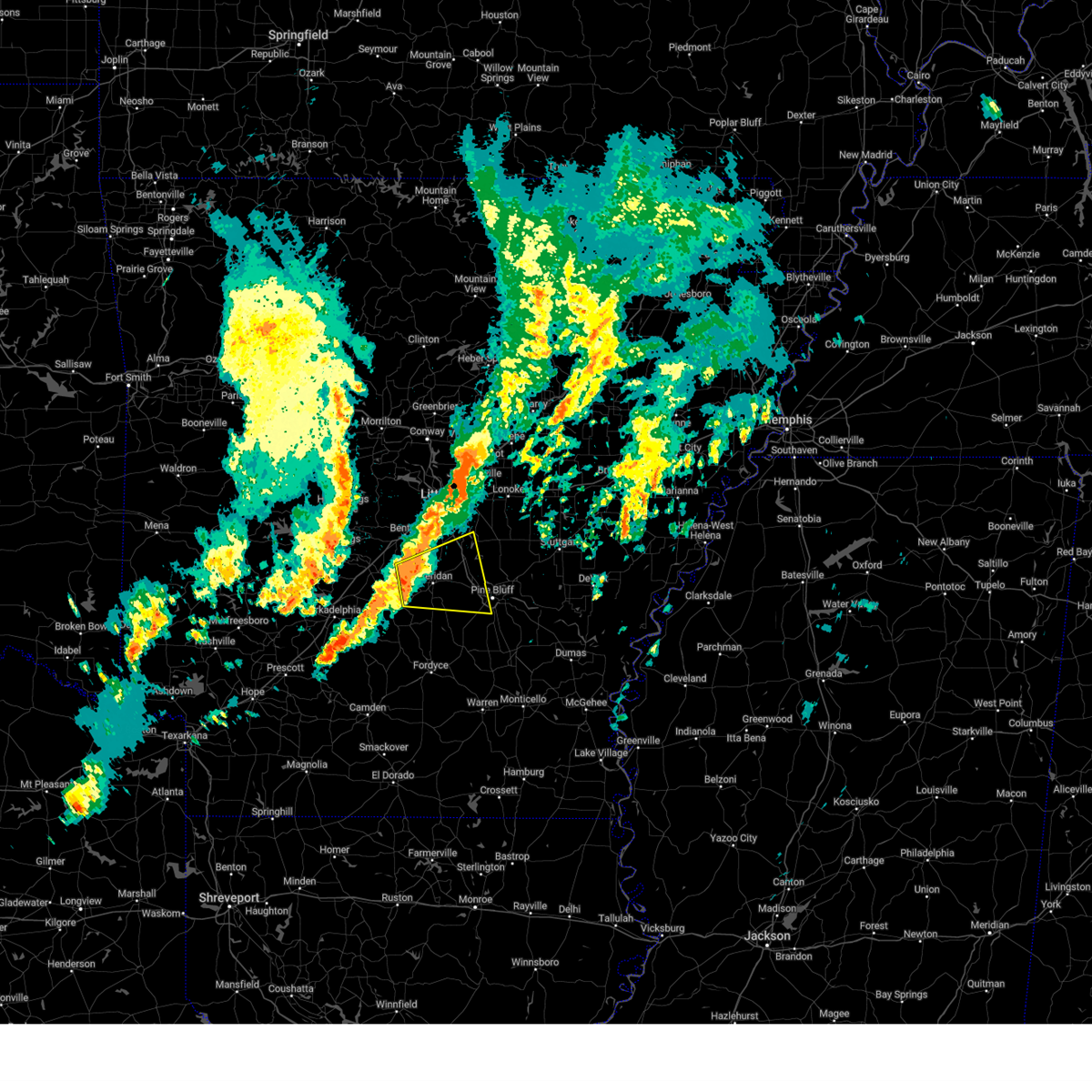
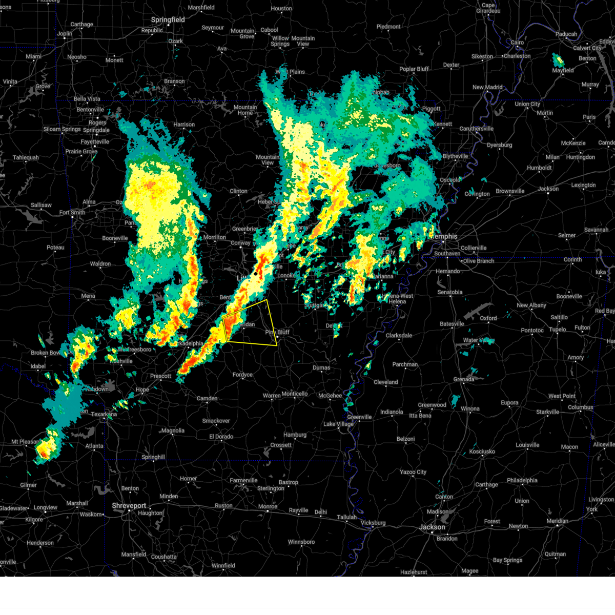
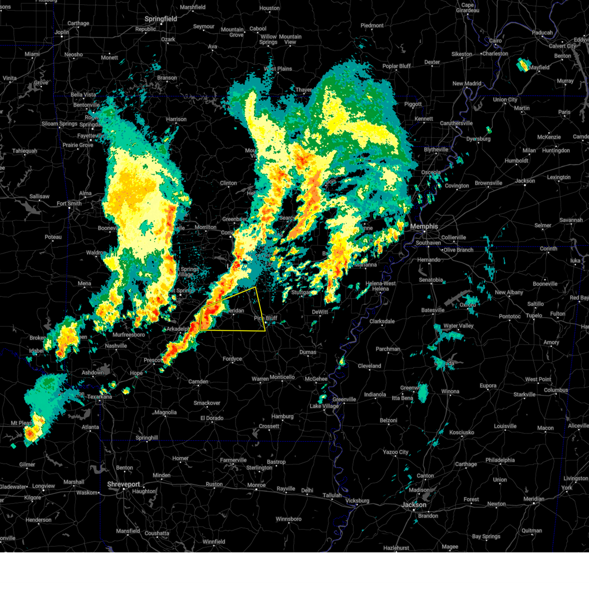
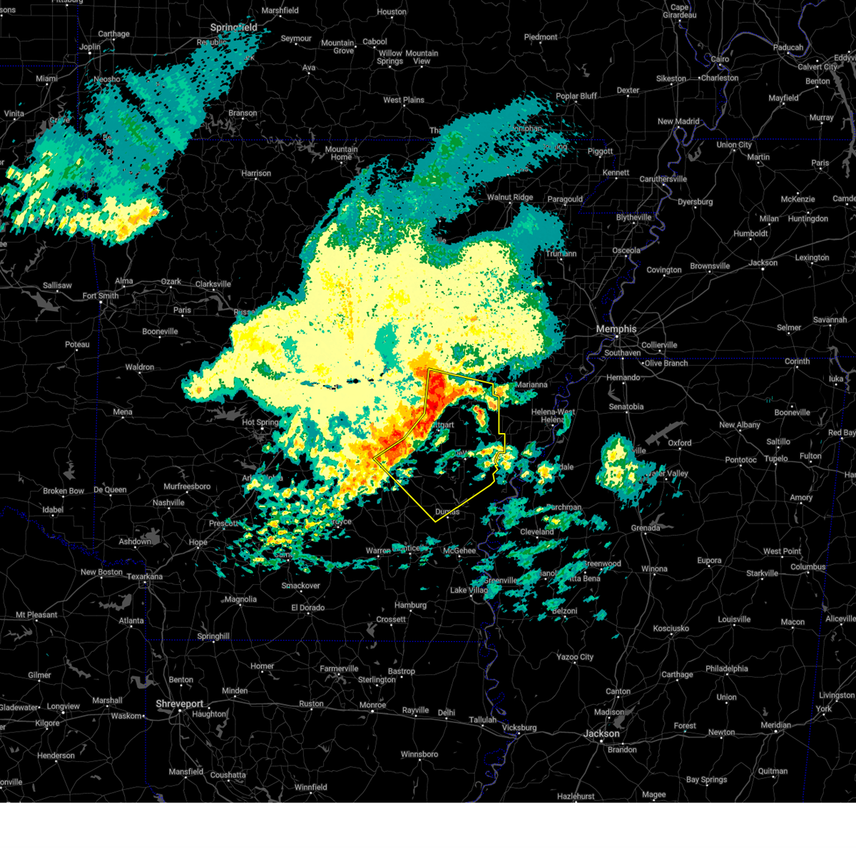
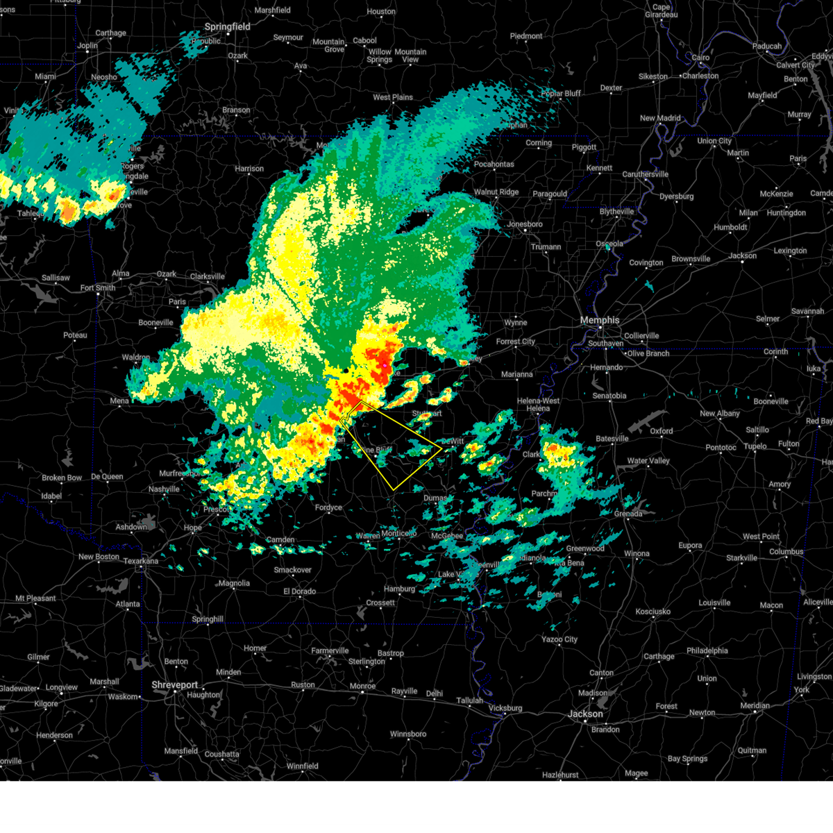
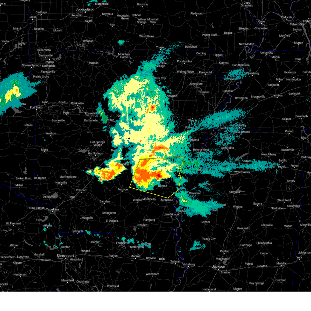
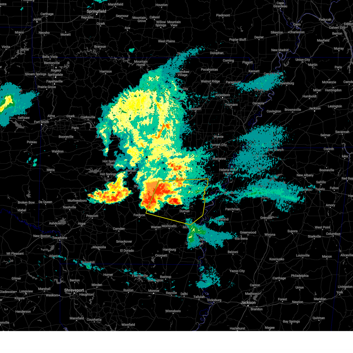
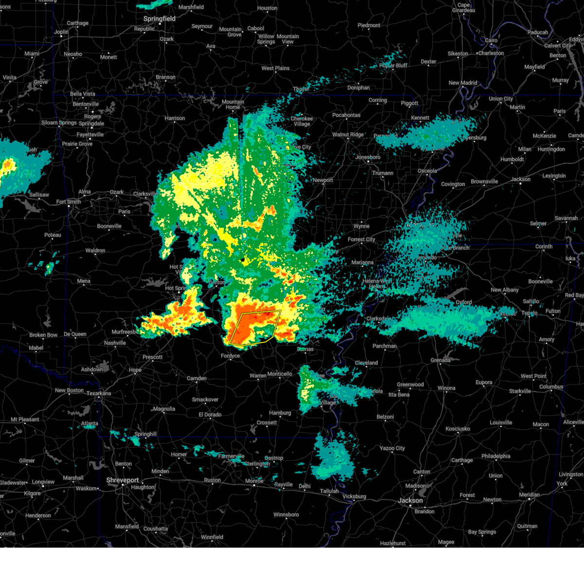
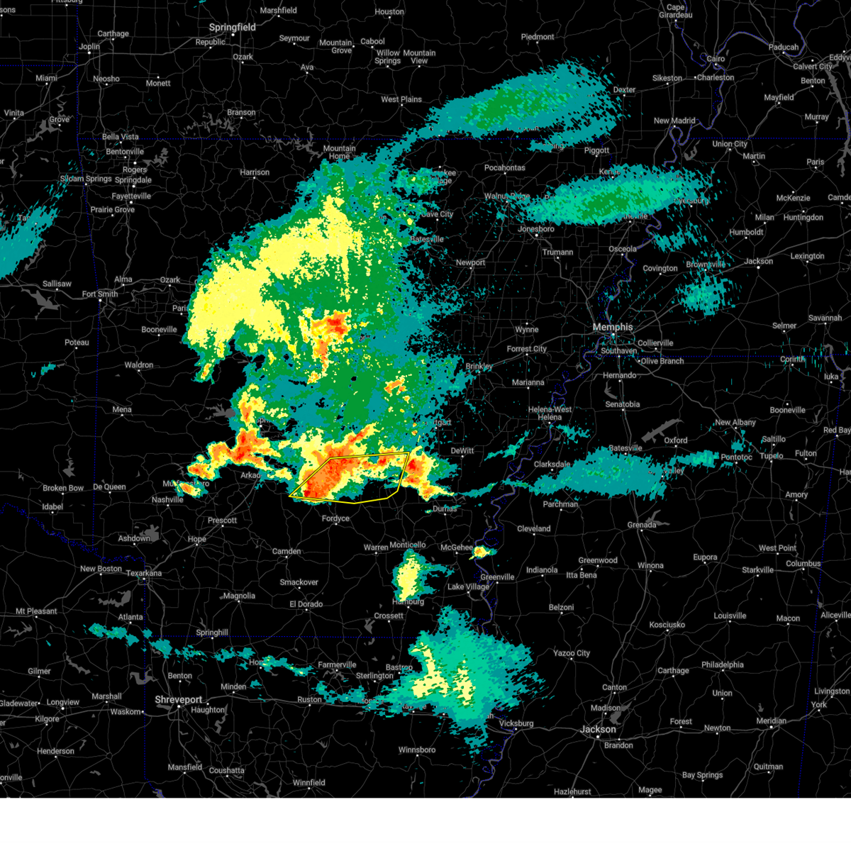
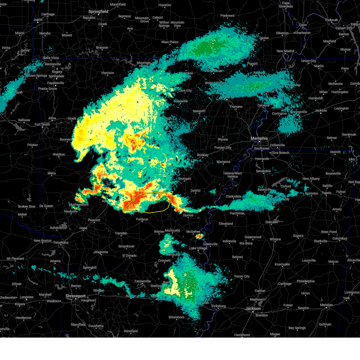
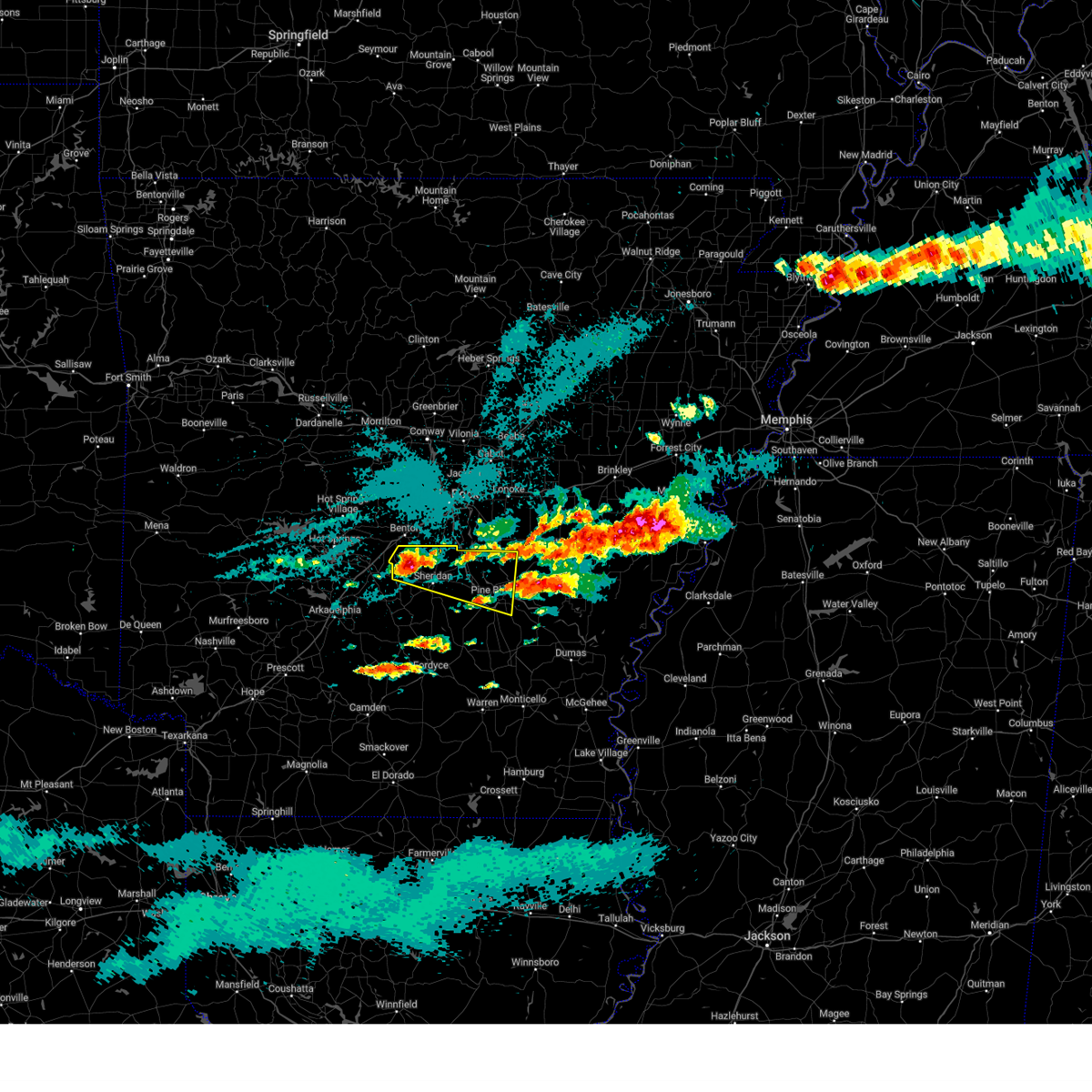
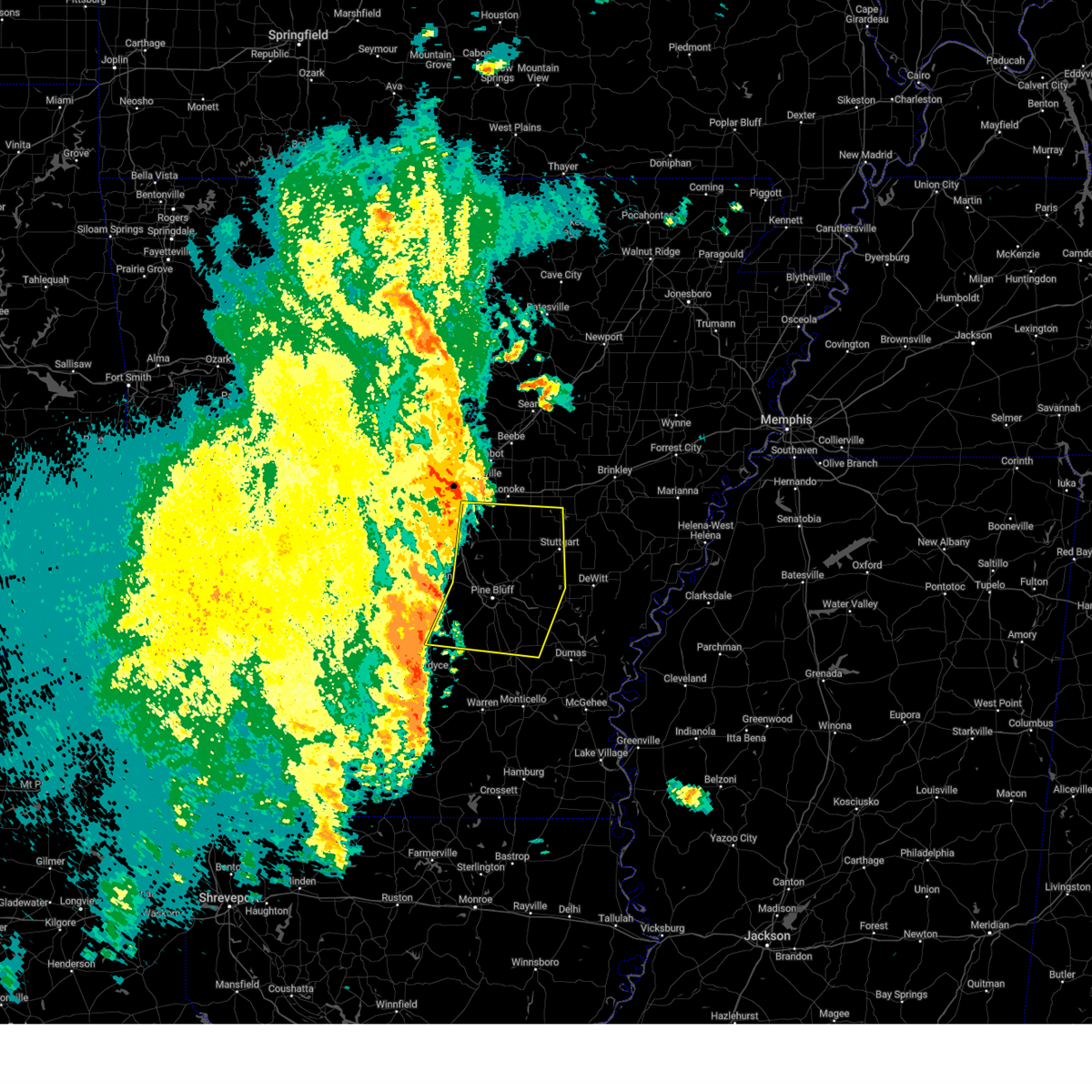
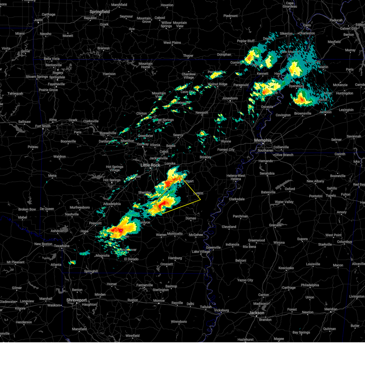
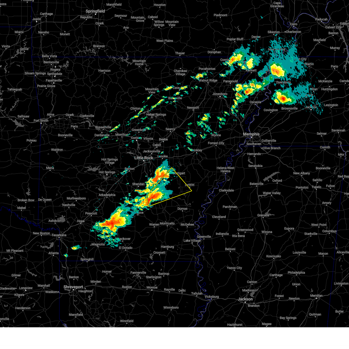
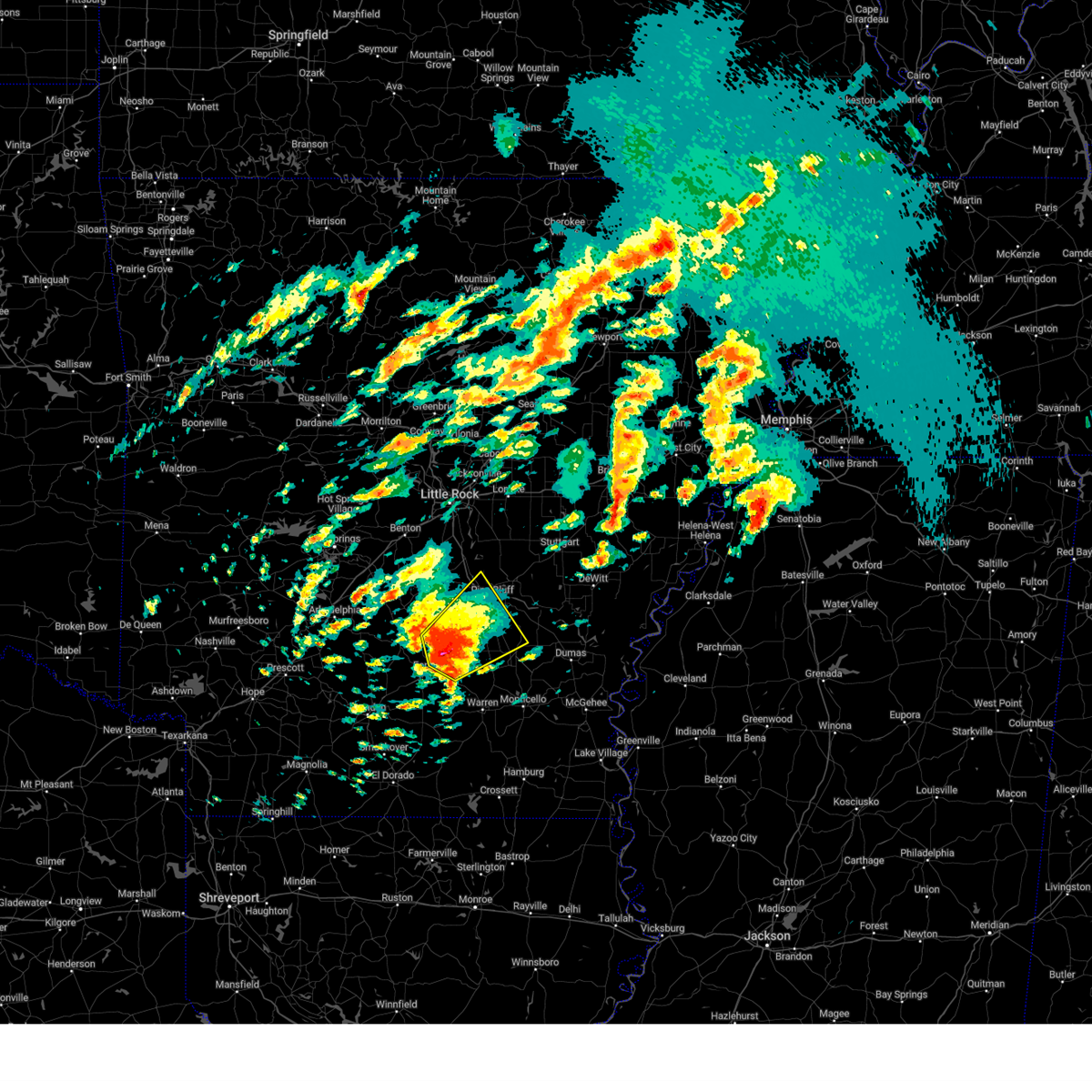
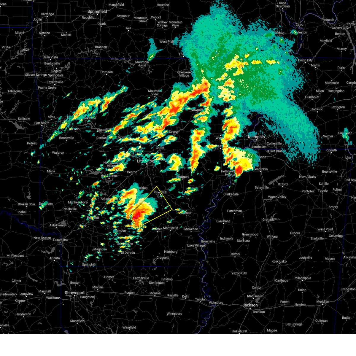
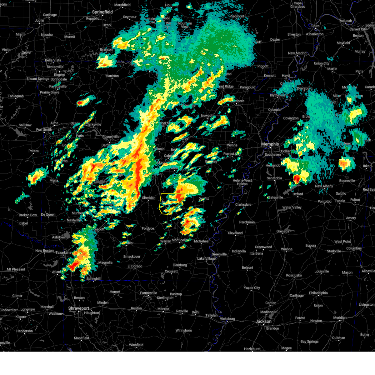
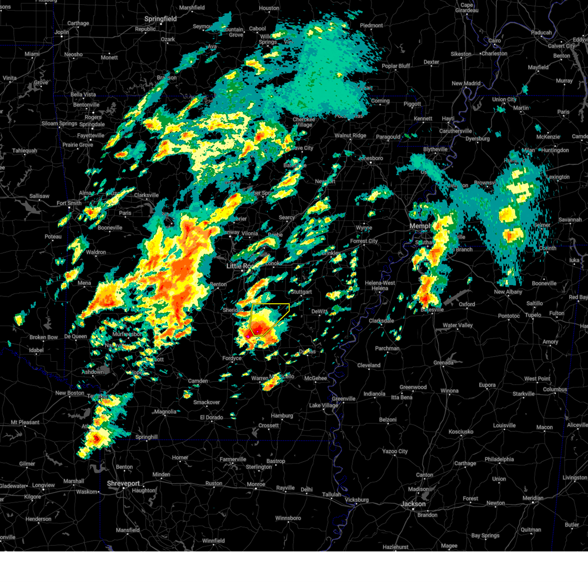
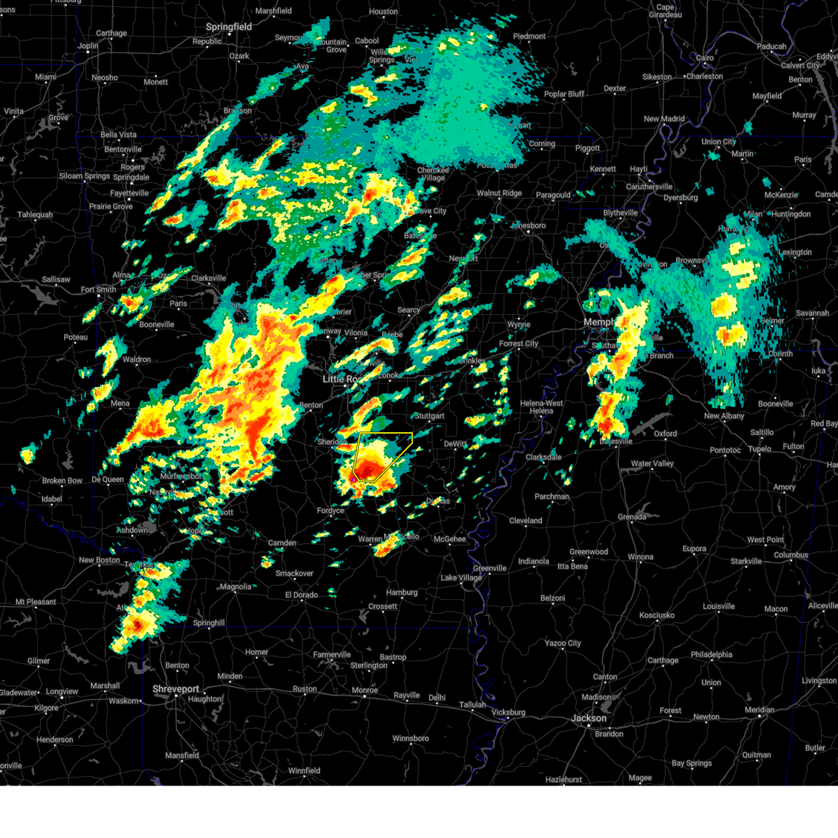
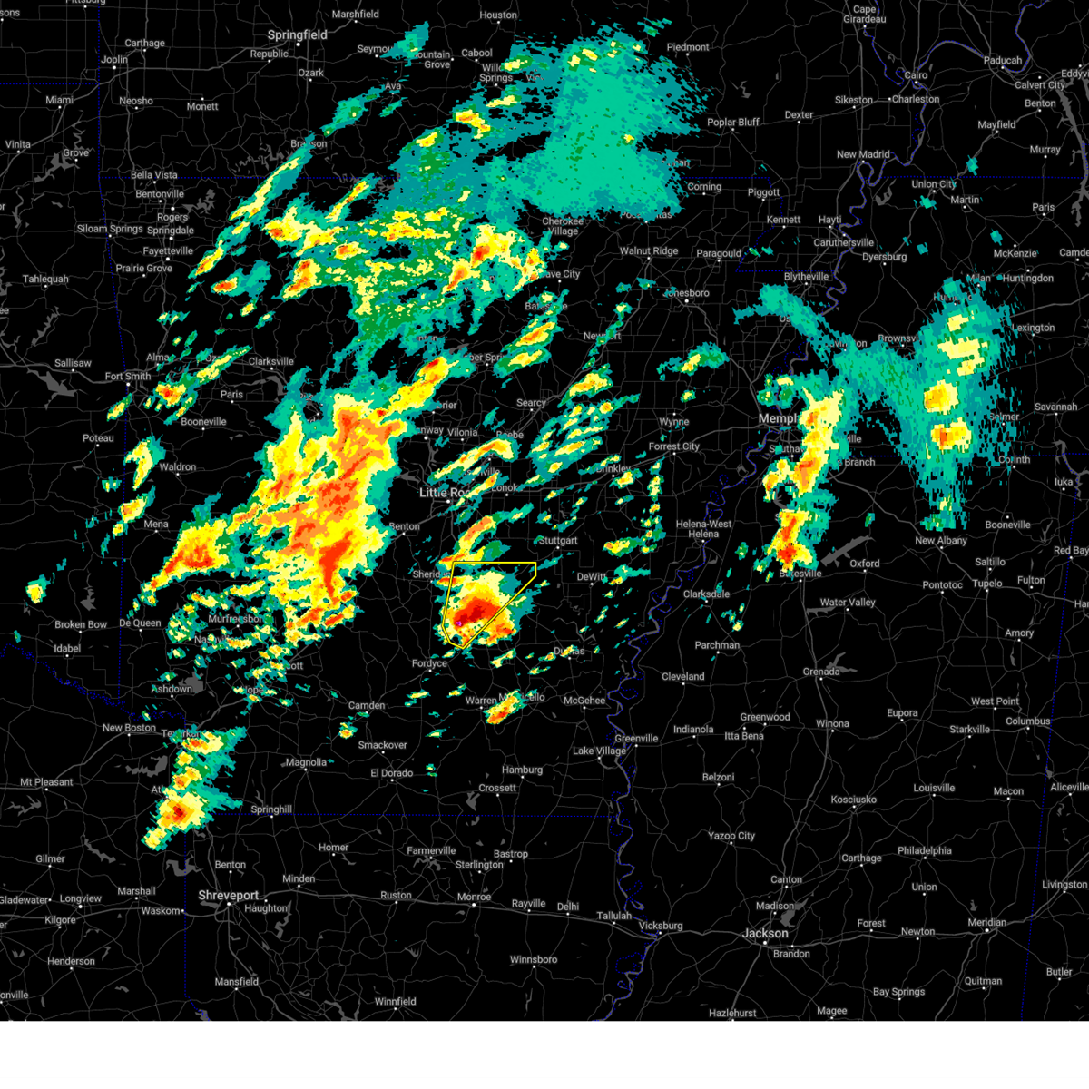
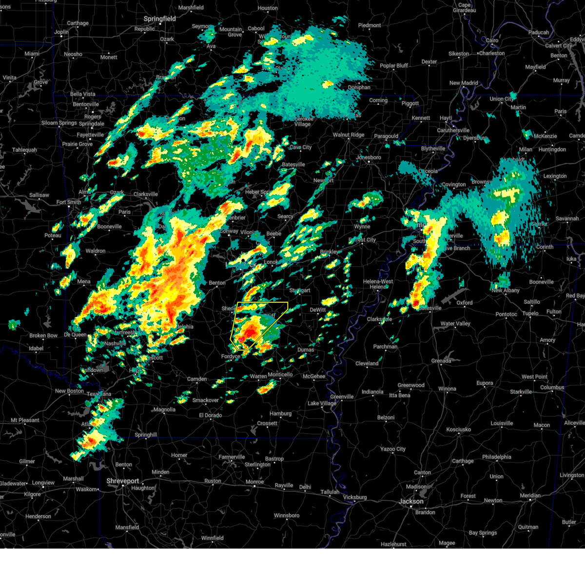
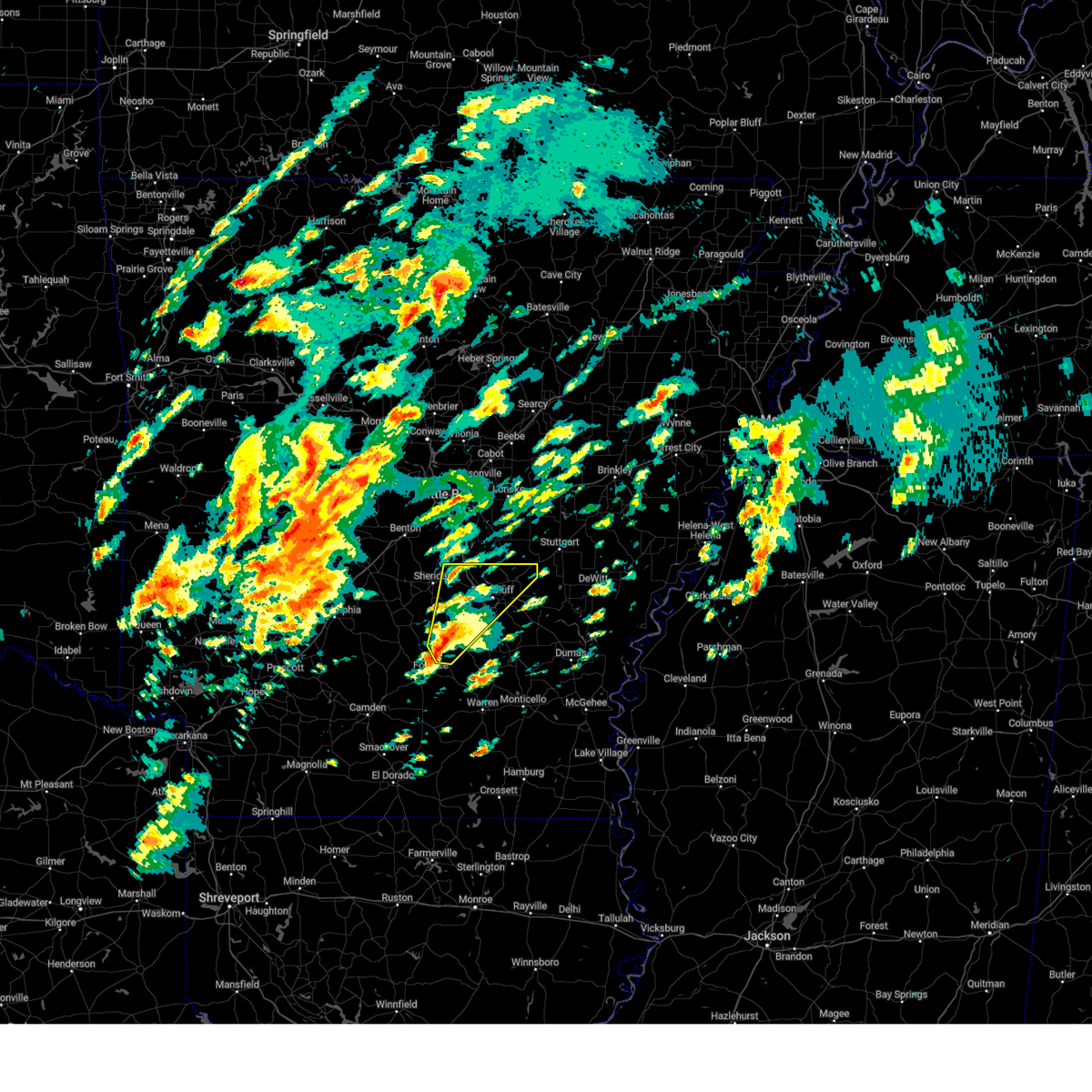
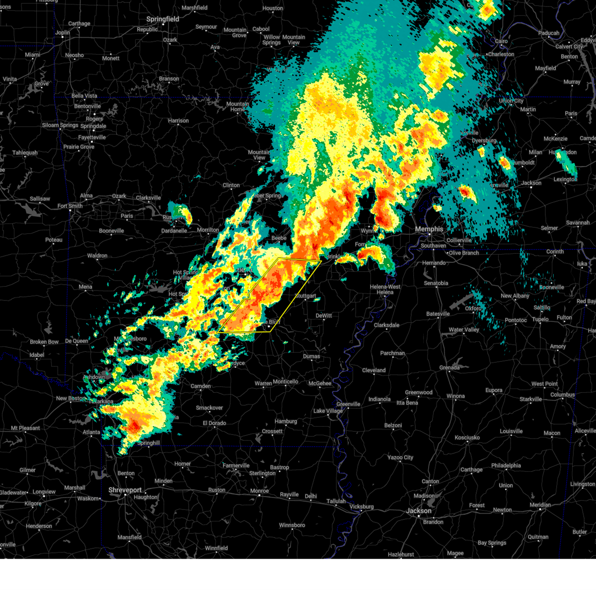
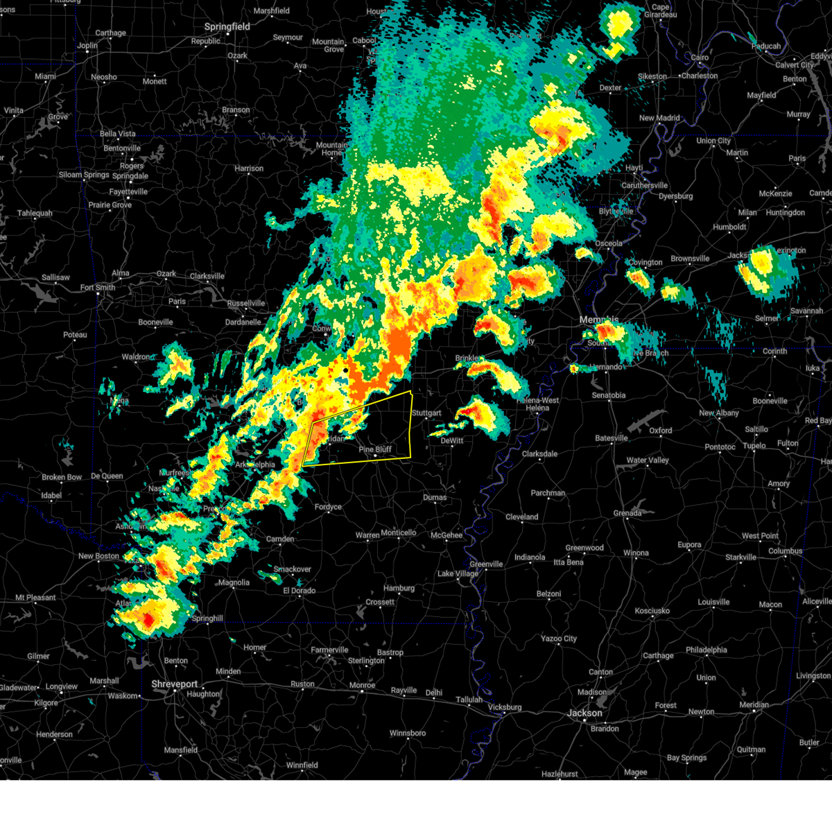
Hail Map for White Hall, AR
The White Hall, AR area has had 9 reports of on-the-ground hail by trained spotters, and has been under severe weather warnings 78 times during the past 12 months. Doppler radar has detected hail at or near White Hall, AR on 65 occasions, including 8 occasions during the past year.
| Name: | White Hall, AR |
| Where Located: | 34.5 miles SSE of Little Rock, AR |
| Map: | Google Map for White Hall, AR |
| Population: | 5526 |
| Housing Units: | 2275 |
| More Info: | Search Google for White Hall, AR |
1
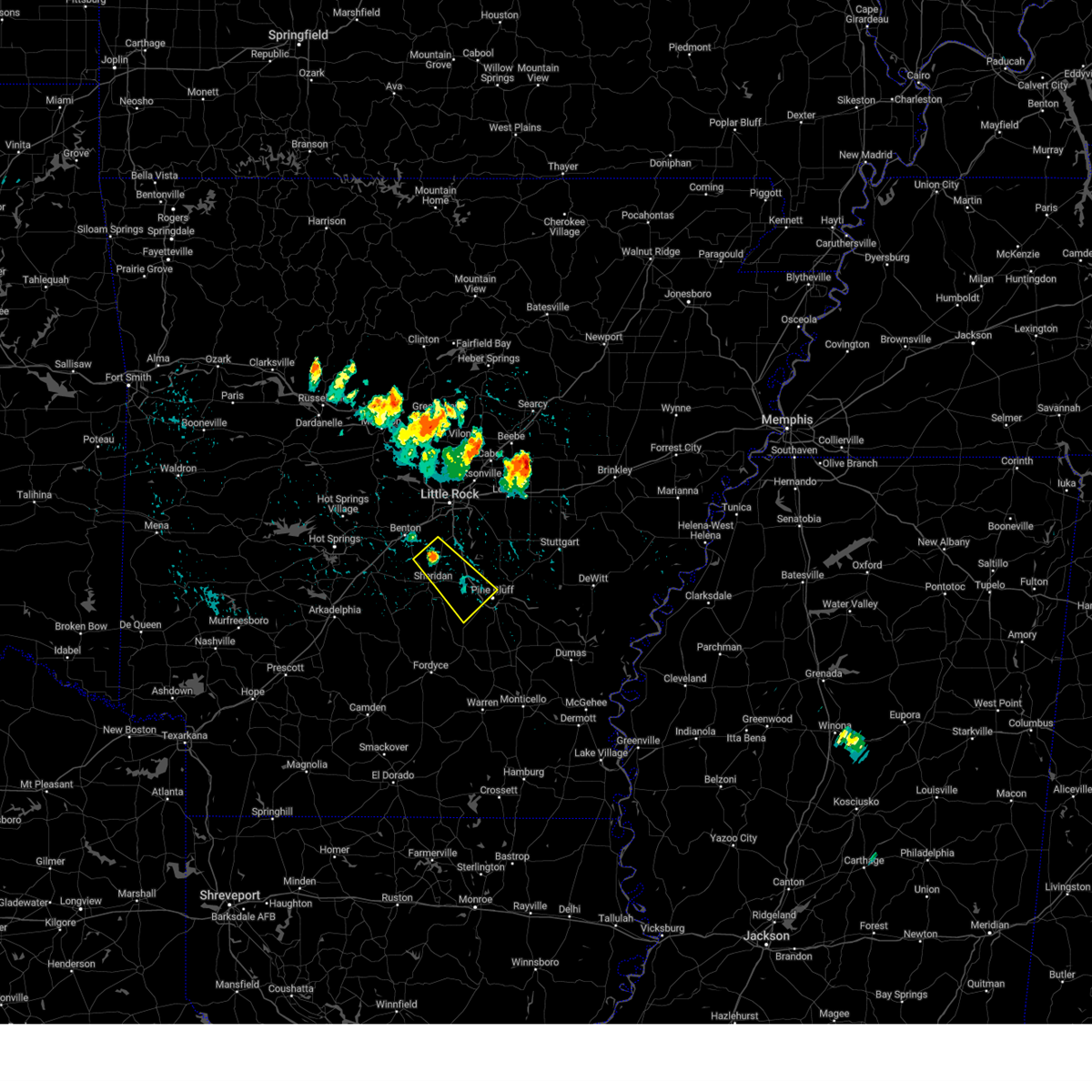
The Top Recent Hail Date for White Hall, AR is Friday, May 16, 2025 (16th out of 65)
Hail and Wind Damage Spotted near White Hall, AR
| Date / Time | Report Details |
|---|---|
| 7/7/2025 4:19 PM CDT |
 the severe thunderstorm warning has been cancelled and is no longer in effect the severe thunderstorm warning has been cancelled and is no longer in effect
|
| 7/7/2025 4:06 PM CDT |
 Svrlzk the national weather service in little rock has issued a * severe thunderstorm warning for, southwestern jefferson county in southeastern arkansas, * until 430 pm cdt. * at 405 pm cdt, a severe thunderstorm was located over cottondale, or 8 miles east of pine bluff, moving north at 15 mph (radar indicated). Hazards include 60 mph wind gusts. expect damage to roofs, siding, and trees Svrlzk the national weather service in little rock has issued a * severe thunderstorm warning for, southwestern jefferson county in southeastern arkansas, * until 430 pm cdt. * at 405 pm cdt, a severe thunderstorm was located over cottondale, or 8 miles east of pine bluff, moving north at 15 mph (radar indicated). Hazards include 60 mph wind gusts. expect damage to roofs, siding, and trees
|
| 6/19/2025 2:07 PM CDT |
 The storm which prompted the warning has moved out of the area. therefore, the warning will be allowed to expire. to report severe weather, contact your nearest law enforcement agency. they will relay your report to the national weather service little rock. The storm which prompted the warning has moved out of the area. therefore, the warning will be allowed to expire. to report severe weather, contact your nearest law enforcement agency. they will relay your report to the national weather service little rock.
|
| 6/19/2025 1:11 PM CDT |
 Svrlzk the national weather service in little rock has issued a * severe thunderstorm warning for, western jefferson county in southeastern arkansas, * until 215 pm cdt. * at 111 pm cdt, a severe thunderstorm was located near redfield, or 14 miles northwest of pine bluff, moving southeast at 15 mph (radar indicated). Hazards include 60 mph wind gusts and quarter size hail. Hail damage to vehicles is expected. Expect wind damage to roofs, siding, and trees. Svrlzk the national weather service in little rock has issued a * severe thunderstorm warning for, western jefferson county in southeastern arkansas, * until 215 pm cdt. * at 111 pm cdt, a severe thunderstorm was located near redfield, or 14 miles northwest of pine bluff, moving southeast at 15 mph (radar indicated). Hazards include 60 mph wind gusts and quarter size hail. Hail damage to vehicles is expected. Expect wind damage to roofs, siding, and trees.
|
| 6/19/2025 12:31 PM CDT |
 Svrlzk the national weather service in little rock has issued a * severe thunderstorm warning for, northwestern jefferson county in southeastern arkansas, * until 115 pm cdt. * at 1231 pm cdt, a severe thunderstorm was located over redfield, or 16 miles northeast of sheridan, moving southeast at 15 mph (radar indicated). Hazards include 60 mph wind gusts and quarter size hail. Hail damage to vehicles is expected. Expect wind damage to roofs, siding, and trees. Svrlzk the national weather service in little rock has issued a * severe thunderstorm warning for, northwestern jefferson county in southeastern arkansas, * until 115 pm cdt. * at 1231 pm cdt, a severe thunderstorm was located over redfield, or 16 miles northeast of sheridan, moving southeast at 15 mph (radar indicated). Hazards include 60 mph wind gusts and quarter size hail. Hail damage to vehicles is expected. Expect wind damage to roofs, siding, and trees.
|
| 5/25/2025 4:50 PM CDT |
 Svrlzk the national weather service in little rock has issued a * severe thunderstorm warning for, east central grant county in central arkansas, southwestern jefferson county in southeastern arkansas, northwestern lincoln county in southeastern arkansas, * until 530 pm cdt. * at 449 pm cdt, a severe thunderstorm was located 8 miles north of lamont, or 10 miles southeast of sheridan, moving east at 30 mph (radar indicated). Hazards include 60 mph wind gusts and quarter size hail. Hail damage to vehicles is expected. Expect wind damage to roofs, siding, and trees. Svrlzk the national weather service in little rock has issued a * severe thunderstorm warning for, east central grant county in central arkansas, southwestern jefferson county in southeastern arkansas, northwestern lincoln county in southeastern arkansas, * until 530 pm cdt. * at 449 pm cdt, a severe thunderstorm was located 8 miles north of lamont, or 10 miles southeast of sheridan, moving east at 30 mph (radar indicated). Hazards include 60 mph wind gusts and quarter size hail. Hail damage to vehicles is expected. Expect wind damage to roofs, siding, and trees.
|
| 5/20/2025 4:42 AM CDT |
 The storm which prompted the warning has weakened below severe limits, and no longer poses an immediate threat to life or property. therefore, the warning will be allowed to expire. however gusty winds and heavy rain are still possible with this thunderstorm. a severe thunderstorm watch remains in effect until 800 am cdt for central, southeastern and southwestern arkansas. The storm which prompted the warning has weakened below severe limits, and no longer poses an immediate threat to life or property. therefore, the warning will be allowed to expire. however gusty winds and heavy rain are still possible with this thunderstorm. a severe thunderstorm watch remains in effect until 800 am cdt for central, southeastern and southwestern arkansas.
|
| 5/20/2025 4:27 AM CDT |
 At 427 am cdt, a severe thunderstorm was located over white hall, or near pine bluff, moving east at 40 mph (radar indicated). Hazards include 60 mph wind gusts. Expect damage to roofs, siding, and trees. Locations impacted include, nebo, tarry, cornerstone, lamont, cottondale, tamo, whitefield, moscow, linwood, glenlake, watson chapel, staves, grady, sulphur springs, pine bluff arsenal, madding, clear lake, hardin, dexter, rob roy,. At 427 am cdt, a severe thunderstorm was located over white hall, or near pine bluff, moving east at 40 mph (radar indicated). Hazards include 60 mph wind gusts. Expect damage to roofs, siding, and trees. Locations impacted include, nebo, tarry, cornerstone, lamont, cottondale, tamo, whitefield, moscow, linwood, glenlake, watson chapel, staves, grady, sulphur springs, pine bluff arsenal, madding, clear lake, hardin, dexter, rob roy,.
|
| 5/20/2025 4:16 AM CDT |
 At 415 am cdt, a severe thunderstorm was located 8 miles southwest of white hall, or 11 miles southeast of sheridan, moving east at 50 mph (radar indicated). Hazards include 60 mph wind gusts. Expect damage to roofs, siding, and trees. Locations impacted include, nebo, tarry, cornerstone, lamont, cottondale, tamo, whitefield, moscow, linwood, glenlake, watson chapel, staves, grady, sulphur springs, pine bluff arsenal, madding, clear lake, hardin, dexter, rob roy,. At 415 am cdt, a severe thunderstorm was located 8 miles southwest of white hall, or 11 miles southeast of sheridan, moving east at 50 mph (radar indicated). Hazards include 60 mph wind gusts. Expect damage to roofs, siding, and trees. Locations impacted include, nebo, tarry, cornerstone, lamont, cottondale, tamo, whitefield, moscow, linwood, glenlake, watson chapel, staves, grady, sulphur springs, pine bluff arsenal, madding, clear lake, hardin, dexter, rob roy,.
|
| 5/20/2025 4:04 AM CDT |
 Svrlzk the national weather service in little rock has issued a * severe thunderstorm warning for, northern cleveland county in southeastern arkansas, southern grant county in central arkansas, northeastern dallas county in southwestern arkansas, southwestern jefferson county in southeastern arkansas, northwestern lincoln county in southeastern arkansas, * until 445 am cdt. * at 404 am cdt, a severe thunderstorm was located 8 miles east of carthage, or 13 miles south of sheridan, moving east at 45 mph (radar indicated). Hazards include 60 mph wind gusts. expect damage to roofs, siding, and trees Svrlzk the national weather service in little rock has issued a * severe thunderstorm warning for, northern cleveland county in southeastern arkansas, southern grant county in central arkansas, northeastern dallas county in southwestern arkansas, southwestern jefferson county in southeastern arkansas, northwestern lincoln county in southeastern arkansas, * until 445 am cdt. * at 404 am cdt, a severe thunderstorm was located 8 miles east of carthage, or 13 miles south of sheridan, moving east at 45 mph (radar indicated). Hazards include 60 mph wind gusts. expect damage to roofs, siding, and trees
|
| 5/20/2025 3:43 AM CDT |
 At 342 am cdt, a severe thunderstorm was located near redfield, or 11 miles northeast of sheridan, moving east at 50 mph (radar indicated). Hazards include 60 mph wind gusts. Expect damage to roofs, siding, and trees. locations impacted include, hensley, redfield, jefferson, orion, cane creek, lock and dam 5 park, kearney, prague, tar camp park, ico, samples, pine bluff arsenal, woodson, center grove, clear lake, dexter, f. b. Baugh recreation area, hensley island, white hall,. At 342 am cdt, a severe thunderstorm was located near redfield, or 11 miles northeast of sheridan, moving east at 50 mph (radar indicated). Hazards include 60 mph wind gusts. Expect damage to roofs, siding, and trees. locations impacted include, hensley, redfield, jefferson, orion, cane creek, lock and dam 5 park, kearney, prague, tar camp park, ico, samples, pine bluff arsenal, woodson, center grove, clear lake, dexter, f. b. Baugh recreation area, hensley island, white hall,.
|
| 5/20/2025 3:34 AM CDT |
 At 333 am cdt, a severe thunderstorm was located near sheridan, moving east at 50 mph (radar indicated). Hazards include 60 mph wind gusts and penny size hail. Expect damage to roofs, siding, and trees. locations impacted include, redfield, cane creek, lock and dam 5 park, kearney, tar camp park, belfast, pine bluff arsenal, woodson, center grove, clear lake, hardin, dexter, f. b. Baugh recreation area, hensley, jefferson, slabtown, orion, prague, sheridan, ico,. At 333 am cdt, a severe thunderstorm was located near sheridan, moving east at 50 mph (radar indicated). Hazards include 60 mph wind gusts and penny size hail. Expect damage to roofs, siding, and trees. locations impacted include, redfield, cane creek, lock and dam 5 park, kearney, tar camp park, belfast, pine bluff arsenal, woodson, center grove, clear lake, hardin, dexter, f. b. Baugh recreation area, hensley, jefferson, slabtown, orion, prague, sheridan, ico,.
|
| 5/20/2025 3:23 AM CDT |
 At 323 am cdt, a severe thunderstorm was located over prattsville, or 7 miles west of sheridan, moving east at 45 mph (radar indicated). Hazards include 60 mph wind gusts and penny size hail. Expect damage to roofs, siding, and trees. locations impacted include, redfield, cane creek, lock and dam 5 park, kearney, buie, jenkins ferry state park, tar camp park, belfast, watson chapel, sulphur springs, pine bluff arsenal, woodson, center grove, clear lake, hardin, dexter, prattsville, millerville, f. b. Baugh recreation area, hensley,. At 323 am cdt, a severe thunderstorm was located over prattsville, or 7 miles west of sheridan, moving east at 45 mph (radar indicated). Hazards include 60 mph wind gusts and penny size hail. Expect damage to roofs, siding, and trees. locations impacted include, redfield, cane creek, lock and dam 5 park, kearney, buie, jenkins ferry state park, tar camp park, belfast, watson chapel, sulphur springs, pine bluff arsenal, woodson, center grove, clear lake, hardin, dexter, prattsville, millerville, f. b. Baugh recreation area, hensley,.
|
| 5/20/2025 3:23 AM CDT |
 the severe thunderstorm warning has been cancelled and is no longer in effect the severe thunderstorm warning has been cancelled and is no longer in effect
|
| 5/20/2025 3:11 AM CDT |
 Svrlzk the national weather service in little rock has issued a * severe thunderstorm warning for, grant county in central arkansas, western jefferson county in southeastern arkansas, southeastern saline county in central arkansas, southeastern hot spring county in southwestern arkansas, southeastern pulaski county in central arkansas, * until 400 am cdt. * at 311 am cdt, a severe thunderstorm was located near thiel, or 10 miles southeast of malvern, moving east at 40 mph (radar indicated). Hazards include 60 mph wind gusts and nickel size hail. expect damage to roofs, siding, and trees Svrlzk the national weather service in little rock has issued a * severe thunderstorm warning for, grant county in central arkansas, western jefferson county in southeastern arkansas, southeastern saline county in central arkansas, southeastern hot spring county in southwestern arkansas, southeastern pulaski county in central arkansas, * until 400 am cdt. * at 311 am cdt, a severe thunderstorm was located near thiel, or 10 miles southeast of malvern, moving east at 40 mph (radar indicated). Hazards include 60 mph wind gusts and nickel size hail. expect damage to roofs, siding, and trees
|
| 5/18/2025 7:42 AM CDT |
 Svrlzk the national weather service in little rock has issued a * severe thunderstorm warning for, central prairie county in central arkansas, southeastern lonoke county in central arkansas, northwestern desha county in southeastern arkansas, monroe county in eastern arkansas, central jefferson county in southeastern arkansas, central lincoln county in southeastern arkansas, arkansas county in southeastern arkansas, * until 830 am cdt. * at 741 am cdt, severe thunderstorms were located along a line extending from near fredonia to near ulm to near humphrey to near pine bluff, moving southeast at 45 mph (radar indicated). Hazards include 60 mph wind gusts and quarter size hail. Hail damage to vehicles is expected. Expect wind damage to roofs, siding, and trees. Svrlzk the national weather service in little rock has issued a * severe thunderstorm warning for, central prairie county in central arkansas, southeastern lonoke county in central arkansas, northwestern desha county in southeastern arkansas, monroe county in eastern arkansas, central jefferson county in southeastern arkansas, central lincoln county in southeastern arkansas, arkansas county in southeastern arkansas, * until 830 am cdt. * at 741 am cdt, severe thunderstorms were located along a line extending from near fredonia to near ulm to near humphrey to near pine bluff, moving southeast at 45 mph (radar indicated). Hazards include 60 mph wind gusts and quarter size hail. Hail damage to vehicles is expected. Expect wind damage to roofs, siding, and trees.
|
| 5/18/2025 7:13 AM CDT |
 Svrlzk the national weather service in little rock has issued a * severe thunderstorm warning for, south central lonoke county in central arkansas, northeastern grant county in central arkansas, jefferson county in southeastern arkansas, northwestern lincoln county in southeastern arkansas, southeastern pulaski county in central arkansas, west central arkansas county in southeastern arkansas, * until 745 am cdt. * at 712 am cdt, severe thunderstorms were located along a line extending from near keo to near redfield, moving southeast at 40 mph (radar indicated). Hazards include 60 mph wind gusts and quarter size hail. Hail damage to vehicles is expected. Expect wind damage to roofs, siding, and trees. Svrlzk the national weather service in little rock has issued a * severe thunderstorm warning for, south central lonoke county in central arkansas, northeastern grant county in central arkansas, jefferson county in southeastern arkansas, northwestern lincoln county in southeastern arkansas, southeastern pulaski county in central arkansas, west central arkansas county in southeastern arkansas, * until 745 am cdt. * at 712 am cdt, severe thunderstorms were located along a line extending from near keo to near redfield, moving southeast at 40 mph (radar indicated). Hazards include 60 mph wind gusts and quarter size hail. Hail damage to vehicles is expected. Expect wind damage to roofs, siding, and trees.
|
| 5/18/2025 12:31 AM CDT |
 At 1231 am cdt, severe thunderstorms were located along a line extending from linwood to 7 miles northwest of nebo to feenyville to 7 miles northeast of herbine, moving east at 45 mph (radar indicated). Hazards include 60 mph wind gusts and quarter size hail. Hail damage to vehicles is expected. expect wind damage to roofs, siding, and trees. Locations impacted include, de luce, pastoria, almyra airport, cornerville, florence, sherrill, whitefield, tyro, watson, tichnor, reedville, morgan point recreation area, pea ridge, lodge corner, little bayou meto park, weber, star city, glendale in lincoln county, humphrey, woodville,. At 1231 am cdt, severe thunderstorms were located along a line extending from linwood to 7 miles northwest of nebo to feenyville to 7 miles northeast of herbine, moving east at 45 mph (radar indicated). Hazards include 60 mph wind gusts and quarter size hail. Hail damage to vehicles is expected. expect wind damage to roofs, siding, and trees. Locations impacted include, de luce, pastoria, almyra airport, cornerville, florence, sherrill, whitefield, tyro, watson, tichnor, reedville, morgan point recreation area, pea ridge, lodge corner, little bayou meto park, weber, star city, glendale in lincoln county, humphrey, woodville,.
|
| 5/18/2025 12:21 AM CDT |
 Svrlzk the national weather service in little rock has issued a * severe thunderstorm warning for, northeastern cleveland county in southeastern arkansas, northwestern desha county in southeastern arkansas, southeastern monroe county in eastern arkansas, northeastern drew county in southeastern arkansas, jefferson county in southeastern arkansas, lincoln county in southeastern arkansas, arkansas county in southeastern arkansas, * until 115 am cdt. * at 1221 am cdt, severe thunderstorms were located along a line extending from cottondale to 7 miles south of pine bluff to 6 miles east of kedron to near toledo, moving east at 40 mph (radar indicated). Hazards include 60 mph wind gusts and nickel size hail. expect damage to roofs, siding, and trees Svrlzk the national weather service in little rock has issued a * severe thunderstorm warning for, northeastern cleveland county in southeastern arkansas, northwestern desha county in southeastern arkansas, southeastern monroe county in eastern arkansas, northeastern drew county in southeastern arkansas, jefferson county in southeastern arkansas, lincoln county in southeastern arkansas, arkansas county in southeastern arkansas, * until 115 am cdt. * at 1221 am cdt, severe thunderstorms were located along a line extending from cottondale to 7 miles south of pine bluff to 6 miles east of kedron to near toledo, moving east at 40 mph (radar indicated). Hazards include 60 mph wind gusts and nickel size hail. expect damage to roofs, siding, and trees
|
| 5/18/2025 12:15 AM CDT |
 At 1215 am cdt, severe thunderstorms were located along a line extending from 9 miles southwest of pine bluff to kedron to near rison, moving east at 35 mph (radar indicated). Hazards include 60 mph wind gusts and quarter size hail. Hail damage to vehicles is expected. expect wind damage to roofs, siding, and trees. Locations impacted include, warbritton, lamont, cottondale, faith, pinebergen, pine bluff, ladd, glenlake, watson chapel, staves, sulphur springs, grapevine, mt zion, madding, hardin, rob roy, randall, kedron, white hall, altheimer,. At 1215 am cdt, severe thunderstorms were located along a line extending from 9 miles southwest of pine bluff to kedron to near rison, moving east at 35 mph (radar indicated). Hazards include 60 mph wind gusts and quarter size hail. Hail damage to vehicles is expected. expect wind damage to roofs, siding, and trees. Locations impacted include, warbritton, lamont, cottondale, faith, pinebergen, pine bluff, ladd, glenlake, watson chapel, staves, sulphur springs, grapevine, mt zion, madding, hardin, rob roy, randall, kedron, white hall, altheimer,.
|
| 5/18/2025 12:10 AM CDT |
 At 1209 am cdt, severe thunderstorms were located along a line extending from 9 miles northwest of kedron to near lamont to 9 miles west of rison, moving east at 35 mph (radar indicated). Hazards include 60 mph wind gusts and quarter size hail. Hail damage to vehicles is expected. expect wind damage to roofs, siding, and trees. Locations impacted include, lamont, cottondale, glenlake, watson chapel, staves, sulphur springs, madding, hardin, rob roy, millerville, kedron, cross roads in grant county, warbritton, ain, farindale, faith, pinebergen, bunn, pine bluff, ladd,. At 1209 am cdt, severe thunderstorms were located along a line extending from 9 miles northwest of kedron to near lamont to 9 miles west of rison, moving east at 35 mph (radar indicated). Hazards include 60 mph wind gusts and quarter size hail. Hail damage to vehicles is expected. expect wind damage to roofs, siding, and trees. Locations impacted include, lamont, cottondale, glenlake, watson chapel, staves, sulphur springs, madding, hardin, rob roy, millerville, kedron, cross roads in grant county, warbritton, ain, farindale, faith, pinebergen, bunn, pine bluff, ladd,.
|
| 5/17/2025 11:55 PM CDT |
 At 1155 pm cdt, severe thunderstorms were located along a line extending from 7 miles south of sheridan to 6 miles west of lamont to near carthage to 11 miles south of leola, moving east at 35 mph (radar indicated). Hazards include 60 mph wind gusts and quarter size hail. Hail damage to vehicles is expected. expect wind damage to roofs, siding, and trees. Locations impacted include, tulip, lamont, cottondale, carthage, glenlake, watson chapel, staves, sulphur springs, madding, hardin, rob roy, millerville, kedron, cross roads in grant county, warbritton, ain, slabtown, manning, farindale, faith,. At 1155 pm cdt, severe thunderstorms were located along a line extending from 7 miles south of sheridan to 6 miles west of lamont to near carthage to 11 miles south of leola, moving east at 35 mph (radar indicated). Hazards include 60 mph wind gusts and quarter size hail. Hail damage to vehicles is expected. expect wind damage to roofs, siding, and trees. Locations impacted include, tulip, lamont, cottondale, carthage, glenlake, watson chapel, staves, sulphur springs, madding, hardin, rob roy, millerville, kedron, cross roads in grant county, warbritton, ain, slabtown, manning, farindale, faith,.
|
| 5/17/2025 11:46 PM CDT |
 Svrlzk the national weather service in little rock has issued a * severe thunderstorm warning for, northern cleveland county in southeastern arkansas, southern grant county in central arkansas, northeastern dallas county in southwestern arkansas, southwestern jefferson county in southeastern arkansas, west central lincoln county in southeastern arkansas, * until 1230 am cdt. * at 1145 pm cdt, severe thunderstorms were located along a line extending from near dogwood to near carthage to 10 miles southwest of leola, moving east at 30 mph (radar indicated). Hazards include 60 mph wind gusts and nickel size hail. expect damage to roofs, siding, and trees Svrlzk the national weather service in little rock has issued a * severe thunderstorm warning for, northern cleveland county in southeastern arkansas, southern grant county in central arkansas, northeastern dallas county in southwestern arkansas, southwestern jefferson county in southeastern arkansas, west central lincoln county in southeastern arkansas, * until 1230 am cdt. * at 1145 pm cdt, severe thunderstorms were located along a line extending from near dogwood to near carthage to 10 miles southwest of leola, moving east at 30 mph (radar indicated). Hazards include 60 mph wind gusts and nickel size hail. expect damage to roofs, siding, and trees
|
| 5/16/2025 11:46 PM CDT | At 1145 pm cdt, a severe thunderstorm was located near pine bluff arsenal, or 12 miles northwest of pine bluff, moving east at 50 mph (radar indicated). Hazards include 60 mph wind gusts and quarter size hail. Hail damage to vehicles is expected. expect wind damage to roofs, siding, and trees. Locations impacted include, tucker, redfield, pastoria, sherrill, wright, lock and dam 5 park, kearney, glenlake, tar camp park, pine bluff arsenal, clear lake, hardin, dexter, rob roy, gethsemane, warbritton, jefferson, prague, pine bluff, ladd,. |
| 5/16/2025 11:39 PM CDT | At 1138 pm cdt, a severe thunderstorm was located near redfield, or 9 miles northeast of sheridan, moving east at 45 mph (radar indicated). Hazards include 60 mph wind gusts and half dollar size hail. Hail damage to vehicles is expected. expect wind damage to roofs, siding, and trees. locations impacted include, tucker, redfield, pastoria, sherrill, wright, lock and dam 5 park, kearney, glenlake, tar camp park, watson chapel, pine bluff arsenal, center grove, clear lake, hardin, dexter, rob roy, f. b. Baugh recreation area, gethsemane, warbritton, jefferson,. |
| 5/16/2025 11:32 PM CDT | the severe thunderstorm warning has been cancelled and is no longer in effect |
| 5/16/2025 11:32 PM CDT | At 1131 pm cdt, a severe thunderstorm was located near cane creek, or near sheridan, moving east at 45 mph (radar indicated). Hazards include ping pong ball size hail and 60 mph wind gusts. People and animals outdoors will be injured. expect hail damage to roofs, siding, windows, and vehicles. expect wind damage to roofs, siding, and trees. locations impacted include, tucker, redfield, pastoria, sherrill, wright, cane creek, lock and dam 5 park, kearney, glenlake, tar camp park, watson chapel, pine bluff arsenal, center grove, clear lake, hardin, dexter, rob roy, f. b. Baugh recreation area, gethsemane, warbritton,. |
| 5/16/2025 11:26 PM CDT | At 1126 pm cdt, a severe thunderstorm was located near cane creek, or near sheridan, moving east at 55 mph (radar indicated). Hazards include 60 mph wind gusts and quarter size hail. Hail damage to vehicles is expected. expect wind damage to roofs, siding, and trees. locations impacted include, tucker, redfield, pastoria, sherrill, wright, cane creek, lock and dam 5 park, kearney, glenlake, tar camp park, belfast, watson chapel, pine bluff arsenal, center grove, clear lake, hardin, dexter, rob roy, f. b. Baugh recreation area, gethsemane,. |
| 5/16/2025 11:14 PM CDT |
 Svrlzk the national weather service in little rock has issued a * severe thunderstorm warning for, northern grant county in central arkansas, western jefferson county in southeastern arkansas, southeastern saline county in central arkansas, * until midnight cdt. * at 1114 pm cdt, a severe thunderstorm was located over tull, or 11 miles south of benton, moving east at 50 mph (radar indicated). Hazards include 60 mph wind gusts and quarter size hail. Hail damage to vehicles is expected. Expect wind damage to roofs, siding, and trees. Svrlzk the national weather service in little rock has issued a * severe thunderstorm warning for, northern grant county in central arkansas, western jefferson county in southeastern arkansas, southeastern saline county in central arkansas, * until midnight cdt. * at 1114 pm cdt, a severe thunderstorm was located over tull, or 11 miles south of benton, moving east at 50 mph (radar indicated). Hazards include 60 mph wind gusts and quarter size hail. Hail damage to vehicles is expected. Expect wind damage to roofs, siding, and trees.
|
| 5/16/2025 10:56 PM CDT | the severe thunderstorm warning has been cancelled and is no longer in effect |
| 5/16/2025 10:56 PM CDT | At 1056 pm cdt, a severe thunderstorm was located near madding, or 7 miles northeast of pine bluff, moving east at 40 mph (radar indicated). Hazards include 60 mph wind gusts and quarter size hail. Hail damage to vehicles is expected. expect wind damage to roofs, siding, and trees. Locations impacted include, wabbaseka, warbritton, cornerstone, pine bluff, bayou meteo state game area, richardson, samples, pine bluff arsenal, madding, hardin, dexter, rob roy, altheimer, white hall, humphrey, glenlake,. |
| 5/16/2025 10:40 PM CDT | Svrlzk the national weather service in little rock has issued a * severe thunderstorm warning for, east central grant county in central arkansas, jefferson county in southeastern arkansas, north central lincoln county in southeastern arkansas, northwestern arkansas county in southeastern arkansas, * until 1130 pm cdt. * at 1040 pm cdt, a severe thunderstorm was located near white hall, or near pine bluff, moving east at 35 mph (radar indicated). Hazards include 60 mph wind gusts and quarter size hail. Hail damage to vehicles is expected. Expect wind damage to roofs, siding, and trees. |
| 4/30/2025 5:55 PM CDT |
 Svrlzk the national weather service in little rock has issued a * severe thunderstorm warning for, northern cleveland county in southeastern arkansas, south central prairie county in central arkansas, southern lonoke county in central arkansas, eastern grant county in central arkansas, northeastern dallas county in southwestern arkansas, jefferson county in southeastern arkansas, northwestern lincoln county in southeastern arkansas, southeastern pulaski county in central arkansas, northwestern arkansas county in southeastern arkansas, * until 645 pm cdt. * at 554 pm cdt, severe thunderstorms were located along a line extending from near scott to 6 miles west of white hall to 7 miles northwest of kingsland, moving east at 40 mph (radar indicated). Hazards include 60 mph wind gusts. expect damage to roofs, siding, and trees Svrlzk the national weather service in little rock has issued a * severe thunderstorm warning for, northern cleveland county in southeastern arkansas, south central prairie county in central arkansas, southern lonoke county in central arkansas, eastern grant county in central arkansas, northeastern dallas county in southwestern arkansas, jefferson county in southeastern arkansas, northwestern lincoln county in southeastern arkansas, southeastern pulaski county in central arkansas, northwestern arkansas county in southeastern arkansas, * until 645 pm cdt. * at 554 pm cdt, severe thunderstorms were located along a line extending from near scott to 6 miles west of white hall to 7 miles northwest of kingsland, moving east at 40 mph (radar indicated). Hazards include 60 mph wind gusts. expect damage to roofs, siding, and trees
|
| 4/30/2025 5:08 PM CDT |
 Svrlzk the national weather service in little rock has issued a * severe thunderstorm warning for, northwestern cleveland county in southeastern arkansas, southwestern lonoke county in central arkansas, grant county in central arkansas, dallas county in southwestern arkansas, western jefferson county in southeastern arkansas, east central garland county in central arkansas, saline county in central arkansas, eastern hot spring county in southwestern arkansas, southeastern pulaski county in central arkansas, * until 615 pm cdt. * at 508 pm cdt, severe thunderstorms were located along a line extending from 8 miles northwest of salem in saline county to near tull to near sparkman, moving northeast at 35 mph (radar indicated). Hazards include 60 mph wind gusts. expect damage to roofs, siding, and trees Svrlzk the national weather service in little rock has issued a * severe thunderstorm warning for, northwestern cleveland county in southeastern arkansas, southwestern lonoke county in central arkansas, grant county in central arkansas, dallas county in southwestern arkansas, western jefferson county in southeastern arkansas, east central garland county in central arkansas, saline county in central arkansas, eastern hot spring county in southwestern arkansas, southeastern pulaski county in central arkansas, * until 615 pm cdt. * at 508 pm cdt, severe thunderstorms were located along a line extending from 8 miles northwest of salem in saline county to near tull to near sparkman, moving northeast at 35 mph (radar indicated). Hazards include 60 mph wind gusts. expect damage to roofs, siding, and trees
|
| 4/5/2025 11:59 AM CDT |
 At 1159 am cdt, severe thunderstorms were located along a line extending from near stuttgart municipal airport to near warbritton to kedron, moving east at 45 mph (radar indicated). Hazards include 60 mph wind gusts and nickel size hail. Expect damage to roofs, siding, and trees. Locations impacted include, slovak, pastoria, almyra airport, sherrill, whitefield, lock and dam 5 park, lodge corner, staves, ulm, hardin, dexter, seaton, humnoke, humphrey, woodville, pine bluff, samples, grapevine, stuttgart municipal airport, mt zion,. At 1159 am cdt, severe thunderstorms were located along a line extending from near stuttgart municipal airport to near warbritton to kedron, moving east at 45 mph (radar indicated). Hazards include 60 mph wind gusts and nickel size hail. Expect damage to roofs, siding, and trees. Locations impacted include, slovak, pastoria, almyra airport, sherrill, whitefield, lock and dam 5 park, lodge corner, staves, ulm, hardin, dexter, seaton, humnoke, humphrey, woodville, pine bluff, samples, grapevine, stuttgart municipal airport, mt zion,.
|
| 4/5/2025 11:38 AM CDT |
 At 1137 am cdt, severe thunderstorms were located along a line extending from near thurman to 6 miles west of parkers corner to near hensley island, moving northeast at 60 mph (trained weather spotters). Hazards include 70 mph wind gusts and quarter size hail. Hail damage to vehicles is expected. expect considerable tree damage. wind damage is also likely to mobile homes, roofs, and outbuildings. Locations impacted include, park hill, otter creek, pastoria, old austin, england, furlow, jenkins ferry state park, ironton, quapaw quarter, hillcrest neighborhood, meto, hardin, kerr, dexter, olmstead, bryant, mccreanor, macon, the heights, protho junction,. At 1137 am cdt, severe thunderstorms were located along a line extending from near thurman to 6 miles west of parkers corner to near hensley island, moving northeast at 60 mph (trained weather spotters). Hazards include 70 mph wind gusts and quarter size hail. Hail damage to vehicles is expected. expect considerable tree damage. wind damage is also likely to mobile homes, roofs, and outbuildings. Locations impacted include, park hill, otter creek, pastoria, old austin, england, furlow, jenkins ferry state park, ironton, quapaw quarter, hillcrest neighborhood, meto, hardin, kerr, dexter, olmstead, bryant, mccreanor, macon, the heights, protho junction,.
|
| 4/5/2025 11:37 AM CDT |
 At 1137 am cdt, severe thunderstorms were located along a line extending from near england to 8 miles west of white hall to 9 miles southwest of lamont, moving northeast at 60 mph (radar indicated). Hazards include 60 mph wind gusts and nickel size hail. Expect damage to roofs, siding, and trees. Locations impacted include, slovak, pastoria, almyra airport, sherrill, whitefield, lock and dam 5 park, lodge corner, staves, ulm, hardin, dexter, seaton, humnoke, humphrey, woodville, pine bluff, samples, grapevine, stuttgart municipal airport, mt zion,. At 1137 am cdt, severe thunderstorms were located along a line extending from near england to 8 miles west of white hall to 9 miles southwest of lamont, moving northeast at 60 mph (radar indicated). Hazards include 60 mph wind gusts and nickel size hail. Expect damage to roofs, siding, and trees. Locations impacted include, slovak, pastoria, almyra airport, sherrill, whitefield, lock and dam 5 park, lodge corner, staves, ulm, hardin, dexter, seaton, humnoke, humphrey, woodville, pine bluff, samples, grapevine, stuttgart municipal airport, mt zion,.
|
| 4/5/2025 11:34 AM CDT |
 Svrlzk the national weather service in little rock has issued a * severe thunderstorm warning for, northern cleveland county in southeastern arkansas, central prairie county in central arkansas, southeastern lonoke county in central arkansas, southeastern grant county in central arkansas, northeastern dallas county in southwestern arkansas, west central monroe county in eastern arkansas, jefferson county in southeastern arkansas, northwestern lincoln county in southeastern arkansas, northwestern arkansas county in southeastern arkansas, * until 1215 pm cdt. * at 1134 am cdt, severe thunderstorms were located along a line extending from near england to 8 miles west of white hall to 10 miles southeast of carthage, moving northeast at 100 mph (radar indicated). Hazards include 60 mph wind gusts and nickel size hail. expect damage to roofs, siding, and trees Svrlzk the national weather service in little rock has issued a * severe thunderstorm warning for, northern cleveland county in southeastern arkansas, central prairie county in central arkansas, southeastern lonoke county in central arkansas, southeastern grant county in central arkansas, northeastern dallas county in southwestern arkansas, west central monroe county in eastern arkansas, jefferson county in southeastern arkansas, northwestern lincoln county in southeastern arkansas, northwestern arkansas county in southeastern arkansas, * until 1215 pm cdt. * at 1134 am cdt, severe thunderstorms were located along a line extending from near england to 8 miles west of white hall to 10 miles southeast of carthage, moving northeast at 100 mph (radar indicated). Hazards include 60 mph wind gusts and nickel size hail. expect damage to roofs, siding, and trees
|
| 4/5/2025 11:14 AM CDT |
 At 1114 am cdt, severe thunderstorms were located along a line extending from near camp robinson to orion to near sheridan, moving northeast at 55 mph (radar indicated). Hazards include 70 mph wind gusts and quarter size hail. Hail damage to vehicles is expected. expect considerable tree damage. wind damage is also likely to mobile homes, roofs, and outbuildings. Locations impacted include, park hill, otter creek, pastoria, old austin, england, furlow, jenkins ferry state park, ironton, quapaw quarter, hillcrest neighborhood, meto, hardin, kerr, dexter, olmstead, bryant, mccreanor, macon, the heights, protho junction,. At 1114 am cdt, severe thunderstorms were located along a line extending from near camp robinson to orion to near sheridan, moving northeast at 55 mph (radar indicated). Hazards include 70 mph wind gusts and quarter size hail. Hail damage to vehicles is expected. expect considerable tree damage. wind damage is also likely to mobile homes, roofs, and outbuildings. Locations impacted include, park hill, otter creek, pastoria, old austin, england, furlow, jenkins ferry state park, ironton, quapaw quarter, hillcrest neighborhood, meto, hardin, kerr, dexter, olmstead, bryant, mccreanor, macon, the heights, protho junction,.
|
| 4/5/2025 11:14 AM CDT |
 the severe thunderstorm warning has been cancelled and is no longer in effect the severe thunderstorm warning has been cancelled and is no longer in effect
|
| 4/5/2025 10:58 AM CDT |
 Svrlzk the national weather service in little rock has issued a * severe thunderstorm warning for, western prairie county in central arkansas, lonoke county in central arkansas, grant county in central arkansas, north central dallas county in southwestern arkansas, south central white county in central arkansas, northwestern jefferson county in southeastern arkansas, eastern saline county in central arkansas, southeastern hot spring county in southwestern arkansas, pulaski county in central arkansas, * until 1145 am cdt. * at 1058 am cdt, severe thunderstorms were located along a line extending from near chenal valley to 6 miles northeast of prattsville to near leola, moving northeast at 55 mph (radar indicated). Hazards include 60 mph wind gusts and nickel size hail. expect damage to roofs, siding, and trees Svrlzk the national weather service in little rock has issued a * severe thunderstorm warning for, western prairie county in central arkansas, lonoke county in central arkansas, grant county in central arkansas, north central dallas county in southwestern arkansas, south central white county in central arkansas, northwestern jefferson county in southeastern arkansas, eastern saline county in central arkansas, southeastern hot spring county in southwestern arkansas, pulaski county in central arkansas, * until 1145 am cdt. * at 1058 am cdt, severe thunderstorms were located along a line extending from near chenal valley to 6 miles northeast of prattsville to near leola, moving northeast at 55 mph (radar indicated). Hazards include 60 mph wind gusts and nickel size hail. expect damage to roofs, siding, and trees
|
| 4/4/2025 12:19 AM CDT |
 At 1219 am cdt, a severe thunderstorm was located near pine bluff, moving northeast at 35 mph (radar indicated). Hazards include 60 mph wind gusts and quarter size hail. Hail damage to vehicles is expected. expect wind damage to roofs, siding, and trees. Locations impacted include, cornerstone, cottondale, sherrill, brummitt, moscow, linwood, glenlake, lodge corner, watson chapel, sulphur springs, madding, rob roy, humnoke, gethsemane, wabbaseka, warbritton, allport, humphrey, pinebergen, langford,. At 1219 am cdt, a severe thunderstorm was located near pine bluff, moving northeast at 35 mph (radar indicated). Hazards include 60 mph wind gusts and quarter size hail. Hail damage to vehicles is expected. expect wind damage to roofs, siding, and trees. Locations impacted include, cornerstone, cottondale, sherrill, brummitt, moscow, linwood, glenlake, lodge corner, watson chapel, sulphur springs, madding, rob roy, humnoke, gethsemane, wabbaseka, warbritton, allport, humphrey, pinebergen, langford,.
|
| 4/4/2025 12:19 AM CDT |
 the severe thunderstorm warning has been cancelled and is no longer in effect the severe thunderstorm warning has been cancelled and is no longer in effect
|
| 4/4/2025 12:07 AM CDT |
 At 1207 am cdt, a severe thunderstorm was located over pine bluff, moving northeast at 45 mph (radar indicated). Hazards include 60 mph wind gusts and half dollar size hail. Hail damage to vehicles is expected. expect wind damage to roofs, siding, and trees. Locations impacted include, tarry, cornerstone, cottondale, sherrill, tamo, brummitt, moscow, linwood, glenlake, lodge corner, watson chapel, sulphur springs, madding, sarassa, rob roy, humnoke, gethsemane, wabbaseka, warbritton, allport,. At 1207 am cdt, a severe thunderstorm was located over pine bluff, moving northeast at 45 mph (radar indicated). Hazards include 60 mph wind gusts and half dollar size hail. Hail damage to vehicles is expected. expect wind damage to roofs, siding, and trees. Locations impacted include, tarry, cornerstone, cottondale, sherrill, tamo, brummitt, moscow, linwood, glenlake, lodge corner, watson chapel, sulphur springs, madding, sarassa, rob roy, humnoke, gethsemane, wabbaseka, warbritton, allport,.
|
| 4/4/2025 12:01 AM CDT |
 Svrlzk the national weather service in little rock has issued a * severe thunderstorm warning for, northeastern cleveland county in southeastern arkansas, south central prairie county in central arkansas, southeastern lonoke county in central arkansas, jefferson county in southeastern arkansas, northwestern lincoln county in southeastern arkansas, northwestern arkansas county in southeastern arkansas, * until 1245 am cdt. * at 1200 am cdt, a severe thunderstorm was located near pine bluff, moving northeast at 45 mph (radar indicated). Hazards include 60 mph wind gusts and quarter size hail. Hail damage to vehicles is expected. Expect wind damage to roofs, siding, and trees. Svrlzk the national weather service in little rock has issued a * severe thunderstorm warning for, northeastern cleveland county in southeastern arkansas, south central prairie county in central arkansas, southeastern lonoke county in central arkansas, jefferson county in southeastern arkansas, northwestern lincoln county in southeastern arkansas, northwestern arkansas county in southeastern arkansas, * until 1245 am cdt. * at 1200 am cdt, a severe thunderstorm was located near pine bluff, moving northeast at 45 mph (radar indicated). Hazards include 60 mph wind gusts and quarter size hail. Hail damage to vehicles is expected. Expect wind damage to roofs, siding, and trees.
|
| 4/3/2025 6:36 PM CDT |
 the severe thunderstorm warning has been cancelled and is no longer in effect the severe thunderstorm warning has been cancelled and is no longer in effect
|
| 4/3/2025 6:36 PM CDT |
 At 636 pm cdt, a severe thunderstorm was located near rison, moving northeast at 40 mph (radar indicated). Hazards include 60 mph wind gusts and quarter size hail. Hail damage to vehicles is expected. expect wind damage to roofs, siding, and trees. Locations impacted include, nebo, feenyville, lamont, palmyra, watson chapel, staves, hebron, sulphur springs, pine bluff arsenal, ivan, kingsland, hardin, dexter, kedron, glendale in lincoln county, warbritton, rowell, mt elba, faith, pinebergen,. At 636 pm cdt, a severe thunderstorm was located near rison, moving northeast at 40 mph (radar indicated). Hazards include 60 mph wind gusts and quarter size hail. Hail damage to vehicles is expected. expect wind damage to roofs, siding, and trees. Locations impacted include, nebo, feenyville, lamont, palmyra, watson chapel, staves, hebron, sulphur springs, pine bluff arsenal, ivan, kingsland, hardin, dexter, kedron, glendale in lincoln county, warbritton, rowell, mt elba, faith, pinebergen,.
|
| 4/3/2025 6:21 PM CDT |
 Svrlzk the national weather service in little rock has issued a * severe thunderstorm warning for, cleveland county in southeastern arkansas, southeastern grant county in central arkansas, northeastern calhoun county in southwestern arkansas, southeastern dallas county in southwestern arkansas, southwestern jefferson county in southeastern arkansas, west central lincoln county in southeastern arkansas, * until 700 pm cdt. * at 620 pm cdt, a severe thunderstorm was located near fordyce, moving northeast at 40 mph (radar indicated). Hazards include 60 mph wind gusts and quarter size hail. Hail damage to vehicles is expected. Expect wind damage to roofs, siding, and trees. Svrlzk the national weather service in little rock has issued a * severe thunderstorm warning for, cleveland county in southeastern arkansas, southeastern grant county in central arkansas, northeastern calhoun county in southwestern arkansas, southeastern dallas county in southwestern arkansas, southwestern jefferson county in southeastern arkansas, west central lincoln county in southeastern arkansas, * until 700 pm cdt. * at 620 pm cdt, a severe thunderstorm was located near fordyce, moving northeast at 40 mph (radar indicated). Hazards include 60 mph wind gusts and quarter size hail. Hail damage to vehicles is expected. Expect wind damage to roofs, siding, and trees.
|
| 4/3/2025 4:29 PM CDT |
 The storm which prompted the warning has moved out of the area. therefore, the warning will be allowed to expire. a tornado watch remains in effect until 1000 pm cdt for southeastern arkansas. remember, a severe thunderstorm warning still remains in effect for northeast jefferson county until 5 pm cdt. The storm which prompted the warning has moved out of the area. therefore, the warning will be allowed to expire. a tornado watch remains in effect until 1000 pm cdt for southeastern arkansas. remember, a severe thunderstorm warning still remains in effect for northeast jefferson county until 5 pm cdt.
|
| 4/3/2025 4:19 PM CDT | Svrlzk the national weather service in little rock has issued a * severe thunderstorm warning for, southeastern prairie county in central arkansas, southeastern lonoke county in central arkansas, central jefferson county in southeastern arkansas, northern arkansas county in southeastern arkansas, * until 500 pm cdt. * at 419 pm cdt, a severe thunderstorm was located over madding, or 8 miles east of pine bluff, moving northeast at 50 mph (radar indicated). Hazards include 60 mph wind gusts and quarter size hail. Hail damage to vehicles is expected. Expect wind damage to roofs, siding, and trees. |
| 4/3/2025 4:07 PM CDT |
 At 407 pm cdt, a severe thunderstorm was located near pine bluff, moving northeast at 40 mph (trained weather spotters). Hazards include quarter size hail. Damage to vehicles is expected. Locations impacted include, wabbaseka, warbritton, pastoria, sherrill, faith, lock and dam 5 park, pine bluff, watson chapel, sulphur springs, samples, pine bluff arsenal, hardin, dexter, rob roy, altheimer, white hall, glenlake, jefferson, bayou meteo state game area,. At 407 pm cdt, a severe thunderstorm was located near pine bluff, moving northeast at 40 mph (trained weather spotters). Hazards include quarter size hail. Damage to vehicles is expected. Locations impacted include, wabbaseka, warbritton, pastoria, sherrill, faith, lock and dam 5 park, pine bluff, watson chapel, sulphur springs, samples, pine bluff arsenal, hardin, dexter, rob roy, altheimer, white hall, glenlake, jefferson, bayou meteo state game area,.
|
| 4/3/2025 4:04 PM CDT |
 At 403 pm cdt, a severe thunderstorm was located 7 miles north of kedron, or 7 miles southwest of pine bluff, moving northeast at 40 mph (radar indicated). Hazards include quarter size hail. Damage to vehicles is expected. Locations impacted include, wabbaseka, warbritton, pastoria, sherrill, faith, pinebergen, lock and dam 5 park, pine bluff, glenlake, watson chapel, sulphur springs, samples, pine bluff arsenal, hardin, dexter, rob roy, altheimer, white hall, jefferson, bayou meteo state game area,. At 403 pm cdt, a severe thunderstorm was located 7 miles north of kedron, or 7 miles southwest of pine bluff, moving northeast at 40 mph (radar indicated). Hazards include quarter size hail. Damage to vehicles is expected. Locations impacted include, wabbaseka, warbritton, pastoria, sherrill, faith, pinebergen, lock and dam 5 park, pine bluff, glenlake, watson chapel, sulphur springs, samples, pine bluff arsenal, hardin, dexter, rob roy, altheimer, white hall, jefferson, bayou meteo state game area,.
|
| 4/3/2025 4:04 PM CDT |
 the severe thunderstorm warning has been cancelled and is no longer in effect the severe thunderstorm warning has been cancelled and is no longer in effect
|
| 4/3/2025 3:55 PM CDT |
 the severe thunderstorm warning has been cancelled and is no longer in effect the severe thunderstorm warning has been cancelled and is no longer in effect
|
| 4/3/2025 3:55 PM CDT |
 At 355 pm cdt, a severe thunderstorm was located near lamont, or 8 miles north of rison, moving northeast at 40 mph (radar indicated). Hazards include golf ball size hail. People and animals outdoors will be injured. expect damage to roofs, siding, windows, and vehicles. Locations impacted include, pastoria, lamont, sherrill, lock and dam 5 park, glenlake, watson chapel, staves, sulphur springs, pine bluff arsenal, clear lake, hardin, dexter, rob roy, kedron, wabbaseka, warbritton, jefferson, faith, rison, pine bluff,. At 355 pm cdt, a severe thunderstorm was located near lamont, or 8 miles north of rison, moving northeast at 40 mph (radar indicated). Hazards include golf ball size hail. People and animals outdoors will be injured. expect damage to roofs, siding, windows, and vehicles. Locations impacted include, pastoria, lamont, sherrill, lock and dam 5 park, glenlake, watson chapel, staves, sulphur springs, pine bluff arsenal, clear lake, hardin, dexter, rob roy, kedron, wabbaseka, warbritton, jefferson, faith, rison, pine bluff,.
|
| 4/3/2025 3:48 PM CDT |
 At 347 pm cdt, a severe thunderstorm was located near lamont, or near rison, moving northeast at 40 mph (radar indicated). Hazards include golf ball size hail. People and animals outdoors will be injured. expect damage to roofs, siding, windows, and vehicles. Locations impacted include, pastoria, lamont, sherrill, lock and dam 5 park, glenlake, watson chapel, staves, sulphur springs, pine bluff arsenal, center grove, clear lake, hardin, dexter, rob roy, kedron, wabbaseka, warbritton, ain, jefferson, faith,. At 347 pm cdt, a severe thunderstorm was located near lamont, or near rison, moving northeast at 40 mph (radar indicated). Hazards include golf ball size hail. People and animals outdoors will be injured. expect damage to roofs, siding, windows, and vehicles. Locations impacted include, pastoria, lamont, sherrill, lock and dam 5 park, glenlake, watson chapel, staves, sulphur springs, pine bluff arsenal, center grove, clear lake, hardin, dexter, rob roy, kedron, wabbaseka, warbritton, ain, jefferson, faith,.
|
| 4/3/2025 3:45 PM CDT |
 At 345 pm cdt, a severe thunderstorm was located near rison, moving northeast at 45 mph (radar indicated). Hazards include ping pong ball size hail. People and animals outdoors will be injured. expect damage to roofs, siding, windows, and vehicles. Locations impacted include, pastoria, lamont, sherrill, lock and dam 5 park, glenlake, watson chapel, staves, sulphur springs, pine bluff arsenal, center grove, clear lake, hardin, dexter, rob roy, kedron, wabbaseka, warbritton, ain, jefferson, faith,. At 345 pm cdt, a severe thunderstorm was located near rison, moving northeast at 45 mph (radar indicated). Hazards include ping pong ball size hail. People and animals outdoors will be injured. expect damage to roofs, siding, windows, and vehicles. Locations impacted include, pastoria, lamont, sherrill, lock and dam 5 park, glenlake, watson chapel, staves, sulphur springs, pine bluff arsenal, center grove, clear lake, hardin, dexter, rob roy, kedron, wabbaseka, warbritton, ain, jefferson, faith,.
|
| 4/3/2025 3:40 PM CDT |
 Svrlzk the national weather service in little rock has issued a * severe thunderstorm warning for, northwestern cleveland county in southeastern arkansas, eastern grant county in central arkansas, east central dallas county in southwestern arkansas, western jefferson county in southeastern arkansas, * until 430 pm cdt. * at 339 pm cdt, a severe thunderstorm was located over fordyce, moving northeast at 40 mph (radar indicated). Hazards include quarter size hail. damage to vehicles is expected Svrlzk the national weather service in little rock has issued a * severe thunderstorm warning for, northwestern cleveland county in southeastern arkansas, eastern grant county in central arkansas, east central dallas county in southwestern arkansas, western jefferson county in southeastern arkansas, * until 430 pm cdt. * at 339 pm cdt, a severe thunderstorm was located over fordyce, moving northeast at 40 mph (radar indicated). Hazards include quarter size hail. damage to vehicles is expected
|
| 4/2/2025 7:59 PM CDT | the severe thunderstorm warning has been cancelled and is no longer in effect |
| 4/2/2025 7:59 PM CDT | At 758 pm cdt, a severe thunderstorm was located near pine bluff, moving northeast at 55 mph (radar indicated). Hazards include 60 mph wind gusts and quarter size hail. Hail damage to vehicles is expected. expect wind damage to roofs, siding, and trees. Locations impacted include, gethsemane, wabbaseka, warbritton, cornerstone, humphrey, cottondale, sherrill, faith, pinebergen, pine bluff, ladd, bayou meteo state game area, glenlake, richardson, lodge corner, watson chapel, sulphur springs, madding, rob roy, altheimer,. |
| 4/2/2025 7:45 PM CDT | At 745 pm cdt, severe thunderstorms were located along a line extending from stuttgart municipal airport to near pine bluff, moving east at 25 mph (radar indicated). Hazards include 60 mph wind gusts and quarter size hail. Hail damage to vehicles is expected. expect wind damage to roofs, siding, and trees. Locations impacted include, slovak, pastoria, sherrill, england, carlisle, lock and dam 5 park, hardin, dexter, seaton, blakemore, screeton, mccreanor, humnoke, bredlow corner, ain, prague, pine bluff, keo, samples, hensley island,. |
| 4/2/2025 7:40 PM CDT | Svrlzk the national weather service in little rock has issued a * severe thunderstorm warning for, northern cleveland county in southeastern arkansas, southeastern grant county in central arkansas, jefferson county in southeastern arkansas, northwestern lincoln county in southeastern arkansas, west central arkansas county in southeastern arkansas, * until 830 pm cdt. * at 739 pm cdt, a severe thunderstorm was located near rison, moving northeast at 55 mph (radar indicated). Hazards include 60 mph wind gusts and quarter size hail. Hail damage to vehicles is expected. Expect wind damage to roofs, siding, and trees. |
| 4/2/2025 7:13 PM CDT |
 Svrlzk the national weather service in little rock has issued a * severe thunderstorm warning for, central prairie county in central arkansas, lonoke county in central arkansas, northern grant county in central arkansas, northwestern jefferson county in southeastern arkansas, southeastern pulaski county in central arkansas, * until 800 pm cdt. * at 712 pm cdt, severe thunderstorms were located along a line extending from near humnoke to 6 miles northwest of lamont, moving east at 35 mph (radar indicated). Hazards include 60 mph wind gusts and quarter size hail. Hail damage to vehicles is expected. Expect wind damage to roofs, siding, and trees. Svrlzk the national weather service in little rock has issued a * severe thunderstorm warning for, central prairie county in central arkansas, lonoke county in central arkansas, northern grant county in central arkansas, northwestern jefferson county in southeastern arkansas, southeastern pulaski county in central arkansas, * until 800 pm cdt. * at 712 pm cdt, severe thunderstorms were located along a line extending from near humnoke to 6 miles northwest of lamont, moving east at 35 mph (radar indicated). Hazards include 60 mph wind gusts and quarter size hail. Hail damage to vehicles is expected. Expect wind damage to roofs, siding, and trees.
|
| 4/2/2025 6:31 PM CDT |
 Svrlzk the national weather service in little rock has issued a * severe thunderstorm warning for, southern lonoke county in central arkansas, grant county in central arkansas, jefferson county in southeastern arkansas, southeastern saline county in central arkansas, southeastern pulaski county in central arkansas, * until 715 pm cdt. * at 630 pm cdt, a severe thunderstorm was located near sheridan, moving east at 60 mph (radar indicated). Hazards include 60 mph wind gusts and quarter size hail. Hail damage to vehicles is expected. Expect wind damage to roofs, siding, and trees. Svrlzk the national weather service in little rock has issued a * severe thunderstorm warning for, southern lonoke county in central arkansas, grant county in central arkansas, jefferson county in southeastern arkansas, southeastern saline county in central arkansas, southeastern pulaski county in central arkansas, * until 715 pm cdt. * at 630 pm cdt, a severe thunderstorm was located near sheridan, moving east at 60 mph (radar indicated). Hazards include 60 mph wind gusts and quarter size hail. Hail damage to vehicles is expected. Expect wind damage to roofs, siding, and trees.
|
| 3/14/2025 11:40 PM CDT | the tornado warning has been cancelled and is no longer in effect |
| 3/14/2025 11:32 PM CDT | the tornado warning has been cancelled and is no longer in effect |
| 3/14/2025 11:32 PM CDT | At 1131 pm cdt, a severe thunderstorm capable of producing a tornado was located near pine bluff arsenal, or 13 miles northwest of pine bluff, moving northeast at 50 mph (radar indicated rotation). Hazards include tornado. Flying debris will be dangerous to those caught without shelter. mobile homes will be damaged or destroyed. damage to roofs, windows, and vehicles will occur. tree damage is likely. Locations impacted include, tucker, redfield, pastoria, jefferson, sherrill, wright, lock and dam 5 park, kearney, tar camp park, samples, pine bluff arsenal, hensley island, dexter, altheimer,. |
| 3/14/2025 11:14 PM CDT |
 Torlzk the national weather service in little rock has issued a * tornado warning for, northeastern grant county in central arkansas, northwestern jefferson county in southeastern arkansas, * until midnight cdt. * at 1114 pm cdt, a severe thunderstorm capable of producing a tornado was located over sheridan, moving northeast at 45 mph (radar indicated rotation). Hazards include tornado. Flying debris will be dangerous to those caught without shelter. mobile homes will be damaged or destroyed. damage to roofs, windows, and vehicles will occur. Tree damage is likely. Torlzk the national weather service in little rock has issued a * tornado warning for, northeastern grant county in central arkansas, northwestern jefferson county in southeastern arkansas, * until midnight cdt. * at 1114 pm cdt, a severe thunderstorm capable of producing a tornado was located over sheridan, moving northeast at 45 mph (radar indicated rotation). Hazards include tornado. Flying debris will be dangerous to those caught without shelter. mobile homes will be damaged or destroyed. damage to roofs, windows, and vehicles will occur. Tree damage is likely.
|
| 8/18/2024 10:12 PM CDT |
 The storms which prompted the warning have moved out of portions of the warned area. therefore, the warning will be allowed to expire. however strong winds are still possible with these thunderstorms. a severe thunderstorm watch remains in effect until midnight cdt for central, southeastern and southwestern arkansas. remember, a severe thunderstorm warning still remains in effect for portions of ouachita, calhoun, cleveland, dallas, and lincoln counties until 1045 pm cdt. The storms which prompted the warning have moved out of portions of the warned area. therefore, the warning will be allowed to expire. however strong winds are still possible with these thunderstorms. a severe thunderstorm watch remains in effect until midnight cdt for central, southeastern and southwestern arkansas. remember, a severe thunderstorm warning still remains in effect for portions of ouachita, calhoun, cleveland, dallas, and lincoln counties until 1045 pm cdt.
|
| 8/18/2024 10:01 PM CDT |
 the severe thunderstorm warning has been cancelled and is no longer in effect the severe thunderstorm warning has been cancelled and is no longer in effect
|
| 8/18/2024 10:01 PM CDT |
 At 1000 pm cdt, severe thunderstorms were located along a line extending from 6 miles north of feenyville to near herbine to near ellisville to near camden, moving south at 55 mph (radar indicated). Hazards include 70 mph wind gusts and nickel size hail. Expect considerable tree damage. damage is likely to mobile homes, roofs, and outbuildings. Locations impacted include, pine bluff, camden, arkadelphia, fordyce, star city, rison, white hall, gurdon, altheimer, bearden, grady, kingsland, sparkman, thornton, carthage, chidester, whelen springs, beirne, whitefield, little bayou meto park,. At 1000 pm cdt, severe thunderstorms were located along a line extending from 6 miles north of feenyville to near herbine to near ellisville to near camden, moving south at 55 mph (radar indicated). Hazards include 70 mph wind gusts and nickel size hail. Expect considerable tree damage. damage is likely to mobile homes, roofs, and outbuildings. Locations impacted include, pine bluff, camden, arkadelphia, fordyce, star city, rison, white hall, gurdon, altheimer, bearden, grady, kingsland, sparkman, thornton, carthage, chidester, whelen springs, beirne, whitefield, little bayou meto park,.
|
| 8/18/2024 9:50 PM CDT |
 At 950 pm cdt, severe thunderstorms were located along a line extending from hensley island to 7 miles west of white hall to near carthage to near gurdon, moving southeast at 55 mph (radar indicated). Hazards include 70 mph wind gusts and nickel size hail. Expect considerable tree damage. damage is likely to mobile homes, roofs, and outbuildings. Locations impacted include, pine bluff, camden, arkadelphia, fordyce, star city, rison, white hall, gurdon, altheimer, bearden, caddo valley, leola, grady, kingsland, sparkman, thornton, carthage, chidester, whelen springs, beirne,. At 950 pm cdt, severe thunderstorms were located along a line extending from hensley island to 7 miles west of white hall to near carthage to near gurdon, moving southeast at 55 mph (radar indicated). Hazards include 70 mph wind gusts and nickel size hail. Expect considerable tree damage. damage is likely to mobile homes, roofs, and outbuildings. Locations impacted include, pine bluff, camden, arkadelphia, fordyce, star city, rison, white hall, gurdon, altheimer, bearden, caddo valley, leola, grady, kingsland, sparkman, thornton, carthage, chidester, whelen springs, beirne,.
|
| 8/18/2024 9:42 PM CDT |
 At 941 pm cdt, severe thunderstorms were located along a line extending from warbritton to near kedron to 9 miles northwest of fordyce to 6 miles east of whelen springs, moving southeast at 55 mph (radar indicated). Hazards include 70 mph wind gusts and nickel size hail. Expect considerable tree damage. damage is likely to mobile homes, roofs, and outbuildings. Locations impacted include, pine bluff, camden, arkadelphia, sheridan, fordyce, star city, rison, white hall, gurdon, redfield, altheimer, bearden, caddo valley, leola, grady, tull, kingsland, sparkman, thornton, carthage,. At 941 pm cdt, severe thunderstorms were located along a line extending from warbritton to near kedron to 9 miles northwest of fordyce to 6 miles east of whelen springs, moving southeast at 55 mph (radar indicated). Hazards include 70 mph wind gusts and nickel size hail. Expect considerable tree damage. damage is likely to mobile homes, roofs, and outbuildings. Locations impacted include, pine bluff, camden, arkadelphia, sheridan, fordyce, star city, rison, white hall, gurdon, redfield, altheimer, bearden, caddo valley, leola, grady, tull, kingsland, sparkman, thornton, carthage,.
|
| 8/18/2024 9:42 PM CDT |
 the severe thunderstorm warning has been cancelled and is no longer in effect the severe thunderstorm warning has been cancelled and is no longer in effect
|
| 8/18/2024 9:29 PM CDT |
 Svrlzk the national weather service in little rock has issued a * severe thunderstorm warning for, cleveland county in southeastern arkansas, clark county in southwestern arkansas, southwestern lonoke county in central arkansas, grant county in central arkansas, northern calhoun county in southwestern arkansas, dallas county in southwestern arkansas, northern ouachita county in southwestern arkansas, jefferson county in southeastern arkansas, southeastern saline county in central arkansas, northern lincoln county in southeastern arkansas, southern hot spring county in southwestern arkansas, southeastern pulaski county in central arkansas, * until 1015 pm cdt. * at 928 pm cdt, severe thunderstorms were located along a line extending from near hensley island to near redfield to near sheridan to near leola to near gum springs in clark county, moving southeast at 45 mph (radar indicated). Hazards include 60 mph wind gusts and nickel size hail. expect damage to roofs, siding, and trees Svrlzk the national weather service in little rock has issued a * severe thunderstorm warning for, cleveland county in southeastern arkansas, clark county in southwestern arkansas, southwestern lonoke county in central arkansas, grant county in central arkansas, northern calhoun county in southwestern arkansas, dallas county in southwestern arkansas, northern ouachita county in southwestern arkansas, jefferson county in southeastern arkansas, southeastern saline county in central arkansas, northern lincoln county in southeastern arkansas, southern hot spring county in southwestern arkansas, southeastern pulaski county in central arkansas, * until 1015 pm cdt. * at 928 pm cdt, severe thunderstorms were located along a line extending from near hensley island to near redfield to near sheridan to near leola to near gum springs in clark county, moving southeast at 45 mph (radar indicated). Hazards include 60 mph wind gusts and nickel size hail. expect damage to roofs, siding, and trees
|
| 8/18/2024 5:53 PM CDT |
 Svrlzk the national weather service in little rock has issued a * severe thunderstorm warning for, northeastern cleveland county in southeastern arkansas, southern jefferson county in southeastern arkansas, lincoln county in southeastern arkansas, * until 645 pm cdt. * at 553 pm cdt, a severe thunderstorm was located over pine bluff, moving southeast at 20 mph (radar indicated). Hazards include 60 mph wind gusts and quarter size hail. Hail damage to vehicles is expected. Expect wind damage to roofs, siding, and trees. Svrlzk the national weather service in little rock has issued a * severe thunderstorm warning for, northeastern cleveland county in southeastern arkansas, southern jefferson county in southeastern arkansas, lincoln county in southeastern arkansas, * until 645 pm cdt. * at 553 pm cdt, a severe thunderstorm was located over pine bluff, moving southeast at 20 mph (radar indicated). Hazards include 60 mph wind gusts and quarter size hail. Hail damage to vehicles is expected. Expect wind damage to roofs, siding, and trees.
|
| 8/18/2024 4:53 PM CDT |
 At 453 pm cdt, a severe thunderstorm was located near sheridan, moving south at 25 mph (radar indicated). Hazards include 60 mph wind gusts and quarter size hail. Hail damage to vehicles is expected. expect wind damage to roofs, siding, and trees. Locations impacted include, pine bluff, sheridan, white hall, cane creek, sulphur springs, belfast, ico, center grove, clear lake, hardin, prague, sardis,. At 453 pm cdt, a severe thunderstorm was located near sheridan, moving south at 25 mph (radar indicated). Hazards include 60 mph wind gusts and quarter size hail. Hail damage to vehicles is expected. expect wind damage to roofs, siding, and trees. Locations impacted include, pine bluff, sheridan, white hall, cane creek, sulphur springs, belfast, ico, center grove, clear lake, hardin, prague, sardis,.
|
| 8/18/2024 4:34 PM CDT |
 Svrlzk the national weather service in little rock has issued a * severe thunderstorm warning for, northeastern grant county in central arkansas, west central jefferson county in southeastern arkansas, southeastern saline county in central arkansas, * until 515 pm cdt. * at 434 pm cdt, a severe thunderstorm was located over cane creek, or 9 miles north of sheridan, moving southeast at 30 mph (radar indicated). Hazards include 60 mph wind gusts and quarter size hail. Hail damage to vehicles is expected. Expect wind damage to roofs, siding, and trees. Svrlzk the national weather service in little rock has issued a * severe thunderstorm warning for, northeastern grant county in central arkansas, west central jefferson county in southeastern arkansas, southeastern saline county in central arkansas, * until 515 pm cdt. * at 434 pm cdt, a severe thunderstorm was located over cane creek, or 9 miles north of sheridan, moving southeast at 30 mph (radar indicated). Hazards include 60 mph wind gusts and quarter size hail. Hail damage to vehicles is expected. Expect wind damage to roofs, siding, and trees.
|
| 7/8/2024 10:59 PM CDT |
 At 1059 pm cdt, a confirmed tornado was located near pine bluff arsenal, or 11 miles north of pine bluff, moving north at 25 mph (radar confirmed tornado). Hazards include damaging tornado. Flying debris will be dangerous to those caught without shelter. mobile homes will be damaged or destroyed. damage to roofs, windows, and vehicles will occur. tree damage is likely. locations impacted include, white hall, redfield, keo, pine bluff arsenal, estes, hensley island, orion, east end, hensley, pastoria, bredlow corner, jefferson, wright, lock and dam 5 park, kearney, tar camp park, samples, woodson, dexter, f. b. Baugh recreation area,. At 1059 pm cdt, a confirmed tornado was located near pine bluff arsenal, or 11 miles north of pine bluff, moving north at 25 mph (radar confirmed tornado). Hazards include damaging tornado. Flying debris will be dangerous to those caught without shelter. mobile homes will be damaged or destroyed. damage to roofs, windows, and vehicles will occur. tree damage is likely. locations impacted include, white hall, redfield, keo, pine bluff arsenal, estes, hensley island, orion, east end, hensley, pastoria, bredlow corner, jefferson, wright, lock and dam 5 park, kearney, tar camp park, samples, woodson, dexter, f. b. Baugh recreation area,.
|
| 7/8/2024 10:56 PM CDT |
 Torlzk the national weather service in little rock has issued a * tornado warning for, southwestern lonoke county in central arkansas, northeastern grant county in central arkansas, northwestern jefferson county in southeastern arkansas, southeastern saline county in central arkansas, southeastern pulaski county in central arkansas, * until 1130 pm cdt. * at 1056 pm cdt, a severe thunderstorm capable of producing a tornado was located over pine bluff arsenal, or 9 miles north of pine bluff, moving north at 25 mph (radar indicated rotation). Hazards include tornado. Flying debris will be dangerous to those caught without shelter. mobile homes will be damaged or destroyed. damage to roofs, windows, and vehicles will occur. Tree damage is likely. Torlzk the national weather service in little rock has issued a * tornado warning for, southwestern lonoke county in central arkansas, northeastern grant county in central arkansas, northwestern jefferson county in southeastern arkansas, southeastern saline county in central arkansas, southeastern pulaski county in central arkansas, * until 1130 pm cdt. * at 1056 pm cdt, a severe thunderstorm capable of producing a tornado was located over pine bluff arsenal, or 9 miles north of pine bluff, moving north at 25 mph (radar indicated rotation). Hazards include tornado. Flying debris will be dangerous to those caught without shelter. mobile homes will be damaged or destroyed. damage to roofs, windows, and vehicles will occur. Tree damage is likely.
|
| 7/8/2024 10:44 PM CDT |
 the tornado warning has been cancelled and is no longer in effect the tornado warning has been cancelled and is no longer in effect
|
| 7/8/2024 10:35 PM CDT |
 At 1035 pm cdt, a confirmed tornado was located near lamont, or 10 miles west of pine bluff, moving north at 35 mph (radar confirmed tornado). Hazards include damaging tornado. Flying debris will be dangerous to those caught without shelter. mobile homes will be damaged or destroyed. damage to roofs, windows, and vehicles will occur. tree damage is likely. locations impacted include, white hall, wrightsville, redfield, east end, orion, cane creek, pine bluff arsenal, sulphur springs, hensley, sardis, jefferson, kearney, prague, ico, samples, woodson, center grove, clear lake, hardin, f. b. Baugh recreation area,. At 1035 pm cdt, a confirmed tornado was located near lamont, or 10 miles west of pine bluff, moving north at 35 mph (radar confirmed tornado). Hazards include damaging tornado. Flying debris will be dangerous to those caught without shelter. mobile homes will be damaged or destroyed. damage to roofs, windows, and vehicles will occur. tree damage is likely. locations impacted include, white hall, wrightsville, redfield, east end, orion, cane creek, pine bluff arsenal, sulphur springs, hensley, sardis, jefferson, kearney, prague, ico, samples, woodson, center grove, clear lake, hardin, f. b. Baugh recreation area,.
|
| 7/8/2024 10:30 PM CDT |
 Torlzk the national weather service in little rock has issued a * tornado warning for, eastern grant county in central arkansas, western jefferson county in southeastern arkansas, southeastern saline county in central arkansas, southeastern pulaski county in central arkansas, * until 1115 pm cdt. * at 1030 pm cdt, a tornado producing storm was located near lamont, or 11 miles southwest of pine bluff, moving north at 35 mph (radar confirmed tornado). Hazards include damaging tornado. Flying debris will be dangerous to those caught without shelter. mobile homes will be damaged or destroyed. damage to roofs, windows, and vehicles will occur. Tree damage is likely. Torlzk the national weather service in little rock has issued a * tornado warning for, eastern grant county in central arkansas, western jefferson county in southeastern arkansas, southeastern saline county in central arkansas, southeastern pulaski county in central arkansas, * until 1115 pm cdt. * at 1030 pm cdt, a tornado producing storm was located near lamont, or 11 miles southwest of pine bluff, moving north at 35 mph (radar confirmed tornado). Hazards include damaging tornado. Flying debris will be dangerous to those caught without shelter. mobile homes will be damaged or destroyed. damage to roofs, windows, and vehicles will occur. Tree damage is likely.
|
| 5/27/2024 12:27 AM CDT |
 At 1227 am cdt, a severe thunderstorm was located near kedron, or 7 miles southwest of pine bluff, moving east at 50 mph (radar indicated). Hazards include 60 mph wind gusts and quarter size hail. Hail damage to vehicles is expected. expect wind damage to roofs, siding, and trees. Locations impacted include, pine bluff, white hall, feenyville, warbritton, cottondale, madding, kedron, pine bluff arsenal, sulphur springs, glendale in lincoln county, faith, pinebergen, palmyra, ladd, calmer, glenlake, watson chapel, staves, mt zion, randall,. At 1227 am cdt, a severe thunderstorm was located near kedron, or 7 miles southwest of pine bluff, moving east at 50 mph (radar indicated). Hazards include 60 mph wind gusts and quarter size hail. Hail damage to vehicles is expected. expect wind damage to roofs, siding, and trees. Locations impacted include, pine bluff, white hall, feenyville, warbritton, cottondale, madding, kedron, pine bluff arsenal, sulphur springs, glendale in lincoln county, faith, pinebergen, palmyra, ladd, calmer, glenlake, watson chapel, staves, mt zion, randall,.
|
| 5/27/2024 12:27 AM CDT |
 the severe thunderstorm warning has been cancelled and is no longer in effect the severe thunderstorm warning has been cancelled and is no longer in effect
|
| 5/27/2024 12:06 AM CDT |
 Svrlzk the national weather service in little rock has issued a * severe thunderstorm warning for, northern cleveland county in southeastern arkansas, southeastern grant county in central arkansas, northeastern dallas county in southwestern arkansas, southwestern jefferson county in southeastern arkansas, northwestern lincoln county in southeastern arkansas, * until 1245 am cdt. * at 1206 am cdt, a severe thunderstorm was located near dogwood, or 8 miles south of sheridan, moving east at 35 mph (radar indicated). Hazards include 60 mph wind gusts and quarter size hail. Hail damage to vehicles is expected. Expect wind damage to roofs, siding, and trees. Svrlzk the national weather service in little rock has issued a * severe thunderstorm warning for, northern cleveland county in southeastern arkansas, southeastern grant county in central arkansas, northeastern dallas county in southwestern arkansas, southwestern jefferson county in southeastern arkansas, northwestern lincoln county in southeastern arkansas, * until 1245 am cdt. * at 1206 am cdt, a severe thunderstorm was located near dogwood, or 8 miles south of sheridan, moving east at 35 mph (radar indicated). Hazards include 60 mph wind gusts and quarter size hail. Hail damage to vehicles is expected. Expect wind damage to roofs, siding, and trees.
|
| 5/24/2024 10:23 PM CDT |
 The storms which prompted the warning have weakened below severe limits, and no longer pose an immediate threat to life or property. therefore, the warning will be allowed to expire. however gusty winds and heavy rain are still possible with these thunderstorms. a severe thunderstorm watch remains in effect until midnight cdt for central arkansas. a severe thunderstorm watch also remains in effect until 1100 pm cdt for central and southeastern arkansas. The storms which prompted the warning have weakened below severe limits, and no longer pose an immediate threat to life or property. therefore, the warning will be allowed to expire. however gusty winds and heavy rain are still possible with these thunderstorms. a severe thunderstorm watch remains in effect until midnight cdt for central arkansas. a severe thunderstorm watch also remains in effect until 1100 pm cdt for central and southeastern arkansas.
|
| 5/24/2024 10:15 PM CDT |
 At 1015 pm cdt, severe thunderstorms were located along a line extending from near roland in pulaski county to state fairgrounds to near estes to white hall, moving east at 40 mph (radar indicated). Hazards include 60 mph wind gusts and quarter size hail. Hail damage to vehicles is expected. expect wind damage to roofs, siding, and trees. Locations impacted include, little rock, north little rock, conway, pine bluff, benton, sherwood, jacksonville, west little rock, maumelle, bryant, downtown little rock, lonoke, north little rock airport, little rock afb, southwest little rock, white hall, shannon hills, england, mayflower, wrightsville,. At 1015 pm cdt, severe thunderstorms were located along a line extending from near roland in pulaski county to state fairgrounds to near estes to white hall, moving east at 40 mph (radar indicated). Hazards include 60 mph wind gusts and quarter size hail. Hail damage to vehicles is expected. expect wind damage to roofs, siding, and trees. Locations impacted include, little rock, north little rock, conway, pine bluff, benton, sherwood, jacksonville, west little rock, maumelle, bryant, downtown little rock, lonoke, north little rock airport, little rock afb, southwest little rock, white hall, shannon hills, england, mayflower, wrightsville,.
|
| 5/24/2024 9:52 PM CDT |
 Svrlzk the national weather service in little rock has issued a * severe thunderstorm warning for, eastern perry county in central arkansas, southwestern lonoke county in central arkansas, grant county in central arkansas, southwestern faulkner county in central arkansas, jefferson county in southeastern arkansas, saline county in central arkansas, pulaski county in central arkansas, * until 1030 pm cdt. * at 951 pm cdt, severe thunderstorms were located along a line extending from 6 miles south of williams junction to near salem in saline county to cane creek to 7 miles north of lamont, moving east at 40 mph (radar indicated). Hazards include 60 mph wind gusts and half dollar size hail. Hail damage to vehicles is expected. Expect wind damage to roofs, siding, and trees. Svrlzk the national weather service in little rock has issued a * severe thunderstorm warning for, eastern perry county in central arkansas, southwestern lonoke county in central arkansas, grant county in central arkansas, southwestern faulkner county in central arkansas, jefferson county in southeastern arkansas, saline county in central arkansas, pulaski county in central arkansas, * until 1030 pm cdt. * at 951 pm cdt, severe thunderstorms were located along a line extending from 6 miles south of williams junction to near salem in saline county to cane creek to 7 miles north of lamont, moving east at 40 mph (radar indicated). Hazards include 60 mph wind gusts and half dollar size hail. Hail damage to vehicles is expected. Expect wind damage to roofs, siding, and trees.
|
| 5/24/2024 8:51 PM CDT | Quarter sized hail reported 2.7 miles S of White Hall, AR |
| 5/24/2024 7:58 PM CDT |
 the severe thunderstorm warning has been cancelled and is no longer in effect the severe thunderstorm warning has been cancelled and is no longer in effect
|
| 5/24/2024 7:43 PM CDT |
 The severe thunderstorm which prompted the warning has moved out of portions of the warned area, however a new severe thunderstorm warning has been issued for portions of jefferson county. therefore, the warning will be allowed to expire. a severe thunderstorm watch remains in effect until 1100 pm cdt for southeastern arkansas. The severe thunderstorm which prompted the warning has moved out of portions of the warned area, however a new severe thunderstorm warning has been issued for portions of jefferson county. therefore, the warning will be allowed to expire. a severe thunderstorm watch remains in effect until 1100 pm cdt for southeastern arkansas.
|
| 5/24/2024 7:41 PM CDT |
 Svrlzk the national weather service in little rock has issued a * severe thunderstorm warning for, western jefferson county in southeastern arkansas, northwestern lincoln county in southeastern arkansas, west central arkansas county in southeastern arkansas, * until 830 pm cdt. * at 740 pm cdt, a severe thunderstorm was located over pine bluff arsenal, or 7 miles northwest of pine bluff, moving southeast at 25 mph. this storm has a history of producing quarter-sized hail, most recently in white hall (radar indicated). Hazards include 60 mph wind gusts and quarter size hail. Hail damage to vehicles is expected. Expect wind damage to roofs, siding, and trees. Svrlzk the national weather service in little rock has issued a * severe thunderstorm warning for, western jefferson county in southeastern arkansas, northwestern lincoln county in southeastern arkansas, west central arkansas county in southeastern arkansas, * until 830 pm cdt. * at 740 pm cdt, a severe thunderstorm was located over pine bluff arsenal, or 7 miles northwest of pine bluff, moving southeast at 25 mph. this storm has a history of producing quarter-sized hail, most recently in white hall (radar indicated). Hazards include 60 mph wind gusts and quarter size hail. Hail damage to vehicles is expected. Expect wind damage to roofs, siding, and trees.
|
| 5/24/2024 7:32 PM CDT |
 At 730 pm cdt, a severe thunderstorm was located over pine bluff arsenal, or 11 miles northwest of pine bluff, moving southeast at 30 mph (radar indicated). Hazards include 60 mph wind gusts and quarter size hail. Hail damage to vehicles is expected. expect wind damage to roofs, siding, and trees. Locations impacted include, pine bluff, white hall, redfield, altheimer, warbritton, pine bluff arsenal, hensley island, sherrill, tucker, gethsemane, pastoria, jefferson, wright, lock and dam 5 park, kearney, tar camp park, samples, hardin, dexter, rob roy,. At 730 pm cdt, a severe thunderstorm was located over pine bluff arsenal, or 11 miles northwest of pine bluff, moving southeast at 30 mph (radar indicated). Hazards include 60 mph wind gusts and quarter size hail. Hail damage to vehicles is expected. expect wind damage to roofs, siding, and trees. Locations impacted include, pine bluff, white hall, redfield, altheimer, warbritton, pine bluff arsenal, hensley island, sherrill, tucker, gethsemane, pastoria, jefferson, wright, lock and dam 5 park, kearney, tar camp park, samples, hardin, dexter, rob roy,.
|
| 5/24/2024 7:32 PM CDT |
 the severe thunderstorm warning has been cancelled and is no longer in effect the severe thunderstorm warning has been cancelled and is no longer in effect
|
| 5/24/2024 7:14 PM CDT |
 At 714 pm cdt, a severe thunderstorm was located near redfield, or 11 miles northeast of sheridan, moving southeast at 35 mph (radar indicated). Hazards include 60 mph wind gusts and quarter size hail. Hail damage to vehicles is expected. expect wind damage to roofs, siding, and trees. Locations impacted include, pine bluff, white hall, redfield, altheimer, cane creek, pine bluff arsenal, warbritton, orion, hensley island, east end, sherrill, tucker, pastoria, wright, lock and dam 5 park, kearney, tar camp park, watson chapel, woodson, center grove,. At 714 pm cdt, a severe thunderstorm was located near redfield, or 11 miles northeast of sheridan, moving southeast at 35 mph (radar indicated). Hazards include 60 mph wind gusts and quarter size hail. Hail damage to vehicles is expected. expect wind damage to roofs, siding, and trees. Locations impacted include, pine bluff, white hall, redfield, altheimer, cane creek, pine bluff arsenal, warbritton, orion, hensley island, east end, sherrill, tucker, pastoria, wright, lock and dam 5 park, kearney, tar camp park, watson chapel, woodson, center grove,.
|
| 5/24/2024 7:00 PM CDT |
 Svrlzk the national weather service in little rock has issued a * severe thunderstorm warning for, northeastern grant county in central arkansas, western jefferson county in southeastern arkansas, southeastern saline county in central arkansas, southeastern pulaski county in central arkansas, * until 745 pm cdt. * at 659 pm cdt, a severe thunderstorm was located near cane creek, or 11 miles southeast of bryant, moving southeast at 35 mph (radar indicated). Hazards include 60 mph wind gusts and quarter size hail. Hail damage to vehicles is expected. Expect wind damage to roofs, siding, and trees. Svrlzk the national weather service in little rock has issued a * severe thunderstorm warning for, northeastern grant county in central arkansas, western jefferson county in southeastern arkansas, southeastern saline county in central arkansas, southeastern pulaski county in central arkansas, * until 745 pm cdt. * at 659 pm cdt, a severe thunderstorm was located near cane creek, or 11 miles southeast of bryant, moving southeast at 35 mph (radar indicated). Hazards include 60 mph wind gusts and quarter size hail. Hail damage to vehicles is expected. Expect wind damage to roofs, siding, and trees.
|
| 5/4/2024 5:07 PM CDT |
 the severe thunderstorm warning has been cancelled and is no longer in effect the severe thunderstorm warning has been cancelled and is no longer in effect
|
| 5/4/2024 4:58 PM CDT |
 At 457 pm cdt, a severe thunderstorm was located near sheridan, moving southeast at 20 mph (radar indicated). Hazards include 60 mph wind gusts and quarter size hail. Hail damage to vehicles is expected. expect wind damage to roofs, siding, and trees. Locations impacted include, pine bluff, white hall, warbritton, pine bluff arsenal, sulphur springs, pastoria, jefferson, kearney, prague, watson chapel, samples, center grove, clear lake, hardin, dexter,. At 457 pm cdt, a severe thunderstorm was located near sheridan, moving southeast at 20 mph (radar indicated). Hazards include 60 mph wind gusts and quarter size hail. Hail damage to vehicles is expected. expect wind damage to roofs, siding, and trees. Locations impacted include, pine bluff, white hall, warbritton, pine bluff arsenal, sulphur springs, pastoria, jefferson, kearney, prague, watson chapel, samples, center grove, clear lake, hardin, dexter,.
|
| 5/4/2024 4:43 PM CDT |
 Svrlzk the national weather service in little rock has issued a * severe thunderstorm warning for, northeastern grant county in central arkansas, southwestern jefferson county in southeastern arkansas, * until 530 pm cdt. * at 443 pm cdt, a severe thunderstorm was located near sheridan, moving southeast at 20 mph (radar indicated). Hazards include 60 mph wind gusts and half dollar size hail. Hail damage to vehicles is expected. Expect wind damage to roofs, siding, and trees. Svrlzk the national weather service in little rock has issued a * severe thunderstorm warning for, northeastern grant county in central arkansas, southwestern jefferson county in southeastern arkansas, * until 530 pm cdt. * at 443 pm cdt, a severe thunderstorm was located near sheridan, moving southeast at 20 mph (radar indicated). Hazards include 60 mph wind gusts and half dollar size hail. Hail damage to vehicles is expected. Expect wind damage to roofs, siding, and trees.
|
| 4/19/2024 2:58 AM CDT |
 the severe thunderstorm warning has been cancelled and is no longer in effect the severe thunderstorm warning has been cancelled and is no longer in effect
|
| 4/19/2024 2:37 AM CDT |
 Svrlzk the national weather service in little rock has issued a * severe thunderstorm warning for, northeastern grant county in central arkansas, western jefferson county in southeastern arkansas, * until 315 am cdt. * at 237 am cdt, a severe thunderstorm was located over redfield, or 18 miles northeast of sheridan, moving southeast at 25 mph (radar indicated). Hazards include 60 mph wind gusts and quarter size hail. Hail damage to vehicles is expected. Expect wind damage to roofs, siding, and trees. Svrlzk the national weather service in little rock has issued a * severe thunderstorm warning for, northeastern grant county in central arkansas, western jefferson county in southeastern arkansas, * until 315 am cdt. * at 237 am cdt, a severe thunderstorm was located over redfield, or 18 miles northeast of sheridan, moving southeast at 25 mph (radar indicated). Hazards include 60 mph wind gusts and quarter size hail. Hail damage to vehicles is expected. Expect wind damage to roofs, siding, and trees.
|
| 12/9/2023 11:47 AM CST |
 At 1147 am cst, a severe thunderstorm was located 7 miles south of england, or 16 miles north of pine bluff, moving east at 40 mph (radar indicated). Hazards include 60 mph wind gusts and quarter size hail. Hail damage to vehicles is expected. expect wind damage to roofs, siding, and trees. Locations impacted include, white hall, altheimer, humphrey, humnoke, pine bluff arsenal, hensley island, wabbaseka, allport, coy, sherrill, tucker, gethsemane, pastoria, wright, tomberlin, ferda, seaton, lock and dam 5 park, bayou meteo state game area,. At 1147 am cst, a severe thunderstorm was located 7 miles south of england, or 16 miles north of pine bluff, moving east at 40 mph (radar indicated). Hazards include 60 mph wind gusts and quarter size hail. Hail damage to vehicles is expected. expect wind damage to roofs, siding, and trees. Locations impacted include, white hall, altheimer, humphrey, humnoke, pine bluff arsenal, hensley island, wabbaseka, allport, coy, sherrill, tucker, gethsemane, pastoria, wright, tomberlin, ferda, seaton, lock and dam 5 park, bayou meteo state game area,.
|
| 12/9/2023 11:34 AM CST |
 At 1134 am cst, a severe thunderstorm was located over hensley island, or 13 miles north of pine bluff, moving east at 40 mph (radar indicated). Hazards include 60 mph wind gusts and quarter size hail. Hail damage to vehicles is expected. Expect wind damage to roofs, siding, and trees. At 1134 am cst, a severe thunderstorm was located over hensley island, or 13 miles north of pine bluff, moving east at 40 mph (radar indicated). Hazards include 60 mph wind gusts and quarter size hail. Hail damage to vehicles is expected. Expect wind damage to roofs, siding, and trees.
|
| 8/4/2023 3:04 PM CDT |
 At 304 pm cdt, a severe thunderstorm was located over east end, or 10 miles southeast of southwest little rock, moving southeast at 15 mph (radar indicated). Hazards include 60 mph wind gusts and nickel size hail. Expect damage to roofs, siding, and trees. locations impacted include, white hall, wrightsville, redfield, ironton, pine bluff arsenal, east end, orion, hensley island, sweet home, baseline, sherrill, tucker, pastoria, higgins, wright, lock and dam 5 park, kearney, tar camp park, woodson, hardin, hail threat, radar indicated max hail size, 0. 88 in wind threat, radar indicated max wind gust, 60 mph. At 304 pm cdt, a severe thunderstorm was located over east end, or 10 miles southeast of southwest little rock, moving southeast at 15 mph (radar indicated). Hazards include 60 mph wind gusts and nickel size hail. Expect damage to roofs, siding, and trees. locations impacted include, white hall, wrightsville, redfield, ironton, pine bluff arsenal, east end, orion, hensley island, sweet home, baseline, sherrill, tucker, pastoria, higgins, wright, lock and dam 5 park, kearney, tar camp park, woodson, hardin, hail threat, radar indicated max hail size, 0. 88 in wind threat, radar indicated max wind gust, 60 mph.
|
| 8/4/2023 2:50 PM CDT |
 At 249 pm cdt, a severe thunderstorm was located over ironton, or near southwest little rock, moving southeast at 25 mph (radar indicated). Hazards include 60 mph wind gusts and quarter size hail. Hail damage to vehicles is expected. Expect wind damage to roofs, siding, and trees. At 249 pm cdt, a severe thunderstorm was located over ironton, or near southwest little rock, moving southeast at 25 mph (radar indicated). Hazards include 60 mph wind gusts and quarter size hail. Hail damage to vehicles is expected. Expect wind damage to roofs, siding, and trees.
|
| 7/15/2023 12:44 AM CDT |
 At 1243 am cdt, severe thunderstorms were located along a line extending from near pine bluff to 7 miles south of white hall to 7 miles west of lamont, moving south at 45 mph (radar indicated). Hazards include 60 mph wind gusts. expect damage to roofs, siding, and trees At 1243 am cdt, severe thunderstorms were located along a line extending from near pine bluff to 7 miles south of white hall to 7 miles west of lamont, moving south at 45 mph (radar indicated). Hazards include 60 mph wind gusts. expect damage to roofs, siding, and trees
|
| 7/15/2023 12:15 AM CDT |
 At 1215 am cdt, severe thunderstorms were located along a line extending from near england to near redfield to near orion, moving south at 40 mph (radar indicated). Hazards include 60 mph wind gusts. Expect damage to roofs, siding, and trees. locations impacted include, pine bluff, sheridan, white hall, england, redfield, altheimer, cane creek, pine bluff arsenal, warbritton, east end, orion, hensley island, wabbaseka, allport, coy, sherrill, belfast, tucker, pastoria, wright, hail threat, radar indicated max hail size, <. 75 in wind threat, observed max wind gust, 60 mph. At 1215 am cdt, severe thunderstorms were located along a line extending from near england to near redfield to near orion, moving south at 40 mph (radar indicated). Hazards include 60 mph wind gusts. Expect damage to roofs, siding, and trees. locations impacted include, pine bluff, sheridan, white hall, england, redfield, altheimer, cane creek, pine bluff arsenal, warbritton, east end, orion, hensley island, wabbaseka, allport, coy, sherrill, belfast, tucker, pastoria, wright, hail threat, radar indicated max hail size, <. 75 in wind threat, observed max wind gust, 60 mph.
|
| 7/14/2023 11:52 PM CDT |
 At 1152 pm cdt, severe thunderstorms were located along a line extending from near lonoke to near sweet home to geyer springs, moving south at 35 mph (radar indicated). Hazards include 60 mph wind gusts and penny size hail. expect damage to roofs, siding, and trees At 1152 pm cdt, severe thunderstorms were located along a line extending from near lonoke to near sweet home to geyer springs, moving south at 35 mph (radar indicated). Hazards include 60 mph wind gusts and penny size hail. expect damage to roofs, siding, and trees
|
| 6/25/2023 7:43 PM CDT |
 At 742 pm cdt, severe thunderstorms were located along a line extending from near altheimer to near kedron to 7 miles west of lamont, moving southeast at 50 mph (radar indicated). Hazards include 60 mph wind gusts and half dollar size hail. Hail damage to vehicles is expected. expect wind damage to roofs, siding, and trees. locations impacted include, pine bluff, star city, rison, white hall, altheimer, grady, kingsland, whitefield, little bayou meto park, woodville, nebo, feenyville, lamont, cottondale, linwood, cane creek state park, madding, kedron, warbritton, langford, hail threat, radar indicated max hail size, 1. 25 in wind threat, radar indicated max wind gust, 60 mph. At 742 pm cdt, severe thunderstorms were located along a line extending from near altheimer to near kedron to 7 miles west of lamont, moving southeast at 50 mph (radar indicated). Hazards include 60 mph wind gusts and half dollar size hail. Hail damage to vehicles is expected. expect wind damage to roofs, siding, and trees. locations impacted include, pine bluff, star city, rison, white hall, altheimer, grady, kingsland, whitefield, little bayou meto park, woodville, nebo, feenyville, lamont, cottondale, linwood, cane creek state park, madding, kedron, warbritton, langford, hail threat, radar indicated max hail size, 1. 25 in wind threat, radar indicated max wind gust, 60 mph.
|
| 6/25/2023 7:21 PM CDT |
 At 720 pm cdt, severe thunderstorms were located along a line extending from near 5 miles northwest of sherrill to 6 miles east of sheridan to near prattsville, moving southeast at 45 mph (radar indicated). Hazards include golf ball size hail and 60 mph wind gusts. People and animals outdoors will be injured. expect hail damage to roofs, siding, windows, and vehicles. Expect wind damage to roofs, siding, and trees. At 720 pm cdt, severe thunderstorms were located along a line extending from near 5 miles northwest of sherrill to 6 miles east of sheridan to near prattsville, moving southeast at 45 mph (radar indicated). Hazards include golf ball size hail and 60 mph wind gusts. People and animals outdoors will be injured. expect hail damage to roofs, siding, windows, and vehicles. Expect wind damage to roofs, siding, and trees.
|
| 6/25/2023 7:15 PM CDT |
 At 715 pm cdt, severe thunderstorms were located along a line extending from near orion to near tull to near hot springs village, moving southeast at 40 mph (radar indicated). Hazards include 60 mph wind gusts and nickel size hail. Expect damage to roofs, siding, and trees. locations impacted include, little rock, pine bluff, benton, bryant, hot springs village, sheridan, southwest little rock, white hall, haskell, shannon hills, redfield, rockport, traskwood, tull, prattsville, poyen, lonsdale, otter creek, cane creek, ironton, hail threat, radar indicated max hail size, 0. 88 in wind threat, radar indicated max wind gust, 60 mph. At 715 pm cdt, severe thunderstorms were located along a line extending from near orion to near tull to near hot springs village, moving southeast at 40 mph (radar indicated). Hazards include 60 mph wind gusts and nickel size hail. Expect damage to roofs, siding, and trees. locations impacted include, little rock, pine bluff, benton, bryant, hot springs village, sheridan, southwest little rock, white hall, haskell, shannon hills, redfield, rockport, traskwood, tull, prattsville, poyen, lonsdale, otter creek, cane creek, ironton, hail threat, radar indicated max hail size, 0. 88 in wind threat, radar indicated max wind gust, 60 mph.
|
| 6/25/2023 7:04 PM CDT |
 At 704 pm cdt, severe thunderstorms were located along a line extending from near east end to tull to near hot springs village, moving southeast at 35 mph (radar indicated). Hazards include ping pong ball size hail and 60 mph wind gusts. People and animals outdoors will be injured. expect hail damage to roofs, siding, windows, and vehicles. expect wind damage to roofs, siding, and trees. locations impacted include, little rock, pine bluff, hot springs, benton, west little rock, maumelle, bryant, hot springs village, malvern, sheridan, southwest little rock, white hall, haskell, shannon hills, redfield, mountain pine, rockport, traskwood, leola, tull, hail threat, radar indicated max hail size, 1. 50 in wind threat, radar indicated max wind gust, 60 mph. At 704 pm cdt, severe thunderstorms were located along a line extending from near east end to tull to near hot springs village, moving southeast at 35 mph (radar indicated). Hazards include ping pong ball size hail and 60 mph wind gusts. People and animals outdoors will be injured. expect hail damage to roofs, siding, windows, and vehicles. expect wind damage to roofs, siding, and trees. locations impacted include, little rock, pine bluff, hot springs, benton, west little rock, maumelle, bryant, hot springs village, malvern, sheridan, southwest little rock, white hall, haskell, shannon hills, redfield, mountain pine, rockport, traskwood, leola, tull, hail threat, radar indicated max hail size, 1. 50 in wind threat, radar indicated max wind gust, 60 mph.
|
| 6/25/2023 6:41 PM CDT |
 At 640 pm cdt, severe thunderstorms were located along a line extending from near otter creek to near salem in saline county to 7 miles northeast of jessieville, moving southeast at 35 mph (radar indicated). Hazards include 60 mph wind gusts and penny size hail. expect damage to roofs, siding, and trees At 640 pm cdt, severe thunderstorms were located along a line extending from near otter creek to near salem in saline county to 7 miles northeast of jessieville, moving southeast at 35 mph (radar indicated). Hazards include 60 mph wind gusts and penny size hail. expect damage to roofs, siding, and trees
|
| 6/25/2023 6:29 PM CDT |
 At 628 pm cdt, severe thunderstorms were located along a line extending from near stuttgart municipal airport to near brummitt to near humphrey, moving southeast at 50 mph (radar indicated). Hazards include 70 mph wind gusts and nickel size hail. Expect considerable tree damage. damage is likely to mobile homes, roofs, and outbuildings. locations impacted include, pine bluff, stuttgart, lonoke, star city, clarendon, hazen, de valls bluff, white hall, england, carlisle, wrightsville, redfield, altheimer, holly grove, humphrey, grady, fredonia, humnoke, almyra, keo, thunderstorm damage threat, considerable hail threat, radar indicated max hail size, 0. 88 in wind threat, radar indicated max wind gust, 70 mph. At 628 pm cdt, severe thunderstorms were located along a line extending from near stuttgart municipal airport to near brummitt to near humphrey, moving southeast at 50 mph (radar indicated). Hazards include 70 mph wind gusts and nickel size hail. Expect considerable tree damage. damage is likely to mobile homes, roofs, and outbuildings. locations impacted include, pine bluff, stuttgart, lonoke, star city, clarendon, hazen, de valls bluff, white hall, england, carlisle, wrightsville, redfield, altheimer, holly grove, humphrey, grady, fredonia, humnoke, almyra, keo, thunderstorm damage threat, considerable hail threat, radar indicated max hail size, 0. 88 in wind threat, radar indicated max wind gust, 70 mph.
|
| 6/25/2023 6:07 PM CDT |
 At 605 pm cdt, severe thunderstorms were located along a line extending from near barrettsville to near lonoke to near keo, moving southeast at 50 mph. these are destructive storms for england and humnoke (radar indicated). Hazards include 80 mph wind gusts and nickel size hail. Flying debris will be dangerous to those caught without shelter. mobile homes will be heavily damaged. expect considerable damage to roofs, windows, and vehicles. Extensive tree damage and power outages are likely. At 605 pm cdt, severe thunderstorms were located along a line extending from near barrettsville to near lonoke to near keo, moving southeast at 50 mph. these are destructive storms for england and humnoke (radar indicated). Hazards include 80 mph wind gusts and nickel size hail. Flying debris will be dangerous to those caught without shelter. mobile homes will be heavily damaged. expect considerable damage to roofs, windows, and vehicles. Extensive tree damage and power outages are likely.
|
| 6/18/2023 3:02 AM CDT |
 At 302 am cdt, severe thunderstorms were located along a line extending from 6 miles west of white hall to herbine to near ingalls, moving east at 55 mph (radar indicated). Hazards include 70 mph wind gusts and penny size hail. Expect considerable tree damage. Damage is likely to mobile homes, roofs, and outbuildings. At 302 am cdt, severe thunderstorms were located along a line extending from 6 miles west of white hall to herbine to near ingalls, moving east at 55 mph (radar indicated). Hazards include 70 mph wind gusts and penny size hail. Expect considerable tree damage. Damage is likely to mobile homes, roofs, and outbuildings.
|
| 6/18/2023 2:26 AM CDT |
 At 226 am cdt, severe thunderstorms were located along a line extending from near mayflower to oak grove in pulaski county to near scott to near hensley island, moving northeast at 45 mph (radar indicated). Hazards include 60 mph wind gusts and penny size hail. Expect damage to roofs, siding, and trees. locations impacted include, little rock, north little rock, conway, pine bluff, sherwood, jacksonville, west little rock, maumelle, downtown little rock, north little rock airport, little rock afb, southwest little rock, white hall, england, mayflower, wrightsville, argenta, redfield, altheimer, keo, hail threat, radar indicated max hail size, 0. 75 in wind threat, radar indicated max wind gust, 60 mph. At 226 am cdt, severe thunderstorms were located along a line extending from near mayflower to oak grove in pulaski county to near scott to near hensley island, moving northeast at 45 mph (radar indicated). Hazards include 60 mph wind gusts and penny size hail. Expect damage to roofs, siding, and trees. locations impacted include, little rock, north little rock, conway, pine bluff, sherwood, jacksonville, west little rock, maumelle, downtown little rock, north little rock airport, little rock afb, southwest little rock, white hall, england, mayflower, wrightsville, argenta, redfield, altheimer, keo, hail threat, radar indicated max hail size, 0. 75 in wind threat, radar indicated max wind gust, 60 mph.
|
| 6/18/2023 2:08 AM CDT |
 At 208 am cdt, severe thunderstorms were located along a line extending from near little italy to near pinnacle mountain state park to near east end to near orion, moving northeast at 45 mph (radar indicated). Hazards include 60 mph wind gusts and penny size hail. Expect damage to roofs, siding, and trees. locations impacted include, little rock, north little rock, conway, pine bluff, benton, sherwood, jacksonville, west little rock, maumelle, bryant, downtown little rock, sheridan, north little rock airport, southwest little rock, little rock afb, white hall, shannon hills, england, mayflower, wrightsville, hail threat, radar indicated max hail size, 0. 75 in wind threat, radar indicated max wind gust, 60 mph. At 208 am cdt, severe thunderstorms were located along a line extending from near little italy to near pinnacle mountain state park to near east end to near orion, moving northeast at 45 mph (radar indicated). Hazards include 60 mph wind gusts and penny size hail. Expect damage to roofs, siding, and trees. locations impacted include, little rock, north little rock, conway, pine bluff, benton, sherwood, jacksonville, west little rock, maumelle, bryant, downtown little rock, sheridan, north little rock airport, southwest little rock, little rock afb, white hall, shannon hills, england, mayflower, wrightsville, hail threat, radar indicated max hail size, 0. 75 in wind threat, radar indicated max wind gust, 60 mph.
|
| 6/18/2023 1:54 AM CDT |
 At 153 am cdt, severe thunderstorms were located along a line extending from near perryville to 10 miles south of williams junction to near benton to near sheridan, moving east at 30 mph (radar indicated). Hazards include 60 mph wind gusts and quarter size hail. Hail damage to vehicles is expected. Expect wind damage to roofs, siding, and trees. At 153 am cdt, severe thunderstorms were located along a line extending from near perryville to 10 miles south of williams junction to near benton to near sheridan, moving east at 30 mph (radar indicated). Hazards include 60 mph wind gusts and quarter size hail. Hail damage to vehicles is expected. Expect wind damage to roofs, siding, and trees.
|
| 6/16/2023 3:42 PM CDT |
 At 341 pm cdt, a severe thunderstorm was located near sheridan, moving southeast at 35 mph. this storm produced quarter sized hail most recently in sheridan, and has a history of producing signficant and damaging hail (trained weather spotters). Hazards include 60 mph wind gusts and quarter size hail. Hail damage to vehicles is expected. Expect wind damage to roofs, siding, and trees. At 341 pm cdt, a severe thunderstorm was located near sheridan, moving southeast at 35 mph. this storm produced quarter sized hail most recently in sheridan, and has a history of producing signficant and damaging hail (trained weather spotters). Hazards include 60 mph wind gusts and quarter size hail. Hail damage to vehicles is expected. Expect wind damage to roofs, siding, and trees.
|
| 6/14/2023 7:25 PM CDT |
 The severe thunderstorm warning for northern cleveland, southeastern grant, northeastern dallas and southwestern jefferson counties will expire at 730 pm cdt, the storm which prompted the warning has moved out of the area. therefore, the warning will be allowed to expire. a severe thunderstorm watch remains in effect until midnight cdt for central, southeastern and southwestern arkansas. The severe thunderstorm warning for northern cleveland, southeastern grant, northeastern dallas and southwestern jefferson counties will expire at 730 pm cdt, the storm which prompted the warning has moved out of the area. therefore, the warning will be allowed to expire. a severe thunderstorm watch remains in effect until midnight cdt for central, southeastern and southwestern arkansas.
|
| 6/14/2023 7:22 PM CDT |
 At 719 pm cdt, a severe thunderstorm was located near kedron, or 9 miles southwest of pine bluff, moving east at 60 mph (radar indicated). Hazards include two inch hail and 60 mph wind gusts. People and animals outdoors will be injured. expect hail damage to roofs, siding, windows, and vehicles. Expect wind damage to roofs, siding, and trees. At 719 pm cdt, a severe thunderstorm was located near kedron, or 9 miles southwest of pine bluff, moving east at 60 mph (radar indicated). Hazards include two inch hail and 60 mph wind gusts. People and animals outdoors will be injured. expect hail damage to roofs, siding, windows, and vehicles. Expect wind damage to roofs, siding, and trees.
|
| 6/14/2023 7:13 PM CDT |
 At 712 pm cdt, a severe thunderstorm was located over lamont, or 11 miles north of rison, moving east at 55 mph (radar indicated). Hazards include tennis ball size hail and 60 mph wind gusts. People and animals outdoors will be injured. expect hail damage to roofs, siding, windows, and vehicles. expect wind damage to roofs, siding, and trees. locations impacted include, pine bluff, rison, white hall, lamont, mt elba, toledo, kedron, sulphur springs, ain, farindale, faith, prague, watson chapel, staves, center grove, grapevine, mt zion, hardin, millerville, clear lake, thunderstorm damage threat, considerable hail threat, radar indicated max hail size, 2. 50 in wind threat, radar indicated max wind gust, 60 mph. At 712 pm cdt, a severe thunderstorm was located over lamont, or 11 miles north of rison, moving east at 55 mph (radar indicated). Hazards include tennis ball size hail and 60 mph wind gusts. People and animals outdoors will be injured. expect hail damage to roofs, siding, windows, and vehicles. expect wind damage to roofs, siding, and trees. locations impacted include, pine bluff, rison, white hall, lamont, mt elba, toledo, kedron, sulphur springs, ain, farindale, faith, prague, watson chapel, staves, center grove, grapevine, mt zion, hardin, millerville, clear lake, thunderstorm damage threat, considerable hail threat, radar indicated max hail size, 2. 50 in wind threat, radar indicated max wind gust, 60 mph.
|
| 6/14/2023 6:56 PM CDT |
 At 655 pm cdt, a severe thunderstorm was located near dogwood, or 10 miles southwest of sheridan, moving southeast at 50 mph (radar indicated). Hazards include two inch hail and 60 mph wind gusts. People and animals outdoors will be injured. expect hail damage to roofs, siding, windows, and vehicles. Expect wind damage to roofs, siding, and trees. At 655 pm cdt, a severe thunderstorm was located near dogwood, or 10 miles southwest of sheridan, moving southeast at 50 mph (radar indicated). Hazards include two inch hail and 60 mph wind gusts. People and animals outdoors will be injured. expect hail damage to roofs, siding, windows, and vehicles. Expect wind damage to roofs, siding, and trees.
|
| 6/14/2023 6:13 PM CDT |
 At 612 pm cdt, a severe thunderstorm was located near warbritton, or 7 miles north of pine bluff, moving east at 30 mph (radar indicated). Hazards include ping pong ball size hail and 60 mph wind gusts. People and animals outdoors will be injured. expect hail damage to roofs, siding, windows, and vehicles. expect wind damage to roofs, siding, and trees. locations impacted include, pine bluff, white hall, altheimer, humphrey, cottondale, linwood, pine bluff arsenal, madding, warbritton, richardson, hensley island, wabbaseka, sherrill, tucker, pastoria, cornerstone, wright, moscow, glenlake, dexter, hail threat, radar indicated max hail size, 1. 50 in wind threat, radar indicated max wind gust, 60 mph. At 612 pm cdt, a severe thunderstorm was located near warbritton, or 7 miles north of pine bluff, moving east at 30 mph (radar indicated). Hazards include ping pong ball size hail and 60 mph wind gusts. People and animals outdoors will be injured. expect hail damage to roofs, siding, windows, and vehicles. expect wind damage to roofs, siding, and trees. locations impacted include, pine bluff, white hall, altheimer, humphrey, cottondale, linwood, pine bluff arsenal, madding, warbritton, richardson, hensley island, wabbaseka, sherrill, tucker, pastoria, cornerstone, wright, moscow, glenlake, dexter, hail threat, radar indicated max hail size, 1. 50 in wind threat, radar indicated max wind gust, 60 mph.
|
| 6/14/2023 6:05 PM CDT | Quarter sized hail reported 4.1 miles S of White Hall, AR |
| 6/14/2023 5:56 PM CDT |
 At 556 pm cdt, a severe thunderstorm was located over pine bluff arsenal, or 12 miles northwest of pine bluff, moving east at 35 mph (radar indicated). Hazards include ping pong ball size hail and 60 mph wind gusts. People and animals outdoors will be injured. expect hail damage to roofs, siding, windows, and vehicles. expect wind damage to roofs, siding, and trees. locations impacted include, pine bluff, white hall, redfield, altheimer, humphrey, cottondale, linwood, pine bluff arsenal, madding, warbritton, richardson, hensley island, wabbaseka, allport, sherrill, tucker, pastoria, cornerstone, tamo, wright, hail threat, radar indicated max hail size, 1. 50 in wind threat, radar indicated max wind gust, 60 mph. At 556 pm cdt, a severe thunderstorm was located over pine bluff arsenal, or 12 miles northwest of pine bluff, moving east at 35 mph (radar indicated). Hazards include ping pong ball size hail and 60 mph wind gusts. People and animals outdoors will be injured. expect hail damage to roofs, siding, windows, and vehicles. expect wind damage to roofs, siding, and trees. locations impacted include, pine bluff, white hall, redfield, altheimer, humphrey, cottondale, linwood, pine bluff arsenal, madding, warbritton, richardson, hensley island, wabbaseka, allport, sherrill, tucker, pastoria, cornerstone, tamo, wright, hail threat, radar indicated max hail size, 1. 50 in wind threat, radar indicated max wind gust, 60 mph.
|
| 6/14/2023 5:40 PM CDT |
 At 540 pm cdt, a severe thunderstorm was located near redfield, or 11 miles northeast of sheridan, moving east at 35 mph (radar indicated). Hazards include ping pong ball size hail and 60 mph wind gusts. People and animals outdoors will be injured. expect hail damage to roofs, siding, windows, and vehicles. Expect wind damage to roofs, siding, and trees. At 540 pm cdt, a severe thunderstorm was located near redfield, or 11 miles northeast of sheridan, moving east at 35 mph (radar indicated). Hazards include ping pong ball size hail and 60 mph wind gusts. People and animals outdoors will be injured. expect hail damage to roofs, siding, windows, and vehicles. Expect wind damage to roofs, siding, and trees.
|
| 6/14/2023 5:21 PM CDT |
 At 520 pm cdt, a severe thunderstorm was located near tull, or 9 miles southeast of benton, moving east at 30 mph. this storm has a history of producing up to significantly sized and destructive hail, most recently in lonsdale and areas of haskell (public). Hazards include two inch hail and 60 mph wind gusts. People and animals outdoors will be injured. expect hail damage to roofs, siding, windows, and vehicles. expect wind damage to roofs, siding, and trees. locations impacted include, benton, sheridan, white hall, wrightsville, redfield, tull, cane creek, pine bluff arsenal, estes, east end, orion, hensley island, bauxite, belfast, shaw, lock and dam 5 park, kearney, tar camp park, woodson, center grove, thunderstorm damage threat, considerable hail threat, observed max hail size, 2. 00 in wind threat, radar indicated max wind gust, 60 mph. At 520 pm cdt, a severe thunderstorm was located near tull, or 9 miles southeast of benton, moving east at 30 mph. this storm has a history of producing up to significantly sized and destructive hail, most recently in lonsdale and areas of haskell (public). Hazards include two inch hail and 60 mph wind gusts. People and animals outdoors will be injured. expect hail damage to roofs, siding, windows, and vehicles. expect wind damage to roofs, siding, and trees. locations impacted include, benton, sheridan, white hall, wrightsville, redfield, tull, cane creek, pine bluff arsenal, estes, east end, orion, hensley island, bauxite, belfast, shaw, lock and dam 5 park, kearney, tar camp park, woodson, center grove, thunderstorm damage threat, considerable hail threat, observed max hail size, 2. 00 in wind threat, radar indicated max wind gust, 60 mph.
|
| 6/14/2023 5:05 PM CDT |
 At 504 pm cdt, a severe thunderstorm was located over haskell, or near benton, moving east at 30 mph. this storm has a history of producing golf ball sized hail, most recently near lonsdale, and is consistently producing quarter sized hail along its path (public). Hazards include two inch hail and 60 mph wind gusts. People and animals outdoors will be injured. expect hail damage to roofs, siding, windows, and vehicles. expect wind damage to roofs, siding, and trees. locations impacted include, little rock, benton, bryant, sheridan, white hall, haskell, shannon hills, wrightsville, redfield, traskwood, tull, cane creek, ironton, estes, east end, orion, mabelvale, salem in saline county, hensley island, pine bluff arsenal, thunderstorm damage threat, considerable hail threat, observed max hail size, 2. 00 in wind threat, radar indicated max wind gust, 60 mph. At 504 pm cdt, a severe thunderstorm was located over haskell, or near benton, moving east at 30 mph. this storm has a history of producing golf ball sized hail, most recently near lonsdale, and is consistently producing quarter sized hail along its path (public). Hazards include two inch hail and 60 mph wind gusts. People and animals outdoors will be injured. expect hail damage to roofs, siding, windows, and vehicles. expect wind damage to roofs, siding, and trees. locations impacted include, little rock, benton, bryant, sheridan, white hall, haskell, shannon hills, wrightsville, redfield, traskwood, tull, cane creek, ironton, estes, east end, orion, mabelvale, salem in saline county, hensley island, pine bluff arsenal, thunderstorm damage threat, considerable hail threat, observed max hail size, 2. 00 in wind threat, radar indicated max wind gust, 60 mph.
|
| 6/14/2023 5:01 PM CDT |
 At 500 pm cdt, a severe thunderstorm was located over haskell, or 7 miles southwest of benton, moving east at 30 mph (radar indicated). Hazards include two inch hail and 60 mph wind gusts. People and animals outdoors will be injured. expect hail damage to roofs, siding, windows, and vehicles. Expect wind damage to roofs, siding, and trees. At 500 pm cdt, a severe thunderstorm was located over haskell, or 7 miles southwest of benton, moving east at 30 mph (radar indicated). Hazards include two inch hail and 60 mph wind gusts. People and animals outdoors will be injured. expect hail damage to roofs, siding, windows, and vehicles. Expect wind damage to roofs, siding, and trees.
|
| 6/14/2023 12:48 AM CDT |
 At 1247 am cdt, a severe thunderstorm was located near kedron, or 10 miles southwest of pine bluff, moving northeast at 40 mph (radar indicated). Hazards include half dollar size hail. Damage to vehicles is expected. locations impacted include, pine bluff, kedron, sulphur springs, mt zion, faith, hail threat, radar indicated max hail size, 1. 25 in wind threat, radar indicated max wind gust, <50 mph. At 1247 am cdt, a severe thunderstorm was located near kedron, or 10 miles southwest of pine bluff, moving northeast at 40 mph (radar indicated). Hazards include half dollar size hail. Damage to vehicles is expected. locations impacted include, pine bluff, kedron, sulphur springs, mt zion, faith, hail threat, radar indicated max hail size, 1. 25 in wind threat, radar indicated max wind gust, <50 mph.
|
| 6/14/2023 12:46 AM CDT |
 At 1246 am cdt, a severe thunderstorm was located near pine bluff, moving northeast at 55 mph (radar indicated). Hazards include half dollar size hail. damage to vehicles is expected At 1246 am cdt, a severe thunderstorm was located near pine bluff, moving northeast at 55 mph (radar indicated). Hazards include half dollar size hail. damage to vehicles is expected
|
| 5/19/2023 9:10 PM CDT |
 At 910 pm cdt, a severe thunderstorm was located over prattsville, or 9 miles west of sheridan, moving southeast at 40 mph (radar indicated). Hazards include 60 mph wind gusts and quarter size hail. Hail damage to vehicles is expected. Expect wind damage to roofs, siding, and trees. At 910 pm cdt, a severe thunderstorm was located over prattsville, or 9 miles west of sheridan, moving southeast at 40 mph (radar indicated). Hazards include 60 mph wind gusts and quarter size hail. Hail damage to vehicles is expected. Expect wind damage to roofs, siding, and trees.
|
| 4/5/2023 9:52 AM CDT |
 At 952 am cdt, a severe thunderstorm was located near lamont, or 11 miles south of sheridan, moving northeast at 60 mph (radar indicated). Hazards include 60 mph wind gusts and quarter size hail. Hail damage to vehicles is expected. Expect wind damage to roofs, siding, and trees. At 952 am cdt, a severe thunderstorm was located near lamont, or 11 miles south of sheridan, moving northeast at 60 mph (radar indicated). Hazards include 60 mph wind gusts and quarter size hail. Hail damage to vehicles is expected. Expect wind damage to roofs, siding, and trees.
|
| 3/24/2023 6:10 PM CDT |
 At 610 pm cdt, a severe thunderstorm capable of producing a tornado was located near lamont, or 11 miles northwest of rison, moving northeast at 60 mph (radar indicated rotation). Hazards include tornado. Flying debris will be dangerous to those caught without shelter. mobile homes will be damaged or destroyed. damage to roofs, windows, and vehicles will occur. tree damage is likely. Locations impacted include, pine bluff, rison, white hall, lamont, toledo, kedron, sulphur springs, faith, bunn, calmer, staves, mt zion, randall, ivan,. At 610 pm cdt, a severe thunderstorm capable of producing a tornado was located near lamont, or 11 miles northwest of rison, moving northeast at 60 mph (radar indicated rotation). Hazards include tornado. Flying debris will be dangerous to those caught without shelter. mobile homes will be damaged or destroyed. damage to roofs, windows, and vehicles will occur. tree damage is likely. Locations impacted include, pine bluff, rison, white hall, lamont, toledo, kedron, sulphur springs, faith, bunn, calmer, staves, mt zion, randall, ivan,.
|
| 3/24/2023 5:57 PM CDT |
 At 557 pm cdt, a severe thunderstorm capable of producing a tornado was located 8 miles south of carthage, or 12 miles northwest of fordyce, moving northeast at 55 mph (radar indicated rotation). Hazards include tornado. Flying debris will be dangerous to those caught without shelter. mobile homes will be damaged or destroyed. damage to roofs, windows, and vehicles will occur. Tree damage is likely. At 557 pm cdt, a severe thunderstorm capable of producing a tornado was located 8 miles south of carthage, or 12 miles northwest of fordyce, moving northeast at 55 mph (radar indicated rotation). Hazards include tornado. Flying debris will be dangerous to those caught without shelter. mobile homes will be damaged or destroyed. damage to roofs, windows, and vehicles will occur. Tree damage is likely.
|
| 3/11/2023 11:44 PM CDT |
 At 1044 pm cst, severe thunderstorms were located along a line extending from sheridan to near carthage to 9 miles east of sparkman, moving east at 60 mph (radar indicated). Hazards include 60 mph wind gusts and quarter size hail. Hail damage to vehicles is expected. Expect wind damage to roofs, siding, and trees. At 1044 pm cst, severe thunderstorms were located along a line extending from sheridan to near carthage to 9 miles east of sparkman, moving east at 60 mph (radar indicated). Hazards include 60 mph wind gusts and quarter size hail. Hail damage to vehicles is expected. Expect wind damage to roofs, siding, and trees.
|
| 3/3/2023 12:45 AM CST |
 At 1244 am cst, severe thunderstorms were located along a line extending from prattsville to near carthage to 7 miles northwest of louann, moving east at 40 mph (radar indicated). Hazards include 60 mph wind gusts and penny size hail. expect damage to roofs, siding, and trees At 1244 am cst, severe thunderstorms were located along a line extending from prattsville to near carthage to 7 miles northwest of louann, moving east at 40 mph (radar indicated). Hazards include 60 mph wind gusts and penny size hail. expect damage to roofs, siding, and trees
|
| 3/3/2023 12:44 AM CST |
 At 1244 am cst, a severe thunderstorm capable of producing a tornado was located over carthage, or 17 miles southwest of sheridan, moving northeast at 50 mph (radar indicated rotation). Hazards include tornado. Flying debris will be dangerous to those caught without shelter. mobile homes will be damaged or destroyed. damage to roofs, windows, and vehicles will occur. Tree damage is likely. At 1244 am cst, a severe thunderstorm capable of producing a tornado was located over carthage, or 17 miles southwest of sheridan, moving northeast at 50 mph (radar indicated rotation). Hazards include tornado. Flying debris will be dangerous to those caught without shelter. mobile homes will be damaged or destroyed. damage to roofs, windows, and vehicles will occur. Tree damage is likely.
|
| 3/1/2023 7:56 PM CST |
 At 755 pm cst, a severe thunderstorm was located near lamont, or 13 miles south of sheridan, moving east at 60 mph (radar indicated). Hazards include 60 mph wind gusts and half dollar size hail. Hail damage to vehicles is expected. Expect wind damage to roofs, siding, and trees. At 755 pm cst, a severe thunderstorm was located near lamont, or 13 miles south of sheridan, moving east at 60 mph (radar indicated). Hazards include 60 mph wind gusts and half dollar size hail. Hail damage to vehicles is expected. Expect wind damage to roofs, siding, and trees.
|
| 11/4/2022 11:28 PM CDT |
 At 1127 pm cdt, a severe thunderstorm was located 7 miles northwest of altheimer, or 14 miles north of pine bluff, moving east at 45 mph (radar indicated). Hazards include 60 mph wind gusts. Expect damage to roofs, siding, and trees. locations impacted include, pine bluff, stuttgart, white hall, england, altheimer, humphrey, humnoke, keo, brummitt, pine bluff arsenal, estes, parkers corner, madding, warbritton, richardson, stuttgart municipal airport, hensley island, sulphur springs, wabbaseka, allport, hail threat, radar indicated max hail size, <. 75 in wind threat, radar indicated max wind gust, 60 mph. At 1127 pm cdt, a severe thunderstorm was located 7 miles northwest of altheimer, or 14 miles north of pine bluff, moving east at 45 mph (radar indicated). Hazards include 60 mph wind gusts. Expect damage to roofs, siding, and trees. locations impacted include, pine bluff, stuttgart, white hall, england, altheimer, humphrey, humnoke, keo, brummitt, pine bluff arsenal, estes, parkers corner, madding, warbritton, richardson, stuttgart municipal airport, hensley island, sulphur springs, wabbaseka, allport, hail threat, radar indicated max hail size, <. 75 in wind threat, radar indicated max wind gust, 60 mph.
|
| 11/4/2022 11:05 PM CDT |
 At 1104 pm cdt, a severe thunderstorm was located near pine bluff arsenal, or 11 miles east of sheridan, moving east at 45 mph (radar indicated). Hazards include 60 mph wind gusts. expect damage to roofs, siding, and trees At 1104 pm cdt, a severe thunderstorm was located near pine bluff arsenal, or 11 miles east of sheridan, moving east at 45 mph (radar indicated). Hazards include 60 mph wind gusts. expect damage to roofs, siding, and trees
|
| 7/18/2022 2:31 AM CDT |
 At 231 am cdt, a severe thunderstorm was located near altheimer, or 15 miles northeast of pine bluff, moving southeast at 40 mph (radar indicated). Hazards include 60 mph wind gusts. Expect damage to roofs, siding, and trees. locations impacted include, pine bluff, stuttgart, white hall, england, altheimer, humphrey, grady, humnoke, ulm, cottondale, brummitt, linwood, pine bluff arsenal, madding, warbritton, langford, richardson, hensley island, wabbaseka, allport, this includes interstate 530 between mile markers 22 and 25, and between mile markers 42 and 46. hail threat, radar indicated max hail size, <. 75 in wind threat, radar indicated max wind gust, 60 mph. At 231 am cdt, a severe thunderstorm was located near altheimer, or 15 miles northeast of pine bluff, moving southeast at 40 mph (radar indicated). Hazards include 60 mph wind gusts. Expect damage to roofs, siding, and trees. locations impacted include, pine bluff, stuttgart, white hall, england, altheimer, humphrey, grady, humnoke, ulm, cottondale, brummitt, linwood, pine bluff arsenal, madding, warbritton, langford, richardson, hensley island, wabbaseka, allport, this includes interstate 530 between mile markers 22 and 25, and between mile markers 42 and 46. hail threat, radar indicated max hail size, <. 75 in wind threat, radar indicated max wind gust, 60 mph.
|
| 7/18/2022 2:13 AM CDT |
 At 212 am cdt, a severe thunderstorm was located near hensley island, or 17 miles north of pine bluff, moving southeast at 40 mph (radar indicated). Hazards include 60 mph wind gusts. expect damage to roofs, siding, and trees At 212 am cdt, a severe thunderstorm was located near hensley island, or 17 miles north of pine bluff, moving southeast at 40 mph (radar indicated). Hazards include 60 mph wind gusts. expect damage to roofs, siding, and trees
|
| 6/26/2022 3:49 PM CDT |
 At 348 pm cdt, a severe thunderstorm was located near hensley island, or 14 miles north of pine bluff, moving southeast at 10 mph (radar indicated). Hazards include 60 mph wind gusts and half dollar size hail. Hail damage to vehicles is expected. expect wind damage to roofs, siding, and trees. locations impacted include, pine bluff, white hall, england, redfield, altheimer, warbritton, pine bluff arsenal, hensley island, wabbaseka, sherrill, tucker, gethsemane, pastoria, bredlow corner, wright, lock and dam 5 park, tar camp park, ferda, dexter, hail threat, radar indicated max hail size, 1. 25 in wind threat, radar indicated max wind gust, 60 mph. At 348 pm cdt, a severe thunderstorm was located near hensley island, or 14 miles north of pine bluff, moving southeast at 10 mph (radar indicated). Hazards include 60 mph wind gusts and half dollar size hail. Hail damage to vehicles is expected. expect wind damage to roofs, siding, and trees. locations impacted include, pine bluff, white hall, england, redfield, altheimer, warbritton, pine bluff arsenal, hensley island, wabbaseka, sherrill, tucker, gethsemane, pastoria, bredlow corner, wright, lock and dam 5 park, tar camp park, ferda, dexter, hail threat, radar indicated max hail size, 1. 25 in wind threat, radar indicated max wind gust, 60 mph.
|
| 6/26/2022 3:37 PM CDT |
 At 337 pm cdt, a severe thunderstorm was located near hensley island, or 16 miles north of pine bluff, moving southeast at 5 mph (radar indicated). Hazards include ping pong ball size hail and 60 mph wind gusts. People and animals outdoors will be injured. expect hail damage to roofs, siding, windows, and vehicles. expect wind damage to roofs, siding, and trees. locations impacted include, pine bluff, white hall, england, redfield, altheimer, warbritton, pine bluff arsenal, hensley island, wabbaseka, sherrill, tucker, gethsemane, pastoria, bredlow corner, wright, lock and dam 5 park, tar camp park, ferda, dexter, hail threat, radar indicated max hail size, 1. 50 in wind threat, radar indicated max wind gust, 60 mph. At 337 pm cdt, a severe thunderstorm was located near hensley island, or 16 miles north of pine bluff, moving southeast at 5 mph (radar indicated). Hazards include ping pong ball size hail and 60 mph wind gusts. People and animals outdoors will be injured. expect hail damage to roofs, siding, windows, and vehicles. expect wind damage to roofs, siding, and trees. locations impacted include, pine bluff, white hall, england, redfield, altheimer, warbritton, pine bluff arsenal, hensley island, wabbaseka, sherrill, tucker, gethsemane, pastoria, bredlow corner, wright, lock and dam 5 park, tar camp park, ferda, dexter, hail threat, radar indicated max hail size, 1. 50 in wind threat, radar indicated max wind gust, 60 mph.
|
| 6/26/2022 3:27 PM CDT |
 At 327 pm cdt, a severe thunderstorm was located near hensley island, or 19 miles north of pine bluff, moving southeast at 5 mph (radar indicated). Hazards include 60 mph wind gusts and quarter size hail. Hail damage to vehicles is expected. Expect wind damage to roofs, siding, and trees. At 327 pm cdt, a severe thunderstorm was located near hensley island, or 19 miles north of pine bluff, moving southeast at 5 mph (radar indicated). Hazards include 60 mph wind gusts and quarter size hail. Hail damage to vehicles is expected. Expect wind damage to roofs, siding, and trees.
|
| 5/21/2022 10:29 PM CDT |
 At 1029 pm cdt, severe thunderstorms were located along a line extending from near humnoke to near white hall, moving southeast at 40 mph (radar indicated). Hazards include 60 mph wind gusts and quarter size hail. Hail damage to vehicles is expected. Expect wind damage to roofs, siding, and trees. At 1029 pm cdt, severe thunderstorms were located along a line extending from near humnoke to near white hall, moving southeast at 40 mph (radar indicated). Hazards include 60 mph wind gusts and quarter size hail. Hail damage to vehicles is expected. Expect wind damage to roofs, siding, and trees.
|
| 5/21/2022 9:40 PM CDT |
 At 940 pm cdt, severe thunderstorms were located along a line extending from near lonoke to tull, moving southeast at 35 mph (radar indicated). Hazards include 60 mph wind gusts and quarter size hail. Hail damage to vehicles is expected. Expect wind damage to roofs, siding, and trees. At 940 pm cdt, severe thunderstorms were located along a line extending from near lonoke to tull, moving southeast at 35 mph (radar indicated). Hazards include 60 mph wind gusts and quarter size hail. Hail damage to vehicles is expected. Expect wind damage to roofs, siding, and trees.
|
| 5/15/2022 5:51 PM CDT |
 The severe thunderstorm warning for northeastern cleveland, southeastern grant, southeastern monroe, southern jefferson, northwestern lincoln and arkansas counties will expire at 600 pm cdt, the storms which prompted the warning are exiting into areas to the south. therefore, the warning will be allowed to expire. a severe thunderstorm watch remains in effect until 600 pm cdt for central, eastern and southeastern arkansas. a severe thunderstorm watch also remains in effect until 900 pm cdt for southeastern arkansas. &&. The severe thunderstorm warning for northeastern cleveland, southeastern grant, southeastern monroe, southern jefferson, northwestern lincoln and arkansas counties will expire at 600 pm cdt, the storms which prompted the warning are exiting into areas to the south. therefore, the warning will be allowed to expire. a severe thunderstorm watch remains in effect until 600 pm cdt for central, eastern and southeastern arkansas. a severe thunderstorm watch also remains in effect until 900 pm cdt for southeastern arkansas. &&.
|
| 5/15/2022 5:25 PM CDT |
 At 524 pm cdt, severe thunderstorms were located along a line extending from near palmer to 9 miles west of de witt to near lamont, moving southeast at 40 mph (radar indicated). Hazards include 60 mph wind gusts and nickel size hail. Expect damage to roofs, siding, and trees. locations impacted include, pine bluff, rison, white hall, altheimer, grady, almyra, st. charles, whitefield, little bayou meto park, woodville, cottondale, lamont, linwood, madding, kedron, langford, palmer, richardson, de witt, warbritton, this includes interstate 530 between mile markers 35 and 46. hail threat, radar indicated max hail size, 0. 88 in wind threat, radar indicated max wind gust, 60 mph. At 524 pm cdt, severe thunderstorms were located along a line extending from near palmer to 9 miles west of de witt to near lamont, moving southeast at 40 mph (radar indicated). Hazards include 60 mph wind gusts and nickel size hail. Expect damage to roofs, siding, and trees. locations impacted include, pine bluff, rison, white hall, altheimer, grady, almyra, st. charles, whitefield, little bayou meto park, woodville, cottondale, lamont, linwood, madding, kedron, langford, palmer, richardson, de witt, warbritton, this includes interstate 530 between mile markers 35 and 46. hail threat, radar indicated max hail size, 0. 88 in wind threat, radar indicated max wind gust, 60 mph.
|
| 5/15/2022 4:59 PM CDT |
 At 459 pm cdt, severe thunderstorms were located along a line extending from garret grove to humphrey to near sheridan, moving southeast at 40 mph (radar indicated). Hazards include 60 mph wind gusts and quarter size hail. Hail damage to vehicles is expected. Expect wind damage to roofs, siding, and trees. At 459 pm cdt, severe thunderstorms were located along a line extending from garret grove to humphrey to near sheridan, moving southeast at 40 mph (radar indicated). Hazards include 60 mph wind gusts and quarter size hail. Hail damage to vehicles is expected. Expect wind damage to roofs, siding, and trees.
|
| 5/15/2022 4:42 PM CDT |
 At 441 pm cdt, severe thunderstorms were located along a line extending from near fair oaks to near hazen to tull, moving southeast at 45 mph (emergency management). Hazards include 60 mph wind gusts and quarter size hail. Hail damage to vehicles is expected. expect wind damage to roofs, siding, and trees. locations impacted include, pine bluff, benton, stuttgart, sheridan, brinkley, clarendon, hazen, de valls bluff, white hall, haskell, england, carlisle, wrightsville, redfield, altheimer, humphrey, tull, fredonia, humnoke, keo, this includes the following highways, interstate 40 between mile markers 183 and 218. interstate 530 between mile markers 6 and 35. hail threat, radar indicated max hail size, 1. 00 in wind threat, observed max wind gust, 60 mph. At 441 pm cdt, severe thunderstorms were located along a line extending from near fair oaks to near hazen to tull, moving southeast at 45 mph (emergency management). Hazards include 60 mph wind gusts and quarter size hail. Hail damage to vehicles is expected. expect wind damage to roofs, siding, and trees. locations impacted include, pine bluff, benton, stuttgart, sheridan, brinkley, clarendon, hazen, de valls bluff, white hall, haskell, england, carlisle, wrightsville, redfield, altheimer, humphrey, tull, fredonia, humnoke, keo, this includes the following highways, interstate 40 between mile markers 183 and 218. interstate 530 between mile markers 6 and 35. hail threat, radar indicated max hail size, 1. 00 in wind threat, observed max wind gust, 60 mph.
|
| 5/15/2022 4:18 PM CDT |
 At 417 pm cdt, severe thunderstorms were located along a line extending from near tupelo to near thurman to near lonsdale, moving southeast at 40 mph (emergency management). Hazards include 60 mph wind gusts and quarter size hail. Hail damage to vehicles is expected. Expect wind damage to roofs, siding, and trees. At 417 pm cdt, severe thunderstorms were located along a line extending from near tupelo to near thurman to near lonsdale, moving southeast at 40 mph (emergency management). Hazards include 60 mph wind gusts and quarter size hail. Hail damage to vehicles is expected. Expect wind damage to roofs, siding, and trees.
|
| 5/5/2022 12:07 PM CDT |
 At 1207 pm cdt, severe thunderstorms were located along a line extending from near warbritton to near lamont, moving east at 55 mph (radar indicated). Hazards include 60 mph wind gusts and penny size hail. expect damage to roofs, siding, and trees At 1207 pm cdt, severe thunderstorms were located along a line extending from near warbritton to near lamont, moving east at 55 mph (radar indicated). Hazards include 60 mph wind gusts and penny size hail. expect damage to roofs, siding, and trees
|
| 5/5/2022 11:49 AM CDT |
 At 1149 am cdt, a severe thunderstorm was located over hensley island, or 13 miles north of pine bluff, moving east at 40 mph (radar indicated). Hazards include 60 mph wind gusts and penny size hail. expect damage to roofs, siding, and trees At 1149 am cdt, a severe thunderstorm was located over hensley island, or 13 miles north of pine bluff, moving east at 40 mph (radar indicated). Hazards include 60 mph wind gusts and penny size hail. expect damage to roofs, siding, and trees
|
| 4/13/2022 3:51 PM CDT |
 At 351 pm cdt, severe thunderstorms were located along a line extending from near pine bluff arsenal to near kedron to kingsland, moving east at 55 mph (radar indicated). Hazards include 60 mph wind gusts and penny size hail. Expect damage to roofs, siding, and trees. Locations impacted include, pine bluff, fordyce, rison, white hall, kingsland, cottondale, hebron, pine bluff arsenal, kedron, warbritton, mt elba, toledo, herbine, sulphur springs, sherrill, pastoria, glenlake, watson chapel, ivan, hardin, this includes interstate 530 between mile markers 24 and 46. At 351 pm cdt, severe thunderstorms were located along a line extending from near pine bluff arsenal to near kedron to kingsland, moving east at 55 mph (radar indicated). Hazards include 60 mph wind gusts and penny size hail. Expect damage to roofs, siding, and trees. Locations impacted include, pine bluff, fordyce, rison, white hall, kingsland, cottondale, hebron, pine bluff arsenal, kedron, warbritton, mt elba, toledo, herbine, sulphur springs, sherrill, pastoria, glenlake, watson chapel, ivan, hardin, this includes interstate 530 between mile markers 24 and 46.
|
| 4/13/2022 3:36 PM CDT |
 At 335 pm cdt, severe thunderstorms were located along a line extending from sheridan to carthage to 5 miles west of fordyce, moving east at 55 mph (radar indicated). Hazards include 60 mph wind gusts and penny size hail. Expect damage to roofs, siding, and trees. Locations impacted include, pine bluff, sheridan, fordyce, rison, white hall, kingsland, carthage, cottondale, lamont, hebron, pine bluff arsenal, kedron, warbritton, mt elba, toledo, herbine, sulphur springs, sherrill, ain, pastoria, this includes interstate 530 between mile markers 24 and 46. At 335 pm cdt, severe thunderstorms were located along a line extending from sheridan to carthage to 5 miles west of fordyce, moving east at 55 mph (radar indicated). Hazards include 60 mph wind gusts and penny size hail. Expect damage to roofs, siding, and trees. Locations impacted include, pine bluff, sheridan, fordyce, rison, white hall, kingsland, carthage, cottondale, lamont, hebron, pine bluff arsenal, kedron, warbritton, mt elba, toledo, herbine, sulphur springs, sherrill, ain, pastoria, this includes interstate 530 between mile markers 24 and 46.
|
| 4/13/2022 3:24 PM CDT |
 At 324 pm cdt, severe thunderstorms were located along a line extending from near poyen to near carthage to 8 miles southeast of sparkman, moving east at 50 mph (radar indicated). Hazards include 60 mph wind gusts and penny size hail. expect damage to roofs, siding, and trees At 324 pm cdt, severe thunderstorms were located along a line extending from near poyen to near carthage to 8 miles southeast of sparkman, moving east at 50 mph (radar indicated). Hazards include 60 mph wind gusts and penny size hail. expect damage to roofs, siding, and trees
|
| 4/13/2022 1:15 PM CDT |
 At 115 pm cdt, a severe thunderstorm was located near sheridan, moving northeast at 65 mph (radar indicated). Hazards include 60 mph wind gusts and penny size hail. expect damage to roofs, siding, and trees At 115 pm cdt, a severe thunderstorm was located near sheridan, moving northeast at 65 mph (radar indicated). Hazards include 60 mph wind gusts and penny size hail. expect damage to roofs, siding, and trees
|
| 12/10/2021 11:32 PM CST |
 At 1131 pm cst, severe thunderstorms were located along a line extending from near altheimer to near kedron, moving northeast at 45 mph (radar indicated). Hazards include 60 mph wind gusts and quarter size hail. Hail damage to vehicles is expected. expect wind damage to roofs, siding, and trees. locations impacted include, pine bluff, white hall, altheimer, cottondale, linwood, pine bluff arsenal, madding, warbritton, richardson, sulphur springs, wabbaseka, sherrill, pastoria, cornerstone, tamo, moscow, glenlake, watson chapel, hardin, dexter, this includes interstate 530 between mile markers 31 and 46. hail threat, radar indicated max hail size, 1. 00 in wind threat, radar indicated max wind gust, 60 mph. At 1131 pm cst, severe thunderstorms were located along a line extending from near altheimer to near kedron, moving northeast at 45 mph (radar indicated). Hazards include 60 mph wind gusts and quarter size hail. Hail damage to vehicles is expected. expect wind damage to roofs, siding, and trees. locations impacted include, pine bluff, white hall, altheimer, cottondale, linwood, pine bluff arsenal, madding, warbritton, richardson, sulphur springs, wabbaseka, sherrill, pastoria, cornerstone, tamo, moscow, glenlake, watson chapel, hardin, dexter, this includes interstate 530 between mile markers 31 and 46. hail threat, radar indicated max hail size, 1. 00 in wind threat, radar indicated max wind gust, 60 mph.
|
| 12/10/2021 11:19 PM CST |
 At 1118 pm cst, severe thunderstorms were located along a line extending from near warbritton to near lamont, moving northeast at 45 mph (radar indicated). Hazards include 60 mph wind gusts and quarter size hail. Hail damage to vehicles is expected. Expect wind damage to roofs, siding, and trees. At 1118 pm cst, severe thunderstorms were located along a line extending from near warbritton to near lamont, moving northeast at 45 mph (radar indicated). Hazards include 60 mph wind gusts and quarter size hail. Hail damage to vehicles is expected. Expect wind damage to roofs, siding, and trees.
|
| 12/10/2021 10:40 PM CST |
 At 1040 pm cst, a severe thunderstorm was located near hensley island, or 11 miles north of pine bluff, moving east at 70 mph (radar indicated). Hazards include 60 mph wind gusts and penny size hail. Expect damage to roofs, siding, and trees. locations impacted include, pine bluff, white hall, redfield, warbritton, pine bluff arsenal, hensley island, pastoria, jefferson, wright, lock and dam 5 park, kearney, tar camp park, samples, hardin, dexter, this includes interstate 530 between mile markers 20 and 38. hail threat, radar indicated max hail size, 0. 75 in wind threat, radar indicated max wind gust, 60 mph. At 1040 pm cst, a severe thunderstorm was located near hensley island, or 11 miles north of pine bluff, moving east at 70 mph (radar indicated). Hazards include 60 mph wind gusts and penny size hail. Expect damage to roofs, siding, and trees. locations impacted include, pine bluff, white hall, redfield, warbritton, pine bluff arsenal, hensley island, pastoria, jefferson, wright, lock and dam 5 park, kearney, tar camp park, samples, hardin, dexter, this includes interstate 530 between mile markers 20 and 38. hail threat, radar indicated max hail size, 0. 75 in wind threat, radar indicated max wind gust, 60 mph.
|
| 12/10/2021 10:35 PM CST |
 At 1034 pm cst, a severe thunderstorm was located over pine bluff arsenal, or 11 miles northwest of pine bluff, moving northeast at 70 mph (radar indicated). Hazards include 60 mph wind gusts and quarter size hail. Hail damage to vehicles is expected. expect wind damage to roofs, siding, and trees. locations impacted include, pine bluff, sheridan, white hall, redfield, warbritton, pine bluff arsenal, hensley island, ain, cross roads in grant county, pastoria, jefferson, slabtown, wright, lock and dam 5 park, kearney, prague, tar camp park, samples, center grove, grapevine, this includes interstate 530 between mile markers 20 and 38. hail threat, radar indicated max hail size, 1. 00 in wind threat, radar indicated max wind gust, 60 mph. At 1034 pm cst, a severe thunderstorm was located over pine bluff arsenal, or 11 miles northwest of pine bluff, moving northeast at 70 mph (radar indicated). Hazards include 60 mph wind gusts and quarter size hail. Hail damage to vehicles is expected. expect wind damage to roofs, siding, and trees. locations impacted include, pine bluff, sheridan, white hall, redfield, warbritton, pine bluff arsenal, hensley island, ain, cross roads in grant county, pastoria, jefferson, slabtown, wright, lock and dam 5 park, kearney, prague, tar camp park, samples, center grove, grapevine, this includes interstate 530 between mile markers 20 and 38. hail threat, radar indicated max hail size, 1. 00 in wind threat, radar indicated max wind gust, 60 mph.
|
| 12/10/2021 10:06 PM CST |
 At 1006 pm cst, a severe thunderstorm was located 7 miles southwest of leola, or 17 miles south of malvern, moving east at 60 mph (radar indicated). Hazards include 60 mph wind gusts and quarter size hail. Hail damage to vehicles is expected. Expect wind damage to roofs, siding, and trees. At 1006 pm cst, a severe thunderstorm was located 7 miles southwest of leola, or 17 miles south of malvern, moving east at 60 mph (radar indicated). Hazards include 60 mph wind gusts and quarter size hail. Hail damage to vehicles is expected. Expect wind damage to roofs, siding, and trees.
|
| 12/6/2021 5:21 AM CST |
 The severe thunderstorm warning for southwestern jefferson county will expire at 530 am cst, the storms which prompted the warning have weakened below severe limits, and no longer pose an immediate threat to life or property. therefore, the warning will be allowed to expire. however gusty winds are still possible with these thunderstorms. The severe thunderstorm warning for southwestern jefferson county will expire at 530 am cst, the storms which prompted the warning have weakened below severe limits, and no longer pose an immediate threat to life or property. therefore, the warning will be allowed to expire. however gusty winds are still possible with these thunderstorms.
|
| 12/6/2021 5:11 AM CST |
 At 511 am cst, severe thunderstorms were located along a line extending from near altheimer to near pine bluff to near white hall to near lamont, moving southeast at 45 mph (radar indicated). Hazards include 60 mph wind gusts and quarter size hail. Hail damage to vehicles is expected. expect wind damage to roofs, siding, and trees. locations impacted include, pine bluff, white hall, altheimer, warbritton, cottondale, linwood, richardson, madding, pine bluff arsenal, sulphur springs, pastoria, cornerstone, tamo, pinebergen, faith, moscow, ladd, glenlake, watson chapel, hardin, this includes interstate 530 between mile markers 32 and 46. hail threat, radar indicated max hail size, 1. 00 in wind threat, radar indicated max wind gust, 60 mph. At 511 am cst, severe thunderstorms were located along a line extending from near altheimer to near pine bluff to near white hall to near lamont, moving southeast at 45 mph (radar indicated). Hazards include 60 mph wind gusts and quarter size hail. Hail damage to vehicles is expected. expect wind damage to roofs, siding, and trees. locations impacted include, pine bluff, white hall, altheimer, warbritton, cottondale, linwood, richardson, madding, pine bluff arsenal, sulphur springs, pastoria, cornerstone, tamo, pinebergen, faith, moscow, ladd, glenlake, watson chapel, hardin, this includes interstate 530 between mile markers 32 and 46. hail threat, radar indicated max hail size, 1. 00 in wind threat, radar indicated max wind gust, 60 mph.
|
| 12/6/2021 4:58 AM CST |
 At 458 am cst, severe thunderstorms were located along a line extending from near pine bluff arsenal to near white hall to 6 miles northwest of lamont, moving east at 40 mph (radar indicated). Hazards include 60 mph wind gusts and quarter size hail. Hail damage to vehicles is expected. Expect wind damage to roofs, siding, and trees. At 458 am cst, severe thunderstorms were located along a line extending from near pine bluff arsenal to near white hall to 6 miles northwest of lamont, moving east at 40 mph (radar indicated). Hazards include 60 mph wind gusts and quarter size hail. Hail damage to vehicles is expected. Expect wind damage to roofs, siding, and trees.
|
| 12/6/2021 4:35 AM CST |
 At 435 am cst, severe thunderstorms were located along a line extending from near cane creek to near sheridan to near dogwood to thiel, moving east at 45 mph (radar indicated). Hazards include 60 mph wind gusts and quarter size hail. Hail damage to vehicles is expected. Expect wind damage to roofs, siding, and trees. At 435 am cst, severe thunderstorms were located along a line extending from near cane creek to near sheridan to near dogwood to thiel, moving east at 45 mph (radar indicated). Hazards include 60 mph wind gusts and quarter size hail. Hail damage to vehicles is expected. Expect wind damage to roofs, siding, and trees.
|
| 9/21/2021 12:49 PM CDT |
 At 1249 pm cdt, a severe thunderstorm was located near feenyville, or 10 miles northwest of star city, moving southeast at 30 mph (radar indicated). Hazards include 60 mph wind gusts and half dollar size hail. Hail damage to vehicles is expected. expect wind damage to roofs, siding, and trees. locations impacted include, pine bluff, star city, grady, nebo, cottondale, woodville, whitefield, linwood, richardson, madding, cane creek state park, sulphur springs, tarry, tamo, pinebergen, faith, moscow, crigler, ladd, glenlake, this includes interstate 530 between mile markers 36 and 46. hail threat, radar indicated max hail size, 1. 25 in wind threat, radar indicated max wind gust, 60 mph. At 1249 pm cdt, a severe thunderstorm was located near feenyville, or 10 miles northwest of star city, moving southeast at 30 mph (radar indicated). Hazards include 60 mph wind gusts and half dollar size hail. Hail damage to vehicles is expected. expect wind damage to roofs, siding, and trees. locations impacted include, pine bluff, star city, grady, nebo, cottondale, woodville, whitefield, linwood, richardson, madding, cane creek state park, sulphur springs, tarry, tamo, pinebergen, faith, moscow, crigler, ladd, glenlake, this includes interstate 530 between mile markers 36 and 46. hail threat, radar indicated max hail size, 1. 25 in wind threat, radar indicated max wind gust, 60 mph.
|
| 9/21/2021 12:47 PM CDT |
 At 1247 pm cdt, a severe thunderstorm was located near pine bluff, moving east at 25 mph (radar indicated). Hazards include 60 mph wind gusts. Expect damage to roofs, siding, and trees. locations impacted include, pine bluff, white hall, madding, cottondale, glenlake, this includes interstate 530 between mile markers 35 and 38, and near mile marker 46. hail threat, radar indicated max hail size, <. 75 in wind threat, radar indicated max wind gust, 60 mph. At 1247 pm cdt, a severe thunderstorm was located near pine bluff, moving east at 25 mph (radar indicated). Hazards include 60 mph wind gusts. Expect damage to roofs, siding, and trees. locations impacted include, pine bluff, white hall, madding, cottondale, glenlake, this includes interstate 530 between mile markers 35 and 38, and near mile marker 46. hail threat, radar indicated max hail size, <. 75 in wind threat, radar indicated max wind gust, 60 mph.
|
| 9/21/2021 12:36 PM CDT | Homes were damage in jefferson county AR, 3.5 miles N of White Hall, AR |
| 9/21/2021 12:33 PM CDT |
 At 1233 pm cdt, a severe thunderstorm was located near pine bluff, moving east at 25 mph (radar indicated). Hazards include 60 mph wind gusts and quarter size hail. Hail damage to vehicles is expected. Expect wind damage to roofs, siding, and trees. At 1233 pm cdt, a severe thunderstorm was located near pine bluff, moving east at 25 mph (radar indicated). Hazards include 60 mph wind gusts and quarter size hail. Hail damage to vehicles is expected. Expect wind damage to roofs, siding, and trees.
|
| 9/21/2021 12:29 PM CDT |
 At 1229 pm cdt, a severe thunderstorm was located near white hall, or near pine bluff, moving east at 35 mph (radar indicated). Hazards include 60 mph wind gusts. Expect damage to roofs, siding, and trees. locations impacted include, pine bluff, white hall, altheimer, warbritton, cottondale, pine bluff arsenal, madding, wabbaseka, glenlake, samples, hardin, dexter, rob roy, this includes interstate 530 between mile markers 28 and 38, and between mile markers 45 and 46. hail threat, radar indicated max hail size, <. 75 in wind threat, radar indicated max wind gust, 60 mph. At 1229 pm cdt, a severe thunderstorm was located near white hall, or near pine bluff, moving east at 35 mph (radar indicated). Hazards include 60 mph wind gusts. Expect damage to roofs, siding, and trees. locations impacted include, pine bluff, white hall, altheimer, warbritton, cottondale, pine bluff arsenal, madding, wabbaseka, glenlake, samples, hardin, dexter, rob roy, this includes interstate 530 between mile markers 28 and 38, and between mile markers 45 and 46. hail threat, radar indicated max hail size, <. 75 in wind threat, radar indicated max wind gust, 60 mph.
|
| 9/21/2021 12:21 PM CDT |
 At 1221 pm cdt, a severe thunderstorm was located 7 miles southwest of redfield, or 9 miles east of sheridan, moving east at 25 mph (radar indicated). Hazards include 60 mph wind gusts and quarter size hail. Hail damage to vehicles is expected. Expect wind damage to roofs, siding, and trees. At 1221 pm cdt, a severe thunderstorm was located 7 miles southwest of redfield, or 9 miles east of sheridan, moving east at 25 mph (radar indicated). Hazards include 60 mph wind gusts and quarter size hail. Hail damage to vehicles is expected. Expect wind damage to roofs, siding, and trees.
|
| 6/9/2021 8:14 PM CDT |
 At 814 pm cdt, severe thunderstorms were located along a line extending from near redfield to 7 miles east of hensley island to near altheimer, moving south at 15 mph (radar indicated). Hazards include 60 mph wind gusts and quarter size hail. Hail damage to vehicles is expected. Expect wind damage to roofs, siding, and trees. At 814 pm cdt, severe thunderstorms were located along a line extending from near redfield to 7 miles east of hensley island to near altheimer, moving south at 15 mph (radar indicated). Hazards include 60 mph wind gusts and quarter size hail. Hail damage to vehicles is expected. Expect wind damage to roofs, siding, and trees.
|
| 6/7/2021 6:07 PM CDT |
 At 607 pm cdt, severe thunderstorms were located along a line extending from hensley island to near madding to near cane creek state park to near gould to 6 miles north of jersey point, moving northeast at 50 mph (radar indicated). Hazards include 60 mph wind gusts. expect damage to roofs, siding, and trees At 607 pm cdt, severe thunderstorms were located along a line extending from hensley island to near madding to near cane creek state park to near gould to 6 miles north of jersey point, moving northeast at 50 mph (radar indicated). Hazards include 60 mph wind gusts. expect damage to roofs, siding, and trees
|
| 6/7/2021 5:55 PM CDT |
 At 555 pm cdt, severe thunderstorms were located along a line extending from near orion to near white hall to 6 miles southeast of pine bluff to near brandon, moving northeast at 45 mph (radar indicated). Hazards include 60 mph wind gusts. Expect damage to roofs, siding, and trees. Locations impacted include, pine bluff, star city, white hall, wrightsville, redfield, altheimer, grady, whitefield, cane creek, plantersville, ironton, east end, woodville, orion, hensley island, herbine, nebo, feenyville, cottondale, linwood, this includes interstate 530 between mile markers 6 and 46. At 555 pm cdt, severe thunderstorms were located along a line extending from near orion to near white hall to 6 miles southeast of pine bluff to near brandon, moving northeast at 45 mph (radar indicated). Hazards include 60 mph wind gusts. Expect damage to roofs, siding, and trees. Locations impacted include, pine bluff, star city, white hall, wrightsville, redfield, altheimer, grady, whitefield, cane creek, plantersville, ironton, east end, woodville, orion, hensley island, herbine, nebo, feenyville, cottondale, linwood, this includes interstate 530 between mile markers 6 and 46.
|
| 6/7/2021 5:39 PM CDT |
 At 539 pm cdt, severe thunderstorms were located along a line extending from near sheridan to near lamont to 6 miles southeast of kedron to warren, moving northeast at 45 mph (radar indicated). Hazards include 60 mph wind gusts. expect damage to roofs, siding, and trees At 539 pm cdt, severe thunderstorms were located along a line extending from near sheridan to near lamont to 6 miles southeast of kedron to warren, moving northeast at 45 mph (radar indicated). Hazards include 60 mph wind gusts. expect damage to roofs, siding, and trees
|
| 6/7/2021 5:23 PM CDT |
 At 522 pm cdt, severe thunderstorms were located along a line extending from 7 miles east of carthage to kingsland to near weeks to near hermitage, moving northeast at 35 mph (radar indicated). Hazards include 60 mph wind gusts. Expect damage to roofs, siding, and trees. Locations impacted include, pine bluff, warren, sheridan, star city, rison, white hall, hermitage, wilmar, kingsland, ingalls, cane creek, plantersville, moro bay, weeks, tipton, herbine, nebo, feenyville, hilo, lamont, this includes interstate 530 between mile markers 23 and 46. At 522 pm cdt, severe thunderstorms were located along a line extending from 7 miles east of carthage to kingsland to near weeks to near hermitage, moving northeast at 35 mph (radar indicated). Hazards include 60 mph wind gusts. Expect damage to roofs, siding, and trees. Locations impacted include, pine bluff, warren, sheridan, star city, rison, white hall, hermitage, wilmar, kingsland, ingalls, cane creek, plantersville, moro bay, weeks, tipton, herbine, nebo, feenyville, hilo, lamont, this includes interstate 530 between mile markers 23 and 46.
|
| 6/7/2021 5:04 PM CDT |
 At 504 pm cdt, severe thunderstorms were located along a line extending from near carthage to near fordyce to near weeks to near hilo, moving north at 50 mph (radar indicated). Hazards include 60 mph wind gusts. expect damage to roofs, siding, and trees At 504 pm cdt, severe thunderstorms were located along a line extending from near carthage to near fordyce to near weeks to near hilo, moving north at 50 mph (radar indicated). Hazards include 60 mph wind gusts. expect damage to roofs, siding, and trees
|
| 5/9/2021 6:02 PM CDT |
 At 602 pm cdt, a severe thunderstorm was located near altheimer, or 7 miles northeast of pine bluff, moving southeast at 25 mph (radar indicated). Hazards include 60 mph wind gusts and half dollar size hail. Hail damage to vehicles is expected. expect wind damage to roofs, siding, and trees. Locations impacted include, pine bluff, white hall, altheimer, grady, feenyville, cottondale, whitefield, linwood, madding, warbritton, woodville, langford, richardson, pine bluff arsenal, tarry, cornerstone, tamo, moscow, glenlake, sarassa, this includes interstate 530 between mile markers 40 and 46. At 602 pm cdt, a severe thunderstorm was located near altheimer, or 7 miles northeast of pine bluff, moving southeast at 25 mph (radar indicated). Hazards include 60 mph wind gusts and half dollar size hail. Hail damage to vehicles is expected. expect wind damage to roofs, siding, and trees. Locations impacted include, pine bluff, white hall, altheimer, grady, feenyville, cottondale, whitefield, linwood, madding, warbritton, woodville, langford, richardson, pine bluff arsenal, tarry, cornerstone, tamo, moscow, glenlake, sarassa, this includes interstate 530 between mile markers 40 and 46.
|
| 5/9/2021 5:50 PM CDT |
 At 550 pm cdt, a severe thunderstorm was located near warbritton, or near pine bluff, moving southeast at 25 mph (radar indicated). Hazards include 60 mph wind gusts and quarter size hail. Hail damage to vehicles is expected. expect wind damage to roofs, siding, and trees. Locations impacted include, pine bluff, white hall, altheimer, grady, feenyville, cottondale, whitefield, linwood, madding, warbritton, woodville, langford, richardson, pine bluff arsenal, tarry, cornerstone, tamo, moscow, glenlake, watson chapel, this includes interstate 530 between mile markers 31 and 46. At 550 pm cdt, a severe thunderstorm was located near warbritton, or near pine bluff, moving southeast at 25 mph (radar indicated). Hazards include 60 mph wind gusts and quarter size hail. Hail damage to vehicles is expected. expect wind damage to roofs, siding, and trees. Locations impacted include, pine bluff, white hall, altheimer, grady, feenyville, cottondale, whitefield, linwood, madding, warbritton, woodville, langford, richardson, pine bluff arsenal, tarry, cornerstone, tamo, moscow, glenlake, watson chapel, this includes interstate 530 between mile markers 31 and 46.
|
| 5/9/2021 5:39 PM CDT |
 The national weather service in little rock has issued a * severe thunderstorm warning for. northeastern cleveland county in southeastern arkansas. southern jefferson county in southeastern arkansas. northwestern lincoln county in southeastern arkansas. West central arkansas county in southeastern arkansas. The national weather service in little rock has issued a * severe thunderstorm warning for. northeastern cleveland county in southeastern arkansas. southern jefferson county in southeastern arkansas. northwestern lincoln county in southeastern arkansas. West central arkansas county in southeastern arkansas.
|
| 5/9/2021 4:49 PM CDT |
 At 448 pm cdt, a severe thunderstorm was located over orion, or 15 miles northeast of sheridan, moving east at 30 mph (radar indicated). Hazards include 60 mph wind gusts and quarter size hail. Hail damage to vehicles is expected. expect wind damage to roofs, siding, and trees. locations impacted include, pine bluff, england, redfield, cane creek, pine bluff arsenal, warbritton, orion, hensley island, coy, sherrill, tucker, pastoria, wright, tomberlin, lock and dam 5 park, kearney, tar camp park, woodson, dexter, f. b. Baugh recreation area, this includes interstate 530 between mile markers 12 and 28. At 448 pm cdt, a severe thunderstorm was located over orion, or 15 miles northeast of sheridan, moving east at 30 mph (radar indicated). Hazards include 60 mph wind gusts and quarter size hail. Hail damage to vehicles is expected. expect wind damage to roofs, siding, and trees. locations impacted include, pine bluff, england, redfield, cane creek, pine bluff arsenal, warbritton, orion, hensley island, coy, sherrill, tucker, pastoria, wright, tomberlin, lock and dam 5 park, kearney, tar camp park, woodson, dexter, f. b. Baugh recreation area, this includes interstate 530 between mile markers 12 and 28.
|
| 5/9/2021 4:37 PM CDT |
 At 437 pm cdt, a severe thunderstorm was located near east end, or 11 miles southeast of bryant, moving east at 20 mph (radar indicated). Hazards include 60 mph wind gusts and quarter size hail. Hail damage to vehicles is expected. expect wind damage to roofs, siding, and trees. Locations impacted include, pine bluff, england, wrightsville, redfield, keo, cane creek, ironton, pine bluff arsenal, estes, warbritton, east end, orion, hensley island, coy, sherrill, tucker, pastoria, wright, tomberlin, lock and dam 5 park, this includes interstate 530 between mile markers 6 and 28. At 437 pm cdt, a severe thunderstorm was located near east end, or 11 miles southeast of bryant, moving east at 20 mph (radar indicated). Hazards include 60 mph wind gusts and quarter size hail. Hail damage to vehicles is expected. expect wind damage to roofs, siding, and trees. Locations impacted include, pine bluff, england, wrightsville, redfield, keo, cane creek, ironton, pine bluff arsenal, estes, warbritton, east end, orion, hensley island, coy, sherrill, tucker, pastoria, wright, tomberlin, lock and dam 5 park, this includes interstate 530 between mile markers 6 and 28.
|
| 5/9/2021 4:27 PM CDT |
 At 426 pm cdt, a severe thunderstorm was located near east end, or 7 miles southeast of bryant, moving east at 30 mph (radar indicated). Hazards include 60 mph wind gusts and quarter size hail. Hail damage to vehicles is expected. Expect wind damage to roofs, siding, and trees. At 426 pm cdt, a severe thunderstorm was located near east end, or 7 miles southeast of bryant, moving east at 30 mph (radar indicated). Hazards include 60 mph wind gusts and quarter size hail. Hail damage to vehicles is expected. Expect wind damage to roofs, siding, and trees.
|
| 4/14/2021 5:56 AM CDT |
 At 556 am cdt, a severe thunderstorm was located over sheridan, moving northeast at 60 mph (radar indicated). Hazards include quarter size hail. damage to vehicles is expected At 556 am cdt, a severe thunderstorm was located over sheridan, moving northeast at 60 mph (radar indicated). Hazards include quarter size hail. damage to vehicles is expected
|
| 3/27/2021 6:02 PM CDT |
 At 602 pm cdt, a severe thunderstorm was located over warbritton, or near pine bluff, moving northeast at 45 mph (radar indicated). Hazards include 60 mph wind gusts and quarter size hail. Hail damage to vehicles is expected. Expect wind damage to roofs, siding, and trees. At 602 pm cdt, a severe thunderstorm was located over warbritton, or near pine bluff, moving northeast at 45 mph (radar indicated). Hazards include 60 mph wind gusts and quarter size hail. Hail damage to vehicles is expected. Expect wind damage to roofs, siding, and trees.
|
| 3/27/2021 5:50 PM CDT |
 At 549 pm cdt, severe thunderstorms were located along a line extending from near sheridan to 6 miles west of white hall to near pine bluff arsenal, moving northeast at 40 mph (radar indicated). Hazards include 60 mph wind gusts and quarter size hail. Hail damage to vehicles is expected. expect wind damage to roofs, siding, and trees. locations impacted include, pine bluff, sheridan, white hall, redfield, cane creek, pine bluff arsenal, warbritton, east end, orion, dogwood, sulphur springs, ain, pastoria, lock and dam 5 park, kearney, center grove, clear lake, hardin, dexter, f. b. Baugh recreation area, this includes interstate 530 between mile markers 12 and 13, and between mile markers 17 and 39. At 549 pm cdt, severe thunderstorms were located along a line extending from near sheridan to 6 miles west of white hall to near pine bluff arsenal, moving northeast at 40 mph (radar indicated). Hazards include 60 mph wind gusts and quarter size hail. Hail damage to vehicles is expected. expect wind damage to roofs, siding, and trees. locations impacted include, pine bluff, sheridan, white hall, redfield, cane creek, pine bluff arsenal, warbritton, east end, orion, dogwood, sulphur springs, ain, pastoria, lock and dam 5 park, kearney, center grove, clear lake, hardin, dexter, f. b. Baugh recreation area, this includes interstate 530 between mile markers 12 and 13, and between mile markers 17 and 39.
|
| 3/27/2021 5:41 PM CDT |
 At 541 pm cdt, severe thunderstorms were located along a line extending from near leola to near lamont to near white hall, moving northeast at 40 mph (radar indicated). Hazards include 60 mph wind gusts and quarter size hail. Hail damage to vehicles is expected. expect wind damage to roofs, siding, and trees. Locations impacted include, pine bluff, sheridan, white hall, redfield, leola, prattsville, lamont, cane creek, jenkins ferry state park, pine bluff arsenal, warbritton, east end, orion, dogwood, sulphur springs, belfast, ain, pastoria, lock and dam 5 park, kearney, this includes interstate 530 between mile markers 12 and 13, and between mile markers 17 and 39. At 541 pm cdt, severe thunderstorms were located along a line extending from near leola to near lamont to near white hall, moving northeast at 40 mph (radar indicated). Hazards include 60 mph wind gusts and quarter size hail. Hail damage to vehicles is expected. expect wind damage to roofs, siding, and trees. Locations impacted include, pine bluff, sheridan, white hall, redfield, leola, prattsville, lamont, cane creek, jenkins ferry state park, pine bluff arsenal, warbritton, east end, orion, dogwood, sulphur springs, belfast, ain, pastoria, lock and dam 5 park, kearney, this includes interstate 530 between mile markers 12 and 13, and between mile markers 17 and 39.
|
| 3/27/2021 5:26 PM CDT |
 A severe thunderstorm warning remains in effect until 600 pm cdt for northwestern cleveland. grant. northeastern dallas. northwestern jefferson and southeastern saline counties. At 526 pm cdt, severe thunderstorms were located along a line extending from near carthage to 7 miles north of lamont, moving northeast at 50 mph. A severe thunderstorm warning remains in effect until 600 pm cdt for northwestern cleveland. grant. northeastern dallas. northwestern jefferson and southeastern saline counties. At 526 pm cdt, severe thunderstorms were located along a line extending from near carthage to 7 miles north of lamont, moving northeast at 50 mph.
|
| 3/27/2021 5:11 PM CDT |
 At 511 pm cdt, a severe thunderstorm was located near carthage, or 16 miles north of fordyce, moving northeast at 40 mph (radar indicated). Hazards include 60 mph wind gusts and quarter size hail. Hail damage to vehicles is expected. Expect wind damage to roofs, siding, and trees. At 511 pm cdt, a severe thunderstorm was located near carthage, or 16 miles north of fordyce, moving northeast at 40 mph (radar indicated). Hazards include 60 mph wind gusts and quarter size hail. Hail damage to vehicles is expected. Expect wind damage to roofs, siding, and trees.
|
| 3/25/2021 1:48 AM CDT |
 At 147 am cdt, a severe thunderstorm was located near hensley island, or 13 miles north of pine bluff, moving northeast at 50 mph (radar indicated). Hazards include 60 mph wind gusts and quarter size hail. Hail damage to vehicles is expected. Expect wind damage to roofs, siding, and trees. At 147 am cdt, a severe thunderstorm was located near hensley island, or 13 miles north of pine bluff, moving northeast at 50 mph (radar indicated). Hazards include 60 mph wind gusts and quarter size hail. Hail damage to vehicles is expected. Expect wind damage to roofs, siding, and trees.
|
| 3/17/2021 6:10 AM CDT |
 At 609 am cdt, a severe thunderstorm was located near pine bluff, moving northeast at 45 mph (radar indicated). Hazards include 60 mph wind gusts and quarter size hail. Hail damage to vehicles is expected. expect wind damage to roofs, siding, and trees. Locations impacted include, pine bluff, white hall, altheimer, warbritton, cottondale, madding, pine bluff arsenal, wabbaseka, sherrill, gethsemane, cornerstone, bayou meteo state game area, glenlake, rob roy, this includes interstate 530 between mile markers 33 and 37, and between mile markers 42 and 46. At 609 am cdt, a severe thunderstorm was located near pine bluff, moving northeast at 45 mph (radar indicated). Hazards include 60 mph wind gusts and quarter size hail. Hail damage to vehicles is expected. expect wind damage to roofs, siding, and trees. Locations impacted include, pine bluff, white hall, altheimer, warbritton, cottondale, madding, pine bluff arsenal, wabbaseka, sherrill, gethsemane, cornerstone, bayou meteo state game area, glenlake, rob roy, this includes interstate 530 between mile markers 33 and 37, and between mile markers 42 and 46.
|
| 3/17/2021 5:52 AM CDT |
 At 552 am cdt, a severe thunderstorm was located near kedron, or 9 miles southwest of pine bluff, moving northeast at 45 mph (radar indicated). Hazards include 60 mph wind gusts and half dollar size hail. Hail damage to vehicles is expected. Expect wind damage to roofs, siding, and trees. At 552 am cdt, a severe thunderstorm was located near kedron, or 9 miles southwest of pine bluff, moving northeast at 45 mph (radar indicated). Hazards include 60 mph wind gusts and half dollar size hail. Hail damage to vehicles is expected. Expect wind damage to roofs, siding, and trees.
|
| 2/28/2021 5:55 PM CST |
 The severe thunderstorm warning for east central grant and western jefferson counties will expire at 600 pm cst, the severe thunderstorm which prompted the warning has moved out of the warned area. therefore, the warning will be allowed to expire. a tornado watch remains in effect until 1000 pm cst for central and southeastern arkansas. The severe thunderstorm warning for east central grant and western jefferson counties will expire at 600 pm cst, the severe thunderstorm which prompted the warning has moved out of the warned area. therefore, the warning will be allowed to expire. a tornado watch remains in effect until 1000 pm cst for central and southeastern arkansas.
|
| 2/28/2021 5:46 PM CST |
 At 546 pm cst, a severe thunderstorm was located near pine bluff arsenal, or 9 miles north of pine bluff, moving east at 55 mph (radar indicated). Hazards include 60 mph wind gusts and quarter size hail. Hail damage to vehicles is expected. expect wind damage to roofs, siding, and trees. Locations impacted include, pine bluff, white hall, redfield, warbritton, pine bluff arsenal, hensley island, sulphur springs, pastoria, jefferson, wright, lock and dam 5 park, kearney, tar camp park, watson chapel, samples, clear lake, hardin, dexter, this includes interstate 530 between mile markers 20 and 46. At 546 pm cst, a severe thunderstorm was located near pine bluff arsenal, or 9 miles north of pine bluff, moving east at 55 mph (radar indicated). Hazards include 60 mph wind gusts and quarter size hail. Hail damage to vehicles is expected. expect wind damage to roofs, siding, and trees. Locations impacted include, pine bluff, white hall, redfield, warbritton, pine bluff arsenal, hensley island, sulphur springs, pastoria, jefferson, wright, lock and dam 5 park, kearney, tar camp park, watson chapel, samples, clear lake, hardin, dexter, this includes interstate 530 between mile markers 20 and 46.
|
| 2/28/2021 5:21 PM CST |
 At 520 pm cst, a severe thunderstorm was located near sheridan, moving east at 55 mph (radar indicated). Hazards include 60 mph wind gusts and quarter size hail. Hail damage to vehicles is expected. Expect wind damage to roofs, siding, and trees. At 520 pm cst, a severe thunderstorm was located near sheridan, moving east at 55 mph (radar indicated). Hazards include 60 mph wind gusts and quarter size hail. Hail damage to vehicles is expected. Expect wind damage to roofs, siding, and trees.
|
| 9/1/2020 3:35 PM CDT |
 At 334 pm cdt, a severe thunderstorm was located over warbritton, or near pine bluff, moving northeast at 25 mph (radar indicated). Hazards include 60 mph wind gusts and quarter size hail. Hail damage to vehicles is expected. Expect wind damage to roofs, siding, and trees. At 334 pm cdt, a severe thunderstorm was located over warbritton, or near pine bluff, moving northeast at 25 mph (radar indicated). Hazards include 60 mph wind gusts and quarter size hail. Hail damage to vehicles is expected. Expect wind damage to roofs, siding, and trees.
|
| 6/29/2020 4:49 PM CDT |
 At 449 pm cdt, a severe thunderstorm was located over pine bluff arsenal, or 7 miles north of pine bluff, moving east at 30 mph (radar indicated). Hazards include 60 mph wind gusts and quarter size hail. Hail damage to vehicles is expected. Expect wind damage to roofs, siding, and trees. At 449 pm cdt, a severe thunderstorm was located over pine bluff arsenal, or 7 miles north of pine bluff, moving east at 30 mph (radar indicated). Hazards include 60 mph wind gusts and quarter size hail. Hail damage to vehicles is expected. Expect wind damage to roofs, siding, and trees.
|
| 6/23/2020 11:48 AM CDT |
 At 1148 am cdt, severe thunderstorms were located along a line extending from near mountain pine to near traskwood to 6 miles southeast of sheridan, moving east at 45 mph (radar indicated). Hazards include 60 mph wind gusts and quarter size hail. Hail damage to vehicles is expected. expect wind damage to roofs, siding, and trees. locations impacted include, pine bluff, hot springs, benton, bryant, hot springs village, malvern, sheridan, white hall, haskell, shannon hills, redfield, mountain pine, rockport, traskwood, tull, prattsville, poyen, perla, lonsdale, cane creek, this includes the following highways, interstate 30 between mile markers 96 and 126. Interstate 530 between mile markers 10 and 12, and between mile markers 18 and 38. At 1148 am cdt, severe thunderstorms were located along a line extending from near mountain pine to near traskwood to 6 miles southeast of sheridan, moving east at 45 mph (radar indicated). Hazards include 60 mph wind gusts and quarter size hail. Hail damage to vehicles is expected. expect wind damage to roofs, siding, and trees. locations impacted include, pine bluff, hot springs, benton, bryant, hot springs village, malvern, sheridan, white hall, haskell, shannon hills, redfield, mountain pine, rockport, traskwood, tull, prattsville, poyen, perla, lonsdale, cane creek, this includes the following highways, interstate 30 between mile markers 96 and 126. Interstate 530 between mile markers 10 and 12, and between mile markers 18 and 38.
|
| 6/23/2020 11:30 AM CDT |
 At 1130 am cdt, severe thunderstorms were located along a line extending from near meyers to near rockport to near dogwood, moving east at 45 mph (radar indicated). Hazards include 60 mph wind gusts and quarter size hail. Hail damage to vehicles is expected. Expect wind damage to roofs, siding, and trees. At 1130 am cdt, severe thunderstorms were located along a line extending from near meyers to near rockport to near dogwood, moving east at 45 mph (radar indicated). Hazards include 60 mph wind gusts and quarter size hail. Hail damage to vehicles is expected. Expect wind damage to roofs, siding, and trees.
|
| 5/22/2020 12:39 AM CDT |
 At 1239 am cdt, a severe thunderstorm was located over white hall, or near pine bluff, moving northeast at 20 mph (radar indicated). Hazards include 60 mph wind gusts and quarter size hail. Hail damage to vehicles is expected. expect wind damage to roofs, siding, and trees. Locations impacted include, pine bluff, white hall, warbritton, pine bluff arsenal, sulphur springs, watson chapel, hardin, this includes interstate 530 between mile markers 31 and 40. At 1239 am cdt, a severe thunderstorm was located over white hall, or near pine bluff, moving northeast at 20 mph (radar indicated). Hazards include 60 mph wind gusts and quarter size hail. Hail damage to vehicles is expected. expect wind damage to roofs, siding, and trees. Locations impacted include, pine bluff, white hall, warbritton, pine bluff arsenal, sulphur springs, watson chapel, hardin, this includes interstate 530 between mile markers 31 and 40.
|
| 5/22/2020 12:27 AM CDT |
 At 1226 am cdt, a severe thunderstorm was located near white hall, or 7 miles west of pine bluff, moving northeast at 15 mph (radar indicated). Hazards include 60 mph wind gusts and quarter size hail. Hail damage to vehicles is expected. expect wind damage to roofs, siding, and trees. Locations impacted include, pine bluff, white hall, warbritton, pine bluff arsenal, sulphur springs, watson chapel, samples, hardin, dexter, this includes interstate 530 between mile markers 29 and 40. At 1226 am cdt, a severe thunderstorm was located near white hall, or 7 miles west of pine bluff, moving northeast at 15 mph (radar indicated). Hazards include 60 mph wind gusts and quarter size hail. Hail damage to vehicles is expected. expect wind damage to roofs, siding, and trees. Locations impacted include, pine bluff, white hall, warbritton, pine bluff arsenal, sulphur springs, watson chapel, samples, hardin, dexter, this includes interstate 530 between mile markers 29 and 40.
|
| 5/22/2020 12:25 AM CDT | A tree was blown dow in jefferson county AR, 1.7 miles NW of White Hall, AR |
| 5/22/2020 12:16 AM CDT |
 At 1216 am cdt, a severe thunderstorm was located near white hall, or 10 miles west of pine bluff, moving northeast at 20 mph (radar indicated). Hazards include 60 mph wind gusts and quarter size hail. Hail damage to vehicles is expected. Expect wind damage to roofs, siding, and trees. At 1216 am cdt, a severe thunderstorm was located near white hall, or 10 miles west of pine bluff, moving northeast at 20 mph (radar indicated). Hazards include 60 mph wind gusts and quarter size hail. Hail damage to vehicles is expected. Expect wind damage to roofs, siding, and trees.
|
| 4/28/2020 11:48 PM CDT |
 At 1148 pm cdt, severe thunderstorms were located along a line extending from near roe to near stuttgart to near humphrey to near pine bluff, moving southeast at 45 mph (radar indicated). Hazards include 60 mph wind gusts and quarter size hail. Hail damage to vehicles is expected. expect wind damage to roofs, siding, and trees. locations impacted include, pine bluff, stuttgart, star city, clarendon, hazen, de valls bluff, white hall, england, altheimer, gould, gillett, holly grove, humphrey, grady, fredonia, humnoke, almyra, st. charles, ulm, roe, this includes the following highways, interstate 40 between mile markers 191 and 198. Interstate 530 between mile markers 24 and 46. At 1148 pm cdt, severe thunderstorms were located along a line extending from near roe to near stuttgart to near humphrey to near pine bluff, moving southeast at 45 mph (radar indicated). Hazards include 60 mph wind gusts and quarter size hail. Hail damage to vehicles is expected. expect wind damage to roofs, siding, and trees. locations impacted include, pine bluff, stuttgart, star city, clarendon, hazen, de valls bluff, white hall, england, altheimer, gould, gillett, holly grove, humphrey, grady, fredonia, humnoke, almyra, st. charles, ulm, roe, this includes the following highways, interstate 40 between mile markers 191 and 198. Interstate 530 between mile markers 24 and 46.
|
| 4/28/2020 11:35 PM CDT |
 At 1134 pm cdt, severe thunderstorms were located along a line extending from near prattsville to 11 miles west of leola to near richwoods to 6 miles northwest of okolona, moving southeast at 35 mph (radar indicated). Hazards include 60 mph wind gusts and quarter size hail. Hail damage to vehicles is expected. expect wind damage to roofs, siding, and trees. locations impacted include, arkadelphia, sheridan, murfreesboro, white hall, gurdon, caddo valley, leola, sparkman, carthage, prattsville, poyen, okolona, whelen springs, beirne, gum springs in clark county, jenkins ferry state park, crater of diamonds state park, dogwood, lamont, halfway, this includes the following highways, interstate 30 between mile markers 53 and 83. Interstate 530 near mile marker 35. At 1134 pm cdt, severe thunderstorms were located along a line extending from near prattsville to 11 miles west of leola to near richwoods to 6 miles northwest of okolona, moving southeast at 35 mph (radar indicated). Hazards include 60 mph wind gusts and quarter size hail. Hail damage to vehicles is expected. expect wind damage to roofs, siding, and trees. locations impacted include, arkadelphia, sheridan, murfreesboro, white hall, gurdon, caddo valley, leola, sparkman, carthage, prattsville, poyen, okolona, whelen springs, beirne, gum springs in clark county, jenkins ferry state park, crater of diamonds state park, dogwood, lamont, halfway, this includes the following highways, interstate 30 between mile markers 53 and 83. Interstate 530 near mile marker 35.
|
| 4/28/2020 11:24 PM CDT |
 At 1124 pm cdt, severe thunderstorms were located along a line extending from near carlisle to near parkers corner to england to near pine bluff arsenal, moving southeast at 55 mph (radar indicated). Hazards include 60 mph wind gusts and quarter size hail. Hail damage to vehicles is expected. Expect wind damage to roofs, siding, and trees. At 1124 pm cdt, severe thunderstorms were located along a line extending from near carlisle to near parkers corner to england to near pine bluff arsenal, moving southeast at 55 mph (radar indicated). Hazards include 60 mph wind gusts and quarter size hail. Hail damage to vehicles is expected. Expect wind damage to roofs, siding, and trees.
|
| 4/28/2020 11:14 PM CDT |
 At 1114 pm cdt, severe thunderstorms were located along a line extending from near perla to 10 miles northeast of arkadelphia to near caddo valley to 7 miles east of narrows dam, moving southeast at 35 mph (radar indicated). Hazards include 60 mph wind gusts and quarter size hail. Hail damage to vehicles is expected. Expect wind damage to roofs, siding, and trees. At 1114 pm cdt, severe thunderstorms were located along a line extending from near perla to 10 miles northeast of arkadelphia to near caddo valley to 7 miles east of narrows dam, moving southeast at 35 mph (radar indicated). Hazards include 60 mph wind gusts and quarter size hail. Hail damage to vehicles is expected. Expect wind damage to roofs, siding, and trees.
|
| 4/28/2020 11:14 PM CDT |
 At 1114 pm cdt, severe thunderstorms were located along a line extending from near sylvania to lonoke to near scott to near cane creek, moving southeast at 50 mph (radar indicated). Hazards include 60 mph wind gusts and quarter size hail. Hail damage to vehicles is expected. expect wind damage to roofs, siding, and trees. locations impacted include, little rock, north little rock, pine bluff, sherwood, jacksonville, cabot, downtown little rock, lonoke, hazen, southwest little rock, little rock afb, white hall, ward, shannon hills, england, carlisle, wrightsville, austin in lonoke county, argenta, redfield, this includes the following highways, interstate 30 between mile markers 129 and 142. interstate 40 between mile markers 152 and 199. interstate 530 between mile markers 1 and 35. interstate 630 between mile markers 1 and 3. interstate 440 between mile markers 1 and 14. Us highway 67 between mile markers 1 and 24. At 1114 pm cdt, severe thunderstorms were located along a line extending from near sylvania to lonoke to near scott to near cane creek, moving southeast at 50 mph (radar indicated). Hazards include 60 mph wind gusts and quarter size hail. Hail damage to vehicles is expected. expect wind damage to roofs, siding, and trees. locations impacted include, little rock, north little rock, pine bluff, sherwood, jacksonville, cabot, downtown little rock, lonoke, hazen, southwest little rock, little rock afb, white hall, ward, shannon hills, england, carlisle, wrightsville, austin in lonoke county, argenta, redfield, this includes the following highways, interstate 30 between mile markers 129 and 142. interstate 40 between mile markers 152 and 199. interstate 530 between mile markers 1 and 35. interstate 630 between mile markers 1 and 3. interstate 440 between mile markers 1 and 14. Us highway 67 between mile markers 1 and 24.
|
| 4/28/2020 10:46 PM CDT |
 At 1045 pm cdt, severe thunderstorms were located along a line extending from near vilonia to near olmstead to maumelle to near benton, moving southeast at 50 mph (radar indicated). Hazards include 60 mph wind gusts and quarter size hail. Hail damage to vehicles is expected. Expect wind damage to roofs, siding, and trees. At 1045 pm cdt, severe thunderstorms were located along a line extending from near vilonia to near olmstead to maumelle to near benton, moving southeast at 50 mph (radar indicated). Hazards include 60 mph wind gusts and quarter size hail. Hail damage to vehicles is expected. Expect wind damage to roofs, siding, and trees.
|
| 4/12/2020 8:19 PM CDT | Storm spotter reports trees and power lines down in whitehal in jefferson county AR, 0.7 miles SSE of White Hall, AR |
| 4/12/2020 8:15 PM CDT | *** 1 fatal *** numerous trees and powerlines down in the area. one fatality occurred after a tree fell on a residenc in jefferson county AR, 0.7 miles SSE of White Hall, AR |
| 4/12/2020 8:15 PM CDT |
 At 815 pm cdt, severe thunderstorms were located along a line extending from near ironton to near pine bluff arsenal to near white hall to kedron to kingsland, moving east at 70 mph (radar indicated). Hazards include 70 mph wind gusts and quarter size hail. Hail damage to vehicles is expected. expect considerable tree damage. wind damage is also likely to mobile homes, roofs, and outbuildings. locations impacted include, little rock, pine bluff, bryant, sheridan, star city, rison, white hall, shannon hills, england, wrightsville, redfield, altheimer, humphrey, kingsland, humnoke, keo, whitefield, ironton, hensley island, herbine, this includes the following highways, interstate 30 between mile markers 123 and 127. Interstate 530 between mile markers 5 and 46. At 815 pm cdt, severe thunderstorms were located along a line extending from near ironton to near pine bluff arsenal to near white hall to kedron to kingsland, moving east at 70 mph (radar indicated). Hazards include 70 mph wind gusts and quarter size hail. Hail damage to vehicles is expected. expect considerable tree damage. wind damage is also likely to mobile homes, roofs, and outbuildings. locations impacted include, little rock, pine bluff, bryant, sheridan, star city, rison, white hall, shannon hills, england, wrightsville, redfield, altheimer, humphrey, kingsland, humnoke, keo, whitefield, ironton, hensley island, herbine, this includes the following highways, interstate 30 between mile markers 123 and 127. Interstate 530 between mile markers 5 and 46.
|
| 4/12/2020 7:55 PM CDT |
 At 754 pm cdt, severe thunderstorms were located along a line extending from near salem in saline county to near tull to dogwood to near carthage to 10 miles north of harlow, moving east at 70 mph (radar indicated). Hazards include 70 mph wind gusts and quarter size hail. Hail damage to vehicles is expected. expect considerable tree damage. wind damage is also likely to mobile homes, roofs, and outbuildings. locations impacted include, little rock, pine bluff, benton, bryant, sheridan, star city, rison, white hall, shannon hills, england, wrightsville, redfield, altheimer, humphrey, leola, tull, kingsland, carthage, prattsville, humnoke, this includes the following highways, interstate 30 between mile markers 117 and 127. Interstate 530 between mile markers 5 and 46. At 754 pm cdt, severe thunderstorms were located along a line extending from near salem in saline county to near tull to dogwood to near carthage to 10 miles north of harlow, moving east at 70 mph (radar indicated). Hazards include 70 mph wind gusts and quarter size hail. Hail damage to vehicles is expected. expect considerable tree damage. wind damage is also likely to mobile homes, roofs, and outbuildings. locations impacted include, little rock, pine bluff, benton, bryant, sheridan, star city, rison, white hall, shannon hills, england, wrightsville, redfield, altheimer, humphrey, leola, tull, kingsland, carthage, prattsville, humnoke, this includes the following highways, interstate 30 between mile markers 117 and 127. Interstate 530 between mile markers 5 and 46.
|
| 4/12/2020 7:45 PM CDT |
 At 744 pm cdt, severe thunderstorms were located along a line extending from 8 miles northeast of lonsdale to near traskwood to jenkins ferry state park to near carthage to near sparkman, moving east at 80 mph (radar indicated). Hazards include 60 mph wind gusts and quarter size hail. Hail damage to vehicles is expected. Expect wind damage to roofs, siding, and trees. At 744 pm cdt, severe thunderstorms were located along a line extending from 8 miles northeast of lonsdale to near traskwood to jenkins ferry state park to near carthage to near sparkman, moving east at 80 mph (radar indicated). Hazards include 60 mph wind gusts and quarter size hail. Hail damage to vehicles is expected. Expect wind damage to roofs, siding, and trees.
|
| 1/11/2020 1:09 AM CST | Trees were blown down in several places in white hal in jefferson county AR, 0.7 miles SSE of White Hall, AR |
| 1/11/2020 12:39 AM CST |
 At 1238 am cst, severe thunderstorms were located along a line extending from meto to near estes to 6 miles west of white hall to 6 miles west of lamont, moving east at 30 mph (radar indicated). Hazards include 60 mph wind gusts. expect damage to roofs, siding, and trees At 1238 am cst, severe thunderstorms were located along a line extending from meto to near estes to 6 miles west of white hall to 6 miles west of lamont, moving east at 30 mph (radar indicated). Hazards include 60 mph wind gusts. expect damage to roofs, siding, and trees
|
| 10/21/2019 5:06 AM CDT |
 At 506 am cdt, severe thunderstorms were located along a line extending from stuttgart municipal airport to near kingsland, moving east at 55 mph (radar indicated). Hazards include 60 mph wind gusts. expect damage to roofs, siding, and trees At 506 am cdt, severe thunderstorms were located along a line extending from stuttgart municipal airport to near kingsland, moving east at 55 mph (radar indicated). Hazards include 60 mph wind gusts. expect damage to roofs, siding, and trees
|
| 10/21/2019 4:48 AM CDT |
 At 448 am cdt, a severe thunderstorm was located over warbritton, or 7 miles north of pine bluff, moving east at 45 mph (radar indicated). Hazards include 60 mph wind gusts. Expect damage to roofs, siding, and trees. Locations impacted include, pine bluff, white hall, altheimer, warbritton, cottondale, pine bluff arsenal, madding, hensley island, sulphur springs, sherrill, tucker, gethsemane, pastoria, jefferson, wright, lock and dam 5 park, glenlake, watson chapel, samples, hardin, this includes interstate 530 between mile markers 24 and 42, and between mile markers 44 and 46. At 448 am cdt, a severe thunderstorm was located over warbritton, or 7 miles north of pine bluff, moving east at 45 mph (radar indicated). Hazards include 60 mph wind gusts. Expect damage to roofs, siding, and trees. Locations impacted include, pine bluff, white hall, altheimer, warbritton, cottondale, pine bluff arsenal, madding, hensley island, sulphur springs, sherrill, tucker, gethsemane, pastoria, jefferson, wright, lock and dam 5 park, glenlake, watson chapel, samples, hardin, this includes interstate 530 between mile markers 24 and 42, and between mile markers 44 and 46.
|
| 10/21/2019 4:46 AM CDT |
 At 446 am cdt, a severe thunderstorm capable of producing a tornado was located near white hall, or 10 miles west of pine bluff, moving east at 55 mph (radar indicated rotation). Hazards include tornado. Flying debris will be dangerous to those caught without shelter. mobile homes will be damaged or destroyed. damage to roofs, windows, and vehicles will occur. tree damage is likely. Locations impacted include, pine bluff, white hall, altheimer, warbritton, pine bluff arsenal, sherrill, gethsemane, pastoria, rob roy, dexter,. At 446 am cdt, a severe thunderstorm capable of producing a tornado was located near white hall, or 10 miles west of pine bluff, moving east at 55 mph (radar indicated rotation). Hazards include tornado. Flying debris will be dangerous to those caught without shelter. mobile homes will be damaged or destroyed. damage to roofs, windows, and vehicles will occur. tree damage is likely. Locations impacted include, pine bluff, white hall, altheimer, warbritton, pine bluff arsenal, sherrill, gethsemane, pastoria, rob roy, dexter,.
|
| 10/21/2019 4:43 AM CDT |
 At 443 am cdt, a severe thunderstorm was located over white hall, or 7 miles northwest of pine bluff, moving east at 50 mph (radar indicated). Hazards include 60 mph wind gusts. Expect damage to roofs, siding, and trees. Locations impacted include, pine bluff, white hall, altheimer, warbritton, cottondale, pine bluff arsenal, madding, hensley island, sulphur springs, sherrill, tucker, gethsemane, pastoria, jefferson, wright, lock and dam 5 park, glenlake, watson chapel, samples, clear lake, this includes interstate 530 between mile markers 24 and 46. At 443 am cdt, a severe thunderstorm was located over white hall, or 7 miles northwest of pine bluff, moving east at 50 mph (radar indicated). Hazards include 60 mph wind gusts. Expect damage to roofs, siding, and trees. Locations impacted include, pine bluff, white hall, altheimer, warbritton, cottondale, pine bluff arsenal, madding, hensley island, sulphur springs, sherrill, tucker, gethsemane, pastoria, jefferson, wright, lock and dam 5 park, glenlake, watson chapel, samples, clear lake, this includes interstate 530 between mile markers 24 and 46.
|
| 10/21/2019 4:41 AM CDT |
 The national weather service in little rock has issued a * tornado warning for. northwestern jefferson county in southeastern arkansas. until 530 am cdt. At 441 am cdt, a severe thunderstorm capable of producing a tornado was located over white hall, or near pine bluff, moving northeast. The national weather service in little rock has issued a * tornado warning for. northwestern jefferson county in southeastern arkansas. until 530 am cdt. At 441 am cdt, a severe thunderstorm capable of producing a tornado was located over white hall, or near pine bluff, moving northeast.
|
| 10/21/2019 4:31 AM CDT |
 At 431 am cdt, a severe thunderstorm was located near sheridan, moving east at 45 mph (radar indicated). Hazards include 60 mph wind gusts. expect damage to roofs, siding, and trees At 431 am cdt, a severe thunderstorm was located near sheridan, moving east at 45 mph (radar indicated). Hazards include 60 mph wind gusts. expect damage to roofs, siding, and trees
|
| 10/21/2019 2:37 AM CDT |
 The national weather service in little rock has issued a * severe thunderstorm warning for. southern lonoke county in central arkansas. northern grant county in central arkansas. northwestern jefferson county in southeastern arkansas. Southeastern saline county in central arkansas. The national weather service in little rock has issued a * severe thunderstorm warning for. southern lonoke county in central arkansas. northern grant county in central arkansas. northwestern jefferson county in southeastern arkansas. Southeastern saline county in central arkansas.
|
| 9/9/2019 4:08 PM CDT |
 The severe thunderstorm warning for western jefferson county will expire at 415 pm cdt, the storm which prompted the warning has weakened below severe limits, and no longer poses an immediate threat to life or property. therefore, the warning will be allowed to expire. The severe thunderstorm warning for western jefferson county will expire at 415 pm cdt, the storm which prompted the warning has weakened below severe limits, and no longer poses an immediate threat to life or property. therefore, the warning will be allowed to expire.
|
| 9/9/2019 3:52 PM CDT |
 At 352 pm cdt, a severe thunderstorm was located near warbritton, or near pine bluff, moving northwest at 10 mph (radar indicated). Hazards include 60 mph wind gusts. Expect damage to roofs, siding, and trees. Locations impacted include, pine bluff, white hall, altheimer, warbritton, pine bluff arsenal, madding, sherrill, tucker, glenlake, pastoria, rob roy, dexter, this includes interstate 530 between mile markers 44 and 46. At 352 pm cdt, a severe thunderstorm was located near warbritton, or near pine bluff, moving northwest at 10 mph (radar indicated). Hazards include 60 mph wind gusts. Expect damage to roofs, siding, and trees. Locations impacted include, pine bluff, white hall, altheimer, warbritton, pine bluff arsenal, madding, sherrill, tucker, glenlake, pastoria, rob roy, dexter, this includes interstate 530 between mile markers 44 and 46.
|
| 9/9/2019 3:34 PM CDT |
 At 334 pm cdt, a severe thunderstorm was located near pine bluff, moving northwest at 15 mph (radar indicated). Hazards include 60 mph wind gusts and quarter size hail. Hail damage to vehicles is expected. Expect wind damage to roofs, siding, and trees. At 334 pm cdt, a severe thunderstorm was located near pine bluff, moving northwest at 15 mph (radar indicated). Hazards include 60 mph wind gusts and quarter size hail. Hail damage to vehicles is expected. Expect wind damage to roofs, siding, and trees.
|
| 6/25/2019 5:43 PM CDT |
 At 543 pm cdt, severe thunderstorms were located along a line extending from near dogwood to 9 miles north of lamont to 6 miles southeast of hensley island, moving north at 5 mph (radar indicated). Hazards include 60 mph wind gusts and quarter size hail. Hail damage to vehicles is expected. expect wind damage to roofs, siding, and trees. Locations impacted include, pine bluff, sheridan, white hall, redfield, prattsville, pine bluff arsenal, warbritton, hensley island, dogwood, jenkins ferry state park, sherrill, ain, tucker, pastoria, wright, lock and dam 5 park, kearney, tar camp park, center grove, clear lake, this includes interstate 530 between mile markers 19 and 35. At 543 pm cdt, severe thunderstorms were located along a line extending from near dogwood to 9 miles north of lamont to 6 miles southeast of hensley island, moving north at 5 mph (radar indicated). Hazards include 60 mph wind gusts and quarter size hail. Hail damage to vehicles is expected. expect wind damage to roofs, siding, and trees. Locations impacted include, pine bluff, sheridan, white hall, redfield, prattsville, pine bluff arsenal, warbritton, hensley island, dogwood, jenkins ferry state park, sherrill, ain, tucker, pastoria, wright, lock and dam 5 park, kearney, tar camp park, center grove, clear lake, this includes interstate 530 between mile markers 19 and 35.
|
| 6/25/2019 5:25 PM CDT | Quarter sized hail reported 0.7 miles SSE of White Hall, AR, hail was falling at highway 104 and i-530. |
| 6/25/2019 5:25 PM CDT |
 At 524 pm cdt, severe thunderstorms were located along a line extending from near dogwood to 7 miles north of lamont to near warbritton, moving north at 5 mph (radar indicated). Hazards include 60 mph wind gusts and quarter size hail. Hail damage to vehicles is expected. Expect wind damage to roofs, siding, and trees. At 524 pm cdt, severe thunderstorms were located along a line extending from near dogwood to 7 miles north of lamont to near warbritton, moving north at 5 mph (radar indicated). Hazards include 60 mph wind gusts and quarter size hail. Hail damage to vehicles is expected. Expect wind damage to roofs, siding, and trees.
|
| 6/25/2019 5:14 PM CDT |
 At 514 pm cdt, severe thunderstorms were located along a line extending from near sheridan to near pine bluff arsenal, moving north at 10 mph (radar indicated). Hazards include 60 mph wind gusts and quarter size hail. Hail damage to vehicles is expected. expect wind damage to roofs, siding, and trees. Locations impacted include, pine bluff, sheridan, white hall, redfield, warbritton, pine bluff arsenal, hensley island, ain, cross roads in grant county, pastoria, jefferson, wright, lock and dam 5 park, kearney, prague, tar camp park, samples, center grove, grapevine, clear lake, this includes interstate 530 between mile markers 19 and 36. At 514 pm cdt, severe thunderstorms were located along a line extending from near sheridan to near pine bluff arsenal, moving north at 10 mph (radar indicated). Hazards include 60 mph wind gusts and quarter size hail. Hail damage to vehicles is expected. expect wind damage to roofs, siding, and trees. Locations impacted include, pine bluff, sheridan, white hall, redfield, warbritton, pine bluff arsenal, hensley island, ain, cross roads in grant county, pastoria, jefferson, wright, lock and dam 5 park, kearney, prague, tar camp park, samples, center grove, grapevine, clear lake, this includes interstate 530 between mile markers 19 and 36.
|
| 6/25/2019 4:58 PM CDT |
 At 457 pm cdt, a severe thunderstorm was located 8 miles southeast of sheridan, moving northeast at 15 mph (radar indicated). Hazards include 60 mph wind gusts and quarter size hail. Hail damage to vehicles is expected. expect wind damage to roofs, siding, and trees. Locations impacted include, pine bluff, sheridan, white hall, redfield, pine bluff arsenal, warbritton, hensley island, sulphur springs, ain, pastoria, wright, lock and dam 5 park, kearney, tar camp park, watson chapel, center grove, clear lake, hardin, dexter, millerville, this includes interstate 530 between mile markers 19 and 40. At 457 pm cdt, a severe thunderstorm was located 8 miles southeast of sheridan, moving northeast at 15 mph (radar indicated). Hazards include 60 mph wind gusts and quarter size hail. Hail damage to vehicles is expected. expect wind damage to roofs, siding, and trees. Locations impacted include, pine bluff, sheridan, white hall, redfield, pine bluff arsenal, warbritton, hensley island, sulphur springs, ain, pastoria, wright, lock and dam 5 park, kearney, tar camp park, watson chapel, center grove, clear lake, hardin, dexter, millerville, this includes interstate 530 between mile markers 19 and 40.
|
| 6/25/2019 4:53 PM CDT |
 At 453 pm cdt, a severe thunderstorm was located 8 miles north of lamont, or 8 miles southeast of sheridan, moving northeast at 15 mph (radar indicated). Hazards include 60 mph wind gusts and quarter size hail. Hail damage to vehicles is expected. Expect wind damage to roofs, siding, and trees. At 453 pm cdt, a severe thunderstorm was located 8 miles north of lamont, or 8 miles southeast of sheridan, moving northeast at 15 mph (radar indicated). Hazards include 60 mph wind gusts and quarter size hail. Hail damage to vehicles is expected. Expect wind damage to roofs, siding, and trees.
|
| 6/23/2019 3:29 PM CDT |
 At 329 pm cdt, severe thunderstorms were located along a line extending from meto to benton to mountain pine, moving south at 35 mph (radar indicated). Hazards include 60 mph wind gusts and penny size hail. expect damage to roofs, siding, and trees At 329 pm cdt, severe thunderstorms were located along a line extending from meto to benton to mountain pine, moving south at 35 mph (radar indicated). Hazards include 60 mph wind gusts and penny size hail. expect damage to roofs, siding, and trees
|
| 5/18/2019 5:43 PM CDT |
 At 542 pm cdt, severe thunderstorms were located along a line extending from near pine bluff arsenal to near kedron to hebron, moving east at 45 mph (radar indicated). Hazards include 60 mph wind gusts and nickel size hail. Expect damage to roofs, siding, and trees. locations impacted include, pine bluff, fordyce, rison, white hall, redfield, kingsland, lamont, hebron, pine bluff arsenal, kedron, warbritton, mt elba, tipton, marks mill state park, toledo, hensley island, herbine, sulphur springs, ain, pastoria, this includes interstate 530 between mile markers 20 and 44. A tornado watch remains in effect until 800 pm cdt for central, southeastern and southwestern arkansas. At 542 pm cdt, severe thunderstorms were located along a line extending from near pine bluff arsenal to near kedron to hebron, moving east at 45 mph (radar indicated). Hazards include 60 mph wind gusts and nickel size hail. Expect damage to roofs, siding, and trees. locations impacted include, pine bluff, fordyce, rison, white hall, redfield, kingsland, lamont, hebron, pine bluff arsenal, kedron, warbritton, mt elba, tipton, marks mill state park, toledo, hensley island, herbine, sulphur springs, ain, pastoria, this includes interstate 530 between mile markers 20 and 44. A tornado watch remains in effect until 800 pm cdt for central, southeastern and southwestern arkansas.
|
| 5/18/2019 5:09 PM CDT |
 The national weather service in little rock has issued a * severe thunderstorm warning for. northern bradley county in southeastern arkansas. cleveland county in southeastern arkansas. grant county in central arkansas. Northeastern calhoun county in southwestern arkansas. The national weather service in little rock has issued a * severe thunderstorm warning for. northern bradley county in southeastern arkansas. cleveland county in southeastern arkansas. grant county in central arkansas. Northeastern calhoun county in southwestern arkansas.
|
| 5/8/2019 6:11 PM CDT |
 At 610 pm cdt, severe thunderstorms were located along a line extending from near pine bluff to nebo to near plantersville, moving northeast at 45 mph (law enforcement). Hazards include 60 mph wind gusts. expect damage to roofs, siding, and trees At 610 pm cdt, severe thunderstorms were located along a line extending from near pine bluff to nebo to near plantersville, moving northeast at 45 mph (law enforcement). Hazards include 60 mph wind gusts. expect damage to roofs, siding, and trees
|
| 4/7/2019 5:11 AM CDT |
 At 510 am cdt, a severe thunderstorm was located near warbritton, or near pine bluff, moving northeast at 45 mph (radar indicated). Hazards include quarter size hail. damage to vehicles is expected At 510 am cdt, a severe thunderstorm was located near warbritton, or near pine bluff, moving northeast at 45 mph (radar indicated). Hazards include quarter size hail. damage to vehicles is expected
|
| 3/25/2019 12:16 AM CDT |
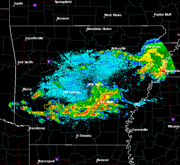 At 1215 am cdt, severe thunderstorms were located along a line extending from warbritton to near pine bluff to near kedron, moving east at 45 mph (radar indicated). Hazards include 60 mph wind gusts. Expect damage to roofs, siding, and trees. Locations impacted include, pine bluff, warbritton, pine bluff arsenal, sulphur springs, faith, watson chapel, this includes interstate 530 between mile markers 36 and 46. At 1215 am cdt, severe thunderstorms were located along a line extending from warbritton to near pine bluff to near kedron, moving east at 45 mph (radar indicated). Hazards include 60 mph wind gusts. Expect damage to roofs, siding, and trees. Locations impacted include, pine bluff, warbritton, pine bluff arsenal, sulphur springs, faith, watson chapel, this includes interstate 530 between mile markers 36 and 46.
|
| 3/25/2019 12:03 AM CDT |
 At 1202 am cdt, severe thunderstorms were located along a line extending from near white hall to 10 miles west of pine bluff to lamont, moving east at 40 mph (radar indicated). Hazards include 60 mph wind gusts and penny size hail. Expect damage to roofs, siding, and trees. Locations impacted include, pine bluff, white hall, warbritton, lamont, pine bluff arsenal, sulphur springs, faith, watson chapel, grapevine, clear lake, hardin, dexter, samples, this includes interstate 530 between mile markers 28 and 46. At 1202 am cdt, severe thunderstorms were located along a line extending from near white hall to 10 miles west of pine bluff to lamont, moving east at 40 mph (radar indicated). Hazards include 60 mph wind gusts and penny size hail. Expect damage to roofs, siding, and trees. Locations impacted include, pine bluff, white hall, warbritton, lamont, pine bluff arsenal, sulphur springs, faith, watson chapel, grapevine, clear lake, hardin, dexter, samples, this includes interstate 530 between mile markers 28 and 46.
|
| 3/24/2019 11:45 PM CDT |
 At 1142 pm cdt, severe thunderstorms were located along a line extending from sheridan to near dogwood to near leola, moving east at 40 mph (radar indicated). Hazards include 60 mph wind gusts and penny size hail. expect damage to roofs, siding, and trees At 1142 pm cdt, severe thunderstorms were located along a line extending from sheridan to near dogwood to near leola, moving east at 40 mph (radar indicated). Hazards include 60 mph wind gusts and penny size hail. expect damage to roofs, siding, and trees
|
| 3/14/2019 4:40 AM CDT |
 At 440 am cdt, a severe thunderstorm was located over dogwood, or 8 miles southwest of sheridan, moving northeast at 55 mph (radar indicated). Hazards include 60 mph wind gusts and penny size hail. Expect damage to roofs, siding, and trees. Locations impacted include, sheridan, white hall, england, redfield, leola, prattsville, keo, cane creek, jenkins ferry state park, pine bluff arsenal, estes, orion, thiel, hensley island, dogwood, toltec mounds state park, sherrill, tucker, pastoria, wright, this includes interstate 530 between mile markers 14 and 31. At 440 am cdt, a severe thunderstorm was located over dogwood, or 8 miles southwest of sheridan, moving northeast at 55 mph (radar indicated). Hazards include 60 mph wind gusts and penny size hail. Expect damage to roofs, siding, and trees. Locations impacted include, sheridan, white hall, england, redfield, leola, prattsville, keo, cane creek, jenkins ferry state park, pine bluff arsenal, estes, orion, thiel, hensley island, dogwood, toltec mounds state park, sherrill, tucker, pastoria, wright, this includes interstate 530 between mile markers 14 and 31.
|
| 3/14/2019 4:27 AM CDT |
 At 427 am cdt, a severe thunderstorm was located near leola, or 16 miles southeast of malvern, moving northeast at 60 mph (radar indicated). Hazards include 60 mph wind gusts and quarter size hail. Hail damage to vehicles is expected. Expect wind damage to roofs, siding, and trees. At 427 am cdt, a severe thunderstorm was located near leola, or 16 miles southeast of malvern, moving northeast at 60 mph (radar indicated). Hazards include 60 mph wind gusts and quarter size hail. Hail damage to vehicles is expected. Expect wind damage to roofs, siding, and trees.
|
| 3/9/2019 11:02 AM CST |
 At 1102 am cst, severe thunderstorms were located along a line extending from near parkers corner to near brummitt to 6 miles west of humphrey to near pine bluff, moving east at 35 mph (radar indicated). Hazards include 60 mph wind gusts and quarter size hail. Hail damage to vehicles is expected. Expect wind damage to roofs, siding, and trees. At 1102 am cst, severe thunderstorms were located along a line extending from near parkers corner to near brummitt to 6 miles west of humphrey to near pine bluff, moving east at 35 mph (radar indicated). Hazards include 60 mph wind gusts and quarter size hail. Hail damage to vehicles is expected. Expect wind damage to roofs, siding, and trees.
|
| 3/9/2019 10:45 AM CST |
 At 1044 am cst, severe thunderstorms were located along a line extending from near lonoke to near england to 8 miles southeast of sheridan, moving east at 40 mph (radar indicated). Hazards include 60 mph wind gusts and quarter size hail. Hail damage to vehicles is expected. expect wind damage to roofs, siding, and trees. locations impacted include, pine bluff, sheridan, lonoke, des arc, hazen, white hall, england, carlisle, altheimer, humphrey, humnoke, keo, barrettsville, thurman, mccreanor, stuttgart municipal airport, hensley island, brummitt, prairie center, pine bluff arsenal, this includes the following highways, interstate 40 between mile markers 170 and 196. interstate 530 between mile markers 22 and 38. A tornado watch remains in effect until 500 pm cst for central and southeastern arkansas. At 1044 am cst, severe thunderstorms were located along a line extending from near lonoke to near england to 8 miles southeast of sheridan, moving east at 40 mph (radar indicated). Hazards include 60 mph wind gusts and quarter size hail. Hail damage to vehicles is expected. expect wind damage to roofs, siding, and trees. locations impacted include, pine bluff, sheridan, lonoke, des arc, hazen, white hall, england, carlisle, altheimer, humphrey, humnoke, keo, barrettsville, thurman, mccreanor, stuttgart municipal airport, hensley island, brummitt, prairie center, pine bluff arsenal, this includes the following highways, interstate 40 between mile markers 170 and 196. interstate 530 between mile markers 22 and 38. A tornado watch remains in effect until 500 pm cst for central and southeastern arkansas.
|
| 3/9/2019 10:19 AM CST |
 At 1018 am cst, severe thunderstorms were located along a line extending from gravel ridge to orion to jenkins ferry state park, moving east at 40 mph (radar indicated). Hazards include 60 mph wind gusts. expect damage to roofs, siding, and trees At 1018 am cst, severe thunderstorms were located along a line extending from gravel ridge to orion to jenkins ferry state park, moving east at 40 mph (radar indicated). Hazards include 60 mph wind gusts. expect damage to roofs, siding, and trees
|
| 3/9/2019 9:40 AM CST |
 At 939 am cst, a severe thunderstorm was located near perla, or near malvern, moving east at 60 mph (radar indicated). Hazards include 60 mph wind gusts and quarter size hail. Hail damage to vehicles is expected. Expect wind damage to roofs, siding, and trees. At 939 am cst, a severe thunderstorm was located near perla, or near malvern, moving east at 60 mph (radar indicated). Hazards include 60 mph wind gusts and quarter size hail. Hail damage to vehicles is expected. Expect wind damage to roofs, siding, and trees.
|
| 2/23/2019 8:41 AM CST |
 At 841 am cst, a severe thunderstorm was located near lamont, or 11 miles west of pine bluff, moving northeast at 60 mph (radar indicated). Hazards include 60 mph wind gusts and quarter size hail. Hail damage to vehicles is expected. expect wind damage to roofs, siding, and trees. locations impacted include, pine bluff, white hall, redfield, lamont, pine bluff arsenal, warbritton, hensley island, sulphur springs, sherrill, tucker, pastoria, wright, lock and dam 5 park, kearney, tar camp park, clear lake, hardin, dexter, f. b. Baugh recreation area, gethsemane, this includes interstate 530 between mile markers 18 and 39. At 841 am cst, a severe thunderstorm was located near lamont, or 11 miles west of pine bluff, moving northeast at 60 mph (radar indicated). Hazards include 60 mph wind gusts and quarter size hail. Hail damage to vehicles is expected. expect wind damage to roofs, siding, and trees. locations impacted include, pine bluff, white hall, redfield, lamont, pine bluff arsenal, warbritton, hensley island, sulphur springs, sherrill, tucker, pastoria, wright, lock and dam 5 park, kearney, tar camp park, clear lake, hardin, dexter, f. b. Baugh recreation area, gethsemane, this includes interstate 530 between mile markers 18 and 39.
|
| 2/23/2019 8:34 AM CST |
 At 834 am cst, a severe thunderstorm was located over lamont, or 11 miles northwest of rison, moving northeast at 70 mph (radar indicated). Hazards include 60 mph wind gusts and quarter size hail. Hail damage to vehicles is expected. Expect wind damage to roofs, siding, and trees. At 834 am cst, a severe thunderstorm was located over lamont, or 11 miles northwest of rison, moving northeast at 70 mph (radar indicated). Hazards include 60 mph wind gusts and quarter size hail. Hail damage to vehicles is expected. Expect wind damage to roofs, siding, and trees.
|
| 12/1/2018 3:19 AM CST |
 At 318 am cst, severe thunderstorms were located along a line extending from warbritton to near cottondale to 6 miles north of herbine, moving northeast at 55 mph (radar indicated). Hazards include 60 mph wind gusts. Expect damage to roofs, siding, and trees. locations impacted include, pine bluff, star city, rison, white hall, altheimer, grady, whitefield, woodville, hensley island, herbine, nebo, feenyville, cottondale, linwood, cane creek state park, pine bluff arsenal, madding, kedron, warbritton, mt elba, this includes interstate 530 between mile markers 25 and 46. A tornado watch remains in effect until 800 am cst for central and southeastern arkansas. At 318 am cst, severe thunderstorms were located along a line extending from warbritton to near cottondale to 6 miles north of herbine, moving northeast at 55 mph (radar indicated). Hazards include 60 mph wind gusts. Expect damage to roofs, siding, and trees. locations impacted include, pine bluff, star city, rison, white hall, altheimer, grady, whitefield, woodville, hensley island, herbine, nebo, feenyville, cottondale, linwood, cane creek state park, pine bluff arsenal, madding, kedron, warbritton, mt elba, this includes interstate 530 between mile markers 25 and 46. A tornado watch remains in effect until 800 am cst for central and southeastern arkansas.
|
| 12/1/2018 2:44 AM CST |
 At 243 am cst, severe thunderstorms were located along a line extending from carthage to 7 miles north of fordyce to near harlow, moving northeast at 55 mph (radar indicated). Hazards include 60 mph wind gusts. expect damage to roofs, siding, and trees At 243 am cst, severe thunderstorms were located along a line extending from carthage to 7 miles north of fordyce to near harlow, moving northeast at 55 mph (radar indicated). Hazards include 60 mph wind gusts. expect damage to roofs, siding, and trees
|
| 12/1/2018 2:35 AM CST |
 At 234 am cst, severe thunderstorms were located along a line extending from 6 miles southwest of carthage to 7 miles northwest of thornton to near highland industrial park, moving east at 45 mph (radar indicated). Hazards include 70 mph wind gusts and nickel size hail. Expect considerable tree damage. damage is likely to mobile homes, roofs, and outbuildings. locations impacted include, pine bluff, camden, sheridan, fordyce, rison, white hall, redfield, bearden, leola, kingsland, sparkman, thornton, carthage, tipton, dogwood, poison springs state park, lamont, harlow, hebron, kedron, this includes interstate 530 between mile markers 19 and 40. A tornado watch remains in effect until 800 am cst for central, southeastern and southwestern arkansas. At 234 am cst, severe thunderstorms were located along a line extending from 6 miles southwest of carthage to 7 miles northwest of thornton to near highland industrial park, moving east at 45 mph (radar indicated). Hazards include 70 mph wind gusts and nickel size hail. Expect considerable tree damage. damage is likely to mobile homes, roofs, and outbuildings. locations impacted include, pine bluff, camden, sheridan, fordyce, rison, white hall, redfield, bearden, leola, kingsland, sparkman, thornton, carthage, tipton, dogwood, poison springs state park, lamont, harlow, hebron, kedron, this includes interstate 530 between mile markers 19 and 40. A tornado watch remains in effect until 800 am cst for central, southeastern and southwestern arkansas.
|
| 12/1/2018 2:05 AM CST |
 At 205 am cst, severe thunderstorms were located along a line extending from near richwoods to near sparkman to chidester, moving northeast at 60 mph (radar indicated). Hazards include 70 mph wind gusts and nickel size hail. Expect considerable tree damage. Damage is likely to mobile homes, roofs, and outbuildings. At 205 am cst, severe thunderstorms were located along a line extending from near richwoods to near sparkman to chidester, moving northeast at 60 mph (radar indicated). Hazards include 70 mph wind gusts and nickel size hail. Expect considerable tree damage. Damage is likely to mobile homes, roofs, and outbuildings.
|
| 9/21/2018 9:33 PM CDT |
 At 932 pm cdt, a severe thunderstorm was located near warbritton, or 10 miles north of pine bluff, moving northeast at 35 mph (radar indicated). Hazards include 60 mph wind gusts and nickel size hail. Expect damage to roofs, siding, and trees. Locations impacted include, pine bluff, white hall, altheimer, warbritton, pine bluff arsenal, wabbaseka, sherrill, tucker, gethsemane, pastoria, ferda, rob roy,. At 932 pm cdt, a severe thunderstorm was located near warbritton, or 10 miles north of pine bluff, moving northeast at 35 mph (radar indicated). Hazards include 60 mph wind gusts and nickel size hail. Expect damage to roofs, siding, and trees. Locations impacted include, pine bluff, white hall, altheimer, warbritton, pine bluff arsenal, wabbaseka, sherrill, tucker, gethsemane, pastoria, ferda, rob roy,.
|
| 9/21/2018 9:22 PM CDT |
 The national weather service in little rock has issued a * severe thunderstorm warning for. northwestern jefferson county in southeastern arkansas. until 945 pm cdt. At 921 pm cdt, a severe thunderstorm was located over warbritton, or near pine bluff, moving northeast at 35 mph. The national weather service in little rock has issued a * severe thunderstorm warning for. northwestern jefferson county in southeastern arkansas. until 945 pm cdt. At 921 pm cdt, a severe thunderstorm was located over warbritton, or near pine bluff, moving northeast at 35 mph.
|
| 8/20/2018 12:44 AM CDT |
 At 1244 am cdt, a severe thunderstorm was located near madding, or near pine bluff, moving northeast at 30 mph (radar indicated). Hazards include 60 mph wind gusts and nickel size hail. expect damage to roofs, siding, and trees At 1244 am cdt, a severe thunderstorm was located near madding, or near pine bluff, moving northeast at 30 mph (radar indicated). Hazards include 60 mph wind gusts and nickel size hail. expect damage to roofs, siding, and trees
|
| 8/17/2018 1:36 PM CDT |
 At 135 pm cdt, a severe thunderstorm was located over white hall, or near pine bluff, moving southeast at 30 mph (radar indicated). Hazards include 60 mph wind gusts. expect damage to roofs, siding, and trees At 135 pm cdt, a severe thunderstorm was located over white hall, or near pine bluff, moving southeast at 30 mph (radar indicated). Hazards include 60 mph wind gusts. expect damage to roofs, siding, and trees
|
| 8/8/2018 5:34 PM CDT |
 At 532 pm cdt, severe thunderstorms were located along a line extending from 5 miles southwest of redfield to 7 miles southwest of pine bluff to kingsland, moving northeast at 40 mph (radar indicated). Hazards include 60 mph wind gusts and penny size hail. Expect damage to roofs, siding, and trees. Locations impacted include, pine bluff, sheridan, star city, rison, white hall, redfield, altheimer, kingsland, whitefield, tipton, hensley island, herbine, nebo, feenyville, lamont, cottondale, linwood, cane creek state park, hebron, pine bluff arsenal,. At 532 pm cdt, severe thunderstorms were located along a line extending from 5 miles southwest of redfield to 7 miles southwest of pine bluff to kingsland, moving northeast at 40 mph (radar indicated). Hazards include 60 mph wind gusts and penny size hail. Expect damage to roofs, siding, and trees. Locations impacted include, pine bluff, sheridan, star city, rison, white hall, redfield, altheimer, kingsland, whitefield, tipton, hensley island, herbine, nebo, feenyville, lamont, cottondale, linwood, cane creek state park, hebron, pine bluff arsenal,.
|
| 8/8/2018 5:14 PM CDT |
 At 514 pm cdt, severe thunderstorms were located along a line extending from near sheridan to near lamont to near ellisville, moving northeast at 40 mph (radar indicated). Hazards include 60 mph wind gusts and penny size hail. expect damage to roofs, siding, and trees At 514 pm cdt, severe thunderstorms were located along a line extending from near sheridan to near lamont to near ellisville, moving northeast at 40 mph (radar indicated). Hazards include 60 mph wind gusts and penny size hail. expect damage to roofs, siding, and trees
|
| 7/21/2018 3:39 AM CDT |
 At 339 am cdt, severe thunderstorms were located along a line extending from protho junction to wrightsville to near cane creek, moving southeast at 50 mph (radar indicated). Hazards include 70 mph wind gusts and penny size hail. Expect considerable tree damage. Damage is likely to mobile homes, roofs, and outbuildings. At 339 am cdt, severe thunderstorms were located along a line extending from protho junction to wrightsville to near cane creek, moving southeast at 50 mph (radar indicated). Hazards include 70 mph wind gusts and penny size hail. Expect considerable tree damage. Damage is likely to mobile homes, roofs, and outbuildings.
|
| 7/16/2018 3:29 PM CDT |
 At 328 pm cdt, a severe thunderstorm was located near pine bluff, moving southeast at 15 mph (radar indicated). Hazards include 60 mph wind gusts and quarter size hail. Hail damage to vehicles is expected. Expect wind damage to roofs, siding, and trees. At 328 pm cdt, a severe thunderstorm was located near pine bluff, moving southeast at 15 mph (radar indicated). Hazards include 60 mph wind gusts and quarter size hail. Hail damage to vehicles is expected. Expect wind damage to roofs, siding, and trees.
|
| 7/16/2018 3:15 PM CDT |
 At 315 pm cdt, a severe thunderstorm was located near white hall, or 11 miles northwest of pine bluff, moving northeast at 5 mph (radar indicated). Hazards include 60 mph wind gusts and nickel size hail. Expect damage to roofs, siding, and trees. Locations impacted include, pine bluff, white hall, warbritton, pine bluff arsenal, sulphur springs, samples, clear lake, hardin, dexter, prague, jefferson,. At 315 pm cdt, a severe thunderstorm was located near white hall, or 11 miles northwest of pine bluff, moving northeast at 5 mph (radar indicated). Hazards include 60 mph wind gusts and nickel size hail. Expect damage to roofs, siding, and trees. Locations impacted include, pine bluff, white hall, warbritton, pine bluff arsenal, sulphur springs, samples, clear lake, hardin, dexter, prague, jefferson,.
|
| 7/16/2018 3:02 PM CDT |
 At 301 pm cdt, a severe thunderstorm was located near white hall, or 11 miles west of pine bluff, moving northeast at 5 mph (radar indicated). Hazards include 60 mph wind gusts and quarter size hail. Hail damage to vehicles is expected. Expect wind damage to roofs, siding, and trees. At 301 pm cdt, a severe thunderstorm was located near white hall, or 11 miles west of pine bluff, moving northeast at 5 mph (radar indicated). Hazards include 60 mph wind gusts and quarter size hail. Hail damage to vehicles is expected. Expect wind damage to roofs, siding, and trees.
|
| 6/23/2018 6:12 AM CDT |
 At 611 am cdt, a severe thunderstorm was located over pine bluff, moving east at 40 mph (radar indicated). Hazards include 60 mph wind gusts and quarter size hail. Hail damage to vehicles is expected. Expect wind damage to roofs, siding, and trees. At 611 am cdt, a severe thunderstorm was located over pine bluff, moving east at 40 mph (radar indicated). Hazards include 60 mph wind gusts and quarter size hail. Hail damage to vehicles is expected. Expect wind damage to roofs, siding, and trees.
|
| 3/19/2018 6:39 AM CDT |
 At 639 am cdt, a severe thunderstorm was located over sheridan, moving east at 55 mph (radar indicated). Hazards include quarter size hail. Damage to vehicles is expected. Locations impacted include, pine bluff, sheridan, white hall, redfield, leola, prattsville, poyen, cane creek, jenkins ferry state park, pine bluff arsenal, orion, thiel, dogwood, sulphur springs, belfast, ain, lono, kearney, buie, watson chapel,. At 639 am cdt, a severe thunderstorm was located over sheridan, moving east at 55 mph (radar indicated). Hazards include quarter size hail. Damage to vehicles is expected. Locations impacted include, pine bluff, sheridan, white hall, redfield, leola, prattsville, poyen, cane creek, jenkins ferry state park, pine bluff arsenal, orion, thiel, dogwood, sulphur springs, belfast, ain, lono, kearney, buie, watson chapel,.
|
| 3/19/2018 6:29 AM CDT |
 At 629 am cdt, a severe thunderstorm was located over thiel, or 13 miles west of sheridan, moving east at 50 mph (radar indicated). Hazards include quarter size hail. damage to vehicles is expected At 629 am cdt, a severe thunderstorm was located over thiel, or 13 miles west of sheridan, moving east at 50 mph (radar indicated). Hazards include quarter size hail. damage to vehicles is expected
|
| 3/10/2018 9:42 PM CDT |
 At 841 pm cst, severe thunderstorms were located along a line extending from near lamont to near white hall to near linwood, moving southeast at 30 mph (radar indicated). Hazards include golf ball size hail. People and animals outdoors will be injured. Expect damage to roofs, siding, windows, and vehicles. At 841 pm cst, severe thunderstorms were located along a line extending from near lamont to near white hall to near linwood, moving southeast at 30 mph (radar indicated). Hazards include golf ball size hail. People and animals outdoors will be injured. Expect damage to roofs, siding, windows, and vehicles.
|
| 3/10/2018 9:25 PM CDT |
 At 825 pm cst, a severe thunderstorm was located over cottondale, or near pine bluff, moving southeast at 35 mph (radar indicated). Hazards include golf ball size hail and 60 mph wind gusts. People and animals outdoors will be injured. expect hail damage to roofs, siding, windows, and vehicles. expect wind damage to roofs, siding, and trees. Locations impacted include, pine bluff, white hall, grady, nebo, cottondale, whitefield, linwood, pine bluff arsenal, madding, warbritton, woodville, richardson, sulphur springs, tarry, pastoria, cornerstone, tamo, moscow, lock and dam 5 park, crigler,. At 825 pm cst, a severe thunderstorm was located over cottondale, or near pine bluff, moving southeast at 35 mph (radar indicated). Hazards include golf ball size hail and 60 mph wind gusts. People and animals outdoors will be injured. expect hail damage to roofs, siding, windows, and vehicles. expect wind damage to roofs, siding, and trees. Locations impacted include, pine bluff, white hall, grady, nebo, cottondale, whitefield, linwood, pine bluff arsenal, madding, warbritton, woodville, richardson, sulphur springs, tarry, pastoria, cornerstone, tamo, moscow, lock and dam 5 park, crigler,.
|
| 3/10/2018 9:13 PM CDT |
 At 812 pm cst, a severe thunderstorm was located over warbritton, or near pine bluff, moving southeast at 35 mph (radar indicated). Hazards include tennis ball size hail and 60 mph wind gusts. People and animals outdoors will be injured. expect hail damage to roofs, siding, windows, and vehicles. expect wind damage to roofs, siding, and trees. Locations impacted include, pine bluff, white hall, grady, nebo, cottondale, whitefield, linwood, pine bluff arsenal, madding, warbritton, woodville, richardson, sulphur springs, tarry, pastoria, cornerstone, tamo, moscow, lock and dam 5 park, crigler,. At 812 pm cst, a severe thunderstorm was located over warbritton, or near pine bluff, moving southeast at 35 mph (radar indicated). Hazards include tennis ball size hail and 60 mph wind gusts. People and animals outdoors will be injured. expect hail damage to roofs, siding, windows, and vehicles. expect wind damage to roofs, siding, and trees. Locations impacted include, pine bluff, white hall, grady, nebo, cottondale, whitefield, linwood, pine bluff arsenal, madding, warbritton, woodville, richardson, sulphur springs, tarry, pastoria, cornerstone, tamo, moscow, lock and dam 5 park, crigler,.
|
| 3/10/2018 9:07 PM CDT | Golf Ball sized hail reported 0.4 miles W of White Hall, AR |
| 3/10/2018 9:07 PM CDT | Baseball sized hail reported 0.4 miles W of White Hall, AR, baseball size hail reported. |
| 3/10/2018 9:01 PM CDT |
 At 801 pm cst, a severe thunderstorm was located over pine bluff arsenal, or 9 miles northwest of pine bluff, moving southeast at 30 mph (radar indicated). Hazards include ping pong ball size hail and 60 mph wind gusts. People and animals outdoors will be injured. expect hail damage to roofs, siding, windows, and vehicles. Expect wind damage to roofs, siding, and trees. At 801 pm cst, a severe thunderstorm was located over pine bluff arsenal, or 9 miles northwest of pine bluff, moving southeast at 30 mph (radar indicated). Hazards include ping pong ball size hail and 60 mph wind gusts. People and animals outdoors will be injured. expect hail damage to roofs, siding, windows, and vehicles. Expect wind damage to roofs, siding, and trees.
|
| 3/10/2018 8:52 PM CDT |
 A severe thunderstorm warning remains in effect until 815 pm cst for southwestern lonoke. northern grant. northwestern jefferson. southeastern saline and southeastern pulaski counties. At 752 pm cst, severe thunderstorms were located along a line extending from haskell to near east end to near wrightsville to near redfield, moving east at 15 mph. A severe thunderstorm warning remains in effect until 815 pm cst for southwestern lonoke. northern grant. northwestern jefferson. southeastern saline and southeastern pulaski counties. At 752 pm cst, severe thunderstorms were located along a line extending from haskell to near east end to near wrightsville to near redfield, moving east at 15 mph.
|
| 3/10/2018 8:35 PM CDT |
 At 735 pm cst, severe thunderstorms were located along a line extending from near lonsdale to near bryant to near ironton to cane creek, moving east at 15 mph (radar indicated). Hazards include golf ball size hail and 60 mph wind gusts. People and animals outdoors will be injured. expect hail damage to roofs, siding, windows, and vehicles. expect wind damage to roofs, siding, and trees. Locations impacted include, little rock, benton, bryant, hot springs village, southwest little rock, white hall, haskell, shannon hills, england, wrightsville, redfield, traskwood, tull, keo, lonsdale, otter creek, cane creek, ironton, estes, toltec mounds state park,. At 735 pm cst, severe thunderstorms were located along a line extending from near lonsdale to near bryant to near ironton to cane creek, moving east at 15 mph (radar indicated). Hazards include golf ball size hail and 60 mph wind gusts. People and animals outdoors will be injured. expect hail damage to roofs, siding, windows, and vehicles. expect wind damage to roofs, siding, and trees. Locations impacted include, little rock, benton, bryant, hot springs village, southwest little rock, white hall, haskell, shannon hills, england, wrightsville, redfield, traskwood, tull, keo, lonsdale, otter creek, cane creek, ironton, estes, toltec mounds state park,.
|
| 3/10/2018 8:24 PM CDT |
 At 724 pm cst, a cluster of severe thunderstorms were located from lonsdale to benton to shannon hills to near cane creek, moving east at 15 mph (radar indicated). Hazards include 60 mph wind gusts and quarter size hail. Hail damage to vehicles is expected. Expect wind damage to roofs, siding, and trees. At 724 pm cst, a cluster of severe thunderstorms were located from lonsdale to benton to shannon hills to near cane creek, moving east at 15 mph (radar indicated). Hazards include 60 mph wind gusts and quarter size hail. Hail damage to vehicles is expected. Expect wind damage to roofs, siding, and trees.
|
| 8/11/2017 12:40 PM CDT |
 At 1240 pm cdt, a severe thunderstorm was located near warbritton, or 7 miles north of pine bluff, moving east at 35 mph (radar indicated). Hazards include 60 mph wind gusts. Expect damage to roofs, siding, and trees. Locations impacted include, pine bluff, white hall, redfield, altheimer, warbritton, cottondale, pine bluff arsenal, madding, hensley island, wabbaseka, sherrill, pastoria, jefferson, wright, lock and dam 5 park, kearney, glenlake, tar camp park, samples, hardin, this includes interstate 530 between mile markers 20 and 37, and between mile markers 45 and 46. At 1240 pm cdt, a severe thunderstorm was located near warbritton, or 7 miles north of pine bluff, moving east at 35 mph (radar indicated). Hazards include 60 mph wind gusts. Expect damage to roofs, siding, and trees. Locations impacted include, pine bluff, white hall, redfield, altheimer, warbritton, cottondale, pine bluff arsenal, madding, hensley island, wabbaseka, sherrill, pastoria, jefferson, wright, lock and dam 5 park, kearney, glenlake, tar camp park, samples, hardin, this includes interstate 530 between mile markers 20 and 37, and between mile markers 45 and 46.
|
| 8/11/2017 12:21 PM CDT |
 At 1221 pm cdt, a severe thunderstorm was located near redfield, or 11 miles northeast of sheridan, moving east at 35 mph (radar indicated). Hazards include 60 mph wind gusts. expect damage to roofs, siding, and trees At 1221 pm cdt, a severe thunderstorm was located near redfield, or 11 miles northeast of sheridan, moving east at 35 mph (radar indicated). Hazards include 60 mph wind gusts. expect damage to roofs, siding, and trees
|
| 6/23/2017 6:05 PM CDT | *** 1 fatal *** a tree was blown over onto a car in jefferson county AR, 2.8 miles NE of White Hall, AR |
| 6/22/2017 6:41 PM CDT |
 At 641 pm cdt, a severe thunderstorm capable of producing a tornado was located near lamont, or 13 miles west of pine bluff, moving north at 15 mph (radar indicated rotation). Hazards include tornado. Flying debris will be dangerous to those caught without shelter. mobile homes will be damaged or destroyed. damage to roofs, windows, and vehicles will occur. tree damage is likely. Locations impacted include, pine bluff, white hall, pine bluff arsenal, sulphur springs, ain, samples, grapevine, center grove, clear lake, hardin, dexter, prague, this includes interstate 530 between mile markers 27 and 36. At 641 pm cdt, a severe thunderstorm capable of producing a tornado was located near lamont, or 13 miles west of pine bluff, moving north at 15 mph (radar indicated rotation). Hazards include tornado. Flying debris will be dangerous to those caught without shelter. mobile homes will be damaged or destroyed. damage to roofs, windows, and vehicles will occur. tree damage is likely. Locations impacted include, pine bluff, white hall, pine bluff arsenal, sulphur springs, ain, samples, grapevine, center grove, clear lake, hardin, dexter, prague, this includes interstate 530 between mile markers 27 and 36.
|
| 6/22/2017 6:32 PM CDT |
 At 631 pm cdt, a severe thunderstorm capable of producing a tornado was located near lamont, or 13 miles north of rison, moving north at 20 mph (radar indicated rotation). Hazards include tornado. Flying debris will be dangerous to those caught without shelter. mobile homes will be damaged or destroyed. damage to roofs, windows, and vehicles will occur. Tree damage is likely. At 631 pm cdt, a severe thunderstorm capable of producing a tornado was located near lamont, or 13 miles north of rison, moving north at 20 mph (radar indicated rotation). Hazards include tornado. Flying debris will be dangerous to those caught without shelter. mobile homes will be damaged or destroyed. damage to roofs, windows, and vehicles will occur. Tree damage is likely.
|
| 5/28/2017 2:58 AM CDT |
 At 258 am cdt, a severe thunderstorm was located near pine bluff, moving northeast at 45 mph (radar indicated). Hazards include quarter size hail. Damage to vehicles is expected. Locations impacted include, pine bluff, white hall, warbritton, cottondale, whitefield, linwood, pine bluff arsenal, madding, sulphur springs, sherrill, tarry, pastoria, tamo, faith, pinebergen, moscow, ladd, glenlake, watson chapel, hardin, this includes interstate 530 between mile markers 30 and 46. At 258 am cdt, a severe thunderstorm was located near pine bluff, moving northeast at 45 mph (radar indicated). Hazards include quarter size hail. Damage to vehicles is expected. Locations impacted include, pine bluff, white hall, warbritton, cottondale, whitefield, linwood, pine bluff arsenal, madding, sulphur springs, sherrill, tarry, pastoria, tamo, faith, pinebergen, moscow, ladd, glenlake, watson chapel, hardin, this includes interstate 530 between mile markers 30 and 46.
|
| 5/28/2017 2:49 AM CDT |
 At 249 am cdt, a severe thunderstorm was located over lamont, or 11 miles north of rison, moving northeast at 45 mph (radar indicated). Hazards include quarter size hail. damage to vehicles is expected At 249 am cdt, a severe thunderstorm was located over lamont, or 11 miles north of rison, moving northeast at 45 mph (radar indicated). Hazards include quarter size hail. damage to vehicles is expected
|
| 4/10/2017 9:15 PM CDT |
 At 914 pm cdt, severe thunderstorms were located along a line extending from 6 miles northeast of lamont to near kedron to near herbine, moving east at 65 mph (radar indicated). Hazards include 60 mph wind gusts. expect damage to roofs, siding, and trees At 914 pm cdt, severe thunderstorms were located along a line extending from 6 miles northeast of lamont to near kedron to near herbine, moving east at 65 mph (radar indicated). Hazards include 60 mph wind gusts. expect damage to roofs, siding, and trees
|
| 3/10/2017 1:27 AM CST |
 At 127 am cst, a severe thunderstorm was located 2 miles northwest of white hall, or 9 miles northwest of pine bluff, moving southeast at 35 mph (radar indicated). Hazards include quarter size hail. Damage to vehicles is expected. Locations impacted include, pine bluff, white hall, pine bluff arsenal, sulphur springs, faith, pinebergen, prague, watson chapel, samples, center grove, clear lake, hardin, dexter, this includes interstate 530 between mile markers 25 and 45. At 127 am cst, a severe thunderstorm was located 2 miles northwest of white hall, or 9 miles northwest of pine bluff, moving southeast at 35 mph (radar indicated). Hazards include quarter size hail. Damage to vehicles is expected. Locations impacted include, pine bluff, white hall, pine bluff arsenal, sulphur springs, faith, pinebergen, prague, watson chapel, samples, center grove, clear lake, hardin, dexter, this includes interstate 530 between mile markers 25 and 45.
|
| 3/10/2017 1:12 AM CST |
 At 111 am cst, a severe thunderstorm was located 5 miles southwest of redfield, or 10 miles east of sheridan, moving southeast at 35 mph (radar indicated). Hazards include quarter size hail. damage to vehicles is expected At 111 am cst, a severe thunderstorm was located 5 miles southwest of redfield, or 10 miles east of sheridan, moving southeast at 35 mph (radar indicated). Hazards include quarter size hail. damage to vehicles is expected
|
| 12/17/2016 7:46 PM CST |
 At 744 pm cst, severe thunderstorms were located along a line extending from 5 miles northwest of pine bluff to 10 miles northwest of rison to 5 miles southeast of sparkman, moving east at 45 mph (radar indicated). Hazards include 60 mph wind gusts and penny size hail. Expect damage to roofs, siding, and trees. locations impacted include, pine bluff, rison, toledo, madding, kedron, cottondale, lamont, sulphur springs, staves, mt zion, randall, pinebergen, faith, glenlake, bunn, calmer, watson chapel, ladd, grapevine, ivan, this includes interstate 530 between mile markers 36 and 46. A tornado watch remains in effect until 900 pm cst for southeastern arkansas. At 744 pm cst, severe thunderstorms were located along a line extending from 5 miles northwest of pine bluff to 10 miles northwest of rison to 5 miles southeast of sparkman, moving east at 45 mph (radar indicated). Hazards include 60 mph wind gusts and penny size hail. Expect damage to roofs, siding, and trees. locations impacted include, pine bluff, rison, toledo, madding, kedron, cottondale, lamont, sulphur springs, staves, mt zion, randall, pinebergen, faith, glenlake, bunn, calmer, watson chapel, ladd, grapevine, ivan, this includes interstate 530 between mile markers 36 and 46. A tornado watch remains in effect until 900 pm cst for southeastern arkansas.
|
| 12/17/2016 7:32 PM CST |
 At 731 pm cst, severe thunderstorms were located along a line extending from 6 miles northeast of lamont to 9 miles south of carthage, moving east at 45 mph (radar indicated). Hazards include 60 mph wind gusts and penny size hail. expect damage to roofs, siding, and trees At 731 pm cst, severe thunderstorms were located along a line extending from 6 miles northeast of lamont to 9 miles south of carthage, moving east at 45 mph (radar indicated). Hazards include 60 mph wind gusts and penny size hail. expect damage to roofs, siding, and trees
|
| 12/17/2016 7:15 PM CST |
 At 715 pm cst, a severe thunderstorm capable of producing a tornado was located just north of white hall, or 7 miles northwest of pine bluff, moving northeast at 45 mph (radar indicated rotation). Hazards include tornado. Flying debris will be dangerous to those caught without shelter. mobile homes will be damaged or destroyed. damage to roofs, windows, and vehicles will occur. Tree damage is likely. At 715 pm cst, a severe thunderstorm capable of producing a tornado was located just north of white hall, or 7 miles northwest of pine bluff, moving northeast at 45 mph (radar indicated rotation). Hazards include tornado. Flying debris will be dangerous to those caught without shelter. mobile homes will be damaged or destroyed. damage to roofs, windows, and vehicles will occur. Tree damage is likely.
|
| 12/17/2016 7:02 PM CST |
 At 701 pm cst, a confirmed tornado was located 8 miles north of lamont, or 9 miles southeast of sheridan, moving northeast at 45 mph (weather spotters confirmed tornado). Hazards include damaging tornado. Flying debris will be dangerous to those caught without shelter. mobile homes will be damaged or destroyed. damage to roofs, windows, and vehicles will occur. tree damage is likely. Locations impacted include, pine bluff, white hall, pine bluff arsenal, warbritton, hensley island, ain, jefferson, wright, clear lake, pastoria, dexter, center grove, hardin, grapevine, lock and dam 5 park, samples, prague, this includes interstate 530 between mile markers 24 and 38. At 701 pm cst, a confirmed tornado was located 8 miles north of lamont, or 9 miles southeast of sheridan, moving northeast at 45 mph (weather spotters confirmed tornado). Hazards include damaging tornado. Flying debris will be dangerous to those caught without shelter. mobile homes will be damaged or destroyed. damage to roofs, windows, and vehicles will occur. tree damage is likely. Locations impacted include, pine bluff, white hall, pine bluff arsenal, warbritton, hensley island, ain, jefferson, wright, clear lake, pastoria, dexter, center grove, hardin, grapevine, lock and dam 5 park, samples, prague, this includes interstate 530 between mile markers 24 and 38.
|
| 12/17/2016 6:58 PM CST |
 At 657 pm cst, a severe thunderstorm capable of producing a tornado was located 7 miles north of lamont, or 8 miles southeast of sheridan, moving northeast at 45 mph (radar indicated rotation). Hazards include tornado. Flying debris will be dangerous to those caught without shelter. mobile homes will be damaged or destroyed. damage to roofs, windows, and vehicles will occur. tree damage is likely. Locations impacted include, pine bluff, white hall, pine bluff arsenal, warbritton, hensley island, ain, jefferson, wright, clear lake, pastoria, dexter, center grove, hardin, grapevine, cross roads in grant county, millerville, lock and dam 5 park, samples, prague, this includes interstate 530 between mile markers 24 and 38. At 657 pm cst, a severe thunderstorm capable of producing a tornado was located 7 miles north of lamont, or 8 miles southeast of sheridan, moving northeast at 45 mph (radar indicated rotation). Hazards include tornado. Flying debris will be dangerous to those caught without shelter. mobile homes will be damaged or destroyed. damage to roofs, windows, and vehicles will occur. tree damage is likely. Locations impacted include, pine bluff, white hall, pine bluff arsenal, warbritton, hensley island, ain, jefferson, wright, clear lake, pastoria, dexter, center grove, hardin, grapevine, cross roads in grant county, millerville, lock and dam 5 park, samples, prague, this includes interstate 530 between mile markers 24 and 38.
|
| 12/17/2016 6:49 PM CST |
 At 648 pm cst, a severe thunderstorm capable of producing a tornado was located 7 miles southeast of dogwood, or 10 miles south of sheridan, moving northeast at 45 mph (radar indicated rotation). Hazards include tornado. Flying debris will be dangerous to those caught without shelter. mobile homes will be damaged or destroyed. damage to roofs, windows, and vehicles will occur. tree damage is likely. Locations impacted include, pine bluff, white hall, pine bluff arsenal, warbritton, hensley island, sulphur springs, ain, jefferson, wright, clear lake, pastoria, dexter, watson chapel, center grove, hardin, grapevine, cross roads in grant county, slabtown, millerville, lock and dam 5 park, this includes interstate 530 between mile markers 24 and 42, and between mile markers 45 and 46. At 648 pm cst, a severe thunderstorm capable of producing a tornado was located 7 miles southeast of dogwood, or 10 miles south of sheridan, moving northeast at 45 mph (radar indicated rotation). Hazards include tornado. Flying debris will be dangerous to those caught without shelter. mobile homes will be damaged or destroyed. damage to roofs, windows, and vehicles will occur. tree damage is likely. Locations impacted include, pine bluff, white hall, pine bluff arsenal, warbritton, hensley island, sulphur springs, ain, jefferson, wright, clear lake, pastoria, dexter, watson chapel, center grove, hardin, grapevine, cross roads in grant county, slabtown, millerville, lock and dam 5 park, this includes interstate 530 between mile markers 24 and 42, and between mile markers 45 and 46.
|
| 12/17/2016 6:35 PM CST |
 At 635 pm cst, a severe thunderstorm capable of producing a tornado was located over carthage, or 17 miles southwest of sheridan, moving northeast at 50 mph (radar indicated rotation). Hazards include tornado. Flying debris will be dangerous to those caught without shelter. mobile homes will be damaged or destroyed. damage to roofs, windows, and vehicles will occur. Tree damage is likely. At 635 pm cst, a severe thunderstorm capable of producing a tornado was located over carthage, or 17 miles southwest of sheridan, moving northeast at 50 mph (radar indicated rotation). Hazards include tornado. Flying debris will be dangerous to those caught without shelter. mobile homes will be damaged or destroyed. damage to roofs, windows, and vehicles will occur. Tree damage is likely.
|
| 12/17/2016 6:30 PM CST |
 At 630 pm cst, a severe thunderstorm was located near carthage, or 20 miles southwest of sheridan, moving northeast at 50 mph (radar indicated). Hazards include 60 mph wind gusts and penny size hail. expect damage to roofs, siding, and trees At 630 pm cst, a severe thunderstorm was located near carthage, or 20 miles southwest of sheridan, moving northeast at 50 mph (radar indicated). Hazards include 60 mph wind gusts and penny size hail. expect damage to roofs, siding, and trees
|
| 8/25/2016 3:22 PM CDT |
 The severe thunderstorm warning for northwestern jefferson county will expire at 330 pm cdt, the storm which prompted the warning has weakened below severe limits, and no longer pose an immediate threat to life or property. therefore the warning will be allowed to expire. however heavy rain is still possible with this thunderstorm. The severe thunderstorm warning for northwestern jefferson county will expire at 330 pm cdt, the storm which prompted the warning has weakened below severe limits, and no longer pose an immediate threat to life or property. therefore the warning will be allowed to expire. however heavy rain is still possible with this thunderstorm.
|
| 8/25/2016 2:49 PM CDT |
 At 249 pm cdt, a severe thunderstorm was located over pine bluff arsenal, or 8 miles north of pine bluff, moving north at 10 mph (radar indicated). Hazards include 60 mph wind gusts. Expect damage to roofs. siding. And trees. At 249 pm cdt, a severe thunderstorm was located over pine bluff arsenal, or 8 miles north of pine bluff, moving north at 10 mph (radar indicated). Hazards include 60 mph wind gusts. Expect damage to roofs. siding. And trees.
|
| 7/29/2016 5:38 PM CDT |
 The severe thunderstorm warning for western jefferson and northeastern grant counties will expire at 545 pm cdt, the storm which prompted the warning has weakened below severe limits. therefore the warning will be allowed to expire. however gusty winds and heavy rain are still possible with this thunderstorm. The severe thunderstorm warning for western jefferson and northeastern grant counties will expire at 545 pm cdt, the storm which prompted the warning has weakened below severe limits. therefore the warning will be allowed to expire. however gusty winds and heavy rain are still possible with this thunderstorm.
|
| 7/29/2016 5:07 PM CDT |
 At 507 pm cdt, a severe thunderstorm was located over redfield, or 13 miles northeast of sheridan, moving southeast at 30 mph (radar indicated). Hazards include 60 mph wind gusts. Expect damage to roofs. siding. And trees. At 507 pm cdt, a severe thunderstorm was located over redfield, or 13 miles northeast of sheridan, moving southeast at 30 mph (radar indicated). Hazards include 60 mph wind gusts. Expect damage to roofs. siding. And trees.
|
| 7/14/2016 7:08 PM CDT |
 At 705 pm cdt, severe thunderstorms were located along a line extending from woodville to near warren, moving southeast at 45 mph (radar indicated). Hazards include 60 mph wind gusts. Expect damage to roofs. siding. and trees. Locations impacted include, pine bluff, monticello, warren, star city, rison, white hall, altheimer, gould, hermitage, humphrey, wilmar, grady, kingsland, little bayou meto park, hebron, pine bluff arsenal, tipton, madding, woodville, douglas,. At 705 pm cdt, severe thunderstorms were located along a line extending from woodville to near warren, moving southeast at 45 mph (radar indicated). Hazards include 60 mph wind gusts. Expect damage to roofs. siding. and trees. Locations impacted include, pine bluff, monticello, warren, star city, rison, white hall, altheimer, gould, hermitage, humphrey, wilmar, grady, kingsland, little bayou meto park, hebron, pine bluff arsenal, tipton, madding, woodville, douglas,.
|
| 7/14/2016 6:30 PM CDT |
 At 630 pm cdt, severe thunderstorms were located along a line extending from near pine bluff arsenal to near thornton, moving southeast at 45 mph (radar indicated). Hazards include 60 mph wind gusts. Expect damage to roofs. siding. And trees. At 630 pm cdt, severe thunderstorms were located along a line extending from near pine bluff arsenal to near thornton, moving southeast at 45 mph (radar indicated). Hazards include 60 mph wind gusts. Expect damage to roofs. siding. And trees.
|
| 4/11/2016 12:18 PM CDT |
 At 1217 pm cdt, severe thunderstorms were located along a line extending from 7 miles east of hensley island to near kedron, moving east at 50 mph (radar indicated). Hazards include 60 mph wind gusts and nickel size hail. Expect damage to roofs. siding. and trees. Locations impacted include, pine bluff, stuttgart, white hall, altheimer, humphrey, grady, pine bluff arsenal, madding, cottondale, hensley island, richardson, linwood, warbritton, sulphur springs, wabbaseka, sherrill, cornerstone, bayou meteo state ga, moscow, pastoria,. At 1217 pm cdt, severe thunderstorms were located along a line extending from 7 miles east of hensley island to near kedron, moving east at 50 mph (radar indicated). Hazards include 60 mph wind gusts and nickel size hail. Expect damage to roofs. siding. and trees. Locations impacted include, pine bluff, stuttgart, white hall, altheimer, humphrey, grady, pine bluff arsenal, madding, cottondale, hensley island, richardson, linwood, warbritton, sulphur springs, wabbaseka, sherrill, cornerstone, bayou meteo state ga, moscow, pastoria,.
|
| 4/11/2016 12:14 PM CDT | Large limb debris was reported on highway 270 west of white hal in jefferson county AR, 1.5 miles ESE of White Hall, AR |
| 4/11/2016 11:57 AM CDT |
 At 1157 am cdt, severe thunderstorms were located along a line extending from near redfield to 6 miles northwest of lamont, moving east at 50 mph (radar indicated). Hazards include 60 mph wind gusts and nickel size hail. Expect damage to roofs. siding. And trees. At 1157 am cdt, severe thunderstorms were located along a line extending from near redfield to 6 miles northwest of lamont, moving east at 50 mph (radar indicated). Hazards include 60 mph wind gusts and nickel size hail. Expect damage to roofs. siding. And trees.
|
| 3/31/2016 2:17 PM CDT |
 At 217 pm cdt, a severe thunderstorm was located over pine bluff arsenal, or 10 miles northwest of pine bluff, moving northeast at 35 mph (radar indicated). Hazards include 60 mph wind gusts and quarter size hail. Hail damage to vehicles is expected. Expect wind damage to roofs, siding, and trees. At 217 pm cdt, a severe thunderstorm was located over pine bluff arsenal, or 10 miles northwest of pine bluff, moving northeast at 35 mph (radar indicated). Hazards include 60 mph wind gusts and quarter size hail. Hail damage to vehicles is expected. Expect wind damage to roofs, siding, and trees.
|
| 3/30/2016 6:18 PM CDT |
 At 618 pm cdt, a severe thunderstorm capable of producing a tornado was located over rison, moving northeast at 40 mph (radar indicated rotation). Hazards include tornado and quarter size hail. Flying debris will be dangerous to those caught without shelter. mobile homes will be damaged or destroyed. damage to roofs, windows, and vehicles will occur. Tree damage is likely. At 618 pm cdt, a severe thunderstorm capable of producing a tornado was located over rison, moving northeast at 40 mph (radar indicated rotation). Hazards include tornado and quarter size hail. Flying debris will be dangerous to those caught without shelter. mobile homes will be damaged or destroyed. damage to roofs, windows, and vehicles will occur. Tree damage is likely.
|
| 11/17/2015 2:35 PM CST |
 At 234 pm cst, severe thunderstorms were located along a line extending from near south bend to near toltec mounds state park to england to near warbritton to near pine bluff, moving northeast at 35 mph (radar indicated). Hazards include 60 mph wind gusts. Expect damage to roofs. siding and trees. locations impacted include, little rock, north little rock, pine bluff, sherwood, jacksonville, cabot, lonoke, little rock afb, white hall, england, altheimer, keo, toltec mounds state park, estes, pine bluff arsenal, madding, hensley island, linwood, protho junction and south bend. A tornado watch remains in effect until 600 pm cst for southeastern arkansas. At 234 pm cst, severe thunderstorms were located along a line extending from near south bend to near toltec mounds state park to england to near warbritton to near pine bluff, moving northeast at 35 mph (radar indicated). Hazards include 60 mph wind gusts. Expect damage to roofs. siding and trees. locations impacted include, little rock, north little rock, pine bluff, sherwood, jacksonville, cabot, lonoke, little rock afb, white hall, england, altheimer, keo, toltec mounds state park, estes, pine bluff arsenal, madding, hensley island, linwood, protho junction and south bend. A tornado watch remains in effect until 600 pm cst for southeastern arkansas.
|
| 11/17/2015 2:13 PM CST |
 At 213 pm cst, severe thunderstorms were located along a line extending from sweet home to near estes to hensley island to near white hall to near kedron, moving northeast at 40 mph (radar indicated). Hazards include 60 mph wind gusts. Expect damage to roofs. siding and trees. locations impacted include, little rock, north little rock, pine bluff, sherwood, jacksonville, cabot, downtown little rock, lonoke, little rock afb, white hall, england, wrightsville, argenta, redfield, altheimer, keo, sweet home, toltec mounds state park, estes and pine bluff arsenal. A tornado watch remains in effect until 600 pm cst for southeastern arkansas. At 213 pm cst, severe thunderstorms were located along a line extending from sweet home to near estes to hensley island to near white hall to near kedron, moving northeast at 40 mph (radar indicated). Hazards include 60 mph wind gusts. Expect damage to roofs. siding and trees. locations impacted include, little rock, north little rock, pine bluff, sherwood, jacksonville, cabot, downtown little rock, lonoke, little rock afb, white hall, england, wrightsville, argenta, redfield, altheimer, keo, sweet home, toltec mounds state park, estes and pine bluff arsenal. A tornado watch remains in effect until 600 pm cst for southeastern arkansas.
|
| 11/17/2015 2:00 PM CST |
 At 159 pm cst, severe thunderstorms were located along a line extending from mabelvale to near orion to 6 miles southwest of redfield to 9 miles southwest of white hall to near lamont, moving northeast at 40 mph (radar indicated). Hazards include 60 mph wind gusts. Expect damage to roofs. Siding and trees. At 159 pm cst, severe thunderstorms were located along a line extending from mabelvale to near orion to 6 miles southwest of redfield to 9 miles southwest of white hall to near lamont, moving northeast at 40 mph (radar indicated). Hazards include 60 mph wind gusts. Expect damage to roofs. Siding and trees.
|
| 10/12/2015 6:28 PM CDT |
 At 626 pm cdt, a severe thunderstorm was located 4 miles southeast of cane creek, or 4 miles northeast of sheridan, moving southeast at 25 mph (radar indicated). Hazards include 60 mph wind gusts and quarter size hail. Hail damage to vehicles is expected. expect wind damage to roofs, siding and trees. Locations impacted include, pine bluff, white hall, pine bluff arsenal, warbritton, sulphur springs, center grove, hardin, clear lake, samples, prague, dexter and jefferson. At 626 pm cdt, a severe thunderstorm was located 4 miles southeast of cane creek, or 4 miles northeast of sheridan, moving southeast at 25 mph (radar indicated). Hazards include 60 mph wind gusts and quarter size hail. Hail damage to vehicles is expected. expect wind damage to roofs, siding and trees. Locations impacted include, pine bluff, white hall, pine bluff arsenal, warbritton, sulphur springs, center grove, hardin, clear lake, samples, prague, dexter and jefferson.
|
| 10/12/2015 6:11 PM CDT |
 At 610 pm cdt, a severe thunderstorm was located 6 miles northeast of sheridan, moving southeast at 30 mph (radar indicated). Hazards include ping pong ball size hail and 60 mph wind gusts. People and animals outdoors will be injured. expect hail damage to roofs, siding, windows and vehicles. expect wind damage to roofs, siding and trees. Locations impacted include, pine bluff, sheridan, white hall, redfield, pine bluff arsenal, cane creek, warbritton, sulphur springs, belfast, jefferson, clear lake, dexter, center grove, hardin, samples, prague, ico and kearney. At 610 pm cdt, a severe thunderstorm was located 6 miles northeast of sheridan, moving southeast at 30 mph (radar indicated). Hazards include ping pong ball size hail and 60 mph wind gusts. People and animals outdoors will be injured. expect hail damage to roofs, siding, windows and vehicles. expect wind damage to roofs, siding and trees. Locations impacted include, pine bluff, sheridan, white hall, redfield, pine bluff arsenal, cane creek, warbritton, sulphur springs, belfast, jefferson, clear lake, dexter, center grove, hardin, samples, prague, ico and kearney.
|
| 10/12/2015 6:01 PM CDT |
 At 600 pm cdt, a severe thunderstorm was located over cane creek, or 8 miles north of sheridan, moving southeast at 30 mph (radar indicated). Hazards include quarter size hail. damage to vehicles is expected At 600 pm cdt, a severe thunderstorm was located over cane creek, or 8 miles north of sheridan, moving southeast at 30 mph (radar indicated). Hazards include quarter size hail. damage to vehicles is expected
|
| 5/25/2015 8:45 PM CDT | At 841 pm cdt, severe thunderstorms were located along a line extending from mayflower to east end and ivan, and moving east at 50 mph (radar indicated). Hazards include 70 mph wind gusts and nickel size hail. Expect considerable tree damage. Damage is likely to mobile homes, roofs and outbuildings. |
| 5/25/2015 8:17 PM CDT | At 814 pm cdt, severe thunderstorms were located along a line extending from williams junction to tull to 9 miles southeast of sparkman, and moving east at 50 mph (radar indicated). Hazards include 70 mph wind gusts and nickel size hail. Expect considerable tree damage. Damage is likely to mobile homes, roofs and outbuildings. |
| 5/24/2015 3:45 PM CDT | At 342 pm cdt, severe thunderstorms were located along a line extending from grays lake to weeks to 8 miles southeast of warren, and moving northeast at 45 mph (radar indicated). Hazards include 60 mph wind gusts. Expect damage to roofs. Siding and trees. |
| 5/24/2015 3:34 PM CDT | At 332 pm cdt, severe thunderstorms were located along a line extending from fordyce to weeks to hermitage, and moving northeast at 45 mph (radar indicated). Hazards include 60 mph wind gusts and nickel size hail. Expect damage to roofs. Siding and trees. |
| 5/24/2015 3:32 PM CDT | At 329 pm cdt, severe thunderstorms were located along a line extending from leola to 6 miles southeast of dogwood to 6 miles northwest of grays lake, and moving northeast at 50 mph (radar indicated). Hazards include 60 mph wind gusts. Expect damage to roofs. Siding and trees. |
| 5/24/2015 3:19 PM CDT | At 316 pm cdt, severe thunderstorms were located along a line extending from thornton to harrell to hilo, and moving northeast at 45 mph (radar indicated). Hazards include 60 mph wind gusts and penny size hail. Expect damage to roofs. Siding and trees. |
| 5/24/2015 3:15 PM CDT | At 313 pm cdt, severe thunderstorms were located along a line extending from 8 miles southwest of carthage to 7 miles south of carthage to fordyce, and moving northeast at 50 mph (radar indicated). Hazards include 60 mph wind gusts and penny size hail. Expect damage to roofs. Siding and trees. |
| 5/9/2015 7:11 PM CDT | The severe thunderstorm warning for extreme southeastern saline, extreme south central pulaski and western jefferson counties will expire at 715 pm cdt, the line of storms which prompted the warning has moved out of the warned area. |
| 5/9/2015 7:09 PM CDT | At 705 pm cdt, severe thunderstorms were located along a line extending from orion to 7 miles west of pine bluff arsenal to 8 miles north of lamont, and moving east at 30 mph (radar indicated). Hazards include 60 mph wind gusts and quarter size hail. Hail damage to vehicles is expected. Expect wind damage to roofs, siding and trees. |
| 5/9/2015 6:45 PM CDT | At 643 pm cdt, severe thunderstorms were located along a line extending from 6 miles northeast of prattsville to sheridan to 8 miles southeast of dogwood, and moving east at 30 mph (radar indicated). Hazards include 60 mph wind gusts and quarter size hail. Hail damage to vehicles is expected. Expect wind damage to roofs, siding and trees. |
| 5/9/2015 6:24 PM CDT | At 621 pm cdt, severe thunderstorms were located along a line extending from poyen to thiel to leola, and moving east at 30 mph (radar indicated). Hazards include 60 mph wind gusts and quarter size hail. Hail damage to vehicles is expected. Expect wind damage to roofs, siding and trees. |
| 4/19/2015 6:49 PM CDT | At 646 pm cdt, a severe thunderstorm was located 8 miles southwest of white hall, and moving east at 40 mph (radar indicated). Hazards include golf ball size hail. People and animals outdoors will be injured. Expect damage to roofs, siding, windows and vehicles. |
| 4/19/2015 6:29 PM CDT | At 625 pm cdt, a severe thunderstorm was located 5 miles northwest of grapevine, and moving northeast at 40 mph (radar indicated). Hazards include quarter to golf ball size hail and 60 mph wind gusts. People and animals outdoors will be injured. expect hail damage to roofs, siding, windows and vehicles. Expect wind damage to roofs, siding and trees. |
| 4/19/2015 6:13 PM CDT | At 612 pm cdt, a severe thunderstorm was located near leola, and moving east at 40 mph (radar indicated). Hazards include 60 mph wind gusts and quarter size hail. Hail damage to vehicles is expected. Expect wind damage to roofs, siding and trees. |
| 3/31/2015 12:55 PM CST | Quarter sized hail reported 4.1 miles S of White Hall, AR |
| 3/31/2015 1:44 PM CDT | The national weather service in little rock has issued a * severe thunderstorm warning for. western jefferson county in southeast arkansas. until 215 pm cdt * at 142 pm cdt. national weather service doppler radar indicated a severe thunderstorm capable of producing quarter size hail. This. |
| 10/2/2014 8:21 PM CDT | Trees down on interstate 530...blocking the southbound lane in jefferson county AR, 3.7 miles SE of White Hall, AR |
| 4/4/2014 1:00 AM CDT | Trees and power lines down due to strong thunderstorm wind in jefferson county AR, 0.7 miles SSE of White Hall, AR |
| 12/20/2012 1:45 AM CST | Trees were downed at white hall with wind gusts estimated at 60 to 70 mp in jefferson county AR, 0.7 miles SSE of White Hall, AR |
| 7/7/2012 7:30 PM CDT | Some downed trees in the hardin communit in jefferson county AR, 3 miles E of White Hall, AR |
| 9/25/2011 4:36 PM CDT | Golf Ball sized hail reported 0.7 miles SSE of White Hall, AR, hail ranging from the size of quarters to golf balls was falling in white hall and covering the ground. |
| 1/1/0001 12:00 AM | Golf Ball sized hail reported 0.7 miles SSE of White Hall, AR |
| 1/1/0001 12:00 AM | Quarter sized hail reported 0.7 miles SSE of White Hall, AR |
| 1/1/0001 12:00 AM | Trees are down in white hall off of ruth cove at twin pines trailor par in jefferson county AR, 0.7 miles SSE of White Hall, AR |
| 1/1/0001 12:00 AM | A tree fell on a mobile home. there were no injurie in jefferson county AR, 0.7 miles SSE of White Hall, AR |
| 1/1/0001 12:00 AM | Trees and powerlines were down on hardin reed road. a large tree was uprooted and uprooted a gas main line and caused a gas leak. lots of debris on the roa in jefferson county AR, 3 miles E of White Hall, AR |
| 1/1/0001 12:00 AM | Storm damage reported in jefferson county AR, 0.7 miles SSE of White Hall, AR |
Hail Maps for White Hall, AR
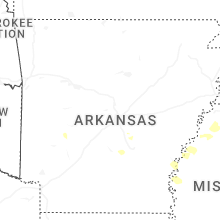
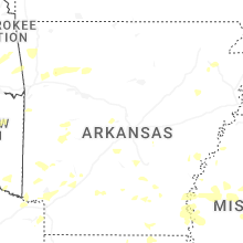
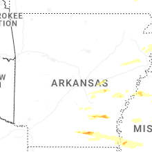

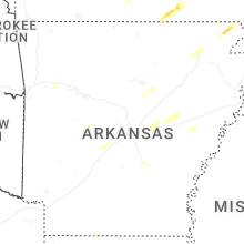


Connect with Interactive Hail Maps