

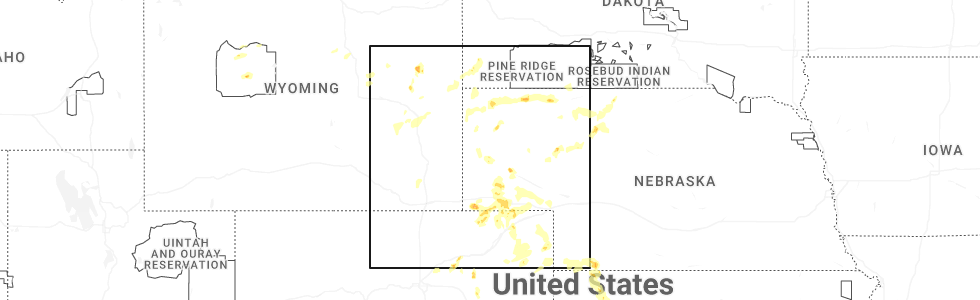
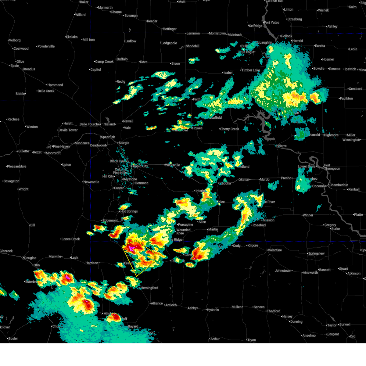
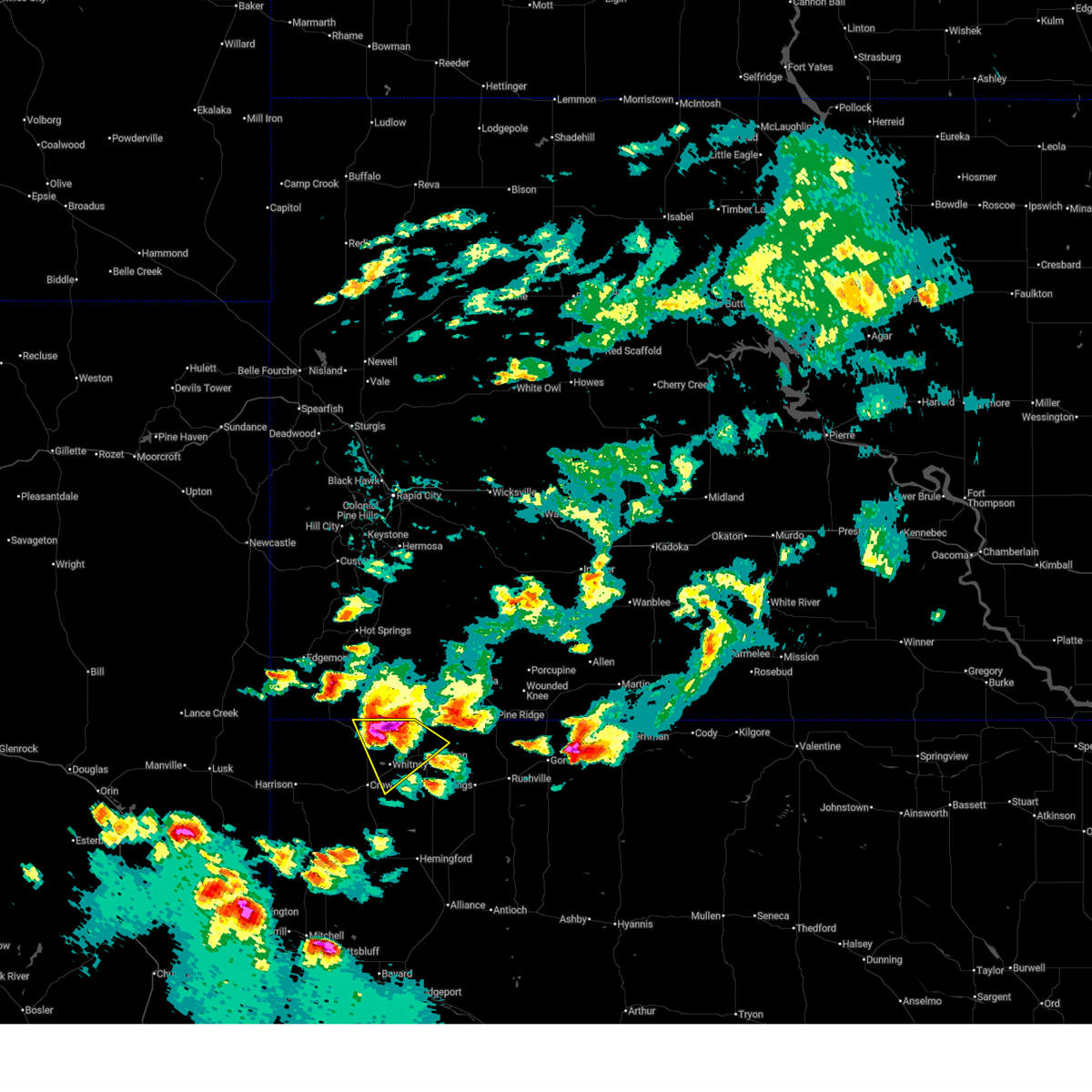
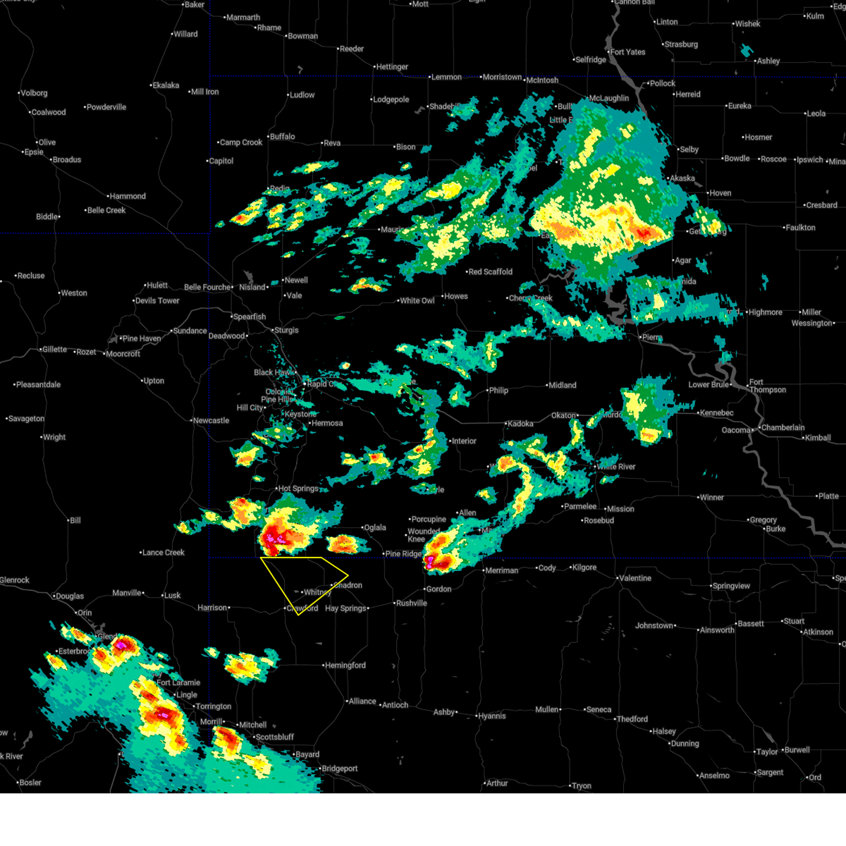
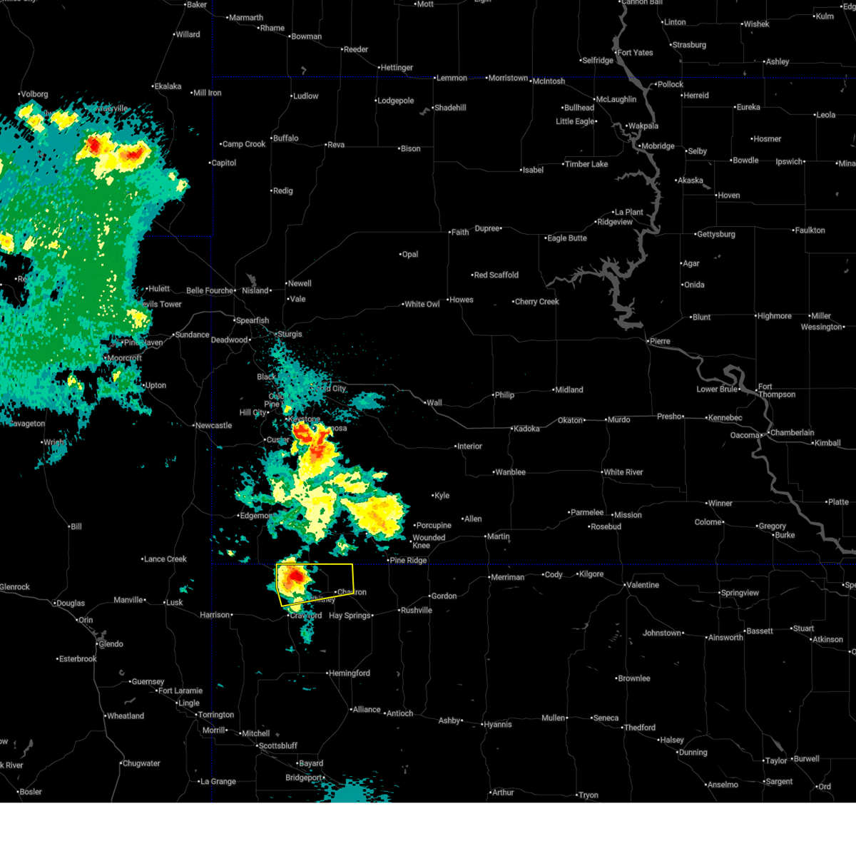
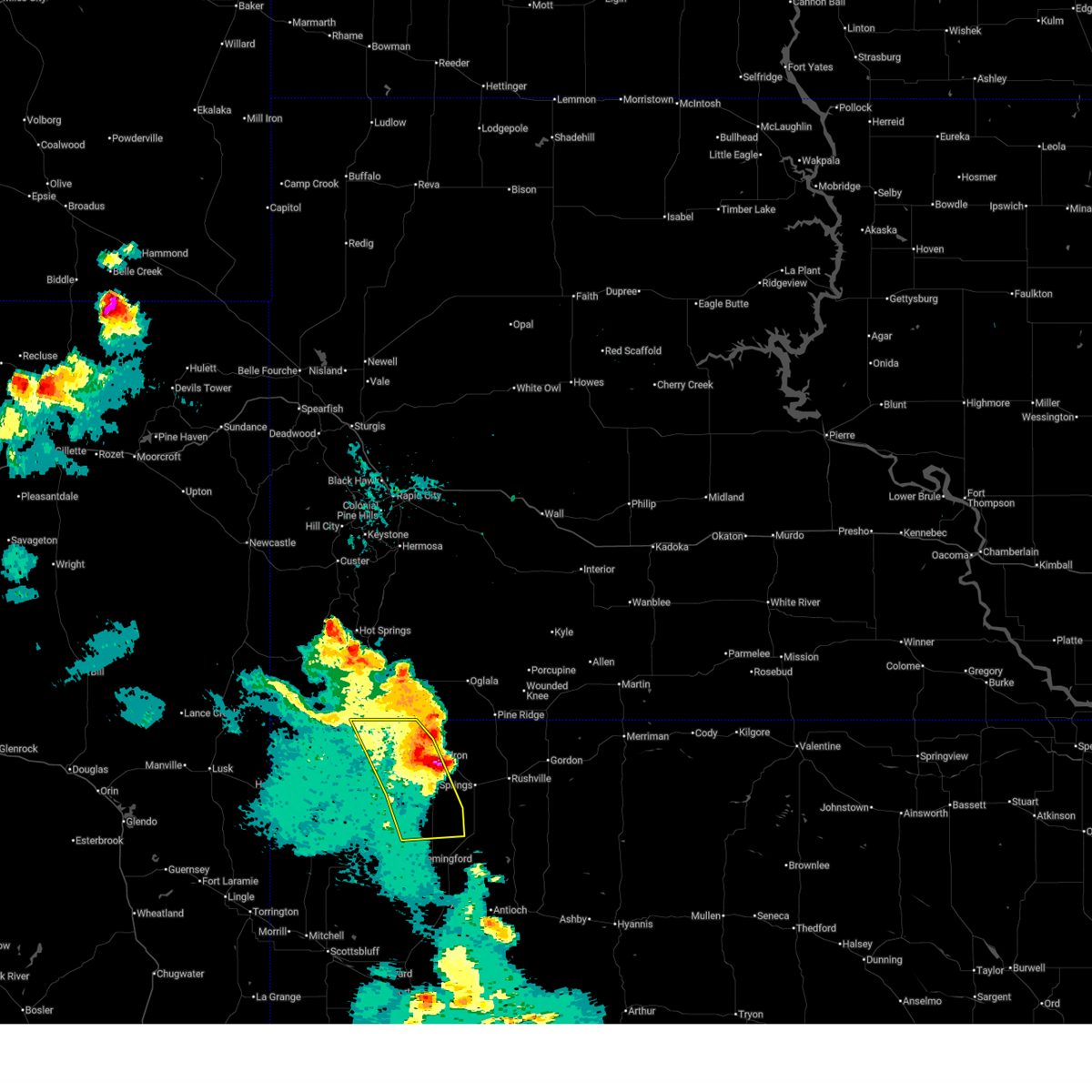
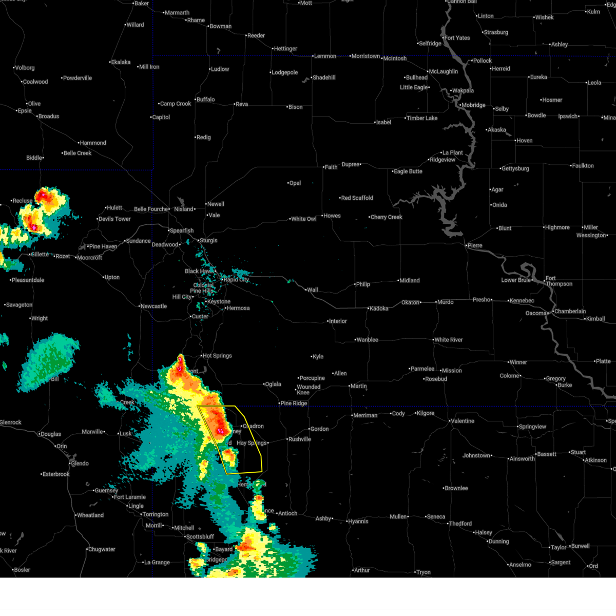
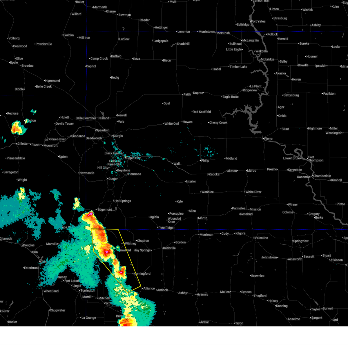
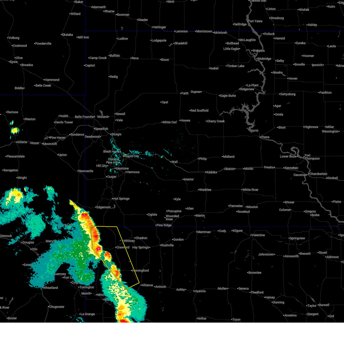
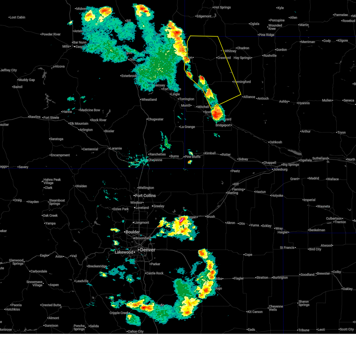
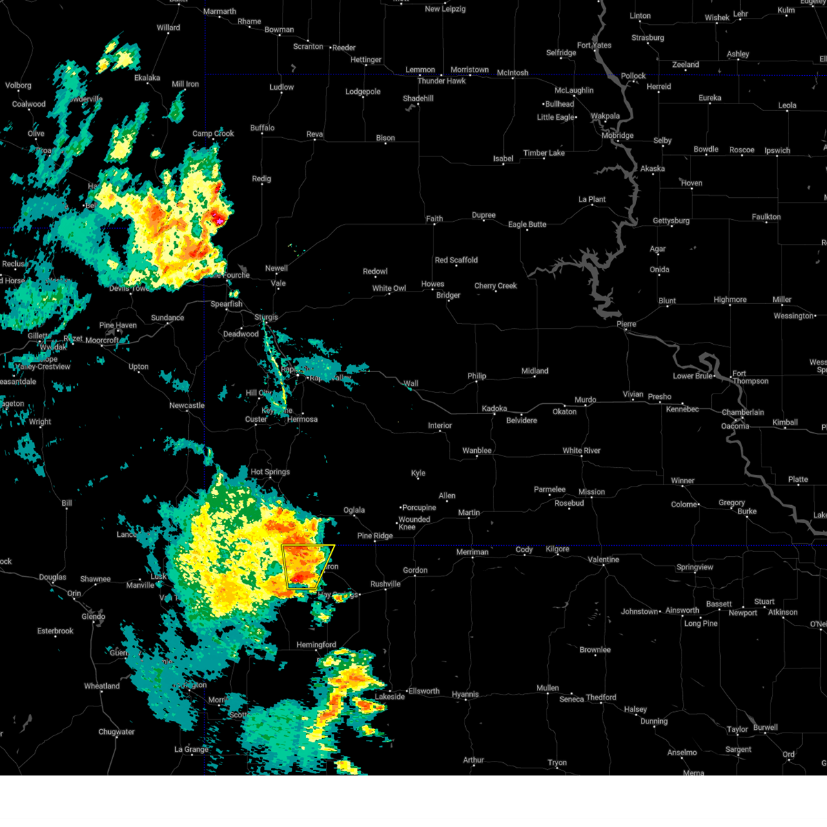
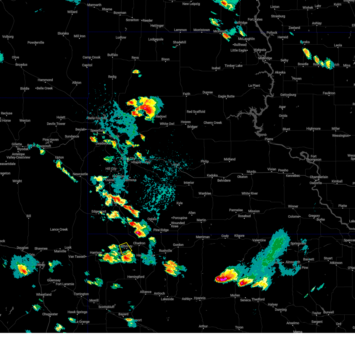
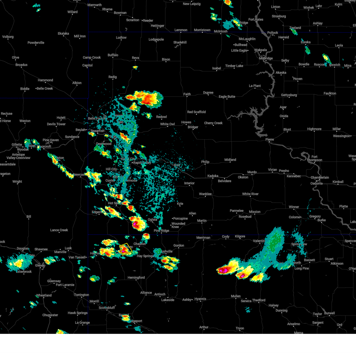
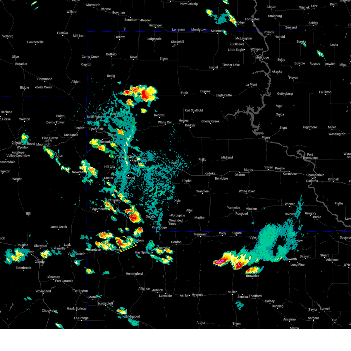
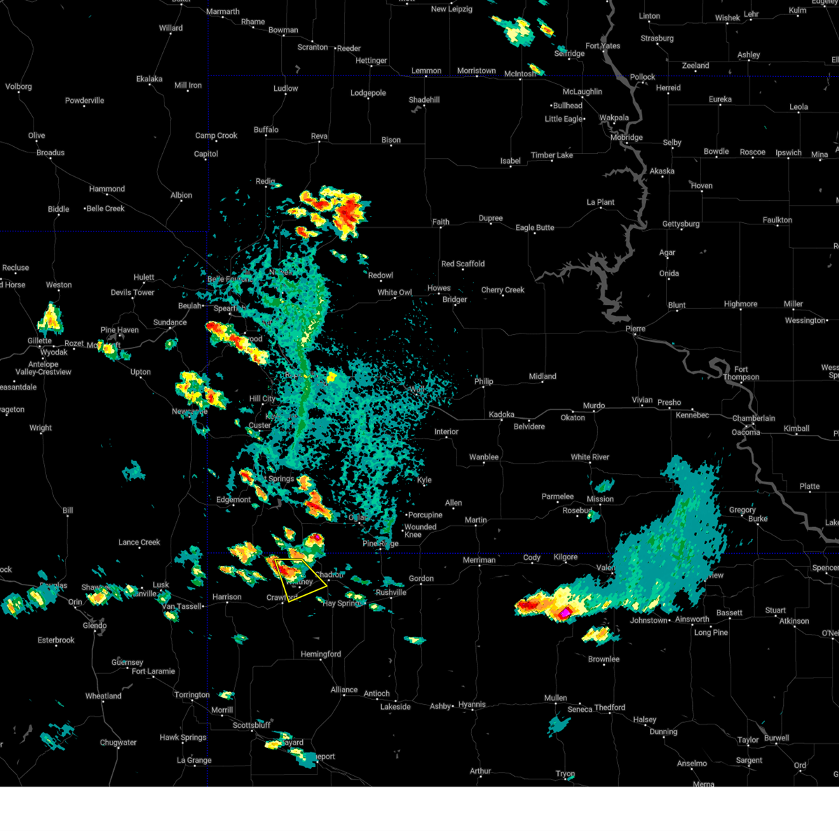
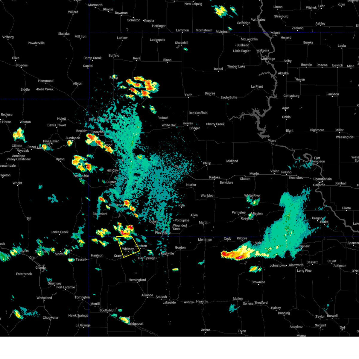
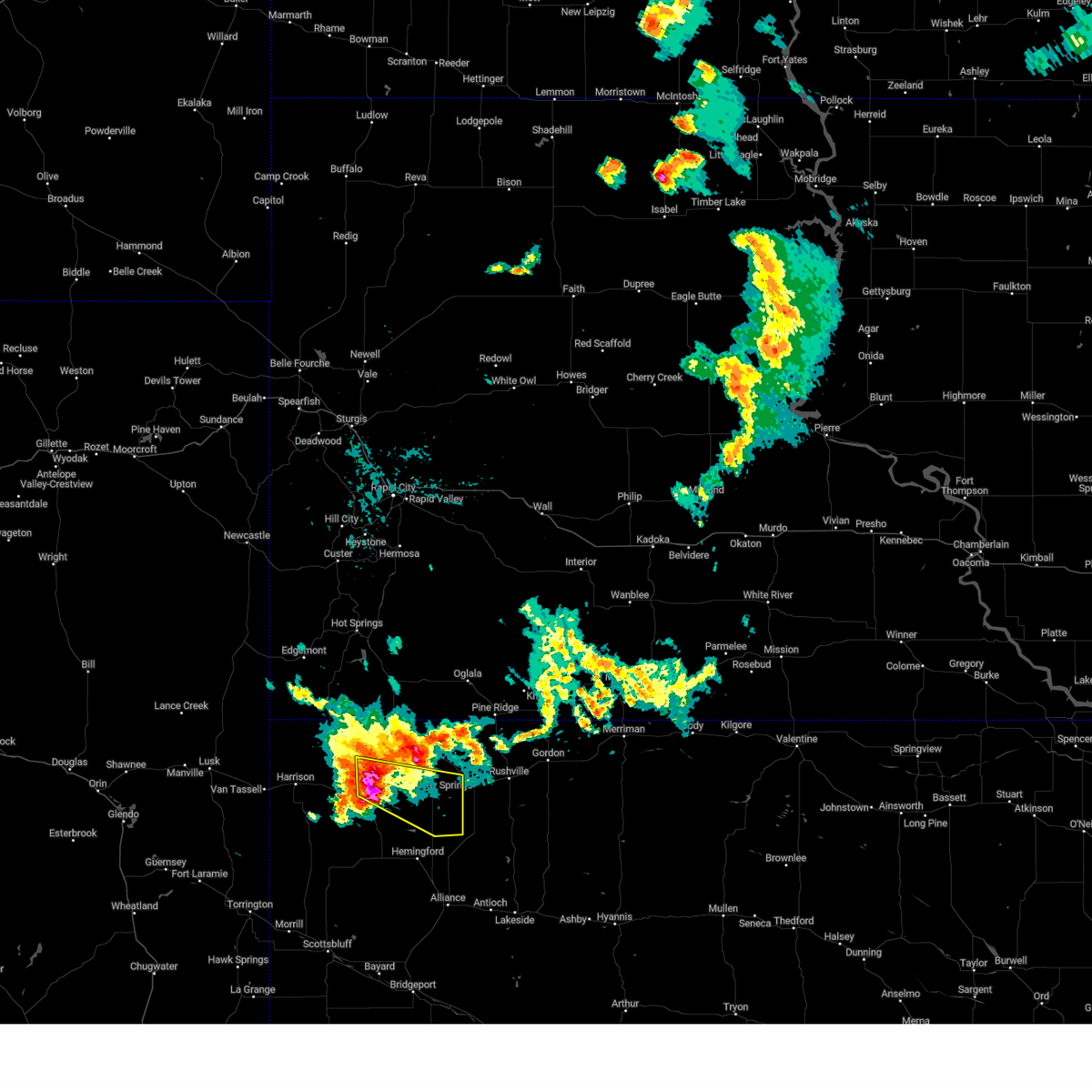
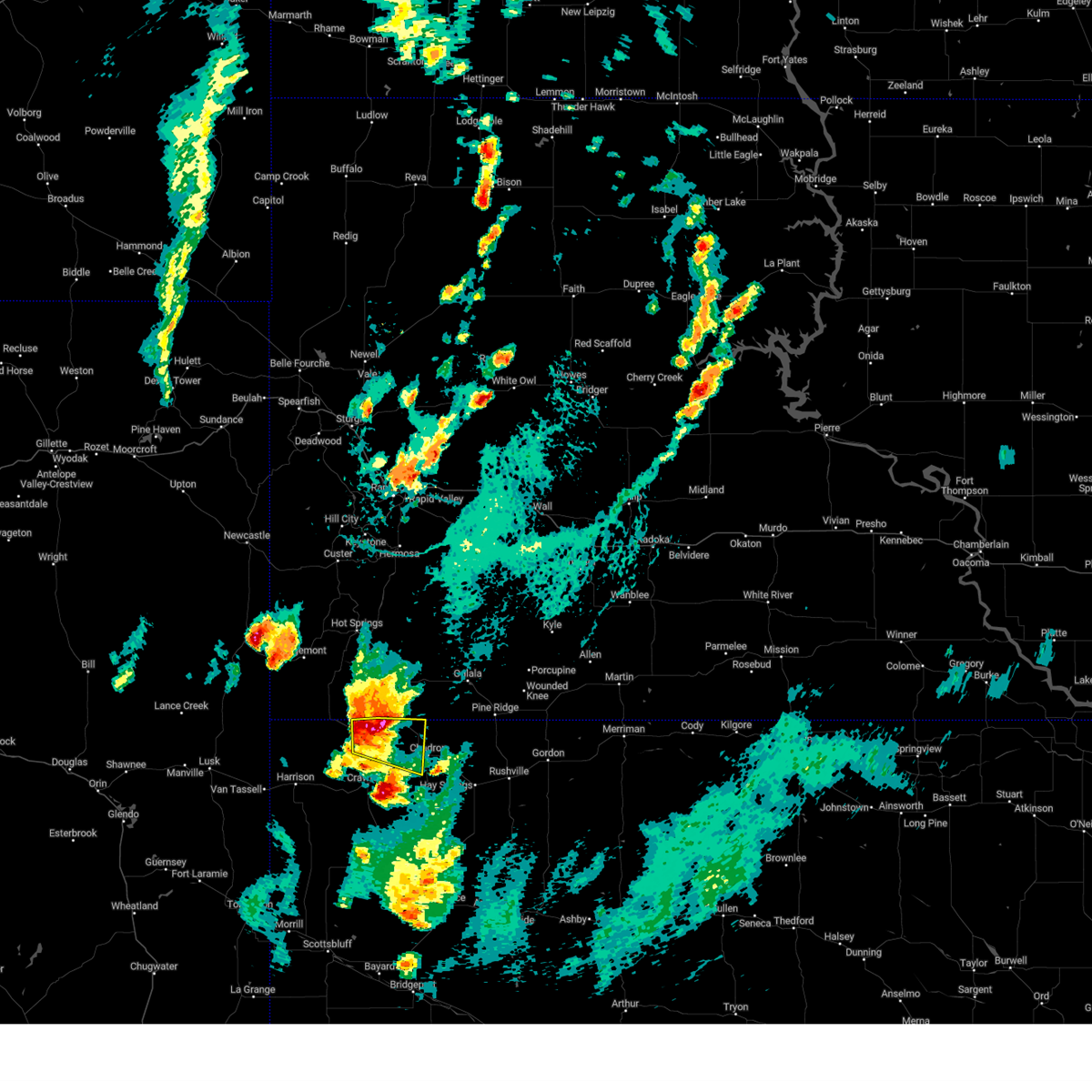
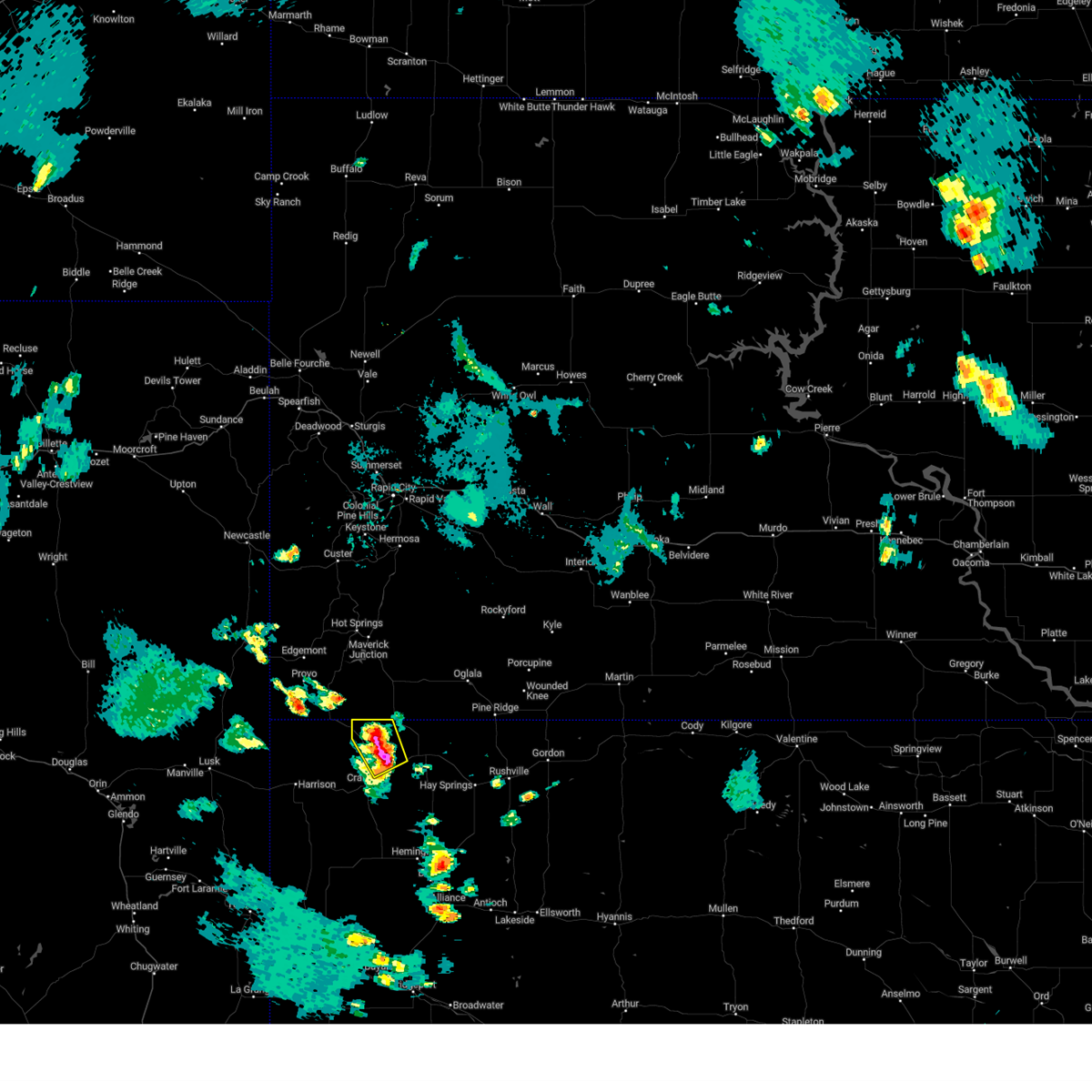
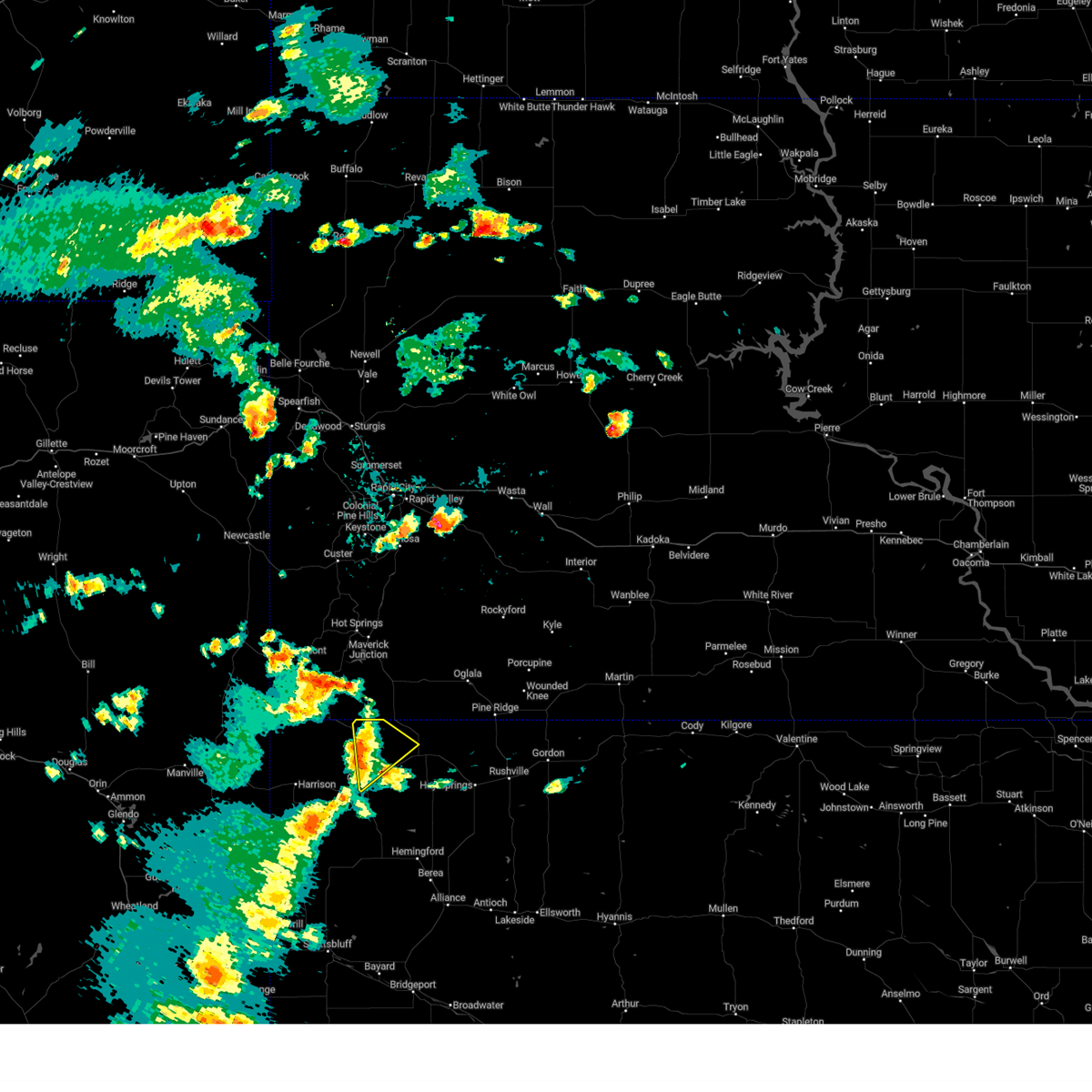
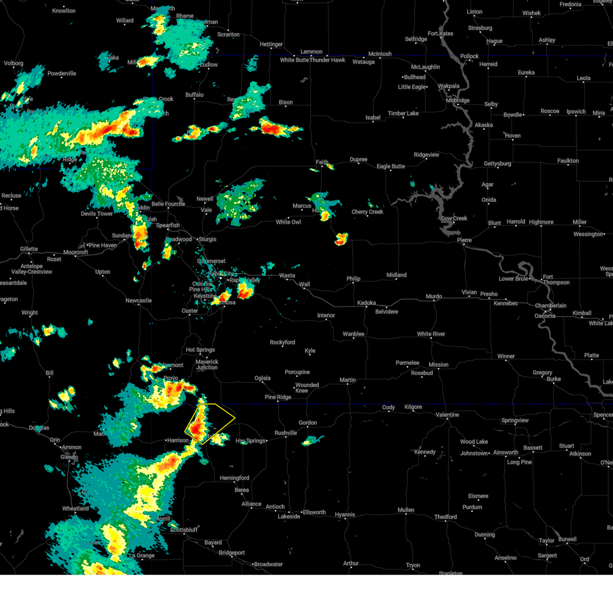
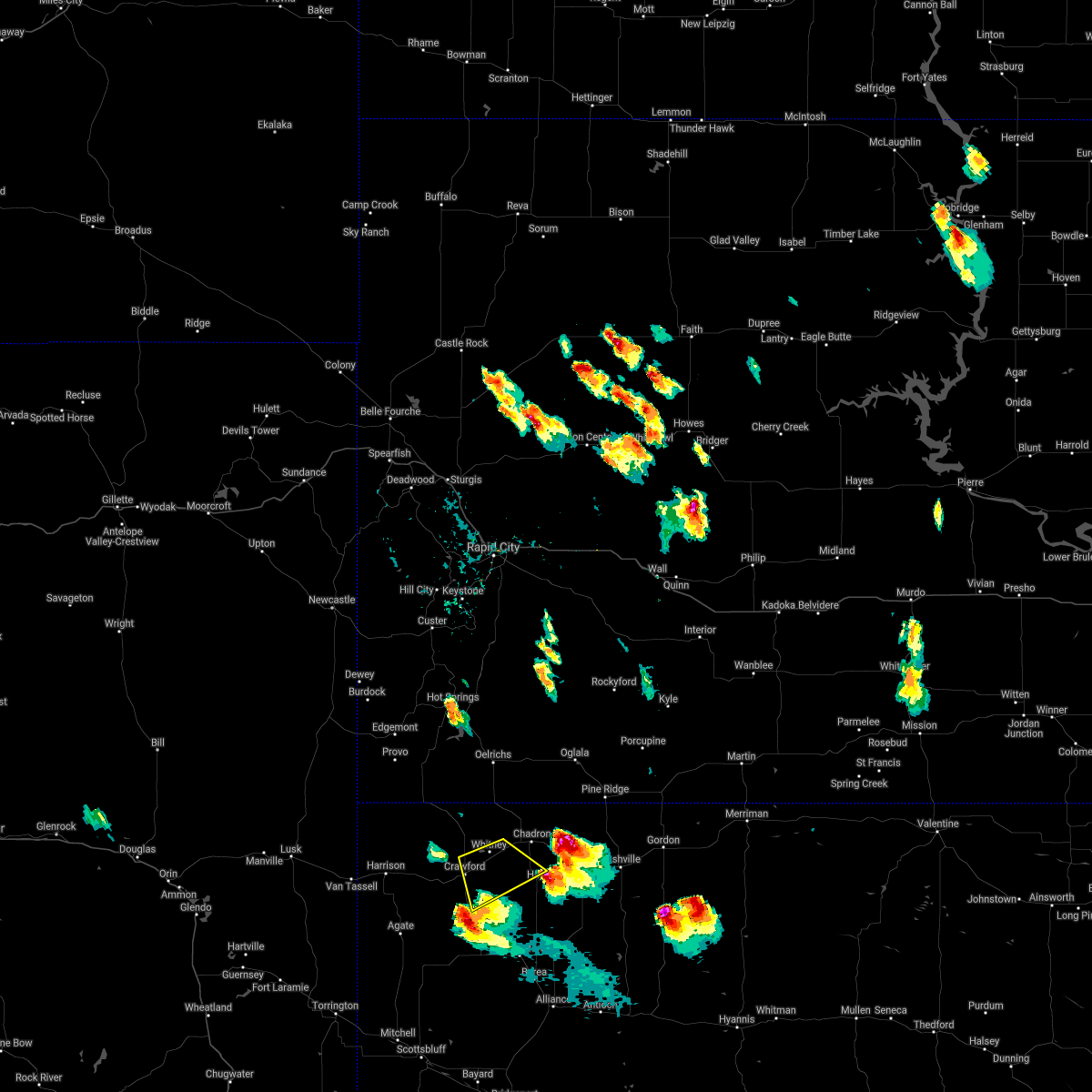
Hail Map for Whitney, NE
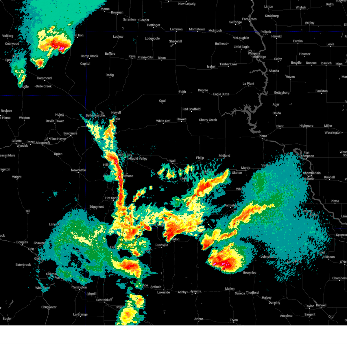
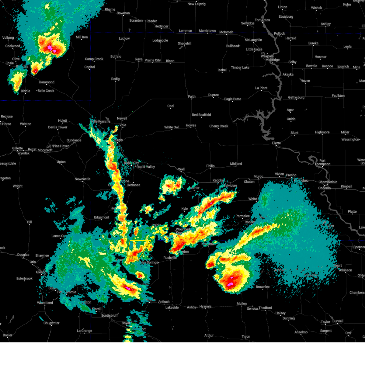
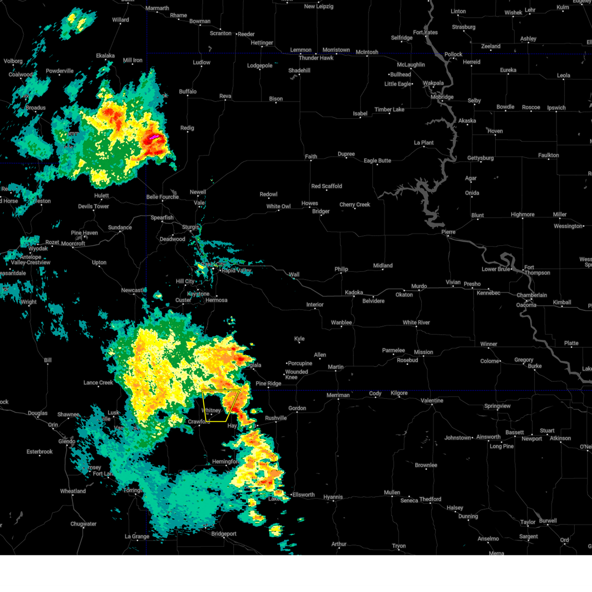
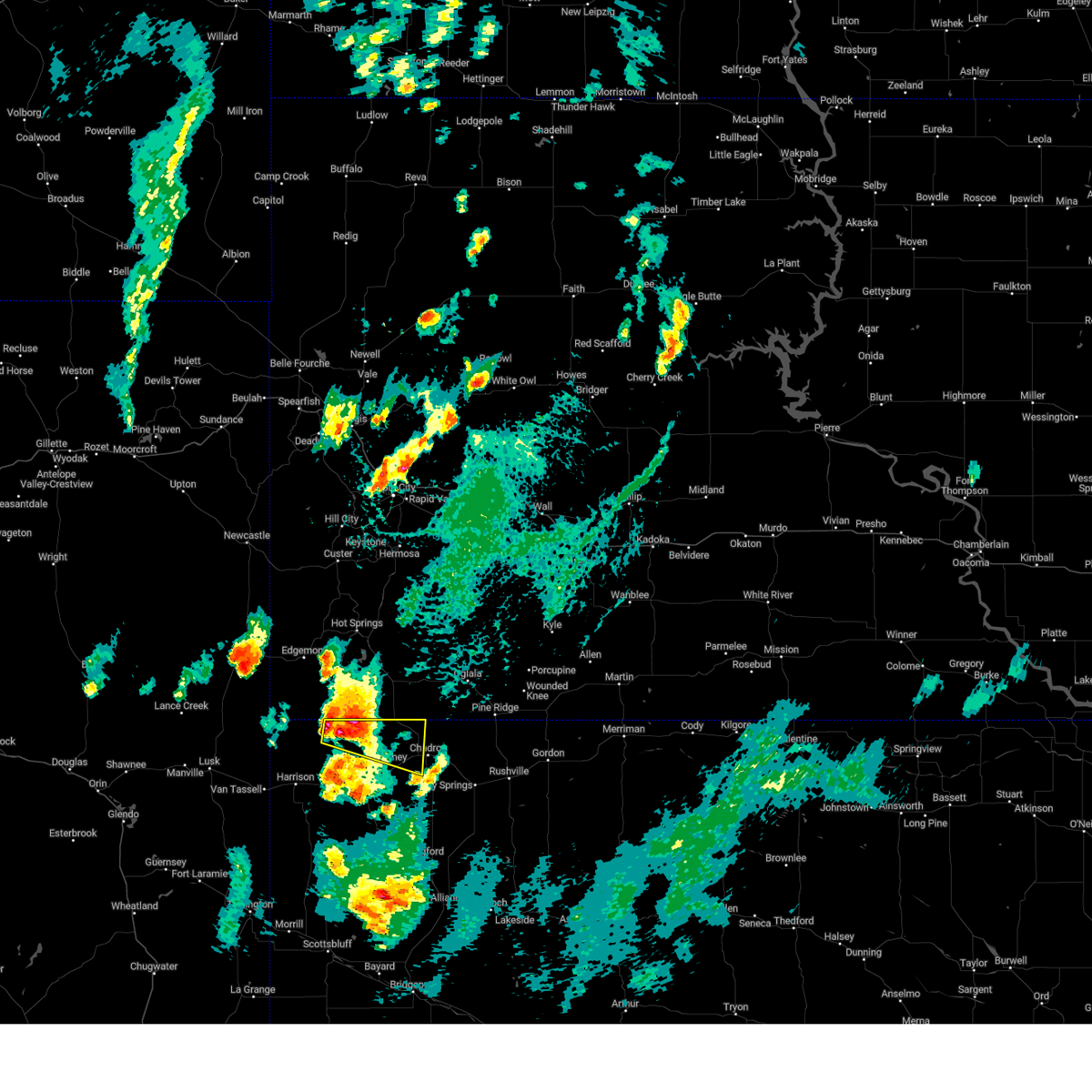
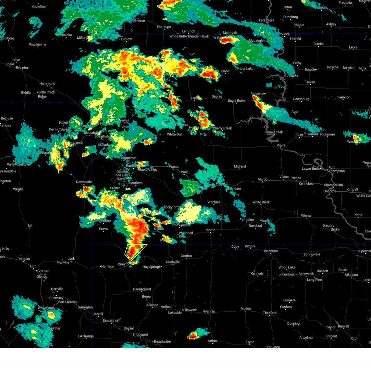
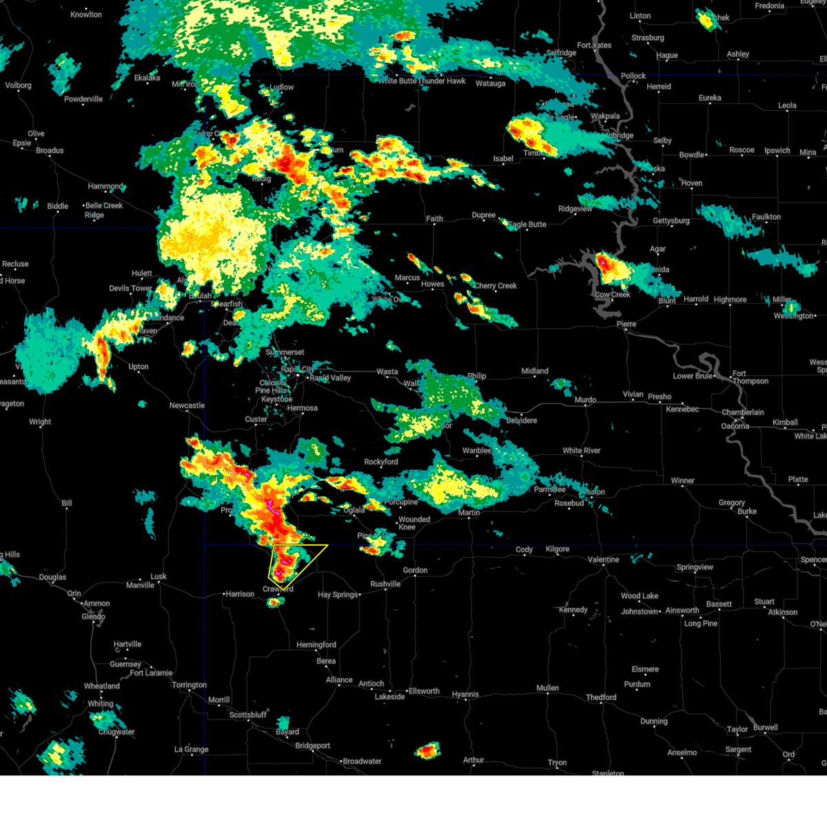
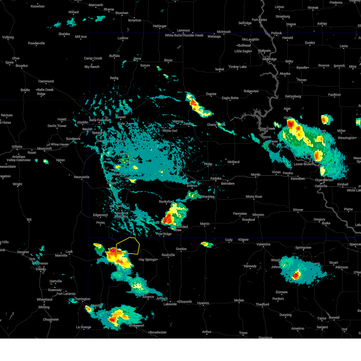
The Whitney, NE area has had 11 reports of on-the-ground hail by trained spotters, and has been under severe weather warnings 26 times during the past 12 months. Doppler radar has detected hail at or near Whitney, NE on 78 occasions, including 7 occasions during the past year.
| Name: | Whitney, NE |
| Where Located: | 67 miles NNE of Scottsbluff, NE |
| Map: | Google Map for Whitney, NE |
| Population: | 77 |
| Housing Units: | 39 |
| More Info: | Search Google for Whitney, NE |
2
The Top Recent Hail Date for Whitney, NE is Friday, June 13, 2025 (24th out of 78)
Hail and Wind Damage Spotted near Whitney, NE
| Date / Time | Report Details |
|---|---|
| 6/29/2025 7:05 PM MDT |
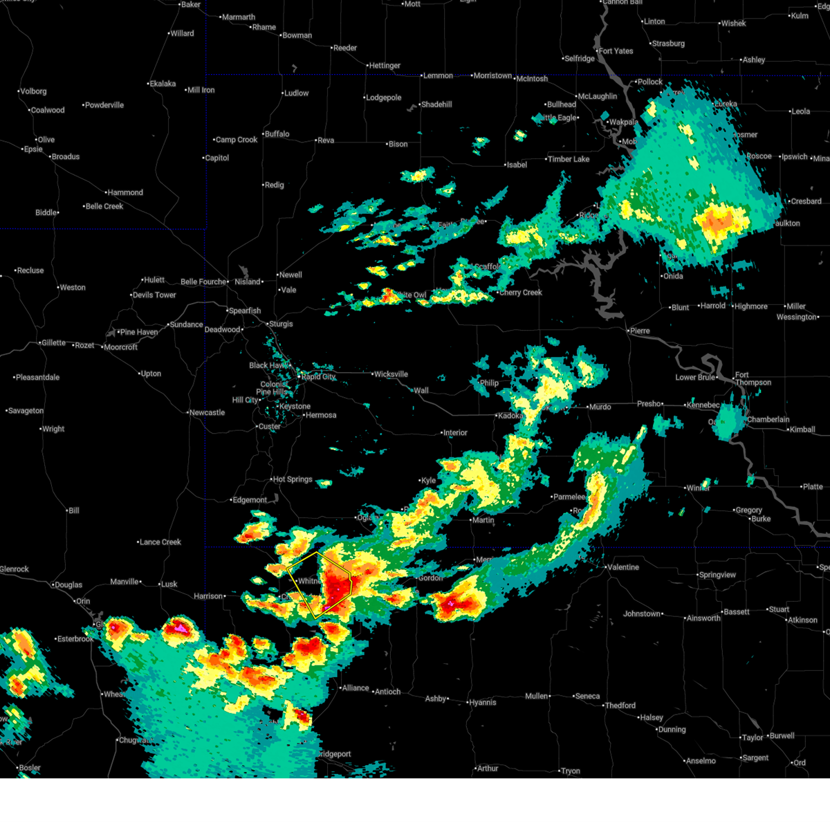 The storm which prompted the warning has moved out of the area. therefore, the warning will be allowed to expire. a severe thunderstorm watch remains in effect until 900 pm mdt for the panhandle of nebraska. The storm which prompted the warning has moved out of the area. therefore, the warning will be allowed to expire. a severe thunderstorm watch remains in effect until 900 pm mdt for the panhandle of nebraska.
|
| 6/29/2025 6:58 PM MDT |
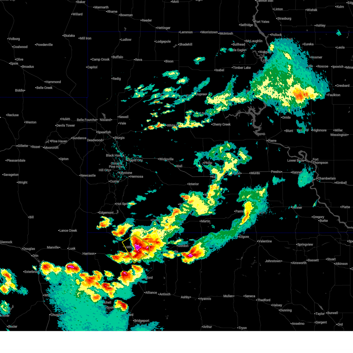 At 658 pm mdt, a severe thunderstorm was located over chadron state park, or near chadron, moving southeast at 30 mph (trained weather spotters). Hazards include ping pong ball size hail and 60 mph wind gusts. People and animals outdoors will be injured. expect hail damage to roofs, siding, windows, and vehicles. expect wind damage to roofs, siding, and trees. Locations impacted include, chadron, whitney, chadron municipal airport, roberts trailhead campground, chadron state park, red cloud campground, dawes county fairgrounds, and chadron state park campground. At 658 pm mdt, a severe thunderstorm was located over chadron state park, or near chadron, moving southeast at 30 mph (trained weather spotters). Hazards include ping pong ball size hail and 60 mph wind gusts. People and animals outdoors will be injured. expect hail damage to roofs, siding, windows, and vehicles. expect wind damage to roofs, siding, and trees. Locations impacted include, chadron, whitney, chadron municipal airport, roberts trailhead campground, chadron state park, red cloud campground, dawes county fairgrounds, and chadron state park campground.
|
| 6/29/2025 6:49 PM MDT |
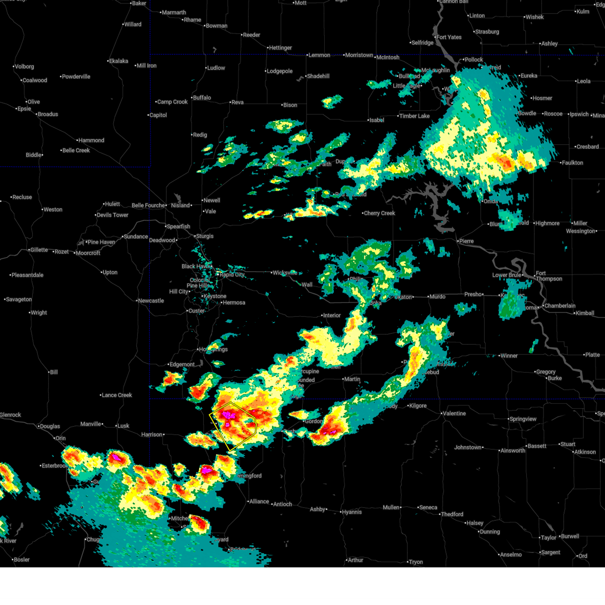 At 649 pm mdt, a severe thunderstorm was located near chadron, moving southeast at 40 mph (radar indicated). Hazards include golf ball size hail and 60 mph wind gusts. People and animals outdoors will be injured. expect hail damage to roofs, siding, windows, and vehicles. expect wind damage to roofs, siding, and trees. Locations impacted include, chadron, whitney, chadron municipal airport, roberts trailhead campground, chadron state park, red cloud campground, dawes county fairgrounds, and chadron state park campground. At 649 pm mdt, a severe thunderstorm was located near chadron, moving southeast at 40 mph (radar indicated). Hazards include golf ball size hail and 60 mph wind gusts. People and animals outdoors will be injured. expect hail damage to roofs, siding, windows, and vehicles. expect wind damage to roofs, siding, and trees. Locations impacted include, chadron, whitney, chadron municipal airport, roberts trailhead campground, chadron state park, red cloud campground, dawes county fairgrounds, and chadron state park campground.
|
| 6/29/2025 6:37 PM MDT |
 The storm which prompted the warning has moved out of the area. therefore, the warning will be allowed to expire. a severe thunderstorm watch remains in effect until 900 pm mdt for the panhandle of nebraska. a severe thunderstorm warning still remains in effect for dawes county until 7:15 pm. The storm which prompted the warning has moved out of the area. therefore, the warning will be allowed to expire. a severe thunderstorm watch remains in effect until 900 pm mdt for the panhandle of nebraska. a severe thunderstorm warning still remains in effect for dawes county until 7:15 pm.
|
| 6/29/2025 6:36 PM MDT |
 Svrcys the national weather service in cheyenne has issued a * severe thunderstorm warning for, central dawes county in the panhandle of nebraska, * until 715 pm mdt. * at 635 pm mdt, a severe thunderstorm was located near chadron municipal airport, or 11 miles west of chadron, moving southeast at 30 mph (radar indicated). Hazards include two inch hail and 60 mph wind gusts. People and animals outdoors will be injured. expect hail damage to roofs, siding, windows, and vehicles. Expect wind damage to roofs, siding, and trees. Svrcys the national weather service in cheyenne has issued a * severe thunderstorm warning for, central dawes county in the panhandle of nebraska, * until 715 pm mdt. * at 635 pm mdt, a severe thunderstorm was located near chadron municipal airport, or 11 miles west of chadron, moving southeast at 30 mph (radar indicated). Hazards include two inch hail and 60 mph wind gusts. People and animals outdoors will be injured. expect hail damage to roofs, siding, windows, and vehicles. Expect wind damage to roofs, siding, and trees.
|
| 6/29/2025 6:31 PM MDT |
 At 630 pm mdt, a severe thunderstorm was located 9 miles northwest of chadron municipal airport, or 13 miles northwest of chadron, moving southeast at 35 mph (radar indicated). Hazards include golf ball size hail and 60 mph wind gusts. People and animals outdoors will be injured. expect hail damage to roofs, siding, windows, and vehicles. expect wind damage to roofs, siding, and trees. Locations impacted include, chadron, whitney, whitney lake, chadron municipal airport, and dawes county fairgrounds. At 630 pm mdt, a severe thunderstorm was located 9 miles northwest of chadron municipal airport, or 13 miles northwest of chadron, moving southeast at 35 mph (radar indicated). Hazards include golf ball size hail and 60 mph wind gusts. People and animals outdoors will be injured. expect hail damage to roofs, siding, windows, and vehicles. expect wind damage to roofs, siding, and trees. Locations impacted include, chadron, whitney, whitney lake, chadron municipal airport, and dawes county fairgrounds.
|
| 6/29/2025 6:24 PM MDT | the severe thunderstorm warning has been cancelled and is no longer in effect |
| 6/29/2025 6:24 PM MDT | At 623 pm mdt, a severe thunderstorm was located 12 miles north of whitney lake, or 19 miles northwest of chadron, moving southeast at 30 mph (radar indicated). Hazards include 60 mph wind gusts and half dollar size hail. Hail damage to vehicles is expected. expect wind damage to roofs, siding, and trees. Locations impacted include, chadron, whitney, whitney lake, chadron municipal airport, and dawes county fairgrounds. |
| 6/29/2025 6:05 PM MDT |
 Svrcys the national weather service in cheyenne has issued a * severe thunderstorm warning for, northern dawes county in the panhandle of nebraska, northern sioux county in the panhandle of nebraska, * until 645 pm mdt. * at 605 pm mdt, a severe thunderstorm was located 10 miles east of ardmore, or 24 miles southeast of edgemont, moving southeast at 30 mph (radar indicated). Hazards include 60 mph wind gusts and quarter size hail. Hail damage to vehicles is expected. Expect wind damage to roofs, siding, and trees. Svrcys the national weather service in cheyenne has issued a * severe thunderstorm warning for, northern dawes county in the panhandle of nebraska, northern sioux county in the panhandle of nebraska, * until 645 pm mdt. * at 605 pm mdt, a severe thunderstorm was located 10 miles east of ardmore, or 24 miles southeast of edgemont, moving southeast at 30 mph (radar indicated). Hazards include 60 mph wind gusts and quarter size hail. Hail damage to vehicles is expected. Expect wind damage to roofs, siding, and trees.
|
| 6/14/2025 10:11 PM MDT |
 Svrcys the national weather service in cheyenne has issued a * severe thunderstorm warning for, northern dawes county in the panhandle of nebraska, * until 1045 pm mdt. * at 1010 pm mdt, a severe thunderstorm was located 10 miles north of whitney lake, or 16 miles northwest of chadron, moving east at 30 mph (radar indicated). Hazards include 60 mph wind gusts and quarter size hail. Hail damage to vehicles is expected. Expect wind damage to roofs, siding, and trees. Svrcys the national weather service in cheyenne has issued a * severe thunderstorm warning for, northern dawes county in the panhandle of nebraska, * until 1045 pm mdt. * at 1010 pm mdt, a severe thunderstorm was located 10 miles north of whitney lake, or 16 miles northwest of chadron, moving east at 30 mph (radar indicated). Hazards include 60 mph wind gusts and quarter size hail. Hail damage to vehicles is expected. Expect wind damage to roofs, siding, and trees.
|
| 6/13/2025 7:17 PM MDT |
 The storms which prompted the warning have moved out of the area. therefore, the warning has been allowed to expire. however, gusty winds and heavy rain are still possible with these thunderstorms. a severe thunderstorm watch remains in effect until 1000 pm mdt for the panhandle of nebraska. The storms which prompted the warning have moved out of the area. therefore, the warning has been allowed to expire. however, gusty winds and heavy rain are still possible with these thunderstorms. a severe thunderstorm watch remains in effect until 1000 pm mdt for the panhandle of nebraska.
|
| 6/13/2025 6:52 PM MDT |
 At 651 pm mdt, severe thunderstorms were located along a line extending from 9 miles northeast of ardmore to box butte reservoir, moving east at 20 mph (radar indicated). Hazards include 60 mph wind gusts and quarter size hail. Hail damage to vehicles is expected. expect wind damage to roofs, siding, and trees. Locations impacted include, chadron, whitney, chadron municipal airport, roberts trailhead campground, chadron state park, box butte campground, whitney lake, red cloud campground, box butte reservoir, dawes county fairgrounds, chadron state park campground, and box butte dam. At 651 pm mdt, severe thunderstorms were located along a line extending from 9 miles northeast of ardmore to box butte reservoir, moving east at 20 mph (radar indicated). Hazards include 60 mph wind gusts and quarter size hail. Hail damage to vehicles is expected. expect wind damage to roofs, siding, and trees. Locations impacted include, chadron, whitney, chadron municipal airport, roberts trailhead campground, chadron state park, box butte campground, whitney lake, red cloud campground, box butte reservoir, dawes county fairgrounds, chadron state park campground, and box butte dam.
|
| 6/13/2025 6:14 PM MDT |
 A new severe thunderstorm warning has been issued for eastern sioux, northern box butte, and much of dawes counties until 715 pm. a severe thunderstorm watch remains in effect until 1000 pm mdt for the panhandle of nebraska. A new severe thunderstorm warning has been issued for eastern sioux, northern box butte, and much of dawes counties until 715 pm. a severe thunderstorm watch remains in effect until 1000 pm mdt for the panhandle of nebraska.
|
| 6/13/2025 6:12 PM MDT |
 Svrcys the national weather service in cheyenne has issued a * severe thunderstorm warning for, northern box butte county in the panhandle of nebraska, dawes county in the panhandle of nebraska, northeastern sioux county in the panhandle of nebraska, * until 715 pm mdt. * at 612 pm mdt, severe thunderstorms were located along a line extending from near ardmore to 8 miles east of flahertys corner, moving northeast at 20 mph (radar indicated). Hazards include 60 mph wind gusts and quarter size hail. Hail damage to vehicles is expected. Expect wind damage to roofs, siding, and trees. Svrcys the national weather service in cheyenne has issued a * severe thunderstorm warning for, northern box butte county in the panhandle of nebraska, dawes county in the panhandle of nebraska, northeastern sioux county in the panhandle of nebraska, * until 715 pm mdt. * at 612 pm mdt, severe thunderstorms were located along a line extending from near ardmore to 8 miles east of flahertys corner, moving northeast at 20 mph (radar indicated). Hazards include 60 mph wind gusts and quarter size hail. Hail damage to vehicles is expected. Expect wind damage to roofs, siding, and trees.
|
| 6/13/2025 5:54 PM MDT |
 At 553 pm mdt, severe thunderstorms were located along a line extending from near montrose to near crawford to near box butte county fairgrounds, moving east at 35 mph (radar indicated). Hazards include 60 mph wind gusts and quarter size hail. Hail damage to vehicles is expected. expect wind damage to roofs, siding, and trees. Locations impacted include, crawford, hemingford, harrison, whitney lake, soldier creek campground, box butte reservoir, montrose, fort robinson state park, box butte county fairgrounds, berea, flahertys corner, marsland, belmont, and toadstool geological park and campground. At 553 pm mdt, severe thunderstorms were located along a line extending from near montrose to near crawford to near box butte county fairgrounds, moving east at 35 mph (radar indicated). Hazards include 60 mph wind gusts and quarter size hail. Hail damage to vehicles is expected. expect wind damage to roofs, siding, and trees. Locations impacted include, crawford, hemingford, harrison, whitney lake, soldier creek campground, box butte reservoir, montrose, fort robinson state park, box butte county fairgrounds, berea, flahertys corner, marsland, belmont, and toadstool geological park and campground.
|
| 6/13/2025 5:54 PM MDT |
 the severe thunderstorm warning has been cancelled and is no longer in effect the severe thunderstorm warning has been cancelled and is no longer in effect
|
| 6/13/2025 5:16 PM MDT |
 Svrcys the national weather service in cheyenne has issued a * severe thunderstorm warning for, western box butte county in the panhandle of nebraska, northeastern scotts bluff county in the panhandle of nebraska, northwestern morrill county in the panhandle of nebraska, western dawes county in the panhandle of nebraska, sioux county in the panhandle of nebraska, * until 615 pm mdt. * at 516 pm mdt, severe thunderstorms were located along a line extending from near van tassell to 7 miles east of agate fossil beds national monument to 6 miles west of kilpatrick lake, moving northeast at 35 mph (radar indicated). Hazards include 60 mph wind gusts and quarter size hail. Hail damage to vehicles is expected. Expect wind damage to roofs, siding, and trees. Svrcys the national weather service in cheyenne has issued a * severe thunderstorm warning for, western box butte county in the panhandle of nebraska, northeastern scotts bluff county in the panhandle of nebraska, northwestern morrill county in the panhandle of nebraska, western dawes county in the panhandle of nebraska, sioux county in the panhandle of nebraska, * until 615 pm mdt. * at 516 pm mdt, severe thunderstorms were located along a line extending from near van tassell to 7 miles east of agate fossil beds national monument to 6 miles west of kilpatrick lake, moving northeast at 35 mph (radar indicated). Hazards include 60 mph wind gusts and quarter size hail. Hail damage to vehicles is expected. Expect wind damage to roofs, siding, and trees.
|
| 4/27/2025 8:55 PM MDT |
 The storm which prompted the warning has weakened below severe limits, and has exited the warned area. therefore, the warning will be allowed to expire. however, heavy rain is still possible with this thunderstorm. a tornado watch remains in effect until 1100 pm mdt for the panhandle of nebraska. The storm which prompted the warning has weakened below severe limits, and has exited the warned area. therefore, the warning will be allowed to expire. however, heavy rain is still possible with this thunderstorm. a tornado watch remains in effect until 1100 pm mdt for the panhandle of nebraska.
|
| 4/27/2025 8:33 PM MDT |
 Svrcys the national weather service in cheyenne has issued a * severe thunderstorm warning for, north central dawes county in the panhandle of nebraska, * until 900 pm mdt. * at 833 pm mdt, a severe thunderstorm was located near chadron municipal airport, or 8 miles west of chadron, moving northeast at 40 mph (radar indicated). Hazards include 60 mph wind gusts and quarter size hail. Hail damage to vehicles is expected. Expect wind damage to roofs, siding, and trees. Svrcys the national weather service in cheyenne has issued a * severe thunderstorm warning for, north central dawes county in the panhandle of nebraska, * until 900 pm mdt. * at 833 pm mdt, a severe thunderstorm was located near chadron municipal airport, or 8 miles west of chadron, moving northeast at 40 mph (radar indicated). Hazards include 60 mph wind gusts and quarter size hail. Hail damage to vehicles is expected. Expect wind damage to roofs, siding, and trees.
|
| 9/17/2024 6:52 PM MDT |
 The storm which prompted the warning has weakened below severe limits, and has exited the warned area. therefore, the warning will be allowed to expire. however, gusty winds and heavy rain are still possible with this thunderstorm. a severe thunderstorm watch remains in effect until 900 pm mdt for the panhandle of nebraska. The storm which prompted the warning has weakened below severe limits, and has exited the warned area. therefore, the warning will be allowed to expire. however, gusty winds and heavy rain are still possible with this thunderstorm. a severe thunderstorm watch remains in effect until 900 pm mdt for the panhandle of nebraska.
|
| 9/17/2024 6:31 PM MDT |
 Svrcys the national weather service in cheyenne has issued a * severe thunderstorm warning for, northwestern dawes county in the panhandle of nebraska, * until 700 pm mdt. * at 630 pm mdt, a severe thunderstorm was located near whitney, or 10 miles west of chadron, moving north at 55 mph (radar indicated). Hazards include 60 mph wind gusts and penny size hail. expect damage to roofs, siding, and trees Svrcys the national weather service in cheyenne has issued a * severe thunderstorm warning for, northwestern dawes county in the panhandle of nebraska, * until 700 pm mdt. * at 630 pm mdt, a severe thunderstorm was located near whitney, or 10 miles west of chadron, moving north at 55 mph (radar indicated). Hazards include 60 mph wind gusts and penny size hail. expect damage to roofs, siding, and trees
|
| 7/19/2024 4:30 PM MDT |
 the severe thunderstorm warning has been cancelled and is no longer in effect the severe thunderstorm warning has been cancelled and is no longer in effect
|
| 7/19/2024 4:15 PM MDT |
 At 414 pm mdt, a severe thunderstorm was located over whitney lake, or 17 miles west of chadron, moving south at 25 mph (radar indicated). Hazards include 60 mph wind gusts and quarter size hail. Hail damage to vehicles is expected. expect wind damage to roofs, siding, and trees. Locations impacted include, whitney and whitney lake. At 414 pm mdt, a severe thunderstorm was located over whitney lake, or 17 miles west of chadron, moving south at 25 mph (radar indicated). Hazards include 60 mph wind gusts and quarter size hail. Hail damage to vehicles is expected. expect wind damage to roofs, siding, and trees. Locations impacted include, whitney and whitney lake.
|
| 7/19/2024 4:03 PM MDT |
 At 403 pm mdt, a severe thunderstorm was located near whitney lake, or 18 miles west of chadron, moving south at 25 mph (radar indicated). Hazards include 60 mph wind gusts and quarter size hail. Hail damage to vehicles is expected. expect wind damage to roofs, siding, and trees. Locations impacted include, whitney, whitney lake, and chadron municipal airport. At 403 pm mdt, a severe thunderstorm was located near whitney lake, or 18 miles west of chadron, moving south at 25 mph (radar indicated). Hazards include 60 mph wind gusts and quarter size hail. Hail damage to vehicles is expected. expect wind damage to roofs, siding, and trees. Locations impacted include, whitney, whitney lake, and chadron municipal airport.
|
| 7/19/2024 3:51 PM MDT |
 At 351 pm mdt, a severe thunderstorm was located 9 miles northwest of whitney lake, or 21 miles west of chadron, moving southeast at 20 mph (radar indicated). Hazards include 60 mph wind gusts and quarter size hail. Hail damage to vehicles is expected. expect wind damage to roofs, siding, and trees. Locations impacted include, whitney, whitney lake, and chadron municipal airport. At 351 pm mdt, a severe thunderstorm was located 9 miles northwest of whitney lake, or 21 miles west of chadron, moving southeast at 20 mph (radar indicated). Hazards include 60 mph wind gusts and quarter size hail. Hail damage to vehicles is expected. expect wind damage to roofs, siding, and trees. Locations impacted include, whitney, whitney lake, and chadron municipal airport.
|
| 7/19/2024 3:40 PM MDT |
 Svrcys the national weather service in cheyenne has issued a * severe thunderstorm warning for, northwestern dawes county in the panhandle of nebraska, * until 445 pm mdt. * at 340 pm mdt, a severe thunderstorm was located 11 miles southwest of oelrichs, or 25 miles northwest of chadron, moving south at 25 mph (radar indicated). Hazards include 60 mph wind gusts and quarter size hail. Hail damage to vehicles is expected. Expect wind damage to roofs, siding, and trees. Svrcys the national weather service in cheyenne has issued a * severe thunderstorm warning for, northwestern dawes county in the panhandle of nebraska, * until 445 pm mdt. * at 340 pm mdt, a severe thunderstorm was located 11 miles southwest of oelrichs, or 25 miles northwest of chadron, moving south at 25 mph (radar indicated). Hazards include 60 mph wind gusts and quarter size hail. Hail damage to vehicles is expected. Expect wind damage to roofs, siding, and trees.
|
| 7/12/2024 11:31 PM MDT |
 the severe thunderstorm warning has been cancelled and is no longer in effect the severe thunderstorm warning has been cancelled and is no longer in effect
|
| 7/12/2024 11:31 PM MDT |
 At 1130 pm mdt, a severe thunderstorm was located over whitney lake, or 15 miles west of chadron, moving east at 35 mph. this is a destructive storm for crawford and fort robinson state park (radar indicated). Hazards include baseball size hail and 60 mph wind gusts. People and animals outdoors will be severely injured. expect shattered windows, extensive damage to roofs, siding, and vehicles. Locations impacted include, crawford, whitney, roberts trailhead campground, chadron state park, whitney lake, soldier creek campground, red cloud campground, fort robinson state park, and chadron state park campground. At 1130 pm mdt, a severe thunderstorm was located over whitney lake, or 15 miles west of chadron, moving east at 35 mph. this is a destructive storm for crawford and fort robinson state park (radar indicated). Hazards include baseball size hail and 60 mph wind gusts. People and animals outdoors will be severely injured. expect shattered windows, extensive damage to roofs, siding, and vehicles. Locations impacted include, crawford, whitney, roberts trailhead campground, chadron state park, whitney lake, soldier creek campground, red cloud campground, fort robinson state park, and chadron state park campground.
|
| 7/12/2024 11:12 PM MDT |
 Svrcys the national weather service in cheyenne has issued a * severe thunderstorm warning for, north central box butte county in the panhandle of nebraska, dawes county in the panhandle of nebraska, northeastern sioux county in the panhandle of nebraska, * until 1230 am mdt. * at 1111 pm mdt, a severe thunderstorm was located 11 miles northwest of crawford, or 26 miles west of chadron, moving east at 35 mph (radar indicated). Hazards include golf ball size hail and 60 mph wind gusts. People and animals outdoors will be injured. expect hail damage to roofs, siding, windows, and vehicles. Expect wind damage to roofs, siding, and trees. Svrcys the national weather service in cheyenne has issued a * severe thunderstorm warning for, north central box butte county in the panhandle of nebraska, dawes county in the panhandle of nebraska, northeastern sioux county in the panhandle of nebraska, * until 1230 am mdt. * at 1111 pm mdt, a severe thunderstorm was located 11 miles northwest of crawford, or 26 miles west of chadron, moving east at 35 mph (radar indicated). Hazards include golf ball size hail and 60 mph wind gusts. People and animals outdoors will be injured. expect hail damage to roofs, siding, windows, and vehicles. Expect wind damage to roofs, siding, and trees.
|
| 7/3/2024 8:16 PM MDT |
 At 816 pm mdt, a severe thunderstorm was located near chadron municipal airport, or near chadron, moving east at 40 mph (radar indicated). Hazards include ping pong ball size hail and 60 mph wind gusts. People and animals outdoors will be injured. expect hail damage to roofs, siding, windows, and vehicles. expect wind damage to roofs, siding, and trees. Locations impacted include, chadron, whitney, chadron municipal airport, roberts trailhead campground, chadron state park, red cloud campground, whitney lake, dawes county fairgrounds, and chadron state park campground. At 816 pm mdt, a severe thunderstorm was located near chadron municipal airport, or near chadron, moving east at 40 mph (radar indicated). Hazards include ping pong ball size hail and 60 mph wind gusts. People and animals outdoors will be injured. expect hail damage to roofs, siding, windows, and vehicles. expect wind damage to roofs, siding, and trees. Locations impacted include, chadron, whitney, chadron municipal airport, roberts trailhead campground, chadron state park, red cloud campground, whitney lake, dawes county fairgrounds, and chadron state park campground.
|
| 7/3/2024 8:04 PM MDT | Quarter sized hail reported 7.5 miles ENE of Whitney, NE, relayed from spotter network. |
| 7/3/2024 8:00 PM MDT |
 At 759 pm mdt, a severe thunderstorm was located 9 miles north of whitney lake, or 17 miles northwest of chadron, moving east at 40 mph (radar indicated). Hazards include 60 mph wind gusts and quarter size hail. Hail damage to vehicles is expected. expect wind damage to roofs, siding, and trees. Locations impacted include, chadron, whitney, chadron municipal airport, roberts trailhead campground, chadron state park, whitney lake, red cloud campground, dawes county fairgrounds, and chadron state park campground. At 759 pm mdt, a severe thunderstorm was located 9 miles north of whitney lake, or 17 miles northwest of chadron, moving east at 40 mph (radar indicated). Hazards include 60 mph wind gusts and quarter size hail. Hail damage to vehicles is expected. expect wind damage to roofs, siding, and trees. Locations impacted include, chadron, whitney, chadron municipal airport, roberts trailhead campground, chadron state park, whitney lake, red cloud campground, dawes county fairgrounds, and chadron state park campground.
|
| 7/3/2024 8:00 PM MDT |
 the severe thunderstorm warning has been cancelled and is no longer in effect the severe thunderstorm warning has been cancelled and is no longer in effect
|
| 7/3/2024 7:47 PM MDT |
 Svrcys the national weather service in cheyenne has issued a * severe thunderstorm warning for, dawes county in the panhandle of nebraska, northeastern sioux county in the panhandle of nebraska, * until 845 pm mdt. * at 747 pm mdt, a severe thunderstorm was located 10 miles southeast of ardmore, or 25 miles west of chadron, moving east at 40 mph (radar indicated). Hazards include 60 mph wind gusts and quarter size hail. Hail damage to vehicles is expected. Expect wind damage to roofs, siding, and trees. Svrcys the national weather service in cheyenne has issued a * severe thunderstorm warning for, dawes county in the panhandle of nebraska, northeastern sioux county in the panhandle of nebraska, * until 845 pm mdt. * at 747 pm mdt, a severe thunderstorm was located 10 miles southeast of ardmore, or 25 miles west of chadron, moving east at 40 mph (radar indicated). Hazards include 60 mph wind gusts and quarter size hail. Hail damage to vehicles is expected. Expect wind damage to roofs, siding, and trees.
|
| 7/1/2024 2:29 PM MDT |
 the severe thunderstorm warning has been cancelled and is no longer in effect the severe thunderstorm warning has been cancelled and is no longer in effect
|
| 7/1/2024 2:29 PM MDT |
 At 228 pm mdt, a severe thunderstorm was located 11 miles north of whitney lake, or 16 miles northwest of chadron, moving east at 30 mph (radar indicated). Hazards include 60 mph wind gusts and quarter size hail. Hail damage to vehicles is expected. expect wind damage to roofs, siding, and trees. Locations impacted include, whitney, chadron municipal airport, and whitney lake. At 228 pm mdt, a severe thunderstorm was located 11 miles north of whitney lake, or 16 miles northwest of chadron, moving east at 30 mph (radar indicated). Hazards include 60 mph wind gusts and quarter size hail. Hail damage to vehicles is expected. expect wind damage to roofs, siding, and trees. Locations impacted include, whitney, chadron municipal airport, and whitney lake.
|
| 7/1/2024 2:11 PM MDT |
 Svrcys the national weather service in cheyenne has issued a * severe thunderstorm warning for, northwestern dawes county in the panhandle of nebraska, north central sioux county in the panhandle of nebraska, * until 300 pm mdt. * at 210 pm mdt, a severe thunderstorm was located 10 miles southeast of ardmore, or 25 miles west of chadron, moving east at 30 mph (radar indicated). Hazards include 60 mph wind gusts and quarter size hail. Hail damage to vehicles is expected. Expect wind damage to roofs, siding, and trees. Svrcys the national weather service in cheyenne has issued a * severe thunderstorm warning for, northwestern dawes county in the panhandle of nebraska, north central sioux county in the panhandle of nebraska, * until 300 pm mdt. * at 210 pm mdt, a severe thunderstorm was located 10 miles southeast of ardmore, or 25 miles west of chadron, moving east at 30 mph (radar indicated). Hazards include 60 mph wind gusts and quarter size hail. Hail damage to vehicles is expected. Expect wind damage to roofs, siding, and trees.
|
| 6/10/2024 3:52 PM MDT |
 At 351 pm mdt, a severe thunderstorm was located 7 miles north of whitney lake, or 14 miles west of chadron, moving east at 25 mph (radar indicated). Hazards include 70 mph wind gusts and ping pong ball size hail. People and animals outdoors will be injured. expect hail damage to roofs, siding, windows, and vehicles. expect considerable tree damage. wind damage is also likely to mobile homes, roofs, and outbuildings. Locations impacted include, chadron, whitney, whitney lake, chadron municipal airport, and dawes county fairgrounds. At 351 pm mdt, a severe thunderstorm was located 7 miles north of whitney lake, or 14 miles west of chadron, moving east at 25 mph (radar indicated). Hazards include 70 mph wind gusts and ping pong ball size hail. People and animals outdoors will be injured. expect hail damage to roofs, siding, windows, and vehicles. expect considerable tree damage. wind damage is also likely to mobile homes, roofs, and outbuildings. Locations impacted include, chadron, whitney, whitney lake, chadron municipal airport, and dawes county fairgrounds.
|
| 6/10/2024 3:52 PM MDT |
 the severe thunderstorm warning has been cancelled and is no longer in effect the severe thunderstorm warning has been cancelled and is no longer in effect
|
| 6/10/2024 3:29 PM MDT | Estimated gust between 55-60 mph in dawes county NE, 12.7 miles ESE of Whitney, NE |
| 6/10/2024 3:28 PM MDT |
 Svrcys the national weather service in cheyenne has issued a * severe thunderstorm warning for, northern dawes county in the panhandle of nebraska, northeastern sioux county in the panhandle of nebraska, * until 445 pm mdt. * at 327 pm mdt, a severe thunderstorm was located 12 miles northwest of whitney lake, or 24 miles west of chadron, moving east at 25 mph (radar indicated). Hazards include 70 mph wind gusts and ping pong ball size hail. People and animals outdoors will be injured. expect hail damage to roofs, siding, windows, and vehicles. expect considerable tree damage. Wind damage is also likely to mobile homes, roofs, and outbuildings. Svrcys the national weather service in cheyenne has issued a * severe thunderstorm warning for, northern dawes county in the panhandle of nebraska, northeastern sioux county in the panhandle of nebraska, * until 445 pm mdt. * at 327 pm mdt, a severe thunderstorm was located 12 miles northwest of whitney lake, or 24 miles west of chadron, moving east at 25 mph (radar indicated). Hazards include 70 mph wind gusts and ping pong ball size hail. People and animals outdoors will be injured. expect hail damage to roofs, siding, windows, and vehicles. expect considerable tree damage. Wind damage is also likely to mobile homes, roofs, and outbuildings.
|
| 5/17/2024 6:12 PM MDT |
 the severe thunderstorm warning has been cancelled and is no longer in effect the severe thunderstorm warning has been cancelled and is no longer in effect
|
| 5/17/2024 5:35 PM MDT |
 Svrcys the national weather service in cheyenne has issued a * severe thunderstorm warning for, dawes county in the panhandle of nebraska, northern sioux county in the panhandle of nebraska, * until 630 pm mdt. * at 535 pm mdt, severe thunderstorms were located along a line extending from 6 miles southeast of ardmore to prairie center, moving east at 45 mph (public. at 524pm, a gust of 77 mph was reported in northern sioux county). Hazards include 70 mph wind gusts. Expect considerable tree damage. Damage is likely to mobile homes, roofs, and outbuildings. Svrcys the national weather service in cheyenne has issued a * severe thunderstorm warning for, dawes county in the panhandle of nebraska, northern sioux county in the panhandle of nebraska, * until 630 pm mdt. * at 535 pm mdt, severe thunderstorms were located along a line extending from 6 miles southeast of ardmore to prairie center, moving east at 45 mph (public. at 524pm, a gust of 77 mph was reported in northern sioux county). Hazards include 70 mph wind gusts. Expect considerable tree damage. Damage is likely to mobile homes, roofs, and outbuildings.
|
| 8/3/2023 8:55 PM MDT |
 At 854 pm mdt, a severe thunderstorm was located near chadron, moving northeast at 15 mph (radar indicated). Hazards include ping pong ball size hail and 60 mph wind gusts. People and animals outdoors will be injured. expect hail damage to roofs, siding, windows, and vehicles. expect wind damage to roofs, siding, and trees. locations impacted include, chadron, chadron campground, whitney lake, red cloud campground, chadron airport, whitney and chadron st park. hail threat, radar indicated max hail size, 1. 50 in wind threat, radar indicated max wind gust, 60 mph. At 854 pm mdt, a severe thunderstorm was located near chadron, moving northeast at 15 mph (radar indicated). Hazards include ping pong ball size hail and 60 mph wind gusts. People and animals outdoors will be injured. expect hail damage to roofs, siding, windows, and vehicles. expect wind damage to roofs, siding, and trees. locations impacted include, chadron, chadron campground, whitney lake, red cloud campground, chadron airport, whitney and chadron st park. hail threat, radar indicated max hail size, 1. 50 in wind threat, radar indicated max wind gust, 60 mph.
|
| 8/3/2023 8:16 PM MDT |
 At 816 pm mdt, a severe thunderstorm was located over chadron airport, or near chadron, moving northeast at 15 mph (radar indicated). Hazards include two inch hail and 60 mph wind gusts. People and animals outdoors will be injured. expect hail damage to roofs, siding, windows, and vehicles. Expect wind damage to roofs, siding, and trees. At 816 pm mdt, a severe thunderstorm was located over chadron airport, or near chadron, moving northeast at 15 mph (radar indicated). Hazards include two inch hail and 60 mph wind gusts. People and animals outdoors will be injured. expect hail damage to roofs, siding, windows, and vehicles. Expect wind damage to roofs, siding, and trees.
|
| 8/3/2023 8:07 PM MDT | Golf Ball sized hail reported 0.3 miles NE of Whitney, NE, report from facebook of golf ball sized hail. |
| 8/3/2023 8:01 PM MDT |
 At 801 pm mdt, a severe thunderstorm was located 8 miles north of chadron airport, or 10 miles northwest of chadron, moving northeast at 20 mph (radar indicated). Hazards include two inch hail and 60 mph wind gusts. People and animals outdoors will be injured. expect hail damage to roofs, siding, windows, and vehicles. expect wind damage to roofs, siding, and trees. locations impacted include, chadron, whitney lake, chadron airport and whitney. thunderstorm damage threat, considerable hail threat, observed max hail size, 2. 00 in wind threat, radar indicated max wind gust, 60 mph. At 801 pm mdt, a severe thunderstorm was located 8 miles north of chadron airport, or 10 miles northwest of chadron, moving northeast at 20 mph (radar indicated). Hazards include two inch hail and 60 mph wind gusts. People and animals outdoors will be injured. expect hail damage to roofs, siding, windows, and vehicles. expect wind damage to roofs, siding, and trees. locations impacted include, chadron, whitney lake, chadron airport and whitney. thunderstorm damage threat, considerable hail threat, observed max hail size, 2. 00 in wind threat, radar indicated max wind gust, 60 mph.
|
| 8/3/2023 7:41 PM MDT |
 At 741 pm mdt, a severe thunderstorm was located near chadron airport, or 9 miles northwest of chadron, moving northeast at 20 mph (radar indicated). Hazards include tennis ball size hail and 60 mph wind gusts. People and animals outdoors will be injured. expect hail damage to roofs, siding, windows, and vehicles. expect wind damage to roofs, siding, and trees. locations impacted include, chadron, whitney lake, chadron airport and whitney. thunderstorm damage threat, considerable hail threat, observed max hail size, 2. 50 in wind threat, radar indicated max wind gust, 60 mph. At 741 pm mdt, a severe thunderstorm was located near chadron airport, or 9 miles northwest of chadron, moving northeast at 20 mph (radar indicated). Hazards include tennis ball size hail and 60 mph wind gusts. People and animals outdoors will be injured. expect hail damage to roofs, siding, windows, and vehicles. expect wind damage to roofs, siding, and trees. locations impacted include, chadron, whitney lake, chadron airport and whitney. thunderstorm damage threat, considerable hail threat, observed max hail size, 2. 50 in wind threat, radar indicated max wind gust, 60 mph.
|
| 8/3/2023 7:39 PM MDT | Quarter sized hail reported 1.4 miles WSW of Whitney, NE, trained spotter reported pea to quarter sized hail. time estimated from radar. |
| 8/3/2023 7:31 PM MDT |
 At 731 pm mdt, a severe thunderstorm was located near chadron airport, or 10 miles west of chadron, moving northeast at 20 mph (spotter reported quarter sized hail with this storm). Hazards include ping pong ball size hail and 60 mph wind gusts. People and animals outdoors will be injured. expect hail damage to roofs, siding, windows, and vehicles. Expect wind damage to roofs, siding, and trees. At 731 pm mdt, a severe thunderstorm was located near chadron airport, or 10 miles west of chadron, moving northeast at 20 mph (spotter reported quarter sized hail with this storm). Hazards include ping pong ball size hail and 60 mph wind gusts. People and animals outdoors will be injured. expect hail damage to roofs, siding, windows, and vehicles. Expect wind damage to roofs, siding, and trees.
|
| 8/3/2023 7:15 PM MDT |
 At 714 pm mdt, a severe thunderstorm was located 11 miles northwest of chadron airport, or 15 miles northwest of chadron, moving northeast at 20 mph (trained spotter reported quarter size hail 11 miles north of crawford, ne). Hazards include 60 mph wind gusts and quarter size hail. Hail damage to vehicles is expected. expect wind damage to roofs, siding, and trees. locations impacted include, whitney lake and whitney. hail threat, observed max hail size, 1. 00 in wind threat, radar indicated max wind gust, 60 mph. At 714 pm mdt, a severe thunderstorm was located 11 miles northwest of chadron airport, or 15 miles northwest of chadron, moving northeast at 20 mph (trained spotter reported quarter size hail 11 miles north of crawford, ne). Hazards include 60 mph wind gusts and quarter size hail. Hail damage to vehicles is expected. expect wind damage to roofs, siding, and trees. locations impacted include, whitney lake and whitney. hail threat, observed max hail size, 1. 00 in wind threat, radar indicated max wind gust, 60 mph.
|
| 8/3/2023 6:53 PM MDT | Quarter sized hail reported 8.7 miles ESE of Whitney, NE |
| 8/3/2023 6:41 PM MDT |
 At 641 pm mdt, a severe thunderstorm was located near whitney lake, or 20 miles west of chadron, moving northeast at 25 mph (radar indicated). Hazards include 60 mph wind gusts and quarter size hail. Hail damage to vehicles is expected. Expect wind damage to roofs, siding, and trees. At 641 pm mdt, a severe thunderstorm was located near whitney lake, or 20 miles west of chadron, moving northeast at 25 mph (radar indicated). Hazards include 60 mph wind gusts and quarter size hail. Hail damage to vehicles is expected. Expect wind damage to roofs, siding, and trees.
|
| 7/24/2023 10:54 PM MDT |
 The severe thunderstorm warning for northern dawes and northeastern sioux counties will expire at 1100 pm mdt, the storm which prompted the warning has weakened below severe limits, and no longer poses an immediate threat to life or property. therefore, the warning will be allowed to expire. however small hail, gusty winds and heavy rain are still possible with this thunderstorm. The severe thunderstorm warning for northern dawes and northeastern sioux counties will expire at 1100 pm mdt, the storm which prompted the warning has weakened below severe limits, and no longer poses an immediate threat to life or property. therefore, the warning will be allowed to expire. however small hail, gusty winds and heavy rain are still possible with this thunderstorm.
|
| 7/24/2023 10:49 PM MDT |
 At 1048 pm mdt, a severe thunderstorm was located near chadron, moving east at 30 mph (radar indicated). Hazards include 60 mph wind gusts and half dollar size hail. Hail damage to vehicles is expected. expect wind damage to roofs, siding, and trees. locations impacted include, chadron, whitney lake, chadron airport and whitney. hail threat, radar indicated max hail size, 1. 25 in wind threat, radar indicated max wind gust, 60 mph. At 1048 pm mdt, a severe thunderstorm was located near chadron, moving east at 30 mph (radar indicated). Hazards include 60 mph wind gusts and half dollar size hail. Hail damage to vehicles is expected. expect wind damage to roofs, siding, and trees. locations impacted include, chadron, whitney lake, chadron airport and whitney. hail threat, radar indicated max hail size, 1. 25 in wind threat, radar indicated max wind gust, 60 mph.
|
| 7/24/2023 10:37 PM MDT |
 At 1036 pm mdt, another severe thunderstorm was developing near chadron airport, or near chadron, moving northeast at 25 mph (radar indicated). Hazards include 60 mph wind gusts and half dollar size hail. Hail damage to vehicles is expected. expect wind damage to roofs, siding, and trees. locations impacted include, chadron, whitney lake, chadron airport and whitney. hail threat, radar indicated max hail size, 1. 25 in wind threat, radar indicated max wind gust, 60 mph. At 1036 pm mdt, another severe thunderstorm was developing near chadron airport, or near chadron, moving northeast at 25 mph (radar indicated). Hazards include 60 mph wind gusts and half dollar size hail. Hail damage to vehicles is expected. expect wind damage to roofs, siding, and trees. locations impacted include, chadron, whitney lake, chadron airport and whitney. hail threat, radar indicated max hail size, 1. 25 in wind threat, radar indicated max wind gust, 60 mph.
|
| 7/24/2023 10:27 PM MDT |
 At 1027 pm mdt, a severe thunderstorm was located 7 miles north of whitney lake, or 13 miles west of chadron, moving east at 45 mph (radar indicated). Hazards include 60 mph wind gusts and half dollar size hail. Hail damage to vehicles is expected. expect wind damage to roofs, siding, and trees. locations impacted include, chadron, whitney lake, chadron airport and whitney. hail threat, radar indicated max hail size, 1. 25 in wind threat, radar indicated max wind gust, 60 mph. At 1027 pm mdt, a severe thunderstorm was located 7 miles north of whitney lake, or 13 miles west of chadron, moving east at 45 mph (radar indicated). Hazards include 60 mph wind gusts and half dollar size hail. Hail damage to vehicles is expected. expect wind damage to roofs, siding, and trees. locations impacted include, chadron, whitney lake, chadron airport and whitney. hail threat, radar indicated max hail size, 1. 25 in wind threat, radar indicated max wind gust, 60 mph.
|
| 7/24/2023 10:17 PM MDT |
 At 1017 pm mdt, a severe thunderstorm was located 9 miles northwest of whitney lake, or 22 miles west of chadron, moving east at 45 mph (radar indicated). Hazards include golf ball size hail and 60 mph wind gusts. People and animals outdoors will be injured. expect hail damage to roofs, siding, windows, and vehicles. expect wind damage to roofs, siding, and trees. locations impacted include, chadron, whitney lake, chadron airport and whitney. thunderstorm damage threat, considerable hail threat, radar indicated max hail size, 1. 75 in wind threat, radar indicated max wind gust, 60 mph. At 1017 pm mdt, a severe thunderstorm was located 9 miles northwest of whitney lake, or 22 miles west of chadron, moving east at 45 mph (radar indicated). Hazards include golf ball size hail and 60 mph wind gusts. People and animals outdoors will be injured. expect hail damage to roofs, siding, windows, and vehicles. expect wind damage to roofs, siding, and trees. locations impacted include, chadron, whitney lake, chadron airport and whitney. thunderstorm damage threat, considerable hail threat, radar indicated max hail size, 1. 75 in wind threat, radar indicated max wind gust, 60 mph.
|
| 7/24/2023 10:10 PM MDT |
 At 1010 pm mdt, a severe thunderstorm was located 10 miles northwest of whitney lake, or 24 miles west of chadron, moving east at 50 mph (radar indicated). Hazards include 60 mph wind gusts and half dollar size hail. Hail damage to vehicles is expected. Expect wind damage to roofs, siding, and trees. At 1010 pm mdt, a severe thunderstorm was located 10 miles northwest of whitney lake, or 24 miles west of chadron, moving east at 50 mph (radar indicated). Hazards include 60 mph wind gusts and half dollar size hail. Hail damage to vehicles is expected. Expect wind damage to roofs, siding, and trees.
|
| 7/17/2023 8:35 PM MDT |
 The severe thunderstorm warning for northeastern dawes county will expire at 845 pm mdt, the storm which prompted the warning has moved out of the area. therefore, the warning will be allowed to expire. a severe thunderstorm watch remains in effect until 100 am mdt for the panhandle of nebraska. The severe thunderstorm warning for northeastern dawes county will expire at 845 pm mdt, the storm which prompted the warning has moved out of the area. therefore, the warning will be allowed to expire. a severe thunderstorm watch remains in effect until 100 am mdt for the panhandle of nebraska.
|
| 7/17/2023 8:20 PM MDT |
 At 820 pm mdt, a severe thunderstorm was located over chadron campground, or near chadron, moving northeast at 35 mph (radar indicated). Hazards include 60 mph wind gusts and quarter size hail. Hail damage to vehicles is expected. Expect wind damage to roofs, siding, and trees. At 820 pm mdt, a severe thunderstorm was located over chadron campground, or near chadron, moving northeast at 35 mph (radar indicated). Hazards include 60 mph wind gusts and quarter size hail. Hail damage to vehicles is expected. Expect wind damage to roofs, siding, and trees.
|
| 1/1/0001 12:00 AM | Half Dollar sized hail reported 9.7 miles ESE of Whitney, NE, received report of hail damage to cars north of crawford. time estimated based on radar. |
| 7/13/2023 4:03 PM MDT |
 At 402 pm mdt, a severe thunderstorm was located 7 miles northwest of whitney lake, or 21 miles west of chadron, moving east at 35 mph (radar indicated). Hazards include 60 mph wind gusts and half dollar size hail. Hail damage to vehicles is expected. Expect wind damage to roofs, siding, and trees. At 402 pm mdt, a severe thunderstorm was located 7 miles northwest of whitney lake, or 21 miles west of chadron, moving east at 35 mph (radar indicated). Hazards include 60 mph wind gusts and half dollar size hail. Hail damage to vehicles is expected. Expect wind damage to roofs, siding, and trees.
|
| 7/3/2023 9:49 PM MDT |
 At 949 pm mdt, severe thunderstorms were located along a line extending from 6 miles west of oelrichs to 7 miles north of chadron airport to 8 miles east of box butte dam to near alliance airport, moving east at 35 mph (radar indicated). Hazards include 70 mph wind gusts. Expect considerable tree damage. Damage is likely to mobile homes, roofs, and outbuildings. At 949 pm mdt, severe thunderstorms were located along a line extending from 6 miles west of oelrichs to 7 miles north of chadron airport to 8 miles east of box butte dam to near alliance airport, moving east at 35 mph (radar indicated). Hazards include 70 mph wind gusts. Expect considerable tree damage. Damage is likely to mobile homes, roofs, and outbuildings.
|
| 7/3/2023 9:37 PM MDT |
 At 937 pm mdt, severe thunderstorms were located along a line extending from 11 miles northeast of ardmore to 9 miles north of whitney lake to 8 miles southeast of crawford, moving northeast at 40 mph (radar indicated). Hazards include 70 mph wind gusts and quarter size hail. Hail damage to vehicles is expected. expect considerable tree damage. wind damage is also likely to mobile homes, roofs, and outbuildings. locations impacted include, chadron, crawford, fort robinson campground, chadron campground, whitney lake, red cloud campground, chadron airport, whitney, fort robinson and chadron st park. thunderstorm damage threat, considerable hail threat, radar indicated max hail size, 1. 00 in wind threat, radar indicated max wind gust, 70 mph. At 937 pm mdt, severe thunderstorms were located along a line extending from 11 miles northeast of ardmore to 9 miles north of whitney lake to 8 miles southeast of crawford, moving northeast at 40 mph (radar indicated). Hazards include 70 mph wind gusts and quarter size hail. Hail damage to vehicles is expected. expect considerable tree damage. wind damage is also likely to mobile homes, roofs, and outbuildings. locations impacted include, chadron, crawford, fort robinson campground, chadron campground, whitney lake, red cloud campground, chadron airport, whitney, fort robinson and chadron st park. thunderstorm damage threat, considerable hail threat, radar indicated max hail size, 1. 00 in wind threat, radar indicated max wind gust, 70 mph.
|
| 7/3/2023 9:06 PM MDT |
 At 905 pm mdt, severe thunderstorms were located along a line extending from 13 miles west of ardmore to near montrose to 8 miles southwest of fort robinson campground to near agate bed national monument, moving northeast at 35 mph (trained weather spotters. this storm has a history of producing widespread wind damage). Hazards include 70 mph wind gusts and quarter size hail. Hail damage to vehicles is expected. expect considerable tree damage. Wind damage is also likely to mobile homes, roofs, and outbuildings. At 905 pm mdt, severe thunderstorms were located along a line extending from 13 miles west of ardmore to near montrose to 8 miles southwest of fort robinson campground to near agate bed national monument, moving northeast at 35 mph (trained weather spotters. this storm has a history of producing widespread wind damage). Hazards include 70 mph wind gusts and quarter size hail. Hail damage to vehicles is expected. expect considerable tree damage. Wind damage is also likely to mobile homes, roofs, and outbuildings.
|
| 6/26/2023 11:58 PM MDT |
 At 1158 pm mdt, severe thunderstorms were located along a line extending from 8 miles northwest of whitney lake to near chadron airport, moving east at 35 mph (radar indicated). Hazards include 60 mph wind gusts and quarter size hail. Hail damage to vehicles is expected. expect wind damage to roofs, siding, and trees. locations impacted include, chadron, chadron campground, whitney lake, red cloud campground, chadron airport, whitney and chadron st park. hail threat, radar indicated max hail size, 1. 00 in wind threat, radar indicated max wind gust, 60 mph. At 1158 pm mdt, severe thunderstorms were located along a line extending from 8 miles northwest of whitney lake to near chadron airport, moving east at 35 mph (radar indicated). Hazards include 60 mph wind gusts and quarter size hail. Hail damage to vehicles is expected. expect wind damage to roofs, siding, and trees. locations impacted include, chadron, chadron campground, whitney lake, red cloud campground, chadron airport, whitney and chadron st park. hail threat, radar indicated max hail size, 1. 00 in wind threat, radar indicated max wind gust, 60 mph.
|
| 6/26/2023 11:43 PM MDT |
 At 1143 pm mdt, severe thunderstorms were located along a line extending from 9 miles southeast of ardmore to whitney lake to near red cloud campground, moving east at 35 mph (radar indicated). Hazards include 60 mph wind gusts and quarter size hail. Hail damage to vehicles is expected. expect wind damage to roofs, siding, and trees. locations impacted include, chadron, chadron campground, whitney lake, red cloud campground, chadron airport, whitney and chadron st park. hail threat, radar indicated max hail size, 1. 00 in wind threat, radar indicated max wind gust, 60 mph. At 1143 pm mdt, severe thunderstorms were located along a line extending from 9 miles southeast of ardmore to whitney lake to near red cloud campground, moving east at 35 mph (radar indicated). Hazards include 60 mph wind gusts and quarter size hail. Hail damage to vehicles is expected. expect wind damage to roofs, siding, and trees. locations impacted include, chadron, chadron campground, whitney lake, red cloud campground, chadron airport, whitney and chadron st park. hail threat, radar indicated max hail size, 1. 00 in wind threat, radar indicated max wind gust, 60 mph.
|
| 6/26/2023 11:28 PM MDT |
 At 1128 pm mdt, severe thunderstorms were located along a line extending from near montrose to near crawford to near chadron campground, moving east at 40 mph (radar indicated). Hazards include 60 mph wind gusts and quarter size hail. Hail damage to vehicles is expected. Expect wind damage to roofs, siding, and trees. At 1128 pm mdt, severe thunderstorms were located along a line extending from near montrose to near crawford to near chadron campground, moving east at 40 mph (radar indicated). Hazards include 60 mph wind gusts and quarter size hail. Hail damage to vehicles is expected. Expect wind damage to roofs, siding, and trees.
|
| 6/26/2023 6:41 AM MDT |
 At 639 am mdt, a severe thunderstorm was located near chadron campground, or 8 miles southwest of chadron, moving southeast at 35 mph (trained weather spotters. quarter sized hail was reported 11 miles north of crawford with this storm). Hazards include ping pong ball size hail and 60 mph wind gusts. People and animals outdoors will be injured. expect hail damage to roofs, siding, windows, and vehicles. expect wind damage to roofs, siding, and trees. locations impacted include, chadron, crawford, chadron campground, whitney lake, box butte campground, red cloud campground, chadron airport, box butte dam, whitney and chadron st park. hail threat, radar indicated max hail size, 1. 50 in wind threat, radar indicated max wind gust, 60 mph. At 639 am mdt, a severe thunderstorm was located near chadron campground, or 8 miles southwest of chadron, moving southeast at 35 mph (trained weather spotters. quarter sized hail was reported 11 miles north of crawford with this storm). Hazards include ping pong ball size hail and 60 mph wind gusts. People and animals outdoors will be injured. expect hail damage to roofs, siding, windows, and vehicles. expect wind damage to roofs, siding, and trees. locations impacted include, chadron, crawford, chadron campground, whitney lake, box butte campground, red cloud campground, chadron airport, box butte dam, whitney and chadron st park. hail threat, radar indicated max hail size, 1. 50 in wind threat, radar indicated max wind gust, 60 mph.
|
| 6/26/2023 6:26 AM MDT | Quarter sized hail reported 8.7 miles ESE of Whitney, NE |
| 6/26/2023 6:14 AM MDT |
 At 614 am mdt, a severe thunderstorm was located 7 miles northwest of whitney lake, or 21 miles west of chadron, moving southeast at 35 mph (radar indicated). Hazards include golf ball size hail and 60 mph wind gusts. People and animals outdoors will be injured. expect hail damage to roofs, siding, windows, and vehicles. Expect wind damage to roofs, siding, and trees. At 614 am mdt, a severe thunderstorm was located 7 miles northwest of whitney lake, or 21 miles west of chadron, moving southeast at 35 mph (radar indicated). Hazards include golf ball size hail and 60 mph wind gusts. People and animals outdoors will be injured. expect hail damage to roofs, siding, windows, and vehicles. Expect wind damage to roofs, siding, and trees.
|
| 6/26/2023 5:56 AM MDT |
 At 556 am mdt, a severe thunderstorm was located near montrose, or 27 miles southeast of edgemont, moving southeast at 35 mph. a second severe thunderstorm was located over chadron state park (radar indicated). Hazards include 60 mph wind gusts and quarter size hail. Hail damage to vehicles is expected. expect wind damage to roofs, siding, and trees. locations impacted include, chadron, crawford, chadron campground, whitney lake, red cloud campground, chadron airport, whitney and chadron st park. hail threat, radar indicated max hail size, 1. 00 in wind threat, radar indicated max wind gust, 60 mph. At 556 am mdt, a severe thunderstorm was located near montrose, or 27 miles southeast of edgemont, moving southeast at 35 mph. a second severe thunderstorm was located over chadron state park (radar indicated). Hazards include 60 mph wind gusts and quarter size hail. Hail damage to vehicles is expected. expect wind damage to roofs, siding, and trees. locations impacted include, chadron, crawford, chadron campground, whitney lake, red cloud campground, chadron airport, whitney and chadron st park. hail threat, radar indicated max hail size, 1. 00 in wind threat, radar indicated max wind gust, 60 mph.
|
| 6/26/2023 5:32 AM MDT |
 At 531 am mdt, a severe thunderstorm was located 9 miles northwest of chadron airport, or 13 miles northwest of chadron, moving east at 15 mph. additional thunderstorms were developing across northern dawes county, and could also become severe at any time (radar indicated). Hazards include 60 mph wind gusts and quarter size hail. Hail damage to vehicles is expected. Expect wind damage to roofs, siding, and trees. At 531 am mdt, a severe thunderstorm was located 9 miles northwest of chadron airport, or 13 miles northwest of chadron, moving east at 15 mph. additional thunderstorms were developing across northern dawes county, and could also become severe at any time (radar indicated). Hazards include 60 mph wind gusts and quarter size hail. Hail damage to vehicles is expected. Expect wind damage to roofs, siding, and trees.
|
| 6/8/2023 7:14 PM MDT |
 At 713 pm mdt, a severe thunderstorm was located near whitney lake, or 15 miles west of chadron, moving northwest at 30 mph (radar indicated). Hazards include quarter size hail. damage to vehicles is expected At 713 pm mdt, a severe thunderstorm was located near whitney lake, or 15 miles west of chadron, moving northwest at 30 mph (radar indicated). Hazards include quarter size hail. damage to vehicles is expected
|
| 5/30/2023 4:37 PM MDT |
 At 437 pm mdt, a severe thunderstorm was located 7 miles west of whitney lake, or 22 miles west of chadron, moving northeast at 20 mph (radar indicated). Hazards include 60 mph wind gusts and quarter size hail. Hail damage to vehicles is expected. expect wind damage to roofs, siding, and trees. this severe storm will be near, whitney lake around 445 pm mdt. other locations impacted by this severe thunderstorm include whitney. hail threat, radar indicated max hail size, 1. 00 in wind threat, radar indicated max wind gust, 60 mph. At 437 pm mdt, a severe thunderstorm was located 7 miles west of whitney lake, or 22 miles west of chadron, moving northeast at 20 mph (radar indicated). Hazards include 60 mph wind gusts and quarter size hail. Hail damage to vehicles is expected. expect wind damage to roofs, siding, and trees. this severe storm will be near, whitney lake around 445 pm mdt. other locations impacted by this severe thunderstorm include whitney. hail threat, radar indicated max hail size, 1. 00 in wind threat, radar indicated max wind gust, 60 mph.
|
| 5/30/2023 4:26 PM MDT |
 At 426 pm mdt, a severe thunderstorm was located near fort robinson campground, or 24 miles west of chadron, moving northeast at 20 mph (radar indicated). Hazards include 60 mph wind gusts and quarter size hail. Hail damage to vehicles is expected. expect wind damage to roofs, siding, and trees. this severe thunderstorm will be near, whitney lake around 445 pm mdt. other locations impacted by this severe thunderstorm include whitney. hail threat, radar indicated max hail size, 1. 00 in wind threat, radar indicated max wind gust, 60 mph. At 426 pm mdt, a severe thunderstorm was located near fort robinson campground, or 24 miles west of chadron, moving northeast at 20 mph (radar indicated). Hazards include 60 mph wind gusts and quarter size hail. Hail damage to vehicles is expected. expect wind damage to roofs, siding, and trees. this severe thunderstorm will be near, whitney lake around 445 pm mdt. other locations impacted by this severe thunderstorm include whitney. hail threat, radar indicated max hail size, 1. 00 in wind threat, radar indicated max wind gust, 60 mph.
|
| 7/7/2022 5:55 PM MDT |
 The severe thunderstorm warning for eastern dawes county will expire at 600 pm mdt, the storm which prompted the warning has weakened below severe limits, and no longer poses an immediate threat to life or property. therefore, the warning will be allowed to expire. however heavy rain is still possible with this thunderstorm. The severe thunderstorm warning for eastern dawes county will expire at 600 pm mdt, the storm which prompted the warning has weakened below severe limits, and no longer poses an immediate threat to life or property. therefore, the warning will be allowed to expire. however heavy rain is still possible with this thunderstorm.
|
| 7/7/2022 5:34 PM MDT |
 At 533 pm mdt, a severe thunderstorm was located near chadron campground, or 8 miles southwest of chadron, moving southeast at 20 mph (radar indicated). Hazards include quarter size hail. Damage to vehicles is expected. locations impacted include, chadron, red cloud campground, chadron airport, chadron campground, whitney and chadron st park. hail threat, radar indicated max hail size, 1. 00 in wind threat, radar indicated max wind gust, <50 mph. At 533 pm mdt, a severe thunderstorm was located near chadron campground, or 8 miles southwest of chadron, moving southeast at 20 mph (radar indicated). Hazards include quarter size hail. Damage to vehicles is expected. locations impacted include, chadron, red cloud campground, chadron airport, chadron campground, whitney and chadron st park. hail threat, radar indicated max hail size, 1. 00 in wind threat, radar indicated max wind gust, <50 mph.
|
| 7/7/2022 5:13 PM MDT |
 At 511 pm mdt, a severe thunderstorm was located near chadron airport, or 9 miles west of chadron, moving southeast at 15 mph (radar indicated). Hazards include 60 mph wind gusts and quarter size hail. Hail damage to vehicles is expected. expect wind damage to roofs, siding, and trees. locations impacted include, chadron, red cloud campground, chadron airport, chadron campground, whitney and chadron st park. hail threat, radar indicated max hail size, 1. 00 in wind threat, radar indicated max wind gust, 60 mph. At 511 pm mdt, a severe thunderstorm was located near chadron airport, or 9 miles west of chadron, moving southeast at 15 mph (radar indicated). Hazards include 60 mph wind gusts and quarter size hail. Hail damage to vehicles is expected. expect wind damage to roofs, siding, and trees. locations impacted include, chadron, red cloud campground, chadron airport, chadron campground, whitney and chadron st park. hail threat, radar indicated max hail size, 1. 00 in wind threat, radar indicated max wind gust, 60 mph.
|
| 7/7/2022 4:56 PM MDT |
 At 455 pm mdt, a severe thunderstorm was located near chadron airport, or 9 miles west of chadron, moving southeast at 20 mph (radar indicated). Hazards include 60 mph wind gusts and quarter size hail. Hail damage to vehicles is expected. Expect wind damage to roofs, siding, and trees. At 455 pm mdt, a severe thunderstorm was located near chadron airport, or 9 miles west of chadron, moving southeast at 20 mph (radar indicated). Hazards include 60 mph wind gusts and quarter size hail. Hail damage to vehicles is expected. Expect wind damage to roofs, siding, and trees.
|
| 5/29/2022 4:59 PM MDT |
 At 459 pm mdt, severe thunderstorms were located along a line extending from near whitney lake to 13 miles south of alliance airport, moving northeast at 55 mph (radar indicated). Hazards include 60 mph wind gusts and penny size hail. blowing dust will reduce visibilities. expect damage to roofs, siding, and trees At 459 pm mdt, severe thunderstorms were located along a line extending from near whitney lake to 13 miles south of alliance airport, moving northeast at 55 mph (radar indicated). Hazards include 60 mph wind gusts and penny size hail. blowing dust will reduce visibilities. expect damage to roofs, siding, and trees
|
| 5/29/2022 4:47 PM MDT |
 At 446 pm mdt, severe thunderstorms were located along a line extending from near chadron airport to near wild horse butte to 8 miles southeast of the intersection of highway 385 and 92, moving east at 45 mph (radar indicated). Hazards include 60 mph wind gusts and penny size hail. blowing dust will reduce visibilities. Expect damage to roofs, siding, and trees. locations impacted include, alliance, chadron, bridgeport, bayard, crawford, hemingford, potter, dalton, gurley, alliance airport, northport, montrose, angora, box butte dam, fort robinson campground, chadron campground, court house and jail rocks, berea, flahertys corner and chadron airport. this includes interstate 80 in nebraska between mile markers 39 and 42. hail threat, radar indicated max hail size, 0. 75 in wind threat, radar indicated max wind gust, 60 mph. At 446 pm mdt, severe thunderstorms were located along a line extending from near chadron airport to near wild horse butte to 8 miles southeast of the intersection of highway 385 and 92, moving east at 45 mph (radar indicated). Hazards include 60 mph wind gusts and penny size hail. blowing dust will reduce visibilities. Expect damage to roofs, siding, and trees. locations impacted include, alliance, chadron, bridgeport, bayard, crawford, hemingford, potter, dalton, gurley, alliance airport, northport, montrose, angora, box butte dam, fort robinson campground, chadron campground, court house and jail rocks, berea, flahertys corner and chadron airport. this includes interstate 80 in nebraska between mile markers 39 and 42. hail threat, radar indicated max hail size, 0. 75 in wind threat, radar indicated max wind gust, 60 mph.
|
| 5/29/2022 4:38 PM MDT |
 At 437 pm mdt, severe thunderstorms were located along a line extending from near whitney lake to near wild horse butte to 6 miles southeast of the intersection of highway 385 and 92, moving northeast at 45 mph (radar indicated). Hazards include 60 mph wind gusts. Expect damage to roofs, siding, and trees. Blowing dust will reduce visibilities. At 437 pm mdt, severe thunderstorms were located along a line extending from near whitney lake to near wild horse butte to 6 miles southeast of the intersection of highway 385 and 92, moving northeast at 45 mph (radar indicated). Hazards include 60 mph wind gusts. Expect damage to roofs, siding, and trees. Blowing dust will reduce visibilities.
|
| 5/29/2022 4:21 PM MDT |
 At 420 pm mdt, severe thunderstorms were located along a line extending from near fort robinson campground to near berea to near dalton, moving east at 45 mph (radar indicated). Hazards include 60 mph wind gusts. Expect damage to roofs, siding, and trees. blowing dust will reduce visibilities. locations impacted include, alliance, chadron, bridgeport, bayard, crawford, hemingford, potter, dalton, harrison, gurley, alliance airport, northport, montrose, angora, box butte dam, fort robinson campground, chadron campground, court house and jail rocks, berea and flahertys corner. this includes interstate 80 in nebraska between mile markers 35 and 42. hail threat, radar indicated max hail size, <. 75 in wind threat, radar indicated max wind gust, 60 mph. At 420 pm mdt, severe thunderstorms were located along a line extending from near fort robinson campground to near berea to near dalton, moving east at 45 mph (radar indicated). Hazards include 60 mph wind gusts. Expect damage to roofs, siding, and trees. blowing dust will reduce visibilities. locations impacted include, alliance, chadron, bridgeport, bayard, crawford, hemingford, potter, dalton, harrison, gurley, alliance airport, northport, montrose, angora, box butte dam, fort robinson campground, chadron campground, court house and jail rocks, berea and flahertys corner. this includes interstate 80 in nebraska between mile markers 35 and 42. hail threat, radar indicated max hail size, <. 75 in wind threat, radar indicated max wind gust, 60 mph.
|
| 5/29/2022 3:56 PM MDT |
 At 354 pm mdt, severe thunderstorms were located along a line extending from 8 miles southeast of harrison to near kilpatrick lake to 6 miles north of potter, moving northeast at 45 mph (radar indicated). Hazards include 60 mph wind gusts. expect damage to roofs, siding, and trees At 354 pm mdt, severe thunderstorms were located along a line extending from 8 miles southeast of harrison to near kilpatrick lake to 6 miles north of potter, moving northeast at 45 mph (radar indicated). Hazards include 60 mph wind gusts. expect damage to roofs, siding, and trees
|
| 8/14/2021 7:09 PM MDT |
 At 709 pm mdt, a severe thunderstorm was located 10 miles northwest of chadron airport, or 13 miles northwest of chadron, moving south at 20 mph (radar indicated). Hazards include 60 mph wind gusts and quarter size hail. Hail damage to vehicles is expected. Expect wind damage to roofs, siding, and trees. At 709 pm mdt, a severe thunderstorm was located 10 miles northwest of chadron airport, or 13 miles northwest of chadron, moving south at 20 mph (radar indicated). Hazards include 60 mph wind gusts and quarter size hail. Hail damage to vehicles is expected. Expect wind damage to roofs, siding, and trees.
|
| 8/14/2021 4:41 PM MDT |
 The severe thunderstorm warning for central dawes county will expire at 445 pm mdt, the storm which prompted the warning has weakened below severe limits, and no longer poses an immediate threat to life or property. therefore, the warning will be allowed to expire. a severe thunderstorm watch remains in effect until 1100 pm mdt for the panhandle of nebraska. to report severe weather, contact your nearest law enforcement agency. they will relay your report to the national weather service cheyenne. The severe thunderstorm warning for central dawes county will expire at 445 pm mdt, the storm which prompted the warning has weakened below severe limits, and no longer poses an immediate threat to life or property. therefore, the warning will be allowed to expire. a severe thunderstorm watch remains in effect until 1100 pm mdt for the panhandle of nebraska. to report severe weather, contact your nearest law enforcement agency. they will relay your report to the national weather service cheyenne.
|
| 8/14/2021 4:26 PM MDT |
 At 425 pm mdt, a severe thunderstorm was located over red cloud campground, or 10 miles south of chadron, moving southeast at 30 mph (trained weather spotter reported ping ball sized hail at 424pm mdt in crawford). Hazards include ping pong ball size hail and 60 mph wind gusts. People and animals outdoors will be injured. expect hail damage to roofs, siding, windows, and vehicles. expect wind damage to roofs, siding, and trees. locations impacted include, crawford, whitney lake, red cloud campground, chadron campground, whitney and chadron st park. hail threat, observed max hail size, 1. 50 in wind threat, radar indicated max wind gust, 60 mph. At 425 pm mdt, a severe thunderstorm was located over red cloud campground, or 10 miles south of chadron, moving southeast at 30 mph (trained weather spotter reported ping ball sized hail at 424pm mdt in crawford). Hazards include ping pong ball size hail and 60 mph wind gusts. People and animals outdoors will be injured. expect hail damage to roofs, siding, windows, and vehicles. expect wind damage to roofs, siding, and trees. locations impacted include, crawford, whitney lake, red cloud campground, chadron campground, whitney and chadron st park. hail threat, observed max hail size, 1. 50 in wind threat, radar indicated max wind gust, 60 mph.
|
| 8/14/2021 4:12 PM MDT |
 At 412 pm mdt, a severe thunderstorm was located over chadron campground, or 8 miles southwest of chadron, moving southeast at 30 mph (radar indicated). Hazards include 60 mph wind gusts and quarter size hail. Hail damage to vehicles is expected. expect wind damage to roofs, siding, and trees. locations impacted include, crawford, whitney lake, red cloud campground, chadron campground, whitney and chadron st park. hail threat, radar indicated max hail size, 1. 00 in wind threat, radar indicated max wind gust, 60 mph. At 412 pm mdt, a severe thunderstorm was located over chadron campground, or 8 miles southwest of chadron, moving southeast at 30 mph (radar indicated). Hazards include 60 mph wind gusts and quarter size hail. Hail damage to vehicles is expected. expect wind damage to roofs, siding, and trees. locations impacted include, crawford, whitney lake, red cloud campground, chadron campground, whitney and chadron st park. hail threat, radar indicated max hail size, 1. 00 in wind threat, radar indicated max wind gust, 60 mph.
|
| 8/14/2021 3:54 PM MDT |
 At 353 pm mdt, a severe thunderstorm was located over whitney lake, or 14 miles west of chadron, moving southeast at 15 mph (radar indicated). Hazards include 60 mph wind gusts and quarter size hail. Hail damage to vehicles is expected. Expect wind damage to roofs, siding, and trees. At 353 pm mdt, a severe thunderstorm was located over whitney lake, or 14 miles west of chadron, moving southeast at 15 mph (radar indicated). Hazards include 60 mph wind gusts and quarter size hail. Hail damage to vehicles is expected. Expect wind damage to roofs, siding, and trees.
|
| 7/9/2021 9:15 PM MDT |
 At 915 pm mdt, a severe thunderstorm was located over chadron campground, or 8 miles south of chadron, moving southeast at 35 mph (radar indicated). Hazards include two inch hail and 60 mph wind gusts. People and animals outdoors will be injured. expect hail damage to roofs, siding, windows, and vehicles. expect wind damage to roofs, siding, and trees. This severe thunderstorm will remain over mainly rural areas of central dawes county, including the following locations, whitney and chadron st park. At 915 pm mdt, a severe thunderstorm was located over chadron campground, or 8 miles south of chadron, moving southeast at 35 mph (radar indicated). Hazards include two inch hail and 60 mph wind gusts. People and animals outdoors will be injured. expect hail damage to roofs, siding, windows, and vehicles. expect wind damage to roofs, siding, and trees. This severe thunderstorm will remain over mainly rural areas of central dawes county, including the following locations, whitney and chadron st park.
|
| 7/9/2021 9:05 PM MDT |
 At 905 pm mdt, a severe thunderstorm was located near chadron airport, or 7 miles southwest of chadron, moving southeast at 40 mph (radar indicated). Hazards include two inch hail and 60 mph wind gusts. People and animals outdoors will be injured. expect hail damage to roofs, siding, windows, and vehicles. expect wind damage to roofs, siding, and trees. Locations impacted include, chadron, chadron campground, whitney lake, red cloud campground, chadron airport, whitney and chadron st park. At 905 pm mdt, a severe thunderstorm was located near chadron airport, or 7 miles southwest of chadron, moving southeast at 40 mph (radar indicated). Hazards include two inch hail and 60 mph wind gusts. People and animals outdoors will be injured. expect hail damage to roofs, siding, windows, and vehicles. expect wind damage to roofs, siding, and trees. Locations impacted include, chadron, chadron campground, whitney lake, red cloud campground, chadron airport, whitney and chadron st park.
|
| 7/9/2021 8:47 PM MDT |
 At 846 pm mdt, a severe thunderstorm was located 7 miles north of whitney lake, or 15 miles west of chadron, moving east at 35 mph (radar indicated). Hazards include ping pong ball size hail and 60 mph wind gusts. People and animals outdoors will be injured. expect hail damage to roofs, siding, windows, and vehicles. Expect wind damage to roofs, siding, and trees. At 846 pm mdt, a severe thunderstorm was located 7 miles north of whitney lake, or 15 miles west of chadron, moving east at 35 mph (radar indicated). Hazards include ping pong ball size hail and 60 mph wind gusts. People and animals outdoors will be injured. expect hail damage to roofs, siding, windows, and vehicles. Expect wind damage to roofs, siding, and trees.
|
| 6/13/2021 7:51 PM MDT |
 At 751 pm mdt, a severe thunderstorm was located 8 miles north of whitney lake, or 13 miles west of chadron, moving northeast at 15 mph (radar indicated). Hazards include 60 mph wind gusts and half dollar size hail. Hail damage to vehicles is expected. expect wind damage to roofs, siding, and trees. Locations impacted include, whitney lake and whitney. At 751 pm mdt, a severe thunderstorm was located 8 miles north of whitney lake, or 13 miles west of chadron, moving northeast at 15 mph (radar indicated). Hazards include 60 mph wind gusts and half dollar size hail. Hail damage to vehicles is expected. expect wind damage to roofs, siding, and trees. Locations impacted include, whitney lake and whitney.
|
| 6/13/2021 7:32 PM MDT |
 At 732 pm mdt, a severe thunderstorm was located near whitney lake, or 14 miles west of chadron, moving northeast at 20 mph (radar indicated). Hazards include golf ball size hail and 60 mph wind gusts. People and animals outdoors will be injured. expect hail damage to roofs, siding, windows, and vehicles. Expect wind damage to roofs, siding, and trees. At 732 pm mdt, a severe thunderstorm was located near whitney lake, or 14 miles west of chadron, moving northeast at 20 mph (radar indicated). Hazards include golf ball size hail and 60 mph wind gusts. People and animals outdoors will be injured. expect hail damage to roofs, siding, windows, and vehicles. Expect wind damage to roofs, siding, and trees.
|
| 6/13/2021 6:27 PM MDT |
 At 627 pm mdt, severe thunderstorms were located along a line extending from 9 miles southeast of harrison to 12 miles south of crawford, moving north at 20 mph (radar indicated). Hazards include ping pong ball size hail. People and animals outdoors will be injured. expect damage to roofs, siding, windows, and vehicles. these severe storms will be near, crawford and fort robinson campground around 705 pm mdt. Other locations impacted by these severe thunderstorms include whitney, fort robinson, marsland and chadron st park. At 627 pm mdt, severe thunderstorms were located along a line extending from 9 miles southeast of harrison to 12 miles south of crawford, moving north at 20 mph (radar indicated). Hazards include ping pong ball size hail. People and animals outdoors will be injured. expect damage to roofs, siding, windows, and vehicles. these severe storms will be near, crawford and fort robinson campground around 705 pm mdt. Other locations impacted by these severe thunderstorms include whitney, fort robinson, marsland and chadron st park.
|
| 6/13/2021 6:10 PM MDT |
 At 610 pm mdt, severe thunderstorms were located along a line extending from 8 miles west of fort robinson campground to 8 miles north of box butte campground, and are nearly stationary (radar indicated). Hazards include ping pong ball size hail. People and animals outdoors will be injured. expect damage to roofs, siding, windows, and vehicles. these severe storms will be near, fort robinson campground and red cloud campground around 700 pm mdt. Other locations impacted by these severe thunderstorms include whitney, fort robinson, marsland and chadron st park. At 610 pm mdt, severe thunderstorms were located along a line extending from 8 miles west of fort robinson campground to 8 miles north of box butte campground, and are nearly stationary (radar indicated). Hazards include ping pong ball size hail. People and animals outdoors will be injured. expect damage to roofs, siding, windows, and vehicles. these severe storms will be near, fort robinson campground and red cloud campground around 700 pm mdt. Other locations impacted by these severe thunderstorms include whitney, fort robinson, marsland and chadron st park.
|
| 6/13/2021 5:50 PM MDT |
 At 549 pm mdt, severe thunderstorms were located along a line extending from 9 miles northwest of fort robinson campground to 9 miles north of box butte campground, moving north at 10 mph (radar indicated). Hazards include half dollar size hail. Damage to vehicles is expected. severe thunderstorms will be near, red cloud campground around 625 pm mdt. chadron campground around 630 pm mdt. montrose around 645 pm mdt. Other locations impacted by these severe thunderstorms include whitney, fort robinson, marsland and chadron st park. At 549 pm mdt, severe thunderstorms were located along a line extending from 9 miles northwest of fort robinson campground to 9 miles north of box butte campground, moving north at 10 mph (radar indicated). Hazards include half dollar size hail. Damage to vehicles is expected. severe thunderstorms will be near, red cloud campground around 625 pm mdt. chadron campground around 630 pm mdt. montrose around 645 pm mdt. Other locations impacted by these severe thunderstorms include whitney, fort robinson, marsland and chadron st park.
|
| 6/10/2021 10:41 PM MDT |
 At 1041 pm mdt, a severe thunderstorm was located near whitney lake, or 11 miles west of chadron, moving northeast at 50 mph (radar indicated). Hazards include 60 mph wind gusts and quarter size hail. Hail damage to vehicles is expected. expect wind damage to roofs, siding, and trees. this severe storm will be near, chadron airport around 1050 pm mdt. chadron around 1055 pm mdt. Other locations impacted by this severe thunderstorm include whitney and chadron st park. At 1041 pm mdt, a severe thunderstorm was located near whitney lake, or 11 miles west of chadron, moving northeast at 50 mph (radar indicated). Hazards include 60 mph wind gusts and quarter size hail. Hail damage to vehicles is expected. expect wind damage to roofs, siding, and trees. this severe storm will be near, chadron airport around 1050 pm mdt. chadron around 1055 pm mdt. Other locations impacted by this severe thunderstorm include whitney and chadron st park.
|
| 6/10/2021 10:23 PM MDT |
 At 1023 pm mdt, a severe thunderstorm was located near crawford, or 26 miles southwest of chadron, moving northeast at 60 mph (radar indicated). Hazards include 60 mph wind gusts and quarter size hail. Hail damage to vehicles is expected. expect wind damage to roofs, siding, and trees. this severe thunderstorm will be near, whitney lake around 1035 pm mdt. chadron airport around 1045 pm mdt. chadron around 1050 pm mdt. Other locations impacted by this severe thunderstorm include fort robinson, whitney and chadron st park. At 1023 pm mdt, a severe thunderstorm was located near crawford, or 26 miles southwest of chadron, moving northeast at 60 mph (radar indicated). Hazards include 60 mph wind gusts and quarter size hail. Hail damage to vehicles is expected. expect wind damage to roofs, siding, and trees. this severe thunderstorm will be near, whitney lake around 1035 pm mdt. chadron airport around 1045 pm mdt. chadron around 1050 pm mdt. Other locations impacted by this severe thunderstorm include fort robinson, whitney and chadron st park.
|
| 5/26/2021 3:20 PM MDT |
 At 320 pm mdt, a severe thunderstorm was located near whitney lake, or 15 miles west of chadron, moving northeast at 30 mph (radar indicated). Hazards include 60 mph wind gusts and quarter size hail. Hail damage to vehicles is expected. Expect wind damage to roofs, siding, and trees. At 320 pm mdt, a severe thunderstorm was located near whitney lake, or 15 miles west of chadron, moving northeast at 30 mph (radar indicated). Hazards include 60 mph wind gusts and quarter size hail. Hail damage to vehicles is expected. Expect wind damage to roofs, siding, and trees.
|
| 8/8/2020 6:22 PM MDT |
 The severe thunderstorm warning for central dawes county will expire at 630 pm mdt, the storm which prompted the warning has weakened below severe limits, and no longer poses an immediate threat to life or property. therefore, the warning will be allowed to expire. however gusty winds are still possible with this thunderstorm. a severe thunderstorm watch remains in effect until 1100 pm mdt for the panhandle of nebraska. The severe thunderstorm warning for central dawes county will expire at 630 pm mdt, the storm which prompted the warning has weakened below severe limits, and no longer poses an immediate threat to life or property. therefore, the warning will be allowed to expire. however gusty winds are still possible with this thunderstorm. a severe thunderstorm watch remains in effect until 1100 pm mdt for the panhandle of nebraska.
|
| 8/8/2020 6:08 PM MDT |
 At 608 pm mdt, a severe thunderstorm was located near red cloud campground, or 14 miles south of chadron, moving east at 30 mph. this is a very dangerous storm (radar indicated). Hazards include 80 mph wind gusts and penny size hail. Flying debris will be dangerous to those caught without shelter. mobile homes will be heavily damaged. expect considerable damage to roofs, windows, and vehicles. extensive tree damage and power outages are likely. this severe storm will be near, chadron campground around 615 pm mdt. red cloud campground around 620 pm mdt. Other locations impacted by this severe thunderstorm include whitney and chadron st park. At 608 pm mdt, a severe thunderstorm was located near red cloud campground, or 14 miles south of chadron, moving east at 30 mph. this is a very dangerous storm (radar indicated). Hazards include 80 mph wind gusts and penny size hail. Flying debris will be dangerous to those caught without shelter. mobile homes will be heavily damaged. expect considerable damage to roofs, windows, and vehicles. extensive tree damage and power outages are likely. this severe storm will be near, chadron campground around 615 pm mdt. red cloud campground around 620 pm mdt. Other locations impacted by this severe thunderstorm include whitney and chadron st park.
|
| 8/8/2020 6:06 PM MDT |
 At 606 pm mdt, a severe thunderstorm was located near red cloud campground, or 14 miles south of chadron, moving east at 30 mph (radar indicated). Hazards include 60 mph wind gusts and quarter size hail. Hail damage to vehicles is expected. expect wind damage to roofs, siding, and trees. this severe storm will be near, chadron campground around 610 pm mdt. red cloud campground around 615 pm mdt. Other locations impacted by this severe thunderstorm include whitney and chadron st park. At 606 pm mdt, a severe thunderstorm was located near red cloud campground, or 14 miles south of chadron, moving east at 30 mph (radar indicated). Hazards include 60 mph wind gusts and quarter size hail. Hail damage to vehicles is expected. expect wind damage to roofs, siding, and trees. this severe storm will be near, chadron campground around 610 pm mdt. red cloud campground around 615 pm mdt. Other locations impacted by this severe thunderstorm include whitney and chadron st park.
|
| 8/8/2020 6:02 PM MDT |
 At 601 pm mdt, a severe thunderstorm was located 8 miles southwest of chadron campground, or 15 miles southwest of chadron, moving east at 30 mph (radar indicated). Hazards include 60 mph wind gusts and penny size hail. Expect damage to roofs, siding, and trees. this severe thunderstorm will be near, chadron campground around 615 pm mdt. red cloud campground around 620 pm mdt. Other locations impacted by this severe thunderstorm include whitney and chadron st park. At 601 pm mdt, a severe thunderstorm was located 8 miles southwest of chadron campground, or 15 miles southwest of chadron, moving east at 30 mph (radar indicated). Hazards include 60 mph wind gusts and penny size hail. Expect damage to roofs, siding, and trees. this severe thunderstorm will be near, chadron campground around 615 pm mdt. red cloud campground around 620 pm mdt. Other locations impacted by this severe thunderstorm include whitney and chadron st park.
|
| 8/8/2020 5:49 PM MDT |
 At 549 pm mdt, a severe thunderstorm was located 9 miles east of crawford, or 17 miles southwest of chadron, moving east at 30 mph (radar indicated). Hazards include 60 mph wind gusts and quarter size hail. Hail damage to vehicles is expected. expect wind damage to roofs, siding, and trees. this severe storm will be near, red cloud campground and chadron campground around 615 pm mdt. Other locations impacted by this severe thunderstorm include whitney and chadron st park. At 549 pm mdt, a severe thunderstorm was located 9 miles east of crawford, or 17 miles southwest of chadron, moving east at 30 mph (radar indicated). Hazards include 60 mph wind gusts and quarter size hail. Hail damage to vehicles is expected. expect wind damage to roofs, siding, and trees. this severe storm will be near, red cloud campground and chadron campground around 615 pm mdt. Other locations impacted by this severe thunderstorm include whitney and chadron st park.
|
| 8/8/2020 5:33 PM MDT |
 At 532 pm mdt, a severe thunderstorm was located over crawford, or 23 miles southwest of chadron, moving east at 25 mph (radar indicated). Hazards include 60 mph wind gusts and quarter size hail. Hail damage to vehicles is expected. expect wind damage to roofs, siding, and trees. this severe thunderstorm will be near, red cloud campground and chadron campground around 615 pm mdt. Other locations impacted by this severe thunderstorm include whitney and chadron st park. At 532 pm mdt, a severe thunderstorm was located over crawford, or 23 miles southwest of chadron, moving east at 25 mph (radar indicated). Hazards include 60 mph wind gusts and quarter size hail. Hail damage to vehicles is expected. expect wind damage to roofs, siding, and trees. this severe thunderstorm will be near, red cloud campground and chadron campground around 615 pm mdt. Other locations impacted by this severe thunderstorm include whitney and chadron st park.
|
| 7/8/2020 5:36 PM MDT |
 At 536 pm mdt, severe thunderstorms were located along a line extending from near chadron to near hemingford, moving east at 25 mph (radar indicated). Hazards include 70 mph wind gusts and ping pong ball size hail. People and animals outdoors will be injured. expect hail damage to roofs, siding, windows, and vehicles. expect considerable tree damage. Wind damage is also likely to mobile homes, roofs, and outbuildings. At 536 pm mdt, severe thunderstorms were located along a line extending from near chadron to near hemingford, moving east at 25 mph (radar indicated). Hazards include 70 mph wind gusts and ping pong ball size hail. People and animals outdoors will be injured. expect hail damage to roofs, siding, windows, and vehicles. expect considerable tree damage. Wind damage is also likely to mobile homes, roofs, and outbuildings.
|
| 6/25/2020 4:30 PM MDT |
 At 430 pm mdt, a severe thunderstorm was located over crawford, or 20 miles southwest of chadron, moving southeast at 20 mph (radar indicated). Hazards include tennis ball size hail and 60 mph wind gusts. People and animals outdoors will be injured. expect hail damage to roofs, siding, windows, and vehicles. expect wind damage to roofs, siding, and trees. Locations impacted include, crawford, whitney lake, whitney and fort robinson. At 430 pm mdt, a severe thunderstorm was located over crawford, or 20 miles southwest of chadron, moving southeast at 20 mph (radar indicated). Hazards include tennis ball size hail and 60 mph wind gusts. People and animals outdoors will be injured. expect hail damage to roofs, siding, windows, and vehicles. expect wind damage to roofs, siding, and trees. Locations impacted include, crawford, whitney lake, whitney and fort robinson.
|
| 6/25/2020 4:27 PM MDT |
 At 426 pm mdt, a severe thunderstorm was located over crawford, or 21 miles west of chadron, moving southeast at 20 mph (radar indicated). Hazards include tennis ball size hail and 60 mph wind gusts. People and animals outdoors will be injured. expect hail damage to roofs, siding, windows, and vehicles. Expect wind damage to roofs, siding, and trees. At 426 pm mdt, a severe thunderstorm was located over crawford, or 21 miles west of chadron, moving southeast at 20 mph (radar indicated). Hazards include tennis ball size hail and 60 mph wind gusts. People and animals outdoors will be injured. expect hail damage to roofs, siding, windows, and vehicles. Expect wind damage to roofs, siding, and trees.
|
| 6/25/2020 4:22 PM MDT |
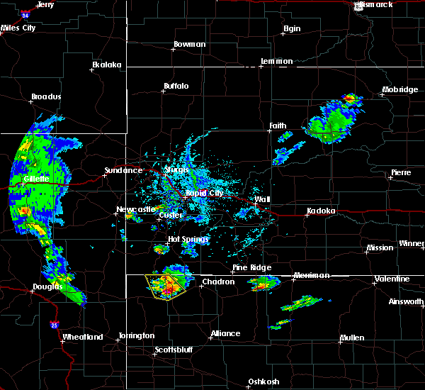 At 421 pm mdt, a severe thunderstorm was located near crawford, or 21 miles west of chadron, moving southeast at 20 mph (radar indicated). Hazards include two inch hail and 60 mph wind gusts. People and animals outdoors will be injured. expect hail damage to roofs, siding, windows, and vehicles. expect wind damage to roofs, siding, and trees. Locations impacted include, crawford, whitney lake, fort robinson campground, montrose, whitney and fort robinson. At 421 pm mdt, a severe thunderstorm was located near crawford, or 21 miles west of chadron, moving southeast at 20 mph (radar indicated). Hazards include two inch hail and 60 mph wind gusts. People and animals outdoors will be injured. expect hail damage to roofs, siding, windows, and vehicles. expect wind damage to roofs, siding, and trees. Locations impacted include, crawford, whitney lake, fort robinson campground, montrose, whitney and fort robinson.
|
| 6/25/2020 4:14 PM MDT |
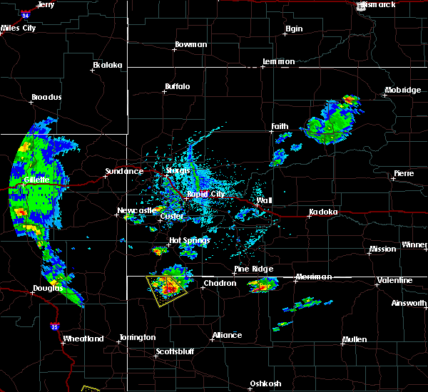 At 413 pm mdt, a severe thunderstorm was located near crawford, or 23 miles west of chadron, moving southeast at 20 mph (radar indicated). Hazards include ping pong ball size hail and 60 mph wind gusts. People and animals outdoors will be injured. expect hail damage to roofs, siding, windows, and vehicles. expect wind damage to roofs, siding, and trees. Locations impacted include, crawford, whitney lake, fort robinson campground, montrose, whitney and fort robinson. At 413 pm mdt, a severe thunderstorm was located near crawford, or 23 miles west of chadron, moving southeast at 20 mph (radar indicated). Hazards include ping pong ball size hail and 60 mph wind gusts. People and animals outdoors will be injured. expect hail damage to roofs, siding, windows, and vehicles. expect wind damage to roofs, siding, and trees. Locations impacted include, crawford, whitney lake, fort robinson campground, montrose, whitney and fort robinson.
|
| 6/25/2020 3:56 PM MDT |
 At 356 pm mdt, a severe thunderstorm was located 9 miles north of fort robinson campground, or 27 miles west of chadron, moving southeast at 20 mph (radar indicated). Hazards include ping pong ball size hail and 60 mph wind gusts. People and animals outdoors will be injured. expect hail damage to roofs, siding, windows, and vehicles. Expect wind damage to roofs, siding, and trees. At 356 pm mdt, a severe thunderstorm was located 9 miles north of fort robinson campground, or 27 miles west of chadron, moving southeast at 20 mph (radar indicated). Hazards include ping pong ball size hail and 60 mph wind gusts. People and animals outdoors will be injured. expect hail damage to roofs, siding, windows, and vehicles. Expect wind damage to roofs, siding, and trees.
|
| 6/6/2020 7:30 PM MDT |
 At 729 pm mdt, severe thunderstorms were located along a line extending from 7 miles north of whitney lake to near sunol, moving east at 50 mph (radar indicated). Hazards include 70 mph wind gusts. Expect considerable tree damage. Damage is likely to mobile homes, roofs, and outbuildings. At 729 pm mdt, severe thunderstorms were located along a line extending from 7 miles north of whitney lake to near sunol, moving east at 50 mph (radar indicated). Hazards include 70 mph wind gusts. Expect considerable tree damage. Damage is likely to mobile homes, roofs, and outbuildings.
|
| 6/6/2020 7:12 PM MDT |
 The severe thunderstorm warning for box butte, dawes and northern sioux counties will expire at 715 pm mdt, the storms which prompted the warning have moved out of the area. therefore, the warning will be allowed to expire. however gusty winds to 45 mph are still possible with these thunderstorms. a severe thunderstorm watch remains in effect until 800 pm mdt for the panhandle of nebraska. The severe thunderstorm warning for box butte, dawes and northern sioux counties will expire at 715 pm mdt, the storms which prompted the warning have moved out of the area. therefore, the warning will be allowed to expire. however gusty winds to 45 mph are still possible with these thunderstorms. a severe thunderstorm watch remains in effect until 800 pm mdt for the panhandle of nebraska.
|
| 6/6/2020 6:55 PM MDT |
 At 653 pm mdt, severe thunderstorms were located along a line extending from 8 miles south of oelrichs to 12 miles south of hay springs, moving north at 55 mph. at 642 pm mdt, chadron municipal airport reported 75 mph wind gust (mesonet station). Hazards include 70 mph wind gusts. Expect considerable tree damage. damage is likely to mobile homes, roofs, and outbuildings. Locations impacted include, alliance, chadron, crawford, hemingford, harrison, wild horse butte, alliance airport, whitney lake, box butte campground, red cloud campground, montrose, box butte dam, kilpatrick lake, fort robinson campground, chadron campground, berea, flahertys corner, chadron airport, whitney and marsland. At 653 pm mdt, severe thunderstorms were located along a line extending from 8 miles south of oelrichs to 12 miles south of hay springs, moving north at 55 mph. at 642 pm mdt, chadron municipal airport reported 75 mph wind gust (mesonet station). Hazards include 70 mph wind gusts. Expect considerable tree damage. damage is likely to mobile homes, roofs, and outbuildings. Locations impacted include, alliance, chadron, crawford, hemingford, harrison, wild horse butte, alliance airport, whitney lake, box butte campground, red cloud campground, montrose, box butte dam, kilpatrick lake, fort robinson campground, chadron campground, berea, flahertys corner, chadron airport, whitney and marsland.
|
| 6/6/2020 6:32 PM MDT |
 At 630 pm mdt, severe thunderstorms were located along a line extending from near montrose to near berea, moving northeast at 65 mph. at 621 pm mdt, alliance municipal airport asos reported 73 mph wind gust (mesonet station). Hazards include 70 mph wind gusts. Expect considerable tree damage. damage is likely to mobile homes, roofs, and outbuildings. Locations impacted include, alliance, chadron, crawford, hemingford, harrison, alliance airport, montrose, angora, box butte dam, fort robinson campground, chadron campground, berea, flahertys corner, chadron airport, wild horse butte, whitney lake, box butte campground, red cloud campground, agate bed national monument and kilpatrick lake. At 630 pm mdt, severe thunderstorms were located along a line extending from near montrose to near berea, moving northeast at 65 mph. at 621 pm mdt, alliance municipal airport asos reported 73 mph wind gust (mesonet station). Hazards include 70 mph wind gusts. Expect considerable tree damage. damage is likely to mobile homes, roofs, and outbuildings. Locations impacted include, alliance, chadron, crawford, hemingford, harrison, alliance airport, montrose, angora, box butte dam, fort robinson campground, chadron campground, berea, flahertys corner, chadron airport, wild horse butte, whitney lake, box butte campground, red cloud campground, agate bed national monument and kilpatrick lake.
|
| 6/6/2020 5:58 PM MDT |
 At 556 pm mdt, severe thunderstorms were located along a line extending from 9 miles northwest of agate bed national monument to near bayard, moving northeast at 65 mph (radar indicated). Hazards include 70 mph wind gusts. Expect considerable tree damage. Damage is likely to mobile homes, roofs, and outbuildings. At 556 pm mdt, severe thunderstorms were located along a line extending from 9 miles northwest of agate bed national monument to near bayard, moving northeast at 65 mph (radar indicated). Hazards include 70 mph wind gusts. Expect considerable tree damage. Damage is likely to mobile homes, roofs, and outbuildings.
|
| 6/5/2020 8:45 PM MDT |
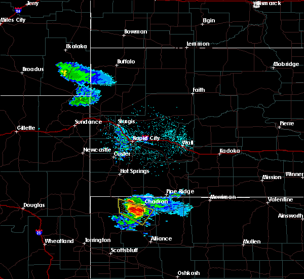 At 844 pm mdt, a severe thunderstorm was located 8 miles west of chadron campground, or 12 miles southwest of chadron, moving southeast at 45 mph (radar indicated). Hazards include two inch hail. People and animals outdoors will be injured. Expect damage to roofs, siding, windows, and vehicles. At 844 pm mdt, a severe thunderstorm was located 8 miles west of chadron campground, or 12 miles southwest of chadron, moving southeast at 45 mph (radar indicated). Hazards include two inch hail. People and animals outdoors will be injured. Expect damage to roofs, siding, windows, and vehicles.
|
| 6/5/2020 8:44 PM MDT | Hen Egg sized hail reported 1.6 miles NW of Whitney, NE |
| 6/5/2020 8:31 PM MDT |
 At 830 pm mdt, a severe thunderstorm was located 9 miles southeast of whitney lake, or 14 miles southwest of chadron, moving southeast at 50 mph. this is a very dangerous storm (radar indicated). Hazards include baseball size hail. People and animals outdoors will be severely injured. expect shattered windows, extensive damage to roofs, siding, and vehicles. Locations impacted include, crawford, whitney lake, red cloud campground, chadron campground, whitney and chadron st park. At 830 pm mdt, a severe thunderstorm was located 9 miles southeast of whitney lake, or 14 miles southwest of chadron, moving southeast at 50 mph. this is a very dangerous storm (radar indicated). Hazards include baseball size hail. People and animals outdoors will be severely injured. expect shattered windows, extensive damage to roofs, siding, and vehicles. Locations impacted include, crawford, whitney lake, red cloud campground, chadron campground, whitney and chadron st park.
|
| 6/5/2020 8:13 PM MDT |
 At 813 pm mdt, a severe thunderstorm was located near fort robinson campground, or 23 miles west of chadron, moving southeast at 50 mph. this is a very dangerous storm (radar indicated). Hazards include baseball size hail. People and animals outdoors will be severely injured. Expect shattered windows, extensive damage to roofs, siding, and vehicles. At 813 pm mdt, a severe thunderstorm was located near fort robinson campground, or 23 miles west of chadron, moving southeast at 50 mph. this is a very dangerous storm (radar indicated). Hazards include baseball size hail. People and animals outdoors will be severely injured. Expect shattered windows, extensive damage to roofs, siding, and vehicles.
|
| 6/5/2020 8:02 PM MDT |
 At 802 pm mdt, a severe thunderstorm was located over fort robinson campground, or 26 miles west of chadron, moving southeast at 40 mph. this is a very dangerous storm (trained weather spotters). Hazards include baseball size hail. People and animals outdoors will be severely injured. expect shattered windows, extensive damage to roofs, siding, and vehicles. Locations impacted include, crawford, whitney lake, fort robinson campground, montrose, whitney and fort robinson. At 802 pm mdt, a severe thunderstorm was located over fort robinson campground, or 26 miles west of chadron, moving southeast at 40 mph. this is a very dangerous storm (trained weather spotters). Hazards include baseball size hail. People and animals outdoors will be severely injured. expect shattered windows, extensive damage to roofs, siding, and vehicles. Locations impacted include, crawford, whitney lake, fort robinson campground, montrose, whitney and fort robinson.
|
| 6/5/2020 7:43 PM MDT |
 At 742 pm mdt, a severe thunderstorm was located 8 miles south of montrose, or 34 miles south of edgemont, moving southeast at 40 mph. this is a very dangerous storm (trained weather spotters). Hazards include baseball size hail. People and animals outdoors will be severely injured. Expect shattered windows, extensive damage to roofs, siding, and vehicles. At 742 pm mdt, a severe thunderstorm was located 8 miles south of montrose, or 34 miles south of edgemont, moving southeast at 40 mph. this is a very dangerous storm (trained weather spotters). Hazards include baseball size hail. People and animals outdoors will be severely injured. Expect shattered windows, extensive damage to roofs, siding, and vehicles.
|
| 8/25/2019 9:19 PM MDT |
 At 919 pm mdt, a severe thunderstorm was located 8 miles southwest of oelrichs, or 24 miles northwest of chadron, moving southeast at 45 mph (radar indicated). Hazards include golf ball size hail and 70 mph wind gusts. People and animals outdoors will be injured. expect hail damage to roofs, siding, windows, and vehicles. expect considerable tree damage. Wind damage is also likely to mobile homes, roofs, and outbuildings. At 919 pm mdt, a severe thunderstorm was located 8 miles southwest of oelrichs, or 24 miles northwest of chadron, moving southeast at 45 mph (radar indicated). Hazards include golf ball size hail and 70 mph wind gusts. People and animals outdoors will be injured. expect hail damage to roofs, siding, windows, and vehicles. expect considerable tree damage. Wind damage is also likely to mobile homes, roofs, and outbuildings.
|
| 8/15/2019 2:40 AM MDT |
 The severe thunderstorm warning for northwestern dawes and northeastern sioux counties will expire at 245 am mdt, the storms which prompted the warning have weakened below severe limits, and no longer pose an immediate threat to life or property. therefore, the warning will be allowed to expire. however gusty winds are still possible with these thunderstorms. to report severe weather, contact your nearest law enforcement agency. they will relay your report to the national weather service cheyenne. The severe thunderstorm warning for northwestern dawes and northeastern sioux counties will expire at 245 am mdt, the storms which prompted the warning have weakened below severe limits, and no longer pose an immediate threat to life or property. therefore, the warning will be allowed to expire. however gusty winds are still possible with these thunderstorms. to report severe weather, contact your nearest law enforcement agency. they will relay your report to the national weather service cheyenne.
|
| 8/15/2019 2:35 AM MDT |
 At 222 am mdt, severe thunderstorms were located along a line extending from 12 miles south of oelrichs to near fort robinson campground, moving southeast at 45 mph (radar indicated). Hazards include 70 mph wind gusts and quarter size hail. Hail damage to vehicles is expected. expect considerable tree damage. wind damage is also likely to mobile homes, roofs, and outbuildings. Locations impacted include, chadron, crawford, fort robinson campground, whitney lake, chadron airport, whitney and fort robinson. At 222 am mdt, severe thunderstorms were located along a line extending from 12 miles south of oelrichs to near fort robinson campground, moving southeast at 45 mph (radar indicated). Hazards include 70 mph wind gusts and quarter size hail. Hail damage to vehicles is expected. expect considerable tree damage. wind damage is also likely to mobile homes, roofs, and outbuildings. Locations impacted include, chadron, crawford, fort robinson campground, whitney lake, chadron airport, whitney and fort robinson.
|
| 8/15/2019 2:23 AM MDT |
 At 222 am mdt, severe thunderstorms were located along a line extending from 12 miles south of oelrichs to near fort robinson campground, moving southeast at 45 mph (radar indicated). Hazards include 70 mph wind gusts and quarter size hail. Hail damage to vehicles is expected. expect considerable tree damage. wind damage is also likely to mobile homes, roofs, and outbuildings. Locations impacted include, chadron, crawford, fort robinson campground, whitney lake, chadron airport, whitney and fort robinson. At 222 am mdt, severe thunderstorms were located along a line extending from 12 miles south of oelrichs to near fort robinson campground, moving southeast at 45 mph (radar indicated). Hazards include 70 mph wind gusts and quarter size hail. Hail damage to vehicles is expected. expect considerable tree damage. wind damage is also likely to mobile homes, roofs, and outbuildings. Locations impacted include, chadron, crawford, fort robinson campground, whitney lake, chadron airport, whitney and fort robinson.
|
| 8/15/2019 1:55 AM MDT |
 At 155 am mdt, severe thunderstorms were located along a line extending from 9 miles east of rumford to near montrose, moving southeast at 45 mph (radar indicated). Hazards include 70 mph wind gusts and quarter size hail. Hail damage to vehicles is expected. expect considerable tree damage. Wind damage is also likely to mobile homes, roofs, and outbuildings. At 155 am mdt, severe thunderstorms were located along a line extending from 9 miles east of rumford to near montrose, moving southeast at 45 mph (radar indicated). Hazards include 70 mph wind gusts and quarter size hail. Hail damage to vehicles is expected. expect considerable tree damage. Wind damage is also likely to mobile homes, roofs, and outbuildings.
|
| 8/13/2019 4:53 AM MDT |
 At 452 am mdt, severe thunderstorms were located along a line extending from 10 miles southeast of montrose to near rushville, moving east at 25 mph (radar indicated). Hazards include quarter size hail. Damage to vehicles is expected. Locations impacted include, chadron, whitney lake, chadron airport and whitney. At 452 am mdt, severe thunderstorms were located along a line extending from 10 miles southeast of montrose to near rushville, moving east at 25 mph (radar indicated). Hazards include quarter size hail. Damage to vehicles is expected. Locations impacted include, chadron, whitney lake, chadron airport and whitney.
|
| 8/13/2019 4:43 AM MDT |
 At 443 am mdt, severe thunderstorms were located along a line extending from 8 miles southeast of montrose to near rushville, moving east at 25 mph (radar indicated). Hazards include quarter size hail. damage to vehicles is expected At 443 am mdt, severe thunderstorms were located along a line extending from 8 miles southeast of montrose to near rushville, moving east at 25 mph (radar indicated). Hazards include quarter size hail. damage to vehicles is expected
|
| 7/29/2019 11:01 PM MDT |
 At 1101 pm mdt, a severe thunderstorm was located over whitney lake, or 18 miles west of chadron, moving east at 40 mph (radar indicated). Hazards include 60 mph wind gusts and quarter size hail. Hail damage to vehicles is expected. expect wind damage to roofs, siding, and trees. Locations impacted include, chadron, crawford, chadron campground, whitney lake, red cloud campground, chadron airport, whitney and chadron st park. At 1101 pm mdt, a severe thunderstorm was located over whitney lake, or 18 miles west of chadron, moving east at 40 mph (radar indicated). Hazards include 60 mph wind gusts and quarter size hail. Hail damage to vehicles is expected. expect wind damage to roofs, siding, and trees. Locations impacted include, chadron, crawford, chadron campground, whitney lake, red cloud campground, chadron airport, whitney and chadron st park.
|
| 7/29/2019 10:48 PM MDT |
 At 1047 pm mdt, a severe thunderstorm was located near fort robinson campground, or 27 miles west of chadron, moving east at 40 mph (radar indicated). Hazards include ping pong ball size hail and 60 mph wind gusts. People and animals outdoors will be injured. expect hail damage to roofs, siding, windows, and vehicles. Expect wind damage to roofs, siding, and trees. At 1047 pm mdt, a severe thunderstorm was located near fort robinson campground, or 27 miles west of chadron, moving east at 40 mph (radar indicated). Hazards include ping pong ball size hail and 60 mph wind gusts. People and animals outdoors will be injured. expect hail damage to roofs, siding, windows, and vehicles. Expect wind damage to roofs, siding, and trees.
|
| 7/29/2019 5:41 PM MDT |
 The severe thunderstorm warning for northwestern dawes county will expire at 545 pm mdt, the storm which prompted the warning has weakened below severe limits, and no longer poses an immediate threat to life or property. therefore, the warning will be allowed to expire. however small hail and gusty winds are still possible with this thunderstorm. a severe thunderstorm warning remains in effect until 600 pm mdt for southwestern dawes county for a separate thunderstorm. to report severe weather, contact your nearest law enforcement agency. they will relay your report to the national weather service cheyenne. The severe thunderstorm warning for northwestern dawes county will expire at 545 pm mdt, the storm which prompted the warning has weakened below severe limits, and no longer poses an immediate threat to life or property. therefore, the warning will be allowed to expire. however small hail and gusty winds are still possible with this thunderstorm. a severe thunderstorm warning remains in effect until 600 pm mdt for southwestern dawes county for a separate thunderstorm. to report severe weather, contact your nearest law enforcement agency. they will relay your report to the national weather service cheyenne.
|
| 7/29/2019 5:34 PM MDT |
 At 534 pm mdt, a severe thunderstorm was located 7 miles north of whitney lake, or 15 miles west of chadron, moving east at 35 mph (radar indicated). Hazards include two inch hail and 60 mph wind gusts. People and animals outdoors will be injured. expect hail damage to roofs, siding, windows, and vehicles. expect wind damage to roofs, siding, and trees. Locations impacted include, chadron airport and whitney. At 534 pm mdt, a severe thunderstorm was located 7 miles north of whitney lake, or 15 miles west of chadron, moving east at 35 mph (radar indicated). Hazards include two inch hail and 60 mph wind gusts. People and animals outdoors will be injured. expect hail damage to roofs, siding, windows, and vehicles. expect wind damage to roofs, siding, and trees. Locations impacted include, chadron airport and whitney.
|
| 7/29/2019 5:24 PM MDT |
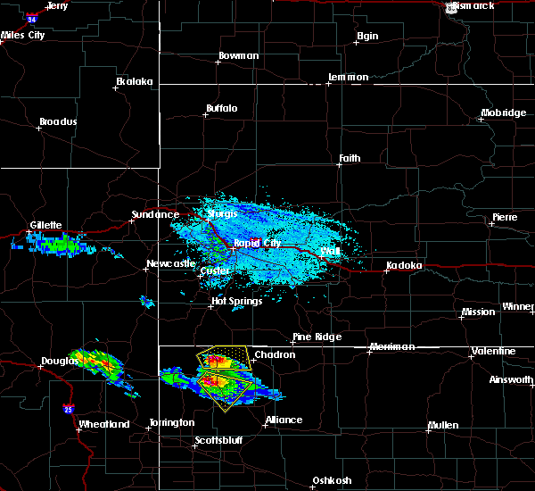 At 524 pm mdt, a severe thunderstorm was located 7 miles northwest of whitney lake, or 20 miles west of chadron, moving east at 35 mph (radar indicated). Hazards include two inch hail and 60 mph wind gusts. People and animals outdoors will be injured. expect hail damage to roofs, siding, windows, and vehicles. expect wind damage to roofs, siding, and trees. Locations impacted include, whitney lake, chadron airport and whitney. At 524 pm mdt, a severe thunderstorm was located 7 miles northwest of whitney lake, or 20 miles west of chadron, moving east at 35 mph (radar indicated). Hazards include two inch hail and 60 mph wind gusts. People and animals outdoors will be injured. expect hail damage to roofs, siding, windows, and vehicles. expect wind damage to roofs, siding, and trees. Locations impacted include, whitney lake, chadron airport and whitney.
|
| 7/29/2019 5:16 PM MDT |
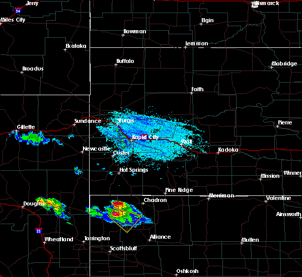 At 516 pm mdt, a severe thunderstorm was located 10 miles northwest of whitney lake, or 24 miles west of chadron, moving east at 35 mph (radar indicated). Hazards include ping pong ball size hail and 60 mph wind gusts. People and animals outdoors will be injured. expect hail damage to roofs, siding, windows, and vehicles. Expect wind damage to roofs, siding, and trees. At 516 pm mdt, a severe thunderstorm was located 10 miles northwest of whitney lake, or 24 miles west of chadron, moving east at 35 mph (radar indicated). Hazards include ping pong ball size hail and 60 mph wind gusts. People and animals outdoors will be injured. expect hail damage to roofs, siding, windows, and vehicles. Expect wind damage to roofs, siding, and trees.
|
| 7/17/2019 7:08 PM MDT |
 At 707 pm mdt, a severe thunderstorm was located over whitney lake, or 16 miles west of chadron, moving southeast at 25 mph (radar indicated). Hazards include 70 mph wind gusts and ping pong ball size hail. People and animals outdoors will be injured. expect hail damage to roofs, siding, windows, and vehicles. expect considerable tree damage. wind damage is also likely to mobile homes, roofs, and outbuildings. Locations impacted include, chadron, crawford, chadron campground, whitney lake, red cloud campground, chadron airport, whitney and chadron st park. At 707 pm mdt, a severe thunderstorm was located over whitney lake, or 16 miles west of chadron, moving southeast at 25 mph (radar indicated). Hazards include 70 mph wind gusts and ping pong ball size hail. People and animals outdoors will be injured. expect hail damage to roofs, siding, windows, and vehicles. expect considerable tree damage. wind damage is also likely to mobile homes, roofs, and outbuildings. Locations impacted include, chadron, crawford, chadron campground, whitney lake, red cloud campground, chadron airport, whitney and chadron st park.
|
| 7/17/2019 6:45 PM MDT |
 At 645 pm mdt, a severe thunderstorm was located 8 miles north of fort robinson campground, or 26 miles west of chadron, moving southeast at 40 mph (radar indicated). Hazards include 70 mph wind gusts and ping pong ball size hail. People and animals outdoors will be injured. expect hail damage to roofs, siding, windows, and vehicles. expect considerable tree damage. Wind damage is also likely to mobile homes, roofs, and outbuildings. At 645 pm mdt, a severe thunderstorm was located 8 miles north of fort robinson campground, or 26 miles west of chadron, moving southeast at 40 mph (radar indicated). Hazards include 70 mph wind gusts and ping pong ball size hail. People and animals outdoors will be injured. expect hail damage to roofs, siding, windows, and vehicles. expect considerable tree damage. Wind damage is also likely to mobile homes, roofs, and outbuildings.
|
| 7/5/2019 5:35 PM MDT |
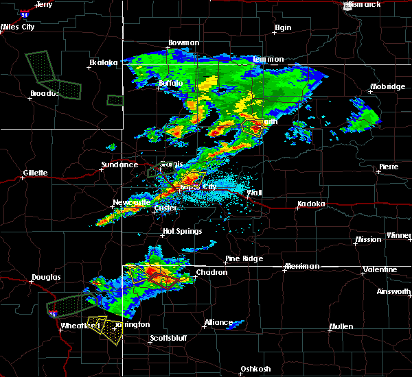 At 535 pm mdt, a severe thunderstorm capable of producing a tornado was located 9 miles southeast of montrose, or 29 miles west of chadron, moving southeast at 25 mph (radar indicated rotation). Hazards include tornado and quarter size hail. Flying debris will be dangerous to those caught without shelter. mobile homes will be damaged or destroyed. damage to roofs, windows, and vehicles will occur. tree damage is likely. this dangerous storm will be near, crawford and whitney lake around 600 pm mdt. Other locations impacted by this tornadic thunderstorm include whitney. At 535 pm mdt, a severe thunderstorm capable of producing a tornado was located 9 miles southeast of montrose, or 29 miles west of chadron, moving southeast at 25 mph (radar indicated rotation). Hazards include tornado and quarter size hail. Flying debris will be dangerous to those caught without shelter. mobile homes will be damaged or destroyed. damage to roofs, windows, and vehicles will occur. tree damage is likely. this dangerous storm will be near, crawford and whitney lake around 600 pm mdt. Other locations impacted by this tornadic thunderstorm include whitney.
|
| 7/3/2019 9:58 PM MDT |
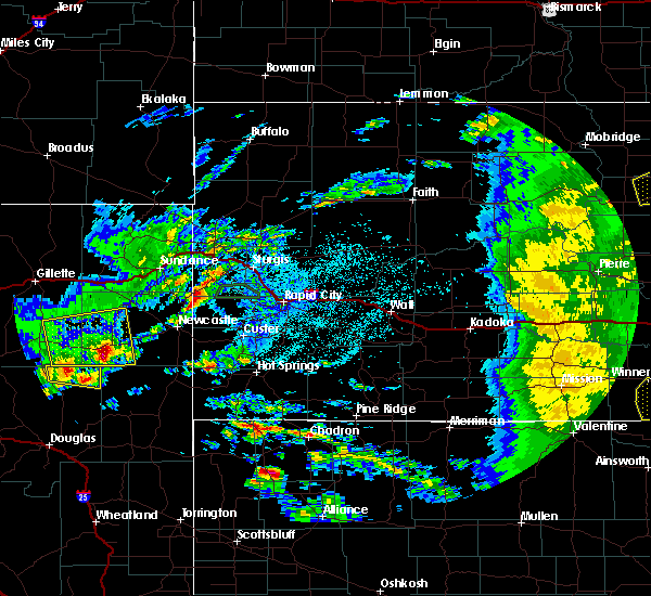 The national weather service in cheyenne has issued a * severe thunderstorm warning for. southwestern dawes county in the panhandle of nebraska. until 1030 pm mdt. At 958 pm mdt, a severe thunderstorm was located 11 miles south of crawford, or 26 miles southwest of chadron, moving northeast at 35. The national weather service in cheyenne has issued a * severe thunderstorm warning for. southwestern dawes county in the panhandle of nebraska. until 1030 pm mdt. At 958 pm mdt, a severe thunderstorm was located 11 miles south of crawford, or 26 miles southwest of chadron, moving northeast at 35.
|
| 6/20/2019 7:29 PM MDT | Storm damage reported in dawes county NE, 1.7 miles N of Whitney, NE |
| 6/20/2019 7:27 PM MDT |
 At 726 pm mdt, severe thunderstorms were located along a line extending from 9 miles southeast of oelrichs to 10 miles south of crawford, moving northeast at 40 mph (radar indicated). Hazards include 70 mph wind gusts and quarter size hail. Hail damage to vehicles is expected. expect considerable tree damage. wind damage is also likely to mobile homes, roofs, and outbuildings. severe thunderstorms will be near, chadron campground and red cloud campground around 800 pm mdt. Other locations impacted by these severe thunderstorms include whitney and chadron st park. At 726 pm mdt, severe thunderstorms were located along a line extending from 9 miles southeast of oelrichs to 10 miles south of crawford, moving northeast at 40 mph (radar indicated). Hazards include 70 mph wind gusts and quarter size hail. Hail damage to vehicles is expected. expect considerable tree damage. wind damage is also likely to mobile homes, roofs, and outbuildings. severe thunderstorms will be near, chadron campground and red cloud campground around 800 pm mdt. Other locations impacted by these severe thunderstorms include whitney and chadron st park.
|
| 6/19/2019 10:12 PM MDT |
 At 1011 pm mdt, a severe thunderstorm capable of producing a tornado was located over crawford, or 25 miles southwest of chadron, moving east at 35 mph (radar indicated rotation). Hazards include tornado and quarter size hail. Flying debris will be dangerous to those caught without shelter. mobile homes will be damaged or destroyed. damage to roofs, windows, and vehicles will occur. tree damage is likely. This tornadic thunderstorm will remain over mainly rural areas of southwestern dawes and northeastern sioux counties, including the following locations, fort robinson and whitney. At 1011 pm mdt, a severe thunderstorm capable of producing a tornado was located over crawford, or 25 miles southwest of chadron, moving east at 35 mph (radar indicated rotation). Hazards include tornado and quarter size hail. Flying debris will be dangerous to those caught without shelter. mobile homes will be damaged or destroyed. damage to roofs, windows, and vehicles will occur. tree damage is likely. This tornadic thunderstorm will remain over mainly rural areas of southwestern dawes and northeastern sioux counties, including the following locations, fort robinson and whitney.
|
| 6/19/2019 9:57 PM MDT |
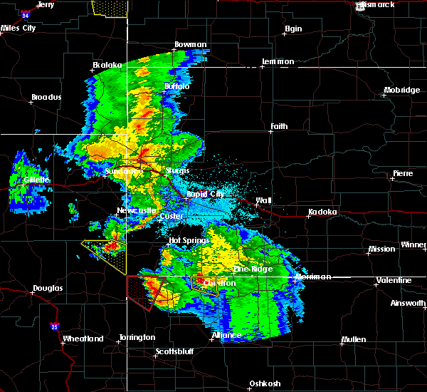 At 957 pm mdt, a severe thunderstorm capable of producing a tornado was located near fort robinson campground, or 32 miles west of chadron, moving east at 35 mph (radar indicated rotation). Hazards include tornado and quarter size hail. Flying debris will be dangerous to those caught without shelter. mobile homes will be damaged or destroyed. damage to roofs, windows, and vehicles will occur. tree damage is likely. this dangerous storm will be near, fort robinson campground around 1010 pm mdt. crawford around 1015 pm mdt. Other locations impacted by this tornadic thunderstorm include fort robinson and whitney. At 957 pm mdt, a severe thunderstorm capable of producing a tornado was located near fort robinson campground, or 32 miles west of chadron, moving east at 35 mph (radar indicated rotation). Hazards include tornado and quarter size hail. Flying debris will be dangerous to those caught without shelter. mobile homes will be damaged or destroyed. damage to roofs, windows, and vehicles will occur. tree damage is likely. this dangerous storm will be near, fort robinson campground around 1010 pm mdt. crawford around 1015 pm mdt. Other locations impacted by this tornadic thunderstorm include fort robinson and whitney.
|
| 6/2/2019 6:36 PM MDT |
 The severe thunderstorm warning for central dawes county will expire at 645 pm mdt, the storm which prompted the warning has weakened below severe limits, and no longer poses an immediate threat to life or property. therefore, the warning will be allowed to expire. however heavy rain is still possible with this thunderstorm. a severe thunderstorm watch remains in effect until 1100 pm mdt for the panhandle of nebraska. to report severe weather, contact your nearest law enforcement agency. they will relay your report to the national weather service cheyenne. The severe thunderstorm warning for central dawes county will expire at 645 pm mdt, the storm which prompted the warning has weakened below severe limits, and no longer poses an immediate threat to life or property. therefore, the warning will be allowed to expire. however heavy rain is still possible with this thunderstorm. a severe thunderstorm watch remains in effect until 1100 pm mdt for the panhandle of nebraska. to report severe weather, contact your nearest law enforcement agency. they will relay your report to the national weather service cheyenne.
|
| 6/2/2019 6:30 PM MDT |
 At 630 pm mdt, a severe thunderstorm was located 7 miles east of crawford, or 17 miles southwest of chadron, moving southeast at 10 mph (radar indicated). Hazards include 60 mph wind gusts and quarter size hail. Hail damage to vehicles is expected. expect wind damage to roofs, siding, and trees. Locations impacted include, crawford, whitney lake, red cloud campground, chadron campground, whitney and chadron st park. At 630 pm mdt, a severe thunderstorm was located 7 miles east of crawford, or 17 miles southwest of chadron, moving southeast at 10 mph (radar indicated). Hazards include 60 mph wind gusts and quarter size hail. Hail damage to vehicles is expected. expect wind damage to roofs, siding, and trees. Locations impacted include, crawford, whitney lake, red cloud campground, chadron campground, whitney and chadron st park.
|
| 6/2/2019 6:04 PM MDT |
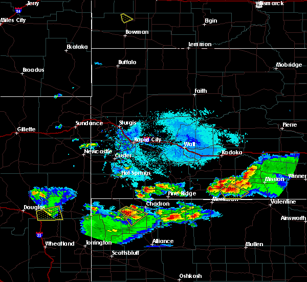 At 604 pm mdt, a severe thunderstorm was located over whitney lake, or 14 miles west of chadron, moving northeast at 15 mph (radar indicated). Hazards include 60 mph wind gusts and half dollar size hail. Hail damage to vehicles is expected. expect wind damage to roofs, siding, and trees. Locations impacted include, whitney lake and whitney. At 604 pm mdt, a severe thunderstorm was located over whitney lake, or 14 miles west of chadron, moving northeast at 15 mph (radar indicated). Hazards include 60 mph wind gusts and half dollar size hail. Hail damage to vehicles is expected. expect wind damage to roofs, siding, and trees. Locations impacted include, whitney lake and whitney.
|
| 6/2/2019 6:03 PM MDT |
 At 603 pm mdt, a severe thunderstorm was located near crawford, or 18 miles southwest of chadron, moving southeast at 10 mph (radar indicated). Hazards include 60 mph wind gusts and half dollar size hail. Hail damage to vehicles is expected. Expect wind damage to roofs, siding, and trees. At 603 pm mdt, a severe thunderstorm was located near crawford, or 18 miles southwest of chadron, moving southeast at 10 mph (radar indicated). Hazards include 60 mph wind gusts and half dollar size hail. Hail damage to vehicles is expected. Expect wind damage to roofs, siding, and trees.
|
| 6/2/2019 5:56 PM MDT |
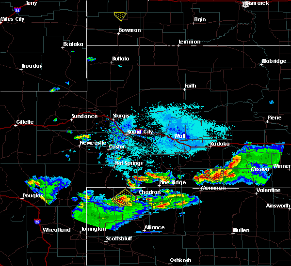 At 555 pm mdt, a severe thunderstorm was located over whitney lake, or 16 miles west of chadron, moving northeast at 15 mph (trained weather spotters). Hazards include 60 mph wind gusts and quarter size hail. Hail damage to vehicles is expected. expect wind damage to roofs, siding, and trees. Locations impacted include, whitney lake, chadron airport and whitney. At 555 pm mdt, a severe thunderstorm was located over whitney lake, or 16 miles west of chadron, moving northeast at 15 mph (trained weather spotters). Hazards include 60 mph wind gusts and quarter size hail. Hail damage to vehicles is expected. expect wind damage to roofs, siding, and trees. Locations impacted include, whitney lake, chadron airport and whitney.
|
| 6/2/2019 5:41 PM MDT |
 At 531 pm mdt, a trained spotter reported golf ball size hail 1 mile northeast of crawford. a severe thunderstorm was located near whitney lake, or 19 miles west of chadron, moving northeast at 15 mph (trained weather spotters). Hazards include golf ball size hail and 60 mph wind gusts. People and animals outdoors will be injured. expect hail damage to roofs, siding, windows, and vehicles. Expect wind damage to roofs, siding, and trees. At 531 pm mdt, a trained spotter reported golf ball size hail 1 mile northeast of crawford. a severe thunderstorm was located near whitney lake, or 19 miles west of chadron, moving northeast at 15 mph (trained weather spotters). Hazards include golf ball size hail and 60 mph wind gusts. People and animals outdoors will be injured. expect hail damage to roofs, siding, windows, and vehicles. Expect wind damage to roofs, siding, and trees.
|
| 6/2/2019 4:33 PM MDT |
 At 433 pm mdt, a severe thunderstorm was located over chadron airport, or 7 miles west of chadron, moving east at 5 mph (radar indicated). Hazards include 60 mph wind gusts and quarter size hail. Hail damage to vehicles is expected. Expect wind damage to roofs, siding, and trees. At 433 pm mdt, a severe thunderstorm was located over chadron airport, or 7 miles west of chadron, moving east at 5 mph (radar indicated). Hazards include 60 mph wind gusts and quarter size hail. Hail damage to vehicles is expected. Expect wind damage to roofs, siding, and trees.
|
| 7/28/2018 5:23 PM MDT |
 The severe thunderstorm warning for dawes and northeastern sioux counties will expire at 530 pm mdt, the storms which prompted the warning have weakened below severe limits, and have exited the warned area. therefore, the warning will be allowed to expire. however small hail and gusty winds are still possible with these thunderstorms. a tornado watch remains in effect until 1000 pm mdt for the panhandle of nebraska. The severe thunderstorm warning for dawes and northeastern sioux counties will expire at 530 pm mdt, the storms which prompted the warning have weakened below severe limits, and have exited the warned area. therefore, the warning will be allowed to expire. however small hail and gusty winds are still possible with these thunderstorms. a tornado watch remains in effect until 1000 pm mdt for the panhandle of nebraska.
|
| 7/28/2018 5:01 PM MDT |
 At 500 pm mdt, severe thunderstorms were located along a line extending from near whitney lake to 8 miles west of fort robinson campground, moving southeast at 25 mph (radar indicated). Hazards include 60 mph wind gusts and quarter size hail. Hail damage to vehicles is expected. expect wind damage to roofs, siding, and trees. locations impacted include, crawford, fort robinson campground, chadron campground, whitney lake, red cloud campground, chadron airport, whitney, fort robinson and chadron st park. A tornado watch remains in effect until 1000 pm mdt for the panhandle of nebraska. At 500 pm mdt, severe thunderstorms were located along a line extending from near whitney lake to 8 miles west of fort robinson campground, moving southeast at 25 mph (radar indicated). Hazards include 60 mph wind gusts and quarter size hail. Hail damage to vehicles is expected. expect wind damage to roofs, siding, and trees. locations impacted include, crawford, fort robinson campground, chadron campground, whitney lake, red cloud campground, chadron airport, whitney, fort robinson and chadron st park. A tornado watch remains in effect until 1000 pm mdt for the panhandle of nebraska.
|
| 7/28/2018 4:51 PM MDT |
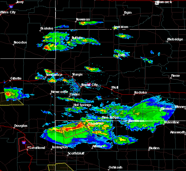 At 451 pm mdt, severe thunderstorms were located along a line extending from near whitney lake to 10 miles northwest of fort robinson campground, moving southeast at 25 mph (radar indicated). Hazards include 60 mph wind gusts and quarter size hail. Hail damage to vehicles is expected. Expect wind damage to roofs, siding, and trees. At 451 pm mdt, severe thunderstorms were located along a line extending from near whitney lake to 10 miles northwest of fort robinson campground, moving southeast at 25 mph (radar indicated). Hazards include 60 mph wind gusts and quarter size hail. Hail damage to vehicles is expected. Expect wind damage to roofs, siding, and trees.
|
| 7/17/2018 11:13 PM MDT |
 At 1113 pm mdt, severe thunderstorms were located along a line extending from 9 miles north of whitney lake to near crawford to 7 miles south of fort robinson campground, moving east at 45 mph (radar indicated). Hazards include 60 mph wind gusts and penny size hail. Expect damage to roofs, siding, and trees. Locations impacted include, chadron, crawford, fort robinson campground, chadron campground, whitney lake, box butte campground, red cloud campground, chadron airport, box butte dam, whitney, fort robinson and chadron st park. At 1113 pm mdt, severe thunderstorms were located along a line extending from 9 miles north of whitney lake to near crawford to 7 miles south of fort robinson campground, moving east at 45 mph (radar indicated). Hazards include 60 mph wind gusts and penny size hail. Expect damage to roofs, siding, and trees. Locations impacted include, chadron, crawford, fort robinson campground, chadron campground, whitney lake, box butte campground, red cloud campground, chadron airport, box butte dam, whitney, fort robinson and chadron st park.
|
| 7/17/2018 10:51 PM MDT |
 At 1051 pm mdt, severe thunderstorms were located along a line extending from near montrose to 7 miles west of fort robinson campground to 10 miles southeast of harrison, moving east at 45 mph (radar indicated). Hazards include 60 mph wind gusts and penny size hail. expect damage to roofs, siding, and trees At 1051 pm mdt, severe thunderstorms were located along a line extending from near montrose to 7 miles west of fort robinson campground to 10 miles southeast of harrison, moving east at 45 mph (radar indicated). Hazards include 60 mph wind gusts and penny size hail. expect damage to roofs, siding, and trees
|
| 5/22/2018 9:25 PM MDT |
 The severe thunderstorm warning for northwestern dawes and northeastern sioux counties will expire at 930 pm mdt, the storm which prompted the warning has weakened below severe limits, and no longer poses an immediate threat to life or property. therefore the warning will be allowed to expire. however heavy rain is still possible with this thunderstorm. The severe thunderstorm warning for northwestern dawes and northeastern sioux counties will expire at 930 pm mdt, the storm which prompted the warning has weakened below severe limits, and no longer poses an immediate threat to life or property. therefore the warning will be allowed to expire. however heavy rain is still possible with this thunderstorm.
|
| 5/22/2018 9:08 PM MDT |
 At 907 pm mdt, a severe thunderstorm was located near whitney lake, or 21 miles west of chadron, moving northwest at 25 mph (radar indicated). Hazards include 60 mph wind gusts and quarter size hail. Hail damage to vehicles is expected. expect wind damage to roofs, siding, and trees. Locations impacted include, whitney lake and whitney. At 907 pm mdt, a severe thunderstorm was located near whitney lake, or 21 miles west of chadron, moving northwest at 25 mph (radar indicated). Hazards include 60 mph wind gusts and quarter size hail. Hail damage to vehicles is expected. expect wind damage to roofs, siding, and trees. Locations impacted include, whitney lake and whitney.
|
| 5/22/2018 8:43 PM MDT |
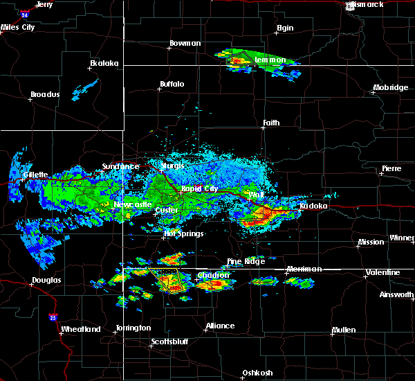 At 843 pm mdt, a severe thunderstorm was located near crawford, or 19 miles southwest of chadron, moving northwest at 25 mph (radar indicated). Hazards include 60 mph wind gusts and quarter size hail. Hail damage to vehicles is expected. Expect wind damage to roofs, siding, and trees. At 843 pm mdt, a severe thunderstorm was located near crawford, or 19 miles southwest of chadron, moving northwest at 25 mph (radar indicated). Hazards include 60 mph wind gusts and quarter size hail. Hail damage to vehicles is expected. Expect wind damage to roofs, siding, and trees.
|
| 7/27/2017 3:15 PM MDT |
 At 315 pm mdt, a severe thunderstorm was located near whitney lake, or 16 miles west of chadron, moving southeast at 20 mph (radar indicated). Hazards include 60 mph wind gusts and quarter size hail. Hail damage to vehicles is expected. expect wind damage to roofs, siding, and trees. Locations impacted include, crawford, whitney lake and whitney. At 315 pm mdt, a severe thunderstorm was located near whitney lake, or 16 miles west of chadron, moving southeast at 20 mph (radar indicated). Hazards include 60 mph wind gusts and quarter size hail. Hail damage to vehicles is expected. expect wind damage to roofs, siding, and trees. Locations impacted include, crawford, whitney lake and whitney.
|
| 7/27/2017 2:59 PM MDT |
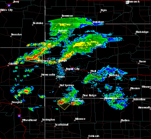 At 258 pm mdt, a severe thunderstorm was located near whitney lake, or 20 miles west of chadron, moving southeast at 20 mph (radar indicated). Hazards include 60 mph wind gusts and half dollar size hail. Hail damage to vehicles is expected. Expect wind damage to roofs, siding, and trees. At 258 pm mdt, a severe thunderstorm was located near whitney lake, or 20 miles west of chadron, moving southeast at 20 mph (radar indicated). Hazards include 60 mph wind gusts and half dollar size hail. Hail damage to vehicles is expected. Expect wind damage to roofs, siding, and trees.
|
| 10/3/2016 2:58 PM MDT |
 At 258 pm mdt, severe thunderstorms were located along a line extending from 11 miles northwest of chadron airport to 9 miles northeast of box butte dam to near alliance, moving east at 50 mph (radar indicated). Hazards include 60 mph wind gusts and quarter size hail. Hail damage to vehicles is expected. expect wind damage to roofs, siding, and trees. These severe thunderstorms will remain over mainly rural areas of dawes and eastern box butte counties, including the following locations: whitney and chadron st park. At 258 pm mdt, severe thunderstorms were located along a line extending from 11 miles northwest of chadron airport to 9 miles northeast of box butte dam to near alliance, moving east at 50 mph (radar indicated). Hazards include 60 mph wind gusts and quarter size hail. Hail damage to vehicles is expected. expect wind damage to roofs, siding, and trees. These severe thunderstorms will remain over mainly rural areas of dawes and eastern box butte counties, including the following locations: whitney and chadron st park.
|
| 9/23/2016 4:34 PM MDT |
 At 434 pm mdt, a severe thunderstorm was located over chadron airport, or near chadron, moving north at 35 mph (trained weather spotters. half dollar sized hail was reported near whitney with this storm at 430 pm mdt). Hazards include golf ball size hail and 60 mph wind gusts. People and animals outdoors will be injured. expect hail damage to roofs, siding, windows, and vehicles. expect wind damage to roofs, siding, and trees. Locations impacted include, chadron, chadron airport and whitney. At 434 pm mdt, a severe thunderstorm was located over chadron airport, or near chadron, moving north at 35 mph (trained weather spotters. half dollar sized hail was reported near whitney with this storm at 430 pm mdt). Hazards include golf ball size hail and 60 mph wind gusts. People and animals outdoors will be injured. expect hail damage to roofs, siding, windows, and vehicles. expect wind damage to roofs, siding, and trees. Locations impacted include, chadron, chadron airport and whitney.
|
| 9/23/2016 4:31 PM MDT | Half Dollar sized hail reported 1.9 miles W of Whitney, NE |
| 9/23/2016 4:20 PM MDT |
 At 420 pm mdt, a severe thunderstorm was located near chadron campground, or 11 miles southwest of chadron, moving north at 30 mph (radar indicated). Hazards include two inch hail and 60 mph wind gusts. People and animals outdoors will be injured. expect hail damage to roofs, siding, windows, and vehicles. Expect wind damage to roofs, siding, and trees. At 420 pm mdt, a severe thunderstorm was located near chadron campground, or 11 miles southwest of chadron, moving north at 30 mph (radar indicated). Hazards include two inch hail and 60 mph wind gusts. People and animals outdoors will be injured. expect hail damage to roofs, siding, windows, and vehicles. Expect wind damage to roofs, siding, and trees.
|
| 7/26/2016 7:32 PM MDT |
 At 732 pm mdt, a severe thunderstorm was located over chadron airport, or near chadron, moving east at 50 mph (radar indicated). Hazards include golf ball size hail and 70 mph wind gusts. People and animals outdoors will be injured. expect hail damage to roofs, siding, windows, and vehicles. expect considerable tree damage. wind damage is also likely to mobile homes, roofs, and outbuildings. Locations impacted include, chadron, red cloud campground, chadron airport, chadron campground, whitney and chadron st park. At 732 pm mdt, a severe thunderstorm was located over chadron airport, or near chadron, moving east at 50 mph (radar indicated). Hazards include golf ball size hail and 70 mph wind gusts. People and animals outdoors will be injured. expect hail damage to roofs, siding, windows, and vehicles. expect considerable tree damage. wind damage is also likely to mobile homes, roofs, and outbuildings. Locations impacted include, chadron, red cloud campground, chadron airport, chadron campground, whitney and chadron st park.
|
| 7/26/2016 7:14 PM MDT |
 At 712 pm mdt, a severe thunderstorm was located 13 miles north of whitney lake, or 18 miles northwest of chadron, moving southeast at 40 mph. a second severe thunderstorm was located about 9 miles east of chadron along the dawes and sheridan county line (radar indicated). Hazards include golf ball size hail and 60 mph wind gusts. People and animals outdoors will be injured. expect hail damage to roofs, siding, windows, and vehicles. Expect wind damage to roofs, siding, and trees. At 712 pm mdt, a severe thunderstorm was located 13 miles north of whitney lake, or 18 miles northwest of chadron, moving southeast at 40 mph. a second severe thunderstorm was located about 9 miles east of chadron along the dawes and sheridan county line (radar indicated). Hazards include golf ball size hail and 60 mph wind gusts. People and animals outdoors will be injured. expect hail damage to roofs, siding, windows, and vehicles. Expect wind damage to roofs, siding, and trees.
|
| 7/22/2016 4:12 PM MDT |
 At 412 pm mdt, a severe thunderstorm was located over chadron airport, or near chadron, moving northeast at 20 mph (radar indicated). Hazards include quarter size hail. damage to vehicles is expected At 412 pm mdt, a severe thunderstorm was located over chadron airport, or near chadron, moving northeast at 20 mph (radar indicated). Hazards include quarter size hail. damage to vehicles is expected
|
| 7/6/2016 4:08 PM MDT |
 At 408 pm mdt, a severe thunderstorm was located over whitney lake, or 16 miles west of chadron, moving east at 40 mph (radar indicated). Hazards include 60 mph wind gusts and quarter size hail. Hail damage to vehicles is expected. expect wind damage to roofs, siding, and trees. this severe thunderstorm will be near, chadron airport around 425 pm mdt. chadron, chadron campground and red cloud campground around 430 pm mdt. other locations impacted by this severe thunderstorm include whitney and chadron st park. A tornado watch remains in effect until 900 pm mdt for the panhandle of nebraska. At 408 pm mdt, a severe thunderstorm was located over whitney lake, or 16 miles west of chadron, moving east at 40 mph (radar indicated). Hazards include 60 mph wind gusts and quarter size hail. Hail damage to vehicles is expected. expect wind damage to roofs, siding, and trees. this severe thunderstorm will be near, chadron airport around 425 pm mdt. chadron, chadron campground and red cloud campground around 430 pm mdt. other locations impacted by this severe thunderstorm include whitney and chadron st park. A tornado watch remains in effect until 900 pm mdt for the panhandle of nebraska.
|
| 6/28/2016 5:20 PM MDT |
 At 519 pm mdt, a severe thunderstorm was located over chadron airport, or near chadron, moving southeast at 45 mph. this is a very dangerous storm (radar indicated. at 507 pm mdt...a wind gust to 84 mph was reported at the chadron airport). Hazards include 80 mph wind gusts and ping pong ball size hail. Flying debris will be dangerous to those caught without shelter. mobile homes will be heavily damaged. expect considerable damage to roofs, windows, and vehicles. extensive tree damage and power outages are likely. this severe storm will be near, red cloud campground and chadron campground around 530 pm mdt. Other locations impacted by this severe thunderstorm include whitney and chadron st park. At 519 pm mdt, a severe thunderstorm was located over chadron airport, or near chadron, moving southeast at 45 mph. this is a very dangerous storm (radar indicated. at 507 pm mdt...a wind gust to 84 mph was reported at the chadron airport). Hazards include 80 mph wind gusts and ping pong ball size hail. Flying debris will be dangerous to those caught without shelter. mobile homes will be heavily damaged. expect considerable damage to roofs, windows, and vehicles. extensive tree damage and power outages are likely. this severe storm will be near, red cloud campground and chadron campground around 530 pm mdt. Other locations impacted by this severe thunderstorm include whitney and chadron st park.
|
| 6/28/2016 5:09 PM MDT |
 At 508 pm mdt, a severe thunderstorm was located 7 miles northwest of chadron airport, or 10 miles northwest of chadron, moving southeast at 45 mph. this is a very dangerous storm (trained weather spotters. at 500 pm...spotters 12 miles northwest of chadron estimated winds at 80 mph). Hazards include 80 mph wind gusts and ping pong ball size hail. Flying debris will be dangerous to those caught without shelter. mobile homes will be heavily damaged. expect considerable damage to roofs, windows, and vehicles. extensive tree damage and power outages are likely. this severe storm will be near, chadron and chadron airport around 520 pm mdt. chadron campground and red cloud campground around 530 pm mdt. Other locations impacted by this severe thunderstorm include whitney and chadron st park. At 508 pm mdt, a severe thunderstorm was located 7 miles northwest of chadron airport, or 10 miles northwest of chadron, moving southeast at 45 mph. this is a very dangerous storm (trained weather spotters. at 500 pm...spotters 12 miles northwest of chadron estimated winds at 80 mph). Hazards include 80 mph wind gusts and ping pong ball size hail. Flying debris will be dangerous to those caught without shelter. mobile homes will be heavily damaged. expect considerable damage to roofs, windows, and vehicles. extensive tree damage and power outages are likely. this severe storm will be near, chadron and chadron airport around 520 pm mdt. chadron campground and red cloud campground around 530 pm mdt. Other locations impacted by this severe thunderstorm include whitney and chadron st park.
|
| 6/28/2016 4:51 PM MDT |
 At 450 pm mdt, a severe thunderstorm was located near oelrichs, or 22 miles northwest of chadron, moving southeast at 45 mph (radar indicated). Hazards include golf ball size hail and 70 mph wind gusts. People and animals outdoors will be injured. expect hail damage to roofs, siding, windows, and vehicles. expect considerable tree damage. wind damage is also likely to mobile homes, roofs, and outbuildings. this severe thunderstorm will be near, chadron airport around 515 pm mdt. chadron around 520 pm mdt. red cloud campground and chadron campground around 530 pm mdt. Other locations impacted by this severe thunderstorm include whitney and chadron st park. At 450 pm mdt, a severe thunderstorm was located near oelrichs, or 22 miles northwest of chadron, moving southeast at 45 mph (radar indicated). Hazards include golf ball size hail and 70 mph wind gusts. People and animals outdoors will be injured. expect hail damage to roofs, siding, windows, and vehicles. expect considerable tree damage. wind damage is also likely to mobile homes, roofs, and outbuildings. this severe thunderstorm will be near, chadron airport around 515 pm mdt. chadron around 520 pm mdt. red cloud campground and chadron campground around 530 pm mdt. Other locations impacted by this severe thunderstorm include whitney and chadron st park.
|
| 6/27/2016 7:33 PM MDT | Quarter sized hail reported 8.7 miles ESE of Whitney, NE |
| 6/27/2016 7:22 PM MDT |
 At 722 pm mdt, a severe thunderstorm was located near whitney lake, or 19 miles west of chadron, moving south at 20 mph (radar indicated). Hazards include golf ball size hail and 70 mph wind gusts. People and animals outdoors will be injured. expect hail damage to roofs, siding, windows, and vehicles. expect considerable tree damage. wind damage is also likely to mobile homes, roofs, and outbuildings. locations impacted include, crawford, whitney lake, fort robinson campground, whitney and fort robinson. A tornado watch remains in effect until 800 pm mdt for central nebraska. At 722 pm mdt, a severe thunderstorm was located near whitney lake, or 19 miles west of chadron, moving south at 20 mph (radar indicated). Hazards include golf ball size hail and 70 mph wind gusts. People and animals outdoors will be injured. expect hail damage to roofs, siding, windows, and vehicles. expect considerable tree damage. wind damage is also likely to mobile homes, roofs, and outbuildings. locations impacted include, crawford, whitney lake, fort robinson campground, whitney and fort robinson. A tornado watch remains in effect until 800 pm mdt for central nebraska.
|
| 6/27/2016 7:05 PM MDT |
 At 704 pm mdt, a severe thunderstorm was located 7 miles northwest of whitney lake, or 21 miles west of chadron, moving south at 20 mph (radar indicated). Hazards include 60 mph wind gusts and half dollar size hail. Hail damage to vehicles is expected. Expect wind damage to roofs, siding, and trees. At 704 pm mdt, a severe thunderstorm was located 7 miles northwest of whitney lake, or 21 miles west of chadron, moving south at 20 mph (radar indicated). Hazards include 60 mph wind gusts and half dollar size hail. Hail damage to vehicles is expected. Expect wind damage to roofs, siding, and trees.
|
| 8/17/2015 11:01 PM MDT |
 At 1101 pm mdt, severe thunderstorms were located along a line extending from 7 miles west of whitney lake to near veteran, moving east at 35 mph (radar indicated). Hazards include 60 mph wind gusts and quarter size hail. Hail damage to vehicles is expected. expect wind damage to roofs, siding and trees. Locations impacted include, torrington, crawford, yoder, whitney lake, fort robinson campground, veteran, agate bed national monument, huntley, henry, whitney and fort robinson. At 1101 pm mdt, severe thunderstorms were located along a line extending from 7 miles west of whitney lake to near veteran, moving east at 35 mph (radar indicated). Hazards include 60 mph wind gusts and quarter size hail. Hail damage to vehicles is expected. expect wind damage to roofs, siding and trees. Locations impacted include, torrington, crawford, yoder, whitney lake, fort robinson campground, veteran, agate bed national monument, huntley, henry, whitney and fort robinson.
|
| 8/17/2015 10:46 PM MDT |
 At 1046 pm mdt, severe thunderstorms were located along a line extending from montrose to 12 miles west of veteran, moving southeast at 25 mph (radar indicated). Hazards include ping pong ball size hail and 60 mph wind gusts. People and animals outdoors will be injured. expect hail damage to roofs, siding, windows and vehicles. Expect wind damage to roofs, siding and trees. At 1046 pm mdt, severe thunderstorms were located along a line extending from montrose to 12 miles west of veteran, moving southeast at 25 mph (radar indicated). Hazards include ping pong ball size hail and 60 mph wind gusts. People and animals outdoors will be injured. expect hail damage to roofs, siding, windows and vehicles. Expect wind damage to roofs, siding and trees.
|
| 7/17/2015 4:06 PM MDT |
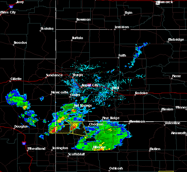 At 406 pm mdt, a severe thunderstorm was located near fort robinson campground, or 24 miles west of chadron, moving east at 30 mph (radar indicated). Hazards include quarter size hail. Damage to vehicles is expected. Locations impacted include, crawford, whitney lake, fort robinson campground, whitney and fort robinson. At 406 pm mdt, a severe thunderstorm was located near fort robinson campground, or 24 miles west of chadron, moving east at 30 mph (radar indicated). Hazards include quarter size hail. Damage to vehicles is expected. Locations impacted include, crawford, whitney lake, fort robinson campground, whitney and fort robinson.
|
| 7/17/2015 3:41 PM MDT |
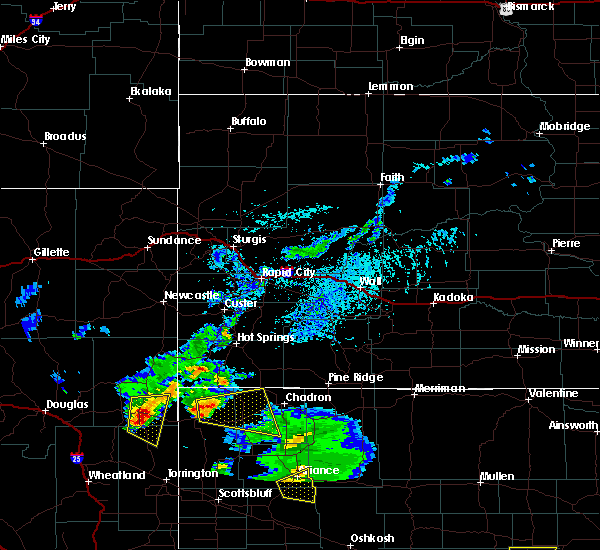 At 339 pm mdt, a severe thunderstorm was located 8 miles northeast of harrison, or 35 miles east of lusk, moving east at 25 mph (radar indicated). Hazards include 60 mph wind gusts and penny size hail. this storm has weakened since 330 pm mdt and the severe thunderstorm warning may be cancelled earlier than 415 pm mdt if weakening trends continue. Expect damage to roofs. siding and trees. Locations impacted include, crawford, whitney lake, fort robinson campground, whitney and fort robinson. At 339 pm mdt, a severe thunderstorm was located 8 miles northeast of harrison, or 35 miles east of lusk, moving east at 25 mph (radar indicated). Hazards include 60 mph wind gusts and penny size hail. this storm has weakened since 330 pm mdt and the severe thunderstorm warning may be cancelled earlier than 415 pm mdt if weakening trends continue. Expect damage to roofs. siding and trees. Locations impacted include, crawford, whitney lake, fort robinson campground, whitney and fort robinson.
|
| 7/17/2015 3:17 PM MDT |
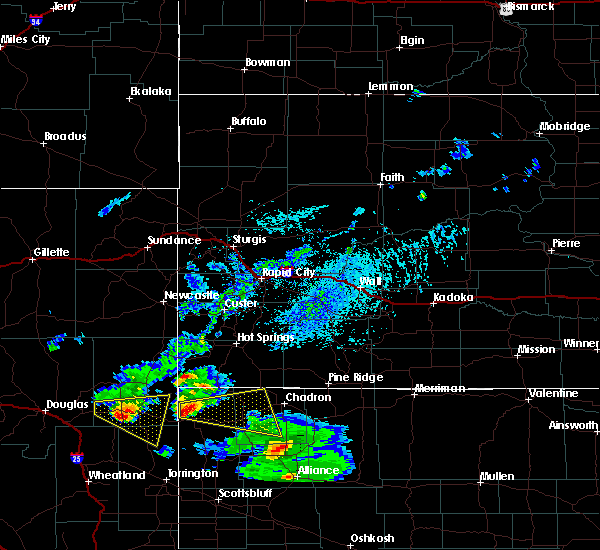 At 317 pm mdt, a severe thunderstorm was located near harrison, or 27 miles east of lusk, moving east at 50 mph (radar indicated). Hazards include half dollar size hail and 70 mph wind gusts. Hail damage to vehicles is expected. expect considerable tree damage. Wind damage is also likely to mobile homes, roofs and outbuildings. At 317 pm mdt, a severe thunderstorm was located near harrison, or 27 miles east of lusk, moving east at 50 mph (radar indicated). Hazards include half dollar size hail and 70 mph wind gusts. Hail damage to vehicles is expected. expect considerable tree damage. Wind damage is also likely to mobile homes, roofs and outbuildings.
|
| 7/1/2015 11:39 PM MDT |
 At 1139 pm mdt, a severe thunderstorm was located 8 miles north of whitney lake, or 14 miles west of chadron, moving east at 45 mph (radar indicated). Hazards include quarter size hail and 70 mph wind gusts. Hail damage to vehicles is expected. expect considerable tree damage. Wind damage is also likely to mobile homes, roofs and outbuildings. At 1139 pm mdt, a severe thunderstorm was located 8 miles north of whitney lake, or 14 miles west of chadron, moving east at 45 mph (radar indicated). Hazards include quarter size hail and 70 mph wind gusts. Hail damage to vehicles is expected. expect considerable tree damage. Wind damage is also likely to mobile homes, roofs and outbuildings.
|
| 6/25/2015 11:07 AM MDT |
 The severe thunderstorm warning for northwestern dawes county will expire at 1115 am mdt, the storm which prompted the warning has weakened below severe limits, and no longer pose an immediate threat to life or property. therefore the warning will be allowed to expire. however heavy rain is still possible with this thunderstorm. to report severe weather, contact your nearest law enforcement agency. they will relay your report to the national weather service cheyenne. The severe thunderstorm warning for northwestern dawes county will expire at 1115 am mdt, the storm which prompted the warning has weakened below severe limits, and no longer pose an immediate threat to life or property. therefore the warning will be allowed to expire. however heavy rain is still possible with this thunderstorm. to report severe weather, contact your nearest law enforcement agency. they will relay your report to the national weather service cheyenne.
|
| 6/25/2015 10:51 AM MDT |
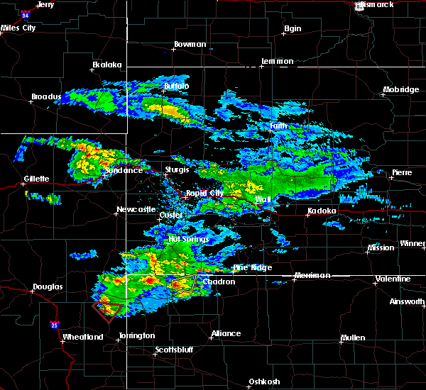 At 1050 am mdt, a severe thunderstorm was located near whitney lake, or 16 miles west of chadron, moving east at 25 mph (radar indicated). Hazards include quarter size hail and 60 mph wind gusts. Hail damage to vehicles is expected. expect wind damage to roofs, siding and trees. Locations impacted include, whitney. At 1050 am mdt, a severe thunderstorm was located near whitney lake, or 16 miles west of chadron, moving east at 25 mph (radar indicated). Hazards include quarter size hail and 60 mph wind gusts. Hail damage to vehicles is expected. expect wind damage to roofs, siding and trees. Locations impacted include, whitney.
|
| 6/25/2015 10:33 AM MDT |
 At 1032 am mdt, a severe thunderstorm was located 8 miles northwest of whitney lake, or 21 miles west of chadron, moving east at 25 mph (radar indicated). Hazards include quarter size hail and 60 mph wind gusts. Hail damage to vehicles is expected. Expect wind damage to roofs, siding and trees. At 1032 am mdt, a severe thunderstorm was located 8 miles northwest of whitney lake, or 21 miles west of chadron, moving east at 25 mph (radar indicated). Hazards include quarter size hail and 60 mph wind gusts. Hail damage to vehicles is expected. Expect wind damage to roofs, siding and trees.
|
| 6/18/2015 12:42 AM MDT |
 At 1239 am mdt, severe thunderstorms were located along a line extending from near metcalf state wildlife management area to 6 miles west of fort robinson campground, moving southeast at 35 mph (radar indicated). Hazards include quarter size hail and 60 mph wind gusts. Hail damage to vehicles is expected. Expect wind damage to roofs, siding and trees. At 1239 am mdt, severe thunderstorms were located along a line extending from near metcalf state wildlife management area to 6 miles west of fort robinson campground, moving southeast at 35 mph (radar indicated). Hazards include quarter size hail and 60 mph wind gusts. Hail damage to vehicles is expected. Expect wind damage to roofs, siding and trees.
|
| 6/6/2015 7:11 PM MDT | At 710 pm mdt, a severe thunderstorm was located near chadron airport, or 8 miles west of chadron, moving northeast at 25 mph (radar indicated). Hazards include quarter size hail and 60 mph wind gusts. Hail damage to vehicles is expected. expect wind damage to roofs, siding and trees. this severe thunderstorm will be near, chadron airport around 720 pm mdt. chadron around 730 pm mdt. Other locations impacted by this severe thunderstorm include whitney. |
| 6/6/2015 7:00 PM MDT | At 659 pm mdt, a severe thunderstorm was located near whitney lake, or 13 miles southwest of chadron, moving northeast at 20 mph (radar indicated). Hazards include golf ball size hail and 60 mph wind gusts. People and animals outdoors will be injured. expect hail damage to roofs, siding, windows and vehicles. expect wind damage to roofs, siding and trees. This severe thunderstorm will remain over mainly rural areas of west central dawes county, including the following locations, whitney. |
| 6/6/2015 6:51 PM MDT | At 650 pm mdt, a severe thunderstorm was located near crawford, or 17 miles southwest of chadron, moving north at 10 mph (radar indicated). Hazards include quarter size hail and 60 mph wind gusts. funnel clouds also possible with this storm. Hail damage to vehicles is expected. expect wind damage to roofs, siding and trees. this severe thunderstorm will be near, whitney lake around 730 pm mdt. Other locations impacted by this severe thunderstorm include whitney. |
| 6/2/2015 4:20 PM MDT | At 419 pm mdt, severe thunderstorms were located along a line extending from near harrison to 10 miles south of crawford, moving east at 15 mph (radar indicated). Hazards include quarter size hail and 60 mph wind gusts. Hail damage to vehicles is expected. expect wind damage to roofs, siding and trees. These severe thunderstorms will remain over mainly rural areas of northern sioux and west central dawes counties, including the following locations, fort robinson and whitney. |
| 6/2/2015 3:56 PM MDT | At 356 pm mdt, severe thunderstorms were located along a line extending from 10 miles north of prairie center to 12 miles south of fort robinson campground, moving east at 50 mph (radar indicated). Hazards include quarter size hail and 60 mph wind gusts. Hail damage to vehicles is expected. expect wind damage to roofs, siding and trees. severe thunderstorms will be near, harrison around 415 pm mdt. whitney lake around 455 pm mdt. Other locations impacted by these severe thunderstorms include fort robinson and whitney. |
| 5/18/2012 3:30 PM MDT | Quarter sized hail reported 12.2 miles SE of Whitney, NE |
| 1/1/0001 12:00 AM | Quarter sized hail reported 0.3 miles NE of Whitney, NE, reported along hwy 20 between crawford and whitney. |
Hail Maps for Whitney, NE
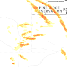
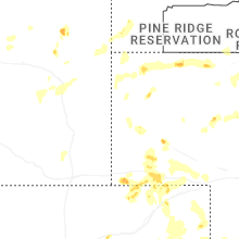
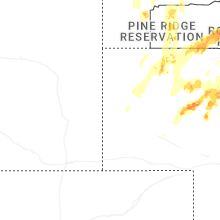


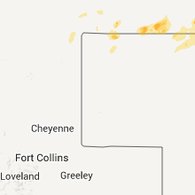

Connect with Interactive Hail Maps