

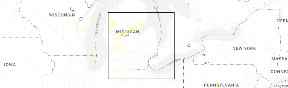
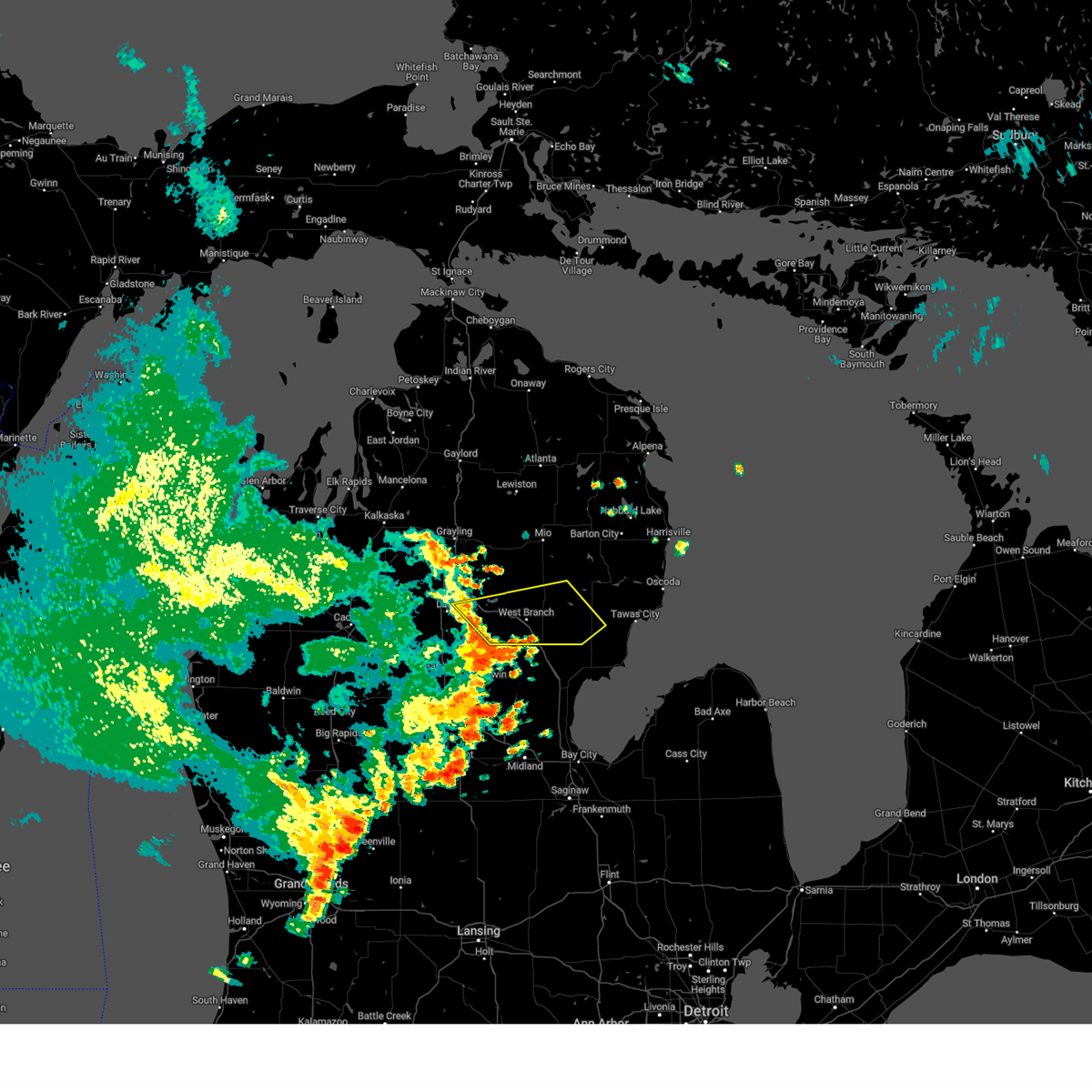
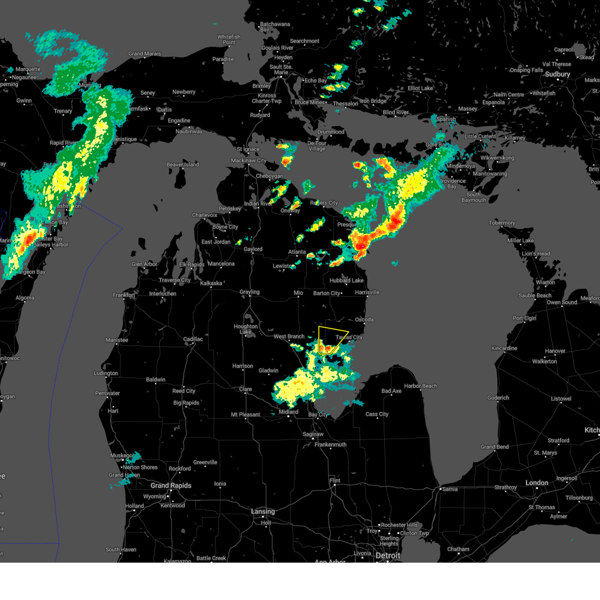
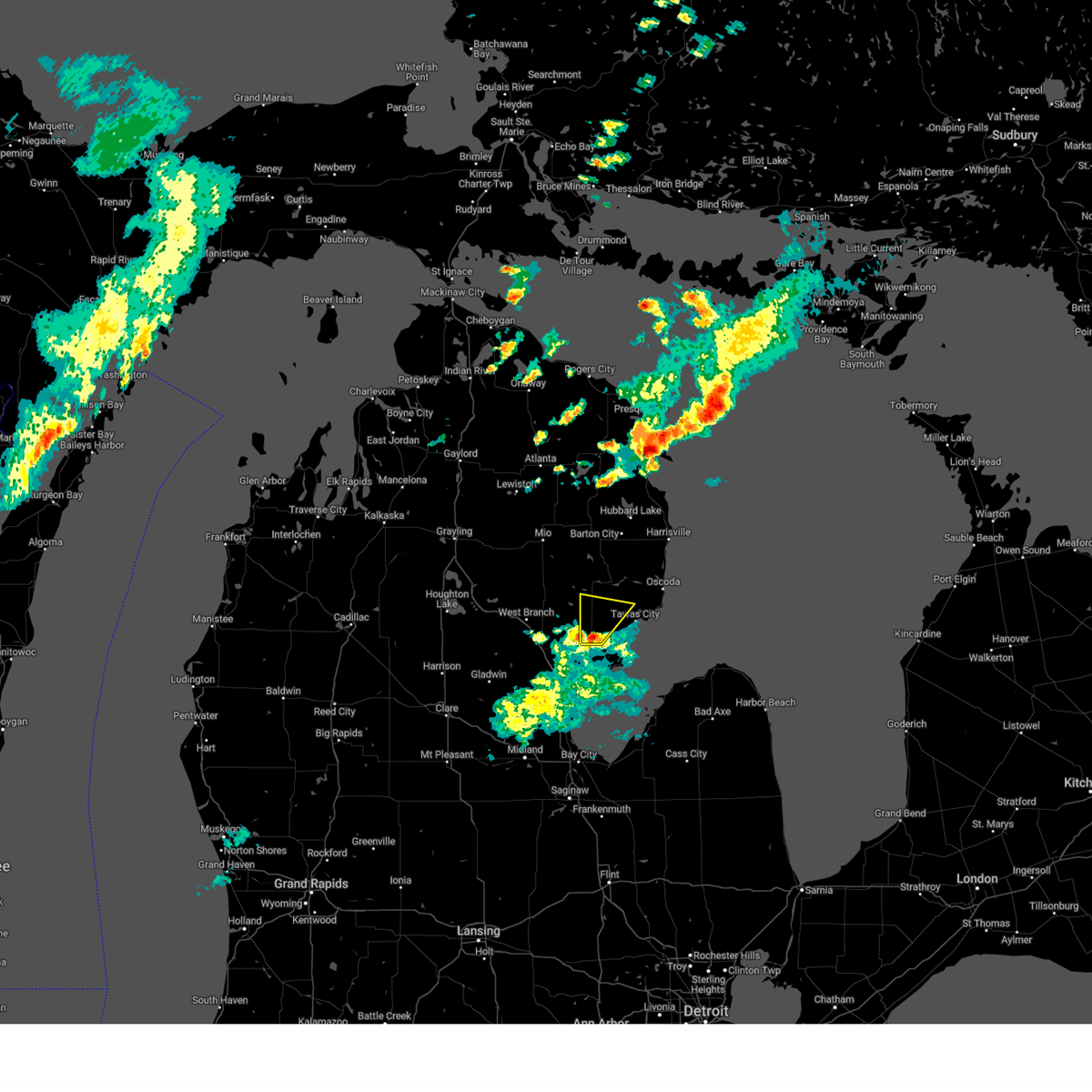
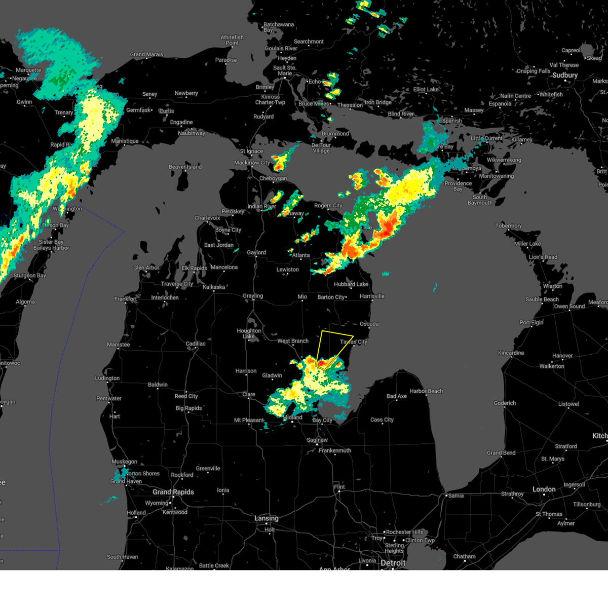
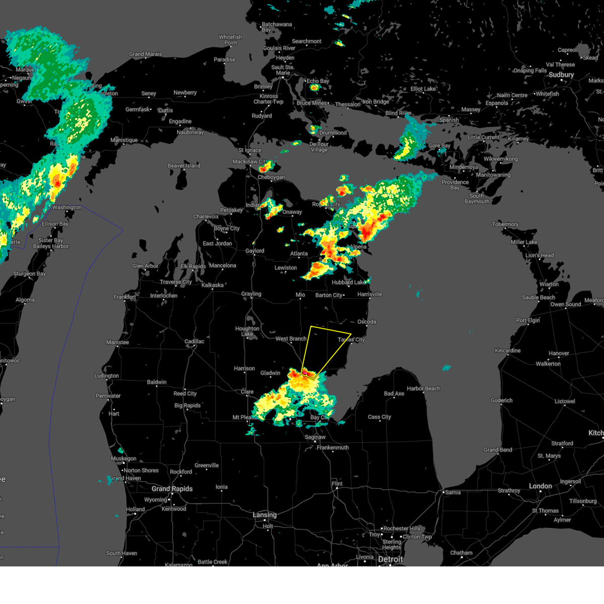
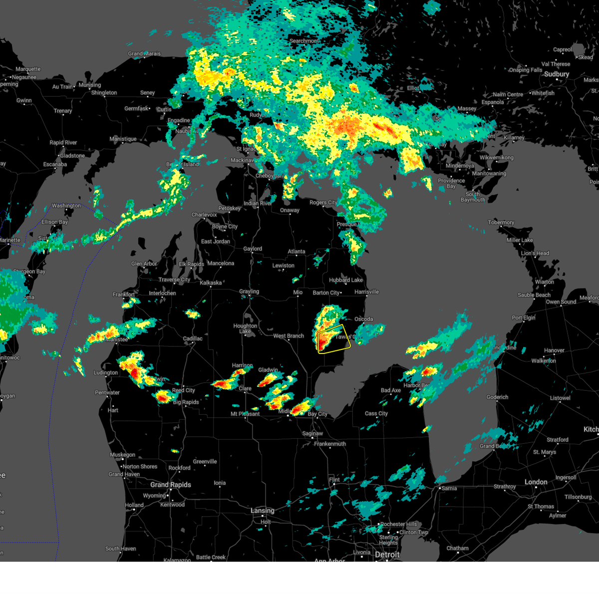
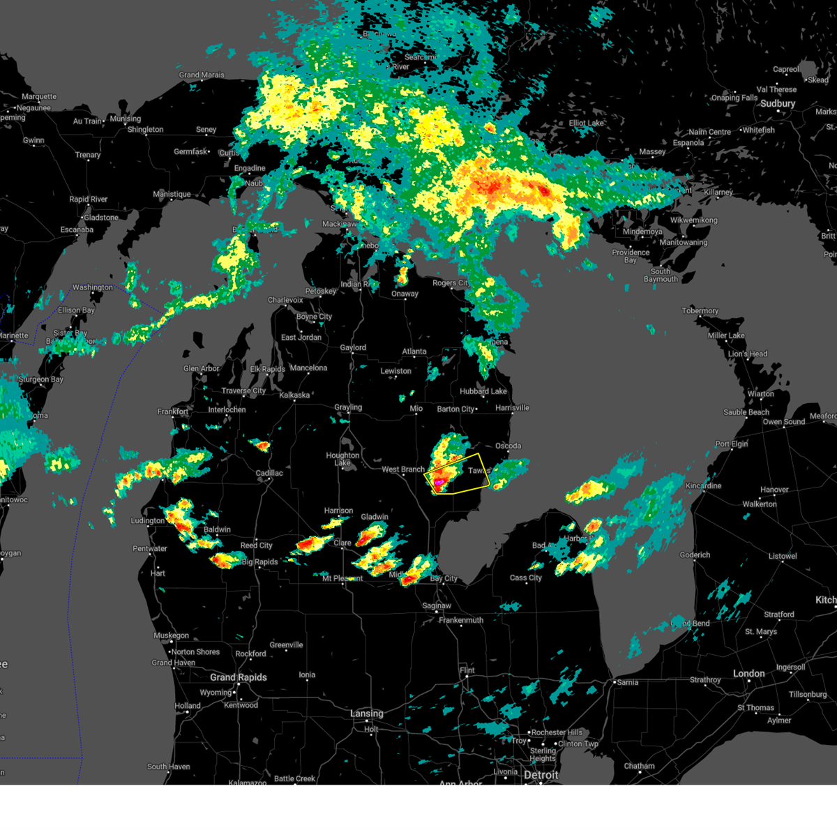
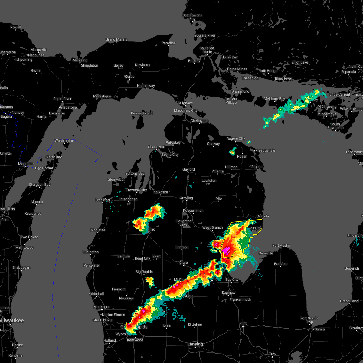
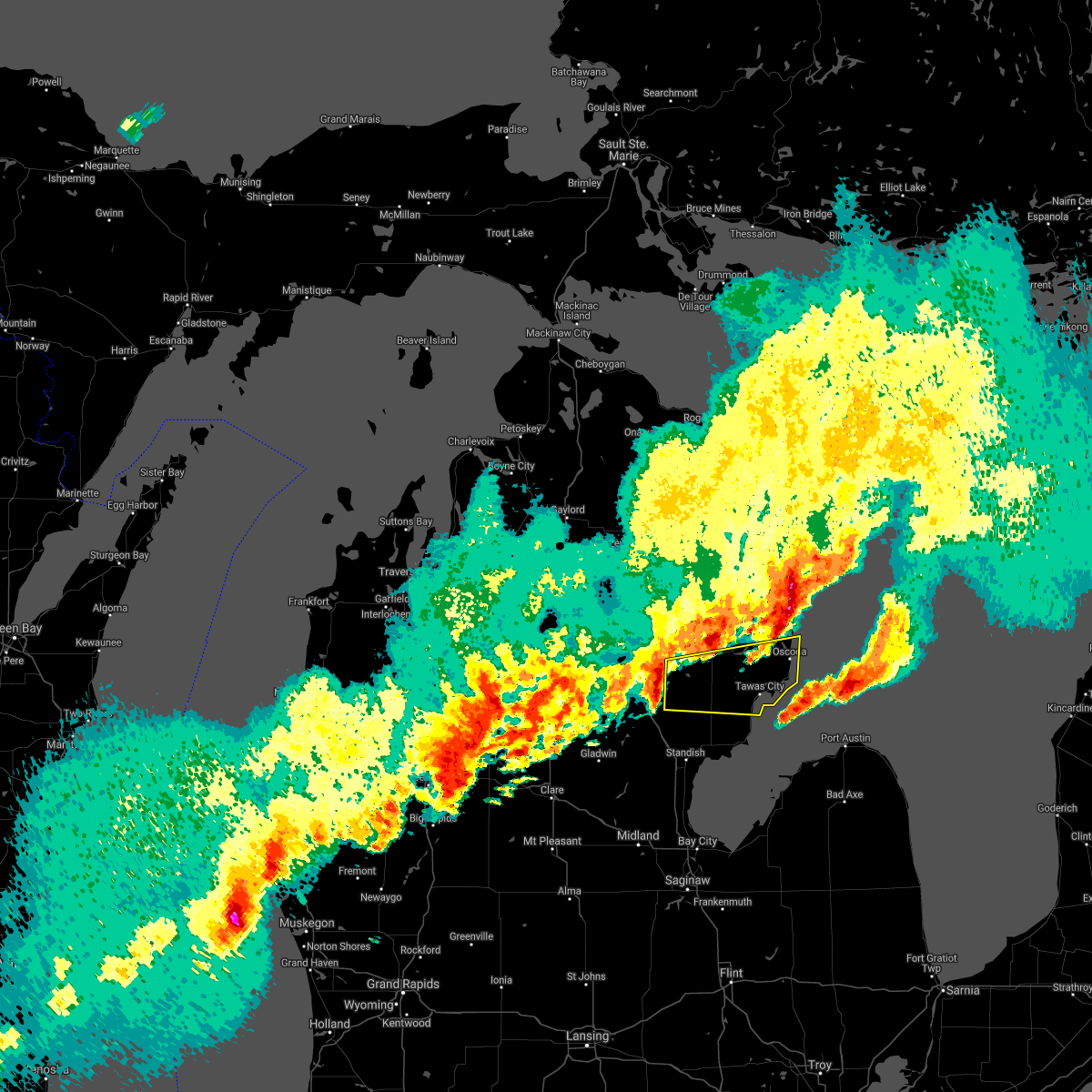
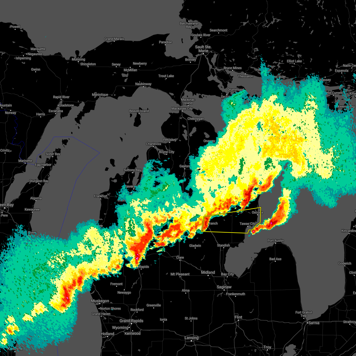
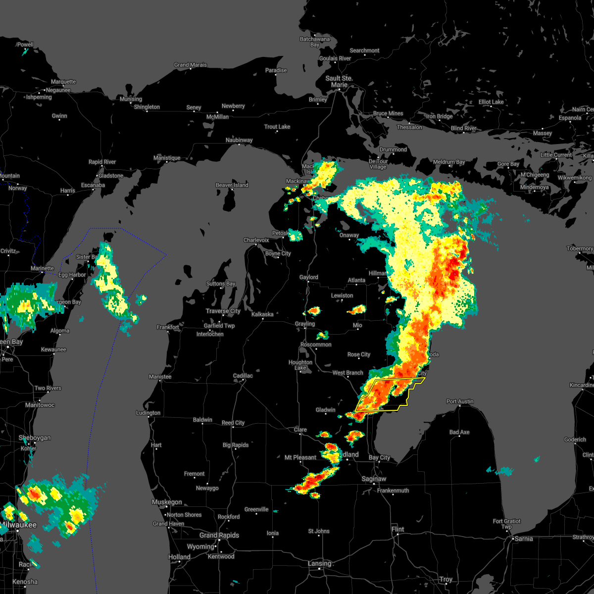
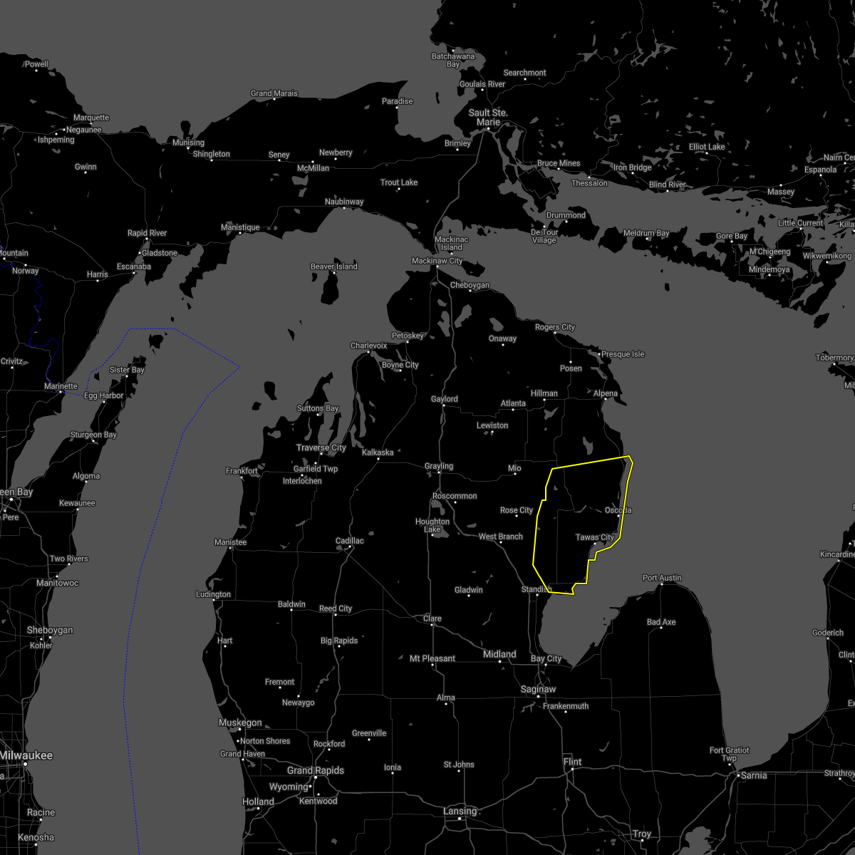
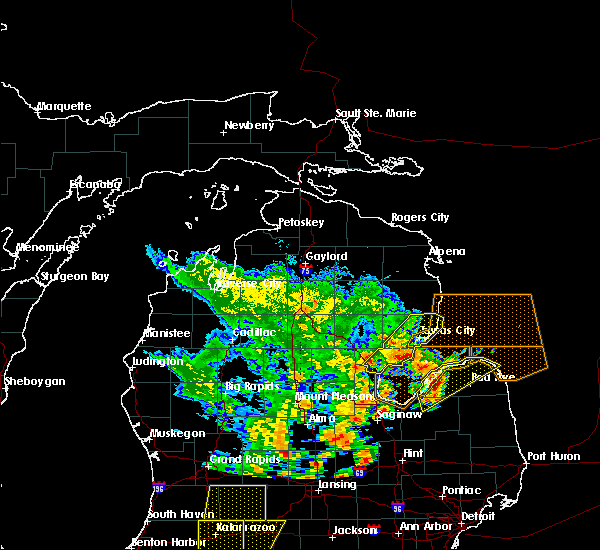
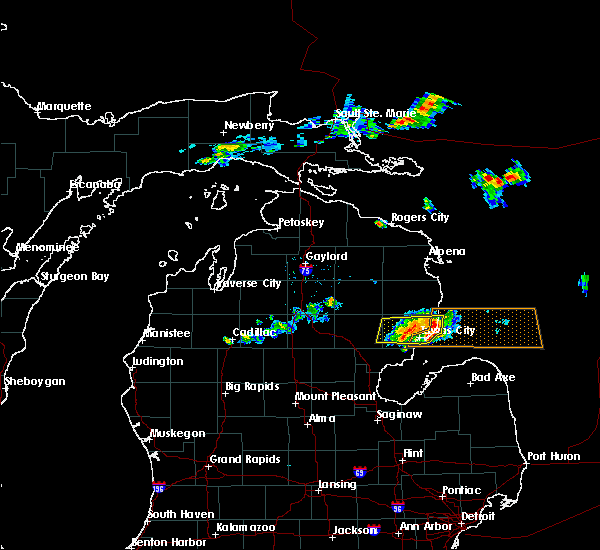
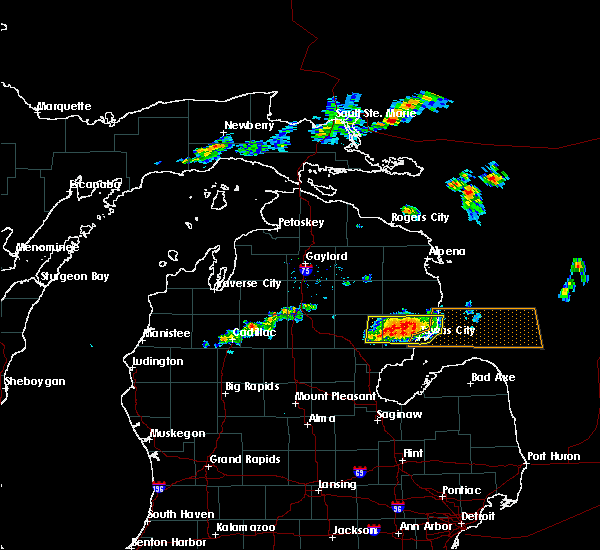
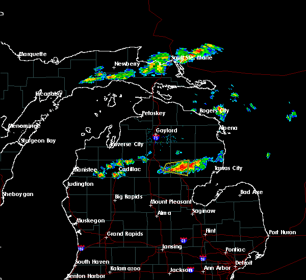
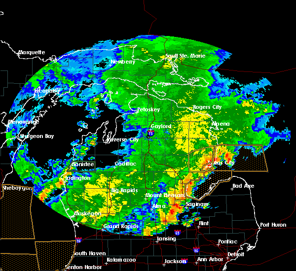
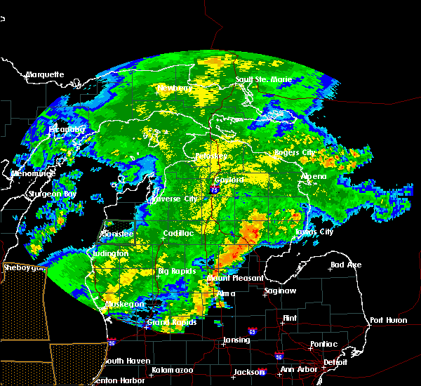
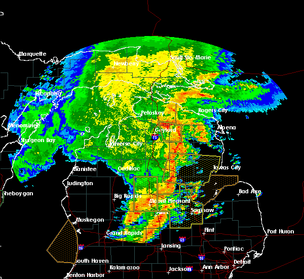
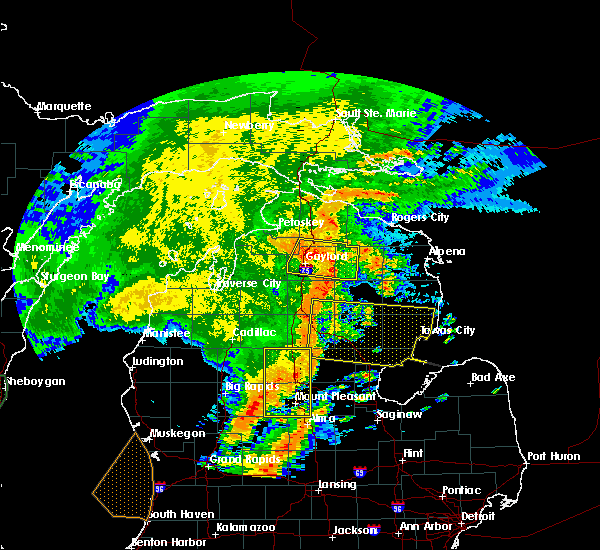
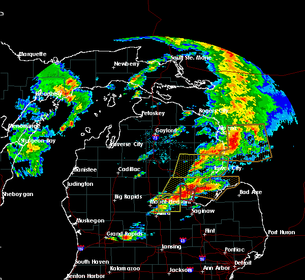
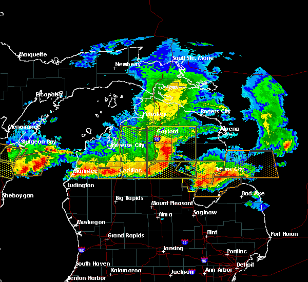
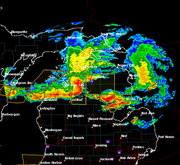
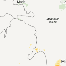
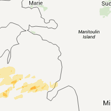
Hail Map for Whittemore, MI
The Whittemore, MI area has had 0 reports of on-the-ground hail by trained spotters, and has been under severe weather warnings 8 times during the past 12 months. Doppler radar has detected hail at or near Whittemore, MI on 25 occasions, including 2 occasions during the past year.
| Name: | Whittemore, MI |
| Where Located: | 59.9 miles SSW of Alpena, MI |
| Map: | Google Map for Whittemore, MI |
| Population: | 384 |
| Housing Units: | 226 |
| More Info: | Search Google for Whittemore, MI |
5
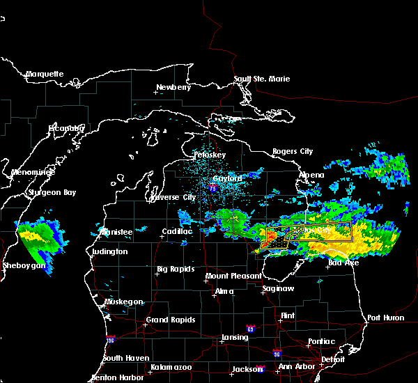
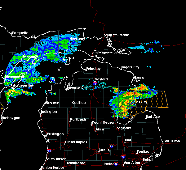
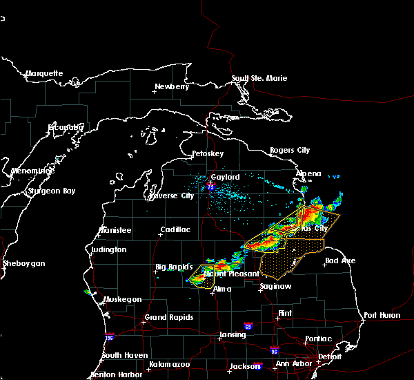
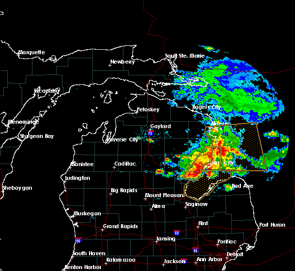
The Top Recent Hail Date for Whittemore, MI is Friday, May 16, 2025 (2nd out of 25)
Hail and Wind Damage Spotted near Whittemore, MI
| Date / Time | Report Details |
|---|---|
| 5/16/2025 11:07 PM EDT | the severe thunderstorm warning has been cancelled and is no longer in effect |
| 5/16/2025 10:23 PM EDT | Svrapx the national weather service in gaylord has issued a * severe thunderstorm warning for, southwestern alcona county in northern michigan, ogemaw county in northern michigan, southern oscoda county in northern michigan, iosco county in northern michigan, * until 1130 pm edt. * at 1023 pm edt, severe thunderstorms were located along a line extending from near st. helen to 6 miles west of whittemore to near national city, moving north at 50 mph (radar indicated). Hazards include 60 mph wind gusts and quarter size hail. Hail damage to vehicles is expected. expect wind damage to roofs, siding, and trees. severe thunderstorms will be near, rose township, rifle river state park, clear lake, plainfield township, rose city, lupton, long lake, and hale around 1030 pm edt. south branch around 1035 pm edt. luzerne, glennie, mack lake, and curtisville around 1040 pm edt. mio around 1045 pm edt. Other locations impacted by these severe thunderstorms include wilber, foster township, sid town, and prescott. |
| 8/27/2024 4:26 PM EDT |
 The storms which prompted the warning have moved out of the area. therefore, the warning will be allowed to expire. a severe thunderstorm watch remains in effect until 800 pm edt for northern michigan. The storms which prompted the warning have moved out of the area. therefore, the warning will be allowed to expire. a severe thunderstorm watch remains in effect until 800 pm edt for northern michigan.
|
| 8/27/2024 4:14 PM EDT |
 Svrapx the national weather service in gaylord has issued a * severe thunderstorm warning for, iosco county in northern michigan, * until 515 pm edt. * at 414 pm edt, severe thunderstorms were located along a line extending from near rose township to near national city to 9 miles east of pinconning, moving east at 40 mph (radar indicated). Hazards include 60 mph wind gusts and quarter size hail. Hail damage to vehicles is expected. expect wind damage to roofs, siding, and trees. severe thunderstorms will be near, tawas city, long lake, plainfield township, hale, and national city around 420 pm edt. east tawas around 425 pm edt. tawas point state park around 430 pm edt. au sable around 445 pm edt. oscoda and wurtsmith airfield around 450 pm edt. Other locations impacted by these severe thunderstorms include wilber and sid town. Svrapx the national weather service in gaylord has issued a * severe thunderstorm warning for, iosco county in northern michigan, * until 515 pm edt. * at 414 pm edt, severe thunderstorms were located along a line extending from near rose township to near national city to 9 miles east of pinconning, moving east at 40 mph (radar indicated). Hazards include 60 mph wind gusts and quarter size hail. Hail damage to vehicles is expected. expect wind damage to roofs, siding, and trees. severe thunderstorms will be near, tawas city, long lake, plainfield township, hale, and national city around 420 pm edt. east tawas around 425 pm edt. tawas point state park around 430 pm edt. au sable around 445 pm edt. oscoda and wurtsmith airfield around 450 pm edt. Other locations impacted by these severe thunderstorms include wilber and sid town.
|
| 8/27/2024 4:12 PM EDT |
 At 411 pm edt, severe thunderstorms were located along a line extending from near west branch to near skidway lake to near alger, moving east at 30 mph (radar indicated). Hazards include 60 mph wind gusts and quarter size hail. Hail damage to vehicles is expected. expect wind damage to roofs, siding, and trees. these severe storms will be near, selkirk and skidway lake around 415 pm edt. whittemore and rifle river state park around 430 pm edt. Other locations impacted by these severe thunderstorms include prescott. At 411 pm edt, severe thunderstorms were located along a line extending from near west branch to near skidway lake to near alger, moving east at 30 mph (radar indicated). Hazards include 60 mph wind gusts and quarter size hail. Hail damage to vehicles is expected. expect wind damage to roofs, siding, and trees. these severe storms will be near, selkirk and skidway lake around 415 pm edt. whittemore and rifle river state park around 430 pm edt. Other locations impacted by these severe thunderstorms include prescott.
|
| 8/27/2024 4:12 PM EDT |
 the severe thunderstorm warning has been cancelled and is no longer in effect the severe thunderstorm warning has been cancelled and is no longer in effect
|
| 8/27/2024 3:50 PM EDT |
 At 350 pm edt, severe thunderstorms were located along a line extending from near st. helen to near west branch to near bowmanville, moving east at 30 mph (radar indicated). Hazards include 60 mph wind gusts and quarter size hail. Hail damage to vehicles is expected. expect wind damage to roofs, siding, and trees. these severe storms will be near, west branch and st. helen around 355 pm edt. skidway lake around 400 pm edt. selkirk around 410 pm edt. whittemore and rifle river state park around 430 pm edt. Other locations impacted by these severe thunderstorms include prescott. At 350 pm edt, severe thunderstorms were located along a line extending from near st. helen to near west branch to near bowmanville, moving east at 30 mph (radar indicated). Hazards include 60 mph wind gusts and quarter size hail. Hail damage to vehicles is expected. expect wind damage to roofs, siding, and trees. these severe storms will be near, west branch and st. helen around 355 pm edt. skidway lake around 400 pm edt. selkirk around 410 pm edt. whittemore and rifle river state park around 430 pm edt. Other locations impacted by these severe thunderstorms include prescott.
|
| 8/27/2024 3:33 PM EDT |
 Svrapx the national weather service in gaylord has issued a * severe thunderstorm warning for, ogemaw county in northern michigan, southeastern roscommon county in northern michigan, southwestern iosco county in northern michigan, * until 430 pm edt. * at 332 pm edt, severe thunderstorms were located along a line extending from near prudenville to twin lakes area to near hockaday, moving east at 25 mph (radar indicated). Hazards include 60 mph wind gusts. Expect damage to roofs, siding, and trees. severe thunderstorms will be near, st. helen, lake st. helen, twin lakes area, and bowmanville around 340 pm edt. west branch around 345 pm edt. skidway lake around 400 pm edt. selkirk around 410 pm edt. Other locations impacted by these severe thunderstorms include prescott. Svrapx the national weather service in gaylord has issued a * severe thunderstorm warning for, ogemaw county in northern michigan, southeastern roscommon county in northern michigan, southwestern iosco county in northern michigan, * until 430 pm edt. * at 332 pm edt, severe thunderstorms were located along a line extending from near prudenville to twin lakes area to near hockaday, moving east at 25 mph (radar indicated). Hazards include 60 mph wind gusts. Expect damage to roofs, siding, and trees. severe thunderstorms will be near, st. helen, lake st. helen, twin lakes area, and bowmanville around 340 pm edt. west branch around 345 pm edt. skidway lake around 400 pm edt. selkirk around 410 pm edt. Other locations impacted by these severe thunderstorms include prescott.
|
| 7/8/2024 8:36 PM EDT |
 the severe thunderstorm warning has been cancelled and is no longer in effect the severe thunderstorm warning has been cancelled and is no longer in effect
|
| 7/8/2024 8:27 PM EDT |
 the severe thunderstorm warning has been cancelled and is no longer in effect the severe thunderstorm warning has been cancelled and is no longer in effect
|
| 7/8/2024 8:27 PM EDT |
 At 826 pm edt, a severe thunderstorm was located over whittemore, or 11 miles northwest of au gres, moving northeast at 35 mph (radar indicated). Hazards include 60 mph wind gusts and quarter size hail. Hail damage to vehicles is expected. expect wind damage to roofs, siding, and trees. this severe storm will be near, whittemore and national city around 830 pm edt. Plainfield township around 835 pm edt. At 826 pm edt, a severe thunderstorm was located over whittemore, or 11 miles northwest of au gres, moving northeast at 35 mph (radar indicated). Hazards include 60 mph wind gusts and quarter size hail. Hail damage to vehicles is expected. expect wind damage to roofs, siding, and trees. this severe storm will be near, whittemore and national city around 830 pm edt. Plainfield township around 835 pm edt.
|
| 7/8/2024 8:19 PM EDT |
 At 817 pm edt, a severe thunderstorm was located over maple ridge, or 9 miles northeast of sterling, moving northeast at 35 mph (radar indicated). Hazards include 60 mph wind gusts and quarter size hail. Hail damage to vehicles is expected. expect wind damage to roofs, siding, and trees. this severe storm will be near, whittemore, turner, and national city around 825 pm edt. plainfield township around 840 pm edt. Other locations impacted by this severe thunderstorm include prescott. At 817 pm edt, a severe thunderstorm was located over maple ridge, or 9 miles northeast of sterling, moving northeast at 35 mph (radar indicated). Hazards include 60 mph wind gusts and quarter size hail. Hail damage to vehicles is expected. expect wind damage to roofs, siding, and trees. this severe storm will be near, whittemore, turner, and national city around 825 pm edt. plainfield township around 840 pm edt. Other locations impacted by this severe thunderstorm include prescott.
|
| 7/8/2024 8:00 PM EDT |
 Svrapx the national weather service in gaylord has issued a * severe thunderstorm warning for, western arenac county in northern michigan, southeastern ogemaw county in northern michigan, southwestern iosco county in northern michigan, * until 900 pm edt. * at 759 pm edt, a severe thunderstorm was located over sterling, moving northeast at 35 mph (radar indicated). Hazards include 60 mph wind gusts and quarter size hail. Hail damage to vehicles is expected. expect wind damage to roofs, siding, and trees. this severe thunderstorm will be near, sterling, maple ridge, omer, and skidway lake around 805 pm edt. twining around 820 pm edt. whittemore and turner around 825 pm edt. hale around 840 pm edt. Other locations impacted by this severe thunderstorm include prescott. Svrapx the national weather service in gaylord has issued a * severe thunderstorm warning for, western arenac county in northern michigan, southeastern ogemaw county in northern michigan, southwestern iosco county in northern michigan, * until 900 pm edt. * at 759 pm edt, a severe thunderstorm was located over sterling, moving northeast at 35 mph (radar indicated). Hazards include 60 mph wind gusts and quarter size hail. Hail damage to vehicles is expected. expect wind damage to roofs, siding, and trees. this severe thunderstorm will be near, sterling, maple ridge, omer, and skidway lake around 805 pm edt. twining around 820 pm edt. whittemore and turner around 825 pm edt. hale around 840 pm edt. Other locations impacted by this severe thunderstorm include prescott.
|
| 7/5/2024 2:36 PM EDT | Camper blown ove in iosco county MI, 0.6 miles SSW of Whittemore, MI |
| 7/5/2024 2:31 PM EDT |
 the severe thunderstorm warning has been cancelled and is no longer in effect the severe thunderstorm warning has been cancelled and is no longer in effect
|
| 7/5/2024 2:31 PM EDT |
 At 230 pm edt, a severe thunderstorm was located over whittemore, or 15 miles northwest of au gres, moving east at 20 mph (radar indicated). Hazards include 60 mph wind gusts and quarter size hail. Hail damage to vehicles is expected. expect wind damage to roofs, siding, and trees. this severe storm will be near, whittemore and national city around 235 pm edt. plainfield township around 240 pm edt. Tawas city around 250 pm edt. At 230 pm edt, a severe thunderstorm was located over whittemore, or 15 miles northwest of au gres, moving east at 20 mph (radar indicated). Hazards include 60 mph wind gusts and quarter size hail. Hail damage to vehicles is expected. expect wind damage to roofs, siding, and trees. this severe storm will be near, whittemore and national city around 235 pm edt. plainfield township around 240 pm edt. Tawas city around 250 pm edt.
|
| 7/5/2024 2:18 PM EDT |
 Svrapx the national weather service in gaylord has issued a * severe thunderstorm warning for, southeastern ogemaw county in northern michigan, southwestern iosco county in northern michigan, * until 300 pm edt. * at 218 pm edt, a severe thunderstorm was located near whittemore, or 12 miles northeast of alger, moving northeast at 25 mph (radar indicated). Hazards include quarter size hail. Damage to vehicles is expected. this severe thunderstorm will be near, whittemore and national city around 225 pm edt. plainfield township around 235 pm edt. Other locations impacted by this severe thunderstorm include prescott. Svrapx the national weather service in gaylord has issued a * severe thunderstorm warning for, southeastern ogemaw county in northern michigan, southwestern iosco county in northern michigan, * until 300 pm edt. * at 218 pm edt, a severe thunderstorm was located near whittemore, or 12 miles northeast of alger, moving northeast at 25 mph (radar indicated). Hazards include quarter size hail. Damage to vehicles is expected. this severe thunderstorm will be near, whittemore and national city around 225 pm edt. plainfield township around 235 pm edt. Other locations impacted by this severe thunderstorm include prescott.
|
| 9/21/2022 8:58 AM EDT |
 At 857 am edt, severe thunderstorms were located along a line extending from plainfield township to pinconning, moving east at 50 mph (radar indicated). Hazards include quarter size hail. Damage to vehicles is expected. locations impacted include, east tawas, tawas city, standish, au gres, sterling, au sable, maple ridge, whittemore, omer, twining, turner, tawas point state park, plainfield township, national city, hale, skidway lake, wilber and prescott. hail threat, radar indicated max hail size, 1. 00 in wind threat, radar indicated max wind gust, <50 mph. At 857 am edt, severe thunderstorms were located along a line extending from plainfield township to pinconning, moving east at 50 mph (radar indicated). Hazards include quarter size hail. Damage to vehicles is expected. locations impacted include, east tawas, tawas city, standish, au gres, sterling, au sable, maple ridge, whittemore, omer, twining, turner, tawas point state park, plainfield township, national city, hale, skidway lake, wilber and prescott. hail threat, radar indicated max hail size, 1. 00 in wind threat, radar indicated max wind gust, <50 mph.
|
| 9/21/2022 8:35 AM EDT |
 At 834 am edt, a severe thunderstorm was located over skidway lake, or near alger, moving east at 50 mph (radar indicated). Hazards include quarter size hail. damage to vehicles is expected At 834 am edt, a severe thunderstorm was located over skidway lake, or near alger, moving east at 50 mph (radar indicated). Hazards include quarter size hail. damage to vehicles is expected
|
| 8/28/2022 7:26 PM EDT | At 726 pm edt, a severe thunderstorm was located over whittemore, or 14 miles west of tawas city, moving northeast at 30 mph (radar indicated). Hazards include 60 mph wind gusts and quarter size hail. Hail damage to vehicles is expected. expect wind damage to roofs, siding, and trees. locations impacted include, east tawas, tawas city, au sable, maple ridge, whittemore, hale, plainfield township, national city, skidway lake, wilber, prescott and sid town. hail threat, radar indicated max hail size, 1. 00 in wind threat, radar indicated max wind gust, 60 mph. |
| 8/28/2022 7:12 PM EDT | At 711 pm edt, a severe thunderstorm was located near maple ridge, or 11 miles northeast of alger, moving northeast at 30 mph (radar indicated). Hazards include 60 mph wind gusts and quarter size hail. Hail damage to vehicles is expected. Expect wind damage to roofs, siding, and trees. |
| 8/3/2022 12:07 PM EDT |
 At 1207 pm edt, a severe thunderstorm was located near mikado, or 10 miles northwest of oscoda, moving east at 65 mph (radar indicated. this storm has a history of producing tree and powerline damage). Hazards include 60 mph wind gusts and quarter size hail. Hail damage to vehicles is expected. expect wind damage to roofs, siding, and trees. locations impacted include, oscoda, east tawas, tawas city, harrisville, au sable, glennie, south branch, mikado, whittemore, lincoln, tawas point state park, curran, plainfield township, national city, black river, wurtsmith airfield, barton city, curtisville, hale and harrisville state park. hail threat, radar indicated max hail size, 1. 00 in wind threat, observed max wind gust, 60 mph. At 1207 pm edt, a severe thunderstorm was located near mikado, or 10 miles northwest of oscoda, moving east at 65 mph (radar indicated. this storm has a history of producing tree and powerline damage). Hazards include 60 mph wind gusts and quarter size hail. Hail damage to vehicles is expected. expect wind damage to roofs, siding, and trees. locations impacted include, oscoda, east tawas, tawas city, harrisville, au sable, glennie, south branch, mikado, whittemore, lincoln, tawas point state park, curran, plainfield township, national city, black river, wurtsmith airfield, barton city, curtisville, hale and harrisville state park. hail threat, radar indicated max hail size, 1. 00 in wind threat, observed max wind gust, 60 mph.
|
| 8/3/2022 11:56 AM EDT |
 At 1155 am edt, a severe thunderstorm was located near glennie, moving east at 70 mph (radar indicated. this storm has a history of producing tree and powerline damage). Hazards include 60 mph wind gusts and quarter size hail. Hail damage to vehicles is expected. expect wind damage to roofs, siding, and trees. locations impacted include, oscoda, au sable, mikado, wurtsmith airfield and harrisville state park. hail threat, radar indicated max hail size, 1. 00 in wind threat, observed max wind gust, 60 mph. At 1155 am edt, a severe thunderstorm was located near glennie, moving east at 70 mph (radar indicated. this storm has a history of producing tree and powerline damage). Hazards include 60 mph wind gusts and quarter size hail. Hail damage to vehicles is expected. expect wind damage to roofs, siding, and trees. locations impacted include, oscoda, au sable, mikado, wurtsmith airfield and harrisville state park. hail threat, radar indicated max hail size, 1. 00 in wind threat, observed max wind gust, 60 mph.
|
| 8/3/2022 11:41 AM EDT |
 At 1140 am edt, a severe thunderstorm was located over rose city, or 12 miles northeast of west branch, moving east at 60 mph (radar indicated. this storm has a history of producing tree and powerline damage across wexford and missaukee counties). Hazards include 60 mph wind gusts. Expect damage to roofs, siding, and trees. this severe thunderstorm will be near, long lake, south branch, hale and curtisville around 1150 am edt. glennie around 1200 pm edt. other locations in the path of this severe thunderstorm include au sable, mikado, wurtsmith airfield, oscoda and harrisville state park. hail threat, radar indicated max hail size, <. 75 in wind threat, observed max wind gust, 60 mph. At 1140 am edt, a severe thunderstorm was located over rose city, or 12 miles northeast of west branch, moving east at 60 mph (radar indicated. this storm has a history of producing tree and powerline damage across wexford and missaukee counties). Hazards include 60 mph wind gusts. Expect damage to roofs, siding, and trees. this severe thunderstorm will be near, long lake, south branch, hale and curtisville around 1150 am edt. glennie around 1200 pm edt. other locations in the path of this severe thunderstorm include au sable, mikado, wurtsmith airfield, oscoda and harrisville state park. hail threat, radar indicated max hail size, <. 75 in wind threat, observed max wind gust, 60 mph.
|
| 9/7/2021 2:12 PM EDT |
 At 212 pm edt, a severe thunderstorm was located near hale, or 14 miles west of tawas city, moving east at 50 mph (radar indicated). Hazards include 60 mph wind gusts and quarter size hail. Hail damage to vehicles is expected. expect wind damage to roofs, siding, and trees. locations impacted include, oscoda, east tawas, tawas city, au sable, whittemore, hale, tawas point state park, plainfield township, wurtsmith airfield, national city, wilber and sid town. hail threat, radar indicated max hail size, 1. 00 in wind threat, radar indicated max wind gust, 60 mph. At 212 pm edt, a severe thunderstorm was located near hale, or 14 miles west of tawas city, moving east at 50 mph (radar indicated). Hazards include 60 mph wind gusts and quarter size hail. Hail damage to vehicles is expected. expect wind damage to roofs, siding, and trees. locations impacted include, oscoda, east tawas, tawas city, au sable, whittemore, hale, tawas point state park, plainfield township, wurtsmith airfield, national city, wilber and sid town. hail threat, radar indicated max hail size, 1. 00 in wind threat, radar indicated max wind gust, 60 mph.
|
| 9/7/2021 2:01 PM EDT |
 At 201 pm edt, a severe thunderstorm was located near selkirk, or 12 miles east of west branch, moving east at 50 mph (radar indicated). Hazards include 60 mph wind gusts and quarter size hail. Hail damage to vehicles is expected. expect wind damage to roofs, siding, and trees. locations impacted include, long lake, whittemore, hale, national city, plainfield township, tawas city, east tawas, tawas point state park, oscoda, au sable and wurtsmith airfield. hail threat, radar indicated max hail size, 1. 00 in wind threat, radar indicated max wind gust, 60 mph. At 201 pm edt, a severe thunderstorm was located near selkirk, or 12 miles east of west branch, moving east at 50 mph (radar indicated). Hazards include 60 mph wind gusts and quarter size hail. Hail damage to vehicles is expected. expect wind damage to roofs, siding, and trees. locations impacted include, long lake, whittemore, hale, national city, plainfield township, tawas city, east tawas, tawas point state park, oscoda, au sable and wurtsmith airfield. hail threat, radar indicated max hail size, 1. 00 in wind threat, radar indicated max wind gust, 60 mph.
|
| 9/7/2021 1:47 PM EDT |
 At 147 pm edt, a severe thunderstorm was located over west branch, moving east at 50 mph (radar indicated). Hazards include 60 mph wind gusts and quarter size hail. Hail damage to vehicles is expected. expect wind damage to roofs, siding, and trees. this severe thunderstorm will be near, rose city, selkirk and skidway lake around 155 pm edt. rifle river state park around 200 pm edt. other locations in the path of this severe thunderstorm include long lake, whittemore, hale, plainfield township, national city, tawas city, east tawas, tawas point state park, oscoda, au sable and wurtsmith airfield. hail threat, radar indicated max hail size, 1. 00 in wind threat, radar indicated max wind gust, 60 mph. At 147 pm edt, a severe thunderstorm was located over west branch, moving east at 50 mph (radar indicated). Hazards include 60 mph wind gusts and quarter size hail. Hail damage to vehicles is expected. expect wind damage to roofs, siding, and trees. this severe thunderstorm will be near, rose city, selkirk and skidway lake around 155 pm edt. rifle river state park around 200 pm edt. other locations in the path of this severe thunderstorm include long lake, whittemore, hale, plainfield township, national city, tawas city, east tawas, tawas point state park, oscoda, au sable and wurtsmith airfield. hail threat, radar indicated max hail size, 1. 00 in wind threat, radar indicated max wind gust, 60 mph.
|
| 8/28/2021 5:27 PM EDT |
 At 526 pm edt, a severe thunderstorm was located over twining, or 7 miles northwest of au gres, moving east at 35 mph (radar indicated). Hazards include 60 mph wind gusts and quarter size hail. Hail damage to vehicles is expected. expect wind damage to roofs, siding, and trees. locations impacted include, turner and au gres. hail threat, radar indicated max hail size, 1. 00 in wind threat, radar indicated max wind gust, 60 mph. At 526 pm edt, a severe thunderstorm was located over twining, or 7 miles northwest of au gres, moving east at 35 mph (radar indicated). Hazards include 60 mph wind gusts and quarter size hail. Hail damage to vehicles is expected. expect wind damage to roofs, siding, and trees. locations impacted include, turner and au gres. hail threat, radar indicated max hail size, 1. 00 in wind threat, radar indicated max wind gust, 60 mph.
|
| 8/28/2021 5:15 PM EDT | Iosco county dispatch reports trees down near whittemor in iosco county MI, 0.2 miles NW of Whittemore, MI |
| 8/28/2021 5:05 PM EDT |
 At 505 pm edt, a severe thunderstorm was located near alger, moving east at 35 mph (radar indicated). Hazards include 60 mph wind gusts and quarter size hail. Hail damage to vehicles is expected. expect wind damage to roofs, siding, and trees. this severe thunderstorm will be near, maple ridge around 520 pm edt. omer around 525 pm edt. other locations in the path of this severe thunderstorm include twining, turner and au gres. hail threat, radar indicated max hail size, 1. 00 in wind threat, radar indicated max wind gust, 60 mph. At 505 pm edt, a severe thunderstorm was located near alger, moving east at 35 mph (radar indicated). Hazards include 60 mph wind gusts and quarter size hail. Hail damage to vehicles is expected. expect wind damage to roofs, siding, and trees. this severe thunderstorm will be near, maple ridge around 520 pm edt. omer around 525 pm edt. other locations in the path of this severe thunderstorm include twining, turner and au gres. hail threat, radar indicated max hail size, 1. 00 in wind threat, radar indicated max wind gust, 60 mph.
|
| 8/28/2021 4:52 PM EDT |
 At 452 pm edt, severe thunderstorms were located along a line extending from glennie to near whittemore, moving east at 35 mph (radar indicated). Hazards include 60 mph wind gusts and quarter size hail. Hail damage to vehicles is expected. expect wind damage to roofs, siding, and trees. severe thunderstorms will be near, glennie around 500 pm edt. plainfield township around 510 pm edt. other locations in the path of these severe thunderstorms include mikado, tawas city, east tawas, harrisville, tawas point state park and harrisville state park. hail threat, radar indicated max hail size, 1. 00 in wind threat, radar indicated max wind gust, 60 mph. At 452 pm edt, severe thunderstorms were located along a line extending from glennie to near whittemore, moving east at 35 mph (radar indicated). Hazards include 60 mph wind gusts and quarter size hail. Hail damage to vehicles is expected. expect wind damage to roofs, siding, and trees. severe thunderstorms will be near, glennie around 500 pm edt. plainfield township around 510 pm edt. other locations in the path of these severe thunderstorms include mikado, tawas city, east tawas, harrisville, tawas point state park and harrisville state park. hail threat, radar indicated max hail size, 1. 00 in wind threat, radar indicated max wind gust, 60 mph.
|
| 8/11/2021 12:48 AM EDT |
 At 1247 am edt, severe thunderstorms were located along a line extending from near glennie to near hale to twining, moving east at 45 mph (radar indicated). Hazards include 60 mph wind gusts and penny size hail. Expect damage to roofs, siding, and trees. locations impacted include, glennie, long lake, national city, au gres, plainfield township, barton city, tawas city, east tawas, mikado, tawas point state park, lincoln, wurtsmith airfield, oscoda, harrisville, au sable and harrisville state park. hail threat, radar indicated max hail size, 0. 75 in wind threat, radar indicated max wind gust, 60 mph. At 1247 am edt, severe thunderstorms were located along a line extending from near glennie to near hale to twining, moving east at 45 mph (radar indicated). Hazards include 60 mph wind gusts and penny size hail. Expect damage to roofs, siding, and trees. locations impacted include, glennie, long lake, national city, au gres, plainfield township, barton city, tawas city, east tawas, mikado, tawas point state park, lincoln, wurtsmith airfield, oscoda, harrisville, au sable and harrisville state park. hail threat, radar indicated max hail size, 0. 75 in wind threat, radar indicated max wind gust, 60 mph.
|
| 8/11/2021 12:28 AM EDT |
 At 1227 am edt, severe thunderstorms were located along a line extending from near mckinley to selkirk to 7 miles south of rhodes, moving east at 50 mph (radar indicated). Hazards include 60 mph wind gusts and penny size hail. Expect damage to roofs, siding, and trees. severe thunderstorms will be near, mckinley, curtisville and rifle river state park around 1235 am edt. long lake around 1240 am edt. glennie, whittemore and hale around 1245 am edt. other locations in the path of these severe thunderstorms include plainfield township, barton city, national city, tawas city, mikado, lincoln, east tawas, tawas point state park, harrisville, harrisville state park, wurtsmith airfield, oscoda and au sable. hail threat, radar indicated max hail size, 0. 75 in wind threat, radar indicated max wind gust, 60 mph. At 1227 am edt, severe thunderstorms were located along a line extending from near mckinley to selkirk to 7 miles south of rhodes, moving east at 50 mph (radar indicated). Hazards include 60 mph wind gusts and penny size hail. Expect damage to roofs, siding, and trees. severe thunderstorms will be near, mckinley, curtisville and rifle river state park around 1235 am edt. long lake around 1240 am edt. glennie, whittemore and hale around 1245 am edt. other locations in the path of these severe thunderstorms include plainfield township, barton city, national city, tawas city, mikado, lincoln, east tawas, tawas point state park, harrisville, harrisville state park, wurtsmith airfield, oscoda and au sable. hail threat, radar indicated max hail size, 0. 75 in wind threat, radar indicated max wind gust, 60 mph.
|
| 7/19/2020 8:02 AM EDT |
 At 801 am edt, a severe thunderstorm was located 8 miles northeast of au gres, moving southeast at 45 mph (radar indicated). Hazards include 60 mph wind gusts. Expect damage to roofs, siding, and trees. Locations impacted include, east tawas, tawas city, au gres, maple ridge, whittemore, twining, turner, skidway lake, tawas point state park, plainfield township, national city and prescott. At 801 am edt, a severe thunderstorm was located 8 miles northeast of au gres, moving southeast at 45 mph (radar indicated). Hazards include 60 mph wind gusts. Expect damage to roofs, siding, and trees. Locations impacted include, east tawas, tawas city, au gres, maple ridge, whittemore, twining, turner, skidway lake, tawas point state park, plainfield township, national city and prescott.
|
| 7/19/2020 7:33 AM EDT |
 At 732 am edt, a severe thunderstorm was located near rifle river state park, or 15 miles east of west branch, moving southeast at 45 mph (radar indicated). Hazards include 60 mph wind gusts. expect damage to roofs, siding, and trees At 732 am edt, a severe thunderstorm was located near rifle river state park, or 15 miles east of west branch, moving southeast at 45 mph (radar indicated). Hazards include 60 mph wind gusts. expect damage to roofs, siding, and trees
|
| 6/10/2020 2:00 PM EDT |
 At 158 pm edt, a severe thunderstorm was located near national city, or near tawas city, moving northeast at 50 mph (law enforcement). Hazards include 60 mph wind gusts. Expect damage to roofs, siding, and trees. Locations impacted include, oscoda, east tawas, tawas city, standish, au gres, sterling, au sable, maple ridge, whittemore, omer, twining, turner, tawas point state park, plainfield township, national city, wurtsmith airfield, wilber and sid town. At 158 pm edt, a severe thunderstorm was located near national city, or near tawas city, moving northeast at 50 mph (law enforcement). Hazards include 60 mph wind gusts. Expect damage to roofs, siding, and trees. Locations impacted include, oscoda, east tawas, tawas city, standish, au gres, sterling, au sable, maple ridge, whittemore, omer, twining, turner, tawas point state park, plainfield township, national city, wurtsmith airfield, wilber and sid town.
|
| 6/10/2020 1:44 PM EDT |
 At 144 pm edt, doppler radar indicated a severe thunderstorm capable of producing damaging winds in excess of 60 mph. this storm was located over omer, or near standish, and moving northeast at 75 mph. At 144 pm edt, doppler radar indicated a severe thunderstorm capable of producing damaging winds in excess of 60 mph. this storm was located over omer, or near standish, and moving northeast at 75 mph.
|
| 7/27/2019 3:41 PM EDT |
 The severe thunderstorm warning for east central ogemaw and iosco counties will expire at 345 pm edt, the storm which prompted the warning has weakened below severe limits, and is exiting the warned area. therefore, the warning will be allowed to expire. however heavy rain is still possible with this thunderstorm. The severe thunderstorm warning for east central ogemaw and iosco counties will expire at 345 pm edt, the storm which prompted the warning has weakened below severe limits, and is exiting the warned area. therefore, the warning will be allowed to expire. however heavy rain is still possible with this thunderstorm.
|
| 7/27/2019 3:21 PM EDT |
 At 253 pm edt, a severe thunderstorm was located near rifle river state park, or 12 miles northeast of west branch, moving east at 35 mph (law enforcement reported trees down over power lines 2 miles east of st. helen). Hazards include 60 mph wind gusts and quarter size hail. Hail damage to vehicles is expected. expect wind damage to roofs, siding, and trees. Locations impacted include, oscoda, east tawas, tawas city, au sable, south branch, whittemore, tawas point state park, plainfield township, rifle river state park, national city, hale, lupton, wurtsmith airfield, wilber and sid town. At 253 pm edt, a severe thunderstorm was located near rifle river state park, or 12 miles northeast of west branch, moving east at 35 mph (law enforcement reported trees down over power lines 2 miles east of st. helen). Hazards include 60 mph wind gusts and quarter size hail. Hail damage to vehicles is expected. expect wind damage to roofs, siding, and trees. Locations impacted include, oscoda, east tawas, tawas city, au sable, south branch, whittemore, tawas point state park, plainfield township, rifle river state park, national city, hale, lupton, wurtsmith airfield, wilber and sid town.
|
| 7/27/2019 2:54 PM EDT |
 At 253 pm edt, a severe thunderstorm was located near rifle river state park, or 12 miles northeast of west branch, moving east at 35 mph (law enforcement reported trees down over power lines 2 miles east of st. helen). Hazards include 60 mph wind gusts and quarter size hail. Hail damage to vehicles is expected. expect wind damage to roofs, siding, and trees. Locations impacted include, oscoda, east tawas, tawas city, au sable, south branch, whittemore, tawas point state park, plainfield township, rifle river state park, national city, hale, lupton, wurtsmith airfield, wilber and sid town. At 253 pm edt, a severe thunderstorm was located near rifle river state park, or 12 miles northeast of west branch, moving east at 35 mph (law enforcement reported trees down over power lines 2 miles east of st. helen). Hazards include 60 mph wind gusts and quarter size hail. Hail damage to vehicles is expected. expect wind damage to roofs, siding, and trees. Locations impacted include, oscoda, east tawas, tawas city, au sable, south branch, whittemore, tawas point state park, plainfield township, rifle river state park, national city, hale, lupton, wurtsmith airfield, wilber and sid town.
|
| 7/27/2019 2:48 PM EDT |
 At 247 pm edt, a severe thunderstorm was located over selkirk, or 9 miles northeast of west branch, moving east at 35 mph (radar indicated). Hazards include 60 mph wind gusts and quarter size hail. Hail damage to vehicles is expected. Expect wind damage to roofs, siding, and trees. At 247 pm edt, a severe thunderstorm was located over selkirk, or 9 miles northeast of west branch, moving east at 35 mph (radar indicated). Hazards include 60 mph wind gusts and quarter size hail. Hail damage to vehicles is expected. Expect wind damage to roofs, siding, and trees.
|
| 7/20/2019 5:04 PM EDT |
 At 504 pm edt, severe thunderstorms were located along a line extending from 8 miles west of wurtsmith airfield to tawas point state park to near au gres, moving east at 45 mph (radar indicated). Hazards include 60 mph wind gusts. Expect damage to roofs, siding, and trees. Locations impacted include, east tawas, tawas city, whittemore, tawas point state park, plainfield township, wurtsmith airfield, national city, wilber and sid town. At 504 pm edt, severe thunderstorms were located along a line extending from 8 miles west of wurtsmith airfield to tawas point state park to near au gres, moving east at 45 mph (radar indicated). Hazards include 60 mph wind gusts. Expect damage to roofs, siding, and trees. Locations impacted include, east tawas, tawas city, whittemore, tawas point state park, plainfield township, wurtsmith airfield, national city, wilber and sid town.
|
| 7/20/2019 4:52 PM EDT |
 At 450 pm edt, doppler radar indicated a line of severe thunderstorms located along a line extending from near curtisville to near national city to omer, moving east at 50 mph (radar indicated). Hazards include 60 mph wind gusts. Expect damage to roofs, siding, and trees. Locations impacted include, east tawas, tawas city, glennie, south branch, mikado, whittemore, lincoln, tawas point state park, plainfield township, national city, hale, wurtsmith airfield, wilber and sid town. At 450 pm edt, doppler radar indicated a line of severe thunderstorms located along a line extending from near curtisville to near national city to omer, moving east at 50 mph (radar indicated). Hazards include 60 mph wind gusts. Expect damage to roofs, siding, and trees. Locations impacted include, east tawas, tawas city, glennie, south branch, mikado, whittemore, lincoln, tawas point state park, plainfield township, national city, hale, wurtsmith airfield, wilber and sid town.
|
| 7/20/2019 4:31 PM EDT |
 At 431 pm edt, doppler radar indicated a line of severe thunderstorms capable of producing damaging winds in excess of 60 mph. these storms were located along a line extending from mckinley to near skidway lake to near alger, and moving east at 35 mph. At 431 pm edt, doppler radar indicated a line of severe thunderstorms capable of producing damaging winds in excess of 60 mph. these storms were located along a line extending from mckinley to near skidway lake to near alger, and moving east at 35 mph.
|
| 8/28/2018 9:03 PM EDT |
 At 903 pm edt, severe thunderstorms were located along a line extending from south branch to near omer, moving east at 55 mph (radar indicated). Hazards include 60 mph wind gusts. Expect damage to roofs, siding, and trees. Locations impacted include, alger, east tawas, west branch, tawas city, au gres, sterling, glennie, south branch, maple ridge, mikado, rose city, whittemore, omer, twining, turner, skidway lake, plainfield township, rifle river state park, national city and lupton. At 903 pm edt, severe thunderstorms were located along a line extending from south branch to near omer, moving east at 55 mph (radar indicated). Hazards include 60 mph wind gusts. Expect damage to roofs, siding, and trees. Locations impacted include, alger, east tawas, west branch, tawas city, au gres, sterling, glennie, south branch, maple ridge, mikado, rose city, whittemore, omer, twining, turner, skidway lake, plainfield township, rifle river state park, national city and lupton.
|
| 8/28/2018 8:44 PM EDT |
 At 843 pm edt, severe thunderstorms were located along a line extending from near mack lake to near bowmanville, moving east at 65 mph (radar indicated). Hazards include 60 mph wind gusts. Expect damage to roofs, siding, and trees. locations impacted include, alger, east tawas, west branch, tawas city, au gres, sterling, st. Helen, glennie, south branch, maple ridge, mikado, rose city, whittemore, omer, twining, turner, skidway lake, hockaday, plainfield township and rifle river state park. At 843 pm edt, severe thunderstorms were located along a line extending from near mack lake to near bowmanville, moving east at 65 mph (radar indicated). Hazards include 60 mph wind gusts. Expect damage to roofs, siding, and trees. locations impacted include, alger, east tawas, west branch, tawas city, au gres, sterling, st. Helen, glennie, south branch, maple ridge, mikado, rose city, whittemore, omer, twining, turner, skidway lake, hockaday, plainfield township and rifle river state park.
|
| 8/28/2018 8:29 PM EDT |
 At 828 pm edt, severe thunderstorms were located along a line extending from near south branch township to near skeels, moving east at 65 mph (radar indicated). Hazards include 60 mph wind gusts. expect damage to roofs, siding, and trees At 828 pm edt, severe thunderstorms were located along a line extending from near south branch township to near skeels, moving east at 65 mph (radar indicated). Hazards include 60 mph wind gusts. expect damage to roofs, siding, and trees
|
| 7/13/2018 11:15 PM EDT |
 At 1115 pm edt, a severe thunderstorm was located near tawas city, moving east at 45 mph (radar indicated). Hazards include 60 mph wind gusts. Expect damage to roofs, siding, and trees. Locations impacted include, oscoda, east tawas, tawas city, au sable, whittemore, twining, turner, plainfield township, national city and wilber. At 1115 pm edt, a severe thunderstorm was located near tawas city, moving east at 45 mph (radar indicated). Hazards include 60 mph wind gusts. Expect damage to roofs, siding, and trees. Locations impacted include, oscoda, east tawas, tawas city, au sable, whittemore, twining, turner, plainfield township, national city and wilber.
|
| 7/13/2018 11:04 PM EDT |
 At 1103 pm edt, a severe thunderstorm was located over whittemore, or 13 miles west of tawas city, moving east at 50 mph (radar indicated). Hazards include 60 mph wind gusts. expect damage to roofs, siding, and trees At 1103 pm edt, a severe thunderstorm was located over whittemore, or 13 miles west of tawas city, moving east at 50 mph (radar indicated). Hazards include 60 mph wind gusts. expect damage to roofs, siding, and trees
|
| 7/13/2018 5:38 PM EDT |
 At 538 pm edt, a severe thunderstorm was located over national city, or 10 miles north of au gres, moving east at 25 mph (radar indicated). Hazards include 60 mph wind gusts. Expect damage to roofs, siding, and trees. Locations impacted include, oscoda, east tawas, tawas city, au gres, au sable, whittemore, omer, twining, turner, tawas point state park, plainfield township, national city and wilber. At 538 pm edt, a severe thunderstorm was located over national city, or 10 miles north of au gres, moving east at 25 mph (radar indicated). Hazards include 60 mph wind gusts. Expect damage to roofs, siding, and trees. Locations impacted include, oscoda, east tawas, tawas city, au gres, au sable, whittemore, omer, twining, turner, tawas point state park, plainfield township, national city and wilber.
|
| 7/13/2018 5:15 PM EDT |
 At 514 pm edt, a severe thunderstorm was located near maple ridge, or 10 miles northeast of alger, moving east at 45 mph (radar indicated). Hazards include 60 mph wind gusts. expect damage to roofs, siding, and trees At 514 pm edt, a severe thunderstorm was located near maple ridge, or 10 miles northeast of alger, moving east at 45 mph (radar indicated). Hazards include 60 mph wind gusts. expect damage to roofs, siding, and trees
|
| 5/27/2018 4:14 PM EDT |
 At 413 pm edt, a severe thunderstorm was located over omer, moving southeast at 25 mph (radar indicated). Hazards include ping pong ball size hail and 60 mph wind gusts. People and animals outdoors will be injured. expect hail damage to roofs, siding, windows, and vehicles. expect wind damage to roofs, siding, and trees. Locations impacted include, tawas city, au gres, sterling, maple ridge, whittemore, omer, twining, turner and national city. At 413 pm edt, a severe thunderstorm was located over omer, moving southeast at 25 mph (radar indicated). Hazards include ping pong ball size hail and 60 mph wind gusts. People and animals outdoors will be injured. expect hail damage to roofs, siding, windows, and vehicles. expect wind damage to roofs, siding, and trees. Locations impacted include, tawas city, au gres, sterling, maple ridge, whittemore, omer, twining, turner and national city.
|
| 5/27/2018 3:59 PM EDT |
 A severe thunderstorm warning remains in effect until 430 pm edt for arenac. southeastern ogemaw and southwestern iosco counties. at 358 pm edt, a severe thunderstorm was located over turner, or 9 miles north of au gres, moving east at 20 mph. hazard. 60 mph wind gusts and half dollar size hail. source. Radar indicated. A severe thunderstorm warning remains in effect until 430 pm edt for arenac. southeastern ogemaw and southwestern iosco counties. at 358 pm edt, a severe thunderstorm was located over turner, or 9 miles north of au gres, moving east at 20 mph. hazard. 60 mph wind gusts and half dollar size hail. source. Radar indicated.
|
| 5/27/2018 3:48 PM EDT |
 At 348 pm edt, a severe thunderstorm was located near whittemore, or 11 miles northwest of au gres, moving east at 20 mph (radar indicated). Hazards include 60 mph wind gusts and half dollar size hail. Hail damage to vehicles is expected. expect wind damage to roofs, siding, and trees. Locations impacted include, alger, tawas city, au gres, sterling, maple ridge, whittemore, omer, twining, turner, skidway lake, national city and prescott. At 348 pm edt, a severe thunderstorm was located near whittemore, or 11 miles northwest of au gres, moving east at 20 mph (radar indicated). Hazards include 60 mph wind gusts and half dollar size hail. Hail damage to vehicles is expected. expect wind damage to roofs, siding, and trees. Locations impacted include, alger, tawas city, au gres, sterling, maple ridge, whittemore, omer, twining, turner, skidway lake, national city and prescott.
|
| 5/27/2018 3:42 PM EDT |
 At 342 pm edt, a severe thunderstorm was located near maple ridge, or 12 miles northeast of alger, moving east at 30 mph (radar indicated). Hazards include 60 mph wind gusts and half dollar size hail. Hail damage to vehicles is expected. expect wind damage to roofs, siding, and trees. Locations impacted include, alger, tawas city, au gres, sterling, maple ridge, whittemore, omer, twining, turner, skidway lake, national city, selkirk, bowmanville and prescott. At 342 pm edt, a severe thunderstorm was located near maple ridge, or 12 miles northeast of alger, moving east at 30 mph (radar indicated). Hazards include 60 mph wind gusts and half dollar size hail. Hail damage to vehicles is expected. expect wind damage to roofs, siding, and trees. Locations impacted include, alger, tawas city, au gres, sterling, maple ridge, whittemore, omer, twining, turner, skidway lake, national city, selkirk, bowmanville and prescott.
|
| 5/27/2018 3:31 PM EDT |
 At 331 pm edt, a severe thunderstorm was located over skidway lake, or 9 miles northeast of alger, moving east at 20 mph (radar indicated). Hazards include ping pong ball size hail and 60 mph wind gusts. People and animals outdoors will be injured. expect hail damage to roofs, siding, windows, and vehicles. Expect wind damage to roofs, siding, and trees. At 331 pm edt, a severe thunderstorm was located over skidway lake, or 9 miles northeast of alger, moving east at 20 mph (radar indicated). Hazards include ping pong ball size hail and 60 mph wind gusts. People and animals outdoors will be injured. expect hail damage to roofs, siding, windows, and vehicles. Expect wind damage to roofs, siding, and trees.
|
| 7/6/2017 7:21 PM EDT |
 A severe thunderstorm warning remains in effect until 745 pm edt for southeastern alcona. northeastern arenac and iosco counties. at 720 pm edt, severe thunderstorms were located along a line extending from near mikado to 6 miles east of turner, moving east at 35 mph. hazard. 70 mph wind gusts and quarter size hail. A severe thunderstorm warning remains in effect until 745 pm edt for southeastern alcona. northeastern arenac and iosco counties. at 720 pm edt, severe thunderstorms were located along a line extending from near mikado to 6 miles east of turner, moving east at 35 mph. hazard. 70 mph wind gusts and quarter size hail.
|
| 7/6/2017 6:51 PM EDT |
 At 651 pm edt, severe thunderstorms were located along a line extending from near curran to near skidway lake, moving east at 35 mph (radar indicated). Hazards include 70 mph wind gusts and quarter size hail. Hail damage to vehicles is expected. expect considerable tree damage. Wind damage is also likely to mobile homes, roofs, and outbuildings. At 651 pm edt, severe thunderstorms were located along a line extending from near curran to near skidway lake, moving east at 35 mph (radar indicated). Hazards include 70 mph wind gusts and quarter size hail. Hail damage to vehicles is expected. expect considerable tree damage. Wind damage is also likely to mobile homes, roofs, and outbuildings.
|
| 7/8/2016 3:35 PM EDT |
 At 334 pm edt, severe thunderstorms were located along a line extending from near glennie to near south branch to 6 miles east of selkirk, moving east at 30 mph (radar indicated). Hazards include 60 mph wind gusts and quarter size hail. Hail damage to vehicles is expected. expect wind damage to roofs, siding, and trees. Locations impacted include, oscoda, east tawas, tawas city, au sable, glennie, south branch, mikado, whittemore, curtisville, rifle river state park, skidway lake, plainfield township, tawas point state park, wurtsmith airfield, hale, national city, wilber, prescott and sid town. At 334 pm edt, severe thunderstorms were located along a line extending from near glennie to near south branch to 6 miles east of selkirk, moving east at 30 mph (radar indicated). Hazards include 60 mph wind gusts and quarter size hail. Hail damage to vehicles is expected. expect wind damage to roofs, siding, and trees. Locations impacted include, oscoda, east tawas, tawas city, au sable, glennie, south branch, mikado, whittemore, curtisville, rifle river state park, skidway lake, plainfield township, tawas point state park, wurtsmith airfield, hale, national city, wilber, prescott and sid town.
|
| 7/8/2016 3:12 PM EDT |
 At 312 pm edt, severe thunderstorms were located along a line extending from near mckinley to rifle river state park to near west branch, moving east at 50 mph (radar indicated). Hazards include 60 mph wind gusts and quarter size hail. Hail damage to vehicles is expected. expect wind damage to roofs, siding, and trees. Locations impacted include, oscoda, east tawas, west branch, tawas city, au sable, glennie, mio, south branch, mikado, rose city, whittemore, curtisville, rifle river state park, skidway lake, plainfield township, rose township, lupton, mack lake, tawas point state park and wurtsmith airfield. At 312 pm edt, severe thunderstorms were located along a line extending from near mckinley to rifle river state park to near west branch, moving east at 50 mph (radar indicated). Hazards include 60 mph wind gusts and quarter size hail. Hail damage to vehicles is expected. expect wind damage to roofs, siding, and trees. Locations impacted include, oscoda, east tawas, west branch, tawas city, au sable, glennie, mio, south branch, mikado, rose city, whittemore, curtisville, rifle river state park, skidway lake, plainfield township, rose township, lupton, mack lake, tawas point state park and wurtsmith airfield.
|
| 7/8/2016 2:45 PM EDT |
 At 244 pm edt, a severe thunderstorm was located over clear lake, or 7 miles north of west branch, moving east at 40 mph (radar indicated). Hazards include 60 mph wind gusts and quarter size hail. Hail damage to vehicles is expected. Expect wind damage to roofs, siding, and trees. At 244 pm edt, a severe thunderstorm was located over clear lake, or 7 miles north of west branch, moving east at 40 mph (radar indicated). Hazards include 60 mph wind gusts and quarter size hail. Hail damage to vehicles is expected. Expect wind damage to roofs, siding, and trees.
|
| 8/2/2015 6:51 PM EDT |
 The severe thunderstorm warning for iosco, alcona and arenac counties will expire at 700 pm edt, the storms which prompted the warning have moved out of the area. therefore the warning will be allowed to expire. however gusty winds are still possible with these thunderstorms. a severe thunderstorm watch remains in effect until 1100 pm edt for northern michigan. The severe thunderstorm warning for iosco, alcona and arenac counties will expire at 700 pm edt, the storms which prompted the warning have moved out of the area. therefore the warning will be allowed to expire. however gusty winds are still possible with these thunderstorms. a severe thunderstorm watch remains in effect until 1100 pm edt for northern michigan.
|
| 8/2/2015 6:36 PM EDT |
 At 635 pm edt, severe thunderstorms were located along a line extending from near lincoln to 7 miles south of tawas point state park to 8 miles northeast of pinconning, and are nearly stationary (radar indicated). Hazards include 70 mph wind gusts and quarter size hail. Hail damage to vehicles is expected. expect considerable tree damage. wind damage is also likely to mobile homes, roofs and outbuildings. Locations impacted include, alger, oscoda, east tawas, tawas city, standish, au gres, sterling, harrisville, au sable, glennie, maple ridge, mikado, whittemore, lincoln, omer, twining, turner, curtisville, black river and plainfield township. At 635 pm edt, severe thunderstorms were located along a line extending from near lincoln to 7 miles south of tawas point state park to 8 miles northeast of pinconning, and are nearly stationary (radar indicated). Hazards include 70 mph wind gusts and quarter size hail. Hail damage to vehicles is expected. expect considerable tree damage. wind damage is also likely to mobile homes, roofs and outbuildings. Locations impacted include, alger, oscoda, east tawas, tawas city, standish, au gres, sterling, harrisville, au sable, glennie, maple ridge, mikado, whittemore, lincoln, omer, twining, turner, curtisville, black river and plainfield township.
|
| 8/2/2015 6:17 PM EDT |
 At 617 pm edt, severe thunderstorms were located along a line extending from near lincoln to 7 miles south of tawas point state park to 7 miles northeast of pinconning, moving east at 70 mph (radar indicated). Hazards include 70 mph wind gusts and quarter size hail. Hail damage to vehicles is expected. expect considerable tree damage. wind damage is also likely to mobile homes, roofs and outbuildings. Locations impacted include, alger, oscoda, east tawas, tawas city, standish, au gres, sterling, harrisville, au sable, glennie, maple ridge, mikado, whittemore, lincoln, omer, twining, turner, curtisville, black river and plainfield township. At 617 pm edt, severe thunderstorms were located along a line extending from near lincoln to 7 miles south of tawas point state park to 7 miles northeast of pinconning, moving east at 70 mph (radar indicated). Hazards include 70 mph wind gusts and quarter size hail. Hail damage to vehicles is expected. expect considerable tree damage. wind damage is also likely to mobile homes, roofs and outbuildings. Locations impacted include, alger, oscoda, east tawas, tawas city, standish, au gres, sterling, harrisville, au sable, glennie, maple ridge, mikado, whittemore, lincoln, omer, twining, turner, curtisville, black river and plainfield township.
|
| 8/2/2015 5:56 PM EDT |
 At 554 pm edt, severe thunderstorms were located along a line extending from 7 miles southeast of lockwood lake to near whittemore to near wooden shoe village, moving east at 70 mph (radar indicated. widespread tree damage in ogemaw county). Hazards include 70 mph wind gusts and quarter size hail. Hail damage to vehicles is expected. expect considerable tree damage. Wind damage is also likely to mobile homes, roofs and outbuildings. At 554 pm edt, severe thunderstorms were located along a line extending from 7 miles southeast of lockwood lake to near whittemore to near wooden shoe village, moving east at 70 mph (radar indicated. widespread tree damage in ogemaw county). Hazards include 70 mph wind gusts and quarter size hail. Hail damage to vehicles is expected. expect considerable tree damage. Wind damage is also likely to mobile homes, roofs and outbuildings.
|
| 8/2/2015 5:27 PM EDT |
 At 527 pm edt, severe thunderstorms were located along a line extending from near wurtsmith airfield to near standish, moving east at 40 mph (radar indicated). Hazards include 60 mph wind gusts and quarter size hail. Hail damage to vehicles is expected. expect wind damage to roofs, siding and trees. Locations impacted include, oscoda, east tawas, tawas city, standish, au gres, au sable, maple ridge, whittemore, omer, twining, turner, plainfield township, tawas point state park, wurtsmith airfield, national city, wilber and sid town. At 527 pm edt, severe thunderstorms were located along a line extending from near wurtsmith airfield to near standish, moving east at 40 mph (radar indicated). Hazards include 60 mph wind gusts and quarter size hail. Hail damage to vehicles is expected. expect wind damage to roofs, siding and trees. Locations impacted include, oscoda, east tawas, tawas city, standish, au gres, au sable, maple ridge, whittemore, omer, twining, turner, plainfield township, tawas point state park, wurtsmith airfield, national city, wilber and sid town.
|
| 8/2/2015 5:03 PM EDT | Public report of trees down in iosco county MI, 3.3 miles NNW of Whittemore, MI |
| 8/2/2015 5:00 PM EDT |
 At 459 pm edt, severe thunderstorms were located along a line extending from 7 miles east of plainfield township to bentley, moving southeast at 35 mph (radar indicated). Hazards include 60 mph wind gusts and quarter size hail. Hail damage to vehicles is expected. Expect wind damage to roofs, siding and trees. At 459 pm edt, severe thunderstorms were located along a line extending from 7 miles east of plainfield township to bentley, moving southeast at 35 mph (radar indicated). Hazards include 60 mph wind gusts and quarter size hail. Hail damage to vehicles is expected. Expect wind damage to roofs, siding and trees.
|
| 8/2/2015 1:43 PM EDT |
 At 143 pm edt, severe thunderstorms were located along a line extending from 6 miles northeast of hale to near edenville, moving east at 25 mph (radar indicated). Hazards include 60 mph wind gusts and quarter size hail. Hail damage to vehicles is expected. Expect wind damage to roofs, siding and trees. At 143 pm edt, severe thunderstorms were located along a line extending from 6 miles northeast of hale to near edenville, moving east at 25 mph (radar indicated). Hazards include 60 mph wind gusts and quarter size hail. Hail damage to vehicles is expected. Expect wind damage to roofs, siding and trees.
|
| 6/18/2015 3:38 PM EDT | At 338 pm edt, a severe thunderstorm was located near whittemore, or 11 miles northwest of au gres, moving east at 35 mph (radar indicated). Hazards include 60 mph wind gusts and nickel size hail. Expect damage to roofs. siding and trees. Locations impacted include, whittemore, twining, turner and national city. |
| 6/18/2015 3:15 PM EDT | At 315 pm edt, a severe thunderstorm was located near selkirk, or 7 miles east of west branch, moving east at 35 mph (radar indicated). Hazards include 60 mph wind gusts. Expect damage to roofs. Siding and trees. |
| 6/8/2015 5:47 PM EDT | At 546 pm edt, severe thunderstorms were located along a line extending from 8 miles southwest of wurtsmith airfield to near turner, moving east at 30 mph (radar indicated). Hazards include quarter size hail. Damage to vehicles is expected. Locations impacted include, oscoda, east tawas, tawas city, au sable, whittemore, national city and wilber. |
| 6/8/2015 5:28 PM EDT | At 528 pm edt, severe thunderstorms were located along a line extending from near plainfield township to whittemore to near skidway lake, moving east at 35 mph (radar indicated). Hazards include quarter size hail. Damage to vehicles is expected. Locations impacted include, oscoda, east tawas, tawas city, au sable, whittemore, national city, skidway lake, plainfield township, wurtsmith airfield, hale, wilber, prescott and sid town. |
| 6/8/2015 5:15 PM EDT | At 515 pm edt, severe thunderstorms were located along a line extending from south branch to near hale to near rifle river state park to near west branch, moving east at 35 mph (radar indicated). Hazards include quarter size hail. damage to vehicles is expected |
| 11/17/2013 5:09 PM EST | Trees dow in iosco county MI, 0.2 miles NW of Whittemore, MI |
Hail Maps for Whittemore, MI


Connect with Interactive Hail Maps