

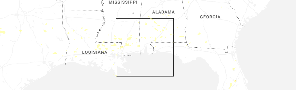
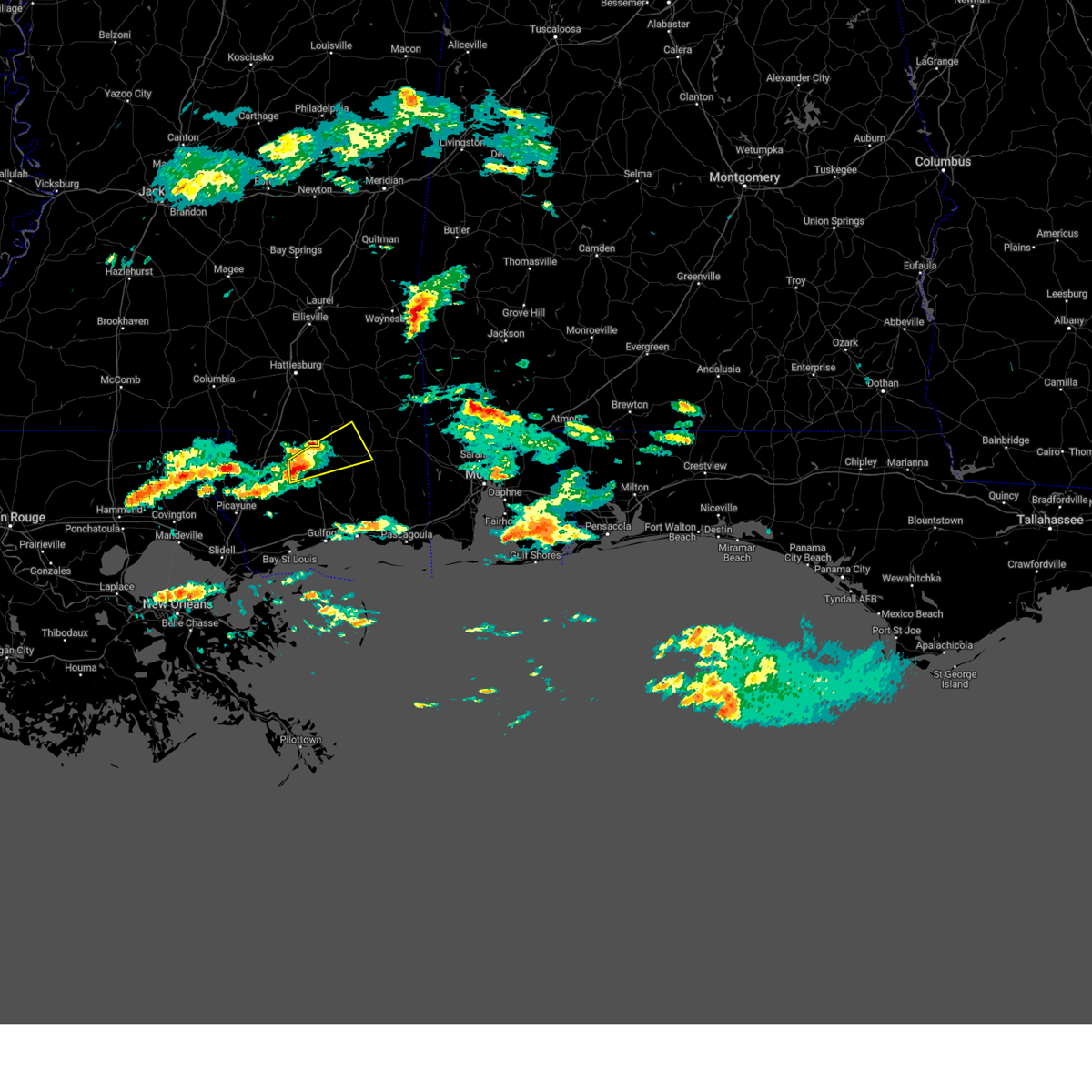
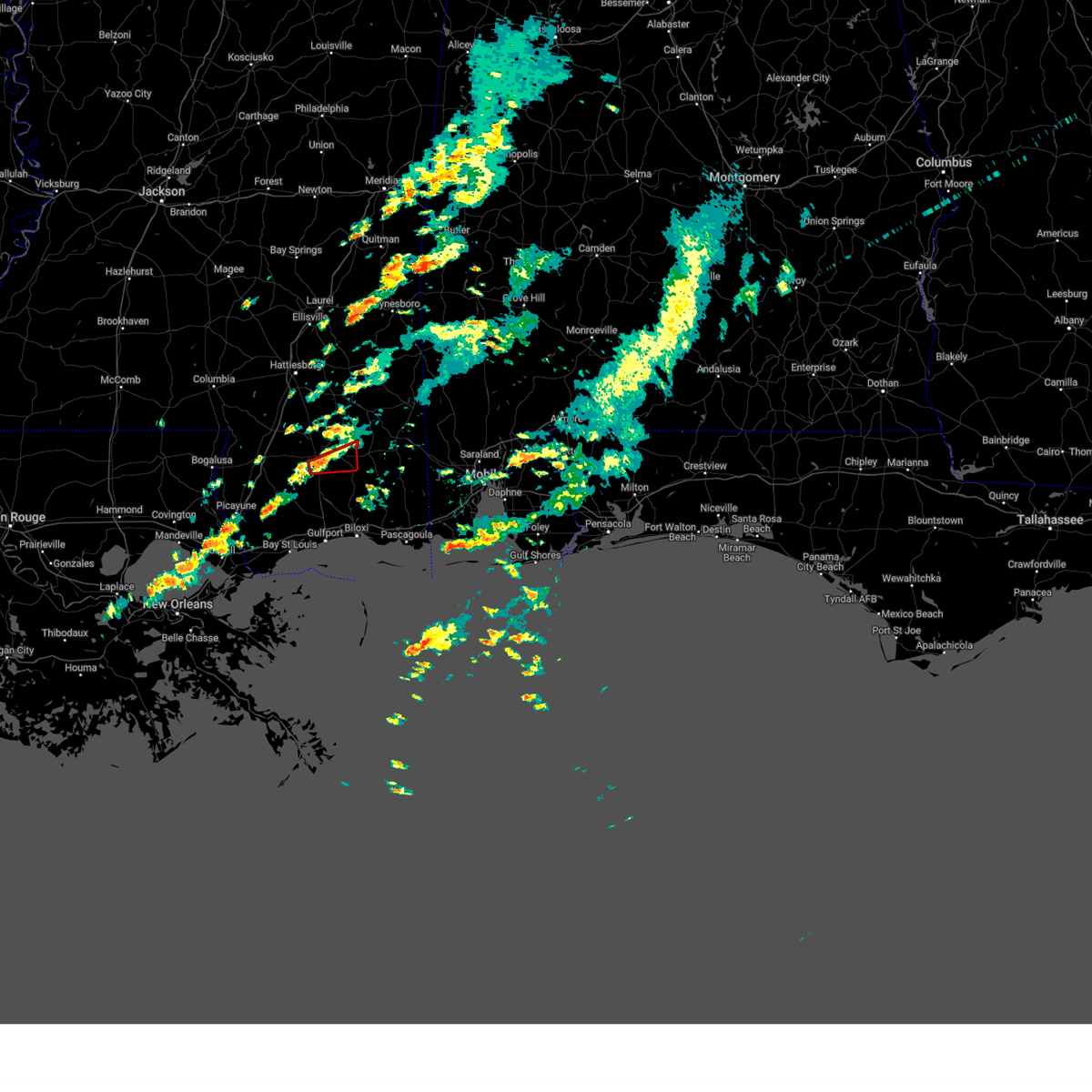
Hail Map for Wiggins, MS
The Wiggins, MS area has had 7 reports of on-the-ground hail by trained spotters, and has been under severe weather warnings 10 times during the past 12 months. Doppler radar has detected hail at or near Wiggins, MS on 49 occasions, including 3 occasions during the past year.
| Name: | Wiggins, MS |
| Where Located: | 65.7 miles W of Mobile, AL |
| Map: | Google Map for Wiggins, MS |
| Population: | 4390 |
| Housing Units: | 1658 |
| More Info: | Search Google for Wiggins, MS |
1
The Top Recent Hail Date for Wiggins, MS is Tuesday, June 10, 2025 (20th out of 49)
Hail and Wind Damage Spotted near Wiggins, MS
| Date / Time | Report Details |
|---|---|
| 6/10/2025 4:11 PM CDT | Broadcast media relayed a picture of trees down on a roadway in wiggins. time estimated via rada in stone county MS, 0.7 miles N of Wiggins, MS |
| 6/10/2025 4:00 PM CDT | At 400 pm cdt, severe thunderstorms were located along a line extending from 6 miles east of sunrise to 6 miles east of maxie to 3 miles northwest of mchenry, moving east at 25 mph (radar indicated). Hazards include 60 mph wind gusts and quarter size hail. Hail damage to vehicles is expected. expect wind damage to roofs, siding, and trees. Locations impacted include, wiggins, richton, perkinston, mchenry, beaumont, and new augusta. |
| 6/10/2025 3:49 PM CDT |
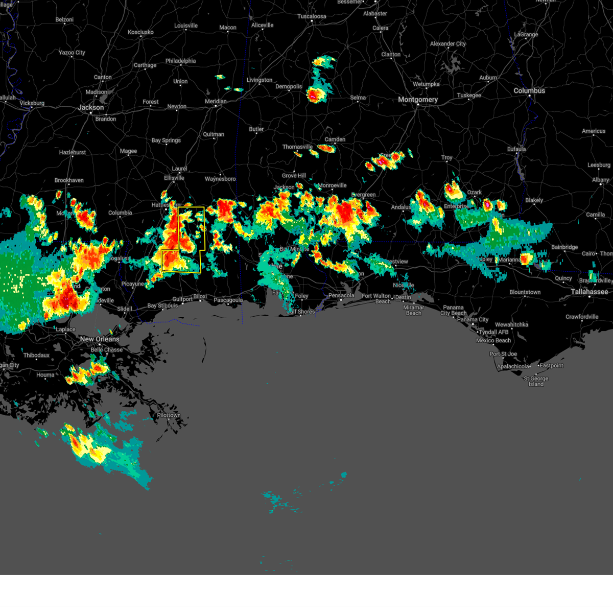 At 349 pm cdt, severe thunderstorms were located along a line extending from near sunrise to near maxie to 7 miles west of mchenry, moving east at 30 mph (radar indicated). Hazards include 70 mph wind gusts and quarter size hail. Hail damage to vehicles is expected. expect considerable tree damage. wind damage is also likely to mobile homes, roofs, and outbuildings. Locations impacted include, wiggins, richton, perkinston, mchenry, beaumont, and new augusta. At 349 pm cdt, severe thunderstorms were located along a line extending from near sunrise to near maxie to 7 miles west of mchenry, moving east at 30 mph (radar indicated). Hazards include 70 mph wind gusts and quarter size hail. Hail damage to vehicles is expected. expect considerable tree damage. wind damage is also likely to mobile homes, roofs, and outbuildings. Locations impacted include, wiggins, richton, perkinston, mchenry, beaumont, and new augusta.
|
| 6/10/2025 3:41 PM CDT | Svrmob the national weather service in mobile has issued a * severe thunderstorm warning for, perry county in southeastern mississippi, stone county in southeastern mississippi, * until 430 pm cdt. * at 341 pm cdt, severe thunderstorms were located along a line extending from sunrise to 9 miles west of mchenry, moving east at 25 mph (radar indicated). Hazards include 60 mph wind gusts and quarter size hail. Hail damage to vehicles is expected. Expect wind damage to roofs, siding, and trees. |
| 3/31/2025 8:09 AM CDT |
 Svrmob the national weather service in mobile has issued a * severe thunderstorm warning for, southwestern george county in southeastern mississippi, stone county in southeastern mississippi, * until 900 am cdt. * at 808 am cdt, severe thunderstorms were located along a line extending from 9 miles east of poplarville to 15 miles west of perkinston to 8 miles north of kiln to near picayune, moving east at 50 mph (radar indicated). Hazards include 60 mph wind gusts. expect damage to roofs, siding, and trees Svrmob the national weather service in mobile has issued a * severe thunderstorm warning for, southwestern george county in southeastern mississippi, stone county in southeastern mississippi, * until 900 am cdt. * at 808 am cdt, severe thunderstorms were located along a line extending from 9 miles east of poplarville to 15 miles west of perkinston to 8 miles north of kiln to near picayune, moving east at 50 mph (radar indicated). Hazards include 60 mph wind gusts. expect damage to roofs, siding, and trees
|
| 3/9/2025 1:18 AM CDT |
 the severe thunderstorm warning has been cancelled and is no longer in effect the severe thunderstorm warning has been cancelled and is no longer in effect
|
| 3/9/2025 12:37 AM CDT |
 Svrmob the national weather service in mobile has issued a * severe thunderstorm warning for, west central george county in southeastern mississippi, southern perry county in southeastern mississippi, northern stone county in southeastern mississippi, * until 1230 am cst. * at 1137 pm cst, a severe thunderstorm was located 7 miles west of perkinston, or 9 miles southwest of wiggins, moving northeast at 30 mph (radar indicated). Hazards include quarter size hail. damage to vehicles is expected Svrmob the national weather service in mobile has issued a * severe thunderstorm warning for, west central george county in southeastern mississippi, southern perry county in southeastern mississippi, northern stone county in southeastern mississippi, * until 1230 am cst. * at 1137 pm cst, a severe thunderstorm was located 7 miles west of perkinston, or 9 miles southwest of wiggins, moving northeast at 30 mph (radar indicated). Hazards include quarter size hail. damage to vehicles is expected
|
| 3/4/2025 6:31 PM CST |
 Svrmob the national weather service in mobile has issued a * severe thunderstorm warning for, george county in southeastern mississippi, southern perry county in southeastern mississippi, southern greene county in southeastern mississippi, stone county in southeastern mississippi, * until 730 pm cst. * at 631 pm cst, severe thunderstorms were located along a line extending from 6 miles east of lumberton to 5 miles south of picayune, moving east at 55 mph (radar indicated). Hazards include 60 mph wind gusts. expect damage to roofs, siding, and trees Svrmob the national weather service in mobile has issued a * severe thunderstorm warning for, george county in southeastern mississippi, southern perry county in southeastern mississippi, southern greene county in southeastern mississippi, stone county in southeastern mississippi, * until 730 pm cst. * at 631 pm cst, severe thunderstorms were located along a line extending from 6 miles east of lumberton to 5 miles south of picayune, moving east at 55 mph (radar indicated). Hazards include 60 mph wind gusts. expect damage to roofs, siding, and trees
|
| 2/16/2025 12:59 AM CST |
 Svrmob the national weather service in mobile has issued a * severe thunderstorm warning for, george county in southeastern mississippi, southern perry county in southeastern mississippi, southern greene county in southeastern mississippi, stone county in southeastern mississippi, * until 200 am cst. * at 1259 am cst, severe thunderstorms were located along a line extending from 3 miles southwest of pine ridge to 4 miles east of lumberton to 7 miles south of crossroads, moving east at 65 mph (radar indicated). Hazards include 60 mph wind gusts. expect damage to roofs, siding, and trees Svrmob the national weather service in mobile has issued a * severe thunderstorm warning for, george county in southeastern mississippi, southern perry county in southeastern mississippi, southern greene county in southeastern mississippi, stone county in southeastern mississippi, * until 200 am cst. * at 1259 am cst, severe thunderstorms were located along a line extending from 3 miles southwest of pine ridge to 4 miles east of lumberton to 7 miles south of crossroads, moving east at 65 mph (radar indicated). Hazards include 60 mph wind gusts. expect damage to roofs, siding, and trees
|
| 12/27/2024 4:32 PM CST |
 the tornado warning has been cancelled and is no longer in effect the tornado warning has been cancelled and is no longer in effect
|
| 12/27/2024 4:11 PM CST |
 Tormob the national weather service in mobile has issued a * tornado warning for, south central perry county in southeastern mississippi, northeastern stone county in southeastern mississippi, * until 500 pm cst. * at 410 pm cst, a severe thunderstorm capable of producing a tornado was located over perkinston, or 5 miles south of wiggins, moving east at 20 mph (radar indicated rotation). Hazards include tornado. Flying debris will be dangerous to those caught without shelter. mobile homes will be damaged or destroyed. damage to roofs, windows, and vehicles will occur. tree damage is likely. This dangerous storm will be near, perkinston around 415 pm cst. Tormob the national weather service in mobile has issued a * tornado warning for, south central perry county in southeastern mississippi, northeastern stone county in southeastern mississippi, * until 500 pm cst. * at 410 pm cst, a severe thunderstorm capable of producing a tornado was located over perkinston, or 5 miles south of wiggins, moving east at 20 mph (radar indicated rotation). Hazards include tornado. Flying debris will be dangerous to those caught without shelter. mobile homes will be damaged or destroyed. damage to roofs, windows, and vehicles will occur. tree damage is likely. This dangerous storm will be near, perkinston around 415 pm cst.
|
| 6/4/2024 6:36 PM CDT |
 Svrmob the national weather service in mobile has issued a * severe thunderstorm warning for, western george county in southeastern mississippi, southern perry county in southeastern mississippi, stone county in southeastern mississippi, * until 730 pm cdt. * at 636 pm cdt, severe thunderstorms were located along a line extending from 5 miles northeast of poplarville to near picayune, moving east at 40 mph (radar indicated). Hazards include 60 mph wind gusts. expect damage to roofs, siding, and trees Svrmob the national weather service in mobile has issued a * severe thunderstorm warning for, western george county in southeastern mississippi, southern perry county in southeastern mississippi, stone county in southeastern mississippi, * until 730 pm cdt. * at 636 pm cdt, severe thunderstorms were located along a line extending from 5 miles northeast of poplarville to near picayune, moving east at 40 mph (radar indicated). Hazards include 60 mph wind gusts. expect damage to roofs, siding, and trees
|
| 5/10/2024 2:20 AM CDT |
 At 219 am cdt, severe thunderstorms were located along a line extending from 4 miles northwest of leakesville to 9 miles southeast of mclain to 11 miles east of perkinston to 6 miles west of wiggins, moving east at 60 mph (radar indicated). Hazards include golf ball size hail and 70 mph wind gusts. People and animals outdoors will be injured. expect hail damage to roofs, siding, windows, and vehicles. expect considerable tree damage. wind damage is also likely to mobile homes, roofs, and outbuildings. Locations impacted include, wiggins, lucedale, perkinston, beaumont, and mclain. At 219 am cdt, severe thunderstorms were located along a line extending from 4 miles northwest of leakesville to 9 miles southeast of mclain to 11 miles east of perkinston to 6 miles west of wiggins, moving east at 60 mph (radar indicated). Hazards include golf ball size hail and 70 mph wind gusts. People and animals outdoors will be injured. expect hail damage to roofs, siding, windows, and vehicles. expect considerable tree damage. wind damage is also likely to mobile homes, roofs, and outbuildings. Locations impacted include, wiggins, lucedale, perkinston, beaumont, and mclain.
|
| 5/10/2024 2:13 AM CDT |
 At 213 am cdt, severe thunderstorms were located along a line extending from 9 miles northwest of leakesville to 4 miles south of mclain to near wiggins to 11 miles east of poplarville, moving east at 60 mph (radar indicated). Hazards include ping pong ball size hail and 60 mph wind gusts. People and animals outdoors will be injured. expect hail damage to roofs, siding, windows, and vehicles. expect wind damage to roofs, siding, and trees. Locations impacted include, wiggins, lucedale, perkinston, beaumont, and mclain. At 213 am cdt, severe thunderstorms were located along a line extending from 9 miles northwest of leakesville to 4 miles south of mclain to near wiggins to 11 miles east of poplarville, moving east at 60 mph (radar indicated). Hazards include ping pong ball size hail and 60 mph wind gusts. People and animals outdoors will be injured. expect hail damage to roofs, siding, windows, and vehicles. expect wind damage to roofs, siding, and trees. Locations impacted include, wiggins, lucedale, perkinston, beaumont, and mclain.
|
| 5/10/2024 1:50 AM CDT |
 Svrmob the national weather service in mobile has issued a * severe thunderstorm warning for, western george county in southeastern mississippi, southern perry county in southeastern mississippi, southern greene county in southeastern mississippi, stone county in southeastern mississippi, * until 245 am cdt. * at 149 am cdt, severe thunderstorms were located along a line extending from sunrise to 3 miles southwest of mclaurin to 3 miles southwest of lumberton to 4 miles northwest of poplarville, moving east at 40 mph (radar indicated). Hazards include 60 mph wind gusts and quarter size hail. Hail damage to vehicles is expected. Expect wind damage to roofs, siding, and trees. Svrmob the national weather service in mobile has issued a * severe thunderstorm warning for, western george county in southeastern mississippi, southern perry county in southeastern mississippi, southern greene county in southeastern mississippi, stone county in southeastern mississippi, * until 245 am cdt. * at 149 am cdt, severe thunderstorms were located along a line extending from sunrise to 3 miles southwest of mclaurin to 3 miles southwest of lumberton to 4 miles northwest of poplarville, moving east at 40 mph (radar indicated). Hazards include 60 mph wind gusts and quarter size hail. Hail damage to vehicles is expected. Expect wind damage to roofs, siding, and trees.
|
| 4/10/2024 11:03 AM CDT |
 At 1102 am cdt, severe thunderstorms were located along a line extending from 3 miles northeast of laurel to 12 miles southwest of mclain to 7 miles north of biloxi, moving east at 60 mph (radar indicated). Hazards include 60 mph wind gusts. Expect damage to roofs, siding, and trees. Locations impacted include, waynesboro, wiggins, lucedale, richton, leakesville, clara, perkinston, mchenry, beaumont, new augusta, mclain, state line, and buckatunna. At 1102 am cdt, severe thunderstorms were located along a line extending from 3 miles northeast of laurel to 12 miles southwest of mclain to 7 miles north of biloxi, moving east at 60 mph (radar indicated). Hazards include 60 mph wind gusts. Expect damage to roofs, siding, and trees. Locations impacted include, waynesboro, wiggins, lucedale, richton, leakesville, clara, perkinston, mchenry, beaumont, new augusta, mclain, state line, and buckatunna.
|
| 4/10/2024 10:33 AM CDT |
 Svrmob the national weather service in mobile has issued a * severe thunderstorm warning for, george county in southeastern mississippi, perry county in southeastern mississippi, wayne county in southeastern mississippi, greene county in southeastern mississippi, stone county in southeastern mississippi, * until 1130 am cdt. * at 1033 am cdt, severe thunderstorms were located along a line extending from 3 miles southwest of hebron to 6 miles west of maxie to 9 miles northeast of diamondhead, moving east at 55 mph (radar indicated). Hazards include 70 mph wind gusts. Expect considerable tree damage. Damage is likely to mobile homes, roofs, and outbuildings. Svrmob the national weather service in mobile has issued a * severe thunderstorm warning for, george county in southeastern mississippi, perry county in southeastern mississippi, wayne county in southeastern mississippi, greene county in southeastern mississippi, stone county in southeastern mississippi, * until 1130 am cdt. * at 1033 am cdt, severe thunderstorms were located along a line extending from 3 miles southwest of hebron to 6 miles west of maxie to 9 miles northeast of diamondhead, moving east at 55 mph (radar indicated). Hazards include 70 mph wind gusts. Expect considerable tree damage. Damage is likely to mobile homes, roofs, and outbuildings.
|
| 2/4/2024 5:41 PM CST |
 At 540 pm cst, a severe thunderstorm was located 8 miles east of poplarville, moving southeast at 30 mph (radar indicated). Hazards include quarter size hail. damage to vehicles is expected At 540 pm cst, a severe thunderstorm was located 8 miles east of poplarville, moving southeast at 30 mph (radar indicated). Hazards include quarter size hail. damage to vehicles is expected
|
| 1/25/2024 10:45 AM CST |
 At 1044 am cst, severe thunderstorms were located along a line extending from oak grove to 4 miles southwest of rock hill to 14 miles west of saucier, moving east at 45 mph (radar indicated). Hazards include 60 mph wind gusts. expect damage to roofs, siding, and trees At 1044 am cst, severe thunderstorms were located along a line extending from oak grove to 4 miles southwest of rock hill to 14 miles west of saucier, moving east at 45 mph (radar indicated). Hazards include 60 mph wind gusts. expect damage to roofs, siding, and trees
|
| 1/9/2024 1:52 AM CST |
 At 152 am cst, severe thunderstorms were located along a line extending from 5 miles southeast of sunrise to 10 miles southwest of maxie to 5 miles southeast of mcneil, moving east at 30 mph (radar indicated). Hazards include 70 mph wind gusts. Expect considerable tree damage. Damage is likely to mobile homes, roofs, and outbuildings. At 152 am cst, severe thunderstorms were located along a line extending from 5 miles southeast of sunrise to 10 miles southwest of maxie to 5 miles southeast of mcneil, moving east at 30 mph (radar indicated). Hazards include 70 mph wind gusts. Expect considerable tree damage. Damage is likely to mobile homes, roofs, and outbuildings.
|
| 6/19/2023 6:34 PM CDT |
 At 634 pm cdt, a severe thunderstorm was located 9 miles east of mchenry, or 11 miles southeast of wiggins, moving southeast at 35 mph (radar indicated). Hazards include quarter size hail. Damage to vehicles is expected. locations impacted include, perkinston. hail threat, radar indicated max hail size, 1. 00 in wind threat, radar indicated max wind gust, <50 mph. At 634 pm cdt, a severe thunderstorm was located 9 miles east of mchenry, or 11 miles southeast of wiggins, moving southeast at 35 mph (radar indicated). Hazards include quarter size hail. Damage to vehicles is expected. locations impacted include, perkinston. hail threat, radar indicated max hail size, 1. 00 in wind threat, radar indicated max wind gust, <50 mph.
|
| 6/19/2023 6:21 PM CDT |
 At 620 pm cdt, a severe thunderstorm was located near wiggins, moving southeast at 35 mph (radar indicated). Hazards include 60 mph wind gusts and quarter size hail. Hail damage to vehicles is expected. Expect wind damage to roofs, siding, and trees. At 620 pm cdt, a severe thunderstorm was located near wiggins, moving southeast at 35 mph (radar indicated). Hazards include 60 mph wind gusts and quarter size hail. Hail damage to vehicles is expected. Expect wind damage to roofs, siding, and trees.
|
| 6/16/2023 8:50 PM CDT |
 At 849 pm cdt, a severe thunderstorm was located over wiggins, moving southeast at 15 mph (radar indicated). Hazards include 60 mph wind gusts and quarter size hail. Hail damage to vehicles is expected. expect wind damage to roofs, siding, and trees. locations impacted include, wiggins. hail threat, radar indicated max hail size, 1. 00 in wind threat, radar indicated max wind gust, 60 mph. At 849 pm cdt, a severe thunderstorm was located over wiggins, moving southeast at 15 mph (radar indicated). Hazards include 60 mph wind gusts and quarter size hail. Hail damage to vehicles is expected. expect wind damage to roofs, siding, and trees. locations impacted include, wiggins. hail threat, radar indicated max hail size, 1. 00 in wind threat, radar indicated max wind gust, 60 mph.
|
| 6/16/2023 8:44 PM CDT |
 At 844 pm cdt, a severe thunderstorm was located over wiggins, moving southeast at 20 mph (radar indicated). Hazards include 60 mph wind gusts and quarter size hail. Hail damage to vehicles is expected. Expect wind damage to roofs, siding, and trees. At 844 pm cdt, a severe thunderstorm was located over wiggins, moving southeast at 20 mph (radar indicated). Hazards include 60 mph wind gusts and quarter size hail. Hail damage to vehicles is expected. Expect wind damage to roofs, siding, and trees.
|
| 6/16/2023 8:15 PM CDT |
 At 815 pm cdt, a severe thunderstorm was located over maxie, or 8 miles northwest of wiggins, moving southeast at 15 mph (radar indicated). Hazards include 60 mph wind gusts and quarter size hail. Hail damage to vehicles is expected. Expect wind damage to roofs, siding, and trees. At 815 pm cdt, a severe thunderstorm was located over maxie, or 8 miles northwest of wiggins, moving southeast at 15 mph (radar indicated). Hazards include 60 mph wind gusts and quarter size hail. Hail damage to vehicles is expected. Expect wind damage to roofs, siding, and trees.
|
| 6/16/2023 6:58 AM CDT |
 At 656 am cdt, severe thunderstorms were located along a line extending from 11 miles northeast of richton to 5 miles north of beaumont to 7 miles southwest of mclain to 8 miles northeast of perkinston, moving southeast at 50 mph (radar indicated). Hazards include 60 mph wind gusts and quarter size hail. Hail damage to vehicles is expected. expect wind damage to roofs, siding, and trees. locations impacted include, wiggins, lucedale, richton, leakesville, perkinston, beaumont, new augusta and mclain. hail threat, radar indicated max hail size, 1. 00 in wind threat, radar indicated max wind gust, 60 mph. At 656 am cdt, severe thunderstorms were located along a line extending from 11 miles northeast of richton to 5 miles north of beaumont to 7 miles southwest of mclain to 8 miles northeast of perkinston, moving southeast at 50 mph (radar indicated). Hazards include 60 mph wind gusts and quarter size hail. Hail damage to vehicles is expected. expect wind damage to roofs, siding, and trees. locations impacted include, wiggins, lucedale, richton, leakesville, perkinston, beaumont, new augusta and mclain. hail threat, radar indicated max hail size, 1. 00 in wind threat, radar indicated max wind gust, 60 mph.
|
| 6/16/2023 6:29 AM CDT |
 At 627 am cdt, severe thunderstorms were located along a line extending from 4 miles northeast of eastabuchie to 4 miles southeast of hattiesburg to 10 miles southeast of lumberton, moving east at 60 mph (radar indicated). Hazards include 70 mph wind gusts and quarter size hail. Hail damage to vehicles is expected. expect considerable tree damage. Wind damage is also likely to mobile homes, roofs, and outbuildings. At 627 am cdt, severe thunderstorms were located along a line extending from 4 miles northeast of eastabuchie to 4 miles southeast of hattiesburg to 10 miles southeast of lumberton, moving east at 60 mph (radar indicated). Hazards include 70 mph wind gusts and quarter size hail. Hail damage to vehicles is expected. expect considerable tree damage. Wind damage is also likely to mobile homes, roofs, and outbuildings.
|
| 6/12/2023 6:52 PM CDT |
 The severe thunderstorm warning for stone county will expire at 700 pm cdt, the storm which prompted the warning has weakened below severe limits, and has exited the warned area. therefore, the warning will be allowed to expire. however gusty winds and heavy rain are still possible with this thunderstorm. a severe thunderstorm watch remains in effect until 800 pm cdt for southeastern mississippi. The severe thunderstorm warning for stone county will expire at 700 pm cdt, the storm which prompted the warning has weakened below severe limits, and has exited the warned area. therefore, the warning will be allowed to expire. however gusty winds and heavy rain are still possible with this thunderstorm. a severe thunderstorm watch remains in effect until 800 pm cdt for southeastern mississippi.
|
| 6/12/2023 6:19 PM CDT |
 At 618 pm cdt, a severe thunderstorm was located 7 miles east of poplarville, moving southeast at 60 mph (radar indicated). Hazards include 60 mph wind gusts. expect damage to roofs, siding, and trees At 618 pm cdt, a severe thunderstorm was located 7 miles east of poplarville, moving southeast at 60 mph (radar indicated). Hazards include 60 mph wind gusts. expect damage to roofs, siding, and trees
|
| 5/5/2023 4:14 PM CDT |
 At 414 pm cdt, severe thunderstorms were located along a line extending from near beaumont to 4 miles southwest of mclain to 8 miles east of maxie to near wiggins, moving southeast at 40 mph (radar indicated). Hazards include 60 mph wind gusts and nickel size hail. Expect damage to roofs, siding, and trees. locations impacted include, wiggins, beaumont and new augusta. hail threat, radar indicated max hail size, 0. 88 in wind threat, radar indicated max wind gust, 60 mph. At 414 pm cdt, severe thunderstorms were located along a line extending from near beaumont to 4 miles southwest of mclain to 8 miles east of maxie to near wiggins, moving southeast at 40 mph (radar indicated). Hazards include 60 mph wind gusts and nickel size hail. Expect damage to roofs, siding, and trees. locations impacted include, wiggins, beaumont and new augusta. hail threat, radar indicated max hail size, 0. 88 in wind threat, radar indicated max wind gust, 60 mph.
|
| 5/5/2023 3:38 PM CDT |
 At 337 pm cdt, severe thunderstorms were located along a line extending from near macedonia to 4 miles south of sunrise to purvis to 5 miles north of lumberton, moving southeast at 40 mph. this line has had a history of producing damaging winds with numerous trees being reported down across lamar county mississippi (radar indicated). Hazards include 60 mph wind gusts and nickel size hail. expect damage to roofs, siding, and trees At 337 pm cdt, severe thunderstorms were located along a line extending from near macedonia to 4 miles south of sunrise to purvis to 5 miles north of lumberton, moving southeast at 40 mph. this line has had a history of producing damaging winds with numerous trees being reported down across lamar county mississippi (radar indicated). Hazards include 60 mph wind gusts and nickel size hail. expect damage to roofs, siding, and trees
|
| 4/27/2023 5:33 AM CDT | Quarter sized hail reported 5.5 miles N of Wiggins, MS, social media report with pictures of quarter hail in perkinston... ms. |
| 4/27/2023 5:28 AM CDT |
 At 527 am cdt, a severe thunderstorm was located over perkinston, or 4 miles southwest of wiggins, moving east at 30 mph (radar indicated). Hazards include 60 mph wind gusts and half dollar size hail. Hail damage to vehicles is expected. Expect wind damage to roofs, siding, and trees. At 527 am cdt, a severe thunderstorm was located over perkinston, or 4 miles southwest of wiggins, moving east at 30 mph (radar indicated). Hazards include 60 mph wind gusts and half dollar size hail. Hail damage to vehicles is expected. Expect wind damage to roofs, siding, and trees.
|
| 4/27/2023 5:18 AM CDT |
 At 517 am cdt, a severe thunderstorm was located 7 miles west of perkinston, or 8 miles southwest of wiggins, moving east at 25 mph (radar indicated). Hazards include ping pong ball size hail and 60 mph wind gusts. People and animals outdoors will be injured. expect hail damage to roofs, siding, windows, and vehicles. expect wind damage to roofs, siding, and trees. locations impacted include, wiggins and perkinston. hail threat, radar indicated max hail size, 1. 50 in wind threat, radar indicated max wind gust, 60 mph. At 517 am cdt, a severe thunderstorm was located 7 miles west of perkinston, or 8 miles southwest of wiggins, moving east at 25 mph (radar indicated). Hazards include ping pong ball size hail and 60 mph wind gusts. People and animals outdoors will be injured. expect hail damage to roofs, siding, windows, and vehicles. expect wind damage to roofs, siding, and trees. locations impacted include, wiggins and perkinston. hail threat, radar indicated max hail size, 1. 50 in wind threat, radar indicated max wind gust, 60 mph.
|
| 4/27/2023 5:12 AM CDT | Golf Ball sized hail reported 9.4 miles ENE of Wiggins, MS, separate skywarn spotter reported golf ball hail just west of perkinston... ms. |
| 4/27/2023 5:12 AM CDT | Quarter sized hail reported 10.9 miles NE of Wiggins, MS, skywarn spotter reports quarter hail roughly 6 miles se of poplarville in stone county... ms. |
| 4/27/2023 4:42 AM CDT |
 At 441 am cdt, a severe thunderstorm was located 5 miles southeast of poplarville, moving east at 30 mph (radar indicated). Hazards include ping pong ball size hail and 60 mph wind gusts. People and animals outdoors will be injured. expect hail damage to roofs, siding, windows, and vehicles. Expect wind damage to roofs, siding, and trees. At 441 am cdt, a severe thunderstorm was located 5 miles southeast of poplarville, moving east at 30 mph (radar indicated). Hazards include ping pong ball size hail and 60 mph wind gusts. People and animals outdoors will be injured. expect hail damage to roofs, siding, windows, and vehicles. Expect wind damage to roofs, siding, and trees.
|
| 4/15/2023 1:44 PM CDT |
 At 142 pm cdt, severe thunderstorms were located along a line extending from 8 miles northeast of beaumont to 5 miles south of mclain to 7 miles west of mchenry, moving east at 55 mph (radar indicated). Hazards include 60 mph wind gusts and penny size hail. Expect damage to roofs, siding, and trees. locations impacted include, wiggins, lucedale, leakesville, perkinston, mchenry, beaumont, mclain and state line. hail threat, radar indicated max hail size, 0. 75 in wind threat, radar indicated max wind gust, 60 mph. At 142 pm cdt, severe thunderstorms were located along a line extending from 8 miles northeast of beaumont to 5 miles south of mclain to 7 miles west of mchenry, moving east at 55 mph (radar indicated). Hazards include 60 mph wind gusts and penny size hail. Expect damage to roofs, siding, and trees. locations impacted include, wiggins, lucedale, leakesville, perkinston, mchenry, beaumont, mclain and state line. hail threat, radar indicated max hail size, 0. 75 in wind threat, radar indicated max wind gust, 60 mph.
|
| 4/15/2023 1:33 PM CDT | Broadcast media relayed a viewer report of a large tree that fell at the entrance to flint creek water park. time estimated from rada in stone county MS, 1.3 miles WSW of Wiggins, MS |
| 4/15/2023 1:13 PM CDT |
 At 112 pm cdt, severe thunderstorms were located along a line extending from sunrise to 4 miles south of mclaurin to 6 miles northeast of mcneil, moving east at 50 mph (radar indicated). Hazards include 60 mph wind gusts and nickel size hail. expect damage to roofs, siding, and trees At 112 pm cdt, severe thunderstorms were located along a line extending from sunrise to 4 miles south of mclaurin to 6 miles northeast of mcneil, moving east at 50 mph (radar indicated). Hazards include 60 mph wind gusts and nickel size hail. expect damage to roofs, siding, and trees
|
| 3/28/2023 12:57 AM CDT |
 The severe thunderstorm warning for western stone county will expire at 100 am cdt, the storm which prompted the warning has weakened below severe limits. therefore, the warning will be allowed to expire. The severe thunderstorm warning for western stone county will expire at 100 am cdt, the storm which prompted the warning has weakened below severe limits. therefore, the warning will be allowed to expire.
|
| 3/28/2023 12:16 AM CDT |
 At 1216 am cdt, a severe thunderstorm was located 11 miles southeast of poplarville, moving east at 10 mph (radar indicated). Hazards include 60 mph wind gusts and quarter size hail. Hail damage to vehicles is expected. Expect wind damage to roofs, siding, and trees. At 1216 am cdt, a severe thunderstorm was located 11 miles southeast of poplarville, moving east at 10 mph (radar indicated). Hazards include 60 mph wind gusts and quarter size hail. Hail damage to vehicles is expected. Expect wind damage to roofs, siding, and trees.
|
| 2/9/2023 12:53 AM CST |
 The severe thunderstorm warning for western george, southern perry and eastern stone counties will expire at 100 am cst, the storms which prompted the warning have moved out of the area. therefore, the warning will be allowed to expire. The severe thunderstorm warning for western george, southern perry and eastern stone counties will expire at 100 am cst, the storms which prompted the warning have moved out of the area. therefore, the warning will be allowed to expire.
|
| 2/9/2023 12:36 AM CST |
 At 1235 am cst, severe thunderstorms were located along a line extending from 9 miles northeast of wiggins to 11 miles northeast of perkinston to 8 miles east of mchenry, moving east at 45 mph (radar indicated). Hazards include 60 mph wind gusts. Expect damage to roofs, siding, and trees. These severe thunderstorms will remain over mainly rural areas of western george, southern perry and eastern stone counties. At 1235 am cst, severe thunderstorms were located along a line extending from 9 miles northeast of wiggins to 11 miles northeast of perkinston to 8 miles east of mchenry, moving east at 45 mph (radar indicated). Hazards include 60 mph wind gusts. Expect damage to roofs, siding, and trees. These severe thunderstorms will remain over mainly rural areas of western george, southern perry and eastern stone counties.
|
| 2/9/2023 12:15 AM CST |
 At 1214 am cst, severe thunderstorms were located along a line extending from 8 miles west of wiggins to 5 miles west of perkinston to 8 miles west of mchenry, moving northeast at 40 mph (radar indicated). Hazards include 60 mph wind gusts. expect damage to roofs, siding, and trees At 1214 am cst, severe thunderstorms were located along a line extending from 8 miles west of wiggins to 5 miles west of perkinston to 8 miles west of mchenry, moving northeast at 40 mph (radar indicated). Hazards include 60 mph wind gusts. expect damage to roofs, siding, and trees
|
| 1/12/2023 11:22 AM CST |
 The severe thunderstorm warning for northeastern stone county will expire at 1130 am cst, the storm which prompted the warning has moved out of the area. therefore, the warning will be allowed to expire. a tornado watch remains in effect until 500 pm cst for southeastern mississippi. The severe thunderstorm warning for northeastern stone county will expire at 1130 am cst, the storm which prompted the warning has moved out of the area. therefore, the warning will be allowed to expire. a tornado watch remains in effect until 500 pm cst for southeastern mississippi.
|
| 1/12/2023 10:59 AM CST |
 At 1059 am cst, a severe thunderstorm was located 5 miles east of perkinston, or 5 miles southeast of wiggins, moving east at 50 mph (radar indicated). Hazards include 60 mph wind gusts and quarter size hail. Hail damage to vehicles is expected. expect wind damage to roofs, siding, and trees. locations impacted include, wiggins and perkinston. hail threat, radar indicated max hail size, 1. 00 in wind threat, radar indicated max wind gust, 60 mph. At 1059 am cst, a severe thunderstorm was located 5 miles east of perkinston, or 5 miles southeast of wiggins, moving east at 50 mph (radar indicated). Hazards include 60 mph wind gusts and quarter size hail. Hail damage to vehicles is expected. expect wind damage to roofs, siding, and trees. locations impacted include, wiggins and perkinston. hail threat, radar indicated max hail size, 1. 00 in wind threat, radar indicated max wind gust, 60 mph.
|
| 1/12/2023 10:27 AM CST |
 At 1027 am cst, a severe thunderstorm was located 9 miles southeast of poplarville, moving east at 35 mph (radar indicated). Hazards include 60 mph wind gusts and quarter size hail. Hail damage to vehicles is expected. Expect wind damage to roofs, siding, and trees. At 1027 am cst, a severe thunderstorm was located 9 miles southeast of poplarville, moving east at 35 mph (radar indicated). Hazards include 60 mph wind gusts and quarter size hail. Hail damage to vehicles is expected. Expect wind damage to roofs, siding, and trees.
|
| 12/14/2022 4:33 PM CST |
 At 433 pm cst, a severe thunderstorm was located near wiggins, moving northeast at 35 mph (radar indicated). Hazards include 60 mph wind gusts. Expect damage to roofs, siding, and trees. Locations impacted include, wiggins, perkinston and mchenry. At 433 pm cst, a severe thunderstorm was located near wiggins, moving northeast at 35 mph (radar indicated). Hazards include 60 mph wind gusts. Expect damage to roofs, siding, and trees. Locations impacted include, wiggins, perkinston and mchenry.
|
| 12/14/2022 3:56 PM CST |
 At 355 pm cst, a severe thunderstorm was located 13 miles southeast of poplarville, moving northeast at 35 mph (radar indicated). Hazards include 60 mph wind gusts. expect damage to roofs, siding, and trees At 355 pm cst, a severe thunderstorm was located 13 miles southeast of poplarville, moving northeast at 35 mph (radar indicated). Hazards include 60 mph wind gusts. expect damage to roofs, siding, and trees
|
| 11/30/2022 4:05 AM CST |
 At 405 am cst, a severe thunderstorm was located 16 miles east of wiggins, moving east at 55 mph (radar indicated). Hazards include 60 mph wind gusts and nickel size hail. Expect damage to roofs, siding, and trees. Locations impacted include, wiggins, perkinston and mchenry. At 405 am cst, a severe thunderstorm was located 16 miles east of wiggins, moving east at 55 mph (radar indicated). Hazards include 60 mph wind gusts and nickel size hail. Expect damage to roofs, siding, and trees. Locations impacted include, wiggins, perkinston and mchenry.
|
| 11/30/2022 3:46 AM CST |
 At 345 am cst, a severe thunderstorm was located over perkinston, or 4 miles south of wiggins, moving east at 55 mph (radar indicated). Hazards include 70 mph wind gusts and nickel size hail. Expect considerable tree damage. damage is likely to mobile homes, roofs, and outbuildings. Locations impacted include, wiggins, perkinston and mchenry. At 345 am cst, a severe thunderstorm was located over perkinston, or 4 miles south of wiggins, moving east at 55 mph (radar indicated). Hazards include 70 mph wind gusts and nickel size hail. Expect considerable tree damage. damage is likely to mobile homes, roofs, and outbuildings. Locations impacted include, wiggins, perkinston and mchenry.
|
| 11/30/2022 3:35 AM CST |
 At 333 am cst, a severe thunderstorm was located 11 miles east of poplarville, moving east at 55 mph (radar indicated). Hazards include 60 mph wind gusts and nickel size hail. expect damage to roofs, siding, and trees At 333 am cst, a severe thunderstorm was located 11 miles east of poplarville, moving east at 55 mph (radar indicated). Hazards include 60 mph wind gusts and nickel size hail. expect damage to roofs, siding, and trees
|
| 6/10/2022 2:38 PM CDT |
 At 238 pm cdt, severe thunderstorms were located along a line extending from 5 miles east of richton to 4 miles south of purvis, moving east at 35 mph (radar indicated). Hazards include 60 mph wind gusts and quarter size hail. Hail damage to vehicles is expected. Expect wind damage to roofs, siding, and trees. At 238 pm cdt, severe thunderstorms were located along a line extending from 5 miles east of richton to 4 miles south of purvis, moving east at 35 mph (radar indicated). Hazards include 60 mph wind gusts and quarter size hail. Hail damage to vehicles is expected. Expect wind damage to roofs, siding, and trees.
|
| 4/17/2022 9:17 PM CDT |
 At 917 pm cdt, severe thunderstorms were located along a line extending from 12 miles east of wiggins to 3 miles east of perkinston to 11 miles west of mchenry, moving south at 55 mph (radar indicated). Hazards include 60 mph wind gusts and nickel size hail. expect damage to roofs, siding, and trees At 917 pm cdt, severe thunderstorms were located along a line extending from 12 miles east of wiggins to 3 miles east of perkinston to 11 miles west of mchenry, moving south at 55 mph (radar indicated). Hazards include 60 mph wind gusts and nickel size hail. expect damage to roofs, siding, and trees
|
| 4/13/2022 10:55 PM CDT |
 At 1054 pm cdt, severe thunderstorms were located along a line extending from 3 miles northwest of leakesville to 5 miles west of mchenry, moving east at 40 mph (radar indicated). Hazards include 60 mph wind gusts. expect damage to roofs, siding, and trees At 1054 pm cdt, severe thunderstorms were located along a line extending from 3 miles northwest of leakesville to 5 miles west of mchenry, moving east at 40 mph (radar indicated). Hazards include 60 mph wind gusts. expect damage to roofs, siding, and trees
|
| 4/13/2022 10:43 PM CDT |
 At 1043 pm cdt, severe thunderstorms were located along a line extending from near beaumont to 11 miles southeast of poplarville, moving east at 50 mph (radar indicated). Hazards include 60 mph wind gusts and penny size hail. Expect damage to roofs, siding, and trees. locations impacted include, wiggins, leakesville, perkinston, mchenry, beaumont, new augusta and mclain. hail threat, radar indicated max hail size, 0. 75 in wind threat, radar indicated max wind gust, 60 mph. At 1043 pm cdt, severe thunderstorms were located along a line extending from near beaumont to 11 miles southeast of poplarville, moving east at 50 mph (radar indicated). Hazards include 60 mph wind gusts and penny size hail. Expect damage to roofs, siding, and trees. locations impacted include, wiggins, leakesville, perkinston, mchenry, beaumont, new augusta and mclain. hail threat, radar indicated max hail size, 0. 75 in wind threat, radar indicated max wind gust, 60 mph.
|
| 4/13/2022 10:19 PM CDT |
 At 1018 pm cdt, severe thunderstorms were located along a line extending from mclaurin to 4 miles southeast of crossroads, moving east at 50 mph (radar indicated). Hazards include 60 mph wind gusts and penny size hail. expect damage to roofs, siding, and trees At 1018 pm cdt, severe thunderstorms were located along a line extending from mclaurin to 4 miles southeast of crossroads, moving east at 50 mph (radar indicated). Hazards include 60 mph wind gusts and penny size hail. expect damage to roofs, siding, and trees
|
| 3/30/2022 8:46 PM CDT |
 At 845 pm cdt, severe thunderstorms were located along a line extending from clara to 6 miles southwest of buckatunna to 12 miles northeast of beaumont to 4 miles south of mclain to 13 miles east of wiggins, moving northeast at 50 mph. these are destructive storms for mclain, avent, jonathan, (radar indicated). Hazards include 80 mph wind gusts. Flying debris will be dangerous to those caught without shelter. mobile homes will be heavily damaged. expect considerable damage to roofs, windows, and vehicles. extensive tree damage and power outages are likely. Locations impacted include, wiggins, citronelle, lucedale, chatom, richton, leakesville, saint stephens, wagarville, clara, perkinston, mchenry, gulfcrest, deer park, tibbie, beaumont, calvert, mount vernon, new augusta, millry and mclain. At 845 pm cdt, severe thunderstorms were located along a line extending from clara to 6 miles southwest of buckatunna to 12 miles northeast of beaumont to 4 miles south of mclain to 13 miles east of wiggins, moving northeast at 50 mph. these are destructive storms for mclain, avent, jonathan, (radar indicated). Hazards include 80 mph wind gusts. Flying debris will be dangerous to those caught without shelter. mobile homes will be heavily damaged. expect considerable damage to roofs, windows, and vehicles. extensive tree damage and power outages are likely. Locations impacted include, wiggins, citronelle, lucedale, chatom, richton, leakesville, saint stephens, wagarville, clara, perkinston, mchenry, gulfcrest, deer park, tibbie, beaumont, calvert, mount vernon, new augusta, millry and mclain.
|
| 3/30/2022 8:39 PM CDT |
 At 838 pm cdt, severe thunderstorms were located along a line extending from near clara to 7 miles southwest of mclain to 9 miles north of kiln, moving northeast at 60 mph (radar indicated). Hazards include 70 mph wind gusts. Expect considerable tree damage. Damage is likely to mobile homes, roofs, and outbuildings. At 838 pm cdt, severe thunderstorms were located along a line extending from near clara to 7 miles southwest of mclain to 9 miles north of kiln, moving northeast at 60 mph (radar indicated). Hazards include 70 mph wind gusts. Expect considerable tree damage. Damage is likely to mobile homes, roofs, and outbuildings.
|
| 3/30/2022 8:15 PM CDT | Report from mping of wind damage similar to trees snapped or uprooted... or roof blown off. possible tornado damag in forrest county MS, 6.9 miles SSE of Wiggins, MS |
| 3/30/2022 8:04 PM CDT |
 At 803 pm cdt, severe thunderstorms were located along a line extending from moselle to 5 miles northeast of mclaurin to 8 miles southeast of lumberton to 4 miles south of mcneil, moving northeast at 60 mph (radar indicated). Hazards include 70 mph wind gusts. Expect considerable tree damage. damage is likely to mobile homes, roofs, and outbuildings. Locations impacted include, wiggins, richton, perkinston, mchenry, beaumont, new augusta and mclain. At 803 pm cdt, severe thunderstorms were located along a line extending from moselle to 5 miles northeast of mclaurin to 8 miles southeast of lumberton to 4 miles south of mcneil, moving northeast at 60 mph (radar indicated). Hazards include 70 mph wind gusts. Expect considerable tree damage. damage is likely to mobile homes, roofs, and outbuildings. Locations impacted include, wiggins, richton, perkinston, mchenry, beaumont, new augusta and mclain.
|
| 3/30/2022 7:50 PM CDT |
 At 749 pm cdt, severe thunderstorms were located along a line extending from west hattiesburg to 5 miles southeast of lumberton to 6 miles south of poplarville to 3 miles northwest of picayune to 6 miles northwest of lacombe, moving northeast at 55 mph (radar indicated). Hazards include 60 mph wind gusts. expect damage to roofs, siding, and trees At 749 pm cdt, severe thunderstorms were located along a line extending from west hattiesburg to 5 miles southeast of lumberton to 6 miles south of poplarville to 3 miles northwest of picayune to 6 miles northwest of lacombe, moving northeast at 55 mph (radar indicated). Hazards include 60 mph wind gusts. expect damage to roofs, siding, and trees
|
| 3/18/2022 10:12 AM CDT |
 The severe thunderstorm warning for western george, southern perry, southwestern greene and stone counties will expire at 1015 am cdt, the storm which prompted the warning has weakened below severe limits. therefore, the warning will be allowed to expire. however gusty winds are still possible with this thunderstorm. a tornado watch remains in effect until noon cdt for southeastern mississippi. The severe thunderstorm warning for western george, southern perry, southwestern greene and stone counties will expire at 1015 am cdt, the storm which prompted the warning has weakened below severe limits. therefore, the warning will be allowed to expire. however gusty winds are still possible with this thunderstorm. a tornado watch remains in effect until noon cdt for southeastern mississippi.
|
| 3/18/2022 9:38 AM CDT |
 At 938 am cdt, a severe thunderstorm was located 7 miles west of wiggins, moving northeast at 50 mph (radar indicated). Hazards include 60 mph wind gusts and nickel size hail. Expect damage to roofs, siding, and trees. Locations impacted include, wiggins and perkinston. At 938 am cdt, a severe thunderstorm was located 7 miles west of wiggins, moving northeast at 50 mph (radar indicated). Hazards include 60 mph wind gusts and nickel size hail. Expect damage to roofs, siding, and trees. Locations impacted include, wiggins and perkinston.
|
| 3/18/2022 9:23 AM CDT |
 At 922 am cdt, a severe thunderstorm was located 5 miles southeast of poplarville, moving northeast at 45 mph (radar indicated). Hazards include 60 mph wind gusts and nickel size hail. expect damage to roofs, siding, and trees At 922 am cdt, a severe thunderstorm was located 5 miles southeast of poplarville, moving northeast at 45 mph (radar indicated). Hazards include 60 mph wind gusts and nickel size hail. expect damage to roofs, siding, and trees
|
| 2/3/2022 3:00 PM CST |
 At 259 pm cst, severe thunderstorms were located along a line extending from 3 miles southeast of mchenry to 9 miles south of mclain to 5 miles southeast of leakesville to 4 miles west of tibbie, moving northeast at 35 mph (radar indicated). Hazards include 60 mph wind gusts. expect damage to roofs, siding, and trees At 259 pm cst, severe thunderstorms were located along a line extending from 3 miles southeast of mchenry to 9 miles south of mclain to 5 miles southeast of leakesville to 4 miles west of tibbie, moving northeast at 35 mph (radar indicated). Hazards include 60 mph wind gusts. expect damage to roofs, siding, and trees
|
| 1/9/2022 5:23 PM CST |
 At 523 pm cst, severe thunderstorms were located along a line extending from 3 miles south of lumberton to 8 miles southeast of poplarville to 5 miles east of mcneil, moving east at 50 mph (radar indicated). Hazards include 60 mph wind gusts and penny size hail. expect damage to roofs, siding, and trees At 523 pm cst, severe thunderstorms were located along a line extending from 3 miles south of lumberton to 8 miles southeast of poplarville to 5 miles east of mcneil, moving east at 50 mph (radar indicated). Hazards include 60 mph wind gusts and penny size hail. expect damage to roofs, siding, and trees
|
| 10/27/2021 7:43 PM CDT |
 The severe thunderstorm warning for perry and stone counties will expire at 745 pm cdt, the storms which prompted the warning have moved out of the area. therefore, the warning will be allowed to expire. a tornado watch remains in effect until 1000 pm cdt for southeastern mississippi. remember, a severe thunderstorm warning still remains in effect for southeastern stone county until 830 pm cdt. The severe thunderstorm warning for perry and stone counties will expire at 745 pm cdt, the storms which prompted the warning have moved out of the area. therefore, the warning will be allowed to expire. a tornado watch remains in effect until 1000 pm cdt for southeastern mississippi. remember, a severe thunderstorm warning still remains in effect for southeastern stone county until 830 pm cdt.
|
| 10/27/2021 7:39 PM CDT |
 At 738 pm cdt, severe thunderstorms were located along a line extending from 6 miles south of beaumont to 11 miles east of wiggins to 4 miles northwest of lyman, moving east at 35 mph (radar indicated). Hazards include 60 mph wind gusts. expect damage to roofs, siding, and trees At 738 pm cdt, severe thunderstorms were located along a line extending from 6 miles south of beaumont to 11 miles east of wiggins to 4 miles northwest of lyman, moving east at 35 mph (radar indicated). Hazards include 60 mph wind gusts. expect damage to roofs, siding, and trees
|
| 10/27/2021 6:59 PM CDT |
 At 659 pm cdt, severe thunderstorms were located along a line extending from 4 miles west of mclaurin to 7 miles west of wiggins to 10 miles southeast of poplarville, moving northeast at 35 mph (radar indicated). Hazards include 60 mph wind gusts. expect damage to roofs, siding, and trees At 659 pm cdt, severe thunderstorms were located along a line extending from 4 miles west of mclaurin to 7 miles west of wiggins to 10 miles southeast of poplarville, moving northeast at 35 mph (radar indicated). Hazards include 60 mph wind gusts. expect damage to roofs, siding, and trees
|
| 10/4/2021 4:08 PM CDT |
 At 408 pm cdt, a severe thunderstorm was located 7 miles west of maxie, or 13 miles northwest of wiggins, moving east at 20 mph (radar indicated). Hazards include 60 mph wind gusts and quarter size hail. Hail damage to vehicles is expected. Expect wind damage to roofs, siding, and trees. At 408 pm cdt, a severe thunderstorm was located 7 miles west of maxie, or 13 miles northwest of wiggins, moving east at 20 mph (radar indicated). Hazards include 60 mph wind gusts and quarter size hail. Hail damage to vehicles is expected. Expect wind damage to roofs, siding, and trees.
|
| 6/13/2021 6:31 PM CDT |
 At 630 pm cdt, severe thunderstorms were located along a line extending from 3 miles west of wiggins to 3 miles southwest of lucedale to 3 miles west of chunchula, moving south at 30 mph (radar indicated). Hazards include 60 mph wind gusts and penny size hail. Expect damage to roofs, siding, and trees. Locations impacted include, wiggins, citronelle, lucedale, chunchula and gulfcrest. At 630 pm cdt, severe thunderstorms were located along a line extending from 3 miles west of wiggins to 3 miles southwest of lucedale to 3 miles west of chunchula, moving south at 30 mph (radar indicated). Hazards include 60 mph wind gusts and penny size hail. Expect damage to roofs, siding, and trees. Locations impacted include, wiggins, citronelle, lucedale, chunchula and gulfcrest.
|
| 6/13/2021 5:48 PM CDT |
 At 546 pm cdt, severe thunderstorms were located along a line extending from 4 miles east of mclaurin to 4 miles northwest of leakesville to 6 miles east of deer park, moving south at 30 mph (radar indicated). Hazards include 60 mph wind gusts and penny size hail. expect damage to roofs, siding, and trees At 546 pm cdt, severe thunderstorms were located along a line extending from 4 miles east of mclaurin to 4 miles northwest of leakesville to 6 miles east of deer park, moving south at 30 mph (radar indicated). Hazards include 60 mph wind gusts and penny size hail. expect damage to roofs, siding, and trees
|
| 4/24/2021 3:53 AM CDT | A large tree was blown down in maxi in forrest county MS, 9.1 miles SSE of Wiggins, MS |
| 4/24/2021 3:49 AM CDT |
 At 349 am cdt, severe thunderstorms were located along a line extending from 3 miles southeast of rock hill to 9 miles east of mcneil, moving east at 65 mph (radar indicated). Hazards include 60 mph wind gusts. expect damage to roofs, siding, and trees At 349 am cdt, severe thunderstorms were located along a line extending from 3 miles southeast of rock hill to 9 miles east of mcneil, moving east at 65 mph (radar indicated). Hazards include 60 mph wind gusts. expect damage to roofs, siding, and trees
|
| 3/17/2021 9:05 PM CDT |
 At 904 pm cdt, a severe thunderstorm was located 11 miles south of mclain, or 13 miles west of lucedale, moving northeast at 55 mph (radar indicated). Hazards include 60 mph wind gusts. Expect damage to roofs, siding, and trees. Locations impacted include, lucedale, leakesville and mclain. At 904 pm cdt, a severe thunderstorm was located 11 miles south of mclain, or 13 miles west of lucedale, moving northeast at 55 mph (radar indicated). Hazards include 60 mph wind gusts. Expect damage to roofs, siding, and trees. Locations impacted include, lucedale, leakesville and mclain.
|
| 3/17/2021 8:54 PM CDT |
 At 853 pm cdt, a severe thunderstorm was located 8 miles east of wiggins, moving northeast at 55 mph (radar indicated). Hazards include 70 mph wind gusts and penny size hail. Expect considerable tree damage. Damage is likely to mobile homes, roofs, and outbuildings. At 853 pm cdt, a severe thunderstorm was located 8 miles east of wiggins, moving northeast at 55 mph (radar indicated). Hazards include 70 mph wind gusts and penny size hail. Expect considerable tree damage. Damage is likely to mobile homes, roofs, and outbuildings.
|
| 3/17/2021 8:38 PM CDT |
 At 836 pm cdt, a severe thunderstorm was located 5 miles west of perkinston, or 8 miles southwest of wiggins, moving northeast at 45 mph (radar indicated). Hazards include 70 mph wind gusts and quarter size hail. Hail damage to vehicles is expected. expect considerable tree damage. wind damage is also likely to mobile homes, roofs, and outbuildings. Locations impacted include, wiggins, perkinston, mchenry and beaumont. At 836 pm cdt, a severe thunderstorm was located 5 miles west of perkinston, or 8 miles southwest of wiggins, moving northeast at 45 mph (radar indicated). Hazards include 70 mph wind gusts and quarter size hail. Hail damage to vehicles is expected. expect considerable tree damage. wind damage is also likely to mobile homes, roofs, and outbuildings. Locations impacted include, wiggins, perkinston, mchenry and beaumont.
|
| 3/17/2021 8:22 PM CDT |
 At 821 pm cdt, a severe thunderstorm was located 11 miles southeast of poplarville, moving northeast at 50 mph (radar indicated). Hazards include 60 mph wind gusts and quarter size hail. Hail damage to vehicles is expected. Expect wind damage to roofs, siding, and trees. At 821 pm cdt, a severe thunderstorm was located 11 miles southeast of poplarville, moving northeast at 50 mph (radar indicated). Hazards include 60 mph wind gusts and quarter size hail. Hail damage to vehicles is expected. Expect wind damage to roofs, siding, and trees.
|
| 7/15/2020 4:20 PM CDT |
 The severe thunderstorm warning for southwestern george and stone counties will expire at 430 pm cdt, the storm which prompted the warning has weakened below severe limits, and no longer poses an immediate threat to life or property. therefore, the warning will be allowed to expire. however gusty winds are still possible with this thunderstorm. The severe thunderstorm warning for southwestern george and stone counties will expire at 430 pm cdt, the storm which prompted the warning has weakened below severe limits, and no longer poses an immediate threat to life or property. therefore, the warning will be allowed to expire. however gusty winds are still possible with this thunderstorm.
|
| 7/15/2020 3:42 PM CDT |
 At 341 pm cdt, a severe thunderstorm was located 15 miles southwest of lucedale, moving west at 20 mph (radar indicated). Hazards include 60 mph wind gusts and penny size hail. expect damage to roofs, siding, and trees At 341 pm cdt, a severe thunderstorm was located 15 miles southwest of lucedale, moving west at 20 mph (radar indicated). Hazards include 60 mph wind gusts and penny size hail. expect damage to roofs, siding, and trees
|
| 4/23/2020 6:55 AM CDT |
 At 655 am cdt, a severe thunderstorm capable of producing a tornado was located over perkinston, or 5 miles south of wiggins, moving east at 35 mph (radar indicated rotation). Hazards include tornado. Flying debris will be dangerous to those caught without shelter. mobile homes will be damaged or destroyed. damage to roofs, windows, and vehicles will occur. tree damage is likely. This tornadic thunderstorm will remain over mainly rural areas of southwestern george and eastern stone counties. At 655 am cdt, a severe thunderstorm capable of producing a tornado was located over perkinston, or 5 miles south of wiggins, moving east at 35 mph (radar indicated rotation). Hazards include tornado. Flying debris will be dangerous to those caught without shelter. mobile homes will be damaged or destroyed. damage to roofs, windows, and vehicles will occur. tree damage is likely. This tornadic thunderstorm will remain over mainly rural areas of southwestern george and eastern stone counties.
|
| 4/23/2020 6:40 AM CDT |
 At 640 am cdt, a severe thunderstorm capable of producing a tornado was located 8 miles west of mchenry, or 12 miles southwest of wiggins, moving east at 40 mph (radar indicated rotation). Hazards include tornado. Flying debris will be dangerous to those caught without shelter. mobile homes will be damaged or destroyed. damage to roofs, windows, and vehicles will occur. tree damage is likely. This dangerous storm will be near, perkinston and mchenry around 655 am cdt. At 640 am cdt, a severe thunderstorm capable of producing a tornado was located 8 miles west of mchenry, or 12 miles southwest of wiggins, moving east at 40 mph (radar indicated rotation). Hazards include tornado. Flying debris will be dangerous to those caught without shelter. mobile homes will be damaged or destroyed. damage to roofs, windows, and vehicles will occur. tree damage is likely. This dangerous storm will be near, perkinston and mchenry around 655 am cdt.
|
| 4/23/2020 5:57 AM CDT |
 At 534 am cdt, severe thunderstorms were located along a line extending from 9 miles southeast of lumberton to 9 miles south of poplarville, moving east at 35 mph (radar indicated). Hazards include 60 mph wind gusts. expect damage to roofs, siding, and trees At 534 am cdt, severe thunderstorms were located along a line extending from 9 miles southeast of lumberton to 9 miles south of poplarville, moving east at 35 mph (radar indicated). Hazards include 60 mph wind gusts. expect damage to roofs, siding, and trees
|
| 4/23/2020 5:35 AM CDT |
 At 534 am cdt, severe thunderstorms were located along a line extending from 9 miles southeast of lumberton to 9 miles south of poplarville, moving east at 35 mph (radar indicated). Hazards include 60 mph wind gusts. expect damage to roofs, siding, and trees At 534 am cdt, severe thunderstorms were located along a line extending from 9 miles southeast of lumberton to 9 miles south of poplarville, moving east at 35 mph (radar indicated). Hazards include 60 mph wind gusts. expect damage to roofs, siding, and trees
|
| 4/12/2020 9:37 PM CDT |
 At 937 pm cdt, severe thunderstorms were located along a line extending from near mclain to 11 miles east of mchenry, moving east at 55 mph (radar indicated). Hazards include 60 mph wind gusts and nickel size hail. Expect damage to roofs, siding, and trees. Locations impacted include, wiggins, perkinston, mchenry and mclain. At 937 pm cdt, severe thunderstorms were located along a line extending from near mclain to 11 miles east of mchenry, moving east at 55 mph (radar indicated). Hazards include 60 mph wind gusts and nickel size hail. Expect damage to roofs, siding, and trees. Locations impacted include, wiggins, perkinston, mchenry and mclain.
|
| 4/12/2020 9:09 PM CDT |
 At 908 pm cdt, a severe thunderstorm was located 8 miles west of perkinston, or 10 miles southwest of wiggins, moving northeast at 70 mph (radar indicated). Hazards include 60 mph wind gusts and quarter size hail. Hail damage to vehicles is expected. Expect wind damage to roofs, siding, and trees. At 908 pm cdt, a severe thunderstorm was located 8 miles west of perkinston, or 10 miles southwest of wiggins, moving northeast at 70 mph (radar indicated). Hazards include 60 mph wind gusts and quarter size hail. Hail damage to vehicles is expected. Expect wind damage to roofs, siding, and trees.
|
| 3/31/2020 9:27 AM CDT |
 The severe thunderstorm warning for southern perry and northeastern stone counties will expire at 930 am cdt, the storm which prompted the warning has moved out of the area. therefore, the warning will be allowed to expire. however gusty winds are still possible with this thunderstorm. a tornado watch remains in effect until 300 pm cdt for southeastern mississippi. remember, a severe thunderstorm warning still remains in effect for southeastern perry county and northeastern stone county until 945 am cdt. The severe thunderstorm warning for southern perry and northeastern stone counties will expire at 930 am cdt, the storm which prompted the warning has moved out of the area. therefore, the warning will be allowed to expire. however gusty winds are still possible with this thunderstorm. a tornado watch remains in effect until 300 pm cdt for southeastern mississippi. remember, a severe thunderstorm warning still remains in effect for southeastern perry county and northeastern stone county until 945 am cdt.
|
| 3/31/2020 9:04 AM CDT |
 At 903 am cdt, a severe thunderstorm was located 8 miles northeast of wiggins, moving east at 45 mph (radar indicated). Hazards include 70 mph wind gusts. Expect considerable tree damage. damage is likely to mobile homes, roofs, and outbuildings. This severe thunderstorm will remain over mainly rural areas of southern perry and northeastern stone counties. At 903 am cdt, a severe thunderstorm was located 8 miles northeast of wiggins, moving east at 45 mph (radar indicated). Hazards include 70 mph wind gusts. Expect considerable tree damage. damage is likely to mobile homes, roofs, and outbuildings. This severe thunderstorm will remain over mainly rural areas of southern perry and northeastern stone counties.
|
| 3/31/2020 8:43 AM CDT |
 At 842 am cdt, a severe thunderstorm was located 5 miles west of maxie, or 10 miles northwest of wiggins, moving east at 35 mph (radar indicated). Hazards include 70 mph wind gusts. Expect considerable tree damage. damage is likely to mobile homes, roofs, and outbuildings. Locations impacted include, wiggins. At 842 am cdt, a severe thunderstorm was located 5 miles west of maxie, or 10 miles northwest of wiggins, moving east at 35 mph (radar indicated). Hazards include 70 mph wind gusts. Expect considerable tree damage. damage is likely to mobile homes, roofs, and outbuildings. Locations impacted include, wiggins.
|
| 3/31/2020 8:41 AM CDT |
 At 840 am cdt, a severe thunderstorm was located 6 miles west of maxie, or 12 miles northwest of wiggins, moving east at 35 mph (radar indicated). Hazards include 70 mph wind gusts. Expect considerable tree damage. Damage is likely to mobile homes, roofs, and outbuildings. At 840 am cdt, a severe thunderstorm was located 6 miles west of maxie, or 12 miles northwest of wiggins, moving east at 35 mph (radar indicated). Hazards include 70 mph wind gusts. Expect considerable tree damage. Damage is likely to mobile homes, roofs, and outbuildings.
|
| 1/11/2020 11:00 AM CST | Two homes with shingle damage in wiggin in stone county MS, 0.1 miles ESE of Wiggins, MS |
| 1/11/2020 10:55 AM CST |
 At 1055 am cst, severe thunderstorms were located along a line extending from 3 miles northwest of wiggins to saucier, moving northeast at 40 mph (radar indicated). Hazards include 60 mph wind gusts. expect damage to roofs, siding, and trees At 1055 am cst, severe thunderstorms were located along a line extending from 3 miles northwest of wiggins to saucier, moving northeast at 40 mph (radar indicated). Hazards include 60 mph wind gusts. expect damage to roofs, siding, and trees
|
| 1/11/2020 10:30 AM CST |
 At 1029 am cst, severe thunderstorms were located along a line extending from 5 miles northwest of mclaurin to 6 miles west of maxie to 11 miles north of kiln, moving east at 45 mph (radar indicated). Hazards include 60 mph wind gusts. Expect damage to roofs, siding, and trees. Locations impacted include, wiggins, perkinston, mchenry, beaumont and new augusta. At 1029 am cst, severe thunderstorms were located along a line extending from 5 miles northwest of mclaurin to 6 miles west of maxie to 11 miles north of kiln, moving east at 45 mph (radar indicated). Hazards include 60 mph wind gusts. Expect damage to roofs, siding, and trees. Locations impacted include, wiggins, perkinston, mchenry, beaumont and new augusta.
|
| 1/11/2020 10:06 AM CST |
 At 1005 am cst, severe thunderstorms were located along a line extending from 6 miles south of west hattiesburg to near lumberton to 8 miles southeast of mcneil, moving east at 35 mph. this line of storms has a history of downing trees and power lines (radar indicated). Hazards include 60 mph wind gusts. expect damage to roofs, siding, and trees At 1005 am cst, severe thunderstorms were located along a line extending from 6 miles south of west hattiesburg to near lumberton to 8 miles southeast of mcneil, moving east at 35 mph. this line of storms has a history of downing trees and power lines (radar indicated). Hazards include 60 mph wind gusts. expect damage to roofs, siding, and trees
|
| 10/31/2019 5:28 AM CDT |
 At 528 am cdt, a severe thunderstorm was located 4 miles northeast of wiggins, moving northeast at 30 mph (radar indicated). Hazards include 60 mph wind gusts. Expect damage to roofs, siding, and trees. This severe thunderstorm will remain over mainly rural areas of northwestern george, southern perry, southwestern greene and northeastern stone counties. At 528 am cdt, a severe thunderstorm was located 4 miles northeast of wiggins, moving northeast at 30 mph (radar indicated). Hazards include 60 mph wind gusts. Expect damage to roofs, siding, and trees. This severe thunderstorm will remain over mainly rural areas of northwestern george, southern perry, southwestern greene and northeastern stone counties.
|
| 7/10/2019 5:39 PM CDT |
 At 455 pm cdt, a severe thunderstorm was located 9 miles southwest of mclain, or 16 miles northeast of wiggins, moving west at 20 mph (radar indicated). Hazards include 60 mph wind gusts and penny size hail. expect damage to roofs, siding, and trees At 455 pm cdt, a severe thunderstorm was located 9 miles southwest of mclain, or 16 miles northeast of wiggins, moving west at 20 mph (radar indicated). Hazards include 60 mph wind gusts and penny size hail. expect damage to roofs, siding, and trees
|
| 7/10/2019 5:30 PM CDT |
 At 455 pm cdt, a severe thunderstorm was located 9 miles southwest of mclain, or 16 miles northeast of wiggins, moving west at 20 mph (radar indicated). Hazards include 60 mph wind gusts and penny size hail. expect damage to roofs, siding, and trees At 455 pm cdt, a severe thunderstorm was located 9 miles southwest of mclain, or 16 miles northeast of wiggins, moving west at 20 mph (radar indicated). Hazards include 60 mph wind gusts and penny size hail. expect damage to roofs, siding, and trees
|
| 7/10/2019 4:55 PM CDT |
 At 455 pm cdt, a severe thunderstorm was located 9 miles southwest of mclain, or 16 miles northeast of wiggins, moving west at 20 mph (radar indicated). Hazards include 60 mph wind gusts and penny size hail. expect damage to roofs, siding, and trees At 455 pm cdt, a severe thunderstorm was located 9 miles southwest of mclain, or 16 miles northeast of wiggins, moving west at 20 mph (radar indicated). Hazards include 60 mph wind gusts and penny size hail. expect damage to roofs, siding, and trees
|
| 6/18/2019 9:37 AM CDT |
 At 937 am cdt, severe thunderstorms were located along a line extending from 4 miles southeast of brooklyn to 9 miles northeast of wiggins to 12 miles east of mchenry, moving northeast at 40 mph (radar indicated). Hazards include 60 mph wind gusts. Expect damage to roofs, siding, and trees. These severe thunderstorms will remain over mainly rural areas of western george, southern perry and eastern stone counties. At 937 am cdt, severe thunderstorms were located along a line extending from 4 miles southeast of brooklyn to 9 miles northeast of wiggins to 12 miles east of mchenry, moving northeast at 40 mph (radar indicated). Hazards include 60 mph wind gusts. Expect damage to roofs, siding, and trees. These severe thunderstorms will remain over mainly rural areas of western george, southern perry and eastern stone counties.
|
| 6/18/2019 9:20 AM CDT |
 At 920 am cdt, severe thunderstorms were located along a line extending from 6 miles southwest of maxie to near perkinston to 4 miles east of saucier, moving northeast at 40 mph (radar indicated). Hazards include 60 mph wind gusts. expect damage to roofs, siding, and trees At 920 am cdt, severe thunderstorms were located along a line extending from 6 miles southwest of maxie to near perkinston to 4 miles east of saucier, moving northeast at 40 mph (radar indicated). Hazards include 60 mph wind gusts. expect damage to roofs, siding, and trees
|
| 5/11/2019 5:54 PM CDT |
 At 553 pm cdt, a severe thunderstorm was located 10 miles west of perkinston, or 12 miles southwest of wiggins, moving northeast at 20 mph (radar indicated). Hazards include 60 mph wind gusts and penny size hail. Expect damage to roofs, siding, and trees. Locations impacted include, wiggins and perkinston. At 553 pm cdt, a severe thunderstorm was located 10 miles west of perkinston, or 12 miles southwest of wiggins, moving northeast at 20 mph (radar indicated). Hazards include 60 mph wind gusts and penny size hail. Expect damage to roofs, siding, and trees. Locations impacted include, wiggins and perkinston.
|
| 5/11/2019 5:46 PM CDT |
 At 546 pm cdt, a severe thunderstorm was located 11 miles southeast of poplarville, moving northeast at 20 mph (radar indicated). Hazards include 60 mph wind gusts. expect damage to roofs, siding, and trees At 546 pm cdt, a severe thunderstorm was located 11 miles southeast of poplarville, moving northeast at 20 mph (radar indicated). Hazards include 60 mph wind gusts. expect damage to roofs, siding, and trees
|
| 5/4/2019 12:28 PM CDT |
 At 1228 pm cdt, severe thunderstorms were located along a line extending from 4 miles southeast of maxie to saucier, moving east at 40 mph (radar indicated). Hazards include 60 mph wind gusts. Expect damage to roofs, siding, and trees. Locations impacted include, wiggins, perkinston and mchenry. At 1228 pm cdt, severe thunderstorms were located along a line extending from 4 miles southeast of maxie to saucier, moving east at 40 mph (radar indicated). Hazards include 60 mph wind gusts. Expect damage to roofs, siding, and trees. Locations impacted include, wiggins, perkinston and mchenry.
|
| 5/4/2019 12:02 PM CDT |
 At 1201 pm cdt, severe thunderstorms were located along a line extending from near lumberton to 13 miles northeast of kiln, moving east at 35 mph (radar indicated). Hazards include 60 mph wind gusts. expect damage to roofs, siding, and trees At 1201 pm cdt, severe thunderstorms were located along a line extending from near lumberton to 13 miles northeast of kiln, moving east at 35 mph (radar indicated). Hazards include 60 mph wind gusts. expect damage to roofs, siding, and trees
|
| 1/19/2019 11:58 AM CST |
 The severe thunderstorm warning for western george, southeastern perry, southwestern greene and eastern stone counties will expire at noon cst, the storms which prompted the warning have weakened below severe limits, therefore the warning will be allowed to expire. a tornado watch remains in effect until 500 pm cst for southeastern mississippi. The severe thunderstorm warning for western george, southeastern perry, southwestern greene and eastern stone counties will expire at noon cst, the storms which prompted the warning have weakened below severe limits, therefore the warning will be allowed to expire. a tornado watch remains in effect until 500 pm cst for southeastern mississippi.
|
| 1/19/2019 11:39 AM CST |
 At 1139 am cst, severe thunderstorms were located along a line extending from 10 miles southwest of beaumont to 7 miles west of lyman, moving east at 40 mph (radar indicated). Hazards include 60 mph wind gusts. Expect damage to roofs, siding, and trees. locations impacted include, perkinston and mchenry. A tornado watch remains in effect until 500 pm cst for southeastern mississippi. At 1139 am cst, severe thunderstorms were located along a line extending from 10 miles southwest of beaumont to 7 miles west of lyman, moving east at 40 mph (radar indicated). Hazards include 60 mph wind gusts. Expect damage to roofs, siding, and trees. locations impacted include, perkinston and mchenry. A tornado watch remains in effect until 500 pm cst for southeastern mississippi.
|
| 1/19/2019 11:20 AM CST |
 At 1119 am cst, severe thunderstorms were located along a line extending from maxie to 3 miles northwest of kiln, moving east at 40 mph (radar indicated). Hazards include 60 mph wind gusts. expect damage to roofs, siding, and trees At 1119 am cst, severe thunderstorms were located along a line extending from maxie to 3 miles northwest of kiln, moving east at 40 mph (radar indicated). Hazards include 60 mph wind gusts. expect damage to roofs, siding, and trees
|
| 11/1/2018 5:42 AM CDT |
 At 542 am cdt, a severe thunderstorm was located 7 miles northeast of wiggins, moving northeast at 50 mph (radar indicated). Hazards include 70 mph wind gusts. Expect considerable tree damage. Damage is likely to mobile homes, roofs, and outbuildings. At 542 am cdt, a severe thunderstorm was located 7 miles northeast of wiggins, moving northeast at 50 mph (radar indicated). Hazards include 70 mph wind gusts. Expect considerable tree damage. Damage is likely to mobile homes, roofs, and outbuildings.
|
| 11/1/2018 5:19 AM CDT |
 At 519 am cdt, a severe thunderstorm was located 11 miles west of perkinston, or 13 miles southeast of poplarville, moving east at 40 mph (radar indicated). Hazards include 70 mph wind gusts. Expect considerable tree damage. damage is likely to mobile homes, roofs, and outbuildings. locations impacted include, wiggins, perkinston and mchenry. A tornado watch remains in effect until 900 am cdt for southeastern mississippi. At 519 am cdt, a severe thunderstorm was located 11 miles west of perkinston, or 13 miles southeast of poplarville, moving east at 40 mph (radar indicated). Hazards include 70 mph wind gusts. Expect considerable tree damage. damage is likely to mobile homes, roofs, and outbuildings. locations impacted include, wiggins, perkinston and mchenry. A tornado watch remains in effect until 900 am cdt for southeastern mississippi.
|
| 11/1/2018 5:05 AM CDT |
 At 504 am cdt, a severe thunderstorm was located 7 miles east of mcneil, or 11 miles south of poplarville, moving east at 50 mph (radar indicated). Hazards include 60 mph wind gusts. expect damage to roofs, siding, and trees At 504 am cdt, a severe thunderstorm was located 7 miles east of mcneil, or 11 miles south of poplarville, moving east at 50 mph (radar indicated). Hazards include 60 mph wind gusts. expect damage to roofs, siding, and trees
|
| 4/14/2018 12:13 PM CDT |
 At 1212 pm cdt, severe thunderstorms were located along a line extending from 4 miles south of rock hill to 5 miles southwest of maxie to 6 miles west of perkinston, moving northeast at 40 mph (radar indicated). Hazards include 60 mph wind gusts. Expect damage to roofs, siding, and trees. locations impacted include, wiggins, perkinston and mchenry. A tornado watch remains in effect until 700 pm cdt for southeastern mississippi. At 1212 pm cdt, severe thunderstorms were located along a line extending from 4 miles south of rock hill to 5 miles southwest of maxie to 6 miles west of perkinston, moving northeast at 40 mph (radar indicated). Hazards include 60 mph wind gusts. Expect damage to roofs, siding, and trees. locations impacted include, wiggins, perkinston and mchenry. A tornado watch remains in effect until 700 pm cdt for southeastern mississippi.
|
| 4/14/2018 11:50 AM CDT |
 At 1150 am cdt, severe thunderstorms were located along a line extending from 4 miles north of poplarville to 14 miles south of lumberton to 11 miles east of mcneil, moving northeast at 40 mph (radar indicated). Hazards include 60 mph wind gusts. expect damage to roofs, siding, and trees At 1150 am cdt, severe thunderstorms were located along a line extending from 4 miles north of poplarville to 14 miles south of lumberton to 11 miles east of mcneil, moving northeast at 40 mph (radar indicated). Hazards include 60 mph wind gusts. expect damage to roofs, siding, and trees
|
| 8/30/2017 1:50 PM CDT |
 At 148 pm cdt, severe thunderstorms were located along a line extending from belleville, to near new augusta, to 9 miles southwest of mclain, to 6 miles east of mchenry, moving north at 45 mph (radar indicated). Hazards include 60 mph wind gusts. Expect damage to roofs, siding, and trees. locations impacted include, wiggins, richton, perkinston, beaumont and new augusta. A tornado watch remains in effect until 600 pm cdt for southeastern mississippi. At 148 pm cdt, severe thunderstorms were located along a line extending from belleville, to near new augusta, to 9 miles southwest of mclain, to 6 miles east of mchenry, moving north at 45 mph (radar indicated). Hazards include 60 mph wind gusts. Expect damage to roofs, siding, and trees. locations impacted include, wiggins, richton, perkinston, beaumont and new augusta. A tornado watch remains in effect until 600 pm cdt for southeastern mississippi.
|
| 8/30/2017 1:20 PM CDT |
 At 119 pm cdt, severe thunderstorms were located along a line extending from near maxie to near wiggins to near perkinston to saucier, moving north at 40 mph (radar indicated). Hazards include 60 mph wind gusts. expect damage to roofs, siding, and trees At 119 pm cdt, severe thunderstorms were located along a line extending from near maxie to near wiggins to near perkinston to saucier, moving north at 40 mph (radar indicated). Hazards include 60 mph wind gusts. expect damage to roofs, siding, and trees
|
| 7/7/2017 5:10 PM CDT | A couple of trees were blown down... blocking highway 4 in forrest county MS, 7.6 miles SSE of Wiggins, MS |
| 6/21/2017 9:01 AM CDT |
 At 901 am cdt, a severe thunderstorm capable of producing a tornado was located over saucier, or 16 miles south of wiggins, moving northwest at 20 mph (radar indicated rotation). Hazards include tornado. Flying debris will be dangerous to those caught without shelter. mobile homes will be damaged or destroyed. damage to roofs, windows, and vehicles will occur. tree damage is likely. this dangerous storm will be near, mchenry around 920 am cdt. perkinston around 930 am cdt. Wiggins around 945 am cdt. At 901 am cdt, a severe thunderstorm capable of producing a tornado was located over saucier, or 16 miles south of wiggins, moving northwest at 20 mph (radar indicated rotation). Hazards include tornado. Flying debris will be dangerous to those caught without shelter. mobile homes will be damaged or destroyed. damage to roofs, windows, and vehicles will occur. tree damage is likely. this dangerous storm will be near, mchenry around 920 am cdt. perkinston around 930 am cdt. Wiggins around 945 am cdt.
|
| 6/16/2017 10:45 PM CDT | Tree fell into a house causing extensive damage to the house and carport. multiple trees down in the wiggins are in stone county MS, 0.1 miles ESE of Wiggins, MS |
| 5/12/2017 11:41 AM CDT |
 At 1140 am cdt, severe thunderstorms were located along a line extending from near wiggins to near lyman to near waveland, moving east at 35 mph (radar indicated). Hazards include 60 mph wind gusts. expect damage to roofs, siding, and trees At 1140 am cdt, severe thunderstorms were located along a line extending from near wiggins to near lyman to near waveland, moving east at 35 mph (radar indicated). Hazards include 60 mph wind gusts. expect damage to roofs, siding, and trees
|
| 5/12/2017 11:27 AM CDT |
 At 1126 am cdt, severe thunderstorms were located along a line extending from near maxie to near bay st. louis, moving east at 30 to 35 mph. line motion may increase next half hour (radar indicated). Hazards include 60 mph wind gusts and penny size hail. Expect damage to roofs, siding, and trees. Locations impacted include, wiggins, perkinston and mchenry. At 1126 am cdt, severe thunderstorms were located along a line extending from near maxie to near bay st. louis, moving east at 30 to 35 mph. line motion may increase next half hour (radar indicated). Hazards include 60 mph wind gusts and penny size hail. Expect damage to roofs, siding, and trees. Locations impacted include, wiggins, perkinston and mchenry.
|
| 5/12/2017 10:59 AM CDT |
 At 1058 am cdt, severe thunderstorms were located along a line extending from near mclaurin to 11 miles north of kiln, moving east at 45 mph (radar indicated). Hazards include 60 mph wind gusts. Expect damage to roofs, siding, and trees. Locations impacted include, wiggins, perkinston, mchenry, beaumont, new augusta and mclain. At 1058 am cdt, severe thunderstorms were located along a line extending from near mclaurin to 11 miles north of kiln, moving east at 45 mph (radar indicated). Hazards include 60 mph wind gusts. Expect damage to roofs, siding, and trees. Locations impacted include, wiggins, perkinston, mchenry, beaumont, new augusta and mclain.
|
| 5/12/2017 10:45 AM CDT |
 At 1044 am cdt, severe thunderstorms were located along a line extending from near purvis to 7 miles east of picayune, moving east at 45 mph (radar indicated). Hazards include 60 mph wind gusts. expect damage to roofs, siding, and trees At 1044 am cdt, severe thunderstorms were located along a line extending from near purvis to 7 miles east of picayune, moving east at 45 mph (radar indicated). Hazards include 60 mph wind gusts. expect damage to roofs, siding, and trees
|
| 4/30/2017 1:19 PM CDT |
 At 118 pm cdt, severe thunderstorms were located along a line extending from near state line to near leakesville to near mclain to 11 miles east of mchenry, moving east at 30 mph (radar indicated). Hazards include 70 mph wind gusts. Expect considerable tree damage. damage is likely to mobile homes, roofs, and outbuildings. locations impacted include, wiggins, lucedale, leakesville, perkinston, mchenry, deer park, tibbie, beaumont, mclain, state line and fruitdale. a tornado watch remains in effect until 300 pm cdt for southeastern mississippi. A tornado watch also remains in effect until 700 pm cdt for southwestern alabama. At 118 pm cdt, severe thunderstorms were located along a line extending from near state line to near leakesville to near mclain to 11 miles east of mchenry, moving east at 30 mph (radar indicated). Hazards include 70 mph wind gusts. Expect considerable tree damage. damage is likely to mobile homes, roofs, and outbuildings. locations impacted include, wiggins, lucedale, leakesville, perkinston, mchenry, deer park, tibbie, beaumont, mclain, state line and fruitdale. a tornado watch remains in effect until 300 pm cdt for southeastern mississippi. A tornado watch also remains in effect until 700 pm cdt for southwestern alabama.
|
| 4/30/2017 1:02 PM CDT |
 At 102 pm cdt, severe thunderstorms were located along a line extending from 10 miles northeast of richton to near mclain to 11 miles south of beaumont to 6 miles east of mchenry, moving east at 45 mph (radar indicated). Hazards include 70 mph wind gusts. Expect considerable tree damage. Damage is likely to mobile homes, roofs, and outbuildings. At 102 pm cdt, severe thunderstorms were located along a line extending from 10 miles northeast of richton to near mclain to 11 miles south of beaumont to 6 miles east of mchenry, moving east at 45 mph (radar indicated). Hazards include 70 mph wind gusts. Expect considerable tree damage. Damage is likely to mobile homes, roofs, and outbuildings.
|
| 4/30/2017 12:41 PM CDT |
 At 1240 pm cdt, severe thunderstorms were located along a line extending from near buckatunna to near maxie to 8 miles west of saucier, moving east at 20 mph (radar indicated). Hazards include 70 mph wind gusts and penny size hail. Expect considerable tree damage. damage is likely to mobile homes, roofs, and outbuildings. locations impacted include, wiggins, richton, leakesville, perkinston, mchenry, beaumont, new augusta, mclain and state line. a tornado watch remains in effect until 300 pm cdt for southeastern mississippi. A tornado watch also remains in effect until 700 pm cdt for southwestern alabama. At 1240 pm cdt, severe thunderstorms were located along a line extending from near buckatunna to near maxie to 8 miles west of saucier, moving east at 20 mph (radar indicated). Hazards include 70 mph wind gusts and penny size hail. Expect considerable tree damage. damage is likely to mobile homes, roofs, and outbuildings. locations impacted include, wiggins, richton, leakesville, perkinston, mchenry, beaumont, new augusta, mclain and state line. a tornado watch remains in effect until 300 pm cdt for southeastern mississippi. A tornado watch also remains in effect until 700 pm cdt for southwestern alabama.
|
| 4/30/2017 12:16 PM CDT |
 At 1215 pm cdt, severe thunderstorms were located along a line extending from 8 miles south of clara to near maxie to 12 miles north of kiln, moving east at 20 mph (radar indicated). Hazards include 60 mph wind gusts and penny size hail. expect damage to roofs, siding, and trees At 1215 pm cdt, severe thunderstorms were located along a line extending from 8 miles south of clara to near maxie to 12 miles north of kiln, moving east at 20 mph (radar indicated). Hazards include 60 mph wind gusts and penny size hail. expect damage to roofs, siding, and trees
|
| 4/22/2017 10:05 PM CDT |
 At 1005 pm cdt, a severe thunderstorm was located near maxie, or 9 miles northwest of wiggins, moving east at 25 mph (radar indicated). Hazards include 60 mph wind gusts and quarter size hail. Hail damage to vehicles is expected. Expect wind damage to roofs, siding, and trees. At 1005 pm cdt, a severe thunderstorm was located near maxie, or 9 miles northwest of wiggins, moving east at 25 mph (radar indicated). Hazards include 60 mph wind gusts and quarter size hail. Hail damage to vehicles is expected. Expect wind damage to roofs, siding, and trees.
|
| 4/3/2017 5:45 AM CDT | Trees down near perkinsto in stone county MS, 11 miles NE of Wiggins, MS |
| 4/3/2017 5:20 AM CDT |
 At 519 am cdt, severe thunderstorms were located along a line extending from near maxie to 9 miles east of mcneil, moving east at 25 mph (radar indicated). Hazards include 60 mph wind gusts. expect damage to roofs, siding, and trees At 519 am cdt, severe thunderstorms were located along a line extending from near maxie to 9 miles east of mcneil, moving east at 25 mph (radar indicated). Hazards include 60 mph wind gusts. expect damage to roofs, siding, and trees
|
| 3/25/2017 2:52 PM CDT |
 The severe thunderstorm warning for stone county will expire at 300 pm cdt, the storm which prompted the warning has weakened below severe limits, therefore the warning will be allowed to expire. The severe thunderstorm warning for stone county will expire at 300 pm cdt, the storm which prompted the warning has weakened below severe limits, therefore the warning will be allowed to expire.
|
| 3/25/2017 2:13 PM CDT |
 At 213 pm cdt, a severe thunderstorm was located 13 miles west of saucier, or 17 miles southeast of poplarville, moving northeast at 25 mph (radar indicated). Hazards include 60 mph wind gusts and quarter size hail. Hail damage to vehicles is expected. Expect wind damage to roofs, siding, and trees. At 213 pm cdt, a severe thunderstorm was located 13 miles west of saucier, or 17 miles southeast of poplarville, moving northeast at 25 mph (radar indicated). Hazards include 60 mph wind gusts and quarter size hail. Hail damage to vehicles is expected. Expect wind damage to roofs, siding, and trees.
|
| 3/7/2017 6:33 PM CST |
 At 632 pm cst, a severe thunderstorm was located near mchenry, or 12 miles southeast of wiggins, moving east at 30 mph (radar indicated). Hazards include 60 mph wind gusts. Expect damage to roofs, siding, and trees. Locations impacted include, wiggins, perkinston and mchenry. At 632 pm cst, a severe thunderstorm was located near mchenry, or 12 miles southeast of wiggins, moving east at 30 mph (radar indicated). Hazards include 60 mph wind gusts. Expect damage to roofs, siding, and trees. Locations impacted include, wiggins, perkinston and mchenry.
|
| 3/7/2017 6:16 PM CST |
 At 616 pm cst, a severe thunderstorm was located near perkinston, or 7 miles south of wiggins, moving east at 35 mph (radar indicated). Hazards include 60 mph wind gusts and penny size hail. expect damage to roofs, siding, and trees At 616 pm cst, a severe thunderstorm was located near perkinston, or 7 miles south of wiggins, moving east at 35 mph (radar indicated). Hazards include 60 mph wind gusts and penny size hail. expect damage to roofs, siding, and trees
|
| 2/27/2017 4:00 PM CST |
 At 359 pm cst, severe thunderstorms were located along a line extending from near perkinston to near mchenry to saucier, moving east at 30 mph (radar indicated). Hazards include 60 mph wind gusts and half dollar size hail. Hail damage to vehicles is expected. Expect wind damage to roofs, siding, and trees. At 359 pm cst, severe thunderstorms were located along a line extending from near perkinston to near mchenry to saucier, moving east at 30 mph (radar indicated). Hazards include 60 mph wind gusts and half dollar size hail. Hail damage to vehicles is expected. Expect wind damage to roofs, siding, and trees.
|
| 2/27/2017 3:50 PM CST | Golf Ball sized hail reported 7.6 miles N of Wiggins, MS, golf ball sized hail reported near perkinston... ms. |
| 1/21/2017 10:13 PM CST |
 At 1013 pm cst, a severe thunderstorm was located over wiggins, moving northeast at 45 mph (radar indicated). Hazards include 60 mph wind gusts and half dollar size hail. Hail damage to vehicles is expected. expect wind damage to roofs, siding, and trees. locations impacted include, wiggins, perkinston, beaumont and mclain. A tornado watch remains in effect until 300 am cst for southeastern mississippi. At 1013 pm cst, a severe thunderstorm was located over wiggins, moving northeast at 45 mph (radar indicated). Hazards include 60 mph wind gusts and half dollar size hail. Hail damage to vehicles is expected. expect wind damage to roofs, siding, and trees. locations impacted include, wiggins, perkinston, beaumont and mclain. A tornado watch remains in effect until 300 am cst for southeastern mississippi.
|
| 1/21/2017 9:49 PM CST |
 At 949 pm cst, a severe thunderstorm was located 11 miles southeast of poplarville, moving northeast at 45 mph (radar indicated). Hazards include 60 mph wind gusts and half dollar size hail. Hail damage to vehicles is expected. Expect wind damage to roofs, siding, and trees. At 949 pm cst, a severe thunderstorm was located 11 miles southeast of poplarville, moving northeast at 45 mph (radar indicated). Hazards include 60 mph wind gusts and half dollar size hail. Hail damage to vehicles is expected. Expect wind damage to roofs, siding, and trees.
|
| 1/2/2017 3:40 PM CST |
 At 340 pm cst, severe thunderstorms were located along a line extending from near kewanee to 9 miles west of silas to 7 miles west of leakesville to 8 miles east of wiggins, moving northeast at 65 mph (radar indicated). Hazards include 70 mph wind gusts and quarter size hail. Hail damage to vehicles is expected. expect considerable tree damage. wind damage is also likely to mobile homes, roofs, and outbuildings. locations impacted include, waynesboro, wiggins, lucedale, butler, chatom, richton, leakesville, clara, mchenry, perkinston, beaumont, new augusta, lisman, millry, mclain, buckatunna, state line, silas, fruitdale and pennington. A tornado watch remains in effect until 800 pm cst for southwestern alabama, and southeastern mississippi. At 340 pm cst, severe thunderstorms were located along a line extending from near kewanee to 9 miles west of silas to 7 miles west of leakesville to 8 miles east of wiggins, moving northeast at 65 mph (radar indicated). Hazards include 70 mph wind gusts and quarter size hail. Hail damage to vehicles is expected. expect considerable tree damage. wind damage is also likely to mobile homes, roofs, and outbuildings. locations impacted include, waynesboro, wiggins, lucedale, butler, chatom, richton, leakesville, clara, mchenry, perkinston, beaumont, new augusta, lisman, millry, mclain, buckatunna, state line, silas, fruitdale and pennington. A tornado watch remains in effect until 800 pm cst for southwestern alabama, and southeastern mississippi.
|
| 1/2/2017 3:07 PM CST |
 At 307 pm cst, severe thunderstorms were located along a line extending from near rose hill to near ovett to maxie to 8 miles east of mcneil, moving northeast at 60 mph (radar indicated). Hazards include 60 mph wind gusts and quarter size hail. Hail damage to vehicles is expected. Expect wind damage to roofs, siding, and trees. At 307 pm cst, severe thunderstorms were located along a line extending from near rose hill to near ovett to maxie to 8 miles east of mcneil, moving northeast at 60 mph (radar indicated). Hazards include 60 mph wind gusts and quarter size hail. Hail damage to vehicles is expected. Expect wind damage to roofs, siding, and trees.
|
| 1/2/2017 3:07 PM CST |
 The national weather service in mobile has issued a * severe thunderstorm warning for. choctaw county in southwestern alabama. western washington county in southwestern alabama. northwestern clarke county in southwestern alabama. George county in southeastern mississippi. The national weather service in mobile has issued a * severe thunderstorm warning for. choctaw county in southwestern alabama. western washington county in southwestern alabama. northwestern clarke county in southwestern alabama. George county in southeastern mississippi.
|
| 1/2/2017 3:07 PM CST |
 At 307 pm cst, severe thunderstorms were located along a line extending from near rose hill to near ovett to maxie to 8 miles east of mcneil, moving northeast at 60 mph (radar indicated). Hazards include 60 mph wind gusts and quarter size hail. Hail damage to vehicles is expected. Expect wind damage to roofs, siding, and trees. At 307 pm cst, severe thunderstorms were located along a line extending from near rose hill to near ovett to maxie to 8 miles east of mcneil, moving northeast at 60 mph (radar indicated). Hazards include 60 mph wind gusts and quarter size hail. Hail damage to vehicles is expected. Expect wind damage to roofs, siding, and trees.
|
| 1/2/2017 3:06 PM CST | Several homes damaged in forrest county MS, 9.1 miles SSE of Wiggins, MS |
| 1/2/2017 12:02 PM CST |
 At 1201 pm cst, severe thunderstorms were located along a line extending from 9 miles west of perkinston to 12 miles west of mchenry to 7 miles northwest of kiln, moving northeast at 15 to 20 mph (radar indicated). Hazards include 60 mph wind gusts and quarter size hail. Hail damage to vehicles is expected. Expect wind damage to roofs, siding, and trees. At 1201 pm cst, severe thunderstorms were located along a line extending from 9 miles west of perkinston to 12 miles west of mchenry to 7 miles northwest of kiln, moving northeast at 15 to 20 mph (radar indicated). Hazards include 60 mph wind gusts and quarter size hail. Hail damage to vehicles is expected. Expect wind damage to roofs, siding, and trees.
|
| 6/17/2016 6:59 PM CDT |
 At 658 pm cdt, severe thunderstorms were located along a line extending from near maxie to 9 miles south of lucedale to near stapleton to 7 miles northwest of baker, moving south at 45 mph. wind damage will likely occur along a gust front ahead of the rain and lightning and will continue with the thunderstorms that follow (trained weather spotters. numerous trees have been reported blown down. there have also been several measured wind gusts of 60 mph). Hazards include 60 mph wind gusts and penny size hail. Expect damage to roofs. siding. and trees. Locations impacted include, downtown mobile, midtown mobile, pensacola, prichard, ferry pass, ensley, daphne, tillmans corner, fairhope, saraland, gonzalez, bay minette, atmore, foley, pace, milton, theodore, chickasaw, satsuma and spanish fort. At 658 pm cdt, severe thunderstorms were located along a line extending from near maxie to 9 miles south of lucedale to near stapleton to 7 miles northwest of baker, moving south at 45 mph. wind damage will likely occur along a gust front ahead of the rain and lightning and will continue with the thunderstorms that follow (trained weather spotters. numerous trees have been reported blown down. there have also been several measured wind gusts of 60 mph). Hazards include 60 mph wind gusts and penny size hail. Expect damage to roofs. siding. and trees. Locations impacted include, downtown mobile, midtown mobile, pensacola, prichard, ferry pass, ensley, daphne, tillmans corner, fairhope, saraland, gonzalez, bay minette, atmore, foley, pace, milton, theodore, chickasaw, satsuma and spanish fort.
|
| 6/17/2016 6:24 PM CDT |
 At 622 pm cdt, severe thunderstorms were located along a line extending from near new augusta to 6 miles west of leakesville to near mount vernon to near i65 and al 113, moving south at 45 mph. wind damage will likely occur along a gust front ahead of the rain and lightning and will continue with the thunderstorms that follow (radar indicated). Hazards include 60 mph wind gusts and nickel size hail. Expect damage to roofs. siding. And trees. At 622 pm cdt, severe thunderstorms were located along a line extending from near new augusta to 6 miles west of leakesville to near mount vernon to near i65 and al 113, moving south at 45 mph. wind damage will likely occur along a gust front ahead of the rain and lightning and will continue with the thunderstorms that follow (radar indicated). Hazards include 60 mph wind gusts and nickel size hail. Expect damage to roofs. siding. And trees.
|
| 3/17/2016 7:05 PM CDT |
 At 705 pm cdt, a severe thunderstorm was located near perkinston, or near wiggins, moving southeast at 35 mph (radar indicated). Hazards include 60 mph wind gusts and quarter size hail. Hail damage to vehicles is expected. Expect wind damage to roofs, siding, and trees. At 705 pm cdt, a severe thunderstorm was located near perkinston, or near wiggins, moving southeast at 35 mph (radar indicated). Hazards include 60 mph wind gusts and quarter size hail. Hail damage to vehicles is expected. Expect wind damage to roofs, siding, and trees.
|
| 3/17/2016 5:59 PM CDT |
 At 558 pm cdt, a severe thunderstorm was located near perkinston, or near wiggins, moving east at 20 mph (radar indicated). Hazards include 60 mph wind gusts and quarter size hail. Hail damage to vehicles is expected. Expect wind damage to roofs, siding, and trees. At 558 pm cdt, a severe thunderstorm was located near perkinston, or near wiggins, moving east at 20 mph (radar indicated). Hazards include 60 mph wind gusts and quarter size hail. Hail damage to vehicles is expected. Expect wind damage to roofs, siding, and trees.
|
| 2/23/2016 6:36 PM CST |
 At 636 pm cst, a severe thunderstorm was located over wiggins, moving northeast at 50 mph (radar indicated). Hazards include 60 mph wind gusts and quarter size hail. Hail damage to vehicles is expected. Expect wind damage to roofs, siding, and trees. At 636 pm cst, a severe thunderstorm was located over wiggins, moving northeast at 50 mph (radar indicated). Hazards include 60 mph wind gusts and quarter size hail. Hail damage to vehicles is expected. Expect wind damage to roofs, siding, and trees.
|
| 2/23/2016 6:16 PM CST |
 At 615 pm cst, severe thunderstorms were located along a line extending from near coffeeville to near wagarville to 6 miles southwest of leakesville, moving northeast at 55 mph (radar indicated). Hazards include 70 mph wind gusts and quarter size hail. Hail damage to vehicles is expected. expect considerable tree damage. wind damage is also likely to mobile homes, roofs, and outbuildings. locations impacted include, jackson, wiggins, thomasville, citronelle, lucedale, grove hill, chatom, leakesville, state line, millry, coffeeville, fulton, mcintosh, saint stephens, deer park, whatley, wagarville, vinegar bend, fruitdale and tibbie. A tornado watch remains in effect until 1000 pm cst for southwestern alabama and southeastern mississippi. At 615 pm cst, severe thunderstorms were located along a line extending from near coffeeville to near wagarville to 6 miles southwest of leakesville, moving northeast at 55 mph (radar indicated). Hazards include 70 mph wind gusts and quarter size hail. Hail damage to vehicles is expected. expect considerable tree damage. wind damage is also likely to mobile homes, roofs, and outbuildings. locations impacted include, jackson, wiggins, thomasville, citronelle, lucedale, grove hill, chatom, leakesville, state line, millry, coffeeville, fulton, mcintosh, saint stephens, deer park, whatley, wagarville, vinegar bend, fruitdale and tibbie. A tornado watch remains in effect until 1000 pm cst for southwestern alabama and southeastern mississippi.
|
| 2/23/2016 5:44 PM CST |
 At 544 pm cst, severe thunderstorms were located along a line extending from 6 miles northeast of buckatunna to 7 miles southwest of fruitdale to near wiggins, moving northeast at 55 mph (radar indicated). Hazards include 60 mph wind gusts and quarter size hail. Hail damage to vehicles is expected. Expect wind damage to roofs, siding, and trees. At 544 pm cst, severe thunderstorms were located along a line extending from 6 miles northeast of buckatunna to 7 miles southwest of fruitdale to near wiggins, moving northeast at 55 mph (radar indicated). Hazards include 60 mph wind gusts and quarter size hail. Hail damage to vehicles is expected. Expect wind damage to roofs, siding, and trees.
|
| 2/23/2016 5:30 PM CST |
 At 529 pm cst, severe thunderstorms were located along a line extending from near buckatunna to 8 miles northwest of leakesville to near mclain to 11 miles east of maxie, moving east at 30 mph (radar indicated). Hazards include 70 mph wind gusts and quarter size hail. Hail damage to vehicles is expected. expect considerable tree damage. wind damage is also likely to mobile homes, roofs, and outbuildings. locations impacted include, wiggins, lucedale, leakesville, beaumont, state line, mclain and buckatunna. A tornado watch remains in effect until 1000 pm cst for southeastern mississippi. At 529 pm cst, severe thunderstorms were located along a line extending from near buckatunna to 8 miles northwest of leakesville to near mclain to 11 miles east of maxie, moving east at 30 mph (radar indicated). Hazards include 70 mph wind gusts and quarter size hail. Hail damage to vehicles is expected. expect considerable tree damage. wind damage is also likely to mobile homes, roofs, and outbuildings. locations impacted include, wiggins, lucedale, leakesville, beaumont, state line, mclain and buckatunna. A tornado watch remains in effect until 1000 pm cst for southeastern mississippi.
|
| 2/23/2016 5:14 PM CST |
 At 513 pm cst, severe thunderstorms were located along a line extending from near clara to near beaumont to 7 miles southwest of mclain to near maxie, moving northeast at 40 mph (radar indicated). Hazards include 70 mph wind gusts and quarter size hail. Hail damage to vehicles is expected. expect considerable tree damage. wind damage is also likely to mobile homes, roofs, and outbuildings. locations impacted include, wiggins, lucedale, leakesville, beaumont, state line, mclain, buckatunna and clara. A tornado watch remains in effect until 1000 pm cst for southeastern mississippi. At 513 pm cst, severe thunderstorms were located along a line extending from near clara to near beaumont to 7 miles southwest of mclain to near maxie, moving northeast at 40 mph (radar indicated). Hazards include 70 mph wind gusts and quarter size hail. Hail damage to vehicles is expected. expect considerable tree damage. wind damage is also likely to mobile homes, roofs, and outbuildings. locations impacted include, wiggins, lucedale, leakesville, beaumont, state line, mclain, buckatunna and clara. A tornado watch remains in effect until 1000 pm cst for southeastern mississippi.
|
| 2/23/2016 5:00 PM CST |
 At 459 pm cst, severe thunderstorms were located along a line extending from 9 miles northeast of richton to near beaumont to 8 miles east of maxie to 10 miles west of wiggins, moving northeast at 40 mph (radar indicated). Hazards include 70 mph wind gusts and quarter size hail. Hail damage to vehicles is expected. expect considerable tree damage. Wind damage is also likely to mobile homes, roofs, and outbuildings. At 459 pm cst, severe thunderstorms were located along a line extending from 9 miles northeast of richton to near beaumont to 8 miles east of maxie to 10 miles west of wiggins, moving northeast at 40 mph (radar indicated). Hazards include 70 mph wind gusts and quarter size hail. Hail damage to vehicles is expected. expect considerable tree damage. Wind damage is also likely to mobile homes, roofs, and outbuildings.
|
| 2/23/2016 4:47 PM CST |
 At 447 pm cst, severe thunderstorms were located along a line extending from 7 miles north of richton to 6 miles east of brooklyn to near wiggins to 9 miles east of poplarville, moving northeast at 60 mph (radar indicated). Hazards include 70 mph wind gusts and quarter size hail. Hail damage to vehicles is expected. expect considerable tree damage. wind damage is also likely to mobile homes, roofs, and outbuildings. locations impacted include, wiggins, richton, beaumont, new augusta, mchenry and perkinston. A tornado watch remains in effect until 1000 pm cst for southeastern mississippi. At 447 pm cst, severe thunderstorms were located along a line extending from 7 miles north of richton to 6 miles east of brooklyn to near wiggins to 9 miles east of poplarville, moving northeast at 60 mph (radar indicated). Hazards include 70 mph wind gusts and quarter size hail. Hail damage to vehicles is expected. expect considerable tree damage. wind damage is also likely to mobile homes, roofs, and outbuildings. locations impacted include, wiggins, richton, beaumont, new augusta, mchenry and perkinston. A tornado watch remains in effect until 1000 pm cst for southeastern mississippi.
|
| 2/23/2016 4:25 PM CST |
 At 424 pm cst, severe thunderstorms were located along a line extending from near sunrise to 9 miles southeast of lumberton to 10 miles southeast of poplarville to near mcneil, moving east at 35 mph (radar indicated). Hazards include 70 mph wind gusts. Expect considerable tree damage. damage is likely to mobile homes, roofs, and outbuildings. locations impacted include, wiggins, richton, beaumont, new augusta, mchenry and perkinston. A tornado watch remains in effect until 1000 pm cst for southeastern mississippi. At 424 pm cst, severe thunderstorms were located along a line extending from near sunrise to 9 miles southeast of lumberton to 10 miles southeast of poplarville to near mcneil, moving east at 35 mph (radar indicated). Hazards include 70 mph wind gusts. Expect considerable tree damage. damage is likely to mobile homes, roofs, and outbuildings. locations impacted include, wiggins, richton, beaumont, new augusta, mchenry and perkinston. A tornado watch remains in effect until 1000 pm cst for southeastern mississippi.
|
| 2/23/2016 4:08 PM CST |
 At 408 pm cst, severe thunderstorms were located along a line extending from 10 miles southeast of improve to 7 miles south of lumberton to 6 miles southwest of mcneil, moving northeast at 55 mph (radar indicated). Hazards include 70 mph wind gusts. Expect considerable tree damage. Damage is likely to mobile homes, roofs, and outbuildings. At 408 pm cst, severe thunderstorms were located along a line extending from 10 miles southeast of improve to 7 miles south of lumberton to 6 miles southwest of mcneil, moving northeast at 55 mph (radar indicated). Hazards include 70 mph wind gusts. Expect considerable tree damage. Damage is likely to mobile homes, roofs, and outbuildings.
|
| 12/28/2015 7:37 AM CST |
 The severe thunderstorm warning for southern perry and eastern stone counties will expire at 745 am cst, the severe thunderstorm which prompted the warning has weakened. therefore the warning will be allowed to expire. a tornado watch remains in effect until 1000 am cst for southeastern mississippi. The severe thunderstorm warning for southern perry and eastern stone counties will expire at 745 am cst, the severe thunderstorm which prompted the warning has weakened. therefore the warning will be allowed to expire. a tornado watch remains in effect until 1000 am cst for southeastern mississippi.
|
| 12/28/2015 6:53 AM CST |
 At 653 am cst, a severe thunderstorm was located near saucier, or 14 miles south of wiggins, moving north at 55 mph (radar indicated). Hazards include 60 mph wind gusts. Expect damage to roofs. Siding and trees. At 653 am cst, a severe thunderstorm was located near saucier, or 14 miles south of wiggins, moving north at 55 mph (radar indicated). Hazards include 60 mph wind gusts. Expect damage to roofs. Siding and trees.
|
| 10/31/2015 5:08 PM CDT |
 At 508 pm cdt, severe thunderstorms were located along a line extending from near new augusta to 7 miles west of saucier, moving east at 35 mph (radar indicated). Hazards include 60 mph wind gusts. Expect damage to roofs. siding and trees. locations impacted include, wiggins, mclain, mchenry and perkinston. A tornado watch remains in effect until 700 pm cdt for southeastern mississippi. At 508 pm cdt, severe thunderstorms were located along a line extending from near new augusta to 7 miles west of saucier, moving east at 35 mph (radar indicated). Hazards include 60 mph wind gusts. Expect damage to roofs. siding and trees. locations impacted include, wiggins, mclain, mchenry and perkinston. A tornado watch remains in effect until 700 pm cdt for southeastern mississippi.
|
| 10/31/2015 4:52 PM CDT |
 At 451 pm cdt, severe thunderstorms were located along a line extending from near maxie to 8 miles north of kiln, moving east at 35 mph (radar indicated). Hazards include 60 mph wind gusts. Expect damage to roofs. Siding and trees. At 451 pm cdt, severe thunderstorms were located along a line extending from near maxie to 8 miles north of kiln, moving east at 35 mph (radar indicated). Hazards include 60 mph wind gusts. Expect damage to roofs. Siding and trees.
|
| 7/5/2015 1:58 PM CDT |
 At 157 pm cdt, a line of severe thunderstorms capable of producing damaging winds over 60 mph was located along a line extending from 7 miles northeast of mclain to 6 miles south of beaumont to brooklyn, and moving southeast at 30 mph. At 157 pm cdt, a line of severe thunderstorms capable of producing damaging winds over 60 mph was located along a line extending from 7 miles northeast of mclain to 6 miles south of beaumont to brooklyn, and moving southeast at 30 mph.
|
| 6/24/2015 3:10 PM CDT | Stone county ema reports a tree down on college ave and another down over auburn st in wiggin in stone county MS, 0.1 miles ESE of Wiggins, MS |
| 6/24/2015 3:10 PM CDT | Stone county ema reports a tree down that knocked out power next to a residence on highway 26 on the west side of wiggin in stone county MS, 0.7 miles N of Wiggins, MS |
| 6/24/2015 3:10 PM CDT |
 At 309 pm cdt, a line of severe thunderstorms capable of producing damaging winds over 60 mph were located from 15 miles south of mclain to 10 miles northeast of perkinston to 4 miles north of wiggins, moving south at 15 mph. At 309 pm cdt, a line of severe thunderstorms capable of producing damaging winds over 60 mph were located from 15 miles south of mclain to 10 miles northeast of perkinston to 4 miles north of wiggins, moving south at 15 mph.
|
| 6/24/2015 2:38 PM CDT |
 At 238 pm cdt, a severe thunderstorm capable of producing quarter size hail and damaging winds over 60 mph was located 11 miles east of maxie, or 12 miles northeast of wiggins, and moving south at 15 mph. At 238 pm cdt, a severe thunderstorm capable of producing quarter size hail and damaging winds over 60 mph was located 11 miles east of maxie, or 12 miles northeast of wiggins, and moving south at 15 mph.
|
| 5/16/2015 6:56 PM CDT | At 656 pm cdt, a severe thunderstorm capable of producing damaging winds over 60 mph was located over perkinston, or 7 miles south of wiggins, and moving northeast at 15 mph. |
| 4/25/2015 1:22 PM CDT | At 120 pm cdt, a severe thunderstorm capable of producing quarter size hail and damaging winds over 60 mph was located 10 miles southeast of mcneil, or 11 miles east of picayune, and moving northeast at 45 mph. |
| 3/22/2012 2:05 AM CDT | Several trees reported down from possible tornad in perry county MS, 13.6 miles WSW of Wiggins, MS |
| 1/1/0001 12:00 AM | Several trees and power lines blown down from thunderstorm wind in stone county MS, 5.9 miles W of Wiggins, MS |
| 1/1/0001 12:00 AM | Golf Ball sized hail reported 5.5 miles N of Wiggins, MS |
| 1/1/0001 12:00 AM | Several trees blown over in high thunderstorm wind in stone county MS, 0.7 miles S of Wiggins, MS |
| 1/1/0001 12:00 AM | Tree down on ridge road near magnolia in stone county MS, 11.5 miles ENE of Wiggins, MS |
| 1/1/0001 12:00 AM | A tree was down on highway 49 just north of maxi in forrest county MS, 11 miles SSE of Wiggins, MS |
| 1/1/0001 12:00 AM | Quarter sized hail reported 12.1 miles SSE of Wiggins, MS, dime to quarter sized hail around the ashe nursery and sam boyte rd area. |
| 1/1/0001 12:00 AM | Quarter sized hail reported 11.5 miles SE of Wiggins, MS, reported in the carnes community |
| 1/1/0001 12:00 AM | 4 houses damaged in wiggins. no injurie in stone county MS, 0.1 miles ESE of Wiggins, MS |
| 1/1/0001 12:00 AM | 4 houses damage in wiggin in stone county MS, 0.1 miles ESE of Wiggins, MS |
| 1/1/0001 12:00 AM | Several trees and power lines down in wiggins. a tree also down on a house on college av in stone county MS, 0.1 miles ESE of Wiggins, MS |
| 1/1/0001 12:00 AM | Straight line wind damage was first noted off of highway 26 just west of u.s. highway 49. sporadic damage continued to the northeast to just north of college avenue. al in stone county MS, 0.1 miles ESE of Wiggins, MS |
Hail Maps for Wiggins, MS
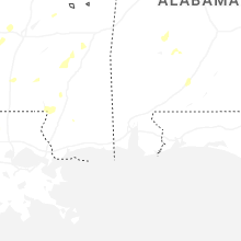
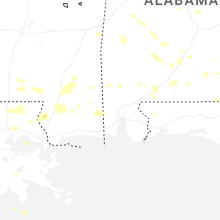
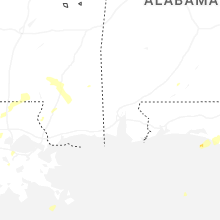


Connect with Interactive Hail Maps