

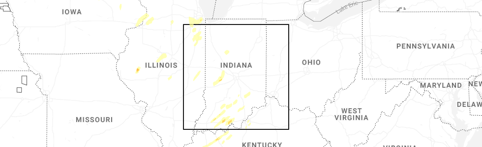
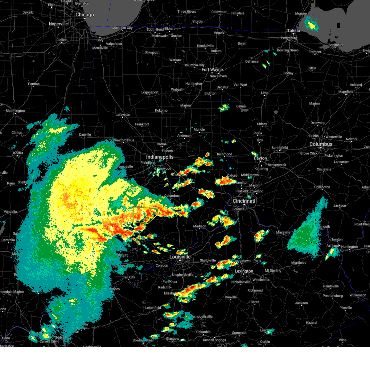
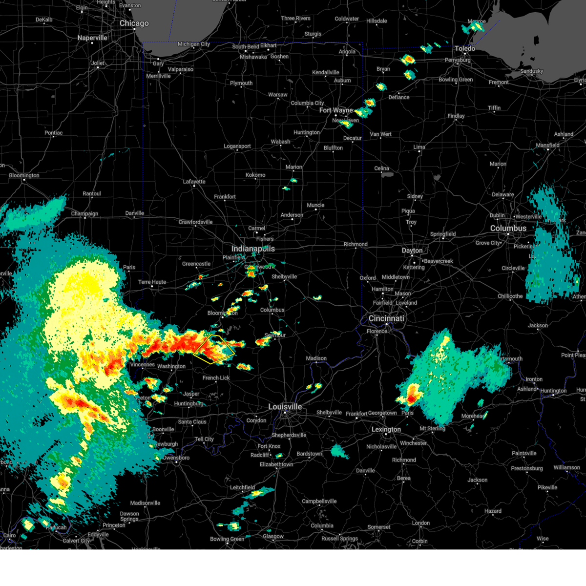
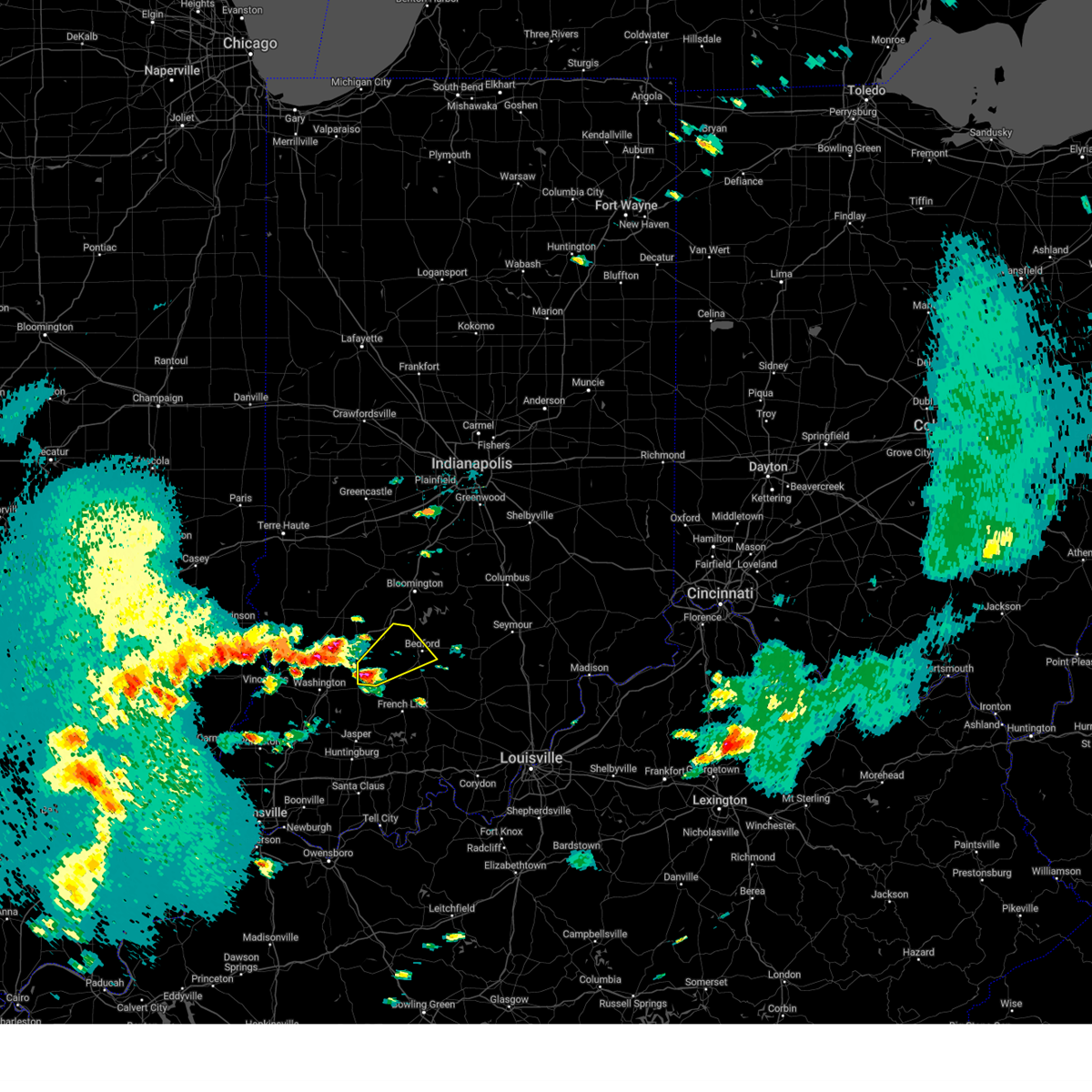
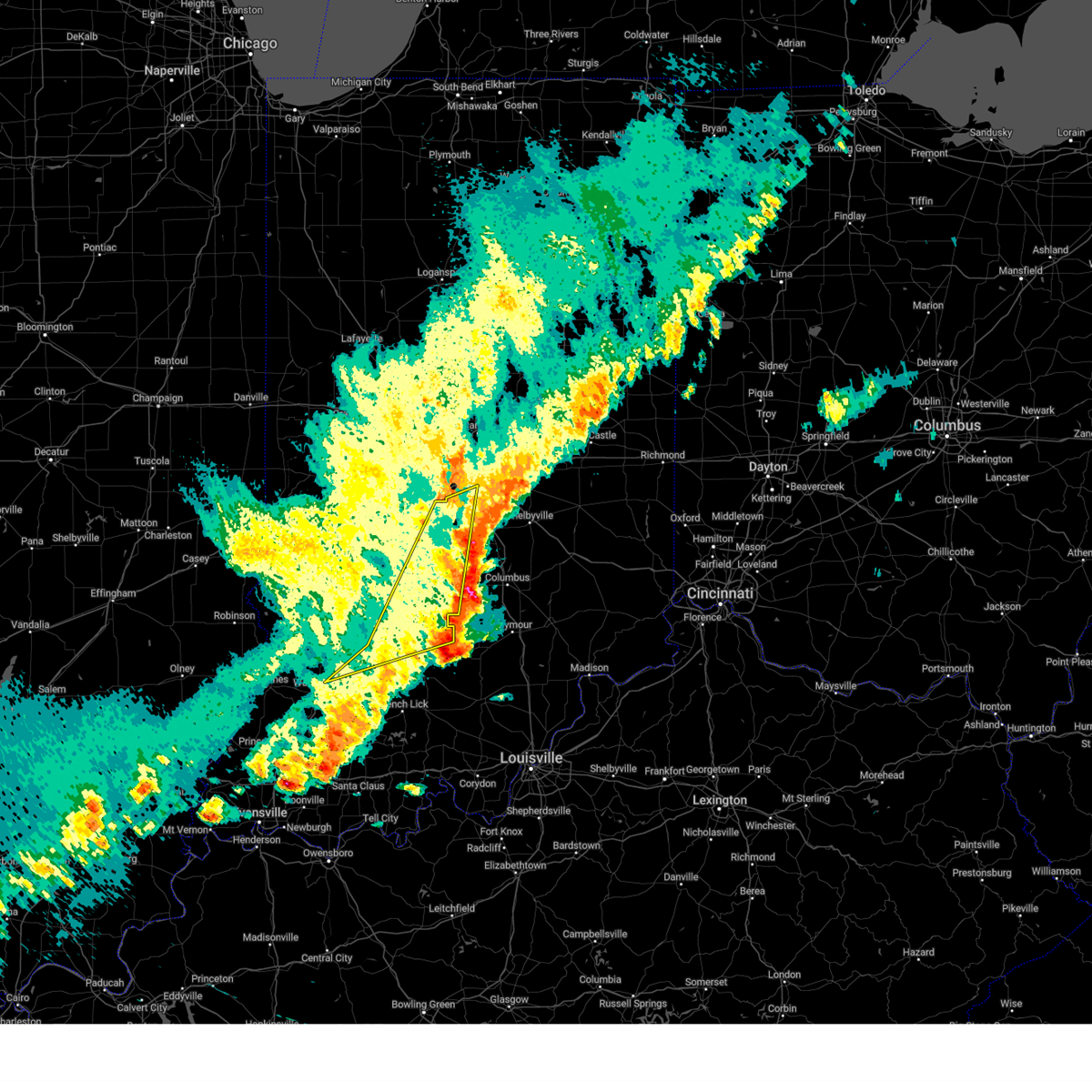
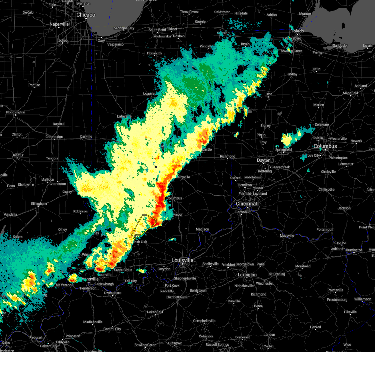
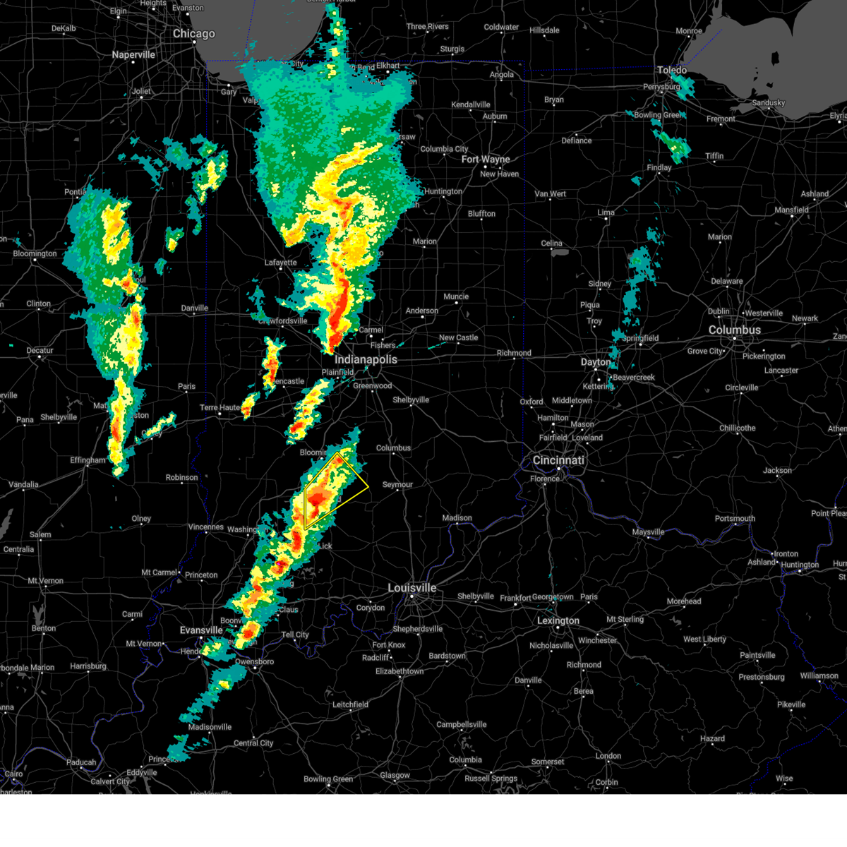
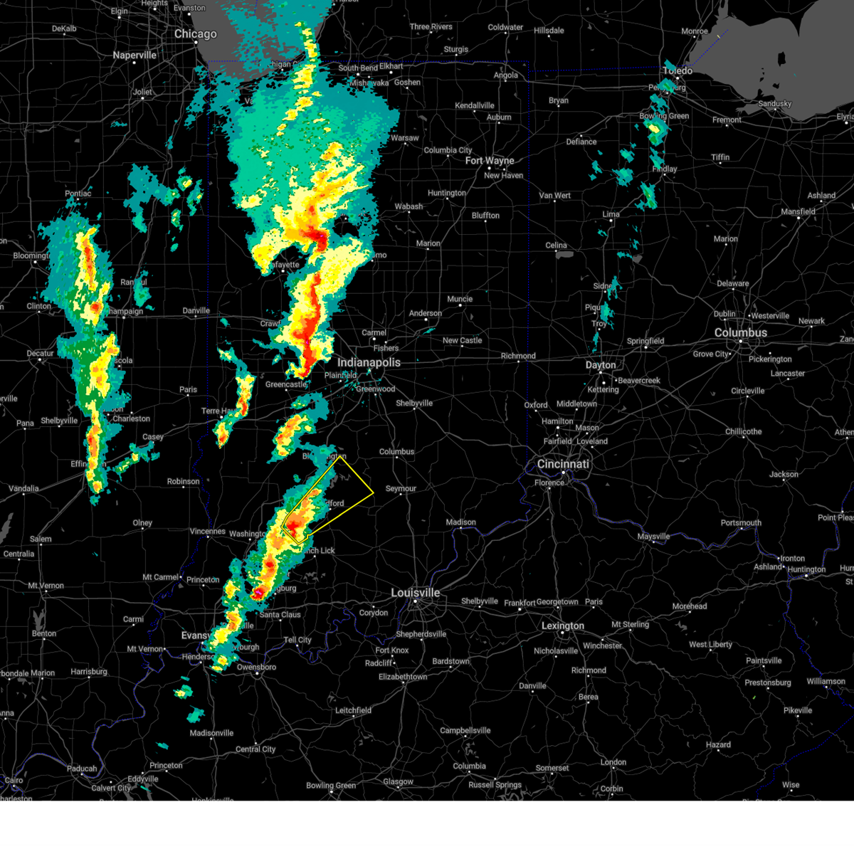
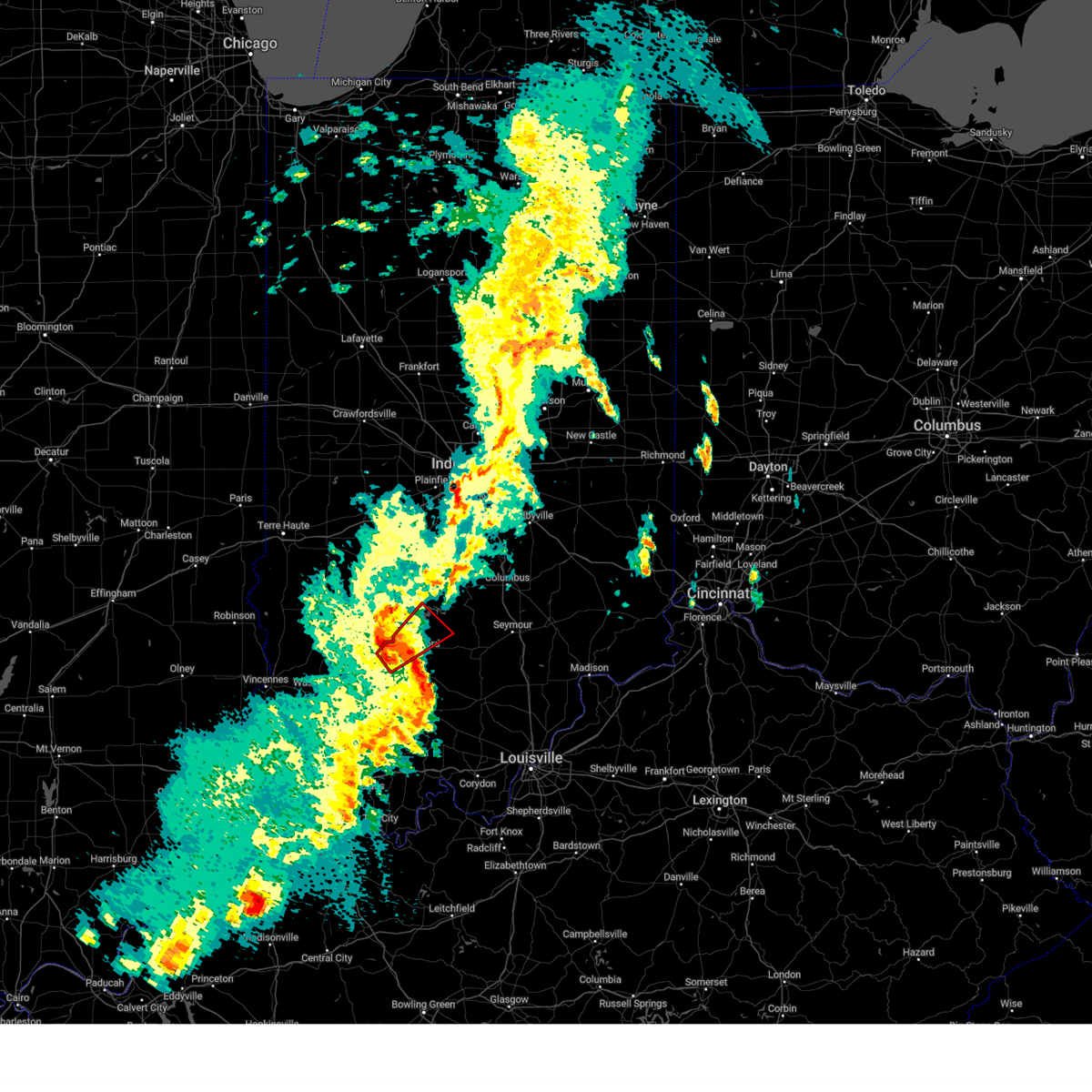
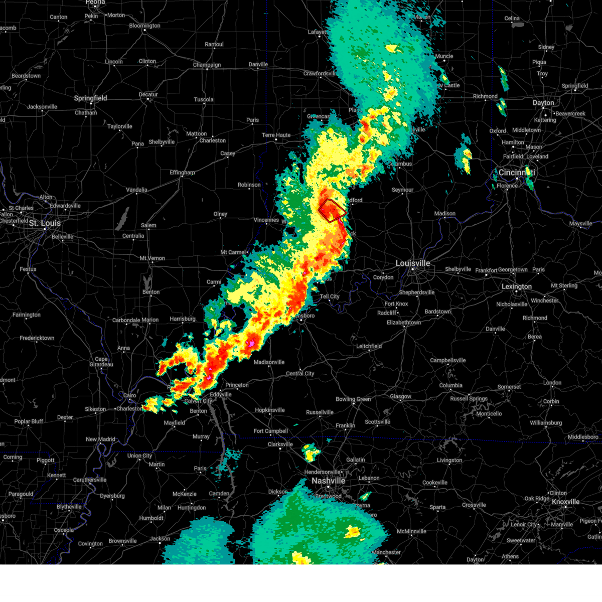
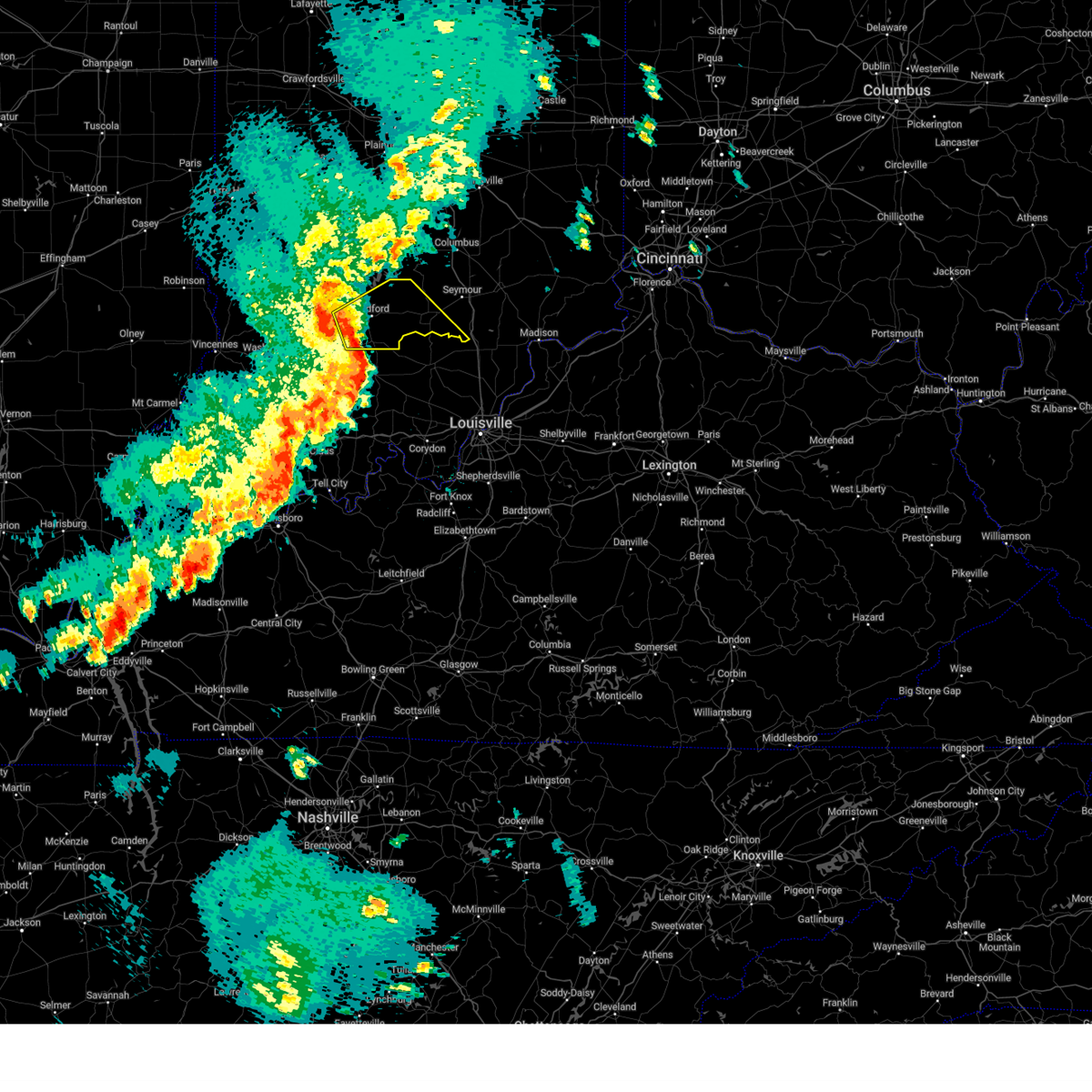
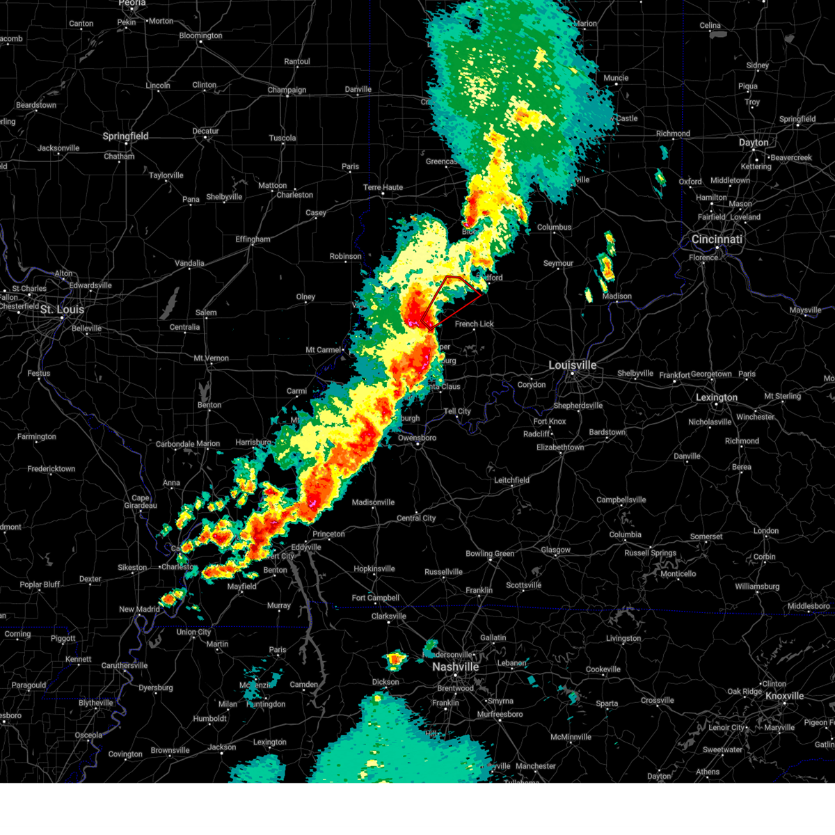
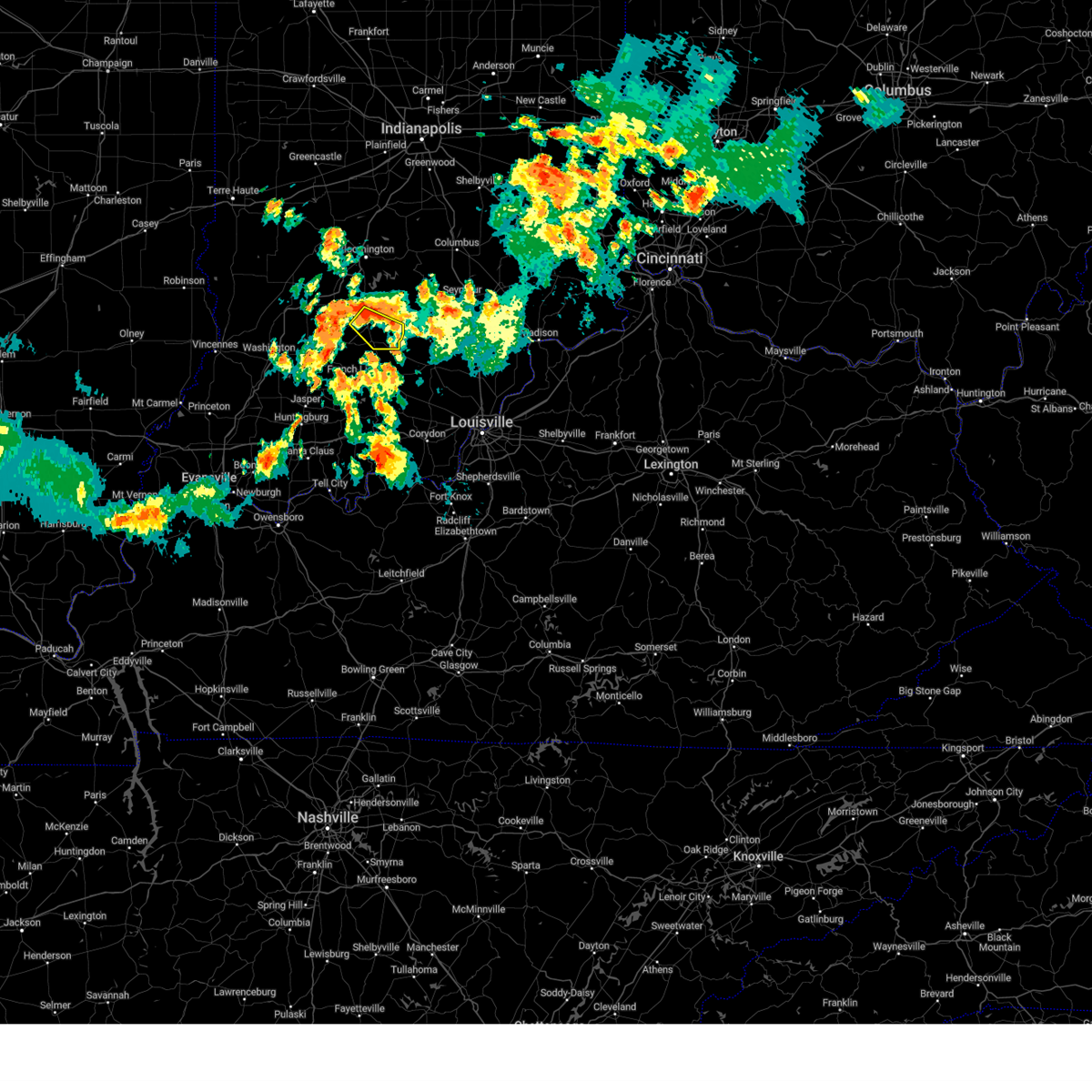
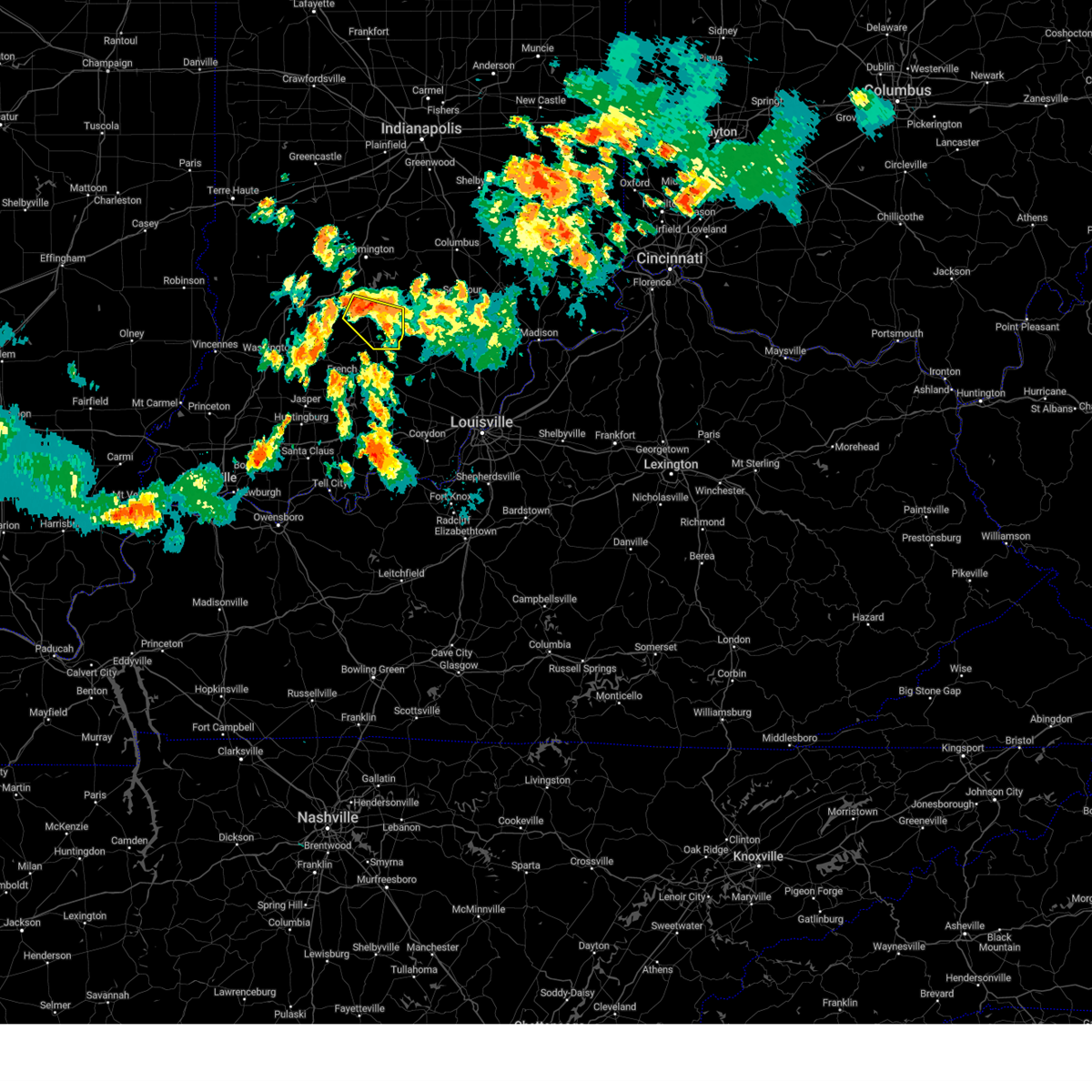
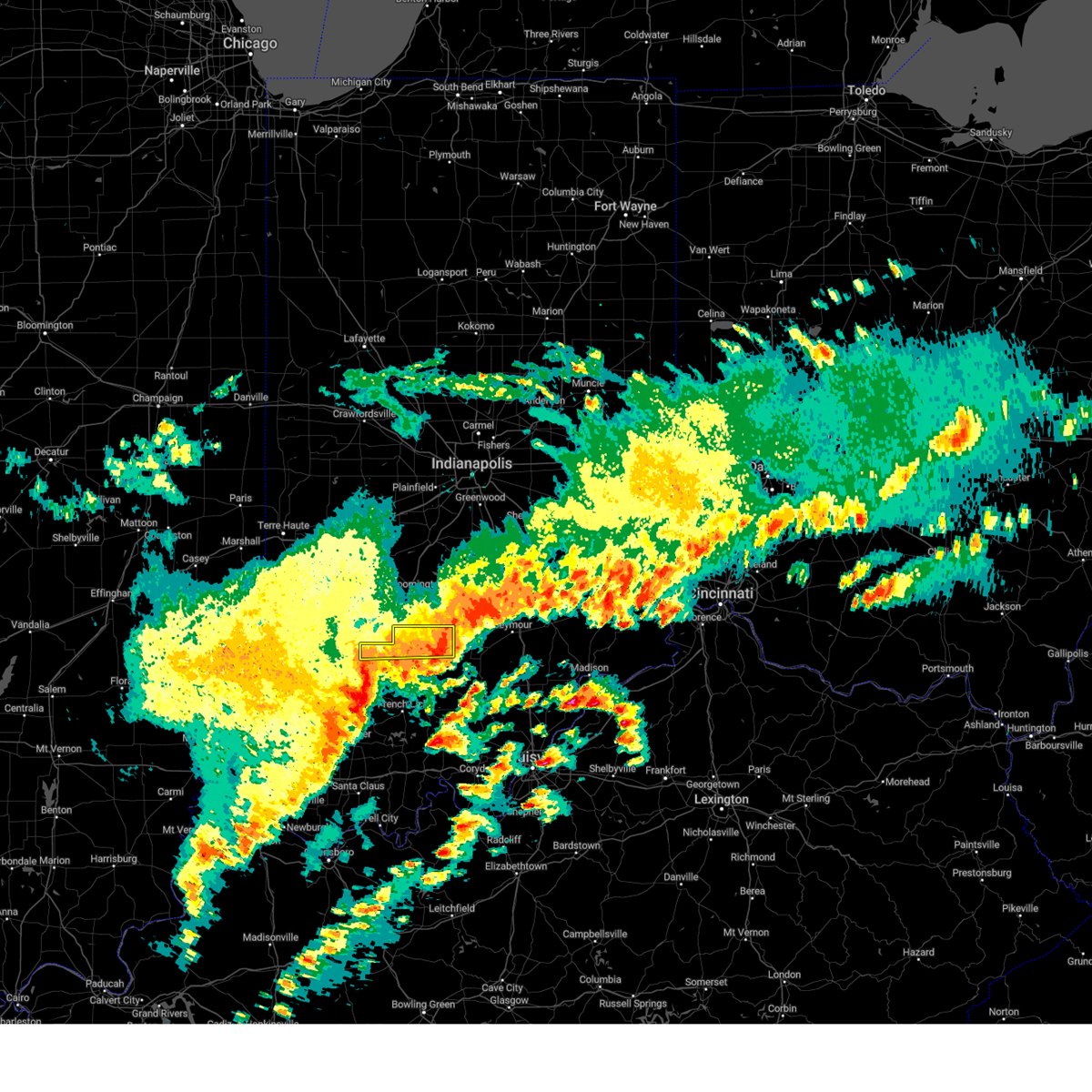
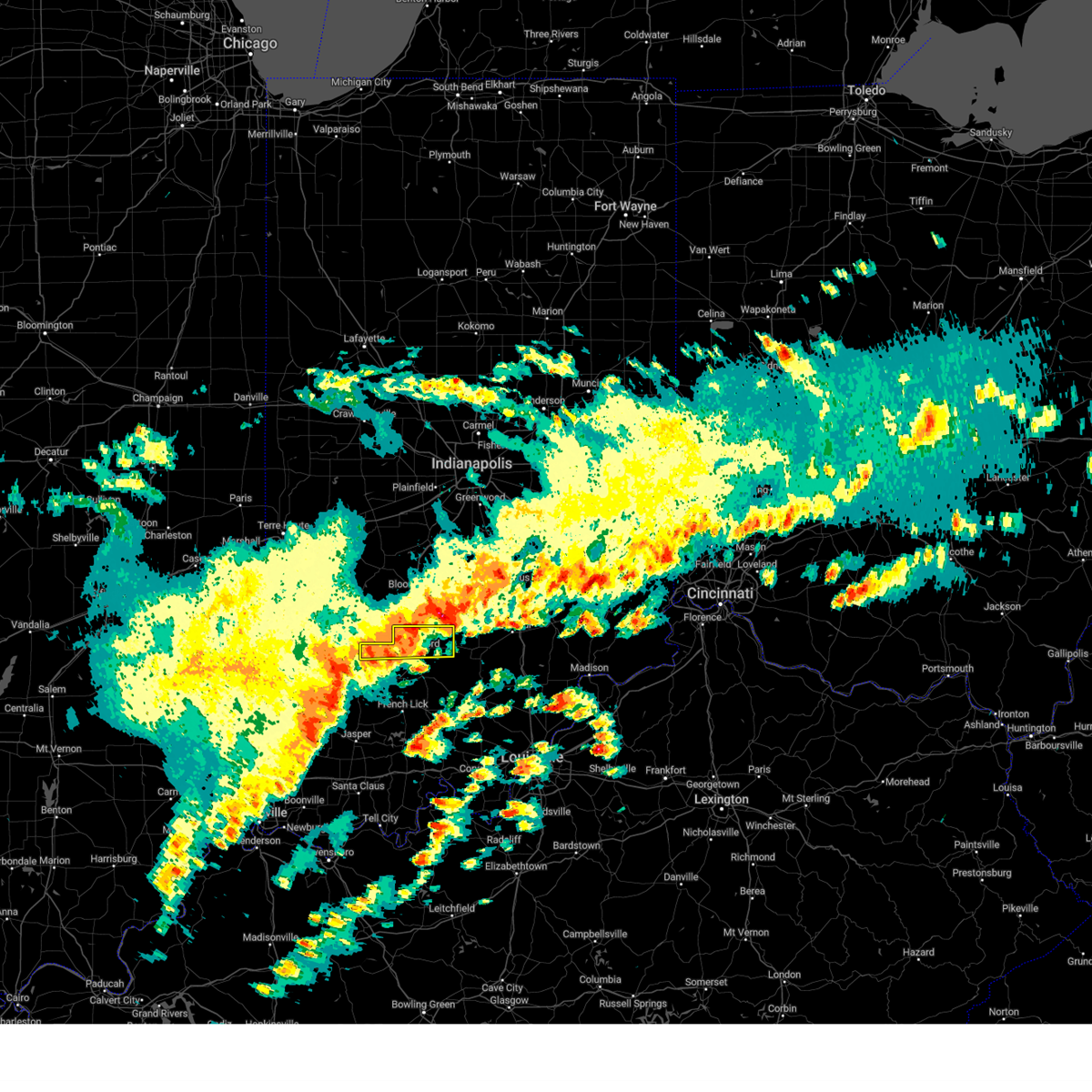
Hail Map for Williams, IN
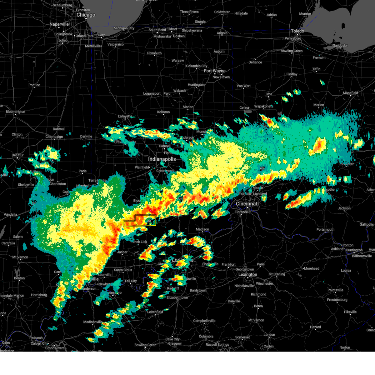
The Williams, IN area has had 5 reports of on-the-ground hail by trained spotters, and has been under severe weather warnings 37 times during the past 12 months. Doppler radar has detected hail at or near Williams, IN on 54 occasions, including 5 occasions during the past year.
| Name: | Williams, IN |
| Where Located: | 70.5 miles SSW of Indianapolis, IN |
| Map: | Google Map for Williams, IN |
| Population: | 286 |
| Housing Units: | 134 |
| More Info: | Search Google for Williams, IN |
2
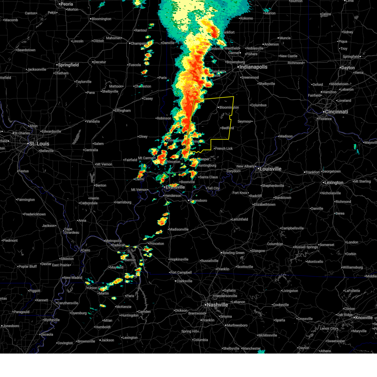
The Top Recent Hail Date for Williams, IN is Wednesday, March 19, 2025 (11th out of 54)
Hail and Wind Damage Spotted near Williams, IN
| Date / Time | Report Details |
|---|---|
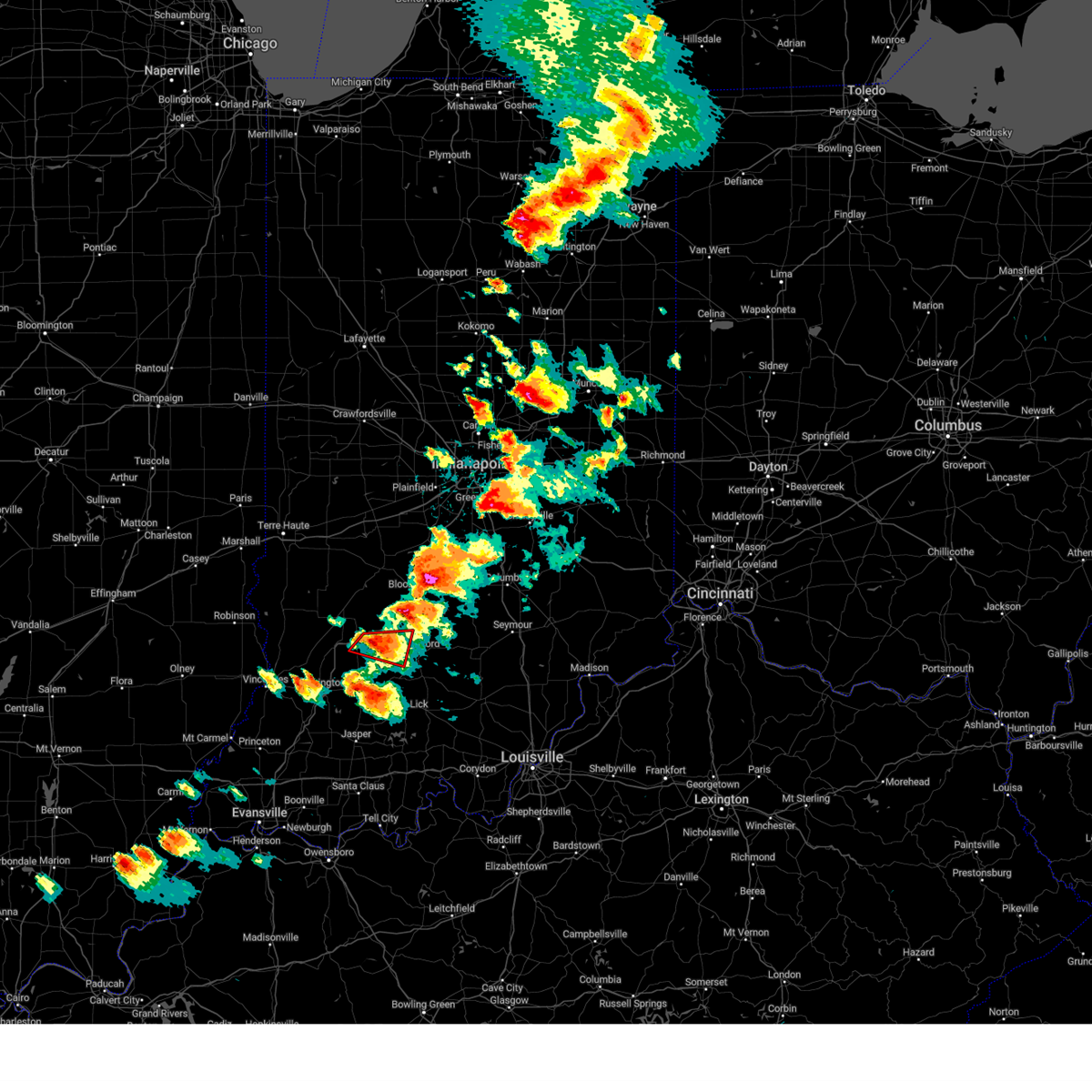
| 6/18/2025 4:38 PM EDT | At 438 pm edt, severe thunderstorms were located along a line extending from near bloomington to 6 miles northwest of paoli, moving east at 40 mph (radar indicated). Hazards include 70 mph wind gusts and nickel size hail. Expect considerable tree damage. damage is likely to mobile homes, roofs, and outbuildings. Locations impacted include, bloomington, bedford, shoals, ellettsville, mitchell, loogootee, oolitic, stinesville, alfordsville, smithville, west boggs lake, tunnelton, lake lemon, beanblossom, bartlettsville, burns city, williams, avoca, monroe reservoir, and woodville hills. |
| 6/18/2025 3:59 PM EDT |
 Svrind the national weather service in indianapolis has issued a * severe thunderstorm warning for, monroe county in south central indiana, western brown county in south central indiana, southern owen county in west central indiana, martin county in southwestern indiana, lawrence county in south central indiana, greene county in southwestern indiana, daviess county in southwestern indiana, * until 445 pm edt. * at 359 pm edt, severe thunderstorms were located along a line extending from 8 miles west of spencer to 10 miles northwest of jasper, moving east at 40 mph (radar indicated). Hazards include 70 mph wind gusts and nickel size hail. Expect considerable tree damage. Damage is likely to mobile homes, roofs, and outbuildings. Svrind the national weather service in indianapolis has issued a * severe thunderstorm warning for, monroe county in south central indiana, western brown county in south central indiana, southern owen county in west central indiana, martin county in southwestern indiana, lawrence county in south central indiana, greene county in southwestern indiana, daviess county in southwestern indiana, * until 445 pm edt. * at 359 pm edt, severe thunderstorms were located along a line extending from 8 miles west of spencer to 10 miles northwest of jasper, moving east at 40 mph (radar indicated). Hazards include 70 mph wind gusts and nickel size hail. Expect considerable tree damage. Damage is likely to mobile homes, roofs, and outbuildings.
|
| 4/30/2025 7:12 PM EDT | Quarter sized hail reported 0.5 miles NNW of Williams, IN, williams dam co-op observer reports 1 inch hail. |
| 4/30/2025 7:09 PM EDT |
 Svrind the national weather service in indianapolis has issued a * severe thunderstorm warning for, lawrence county in south central indiana, * until 800 pm edt. * at 709 pm edt, a severe thunderstorm was located near bedford, moving northeast at 20 mph (radar indicated). Hazards include 60 mph wind gusts and half dollar size hail. Hail damage to vehicles is expected. Expect wind damage to roofs, siding, and trees. Svrind the national weather service in indianapolis has issued a * severe thunderstorm warning for, lawrence county in south central indiana, * until 800 pm edt. * at 709 pm edt, a severe thunderstorm was located near bedford, moving northeast at 20 mph (radar indicated). Hazards include 60 mph wind gusts and half dollar size hail. Hail damage to vehicles is expected. Expect wind damage to roofs, siding, and trees.
|
| 4/30/2025 7:01 PM EDT |
 At 701 pm edt, a severe thunderstorm capable of producing a tornado was located 10 miles southwest of bedford, moving east at 20 mph (radar indicated rotation). Hazards include tornado and golf ball size hail. Flying debris will be dangerous to those caught without shelter. mobile homes will be damaged or destroyed. damage to roofs, windows, and vehicles will occur. tree damage is likely. Locations impacted include, bedford and mitchell. At 701 pm edt, a severe thunderstorm capable of producing a tornado was located 10 miles southwest of bedford, moving east at 20 mph (radar indicated rotation). Hazards include tornado and golf ball size hail. Flying debris will be dangerous to those caught without shelter. mobile homes will be damaged or destroyed. damage to roofs, windows, and vehicles will occur. tree damage is likely. Locations impacted include, bedford and mitchell.
|
| 4/30/2025 7:01 PM EDT |
 the tornado warning has been cancelled and is no longer in effect the tornado warning has been cancelled and is no longer in effect
|
| 4/30/2025 6:43 PM EDT | Torind the national weather service in indianapolis has issued a * tornado warning for, east central martin county in southwestern indiana, southwestern lawrence county in south central indiana, * until 715 pm edt. * at 643 pm edt, a severe thunderstorm capable of producing a tornado was located near shoals, or 16 miles southwest of bedford, moving east at 25 mph (radar indicated rotation). Hazards include tornado and golf ball size hail. Flying debris will be dangerous to those caught without shelter. mobile homes will be damaged or destroyed. damage to roofs, windows, and vehicles will occur. Tree damage is likely. |
| 4/29/2025 5:12 PM EDT |
 the severe thunderstorm warning has been cancelled and is no longer in effect the severe thunderstorm warning has been cancelled and is no longer in effect
|
| 4/29/2025 4:57 PM EDT | At 457 pm edt, a severe thunderstorm was located 6 miles northwest of bedford, moving east at 30 mph (radar indicated). Hazards include 60 mph wind gusts and nickel size hail. Expect damage to roofs, siding, and trees. Locations impacted include, heltonville, norman, avoca, monroe reservoir, fairfax state recreation area, oolitic, silverville, bedford, charles deam wilderness, harrodsburg, and bartlettsville. |
| 4/29/2025 4:57 PM EDT | the severe thunderstorm warning has been cancelled and is no longer in effect |
| 4/29/2025 4:43 PM EDT | Svrind the national weather service in indianapolis has issued a * severe thunderstorm warning for, southern monroe county in south central indiana, northern martin county in southwestern indiana, northern lawrence county in south central indiana, southern greene county in southwestern indiana, northwestern jackson county in south central indiana, northeastern daviess county in southwestern indiana, * until 530 pm edt. * at 443 pm edt, severe thunderstorms were located along a line extending from 11 miles west of bedford to 9 miles southeast of linton, moving east at 40 mph (radar indicated). Hazards include 60 mph wind gusts and penny size hail. expect damage to roofs, siding, and trees |
| 4/29/2025 4:30 PM EDT | At 429 pm edt, a severe thunderstorm was located 7 miles west of bedford, moving northeast at 25 mph (radar indicated). Hazards include 60 mph wind gusts and penny size hail. Expect damage to roofs, siding, and trees. Locations impacted include, oolitic, silverville, bedford, williams, avoca, and owensburg. |
| 4/29/2025 4:19 PM EDT |
 At 418 pm edt, a severe thunderstorm was located 11 miles north of shoals, or 12 miles west of bedford, moving northeast at 25 mph (radar indicated). Hazards include 60 mph wind gusts and quarter size hail. Hail damage to vehicles is expected. expect wind damage to roofs, siding, and trees. Locations impacted include, williams, avoca, indian springs, oolitic, silverville, bedford, and owensburg. At 418 pm edt, a severe thunderstorm was located 11 miles north of shoals, or 12 miles west of bedford, moving northeast at 25 mph (radar indicated). Hazards include 60 mph wind gusts and quarter size hail. Hail damage to vehicles is expected. expect wind damage to roofs, siding, and trees. Locations impacted include, williams, avoca, indian springs, oolitic, silverville, bedford, and owensburg.
|
| 4/29/2025 4:04 PM EDT |
 At 402 pm edt, a severe thunderstorm was located 6 miles north of shoals, or 19 miles west of bedford, moving northeast at 25 mph (radar indicated). Hazards include quarter size hail. Damage to vehicles is expected. Locations impacted include, williams, avoca, indian springs, oolitic, silverville, bedford, owensburg, and burns city. At 402 pm edt, a severe thunderstorm was located 6 miles north of shoals, or 19 miles west of bedford, moving northeast at 25 mph (radar indicated). Hazards include quarter size hail. Damage to vehicles is expected. Locations impacted include, williams, avoca, indian springs, oolitic, silverville, bedford, owensburg, and burns city.
|
| 4/29/2025 4:04 PM EDT |
 the severe thunderstorm warning has been cancelled and is no longer in effect the severe thunderstorm warning has been cancelled and is no longer in effect
|
| 4/29/2025 3:51 PM EDT | Svrind the national weather service in indianapolis has issued a * severe thunderstorm warning for, northern martin county in southwestern indiana, western lawrence county in south central indiana, southeastern greene county in southwestern indiana, east central daviess county in southwestern indiana, * until 445 pm edt. * at 350 pm edt, a severe thunderstorm was located 6 miles northwest of shoals, or 24 miles southwest of bedford, moving northeast at 25 mph (radar indicated). Hazards include quarter size hail. damage to vehicles is expected |
| 4/2/2025 10:57 PM EDT | Svrind the national weather service in indianapolis has issued a * severe thunderstorm warning for, southern monroe county in south central indiana, southern brown county in south central indiana, southwestern bartholomew county in central indiana, lawrence county in south central indiana, western jackson county in south central indiana, * until 1130 pm edt. * at 1057 pm edt, severe thunderstorms were located along a line extending from near bloomington to bedford to 10 miles southeast of shoals, moving northeast at 40 mph (radar indicated). Hazards include 70 mph wind gusts and penny size hail. Expect considerable tree damage. Damage is likely to mobile homes, roofs, and outbuildings. |
| 4/2/2025 10:31 PM EDT | Svrind the national weather service in indianapolis has issued a * severe thunderstorm warning for, southern monroe county in south central indiana, southeastern knox county in southwestern indiana, martin county in southwestern indiana, eastern greene county in southwestern indiana, lawrence county in south central indiana, west central jackson county in south central indiana, daviess county in southwestern indiana, * until 1100 pm edt. * at 1031 pm edt, severe thunderstorms were located along a line extending from 9 miles north of washington to 16 miles south of bloomfield to shoals, moving northeast at 70 mph (radar indicated). Hazards include 60 mph wind gusts and penny size hail. expect damage to roofs, siding, and trees |
| 4/2/2025 8:54 PM EDT | At 854 pm edt, a severe thunderstorm was located 8 miles east of greencastle, or 27 miles southeast of crawfordsville, moving northeast at 75 mph (radar indicated). Hazards include 70 mph wind gusts and quarter size hail. Hail damage to vehicles is expected. expect considerable tree damage. wind damage is also likely to mobile homes, roofs, and outbuildings. locations impacted include, newberry, pittsboro, bicknell, smithville, plainfield, fillmore, crane, carlisle, freedom, farmersburg, reelsville, vincennes university, dugger, elnora, pimento, pleasantville, brazil, worthington, martinsville, and eminence. this includes the following highways, interstate 65 between mile markers 131 and 132. interstate 70 between mile markers 13 and 67. Interstate 74 between mile markers 59 and 68. |
| 4/2/2025 8:43 PM EDT | Svrind the national weather service in indianapolis has issued a * severe thunderstorm warning for, southeastern vigo county in west central indiana, monroe county in south central indiana, morgan county in central indiana, northern knox county in southwestern indiana, owen county in west central indiana, northern martin county in southwestern indiana, south central boone county in central indiana, northwestern lawrence county in south central indiana, southern putnam county in west central indiana, northern daviess county in southwestern indiana, sullivan county in southwestern indiana, hendricks county in central indiana, clay county in west central indiana, greene county in southwestern indiana, * until 930 pm edt. * at 843 pm edt, severe thunderstorms were located along a line extending from 8 miles east of brazil to 14 miles north of linton to 7 miles southeast of russellville, moving east at 70 mph (radar indicated). Hazards include 70 mph wind gusts and half dollar size hail. Hail damage to vehicles is expected. expect considerable tree damage. Wind damage is also likely to mobile homes, roofs, and outbuildings. |
| 3/30/2025 7:12 PM EDT |
 The storms which prompted the warning have moved out of the area. therefore, the warning will be allowed to expire. a tornado watch remains in effect until 800 pm edt for south central, central, southwestern and west central indiana. The storms which prompted the warning have moved out of the area. therefore, the warning will be allowed to expire. a tornado watch remains in effect until 800 pm edt for south central, central, southwestern and west central indiana.
|
| 3/30/2025 7:11 PM EDT |
 The storm which prompted the warning has moved out of the area. therefore, the warning will be allowed to expire. a tornado watch remains in effect until 800 pm edt for south central and southwestern indiana. The storm which prompted the warning has moved out of the area. therefore, the warning will be allowed to expire. a tornado watch remains in effect until 800 pm edt for south central and southwestern indiana.
|
| 3/30/2025 7:01 PM EDT | the severe thunderstorm warning has been cancelled and is no longer in effect |
| 3/30/2025 7:01 PM EDT | At 700 pm edt, severe thunderstorms were located along a line extending from near mooresville to 9 miles northeast of bedford, moving east at 60 mph (trained weather spotters). Hazards include 60 mph wind gusts and quarter size hail. Hail damage to vehicles is expected. expect wind damage to roofs, siding, and trees. Locations impacted include, morgantown, smithville, mooresville, lake lemon, brooklyn, beanblossom, bartlettsville, burns city, avoca, monroe reservoir, woodville hills, elkinsville, martinsville, centerton, charles deam wilderness, unionville, ellettsville, whitehall, heltonville, and mahalasville. |
| 3/30/2025 6:44 PM EDT | At 644 pm edt, severe thunderstorms were located along a line extending from near plainfield to 8 miles north of shoals, moving east at 55 mph (trained weather spotters). Hazards include 60 mph wind gusts and quarter size hail. Hail damage to vehicles is expected. expect wind damage to roofs, siding, and trees. Locations impacted include, newberry, morgantown, smithville, lake lemon, crane, beanblossom, bartlettsville, freedom, monroe reservoir, woodville hills, martinsville, eminence, charles deam wilderness, ellettsville, whitehall, gosport, heltonville, mahalasville, indian springs, and helmsburg. |
| 3/30/2025 6:39 PM EDT | Svrind the national weather service in indianapolis has issued a * severe thunderstorm warning for, east central martin county in southwestern indiana, lawrence county in south central indiana, * until 715 pm edt. * at 639 pm edt, a severe thunderstorm was located 10 miles northeast of shoals, or 11 miles southwest of bedford, moving northeast at 45 mph (radar indicated). Hazards include 60 mph wind gusts and quarter size hail. Hail damage to vehicles is expected. Expect wind damage to roofs, siding, and trees. |
| 3/30/2025 6:30 PM EDT | Svrind the national weather service in indianapolis has issued a * severe thunderstorm warning for, monroe county in south central indiana, morgan county in central indiana, western brown county in south central indiana, western johnson county in central indiana, eastern owen county in west central indiana, northern martin county in southwestern indiana, southwestern marion county in central indiana, eastern greene county in southwestern indiana, northern lawrence county in south central indiana, southeastern putnam county in west central indiana, northeastern daviess county in southwestern indiana, * until 715 pm edt. * at 629 pm edt, severe thunderstorms were located along a line extending from 10 miles southwest of danville to 9 miles northeast of washington, moving east at 50 mph (public). Hazards include 60 mph wind gusts and half dollar size hail. Hail damage to vehicles is expected. Expect wind damage to roofs, siding, and trees. |
| 3/19/2025 8:00 PM EDT | Svrind the national weather service in indianapolis has issued a * severe thunderstorm warning for, east central martin county in southwestern indiana, lawrence county in south central indiana, jackson county in south central indiana, * until 845 pm edt. * at 800 pm edt, a severe thunderstorm was located near shoals, or 16 miles southwest of bedford, moving northeast at 55 mph (radar indicated). Hazards include 60 mph wind gusts and quarter size hail. Hail damage to vehicles is expected. Expect wind damage to roofs, siding, and trees. |
| 3/19/2025 7:57 PM EDT |
 At 756 pm edt, severe thunderstorms were located along a line extending from 9 miles west of bedford to 10 miles northeast of shoals, moving northeast at 50 mph (radar indicated). Hazards include 60 mph wind gusts and quarter size hail. Hail damage to vehicles is expected. expect wind damage to roofs, siding, and trees. Locations impacted include, heltonville, norman, smithville, oolitic, huron, harrodsburg, bartlettsville, williams, avoca, monroe reservoir, fairfax state recreation area, woodville hills, elkinsville, silverville, bedford, kurtz, and charles deam wilderness. At 756 pm edt, severe thunderstorms were located along a line extending from 9 miles west of bedford to 10 miles northeast of shoals, moving northeast at 50 mph (radar indicated). Hazards include 60 mph wind gusts and quarter size hail. Hail damage to vehicles is expected. expect wind damage to roofs, siding, and trees. Locations impacted include, heltonville, norman, smithville, oolitic, huron, harrodsburg, bartlettsville, williams, avoca, monroe reservoir, fairfax state recreation area, woodville hills, elkinsville, silverville, bedford, kurtz, and charles deam wilderness.
|
| 3/19/2025 7:57 PM EDT |
 the severe thunderstorm warning has been cancelled and is no longer in effect the severe thunderstorm warning has been cancelled and is no longer in effect
|
| 3/19/2025 7:42 PM EDT |
 Svrind the national weather service in indianapolis has issued a * severe thunderstorm warning for, southeastern monroe county in south central indiana, southwestern brown county in south central indiana, northern martin county in southwestern indiana, lawrence county in south central indiana, southeastern greene county in southwestern indiana, northwestern jackson county in south central indiana, * until 815 pm edt. * at 741 pm edt, a severe thunderstorm was located near shoals, or 15 miles southwest of bedford, moving northeast at 55 mph (radar indicated). Hazards include 60 mph wind gusts and quarter size hail. Hail damage to vehicles is expected. Expect wind damage to roofs, siding, and trees. Svrind the national weather service in indianapolis has issued a * severe thunderstorm warning for, southeastern monroe county in south central indiana, southwestern brown county in south central indiana, northern martin county in southwestern indiana, lawrence county in south central indiana, southeastern greene county in southwestern indiana, northwestern jackson county in south central indiana, * until 815 pm edt. * at 741 pm edt, a severe thunderstorm was located near shoals, or 15 miles southwest of bedford, moving northeast at 55 mph (radar indicated). Hazards include 60 mph wind gusts and quarter size hail. Hail damage to vehicles is expected. Expect wind damage to roofs, siding, and trees.
|
| 3/15/2025 4:51 AM EDT |
 Torind the national weather service in indianapolis has issued a * tornado warning for, south central monroe county in south central indiana, northeastern martin county in southwestern indiana, northern lawrence county in south central indiana, * until 515 am edt. * at 450 am edt, a severe thunderstorm capable of producing a tornado was located 11 miles north of shoals, or 12 miles west of bedford, moving northeast at 65 mph (radar indicated rotation). Hazards include tornado. Flying debris will be dangerous to those caught without shelter. mobile homes will be damaged or destroyed. damage to roofs, windows, and vehicles will occur. Tree damage is likely. Torind the national weather service in indianapolis has issued a * tornado warning for, south central monroe county in south central indiana, northeastern martin county in southwestern indiana, northern lawrence county in south central indiana, * until 515 am edt. * at 450 am edt, a severe thunderstorm capable of producing a tornado was located 11 miles north of shoals, or 12 miles west of bedford, moving northeast at 65 mph (radar indicated rotation). Hazards include tornado. Flying debris will be dangerous to those caught without shelter. mobile homes will be damaged or destroyed. damage to roofs, windows, and vehicles will occur. Tree damage is likely.
|
| 3/15/2025 4:49 AM EDT |
 the tornado warning has been cancelled and is no longer in effect the tornado warning has been cancelled and is no longer in effect
|
| 3/15/2025 4:49 AM EDT |
 At 448 am edt, a confirmed tornado was located 9 miles north of shoals, or 14 miles west of bedford, moving northeast at 55 mph (radar confirmed tornado). Hazards include damaging tornado and quarter size hail. Flying debris will be dangerous to those caught without shelter. mobile homes will be damaged or destroyed. damage to roofs, windows, and vehicles will occur. tree damage is likely. Locations impacted include, burns city, williams, and indian springs. At 448 am edt, a confirmed tornado was located 9 miles north of shoals, or 14 miles west of bedford, moving northeast at 55 mph (radar confirmed tornado). Hazards include damaging tornado and quarter size hail. Flying debris will be dangerous to those caught without shelter. mobile homes will be damaged or destroyed. damage to roofs, windows, and vehicles will occur. tree damage is likely. Locations impacted include, burns city, williams, and indian springs.
|
| 3/15/2025 4:47 AM EDT |
 Svrind the national weather service in indianapolis has issued a * severe thunderstorm warning for, southeastern monroe county in south central indiana, northeastern martin county in southwestern indiana, lawrence county in south central indiana, western jackson county in south central indiana, * until 530 am edt. * at 447 am edt, severe thunderstorms were located along a line extending from 10 miles southwest of bedford to near paoli, moving northeast at 70 mph (radar indicated). Hazards include 60 mph wind gusts and penny size hail. expect damage to roofs, siding, and trees Svrind the national weather service in indianapolis has issued a * severe thunderstorm warning for, southeastern monroe county in south central indiana, northeastern martin county in southwestern indiana, lawrence county in south central indiana, western jackson county in south central indiana, * until 530 am edt. * at 447 am edt, severe thunderstorms were located along a line extending from 10 miles southwest of bedford to near paoli, moving northeast at 70 mph (radar indicated). Hazards include 60 mph wind gusts and penny size hail. expect damage to roofs, siding, and trees
|
| 3/15/2025 4:30 AM EDT |
 Torind the national weather service in indianapolis has issued a * tornado warning for, martin county in southwestern indiana, west central lawrence county in south central indiana, southeastern daviess county in southwestern indiana, * until 500 am edt. * at 429 am edt, a tornado producing storm was located 10 miles east of washington, or 17 miles northeast of petersburg, moving northeast at 65 mph (radar confirmed tornado). Hazards include damaging tornado and quarter size hail. Flying debris will be dangerous to those caught without shelter. mobile homes will be damaged or destroyed. damage to roofs, windows, and vehicles will occur. Tree damage is likely. Torind the national weather service in indianapolis has issued a * tornado warning for, martin county in southwestern indiana, west central lawrence county in south central indiana, southeastern daviess county in southwestern indiana, * until 500 am edt. * at 429 am edt, a tornado producing storm was located 10 miles east of washington, or 17 miles northeast of petersburg, moving northeast at 65 mph (radar confirmed tornado). Hazards include damaging tornado and quarter size hail. Flying debris will be dangerous to those caught without shelter. mobile homes will be damaged or destroyed. damage to roofs, windows, and vehicles will occur. Tree damage is likely.
|
| 7/30/2024 12:43 AM EDT |
 At 1243 am edt, a severe thunderstorm was located over bedford, moving southeast at 30 mph (radar indicated). Hazards include 60 mph wind gusts. Expect damage to roofs, siding, and trees. Locations impacted include, bedford, mitchell, oolitic, tunnelton, and spring mill state park. At 1243 am edt, a severe thunderstorm was located over bedford, moving southeast at 30 mph (radar indicated). Hazards include 60 mph wind gusts. Expect damage to roofs, siding, and trees. Locations impacted include, bedford, mitchell, oolitic, tunnelton, and spring mill state park.
|
| 7/30/2024 12:35 AM EDT |
 Svrind the national weather service in indianapolis has issued a * severe thunderstorm warning for, lawrence county in south central indiana, * until 115 am edt. * at 1234 am edt, a severe thunderstorm was located near bedford, moving southeast at 20 mph (radar indicated). Hazards include 60 mph wind gusts. expect damage to roofs, siding, and trees Svrind the national weather service in indianapolis has issued a * severe thunderstorm warning for, lawrence county in south central indiana, * until 115 am edt. * at 1234 am edt, a severe thunderstorm was located near bedford, moving southeast at 20 mph (radar indicated). Hazards include 60 mph wind gusts. expect damage to roofs, siding, and trees
|
| 7/9/2024 7:56 PM EDT |
 The storm which prompted the warning has weakened below severe limits, and has exited the warned area. therefore, the warning will be allowed to expire. a tornado watch remains in effect until midnight edt for south central indiana. The storm which prompted the warning has weakened below severe limits, and has exited the warned area. therefore, the warning will be allowed to expire. a tornado watch remains in effect until midnight edt for south central indiana.
|
| 7/9/2024 7:18 PM EDT |
 Svrind the national weather service in indianapolis has issued a * severe thunderstorm warning for, central lawrence county in south central indiana, * until 800 pm edt. * at 718 pm edt, a severe thunderstorm was located 10 miles southwest of bedford, moving north at 30 mph (radar indicated). Hazards include 60 mph wind gusts. expect damage to roofs, siding, and trees Svrind the national weather service in indianapolis has issued a * severe thunderstorm warning for, central lawrence county in south central indiana, * until 800 pm edt. * at 718 pm edt, a severe thunderstorm was located 10 miles southwest of bedford, moving north at 30 mph (radar indicated). Hazards include 60 mph wind gusts. expect damage to roofs, siding, and trees
|
| 5/26/2024 10:44 PM EDT |
 the severe thunderstorm warning has been cancelled and is no longer in effect the severe thunderstorm warning has been cancelled and is no longer in effect
|
| 5/26/2024 10:44 PM EDT |
 At 1043 pm edt, severe thunderstorms were located along a line extending from 10 miles south of spencer to 16 miles east of bloomfield to near bedford to near paoli, moving east at 60 mph (radar indicated). Hazards include 60 mph wind gusts and penny size hail. Expect damage to roofs, siding, and trees. Locations impacted include, bloomington, bedford, bloomfield, ellettsville, mitchell, worthington, oolitic, smithville, tunnelton, bartlettsville, williams, avoca, monroe reservoir, woodville hills, charles deam wilderness, whitehall, heltonville, indiana university, indian springs, and huron. At 1043 pm edt, severe thunderstorms were located along a line extending from 10 miles south of spencer to 16 miles east of bloomfield to near bedford to near paoli, moving east at 60 mph (radar indicated). Hazards include 60 mph wind gusts and penny size hail. Expect damage to roofs, siding, and trees. Locations impacted include, bloomington, bedford, bloomfield, ellettsville, mitchell, worthington, oolitic, smithville, tunnelton, bartlettsville, williams, avoca, monroe reservoir, woodville hills, charles deam wilderness, whitehall, heltonville, indiana university, indian springs, and huron.
|
| 5/26/2024 10:32 PM EDT |
 At 1031 pm edt, severe thunderstorms were located along a line extending from near bloomfield to 18 miles southeast of linton to 6 miles north of shoals to 14 miles west of paoli, moving east at 70 mph (radar indicated). Hazards include 70 mph wind gusts and penny size hail. Expect considerable tree damage. damage is likely to mobile homes, roofs, and outbuildings. Locations impacted include, bloomington, bedford, linton, bloomfield, shoals, ellettsville, mitchell, loogootee, worthington, odon, oolitic, lyons, elnora, switz city, newberry, crane, smithville, west boggs lake, tunnelton, and bartlettsville. At 1031 pm edt, severe thunderstorms were located along a line extending from near bloomfield to 18 miles southeast of linton to 6 miles north of shoals to 14 miles west of paoli, moving east at 70 mph (radar indicated). Hazards include 70 mph wind gusts and penny size hail. Expect considerable tree damage. damage is likely to mobile homes, roofs, and outbuildings. Locations impacted include, bloomington, bedford, linton, bloomfield, shoals, ellettsville, mitchell, loogootee, worthington, odon, oolitic, lyons, elnora, switz city, newberry, crane, smithville, west boggs lake, tunnelton, and bartlettsville.
|
| 5/26/2024 10:32 PM EDT |
 the severe thunderstorm warning has been cancelled and is no longer in effect the severe thunderstorm warning has been cancelled and is no longer in effect
|
| 5/26/2024 10:23 PM EDT |
 At 1022 pm edt, severe thunderstorms were located along a line extending from 9 miles north of sullivan to near linton to 7 miles southeast of washington to 8 miles northeast of winslow, moving east at 60 mph (radar indicated). Hazards include 70 mph wind gusts and penny size hail. Expect considerable tree damage. damage is likely to mobile homes, roofs, and outbuildings. Locations impacted include, bloomington, bedford, washington, linton, sullivan, bloomfield, spencer, shoals, ellettsville, mitchell, bicknell, loogootee, jasonville, worthington, odon, shelburn, oolitic, farmersburg, dugger, and clay city. At 1022 pm edt, severe thunderstorms were located along a line extending from 9 miles north of sullivan to near linton to 7 miles southeast of washington to 8 miles northeast of winslow, moving east at 60 mph (radar indicated). Hazards include 70 mph wind gusts and penny size hail. Expect considerable tree damage. damage is likely to mobile homes, roofs, and outbuildings. Locations impacted include, bloomington, bedford, washington, linton, sullivan, bloomfield, spencer, shoals, ellettsville, mitchell, bicknell, loogootee, jasonville, worthington, odon, shelburn, oolitic, farmersburg, dugger, and clay city.
|
| 5/26/2024 10:12 PM EDT |
 Svrind the national weather service in indianapolis has issued a * severe thunderstorm warning for, southeastern vigo county in west central indiana, monroe county in south central indiana, southwestern morgan county in central indiana, sullivan county in southwestern indiana, southwestern brown county in south central indiana, eastern knox county in southwestern indiana, southern clay county in west central indiana, owen county in west central indiana, martin county in southwestern indiana, lawrence county in south central indiana, greene county in southwestern indiana, daviess county in southwestern indiana, * until 1100 pm edt. * at 1012 pm edt, severe thunderstorms were located along a line extending from 8 miles northwest of sullivan to near linton to near washington to near winslow, moving east at 60 mph (radar indicated). Hazards include 70 mph wind gusts and penny size hail. Expect considerable tree damage. Damage is likely to mobile homes, roofs, and outbuildings. Svrind the national weather service in indianapolis has issued a * severe thunderstorm warning for, southeastern vigo county in west central indiana, monroe county in south central indiana, southwestern morgan county in central indiana, sullivan county in southwestern indiana, southwestern brown county in south central indiana, eastern knox county in southwestern indiana, southern clay county in west central indiana, owen county in west central indiana, martin county in southwestern indiana, lawrence county in south central indiana, greene county in southwestern indiana, daviess county in southwestern indiana, * until 1100 pm edt. * at 1012 pm edt, severe thunderstorms were located along a line extending from 8 miles northwest of sullivan to near linton to near washington to near winslow, moving east at 60 mph (radar indicated). Hazards include 70 mph wind gusts and penny size hail. Expect considerable tree damage. Damage is likely to mobile homes, roofs, and outbuildings.
|
| 5/8/2024 5:07 PM EDT |
 The storm which prompted the warning has weakened below severe limits, and no longer poses an immediate threat to life or property. therefore, the warning will be allowed to expire. The storm which prompted the warning has weakened below severe limits, and no longer poses an immediate threat to life or property. therefore, the warning will be allowed to expire.
|
| 5/8/2024 4:48 PM EDT |
 Svrind the national weather service in indianapolis has issued a * severe thunderstorm warning for, south central monroe county in south central indiana, northeastern martin county in southwestern indiana, lawrence county in south central indiana, * until 515 pm edt. * at 448 pm edt, a severe thunderstorm was located 9 miles west of bedford, moving east at 35 mph (radar indicated). Hazards include 60 mph wind gusts and half dollar size hail. Hail damage to vehicles is expected. Expect wind damage to roofs, siding, and trees. Svrind the national weather service in indianapolis has issued a * severe thunderstorm warning for, south central monroe county in south central indiana, northeastern martin county in southwestern indiana, lawrence county in south central indiana, * until 515 pm edt. * at 448 pm edt, a severe thunderstorm was located 9 miles west of bedford, moving east at 35 mph (radar indicated). Hazards include 60 mph wind gusts and half dollar size hail. Hail damage to vehicles is expected. Expect wind damage to roofs, siding, and trees.
|
| 4/18/2024 10:49 PM EDT |
 Svrind the national weather service in indianapolis has issued a * severe thunderstorm warning for, southern monroe county in south central indiana, lawrence county in south central indiana, * until 1145 pm edt. * at 1049 pm edt, severe thunderstorms were located along a line extending from bloomfield to near shoals, moving east at 40 mph (radar indicated). Hazards include 60 mph wind gusts. expect damage to roofs, siding, and trees Svrind the national weather service in indianapolis has issued a * severe thunderstorm warning for, southern monroe county in south central indiana, lawrence county in south central indiana, * until 1145 pm edt. * at 1049 pm edt, severe thunderstorms were located along a line extending from bloomfield to near shoals, moving east at 40 mph (radar indicated). Hazards include 60 mph wind gusts. expect damage to roofs, siding, and trees
|
| 3/14/2024 10:35 PM EDT |
 The storms which prompted the warning have weakened below severe limits, and no longer pose an immediate threat to life or property. therefore, the warning will be allowed to expire. a tornado watch remains in effect until midnight edt for south central and southwestern indiana. The storms which prompted the warning have weakened below severe limits, and no longer pose an immediate threat to life or property. therefore, the warning will be allowed to expire. a tornado watch remains in effect until midnight edt for south central and southwestern indiana.
|
| 3/14/2024 10:27 PM EDT |
 At 1027 pm edt, severe thunderstorms were located along a line extending from 9 miles south of nashville to 12 miles north of shoals, moving east at 45 mph (radar indicated). Hazards include 60 mph wind gusts and penny size hail. Expect damage to roofs, siding, and trees. Locations impacted include, bedford, oolitic, crane, heltonville, avoca, silverville, bartlettsville, and burns city. At 1027 pm edt, severe thunderstorms were located along a line extending from 9 miles south of nashville to 12 miles north of shoals, moving east at 45 mph (radar indicated). Hazards include 60 mph wind gusts and penny size hail. Expect damage to roofs, siding, and trees. Locations impacted include, bedford, oolitic, crane, heltonville, avoca, silverville, bartlettsville, and burns city.
|
| 3/14/2024 10:27 PM EDT |
 the severe thunderstorm warning has been cancelled and is no longer in effect the severe thunderstorm warning has been cancelled and is no longer in effect
|
| 3/14/2024 10:07 PM EDT |
 Svrind the national weather service in indianapolis has issued a * severe thunderstorm warning for, southern monroe county in south central indiana, northern martin county in southwestern indiana, southeastern greene county in southwestern indiana, northern lawrence county in south central indiana, * until 1045 pm edt. * at 1006 pm edt, severe thunderstorms were located along a line extending from 8 miles southwest of bloomington to 13 miles northeast of washington, moving east at 45 mph (radar indicated). Hazards include 60 mph wind gusts and quarter size hail. Hail damage to vehicles is expected. Expect wind damage to roofs, siding, and trees. Svrind the national weather service in indianapolis has issued a * severe thunderstorm warning for, southern monroe county in south central indiana, northern martin county in southwestern indiana, southeastern greene county in southwestern indiana, northern lawrence county in south central indiana, * until 1045 pm edt. * at 1006 pm edt, severe thunderstorms were located along a line extending from 8 miles southwest of bloomington to 13 miles northeast of washington, moving east at 45 mph (radar indicated). Hazards include 60 mph wind gusts and quarter size hail. Hail damage to vehicles is expected. Expect wind damage to roofs, siding, and trees.
|
| 8/6/2023 11:53 PM EDT |
 At 1153 pm edt, a severe thunderstorm capable of producing a tornado was located near bedford, moving east at 30 mph (radar indicated rotation). Hazards include tornado. Flying debris will be dangerous to those caught without shelter. mobile homes will be damaged or destroyed. damage to roofs, windows, and vehicles will occur. tree damage is likely. this dangerous storm will be near, oolitic around 1200 am edt. mitchell around 1205 am edt. Other locations in the path of this tornadic thunderstorm include bedford. At 1153 pm edt, a severe thunderstorm capable of producing a tornado was located near bedford, moving east at 30 mph (radar indicated rotation). Hazards include tornado. Flying debris will be dangerous to those caught without shelter. mobile homes will be damaged or destroyed. damage to roofs, windows, and vehicles will occur. tree damage is likely. this dangerous storm will be near, oolitic around 1200 am edt. mitchell around 1205 am edt. Other locations in the path of this tornadic thunderstorm include bedford.
|
| 8/6/2023 11:47 PM EDT |
 At 1147 pm edt, a severe thunderstorm capable of producing a tornado was located 9 miles west of bedford, moving east at 25 mph (radar indicated rotation). Hazards include tornado. Flying debris will be dangerous to those caught without shelter. mobile homes will be damaged or destroyed. damage to roofs, windows, and vehicles will occur. tree damage is likely. this dangerous storm will be near, oolitic around 1205 am edt. Other locations in the path of this tornadic thunderstorm include mitchell and bedford. At 1147 pm edt, a severe thunderstorm capable of producing a tornado was located 9 miles west of bedford, moving east at 25 mph (radar indicated rotation). Hazards include tornado. Flying debris will be dangerous to those caught without shelter. mobile homes will be damaged or destroyed. damage to roofs, windows, and vehicles will occur. tree damage is likely. this dangerous storm will be near, oolitic around 1205 am edt. Other locations in the path of this tornadic thunderstorm include mitchell and bedford.
|
| 7/1/2023 9:08 PM EDT |
 The severe thunderstorm warning for lawrence county will expire at 915 pm edt, the storms which prompted the warning have weakened below severe limits, and no longer pose an immediate threat to life or property. therefore, the warning will be allowed to expire. however gusty winds are still possible with these thunderstorms. a severe thunderstorm watch remains in effect until 1100 pm edt for south central indiana. The severe thunderstorm warning for lawrence county will expire at 915 pm edt, the storms which prompted the warning have weakened below severe limits, and no longer pose an immediate threat to life or property. therefore, the warning will be allowed to expire. however gusty winds are still possible with these thunderstorms. a severe thunderstorm watch remains in effect until 1100 pm edt for south central indiana.
|
| 7/1/2023 8:54 PM EDT |
 At 854 pm edt, severe thunderstorms were located along a line extending from 8 miles northwest of bedford to 10 miles north of paoli to 6 miles northwest of english, moving northeast at 60 mph (radar indicated). Hazards include 60 mph wind gusts. Expect damage to roofs, siding, and trees. these severe storms will be near, bartlettsville around 900 pm edt. hail threat, radar indicated max hail size, <. 75 in wind threat, radar indicated max wind gust, 60 mph. At 854 pm edt, severe thunderstorms were located along a line extending from 8 miles northwest of bedford to 10 miles north of paoli to 6 miles northwest of english, moving northeast at 60 mph (radar indicated). Hazards include 60 mph wind gusts. Expect damage to roofs, siding, and trees. these severe storms will be near, bartlettsville around 900 pm edt. hail threat, radar indicated max hail size, <. 75 in wind threat, radar indicated max wind gust, 60 mph.
|
| 7/1/2023 8:43 PM EDT |
 At 843 pm edt, severe thunderstorms were located along a line extending from 13 miles west of bedford to 9 miles northwest of paoli to 12 miles east of jasper, moving northeast at 60 mph (radar indicated). Hazards include 60 mph wind gusts. Expect damage to roofs, siding, and trees. severe thunderstorms will be near, mitchell, oolitic, spring mill state park, tunnelton and avoca around 855 pm edt. bartlettsville and heltonville around 900 pm edt. hail threat, radar indicated max hail size, <. 75 in wind threat, radar indicated max wind gust, 60 mph. At 843 pm edt, severe thunderstorms were located along a line extending from 13 miles west of bedford to 9 miles northwest of paoli to 12 miles east of jasper, moving northeast at 60 mph (radar indicated). Hazards include 60 mph wind gusts. Expect damage to roofs, siding, and trees. severe thunderstorms will be near, mitchell, oolitic, spring mill state park, tunnelton and avoca around 855 pm edt. bartlettsville and heltonville around 900 pm edt. hail threat, radar indicated max hail size, <. 75 in wind threat, radar indicated max wind gust, 60 mph.
|
| 6/29/2023 3:40 PM EDT |
 At 339 pm edt, severe thunderstorms were located along a line extending from near spencer to near vincennes, moving southeast at 60 mph (radar indicated). Hazards include 70 mph wind gusts and quarter size hail. Hail damage to vehicles is expected. expect considerable tree damage. wind damage is also likely to mobile homes, roofs, and outbuildings. severe thunderstorms will be near, ellettsville around 345 pm edt. indiana university and whitehall around 355 pm edt. other locations in the path of these severe thunderstorms include lake lemon, woodville hills, yellowwood lake, story, elkinsville, stone head, spurgeons corner, waymansville and cortland. this includes interstate 65 between mile markers 58 and 64. thunderstorm damage threat, considerable hail threat, radar indicated max hail size, 1. 00 in wind threat, radar indicated max wind gust, 70 mph. At 339 pm edt, severe thunderstorms were located along a line extending from near spencer to near vincennes, moving southeast at 60 mph (radar indicated). Hazards include 70 mph wind gusts and quarter size hail. Hail damage to vehicles is expected. expect considerable tree damage. wind damage is also likely to mobile homes, roofs, and outbuildings. severe thunderstorms will be near, ellettsville around 345 pm edt. indiana university and whitehall around 355 pm edt. other locations in the path of these severe thunderstorms include lake lemon, woodville hills, yellowwood lake, story, elkinsville, stone head, spurgeons corner, waymansville and cortland. this includes interstate 65 between mile markers 58 and 64. thunderstorm damage threat, considerable hail threat, radar indicated max hail size, 1. 00 in wind threat, radar indicated max wind gust, 70 mph.
|
| 6/29/2023 3:06 PM EDT |
 At 305 pm edt, severe thunderstorms were located along a line extending from 7 miles south of terre haute to hardinville, moving east at 85 mph (radar indicated). Hazards include 70 mph wind gusts and quarter size hail. Hail damage to vehicles is expected. expect considerable tree damage. wind damage is also likely to mobile homes, roofs, and outbuildings. severe thunderstorms will be near, clay city around 315 pm edt. oaktown and coal city around 320 pm edt. bruceville, freedom and freelandville around 325 pm edt. other locations in the path of these severe thunderstorms include bicknell, wheatland, edwardsport, washington, ellettsville, plainville, solsberry, bloomington, montgomery, cannelburg, whitehall, indiana university, shoals, loogootee, alfordsville, west boggs lake, smithville, lacy and fairfax state recreation area. thunderstorm damage threat, considerable hail threat, radar indicated max hail size, 1. 00 in wind threat, radar indicated max wind gust, 70 mph. At 305 pm edt, severe thunderstorms were located along a line extending from 7 miles south of terre haute to hardinville, moving east at 85 mph (radar indicated). Hazards include 70 mph wind gusts and quarter size hail. Hail damage to vehicles is expected. expect considerable tree damage. wind damage is also likely to mobile homes, roofs, and outbuildings. severe thunderstorms will be near, clay city around 315 pm edt. oaktown and coal city around 320 pm edt. bruceville, freedom and freelandville around 325 pm edt. other locations in the path of these severe thunderstorms include bicknell, wheatland, edwardsport, washington, ellettsville, plainville, solsberry, bloomington, montgomery, cannelburg, whitehall, indiana university, shoals, loogootee, alfordsville, west boggs lake, smithville, lacy and fairfax state recreation area. thunderstorm damage threat, considerable hail threat, radar indicated max hail size, 1. 00 in wind threat, radar indicated max wind gust, 70 mph.
|
| 6/25/2023 4:53 PM EDT |
 At 453 pm edt, a severe thunderstorm was located 7 miles southwest of bedford, moving east at 40 mph (radar indicated). Hazards include 60 mph wind gusts and half dollar size hail. Hail damage to vehicles is expected. expect wind damage to roofs, siding, and trees. this severe thunderstorm will be near, mitchell and tunnelton around 505 pm edt. Spring mill state park around 510 pm edt. At 453 pm edt, a severe thunderstorm was located 7 miles southwest of bedford, moving east at 40 mph (radar indicated). Hazards include 60 mph wind gusts and half dollar size hail. Hail damage to vehicles is expected. expect wind damage to roofs, siding, and trees. this severe thunderstorm will be near, mitchell and tunnelton around 505 pm edt. Spring mill state park around 510 pm edt.
|
| 6/25/2023 4:47 PM EDT |
 At 447 pm edt, a severe thunderstorm capable of producing a tornado was located 8 miles west of bedford, moving east at 35 mph (radar indicated rotation). Hazards include tornado and ping pong ball size hail. Flying debris will be dangerous to those caught without shelter. mobile homes will be damaged or destroyed. damage to roofs, windows, and vehicles will occur. tree damage is likely. Locations impacted include, silverville, owensburg and williams. At 447 pm edt, a severe thunderstorm capable of producing a tornado was located 8 miles west of bedford, moving east at 35 mph (radar indicated rotation). Hazards include tornado and ping pong ball size hail. Flying debris will be dangerous to those caught without shelter. mobile homes will be damaged or destroyed. damage to roofs, windows, and vehicles will occur. tree damage is likely. Locations impacted include, silverville, owensburg and williams.
|
| 6/25/2023 4:35 PM EDT |
 At 435 pm edt, a confirmed tornado was located 12 miles southeast of bloomfield, or 15 miles west of bedford, moving east at 35 mph (law enforcement confirmed tornado). Hazards include damaging tornado and ping pong ball size hail. Flying debris will be dangerous to those caught without shelter. mobile homes will be damaged or destroyed. damage to roofs, windows, and vehicles will occur. tree damage is likely. Locations impacted include, crane, silverville, williams and owensburg. At 435 pm edt, a confirmed tornado was located 12 miles southeast of bloomfield, or 15 miles west of bedford, moving east at 35 mph (law enforcement confirmed tornado). Hazards include damaging tornado and ping pong ball size hail. Flying debris will be dangerous to those caught without shelter. mobile homes will be damaged or destroyed. damage to roofs, windows, and vehicles will occur. tree damage is likely. Locations impacted include, crane, silverville, williams and owensburg.
|
| 6/25/2023 4:30 PM EDT |
 At 430 pm edt, a severe thunderstorm capable of producing a tornado was located 10 miles southeast of bloomfield, or 19 miles west of bedford, moving east at 35 mph (radar indicated rotation). Hazards include tornado and ping pong ball size hail. Flying debris will be dangerous to those caught without shelter. mobile homes will be damaged or destroyed. damage to roofs, windows, and vehicles will occur. tree damage is likely. Locations impacted include, owensburg, silverville and williams. At 430 pm edt, a severe thunderstorm capable of producing a tornado was located 10 miles southeast of bloomfield, or 19 miles west of bedford, moving east at 35 mph (radar indicated rotation). Hazards include tornado and ping pong ball size hail. Flying debris will be dangerous to those caught without shelter. mobile homes will be damaged or destroyed. damage to roofs, windows, and vehicles will occur. tree damage is likely. Locations impacted include, owensburg, silverville and williams.
|
| 6/25/2023 4:19 PM EDT |
 At 419 pm edt, a severe thunderstorm capable of producing a tornado was located 8 miles south of bloomfield, or 25 miles west of bedford, moving east at 35 mph (radar indicated rotation). Hazards include tornado and ping pong ball size hail. Flying debris will be dangerous to those caught without shelter. mobile homes will be damaged or destroyed. damage to roofs, windows, and vehicles will occur. tree damage is likely. this dangerous storm will be near, crane around 425 pm edt. Other locations in the path of this tornadic thunderstorm include owensburg, silverville and williams. At 419 pm edt, a severe thunderstorm capable of producing a tornado was located 8 miles south of bloomfield, or 25 miles west of bedford, moving east at 35 mph (radar indicated rotation). Hazards include tornado and ping pong ball size hail. Flying debris will be dangerous to those caught without shelter. mobile homes will be damaged or destroyed. damage to roofs, windows, and vehicles will occur. tree damage is likely. this dangerous storm will be near, crane around 425 pm edt. Other locations in the path of this tornadic thunderstorm include owensburg, silverville and williams.
|
| 3/3/2023 2:57 PM EST |
 The severe thunderstorm warning for northeastern martin, southeastern greene and southwestern lawrence counties will expire at 300 pm est, the storms which prompted the warning have moved out of the area. therefore, the warning will be allowed to expire. however gusty winds are still possible outside of thunderstorms. The severe thunderstorm warning for northeastern martin, southeastern greene and southwestern lawrence counties will expire at 300 pm est, the storms which prompted the warning have moved out of the area. therefore, the warning will be allowed to expire. however gusty winds are still possible outside of thunderstorms.
|
| 3/3/2023 2:42 PM EST |
 At 241 pm est, severe thunderstorms were located along a line extending from 12 miles southeast of bloomfield to 10 miles northwest of paoli, moving north at 70 mph (radar indicated). Hazards include 60 mph wind gusts. Expect damage to roofs, siding, and trees. locations impacted include, owensburg and tunnelton. hail threat, radar indicated max hail size, <. 75 in wind threat, radar indicated max wind gust, 60 mph. At 241 pm est, severe thunderstorms were located along a line extending from 12 miles southeast of bloomfield to 10 miles northwest of paoli, moving north at 70 mph (radar indicated). Hazards include 60 mph wind gusts. Expect damage to roofs, siding, and trees. locations impacted include, owensburg and tunnelton. hail threat, radar indicated max hail size, <. 75 in wind threat, radar indicated max wind gust, 60 mph.
|
| 3/3/2023 2:24 PM EST |
 At 223 pm est, severe thunderstorms were located along a line extending from near shoals to 12 miles east of jasper, moving northeast at 80 mph (radar indicated). Hazards include 60 mph wind gusts. Expect damage to roofs, siding, and trees. severe thunderstorms will be near, shoals and indian springs around 230 pm est. silverville and williams around 235 pm est. owensburg around 240 pm est. other locations in the path of these severe thunderstorms include mitchell, tunnelton and spring mill state park. hail threat, radar indicated max hail size, <. 75 in wind threat, radar indicated max wind gust, 60 mph. At 223 pm est, severe thunderstorms were located along a line extending from near shoals to 12 miles east of jasper, moving northeast at 80 mph (radar indicated). Hazards include 60 mph wind gusts. Expect damage to roofs, siding, and trees. severe thunderstorms will be near, shoals and indian springs around 230 pm est. silverville and williams around 235 pm est. owensburg around 240 pm est. other locations in the path of these severe thunderstorms include mitchell, tunnelton and spring mill state park. hail threat, radar indicated max hail size, <. 75 in wind threat, radar indicated max wind gust, 60 mph.
|
| 2/27/2023 12:31 PM EST |
 At 1231 pm est, a severe thunderstorm was located near bedford, moving northeast at 50 mph (radar indicated). Hazards include 60 mph wind gusts. Expect damage to roofs, siding, and trees. this severe thunderstorm will be near, oolitic around 1235 pm est. bedford, fairfax state recreation area and harrodsburg around 1240 pm est. bartlettsville, heltonville and monroe reservoir around 1245 pm est. Charles deam wilderness around 1250 pm est. At 1231 pm est, a severe thunderstorm was located near bedford, moving northeast at 50 mph (radar indicated). Hazards include 60 mph wind gusts. Expect damage to roofs, siding, and trees. this severe thunderstorm will be near, oolitic around 1235 pm est. bedford, fairfax state recreation area and harrodsburg around 1240 pm est. bartlettsville, heltonville and monroe reservoir around 1245 pm est. Charles deam wilderness around 1250 pm est.
|
| 6/17/2022 9:42 AM EDT |
 The severe thunderstorm warning for northeastern martin and lawrence counties will expire at 945 am edt, the storms which prompted the warning have weakened below severe limits, and have exited the warned area. therefore, the warning will be allowed to expire. a severe thunderstorm watch remains in effect until noon edt for south central and southwestern indiana. The severe thunderstorm warning for northeastern martin and lawrence counties will expire at 945 am edt, the storms which prompted the warning have weakened below severe limits, and have exited the warned area. therefore, the warning will be allowed to expire. a severe thunderstorm watch remains in effect until noon edt for south central and southwestern indiana.
|
| 6/17/2022 9:29 AM EDT |
 At 929 am edt, severe thunderstorms were located along a line extending from near bedford to 7 miles southeast of shoals, moving southeast at 35 mph (radar indicated). Hazards include 60 mph wind gusts and quarter size hail. Hail damage to vehicles is expected. expect wind damage to roofs, siding, and trees. locations impacted include, bedford, shoals, mitchell, oolitic, williams, spring mill state park, silverville, huron and tunnelton. hail threat, radar indicated max hail size, 1. 00 in wind threat, radar indicated max wind gust, 60 mph. At 929 am edt, severe thunderstorms were located along a line extending from near bedford to 7 miles southeast of shoals, moving southeast at 35 mph (radar indicated). Hazards include 60 mph wind gusts and quarter size hail. Hail damage to vehicles is expected. expect wind damage to roofs, siding, and trees. locations impacted include, bedford, shoals, mitchell, oolitic, williams, spring mill state park, silverville, huron and tunnelton. hail threat, radar indicated max hail size, 1. 00 in wind threat, radar indicated max wind gust, 60 mph.
|
| 6/17/2022 9:22 AM EDT |
 At 921 am edt, a severe thunderstorm was located 7 miles southwest of bedford, moving east at 40 mph (radar indicated). Hazards include 60 mph wind gusts and quarter size hail. Hail damage to vehicles is expected. expect wind damage to roofs, siding, and trees. locations impacted include, mitchell, spring mill state park and tunnelton. hail threat, radar indicated max hail size, 1. 00 in wind threat, radar indicated max wind gust, 60 mph. At 921 am edt, a severe thunderstorm was located 7 miles southwest of bedford, moving east at 40 mph (radar indicated). Hazards include 60 mph wind gusts and quarter size hail. Hail damage to vehicles is expected. expect wind damage to roofs, siding, and trees. locations impacted include, mitchell, spring mill state park and tunnelton. hail threat, radar indicated max hail size, 1. 00 in wind threat, radar indicated max wind gust, 60 mph.
|
| 6/17/2022 9:06 AM EDT |
 At 906 am edt, a severe thunderstorm was located 10 miles north of shoals, or 15 miles west of bedford, moving east at 40 mph (radar indicated). Hazards include 60 mph wind gusts and quarter size hail. Hail damage to vehicles is expected. expect wind damage to roofs, siding, and trees. this severe thunderstorm will be near, williams, silverville and huron around 915 am edt. other locations in the path of this severe thunderstorm include mitchell, spring mill state park and tunnelton. hail threat, radar indicated max hail size, 1. 00 in wind threat, radar indicated max wind gust, 60 mph. At 906 am edt, a severe thunderstorm was located 10 miles north of shoals, or 15 miles west of bedford, moving east at 40 mph (radar indicated). Hazards include 60 mph wind gusts and quarter size hail. Hail damage to vehicles is expected. expect wind damage to roofs, siding, and trees. this severe thunderstorm will be near, williams, silverville and huron around 915 am edt. other locations in the path of this severe thunderstorm include mitchell, spring mill state park and tunnelton. hail threat, radar indicated max hail size, 1. 00 in wind threat, radar indicated max wind gust, 60 mph.
|
| 5/19/2022 7:02 PM EDT |
 At 702 pm edt, a severe thunderstorm was located 9 miles northeast of shoals, or 12 miles southwest of bedford, moving east at 30 mph (radar indicated). Hazards include ping pong ball size hail. People and animals outdoors will be injured. expect damage to roofs, siding, windows, and vehicles. this severe thunderstorm will be near, mitchell around 720 pm edt. other locations in the path of this severe thunderstorm include tunnelton and spring mill state park. hail threat, radar indicated max hail size, 1. 50 in wind threat, radar indicated max wind gust, <50 mph. At 702 pm edt, a severe thunderstorm was located 9 miles northeast of shoals, or 12 miles southwest of bedford, moving east at 30 mph (radar indicated). Hazards include ping pong ball size hail. People and animals outdoors will be injured. expect damage to roofs, siding, windows, and vehicles. this severe thunderstorm will be near, mitchell around 720 pm edt. other locations in the path of this severe thunderstorm include tunnelton and spring mill state park. hail threat, radar indicated max hail size, 1. 50 in wind threat, radar indicated max wind gust, <50 mph.
|
| 5/14/2022 2:55 PM EDT |
 The severe thunderstorm warning for northwestern lawrence county will expire at 300 pm edt, the storms which prompted the warning have weakened below severe limits. therefore, the warning will be allowed to expire. however small hail and gusty winds are still possible with these thunderstorms. The severe thunderstorm warning for northwestern lawrence county will expire at 300 pm edt, the storms which prompted the warning have weakened below severe limits. therefore, the warning will be allowed to expire. however small hail and gusty winds are still possible with these thunderstorms.
|
| 5/14/2022 2:41 PM EDT |
 At 241 pm edt, severe thunderstorms were located along a line extending from bedford to 17 miles south of bloomington, moving southeast at 10 mph (radar indicated). Hazards include 60 mph wind gusts and quarter size hail. Hail damage to vehicles is expected. expect wind damage to roofs, siding, and trees. these severe storms will be near, bedford around 245 pm edt. other locations in the path of these severe thunderstorms include heltonville and oolitic. hail threat, radar indicated max hail size, 1. 00 in wind threat, radar indicated max wind gust, 60 mph. At 241 pm edt, severe thunderstorms were located along a line extending from bedford to 17 miles south of bloomington, moving southeast at 10 mph (radar indicated). Hazards include 60 mph wind gusts and quarter size hail. Hail damage to vehicles is expected. expect wind damage to roofs, siding, and trees. these severe storms will be near, bedford around 245 pm edt. other locations in the path of these severe thunderstorms include heltonville and oolitic. hail threat, radar indicated max hail size, 1. 00 in wind threat, radar indicated max wind gust, 60 mph.
|
| 5/14/2022 2:25 PM EDT |
 At 225 pm edt, a severe thunderstorm was located 7 miles northwest of bedford, moving east at 10 mph (radar indicated). Hazards include 60 mph wind gusts and quarter size hail. Hail damage to vehicles is expected. expect wind damage to roofs, siding, and trees. this severe thunderstorm will be near, avoca around 245 pm edt. other locations in the path of this severe thunderstorm include oolitic, bedford and bartlettsville. hail threat, radar indicated max hail size, 1. 00 in wind threat, radar indicated max wind gust, 60 mph. At 225 pm edt, a severe thunderstorm was located 7 miles northwest of bedford, moving east at 10 mph (radar indicated). Hazards include 60 mph wind gusts and quarter size hail. Hail damage to vehicles is expected. expect wind damage to roofs, siding, and trees. this severe thunderstorm will be near, avoca around 245 pm edt. other locations in the path of this severe thunderstorm include oolitic, bedford and bartlettsville. hail threat, radar indicated max hail size, 1. 00 in wind threat, radar indicated max wind gust, 60 mph.
|
| 4/13/2022 6:40 PM EDT |
 At 640 pm edt, a severe thunderstorm was located 10 miles northeast of shoals, or 11 miles southwest of bedford, moving northeast at 45 mph (radar indicated). Hazards include 70 mph wind gusts and quarter size hail. Hail damage to vehicles is expected. expect considerable tree damage. wind damage is also likely to mobile homes, roofs, and outbuildings. this severe thunderstorm will be near, mitchell, oolitic, avoca and tunnelton around 655 pm edt. bedford around 700 pm edt. Other locations in the path of this severe thunderstorm include heltonville, bartlettsville, norman, pleasant view, kurtz and freetown. At 640 pm edt, a severe thunderstorm was located 10 miles northeast of shoals, or 11 miles southwest of bedford, moving northeast at 45 mph (radar indicated). Hazards include 70 mph wind gusts and quarter size hail. Hail damage to vehicles is expected. expect considerable tree damage. wind damage is also likely to mobile homes, roofs, and outbuildings. this severe thunderstorm will be near, mitchell, oolitic, avoca and tunnelton around 655 pm edt. bedford around 700 pm edt. Other locations in the path of this severe thunderstorm include heltonville, bartlettsville, norman, pleasant view, kurtz and freetown.
|
| 4/13/2022 6:20 PM EDT |
 At 620 pm edt, a severe thunderstorm was located near shoals, or 22 miles southwest of bedford, moving northeast at 30 mph (radar indicated). Hazards include 60 mph wind gusts. Expect damage to roofs, siding, and trees. this severe thunderstorm will be near, lacy around 625 pm edt. indian springs around 635 pm edt. huron around 640 pm edt. other locations in the path of this severe thunderstorm include williams and silverville. hail threat, radar indicated max hail size, <. 75 in wind threat, radar indicated max wind gust, 60 mph. At 620 pm edt, a severe thunderstorm was located near shoals, or 22 miles southwest of bedford, moving northeast at 30 mph (radar indicated). Hazards include 60 mph wind gusts. Expect damage to roofs, siding, and trees. this severe thunderstorm will be near, lacy around 625 pm edt. indian springs around 635 pm edt. huron around 640 pm edt. other locations in the path of this severe thunderstorm include williams and silverville. hail threat, radar indicated max hail size, <. 75 in wind threat, radar indicated max wind gust, 60 mph.
|
| 8/10/2020 8:32 PM EDT |
 At 832 pm edt, severe thunderstorms were located along a line extending from near columbus to near bedford, moving southeast at 30 mph (radar indicated). Hazards include 70 mph wind gusts. Expect considerable tree damage. damage is likely to mobile homes, roofs, and outbuildings. locations impacted include, columbus, seymour, bedford, brownstown, nashville, edinburgh, mitchell, hope, crothersville, oolitic, medora, elizabethtown, hartsville, clifford, jonesville, peoga, newbern, smithville, tunnelton and gnaw bone. This includes interstate 65 between mile markers 37 and 78. At 832 pm edt, severe thunderstorms were located along a line extending from near columbus to near bedford, moving southeast at 30 mph (radar indicated). Hazards include 70 mph wind gusts. Expect considerable tree damage. damage is likely to mobile homes, roofs, and outbuildings. locations impacted include, columbus, seymour, bedford, brownstown, nashville, edinburgh, mitchell, hope, crothersville, oolitic, medora, elizabethtown, hartsville, clifford, jonesville, peoga, newbern, smithville, tunnelton and gnaw bone. This includes interstate 65 between mile markers 37 and 78.
|
| 8/10/2020 8:01 PM EDT |
 At 801 pm edt, severe thunderstorms were located along a line extending from 9 miles north of nashville to 12 miles east of bloomfield, moving southeast at 35 mph (radar indicated). Hazards include 70 mph wind gusts. Expect considerable tree damage. Damage is likely to mobile homes, roofs, and outbuildings. At 801 pm edt, severe thunderstorms were located along a line extending from 9 miles north of nashville to 12 miles east of bloomfield, moving southeast at 35 mph (radar indicated). Hazards include 70 mph wind gusts. Expect considerable tree damage. Damage is likely to mobile homes, roofs, and outbuildings.
|
| 7/11/2020 9:08 PM EDT |
 At 908 pm edt, a severe thunderstorm was located 10 miles north of shoals, or 12 miles west of bedford, moving southeast at 30 mph (radar indicated). Hazards include 60 mph wind gusts. expect damage to roofs, siding, and trees At 908 pm edt, a severe thunderstorm was located 10 miles north of shoals, or 12 miles west of bedford, moving southeast at 30 mph (radar indicated). Hazards include 60 mph wind gusts. expect damage to roofs, siding, and trees
|
| 7/11/2020 7:55 PM EDT |
 The severe thunderstorm warning for southern lawrence county will expire at 800 pm edt, the storm which prompted the warning has moved out of the area. therefore, the warning will be allowed to expire. The severe thunderstorm warning for southern lawrence county will expire at 800 pm edt, the storm which prompted the warning has moved out of the area. therefore, the warning will be allowed to expire.
|
| 7/11/2020 7:44 PM EDT |
 At 744 pm edt, a severe thunderstorm was located 9 miles south of bedford, moving south at 20 mph (radar indicated). Hazards include 60 mph wind gusts and quarter size hail. Hail damage to vehicles is expected. expect wind damage to roofs, siding, and trees. Locations impacted include, bedford, mitchell, tunnelton and spring mill state park. At 744 pm edt, a severe thunderstorm was located 9 miles south of bedford, moving south at 20 mph (radar indicated). Hazards include 60 mph wind gusts and quarter size hail. Hail damage to vehicles is expected. expect wind damage to roofs, siding, and trees. Locations impacted include, bedford, mitchell, tunnelton and spring mill state park.
|
| 7/11/2020 7:36 PM EDT |
 At 735 pm edt, a severe thunderstorm was located near bedford, moving south at 25 mph (radar indicated). Hazards include 60 mph wind gusts and quarter size hail. Hail damage to vehicles is expected. Expect wind damage to roofs, siding, and trees. At 735 pm edt, a severe thunderstorm was located near bedford, moving south at 25 mph (radar indicated). Hazards include 60 mph wind gusts and quarter size hail. Hail damage to vehicles is expected. Expect wind damage to roofs, siding, and trees.
|
| 4/8/2020 9:39 PM EDT |
 At 938 pm edt, severe thunderstorms were located along a line extending from 6 miles north of seymour to 7 miles north of paoli to jasper, moving east at 60 mph (radar indicated). Hazards include 70 mph wind gusts and quarter size hail. Hail damage to vehicles is expected. expect considerable tree damage. wind damage is also likely to mobile homes, roofs, and outbuildings. locations impacted include, columbus, seymour, bedford, brownstown, shoals, mitchell, loogootee, medora, elizabethtown, jonesville, heltonville, norman, waymansville, huron, tunnelton, freetown, lacy, vallonia, spurgeons corner and azalia. This includes interstate 65 between mile markers 54 and 68. At 938 pm edt, severe thunderstorms were located along a line extending from 6 miles north of seymour to 7 miles north of paoli to jasper, moving east at 60 mph (radar indicated). Hazards include 70 mph wind gusts and quarter size hail. Hail damage to vehicles is expected. expect considerable tree damage. wind damage is also likely to mobile homes, roofs, and outbuildings. locations impacted include, columbus, seymour, bedford, brownstown, shoals, mitchell, loogootee, medora, elizabethtown, jonesville, heltonville, norman, waymansville, huron, tunnelton, freetown, lacy, vallonia, spurgeons corner and azalia. This includes interstate 65 between mile markers 54 and 68.
|
| 4/8/2020 9:16 PM EDT |
 At 915 pm edt, severe thunderstorms were located along a line extending from near nashville to 9 miles north of shoals to petersburg, moving east at 60 mph. these are very dangerous storms (radar indicated). Hazards include 80 mph wind gusts and quarter size hail. Flying debris will be dangerous to those caught without shelter. mobile homes will be heavily damaged. expect considerable damage to roofs, windows, and vehicles. extensive tree damage and power outages are likely. locations impacted include, bloomington, columbus, vincennes, seymour, bedford, washington, brownstown, bloomfield, nashville, shoals, ellettsville, mitchell, bicknell, loogootee, odon, oolitic, medora, elnora, monroe city and elizabethtown. This includes interstate 65 between mile markers 54 and 68. At 915 pm edt, severe thunderstorms were located along a line extending from near nashville to 9 miles north of shoals to petersburg, moving east at 60 mph. these are very dangerous storms (radar indicated). Hazards include 80 mph wind gusts and quarter size hail. Flying debris will be dangerous to those caught without shelter. mobile homes will be heavily damaged. expect considerable damage to roofs, windows, and vehicles. extensive tree damage and power outages are likely. locations impacted include, bloomington, columbus, vincennes, seymour, bedford, washington, brownstown, bloomfield, nashville, shoals, ellettsville, mitchell, bicknell, loogootee, odon, oolitic, medora, elnora, monroe city and elizabethtown. This includes interstate 65 between mile markers 54 and 68.
|
| 4/8/2020 8:59 PM EDT |
 At 859 pm edt, severe thunderstorms were located along a line extending from 7 miles northwest of bloomington to 11 miles south of linton to near st. francisville, moving southeast at 60 mph. these are very dangerous storms (radar indicated). Hazards include 80 mph wind gusts and quarter size hail. Flying debris will be dangerous to those caught without shelter. mobile homes will be heavily damaged. expect considerable damage to roofs, windows, and vehicles. Extensive tree damage and power outages are likely. At 859 pm edt, severe thunderstorms were located along a line extending from 7 miles northwest of bloomington to 11 miles south of linton to near st. francisville, moving southeast at 60 mph. these are very dangerous storms (radar indicated). Hazards include 80 mph wind gusts and quarter size hail. Flying debris will be dangerous to those caught without shelter. mobile homes will be heavily damaged. expect considerable damage to roofs, windows, and vehicles. Extensive tree damage and power outages are likely.
|
| 3/28/2020 11:56 AM EDT |
 At 1155 am edt, a severe thunderstorm was located 13 miles west of bedford, moving east at 60 mph. one inch hail was reported in odon at 11:45 am (trained weather spotters). Hazards include 60 mph wind gusts and quarter size hail. Hail damage to vehicles is expected. expect wind damage to roofs, siding, and trees. Locations impacted include, bedford, oolitic, heltonville, smithville, harrodsburg, bartlettsville, avoca, monroe reservoir, woodville hills, fairfax state recreation area, silverville, charles deam wilderness and owensburg. At 1155 am edt, a severe thunderstorm was located 13 miles west of bedford, moving east at 60 mph. one inch hail was reported in odon at 11:45 am (trained weather spotters). Hazards include 60 mph wind gusts and quarter size hail. Hail damage to vehicles is expected. expect wind damage to roofs, siding, and trees. Locations impacted include, bedford, oolitic, heltonville, smithville, harrodsburg, bartlettsville, avoca, monroe reservoir, woodville hills, fairfax state recreation area, silverville, charles deam wilderness and owensburg.
|
| 3/28/2020 11:51 AM EDT |
 At 1150 am edt, a severe thunderstorm was located 12 miles southeast of bloomfield, or 19 miles west of bedford, moving east at 60 mph (radar indicated). Hazards include 60 mph wind gusts and quarter size hail. Hail damage to vehicles is expected. Expect wind damage to roofs, siding, and trees. At 1150 am edt, a severe thunderstorm was located 12 miles southeast of bloomfield, or 19 miles west of bedford, moving east at 60 mph (radar indicated). Hazards include 60 mph wind gusts and quarter size hail. Hail damage to vehicles is expected. Expect wind damage to roofs, siding, and trees.
|
| 8/20/2019 3:24 PM EDT |
 A severe thunderstorm warning remains in effect until 345 pm edt for southern martin and southwestern lawrence counties. at 323 pm edt, a severe thunderstorm was located 9 miles southeast of shoals, or 22 miles southwest of bedford, moving southeast at 25 mph. hazard. 60 mph wind gusts. source. Radar indicated. A severe thunderstorm warning remains in effect until 345 pm edt for southern martin and southwestern lawrence counties. at 323 pm edt, a severe thunderstorm was located 9 miles southeast of shoals, or 22 miles southwest of bedford, moving southeast at 25 mph. hazard. 60 mph wind gusts. source. Radar indicated.
|
| 8/20/2019 3:14 PM EDT |
 At 313 pm edt, a severe thunderstorm was located near shoals, or 22 miles southwest of bedford, moving southeast at 25 mph (radar indicated. at shoals around 302 pm, law enforcement reported tree down across highway 450). Hazards include 60 mph wind gusts. expect damage to roofs, siding, and trees At 313 pm edt, a severe thunderstorm was located near shoals, or 22 miles southwest of bedford, moving southeast at 25 mph (radar indicated. at shoals around 302 pm, law enforcement reported tree down across highway 450). Hazards include 60 mph wind gusts. expect damage to roofs, siding, and trees
|
| 8/20/2019 2:50 PM EDT |
 At 249 pm edt, severe thunderstorms were located along a line extending from 6 miles southeast of bloomington to 10 miles north of shoals to 6 miles west of petersburg, moving east at 50 mph (radar indicated). Hazards include 60 mph wind gusts. Expect damage to roofs, siding, and trees. Locations impacted include, bloomington, vincennes, washington, bloomfield, shoals, ellettsville, bicknell, loogootee, odon, lyons, elnora, monroe city, wheatland, bruceville, plainville, sandborn, montgomery, edwardsport, switz city and decker. At 249 pm edt, severe thunderstorms were located along a line extending from 6 miles southeast of bloomington to 10 miles north of shoals to 6 miles west of petersburg, moving east at 50 mph (radar indicated). Hazards include 60 mph wind gusts. Expect damage to roofs, siding, and trees. Locations impacted include, bloomington, vincennes, washington, bloomfield, shoals, ellettsville, bicknell, loogootee, odon, lyons, elnora, monroe city, wheatland, bruceville, plainville, sandborn, montgomery, edwardsport, switz city and decker.
|
| 8/20/2019 2:30 PM EDT |
 At 229 pm edt, a severe thunderstorm was located 9 miles southwest of linton, or 22 miles northeast of vincennes, moving east at 45 mph (radar indicated). Hazards include 60 mph wind gusts and penny size hail. expect damage to roofs, siding, and trees At 229 pm edt, a severe thunderstorm was located 9 miles southwest of linton, or 22 miles northeast of vincennes, moving east at 45 mph (radar indicated). Hazards include 60 mph wind gusts and penny size hail. expect damage to roofs, siding, and trees
|
| 8/13/2019 2:05 AM EDT |
 At 204 am edt, a severe thunderstorm was located 12 miles southeast of bloomfield, or 14 miles west of bedford, moving east at 45 mph (radar indicated). Hazards include 60 mph wind gusts. expect damage to roofs, siding, and trees At 204 am edt, a severe thunderstorm was located 12 miles southeast of bloomfield, or 14 miles west of bedford, moving east at 45 mph (radar indicated). Hazards include 60 mph wind gusts. expect damage to roofs, siding, and trees
|
| 6/30/2019 7:35 PM EDT |
 At 735 pm edt, a severe thunderstorm was located 10 miles southeast of washington, or 14 miles east of petersburg, moving south at 15 mph (radar indicated). Hazards include 60 mph wind gusts. Expect damage to roofs, siding, and trees. Locations impacted include, vincennes, bedford, washington, shoals, mitchell, bicknell, loogootee, odon, oolitic, carlisle, elnora, oaktown, monroe city, wheatland, bruceville, plainville, sandborn, montgomery, edwardsport and decker. At 735 pm edt, a severe thunderstorm was located 10 miles southeast of washington, or 14 miles east of petersburg, moving south at 15 mph (radar indicated). Hazards include 60 mph wind gusts. Expect damage to roofs, siding, and trees. Locations impacted include, vincennes, bedford, washington, shoals, mitchell, bicknell, loogootee, odon, oolitic, carlisle, elnora, oaktown, monroe city, wheatland, bruceville, plainville, sandborn, montgomery, edwardsport and decker.
|
| 6/30/2019 7:18 PM EDT |
 At 717 pm edt, a severe thunderstorm was located 8 miles east of washington, or 17 miles northeast of petersburg, moving southwest at 20 mph (radar indicated). Hazards include 60 mph wind gusts. Expect damage to roofs, siding, and trees. Locations impacted include, vincennes, bedford, washington, sullivan, shoals, mitchell, bicknell, loogootee, odon, shelburn, oolitic, dugger, hymera, carlisle, elnora, oaktown, monroe city, wheatland, bruceville and plainville. At 717 pm edt, a severe thunderstorm was located 8 miles east of washington, or 17 miles northeast of petersburg, moving southwest at 20 mph (radar indicated). Hazards include 60 mph wind gusts. Expect damage to roofs, siding, and trees. Locations impacted include, vincennes, bedford, washington, sullivan, shoals, mitchell, bicknell, loogootee, odon, shelburn, oolitic, dugger, hymera, carlisle, elnora, oaktown, monroe city, wheatland, bruceville and plainville.
|
| 6/30/2019 6:56 PM EDT |
 At 656 pm edt, a severe thunderstorm was located 10 miles north of shoals, or 15 miles west of bedford, moving south at 10 mph (radar indicated). Hazards include 60 mph wind gusts. expect damage to roofs, siding, and trees At 656 pm edt, a severe thunderstorm was located 10 miles north of shoals, or 15 miles west of bedford, moving south at 10 mph (radar indicated). Hazards include 60 mph wind gusts. expect damage to roofs, siding, and trees
|
| 6/23/2019 2:24 PM EDT |
 At 224 pm edt, severe thunderstorms were located along a line extending from bloomfield to 10 miles north of shoals to 10 miles southwest of paoli, moving east at 50 mph (radar indicated). Hazards include 60 mph wind gusts. expect damage to roofs, siding, and trees At 224 pm edt, severe thunderstorms were located along a line extending from bloomfield to 10 miles north of shoals to 10 miles southwest of paoli, moving east at 50 mph (radar indicated). Hazards include 60 mph wind gusts. expect damage to roofs, siding, and trees
|
| 6/16/2019 5:11 AM EDT |
 The severe thunderstorm warning for southern monroe, northeastern martin, lawrence and northwestern jackson counties will expire at 515 am edt, the severe thunderstorm which prompted the warning has weakened. therefore, the warning will be allowed to expire. The severe thunderstorm warning for southern monroe, northeastern martin, lawrence and northwestern jackson counties will expire at 515 am edt, the severe thunderstorm which prompted the warning has weakened. therefore, the warning will be allowed to expire.
|
| 6/16/2019 5:03 AM EDT |
 At 502 am edt, a severe thunderstorm was located near bedford, moving east at 55 mph (radar indicated). Hazards include 60 mph wind gusts. Expect damage to roofs, siding, and trees. Locations impacted include, bedford, shoals, mitchell, oolitic, heltonville, norman, indian springs, huron, tunnelton, harrodsburg, bartlettsville, williams, avoca, spring mill state park, fairfax state recreation area, silverville and charles deam wilderness. At 502 am edt, a severe thunderstorm was located near bedford, moving east at 55 mph (radar indicated). Hazards include 60 mph wind gusts. Expect damage to roofs, siding, and trees. Locations impacted include, bedford, shoals, mitchell, oolitic, heltonville, norman, indian springs, huron, tunnelton, harrodsburg, bartlettsville, williams, avoca, spring mill state park, fairfax state recreation area, silverville and charles deam wilderness.
|
| 6/16/2019 4:44 AM EDT |
 At 444 am edt, a severe thunderstorm was located 12 miles south of bloomfield, or 19 miles west of bedford, moving east at 60 mph (radar indicated). Hazards include 60 mph wind gusts. expect damage to roofs, siding, and trees At 444 am edt, a severe thunderstorm was located 12 miles south of bloomfield, or 19 miles west of bedford, moving east at 60 mph (radar indicated). Hazards include 60 mph wind gusts. expect damage to roofs, siding, and trees
|
| 6/16/2019 2:56 AM EDT |
 The severe thunderstorm warning for northeastern knox, martin, southeastern greene, western lawrence and northern daviess counties will expire at 300 am edt, the storm which prompted the warning has weakened below severe limits, and no longer poses an immediate threat to life or property. therefore, the warning will be allowed to expire. however gusty winds are still possible with this thunderstorm. The severe thunderstorm warning for northeastern knox, martin, southeastern greene, western lawrence and northern daviess counties will expire at 300 am edt, the storm which prompted the warning has weakened below severe limits, and no longer poses an immediate threat to life or property. therefore, the warning will be allowed to expire. however gusty winds are still possible with this thunderstorm.
|
| 6/16/2019 2:37 AM EDT |
 At 237 am edt, a severe thunderstorm was located 11 miles northeast of washington, or 24 miles northeast of petersburg, moving east at 25 mph (radar indicated). Hazards include 60 mph wind gusts and nickel size hail. expect damage to roofs, siding, and trees At 237 am edt, a severe thunderstorm was located 11 miles northeast of washington, or 24 miles northeast of petersburg, moving east at 25 mph (radar indicated). Hazards include 60 mph wind gusts and nickel size hail. expect damage to roofs, siding, and trees
|
| 6/5/2019 5:26 PM EDT |
 At 525 pm edt, a severe thunderstorm was located 10 miles south of bedford, moving southeast at 25 mph (radar indicated). Hazards include quarter size hail. Damage to vehicles is expected. Locations impacted include, bedford, mitchell, tunnelton, williams and spring mill state park. At 525 pm edt, a severe thunderstorm was located 10 miles south of bedford, moving southeast at 25 mph (radar indicated). Hazards include quarter size hail. Damage to vehicles is expected. Locations impacted include, bedford, mitchell, tunnelton, williams and spring mill state park.
|
| 6/5/2019 5:02 PM EDT |
 At 502 pm edt, a severe thunderstorm was located near bedford, moving southeast at 25 mph (radar indicated). Hazards include ping pong ball size hail. People and animals outdoors will be injured. Expect damage to roofs, siding, windows, and vehicles. At 502 pm edt, a severe thunderstorm was located near bedford, moving southeast at 25 mph (radar indicated). Hazards include ping pong ball size hail. People and animals outdoors will be injured. Expect damage to roofs, siding, windows, and vehicles.
|
| 6/5/2019 4:40 PM EDT |
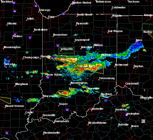 At 439 pm edt, a severe thunderstorm was located 11 miles west of bedford, moving east at 35 mph (radar indicated). Hazards include quarter size hail. Damage to vehicles is expected. Locations impacted include, silverville, williams, owensburg and huron. At 439 pm edt, a severe thunderstorm was located 11 miles west of bedford, moving east at 35 mph (radar indicated). Hazards include quarter size hail. Damage to vehicles is expected. Locations impacted include, silverville, williams, owensburg and huron.
|
| 6/5/2019 4:15 PM EDT |
 At 415 pm edt, a severe thunderstorm was located 11 miles south of bloomfield, or 23 miles west of bedford, moving east at 40 mph (radar indicated). Hazards include quarter size hail. damage to vehicles is expected At 415 pm edt, a severe thunderstorm was located 11 miles south of bloomfield, or 23 miles west of bedford, moving east at 40 mph (radar indicated). Hazards include quarter size hail. damage to vehicles is expected
|
| 3/14/2019 1:27 PM EDT |
 At 126 pm edt, a severe thunderstorm capable of producing a tornado was located 8 miles southeast of shoals, or 20 miles southwest of bedford, moving northeast at 60 mph (radar indicated rotation). Hazards include tornado. Flying debris will be dangerous to those caught without shelter. mobile homes will be damaged or destroyed. damage to roofs, windows, and vehicles will occur. tree damage is likely. this dangerous storm will be near, huron around 135 pm edt. mitchell around 140 pm edt. Tunnelton around 145 pm edt. At 126 pm edt, a severe thunderstorm capable of producing a tornado was located 8 miles southeast of shoals, or 20 miles southwest of bedford, moving northeast at 60 mph (radar indicated rotation). Hazards include tornado. Flying debris will be dangerous to those caught without shelter. mobile homes will be damaged or destroyed. damage to roofs, windows, and vehicles will occur. tree damage is likely. this dangerous storm will be near, huron around 135 pm edt. mitchell around 140 pm edt. Tunnelton around 145 pm edt.
|
| 3/14/2019 1:18 PM EDT |
 At 118 pm edt, a severe thunderstorm capable of producing a tornado was located 10 miles northeast of jasper, or 26 miles east of petersburg, moving northeast at 60 mph (radar indicated rotation). Hazards include tornado. Flying debris will be dangerous to those caught without shelter. mobile homes will be damaged or destroyed. damage to roofs, windows, and vehicles will occur. tree damage is likely. this dangerous storm will be near, huron around 135 pm edt. Mitchell and tunnelton around 145 pm edt. At 118 pm edt, a severe thunderstorm capable of producing a tornado was located 10 miles northeast of jasper, or 26 miles east of petersburg, moving northeast at 60 mph (radar indicated rotation). Hazards include tornado. Flying debris will be dangerous to those caught without shelter. mobile homes will be damaged or destroyed. damage to roofs, windows, and vehicles will occur. tree damage is likely. this dangerous storm will be near, huron around 135 pm edt. Mitchell and tunnelton around 145 pm edt.
|
| 3/14/2019 12:54 PM EDT |
 At 1254 pm edt, a severe thunderstorm was located near shoals, or 15 miles southwest of bedford, moving northeast at 65 mph (radar indicated). Hazards include 60 mph wind gusts. expect damage to roofs, siding, and trees At 1254 pm edt, a severe thunderstorm was located near shoals, or 15 miles southwest of bedford, moving northeast at 65 mph (radar indicated). Hazards include 60 mph wind gusts. expect damage to roofs, siding, and trees
|
| 2/7/2019 12:45 PM EST |
 At 1245 pm est, a severe thunderstorm was located near shoals, or 17 miles southwest of bedford, moving east at 45 mph (radar indicated). Hazards include 60 mph wind gusts. expect damage to roofs, siding, and trees At 1245 pm est, a severe thunderstorm was located near shoals, or 17 miles southwest of bedford, moving east at 45 mph (radar indicated). Hazards include 60 mph wind gusts. expect damage to roofs, siding, and trees
|
| 5/31/2018 1:45 PM EDT |
 At 144 pm edt, a severe thunderstorm was located over bedford, moving east at 50 mph (radar indicated). Hazards include 60 mph wind gusts. Expect damage to roofs, siding, and trees. Locations impacted include, bedford, mitchell, oolitic, heltonville, huron, tunnelton, harrodsburg, bartlettsville, williams, avoca, spring mill state park, monroe reservoir, fairfax state recreation area, silverville, charles deam wilderness and owensburg. At 144 pm edt, a severe thunderstorm was located over bedford, moving east at 50 mph (radar indicated). Hazards include 60 mph wind gusts. Expect damage to roofs, siding, and trees. Locations impacted include, bedford, mitchell, oolitic, heltonville, huron, tunnelton, harrodsburg, bartlettsville, williams, avoca, spring mill state park, monroe reservoir, fairfax state recreation area, silverville, charles deam wilderness and owensburg.
|
| 5/31/2018 1:24 PM EDT |
 At 124 pm edt, a severe thunderstorm was located 12 miles north of shoals, or 15 miles west of bedford, moving east at 55 mph (trained weather spotters). Hazards include 60 mph wind gusts. expect damage to roofs, siding, and trees At 124 pm edt, a severe thunderstorm was located 12 miles north of shoals, or 15 miles west of bedford, moving east at 55 mph (trained weather spotters). Hazards include 60 mph wind gusts. expect damage to roofs, siding, and trees
|
| 7/7/2017 8:34 PM EDT |
 At 833 pm edt, severe thunderstorms were located along a line extending from near bedford to 7 miles north of shoals, moving southeast at 30 mph (radar indicated). Hazards include 60 mph wind gusts and quarter size hail. Hail damage to vehicles is expected. expect wind damage to roofs, siding, and trees. Locations impacted include, bedford, mitchell, williams, spring mill state park, indian springs, silverville, tunnelton and huron. At 833 pm edt, severe thunderstorms were located along a line extending from near bedford to 7 miles north of shoals, moving southeast at 30 mph (radar indicated). Hazards include 60 mph wind gusts and quarter size hail. Hail damage to vehicles is expected. expect wind damage to roofs, siding, and trees. Locations impacted include, bedford, mitchell, williams, spring mill state park, indian springs, silverville, tunnelton and huron.
|
| 7/7/2017 8:15 PM EDT |
 At 815 pm edt, a severe thunderstorm was located 12 miles west of bedford, moving southeast at 30 mph (radar indicated). Hazards include 60 mph wind gusts and quarter size hail. Hail damage to vehicles is expected. Expect wind damage to roofs, siding, and trees. At 815 pm edt, a severe thunderstorm was located 12 miles west of bedford, moving southeast at 30 mph (radar indicated). Hazards include 60 mph wind gusts and quarter size hail. Hail damage to vehicles is expected. Expect wind damage to roofs, siding, and trees.
|
| 1/10/2017 8:16 PM EST |
 At 816 pm est, severe thunderstorms were located along a line extending from near columbus to 11 miles west of bedford, moving east at 55 mph (radar indicated). Hazards include 60 mph wind gusts. Expect damage to roofs, siding, and trees. locations impacted include, columbus, bedford, nashville, shoals, loogootee, oolitic, williams, heltonville, silverville, story, burns city, indian springs, norman, monroe reservoir, huron, harrodsburg, bartlettsville, spurgeons corner, gnaw bone and elkinsville. This includes interstate 65 between mile markers 64 and 69. At 816 pm est, severe thunderstorms were located along a line extending from near columbus to 11 miles west of bedford, moving east at 55 mph (radar indicated). Hazards include 60 mph wind gusts. Expect damage to roofs, siding, and trees. locations impacted include, columbus, bedford, nashville, shoals, loogootee, oolitic, williams, heltonville, silverville, story, burns city, indian springs, norman, monroe reservoir, huron, harrodsburg, bartlettsville, spurgeons corner, gnaw bone and elkinsville. This includes interstate 65 between mile markers 64 and 69.
|
| 1/10/2017 8:06 PM EST |
 At 806 pm est, severe thunderstorms were located along a line extending from 8 miles northeast of nashville to 10 miles southeast of bloomfield, moving east at 50 mph (radar indicated). Hazards include 60 mph wind gusts. Expect damage to roofs, siding, and trees. locations impacted include, bloomington, columbus, bedford, nashville, shoals, loogootee, odon, oolitic, plainville, crane, woodville hills, williams, heltonville, indiana university, west boggs lake, silverville, story, unionville, helmsburg and burns city. This includes interstate 65 between mile markers 64 and 69. At 806 pm est, severe thunderstorms were located along a line extending from 8 miles northeast of nashville to 10 miles southeast of bloomfield, moving east at 50 mph (radar indicated). Hazards include 60 mph wind gusts. Expect damage to roofs, siding, and trees. locations impacted include, bloomington, columbus, bedford, nashville, shoals, loogootee, odon, oolitic, plainville, crane, woodville hills, williams, heltonville, indiana university, west boggs lake, silverville, story, unionville, helmsburg and burns city. This includes interstate 65 between mile markers 64 and 69.
|
| 1/10/2017 7:48 PM EST |
 At 747 pm est, severe thunderstorms were located along a line extending from near martinsville to 8 miles south of linton, moving east at 50 mph (radar indicated). Hazards include 60 mph wind gusts. expect damage to roofs, siding, and trees At 747 pm est, severe thunderstorms were located along a line extending from near martinsville to 8 miles south of linton, moving east at 50 mph (radar indicated). Hazards include 60 mph wind gusts. expect damage to roofs, siding, and trees
|
| 10/19/2016 5:30 PM EDT |
 At 529 pm edt, a severe thunderstorm was located over bedford, moving east at 30 mph (radar indicated). Hazards include quarter size hail. Damage to vehicles is expected. Locations impacted include, bedford, oolitic, bartlettsville, williams, heltonville, tunnelton, avoca, indian springs and silverville. At 529 pm edt, a severe thunderstorm was located over bedford, moving east at 30 mph (radar indicated). Hazards include quarter size hail. Damage to vehicles is expected. Locations impacted include, bedford, oolitic, bartlettsville, williams, heltonville, tunnelton, avoca, indian springs and silverville.
|
| 10/19/2016 5:12 PM EDT |
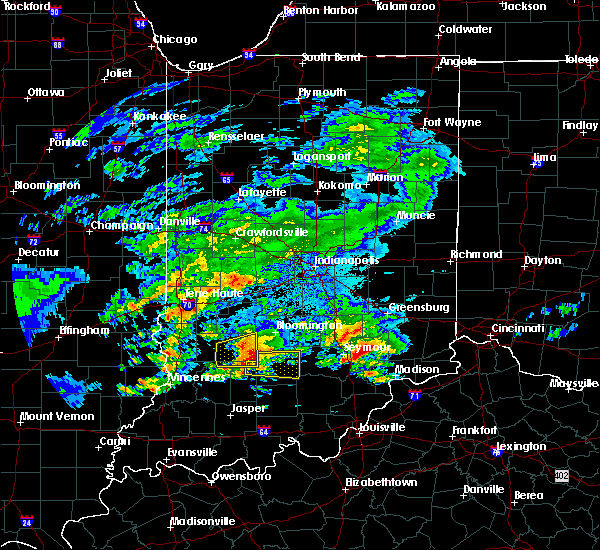 At 512 pm edt, a severe thunderstorm was located 11 miles west of bedford, moving east at 35 mph (radar indicated). Hazards include quarter size hail. damage to vehicles is expected At 512 pm edt, a severe thunderstorm was located 11 miles west of bedford, moving east at 35 mph (radar indicated). Hazards include quarter size hail. damage to vehicles is expected
|
| 7/13/2016 8:06 PM EDT |
 At 805 pm edt, a severe thunderstorm was located 10 miles north of shoals, or 17 miles west of bedford, moving northeast at 45 mph (radar indicated). Hazards include 60 mph wind gusts. Expect damage to roofs. siding. And trees. At 805 pm edt, a severe thunderstorm was located 10 miles north of shoals, or 17 miles west of bedford, moving northeast at 45 mph (radar indicated). Hazards include 60 mph wind gusts. Expect damage to roofs. siding. And trees.
|
| 7/8/2016 6:08 PM EDT |
 At 608 pm edt, a severe thunderstorm was located near shoals, or 15 miles southwest of bedford, moving southeast at 25 mph (radar indicated). Hazards include quarter size hail. Damage to vehicles is expected. Locations impacted include, shoals, mitchell, huron and roland. At 608 pm edt, a severe thunderstorm was located near shoals, or 15 miles southwest of bedford, moving southeast at 25 mph (radar indicated). Hazards include quarter size hail. Damage to vehicles is expected. Locations impacted include, shoals, mitchell, huron and roland.
|
| 7/8/2016 5:53 PM EDT |
 At 553 pm edt, a severe thunderstorm was located 8 miles north of shoals, or 19 miles west of bedford, moving southeast at 30 mph (radar indicated). Hazards include ping pong ball size hail. People and animals outdoors will be injured. Expect damage to roofs, siding, windows, and vehicles. At 553 pm edt, a severe thunderstorm was located 8 miles north of shoals, or 19 miles west of bedford, moving southeast at 30 mph (radar indicated). Hazards include ping pong ball size hail. People and animals outdoors will be injured. Expect damage to roofs, siding, windows, and vehicles.
|
| 6/15/2016 5:25 PM EDT | The severe thunderstorm warning for southwestern lawrence, martin and southeastern daviess counties will expire at 530 pm edt, the storms which prompted the warning have moved out of the area. therefore the warning will be allowed to expire. a severe thunderstorm watch remains in effect until 1100 pm edt for south central and southwestern indiana. |
| 6/15/2016 5:17 PM EDT |
 At 516 pm edt, severe thunderstorms were located along a line extending from 10 miles north of paoli to 11 miles north of jasper, moving east at 40 mph (radar indicated). Hazards include 60 mph wind gusts. Expect damage to roofs. siding. and trees. Locations impacted include, shoals, loogootee, montgomery, cannelburg, alfordsville, huron, williams, roland, west boggs lake, indian springs and lacy. At 516 pm edt, severe thunderstorms were located along a line extending from 10 miles north of paoli to 11 miles north of jasper, moving east at 40 mph (radar indicated). Hazards include 60 mph wind gusts. Expect damage to roofs. siding. and trees. Locations impacted include, shoals, loogootee, montgomery, cannelburg, alfordsville, huron, williams, roland, west boggs lake, indian springs and lacy.
|
| 6/15/2016 4:58 PM EDT |
 At 458 pm edt, severe thunderstorms were located along a line extending from 9 miles east of shoals to near washington, moving southeast at 60 mph (radar indicated). Hazards include 60 mph wind gusts. Expect damage to roofs. siding. And trees. At 458 pm edt, severe thunderstorms were located along a line extending from 9 miles east of shoals to near washington, moving southeast at 60 mph (radar indicated). Hazards include 60 mph wind gusts. Expect damage to roofs. siding. And trees.
|
| 5/1/2016 10:42 PM EDT | The severe thunderstorm warning for northwestern lawrence and southwestern monroe counties will expire at 1045 pm edt. the storm which prompted the warning has moved out of the area. therefore the warning will be allowed to expire. however small hail. gusty winds and heavy rain are still possible with this thunderstorm. A severe thunderstorm watch remains in effect until midnight edt for. |
| 5/1/2016 10:22 PM EDT |
 At 1021 pm edt, a severe thunderstorm was located 7 miles northwest of bedford, moving east at 40 mph (radar indicated). Hazards include 60 mph wind gusts and quarter size hail. Hail damage to vehicles is expected. expect wind damage to roofs, siding, and trees. Locations impacted include, bedford, oolitic, bartlettsville, harrodsburg, avoca, silverville and fairfax state recreation area. At 1021 pm edt, a severe thunderstorm was located 7 miles northwest of bedford, moving east at 40 mph (radar indicated). Hazards include 60 mph wind gusts and quarter size hail. Hail damage to vehicles is expected. expect wind damage to roofs, siding, and trees. Locations impacted include, bedford, oolitic, bartlettsville, harrodsburg, avoca, silverville and fairfax state recreation area.
|
| 5/1/2016 10:13 PM EDT |
 At 1012 pm edt, a severe thunderstorm was located 13 miles west of bedford, moving east at 40 mph (radar indicated). Hazards include 60 mph wind gusts and quarter size hail. Hail damage to vehicles is expected. expect wind damage to roofs, siding, and trees. Locations impacted include, bedford, oolitic, bartlettsville, harrodsburg, avoca, silverville, owensburg, fairfax state recreation area and smithville. At 1012 pm edt, a severe thunderstorm was located 13 miles west of bedford, moving east at 40 mph (radar indicated). Hazards include 60 mph wind gusts and quarter size hail. Hail damage to vehicles is expected. expect wind damage to roofs, siding, and trees. Locations impacted include, bedford, oolitic, bartlettsville, harrodsburg, avoca, silverville, owensburg, fairfax state recreation area and smithville.
|
| 5/1/2016 9:59 PM EDT |
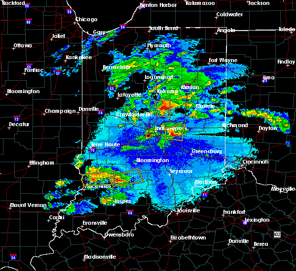 At 959 pm edt, a severe thunderstorm was located 12 miles south of bloomfield, or 21 miles west of bedford, moving east at 40 mph (radar indicated). Hazards include 60 mph wind gusts and quarter size hail. Hail damage to vehicles is expected. Expect wind damage to roofs, siding, and trees. At 959 pm edt, a severe thunderstorm was located 12 miles south of bloomfield, or 21 miles west of bedford, moving east at 40 mph (radar indicated). Hazards include 60 mph wind gusts and quarter size hail. Hail damage to vehicles is expected. Expect wind damage to roofs, siding, and trees.
|
| 12/23/2015 3:13 PM EST | At 313 pm est, severe thunderstorms were located along a line extending from 11 miles southeast of greencastle to 7 miles south of bloomington to 12 miles west of paoli, moving east at 55 mph (radar indicated). Hazards include 70 mph wind gusts. Expect considerable tree damage. damage is likely to mobile homes, roofs and outbuildings. locations impacted include, bloomington, bedford, martinsville, mooresville, spencer, shoals, ellettsville, mitchell, cloverdale, brooklyn, oolitic, monrovia, gosport, paragon, stinesville, bethany, woodville hills, williams, roland and heltonville. this includes interstate 70 between mile markers 40 and 58. A tornado watch remains in effect until 900 pm est for southwestern indiana. |
| 12/23/2015 2:57 PM EST | At 256 pm est, severe thunderstorms were located along a line extending from 12 miles east of brazil to 7 miles east of bloomfield to near jasper, moving east at 55 mph (radar indicated). Hazards include 60 mph wind gusts. Expect damage to roofs. Siding and trees. |
| 6/26/2015 12:01 AM EDT |
 At 1158 pm edt, a severe thunderstorm was located 9 miles northeast of shoals, and moving southeast at 35 mph (radar indicated). Hazards include 60 mph wind gusts and penny size hail. Expect damage to roofs. siding and trees. Locations impacted include, mainly rural areas of southwestern lawrence county. At 1158 pm edt, a severe thunderstorm was located 9 miles northeast of shoals, and moving southeast at 35 mph (radar indicated). Hazards include 60 mph wind gusts and penny size hail. Expect damage to roofs. siding and trees. Locations impacted include, mainly rural areas of southwestern lawrence county.
|
| 6/25/2015 11:27 PM EDT |
 At 1126 pm edt, a severe thunderstorm was located 13 miles south of bloomfield, and moving southeast at 35 mph (radar indicated). Hazards include 60 mph wind gusts and penny size hail. Expect damage to roofs. Siding and trees. At 1126 pm edt, a severe thunderstorm was located 13 miles south of bloomfield, and moving southeast at 35 mph (radar indicated). Hazards include 60 mph wind gusts and penny size hail. Expect damage to roofs. Siding and trees.
|
| 6/19/2015 6:56 PM EDT |
 The tornado warning for west central lawrence and northeastern martin counties will expire at 700 pm edt/600 pm cdt/, the storm which prompted the warning has weakened below severe limits, and no longer poses an immediate threat to life or property. The tornado warning for west central lawrence and northeastern martin counties will expire at 700 pm edt/600 pm cdt/, the storm which prompted the warning has weakened below severe limits, and no longer poses an immediate threat to life or property.
|
| 6/19/2015 6:48 PM EDT |
 At 643 pm edt, a severe thunderstorm capable of producing a tornado was located 7 miles north of shoals, and moving northeast at 15 mph (radar indicated rotation). Hazards include tornado. Flying debris will be dangerous to those caught without shelter. mobile homes will be damaged or destroyed. damage to roofs, windows and vehicles will occur. tree damage is likely. Locations impacted include, indian springs and williams. At 643 pm edt, a severe thunderstorm capable of producing a tornado was located 7 miles north of shoals, and moving northeast at 15 mph (radar indicated rotation). Hazards include tornado. Flying debris will be dangerous to those caught without shelter. mobile homes will be damaged or destroyed. damage to roofs, windows and vehicles will occur. tree damage is likely. Locations impacted include, indian springs and williams.
|
| 6/19/2015 6:35 PM EDT |
 At 630 pm edt, a severe thunderstorm capable of producing a tornado was located near shoals, and moving northeast at 15 mph (radar indicated rotation). Hazards include tornado. Flying debris will be dangerous to those caught without shelter. mobile homes will be damaged or destroyed. damage to roofs, windows and vehicles will occur. tree damage is likely. Locations impacted include, huron, indian springs and williams. At 630 pm edt, a severe thunderstorm capable of producing a tornado was located near shoals, and moving northeast at 15 mph (radar indicated rotation). Hazards include tornado. Flying debris will be dangerous to those caught without shelter. mobile homes will be damaged or destroyed. damage to roofs, windows and vehicles will occur. tree damage is likely. Locations impacted include, huron, indian springs and williams.
|
| 6/19/2015 6:23 PM EDT |
 At 619 pm edt, a severe thunderstorm capable of producing a tornado was located near shoals, and moving northeast at 15 mph (radar indicated rotation). Hazards include tornado. Flying debris will be dangerous to those caught without shelter. mobile homes will be damaged or destroyed. damage to roofs, windows and vehicles will occur. tree damage is likely. This dangerous storm will affect mainly rural areas of northern martin and southwestern lawrence counties, including the following locations, indian springs and williams. At 619 pm edt, a severe thunderstorm capable of producing a tornado was located near shoals, and moving northeast at 15 mph (radar indicated rotation). Hazards include tornado. Flying debris will be dangerous to those caught without shelter. mobile homes will be damaged or destroyed. damage to roofs, windows and vehicles will occur. tree damage is likely. This dangerous storm will affect mainly rural areas of northern martin and southwestern lawrence counties, including the following locations, indian springs and williams.
|
| 10/13/2014 8:37 PM EDT | Time estimated from radar. report received via social medi in lawrence county IN, 6.9 miles NNE of Williams, IN |
| 1/1/0001 12:00 AM | Quarter sized hail reported 1.4 miles NE of Williams, IN |
| 1/1/0001 12:00 AM | Quarter sized hail reported 1.4 miles NE of Williams, IN |
| 1/1/0001 12:00 AM | Quarter sized hail reported 1.4 miles NE of Williams, IN, time estimated. |
| 1/1/0001 12:00 AM | Quarter sized hail reported 1.4 miles NE of Williams, IN |
Hail Maps for Williams, IN
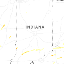
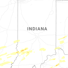

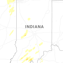


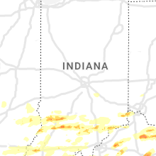


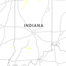

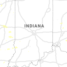


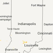

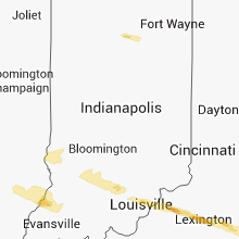

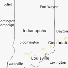


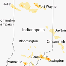


Connect with Interactive Hail Maps