

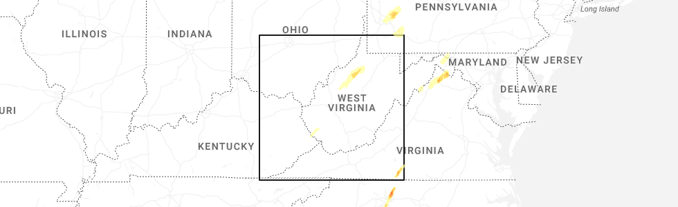
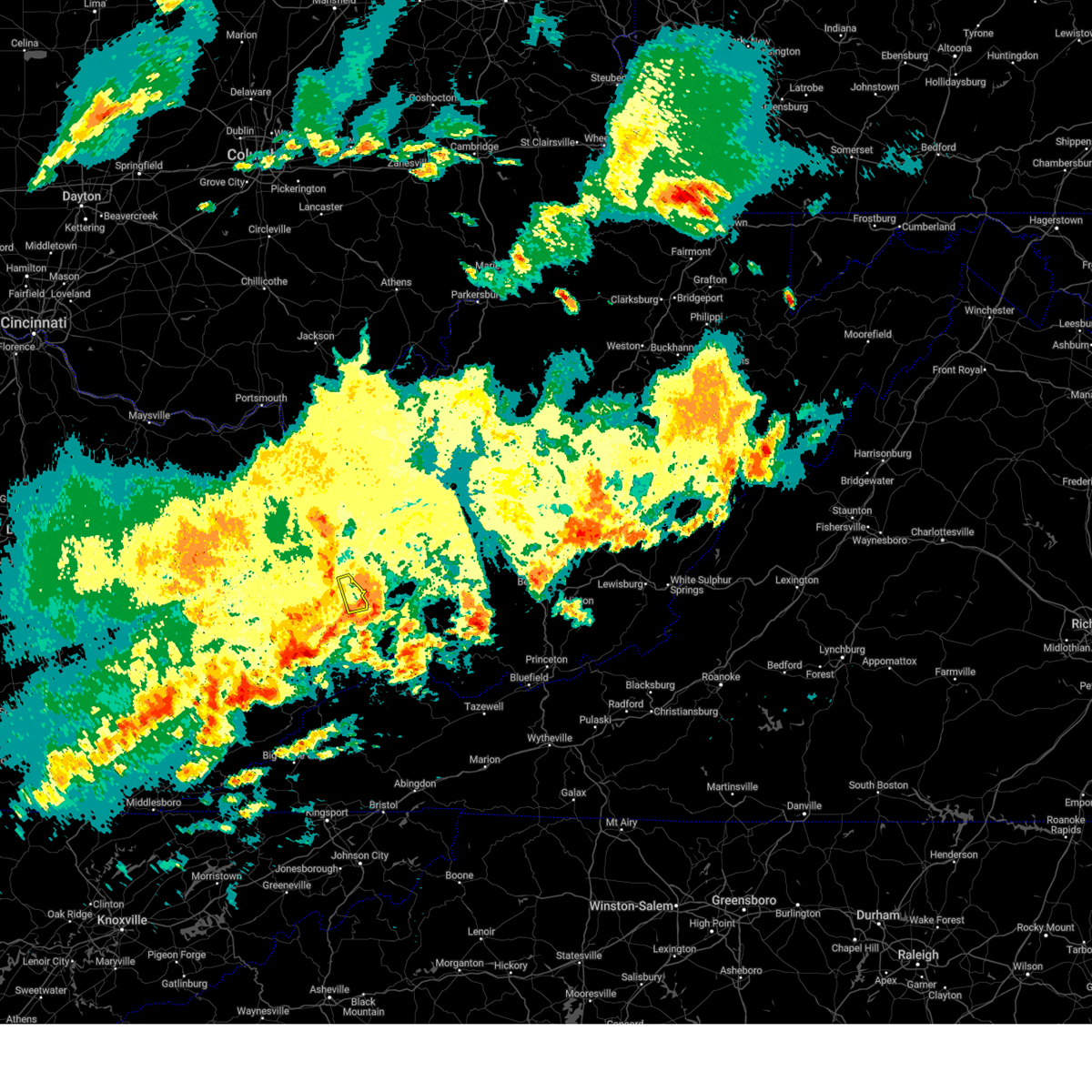
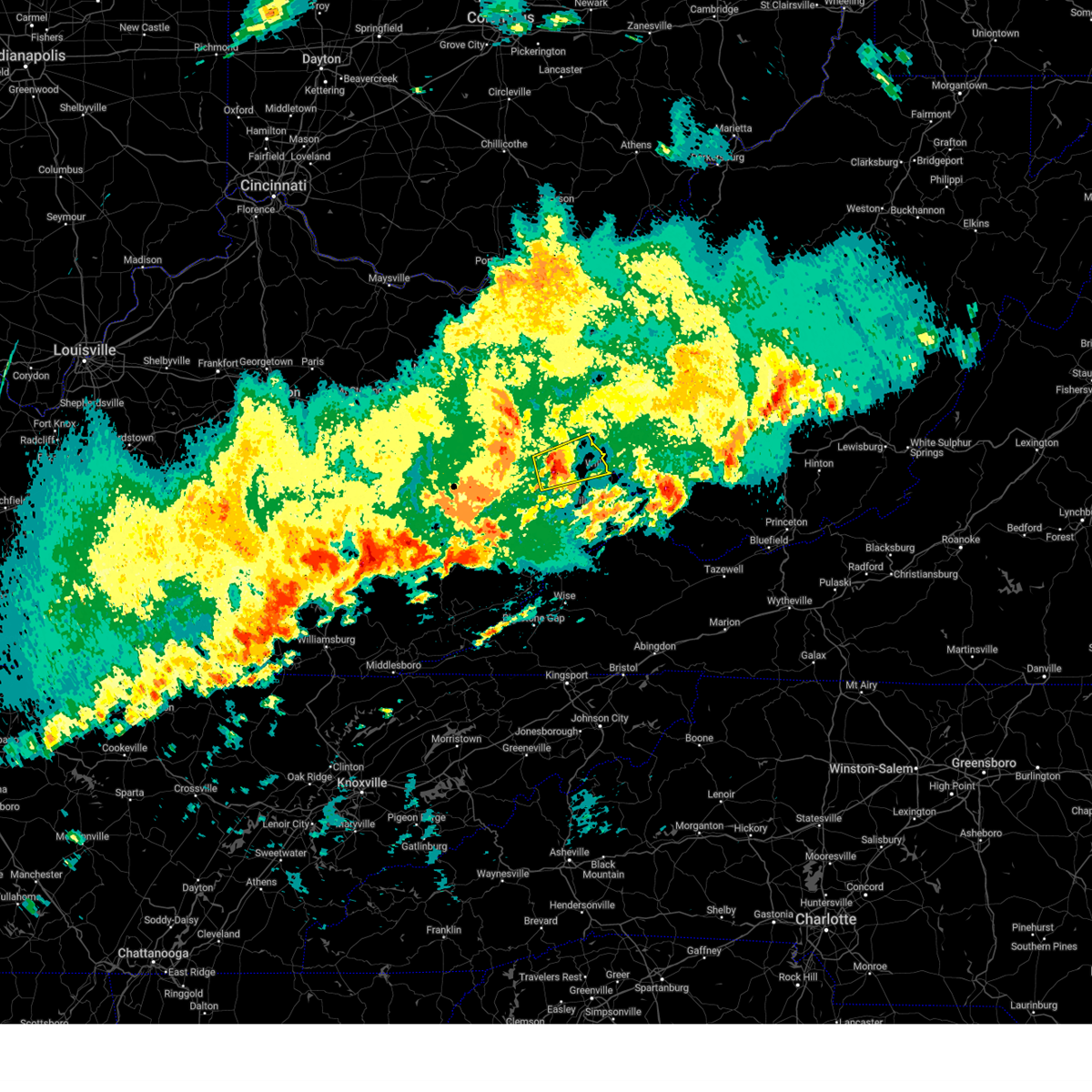
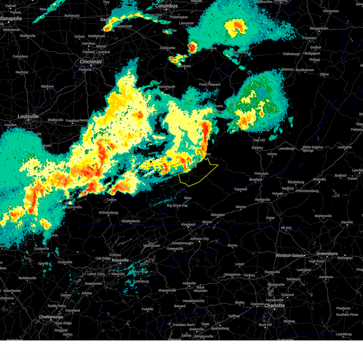
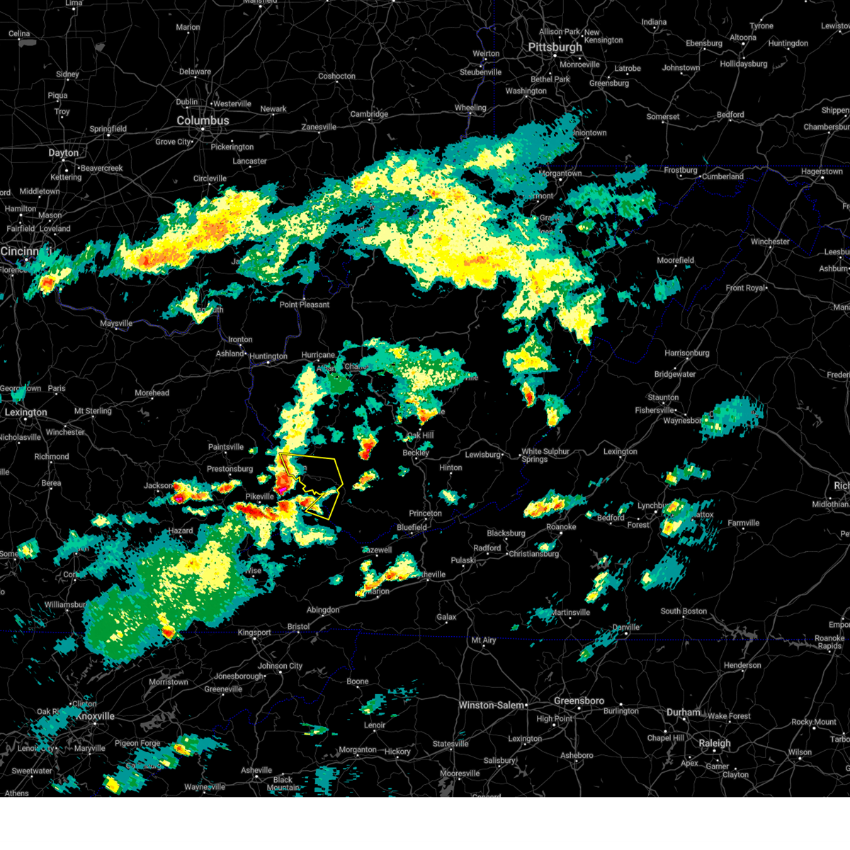
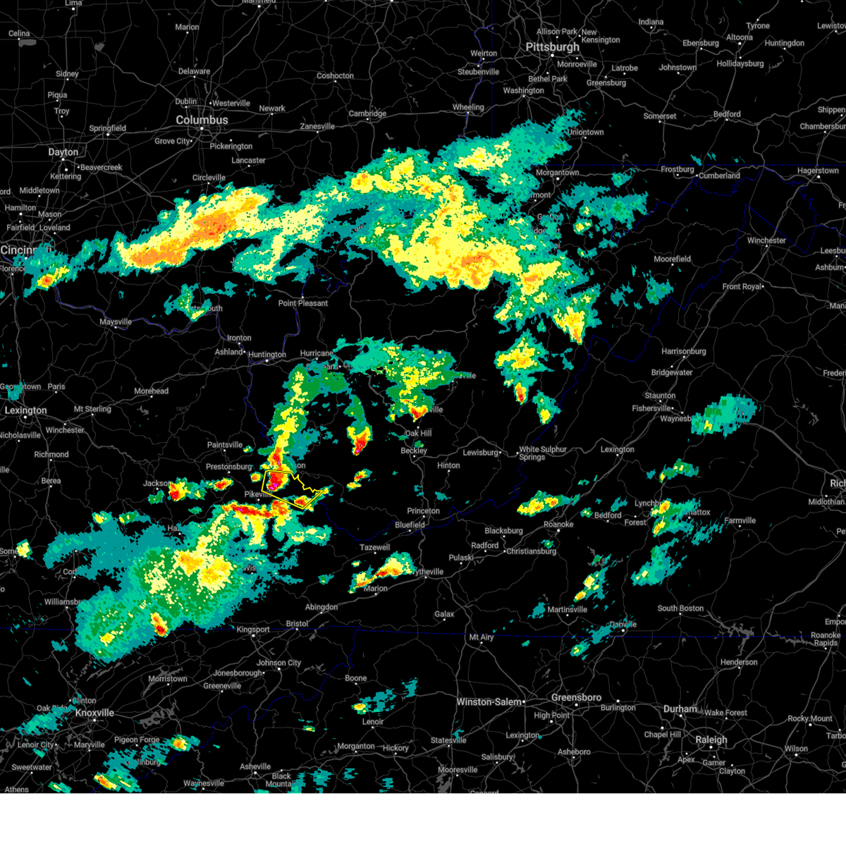
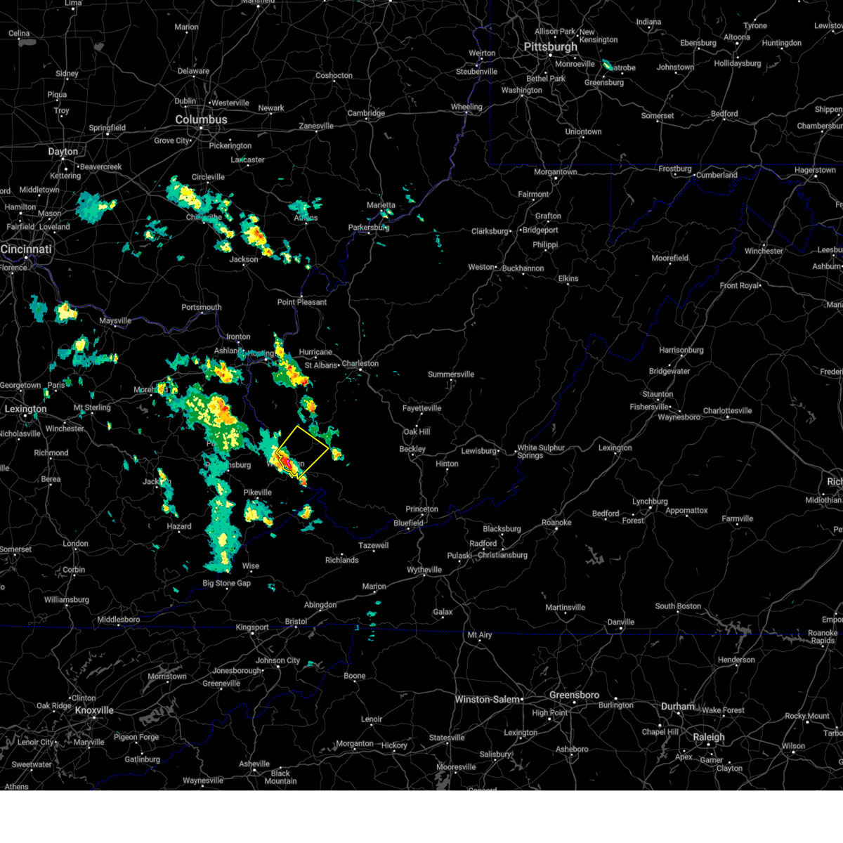
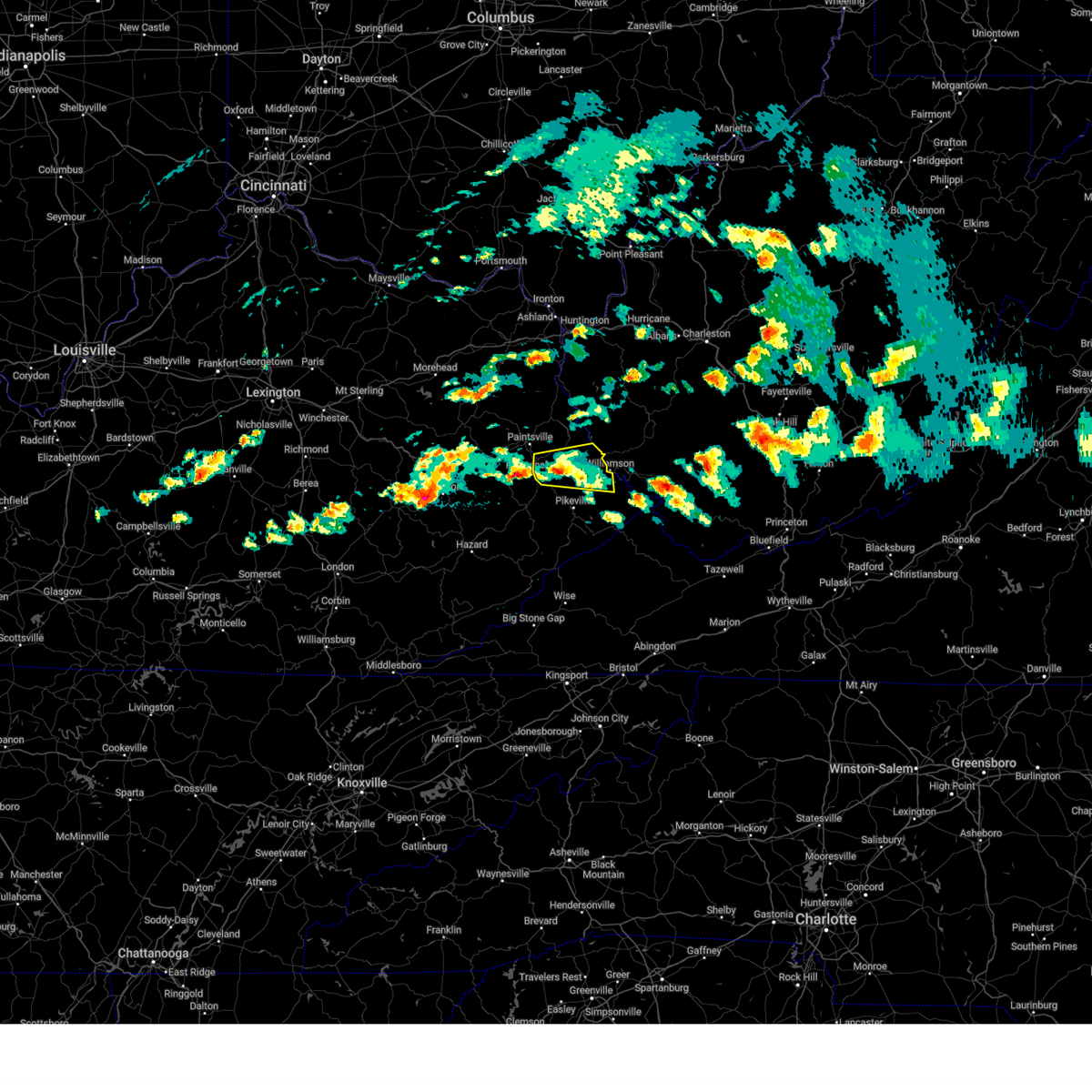
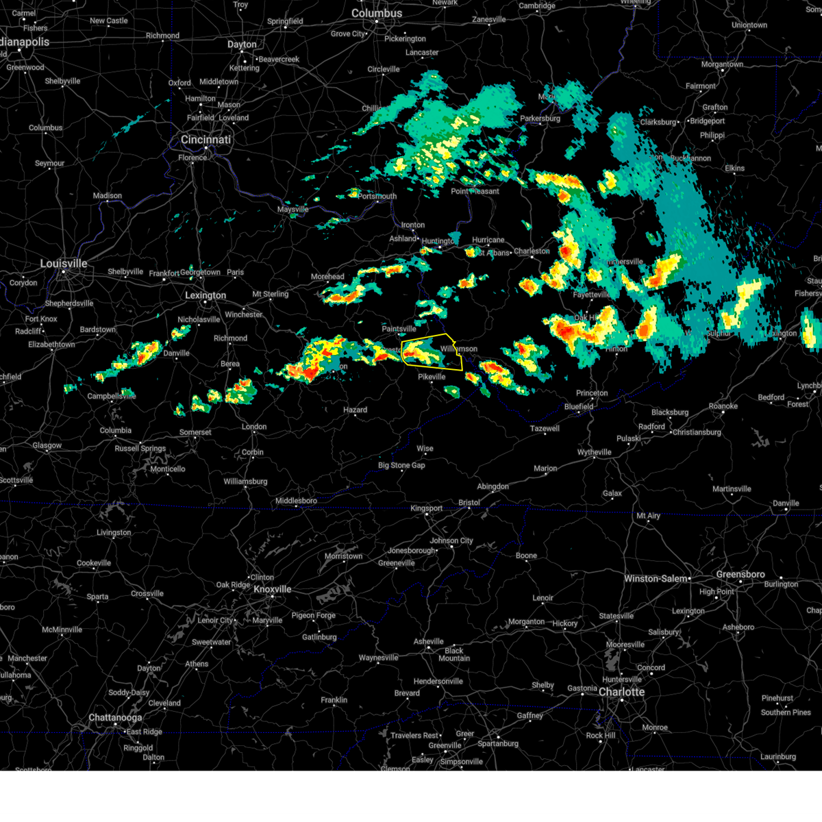
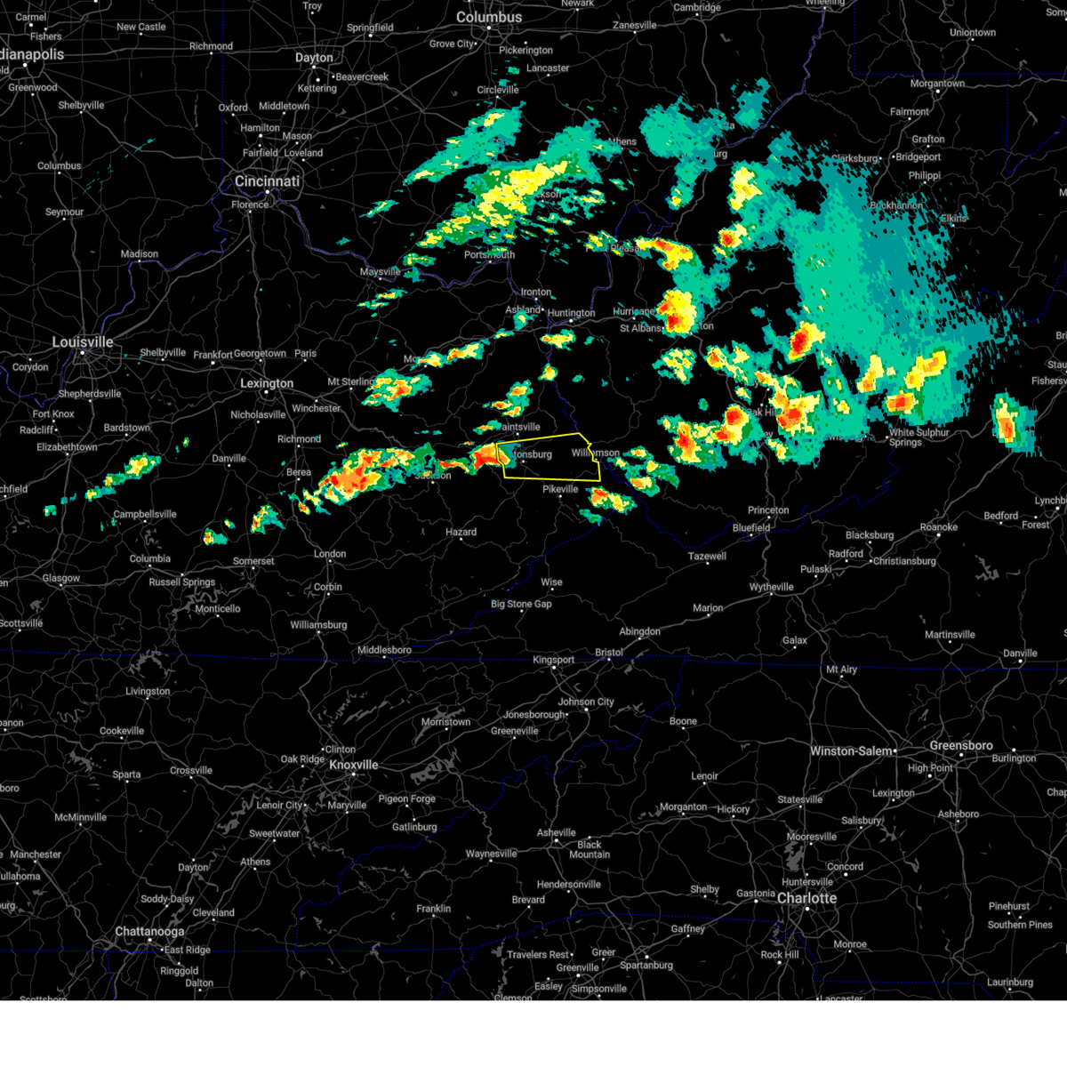
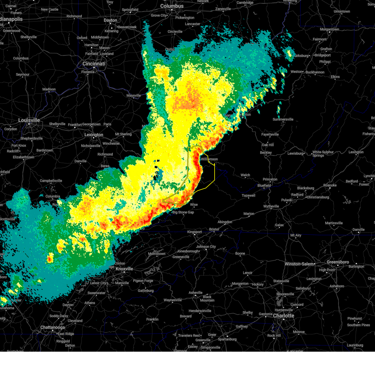
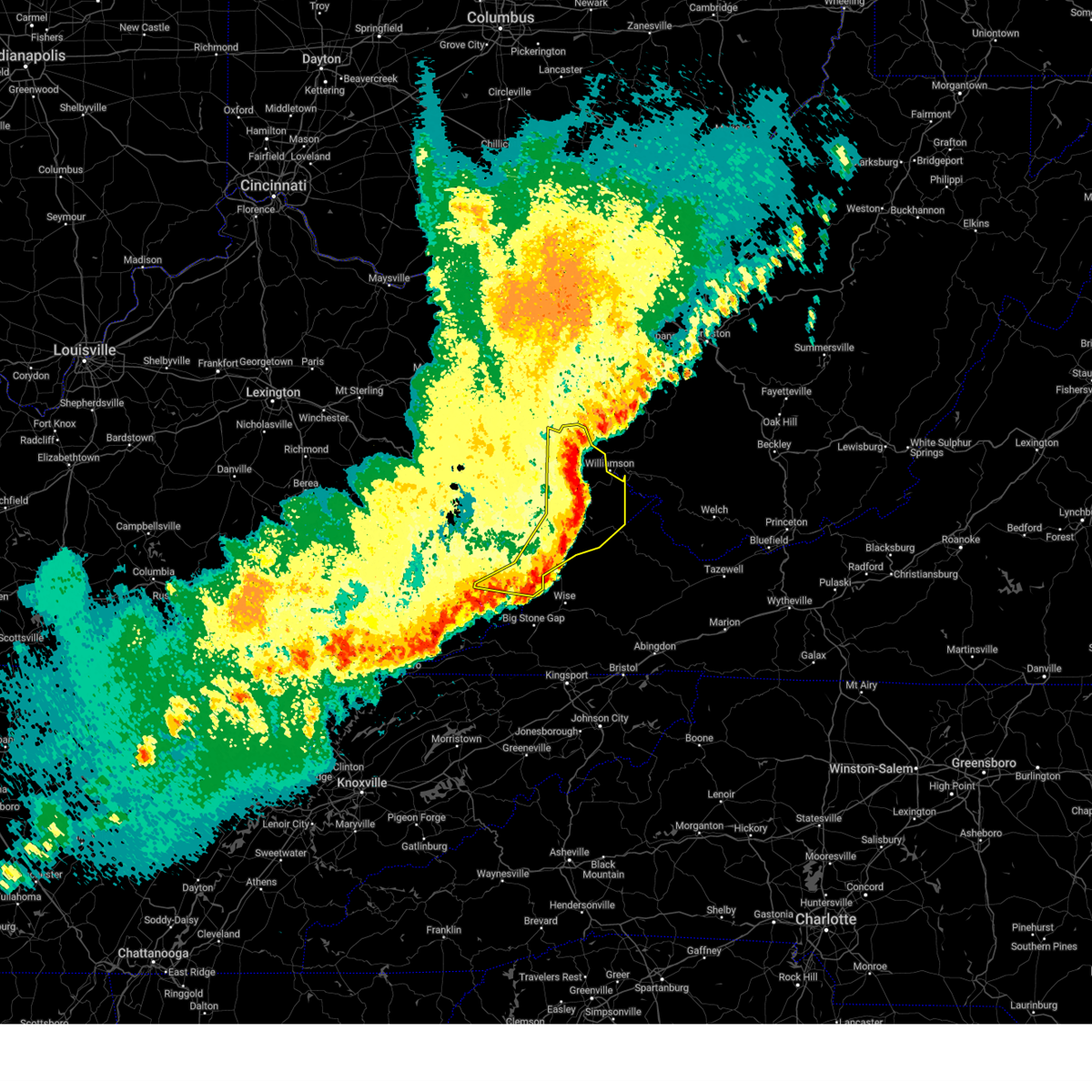
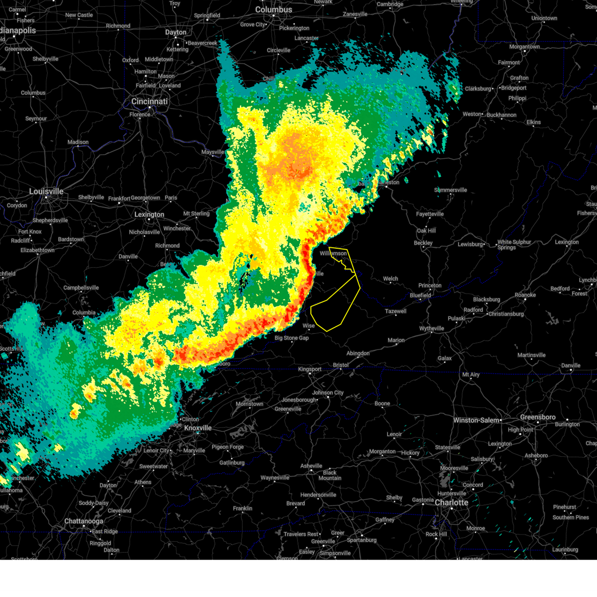
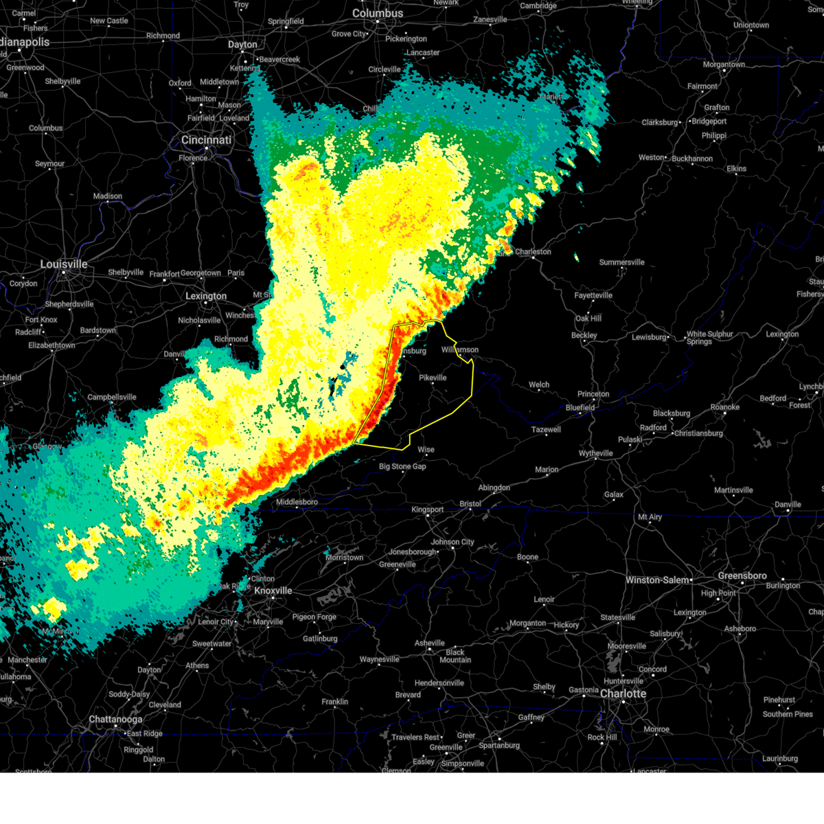
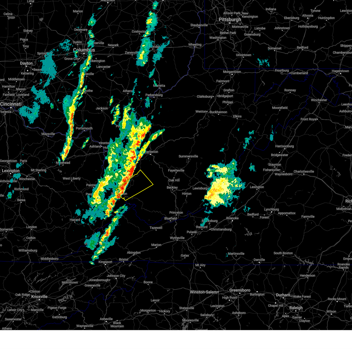
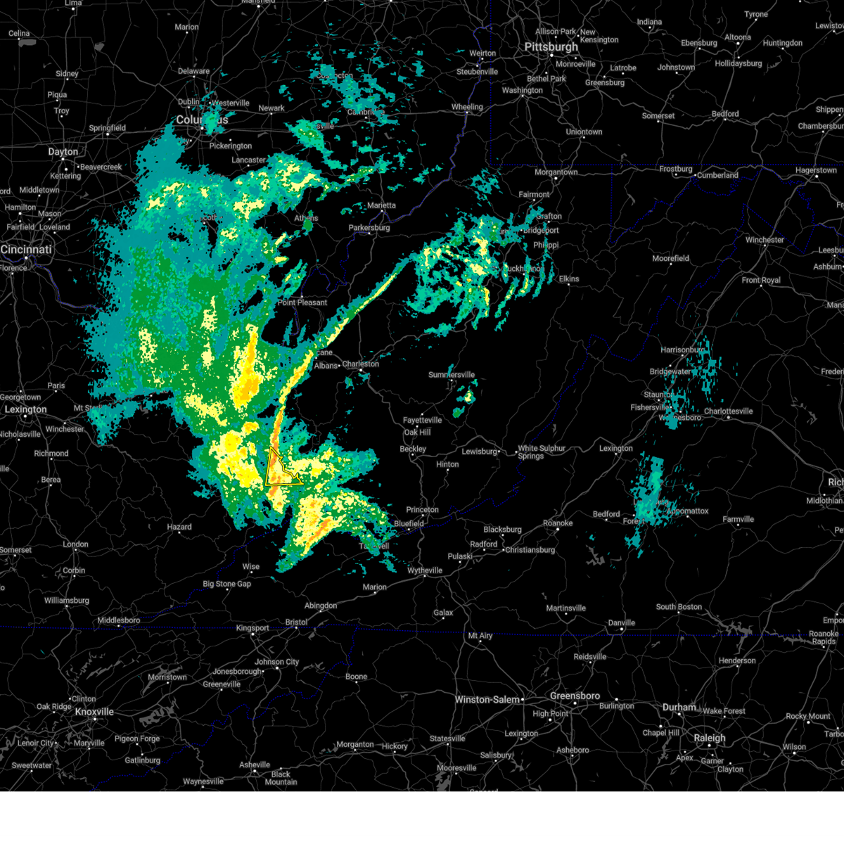
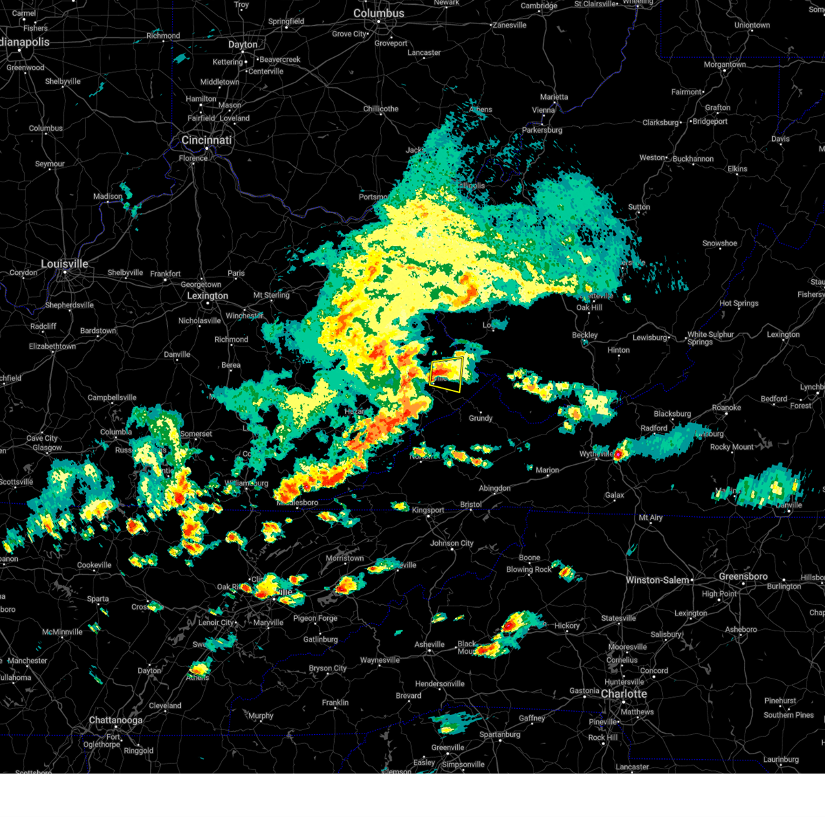
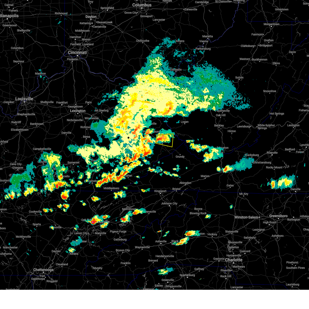
Hail Map for Williamson, WV
The Williamson, WV area has had 10 reports of on-the-ground hail by trained spotters, and has been under severe weather warnings 43 times during the past 12 months. Doppler radar has detected hail at or near Williamson, WV on 52 occasions, including 6 occasions during the past year.
| Name: | Williamson, WV |
| Where Located: | 58.1 miles SW of Charleston, WV |
| Map: | Google Map for Williamson, WV |
| Population: | 3191 |
| Housing Units: | 1885 |
| More Info: | Search Google for Williamson, WV |
3
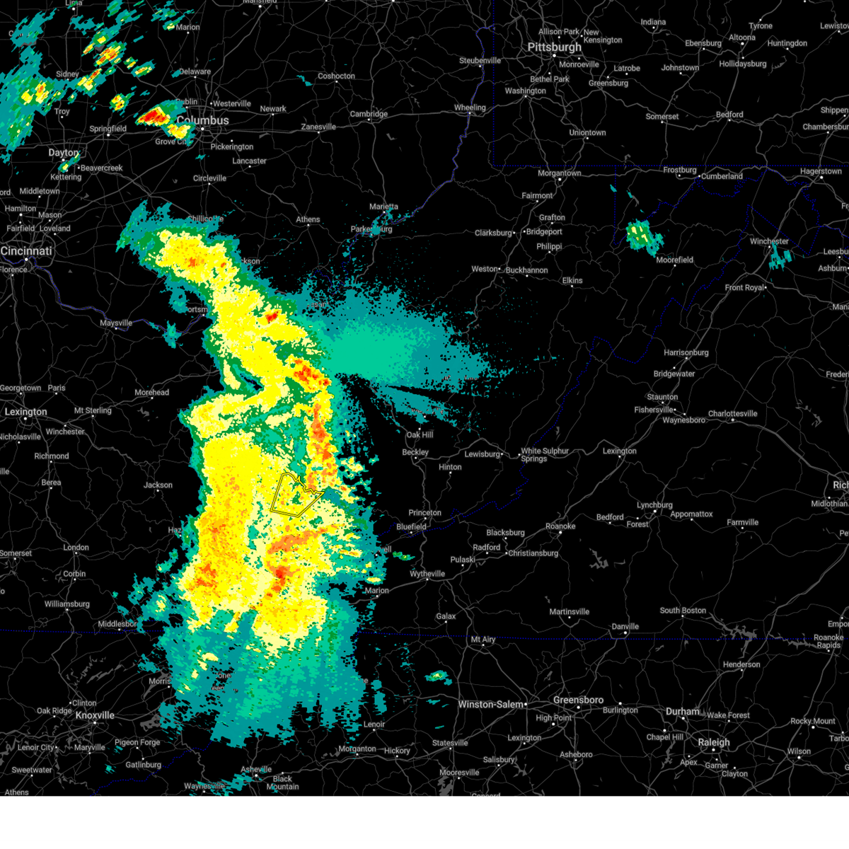
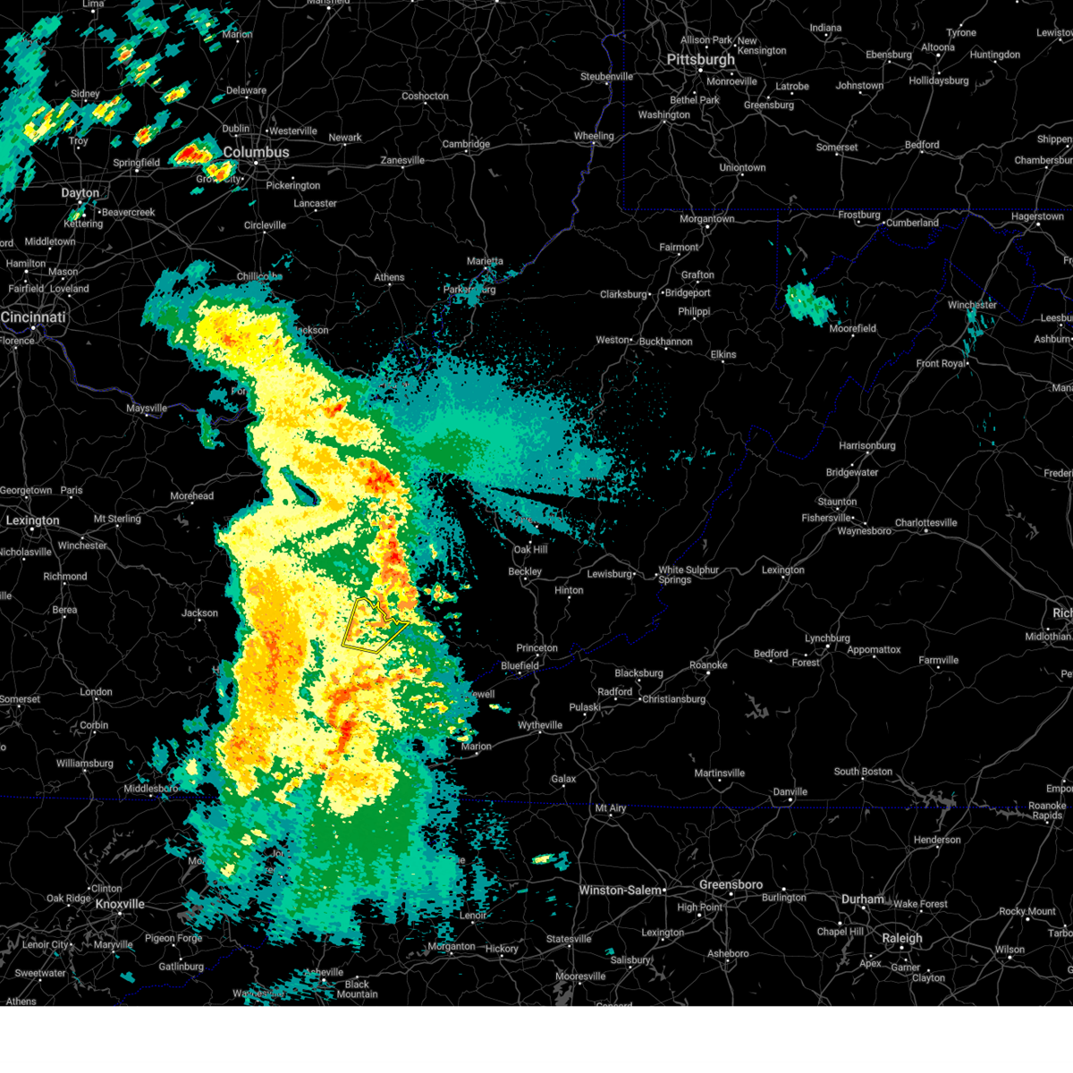
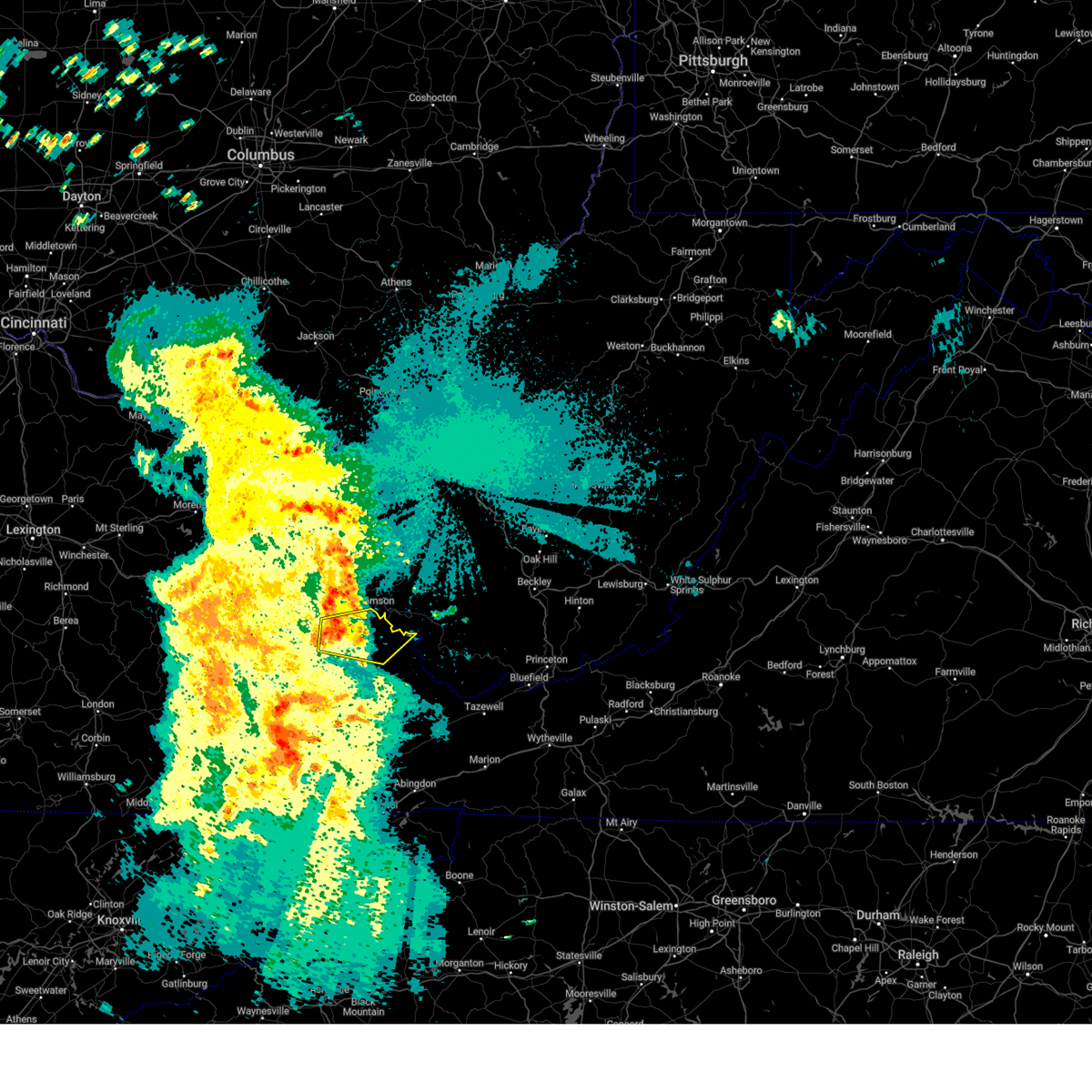
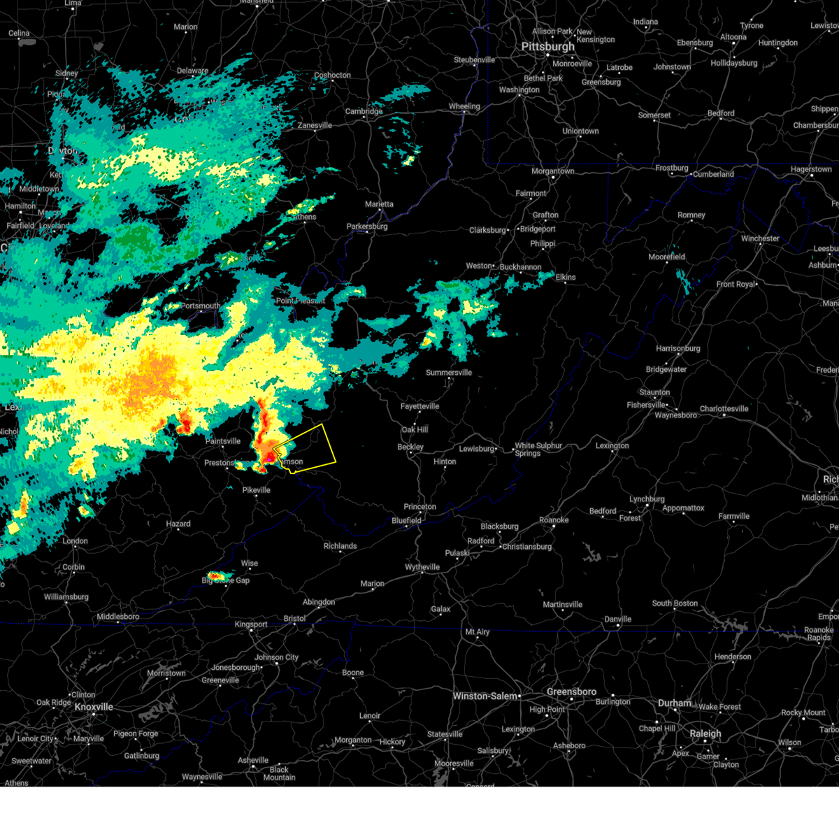
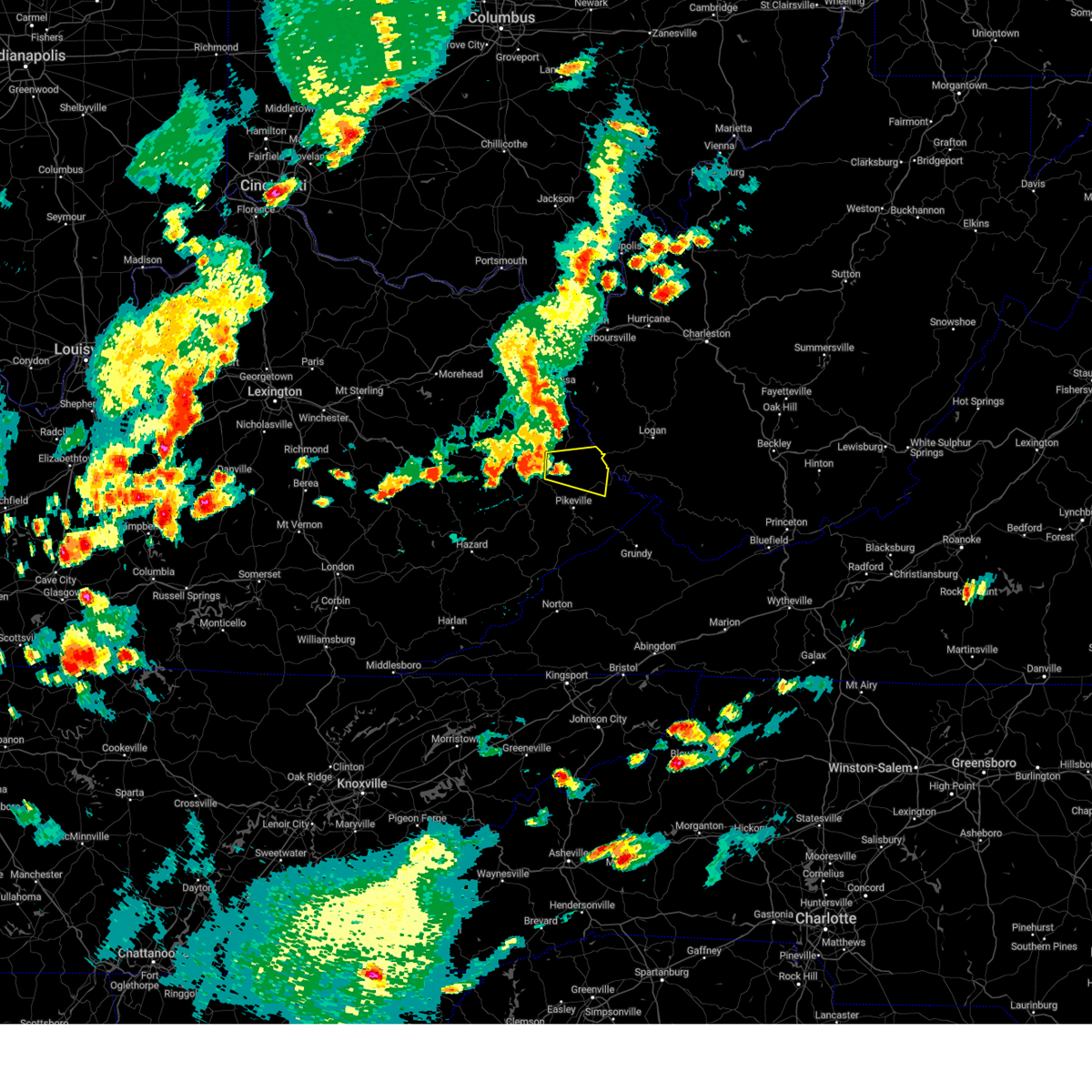
The Top Recent Hail Date for Williamson, WV is Sunday, March 16, 2025 (6th out of 52)
Hail and Wind Damage Spotted near Williamson, WV
| Date / Time | Report Details |
|---|---|
| 5/20/2025 11:52 PM EDT |
 The storm which prompted the warning has weakened below severe limits, and is exiting into west virginia. therefore, the warning will be allowed to expire. however, gusty winds and heavy rain are still possible with this thunderstorm. The storm which prompted the warning has weakened below severe limits, and is exiting into west virginia. therefore, the warning will be allowed to expire. however, gusty winds and heavy rain are still possible with this thunderstorm.
|
| 5/20/2025 11:46 PM EDT |
 the severe thunderstorm warning has been cancelled and is no longer in effect the severe thunderstorm warning has been cancelled and is no longer in effect
|
| 5/20/2025 11:46 PM EDT |
 At 1146 pm edt, a severe thunderstorm was located over argo, or 15 miles north of grundy, moving east at 45 mph (radar indicated). Hazards include 60 mph wind gusts and penny size hail. Expect damage to roofs, siding, and trees. This severe thunderstorm will remain over mainly rural areas of northeastern pike county, including the following locations, edgarton. At 1146 pm edt, a severe thunderstorm was located over argo, or 15 miles north of grundy, moving east at 45 mph (radar indicated). Hazards include 60 mph wind gusts and penny size hail. Expect damage to roofs, siding, and trees. This severe thunderstorm will remain over mainly rural areas of northeastern pike county, including the following locations, edgarton.
|
| 5/20/2025 11:14 PM EDT |
 Svrjkl the national weather service in jackson ky has issued a * severe thunderstorm warning for, southeastern floyd county in southeastern kentucky, central pike county in southeastern kentucky, * until midnight edt. * at 1114 pm edt, a severe thunderstorm was located over zebulon, or over pikeville, moving east at 45 mph (radar indicated). Hazards include 60 mph wind gusts and penny size hail. Expect damage to roofs, siding, and trees. this severe thunderstorm will be near, kimper around 1120 pm edt. phelps around 1130 pm edt. Other locations in the path of this severe thunderstorm include jamboree, paw paw and woodman. Svrjkl the national weather service in jackson ky has issued a * severe thunderstorm warning for, southeastern floyd county in southeastern kentucky, central pike county in southeastern kentucky, * until midnight edt. * at 1114 pm edt, a severe thunderstorm was located over zebulon, or over pikeville, moving east at 45 mph (radar indicated). Hazards include 60 mph wind gusts and penny size hail. Expect damage to roofs, siding, and trees. this severe thunderstorm will be near, kimper around 1120 pm edt. phelps around 1130 pm edt. Other locations in the path of this severe thunderstorm include jamboree, paw paw and woodman.
|
| 5/17/2025 1:06 AM EDT |
 The storm which prompted the warning has weakened below severe limits, and has exited the warned area. therefore, the warning will be allowed to expire. however, gusty winds are still possible with this thunderstorm. a tornado watch remains in effect until 300 am edt for southeastern and northeastern kentucky. to report severe weather, contact your nearest law enforcement agency. they will relay your report to the national weather service jackson ky. The storm which prompted the warning has weakened below severe limits, and has exited the warned area. therefore, the warning will be allowed to expire. however, gusty winds are still possible with this thunderstorm. a tornado watch remains in effect until 300 am edt for southeastern and northeastern kentucky. to report severe weather, contact your nearest law enforcement agency. they will relay your report to the national weather service jackson ky.
|
| 5/17/2025 12:59 AM EDT | the severe thunderstorm warning has been cancelled and is no longer in effect |
| 5/17/2025 12:59 AM EDT | At 1258 am edt, a severe thunderstorm was located over oppy, or 8 miles northwest of williamson, moving east at 65 mph (radar indicated). Hazards include 60 mph wind gusts and penny size hail. Expect damage to roofs, siding, and trees. This severe thunderstorm will remain over mainly rural areas of southeastern martin and north central pike counties. |
| 5/17/2025 12:47 AM EDT |
 Svrjkl the national weather service in jackson ky has issued a * severe thunderstorm warning for, martin county in northeastern kentucky, southeastern johnson county in northeastern kentucky, northeastern floyd county in southeastern kentucky, northwestern pike county in southeastern kentucky, * until 115 am edt. * at 1246 am edt, a severe thunderstorm was located over pleasant, or 8 miles east of prestonsburg, moving east at 65 mph (radar indicated). Hazards include 60 mph wind gusts and nickel size hail. Expect damage to roofs, siding, and trees. this severe thunderstorm will be near, laura around 1250 am edt. Oppy around 1255 am edt. Svrjkl the national weather service in jackson ky has issued a * severe thunderstorm warning for, martin county in northeastern kentucky, southeastern johnson county in northeastern kentucky, northeastern floyd county in southeastern kentucky, northwestern pike county in southeastern kentucky, * until 115 am edt. * at 1246 am edt, a severe thunderstorm was located over pleasant, or 8 miles east of prestonsburg, moving east at 65 mph (radar indicated). Hazards include 60 mph wind gusts and nickel size hail. Expect damage to roofs, siding, and trees. this severe thunderstorm will be near, laura around 1250 am edt. Oppy around 1255 am edt.
|
| 5/16/2025 11:58 PM EDT | The storms which prompted the warning have weakened below severe limits, and have exited the warned area. therefore, the warning will be allowed to expire. however, gusty winds are still possible with these thunderstorms. a tornado watch remains in effect until 300 am edt for southeastern and northeastern kentucky. to report severe weather, contact your nearest law enforcement agency. they will relay your report to the national weather service jackson ky. |
| 5/16/2025 11:46 PM EDT |
 At 1146 pm edt, severe thunderstorms were located along a line extending from near oppy to mcandrews to wheelwright, moving southeast at 50 mph (radar indicated). Hazards include 60 mph wind gusts and penny size hail. Expect damage to roofs, siding, and trees. Locations impacted include, pikeville, elkhorn city and toonerville. At 1146 pm edt, severe thunderstorms were located along a line extending from near oppy to mcandrews to wheelwright, moving southeast at 50 mph (radar indicated). Hazards include 60 mph wind gusts and penny size hail. Expect damage to roofs, siding, and trees. Locations impacted include, pikeville, elkhorn city and toonerville.
|
| 5/16/2025 11:42 PM EDT | Tree down on power lines blocking both lanes on the highway. bowtie ln... williamso in mingo county WV, 2.3 miles SSW of Williamson, WV |
| 5/16/2025 11:29 PM EDT | At 1128 pm edt, severe thunderstorms were located along a line extending from add to gulnare to yellow mountain, moving east at 50 mph (radar indicated). Hazards include 60 mph wind gusts and penny size hail. Expect damage to roofs, siding, and trees. these severe storms will be near, pikeville around 1135 pm edt. Other locations in the path of these severe thunderstorms include forest hills, wheelwright, kimper, phelps and coleman. |
| 5/16/2025 11:18 PM EDT | Svrjkl the national weather service in jackson ky has issued a * severe thunderstorm warning for, martin county in northeastern kentucky, floyd county in southeastern kentucky, pike county in southeastern kentucky, * until midnight edt. * at 1118 pm edt, severe thunderstorms were located along a line extending from ulysses to dicks creek to buck, moving southeast at 50 mph (radar indicated). Hazards include 60 mph wind gusts and penny size hail. Expect damage to roofs, siding, and trees. severe thunderstorms will be near, inez around 1125 pm edt. pikeville around 1130 pm edt. wheelwright around 1135 pm edt. Other locations in the path of these severe thunderstorms include forest hills, virgie and coleman. |
| 5/8/2025 8:12 PM EDT | The storm which prompted the warning has weakened below severe limits, and no longer poses an immediate threat to life or property. therefore, the warning will be allowed to expire. however, small hail and gusty winds are still possible with this thunderstorm. a severe thunderstorm watch remains in effect until 1100 pm edt for southeastern kentucky. |
| 5/8/2025 8:04 PM EDT |
 Svrrlx the national weather service in charleston west virginia has issued a * severe thunderstorm warning for, north central buchanan county in southwestern virginia, northwestern mcdowell county in southern west virginia, mingo county in southern west virginia, southwestern logan county in southern west virginia, * until 830 pm edt. * at 803 pm edt, severe thunderstorms were located along a line extending from near chattaroy to near delbarton to near mcandrews, moving east at 30 mph (radar indicated). Hazards include 60 mph wind gusts and quarter size hail. Hail damage to vehicles is expected. Expect wind damage to roofs, siding, and trees. Svrrlx the national weather service in charleston west virginia has issued a * severe thunderstorm warning for, north central buchanan county in southwestern virginia, northwestern mcdowell county in southern west virginia, mingo county in southern west virginia, southwestern logan county in southern west virginia, * until 830 pm edt. * at 803 pm edt, severe thunderstorms were located along a line extending from near chattaroy to near delbarton to near mcandrews, moving east at 30 mph (radar indicated). Hazards include 60 mph wind gusts and quarter size hail. Hail damage to vehicles is expected. Expect wind damage to roofs, siding, and trees.
|
| 5/8/2025 8:01 PM EDT |
 At 801 pm edt, a severe thunderstorm was located over mcandrews, or 8 miles south of williamson, moving east at 30 mph (radar indicated). Hazards include 60 mph wind gusts and quarter size hail. Hail damage to vehicles is expected. expect wind damage to roofs, siding, and trees. this severe storm will be near, phelps around 805 pm edt. Other locations in the path of this severe thunderstorm include coleman and argo. At 801 pm edt, a severe thunderstorm was located over mcandrews, or 8 miles south of williamson, moving east at 30 mph (radar indicated). Hazards include 60 mph wind gusts and quarter size hail. Hail damage to vehicles is expected. expect wind damage to roofs, siding, and trees. this severe storm will be near, phelps around 805 pm edt. Other locations in the path of this severe thunderstorm include coleman and argo.
|
| 5/8/2025 7:49 PM EDT |
 Svrjkl the national weather service in jackson ky has issued a * severe thunderstorm warning for, northeastern pike county in southeastern kentucky, * until 815 pm edt. * at 749 pm edt, a severe thunderstorm was located over meta, or 8 miles southwest of williamson, moving east at 30 mph (radar indicated). Hazards include 60 mph wind gusts and quarter size hail. Hail damage to vehicles is expected. expect wind damage to roofs, siding, and trees. this severe thunderstorm will be near, huddy around 755 pm edt. belfry around 800 pm edt. Phelps around 805 pm edt. Svrjkl the national weather service in jackson ky has issued a * severe thunderstorm warning for, northeastern pike county in southeastern kentucky, * until 815 pm edt. * at 749 pm edt, a severe thunderstorm was located over meta, or 8 miles southwest of williamson, moving east at 30 mph (radar indicated). Hazards include 60 mph wind gusts and quarter size hail. Hail damage to vehicles is expected. expect wind damage to roofs, siding, and trees. this severe thunderstorm will be near, huddy around 755 pm edt. belfry around 800 pm edt. Phelps around 805 pm edt.
|
| 5/4/2025 2:32 PM EDT |
 Svrrlx the national weather service in charleston west virginia has issued a * severe thunderstorm warning for, western mingo county in southern west virginia, southwestern logan county in southern west virginia, * until 300 pm edt. * at 232 pm edt, a severe thunderstorm was located over chattaroy, or near williamson, moving northeast at 35 mph (radar indicated). Hazards include quarter size hail. damage to vehicles is expected Svrrlx the national weather service in charleston west virginia has issued a * severe thunderstorm warning for, western mingo county in southern west virginia, southwestern logan county in southern west virginia, * until 300 pm edt. * at 232 pm edt, a severe thunderstorm was located over chattaroy, or near williamson, moving northeast at 35 mph (radar indicated). Hazards include quarter size hail. damage to vehicles is expected
|
| 4/14/2025 8:26 PM EDT |
 The storm which prompted the warning has weakened below severe limits, and no longer poses an immediate threat to life or property. therefore, the warning will be allowed to expire. a severe thunderstorm watch remains in effect until 1100 pm edt for southeastern and northeastern kentucky. The storm which prompted the warning has weakened below severe limits, and no longer poses an immediate threat to life or property. therefore, the warning will be allowed to expire. a severe thunderstorm watch remains in effect until 1100 pm edt for southeastern and northeastern kentucky.
|
| 4/14/2025 8:17 PM EDT |
 At 817 pm edt, a severe thunderstorm was located over dicks creek, or near prestonsburg, moving east at 55 mph (radar indicated). Hazards include 60 mph wind gusts and quarter size hail. Hail damage to vehicles is expected. expect wind damage to roofs, siding, and trees. this severe storm will be near, pleasant around 820 pm edt. jarad around 825 pm edt. Other locations in the path of this severe thunderstorm include conder and turkey creek. At 817 pm edt, a severe thunderstorm was located over dicks creek, or near prestonsburg, moving east at 55 mph (radar indicated). Hazards include 60 mph wind gusts and quarter size hail. Hail damage to vehicles is expected. expect wind damage to roofs, siding, and trees. this severe storm will be near, pleasant around 820 pm edt. jarad around 825 pm edt. Other locations in the path of this severe thunderstorm include conder and turkey creek.
|
| 4/14/2025 8:05 PM EDT |
 Svrjkl the national weather service in jackson ky has issued a * severe thunderstorm warning for, southern martin county in northeastern kentucky, southern johnson county in northeastern kentucky, northern floyd county in southeastern kentucky, northwestern pike county in southeastern kentucky, * until 830 pm edt. * at 804 pm edt, a severe thunderstorm was located over brainard, or 7 miles west of prestonsburg, moving east at 55 mph (radar indicated). Hazards include 60 mph wind gusts and quarter size hail. Hail damage to vehicles is expected. expect wind damage to roofs, siding, and trees. this severe thunderstorm will be near, lancer around 810 pm edt. alvin around 815 pm edt. pleasant around 820 pm edt. Other locations in the path of this severe thunderstorm include jarad. Svrjkl the national weather service in jackson ky has issued a * severe thunderstorm warning for, southern martin county in northeastern kentucky, southern johnson county in northeastern kentucky, northern floyd county in southeastern kentucky, northwestern pike county in southeastern kentucky, * until 830 pm edt. * at 804 pm edt, a severe thunderstorm was located over brainard, or 7 miles west of prestonsburg, moving east at 55 mph (radar indicated). Hazards include 60 mph wind gusts and quarter size hail. Hail damage to vehicles is expected. expect wind damage to roofs, siding, and trees. this severe thunderstorm will be near, lancer around 810 pm edt. alvin around 815 pm edt. pleasant around 820 pm edt. Other locations in the path of this severe thunderstorm include jarad.
|
| 4/3/2025 4:08 PM EDT |
 Torrlx the national weather service in charleston west virginia has issued a * tornado warning for, central mingo county in southern west virginia, southwestern logan county in southern west virginia, * until 430 pm edt. * at 408 pm edt, a severe thunderstorm capable of producing a tornado was located over delbarton, or near williamson, moving east at 50 mph (radar indicated rotation). Hazards include tornado and quarter size hail. Flying debris will be dangerous to those caught without shelter. mobile homes will be damaged or destroyed. damage to roofs, windows, and vehicles will occur. tree damage is likely. this dangerous storm will be near, holden and red jacket around 415 pm edt. Other locations impacted by this tornadic thunderstorm include hampden, chauncey, sarah ann, switzer, pie, and varney. Torrlx the national weather service in charleston west virginia has issued a * tornado warning for, central mingo county in southern west virginia, southwestern logan county in southern west virginia, * until 430 pm edt. * at 408 pm edt, a severe thunderstorm capable of producing a tornado was located over delbarton, or near williamson, moving east at 50 mph (radar indicated rotation). Hazards include tornado and quarter size hail. Flying debris will be dangerous to those caught without shelter. mobile homes will be damaged or destroyed. damage to roofs, windows, and vehicles will occur. tree damage is likely. this dangerous storm will be near, holden and red jacket around 415 pm edt. Other locations impacted by this tornadic thunderstorm include hampden, chauncey, sarah ann, switzer, pie, and varney.
|
| 4/3/2025 4:02 PM EDT |
 Svrrlx the national weather service in charleston west virginia has issued a * severe thunderstorm warning for, northwestern mingo county in southern west virginia, western logan county in southern west virginia, * until 430 pm edt. * at 401 pm edt, a severe thunderstorm was located over rural, or near williamson, moving east at 45 mph (radar indicated). Hazards include 60 mph wind gusts and quarter size hail. Hail damage to vehicles is expected. Expect wind damage to roofs, siding, and trees. Svrrlx the national weather service in charleston west virginia has issued a * severe thunderstorm warning for, northwestern mingo county in southern west virginia, western logan county in southern west virginia, * until 430 pm edt. * at 401 pm edt, a severe thunderstorm was located over rural, or near williamson, moving east at 45 mph (radar indicated). Hazards include 60 mph wind gusts and quarter size hail. Hail damage to vehicles is expected. Expect wind damage to roofs, siding, and trees.
|
| 4/3/2025 5:22 AM EDT | At 521 am edt, severe thunderstorms were located along a line extending from near st. albans to 6 miles east of hode, moving east at 45 mph (radar indicated). Hazards include 60 mph wind gusts. Expect damage to roofs, siding, and trees. locations impacted include, ranger, crum, culloden, nitro, glenhayes, salt rock, palermo, williamson, spurlockville, institute, wilsondale, st. Albans, east lynn, tornado, alkol, poca, hurricane, harts, mud, and yawkey. |
| 4/3/2025 5:22 AM EDT | the severe thunderstorm warning has been cancelled and is no longer in effect |
| 4/3/2025 5:02 AM EDT | the severe thunderstorm warning has been cancelled and is no longer in effect |
| 4/3/2025 5:02 AM EDT | At 502 am edt, severe thunderstorms were located along a line extending from milton to milo, moving east at 45 mph (radar indicated). Hazards include 60 mph wind gusts. Expect damage to roofs, siding, and trees. Locations impacted include, ranger, louisa, barboursville, nitro, salt rock, palermo, pea ridge, genoa, alkol, poca, harts, mud, cross lanes, gill, gallup, sweetland, lavalette, west hamlin, clifford, and ulysses. |
| 4/3/2025 4:45 AM EDT | Svrrlx the national weather service in charleston west virginia has issued a * severe thunderstorm warning for, southeastern boyd county in northeastern kentucky, lawrence county in northeastern kentucky, southeastern lawrence county in southeastern ohio, cabell county in central west virginia, northwestern mingo county in southern west virginia, southern putnam county in western west virginia, west central kanawha county in central west virginia, lincoln county in central west virginia, northwestern logan county in southern west virginia, wayne county in western west virginia, * until 530 am edt. * at 445 am edt, severe thunderstorms were located along a line extending from near proctorville to near chandlerville, moving east at 45 mph (radar indicated). Hazards include 60 mph wind gusts. expect damage to roofs, siding, and trees |
| 3/31/2025 2:54 AM EDT |
 The storms which prompted the warning have moved out of the area. therefore, the warning will be allowed to expire. however, small hail and gusty winds are still possible with these thunderstorms. a severe thunderstorm watch remains in effect until 600 am edt for southeastern and northeastern kentucky. The storms which prompted the warning have moved out of the area. therefore, the warning will be allowed to expire. however, small hail and gusty winds are still possible with these thunderstorms. a severe thunderstorm watch remains in effect until 600 am edt for southeastern and northeastern kentucky.
|
| 3/31/2025 2:46 AM EDT | the severe thunderstorm warning has been cancelled and is no longer in effect |
| 3/31/2025 2:46 AM EDT | At 246 am edt, severe thunderstorms were located along a line extending from near delbarton to board tree to near breaks interstate, moving east at 50 mph (radar indicated). Hazards include 60 mph wind gusts and penny size hail. Expect damage to roofs, siding, and trees. These severe storms will be near, paw paw around 250 am edt. |
| 3/31/2025 2:43 AM EDT | At 243 am edt, severe thunderstorms were located along a line extending from near chattaroy to phelps to near wise, moving east at 55 mph (radar indicated). Hazards include 60 mph wind gusts and penny size hail. Expect damage to roofs, siding, and trees. Locations impacted include, clinchco, matewan, delbarton, breaks interstate, big rock, haysi, red jacket, williamson, trammel, chattaroy, nora, vansant, varney, clintwood, hurley, john flannagan lake, mcclure, grundy, meador, and roseann. |
| 3/31/2025 2:37 AM EDT |
 The storms which prompted the warning have moved out of the area. therefore, the warning will be allowed to expire. a severe thunderstorm watch remains in effect until 600 am edt for southeastern and northeastern kentucky. The storms which prompted the warning have moved out of the area. therefore, the warning will be allowed to expire. a severe thunderstorm watch remains in effect until 600 am edt for southeastern and northeastern kentucky.
|
| 3/31/2025 2:36 AM EDT |
 Svrjkl the national weather service in jackson ky has issued a * severe thunderstorm warning for, central martin county in northeastern kentucky, pike county in southeastern kentucky, * until 300 am edt. * at 236 am edt, severe thunderstorms were located along a line extending from dunlow to near clintwood, moving east at 55 mph (radar indicated). Hazards include 60 mph wind gusts and penny size hail. Expect damage to roofs, siding, and trees. severe thunderstorms will be near, huddy around 240 am edt. phelps around 245 am edt. paw paw around 250 am edt. Majestic around 255 am edt. Svrjkl the national weather service in jackson ky has issued a * severe thunderstorm warning for, central martin county in northeastern kentucky, pike county in southeastern kentucky, * until 300 am edt. * at 236 am edt, severe thunderstorms were located along a line extending from dunlow to near clintwood, moving east at 55 mph (radar indicated). Hazards include 60 mph wind gusts and penny size hail. Expect damage to roofs, siding, and trees. severe thunderstorms will be near, huddy around 240 am edt. phelps around 245 am edt. paw paw around 250 am edt. Majestic around 255 am edt.
|
| 3/31/2025 2:28 AM EDT |
 At 228 am edt, severe thunderstorms were located along a line extending from inez to chloe to maggard, moving east at 60 mph (radar indicated). Hazards include 60 mph wind gusts and penny size hail. Expect damage to roofs, siding, and trees. Locations impacted include, huddy and phelps. At 228 am edt, severe thunderstorms were located along a line extending from inez to chloe to maggard, moving east at 60 mph (radar indicated). Hazards include 60 mph wind gusts and penny size hail. Expect damage to roofs, siding, and trees. Locations impacted include, huddy and phelps.
|
| 3/31/2025 2:28 AM EDT |
 the severe thunderstorm warning has been cancelled and is no longer in effect the severe thunderstorm warning has been cancelled and is no longer in effect
|
| 3/31/2025 2:27 AM EDT |
 Svrrlx the national weather service in charleston west virginia has issued a * severe thunderstorm warning for, dickenson county in southwestern virginia, western buchanan county in southwestern virginia, southwestern mingo county in southern west virginia, * until 300 am edt. * at 226 am edt, severe thunderstorms were located along a line extending from pleasant to zebulon to near maggard, moving east at 40 mph (radar indicated). Hazards include 60 mph wind gusts and penny size hail. expect damage to roofs, siding, and trees Svrrlx the national weather service in charleston west virginia has issued a * severe thunderstorm warning for, dickenson county in southwestern virginia, western buchanan county in southwestern virginia, southwestern mingo county in southern west virginia, * until 300 am edt. * at 226 am edt, severe thunderstorms were located along a line extending from pleasant to zebulon to near maggard, moving east at 40 mph (radar indicated). Hazards include 60 mph wind gusts and penny size hail. expect damage to roofs, siding, and trees
|
| 3/31/2025 2:06 AM EDT |
 Svrjkl the national weather service in jackson ky has issued a * severe thunderstorm warning for, martin county in northeastern kentucky, eastern leslie county in southeastern kentucky, letcher county in southeastern kentucky, southeastern johnson county in northeastern kentucky, southeastern perry county in southeastern kentucky, knott county in southeastern kentucky, floyd county in southeastern kentucky, pike county in southeastern kentucky, southeastern magoffin county in southeastern kentucky, * until 245 am edt. * at 206 am edt, severe thunderstorms were located along a line extending from thealka to raven to daisy, moving east at 50 mph (radar indicated). Hazards include 60 mph wind gusts and penny size hail. Expect damage to roofs, siding, and trees. severe thunderstorms will be near, alvin around 210 am edt. flint around 215 am edt. farraday around 220 am edt. jenkins around 225 am edt. Other locations in the path of these severe thunderstorms include rockhouse and huddy. Svrjkl the national weather service in jackson ky has issued a * severe thunderstorm warning for, martin county in northeastern kentucky, eastern leslie county in southeastern kentucky, letcher county in southeastern kentucky, southeastern johnson county in northeastern kentucky, southeastern perry county in southeastern kentucky, knott county in southeastern kentucky, floyd county in southeastern kentucky, pike county in southeastern kentucky, southeastern magoffin county in southeastern kentucky, * until 245 am edt. * at 206 am edt, severe thunderstorms were located along a line extending from thealka to raven to daisy, moving east at 50 mph (radar indicated). Hazards include 60 mph wind gusts and penny size hail. Expect damage to roofs, siding, and trees. severe thunderstorms will be near, alvin around 210 am edt. flint around 215 am edt. farraday around 220 am edt. jenkins around 225 am edt. Other locations in the path of these severe thunderstorms include rockhouse and huddy.
|
| 3/16/2025 10:19 AM EDT |
 Svrrlx the national weather service in charleston west virginia has issued a * severe thunderstorm warning for, central mingo county in southern west virginia, logan county in southern west virginia, central boone county in central west virginia, * until 1100 am edt. * at 1018 am edt, a severe thunderstorm was located over chattaroy, or over williamson, moving northeast at 50 mph (radar indicated). Hazards include 60 mph wind gusts and quarter size hail. Hail damage to vehicles is expected. Expect wind damage to roofs, siding, and trees. Svrrlx the national weather service in charleston west virginia has issued a * severe thunderstorm warning for, central mingo county in southern west virginia, logan county in southern west virginia, central boone county in central west virginia, * until 1100 am edt. * at 1018 am edt, a severe thunderstorm was located over chattaroy, or over williamson, moving northeast at 50 mph (radar indicated). Hazards include 60 mph wind gusts and quarter size hail. Hail damage to vehicles is expected. Expect wind damage to roofs, siding, and trees.
|
| 2/16/2025 10:38 AM EST |
 The storms which prompted the warning is moving out of the area. therefore, the warning will be allowed to expire. however, gusty winds are still possible in the wake of these thunderstorms. The storms which prompted the warning is moving out of the area. therefore, the warning will be allowed to expire. however, gusty winds are still possible in the wake of these thunderstorms.
|
| 2/16/2025 10:30 AM EST |
 however, gusty winds are still possible with these thunderstorms however, gusty winds are still possible with these thunderstorms
|
| 2/16/2025 10:29 AM EST | Tree down blocking both lanes on firefighter av in mingo county WV, 1.7 miles SSW of Williamson, WV |
| 2/16/2025 10:28 AM EST |
 Svrjkl the national weather service in jackson ky has issued a * severe thunderstorm warning for, east central martin county in northeastern kentucky, eastern pike county in southeastern kentucky, * until 1045 am est. * at 1028 am est, severe thunderstorms were located along a line extending from 6 miles north of chattaroy to near big rock, moving east at 55 mph (radar indicated). Hazards include 60 mph wind gusts. Expect damage to roofs, siding, and trees. Severe thunderstorms will be near, phelps around 1035 am est. Svrjkl the national weather service in jackson ky has issued a * severe thunderstorm warning for, east central martin county in northeastern kentucky, eastern pike county in southeastern kentucky, * until 1045 am est. * at 1028 am est, severe thunderstorms were located along a line extending from 6 miles north of chattaroy to near big rock, moving east at 55 mph (radar indicated). Hazards include 60 mph wind gusts. Expect damage to roofs, siding, and trees. Severe thunderstorms will be near, phelps around 1035 am est.
|
| 2/16/2025 10:24 AM EST |
 Svrrlx the national weather service in charleston west virginia has issued a * severe thunderstorm warning for, northern buchanan county in southwestern virginia, northwestern mcdowell county in southern west virginia, mingo county in southern west virginia, western raleigh county in southeastern west virginia, western wyoming county in southern west virginia, logan county in southern west virginia, southeastern boone county in central west virginia, * until 1115 am est. * at 1022 am est, severe thunderstorms were located along a line extending from near hode to belcher, moving east at 55 mph (radar indicated). Hazards include 60 mph wind gusts. expect damage to roofs, siding, and trees Svrrlx the national weather service in charleston west virginia has issued a * severe thunderstorm warning for, northern buchanan county in southwestern virginia, northwestern mcdowell county in southern west virginia, mingo county in southern west virginia, western raleigh county in southeastern west virginia, western wyoming county in southern west virginia, logan county in southern west virginia, southeastern boone county in central west virginia, * until 1115 am est. * at 1022 am est, severe thunderstorms were located along a line extending from near hode to belcher, moving east at 55 mph (radar indicated). Hazards include 60 mph wind gusts. expect damage to roofs, siding, and trees
|
| 2/16/2025 10:20 AM EST |
 Svrjkl the national weather service in jackson ky has issued a * severe thunderstorm warning for, southeastern martin county in northeastern kentucky, northeastern pike county in southeastern kentucky, * until 1030 am est. * at 1020 am est, severe thunderstorms were located along a line extending from 6 miles northeast of hode to near meta, moving east at 40 mph (radar indicated). Hazards include 60 mph wind gusts. Expect damage to roofs, siding, and trees. Severe thunderstorms will be near, forest hills around 1025 am est. Svrjkl the national weather service in jackson ky has issued a * severe thunderstorm warning for, southeastern martin county in northeastern kentucky, northeastern pike county in southeastern kentucky, * until 1030 am est. * at 1020 am est, severe thunderstorms were located along a line extending from 6 miles northeast of hode to near meta, moving east at 40 mph (radar indicated). Hazards include 60 mph wind gusts. Expect damage to roofs, siding, and trees. Severe thunderstorms will be near, forest hills around 1025 am est.
|
| 8/2/2024 5:05 PM EDT | Tree down near the rawl post office. time estimated from rada in mingo county WV, 4.3 miles WNW of Williamson, WV |
| 6/26/2024 6:25 PM EDT | County 911 reports a tree down blocking traffic at cemetery r in mingo county WV, 0.7 miles NE of Williamson, WV |
| 6/17/2024 8:58 PM EDT |
 the severe thunderstorm warning has been cancelled and is no longer in effect the severe thunderstorm warning has been cancelled and is no longer in effect
|
| 6/17/2024 8:45 PM EDT |
 At 845 pm edt, a severe thunderstorm was located over buskirk, or near williamson, moving west at 15 mph (radar indicated). Hazards include 60 mph wind gusts. Expect damage to roofs, siding, and trees. Locations impacted include, williamson, red jacket, matewan, and varney. At 845 pm edt, a severe thunderstorm was located over buskirk, or near williamson, moving west at 15 mph (radar indicated). Hazards include 60 mph wind gusts. Expect damage to roofs, siding, and trees. Locations impacted include, williamson, red jacket, matewan, and varney.
|
| 6/17/2024 8:25 PM EDT |
 Svrrlx the national weather service in charleston west virginia has issued a * severe thunderstorm warning for, southwestern mingo county in southern west virginia, * until 915 pm edt. * at 825 pm edt, a severe thunderstorm was located near hinch, or 11 miles east of williamson, moving west at 10 mph (radar indicated). Hazards include 60 mph wind gusts. expect damage to roofs, siding, and trees Svrrlx the national weather service in charleston west virginia has issued a * severe thunderstorm warning for, southwestern mingo county in southern west virginia, * until 915 pm edt. * at 825 pm edt, a severe thunderstorm was located near hinch, or 11 miles east of williamson, moving west at 10 mph (radar indicated). Hazards include 60 mph wind gusts. expect damage to roofs, siding, and trees
|
| 5/26/2024 4:11 PM EDT |
 The storms which prompted the warning have moved out of the area. therefore, the warning will be allowed to expire. a severe thunderstorm watch remains in effect until 900 pm edt for southeastern and northeastern kentucky. The storms which prompted the warning have moved out of the area. therefore, the warning will be allowed to expire. a severe thunderstorm watch remains in effect until 900 pm edt for southeastern and northeastern kentucky.
|
| 5/26/2024 4:11 PM EDT |
 The storms which prompted the warning have moved out of the warned area. therefore, the warning will be allowed to expire. a severe thunderstorm watch remains in effect until 900 pm edt for southeastern and northeastern kentucky. The storms which prompted the warning have moved out of the warned area. therefore, the warning will be allowed to expire. a severe thunderstorm watch remains in effect until 900 pm edt for southeastern and northeastern kentucky.
|
| 5/26/2024 4:10 PM EDT |
 The storms which prompted the warning have moved out of the area. therefore, the warning will be allowed to expire. a severe thunderstorm watch remains in effect until 900 pm edt for southeastern and northeastern kentucky. The storms which prompted the warning have moved out of the area. therefore, the warning will be allowed to expire. a severe thunderstorm watch remains in effect until 900 pm edt for southeastern and northeastern kentucky.
|
| 5/26/2024 4:00 PM EDT |
 At 359 pm edt, severe thunderstorms were located along a line extending from whitepost to aflex to argo to near grundy, moving northeast at 45 mph (radar indicated). Hazards include 60 mph wind gusts and nickel size hail. Expect damage to roofs, siding, and trees. Locations impacted include, argo. At 359 pm edt, severe thunderstorms were located along a line extending from whitepost to aflex to argo to near grundy, moving northeast at 45 mph (radar indicated). Hazards include 60 mph wind gusts and nickel size hail. Expect damage to roofs, siding, and trees. Locations impacted include, argo.
|
| 5/26/2024 4:00 PM EDT |
 the severe thunderstorm warning has been cancelled and is no longer in effect the severe thunderstorm warning has been cancelled and is no longer in effect
|
| 5/26/2024 4:00 PM EDT |
 Svrjkl the national weather service in jackson ky has issued a * severe thunderstorm warning for, eastern martin county in northeastern kentucky, northeastern pike county in southeastern kentucky, * until 415 pm edt. * at 359 pm edt, severe thunderstorms were located along a line extending from add to near big rock, moving northeast at 20 mph (radar indicated). Hazards include 60 mph wind gusts and nickel size hail. Expect damage to roofs, siding, and trees. severe thunderstorms will be near, forest hills around 405 pm edt. board tree around 410 pm edt. Jamboree around 415 pm edt. Svrjkl the national weather service in jackson ky has issued a * severe thunderstorm warning for, eastern martin county in northeastern kentucky, northeastern pike county in southeastern kentucky, * until 415 pm edt. * at 359 pm edt, severe thunderstorms were located along a line extending from add to near big rock, moving northeast at 20 mph (radar indicated). Hazards include 60 mph wind gusts and nickel size hail. Expect damage to roofs, siding, and trees. severe thunderstorms will be near, forest hills around 405 pm edt. board tree around 410 pm edt. Jamboree around 415 pm edt.
|
| 5/26/2024 3:56 PM EDT | Tree down on maple wal in mingo county WV, 0.8 miles NW of Williamson, WV |
| 5/26/2024 3:56 PM EDT | Tree down at buffalo creek rd. at the chattaroy church of god. time estimated from radar. also trees down throughout the count in mingo county WV, 1.6 miles SSE of Williamson, WV |
| 5/26/2024 3:54 PM EDT |
 The storms which prompted the warning have moved out of the area. therefore, the warning will be allowed to expire. a severe thunderstorm watch remains in effect until 900 pm edt for southeastern and northeastern kentucky. to report severe weather, contact your nearest law enforcement agency. they will relay your report to the national weather service jackson ky. The storms which prompted the warning have moved out of the area. therefore, the warning will be allowed to expire. a severe thunderstorm watch remains in effect until 900 pm edt for southeastern and northeastern kentucky. to report severe weather, contact your nearest law enforcement agency. they will relay your report to the national weather service jackson ky.
|
| 5/26/2024 3:54 PM EDT |
 The storms which prompted the warning have moved out of the area. therefore, the warning will be allowed to expire. a severe thunderstorm watch remains in effect until 900 pm edt for southeastern and northeastern kentucky. The storms which prompted the warning have moved out of the area. therefore, the warning will be allowed to expire. a severe thunderstorm watch remains in effect until 900 pm edt for southeastern and northeastern kentucky.
|
| 5/26/2024 3:49 PM EDT |
 At 348 pm edt, severe thunderstorms were located along a line extending from heenan to near canada to biggs to breaks interstate, moving northeast at 45 mph (radar indicated). Hazards include 60 mph wind gusts and nickel size hail. Expect damage to roofs, siding, and trees. Locations impacted include, forest hills and argo. At 348 pm edt, severe thunderstorms were located along a line extending from heenan to near canada to biggs to breaks interstate, moving northeast at 45 mph (radar indicated). Hazards include 60 mph wind gusts and nickel size hail. Expect damage to roofs, siding, and trees. Locations impacted include, forest hills and argo.
|
| 5/26/2024 3:47 PM EDT |
 At 347 pm edt, severe thunderstorms were located along a line extending from job to prince to jarad, moving east at 50 mph (radar indicated). Hazards include 60 mph wind gusts and nickel size hail. Expect damage to roofs, siding, and trees. Locations impacted include, inez, warfield, add, beauty, tomahawk, turkey creek, endicott, pilgrim, coalpoint, wells chapel, davella, and whitepost. At 347 pm edt, severe thunderstorms were located along a line extending from job to prince to jarad, moving east at 50 mph (radar indicated). Hazards include 60 mph wind gusts and nickel size hail. Expect damage to roofs, siding, and trees. Locations impacted include, inez, warfield, add, beauty, tomahawk, turkey creek, endicott, pilgrim, coalpoint, wells chapel, davella, and whitepost.
|
| 5/26/2024 3:42 PM EDT |
 Svrjkl the national weather service in jackson ky has issued a * severe thunderstorm warning for, northeastern floyd county in southeastern kentucky, pike county in southeastern kentucky, * until 415 pm edt. * at 341 pm edt, severe thunderstorms were located along a line extending from near mccombs to near meta to near biggs to breaks interstate, moving northeast at 55 mph (radar indicated). Hazards include 60 mph wind gusts and nickel size hail. Expect damage to roofs, siding, and trees. severe thunderstorms will be near, forest hills around 345 pm edt. paw paw around 350 pm edt. Woodman around 355 pm edt. Svrjkl the national weather service in jackson ky has issued a * severe thunderstorm warning for, northeastern floyd county in southeastern kentucky, pike county in southeastern kentucky, * until 415 pm edt. * at 341 pm edt, severe thunderstorms were located along a line extending from near mccombs to near meta to near biggs to breaks interstate, moving northeast at 55 mph (radar indicated). Hazards include 60 mph wind gusts and nickel size hail. Expect damage to roofs, siding, and trees. severe thunderstorms will be near, forest hills around 345 pm edt. paw paw around 350 pm edt. Woodman around 355 pm edt.
|
| 5/26/2024 3:29 PM EDT |
 At 328 pm edt, severe thunderstorms were located along a line extending from hode to chloe, moving east at 60 mph (radar indicated). Hazards include 60 mph wind gusts and nickel size hail. Expect damage to roofs, siding, and trees. Locations impacted include, forest hills, phelps and paw paw. At 328 pm edt, severe thunderstorms were located along a line extending from hode to chloe, moving east at 60 mph (radar indicated). Hazards include 60 mph wind gusts and nickel size hail. Expect damage to roofs, siding, and trees. Locations impacted include, forest hills, phelps and paw paw.
|
| 5/26/2024 3:29 PM EDT |
 the severe thunderstorm warning has been cancelled and is no longer in effect the severe thunderstorm warning has been cancelled and is no longer in effect
|
| 5/26/2024 3:25 PM EDT |
 Svrrlx the national weather service in charleston west virginia has issued a * severe thunderstorm warning for, southeastern lawrence county in northeastern kentucky, mingo county in southern west virginia, southwestern lincoln county in central west virginia, logan county in southern west virginia, southeastern wayne county in western west virginia, * until 445 pm edt. * at 325 pm edt, a severe thunderstorm was located over dotson, or near prestonsburg, moving northeast at 45 mph (radar indicated). Hazards include 60 mph wind gusts and quarter size hail. Hail damage to vehicles is expected. Expect wind damage to roofs, siding, and trees. Svrrlx the national weather service in charleston west virginia has issued a * severe thunderstorm warning for, southeastern lawrence county in northeastern kentucky, mingo county in southern west virginia, southwestern lincoln county in central west virginia, logan county in southern west virginia, southeastern wayne county in western west virginia, * until 445 pm edt. * at 325 pm edt, a severe thunderstorm was located over dotson, or near prestonsburg, moving northeast at 45 mph (radar indicated). Hazards include 60 mph wind gusts and quarter size hail. Hail damage to vehicles is expected. Expect wind damage to roofs, siding, and trees.
|
| 5/26/2024 3:15 PM EDT |
 Svrjkl the national weather service in jackson ky has issued a * severe thunderstorm warning for, floyd county in southeastern kentucky, pike county in southeastern kentucky, * until 400 pm edt. * at 315 pm edt, a severe thunderstorm was located over price, or 12 miles west of pikeville, moving east at 55 mph (radar indicated). Hazards include 60 mph wind gusts and nickel size hail. Expect damage to roofs, siding, and trees. this severe thunderstorm will be near, pikeville around 320 pm edt. chloe around 325 pm edt. raccoon around 330 pm edt. kimper around 335 pm edt. Other locations in the path of this severe thunderstorm include phelps and jamboree. Svrjkl the national weather service in jackson ky has issued a * severe thunderstorm warning for, floyd county in southeastern kentucky, pike county in southeastern kentucky, * until 400 pm edt. * at 315 pm edt, a severe thunderstorm was located over price, or 12 miles west of pikeville, moving east at 55 mph (radar indicated). Hazards include 60 mph wind gusts and nickel size hail. Expect damage to roofs, siding, and trees. this severe thunderstorm will be near, pikeville around 320 pm edt. chloe around 325 pm edt. raccoon around 330 pm edt. kimper around 335 pm edt. Other locations in the path of this severe thunderstorm include phelps and jamboree.
|
| 5/26/2024 2:54 PM EDT |
 Svrjkl the national weather service in jackson ky has issued a * severe thunderstorm warning for, martin county in northeastern kentucky, east central morgan county in southeastern kentucky, johnson county in northeastern kentucky, floyd county in southeastern kentucky, pike county in southeastern kentucky, * until 400 pm edt. * at 254 pm edt, severe thunderstorms were located along a line extending from gillem branch to near amburgey, moving east at 55 mph (radar indicated). Hazards include 60 mph wind gusts and nickel size hail. Expect damage to roofs, siding, and trees. severe thunderstorms will be near, paintsville around 300 pm edt. wheelwright around 305 pm edt. alvin around 310 pm edt. Other locations in the path of these severe thunderstorms include pikeville, jarad and warfield. Svrjkl the national weather service in jackson ky has issued a * severe thunderstorm warning for, martin county in northeastern kentucky, east central morgan county in southeastern kentucky, johnson county in northeastern kentucky, floyd county in southeastern kentucky, pike county in southeastern kentucky, * until 400 pm edt. * at 254 pm edt, severe thunderstorms were located along a line extending from gillem branch to near amburgey, moving east at 55 mph (radar indicated). Hazards include 60 mph wind gusts and nickel size hail. Expect damage to roofs, siding, and trees. severe thunderstorms will be near, paintsville around 300 pm edt. wheelwright around 305 pm edt. alvin around 310 pm edt. Other locations in the path of these severe thunderstorms include pikeville, jarad and warfield.
|
| 4/2/2024 11:25 AM EDT |
 Svrrlx the national weather service in charleston west virginia has issued a * severe thunderstorm warning for, central mingo county in southern west virginia, west central raleigh county in southeastern west virginia, northern wyoming county in southern west virginia, southern logan county in southern west virginia, south central boone county in central west virginia, * until 1215 pm edt. * at 1125 am edt, severe thunderstorms were located along a line extending from near logan to chattaroy, moving east at 55 mph (radar indicated). Hazards include 60 mph wind gusts. expect damage to roofs, siding, and trees Svrrlx the national weather service in charleston west virginia has issued a * severe thunderstorm warning for, central mingo county in southern west virginia, west central raleigh county in southeastern west virginia, northern wyoming county in southern west virginia, southern logan county in southern west virginia, south central boone county in central west virginia, * until 1215 pm edt. * at 1125 am edt, severe thunderstorms were located along a line extending from near logan to chattaroy, moving east at 55 mph (radar indicated). Hazards include 60 mph wind gusts. expect damage to roofs, siding, and trees
|
| 4/2/2024 11:22 AM EDT |
 the severe thunderstorm warning has been cancelled and is no longer in effect the severe thunderstorm warning has been cancelled and is no longer in effect
|
| 4/2/2024 11:12 AM EDT |
 the severe thunderstorm warning has been cancelled and is no longer in effect the severe thunderstorm warning has been cancelled and is no longer in effect
|
| 4/2/2024 11:12 AM EDT |
 At 1111 am edt, severe thunderstorms were located along a line extending from near oppy to mccombs, moving east at 55 mph (radar indicated). Hazards include 60 mph wind gusts. Expect damage to roofs, siding, and trees. these severe storms will be near, jarad around 1115 am edt. Sidney around 1120 am edt. At 1111 am edt, severe thunderstorms were located along a line extending from near oppy to mccombs, moving east at 55 mph (radar indicated). Hazards include 60 mph wind gusts. Expect damage to roofs, siding, and trees. these severe storms will be near, jarad around 1115 am edt. Sidney around 1120 am edt.
|
| 4/2/2024 10:55 AM EDT |
 Svrjkl the national weather service in jackson ky has issued a * severe thunderstorm warning for, martin county in northeastern kentucky, southeastern johnson county in northeastern kentucky, northern floyd county in southeastern kentucky, northwestern pike county in southeastern kentucky, * until 1130 am edt. * at 1055 am edt, severe thunderstorms were located along a line extending from near hode to bonanza, moving east at 60 mph (radar indicated). Hazards include 60 mph wind gusts. Expect damage to roofs, siding, and trees. severe thunderstorms will be near, prestonsburg around 1100 am edt. laura around 1105 am edt. jarad around 1110 am edt. varney around 1115 am edt. turkey creek around 1120 am edt. Other locations impacted by these severe thunderstorms include kermit. Svrjkl the national weather service in jackson ky has issued a * severe thunderstorm warning for, martin county in northeastern kentucky, southeastern johnson county in northeastern kentucky, northern floyd county in southeastern kentucky, northwestern pike county in southeastern kentucky, * until 1130 am edt. * at 1055 am edt, severe thunderstorms were located along a line extending from near hode to bonanza, moving east at 60 mph (radar indicated). Hazards include 60 mph wind gusts. Expect damage to roofs, siding, and trees. severe thunderstorms will be near, prestonsburg around 1100 am edt. laura around 1105 am edt. jarad around 1110 am edt. varney around 1115 am edt. turkey creek around 1120 am edt. Other locations impacted by these severe thunderstorms include kermit.
|
| 3/6/2024 10:07 AM EST |
 Torjkl the national weather service in jackson ky has issued a * this is a test message. tornado warning for, montgomery county in east central kentucky, mccreary county in south central kentucky, rowan county in east central kentucky, morgan county in southeastern kentucky, bath county in east central kentucky, leslie county in southeastern kentucky, estill county in east central kentucky, pulaski county in south central kentucky, rockcastle county in south central kentucky, clay county in southeastern kentucky, elliott county in east central kentucky, wayne county in south central kentucky, harlan county in southeastern kentucky, knox county in southeastern kentucky, owsley county in southeastern kentucky, jackson county in southeastern kentucky, knott county in southeastern kentucky, floyd county in southeastern kentucky, whitley county in south central kentucky, menifee county in east central kentucky, lee county in southeastern kentucky, fleming county in east central kentucky, wolfe county in southeastern kentucky, powell county in east central kentucky, laurel county in south central kentucky, martin county in northeastern kentucky, bell county in southeastern kentucky, johnson county in northeastern kentucky, letcher county in southeastern kentucky, perry county in southeastern kentucky, breathitt county in southeastern kentucky, pike county in southeastern kentucky, magoffin county in southeastern kentucky, * this is a test message. until 1030 am est. * this is a test message. repeat, this is a test tornado warning message. there is no severe weather occuring at this time. this test warning message is part of the annual kentucky tornado drill. if this were an actual severe weather event, you would be given information about the hazard. the national weather service, kentucky emergency management angency, and the kentucky weather preparedness committee, encourges the use of this time to activate and review your severe weather safety plans. repeating, this has been a test tornado warning message for the 2024 kentucky tornado drill. this concludes the test. * this is a test message. Torjkl the national weather service in jackson ky has issued a * this is a test message. tornado warning for, montgomery county in east central kentucky, mccreary county in south central kentucky, rowan county in east central kentucky, morgan county in southeastern kentucky, bath county in east central kentucky, leslie county in southeastern kentucky, estill county in east central kentucky, pulaski county in south central kentucky, rockcastle county in south central kentucky, clay county in southeastern kentucky, elliott county in east central kentucky, wayne county in south central kentucky, harlan county in southeastern kentucky, knox county in southeastern kentucky, owsley county in southeastern kentucky, jackson county in southeastern kentucky, knott county in southeastern kentucky, floyd county in southeastern kentucky, whitley county in south central kentucky, menifee county in east central kentucky, lee county in southeastern kentucky, fleming county in east central kentucky, wolfe county in southeastern kentucky, powell county in east central kentucky, laurel county in south central kentucky, martin county in northeastern kentucky, bell county in southeastern kentucky, johnson county in northeastern kentucky, letcher county in southeastern kentucky, perry county in southeastern kentucky, breathitt county in southeastern kentucky, pike county in southeastern kentucky, magoffin county in southeastern kentucky, * this is a test message. until 1030 am est. * this is a test message. repeat, this is a test tornado warning message. there is no severe weather occuring at this time. this test warning message is part of the annual kentucky tornado drill. if this were an actual severe weather event, you would be given information about the hazard. the national weather service, kentucky emergency management angency, and the kentucky weather preparedness committee, encourges the use of this time to activate and review your severe weather safety plans. repeating, this has been a test tornado warning message for the 2024 kentucky tornado drill. this concludes the test. * this is a test message.
|
| 7/18/2023 6:13 PM EDT |
 At 612 pm edt, severe thunderstorms were located along a line extending from near hode to near threeforks to near coal run village, moving east at 40 mph (radar indicated). Hazards include 60 mph wind gusts. Expect damage to roofs, siding, and trees. these severe storms will be near, turkey creek around 620 pm edt. other locations in the path of these severe thunderstorms include forest hills, mcandrews, phelps and majestic. hail threat, radar indicated max hail size, <. 75 in wind threat, radar indicated max wind gust, 60 mph. At 612 pm edt, severe thunderstorms were located along a line extending from near hode to near threeforks to near coal run village, moving east at 40 mph (radar indicated). Hazards include 60 mph wind gusts. Expect damage to roofs, siding, and trees. these severe storms will be near, turkey creek around 620 pm edt. other locations in the path of these severe thunderstorms include forest hills, mcandrews, phelps and majestic. hail threat, radar indicated max hail size, <. 75 in wind threat, radar indicated max wind gust, 60 mph.
|
| 7/18/2023 6:00 PM EDT |
 At 559 pm edt, severe thunderstorms were located along a line extending from add to near moree to honaker, moving east at 50 mph (radar indicated). Hazards include 60 mph wind gusts. Expect damage to roofs, siding, and trees. severe thunderstorms will be near, threeforks around 605 pm edt. hatfield station around 610 pm edt. whitepost around 615 pm edt. other locations in the path of these severe thunderstorms include aflex, mcandrews and board tree. hail threat, radar indicated max hail size, <. 75 in wind threat, radar indicated max wind gust, 60 mph. At 559 pm edt, severe thunderstorms were located along a line extending from add to near moree to honaker, moving east at 50 mph (radar indicated). Hazards include 60 mph wind gusts. Expect damage to roofs, siding, and trees. severe thunderstorms will be near, threeforks around 605 pm edt. hatfield station around 610 pm edt. whitepost around 615 pm edt. other locations in the path of these severe thunderstorms include aflex, mcandrews and board tree. hail threat, radar indicated max hail size, <. 75 in wind threat, radar indicated max wind gust, 60 mph.
|
| 7/2/2023 7:41 PM EDT |
 The severe thunderstorm warning for southeastern martin and north central pike counties will expire at 745 pm edt, the severe thunderstorm which prompted the warning has weakened. therefore, the warning will be allowed to expire. however small hail and gusty winds are still possible with this thunderstorm. a severe thunderstorm watch remains in effect until midnight edt for southeastern and northeastern kentucky. The severe thunderstorm warning for southeastern martin and north central pike counties will expire at 745 pm edt, the severe thunderstorm which prompted the warning has weakened. therefore, the warning will be allowed to expire. however small hail and gusty winds are still possible with this thunderstorm. a severe thunderstorm watch remains in effect until midnight edt for southeastern and northeastern kentucky.
|
| 7/2/2023 7:39 PM EDT |
 At 738 pm edt, a severe thunderstorm was located near holden, or 10 miles northeast of williamson, moving east at 55 mph (radar indicated). Hazards include 60 mph wind gusts and penny size hail. expect damage to roofs, siding, and trees At 738 pm edt, a severe thunderstorm was located near holden, or 10 miles northeast of williamson, moving east at 55 mph (radar indicated). Hazards include 60 mph wind gusts and penny size hail. expect damage to roofs, siding, and trees
|
| 7/2/2023 7:27 PM EDT |
 At 726 pm edt, a severe thunderstorm was located over laura, or 9 miles northwest of williamson, moving east at 35 mph (radar indicated). Hazards include 60 mph wind gusts and quarter size hail. Hail damage to vehicles is expected. expect wind damage to roofs, siding, and trees. locations impacted include, hatfield station and whitepost. hail threat, radar indicated max hail size, 1. 00 in wind threat, radar indicated max wind gust, 60 mph. At 726 pm edt, a severe thunderstorm was located over laura, or 9 miles northwest of williamson, moving east at 35 mph (radar indicated). Hazards include 60 mph wind gusts and quarter size hail. Hail damage to vehicles is expected. expect wind damage to roofs, siding, and trees. locations impacted include, hatfield station and whitepost. hail threat, radar indicated max hail size, 1. 00 in wind threat, radar indicated max wind gust, 60 mph.
|
| 7/2/2023 7:08 PM EDT |
 At 707 pm edt, a severe thunderstorm was located over endicott, or near prestonsburg, moving east at 30 mph (radar indicated). Hazards include 60 mph wind gusts and quarter size hail. Hail damage to vehicles is expected. expect wind damage to roofs, siding, and trees. this severe thunderstorm will be near, moree around 720 pm edt. jarad around 725 pm edt. other locations in the path of this severe thunderstorm include varney, heisey, sidney and turkey creek. hail threat, radar indicated max hail size, 1. 00 in wind threat, radar indicated max wind gust, 60 mph. At 707 pm edt, a severe thunderstorm was located over endicott, or near prestonsburg, moving east at 30 mph (radar indicated). Hazards include 60 mph wind gusts and quarter size hail. Hail damage to vehicles is expected. expect wind damage to roofs, siding, and trees. this severe thunderstorm will be near, moree around 720 pm edt. jarad around 725 pm edt. other locations in the path of this severe thunderstorm include varney, heisey, sidney and turkey creek. hail threat, radar indicated max hail size, 1. 00 in wind threat, radar indicated max wind gust, 60 mph.
|
| 5/16/2023 4:59 PM EDT |
 At 458 pm edt, a severe thunderstorm was located over meta, or 8 miles northeast of pikeville, moving east at 35 mph (radar indicated). Hazards include 60 mph wind gusts and quarter size hail. Hail damage to vehicles is expected. expect wind damage to roofs, siding, and trees. Locations impacted include, canada and huddy. At 458 pm edt, a severe thunderstorm was located over meta, or 8 miles northeast of pikeville, moving east at 35 mph (radar indicated). Hazards include 60 mph wind gusts and quarter size hail. Hail damage to vehicles is expected. expect wind damage to roofs, siding, and trees. Locations impacted include, canada and huddy.
|
| 5/16/2023 4:42 PM EDT |
 At 441 pm edt, a severe thunderstorm was located over coal run village, or near pikeville, moving east at 35 mph (radar indicated). Hazards include 60 mph wind gusts and quarter size hail. Hail damage to vehicles is expected. expect wind damage to roofs, siding, and trees. this severe thunderstorm will be near, pikeville around 445 pm edt. zebulon around 450 pm edt. meta around 455 pm edt. Other locations in the path of this severe thunderstorm include kimper and huddy. At 441 pm edt, a severe thunderstorm was located over coal run village, or near pikeville, moving east at 35 mph (radar indicated). Hazards include 60 mph wind gusts and quarter size hail. Hail damage to vehicles is expected. expect wind damage to roofs, siding, and trees. this severe thunderstorm will be near, pikeville around 445 pm edt. zebulon around 450 pm edt. meta around 455 pm edt. Other locations in the path of this severe thunderstorm include kimper and huddy.
|
| 7/5/2022 3:27 PM EDT |
 The severe thunderstorm warning for southeastern martin, east central floyd and pike counties will expire at 330 pm edt, the storms which prompted the warning have weakened. therefore, the warning will be allowed to expire. however gusty winds and heavy rain are still possible with these thunderstorms. The severe thunderstorm warning for southeastern martin, east central floyd and pike counties will expire at 330 pm edt, the storms which prompted the warning have weakened. therefore, the warning will be allowed to expire. however gusty winds and heavy rain are still possible with these thunderstorms.
|
| 7/5/2022 3:04 PM EDT |
 At 303 pm edt, severe thunderstorms were located along a line extending from majestic to garden village, moving southeast at 30 mph (radar indicated). Hazards include 60 mph wind gusts. Expect damage to roofs, siding, and trees. these severe storms will be near, woodman around 310 pm edt. belcher around 320 pm edt. biggs around 325 pm edt. mouthcard around 330 pm edt. toonerville around 335 pm edt. other locations impacted by these severe thunderstorms include edgarton. hail threat, radar indicated max hail size, <. 75 in wind threat, radar indicated max wind gust, 60 mph. At 303 pm edt, severe thunderstorms were located along a line extending from majestic to garden village, moving southeast at 30 mph (radar indicated). Hazards include 60 mph wind gusts. Expect damage to roofs, siding, and trees. these severe storms will be near, woodman around 310 pm edt. belcher around 320 pm edt. biggs around 325 pm edt. mouthcard around 330 pm edt. toonerville around 335 pm edt. other locations impacted by these severe thunderstorms include edgarton. hail threat, radar indicated max hail size, <. 75 in wind threat, radar indicated max wind gust, 60 mph.
|
| 7/5/2022 2:49 PM EDT |
 At 248 pm edt, severe thunderstorms were located along a line extending from piso to tiptop, moving east at 35 mph (radar indicated). Hazards include 60 mph wind gusts. Expect damage to roofs, siding, and trees. locations impacted include, paintsville, prestonsburg, inez, forest hills, warfield, allen, add, pilgrim, oaklawn estates, davella, lancer and whitehouse. hail threat, radar indicated max hail size, <. 75 in wind threat, radar indicated max wind gust, 60 mph. At 248 pm edt, severe thunderstorms were located along a line extending from piso to tiptop, moving east at 35 mph (radar indicated). Hazards include 60 mph wind gusts. Expect damage to roofs, siding, and trees. locations impacted include, paintsville, prestonsburg, inez, forest hills, warfield, allen, add, pilgrim, oaklawn estates, davella, lancer and whitehouse. hail threat, radar indicated max hail size, <. 75 in wind threat, radar indicated max wind gust, 60 mph.
|
| 7/5/2022 2:47 PM EDT |
 At 246 pm edt, severe thunderstorms were located along a line extending from near whitepost to ivel, moving southeast at 45 mph (radar indicated). Hazards include 60 mph wind gusts. Expect damage to roofs, siding, and trees. severe thunderstorms will be near, forest hills around 250 pm edt. pikeville around 255 pm edt. buskirk around 300 pm edt. chloe around 305 pm edt. other locations in the path of these severe thunderstorms include fishtrap lake and belcher. hail threat, radar indicated max hail size, <. 75 in wind threat, radar indicated max wind gust, 60 mph. At 246 pm edt, severe thunderstorms were located along a line extending from near whitepost to ivel, moving southeast at 45 mph (radar indicated). Hazards include 60 mph wind gusts. Expect damage to roofs, siding, and trees. severe thunderstorms will be near, forest hills around 250 pm edt. pikeville around 255 pm edt. buskirk around 300 pm edt. chloe around 305 pm edt. other locations in the path of these severe thunderstorms include fishtrap lake and belcher. hail threat, radar indicated max hail size, <. 75 in wind threat, radar indicated max wind gust, 60 mph.
|
| 7/5/2022 2:20 PM EDT |
 At 220 pm edt, severe thunderstorms were located along a line extending from near davisport to adele, moving southeast at 35 mph (radar indicated). Hazards include 60 mph wind gusts. expect damage to roofs, siding, and trees At 220 pm edt, severe thunderstorms were located along a line extending from near davisport to adele, moving southeast at 35 mph (radar indicated). Hazards include 60 mph wind gusts. expect damage to roofs, siding, and trees
|
| 6/17/2022 2:36 PM EDT |
 The severe thunderstorm warning for southeastern martin, letcher, east central perry, southern knott, southeastern floyd and pike counties will expire at 245 pm edt, the storms which prompted the warning have moved out of the area. therefore, the warning will be allowed to expire. however gusty winds are still possible with these thunderstorms. a severe thunderstorm watch remains in effect until 300 pm edt for southeastern and northeastern kentucky. The severe thunderstorm warning for southeastern martin, letcher, east central perry, southern knott, southeastern floyd and pike counties will expire at 245 pm edt, the storms which prompted the warning have moved out of the area. therefore, the warning will be allowed to expire. however gusty winds are still possible with these thunderstorms. a severe thunderstorm watch remains in effect until 300 pm edt for southeastern and northeastern kentucky.
|
| 6/17/2022 2:08 PM EDT | Trees were blown in and near hardy along ky 319. the time of the event is radar estimate in pike county KY, 4.5 miles NNW of Williamson, WV |
| 6/17/2022 2:07 PM EDT |
 The severe thunderstorm warning for martin, johnson, north central perry, knott, floyd, central breathitt, northwestern pike and southeastern magoffin counties will expire at 215 pm edt, the storms which prompted the warning have moved out of the area. therefore, the warning will be allowed to expire. a severe thunderstorm watch remains in effect until 300 pm edt for southeastern and northeastern kentucky. remember, a severe thunderstorm warning still remains in effect for portions of letcher, floyd, martin and pike counties. The severe thunderstorm warning for martin, johnson, north central perry, knott, floyd, central breathitt, northwestern pike and southeastern magoffin counties will expire at 215 pm edt, the storms which prompted the warning have moved out of the area. therefore, the warning will be allowed to expire. a severe thunderstorm watch remains in effect until 300 pm edt for southeastern and northeastern kentucky. remember, a severe thunderstorm warning still remains in effect for portions of letcher, floyd, martin and pike counties.
|
| 6/17/2022 2:04 PM EDT | A tree was blown down and through a mobile home in the aflex community. the event time is radar estimate in pike county KY, 2.1 miles NW of Williamson, WV |
| 6/17/2022 2:01 PM EDT |
 At 200 pm edt, severe thunderstorms were located along a line extending from near delbarton to carcassonne, moving southeast at 40 mph (radar indicated). Hazards include 60 mph wind gusts and penny size hail. Expect damage to roofs, siding, and trees. severe thunderstorms will be near, oscaloosa around 210 pm edt. whitesburg around 215 pm edt. eolia around 220 pm edt. hail threat, radar indicated max hail size, 0. 75 in wind threat, radar indicated max wind gust, 60 mph. At 200 pm edt, severe thunderstorms were located along a line extending from near delbarton to carcassonne, moving southeast at 40 mph (radar indicated). Hazards include 60 mph wind gusts and penny size hail. Expect damage to roofs, siding, and trees. severe thunderstorms will be near, oscaloosa around 210 pm edt. whitesburg around 215 pm edt. eolia around 220 pm edt. hail threat, radar indicated max hail size, 0. 75 in wind threat, radar indicated max wind gust, 60 mph.
|
| 6/17/2022 1:59 PM EDT |
 At 158 pm edt, severe thunderstorms were located along a line extending from near madison to 8 miles northwest of holden to threeforks, moving east at 45 mph (radar indicated). Hazards include 60 mph wind gusts. expect damage to roofs, siding, and trees At 158 pm edt, severe thunderstorms were located along a line extending from near madison to 8 miles northwest of holden to threeforks, moving east at 45 mph (radar indicated). Hazards include 60 mph wind gusts. expect damage to roofs, siding, and trees
|
| 6/17/2022 1:29 PM EDT |
 At 129 pm edt, severe thunderstorms were located along a line extending from near chandlerville to brainard to haddix, moving east at 35 mph (radar indicated). Hazards include 60 mph wind gusts and penny size hail. Expect damage to roofs, siding, and trees. severe thunderstorms will be near, dotson around 135 pm edt. dock around 140 pm edt. allen around 145 pm edt. other locations in the path of these severe thunderstorms include alvin, job and elmrock. hail threat, radar indicated max hail size, 0. 75 in wind threat, radar indicated max wind gust, 60 mph. At 129 pm edt, severe thunderstorms were located along a line extending from near chandlerville to brainard to haddix, moving east at 35 mph (radar indicated). Hazards include 60 mph wind gusts and penny size hail. Expect damage to roofs, siding, and trees. severe thunderstorms will be near, dotson around 135 pm edt. dock around 140 pm edt. allen around 145 pm edt. other locations in the path of these severe thunderstorms include alvin, job and elmrock. hail threat, radar indicated max hail size, 0. 75 in wind threat, radar indicated max wind gust, 60 mph.
|
| 6/17/2022 1:05 PM EDT | The severe thunderstorm warning for martin and north central pike counties will expire at 115 pm edt, the storm which prompted the warning has weakened below severe limits, and no longer poses an immediate threat to life or property. therefore, the warning will be allowed to expire. however gusty winds are still possible with this thunderstorm. a severe thunderstorm watch remains in effect until 300 pm edt for southeastern and northeastern kentucky. |
| 6/17/2022 12:48 PM EDT |
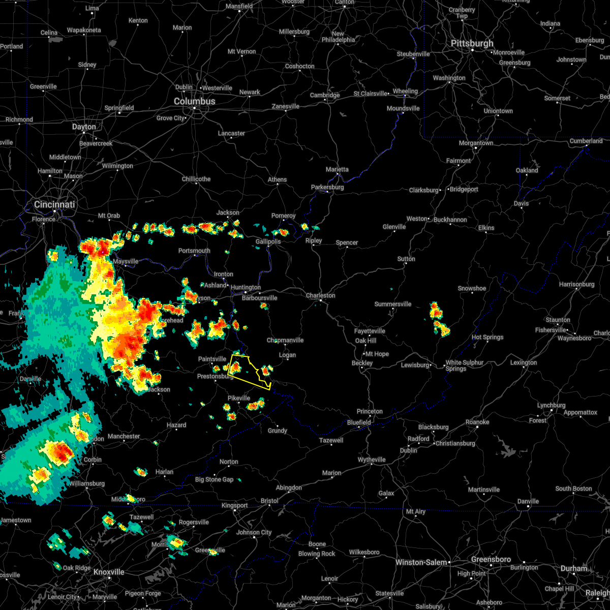 At 1248 pm edt, a severe thunderstorm was located over prince, or near inez, moving east at 30 mph (radar indicated). Hazards include 60 mph wind gusts and penny size hail. Expect damage to roofs, siding, and trees. this severe thunderstorm will be near, lovely around 1255 pm edt. coalpoint around 100 pm edt. oppy around 105 pm edt. other locations in the path of this severe thunderstorm include whitepost. hail threat, radar indicated max hail size, 0. 75 in wind threat, radar indicated max wind gust, 60 mph. At 1248 pm edt, a severe thunderstorm was located over prince, or near inez, moving east at 30 mph (radar indicated). Hazards include 60 mph wind gusts and penny size hail. Expect damage to roofs, siding, and trees. this severe thunderstorm will be near, lovely around 1255 pm edt. coalpoint around 100 pm edt. oppy around 105 pm edt. other locations in the path of this severe thunderstorm include whitepost. hail threat, radar indicated max hail size, 0. 75 in wind threat, radar indicated max wind gust, 60 mph.
|
| 3/23/2022 4:08 PM EDT |
 The severe thunderstorm warning for southeastern martin and northeastern pike counties will expire at 415 pm edt, the storm which prompted the warning has moved out of the area. therefore, the warning will be allowed to expire. a tornado watch remains in effect until 1000 pm edt for southeastern and northeastern kentucky. to report severe weather, contact your nearest law enforcement agency. they will relay your report to the national weather service jackson ky. The severe thunderstorm warning for southeastern martin and northeastern pike counties will expire at 415 pm edt, the storm which prompted the warning has moved out of the area. therefore, the warning will be allowed to expire. a tornado watch remains in effect until 1000 pm edt for southeastern and northeastern kentucky. to report severe weather, contact your nearest law enforcement agency. they will relay your report to the national weather service jackson ky.
|
| 3/23/2022 4:03 PM EDT |
 At 403 pm edt, a severe thunderstorm was located over delbarton, or near williamson, moving northeast at 60 mph (radar indicated). Hazards include 70 mph wind gusts and quarter size hail. Hail damage to vehicles is expected. expect considerable tree damage. wind damage is also likely to mobile homes, roofs, and outbuildings. locations impacted include, williamson, logan, chapmanville, delbarton, chief logan state, holden, mount gay-shamrock, red jacket, chattaroy, harts, matewan, west logan, mitchell heights, mount gay, verdunville, chauncey, myrtle, switzer, blair and dingess. thunderstorm damage threat, considerable hail threat, radar indicated max hail size, 1. 00 in wind threat, radar indicated max wind gust, 70 mph. At 403 pm edt, a severe thunderstorm was located over delbarton, or near williamson, moving northeast at 60 mph (radar indicated). Hazards include 70 mph wind gusts and quarter size hail. Hail damage to vehicles is expected. expect considerable tree damage. wind damage is also likely to mobile homes, roofs, and outbuildings. locations impacted include, williamson, logan, chapmanville, delbarton, chief logan state, holden, mount gay-shamrock, red jacket, chattaroy, harts, matewan, west logan, mitchell heights, mount gay, verdunville, chauncey, myrtle, switzer, blair and dingess. thunderstorm damage threat, considerable hail threat, radar indicated max hail size, 1. 00 in wind threat, radar indicated max wind gust, 70 mph.
|
| 3/23/2022 3:56 PM EDT |
 At 355 pm edt, a severe thunderstorm was located over south williamson, or over williamson, moving northeast at 50 mph (radar indicated). Hazards include 60 mph wind gusts and half dollar size hail. Hail damage to vehicles is expected. expect wind damage to roofs, siding, and trees. Locations impacted include, forest hills, rural, huddy, mcandrews, turkey creek, belfry, heisey, whitepost, hardy, conder, sidney and canada. At 355 pm edt, a severe thunderstorm was located over south williamson, or over williamson, moving northeast at 50 mph (radar indicated). Hazards include 60 mph wind gusts and half dollar size hail. Hail damage to vehicles is expected. expect wind damage to roofs, siding, and trees. Locations impacted include, forest hills, rural, huddy, mcandrews, turkey creek, belfry, heisey, whitepost, hardy, conder, sidney and canada.
|
| 3/23/2022 3:54 PM EDT | Quarter sized hail reported 4.5 miles NNW of Williamson, WV |
| 3/23/2022 3:46 PM EDT |
 At 345 pm edt, a severe thunderstorm was located over raccoon, or near pikeville, moving northeast at 60 mph (radar indicated). Hazards include 60 mph wind gusts and nickel size hail. expect damage to roofs, siding, and trees At 345 pm edt, a severe thunderstorm was located over raccoon, or near pikeville, moving northeast at 60 mph (radar indicated). Hazards include 60 mph wind gusts and nickel size hail. expect damage to roofs, siding, and trees
|
| 3/23/2022 3:41 PM EDT |
 At 340 pm edt, a severe thunderstorm was located over zebulon, or near pikeville, moving northeast at 50 mph (radar indicated). Hazards include 60 mph wind gusts and quarter size hail. Hail damage to vehicles is expected. expect wind damage to roofs, siding, and trees. Locations impacted include, sidney and forest hills. At 340 pm edt, a severe thunderstorm was located over zebulon, or near pikeville, moving northeast at 50 mph (radar indicated). Hazards include 60 mph wind gusts and quarter size hail. Hail damage to vehicles is expected. expect wind damage to roofs, siding, and trees. Locations impacted include, sidney and forest hills.
|
| 3/23/2022 3:24 PM EDT |
 At 323 pm edt, a severe thunderstorm was located over ligon, or 9 miles southwest of pikeville, moving northeast at 50 mph (radar indicated). Hazards include 60 mph wind gusts and quarter size hail. Hail damage to vehicles is expected. expect wind damage to roofs, siding, and trees. this severe thunderstorm will be near, osborn around 330 pm edt. pikeville around 335 pm edt. coal run village around 340 pm edt. Other locations in the path of this severe thunderstorm include meta, sidney and forest hills. At 323 pm edt, a severe thunderstorm was located over ligon, or 9 miles southwest of pikeville, moving northeast at 50 mph (radar indicated). Hazards include 60 mph wind gusts and quarter size hail. Hail damage to vehicles is expected. expect wind damage to roofs, siding, and trees. this severe thunderstorm will be near, osborn around 330 pm edt. pikeville around 335 pm edt. coal run village around 340 pm edt. Other locations in the path of this severe thunderstorm include meta, sidney and forest hills.
|
| 1/1/2022 7:34 AM EST |
 At 732 am est, a severe thunderstorm was located over gilbert creek, or 18 miles west of pineville, and is nearly stationary (radar indicated). Hazards include 60 mph wind gusts. Expect damage to roofs, siding, and trees. locations impacted include, welch, pineville, oceana, hanover, r. d. bailey lake, gilbert creek, red jacket, hinch, matewan, gilbert, davy, iaeger, coal mountain, bruno, edgarton, coalwood, hurley, avondale, wolf pen and meador. hail threat, radar indicated max hail size, <. 75 in wind threat, radar indicated max wind gust, 60 mph. At 732 am est, a severe thunderstorm was located over gilbert creek, or 18 miles west of pineville, and is nearly stationary (radar indicated). Hazards include 60 mph wind gusts. Expect damage to roofs, siding, and trees. locations impacted include, welch, pineville, oceana, hanover, r. d. bailey lake, gilbert creek, red jacket, hinch, matewan, gilbert, davy, iaeger, coal mountain, bruno, edgarton, coalwood, hurley, avondale, wolf pen and meador. hail threat, radar indicated max hail size, <. 75 in wind threat, radar indicated max wind gust, 60 mph.
|
| 1/1/2022 6:58 AM EST |
 At 658 am est, a severe thunderstorm was located over mcandrews, or 9 miles south of williamson, moving east at 45 mph (radar indicated). Hazards include 60 mph wind gusts. expect damage to roofs, siding, and trees At 658 am est, a severe thunderstorm was located over mcandrews, or 9 miles south of williamson, moving east at 45 mph (radar indicated). Hazards include 60 mph wind gusts. expect damage to roofs, siding, and trees
|
| 1/1/2022 6:43 AM EST |
 At 643 am est, a severe thunderstorm was located over zebulon, or near pikeville, moving east at 45 mph (radar indicated). Hazards include 60 mph wind gusts and penny size hail. Expect damage to roofs, siding, and trees. this severe thunderstorm will be near, kimper around 655 am est. mcandrews around 700 am est. other locations in the path of this severe thunderstorm include board tree and woodman. hail threat, radar indicated max hail size, 0. 75 in wind threat, radar indicated max wind gust, 60 mph. At 643 am est, a severe thunderstorm was located over zebulon, or near pikeville, moving east at 45 mph (radar indicated). Hazards include 60 mph wind gusts and penny size hail. Expect damage to roofs, siding, and trees. this severe thunderstorm will be near, kimper around 655 am est. mcandrews around 700 am est. other locations in the path of this severe thunderstorm include board tree and woodman. hail threat, radar indicated max hail size, 0. 75 in wind threat, radar indicated max wind gust, 60 mph.
|
| 8/3/2021 5:23 PM EDT |
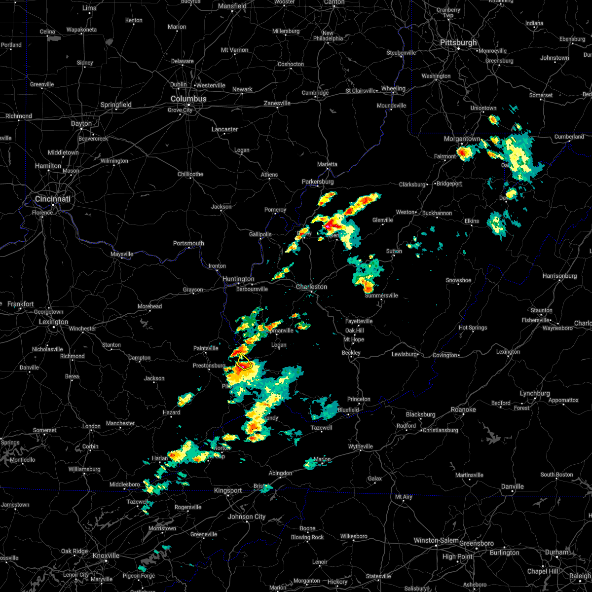 At 522 pm edt, a severe thunderstorm was located over whitepost, or near williamson, moving northeast at 25 mph (radar indicated). Hazards include 60 mph wind gusts and penny size hail. Expect damage to roofs, siding, and trees. this severe thunderstorm will remain over mainly rural areas of southeastern martin and north central pike counties. hail threat, radar indicated max hail size, 0. 75 in wind threat, radar indicated max wind gust, 60 mph. At 522 pm edt, a severe thunderstorm was located over whitepost, or near williamson, moving northeast at 25 mph (radar indicated). Hazards include 60 mph wind gusts and penny size hail. Expect damage to roofs, siding, and trees. this severe thunderstorm will remain over mainly rural areas of southeastern martin and north central pike counties. hail threat, radar indicated max hail size, 0. 75 in wind threat, radar indicated max wind gust, 60 mph.
|
| 8/3/2021 5:15 PM EDT |
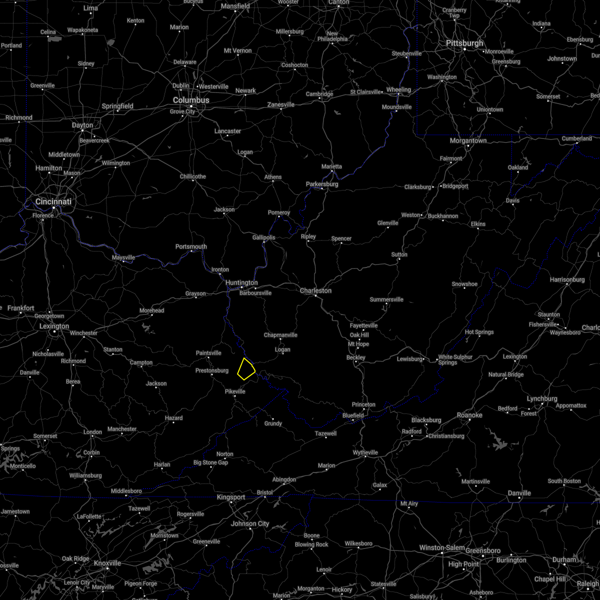 At 514 pm edt, a severe thunderstorm was located over conder, or 7 miles west of williamson, moving northeast at 25 mph (radar indicated). Hazards include 60 mph wind gusts and penny size hail. Expect damage to roofs, siding, and trees. this severe thunderstorm will be near, hatfield station around 520 pm edt. whitepost around 525 pm edt. hail threat, radar indicated max hail size, 0. 75 in wind threat, radar indicated max wind gust, 60 mph. At 514 pm edt, a severe thunderstorm was located over conder, or 7 miles west of williamson, moving northeast at 25 mph (radar indicated). Hazards include 60 mph wind gusts and penny size hail. Expect damage to roofs, siding, and trees. this severe thunderstorm will be near, hatfield station around 520 pm edt. whitepost around 525 pm edt. hail threat, radar indicated max hail size, 0. 75 in wind threat, radar indicated max wind gust, 60 mph.
|
| 7/10/2021 3:28 PM EDT |
 At 328 pm edt, a severe thunderstorm was located over zebulon, or near pikeville, moving east at 30 mph (radar indicated). Hazards include 70 mph wind gusts and quarter size hail. Hail damage to vehicles is expected. expect considerable tree damage. wind damage is also likely to mobile homes, roofs, and outbuildings. Locations impacted include, kimper, coleman, jamboree, paw paw and argo. At 328 pm edt, a severe thunderstorm was located over zebulon, or near pikeville, moving east at 30 mph (radar indicated). Hazards include 70 mph wind gusts and quarter size hail. Hail damage to vehicles is expected. expect considerable tree damage. wind damage is also likely to mobile homes, roofs, and outbuildings. Locations impacted include, kimper, coleman, jamboree, paw paw and argo.
|
| 7/10/2021 3:08 PM EDT |
 At 308 pm edt, a severe thunderstorm was located over gulnare, or 9 miles northwest of pikeville, moving east at 35 mph (radar indicated). Hazards include 60 mph wind gusts and quarter size hail. Hail damage to vehicles is expected. expect wind damage to roofs, siding, and trees. this severe thunderstorm will be near, meta around 320 pm edt. varney around 325 pm edt. Other locations in the path of this severe thunderstorm include canada, forest hills, hardy and phelps. At 308 pm edt, a severe thunderstorm was located over gulnare, or 9 miles northwest of pikeville, moving east at 35 mph (radar indicated). Hazards include 60 mph wind gusts and quarter size hail. Hail damage to vehicles is expected. expect wind damage to roofs, siding, and trees. this severe thunderstorm will be near, meta around 320 pm edt. varney around 325 pm edt. Other locations in the path of this severe thunderstorm include canada, forest hills, hardy and phelps.
|
| 6/28/2021 5:54 PM EDT |
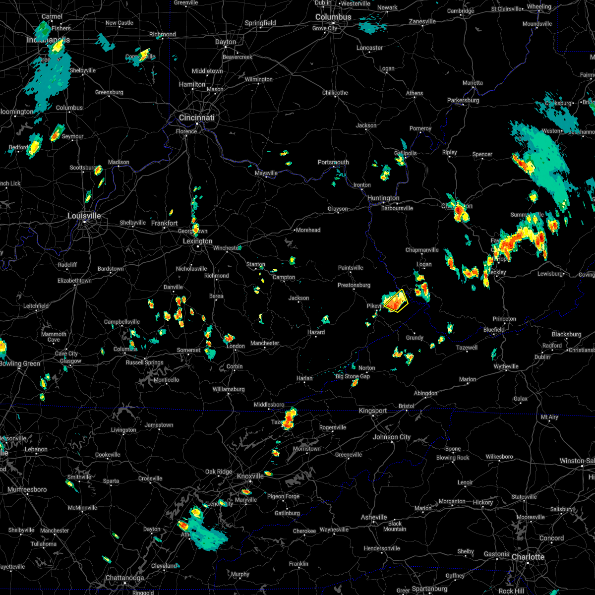 At 554 pm edt, a severe thunderstorm was located over mcandrews, or 9 miles south of williamson, moving northwest at 15 mph (radar indicated). Hazards include 60 mph wind gusts and penny size hail. Expect damage to roofs, siding, and trees. Locations impacted include, kimper, huddy, aflex, mcandrews, hardy and belfry. At 554 pm edt, a severe thunderstorm was located over mcandrews, or 9 miles south of williamson, moving northwest at 15 mph (radar indicated). Hazards include 60 mph wind gusts and penny size hail. Expect damage to roofs, siding, and trees. Locations impacted include, kimper, huddy, aflex, mcandrews, hardy and belfry.
|
| 6/28/2021 5:41 PM EDT |
 At 541 pm edt, a severe thunderstorm was located near coleman, or 11 miles south of williamson, moving northwest at 15 mph (radar indicated). Hazards include 60 mph wind gusts and penny size hail. Expect damage to roofs, siding, and trees. Locations impacted include, huddy, mcandrews, belfry, kimper, coleman, aflex, hardy and phelps. At 541 pm edt, a severe thunderstorm was located near coleman, or 11 miles south of williamson, moving northwest at 15 mph (radar indicated). Hazards include 60 mph wind gusts and penny size hail. Expect damage to roofs, siding, and trees. Locations impacted include, huddy, mcandrews, belfry, kimper, coleman, aflex, hardy and phelps.
|
| 6/28/2021 5:29 PM EDT |
 At 529 pm edt, a severe thunderstorm was located over coleman, or 13 miles south of williamson, moving northwest at 15 mph (radar indicated). Hazards include 60 mph wind gusts and penny size hail. expect damage to roofs, siding, and trees At 529 pm edt, a severe thunderstorm was located over coleman, or 13 miles south of williamson, moving northwest at 15 mph (radar indicated). Hazards include 60 mph wind gusts and penny size hail. expect damage to roofs, siding, and trees
|
| 6/13/2021 7:01 PM EDT |
 At 701 pm edt, severe thunderstorms were located along a line extending from chief logan state to near holden to near chattaroy, moving southeast at 30 mph (radar indicated). Hazards include 60 mph wind gusts and quarter size hail. Hail damage to vehicles is expected. Expect wind damage to roofs, siding, and trees. At 701 pm edt, severe thunderstorms were located along a line extending from chief logan state to near holden to near chattaroy, moving southeast at 30 mph (radar indicated). Hazards include 60 mph wind gusts and quarter size hail. Hail damage to vehicles is expected. Expect wind damage to roofs, siding, and trees.
|
| 3/18/2021 4:19 PM EDT | Quarter sized hail reported 6.5 miles SE of Williamson, WV, hail ranging in size from dimes to quarters was observed in hatfield. |
| 7/6/2020 7:11 PM EDT |
 The severe thunderstorm warning for west central mingo county will expire at 715 pm edt, the storm which prompted the warning has weakened below severe limits, and no longer poses an immediate threat to life or property. therefore, the warning will be allowed to expire. however gusty winds and heavy rain are still possible with this thunderstorm. to report severe weather, contact your nearest law enforcement agency. they will relay your report to the national weather service charleston west virginia. The severe thunderstorm warning for west central mingo county will expire at 715 pm edt, the storm which prompted the warning has weakened below severe limits, and no longer poses an immediate threat to life or property. therefore, the warning will be allowed to expire. however gusty winds and heavy rain are still possible with this thunderstorm. to report severe weather, contact your nearest law enforcement agency. they will relay your report to the national weather service charleston west virginia.
|
| 7/6/2020 7:03 PM EDT |
 At 703 pm edt, a severe thunderstorm was located over turkey creek, or over williamson, moving north at 5 mph (radar indicated). Hazards include 60 mph wind gusts and penny size hail. Expect damage to roofs, siding, and trees. Locations impacted include, aflex and turkey creek. At 703 pm edt, a severe thunderstorm was located over turkey creek, or over williamson, moving north at 5 mph (radar indicated). Hazards include 60 mph wind gusts and penny size hail. Expect damage to roofs, siding, and trees. Locations impacted include, aflex and turkey creek.
|
| 7/6/2020 7:01 PM EDT | Trees blown down in fairview in mingo county WV, 1.1 miles E of Williamson, WV |
| 7/6/2020 6:56 PM EDT | Trees downed on powerlines from storm in mingo county WV, 1.7 miles SSW of Williamson, WV |
| 7/6/2020 6:56 PM EDT |
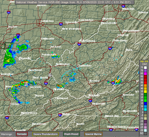 At 654 pm edt, a severe thunderstorm was located over williamson, and is nearly stationary (radar indicated). Hazards include 60 mph wind gusts and penny size hail. Expect damage to roofs, siding, and trees. Locations impacted include, williamson, delbarton and chattaroy. At 654 pm edt, a severe thunderstorm was located over williamson, and is nearly stationary (radar indicated). Hazards include 60 mph wind gusts and penny size hail. Expect damage to roofs, siding, and trees. Locations impacted include, williamson, delbarton and chattaroy.
|
| 7/6/2020 6:52 PM EDT |
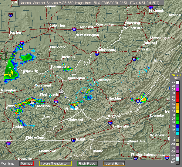 At 652 pm edt, a severe thunderstorm was located over turkey creek, or over williamson, moving north at 5 mph (radar indicated). Hazards include 60 mph wind gusts and penny size hail. expect damage to roofs, siding, and trees At 652 pm edt, a severe thunderstorm was located over turkey creek, or over williamson, moving north at 5 mph (radar indicated). Hazards include 60 mph wind gusts and penny size hail. expect damage to roofs, siding, and trees
|
| 7/6/2020 6:51 PM EDT | Reported trees down in williamson in mingo county WV, 0.8 miles NW of Williamson, WV |
| 7/6/2020 6:43 PM EDT |
 At 643 pm edt, a severe thunderstorm was located over williamson, and is nearly stationary (radar indicated). Hazards include 60 mph wind gusts and penny size hail. expect damage to roofs, siding, and trees At 643 pm edt, a severe thunderstorm was located over williamson, and is nearly stationary (radar indicated). Hazards include 60 mph wind gusts and penny size hail. expect damage to roofs, siding, and trees
|
| 6/6/2020 11:31 PM EDT | Trees down across us 119 near pigeon cree in mingo county WV, 7.3 miles SSW of Williamson, WV |
| 6/6/2020 11:22 PM EDT |
 At 1121 pm edt, a severe thunderstorm was located near oppy, or 11 miles north of williamson, moving southeast at 25 mph (radar indicated). Hazards include 60 mph wind gusts and quarter size hail. Hail damage to vehicles is expected. expect wind damage to roofs, siding, and trees. Locations impacted include, williamson, delbarton, red jacket, chattaroy, hinch, gilbert creek, myrtle, varney, meador, pie, lenore and naugatuck. At 1121 pm edt, a severe thunderstorm was located near oppy, or 11 miles north of williamson, moving southeast at 25 mph (radar indicated). Hazards include 60 mph wind gusts and quarter size hail. Hail damage to vehicles is expected. expect wind damage to roofs, siding, and trees. Locations impacted include, williamson, delbarton, red jacket, chattaroy, hinch, gilbert creek, myrtle, varney, meador, pie, lenore and naugatuck.
|
| 6/6/2020 11:15 PM EDT |
 At 1114 pm edt, a severe thunderstorm was located near oppy, or 12 miles east of inez, moving southeast at 25 mph (radar indicated). Hazards include 60 mph wind gusts and penny size hail. expect damage to roofs, siding, and trees At 1114 pm edt, a severe thunderstorm was located near oppy, or 12 miles east of inez, moving southeast at 25 mph (radar indicated). Hazards include 60 mph wind gusts and penny size hail. expect damage to roofs, siding, and trees
|
| 4/9/2020 1:55 AM EDT |
 The severe thunderstorm warning for letcher, perry, knott, floyd, southeastern breathitt, pike and southeastern magoffin counties will expire at 200 am edt, the storms which prompted the warning are still capable of producing damaging winds and hail. the warning will be allowed to expire at its designated time, but has been replaced with a new severe thunderstorm warning in effect until 6:15 am edt. a tornado watch remains in effect until 400 am edt for southeastern and northeastern kentucky. The severe thunderstorm warning for letcher, perry, knott, floyd, southeastern breathitt, pike and southeastern magoffin counties will expire at 200 am edt, the storms which prompted the warning are still capable of producing damaging winds and hail. the warning will be allowed to expire at its designated time, but has been replaced with a new severe thunderstorm warning in effect until 6:15 am edt. a tornado watch remains in effect until 400 am edt for southeastern and northeastern kentucky.
|
| 4/9/2020 1:52 AM EDT |
 At 152 am edt, severe thunderstorms were located along a line extending from hinch to near garden village to democrat to hoskinston, moving southeast at 55 mph (radar indicated). Hazards include 60 mph wind gusts and penny size hail. expect damage to roofs, siding, and trees At 152 am edt, severe thunderstorms were located along a line extending from hinch to near garden village to democrat to hoskinston, moving southeast at 55 mph (radar indicated). Hazards include 60 mph wind gusts and penny size hail. expect damage to roofs, siding, and trees
|
| 4/9/2020 1:42 AM EDT |
 At 141 am edt, severe thunderstorms were located along a line extending from near red jacket to osborn to soft shell to near hazard, moving southeast at 45 mph (radar indicated). Hazards include 60 mph wind gusts and penny size hail. Expect damage to roofs, siding, and trees. Locations impacted include, pikeville, hazard, prestonsburg, whitesburg, hindman, letcher, estill, bath, cumberland, jenkins, coal run village and elkhorn city. At 141 am edt, severe thunderstorms were located along a line extending from near red jacket to osborn to soft shell to near hazard, moving southeast at 45 mph (radar indicated). Hazards include 60 mph wind gusts and penny size hail. Expect damage to roofs, siding, and trees. Locations impacted include, pikeville, hazard, prestonsburg, whitesburg, hindman, letcher, estill, bath, cumberland, jenkins, coal run village and elkhorn city.
|
| 4/9/2020 1:18 AM EDT |
 At 118 am edt, severe thunderstorms were located along a line extending from near oppy to dotson to lunah to canoe, moving southeast at 45 mph (radar indicated). Hazards include 60 mph wind gusts and penny size hail. expect damage to roofs, siding, and trees At 118 am edt, severe thunderstorms were located along a line extending from near oppy to dotson to lunah to canoe, moving southeast at 45 mph (radar indicated). Hazards include 60 mph wind gusts and penny size hail. expect damage to roofs, siding, and trees
|
| 4/8/2020 3:33 PM EDT | Tree fell through a house. also small hail of unknown size. em took information from publi in mingo county WV, 8.5 miles S of Williamson, WV |
| 10/31/2019 1:03 PM EDT | Several trees down... time estimated from radar in mingo county WV, 8.5 miles S of Williamson, WV |
| 6/24/2019 6:11 PM EDT | A tree was blown dow in pike county KY, 6.5 miles SE of Williamson, WV |
| 6/24/2019 5:55 PM EDT |
 At 555 pm edt, severe thunderstorms were located along a line extending from near louisa to mcclure to demo, moving east at 50 mph (radar indicated). Hazards include 60 mph wind gusts. expect damage to roofs, siding, and trees At 555 pm edt, severe thunderstorms were located along a line extending from near louisa to mcclure to demo, moving east at 50 mph (radar indicated). Hazards include 60 mph wind gusts. expect damage to roofs, siding, and trees
|
| 6/24/2019 5:55 PM EDT |
 At 555 pm edt, severe thunderstorms were located along a line extending from near ulysses to pevier to mccombs, moving northeast at 50 mph (radar indicated). Hazards include 60 mph wind gusts. Expect damage to roofs, siding, and trees. Locations impacted include, prestonsburg, inez, martin, forest hills, warfield, allen, add, pilgrim, bammer, davella, lancer and whitehouse. At 555 pm edt, severe thunderstorms were located along a line extending from near ulysses to pevier to mccombs, moving northeast at 50 mph (radar indicated). Hazards include 60 mph wind gusts. Expect damage to roofs, siding, and trees. Locations impacted include, prestonsburg, inez, martin, forest hills, warfield, allen, add, pilgrim, bammer, davella, lancer and whitehouse.
|
| 6/24/2019 5:44 PM EDT |
 At 544 pm edt, severe thunderstorms were located along a line extending from near stambaugh to odds to beaver junction, moving northeast at 50 mph (radar indicated). Hazards include 60 mph wind gusts. Expect damage to roofs, siding, and trees. Locations impacted include, paintsville, prestonsburg, inez, martin, forest hills, warfield, allen, pilgrim, oaklawn estates, bammer, davella and lancer. At 544 pm edt, severe thunderstorms were located along a line extending from near stambaugh to odds to beaver junction, moving northeast at 50 mph (radar indicated). Hazards include 60 mph wind gusts. Expect damage to roofs, siding, and trees. Locations impacted include, paintsville, prestonsburg, inez, martin, forest hills, warfield, allen, pilgrim, oaklawn estates, bammer, davella and lancer.
|
| 6/24/2019 5:33 PM EDT |
 At 532 pm edt, severe thunderstorms were located along a line extending from near hargis to bonanza to orchard, moving northeast at 50 mph (radar indicated). Hazards include 60 mph wind gusts. Expect damage to roofs, siding, and trees. Locations impacted include, paintsville, prestonsburg, salyersville, inez, martin, forest hills, warfield, allen, pilgrim, oaklawn estates, bammer and davella. At 532 pm edt, severe thunderstorms were located along a line extending from near hargis to bonanza to orchard, moving northeast at 50 mph (radar indicated). Hazards include 60 mph wind gusts. Expect damage to roofs, siding, and trees. Locations impacted include, paintsville, prestonsburg, salyersville, inez, martin, forest hills, warfield, allen, pilgrim, oaklawn estates, bammer and davella.
|
| 6/24/2019 5:18 PM EDT |
 At 517 pm edt, severe thunderstorms were located along a line extending from elsie to carver to decoy, moving east at 50 mph (radar indicated). Hazards include 60 mph wind gusts. expect damage to roofs, siding, and trees At 517 pm edt, severe thunderstorms were located along a line extending from elsie to carver to decoy, moving east at 50 mph (radar indicated). Hazards include 60 mph wind gusts. expect damage to roofs, siding, and trees
|
| 6/2/2019 3:45 PM EDT | Quarter sized hail reported 4.5 miles NNW of Williamson, WV, report relayed via media. |
| 5/29/2019 3:06 PM EDT |
 At 305 pm edt, a severe thunderstorm was located near hinch, or 10 miles south of logan, moving east at 45 mph (radar indicated). Hazards include 60 mph wind gusts and quarter size hail. Hail damage to vehicles is expected. expect wind damage to roofs, siding, and trees. Locations impacted include, williamson, delbarton, holden, red jacket, hinch, mount gay-shamrock, matewan, chauncey, myrtle, hampden, pie, varney, sarah ann, meador and switzer. At 305 pm edt, a severe thunderstorm was located near hinch, or 10 miles south of logan, moving east at 45 mph (radar indicated). Hazards include 60 mph wind gusts and quarter size hail. Hail damage to vehicles is expected. expect wind damage to roofs, siding, and trees. Locations impacted include, williamson, delbarton, holden, red jacket, hinch, mount gay-shamrock, matewan, chauncey, myrtle, hampden, pie, varney, sarah ann, meador and switzer.
|
| 5/29/2019 2:56 PM EDT |
 At 256 pm edt, severe thunderstorms were located along a line extending from near holden to board tree to fishtrap lake, moving east at 55 mph (radar indicated). Hazards include 60 mph wind gusts and penny size hail. expect damage to roofs, siding, and trees At 256 pm edt, severe thunderstorms were located along a line extending from near holden to board tree to fishtrap lake, moving east at 55 mph (radar indicated). Hazards include 60 mph wind gusts and penny size hail. expect damage to roofs, siding, and trees
|
| 5/29/2019 2:52 PM EDT | Trees down and a relatively new roof ripped off a nearby restauran in mingo county WV, 0.8 miles NW of Williamson, WV |
| 5/29/2019 2:47 PM EDT |
 At 246 pm edt, severe thunderstorms were located along a line extending from near chattaroy to kimper to near galveston, moving east at 55 mph (radar indicated). Hazards include 60 mph wind gusts. Expect damage to roofs, siding, and trees. Locations impacted include, pikeville, coal run village, forest hills, warfield, huddy, meta, jamboree, pilgrim, fishtrap lake, garden village, aluba and piso. At 246 pm edt, severe thunderstorms were located along a line extending from near chattaroy to kimper to near galveston, moving east at 55 mph (radar indicated). Hazards include 60 mph wind gusts. Expect damage to roofs, siding, and trees. Locations impacted include, pikeville, coal run village, forest hills, warfield, huddy, meta, jamboree, pilgrim, fishtrap lake, garden village, aluba and piso.
|
| 5/29/2019 2:42 PM EDT |
 At 241 pm edt, a severe thunderstorm was located over laura, or 9 miles northwest of williamson, moving east at 25 mph (radar indicated). Hazards include 60 mph wind gusts and quarter size hail. Hail damage to vehicles is expected. Expect wind damage to roofs, siding, and trees. At 241 pm edt, a severe thunderstorm was located over laura, or 9 miles northwest of williamson, moving east at 25 mph (radar indicated). Hazards include 60 mph wind gusts and quarter size hail. Hail damage to vehicles is expected. Expect wind damage to roofs, siding, and trees.
|
| 5/29/2019 2:38 PM EDT | Tree fell on a powerlin in pike county KY, 6.5 miles SE of Williamson, WV |
| 5/29/2019 2:20 PM EDT |
 At 220 pm edt, severe thunderstorms were located along a line extending from tomahawk to ivel to mid, moving east at 60 mph (radar indicated). Hazards include 60 mph wind gusts and penny size hail. expect damage to roofs, siding, and trees At 220 pm edt, severe thunderstorms were located along a line extending from tomahawk to ivel to mid, moving east at 60 mph (radar indicated). Hazards include 60 mph wind gusts and penny size hail. expect damage to roofs, siding, and trees
|
| 5/26/2019 7:27 PM EDT |
 At 727 pm edt, a severe thunderstorm was located over oppy, or 10 miles northwest of williamson, moving east at 50 mph (radar indicated). Hazards include 60 mph wind gusts. expect damage to roofs, siding, and trees At 727 pm edt, a severe thunderstorm was located over oppy, or 10 miles northwest of williamson, moving east at 50 mph (radar indicated). Hazards include 60 mph wind gusts. expect damage to roofs, siding, and trees
|
| 7/20/2018 7:07 PM EDT |
 A severe thunderstorm warning remains in effect until 730 pm edt for southeastern martin and north central pike counties. at 707 pm edt, a severe thunderstorm was located over jarad, or 9 miles west of williamson, moving east at 25 mph. hazard. 60 mph wind gusts and quarter size hail. source. Radar indicated. A severe thunderstorm warning remains in effect until 730 pm edt for southeastern martin and north central pike counties. at 707 pm edt, a severe thunderstorm was located over jarad, or 9 miles west of williamson, moving east at 25 mph. hazard. 60 mph wind gusts and quarter size hail. source. Radar indicated.
|
| 7/20/2018 6:48 PM EDT |
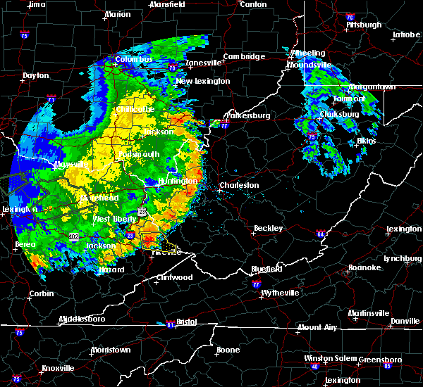 At 648 pm edt, a severe thunderstorm was located over heenan, or 12 miles east of prestonsburg, moving east at 25 mph (radar indicated). Hazards include 60 mph wind gusts and quarter size hail. Hail damage to vehicles is expected. Expect wind damage to roofs, siding, and trees. At 648 pm edt, a severe thunderstorm was located over heenan, or 12 miles east of prestonsburg, moving east at 25 mph (radar indicated). Hazards include 60 mph wind gusts and quarter size hail. Hail damage to vehicles is expected. Expect wind damage to roofs, siding, and trees.
|
| 4/4/2018 2:25 AM EDT |
 The severe thunderstorm warning for pike county will expire at 230 am edt, the storms which prompted the warning have moved out of the area. therefore the warning will be allowed to expire. a severe thunderstorm watch remains in effect until 300 am edt for southeastern kentucky. The severe thunderstorm warning for pike county will expire at 230 am edt, the storms which prompted the warning have moved out of the area. therefore the warning will be allowed to expire. a severe thunderstorm watch remains in effect until 300 am edt for southeastern kentucky.
|
| 4/4/2018 1:58 AM EDT |
 At 158 am edt, severe thunderstorms were located along a line extending from heisey to marrowbone, moving east at 65 mph (radar indicated). Hazards include 60 mph wind gusts. Expect damage to roofs, siding, and trees. Locations impacted include, pikeville, coal run village, forest hills, huddy, meta, turkey creek, jamboree, belfry, fishtrap lake, coal run, conder, zebulon, garden village, phyllis, piso, marrowbone, virgie, raccoon, board tree and woodman. At 158 am edt, severe thunderstorms were located along a line extending from heisey to marrowbone, moving east at 65 mph (radar indicated). Hazards include 60 mph wind gusts. Expect damage to roofs, siding, and trees. Locations impacted include, pikeville, coal run village, forest hills, huddy, meta, turkey creek, jamboree, belfry, fishtrap lake, coal run, conder, zebulon, garden village, phyllis, piso, marrowbone, virgie, raccoon, board tree and woodman.
|
| 4/4/2018 1:48 AM EDT |
 At 148 am edt, severe thunderstorms were located along a line extending from gulnare to virgie, moving east at 65 mph (radar indicated). Hazards include 60 mph wind gusts. Expect damage to roofs, siding, and trees. Locations impacted include, pikeville, coal run village, wheelwright, martin, forest hills, east mcdowell, huddy, meta, jamboree, fishtrap lake, garden village, printer, aluba, mcdowell, piso, betsy layne, ivel, honaker, buckhorn hollow and blue moon. At 148 am edt, severe thunderstorms were located along a line extending from gulnare to virgie, moving east at 65 mph (radar indicated). Hazards include 60 mph wind gusts. Expect damage to roofs, siding, and trees. Locations impacted include, pikeville, coal run village, wheelwright, martin, forest hills, east mcdowell, huddy, meta, jamboree, fishtrap lake, garden village, printer, aluba, mcdowell, piso, betsy layne, ivel, honaker, buckhorn hollow and blue moon.
|
| 4/4/2018 1:32 AM EDT |
 At 131 am edt, severe thunderstorms were located along a line extending from bosco to bath, moving east at 60 mph (radar indicated). Hazards include 60 mph wind gusts. expect damage to roofs, siding, and trees At 131 am edt, severe thunderstorms were located along a line extending from bosco to bath, moving east at 60 mph (radar indicated). Hazards include 60 mph wind gusts. expect damage to roofs, siding, and trees
|
| 3/17/2018 6:36 PM EDT |
 At 636 pm edt, a severe thunderstorm was located over meta, or 8 miles north of pikeville, moving east at 45 mph (radar indicated). Hazards include 60 mph wind gusts and quarter size hail. Hail damage to vehicles is expected. Expect wind damage to roofs, siding, and trees. At 636 pm edt, a severe thunderstorm was located over meta, or 8 miles north of pikeville, moving east at 45 mph (radar indicated). Hazards include 60 mph wind gusts and quarter size hail. Hail damage to vehicles is expected. Expect wind damage to roofs, siding, and trees.
|
| 5/31/2017 4:37 PM EDT |
 At 437 pm edt, a severe thunderstorm was located over meta, or 8 miles northeast of pikeville, moving east at 30 mph (radar indicated). Hazards include 60 mph wind gusts and quarter size hail. Hail damage to vehicles is expected. expect wind damage to roofs, siding, and trees. Locations impacted include, pikeville, coal run village, forest hills, huddy, meta, turkey creek, belfry, fishtrap lake, coal run, conder, zebulon, garden village, phyllis, piso, raccoon, jarad, rural, mcandrews, heisey and hardy. At 437 pm edt, a severe thunderstorm was located over meta, or 8 miles northeast of pikeville, moving east at 30 mph (radar indicated). Hazards include 60 mph wind gusts and quarter size hail. Hail damage to vehicles is expected. expect wind damage to roofs, siding, and trees. Locations impacted include, pikeville, coal run village, forest hills, huddy, meta, turkey creek, belfry, fishtrap lake, coal run, conder, zebulon, garden village, phyllis, piso, raccoon, jarad, rural, mcandrews, heisey and hardy.
|
| 5/31/2017 4:19 PM EDT |
 At 419 pm edt, a severe thunderstorm was located over mccombs, or 9 miles southeast of prestonsburg, moving east at 30 mph (radar indicated). Hazards include 60 mph wind gusts and half dollar size hail. Hail damage to vehicles is expected. expect wind damage to roofs, siding, and trees. Locations impacted include, pikeville, coal run village, forest hills, allen, huddy, meta, turkey creek, endicott, bammer, belfry, fishtrap lake, coal run, conder, zebulon, garden village, arkansas, phyllis, aluba, piso and betsy layne. At 419 pm edt, a severe thunderstorm was located over mccombs, or 9 miles southeast of prestonsburg, moving east at 30 mph (radar indicated). Hazards include 60 mph wind gusts and half dollar size hail. Hail damage to vehicles is expected. expect wind damage to roofs, siding, and trees. Locations impacted include, pikeville, coal run village, forest hills, allen, huddy, meta, turkey creek, endicott, bammer, belfry, fishtrap lake, coal run, conder, zebulon, garden village, arkansas, phyllis, aluba, piso and betsy layne.
|
| 5/31/2017 4:07 PM EDT |
 At 406 pm edt, a severe thunderstorm was located over alvin, or near prestonsburg, moving east at 30 mph (radar indicated). Hazards include 60 mph wind gusts and quarter size hail. Hail damage to vehicles is expected. Expect wind damage to roofs, siding, and trees. At 406 pm edt, a severe thunderstorm was located over alvin, or near prestonsburg, moving east at 30 mph (radar indicated). Hazards include 60 mph wind gusts and quarter size hail. Hail damage to vehicles is expected. Expect wind damage to roofs, siding, and trees.
|
| 5/24/2017 2:05 PM EDT |
 The severe thunderstorm warning for southeastern martin and north central pike counties will expire at 215 pm edt, the storm which prompted the warning has moved out of the area. therefore the warning will be allowed to expire. to report severe weather, contact your nearest law enforcement agency. they will relay your report to the national weather service jackson ky. The severe thunderstorm warning for southeastern martin and north central pike counties will expire at 215 pm edt, the storm which prompted the warning has moved out of the area. therefore the warning will be allowed to expire. to report severe weather, contact your nearest law enforcement agency. they will relay your report to the national weather service jackson ky.
|
| 5/24/2017 1:54 PM EDT |
 At 154 pm edt, a severe thunderstorm was located over heisey, or 7 miles west of williamson, moving northeast at 30 mph (radar indicated). Hazards include 60 mph wind gusts and quarter size hail. Hail damage to vehicles is expected. expect wind damage to roofs, siding, and trees. Locations impacted include, warfield, beauty, rural, moree, turkey creek, pilgrim, hatfield station, heisey, coalpoint, heenan, whitepost, conder, sidney, oppy, piso, laura, varney, mcclure, lovely and jarad. At 154 pm edt, a severe thunderstorm was located over heisey, or 7 miles west of williamson, moving northeast at 30 mph (radar indicated). Hazards include 60 mph wind gusts and quarter size hail. Hail damage to vehicles is expected. expect wind damage to roofs, siding, and trees. Locations impacted include, warfield, beauty, rural, moree, turkey creek, pilgrim, hatfield station, heisey, coalpoint, heenan, whitepost, conder, sidney, oppy, piso, laura, varney, mcclure, lovely and jarad.
|
| 5/24/2017 1:38 PM EDT |
 At 138 pm edt, a severe thunderstorm was located near gulnare, or 7 miles north of pikeville, moving northeast at 30 mph (radar indicated). Hazards include 60 mph wind gusts and quarter size hail. Hail damage to vehicles is expected. Expect wind damage to roofs, siding, and trees. At 138 pm edt, a severe thunderstorm was located near gulnare, or 7 miles north of pikeville, moving northeast at 30 mph (radar indicated). Hazards include 60 mph wind gusts and quarter size hail. Hail damage to vehicles is expected. Expect wind damage to roofs, siding, and trees.
|
| 5/19/2017 10:52 PM EDT |
 At 1051 pm edt, severe thunderstorms were located along a line extending from bradbury to corn fork hollow to blue river to sikes, moving east at 25 mph (radar indicated). Hazards include 60 mph wind gusts. Expect damage to roofs, siding, and trees. Locations impacted include, pikeville, prestonsburg, jackson, inez, estill, coal run village, martin, wayland, warfield, allen, meta, pilgrim, buck, bammer, vail, handshoe, davella, glo, lancer and bearville. At 1051 pm edt, severe thunderstorms were located along a line extending from bradbury to corn fork hollow to blue river to sikes, moving east at 25 mph (radar indicated). Hazards include 60 mph wind gusts. Expect damage to roofs, siding, and trees. Locations impacted include, pikeville, prestonsburg, jackson, inez, estill, coal run village, martin, wayland, warfield, allen, meta, pilgrim, buck, bammer, vail, handshoe, davella, glo, lancer and bearville.
|
| 5/19/2017 10:31 PM EDT |
 At 1030 pm edt, severe thunderstorms were located along a line extending from hammond to bonanza to swampton to jackson, moving east at 25 mph (radar indicated). Hazards include 60 mph wind gusts and quarter size hail. Hail damage to vehicles is expected. Expect wind damage to roofs, siding, and trees. At 1030 pm edt, severe thunderstorms were located along a line extending from hammond to bonanza to swampton to jackson, moving east at 25 mph (radar indicated). Hazards include 60 mph wind gusts and quarter size hail. Hail damage to vehicles is expected. Expect wind damage to roofs, siding, and trees.
|
| 4/29/2017 11:03 PM EDT |
 At 1103 pm edt, severe thunderstorms were located along a line extending from martin to coal run village to near mcandrews, moving northeast at 40 mph (radar indicated). Hazards include 60 mph wind gusts and quarter size hail. Hail damage to vehicles is expected. Expect wind damage to roofs, siding, and trees. At 1103 pm edt, severe thunderstorms were located along a line extending from martin to coal run village to near mcandrews, moving northeast at 40 mph (radar indicated). Hazards include 60 mph wind gusts and quarter size hail. Hail damage to vehicles is expected. Expect wind damage to roofs, siding, and trees.
|
| 3/27/2017 3:25 PM EDT |
 The severe thunderstorm warning for southeastern martin and north central pike counties will expire at 330 pm edt, the storm which prompted the warning has moved out of the area. therefore the warning will be allowed to expire. The severe thunderstorm warning for southeastern martin and north central pike counties will expire at 330 pm edt, the storm which prompted the warning has moved out of the area. therefore the warning will be allowed to expire.
|
| 3/27/2017 3:04 PM EDT |
 At 303 pm edt, a severe thunderstorm was located over conder, or near williamson, moving east at 30 mph (radar indicated). Hazards include 60 mph wind gusts and quarter size hail. Hail damage to vehicles is expected. expect wind damage to roofs, siding, and trees. Locations impacted include, forest hills, turkey creek, pilgrim, belfry, coalpoint, whitepost, conder, piso, mcclure, jarad, threeforks, rural, moree, gulnare, hatfield station, heisey, heenan, hardy, sidney and oppy. At 303 pm edt, a severe thunderstorm was located over conder, or near williamson, moving east at 30 mph (radar indicated). Hazards include 60 mph wind gusts and quarter size hail. Hail damage to vehicles is expected. expect wind damage to roofs, siding, and trees. Locations impacted include, forest hills, turkey creek, pilgrim, belfry, coalpoint, whitepost, conder, piso, mcclure, jarad, threeforks, rural, moree, gulnare, hatfield station, heisey, heenan, hardy, sidney and oppy.
|
| 3/27/2017 2:44 PM EDT |
 At 243 pm edt, a severe thunderstorm was located over mccombs, or 10 miles east of prestonsburg, moving east at 30 mph (radar indicated). Hazards include 60 mph wind gusts and quarter size hail. Hail damage to vehicles is expected. Expect wind damage to roofs, siding, and trees. At 243 pm edt, a severe thunderstorm was located over mccombs, or 10 miles east of prestonsburg, moving east at 30 mph (radar indicated). Hazards include 60 mph wind gusts and quarter size hail. Hail damage to vehicles is expected. Expect wind damage to roofs, siding, and trees.
|
| 3/1/2017 10:08 AM EST |
 At 1007 am est, severe thunderstorms were located along a line extending from delbarton to near fishtrap lake to skyline, moving east at 60 mph (radar indicated). Hazards include 70 mph wind gusts. Expect considerable tree damage. damage is likely to mobile homes, roofs, and outbuildings. Locations impacted include, pikeville, hazard, whitesburg, hyden, letcher, bath, cumberland, jenkins, elkhorn city, wheelwright, fleming-neon, lynch, pippa passes, benham, forest hills, vicco, blackey, big fork, cody and premium. At 1007 am est, severe thunderstorms were located along a line extending from delbarton to near fishtrap lake to skyline, moving east at 60 mph (radar indicated). Hazards include 70 mph wind gusts. Expect considerable tree damage. damage is likely to mobile homes, roofs, and outbuildings. Locations impacted include, pikeville, hazard, whitesburg, hyden, letcher, bath, cumberland, jenkins, elkhorn city, wheelwright, fleming-neon, lynch, pippa passes, benham, forest hills, vicco, blackey, big fork, cody and premium.
|
| 3/1/2017 10:07 AM EST |
 At 1007 am est, a severe thunderstorm was located over mcandrews, or 8 miles south of williamson, moving east at 60 mph (radar indicated). Hazards include 70 mph wind gusts. Expect considerable tree damage. Damage is likely to mobile homes, roofs, and outbuildings. At 1007 am est, a severe thunderstorm was located over mcandrews, or 8 miles south of williamson, moving east at 60 mph (radar indicated). Hazards include 70 mph wind gusts. Expect considerable tree damage. Damage is likely to mobile homes, roofs, and outbuildings.
|
| 3/1/2017 10:02 AM EST | Roof/structure damage in mingo county WV, 0.8 miles NW of Williamson, WV |
| 3/1/2017 10:00 AM EST | Roof blown off house in mingo county WV, 0.8 miles NW of Williamson, WV |
| 3/1/2017 9:56 AM EST |
 At 956 am est, severe thunderstorms were located along a line extending from hatfield station to shelbiana to near slemp, moving east at 60 mph (radar indicated). Hazards include 70 mph wind gusts. Expect considerable tree damage. damage is likely to mobile homes, roofs, and outbuildings. Locations impacted include, pikeville, hazard, whitesburg, hindman, hyden, letcher, bath, cumberland, jenkins, coal run village, elkhorn city, wheelwright, fleming-neon, lynch, pippa passes, benham, forest hills, vicco, warfield and blackey. At 956 am est, severe thunderstorms were located along a line extending from hatfield station to shelbiana to near slemp, moving east at 60 mph (radar indicated). Hazards include 70 mph wind gusts. Expect considerable tree damage. damage is likely to mobile homes, roofs, and outbuildings. Locations impacted include, pikeville, hazard, whitesburg, hindman, hyden, letcher, bath, cumberland, jenkins, coal run village, elkhorn city, wheelwright, fleming-neon, lynch, pippa passes, benham, forest hills, vicco, warfield and blackey.
|
| 3/1/2017 9:48 AM EST |
 At 948 am est, severe thunderstorms were located along a line extending from near st. albans to oppy, moving east at 60 mph (radar indicated). Hazards include 70 mph wind gusts and penny size hail. Expect considerable tree damage. Damage is likely to mobile homes, roofs, and outbuildings. At 948 am est, severe thunderstorms were located along a line extending from near st. albans to oppy, moving east at 60 mph (radar indicated). Hazards include 70 mph wind gusts and penny size hail. Expect considerable tree damage. Damage is likely to mobile homes, roofs, and outbuildings.
|
| 3/1/2017 9:25 AM EST |
 At 925 am est, severe thunderstorms were located along a line extending from ulysses to evanston to tanksley, moving east at 60 mph (radar indicated). Hazards include 70 mph wind gusts. Expect considerable tree damage. Damage is likely to mobile homes, roofs, and outbuildings. At 925 am est, severe thunderstorms were located along a line extending from ulysses to evanston to tanksley, moving east at 60 mph (radar indicated). Hazards include 70 mph wind gusts. Expect considerable tree damage. Damage is likely to mobile homes, roofs, and outbuildings.
|
| 8/15/2016 5:23 PM EDT | One tree down in wililamso in mingo county WV, 0.8 miles NW of Williamson, WV |
| 7/8/2016 2:45 PM EDT | Trees down in town in mingo county WV, 1.7 miles SSW of Williamson, WV |
| 7/8/2016 2:40 PM EDT |
 At 239 pm edt, severe thunderstorms were located along a line extending from near mount gay-shamrock to belfry, moving east at 40 mph (radar indicated). Hazards include 60 mph wind gusts. Expect damage to roofs. siding. And trees. At 239 pm edt, severe thunderstorms were located along a line extending from near mount gay-shamrock to belfry, moving east at 40 mph (radar indicated). Hazards include 60 mph wind gusts. Expect damage to roofs. siding. And trees.
|
| 7/4/2016 7:02 PM EDT |
 At 702 pm edt, a severe thunderstorm was located over kimper, or 9 miles east of pikeville, moving east at 45 mph (radar indicated). Hazards include 60 mph wind gusts. Expect damage to roofs. siding. And trees. At 702 pm edt, a severe thunderstorm was located over kimper, or 9 miles east of pikeville, moving east at 45 mph (radar indicated). Hazards include 60 mph wind gusts. Expect damage to roofs. siding. And trees.
|
| 7/4/2016 7:00 PM EDT |
 At 659 pm edt, severe thunderstorms were located along a line extending from near piso to near raccoon to lookout, moving east at 45 mph (radar indicated). Hazards include 60 mph wind gusts. Expect damage to roofs. siding. and trees. Locations impacted include, pikeville, coal run village, elkhorn city, forest hills, chloe, fishtrap lake, raccoon, shelbiana, garden village, cedarville, coleman, gulnare, boldman, phelps, virgie, canada, buskirk, biggs, jamboree and belfry. At 659 pm edt, severe thunderstorms were located along a line extending from near piso to near raccoon to lookout, moving east at 45 mph (radar indicated). Hazards include 60 mph wind gusts. Expect damage to roofs. siding. and trees. Locations impacted include, pikeville, coal run village, elkhorn city, forest hills, chloe, fishtrap lake, raccoon, shelbiana, garden village, cedarville, coleman, gulnare, boldman, phelps, virgie, canada, buskirk, biggs, jamboree and belfry.
|
| 7/4/2016 6:40 PM EDT |
 At 639 pm edt, severe thunderstorms were located along a line extending from alphoretta to orkney to deane, moving east at 45 mph (radar indicated). Hazards include 60 mph wind gusts. Expect damage to roofs. siding. And trees. At 639 pm edt, severe thunderstorms were located along a line extending from alphoretta to orkney to deane, moving east at 45 mph (radar indicated). Hazards include 60 mph wind gusts. Expect damage to roofs. siding. And trees.
|
| 6/23/2016 6:20 PM EDT |
 At 619 pm edt, severe thunderstorms were located along a line extending from near mount gay-shamrock to chattaroy to mcclure, moving southeast at 40 mph (radar indicated). Hazards include 60 mph wind gusts. Expect damage to roofs. siding. and trees. locations impacted include, williamson, logan, delbarton, mount gay-shamrock, chief logan state, red jacket, chattaroy, holden, buskirk, matewan, west logan, mitchell heights, lenore, varney, chauncey, meador, mount gay, switzer, dingess and myrtle. A tornado watch remains in effect until 1000 pm edt for southern west virginia. At 619 pm edt, severe thunderstorms were located along a line extending from near mount gay-shamrock to chattaroy to mcclure, moving southeast at 40 mph (radar indicated). Hazards include 60 mph wind gusts. Expect damage to roofs. siding. and trees. locations impacted include, williamson, logan, delbarton, mount gay-shamrock, chief logan state, red jacket, chattaroy, holden, buskirk, matewan, west logan, mitchell heights, lenore, varney, chauncey, meador, mount gay, switzer, dingess and myrtle. A tornado watch remains in effect until 1000 pm edt for southern west virginia.
|
| 6/23/2016 6:11 PM EDT |
 At 611 pm edt, severe thunderstorms were located along a line extending from near whitepost to thelma, moving southeast at 65 mph (radar indicated). Hazards include 60 mph wind gusts and penny size hail. Expect damage to roofs. siding. and trees. locations impacted include, paintsville, prestonsburg, inez, forest hills, warfield, allen, corn fork hollow, bradbury, threeforks, davella, boons camp, offutt, bammer, dicks creek, tutor key, whitepost, davisport, nero, laura and debord. A tornado watch remains in effect until 1000 pm edt for northeastern and southeastern kentucky. At 611 pm edt, severe thunderstorms were located along a line extending from near whitepost to thelma, moving southeast at 65 mph (radar indicated). Hazards include 60 mph wind gusts and penny size hail. Expect damage to roofs. siding. and trees. locations impacted include, paintsville, prestonsburg, inez, forest hills, warfield, allen, corn fork hollow, bradbury, threeforks, davella, boons camp, offutt, bammer, dicks creek, tutor key, whitepost, davisport, nero, laura and debord. A tornado watch remains in effect until 1000 pm edt for northeastern and southeastern kentucky.
|
| 6/23/2016 6:08 PM EDT | Trees down... roads blocke in martin county WV, 8.6 miles SSE of Williamson, WV |
| 6/23/2016 6:04 PM EDT |
 At 604 pm edt, severe thunderstorms were located along a line extending from 9 miles east of hode to oppy to davisport, moving southeast at 40 mph (radar indicated). Hazards include 60 mph wind gusts. Expect damage to roofs. siding. And trees. At 604 pm edt, severe thunderstorms were located along a line extending from 9 miles east of hode to oppy to davisport, moving southeast at 40 mph (radar indicated). Hazards include 60 mph wind gusts. Expect damage to roofs. siding. And trees.
|
| 6/23/2016 5:44 PM EDT |
 At 544 pm edt, a severe thunderstorm was located over stidham, or near inez, moving southeast at 40 mph (radar indicated). Hazards include 60 mph wind gusts and quarter size hail. Hail damage to vehicles is expected. Expect wind damage to roofs, siding, and trees. At 544 pm edt, a severe thunderstorm was located over stidham, or near inez, moving southeast at 40 mph (radar indicated). Hazards include 60 mph wind gusts and quarter size hail. Hail damage to vehicles is expected. Expect wind damage to roofs, siding, and trees.
|
| 6/23/2016 8:10 AM EDT |
 At 809 am edt, severe thunderstorms were located along a line extending from near burnwell to oppy, moving southeast at 50 mph (radar indicated). Hazards include 60 mph wind gusts. Expect damage to roofs. siding. and trees. locations impacted include, beckley, welch, logan, pineville, oak hill, mullens, mount hope, mabscott, oceana, sophia, gary, war, man, delbarton, northfork, shady spring, r. d. Bailey lake, wharton, holden and daniels. At 809 am edt, severe thunderstorms were located along a line extending from near burnwell to oppy, moving southeast at 50 mph (radar indicated). Hazards include 60 mph wind gusts. Expect damage to roofs. siding. and trees. locations impacted include, beckley, welch, logan, pineville, oak hill, mullens, mount hope, mabscott, oceana, sophia, gary, war, man, delbarton, northfork, shady spring, r. d. Bailey lake, wharton, holden and daniels.
|
| 6/23/2016 7:47 AM EDT |
 At 746 am edt, severe thunderstorms were located along a line extending from 8 miles south of chesapeake to coalpoint, moving southeast at 45 mph (radar indicated). Hazards include 60 mph wind gusts. Expect damage to roofs. siding. And trees. At 746 am edt, severe thunderstorms were located along a line extending from 8 miles south of chesapeake to coalpoint, moving southeast at 45 mph (radar indicated). Hazards include 60 mph wind gusts. Expect damage to roofs. siding. And trees.
|
| 6/21/2016 4:17 PM EDT |
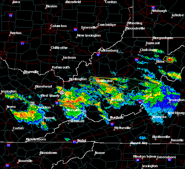 At 416 pm edt, a severe thunderstorm was located over conder, or near williamson, moving east at 25 mph (radar indicated). Hazards include 60 mph wind gusts and quarter size hail. Hail damage to vehicles is expected. expect wind damage to roofs, siding, and trees. locations impacted include, forest hills, belfry, laura, threeforks, hatfield station, mcclure, rural, huddy, canada, aflex, sidney, moree, heisey, whitepost, hardy, conder, turkey creek and heenan. this includes u. s. Highway 119 in pike county between mile markers 14 and 24. At 416 pm edt, a severe thunderstorm was located over conder, or near williamson, moving east at 25 mph (radar indicated). Hazards include 60 mph wind gusts and quarter size hail. Hail damage to vehicles is expected. expect wind damage to roofs, siding, and trees. locations impacted include, forest hills, belfry, laura, threeforks, hatfield station, mcclure, rural, huddy, canada, aflex, sidney, moree, heisey, whitepost, hardy, conder, turkey creek and heenan. this includes u. s. Highway 119 in pike county between mile markers 14 and 24.
|
| 6/21/2016 3:56 PM EDT |
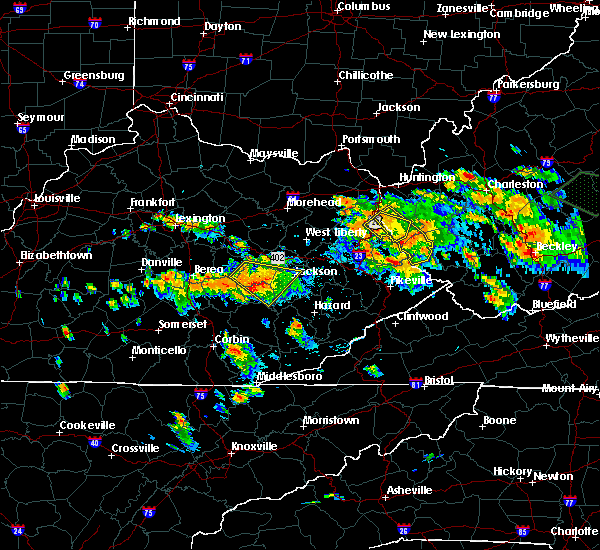 At 356 pm edt, a severe thunderstorm was located over moree, or 10 miles south of inez, moving east at 25 mph (radar indicated). Hazards include 60 mph wind gusts and quarter size hail. Hail damage to vehicles is expected. Expect wind damage to roofs, siding, and trees. At 356 pm edt, a severe thunderstorm was located over moree, or 10 miles south of inez, moving east at 25 mph (radar indicated). Hazards include 60 mph wind gusts and quarter size hail. Hail damage to vehicles is expected. Expect wind damage to roofs, siding, and trees.
|
| 6/21/2016 3:14 PM EDT |
 At 314 pm edt, a severe thunderstorm was located near fort gay, or near louisa, moving southeast at 30 mph (radar indicated). Hazards include 60 mph wind gusts and quarter size hail. Hail damage to vehicles is expected. Expect wind damage to roofs, siding, and trees. At 314 pm edt, a severe thunderstorm was located near fort gay, or near louisa, moving southeast at 30 mph (radar indicated). Hazards include 60 mph wind gusts and quarter size hail. Hail damage to vehicles is expected. Expect wind damage to roofs, siding, and trees.
|
| 6/16/2016 8:05 PM EDT |
 At 804 pm edt, a severe thunderstorm was located over buskirk, or near williamson, moving east at 30 mph (radar indicated). Hazards include 60 mph wind gusts and quarter size hail. Hail damage to vehicles is expected. Expect wind damage to roofs, siding, and trees. At 804 pm edt, a severe thunderstorm was located over buskirk, or near williamson, moving east at 30 mph (radar indicated). Hazards include 60 mph wind gusts and quarter size hail. Hail damage to vehicles is expected. Expect wind damage to roofs, siding, and trees.
|
| 6/4/2016 5:09 PM EDT |
 The severe thunderstorm warning for southeastern martin and north central pike counties will expire at 515 pm edt, the storm which prompted the warning has weakened below severe limits and exited the warned area. therefore the warning will be allowed to expire. however gusty winds are still possible with this thunderstorm. The severe thunderstorm warning for southeastern martin and north central pike counties will expire at 515 pm edt, the storm which prompted the warning has weakened below severe limits and exited the warned area. therefore the warning will be allowed to expire. however gusty winds are still possible with this thunderstorm.
|
| 6/4/2016 5:06 PM EDT |
 At 505 pm edt, a severe thunderstorm was located over whitepost, or near williamson, moving northeast at 25 mph (radar indicated). Hazards include 60 mph wind gusts and penny size hail. Expect damage to roofs. siding. and trees. locations impacted include, forest hills, warfield, laura, varney, piso, threeforks, hatfield station, beauty, rural, lovely, coalpoint, aflex, sidney, pilgrim, meta, heisey, whitepost, oppy, conder and turkey creek. this includes u. s. Highway 119 in pike county between mile markers 10 and 15, and near mile marker 24. At 505 pm edt, a severe thunderstorm was located over whitepost, or near williamson, moving northeast at 25 mph (radar indicated). Hazards include 60 mph wind gusts and penny size hail. Expect damage to roofs. siding. and trees. locations impacted include, forest hills, warfield, laura, varney, piso, threeforks, hatfield station, beauty, rural, lovely, coalpoint, aflex, sidney, pilgrim, meta, heisey, whitepost, oppy, conder and turkey creek. this includes u. s. Highway 119 in pike county between mile markers 10 and 15, and near mile marker 24.
|
| 6/4/2016 4:51 PM EDT |
 At 451 pm edt, a severe thunderstorm was located over heisey, or 8 miles west of williamson, moving northeast at 25 mph (radar indicated). Hazards include 60 mph wind gusts and penny size hail. Expect damage to roofs. siding. And trees. At 451 pm edt, a severe thunderstorm was located over heisey, or 8 miles west of williamson, moving northeast at 25 mph (radar indicated). Hazards include 60 mph wind gusts and penny size hail. Expect damage to roofs. siding. And trees.
|
| 5/2/2016 3:52 PM EDT |
 At 351 pm edt, a severe thunderstorm was located over mcandrews, or 8 miles south of williamson, moving east at 45 mph (radar indicated). Hazards include ping pong ball size hail and 60 mph wind gusts. People and animals outdoors will be injured. expect hail damage to roofs, siding, windows, and vehicles. expect wind damage to roofs, siding, and trees. locations impacted include, forest hills, woodman, jamboree, belfry, mcandrews, coleman, board tree, majestic, phelps, huddy, canada, aflex, argo, sidney, hardy and edgarton. this includes u. s. Highway 119 in pike county between mile markers 13 and 23. At 351 pm edt, a severe thunderstorm was located over mcandrews, or 8 miles south of williamson, moving east at 45 mph (radar indicated). Hazards include ping pong ball size hail and 60 mph wind gusts. People and animals outdoors will be injured. expect hail damage to roofs, siding, windows, and vehicles. expect wind damage to roofs, siding, and trees. locations impacted include, forest hills, woodman, jamboree, belfry, mcandrews, coleman, board tree, majestic, phelps, huddy, canada, aflex, argo, sidney, hardy and edgarton. this includes u. s. Highway 119 in pike county between mile markers 13 and 23.
|
| 5/2/2016 3:38 PM EDT |
 At 337 pm edt, a severe thunderstorm was located over raccoon, or near pikeville, moving east at 45 mph (radar indicated). Hazards include ping pong ball size hail and 60 mph wind gusts. People and animals outdoors will be injured. expect hail damage to roofs, siding, windows, and vehicles. Expect wind damage to roofs, siding, and trees. At 337 pm edt, a severe thunderstorm was located over raccoon, or near pikeville, moving east at 45 mph (radar indicated). Hazards include ping pong ball size hail and 60 mph wind gusts. People and animals outdoors will be injured. expect hail damage to roofs, siding, windows, and vehicles. Expect wind damage to roofs, siding, and trees.
|
| 5/2/2016 2:44 PM EDT | Quarter sized hail reported 6.5 miles S of Williamson, WV, quarter sized hail covering roads near nolan |
| 5/2/2016 2:40 PM EDT | Quarter sized hail reported 6.5 miles SE of Williamson, WV, via social media |
| 5/2/2016 2:37 PM EDT |
 At 237 pm edt, a severe thunderstorm was located over whitepost, or 7 miles northwest of williamson, moving northeast at 45 mph (radar indicated). Hazards include 60 mph wind gusts and half dollar size hail. Hail damage to vehicles is expected. Expect wind damage to roofs, siding, and trees. At 237 pm edt, a severe thunderstorm was located over whitepost, or 7 miles northwest of williamson, moving northeast at 45 mph (radar indicated). Hazards include 60 mph wind gusts and half dollar size hail. Hail damage to vehicles is expected. Expect wind damage to roofs, siding, and trees.
|
| 5/2/2016 2:25 PM EDT |
 At 225 pm edt, a severe thunderstorm was located over moree, or 10 miles south of inez, moving east at 30 mph (radar indicated). Hazards include ping pong ball size hail and 60 mph wind gusts. People and animals outdoors will be injured. expect hail damage to roofs, siding, windows, and vehicles. Expect wind damage to roofs, siding, and trees. At 225 pm edt, a severe thunderstorm was located over moree, or 10 miles south of inez, moving east at 30 mph (radar indicated). Hazards include ping pong ball size hail and 60 mph wind gusts. People and animals outdoors will be injured. expect hail damage to roofs, siding, windows, and vehicles. Expect wind damage to roofs, siding, and trees.
|
| 5/1/2016 7:24 PM EDT |
 The severe thunderstorm warning for northeastern pike county will expire at 730 pm edt, the severe thunderstorm continues and has been reissued farther southeastward. therefore the warning will be allowed to expire. a severe thunderstorm watch remains in effect until 1100 pm edt for northeastern and southeastern kentucky. The severe thunderstorm warning for northeastern pike county will expire at 730 pm edt, the severe thunderstorm continues and has been reissued farther southeastward. therefore the warning will be allowed to expire. a severe thunderstorm watch remains in effect until 1100 pm edt for northeastern and southeastern kentucky.
|
| 5/1/2016 7:05 PM EDT |
 At 704 pm edt, a severe thunderstorm was located over meta, or 9 miles southwest of williamson, moving east at 30 mph (radar indicated). Hazards include 60 mph wind gusts and quarter size hail. Hail damage to vehicles is expected. expect wind damage to roofs, siding, and trees. locations impacted include, forest hills, woodman, jamboree, belfry, mcandrews, varney, piso, board tree, majestic, phelps, raccoon, huddy, canada, sidney, meta, kimper, heisey, hardy, conder and turkey creek. this includes u. s. Highway 119 in pike county between mile markers 5 and 24. At 704 pm edt, a severe thunderstorm was located over meta, or 9 miles southwest of williamson, moving east at 30 mph (radar indicated). Hazards include 60 mph wind gusts and quarter size hail. Hail damage to vehicles is expected. expect wind damage to roofs, siding, and trees. locations impacted include, forest hills, woodman, jamboree, belfry, mcandrews, varney, piso, board tree, majestic, phelps, raccoon, huddy, canada, sidney, meta, kimper, heisey, hardy, conder and turkey creek. this includes u. s. Highway 119 in pike county between mile markers 5 and 24.
|
| 5/1/2016 6:47 PM EDT |
 At 647 pm edt, a severe thunderstorm was located over coal run village, or near pikeville, moving east at 30 mph (radar indicated). Hazards include 60 mph wind gusts and quarter size hail. Hail damage to vehicles is expected. Expect wind damage to roofs, siding, and trees. At 647 pm edt, a severe thunderstorm was located over coal run village, or near pikeville, moving east at 30 mph (radar indicated). Hazards include 60 mph wind gusts and quarter size hail. Hail damage to vehicles is expected. Expect wind damage to roofs, siding, and trees.
|
| 5/1/2016 5:57 PM EDT | Golf Ball sized hail reported 1.7 miles SSW of Williamson, WV, report of cars dented by hail to the north of williamson. |
| 5/1/2016 5:51 PM EDT |
 At 550 pm edt, a severe thunderstorm was located over delbarton, or near williamson, moving east at 30 mph. this storm has produced golf ball size hail 2 miles north of williamson (public). Hazards include 60 mph wind gusts and half dollar size hail. Hail damage to vehicles is expected. expect wind damage to roofs, siding, and trees. Locations impacted include, delbarton, hinch, red jacket, chattaroy, varney, meador, pie and switzer. At 550 pm edt, a severe thunderstorm was located over delbarton, or near williamson, moving east at 30 mph. this storm has produced golf ball size hail 2 miles north of williamson (public). Hazards include 60 mph wind gusts and half dollar size hail. Hail damage to vehicles is expected. expect wind damage to roofs, siding, and trees. Locations impacted include, delbarton, hinch, red jacket, chattaroy, varney, meador, pie and switzer.
|
| 5/1/2016 5:44 PM EDT | Golf Ball sized hail reported 1.7 miles SSW of Williamson, WV, report of cars dented by hail to the north of williamson. |
| 5/1/2016 5:28 PM EDT |
 At 527 pm edt, a severe thunderstorm was located over rural, or near williamson, moving east at 30 mph (radar indicated). Hazards include 60 mph wind gusts and quarter size hail. Hail damage to vehicles is expected. Expect wind damage to roofs, siding, and trees. At 527 pm edt, a severe thunderstorm was located over rural, or near williamson, moving east at 30 mph (radar indicated). Hazards include 60 mph wind gusts and quarter size hail. Hail damage to vehicles is expected. Expect wind damage to roofs, siding, and trees.
|
| 5/1/2016 5:27 PM EDT | The severe thunderstorm warning for southern martin and north central pike counties will expire at 530 pm edt, the severe thunderstorm continues and has been reissued farther southeastward. therefore the warning will be allowed to expire. a severe thunderstorm watch remains in effect until 1100 pm edt for northeastern and southeastern kentucky. |
| 5/1/2016 5:26 PM EDT |
 At 525 pm edt, a severe thunderstorm was located over laura, or 8 miles west of williamson, moving east at 25 mph (radar indicated). Hazards include 60 mph wind gusts and quarter size hail. Hail damage to vehicles is expected. Expect wind damage to roofs, siding, and trees. At 525 pm edt, a severe thunderstorm was located over laura, or 8 miles west of williamson, moving east at 25 mph (radar indicated). Hazards include 60 mph wind gusts and quarter size hail. Hail damage to vehicles is expected. Expect wind damage to roofs, siding, and trees.
|
| 5/1/2016 5:11 PM EDT |
 At 511 pm edt, a severe thunderstorm was located over pleasant, or 9 miles east of prestonsburg, moving east at 20 mph (radar indicated). Hazards include 60 mph wind gusts and quarter size hail. Hail damage to vehicles is expected. expect wind damage to roofs, siding, and trees. Locations impacted include, warfield, laura, bradbury, threeforks, hatfield station, mcclure, prince, beauty, rural, lovely, coalpoint, pilgrim, moree, hode, pleasant, whitepost, oppy, andy and preece. At 511 pm edt, a severe thunderstorm was located over pleasant, or 9 miles east of prestonsburg, moving east at 20 mph (radar indicated). Hazards include 60 mph wind gusts and quarter size hail. Hail damage to vehicles is expected. expect wind damage to roofs, siding, and trees. Locations impacted include, warfield, laura, bradbury, threeforks, hatfield station, mcclure, prince, beauty, rural, lovely, coalpoint, pilgrim, moree, hode, pleasant, whitepost, oppy, andy and preece.
|
| 5/1/2016 4:54 PM EDT |
 At 454 pm edt, a severe thunderstorm was located over dicks creek, or near prestonsburg, moving east at 20 mph (radar indicated). Hazards include 60 mph wind gusts and quarter size hail. Hail damage to vehicles is expected. Expect wind damage to roofs, siding, and trees. At 454 pm edt, a severe thunderstorm was located over dicks creek, or near prestonsburg, moving east at 20 mph (radar indicated). Hazards include 60 mph wind gusts and quarter size hail. Hail damage to vehicles is expected. Expect wind damage to roofs, siding, and trees.
|
| 3/14/2016 4:11 PM EDT |
 At 411 pm edt, severe thunderstorms were located along a line extending from near threeforks to sidney to mcandrews to elkhorn city, moving northeast at 35 mph (radar indicated). Hazards include 60 mph wind gusts and penny size hail. Expect damage to roofs. siding. And trees. At 411 pm edt, severe thunderstorms were located along a line extending from near threeforks to sidney to mcandrews to elkhorn city, moving northeast at 35 mph (radar indicated). Hazards include 60 mph wind gusts and penny size hail. Expect damage to roofs. siding. And trees.
|
| 7/14/2015 7:36 PM EDT |
 At 736 pm edt, severe thunderstorms were located along a line extending from woodman to phyllis to near garden village to near melvin to near noble, moving southeast at 40 mph (radar indicated). Hazards include quarter size hail and 60 mph wind gusts. Hail damage to vehicles is expected. expect wind damage to roofs, siding and trees. locations impacted include, pikeville, whitesburg, hindman, estill, jenkins, coal run village, elkhorn city, wheelwright, fleming-neon, martin, pippa passes, forest hills, wayland, allen, chloe, stoll, ehkhorn mine, evanston, east mcdowell and alphoretta. this includes the following highways, bert t. combs mountain parkway between mile markers 55 and 66. kentucky highway 80 in floyd county between mile markers 1 and 11. kentucky highway 80 in knott county between mile markers 4 and 20. u. s. highway 119 in pike county between mile markers 1 and 24. u. s. highway 23 in floyd county between mile markers 1 and 10. u. s. highway 23 in letcher county between mile markers 1 and 7. u. s. Highway 23 in pike county between mile markers 0 and 32. At 736 pm edt, severe thunderstorms were located along a line extending from woodman to phyllis to near garden village to near melvin to near noble, moving southeast at 40 mph (radar indicated). Hazards include quarter size hail and 60 mph wind gusts. Hail damage to vehicles is expected. expect wind damage to roofs, siding and trees. locations impacted include, pikeville, whitesburg, hindman, estill, jenkins, coal run village, elkhorn city, wheelwright, fleming-neon, martin, pippa passes, forest hills, wayland, allen, chloe, stoll, ehkhorn mine, evanston, east mcdowell and alphoretta. this includes the following highways, bert t. combs mountain parkway between mile markers 55 and 66. kentucky highway 80 in floyd county between mile markers 1 and 11. kentucky highway 80 in knott county between mile markers 4 and 20. u. s. highway 119 in pike county between mile markers 1 and 24. u. s. highway 23 in floyd county between mile markers 1 and 10. u. s. highway 23 in letcher county between mile markers 1 and 7. u. s. Highway 23 in pike county between mile markers 0 and 32.
|
| 7/14/2015 7:15 PM EDT | Several trees down. power ou in mingo county WV, 0.8 miles NW of Williamson, WV |
| 7/14/2015 7:14 PM EDT |
 At 712 pm edt, doppler radar indicated a line of severe thunderstorms capable of producing damaging winds in excess of 60 mph. these storms were located along a line extending from near oak hill to bald knob to odds, moving south at 65 mph. locations impacted include, beckley, williamson, fayetteville, logan, rainelle, babcock state park, oak hill, mount hope, mabscott, oceana, chapmanville, man, delbarton, prosperity, wharton, bald knob, holden, south williamson, aflex and dry creek. At 712 pm edt, doppler radar indicated a line of severe thunderstorms capable of producing damaging winds in excess of 60 mph. these storms were located along a line extending from near oak hill to bald knob to odds, moving south at 65 mph. locations impacted include, beckley, williamson, fayetteville, logan, rainelle, babcock state park, oak hill, mount hope, mabscott, oceana, chapmanville, man, delbarton, prosperity, wharton, bald knob, holden, south williamson, aflex and dry creek.
|
| 7/14/2015 6:59 PM EDT |
 At 659 pm edt, doppler radar indicated a line of severe thunderstorms capable of producing damaging winds in excess of 60 mph. these storms were located along a line extending from babcock state park to 7 miles east of bald knob to davella, and moving south at 35 mph. At 659 pm edt, doppler radar indicated a line of severe thunderstorms capable of producing damaging winds in excess of 60 mph. these storms were located along a line extending from babcock state park to 7 miles east of bald knob to davella, and moving south at 35 mph.
|
| 7/14/2015 6:47 PM EDT |
 At 645 pm edt, severe thunderstorms were located along a line extending from 6 miles northwest of mount gay-shamrock to hode to hammond to kerz to ballot to kernie to murphyfork, moving southeast at 55 mph (radar indicated). Hazards include half dollar size hail and 70 mph wind gusts. Hail damage to vehicles is expected. expect considerable tree damage. Wind damage is also likely to mobile homes, roofs and outbuildings. At 645 pm edt, severe thunderstorms were located along a line extending from 6 miles northwest of mount gay-shamrock to hode to hammond to kerz to ballot to kernie to murphyfork, moving southeast at 55 mph (radar indicated). Hazards include half dollar size hail and 70 mph wind gusts. Hail damage to vehicles is expected. expect considerable tree damage. Wind damage is also likely to mobile homes, roofs and outbuildings.
|
| 7/14/2015 6:35 PM EDT |
 At 634 pm edt, doppler radar indicated a line of severe thunderstorms capable of producing damaging winds in excess of 60 mph. these storms were located along a line extending from near gauley bridge to near madison to blaine, and moving southeast at 30 mph. At 634 pm edt, doppler radar indicated a line of severe thunderstorms capable of producing damaging winds in excess of 60 mph. these storms were located along a line extending from near gauley bridge to near madison to blaine, and moving southeast at 30 mph.
|
| 7/13/2015 4:54 PM EDT |
 At 453 pm edt, severe thunderstorms were located along a line extending from near logan to near majestic to betsy layne, moving east at 55 mph (radar indicated). Hazards include 60 mph wind gusts. Expect damage to roofs. siding and trees. locations impacted include, pikeville, prestonsburg, coal run village, martin, forest hills, allen, chloe, corn fork hollow, threeforks, fishtrap lake, raccoon, harold, alphoretta, shelbiana, dotson, garden village, osborn, dicks creek, blue river and whitepost. this includes the following highways, kentucky highway 80 in floyd county between mile markers 7 and 14. u. s. highway 119 in pike county between mile markers 1 and 24. u. s. highway 23 in floyd county between mile markers 1 and 18. u. s. Highway 23 in pike county between mile markers 16 and 32. At 453 pm edt, severe thunderstorms were located along a line extending from near logan to near majestic to betsy layne, moving east at 55 mph (radar indicated). Hazards include 60 mph wind gusts. Expect damage to roofs. siding and trees. locations impacted include, pikeville, prestonsburg, coal run village, martin, forest hills, allen, chloe, corn fork hollow, threeforks, fishtrap lake, raccoon, harold, alphoretta, shelbiana, dotson, garden village, osborn, dicks creek, blue river and whitepost. this includes the following highways, kentucky highway 80 in floyd county between mile markers 7 and 14. u. s. highway 119 in pike county between mile markers 1 and 24. u. s. highway 23 in floyd county between mile markers 1 and 18. u. s. Highway 23 in pike county between mile markers 16 and 32.
|
| 7/13/2015 4:49 PM EDT |
 At 448 pm edt, severe thunderstorms were located along a line extending from near logan to buskirk to dana, moving east at 55 mph (radar indicated). Hazards include 60 mph wind gusts. Expect damage to roofs. siding and trees. locations impacted include, pikeville, prestonsburg, inez, coal run village, martin, forest hills, warfield, allen, chloe, corn fork hollow, bradbury, threeforks, fishtrap lake, alphoretta, garden village, dicks creek, blue river, whitepost, davisport and laura. this includes the following highways, kentucky highway 3 in floyd county between mile markers 1 and 4. kentucky highway 3 in martin county between mile markers 1 and 9. kentucky highway 80 in floyd county between mile markers 7 and 14. u. s. highway 119 in pike county between mile markers 1 and 24. u. s. highway 23 in floyd county between mile markers 1 and 20. u. s. Highway 23 in pike county between mile markers 16 and 32. At 448 pm edt, severe thunderstorms were located along a line extending from near logan to buskirk to dana, moving east at 55 mph (radar indicated). Hazards include 60 mph wind gusts. Expect damage to roofs. siding and trees. locations impacted include, pikeville, prestonsburg, inez, coal run village, martin, forest hills, warfield, allen, chloe, corn fork hollow, bradbury, threeforks, fishtrap lake, alphoretta, garden village, dicks creek, blue river, whitepost, davisport and laura. this includes the following highways, kentucky highway 3 in floyd county between mile markers 1 and 4. kentucky highway 3 in martin county between mile markers 1 and 9. kentucky highway 80 in floyd county between mile markers 7 and 14. u. s. highway 119 in pike county between mile markers 1 and 24. u. s. highway 23 in floyd county between mile markers 1 and 20. u. s. Highway 23 in pike county between mile markers 16 and 32.
|
| 7/13/2015 4:48 PM EDT |
 At 447 pm edt, doppler radar indicated a line of severe thunderstorms capable of producing damaging winds in excess of 60 mph. these storms were located along a line extending from near madison to red jacket, moving southeast at 40 mph. locations impacted include, williamson, madison, logan, chapmanville, man, delbarton, wharton, holden, south williamson, aflex, mallory, mount gay-shamrock, chief logan state, red jacket, chattaroy, hinch, van, buskirk, amherstdale-robinette and gilbert creek. At 447 pm edt, doppler radar indicated a line of severe thunderstorms capable of producing damaging winds in excess of 60 mph. these storms were located along a line extending from near madison to red jacket, moving southeast at 40 mph. locations impacted include, williamson, madison, logan, chapmanville, man, delbarton, wharton, holden, south williamson, aflex, mallory, mount gay-shamrock, chief logan state, red jacket, chattaroy, hinch, van, buskirk, amherstdale-robinette and gilbert creek.
|
| 7/13/2015 4:28 PM EDT |
 At 428 pm edt, severe thunderstorms were located along a line extending from 9 miles southwest of harts to threeforks to duco, moving east at 60 mph (radar indicated). Hazards include 60 mph wind gusts. Expect damage to roofs. siding and trees. locations impacted include, pikeville, paintsville, prestonsburg, salyersville, inez, mason, coal run village, martin, forest hills, warfield, allen, chloe, corn fork hollow, bradbury, threeforks, fishtrap lake, alphoretta, garden village, dicks creek and blue river. this includes the following highways, bert t. combs mountain parkway near mile marker 75. kentucky highway 3 in floyd county between mile markers 1 and 4. kentucky highway 3 in johnson county kentucky highway 3 in martin county between mile markers 1 and 9. kentucky highway 80 in floyd county between mile markers 7 and 14. u. s. highway 119 in pike county between mile markers 1 and 24. u. s. highway 23 in floyd county between mile markers 1 and 21. u. s. highway 23 in johnson county between mile markers 0 and 4. u. s. Highway 23 in pike county between mile markers 16 and 32. At 428 pm edt, severe thunderstorms were located along a line extending from 9 miles southwest of harts to threeforks to duco, moving east at 60 mph (radar indicated). Hazards include 60 mph wind gusts. Expect damage to roofs. siding and trees. locations impacted include, pikeville, paintsville, prestonsburg, salyersville, inez, mason, coal run village, martin, forest hills, warfield, allen, chloe, corn fork hollow, bradbury, threeforks, fishtrap lake, alphoretta, garden village, dicks creek and blue river. this includes the following highways, bert t. combs mountain parkway near mile marker 75. kentucky highway 3 in floyd county between mile markers 1 and 4. kentucky highway 3 in johnson county kentucky highway 3 in martin county between mile markers 1 and 9. kentucky highway 80 in floyd county between mile markers 7 and 14. u. s. highway 119 in pike county between mile markers 1 and 24. u. s. highway 23 in floyd county between mile markers 1 and 21. u. s. highway 23 in johnson county between mile markers 0 and 4. u. s. Highway 23 in pike county between mile markers 16 and 32.
|
| 7/13/2015 4:22 PM EDT |
 At 421 pm edt, doppler radar indicated a severe thunderstorm capable of producing damaging winds in excess of 60 mph. this storm was located over kiahsville, or 12 miles southeast of wayne, and moving southeast at 40 mph. At 421 pm edt, doppler radar indicated a severe thunderstorm capable of producing damaging winds in excess of 60 mph. this storm was located over kiahsville, or 12 miles southeast of wayne, and moving southeast at 40 mph.
|
| 7/13/2015 4:15 PM EDT |
 At 414 pm edt, severe thunderstorms were located along a line extending from near dunlow to bays, moving east at 55 mph (radar indicated). Hazards include 60 mph wind gusts. Expect damage to roofs. Siding and trees. At 414 pm edt, severe thunderstorms were located along a line extending from near dunlow to bays, moving east at 55 mph (radar indicated). Hazards include 60 mph wind gusts. Expect damage to roofs. Siding and trees.
|
| 7/9/2015 4:28 PM EDT | Trees down on 3rd avenue in mingo county WV, 0.8 miles NW of Williamson, WV |
| 7/9/2015 4:26 PM EDT |
 At 425 pm edt, severe thunderstorms were located along a line extending from inez to fishtrap lake, moving east at 50 mph (radar indicated). Hazards include 60 mph wind gusts. Expect damage to roofs. siding and trees. locations impacted include, inez, forest hills, warfield, chloe, bradbury, threeforks, davella, fishtrap lake, raccoon, shelbiana, garden village, whitepost, davisport, laura, debord, pevier, hatfield station, mcclure, coleman and rural. this includes the following highways, kentucky highway 3 in martin county between mile markers 3 and 9. u. s. Highway 119 in pike county between mile markers 4 and 24. At 425 pm edt, severe thunderstorms were located along a line extending from inez to fishtrap lake, moving east at 50 mph (radar indicated). Hazards include 60 mph wind gusts. Expect damage to roofs. siding and trees. locations impacted include, inez, forest hills, warfield, chloe, bradbury, threeforks, davella, fishtrap lake, raccoon, shelbiana, garden village, whitepost, davisport, laura, debord, pevier, hatfield station, mcclure, coleman and rural. this includes the following highways, kentucky highway 3 in martin county between mile markers 3 and 9. u. s. Highway 119 in pike county between mile markers 4 and 24.
|
| 7/9/2015 4:22 PM EDT | At 422 pm edt, doppler radar indicated a line of severe thunderstorms capable of producing damaging winds in excess of 60 mph. these storms were located along a line extending from wells to kimper, and moving east at 50 mph. |
| 7/9/2015 4:22 PM EDT |
 At 422 pm edt, doppler radar indicated a line of severe thunderstorms capable of producing damaging winds in excess of 60 mph. these storms were located along a line extending from wells to kimper, and moving east at 50 mph. At 422 pm edt, doppler radar indicated a line of severe thunderstorms capable of producing damaging winds in excess of 60 mph. these storms were located along a line extending from wells to kimper, and moving east at 50 mph.
|
| 7/9/2015 4:17 PM EDT |
 At 416 pm edt, severe thunderstorms were located along a line extending from tomahawk to near meta, moving east at 55 mph (radar indicated). Hazards include 60 mph wind gusts. Expect damage to roofs. siding and trees. locations impacted include, pikeville, inez, coal run village, forest hills, warfield, chloe, bradbury, threeforks, davella, fishtrap lake, raccoon, shelbiana, garden village, whitepost, davisport, laura, debord, pevier, hatfield station and mcclure. this includes the following highways, kentucky highway 3 in martin county between mile markers 1 and 9. u. s. highway 119 in pike county between mile markers 1 and 24. u. s. Highway 23 in pike county between mile markers 9 and 32. At 416 pm edt, severe thunderstorms were located along a line extending from tomahawk to near meta, moving east at 55 mph (radar indicated). Hazards include 60 mph wind gusts. Expect damage to roofs. siding and trees. locations impacted include, pikeville, inez, coal run village, forest hills, warfield, chloe, bradbury, threeforks, davella, fishtrap lake, raccoon, shelbiana, garden village, whitepost, davisport, laura, debord, pevier, hatfield station and mcclure. this includes the following highways, kentucky highway 3 in martin county between mile markers 1 and 9. u. s. highway 119 in pike county between mile markers 1 and 24. u. s. Highway 23 in pike county between mile markers 9 and 32.
|
| 7/9/2015 3:57 PM EDT |
 At 356 pm edt, severe thunderstorms were located along a line extending from flatgap to the city of martin, moving east at 50 mph (radar indicated). Hazards include 60 mph wind gusts. Expect damage to roofs. Siding and trees. At 356 pm edt, severe thunderstorms were located along a line extending from flatgap to the city of martin, moving east at 50 mph (radar indicated). Hazards include 60 mph wind gusts. Expect damage to roofs. Siding and trees.
|
| 7/9/2015 2:07 PM EDT |
 At 206 pm edt, doppler radar indicated a severe thunderstorm capable of producing damaging winds in excess of 60 mph. this storm was located near logan, moving east at 40 mph. locations impacted include, williamson, logan, chapmanville, man, delbarton, r.d. bailey lake, wharton, bald knob, holden, south williamson, mallory, mount gay-shamrock, gilbert creek, chief logan state, red jacket, chattaroy, hanover, hinch, van and amherstdale-robinette. At 206 pm edt, doppler radar indicated a severe thunderstorm capable of producing damaging winds in excess of 60 mph. this storm was located near logan, moving east at 40 mph. locations impacted include, williamson, logan, chapmanville, man, delbarton, r.d. bailey lake, wharton, bald knob, holden, south williamson, mallory, mount gay-shamrock, gilbert creek, chief logan state, red jacket, chattaroy, hanover, hinch, van and amherstdale-robinette.
|
| 7/9/2015 1:47 PM EDT |
 At 146 pm edt, doppler radar indicated a severe thunderstorm capable of producing damaging winds in excess of 60 mph. this storm was located near mount gay-shamrock, or 9 miles west of logan, and moving east at 40 mph. At 146 pm edt, doppler radar indicated a severe thunderstorm capable of producing damaging winds in excess of 60 mph. this storm was located near mount gay-shamrock, or 9 miles west of logan, and moving east at 40 mph.
|
| 6/30/2015 7:49 PM EDT |
 At 749 pm edt, a severe thunderstorm was located over laura, or 10 miles west of williamson, moving east at 25 mph (radar indicated). Hazards include 60 mph wind gusts and penny size hail. Expect damage to roofs. siding and trees. Locations impacted include, laura, heenan, threeforks, hatfield station, mcclure, rural, coalpoint, pilgrim, moree, heisey, oppy, whitepost, conder, jarad and turkey creek. At 749 pm edt, a severe thunderstorm was located over laura, or 10 miles west of williamson, moving east at 25 mph (radar indicated). Hazards include 60 mph wind gusts and penny size hail. Expect damage to roofs. siding and trees. Locations impacted include, laura, heenan, threeforks, hatfield station, mcclure, rural, coalpoint, pilgrim, moree, heisey, oppy, whitepost, conder, jarad and turkey creek.
|
| 6/30/2015 7:34 PM EDT |
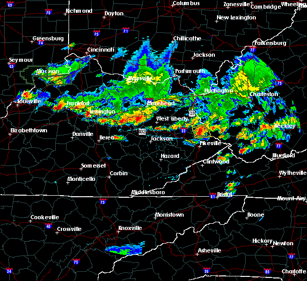 At 734 pm edt, a severe thunderstorm was located over mcclure, or 8 miles south of inez, moving east at 25 mph (radar indicated). Hazards include quarter size hail and 60 mph wind gusts. Hail damage to vehicles is expected. expect wind damage to roofs, siding and trees. locations impacted include, warfield, heenan, bradbury, threeforks, prince, davella, whitepost, conder, jarad, davisport, turkey creek, laura, debord, pevier, hatfield station, mcclure, beauty, rural, lovely and coalpoint. This includes kentucky highway 3 in martin county between mile markers 3 and 8. At 734 pm edt, a severe thunderstorm was located over mcclure, or 8 miles south of inez, moving east at 25 mph (radar indicated). Hazards include quarter size hail and 60 mph wind gusts. Hail damage to vehicles is expected. expect wind damage to roofs, siding and trees. locations impacted include, warfield, heenan, bradbury, threeforks, prince, davella, whitepost, conder, jarad, davisport, turkey creek, laura, debord, pevier, hatfield station, mcclure, beauty, rural, lovely and coalpoint. This includes kentucky highway 3 in martin county between mile markers 3 and 8.
|
| 6/30/2015 7:24 PM EDT |
 At 724 pm edt, a severe thunderstorm was located over pleasant, or 9 miles south of inez, moving east at 30 mph (radar indicated). Hazards include quarter size hail and 60 mph wind gusts. Hail damage to vehicles is expected. Expect wind damage to roofs, siding and trees. At 724 pm edt, a severe thunderstorm was located over pleasant, or 9 miles south of inez, moving east at 30 mph (radar indicated). Hazards include quarter size hail and 60 mph wind gusts. Hail damage to vehicles is expected. Expect wind damage to roofs, siding and trees.
|
| 6/25/2015 7:57 PM EDT |
 At 755 pm edt, trained weather spotters reported a severe thunderstorm producing half dollar size hail 4 miles northeast of crum in wayne county. this storm is also capable of producing damaging winds in excess of 60 mph. this storm was located 7 miles east of hode, or 13 miles east of inez, and moving southeast at 35 mph. At 755 pm edt, trained weather spotters reported a severe thunderstorm producing half dollar size hail 4 miles northeast of crum in wayne county. this storm is also capable of producing damaging winds in excess of 60 mph. this storm was located 7 miles east of hode, or 13 miles east of inez, and moving southeast at 35 mph.
|
| 6/21/2015 3:31 PM EDT |
 At 331 pm edt, doppler radar indicated a severe thunderstorm capable of producing half dollar size hail and damaging winds in excess of 60 mph. this storm was located near buskirk, or near williamson, and moving southeast at 15 mph. At 331 pm edt, doppler radar indicated a severe thunderstorm capable of producing half dollar size hail and damaging winds in excess of 60 mph. this storm was located near buskirk, or near williamson, and moving southeast at 15 mph.
|
| 6/8/2015 2:29 PM EDT |
 At 227 pm edt, a severe thunderstorm was located over laura, or 9 miles northwest of williamson, moving east at 40 mph (radar indicated). Hazards include 60 mph wind gusts and penny size hail. Expect damage to roofs. siding and trees. locations impacted include, prestonsburg, inez, martin, forest hills, warfield, allen, corn fork hollow, bradbury, threeforks, davella, alphoretta, dicks creek, whitepost, davisport, laura, debord, langley, pevier, hatfield station and mcclure. this includes the following highways, kentucky highway 3 in johnson county kentucky highway 3 in martin county between mile markers 1 and 9. kentucky highway 80 in floyd county between mile markers 4 and 14. u. s. highway 119 in pike county between mile markers 10 and 17, and between mile markers 20 and 24. u. s. Highway 23 in floyd county between mile markers 2 and 14. At 227 pm edt, a severe thunderstorm was located over laura, or 9 miles northwest of williamson, moving east at 40 mph (radar indicated). Hazards include 60 mph wind gusts and penny size hail. Expect damage to roofs. siding and trees. locations impacted include, prestonsburg, inez, martin, forest hills, warfield, allen, corn fork hollow, bradbury, threeforks, davella, alphoretta, dicks creek, whitepost, davisport, laura, debord, langley, pevier, hatfield station and mcclure. this includes the following highways, kentucky highway 3 in johnson county kentucky highway 3 in martin county between mile markers 1 and 9. kentucky highway 80 in floyd county between mile markers 4 and 14. u. s. highway 119 in pike county between mile markers 10 and 17, and between mile markers 20 and 24. u. s. Highway 23 in floyd county between mile markers 2 and 14.
|
| 6/8/2015 1:55 PM EDT |
 At 154 pm edt, a severe thunderstorm was located over david, or 8 miles west of prestonsburg, moving east at 60 mph (radar indicated). Hazards include 60 mph wind gusts and penny size hail. Expect damage to roofs. Siding and trees. At 154 pm edt, a severe thunderstorm was located over david, or 8 miles west of prestonsburg, moving east at 60 mph (radar indicated). Hazards include 60 mph wind gusts and penny size hail. Expect damage to roofs. Siding and trees.
|
| 6/1/2015 4:43 PM EDT | At 443 pm edt, doppler radar indicated a severe thunderstorm capable of producing half dollar size hail and damaging winds in excess of 60 mph. this storm was located near red jacket, or 8 miles east of williamson, moving northeast at 20 mph. locations impacted include, williamson, delbarton, hinch, south williamson, buskirk, red jacket, chattaroy, holden, matewan, varney, meador and pie. |
| 6/1/2015 4:30 PM EDT | Quarter sized hail reported 5.5 miles NW of Williamson, WV |
| 6/1/2015 4:23 PM EDT | At 422 pm edt, a severe thunderstorm capable of producing a tornado was located over hardy, or near williamson, moving northeast at 25 mph (radar indicated rotation). Hazards include tornado and quarter size hail. Flying debris will be dangerous to those caught without shelter. mobile homes will be damaged or destroyed. damage to roofs, windows and vehicles will occur. tree damage is likely. locations impacted include, forest hills, belfry, mcandrews, hardy and huddy. this includes u. s. Highway 119 in pike county between mile markers 19 and 24. |
| 6/1/2015 4:20 PM EDT | At 419 pm edt, doppler radar indicated a severe thunderstorm capable of producing half dollar size hail and damaging winds in excess of 60 mph. this storm was located over forest hills, or over williamson, and moving northeast at 20 mph. |
| 6/1/2015 4:07 PM EDT | At 407 pm edt, a severe thunderstorm capable of producing a tornado was located over canada, or 7 miles southwest of williamson, moving northeast at 20 mph (radar indicated rotation). Hazards include tornado. Flying debris will be dangerous to those caught without shelter. mobile homes will be damaged or destroyed. damage to roofs, windows and vehicles will occur. Tree damage is likely. |
| 4/8/2015 4:05 PM EDT | The national weather service in charleston has issued a * severe thunderstorm warning for. northeastern buchanan county in virginia. southeastern logan county in west virginia. mcdowell county in west virginia. This includes the city of welch. |
| 4/8/2015 4:05 PM EDT | The national weather service in charleston has issued a * severe thunderstorm warning for. northeastern buchanan county in virginia. southeastern logan county in west virginia. mcdowell county in west virginia. This includes the city of welch. |
| 4/8/2015 3:52 PM EDT | A severe thunderstorm warning remains in effect until 415 pm edt for logan and northwestern mingo counties. at 341 pm edt. national weather service doppler radar continued to indicate a severe thunderstorm capable of producing quarter size hail. and damaging winds in excess of 60 mph. this storm was located near lenore and williamson. Moving east at 45 mph. |
| 4/8/2015 3:39 PM EDT | The national weather service in jackson ky has issued a * severe thunderstorm warning for. northeastern pike county in southeastern kentucky. until 430 pm edt * at 338 pm edt. a severe thunderstorm was located over coalpoint. or 9 miles southeast of inez. Moving southeast at 35 mph. |
| 4/8/2015 3:18 PM EDT | The national weather service in charleston has issued a * severe thunderstorm warning for. logan county in west virginia. this includes the city of logan. northern mingo county in west virginia. This includes the city of williamson. |
| 7/1/2012 10:02 PM EDT | Trees down blocking traffic on hardy mountai in pike county KY, 4.5 miles NNW of Williamson, WV |
| 7/1/2012 10:02 PM EDT | Trees down blocking traffic on ky route 29 in pike county KY, 2.5 miles NW of Williamson, WV |
| 3/2/2012 8:25 PM EST | Kermit had damage. a roof from martin co landed on us-5 in mingo county WV, 0.8 miles NW of Williamson, WV |
| 1/1/0001 12:00 AM | Trees down at several locations along route 49 in mingo county in mingo county WV, 0.8 miles NW of Williamson, WV |
| 1/1/0001 12:00 AM | Tree blown down into the road on ky highway 29 in pike county KY, 1.8 miles ESE of Williamson, WV |
| 1/1/0001 12:00 AM | Quarter sized hail reported 1.9 miles WSW of Williamson, WV |
| 1/1/0001 12:00 AM | Quarter sized hail reported 1.9 miles WSW of Williamson, WV |
Hail Maps for Williamson, WV
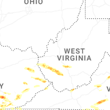
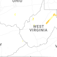
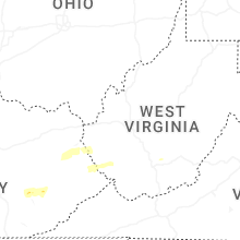
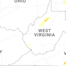


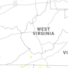


Connect with Interactive Hail Maps