

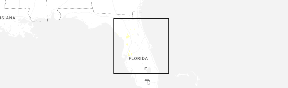
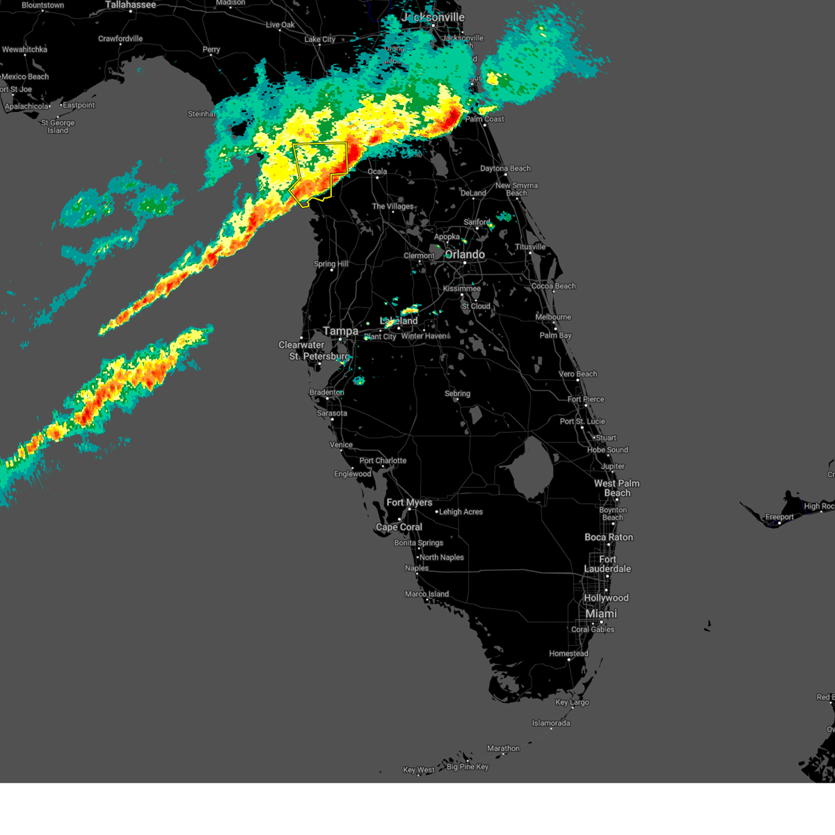
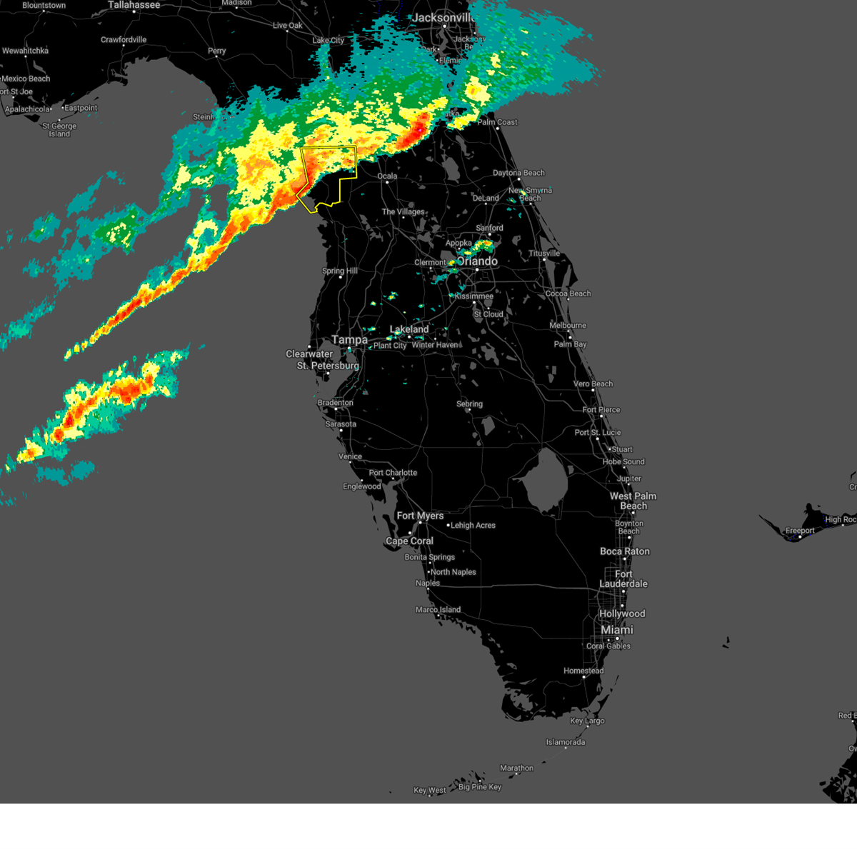
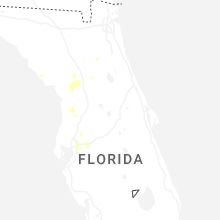
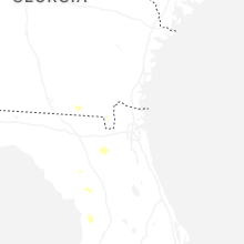
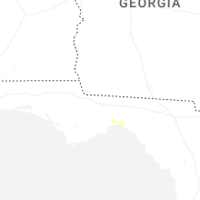
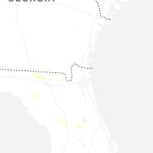
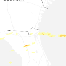
Hail Map for Williston, FL
The Williston, FL area has had 3 reports of on-the-ground hail by trained spotters, and has been under severe weather warnings 2 times during the past 12 months. Doppler radar has detected hail at or near Williston, FL on 56 occasions, including 6 occasions during the past year.
| Name: | Williston, FL |
| Where Located: | 81.2 miles SW of Jacksonville, FL |
| Map: | Google Map for Williston, FL |
| Population: | 2768 |
| Housing Units: | 1148 |
| More Info: | Search Google for Williston, FL |
0
The Top Recent Hail Date for Williston, FL is Friday, June 20, 2025 (17th out of 56)
Hail and Wind Damage Spotted near Williston, FL
| Date / Time | Report Details |
|---|---|
| 1/19/2025 7:13 AM EST |
 The storms which prompted the warning have moved out of the area. therefore, the warning will be allowed to expire. however, gusty winds are still possible with these thunderstorms. The storms which prompted the warning have moved out of the area. therefore, the warning will be allowed to expire. however, gusty winds are still possible with these thunderstorms.
|
| 1/19/2025 6:50 AM EST |
 Svrtbw the national weather service in ruskin has issued a * severe thunderstorm warning for, southeastern levy county in northern florida, * until 715 am est. * at 650 am est, severe thunderstorms were located along a line extending from 9 miles southeast of chiefland to 16 miles southwest of williston highlands to 22 miles northwest of crystal river airport, moving east at 55 mph (radar indicated). Hazards include 60 mph wind gusts. expect damage to roofs, siding, and trees Svrtbw the national weather service in ruskin has issued a * severe thunderstorm warning for, southeastern levy county in northern florida, * until 715 am est. * at 650 am est, severe thunderstorms were located along a line extending from 9 miles southeast of chiefland to 16 miles southwest of williston highlands to 22 miles northwest of crystal river airport, moving east at 55 mph (radar indicated). Hazards include 60 mph wind gusts. expect damage to roofs, siding, and trees
|
| 5/17/2024 9:08 AM EDT |
 The storm which prompted the warning has weakened below severe limits, and no longer poses an immediate threat to life or property. therefore, the warning will be allowed to expire. however, gusty winds are still possible with this thunderstorm. The storm which prompted the warning has weakened below severe limits, and no longer poses an immediate threat to life or property. therefore, the warning will be allowed to expire. however, gusty winds are still possible with this thunderstorm.
|
| 5/17/2024 8:09 AM EDT |
 Svrtbw the national weather service in ruskin has issued a * severe thunderstorm warning for, northwestern citrus county in west central florida, levy county in northern florida, * until 915 am edt. * at 809 am edt, a severe thunderstorm was located 15 miles south of fowlers bluff, or 25 miles southwest of chiefland, moving northeast at 25 mph (radar indicated). Hazards include 70 mph wind gusts. Expect considerable tree damage. Damage is likely to mobile homes, roofs, and outbuildings. Svrtbw the national weather service in ruskin has issued a * severe thunderstorm warning for, northwestern citrus county in west central florida, levy county in northern florida, * until 915 am edt. * at 809 am edt, a severe thunderstorm was located 15 miles south of fowlers bluff, or 25 miles southwest of chiefland, moving northeast at 25 mph (radar indicated). Hazards include 70 mph wind gusts. Expect considerable tree damage. Damage is likely to mobile homes, roofs, and outbuildings.
|
| 5/10/2024 8:23 AM EDT |
 Svrtbw the national weather service in ruskin has issued a * severe thunderstorm warning for, northern levy county in northern florida, * until 900 am edt. * at 823 am edt, severe thunderstorms were located along a line extending from near belmont to fort white to near cross city, moving east at 40 mph (radar indicated). Hazards include 60 mph wind gusts. expect damage to roofs, siding, and trees Svrtbw the national weather service in ruskin has issued a * severe thunderstorm warning for, northern levy county in northern florida, * until 900 am edt. * at 823 am edt, severe thunderstorms were located along a line extending from near belmont to fort white to near cross city, moving east at 40 mph (radar indicated). Hazards include 60 mph wind gusts. expect damage to roofs, siding, and trees
|
| 4/11/2024 9:53 AM EDT |
 Svrtbw the national weather service in ruskin has issued a * severe thunderstorm warning for, levy county in northern florida, * until 1015 am edt. * at 951 am edt, severe thunderstorms were located along a line extending from fowlers bluff to 10 miles south of chiefland to 18 miles southwest of williston highlands, moving northeast at 30 mph (radar indicated). Hazards include 60 mph wind gusts. expect damage to roofs, siding, and trees Svrtbw the national weather service in ruskin has issued a * severe thunderstorm warning for, levy county in northern florida, * until 1015 am edt. * at 951 am edt, severe thunderstorms were located along a line extending from fowlers bluff to 10 miles south of chiefland to 18 miles southwest of williston highlands, moving northeast at 30 mph (radar indicated). Hazards include 60 mph wind gusts. expect damage to roofs, siding, and trees
|
| 1/9/2024 2:23 PM EST |
 At 222 pm est, a severe thunderstorm was located 19 miles south of fowlers bluff, or 26 miles south of chiefland, moving northeast at 4.0 mph (radar indicated). Hazards include 60 mph wind gusts. expect damage to roofs, siding, and trees At 222 pm est, a severe thunderstorm was located 19 miles south of fowlers bluff, or 26 miles south of chiefland, moving northeast at 4.0 mph (radar indicated). Hazards include 60 mph wind gusts. expect damage to roofs, siding, and trees
|
| 10/12/2023 1:34 AM EDT |
 At 133 am edt, a severe thunderstorm was located 8 miles southwest of bronson, moving northeast at 35 mph (radar indicated). Hazards include 60 mph wind gusts. Expect damage to roofs, siding, and trees. Locations impacted include, williston, bronson, otter creek, williston highlands, east bronson, and williston municipal airport. At 133 am edt, a severe thunderstorm was located 8 miles southwest of bronson, moving northeast at 35 mph (radar indicated). Hazards include 60 mph wind gusts. Expect damage to roofs, siding, and trees. Locations impacted include, williston, bronson, otter creek, williston highlands, east bronson, and williston municipal airport.
|
| 10/12/2023 1:01 AM EDT |
 At 101 am edt, a severe thunderstorm was located 16 miles south of fowlers bluff, or 22 miles south of chiefland, moving northeast at 45 mph (radar indicated). Hazards include 60 mph wind gusts. expect damage to roofs, siding, and trees At 101 am edt, a severe thunderstorm was located 16 miles south of fowlers bluff, or 22 miles south of chiefland, moving northeast at 45 mph (radar indicated). Hazards include 60 mph wind gusts. expect damage to roofs, siding, and trees
|
| 4/26/2023 7:50 PM EDT | Golf Ball sized hail reported 7.2 miles SSE of Williston, FL, levy county emergency management submitted picture of approximately golf ball sized hail from along hwy 41 near the border of levy and alachua counties. |
| 4/26/2023 7:38 PM EDT |
 At 738 pm edt, a severe thunderstorm was located near archer, or 8 miles north of williston, moving southeast at 10 mph (radar indicated). Hazards include quarter size hail. damage to vehicles is expected At 738 pm edt, a severe thunderstorm was located near archer, or 8 miles north of williston, moving southeast at 10 mph (radar indicated). Hazards include quarter size hail. damage to vehicles is expected
|
| 9/8/2022 8:38 AM EDT |
 The tornado warning for northeastern levy county will expire at 845 am edt, the storm which prompted the warning has moved out of the area. therefore, the warning will be allowed to expire. however gusty winds are still possible with this thunderstorm. The tornado warning for northeastern levy county will expire at 845 am edt, the storm which prompted the warning has moved out of the area. therefore, the warning will be allowed to expire. however gusty winds are still possible with this thunderstorm.
|
| 9/8/2022 8:26 AM EDT |
 At 826 am edt, a severe thunderstorm capable of producing a tornado was located over williston highlands, or near williston, moving northeast at 15 mph (radar indicated rotation). Hazards include tornado. Flying debris will be dangerous to those caught without shelter. mobile homes will be damaged or destroyed. damage to roofs, windows, and vehicles will occur. tree damage is likely. this dangerous storm will be near, williston municipal airport around 835 am edt. Williston around 845 am edt. At 826 am edt, a severe thunderstorm capable of producing a tornado was located over williston highlands, or near williston, moving northeast at 15 mph (radar indicated rotation). Hazards include tornado. Flying debris will be dangerous to those caught without shelter. mobile homes will be damaged or destroyed. damage to roofs, windows, and vehicles will occur. tree damage is likely. this dangerous storm will be near, williston municipal airport around 835 am edt. Williston around 845 am edt.
|
| 9/8/2022 8:15 AM EDT |
 At 814 am edt, a severe thunderstorm capable of producing a tornado was located near williston highlands, or 7 miles southwest of williston, moving northeast at 15 mph (radar indicated rotation). Hazards include tornado. Flying debris will be dangerous to those caught without shelter. mobile homes will be damaged or destroyed. damage to roofs, windows, and vehicles will occur. tree damage is likely. this dangerous storm will be near, williston highlands around 830 am edt. williston municipal airport around 835 am edt. Williston around 845 am edt. At 814 am edt, a severe thunderstorm capable of producing a tornado was located near williston highlands, or 7 miles southwest of williston, moving northeast at 15 mph (radar indicated rotation). Hazards include tornado. Flying debris will be dangerous to those caught without shelter. mobile homes will be damaged or destroyed. damage to roofs, windows, and vehicles will occur. tree damage is likely. this dangerous storm will be near, williston highlands around 830 am edt. williston municipal airport around 835 am edt. Williston around 845 am edt.
|
| 6/24/2022 2:55 PM EDT |
 The severe thunderstorm warning for east central levy county will expire at 300 pm edt, the storm which prompted the warning has weakened below severe limits, and no longer poses an immediate threat to life or property. therefore, the warning will be allowed to expire. however small hail and gusty winds are still possible with this thunderstorm. The severe thunderstorm warning for east central levy county will expire at 300 pm edt, the storm which prompted the warning has weakened below severe limits, and no longer poses an immediate threat to life or property. therefore, the warning will be allowed to expire. however small hail and gusty winds are still possible with this thunderstorm.
|
| 6/24/2022 2:47 PM EDT |
 At 247 pm edt, a severe thunderstorm was located over williston municipal airport, or near williston, moving southeast at 10 mph (radar indicated). Hazards include 60 mph wind gusts and quarter size hail. Hail damage to vehicles is expected. expect wind damage to roofs, siding, and trees. locations impacted include, williston, williston highlands and williston municipal airport. hail threat, radar indicated max hail size, 1. 00 in wind threat, radar indicated max wind gust, 60 mph. At 247 pm edt, a severe thunderstorm was located over williston municipal airport, or near williston, moving southeast at 10 mph (radar indicated). Hazards include 60 mph wind gusts and quarter size hail. Hail damage to vehicles is expected. expect wind damage to roofs, siding, and trees. locations impacted include, williston, williston highlands and williston municipal airport. hail threat, radar indicated max hail size, 1. 00 in wind threat, radar indicated max wind gust, 60 mph.
|
| 6/24/2022 2:46 PM EDT | Emergency manager reports multiple trees down blocking hwy 121 s of williston. time estimated from rada in levy county FL, 2.9 miles ENE of Williston, FL |
| 6/24/2022 2:31 PM EDT |
 At 231 pm edt, a severe thunderstorm was located over williston municipal airport, or near williston, moving southeast at 10 mph (radar indicated). Hazards include 60 mph wind gusts and quarter size hail. Hail damage to vehicles is expected. Expect wind damage to roofs, siding, and trees. At 231 pm edt, a severe thunderstorm was located over williston municipal airport, or near williston, moving southeast at 10 mph (radar indicated). Hazards include 60 mph wind gusts and quarter size hail. Hail damage to vehicles is expected. Expect wind damage to roofs, siding, and trees.
|
| 6/13/2021 1:53 PM EDT | A tree down blocking cr 335 near ne 160th av in levy county FL, 5.8 miles SE of Williston, FL |
| 4/18/2021 9:11 AM EDT |
 The severe thunderstorm warning for northeastern levy county will expire at 915 am edt, the storm which prompted the warning has weakened below severe limits, and has exited the warned area. therefore, the warning will be allowed to expire. The severe thunderstorm warning for northeastern levy county will expire at 915 am edt, the storm which prompted the warning has weakened below severe limits, and has exited the warned area. therefore, the warning will be allowed to expire.
|
| 4/18/2021 8:51 AM EDT |
 At 851 am edt, a severe thunderstorm was located near bronson, moving east at 45 mph (radar indicated). Hazards include 60 mph wind gusts and penny size hail. expect damage to roofs, siding, and trees At 851 am edt, a severe thunderstorm was located near bronson, moving east at 45 mph (radar indicated). Hazards include 60 mph wind gusts and penny size hail. expect damage to roofs, siding, and trees
|
| 2/6/2021 6:41 PM EST |
 At 641 pm est, a severe thunderstorm was located 11 miles southwest of williston highlands, or 14 miles west of rainbow lakes estates, moving east at 50 mph (radar indicated). Hazards include 60 mph wind gusts and penny size hail. expect damage to roofs, siding, and trees At 641 pm est, a severe thunderstorm was located 11 miles southwest of williston highlands, or 14 miles west of rainbow lakes estates, moving east at 50 mph (radar indicated). Hazards include 60 mph wind gusts and penny size hail. expect damage to roofs, siding, and trees
|
| 4/20/2020 8:43 AM EDT |
 At 842 am edt, severe thunderstorms were located along a line extending from 11 miles south of chiefland to 18 miles west of rainbow lakes estates, moving east at 40 mph (radar indicated). Hazards include 60 mph wind gusts and nickel size hail. expect damage to roofs, siding, and trees At 842 am edt, severe thunderstorms were located along a line extending from 11 miles south of chiefland to 18 miles west of rainbow lakes estates, moving east at 40 mph (radar indicated). Hazards include 60 mph wind gusts and nickel size hail. expect damage to roofs, siding, and trees
|
| 4/20/2020 8:00 AM EDT |
 At 800 am edt, severe thunderstorms were located along a line extending from 8 miles southwest of horseshoe point to 22 miles southwest of fowlers bluff, moving east at 40 mph (radar indicated). Hazards include 60 mph wind gusts and nickel size hail. expect damage to roofs, siding, and trees At 800 am edt, severe thunderstorms were located along a line extending from 8 miles southwest of horseshoe point to 22 miles southwest of fowlers bluff, moving east at 40 mph (radar indicated). Hazards include 60 mph wind gusts and nickel size hail. expect damage to roofs, siding, and trees
|
| 2/6/2020 10:02 PM EST |
 At 1002 pm est, severe thunderstorms were located along a line extending from near williston to 8 miles southwest of homosassa to 36 miles southwest of harbor bluffs, moving east at 30 mph (radar indicated). Hazards include 60 mph wind gusts. expect damage to roofs, siding, and trees At 1002 pm est, severe thunderstorms were located along a line extending from near williston to 8 miles southwest of homosassa to 36 miles southwest of harbor bluffs, moving east at 30 mph (radar indicated). Hazards include 60 mph wind gusts. expect damage to roofs, siding, and trees
|
| 2/6/2020 10:00 PM EST | Mesonet station 0566w williston (weatherstem in levy county FL, 0.7 miles NNW of Williston, FL |
| 2/6/2020 9:28 PM EST |
 At 928 pm est, severe thunderstorms were located along a line extending from 8 miles northwest of archer to 37 miles west of harbor bluffs, moving east at 35 mph (radar indicated). Hazards include 60 mph wind gusts. expect damage to roofs, siding, and trees At 928 pm est, severe thunderstorms were located along a line extending from 8 miles northwest of archer to 37 miles west of harbor bluffs, moving east at 35 mph (radar indicated). Hazards include 60 mph wind gusts. expect damage to roofs, siding, and trees
|
| 4/19/2019 12:05 PM EDT | Tree blocking the road near williston in levy county FL, 0.7 miles SSW of Williston, FL |
| 4/19/2019 11:58 AM EDT |
 The severe thunderstorm warning for levy county will expire at noon edt. the storm which prompted the warning has moved out of the area. therefore, the warning will be allowed to expire. A tornado watch remains in effect until 400 pm edt for northern florida. The severe thunderstorm warning for levy county will expire at noon edt. the storm which prompted the warning has moved out of the area. therefore, the warning will be allowed to expire. A tornado watch remains in effect until 400 pm edt for northern florida.
|
| 4/19/2019 11:40 AM EDT | Fire department reports tree partially blocking highway 41 just north of willisto in levy county FL, 2.8 miles S of Williston, FL |
| 4/19/2019 11:40 AM EDT | Fire department reports powerlines and poles down on ne 140 ave in willisto in levy county FL, 5.4 miles ENE of Williston, FL |
| 4/19/2019 11:22 AM EDT |
 At 1122 am edt, a severe thunderstorm was located 16 miles southwest of williston highlands, or 18 miles southwest of bronson, moving northeast at 60 mph (radar indicated). Hazards include 60 mph wind gusts. expect damage to roofs, siding, and trees At 1122 am edt, a severe thunderstorm was located 16 miles southwest of williston highlands, or 18 miles southwest of bronson, moving northeast at 60 mph (radar indicated). Hazards include 60 mph wind gusts. expect damage to roofs, siding, and trees
|
| 6/3/2018 6:20 PM EDT | Quarter sized hail reported 6.4 miles WSW of Williston, FL, trained spotter reports 10 to 15 minutes of nickel and quarter size hail. |
| 5/24/2017 12:23 PM EDT | Law enforcement reported numerous trees down across levy county. time estimated by rada in levy county FL, 7.3 miles ENE of Williston, FL |
| 5/24/2017 12:08 PM EDT |
 At 1207 pm edt, severe thunderstorms were located along a line extending from 5 miles southwest of alachua to 20 miles northwest of crystal river airport, moving northeast at 45 mph (radar indicated). Hazards include 60 mph wind gusts. Expect damage to roofs, siding, and trees. Locations impacted include, williston, bronson, williston highlands, east bronson, williston municipal airport, inglis, otter creek and lebanon. At 1207 pm edt, severe thunderstorms were located along a line extending from 5 miles southwest of alachua to 20 miles northwest of crystal river airport, moving northeast at 45 mph (radar indicated). Hazards include 60 mph wind gusts. Expect damage to roofs, siding, and trees. Locations impacted include, williston, bronson, williston highlands, east bronson, williston municipal airport, inglis, otter creek and lebanon.
|
| 5/24/2017 11:51 AM EDT |
 At 1150 am edt, severe thunderstorms were located along a line extending from near trenton to 20 miles west of homosassa, moving northeast at 35 mph (radar indicated). Hazards include 60 mph wind gusts. expect damage to roofs, siding, and trees At 1150 am edt, severe thunderstorms were located along a line extending from near trenton to 20 miles west of homosassa, moving northeast at 35 mph (radar indicated). Hazards include 60 mph wind gusts. expect damage to roofs, siding, and trees
|
| 2/7/2017 10:17 PM EST |
 At 1017 pm est, severe thunderstorms were located along a line extending from 6 miles northeast of williston to 12 miles northwest of black diamond to 15 miles west of weeki wachee gardens, moving east at 45 mph (radar indicated). Hazards include 60 mph wind gusts and penny size hail. Expect damage to roofs, siding, and trees. Locations impacted include, williston, beverly hills, homosassa springs, williston highlands, crystal river airport, williston municipal airport, black diamond, homosassa, east bronson, inglis, citronelle, crystal manor, crystal oaks, citrus springs, lebanon, pine ridge and lecanto. At 1017 pm est, severe thunderstorms were located along a line extending from 6 miles northeast of williston to 12 miles northwest of black diamond to 15 miles west of weeki wachee gardens, moving east at 45 mph (radar indicated). Hazards include 60 mph wind gusts and penny size hail. Expect damage to roofs, siding, and trees. Locations impacted include, williston, beverly hills, homosassa springs, williston highlands, crystal river airport, williston municipal airport, black diamond, homosassa, east bronson, inglis, citronelle, crystal manor, crystal oaks, citrus springs, lebanon, pine ridge and lecanto.
|
| 2/7/2017 10:03 PM EST |
 At 1002 pm est, severe thunderstorms were located along a line extending from near east bronson to 19 miles northwest of crystal river airport to 30 miles west of weeki wachee gardens, moving east at 35 mph (radar indicated). Hazards include 60 mph wind gusts and penny size hail. Expect damage to roofs, siding, and trees. Locations impacted include, williston, bronson, beverly hills, homosassa springs, williston highlands, east bronson, crystal river airport, williston municipal airport, black diamond, homosassa, inglis, otter creek, citronelle, crystal manor, crystal oaks, citrus springs, lebanon, pine ridge and lecanto. At 1002 pm est, severe thunderstorms were located along a line extending from near east bronson to 19 miles northwest of crystal river airport to 30 miles west of weeki wachee gardens, moving east at 35 mph (radar indicated). Hazards include 60 mph wind gusts and penny size hail. Expect damage to roofs, siding, and trees. Locations impacted include, williston, bronson, beverly hills, homosassa springs, williston highlands, east bronson, crystal river airport, williston municipal airport, black diamond, homosassa, inglis, otter creek, citronelle, crystal manor, crystal oaks, citrus springs, lebanon, pine ridge and lecanto.
|
| 2/7/2017 9:40 PM EST |
 At 939 pm est, severe thunderstorms were located along a line extending from near trenton to 21 miles south of fowlers bluff to 38 miles west of homosassa, moving east at 45 mph (radar indicated). Hazards include 60 mph wind gusts and penny size hail. expect damage to roofs, siding, and trees At 939 pm est, severe thunderstorms were located along a line extending from near trenton to 21 miles south of fowlers bluff to 38 miles west of homosassa, moving east at 45 mph (radar indicated). Hazards include 60 mph wind gusts and penny size hail. expect damage to roofs, siding, and trees
|
| 2/7/2017 9:08 PM EST |
 At 907 pm est, severe thunderstorms were located along a line extending from near horseshoe point to 28 miles southwest of fowlers bluff to 62 miles south of steinhatchee, moving east at 60 mph (radar indicated). Hazards include 60 mph wind gusts and penny size hail. expect damage to roofs, siding, and trees At 907 pm est, severe thunderstorms were located along a line extending from near horseshoe point to 28 miles southwest of fowlers bluff to 62 miles south of steinhatchee, moving east at 60 mph (radar indicated). Hazards include 60 mph wind gusts and penny size hail. expect damage to roofs, siding, and trees
|
| 1/22/2017 6:06 PM EST |
 At 606 pm est, severe thunderstorms were located along a line extending from 5 miles southeast of trenton to 10 miles southwest of williston highlands, moving east at 60 mph (radar indicated). Hazards include 60 mph wind gusts. expect damage to roofs, siding, and trees At 606 pm est, severe thunderstorms were located along a line extending from 5 miles southeast of trenton to 10 miles southwest of williston highlands, moving east at 60 mph (radar indicated). Hazards include 60 mph wind gusts. expect damage to roofs, siding, and trees
|
| 1/22/2017 5:23 PM EST |
 At 522 pm est, a severe thunderstorm was located 20 miles south of fowlers bluff, or 30 miles southwest of chiefland, moving northeast at 60 mph (radar indicated). Hazards include 60 mph wind gusts. expect damage to roofs, siding, and trees At 522 pm est, a severe thunderstorm was located 20 miles south of fowlers bluff, or 30 miles southwest of chiefland, moving northeast at 60 mph (radar indicated). Hazards include 60 mph wind gusts. expect damage to roofs, siding, and trees
|
| 1/15/2016 8:38 AM EST |
 At 838 am est, severe thunderstorms were located along a line extending from 6 miles south of bronson to 12 miles west of rainbow lakes estates to 25 miles west of weeki wachee gardens, moving east at 55 mph (radar indicated). Hazards include 60 mph wind gusts. Expect damage to roofs. siding and trees. Locations impacted include, inverness, williston, bronson, homosassa springs, beverly hills, inverness highlands north, crystal river airport, black diamond, east bronson, homosassa, williston highlands, inverness highlands south, inverness airport, williston municipal airport, hernando, sugarmill woods, inglis, green acres, brent wood and lebanon. At 838 am est, severe thunderstorms were located along a line extending from 6 miles south of bronson to 12 miles west of rainbow lakes estates to 25 miles west of weeki wachee gardens, moving east at 55 mph (radar indicated). Hazards include 60 mph wind gusts. Expect damage to roofs. siding and trees. Locations impacted include, inverness, williston, bronson, homosassa springs, beverly hills, inverness highlands north, crystal river airport, black diamond, east bronson, homosassa, williston highlands, inverness highlands south, inverness airport, williston municipal airport, hernando, sugarmill woods, inglis, green acres, brent wood and lebanon.
|
| 1/15/2016 7:47 AM EST |
 At 746 am est, severe thunderstorms were located along a line extending from 12 miles south of horseshoe point to 32 miles southwest of fowlers bluff to 63 miles west of beacon square, moving east at 60 mph (radar indicated). Hazards include 60 mph wind gusts and penny size hail. Expect damage to roofs. Siding and trees. At 746 am est, severe thunderstorms were located along a line extending from 12 miles south of horseshoe point to 32 miles southwest of fowlers bluff to 63 miles west of beacon square, moving east at 60 mph (radar indicated). Hazards include 60 mph wind gusts and penny size hail. Expect damage to roofs. Siding and trees.
|
| 6/21/2014 2:15 PM EDT | Fire department reported via social media of several trees down on county road 320. time estimated by rada in levy county FL, 1.1 miles SW of Williston, FL |
| 2/23/2014 2:10 PM EST | Quarter sized hail reported 5.8 miles NE of Williston, FL, trained spotter reported quarter sized hail 5 miles southwest of williston. |
| 1/1/0001 12:00 AM | Canopy on gas station blown ove in levy county FL, 0.8 miles NNE of Williston, FL |
| 1/1/0001 12:00 AM | Fire department reported 15-20 large oak and pine trees down at us 41 and cr 33 in levy county FL, 2.1 miles SSE of Williston, FL |
Hail Maps for Williston, FL


Connect with Interactive Hail Maps