

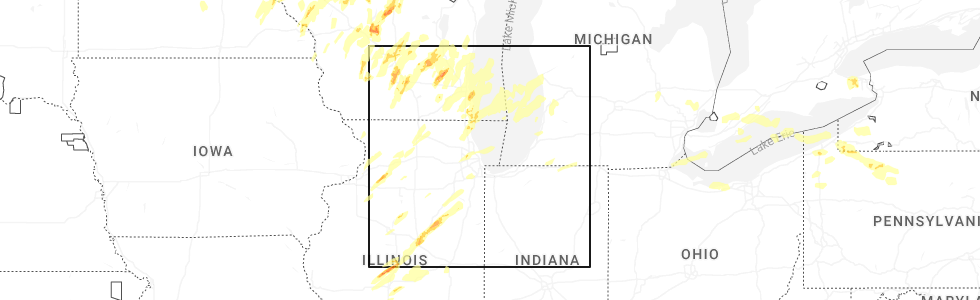
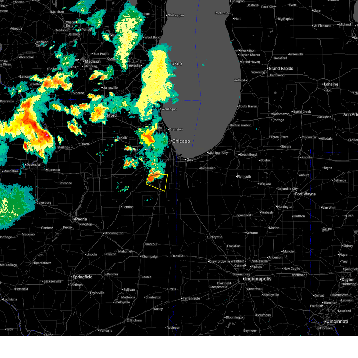
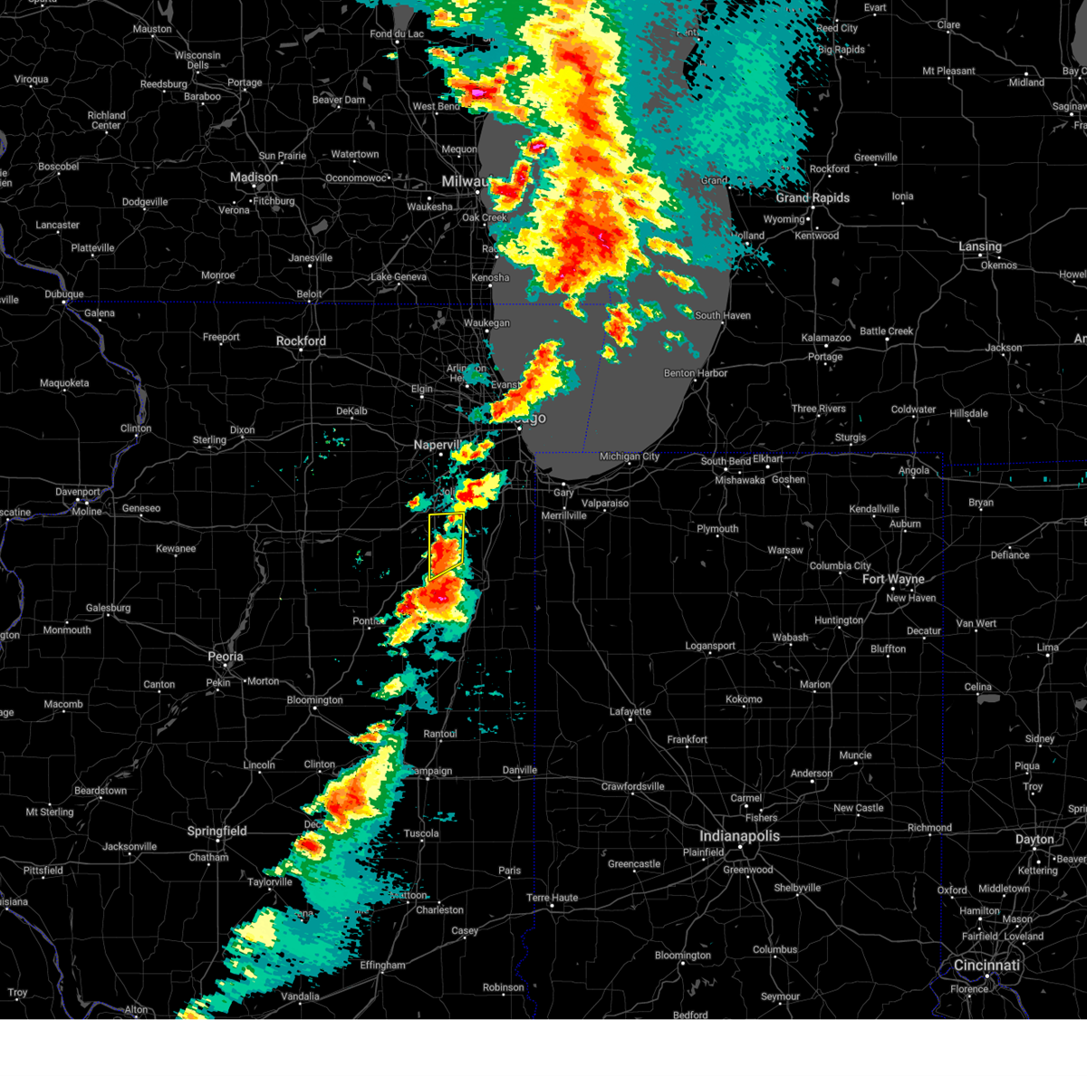
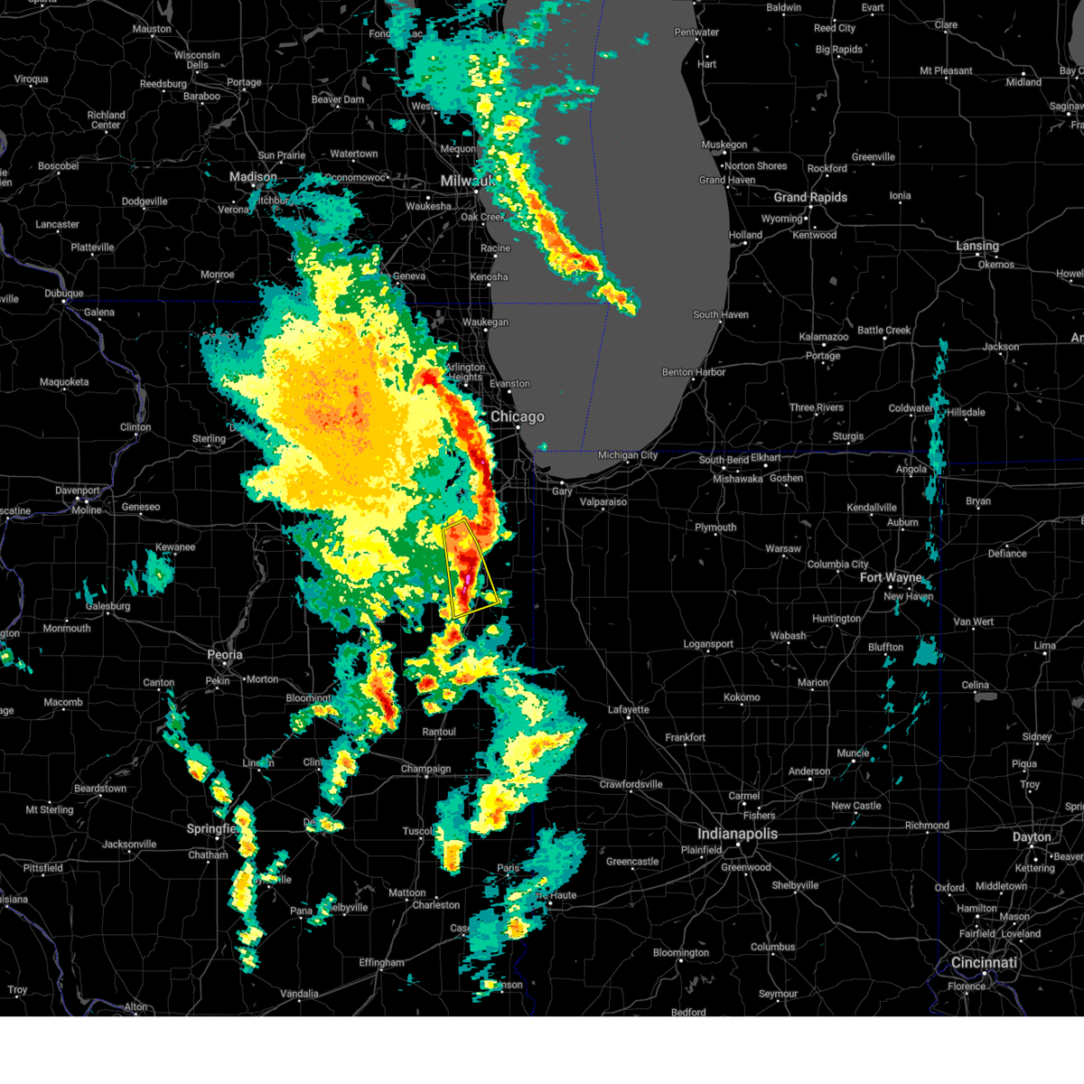
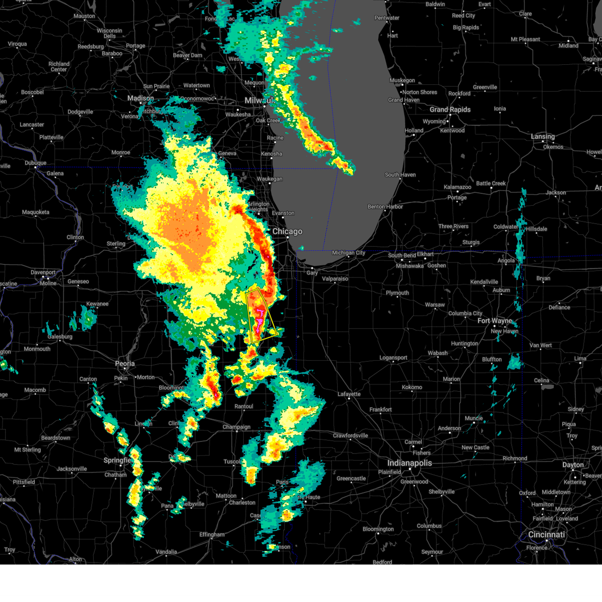
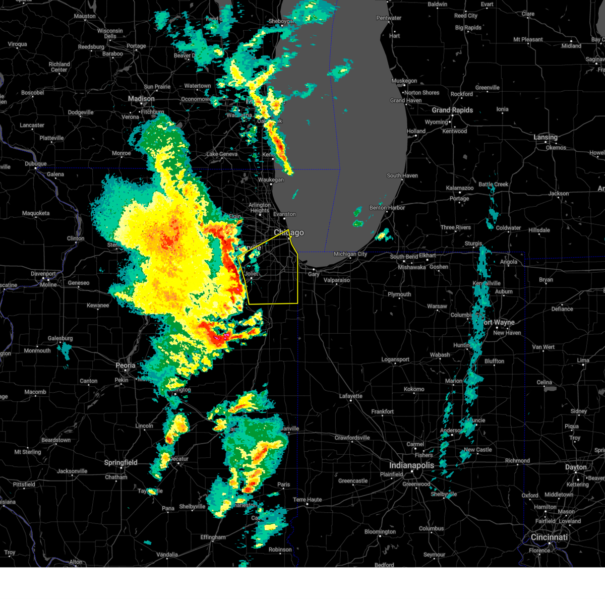
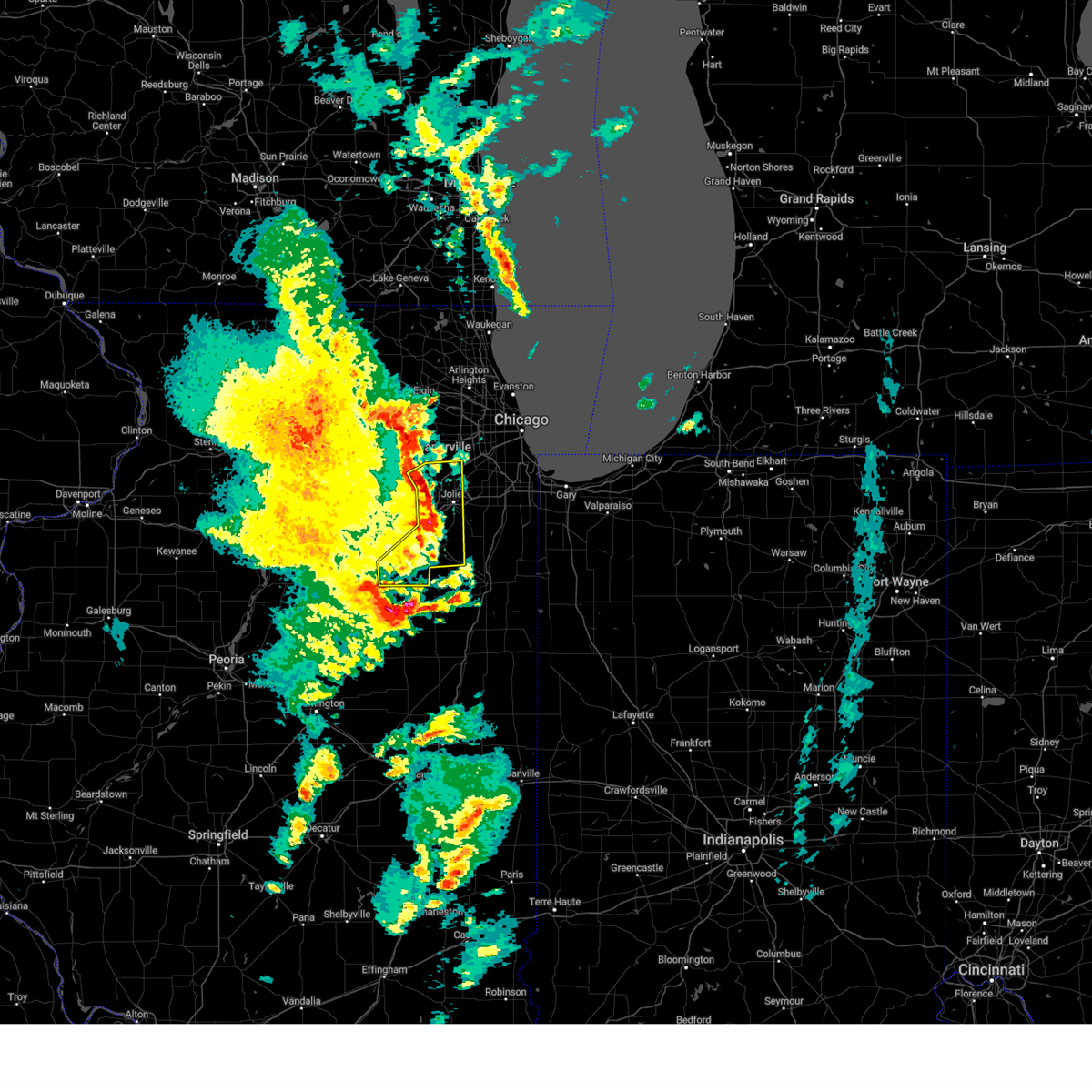
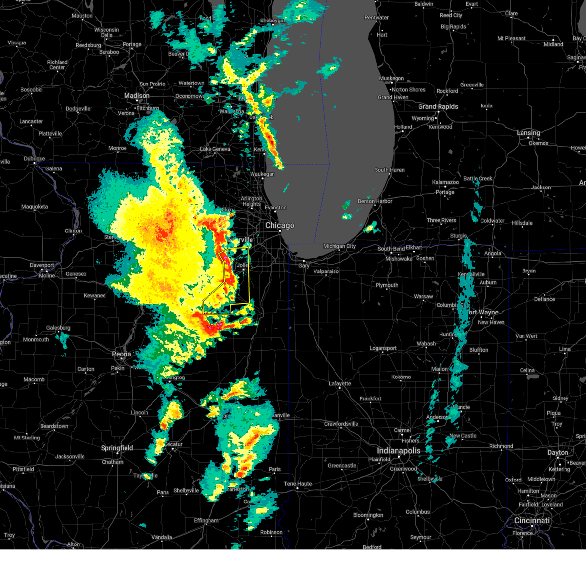
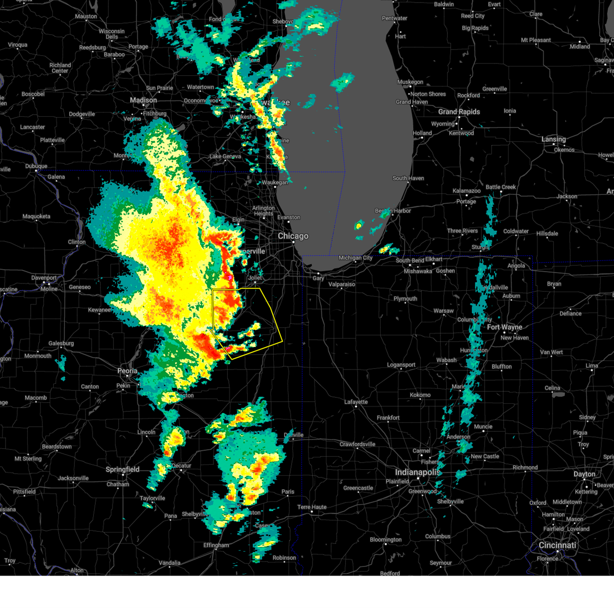
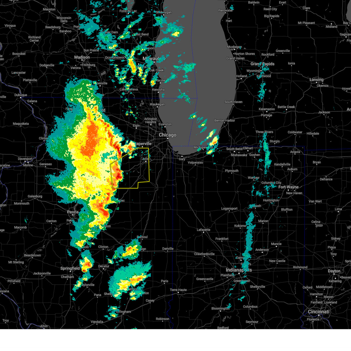
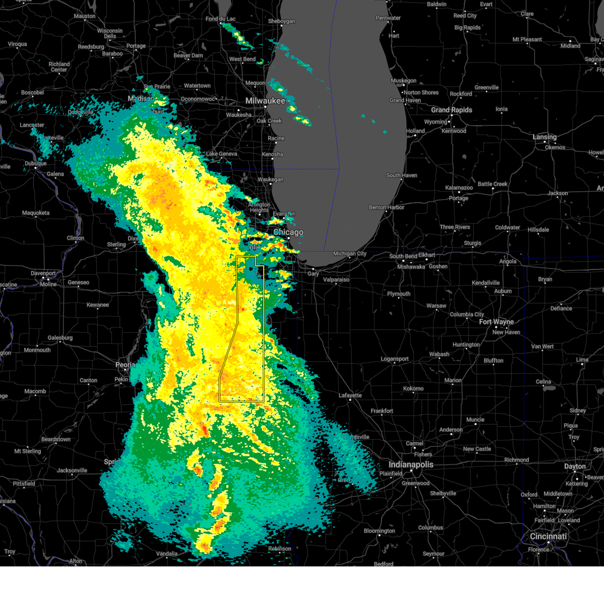
Hail Map for Wilmington, IL
The Wilmington, IL area has had 3 reports of on-the-ground hail by trained spotters, and has been under severe weather warnings 57 times during the past 12 months. Doppler radar has detected hail at or near Wilmington, IL on 136 occasions, including 3 occasions during the past year.
| Name: | Wilmington, IL |
| Where Located: | 47.7 miles SW of Chicago, IL |
| Map: | Google Map for Wilmington, IL |
| Population: | 5724 |
| Housing Units: | 2426 |
| More Info: | Search Google for Wilmington, IL |
2
The Top Recent Hail Date for Wilmington, IL is Thursday, May 15, 2025 (11th out of 136)
Hail and Wind Damage Spotted near Wilmington, IL
| Date / Time | Report Details |
|---|---|
| 7/11/2025 10:35 PM CDT |
 At 1035 pm cdt, severe thunderstorms were located along a line from 10 miles northwest of white hall to over laddonia, or along a line from 10 miles northwest of white hall to 7 miles southwest of vandalia, moving south at 25 mph (law enforcement reported tree damage in hannibal, mo and highway 79 in eastern ralls county). Hazards include 60 mph wind gusts. Expect damage to roofs, siding, and trees. this severe thunderstorm will be near, atlas, spencerburg, pittsfield, perry, frankford, griggsville and center around 1015 pm cdt. louisiana and pike around 1020 pm cdt. other locations impacted by the severe thunderstorm include detroit, summer hill, rockport, new hartford, valley city, ashburn, el dara, time, martinsburg and independence. This includes interstate 72 between exits 10 and 35. At 1035 pm cdt, severe thunderstorms were located along a line from 10 miles northwest of white hall to over laddonia, or along a line from 10 miles northwest of white hall to 7 miles southwest of vandalia, moving south at 25 mph (law enforcement reported tree damage in hannibal, mo and highway 79 in eastern ralls county). Hazards include 60 mph wind gusts. Expect damage to roofs, siding, and trees. this severe thunderstorm will be near, atlas, spencerburg, pittsfield, perry, frankford, griggsville and center around 1015 pm cdt. louisiana and pike around 1020 pm cdt. other locations impacted by the severe thunderstorm include detroit, summer hill, rockport, new hartford, valley city, ashburn, el dara, time, martinsburg and independence. This includes interstate 72 between exits 10 and 35.
|
| 7/11/2025 10:15 PM CDT |
 Svrlsx the national weather service in st louis has issued a * severe thunderstorm warning for, northwestern calhoun county in southwestern illinois, northern greene county in southwestern illinois, pike county in west central illinois, eastern audrain county in central missouri, pike county in northeastern missouri, ralls county in northeastern missouri, * until 1100 pm cdt. * at 1015 pm cdt, severe thunderstorms were located along a line from 9 miles southeast of griggsville to near perry, or along a line from 12 miles east of pittsfield to 9 miles east of santa fe, moving south at 20 mph (law enforcement reported tree damage was reported in hannibal, mo and highway 79 in eastern ralls county). Hazards include 60 mph wind gusts. Expect damage to roofs, siding, and trees. this severe thunderstorm will be near, atlas, spencerburg, pittsfield, louisiana, perry, frankford, griggsville and center around 1015 pm cdt. pike around 1020 pm cdt. other locations impacted by the severe thunderstorm include detroit, summer hill, rockport, new hartford, valley city, ashburn, el dara, independence, milton and martinsburg. This includes interstate 72 between exits 10 and 35. Svrlsx the national weather service in st louis has issued a * severe thunderstorm warning for, northwestern calhoun county in southwestern illinois, northern greene county in southwestern illinois, pike county in west central illinois, eastern audrain county in central missouri, pike county in northeastern missouri, ralls county in northeastern missouri, * until 1100 pm cdt. * at 1015 pm cdt, severe thunderstorms were located along a line from 9 miles southeast of griggsville to near perry, or along a line from 12 miles east of pittsfield to 9 miles east of santa fe, moving south at 20 mph (law enforcement reported tree damage was reported in hannibal, mo and highway 79 in eastern ralls county). Hazards include 60 mph wind gusts. Expect damage to roofs, siding, and trees. this severe thunderstorm will be near, atlas, spencerburg, pittsfield, louisiana, perry, frankford, griggsville and center around 1015 pm cdt. pike around 1020 pm cdt. other locations impacted by the severe thunderstorm include detroit, summer hill, rockport, new hartford, valley city, ashburn, el dara, independence, milton and martinsburg. This includes interstate 72 between exits 10 and 35.
|
| 7/10/2025 7:21 PM CDT |
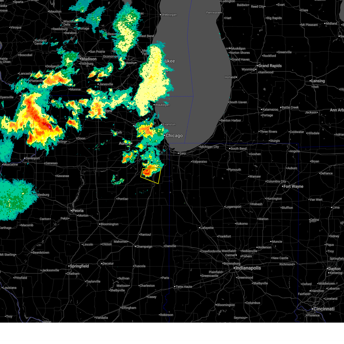 At 720 pm cdt, a severe thunderstorm was located 7 miles west of manteno, moving east at 20 mph (radar indicated). Hazards include 60 mph wind gusts and quarter size hail. Hail damage to vehicles is expected. expect wind damage to roofs, siding, and trees. Locations impacted include, peotone, bourbonnais, manteno, wilton center, symerton, and bradley. At 720 pm cdt, a severe thunderstorm was located 7 miles west of manteno, moving east at 20 mph (radar indicated). Hazards include 60 mph wind gusts and quarter size hail. Hail damage to vehicles is expected. expect wind damage to roofs, siding, and trees. Locations impacted include, peotone, bourbonnais, manteno, wilton center, symerton, and bradley.
|
| 7/10/2025 7:14 PM CDT |
 Svrlot the national weather service in chicago has issued a * severe thunderstorm warning for, southwestern will county in northeastern illinois, north central kankakee county in northeastern illinois, * until 815 pm cdt. * at 714 pm cdt, a severe thunderstorm was located near lakewood shores, or 7 miles east of wilmington, moving east at 20 mph (radar indicated). Hazards include 60 mph wind gusts and quarter size hail. Hail damage to vehicles is expected. Expect wind damage to roofs, siding, and trees. Svrlot the national weather service in chicago has issued a * severe thunderstorm warning for, southwestern will county in northeastern illinois, north central kankakee county in northeastern illinois, * until 815 pm cdt. * at 714 pm cdt, a severe thunderstorm was located near lakewood shores, or 7 miles east of wilmington, moving east at 20 mph (radar indicated). Hazards include 60 mph wind gusts and quarter size hail. Hail damage to vehicles is expected. Expect wind damage to roofs, siding, and trees.
|
| 5/16/2025 2:26 PM CDT |
 Svrlsx the national weather service in st louis has issued a * severe thunderstorm warning for, north central calhoun county in southwestern illinois, greene county in southwestern illinois, jersey county in southwestern illinois, western macoupin county in southwestern illinois, southeastern pike county in west central illinois, * until 315 pm cdt. * at 226 pm cdt, a severe thunderstorm was located near hardin, or 7 miles northeast of elsberry, moving northeast at 60 mph (radar indicated). Hazards include 60 mph wind gusts and half dollar size hail. Hail damage to vehicles is expected. Expect wind damage to roofs, siding, and trees. Svrlsx the national weather service in st louis has issued a * severe thunderstorm warning for, north central calhoun county in southwestern illinois, greene county in southwestern illinois, jersey county in southwestern illinois, western macoupin county in southwestern illinois, southeastern pike county in west central illinois, * until 315 pm cdt. * at 226 pm cdt, a severe thunderstorm was located near hardin, or 7 miles northeast of elsberry, moving northeast at 60 mph (radar indicated). Hazards include 60 mph wind gusts and half dollar size hail. Hail damage to vehicles is expected. Expect wind damage to roofs, siding, and trees.
|
| 5/15/2025 8:23 PM CDT | Raws weather station at midewin tallgrass prairie reported 59 mph gus in will county IL, 178.5 miles SW of Wilmington, IL |
| 5/15/2025 8:05 PM CDT |
 the severe thunderstorm warning has been cancelled and is no longer in effect the severe thunderstorm warning has been cancelled and is no longer in effect
|
| 5/15/2025 8:05 PM CDT |
 At 804 pm cdt, a severe thunderstorm was located near limestone, or near bourbonnais, moving northeast at 60 mph (radar indicated). Hazards include two inch hail and 70 mph wind gusts. People and animals outdoors will be injured. expect hail damage to roofs, siding, windows, and vehicles. expect considerable tree damage. wind damage is also likely to mobile homes, roofs, and outbuildings. Locations impacted include, crete, bradley, herscher, beecher, kankakee, limestone, irwin, channahon, essex, elwood, wilmington, grant park, sun river terrace, bonfield, union hill, steger, manteno, symerton, lakewood shores, wilton center, momence, aroma park, peotone, braidwood, and university park. At 804 pm cdt, a severe thunderstorm was located near limestone, or near bourbonnais, moving northeast at 60 mph (radar indicated). Hazards include two inch hail and 70 mph wind gusts. People and animals outdoors will be injured. expect hail damage to roofs, siding, windows, and vehicles. expect considerable tree damage. wind damage is also likely to mobile homes, roofs, and outbuildings. Locations impacted include, crete, bradley, herscher, beecher, kankakee, limestone, irwin, channahon, essex, elwood, wilmington, grant park, sun river terrace, bonfield, union hill, steger, manteno, symerton, lakewood shores, wilton center, momence, aroma park, peotone, braidwood, and university park.
|
| 5/15/2025 8:03 PM CDT |
 the severe thunderstorm warning has been cancelled and is no longer in effect the severe thunderstorm warning has been cancelled and is no longer in effect
|
| 5/15/2025 8:01 PM CDT |
 the severe thunderstorm warning has been cancelled and is no longer in effect the severe thunderstorm warning has been cancelled and is no longer in effect
|
| 5/15/2025 8:01 PM CDT |
 At 800 pm cdt, a severe thunderstorm was located near limestone, or 7 miles north of herscher, moving northeast at 60 mph (radar indicated). Hazards include two inch hail and 70 mph wind gusts. People and animals outdoors will be injured. expect hail damage to roofs, siding, windows, and vehicles. expect considerable tree damage. wind damage is also likely to mobile homes, roofs, and outbuildings. Locations impacted include, crete, bradley, herscher, beecher, kankakee, limestone, irwin, cabery, channahon, reddick, essex, elwood, wilmington, grant park, sun river terrace, bonfield, union hill, campus, steger, manteno, symerton, lakewood shores, wilton center, momence, and aroma park. At 800 pm cdt, a severe thunderstorm was located near limestone, or 7 miles north of herscher, moving northeast at 60 mph (radar indicated). Hazards include two inch hail and 70 mph wind gusts. People and animals outdoors will be injured. expect hail damage to roofs, siding, windows, and vehicles. expect considerable tree damage. wind damage is also likely to mobile homes, roofs, and outbuildings. Locations impacted include, crete, bradley, herscher, beecher, kankakee, limestone, irwin, cabery, channahon, reddick, essex, elwood, wilmington, grant park, sun river terrace, bonfield, union hill, campus, steger, manteno, symerton, lakewood shores, wilton center, momence, and aroma park.
|
| 5/15/2025 7:59 PM CDT |
 the severe thunderstorm warning has been cancelled and is no longer in effect the severe thunderstorm warning has been cancelled and is no longer in effect
|
| 5/15/2025 7:59 PM CDT |
 At 759 pm cdt, a severe thunderstorm was located over braidwood, moving northeast at 55 mph (radar indicated). Hazards include 70 mph wind gusts and quarter size hail. Hail damage to vehicles is expected. expect considerable tree damage. wind damage is also likely to mobile homes, roofs, and outbuildings. Locations impacted include, channahon, braidwood, symerton, essex, elwood, wilmington, lakewood shores, manhattan, and diamond. At 759 pm cdt, a severe thunderstorm was located over braidwood, moving northeast at 55 mph (radar indicated). Hazards include 70 mph wind gusts and quarter size hail. Hail damage to vehicles is expected. expect considerable tree damage. wind damage is also likely to mobile homes, roofs, and outbuildings. Locations impacted include, channahon, braidwood, symerton, essex, elwood, wilmington, lakewood shores, manhattan, and diamond.
|
| 5/15/2025 7:52 PM CDT | Photo shared to social media shows large section of roof material blown into a street in the business district of wilmington. time estimated by rada in will county IL, 176.3 miles SW of Wilmington, IL |
| 5/15/2025 7:52 PM CDT | Numerous reports of tree damage in and near wilmington. fascia damage reported to a house as well. time estimated from rada in will county IL, 176.2 miles SW of Wilmington, IL |
| 5/15/2025 7:52 PM CDT | Photo showing the roof above the front porch of a house partially collapsed in lakewood shores. time estimated from rada in will county IL, 174.9 miles SW of Wilmington, IL |
| 5/15/2025 7:47 PM CDT |
 At 747 pm cdt, a severe thunderstorm was located near gardner, or near dwight, moving northeast at 45 mph (radar indicated). Hazards include 70 mph wind gusts and quarter size hail. Hail damage to vehicles is expected. expect considerable tree damage. wind damage is also likely to mobile homes, roofs, and outbuildings. Locations impacted include, coal city, minooka, symerton, diamond, lakewood shores, channahon, braceville, south wilmington, braidwood, reddick, godley, east brooklyn, gardner, dwight, essex, elwood, wilmington, carbon hill, and manhattan. At 747 pm cdt, a severe thunderstorm was located near gardner, or near dwight, moving northeast at 45 mph (radar indicated). Hazards include 70 mph wind gusts and quarter size hail. Hail damage to vehicles is expected. expect considerable tree damage. wind damage is also likely to mobile homes, roofs, and outbuildings. Locations impacted include, coal city, minooka, symerton, diamond, lakewood shores, channahon, braceville, south wilmington, braidwood, reddick, godley, east brooklyn, gardner, dwight, essex, elwood, wilmington, carbon hill, and manhattan.
|
| 5/15/2025 7:45 PM CDT |
 Svrlot the national weather service in chicago has issued a * severe thunderstorm warning for, northeastern livingston county in central illinois, will county in northeastern illinois, southeastern grundy county in northeastern illinois, kankakee county in northeastern illinois, north central ford county in east central illinois, * until 845 pm cdt. * at 744 pm cdt, a severe thunderstorm was located near saunemin, or 9 miles southeast of dwight, moving northeast at 60 mph (radar indicated). Hazards include two inch hail and 70 mph wind gusts largest hail is expectd over western kankakee and southern will counties. People and animals outdoors will be injured. expect hail damage to roofs, siding, windows, and vehicles. expect considerable tree damage. Wind damage is also likely to mobile homes, roofs, and outbuildings. Svrlot the national weather service in chicago has issued a * severe thunderstorm warning for, northeastern livingston county in central illinois, will county in northeastern illinois, southeastern grundy county in northeastern illinois, kankakee county in northeastern illinois, north central ford county in east central illinois, * until 845 pm cdt. * at 744 pm cdt, a severe thunderstorm was located near saunemin, or 9 miles southeast of dwight, moving northeast at 60 mph (radar indicated). Hazards include two inch hail and 70 mph wind gusts largest hail is expectd over western kankakee and southern will counties. People and animals outdoors will be injured. expect hail damage to roofs, siding, windows, and vehicles. expect considerable tree damage. Wind damage is also likely to mobile homes, roofs, and outbuildings.
|
| 5/15/2025 7:35 PM CDT |
 Svrlot the national weather service in chicago has issued a * severe thunderstorm warning for, northeastern livingston county in central illinois, southwestern will county in northeastern illinois, grundy county in northeastern illinois, northwestern kankakee county in northeastern illinois, * until 845 pm cdt. * at 734 pm cdt, a severe thunderstorm was located near odell, or near dwight, moving northeast at 45 mph (radar indicated). Hazards include 60 mph wind gusts and quarter size hail. Hail damage to vehicles is expected. Expect wind damage to roofs, siding, and trees. Svrlot the national weather service in chicago has issued a * severe thunderstorm warning for, northeastern livingston county in central illinois, southwestern will county in northeastern illinois, grundy county in northeastern illinois, northwestern kankakee county in northeastern illinois, * until 845 pm cdt. * at 734 pm cdt, a severe thunderstorm was located near odell, or near dwight, moving northeast at 45 mph (radar indicated). Hazards include 60 mph wind gusts and quarter size hail. Hail damage to vehicles is expected. Expect wind damage to roofs, siding, and trees.
|
| 4/20/2025 8:01 PM CDT | The storms which prompted the warning have weakened below severe limits, and no longer pose an immediate threat to life or property. therefore, the warning has been allowed to expire. however, gusty winds are still possible with these thunderstorms. |
| 4/20/2025 7:23 PM CDT | the severe thunderstorm warning has been cancelled and is no longer in effect |
| 4/20/2025 7:23 PM CDT | At 723 pm cdt, severe thunderstorms were located along a line from 7 miles west of carrollton to near pacific, or along a line from 11 miles southwest of white hall to near pacific, moving east at 40 mph (radar indicated). Hazards include 60 mph wind gusts and small hail. Expect damage to roofs, siding, and trees. locations impacted include, st. louis, o'fallon, st. charles, st. peters, florissant, chesterfield, wildwood, university city, ballwin, granite city, wentzville, alton, kirkwood, maryland heights, east st. louis, hazelwood, webster groves, ferguson, manchester and godfrey. this includes the following state parks, babler memorial state park, scott joplin historic site, route 66 state park, castlewood state park, confluence state park, first missouri state capitol historic site and pere marquette state park. this includes the following highways, interstate 70 in missouri between exits 212 and 231. Interstate 44 in missouri between exits 251 and 277. |
| 4/20/2025 6:56 PM CDT |
 Svrlsx the national weather service in st louis has issued a * severe thunderstorm warning for, eastern calhoun county in southwestern illinois, greene county in southwestern illinois, jersey county in southwestern illinois, western madison county in southwestern illinois, northeastern franklin county in east central missouri, north central jefferson county in east central missouri, eastern lincoln county in east central missouri, saint charles county in east central missouri, saint louis county in east central missouri, southeastern warren county in east central missouri, saint louis city in east central missouri, * until 800 pm cdt. * at 656 pm cdt, severe thunderstorms were located along a line from 5 miles northwest of elsberry to over union, moving east at 40 mph (radar indicated). Hazards include 60 mph wind gusts and small hail. expect damage to roofs, siding, and trees Svrlsx the national weather service in st louis has issued a * severe thunderstorm warning for, eastern calhoun county in southwestern illinois, greene county in southwestern illinois, jersey county in southwestern illinois, western madison county in southwestern illinois, northeastern franklin county in east central missouri, north central jefferson county in east central missouri, eastern lincoln county in east central missouri, saint charles county in east central missouri, saint louis county in east central missouri, southeastern warren county in east central missouri, saint louis city in east central missouri, * until 800 pm cdt. * at 656 pm cdt, severe thunderstorms were located along a line from 5 miles northwest of elsberry to over union, moving east at 40 mph (radar indicated). Hazards include 60 mph wind gusts and small hail. expect damage to roofs, siding, and trees
|
| 4/2/2025 9:24 AM CDT |
 the severe thunderstorm warning has been cancelled and is no longer in effect the severe thunderstorm warning has been cancelled and is no longer in effect
|
| 4/2/2025 9:24 AM CDT |
 At 924 am cdt, a severe thunderstorm was located over pleasant hill, or 10 miles south of pittsfield, moving northeast at 70 mph (radar indicated). Hazards include 60 mph wind gusts and small hail. Expect damage to roofs, siding, and trees. locations impacted include, pittsfield, white hall, roodhouse, pleasant hill, atlas, independence, bedford, patterson, montezuma, martinsburg, nebo, milton, hillview, pearl, detroit, florence, time, valley city, beecreek and new hartford. This includes interstate 72 near exit 35. At 924 am cdt, a severe thunderstorm was located over pleasant hill, or 10 miles south of pittsfield, moving northeast at 70 mph (radar indicated). Hazards include 60 mph wind gusts and small hail. Expect damage to roofs, siding, and trees. locations impacted include, pittsfield, white hall, roodhouse, pleasant hill, atlas, independence, bedford, patterson, montezuma, martinsburg, nebo, milton, hillview, pearl, detroit, florence, time, valley city, beecreek and new hartford. This includes interstate 72 near exit 35.
|
| 4/2/2025 9:09 AM CDT | Svrlsx the national weather service in st louis has issued a * severe thunderstorm warning for, northwestern calhoun county in southwestern illinois, northern greene county in southwestern illinois, southeastern pike county in west central illinois, central pike county in northeastern missouri, * until 1000 am cdt. * at 909 am cdt, a severe thunderstorm was located near tarrants, or 5 miles east of bowling green, moving northeast at 80 mph (radar indicated). Hazards include 60 mph wind gusts and small hail. expect damage to roofs, siding, and trees |
| 3/19/2025 5:31 PM CDT |
 The storms which prompted the warning have moved out of part of the area. therefore, the warning has been allowed to expire. a tornado watch remains in effect until 900 pm cdt for northeastern and east central illinois. remember, a severe thunderstorm warning still remains in effect for portions of will and kankakee counties!. The storms which prompted the warning have moved out of part of the area. therefore, the warning has been allowed to expire. a tornado watch remains in effect until 900 pm cdt for northeastern and east central illinois. remember, a severe thunderstorm warning still remains in effect for portions of will and kankakee counties!.
|
| 3/19/2025 5:19 PM CDT |
 the severe thunderstorm warning has been cancelled and is no longer in effect the severe thunderstorm warning has been cancelled and is no longer in effect
|
| 3/19/2025 5:19 PM CDT |
 At 519 pm cdt, severe thunderstorms were located along a line extending from 6 miles west of manteno to chebanse, moving east at 50 mph (radar indicated). Hazards include 60 mph wind gusts and quarter size hail. Hail damage to vehicles is expected. expect wind damage to roofs, siding, and trees. Locations impacted include, chebanse, bradley, kankakee, symerton, limestone, irwin, wilton center, aroma park, sammons point, bourbonnais, bonfield, manhattan, and herscher. At 519 pm cdt, severe thunderstorms were located along a line extending from 6 miles west of manteno to chebanse, moving east at 50 mph (radar indicated). Hazards include 60 mph wind gusts and quarter size hail. Hail damage to vehicles is expected. expect wind damage to roofs, siding, and trees. Locations impacted include, chebanse, bradley, kankakee, symerton, limestone, irwin, wilton center, aroma park, sammons point, bourbonnais, bonfield, manhattan, and herscher.
|
| 3/19/2025 5:16 PM CDT |
 The storms which prompted the warning have moved out of the area. therefore, the warning has been allowed to expire. a tornado watch remains in effect until 900 pm cdt for central, north central and northeastern illinois. remember, a severe thunderstorm warning still remains in effect for portions of will county until 5:45 pm cdt!. The storms which prompted the warning have moved out of the area. therefore, the warning has been allowed to expire. a tornado watch remains in effect until 900 pm cdt for central, north central and northeastern illinois. remember, a severe thunderstorm warning still remains in effect for portions of will county until 5:45 pm cdt!.
|
| 3/19/2025 5:09 PM CDT |
 At 508 pm cdt, severe thunderstorms were located along a line extending from bolingbrook to near new lenox to near manhattan to 7 miles northwest of manteno, moving east at 50 mph (radar indicated). Hazards include 60 mph wind gusts and quarter size hail. Hail damage to vehicles is expected. expect wind damage to roofs, siding, and trees. Locations impacted include, frankfort square, palos heights, westchester, west town, preston heights, chicago lawn, englewood, oak lawn, merrionette park, orland hills, summit, west garfield park, austin, near north side, stickney, willowbrook, logan square, crestwood, westmont, lower west side, elwood, avalon park, grand boulevard, calumet city, and south deering. At 508 pm cdt, severe thunderstorms were located along a line extending from bolingbrook to near new lenox to near manhattan to 7 miles northwest of manteno, moving east at 50 mph (radar indicated). Hazards include 60 mph wind gusts and quarter size hail. Hail damage to vehicles is expected. expect wind damage to roofs, siding, and trees. Locations impacted include, frankfort square, palos heights, westchester, west town, preston heights, chicago lawn, englewood, oak lawn, merrionette park, orland hills, summit, west garfield park, austin, near north side, stickney, willowbrook, logan square, crestwood, westmont, lower west side, elwood, avalon park, grand boulevard, calumet city, and south deering.
|
| 3/19/2025 5:01 PM CDT |
 Svrlot the national weather service in chicago has issued a * severe thunderstorm warning for, will county in northeastern illinois, southern dupage county in northeastern illinois, southeastern cook county in northeastern illinois, * until 545 pm cdt. * at 501 pm cdt, severe thunderstorms were located along a line extending from near bolingbrook to near joliet to near manhattan to near lakewood shores, moving east at 50 mph (radar indicated). Hazards include 60 mph wind gusts and nickel size hail. expect damage to roofs, siding, and trees Svrlot the national weather service in chicago has issued a * severe thunderstorm warning for, will county in northeastern illinois, southern dupage county in northeastern illinois, southeastern cook county in northeastern illinois, * until 545 pm cdt. * at 501 pm cdt, severe thunderstorms were located along a line extending from near bolingbrook to near joliet to near manhattan to near lakewood shores, moving east at 50 mph (radar indicated). Hazards include 60 mph wind gusts and nickel size hail. expect damage to roofs, siding, and trees
|
| 3/19/2025 4:58 PM CDT |
 the severe thunderstorm warning has been cancelled and is no longer in effect the severe thunderstorm warning has been cancelled and is no longer in effect
|
| 3/19/2025 4:58 PM CDT |
 At 458 pm cdt, severe thunderstorms were located along a line extending from near naperville to joliet to near elwood to near lakewood shores, moving east at 45 mph (radar indicated). Hazards include 60 mph wind gusts and nickel size hail. Expect damage to roofs, siding, and trees. Locations impacted include, preston heights, joliet, minooka, plainfield, crest hill, rockdale, mazon, channahon, braceville, kinsman, south wilmington, crystal lawns, east brooklyn, fairmont, ingalls park, wilmington, elwood, carbon hill, coal city, symerton, diamond, bolingbrook, lakewood shores, braidwood, and godley. At 458 pm cdt, severe thunderstorms were located along a line extending from near naperville to joliet to near elwood to near lakewood shores, moving east at 45 mph (radar indicated). Hazards include 60 mph wind gusts and nickel size hail. Expect damage to roofs, siding, and trees. Locations impacted include, preston heights, joliet, minooka, plainfield, crest hill, rockdale, mazon, channahon, braceville, kinsman, south wilmington, crystal lawns, east brooklyn, fairmont, ingalls park, wilmington, elwood, carbon hill, coal city, symerton, diamond, bolingbrook, lakewood shores, braidwood, and godley.
|
| 3/19/2025 4:51 PM CDT |
 Svrlot the national weather service in chicago has issued a * severe thunderstorm warning for, northeastern livingston county in central illinois, southwestern will county in northeastern illinois, grundy county in northeastern illinois, western kankakee county in northeastern illinois, north central ford county in east central illinois, northwestern iroquois county in east central illinois, * until 530 pm cdt. * at 450 pm cdt, severe thunderstorms were located along a line extending from 6 miles east of south streator to near saunemin, moving northeast at 55 mph (radar indicated). Hazards include 60 mph wind gusts. expect damage to roofs, siding, and trees Svrlot the national weather service in chicago has issued a * severe thunderstorm warning for, northeastern livingston county in central illinois, southwestern will county in northeastern illinois, grundy county in northeastern illinois, western kankakee county in northeastern illinois, north central ford county in east central illinois, northwestern iroquois county in east central illinois, * until 530 pm cdt. * at 450 pm cdt, severe thunderstorms were located along a line extending from 6 miles east of south streator to near saunemin, moving northeast at 55 mph (radar indicated). Hazards include 60 mph wind gusts. expect damage to roofs, siding, and trees
|
| 3/19/2025 4:42 PM CDT |
 At 441 pm cdt, severe thunderstorms were located along a line extending from near yorkville to near morris to near gardner, moving east at 40 mph (radar indicated). Hazards include 60 mph wind gusts. Expect damage to roofs, siding, and trees. Locations impacted include, preston heights, joliet, minooka, plainfield, crest hill, ransom, rockdale, mazon, channahon, braceville, kinsman, south wilmington, crystal lawns, east brooklyn, fairmont, morris, ingalls park, wilmington, elwood, carbon hill, coal city, lisbon, symerton, diamond, and bolingbrook. At 441 pm cdt, severe thunderstorms were located along a line extending from near yorkville to near morris to near gardner, moving east at 40 mph (radar indicated). Hazards include 60 mph wind gusts. Expect damage to roofs, siding, and trees. Locations impacted include, preston heights, joliet, minooka, plainfield, crest hill, ransom, rockdale, mazon, channahon, braceville, kinsman, south wilmington, crystal lawns, east brooklyn, fairmont, morris, ingalls park, wilmington, elwood, carbon hill, coal city, lisbon, symerton, diamond, and bolingbrook.
|
| 3/19/2025 4:24 PM CDT |
 Svrlot the national weather service in chicago has issued a * severe thunderstorm warning for, kendall county in northeastern illinois, northeastern la salle county in north central illinois, western will county in northeastern illinois, grundy county in northeastern illinois, * until 515 pm cdt. * at 422 pm cdt, severe thunderstorms were located along a line extending from near serena to near seneca to 7 miles southwest of mazon, moving east at 45 mph (law enforcement. at 410 pm cdt damage to power lines was reported in streator due to strong winds). Hazards include 60 mph wind gusts and penny size hail. expect damage to roofs, siding, and trees Svrlot the national weather service in chicago has issued a * severe thunderstorm warning for, kendall county in northeastern illinois, northeastern la salle county in north central illinois, western will county in northeastern illinois, grundy county in northeastern illinois, * until 515 pm cdt. * at 422 pm cdt, severe thunderstorms were located along a line extending from near serena to near seneca to 7 miles southwest of mazon, moving east at 45 mph (law enforcement. at 410 pm cdt damage to power lines was reported in streator due to strong winds). Hazards include 60 mph wind gusts and penny size hail. expect damage to roofs, siding, and trees
|
| 3/15/2025 12:07 AM CDT |
 the severe thunderstorm warning has been cancelled and is no longer in effect the severe thunderstorm warning has been cancelled and is no longer in effect
|
| 3/15/2025 12:07 AM CDT |
 At 1206 am cdt, severe thunderstorms were located along a line extending from lisle to romeoville to manhattan to 7 miles northwest of buckley, moving east at 40 mph (radar indicated). Hazards include 70 mph wind gusts. Expect considerable tree damage. damage is likely to mobile homes, roofs, and outbuildings. Locations impacted include, buckley, preston heights, plainfield, crest hill, limestone, cullom, piper city, cabery, channahon, kempton, wilmington, elwood, bonfield, union hill, thawville, symerton, clifton, gibson city, roberts, lakewood shores, shorewood, romeoville, manhattan, buckingham, and danforth. At 1206 am cdt, severe thunderstorms were located along a line extending from lisle to romeoville to manhattan to 7 miles northwest of buckley, moving east at 40 mph (radar indicated). Hazards include 70 mph wind gusts. Expect considerable tree damage. damage is likely to mobile homes, roofs, and outbuildings. Locations impacted include, buckley, preston heights, plainfield, crest hill, limestone, cullom, piper city, cabery, channahon, kempton, wilmington, elwood, bonfield, union hill, thawville, symerton, clifton, gibson city, roberts, lakewood shores, shorewood, romeoville, manhattan, buckingham, and danforth.
|
| 3/14/2025 11:39 PM CDT | At 1139 pm cdt, severe thunderstorms were located along a line extending from near sugar grove to 6 miles south of yorkville to near morris to 6 miles east of colfax, moving east at 50 mph (radar indicated). Hazards include 70 mph wind gusts. Expect considerable tree damage. damage is likely to mobile homes, roofs, and outbuildings. Locations impacted include, buckley, preston heights, plainfield, crest hill, millbrook, limestone, cullom, piper city, cabery, channahon, bristol, kempton, odell, dwight, morris, wilmington, elwood, bonfield, union hill, campus, coal city, thawville, forrest, lisbon, and symerton. |
| 3/14/2025 11:13 PM CDT | Svrlot the national weather service in chicago has issued a * severe thunderstorm warning for, eastern livingston county in central illinois, kendall county in northeastern illinois, will county in northeastern illinois, grundy county in northeastern illinois, western kankakee county in northeastern illinois, ford county in east central illinois, western iroquois county in east central illinois, * until 1230 am cdt. * at 1111 pm cdt, severe thunderstorms were located along a line extending from near leland to near grand ridge to near downs, moving east at 40 mph. a 70 mph wind gust was reported with this line of storms at streator 1105 pm cdt (radar indicated). Hazards include 70 mph wind gusts. Expect considerable tree damage. Damage is likely to mobile homes, roofs, and outbuildings. |
| 3/14/2025 9:38 PM CDT |
 the severe thunderstorm warning has been cancelled and is no longer in effect the severe thunderstorm warning has been cancelled and is no longer in effect
|
| 3/14/2025 9:38 PM CDT |
 At 938 pm cdt, severe thunderstorms were located along a line from 19 miles north of roodhouse to over jerseyville, or along a line from 22 miles north of white hall to over jerseyville, moving northeast at 75 mph (radar indicated). Hazards include 70 mph wind gusts and small hail. Expect considerable tree damage. damage is likely to mobile homes, roofs, and outbuildings. Other locations impacted by the severe thunderstorm include pearl, patterson, haypress, walkersville, eldred, hillview, barrow, woody, belltown and berdan. At 938 pm cdt, severe thunderstorms were located along a line from 19 miles north of roodhouse to over jerseyville, or along a line from 22 miles north of white hall to over jerseyville, moving northeast at 75 mph (radar indicated). Hazards include 70 mph wind gusts and small hail. Expect considerable tree damage. damage is likely to mobile homes, roofs, and outbuildings. Other locations impacted by the severe thunderstorm include pearl, patterson, haypress, walkersville, eldred, hillview, barrow, woody, belltown and berdan.
|
| 3/14/2025 9:25 PM CDT | At 925 pm cdt, severe thunderstorms were located along a line from 10 miles northwest of white hall to near hardin, or along a line from 10 miles northwest of white hall to 12 miles east of elsberry, moving northeast at 70 mph (radar indicated). Hazards include 60 mph wind gusts and small hail. Expect damage to roofs, siding, and trees. this severe thunderstorm will be near, hardin around 920 pm cdt. Other locations impacted by the severe thunderstorm include hamburg, pearl, michael, kampsville, beecreek, eldred, hillview, haypress, patterson and walkersville. |
| 3/14/2025 9:25 PM CDT | the severe thunderstorm warning has been cancelled and is no longer in effect |
| 3/14/2025 9:10 PM CDT | Svrlsx the national weather service in st louis has issued a * severe thunderstorm warning for, calhoun county in southwestern illinois, greene county in southwestern illinois, eastern pike county in west central illinois, northeastern lincoln county in east central missouri, southeastern pike county in northeastern missouri, * until 1000 pm cdt. * at 910 pm cdt, severe thunderstorms were located along a line from 14 miles east of mount sterling to near pleasant hill, or along a line from 32 miles northeast of pittsfield to 13 miles east of louisiana, moving northeast at 50 mph (radar indicated). Hazards include 60 mph wind gusts and small hail. Expect damage to roofs, siding, and trees. this severe thunderstorm will be near, pleasant hill, clarksville, belleview, griggsville and pittsfield around 910 pm cdt. other locations impacted by the severe thunderstorm include detroit, time, nebo, valley city, independence, martinsburg, chambersburg, pearl, milton and florence. This includes interstate 72 between exits 31 and 35. |
| 3/14/2025 8:25 PM CDT | Svrlsx the national weather service in st louis has issued a * severe thunderstorm warning for, calhoun county in southwestern illinois, western greene county in southwestern illinois, southeastern pike county in west central illinois, lincoln county in east central missouri, southeastern pike county in northeastern missouri, * until 915 pm cdt. * at 825 pm cdt, a severe thunderstorm was located 7 miles south of new hartford, or 16 miles northeast of montgomery city, moving northeast at 75 mph (radar indicated). Hazards include 70 mph wind gusts and small hail. Expect considerable tree damage. damage is likely to mobile homes, roofs, and outbuildings. other locations impacted by the severe thunderstorm include olney, truxton, silex, edgewood, cyrene, whiteside, paynesville, nebo, pearl and montezuma. This includes the following state parks, cuivre river state park. |
| 7/15/2024 9:27 PM CDT |
 the tornado warning has been cancelled and is no longer in effect the tornado warning has been cancelled and is no longer in effect
|
| 7/15/2024 9:27 PM CDT |
 At 927 pm cdt, tornado producing storms were located along a line extending from romeoville to ingalls park to near elwood to near wilmington, moving east at 55 mph (radar confirmed tornadoes). Hazards include damaging tornadoes. Flying debris will be dangerous to those caught without shelter. mobile homes will be damaged or destroyed. damage to roofs, windows, and vehicles will occur. tree damage is likely. these tornadic storms will be near, joliet, orland park, romeoville, lockport, new lenox, homer glen, mokena, frankfort, lemont, and manhattan around 930 pm cdt. other locations in the path of these tornadic storms include tinley park, frankfort square, oak forest, alsip, matteson, peotone, country club hills, midlothian, richton park, palos heights, crestwood, university park, chicago heights, harvey, blue island, park forest, homewood, steger, hazel crest, riverdale, markham, worth, chicago, calumet city, lansing, dolton, south holland, sauk village, lynwood, glenwood, beecher, ford heights, hammond, munster, dyer and south deering. oemc zones, tornado warning. 10 and 12. At 927 pm cdt, tornado producing storms were located along a line extending from romeoville to ingalls park to near elwood to near wilmington, moving east at 55 mph (radar confirmed tornadoes). Hazards include damaging tornadoes. Flying debris will be dangerous to those caught without shelter. mobile homes will be damaged or destroyed. damage to roofs, windows, and vehicles will occur. tree damage is likely. these tornadic storms will be near, joliet, orland park, romeoville, lockport, new lenox, homer glen, mokena, frankfort, lemont, and manhattan around 930 pm cdt. other locations in the path of these tornadic storms include tinley park, frankfort square, oak forest, alsip, matteson, peotone, country club hills, midlothian, richton park, palos heights, crestwood, university park, chicago heights, harvey, blue island, park forest, homewood, steger, hazel crest, riverdale, markham, worth, chicago, calumet city, lansing, dolton, south holland, sauk village, lynwood, glenwood, beecher, ford heights, hammond, munster, dyer and south deering. oemc zones, tornado warning. 10 and 12.
|
| 7/15/2024 9:13 PM CDT |
 Torlot the national weather service in chicago has issued a * tornado warning for, southeastern kendall county in northeastern illinois, will county in northeastern illinois, northeastern grundy county in northeastern illinois, southeastern cook county in northeastern illinois, * until 1000 pm cdt. * at 913 pm cdt, a severe thunderstorm capable of producing tornadoes was located near shorewood, or near plainfield, moving east at 45 mph (radar indicated rotation). Hazards include tornadoes. Flying debris will be dangerous to those caught without shelter. mobile homes will be damaged or destroyed. damage to roofs, windows, and vehicles will occur. tree damage is likely. this dangerous storm will be near, joliet, romeoville, plainfield, lockport, and crest hill around 920 pm cdt. new lenox, homer glen, and ingalls park around 925 pm cdt. orland park and mokena around 930 pm cdt. other locations in the path of this tornadic thunderstorm include tinley park, oak forest, palos heights, harvey, blue island, homewood, country club hills, midlothian, hazel crest, markham, crestwood, flossmoor, posen, dolton, alsip, south holland, riverdale, glenwood, dixmoor, thornton and phoenix. oemc zones, tornado warning. 10 and 12. Torlot the national weather service in chicago has issued a * tornado warning for, southeastern kendall county in northeastern illinois, will county in northeastern illinois, northeastern grundy county in northeastern illinois, southeastern cook county in northeastern illinois, * until 1000 pm cdt. * at 913 pm cdt, a severe thunderstorm capable of producing tornadoes was located near shorewood, or near plainfield, moving east at 45 mph (radar indicated rotation). Hazards include tornadoes. Flying debris will be dangerous to those caught without shelter. mobile homes will be damaged or destroyed. damage to roofs, windows, and vehicles will occur. tree damage is likely. this dangerous storm will be near, joliet, romeoville, plainfield, lockport, and crest hill around 920 pm cdt. new lenox, homer glen, and ingalls park around 925 pm cdt. orland park and mokena around 930 pm cdt. other locations in the path of this tornadic thunderstorm include tinley park, oak forest, palos heights, harvey, blue island, homewood, country club hills, midlothian, hazel crest, markham, crestwood, flossmoor, posen, dolton, alsip, south holland, riverdale, glenwood, dixmoor, thornton and phoenix. oemc zones, tornado warning. 10 and 12.
|
| 7/15/2024 9:08 PM CDT |
 At 908 pm cdt, severe thunderstorms were located along a line extending from near oswego to 6 miles north of morris to near seneca, moving east at 45 mph (radar indicated). Hazards include 60 mph wind gusts. Expect damage to roofs, siding, and trees. Locations impacted include, aurora, joliet, naperville, bolingbrook, orland park, tinley park, romeoville, plainfield, calumet city, woodridge, chicago heights, lansing, oak forest, kankakee, harvey, lockport, new lenox, homer glen, blue island, dolton, park forest, homewood, alsip, matteson, and mokena. At 908 pm cdt, severe thunderstorms were located along a line extending from near oswego to 6 miles north of morris to near seneca, moving east at 45 mph (radar indicated). Hazards include 60 mph wind gusts. Expect damage to roofs, siding, and trees. Locations impacted include, aurora, joliet, naperville, bolingbrook, orland park, tinley park, romeoville, plainfield, calumet city, woodridge, chicago heights, lansing, oak forest, kankakee, harvey, lockport, new lenox, homer glen, blue island, dolton, park forest, homewood, alsip, matteson, and mokena.
|
| 7/15/2024 9:01 PM CDT |
 Svrlot the national weather service in chicago has issued a * severe thunderstorm warning for, will county in northeastern illinois, kankakee county in northeastern illinois, southeastern cook county in northeastern illinois, * until 1015 pm cdt. * at 901 pm cdt, severe thunderstorms were located along a line extending from oswego to 6 miles southeast of newark to near marseilles, moving east at 45 mph (radar indicated). Hazards include 60 mph wind gusts. expect damage to roofs, siding, and trees Svrlot the national weather service in chicago has issued a * severe thunderstorm warning for, will county in northeastern illinois, kankakee county in northeastern illinois, southeastern cook county in northeastern illinois, * until 1015 pm cdt. * at 901 pm cdt, severe thunderstorms were located along a line extending from oswego to 6 miles southeast of newark to near marseilles, moving east at 45 mph (radar indicated). Hazards include 60 mph wind gusts. expect damage to roofs, siding, and trees
|
| 7/15/2024 12:35 AM CDT |
 the severe thunderstorm warning has been cancelled and is no longer in effect the severe thunderstorm warning has been cancelled and is no longer in effect
|
| 7/15/2024 12:35 AM CDT |
 At 1234 am cdt, severe thunderstorms were located along a line extending from gardner to near fairbury, moving southeast at 45 mph (automated weather observation). Hazards include 60 mph wind gusts. Expect damage to roofs, siding, and trees. locations impacted include, kankakee, bourbonnais, bradley, pontiac, manteno, braidwood, coal city, watseka, paxton, dwight, fairbury, gibson city, momence, gilman, herscher, clifton, chatsworth, diamond, limestone, gardner, onarga, lakewood shores, grant park, st. Anne, and forrest. At 1234 am cdt, severe thunderstorms were located along a line extending from gardner to near fairbury, moving southeast at 45 mph (automated weather observation). Hazards include 60 mph wind gusts. Expect damage to roofs, siding, and trees. locations impacted include, kankakee, bourbonnais, bradley, pontiac, manteno, braidwood, coal city, watseka, paxton, dwight, fairbury, gibson city, momence, gilman, herscher, clifton, chatsworth, diamond, limestone, gardner, onarga, lakewood shores, grant park, st. Anne, and forrest.
|
| 7/15/2024 12:31 AM CDT |
 The storms which prompted the warning have moved out of portions of the area. therefore, the warning has been allowed to expire. however, gusty winds and heavy rain are still possible with these thunderstorms. a severe thunderstorm watch remains in effect until 100 am cdt for central, north central and northeastern illinois. remember, a severe thunderstorm warning still remains in effect for grundy county and southern will county. The storms which prompted the warning have moved out of portions of the area. therefore, the warning has been allowed to expire. however, gusty winds and heavy rain are still possible with these thunderstorms. a severe thunderstorm watch remains in effect until 100 am cdt for central, north central and northeastern illinois. remember, a severe thunderstorm warning still remains in effect for grundy county and southern will county.
|
| 7/15/2024 12:28 AM CDT |
 Svrlot the national weather service in chicago has issued a * severe thunderstorm warning for, livingston county in central illinois, east central la salle county in north central illinois, southern will county in northeastern illinois, grundy county in northeastern illinois, kankakee county in northeastern illinois, ford county in east central illinois, iroquois county in east central illinois, * until 145 am cdt. * at 1227 am cdt, severe thunderstorms were located along a line extending from near gardner to near pontiac, moving southeast at 45 mph (radar indicated). Hazards include 60 mph wind gusts. expect damage to roofs, siding, and trees Svrlot the national weather service in chicago has issued a * severe thunderstorm warning for, livingston county in central illinois, east central la salle county in north central illinois, southern will county in northeastern illinois, grundy county in northeastern illinois, kankakee county in northeastern illinois, ford county in east central illinois, iroquois county in east central illinois, * until 145 am cdt. * at 1227 am cdt, severe thunderstorms were located along a line extending from near gardner to near pontiac, moving southeast at 45 mph (radar indicated). Hazards include 60 mph wind gusts. expect damage to roofs, siding, and trees
|
| 7/15/2024 12:14 AM CDT |
 At 1214 am cdt, severe thunderstorms were located along a line extending from near morris to 6 miles east of grand ridge, moving east at 45 mph (mesonet). Hazards include 60 mph wind gusts. Expect damage to roofs, siding, and trees. Locations impacted include, morris, braidwood, wilmington, coal city, marseilles, dwight, diamond, seneca, gardner, lakewood shores, mazon, braceville, grand ridge, south wilmington, godley, ransom, carbon hill, verona, east brooklyn, and kinsman. At 1214 am cdt, severe thunderstorms were located along a line extending from near morris to 6 miles east of grand ridge, moving east at 45 mph (mesonet). Hazards include 60 mph wind gusts. Expect damage to roofs, siding, and trees. Locations impacted include, morris, braidwood, wilmington, coal city, marseilles, dwight, diamond, seneca, gardner, lakewood shores, mazon, braceville, grand ridge, south wilmington, godley, ransom, carbon hill, verona, east brooklyn, and kinsman.
|
| 7/14/2024 11:54 PM CDT |
 the severe thunderstorm warning has been cancelled and is no longer in effect the severe thunderstorm warning has been cancelled and is no longer in effect
|
| 7/14/2024 11:54 PM CDT |
 At 1153 pm cdt, severe thunderstorms were located along a line extending from near serena to near north utica, moving southeast at 40 mph (radar indicated). Hazards include 60 mph wind gusts. Expect damage to roofs, siding, and trees. Locations impacted include, ottawa, morris, la salle, braidwood, wilmington, coal city, marseilles, dwight, diamond, seneca, gardner, north utica, lakewood shores, mazon, braceville, grand ridge, naplate, south wilmington, godley, dayton, ransom, carbon hill, verona, east brooklyn, and kinsman. At 1153 pm cdt, severe thunderstorms were located along a line extending from near serena to near north utica, moving southeast at 40 mph (radar indicated). Hazards include 60 mph wind gusts. Expect damage to roofs, siding, and trees. Locations impacted include, ottawa, morris, la salle, braidwood, wilmington, coal city, marseilles, dwight, diamond, seneca, gardner, north utica, lakewood shores, mazon, braceville, grand ridge, naplate, south wilmington, godley, dayton, ransom, carbon hill, verona, east brooklyn, and kinsman.
|
| 7/14/2024 11:33 PM CDT |
 At 1132 pm cdt, severe thunderstorms were located along a line extending from peotone to near channahon to near ottawa, moving southeast at 25 mph (radar indicated). Hazards include 60 mph wind gusts. Expect damage to roofs, siding, and trees. Locations impacted include, joliet, new lenox, park forest, ottawa, frankfort, morris, channahon, minooka, peru, la salle, steger, mendota, braidwood, wilmington, coal city, marseilles, dwight, peotone, sheridan, shorewood, crete, university park, manhattan, monee, and lake holiday. At 1132 pm cdt, severe thunderstorms were located along a line extending from peotone to near channahon to near ottawa, moving southeast at 25 mph (radar indicated). Hazards include 60 mph wind gusts. Expect damage to roofs, siding, and trees. Locations impacted include, joliet, new lenox, park forest, ottawa, frankfort, morris, channahon, minooka, peru, la salle, steger, mendota, braidwood, wilmington, coal city, marseilles, dwight, peotone, sheridan, shorewood, crete, university park, manhattan, monee, and lake holiday.
|
| 7/14/2024 11:10 PM CDT |
 Svrlot the national weather service in chicago has issued a * severe thunderstorm warning for, southern kendall county in northeastern illinois, la salle county in north central illinois, will county in northeastern illinois, grundy county in northeastern illinois, * until 1230 am cdt. * at 1110 pm cdt, severe thunderstorms were located along a line extending from 7 miles east of newark to near naplate, moving southeast at 35 mph (radar indicated). Hazards include 60 mph wind gusts. expect damage to roofs, siding, and trees Svrlot the national weather service in chicago has issued a * severe thunderstorm warning for, southern kendall county in northeastern illinois, la salle county in north central illinois, will county in northeastern illinois, grundy county in northeastern illinois, * until 1230 am cdt. * at 1110 pm cdt, severe thunderstorms were located along a line extending from 7 miles east of newark to near naplate, moving southeast at 35 mph (radar indicated). Hazards include 60 mph wind gusts. expect damage to roofs, siding, and trees
|
| 6/16/2024 5:49 PM CDT |
 The strongest winds from the outflow from the thunderstorms which prompted the warning have weakened below severe limits, and have exited the warned area. therefore, the warning has been allowed to expire. however, gusty winds are still possible with these thunderstorms. The strongest winds from the outflow from the thunderstorms which prompted the warning have weakened below severe limits, and have exited the warned area. therefore, the warning has been allowed to expire. however, gusty winds are still possible with these thunderstorms.
|
| 6/16/2024 5:37 PM CDT |
 the severe thunderstorm warning has been cancelled and is no longer in effect the severe thunderstorm warning has been cancelled and is no longer in effect
|
| 6/16/2024 5:37 PM CDT |
 At 535 pm cdt, strong to severe thunderstorm outflow winds were located along a line extending from near winthrop harbor to near evanston to merrionette park to near manhattan, moving east at 40 mph. this strong surge of outflow winds will produce gusts of 50 to locally 60 mph, strong enough to down some trees and powerlines. these strong winds will be accompanied by little or no rain. do not wait for lightning, thunder, or rain to seek shelter (radar indicated). Hazards include 60 mph wind gusts. Expect damage to roofs, siding, and trees. these severe storms will be near, chicago, tinley park, roseland, bridgeport, englewood, chicago loop, south shore, oak forest, harvey, and blue island around 540 pm cdt. Other locations impacted by these severe thunderstorms include mettawa, preston heights, west lawn, forest glen, orland hills, west garfield park, oakland, west elsdon, beverly, and lower west side. At 535 pm cdt, strong to severe thunderstorm outflow winds were located along a line extending from near winthrop harbor to near evanston to merrionette park to near manhattan, moving east at 40 mph. this strong surge of outflow winds will produce gusts of 50 to locally 60 mph, strong enough to down some trees and powerlines. these strong winds will be accompanied by little or no rain. do not wait for lightning, thunder, or rain to seek shelter (radar indicated). Hazards include 60 mph wind gusts. Expect damage to roofs, siding, and trees. these severe storms will be near, chicago, tinley park, roseland, bridgeport, englewood, chicago loop, south shore, oak forest, harvey, and blue island around 540 pm cdt. Other locations impacted by these severe thunderstorms include mettawa, preston heights, west lawn, forest glen, orland hills, west garfield park, oakland, west elsdon, beverly, and lower west side.
|
| 6/16/2024 5:19 PM CDT |
 At 518 pm cdt, strong to severe outflow winds from weakening thunderstorms were located along a line extending from near wadsworth to niles to near homer glen to near elwood, moving east at 40 mph. this strong surge of outflow winds will produce gusts of 50 to locally 60 mph, strong enough to down some trees and powerlines. these strong winds will be accompanied by little or no rain. do not wait for lightning, thunder, or rain to seek shelter (radar indicated). Hazards include 60 mph wind gusts. Expect damage to roofs, siding, and trees. these severe storms will be near, chicago, joliet, waukegan, cicero, evanston, skokie, orland park, tinley park, oak lawn, and berwyn around 525 pm cdt. chicago lawn, bridgeport, chicago loop, blue island, new city, auburn gresham, near north side, evergreen park, midlothian, and frankfort square around 530 pm cdt. roseland, englewood, harvey, matteson, navy pier, chatham, hyde park, country club hills, hazel crest, and richton park around 535 pm cdt. South shore and south deering around 540 pm cdt. At 518 pm cdt, strong to severe outflow winds from weakening thunderstorms were located along a line extending from near wadsworth to niles to near homer glen to near elwood, moving east at 40 mph. this strong surge of outflow winds will produce gusts of 50 to locally 60 mph, strong enough to down some trees and powerlines. these strong winds will be accompanied by little or no rain. do not wait for lightning, thunder, or rain to seek shelter (radar indicated). Hazards include 60 mph wind gusts. Expect damage to roofs, siding, and trees. these severe storms will be near, chicago, joliet, waukegan, cicero, evanston, skokie, orland park, tinley park, oak lawn, and berwyn around 525 pm cdt. chicago lawn, bridgeport, chicago loop, blue island, new city, auburn gresham, near north side, evergreen park, midlothian, and frankfort square around 530 pm cdt. roseland, englewood, harvey, matteson, navy pier, chatham, hyde park, country club hills, hazel crest, and richton park around 535 pm cdt. South shore and south deering around 540 pm cdt.
|
| 6/16/2024 5:04 PM CDT |
 Svrlot the national weather service in chicago has issued a * severe thunderstorm warning for, southeastern kendall county in northeastern illinois, lake county in northeastern illinois, will county in northeastern illinois, northeastern grundy county in northeastern illinois, northeastern mchenry county in northeastern illinois, dupage county in northeastern illinois, cook county in northeastern illinois, * until 545 pm cdt. * at 502 pm cdt, severe outflow winds from thunderstorms were located along a line extending from channel lake to elk grove village to near romeoville to near morris, moving east at 35 mph. this strong surge of outflow winds from weakening thunderstorms will produce wind gusts of 50 to locally 60 mph, strong enough to down some trees and powerlines. these strong winds will be accompanied by little or no rain (radar indicated). Hazards include 60 mph wind gusts. Expect damage to roofs, siding, and trees. severe thunderstorms will be near, chicago, joliet, waukegan, arlington heights, bolingbrook, des plaines, mount prospect, downers grove, glenview, and elmhurst around 510 pm cdt. skokie, orland park, berwyn, oak park, austin, highland park, wilmette, zion, brookfield, and justice around 515 pm cdt. Cicero, evanston, oak lawn, irving park, west ridge, burbank, mokena, palos hills, logan square, and humboldt park around 520 pm cdt. Svrlot the national weather service in chicago has issued a * severe thunderstorm warning for, southeastern kendall county in northeastern illinois, lake county in northeastern illinois, will county in northeastern illinois, northeastern grundy county in northeastern illinois, northeastern mchenry county in northeastern illinois, dupage county in northeastern illinois, cook county in northeastern illinois, * until 545 pm cdt. * at 502 pm cdt, severe outflow winds from thunderstorms were located along a line extending from channel lake to elk grove village to near romeoville to near morris, moving east at 35 mph. this strong surge of outflow winds from weakening thunderstorms will produce wind gusts of 50 to locally 60 mph, strong enough to down some trees and powerlines. these strong winds will be accompanied by little or no rain (radar indicated). Hazards include 60 mph wind gusts. Expect damage to roofs, siding, and trees. severe thunderstorms will be near, chicago, joliet, waukegan, arlington heights, bolingbrook, des plaines, mount prospect, downers grove, glenview, and elmhurst around 510 pm cdt. skokie, orland park, berwyn, oak park, austin, highland park, wilmette, zion, brookfield, and justice around 515 pm cdt. Cicero, evanston, oak lawn, irving park, west ridge, burbank, mokena, palos hills, logan square, and humboldt park around 520 pm cdt.
|
| 6/13/2024 10:17 PM CDT |
 The storms which prompted the warning have weakened below severe limits, and no longer pose an immediate threat to life or property. therefore, the warning has been allowed to expire. however, small hail and heavy rain are still possible with these thunderstorms. The storms which prompted the warning have weakened below severe limits, and no longer pose an immediate threat to life or property. therefore, the warning has been allowed to expire. however, small hail and heavy rain are still possible with these thunderstorms.
|
| 6/13/2024 9:44 PM CDT |
 Svrlot the national weather service in chicago has issued a * severe thunderstorm warning for, southwestern will county in northeastern illinois, northwestern kankakee county in northeastern illinois, * until 1015 pm cdt. * at 944 pm cdt, severe thunderstorms were located along a line extending from lakewood shores to 7 miles southeast of wilmington to near herscher, moving east at 40 mph (radar indicated). Hazards include 60 mph wind gusts and quarter size hail. Hail damage to vehicles is expected. expect wind damage to roofs, siding, and trees. severe thunderstorms will be near, limestone around 950 pm cdt. kankakee, bourbonnais, bradley, and manteno around 955 pm cdt. Other locations impacted by these severe thunderstorms include bonfield. Svrlot the national weather service in chicago has issued a * severe thunderstorm warning for, southwestern will county in northeastern illinois, northwestern kankakee county in northeastern illinois, * until 1015 pm cdt. * at 944 pm cdt, severe thunderstorms were located along a line extending from lakewood shores to 7 miles southeast of wilmington to near herscher, moving east at 40 mph (radar indicated). Hazards include 60 mph wind gusts and quarter size hail. Hail damage to vehicles is expected. expect wind damage to roofs, siding, and trees. severe thunderstorms will be near, limestone around 950 pm cdt. kankakee, bourbonnais, bradley, and manteno around 955 pm cdt. Other locations impacted by these severe thunderstorms include bonfield.
|
| 6/5/2024 4:37 AM CDT |
 The storms which prompted the warning have moved out of the area. therefore, the warning will be allowed to expire. however, gusty winds and heavy rain are still possible with these thunderstorms. The storms which prompted the warning have moved out of the area. therefore, the warning will be allowed to expire. however, gusty winds and heavy rain are still possible with these thunderstorms.
|
| 6/5/2024 4:34 AM CDT |
 At 433 am cdt, severe thunderstorms were located along a line extending from near pittsfield to 6 miles southwest of glasgow to 7 miles west of carrollton, moving northeast at 35 mph (radar indicated). Hazards include 60 mph wind gusts and quarter size hail. Hail damage to vehicles is expected. expect wind damage to roofs, siding, and trees. Locations impacted include, pittsfield, white hall, carrollton, pleasant hill, independence, bedford, patterson, martinsburg, nebo, kampsville, milton, eldred, hillview, pearl, detroit, florence, time, belltown, berdan, and haypress. At 433 am cdt, severe thunderstorms were located along a line extending from near pittsfield to 6 miles southwest of glasgow to 7 miles west of carrollton, moving northeast at 35 mph (radar indicated). Hazards include 60 mph wind gusts and quarter size hail. Hail damage to vehicles is expected. expect wind damage to roofs, siding, and trees. Locations impacted include, pittsfield, white hall, carrollton, pleasant hill, independence, bedford, patterson, martinsburg, nebo, kampsville, milton, eldred, hillview, pearl, detroit, florence, time, belltown, berdan, and haypress.
|
| 6/5/2024 4:28 AM CDT |
 the severe thunderstorm warning has been cancelled and is no longer in effect the severe thunderstorm warning has been cancelled and is no longer in effect
|
| 6/5/2024 4:28 AM CDT |
 At 427 am cdt, severe thunderstorms were located along a line extending from near pittsfield to 9 miles southwest of glasgow to 7 miles north of hardin, moving northeast at 40 mph (radar indicated). Hazards include 60 mph wind gusts and quarter size hail. Hail damage to vehicles is expected. expect wind damage to roofs, siding, and trees. Locations impacted include, pittsfield, white hall, carrollton, pleasant hill, clarksville, belleview, independence, bedford, patterson, martinsburg, nebo, kampsville, milton, eldred, hillview, pearl, hamburg, detroit, florence, and time. At 427 am cdt, severe thunderstorms were located along a line extending from near pittsfield to 9 miles southwest of glasgow to 7 miles north of hardin, moving northeast at 40 mph (radar indicated). Hazards include 60 mph wind gusts and quarter size hail. Hail damage to vehicles is expected. expect wind damage to roofs, siding, and trees. Locations impacted include, pittsfield, white hall, carrollton, pleasant hill, clarksville, belleview, independence, bedford, patterson, martinsburg, nebo, kampsville, milton, eldred, hillview, pearl, hamburg, detroit, florence, and time.
|
| 6/5/2024 4:15 AM CDT |
 the severe thunderstorm warning has been cancelled and is no longer in effect the severe thunderstorm warning has been cancelled and is no longer in effect
|
| 6/5/2024 4:15 AM CDT |
 At 414 am cdt, severe thunderstorms were located along a line extending from near atlas to near belleview to near elsberry, moving northeast at 45 mph (radar indicated). Hazards include 60 mph wind gusts and quarter size hail. Hail damage to vehicles is expected. expect wind damage to roofs, siding, and trees. Locations impacted include, pittsfield, white hall and carrollton. At 414 am cdt, severe thunderstorms were located along a line extending from near atlas to near belleview to near elsberry, moving northeast at 45 mph (radar indicated). Hazards include 60 mph wind gusts and quarter size hail. Hail damage to vehicles is expected. expect wind damage to roofs, siding, and trees. Locations impacted include, pittsfield, white hall and carrollton.
|
| 6/5/2024 4:02 AM CDT |
 Svrlsx the national weather service in st louis has issued a * severe thunderstorm warning for, northwestern calhoun county in southwestern illinois, western greene county in southwestern illinois, southeastern pike county in west central illinois, northeastern lincoln county in east central missouri, eastern pike county in northeastern missouri, * until 445 am cdt. * at 402 am cdt, severe thunderstorms were located along a line extending from near tarrants to clarksville to near elsberry, moving northeast at 40 mph (radar indicated). Hazards include 60 mph wind gusts and quarter size hail. Hail damage to vehicles is expected. expect wind damage to roofs, siding, and trees. severe thunderstorms will be near, louisiana, elsberry, pleasant hill, clarksville, and pike around 405 am cdt. belleview around 410 am cdt. atlas around 415 am cdt. Other locations in the path of these severe thunderstorms include pittsfield. Svrlsx the national weather service in st louis has issued a * severe thunderstorm warning for, northwestern calhoun county in southwestern illinois, western greene county in southwestern illinois, southeastern pike county in west central illinois, northeastern lincoln county in east central missouri, eastern pike county in northeastern missouri, * until 445 am cdt. * at 402 am cdt, severe thunderstorms were located along a line extending from near tarrants to clarksville to near elsberry, moving northeast at 40 mph (radar indicated). Hazards include 60 mph wind gusts and quarter size hail. Hail damage to vehicles is expected. expect wind damage to roofs, siding, and trees. severe thunderstorms will be near, louisiana, elsberry, pleasant hill, clarksville, and pike around 405 am cdt. belleview around 410 am cdt. atlas around 415 am cdt. Other locations in the path of these severe thunderstorms include pittsfield.
|
| 5/24/2024 3:23 PM CDT |
 At 323 pm cdt, a severe thunderstorm was located over athensville, moving east at 35 mph (radar indicated). Hazards include 60 mph wind gusts and half dollar size hail. Hail damage to vehicles is expected. expect wind damage to roofs, siding, and trees. Locations impacted include, white hall, carrollton, roodhouse, athensville, patterson, kampsville, wrights, eldred, hillview, pearl, belltown, mozier, berdan, haypress, barrow, walkersville, and beecreek. At 323 pm cdt, a severe thunderstorm was located over athensville, moving east at 35 mph (radar indicated). Hazards include 60 mph wind gusts and half dollar size hail. Hail damage to vehicles is expected. expect wind damage to roofs, siding, and trees. Locations impacted include, white hall, carrollton, roodhouse, athensville, patterson, kampsville, wrights, eldred, hillview, pearl, belltown, mozier, berdan, haypress, barrow, walkersville, and beecreek.
|
| 5/24/2024 2:58 PM CDT |
 At 258 pm cdt, a severe thunderstorm was located over roodhouse, moving east at 35 mph (radar indicated). Hazards include golf ball size hail and 60 mph wind gusts. People and animals outdoors will be injured. expect hail damage to roofs, siding, windows, and vehicles. expect wind damage to roofs, siding, and trees. Locations impacted include, white hall, carrollton, roodhouse, athensville, belleview, patterson, kampsville, wrights, eldred, hillview, pearl, belltown, mozier, berdan, haypress, barrow, walkersville, and beecreek. At 258 pm cdt, a severe thunderstorm was located over roodhouse, moving east at 35 mph (radar indicated). Hazards include golf ball size hail and 60 mph wind gusts. People and animals outdoors will be injured. expect hail damage to roofs, siding, windows, and vehicles. expect wind damage to roofs, siding, and trees. Locations impacted include, white hall, carrollton, roodhouse, athensville, belleview, patterson, kampsville, wrights, eldred, hillview, pearl, belltown, mozier, berdan, haypress, barrow, walkersville, and beecreek.
|
| 5/24/2024 2:53 PM CDT |
 Svrlsx the national weather service in st louis has issued a * severe thunderstorm warning for, north central calhoun county in southwestern illinois, northern greene county in southwestern illinois, southeastern pike county in west central illinois, * until 345 pm cdt. * at 252 pm cdt, a severe thunderstorm was located near roodhouse and another was located near mozier, moving east at 35 mph (radar indicated). Hazards include ping pong ball size hail and 60 mph wind gusts. People and animals outdoors will be injured. expect hail damage to roofs, siding, windows, and vehicles. Expect wind damage to roofs, siding, and trees. Svrlsx the national weather service in st louis has issued a * severe thunderstorm warning for, north central calhoun county in southwestern illinois, northern greene county in southwestern illinois, southeastern pike county in west central illinois, * until 345 pm cdt. * at 252 pm cdt, a severe thunderstorm was located near roodhouse and another was located near mozier, moving east at 35 mph (radar indicated). Hazards include ping pong ball size hail and 60 mph wind gusts. People and animals outdoors will be injured. expect hail damage to roofs, siding, windows, and vehicles. Expect wind damage to roofs, siding, and trees.
|
| 5/24/2024 2:46 PM CDT |
 At 246 pm cdt, a severe thunderstorm was located near glasgow, moving northeast at 30 mph (radar indicated). Hazards include ping pong ball size hail and 60 mph wind gusts. People and animals outdoors will be injured. expect hail damage to roofs, siding, windows, and vehicles. expect wind damage to roofs, siding, and trees. Locations impacted include, pleasant hill, independence, bedford, patterson, montezuma, nebo, milton, hillview, pearl, florence, time, and beecreek. At 246 pm cdt, a severe thunderstorm was located near glasgow, moving northeast at 30 mph (radar indicated). Hazards include ping pong ball size hail and 60 mph wind gusts. People and animals outdoors will be injured. expect hail damage to roofs, siding, windows, and vehicles. expect wind damage to roofs, siding, and trees. Locations impacted include, pleasant hill, independence, bedford, patterson, montezuma, nebo, milton, hillview, pearl, florence, time, and beecreek.
|
| 5/24/2024 2:31 PM CDT |
 At 231 pm cdt, a severe thunderstorm was located near pleasant hill, moving northeast at 30 mph (radar indicated). Hazards include 60 mph wind gusts and quarter size hail. Hail damage to vehicles is expected. expect wind damage to roofs, siding, and trees. Locations impacted include, pleasant hill, independence, bedford, patterson, montezuma, martinsburg, nebo, milton, hillview, pearl, detroit, florence, time, valley city, and beecreek. At 231 pm cdt, a severe thunderstorm was located near pleasant hill, moving northeast at 30 mph (radar indicated). Hazards include 60 mph wind gusts and quarter size hail. Hail damage to vehicles is expected. expect wind damage to roofs, siding, and trees. Locations impacted include, pleasant hill, independence, bedford, patterson, montezuma, martinsburg, nebo, milton, hillview, pearl, detroit, florence, time, valley city, and beecreek.
|
| 5/24/2024 2:16 PM CDT |
 Svrlsx the national weather service in st louis has issued a * severe thunderstorm warning for, northwestern greene county in southwestern illinois, southeastern pike county in west central illinois, * until 300 pm cdt. * at 216 pm cdt, a severe thunderstorm was located over pleasant hill, moving northeast at 30 mph (radar indicated). Hazards include 60 mph wind gusts and quarter size hail. Hail damage to vehicles is expected. Expect wind damage to roofs, siding, and trees. Svrlsx the national weather service in st louis has issued a * severe thunderstorm warning for, northwestern greene county in southwestern illinois, southeastern pike county in west central illinois, * until 300 pm cdt. * at 216 pm cdt, a severe thunderstorm was located over pleasant hill, moving northeast at 30 mph (radar indicated). Hazards include 60 mph wind gusts and quarter size hail. Hail damage to vehicles is expected. Expect wind damage to roofs, siding, and trees.
|
| 5/24/2024 2:13 PM CDT |
 the severe thunderstorm warning has been cancelled and is no longer in effect the severe thunderstorm warning has been cancelled and is no longer in effect
|
| 5/24/2024 2:05 PM CDT |
 At 204 pm cdt, a severe thunderstorm was located 7 miles west of white hall, moving northeast at 20 mph (radar indicated). Hazards include 60 mph wind gusts and quarter size hail. Hail damage to vehicles is expected. expect wind damage to roofs, siding, and trees. Locations impacted include, roodhouse, patterson, hillview, pearl, and barrow. At 204 pm cdt, a severe thunderstorm was located 7 miles west of white hall, moving northeast at 20 mph (radar indicated). Hazards include 60 mph wind gusts and quarter size hail. Hail damage to vehicles is expected. expect wind damage to roofs, siding, and trees. Locations impacted include, roodhouse, patterson, hillview, pearl, and barrow.
|
| 5/24/2024 2:05 PM CDT |
 the severe thunderstorm warning has been cancelled and is no longer in effect the severe thunderstorm warning has been cancelled and is no longer in effect
|
| 5/24/2024 1:49 PM CDT |
 Svrlsx the national weather service in st louis has issued a * severe thunderstorm warning for, north central calhoun county in southwestern illinois, northwestern greene county in southwestern illinois, southeastern pike county in west central illinois, * until 230 pm cdt. * at 149 pm cdt, a severe thunderstorm was located 9 miles northeast of belleview, moving northeast at 30 mph (radar indicated). Hazards include 60 mph wind gusts and quarter size hail. Hail damage to vehicles is expected. Expect wind damage to roofs, siding, and trees. Svrlsx the national weather service in st louis has issued a * severe thunderstorm warning for, north central calhoun county in southwestern illinois, northwestern greene county in southwestern illinois, southeastern pike county in west central illinois, * until 230 pm cdt. * at 149 pm cdt, a severe thunderstorm was located 9 miles northeast of belleview, moving northeast at 30 mph (radar indicated). Hazards include 60 mph wind gusts and quarter size hail. Hail damage to vehicles is expected. Expect wind damage to roofs, siding, and trees.
|
| 5/24/2024 1:24 PM CDT |
 The storm which prompted the warning has weakened below severe limits, and has exited the warned area. therefore, the warning will be allowed to expire. The storm which prompted the warning has weakened below severe limits, and has exited the warned area. therefore, the warning will be allowed to expire.
|
| 5/24/2024 1:00 PM CDT |
 Svrlsx the national weather service in st louis has issued a * severe thunderstorm warning for, northwestern greene county in southwestern illinois, * until 130 pm cdt. * at 100 pm cdt, a severe thunderstorm was located near glasgow, moving northeast at 15 mph (radar indicated). Hazards include 60 mph wind gusts and quarter size hail. Hail damage to vehicles is expected. Expect wind damage to roofs, siding, and trees. Svrlsx the national weather service in st louis has issued a * severe thunderstorm warning for, northwestern greene county in southwestern illinois, * until 130 pm cdt. * at 100 pm cdt, a severe thunderstorm was located near glasgow, moving northeast at 15 mph (radar indicated). Hazards include 60 mph wind gusts and quarter size hail. Hail damage to vehicles is expected. Expect wind damage to roofs, siding, and trees.
|
| 5/7/2024 1:37 PM CDT |
 Svrlot the national weather service in chicago has issued a * severe thunderstorm warning for, southeastern kendall county in northeastern illinois, northwestern will county in northeastern illinois, * until 215 pm cdt. * at 137 pm cdt, a severe thunderstorm was located near minooka, moving northeast at 50 mph (radar indicated). Hazards include 60 mph wind gusts and quarter size hail. Hail damage to vehicles is expected. Expect wind damage to roofs, siding, and trees. Svrlot the national weather service in chicago has issued a * severe thunderstorm warning for, southeastern kendall county in northeastern illinois, northwestern will county in northeastern illinois, * until 215 pm cdt. * at 137 pm cdt, a severe thunderstorm was located near minooka, moving northeast at 50 mph (radar indicated). Hazards include 60 mph wind gusts and quarter size hail. Hail damage to vehicles is expected. Expect wind damage to roofs, siding, and trees.
|
| 4/18/2024 4:33 PM CDT |
 At 433 pm cdt, a severe thunderstorm was located over roodhouse, moving east at 35 mph (radar indicated). Hazards include golf ball size hail and 60 mph wind gusts. People and animals outdoors will be injured. expect hail damage to roofs, siding, windows, and vehicles. expect wind damage to roofs, siding, and trees. Locations impacted include, white hall, roodhouse, athensville, patterson, belltown, and barrow. At 433 pm cdt, a severe thunderstorm was located over roodhouse, moving east at 35 mph (radar indicated). Hazards include golf ball size hail and 60 mph wind gusts. People and animals outdoors will be injured. expect hail damage to roofs, siding, windows, and vehicles. expect wind damage to roofs, siding, and trees. Locations impacted include, white hall, roodhouse, athensville, patterson, belltown, and barrow.
|
| 4/18/2024 4:03 PM CDT |
 Svrlsx the national weather service in st louis has issued a * severe thunderstorm warning for, northern greene county in southwestern illinois, * until 500 pm cdt. * at 403 pm cdt, a severe thunderstorm was located 9 miles northeast of belleview, moving east at 35 mph (radar indicated). Hazards include golf ball size hail and 60 mph wind gusts. People and animals outdoors will be injured. expect hail damage to roofs, siding, windows, and vehicles. Expect wind damage to roofs, siding, and trees. Svrlsx the national weather service in st louis has issued a * severe thunderstorm warning for, northern greene county in southwestern illinois, * until 500 pm cdt. * at 403 pm cdt, a severe thunderstorm was located 9 miles northeast of belleview, moving east at 35 mph (radar indicated). Hazards include golf ball size hail and 60 mph wind gusts. People and animals outdoors will be injured. expect hail damage to roofs, siding, windows, and vehicles. Expect wind damage to roofs, siding, and trees.
|
| 4/16/2024 3:28 PM CDT |
 the severe thunderstorm warning has been cancelled and is no longer in effect the severe thunderstorm warning has been cancelled and is no longer in effect
|
| 4/16/2024 3:17 PM CDT |
 the severe thunderstorm warning has been cancelled and is no longer in effect the severe thunderstorm warning has been cancelled and is no longer in effect
|
| 4/16/2024 3:17 PM CDT |
 At 317 pm cdt, a severe thunderstorm was located near athensville, moving northeast at 70 mph (radar indicated). Hazards include 60 mph wind gusts and penny size hail. Expect damage to roofs, siding, and trees. Locations impacted include, white hall, carrollton, roodhouse, greenfield, athensville, wrights, modesto, scottville, walkersville, belltown, berdan, and barrow. At 317 pm cdt, a severe thunderstorm was located near athensville, moving northeast at 70 mph (radar indicated). Hazards include 60 mph wind gusts and penny size hail. Expect damage to roofs, siding, and trees. Locations impacted include, white hall, carrollton, roodhouse, greenfield, athensville, wrights, modesto, scottville, walkersville, belltown, berdan, and barrow.
|
| 4/16/2024 3:05 PM CDT |
 At 305 pm cdt, a severe thunderstorm was located over carrollton, moving northeast at 70 mph (radar indicated). Hazards include 60 mph wind gusts and penny size hail. Expect damage to roofs, siding, and trees. Locations impacted include, white hall, carrollton, roodhouse, greenfield, hardin, athensville, wrights, fieldon, eldred, modesto, scottville, belltown, berdan, haypress, barrow, walkersville, woody, and nutwood. At 305 pm cdt, a severe thunderstorm was located over carrollton, moving northeast at 70 mph (radar indicated). Hazards include 60 mph wind gusts and penny size hail. Expect damage to roofs, siding, and trees. Locations impacted include, white hall, carrollton, roodhouse, greenfield, hardin, athensville, wrights, fieldon, eldred, modesto, scottville, belltown, berdan, haypress, barrow, walkersville, woody, and nutwood.
|
| 4/16/2024 2:57 PM CDT |
 Svrlsx the national weather service in st louis has issued a * severe thunderstorm warning for, greene county in southwestern illinois, northwestern macoupin county in southwestern illinois, west central jersey county in southwestern illinois, * until 345 pm cdt. * at 256 pm cdt, a severe thunderstorm was located near hardin, moving northeast at 70 mph (radar indicated). Hazards include 60 mph wind gusts and penny size hail. expect damage to roofs, siding, and trees Svrlsx the national weather service in st louis has issued a * severe thunderstorm warning for, greene county in southwestern illinois, northwestern macoupin county in southwestern illinois, west central jersey county in southwestern illinois, * until 345 pm cdt. * at 256 pm cdt, a severe thunderstorm was located near hardin, moving northeast at 70 mph (radar indicated). Hazards include 60 mph wind gusts and penny size hail. expect damage to roofs, siding, and trees
|
| 8/12/2023 2:20 AM CDT |
 At 220 am cdt, severe thunderstorms were located along a line extending from 8 miles southwest of alsey to 10 miles southwest of white hall to 7 miles southeast of belleview to near clarksville, moving east at 50 mph (radar indicated). Hazards include 70 mph wind gusts and penny size hail. Expect considerable tree damage. damage is likely to mobile homes, roofs, and outbuildings. locations impacted include, white hall, elsberry, carrollton, roodhouse, greenfield, hardin, eolia, athensville, old kane, belleview, bedford, patterson, montezuma, kane, nebo, kampsville, wrights, milton, eldred, and hillview. thunderstorm damage threat, considerable hail threat, radar indicated max hail size, 0. 75 in wind threat, radar indicated max wind gust, 70 mph. At 220 am cdt, severe thunderstorms were located along a line extending from 8 miles southwest of alsey to 10 miles southwest of white hall to 7 miles southeast of belleview to near clarksville, moving east at 50 mph (radar indicated). Hazards include 70 mph wind gusts and penny size hail. Expect considerable tree damage. damage is likely to mobile homes, roofs, and outbuildings. locations impacted include, white hall, elsberry, carrollton, roodhouse, greenfield, hardin, eolia, athensville, old kane, belleview, bedford, patterson, montezuma, kane, nebo, kampsville, wrights, milton, eldred, and hillview. thunderstorm damage threat, considerable hail threat, radar indicated max hail size, 0. 75 in wind threat, radar indicated max wind gust, 70 mph.
|
| 8/12/2023 2:00 AM CDT |
 At 200 am cdt, severe thunderstorms were located along a line extending from near atlas to near pleasant hill to near louisiana to near tarrants, moving southeast at 55 mph (radar indicated). Hazards include 70 mph wind gusts and penny size hail. Expect considerable tree damage. Damage is likely to mobile homes, roofs, and outbuildings. At 200 am cdt, severe thunderstorms were located along a line extending from near atlas to near pleasant hill to near louisiana to near tarrants, moving southeast at 55 mph (radar indicated). Hazards include 70 mph wind gusts and penny size hail. Expect considerable tree damage. Damage is likely to mobile homes, roofs, and outbuildings.
|
| 7/28/2023 11:23 PM CDT |
 At 1123 pm cdt, severe thunderstorms were located along a line extending from evergreen park to near frankfort to near limestone, moving east at 60 mph (radar indicated). Hazards include 70 mph wind gusts. Expect considerable tree damage. damage is likely to mobile homes, roofs, and outbuildings. locations impacted include, joliet, hammond, orland park, tinley park, oak lawn, calumet city, chicago heights, roseland, lansing, oak forest, harvey, lockport, new lenox, homer glen, blue island, munster, dolton, park forest, homewood and alsip. this includes, windy city thunderbolts baseball, hollywood casino amphitheatre, governors state university, moraine valley community college, prairie state college, south suburban college, and will county fairgrounds. including the following interstates, i-55 between mile markers 235 and 240. i-57 between mile markers 325 and 355. i-80 between mile markers 136 and 155. i-94 between mile markers 66 and 74. i-294 between mile markers 66 and 74. i-355 between mile markers 1 and 11. Indiana i-90 between mile markers 1 and 2. At 1123 pm cdt, severe thunderstorms were located along a line extending from evergreen park to near frankfort to near limestone, moving east at 60 mph (radar indicated). Hazards include 70 mph wind gusts. Expect considerable tree damage. damage is likely to mobile homes, roofs, and outbuildings. locations impacted include, joliet, hammond, orland park, tinley park, oak lawn, calumet city, chicago heights, roseland, lansing, oak forest, harvey, lockport, new lenox, homer glen, blue island, munster, dolton, park forest, homewood and alsip. this includes, windy city thunderbolts baseball, hollywood casino amphitheatre, governors state university, moraine valley community college, prairie state college, south suburban college, and will county fairgrounds. including the following interstates, i-55 between mile markers 235 and 240. i-57 between mile markers 325 and 355. i-80 between mile markers 136 and 155. i-94 between mile markers 66 and 74. i-294 between mile markers 66 and 74. i-355 between mile markers 1 and 11. Indiana i-90 between mile markers 1 and 2.
|
| 7/28/2023 10:55 PM CDT |
 At 1055 pm cdt, severe thunderstorms were located along a line extending from near batavia to shorewood to near morris, moving east at 65 mph (radar indicated. this storm has a history of producing wind damage in kendall county). Hazards include 60 mph wind gusts. expect damage to roofs, siding, and trees At 1055 pm cdt, severe thunderstorms were located along a line extending from near batavia to shorewood to near morris, moving east at 65 mph (radar indicated. this storm has a history of producing wind damage in kendall county). Hazards include 60 mph wind gusts. expect damage to roofs, siding, and trees
|
| 7/1/2023 4:51 PM CDT |
 At 451 pm cdt, a severe thunderstorm was located 8 miles northwest of carrollton, moving northeast at 20 mph (radar indicated). Hazards include 60 mph wind gusts and quarter size hail. Hail damage to vehicles is expected. expect wind damage to roofs, siding, and trees. locations impacted include, white hall, patterson, hillview, haypress, walkersville, and barrow. hail threat, radar indicated max hail size, 1. 00 in wind threat, radar indicated max wind gust, 60 mph. At 451 pm cdt, a severe thunderstorm was located 8 miles northwest of carrollton, moving northeast at 20 mph (radar indicated). Hazards include 60 mph wind gusts and quarter size hail. Hail damage to vehicles is expected. expect wind damage to roofs, siding, and trees. locations impacted include, white hall, patterson, hillview, haypress, walkersville, and barrow. hail threat, radar indicated max hail size, 1. 00 in wind threat, radar indicated max wind gust, 60 mph.
|
| 7/1/2023 4:39 PM CDT |
 At 439 pm cdt, a severe thunderstorm was located 9 miles east of belleview, moving north at 25 mph (radar indicated). Hazards include golf ball size hail and 60 mph wind gusts. People and animals outdoors will be injured. expect hail damage to roofs, siding, windows, and vehicles. Expect wind damage to roofs, siding, and trees. At 439 pm cdt, a severe thunderstorm was located 9 miles east of belleview, moving north at 25 mph (radar indicated). Hazards include golf ball size hail and 60 mph wind gusts. People and animals outdoors will be injured. expect hail damage to roofs, siding, windows, and vehicles. Expect wind damage to roofs, siding, and trees.
|
| 6/29/2023 12:08 PM CDT |
 At 1208 pm cdt, severe thunderstorms were located along a line extending from 6 miles northwest of palmyra to near old kane to 7 miles west of grafton, moving east at 65 mph (radar indicated). Hazards include 60 mph wind gusts and quarter size hail. Hail damage to vehicles is expected. expect wind damage to roofs, siding, and trees. locations impacted include, jerseyville, white hall, carrollton, brighton, roodhouse, greenfield, hardin, palmyra, grafton, elsah, shipman, athensville, old kane, kemper, piasa, patterson, kane, medora, kampsville, and wrights. this also includes pere marquette state park and beaver dam state park. hail threat, radar indicated max hail size, 1. 00 in wind threat, radar indicated max wind gust, 60 mph. At 1208 pm cdt, severe thunderstorms were located along a line extending from 6 miles northwest of palmyra to near old kane to 7 miles west of grafton, moving east at 65 mph (radar indicated). Hazards include 60 mph wind gusts and quarter size hail. Hail damage to vehicles is expected. expect wind damage to roofs, siding, and trees. locations impacted include, jerseyville, white hall, carrollton, brighton, roodhouse, greenfield, hardin, palmyra, grafton, elsah, shipman, athensville, old kane, kemper, piasa, patterson, kane, medora, kampsville, and wrights. this also includes pere marquette state park and beaver dam state park. hail threat, radar indicated max hail size, 1. 00 in wind threat, radar indicated max wind gust, 60 mph.
|
| 6/29/2023 11:53 AM CDT |
 At 1153 am cdt, severe thunderstorms were located along a line extending from alsey to 8 miles west of carrollton to near elsberry, moving southeast at 50 mph (radar indicated). Hazards include 60 mph wind gusts and quarter size hail. Hail damage to vehicles is expected. expect wind damage to roofs, siding, and trees. locations impacted include, white hall, carrollton, roodhouse, hardin, old kane, jerseyville, greenfield, athensville, grafton, kemper, elsah, brighton and shipman. this also includes pere marquette state park and beaver dam state park. hail threat, radar indicated max hail size, 1. 00 in wind threat, radar indicated max wind gust, 60 mph. At 1153 am cdt, severe thunderstorms were located along a line extending from alsey to 8 miles west of carrollton to near elsberry, moving southeast at 50 mph (radar indicated). Hazards include 60 mph wind gusts and quarter size hail. Hail damage to vehicles is expected. expect wind damage to roofs, siding, and trees. locations impacted include, white hall, carrollton, roodhouse, hardin, old kane, jerseyville, greenfield, athensville, grafton, kemper, elsah, brighton and shipman. this also includes pere marquette state park and beaver dam state park. hail threat, radar indicated max hail size, 1. 00 in wind threat, radar indicated max wind gust, 60 mph.
|
| 6/29/2023 11:37 AM CDT |
 At 1137 am cdt, severe thunderstorms were located along a line extending from 6 miles southeast of griggsville to near belleview to near eolia, moving east at 65 mph (radar indicated). Hazards include 60 mph wind gusts and quarter size hail. Hail damage to vehicles is expected. expect wind damage to roofs, siding, and trees. severe thunderstorms will be near, elsberry around 1145 am cdt. white hall, carrollton, roodhouse, and hardin around 1150 am cdt. other locations in the path of these severe thunderstorms include jerseyville, greenfield, athensville, old kane, grafton, kemper, palmyra, brighton and shipman. this also includes pere marquette state park and beaver dam state park. hail threat, radar indicated max hail size, 1. 00 in wind threat, radar indicated max wind gust, 60 mph. At 1137 am cdt, severe thunderstorms were located along a line extending from 6 miles southeast of griggsville to near belleview to near eolia, moving east at 65 mph (radar indicated). Hazards include 60 mph wind gusts and quarter size hail. Hail damage to vehicles is expected. expect wind damage to roofs, siding, and trees. severe thunderstorms will be near, elsberry around 1145 am cdt. white hall, carrollton, roodhouse, and hardin around 1150 am cdt. other locations in the path of these severe thunderstorms include jerseyville, greenfield, athensville, old kane, grafton, kemper, palmyra, brighton and shipman. this also includes pere marquette state park and beaver dam state park. hail threat, radar indicated max hail size, 1. 00 in wind threat, radar indicated max wind gust, 60 mph.
|
| 5/7/2023 9:10 PM CDT |
 The severe thunderstorm warning for southwestern will and northeastern grundy counties will expire at 915 pm cdt, the storm which prompted the warning has weakened below severe limits, and no longer poses an immediate threat to life or property. therefore, the warning will be allowed to expire. however small hail, gusty winds and heavy rain are still possible with this thunderstorm. a severe thunderstorm watch remains in effect until midnight cdt for northeastern illinois. The severe thunderstorm warning for southwestern will and northeastern grundy counties will expire at 915 pm cdt, the storm which prompted the warning has weakened below severe limits, and no longer poses an immediate threat to life or property. therefore, the warning will be allowed to expire. however small hail, gusty winds and heavy rain are still possible with this thunderstorm. a severe thunderstorm watch remains in effect until midnight cdt for northeastern illinois.
|
| 5/7/2023 8:57 PM CDT | Quarter sized hail reported 176.3 miles SW of Wilmington, IL, multiple hailstones at least quarter sized. also standing water several inches deep on se frontage road. |
| 5/7/2023 8:49 PM CDT |
 At 848 pm cdt, a severe thunderstorm was located near wilmington, moving east at 10 mph (radar indicated). Hazards include 60 mph wind gusts and quarter size hail. Hail damage to vehicles is expected. expect wind damage to roofs, siding, and trees. locations impacted include, channahon, minooka, braidwood, wilmington, coal city, diamond, elwood, lakewood shores and carbon hill. this includes, channahon state park. including the following interstates, i-55 between mile markers 233 and 248. i-80 near mile marker 123. hail threat, radar indicated max hail size, 1. 00 in wind threat, radar indicated max wind gust, 60 mph. At 848 pm cdt, a severe thunderstorm was located near wilmington, moving east at 10 mph (radar indicated). Hazards include 60 mph wind gusts and quarter size hail. Hail damage to vehicles is expected. expect wind damage to roofs, siding, and trees. locations impacted include, channahon, minooka, braidwood, wilmington, coal city, diamond, elwood, lakewood shores and carbon hill. this includes, channahon state park. including the following interstates, i-55 between mile markers 233 and 248. i-80 near mile marker 123. hail threat, radar indicated max hail size, 1. 00 in wind threat, radar indicated max wind gust, 60 mph.
|
| 5/7/2023 8:29 PM CDT |
 At 828 pm cdt, a severe thunderstorm was located near channahon, and is nearly stationary and developing slowly south and east (radar indicated). Hazards include 60 mph wind gusts and quarter size hail. Hail damage to vehicles is expected. Expect wind damage to roofs, siding, and trees. At 828 pm cdt, a severe thunderstorm was located near channahon, and is nearly stationary and developing slowly south and east (radar indicated). Hazards include 60 mph wind gusts and quarter size hail. Hail damage to vehicles is expected. Expect wind damage to roofs, siding, and trees.
|
| 5/7/2023 7:58 PM CDT |
 The severe thunderstorm warning for southern kendall, northern la salle, southern will, northern grundy and northeastern kankakee counties will expire at 800 pm cdt, the storms which prompted the warning have weakened below severe limits. therefore, the warning will be allowed to expire. however small hail, gusty winds and heavy rain are still possible with these thunderstorms. a severe thunderstorm watch remains in effect until midnight cdt for north central and northeastern illinois. in addition, flash flood warnings are also in effect for much of this area. The severe thunderstorm warning for southern kendall, northern la salle, southern will, northern grundy and northeastern kankakee counties will expire at 800 pm cdt, the storms which prompted the warning have weakened below severe limits. therefore, the warning will be allowed to expire. however small hail, gusty winds and heavy rain are still possible with these thunderstorms. a severe thunderstorm watch remains in effect until midnight cdt for north central and northeastern illinois. in addition, flash flood warnings are also in effect for much of this area.
|
| 5/7/2023 7:40 PM CDT |
 At 739 pm cdt, severe thunderstorms were located along a line extending from mendota to near minooka to near grant park, and are nearly stationary (radar indicated). Hazards include 60 mph wind gusts and quarter size hail. Hail damage to vehicles is expected. expect wind damage to roofs, siding, and trees. locations impacted include, joliet, ottawa, bourbonnais, bradley, morris, channahon, minooka, manteno, mendota, braidwood, wilmington, coal city, marseilles, peotone, momence, sheridan, shorewood, manhattan, monee and beecher. including the following interstates, i-39 between mile markers 62 and 76. i-55 between mile markers 232 and 252. i-57 between mile markers 315 and 332. I-80 between mile markers 87 and 129. At 739 pm cdt, severe thunderstorms were located along a line extending from mendota to near minooka to near grant park, and are nearly stationary (radar indicated). Hazards include 60 mph wind gusts and quarter size hail. Hail damage to vehicles is expected. expect wind damage to roofs, siding, and trees. locations impacted include, joliet, ottawa, bourbonnais, bradley, morris, channahon, minooka, manteno, mendota, braidwood, wilmington, coal city, marseilles, peotone, momence, sheridan, shorewood, manhattan, monee and beecher. including the following interstates, i-39 between mile markers 62 and 76. i-55 between mile markers 232 and 252. i-57 between mile markers 315 and 332. I-80 between mile markers 87 and 129.
|
| 5/7/2023 7:24 PM CDT |
 At 723 pm cdt, severe thunderstorms were located along a line extending from near mendota to near grant park, and are nearly stationary (radar indicated). Hazards include 60 mph wind gusts and quarter size hail. Hail damage to vehicles is expected. expect wind damage to roofs, siding, and trees. locations impacted include, joliet, ottawa, bourbonnais, bradley, morris, channahon, minooka, manteno, mendota, braidwood, wilmington, coal city, marseilles, peotone, momence, sheridan, shorewood, manhattan, monee and beecher. including the following interstates, i-39 between mile markers 62 and 76. i-55 between mile markers 232 and 252. i-57 between mile markers 315 and 332. I-80 between mile markers 87 and 129. At 723 pm cdt, severe thunderstorms were located along a line extending from near mendota to near grant park, and are nearly stationary (radar indicated). Hazards include 60 mph wind gusts and quarter size hail. Hail damage to vehicles is expected. expect wind damage to roofs, siding, and trees. locations impacted include, joliet, ottawa, bourbonnais, bradley, morris, channahon, minooka, manteno, mendota, braidwood, wilmington, coal city, marseilles, peotone, momence, sheridan, shorewood, manhattan, monee and beecher. including the following interstates, i-39 between mile markers 62 and 76. i-55 between mile markers 232 and 252. i-57 between mile markers 315 and 332. I-80 between mile markers 87 and 129.
|
| 5/7/2023 7:10 PM CDT |
 At 710 pm cdt, severe thunderstorms were located along a line extending from near mendota to near grant park, and are nearly stationary (radar indicated). Hazards include 60 mph wind gusts and quarter size hail. Hail damage to vehicles is expected. expect wind damage to roofs, siding, and trees. locations impacted include, joliet, ottawa, bourbonnais, bradley, morris, channahon, minooka, manteno, mendota, braidwood, wilmington, coal city, marseilles, peotone, momence, sheridan, shorewood, manhattan, monee and beecher. including the following interstates, i-39 between mile markers 62 and 76. i-55 between mile markers 232 and 252. i-57 between mile markers 315 and 332. i-80 between mile markers 87 and 129. hail threat, radar indicated max hail size, 1. 00 in wind threat, radar indicated max wind gust, 60 mph. At 710 pm cdt, severe thunderstorms were located along a line extending from near mendota to near grant park, and are nearly stationary (radar indicated). Hazards include 60 mph wind gusts and quarter size hail. Hail damage to vehicles is expected. expect wind damage to roofs, siding, and trees. locations impacted include, joliet, ottawa, bourbonnais, bradley, morris, channahon, minooka, manteno, mendota, braidwood, wilmington, coal city, marseilles, peotone, momence, sheridan, shorewood, manhattan, monee and beecher. including the following interstates, i-39 between mile markers 62 and 76. i-55 between mile markers 232 and 252. i-57 between mile markers 315 and 332. i-80 between mile markers 87 and 129. hail threat, radar indicated max hail size, 1. 00 in wind threat, radar indicated max wind gust, 60 mph.
|
| 5/7/2023 6:54 PM CDT |
 At 654 pm cdt, severe thunderstorms were located along a line extending from near mendota to near grant park, and are nearly stationary (radar indicated). Hazards include quarter size hail. damage to vehicles is expected At 654 pm cdt, severe thunderstorms were located along a line extending from near mendota to near grant park, and are nearly stationary (radar indicated). Hazards include quarter size hail. damage to vehicles is expected
|
| 4/20/2023 6:47 PM CDT |
 At 647 pm cdt, a severe thunderstorm was located 7 miles west of limestone, or 8 miles north of herscher, moving northeast at 55 mph (radar indicated). Hazards include ping pong ball size hail and 60 mph wind gusts. People and animals outdoors will be injured. expect hail damage to roofs, siding, windows, and vehicles. Expect wind damage to roofs, siding, and trees. At 647 pm cdt, a severe thunderstorm was located 7 miles west of limestone, or 8 miles north of herscher, moving northeast at 55 mph (radar indicated). Hazards include ping pong ball size hail and 60 mph wind gusts. People and animals outdoors will be injured. expect hail damage to roofs, siding, windows, and vehicles. Expect wind damage to roofs, siding, and trees.
|
| 4/20/2023 6:40 PM CDT |
 At 640 pm cdt, a severe thunderstorm was located near lakewood shores, or near braidwood, moving northeast at 50 mph. this storm produced quarter sized hail near dwight and several measured 60 mph wind gusts earlier (trained weather spotters and surface observations). Hazards include 60 mph wind gusts and quarter size hail. Hail damage to vehicles is expected. expect wind damage to roofs, siding, and trees. locations impacted include, channahon, minooka, braidwood, wilmington, manhattan, diamond, elwood, lakewood shores, essex, godley and symerton. this includes, channahon state park and kankakee river state park. including the following interstates, i-55 between mile markers 235 and 249. i-80 between mile markers 123 and 124. hail threat, observed max hail size, 1. 00 in wind threat, observed max wind gust, 60 mph. At 640 pm cdt, a severe thunderstorm was located near lakewood shores, or near braidwood, moving northeast at 50 mph. this storm produced quarter sized hail near dwight and several measured 60 mph wind gusts earlier (trained weather spotters and surface observations). Hazards include 60 mph wind gusts and quarter size hail. Hail damage to vehicles is expected. expect wind damage to roofs, siding, and trees. locations impacted include, channahon, minooka, braidwood, wilmington, manhattan, diamond, elwood, lakewood shores, essex, godley and symerton. this includes, channahon state park and kankakee river state park. including the following interstates, i-55 between mile markers 235 and 249. i-80 between mile markers 123 and 124. hail threat, observed max hail size, 1. 00 in wind threat, observed max wind gust, 60 mph.
|
| 4/20/2023 6:06 PM CDT |
 At 605 pm cdt, a severe thunderstorm was located 7 miles west of dwight, moving northeast at 50 mph (radar indicated). Hazards include 60 mph wind gusts and quarter size hail. Hail damage to vehicles is expected. Expect wind damage to roofs, siding, and trees. At 605 pm cdt, a severe thunderstorm was located 7 miles west of dwight, moving northeast at 50 mph (radar indicated). Hazards include 60 mph wind gusts and quarter size hail. Hail damage to vehicles is expected. Expect wind damage to roofs, siding, and trees.
|
| 4/20/2023 3:57 PM CDT |
 The severe thunderstorm warning for northwestern greene county will expire at 400 pm cdt, the storm which prompted the warning has moved out of the area. therefore, the warning will be allowed to expire. a severe thunderstorm watch remains in effect until 800 pm cdt for southwestern and west central illinois. The severe thunderstorm warning for northwestern greene county will expire at 400 pm cdt, the storm which prompted the warning has moved out of the area. therefore, the warning will be allowed to expire. a severe thunderstorm watch remains in effect until 800 pm cdt for southwestern and west central illinois.
|
| 4/20/2023 3:46 PM CDT |
 At 346 pm cdt, a severe thunderstorm was located over mainly rural areas of northern greene county, moving northeast at 40 mph (radar indicated). Hazards include 60 mph wind gusts and quarter size hail. Hail damage to vehicles is expected. expect wind damage to roofs, siding, and trees. this severe thunderstorm will remain over mainly rural areas of northwestern greene county, including the following locations, hillview, patterson , and barrow. hail threat, radar indicated max hail size, 1. 00 in wind threat, radar indicated max wind gust, 60 mph. At 346 pm cdt, a severe thunderstorm was located over mainly rural areas of northern greene county, moving northeast at 40 mph (radar indicated). Hazards include 60 mph wind gusts and quarter size hail. Hail damage to vehicles is expected. expect wind damage to roofs, siding, and trees. this severe thunderstorm will remain over mainly rural areas of northwestern greene county, including the following locations, hillview, patterson , and barrow. hail threat, radar indicated max hail size, 1. 00 in wind threat, radar indicated max wind gust, 60 mph.
|
| 4/20/2023 3:26 PM CDT |
 At 326 pm cdt, a severe thunderstorm was located 9 miles northeast of belleview, moving northeast at 45 mph (radar indicated). Hazards include 60 mph wind gusts and quarter size hail. Hail damage to vehicles is expected. Expect wind damage to roofs, siding, and trees. At 326 pm cdt, a severe thunderstorm was located 9 miles northeast of belleview, moving northeast at 45 mph (radar indicated). Hazards include 60 mph wind gusts and quarter size hail. Hail damage to vehicles is expected. Expect wind damage to roofs, siding, and trees.
|
| 4/19/2023 5:35 PM CDT |
 At 535 pm cdt, a severe thunderstorm was located near shorewood, or near plainfield, moving east at 30 mph (trained weather spotters). Hazards include golf ball size hail and 60 mph wind gusts. People and animals outdoors will be injured. expect hail damage to roofs, siding, windows, and vehicles. expect wind damage to roofs, siding, and trees. locations impacted include, aurora, joliet, naperville, bolingbrook, orland park, romeoville, plainfield, woodridge, lockport, new lenox, homer glen, mokena, frankfort, channahon, minooka, crest hill, shorewood, manhattan, ingalls park and elwood. this includes, university of st. francis, channahon state park, chicagoland speedway, route 66 raceway, joliet junior college, joliet slammers baseball, and lewis university. including the following interstates, i-55 between mile markers 243 and 269. i-80 between mile markers 123 and 143. i-355 between mile markers 1 and 7, and between mile markers 11 and 14. thunderstorm damage threat, considerable hail threat, observed max hail size, 1. 75 in wind threat, radar indicated max wind gust, 60 mph. At 535 pm cdt, a severe thunderstorm was located near shorewood, or near plainfield, moving east at 30 mph (trained weather spotters). Hazards include golf ball size hail and 60 mph wind gusts. People and animals outdoors will be injured. expect hail damage to roofs, siding, windows, and vehicles. expect wind damage to roofs, siding, and trees. locations impacted include, aurora, joliet, naperville, bolingbrook, orland park, romeoville, plainfield, woodridge, lockport, new lenox, homer glen, mokena, frankfort, channahon, minooka, crest hill, shorewood, manhattan, ingalls park and elwood. this includes, university of st. francis, channahon state park, chicagoland speedway, route 66 raceway, joliet junior college, joliet slammers baseball, and lewis university. including the following interstates, i-55 between mile markers 243 and 269. i-80 between mile markers 123 and 143. i-355 between mile markers 1 and 7, and between mile markers 11 and 14. thunderstorm damage threat, considerable hail threat, observed max hail size, 1. 75 in wind threat, radar indicated max wind gust, 60 mph.
|
| 4/19/2023 5:31 PM CDT |
 At 530 pm cdt, a severe thunderstorm was located near shorewood, or near plainfield, moving east at 30 mph (trained weather spotters. this storm recently produced ping pong size hail in plattville, and continues to intensify). Hazards include golf ball size hail. People and animals outdoors will be injured. expect damage to roofs, siding, windows, and vehicles. locations impacted include, aurora, joliet, naperville, bolingbrook, orland park, romeoville, plainfield, woodridge, lockport, new lenox, homer glen, mokena, frankfort, channahon, minooka, crest hill, shorewood, manhattan, ingalls park and elwood. this includes, university of st. francis, channahon state park, chicagoland speedway, route 66 raceway, joliet junior college, joliet slammers baseball, and lewis university. including the following interstates, i-55 between mile markers 243 and 269. i-80 between mile markers 123 and 143. i-355 between mile markers 1 and 7, and between mile markers 11 and 14. thunderstorm damage threat, considerable hail threat, observed max hail size, 1. 75 in wind threat, radar indicated max wind gust, <50 mph. At 530 pm cdt, a severe thunderstorm was located near shorewood, or near plainfield, moving east at 30 mph (trained weather spotters. this storm recently produced ping pong size hail in plattville, and continues to intensify). Hazards include golf ball size hail. People and animals outdoors will be injured. expect damage to roofs, siding, windows, and vehicles. locations impacted include, aurora, joliet, naperville, bolingbrook, orland park, romeoville, plainfield, woodridge, lockport, new lenox, homer glen, mokena, frankfort, channahon, minooka, crest hill, shorewood, manhattan, ingalls park and elwood. this includes, university of st. francis, channahon state park, chicagoland speedway, route 66 raceway, joliet junior college, joliet slammers baseball, and lewis university. including the following interstates, i-55 between mile markers 243 and 269. i-80 between mile markers 123 and 143. i-355 between mile markers 1 and 7, and between mile markers 11 and 14. thunderstorm damage threat, considerable hail threat, observed max hail size, 1. 75 in wind threat, radar indicated max wind gust, <50 mph.
|
| 4/19/2023 5:19 PM CDT |
 At 519 pm cdt, a severe thunderstorm was located near yorkville, moving east at 30 mph (trained weather spotters. multiple reports of quarter size hail have been noted in yorkville with this storm!). Hazards include quarter size hail. damage to vehicles is expected At 519 pm cdt, a severe thunderstorm was located near yorkville, moving east at 30 mph (trained weather spotters. multiple reports of quarter size hail have been noted in yorkville with this storm!). Hazards include quarter size hail. damage to vehicles is expected
|
| 4/5/2023 5:40 AM CDT |
 At 539 am cdt, a severe thunderstorm was located over mainly rural areas of northern greene county, illinois, moving east at 55 mph (radar indicated). Hazards include 60 mph wind gusts and quarter size hail. Hail damage to vehicles is expected. expect wind damage to roofs, siding, and trees. locations impacted include, white hall, roodhouse, patterson, hillview and barrow. hail threat, radar indicated max hail size, 1. 00 in wind threat, radar indicated max wind gust, 60 mph. At 539 am cdt, a severe thunderstorm was located over mainly rural areas of northern greene county, illinois, moving east at 55 mph (radar indicated). Hazards include 60 mph wind gusts and quarter size hail. Hail damage to vehicles is expected. expect wind damage to roofs, siding, and trees. locations impacted include, white hall, roodhouse, patterson, hillview and barrow. hail threat, radar indicated max hail size, 1. 00 in wind threat, radar indicated max wind gust, 60 mph.
|
| 4/5/2023 5:29 AM CDT |
 At 528 am cdt, a severe thunderstorm was located 10 miles southeast of pittsfield, moving east at 65 mph (radar indicated). Hazards include 60 mph wind gusts and quarter size hail. Hail damage to vehicles is expected. expect wind damage to roofs, siding, and trees. locations impacted include, pittsfield, white hall, roodhouse, independence, bedford, patterson, montezuma, nebo, milton, hillview, pearl, detroit, time, valley city and barrow. hail threat, radar indicated max hail size, 1. 00 in wind threat, radar indicated max wind gust, 60 mph. At 528 am cdt, a severe thunderstorm was located 10 miles southeast of pittsfield, moving east at 65 mph (radar indicated). Hazards include 60 mph wind gusts and quarter size hail. Hail damage to vehicles is expected. expect wind damage to roofs, siding, and trees. locations impacted include, pittsfield, white hall, roodhouse, independence, bedford, patterson, montezuma, nebo, milton, hillview, pearl, detroit, time, valley city and barrow. hail threat, radar indicated max hail size, 1. 00 in wind threat, radar indicated max wind gust, 60 mph.
|
| 4/5/2023 5:19 AM CDT |
 At 518 am cdt, a severe thunderstorm was located over clarksville, moving northeast at 55 mph (radar indicated). Hazards include 60 mph wind gusts and quarter size hail. Hail damage to vehicles is expected. expect wind damage to roofs, siding, and trees. locations impacted include, white hall and roodhouse. this includes interstate 72 near exit 35. hail threat, radar indicated max hail size, 1. 00 in wind threat, radar indicated max wind gust, 60 mph. At 518 am cdt, a severe thunderstorm was located over clarksville, moving northeast at 55 mph (radar indicated). Hazards include 60 mph wind gusts and quarter size hail. Hail damage to vehicles is expected. expect wind damage to roofs, siding, and trees. locations impacted include, white hall and roodhouse. this includes interstate 72 near exit 35. hail threat, radar indicated max hail size, 1. 00 in wind threat, radar indicated max wind gust, 60 mph.
|
| 4/5/2023 5:07 AM CDT |
 At 507 am cdt, a severe thunderstorm was located near eolia, moving northeast at 60 mph (radar indicated). Hazards include 60 mph wind gusts and quarter size hail. Hail damage to vehicles is expected. expect wind damage to roofs, siding, and trees. this severe thunderstorm will be near, pleasant hill and clarksville around 520 am cdt. belleview around 525 am cdt. other locations in the path of this severe thunderstorm include white hall and roodhouse. this includes interstate 72 near exit 35. hail threat, radar indicated max hail size, 1. 00 in wind threat, radar indicated max wind gust, 60 mph. At 507 am cdt, a severe thunderstorm was located near eolia, moving northeast at 60 mph (radar indicated). Hazards include 60 mph wind gusts and quarter size hail. Hail damage to vehicles is expected. expect wind damage to roofs, siding, and trees. this severe thunderstorm will be near, pleasant hill and clarksville around 520 am cdt. belleview around 525 am cdt. other locations in the path of this severe thunderstorm include white hall and roodhouse. this includes interstate 72 near exit 35. hail threat, radar indicated max hail size, 1. 00 in wind threat, radar indicated max wind gust, 60 mph.
|
| 3/26/2023 4:51 PM CDT | Quarter sized hail reported 181.4 miles SW of Wilmington, IL, nickel to quarter size hail falling. |
| 3/26/2023 4:50 PM CDT |
 At 448 pm cdt, a severe thunderstorm was located near symerton, or near wilmington, moving northeast at 30 mph (radar indicated. at 440 pm, nickel size hail was reported in braidwood). Hazards include quarter size hail. Damage to vehicles is expected. locations impacted include, new lenox, wilmington, peotone, manhattan, elwood, lakewood shores, wilton center and symerton. this includes, will county fairgrounds. including the following interstate, i-57 between mile markers 325 and 329. hail threat, radar indicated max hail size, 1. 00 in wind threat, radar indicated max wind gust, <50 mph. At 448 pm cdt, a severe thunderstorm was located near symerton, or near wilmington, moving northeast at 30 mph (radar indicated. at 440 pm, nickel size hail was reported in braidwood). Hazards include quarter size hail. Damage to vehicles is expected. locations impacted include, new lenox, wilmington, peotone, manhattan, elwood, lakewood shores, wilton center and symerton. this includes, will county fairgrounds. including the following interstate, i-57 between mile markers 325 and 329. hail threat, radar indicated max hail size, 1. 00 in wind threat, radar indicated max wind gust, <50 mph.
|
| 3/26/2023 4:31 PM CDT |
 At 431 pm cdt, a severe thunderstorm was located over braidwood, moving northeast at 35 mph (radar indicated). Hazards include quarter size hail. damage to vehicles is expected At 431 pm cdt, a severe thunderstorm was located over braidwood, moving northeast at 35 mph (radar indicated). Hazards include quarter size hail. damage to vehicles is expected
|
| 11/5/2022 11:35 AM CDT |
 At 1133 am cdt, severe thunderstorms were located along a line extending from near woodstock to west chicago to near lakewood shores, moving east at 55 mph. a wind gust of 77 mph was recently recorded at dupage airport (trained weather spotters). Hazards include 70 mph wind gusts. Expect considerable tree damage. damage is likely to mobile homes, roofs, and outbuildings. locations impacted include, chicago, aurora, joliet, naperville, elgin, waukegan, cicero, hammond, arlington heights, evanston, schaumburg, bolingbrook, palatine, skokie, des plaines, orland park, tinley park, oak lawn, berwyn and mount prospect. including the following interstates, i-55 between mile markers 235 and 294. i-57 between mile markers 315 and 358. i-80 between mile markers 124 and 155. i-88 between mile markers 121 and 140. i-90 between mile markers 57 and 107. i-94 between mile markers 1 and 74. i-290 between mile markers 1 and 29. i-294 between mile markers 1 and 74. i-355 between mile markers 1 and 30. Indiana i-90 between mile markers 1 and 2. At 1133 am cdt, severe thunderstorms were located along a line extending from near woodstock to west chicago to near lakewood shores, moving east at 55 mph. a wind gust of 77 mph was recently recorded at dupage airport (trained weather spotters). Hazards include 70 mph wind gusts. Expect considerable tree damage. damage is likely to mobile homes, roofs, and outbuildings. locations impacted include, chicago, aurora, joliet, naperville, elgin, waukegan, cicero, hammond, arlington heights, evanston, schaumburg, bolingbrook, palatine, skokie, des plaines, orland park, tinley park, oak lawn, berwyn and mount prospect. including the following interstates, i-55 between mile markers 235 and 294. i-57 between mile markers 315 and 358. i-80 between mile markers 124 and 155. i-88 between mile markers 121 and 140. i-90 between mile markers 57 and 107. i-94 between mile markers 1 and 74. i-290 between mile markers 1 and 29. i-294 between mile markers 1 and 74. i-355 between mile markers 1 and 30. Indiana i-90 between mile markers 1 and 2.
|
| 11/5/2022 11:29 AM CDT |
 At 1128 am cdt, severe thunderstorms were located along a line extending from near marengo to batavia to lakewood shores, moving east at 55 mph. pockets of enhanced wind damage are possible along this line (radar indicated). Hazards include 60 mph wind gusts. expect damage to roofs, siding, and trees At 1128 am cdt, severe thunderstorms were located along a line extending from near marengo to batavia to lakewood shores, moving east at 55 mph. pockets of enhanced wind damage are possible along this line (radar indicated). Hazards include 60 mph wind gusts. expect damage to roofs, siding, and trees
|
| 8/29/2022 1:18 PM CDT | At 118 pm cdt, severe thunderstorms were located along a line extending from frankfort square to near cullom, moving east at 55 mph (radar indicated). Hazards include 70 mph wind gusts and nickel size hail. Expect considerable tree damage. damage is likely to mobile homes, roofs, and outbuildings. locations impacted include, joliet, orland park, tinley park, romeoville, calumet city, chicago heights, lansing, oak forest, kankakee, harvey, lockport, new lenox, homer glen, dolton, park forest, homewood, matteson, mokena, bourbonnais and frankfort. this includes, university of st. Francis, chicagoland speedway route 66 raceway, first midwest bank amphitheatre, governors state university, joliet junior college, joliet slammers baseball, kankakee community college, kankakee county fairgrounds and speedway, kankakee river state park, lewis university, olivet nazarine university, prairie state college, south suburban college, will county fairgrounds, and north central college. |
| 8/29/2022 1:10 PM CDT | At 110 pm cdt, severe thunderstorms were located along a line extending from near new lenox to near saunemin, moving east at 50 mph (radar indicated). Hazards include 60 mph wind gusts and nickel size hail. Expect damage to roofs, siding, and trees. locations impacted include, joliet, orland park, tinley park, romeoville, plainfield, calumet city, chicago heights, lansing, oak forest, kankakee, harvey, lockport, new lenox, homer glen, dolton, park forest, homewood, matteson, mokena and bourbonnais. this includes, university of st. Francis, channahon state park, chicagoland speedway route 66 raceway, first midwest bank amphitheatre, governors state university, joliet junior college, joliet slammers baseball, kankakee community college, kankakee county fairgrounds and speedway, kankakee river state park, lewis university, olivet nazarine university, prairie state college, south suburban college, will county fairgrounds, and north central college. |
| 8/29/2022 1:02 PM CDT | Photo shared via social media shows semi trailer tipped over at industrial parking lot. location approximate. time estimated by rada in will county IL, 177.2 miles SW of Wilmington, IL |
| 8/29/2022 12:59 PM CDT | At 1259 pm cdt, severe thunderstorms were located along a line extending from near shorewood to near odell, moving east at 50 mph (radar indicated). Hazards include 60 mph wind gusts and nickel size hail. Expect damage to roofs, siding, and trees. locations impacted include, joliet, orland park, tinley park, romeoville, plainfield, calumet city, chicago heights, lansing, oak forest, kankakee, harvey, lockport, new lenox, homer glen, dolton, park forest, homewood, matteson, mokena and bourbonnais. this includes, university of st. Francis, channahon state park, chicagoland speedway route 66 raceway, first midwest bank amphitheatre, governors state university, joliet junior college, joliet slammers baseball, kankakee community college, kankakee county fairgrounds and speedway, kankakee river state park, lewis university, olivet nazarine university, prairie state college, south suburban college, will county fairgrounds, and north central college. |
| 8/29/2022 12:44 PM CDT | At 1243 pm cdt, severe thunderstorms were located along a line extending from near yorkville to near cornell, moving east at 50 mph (radar indicated). Hazards include 60 mph wind gusts and nickel size hail. expect damage to roofs, siding, and trees |
| 8/3/2022 1:33 PM CDT |
 At 133 pm cdt, multiple severe thunderstorms were located over tinley park, moving east at 30 mph (radar indicated). Hazards include 70 mph wind gusts and penny size hail. Expect considerable tree damage. damage is likely to mobile homes, roofs, and outbuildings. locations impacted include, joliet, orland park, tinley park, calumet city, chicago heights, roseland, lansing, oak forest, harvey, lockport, new lenox, homer glen, blue island, dolton, park forest, homewood, alsip, matteson, mokena and frankfort. this includes, university of st. francis, windy city thunderbolts baseball, chicagoland speedway, route 66 raceway, hollywood casino amphitheatre, governors state university, joliet slammers baseball, prairie state college, south suburban college, and will county fairgrounds. thunderstorm damage threat, considerable hail threat, radar indicated max hail size, 0. 75 in wind threat, radar indicated max wind gust, 70 mph. At 133 pm cdt, multiple severe thunderstorms were located over tinley park, moving east at 30 mph (radar indicated). Hazards include 70 mph wind gusts and penny size hail. Expect considerable tree damage. damage is likely to mobile homes, roofs, and outbuildings. locations impacted include, joliet, orland park, tinley park, calumet city, chicago heights, roseland, lansing, oak forest, harvey, lockport, new lenox, homer glen, blue island, dolton, park forest, homewood, alsip, matteson, mokena and frankfort. this includes, university of st. francis, windy city thunderbolts baseball, chicagoland speedway, route 66 raceway, hollywood casino amphitheatre, governors state university, joliet slammers baseball, prairie state college, south suburban college, and will county fairgrounds. thunderstorm damage threat, considerable hail threat, radar indicated max hail size, 0. 75 in wind threat, radar indicated max wind gust, 70 mph.
|
| 8/3/2022 1:22 PM CDT |
 At 122 pm cdt, multiple severe thunderstorms were located over new lenox, moving east at 30 mph (radar indicated). Hazards include 70 mph wind gusts and penny size hail. Expect considerable tree damage. Damage is likely to mobile homes, roofs, and outbuildings. At 122 pm cdt, multiple severe thunderstorms were located over new lenox, moving east at 30 mph (radar indicated). Hazards include 70 mph wind gusts and penny size hail. Expect considerable tree damage. Damage is likely to mobile homes, roofs, and outbuildings.
|
| 7/23/2022 6:24 AM CDT |
 At 624 am cdt, severe thunderstorms were located along a line extending from near gary to beecher to 6 miles northwest of limestone, moving southeast at 55 mph (radar indicated). Hazards include 60 mph wind gusts. Expect damage to roofs, siding, and trees. locations impacted include, chicago, hammond, tinley park, calumet city, chicago heights, south shore, roseland, lansing, oak forest, harvey, blue island, munster, dolton, park forest, homewood, alsip, matteson, mokena, frankfort and steger. this includes, hollywood casino amphitheatre, governors state university, prairie state college, south suburban college, and will county fairgrounds. including the following interstates, i-57 between mile markers 325 and 355, and near mile marker 358. i-80 between mile markers 148 and 155. i-90 between mile markers 104 and 107. i-94 between mile markers 63 and 74. i-294 between mile markers 63 and 74. indiana i-90 between mile markers 1 and 2. hail threat, radar indicated max hail size, <. 75 in wind threat, radar indicated max wind gust, 60 mph. At 624 am cdt, severe thunderstorms were located along a line extending from near gary to beecher to 6 miles northwest of limestone, moving southeast at 55 mph (radar indicated). Hazards include 60 mph wind gusts. Expect damage to roofs, siding, and trees. locations impacted include, chicago, hammond, tinley park, calumet city, chicago heights, south shore, roseland, lansing, oak forest, harvey, blue island, munster, dolton, park forest, homewood, alsip, matteson, mokena, frankfort and steger. this includes, hollywood casino amphitheatre, governors state university, prairie state college, south suburban college, and will county fairgrounds. including the following interstates, i-57 between mile markers 325 and 355, and near mile marker 358. i-80 between mile markers 148 and 155. i-90 between mile markers 104 and 107. i-94 between mile markers 63 and 74. i-294 between mile markers 63 and 74. indiana i-90 between mile markers 1 and 2. hail threat, radar indicated max hail size, <. 75 in wind threat, radar indicated max wind gust, 60 mph.
|
| 7/23/2022 5:29 AM CDT |
 At 528 am cdt, severe thunderstorms were located along a line extending from edgewater to maywood to lisle, moving southeast at 35 mph. o`hare airport gusted to 58 mph with these storms (surface observations). Hazards include 60 mph wind gusts and quarter size hail. Hail damage to vehicles is expected. Expect wind damage to roofs, siding, and trees. At 528 am cdt, severe thunderstorms were located along a line extending from edgewater to maywood to lisle, moving southeast at 35 mph. o`hare airport gusted to 58 mph with these storms (surface observations). Hazards include 60 mph wind gusts and quarter size hail. Hail damage to vehicles is expected. Expect wind damage to roofs, siding, and trees.
|
| 6/17/2022 4:31 AM CDT |
 At 430 am cdt, severe thunderstorms were located along a line extending from near arenzville to alsey to near hardin, moving east at 55 mph (radar indicated). Hazards include 60 mph wind gusts. Expect damage to roofs, siding, and trees. locations impacted include, roodhouse, carrollton, athensville and old kane. hail threat, radar indicated max hail size, <. 75 in wind threat, radar indicated max wind gust, 60 mph. At 430 am cdt, severe thunderstorms were located along a line extending from near arenzville to alsey to near hardin, moving east at 55 mph (radar indicated). Hazards include 60 mph wind gusts. Expect damage to roofs, siding, and trees. locations impacted include, roodhouse, carrollton, athensville and old kane. hail threat, radar indicated max hail size, <. 75 in wind threat, radar indicated max wind gust, 60 mph.
|
| 6/17/2022 4:04 AM CDT |
 At 404 am cdt, severe thunderstorms were located along a line extending from near buckhorn to near pittsfield to eolia, moving east at 70 mph (radar indicated). Hazards include 60 mph wind gusts. Expect damage to roofs, siding, and trees. severe thunderstorms will be near, belleview around 415 am cdt. other locations in the path of these severe thunderstorms include white hall, roodhouse, carrollton, athensville, old kane and greenfield. this includes interstate 72 near exit 35. hail threat, radar indicated max hail size, <. 75 in wind threat, radar indicated max wind gust, 60 mph. At 404 am cdt, severe thunderstorms were located along a line extending from near buckhorn to near pittsfield to eolia, moving east at 70 mph (radar indicated). Hazards include 60 mph wind gusts. Expect damage to roofs, siding, and trees. severe thunderstorms will be near, belleview around 415 am cdt. other locations in the path of these severe thunderstorms include white hall, roodhouse, carrollton, athensville, old kane and greenfield. this includes interstate 72 near exit 35. hail threat, radar indicated max hail size, <. 75 in wind threat, radar indicated max wind gust, 60 mph.
|
| 4/30/2022 7:28 PM CDT |
 The severe thunderstorm warning for will county will expire at 730 pm cdt, the storms which prompted the warning have weakened below severe limits, and no longer pose an immediate threat to life or property. therefore, the warning will be allowed to expire. a tornado watch remains in effect until 800 pm cdt for northeastern illinois. a separate severe thunderstorm warning still remains in effect for southern will county until 815 pm cdt. The severe thunderstorm warning for will county will expire at 730 pm cdt, the storms which prompted the warning have weakened below severe limits, and no longer pose an immediate threat to life or property. therefore, the warning will be allowed to expire. a tornado watch remains in effect until 800 pm cdt for northeastern illinois. a separate severe thunderstorm warning still remains in effect for southern will county until 815 pm cdt.
|
| 4/30/2022 7:07 PM CDT |
 At 707 pm cdt, severe thunderstorms were located along a line extending from wheaton to near elwood, moving northeast at 50 mph (radar indicated). Hazards include 60 mph wind gusts and nickel size hail. Expect damage to roofs, siding, and trees. locations impacted include, aurora, joliet, naperville, bolingbrook, orland park, tinley park, romeoville, plainfield, woodridge, lockport, new lenox, homer glen, mokena, frankfort, channahon, minooka, braidwood, wilmington, crest hill and shorewood. this includes, university of st. francis, channahon state park, chicagoland speedway, route 66 raceway, joliet junior college, joliet slammers baseball, and lewis university. including the following interstates, i-55 between mile markers 235 and 269. i-80 between mile markers 123 and 149. I-355 between mile markers 1 and 7, near mile marker 11, and between mile markers 13 and 14. At 707 pm cdt, severe thunderstorms were located along a line extending from wheaton to near elwood, moving northeast at 50 mph (radar indicated). Hazards include 60 mph wind gusts and nickel size hail. Expect damage to roofs, siding, and trees. locations impacted include, aurora, joliet, naperville, bolingbrook, orland park, tinley park, romeoville, plainfield, woodridge, lockport, new lenox, homer glen, mokena, frankfort, channahon, minooka, braidwood, wilmington, crest hill and shorewood. this includes, university of st. francis, channahon state park, chicagoland speedway, route 66 raceway, joliet junior college, joliet slammers baseball, and lewis university. including the following interstates, i-55 between mile markers 235 and 269. i-80 between mile markers 123 and 149. I-355 between mile markers 1 and 7, near mile marker 11, and between mile markers 13 and 14.
|
| 4/30/2022 6:51 PM CDT |
 At 650 pm cdt, severe thunderstorms were located along a line extending from near boulder hill to near coal city, moving northeast at 50 mph (radar indicated). Hazards include 60 mph wind gusts and nickel size hail. expect damage to roofs, siding, and trees At 650 pm cdt, severe thunderstorms were located along a line extending from near boulder hill to near coal city, moving northeast at 50 mph (radar indicated). Hazards include 60 mph wind gusts and nickel size hail. expect damage to roofs, siding, and trees
|
| 4/30/2022 4:16 PM CDT |
 At 416 pm cdt, a severe thunderstorm was located near coal city, moving northeast at 45 mph (radar indicated). Hazards include 60 mph wind gusts and quarter size hail. Hail damage to vehicles is expected. expect wind damage to roofs, siding, and trees. this severe storm will be near, channahon and minooka around 425 pm cdt. elwood around 430 pm cdt. other locations impacted by this severe thunderstorm include carbon hill. this includes, channahon state park and william g stratton state park. including the following interstates, i-55 between mile markers 234 and 248. I-80 between mile markers 114 and 119. At 416 pm cdt, a severe thunderstorm was located near coal city, moving northeast at 45 mph (radar indicated). Hazards include 60 mph wind gusts and quarter size hail. Hail damage to vehicles is expected. expect wind damage to roofs, siding, and trees. this severe storm will be near, channahon and minooka around 425 pm cdt. elwood around 430 pm cdt. other locations impacted by this severe thunderstorm include carbon hill. this includes, channahon state park and william g stratton state park. including the following interstates, i-55 between mile markers 234 and 248. I-80 between mile markers 114 and 119.
|
| 4/30/2022 4:01 PM CDT |
 At 400 pm cdt, a severe thunderstorm was located over mazon, or 8 miles north of dwight, moving northeast at 50 mph (radar indicated). Hazards include 60 mph wind gusts and quarter size hail. Hail damage to vehicles is expected. expect wind damage to roofs, siding, and trees. this severe storm will be near, gardner around 405 pm cdt. morris, braidwood, coal city and diamond around 415 pm cdt. channahon and minooka around 425 pm cdt. elwood around 430 pm cdt. other locations impacted by this severe thunderstorm include verona, kinsman, carbon hill and godley. this includes, channahon state park, gebhard woods state park, grundy county speedway and fairgrounds, and william g stratton state park. including the following interstates, i-55 between mile markers 219 and 248. I-80 between mile markers 110 and 120. At 400 pm cdt, a severe thunderstorm was located over mazon, or 8 miles north of dwight, moving northeast at 50 mph (radar indicated). Hazards include 60 mph wind gusts and quarter size hail. Hail damage to vehicles is expected. expect wind damage to roofs, siding, and trees. this severe storm will be near, gardner around 405 pm cdt. morris, braidwood, coal city and diamond around 415 pm cdt. channahon and minooka around 425 pm cdt. elwood around 430 pm cdt. other locations impacted by this severe thunderstorm include verona, kinsman, carbon hill and godley. this includes, channahon state park, gebhard woods state park, grundy county speedway and fairgrounds, and william g stratton state park. including the following interstates, i-55 between mile markers 219 and 248. I-80 between mile markers 110 and 120.
|
| 4/30/2022 3:49 PM CDT |
 At 348 pm cdt, a severe thunderstorm was located 7 miles west of dwight, moving northeast at 50 mph (radar indicated). Hazards include 60 mph wind gusts and quarter size hail. Hail damage to vehicles is expected. expect wind damage to roofs, siding, and trees. this severe thunderstorm will be near, mazon around 400 pm cdt. morris, coal city and diamond around 410 pm cdt. channahon and minooka around 420 pm cdt. elwood around 425 pm cdt. other locations impacted by this severe thunderstorm include verona, kinsman, carbon hill and godley. including the following interstates, i-55 between mile markers 216 and 248. I-80 between mile markers 110 and 120. At 348 pm cdt, a severe thunderstorm was located 7 miles west of dwight, moving northeast at 50 mph (radar indicated). Hazards include 60 mph wind gusts and quarter size hail. Hail damage to vehicles is expected. expect wind damage to roofs, siding, and trees. this severe thunderstorm will be near, mazon around 400 pm cdt. morris, coal city and diamond around 410 pm cdt. channahon and minooka around 420 pm cdt. elwood around 425 pm cdt. other locations impacted by this severe thunderstorm include verona, kinsman, carbon hill and godley. including the following interstates, i-55 between mile markers 216 and 248. I-80 between mile markers 110 and 120.
|
| 4/29/2022 6:56 PM CDT |
 At 656 pm cdt, a severe thunderstorm was located over white hall, moving east at 40 mph (radar indicated). Hazards include quarter size hail. Damage to vehicles is expected. this severe thunderstorm will remain over mainly rural areas of north central greene county, including the following locations, patterson and barrow. hail threat, radar indicated max hail size, 1. 00 in wind threat, radar indicated max wind gust, <50 mph. At 656 pm cdt, a severe thunderstorm was located over white hall, moving east at 40 mph (radar indicated). Hazards include quarter size hail. Damage to vehicles is expected. this severe thunderstorm will remain over mainly rural areas of north central greene county, including the following locations, patterson and barrow. hail threat, radar indicated max hail size, 1. 00 in wind threat, radar indicated max wind gust, <50 mph.
|
| 4/29/2022 6:51 PM CDT |
 At 650 pm cdt, a severe thunderstorm was located near white hall, moving east at 40 mph (radar indicated). Hazards include quarter size hail. Damage to vehicles is expected. this severe storm will be near, white hall and roodhouse around 655 pm cdt. hail threat, radar indicated max hail size, 1. 00 in wind threat, radar indicated max wind gust, <50 mph. At 650 pm cdt, a severe thunderstorm was located near white hall, moving east at 40 mph (radar indicated). Hazards include quarter size hail. Damage to vehicles is expected. this severe storm will be near, white hall and roodhouse around 655 pm cdt. hail threat, radar indicated max hail size, 1. 00 in wind threat, radar indicated max wind gust, <50 mph.
|
| 4/29/2022 6:40 PM CDT |
 At 639 pm cdt, a severe thunderstorm was located 10 miles west of white hall, moving east at 40 mph (radar indicated). Hazards include quarter size hail. Damage to vehicles is expected. this severe thunderstorm will be near, white hall and roodhouse around 655 pm cdt. hail threat, radar indicated max hail size, 1. 00 in wind threat, radar indicated max wind gust, <50 mph. At 639 pm cdt, a severe thunderstorm was located 10 miles west of white hall, moving east at 40 mph (radar indicated). Hazards include quarter size hail. Damage to vehicles is expected. this severe thunderstorm will be near, white hall and roodhouse around 655 pm cdt. hail threat, radar indicated max hail size, 1. 00 in wind threat, radar indicated max wind gust, <50 mph.
|
| 3/5/2022 11:31 PM CST |
 At 1130 pm cst, severe thunderstorms were located along a line extending from near lemont to near diamond, moving east at 50 mph (radar indicated). Hazards include 70 mph wind gusts. Expect considerable tree damage. damage is likely to mobile homes, roofs, and outbuildings. these severe storms will be near, homer glen, lemont and willow springs around 1135 pm cst. oak forest, alsip, palos hills, bridgeview, midlothian, chicago ridge, hickory hills, palos heights, crestwood and worth around 1140 pm cst. oak lawn, burbank, blue island, ashburn, evergreen park, posen, dixmoor and merrionette park around 1145 pm cst. englewood, roseland, auburn gresham, chatham, riverdale and manhattan around 1150 pm cst. hammond, south shore and south deering around 1155 pm cst. peotone and monee around 1200 am cst. park forest, richton park, crete and university park around 1205 am cst. steger and beecher around 1210 am cst. thunderstorm damage threat, considerable hail threat, radar indicated max hail size, <. 75 in wind threat, radar indicated max wind gust, 70 mph. At 1130 pm cst, severe thunderstorms were located along a line extending from near lemont to near diamond, moving east at 50 mph (radar indicated). Hazards include 70 mph wind gusts. Expect considerable tree damage. damage is likely to mobile homes, roofs, and outbuildings. these severe storms will be near, homer glen, lemont and willow springs around 1135 pm cst. oak forest, alsip, palos hills, bridgeview, midlothian, chicago ridge, hickory hills, palos heights, crestwood and worth around 1140 pm cst. oak lawn, burbank, blue island, ashburn, evergreen park, posen, dixmoor and merrionette park around 1145 pm cst. englewood, roseland, auburn gresham, chatham, riverdale and manhattan around 1150 pm cst. hammond, south shore and south deering around 1155 pm cst. peotone and monee around 1200 am cst. park forest, richton park, crete and university park around 1205 am cst. steger and beecher around 1210 am cst. thunderstorm damage threat, considerable hail threat, radar indicated max hail size, <. 75 in wind threat, radar indicated max wind gust, 70 mph.
|
| 3/5/2022 11:09 PM CST |
 At 1108 pm cst, severe thunderstorms were located along a line extending from boulder hill to near seneca, moving east at 55 mph (radar indicated). Hazards include 70 mph wind gusts. Expect considerable tree damage. damage is likely to mobile homes, roofs, and outbuildings. severe thunderstorms will be near, plainfield around 1115 pm cst. romeoville around 1120 pm cst. bolingbrook, woodridge and lemont around 1125 pm cst. braidwood, coal city, willow springs and diamond around 1130 pm cst. palos hills, wilmington, bridgeview, chicago ridge, hickory hills, palos heights, worth and lakewood shores around 1135 pm cst. oak lawn, burbank and ashburn around 1140 pm cst. englewood, roseland, auburn gresham, evergreen park and manhattan around 1145 pm cst. south shore, chatham and south deering around 1150 pm cst. thunderstorm damage threat, considerable hail threat, radar indicated max hail size, <. 75 in wind threat, radar indicated max wind gust, 70 mph. At 1108 pm cst, severe thunderstorms were located along a line extending from boulder hill to near seneca, moving east at 55 mph (radar indicated). Hazards include 70 mph wind gusts. Expect considerable tree damage. damage is likely to mobile homes, roofs, and outbuildings. severe thunderstorms will be near, plainfield around 1115 pm cst. romeoville around 1120 pm cst. bolingbrook, woodridge and lemont around 1125 pm cst. braidwood, coal city, willow springs and diamond around 1130 pm cst. palos hills, wilmington, bridgeview, chicago ridge, hickory hills, palos heights, worth and lakewood shores around 1135 pm cst. oak lawn, burbank and ashburn around 1140 pm cst. englewood, roseland, auburn gresham, evergreen park and manhattan around 1145 pm cst. south shore, chatham and south deering around 1150 pm cst. thunderstorm damage threat, considerable hail threat, radar indicated max hail size, <. 75 in wind threat, radar indicated max wind gust, 70 mph.
|
| 9/7/2021 6:19 PM CDT |
 At 619 pm cdt, a severe thunderstorm was located near herscher, moving southeast at 35 mph (radar indicated). Hazards include two inch hail and 60 mph wind gusts. People and animals outdoors will be injured. expect hail damage to roofs, siding, windows, and vehicles. expect wind damage to roofs, siding, and trees. locations impacted include, kankakee, bourbonnais, bradley, manteno, braidwood, wilmington, dwight, herscher, limestone, lakewood shores, essex, bonfield, buckingham, cabery, campus, reddick, emington, irwin and union hill. thunderstorm damage threat, considerable hail threat, radar indicated max hail size, 2. 00 in wind threat, radar indicated max wind gust, 60 mph. At 619 pm cdt, a severe thunderstorm was located near herscher, moving southeast at 35 mph (radar indicated). Hazards include two inch hail and 60 mph wind gusts. People and animals outdoors will be injured. expect hail damage to roofs, siding, windows, and vehicles. expect wind damage to roofs, siding, and trees. locations impacted include, kankakee, bourbonnais, bradley, manteno, braidwood, wilmington, dwight, herscher, limestone, lakewood shores, essex, bonfield, buckingham, cabery, campus, reddick, emington, irwin and union hill. thunderstorm damage threat, considerable hail threat, radar indicated max hail size, 2. 00 in wind threat, radar indicated max wind gust, 60 mph.
|
| 9/7/2021 6:06 PM CDT |
 At 605 pm cdt, a severe thunderstorm was located 3 miles southwest of essex, or 8 miles south of braidwood, moving southeast at 35 mph. this storm continues to intensify (radar indicated). Hazards include two inch hail and 60 mph wind gusts. People and animals outdoors will be injured. expect hail damage to roofs, siding, windows, and vehicles. expect wind damage to roofs, siding, and trees. Locations impacted include, kankakee, bourbonnais, bradley, manteno, braidwood, wilmington, dwight, herscher, diamond, limestone, gardner, lakewood shores, braceville, essex, south wilmington, godley, bonfield, buckingham, cabery and campus. At 605 pm cdt, a severe thunderstorm was located 3 miles southwest of essex, or 8 miles south of braidwood, moving southeast at 35 mph. this storm continues to intensify (radar indicated). Hazards include two inch hail and 60 mph wind gusts. People and animals outdoors will be injured. expect hail damage to roofs, siding, windows, and vehicles. expect wind damage to roofs, siding, and trees. Locations impacted include, kankakee, bourbonnais, bradley, manteno, braidwood, wilmington, dwight, herscher, diamond, limestone, gardner, lakewood shores, braceville, essex, south wilmington, godley, bonfield, buckingham, cabery and campus.
|
| 9/7/2021 6:00 PM CDT |
 At 559 pm cdt, a severe thunderstorm was located over gardner, or near braidwood and interstate 55, moving southeast at 35 mph. this storm has further intensified (radar indicated). Hazards include golf ball size hail and 60 mph wind gusts. People and animals outdoors will be injured. expect hail damage to roofs, siding, windows, and vehicles. expect wind damage to roofs, siding, and trees. locations impacted include, kankakee, bourbonnais, bradley, manteno, braidwood, wilmington, coal city, dwight, herscher, diamond, limestone, gardner, lakewood shores, braceville, essex, south wilmington, godley, bonfield, buckingham and cabery. thunderstorm damage threat, considerable hail threat, radar indicated max hail size, 1. 75 in wind threat, radar indicated max wind gust, 60 mph. At 559 pm cdt, a severe thunderstorm was located over gardner, or near braidwood and interstate 55, moving southeast at 35 mph. this storm has further intensified (radar indicated). Hazards include golf ball size hail and 60 mph wind gusts. People and animals outdoors will be injured. expect hail damage to roofs, siding, windows, and vehicles. expect wind damage to roofs, siding, and trees. locations impacted include, kankakee, bourbonnais, bradley, manteno, braidwood, wilmington, coal city, dwight, herscher, diamond, limestone, gardner, lakewood shores, braceville, essex, south wilmington, godley, bonfield, buckingham and cabery. thunderstorm damage threat, considerable hail threat, radar indicated max hail size, 1. 75 in wind threat, radar indicated max wind gust, 60 mph.
|
| 9/7/2021 5:46 PM CDT |
 At 546 pm cdt, a severe thunderstorm was located over mazon, or 7 miles southwest of coal city, moving southeast at 35 mph (radar indicated). Hazards include 60 mph wind gusts and half dollar size hail. Hail damage to vehicles is expected. Expect wind damage to roofs, siding, and trees. At 546 pm cdt, a severe thunderstorm was located over mazon, or 7 miles southwest of coal city, moving southeast at 35 mph (radar indicated). Hazards include 60 mph wind gusts and half dollar size hail. Hail damage to vehicles is expected. Expect wind damage to roofs, siding, and trees.
|
| 9/7/2021 3:40 PM CDT |
 At 340 pm cdt, severe thunderstorms were located along a line extending from frankfort to near peotone to lakewood shores to near mazon, moving east at 40 mph (radar indicated). Hazards include 60 mph wind gusts and quarter size hail. Hail damage to vehicles is expected. expect wind damage to roofs, siding, and trees. locations impacted include, joliet, orland park, tinley park, kankakee, new lenox, homer glen, park forest, mokena, bourbonnais, frankfort, bradley, morris, channahon, minooka, manteno, braidwood, wilmington, coal city, peotone and frankfort square. hail threat, radar indicated max hail size, 1. 00 in wind threat, radar indicated max wind gust, 60 mph. At 340 pm cdt, severe thunderstorms were located along a line extending from frankfort to near peotone to lakewood shores to near mazon, moving east at 40 mph (radar indicated). Hazards include 60 mph wind gusts and quarter size hail. Hail damage to vehicles is expected. expect wind damage to roofs, siding, and trees. locations impacted include, joliet, orland park, tinley park, kankakee, new lenox, homer glen, park forest, mokena, bourbonnais, frankfort, bradley, morris, channahon, minooka, manteno, braidwood, wilmington, coal city, peotone and frankfort square. hail threat, radar indicated max hail size, 1. 00 in wind threat, radar indicated max wind gust, 60 mph.
|
| 9/7/2021 3:20 PM CDT |
 At 319 pm cdt, severe thunderstorms were located along a line extending from near manhattan to near lakewood shores to near gardner, moving east at 55 mph (trained weather spotters). Hazards include 70 mph wind gusts and quarter size hail. Hail damage to vehicles is expected. expect considerable tree damage. wind damage is also likely to mobile homes, roofs, and outbuildings. Locations impacted include, joliet, orland park, tinley park, plainfield, kankakee, lockport, new lenox, homer glen, park forest, mokena, bourbonnais, frankfort, bradley, morris, channahon, minooka, manteno, braidwood, wilmington and coal city. At 319 pm cdt, severe thunderstorms were located along a line extending from near manhattan to near lakewood shores to near gardner, moving east at 55 mph (trained weather spotters). Hazards include 70 mph wind gusts and quarter size hail. Hail damage to vehicles is expected. expect considerable tree damage. wind damage is also likely to mobile homes, roofs, and outbuildings. Locations impacted include, joliet, orland park, tinley park, plainfield, kankakee, lockport, new lenox, homer glen, park forest, mokena, bourbonnais, frankfort, bradley, morris, channahon, minooka, manteno, braidwood, wilmington and coal city.
|
| 9/7/2021 3:00 PM CDT |
 At 259 pm cdt, severe thunderstorms were located along a line extending from near minooka to near morris to near seneca, moving southeast at 55 mph (trained weather spotters). Hazards include 70 mph wind gusts and ping pong ball size hail. People and animals outdoors will be injured. expect hail damage to roofs, siding, windows, and vehicles. expect considerable tree damage. wind damage is also likely to mobile homes, roofs, and outbuildings. locations impacted include, joliet, orland park, tinley park, plainfield, kankakee, lockport, new lenox, homer glen, park forest, mokena, bourbonnais, frankfort, bradley, morris, channahon, minooka, manteno, braidwood, wilmington and coal city. including the following interstates, i-55 between mile markers 226 and 256. i-57 near mile marker 307, and between mile markers 311 and 338. I-80 between mile markers 96 and 149. At 259 pm cdt, severe thunderstorms were located along a line extending from near minooka to near morris to near seneca, moving southeast at 55 mph (trained weather spotters). Hazards include 70 mph wind gusts and ping pong ball size hail. People and animals outdoors will be injured. expect hail damage to roofs, siding, windows, and vehicles. expect considerable tree damage. wind damage is also likely to mobile homes, roofs, and outbuildings. locations impacted include, joliet, orland park, tinley park, plainfield, kankakee, lockport, new lenox, homer glen, park forest, mokena, bourbonnais, frankfort, bradley, morris, channahon, minooka, manteno, braidwood, wilmington and coal city. including the following interstates, i-55 between mile markers 226 and 256. i-57 near mile marker 307, and between mile markers 311 and 338. I-80 between mile markers 96 and 149.
|
| 9/7/2021 2:57 PM CDT |
 The national weather service in chicago has issued a * severe thunderstorm warning for. southeastern kendall county in northeastern illinois. east central la salle county in north central illinois. will county in northeastern illinois. Grundy county in northeastern illinois. The national weather service in chicago has issued a * severe thunderstorm warning for. southeastern kendall county in northeastern illinois. east central la salle county in north central illinois. will county in northeastern illinois. Grundy county in northeastern illinois.
|
| 8/26/2021 5:21 PM CDT |
 The severe thunderstorm warning for northern greene county will expire at 530 pm cdt, the storm which prompted the warning has weakened below severe limits, and no longer poses an immediate threat to life or property. therefore, the warning will be allowed to expire. however gusty winds and heavy rain are still possible with this thunderstorm. The severe thunderstorm warning for northern greene county will expire at 530 pm cdt, the storm which prompted the warning has weakened below severe limits, and no longer poses an immediate threat to life or property. therefore, the warning will be allowed to expire. however gusty winds and heavy rain are still possible with this thunderstorm.
|
| 8/26/2021 4:56 PM CDT |
 At 456 pm cdt, a severe thunderstorm was located near carrollton, moving southwest at 15 mph (radar indicated). Hazards include 60 mph wind gusts. Expect damage to roofs, siding, and trees. locations impacted include, white hall, roodhouse, greenfield, wrights, walkersville, belltown and berdan. hail threat, radar indicated max hail size, <. 75 in wind threat, radar indicated max wind gust, 60 mph. At 456 pm cdt, a severe thunderstorm was located near carrollton, moving southwest at 15 mph (radar indicated). Hazards include 60 mph wind gusts. Expect damage to roofs, siding, and trees. locations impacted include, white hall, roodhouse, greenfield, wrights, walkersville, belltown and berdan. hail threat, radar indicated max hail size, <. 75 in wind threat, radar indicated max wind gust, 60 mph.
|
| 8/12/2021 5:43 PM CDT |
 At 542 pm cdt, severe thunderstorms were located along a line extending from pike to 7 miles east of new hartford to near bellflower, moving east at 35 mph (this storm has a history of wind damage). Hazards include 60 mph wind gusts and penny size hail. Expect damage to roofs, siding, and trees. locations impacted include, louisiana, atlas, clarksville, pike, pleasant hill, eolia, hawk point, belleview, elsberry, davis, troy, moscow mills, hardin and fountain n` lakes. this also includes cuivre river state park. hail threat, radar indicated max hail size, 0. 75 in wind threat, radar indicated max wind gust, 60 mph. At 542 pm cdt, severe thunderstorms were located along a line extending from pike to 7 miles east of new hartford to near bellflower, moving east at 35 mph (this storm has a history of wind damage). Hazards include 60 mph wind gusts and penny size hail. Expect damage to roofs, siding, and trees. locations impacted include, louisiana, atlas, clarksville, pike, pleasant hill, eolia, hawk point, belleview, elsberry, davis, troy, moscow mills, hardin and fountain n` lakes. this also includes cuivre river state park. hail threat, radar indicated max hail size, 0. 75 in wind threat, radar indicated max wind gust, 60 mph.
|
| 8/12/2021 5:27 PM CDT |
 At 526 pm cdt, severe thunderstorms were located along a line extending from near louisiana to near new hartford to near wellsville, moving east at 35 mph (this line of storms has a history of wind damage). Hazards include 60 mph wind gusts and penny size hail. Expect damage to roofs, siding, and trees. severe thunderstorms will be near, bowling green and new hartford around 530 pm cdt. louisiana around 535 pm cdt. atlas and pike around 540 pm cdt. bellflower around 545 pm cdt. other locations in the path of these severe thunderstorms include clarksville, pleasant hill, eolia, hawk point, belleview and davis. this also includes cuivre river state park. hail threat, radar indicated max hail size, 0. 75 in wind threat, radar indicated max wind gust, 60 mph. At 526 pm cdt, severe thunderstorms were located along a line extending from near louisiana to near new hartford to near wellsville, moving east at 35 mph (this line of storms has a history of wind damage). Hazards include 60 mph wind gusts and penny size hail. Expect damage to roofs, siding, and trees. severe thunderstorms will be near, bowling green and new hartford around 530 pm cdt. louisiana around 535 pm cdt. atlas and pike around 540 pm cdt. bellflower around 545 pm cdt. other locations in the path of these severe thunderstorms include clarksville, pleasant hill, eolia, hawk point, belleview and davis. this also includes cuivre river state park. hail threat, radar indicated max hail size, 0. 75 in wind threat, radar indicated max wind gust, 60 mph.
|
| 8/12/2021 2:30 AM CDT |
 At 230 am cdt, a severe thunderstorm was located near lakewood shores, or near wilmington, moving east at 35 mph (radar indicated). Hazards include 60 mph wind gusts and penny size hail. expect damage to roofs, siding, and trees At 230 am cdt, a severe thunderstorm was located near lakewood shores, or near wilmington, moving east at 35 mph (radar indicated). Hazards include 60 mph wind gusts and penny size hail. expect damage to roofs, siding, and trees
|
| 8/11/2021 10:18 AM CDT |
 At 1018 am cdt, a severe thunderstorm was located near whiting, or near south shore, moving east at 55 mph (radar indicated). Hazards include 60 mph wind gusts. Expect damage to roofs, siding, and trees. locations impacted include, aurora, joliet, naperville, bolingbrook, wheaton, downers grove, elmhurst, lombard, bartlett, carol stream, romeoville, plainfield, hanover park, addison, glendale heights, elk grove village, st. charles, woodridge, glen ellyn and west chicago. hail threat, radar indicated max hail size, <. 75 in wind threat, observed max wind gust, 60 mph. At 1018 am cdt, a severe thunderstorm was located near whiting, or near south shore, moving east at 55 mph (radar indicated). Hazards include 60 mph wind gusts. Expect damage to roofs, siding, and trees. locations impacted include, aurora, joliet, naperville, bolingbrook, wheaton, downers grove, elmhurst, lombard, bartlett, carol stream, romeoville, plainfield, hanover park, addison, glendale heights, elk grove village, st. charles, woodridge, glen ellyn and west chicago. hail threat, radar indicated max hail size, <. 75 in wind threat, observed max wind gust, 60 mph.
|
| 8/11/2021 9:54 AM CDT |
 At 954 am cdt, a severe thunderstorm was located near palos hills, moving east at 55 mph (radar indicated). Hazards include 60 mph wind gusts. Expect damage to roofs, siding, and trees. locations impacted include, aurora, joliet, naperville, bolingbrook, wheaton, downers grove, elmhurst, lombard, bartlett, carol stream, romeoville, plainfield, hanover park, addison, glendale heights, elk grove village, st. charles, woodridge, glen ellyn and west chicago. hail threat, radar indicated max hail size, <. 75 in wind threat, observed max wind gust, 60 mph. At 954 am cdt, a severe thunderstorm was located near palos hills, moving east at 55 mph (radar indicated). Hazards include 60 mph wind gusts. Expect damage to roofs, siding, and trees. locations impacted include, aurora, joliet, naperville, bolingbrook, wheaton, downers grove, elmhurst, lombard, bartlett, carol stream, romeoville, plainfield, hanover park, addison, glendale heights, elk grove village, st. charles, woodridge, glen ellyn and west chicago. hail threat, radar indicated max hail size, <. 75 in wind threat, observed max wind gust, 60 mph.
|
| 8/11/2021 9:31 AM CDT |
 At 931 am cdt, a severe thunderstorm was located near plainfield, moving east at 55 mph (radar indicated). Hazards include 70 mph wind gusts. a 64 mph wind gust was measured in sugar grove with these storms!. Expect considerable tree damage. damage is likely to mobile homes, roofs, and outbuildings. locations impacted include, aurora, joliet, naperville, bolingbrook, wheaton, downers grove, elmhurst, lombard, bartlett, carol stream, romeoville, plainfield, hanover park, addison, glendale heights, elk grove village, st. charles, woodridge, glen ellyn and west chicago. thunderstorm damage threat, considerable hail threat, radar indicated max hail size, <. 75 in wind threat, observed max wind gust, 70 mph. At 931 am cdt, a severe thunderstorm was located near plainfield, moving east at 55 mph (radar indicated). Hazards include 70 mph wind gusts. a 64 mph wind gust was measured in sugar grove with these storms!. Expect considerable tree damage. damage is likely to mobile homes, roofs, and outbuildings. locations impacted include, aurora, joliet, naperville, bolingbrook, wheaton, downers grove, elmhurst, lombard, bartlett, carol stream, romeoville, plainfield, hanover park, addison, glendale heights, elk grove village, st. charles, woodridge, glen ellyn and west chicago. thunderstorm damage threat, considerable hail threat, radar indicated max hail size, <. 75 in wind threat, observed max wind gust, 70 mph.
|
| 8/11/2021 9:25 AM CDT |
 At 924 am cdt, a severe thunderstorm was located near yorkville, moving east at 55 mph (radar indicated). Hazards include 70 mph wind gusts. this storm has a history of producing wind damage and power outages!. Expect considerable tree damage. Damage is likely to mobile homes, roofs, and outbuildings. At 924 am cdt, a severe thunderstorm was located near yorkville, moving east at 55 mph (radar indicated). Hazards include 70 mph wind gusts. this storm has a history of producing wind damage and power outages!. Expect considerable tree damage. Damage is likely to mobile homes, roofs, and outbuildings.
|
| 8/10/2021 7:42 PM CDT |
 At 742 pm cdt, a severe thunderstorm was located near ingalls park, or near new lenox, moving northeast at 25 mph (radar indicated). Hazards include 60 mph wind gusts. Expect damage to roofs, siding, and trees. locations impacted include, channahon, minooka, wilmington, peotone, manhattan, elwood, wilton center and symerton. hail threat, radar indicated max hail size, <. 75 in wind threat, radar indicated max wind gust, 60 mph. At 742 pm cdt, a severe thunderstorm was located near ingalls park, or near new lenox, moving northeast at 25 mph (radar indicated). Hazards include 60 mph wind gusts. Expect damage to roofs, siding, and trees. locations impacted include, channahon, minooka, wilmington, peotone, manhattan, elwood, wilton center and symerton. hail threat, radar indicated max hail size, <. 75 in wind threat, radar indicated max wind gust, 60 mph.
|
| 8/10/2021 7:30 PM CDT |
 At 730 pm cdt, a severe thunderstorm was located over elwood, or 7 miles southwest of new lenox, moving northeast at 40 mph (radar indicated). Hazards include 60 mph wind gusts. Expect damage to roofs, siding, and trees. locations impacted include, channahon, minooka, braidwood, wilmington, peotone, manhattan, diamond, elwood, lakewood shores, wilton center and symerton. hail threat, radar indicated max hail size, <. 75 in wind threat, radar indicated max wind gust, 60 mph. At 730 pm cdt, a severe thunderstorm was located over elwood, or 7 miles southwest of new lenox, moving northeast at 40 mph (radar indicated). Hazards include 60 mph wind gusts. Expect damage to roofs, siding, and trees. locations impacted include, channahon, minooka, braidwood, wilmington, peotone, manhattan, diamond, elwood, lakewood shores, wilton center and symerton. hail threat, radar indicated max hail size, <. 75 in wind threat, radar indicated max wind gust, 60 mph.
|
| 8/10/2021 7:11 PM CDT |
 At 711 pm cdt, a severe thunderstorm was located near diamond, or near wilmington, moving northeast at 40 mph (radar indicated). Hazards include 60 mph wind gusts. expect damage to roofs, siding, and trees At 711 pm cdt, a severe thunderstorm was located near diamond, or near wilmington, moving northeast at 40 mph (radar indicated). Hazards include 60 mph wind gusts. expect damage to roofs, siding, and trees
|
| 8/9/2021 9:48 PM CDT |
 At 947 pm cdt, a severe thunderstorm capable of producing a tornado was located near lakewood shores, or near wilmington, moving east at 25 mph (radar indicated rotation). Hazards include tornado. Flying debris will be dangerous to those caught without shelter. mobile homes will be damaged or destroyed. damage to roofs, windows, and vehicles will occur. tree damage is likely. Locations impacted include, manhattan, wilton center and symerton. At 947 pm cdt, a severe thunderstorm capable of producing a tornado was located near lakewood shores, or near wilmington, moving east at 25 mph (radar indicated rotation). Hazards include tornado. Flying debris will be dangerous to those caught without shelter. mobile homes will be damaged or destroyed. damage to roofs, windows, and vehicles will occur. tree damage is likely. Locations impacted include, manhattan, wilton center and symerton.
|
| 8/9/2021 9:30 PM CDT |
 At 930 pm cdt, a severe thunderstorm capable of producing a tornado was located over wilmington, moving east at 20 mph (radar indicated rotation). Hazards include tornado. Flying debris will be dangerous to those caught without shelter. mobile homes will be damaged or destroyed. damage to roofs, windows, and vehicles will occur. tree damage is likely. this tornadic thunderstorm will remain over mainly rural areas of southwestern will and north central kankakee counties, including the following locations, symerton and wilton center. Including the following interstate, i-55 between mile markers 237 and 240. At 930 pm cdt, a severe thunderstorm capable of producing a tornado was located over wilmington, moving east at 20 mph (radar indicated rotation). Hazards include tornado. Flying debris will be dangerous to those caught without shelter. mobile homes will be damaged or destroyed. damage to roofs, windows, and vehicles will occur. tree damage is likely. this tornadic thunderstorm will remain over mainly rural areas of southwestern will and north central kankakee counties, including the following locations, symerton and wilton center. Including the following interstate, i-55 between mile markers 237 and 240.
|
| 7/29/2021 3:55 AM CDT |
 At 354 am cdt, severe thunderstorms were located along a line extending from near mazon to near peotone to near merrillville, moving south at 45 mph (emergency management). Hazards include 60 mph wind gusts. Expect damage to roofs, siding, and trees. locations impacted include, gary, portage, merrillville, schererville, hobart, crown point, morris, channahon, cedar lake, braidwood, wilmington, coal city, peotone, griffith, dyer, st. John, lake station, crete and university park. At 354 am cdt, severe thunderstorms were located along a line extending from near mazon to near peotone to near merrillville, moving south at 45 mph (emergency management). Hazards include 60 mph wind gusts. Expect damage to roofs, siding, and trees. locations impacted include, gary, portage, merrillville, schererville, hobart, crown point, morris, channahon, cedar lake, braidwood, wilmington, coal city, peotone, griffith, dyer, st. John, lake station, crete and university park.
|
| 7/29/2021 3:47 AM CDT |
 At 346 am cdt, severe thunderstorms were located along a line extending from morris to near manhattan to near gary, moving south at 45 mph (emergency management). Hazards include 70 mph wind gusts. Expect considerable tree damage. damage is likely to mobile homes, roofs, and outbuildings. Locations impacted include, joliet, hammond, gary, tinley park, calumet city, portage, merrillville, chicago heights, east chicago, schererville, hobart, lansing, crown point, new lenox, highland, munster, park forest, homewood, matteson and mokena. At 346 am cdt, severe thunderstorms were located along a line extending from morris to near manhattan to near gary, moving south at 45 mph (emergency management). Hazards include 70 mph wind gusts. Expect considerable tree damage. damage is likely to mobile homes, roofs, and outbuildings. Locations impacted include, joliet, hammond, gary, tinley park, calumet city, portage, merrillville, chicago heights, east chicago, schererville, hobart, lansing, crown point, new lenox, highland, munster, park forest, homewood, matteson and mokena.
|
| 7/29/2021 3:22 AM CDT |
 At 320 am cdt, severe thunderstorms were located along a line extending from plano to romeoville to downtown chicago, moving southeast at 40 mph (emergency management. this line of storms has a history of producing wind damage across the chicago metro). Hazards include 70 mph wind gusts. Expect considerable tree damage. damage is likely to mobile homes, roofs, and outbuildings. Locations impacted include, joliet, hammond, gary, bolingbrook, orland park, tinley park, romeoville, plainfield, calumet city, portage, merrillville, woodridge, oswego, chicago heights, east chicago, schererville, hobart and lansing. At 320 am cdt, severe thunderstorms were located along a line extending from plano to romeoville to downtown chicago, moving southeast at 40 mph (emergency management. this line of storms has a history of producing wind damage across the chicago metro). Hazards include 70 mph wind gusts. Expect considerable tree damage. damage is likely to mobile homes, roofs, and outbuildings. Locations impacted include, joliet, hammond, gary, bolingbrook, orland park, tinley park, romeoville, plainfield, calumet city, portage, merrillville, woodridge, oswego, chicago heights, east chicago, schererville, hobart and lansing.
|
| 7/29/2021 2:58 AM CDT |
 The national weather service in chicago has issued a * severe thunderstorm warning for. kendall county in northeastern illinois. will county in northeastern illinois. northern grundy county in northeastern illinois. Southeastern cook county in northeastern illinois. The national weather service in chicago has issued a * severe thunderstorm warning for. kendall county in northeastern illinois. will county in northeastern illinois. northern grundy county in northeastern illinois. Southeastern cook county in northeastern illinois.
|
| 6/26/2021 2:09 PM CDT |
 At 208 pm cdt, severe thunderstorms were located along a line extending from 8 miles east of belleview to near hardin, moving northeast at 35 mph (radar indicated). Hazards include 60 mph wind gusts. expect damage to roofs, siding, and trees At 208 pm cdt, severe thunderstorms were located along a line extending from 8 miles east of belleview to near hardin, moving northeast at 35 mph (radar indicated). Hazards include 60 mph wind gusts. expect damage to roofs, siding, and trees
|
| 6/26/2021 1:22 PM CDT |
 At 122 pm cdt, a severe thunderstorm capable of producing a tornado was located near roodhouse, moving northeast at 30 mph (radar indicated rotation). Hazards include tornado. Flying debris will be dangerous to those caught without shelter. mobile homes will be damaged or destroyed. damage to roofs, windows, and vehicles will occur. tree damage is likely. This dangerous storm will be near, roodhouse around 130 pm cdt. At 122 pm cdt, a severe thunderstorm capable of producing a tornado was located near roodhouse, moving northeast at 30 mph (radar indicated rotation). Hazards include tornado. Flying debris will be dangerous to those caught without shelter. mobile homes will be damaged or destroyed. damage to roofs, windows, and vehicles will occur. tree damage is likely. This dangerous storm will be near, roodhouse around 130 pm cdt.
|
| 6/26/2021 11:52 AM CDT |
 The tornado warning for southwestern will county will expire at noon cdt, the storm which prompted the warning has moved out of the area. therefore, the warning will be allowed to expire. The tornado warning for southwestern will county will expire at noon cdt, the storm which prompted the warning has moved out of the area. therefore, the warning will be allowed to expire.
|
| 6/26/2021 11:34 AM CDT |
 At 1133 am cdt, a severe thunderstorm capable of producing a tornado was located over lakewood shores, or over wilmington, moving northeast at 35 mph (radar indicated rotation). Hazards include tornado. Flying debris will be dangerous to those caught without shelter. mobile homes will be damaged or destroyed. damage to roofs, windows, and vehicles will occur. tree damage is likely. This tornadic thunderstorm will remain over mainly rural areas of southwestern will county, including the following locations, symerton. At 1133 am cdt, a severe thunderstorm capable of producing a tornado was located over lakewood shores, or over wilmington, moving northeast at 35 mph (radar indicated rotation). Hazards include tornado. Flying debris will be dangerous to those caught without shelter. mobile homes will be damaged or destroyed. damage to roofs, windows, and vehicles will occur. tree damage is likely. This tornadic thunderstorm will remain over mainly rural areas of southwestern will county, including the following locations, symerton.
|
| 6/25/2021 7:24 PM CDT |
 At 724 pm cdt, a severe thunderstorm was located near clarksville, moving northeast at 35 mph (radar indicated). Hazards include 60 mph wind gusts and nickel size hail. Expect damage to roofs, siding, and trees. This severe thunderstorm will remain over mainly rural areas of northwestern calhoun and northwestern greene counties in southwestern illinois, southeastern pike county in west central illinois and east central pike counties in northeastern missouri, including the following locations, pearl, nebo, hillview, montezuma, bedford, time, patterson, milton and beecreek. At 724 pm cdt, a severe thunderstorm was located near clarksville, moving northeast at 35 mph (radar indicated). Hazards include 60 mph wind gusts and nickel size hail. Expect damage to roofs, siding, and trees. This severe thunderstorm will remain over mainly rural areas of northwestern calhoun and northwestern greene counties in southwestern illinois, southeastern pike county in west central illinois and east central pike counties in northeastern missouri, including the following locations, pearl, nebo, hillview, montezuma, bedford, time, patterson, milton and beecreek.
|
| 6/25/2021 7:15 PM CDT |
 At 715 pm cdt, a severe thunderstorm was located over clarksville, moving northeast at 35 mph (radar indicated). Hazards include 60 mph wind gusts and nickel size hail. Expect damage to roofs, siding, and trees. This severe thunderstorm will be near, pleasant hill and belleview around 725 pm cdt. At 715 pm cdt, a severe thunderstorm was located over clarksville, moving northeast at 35 mph (radar indicated). Hazards include 60 mph wind gusts and nickel size hail. Expect damage to roofs, siding, and trees. This severe thunderstorm will be near, pleasant hill and belleview around 725 pm cdt.
|
| 6/25/2021 1:43 AM CDT |
 The severe thunderstorm warning for calhoun, greene and western jersey counties in southwestern illinois, northeastern lincoln county in east central missouri and southeastern pike counties in northeastern missouri will expire at 145 am cdt, the storms which prompted the warning have weakened below severe limits, and no longer pose an immediate threat to life or property. therefore, the warning will be allowed to expire. however gusty winds are still possible with these thunderstorms. a tornado watch remains in effect until 400 am cdt for southwestern illinois, and northeastern and east central missouri. The severe thunderstorm warning for calhoun, greene and western jersey counties in southwestern illinois, northeastern lincoln county in east central missouri and southeastern pike counties in northeastern missouri will expire at 145 am cdt, the storms which prompted the warning have weakened below severe limits, and no longer pose an immediate threat to life or property. therefore, the warning will be allowed to expire. however gusty winds are still possible with these thunderstorms. a tornado watch remains in effect until 400 am cdt for southwestern illinois, and northeastern and east central missouri.
|
| 6/25/2021 1:27 AM CDT |
 At 126 am cdt, severe thunderstorms were located along a line extending from woodson to hardin to winfield, moving east at 35 mph (radar indicated). Hazards include 60 mph wind gusts. Expect damage to roofs, siding, and trees. locations impacted include, jerseyville, white hall, elsberry, carrollton, roodhouse, winfield, greenfield, hardin, grafton, athensville, old kane, patterson, kane, kampsville, wrights, fieldon, batchtown, eldred, hillview and rockbridge. This also includes cuivre river state park. At 126 am cdt, severe thunderstorms were located along a line extending from woodson to hardin to winfield, moving east at 35 mph (radar indicated). Hazards include 60 mph wind gusts. Expect damage to roofs, siding, and trees. locations impacted include, jerseyville, white hall, elsberry, carrollton, roodhouse, winfield, greenfield, hardin, grafton, athensville, old kane, patterson, kane, kampsville, wrights, fieldon, batchtown, eldred, hillview and rockbridge. This also includes cuivre river state park.
|
| 6/25/2021 12:57 AM CDT |
 At 1257 am cdt, severe thunderstorms were located along a line extending from 7 miles southwest of littleton to 8 miles east of pleasant hill to near hawk point, moving east at 40 mph (radar indicated). Hazards include 60 mph wind gusts. expect damage to roofs, siding, and trees At 1257 am cdt, severe thunderstorms were located along a line extending from 7 miles southwest of littleton to 8 miles east of pleasant hill to near hawk point, moving east at 40 mph (radar indicated). Hazards include 60 mph wind gusts. expect damage to roofs, siding, and trees
|
| 6/20/2021 11:41 PM CDT |
 At 1141 pm cdt, severe thunderstorms were located along a line extending from near whiting to near elwood, moving east at 35 mph. these storms have a history of producing wind damage (radar indicated). Hazards include 70 mph wind gusts and penny size hail. Expect considerable tree damage. Damage is likely to mobile homes, roofs, and outbuildings. At 1141 pm cdt, severe thunderstorms were located along a line extending from near whiting to near elwood, moving east at 35 mph. these storms have a history of producing wind damage (radar indicated). Hazards include 70 mph wind gusts and penny size hail. Expect considerable tree damage. Damage is likely to mobile homes, roofs, and outbuildings.
|
| 6/19/2021 3:36 PM CDT |
 At 335 pm cdt, a severe thunderstorm was located 8 miles southeast of pittsfield, moving east at 50 mph (radar indicated). Hazards include 60 mph wind gusts and quarter size hail. Hail damage to vehicles is expected. expect wind damage to roofs, siding, and trees. Locations impacted include, pittsfield, pleasant hill, belleview, independence, bedford, patterson, montezuma, martinsburg, nebo, milton, hillview, pearl, detroit, florence, time, summer hill and beecreek. At 335 pm cdt, a severe thunderstorm was located 8 miles southeast of pittsfield, moving east at 50 mph (radar indicated). Hazards include 60 mph wind gusts and quarter size hail. Hail damage to vehicles is expected. expect wind damage to roofs, siding, and trees. Locations impacted include, pittsfield, pleasant hill, belleview, independence, bedford, patterson, montezuma, martinsburg, nebo, milton, hillview, pearl, detroit, florence, time, summer hill and beecreek.
|
| 6/19/2021 3:21 PM CDT |
 At 321 pm cdt, a severe thunderstorm was located over pleasant hill, moving east at 50 mph (radar indicated). Hazards include 60 mph wind gusts and quarter size hail. Hail damage to vehicles is expected. expect wind damage to roofs, siding, and trees. this severe thunderstorm will remain over mainly rural areas of northwestern calhoun and northwestern greene counties in southwestern illinois, southeastern pike county in west central illinois and northeastern pike counties in northeastern missouri, including the following locations, nebo, detroit, martinsburg, independence, florence, time, patterson, new hartford, summer hill and pearl. This includes interstate 72 near exit 35. At 321 pm cdt, a severe thunderstorm was located over pleasant hill, moving east at 50 mph (radar indicated). Hazards include 60 mph wind gusts and quarter size hail. Hail damage to vehicles is expected. expect wind damage to roofs, siding, and trees. this severe thunderstorm will remain over mainly rural areas of northwestern calhoun and northwestern greene counties in southwestern illinois, southeastern pike county in west central illinois and northeastern pike counties in northeastern missouri, including the following locations, nebo, detroit, martinsburg, independence, florence, time, patterson, new hartford, summer hill and pearl. This includes interstate 72 near exit 35.
|
| 5/27/2021 11:41 AM CDT |
 At 1141 am cdt, severe thunderstorms were located along a line extending from near alsey to near carrollton, moving east at 40 mph (radar indicated). Hazards include 70 mph wind gusts and nickel size hail. Expect considerable tree damage. damage is likely to mobile homes, roofs, and outbuildings. Locations impacted include, greenfield, palmyra and virden. At 1141 am cdt, severe thunderstorms were located along a line extending from near alsey to near carrollton, moving east at 40 mph (radar indicated). Hazards include 70 mph wind gusts and nickel size hail. Expect considerable tree damage. damage is likely to mobile homes, roofs, and outbuildings. Locations impacted include, greenfield, palmyra and virden.
|
| 5/27/2021 11:32 AM CDT |
 At 1132 am cdt, severe thunderstorms were located along a line extending from near alsey to 6 miles southwest of carrollton, moving east at 40 mph (radar indicated). Hazards include 70 mph wind gusts and nickel size hail. Expect considerable tree damage. damage is likely to mobile homes, roofs, and outbuildings. severe thunderstorms will be near, white hall and roodhouse around 1135 am cdt. carrollton around 1140 am cdt. Other locations in the path of these severe thunderstorms include greenfield and palmyra. At 1132 am cdt, severe thunderstorms were located along a line extending from near alsey to 6 miles southwest of carrollton, moving east at 40 mph (radar indicated). Hazards include 70 mph wind gusts and nickel size hail. Expect considerable tree damage. damage is likely to mobile homes, roofs, and outbuildings. severe thunderstorms will be near, white hall and roodhouse around 1135 am cdt. carrollton around 1140 am cdt. Other locations in the path of these severe thunderstorms include greenfield and palmyra.
|
| 3/27/2021 4:47 PM CDT |
 At 447 pm cdt, a severe thunderstorm was located near white hall, moving east at 60 mph (radar indicated). Hazards include 60 mph wind gusts and quarter size hail. Hail damage to vehicles is expected. Expect wind damage to roofs, siding, and trees. At 447 pm cdt, a severe thunderstorm was located near white hall, moving east at 60 mph (radar indicated). Hazards include 60 mph wind gusts and quarter size hail. Hail damage to vehicles is expected. Expect wind damage to roofs, siding, and trees.
|
| 3/27/2021 4:38 PM CDT |
 At 437 pm cdt, a severe thunderstorm was located 9 miles east of belleview, moving northeast at 60 mph (radar indicated). Hazards include 60 mph wind gusts and quarter size hail. Hail damage to vehicles is expected. expect wind damage to roofs, siding, and trees. Locations impacted include, white hall, carrollton, roodhouse, belleview, patterson, kampsville, wrights, eldred, hillview, pearl, hamburg, belltown, mozier, berdan, haypress, barrow, walkersville and beecreek. At 437 pm cdt, a severe thunderstorm was located 9 miles east of belleview, moving northeast at 60 mph (radar indicated). Hazards include 60 mph wind gusts and quarter size hail. Hail damage to vehicles is expected. expect wind damage to roofs, siding, and trees. Locations impacted include, white hall, carrollton, roodhouse, belleview, patterson, kampsville, wrights, eldred, hillview, pearl, hamburg, belltown, mozier, berdan, haypress, barrow, walkersville and beecreek.
|
| 3/27/2021 4:23 PM CDT |
 At 423 pm cdt, a severe thunderstorm was located near belleview, moving northeast at 60 mph (radar indicated). Hazards include 60 mph wind gusts and quarter size hail. Hail damage to vehicles is expected. Expect wind damage to roofs, siding, and trees. At 423 pm cdt, a severe thunderstorm was located near belleview, moving northeast at 60 mph (radar indicated). Hazards include 60 mph wind gusts and quarter size hail. Hail damage to vehicles is expected. Expect wind damage to roofs, siding, and trees.
|
| 11/10/2020 6:00 PM CST |
 At 559 pm cst, severe thunderstorms were located along a line extending from near northerly island to merrionette park to near manhattan, moving east at 35 mph (radar indicated). Hazards include 60 mph wind gusts. Expect damage to roofs, siding, and trees. Locations impacted include, chicago, orland park, tinley park, oak lawn, calumet city, chicago heights, englewood, chicago lawn, south shore, roseland, bridgeport, chicago loop, south lawndale, lincoln park, west town, burbank, lansing, oak forest, harvey and new lenox. At 559 pm cst, severe thunderstorms were located along a line extending from near northerly island to merrionette park to near manhattan, moving east at 35 mph (radar indicated). Hazards include 60 mph wind gusts. Expect damage to roofs, siding, and trees. Locations impacted include, chicago, orland park, tinley park, oak lawn, calumet city, chicago heights, englewood, chicago lawn, south shore, roseland, bridgeport, chicago loop, south lawndale, lincoln park, west town, burbank, lansing, oak forest, harvey and new lenox.
|
| 11/10/2020 5:31 PM CST |
 At 529 pm cst, severe thunderstorms were located along a line extending from melrose park to lemont to near channahon, moving east at 45 mph. these storms have a history of producing wind damage with a measured gust of 64 mph recently recorded at o`hare international airport (radar indicated). Hazards include 70 mph wind gusts. Expect considerable tree damage. damage is likely to mobile homes, roofs, and outbuildings. Locations impacted include, chicago, joliet, cicero, bolingbrook, orland park, tinley park, oak lawn, berwyn, oak park, romeoville, plainfield, calumet city, woodridge, chicago heights, west town, englewood, chicago lawn, austin, south shore and roseland. At 529 pm cst, severe thunderstorms were located along a line extending from melrose park to lemont to near channahon, moving east at 45 mph. these storms have a history of producing wind damage with a measured gust of 64 mph recently recorded at o`hare international airport (radar indicated). Hazards include 70 mph wind gusts. Expect considerable tree damage. damage is likely to mobile homes, roofs, and outbuildings. Locations impacted include, chicago, joliet, cicero, bolingbrook, orland park, tinley park, oak lawn, berwyn, oak park, romeoville, plainfield, calumet city, woodridge, chicago heights, west town, englewood, chicago lawn, austin, south shore and roseland.
|
| 11/10/2020 4:54 PM CST |
 At 454 pm cst, severe thunderstorms were located along a line extending from dupage airport to near yorkville to 6 miles south of seneca, moving northeast at 50 mph. these storms have a history of producing wind damage (radar indicated). Hazards include 70 mph wind gusts and nickel size hail. Expect considerable tree damage. Damage is likely to mobile homes, roofs, and outbuildings. At 454 pm cst, severe thunderstorms were located along a line extending from dupage airport to near yorkville to 6 miles south of seneca, moving northeast at 50 mph. these storms have a history of producing wind damage (radar indicated). Hazards include 70 mph wind gusts and nickel size hail. Expect considerable tree damage. Damage is likely to mobile homes, roofs, and outbuildings.
|
| 8/10/2020 3:32 PM CDT |
 At 331 pm cdt, a severe thunderstorm was located 23 miles northwest of long beach, or 24 miles northwest of michigan city, moving east at 75 mph. this is a very dangerous storm (trained weather spotters). Hazards include 80 mph wind gusts and quarter size hail. Flying debris will be dangerous to those caught without shelter. mobile homes will be heavily damaged. expect considerable damage to roofs, windows, and vehicles. Extensive tree damage and power outages are likely. At 331 pm cdt, a severe thunderstorm was located 23 miles northwest of long beach, or 24 miles northwest of michigan city, moving east at 75 mph. this is a very dangerous storm (trained weather spotters). Hazards include 80 mph wind gusts and quarter size hail. Flying debris will be dangerous to those caught without shelter. mobile homes will be heavily damaged. expect considerable damage to roofs, windows, and vehicles. Extensive tree damage and power outages are likely.
|
| 8/10/2020 3:21 PM CDT |
 At 320 pm cdt, a severe thunderstorm was located 18 miles east of uptown, or 18 miles east of lake view, moving east at 75 mph. this is a very dangerous storm (trained weather spotters). Hazards include 80 mph wind gusts and quarter size hail. the strongest winds are heading into will county, and may last longer than 30 minutes!. Flying debris will be dangerous to those caught without shelter. mobile homes will be heavily damaged. expect considerable damage to roofs, windows, and vehicles. extensive tree damage and power outages are likely. Locations impacted include, chicago, aurora, joliet, naperville, elgin, waukegan, cicero, hammond, arlington heights, evanston, schaumburg, bolingbrook, palatine, skokie, des plaines, orland park, tinley park, oak lawn, berwyn and mount prospect. At 320 pm cdt, a severe thunderstorm was located 18 miles east of uptown, or 18 miles east of lake view, moving east at 75 mph. this is a very dangerous storm (trained weather spotters). Hazards include 80 mph wind gusts and quarter size hail. the strongest winds are heading into will county, and may last longer than 30 minutes!. Flying debris will be dangerous to those caught without shelter. mobile homes will be heavily damaged. expect considerable damage to roofs, windows, and vehicles. extensive tree damage and power outages are likely. Locations impacted include, chicago, aurora, joliet, naperville, elgin, waukegan, cicero, hammond, arlington heights, evanston, schaumburg, bolingbrook, palatine, skokie, des plaines, orland park, tinley park, oak lawn, berwyn and mount prospect.
|
| 8/10/2020 2:56 PM CDT |
 At 254 pm cdt, a line of severe thunderstorms were located along a line from rockford to mendota, moving east at 75 mph. this is a very dangerous storm! (trained weather spotters. this storm has a history of producing widespread wind damage across western and north central illinois). Hazards include 80 mph wind gusts and quarter size hail. Flying debris will be dangerous to those caught without shelter. mobile homes will be heavily damaged. expect considerable damage to roofs, windows, and vehicles. Extensive tree damage and power outages are likely. At 254 pm cdt, a line of severe thunderstorms were located along a line from rockford to mendota, moving east at 75 mph. this is a very dangerous storm! (trained weather spotters. this storm has a history of producing widespread wind damage across western and north central illinois). Hazards include 80 mph wind gusts and quarter size hail. Flying debris will be dangerous to those caught without shelter. mobile homes will be heavily damaged. expect considerable damage to roofs, windows, and vehicles. Extensive tree damage and power outages are likely.
|
| 7/21/2020 3:27 PM CDT |
 At 326 pm cdt, a severe thunderstorm was located near white hall, moving north at 25 mph (trained weather spotters. at 313 pm cdt, several trees were blown down in carrollton. some home damage was also reported near carrollton). Hazards include 60 mph wind gusts and penny size hail. Expect damage to roofs, siding, and trees. Locations impacted include, white hall, carrollton, roodhouse, patterson, walkersville, belltown, berdan, haypress and barrow. At 326 pm cdt, a severe thunderstorm was located near white hall, moving north at 25 mph (trained weather spotters. at 313 pm cdt, several trees were blown down in carrollton. some home damage was also reported near carrollton). Hazards include 60 mph wind gusts and penny size hail. Expect damage to roofs, siding, and trees. Locations impacted include, white hall, carrollton, roodhouse, patterson, walkersville, belltown, berdan, haypress and barrow.
|
| 7/21/2020 3:12 PM CDT |
 At 310 pm cdt, a severe thunderstorm was located over carrollton, moving northeast at 30 mph (radar indicated). Hazards include 60 mph wind gusts and quarter size hail. Hail damage to vehicles is expected. expect wind damage to roofs, siding, and trees. Locations impacted include, white hall, carrollton, roodhouse, patterson, kampsville, eldred, hillview, belltown, berdan, haypress, barrow, walkersville, woody and michael. At 310 pm cdt, a severe thunderstorm was located over carrollton, moving northeast at 30 mph (radar indicated). Hazards include 60 mph wind gusts and quarter size hail. Hail damage to vehicles is expected. expect wind damage to roofs, siding, and trees. Locations impacted include, white hall, carrollton, roodhouse, patterson, kampsville, eldred, hillview, belltown, berdan, haypress, barrow, walkersville, woody and michael.
|
| 7/21/2020 2:51 PM CDT |
 At 251 pm cdt, a severe thunderstorm was located over hardin, moving north at 25 mph (radar indicated). Hazards include 60 mph wind gusts and nickel size hail. expect damage to roofs, siding, and trees At 251 pm cdt, a severe thunderstorm was located over hardin, moving north at 25 mph (radar indicated). Hazards include 60 mph wind gusts and nickel size hail. expect damage to roofs, siding, and trees
|
| 7/19/2020 11:26 AM CDT |
 The severe thunderstorm warning for western will county will expire at 1130 am cdt, the severe thunderstorm which prompted the warning has moved east of the warned area. however, winds to 45 mph remain possible. therefore, the warning will be allowed to expire. a severe thunderstorm watch remains in effect until 600 pm cdt for northeastern illinois. The severe thunderstorm warning for western will county will expire at 1130 am cdt, the severe thunderstorm which prompted the warning has moved east of the warned area. however, winds to 45 mph remain possible. therefore, the warning will be allowed to expire. a severe thunderstorm watch remains in effect until 600 pm cdt for northeastern illinois.
|
| 7/19/2020 11:17 AM CDT |
 At 1116 am cdt, a severe thunderstorm was located over mokena, moving east at 55 mph. winds of 52 mph was reported in shorewood, and to 48 mph at romeoville (radar indicated). Hazards include 60 mph wind gusts. Expect damage to roofs, siding, and trees. Locations impacted include, joliet, orland park, romeoville, plainfield, lockport, new lenox, homer glen, mokena, channahon, minooka, wilmington, crest hill, shorewood, manhattan, ingalls park, diamond, elwood, preston heights, fairmont and rockdale. At 1116 am cdt, a severe thunderstorm was located over mokena, moving east at 55 mph. winds of 52 mph was reported in shorewood, and to 48 mph at romeoville (radar indicated). Hazards include 60 mph wind gusts. Expect damage to roofs, siding, and trees. Locations impacted include, joliet, orland park, romeoville, plainfield, lockport, new lenox, homer glen, mokena, channahon, minooka, wilmington, crest hill, shorewood, manhattan, ingalls park, diamond, elwood, preston heights, fairmont and rockdale.
|
| 7/19/2020 11:02 AM CDT |
 At 1102 am cdt, a severe thunderstorm was located over joliet, moving east at 55 mph (radar indicated). Hazards include 60 mph wind gusts. expect damage to roofs, siding, and trees At 1102 am cdt, a severe thunderstorm was located over joliet, moving east at 55 mph (radar indicated). Hazards include 60 mph wind gusts. expect damage to roofs, siding, and trees
|
| 6/26/2020 8:42 PM CDT |
 At 841 pm cdt, severe thunderstorms were located along a line extending from westville to near beecher to near streator, moving east at 65 mph (radar indicated). Hazards include 70 mph wind gusts. Expect considerable tree damage. damage is likely to mobile homes, roofs, and outbuildings. locations impacted include, hammond, gary, portage, merrillville, valparaiso, chicago heights, schererville, hobart, lansing, crown point, highland, munster, park forest, matteson, frankfort, griffith, st. John, streator, chesterton and lake station. At 841 pm cdt, severe thunderstorms were located along a line extending from westville to near beecher to near streator, moving east at 65 mph (radar indicated). Hazards include 70 mph wind gusts. Expect considerable tree damage. damage is likely to mobile homes, roofs, and outbuildings. locations impacted include, hammond, gary, portage, merrillville, valparaiso, chicago heights, schererville, hobart, lansing, crown point, highland, munster, park forest, matteson, frankfort, griffith, st. John, streator, chesterton and lake station.
|
| 6/26/2020 8:22 PM CDT |
 The national weather service in chicago has issued a * severe thunderstorm warning for. northern livingston county in central illinois. southern la salle county in north central illinois. southern will county in northeastern illinois. Southern grundy county in northeastern illinois. The national weather service in chicago has issued a * severe thunderstorm warning for. northern livingston county in central illinois. southern la salle county in north central illinois. southern will county in northeastern illinois. Southern grundy county in northeastern illinois.
|
| 6/26/2020 8:22 PM CDT |
 At 822 pm cdt, severe thunderstorms were located along a line extending from ogden dunes to near wilmington to near wenona, moving east at 55 mph (radar indicated). Hazards include 70 mph wind gusts. Expect considerable tree damage. Damage is likely to mobile homes, roofs, and outbuildings. At 822 pm cdt, severe thunderstorms were located along a line extending from ogden dunes to near wilmington to near wenona, moving east at 55 mph (radar indicated). Hazards include 70 mph wind gusts. Expect considerable tree damage. Damage is likely to mobile homes, roofs, and outbuildings.
|
| 6/22/2020 1:43 PM CDT |
 At 143 pm cdt, a severe thunderstorm was located near elwood, or near joliet, moving northeast at 20 mph. another storm is strengthening immediately northwest of manhattan (radar indicated). Hazards include 60 mph wind gusts and quarter size hail. Hail damage to vehicles is expected. expect wind damage to roofs, siding, and trees. Locations impacted include, joliet, orland park, tinley park, romeoville, lockport, new lenox, homer glen, mokena, frankfort, channahon, minooka, university park, ingalls park, shorewood, manhattan, elwood, rockdale, goodings grove, crest hill and frankfort square. At 143 pm cdt, a severe thunderstorm was located near elwood, or near joliet, moving northeast at 20 mph. another storm is strengthening immediately northwest of manhattan (radar indicated). Hazards include 60 mph wind gusts and quarter size hail. Hail damage to vehicles is expected. expect wind damage to roofs, siding, and trees. Locations impacted include, joliet, orland park, tinley park, romeoville, lockport, new lenox, homer glen, mokena, frankfort, channahon, minooka, university park, ingalls park, shorewood, manhattan, elwood, rockdale, goodings grove, crest hill and frankfort square.
|
| 6/22/2020 1:28 PM CDT |
 At 128 pm cdt, a severe thunderstorm was located over channahon, moving northeast at 20 mph. another severe thunderstorm is just northwest of monee (radar indicated). Hazards include 60 mph wind gusts and quarter size hail. Hail damage to vehicles is expected. Expect wind damage to roofs, siding, and trees. At 128 pm cdt, a severe thunderstorm was located over channahon, moving northeast at 20 mph. another severe thunderstorm is just northwest of monee (radar indicated). Hazards include 60 mph wind gusts and quarter size hail. Hail damage to vehicles is expected. Expect wind damage to roofs, siding, and trees.
|
| 6/22/2020 12:52 PM CDT |
 At 1251 pm cdt, a severe thunderstorm was located over manhattan, or near new lenox, moving northeast at 20 mph (radar indicated). Hazards include 60 mph wind gusts and quarter size hail. Hail damage to vehicles is expected. expect wind damage to roofs, siding, and trees. Locations impacted include, joliet, orland park, tinley park, lockport, new lenox, homer glen, mokena, frankfort, ingalls park, manhattan, elwood, goodings grove, frankfort square, preston heights and fairmont. At 1251 pm cdt, a severe thunderstorm was located over manhattan, or near new lenox, moving northeast at 20 mph (radar indicated). Hazards include 60 mph wind gusts and quarter size hail. Hail damage to vehicles is expected. expect wind damage to roofs, siding, and trees. Locations impacted include, joliet, orland park, tinley park, lockport, new lenox, homer glen, mokena, frankfort, ingalls park, manhattan, elwood, goodings grove, frankfort square, preston heights and fairmont.
|
| 6/22/2020 12:36 PM CDT |
 At 1236 pm cdt, a severe thunderstorm was located over elwood, or near channahon, moving northeast at 20 mph (radar indicated). Hazards include 60 mph wind gusts and quarter size hail. Hail damage to vehicles is expected. Expect wind damage to roofs, siding, and trees. At 1236 pm cdt, a severe thunderstorm was located over elwood, or near channahon, moving northeast at 20 mph (radar indicated). Hazards include 60 mph wind gusts and quarter size hail. Hail damage to vehicles is expected. Expect wind damage to roofs, siding, and trees.
|
| 6/10/2020 8:14 AM CDT |
 At 813 am cdt, severe thunderstorms were located along a line extending from 6 miles west of peotone to near chebanse, moving northeast at 40 mph (radar indicated). Hazards include 60 mph wind gusts. expect damage to roofs, siding, and trees At 813 am cdt, severe thunderstorms were located along a line extending from 6 miles west of peotone to near chebanse, moving northeast at 40 mph (radar indicated). Hazards include 60 mph wind gusts. expect damage to roofs, siding, and trees
|
| 5/23/2020 3:48 PM CDT |
 At 348 pm cdt, a severe thunderstorm was located near wilmington, moving east at 30 mph (radar indicated). Hazards include golf ball size hail and 60 mph wind gusts. People and animals outdoors will be injured. expect hail damage to roofs, siding, windows, and vehicles. expect wind damage to roofs, siding, and trees. this severe thunderstorm will be near, manhattan around 405 pm cdt. peotone around 420 pm cdt. monee around 430 pm cdt. other locations impacted by this severe thunderstorm include symerton. including the following interstate, i-57 between mile markers 326 and 332. A tornado watch remains in effect until 800 pm cdt for northeastern illinois. At 348 pm cdt, a severe thunderstorm was located near wilmington, moving east at 30 mph (radar indicated). Hazards include golf ball size hail and 60 mph wind gusts. People and animals outdoors will be injured. expect hail damage to roofs, siding, windows, and vehicles. expect wind damage to roofs, siding, and trees. this severe thunderstorm will be near, manhattan around 405 pm cdt. peotone around 420 pm cdt. monee around 430 pm cdt. other locations impacted by this severe thunderstorm include symerton. including the following interstate, i-57 between mile markers 326 and 332. A tornado watch remains in effect until 800 pm cdt for northeastern illinois.
|
| 5/23/2020 3:00 PM CDT |
 At 300 pm cdt, severe thunderstorms were located along a line extending from near plainfield to channahon, moving northeast at 30 mph (radar indicated). Hazards include golf ball size hail and 60 mph wind gusts. People and animals outdoors will be injured. expect hail damage to roofs, siding, windows, and vehicles. expect wind damage to roofs, siding, and trees. these severe storms will be near, joliet and plainfield around 305 pm cdt. naperville and elwood around 310 pm cdt. lockport and rockdale around 315 pm cdt. romeoville, new lenox, ingalls park and manhattan around 320 pm cdt. bolingbrook, lemont and woodridge around 325 pm cdt. Other locations impacted by these severe thunderstorms include fairmont, preston heights, crystal lawns and crest hill. At 300 pm cdt, severe thunderstorms were located along a line extending from near plainfield to channahon, moving northeast at 30 mph (radar indicated). Hazards include golf ball size hail and 60 mph wind gusts. People and animals outdoors will be injured. expect hail damage to roofs, siding, windows, and vehicles. expect wind damage to roofs, siding, and trees. these severe storms will be near, joliet and plainfield around 305 pm cdt. naperville and elwood around 310 pm cdt. lockport and rockdale around 315 pm cdt. romeoville, new lenox, ingalls park and manhattan around 320 pm cdt. bolingbrook, lemont and woodridge around 325 pm cdt. Other locations impacted by these severe thunderstorms include fairmont, preston heights, crystal lawns and crest hill.
|
| 5/23/2020 2:39 PM CDT |
 At 239 pm cdt, severe thunderstorms were located along a line extending from near yorkville to near morris, moving northeast at 35 mph (radar indicated). Hazards include 60 mph wind gusts and quarter size hail. Hail damage to vehicles is expected. expect wind damage to roofs, siding, and trees. severe thunderstorms will be near, oswego and minooka around 255 pm cdt. channahon around 300 pm cdt. joliet, plainfield, shorewood and elwood around 305 pm cdt. naperville and rockdale around 310 pm cdt. lockport and manhattan around 315 pm cdt. romeoville, new lenox and ingalls park around 320 pm cdt. bolingbrook, lemont and woodridge around 325 pm cdt. other locations impacted by these severe thunderstorms include fairmont, preston heights, crystal lawns and crest hill. including the following interstates, i-55 between mile markers 241 and 269. i-80 between mile markers 118 and 140. i-355 between mile markers 1 and 7, and near mile marker 11. this includes, university of st. francis, channahon state park, chicagoland speedway, route 66 raceway, joliet junior college, joliet slammers baseball, and lewis university. A tornado watch remains in effect until 800 pm cdt for northeastern illinois. At 239 pm cdt, severe thunderstorms were located along a line extending from near yorkville to near morris, moving northeast at 35 mph (radar indicated). Hazards include 60 mph wind gusts and quarter size hail. Hail damage to vehicles is expected. expect wind damage to roofs, siding, and trees. severe thunderstorms will be near, oswego and minooka around 255 pm cdt. channahon around 300 pm cdt. joliet, plainfield, shorewood and elwood around 305 pm cdt. naperville and rockdale around 310 pm cdt. lockport and manhattan around 315 pm cdt. romeoville, new lenox and ingalls park around 320 pm cdt. bolingbrook, lemont and woodridge around 325 pm cdt. other locations impacted by these severe thunderstorms include fairmont, preston heights, crystal lawns and crest hill. including the following interstates, i-55 between mile markers 241 and 269. i-80 between mile markers 118 and 140. i-355 between mile markers 1 and 7, and near mile marker 11. this includes, university of st. francis, channahon state park, chicagoland speedway, route 66 raceway, joliet junior college, joliet slammers baseball, and lewis university. A tornado watch remains in effect until 800 pm cdt for northeastern illinois.
|
| 5/16/2020 2:54 PM CDT |
 The severe thunderstorm warning for northern greene county will expire at 300 pm cdt, the storm which prompted the warning has weakened below severe limits, and no longer poses an immediate threat to life or property. therefore, the warning will be allowed to expire. however heavy rain is still possible with this thunderstorm. The severe thunderstorm warning for northern greene county will expire at 300 pm cdt, the storm which prompted the warning has weakened below severe limits, and no longer poses an immediate threat to life or property. therefore, the warning will be allowed to expire. however heavy rain is still possible with this thunderstorm.
|
| 5/16/2020 2:40 PM CDT |
 At 238 pm cdt, a severe thunderstorm was located over white hall, moving northeast at 15 mph (radar indicated). Hazards include quarter size hail. Damage to vehicles is expected. Locations impacted include, white hall, roodhouse, patterson, hillview, walkersville, belltown, berdan, haypress and barrow. At 238 pm cdt, a severe thunderstorm was located over white hall, moving northeast at 15 mph (radar indicated). Hazards include quarter size hail. Damage to vehicles is expected. Locations impacted include, white hall, roodhouse, patterson, hillview, walkersville, belltown, berdan, haypress and barrow.
|
| 5/16/2020 2:20 PM CDT |
 At 220 pm cdt, a severe thunderstorm was located near white hall, moving northeast at 10 mph (radar indicated). Hazards include quarter size hail. damage to vehicles is expected At 220 pm cdt, a severe thunderstorm was located near white hall, moving northeast at 10 mph (radar indicated). Hazards include quarter size hail. damage to vehicles is expected
|
| 1/10/2020 7:09 PM CST |
 At 709 pm cst, severe thunderstorms were located along a line extending from near elsberry to 6 miles southwest of hardin to near chain of rocks, moving northeast at 80 mph (radar indicated). Hazards include 60 mph wind gusts. expect damage to roofs, siding, and trees At 709 pm cst, severe thunderstorms were located along a line extending from near elsberry to 6 miles southwest of hardin to near chain of rocks, moving northeast at 80 mph (radar indicated). Hazards include 60 mph wind gusts. expect damage to roofs, siding, and trees
|
| 9/27/2019 6:35 PM CDT |
 At 635 pm cdt, a severe thunderstorm was located 7 miles northwest of manteno, moving east at 35 mph (radar indicated). Hazards include 70 mph wind gusts and half dollar size hail. Hail damage to vehicles is expected. expect considerable tree damage. wind damage is also likely to mobile homes, roofs, and outbuildings. this severe storm will be near, manteno and peotone around 645 pm cdt. Other locations impacted by this severe thunderstorm include symerton. At 635 pm cdt, a severe thunderstorm was located 7 miles northwest of manteno, moving east at 35 mph (radar indicated). Hazards include 70 mph wind gusts and half dollar size hail. Hail damage to vehicles is expected. expect considerable tree damage. wind damage is also likely to mobile homes, roofs, and outbuildings. this severe storm will be near, manteno and peotone around 645 pm cdt. Other locations impacted by this severe thunderstorm include symerton.
|
| 9/27/2019 6:17 PM CDT |
 At 617 pm cdt, a severe thunderstorm was located over lakewood shores, or over wilmington, moving east at 40 mph (radar indicated). Hazards include tennis ball size hail and 70 mph wind gusts. People and animals outdoors will be injured. expect hail damage to roofs, siding, windows, and vehicles. expect considerable tree damage. wind damage is also likely to mobile homes, roofs, and outbuildings. this severe storm will be near, manhattan around 630 pm cdt. manteno around 640 pm cdt. peotone around 645 pm cdt. Other locations impacted by this severe thunderstorm include symerton and godley. At 617 pm cdt, a severe thunderstorm was located over lakewood shores, or over wilmington, moving east at 40 mph (radar indicated). Hazards include tennis ball size hail and 70 mph wind gusts. People and animals outdoors will be injured. expect hail damage to roofs, siding, windows, and vehicles. expect considerable tree damage. wind damage is also likely to mobile homes, roofs, and outbuildings. this severe storm will be near, manhattan around 630 pm cdt. manteno around 640 pm cdt. peotone around 645 pm cdt. Other locations impacted by this severe thunderstorm include symerton and godley.
|
| 9/27/2019 6:15 PM CDT | Half Dollar sized hail reported 175.8 miles SW of Wilmington, IL, relayed via spotter network. |
| 9/27/2019 6:11 PM CDT |
 At 611 pm cdt, a severe thunderstorm was located over braidwood, or over wilmington, moving east at 40 mph (radar indicated). Hazards include ping pong ball size hail and 60 mph wind gusts. People and animals outdoors will be injured. expect hail damage to roofs, siding, windows, and vehicles. expect wind damage to roofs, siding, and trees. this severe thunderstorm will be near, wilmington and lakewood shores around 615 pm cdt. manhattan around 635 pm cdt. manteno around 640 pm cdt. peotone around 645 pm cdt. other locations impacted by this severe thunderstorm include symerton and godley. including the following interstates, i-55 between mile markers 234 and 242. I-57 between mile markers 320 and 331. At 611 pm cdt, a severe thunderstorm was located over braidwood, or over wilmington, moving east at 40 mph (radar indicated). Hazards include ping pong ball size hail and 60 mph wind gusts. People and animals outdoors will be injured. expect hail damage to roofs, siding, windows, and vehicles. expect wind damage to roofs, siding, and trees. this severe thunderstorm will be near, wilmington and lakewood shores around 615 pm cdt. manhattan around 635 pm cdt. manteno around 640 pm cdt. peotone around 645 pm cdt. other locations impacted by this severe thunderstorm include symerton and godley. including the following interstates, i-55 between mile markers 234 and 242. I-57 between mile markers 320 and 331.
|
| 9/27/2019 4:15 PM CDT | Two large tree branches down. report shared via social media. time estimated by rada in will county IL, 175.3 miles SW of Wilmington, IL |
| 8/18/2019 8:27 AM CDT |
 At 827 am cdt, a severe thunderstorm was located over wilmington, moving northeast at 40 mph (radar indicated). Hazards include 60 mph wind gusts and quarter size hail. Hail damage to vehicles is expected. Expect wind damage to roofs, siding, and trees. At 827 am cdt, a severe thunderstorm was located over wilmington, moving northeast at 40 mph (radar indicated). Hazards include 60 mph wind gusts and quarter size hail. Hail damage to vehicles is expected. Expect wind damage to roofs, siding, and trees.
|
| 8/17/2019 2:20 AM CDT |
 A severe thunderstorm warning remains in effect until 315 am cdt for southern will and northeastern kankakee counties. at 219 am cdt, a severe thunderstorm was located near manhattan, or 9 miles west of peotone, moving east at 35 mph. hazard. golf ball size hail. source. Radar indicated. A severe thunderstorm warning remains in effect until 315 am cdt for southern will and northeastern kankakee counties. at 219 am cdt, a severe thunderstorm was located near manhattan, or 9 miles west of peotone, moving east at 35 mph. hazard. golf ball size hail. source. Radar indicated.
|
| 8/17/2019 2:13 AM CDT |
 At 213 am cdt, a severe thunderstorm was located near manhattan, or 9 miles northeast of wilmington, moving east southeast at 35 mph (radar indicated). Hazards include quarter size hail. damage to vehicles is expected At 213 am cdt, a severe thunderstorm was located near manhattan, or 9 miles northeast of wilmington, moving east southeast at 35 mph (radar indicated). Hazards include quarter size hail. damage to vehicles is expected
|
| 7/17/2019 4:44 PM CDT |
 At 444 pm cdt, severe thunderstorms were located along a line extending from near chapin to near alsey to near tarrants, moving southeast at 55 mph (radar indicated). Hazards include 60 mph wind gusts and penny size hail. Expect damage to roofs, siding, and trees. Locations impacted include, bowling green, louisiana, white hall, carrollton, roodhouse, greenfield, hardin, pleasant hill, atlas, eolia, clarksville, athensville, frankford, pike, curryville, spencerburg, tarrants, belleview, independence and bedford. At 444 pm cdt, severe thunderstorms were located along a line extending from near chapin to near alsey to near tarrants, moving southeast at 55 mph (radar indicated). Hazards include 60 mph wind gusts and penny size hail. Expect damage to roofs, siding, and trees. Locations impacted include, bowling green, louisiana, white hall, carrollton, roodhouse, greenfield, hardin, pleasant hill, atlas, eolia, clarksville, athensville, frankford, pike, curryville, spencerburg, tarrants, belleview, independence and bedford.
|
| 7/17/2019 4:32 PM CDT |
 At 431 pm cdt, severe thunderstorms were located along a line extending from near meredosia to 8 miles east of pittsfield to near frankford, moving southeast at 55 mph (emergency management reported trees down in pittsfield at about 425 pm). Hazards include 60 mph wind gusts and penny size hail. Expect damage to roofs, siding, and trees. locations impacted include, bowling green, pittsfield, louisiana, white hall, carrollton, roodhouse, barry, griggsville, greenfield, new london, hardin, pleasant hill, atlas, eolia, clarksville, athensville, frankford, pike, curryville and spencerburg. This includes interstate 72 between exits 31 and 35. At 431 pm cdt, severe thunderstorms were located along a line extending from near meredosia to 8 miles east of pittsfield to near frankford, moving southeast at 55 mph (emergency management reported trees down in pittsfield at about 425 pm). Hazards include 60 mph wind gusts and penny size hail. Expect damage to roofs, siding, and trees. locations impacted include, bowling green, pittsfield, louisiana, white hall, carrollton, roodhouse, barry, griggsville, greenfield, new london, hardin, pleasant hill, atlas, eolia, clarksville, athensville, frankford, pike, curryville and spencerburg. This includes interstate 72 between exits 31 and 35.
|
| 7/17/2019 4:29 PM CDT |
 At 428 pm cdt, severe thunderstorms were located along a line extending from near meredosia to 6 miles southeast of griggsville to near frankford, moving southeast at 45 mph (radar indicated). Hazards include 60 mph wind gusts and penny size hail. Expect damage to roofs, siding, and trees. locations impacted include, bowling green, pittsfield, louisiana, white hall, carrollton, roodhouse, barry, griggsville, greenfield, new london, hardin, pleasant hill, atlas, eolia, clarksville, athensville, frankford, pike, curryville and spencerburg. This includes interstate 72 between exits 31 and 35. At 428 pm cdt, severe thunderstorms were located along a line extending from near meredosia to 6 miles southeast of griggsville to near frankford, moving southeast at 45 mph (radar indicated). Hazards include 60 mph wind gusts and penny size hail. Expect damage to roofs, siding, and trees. locations impacted include, bowling green, pittsfield, louisiana, white hall, carrollton, roodhouse, barry, griggsville, greenfield, new london, hardin, pleasant hill, atlas, eolia, clarksville, athensville, frankford, pike, curryville and spencerburg. This includes interstate 72 between exits 31 and 35.
|
| 7/17/2019 4:13 PM CDT |
 At 413 pm cdt, severe thunderstorms were located along a line extending from 6 miles east of mount sterling to near griggsville to spaulding, moving southeast at 55 mph (law enforcement reported power outages and tree damage in hannibal). Hazards include 60 mph wind gusts and penny size hail. Expect damage to roofs, siding, and trees. locations impacted include, hannibal, bowling green, pittsfield, louisiana, white hall, carrollton, mount sterling, roodhouse, barry, griggsville, greenfield, new london, hardin, pleasant hill, atlas, eolia, clarksville, athensville, frankford and pike. This includes interstate 72 between exits 10 and 35. At 413 pm cdt, severe thunderstorms were located along a line extending from 6 miles east of mount sterling to near griggsville to spaulding, moving southeast at 55 mph (law enforcement reported power outages and tree damage in hannibal). Hazards include 60 mph wind gusts and penny size hail. Expect damage to roofs, siding, and trees. locations impacted include, hannibal, bowling green, pittsfield, louisiana, white hall, carrollton, mount sterling, roodhouse, barry, griggsville, greenfield, new london, hardin, pleasant hill, atlas, eolia, clarksville, athensville, frankford and pike. This includes interstate 72 between exits 10 and 35.
|
| 7/17/2019 4:11 PM CDT |
 At 411 pm cdt, severe thunderstorms were located along a line extending from 6 miles east of mount sterling to near griggsville to spaulding, moving southeast at 55 mph (radar indicated). Hazards include 60 mph wind gusts and penny size hail. expect damage to roofs, siding, and trees At 411 pm cdt, severe thunderstorms were located along a line extending from 6 miles east of mount sterling to near griggsville to spaulding, moving southeast at 55 mph (radar indicated). Hazards include 60 mph wind gusts and penny size hail. expect damage to roofs, siding, and trees
|
| 6/30/2019 2:53 PM CDT |
 At 252 pm cdt, severe thunderstorms were located along a line extending from sauk village to clifton, moving south at 110 mph. these are very dangerous storms (trained weather spotters reported 74 mph winds in manteno). Hazards include 80 mph wind gusts. Flying debris will be dangerous to those caught without shelter. mobile homes will be heavily damaged. expect considerable damage to roofs, windows, and vehicles. extensive tree damage and power outages are likely. Locations impacted include, joliet, hammond, orland park, tinley park, calumet city, chicago heights, lansing, kankakee, new lenox, munster, park forest, matteson, mokena, bourbonnais, frankfort, bradley, channahon, steger, flossmoor and manteno. At 252 pm cdt, severe thunderstorms were located along a line extending from sauk village to clifton, moving south at 110 mph. these are very dangerous storms (trained weather spotters reported 74 mph winds in manteno). Hazards include 80 mph wind gusts. Flying debris will be dangerous to those caught without shelter. mobile homes will be heavily damaged. expect considerable damage to roofs, windows, and vehicles. extensive tree damage and power outages are likely. Locations impacted include, joliet, hammond, orland park, tinley park, calumet city, chicago heights, lansing, kankakee, new lenox, munster, park forest, matteson, mokena, bourbonnais, frankfort, bradley, channahon, steger, flossmoor and manteno.
|
| 6/30/2019 2:42 PM CDT |
 At 240 pm cdt, severe thunderstorms were located along a line extending from 11 miles east of kenilworth to near herscher, moving southeast at 35 mph (trained weather spotters). Hazards include 70 mph wind gusts. Expect considerable tree damage. damage is likely to mobile homes, roofs, and outbuildings. Locations impacted include, south side of chicago, joliet, naperville, cicero, hammond, bolingbrook, orland park, tinley park, oak lawn, berwyn, oak park, romeoville, plainfield, calumet city, chicago heights, lansing, kankakee, lockport, new lenox and homer glen. At 240 pm cdt, severe thunderstorms were located along a line extending from 11 miles east of kenilworth to near herscher, moving southeast at 35 mph (trained weather spotters). Hazards include 70 mph wind gusts. Expect considerable tree damage. damage is likely to mobile homes, roofs, and outbuildings. Locations impacted include, south side of chicago, joliet, naperville, cicero, hammond, bolingbrook, orland park, tinley park, oak lawn, berwyn, oak park, romeoville, plainfield, calumet city, chicago heights, lansing, kankakee, lockport, new lenox and homer glen.
|
| 6/30/2019 2:27 PM CDT | Wilmington so reports widespread tree damage across the town of wilmington. route 102 is blocked by large trees across the roadwa in will county IL, 176.2 miles SW of Wilmington, IL |
| 6/30/2019 2:13 PM CDT |
 At 211 pm cdt, severe thunderstorms were located along a line extending from 11 miles northeast of highland park to near shorewood, moving southeast at 20 mph (trained weather spotters). Hazards include 70 mph wind gusts. Expect considerable tree damage. Damage is likely to mobile homes, roofs, and outbuildings. At 211 pm cdt, severe thunderstorms were located along a line extending from 11 miles northeast of highland park to near shorewood, moving southeast at 20 mph (trained weather spotters). Hazards include 70 mph wind gusts. Expect considerable tree damage. Damage is likely to mobile homes, roofs, and outbuildings.
|
| 6/30/2019 2:03 PM CDT |
 At 201 pm cdt, a cluster of severe thunderstorms was located over diamond, or near wilmington, and other areas of northern grundy county, generally moving east at 25 mph (radar indicated). Hazards include 60 mph wind gusts and quarter size hail. Hail damage to vehicles is expected. expect wind damage to roofs, siding, and trees. Locations impacted include, morris, channahon, minooka, dwight, seneca, wilmington, braidwood, coal city, diamond, gardner, mazon, braceville, lakewood shores, essex, south wilmington, godley, carbon hill, verona, east brooklyn and kinsman. At 201 pm cdt, a cluster of severe thunderstorms was located over diamond, or near wilmington, and other areas of northern grundy county, generally moving east at 25 mph (radar indicated). Hazards include 60 mph wind gusts and quarter size hail. Hail damage to vehicles is expected. expect wind damage to roofs, siding, and trees. Locations impacted include, morris, channahon, minooka, dwight, seneca, wilmington, braidwood, coal city, diamond, gardner, mazon, braceville, lakewood shores, essex, south wilmington, godley, carbon hill, verona, east brooklyn and kinsman.
|
| 6/30/2019 1:46 PM CDT |
 At 145 pm cdt, a severe thunderstorm was located near coal city, or near morris, moving east at 20 mph (radar indicated). Hazards include 60 mph wind gusts and quarter size hail. Hail damage to vehicles is expected. Expect wind damage to roofs, siding, and trees. At 145 pm cdt, a severe thunderstorm was located near coal city, or near morris, moving east at 20 mph (radar indicated). Hazards include 60 mph wind gusts and quarter size hail. Hail damage to vehicles is expected. Expect wind damage to roofs, siding, and trees.
|
| 6/26/2019 2:58 PM CDT |
 The severe thunderstorm warning for north central calhoun, northwestern greene counties in southwestern illinois and southeastern pike counties in west central illinois will expire at 300 pm cdt, the storm which prompted the warning has weakened below severe limits, and no longer poses an immediate threat to life or property. therefore, the warning will be allowed to expire. however small hail, gusty winds and heavy rain are still possible with this thunderstorm. to report severe weather, contact your nearest law enforcement agency. they will relay your report to the national weather service st louis. The severe thunderstorm warning for north central calhoun, northwestern greene counties in southwestern illinois and southeastern pike counties in west central illinois will expire at 300 pm cdt, the storm which prompted the warning has weakened below severe limits, and no longer poses an immediate threat to life or property. therefore, the warning will be allowed to expire. however small hail, gusty winds and heavy rain are still possible with this thunderstorm. to report severe weather, contact your nearest law enforcement agency. they will relay your report to the national weather service st louis.
|
| 6/26/2019 2:35 PM CDT |
 At 235 pm cdt, a severe thunderstorm was located near pleasant hill, moving southeast at 20 mph (radar indicated). Hazards include 60 mph wind gusts and quarter size hail. Hail damage to vehicles is expected. expect wind damage to roofs, siding, and trees. Locations impacted include, pleasant hill, independence, bedford, patterson, montezuma, martinsburg, nebo, kampsville, milton, eldred, hillview, pearl, time, haypress and beecreek. At 235 pm cdt, a severe thunderstorm was located near pleasant hill, moving southeast at 20 mph (radar indicated). Hazards include 60 mph wind gusts and quarter size hail. Hail damage to vehicles is expected. expect wind damage to roofs, siding, and trees. Locations impacted include, pleasant hill, independence, bedford, patterson, montezuma, martinsburg, nebo, kampsville, milton, eldred, hillview, pearl, time, haypress and beecreek.
|
| 6/26/2019 2:19 PM CDT |
 At 218 pm cdt, a severe thunderstorm was located near pleasant hill, moving east at 20 mph (radar indicated). Hazards include 60 mph wind gusts and quarter size hail. Hail damage to vehicles is expected. Expect wind damage to roofs, siding, and trees. At 218 pm cdt, a severe thunderstorm was located near pleasant hill, moving east at 20 mph (radar indicated). Hazards include 60 mph wind gusts and quarter size hail. Hail damage to vehicles is expected. Expect wind damage to roofs, siding, and trees.
|
| 6/21/2019 11:22 AM CDT |
 At 1121 am cdt, severe thunderstorms capable of producing a tornado were located along a line extending from near alsey to near white hall to 7 miles northeast of hardin, moving east at 45 mph (radar indicated rotation). Hazards include tornado. Flying debris will be dangerous to those caught without shelter. mobile homes will be damaged or destroyed. damage to roofs, windows, and vehicles will occur. tree damage is likely. these dangerous storms will be near, white hall, carrollton and roodhouse around 1125 am cdt. greenfield and athensville around 1140 am cdt. Other locations impacted by these tornadic storms include wrights, walkersville, woody, belltown, berdan, rockbridge, patterson, eldred, barrow and scottville. At 1121 am cdt, severe thunderstorms capable of producing a tornado were located along a line extending from near alsey to near white hall to 7 miles northeast of hardin, moving east at 45 mph (radar indicated rotation). Hazards include tornado. Flying debris will be dangerous to those caught without shelter. mobile homes will be damaged or destroyed. damage to roofs, windows, and vehicles will occur. tree damage is likely. these dangerous storms will be near, white hall, carrollton and roodhouse around 1125 am cdt. greenfield and athensville around 1140 am cdt. Other locations impacted by these tornadic storms include wrights, walkersville, woody, belltown, berdan, rockbridge, patterson, eldred, barrow and scottville.
|
| 6/21/2019 11:00 AM CDT |
 At 1059 am cdt, severe thunderstorms were located along a line extending from near pittsfield to near elsberry, moving east at 45 mph (radar indicated). Hazards include 60 mph wind gusts and nickel size hail. expect damage to roofs, siding, and trees At 1059 am cdt, severe thunderstorms were located along a line extending from near pittsfield to near elsberry, moving east at 45 mph (radar indicated). Hazards include 60 mph wind gusts and nickel size hail. expect damage to roofs, siding, and trees
|
| 6/1/2019 6:22 PM CDT |
 At 621 pm cdt, a severe thunderstorm was located over clarksville, moving southeast at 25 mph (radar indicated). Hazards include golf ball size hail and 60 mph wind gusts. People and animals outdoors will be injured. expect hail damage to roofs, siding, windows, and vehicles. expect wind damage to roofs, siding, and trees. Locations impacted include, white hall, pleasant hill, atlas, belleview, independence, martinsburg, nebo, kampsville, eldred, hillview, pearl, time, belltown, mozier, haypress, summer hill, walkersville, rockport and beecreek. At 621 pm cdt, a severe thunderstorm was located over clarksville, moving southeast at 25 mph (radar indicated). Hazards include golf ball size hail and 60 mph wind gusts. People and animals outdoors will be injured. expect hail damage to roofs, siding, windows, and vehicles. expect wind damage to roofs, siding, and trees. Locations impacted include, white hall, pleasant hill, atlas, belleview, independence, martinsburg, nebo, kampsville, eldred, hillview, pearl, time, belltown, mozier, haypress, summer hill, walkersville, rockport and beecreek.
|
| 6/1/2019 6:06 PM CDT |
 At 606 pm cdt, a severe thunderstorm was located over atlas, moving southeast at 25 mph (radar indicated). Hazards include ping pong ball size hail and 60 mph wind gusts. People and animals outdoors will be injured. expect hail damage to roofs, siding, windows, and vehicles. expect wind damage to roofs, siding, and trees. Locations impacted include, pittsfield, white hall, pleasant hill, atlas, belleview, independence, martinsburg, nebo, kampsville, eldred, hillview, pearl, time, belltown, mozier, haypress, new hartford, summer hill, walkersville and rockport. At 606 pm cdt, a severe thunderstorm was located over atlas, moving southeast at 25 mph (radar indicated). Hazards include ping pong ball size hail and 60 mph wind gusts. People and animals outdoors will be injured. expect hail damage to roofs, siding, windows, and vehicles. expect wind damage to roofs, siding, and trees. Locations impacted include, pittsfield, white hall, pleasant hill, atlas, belleview, independence, martinsburg, nebo, kampsville, eldred, hillview, pearl, time, belltown, mozier, haypress, new hartford, summer hill, walkersville and rockport.
|
| 6/1/2019 5:44 PM CDT |
 At 544 pm cdt, a severe thunderstorm was located near atlas, moving southeast at 30 mph (radar indicated). Hazards include 60 mph wind gusts and quarter size hail. Hail damage to vehicles is expected. Expect wind damage to roofs, siding, and trees. At 544 pm cdt, a severe thunderstorm was located near atlas, moving southeast at 30 mph (radar indicated). Hazards include 60 mph wind gusts and quarter size hail. Hail damage to vehicles is expected. Expect wind damage to roofs, siding, and trees.
|
| 5/22/2019 11:49 PM CDT |
 At 1149 pm cdt, severe thunderstorms were located along a line extending from manchester to near white hall to 6 miles southeast of hardin, moving east at 55 mph (radar indicated). Hazards include 60 mph wind gusts and penny size hail. Expect damage to roofs, siding, and trees. locations impacted include, jerseyville, carlinville, white hall, carrollton, girard, roodhouse, greenfield, hardin, palmyra, athensville, old kane, kemper, patterson, kane, medora, wrights, fieldon, nilwood, eldred and hillview. This also includes beaver dam state park. At 1149 pm cdt, severe thunderstorms were located along a line extending from manchester to near white hall to 6 miles southeast of hardin, moving east at 55 mph (radar indicated). Hazards include 60 mph wind gusts and penny size hail. Expect damage to roofs, siding, and trees. locations impacted include, jerseyville, carlinville, white hall, carrollton, girard, roodhouse, greenfield, hardin, palmyra, athensville, old kane, kemper, patterson, kane, medora, wrights, fieldon, nilwood, eldred and hillview. This also includes beaver dam state park.
|
| 5/22/2019 11:29 PM CDT |
 At 1129 pm cdt, severe thunderstorms were located along a line extending from near pittsfield to near belleview to near hardin, moving east at 50 mph (radar indicated). Hazards include 60 mph wind gusts and quarter size hail. Hail damage to vehicles is expected. Expect wind damage to roofs, siding, and trees. At 1129 pm cdt, severe thunderstorms were located along a line extending from near pittsfield to near belleview to near hardin, moving east at 50 mph (radar indicated). Hazards include 60 mph wind gusts and quarter size hail. Hail damage to vehicles is expected. Expect wind damage to roofs, siding, and trees.
|
| 4/7/2019 8:48 PM CDT |
 At 848 pm cdt, severe thunderstorms were located along a line extending from near manchester to near carrollton, moving east at 35 mph (radar indicated). Hazards include 60 mph wind gusts. Expect damage to roofs, siding, and trees. Locations impacted include, white hall, carrollton, roodhouse, greenfield, athensville, patterson, wrights, hillview, rockbridge, belltown, berdan, haypress, barrow and walkersville. At 848 pm cdt, severe thunderstorms were located along a line extending from near manchester to near carrollton, moving east at 35 mph (radar indicated). Hazards include 60 mph wind gusts. Expect damage to roofs, siding, and trees. Locations impacted include, white hall, carrollton, roodhouse, greenfield, athensville, patterson, wrights, hillview, rockbridge, belltown, berdan, haypress, barrow and walkersville.
|
| 4/7/2019 8:18 PM CDT |
 The national weather service in st louis has issued a * severe thunderstorm warning for. greene county in southwestern illinois. until 915 pm cdt. At 817 pm cdt, severe thunderstorms were located along a line extending from 10 miles southeast of pittsfield to near belleview,. The national weather service in st louis has issued a * severe thunderstorm warning for. greene county in southwestern illinois. until 915 pm cdt. At 817 pm cdt, severe thunderstorms were located along a line extending from 10 miles southeast of pittsfield to near belleview,.
|
| 3/14/2019 1:11 PM CDT |
 At 110 pm cdt, a severe thunderstorm was located over elwood, or near channahon, moving northeast at 55 mph (radar indicated). Hazards include 60 mph wind gusts and quarter size hail. Hail damage to vehicles is expected. Expect wind damage to roofs, siding, and trees. At 110 pm cdt, a severe thunderstorm was located over elwood, or near channahon, moving northeast at 55 mph (radar indicated). Hazards include 60 mph wind gusts and quarter size hail. Hail damage to vehicles is expected. Expect wind damage to roofs, siding, and trees.
|
| 7/19/2018 9:38 PM CDT |
 At 938 pm cdt, a severe thunderstorm was located 8 miles west of white hall, moving southeast at 30 mph (radar indicated). Hazards include 60 mph wind gusts and quarter size hail. Hail damage to vehicles is expected. Expect wind damage to roofs, siding, and trees. At 938 pm cdt, a severe thunderstorm was located 8 miles west of white hall, moving southeast at 30 mph (radar indicated). Hazards include 60 mph wind gusts and quarter size hail. Hail damage to vehicles is expected. Expect wind damage to roofs, siding, and trees.
|
| 7/19/2018 9:37 PM CDT |
 At 936 pm cdt, a severe thunderstorm was located 8 miles west of white hall, moving southeast at 30 mph (radar indicated). Hazards include 60 mph wind gusts and quarter size hail. Hail damage to vehicles is expected. expect wind damage to roofs, siding, and trees. Locations impacted include, white hall, roodhouse, patterson, kampsville, hillview, walkersville, haypress and barrow. At 936 pm cdt, a severe thunderstorm was located 8 miles west of white hall, moving southeast at 30 mph (radar indicated). Hazards include 60 mph wind gusts and quarter size hail. Hail damage to vehicles is expected. expect wind damage to roofs, siding, and trees. Locations impacted include, white hall, roodhouse, patterson, kampsville, hillview, walkersville, haypress and barrow.
|
| 7/19/2018 9:27 PM CDT |
 At 927 pm cdt, a severe thunderstorm was located 10 miles west of white hall, moving southeast at 30 mph (radar indicated). Hazards include 60 mph wind gusts and quarter size hail. Hail damage to vehicles is expected. expect wind damage to roofs, siding, and trees. Locations impacted include, white hall, roodhouse, pleasant hill, belleview, patterson, nebo, kampsville, hillview, pearl, hamburg, mozier, haypress, barrow, walkersville and beecreek. At 927 pm cdt, a severe thunderstorm was located 10 miles west of white hall, moving southeast at 30 mph (radar indicated). Hazards include 60 mph wind gusts and quarter size hail. Hail damage to vehicles is expected. expect wind damage to roofs, siding, and trees. Locations impacted include, white hall, roodhouse, pleasant hill, belleview, patterson, nebo, kampsville, hillview, pearl, hamburg, mozier, haypress, barrow, walkersville and beecreek.
|
| 7/19/2018 9:13 PM CDT |
 At 913 pm cdt, a severe thunderstorm was located 8 miles southeast of pittsfield, moving southeast at 30 mph (radar indicated). Hazards include 60 mph wind gusts and quarter size hail. Hail damage to vehicles is expected. expect wind damage to roofs, siding, and trees. Locations impacted include, white hall, roodhouse, pleasant hill, belleview, independence, bedford, patterson, montezuma, martinsburg, nebo, kampsville, milton, hillview, pearl, hamburg, detroit, florence, time, mozier and haypress. At 913 pm cdt, a severe thunderstorm was located 8 miles southeast of pittsfield, moving southeast at 30 mph (radar indicated). Hazards include 60 mph wind gusts and quarter size hail. Hail damage to vehicles is expected. expect wind damage to roofs, siding, and trees. Locations impacted include, white hall, roodhouse, pleasant hill, belleview, independence, bedford, patterson, montezuma, martinsburg, nebo, kampsville, milton, hillview, pearl, hamburg, detroit, florence, time, mozier and haypress.
|
| 7/19/2018 8:54 PM CDT |
 At 854 pm cdt, a severe thunderstorm was located over pittsfield, moving southeast at 30 mph (radar indicated). Hazards include ping pong ball size hail and 60 mph wind gusts. People and animals outdoors will be injured. expect hail damage to roofs, siding, windows, and vehicles. Expect wind damage to roofs, siding, and trees. At 854 pm cdt, a severe thunderstorm was located over pittsfield, moving southeast at 30 mph (radar indicated). Hazards include ping pong ball size hail and 60 mph wind gusts. People and animals outdoors will be injured. expect hail damage to roofs, siding, windows, and vehicles. Expect wind damage to roofs, siding, and trees.
|
| 6/28/2018 4:39 PM CDT |
 At 439 pm cdt, severe thunderstorms were located along a line extending from near middletown to near auburn to near alsey, moving southeast at 55 mph (radar indicated). Hazards include 60 mph wind gusts and penny size hail. expect damage to roofs, siding, and trees At 439 pm cdt, severe thunderstorms were located along a line extending from near middletown to near auburn to near alsey, moving southeast at 55 mph (radar indicated). Hazards include 60 mph wind gusts and penny size hail. expect damage to roofs, siding, and trees
|
| 6/11/2018 4:22 PM CDT |
 At 421 pm cdt, a severe thunderstorm capable of producing a tornado was located 8 miles southwest of white hall, moving southeast at 15 mph (radar indicated rotation). Hazards include tornado and quarter size hail. Flying debris will be dangerous to those caught without shelter. mobile homes will be damaged or destroyed. damage to roofs, windows, and vehicles will occur. tree damage is likely. Locations impacted include, white hall, patterson, hillview, haypress and walkersville. At 421 pm cdt, a severe thunderstorm capable of producing a tornado was located 8 miles southwest of white hall, moving southeast at 15 mph (radar indicated rotation). Hazards include tornado and quarter size hail. Flying debris will be dangerous to those caught without shelter. mobile homes will be damaged or destroyed. damage to roofs, windows, and vehicles will occur. tree damage is likely. Locations impacted include, white hall, patterson, hillview, haypress and walkersville.
|
| 6/11/2018 4:03 PM CDT |
 At 403 pm cdt, a severe thunderstorm capable of producing a tornado was located 10 miles northeast of belleview, moving southeast at 15 mph (radar indicated rotation). Hazards include tornado and quarter size hail. Flying debris will be dangerous to those caught without shelter. mobile homes will be damaged or destroyed. damage to roofs, windows, and vehicles will occur. Tree damage is likely. At 403 pm cdt, a severe thunderstorm capable of producing a tornado was located 10 miles northeast of belleview, moving southeast at 15 mph (radar indicated rotation). Hazards include tornado and quarter size hail. Flying debris will be dangerous to those caught without shelter. mobile homes will be damaged or destroyed. damage to roofs, windows, and vehicles will occur. Tree damage is likely.
|
| 5/14/2018 5:33 PM CDT |
 At 532 pm cdt, severe thunderstorms were located along a line extending from 7 miles southwest of white hall to near st. peters, moving east at 45 mph (trained weather spotters). Hazards include 70 mph wind gusts. Expect considerable tree damage. damage is likely to mobile homes, roofs, and outbuildings. locations impacted include, o`fallon, st. charles, st. peters, florissant, chesterfield, granite city, alton, maryland heights, hazelwood, ferguson, godfrey, st. ann, bridgeton, bellefontaine neighbors, wood river, berkeley, jerseyville, black jack, weldon spring and dellwood. this also includes confluence state park, first missouri state capitol historic site, and pere marquette state park. This includes interstate 70 in missouri between exits 219 and 231. At 532 pm cdt, severe thunderstorms were located along a line extending from 7 miles southwest of white hall to near st. peters, moving east at 45 mph (trained weather spotters). Hazards include 70 mph wind gusts. Expect considerable tree damage. damage is likely to mobile homes, roofs, and outbuildings. locations impacted include, o`fallon, st. charles, st. peters, florissant, chesterfield, granite city, alton, maryland heights, hazelwood, ferguson, godfrey, st. ann, bridgeton, bellefontaine neighbors, wood river, berkeley, jerseyville, black jack, weldon spring and dellwood. this also includes confluence state park, first missouri state capitol historic site, and pere marquette state park. This includes interstate 70 in missouri between exits 219 and 231.
|
| 5/14/2018 5:19 PM CDT |
 At 519 pm cdt, severe thunderstorms were located along a line extending from near belleview to o`fallon, moving east at 45 mph (trained weather spotters). Hazards include 70 mph wind gusts. Expect considerable tree damage. Damage is likely to mobile homes, roofs, and outbuildings. At 519 pm cdt, severe thunderstorms were located along a line extending from near belleview to o`fallon, moving east at 45 mph (trained weather spotters). Hazards include 70 mph wind gusts. Expect considerable tree damage. Damage is likely to mobile homes, roofs, and outbuildings.
|
| 12/4/2017 7:37 PM CST |
 The severe thunderstorm warning for northern greene county in southwestern illinois and southeastern pike counties in west central illinois will expire at 745 pm cst, the storm which prompted the warning has weakened below severe limits, and has exited the warned area. therefore, the warning will be allowed to expire. a severe thunderstorm watch remains in effect until 900 pm cst for west central illinois. The severe thunderstorm warning for northern greene county in southwestern illinois and southeastern pike counties in west central illinois will expire at 745 pm cst, the storm which prompted the warning has weakened below severe limits, and has exited the warned area. therefore, the warning will be allowed to expire. a severe thunderstorm watch remains in effect until 900 pm cst for west central illinois.
|
| 12/4/2017 7:29 PM CST |
 At 728 pm cst, a severe thunderstorm was located 10 miles southeast of pittsfield, moving east at 40 mph (radar indicated). Hazards include 60 mph wind gusts and penny size hail. Expect damage to roofs, siding, and trees. Locations impacted include, roodhouse, bedford, patterson, montezuma, nebo, milton, hillview, pearl and barrow. At 728 pm cst, a severe thunderstorm was located 10 miles southeast of pittsfield, moving east at 40 mph (radar indicated). Hazards include 60 mph wind gusts and penny size hail. Expect damage to roofs, siding, and trees. Locations impacted include, roodhouse, bedford, patterson, montezuma, nebo, milton, hillview, pearl and barrow.
|
| 12/4/2017 7:18 PM CST |
 At 718 pm cst, a severe thunderstorm was located near pleasant hill, moving east at 50 mph (radar indicated). Hazards include 60 mph wind gusts and penny size hail. expect damage to roofs, siding, and trees At 718 pm cst, a severe thunderstorm was located near pleasant hill, moving east at 50 mph (radar indicated). Hazards include 60 mph wind gusts and penny size hail. expect damage to roofs, siding, and trees
|
| 7/23/2017 6:03 PM CDT |
 At 603 pm cdt, a severe thunderstorm was located over elwood, or 7 miles east of channahon, moving southeast at 20 mph (radar indicated). Hazards include 60 mph wind gusts and quarter size hail. Hail damage to vehicles is expected. expect wind damage to roofs, siding, and trees. Locations impacted include, joliet, new lenox, channahon, wilmington, manhattan, braidwood, elwood, lakewood shores and preston heights. At 603 pm cdt, a severe thunderstorm was located over elwood, or 7 miles east of channahon, moving southeast at 20 mph (radar indicated). Hazards include 60 mph wind gusts and quarter size hail. Hail damage to vehicles is expected. expect wind damage to roofs, siding, and trees. Locations impacted include, joliet, new lenox, channahon, wilmington, manhattan, braidwood, elwood, lakewood shores and preston heights.
|
| 7/23/2017 5:53 PM CDT |
 At 552 pm cdt, a severe thunderstorm was located near elwood, or near channahon, moving southeast at 20 mph (radar indicated). Hazards include 60 mph wind gusts and quarter size hail. Hail damage to vehicles is expected. expect wind damage to roofs, siding, and trees. Locations impacted include, joliet, new lenox, channahon, wilmington, ingalls park, shorewood, manhattan, braidwood, elwood, rockdale, lakewood shores, crest hill, preston heights and fairmont. At 552 pm cdt, a severe thunderstorm was located near elwood, or near channahon, moving southeast at 20 mph (radar indicated). Hazards include 60 mph wind gusts and quarter size hail. Hail damage to vehicles is expected. expect wind damage to roofs, siding, and trees. Locations impacted include, joliet, new lenox, channahon, wilmington, ingalls park, shorewood, manhattan, braidwood, elwood, rockdale, lakewood shores, crest hill, preston heights and fairmont.
|
| 7/23/2017 5:42 PM CDT |
 At 542 pm cdt, a severe thunderstorm was located over shorewood, or near minooka, moving southeast at 20 mph (radar indicated). Hazards include 60 mph wind gusts and quarter size hail. Hail damage to vehicles is expected. Expect wind damage to roofs, siding, and trees. At 542 pm cdt, a severe thunderstorm was located over shorewood, or near minooka, moving southeast at 20 mph (radar indicated). Hazards include 60 mph wind gusts and quarter size hail. Hail damage to vehicles is expected. Expect wind damage to roofs, siding, and trees.
|
| 7/23/2017 3:39 AM CDT |
 At 339 am cdt, severe thunderstorms were located along a line extending from near manchester to near kemper to dorsey, moving east at 50 mph (radar indicated). Hazards include 70 mph wind gusts and quarter size hail. Hail damage to vehicles is expected. expect considerable tree damage. wind damage is also likely to mobile homes, roofs, and outbuildings. locations impacted include, litchfield, hillsboro, carlinville, staunton, virden, gillespie, white hall, brighton, girard, mount olive, roodhouse, bunker hill, benld, greenfield, raymond, white oak, farmersville, palmyra, taylor springs and coffeen. this also includes beaver dam state park and lake lou yaeger. This includes interstate 55 in illinois between exits 41 and 63. At 339 am cdt, severe thunderstorms were located along a line extending from near manchester to near kemper to dorsey, moving east at 50 mph (radar indicated). Hazards include 70 mph wind gusts and quarter size hail. Hail damage to vehicles is expected. expect considerable tree damage. wind damage is also likely to mobile homes, roofs, and outbuildings. locations impacted include, litchfield, hillsboro, carlinville, staunton, virden, gillespie, white hall, brighton, girard, mount olive, roodhouse, bunker hill, benld, greenfield, raymond, white oak, farmersville, palmyra, taylor springs and coffeen. this also includes beaver dam state park and lake lou yaeger. This includes interstate 55 in illinois between exits 41 and 63.
|
| 7/23/2017 3:25 AM CDT |
 At 325 am cdt, severe thunderstorms were located along a line extending from near alsey to near kemper to near godfrey, moving east at 50 mph (radar indicated). Hazards include 70 mph wind gusts and quarter size hail. Hail damage to vehicles is expected. expect considerable tree damage. Wind damage is also likely to mobile homes, roofs, and outbuildings. At 325 am cdt, severe thunderstorms were located along a line extending from near alsey to near kemper to near godfrey, moving east at 50 mph (radar indicated). Hazards include 70 mph wind gusts and quarter size hail. Hail damage to vehicles is expected. expect considerable tree damage. Wind damage is also likely to mobile homes, roofs, and outbuildings.
|
| 7/23/2017 2:48 AM CDT |
 At 248 am cdt, severe thunderstorms were located along a line extending from near atlas to near elsberry to wentzville, moving east at 50 mph (radar indicated). Hazards include 60 mph wind gusts and quarter size hail. Hail damage to vehicles is expected. Expect wind damage to roofs, siding, and trees. At 248 am cdt, severe thunderstorms were located along a line extending from near atlas to near elsberry to wentzville, moving east at 50 mph (radar indicated). Hazards include 60 mph wind gusts and quarter size hail. Hail damage to vehicles is expected. Expect wind damage to roofs, siding, and trees.
|
| 7/21/2017 7:11 PM CDT |
 At 710 pm cdt, a severe thunderstorm was located near gardner, or 10 miles east of dwight, moving northeast at 15 mph (radar indicated). Hazards include 60 mph wind gusts and quarter size hail. Hail damage to vehicles is expected. expect wind damage to roofs, siding, and trees. Locations impacted include, braidwood, herscher, essex, godley, buckingham, reddick and union hill. At 710 pm cdt, a severe thunderstorm was located near gardner, or 10 miles east of dwight, moving northeast at 15 mph (radar indicated). Hazards include 60 mph wind gusts and quarter size hail. Hail damage to vehicles is expected. expect wind damage to roofs, siding, and trees. Locations impacted include, braidwood, herscher, essex, godley, buckingham, reddick and union hill.
|
| 7/21/2017 6:56 PM CDT |
 At 655 pm cdt, a severe thunderstorm was located 7 miles east of dwight, moving northeast at 10 mph (radar indicated). Hazards include 60 mph wind gusts and quarter size hail. Hail damage to vehicles is expected. expect wind damage to roofs, siding, and trees. Locations impacted include, braidwood, herscher, braceville, essex, south wilmington, godley, buckingham, reddick, east brooklyn and union hill. At 655 pm cdt, a severe thunderstorm was located 7 miles east of dwight, moving northeast at 10 mph (radar indicated). Hazards include 60 mph wind gusts and quarter size hail. Hail damage to vehicles is expected. expect wind damage to roofs, siding, and trees. Locations impacted include, braidwood, herscher, braceville, essex, south wilmington, godley, buckingham, reddick, east brooklyn and union hill.
|
| 7/21/2017 6:39 PM CDT |
 At 639 pm cdt, a severe thunderstorm was located near dwight, moving northeast at 15 mph (radar indicated). Hazards include 60 mph wind gusts and quarter size hail. Hail damage to vehicles is expected. Expect wind damage to roofs, siding, and trees. At 639 pm cdt, a severe thunderstorm was located near dwight, moving northeast at 15 mph (radar indicated). Hazards include 60 mph wind gusts and quarter size hail. Hail damage to vehicles is expected. Expect wind damage to roofs, siding, and trees.
|
| 7/19/2017 9:56 PM CDT |
 At 955 pm cdt, severe thunderstorms were located along a line extending from near harwood heights to country club hills to 6 miles east of lakewood shores, moving southeast at 50 mph (radar indicated). Hazards include 60 mph wind gusts. Expect damage to roofs, siding, and trees. Locations impacted include, chicago, joliet, cicero, evanston, bolingbrook, skokie, des plaines, orland park, tinley park, oak lawn, berwyn, mount prospect, oak park, downers grove, elmhurst, lombard, romeoville, park ridge, addison and lockport. At 955 pm cdt, severe thunderstorms were located along a line extending from near harwood heights to country club hills to 6 miles east of lakewood shores, moving southeast at 50 mph (radar indicated). Hazards include 60 mph wind gusts. Expect damage to roofs, siding, and trees. Locations impacted include, chicago, joliet, cicero, evanston, bolingbrook, skokie, des plaines, orland park, tinley park, oak lawn, berwyn, mount prospect, oak park, downers grove, elmhurst, lombard, romeoville, park ridge, addison and lockport.
|
| 7/19/2017 9:40 PM CDT |
 At 940 pm cdt, severe thunderstorms were located along a line extending from elk grove village to lemont to near diamond, moving east at 50 mph (radar indicated). Hazards include 60 mph wind gusts. Expect damage to roofs, siding, and trees. Locations impacted include, chicago, aurora, joliet, naperville, cicero, arlington heights, evanston, schaumburg, bolingbrook, skokie, des plaines, orland park, tinley park, oak lawn, berwyn, mount prospect, wheaton, oak park, downers grove and elmhurst. At 940 pm cdt, severe thunderstorms were located along a line extending from elk grove village to lemont to near diamond, moving east at 50 mph (radar indicated). Hazards include 60 mph wind gusts. Expect damage to roofs, siding, and trees. Locations impacted include, chicago, aurora, joliet, naperville, cicero, arlington heights, evanston, schaumburg, bolingbrook, skokie, des plaines, orland park, tinley park, oak lawn, berwyn, mount prospect, wheaton, oak park, downers grove and elmhurst.
|
| 7/19/2017 9:23 PM CDT |
 At 922 pm cdt, severe thunderstorms were located along a line extending from near carol stream to near plainfield to 6 miles northwest of morris, moving southeast at 50 mph (radar indicated). Hazards include 60 mph wind gusts. Expect damage to roofs, siding, and trees. Locations impacted include, chicago, aurora, joliet, naperville, cicero, arlington heights, evanston, schaumburg, bolingbrook, skokie, des plaines, orland park, tinley park, oak lawn, berwyn, mount prospect, wheaton, oak park, downers grove and elmhurst. At 922 pm cdt, severe thunderstorms were located along a line extending from near carol stream to near plainfield to 6 miles northwest of morris, moving southeast at 50 mph (radar indicated). Hazards include 60 mph wind gusts. Expect damage to roofs, siding, and trees. Locations impacted include, chicago, aurora, joliet, naperville, cicero, arlington heights, evanston, schaumburg, bolingbrook, skokie, des plaines, orland park, tinley park, oak lawn, berwyn, mount prospect, wheaton, oak park, downers grove and elmhurst.
|
| 7/19/2017 9:08 PM CDT |
 At 908 pm cdt, severe thunderstorms were located along a line extending from near elgin to near montgomery to sheridan, moving southeast at 50 mph (radar indicated). Hazards include 60 mph wind gusts. expect damage to roofs, siding, and trees At 908 pm cdt, severe thunderstorms were located along a line extending from near elgin to near montgomery to sheridan, moving southeast at 50 mph (radar indicated). Hazards include 60 mph wind gusts. expect damage to roofs, siding, and trees
|
| 6/14/2017 5:12 PM CDT |
 The severe thunderstorm warning for kendall, northeastern livingston, northeastern la salle, western will, grundy and western kankakee counties will expire at 515 pm cdt, the leading edge of the storms which prompted the warning have shifted northeast of the warned area. therefore, the warning will be allowed to expire.however gusty winds to 55 mph are still possible behind the leading edge of thunderstorms, and some tree damage is still possible. a severe thunderstorm watch remains in effect until 800 pm cdt for central, north central and northeastern illinois. The severe thunderstorm warning for kendall, northeastern livingston, northeastern la salle, western will, grundy and western kankakee counties will expire at 515 pm cdt, the leading edge of the storms which prompted the warning have shifted northeast of the warned area. therefore, the warning will be allowed to expire.however gusty winds to 55 mph are still possible behind the leading edge of thunderstorms, and some tree damage is still possible. a severe thunderstorm watch remains in effect until 800 pm cdt for central, north central and northeastern illinois.
|
| 6/14/2017 4:54 PM CDT |
 At 453 pm cdt, severe thunderstorms were located along a line extending from yorkville to near coal city to odell, moving east at 55 mph (trained weather spotters). Hazards include 60 mph wind gusts and penny size hail. Expect damage to roofs, siding, and trees. Locations impacted include, joliet, bolingbrook, romeoville, plainfield, lockport, new lenox, yorkville, morris, channahon, minooka, marseilles, dwight, seneca, wilmington, ingalls park, shorewood, manhattan, braidwood, coal city and diamond. At 453 pm cdt, severe thunderstorms were located along a line extending from yorkville to near coal city to odell, moving east at 55 mph (trained weather spotters). Hazards include 60 mph wind gusts and penny size hail. Expect damage to roofs, siding, and trees. Locations impacted include, joliet, bolingbrook, romeoville, plainfield, lockport, new lenox, yorkville, morris, channahon, minooka, marseilles, dwight, seneca, wilmington, ingalls park, shorewood, manhattan, braidwood, coal city and diamond.
|
| 6/14/2017 4:39 PM CDT |
 At 437 pm cdt, severe thunderstorms were located along a line extending from near leland to near seneca to near flanagan, moving east at 60 mph (trained spotters reported). Hazards include 60 mph wind gusts and quarter size hail. Expect wind damage to roofs, siding, and trees. Large hail is also possible. At 437 pm cdt, severe thunderstorms were located along a line extending from near leland to near seneca to near flanagan, moving east at 60 mph (trained spotters reported). Hazards include 60 mph wind gusts and quarter size hail. Expect wind damage to roofs, siding, and trees. Large hail is also possible.
|
| 5/18/2017 12:58 AM CDT |
 The national weather service in chicago has issued a * severe thunderstorm warning for. southern will county in northeastern illinois. northwestern kankakee county in northeastern illinois. southeastern cook county in northeastern illinois. Until 145 am cdt. The national weather service in chicago has issued a * severe thunderstorm warning for. southern will county in northeastern illinois. northwestern kankakee county in northeastern illinois. southeastern cook county in northeastern illinois. Until 145 am cdt.
|
| 5/10/2017 7:30 PM CDT |
 At 729 pm cdt, a severe thunderstorm was located near belleview, moving east at 35 mph (radar indicated). Hazards include 60 mph wind gusts and quarter size hail. Hail damage to vehicles is expected. expect wind damage to roofs, siding, and trees. Locations impacted include, white hall, carrollton, roodhouse, pleasant hill, clarksville, belleview, nebo, kampsville, wrights, eldred, hillview, pearl, belltown, mozier, berdan, haypress, walkersville, woody, beecreek and michael. At 729 pm cdt, a severe thunderstorm was located near belleview, moving east at 35 mph (radar indicated). Hazards include 60 mph wind gusts and quarter size hail. Hail damage to vehicles is expected. expect wind damage to roofs, siding, and trees. Locations impacted include, white hall, carrollton, roodhouse, pleasant hill, clarksville, belleview, nebo, kampsville, wrights, eldred, hillview, pearl, belltown, mozier, berdan, haypress, walkersville, woody, beecreek and michael.
|
| 5/10/2017 7:16 PM CDT |
 At 716 pm cdt, a severe thunderstorm was located over clarksville, moving east at 35 mph (radar indicated). Hazards include 60 mph wind gusts and quarter size hail. Hail damage to vehicles is expected. Expect wind damage to roofs, siding, and trees. At 716 pm cdt, a severe thunderstorm was located over clarksville, moving east at 35 mph (radar indicated). Hazards include 60 mph wind gusts and quarter size hail. Hail damage to vehicles is expected. Expect wind damage to roofs, siding, and trees.
|
| 3/7/2017 1:31 AM CST |
 At 129 am cst, severe thunderstorms were located along a line extending from highland park to stickney to near bourbonnais, moving northeast at 65 mph (radar indicated). Hazards include 60 mph wind gusts and quarter size hail. Hail damage to vehicles is expected. expect wind damage to roofs, siding, and trees. these severe storms will be near, cicero, berwyn, oak park, winnetka, glencoe, stickney, northerly island, midway airport, bridgeport and forest view around 135 am cst. Lincoln park around 140 am cst. At 129 am cst, severe thunderstorms were located along a line extending from highland park to stickney to near bourbonnais, moving northeast at 65 mph (radar indicated). Hazards include 60 mph wind gusts and quarter size hail. Hail damage to vehicles is expected. expect wind damage to roofs, siding, and trees. these severe storms will be near, cicero, berwyn, oak park, winnetka, glencoe, stickney, northerly island, midway airport, bridgeport and forest view around 135 am cst. Lincoln park around 140 am cst.
|
| 3/7/2017 1:13 AM CST |
 At 111 am cst, severe thunderstorms were located along a line extending from inverness to woodridge to 6 miles northwest of herscher, moving east at 60 mph (radar indicated). Hazards include 60 mph wind gusts and quarter size hail. Hail damage to vehicles is expected. expect wind damage to roofs, siding, and trees. these severe storms will be near, schaumburg, hoffman estates, downers grove, rolling meadows, woodridge and darien around 115 am cst. arlington heights, wheeling, westmont, hinsdale, willow springs and prospect heights around 120 am cst. skokie, glenview, morton grove, brookfield, westchester, la grange, forest park and justice around 125 am cst. cicero, oak lawn, bourbonnais, winnetka, and stickney around 130 am cst. Northerly island, lincoln park, douglas park, hyde park and lakeview around 135 am cst. At 111 am cst, severe thunderstorms were located along a line extending from inverness to woodridge to 6 miles northwest of herscher, moving east at 60 mph (radar indicated). Hazards include 60 mph wind gusts and quarter size hail. Hail damage to vehicles is expected. expect wind damage to roofs, siding, and trees. these severe storms will be near, schaumburg, hoffman estates, downers grove, rolling meadows, woodridge and darien around 115 am cst. arlington heights, wheeling, westmont, hinsdale, willow springs and prospect heights around 120 am cst. skokie, glenview, morton grove, brookfield, westchester, la grange, forest park and justice around 125 am cst. cicero, oak lawn, bourbonnais, winnetka, and stickney around 130 am cst. Northerly island, lincoln park, douglas park, hyde park and lakeview around 135 am cst.
|
| 3/7/2017 1:03 AM CST |
 At 102 am cst, severe thunderstorms were located along a line extending from east dundee to near aurora to near dwight, moving east at 60 mph (radar indicated). Hazards include 60 mph wind gusts and quarter size hail. Hail damage to vehicles is expected. expect wind damage to roofs, siding, and trees. these severe storms will be near, naperville, elgin, and warrenville around 105 am cst. bolingbrook, wheaton, romeoville, streamwood, and inverness around 110 am cst. schaumburg, downers grove, westmont, rolling meadows, york center, and darien around 115 am cst. arlington heights, des plaines, mount prospect, wheeling, hinsdale, oak brook, willow springs and palos hills around 120 am cst. skokie, northbrook, maywood, morton grove, brookfield, and justice around 125 am cst. cicero, wilmette, bourbonnais, bradley, winnetka, and stickney around 130 am cst. Chatham, navy pier, lincoln park, hyde park and lakeview around 135 am cst. At 102 am cst, severe thunderstorms were located along a line extending from east dundee to near aurora to near dwight, moving east at 60 mph (radar indicated). Hazards include 60 mph wind gusts and quarter size hail. Hail damage to vehicles is expected. expect wind damage to roofs, siding, and trees. these severe storms will be near, naperville, elgin, and warrenville around 105 am cst. bolingbrook, wheaton, romeoville, streamwood, and inverness around 110 am cst. schaumburg, downers grove, westmont, rolling meadows, york center, and darien around 115 am cst. arlington heights, des plaines, mount prospect, wheeling, hinsdale, oak brook, willow springs and palos hills around 120 am cst. skokie, northbrook, maywood, morton grove, brookfield, and justice around 125 am cst. cicero, wilmette, bourbonnais, bradley, winnetka, and stickney around 130 am cst. Chatham, navy pier, lincoln park, hyde park and lakeview around 135 am cst.
|
| 3/7/2017 12:43 AM CST |
 At 1242 am cst, severe thunderstorms were located along a line extending from sycamore to near newark to near flanagan, moving northeast at 80 mph (radar indicated). Hazards include 60 mph wind gusts. Expect damage to roofs, siding, and trees. severe thunderstorms will be near, maple park, newark and virgil around 1245 am cst. yorkville, plano and lily lake around 1250 am cst. elgin and oswego around 1255 am cst. aurora, naperville, west dundee and odell around 100 am cst. hoffman estates, romeoville, dwight, and inverness around 105 am cst. bolingbrook, palatine, wheaton, downers grove, glen ellyn, lisle, woodridge, darien and gardner around 110 am cst. Cicero, westchester, forest park and river forest around 120 am cst. At 1242 am cst, severe thunderstorms were located along a line extending from sycamore to near newark to near flanagan, moving northeast at 80 mph (radar indicated). Hazards include 60 mph wind gusts. Expect damage to roofs, siding, and trees. severe thunderstorms will be near, maple park, newark and virgil around 1245 am cst. yorkville, plano and lily lake around 1250 am cst. elgin and oswego around 1255 am cst. aurora, naperville, west dundee and odell around 100 am cst. hoffman estates, romeoville, dwight, and inverness around 105 am cst. bolingbrook, palatine, wheaton, downers grove, glen ellyn, lisle, woodridge, darien and gardner around 110 am cst. Cicero, westchester, forest park and river forest around 120 am cst.
|
| 2/28/2017 7:45 PM CST |
 At 745 pm cst, a severe thunderstorm was located near channahon, moving east at 45 mph (radar indicated). Hazards include 60 mph wind gusts and quarter size hail. Hail damage to vehicles is expected. Expect wind damage to roofs, siding, and trees. At 745 pm cst, a severe thunderstorm was located near channahon, moving east at 45 mph (radar indicated). Hazards include 60 mph wind gusts and quarter size hail. Hail damage to vehicles is expected. Expect wind damage to roofs, siding, and trees.
|
| 2/28/2017 7:26 PM CST |
 The severe thunderstorm warning for southern will and northeastern kankakee counties will expire at 730 pm cst, the storm which prompted the warning has weakened below severe limits, and no longer pose an immediate threat to life or property. therefore the warning will be allowed to expire. a tornado watch remains in effect until 1000 pm cst for northeastern illinois. The severe thunderstorm warning for southern will and northeastern kankakee counties will expire at 730 pm cst, the storm which prompted the warning has weakened below severe limits, and no longer pose an immediate threat to life or property. therefore the warning will be allowed to expire. a tornado watch remains in effect until 1000 pm cst for northeastern illinois.
|
| 2/28/2017 7:17 PM CST |
 At 717 pm cst, a severe thunderstorm was located over morris, moving east at 45 mph (radar indicated). Hazards include 60 mph wind gusts and quarter size hail. Hail damage to vehicles is expected. expect wind damage to roofs, siding, and trees. locations impacted include, joliet, plainfield, morris, channahon, minooka, seneca, shorewood, elwood, rockdale, crest hill, lisbon and crystal lawns. A tornado watch remains in effect until 1000 pm cst for north central and northeastern illinois. At 717 pm cst, a severe thunderstorm was located over morris, moving east at 45 mph (radar indicated). Hazards include 60 mph wind gusts and quarter size hail. Hail damage to vehicles is expected. expect wind damage to roofs, siding, and trees. locations impacted include, joliet, plainfield, morris, channahon, minooka, seneca, shorewood, elwood, rockdale, crest hill, lisbon and crystal lawns. A tornado watch remains in effect until 1000 pm cst for north central and northeastern illinois.
|
| 2/28/2017 7:12 PM CST |
 At 711 pm cst, a severe thunderstorm was located near manteno, moving east at 50 mph (radar indicated). Hazards include 60 mph wind gusts and nickel size hail. Expect damage to roofs, siding, and trees. locations impacted include, bourbonnais, bradley, manteno, peotone, momence, crete, monee, beecher, grant park and symerton. A tornado watch remains in effect until 1000 pm cst for northeastern illinois. At 711 pm cst, a severe thunderstorm was located near manteno, moving east at 50 mph (radar indicated). Hazards include 60 mph wind gusts and nickel size hail. Expect damage to roofs, siding, and trees. locations impacted include, bourbonnais, bradley, manteno, peotone, momence, crete, monee, beecher, grant park and symerton. A tornado watch remains in effect until 1000 pm cst for northeastern illinois.
|
| 2/28/2017 7:04 PM CST |
 At 704 pm cst, a severe thunderstorm was located near seneca, moving east at 45 mph (radar indicated). Hazards include 60 mph wind gusts and quarter size hail. Hail damage to vehicles is expected. Expect wind damage to roofs, siding, and trees. At 704 pm cst, a severe thunderstorm was located near seneca, moving east at 45 mph (radar indicated). Hazards include 60 mph wind gusts and quarter size hail. Hail damage to vehicles is expected. Expect wind damage to roofs, siding, and trees.
|
| 2/28/2017 6:44 PM CST |
 At 643 pm cst, a severe thunderstorm was located near braceville, or 9 miles south of wilmington, moving east at 60 mph (radar indicated). Hazards include 60 mph wind gusts and half dollar size hail. Hail damage to vehicles is expected. Expect wind damage to roofs, siding, and trees. At 643 pm cst, a severe thunderstorm was located near braceville, or 9 miles south of wilmington, moving east at 60 mph (radar indicated). Hazards include 60 mph wind gusts and half dollar size hail. Hail damage to vehicles is expected. Expect wind damage to roofs, siding, and trees.
|
| 2/28/2017 6:19 PM CST |
 At 619 pm cst, severe thunderstorms were located along a line extending from near dolton to morris, moving east at 35 mph (radar indicated). Hazards include golf ball size hail and 60 mph wind gusts. People and animals outdoors will be injured. expect hail damage to roofs, siding, windows, and vehicles. expect wind damage to roofs, siding, and trees. locations impacted include, chicago, joliet, hammond, orland park, tinley park, oak lawn, romeoville, calumet city, chicago heights, lansing, lockport, new lenox, homer glen, blue island, munster, dolton, park forest, alsip, matteson and mokena. A tornado watch remains in effect until 1000 pm cst for northeastern illinois, and northwestern indiana. At 619 pm cst, severe thunderstorms were located along a line extending from near dolton to morris, moving east at 35 mph (radar indicated). Hazards include golf ball size hail and 60 mph wind gusts. People and animals outdoors will be injured. expect hail damage to roofs, siding, windows, and vehicles. expect wind damage to roofs, siding, and trees. locations impacted include, chicago, joliet, hammond, orland park, tinley park, oak lawn, romeoville, calumet city, chicago heights, lansing, lockport, new lenox, homer glen, blue island, munster, dolton, park forest, alsip, matteson and mokena. A tornado watch remains in effect until 1000 pm cst for northeastern illinois, and northwestern indiana.
|
| 2/28/2017 6:00 PM CST |
 At 559 pm cst, three severe thunderstorms were located along a line extending from orland park to near morris, moving east at 50 mph (radar indicated). Hazards include golf ball size hail and 60 mph wind gusts. People and animals outdoors will be injured. expect hail damage to roofs, siding, windows, and vehicles. Expect wind damage to roofs, siding, and trees. At 559 pm cst, three severe thunderstorms were located along a line extending from orland park to near morris, moving east at 50 mph (radar indicated). Hazards include golf ball size hail and 60 mph wind gusts. People and animals outdoors will be injured. expect hail damage to roofs, siding, windows, and vehicles. Expect wind damage to roofs, siding, and trees.
|
| 7/19/2016 7:28 PM CDT | The severe thunderstorm warning for greene and north central calhoun counties will expire at 730 pm cdt, the storms which prompted the warning have weakened below severe limits, and no longer pose an immediate threat to life or property. therefore the warning will be allowed to expire. a severe thunderstorm watch remains in effect until 800 pm cdt for southwestern illinois, and northeastern missouri. to report severe weather, contact your nearest law enforcement agency. they will relay your report to the national weather service st louis. |
| 7/19/2016 7:10 PM CDT |
 At 710 pm cdt, severe thunderstorms were located along a line extending from 6 miles northeast of athensville to near carrollton to 7 miles southeast of belleview, moving southeast at 65 mph (radar indicated). Hazards include 60 mph wind gusts. Expect damage to roofs. siding. and trees. Locations impacted include, white hall, carrollton, roodhouse, greenfield, hardin, athensville, belleview, old kane, patterson, kane, kampsville, wrights, eldred, hillview, rockbridge, hamburg, belltown, woody, michael and mozier. At 710 pm cdt, severe thunderstorms were located along a line extending from 6 miles northeast of athensville to near carrollton to 7 miles southeast of belleview, moving southeast at 65 mph (radar indicated). Hazards include 60 mph wind gusts. Expect damage to roofs. siding. and trees. Locations impacted include, white hall, carrollton, roodhouse, greenfield, hardin, athensville, belleview, old kane, patterson, kane, kampsville, wrights, eldred, hillview, rockbridge, hamburg, belltown, woody, michael and mozier.
|
| 7/19/2016 6:46 PM CDT |
 At 645 pm cdt, severe thunderstorms were located along a line extending from near winchester to near belleview, moving southeast at 35 mph (radar indicated). Hazards include 60 mph wind gusts. Expect damage to roofs. siding. And trees. At 645 pm cdt, severe thunderstorms were located along a line extending from near winchester to near belleview, moving southeast at 35 mph (radar indicated). Hazards include 60 mph wind gusts. Expect damage to roofs. siding. And trees.
|
| 7/17/2016 9:17 PM CDT |
 At 916 pm cdt, a severe thunderstorm was located 7 miles west of manteno, moving east at 30 mph (radar indicated). Hazards include 60 mph wind gusts and quarter size hail. Hail damage to vehicles is expected. expect wind damage to roofs, siding, and trees. locations impacted include, kankakee, bourbonnais, bradley, manteno, manhattan, bonfield and symerton. this includes, kankakee river state park and olivet nazarine university. Including the following interstate, i-57 between mile markers 316 and 321. At 916 pm cdt, a severe thunderstorm was located 7 miles west of manteno, moving east at 30 mph (radar indicated). Hazards include 60 mph wind gusts and quarter size hail. Hail damage to vehicles is expected. expect wind damage to roofs, siding, and trees. locations impacted include, kankakee, bourbonnais, bradley, manteno, manhattan, bonfield and symerton. this includes, kankakee river state park and olivet nazarine university. Including the following interstate, i-57 between mile markers 316 and 321.
|
| 7/17/2016 9:03 PM CDT |
 At 903 pm cdt, a severe thunderstorm was located over lakewood shores, or near wilmington, moving east at 30 mph (radar indicated). Hazards include 60 mph wind gusts and quarter size hail. Hail damage to vehicles is expected. Expect wind damage to roofs, siding, and trees. At 903 pm cdt, a severe thunderstorm was located over lakewood shores, or near wilmington, moving east at 30 mph (radar indicated). Hazards include 60 mph wind gusts and quarter size hail. Hail damage to vehicles is expected. Expect wind damage to roofs, siding, and trees.
|
| 7/17/2016 8:43 PM CDT |
 At 842 pm cdt, a severe thunderstorm was located near dwight, moving east at 30 mph (radar indicated). Hazards include 60 mph wind gusts and quarter size hail. Hail damage to vehicles is expected. Expect wind damage to roofs, siding, and trees. At 842 pm cdt, a severe thunderstorm was located near dwight, moving east at 30 mph (radar indicated). Hazards include 60 mph wind gusts and quarter size hail. Hail damage to vehicles is expected. Expect wind damage to roofs, siding, and trees.
|
| 7/13/2016 6:53 PM CDT |
 At 652 pm cdt, severe thunderstorms were located along a line extending from near romeoville to near hopkins park, moving east at 50 mph (trained weather spotters). Hazards include 60 mph wind gusts and quarter size hail. Hail damage to vehicles is expected. expect wind damage to roofs, siding, and trees. Locations impacted include, aurora, joliet, naperville, bolingbrook, orland park, tinley park, romeoville, plainfield, chicago heights, lansing, lockport, new lenox, homer glen, munster, park forest, matteson, mokena, bourbonnais, frankfort and lemont. At 652 pm cdt, severe thunderstorms were located along a line extending from near romeoville to near hopkins park, moving east at 50 mph (trained weather spotters). Hazards include 60 mph wind gusts and quarter size hail. Hail damage to vehicles is expected. expect wind damage to roofs, siding, and trees. Locations impacted include, aurora, joliet, naperville, bolingbrook, orland park, tinley park, romeoville, plainfield, chicago heights, lansing, lockport, new lenox, homer glen, munster, park forest, matteson, mokena, bourbonnais, frankfort and lemont.
|
| 7/13/2016 6:34 PM CDT |
 At 632 pm cdt, severe thunderstorms were located along a line extending from 5 miles southeast of yorkville to kankakee, moving east at 45 mph. winds of 65 mph were measured by trained storm spotters near the community of newark at 615 pm cdt with these storms. the most intense winds with these storms are moving into the southwest chicago suburbs, including plainfield, joliet, and romeoville (trained weather spotters). Hazards include 70 mph wind gusts and half dollar size hail. Hail damage to vehicles is expected. expect considerable tree damage. wind damage is also likely to mobile homes, roofs, and outbuildings. Locations impacted include, aurora, joliet, naperville, bolingbrook, orland park, tinley park, romeoville, plainfield, chicago heights, lansing, kankakee, lockport, new lenox, homer glen, munster, park forest, matteson, mokena, bourbonnais and frankfort. At 632 pm cdt, severe thunderstorms were located along a line extending from 5 miles southeast of yorkville to kankakee, moving east at 45 mph. winds of 65 mph were measured by trained storm spotters near the community of newark at 615 pm cdt with these storms. the most intense winds with these storms are moving into the southwest chicago suburbs, including plainfield, joliet, and romeoville (trained weather spotters). Hazards include 70 mph wind gusts and half dollar size hail. Hail damage to vehicles is expected. expect considerable tree damage. wind damage is also likely to mobile homes, roofs, and outbuildings. Locations impacted include, aurora, joliet, naperville, bolingbrook, orland park, tinley park, romeoville, plainfield, chicago heights, lansing, kankakee, lockport, new lenox, homer glen, munster, park forest, matteson, mokena, bourbonnais and frankfort.
|
| 7/13/2016 6:22 PM CDT |
 At 620 pm cdt, severe thunderstorms were located along a line extending from 6 miles south of yorkville to near ashkum, moving east at 50 mph. winds of 65 mph were measured by trained storm spotters near the community of newark at 615 pm cdt with these storms (trained weather spotters). Hazards include 70 mph wind gusts and quarter size hail. Hail damage to vehicles is expected. expect considerable tree damage. wind damage is also likely to mobile homes, roofs, and outbuildings. locations impacted include, aurora, joliet, naperville, bolingbrook, orland park, tinley park, romeoville, plainfield, chicago heights, lansing, kankakee, lockport, new lenox, homer glen, munster, park forest, matteson, mokena, bourbonnais and frankfort. this includes, university of st. Francis, channahon state park, chicagoland speedway route 66 raceway, first midwest bank amphitheatre, governors state university, joliet junior college, joliet slammers baseball, kankakee river state park, lewis university, olivet nazarine university, prairie state college, and will county fairgrounds. At 620 pm cdt, severe thunderstorms were located along a line extending from 6 miles south of yorkville to near ashkum, moving east at 50 mph. winds of 65 mph were measured by trained storm spotters near the community of newark at 615 pm cdt with these storms (trained weather spotters). Hazards include 70 mph wind gusts and quarter size hail. Hail damage to vehicles is expected. expect considerable tree damage. wind damage is also likely to mobile homes, roofs, and outbuildings. locations impacted include, aurora, joliet, naperville, bolingbrook, orland park, tinley park, romeoville, plainfield, chicago heights, lansing, kankakee, lockport, new lenox, homer glen, munster, park forest, matteson, mokena, bourbonnais and frankfort. this includes, university of st. Francis, channahon state park, chicagoland speedway route 66 raceway, first midwest bank amphitheatre, governors state university, joliet junior college, joliet slammers baseball, kankakee river state park, lewis university, olivet nazarine university, prairie state college, and will county fairgrounds.
|
| 7/13/2016 6:13 PM CDT |
 At 612 pm cdt, severe thunderstorms were located along a line extending from 5 miles south of yorkville to 15 miles southwest of kankakee, moving east at 50 mph. the most concentrated area of stronger winds is moving toward the southwest chicago metro area, including joliet (radar indicated). Hazards include 60 mph wind gusts and quarter size hail. Hail damage to vehicles is expected. Expect wind damage to roofs, siding, and trees. At 612 pm cdt, severe thunderstorms were located along a line extending from 5 miles south of yorkville to 15 miles southwest of kankakee, moving east at 50 mph. the most concentrated area of stronger winds is moving toward the southwest chicago metro area, including joliet (radar indicated). Hazards include 60 mph wind gusts and quarter size hail. Hail damage to vehicles is expected. Expect wind damage to roofs, siding, and trees.
|
| 7/13/2016 3:15 PM CDT |
 At 314 pm cdt, severe thunderstorms were located along a line extending from near chapin to near richwoods, moving east at 55 mph (trained weather spotters. numeruus reports of trees down and winds in excess of 60 mph). Hazards include 70 mph wind gusts. Expect considerable tree damage. damage is likely to mobile homes, roofs, and outbuildings. locations impacted include, st. louis, o`fallon, st. charles, st. peters, florissant, belleville, wildwood, university city, ballwin, granite city, wentzville, alton, kirkwood, maryland heights, east st. louis, hazelwood, collinsville, edwardsville, webster groves and ferguson. this also includes babler memorial state park, scott joplin historic site, route 66 state park, castlewood state park, confluence state park, mastodon historic site, sandy creek covered bridge historic site, gov. dunklin`s grave historic site, first missouri state capitol historic site, robertsville state park, meramec state park, pere marquette state park, beaver dam state park, and horseshoe lake state park. this includes the following highways, interstate 64 in illinois between exits 9 and 12. interstate 44 in missouri between exits 230 and 277. interstate 55 in missouri between exits 174 and 191. Interstate 70 in missouri between exits 208 and 231. At 314 pm cdt, severe thunderstorms were located along a line extending from near chapin to near richwoods, moving east at 55 mph (trained weather spotters. numeruus reports of trees down and winds in excess of 60 mph). Hazards include 70 mph wind gusts. Expect considerable tree damage. damage is likely to mobile homes, roofs, and outbuildings. locations impacted include, st. louis, o`fallon, st. charles, st. peters, florissant, belleville, wildwood, university city, ballwin, granite city, wentzville, alton, kirkwood, maryland heights, east st. louis, hazelwood, collinsville, edwardsville, webster groves and ferguson. this also includes babler memorial state park, scott joplin historic site, route 66 state park, castlewood state park, confluence state park, mastodon historic site, sandy creek covered bridge historic site, gov. dunklin`s grave historic site, first missouri state capitol historic site, robertsville state park, meramec state park, pere marquette state park, beaver dam state park, and horseshoe lake state park. this includes the following highways, interstate 64 in illinois between exits 9 and 12. interstate 44 in missouri between exits 230 and 277. interstate 55 in missouri between exits 174 and 191. Interstate 70 in missouri between exits 208 and 231.
|
| 7/13/2016 2:58 PM CDT |
 At 258 pm cdt, severe thunderstorms were located along a line extending from naples to near miramiguoa park, moving east at 55 mph (trained weather spotters). Hazards include 70 mph wind gusts. Expect considerable tree damage. Damage is likely to mobile homes, roofs, and outbuildings. At 258 pm cdt, severe thunderstorms were located along a line extending from naples to near miramiguoa park, moving east at 55 mph (trained weather spotters). Hazards include 70 mph wind gusts. Expect considerable tree damage. Damage is likely to mobile homes, roofs, and outbuildings.
|
| 7/13/2016 2:38 PM CDT |
 At 237 pm cdt, severe thunderstorms were located along a line extending from near barry to troy to 8 miles northwest of bourbon, moving east at 40 mph (trained weather spotters). Hazards include 70 mph wind gusts and penny size hail. Expect considerable tree damage. damage is likely to mobile homes, roofs, and outbuildings. locations impacted include, st. louis, o`fallon, st. charles, st. peters, florissant, chesterfield, wildwood, university city, ballwin, granite city, wentzville, alton, kirkwood, maryland heights, east st. louis, hazelwood, webster groves, ferguson, arnold and manchester. this also includes babler memorial state park, scott joplin historic site, route 66 state park, cuivre river state park, castlewood state park, mastodon historic site, sandy creek covered bridge historic site, gov. dunklin`s grave historic site, first missouri state capitol historic site, robertsville state park, meramec state park, and pere marquette state park. this includes the following highways, interstate 72 between exits 20 and 35. interstate 44 in missouri between exits 225 and 277. interstate 55 in missouri between exits 170 and 191. Interstate 70 in missouri between exits 188 and 231. At 237 pm cdt, severe thunderstorms were located along a line extending from near barry to troy to 8 miles northwest of bourbon, moving east at 40 mph (trained weather spotters). Hazards include 70 mph wind gusts and penny size hail. Expect considerable tree damage. damage is likely to mobile homes, roofs, and outbuildings. locations impacted include, st. louis, o`fallon, st. charles, st. peters, florissant, chesterfield, wildwood, university city, ballwin, granite city, wentzville, alton, kirkwood, maryland heights, east st. louis, hazelwood, webster groves, ferguson, arnold and manchester. this also includes babler memorial state park, scott joplin historic site, route 66 state park, cuivre river state park, castlewood state park, mastodon historic site, sandy creek covered bridge historic site, gov. dunklin`s grave historic site, first missouri state capitol historic site, robertsville state park, meramec state park, and pere marquette state park. this includes the following highways, interstate 72 between exits 20 and 35. interstate 44 in missouri between exits 225 and 277. interstate 55 in missouri between exits 170 and 191. Interstate 70 in missouri between exits 188 and 231.
|
| 7/13/2016 2:06 PM CDT |
 At 206 pm cdt, severe thunderstorms were located along a line extending from near hannibal to bellflower to near belle, moving east at 50 mph (trained weather spotters). Hazards include 70 mph wind gusts and penny size hail. Expect considerable tree damage. Damage is likely to mobile homes, roofs, and outbuildings. At 206 pm cdt, severe thunderstorms were located along a line extending from near hannibal to bellflower to near belle, moving east at 50 mph (trained weather spotters). Hazards include 70 mph wind gusts and penny size hail. Expect considerable tree damage. Damage is likely to mobile homes, roofs, and outbuildings.
|
| 7/7/2016 8:54 AM CDT |
 At 853 am cdt, severe thunderstorms were located along a line extending from 6 miles west of alsey to st. peters to near anthonies mill, moving east at 50 mph (radar indicated). Hazards include 60 mph wind gusts. Expect damage to roofs. siding. and trees. locations impacted include, o`fallon, st. charles, st. peters, florissant, chesterfield, wildwood, university city, ballwin, wentzville, kirkwood, maryland heights, hazelwood, webster groves, ferguson, arnold, manchester, godfrey, creve coeur, overland and clayton. this also includes babler memorial state park, washington state park, route 66 state park, onondaga cave state park, cuivre river state park, castlewood state park, mastodon historic site, sandy creek covered bridge historic site, first missouri state capitol historic site, robertsville state park, meramec state park, and pere marquette state park. this includes the following highways, interstate 44 in missouri between exits 203 and 277. interstate 55 in missouri between exits 175 and 191. Interstate 70 in missouri between exits 203 and 231. At 853 am cdt, severe thunderstorms were located along a line extending from 6 miles west of alsey to st. peters to near anthonies mill, moving east at 50 mph (radar indicated). Hazards include 60 mph wind gusts. Expect damage to roofs. siding. and trees. locations impacted include, o`fallon, st. charles, st. peters, florissant, chesterfield, wildwood, university city, ballwin, wentzville, kirkwood, maryland heights, hazelwood, webster groves, ferguson, arnold, manchester, godfrey, creve coeur, overland and clayton. this also includes babler memorial state park, washington state park, route 66 state park, onondaga cave state park, cuivre river state park, castlewood state park, mastodon historic site, sandy creek covered bridge historic site, first missouri state capitol historic site, robertsville state park, meramec state park, and pere marquette state park. this includes the following highways, interstate 44 in missouri between exits 203 and 277. interstate 55 in missouri between exits 175 and 191. Interstate 70 in missouri between exits 203 and 231.
|
| 7/7/2016 8:36 AM CDT |
 At 835 am cdt, severe thunderstorms were located along a line extending from near pittsfield to wentzville to cuba, moving east at 30 mph (radar indicated). Hazards include 60 mph wind gusts. Expect damage to roofs. siding. and trees. locations impacted include, o`fallon, st. charles, st. peters, florissant, chesterfield, wildwood, university city, ballwin, wentzville, kirkwood, maryland heights, hazelwood, webster groves, ferguson, arnold, manchester, godfrey, creve coeur, overland and clayton. this also includes babler memorial state park, washington state park, route 66 state park, onondaga cave state park, cuivre river state park, castlewood state park, mastodon historic site, sandy creek covered bridge historic site, first missouri state capitol historic site, robertsville state park, meramec state park, and pere marquette state park. this includes the following highways, interstate 44 in missouri between exits 203 and 277. interstate 55 in missouri between exits 175 and 191. Interstate 70 in missouri between exits 188 and 231. At 835 am cdt, severe thunderstorms were located along a line extending from near pittsfield to wentzville to cuba, moving east at 30 mph (radar indicated). Hazards include 60 mph wind gusts. Expect damage to roofs. siding. and trees. locations impacted include, o`fallon, st. charles, st. peters, florissant, chesterfield, wildwood, university city, ballwin, wentzville, kirkwood, maryland heights, hazelwood, webster groves, ferguson, arnold, manchester, godfrey, creve coeur, overland and clayton. this also includes babler memorial state park, washington state park, route 66 state park, onondaga cave state park, cuivre river state park, castlewood state park, mastodon historic site, sandy creek covered bridge historic site, first missouri state capitol historic site, robertsville state park, meramec state park, and pere marquette state park. this includes the following highways, interstate 44 in missouri between exits 203 and 277. interstate 55 in missouri between exits 175 and 191. Interstate 70 in missouri between exits 188 and 231.
|
| 7/7/2016 8:11 AM CDT |
 At 811 am cdt, severe thunderstorms were located along a line extending from 6 miles southwest of barry to warrenton to 8 miles southeast of owensville, moving east at 40 mph (radar indicated). Hazards include 70 mph wind gusts. Expect considerable tree damage. damage is likely to mobile homes, roofs, and outbuildings. locations impacted include, o`fallon, st. charles, st. peters, florissant, chesterfield, wildwood, university city, ballwin, wentzville, kirkwood, maryland heights, hazelwood, webster groves, ferguson, arnold, manchester, godfrey, creve coeur, overland and clayton. this also includes babler memorial state park, washington state park, route 66 state park, onondaga cave state park, deutschheim historic site, cuivre river state park, castlewood state park, mastodon historic site, sandy creek covered bridge historic site, first missouri state capitol historic site, robertsville state park, meramec state park, and pere marquette state park. this includes the following highways, interstate 44 in missouri between exits 203 and 277. interstate 55 in missouri between exits 175 and 191. Interstate 70 in missouri between exits 175 and 231. At 811 am cdt, severe thunderstorms were located along a line extending from 6 miles southwest of barry to warrenton to 8 miles southeast of owensville, moving east at 40 mph (radar indicated). Hazards include 70 mph wind gusts. Expect considerable tree damage. damage is likely to mobile homes, roofs, and outbuildings. locations impacted include, o`fallon, st. charles, st. peters, florissant, chesterfield, wildwood, university city, ballwin, wentzville, kirkwood, maryland heights, hazelwood, webster groves, ferguson, arnold, manchester, godfrey, creve coeur, overland and clayton. this also includes babler memorial state park, washington state park, route 66 state park, onondaga cave state park, deutschheim historic site, cuivre river state park, castlewood state park, mastodon historic site, sandy creek covered bridge historic site, first missouri state capitol historic site, robertsville state park, meramec state park, and pere marquette state park. this includes the following highways, interstate 44 in missouri between exits 203 and 277. interstate 55 in missouri between exits 175 and 191. Interstate 70 in missouri between exits 175 and 231.
|
| 7/7/2016 7:59 AM CDT |
 At 758 am cdt, severe thunderstorms were located along a line extending from 9 miles southeast of hannibal to jonesburg to near bland, moving east at 65 mph (radar indicated). Hazards include 70 mph wind gusts. Expect considerable tree damage. Damage is likely to mobile homes, roofs, and outbuildings. At 758 am cdt, severe thunderstorms were located along a line extending from 9 miles southeast of hannibal to jonesburg to near bland, moving east at 65 mph (radar indicated). Hazards include 70 mph wind gusts. Expect considerable tree damage. Damage is likely to mobile homes, roofs, and outbuildings.
|
| 3/15/2016 10:21 PM CDT |
 The severe thunderstorm warning for southeastern kendall, central grundy and southwestern will counties will expire at 1030 pm cdt, the storm which prompted the warning has weakened below severe limits, and no longer poses an immediate threat to life or property. therefore the warning will be allowed to expire. a severe thunderstorm watch remains in effect until 300 am cdt for northeastern illinois. The severe thunderstorm warning for southeastern kendall, central grundy and southwestern will counties will expire at 1030 pm cdt, the storm which prompted the warning has weakened below severe limits, and no longer poses an immediate threat to life or property. therefore the warning will be allowed to expire. a severe thunderstorm watch remains in effect until 300 am cdt for northeastern illinois.
|
| 3/15/2016 10:06 PM CDT |
 At 1006 pm cdt, a severe thunderstorm was located near morris, moving northeast at 50 mph (radar indicated). Hazards include 60 mph wind gusts and quarter size hail. Hail damage to vehicles is expected. expect wind damage to roofs, siding, and trees. locations impacted include, joliet, plainfield, morris, channahon, minooka, wilmington, shorewood, braidwood, coal city, diamond, elwood, rockdale, mazon, braceville, lakewood shores, crest hill, godley, carbon hill, symerton and crystal lawns. this includes, channahon state park, gebhard woods state park, grundy county speedway and fairgrounds, joliet junior college, and william g stratton state park. including the following interstates, i-55 between mile markers 230 and 257. I-80 between mile markers 108 and 131. At 1006 pm cdt, a severe thunderstorm was located near morris, moving northeast at 50 mph (radar indicated). Hazards include 60 mph wind gusts and quarter size hail. Hail damage to vehicles is expected. expect wind damage to roofs, siding, and trees. locations impacted include, joliet, plainfield, morris, channahon, minooka, wilmington, shorewood, braidwood, coal city, diamond, elwood, rockdale, mazon, braceville, lakewood shores, crest hill, godley, carbon hill, symerton and crystal lawns. this includes, channahon state park, gebhard woods state park, grundy county speedway and fairgrounds, joliet junior college, and william g stratton state park. including the following interstates, i-55 between mile markers 230 and 257. I-80 between mile markers 108 and 131.
|
| 3/15/2016 9:54 PM CDT |
 At 953 pm cdt, a severe thunderstorm was located near seneca, moving northeast at 50 mph (radar indicated). Hazards include 60 mph wind gusts and quarter size hail. Hail damage to vehicles is expected. Expect wind damage to roofs, siding, and trees. At 953 pm cdt, a severe thunderstorm was located near seneca, moving northeast at 50 mph (radar indicated). Hazards include 60 mph wind gusts and quarter size hail. Hail damage to vehicles is expected. Expect wind damage to roofs, siding, and trees.
|
| 9/19/2015 12:07 AM CDT |
 At 1207 am cdt, severe thunderstorms were located along a line extending from northlake to near romeoville to morris, moving east at 45 mph (radar indicated). Hazards include 60 mph wind gusts. Expect damage to roofs. siding and trees. locations impacted include, chicago, aurora, joliet, naperville, cicero, arlington heights, evanston, schaumburg, bolingbrook, skokie, des plaines, orland park, tinley park, oak lawn, berwyn, mount prospect, wheaton, hoffman estates, oak park and downers grove. this includes, argonne national laboratory, brookfield zoo, lincoln park zoo, loyola university, oakton community college, toyota park, triton college, university of chicago, university of st. francis, windy city thunderbolts baseball, benedictine university, channahon state park, chicagoland speedway route 66 raceway, college of dupage, dupage county fairgrounds, first midwest bank amphitheatre, gebhard woods state park, grundy county speedway and fairgrounds, hawthorne park, joliet junior college, joliet slammers baseball, lewis university, moraine valley community college, morton arboretum, northeastern illinois university, northwestern university, university of illinois chicago, us cellular field, il institute of technology, wheaton college, william g stratton state park, wrigley field, the loop, and museum of science and industry. including the following interstates, i-55 between mile markers 241 and 293. i-57 between mile markers 330 and 358. i-80 between mile markers 106 and 155. i-88 between mile markers 121 and 140. i-94 between mile markers 36 and 68. i-290 between mile markers 1 and 29. i-294 between mile markers 36 and 68. I-355 between mile markers 1 and 30. At 1207 am cdt, severe thunderstorms were located along a line extending from northlake to near romeoville to morris, moving east at 45 mph (radar indicated). Hazards include 60 mph wind gusts. Expect damage to roofs. siding and trees. locations impacted include, chicago, aurora, joliet, naperville, cicero, arlington heights, evanston, schaumburg, bolingbrook, skokie, des plaines, orland park, tinley park, oak lawn, berwyn, mount prospect, wheaton, hoffman estates, oak park and downers grove. this includes, argonne national laboratory, brookfield zoo, lincoln park zoo, loyola university, oakton community college, toyota park, triton college, university of chicago, university of st. francis, windy city thunderbolts baseball, benedictine university, channahon state park, chicagoland speedway route 66 raceway, college of dupage, dupage county fairgrounds, first midwest bank amphitheatre, gebhard woods state park, grundy county speedway and fairgrounds, hawthorne park, joliet junior college, joliet slammers baseball, lewis university, moraine valley community college, morton arboretum, northeastern illinois university, northwestern university, university of illinois chicago, us cellular field, il institute of technology, wheaton college, william g stratton state park, wrigley field, the loop, and museum of science and industry. including the following interstates, i-55 between mile markers 241 and 293. i-57 between mile markers 330 and 358. i-80 between mile markers 106 and 155. i-88 between mile markers 121 and 140. i-94 between mile markers 36 and 68. i-290 between mile markers 1 and 29. i-294 between mile markers 36 and 68. I-355 between mile markers 1 and 30.
|
| 9/18/2015 11:54 PM CDT |
 At 1154 pm cdt, severe thunderstorms were located along a line extending from wheaton to near oswego to near seneca, moving east at 45 mph (radar indicated). Hazards include 60 mph wind gusts. Expect damage to roofs. Siding and trees. At 1154 pm cdt, severe thunderstorms were located along a line extending from wheaton to near oswego to near seneca, moving east at 45 mph (radar indicated). Hazards include 60 mph wind gusts. Expect damage to roofs. Siding and trees.
|
| 8/18/2015 8:01 PM CDT |
 At 801 pm cdt, severe thunderstorms were located along a line extending from near goodings grove to near new lenox to 7 miles west of manteno, moving northeast at 45 mph (radar indicated). Hazards include 60 mph wind gusts. Expect damage to roofs. siding and trees. locations impacted include, joliet, romeoville, lockport, new lenox, mokena, frankfort, manteno, ingalls park, manhattan, elwood, rockdale, crest hill, bonfield, symerton, preston heights, fairmont and crystal lawns. this includes, university of st. francis, chicagoland speedway route 66 raceway, joliet slammers baseball, and kankakee river state park. including the following interstates, i-57 between mile markers 323 and 324. i-80 between mile markers 131 and 143. i-355 between mile markers 1 and 7. A tornado watch remains in effect until 1000 pm cdt for northeastern illinois. At 801 pm cdt, severe thunderstorms were located along a line extending from near goodings grove to near new lenox to 7 miles west of manteno, moving northeast at 45 mph (radar indicated). Hazards include 60 mph wind gusts. Expect damage to roofs. siding and trees. locations impacted include, joliet, romeoville, lockport, new lenox, mokena, frankfort, manteno, ingalls park, manhattan, elwood, rockdale, crest hill, bonfield, symerton, preston heights, fairmont and crystal lawns. this includes, university of st. francis, chicagoland speedway route 66 raceway, joliet slammers baseball, and kankakee river state park. including the following interstates, i-57 between mile markers 323 and 324. i-80 between mile markers 131 and 143. i-355 between mile markers 1 and 7. A tornado watch remains in effect until 1000 pm cdt for northeastern illinois.
|
| 8/18/2015 7:44 PM CDT |
 At 743 pm cdt, severe thunderstorms were located along a line extending from minooka to near channahon to near lakewood shores, moving northeast at 65 mph (radar indicated). Hazards include 70 mph wind gusts. Expect considerable tree damage. damage is likely to mobile homes, roofs and outbuildings. locations impacted include, joliet, romeoville, lockport, new lenox, mokena, frankfort, morris, channahon, minooka, manteno, wilmington, ingalls park, shorewood, manhattan, braidwood, coal city, diamond, elwood, rockdale and braceville. this includes, university of st. francis, channahon state park, chicagoland speedway route 66 raceway, joliet junior college, joliet slammers baseball, and kankakee river state park. including the following interstates, i-55 between mile markers 230 and 254. i-57 between mile markers 323 and 324. i-80 between mile markers 114 and 143. i-355 between mile markers 1 and 7. A tornado watch remains in effect until 1000 pm cdt for northeastern illinois. At 743 pm cdt, severe thunderstorms were located along a line extending from minooka to near channahon to near lakewood shores, moving northeast at 65 mph (radar indicated). Hazards include 70 mph wind gusts. Expect considerable tree damage. damage is likely to mobile homes, roofs and outbuildings. locations impacted include, joliet, romeoville, lockport, new lenox, mokena, frankfort, morris, channahon, minooka, manteno, wilmington, ingalls park, shorewood, manhattan, braidwood, coal city, diamond, elwood, rockdale and braceville. this includes, university of st. francis, channahon state park, chicagoland speedway route 66 raceway, joliet junior college, joliet slammers baseball, and kankakee river state park. including the following interstates, i-55 between mile markers 230 and 254. i-57 between mile markers 323 and 324. i-80 between mile markers 114 and 143. i-355 between mile markers 1 and 7. A tornado watch remains in effect until 1000 pm cdt for northeastern illinois.
|
| 8/18/2015 7:36 PM CDT |
 At 736 pm cdt, severe thunderstorms were located along a line extending from near morris to diamond to 7 miles northwest of herscher, moving northeast at 45 mph (radar indicated). Hazards include 60 mph wind gusts. Expect damage to roofs. Siding and trees. At 736 pm cdt, severe thunderstorms were located along a line extending from near morris to diamond to 7 miles northwest of herscher, moving northeast at 45 mph (radar indicated). Hazards include 60 mph wind gusts. Expect damage to roofs. Siding and trees.
|
| 7/13/2015 7:31 PM CDT |
 At 731 pm cdt, a severe thunderstorm was located 8 miles northeast of herscher, or 8 miles west of bourbonnais, moving southeast at 35 mph (radar indicated). Hazards include 60 mph wind gusts and half dollar size hail. Hail damage to vehicles is expected. expect wind damage to roofs, siding and trees. locations impacted include, bourbonnais, manteno, lakewood shores, essex, bonfield and irwin. this includes, kankakee river state park. including the following interstate, i-57 between mile markers 319 and 320. A tornado watch remains in effect until 1100 pm cdt for northeastern illinois. At 731 pm cdt, a severe thunderstorm was located 8 miles northeast of herscher, or 8 miles west of bourbonnais, moving southeast at 35 mph (radar indicated). Hazards include 60 mph wind gusts and half dollar size hail. Hail damage to vehicles is expected. expect wind damage to roofs, siding and trees. locations impacted include, bourbonnais, manteno, lakewood shores, essex, bonfield and irwin. this includes, kankakee river state park. including the following interstate, i-57 between mile markers 319 and 320. A tornado watch remains in effect until 1100 pm cdt for northeastern illinois.
|
| 7/13/2015 7:27 PM CDT | The severe thunderstorm warning for southwestern will county will expire at 730 pm cdt, the storm which prompted the warning has weakened below severe limits. therefore the warning will be allowed to expire. however, additional strong thunderstorms were developing near minooka and channahon, and will move east across the area. a tornado watch remains in effect until 1100 pm cdt for northeastern illinois. |
| 7/13/2015 7:17 PM CDT |
 At 716 pm cdt, a severe thunderstorm was located over elwood, or near wilmington, moving southeast at 40 mph (radar indicated). Hazards include 60 mph wind gusts and quarter size hail. Hail damage to vehicles is expected. expect wind damage to roofs, siding and trees. this severe storm will be near, manhattan around 725 pm cdt. other locations impacted by this severe thunderstorm include symerton. including the following interstate, i-55 between mile markers 243 and 248. A tornado watch remains in effect until 1100 pm cdt for northeastern illinois. At 716 pm cdt, a severe thunderstorm was located over elwood, or near wilmington, moving southeast at 40 mph (radar indicated). Hazards include 60 mph wind gusts and quarter size hail. Hail damage to vehicles is expected. expect wind damage to roofs, siding and trees. this severe storm will be near, manhattan around 725 pm cdt. other locations impacted by this severe thunderstorm include symerton. including the following interstate, i-55 between mile markers 243 and 248. A tornado watch remains in effect until 1100 pm cdt for northeastern illinois.
|
| 7/13/2015 7:11 PM CDT |
 At 711 pm cdt, a severe thunderstorm was located near braceville, or near wilmington, moving southeast at 25 mph (radar indicated). Hazards include golf ball size hail and 70 mph wind gusts. People and animals outdoors will be injured. expect hail damage to roofs, siding, windows and vehicles. expect considerable tree damage. Wind damage is also likely to mobile homes, roofs and outbuildings. At 711 pm cdt, a severe thunderstorm was located near braceville, or near wilmington, moving southeast at 25 mph (radar indicated). Hazards include golf ball size hail and 70 mph wind gusts. People and animals outdoors will be injured. expect hail damage to roofs, siding, windows and vehicles. expect considerable tree damage. Wind damage is also likely to mobile homes, roofs and outbuildings.
|
| 7/13/2015 6:52 PM CDT |
 At 652 pm cdt, a severe thunderstorm was located over elwood, or near channahon, moving east at 25 mph (radar indicated). Hazards include 60 mph wind gusts and quarter size hail. Hail damage to vehicles is expected. expect wind damage to roofs, siding and trees. this severe storm will be near, ingalls park around 700 pm cdt. new lenox around 705 pm cdt. manhattan around 710 pm cdt. mokena around 715 pm cdt. other locations impacted by this severe thunderstorm include preston heights, symerton, frankfort square and crest hill. this includes, university of st. francis, channahon state park, chicagoland speedway route 66 raceway, joliet junior college, and joliet slammers baseball. including the following interstates, i-55 between mile markers 243 and 255. i-80 between mile markers 124 and 140. A tornado watch remains in effect until 1100 pm cdt for northeastern illinois. At 652 pm cdt, a severe thunderstorm was located over elwood, or near channahon, moving east at 25 mph (radar indicated). Hazards include 60 mph wind gusts and quarter size hail. Hail damage to vehicles is expected. expect wind damage to roofs, siding and trees. this severe storm will be near, ingalls park around 700 pm cdt. new lenox around 705 pm cdt. manhattan around 710 pm cdt. mokena around 715 pm cdt. other locations impacted by this severe thunderstorm include preston heights, symerton, frankfort square and crest hill. this includes, university of st. francis, channahon state park, chicagoland speedway route 66 raceway, joliet junior college, and joliet slammers baseball. including the following interstates, i-55 between mile markers 243 and 255. i-80 between mile markers 124 and 140. A tornado watch remains in effect until 1100 pm cdt for northeastern illinois.
|
| 7/13/2015 6:38 PM CDT |
 At 638 pm cdt, a severe thunderstorm was located over channahon, moving east at 35 mph (radar indicated). Hazards include 60 mph wind gusts and quarter size hail. Hail damage to vehicles is expected. expect wind damage to roofs, siding and trees. this severe thunderstorm will be near, elwood and rockdale around 645 pm cdt. new lenox and ingalls park around 655 pm cdt. manhattan around 700 pm cdt. mokena around 705 pm cdt. other locations impacted by this severe thunderstorm include preston heights, symerton, frankfort square and crest hill. including the following interstates, i-55 between mile markers 241 and 255. i-80 between mile markers 119 and 140. this includes, university of st. francis, channahon state park, chicagoland speedway route 66 raceway, joliet junior college, and joliet slammers baseball. A tornado watch remains in effect until 1100 pm cdt for northeastern illinois. At 638 pm cdt, a severe thunderstorm was located over channahon, moving east at 35 mph (radar indicated). Hazards include 60 mph wind gusts and quarter size hail. Hail damage to vehicles is expected. expect wind damage to roofs, siding and trees. this severe thunderstorm will be near, elwood and rockdale around 645 pm cdt. new lenox and ingalls park around 655 pm cdt. manhattan around 700 pm cdt. mokena around 705 pm cdt. other locations impacted by this severe thunderstorm include preston heights, symerton, frankfort square and crest hill. including the following interstates, i-55 between mile markers 241 and 255. i-80 between mile markers 119 and 140. this includes, university of st. francis, channahon state park, chicagoland speedway route 66 raceway, joliet junior college, and joliet slammers baseball. A tornado watch remains in effect until 1100 pm cdt for northeastern illinois.
|
| 7/11/2015 8:51 PM CDT |
 The severe thunderstorm warning for central greene, macoupin and northeastern jersey counties will expire at 900 pm cdt, the storms which prompted the warning have weakened below severe limits, and no longer pose an immediate threat to life or property. therefore the warning will be allowed to expire. however gusty winds and heavy rain are still possible with these thunderstorms. a severe thunderstorm watch remains in effect until 200 am cdt for southwestern illinois. to report severe weather, contact your nearest law enforcement agency. they will relay your report to the national weather service st louis. The severe thunderstorm warning for central greene, macoupin and northeastern jersey counties will expire at 900 pm cdt, the storms which prompted the warning have weakened below severe limits, and no longer pose an immediate threat to life or property. therefore the warning will be allowed to expire. however gusty winds and heavy rain are still possible with these thunderstorms. a severe thunderstorm watch remains in effect until 200 am cdt for southwestern illinois. to report severe weather, contact your nearest law enforcement agency. they will relay your report to the national weather service st louis.
|
| 7/11/2015 8:15 PM CDT |
 At 814 pm cdt, severe thunderstorms were located along a line extending from near athensville to near greenfield to near white hall, moving southeast at 25 mph (radar indicated). Hazards include 60 mph wind gusts and penny size hail. Expect damage to roofs. Siding and trees. At 814 pm cdt, severe thunderstorms were located along a line extending from near athensville to near greenfield to near white hall, moving southeast at 25 mph (radar indicated). Hazards include 60 mph wind gusts and penny size hail. Expect damage to roofs. Siding and trees.
|
| 7/11/2015 8:07 PM CDT |
 At 807 pm cdt, severe thunderstorms were located along a line extending from 7 miles northwest of white hall to near athensville to near franklin, moving southeast at 30 mph (radar indicated). Hazards include 60 mph wind gusts and penny size hail. Expect damage to roofs. siding and trees. Locations impacted include, white hall, carrollton, roodhouse, greenfield, palmyra, athensville, patterson, wrights, nilwood, hillview, modesto, hettick, scottville, haypress, walkersville, berdan, barrow and belltown. At 807 pm cdt, severe thunderstorms were located along a line extending from 7 miles northwest of white hall to near athensville to near franklin, moving southeast at 30 mph (radar indicated). Hazards include 60 mph wind gusts and penny size hail. Expect damage to roofs. siding and trees. Locations impacted include, white hall, carrollton, roodhouse, greenfield, palmyra, athensville, patterson, wrights, nilwood, hillview, modesto, hettick, scottville, haypress, walkersville, berdan, barrow and belltown.
|
| 7/11/2015 7:53 PM CDT |
 At 753 pm cdt, severe thunderstorms were located along a line extending from 9 miles southwest of winchester to near manchester to near woodson, moving southeast at 30 mph (radar indicated). Hazards include 60 mph wind gusts and penny size hail. Expect damage to roofs. siding and trees. Locations impacted include, white hall, carrollton, roodhouse, greenfield, palmyra, athensville, patterson, wrights, nilwood, hillview, modesto, hettick, scottville, haypress, walkersville, berdan, barrow and belltown. At 753 pm cdt, severe thunderstorms were located along a line extending from 9 miles southwest of winchester to near manchester to near woodson, moving southeast at 30 mph (radar indicated). Hazards include 60 mph wind gusts and penny size hail. Expect damage to roofs. siding and trees. Locations impacted include, white hall, carrollton, roodhouse, greenfield, palmyra, athensville, patterson, wrights, nilwood, hillview, modesto, hettick, scottville, haypress, walkersville, berdan, barrow and belltown.
|
| 7/11/2015 7:51 PM CDT |
 At 750 pm cdt, severe thunderstorms were located along a line extending from near pittsfield to near manchester to near woodson, moving east at 30 mph (radar indicated). Hazards include 60 mph wind gusts and penny size hail. Expect damage to roofs. siding and trees. Locations impacted include, white hall, carrollton, roodhouse, greenfield, palmyra, athensville, patterson, wrights, nilwood, hillview, modesto, hettick, scottville, haypress, walkersville, berdan, barrow and belltown. At 750 pm cdt, severe thunderstorms were located along a line extending from near pittsfield to near manchester to near woodson, moving east at 30 mph (radar indicated). Hazards include 60 mph wind gusts and penny size hail. Expect damage to roofs. siding and trees. Locations impacted include, white hall, carrollton, roodhouse, greenfield, palmyra, athensville, patterson, wrights, nilwood, hillview, modesto, hettick, scottville, haypress, walkersville, berdan, barrow and belltown.
|
| 7/11/2015 7:35 PM CDT |
 At 734 pm cdt, severe thunderstorms were located along a line extending from near barry to near winchester to 6 miles west of woodson, moving south at 25 mph (radar indicated). Hazards include 60 mph wind gusts and penny size hail. Expect damage to roofs. Siding and trees. At 734 pm cdt, severe thunderstorms were located along a line extending from near barry to near winchester to 6 miles west of woodson, moving south at 25 mph (radar indicated). Hazards include 60 mph wind gusts and penny size hail. Expect damage to roofs. Siding and trees.
|
| 6/22/2015 11:01 PM CDT |
 At 1101 pm cdt, a severe thunderstorm was located over gardner, or 7 miles northeast of dwight, moving east at 30 mph (radar indicated). Hazards include 60 mph wind gusts. Expect damage to roofs. siding and trees. this severe thunderstorm will remain over mainly rural areas of southwestern will, west central kankakee and southeastern grundy counties, including the following locations, essex, reddick, union hill, east brooklyn, godley, south wilmington and bonfield. including the following interstate, i-55 between mile markers 219 and 234. a tornado watch remains in effect until 100 am cdt for northeastern illinois. A tornado watch also remains in effect until 200 am cdt for northeastern illinois. At 1101 pm cdt, a severe thunderstorm was located over gardner, or 7 miles northeast of dwight, moving east at 30 mph (radar indicated). Hazards include 60 mph wind gusts. Expect damage to roofs. siding and trees. this severe thunderstorm will remain over mainly rural areas of southwestern will, west central kankakee and southeastern grundy counties, including the following locations, essex, reddick, union hill, east brooklyn, godley, south wilmington and bonfield. including the following interstate, i-55 between mile markers 219 and 234. a tornado watch remains in effect until 100 am cdt for northeastern illinois. A tornado watch also remains in effect until 200 am cdt for northeastern illinois.
|
| 6/22/2015 10:48 PM CDT |
 At 1047 pm cdt, a severe thunderstorm was located near mazon, or 7 miles north of dwight, moving east at 40 mph (radar indicated). Hazards include 60 mph wind gusts. Expect damage to roofs. siding and trees. this severe storm will be near, braidwood, coal city, diamond and braceville around 1100 pm cdt. lakewood shores around 1105 pm cdt. other locations impacted by this severe thunderstorm include essex, reddick, union hill, east brooklyn, godley, verona, south wilmington and bonfield. including the following interstate, i-55 between mile markers 219 and 234. a tornado watch remains in effect until 1100 pm cdt for northeastern illinois. A tornado watch also remains in effect until 200 am cdt for northeastern illinois. At 1047 pm cdt, a severe thunderstorm was located near mazon, or 7 miles north of dwight, moving east at 40 mph (radar indicated). Hazards include 60 mph wind gusts. Expect damage to roofs. siding and trees. this severe storm will be near, braidwood, coal city, diamond and braceville around 1100 pm cdt. lakewood shores around 1105 pm cdt. other locations impacted by this severe thunderstorm include essex, reddick, union hill, east brooklyn, godley, verona, south wilmington and bonfield. including the following interstate, i-55 between mile markers 219 and 234. a tornado watch remains in effect until 1100 pm cdt for northeastern illinois. A tornado watch also remains in effect until 200 am cdt for northeastern illinois.
|
| 6/22/2015 10:37 PM CDT |
 At 1036 pm cdt, a severe thunderstorm was located near mazon, or 8 miles northwest of dwight, moving east at 40 mph (radar indicated). Hazards include 60 mph wind gusts. Expect damage to roofs. siding and trees. this severe thunderstorm will be near, dwight and mazon around 1045 pm cdt. gardner around 1055 pm cdt. braidwood, diamond and braceville around 1100 pm cdt. lakewood shores around 1110 pm cdt. a tornado watch remains in effect until 1100 pm cdt for northeastern illinois. A tornado watch also remains in effect until 200 am cdt for northeastern illinois. At 1036 pm cdt, a severe thunderstorm was located near mazon, or 8 miles northwest of dwight, moving east at 40 mph (radar indicated). Hazards include 60 mph wind gusts. Expect damage to roofs. siding and trees. this severe thunderstorm will be near, dwight and mazon around 1045 pm cdt. gardner around 1055 pm cdt. braidwood, diamond and braceville around 1100 pm cdt. lakewood shores around 1110 pm cdt. a tornado watch remains in effect until 1100 pm cdt for northeastern illinois. A tornado watch also remains in effect until 200 am cdt for northeastern illinois.
|
| 6/22/2015 10:00 PM CDT |
 At 959 pm cdt, a confirmed large and extremely dangerous tornado was located over braidwood, or just southwest of wilmington, moving east southeast at 30 mph. this is a particularly dangerous situation (radar confirmed tornado). Hazards include damaging tornado. You are in a life threatening situation. flying debris may be deadly to those caught without shelter. mobile homes will be destroyed. considerable damage to homes, businesses and vehicles is likely and complete destruction is possible. the tornado will be near, wilmington around 1005 pm cdt. lakewood shores around 1010 pm cdt. other locations impacted by this tornadic thunderstorm include essex, union hill, godley and bonfield. this includes, kankakee river state park. Including the following interstate, i-55 between mile markers 232 and 239. At 959 pm cdt, a confirmed large and extremely dangerous tornado was located over braidwood, or just southwest of wilmington, moving east southeast at 30 mph. this is a particularly dangerous situation (radar confirmed tornado). Hazards include damaging tornado. You are in a life threatening situation. flying debris may be deadly to those caught without shelter. mobile homes will be destroyed. considerable damage to homes, businesses and vehicles is likely and complete destruction is possible. the tornado will be near, wilmington around 1005 pm cdt. lakewood shores around 1010 pm cdt. other locations impacted by this tornadic thunderstorm include essex, union hill, godley and bonfield. this includes, kankakee river state park. Including the following interstate, i-55 between mile markers 232 and 239.
|
| 6/22/2015 9:54 PM CDT |
 At 954 pm cdt, a severe thunderstorm was located near manteno, moving east at 40 mph (radar indicated). Hazards include 60 mph wind gusts. Expect damage to roofs. siding and trees. locations impacted include, joliet, orland park, tinley park, romeoville, plainfield, calumet city, chicago heights, lansing, kankakee, lockport, new lenox, homer glen, dolton, park forest, matteson, mokena, bourbonnais, frankfort, bradley and midlothian. a tornado watch remains in effect until 1100 pm cdt for northeastern illinois. A tornado watch also remains in effect until 200 am cdt for northeastern illinois. At 954 pm cdt, a severe thunderstorm was located near manteno, moving east at 40 mph (radar indicated). Hazards include 60 mph wind gusts. Expect damage to roofs. siding and trees. locations impacted include, joliet, orland park, tinley park, romeoville, plainfield, calumet city, chicago heights, lansing, kankakee, lockport, new lenox, homer glen, dolton, park forest, matteson, mokena, bourbonnais, frankfort, bradley and midlothian. a tornado watch remains in effect until 1100 pm cdt for northeastern illinois. A tornado watch also remains in effect until 200 am cdt for northeastern illinois.
|
| 6/22/2015 9:53 PM CDT |
 At 952 pm cdt, a tornado producing storm was located over coal city, or 7 miles southeast of morris, moving east at 30 mph (radar confirmed tornado). Hazards include damaging tornado and quarter size hail. Flying debris will be dangerous to those caught without shelter. mobile homes will be damaged or destroyed. damage to roofs, windows and vehicles will occur. tree damage is likely. this tornadic storm will be near, braidwood and braceville around 1005 pm cdt. wilmington and lakewood shores around 1010 pm cdt. other locations impacted by this tornadic thunderstorm include essex, union hill, godley and bonfield. this includes, kankakee river state park. Including the following interstate, i-55 between mile markers 232 and 239. At 952 pm cdt, a tornado producing storm was located over coal city, or 7 miles southeast of morris, moving east at 30 mph (radar confirmed tornado). Hazards include damaging tornado and quarter size hail. Flying debris will be dangerous to those caught without shelter. mobile homes will be damaged or destroyed. damage to roofs, windows and vehicles will occur. tree damage is likely. this tornadic storm will be near, braidwood and braceville around 1005 pm cdt. wilmington and lakewood shores around 1010 pm cdt. other locations impacted by this tornadic thunderstorm include essex, union hill, godley and bonfield. this includes, kankakee river state park. Including the following interstate, i-55 between mile markers 232 and 239.
|
| 6/22/2015 9:38 PM CDT |
 At 938 pm cdt, a severe thunderstorm was located over wilmington, moving east at 40 mph (radar indicated). Hazards include 60 mph wind gusts. Expect damage to roofs. Siding and trees. At 938 pm cdt, a severe thunderstorm was located over wilmington, moving east at 40 mph (radar indicated). Hazards include 60 mph wind gusts. Expect damage to roofs. Siding and trees.
|
| 6/21/2015 2:23 AM CDT |
 The severe thunderstorm warning for eastern lincoln, greene, calhoun and jersey counties will expire at 230 am cdt, the line of storms which prompted the warning has weakened below severe limits, and no longer poses an immediate threat to life or property. however, gusty winds to 50 mph and heavy rain are still possible with these thunderstorms. The severe thunderstorm warning for eastern lincoln, greene, calhoun and jersey counties will expire at 230 am cdt, the line of storms which prompted the warning has weakened below severe limits, and no longer poses an immediate threat to life or property. however, gusty winds to 50 mph and heavy rain are still possible with these thunderstorms.
|
| 6/21/2015 1:48 AM CDT |
 At 147 am cdt, severe thunderstorms were located along a line extending from 6 miles northwest of carrollton to 8 miles northeast of hardin to elsberry to 6 miles west of elsberry, and moving southeast at 35 mph (radar indicated). Hazards include 60 mph wind gusts. Expect damage to roofs. Siding and trees. At 147 am cdt, severe thunderstorms were located along a line extending from 6 miles northwest of carrollton to 8 miles northeast of hardin to elsberry to 6 miles west of elsberry, and moving southeast at 35 mph (radar indicated). Hazards include 60 mph wind gusts. Expect damage to roofs. Siding and trees.
|
| 6/15/2015 7:52 PM CDT |
 The tornado warning for south central will county will expire at 800 pm cdt, the tornadic thunderstorm which prompted the warning has exited the first warning, however another tornado warning is in effect until 815 pm for southern will and northern kankakee county. The tornado warning for south central will county will expire at 800 pm cdt, the tornadic thunderstorm which prompted the warning has exited the first warning, however another tornado warning is in effect until 815 pm for southern will and northern kankakee county.
|
| 6/15/2015 7:33 PM CDT |
 At 733 pm cdt, a severe thunderstorm capable of producing a tornado was located 7 miles northeast of lakewood shores, or 7 miles east of wilmington, moving east at 30 mph (radar indicated rotation). Hazards include tornado. Flying debris will be dangerous to those caught without shelter. mobile homes will be damaged or destroyed. damage to roofs, windows and vehicles will occur. tree damage is likely. This tornadic thunderstorm will remain over mainly rural areas of south central will county, including the following locations, symerton. At 733 pm cdt, a severe thunderstorm capable of producing a tornado was located 7 miles northeast of lakewood shores, or 7 miles east of wilmington, moving east at 30 mph (radar indicated rotation). Hazards include tornado. Flying debris will be dangerous to those caught without shelter. mobile homes will be damaged or destroyed. damage to roofs, windows and vehicles will occur. tree damage is likely. This tornadic thunderstorm will remain over mainly rural areas of south central will county, including the following locations, symerton.
|
| 6/14/2015 5:53 PM CDT |
 The national weather service in st louis has issued a * severe thunderstorm warning for. northeastern greene county in southwest illinois. until 630 pm cdt * at 551 pm cdt. a severe thunderstorm was located near white hall. And moving east at 25 mph. The national weather service in st louis has issued a * severe thunderstorm warning for. northeastern greene county in southwest illinois. until 630 pm cdt * at 551 pm cdt. a severe thunderstorm was located near white hall. And moving east at 25 mph.
|
| 6/13/2015 8:42 PM CDT | The severe thunderstorm warning for greene county will expire at 845 pm cdt, the line of storms which prompted the warning has weakened and moved out of the warned area. |
| 6/13/2015 8:30 PM CDT |
 At 825 pm cdt, severe thunderstorms were located along a line extending from roodhouse to 6 miles southwest of carrollton, and moving east at 40 mph (radar indicated). Hazards include 60 mph wind gusts. Expect damage to roofs. siding and trees. Locations impacted include, athensville and wrights. At 825 pm cdt, severe thunderstorms were located along a line extending from roodhouse to 6 miles southwest of carrollton, and moving east at 40 mph (radar indicated). Hazards include 60 mph wind gusts. Expect damage to roofs. siding and trees. Locations impacted include, athensville and wrights.
|
| 6/13/2015 8:18 PM CDT |
 At 814 pm cdt, severe thunderstorms were located along a line extending from roodhouse to hardin, and moving northeast at 35 mph (radar indicated). Hazards include 60 mph wind gusts. Expect damage to roofs. siding and trees. Locations impacted include, white hall, roodhouse, carrollton, athensville, barrow, woody, belltown, berdan and wrights. At 814 pm cdt, severe thunderstorms were located along a line extending from roodhouse to hardin, and moving northeast at 35 mph (radar indicated). Hazards include 60 mph wind gusts. Expect damage to roofs. siding and trees. Locations impacted include, white hall, roodhouse, carrollton, athensville, barrow, woody, belltown, berdan and wrights.
|
| 6/13/2015 8:01 PM CDT |
 The national weather service in st louis has issued a * severe thunderstorm warning for. calhoun county in southwest illinois. greene county in southwest illinois. southeastern pike county in west central illinois. Until 845 pm cdt. The national weather service in st louis has issued a * severe thunderstorm warning for. calhoun county in southwest illinois. greene county in southwest illinois. southeastern pike county in west central illinois. Until 845 pm cdt.
|
| 6/10/2015 8:40 PM CDT |
 The severe thunderstorm warning for southwestern will and east central grundy counties will expire at 845 pm cdt, the storm which prompted the warning has weakened below severe limits, and no longer pose an immediate threat to life or property. therefore the warning will be allowed to expire. however small hail and gusty winds are still possible with this thunderstorm. to report severe weather, contact your nearest law enforcement agency. they will relay your report to the national weather service chicago. The severe thunderstorm warning for southwestern will and east central grundy counties will expire at 845 pm cdt, the storm which prompted the warning has weakened below severe limits, and no longer pose an immediate threat to life or property. therefore the warning will be allowed to expire. however small hail and gusty winds are still possible with this thunderstorm. to report severe weather, contact your nearest law enforcement agency. they will relay your report to the national weather service chicago.
|
| 6/10/2015 8:28 PM CDT |
 At 828 pm cdt, a severe thunderstorm was located near lakewood shores, or near wilmington, moving southeast at 15 mph (radar indicated). Hazards include 60 mph wind gusts and half dollar size hail. Hail damage to vehicles is expected. expect wind damage to roofs, siding and trees. locations impacted include, channahon, wilmington, braidwood, coal city, diamond, elwood, lakewood shores, godley, carbon hill and symerton. this includes, channahon state park. Including the following interstate, i-55 between mile markers 233 and 247. At 828 pm cdt, a severe thunderstorm was located near lakewood shores, or near wilmington, moving southeast at 15 mph (radar indicated). Hazards include 60 mph wind gusts and half dollar size hail. Hail damage to vehicles is expected. expect wind damage to roofs, siding and trees. locations impacted include, channahon, wilmington, braidwood, coal city, diamond, elwood, lakewood shores, godley, carbon hill and symerton. this includes, channahon state park. Including the following interstate, i-55 between mile markers 233 and 247.
|
| 6/10/2015 8:14 PM CDT |
 A severe thunderstorm warning remains in effect until 845 pm cdt for southwestern will. southeastern kendall and northeastern grundy counties. at 813 pm cdt. a severe thunderstorm was located near wilmington. moving southeast at 15 mph. hazard. Two inch hail and 60 mph wind gusts. A severe thunderstorm warning remains in effect until 845 pm cdt for southwestern will. southeastern kendall and northeastern grundy counties. at 813 pm cdt. a severe thunderstorm was located near wilmington. moving southeast at 15 mph. hazard. Two inch hail and 60 mph wind gusts.
|
| 6/10/2015 7:55 PM CDT |
 At 754 pm cdt, a severe thunderstorm was located near channahon, moving southeast at 15 mph. this is a very dangerous storm (trained spotters. trained spotters reported baseball sized hail at 750 pm cdt in minooka). Hazards include baseball size hail and 60 mph wind gusts. People and animals outdoors will be severely injured. expect shattered windows, extensive damage to roofs, siding and vehicles. this severe storm will be near, diamond and elwood around 805 pm cdt. braidwood around 810 pm cdt. wilmington around 815 pm cdt. lakewood shores around 820 pm cdt. other locations impacted by this severe thunderstorm include lisbon, carbon hill, symerton and godley. this includes, channahon state park, grundy county speedway and fairgrounds, and william g stratton state park. including the following interstates, i-55 between mile markers 232 and 250. I-80 between mile markers 112 and 126. At 754 pm cdt, a severe thunderstorm was located near channahon, moving southeast at 15 mph. this is a very dangerous storm (trained spotters. trained spotters reported baseball sized hail at 750 pm cdt in minooka). Hazards include baseball size hail and 60 mph wind gusts. People and animals outdoors will be severely injured. expect shattered windows, extensive damage to roofs, siding and vehicles. this severe storm will be near, diamond and elwood around 805 pm cdt. braidwood around 810 pm cdt. wilmington around 815 pm cdt. lakewood shores around 820 pm cdt. other locations impacted by this severe thunderstorm include lisbon, carbon hill, symerton and godley. this includes, channahon state park, grundy county speedway and fairgrounds, and william g stratton state park. including the following interstates, i-55 between mile markers 232 and 250. I-80 between mile markers 112 and 126.
|
| 6/10/2015 7:45 PM CDT |
 At 745 pm cdt, a severe thunderstorm was located near channahon, moving southeast at 15 mph (radar indicated). Hazards include two inch hail and 60 mph wind gusts. People and animals outdoors will be injured. expect hail damage to roofs, siding, windows and vehicles. Expect wind damage to roofs, siding and trees. At 745 pm cdt, a severe thunderstorm was located near channahon, moving southeast at 15 mph (radar indicated). Hazards include two inch hail and 60 mph wind gusts. People and animals outdoors will be injured. expect hail damage to roofs, siding, windows and vehicles. Expect wind damage to roofs, siding and trees.
|
| 6/10/2015 7:36 PM CDT |
 At 736 pm cdt, a severe thunderstorm was located over minooka, moving southeast at 15 mph (trained weather spotters). Hazards include two inch hail and 60 mph wind gusts. People and animals outdoors will be injured. expect hail damage to roofs, siding, windows and vehicles. expect wind damage to roofs, siding and trees. this severe storm will be near, channahon around 740 pm cdt. coal city and diamond around 745 pm cdt. other locations impacted by this severe thunderstorm include carbon hill and godley. this includes, channahon state park. including the following interstates, i-55 between mile markers 232 and 249. I-80 between mile markers 115 and 126. At 736 pm cdt, a severe thunderstorm was located over minooka, moving southeast at 15 mph (trained weather spotters). Hazards include two inch hail and 60 mph wind gusts. People and animals outdoors will be injured. expect hail damage to roofs, siding, windows and vehicles. expect wind damage to roofs, siding and trees. this severe storm will be near, channahon around 740 pm cdt. coal city and diamond around 745 pm cdt. other locations impacted by this severe thunderstorm include carbon hill and godley. this includes, channahon state park. including the following interstates, i-55 between mile markers 232 and 249. I-80 between mile markers 115 and 126.
|
| 6/10/2015 7:32 PM CDT |
 At 732 pm cdt, severe thunderstorms were located along a line extending from near monee to near lakewood shores, moving southeast at 15 mph (radar indicated). Hazards include 60 mph wind gusts and quarter size hail. Hail damage to vehicles is expected. expect wind damage to roofs, siding and trees. locations impacted include, joliet, lockport, new lenox, mokena, frankfort, channahon, ingalls park, shorewood, manhattan, monee, elwood, rockdale, symerton, preston heights and fairmont. this includes, university of st. francis, chicagoland speedway route 66 raceway, joliet junior college, and joliet slammers baseball. including the following interstates, i-55 between mile markers 251 and 253. i-57 between mile markers 331 and 333. i-80 between mile markers 127 and 142. I-355 between mile markers 1 and 3. At 732 pm cdt, severe thunderstorms were located along a line extending from near monee to near lakewood shores, moving southeast at 15 mph (radar indicated). Hazards include 60 mph wind gusts and quarter size hail. Hail damage to vehicles is expected. expect wind damage to roofs, siding and trees. locations impacted include, joliet, lockport, new lenox, mokena, frankfort, channahon, ingalls park, shorewood, manhattan, monee, elwood, rockdale, symerton, preston heights and fairmont. this includes, university of st. francis, chicagoland speedway route 66 raceway, joliet junior college, and joliet slammers baseball. including the following interstates, i-55 between mile markers 251 and 253. i-57 between mile markers 331 and 333. i-80 between mile markers 127 and 142. I-355 between mile markers 1 and 3.
|
| 6/10/2015 7:21 PM CDT |
 At 719 pm cdt, a severe thunderstorm was located near elwood, or near channahon, moving southeast at 25 mph (emergency management reported. at 716 pm cdt...emergency management reported golf ball sized hail in minooka). Hazards include golf ball size hail and 60 mph wind gusts. People and animals outdoors will be injured. expect hail damage to roofs, siding, windows and vehicles. expect wind damage to roofs, siding and trees. this severe storm will be near, wilmington and braidwood around 730 pm cdt. lakewood shores around 735 pm cdt. other locations impacted by this severe thunderstorm include carbon hill and godley. this includes, channahon state park. including the following interstates, i-55 between mile markers 232 and 249. I-80 between mile markers 115 and 126. At 719 pm cdt, a severe thunderstorm was located near elwood, or near channahon, moving southeast at 25 mph (emergency management reported. at 716 pm cdt...emergency management reported golf ball sized hail in minooka). Hazards include golf ball size hail and 60 mph wind gusts. People and animals outdoors will be injured. expect hail damage to roofs, siding, windows and vehicles. expect wind damage to roofs, siding and trees. this severe storm will be near, wilmington and braidwood around 730 pm cdt. lakewood shores around 735 pm cdt. other locations impacted by this severe thunderstorm include carbon hill and godley. this includes, channahon state park. including the following interstates, i-55 between mile markers 232 and 249. I-80 between mile markers 115 and 126.
|
| 6/10/2015 7:15 PM CDT |
 At 715 pm cdt, severe thunderstorms were located along a line extending from near frankfort to near elwood, moving southeast at 20 mph (radar indicated). Hazards include 60 mph wind gusts and half dollar size hail. Hail damage to vehicles is expected. expect wind damage to roofs, siding and trees. locations impacted include, joliet, lockport, new lenox, mokena, frankfort, channahon, ingalls park, shorewood, manhattan, monee, elwood, rockdale, symerton, preston heights and fairmont. this includes, university of st. francis, chicagoland speedway route 66 raceway, joliet junior college, and joliet slammers baseball. including the following interstates, i-55 between mile markers 251 and 253. i-57 between mile markers 331 and 333. i-80 between mile markers 127 and 142. I-355 between mile markers 1 and 3. At 715 pm cdt, severe thunderstorms were located along a line extending from near frankfort to near elwood, moving southeast at 20 mph (radar indicated). Hazards include 60 mph wind gusts and half dollar size hail. Hail damage to vehicles is expected. expect wind damage to roofs, siding and trees. locations impacted include, joliet, lockport, new lenox, mokena, frankfort, channahon, ingalls park, shorewood, manhattan, monee, elwood, rockdale, symerton, preston heights and fairmont. this includes, university of st. francis, chicagoland speedway route 66 raceway, joliet junior college, and joliet slammers baseball. including the following interstates, i-55 between mile markers 251 and 253. i-57 between mile markers 331 and 333. i-80 between mile markers 127 and 142. I-355 between mile markers 1 and 3.
|
| 6/10/2015 7:05 PM CDT |
 At 705 pm cdt, a severe thunderstorm was located over channahon, moving southeast at 25 mph (radar indicated). Hazards include 60 mph wind gusts and quarter size hail. Hail damage to vehicles is expected. expect wind damage to roofs, siding and trees. this severe thunderstorm will be near, coal city and diamond around 725 pm cdt. wilmington and braidwood around 730 pm cdt. lakewood shores around 735 pm cdt. other locations impacted by this severe thunderstorm include carbon hill and godley. including the following interstates, i-55 between mile markers 232 and 249. i-80 between mile markers 115 and 126. This includes, channahon state park. At 705 pm cdt, a severe thunderstorm was located over channahon, moving southeast at 25 mph (radar indicated). Hazards include 60 mph wind gusts and quarter size hail. Hail damage to vehicles is expected. expect wind damage to roofs, siding and trees. this severe thunderstorm will be near, coal city and diamond around 725 pm cdt. wilmington and braidwood around 730 pm cdt. lakewood shores around 735 pm cdt. other locations impacted by this severe thunderstorm include carbon hill and godley. including the following interstates, i-55 between mile markers 232 and 249. i-80 between mile markers 115 and 126. This includes, channahon state park.
|
| 6/10/2015 7:00 PM CDT |
 At 700 pm cdt, a severe thunderstorm was located near manhattan, or near ingalls park, moving southeast at 15 mph (radar indicated). Hazards include 60 mph wind gusts and quarter size hail. Hail damage to vehicles is expected. Expect wind damage to roofs, siding and trees. At 700 pm cdt, a severe thunderstorm was located near manhattan, or near ingalls park, moving southeast at 15 mph (radar indicated). Hazards include 60 mph wind gusts and quarter size hail. Hail damage to vehicles is expected. Expect wind damage to roofs, siding and trees.
|
| 6/7/2015 4:20 PM CDT | At 418 pm cdt, a severe thunderstorm was located near herscher, or 10 miles west of bourbonnais, moving east at 40 mph. additional strong storms were developing over northern livingston county and will likely move into kankakee county (radar indicated. at 417 pm cdt a spotter reported quarter sized hail with this storm at bonfield in kankakee county). Hazards include 70 mph wind gusts and half dollar size hail. Hail damage to vehicles is expected. expect considerable tree damage. wind damage is also likely to mobile homes, roofs and outbuildings. this severe storm will be near, kankakee and bourbonnais around 430 pm cdt. other locations impacted by this severe thunderstorm include essex, reddick, irwin, union hill, east brooklyn, godley, symerton, south wilmington, buckingham and bonfield. this includes, kankakee river state park. including the following interstates, i-55 near mile marker 230. I-57 between mile markers 304 and 305. |
| 6/7/2015 4:00 PM CDT | At 359 pm cdt, a severe thunderstorm was located near lakewood shores, or 8 miles south of wilmington, moving northeast at 35 mph (radar indicated. at 338 pm cdt trained weather spotters reported quarter size hail with this storm just north of dwight). Hazards include 70 mph wind gusts and half dollar size hail. Hail damage to vehicles is expected. expect considerable tree damage. wind damage is also likely to mobile homes, roofs and outbuildings. this severe storm will be near, bourbonnais around 420 pm cdt. other locations impacted by this severe thunderstorm include essex, reddick, irwin, union hill, east brooklyn, godley, symerton, south wilmington, buckingham and bonfield. this includes, kankakee river state park. including the following interstates, i-55 near mile marker 230. I-57 between mile markers 304 and 305. |
| 6/7/2015 3:48 PM CDT | At 348 pm cdt, a severe thunderstorm was located near gardner, or 8 miles east of dwight, moving northeast at 35 mph (radar indicated). Hazards include 70 mph wind gusts and quarter size hail. Hail damage to vehicles is expected. expect considerable tree damage. wind damage is also likely to mobile homes, roofs and outbuildings. this severe thunderstorm will be near, lakewood shores around 405 pm cdt. bourbonnais around 420 pm cdt. other locations impacted by this severe thunderstorm include essex, reddick, irwin, union hill, east brooklyn, godley, symerton, south wilmington, buckingham and bonfield. including the following interstates, i-55 near mile marker 230. i-57 between mile markers 304 and 305. This includes, kankakee river state park. |
| 5/8/2015 3:43 PM CDT | At 342 pm cdt, severe thunderstorms were located along a line extending from near newark to minooka to near elwood, moving northeast at 35 mph (radar indicated). Hazards include 60 mph wind gusts. Expect damage to roofs. siding and trees. these severe storms will be near, manhattan and elwood around 350 pm cdt. joliet, new lenox, ingalls park, shorewood and rockdale around 355 pm cdt. plainfield around 400 pm cdt. lockport around 405 pm cdt. romeoville around 415 pm cdt. other locations impacted by these severe thunderstorms include fairmont, lisbon, crest hill, godley, crystal lawns, carbon hill and preston heights. including the following interstates, i-55 between mile markers 232 and 257. i-80 between mile markers 103 and 140. i-355 near mile marker 1. 75in. |
| 5/8/2015 3:28 PM CDT | At 328 pm cdt, severe thunderstorms were located along a line extending from seneca to near coal city to wilmington, moving northeast at 35 mph (radar indicated). Hazards include 60 mph wind gusts. Expect damage to roofs. siding and trees. severe thunderstorms will be near, wilmington and lakewood shores around 335 pm cdt. minooka, manhattan and elwood around 345 pm cdt. channahon around 350 pm cdt. joliet, new lenox, ingalls park, shorewood and rockdale around 355 pm cdt. plainfield around 400 pm cdt. lockport around 410 pm cdt. romeoville around 415 pm cdt. other locations impacted by these severe thunderstorms include fairmont, lisbon, crest hill, east brooklyn, godley, verona, crystal lawns, south wilmington, carbon hill and preston heights. 75in. |
| 4/9/2015 9:08 PM CDT | The national weather service in chicago has issued a * severe thunderstorm warning for. south central cook county in northeastern illinois. central will county in northeastern illinois. until 945 pm cdt * at 908 pm cdt. Severe thunderstorms were located along a line. |
| 4/9/2015 9:03 PM CDT | A severe thunderstorm warning remains in effect until 915 pm cdt for southwestern will. southeastern kendall and grundy counties. at 902 pm cdt. severe thunderstorms were located along a line extending from near shorewood to wilmington. moving northeast at 45 mph. hazard. 70 mph wind gusts and quarter size hail. |
| 4/9/2015 8:40 PM CDT | The national weather service in chicago has issued a * severe thunderstorm warning for. east central la salle county in north central illinois. western will county in northeastern illinois. kendall county in northeastern illinois. Grundy county in northeastern illinois. |
| 4/8/2015 11:32 PM CDT | A severe thunderstorm warning remains in effect until midnight cdt for west central will and northeastern grundy counties. at 1131 pm cdt. a severe thunderstorm was located near channahon. moving northeast at 20 mph. hazard. half dollar size hail. source. Radar indicated. |
| 4/8/2015 11:13 PM CDT | The national weather service in chicago has issued a * severe thunderstorm warning for. west central will county in northeastern illinois. northeastern grundy county in northeastern illinois. until midnight cdt * at 1112 pm cdt. A severe thunderstorm was located near morris. |
| 11/17/2013 12:49 PM CST | On i-55 near murphy rd - northbound lane at mile marker 237 is blocked with fallen tree. near mile marker 239 power in will county IL, 1.7 miles E of Wilmington, IL |
Hail Maps for Wilmington, IL
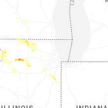


Connect with Interactive Hail Maps