

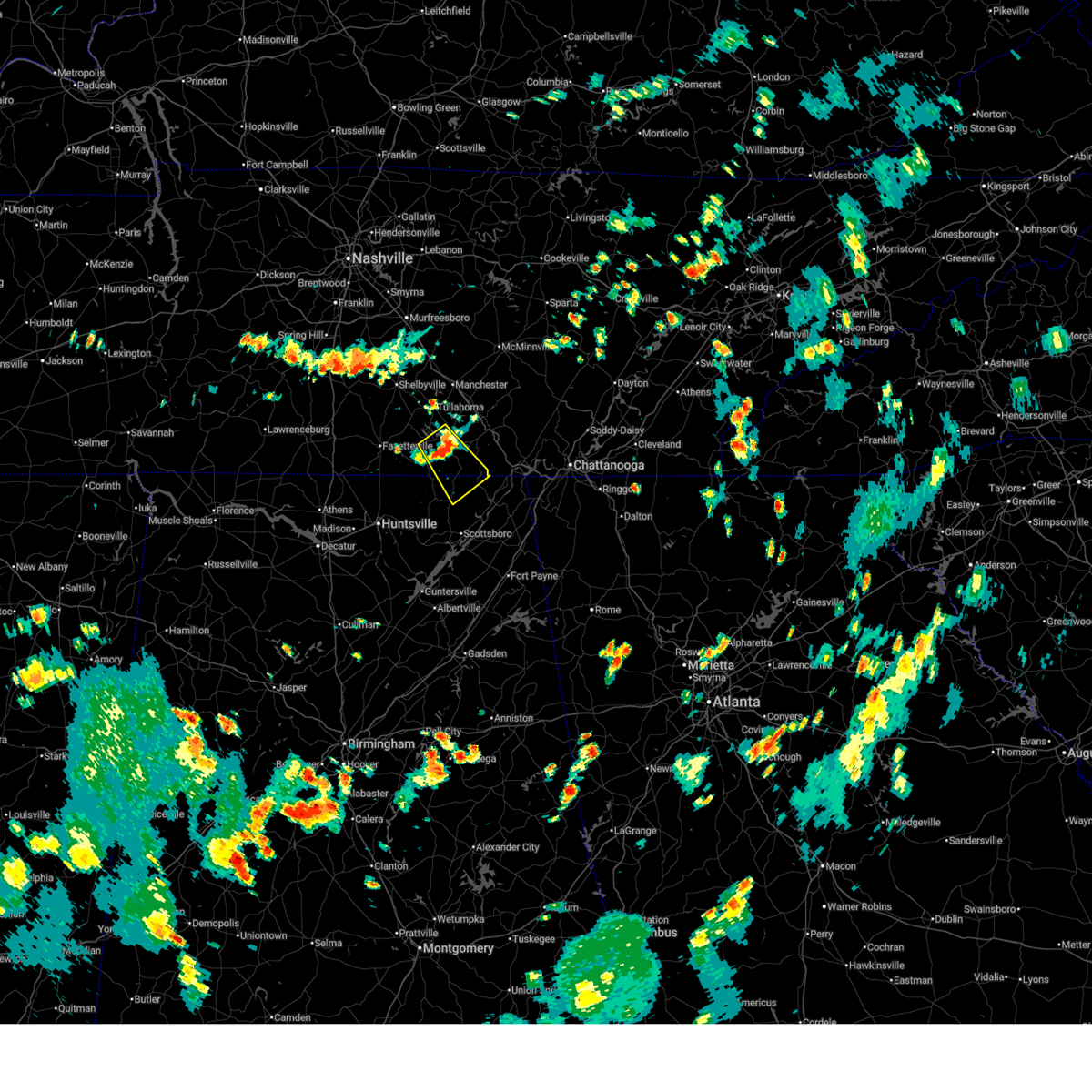
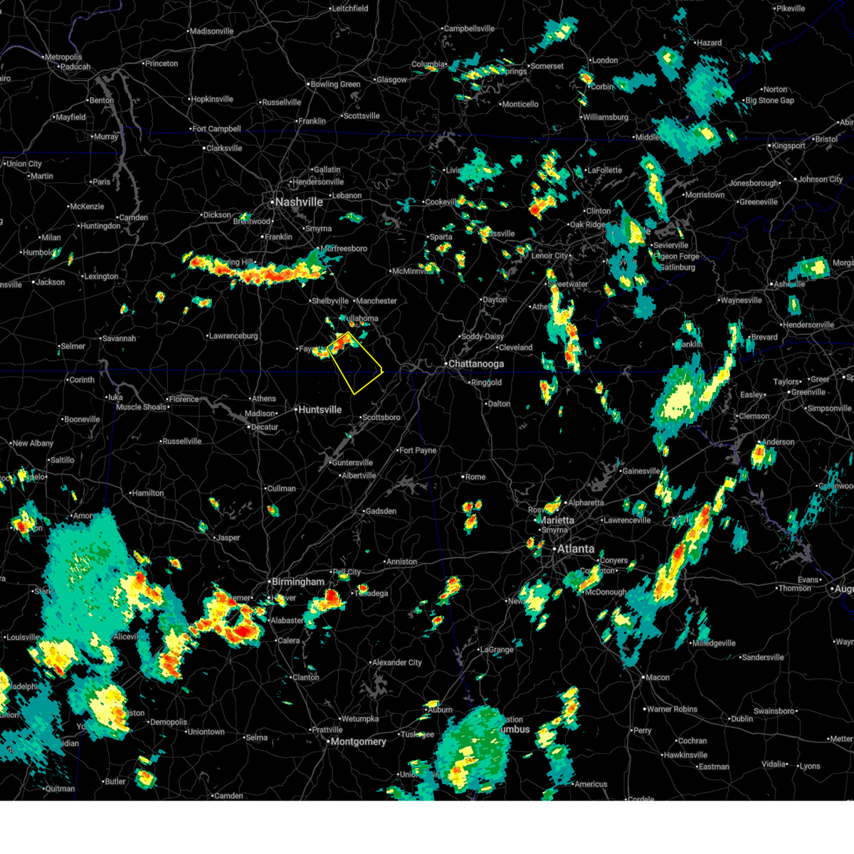
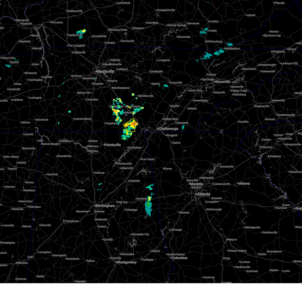
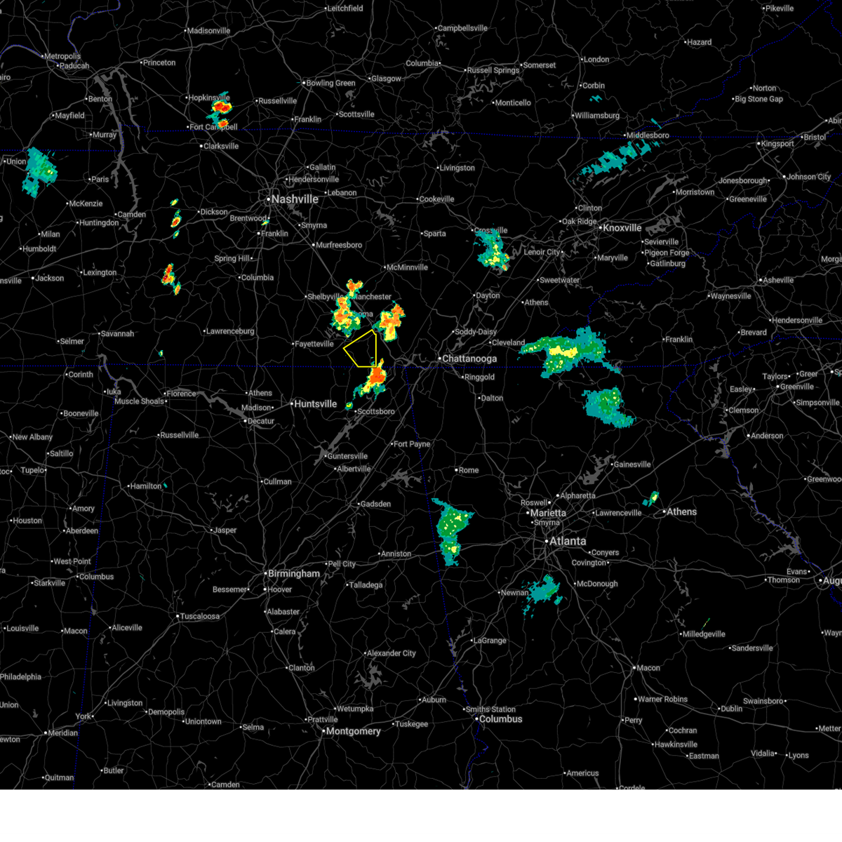
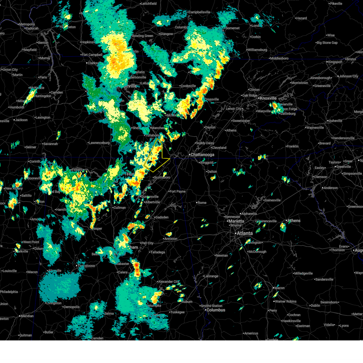
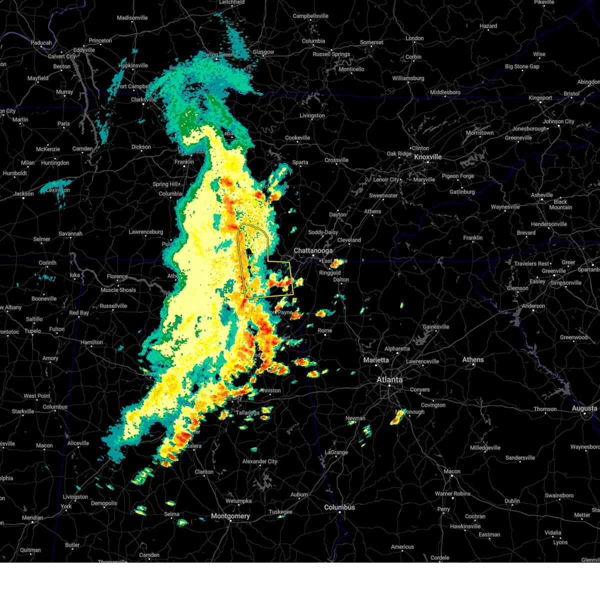
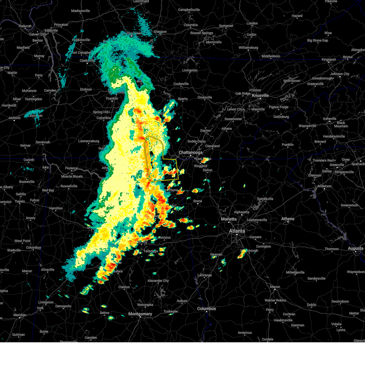
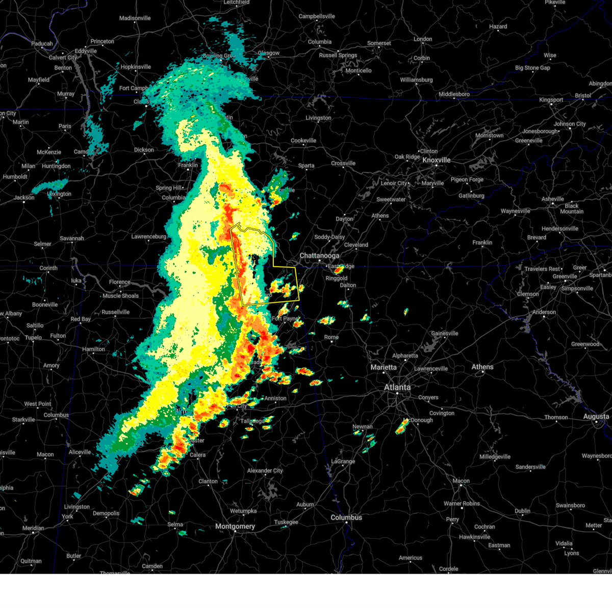
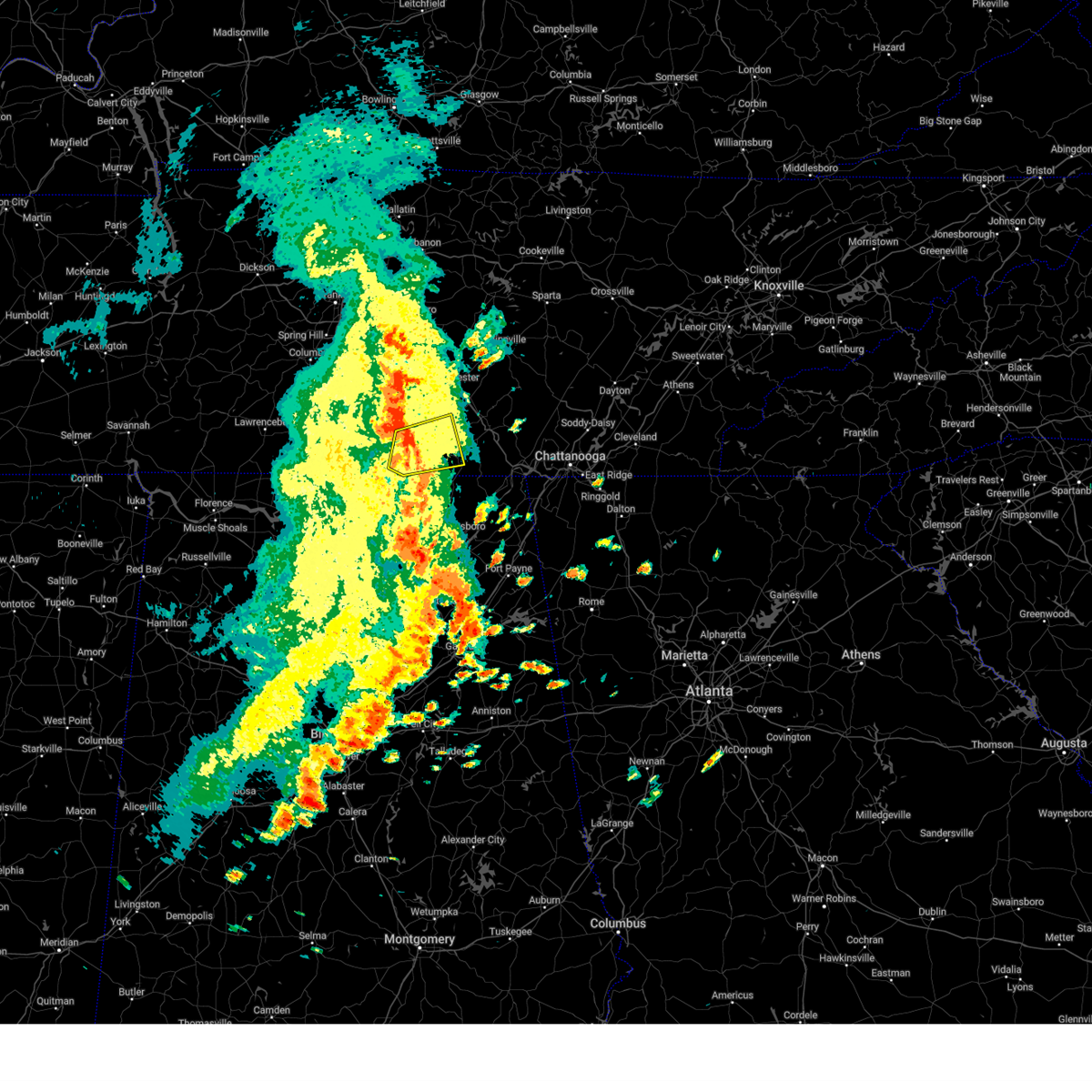
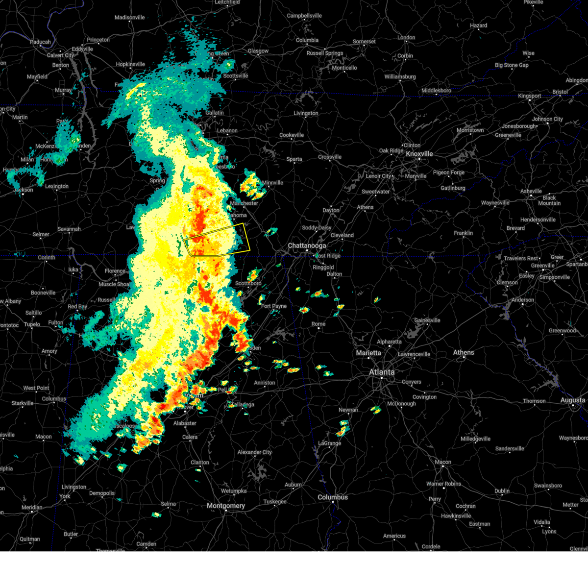
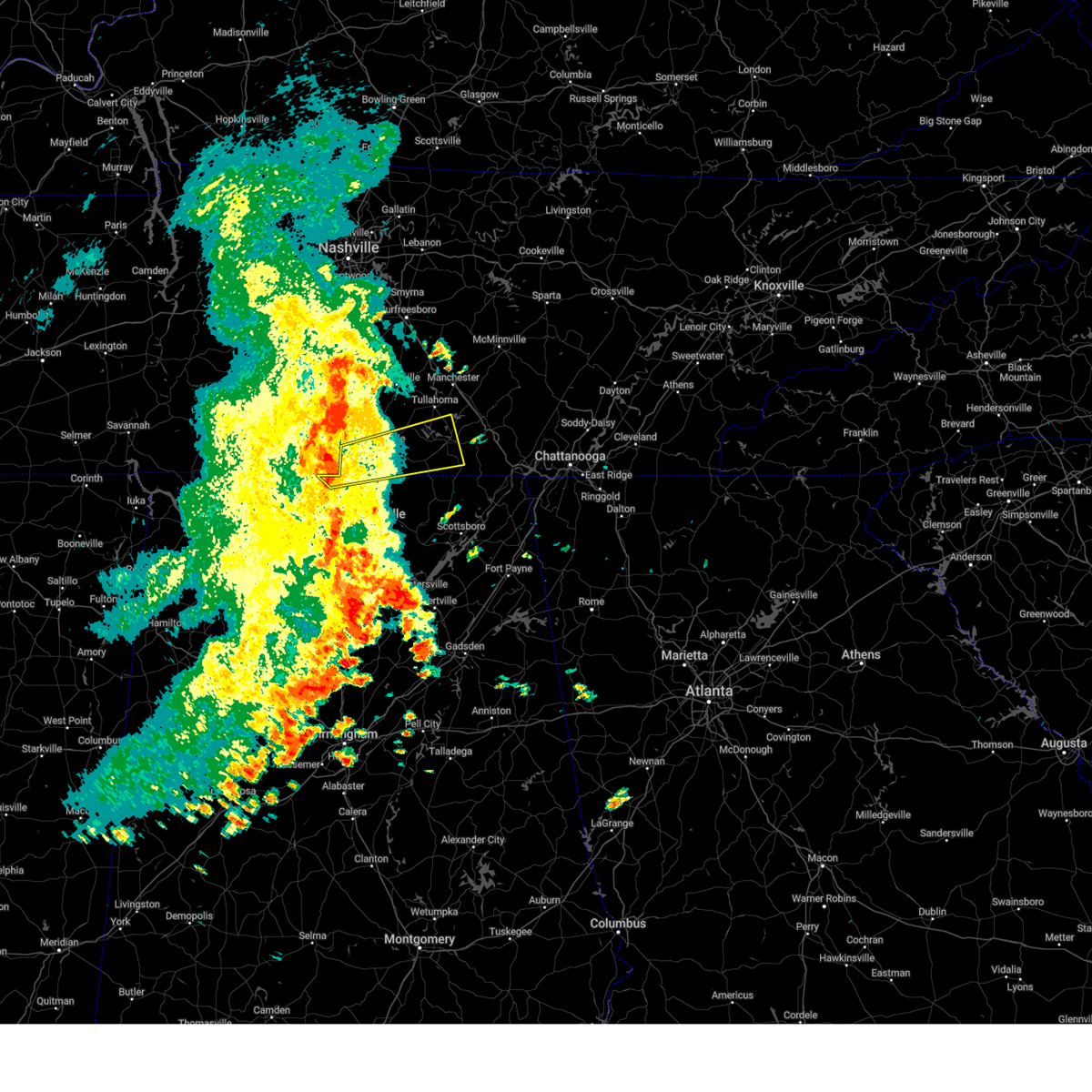
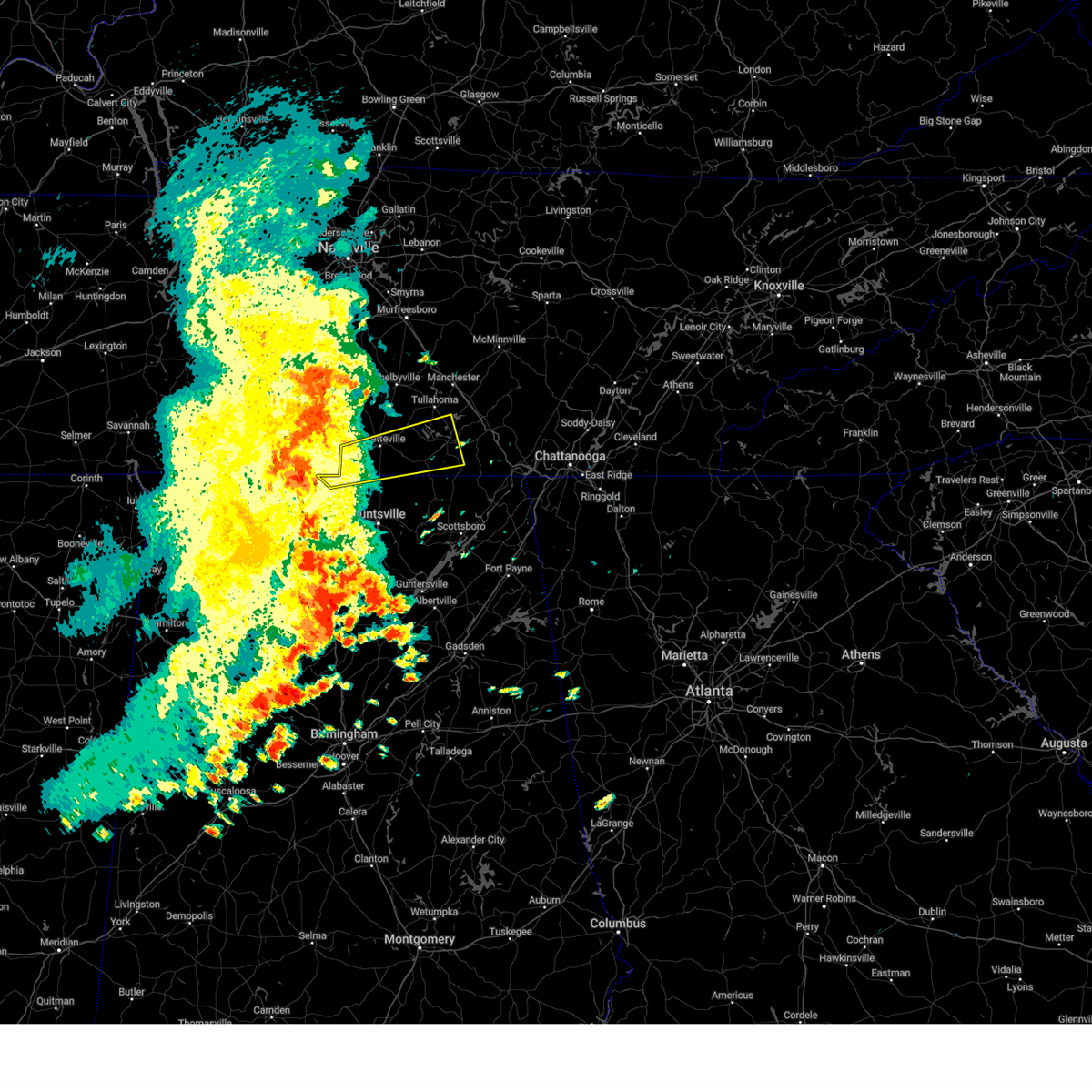
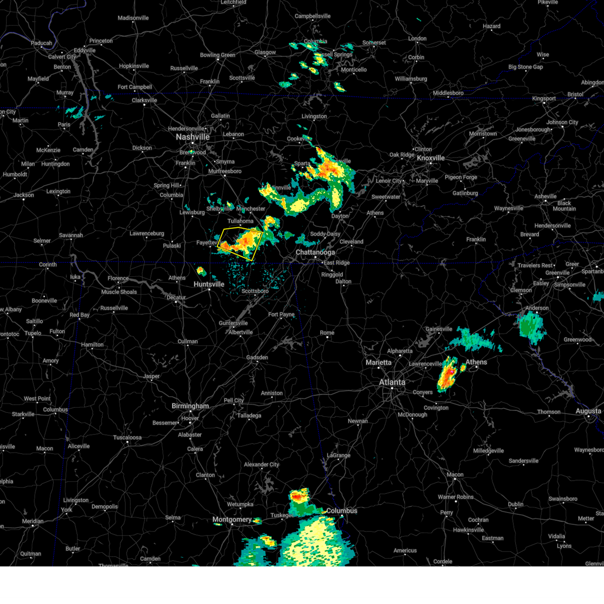
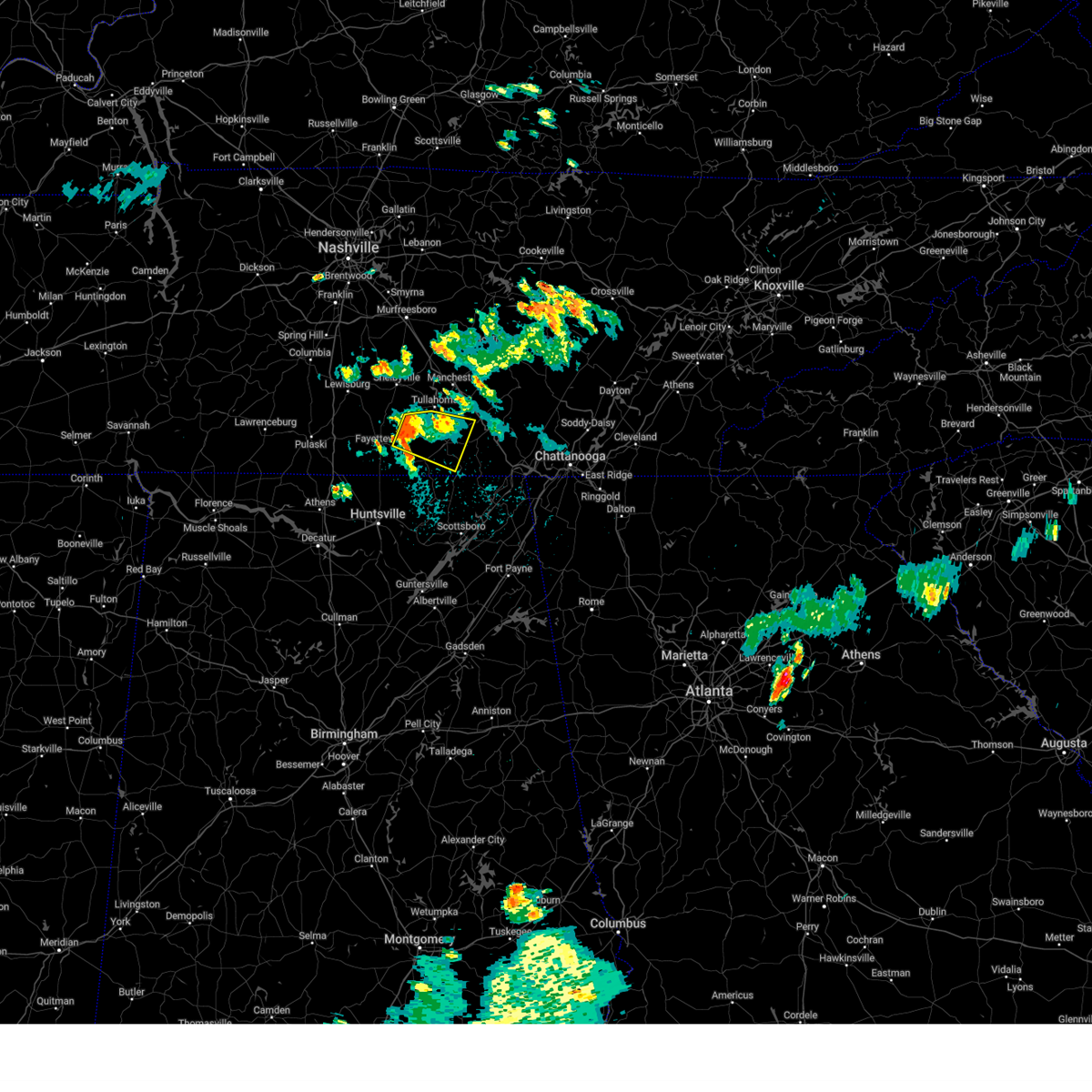
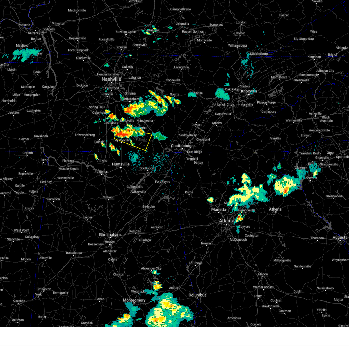
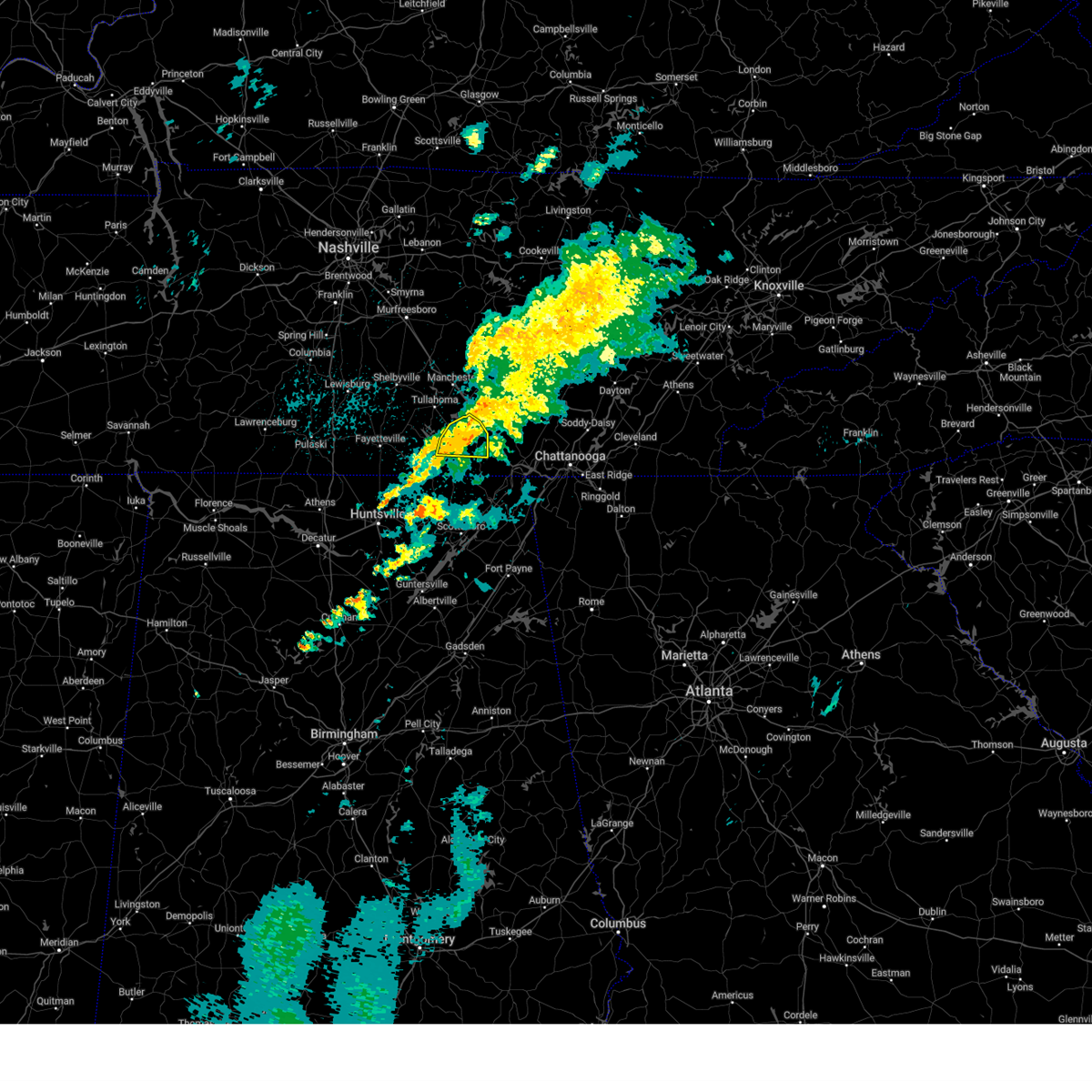
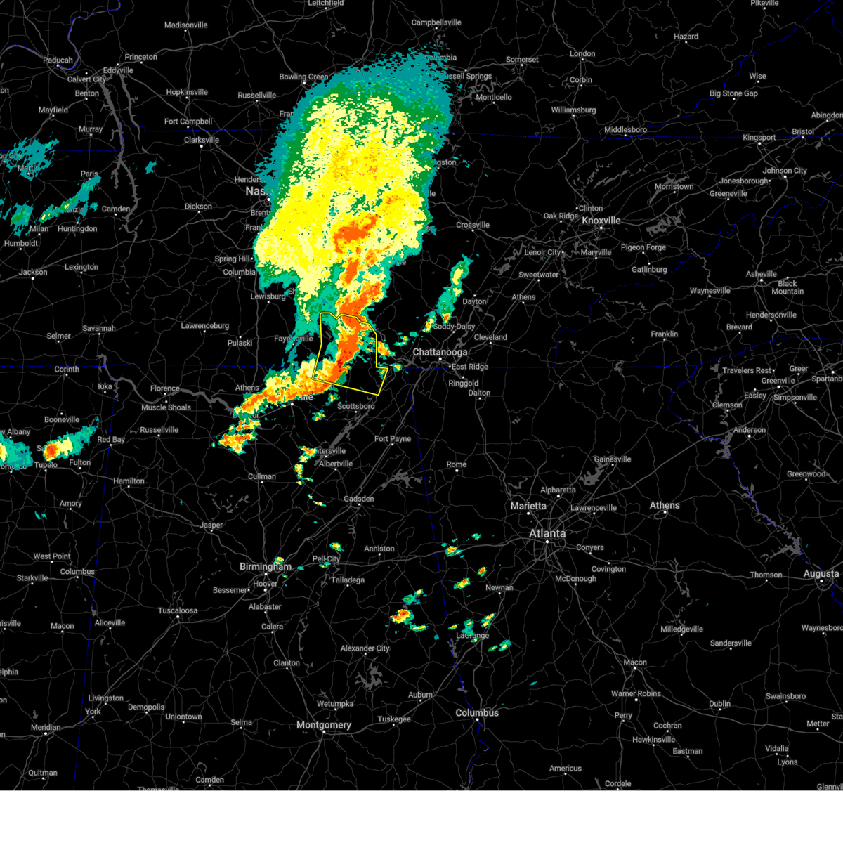
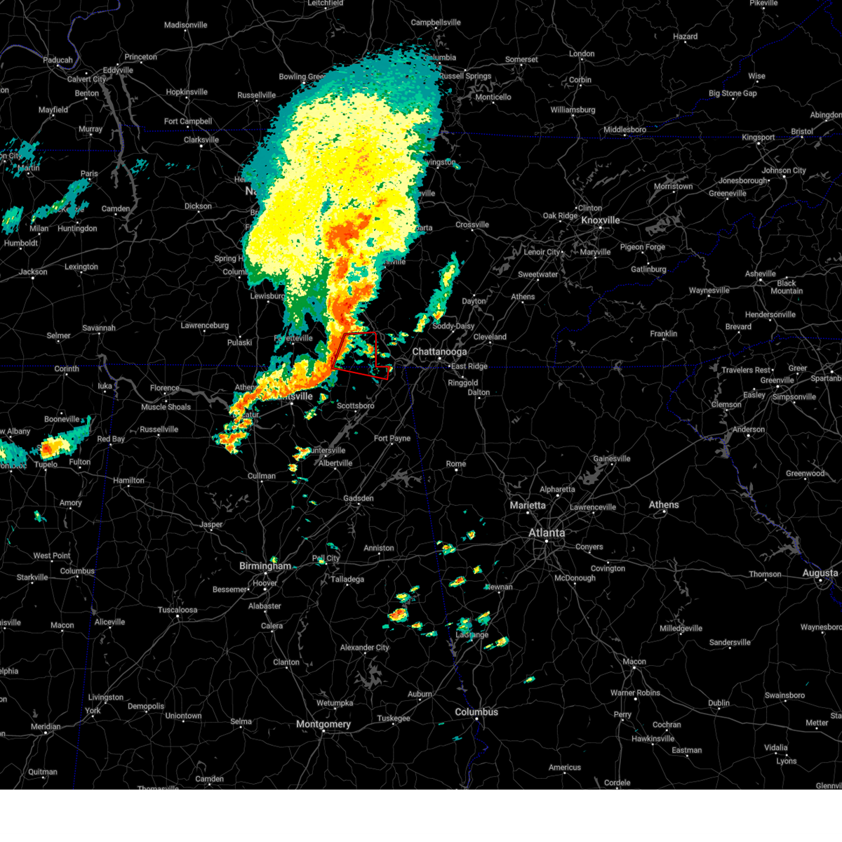
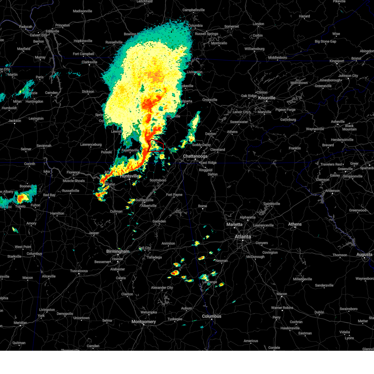
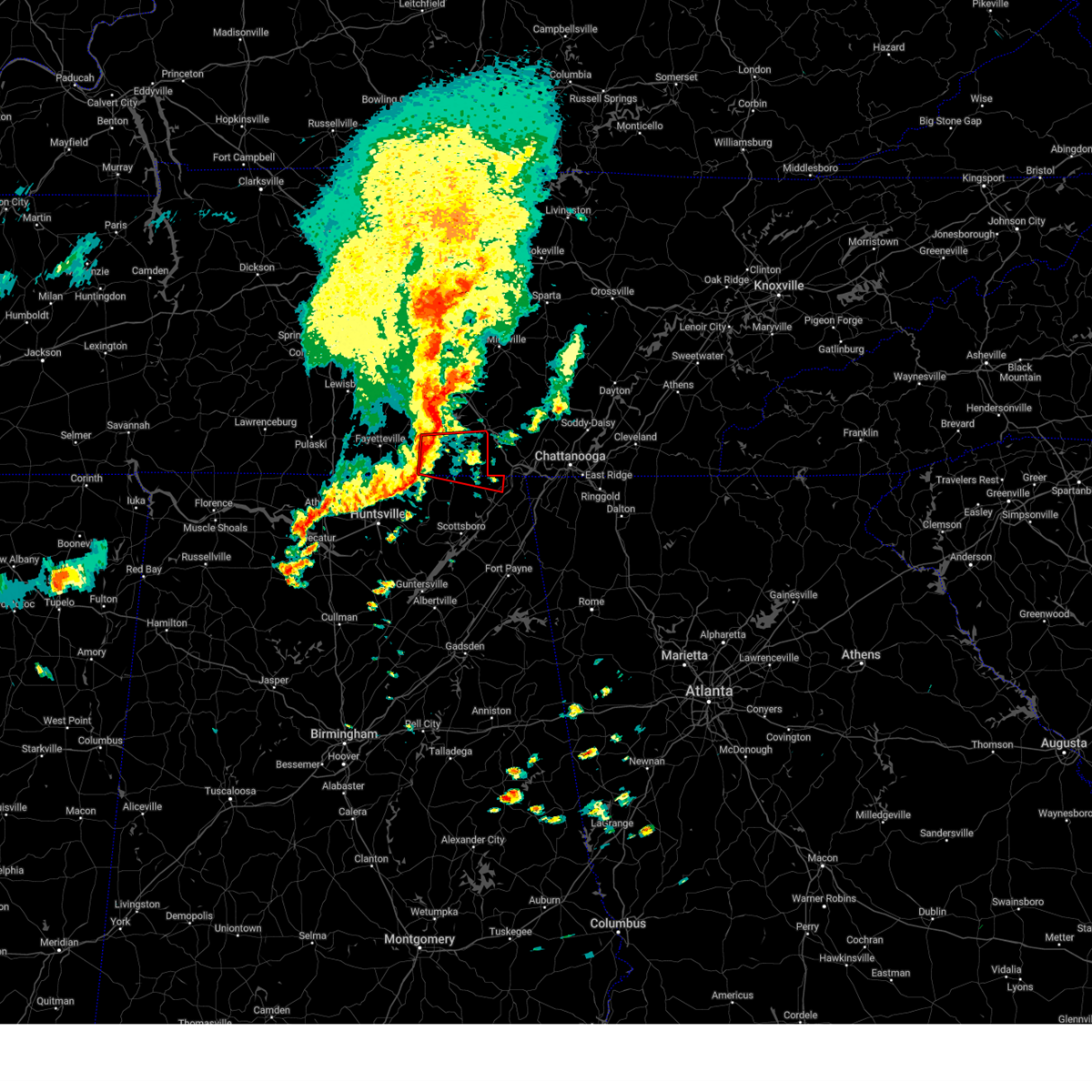
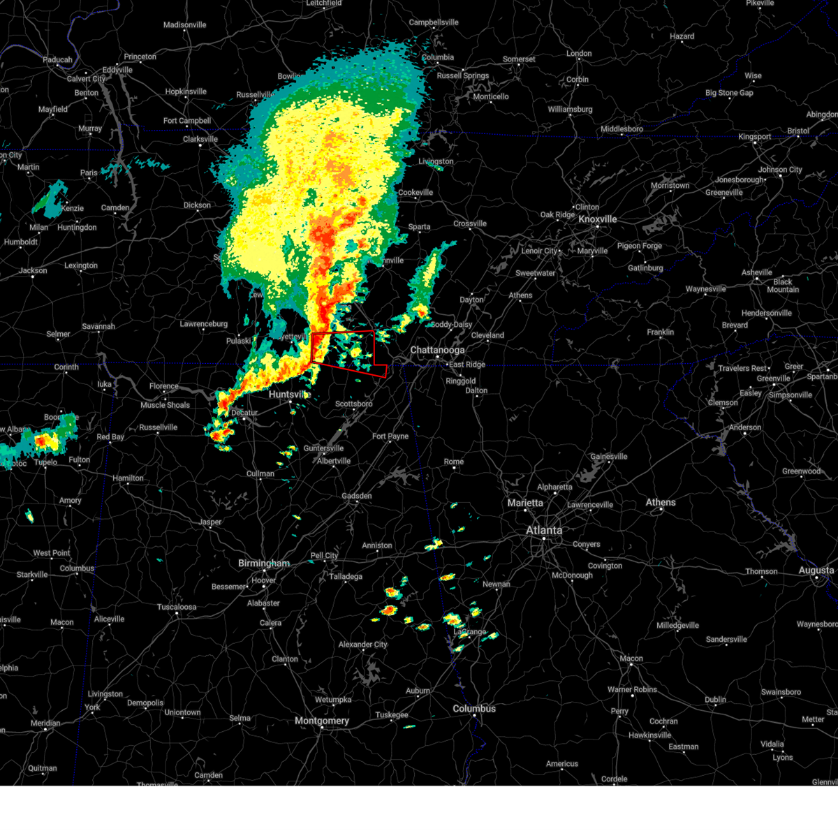
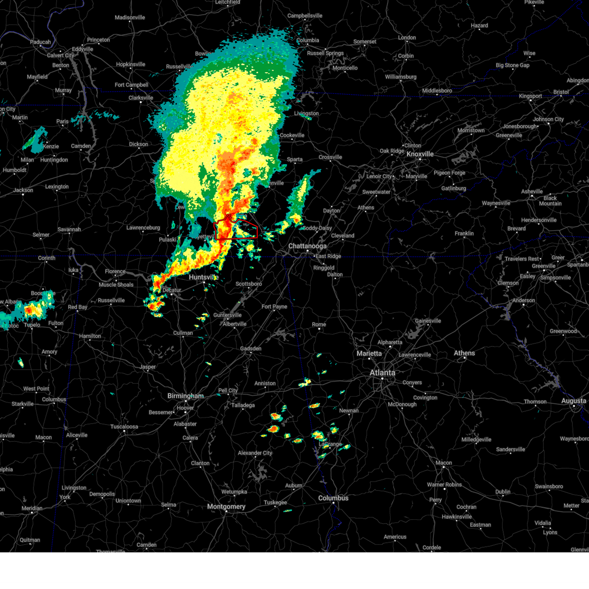
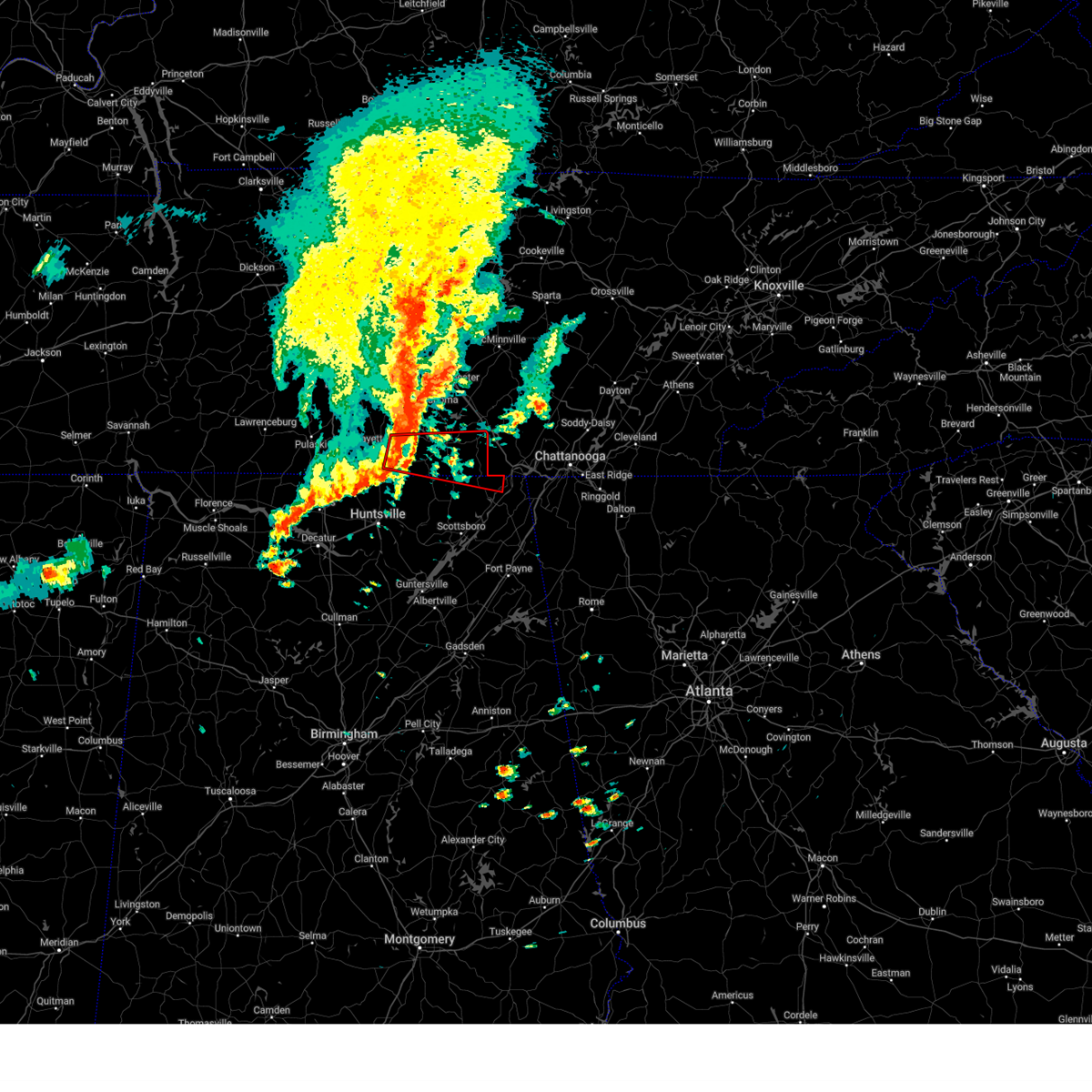
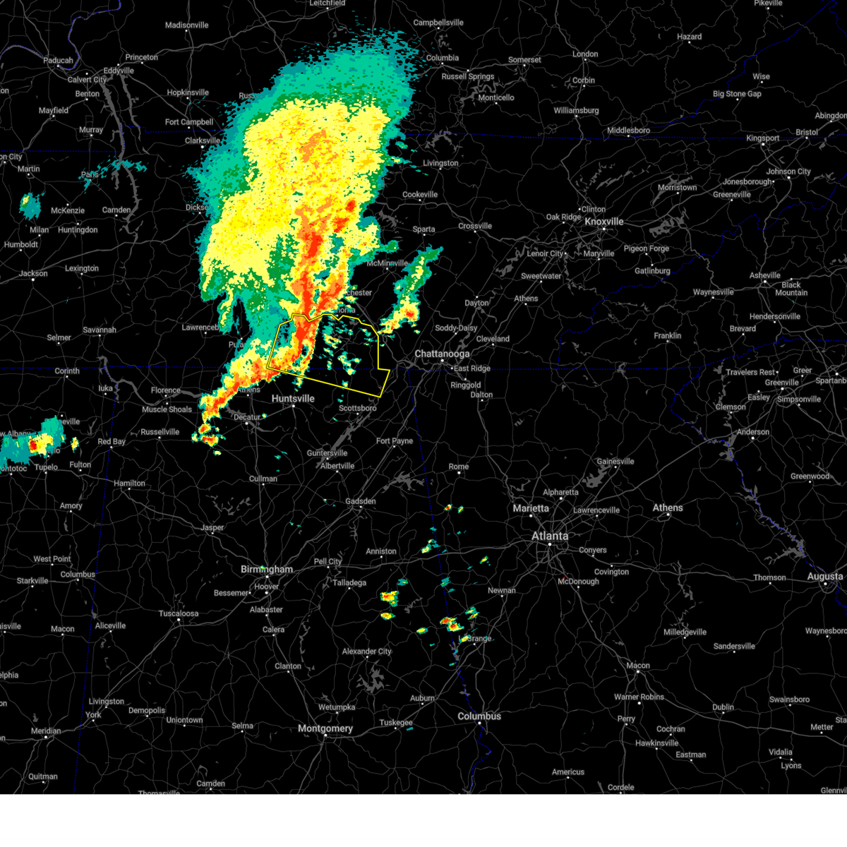
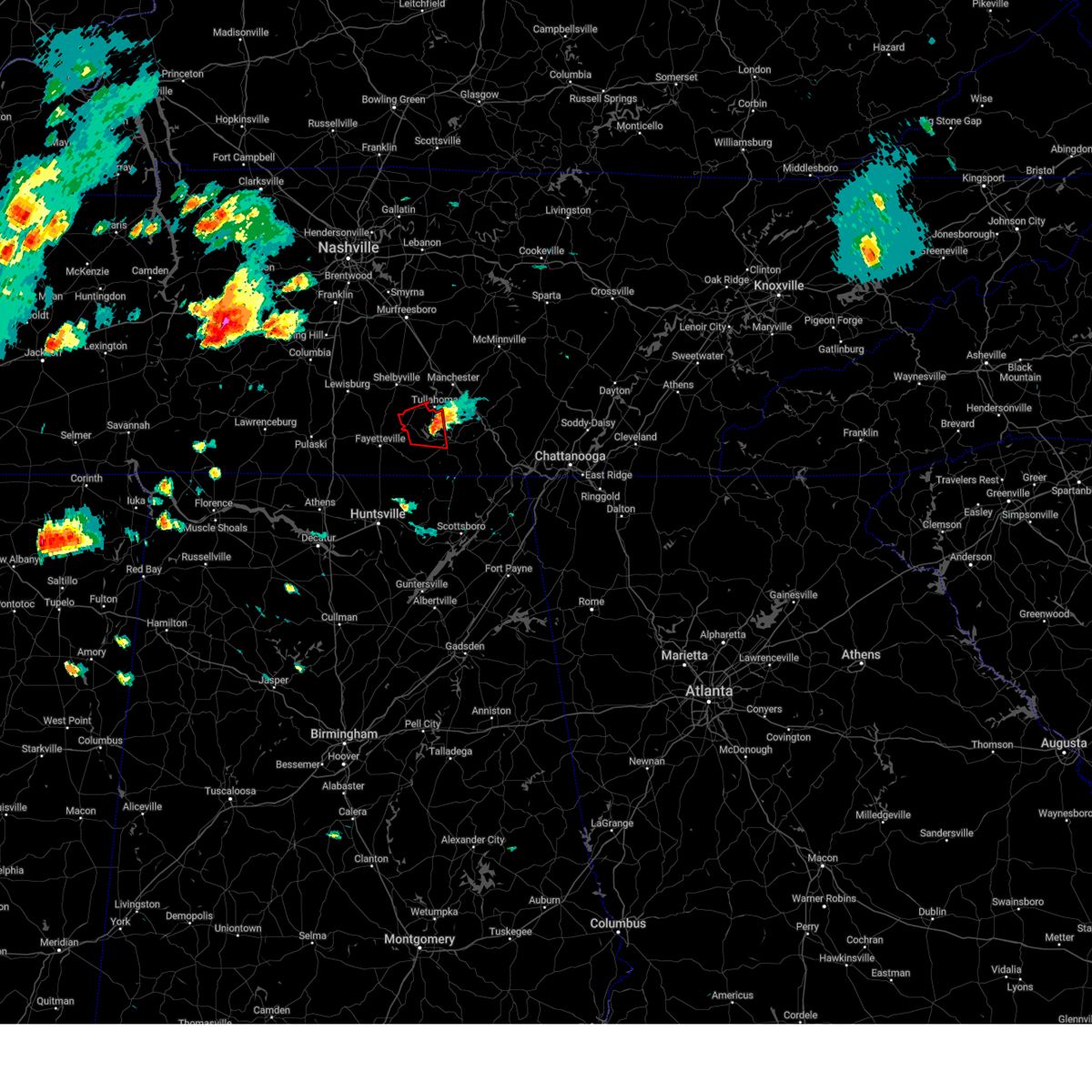
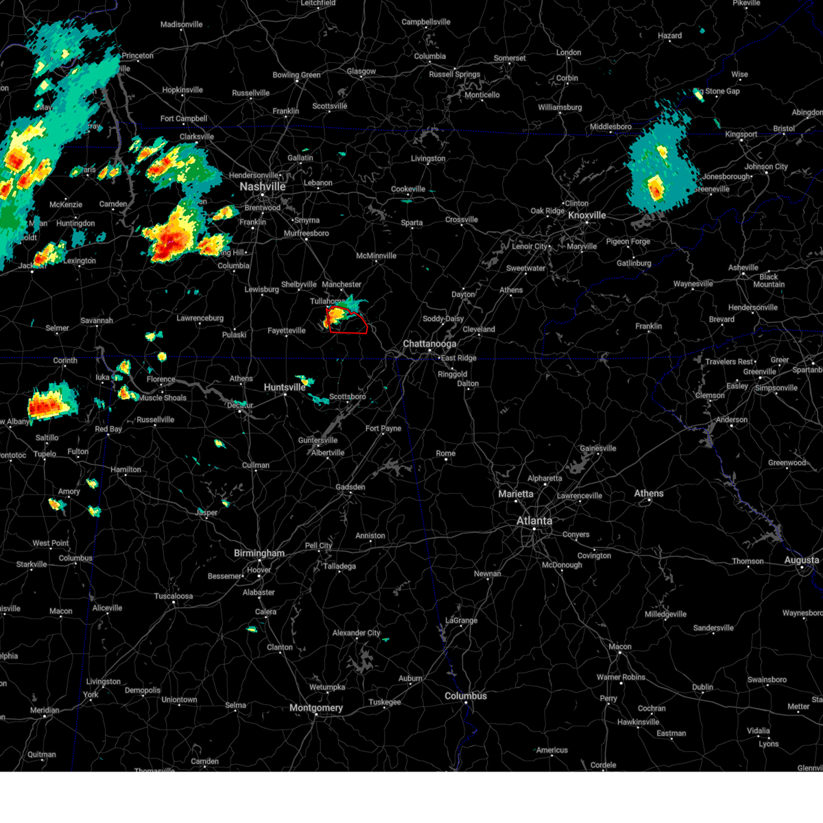
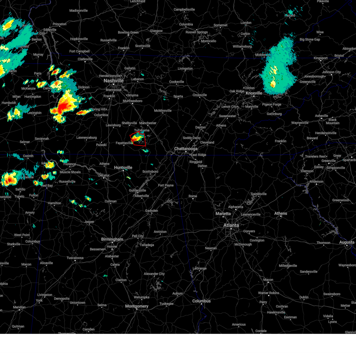
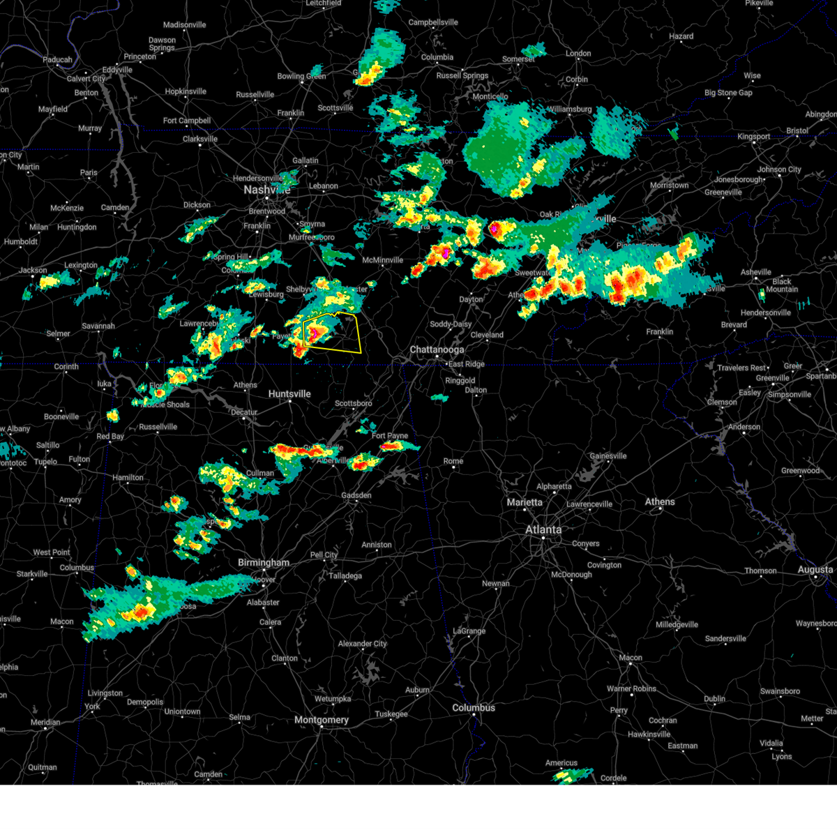
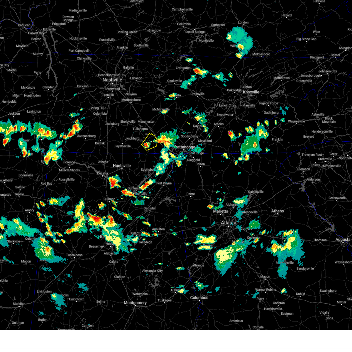
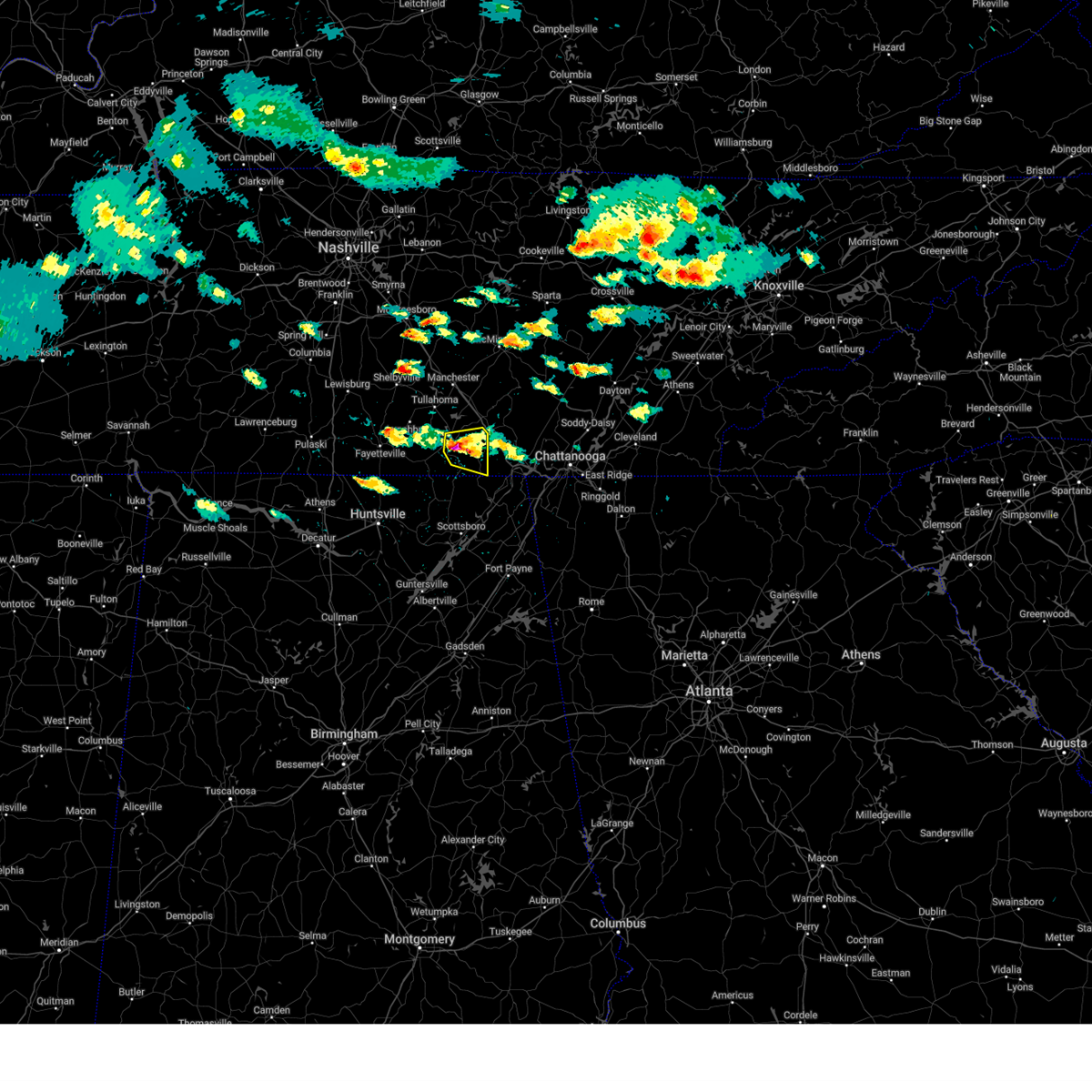
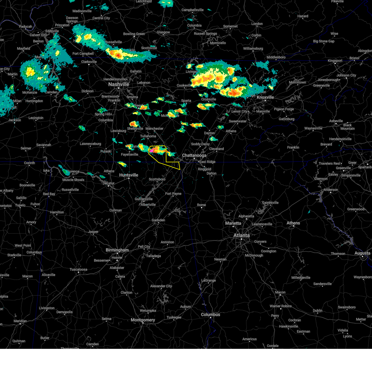
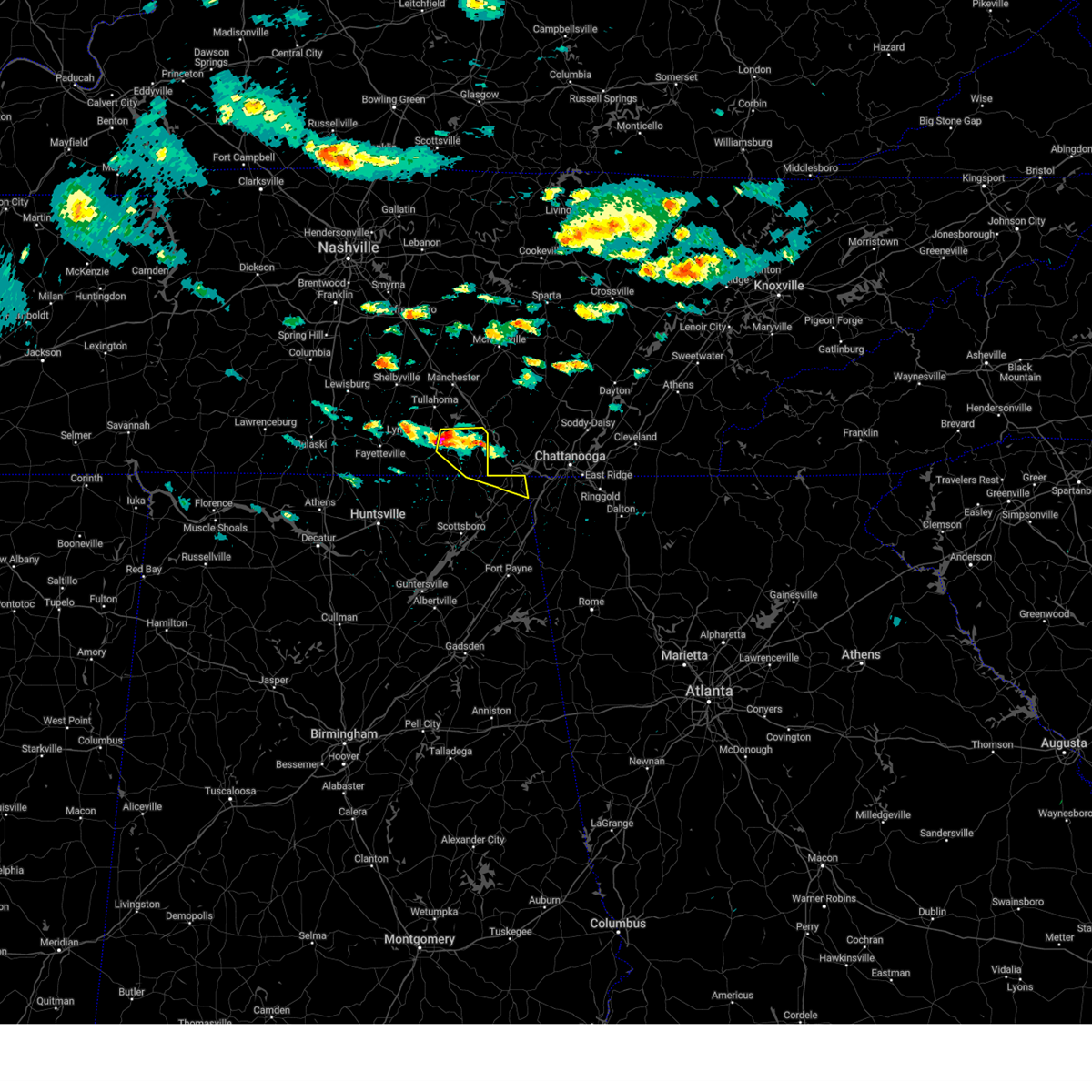
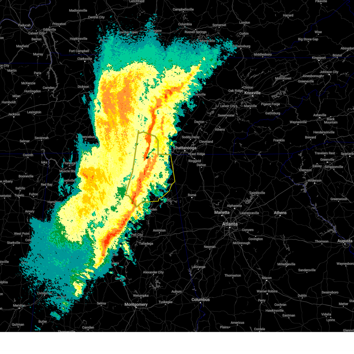
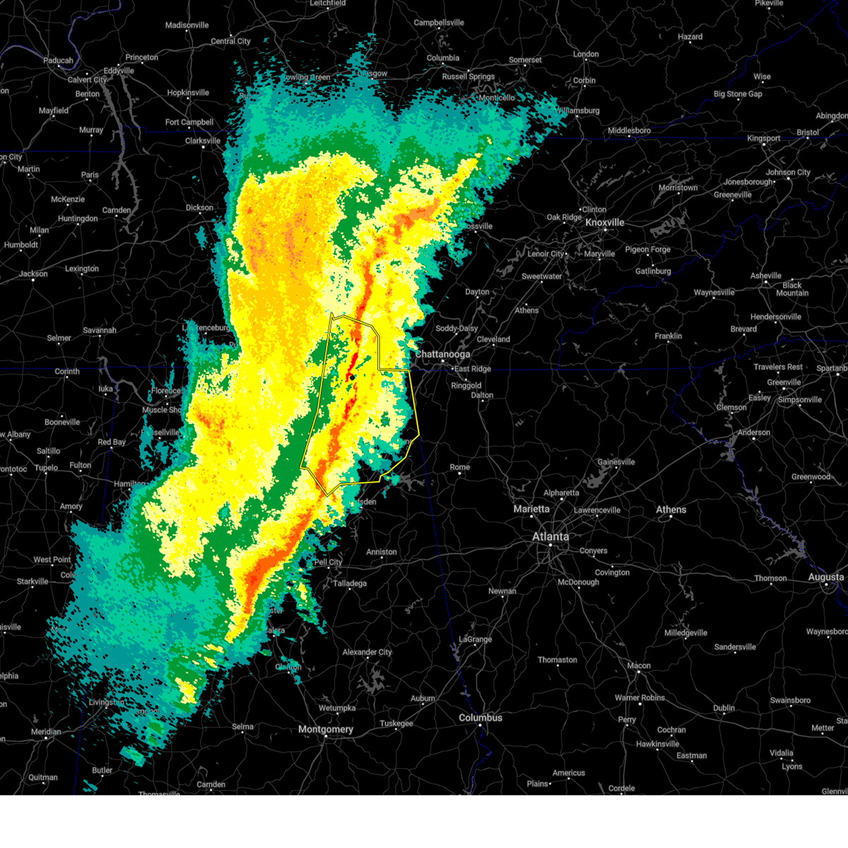
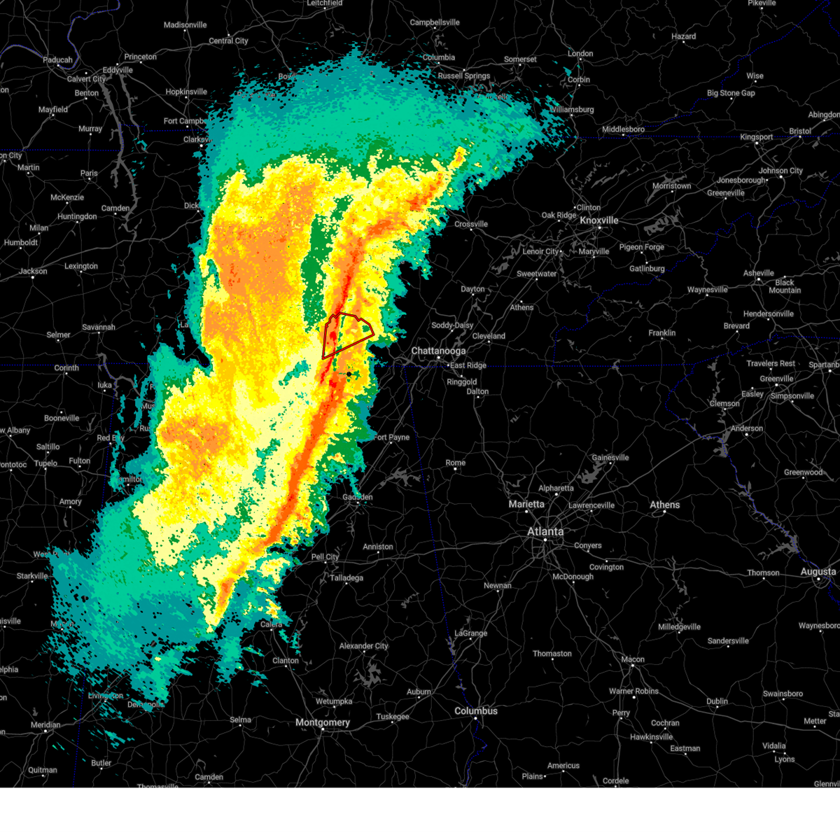
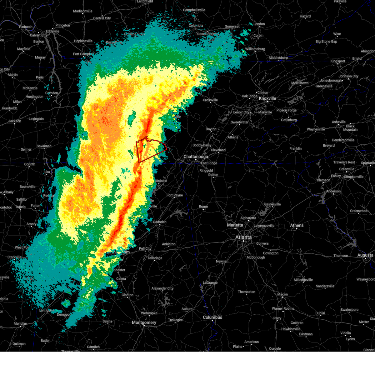
Hail Map for Winchester, TN
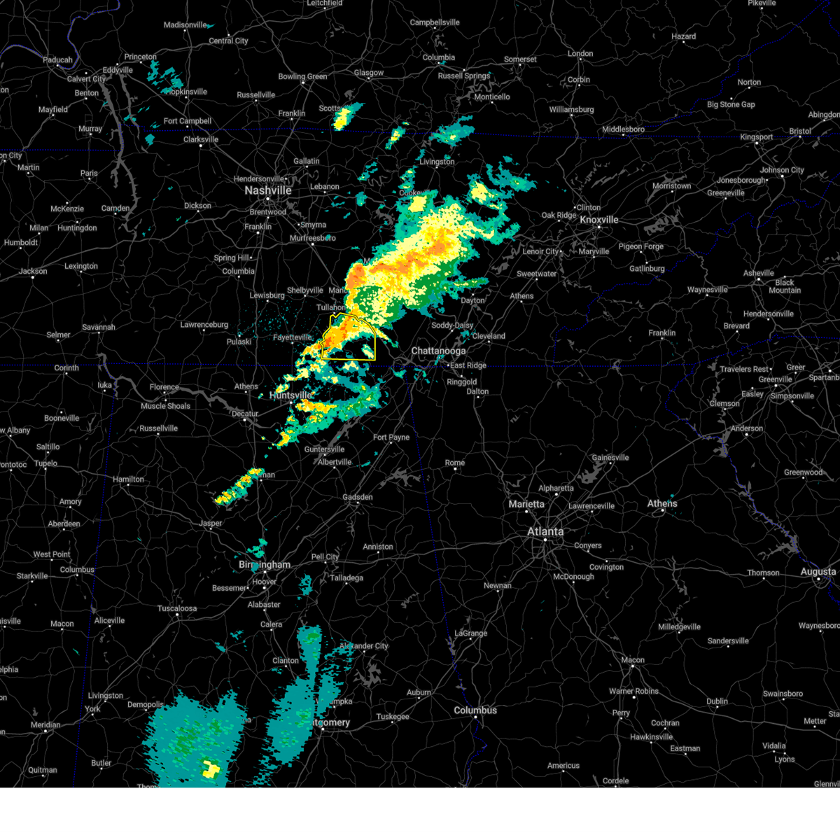
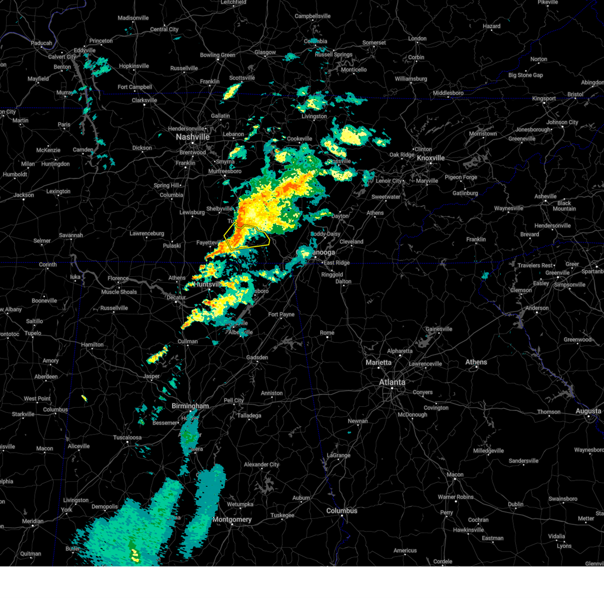
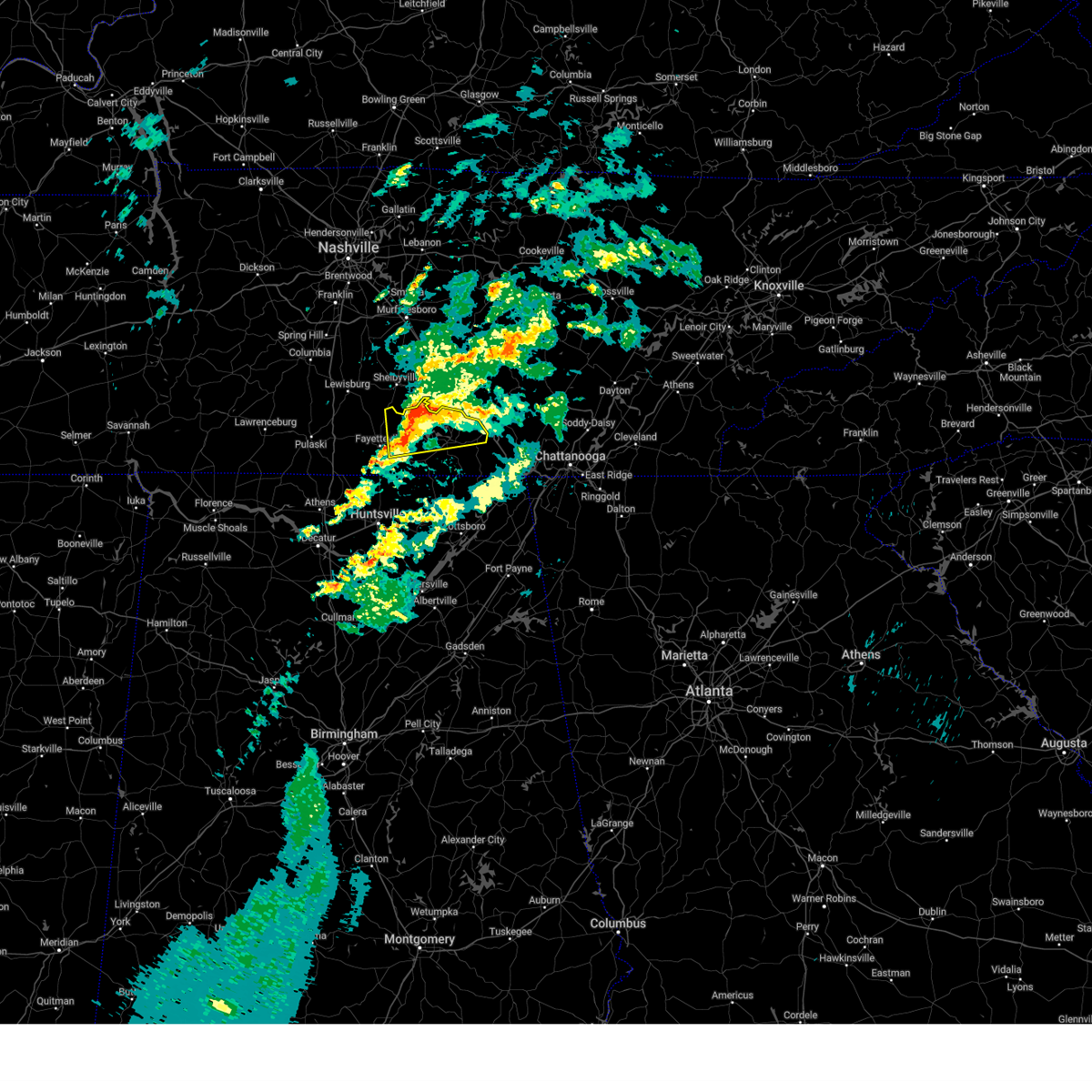
The Winchester, TN area has had 5 reports of on-the-ground hail by trained spotters, and has been under severe weather warnings 129 times during the past 12 months. Doppler radar has detected hail at or near Winchester, TN on 65 occasions, including 8 occasions during the past year.
| Name: | Winchester, TN |
| Where Located: | 47 miles WNW of Chattanooga, TN |
| Map: | Google Map for Winchester, TN |
| Population: | 8530 |
| Housing Units: | 3941 |
| More Info: | Search Google for Winchester, TN |
3
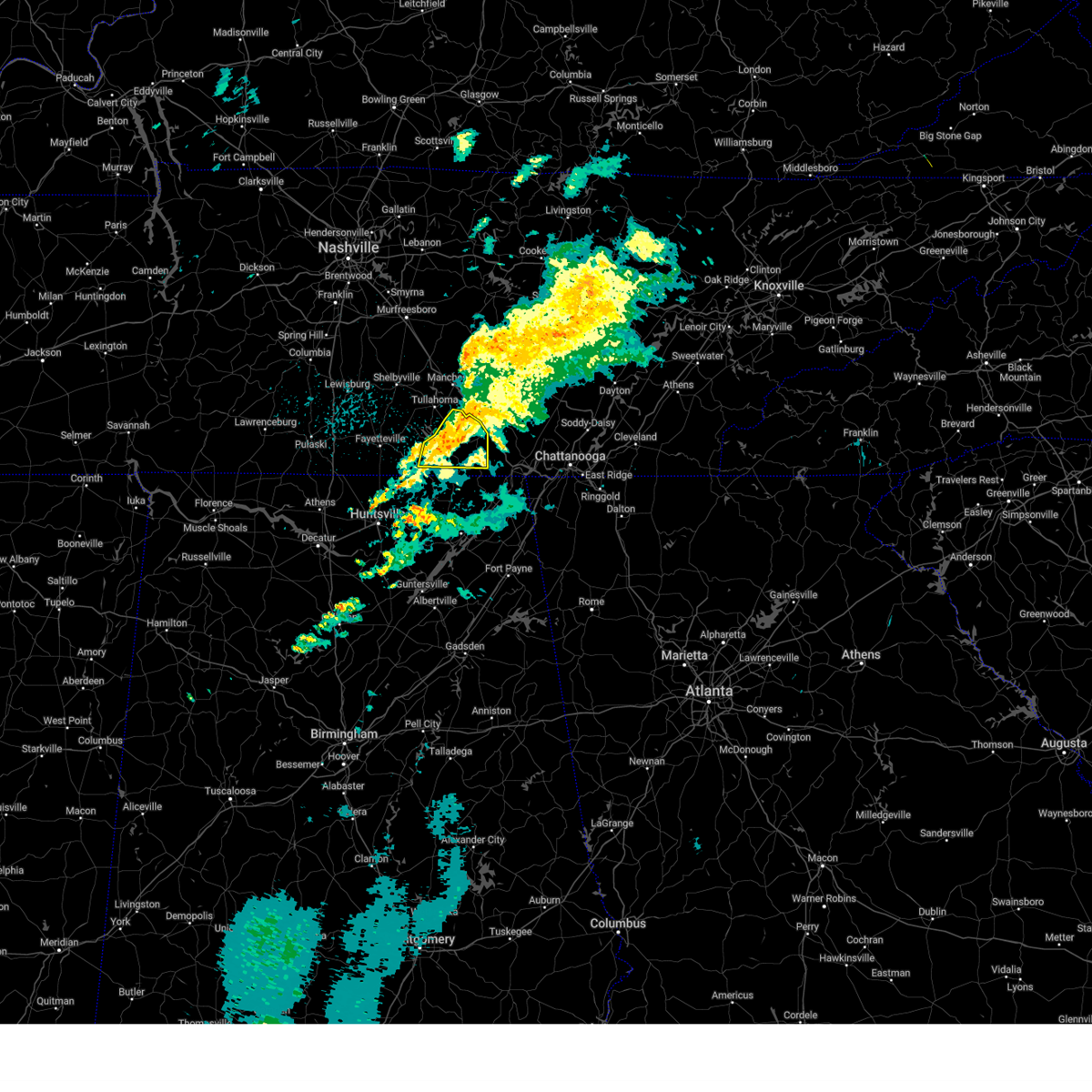
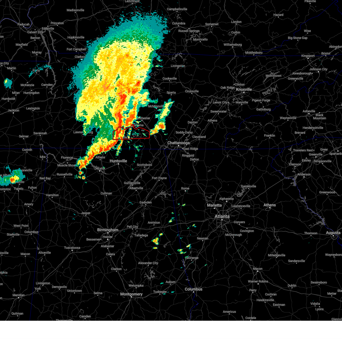
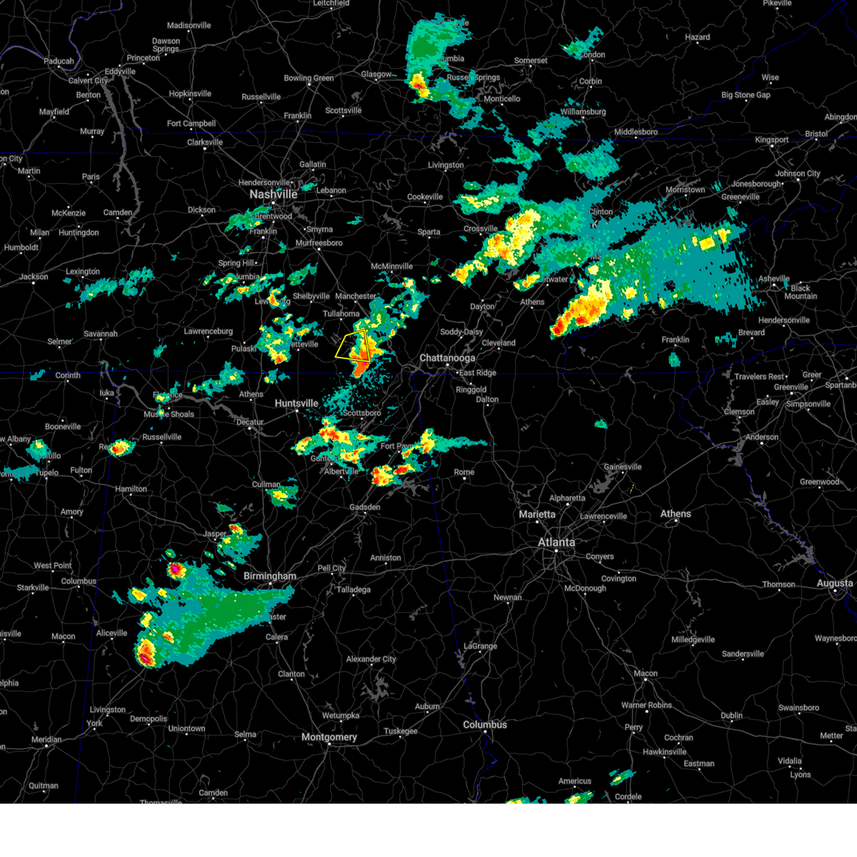
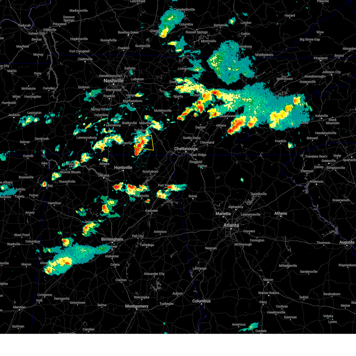
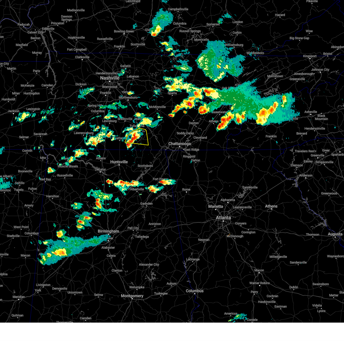
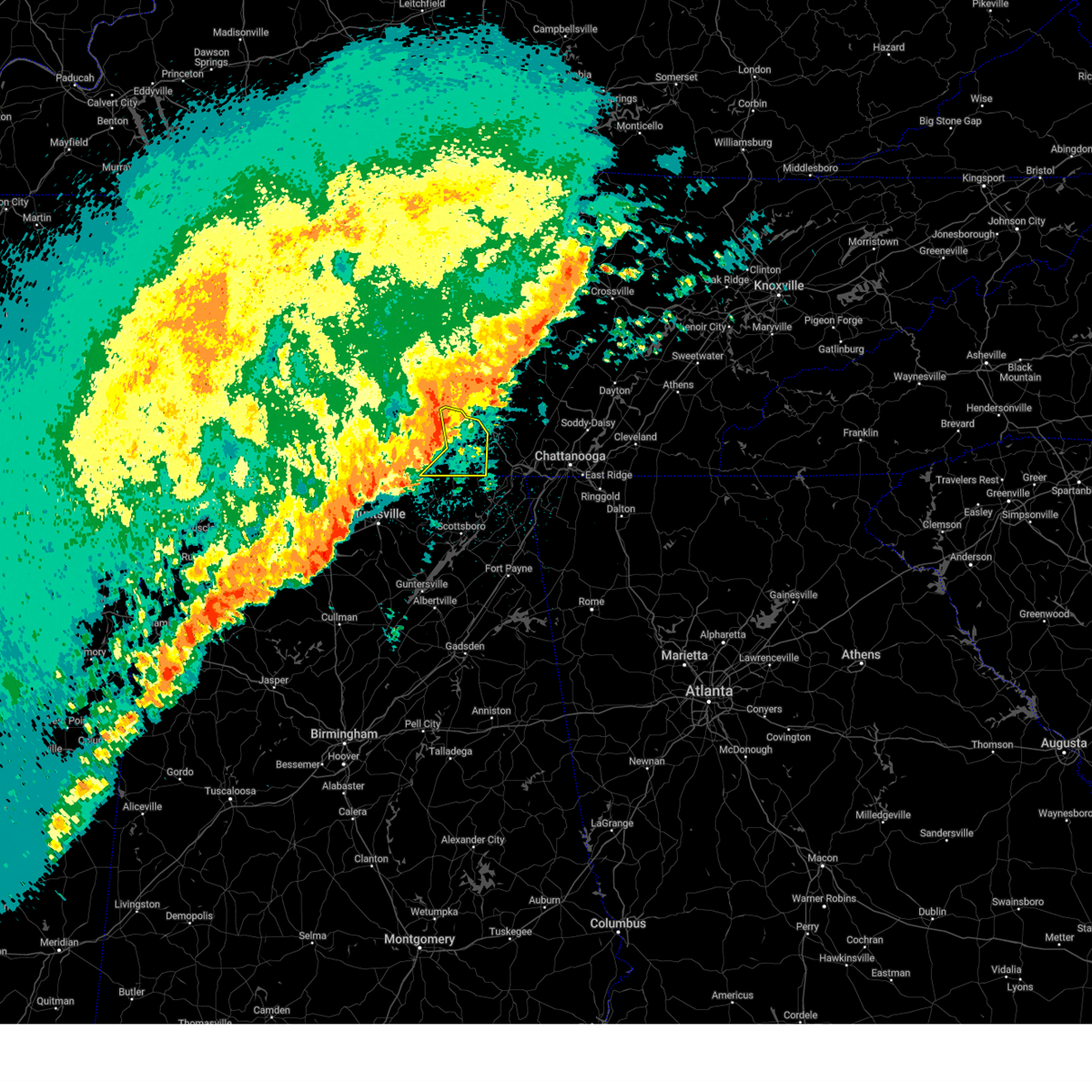
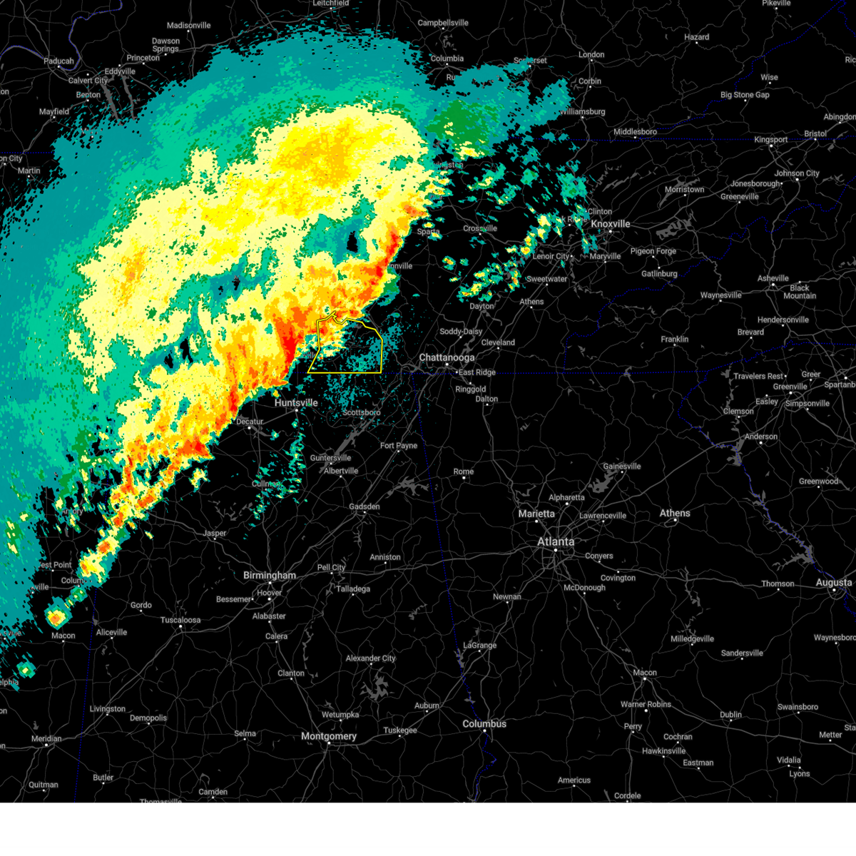
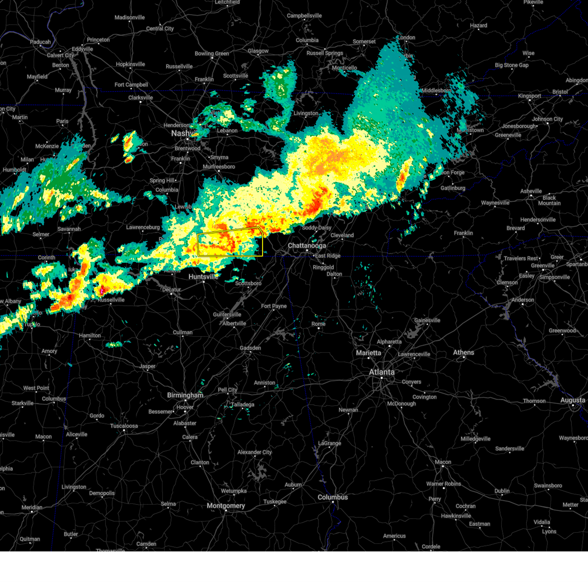
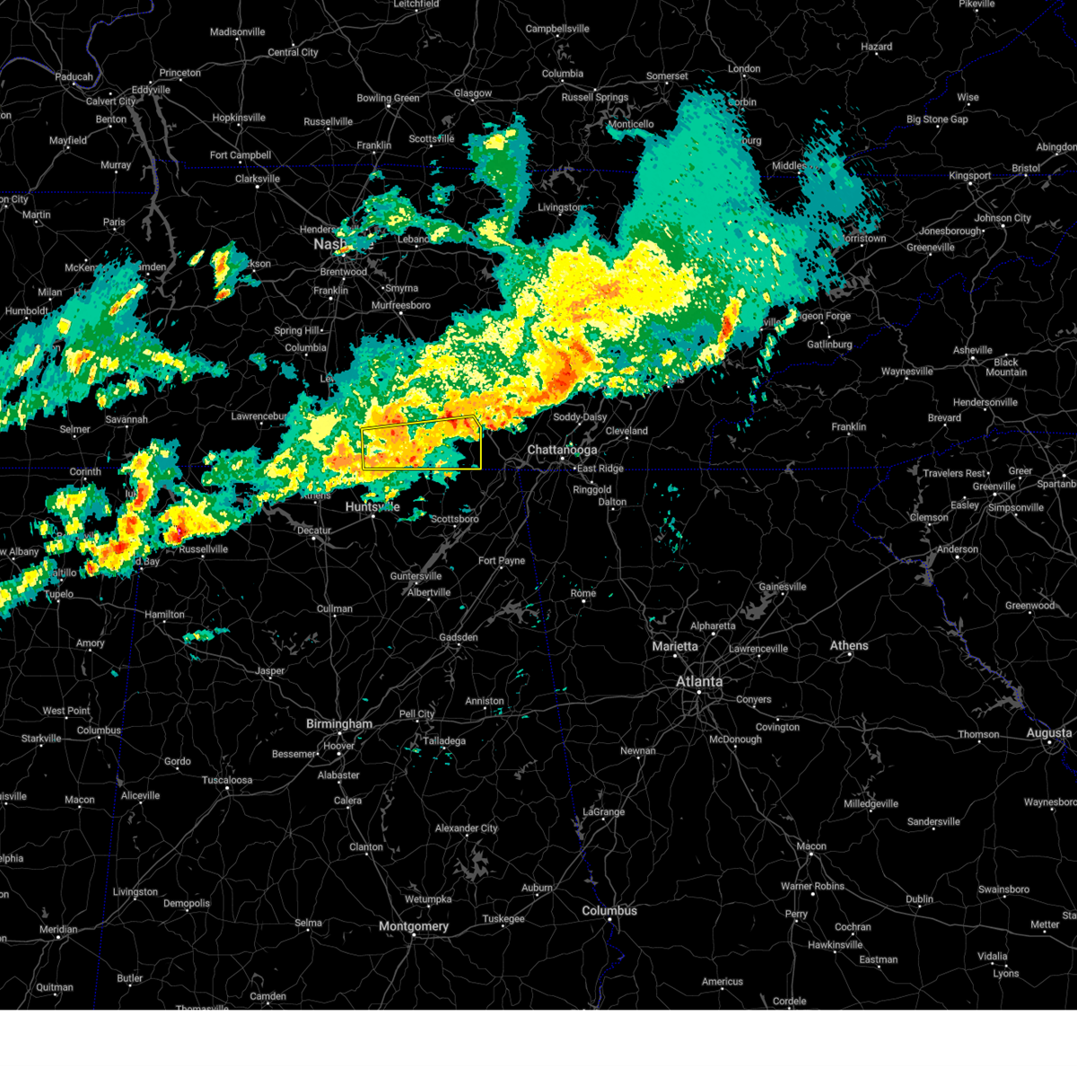
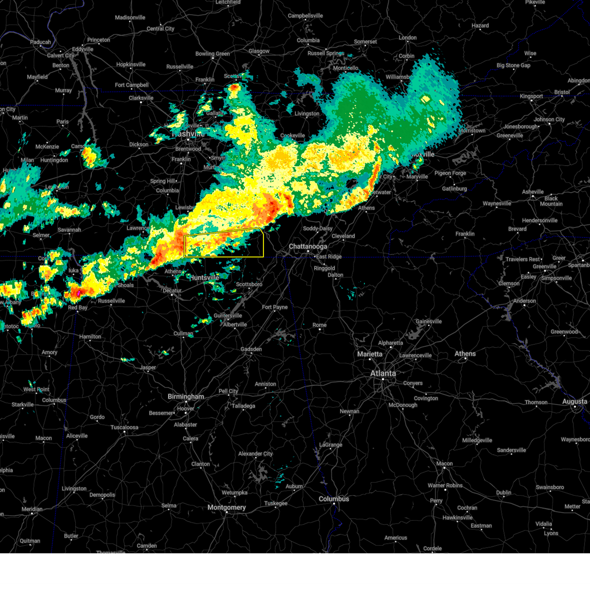
The Top Recent Hail Date for Winchester, TN is Thursday, April 10, 2025 (4th out of 65)

Hail and Wind Damage Spotted near Winchester, TN
| Date / Time | Report Details |
|---|---|
| 7/1/2025 3:36 PM CDT |
 the severe thunderstorm warning has been cancelled and is no longer in effect the severe thunderstorm warning has been cancelled and is no longer in effect
|
| 7/1/2025 3:21 PM CDT |
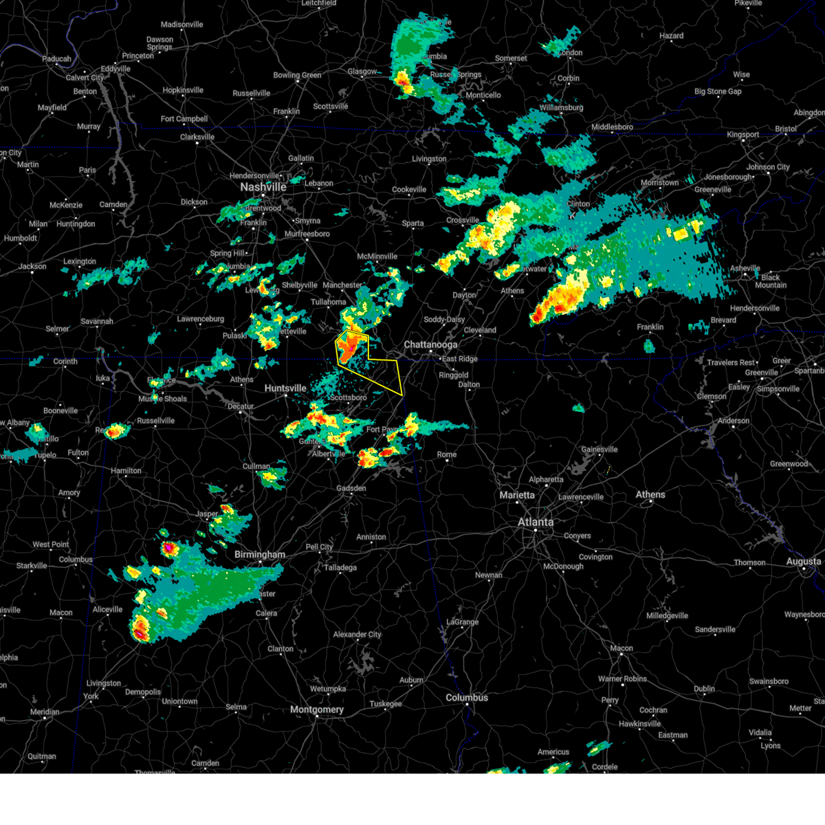
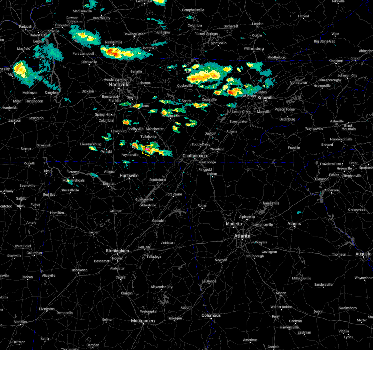
 At 320 pm cdt, a severe thunderstorm was located near winchester, moving southeast at 20 mph (radar indicated). Hazards include 60 mph wind gusts. Expect damage to roofs, siding, and trees. Locations impacted include, winchester, decherd, estill springs, cowan, tims ford lake, anderson, hytop, lexie crossroads, jericho, and harmony. At 320 pm cdt, a severe thunderstorm was located near winchester, moving southeast at 20 mph (radar indicated). Hazards include 60 mph wind gusts. Expect damage to roofs, siding, and trees. Locations impacted include, winchester, decherd, estill springs, cowan, tims ford lake, anderson, hytop, lexie crossroads, jericho, and harmony.
|
| 7/1/2025 3:21 PM CDT |
 the severe thunderstorm warning has been cancelled and is no longer in effect the severe thunderstorm warning has been cancelled and is no longer in effect
|
| 7/1/2025 3:09 PM CDT | Svrhun the national weather service in huntsville alabama has issued a * severe thunderstorm warning for, north central jackson county in northeastern alabama, southeastern moore county in middle tennessee, southwestern franklin county in middle tennessee, * until 415 pm cdt. * at 309 pm cdt, a severe thunderstorm was located over tims ford lake, or near winchester, moving southeast at 15 mph (radar indicated). Hazards include 60 mph wind gusts. expect damage to roofs, siding, and trees |
| 6/26/2025 7:51 PM CDT |
 The storm which prompted the warning has weakened below severe limits, and no longer poses an immediate threat to life or property. therefore, the warning will be allowed to expire. however, gusty winds and heavy rain are still possible with this thunderstorm. The storm which prompted the warning has weakened below severe limits, and no longer poses an immediate threat to life or property. therefore, the warning will be allowed to expire. however, gusty winds and heavy rain are still possible with this thunderstorm.
|
| 6/26/2025 7:08 PM CDT |
 Svrhun the national weather service in huntsville alabama has issued a * severe thunderstorm warning for, southeastern franklin county in middle tennessee, * until 800 pm cdt. * at 707 pm cdt, a severe thunderstorm was located 9 miles west of south pittsburg, or 11 miles northwest of bridgeport, moving northwest at 5 mph (radar indicated). Hazards include 60 mph wind gusts and quarter size hail. Hail damage to vehicles is expected. Expect wind damage to roofs, siding, and trees. Svrhun the national weather service in huntsville alabama has issued a * severe thunderstorm warning for, southeastern franklin county in middle tennessee, * until 800 pm cdt. * at 707 pm cdt, a severe thunderstorm was located 9 miles west of south pittsburg, or 11 miles northwest of bridgeport, moving northwest at 5 mph (radar indicated). Hazards include 60 mph wind gusts and quarter size hail. Hail damage to vehicles is expected. Expect wind damage to roofs, siding, and trees.
|
| 6/13/2025 4:29 PM CDT |
 Svrhun the national weather service in huntsville alabama has issued a * severe thunderstorm warning for, northwestern jackson county in northeastern alabama, eastern franklin county in middle tennessee, * until 515 pm cdt. * at 429 pm cdt, a severe thunderstorm was located 11 miles northeast of skyline, or 17 miles south of winchester, moving northeast at 20 mph (radar indicated). Hazards include 60 mph wind gusts and penny size hail. expect damage to roofs, siding, and trees Svrhun the national weather service in huntsville alabama has issued a * severe thunderstorm warning for, northwestern jackson county in northeastern alabama, eastern franklin county in middle tennessee, * until 515 pm cdt. * at 429 pm cdt, a severe thunderstorm was located 11 miles northeast of skyline, or 17 miles south of winchester, moving northeast at 20 mph (radar indicated). Hazards include 60 mph wind gusts and penny size hail. expect damage to roofs, siding, and trees
|
| 6/7/2025 3:06 PM CDT |
 the severe thunderstorm warning has been cancelled and is no longer in effect the severe thunderstorm warning has been cancelled and is no longer in effect
|
| 6/7/2025 3:06 PM CDT |
 At 305 pm cdt, severe thunderstorms were located along a line extending from near estill springs to section, moving east at 50 mph (emergency management). Hazards include 60 mph wind gusts. Expect damage to roofs, siding, and trees. Locations impacted include, scottsboro, winchester, bridgeport, decherd, henagar, estill springs, stevenson, cowan, hollywood, and skyline. At 305 pm cdt, severe thunderstorms were located along a line extending from near estill springs to section, moving east at 50 mph (emergency management). Hazards include 60 mph wind gusts. Expect damage to roofs, siding, and trees. Locations impacted include, scottsboro, winchester, bridgeport, decherd, henagar, estill springs, stevenson, cowan, hollywood, and skyline.
|
| 6/7/2025 2:51 PM CDT |
 Svrhun the national weather service in huntsville alabama has issued a * severe thunderstorm warning for, jackson county in northeastern alabama, northeastern dekalb county in northeastern alabama, eastern moore county in middle tennessee, franklin county in middle tennessee, * until 345 pm cdt. * at 250 pm cdt, severe thunderstorms were located along a line extending from near lynchburg to 6 miles east of woodville, moving east at 50 mph (radar indicated). Hazards include 60 mph wind gusts. expect damage to roofs, siding, and trees Svrhun the national weather service in huntsville alabama has issued a * severe thunderstorm warning for, jackson county in northeastern alabama, northeastern dekalb county in northeastern alabama, eastern moore county in middle tennessee, franklin county in middle tennessee, * until 345 pm cdt. * at 250 pm cdt, severe thunderstorms were located along a line extending from near lynchburg to 6 miles east of woodville, moving east at 50 mph (radar indicated). Hazards include 60 mph wind gusts. expect damage to roofs, siding, and trees
|
| 6/7/2025 2:45 PM CDT |
 At 245 pm cdt, a severe thunderstorm was located 7 miles northwest of huntland, or 9 miles south of lynchburg, moving east at 55 mph (radar indicated). Hazards include 60 mph wind gusts. Expect damage to roofs, siding, and trees. Locations impacted include, winchester, decherd, estill springs, huntland, tims ford lake, lexie crossroads, mulberry, harmony, elora, and hurdlow. At 245 pm cdt, a severe thunderstorm was located 7 miles northwest of huntland, or 9 miles south of lynchburg, moving east at 55 mph (radar indicated). Hazards include 60 mph wind gusts. Expect damage to roofs, siding, and trees. Locations impacted include, winchester, decherd, estill springs, huntland, tims ford lake, lexie crossroads, mulberry, harmony, elora, and hurdlow.
|
| 6/7/2025 2:31 PM CDT |
 the severe thunderstorm warning has been cancelled and is no longer in effect the severe thunderstorm warning has been cancelled and is no longer in effect
|
| 6/7/2025 2:31 PM CDT |
 At 230 pm cdt, a severe thunderstorm was located near fayetteville, moving east at 55 mph (radar indicated). Hazards include 70 mph wind gusts. Expect considerable tree damage. damage is likely to mobile homes, roofs, and outbuildings. Locations impacted include, winchester, fayetteville, decherd, estill springs, huntland, tims ford lake, lincoln, elora, hurdlow, and maxwell. At 230 pm cdt, a severe thunderstorm was located near fayetteville, moving east at 55 mph (radar indicated). Hazards include 70 mph wind gusts. Expect considerable tree damage. damage is likely to mobile homes, roofs, and outbuildings. Locations impacted include, winchester, fayetteville, decherd, estill springs, huntland, tims ford lake, lincoln, elora, hurdlow, and maxwell.
|
| 6/7/2025 2:13 PM CDT |
 At 213 pm cdt, a severe thunderstorm was located near ardmore, or 15 miles southeast of pulaski, moving east at 55 mph (radar indicated). Hazards include 70 mph wind gusts. Expect considerable tree damage. damage is likely to mobile homes, roofs, and outbuildings. Locations impacted include, winchester, fayetteville, decherd, estill springs, ardmore, huntland, tims ford lake, lincoln, elkwood, and elora. At 213 pm cdt, a severe thunderstorm was located near ardmore, or 15 miles southeast of pulaski, moving east at 55 mph (radar indicated). Hazards include 70 mph wind gusts. Expect considerable tree damage. damage is likely to mobile homes, roofs, and outbuildings. Locations impacted include, winchester, fayetteville, decherd, estill springs, ardmore, huntland, tims ford lake, lincoln, elkwood, and elora.
|
| 6/7/2025 2:03 PM CDT |
 Svrhun the national weather service in huntsville alabama has issued a * severe thunderstorm warning for, northwestern madison county in north central alabama, northeastern limestone county in north central alabama, southeastern moore county in middle tennessee, lincoln county in middle tennessee, western franklin county in middle tennessee, * until 300 pm cdt. * at 203 pm cdt, a severe thunderstorm was located 9 miles west of ardmore, or 12 miles south of pulaski, moving east at 55 mph (radar indicated). Hazards include 60 mph wind gusts. expect damage to roofs, siding, and trees Svrhun the national weather service in huntsville alabama has issued a * severe thunderstorm warning for, northwestern madison county in north central alabama, northeastern limestone county in north central alabama, southeastern moore county in middle tennessee, lincoln county in middle tennessee, western franklin county in middle tennessee, * until 300 pm cdt. * at 203 pm cdt, a severe thunderstorm was located 9 miles west of ardmore, or 12 miles south of pulaski, moving east at 55 mph (radar indicated). Hazards include 60 mph wind gusts. expect damage to roofs, siding, and trees
|
| 6/6/2025 10:54 PM CDT |
 The storm which prompted the warning has weakened below severe limits, and no longer poses an immediate threat to life or property. therefore, the warning will be allowed to expire. however, gusty winds and heavy rain are still possible with this thunderstorm. The storm which prompted the warning has weakened below severe limits, and no longer poses an immediate threat to life or property. therefore, the warning will be allowed to expire. however, gusty winds and heavy rain are still possible with this thunderstorm.
|
| 6/6/2025 10:30 PM CDT |
 At 1030 pm cdt, a severe thunderstorm was located near tims ford lake, or 8 miles southeast of lynchburg, moving east at 40 mph (radar indicated). Hazards include 60 mph wind gusts and quarter size hail. Hail damage to vehicles is expected. expect wind damage to roofs, siding, and trees. Locations impacted include, winchester, lynchburg, decherd, estill springs, cowan, tims ford lake, lexie crossroads, mulberry, harmony, and hurdlow. At 1030 pm cdt, a severe thunderstorm was located near tims ford lake, or 8 miles southeast of lynchburg, moving east at 40 mph (radar indicated). Hazards include 60 mph wind gusts and quarter size hail. Hail damage to vehicles is expected. expect wind damage to roofs, siding, and trees. Locations impacted include, winchester, lynchburg, decherd, estill springs, cowan, tims ford lake, lexie crossroads, mulberry, harmony, and hurdlow.
|
| 6/6/2025 10:02 PM CDT |
 Svrhun the national weather service in huntsville alabama has issued a * severe thunderstorm warning for, moore county in middle tennessee, central lincoln county in middle tennessee, central franklin county in middle tennessee, * until 1100 pm cdt. * at 1002 pm cdt, a severe thunderstorm was located near lynchburg, moving east at 40 mph (radar indicated). Hazards include 60 mph wind gusts and quarter size hail. Hail damage to vehicles is expected. Expect wind damage to roofs, siding, and trees. Svrhun the national weather service in huntsville alabama has issued a * severe thunderstorm warning for, moore county in middle tennessee, central lincoln county in middle tennessee, central franklin county in middle tennessee, * until 1100 pm cdt. * at 1002 pm cdt, a severe thunderstorm was located near lynchburg, moving east at 40 mph (radar indicated). Hazards include 60 mph wind gusts and quarter size hail. Hail damage to vehicles is expected. Expect wind damage to roofs, siding, and trees.
|
| 6/6/2025 3:14 PM CDT | Svrhun the national weather service in huntsville alabama has issued a * severe thunderstorm warning for, northern jackson county in northeastern alabama, southeastern franklin county in middle tennessee, * until 415 pm cdt. * at 314 pm cdt, a severe thunderstorm was located 8 miles northeast of skyline, or 18 miles north of scottsboro, moving east at 25 mph (radar indicated). Hazards include 60 mph wind gusts. expect damage to roofs, siding, and trees |
| 5/27/2025 9:54 PM CDT |
 the severe thunderstorm warning has been cancelled and is no longer in effect the severe thunderstorm warning has been cancelled and is no longer in effect
|
| 5/27/2025 9:38 PM CDT |
 At 936 pm cdt, a severe thunderstorm was located over cowan, or near winchester, moving east at 15 mph (radar indicated). Hazards include 60 mph wind gusts. Expect damage to roofs, siding, and trees. locations impacted include, decherd, alto, sewanee, st. Andrews, winchester, cowan, belvidere, woods reservoir, and tims ford lake. At 936 pm cdt, a severe thunderstorm was located over cowan, or near winchester, moving east at 15 mph (radar indicated). Hazards include 60 mph wind gusts. Expect damage to roofs, siding, and trees. locations impacted include, decherd, alto, sewanee, st. Andrews, winchester, cowan, belvidere, woods reservoir, and tims ford lake.
|
| 5/27/2025 9:30 PM CDT |
 At 928 pm cdt, severe thunderstorms were located along a line extending from 8 miles northwest of monteagle to decherd to near cowan to huntland, moving east at 15 mph (radar indicated). Hazards include 60 mph wind gusts. Expect damage to roofs, siding, and trees. locations impacted include, lexie crossroads, estill springs, harmony, huntland, maxwell, sewanee, st. Andrews, sherwood, beans creek, and decherd. At 928 pm cdt, severe thunderstorms were located along a line extending from 8 miles northwest of monteagle to decherd to near cowan to huntland, moving east at 15 mph (radar indicated). Hazards include 60 mph wind gusts. Expect damage to roofs, siding, and trees. locations impacted include, lexie crossroads, estill springs, harmony, huntland, maxwell, sewanee, st. Andrews, sherwood, beans creek, and decherd.
|
| 5/27/2025 9:12 PM CDT |
 Svrhun the national weather service in huntsville alabama has issued a * severe thunderstorm warning for, franklin county in middle tennessee, * until 1015 pm cdt. * at 911 pm cdt, severe thunderstorms were located along a line extending from 8 miles north of decherd to near estill springs to near winchester to near huntland, moving east at 15 mph (radar indicated). Hazards include 60 mph wind gusts. expect damage to roofs, siding, and trees Svrhun the national weather service in huntsville alabama has issued a * severe thunderstorm warning for, franklin county in middle tennessee, * until 1015 pm cdt. * at 911 pm cdt, severe thunderstorms were located along a line extending from 8 miles north of decherd to near estill springs to near winchester to near huntland, moving east at 15 mph (radar indicated). Hazards include 60 mph wind gusts. expect damage to roofs, siding, and trees
|
| 5/27/2025 9:01 PM CDT |
 At 900 pm cdt, a severe thunderstorm was located over tims ford lake, or near winchester, moving east at 20 mph (radar indicated). Hazards include 60 mph wind gusts. Expect damage to roofs, siding, and trees. locations impacted include, lexie crossroads, estill springs, harmony, hurdlow, sewanee, st. Andrews, marble hill, tims ford lake, decherd, and woods reservoir. At 900 pm cdt, a severe thunderstorm was located over tims ford lake, or near winchester, moving east at 20 mph (radar indicated). Hazards include 60 mph wind gusts. Expect damage to roofs, siding, and trees. locations impacted include, lexie crossroads, estill springs, harmony, hurdlow, sewanee, st. Andrews, marble hill, tims ford lake, decherd, and woods reservoir.
|
| 5/27/2025 8:44 PM CDT |
 At 844 pm cdt, a severe thunderstorm was located over tims ford lake, or 7 miles northwest of winchester, moving east at 25 mph (radar indicated). Hazards include 60 mph wind gusts. Expect damage to roofs, siding, and trees. locations impacted include, lexie crossroads, estill springs, harmony, hurdlow, lois, lynchburg, sewanee, st. Andrews, marble hill, and tims ford lake. At 844 pm cdt, a severe thunderstorm was located over tims ford lake, or 7 miles northwest of winchester, moving east at 25 mph (radar indicated). Hazards include 60 mph wind gusts. Expect damage to roofs, siding, and trees. locations impacted include, lexie crossroads, estill springs, harmony, hurdlow, lois, lynchburg, sewanee, st. Andrews, marble hill, and tims ford lake.
|
| 5/27/2025 8:44 PM CDT |
 the severe thunderstorm warning has been cancelled and is no longer in effect the severe thunderstorm warning has been cancelled and is no longer in effect
|
| 5/27/2025 8:20 PM CDT |
 Svrhun the national weather service in huntsville alabama has issued a * severe thunderstorm warning for, moore county in middle tennessee, northeastern lincoln county in middle tennessee, northern franklin county in middle tennessee, * until 915 pm cdt. * at 819 pm cdt, a severe thunderstorm was located over lynchburg, moving east at 10 mph (radar indicated). Hazards include 60 mph wind gusts. expect damage to roofs, siding, and trees Svrhun the national weather service in huntsville alabama has issued a * severe thunderstorm warning for, moore county in middle tennessee, northeastern lincoln county in middle tennessee, northern franklin county in middle tennessee, * until 915 pm cdt. * at 819 pm cdt, a severe thunderstorm was located over lynchburg, moving east at 10 mph (radar indicated). Hazards include 60 mph wind gusts. expect damage to roofs, siding, and trees
|
| 5/25/2025 4:22 PM CDT |
 Svrhun the national weather service in huntsville alabama has issued a * severe thunderstorm warning for, northeastern marshall county in northeastern alabama, jackson county in northeastern alabama, central madison county in north central alabama, dekalb county in northeastern alabama, franklin county in middle tennessee, * until 530 pm cdt. * at 422 pm cdt, a severe thunderstorm was located near cowan, or 8 miles southeast of winchester, moving east at 45 mph (radar indicated). Hazards include 65 mph wind gusts. expect damage to roofs, siding, and trees Svrhun the national weather service in huntsville alabama has issued a * severe thunderstorm warning for, northeastern marshall county in northeastern alabama, jackson county in northeastern alabama, central madison county in north central alabama, dekalb county in northeastern alabama, franklin county in middle tennessee, * until 530 pm cdt. * at 422 pm cdt, a severe thunderstorm was located near cowan, or 8 miles southeast of winchester, moving east at 45 mph (radar indicated). Hazards include 65 mph wind gusts. expect damage to roofs, siding, and trees
|
| 5/25/2025 4:20 PM CDT |
 At 419 pm cdt, a severe thunderstorm was located near winchester, moving east at 45 mph (emergency management). Hazards include 70 mph wind gusts and penny size hail. this line of storms has a history of producing numerous damaging wind reports across much of lincoln and moore counties. Expect considerable tree damage. damage is likely to mobile homes, roofs, and outbuildings. locations impacted include, jericho, huntland, elora, maxwell, st. Andrews, larkin, francisco, tims ford lake, beans creek, and woods reservoir. At 419 pm cdt, a severe thunderstorm was located near winchester, moving east at 45 mph (emergency management). Hazards include 70 mph wind gusts and penny size hail. this line of storms has a history of producing numerous damaging wind reports across much of lincoln and moore counties. Expect considerable tree damage. damage is likely to mobile homes, roofs, and outbuildings. locations impacted include, jericho, huntland, elora, maxwell, st. Andrews, larkin, francisco, tims ford lake, beans creek, and woods reservoir.
|
| 5/25/2025 4:18 PM CDT |
 At 418 pm cdt, a severe thunderstorm was located near winchester, moving east at 45 mph (law enforcement). Hazards include 70 mph wind gusts and penny size hail. Expect considerable tree damage. damage is likely to mobile homes, roofs, and outbuildings. locations impacted include, jericho, huntland, elora, maxwell, st. Andrews, larkin, francisco, tims ford lake, beans creek, and woods reservoir. At 418 pm cdt, a severe thunderstorm was located near winchester, moving east at 45 mph (law enforcement). Hazards include 70 mph wind gusts and penny size hail. Expect considerable tree damage. damage is likely to mobile homes, roofs, and outbuildings. locations impacted include, jericho, huntland, elora, maxwell, st. Andrews, larkin, francisco, tims ford lake, beans creek, and woods reservoir.
|
| 5/25/2025 4:16 PM CDT |
 At 416 pm cdt, a severe thunderstorm capable of producing a tornado was located near estill springs, or 7 miles north of winchester, moving east at 35 mph (radar indicated rotation). Hazards include tornado. Flying debris will be dangerous to those caught without shelter. mobile homes will be damaged or destroyed. damage to roofs, windows, and vehicles will occur. tree damage is likely. This tornadic thunderstorm will remain over mainly rural areas of northeastern franklin county, including the following locations, woods reservoir, alto, and arnold afb. At 416 pm cdt, a severe thunderstorm capable of producing a tornado was located near estill springs, or 7 miles north of winchester, moving east at 35 mph (radar indicated rotation). Hazards include tornado. Flying debris will be dangerous to those caught without shelter. mobile homes will be damaged or destroyed. damage to roofs, windows, and vehicles will occur. tree damage is likely. This tornadic thunderstorm will remain over mainly rural areas of northeastern franklin county, including the following locations, woods reservoir, alto, and arnold afb.
|
| 5/25/2025 4:15 PM CDT |
 At 415 pm cdt, a severe thunderstorm capable of producing a tornado was located near cowan, or near winchester, moving east at 45 mph (radar indicated rotation). Hazards include tornado. Flying debris will be dangerous to those caught without shelter. mobile homes will be damaged or destroyed. damage to roofs, windows, and vehicles will occur. tree damage is likely. this dangerous storm will be near, cowan around 420 pm cdt. sewanee around 425 pm cdt. other locations impacted by this tornadic thunderstorm include bass, st. Andrews, anderson, jericho, sherwood, and russell cave national monument. At 415 pm cdt, a severe thunderstorm capable of producing a tornado was located near cowan, or near winchester, moving east at 45 mph (radar indicated rotation). Hazards include tornado. Flying debris will be dangerous to those caught without shelter. mobile homes will be damaged or destroyed. damage to roofs, windows, and vehicles will occur. tree damage is likely. this dangerous storm will be near, cowan around 420 pm cdt. sewanee around 425 pm cdt. other locations impacted by this tornadic thunderstorm include bass, st. Andrews, anderson, jericho, sherwood, and russell cave national monument.
|
| 5/25/2025 4:14 PM CDT | Ema reported tree down on powerlines along little hurricane creek rd in winchester t in franklin county TN, 4.5 miles SE of Winchester, TN |
| 5/25/2025 4:10 PM CDT |
 the tornado warning has been cancelled and is no longer in effect the tornado warning has been cancelled and is no longer in effect
|
| 5/25/2025 4:10 PM CDT |
 At 409 pm cdt, a severe thunderstorm capable of producing a tornado was located near tims ford lake, or 8 miles east of lynchburg, moving east at 45 mph (radar indicated rotation). Hazards include tornado. Flying debris will be dangerous to those caught without shelter. mobile homes will be damaged or destroyed. damage to roofs, windows, and vehicles will occur. tree damage is likely. this dangerous storm will be near, estill springs and tims ford lake around 415 pm cdt. Other locations impacted by this tornadic thunderstorm include woods reservoir, alto, and arnold afb. At 409 pm cdt, a severe thunderstorm capable of producing a tornado was located near tims ford lake, or 8 miles east of lynchburg, moving east at 45 mph (radar indicated rotation). Hazards include tornado. Flying debris will be dangerous to those caught without shelter. mobile homes will be damaged or destroyed. damage to roofs, windows, and vehicles will occur. tree damage is likely. this dangerous storm will be near, estill springs and tims ford lake around 415 pm cdt. Other locations impacted by this tornadic thunderstorm include woods reservoir, alto, and arnold afb.
|
| 5/25/2025 4:08 PM CDT |
 At 408 pm cdt, a severe thunderstorm capable of producing a tornado was located near winchester, moving east at 50 mph (radar indicated rotation). Hazards include tornado. Flying debris will be dangerous to those caught without shelter. mobile homes will be damaged or destroyed. damage to roofs, windows, and vehicles will occur. tree damage is likely. this dangerous storm will be near, winchester and cowan around 415 pm cdt. sewanee around 425 pm cdt. other locations impacted by this tornadic thunderstorm include lexie crossroads, bass, beans creek, harmony, jericho, russell cave national monument, maxwell, st. Andrews, anderson, and belvidere. At 408 pm cdt, a severe thunderstorm capable of producing a tornado was located near winchester, moving east at 50 mph (radar indicated rotation). Hazards include tornado. Flying debris will be dangerous to those caught without shelter. mobile homes will be damaged or destroyed. damage to roofs, windows, and vehicles will occur. tree damage is likely. this dangerous storm will be near, winchester and cowan around 415 pm cdt. sewanee around 425 pm cdt. other locations impacted by this tornadic thunderstorm include lexie crossroads, bass, beans creek, harmony, jericho, russell cave national monument, maxwell, st. Andrews, anderson, and belvidere.
|
| 5/25/2025 4:08 PM CDT |
 the tornado warning has been cancelled and is no longer in effect the tornado warning has been cancelled and is no longer in effect
|
| 5/25/2025 4:05 PM CDT |
 At 404 pm cdt, a severe thunderstorm was located 7 miles south of lynchburg, moving east at 45 mph (law enforcement). Hazards include 70 mph wind gusts and penny size hail. 911 call center reported power poles down in petersburg at 350 pm cdt. Expect considerable tree damage. damage is likely to mobile homes, roofs, and outbuildings. locations impacted include, jericho, huntland, elora, hurdlow, lynchburg, maxwell, st. Andrews, larkin, smithland, and francisco. At 404 pm cdt, a severe thunderstorm was located 7 miles south of lynchburg, moving east at 45 mph (law enforcement). Hazards include 70 mph wind gusts and penny size hail. 911 call center reported power poles down in petersburg at 350 pm cdt. Expect considerable tree damage. damage is likely to mobile homes, roofs, and outbuildings. locations impacted include, jericho, huntland, elora, hurdlow, lynchburg, maxwell, st. Andrews, larkin, smithland, and francisco.
|
| 5/25/2025 4:03 PM CDT |
 At 403 pm cdt, a severe thunderstorm capable of producing a tornado was located near huntland, or 10 miles west of winchester, moving east at 50 mph (radar indicated rotation). Hazards include tornado. Flying debris will be dangerous to those caught without shelter. mobile homes will be damaged or destroyed. damage to roofs, windows, and vehicles will occur. tree damage is likely. this dangerous storm will be near, winchester around 410 pm cdt. cowan around 415 pm cdt. sewanee around 425 pm cdt. other locations impacted by this tornadic thunderstorm include lexie crossroads, bass, harmony, jericho, russell cave national monument, elora, hurdlow, maxwell, st. Andrews, and anderson. At 403 pm cdt, a severe thunderstorm capable of producing a tornado was located near huntland, or 10 miles west of winchester, moving east at 50 mph (radar indicated rotation). Hazards include tornado. Flying debris will be dangerous to those caught without shelter. mobile homes will be damaged or destroyed. damage to roofs, windows, and vehicles will occur. tree damage is likely. this dangerous storm will be near, winchester around 410 pm cdt. cowan around 415 pm cdt. sewanee around 425 pm cdt. other locations impacted by this tornadic thunderstorm include lexie crossroads, bass, harmony, jericho, russell cave national monument, elora, hurdlow, maxwell, st. Andrews, and anderson.
|
| 5/25/2025 4:02 PM CDT |
 At 402 pm cdt, a severe thunderstorm capable of producing a tornado was located near lynchburg, moving east at 45 mph (radar indicated rotation). Hazards include tornado. Flying debris will be dangerous to those caught without shelter. mobile homes will be damaged or destroyed. damage to roofs, windows, and vehicles will occur. tree damage is likely. this dangerous storm will be near, estill springs and tims ford lake around 410 pm cdt. Other locations impacted by this tornadic thunderstorm include woods reservoir, harmony, arnold afb, hurdlow, lois, alto, and marble hill. At 402 pm cdt, a severe thunderstorm capable of producing a tornado was located near lynchburg, moving east at 45 mph (radar indicated rotation). Hazards include tornado. Flying debris will be dangerous to those caught without shelter. mobile homes will be damaged or destroyed. damage to roofs, windows, and vehicles will occur. tree damage is likely. this dangerous storm will be near, estill springs and tims ford lake around 410 pm cdt. Other locations impacted by this tornadic thunderstorm include woods reservoir, harmony, arnold afb, hurdlow, lois, alto, and marble hill.
|
| 5/25/2025 3:54 PM CDT |
 Torhun the national weather service in huntsville alabama has issued a * tornado warning for, north central jackson county in northeastern alabama, southeastern moore county in middle tennessee, southeastern lincoln county in middle tennessee, franklin county in middle tennessee, * until 445 pm cdt. * at 354 pm cdt, a severe thunderstorm capable of producing a tornado was located 9 miles east of fayetteville, moving east at 50 mph (radar indicated rotation). Hazards include tornado. Flying debris will be dangerous to those caught without shelter. mobile homes will be damaged or destroyed. damage to roofs, windows, and vehicles will occur. tree damage is likely. this dangerous storm will be near, winchester around 410 pm cdt. cowan around 415 pm cdt. sewanee around 425 pm cdt. other locations impacted by this tornadic thunderstorm include lexie crossroads, bass, mulberry, harmony, jericho, russell cave national monument, elora, hurdlow, maxwell, and st. Andrews. Torhun the national weather service in huntsville alabama has issued a * tornado warning for, north central jackson county in northeastern alabama, southeastern moore county in middle tennessee, southeastern lincoln county in middle tennessee, franklin county in middle tennessee, * until 445 pm cdt. * at 354 pm cdt, a severe thunderstorm capable of producing a tornado was located 9 miles east of fayetteville, moving east at 50 mph (radar indicated rotation). Hazards include tornado. Flying debris will be dangerous to those caught without shelter. mobile homes will be damaged or destroyed. damage to roofs, windows, and vehicles will occur. tree damage is likely. this dangerous storm will be near, winchester around 410 pm cdt. cowan around 415 pm cdt. sewanee around 425 pm cdt. other locations impacted by this tornadic thunderstorm include lexie crossroads, bass, mulberry, harmony, jericho, russell cave national monument, elora, hurdlow, maxwell, and st. Andrews.
|
| 5/25/2025 3:45 PM CDT |
 Svrhun the national weather service in huntsville alabama has issued a * severe thunderstorm warning for, northwestern jackson county in northeastern alabama, northeastern madison county in north central alabama, moore county in middle tennessee, lincoln county in middle tennessee, franklin county in middle tennessee, * until 445 pm cdt. * at 345 pm cdt, a severe thunderstorm was located near fayetteville, moving east at 45 mph (radar indicated). Hazards include 70 mph wind gusts and penny size hail. Expect considerable tree damage. Damage is likely to mobile homes, roofs, and outbuildings. Svrhun the national weather service in huntsville alabama has issued a * severe thunderstorm warning for, northwestern jackson county in northeastern alabama, northeastern madison county in north central alabama, moore county in middle tennessee, lincoln county in middle tennessee, franklin county in middle tennessee, * until 445 pm cdt. * at 345 pm cdt, a severe thunderstorm was located near fayetteville, moving east at 45 mph (radar indicated). Hazards include 70 mph wind gusts and penny size hail. Expect considerable tree damage. Damage is likely to mobile homes, roofs, and outbuildings.
|
| 5/25/2025 3:41 PM CDT |
 Torhun the national weather service in huntsville alabama has issued a * tornado warning for, moore county in middle tennessee, central lincoln county in middle tennessee, northern franklin county in middle tennessee, * until 430 pm cdt. * at 341 pm cdt, a severe thunderstorm capable of producing a tornado was located near fayetteville, moving east at 45 mph (radar indicated rotation). Hazards include tornado. Flying debris will be dangerous to those caught without shelter. mobile homes will be damaged or destroyed. damage to roofs, windows, and vehicles will occur. tree damage is likely. this dangerous storm will be near, lynchburg around 350 pm cdt. tims ford lake around 400 pm cdt. estill springs around 410 pm cdt. winchester and decherd around 415 pm cdt. Other locations impacted by this tornadic thunderstorm include mulberry, chestnut ridge, howell, harmony, belleville, hurdlow, lois, mimosa, booneville, and marble hill. Torhun the national weather service in huntsville alabama has issued a * tornado warning for, moore county in middle tennessee, central lincoln county in middle tennessee, northern franklin county in middle tennessee, * until 430 pm cdt. * at 341 pm cdt, a severe thunderstorm capable of producing a tornado was located near fayetteville, moving east at 45 mph (radar indicated rotation). Hazards include tornado. Flying debris will be dangerous to those caught without shelter. mobile homes will be damaged or destroyed. damage to roofs, windows, and vehicles will occur. tree damage is likely. this dangerous storm will be near, lynchburg around 350 pm cdt. tims ford lake around 400 pm cdt. estill springs around 410 pm cdt. winchester and decherd around 415 pm cdt. Other locations impacted by this tornadic thunderstorm include mulberry, chestnut ridge, howell, harmony, belleville, hurdlow, lois, mimosa, booneville, and marble hill.
|
| 5/20/2025 3:39 PM CDT |
 The storm which prompted the warning has moved out of the area. therefore, the warning will be allowed to expire. a tornado watch remains in effect until 1000 pm cdt for north central and northeastern alabama, and middle tennessee. The storm which prompted the warning has moved out of the area. therefore, the warning will be allowed to expire. a tornado watch remains in effect until 1000 pm cdt for north central and northeastern alabama, and middle tennessee.
|
| 5/20/2025 3:37 PM CDT |
 Torhun the national weather service in huntsville alabama has issued a * tornado warning for, northeastern franklin county in middle tennessee, * until 430 pm cdt. * at 337 pm cdt, a severe thunderstorm capable of producing a tornado was located over tims ford lake, or near winchester, moving east at 35 mph (radar indicated rotation). Hazards include tornado and half dollar size hail. Flying debris will be dangerous to those caught without shelter. mobile homes will be damaged or destroyed. damage to roofs, windows, and vehicles will occur. tree damage is likely. this dangerous storm will be near, winchester, estill springs, tims ford lake, and decherd around 345 pm cdt. sewanee around 400 pm cdt. other locations impacted by this tornadic thunderstorm include alto, st. Andrews, woods reservoir, and arnold afb. Torhun the national weather service in huntsville alabama has issued a * tornado warning for, northeastern franklin county in middle tennessee, * until 430 pm cdt. * at 337 pm cdt, a severe thunderstorm capable of producing a tornado was located over tims ford lake, or near winchester, moving east at 35 mph (radar indicated rotation). Hazards include tornado and half dollar size hail. Flying debris will be dangerous to those caught without shelter. mobile homes will be damaged or destroyed. damage to roofs, windows, and vehicles will occur. tree damage is likely. this dangerous storm will be near, winchester, estill springs, tims ford lake, and decherd around 345 pm cdt. sewanee around 400 pm cdt. other locations impacted by this tornadic thunderstorm include alto, st. Andrews, woods reservoir, and arnold afb.
|
| 5/20/2025 3:18 PM CDT |
 At 318 pm cdt, a severe thunderstorm capable of producing a tornado was located near lynchburg, moving east at 30 mph (radar indicated rotation). Hazards include tornado and quarter size hail. Flying debris will be dangerous to those caught without shelter. mobile homes will be damaged or destroyed. damage to roofs, windows, and vehicles will occur. tree damage is likely. this dangerous storm will be near, tims ford lake around 325 pm cdt. winchester around 335 pm cdt. Other locations impacted by this tornadic thunderstorm include hurdlow, lois, marble hill, harmony, and arnold afb. At 318 pm cdt, a severe thunderstorm capable of producing a tornado was located near lynchburg, moving east at 30 mph (radar indicated rotation). Hazards include tornado and quarter size hail. Flying debris will be dangerous to those caught without shelter. mobile homes will be damaged or destroyed. damage to roofs, windows, and vehicles will occur. tree damage is likely. this dangerous storm will be near, tims ford lake around 325 pm cdt. winchester around 335 pm cdt. Other locations impacted by this tornadic thunderstorm include hurdlow, lois, marble hill, harmony, and arnold afb.
|
| 5/20/2025 3:18 PM CDT |
 the tornado warning has been cancelled and is no longer in effect the tornado warning has been cancelled and is no longer in effect
|
| 5/20/2025 2:55 PM CDT | Torhun the national weather service in huntsville alabama has issued a * tornado warning for, moore county in middle tennessee, northeastern lincoln county in middle tennessee, northwestern franklin county in middle tennessee, * until 345 pm cdt. * at 255 pm cdt, a severe thunderstorm capable of producing a tornado was located over fayetteville, moving east at 30 mph (radar indicated rotation). Hazards include tornado. Flying debris will be dangerous to those caught without shelter. mobile homes will be damaged or destroyed. damage to roofs, windows, and vehicles will occur. tree damage is likely. this dangerous storm will be near, tims ford lake around 320 pm cdt. winchester around 330 pm cdt. Other locations impacted by this tornadic thunderstorm include lexie crossroads, mulberry, harmony, belleville, hurdlow, lois, mimosa, booneville, marble hill, and belvidere. |
| 5/8/2025 7:55 PM CDT |
 The storm which prompted the warning has moved out of the area. therefore, the warning will be allowed to expire. a severe thunderstorm watch remains in effect until 1000 pm cdt for north central and northeastern alabama, and middle tennessee. remember, a severe thunderstorm warning still remains in effect for portions of franklin county until 9 pm. The storm which prompted the warning has moved out of the area. therefore, the warning will be allowed to expire. a severe thunderstorm watch remains in effect until 1000 pm cdt for north central and northeastern alabama, and middle tennessee. remember, a severe thunderstorm warning still remains in effect for portions of franklin county until 9 pm.
|
| 5/8/2025 7:53 PM CDT |
 Svrhun the national weather service in huntsville alabama has issued a * severe thunderstorm warning for, northeastern jackson county in northeastern alabama, northeastern dekalb county in northeastern alabama, southeastern franklin county in middle tennessee, * until 900 pm cdt. * at 753 pm cdt, a severe thunderstorm was located 9 miles south of cowan, or 12 miles southeast of winchester, moving east at 30 mph (radar indicated). Hazards include 60 mph wind gusts and quarter size hail. Hail damage to vehicles is expected. Expect wind damage to roofs, siding, and trees. Svrhun the national weather service in huntsville alabama has issued a * severe thunderstorm warning for, northeastern jackson county in northeastern alabama, northeastern dekalb county in northeastern alabama, southeastern franklin county in middle tennessee, * until 900 pm cdt. * at 753 pm cdt, a severe thunderstorm was located 9 miles south of cowan, or 12 miles southeast of winchester, moving east at 30 mph (radar indicated). Hazards include 60 mph wind gusts and quarter size hail. Hail damage to vehicles is expected. Expect wind damage to roofs, siding, and trees.
|
| 5/8/2025 7:39 PM CDT | the severe thunderstorm warning has been cancelled and is no longer in effect |
| 5/8/2025 7:39 PM CDT | At 739 pm cdt, a severe thunderstorm was located over winchester, moving east at 20 mph (radar indicated). Hazards include 60 mph wind gusts and quarter size hail. Hail damage to vehicles is expected. expect wind damage to roofs, siding, and trees. Locations impacted include, winchester, cowan, decherd, belvidere, estill springs, and tims ford lake. |
| 5/8/2025 7:27 PM CDT |
 the severe thunderstorm warning has been cancelled and is no longer in effect the severe thunderstorm warning has been cancelled and is no longer in effect
|
| 5/8/2025 7:27 PM CDT |
 At 725 pm cdt, a severe thunderstorm was located over tims ford lake, or near winchester, moving east at 20 mph (radar indicated). Hazards include 60 mph wind gusts and quarter size hail. Hail damage to vehicles is expected. expect wind damage to roofs, siding, and trees. Locations impacted include, lexie crossroads, estill springs, tims ford lake, decherd, woods reservoir, harmony, hurdlow, winchester, cowan, and belvidere. At 725 pm cdt, a severe thunderstorm was located over tims ford lake, or near winchester, moving east at 20 mph (radar indicated). Hazards include 60 mph wind gusts and quarter size hail. Hail damage to vehicles is expected. expect wind damage to roofs, siding, and trees. Locations impacted include, lexie crossroads, estill springs, tims ford lake, decherd, woods reservoir, harmony, hurdlow, winchester, cowan, and belvidere.
|
| 5/8/2025 7:15 PM CDT |
 At 714 pm cdt, a severe thunderstorm was located near tims ford lake, or 7 miles southeast of lynchburg, moving east at 20 mph (radar indicated). Hazards include 60 mph wind gusts and half dollar size hail. Hail damage to vehicles is expected. expect wind damage to roofs, siding, and trees. Locations impacted include, lexie crossroads, estill springs, harmony, hurdlow, lois, marble hill, smithland, tims ford lake, decherd, and woods reservoir. At 714 pm cdt, a severe thunderstorm was located near tims ford lake, or 7 miles southeast of lynchburg, moving east at 20 mph (radar indicated). Hazards include 60 mph wind gusts and half dollar size hail. Hail damage to vehicles is expected. expect wind damage to roofs, siding, and trees. Locations impacted include, lexie crossroads, estill springs, harmony, hurdlow, lois, marble hill, smithland, tims ford lake, decherd, and woods reservoir.
|
| 5/8/2025 7:02 PM CDT |
 Svrhun the national weather service in huntsville alabama has issued a * severe thunderstorm warning for, moore county in middle tennessee, northeastern lincoln county in middle tennessee, central franklin county in middle tennessee, * until 800 pm cdt. * at 702 pm cdt, a severe thunderstorm was located near lynchburg, moving east at 20 mph (radar indicated). Hazards include 60 mph wind gusts and half dollar size hail. Hail damage to vehicles is expected. Expect wind damage to roofs, siding, and trees. Svrhun the national weather service in huntsville alabama has issued a * severe thunderstorm warning for, moore county in middle tennessee, northeastern lincoln county in middle tennessee, central franklin county in middle tennessee, * until 800 pm cdt. * at 702 pm cdt, a severe thunderstorm was located near lynchburg, moving east at 20 mph (radar indicated). Hazards include 60 mph wind gusts and half dollar size hail. Hail damage to vehicles is expected. Expect wind damage to roofs, siding, and trees.
|
| 5/2/2025 3:41 PM CDT | Several trees down by ema in the city of wincheste in franklin county TN, 0.8 miles NW of Winchester, TN |
| 5/2/2025 3:07 PM CDT |
 Svrhun the national weather service in huntsville alabama has issued a * severe thunderstorm warning for, northeastern franklin county in middle tennessee, * until 345 pm cdt. * at 307 pm cdt, a severe thunderstorm was located over estill springs, or near winchester, moving northeast at 35 mph (radar indicated). Hazards include 60 mph wind gusts and quarter size hail. Hail damage to vehicles is expected. Expect wind damage to roofs, siding, and trees. Svrhun the national weather service in huntsville alabama has issued a * severe thunderstorm warning for, northeastern franklin county in middle tennessee, * until 345 pm cdt. * at 307 pm cdt, a severe thunderstorm was located over estill springs, or near winchester, moving northeast at 35 mph (radar indicated). Hazards include 60 mph wind gusts and quarter size hail. Hail damage to vehicles is expected. Expect wind damage to roofs, siding, and trees.
|
| 5/2/2025 3:01 PM CDT |
 At 301 pm cdt, a severe thunderstorm was located near tims ford lake, or 8 miles west of winchester, moving east at 25 mph (radar indicated). Hazards include 60 mph wind gusts and penny size hail. Expect damage to roofs, siding, and trees. Locations impacted include, lexie crossroads, estill springs, harmony, huntland, hurdlow, lois, maxwell, marble hill, tims ford lake, and beans creek. At 301 pm cdt, a severe thunderstorm was located near tims ford lake, or 8 miles west of winchester, moving east at 25 mph (radar indicated). Hazards include 60 mph wind gusts and penny size hail. Expect damage to roofs, siding, and trees. Locations impacted include, lexie crossroads, estill springs, harmony, huntland, hurdlow, lois, maxwell, marble hill, tims ford lake, and beans creek.
|
| 5/2/2025 3:01 PM CDT |
 the severe thunderstorm warning has been cancelled and is no longer in effect the severe thunderstorm warning has been cancelled and is no longer in effect
|
| 5/2/2025 2:50 PM CDT | At 249 pm cdt, a severe thunderstorm was located 7 miles northwest of huntland, or 9 miles south of lynchburg, moving east at 35 mph (radar indicated). Hazards include 60 mph wind gusts and penny size hail. Expect damage to roofs, siding, and trees. Locations impacted include, huntland, elora, hurdlow, lynchburg, maxwell, mimosa, smithland, tims ford lake, beans creek, and lincoln. |
| 5/2/2025 2:29 PM CDT | Svrhun the national weather service in huntsville alabama has issued a * severe thunderstorm warning for, moore county in middle tennessee, lincoln county in middle tennessee, western franklin county in middle tennessee, * until 330 pm cdt. * at 229 pm cdt, a severe thunderstorm was located near fayetteville, moving east at 25 mph (radar indicated). Hazards include 60 mph wind gusts and penny size hail. expect damage to roofs, siding, and trees |
| 4/23/2025 3:59 PM CDT |
 the severe thunderstorm warning has been cancelled and is no longer in effect the severe thunderstorm warning has been cancelled and is no longer in effect
|
| 4/23/2025 3:46 PM CDT |
 Svrhun the national weather service in huntsville alabama has issued a * severe thunderstorm warning for, eastern franklin county in middle tennessee, * until 445 pm cdt. * at 345 pm cdt, a severe thunderstorm was located near cowan, or near winchester, moving northeast at 15 mph (radar indicated). Hazards include 60 mph wind gusts and quarter size hail. Hail damage to vehicles is expected. Expect wind damage to roofs, siding, and trees. Svrhun the national weather service in huntsville alabama has issued a * severe thunderstorm warning for, eastern franklin county in middle tennessee, * until 445 pm cdt. * at 345 pm cdt, a severe thunderstorm was located near cowan, or near winchester, moving northeast at 15 mph (radar indicated). Hazards include 60 mph wind gusts and quarter size hail. Hail damage to vehicles is expected. Expect wind damage to roofs, siding, and trees.
|
| 4/10/2025 3:35 PM CDT |
 At 335 pm cdt, a severe thunderstorm was located over cowan, or near winchester, moving east at 25 mph (radar indicated). Hazards include ping pong ball size hail and 60 mph wind gusts. People and animals outdoors will be injured. expect hail damage to roofs, siding, windows, and vehicles. expect wind damage to roofs, siding, and trees. locations impacted include, sewanee, st. Andrews, winchester, cowan, decherd, and sherwood. At 335 pm cdt, a severe thunderstorm was located over cowan, or near winchester, moving east at 25 mph (radar indicated). Hazards include ping pong ball size hail and 60 mph wind gusts. People and animals outdoors will be injured. expect hail damage to roofs, siding, windows, and vehicles. expect wind damage to roofs, siding, and trees. locations impacted include, sewanee, st. Andrews, winchester, cowan, decherd, and sherwood.
|
| 4/10/2025 3:35 PM CDT |
 the severe thunderstorm warning has been cancelled and is no longer in effect the severe thunderstorm warning has been cancelled and is no longer in effect
|
| 4/10/2025 3:25 PM CDT | Half Dollar sized hail reported 4.2 miles NNW of Winchester, TN |
| 4/10/2025 3:25 PM CDT |
 the severe thunderstorm warning has been cancelled and is no longer in effect the severe thunderstorm warning has been cancelled and is no longer in effect
|
| 4/10/2025 3:22 PM CDT |
 At 321 pm cdt, a severe thunderstorm was located over winchester, moving east at 25 mph (radar indicated). Hazards include ping pong ball size hail and 60 mph wind gusts. People and animals outdoors will be injured. expect hail damage to roofs, siding, windows, and vehicles. expect wind damage to roofs, siding, and trees. locations impacted include, bridgeport, decherd, long island, russell cave national monument, sewanee, st. Andrews, winchester, cowan, anderson, and belvidere. At 321 pm cdt, a severe thunderstorm was located over winchester, moving east at 25 mph (radar indicated). Hazards include ping pong ball size hail and 60 mph wind gusts. People and animals outdoors will be injured. expect hail damage to roofs, siding, windows, and vehicles. expect wind damage to roofs, siding, and trees. locations impacted include, bridgeport, decherd, long island, russell cave national monument, sewanee, st. Andrews, winchester, cowan, anderson, and belvidere.
|
| 4/10/2025 3:16 PM CDT |
 At 315 pm cdt, a severe thunderstorm was located near winchester, moving east at 25 mph (radar indicated). Hazards include 60 mph wind gusts and quarter size hail. Hail damage to vehicles is expected. expect wind damage to roofs, siding, and trees. locations impacted include, bridgeport, decherd, long island, russell cave national monument, sewanee, st. Andrews, winchester, cowan, anderson, and belvidere. At 315 pm cdt, a severe thunderstorm was located near winchester, moving east at 25 mph (radar indicated). Hazards include 60 mph wind gusts and quarter size hail. Hail damage to vehicles is expected. expect wind damage to roofs, siding, and trees. locations impacted include, bridgeport, decherd, long island, russell cave national monument, sewanee, st. Andrews, winchester, cowan, anderson, and belvidere.
|
| 4/10/2025 3:07 PM CDT |
 Svrhun the national weather service in huntsville alabama has issued a * severe thunderstorm warning for, west central franklin county in middle tennessee, * until 345 pm cdt. * at 307 pm cdt, a severe thunderstorm was located over tims ford lake, or near winchester, moving southeast at 25 mph (radar indicated). Hazards include 60 mph wind gusts and quarter size hail. Hail damage to vehicles is expected. Expect wind damage to roofs, siding, and trees. Svrhun the national weather service in huntsville alabama has issued a * severe thunderstorm warning for, west central franklin county in middle tennessee, * until 345 pm cdt. * at 307 pm cdt, a severe thunderstorm was located over tims ford lake, or near winchester, moving southeast at 25 mph (radar indicated). Hazards include 60 mph wind gusts and quarter size hail. Hail damage to vehicles is expected. Expect wind damage to roofs, siding, and trees.
|
| 4/10/2025 2:52 PM CDT |
 Svrhun the national weather service in huntsville alabama has issued a * severe thunderstorm warning for, northeastern jackson county in northeastern alabama, southeastern franklin county in middle tennessee, * until 345 pm cdt. * at 250 pm cdt, a severe thunderstorm was located near winchester, moving east at 25 mph (radar indicated). Hazards include 60 mph wind gusts and quarter size hail. Hail damage to vehicles is expected. Expect wind damage to roofs, siding, and trees. Svrhun the national weather service in huntsville alabama has issued a * severe thunderstorm warning for, northeastern jackson county in northeastern alabama, southeastern franklin county in middle tennessee, * until 345 pm cdt. * at 250 pm cdt, a severe thunderstorm was located near winchester, moving east at 25 mph (radar indicated). Hazards include 60 mph wind gusts and quarter size hail. Hail damage to vehicles is expected. Expect wind damage to roofs, siding, and trees.
|
| 4/6/2025 1:00 AM CDT |
 the tornado warning has been cancelled and is no longer in effect the tornado warning has been cancelled and is no longer in effect
|
| 4/6/2025 12:51 AM CDT |
 Torhun the national weather service in huntsville alabama has issued a * tornado warning for, southeastern franklin county in middle tennessee, * until 115 am cdt. * at 1251 am cdt, a severe thunderstorm capable of producing a tornado was located near sewanee, or 11 miles east of winchester, moving east at 45 mph (radar indicated rotation). Hazards include tornado and quarter size hail. Flying debris will be dangerous to those caught without shelter. mobile homes will be damaged or destroyed. damage to roofs, windows, and vehicles will occur. tree damage is likely. this tornadic thunderstorm will remain over mainly rural areas of southeastern franklin county, including the following locations, st. Andrews and sherwood. Torhun the national weather service in huntsville alabama has issued a * tornado warning for, southeastern franklin county in middle tennessee, * until 115 am cdt. * at 1251 am cdt, a severe thunderstorm capable of producing a tornado was located near sewanee, or 11 miles east of winchester, moving east at 45 mph (radar indicated rotation). Hazards include tornado and quarter size hail. Flying debris will be dangerous to those caught without shelter. mobile homes will be damaged or destroyed. damage to roofs, windows, and vehicles will occur. tree damage is likely. this tornadic thunderstorm will remain over mainly rural areas of southeastern franklin county, including the following locations, st. Andrews and sherwood.
|
| 4/6/2025 12:44 AM CDT |
 At 1244 am cdt, severe thunderstorms were located along a line extending from near estill springs to near cowan to 7 miles southeast of huntland, moving east at 45 mph (radar indicated). Hazards include 60 mph wind gusts. Expect damage to roofs, siding, and trees. locations impacted include, estill springs, decherd, woods reservoir, arnold afb, alto, sewanee, st. Andrews, winchester, cowan, and anderson. At 1244 am cdt, severe thunderstorms were located along a line extending from near estill springs to near cowan to 7 miles southeast of huntland, moving east at 45 mph (radar indicated). Hazards include 60 mph wind gusts. Expect damage to roofs, siding, and trees. locations impacted include, estill springs, decherd, woods reservoir, arnold afb, alto, sewanee, st. Andrews, winchester, cowan, and anderson.
|
| 4/6/2025 12:44 AM CDT |
 the severe thunderstorm warning has been cancelled and is no longer in effect the severe thunderstorm warning has been cancelled and is no longer in effect
|
| 4/6/2025 12:24 AM CDT |
 At 1223 am cdt, severe thunderstorms were located along a line extending from near tullahoma to near tims ford lake to 6 miles west of huntland, moving east at 40 mph (radar indicated). Hazards include 60 mph wind gusts. Expect damage to roofs, siding, and trees. locations impacted include, huntland, elora, hurdlow, lynchburg, maxwell, st. Andrews, smithland, tims ford lake, beans creek, and woods reservoir. At 1223 am cdt, severe thunderstorms were located along a line extending from near tullahoma to near tims ford lake to 6 miles west of huntland, moving east at 40 mph (radar indicated). Hazards include 60 mph wind gusts. Expect damage to roofs, siding, and trees. locations impacted include, huntland, elora, hurdlow, lynchburg, maxwell, st. Andrews, smithland, tims ford lake, beans creek, and woods reservoir.
|
| 4/6/2025 12:16 AM CDT |
 Svrhun the national weather service in huntsville alabama has issued a * severe thunderstorm warning for, moore county in middle tennessee, eastern lincoln county in middle tennessee, franklin county in middle tennessee, * until 115 am cdt. * at 1215 am cdt, severe thunderstorms were located along a line extending from near lynchburg to 8 miles northwest of huntland to 8 miles north of new market, moving east at 40 mph (radar indicated). Hazards include 60 mph wind gusts. expect damage to roofs, siding, and trees Svrhun the national weather service in huntsville alabama has issued a * severe thunderstorm warning for, moore county in middle tennessee, eastern lincoln county in middle tennessee, franklin county in middle tennessee, * until 115 am cdt. * at 1215 am cdt, severe thunderstorms were located along a line extending from near lynchburg to 8 miles northwest of huntland to 8 miles north of new market, moving east at 40 mph (radar indicated). Hazards include 60 mph wind gusts. expect damage to roofs, siding, and trees
|
| 3/31/2025 3:31 AM CDT |
 the severe thunderstorm warning has been cancelled and is no longer in effect the severe thunderstorm warning has been cancelled and is no longer in effect
|
| 3/31/2025 3:22 AM CDT |
 At 321 am cdt, a severe thunderstorm was located near huntland, or 10 miles south of lynchburg, moving east at 60 mph (radar indicated). Hazards include 60 mph wind gusts and penny size hail. Expect damage to roofs, siding, and trees. locations impacted include, huntland, elora, hurdlow, maxwell, mimosa, st. Andrews, smithland, tims ford lake, beans creek, and alto. At 321 am cdt, a severe thunderstorm was located near huntland, or 10 miles south of lynchburg, moving east at 60 mph (radar indicated). Hazards include 60 mph wind gusts and penny size hail. Expect damage to roofs, siding, and trees. locations impacted include, huntland, elora, hurdlow, maxwell, mimosa, st. Andrews, smithland, tims ford lake, beans creek, and alto.
|
| 3/31/2025 2:56 AM CDT |
 Svrhun the national weather service in huntsville alabama has issued a * severe thunderstorm warning for, southeastern moore county in middle tennessee, lincoln county in middle tennessee, franklin county in middle tennessee, * until 345 am cdt. * at 256 am cdt, a severe thunderstorm was located 8 miles northeast of ardmore, or 12 miles west of fayetteville, moving east at 60 mph (radar indicated). Hazards include 60 mph wind gusts and penny size hail. expect damage to roofs, siding, and trees Svrhun the national weather service in huntsville alabama has issued a * severe thunderstorm warning for, southeastern moore county in middle tennessee, lincoln county in middle tennessee, franklin county in middle tennessee, * until 345 am cdt. * at 256 am cdt, a severe thunderstorm was located 8 miles northeast of ardmore, or 12 miles west of fayetteville, moving east at 60 mph (radar indicated). Hazards include 60 mph wind gusts and penny size hail. expect damage to roofs, siding, and trees
|
| 3/15/2025 6:44 PM CDT |
 Svrhun the national weather service in huntsville alabama has issued a * severe thunderstorm warning for, eastern moore county in middle tennessee, western franklin county in middle tennessee, * until 715 pm cdt. * at 643 pm cdt, a severe thunderstorm was located near tims ford lake, or 7 miles west of winchester, moving northeast at 65 mph (radar indicated). Hazards include 60 mph wind gusts. expect damage to roofs, siding, and trees Svrhun the national weather service in huntsville alabama has issued a * severe thunderstorm warning for, eastern moore county in middle tennessee, western franklin county in middle tennessee, * until 715 pm cdt. * at 643 pm cdt, a severe thunderstorm was located near tims ford lake, or 7 miles west of winchester, moving northeast at 65 mph (radar indicated). Hazards include 60 mph wind gusts. expect damage to roofs, siding, and trees
|
| 3/15/2025 6:37 PM CDT |
 At 636 pm cdt, a severe thunderstorm was located 7 miles west of skyline, or 15 miles east of moores mill, moving northeast at 55 mph (radar indicated). Hazards include 60 mph wind gusts and quarter size hail. Hail damage to vehicles is expected. expect wind damage to roofs, siding, and trees. locations impacted include, princeton, jericho, estillfork, hytop, sewanee, st. Andrews, anderson, sherwood, larkin, and francisco. At 636 pm cdt, a severe thunderstorm was located 7 miles west of skyline, or 15 miles east of moores mill, moving northeast at 55 mph (radar indicated). Hazards include 60 mph wind gusts and quarter size hail. Hail damage to vehicles is expected. expect wind damage to roofs, siding, and trees. locations impacted include, princeton, jericho, estillfork, hytop, sewanee, st. Andrews, anderson, sherwood, larkin, and francisco.
|
| 3/15/2025 6:37 PM CDT |
 the severe thunderstorm warning has been cancelled and is no longer in effect the severe thunderstorm warning has been cancelled and is no longer in effect
|
| 3/15/2025 6:25 PM CDT | At 625 pm cdt, a severe thunderstorm was located 8 miles east of new market, or 13 miles east of moores mill, moving northeast at 50 mph (radar indicated). Hazards include 60 mph wind gusts and quarter size hail. Hail damage to vehicles is expected. expect wind damage to roofs, siding, and trees. locations impacted include, princeton, jericho, estillfork, maxwell, hytop, sewanee, st. Andrews, anderson, sherwood, and larkin. |
| 3/15/2025 6:12 PM CDT |
 Svrhun the national weather service in huntsville alabama has issued a * severe thunderstorm warning for, northwestern jackson county in northeastern alabama, eastern madison county in north central alabama, franklin county in middle tennessee, * until 715 pm cdt. * at 612 pm cdt, a severe thunderstorm was located near gurley, or 9 miles southeast of moores mill, moving northeast at 55 mph (radar indicated). Hazards include 60 mph wind gusts and quarter size hail. Hail damage to vehicles is expected. Expect wind damage to roofs, siding, and trees. Svrhun the national weather service in huntsville alabama has issued a * severe thunderstorm warning for, northwestern jackson county in northeastern alabama, eastern madison county in north central alabama, franklin county in middle tennessee, * until 715 pm cdt. * at 612 pm cdt, a severe thunderstorm was located near gurley, or 9 miles southeast of moores mill, moving northeast at 55 mph (radar indicated). Hazards include 60 mph wind gusts and quarter size hail. Hail damage to vehicles is expected. Expect wind damage to roofs, siding, and trees.
|
| 3/15/2025 4:45 PM CDT | The storms which prompted the warning have weakened below severe limits, and no longer pose an immediate threat to life or property. therefore, the warning has been allowed to expire. a tornado watch remains in effect until 800 pm cdt for north central and northeastern alabama. a tornado watch also remains in effect until 900 pm cdt for middle tennessee. |
| 3/15/2025 4:24 PM CDT |
 At 424 pm cdt, severe thunderstorms were located along a line extending from 6 miles northeast of estill springs to cowan to 7 miles northeast of skyline, moving north at 45 mph (radar indicated). Hazards include 60 mph wind gusts. Expect damage to roofs, siding, and trees. locations impacted include, jericho, huntland, hurdlow, maxwell, st. Andrews, larkin, bridgeport, francisco, tims ford lake, and beans creek. At 424 pm cdt, severe thunderstorms were located along a line extending from 6 miles northeast of estill springs to cowan to 7 miles northeast of skyline, moving north at 45 mph (radar indicated). Hazards include 60 mph wind gusts. Expect damage to roofs, siding, and trees. locations impacted include, jericho, huntland, hurdlow, maxwell, st. Andrews, larkin, bridgeport, francisco, tims ford lake, and beans creek.
|
| 3/15/2025 4:24 PM CDT |
 the severe thunderstorm warning has been cancelled and is no longer in effect the severe thunderstorm warning has been cancelled and is no longer in effect
|
| 3/15/2025 4:02 PM CDT |
 the tornado warning has been cancelled and is no longer in effect the tornado warning has been cancelled and is no longer in effect
|
| 3/15/2025 3:48 PM CDT | Svrhun the national weather service in huntsville alabama has issued a * severe thunderstorm warning for, northern jackson county in northeastern alabama, northern madison county in north central alabama, moore county in middle tennessee, eastern lincoln county in middle tennessee, franklin county in middle tennessee, * until 445 pm cdt. * at 347 pm cdt, severe thunderstorms were located along a line extending from lynchburg to 7 miles north of new market to near alabama a and m university, moving east at 45 mph (radar indicated). Hazards include 60 mph wind gusts. expect damage to roofs, siding, and trees |
| 3/15/2025 3:44 PM CDT | the tornado warning has been cancelled and is no longer in effect |
| 3/15/2025 3:44 PM CDT | At 343 pm cdt, a severe thunderstorm capable of producing a tornado was located over lynchburg, moving northeast at 40 mph (radar indicated rotation). Hazards include tornado. Flying debris will be dangerous to those caught without shelter. mobile homes will be damaged or destroyed. damage to roofs, windows, and vehicles will occur. tree damage is likely. this dangerous storm will be near, tims ford lake around 350 pm cdt. estill springs around 355 pm cdt. Other locations impacted by this tornadic thunderstorm include hurdlow, lois, woods reservoir, marble hill, and arnold afb. |
| 3/15/2025 3:35 PM CDT | Torhun the national weather service in huntsville alabama has issued a * tornado warning for, moore county in middle tennessee, northeastern lincoln county in middle tennessee, northern franklin county in middle tennessee, * until 415 pm cdt. * at 335 pm cdt, a severe thunderstorm capable of producing a tornado was located near lynchburg, moving northeast at 40 mph (radar indicated rotation). Hazards include tornado. Flying debris will be dangerous to those caught without shelter. mobile homes will be damaged or destroyed. damage to roofs, windows, and vehicles will occur. tree damage is likely. this dangerous storm will be near, lynchburg and tims ford lake around 340 pm cdt. estill springs around 355 pm cdt. Other locations impacted by this tornadic thunderstorm include mulberry, woods reservoir, arnold afb, hurdlow, lois, alto, booneville, and marble hill. |
| 2/16/2025 1:07 AM CST |
 At 106 am cst, a severe thunderstorm capable of producing a tornado was located over decherd, or near winchester, moving east at 40 mph (radar indicated rotation). Hazards include tornado. Flying debris will be dangerous to those caught without shelter. mobile homes will be damaged or destroyed. damage to roofs, windows, and vehicles will occur. tree damage is likely. this dangerous storm will be near, decherd and sewanee around 110 am cst. other locations impacted by this tornadic thunderstorm include alto, st. Andrews, woods reservoir, and arnold afb. At 106 am cst, a severe thunderstorm capable of producing a tornado was located over decherd, or near winchester, moving east at 40 mph (radar indicated rotation). Hazards include tornado. Flying debris will be dangerous to those caught without shelter. mobile homes will be damaged or destroyed. damage to roofs, windows, and vehicles will occur. tree damage is likely. this dangerous storm will be near, decherd and sewanee around 110 am cst. other locations impacted by this tornadic thunderstorm include alto, st. Andrews, woods reservoir, and arnold afb.
|
| 2/16/2025 1:04 AM CST |
 At 103 am cst, severe thunderstorms were located along a line extending from 9 miles southwest of mcminnville to 7 miles northeast of skyline to 6 miles south of grant to near dallas, moving east at 70 mph. multiple areas of rotation are present within this line. this line of storms has a history of producing confirmed winds of 65-75 mph (radar indicated). Hazards include 70 mph wind gusts and quarter size hail. Hail damage to vehicles is expected. expect considerable tree damage. wind damage is also likely to mobile homes, roofs, and outbuildings. Locations impacted include, albertville, scottsboro, fort payne, boaz, winchester, guntersville, arab, rainsville, bridgeport, and decherd. At 103 am cst, severe thunderstorms were located along a line extending from 9 miles southwest of mcminnville to 7 miles northeast of skyline to 6 miles south of grant to near dallas, moving east at 70 mph. multiple areas of rotation are present within this line. this line of storms has a history of producing confirmed winds of 65-75 mph (radar indicated). Hazards include 70 mph wind gusts and quarter size hail. Hail damage to vehicles is expected. expect considerable tree damage. wind damage is also likely to mobile homes, roofs, and outbuildings. Locations impacted include, albertville, scottsboro, fort payne, boaz, winchester, guntersville, arab, rainsville, bridgeport, and decherd.
|
| 2/16/2025 1:04 AM CST |
 the severe thunderstorm warning has been cancelled and is no longer in effect the severe thunderstorm warning has been cancelled and is no longer in effect
|
| 2/16/2025 12:53 AM CST |
 the tornado warning has been cancelled and is no longer in effect the tornado warning has been cancelled and is no longer in effect
|
| 2/16/2025 12:53 AM CST |
 At 1252 am cst, a severe thunderstorm capable of producing a tornado was located near tims ford lake, or near winchester, moving northeast at 60 mph (radar indicated rotation). Hazards include tornado. Flying debris will be dangerous to those caught without shelter. mobile homes will be damaged or destroyed. damage to roofs, windows, and vehicles will occur. tree damage is likely. this dangerous storm will be near, winchester, decherd, estill springs, and tims ford lake around 100 am cst. sewanee around 105 am cst. other locations impacted by this tornadic thunderstorm include lexie crossroads, woods reservoir, harmony, arnold afb, alto, maxwell, st. Andrews, and belvidere. At 1252 am cst, a severe thunderstorm capable of producing a tornado was located near tims ford lake, or near winchester, moving northeast at 60 mph (radar indicated rotation). Hazards include tornado. Flying debris will be dangerous to those caught without shelter. mobile homes will be damaged or destroyed. damage to roofs, windows, and vehicles will occur. tree damage is likely. this dangerous storm will be near, winchester, decherd, estill springs, and tims ford lake around 100 am cst. sewanee around 105 am cst. other locations impacted by this tornadic thunderstorm include lexie crossroads, woods reservoir, harmony, arnold afb, alto, maxwell, st. Andrews, and belvidere.
|
| 2/16/2025 12:45 AM CST |
 Svrhun the national weather service in huntsville alabama has issued a * severe thunderstorm warning for, marshall county in northeastern alabama, jackson county in northeastern alabama, madison county in north central alabama, dekalb county in northeastern alabama, cullman county in north central alabama, southeastern morgan county in north central alabama, moore county in middle tennessee, eastern lincoln county in middle tennessee, franklin county in middle tennessee, * until 145 am cst. * at 1243 am cst, severe thunderstorms were located along a line extending from 11 miles northwest of manchester to near new market to near morgan city to near arkadelphia, moving east at 75 mph. multiple areas of rotation are present within this line. this line of storms has a history of producing confirmed winds of 65-75 mph (radar indicated). Hazards include 70 mph wind gusts and quarter size hail. Hail damage to vehicles is expected. expect considerable tree damage. Wind damage is also likely to mobile homes, roofs, and outbuildings. Svrhun the national weather service in huntsville alabama has issued a * severe thunderstorm warning for, marshall county in northeastern alabama, jackson county in northeastern alabama, madison county in north central alabama, dekalb county in northeastern alabama, cullman county in north central alabama, southeastern morgan county in north central alabama, moore county in middle tennessee, eastern lincoln county in middle tennessee, franklin county in middle tennessee, * until 145 am cst. * at 1243 am cst, severe thunderstorms were located along a line extending from 11 miles northwest of manchester to near new market to near morgan city to near arkadelphia, moving east at 75 mph. multiple areas of rotation are present within this line. this line of storms has a history of producing confirmed winds of 65-75 mph (radar indicated). Hazards include 70 mph wind gusts and quarter size hail. Hail damage to vehicles is expected. expect considerable tree damage. Wind damage is also likely to mobile homes, roofs, and outbuildings.
|
| 2/16/2025 12:44 AM CST |
 Torhun the national weather service in huntsville alabama has issued a * tornado warning for, moore county in middle tennessee, southeastern lincoln county in middle tennessee, central franklin county in middle tennessee, * until 130 am cst. * at 1243 am cst, a severe thunderstorm capable of producing a tornado was located 7 miles northwest of huntland, or 10 miles south of lynchburg, moving east at 60 mph (radar indicated rotation). Hazards include tornado. Flying debris will be dangerous to those caught without shelter. mobile homes will be damaged or destroyed. damage to roofs, windows, and vehicles will occur. tree damage is likely. this dangerous storm will be near, tims ford lake around 1250 am cst. winchester, decherd, and estill springs around 1255 am cst. sewanee around 105 am cst. other locations impacted by this tornadic thunderstorm include lexie crossroads, harmony, hurdlow, lois, maxwell, st. Andrews, marble hill, smithland, woods reservoir, and arnold afb. Torhun the national weather service in huntsville alabama has issued a * tornado warning for, moore county in middle tennessee, southeastern lincoln county in middle tennessee, central franklin county in middle tennessee, * until 130 am cst. * at 1243 am cst, a severe thunderstorm capable of producing a tornado was located 7 miles northwest of huntland, or 10 miles south of lynchburg, moving east at 60 mph (radar indicated rotation). Hazards include tornado. Flying debris will be dangerous to those caught without shelter. mobile homes will be damaged or destroyed. damage to roofs, windows, and vehicles will occur. tree damage is likely. this dangerous storm will be near, tims ford lake around 1250 am cst. winchester, decherd, and estill springs around 1255 am cst. sewanee around 105 am cst. other locations impacted by this tornadic thunderstorm include lexie crossroads, harmony, hurdlow, lois, maxwell, st. Andrews, marble hill, smithland, woods reservoir, and arnold afb.
|
| 2/16/2025 12:31 AM CST |
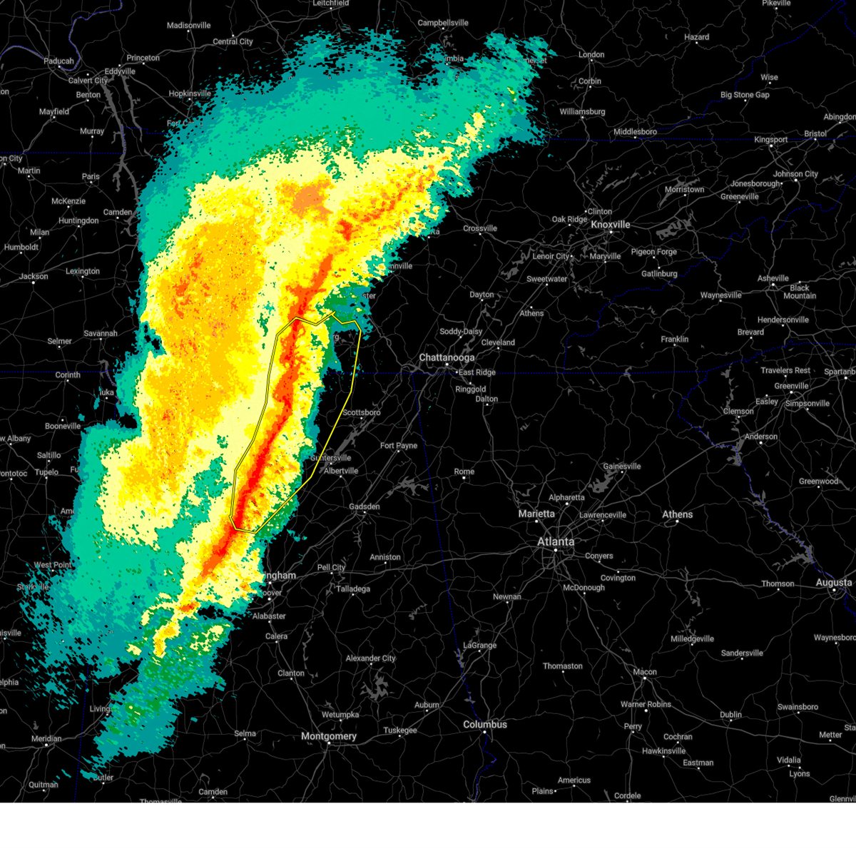 At 1229 am cst, severe thunderstorms were located along a line extending from 7 miles west of shelbyville to near meridianville to near triana to near smith dam, moving northeast at 65 mph. multiple areas of rotation are present within this line. additionally, there has recently been a confirmed report of a wind gust of 75 mph at huntsville international airport (radar indicated). Hazards include 70 mph wind gusts and quarter size hail. Hail damage to vehicles is expected. expect considerable tree damage. wind damage is also likely to mobile homes, roofs, and outbuildings. Locations impacted include, huntsville, decatur, madison, cullman, hartselle, winchester, arab, fayetteville, moores mill, and meridianville. At 1229 am cst, severe thunderstorms were located along a line extending from 7 miles west of shelbyville to near meridianville to near triana to near smith dam, moving northeast at 65 mph. multiple areas of rotation are present within this line. additionally, there has recently been a confirmed report of a wind gust of 75 mph at huntsville international airport (radar indicated). Hazards include 70 mph wind gusts and quarter size hail. Hail damage to vehicles is expected. expect considerable tree damage. wind damage is also likely to mobile homes, roofs, and outbuildings. Locations impacted include, huntsville, decatur, madison, cullman, hartselle, winchester, arab, fayetteville, moores mill, and meridianville.
|
| 2/16/2025 12:31 AM CST |
 the severe thunderstorm warning has been cancelled and is no longer in effect the severe thunderstorm warning has been cancelled and is no longer in effect
|
| 2/16/2025 12:18 AM CST | At 1215 am cst, severe thunderstorms were located along a line extending from lewisburg to near harvest to near hartselle to near camp mcdowell, moving northeast at 65 mph. multiple areas of rotation are present within this line. additionally, there have been confirmed reports of wind gusts of 60-65 mph along county line road in madison and at pryor field in decatur (radar indicated). Hazards include 60 mph wind gusts and quarter size hail. Hail damage to vehicles is expected. expect wind damage to roofs, siding, and trees. Locations impacted include, huntsville, decatur, madison, athens, cullman, hartselle, winchester, arab, fayetteville, and moores mill. |
| 2/16/2025 12:04 AM CST |
 Svrhun the national weather service in huntsville alabama has issued a * severe thunderstorm warning for, northwestern marshall county in northeastern alabama, northwestern jackson county in northeastern alabama, madison county in north central alabama, limestone county in north central alabama, cullman county in north central alabama, morgan county in north central alabama, southeastern lawrence county in northwestern alabama, moore county in middle tennessee, lincoln county in middle tennessee, western franklin county in middle tennessee, * until 1245 am cst. * at 1203 am cst, severe thunderstorms were located along a line extending from 11 miles southwest of lewisburg to tanner to 8 miles northeast of brushy lake to near carbon hill, moving northeast at 65 mph. multiple areas of rotation are present within this line. this line of storms has a history of producing wind damage (radar indicated). Hazards include 60 mph wind gusts and quarter size hail. Hail damage to vehicles is expected. Expect wind damage to roofs, siding, and trees. Svrhun the national weather service in huntsville alabama has issued a * severe thunderstorm warning for, northwestern marshall county in northeastern alabama, northwestern jackson county in northeastern alabama, madison county in north central alabama, limestone county in north central alabama, cullman county in north central alabama, morgan county in north central alabama, southeastern lawrence county in northwestern alabama, moore county in middle tennessee, lincoln county in middle tennessee, western franklin county in middle tennessee, * until 1245 am cst. * at 1203 am cst, severe thunderstorms were located along a line extending from 11 miles southwest of lewisburg to tanner to 8 miles northeast of brushy lake to near carbon hill, moving northeast at 65 mph. multiple areas of rotation are present within this line. this line of storms has a history of producing wind damage (radar indicated). Hazards include 60 mph wind gusts and quarter size hail. Hail damage to vehicles is expected. Expect wind damage to roofs, siding, and trees.
|
| 12/29/2024 12:25 AM CST |
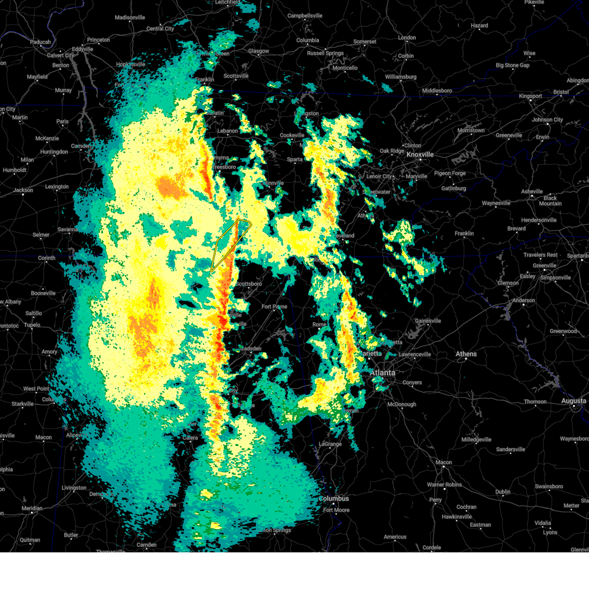 The storms which prompted the warning have weakened below severe limits, and no longer pose an immediate threat to life or property. therefore, the warning will be allowed to expire. however, gusty winds are still possible with these thunderstorms. a tornado watch remains in effect until 400 am cst for north central and northeastern alabama, and middle tennessee. to report severe weather, contact your nearest law enforcement agency. they will relay your report to the national weather service huntsville alabama. The storms which prompted the warning have weakened below severe limits, and no longer pose an immediate threat to life or property. therefore, the warning will be allowed to expire. however, gusty winds are still possible with these thunderstorms. a tornado watch remains in effect until 400 am cst for north central and northeastern alabama, and middle tennessee. to report severe weather, contact your nearest law enforcement agency. they will relay your report to the national weather service huntsville alabama.
|
| 12/29/2024 12:25 AM CST |
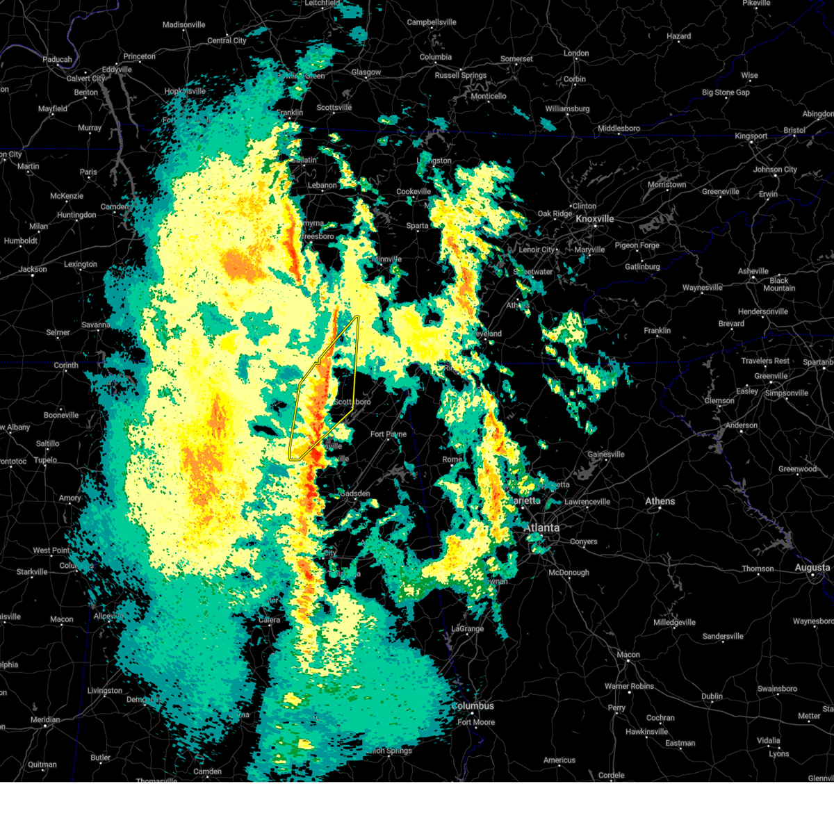 The storms which prompted the warning have weakened below severe limits, and no longer pose an immediate threat to life or property. therefore, the warning will be allowed to expire. however, gusty winds are still possible with these thunderstorms. a tornado watch remains in effect until 400 am cst for north central and northeastern alabama, and middle tennessee. to report severe weather, contact your nearest law enforcement agency. they will relay your report to the national weather service huntsville alabama. The storms which prompted the warning have weakened below severe limits, and no longer pose an immediate threat to life or property. therefore, the warning will be allowed to expire. however, gusty winds are still possible with these thunderstorms. a tornado watch remains in effect until 400 am cst for north central and northeastern alabama, and middle tennessee. to report severe weather, contact your nearest law enforcement agency. they will relay your report to the national weather service huntsville alabama.
|
| 12/29/2024 12:12 AM CST |
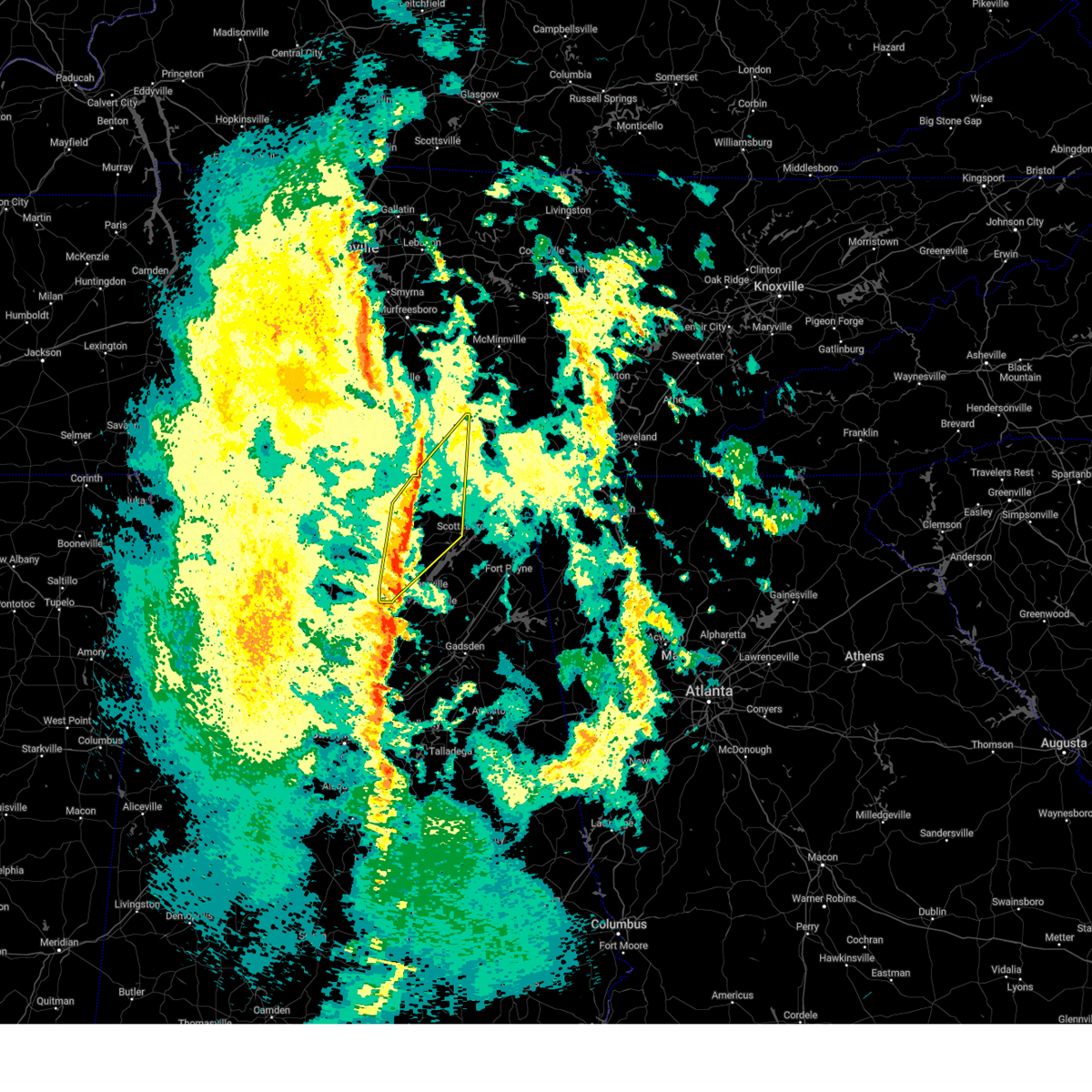 At 1212 am cst, severe thunderstorms were located along a line extending from near huntland to near owens cross roads, moving northeast at 55 mph (radar indicated). Hazards include 60 mph wind gusts. Expect damage to roofs, siding, and trees. Locations impacted include, southern huntsville, scottsboro, winchester, arab, decherd, cowan, owens cross roads, grant, huntland, and skyline. At 1212 am cst, severe thunderstorms were located along a line extending from near huntland to near owens cross roads, moving northeast at 55 mph (radar indicated). Hazards include 60 mph wind gusts. Expect damage to roofs, siding, and trees. Locations impacted include, southern huntsville, scottsboro, winchester, arab, decherd, cowan, owens cross roads, grant, huntland, and skyline.
|
| 12/29/2024 12:12 AM CST |
 the severe thunderstorm warning has been cancelled and is no longer in effect the severe thunderstorm warning has been cancelled and is no longer in effect
|
| 12/28/2024 11:59 PM CST |
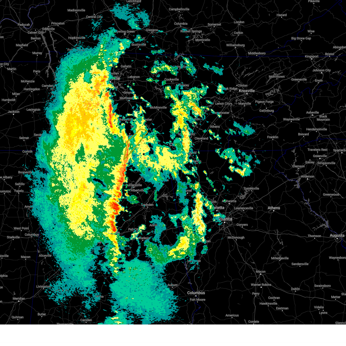 At 1158 pm cst, severe thunderstorms were located along a line extending from 7 miles northwest of huntland to new market, moving northeast at 40 mph (radar indicated). Hazards include 60 mph wind gusts. Expect damage to roofs, siding, and trees. Locations impacted include, winchester, decherd, estill springs, huntland, tims ford lake, new market, lexie crossroads, plevna, harmony, and elora. At 1158 pm cst, severe thunderstorms were located along a line extending from 7 miles northwest of huntland to new market, moving northeast at 40 mph (radar indicated). Hazards include 60 mph wind gusts. Expect damage to roofs, siding, and trees. Locations impacted include, winchester, decherd, estill springs, huntland, tims ford lake, new market, lexie crossroads, plevna, harmony, and elora.
|
| 12/28/2024 11:34 PM CST |
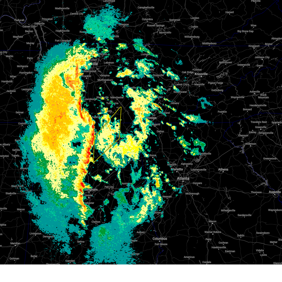 Svrhun the national weather service in huntsville alabama has issued a * severe thunderstorm warning for, northwestern marshall county in northeastern alabama, western jackson county in northeastern alabama, central madison county in north central alabama, northeastern cullman county in north central alabama, southeastern morgan county in north central alabama, western franklin county in middle tennessee, * until 1230 am cst. * at 1134 pm cst, severe thunderstorms were located along a line extending from near university of alabama in huntsville to near cullman, moving northeast at 55 mph (radar indicated). Hazards include 60 mph wind gusts. expect damage to roofs, siding, and trees Svrhun the national weather service in huntsville alabama has issued a * severe thunderstorm warning for, northwestern marshall county in northeastern alabama, western jackson county in northeastern alabama, central madison county in north central alabama, northeastern cullman county in north central alabama, southeastern morgan county in north central alabama, western franklin county in middle tennessee, * until 1230 am cst. * at 1134 pm cst, severe thunderstorms were located along a line extending from near university of alabama in huntsville to near cullman, moving northeast at 55 mph (radar indicated). Hazards include 60 mph wind gusts. expect damage to roofs, siding, and trees
|
| 12/28/2024 11:26 PM CST |
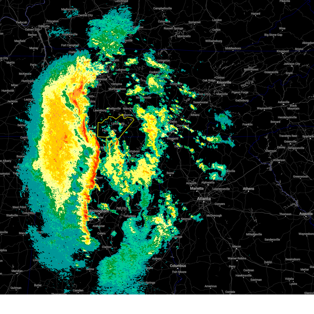 Svrhun the national weather service in huntsville alabama has issued a * severe thunderstorm warning for, north central madison county in north central alabama, moore county in middle tennessee, lincoln county in middle tennessee, western franklin county in middle tennessee, * until 1230 am cst. * at 1124 pm cst, severe thunderstorms were located along a line extending from near ardmore to harvest to madison, moving northeast at 60 mph. these storms have a history of producing power outages across northern alabama (radar indicated). Hazards include 60 mph wind gusts. expect damage to roofs, siding, and trees Svrhun the national weather service in huntsville alabama has issued a * severe thunderstorm warning for, north central madison county in north central alabama, moore county in middle tennessee, lincoln county in middle tennessee, western franklin county in middle tennessee, * until 1230 am cst. * at 1124 pm cst, severe thunderstorms were located along a line extending from near ardmore to harvest to madison, moving northeast at 60 mph. these storms have a history of producing power outages across northern alabama (radar indicated). Hazards include 60 mph wind gusts. expect damage to roofs, siding, and trees
|
| 8/17/2024 2:40 PM CDT |
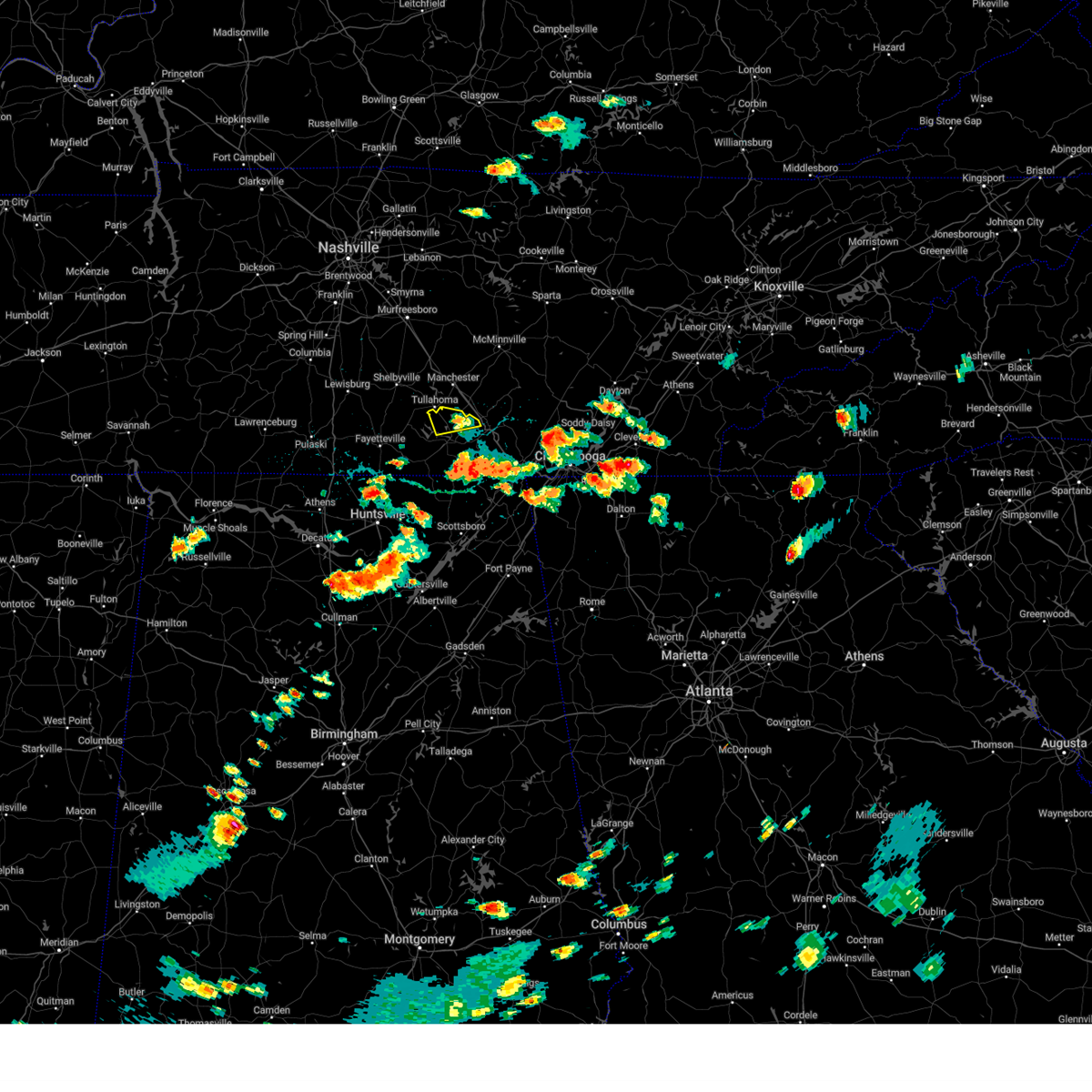 The storm which prompted the warning has weakened below severe limits, and no longer poses an immediate threat to life or property. therefore, the warning will be allowed to expire. The storm which prompted the warning has weakened below severe limits, and no longer poses an immediate threat to life or property. therefore, the warning will be allowed to expire.
|
| 8/17/2024 2:25 PM CDT |
 the severe thunderstorm warning has been cancelled and is no longer in effect the severe thunderstorm warning has been cancelled and is no longer in effect
|
| 8/17/2024 2:25 PM CDT |
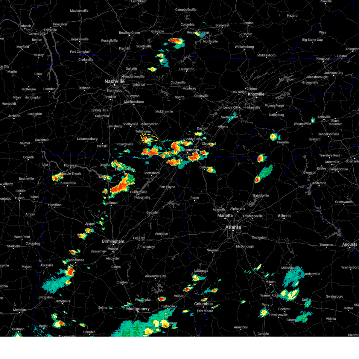 At 224 pm cdt, a severe thunderstorm was located over estill springs, or 7 miles north of winchester, moving east at 35 mph (radar indicated). Hazards include 60 mph wind gusts and quarter size hail. Hail damage to vehicles is expected. expect wind damage to roofs, siding, and trees. Locations impacted include, winchester, decherd, estill springs, tims ford lake, woods reservoir, arnold afb, and alto. At 224 pm cdt, a severe thunderstorm was located over estill springs, or 7 miles north of winchester, moving east at 35 mph (radar indicated). Hazards include 60 mph wind gusts and quarter size hail. Hail damage to vehicles is expected. expect wind damage to roofs, siding, and trees. Locations impacted include, winchester, decherd, estill springs, tims ford lake, woods reservoir, arnold afb, and alto.
|
| 8/17/2024 2:17 PM CDT |
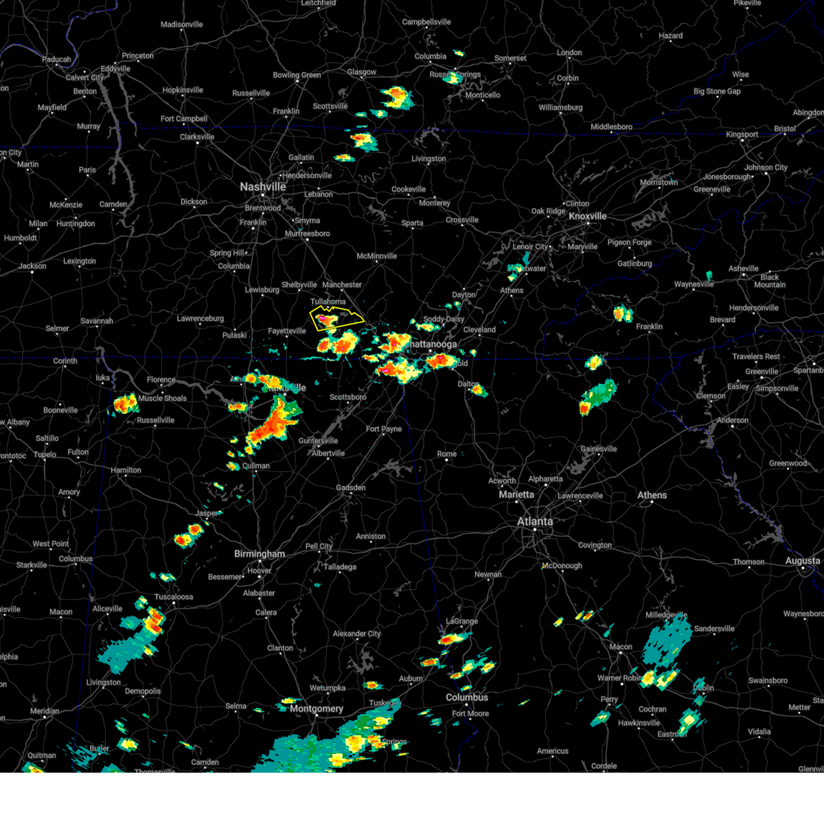 At 217 pm cdt, a severe thunderstorm was located near tims ford lake, or 8 miles northwest of winchester, moving east at 30 mph (radar indicated). Hazards include 60 mph wind gusts and quarter size hail. Hail damage to vehicles is expected. expect wind damage to roofs, siding, and trees. Locations impacted include, winchester, decherd, estill springs, tims ford lake, woods reservoir, arnold afb, and alto. At 217 pm cdt, a severe thunderstorm was located near tims ford lake, or 8 miles northwest of winchester, moving east at 30 mph (radar indicated). Hazards include 60 mph wind gusts and quarter size hail. Hail damage to vehicles is expected. expect wind damage to roofs, siding, and trees. Locations impacted include, winchester, decherd, estill springs, tims ford lake, woods reservoir, arnold afb, and alto.
|
| 8/17/2024 2:02 PM CDT |
 Svrhun the national weather service in huntsville alabama has issued a * severe thunderstorm warning for, eastern moore county in middle tennessee, northern franklin county in middle tennessee, * until 245 pm cdt. * at 202 pm cdt, a severe thunderstorm was located near lynchburg, moving east at 35 mph (radar indicated). Hazards include 60 mph wind gusts and quarter size hail. Hail damage to vehicles is expected. Expect wind damage to roofs, siding, and trees. Svrhun the national weather service in huntsville alabama has issued a * severe thunderstorm warning for, eastern moore county in middle tennessee, northern franklin county in middle tennessee, * until 245 pm cdt. * at 202 pm cdt, a severe thunderstorm was located near lynchburg, moving east at 35 mph (radar indicated). Hazards include 60 mph wind gusts and quarter size hail. Hail damage to vehicles is expected. Expect wind damage to roofs, siding, and trees.
|
| 8/17/2024 2:00 PM CDT |
 At 159 pm cdt, a severe thunderstorm was located near tims ford lake, or near winchester, moving east at 15 mph (radar indicated). Hazards include 60 mph wind gusts and nickel size hail. Expect damage to roofs, siding, and trees. Locations impacted include, winchester, decherd, cowan, tims ford lake, belvidere, and harmony. At 159 pm cdt, a severe thunderstorm was located near tims ford lake, or near winchester, moving east at 15 mph (radar indicated). Hazards include 60 mph wind gusts and nickel size hail. Expect damage to roofs, siding, and trees. Locations impacted include, winchester, decherd, cowan, tims ford lake, belvidere, and harmony.
|
| 8/17/2024 2:00 PM CDT |
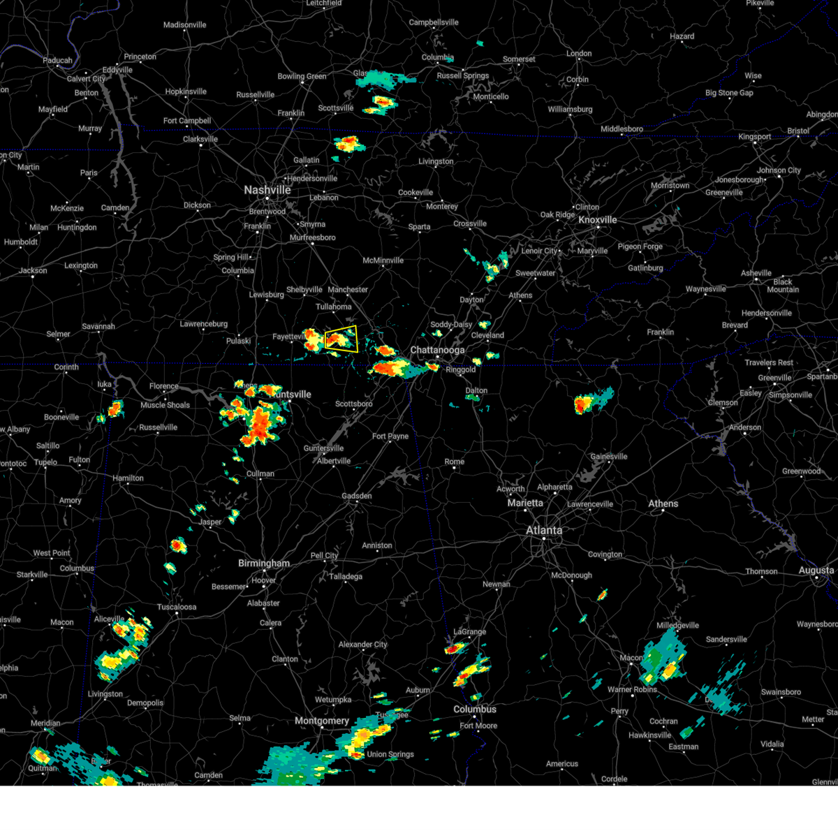 the severe thunderstorm warning has been cancelled and is no longer in effect the severe thunderstorm warning has been cancelled and is no longer in effect
|
| 8/17/2024 1:36 PM CDT |
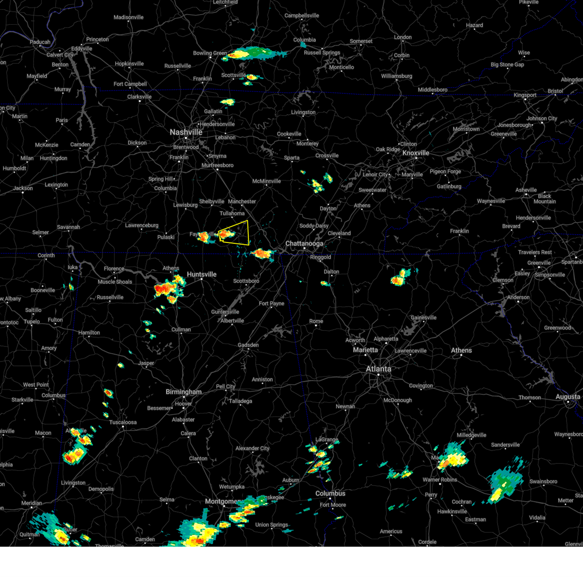 Svrhun the national weather service in huntsville alabama has issued a * severe thunderstorm warning for, southeastern moore county in middle tennessee, central franklin county in middle tennessee, * until 215 pm cdt. * at 135 pm cdt, a severe thunderstorm was located near tims ford lake, or 7 miles southeast of lynchburg, moving east at 15 mph (radar indicated). Hazards include 60 mph wind gusts and nickel size hail. expect damage to roofs, siding, and trees Svrhun the national weather service in huntsville alabama has issued a * severe thunderstorm warning for, southeastern moore county in middle tennessee, central franklin county in middle tennessee, * until 215 pm cdt. * at 135 pm cdt, a severe thunderstorm was located near tims ford lake, or 7 miles southeast of lynchburg, moving east at 15 mph (radar indicated). Hazards include 60 mph wind gusts and nickel size hail. expect damage to roofs, siding, and trees
|
| 7/29/2024 4:11 PM CDT |
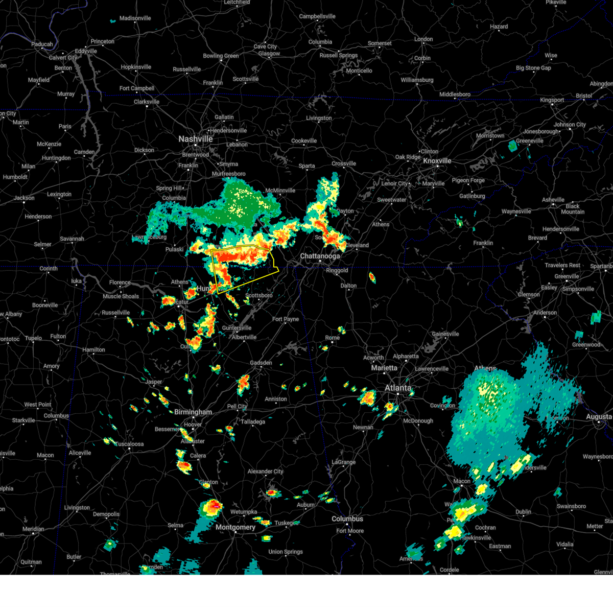 At 409 pm cdt, a severe thunderstorm was located near lynchburg, moving southeast at 25 mph (emergency management). Hazards include 70 mph wind gusts and quarter size hail. Hail damage to vehicles is expected. expect considerable tree damage. wind damage is also likely to mobile homes, roofs, and outbuildings. Locations impacted include, winchester, fayetteville, moores mill, meridianville, hazel green, cowan, huntland, new market, anderson, and lincoln. At 409 pm cdt, a severe thunderstorm was located near lynchburg, moving southeast at 25 mph (emergency management). Hazards include 70 mph wind gusts and quarter size hail. Hail damage to vehicles is expected. expect considerable tree damage. wind damage is also likely to mobile homes, roofs, and outbuildings. Locations impacted include, winchester, fayetteville, moores mill, meridianville, hazel green, cowan, huntland, new market, anderson, and lincoln.
|
| 7/29/2024 4:07 PM CDT | Several trees and powerlines down across the entire count in franklin county TN, 0.8 miles NW of Winchester, TN |
| 7/29/2024 3:59 PM CDT |
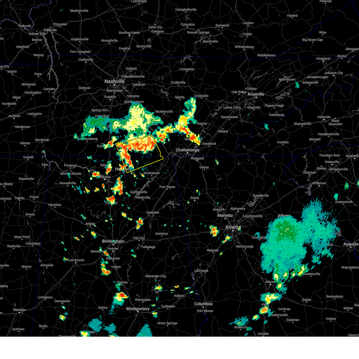 At 359 pm cdt, a severe thunderstorm was located over lynchburg, moving southeast at 25 mph (radar indicated). Hazards include 70 mph wind gusts and quarter size hail. Hail damage to vehicles is expected. expect considerable tree damage. wind damage is also likely to mobile homes, roofs, and outbuildings. Locations impacted include, northern huntsville, winchester, fayetteville, moores mill, meridianville, lynchburg, hazel green, decherd, estill springs, and cowan. At 359 pm cdt, a severe thunderstorm was located over lynchburg, moving southeast at 25 mph (radar indicated). Hazards include 70 mph wind gusts and quarter size hail. Hail damage to vehicles is expected. expect considerable tree damage. wind damage is also likely to mobile homes, roofs, and outbuildings. Locations impacted include, northern huntsville, winchester, fayetteville, moores mill, meridianville, lynchburg, hazel green, decherd, estill springs, and cowan.
|
| 7/29/2024 3:40 PM CDT |
 Svrhun the national weather service in huntsville alabama has issued a * severe thunderstorm warning for, northwestern jackson county in northeastern alabama, northeastern madison county in north central alabama, moore county in middle tennessee, lincoln county in middle tennessee, franklin county in middle tennessee, * until 430 pm cdt. * at 340 pm cdt, a severe thunderstorm was located near lynchburg, moving southeast at 25 mph (radar indicated). Hazards include 70 mph wind gusts and quarter size hail. Hail damage to vehicles is expected. expect considerable tree damage. Wind damage is also likely to mobile homes, roofs, and outbuildings. Svrhun the national weather service in huntsville alabama has issued a * severe thunderstorm warning for, northwestern jackson county in northeastern alabama, northeastern madison county in north central alabama, moore county in middle tennessee, lincoln county in middle tennessee, franklin county in middle tennessee, * until 430 pm cdt. * at 340 pm cdt, a severe thunderstorm was located near lynchburg, moving southeast at 25 mph (radar indicated). Hazards include 70 mph wind gusts and quarter size hail. Hail damage to vehicles is expected. expect considerable tree damage. Wind damage is also likely to mobile homes, roofs, and outbuildings.
|
| 7/29/2024 3:31 PM CDT |
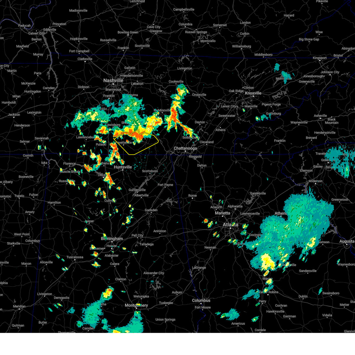 At 330 pm cdt, a severe thunderstorm was located near lynchburg, moving southeast at 30 mph (radar indicated). Hazards include ping pong ball size hail and 60 mph wind gusts. People and animals outdoors will be injured. expect hail damage to roofs, siding, windows, and vehicles. expect wind damage to roofs, siding, and trees. Locations impacted include, winchester, fayetteville, lynchburg, decherd, estill springs, cowan, huntland, petersburg, tims ford lake, and sewanee. At 330 pm cdt, a severe thunderstorm was located near lynchburg, moving southeast at 30 mph (radar indicated). Hazards include ping pong ball size hail and 60 mph wind gusts. People and animals outdoors will be injured. expect hail damage to roofs, siding, windows, and vehicles. expect wind damage to roofs, siding, and trees. Locations impacted include, winchester, fayetteville, lynchburg, decherd, estill springs, cowan, huntland, petersburg, tims ford lake, and sewanee.
|
| 7/29/2024 3:16 PM CDT |
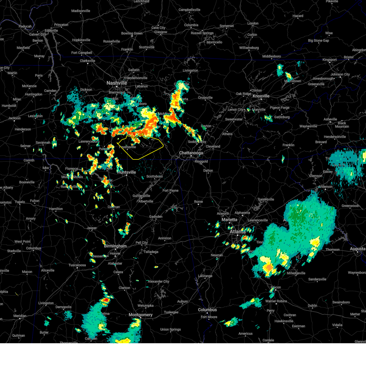 Svrhun the national weather service in huntsville alabama has issued a * severe thunderstorm warning for, moore county in middle tennessee, lincoln county in middle tennessee, franklin county in middle tennessee, * until 345 pm cdt. * at 316 pm cdt, a severe thunderstorm was located near shelbyville, moving southeast at 30 mph (radar indicated). Hazards include 60 mph wind gusts and quarter size hail. Hail damage to vehicles is expected. Expect wind damage to roofs, siding, and trees. Svrhun the national weather service in huntsville alabama has issued a * severe thunderstorm warning for, moore county in middle tennessee, lincoln county in middle tennessee, franklin county in middle tennessee, * until 345 pm cdt. * at 316 pm cdt, a severe thunderstorm was located near shelbyville, moving southeast at 30 mph (radar indicated). Hazards include 60 mph wind gusts and quarter size hail. Hail damage to vehicles is expected. Expect wind damage to roofs, siding, and trees.
|
| 7/21/2024 6:29 PM CDT |
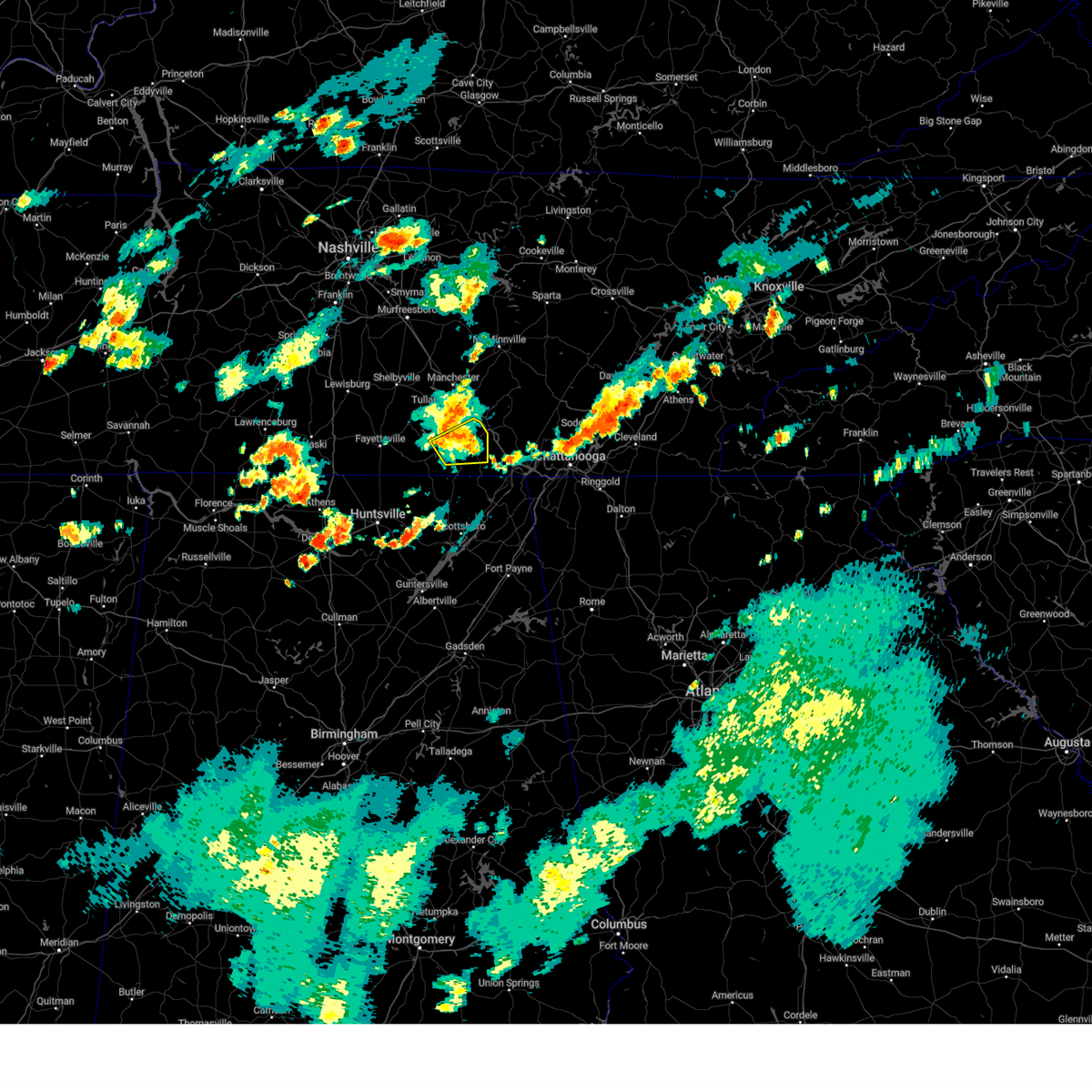 The storm which prompted the warning has weakened below severe limits, and has exited the warned area. therefore, the warning will be allowed to expire. The storm which prompted the warning has weakened below severe limits, and has exited the warned area. therefore, the warning will be allowed to expire.
|
| 7/21/2024 6:19 PM CDT |
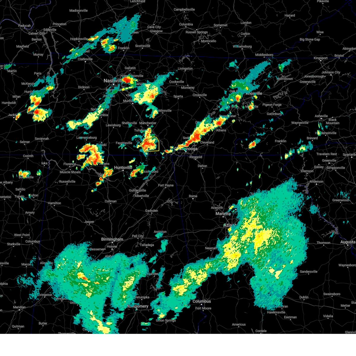 At 618 pm cdt, a severe thunderstorm was located over sewanee, or 8 miles east of winchester, moving northeast at 15 mph (radar indicated). Hazards include 60 mph wind gusts. Expect damage to roofs, siding, and trees. locations impacted include, winchester, decherd, cowan, sewanee, tims ford lake, alto, st. Andrews, belvidere, and sherwood. At 618 pm cdt, a severe thunderstorm was located over sewanee, or 8 miles east of winchester, moving northeast at 15 mph (radar indicated). Hazards include 60 mph wind gusts. Expect damage to roofs, siding, and trees. locations impacted include, winchester, decherd, cowan, sewanee, tims ford lake, alto, st. Andrews, belvidere, and sherwood.
|
| 7/21/2024 5:48 PM CDT |
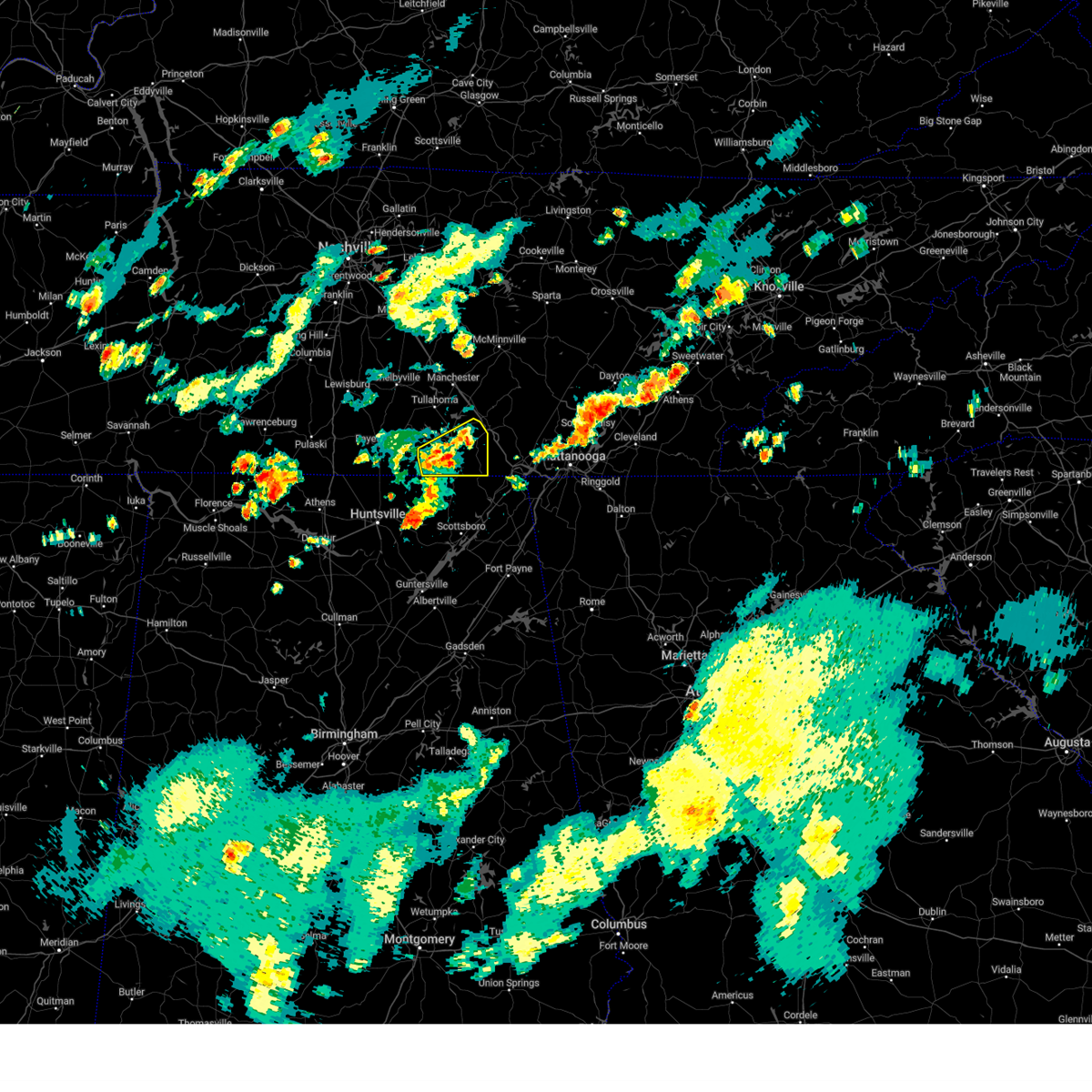 Svrhun the national weather service in huntsville alabama has issued a * severe thunderstorm warning for, franklin county in middle tennessee, * until 630 pm cdt. * at 547 pm cdt, a severe thunderstorm was located near cowan, or near winchester, moving east at 25 mph (radar indicated). Hazards include 60 mph wind gusts. expect damage to roofs, siding, and trees Svrhun the national weather service in huntsville alabama has issued a * severe thunderstorm warning for, franklin county in middle tennessee, * until 630 pm cdt. * at 547 pm cdt, a severe thunderstorm was located near cowan, or near winchester, moving east at 25 mph (radar indicated). Hazards include 60 mph wind gusts. expect damage to roofs, siding, and trees
|
| 7/21/2024 5:43 PM CDT |
 The storm which prompted the warning has moved out of the area. therefore, the warning will be allowed to expire. remember, a severe thunderstorm warning still remains in effect for portions of madison and jackson county!. The storm which prompted the warning has moved out of the area. therefore, the warning will be allowed to expire. remember, a severe thunderstorm warning still remains in effect for portions of madison and jackson county!.
|
| 7/21/2024 5:30 PM CDT |
 the severe thunderstorm warning has been cancelled and is no longer in effect the severe thunderstorm warning has been cancelled and is no longer in effect
|
| 7/21/2024 5:30 PM CDT |
 At 529 pm cdt, a severe thunderstorm was located 7 miles east of huntland, or 11 miles south of winchester, moving east at 30 mph (radar indicated). Hazards include 60 mph wind gusts and penny size hail. Expect damage to roofs, siding, and trees. Locations impacted include, winchester, huntland, new market, hytop, maysville, princeton, plevna, jericho, estillfork, and maxwell. At 529 pm cdt, a severe thunderstorm was located 7 miles east of huntland, or 11 miles south of winchester, moving east at 30 mph (radar indicated). Hazards include 60 mph wind gusts and penny size hail. Expect damage to roofs, siding, and trees. Locations impacted include, winchester, huntland, new market, hytop, maysville, princeton, plevna, jericho, estillfork, and maxwell.
|
| 7/21/2024 4:57 PM CDT |
 Svrhun the national weather service in huntsville alabama has issued a * severe thunderstorm warning for, northwestern jackson county in northeastern alabama, northeastern madison county in north central alabama, moore county in middle tennessee, southeastern lincoln county in middle tennessee, southwestern franklin county in middle tennessee, * until 545 pm cdt. * at 456 pm cdt, a severe thunderstorm was located 7 miles north of new market, or 12 miles southeast of fayetteville, moving northeast at 15 mph (radar indicated). Hazards include 60 mph wind gusts and penny size hail. expect damage to roofs, siding, and trees Svrhun the national weather service in huntsville alabama has issued a * severe thunderstorm warning for, northwestern jackson county in northeastern alabama, northeastern madison county in north central alabama, moore county in middle tennessee, southeastern lincoln county in middle tennessee, southwestern franklin county in middle tennessee, * until 545 pm cdt. * at 456 pm cdt, a severe thunderstorm was located 7 miles north of new market, or 12 miles southeast of fayetteville, moving northeast at 15 mph (radar indicated). Hazards include 60 mph wind gusts and penny size hail. expect damage to roofs, siding, and trees
|
| 5/25/2024 6:39 AM CDT |
 At 638 am cdt, severe thunderstorms were located along a line extending from estill springs to 6 miles west of grant, moving east at 45 mph (radar indicated). Hazards include 60 mph wind gusts and nickel size hail. Expect damage to roofs, siding, and trees. Locations impacted include, scottsboro, winchester, rainsville, decherd, estill springs, stevenson, sylvania, cowan, fyffe, and hollywood. At 638 am cdt, severe thunderstorms were located along a line extending from estill springs to 6 miles west of grant, moving east at 45 mph (radar indicated). Hazards include 60 mph wind gusts and nickel size hail. Expect damage to roofs, siding, and trees. Locations impacted include, scottsboro, winchester, rainsville, decherd, estill springs, stevenson, sylvania, cowan, fyffe, and hollywood.
|
| 5/25/2024 6:39 AM CDT |
 the severe thunderstorm warning has been cancelled and is no longer in effect the severe thunderstorm warning has been cancelled and is no longer in effect
|
| 5/25/2024 6:20 AM CDT |
 At 620 am cdt, severe thunderstorms were located along a line extending from lynchburg to near morgan city, moving southeast at 50 mph (radar indicated). Hazards include 60 mph wind gusts and nickel size hail. Expect damage to roofs, siding, and trees. Locations impacted include, huntsville, scottsboro, winchester, fayetteville, rainsville, moores mill, meridianville, lynchburg, redstone arsenal, and hazel green. At 620 am cdt, severe thunderstorms were located along a line extending from lynchburg to near morgan city, moving southeast at 50 mph (radar indicated). Hazards include 60 mph wind gusts and nickel size hail. Expect damage to roofs, siding, and trees. Locations impacted include, huntsville, scottsboro, winchester, fayetteville, rainsville, moores mill, meridianville, lynchburg, redstone arsenal, and hazel green.
|
| 5/25/2024 6:14 AM CDT |
 the severe thunderstorm warning has been cancelled and is no longer in effect the severe thunderstorm warning has been cancelled and is no longer in effect
|
| 5/25/2024 6:14 AM CDT |
 At 614 am cdt, severe thunderstorms were located along a line extending from near lynchburg to near morgan city, moving southeast at 45 mph (radar indicated). Hazards include 70 mph wind gusts and nickel size hail. Expect considerable tree damage. damage is likely to mobile homes, roofs, and outbuildings. Locations impacted include, huntsville, madison, scottsboro, winchester, fayetteville, rainsville, moores mill, meridianville, lynchburg, and redstone arsenal. At 614 am cdt, severe thunderstorms were located along a line extending from near lynchburg to near morgan city, moving southeast at 45 mph (radar indicated). Hazards include 70 mph wind gusts and nickel size hail. Expect considerable tree damage. damage is likely to mobile homes, roofs, and outbuildings. Locations impacted include, huntsville, madison, scottsboro, winchester, fayetteville, rainsville, moores mill, meridianville, lynchburg, and redstone arsenal.
|
| 5/25/2024 6:00 AM CDT |
 At 600 am cdt, severe thunderstorms were located along a line extending from near petersburg to triana, moving southeast at 50 mph (radar indicated). Hazards include 70 mph wind gusts and nickel size hail. Expect considerable tree damage. damage is likely to mobile homes, roofs, and outbuildings. Locations impacted include, huntsville, madison, athens, scottsboro, winchester, fayetteville, rainsville, moores mill, meridianville, and lynchburg. At 600 am cdt, severe thunderstorms were located along a line extending from near petersburg to triana, moving southeast at 50 mph (radar indicated). Hazards include 70 mph wind gusts and nickel size hail. Expect considerable tree damage. damage is likely to mobile homes, roofs, and outbuildings. Locations impacted include, huntsville, madison, athens, scottsboro, winchester, fayetteville, rainsville, moores mill, meridianville, and lynchburg.
|
| 5/25/2024 5:53 AM CDT |
 Svrhun the national weather service in huntsville alabama has issued a * severe thunderstorm warning for, northeastern marshall county in northeastern alabama, jackson county in northeastern alabama, madison county in north central alabama, limestone county in north central alabama, central dekalb county in northeastern alabama, moore county in middle tennessee, lincoln county in middle tennessee, franklin county in middle tennessee, * until 700 am cdt. * at 553 am cdt, severe thunderstorms were located along a line extending from petersburg to near huntsville international airport, moving southeast at 50 mph (radar indicated). Hazards include 60 mph wind gusts and nickel size hail. expect damage to roofs, siding, and trees Svrhun the national weather service in huntsville alabama has issued a * severe thunderstorm warning for, northeastern marshall county in northeastern alabama, jackson county in northeastern alabama, madison county in north central alabama, limestone county in north central alabama, central dekalb county in northeastern alabama, moore county in middle tennessee, lincoln county in middle tennessee, franklin county in middle tennessee, * until 700 am cdt. * at 553 am cdt, severe thunderstorms were located along a line extending from petersburg to near huntsville international airport, moving southeast at 50 mph (radar indicated). Hazards include 60 mph wind gusts and nickel size hail. expect damage to roofs, siding, and trees
|
| 5/14/2024 5:55 PM CDT |
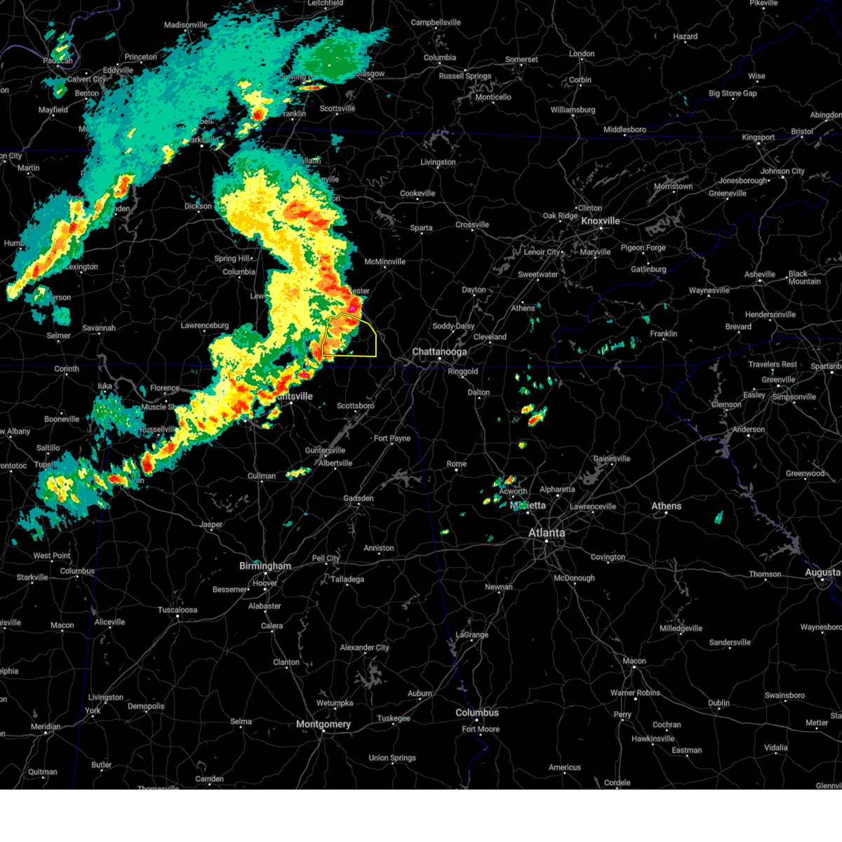 The storms which prompted the warning have weakened below severe limits, and no longer pose an immediate threat to life or property. therefore, the warning will be allowed to expire. however, gusty winds are still possible with these thunderstorms. a severe thunderstorm watch remains in effect until 800 pm cdt for north central alabama, and middle tennessee. The storms which prompted the warning have weakened below severe limits, and no longer pose an immediate threat to life or property. therefore, the warning will be allowed to expire. however, gusty winds are still possible with these thunderstorms. a severe thunderstorm watch remains in effect until 800 pm cdt for north central alabama, and middle tennessee.
|
| 5/14/2024 5:54 PM CDT |
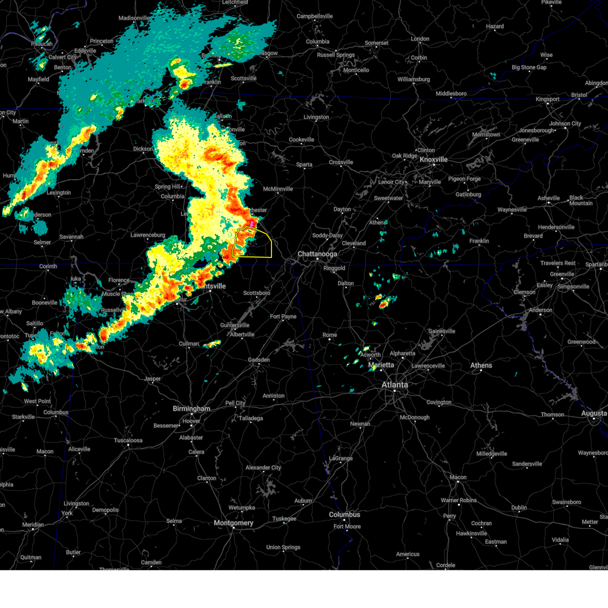 the severe thunderstorm warning has been cancelled and is no longer in effect the severe thunderstorm warning has been cancelled and is no longer in effect
|
| 5/14/2024 5:54 PM CDT |
 At 553 pm cdt, severe thunderstorms were located along a line extending from 7 miles south of manchester to near decherd to 7 miles southwest of cowan, moving east at 50 mph (emergency management). Hazards include 60 mph wind gusts. Expect damage to roofs, siding, and trees. Locations impacted include, winchester, decherd, estill springs, cowan, huntland, sewanee, tims ford lake, lexie crossroads, harmony, and maxwell. At 553 pm cdt, severe thunderstorms were located along a line extending from 7 miles south of manchester to near decherd to 7 miles southwest of cowan, moving east at 50 mph (emergency management). Hazards include 60 mph wind gusts. Expect damage to roofs, siding, and trees. Locations impacted include, winchester, decherd, estill springs, cowan, huntland, sewanee, tims ford lake, lexie crossroads, harmony, and maxwell.
|
| 5/14/2024 5:30 PM CDT |
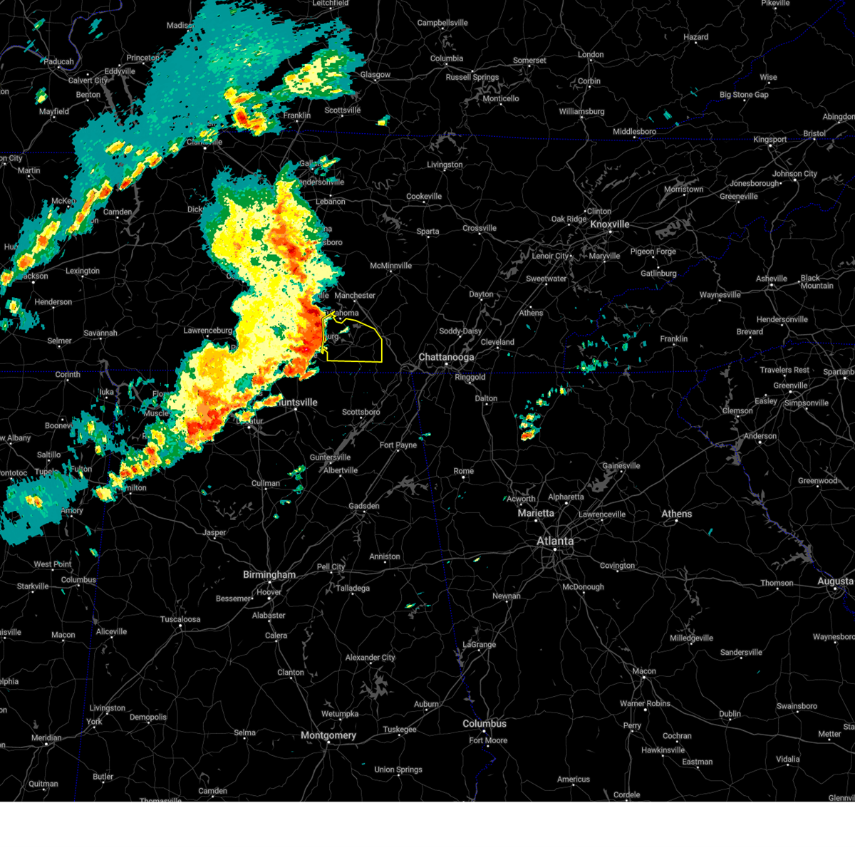 Svrhun the national weather service in huntsville alabama has issued a * severe thunderstorm warning for, eastern moore county in middle tennessee, franklin county in middle tennessee, * until 600 pm cdt. * at 529 pm cdt, severe thunderstorms were located along a line extending from 6 miles west of tullahoma to near tims ford lake to near huntland, moving east at 50 mph (emergency management. at 525 pm wind damage was reported in moore county). Hazards include 60 mph wind gusts. expect damage to roofs, siding, and trees Svrhun the national weather service in huntsville alabama has issued a * severe thunderstorm warning for, eastern moore county in middle tennessee, franklin county in middle tennessee, * until 600 pm cdt. * at 529 pm cdt, severe thunderstorms were located along a line extending from 6 miles west of tullahoma to near tims ford lake to near huntland, moving east at 50 mph (emergency management. at 525 pm wind damage was reported in moore county). Hazards include 60 mph wind gusts. expect damage to roofs, siding, and trees
|
| 5/8/2024 10:32 PM CDT |
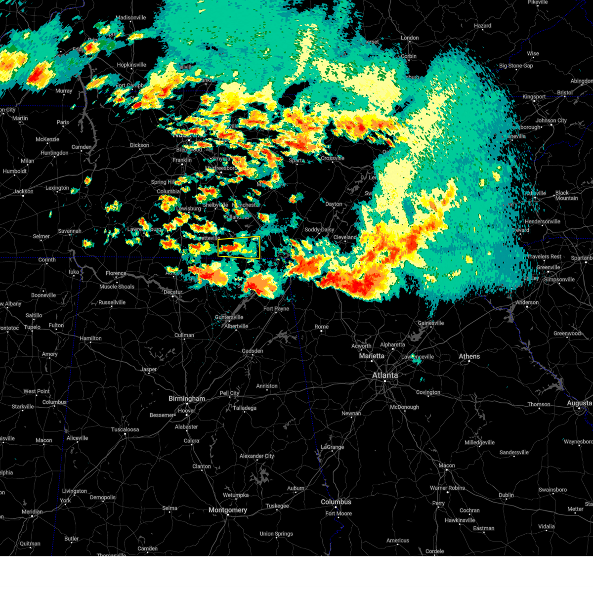 At 1032 pm cdt, a severe thunderstorm was located over huntland, or 13 miles southwest of winchester, moving east at 20 mph (radar indicated). Hazards include 60 mph wind gusts and quarter size hail. Hail damage to vehicles is expected. expect wind damage to roofs, siding, and trees. Locations impacted include, winchester, decherd, cowan, huntland, sewanee, lexie crossroads, harmony, elora, hurdlow, and maxwell. At 1032 pm cdt, a severe thunderstorm was located over huntland, or 13 miles southwest of winchester, moving east at 20 mph (radar indicated). Hazards include 60 mph wind gusts and quarter size hail. Hail damage to vehicles is expected. expect wind damage to roofs, siding, and trees. Locations impacted include, winchester, decherd, cowan, huntland, sewanee, lexie crossroads, harmony, elora, hurdlow, and maxwell.
|
| 5/8/2024 10:16 PM CDT |
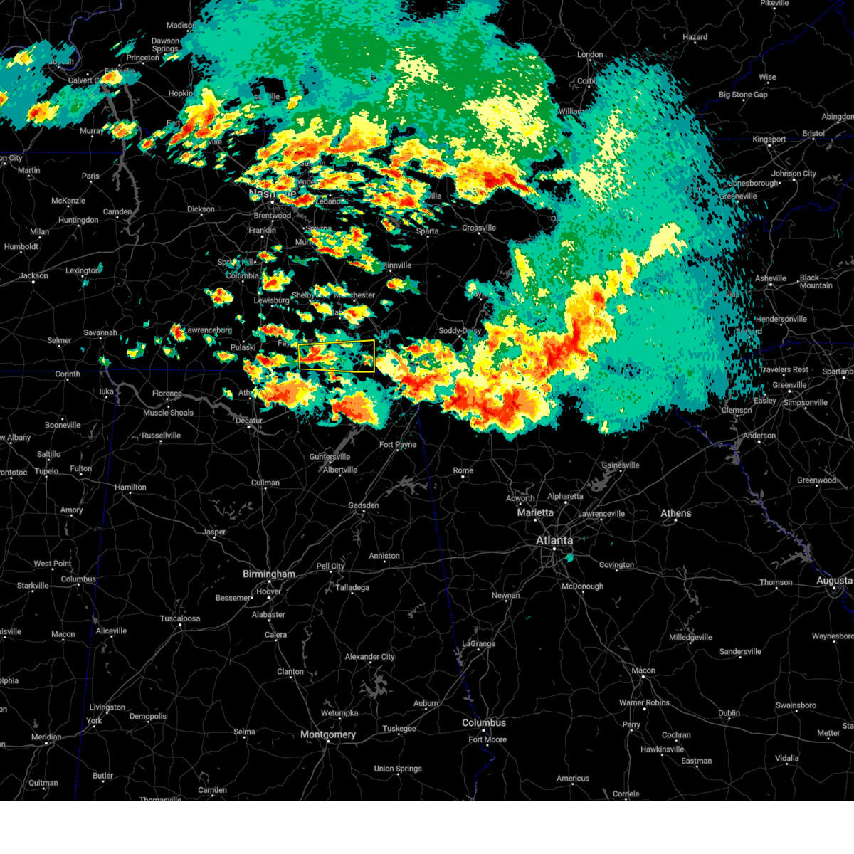 Svrhun the national weather service in huntsville alabama has issued a * severe thunderstorm warning for, south central moore county in middle tennessee, southeastern lincoln county in middle tennessee, southern franklin county in middle tennessee, * until 1100 pm cdt. * at 1016 pm cdt, a severe thunderstorm was located 7 miles west of huntland, or 11 miles east of fayetteville, moving east at 40 mph (radar indicated). Hazards include 60 mph wind gusts and quarter size hail. Hail damage to vehicles is expected. Expect wind damage to roofs, siding, and trees. Svrhun the national weather service in huntsville alabama has issued a * severe thunderstorm warning for, south central moore county in middle tennessee, southeastern lincoln county in middle tennessee, southern franklin county in middle tennessee, * until 1100 pm cdt. * at 1016 pm cdt, a severe thunderstorm was located 7 miles west of huntland, or 11 miles east of fayetteville, moving east at 40 mph (radar indicated). Hazards include 60 mph wind gusts and quarter size hail. Hail damage to vehicles is expected. Expect wind damage to roofs, siding, and trees.
|
| 5/8/2024 9:06 PM CDT |
 Torhun the national weather service in huntsville alabama has issued a * tornado warning for, northwestern jackson county in northeastern alabama, northeastern madison county in north central alabama, south central moore county in middle tennessee, southeastern lincoln county in middle tennessee, southwestern franklin county in middle tennessee, * until 1000 pm cdt. * at 905 pm cdt, a severe thunderstorm capable of producing a tornado was located 8 miles southeast of fayetteville, moving east at 20 mph (radar indicated rotation). Hazards include tornado and golf ball size hail. Flying debris will be dangerous to those caught without shelter. mobile homes will be damaged or destroyed. damage to roofs, windows, and vehicles will occur. tree damage is likely. this dangerous storm will be near, huntland around 925 pm cdt. Other locations impacted by this tornadic thunderstorm include lexie crossroads, plevna, jericho, elora, maxwell, hytop, smithland, francisco, beans creek, and molino. Torhun the national weather service in huntsville alabama has issued a * tornado warning for, northwestern jackson county in northeastern alabama, northeastern madison county in north central alabama, south central moore county in middle tennessee, southeastern lincoln county in middle tennessee, southwestern franklin county in middle tennessee, * until 1000 pm cdt. * at 905 pm cdt, a severe thunderstorm capable of producing a tornado was located 8 miles southeast of fayetteville, moving east at 20 mph (radar indicated rotation). Hazards include tornado and golf ball size hail. Flying debris will be dangerous to those caught without shelter. mobile homes will be damaged or destroyed. damage to roofs, windows, and vehicles will occur. tree damage is likely. this dangerous storm will be near, huntland around 925 pm cdt. Other locations impacted by this tornadic thunderstorm include lexie crossroads, plevna, jericho, elora, maxwell, hytop, smithland, francisco, beans creek, and molino.
|
| 5/8/2024 8:28 PM CDT |
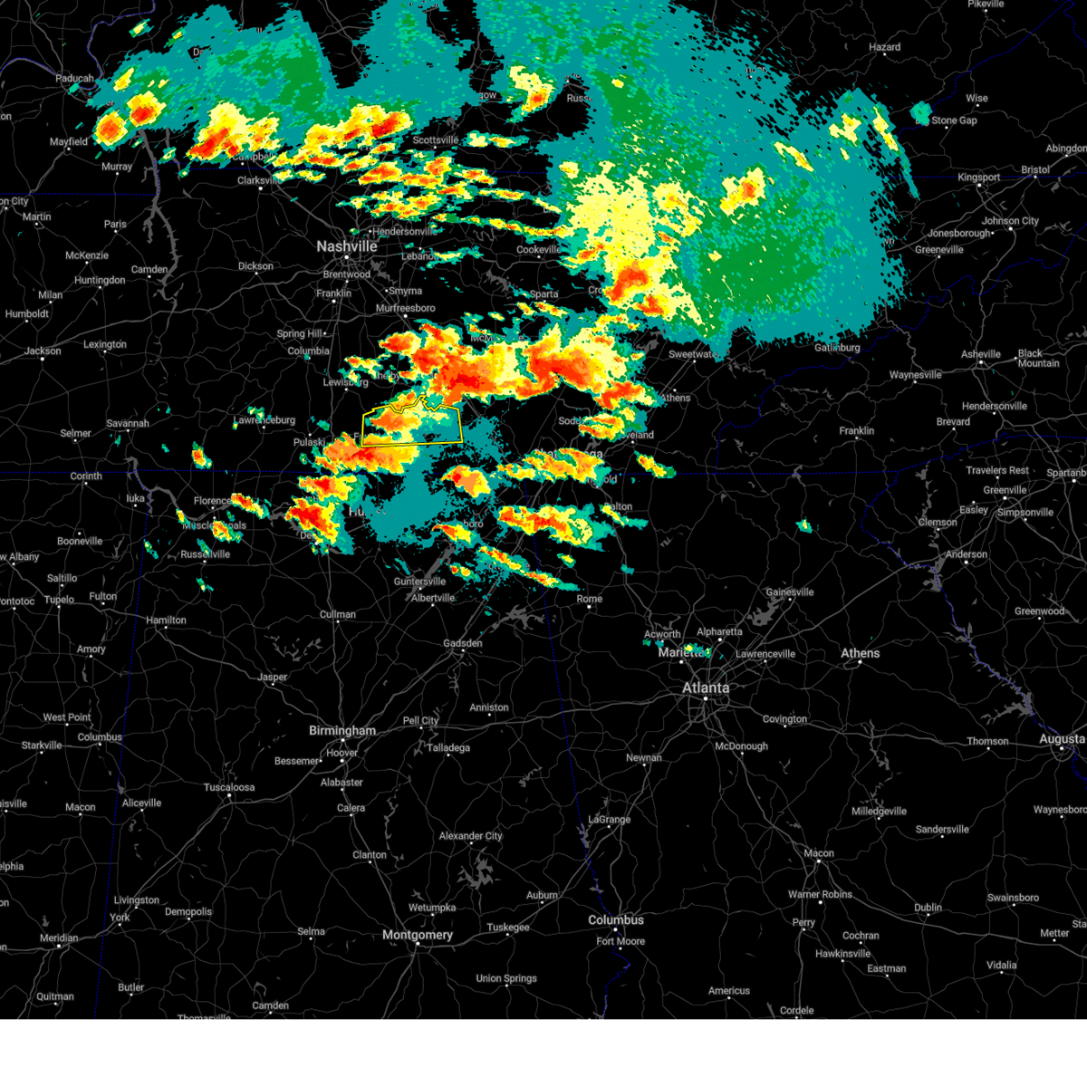 Svrhun the national weather service in huntsville alabama has issued a * severe thunderstorm warning for, moore county in middle tennessee, central lincoln county in middle tennessee, northwestern franklin county in middle tennessee, * until 915 pm cdt. * at 828 pm cdt, a severe thunderstorm was located near lynchburg, moving east at 40 mph (radar indicated). Hazards include 60 mph wind gusts and quarter size hail. Hail damage to vehicles is expected. Expect wind damage to roofs, siding, and trees. Svrhun the national weather service in huntsville alabama has issued a * severe thunderstorm warning for, moore county in middle tennessee, central lincoln county in middle tennessee, northwestern franklin county in middle tennessee, * until 915 pm cdt. * at 828 pm cdt, a severe thunderstorm was located near lynchburg, moving east at 40 mph (radar indicated). Hazards include 60 mph wind gusts and quarter size hail. Hail damage to vehicles is expected. Expect wind damage to roofs, siding, and trees.
|
| 5/7/2024 7:29 PM CDT |
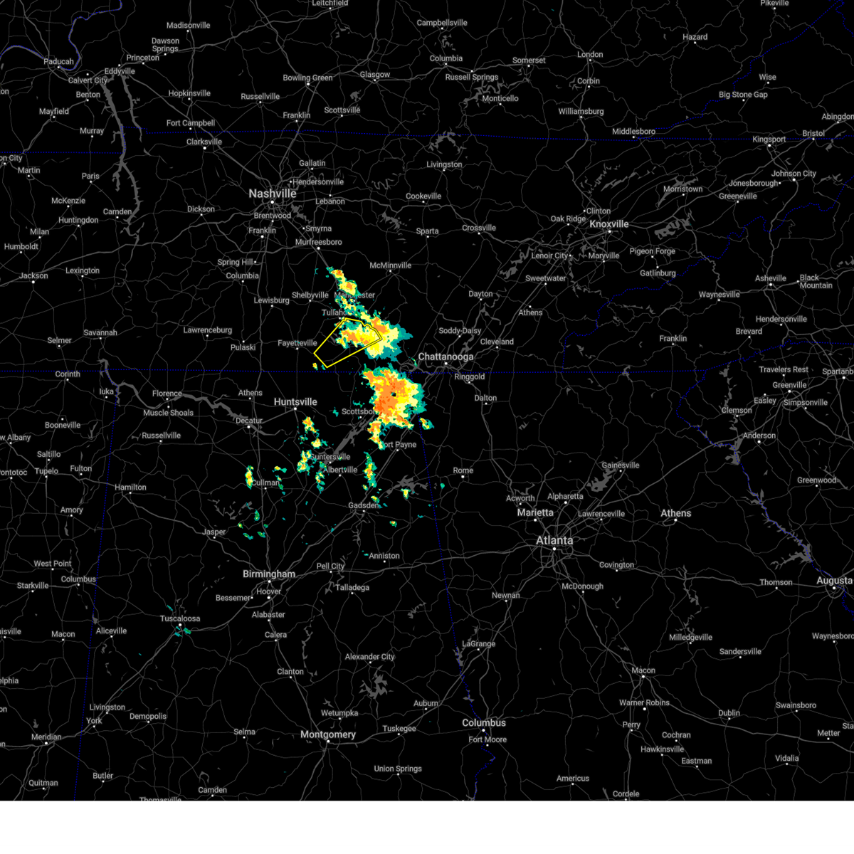 The storm which prompted the warning has weakened below severe limits, and has exited the warned area. therefore, the warning will be allowed to expire. The storm which prompted the warning has weakened below severe limits, and has exited the warned area. therefore, the warning will be allowed to expire.
|
| 5/7/2024 6:54 PM CDT |
 The storm which prompted the warning has moved out of the area. therefore, the warning will be allowed to expire. remember, a severe thunderstorm warning still remains in effect for portions of franklin and moore county tn. The storm which prompted the warning has moved out of the area. therefore, the warning will be allowed to expire. remember, a severe thunderstorm warning still remains in effect for portions of franklin and moore county tn.
|
| 5/7/2024 6:52 PM CDT |
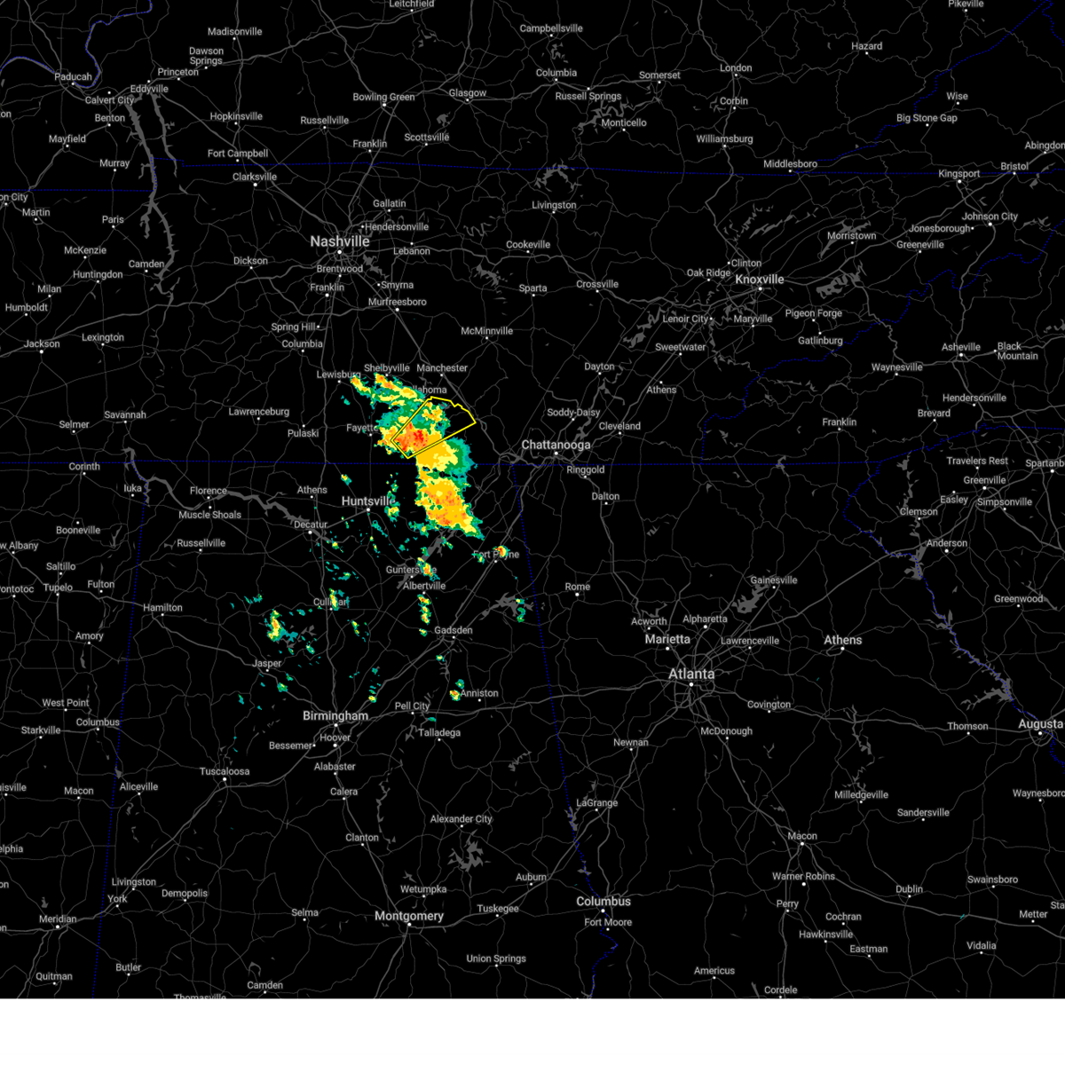 Svrhun the national weather service in huntsville alabama has issued a * severe thunderstorm warning for, southeastern moore county in middle tennessee, east central lincoln county in middle tennessee, central franklin county in middle tennessee, * until 730 pm cdt. * at 651 pm cdt, a severe thunderstorm was located near huntland, or 13 miles south of lynchburg, moving northeast at 35 mph (radar indicated). Hazards include 60 mph wind gusts and quarter size hail. Hail damage to vehicles is expected. Expect wind damage to roofs, siding, and trees. Svrhun the national weather service in huntsville alabama has issued a * severe thunderstorm warning for, southeastern moore county in middle tennessee, east central lincoln county in middle tennessee, central franklin county in middle tennessee, * until 730 pm cdt. * at 651 pm cdt, a severe thunderstorm was located near huntland, or 13 miles south of lynchburg, moving northeast at 35 mph (radar indicated). Hazards include 60 mph wind gusts and quarter size hail. Hail damage to vehicles is expected. Expect wind damage to roofs, siding, and trees.
|
| 5/7/2024 6:24 PM CDT |
 At 624 pm cdt, a severe thunderstorm was located near new market, or 10 miles northeast of moores mill, moving northeast at 30 mph (radar indicated). Hazards include ping pong ball size hail and 60 mph wind gusts. People and animals outdoors will be injured. expect hail damage to roofs, siding, windows, and vehicles. expect wind damage to roofs, siding, and trees. Locations impacted include, winchester, hazel green, huntland, tims ford lake, new market, lincoln, hytop, lexie crossroads, plevna, and harmony. At 624 pm cdt, a severe thunderstorm was located near new market, or 10 miles northeast of moores mill, moving northeast at 30 mph (radar indicated). Hazards include ping pong ball size hail and 60 mph wind gusts. People and animals outdoors will be injured. expect hail damage to roofs, siding, windows, and vehicles. expect wind damage to roofs, siding, and trees. Locations impacted include, winchester, hazel green, huntland, tims ford lake, new market, lincoln, hytop, lexie crossroads, plevna, and harmony.
|
| 5/7/2024 6:15 PM CDT |
 Svrhun the national weather service in huntsville alabama has issued a * severe thunderstorm warning for, northwestern jackson county in northeastern alabama, northeastern madison county in north central alabama, southeastern lincoln county in middle tennessee, southwestern franklin county in middle tennessee, * until 700 pm cdt. * at 615 pm cdt, a severe thunderstorm was located over new market, or near moores mill, moving northeast at 30 mph (radar indicated). Hazards include 60 mph wind gusts and quarter size hail. Hail damage to vehicles is expected. Expect wind damage to roofs, siding, and trees. Svrhun the national weather service in huntsville alabama has issued a * severe thunderstorm warning for, northwestern jackson county in northeastern alabama, northeastern madison county in north central alabama, southeastern lincoln county in middle tennessee, southwestern franklin county in middle tennessee, * until 700 pm cdt. * at 615 pm cdt, a severe thunderstorm was located over new market, or near moores mill, moving northeast at 30 mph (radar indicated). Hazards include 60 mph wind gusts and quarter size hail. Hail damage to vehicles is expected. Expect wind damage to roofs, siding, and trees.
|
| 5/3/2024 4:42 PM CDT |
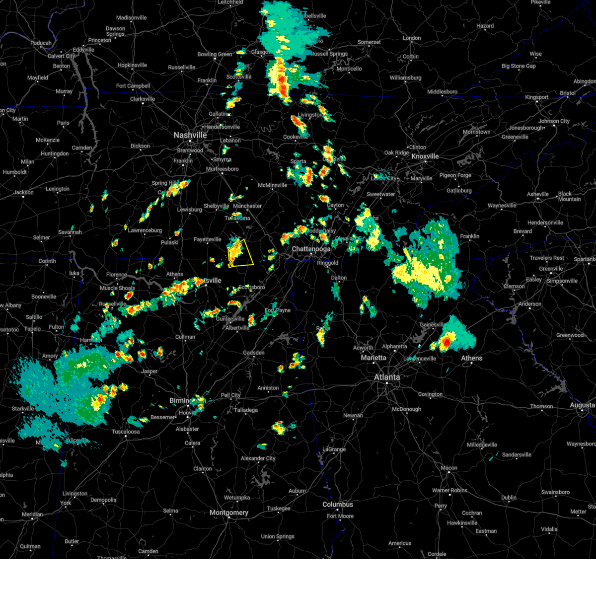 The storm which prompted the warning has weakened below severe limits, and no longer poses an immediate threat to life or property. therefore, the warning will be allowed to expire. however, gusty winds are still possible with this thunderstorm. The storm which prompted the warning has weakened below severe limits, and no longer poses an immediate threat to life or property. therefore, the warning will be allowed to expire. however, gusty winds are still possible with this thunderstorm.
|
| 5/3/2024 4:32 PM CDT |
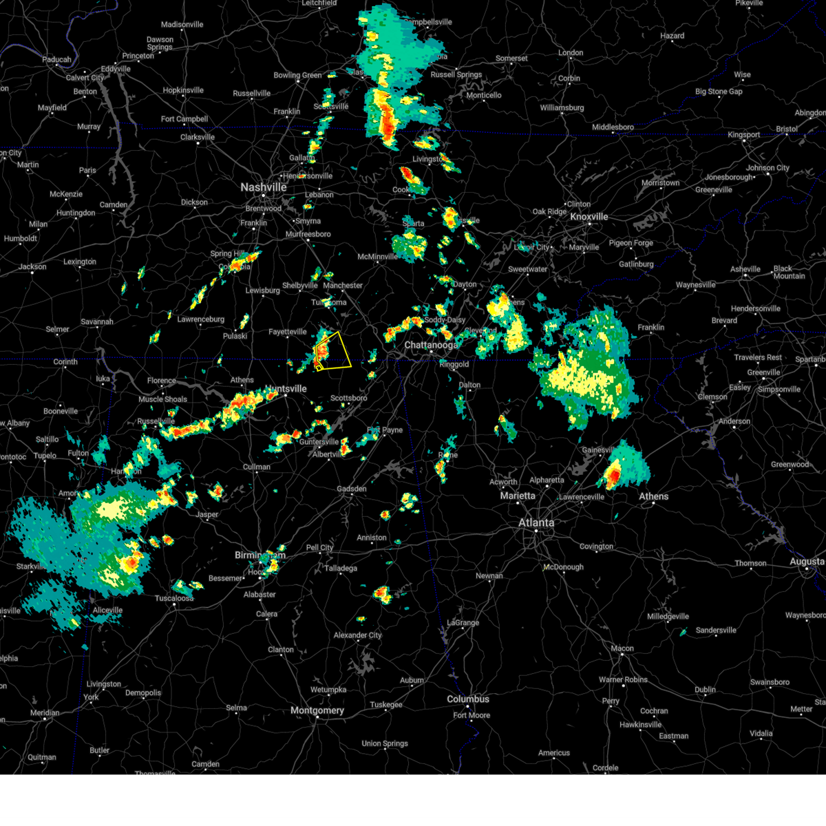 the severe thunderstorm warning has been cancelled and is no longer in effect the severe thunderstorm warning has been cancelled and is no longer in effect
|
| 5/3/2024 4:32 PM CDT |
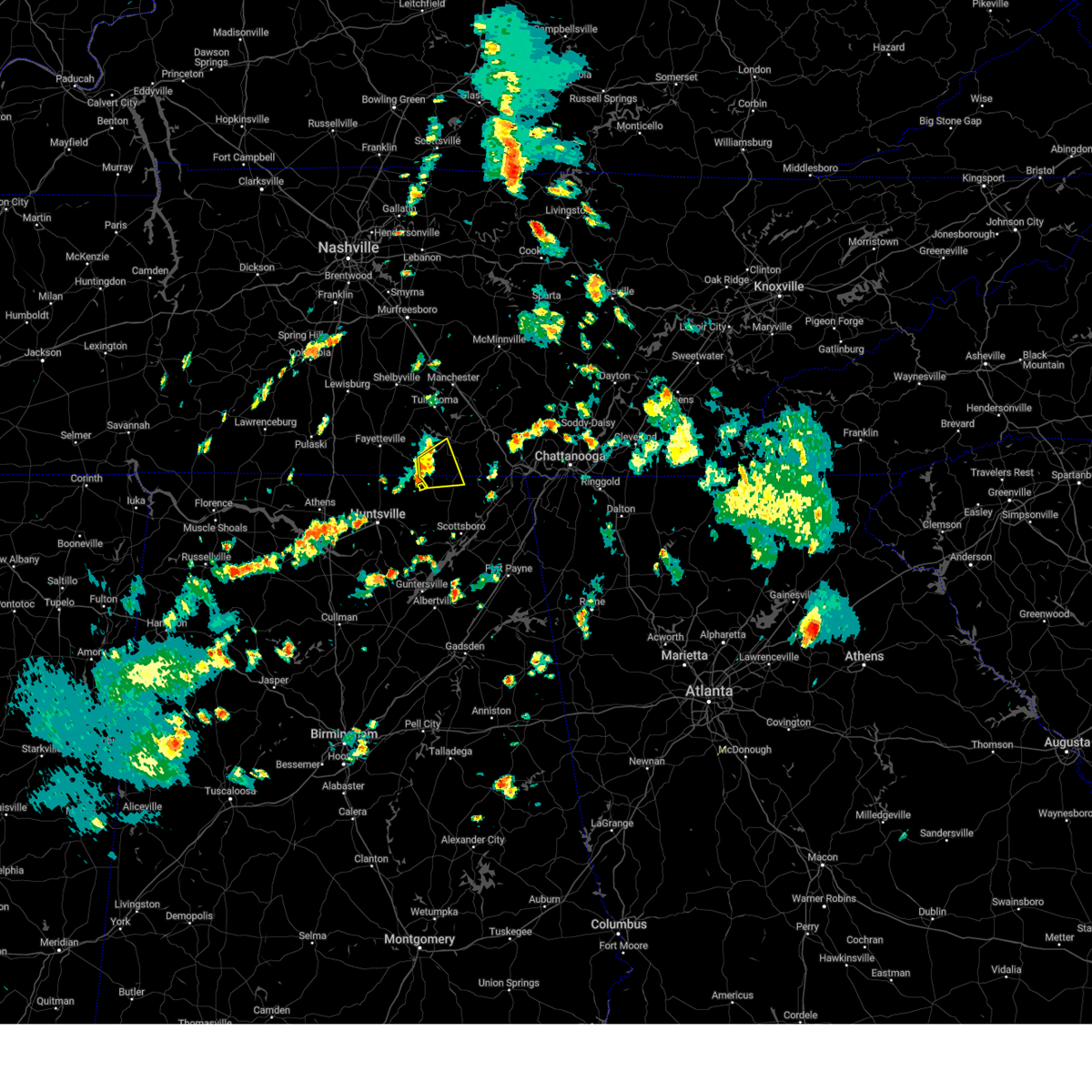 At 432 pm cdt, a severe thunderstorm was located near huntland, or 15 miles southwest of winchester, moving east at 20 mph (radar indicated). Hazards include 60 mph wind gusts and quarter size hail. Hail damage to vehicles is expected. expect wind damage to roofs, siding, and trees. Locations impacted include, winchester, huntland, francisco, beans creek, jericho, maxwell, and belvidere. At 432 pm cdt, a severe thunderstorm was located near huntland, or 15 miles southwest of winchester, moving east at 20 mph (radar indicated). Hazards include 60 mph wind gusts and quarter size hail. Hail damage to vehicles is expected. expect wind damage to roofs, siding, and trees. Locations impacted include, winchester, huntland, francisco, beans creek, jericho, maxwell, and belvidere.
|
| 5/3/2024 4:06 PM CDT |
 Svrhun the national weather service in huntsville alabama has issued a * severe thunderstorm warning for, northwestern jackson county in northeastern alabama, northeastern madison county in north central alabama, southeastern lincoln county in middle tennessee, southwestern franklin county in middle tennessee, * until 445 pm cdt. * at 406 pm cdt, a severe thunderstorm was located near new market, or 11 miles northeast of moores mill, moving east at 20 mph (radar indicated). Hazards include 60 mph wind gusts and quarter size hail. Hail damage to vehicles is expected. Expect wind damage to roofs, siding, and trees. Svrhun the national weather service in huntsville alabama has issued a * severe thunderstorm warning for, northwestern jackson county in northeastern alabama, northeastern madison county in north central alabama, southeastern lincoln county in middle tennessee, southwestern franklin county in middle tennessee, * until 445 pm cdt. * at 406 pm cdt, a severe thunderstorm was located near new market, or 11 miles northeast of moores mill, moving east at 20 mph (radar indicated). Hazards include 60 mph wind gusts and quarter size hail. Hail damage to vehicles is expected. Expect wind damage to roofs, siding, and trees.
|
| 4/2/2024 7:27 PM CDT |
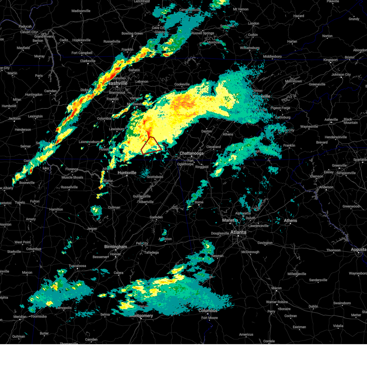 The storm which prompted the warning has weakened below severe limits, and no longer appears capable of producing a tornado. therefore, the warning will be allowed to expire. a tornado watch remains in effect until 900 pm cdt for north central alabama, and middle tennessee. a tornado watch also remains in effect until 200 am cdt for northeastern alabama. The storm which prompted the warning has weakened below severe limits, and no longer appears capable of producing a tornado. therefore, the warning will be allowed to expire. a tornado watch remains in effect until 900 pm cdt for north central alabama, and middle tennessee. a tornado watch also remains in effect until 200 am cdt for northeastern alabama.
|
| 4/2/2024 7:13 PM CDT |
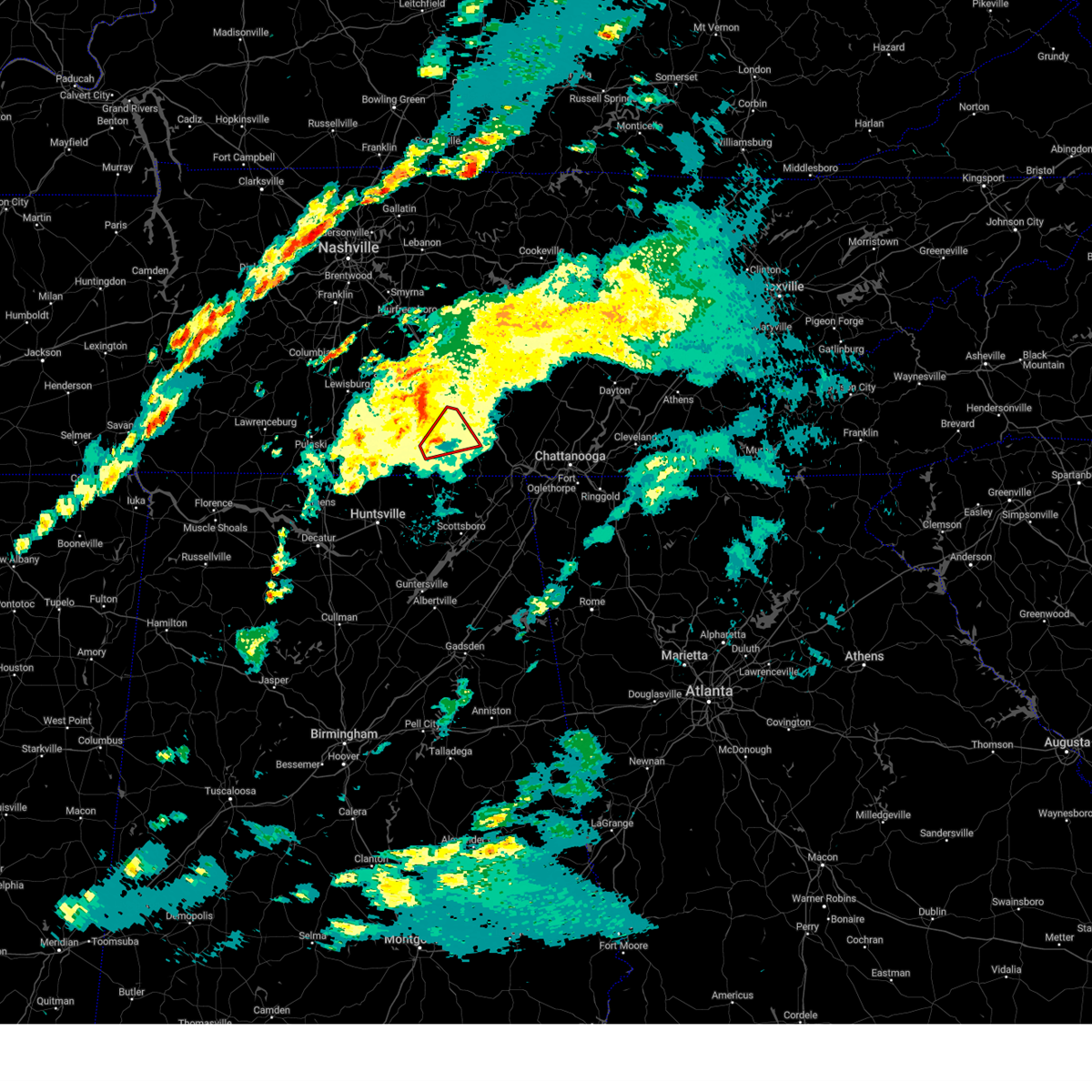 the tornado warning has been cancelled and is no longer in effect the tornado warning has been cancelled and is no longer in effect
|
| 4/2/2024 7:13 PM CDT |
 At 713 pm cdt, a severe thunderstorm capable of producing a tornado was located near huntland, or 7 miles southwest of winchester, moving northeast at 40 mph (radar indicated rotation). Hazards include tornado. Flying debris will be dangerous to those caught without shelter. mobile homes will be damaged or destroyed. damage to roofs, windows, and vehicles will occur. tree damage is likely. this dangerous storm will be near, winchester, decherd, and tims ford lake around 720 pm cdt. estill springs around 725 pm cdt. Other locations impacted by this tornadic thunderstorm include lexie crossroads, maxwell, woods reservoir, belvidere, harmony, and arnold afb. At 713 pm cdt, a severe thunderstorm capable of producing a tornado was located near huntland, or 7 miles southwest of winchester, moving northeast at 40 mph (radar indicated rotation). Hazards include tornado. Flying debris will be dangerous to those caught without shelter. mobile homes will be damaged or destroyed. damage to roofs, windows, and vehicles will occur. tree damage is likely. this dangerous storm will be near, winchester, decherd, and tims ford lake around 720 pm cdt. estill springs around 725 pm cdt. Other locations impacted by this tornadic thunderstorm include lexie crossroads, maxwell, woods reservoir, belvidere, harmony, and arnold afb.
|
| 4/2/2024 6:59 PM CDT |
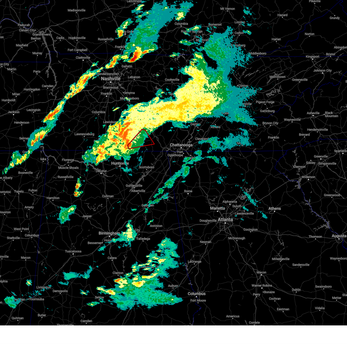 Torhun the national weather service in huntsville alabama has issued a * tornado warning for, southeastern moore county in middle tennessee, southeastern lincoln county in middle tennessee, central franklin county in middle tennessee, * until 730 pm cdt. * at 658 pm cdt, a severe thunderstorm capable of producing a tornado was located near huntland, or 12 miles southeast of fayetteville, moving northeast at 40 mph (radar indicated rotation). Hazards include tornado. Flying debris will be dangerous to those caught without shelter. mobile homes will be damaged or destroyed. damage to roofs, windows, and vehicles will occur. tree damage is likely. this dangerous storm will be near, huntland around 705 pm cdt. tims ford lake around 710 pm cdt. winchester around 715 pm cdt. decherd and estill springs around 720 pm cdt. Other locations impacted by this tornadic thunderstorm include lexie crossroads, smithland, beans creek, woods reservoir, harmony, arnold afb, maxwell, belvidere, and hurdlow. Torhun the national weather service in huntsville alabama has issued a * tornado warning for, southeastern moore county in middle tennessee, southeastern lincoln county in middle tennessee, central franklin county in middle tennessee, * until 730 pm cdt. * at 658 pm cdt, a severe thunderstorm capable of producing a tornado was located near huntland, or 12 miles southeast of fayetteville, moving northeast at 40 mph (radar indicated rotation). Hazards include tornado. Flying debris will be dangerous to those caught without shelter. mobile homes will be damaged or destroyed. damage to roofs, windows, and vehicles will occur. tree damage is likely. this dangerous storm will be near, huntland around 705 pm cdt. tims ford lake around 710 pm cdt. winchester around 715 pm cdt. decherd and estill springs around 720 pm cdt. Other locations impacted by this tornadic thunderstorm include lexie crossroads, smithland, beans creek, woods reservoir, harmony, arnold afb, maxwell, belvidere, and hurdlow.
|
| 3/15/2024 4:57 AM CDT |
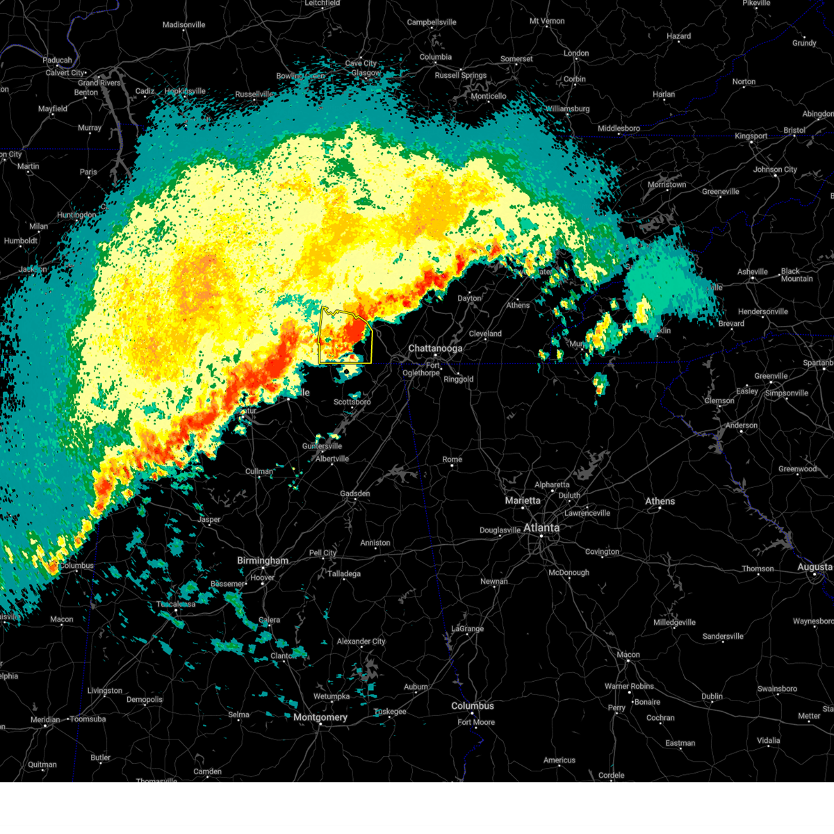 The storm which prompted the warning will be allowed to expire. however, gusty winds are still possible with this thunderstorm. a severe thunderstorm watch remains in effect until 1000 am cdt for north central and northeastern alabama. remember, a tornado warning still remains in effect for east central franklin county tn until 515 am. The storm which prompted the warning will be allowed to expire. however, gusty winds are still possible with this thunderstorm. a severe thunderstorm watch remains in effect until 1000 am cdt for north central and northeastern alabama. remember, a tornado warning still remains in effect for east central franklin county tn until 515 am.
|
| 3/15/2024 4:39 AM CDT |
 Torhun the national weather service in huntsville alabama has issued a * tornado warning for, southeastern franklin county in middle tennessee, * until 515 am cdt. * at 439 am cdt, a severe thunderstorm capable of producing a tornado was located near winchester, moving east at 35 mph (radar indicated rotation). Hazards include tornado. Flying debris will be dangerous to those caught without shelter. mobile homes will be damaged or destroyed. damage to roofs, windows, and vehicles will occur. tree damage is likely. This tornadic thunderstorm will remain over mainly rural areas of southeastern franklin county, including the following locations, belvidere and sherwood. Torhun the national weather service in huntsville alabama has issued a * tornado warning for, southeastern franklin county in middle tennessee, * until 515 am cdt. * at 439 am cdt, a severe thunderstorm capable of producing a tornado was located near winchester, moving east at 35 mph (radar indicated rotation). Hazards include tornado. Flying debris will be dangerous to those caught without shelter. mobile homes will be damaged or destroyed. damage to roofs, windows, and vehicles will occur. tree damage is likely. This tornadic thunderstorm will remain over mainly rural areas of southeastern franklin county, including the following locations, belvidere and sherwood.
|
| 3/15/2024 4:35 AM CDT |
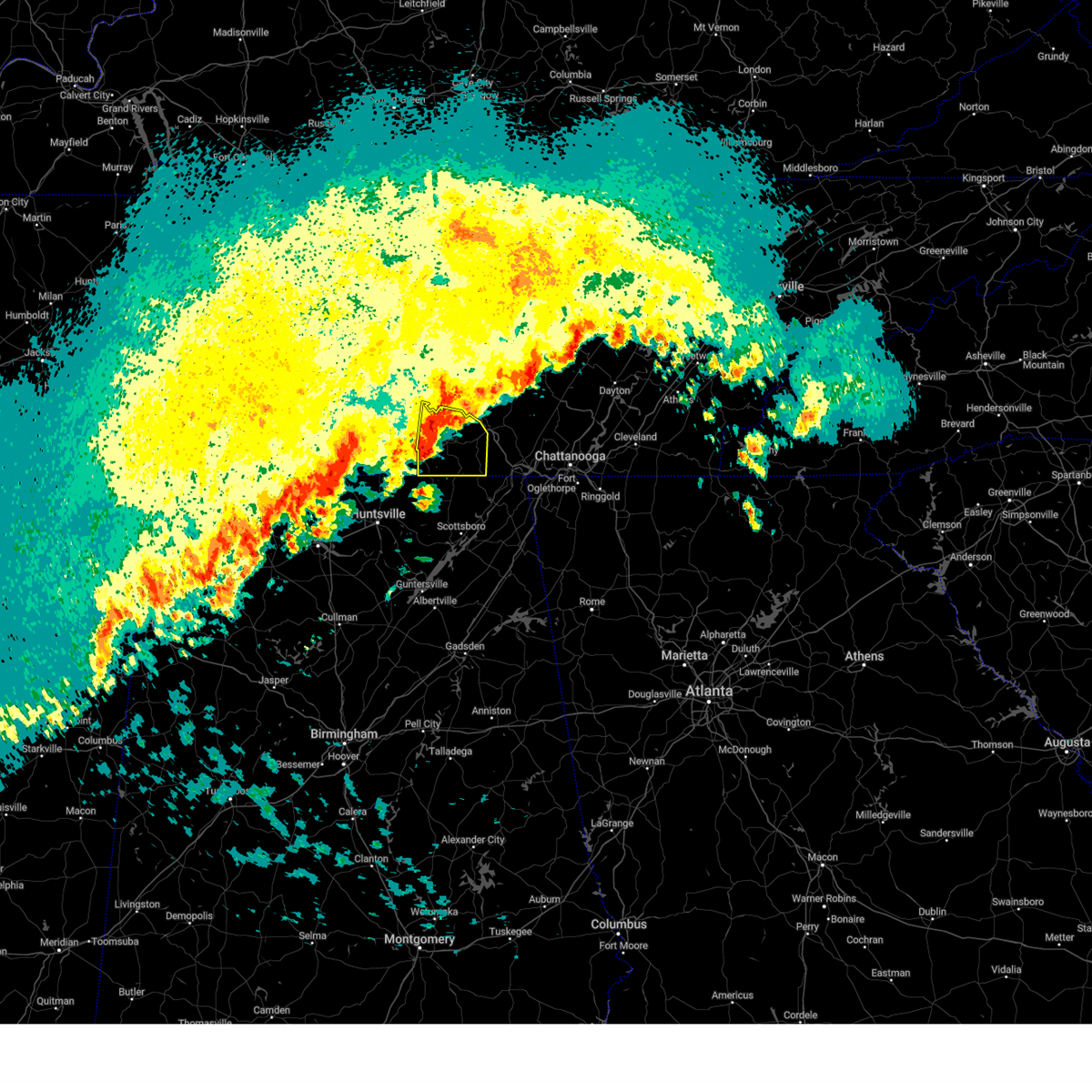 Svrhun the national weather service in huntsville alabama has issued a * severe thunderstorm warning for, eastern moore county in middle tennessee, franklin county in middle tennessee, * until 500 am cdt. * at 434 am cdt, a severe thunderstorm was located near tims ford lake, or near winchester, moving east at 45 mph (radar indicated). Hazards include 60 mph wind gusts and quarter size hail. Hail damage to vehicles is expected. Expect wind damage to roofs, siding, and trees. Svrhun the national weather service in huntsville alabama has issued a * severe thunderstorm warning for, eastern moore county in middle tennessee, franklin county in middle tennessee, * until 500 am cdt. * at 434 am cdt, a severe thunderstorm was located near tims ford lake, or near winchester, moving east at 45 mph (radar indicated). Hazards include 60 mph wind gusts and quarter size hail. Hail damage to vehicles is expected. Expect wind damage to roofs, siding, and trees.
|
| 2/28/2024 10:07 AM CST |
 At 1007 am cst, severe thunderstorms were located along a line extending from 9 miles southwest of cowan to near gurley to near morgan city, moving east at 45 mph (radar indicated). Hazards include 60 mph wind gusts. Expect damage to roofs, siding, and trees. Locations impacted include, southern huntsville, scottsboro, winchester, decherd, stevenson, cowan, owens cross roads, hollywood, grant, and skyline. At 1007 am cst, severe thunderstorms were located along a line extending from 9 miles southwest of cowan to near gurley to near morgan city, moving east at 45 mph (radar indicated). Hazards include 60 mph wind gusts. Expect damage to roofs, siding, and trees. Locations impacted include, southern huntsville, scottsboro, winchester, decherd, stevenson, cowan, owens cross roads, hollywood, grant, and skyline.
|
| 2/28/2024 9:58 AM CST |
 At 957 am cst, severe thunderstorms were located along a line extending from near huntland to 6 miles west of gurley to 6 miles south of triana, moving east at 45 mph (radar indicated). Hazards include 60 mph wind gusts and quarter size hail. Hail damage to vehicles is expected. expect wind damage to roofs, siding, and trees. Locations impacted include, southern huntsville, scottsboro, winchester, redstone arsenal, decherd, stevenson, cowan, owens cross roads, hollywood, and grant. At 957 am cst, severe thunderstorms were located along a line extending from near huntland to 6 miles west of gurley to 6 miles south of triana, moving east at 45 mph (radar indicated). Hazards include 60 mph wind gusts and quarter size hail. Hail damage to vehicles is expected. expect wind damage to roofs, siding, and trees. Locations impacted include, southern huntsville, scottsboro, winchester, redstone arsenal, decherd, stevenson, cowan, owens cross roads, hollywood, and grant.
|
| 2/28/2024 9:42 AM CST |
 Svrhun the national weather service in huntsville alabama has issued a * severe thunderstorm warning for, northern marshall county in northeastern alabama, jackson county in northeastern alabama, madison county in north central alabama, southeastern limestone county in north central alabama, central morgan county in north central alabama, southeastern moore county in middle tennessee, southeastern lincoln county in middle tennessee, franklin county in middle tennessee, * until 1030 am cst. * at 942 am cst, severe thunderstorms were located along a line extending from 8 miles northwest of huntland to huntsville to near priceville, moving east at 45 mph (radar indicated). Hazards include 60 mph wind gusts and quarter size hail. Hail damage to vehicles is expected. Expect wind damage to roofs, siding, and trees. Svrhun the national weather service in huntsville alabama has issued a * severe thunderstorm warning for, northern marshall county in northeastern alabama, jackson county in northeastern alabama, madison county in north central alabama, southeastern limestone county in north central alabama, central morgan county in north central alabama, southeastern moore county in middle tennessee, southeastern lincoln county in middle tennessee, franklin county in middle tennessee, * until 1030 am cst. * at 942 am cst, severe thunderstorms were located along a line extending from 8 miles northwest of huntland to huntsville to near priceville, moving east at 45 mph (radar indicated). Hazards include 60 mph wind gusts and quarter size hail. Hail damage to vehicles is expected. Expect wind damage to roofs, siding, and trees.
|
| 2/28/2024 9:37 AM CST |
 At 937 am cst, severe thunderstorms were located along a line extending from near lynchburg to near harvest, moving east at 50 mph (radar indicated). Hazards include 60 mph wind gusts and quarter size hail. Hail damage to vehicles is expected. expect wind damage to roofs, siding, and trees. Locations impacted include, huntsville, decatur, madison, winchester, fayetteville, moores mill, meridianville, lynchburg, redstone arsenal, and hazel green. At 937 am cst, severe thunderstorms were located along a line extending from near lynchburg to near harvest, moving east at 50 mph (radar indicated). Hazards include 60 mph wind gusts and quarter size hail. Hail damage to vehicles is expected. expect wind damage to roofs, siding, and trees. Locations impacted include, huntsville, decatur, madison, winchester, fayetteville, moores mill, meridianville, lynchburg, redstone arsenal, and hazel green.
|
| 2/28/2024 9:20 AM CST |
 Svrhun the national weather service in huntsville alabama has issued a * severe thunderstorm warning for, northwestern jackson county in northeastern alabama, madison county in north central alabama, limestone county in north central alabama, northern morgan county in north central alabama, east central lawrence county in northwestern alabama, moore county in middle tennessee, lincoln county in middle tennessee, franklin county in middle tennessee, * until 945 am cst. * at 920 am cst, severe thunderstorms were located along a line extending from near fayetteville to near athens, moving east at 50 mph (radar indicated). Hazards include 60 mph wind gusts and quarter size hail. Hail damage to vehicles is expected. Expect wind damage to roofs, siding, and trees. Svrhun the national weather service in huntsville alabama has issued a * severe thunderstorm warning for, northwestern jackson county in northeastern alabama, madison county in north central alabama, limestone county in north central alabama, northern morgan county in north central alabama, east central lawrence county in northwestern alabama, moore county in middle tennessee, lincoln county in middle tennessee, franklin county in middle tennessee, * until 945 am cst. * at 920 am cst, severe thunderstorms were located along a line extending from near fayetteville to near athens, moving east at 50 mph (radar indicated). Hazards include 60 mph wind gusts and quarter size hail. Hail damage to vehicles is expected. Expect wind damage to roofs, siding, and trees.
|
| 8/15/2023 12:51 AM CDT |
 The severe thunderstorm warning for northwestern jackson, northeastern madison, southeastern lincoln and franklin counties will expire at 100 am cdt, the storms which prompted the warning have weakened below severe limits, and no longer pose an immediate threat to life or property. therefore, the warning will be allowed to expire. however, gusty winds and heavy rain are still possible with these thunderstorms. a severe thunderstorm watch remains in effect until 200 am cdt for north central and northeastern alabama and middle tennessee. The severe thunderstorm warning for northwestern jackson, northeastern madison, southeastern lincoln and franklin counties will expire at 100 am cdt, the storms which prompted the warning have weakened below severe limits, and no longer pose an immediate threat to life or property. therefore, the warning will be allowed to expire. however, gusty winds and heavy rain are still possible with these thunderstorms. a severe thunderstorm watch remains in effect until 200 am cdt for north central and northeastern alabama and middle tennessee.
|
| 8/15/2023 12:33 AM CDT |
 At 1232 am cdt, severe thunderstorms were located along a line extending from tracy city to near new market, moving east at 35 mph (radar indicated). Hazards include 60 mph wind gusts and nickel size hail. Expect damage to roofs, siding, and trees. locations impacted include, winchester, hazel green, decherd, cowan, huntland, sewanee, new market, anderson, lincoln and hytop. hail threat, radar indicated max hail size, 0. 88 in wind threat, radar indicated max wind gust, 60 mph. At 1232 am cdt, severe thunderstorms were located along a line extending from tracy city to near new market, moving east at 35 mph (radar indicated). Hazards include 60 mph wind gusts and nickel size hail. Expect damage to roofs, siding, and trees. locations impacted include, winchester, hazel green, decherd, cowan, huntland, sewanee, new market, anderson, lincoln and hytop. hail threat, radar indicated max hail size, 0. 88 in wind threat, radar indicated max wind gust, 60 mph.
|
| 8/15/2023 12:12 AM CDT |
 At 1211 am cdt, severe thunderstorms were located along a line extending from near winchester to harvest, moving east at 30 mph (radar indicated). Hazards include 60 mph wind gusts and nickel size hail. expect damage to roofs, siding, and trees At 1211 am cdt, severe thunderstorms were located along a line extending from near winchester to harvest, moving east at 30 mph (radar indicated). Hazards include 60 mph wind gusts and nickel size hail. expect damage to roofs, siding, and trees
|
| 8/13/2023 5:16 PM CDT |
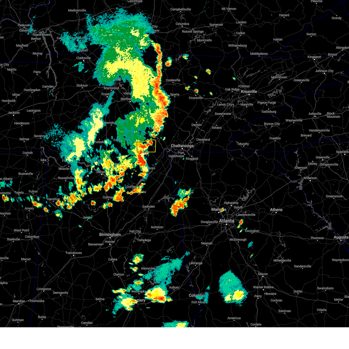 At 516 pm cdt, a severe thunderstorm was located 8 miles south of cowan, or 10 miles south of winchester, moving east at 50 mph (radar indicated). Hazards include 60 mph wind gusts. Expect damage to roofs, siding, and trees. locations impacted include, winchester, cowan, sewanee, anderson, beans creek, maxwell, belvidere and sherwood. hail threat, radar indicated max hail size, <. 75 in wind threat, radar indicated max wind gust, 60 mph. At 516 pm cdt, a severe thunderstorm was located 8 miles south of cowan, or 10 miles south of winchester, moving east at 50 mph (radar indicated). Hazards include 60 mph wind gusts. Expect damage to roofs, siding, and trees. locations impacted include, winchester, cowan, sewanee, anderson, beans creek, maxwell, belvidere and sherwood. hail threat, radar indicated max hail size, <. 75 in wind threat, radar indicated max wind gust, 60 mph.
|
| 8/13/2023 5:05 PM CDT |
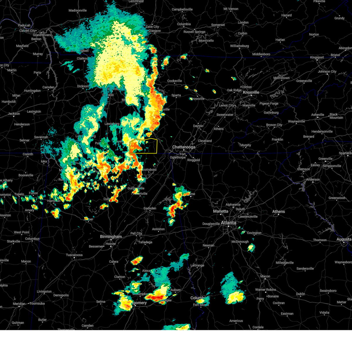 At 504 pm cdt, a severe thunderstorm was located over huntland, or 13 miles southwest of winchester, moving east at 30 mph (radar indicated). Hazards include 60 mph wind gusts. Expect damage to roofs, siding, and trees. locations impacted include, winchester, decherd, cowan, huntland, sewanee, tims ford lake, anderson, lexie crossroads, harmony and hurdlow. hail threat, radar indicated max hail size, <. 75 in wind threat, radar indicated max wind gust, 60 mph. At 504 pm cdt, a severe thunderstorm was located over huntland, or 13 miles southwest of winchester, moving east at 30 mph (radar indicated). Hazards include 60 mph wind gusts. Expect damage to roofs, siding, and trees. locations impacted include, winchester, decherd, cowan, huntland, sewanee, tims ford lake, anderson, lexie crossroads, harmony and hurdlow. hail threat, radar indicated max hail size, <. 75 in wind threat, radar indicated max wind gust, 60 mph.
|
| 8/13/2023 4:41 PM CDT |
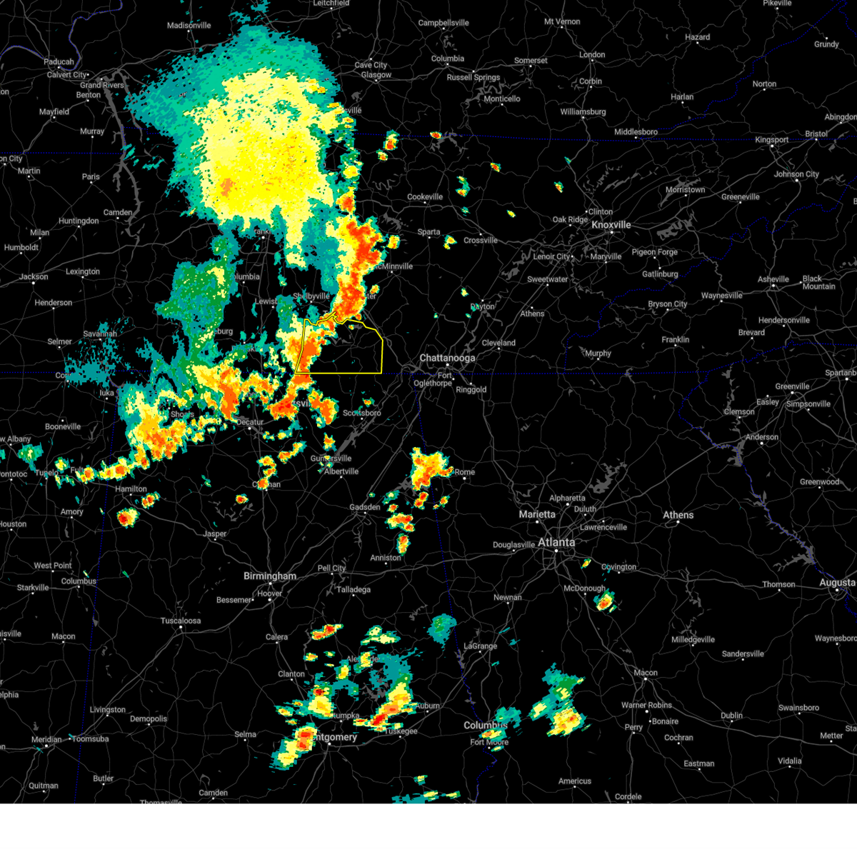 At 440 pm cdt, severe thunderstorms were located along a line extending from near tullahoma to near huntland to elora, moving east at 30 mph (radar indicated). Hazards include 60 mph wind gusts. expect damage to roofs, siding, and trees At 440 pm cdt, severe thunderstorms were located along a line extending from near tullahoma to near huntland to elora, moving east at 30 mph (radar indicated). Hazards include 60 mph wind gusts. expect damage to roofs, siding, and trees
|
| 8/12/2023 1:57 PM CDT |
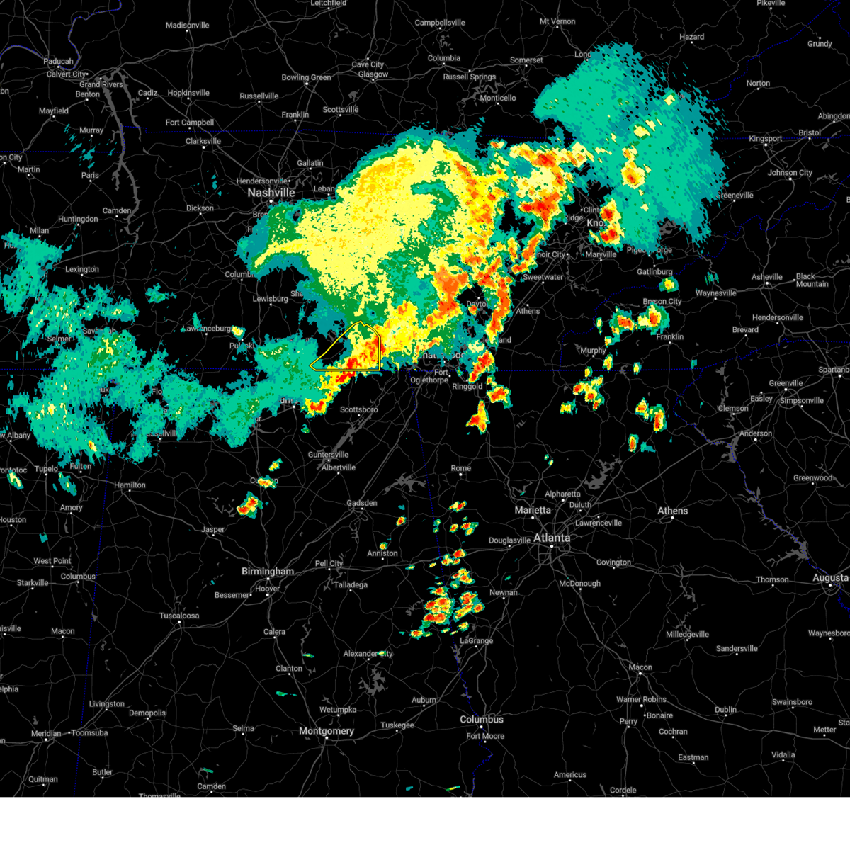 The severe thunderstorm warning for southeastern lincoln and franklin counties will expire at 200 pm cdt, the storms which prompted the warning have moved out of the area. therefore, the warning will be allowed to expire. a severe thunderstorm watch remains in effect until 600 pm cdt for north central and northeastern alabama, and middle tennessee. remember, a severe thunderstorm warning still remains in effect for southeastern franklin county until 2:30 pm cdt!. The severe thunderstorm warning for southeastern lincoln and franklin counties will expire at 200 pm cdt, the storms which prompted the warning have moved out of the area. therefore, the warning will be allowed to expire. a severe thunderstorm watch remains in effect until 600 pm cdt for north central and northeastern alabama, and middle tennessee. remember, a severe thunderstorm warning still remains in effect for southeastern franklin county until 2:30 pm cdt!.
|
| 8/12/2023 1:41 PM CDT |
 At 141 pm cdt, severe thunderstorms were located along a line extending from near monteagle to near cowan to near huntland, moving east at 50 mph (radar indicated). Hazards include 60 mph wind gusts and penny size hail. Expect damage to roofs, siding, and trees. locations impacted include, winchester, decherd, estill springs, cowan, huntland, sewanee, tims ford lake, anderson, lexie crossroads and elora. hail threat, radar indicated max hail size, 0. 75 in wind threat, radar indicated max wind gust, 60 mph. At 141 pm cdt, severe thunderstorms were located along a line extending from near monteagle to near cowan to near huntland, moving east at 50 mph (radar indicated). Hazards include 60 mph wind gusts and penny size hail. Expect damage to roofs, siding, and trees. locations impacted include, winchester, decherd, estill springs, cowan, huntland, sewanee, tims ford lake, anderson, lexie crossroads and elora. hail threat, radar indicated max hail size, 0. 75 in wind threat, radar indicated max wind gust, 60 mph.
|
| 8/12/2023 1:25 PM CDT |
 At 124 pm cdt, severe thunderstorms were located along a line extending from near estill springs to near tims ford lake to 9 miles north of new market, moving southeast at 25 mph (radar indicated). Hazards include 70 mph wind gusts and penny size hail. Expect considerable tree damage. damage is likely to mobile homes, roofs, and outbuildings. locations impacted include, winchester, fayetteville, decherd, estill springs, cowan, huntland, tims ford lake, sewanee, anderson and hurdlow. thunderstorm damage threat, considerable hail threat, radar indicated max hail size, 0. 75 in wind threat, radar indicated max wind gust, 70 mph. At 124 pm cdt, severe thunderstorms were located along a line extending from near estill springs to near tims ford lake to 9 miles north of new market, moving southeast at 25 mph (radar indicated). Hazards include 70 mph wind gusts and penny size hail. Expect considerable tree damage. damage is likely to mobile homes, roofs, and outbuildings. locations impacted include, winchester, fayetteville, decherd, estill springs, cowan, huntland, tims ford lake, sewanee, anderson and hurdlow. thunderstorm damage threat, considerable hail threat, radar indicated max hail size, 0. 75 in wind threat, radar indicated max wind gust, 70 mph.
|
| 8/12/2023 1:10 PM CDT |
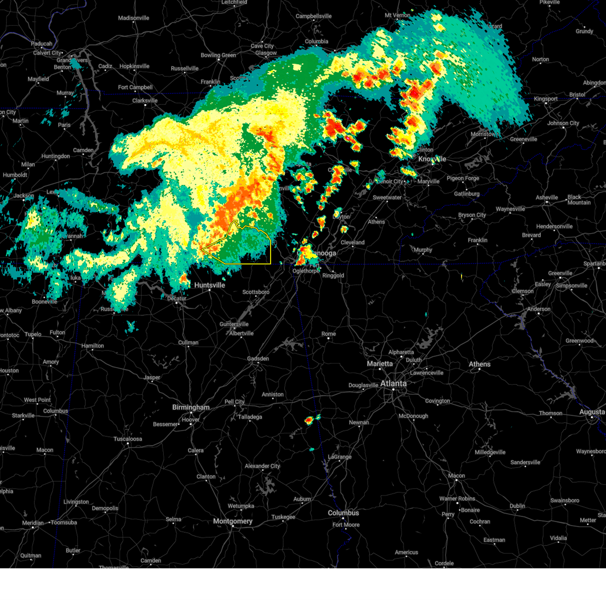 At 110 pm cdt, severe thunderstorms were located along a line extending from tullahoma to near tims ford lake to near fayetteville, moving southeast at 30 mph (radar indicated). Hazards include 60 mph wind gusts and penny size hail. expect damage to roofs, siding, and trees At 110 pm cdt, severe thunderstorms were located along a line extending from tullahoma to near tims ford lake to near fayetteville, moving southeast at 30 mph (radar indicated). Hazards include 60 mph wind gusts and penny size hail. expect damage to roofs, siding, and trees
|
| 8/12/2023 12:59 PM CDT |
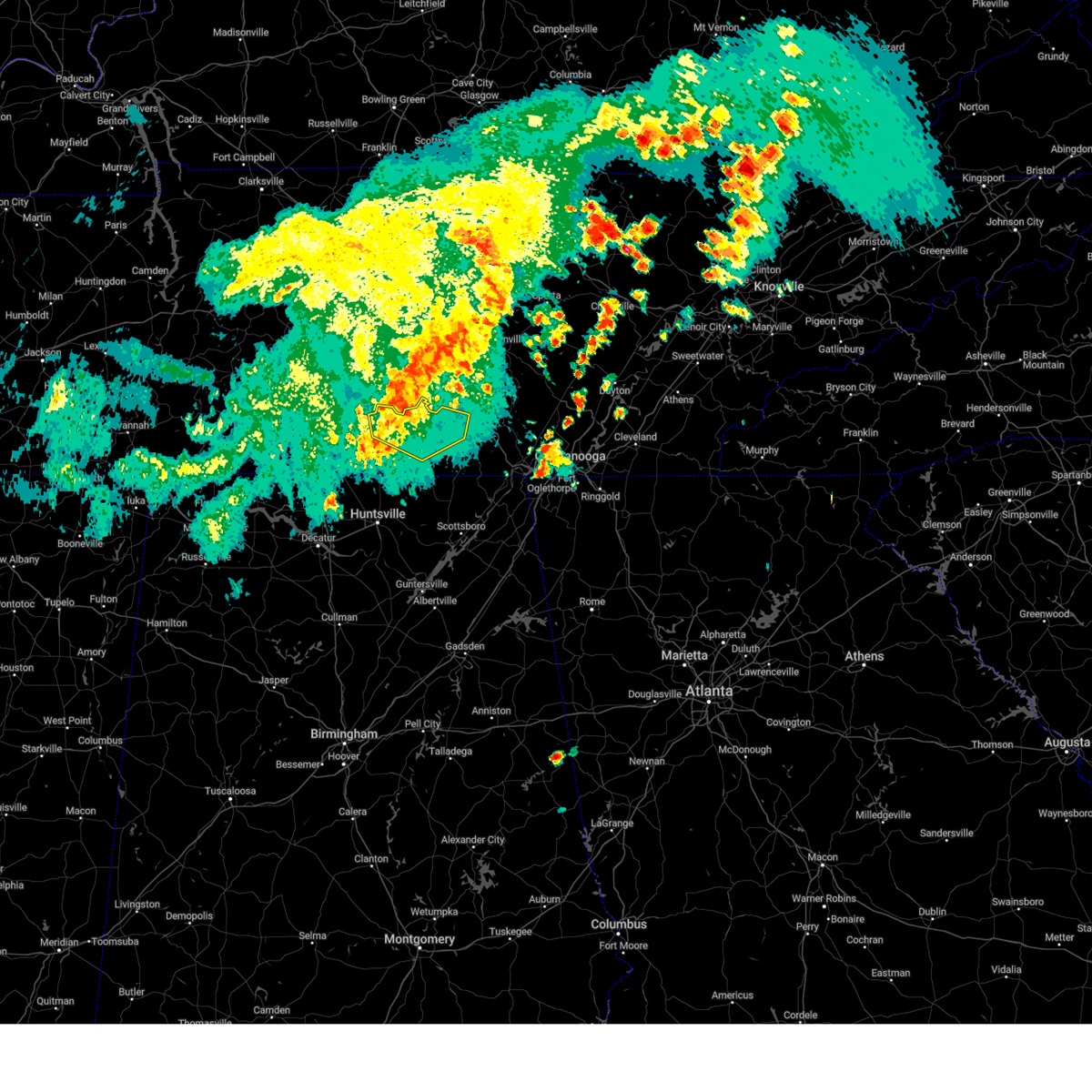 At 1258 pm cdt, severe thunderstorms were located along a line extending from near tullahoma to lynchburg to 6 miles northeast of fayetteville, moving east at 45 mph (radar indicated). Hazards include 60 mph wind gusts and penny size hail. Expect damage to roofs, siding, and trees. locations impacted include, winchester, lynchburg, decherd, estill springs, petersburg, tims ford lake, lexie crossroads, mulberry, chestnut ridge and howell. hail threat, radar indicated max hail size, 0. 75 in wind threat, radar indicated max wind gust, 60 mph. At 1258 pm cdt, severe thunderstorms were located along a line extending from near tullahoma to lynchburg to 6 miles northeast of fayetteville, moving east at 45 mph (radar indicated). Hazards include 60 mph wind gusts and penny size hail. Expect damage to roofs, siding, and trees. locations impacted include, winchester, lynchburg, decherd, estill springs, petersburg, tims ford lake, lexie crossroads, mulberry, chestnut ridge and howell. hail threat, radar indicated max hail size, 0. 75 in wind threat, radar indicated max wind gust, 60 mph.
|
| 8/12/2023 12:50 PM CDT |
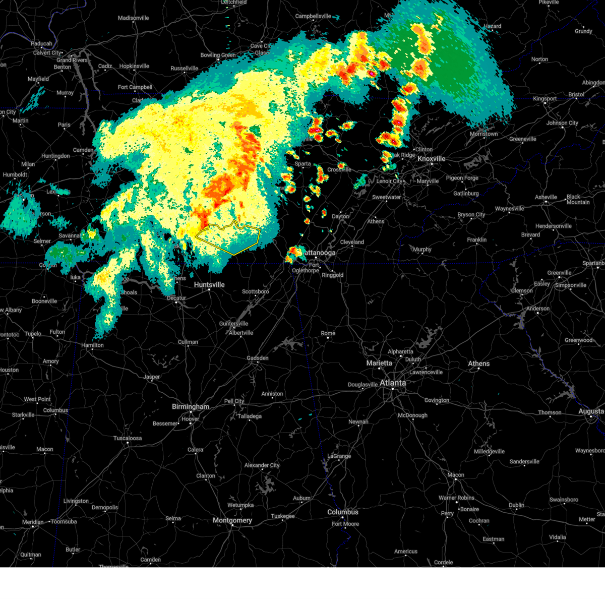 At 1249 pm cdt, a severe thunderstorm was located near lynchburg, moving east at 50 mph (radar indicated). Hazards include 60 mph wind gusts and penny size hail. Expect damage to roofs, siding, and trees. locations impacted include, winchester, lynchburg, decherd, estill springs, petersburg, tims ford lake, lexie crossroads, mulberry, chestnut ridge and howell. hail threat, radar indicated max hail size, 0. 75 in wind threat, radar indicated max wind gust, 60 mph. At 1249 pm cdt, a severe thunderstorm was located near lynchburg, moving east at 50 mph (radar indicated). Hazards include 60 mph wind gusts and penny size hail. Expect damage to roofs, siding, and trees. locations impacted include, winchester, lynchburg, decherd, estill springs, petersburg, tims ford lake, lexie crossroads, mulberry, chestnut ridge and howell. hail threat, radar indicated max hail size, 0. 75 in wind threat, radar indicated max wind gust, 60 mph.
|
| 8/12/2023 12:31 PM CDT |
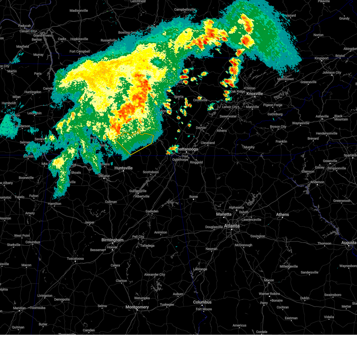 At 1230 pm cdt, a severe thunderstorm was located near lewisburg, moving east at 45 mph (radar indicated). Hazards include 60 mph wind gusts and penny size hail. expect damage to roofs, siding, and trees At 1230 pm cdt, a severe thunderstorm was located near lewisburg, moving east at 45 mph (radar indicated). Hazards include 60 mph wind gusts and penny size hail. expect damage to roofs, siding, and trees
|
| 7/20/2023 4:16 PM CDT |
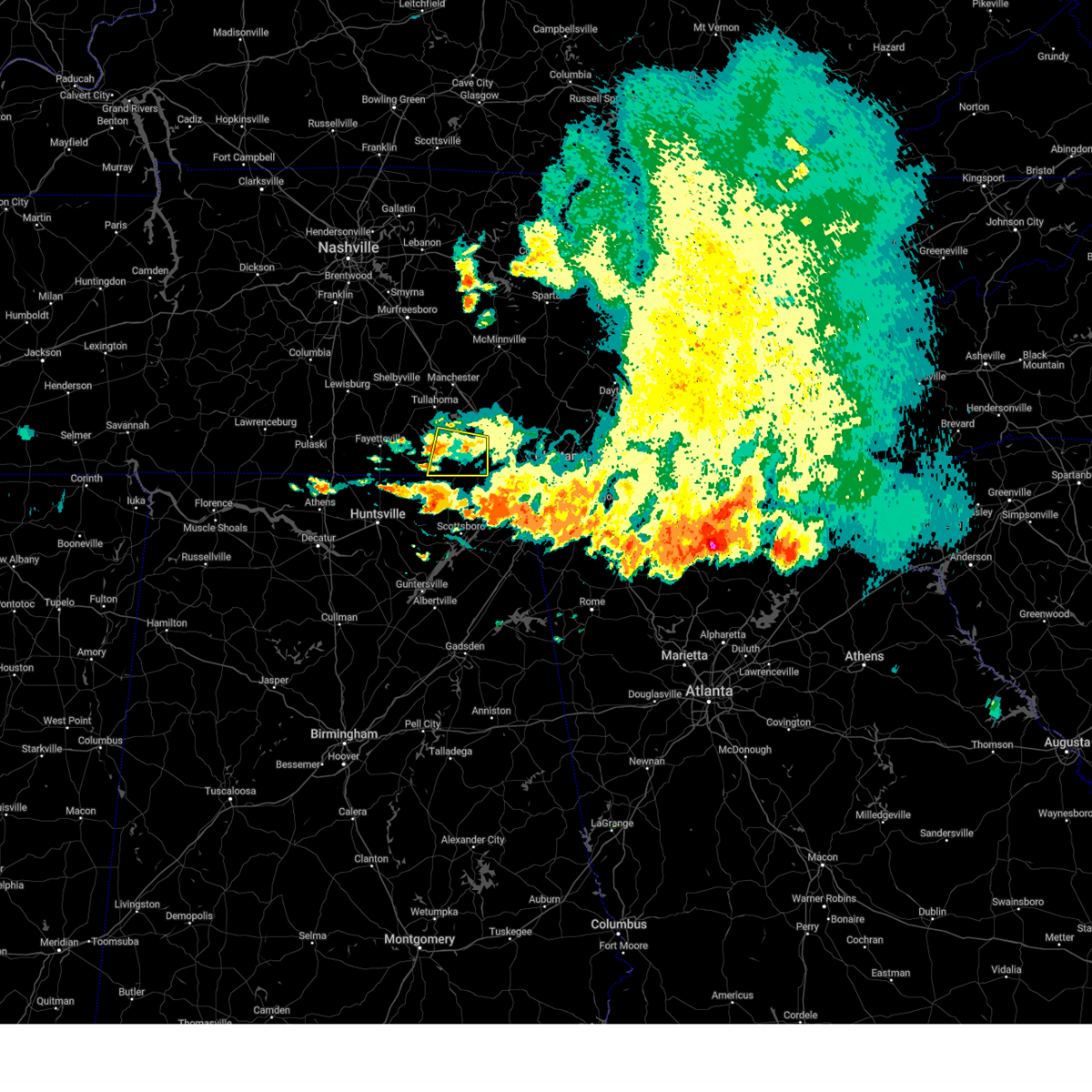 At 414 pm cdt, a severe thunderstorm was located near winchester, moving east at 50 mph (radar indicated). Hazards include 60 mph wind gusts. Expect damage to roofs, siding, and trees. locations impacted include, winchester, decherd, cowan, sewanee, tims ford lake, anderson, maxwell, belvidere and sherwood. hail threat, radar indicated max hail size, <. 75 in wind threat, radar indicated max wind gust, 60 mph. At 414 pm cdt, a severe thunderstorm was located near winchester, moving east at 50 mph (radar indicated). Hazards include 60 mph wind gusts. Expect damage to roofs, siding, and trees. locations impacted include, winchester, decherd, cowan, sewanee, tims ford lake, anderson, maxwell, belvidere and sherwood. hail threat, radar indicated max hail size, <. 75 in wind threat, radar indicated max wind gust, 60 mph.
|
| 7/20/2023 3:59 PM CDT |
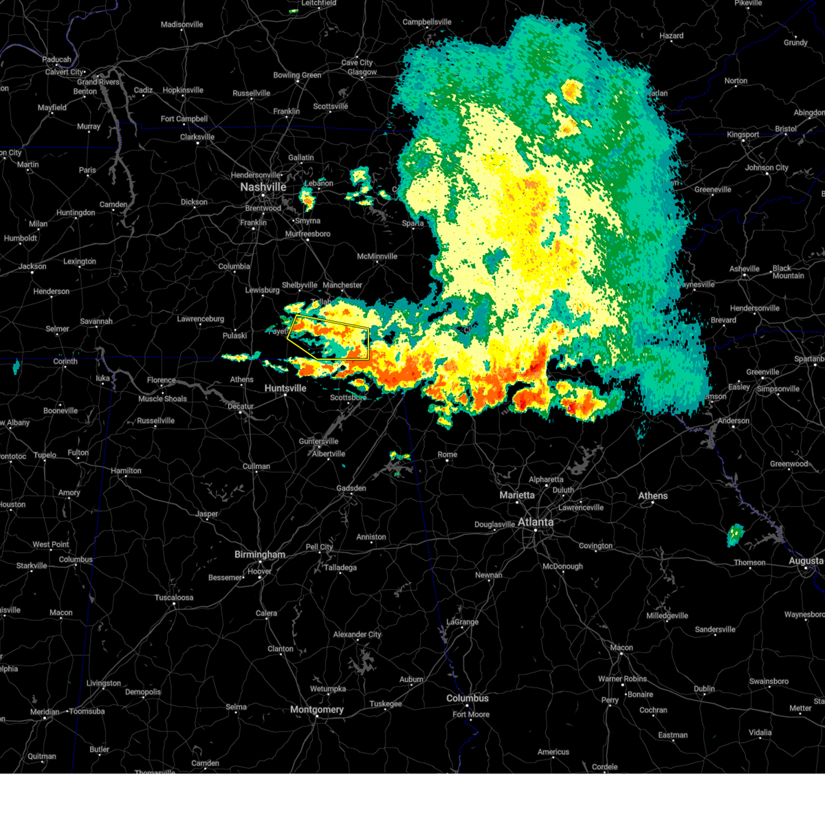 At 358 pm cdt, a severe thunderstorm was located near lynchburg, moving east at 50 mph (radar indicated). Hazards include 60 mph wind gusts. expect damage to roofs, siding, and trees At 358 pm cdt, a severe thunderstorm was located near lynchburg, moving east at 50 mph (radar indicated). Hazards include 60 mph wind gusts. expect damage to roofs, siding, and trees
|
| 7/20/2023 3:33 PM CDT |
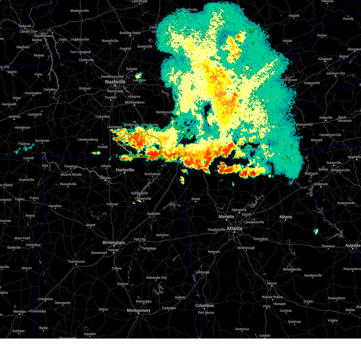 At 332 pm cdt, severe thunderstorms were located along a line extending from 7 miles south of tracy city to near fayetteville, moving southeast at 35 mph (radar indicated). Hazards include 60 mph wind gusts and penny size hail. Expect damage to roofs, siding, and trees. locations impacted include, winchester, fayetteville, lynchburg, decherd, estill springs, cowan, huntland, petersburg, tims ford lake and sewanee. hail threat, radar indicated max hail size, 0. 75 in wind threat, observed max wind gust, 60 mph. At 332 pm cdt, severe thunderstorms were located along a line extending from 7 miles south of tracy city to near fayetteville, moving southeast at 35 mph (radar indicated). Hazards include 60 mph wind gusts and penny size hail. Expect damage to roofs, siding, and trees. locations impacted include, winchester, fayetteville, lynchburg, decherd, estill springs, cowan, huntland, petersburg, tims ford lake and sewanee. hail threat, radar indicated max hail size, 0. 75 in wind threat, observed max wind gust, 60 mph.
|
| 7/20/2023 2:58 PM CDT |
 At 257 pm cdt, severe thunderstorms were located along a line extending from near sewanee to 10 miles southwest of lewisburg, moving southeast at 35 mph. prolonged heavy rainfall may also lead to localized flooding (radar indicated). Hazards include 60 mph wind gusts and penny size hail. expect damage to roofs, siding, and trees At 257 pm cdt, severe thunderstorms were located along a line extending from near sewanee to 10 miles southwest of lewisburg, moving southeast at 35 mph. prolonged heavy rainfall may also lead to localized flooding (radar indicated). Hazards include 60 mph wind gusts and penny size hail. expect damage to roofs, siding, and trees
|
| 7/20/2023 2:54 PM CDT |
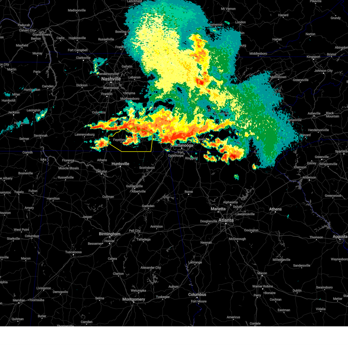 The severe thunderstorm warning for moore, lincoln and franklin counties will expire at 300 pm cdt, the storm which prompted the warning will continue to be a threat and a subsequent severe thunderstorm warning will be issued as this one expires at 300 pm. a severe thunderstorm watch remains in effect until 900 pm cdt for north central and northeastern alabama, and middle tennessee. to report severe weather, contact your nearest law enforcement agency. they will relay your report to the national weather service huntsville alabama. The severe thunderstorm warning for moore, lincoln and franklin counties will expire at 300 pm cdt, the storm which prompted the warning will continue to be a threat and a subsequent severe thunderstorm warning will be issued as this one expires at 300 pm. a severe thunderstorm watch remains in effect until 900 pm cdt for north central and northeastern alabama, and middle tennessee. to report severe weather, contact your nearest law enforcement agency. they will relay your report to the national weather service huntsville alabama.
|
| 7/20/2023 2:33 PM CDT |
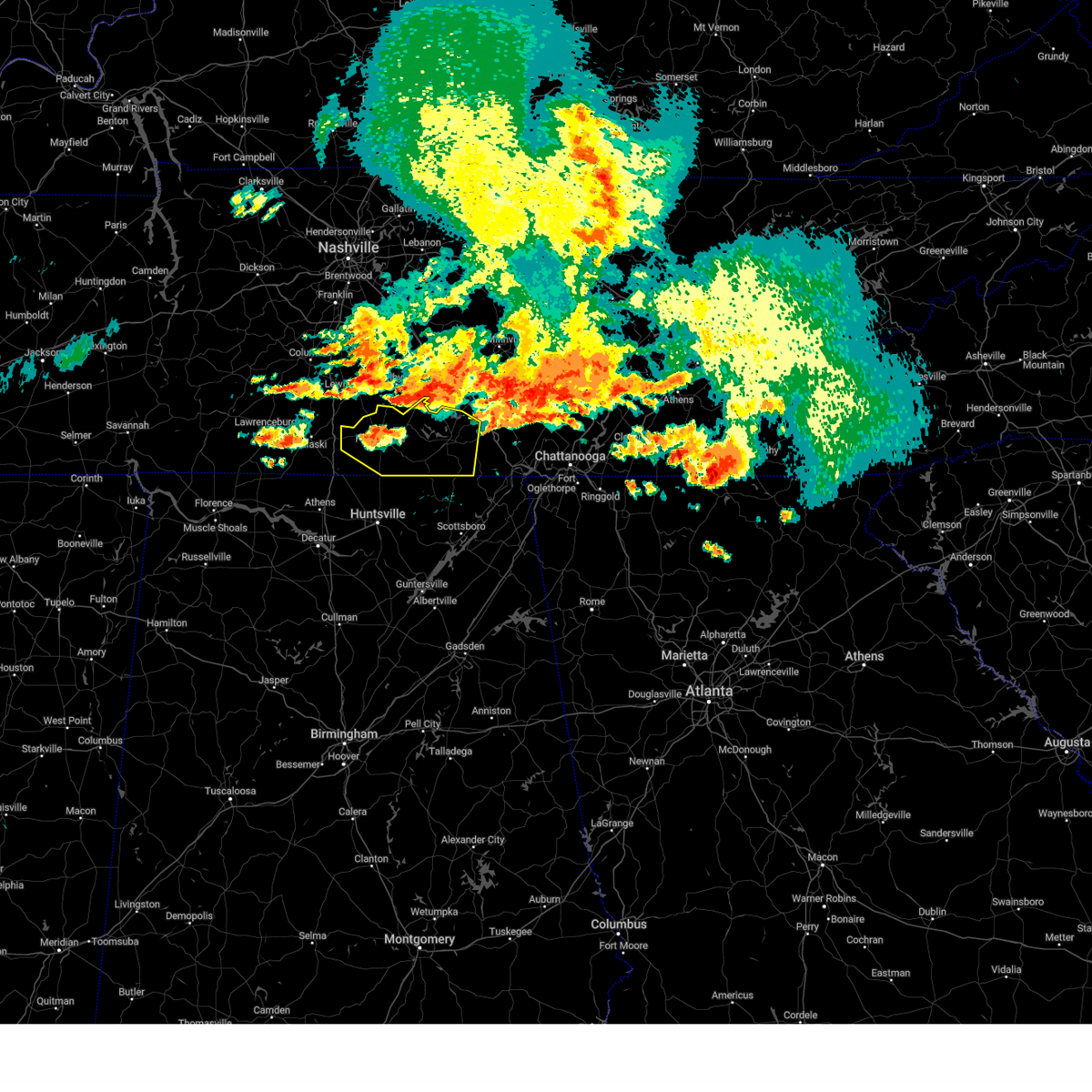 At 232 pm cdt, a severe thunderstorm was located near lynchburg, moving southeast at 25 mph (radar indicated). Hazards include 70 mph wind gusts and quarter size hail. numerous trees have fallen as a result of this storm. Hail damage to vehicles is expected. expect considerable tree damage. wind damage is also likely to mobile homes, roofs, and outbuildings. locations impacted include, winchester, fayetteville, lynchburg, decherd, estill springs, cowan, huntland, petersburg, tims ford lake and sewanee. thunderstorm damage threat, considerable hail threat, radar indicated max hail size, 1. 00 in wind threat, observed max wind gust, 70 mph. At 232 pm cdt, a severe thunderstorm was located near lynchburg, moving southeast at 25 mph (radar indicated). Hazards include 70 mph wind gusts and quarter size hail. numerous trees have fallen as a result of this storm. Hail damage to vehicles is expected. expect considerable tree damage. wind damage is also likely to mobile homes, roofs, and outbuildings. locations impacted include, winchester, fayetteville, lynchburg, decherd, estill springs, cowan, huntland, petersburg, tims ford lake and sewanee. thunderstorm damage threat, considerable hail threat, radar indicated max hail size, 1. 00 in wind threat, observed max wind gust, 70 mph.
|
| 7/20/2023 2:15 PM CDT |
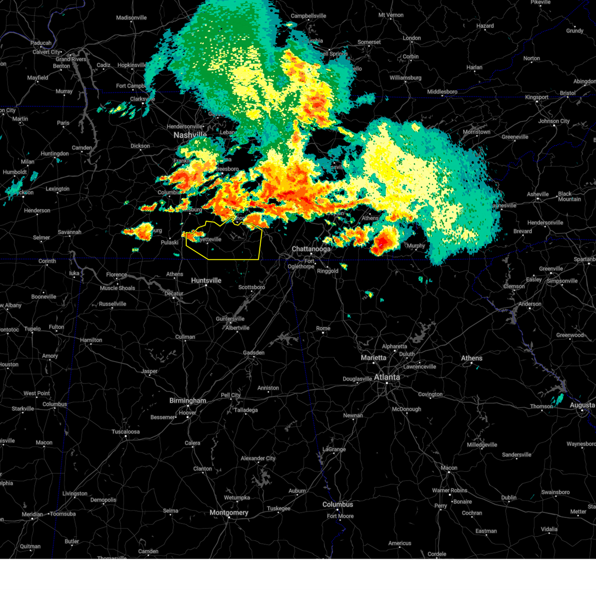 At 215 pm cdt, a severe thunderstorm was located 8 miles southwest of petersburg, or 9 miles northwest of fayetteville, moving east at 55 mph (radar indicated). Hazards include 60 mph wind gusts and quarter size hail. Hail damage to vehicles is expected. Expect wind damage to roofs, siding, and trees. At 215 pm cdt, a severe thunderstorm was located 8 miles southwest of petersburg, or 9 miles northwest of fayetteville, moving east at 55 mph (radar indicated). Hazards include 60 mph wind gusts and quarter size hail. Hail damage to vehicles is expected. Expect wind damage to roofs, siding, and trees.
|
| 7/20/2023 1:40 PM CDT |
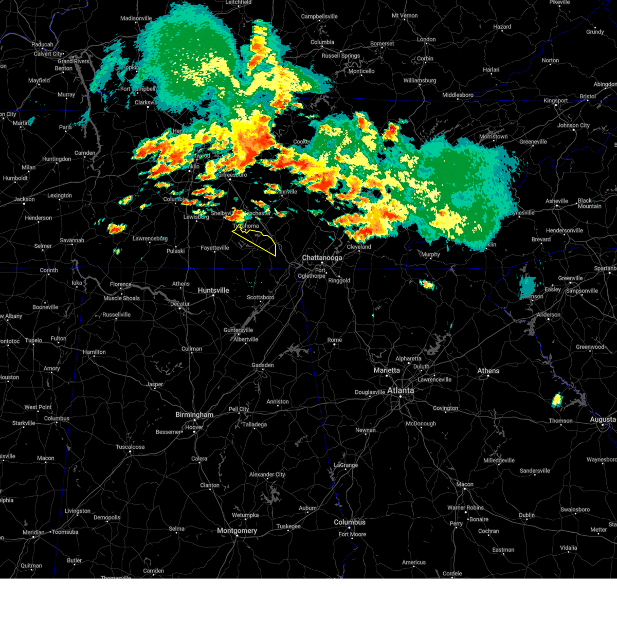 At 140 pm cdt, a severe thunderstorm was located near tullahoma, or 8 miles southeast of shelbyville, moving east at 30 mph (radar indicated). Hazards include 60 mph wind gusts and half dollar size hail. Hail damage to vehicles is expected. Expect wind damage to roofs, siding, and trees. At 140 pm cdt, a severe thunderstorm was located near tullahoma, or 8 miles southeast of shelbyville, moving east at 30 mph (radar indicated). Hazards include 60 mph wind gusts and half dollar size hail. Hail damage to vehicles is expected. Expect wind damage to roofs, siding, and trees.
|
| 7/2/2023 1:23 PM CDT |
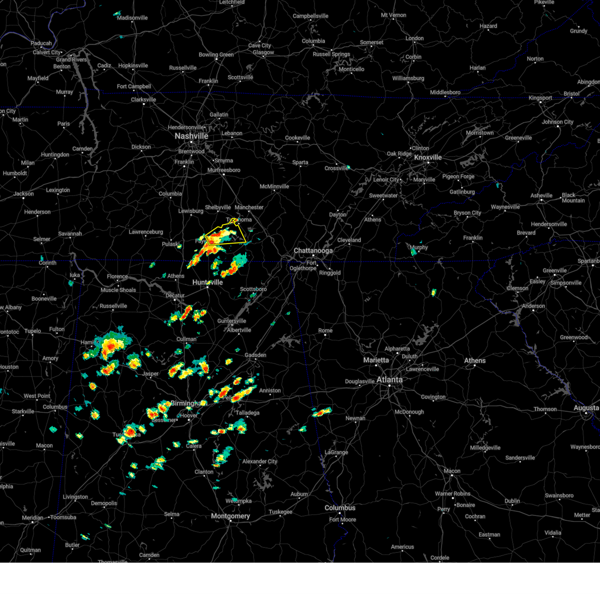 At 123 pm cdt, a severe thunderstorm was located near fayetteville, moving northeast at 35 mph (radar indicated). Hazards include 60 mph wind gusts and quarter size hail. Hail damage to vehicles is expected. Expect wind damage to roofs, siding, and trees. At 123 pm cdt, a severe thunderstorm was located near fayetteville, moving northeast at 35 mph (radar indicated). Hazards include 60 mph wind gusts and quarter size hail. Hail damage to vehicles is expected. Expect wind damage to roofs, siding, and trees.
|
| 7/1/2023 2:21 PM CDT |
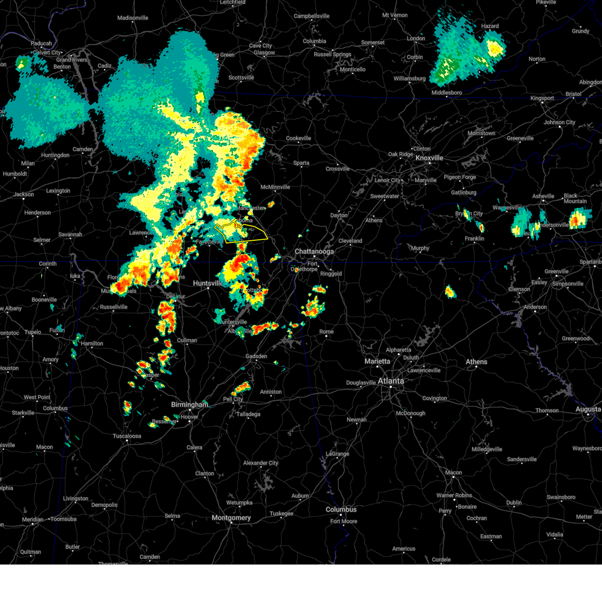 The severe thunderstorm warning for moore and northern franklin counties will expire at 230 pm cdt, the storm which prompted the warning has weakened below severe limits and no longer poses an immediate threat to life or property. therefore, the warning will be allowed to expire. gusty winds are still possible with this thunderstorm. a severe thunderstorm watch remains in effect until 800 pm cdt for north central and northeastern alabama, and middle tennessee. The severe thunderstorm warning for moore and northern franklin counties will expire at 230 pm cdt, the storm which prompted the warning has weakened below severe limits and no longer poses an immediate threat to life or property. therefore, the warning will be allowed to expire. gusty winds are still possible with this thunderstorm. a severe thunderstorm watch remains in effect until 800 pm cdt for north central and northeastern alabama, and middle tennessee.
|
| 7/1/2023 2:02 PM CDT |
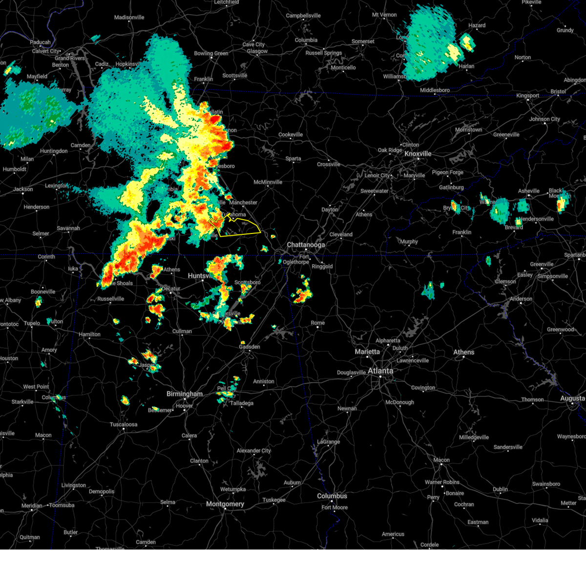 At 201 pm cdt, a severe thunderstorm was located near tullahoma, or near lynchburg moving east at 30 mph (radar indicated). Hazards include 60 mph wind gusts and quarter size hail. Hail damage to vehicles is expected. expect wind damage to roofs, siding, and trees. Locations impacted include, winchester, lynchburg, decherd, estill springs, tims ford lake, sewanee, woods reservoir, arnold afb, lois and alto. At 201 pm cdt, a severe thunderstorm was located near tullahoma, or near lynchburg moving east at 30 mph (radar indicated). Hazards include 60 mph wind gusts and quarter size hail. Hail damage to vehicles is expected. expect wind damage to roofs, siding, and trees. Locations impacted include, winchester, lynchburg, decherd, estill springs, tims ford lake, sewanee, woods reservoir, arnold afb, lois and alto.
|
| 7/1/2023 1:35 PM CDT |
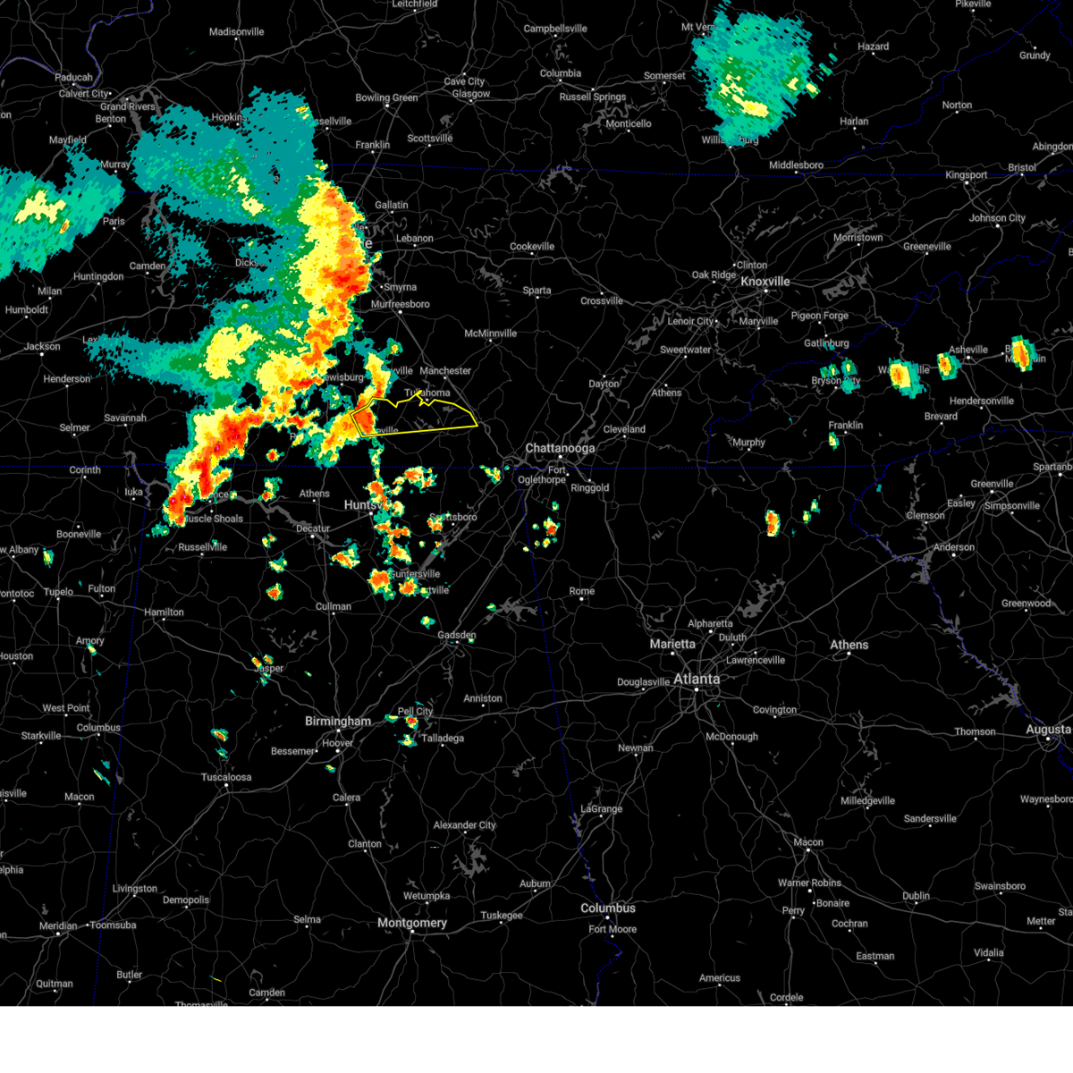 At 135 pm cdt, a severe thunderstorm was located 7 miles west of lynchburg, moving east at 30 mph (radar indicated). Hazards include 60 mph wind gusts and quarter size hail. Hail damage to vehicles is expected. Expect wind damage to roofs, siding, and trees. At 135 pm cdt, a severe thunderstorm was located 7 miles west of lynchburg, moving east at 30 mph (radar indicated). Hazards include 60 mph wind gusts and quarter size hail. Hail damage to vehicles is expected. Expect wind damage to roofs, siding, and trees.
|
| 6/25/2023 3:08 PM CDT |
 The severe thunderstorm warning for north central jackson and franklin counties will expire at 315 pm cdt, the storm which prompted the warning has weakened below severe limits, and no longer poses an immediate threat to life or property. therefore, the warning will be allowed to expire. however heavy rain is still possible with this thunderstorm. a severe thunderstorm watch remains in effect until 600 pm cdt for north central and northeastern alabama, and middle tennessee. The severe thunderstorm warning for north central jackson and franklin counties will expire at 315 pm cdt, the storm which prompted the warning has weakened below severe limits, and no longer poses an immediate threat to life or property. therefore, the warning will be allowed to expire. however heavy rain is still possible with this thunderstorm. a severe thunderstorm watch remains in effect until 600 pm cdt for north central and northeastern alabama, and middle tennessee.
|
| 6/25/2023 2:56 PM CDT |
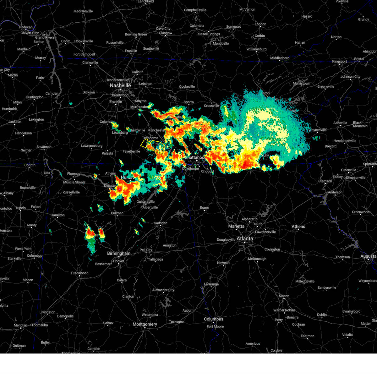 The severe thunderstorm warning for northeastern moore and northern franklin counties will expire at 300 pm cdt, the storm which prompted the warning has weakened below severe limits, and no longer poses an immediate threat to life or property. therefore, the warning will be allowed to expire. however gusty winds and heavy rain are still possible with this thunderstorm. a severe thunderstorm watch remains in effect until 600 pm cdt for north central and northeastern alabama, and middle tennessee. The severe thunderstorm warning for northeastern moore and northern franklin counties will expire at 300 pm cdt, the storm which prompted the warning has weakened below severe limits, and no longer poses an immediate threat to life or property. therefore, the warning will be allowed to expire. however gusty winds and heavy rain are still possible with this thunderstorm. a severe thunderstorm watch remains in effect until 600 pm cdt for north central and northeastern alabama, and middle tennessee.
|
| 6/25/2023 2:53 PM CDT |
 At 253 pm cdt, severe thunderstorms were located along a line extending from decherd to near cowan to 10 miles west of south pittsburg, moving northeast at 30 mph (radar indicated). Hazards include 60 mph wind gusts and quarter size hail. Hail damage to vehicles is expected. expect wind damage to roofs, siding, and trees. locations impacted include, winchester, bridgeport, decherd, estill springs, cowan, sewanee, tims ford lake, anderson, bass and russell cave national monument. hail threat, radar indicated max hail size, 1. 00 in wind threat, radar indicated max wind gust, 60 mph. At 253 pm cdt, severe thunderstorms were located along a line extending from decherd to near cowan to 10 miles west of south pittsburg, moving northeast at 30 mph (radar indicated). Hazards include 60 mph wind gusts and quarter size hail. Hail damage to vehicles is expected. expect wind damage to roofs, siding, and trees. locations impacted include, winchester, bridgeport, decherd, estill springs, cowan, sewanee, tims ford lake, anderson, bass and russell cave national monument. hail threat, radar indicated max hail size, 1. 00 in wind threat, radar indicated max wind gust, 60 mph.
|
| 6/25/2023 2:43 PM CDT |
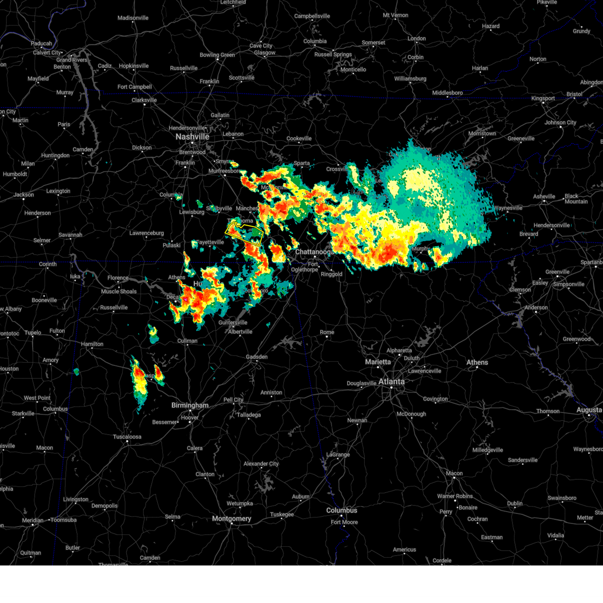 At 243 pm cdt, a severe thunderstorm was located near lynchburg, moving southeast at 25 mph (radar indicated). Hazards include 60 mph wind gusts and quarter size hail. Hail damage to vehicles is expected. expect wind damage to roofs, siding, and trees. locations impacted include, winchester, lynchburg, decherd, estill springs, cowan, tims ford lake, woods reservoir, arnold afb and alto. hail threat, radar indicated max hail size, 1. 00 in wind threat, radar indicated max wind gust, 60 mph. At 243 pm cdt, a severe thunderstorm was located near lynchburg, moving southeast at 25 mph (radar indicated). Hazards include 60 mph wind gusts and quarter size hail. Hail damage to vehicles is expected. expect wind damage to roofs, siding, and trees. locations impacted include, winchester, lynchburg, decherd, estill springs, cowan, tims ford lake, woods reservoir, arnold afb and alto. hail threat, radar indicated max hail size, 1. 00 in wind threat, radar indicated max wind gust, 60 mph.
|
| 6/25/2023 2:34 PM CDT |
 At 234 pm cdt, severe thunderstorms were located along a line extending from near winchester to 7 miles south of cowan to 10 miles northeast of skyline, moving northeast at 30 mph (radar indicated). Hazards include 60 mph wind gusts and quarter size hail. Hail damage to vehicles is expected. Expect wind damage to roofs, siding, and trees. At 234 pm cdt, severe thunderstorms were located along a line extending from near winchester to 7 miles south of cowan to 10 miles northeast of skyline, moving northeast at 30 mph (radar indicated). Hazards include 60 mph wind gusts and quarter size hail. Hail damage to vehicles is expected. Expect wind damage to roofs, siding, and trees.
|
| 6/25/2023 2:28 PM CDT |
 At 228 pm cdt, a severe thunderstorm was located 11 miles south of cowan, or 13 miles south of winchester, moving northeast at 20 mph (radar indicated). Hazards include 60 mph wind gusts and quarter size hail. Hail damage to vehicles is expected. expect wind damage to roofs, siding, and trees. locations impacted include, bridgeport, cowan, sewanee, anderson, hytop, bass, jericho, russell cave national monument, st. andrews and sherwood. hail threat, radar indicated max hail size, 1. 00 in wind threat, radar indicated max wind gust, 60 mph. At 228 pm cdt, a severe thunderstorm was located 11 miles south of cowan, or 13 miles south of winchester, moving northeast at 20 mph (radar indicated). Hazards include 60 mph wind gusts and quarter size hail. Hail damage to vehicles is expected. expect wind damage to roofs, siding, and trees. locations impacted include, bridgeport, cowan, sewanee, anderson, hytop, bass, jericho, russell cave national monument, st. andrews and sherwood. hail threat, radar indicated max hail size, 1. 00 in wind threat, radar indicated max wind gust, 60 mph.
|
| 6/25/2023 2:13 PM CDT |
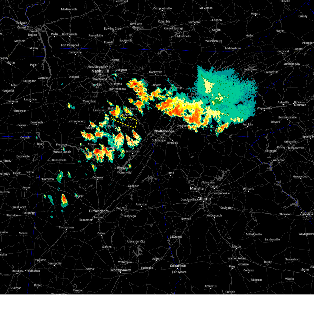 At 213 pm cdt, a severe thunderstorm was located near tullahoma, or 8 miles north of lynchburg, moving east at 40 mph (radar indicated). Hazards include 60 mph wind gusts and quarter size hail. Hail damage to vehicles is expected. Expect wind damage to roofs, siding, and trees. At 213 pm cdt, a severe thunderstorm was located near tullahoma, or 8 miles north of lynchburg, moving east at 40 mph (radar indicated). Hazards include 60 mph wind gusts and quarter size hail. Hail damage to vehicles is expected. Expect wind damage to roofs, siding, and trees.
|
| 6/25/2023 2:04 PM CDT |
 At 204 pm cdt, a severe thunderstorm was located 9 miles southeast of huntland, or 17 miles south of winchester, moving northeast at 20 mph (radar indicated). Hazards include 60 mph wind gusts and half dollar size hail. Hail damage to vehicles is expected. Expect wind damage to roofs, siding, and trees. At 204 pm cdt, a severe thunderstorm was located 9 miles southeast of huntland, or 17 miles south of winchester, moving northeast at 20 mph (radar indicated). Hazards include 60 mph wind gusts and half dollar size hail. Hail damage to vehicles is expected. Expect wind damage to roofs, siding, and trees.
|
| 6/25/2023 2:01 PM CDT |
 At 201 pm cdt, a severe thunderstorm was located 7 miles north of new market, or 10 miles southeast of fayetteville, moving east at 25 mph (radar indicated). Hazards include 60 mph wind gusts and half dollar size hail. Hail damage to vehicles is expected. expect wind damage to roofs, siding, and trees. locations impacted include, huntland, new market, tims ford lake, lincoln, lexie crossroads, plevna, elora, maxwell, smithland and francisco. hail threat, radar indicated max hail size, 1. 25 in wind threat, radar indicated max wind gust, 60 mph. At 201 pm cdt, a severe thunderstorm was located 7 miles north of new market, or 10 miles southeast of fayetteville, moving east at 25 mph (radar indicated). Hazards include 60 mph wind gusts and half dollar size hail. Hail damage to vehicles is expected. expect wind damage to roofs, siding, and trees. locations impacted include, huntland, new market, tims ford lake, lincoln, lexie crossroads, plevna, elora, maxwell, smithland and francisco. hail threat, radar indicated max hail size, 1. 25 in wind threat, radar indicated max wind gust, 60 mph.
|
| 6/25/2023 1:47 PM CDT |
 At 147 pm cdt, a severe thunderstorm was located near hazel green, or 8 miles north of meridianville, moving east at 25 mph (radar indicated). Hazards include 60 mph wind gusts and half dollar size hail. Hail damage to vehicles is expected. Expect wind damage to roofs, siding, and trees. At 147 pm cdt, a severe thunderstorm was located near hazel green, or 8 miles north of meridianville, moving east at 25 mph (radar indicated). Hazards include 60 mph wind gusts and half dollar size hail. Hail damage to vehicles is expected. Expect wind damage to roofs, siding, and trees.
|
| 6/5/2023 11:30 PM CDT |
 At 1130 pm cdt, a severe thunderstorm was located near cowan, or 8 miles southeast of winchester, moving southeast at 10 mph (radar indicated). Hazards include 60 mph wind gusts and quarter size hail. Hail damage to vehicles is expected. Expect wind damage to roofs, siding, and trees. At 1130 pm cdt, a severe thunderstorm was located near cowan, or 8 miles southeast of winchester, moving southeast at 10 mph (radar indicated). Hazards include 60 mph wind gusts and quarter size hail. Hail damage to vehicles is expected. Expect wind damage to roofs, siding, and trees.
|
| 6/5/2023 11:30 PM CDT |
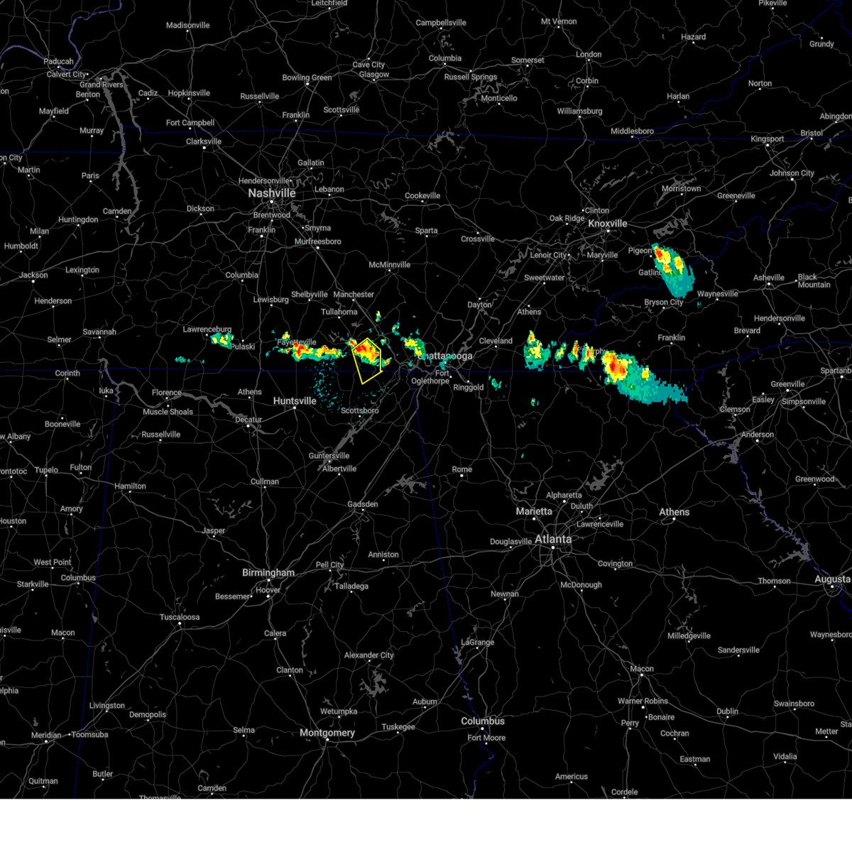 At 1130 pm cdt, a severe thunderstorm was located near cowan, or 8 miles southeast of winchester, moving southeast at 10 mph (radar indicated). Hazards include 60 mph wind gusts and quarter size hail. Hail damage to vehicles is expected. Expect wind damage to roofs, siding, and trees. At 1130 pm cdt, a severe thunderstorm was located near cowan, or 8 miles southeast of winchester, moving southeast at 10 mph (radar indicated). Hazards include 60 mph wind gusts and quarter size hail. Hail damage to vehicles is expected. Expect wind damage to roofs, siding, and trees.
|
| 6/5/2023 11:08 PM CDT |
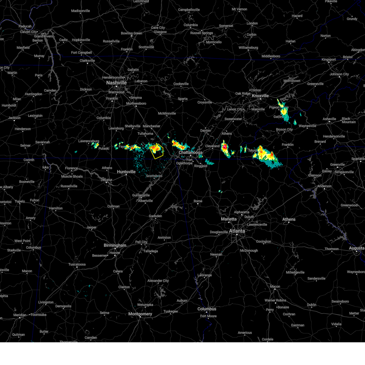 At 1107 pm cdt, a severe thunderstorm was located over cowan, or near winchester, moving southeast at 5 mph (radar indicated). Hazards include 60 mph wind gusts and quarter size hail. Hail damage to vehicles is expected. expect wind damage to roofs, siding, and trees. locations impacted include, winchester, cowan, sewanee and sherwood. hail threat, radar indicated max hail size, 1. 00 in wind threat, radar indicated max wind gust, 60 mph. At 1107 pm cdt, a severe thunderstorm was located over cowan, or near winchester, moving southeast at 5 mph (radar indicated). Hazards include 60 mph wind gusts and quarter size hail. Hail damage to vehicles is expected. expect wind damage to roofs, siding, and trees. locations impacted include, winchester, cowan, sewanee and sherwood. hail threat, radar indicated max hail size, 1. 00 in wind threat, radar indicated max wind gust, 60 mph.
|
| 6/5/2023 10:59 PM CDT |
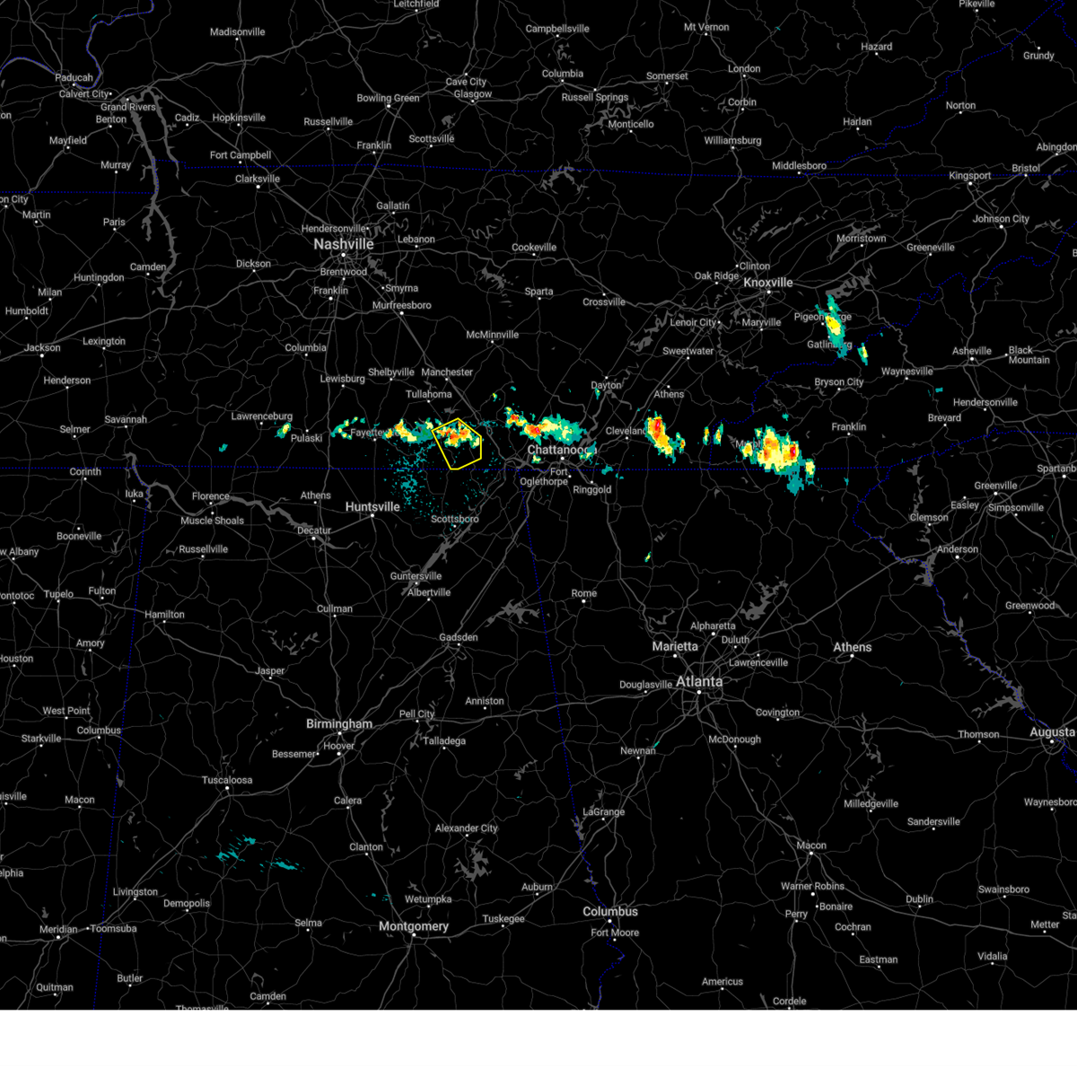 At 1059 pm cdt, a severe thunderstorm was located over cowan, or over winchester, moving southeast at 5 mph (radar indicated). Hazards include 60 mph wind gusts and quarter size hail. Hail damage to vehicles is expected. Expect wind damage to roofs, siding, and trees. At 1059 pm cdt, a severe thunderstorm was located over cowan, or over winchester, moving southeast at 5 mph (radar indicated). Hazards include 60 mph wind gusts and quarter size hail. Hail damage to vehicles is expected. Expect wind damage to roofs, siding, and trees.
|
| 3/25/2023 12:58 AM CDT |
 At 1257 am cdt, severe thunderstorms were located along a line extending from near sewanee to 6 miles north of skyline to near woodville, moving east at 55 mph (radar indicated). Hazards include 60 mph wind gusts. Expect damage to roofs, siding, and trees. locations impacted include, southern huntsville, scottsboro, winchester, bridgeport, decherd, stevenson, cowan, owens cross roads, hollywood and skyline. hail threat, radar indicated max hail size, <. 75 in wind threat, radar indicated max wind gust, 60 mph. At 1257 am cdt, severe thunderstorms were located along a line extending from near sewanee to 6 miles north of skyline to near woodville, moving east at 55 mph (radar indicated). Hazards include 60 mph wind gusts. Expect damage to roofs, siding, and trees. locations impacted include, southern huntsville, scottsboro, winchester, bridgeport, decherd, stevenson, cowan, owens cross roads, hollywood and skyline. hail threat, radar indicated max hail size, <. 75 in wind threat, radar indicated max wind gust, 60 mph.
|
| 3/25/2023 12:41 AM CDT |
 At 1240 am cdt, severe thunderstorms were located along a line extending from monteagle to near winchester to new market to huntsville, moving east at 40 mph (radar indicated). Hazards include 60 mph wind gusts. expect damage to roofs, siding, and trees At 1240 am cdt, severe thunderstorms were located along a line extending from monteagle to near winchester to new market to huntsville, moving east at 40 mph (radar indicated). Hazards include 60 mph wind gusts. expect damage to roofs, siding, and trees
|
| 3/25/2023 12:31 AM CDT |
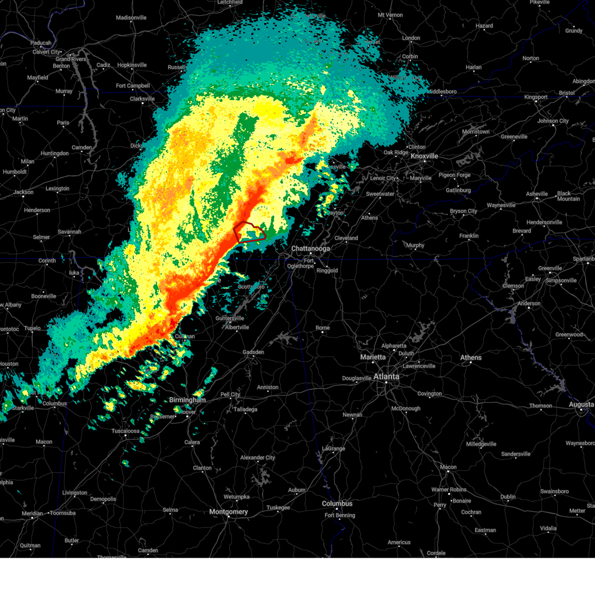 At 1231 am cdt, a severe thunderstorm capable of producing a tornado was located over decherd, or near winchester, moving east at 50 mph (radar indicated rotation). Hazards include tornado and quarter size hail. Flying debris will be dangerous to those caught without shelter. mobile homes will be damaged or destroyed. damage to roofs, windows, and vehicles will occur. tree damage is likely. locations impacted include, winchester, decherd, estill springs, cowan, tims ford lake, sewanee, woods reservoir, arnold afb, alto and st. Andrews. At 1231 am cdt, a severe thunderstorm capable of producing a tornado was located over decherd, or near winchester, moving east at 50 mph (radar indicated rotation). Hazards include tornado and quarter size hail. Flying debris will be dangerous to those caught without shelter. mobile homes will be damaged or destroyed. damage to roofs, windows, and vehicles will occur. tree damage is likely. locations impacted include, winchester, decherd, estill springs, cowan, tims ford lake, sewanee, woods reservoir, arnold afb, alto and st. Andrews.
|
| 3/25/2023 12:26 AM CDT |
 At 1225 am cdt, severe thunderstorms were located along a line extending from near tullahoma to near huntland to new market to huntsville, moving east at 45 mph (radar indicated). Hazards include 60 mph wind gusts and quarter size hail. Hail damage to vehicles is expected. expect wind damage to roofs, siding, and trees. locations impacted include, huntsville, madison, winchester, moores mill, meridianville, redstone arsenal, lynchburg, hazel green, decherd and estill springs. hail threat, radar indicated max hail size, 1. 00 in wind threat, radar indicated max wind gust, 60 mph. At 1225 am cdt, severe thunderstorms were located along a line extending from near tullahoma to near huntland to new market to huntsville, moving east at 45 mph (radar indicated). Hazards include 60 mph wind gusts and quarter size hail. Hail damage to vehicles is expected. expect wind damage to roofs, siding, and trees. locations impacted include, huntsville, madison, winchester, moores mill, meridianville, redstone arsenal, lynchburg, hazel green, decherd and estill springs. hail threat, radar indicated max hail size, 1. 00 in wind threat, radar indicated max wind gust, 60 mph.
|
| 3/25/2023 12:22 AM CDT |
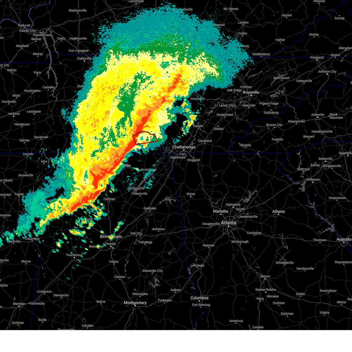 At 1222 am cdt, a severe thunderstorm capable of producing a tornado was located over tims ford lake, or 7 miles northwest of winchester, moving east at 50 mph (radar indicated rotation). Hazards include tornado and quarter size hail. Flying debris will be dangerous to those caught without shelter. mobile homes will be damaged or destroyed. damage to roofs, windows, and vehicles will occur. Tree damage is likely. At 1222 am cdt, a severe thunderstorm capable of producing a tornado was located over tims ford lake, or 7 miles northwest of winchester, moving east at 50 mph (radar indicated rotation). Hazards include tornado and quarter size hail. Flying debris will be dangerous to those caught without shelter. mobile homes will be damaged or destroyed. damage to roofs, windows, and vehicles will occur. Tree damage is likely.
|
| 3/25/2023 12:06 AM CDT |
 At 1205 am cdt, severe thunderstorms were located along a line extending from near lynchburg to near fayetteville to near harvest to near tanner, moving east at 45 mph (radar indicated). Hazards include 60 mph wind gusts and quarter size hail. Hail damage to vehicles is expected. Expect wind damage to roofs, siding, and trees. At 1205 am cdt, severe thunderstorms were located along a line extending from near lynchburg to near fayetteville to near harvest to near tanner, moving east at 45 mph (radar indicated). Hazards include 60 mph wind gusts and quarter size hail. Hail damage to vehicles is expected. Expect wind damage to roofs, siding, and trees.
|
| 3/3/2023 12:10 PM CST |
 At 1209 pm cst, severe thunderstorms were located along a line extending from 8 miles northwest of mcminnville to near decherd, moving northeast at 70 mph (radar indicated). Hazards include 70 mph wind gusts. Expect considerable tree damage. damage is likely to mobile homes, roofs, and outbuildings. locations impacted include, winchester, decherd, estill springs, stevenson, cowan, skyline, sewanee, tims ford lake, anderson and hytop. thunderstorm damage threat, considerable hail threat, radar indicated max hail size, <. 75 in wind threat, radar indicated max wind gust, 70 mph. At 1209 pm cst, severe thunderstorms were located along a line extending from 8 miles northwest of mcminnville to near decherd, moving northeast at 70 mph (radar indicated). Hazards include 70 mph wind gusts. Expect considerable tree damage. damage is likely to mobile homes, roofs, and outbuildings. locations impacted include, winchester, decherd, estill springs, stevenson, cowan, skyline, sewanee, tims ford lake, anderson and hytop. thunderstorm damage threat, considerable hail threat, radar indicated max hail size, <. 75 in wind threat, radar indicated max wind gust, 70 mph.
|
| 3/3/2023 12:03 PM CST |
 At 1202 pm cst, a severe thunderstorm capable of producing a tornado was located near huntland, or 10 miles southwest of winchester, moving northeast at 60 mph (radar indicated rotation). Hazards include tornado. Flying debris will be dangerous to those caught without shelter. mobile homes will be damaged or destroyed. damage to roofs, windows, and vehicles will occur. tree damage is likely. this dangerous storm will be near, cowan around 1215 pm cst. Other locations impacted by this tornadic thunderstorm include beans creek. At 1202 pm cst, a severe thunderstorm capable of producing a tornado was located near huntland, or 10 miles southwest of winchester, moving northeast at 60 mph (radar indicated rotation). Hazards include tornado. Flying debris will be dangerous to those caught without shelter. mobile homes will be damaged or destroyed. damage to roofs, windows, and vehicles will occur. tree damage is likely. this dangerous storm will be near, cowan around 1215 pm cst. Other locations impacted by this tornadic thunderstorm include beans creek.
|
| 3/3/2023 11:57 AM CST |
 At 1157 am cst, severe thunderstorms were located along a line extending from 12 miles north of manchester to 6 miles south of tims ford lake, moving northeast at 55 mph (radar indicated). Hazards include 70 mph wind gusts. Expect considerable tree damage. damage is likely to mobile homes, roofs, and outbuildings. locations impacted include, huntsville, winchester, lynchburg, moores mill, decherd, estill springs, stevenson, cowan, huntland and skyline. thunderstorm damage threat, considerable hail threat, radar indicated max hail size, <. 75 in wind threat, radar indicated max wind gust, 70 mph. At 1157 am cst, severe thunderstorms were located along a line extending from 12 miles north of manchester to 6 miles south of tims ford lake, moving northeast at 55 mph (radar indicated). Hazards include 70 mph wind gusts. Expect considerable tree damage. damage is likely to mobile homes, roofs, and outbuildings. locations impacted include, huntsville, winchester, lynchburg, moores mill, decherd, estill springs, stevenson, cowan, huntland and skyline. thunderstorm damage threat, considerable hail threat, radar indicated max hail size, <. 75 in wind threat, radar indicated max wind gust, 70 mph.
|
| 3/3/2023 11:54 AM CST |
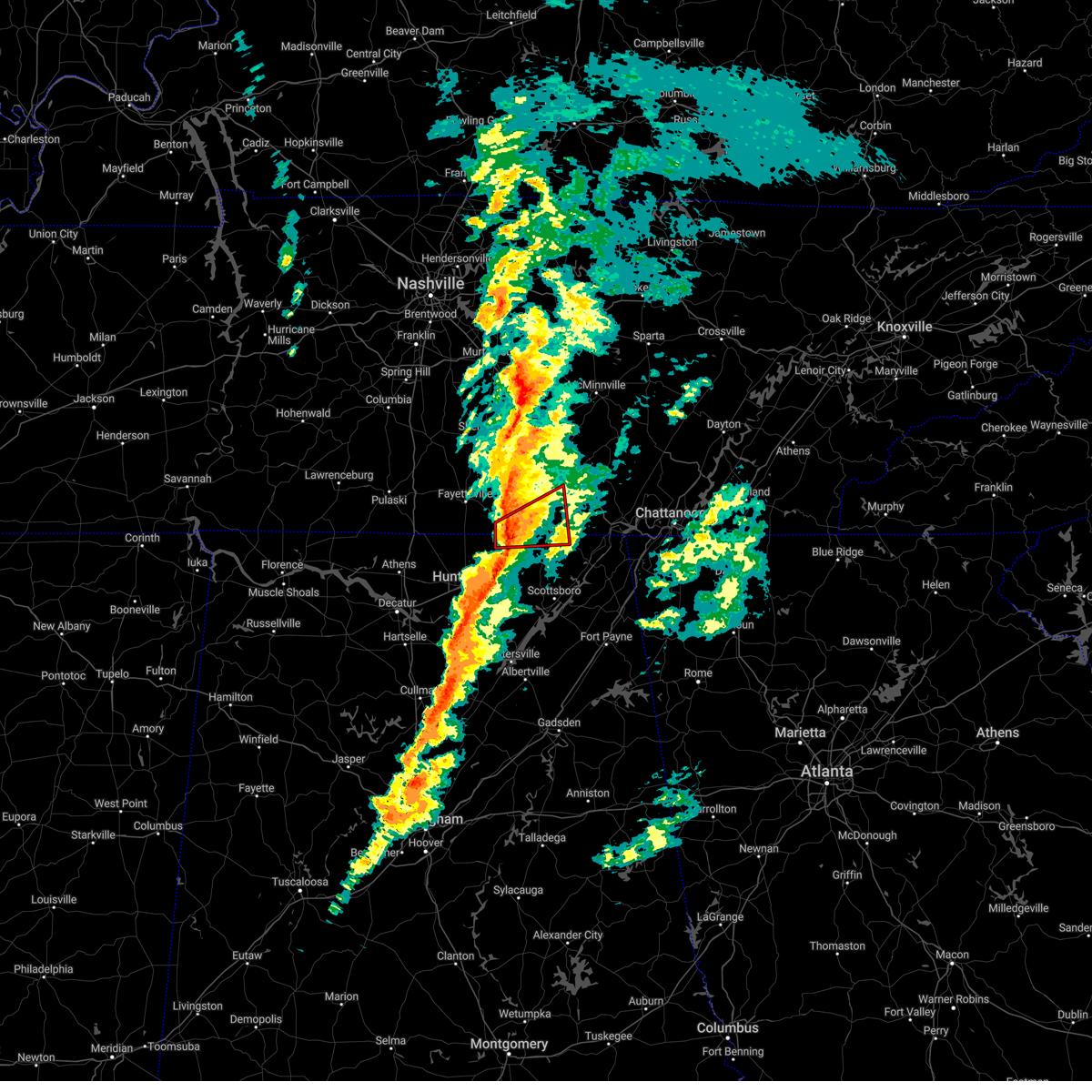 At 1154 am cst, a severe thunderstorm capable of producing a tornado was located near huntland, or 14 miles northeast of moores mill, moving northeast at 60 mph (radar indicated rotation). Hazards include tornado. Flying debris will be dangerous to those caught without shelter. mobile homes will be damaged or destroyed. damage to roofs, windows, and vehicles will occur. tree damage is likely. this dangerous storm will be near, huntland around 1200 pm cst. cowan around 1215 pm cst. Other locations impacted by this tornadic thunderstorm include elora, francisco, maxwell, beans creek, belvidere and jericho. At 1154 am cst, a severe thunderstorm capable of producing a tornado was located near huntland, or 14 miles northeast of moores mill, moving northeast at 60 mph (radar indicated rotation). Hazards include tornado. Flying debris will be dangerous to those caught without shelter. mobile homes will be damaged or destroyed. damage to roofs, windows, and vehicles will occur. tree damage is likely. this dangerous storm will be near, huntland around 1200 pm cst. cowan around 1215 pm cst. Other locations impacted by this tornadic thunderstorm include elora, francisco, maxwell, beans creek, belvidere and jericho.
|
| 3/3/2023 11:33 AM CST |
 At 1131 am cst, severe thunderstorms were located along a line extending from 7 miles northwest of lynchburg to meridianville, moving northeast at 70 mph. huntsville airport has recorded a wind gusts of 69 mph and wind damage has been reported with this line of storms (radar indicated). Hazards include 70 mph wind gusts. Expect considerable tree damage. damage is likely to mobile homes, roofs, and outbuildings. locations impacted include, northern huntsville, madison, winchester, fayetteville, moores mill, meridianville, lynchburg, hazel green, decherd and estill springs. thunderstorm damage threat, considerable hail threat, radar indicated max hail size, <. 75 in wind threat, radar indicated max wind gust, 70 mph. At 1131 am cst, severe thunderstorms were located along a line extending from 7 miles northwest of lynchburg to meridianville, moving northeast at 70 mph. huntsville airport has recorded a wind gusts of 69 mph and wind damage has been reported with this line of storms (radar indicated). Hazards include 70 mph wind gusts. Expect considerable tree damage. damage is likely to mobile homes, roofs, and outbuildings. locations impacted include, northern huntsville, madison, winchester, fayetteville, moores mill, meridianville, lynchburg, hazel green, decherd and estill springs. thunderstorm damage threat, considerable hail threat, radar indicated max hail size, <. 75 in wind threat, radar indicated max wind gust, 70 mph.
|
| 3/3/2023 11:25 AM CST |
 At 1123 am cst, severe thunderstorms were located along a line extending from near petersburg to near madison, moving northeast at 100 mph (radar indicated). Hazards include 70 mph wind gusts. Expect considerable tree damage. Damage is likely to mobile homes, roofs, and outbuildings. At 1123 am cst, severe thunderstorms were located along a line extending from near petersburg to near madison, moving northeast at 100 mph (radar indicated). Hazards include 70 mph wind gusts. Expect considerable tree damage. Damage is likely to mobile homes, roofs, and outbuildings.
|
| 2/16/2023 6:32 PM CST |
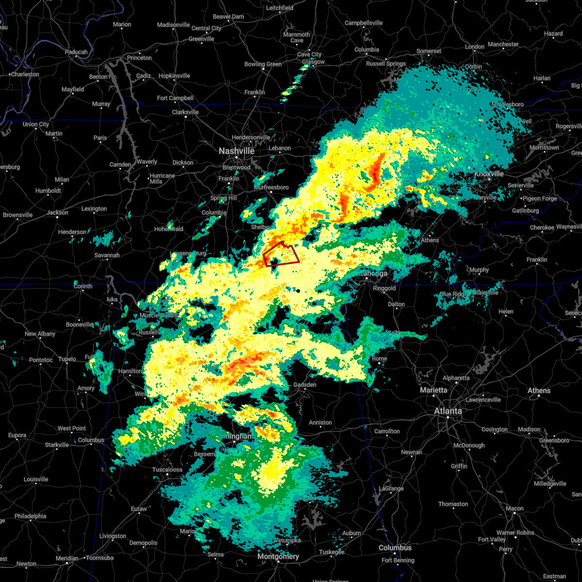 At 632 pm cst, a severe thunderstorm capable of producing a tornado was located near lynchburg, moving northeast at 30 mph (radar indicated rotation). Hazards include tornado. Flying debris will be dangerous to those caught without shelter. mobile homes will be damaged or destroyed. damage to roofs, windows, and vehicles will occur. tree damage is likely. this dangerous storm will be near, lynchburg around 635 pm cst. tims ford lake around 655 pm cst. winchester and estill springs around 700 pm cst. Other locations impacted by this tornadic thunderstorm include hurdlow, lois, booneville, marble hill, harmony and arnold afb. At 632 pm cst, a severe thunderstorm capable of producing a tornado was located near lynchburg, moving northeast at 30 mph (radar indicated rotation). Hazards include tornado. Flying debris will be dangerous to those caught without shelter. mobile homes will be damaged or destroyed. damage to roofs, windows, and vehicles will occur. tree damage is likely. this dangerous storm will be near, lynchburg around 635 pm cst. tims ford lake around 655 pm cst. winchester and estill springs around 700 pm cst. Other locations impacted by this tornadic thunderstorm include hurdlow, lois, booneville, marble hill, harmony and arnold afb.
|
| 1/12/2023 5:13 PM CST |
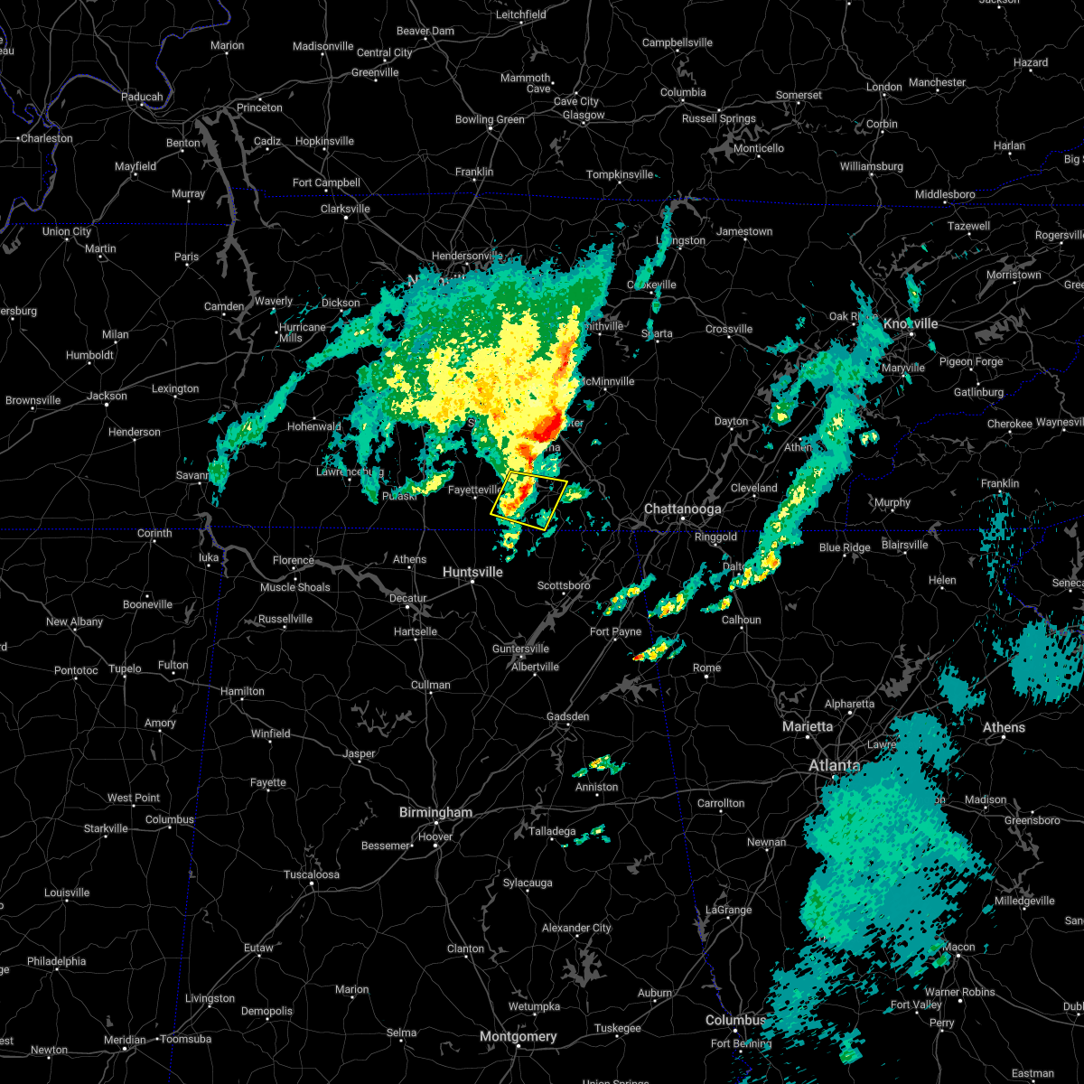 The severe thunderstorm warning for southeastern moore, southeastern lincoln and southwestern franklin counties will expire at 515 pm cst, the storm which prompted the warning has weakened below severe limits, and no longer poses an immediate threat to life or property. therefore, the warning will be allowed to expire. The severe thunderstorm warning for southeastern moore, southeastern lincoln and southwestern franklin counties will expire at 515 pm cst, the storm which prompted the warning has weakened below severe limits, and no longer poses an immediate threat to life or property. therefore, the warning will be allowed to expire.
|
| 1/12/2023 5:07 PM CST |
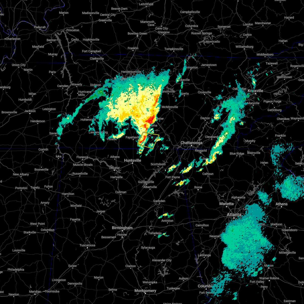 At 507 pm cst, a severe thunderstorm was located near huntland, or 10 miles west of winchester, moving east at 45 mph (radar indicated). Hazards include 60 mph wind gusts and penny size hail. Expect damage to roofs, siding, and trees. locations impacted include, winchester, lynchburg, decherd, huntland, tims ford lake, lexie crossroads, harmony, hurdlow, lois and maxwell. hail threat, radar indicated max hail size, 0. 75 in wind threat, radar indicated max wind gust, 60 mph. At 507 pm cst, a severe thunderstorm was located near huntland, or 10 miles west of winchester, moving east at 45 mph (radar indicated). Hazards include 60 mph wind gusts and penny size hail. Expect damage to roofs, siding, and trees. locations impacted include, winchester, lynchburg, decherd, huntland, tims ford lake, lexie crossroads, harmony, hurdlow, lois and maxwell. hail threat, radar indicated max hail size, 0. 75 in wind threat, radar indicated max wind gust, 60 mph.
|
| 1/12/2023 4:55 PM CST |
 At 455 pm cst, a severe thunderstorm was located 7 miles east of fayetteville, moving east at 45 mph (radar indicated). Hazards include 60 mph wind gusts and penny size hail. Expect damage to roofs, siding, and trees. locations impacted include, winchester, fayetteville, lynchburg, decherd, huntland, tims ford lake, lexie crossroads, mulberry, harmony and hurdlow. hail threat, radar indicated max hail size, 0. 75 in wind threat, radar indicated max wind gust, 60 mph. At 455 pm cst, a severe thunderstorm was located 7 miles east of fayetteville, moving east at 45 mph (radar indicated). Hazards include 60 mph wind gusts and penny size hail. Expect damage to roofs, siding, and trees. locations impacted include, winchester, fayetteville, lynchburg, decherd, huntland, tims ford lake, lexie crossroads, mulberry, harmony and hurdlow. hail threat, radar indicated max hail size, 0. 75 in wind threat, radar indicated max wind gust, 60 mph.
|
| 1/12/2023 4:50 PM CST |
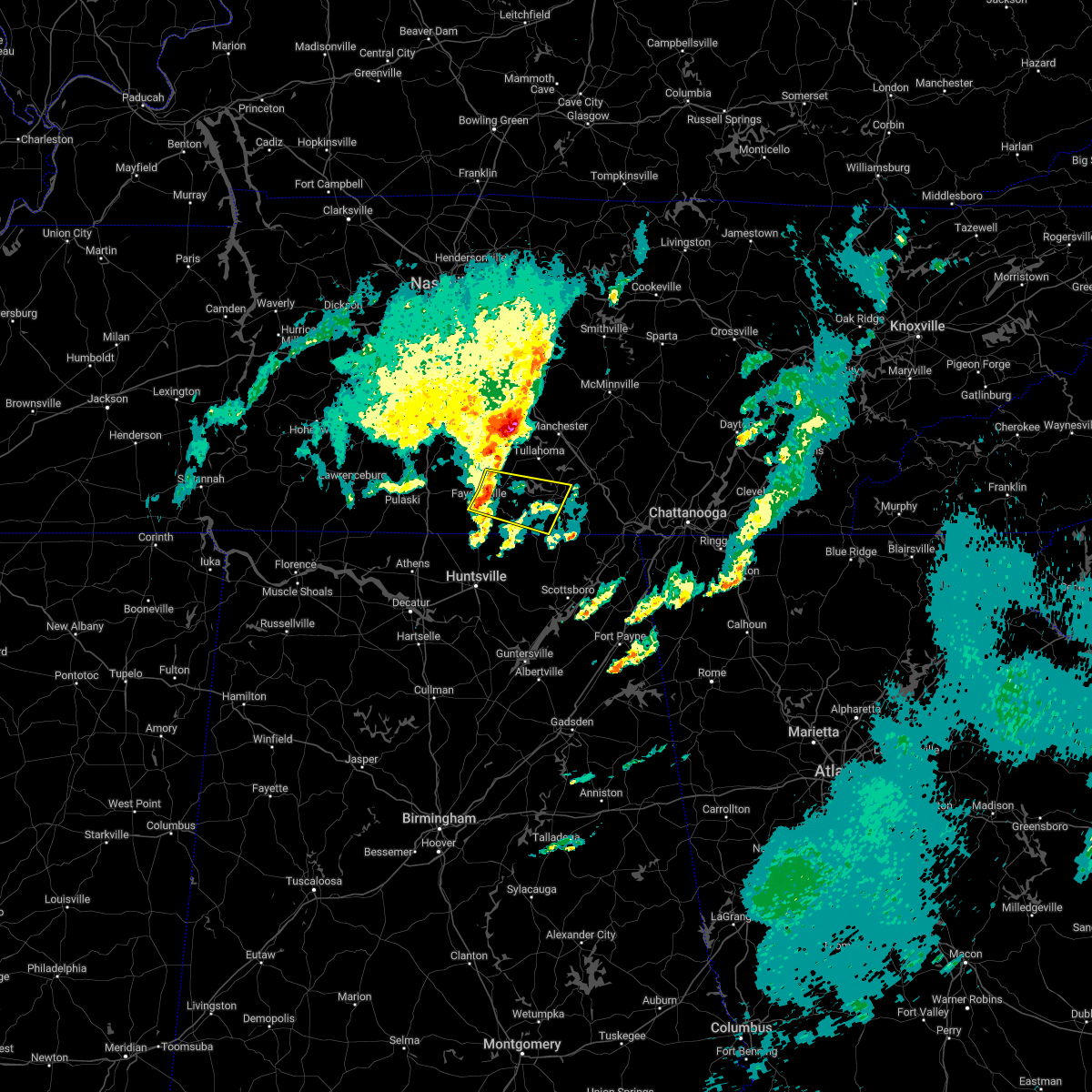 At 450 pm cst, a severe thunderstorm was located near fayetteville, moving east at 45 mph (radar indicated). Hazards include 60 mph wind gusts and penny size hail. expect damage to roofs, siding, and trees At 450 pm cst, a severe thunderstorm was located near fayetteville, moving east at 45 mph (radar indicated). Hazards include 60 mph wind gusts and penny size hail. expect damage to roofs, siding, and trees
|
| 1/12/2023 2:52 PM CST |
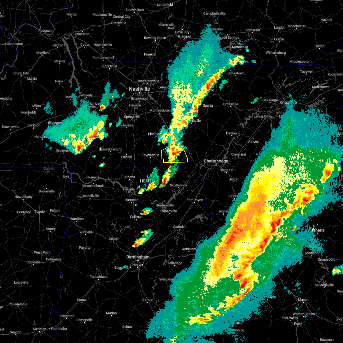 The severe thunderstorm warning for southeastern moore and franklin counties will expire at 300 pm cst, the storm which prompted the warning has weakened below severe limits, and no longer poses an immediate threat to life or property. therefore, the warning will be allowed to expire. however small hail is still possible with this thunderstorm. The severe thunderstorm warning for southeastern moore and franklin counties will expire at 300 pm cst, the storm which prompted the warning has weakened below severe limits, and no longer poses an immediate threat to life or property. therefore, the warning will be allowed to expire. however small hail is still possible with this thunderstorm.
|
| 1/12/2023 2:44 PM CST |
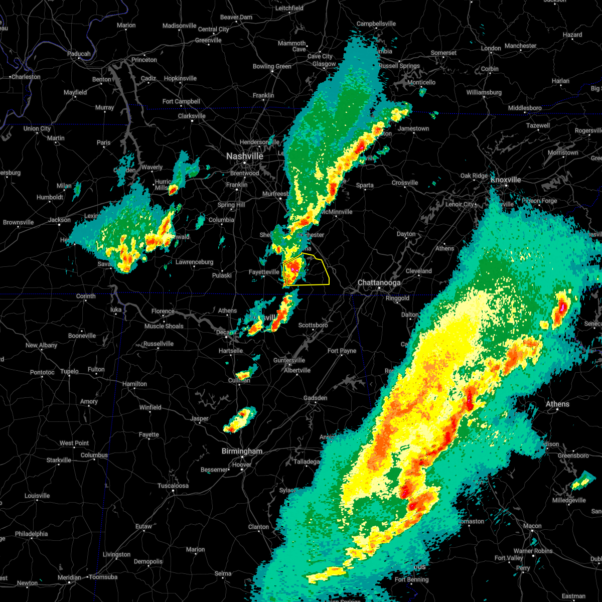 At 243 pm cst, a severe thunderstorm was located near tims ford lake, or near winchester, moving east at 45 mph (radar indicated). Hazards include 60 mph wind gusts and quarter size hail. Hail damage to vehicles is expected. expect wind damage to roofs, siding, and trees. locations impacted include, winchester, decherd, estill springs, cowan, huntland, sewanee, tims ford lake, lexie crossroads, harmony and hurdlow. hail threat, radar indicated max hail size, 1. 00 in wind threat, radar indicated max wind gust, 60 mph. At 243 pm cst, a severe thunderstorm was located near tims ford lake, or near winchester, moving east at 45 mph (radar indicated). Hazards include 60 mph wind gusts and quarter size hail. Hail damage to vehicles is expected. expect wind damage to roofs, siding, and trees. locations impacted include, winchester, decherd, estill springs, cowan, huntland, sewanee, tims ford lake, lexie crossroads, harmony and hurdlow. hail threat, radar indicated max hail size, 1. 00 in wind threat, radar indicated max wind gust, 60 mph.
|
| 1/12/2023 2:29 PM CST |
 At 229 pm cst, a severe thunderstorm was located 7 miles south of lynchburg, moving east at 45 mph (radar indicated). Hazards include 60 mph wind gusts and quarter size hail. Hail damage to vehicles is expected. Expect wind damage to roofs, siding, and trees. At 229 pm cst, a severe thunderstorm was located 7 miles south of lynchburg, moving east at 45 mph (radar indicated). Hazards include 60 mph wind gusts and quarter size hail. Hail damage to vehicles is expected. Expect wind damage to roofs, siding, and trees.
|
| 1/12/2023 2:29 PM CST |
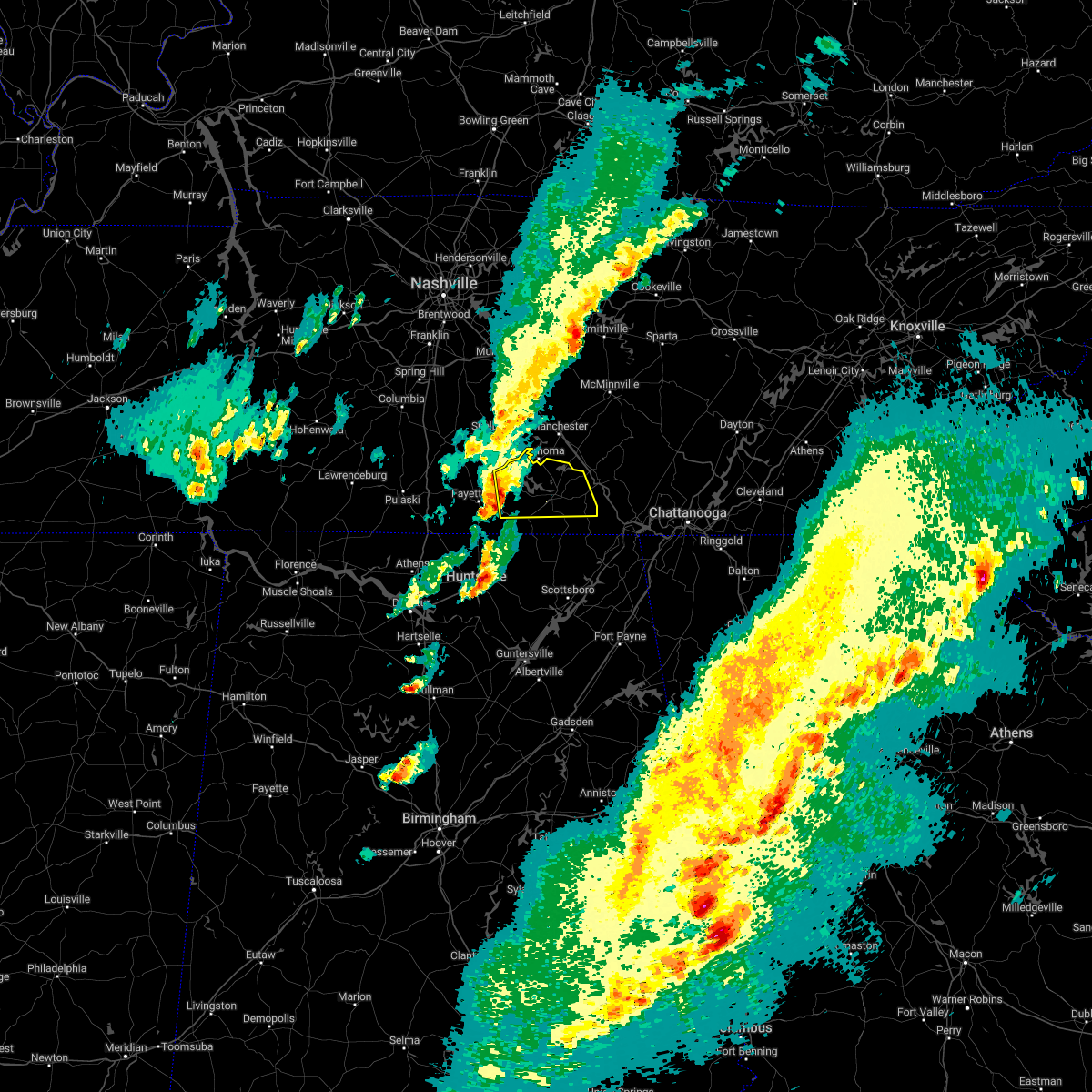 At 229 pm cst, a severe thunderstorm was located 7 miles south of lynchburg, moving east at 45 mph (radar indicated). Hazards include 60 mph wind gusts and quarter size hail. Hail damage to vehicles is expected. Expect wind damage to roofs, siding, and trees. At 229 pm cst, a severe thunderstorm was located 7 miles south of lynchburg, moving east at 45 mph (radar indicated). Hazards include 60 mph wind gusts and quarter size hail. Hail damage to vehicles is expected. Expect wind damage to roofs, siding, and trees.
|
| 7/9/2022 4:58 AM CDT |
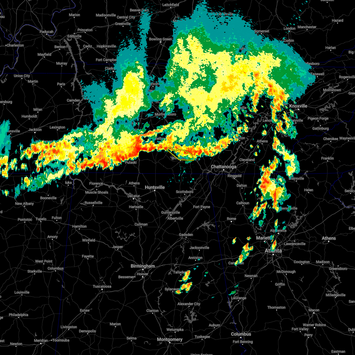 The severe thunderstorm warning for northeastern moore and northern franklin counties will expire at 500 am cdt, the storms which prompted the warning have weakened below severe limits, and no longer pose an immediate threat to life or property. therefore, the warning will be allowed to expire. however gusty winds are still possible with these thunderstorms. The severe thunderstorm warning for northeastern moore and northern franklin counties will expire at 500 am cdt, the storms which prompted the warning have weakened below severe limits, and no longer pose an immediate threat to life or property. therefore, the warning will be allowed to expire. however gusty winds are still possible with these thunderstorms.
|
| 7/9/2022 4:33 AM CDT |
 At 433 am cdt, severe thunderstorms were located along a line extending from near lynchburg to 8 miles northeast of estill springs, moving southeast at 20 mph (radar indicated). Hazards include 60 mph wind gusts. expect damage to roofs, siding, and trees At 433 am cdt, severe thunderstorms were located along a line extending from near lynchburg to 8 miles northeast of estill springs, moving southeast at 20 mph (radar indicated). Hazards include 60 mph wind gusts. expect damage to roofs, siding, and trees
|
| 6/7/2022 3:28 PM CDT |
 The severe thunderstorm warning for southern franklin county will expire at 330 pm cdt, the storm which prompted the warning has weakened below severe limits, and has exited the warned area. therefore, the warning will be allowed to expire. however gusty winds and heavy rain are still possible with this thunderstorm. The severe thunderstorm warning for southern franklin county will expire at 330 pm cdt, the storm which prompted the warning has weakened below severe limits, and has exited the warned area. therefore, the warning will be allowed to expire. however gusty winds and heavy rain are still possible with this thunderstorm.
|
| 6/7/2022 3:18 PM CDT |
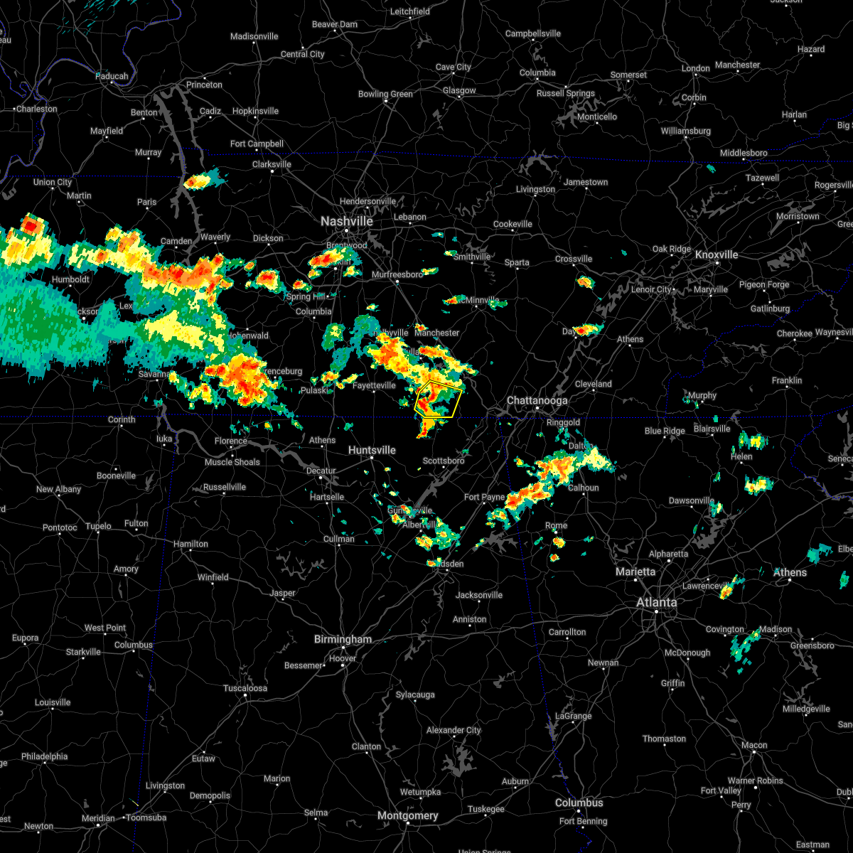 At 318 pm cdt, a severe thunderstorm was located near winchester, moving southeast at 15 mph (radar indicated). Hazards include 60 mph wind gusts. Expect damage to roofs, siding, and trees. locations impacted include, winchester, decherd, cowan, tims ford lake, beans creek, maxwell and belvidere. hail threat, radar indicated max hail size, <. 75 in wind threat, radar indicated max wind gust, 60 mph. At 318 pm cdt, a severe thunderstorm was located near winchester, moving southeast at 15 mph (radar indicated). Hazards include 60 mph wind gusts. Expect damage to roofs, siding, and trees. locations impacted include, winchester, decherd, cowan, tims ford lake, beans creek, maxwell and belvidere. hail threat, radar indicated max hail size, <. 75 in wind threat, radar indicated max wind gust, 60 mph.
|
| 6/7/2022 3:02 PM CDT |
 At 302 pm cdt, a severe thunderstorm was located near winchester, moving southeast at 20 mph (radar indicated). Hazards include 60 mph wind gusts. expect damage to roofs, siding, and trees At 302 pm cdt, a severe thunderstorm was located near winchester, moving southeast at 20 mph (radar indicated). Hazards include 60 mph wind gusts. expect damage to roofs, siding, and trees
|
| 6/7/2022 2:53 PM CDT |
 At 253 pm cdt, a severe thunderstorm was located over tims ford lake, or 7 miles west of winchester, moving east at 15 mph (radar indicated). Hazards include 60 mph wind gusts. Expect damage to roofs, siding, and trees. locations impacted include, winchester, lynchburg, decherd, estill springs, tims ford lake, harmony, hurdlow, lois, marble hill and woods reservoir. hail threat, radar indicated max hail size, <. 75 in wind threat, radar indicated max wind gust, 60 mph. At 253 pm cdt, a severe thunderstorm was located over tims ford lake, or 7 miles west of winchester, moving east at 15 mph (radar indicated). Hazards include 60 mph wind gusts. Expect damage to roofs, siding, and trees. locations impacted include, winchester, lynchburg, decherd, estill springs, tims ford lake, harmony, hurdlow, lois, marble hill and woods reservoir. hail threat, radar indicated max hail size, <. 75 in wind threat, radar indicated max wind gust, 60 mph.
|
| 6/7/2022 2:34 PM CDT |
 At 234 pm cdt, a severe thunderstorm was located near lynchburg, moving east at 15 mph (radar indicated). Hazards include 60 mph wind gusts. expect damage to roofs, siding, and trees At 234 pm cdt, a severe thunderstorm was located near lynchburg, moving east at 15 mph (radar indicated). Hazards include 60 mph wind gusts. expect damage to roofs, siding, and trees
|
| 6/6/2022 3:28 PM CDT |
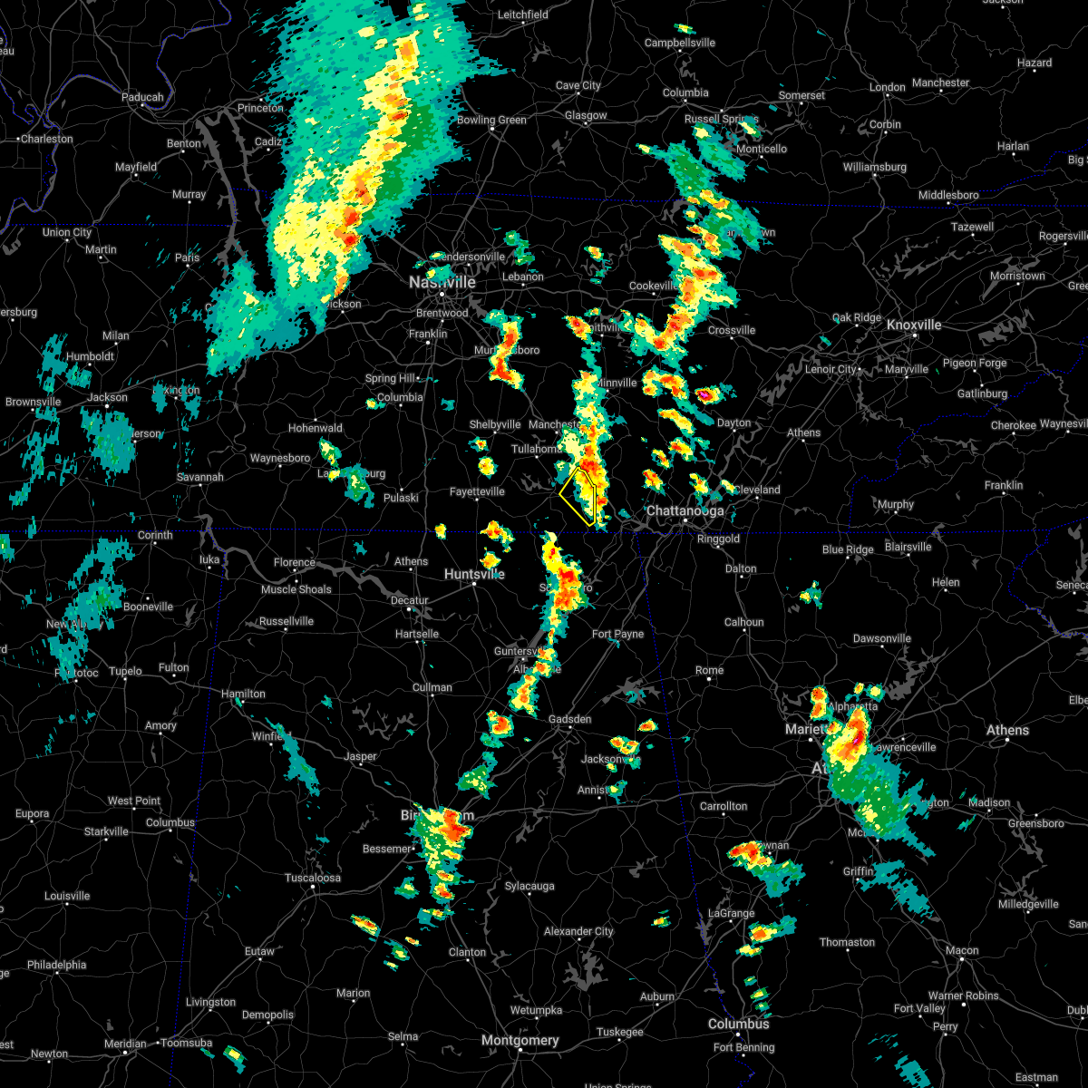 The severe thunderstorm warning for northeastern franklin county will expire at 330 pm cdt, the storm which prompted the warning has weakened below severe limits, and has exited the warned area. therefore, the warning will be allowed to expire. to report severe weather, contact your nearest law enforcement agency. they will relay your report to the national weather service huntsville alabama. The severe thunderstorm warning for northeastern franklin county will expire at 330 pm cdt, the storm which prompted the warning has weakened below severe limits, and has exited the warned area. therefore, the warning will be allowed to expire. to report severe weather, contact your nearest law enforcement agency. they will relay your report to the national weather service huntsville alabama.
|
| 6/6/2022 3:14 PM CDT |
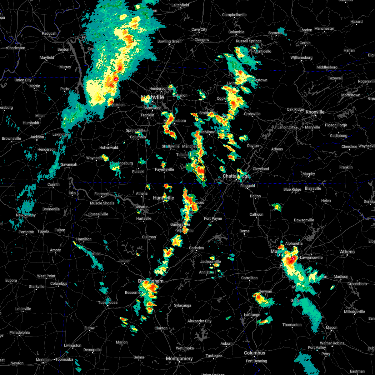 At 314 pm cdt, a severe thunderstorm was located over sewanee, or 11 miles east of winchester, moving northeast at 25 mph (radar indicated). Hazards include 60 mph wind gusts. Expect damage to roofs, siding, and trees. locations impacted include, winchester, cowan, sewanee, alto, st. andrews and sherwood. hail threat, radar indicated max hail size, <. 75 in wind threat, radar indicated max wind gust, 60 mph. At 314 pm cdt, a severe thunderstorm was located over sewanee, or 11 miles east of winchester, moving northeast at 25 mph (radar indicated). Hazards include 60 mph wind gusts. Expect damage to roofs, siding, and trees. locations impacted include, winchester, cowan, sewanee, alto, st. andrews and sherwood. hail threat, radar indicated max hail size, <. 75 in wind threat, radar indicated max wind gust, 60 mph.
|
| 6/6/2022 3:00 PM CDT |
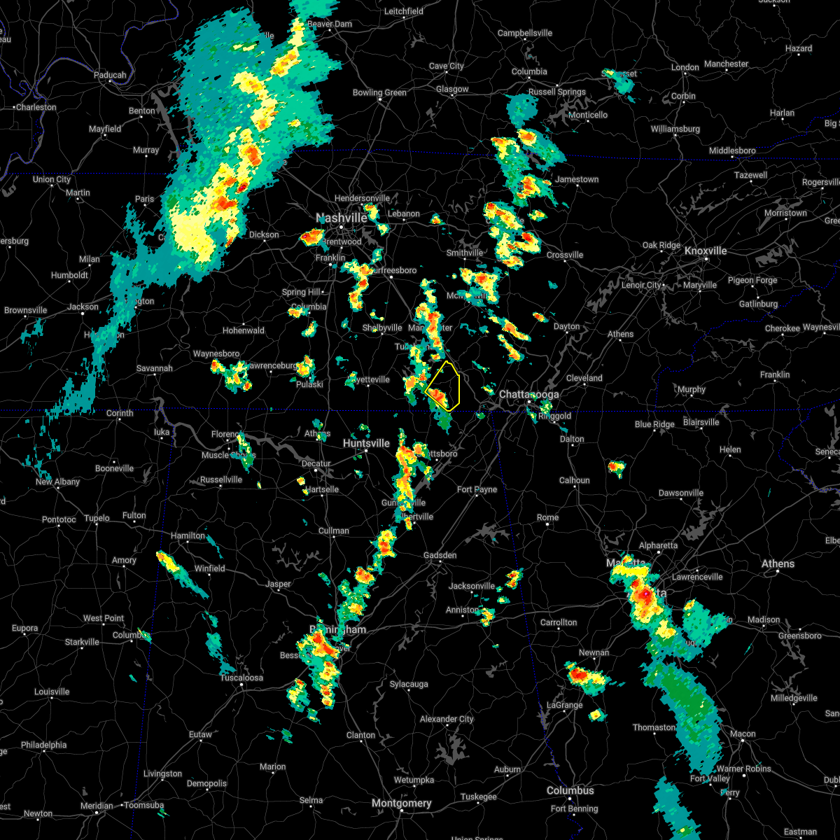 At 300 pm cdt, a severe thunderstorm was located near cowan, or 9 miles southeast of winchester, moving northeast at 25 mph (radar indicated). Hazards include 60 mph wind gusts and penny size hail. expect damage to roofs, siding, and trees At 300 pm cdt, a severe thunderstorm was located near cowan, or 9 miles southeast of winchester, moving northeast at 25 mph (radar indicated). Hazards include 60 mph wind gusts and penny size hail. expect damage to roofs, siding, and trees
|
| 3/30/2022 10:26 PM CDT |
 At 1024 pm cdt, severe thunderstorms were located along a line extending from near hazel green to 7 miles southeast of helicon, moving east at 40 mph (radar indicated). Hazards include 60 mph wind gusts. expect damage to roofs, siding, and trees At 1024 pm cdt, severe thunderstorms were located along a line extending from near hazel green to 7 miles southeast of helicon, moving east at 40 mph (radar indicated). Hazards include 60 mph wind gusts. expect damage to roofs, siding, and trees
|
| 1/1/2022 6:57 PM CST | At 657 pm cst, a severe thunderstorm was located near cowan, or 8 miles southeast of winchester, moving east at 40 mph (radar indicated). Hazards include 60 mph wind gusts. expect damage to roofs, siding, and trees |
| 1/1/2022 6:43 PM CST |
 The severe thunderstorm warning for northern madison. moore. southeastern lincoln and western franklin counties will expire at 645 pm cst. the storms which prompted the warning have weakened below severe limits, and no longer pose an immediate threat to life or property. Therefore, the warning will be allowed to expire. The severe thunderstorm warning for northern madison. moore. southeastern lincoln and western franklin counties will expire at 645 pm cst. the storms which prompted the warning have weakened below severe limits, and no longer pose an immediate threat to life or property. Therefore, the warning will be allowed to expire.
|
| 1/1/2022 6:43 PM CST |
 The severe thunderstorm warning for northern madison, moore, southeastern lincoln and western franklin counties will expire at 645 pm cst, the storms which prompted the warning have weakened below severe limits, and no longer pose an immediate threat to life or property. therefore, the warning will be allowed to expire. a tornado watch remains in effect until 700 pm cst for north central, northeastern and northwestern alabama, and middle tennessee. a tornado watch also remains in effect until 1000 pm cst for northeastern alabama. remember, a tornado warning still remains in effect for southern franklin county in southern middle tennessee. The severe thunderstorm warning for northern madison, moore, southeastern lincoln and western franklin counties will expire at 645 pm cst, the storms which prompted the warning have weakened below severe limits, and no longer pose an immediate threat to life or property. therefore, the warning will be allowed to expire. a tornado watch remains in effect until 700 pm cst for north central, northeastern and northwestern alabama, and middle tennessee. a tornado watch also remains in effect until 1000 pm cst for northeastern alabama. remember, a tornado warning still remains in effect for southern franklin county in southern middle tennessee.
|
| 1/1/2022 6:23 PM CST |
 At 623 pm cst, severe thunderstorms were located along a line extending from near lynchburg to near university of alabama in huntsville, moving east at 45 mph (radar indicated). Hazards include 60 mph wind gusts. Expect damage to roofs, siding, and trees. locations impacted include, northern huntsville, madison, winchester, lynchburg, moores mill, meridianville, hazel green, decherd, estill springs and huntland. hail threat, radar indicated max hail size, <. 75 in wind threat, radar indicated max wind gust, 60 mph. At 623 pm cst, severe thunderstorms were located along a line extending from near lynchburg to near university of alabama in huntsville, moving east at 45 mph (radar indicated). Hazards include 60 mph wind gusts. Expect damage to roofs, siding, and trees. locations impacted include, northern huntsville, madison, winchester, lynchburg, moores mill, meridianville, hazel green, decherd, estill springs and huntland. hail threat, radar indicated max hail size, <. 75 in wind threat, radar indicated max wind gust, 60 mph.
|
| 1/1/2022 6:00 PM CST |
 At 600 pm cst, severe thunderstorms were located along a line extending from near petersburg to near tanner, moving east at 50 mph (radar indicated). Hazards include 60 mph wind gusts. expect damage to roofs, siding, and trees At 600 pm cst, severe thunderstorms were located along a line extending from near petersburg to near tanner, moving east at 50 mph (radar indicated). Hazards include 60 mph wind gusts. expect damage to roofs, siding, and trees
|
| 1/1/2022 5:56 PM CST |
 The severe thunderstorm warning for moore, southeastern lincoln and northern franklin counties will expire at 600 pm cst, the storm which prompted the warning has weakened below severe limits, and no longer poses an immediate threat to life or property. therefore, the warning will be allowed to expire. a tornado watch remains in effect until 700 pm cst for north central and northeastern alabama, and middle tennessee. The severe thunderstorm warning for moore, southeastern lincoln and northern franklin counties will expire at 600 pm cst, the storm which prompted the warning has weakened below severe limits, and no longer poses an immediate threat to life or property. therefore, the warning will be allowed to expire. a tornado watch remains in effect until 700 pm cst for north central and northeastern alabama, and middle tennessee.
|
| 1/1/2022 5:55 PM CST |
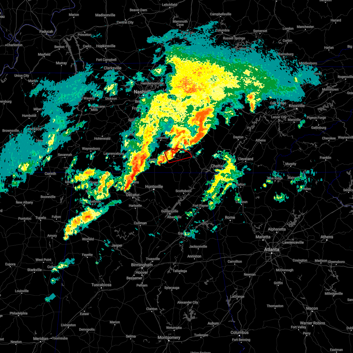 The tornado warning for southeastern moore and northern franklin counties will expire at 600 pm cst, the storm which prompted the warning has weakened below severe limits, and no longer appears capable of producing a tornado. therefore, the warning will be allowed to expire. a tornado watch remains in effect until 700 pm cst for north central and northeastern alabama, and middle tennessee. The tornado warning for southeastern moore and northern franklin counties will expire at 600 pm cst, the storm which prompted the warning has weakened below severe limits, and no longer appears capable of producing a tornado. therefore, the warning will be allowed to expire. a tornado watch remains in effect until 700 pm cst for north central and northeastern alabama, and middle tennessee.
|
| 1/1/2022 5:47 PM CST |
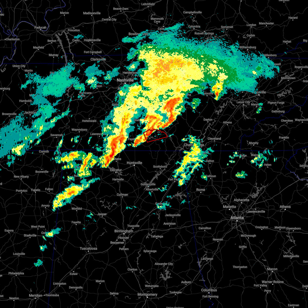 At 546 pm cst, a severe thunderstorm capable of producing a tornado was located near tims ford lake, or near lynchburg, moving east at 50 mph (radar indicated rotation). Hazards include tornado. Flying debris will be dangerous to those caught without shelter. mobile homes will be damaged or destroyed. damage to roofs, windows, and vehicles will occur. tree damage is likely. this dangerous storm will be near, winchester and estill springs around 555 pm cst. decherd around 600 pm cst. Other locations impacted by this tornadic thunderstorm include alto, marble hill, woods reservoir, harmony and arnold afb. At 546 pm cst, a severe thunderstorm capable of producing a tornado was located near tims ford lake, or near lynchburg, moving east at 50 mph (radar indicated rotation). Hazards include tornado. Flying debris will be dangerous to those caught without shelter. mobile homes will be damaged or destroyed. damage to roofs, windows, and vehicles will occur. tree damage is likely. this dangerous storm will be near, winchester and estill springs around 555 pm cst. decherd around 600 pm cst. Other locations impacted by this tornadic thunderstorm include alto, marble hill, woods reservoir, harmony and arnold afb.
|
| 1/1/2022 5:42 PM CST |
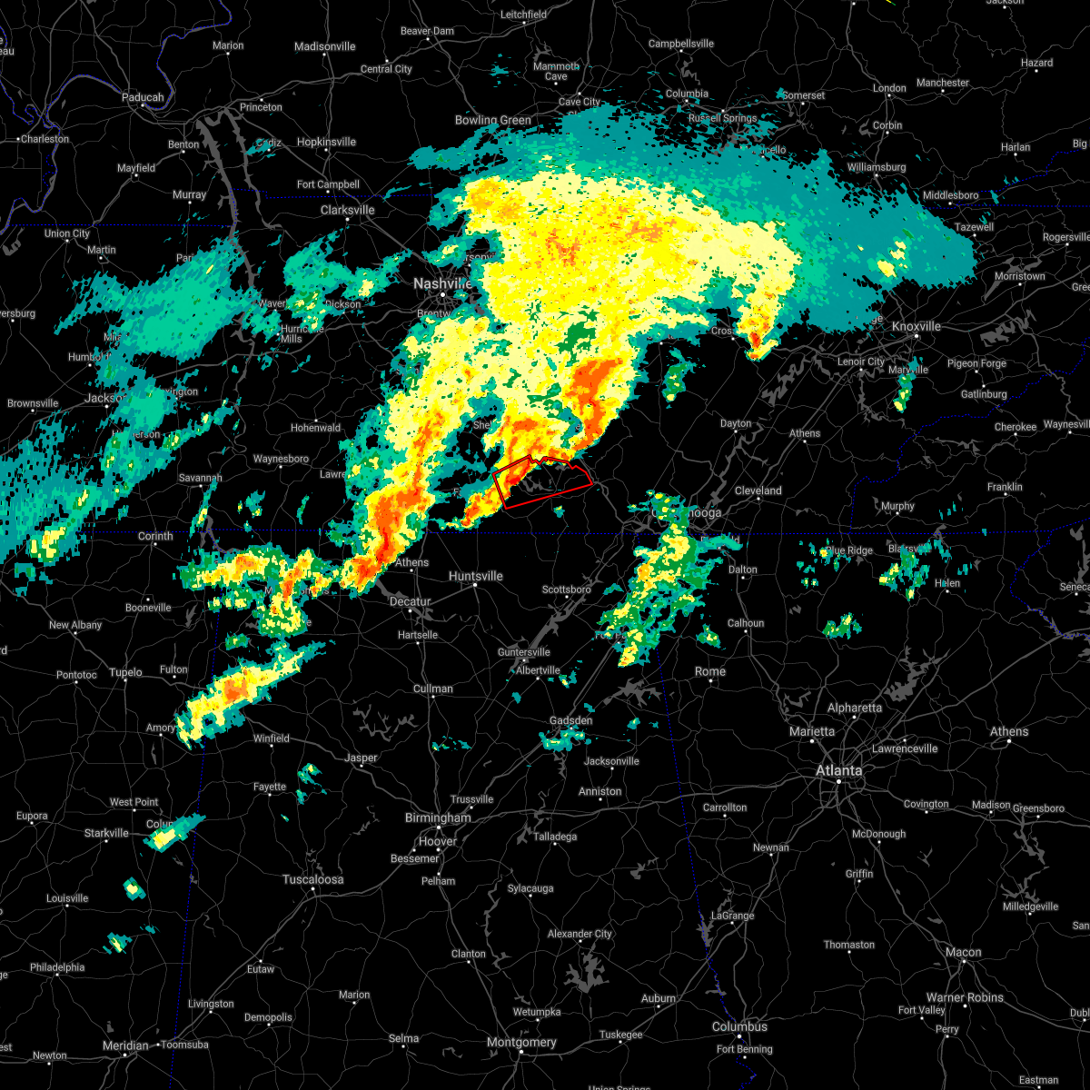 At 541 pm cst, a severe thunderstorm capable of producing a tornado was located near lynchburg, moving east at 50 mph (radar indicated rotation). Hazards include tornado. Flying debris will be dangerous to those caught without shelter. mobile homes will be damaged or destroyed. damage to roofs, windows, and vehicles will occur. tree damage is likely. this dangerous storm will be near, tims ford lake around 550 pm cst. winchester and estill springs around 555 pm cst. decherd around 600 pm cst. Other locations impacted by this tornadic thunderstorm include lexie crossroads, smithland, woods reservoir, harmony, arnold afb, hurdlow, lois, alto, booneville and marble hill. At 541 pm cst, a severe thunderstorm capable of producing a tornado was located near lynchburg, moving east at 50 mph (radar indicated rotation). Hazards include tornado. Flying debris will be dangerous to those caught without shelter. mobile homes will be damaged or destroyed. damage to roofs, windows, and vehicles will occur. tree damage is likely. this dangerous storm will be near, tims ford lake around 550 pm cst. winchester and estill springs around 555 pm cst. decherd around 600 pm cst. Other locations impacted by this tornadic thunderstorm include lexie crossroads, smithland, woods reservoir, harmony, arnold afb, hurdlow, lois, alto, booneville and marble hill.
|
| 1/1/2022 5:33 PM CST |
 At 532 pm cst, a severe thunderstorm was located near fayetteville, moving east at 50 mph (radar indicated). Hazards include 60 mph wind gusts. expect damage to roofs, siding, and trees At 532 pm cst, a severe thunderstorm was located near fayetteville, moving east at 50 mph (radar indicated). Hazards include 60 mph wind gusts. expect damage to roofs, siding, and trees
|
| 12/11/2021 7:12 AM CST | Tree down on vine street in wincheste in franklin county TN, 0.8 miles NW of Winchester, TN |
| 12/11/2021 7:00 AM CST |
 At 659 am cst, severe thunderstorms were located along a line extending from near tullahoma to near tims ford lake to 8 miles north of huntland to 7 miles north of new market, moving east at 60 mph (radar indicated). Hazards include 60 mph wind gusts. Expect damage to roofs, siding, and trees. locations impacted include, winchester, lynchburg, hazel green, decherd, estill springs, cowan, huntland, tims ford lake, lincoln and elora. hail threat, radar indicated max hail size, <. 75 in wind threat, radar indicated max wind gust, 60 mph. At 659 am cst, severe thunderstorms were located along a line extending from near tullahoma to near tims ford lake to 8 miles north of huntland to 7 miles north of new market, moving east at 60 mph (radar indicated). Hazards include 60 mph wind gusts. Expect damage to roofs, siding, and trees. locations impacted include, winchester, lynchburg, hazel green, decherd, estill springs, cowan, huntland, tims ford lake, lincoln and elora. hail threat, radar indicated max hail size, <. 75 in wind threat, radar indicated max wind gust, 60 mph.
|
| 12/11/2021 6:41 AM CST |
 At 640 am cst, severe thunderstorms were located along a line extending from near petersburg to near fayetteville to 10 miles north of hazel green to 6 miles north of harvest, moving east at 60 mph (radar indicated). Hazards include 60 mph wind gusts. expect damage to roofs, siding, and trees At 640 am cst, severe thunderstorms were located along a line extending from near petersburg to near fayetteville to 10 miles north of hazel green to 6 miles north of harvest, moving east at 60 mph (radar indicated). Hazards include 60 mph wind gusts. expect damage to roofs, siding, and trees
|
| 12/6/2021 7:56 AM CST |
 The severe thunderstorm warning for moore, northeastern lincoln and northwestern franklin counties will expire at 800 am cst, the storms which prompted the warning have weakened. therefore, the warning will be allowed to expire. The severe thunderstorm warning for moore, northeastern lincoln and northwestern franklin counties will expire at 800 am cst, the storms which prompted the warning have weakened. therefore, the warning will be allowed to expire.
|
| 12/6/2021 7:33 AM CST |
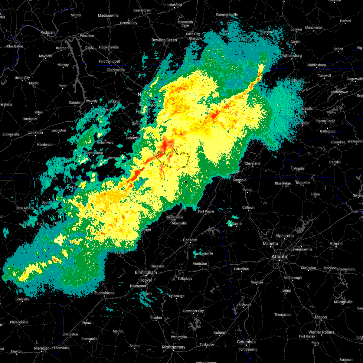 At 733 am cst, severe thunderstorms were located along a line extending from 6 miles north of shelbyville to near petersburg to 11 miles west of fayetteville, moving east at 45 mph (radar indicated). Hazards include 70 mph wind gusts. Expect considerable tree damage. damage is likely to mobile homes, roofs, and outbuildings. locations impacted include, winchester, lynchburg, decherd, estill springs, tims ford lake, lexie crossroads, mulberry, chestnut ridge, harmony and belleville. thunderstorm damage threat, considerable hail threat, radar indicated max hail size, <. 75 in wind threat, radar indicated max wind gust, 70 mph. At 733 am cst, severe thunderstorms were located along a line extending from 6 miles north of shelbyville to near petersburg to 11 miles west of fayetteville, moving east at 45 mph (radar indicated). Hazards include 70 mph wind gusts. Expect considerable tree damage. damage is likely to mobile homes, roofs, and outbuildings. locations impacted include, winchester, lynchburg, decherd, estill springs, tims ford lake, lexie crossroads, mulberry, chestnut ridge, harmony and belleville. thunderstorm damage threat, considerable hail threat, radar indicated max hail size, <. 75 in wind threat, radar indicated max wind gust, 70 mph.
|
| 12/6/2021 7:27 AM CST |
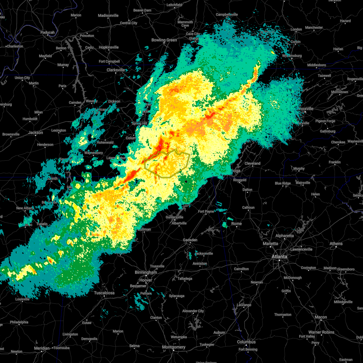 At 727 am cst, severe thunderstorms were located along a line extending from 9 miles northwest of shelbyville to near petersburg to 11 miles east of pulaski, moving southeast at 45 mph (radar indicated). Hazards include 70 mph wind gusts. Expect considerable tree damage. Damage is likely to mobile homes, roofs, and outbuildings. At 727 am cst, severe thunderstorms were located along a line extending from 9 miles northwest of shelbyville to near petersburg to 11 miles east of pulaski, moving southeast at 45 mph (radar indicated). Hazards include 70 mph wind gusts. Expect considerable tree damage. Damage is likely to mobile homes, roofs, and outbuildings.
|
| 8/30/2021 2:28 PM CDT |
 The severe thunderstorm warning for southeastern franklin county will expire at 230 pm cdt, the storm which prompted the warning has weakened below severe limits, and no longer poses an immediate threat to life or property. therefore, the warning will be allowed to expire. The severe thunderstorm warning for southeastern franklin county will expire at 230 pm cdt, the storm which prompted the warning has weakened below severe limits, and no longer poses an immediate threat to life or property. therefore, the warning will be allowed to expire.
|
| 8/30/2021 2:21 PM CDT |
 At 221 pm cdt, a severe thunderstorm was located near cowan, or near winchester, moving north at 10 mph (radar indicated). Hazards include 60 mph wind gusts. Expect damage to roofs, siding, and trees. locations impacted include, winchester, cowan, sewanee, belvidere and sherwood. hail threat, radar indicated max hail size, <. 75 in wind threat, radar indicated max wind gust, 60 mph. At 221 pm cdt, a severe thunderstorm was located near cowan, or near winchester, moving north at 10 mph (radar indicated). Hazards include 60 mph wind gusts. Expect damage to roofs, siding, and trees. locations impacted include, winchester, cowan, sewanee, belvidere and sherwood. hail threat, radar indicated max hail size, <. 75 in wind threat, radar indicated max wind gust, 60 mph.
|
| 8/30/2021 2:01 PM CDT |
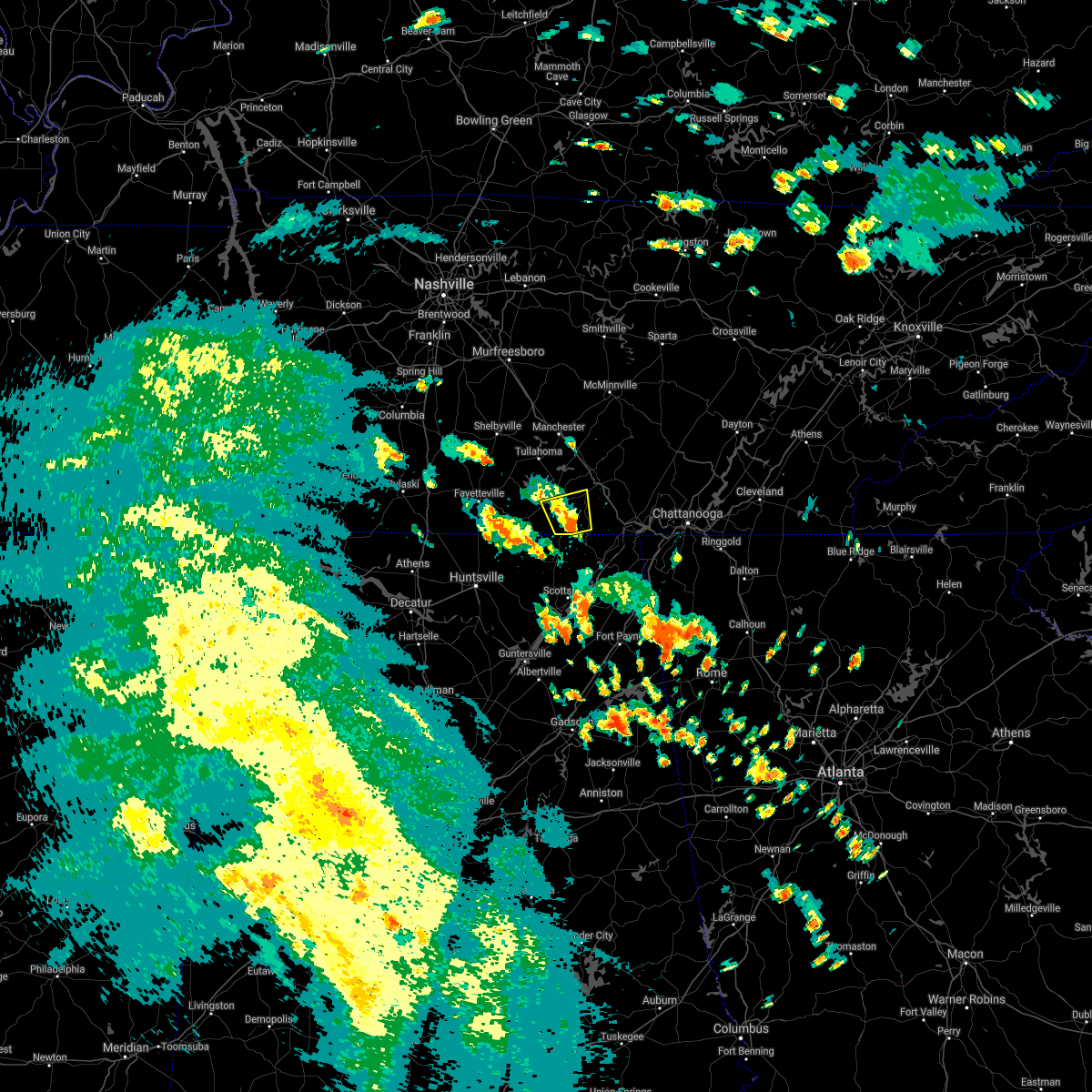 At 201 pm cdt, a severe thunderstorm was located near cowan, or 9 miles southeast of winchester, moving north at 10 mph (radar indicated). Hazards include 60 mph wind gusts. expect damage to roofs, siding, and trees At 201 pm cdt, a severe thunderstorm was located near cowan, or 9 miles southeast of winchester, moving north at 10 mph (radar indicated). Hazards include 60 mph wind gusts. expect damage to roofs, siding, and trees
|
| 8/1/2021 12:12 AM CDT |
 The severe thunderstorm warning for moore, lincoln and franklin counties will expire at 1215 am cdt, the storms which prompted the warning have moved out of the area. therefore, the warning will be allowed to expire. a severe thunderstorm watch remains in effect until 300 am cdt for north central and northeastern alabama, and middle tennessee. remember, a severe thunderstorm warning still remains in effect for franklin county tennessee until 100 am cdt. The severe thunderstorm warning for moore, lincoln and franklin counties will expire at 1215 am cdt, the storms which prompted the warning have moved out of the area. therefore, the warning will be allowed to expire. a severe thunderstorm watch remains in effect until 300 am cdt for north central and northeastern alabama, and middle tennessee. remember, a severe thunderstorm warning still remains in effect for franklin county tennessee until 100 am cdt.
|
| 8/1/2021 12:11 AM CDT |
 At 1210 am cdt, severe thunderstorms were located along a line extending from near manchester to near tims ford lake to near huntland, moving southeast at 50 mph (radar indicated). Hazards include 60 mph wind gusts. expect damage to roofs, siding, and trees At 1210 am cdt, severe thunderstorms were located along a line extending from near manchester to near tims ford lake to near huntland, moving southeast at 50 mph (radar indicated). Hazards include 60 mph wind gusts. expect damage to roofs, siding, and trees
|
| 7/31/2021 11:49 PM CDT |
 At 1148 pm cdt, severe thunderstorms were located along a line extending from 8 miles northwest of manchester to near lynchburg to 8 miles east of pulaski, moving east at 40 mph (radar indicated). Hazards include 60 mph wind gusts. Expect damage to roofs, siding, and trees. Locations impacted include, winchester, fayetteville, lynchburg, decherd, estill springs, cowan, huntland, petersburg, tims ford lake and sewanee. At 1148 pm cdt, severe thunderstorms were located along a line extending from 8 miles northwest of manchester to near lynchburg to 8 miles east of pulaski, moving east at 40 mph (radar indicated). Hazards include 60 mph wind gusts. Expect damage to roofs, siding, and trees. Locations impacted include, winchester, fayetteville, lynchburg, decherd, estill springs, cowan, huntland, petersburg, tims ford lake and sewanee.
|
| 7/31/2021 11:27 PM CDT |
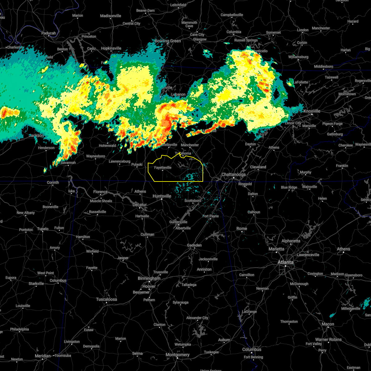 At 1126 pm cdt, severe thunderstorms were located along a line extending from 11 miles south of murfreesboro to 6 miles west of shelbyville to 8 miles southwest of lewisburg, moving southeast at 45 mph (radar indicated). Hazards include 60 mph wind gusts. expect damage to roofs, siding, and trees At 1126 pm cdt, severe thunderstorms were located along a line extending from 11 miles south of murfreesboro to 6 miles west of shelbyville to 8 miles southwest of lewisburg, moving southeast at 45 mph (radar indicated). Hazards include 60 mph wind gusts. expect damage to roofs, siding, and trees
|
| 7/26/2021 3:06 PM CDT |
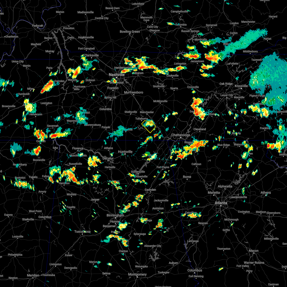 The severe thunderstorm warning for northeastern franklin county will expire at 315 pm cdt, the storm which prompted the warning has weakened below severe limits, and no longer poses an immediate threat to life or property. therefore, the warning will be allowed to expire. The severe thunderstorm warning for northeastern franklin county will expire at 315 pm cdt, the storm which prompted the warning has weakened below severe limits, and no longer poses an immediate threat to life or property. therefore, the warning will be allowed to expire.
|
| 7/26/2021 2:47 PM CDT |
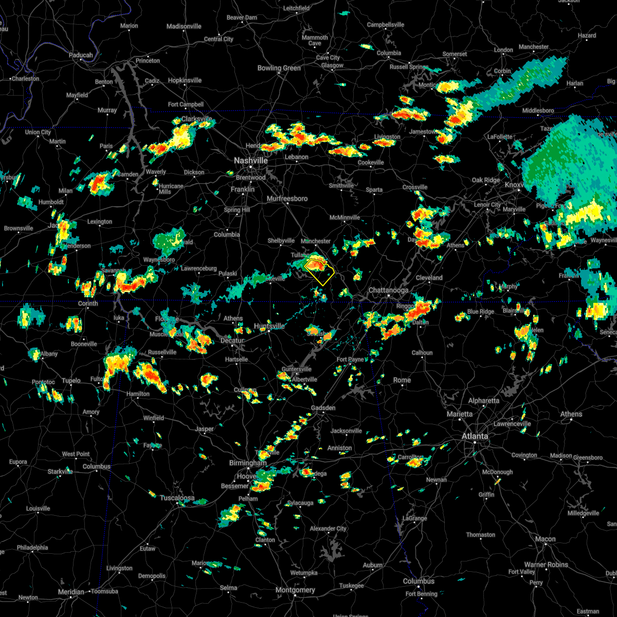 At 247 pm cdt, a severe thunderstorm was located near decherd, or 8 miles northeast of winchester, moving southeast at 10 mph (radar indicated). Hazards include 60 mph wind gusts. expect damage to roofs, siding, and trees At 247 pm cdt, a severe thunderstorm was located near decherd, or 8 miles northeast of winchester, moving southeast at 10 mph (radar indicated). Hazards include 60 mph wind gusts. expect damage to roofs, siding, and trees
|
| 5/6/2021 7:25 PM CDT |
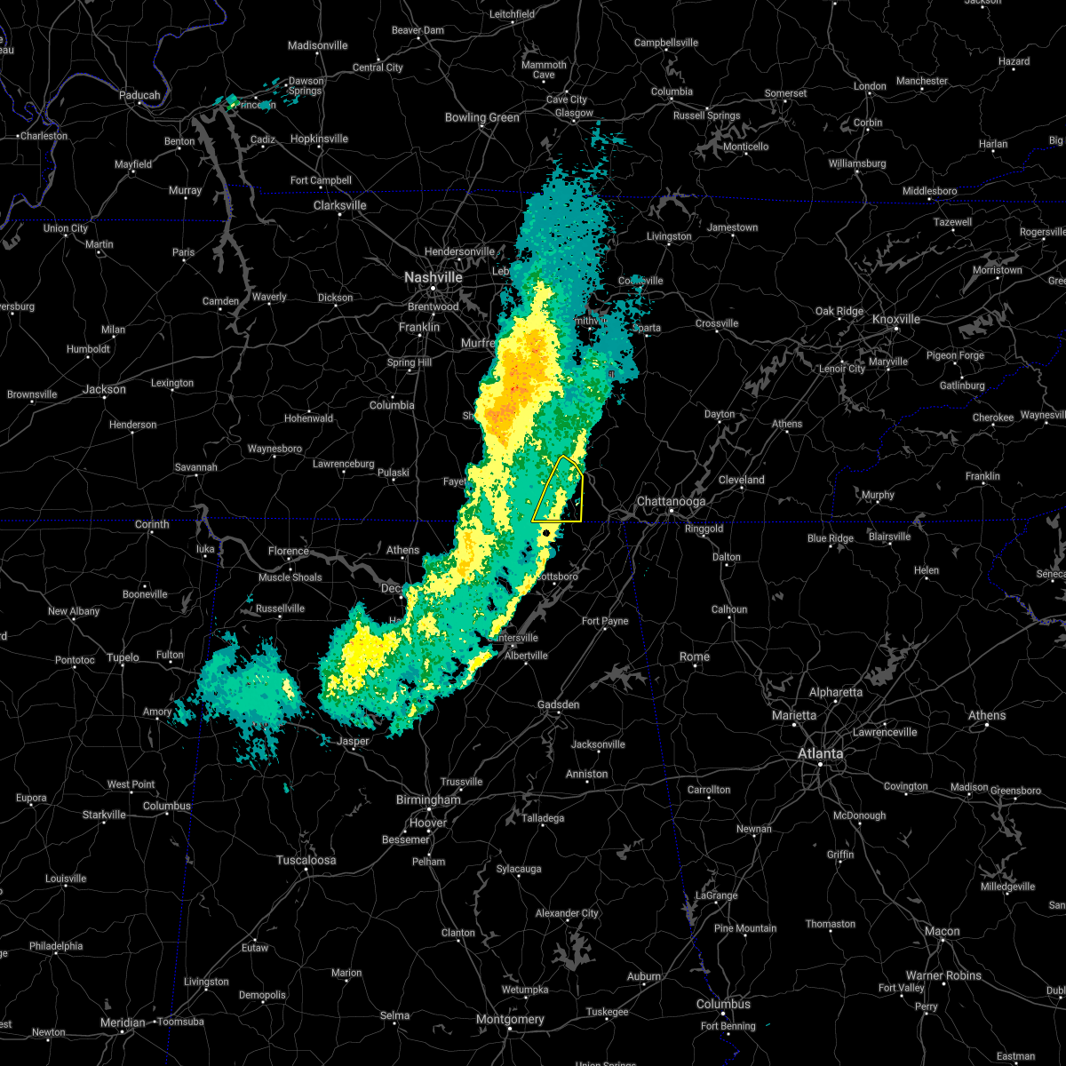 The severe thunderstorm warning for eastern franklin county will expire at 730 pm cdt, the storms which prompted the warning are moving out of the area. therefore, the warning will be allowed to expire. The severe thunderstorm warning for eastern franklin county will expire at 730 pm cdt, the storms which prompted the warning are moving out of the area. therefore, the warning will be allowed to expire.
|
| 5/6/2021 7:19 PM CDT |
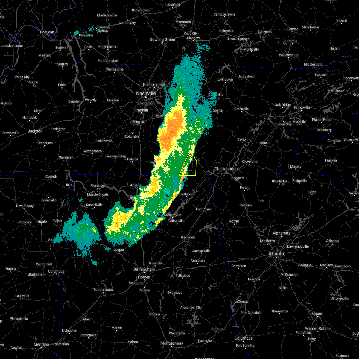 At 718 pm cdt, severe thunderstorms were located along a line extending from near monteagle to 11 miles northeast of skyline, moving east at 40 mph (emergency management and doppler radar). Hazards include 60 mph wind gusts. Expect damage to roofs, siding, and trees. locations impacted include, winchester, decherd, cowan, sewanee, anderson, alto, st. Andrews, sherwood and woods reservoir. At 718 pm cdt, severe thunderstorms were located along a line extending from near monteagle to 11 miles northeast of skyline, moving east at 40 mph (emergency management and doppler radar). Hazards include 60 mph wind gusts. Expect damage to roofs, siding, and trees. locations impacted include, winchester, decherd, cowan, sewanee, anderson, alto, st. Andrews, sherwood and woods reservoir.
|
| 5/6/2021 7:10 PM CDT | Trees down throughout winchester. time estimated from rada in franklin county TN, 0.8 miles NW of Winchester, TN |
| 5/6/2021 6:56 PM CDT |
 The severe thunderstorm warning for moore, lincoln and western franklin counties will expire at 700 pm cdt, the storms which prompted the warning have moved out of the area. therefore, the warning will be allowed to expire. remember, a severe thunderstorm warning still remains in effect for southeastern lincoln and franklin counties until 730 pm. The severe thunderstorm warning for moore, lincoln and western franklin counties will expire at 700 pm cdt, the storms which prompted the warning have moved out of the area. therefore, the warning will be allowed to expire. remember, a severe thunderstorm warning still remains in effect for southeastern lincoln and franklin counties until 730 pm.
|
| 5/6/2021 6:53 PM CDT |
 At 652 pm cdt, severe thunderstorms were located along a line extending from near estill springs to 6 miles southwest of huntland, moving east at 40 mph (radar indicated). Hazards include 60 mph wind gusts and penny size hail. expect damage to roofs, siding, and trees At 652 pm cdt, severe thunderstorms were located along a line extending from near estill springs to 6 miles southwest of huntland, moving east at 40 mph (radar indicated). Hazards include 60 mph wind gusts and penny size hail. expect damage to roofs, siding, and trees
|
| 5/6/2021 6:00 PM CDT |
 At 559 pm cdt, severe thunderstorms were located along a line extending from 11 miles northwest of shelbyville to 13 miles east of lexington, moving east at 35 mph (radar indicated). Hazards include 60 mph wind gusts and penny size hail. expect damage to roofs, siding, and trees At 559 pm cdt, severe thunderstorms were located along a line extending from 11 miles northwest of shelbyville to 13 miles east of lexington, moving east at 35 mph (radar indicated). Hazards include 60 mph wind gusts and penny size hail. expect damage to roofs, siding, and trees
|
| 8/13/2020 10:05 PM CDT |
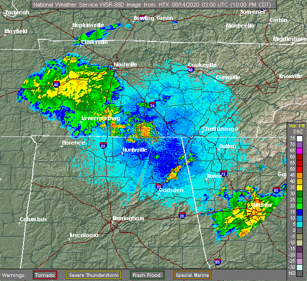 At 1004 pm cdt, a severe thunderstorm was located near huntland, or 8 miles southwest of winchester, moving east at 10 mph (radar indicated). Hazards include 60 mph wind gusts. Expect damage to roofs, siding, and trees. Locations impacted include, winchester, decherd, huntland, tims ford lake, lexie crossroads, smithland, beans creek, harmony, elora and maxwell. At 1004 pm cdt, a severe thunderstorm was located near huntland, or 8 miles southwest of winchester, moving east at 10 mph (radar indicated). Hazards include 60 mph wind gusts. Expect damage to roofs, siding, and trees. Locations impacted include, winchester, decherd, huntland, tims ford lake, lexie crossroads, smithland, beans creek, harmony, elora and maxwell.
|
| 8/13/2020 9:46 PM CDT |
 At 946 pm cdt, a severe thunderstorm was located over huntland, or 11 miles southwest of winchester, moving east at 10 mph (radar indicated). Hazards include 60 mph wind gusts and nickel size hail. expect damage to roofs, siding, and trees At 946 pm cdt, a severe thunderstorm was located over huntland, or 11 miles southwest of winchester, moving east at 10 mph (radar indicated). Hazards include 60 mph wind gusts and nickel size hail. expect damage to roofs, siding, and trees
|
| 6/21/2020 5:10 PM CDT |
 At 509 pm cdt, a severe thunderstorm was located over tims ford lake, or near winchester, moving east at 20 mph (radar indicated). Hazards include 60 mph wind gusts and quarter size hail. Hail damage to vehicles is expected. Expect wind damage to roofs, siding, and trees. At 509 pm cdt, a severe thunderstorm was located over tims ford lake, or near winchester, moving east at 20 mph (radar indicated). Hazards include 60 mph wind gusts and quarter size hail. Hail damage to vehicles is expected. Expect wind damage to roofs, siding, and trees.
|
| 5/22/2020 9:23 PM CDT |
 At 923 pm cdt, severe thunderstorms were located along a line extending from near tims ford lake to near hazel green, moving east at 40 mph (radar indicated). Hazards include 60 mph wind gusts. Expect damage to roofs, siding, and trees. Locations impacted include, winchester, fayetteville, hazel green, decherd, cowan, huntland, tims ford lake, sewanee, new market and lincoln. At 923 pm cdt, severe thunderstorms were located along a line extending from near tims ford lake to near hazel green, moving east at 40 mph (radar indicated). Hazards include 60 mph wind gusts. Expect damage to roofs, siding, and trees. Locations impacted include, winchester, fayetteville, hazel green, decherd, cowan, huntland, tims ford lake, sewanee, new market and lincoln.
|
| 5/22/2020 9:00 PM CDT |
 At 859 pm cdt, severe thunderstorms were located along a line extending from 7 miles west of lynchburg to ardmore, moving east at 40 mph (radar indicated). Hazards include 60 mph wind gusts. expect damage to roofs, siding, and trees At 859 pm cdt, severe thunderstorms were located along a line extending from 7 miles west of lynchburg to ardmore, moving east at 40 mph (radar indicated). Hazards include 60 mph wind gusts. expect damage to roofs, siding, and trees
|
| 5/4/2020 9:51 PM CDT |
 At 943 pm cdt, severe thunderstorms were located along a line extending from near winchester to near new market, moving southeast at 50 mph. this storm has a history of producing wind damage (radar indicated). Hazards include 60 mph wind gusts and quarter size hail. Hail damage to vehicles is expected. expect wind damage to roofs, siding, and trees. Locations impacted include, northern huntsville, winchester, fayetteville, lynchburg, moores mill, meridianville, hazel green, decherd, cowan and huntland. At 943 pm cdt, severe thunderstorms were located along a line extending from near winchester to near new market, moving southeast at 50 mph. this storm has a history of producing wind damage (radar indicated). Hazards include 60 mph wind gusts and quarter size hail. Hail damage to vehicles is expected. expect wind damage to roofs, siding, and trees. Locations impacted include, northern huntsville, winchester, fayetteville, lynchburg, moores mill, meridianville, hazel green, decherd, cowan and huntland.
|
| 5/4/2020 9:45 PM CDT |
 At 943 pm cdt, severe thunderstorms were located along a line extending from near winchester to near new market, moving southeast at 50 mph. this storm has a history of producing wind damage (radar indicated). Hazards include 60 mph wind gusts and quarter size hail. Hail damage to vehicles is expected. expect wind damage to roofs, siding, and trees. Locations impacted include, northern huntsville, winchester, fayetteville, lynchburg, moores mill, meridianville, hazel green, decherd, cowan and huntland. At 943 pm cdt, severe thunderstorms were located along a line extending from near winchester to near new market, moving southeast at 50 mph. this storm has a history of producing wind damage (radar indicated). Hazards include 60 mph wind gusts and quarter size hail. Hail damage to vehicles is expected. expect wind damage to roofs, siding, and trees. Locations impacted include, northern huntsville, winchester, fayetteville, lynchburg, moores mill, meridianville, hazel green, decherd, cowan and huntland.
|
| 5/4/2020 9:22 PM CDT |
 At 922 pm cdt, severe thunderstorms were located along a line extending from near lynchburg to 9 miles southwest of fayetteville, moving southeast at 50 mph (radar indicated). Hazards include 60 mph wind gusts and quarter size hail. Hail damage to vehicles is expected. Expect wind damage to roofs, siding, and trees. At 922 pm cdt, severe thunderstorms were located along a line extending from near lynchburg to 9 miles southwest of fayetteville, moving southeast at 50 mph (radar indicated). Hazards include 60 mph wind gusts and quarter size hail. Hail damage to vehicles is expected. Expect wind damage to roofs, siding, and trees.
|
| 5/3/2020 5:41 PM CDT |
 The national weather service in huntsville alabama has issued a * severe thunderstorm warning for. jackson county in northeastern alabama. northeastern madison county in north central alabama. northeastern dekalb county in northeastern alabama. Southeastern franklin county in middle tennessee. The national weather service in huntsville alabama has issued a * severe thunderstorm warning for. jackson county in northeastern alabama. northeastern madison county in north central alabama. northeastern dekalb county in northeastern alabama. Southeastern franklin county in middle tennessee.
|
| 5/3/2020 5:41 PM CDT |
 At 540 pm cdt, severe thunderstorms were located along a line extending from near monteagle to 7 miles southeast of new market to huntsville, moving east at 65 mph (radar indicated. this storm has a history of producing widespread tree damage and power outages). Hazards include 70 mph wind gusts and penny size hail. Expect considerable tree damage. Damage is likely to mobile homes, roofs, and outbuildings. At 540 pm cdt, severe thunderstorms were located along a line extending from near monteagle to 7 miles southeast of new market to huntsville, moving east at 65 mph (radar indicated. this storm has a history of producing widespread tree damage and power outages). Hazards include 70 mph wind gusts and penny size hail. Expect considerable tree damage. Damage is likely to mobile homes, roofs, and outbuildings.
|
| 5/3/2020 5:36 PM CDT |
 At 535 pm cdt, severe thunderstorms were located along a line extending from 7 miles north of sewanee to near new market to near madison, moving southeast at 65 mph. this storm continues to produce widespread wind damage (radar indicated). Hazards include 70 mph wind gusts. Expect considerable tree damage. damage is likely to mobile homes, roofs, and outbuildings. Locations impacted include, huntsville, decatur, madison, athens, scottsboro, winchester, fayetteville, bridgeport, moores mill and meridianville. At 535 pm cdt, severe thunderstorms were located along a line extending from 7 miles north of sewanee to near new market to near madison, moving southeast at 65 mph. this storm continues to produce widespread wind damage (radar indicated). Hazards include 70 mph wind gusts. Expect considerable tree damage. damage is likely to mobile homes, roofs, and outbuildings. Locations impacted include, huntsville, decatur, madison, athens, scottsboro, winchester, fayetteville, bridgeport, moores mill and meridianville.
|
| 5/3/2020 5:23 PM CDT |
 At 522 pm cdt, severe thunderstorms were located along a line extending from near tullahoma to hazel green to near athens, moving southeast at 65 mph. this storm has a history of producing wind damage, most recently in northern limestone and madison county (radar indicated). Hazards include 70 mph wind gusts. Expect considerable tree damage. damage is likely to mobile homes, roofs, and outbuildings. Locations impacted include, huntsville, decatur, madison, athens, scottsboro, winchester, fayetteville, bridgeport, moores mill and meridianville. At 522 pm cdt, severe thunderstorms were located along a line extending from near tullahoma to hazel green to near athens, moving southeast at 65 mph. this storm has a history of producing wind damage, most recently in northern limestone and madison county (radar indicated). Hazards include 70 mph wind gusts. Expect considerable tree damage. damage is likely to mobile homes, roofs, and outbuildings. Locations impacted include, huntsville, decatur, madison, athens, scottsboro, winchester, fayetteville, bridgeport, moores mill and meridianville.
|
| 5/3/2020 5:13 PM CDT |
 At 512 pm cdt, severe thunderstorms were located along a line extending from near tullahoma to near ardmore to 7 miles east of rogersville, moving southeast at 65 mph (radar indicated. this storm has a history of producing wind damage). Hazards include 60 mph wind gusts and penny size hail. expect damage to roofs, siding, and trees At 512 pm cdt, severe thunderstorms were located along a line extending from near tullahoma to near ardmore to 7 miles east of rogersville, moving southeast at 65 mph (radar indicated. this storm has a history of producing wind damage). Hazards include 60 mph wind gusts and penny size hail. expect damage to roofs, siding, and trees
|
| 5/3/2020 5:07 PM CDT |
 At 506 pm cdt, severe thunderstorms were located along a line extending from shelbyville to near ardmore to near leighton, moving southeast at 65 mph. this storm has a history producing wind damage in eastern lauderdale county (radar indicated). Hazards include 60 mph wind gusts and quarter size hail. Hail damage to vehicles is expected. expect wind damage to roofs, siding, and trees. Locations impacted include, northwestern huntsville, decatur, madison, florence, athens, winchester, fayetteville, moores mill, meridianville and lynchburg. At 506 pm cdt, severe thunderstorms were located along a line extending from shelbyville to near ardmore to near leighton, moving southeast at 65 mph. this storm has a history producing wind damage in eastern lauderdale county (radar indicated). Hazards include 60 mph wind gusts and quarter size hail. Hail damage to vehicles is expected. expect wind damage to roofs, siding, and trees. Locations impacted include, northwestern huntsville, decatur, madison, florence, athens, winchester, fayetteville, moores mill, meridianville and lynchburg.
|
| 5/3/2020 4:30 PM CDT |
 At 430 pm cdt, severe thunderstorms were located along a line extending from near spring hill to 6 miles west of lawrenceburg to near walnut grove, moving southeast at 65 mph (radar indicated). Hazards include 60 mph wind gusts and quarter size hail. Hail damage to vehicles is expected. Expect wind damage to roofs, siding, and trees. At 430 pm cdt, severe thunderstorms were located along a line extending from near spring hill to 6 miles west of lawrenceburg to near walnut grove, moving southeast at 65 mph (radar indicated). Hazards include 60 mph wind gusts and quarter size hail. Hail damage to vehicles is expected. Expect wind damage to roofs, siding, and trees.
|
| 3/29/2020 3:06 AM CDT |
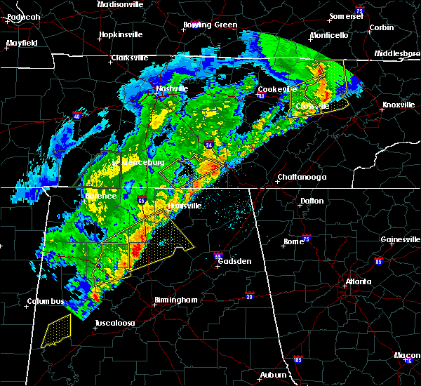 The severe thunderstorm warning for moore, central lincoln and northern franklin counties will expire at 315 am cdt, the storm which prompted the warning has moved out of the area. therefore, the warning will be allowed to expire. however gusty winds are still possible with this thunderstorm. a tornado watch remains in effect until 500 am cdt for north central and northeastern alabama, and middle tennessee. The severe thunderstorm warning for moore, central lincoln and northern franklin counties will expire at 315 am cdt, the storm which prompted the warning has moved out of the area. therefore, the warning will be allowed to expire. however gusty winds are still possible with this thunderstorm. a tornado watch remains in effect until 500 am cdt for north central and northeastern alabama, and middle tennessee.
|
| 3/29/2020 2:42 AM CDT |
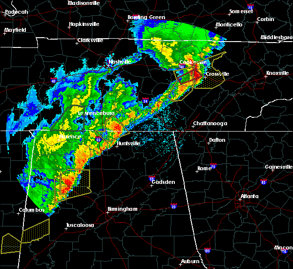 At 242 am cdt, a severe thunderstorm was located near fayetteville, moving northeast at 65 mph (radar indicated). Hazards include 60 mph wind gusts and quarter size hail. Hail damage to vehicles is expected. Expect wind damage to roofs, siding, and trees. At 242 am cdt, a severe thunderstorm was located near fayetteville, moving northeast at 65 mph (radar indicated). Hazards include 60 mph wind gusts and quarter size hail. Hail damage to vehicles is expected. Expect wind damage to roofs, siding, and trees.
|
| 3/24/2020 7:36 PM CDT |
 The severe thunderstorm warning for southeastern franklin county will expire at 745 pm cdt, the storm which prompted the warning has moved out of the area. therefore, the warning will be allowed to expire. a tornado watch remains in effect until 1000 pm cdt for north central and northeastern alabama, and middle tennessee. The severe thunderstorm warning for southeastern franklin county will expire at 745 pm cdt, the storm which prompted the warning has moved out of the area. therefore, the warning will be allowed to expire. a tornado watch remains in effect until 1000 pm cdt for north central and northeastern alabama, and middle tennessee.
|
| 3/24/2020 7:26 PM CDT |
 At 726 pm cdt, a severe thunderstorm was located near cowan, or near winchester, moving east at 45 mph (radar indicated). Hazards include 60 mph wind gusts and quarter size hail. Hail damage to vehicles is expected. expect wind damage to roofs, siding, and trees. Locations impacted include, cowan and sherwood. At 726 pm cdt, a severe thunderstorm was located near cowan, or near winchester, moving east at 45 mph (radar indicated). Hazards include 60 mph wind gusts and quarter size hail. Hail damage to vehicles is expected. expect wind damage to roofs, siding, and trees. Locations impacted include, cowan and sherwood.
|
| 3/24/2020 7:09 PM CDT |
 At 709 pm cdt, a severe thunderstorm was located near huntland, or 12 miles southwest of winchester, moving east at 45 mph (radar indicated). Hazards include 60 mph wind gusts and quarter size hail. Hail damage to vehicles is expected. Expect wind damage to roofs, siding, and trees. At 709 pm cdt, a severe thunderstorm was located near huntland, or 12 miles southwest of winchester, moving east at 45 mph (radar indicated). Hazards include 60 mph wind gusts and quarter size hail. Hail damage to vehicles is expected. Expect wind damage to roofs, siding, and trees.
|
| 3/24/2020 7:08 PM CDT |
 At 707 pm cdt, a severe thunderstorm capable of producing a tornado was located over winchester, moving east at 45 mph (radar indicated rotation). Hazards include tornado. Flying debris will be dangerous to those caught without shelter. mobile homes will be damaged or destroyed. damage to roofs, windows, and vehicles will occur. Tree damage is likely. At 707 pm cdt, a severe thunderstorm capable of producing a tornado was located over winchester, moving east at 45 mph (radar indicated rotation). Hazards include tornado. Flying debris will be dangerous to those caught without shelter. mobile homes will be damaged or destroyed. damage to roofs, windows, and vehicles will occur. Tree damage is likely.
|
| 3/24/2020 7:02 PM CDT |
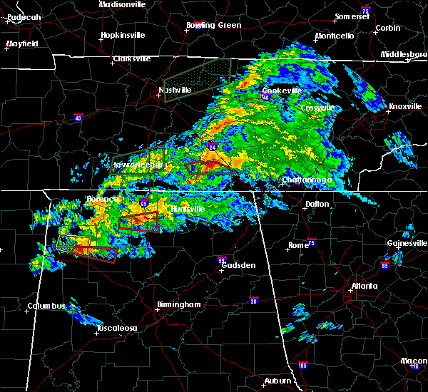 At 702 pm cdt, a severe thunderstorm capable of producing a tornado was located over winchester, moving east at 45 mph (radar indicated rotation). Hazards include tornado and quarter size hail. Flying debris will be dangerous to those caught without shelter. mobile homes will be damaged or destroyed. damage to roofs, windows, and vehicles will occur. tree damage is likely. locations impacted include, winchester, decherd, estill springs, sewanee, tims ford lake, woods reservoir, arnold afb, alto and st. Andrews. At 702 pm cdt, a severe thunderstorm capable of producing a tornado was located over winchester, moving east at 45 mph (radar indicated rotation). Hazards include tornado and quarter size hail. Flying debris will be dangerous to those caught without shelter. mobile homes will be damaged or destroyed. damage to roofs, windows, and vehicles will occur. tree damage is likely. locations impacted include, winchester, decherd, estill springs, sewanee, tims ford lake, woods reservoir, arnold afb, alto and st. Andrews.
|
| 3/24/2020 6:45 PM CDT |
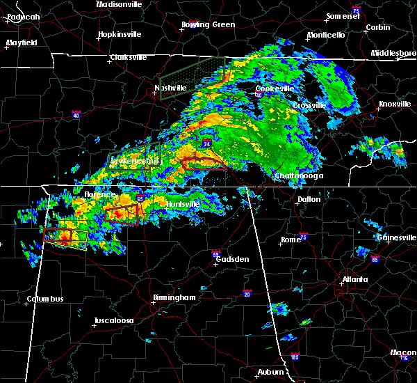 At 645 pm cdt, a severe thunderstorm capable of producing a tornado was located over lynchburg, moving east at 45 mph (radar indicated rotation). Hazards include tornado and quarter size hail. Flying debris will be dangerous to those caught without shelter. mobile homes will be damaged or destroyed. damage to roofs, windows, and vehicles will occur. Tree damage is likely. At 645 pm cdt, a severe thunderstorm capable of producing a tornado was located over lynchburg, moving east at 45 mph (radar indicated rotation). Hazards include tornado and quarter size hail. Flying debris will be dangerous to those caught without shelter. mobile homes will be damaged or destroyed. damage to roofs, windows, and vehicles will occur. Tree damage is likely.
|
| 2/12/2020 6:30 PM CST |
 At 629 pm cst, severe thunderstorms were located along a line extending from near tullahoma to 6 miles northwest of new market, moving east at 60 mph (radar indicated). Hazards include 60 mph wind gusts and penny size hail. expect damage to roofs, siding, and trees At 629 pm cst, severe thunderstorms were located along a line extending from near tullahoma to 6 miles northwest of new market, moving east at 60 mph (radar indicated). Hazards include 60 mph wind gusts and penny size hail. expect damage to roofs, siding, and trees
|
| 2/5/2020 7:10 PM CST |
 The severe thunderstorm warning for moore, lincoln and western franklin counties will expire at 715 pm cst, the storms which prompted the warning have weakened below severe limits, and no longer pose an immediate threat to life or property. therefore, the warning will be allowed to expire. however gusty winds are still possible with these thunderstorms. a tornado watch remains in effect until 1100 pm cst for north central and northeastern alabama, and middle tennessee. The severe thunderstorm warning for moore, lincoln and western franklin counties will expire at 715 pm cst, the storms which prompted the warning have weakened below severe limits, and no longer pose an immediate threat to life or property. therefore, the warning will be allowed to expire. however gusty winds are still possible with these thunderstorms. a tornado watch remains in effect until 1100 pm cst for north central and northeastern alabama, and middle tennessee.
|
| 2/5/2020 7:00 PM CST |
 At 700 pm cst, severe thunderstorms were located along a line extending from 8 miles northeast of shelbyville to 8 miles northwest of hazel green, moving east at 50 mph (radar indicated). Hazards include 60 mph wind gusts and a possible tornado. Expect damage to roofs, siding, and trees. Locations impacted include, fayetteville, lynchburg, estill springs, ardmore, huntland, tims ford lake, lincoln, howell, elora and hurdlow. At 700 pm cst, severe thunderstorms were located along a line extending from 8 miles northeast of shelbyville to 8 miles northwest of hazel green, moving east at 50 mph (radar indicated). Hazards include 60 mph wind gusts and a possible tornado. Expect damage to roofs, siding, and trees. Locations impacted include, fayetteville, lynchburg, estill springs, ardmore, huntland, tims ford lake, lincoln, howell, elora and hurdlow.
|
| 2/5/2020 6:29 PM CST |
 At 628 pm cst, severe thunderstorms were located along a line extending from near lewisburg to 12 miles west of ardmore, moving northeast at 65 mph. at 615 pm cst, wind damage to multiple structures was reported around lawrenceburg (radar indicated). Hazards include 60 mph wind gusts. expect damage to roofs, siding, and trees At 628 pm cst, severe thunderstorms were located along a line extending from near lewisburg to 12 miles west of ardmore, moving northeast at 65 mph. at 615 pm cst, wind damage to multiple structures was reported around lawrenceburg (radar indicated). Hazards include 60 mph wind gusts. expect damage to roofs, siding, and trees
|
| 1/11/2020 1:54 PM CST |
 At 154 pm cst, a severe thunderstorm was located over cowan, or 7 miles southeast of winchester, moving east at 30 mph (radar indicated). Hazards include 60 mph wind gusts. expect damage to roofs, siding, and trees At 154 pm cst, a severe thunderstorm was located over cowan, or 7 miles southeast of winchester, moving east at 30 mph (radar indicated). Hazards include 60 mph wind gusts. expect damage to roofs, siding, and trees
|
| 12/16/2019 6:39 PM CST |
 At 639 pm cst, severe thunderstorms were located along a line extending from 8 miles northwest of sewanee to 6 miles southwest of scottsboro, moving east at 50 mph (radar indicated). Hazards include 60 mph wind gusts. expect damage to roofs, siding, and trees At 639 pm cst, severe thunderstorms were located along a line extending from 8 miles northwest of sewanee to 6 miles southwest of scottsboro, moving east at 50 mph (radar indicated). Hazards include 60 mph wind gusts. expect damage to roofs, siding, and trees
|
| 12/16/2019 6:32 PM CST |
 At 632 pm cst, severe thunderstorms were located along a line extending from near manchester to 10 miles south of cowan to near skyline, moving northeast at 70 mph (radar indicated). Hazards include 60 mph wind gusts. Expect damage to roofs, siding, and trees. Locations impacted include, scottsboro, winchester, lynchburg, decherd, estill springs, cowan, hollywood, huntland, skyline and woodville. At 632 pm cst, severe thunderstorms were located along a line extending from near manchester to 10 miles south of cowan to near skyline, moving northeast at 70 mph (radar indicated). Hazards include 60 mph wind gusts. Expect damage to roofs, siding, and trees. Locations impacted include, scottsboro, winchester, lynchburg, decherd, estill springs, cowan, hollywood, huntland, skyline and woodville.
|
| 12/16/2019 6:25 PM CST |
 At 624 pm cst, a severe thunderstorm capable of producing a tornado was located near tims ford lake, or 8 miles southwest of winchester, moving east at 60 mph (radar indicated rotation). Hazards include tornado. Flying debris will be dangerous to those caught without shelter. mobile homes will be damaged or destroyed. damage to roofs, windows, and vehicles will occur. tree damage is likely. Locations impacted include, winchester, decherd, estill springs, cowan, huntland, tims ford lake, lexie crossroads, harmony, maxwell and beans creek. At 624 pm cst, a severe thunderstorm capable of producing a tornado was located near tims ford lake, or 8 miles southwest of winchester, moving east at 60 mph (radar indicated rotation). Hazards include tornado. Flying debris will be dangerous to those caught without shelter. mobile homes will be damaged or destroyed. damage to roofs, windows, and vehicles will occur. tree damage is likely. Locations impacted include, winchester, decherd, estill springs, cowan, huntland, tims ford lake, lexie crossroads, harmony, maxwell and beans creek.
|
| 12/16/2019 6:14 PM CST |
 At 614 pm cst, a severe thunderstorm capable of producing a tornado was located 8 miles west of huntland, or 9 miles southeast of fayetteville, moving east at 60 mph (radar indicated rotation). Hazards include tornado. Flying debris will be dangerous to those caught without shelter. mobile homes will be damaged or destroyed. damage to roofs, windows, and vehicles will occur. Tree damage is likely. At 614 pm cst, a severe thunderstorm capable of producing a tornado was located 8 miles west of huntland, or 9 miles southeast of fayetteville, moving east at 60 mph (radar indicated rotation). Hazards include tornado. Flying debris will be dangerous to those caught without shelter. mobile homes will be damaged or destroyed. damage to roofs, windows, and vehicles will occur. Tree damage is likely.
|
| 12/16/2019 6:03 PM CST |
 At 602 pm cst, severe thunderstorms were located along a line extending from near petersburg to huntsville to triana, moving northeast at 70 mph. wind gusts of 60 to 70 mph have been measured (radar indicated). Hazards include 70 mph wind gusts and quarter size hail. Hail damage to vehicles is expected. expect considerable tree damage. Wind damage is also likely to mobile homes, roofs, and outbuildings. At 602 pm cst, severe thunderstorms were located along a line extending from near petersburg to huntsville to triana, moving northeast at 70 mph. wind gusts of 60 to 70 mph have been measured (radar indicated). Hazards include 70 mph wind gusts and quarter size hail. Hail damage to vehicles is expected. expect considerable tree damage. Wind damage is also likely to mobile homes, roofs, and outbuildings.
|
| 9/10/2019 3:43 PM CDT |
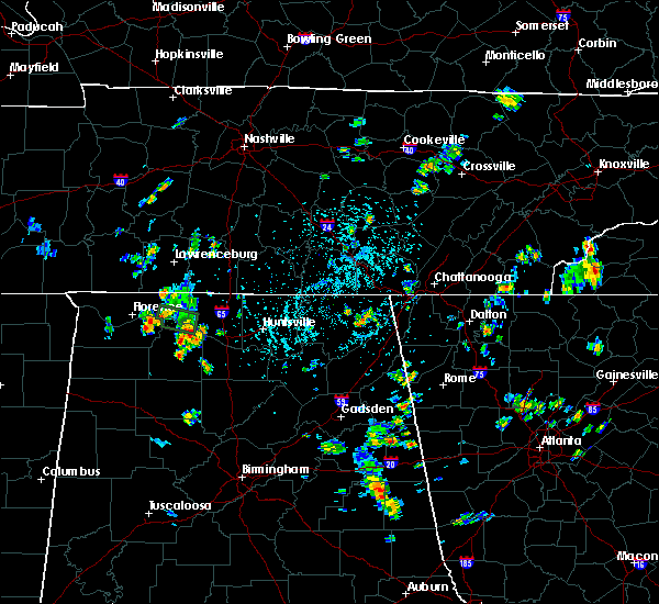 The national weather service in huntsville alabama has issued a * severe thunderstorm warning for. eastern franklin county in middle tennessee. until 430 pm cdt. At 343 pm cdt, a severe thunderstorm was located 5 miles northwest of sewanee, or 15 miles northeast of winchester, and is nearly. The national weather service in huntsville alabama has issued a * severe thunderstorm warning for. eastern franklin county in middle tennessee. until 430 pm cdt. At 343 pm cdt, a severe thunderstorm was located 5 miles northwest of sewanee, or 15 miles northeast of winchester, and is nearly.
|
| 8/13/2019 7:25 PM CDT |
 At 724 pm cdt, severe thunderstorms were located along a line extending from near winchester to huntland to near hazel green, moving southeast at 25 mph (radar indicated). Hazards include 60 mph wind gusts. Expect damage to roofs, siding, and trees. Locations impacted include, winchester, moores mill, meridianville, hazel green, huntland, new market, lincoln, hytop, bass and princeton. At 724 pm cdt, severe thunderstorms were located along a line extending from near winchester to huntland to near hazel green, moving southeast at 25 mph (radar indicated). Hazards include 60 mph wind gusts. Expect damage to roofs, siding, and trees. Locations impacted include, winchester, moores mill, meridianville, hazel green, huntland, new market, lincoln, hytop, bass and princeton.
|
| 8/13/2019 7:10 PM CDT |
 At 710 pm cdt, severe thunderstorms were located along a line extending from near winchester to near huntland to near fayetteville, moving southeast at 25 mph (radar indicated). Hazards include 60 mph wind gusts. expect damage to roofs, siding, and trees At 710 pm cdt, severe thunderstorms were located along a line extending from near winchester to near huntland to near fayetteville, moving southeast at 25 mph (radar indicated). Hazards include 60 mph wind gusts. expect damage to roofs, siding, and trees
|
| 6/22/2019 6:23 PM CDT | County sheriff reports trees down in the county. also... mping report indicates trees down and uprooted and a roof blown off of structure. but report did not specify fr in franklin county TN, 2.5 miles WNW of Winchester, TN |
| 6/22/2019 6:11 PM CDT |
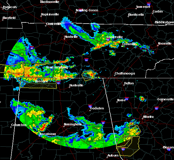 The severe thunderstorm warning for north central jackson and southern franklin counties will expire at 615 pm cdt, the storm which prompted the warning has weakened below severe limits, and has exited the warned area. therefore, the warning will be allowed to expire. however gusty winds are still possible with this thunderstorm. to report severe weather, contact your nearest law enforcement agency. they will relay your report to the national weather service huntsville alabama. The severe thunderstorm warning for north central jackson and southern franklin counties will expire at 615 pm cdt, the storm which prompted the warning has weakened below severe limits, and has exited the warned area. therefore, the warning will be allowed to expire. however gusty winds are still possible with this thunderstorm. to report severe weather, contact your nearest law enforcement agency. they will relay your report to the national weather service huntsville alabama.
|
| 6/22/2019 5:58 PM CDT |
 At 558 pm cdt, a severe thunderstorm was located over cowan, or near winchester, moving southeast at 15 mph (radar indicated). Hazards include 60 mph wind gusts. Expect damage to roofs, siding, and trees. Locations impacted include, winchester, cowan, sewanee, anderson, hytop, jericho, maxwell, belvidere and sherwood. At 558 pm cdt, a severe thunderstorm was located over cowan, or near winchester, moving southeast at 15 mph (radar indicated). Hazards include 60 mph wind gusts. Expect damage to roofs, siding, and trees. Locations impacted include, winchester, cowan, sewanee, anderson, hytop, jericho, maxwell, belvidere and sherwood.
|
| 6/22/2019 5:58 PM CDT |
 At 541 pm cdt, a severe thunderstorm was located over winchester, moving southeast at 20 mph (radar indicated). Hazards include 60 mph wind gusts and penny size hail. expect damage to roofs, siding, and trees At 541 pm cdt, a severe thunderstorm was located over winchester, moving southeast at 20 mph (radar indicated). Hazards include 60 mph wind gusts and penny size hail. expect damage to roofs, siding, and trees
|
| 6/22/2019 5:41 PM CDT |
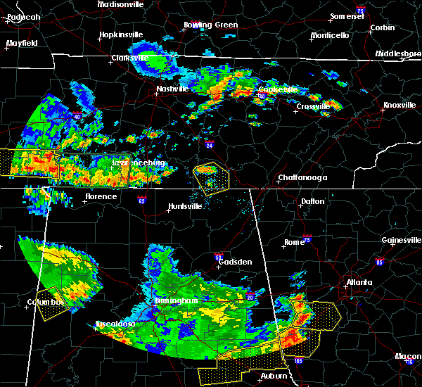 At 541 pm cdt, a severe thunderstorm was located over winchester, moving southeast at 20 mph (radar indicated). Hazards include 60 mph wind gusts and penny size hail. expect damage to roofs, siding, and trees At 541 pm cdt, a severe thunderstorm was located over winchester, moving southeast at 20 mph (radar indicated). Hazards include 60 mph wind gusts and penny size hail. expect damage to roofs, siding, and trees
|
| 6/21/2019 9:41 PM CDT | Numerous reports of trees and power lines being knocked down throughout the count in franklin county TN, 0.8 miles NW of Winchester, TN |
| 6/21/2019 9:31 PM CDT |
 At 931 pm cdt, severe thunderstorms were located along a line extending from gruetli-laager to near hazel green, moving east at 50 mph (radar indicated). Hazards include 70 mph wind gusts. Expect considerable tree damage. damage is likely to mobile homes, roofs, and outbuildings. Locations impacted include, northern huntsville, winchester, fayetteville, moores mill, meridianville, lynchburg, hazel green, decherd, estill springs and cowan. At 931 pm cdt, severe thunderstorms were located along a line extending from gruetli-laager to near hazel green, moving east at 50 mph (radar indicated). Hazards include 70 mph wind gusts. Expect considerable tree damage. damage is likely to mobile homes, roofs, and outbuildings. Locations impacted include, northern huntsville, winchester, fayetteville, moores mill, meridianville, lynchburg, hazel green, decherd, estill springs and cowan.
|
| 6/21/2019 9:13 PM CDT |
 At 912 pm cdt, severe thunderstorms were located along a line extending from 9 miles east of manchester to near ardmore, moving east at 40 mph (radar indicated). Hazards include 60 mph wind gusts and penny size hail. expect damage to roofs, siding, and trees At 912 pm cdt, severe thunderstorms were located along a line extending from 9 miles east of manchester to near ardmore, moving east at 40 mph (radar indicated). Hazards include 60 mph wind gusts and penny size hail. expect damage to roofs, siding, and trees
|
| 6/21/2019 8:59 PM CDT |
 At 859 pm cdt, severe thunderstorms were located along a line extending from 6 miles east of shelbyville to 8 miles west of pulaski, moving southeast at 35 mph (radar indicated). Hazards include 60 mph wind gusts and penny sized hail. Expect damage to roofs, siding, and trees. Locations impacted include, winchester, fayetteville, lynchburg, decherd, estill springs, ardmore, petersburg, tims ford lake, howell and hurdlow. At 859 pm cdt, severe thunderstorms were located along a line extending from 6 miles east of shelbyville to 8 miles west of pulaski, moving southeast at 35 mph (radar indicated). Hazards include 60 mph wind gusts and penny sized hail. Expect damage to roofs, siding, and trees. Locations impacted include, winchester, fayetteville, lynchburg, decherd, estill springs, ardmore, petersburg, tims ford lake, howell and hurdlow.
|
| 6/21/2019 8:38 PM CDT |
 At 837 pm cdt, severe thunderstorms were located along a line extending from 7 miles northwest of shelbyville to near lawrenceburg, moving southeast at 35 mph (radar indicated). Hazards include 60 mph wind gusts and penny size hail. expect damage to roofs, siding, and trees At 837 pm cdt, severe thunderstorms were located along a line extending from 7 miles northwest of shelbyville to near lawrenceburg, moving southeast at 35 mph (radar indicated). Hazards include 60 mph wind gusts and penny size hail. expect damage to roofs, siding, and trees
|
| 6/20/2019 4:23 AM CDT |
 At 422 am cdt, severe thunderstorms were located along a line extending from near manchester to 6 miles northeast of little river falls, moving northeast at 60 mph (radar indicated). Hazards include 60 mph wind gusts. Expect damage to roofs, siding, and trees. Locations impacted include, scottsboro, winchester, rainsville, bridgeport, decherd, henagar, estill springs, stevenson, sylvania and cowan. At 422 am cdt, severe thunderstorms were located along a line extending from near manchester to 6 miles northeast of little river falls, moving northeast at 60 mph (radar indicated). Hazards include 60 mph wind gusts. Expect damage to roofs, siding, and trees. Locations impacted include, scottsboro, winchester, rainsville, bridgeport, decherd, henagar, estill springs, stevenson, sylvania and cowan.
|
| 6/20/2019 4:08 AM CDT |
 At 408 am cdt, severe thunderstorms were located along a line extending from tullahoma to near little river canyon national preserve, moving northeast at 60 mph (radar indicated). Hazards include 60 mph wind gusts. expect damage to roofs, siding, and trees At 408 am cdt, severe thunderstorms were located along a line extending from tullahoma to near little river canyon national preserve, moving northeast at 60 mph (radar indicated). Hazards include 60 mph wind gusts. expect damage to roofs, siding, and trees
|
| 6/20/2019 3:30 AM CDT |
 At 329 am cdt, a severe thunderstorm was located 7 miles north of hazel green, or 7 miles south of fayetteville, moving northeast at 45 mph (radar indicated). Hazards include 60 mph wind gusts. expect damage to roofs, siding, and trees At 329 am cdt, a severe thunderstorm was located 7 miles north of hazel green, or 7 miles south of fayetteville, moving northeast at 45 mph (radar indicated). Hazards include 60 mph wind gusts. expect damage to roofs, siding, and trees
|
| 5/9/2019 1:44 PM CDT |
 A severe thunderstorm warning remains in effect until 200 pm cdt for eastern jackson and eastern franklin counties. at 143 pm cdt, severe thunderstorms were located along a line extending from near decherd to 10 miles northwest of stevenson to scottsboro, moving northeast at 45 mph. This line has a history of producing damage. A severe thunderstorm warning remains in effect until 200 pm cdt for eastern jackson and eastern franklin counties. at 143 pm cdt, severe thunderstorms were located along a line extending from near decherd to 10 miles northwest of stevenson to scottsboro, moving northeast at 45 mph. This line has a history of producing damage.
|
| 5/9/2019 1:24 PM CDT |
 The national weather service in huntsville alabama has issued a * severe thunderstorm warning for. jackson county in northeastern alabama. franklin county in middle tennessee. until 200 pm cdt. At 124 pm cdt, severe thunderstorms were located along a line. The national weather service in huntsville alabama has issued a * severe thunderstorm warning for. jackson county in northeastern alabama. franklin county in middle tennessee. until 200 pm cdt. At 124 pm cdt, severe thunderstorms were located along a line.
|
| 5/9/2019 1:20 PM CDT |
 A tornado warning remains in effect until 130 pm cdt for northwestern jackson and southwestern franklin counties. at 117 pm cdt, a severe thunderstorm capable of producing a tornado was located near huntland, or 16 miles southwest of winchester, moving northeast at 40 mph. hazard. Tornado. A tornado warning remains in effect until 130 pm cdt for northwestern jackson and southwestern franklin counties. at 117 pm cdt, a severe thunderstorm capable of producing a tornado was located near huntland, or 16 miles southwest of winchester, moving northeast at 40 mph. hazard. Tornado.
|
| 5/9/2019 12:59 PM CDT |
 The national weather service in huntsville alabama has issued a * tornado warning for. northwestern jackson county in northeastern alabama. northeastern madison county in north central alabama. southwestern franklin county in middle tennessee. Until 130 pm cdt. The national weather service in huntsville alabama has issued a * tornado warning for. northwestern jackson county in northeastern alabama. northeastern madison county in north central alabama. southwestern franklin county in middle tennessee. Until 130 pm cdt.
|
| 4/8/2019 7:40 AM CDT |
 At 740 am cdt, a severe thunderstorm capable of producing a tornado was located over sewanee, or 10 miles east of winchester, moving northeast at 35 mph (radar indicated rotation). Hazards include tornado. Flying debris will be dangerous to those caught without shelter. mobile homes will be damaged or destroyed. damage to roofs, windows, and vehicles will occur. Tree damage is likely. At 740 am cdt, a severe thunderstorm capable of producing a tornado was located over sewanee, or 10 miles east of winchester, moving northeast at 35 mph (radar indicated rotation). Hazards include tornado. Flying debris will be dangerous to those caught without shelter. mobile homes will be damaged or destroyed. damage to roofs, windows, and vehicles will occur. Tree damage is likely.
|
| 3/25/2019 2:39 PM CDT |
 At 238 pm cdt, a severe thunderstorm was located over estill springs, or near winchester, moving east at 30 mph (radar indicated). Hazards include 60 mph wind gusts and quarter size hail. Hail damage to vehicles is expected. expect wind damage to roofs, siding, and trees. locations impacted include, decherd, estill springs, sewanee, tims ford lake, woods reservoir, arnold afb, alto and st. Andrews. At 238 pm cdt, a severe thunderstorm was located over estill springs, or near winchester, moving east at 30 mph (radar indicated). Hazards include 60 mph wind gusts and quarter size hail. Hail damage to vehicles is expected. expect wind damage to roofs, siding, and trees. locations impacted include, decherd, estill springs, sewanee, tims ford lake, woods reservoir, arnold afb, alto and st. Andrews.
|
| 3/25/2019 2:23 PM CDT |
 At 222 pm cdt, a severe thunderstorm was located near estill springs, or 8 miles east of lynchburg, moving east at 35 mph (radar indicated). Hazards include 60 mph wind gusts and quarter size hail. Hail damage to vehicles is expected. Expect wind damage to roofs, siding, and trees. At 222 pm cdt, a severe thunderstorm was located near estill springs, or 8 miles east of lynchburg, moving east at 35 mph (radar indicated). Hazards include 60 mph wind gusts and quarter size hail. Hail damage to vehicles is expected. Expect wind damage to roofs, siding, and trees.
|
| 11/6/2018 1:21 AM CST |
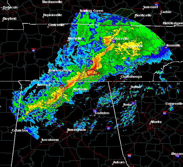 At 120 am cst, a confirmed large and extremely dangerous tornado was located near estill springs, or 7 miles northeast of winchester, moving northeast at 60 mph. this is a particularly dangerous situation. take cover now! (radar confirmed tornado). Hazards include damaging tornado. You are in a life-threatening situation. flying debris may be deadly to those caught without shelter. mobile homes will be destroyed. considerable damage to homes, businesses, and vehicles is likely and complete destruction is possible. Locations impacted include, winchester, decherd, estill springs, tims ford lake, sewanee, woods reservoir, alto and arnold afb. At 120 am cst, a confirmed large and extremely dangerous tornado was located near estill springs, or 7 miles northeast of winchester, moving northeast at 60 mph. this is a particularly dangerous situation. take cover now! (radar confirmed tornado). Hazards include damaging tornado. You are in a life-threatening situation. flying debris may be deadly to those caught without shelter. mobile homes will be destroyed. considerable damage to homes, businesses, and vehicles is likely and complete destruction is possible. Locations impacted include, winchester, decherd, estill springs, tims ford lake, sewanee, woods reservoir, alto and arnold afb.
|
| 11/6/2018 1:15 AM CST |
 At 115 am cst, a severe thunderstorm capable of producing a tornado was located over estill springs, or near winchester, moving east at 60 mph (radar indicated rotation). Hazards include tornado. Flying debris will be dangerous to those caught without shelter. mobile homes will be damaged or destroyed. damage to roofs, windows, and vehicles will occur. Tree damage is likely. At 115 am cst, a severe thunderstorm capable of producing a tornado was located over estill springs, or near winchester, moving east at 60 mph (radar indicated rotation). Hazards include tornado. Flying debris will be dangerous to those caught without shelter. mobile homes will be damaged or destroyed. damage to roofs, windows, and vehicles will occur. Tree damage is likely.
|
| 11/6/2018 1:14 AM CST |
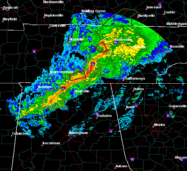 At 114 am cst, severe thunderstorms were located along a line extending from manchester to tims ford lake to 9 miles west of huntland, moving east at 55 mph (radar indicated). Hazards include 60 mph wind gusts. expect damage to roofs, siding, and trees At 114 am cst, severe thunderstorms were located along a line extending from manchester to tims ford lake to 9 miles west of huntland, moving east at 55 mph (radar indicated). Hazards include 60 mph wind gusts. expect damage to roofs, siding, and trees
|
| 11/6/2018 1:05 AM CST | A tree was partially blocking state highway 50 near the franklin county lin in moore county TN, 10.9 miles E of Winchester, TN |
| 11/6/2018 12:39 AM CST |
 At 1238 am cst, severe thunderstorms were located along a line extending from 6 miles southwest of shelbyville to near ardmore, moving east at 45 mph (radar indicated). Hazards include 60 mph wind gusts. expect damage to roofs, siding, and trees At 1238 am cst, severe thunderstorms were located along a line extending from 6 miles southwest of shelbyville to near ardmore, moving east at 45 mph (radar indicated). Hazards include 60 mph wind gusts. expect damage to roofs, siding, and trees
|
| 6/28/2018 2:23 PM CDT |
 At 223 pm cdt, severe thunderstorms were located along a line extending from 7 miles northeast of decherd to 8 miles east of fayetteville, moving southeast at 55 mph (radar indicated). Hazards include 60 mph wind gusts and nickel size hail. expect damage to roofs, siding, and trees At 223 pm cdt, severe thunderstorms were located along a line extending from 7 miles northeast of decherd to 8 miles east of fayetteville, moving southeast at 55 mph (radar indicated). Hazards include 60 mph wind gusts and nickel size hail. expect damage to roofs, siding, and trees
|
| 6/28/2018 1:51 PM CDT |
 At 150 pm cdt, severe thunderstorms were located along a line extending from near lynchburg to 6 miles northeast of harvest to 6 miles east of rogersville, moving southeast at 55 mph (radar indicated). Hazards include 70 mph wind gusts and penny size hail. Expect considerable tree damage. Damage is likely to mobile homes, roofs, and outbuildings. At 150 pm cdt, severe thunderstorms were located along a line extending from near lynchburg to 6 miles northeast of harvest to 6 miles east of rogersville, moving southeast at 55 mph (radar indicated). Hazards include 70 mph wind gusts and penny size hail. Expect considerable tree damage. Damage is likely to mobile homes, roofs, and outbuildings.
|
| 6/28/2018 11:55 AM CDT |
 At 1154 am cdt, a severe thunderstorm was located near tims ford lake, or 7 miles south of lynchburg, moving southeast at 35 mph (radar indicated). Hazards include 70 mph wind gusts and penny size hail. Expect considerable tree damage. Damage is likely to mobile homes, roofs, and outbuildings. At 1154 am cdt, a severe thunderstorm was located near tims ford lake, or 7 miles south of lynchburg, moving southeast at 35 mph (radar indicated). Hazards include 70 mph wind gusts and penny size hail. Expect considerable tree damage. Damage is likely to mobile homes, roofs, and outbuildings.
|
| 6/28/2018 11:36 AM CDT |
 At 1135 am cdt, a severe thunderstorm was located 7 miles west of lynchburg, moving southeast at 30 mph. an area of very strong winds is moving through winchester, tn now and will impact jackson county al soon (radar indicated). Hazards include 70 mph wind gusts. Expect considerable tree damage. damage is likely to mobile homes, roofs, and outbuildings. Locations impacted include, winchester, fayetteville, lynchburg, decherd, estill springs, cowan, ardmore, huntland, petersburg and tims ford lake. At 1135 am cdt, a severe thunderstorm was located 7 miles west of lynchburg, moving southeast at 30 mph. an area of very strong winds is moving through winchester, tn now and will impact jackson county al soon (radar indicated). Hazards include 70 mph wind gusts. Expect considerable tree damage. damage is likely to mobile homes, roofs, and outbuildings. Locations impacted include, winchester, fayetteville, lynchburg, decherd, estill springs, cowan, ardmore, huntland, petersburg and tims ford lake.
|
| 6/28/2018 11:02 AM CDT |
 At 1101 am cdt, a severe thunderstorm was located 8 miles northeast of lewisburg, moving southeast at 30 mph (radar indicated). Hazards include 70 mph wind gusts and nickel size hail. Expect considerable tree damage. Damage is likely to mobile homes, roofs, and outbuildings. At 1101 am cdt, a severe thunderstorm was located 8 miles northeast of lewisburg, moving southeast at 30 mph (radar indicated). Hazards include 70 mph wind gusts and nickel size hail. Expect considerable tree damage. Damage is likely to mobile homes, roofs, and outbuildings.
|
| 5/31/2018 8:30 PM CDT | Quarter sized hail reported 10.4 miles ESE of Winchester, TN, hail appeared from picture to be in the dime to quarter in size. thanks wfo ohx for forwarding this. |
| 5/31/2018 8:22 PM CDT |
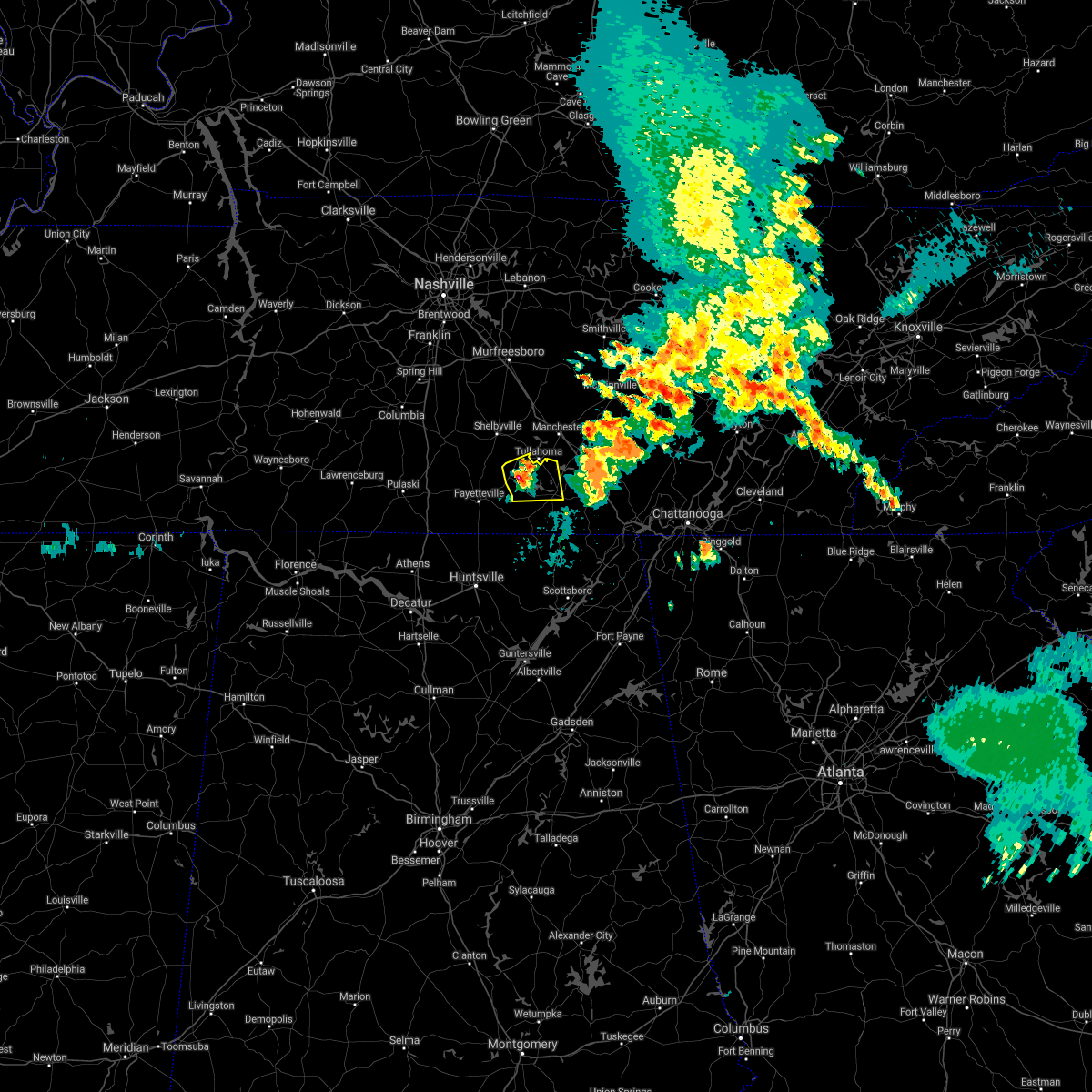 The national weather service in huntsville alabama has issued a * severe thunderstorm warning for. moore county in middle tennessee. northwestern franklin county in middle tennessee. until 900 pm cdt. At 821 pm cdt, a severe thunderstorm was located over lynchburg,. The national weather service in huntsville alabama has issued a * severe thunderstorm warning for. moore county in middle tennessee. northwestern franklin county in middle tennessee. until 900 pm cdt. At 821 pm cdt, a severe thunderstorm was located over lynchburg,.
|
| 5/31/2018 7:51 PM CDT |
 At 749 pm cdt, a severe thunderstorm was located 7 miles northeast of decherd, or 9 miles northeast of winchester, moving east at 10 mph (radar indicated). Hazards include 60 mph wind gusts and quarter size hail. Hail damage to vehicles is expected. expect wind damage to roofs, siding, and trees. locations impacted include, winchester, decherd, estill springs, sewanee, tims ford lake, woods reservoir, arnold afb, alto and st. Andrews. At 749 pm cdt, a severe thunderstorm was located 7 miles northeast of decherd, or 9 miles northeast of winchester, moving east at 10 mph (radar indicated). Hazards include 60 mph wind gusts and quarter size hail. Hail damage to vehicles is expected. expect wind damage to roofs, siding, and trees. locations impacted include, winchester, decherd, estill springs, sewanee, tims ford lake, woods reservoir, arnold afb, alto and st. Andrews.
|
| 5/31/2018 7:34 PM CDT |
 At 734 pm cdt, a severe thunderstorm was located near estill springs, or 8 miles northeast of winchester, moving east at 10 mph (radar indicated). Hazards include 60 mph wind gusts and quarter size hail. Hail damage to vehicles is expected. Expect wind damage to roofs, siding, and trees. At 734 pm cdt, a severe thunderstorm was located near estill springs, or 8 miles northeast of winchester, moving east at 10 mph (radar indicated). Hazards include 60 mph wind gusts and quarter size hail. Hail damage to vehicles is expected. Expect wind damage to roofs, siding, and trees.
|
| 4/3/2018 11:35 PM CDT |
 At 1132 pm cdt, severe thunderstorms were located along a line extending from near sewanee to near boaz, moving east at 60 mph (emergency managers. at 1132 pm cdt, emergency managers reported a tree down on a house in scottsboro. this line of storms has a history of producing widespread wind damage across much of north alabama). Hazards include 60 mph wind gusts. Expect damage to roofs, siding, and trees. Locations impacted include, albertville, scottsboro, boaz, winchester, guntersville, rainsville, decherd, estill springs, stevenson and crossville. At 1132 pm cdt, severe thunderstorms were located along a line extending from near sewanee to near boaz, moving east at 60 mph (emergency managers. at 1132 pm cdt, emergency managers reported a tree down on a house in scottsboro. this line of storms has a history of producing widespread wind damage across much of north alabama). Hazards include 60 mph wind gusts. Expect damage to roofs, siding, and trees. Locations impacted include, albertville, scottsboro, boaz, winchester, guntersville, rainsville, decherd, estill springs, stevenson and crossville.
|
| 4/3/2018 11:24 PM CDT |
 At 1123 pm cdt, severe thunderstorms were located along a line extending from near estill springs tennessee to douglas alabama, moving east at 50 mph (radar indicated. this line of storms has a history of producing widespread wind damage across the shoals and huntsville areas). Hazards include 60 mph wind gusts. Expect damage to roofs, siding, and trees. Locations impacted include, albertville, scottsboro, boaz, winchester, guntersville, rainsville, decherd, estill springs, stevenson and crossville. At 1123 pm cdt, severe thunderstorms were located along a line extending from near estill springs tennessee to douglas alabama, moving east at 50 mph (radar indicated. this line of storms has a history of producing widespread wind damage across the shoals and huntsville areas). Hazards include 60 mph wind gusts. Expect damage to roofs, siding, and trees. Locations impacted include, albertville, scottsboro, boaz, winchester, guntersville, rainsville, decherd, estill springs, stevenson and crossville.
|
| 4/3/2018 11:17 PM CDT |
 At 1115 pm cdt, severe thunderstorms were located along a line extending from near estill springs to near arab, moving east at 60 mph (radar indicated. this line of storms has a history of producing widespread wind damage across the shoals and huntsville areas). Hazards include 60 mph wind gusts. Expect damage to roofs, siding, and trees. Locations impacted include, albertville, scottsboro, boaz, winchester, guntersville, arab, rainsville, decherd, estill springs and stevenson. At 1115 pm cdt, severe thunderstorms were located along a line extending from near estill springs to near arab, moving east at 60 mph (radar indicated. this line of storms has a history of producing widespread wind damage across the shoals and huntsville areas). Hazards include 60 mph wind gusts. Expect damage to roofs, siding, and trees. Locations impacted include, albertville, scottsboro, boaz, winchester, guntersville, arab, rainsville, decherd, estill springs and stevenson.
|
| 4/3/2018 11:01 PM CDT |
 At 1059 pm cdt, severe thunderstorms were located along a line extending from near lynchburg to holly pond, moving east at 60 mph (emergency management. there have been numerous reports of downed trees and power lines across northwest and north central alabama, and the decatur and huntsville airports have reported wind gusts of at least 70 mph). Hazards include 70 mph wind gusts. Expect considerable tree damage. Damage is likely to mobile homes, roofs, and outbuildings. At 1059 pm cdt, severe thunderstorms were located along a line extending from near lynchburg to holly pond, moving east at 60 mph (emergency management. there have been numerous reports of downed trees and power lines across northwest and north central alabama, and the decatur and huntsville airports have reported wind gusts of at least 70 mph). Hazards include 70 mph wind gusts. Expect considerable tree damage. Damage is likely to mobile homes, roofs, and outbuildings.
|
| 3/19/2018 7:43 PM CDT |
 At 743 pm cdt, a severe thunderstorm was located over decherd, or near winchester, moving east at 45 mph (radar indicated). Hazards include 70 mph wind gusts and quarter size hail. Hail damage to vehicles is expected. expect considerable tree damage. Wind damage is also likely to mobile homes, roofs, and outbuildings. At 743 pm cdt, a severe thunderstorm was located over decherd, or near winchester, moving east at 45 mph (radar indicated). Hazards include 70 mph wind gusts and quarter size hail. Hail damage to vehicles is expected. expect considerable tree damage. Wind damage is also likely to mobile homes, roofs, and outbuildings.
|
| 11/18/2017 6:27 PM CST |
 At 626 pm cst, severe thunderstorms were located along a line extending from 11 miles east of manchester to 9 miles south of huntland, moving east at 65 mph (radar indicated). Hazards include 60 mph wind gusts. Expect damage to roofs, siding, and trees. Locations impacted include, winchester, decherd, cowan, monteagle, sewanee, tims ford lake, anderson, hytop, jericho and maxwell. At 626 pm cst, severe thunderstorms were located along a line extending from 11 miles east of manchester to 9 miles south of huntland, moving east at 65 mph (radar indicated). Hazards include 60 mph wind gusts. Expect damage to roofs, siding, and trees. Locations impacted include, winchester, decherd, cowan, monteagle, sewanee, tims ford lake, anderson, hytop, jericho and maxwell.
|
| 11/18/2017 6:27 PM CST |
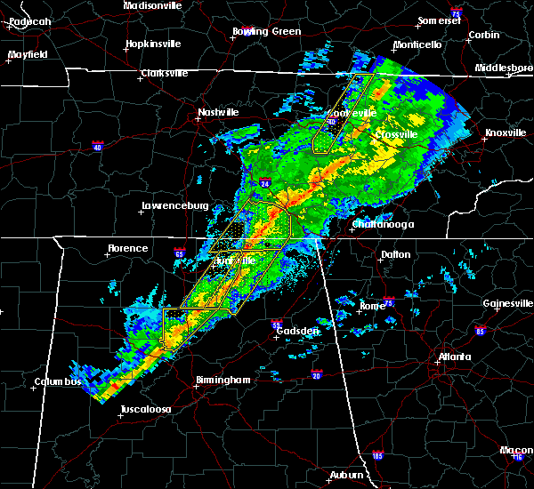 At 626 pm cst, severe thunderstorms were located along a line extending from 11 miles east of manchester to 9 miles south of huntland, moving east at 65 mph (radar indicated). Hazards include 60 mph wind gusts. Expect damage to roofs, siding, and trees. Locations impacted include, winchester, decherd, cowan, monteagle, sewanee, tims ford lake, anderson, hytop, jericho and maxwell. At 626 pm cst, severe thunderstorms were located along a line extending from 11 miles east of manchester to 9 miles south of huntland, moving east at 65 mph (radar indicated). Hazards include 60 mph wind gusts. Expect damage to roofs, siding, and trees. Locations impacted include, winchester, decherd, cowan, monteagle, sewanee, tims ford lake, anderson, hytop, jericho and maxwell.
|
| 11/18/2017 6:16 PM CST | Tree reported down along 4th avenue sw in the winchester are in franklin county TN, 1.4 miles NNW of Winchester, TN |
| 11/18/2017 6:09 PM CST |
 At 609 pm cst, severe thunderstorms were located along a line extending from tullahoma to meridianville, moving east at 65 mph (radar indicated). Hazards include 60 mph wind gusts. expect damage to roofs, siding, and trees At 609 pm cst, severe thunderstorms were located along a line extending from tullahoma to meridianville, moving east at 65 mph (radar indicated). Hazards include 60 mph wind gusts. expect damage to roofs, siding, and trees
|
| 7/5/2017 3:07 PM CDT | Tree blown down on guard rail adjacent to the golf cours in franklin county TN, 5.3 miles SSW of Winchester, TN |
| 7/5/2017 2:47 PM CDT |
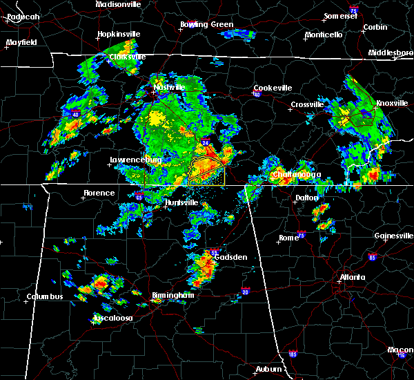 At 246 pm cdt, a severe thunderstorm was located near decherd, or near winchester, moving east at 45 mph (radar indicated). Hazards include 60 mph wind gusts. Expect damage to roofs, siding, and trees. Locations impacted include, winchester, decherd, estill springs, monteagle, tims ford lake, sewanee, lexie crossroads, harmony, oak grove and woods reservoir. At 246 pm cdt, a severe thunderstorm was located near decherd, or near winchester, moving east at 45 mph (radar indicated). Hazards include 60 mph wind gusts. Expect damage to roofs, siding, and trees. Locations impacted include, winchester, decherd, estill springs, monteagle, tims ford lake, sewanee, lexie crossroads, harmony, oak grove and woods reservoir.
|
| 7/5/2017 2:39 PM CDT |
 At 238 pm cdt, a severe thunderstorm was located near winchester, moving east at 40 mph (radar indicated). Hazards include 60 mph wind gusts. expect damage to roofs, siding, and trees At 238 pm cdt, a severe thunderstorm was located near winchester, moving east at 40 mph (radar indicated). Hazards include 60 mph wind gusts. expect damage to roofs, siding, and trees
|
| 7/5/2017 2:32 PM CDT |
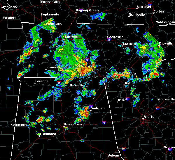 At 231 pm cdt, a severe thunderstorm was located near tims ford lake, or near winchester, moving east at 40 mph (radar indicated). Hazards include 60 mph wind gusts. Expect damage to roofs, siding, and trees. Locations impacted include, winchester, lynchburg, decherd, estill springs, monteagle, tims ford lake, sewanee, hurdlow, woods reservoir and alto. At 231 pm cdt, a severe thunderstorm was located near tims ford lake, or near winchester, moving east at 40 mph (radar indicated). Hazards include 60 mph wind gusts. Expect damage to roofs, siding, and trees. Locations impacted include, winchester, lynchburg, decherd, estill springs, monteagle, tims ford lake, sewanee, hurdlow, woods reservoir and alto.
|
| 7/5/2017 2:18 PM CDT |
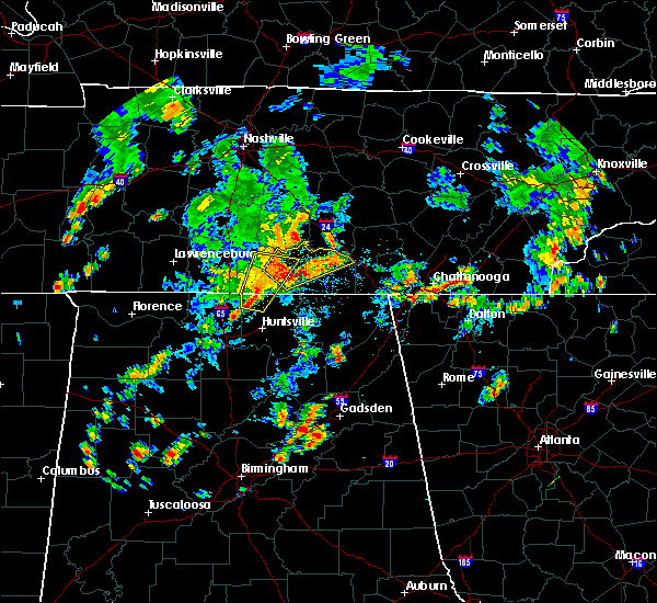 At 218 pm cdt, a severe thunderstorm was located near lynchburg, moving northeast at 45 mph (radar indicated). Hazards include 60 mph wind gusts. expect damage to roofs, siding, and trees At 218 pm cdt, a severe thunderstorm was located near lynchburg, moving northeast at 45 mph (radar indicated). Hazards include 60 mph wind gusts. expect damage to roofs, siding, and trees
|
| 6/15/2017 2:05 PM CDT |
 At 204 pm cdt, severe thunderstorms were located along a line extending from 9 miles southeast of huntland to 7 miles northeast of gurley to near owens cross roads, moving southeast at 65 mph (radar indicated). Hazards include 60 mph wind gusts. Expect damage to roofs, siding, and trees. Locations impacted include, southern huntsville, scottsboro, winchester, guntersville, bridgeport, moores mill, redstone arsenal, stevenson, cowan and owens cross roads. At 204 pm cdt, severe thunderstorms were located along a line extending from 9 miles southeast of huntland to 7 miles northeast of gurley to near owens cross roads, moving southeast at 65 mph (radar indicated). Hazards include 60 mph wind gusts. Expect damage to roofs, siding, and trees. Locations impacted include, southern huntsville, scottsboro, winchester, guntersville, bridgeport, moores mill, redstone arsenal, stevenson, cowan and owens cross roads.
|
| 6/15/2017 1:56 PM CDT |
 At 156 pm cdt, severe thunderstorms were located along a line extending from near huntland to 7 miles southeast of new market to huntsville, moving southeast at 60 mph (radar indicated). Hazards include 60 mph wind gusts. Expect damage to roofs, siding, and trees. Locations impacted include, huntsville, scottsboro, winchester, guntersville, bridgeport, moores mill, redstone arsenal, meridianville, stevenson and cowan. At 156 pm cdt, severe thunderstorms were located along a line extending from near huntland to 7 miles southeast of new market to huntsville, moving southeast at 60 mph (radar indicated). Hazards include 60 mph wind gusts. Expect damage to roofs, siding, and trees. Locations impacted include, huntsville, scottsboro, winchester, guntersville, bridgeport, moores mill, redstone arsenal, meridianville, stevenson and cowan.
|
| 6/15/2017 1:44 PM CDT |
 At 144 pm cdt, severe thunderstorms were located along a line extending from 7 miles southwest of tims ford lake to near new market to huntsville, moving southeast at 80 mph (radar indicated). Hazards include 60 mph wind gusts. expect damage to roofs, siding, and trees At 144 pm cdt, severe thunderstorms were located along a line extending from 7 miles southwest of tims ford lake to near new market to huntsville, moving southeast at 80 mph (radar indicated). Hazards include 60 mph wind gusts. expect damage to roofs, siding, and trees
|
| 5/27/2017 9:50 PM CDT |
 At 936 pm cdt, a severe thunderstorm was located near fayetteville, moving southeast at 30 mph (radar indicated). Hazards include 60 mph wind gusts and quarter size hail. Hail damage to vehicles is expected. expect wind damage to roofs, siding, and trees. Locations impacted include, winchester, fayetteville, lynchburg, huntland, petersburg, tims ford lake, anderson, lincoln, hurdlow and maxwell. At 936 pm cdt, a severe thunderstorm was located near fayetteville, moving southeast at 30 mph (radar indicated). Hazards include 60 mph wind gusts and quarter size hail. Hail damage to vehicles is expected. expect wind damage to roofs, siding, and trees. Locations impacted include, winchester, fayetteville, lynchburg, huntland, petersburg, tims ford lake, anderson, lincoln, hurdlow and maxwell.
|
| 5/27/2017 9:48 PM CDT |
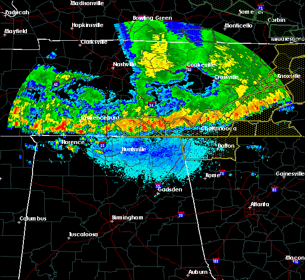 At 948 pm cdt, severe thunderstorms were located along a line extending from near sewanee to winchester, moving southeast at 25 mph (radar indicated). Hazards include 60 mph wind gusts and quarter size hail. Hail damage to vehicles is expected. expect wind damage to roofs, siding, and trees. locations impacted include, winchester, decherd, estill springs, cowan, monteagle, sewanee, tims ford lake, st. Andrews, sherwood and woods reservoir. At 948 pm cdt, severe thunderstorms were located along a line extending from near sewanee to winchester, moving southeast at 25 mph (radar indicated). Hazards include 60 mph wind gusts and quarter size hail. Hail damage to vehicles is expected. expect wind damage to roofs, siding, and trees. locations impacted include, winchester, decherd, estill springs, cowan, monteagle, sewanee, tims ford lake, st. Andrews, sherwood and woods reservoir.
|
| 5/27/2017 9:37 PM CDT |
 At 936 pm cdt, a severe thunderstorm was located near fayetteville, moving southeast at 30 mph (radar indicated). Hazards include 60 mph wind gusts and quarter size hail. Hail damage to vehicles is expected. expect wind damage to roofs, siding, and trees. Locations impacted include, winchester, fayetteville, lynchburg, huntland, petersburg, tims ford lake, anderson, lincoln, hurdlow and maxwell. At 936 pm cdt, a severe thunderstorm was located near fayetteville, moving southeast at 30 mph (radar indicated). Hazards include 60 mph wind gusts and quarter size hail. Hail damage to vehicles is expected. expect wind damage to roofs, siding, and trees. Locations impacted include, winchester, fayetteville, lynchburg, huntland, petersburg, tims ford lake, anderson, lincoln, hurdlow and maxwell.
|
| 5/27/2017 9:33 PM CDT |
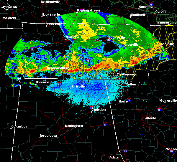 At 932 pm cdt, a severe thunderstorm was located near estill springs, or 8 miles north of winchester, moving southeast at 40 mph (radar indicated). Hazards include 60 mph wind gusts and quarter size hail. Hail damage to vehicles is expected. Expect wind damage to roofs, siding, and trees. At 932 pm cdt, a severe thunderstorm was located near estill springs, or 8 miles north of winchester, moving southeast at 40 mph (radar indicated). Hazards include 60 mph wind gusts and quarter size hail. Hail damage to vehicles is expected. Expect wind damage to roofs, siding, and trees.
|
| 5/27/2017 9:23 PM CDT |
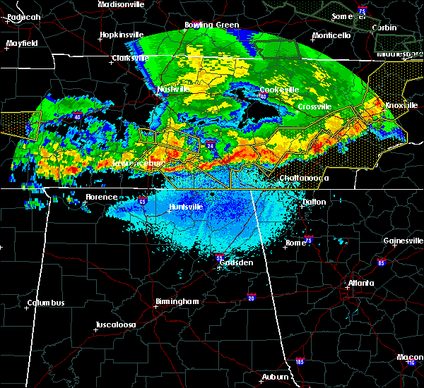 At 923 pm cdt, a severe thunderstorm was located over petersburg, or 11 miles north of fayetteville, moving southeast at 60 mph (radar indicated). Hazards include 60 mph wind gusts. expect damage to roofs, siding, and trees At 923 pm cdt, a severe thunderstorm was located over petersburg, or 11 miles north of fayetteville, moving southeast at 60 mph (radar indicated). Hazards include 60 mph wind gusts. expect damage to roofs, siding, and trees
|
| 4/30/2017 3:58 PM CDT |
 The severe thunderstorm warning for jackson, dekalb and franklin counties will expire at 400 pm cdt, the storms which prompted the warning have weakened below severe limits, and no longer pose an immediate threat to life or property. therefore the warning will be allowed to expire. however, gusty winds are still possible with these thunderstorms. a tornado watch remains in effect until 700 pm cdt for northeastern alabama, and middle tennessee. The severe thunderstorm warning for jackson, dekalb and franklin counties will expire at 400 pm cdt, the storms which prompted the warning have weakened below severe limits, and no longer pose an immediate threat to life or property. therefore the warning will be allowed to expire. however, gusty winds are still possible with these thunderstorms. a tornado watch remains in effect until 700 pm cdt for northeastern alabama, and middle tennessee.
|
| 4/30/2017 3:58 PM CDT |
 The severe thunderstorm warning for jackson. dekalb and franklin counties will expire at 400 pm cdt. the storms which prompted the warning have weakened below severe limits, and no longer pose an immediate threat to life or property. therefore the warning will be allowed to expire. However, gusty winds are still possible with these thunderstorms. The severe thunderstorm warning for jackson. dekalb and franklin counties will expire at 400 pm cdt. the storms which prompted the warning have weakened below severe limits, and no longer pose an immediate threat to life or property. therefore the warning will be allowed to expire. However, gusty winds are still possible with these thunderstorms.
|
| 4/30/2017 3:49 PM CDT |
 At 349 pm cdt, severe thunderstorms were located along a line extending from near estill springs to near collinsville, moving east at 40 mph (radar indicated). Hazards include 60 mph wind gusts. Expect damage to roofs, siding, and trees. locations impacted include, scottsboro, fort payne, winchester, rainsville, bridgeport, little river canyon national preserve, decherd, henagar, estill springs and stevenson. A tornado watch remains in effect until 700 pm cdt for north central and northeastern alabama, and middle tennessee. At 349 pm cdt, severe thunderstorms were located along a line extending from near estill springs to near collinsville, moving east at 40 mph (radar indicated). Hazards include 60 mph wind gusts. Expect damage to roofs, siding, and trees. locations impacted include, scottsboro, fort payne, winchester, rainsville, bridgeport, little river canyon national preserve, decherd, henagar, estill springs and stevenson. A tornado watch remains in effect until 700 pm cdt for north central and northeastern alabama, and middle tennessee.
|
| 4/30/2017 3:33 PM CDT |
 At 333 pm cdt, severe thunderstorms were located along a line extending from 7 miles north of tullahoma to near crossville, moving northeast at 55 mph (radar indicated). Hazards include 60 mph wind gusts. Expect damage to roofs, siding, and trees. locations impacted include, scottsboro, fort payne, boaz, winchester, rainsville, bridgeport, little river canyon national preserve, decherd, henagar and estill springs. A tornado watch remains in effect until 700 pm cdt for north central and northeastern alabama, and middle tennessee. At 333 pm cdt, severe thunderstorms were located along a line extending from 7 miles north of tullahoma to near crossville, moving northeast at 55 mph (radar indicated). Hazards include 60 mph wind gusts. Expect damage to roofs, siding, and trees. locations impacted include, scottsboro, fort payne, boaz, winchester, rainsville, bridgeport, little river canyon national preserve, decherd, henagar and estill springs. A tornado watch remains in effect until 700 pm cdt for north central and northeastern alabama, and middle tennessee.
|
| 4/30/2017 3:17 PM CDT |
 At 317 pm cdt, severe thunderstorms were located along a line extending from lynchburg to albertville, moving northeast at 40 mph (radar indicated). Hazards include 60 mph wind gusts. Expect damage to roofs, siding, and trees. locations impacted include, albertville, scottsboro, fort payne, boaz, winchester, guntersville, fayetteville, rainsville, bridgeport and lynchburg. A tornado watch remains in effect until 700 pm cdt for north central and northeastern alabama, and middle tennessee. At 317 pm cdt, severe thunderstorms were located along a line extending from lynchburg to albertville, moving northeast at 40 mph (radar indicated). Hazards include 60 mph wind gusts. Expect damage to roofs, siding, and trees. locations impacted include, albertville, scottsboro, fort payne, boaz, winchester, guntersville, fayetteville, rainsville, bridgeport and lynchburg. A tornado watch remains in effect until 700 pm cdt for north central and northeastern alabama, and middle tennessee.
|
| 4/30/2017 2:54 PM CDT |
 At 252 pm cdt, severe thunderstorms were located along a line extending from near petersburg to near altoona, moving northeast at 55 mph (radar indicated). Hazards include 60 mph wind gusts. expect damage to roofs, siding, and trees At 252 pm cdt, severe thunderstorms were located along a line extending from near petersburg to near altoona, moving northeast at 55 mph (radar indicated). Hazards include 60 mph wind gusts. expect damage to roofs, siding, and trees
|
| 4/18/2017 3:12 PM CDT |
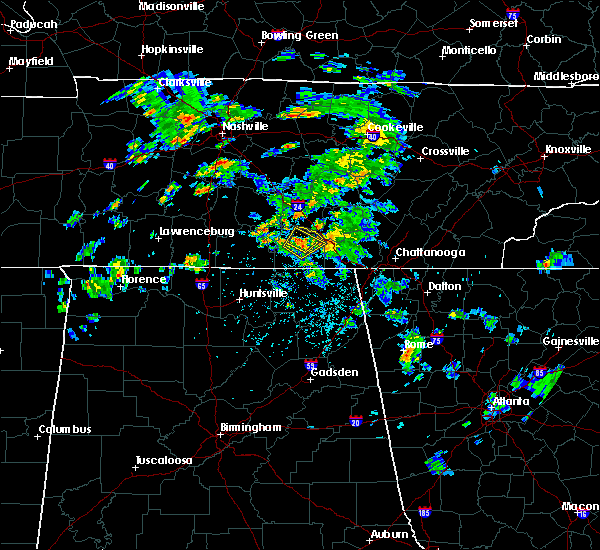 At 310 pm cdt, a severe thunderstorm was located over decherd, or near winchester, moving northeast at 20 mph (radar indicated). Hazards include 60 mph wind gusts and quarter size hail. Hail damage to vehicles is expected. Expect wind damage to roofs, siding, and trees. At 310 pm cdt, a severe thunderstorm was located over decherd, or near winchester, moving northeast at 20 mph (radar indicated). Hazards include 60 mph wind gusts and quarter size hail. Hail damage to vehicles is expected. Expect wind damage to roofs, siding, and trees.
|
| 4/18/2017 3:03 PM CDT |
 At 303 pm cdt, a severe thunderstorm was located over winchester, moving northeast at 15 mph (radar indicated). Hazards include quarter size hail. Damage to vehicles is expected. locations impacted include, winchester, decherd, estill springs, cowan, monteagle, sewanee, tims ford lake, st. Andrews, woods reservoir and arnold afb. At 303 pm cdt, a severe thunderstorm was located over winchester, moving northeast at 15 mph (radar indicated). Hazards include quarter size hail. Damage to vehicles is expected. locations impacted include, winchester, decherd, estill springs, cowan, monteagle, sewanee, tims ford lake, st. Andrews, woods reservoir and arnold afb.
|
| 4/18/2017 2:51 PM CDT |
 At 251 pm cdt, a severe thunderstorm was located near winchester, moving northeast at 15 mph (radar indicated). Hazards include quarter size hail. damage to vehicles is expected At 251 pm cdt, a severe thunderstorm was located near winchester, moving northeast at 15 mph (radar indicated). Hazards include quarter size hail. damage to vehicles is expected
|
| 4/5/2017 5:48 PM CDT |
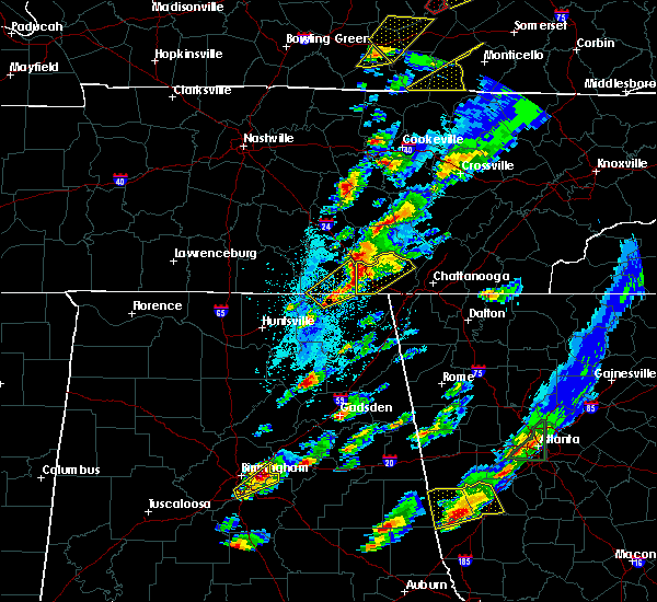 At 548 pm cdt, severe thunderstorms were located along a line extending from sewanee to 9 miles southeast of cowan, moving northeast at 50 mph. another severe thunderstorm was located near hytop, also moving northeast at 50 mph (radar indicated). Hazards include 60 mph wind gusts and quarter size hail. Hail damage to vehicles is expected. expect wind damage to roofs, siding, and trees. locations impacted include, cowan, monteagle, sewanee, anderson, hytop, jericho, st. andrews and sherwood. A tornado watch remains in effect until 900 pm cdt for northeastern alabama, and middle tennessee. At 548 pm cdt, severe thunderstorms were located along a line extending from sewanee to 9 miles southeast of cowan, moving northeast at 50 mph. another severe thunderstorm was located near hytop, also moving northeast at 50 mph (radar indicated). Hazards include 60 mph wind gusts and quarter size hail. Hail damage to vehicles is expected. expect wind damage to roofs, siding, and trees. locations impacted include, cowan, monteagle, sewanee, anderson, hytop, jericho, st. andrews and sherwood. A tornado watch remains in effect until 900 pm cdt for northeastern alabama, and middle tennessee.
|
| 4/5/2017 5:37 PM CDT |
 At 537 pm cdt, severe thunderstorms were located along a line extending from near cowan to 8 miles north of skyline, moving northeast at 60 mph (radar indicated). Hazards include 60 mph wind gusts and quarter size hail. Hail damage to vehicles is expected. expect wind damage to roofs, siding, and trees. locations impacted include, cowan, monteagle, sewanee, anderson, hytop, jericho, st. andrews and sherwood. A tornado watch remains in effect until 900 pm cdt for north central and northeastern alabama, and middle tennessee. At 537 pm cdt, severe thunderstorms were located along a line extending from near cowan to 8 miles north of skyline, moving northeast at 60 mph (radar indicated). Hazards include 60 mph wind gusts and quarter size hail. Hail damage to vehicles is expected. expect wind damage to roofs, siding, and trees. locations impacted include, cowan, monteagle, sewanee, anderson, hytop, jericho, st. andrews and sherwood. A tornado watch remains in effect until 900 pm cdt for north central and northeastern alabama, and middle tennessee.
|
| 4/5/2017 5:37 PM CDT |
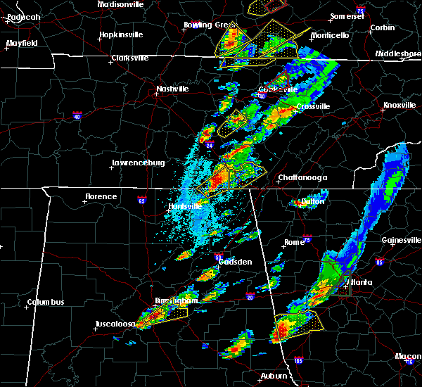 At 537 pm cdt, severe thunderstorms were located along a line extending from near cowan to 8 miles north of skyline, moving northeast at 60 mph (radar indicated). Hazards include 60 mph wind gusts and quarter size hail. Hail damage to vehicles is expected. expect wind damage to roofs, siding, and trees. locations impacted include, cowan, monteagle, sewanee, anderson, hytop, jericho, st. andrews and sherwood. A tornado watch remains in effect until 900 pm cdt for north central and northeastern alabama, and middle tennessee. At 537 pm cdt, severe thunderstorms were located along a line extending from near cowan to 8 miles north of skyline, moving northeast at 60 mph (radar indicated). Hazards include 60 mph wind gusts and quarter size hail. Hail damage to vehicles is expected. expect wind damage to roofs, siding, and trees. locations impacted include, cowan, monteagle, sewanee, anderson, hytop, jericho, st. andrews and sherwood. A tornado watch remains in effect until 900 pm cdt for north central and northeastern alabama, and middle tennessee.
|
| 4/5/2017 5:26 PM CDT |
 At 525 pm cdt, a severe thunderstorm was located 9 miles northwest of skyline, or 18 miles south of winchester, moving northeast at 45 mph (radar indicated. at 455 pm, there were several reports of hail to the size of quarters with these storms in madison county). Hazards include 60 mph wind gusts and quarter size hail. Hail damage to vehicles is expected. Expect wind damage to roofs, siding, and trees. At 525 pm cdt, a severe thunderstorm was located 9 miles northwest of skyline, or 18 miles south of winchester, moving northeast at 45 mph (radar indicated. at 455 pm, there were several reports of hail to the size of quarters with these storms in madison county). Hazards include 60 mph wind gusts and quarter size hail. Hail damage to vehicles is expected. Expect wind damage to roofs, siding, and trees.
|
| 4/5/2017 5:26 PM CDT |
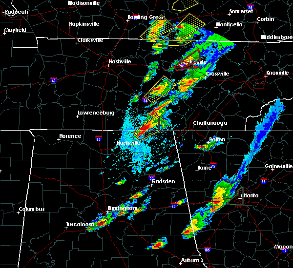 At 525 pm cdt, a severe thunderstorm was located 9 miles northwest of skyline, or 18 miles south of winchester, moving northeast at 45 mph (radar indicated. at 455 pm, there were several reports of hail to the size of quarters with these storms in madison county). Hazards include 60 mph wind gusts and quarter size hail. Hail damage to vehicles is expected. Expect wind damage to roofs, siding, and trees. At 525 pm cdt, a severe thunderstorm was located 9 miles northwest of skyline, or 18 miles south of winchester, moving northeast at 45 mph (radar indicated. at 455 pm, there were several reports of hail to the size of quarters with these storms in madison county). Hazards include 60 mph wind gusts and quarter size hail. Hail damage to vehicles is expected. Expect wind damage to roofs, siding, and trees.
|
| 4/5/2017 5:20 PM CDT |
 At 519 pm cdt, a severe thunderstorm was located 7 miles southeast of new market, or 11 miles east of moores mill, moving northeast at 55 mph (radar indicated. this cluster of storms has a history of producing hail to the size of quarters earlier in central and eastern madison county). Hazards include 60 mph wind gusts and quarter size hail. Hail damage to vehicles is expected. expect wind damage to roofs, siding, and trees. locations impacted include, hytop, francisco, princeton, jericho, estillfork and larkin. A tornado watch remains in effect until 900 pm cdt for north central and northeastern alabama, and middle tennessee. At 519 pm cdt, a severe thunderstorm was located 7 miles southeast of new market, or 11 miles east of moores mill, moving northeast at 55 mph (radar indicated. this cluster of storms has a history of producing hail to the size of quarters earlier in central and eastern madison county). Hazards include 60 mph wind gusts and quarter size hail. Hail damage to vehicles is expected. expect wind damage to roofs, siding, and trees. locations impacted include, hytop, francisco, princeton, jericho, estillfork and larkin. A tornado watch remains in effect until 900 pm cdt for north central and northeastern alabama, and middle tennessee.
|
| 4/5/2017 5:12 PM CDT |
 At 511 pm cdt, a severe thunderstorm was located near new market, or 9 miles east of moores mill, moving northeast at 55 mph. another severe thunderstorm was located 2 miles east of new market in extreme northwest jackson county, also moving northeast at 55 mph (public. these storms have a history of producing hail to the size of quarters across madison county). Hazards include 60 mph wind gusts and quarter size hail. Hail damage to vehicles is expected. expect wind damage to roofs, siding, and trees. locations impacted include, moores mill, huntland, new market, hytop, jericho, larkin, francisco, beans creek, ryland and maysville. A tornado watch remains in effect until 900 pm cdt for north central and northeastern alabama, and middle tennessee. At 511 pm cdt, a severe thunderstorm was located near new market, or 9 miles east of moores mill, moving northeast at 55 mph. another severe thunderstorm was located 2 miles east of new market in extreme northwest jackson county, also moving northeast at 55 mph (public. these storms have a history of producing hail to the size of quarters across madison county). Hazards include 60 mph wind gusts and quarter size hail. Hail damage to vehicles is expected. expect wind damage to roofs, siding, and trees. locations impacted include, moores mill, huntland, new market, hytop, jericho, larkin, francisco, beans creek, ryland and maysville. A tornado watch remains in effect until 900 pm cdt for north central and northeastern alabama, and middle tennessee.
|
| 4/5/2017 4:57 PM CDT |
 At 456 pm cdt, a severe thunderstorm was located near huntsville, moving northeast at 60 mph. another severe thunderstorm was located near ryland, moving northeast at 60 mph (public. at 455 pm, hail to the size of quarters was reported in the medical district of huntsville. at 454 pm, hail to the size of nickels was reported near ryland). Hazards include 60 mph wind gusts and quarter size hail. Hail damage to vehicles is expected. Expect wind damage to roofs, siding, and trees. At 456 pm cdt, a severe thunderstorm was located near huntsville, moving northeast at 60 mph. another severe thunderstorm was located near ryland, moving northeast at 60 mph (public. at 455 pm, hail to the size of quarters was reported in the medical district of huntsville. at 454 pm, hail to the size of nickels was reported near ryland). Hazards include 60 mph wind gusts and quarter size hail. Hail damage to vehicles is expected. Expect wind damage to roofs, siding, and trees.
|
| 4/5/2017 4:27 PM CDT |
 At 425 pm cdt, a severe thunderstorm was located near new market, or 12 miles northeast of moores mill, moving northeast at 55 mph. another strong to severe thunderstorm is located near meridianville, moving northeast at 50 mph (radar indicated. since 415 pm cdt, the public has reported hail to the size of pennies across north huntsville and meridianville with these storms). Hazards include 60 mph wind gusts and quarter size hail. Hail damage to vehicles is expected. Expect wind damage to roofs, siding, and trees. At 425 pm cdt, a severe thunderstorm was located near new market, or 12 miles northeast of moores mill, moving northeast at 55 mph. another strong to severe thunderstorm is located near meridianville, moving northeast at 50 mph (radar indicated. since 415 pm cdt, the public has reported hail to the size of pennies across north huntsville and meridianville with these storms). Hazards include 60 mph wind gusts and quarter size hail. Hail damage to vehicles is expected. Expect wind damage to roofs, siding, and trees.
|
| 3/21/2017 5:18 PM CDT |
 At 518 pm cdt, severe thunderstorms were located along a line extending from 6 miles southwest of cowan to near new market, moving southeast at 45 mph (trained weather spotters). Hazards include 70 mph wind gusts and quarter size hail. Hail damage to vehicles is expected. expect considerable tree damage. wind damage is also likely to mobile homes, roofs, and outbuildings. Locations impacted include, winchester, cowan, huntland, tims ford lake, new market, anderson, lincoln, hytop, hurdlow and maxwell. At 518 pm cdt, severe thunderstorms were located along a line extending from 6 miles southwest of cowan to near new market, moving southeast at 45 mph (trained weather spotters). Hazards include 70 mph wind gusts and quarter size hail. Hail damage to vehicles is expected. expect considerable tree damage. wind damage is also likely to mobile homes, roofs, and outbuildings. Locations impacted include, winchester, cowan, huntland, tims ford lake, new market, anderson, lincoln, hytop, hurdlow and maxwell.
|
| 3/21/2017 5:13 PM CDT | Widespread tree damage across the southern half of franklin county in franklin county TN, 6.3 miles NE of Winchester, TN |
| 3/21/2017 5:05 PM CDT |
 At 504 pm cdt, severe thunderstorms were located along a line extending from near tims ford lake to near hazel green, moving southeast at 55 mph (trained weather spotters). Hazards include 70 mph wind gusts and quarter size hail. Hail damage to vehicles is expected. expect considerable tree damage. wind damage is also likely to mobile homes, roofs, and outbuildings. Locations impacted include, winchester, fayetteville, hazel green, decherd, cowan, huntland, tims ford lake, new market, anderson and lincoln. At 504 pm cdt, severe thunderstorms were located along a line extending from near tims ford lake to near hazel green, moving southeast at 55 mph (trained weather spotters). Hazards include 70 mph wind gusts and quarter size hail. Hail damage to vehicles is expected. expect considerable tree damage. wind damage is also likely to mobile homes, roofs, and outbuildings. Locations impacted include, winchester, fayetteville, hazel green, decherd, cowan, huntland, tims ford lake, new market, anderson and lincoln.
|
| 3/21/2017 5:03 PM CDT |
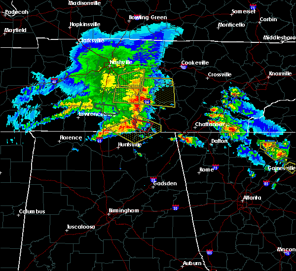 At 503 pm cdt, a severe thunderstorm capable of producing a tornado was located near huntland, or 10 miles south of lynchburg, moving southeast at 35 mph (radar indicated rotation). Hazards include tornado and quarter size hail. Flying debris will be dangerous to those caught without shelter. mobile homes will be damaged or destroyed. damage to roofs, windows, and vehicles will occur. tree damage is likely. This tornadic thunderstorm will remain over mainly rural areas of southwestern franklin county, including the following locations: lexie crossroads, beans creek, harmony, maxwell and belvidere. At 503 pm cdt, a severe thunderstorm capable of producing a tornado was located near huntland, or 10 miles south of lynchburg, moving southeast at 35 mph (radar indicated rotation). Hazards include tornado and quarter size hail. Flying debris will be dangerous to those caught without shelter. mobile homes will be damaged or destroyed. damage to roofs, windows, and vehicles will occur. tree damage is likely. This tornadic thunderstorm will remain over mainly rural areas of southwestern franklin county, including the following locations: lexie crossroads, beans creek, harmony, maxwell and belvidere.
|
| 3/21/2017 4:57 PM CDT |
 At 456 pm cdt, severe thunderstorms were located along a line extending from near tims ford lake to 8 miles east of ardmore, moving southeast at 45 mph (radar indicated). Hazards include 70 mph wind gusts and quarter size hail. Hail damage to vehicles is expected. expect considerable tree damage. Wind damage is also likely to mobile homes, roofs, and outbuildings. At 456 pm cdt, severe thunderstorms were located along a line extending from near tims ford lake to 8 miles east of ardmore, moving southeast at 45 mph (radar indicated). Hazards include 70 mph wind gusts and quarter size hail. Hail damage to vehicles is expected. expect considerable tree damage. Wind damage is also likely to mobile homes, roofs, and outbuildings.
|
| 3/21/2017 4:46 PM CDT |
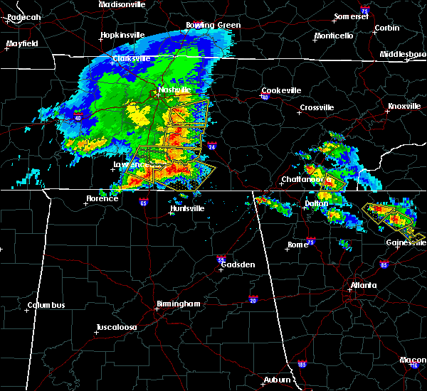 At 445 pm cdt, severe thunderstorms were located along a line extending from 6 miles west of lynchburg to 8 miles southwest of fayetteville, moving southeast at 60 mph (radar indicated). Hazards include 70 mph wind gusts and quarter size hail. Hail damage to vehicles is expected. expect considerable tree damage. wind damage is also likely to mobile homes, roofs, and outbuildings. Locations impacted include, winchester, fayetteville, lynchburg, estill springs, huntland, petersburg, tims ford lake, lincoln, hurdlow and smithland. At 445 pm cdt, severe thunderstorms were located along a line extending from 6 miles west of lynchburg to 8 miles southwest of fayetteville, moving southeast at 60 mph (radar indicated). Hazards include 70 mph wind gusts and quarter size hail. Hail damage to vehicles is expected. expect considerable tree damage. wind damage is also likely to mobile homes, roofs, and outbuildings. Locations impacted include, winchester, fayetteville, lynchburg, estill springs, huntland, petersburg, tims ford lake, lincoln, hurdlow and smithland.
|
| 3/21/2017 4:33 PM CDT |
 At 433 pm cdt, severe thunderstorms were located along a line extending from 7 miles north of petersburg to 9 miles east of pulaski, moving southeast at 60 mph (radar indicated). Hazards include 70 mph wind gusts and quarter size hail. Hail damage to vehicles is expected. expect considerable tree damage. Wind damage is also likely to mobile homes, roofs, and outbuildings. At 433 pm cdt, severe thunderstorms were located along a line extending from 7 miles north of petersburg to 9 miles east of pulaski, moving southeast at 60 mph (radar indicated). Hazards include 70 mph wind gusts and quarter size hail. Hail damage to vehicles is expected. expect considerable tree damage. Wind damage is also likely to mobile homes, roofs, and outbuildings.
|
| 3/10/2017 12:04 AM CST | Trees were knocked down at 5653 winchester highwa in moore county TN, 11.5 miles E of Winchester, TN |
| 3/9/2017 11:59 PM CST |
 At 1159 pm cst, severe thunderstorms were located along a line extending from 8 miles northeast of manchester to 6 miles northwest of hazel green, moving east at 40 mph (radar indicated). Hazards include 60 mph wind gusts and quarter size hail. Hail damage to vehicles is expected. expect wind damage to roofs, siding, and trees. Locations impacted include, huntsville, madison, winchester, moores mill, meridianville, redstone arsenal, hazel green, decherd, estill springs and cowan. At 1159 pm cst, severe thunderstorms were located along a line extending from 8 miles northeast of manchester to 6 miles northwest of hazel green, moving east at 40 mph (radar indicated). Hazards include 60 mph wind gusts and quarter size hail. Hail damage to vehicles is expected. expect wind damage to roofs, siding, and trees. Locations impacted include, huntsville, madison, winchester, moores mill, meridianville, redstone arsenal, hazel green, decherd, estill springs and cowan.
|
| 3/9/2017 11:55 PM CST |
 At 1155 pm cst, severe thunderstorms were located along a line extending from 7 miles northeast of manchester to 7 miles east of ardmore, moving east at 95 mph (radar indicated). Hazards include 60 mph wind gusts and quarter size hail. Hail damage to vehicles is expected. Expect wind damage to roofs, siding, and trees. At 1155 pm cst, severe thunderstorms were located along a line extending from 7 miles northeast of manchester to 7 miles east of ardmore, moving east at 95 mph (radar indicated). Hazards include 60 mph wind gusts and quarter size hail. Hail damage to vehicles is expected. Expect wind damage to roofs, siding, and trees.
|
| 3/1/2017 1:02 PM CST |
 At 101 pm cst, a severe thunderstorm was located over decherd, or over winchester, moving east at 60 mph (radar indicated). Hazards include 60 mph wind gusts and penny size hail. Expect damage to roofs, siding, and trees. locations impacted include, winchester, decherd, estill springs, cowan, monteagle, sewanee, tims ford lake, st. andrews, woods reservoir and alto. A tornado watch remains in effect until 600 pm cst for north central and northeastern alabama, and middle tennessee. At 101 pm cst, a severe thunderstorm was located over decherd, or over winchester, moving east at 60 mph (radar indicated). Hazards include 60 mph wind gusts and penny size hail. Expect damage to roofs, siding, and trees. locations impacted include, winchester, decherd, estill springs, cowan, monteagle, sewanee, tims ford lake, st. andrews, woods reservoir and alto. A tornado watch remains in effect until 600 pm cst for north central and northeastern alabama, and middle tennessee.
|
| 3/1/2017 12:52 PM CST |
 At 1252 pm cst, a severe thunderstorm was located near tims ford lake, or near lynchburg, moving east at 60 mph (radar indicated). Hazards include 60 mph wind gusts and penny size hail. expect damage to roofs, siding, and trees At 1252 pm cst, a severe thunderstorm was located near tims ford lake, or near lynchburg, moving east at 60 mph (radar indicated). Hazards include 60 mph wind gusts and penny size hail. expect damage to roofs, siding, and trees
|
| 3/1/2017 12:08 PM CST |
 At 1208 pm cst, a severe thunderstorm was located 7 miles west of lynchburg, moving east at 60 mph (radar indicated). Hazards include 60 mph wind gusts and quarter size hail. Hail damage to vehicles is expected. expect wind damage to roofs, siding, and trees. locations impacted include, winchester, lynchburg, estill springs, petersburg, tims ford lake, howell, mimosa, mulberry, chestnut ridge and belleville. A tornado watch remains in effect until 600 pm cst for north central and northeastern alabama, and middle tennessee. At 1208 pm cst, a severe thunderstorm was located 7 miles west of lynchburg, moving east at 60 mph (radar indicated). Hazards include 60 mph wind gusts and quarter size hail. Hail damage to vehicles is expected. expect wind damage to roofs, siding, and trees. locations impacted include, winchester, lynchburg, estill springs, petersburg, tims ford lake, howell, mimosa, mulberry, chestnut ridge and belleville. A tornado watch remains in effect until 600 pm cst for north central and northeastern alabama, and middle tennessee.
|
| 3/1/2017 12:00 PM CST |
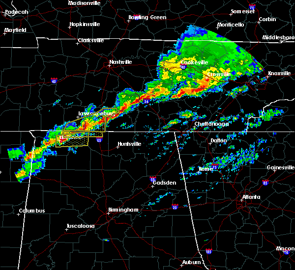 At 1200 pm cst, a severe thunderstorm was located near petersburg, or 9 miles northwest of fayetteville, moving east at 60 mph (radar indicated). Hazards include 60 mph wind gusts and quarter size hail. Hail damage to vehicles is expected. Expect wind damage to roofs, siding, and trees. At 1200 pm cst, a severe thunderstorm was located near petersburg, or 9 miles northwest of fayetteville, moving east at 60 mph (radar indicated). Hazards include 60 mph wind gusts and quarter size hail. Hail damage to vehicles is expected. Expect wind damage to roofs, siding, and trees.
|
| 2/24/2017 10:44 PM CST |
 At 1043 pm cst, a severe thunderstorm was located near cowan, or near winchester, moving northeast at 45 mph (radar indicated). Hazards include quarter size hail. damage to vehicles is expected At 1043 pm cst, a severe thunderstorm was located near cowan, or near winchester, moving northeast at 45 mph (radar indicated). Hazards include quarter size hail. damage to vehicles is expected
|
| 2/24/2017 10:21 PM CST |
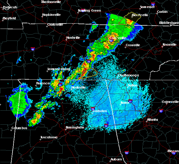 At 1020 pm cst, a severe thunderstorm was located over huntland, or 11 miles southwest of winchester, moving northeast at 50 mph (radar indicated). Hazards include quarter size hail. damage to vehicles is expected At 1020 pm cst, a severe thunderstorm was located over huntland, or 11 miles southwest of winchester, moving northeast at 50 mph (radar indicated). Hazards include quarter size hail. damage to vehicles is expected
|
| 11/29/2016 11:37 PM CST |
 The severe thunderstorm warning for northeastern franklin county will expire at 1145 pm cst, the storm which prompted the warning has weakened below severe limits, and has exited the warned area. therefore, the warning will be allowed to expire. a tornado watch remains in effect until 300 am cst for north central and northeastern alabama, and middle tennessee. The severe thunderstorm warning for northeastern franklin county will expire at 1145 pm cst, the storm which prompted the warning has weakened below severe limits, and has exited the warned area. therefore, the warning will be allowed to expire. a tornado watch remains in effect until 300 am cst for north central and northeastern alabama, and middle tennessee.
|
| 11/29/2016 11:29 PM CST |
 At 1129 pm cst, a severe thunderstorm was located over monteagle, or 17 miles northwest of jasper, moving northeast at 50 mph (radar indicated). Hazards include 60 mph wind gusts. Expect damage to roofs. siding. and trees. locations impacted include, winchester, decherd, cowan, monteagle, sewanee, st. andrews, alto and woods reservoir. A tornado watch remains in effect until 300 am cst for north central and northeastern alabama, and middle tennessee. At 1129 pm cst, a severe thunderstorm was located over monteagle, or 17 miles northwest of jasper, moving northeast at 50 mph (radar indicated). Hazards include 60 mph wind gusts. Expect damage to roofs. siding. and trees. locations impacted include, winchester, decherd, cowan, monteagle, sewanee, st. andrews, alto and woods reservoir. A tornado watch remains in effect until 300 am cst for north central and northeastern alabama, and middle tennessee.
|
| 11/29/2016 11:17 PM CST |
 At 1115 pm cst, a severe thunderstorm capable of producing a tornado was located over cowan, or near winchester, moving northeast at 50 mph (radar indicated rotation). Hazards include tornado. Flying debris will be dangerous to those caught without shelter. mobile homes will be damaged or destroyed. damage to roofs, windows, and vehicles will occur. tree damage is likely. this dangerous storm will be near, sewanee around 1125 pm cst. monteagle around 1135 pm cst. other locations impacted by this tornadic thunderstorm include alto and st. Andrews. At 1115 pm cst, a severe thunderstorm capable of producing a tornado was located over cowan, or near winchester, moving northeast at 50 mph (radar indicated rotation). Hazards include tornado. Flying debris will be dangerous to those caught without shelter. mobile homes will be damaged or destroyed. damage to roofs, windows, and vehicles will occur. tree damage is likely. this dangerous storm will be near, sewanee around 1125 pm cst. monteagle around 1135 pm cst. other locations impacted by this tornadic thunderstorm include alto and st. Andrews.
|
| 11/29/2016 11:07 PM CST |
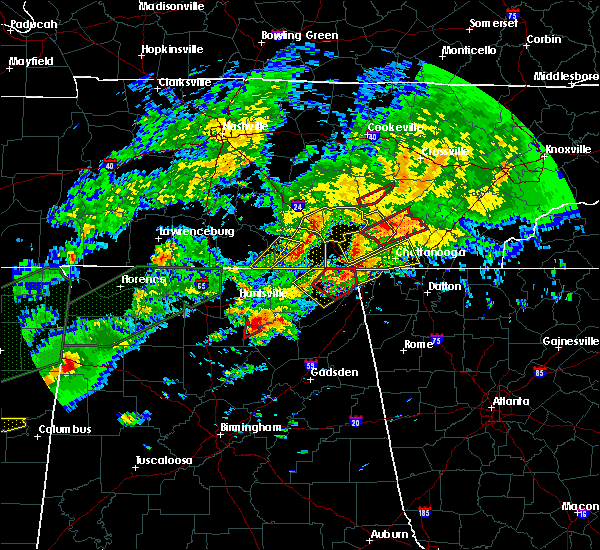 The severe thunderstorm warning for southeastern lincoln, west central franklin and southeastern moore counties will expire at 1115 pm cst, the storm which prompted the warning has moved out of the area. therefore the warning will be allowed to expire. a tornado watch remains in effect until 300 am cst for north central and northeastern alabama, and middle tennessee. remember, a severe thunderstorm warning still remains in effect for franklin county tn. The severe thunderstorm warning for southeastern lincoln, west central franklin and southeastern moore counties will expire at 1115 pm cst, the storm which prompted the warning has moved out of the area. therefore the warning will be allowed to expire. a tornado watch remains in effect until 300 am cst for north central and northeastern alabama, and middle tennessee. remember, a severe thunderstorm warning still remains in effect for franklin county tn.
|
| 11/29/2016 11:06 PM CST |
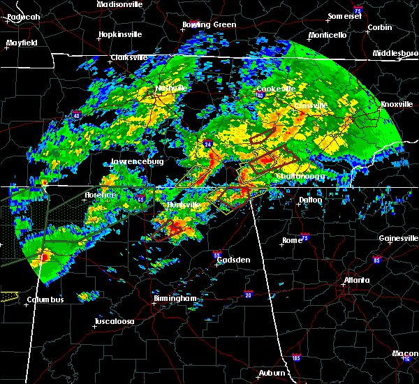 At 1105 pm cst, a severe thunderstorm was located near winchester, moving northeast at 50 mph (radar indicated). Hazards include 60 mph wind gusts. Expect damage to roofs. siding. And trees. At 1105 pm cst, a severe thunderstorm was located near winchester, moving northeast at 50 mph (radar indicated). Hazards include 60 mph wind gusts. Expect damage to roofs. siding. And trees.
|
| 11/29/2016 10:59 PM CST |
 At 1058 pm cst, a severe thunderstorm was located over huntland, or 13 miles southwest of winchester, moving northeast at 50 mph (radar indicated). Hazards include 60 mph wind gusts. Expect damage to roofs. siding. and trees. locations impacted include, winchester, decherd, huntland, tims ford lake, lincoln, harmony, elora, smithland, lexie crossroads and hurdlow. A tornado watch remains in effect until 300 am cst for north central and northeastern alabama, and middle tennessee. At 1058 pm cst, a severe thunderstorm was located over huntland, or 13 miles southwest of winchester, moving northeast at 50 mph (radar indicated). Hazards include 60 mph wind gusts. Expect damage to roofs. siding. and trees. locations impacted include, winchester, decherd, huntland, tims ford lake, lincoln, harmony, elora, smithland, lexie crossroads and hurdlow. A tornado watch remains in effect until 300 am cst for north central and northeastern alabama, and middle tennessee.
|
| 11/29/2016 10:34 PM CST |
 At 1034 pm cst, a severe thunderstorm was located over hazel green, or near meridianville, moving northeast at 50 mph (radar indicated). Hazards include 60 mph wind gusts. Expect damage to roofs. siding. And trees. At 1034 pm cst, a severe thunderstorm was located over hazel green, or near meridianville, moving northeast at 50 mph (radar indicated). Hazards include 60 mph wind gusts. Expect damage to roofs. siding. And trees.
|
| 11/29/2016 9:48 PM CST |
 At 948 pm cst, a severe thunderstorm was located over estill springs, or near winchester, moving northeast at 55 mph (radar indicated). Hazards include 60 mph wind gusts. Expect damage to roofs. siding. And trees. At 948 pm cst, a severe thunderstorm was located over estill springs, or near winchester, moving northeast at 55 mph (radar indicated). Hazards include 60 mph wind gusts. Expect damage to roofs. siding. And trees.
|
| 7/8/2016 8:10 PM CDT |
 The severe thunderstorm warning for central franklin county will expire at 815 pm cdt, the storm which prompted the warning has weakened below severe limits, and no longer pose an immediate threat to life or property. therefore, the warning will be allowed to expire. however gusty winds and heavy rain are still possible with this thunderstorm. The severe thunderstorm warning for central franklin county will expire at 815 pm cdt, the storm which prompted the warning has weakened below severe limits, and no longer pose an immediate threat to life or property. therefore, the warning will be allowed to expire. however gusty winds and heavy rain are still possible with this thunderstorm.
|
| 7/8/2016 8:02 PM CDT |
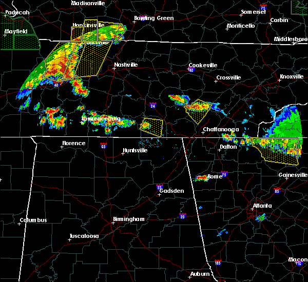 At 802 pm cdt, a severe thunderstorm was located over tims ford lake, or 7 miles west of winchester, moving east at 20 mph (radar indicated). Hazards include 60 mph wind gusts. Expect damage to roofs. siding. and trees. Locations impacted include, winchester, decherd, estill springs, cowan, tims ford lake, belvidere, harmony, alto, lexie crossroads and woods reservoir. At 802 pm cdt, a severe thunderstorm was located over tims ford lake, or 7 miles west of winchester, moving east at 20 mph (radar indicated). Hazards include 60 mph wind gusts. Expect damage to roofs. siding. and trees. Locations impacted include, winchester, decherd, estill springs, cowan, tims ford lake, belvidere, harmony, alto, lexie crossroads and woods reservoir.
|
| 7/8/2016 7:42 PM CDT |
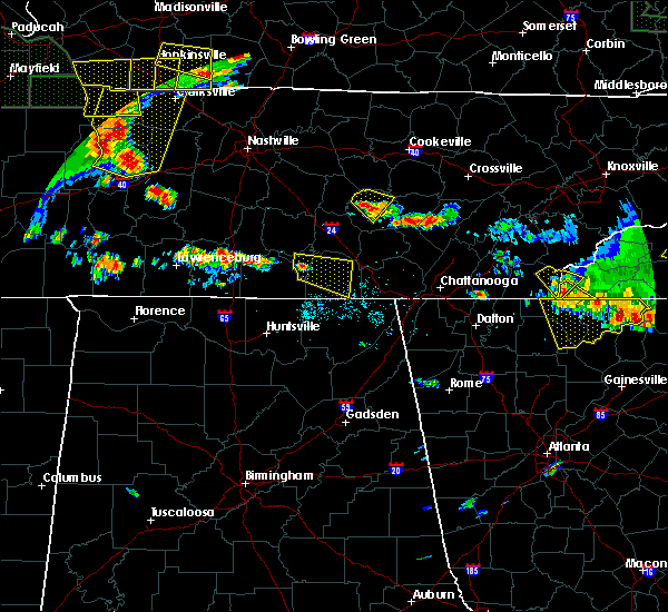 At 742 pm cdt, a severe thunderstorm was located over lynchburg, moving east at 20 mph (radar indicated). Hazards include 60 mph wind gusts. Expect damage to roofs. siding. And trees. At 742 pm cdt, a severe thunderstorm was located over lynchburg, moving east at 20 mph (radar indicated). Hazards include 60 mph wind gusts. Expect damage to roofs. siding. And trees.
|
| 6/15/2016 6:24 PM CDT |
 The severe thunderstorm warning for lincoln, northern franklin and moore counties will expire at 630 pm cdt, the storms which prompted the warning have moved out of the warned area. therefore the warning will be allowed to expire. an additional warning remains in effect for parts of lincoln, franklin and moore counties in tn. The severe thunderstorm warning for lincoln, northern franklin and moore counties will expire at 630 pm cdt, the storms which prompted the warning have moved out of the warned area. therefore the warning will be allowed to expire. an additional warning remains in effect for parts of lincoln, franklin and moore counties in tn.
|
| 6/15/2016 5:58 PM CDT |
 At 558 pm cdt, severe thunderstorms were located along a line extending from 8 miles north of monteagle to ardmore, moving southeast at 35 mph. this storm has a history of producing downed trees (radar indicated). Hazards include 60 mph wind gusts and quarter size hail. Hail damage to vehicles is expected. Expect wind damage to roofs, siding, and trees. At 558 pm cdt, severe thunderstorms were located along a line extending from 8 miles north of monteagle to ardmore, moving southeast at 35 mph. this storm has a history of producing downed trees (radar indicated). Hazards include 60 mph wind gusts and quarter size hail. Hail damage to vehicles is expected. Expect wind damage to roofs, siding, and trees.
|
| 6/15/2016 5:54 PM CDT |
 At 553 pm cdt, severe thunderstorms were located along a line extending from 9 miles south of mcminnville to 10 miles east of pulaski, moving southeast at 20 mph. this storm did topple trees in lynchburg, tn as it passed through as reported by law enforcement (radar indicated). Hazards include 60 mph wind gusts and quarter size hail. Hail damage to vehicles is expected. expect wind damage to roofs, siding, and trees. Locations impacted include, winchester, fayetteville, lynchburg, decherd, estill springs, ardmore, monteagle, petersburg, tims ford lake and sewanee. At 553 pm cdt, severe thunderstorms were located along a line extending from 9 miles south of mcminnville to 10 miles east of pulaski, moving southeast at 20 mph. this storm did topple trees in lynchburg, tn as it passed through as reported by law enforcement (radar indicated). Hazards include 60 mph wind gusts and quarter size hail. Hail damage to vehicles is expected. expect wind damage to roofs, siding, and trees. Locations impacted include, winchester, fayetteville, lynchburg, decherd, estill springs, ardmore, monteagle, petersburg, tims ford lake and sewanee.
|
| 6/15/2016 5:42 PM CDT |
 At 541 pm cdt, severe thunderstorms were located along a line extending from 7 miles south of mcminnville to 6 miles east of pulaski, moving southeast at 20 mph (radar indicated). Hazards include 60 mph wind gusts and quarter size hail. Hail damage to vehicles is expected. Expect wind damage to roofs, siding, and trees. At 541 pm cdt, severe thunderstorms were located along a line extending from 7 miles south of mcminnville to 6 miles east of pulaski, moving southeast at 20 mph (radar indicated). Hazards include 60 mph wind gusts and quarter size hail. Hail damage to vehicles is expected. Expect wind damage to roofs, siding, and trees.
|
| 4/30/2016 5:42 PM CDT | The severe thunderstorm warning for lincoln, northwestern franklin and moore counties will expire at 545 pm cdt, the storm which prompted the warning has weakened below severe limits, and no longer pose an immediate threat to life or property. therefore the warning will be allowed to expire. |
| 4/30/2016 5:23 PM CDT |
 At 522 pm cdt, a severe thunderstorm was located near fayetteville, moving northeast at 45 mph (radar indicated). Hazards include 60 mph wind gusts and quarter size hail. Hail damage to vehicles is expected. expect wind damage to roofs, siding, and trees. Locations impacted include, winchester, fayetteville, lynchburg, petersburg, tims ford lake, harmony, hurdlow, taft, mimosa and marble hill. At 522 pm cdt, a severe thunderstorm was located near fayetteville, moving northeast at 45 mph (radar indicated). Hazards include 60 mph wind gusts and quarter size hail. Hail damage to vehicles is expected. expect wind damage to roofs, siding, and trees. Locations impacted include, winchester, fayetteville, lynchburg, petersburg, tims ford lake, harmony, hurdlow, taft, mimosa and marble hill.
|
| 4/30/2016 5:05 PM CDT |
 At 505 pm cdt, a severe thunderstorm was located 9 miles northeast of ardmore, or 9 miles southwest of fayetteville, moving northeast at 55 mph (radar indicated). Hazards include 60 mph wind gusts and quarter size hail. Hail damage to vehicles is expected. Expect wind damage to roofs, siding, and trees. At 505 pm cdt, a severe thunderstorm was located 9 miles northeast of ardmore, or 9 miles southwest of fayetteville, moving northeast at 55 mph (radar indicated). Hazards include 60 mph wind gusts and quarter size hail. Hail damage to vehicles is expected. Expect wind damage to roofs, siding, and trees.
|
| 3/31/2016 10:20 PM CDT |
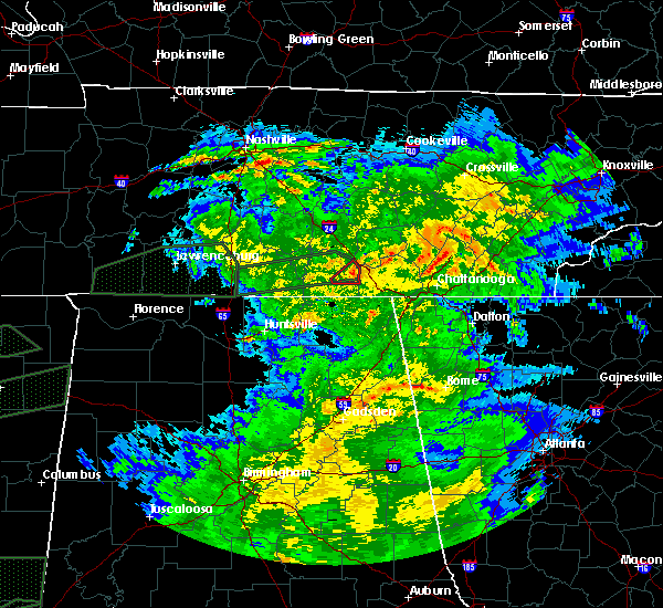 The tornado warning for east central franklin county will expire at 1030 pm cdt, the storm which prompted the warning has weakened below severe limits, and no longer appears capable of producing a tornado. therefore the warning will be allowed to expire. however gusty winds and heavy rain are still possible with this thunderstorm. a tornado watch remains in effect until 100 am cdt for northeastern alabama, and central tennessee. The tornado warning for east central franklin county will expire at 1030 pm cdt, the storm which prompted the warning has weakened below severe limits, and no longer appears capable of producing a tornado. therefore the warning will be allowed to expire. however gusty winds and heavy rain are still possible with this thunderstorm. a tornado watch remains in effect until 100 am cdt for northeastern alabama, and central tennessee.
|
| 3/31/2016 10:07 PM CDT |
 At 1007 pm cdt, a severe thunderstorm capable of producing a tornado was located 3 miles southwest of cowan, or near winchester, moving east at 30 mph (radar indicated rotation). Hazards include tornado. Flying debris will be dangerous to those caught without shelter. mobile homes will be damaged or destroyed. damage to roofs, windows, and vehicles will occur. tree damage is likely. locations impacted include, cowan, monteagle, sewanee and st. Andrews. At 1007 pm cdt, a severe thunderstorm capable of producing a tornado was located 3 miles southwest of cowan, or near winchester, moving east at 30 mph (radar indicated rotation). Hazards include tornado. Flying debris will be dangerous to those caught without shelter. mobile homes will be damaged or destroyed. damage to roofs, windows, and vehicles will occur. tree damage is likely. locations impacted include, cowan, monteagle, sewanee and st. Andrews.
|
| 3/31/2016 10:00 PM CDT |
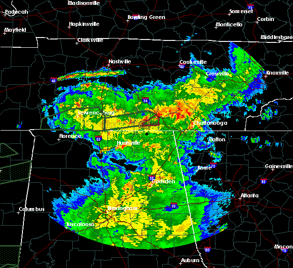 At 959 pm cdt, a severe thunderstorm capable of producing a tornado was located 3 miles southeast of belvidere, moving east at 30 mph (radar indicated rotation). Hazards include tornado. Flying debris will be dangerous to those caught without shelter. mobile homes will be damaged or destroyed. damage to roofs, windows, and vehicles will occur. Tree damage is likely. At 959 pm cdt, a severe thunderstorm capable of producing a tornado was located 3 miles southeast of belvidere, moving east at 30 mph (radar indicated rotation). Hazards include tornado. Flying debris will be dangerous to those caught without shelter. mobile homes will be damaged or destroyed. damage to roofs, windows, and vehicles will occur. Tree damage is likely.
|
| 3/31/2016 9:57 PM CDT |
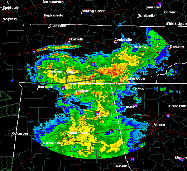 At 957 pm cdt, a severe thunderstorm was located near winchester, moving east at 35 mph (radar indicated). Hazards include 60 mph wind gusts and quarter size hail. Hail damage to vehicles is expected. expect wind damage to roofs, siding, and trees. locations impacted include, winchester, cowan and belvidere. A tornado watch remains in effect until 100 am cdt for northeastern alabama, and central tennessee. At 957 pm cdt, a severe thunderstorm was located near winchester, moving east at 35 mph (radar indicated). Hazards include 60 mph wind gusts and quarter size hail. Hail damage to vehicles is expected. expect wind damage to roofs, siding, and trees. locations impacted include, winchester, cowan and belvidere. A tornado watch remains in effect until 100 am cdt for northeastern alabama, and central tennessee.
|
| 3/31/2016 9:49 PM CDT |
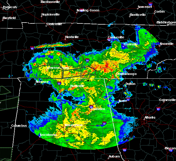 At 949 pm cdt, a severe thunderstorm was located near huntland, or 9 miles southwest of winchester, moving east at 35 mph (radar indicated). Hazards include 60 mph wind gusts and quarter size hail. Hail damage to vehicles is expected. expect wind damage to roofs, siding, and trees. locations impacted include, winchester, cowan, huntland, belvidere, maxwell and beans creek. A tornado watch remains in effect until 100 am cdt for northeastern alabama, and central tennessee. At 949 pm cdt, a severe thunderstorm was located near huntland, or 9 miles southwest of winchester, moving east at 35 mph (radar indicated). Hazards include 60 mph wind gusts and quarter size hail. Hail damage to vehicles is expected. expect wind damage to roofs, siding, and trees. locations impacted include, winchester, cowan, huntland, belvidere, maxwell and beans creek. A tornado watch remains in effect until 100 am cdt for northeastern alabama, and central tennessee.
|
| 3/31/2016 9:39 PM CDT |
 At 939 pm cdt, a severe thunderstorm was located near huntland, or 13 miles southeast of fayetteville, moving east at 35 mph (radar indicated). Hazards include 60 mph wind gusts and quarter size hail. Hail damage to vehicles is expected. Expect wind damage to roofs, siding, and trees. At 939 pm cdt, a severe thunderstorm was located near huntland, or 13 miles southeast of fayetteville, moving east at 35 mph (radar indicated). Hazards include 60 mph wind gusts and quarter size hail. Hail damage to vehicles is expected. Expect wind damage to roofs, siding, and trees.
|
| 3/31/2016 8:28 PM CDT | The severe thunderstorm warning for central franklin county will expire at 830 pm cdt, the storm which prompted the warning has weakened below severe limits, and no longer pose an immediate threat to life or property. therefore the warning will be allowed to expire. however small hail, gusty winds and heavy rain are still possible with this thunderstorm. a tornado watch remains in effect until 100 am cdt for northeastern alabama, and central tennessee. |
| 3/31/2016 8:24 PM CDT |
 At 824 pm cdt, a severe thunderstorm was located near winchester, moving east at 30 mph (radar indicated). Hazards include 60 mph wind gusts and quarter size hail. Hail damage to vehicles is expected. expect wind damage to roofs, siding, and trees. locations impacted include, winchester, decherd, cowan and belvidere. A tornado watch remains in effect until 100 am cdt for northeastern alabama, and central tennessee. At 824 pm cdt, a severe thunderstorm was located near winchester, moving east at 30 mph (radar indicated). Hazards include 60 mph wind gusts and quarter size hail. Hail damage to vehicles is expected. expect wind damage to roofs, siding, and trees. locations impacted include, winchester, decherd, cowan and belvidere. A tornado watch remains in effect until 100 am cdt for northeastern alabama, and central tennessee.
|
| 3/31/2016 8:06 PM CDT |
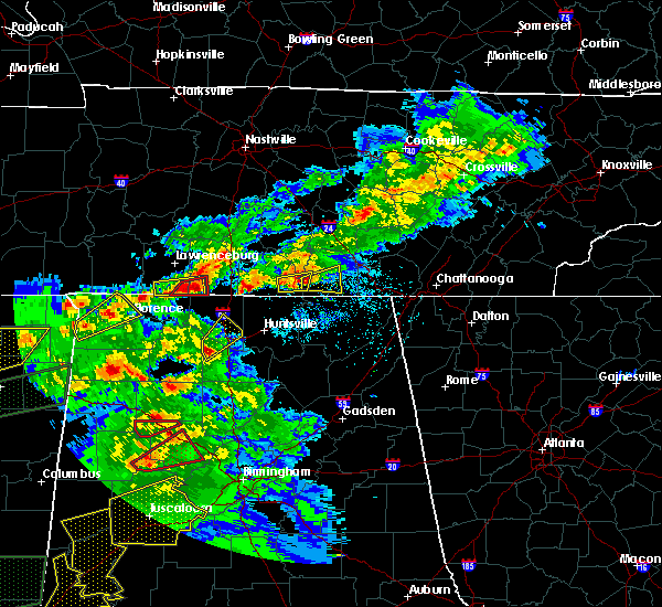 At 805 pm cdt, a severe thunderstorm was located over huntland, or 12 miles southwest of winchester, moving east at 30 mph (radar indicated. earlier this evening this storm produced hail to the size of quarters in southern lincoln county). Hazards include 60 mph wind gusts and quarter size hail. Hail damage to vehicles is expected. Expect wind damage to roofs, siding, and trees. At 805 pm cdt, a severe thunderstorm was located over huntland, or 12 miles southwest of winchester, moving east at 30 mph (radar indicated. earlier this evening this storm produced hail to the size of quarters in southern lincoln county). Hazards include 60 mph wind gusts and quarter size hail. Hail damage to vehicles is expected. Expect wind damage to roofs, siding, and trees.
|
| 7/28/2015 3:53 PM CDT |
 At 353 pm cdt, a severe thunderstorm was located near tims ford lake, or near winchester, moving southeast at 15 mph (radar indicated). Hazards include 60 mph wind gusts. Expect damage to roofs. siding and trees. Locations impacted include, winchester, huntland, tims ford lake, anderson, belvidere, harmony, lexie crossroads, maxwell and beans creek. At 353 pm cdt, a severe thunderstorm was located near tims ford lake, or near winchester, moving southeast at 15 mph (radar indicated). Hazards include 60 mph wind gusts. Expect damage to roofs. siding and trees. Locations impacted include, winchester, huntland, tims ford lake, anderson, belvidere, harmony, lexie crossroads, maxwell and beans creek.
|
| 7/28/2015 3:40 PM CDT |
 At 340 pm cdt, a severe thunderstorm was located over tims ford lake, or near winchester, moving southeast at 15 mph (radar indicated). Hazards include 60 mph wind gusts. Expect damage to roofs. Siding and trees. At 340 pm cdt, a severe thunderstorm was located over tims ford lake, or near winchester, moving southeast at 15 mph (radar indicated). Hazards include 60 mph wind gusts. Expect damage to roofs. Siding and trees.
|
| 7/14/2015 5:38 PM CDT |
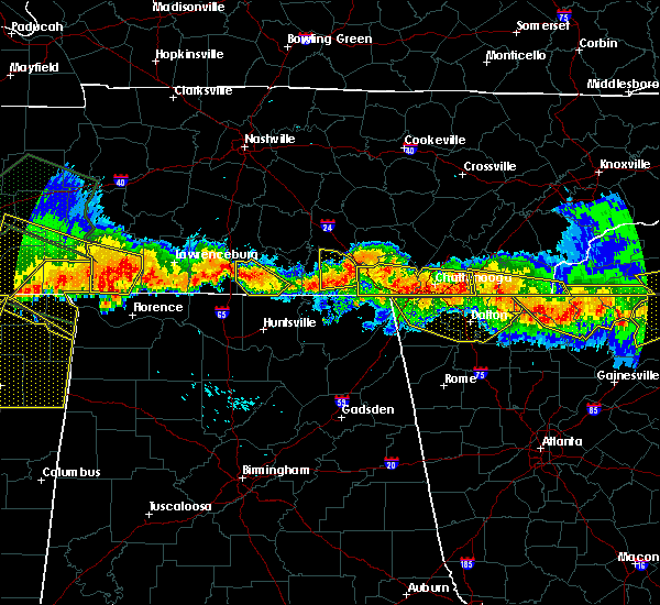 The severe thunderstorm warning for central franklin county will expire at 545 pm cdt, the storm which prompted the warning has weakened below severe limits, and is no longer an immediate threat to life or property. therefore the warning will be allowed to expire. however gusty winds and heavy rain are still possible with this thunderstorm. The severe thunderstorm warning for central franklin county will expire at 545 pm cdt, the storm which prompted the warning has weakened below severe limits, and is no longer an immediate threat to life or property. therefore the warning will be allowed to expire. however gusty winds and heavy rain are still possible with this thunderstorm.
|
| 7/14/2015 5:24 PM CDT |
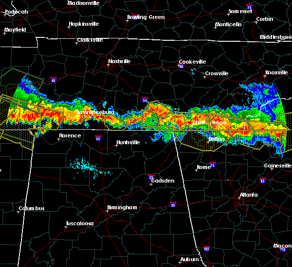 At 524 pm cdt, a severe thunderstorm was located near decherd, or near winchester, moving south at 30 mph (radar indicated). Hazards include 70 mph wind gusts. Expect considerable tree damage. damage is likely to mobile homes, roofs and outbuildings. locations impacted include, winchester, decherd, estill springs, cowan, monteagle, sewanee, tims ford lake, st. Andrews, alto and sherwood. At 524 pm cdt, a severe thunderstorm was located near decherd, or near winchester, moving south at 30 mph (radar indicated). Hazards include 70 mph wind gusts. Expect considerable tree damage. damage is likely to mobile homes, roofs and outbuildings. locations impacted include, winchester, decherd, estill springs, cowan, monteagle, sewanee, tims ford lake, st. Andrews, alto and sherwood.
|
| 7/14/2015 5:08 PM CDT |
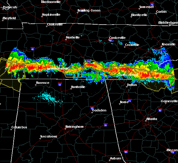 At 508 pm cdt, a severe thunderstorm was located 7 miles northeast of estill springs, or 7 miles south of manchester, moving south at 30 mph (radar indicated). Hazards include 70 mph wind gusts. Expect considerable tree damage. Damage is likely to mobile homes, roofs and outbuildings. At 508 pm cdt, a severe thunderstorm was located 7 miles northeast of estill springs, or 7 miles south of manchester, moving south at 30 mph (radar indicated). Hazards include 70 mph wind gusts. Expect considerable tree damage. Damage is likely to mobile homes, roofs and outbuildings.
|
| 7/3/2015 11:13 AM CDT |
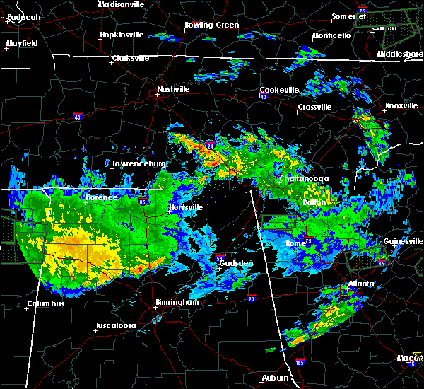 At 1113 am cdt, a severe thunderstorm was located near estill springs, or 7 miles northeast of winchester, moving east at 30 mph (radar indicated). Hazards include 60 mph wind gusts. Expect damage to roofs. Siding and trees. At 1113 am cdt, a severe thunderstorm was located near estill springs, or 7 miles northeast of winchester, moving east at 30 mph (radar indicated). Hazards include 60 mph wind gusts. Expect damage to roofs. Siding and trees.
|
| 6/16/2015 9:42 PM CDT | The severe thunderstorm warning for northeastern franklin county will expire at 945 pm cdt, the storm which prompted the warning has weakened below severe limits, and no longer pose an immediate threat to life or property. therefore the warning will be allowed to expire. however heavy rain is still possible with this thunderstorm. |
| 6/16/2015 9:21 PM CDT |
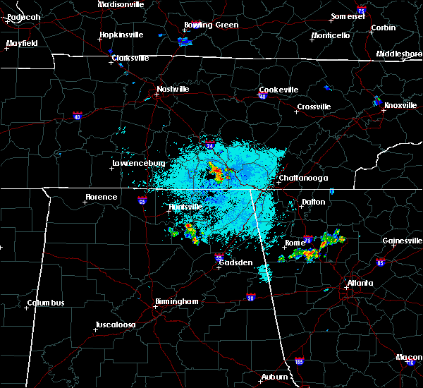 At 921 pm cdt, a severe thunderstorm was located over sewanee, or 7 miles east of winchester, moving northeast at 5 mph (radar indicated). Hazards include 60 mph wind gusts. Expect damage to roofs. Siding and trees. At 921 pm cdt, a severe thunderstorm was located over sewanee, or 7 miles east of winchester, moving northeast at 5 mph (radar indicated). Hazards include 60 mph wind gusts. Expect damage to roofs. Siding and trees.
|
| 4/22/2015 6:58 PM CDT | Power outages in winchester. estimated max wind speed from observer was 30 mp in franklin county TN, 0.8 miles NW of Winchester, TN |
| 4/20/2015 3:26 AM CDT | Tree across maysville road south of wincheste in franklin county TN, 0.8 miles NW of Winchester, TN |
| 4/20/2015 2:38 AM CDT | At 238 am cdt, severe thunderstorms were located along a line extending from near decherd to 11 miles southeast of huntland, moving east at 50 mph (radar indicated). Hazards include 60 mph wind gusts and penny size hail. Expect damage to roofs. siding and trees. these severe storms will be near, monteagle and sewanee around 245 am cdt. other locations impacted by these severe thunderstorms include alto, anderson, sherwood, arnold afb, st. andrews and woods reservoir. 0. 75in. |
| 4/20/2015 2:15 AM CDT | At 214 am cdt, severe thunderstorms were located along a line extending from lynchburg to 6 miles north of new market, moving east at 45 mph (radar indicated). Hazards include 60 mph wind gusts and penny size hail. Expect damage to roofs. siding and trees. severe thunderstorms will be near, estill springs, huntland and tims ford lake around 230 am cdt. winchester and decherd around 235 am cdt. monteagle and sewanee around 250 am cdt. other locations impacted by these severe thunderstorms include belvidere, st. andrews, maxwell, harmony, alto, anderson, sherwood, arnold afb, beans creek and lexie crossroads. 0. 75in. |
| 4/3/2015 8:21 PM CDT | The severe thunderstorm warning for southeastern franklin county will expire at 830 pm cdt. the storm which prompted the warning has moved out of franklin county tennessee. Therefore the warning will be allowed to expire. |
| 4/3/2015 8:02 PM CDT | The national weather service in huntsville has issued a * severe thunderstorm warning for. southeastern franklin county in middle tennessee. until 830 pm cdt * at 802 pm cdt. a severe thunderstorm was located near sewanee. or 12 miles east of winchester. Moving southeast at 45 mph. |
| 4/3/2015 7:42 PM CDT | The severe thunderstorm warning for western franklin and moore counties will expire at 745 pm cdt. the storm which prompted the warning has weakened below severe limits. and no longer pose an immediate threat to life or property. therefore the warning will be allowed to expire. However gusty winds are still possible with this thunderstorm. |
| 4/3/2015 7:33 PM CDT | A severe thunderstorm warning remains in effect until 745 pm cdt for western franklin and moore counties. at 730 pm cdt. a severe thunderstorm was located near lynchburg. moving southeast at 50 mph. hazard. 60 mph wind gusts and quarter size hail. source. Radar indicated. |
| 4/3/2015 7:17 PM CDT | The national weather service in huntsville has issued a * severe thunderstorm warning for. northeastern lincoln county in middle tennessee. western franklin county in middle tennessee. moore county in middle tennessee. Until 745 pm cdt. |
| 8/20/2014 4:57 PM CDT | Tree down on jefferson street in franklin county TN, 0.8 miles NW of Winchester, TN |
| 8/8/2014 4:19 PM CDT | Trees down south of winchester in franklin county TN, 6.8 miles N of Winchester, TN |
| 8/8/2014 4:19 PM CDT | Trees down on iron gap roa in franklin county TN, 7.5 miles N of Winchester, TN |
| 12/21/2013 12:15 AM CST | One tree down on highway 41a 2.5 blocks east of courthous in franklin county TN, 0.8 miles NW of Winchester, TN |
| 7/10/2013 8:53 PM CDT | Tree of unknown size and type reported down near the intersection of 12th avenue and north high stree in franklin county TN, 0.8 miles NW of Winchester, TN |
| 6/9/2013 6:09 PM CDT | ...possible tornado...franklin county ema reported trees down of unknown size near and along the intersection of old estill springs road and luttrell road. one home suf in franklin county TN, 2.2 miles SSE of Winchester, TN |
| 4/19/2013 2:32 AM CDT | A tree was blown down on row gap roa in franklin county TN, 4.8 miles N of Winchester, TN |
| 4/19/2013 2:29 AM CDT | A tree was blown down at the intersection of owl road and belvidere roa in franklin county TN, 5.8 miles NE of Winchester, TN |
| 8/17/2012 12:21 AM CDT | Trees and powerlines downed in wicheste in franklin county TN, 0.8 miles NW of Winchester, TN |
| 8/17/2012 12:21 AM CDT | Trees and powerlines downed in wincheste in franklin county TN, 0.8 miles NW of Winchester, TN |
| 7/10/2012 1:40 PM CDT | A tree was blown down. time estimated from rada in franklin county TN, 0.8 miles NW of Winchester, TN |
| 7/5/2012 7:20 PM CDT | Tree damage around winchester. time estimate in franklin county TN, 0.8 miles NW of Winchester, TN |
| 1/1/0001 12:00 AM | Quarter sized hail reported 1.9 miles ENE of Winchester, TN, quarter size hail was reported. |
| 1/1/0001 12:00 AM | A tree was knocked down onto power lines at a residence on crestview driv in franklin county TN, 2.1 miles NNW of Winchester, TN |
| 1/1/0001 12:00 AM | Tin roofs on two barns were partial unroofed near city par in franklin county TN, 1 miles SE of Winchester, TN |
| 1/1/0001 12:00 AM | Eight power poles were blown into a nearby lake in decher in franklin county TN, 1 miles SE of Winchester, TN |
| 1/1/0001 12:00 AM | Quarter sized hail reported 3.2 miles SSW of Winchester, TN |
| 1/1/0001 12:00 AM | Multiple trees were knocked down on streets in the city of winchester. time estimated by rada in franklin county TN, 0.8 miles NW of Winchester, TN |
| 1/1/0001 12:00 AM | Quarter sized hail reported 0.8 miles NW of Winchester, TN, franklin county park |
| 1/1/0001 12:00 AM | Wall cloud reporte in franklin county TN, 0.8 miles NW of Winchester, TN |
Hail Maps for Winchester, TN


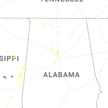

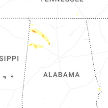


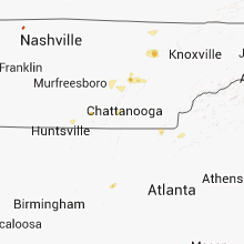


Connect with Interactive Hail Maps