

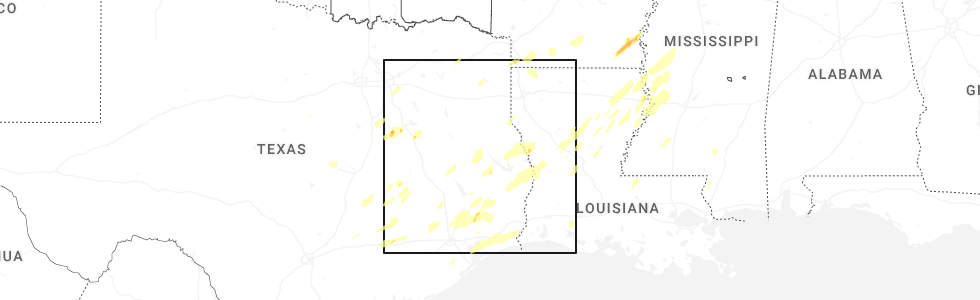
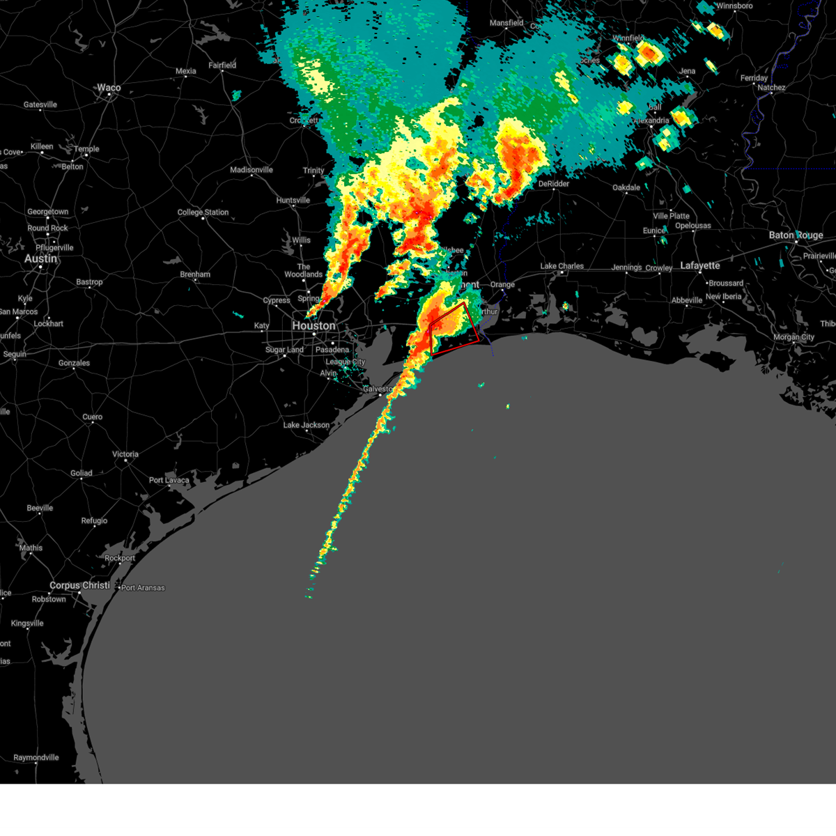
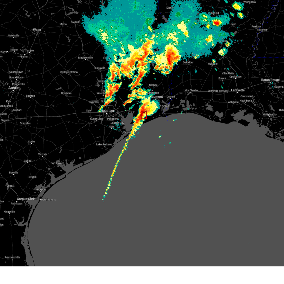
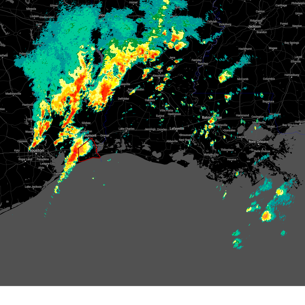
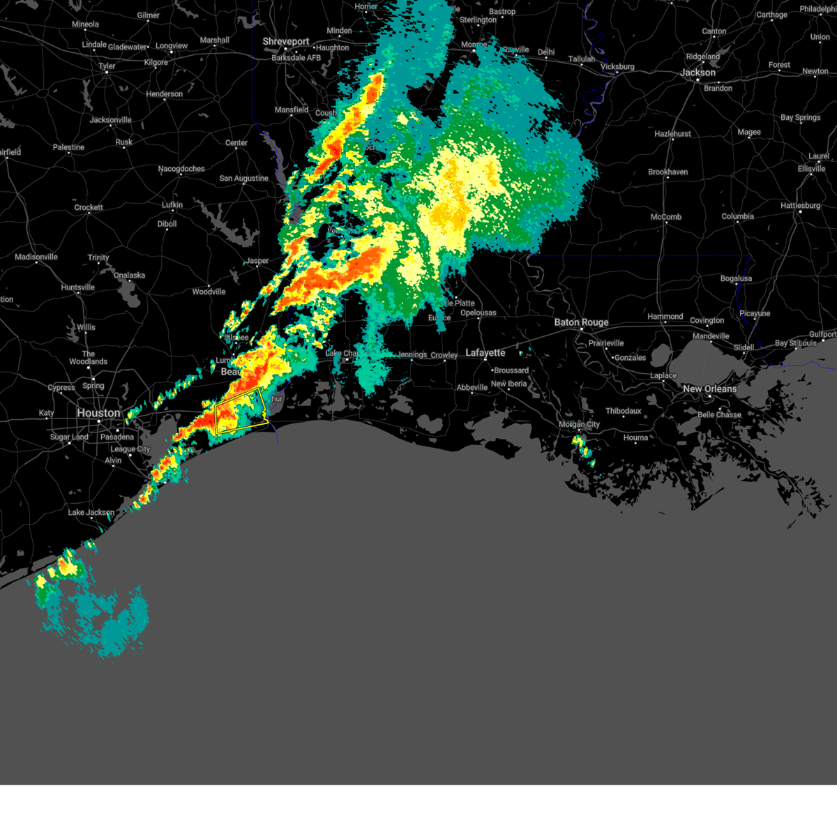
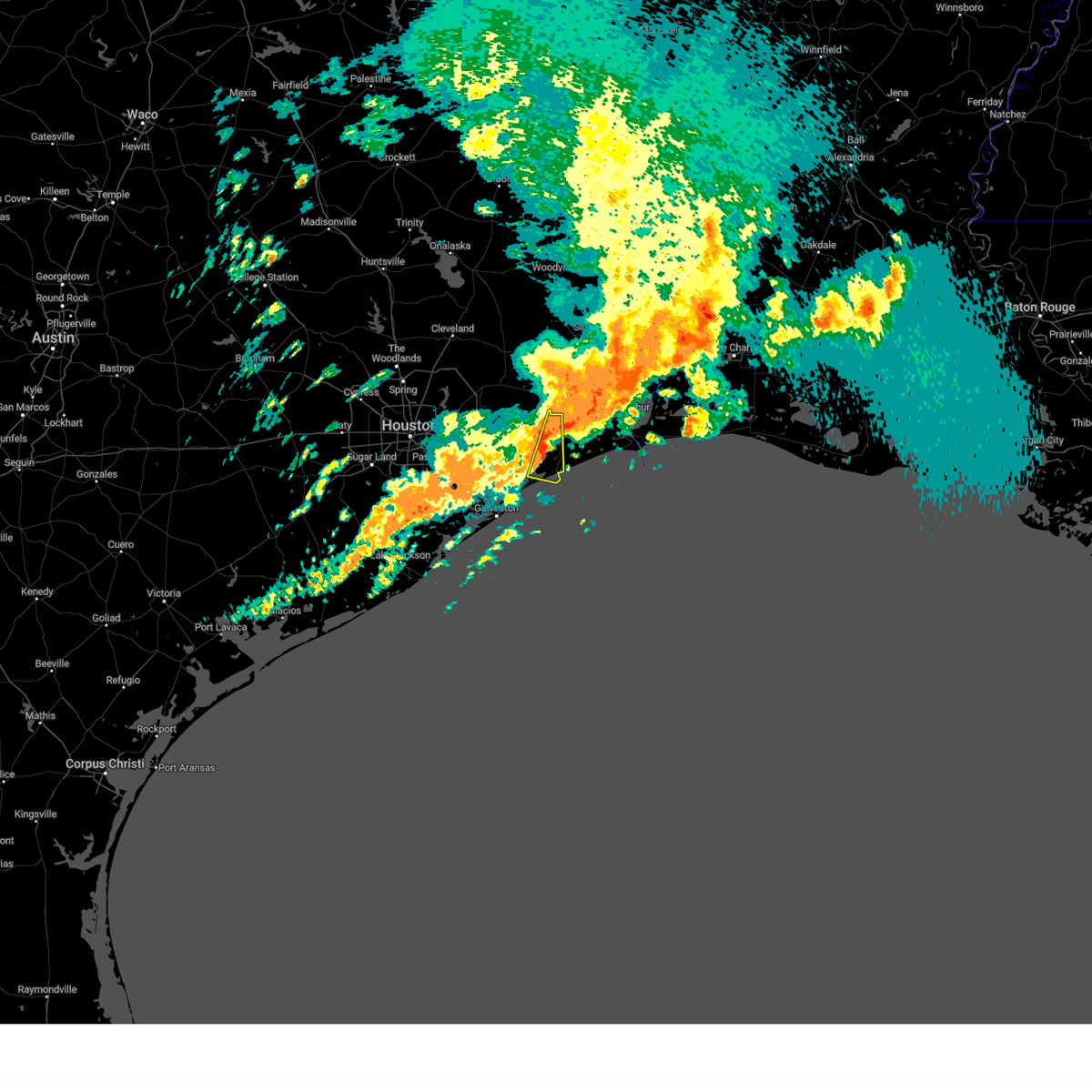
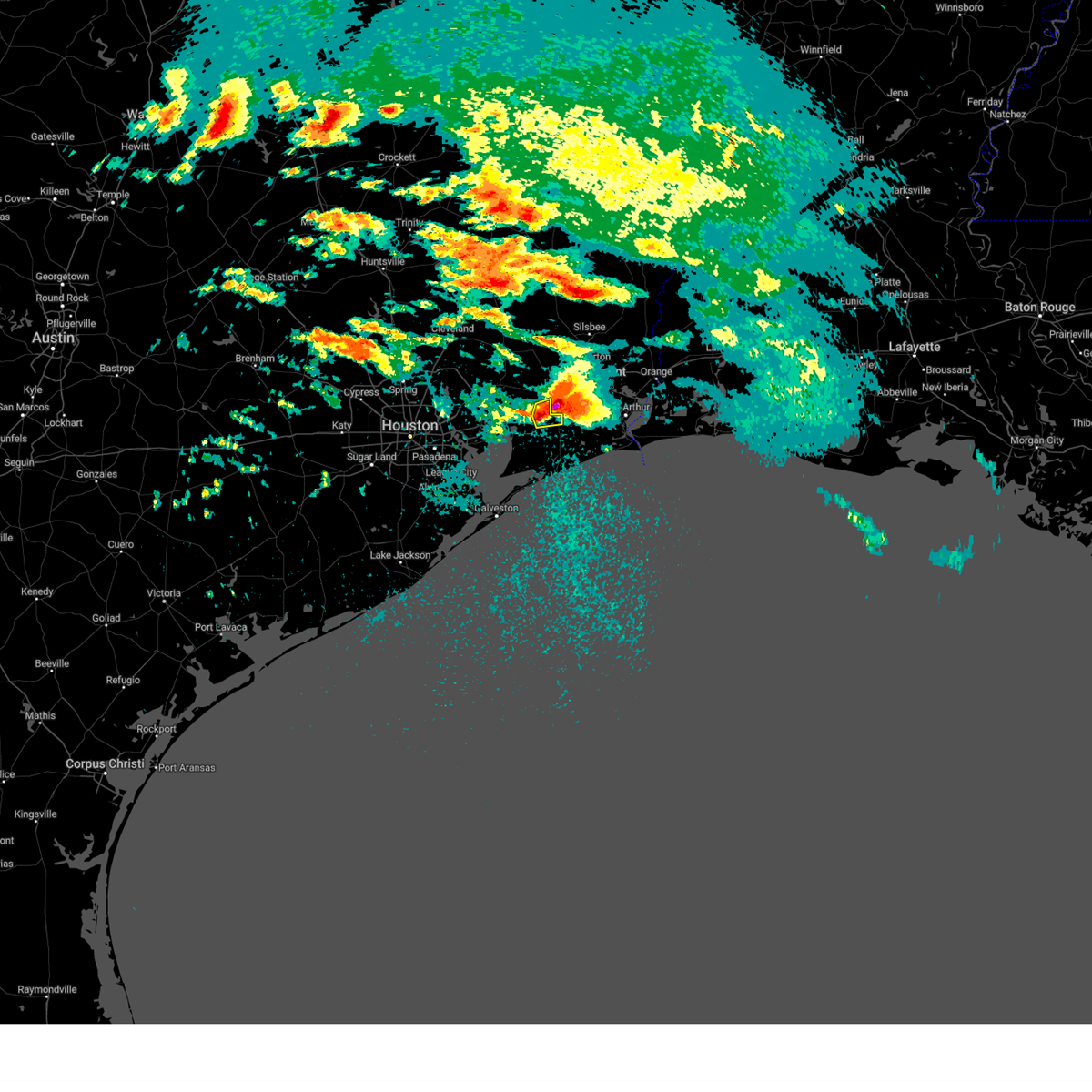
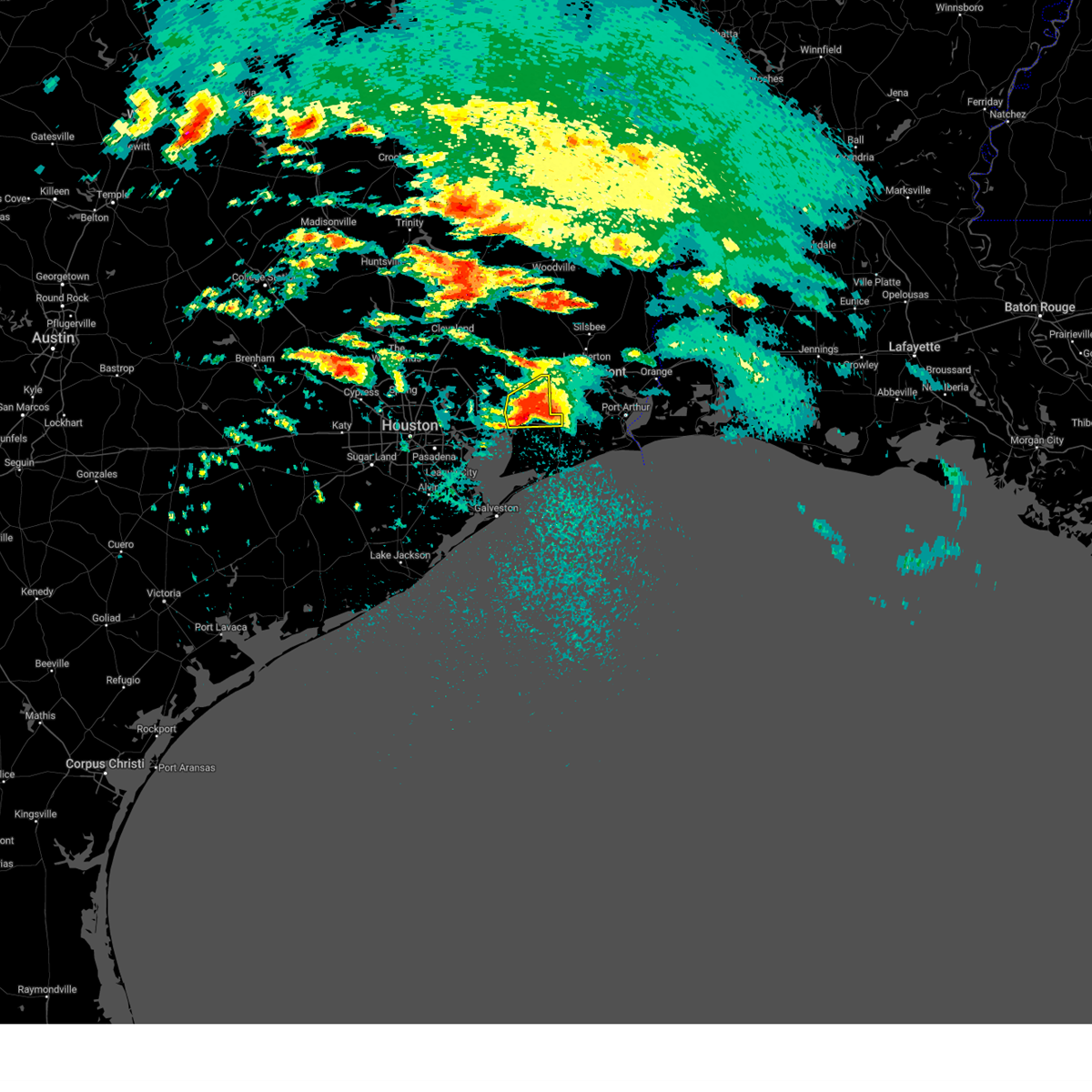
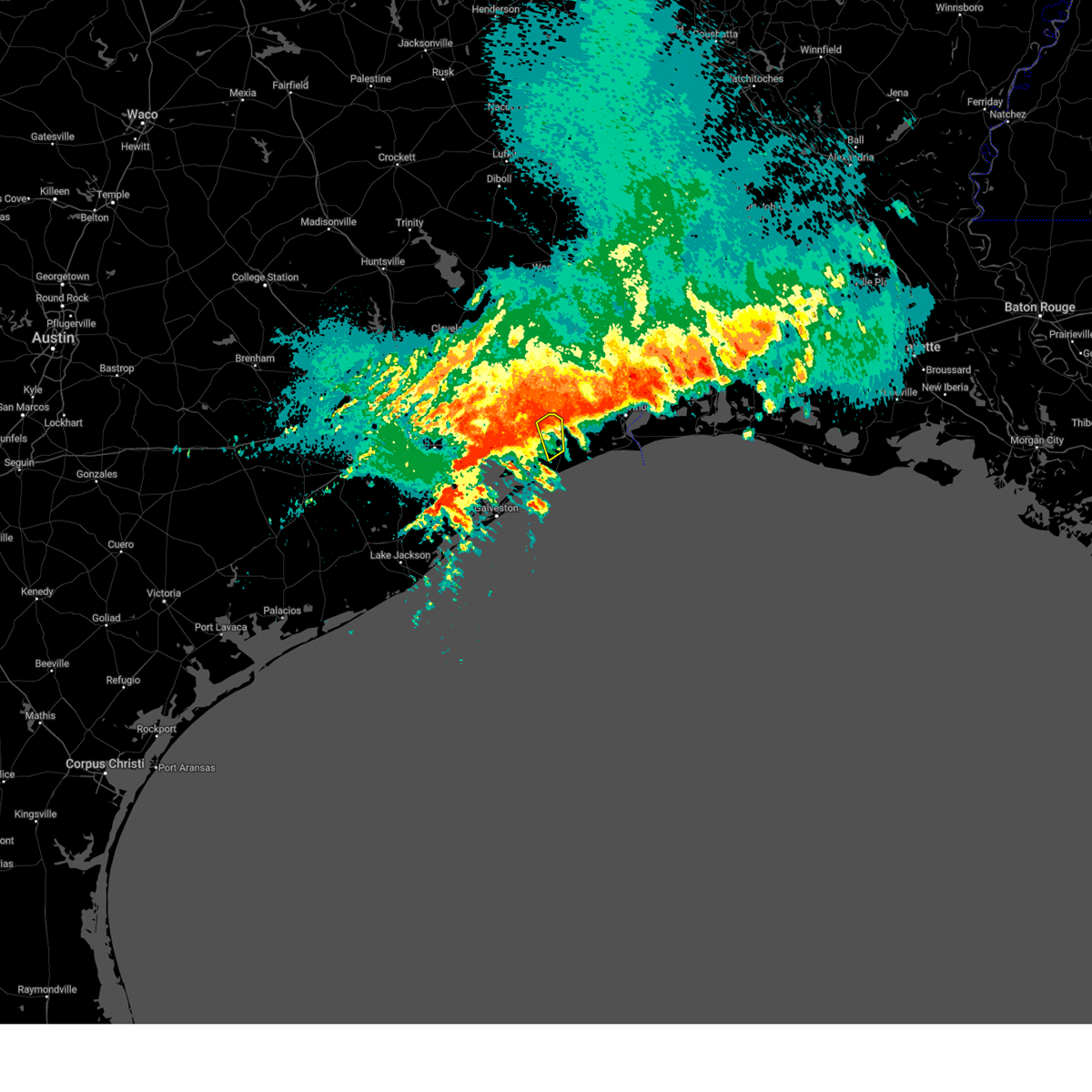
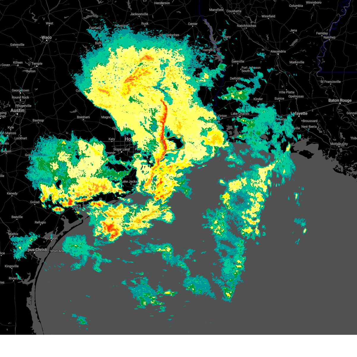
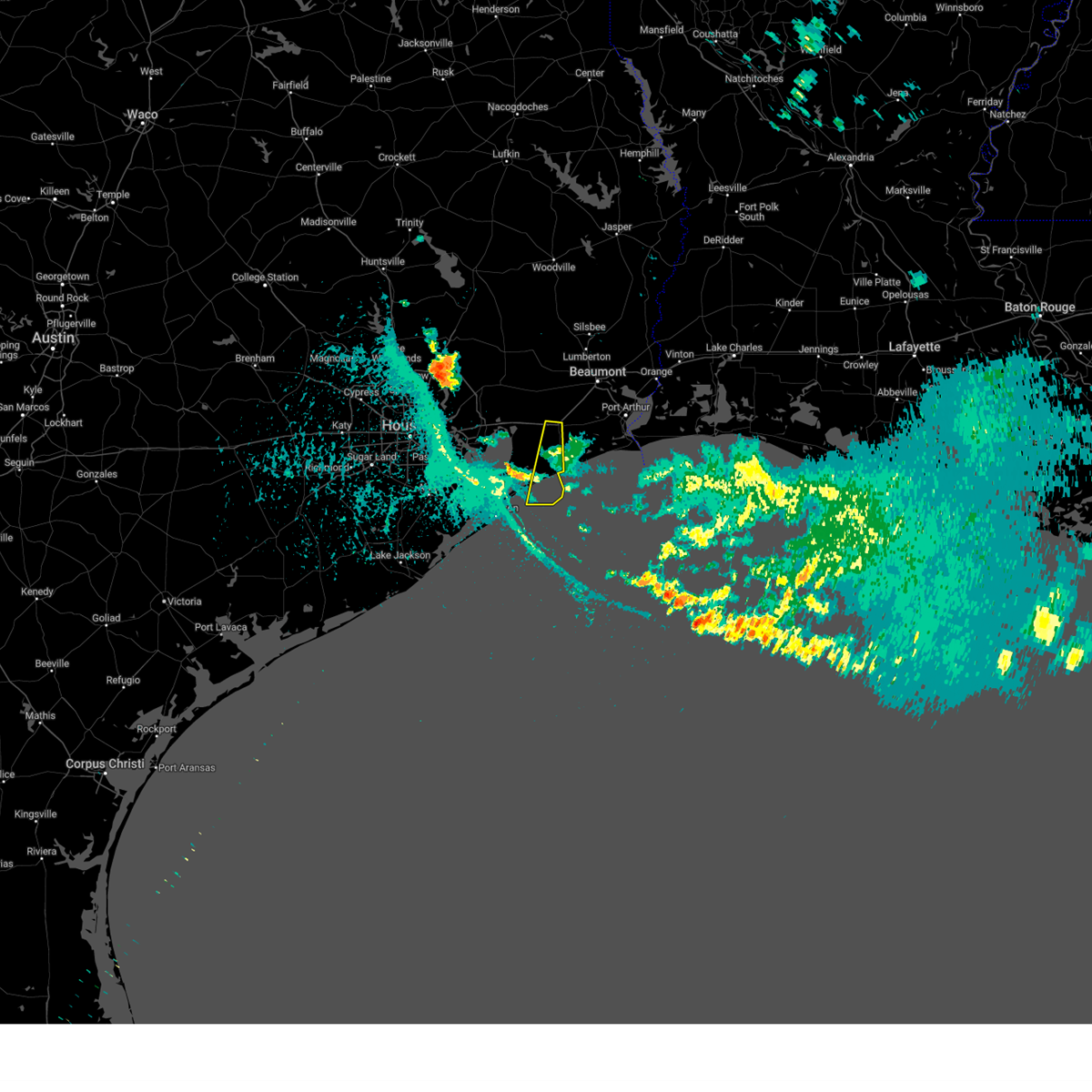
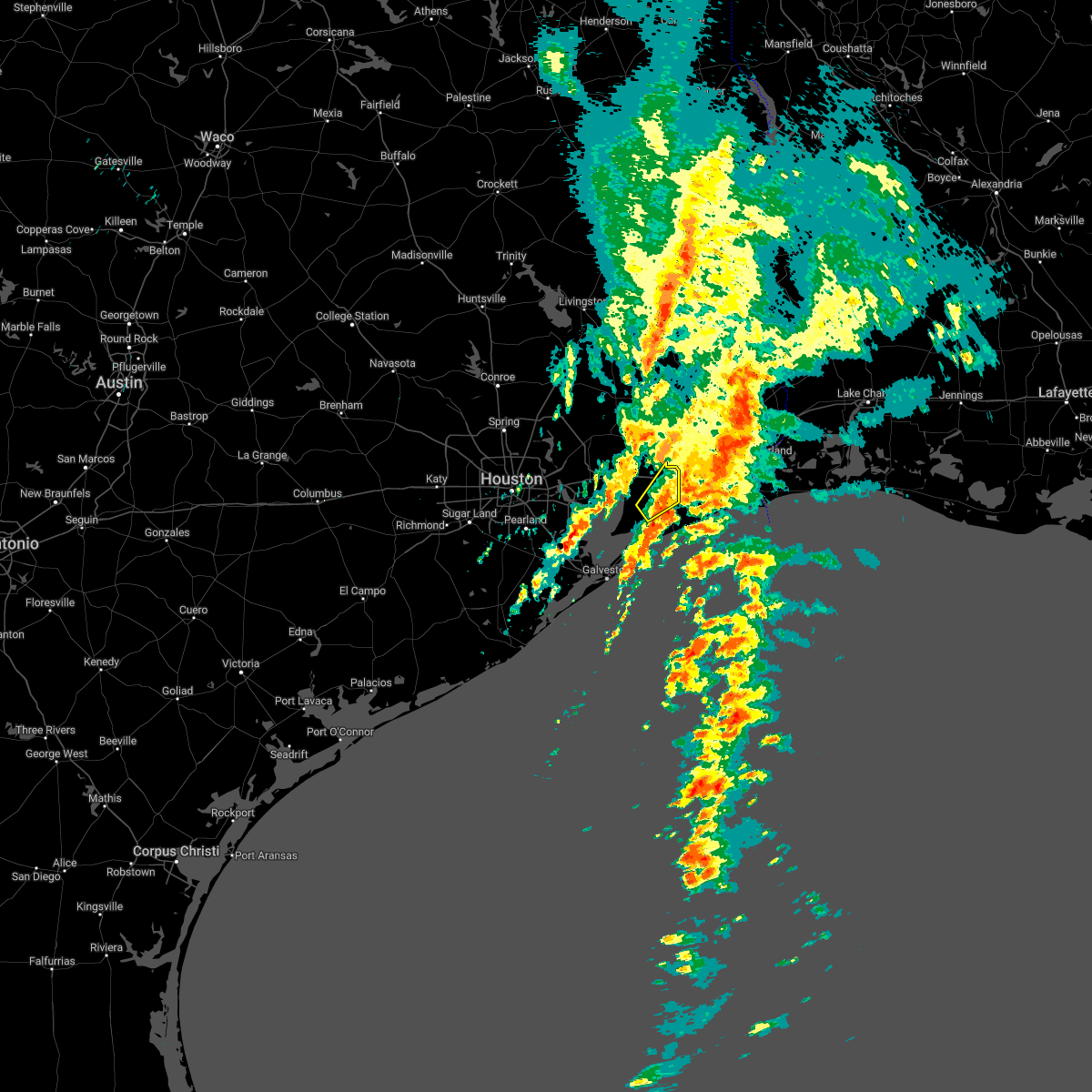
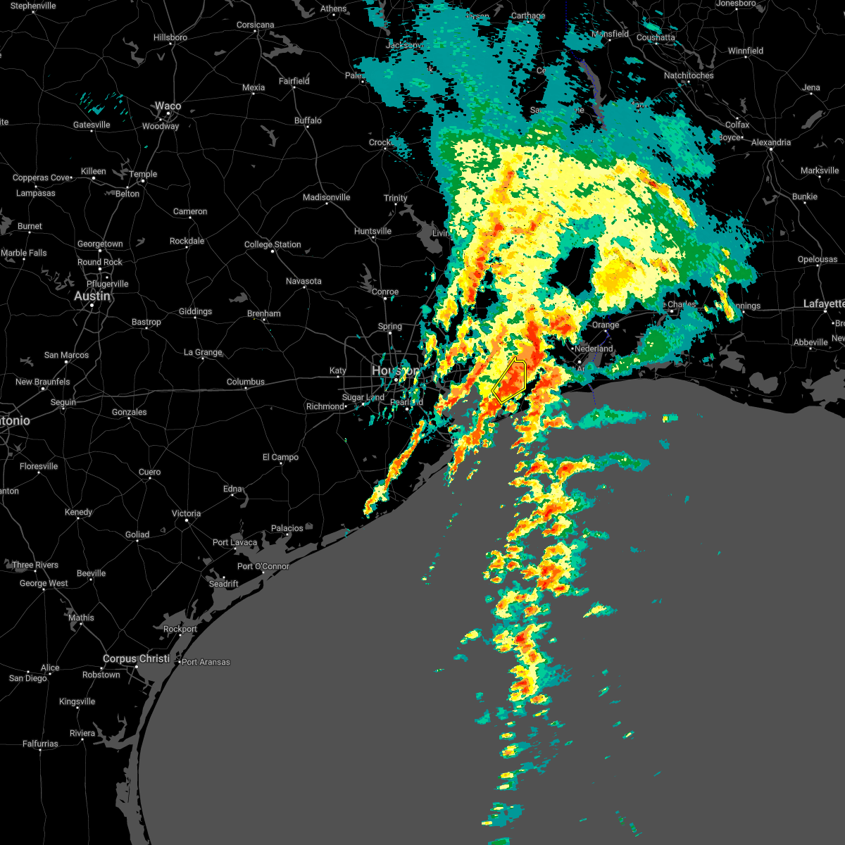
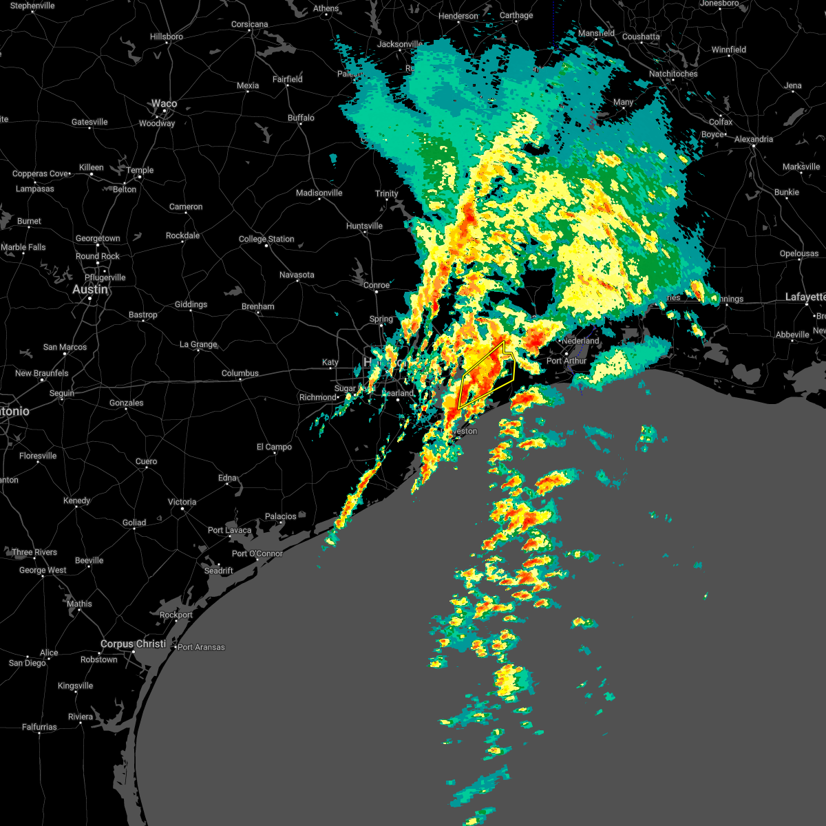
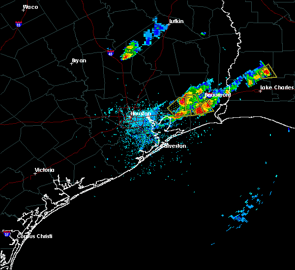
Hail Map for Winnie, TX
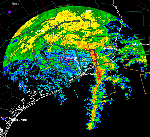
The Winnie, TX area has had 3 reports of on-the-ground hail by trained spotters, and has been under severe weather warnings 9 times during the past 12 months. Doppler radar has detected hail at or near Winnie, TX on 44 occasions, including 2 occasions during the past year.
| Name: | Winnie, TX |
| Where Located: | 43.4 miles WSW of Beaumont, TX |
| Map: | Google Map for Winnie, TX |
| Population: | 3254 |
| Housing Units: | 1261 |
| More Info: | Search Google for Winnie, TX |
2
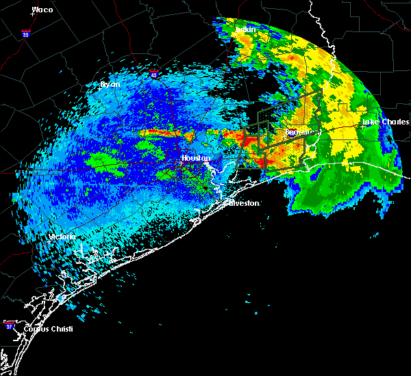
The Top Recent Hail Date for Winnie, TX is Saturday, December 28, 2024 (4th out of 44)
Hail and Wind Damage Spotted near Winnie, TX
| Date / Time | Report Details |
|---|---|
| 5/27/2025 1:20 AM CDT |
 Svrhgx the national weather service in league city has issued a * severe thunderstorm warning for, galveston county in southeastern texas, chambers county in southeastern texas, northeastern brazoria county in southeastern texas, southeastern liberty county in southeastern texas, southeastern harris county in southeastern texas, * until 215 am cdt. * at 119 am cdt, severe thunderstorms were located along a line extending from near devers to near alvin, moving east southeast at around 40 mph (radar indicated). Hazards include 60 mph wind gusts. expect damage to roofs, siding, and trees Svrhgx the national weather service in league city has issued a * severe thunderstorm warning for, galveston county in southeastern texas, chambers county in southeastern texas, northeastern brazoria county in southeastern texas, southeastern liberty county in southeastern texas, southeastern harris county in southeastern texas, * until 215 am cdt. * at 119 am cdt, severe thunderstorms were located along a line extending from near devers to near alvin, moving east southeast at around 40 mph (radar indicated). Hazards include 60 mph wind gusts. expect damage to roofs, siding, and trees
|
| 5/2/2025 8:50 PM CDT |
 Svrlch the national weather service in lake charles has issued a * severe thunderstorm warning for, central jefferson county in southeastern texas, southwestern orange county in southeastern texas, * until 930 pm cdt. * at 850 pm cdt, a severe thunderstorm was located near fannett, or 7 miles northeast of hamshire, moving east at 35 mph (radar indicated). Hazards include 60 mph wind gusts and penny size hail. expect damage to roofs, siding, and trees Svrlch the national weather service in lake charles has issued a * severe thunderstorm warning for, central jefferson county in southeastern texas, southwestern orange county in southeastern texas, * until 930 pm cdt. * at 850 pm cdt, a severe thunderstorm was located near fannett, or 7 miles northeast of hamshire, moving east at 35 mph (radar indicated). Hazards include 60 mph wind gusts and penny size hail. expect damage to roofs, siding, and trees
|
| 3/24/2025 3:56 AM CDT |
 Svrlch the national weather service in lake charles has issued a * severe thunderstorm warning for, jefferson county in southeastern texas, southern orange county in southeastern texas, * until 445 am cdt. * at 356 am cdt, severe thunderstorms were located along a line extending from near hamshire to near rollover pass, moving east at 45 mph (radar indicated). Hazards include 60 mph wind gusts and nickel size hail. expect damage to roofs, siding, and trees Svrlch the national weather service in lake charles has issued a * severe thunderstorm warning for, jefferson county in southeastern texas, southern orange county in southeastern texas, * until 445 am cdt. * at 356 am cdt, severe thunderstorms were located along a line extending from near hamshire to near rollover pass, moving east at 45 mph (radar indicated). Hazards include 60 mph wind gusts and nickel size hail. expect damage to roofs, siding, and trees
|
| 12/28/2024 3:12 PM CST |
 The storm which prompted the warning has moved out of the area. therefore, the warning will be allowed to expire. a tornado watch remains in effect until 500 pm cst for southeastern texas. The storm which prompted the warning has moved out of the area. therefore, the warning will be allowed to expire. a tornado watch remains in effect until 500 pm cst for southeastern texas.
|
| 12/28/2024 3:09 PM CST |
 At 308 pm cst, a confirmed large and extremely dangerous tornado was located near stowell, or 11 miles south of hamshire, moving northeast at 30 mph. this is a particularly dangerous situation. take cover now! (radar confirmed tornado). Hazards include damaging tornado. You are in a life-threatening situation. flying debris may be deadly to those caught without shelter. mobile homes will be destroyed. considerable damage to homes, businesses, and vehicles is likely and complete destruction is possible. the tornado will be near, la belle around 330 pm cst. port arthur around 340 pm cst. Other locations impacted by this tornadic thunderstorm include sea rim state park. At 308 pm cst, a confirmed large and extremely dangerous tornado was located near stowell, or 11 miles south of hamshire, moving northeast at 30 mph. this is a particularly dangerous situation. take cover now! (radar confirmed tornado). Hazards include damaging tornado. You are in a life-threatening situation. flying debris may be deadly to those caught without shelter. mobile homes will be destroyed. considerable damage to homes, businesses, and vehicles is likely and complete destruction is possible. the tornado will be near, la belle around 330 pm cst. port arthur around 340 pm cst. Other locations impacted by this tornadic thunderstorm include sea rim state park.
|
| 12/28/2024 3:00 PM CST |
 At 259 pm cst, a confirmed large and extremely dangerous tornado was located 7 miles southwest of stowell, or 13 miles southwest of hamshire, moving east at 35 mph. this is a particularly dangerous situation. take cover now! (radar confirmed tornado). Hazards include damaging tornado. You are in a life-threatening situation. flying debris may be deadly to those caught without shelter. mobile homes will be destroyed. considerable damage to homes, businesses, and vehicles is likely and complete destruction is possible. The tornado will be near, winnie and stowell around 305 pm cst. At 259 pm cst, a confirmed large and extremely dangerous tornado was located 7 miles southwest of stowell, or 13 miles southwest of hamshire, moving east at 35 mph. this is a particularly dangerous situation. take cover now! (radar confirmed tornado). Hazards include damaging tornado. You are in a life-threatening situation. flying debris may be deadly to those caught without shelter. mobile homes will be destroyed. considerable damage to homes, businesses, and vehicles is likely and complete destruction is possible. The tornado will be near, winnie and stowell around 305 pm cst.
|
| 12/28/2024 2:58 PM CST |
 Torlch the national weather service in lake charles has issued a * tornado warning for, jefferson county in southeastern texas, * until 345 pm cst. * at 257 pm cst, a large and extremely dangerous tornado was located near stowell, or 12 miles southwest of hamshire, moving east at 50 mph. this is a particularly dangerous situation. take cover now! (radar indicated rotation). Hazards include damaging tornado. You are in a life-threatening situation. flying debris may be deadly to those caught without shelter. mobile homes will be destroyed. considerable damage to homes, businesses, and vehicles is likely and complete destruction is possible. the tornado will be near, hamshire around 305 pm cst. la belle around 310 pm cst. port arthur around 315 pm cst. port acres around 320 pm cst. nederland, southeast texas regional airport, and port neches around 325 pm cst. other locations impacted by this tornadic thunderstorm include sea rim state park. This includes interstate 10 in texas between mile markers 838 and 832. Torlch the national weather service in lake charles has issued a * tornado warning for, jefferson county in southeastern texas, * until 345 pm cst. * at 257 pm cst, a large and extremely dangerous tornado was located near stowell, or 12 miles southwest of hamshire, moving east at 50 mph. this is a particularly dangerous situation. take cover now! (radar indicated rotation). Hazards include damaging tornado. You are in a life-threatening situation. flying debris may be deadly to those caught without shelter. mobile homes will be destroyed. considerable damage to homes, businesses, and vehicles is likely and complete destruction is possible. the tornado will be near, hamshire around 305 pm cst. la belle around 310 pm cst. port arthur around 315 pm cst. port acres around 320 pm cst. nederland, southeast texas regional airport, and port neches around 325 pm cst. other locations impacted by this tornadic thunderstorm include sea rim state park. This includes interstate 10 in texas between mile markers 838 and 832.
|
| 12/28/2024 2:47 PM CST | Torhgx the national weather service in league city has issued a * tornado warning for, southeastern chambers county in southeastern texas, * until 315 pm cst. * at 246 pm cst, a tornado producing storm was located 10 miles north of rollover pass, or 18 miles east of beach city, moving east at 35 mph (radar confirmed tornado). Hazards include damaging tornado. Flying debris will be dangerous to those caught without shelter. mobile homes will be damaged or destroyed. damage to roofs, windows, and vehicles will occur. tree damage is likely. this tornadic storm will be near, stowell around 255 pm cst. Winnie around 305 pm cst. |
| 12/26/2024 7:30 PM CST |
 Svrlch the national weather service in lake charles has issued a * severe thunderstorm warning for, central jefferson county in southeastern texas, * until 815 pm cst. * at 730 pm cst, a severe thunderstorm was located over stowell, or 7 miles southwest of hamshire, moving east at 30 mph (radar indicated). Hazards include 60 mph wind gusts. expect damage to roofs, siding, and trees Svrlch the national weather service in lake charles has issued a * severe thunderstorm warning for, central jefferson county in southeastern texas, * until 815 pm cst. * at 730 pm cst, a severe thunderstorm was located over stowell, or 7 miles southwest of hamshire, moving east at 30 mph (radar indicated). Hazards include 60 mph wind gusts. expect damage to roofs, siding, and trees
|
| 7/8/2024 10:36 AM CDT |
 Torlch the national weather service in lake charles has issued a * tornado warning for, northwestern jefferson county in southeastern texas, south central hardin county in southeastern texas, * until 1100 am cdt. * at 1035 am cdt, a severe thunderstorm capable of producing a tornado was located over hamshire, moving north at 75 mph (radar indicated rotation). Hazards include tornado. Flying debris will be dangerous to those caught without shelter. mobile homes will be damaged or destroyed. damage to roofs, windows, and vehicles will occur. tree damage is likely. this dangerous storm will be near, beaumont, nome, and china around 1040 am cdt. sour lake and bevil oaks around 1045 am cdt. This includes interstate 10 in texas between mile markers 839 and 832. Torlch the national weather service in lake charles has issued a * tornado warning for, northwestern jefferson county in southeastern texas, south central hardin county in southeastern texas, * until 1100 am cdt. * at 1035 am cdt, a severe thunderstorm capable of producing a tornado was located over hamshire, moving north at 75 mph (radar indicated rotation). Hazards include tornado. Flying debris will be dangerous to those caught without shelter. mobile homes will be damaged or destroyed. damage to roofs, windows, and vehicles will occur. tree damage is likely. this dangerous storm will be near, beaumont, nome, and china around 1040 am cdt. sour lake and bevil oaks around 1045 am cdt. This includes interstate 10 in texas between mile markers 839 and 832.
|
| 5/31/2024 7:55 AM CDT |
 Svrhgx the national weather service in league city has issued a * severe thunderstorm warning for, northeastern galveston county in southeastern texas, chambers county in southeastern texas, southeastern liberty county in southeastern texas, * until 900 am cdt. * at 754 am cdt, severe thunderstorms were located along a line extending from near hardin to 7 miles east of old river-winfree to near smith point, moving northeast at 25 mph (radar indicated). Hazards include 60 mph wind gusts. expect damage to roofs, siding, and trees Svrhgx the national weather service in league city has issued a * severe thunderstorm warning for, northeastern galveston county in southeastern texas, chambers county in southeastern texas, southeastern liberty county in southeastern texas, * until 900 am cdt. * at 754 am cdt, severe thunderstorms were located along a line extending from near hardin to 7 miles east of old river-winfree to near smith point, moving northeast at 25 mph (radar indicated). Hazards include 60 mph wind gusts. expect damage to roofs, siding, and trees
|
| 5/28/2024 1:37 PM CDT |
 Svrlch the national weather service in lake charles has issued a * severe thunderstorm warning for, jefferson county in southeastern texas, southeastern tyler county in southeastern texas, southwestern newton county in southeastern texas, hardin county in southeastern texas, orange county in southeastern texas, southeastern jasper county in southeastern texas, * until 215 pm cdt. * at 136 pm cdt, severe thunderstorms were located along a line extending from 6 miles southwest of spurger to near kountze to hardin, moving southeast at 35 mph (radar indicated). Hazards include 60 mph wind gusts and quarter size hail. Hail damage to vehicles is expected. Expect wind damage to roofs, siding, and trees. Svrlch the national weather service in lake charles has issued a * severe thunderstorm warning for, jefferson county in southeastern texas, southeastern tyler county in southeastern texas, southwestern newton county in southeastern texas, hardin county in southeastern texas, orange county in southeastern texas, southeastern jasper county in southeastern texas, * until 215 pm cdt. * at 136 pm cdt, severe thunderstorms were located along a line extending from 6 miles southwest of spurger to near kountze to hardin, moving southeast at 35 mph (radar indicated). Hazards include 60 mph wind gusts and quarter size hail. Hail damage to vehicles is expected. Expect wind damage to roofs, siding, and trees.
|
| 5/28/2024 1:22 PM CDT |
 At 122 pm cdt, severe thunderstorms were located along a line extending from 7 miles north of hardin to east little york / homestead to westchase, moving southeast at 50 mph (radar indicated). Hazards include 70 mph wind gusts and quarter size hail. Hail damage to vehicles is expected. expect considerable tree damage. wind damage is also likely to mobile homes, roofs, and outbuildings. Locations impacted include, pasadena, pearland, league city, northeastern sugar land, baytown, missouri city, texas city, friendswood, la porte, deer park, alvin, dickinson, stafford, south houston, bellaire, humble, west university place, la marque, santa fe, and seabrook. At 122 pm cdt, severe thunderstorms were located along a line extending from 7 miles north of hardin to east little york / homestead to westchase, moving southeast at 50 mph (radar indicated). Hazards include 70 mph wind gusts and quarter size hail. Hail damage to vehicles is expected. expect considerable tree damage. wind damage is also likely to mobile homes, roofs, and outbuildings. Locations impacted include, pasadena, pearland, league city, northeastern sugar land, baytown, missouri city, texas city, friendswood, la porte, deer park, alvin, dickinson, stafford, south houston, bellaire, humble, west university place, la marque, santa fe, and seabrook.
|
| 5/28/2024 1:14 PM CDT |
 Svrhgx the national weather service in league city has issued a * severe thunderstorm warning for, northwestern galveston county in southeastern texas, northeastern fort bend county in southeastern texas, northeastern brazoria county in southeastern texas, chambers county in southeastern texas, liberty county in southeastern texas, eastern harris county in southeastern texas, * until 200 pm cdt. * at 114 pm cdt, severe thunderstorms were located along a line extending from 11 miles north of dayton lakes to aldine to near addicks park ten, moving southeast at 50 mph (radar indicated). Hazards include 60 mph wind gusts and quarter size hail. Hail damage to vehicles is expected. Expect wind damage to roofs, siding, and trees. Svrhgx the national weather service in league city has issued a * severe thunderstorm warning for, northwestern galveston county in southeastern texas, northeastern fort bend county in southeastern texas, northeastern brazoria county in southeastern texas, chambers county in southeastern texas, liberty county in southeastern texas, eastern harris county in southeastern texas, * until 200 pm cdt. * at 114 pm cdt, severe thunderstorms were located along a line extending from 11 miles north of dayton lakes to aldine to near addicks park ten, moving southeast at 50 mph (radar indicated). Hazards include 60 mph wind gusts and quarter size hail. Hail damage to vehicles is expected. Expect wind damage to roofs, siding, and trees.
|
| 5/16/2024 7:45 PM CDT |
 Svrhgx the national weather service in league city has issued a * severe thunderstorm warning for, northeastern galveston county in southeastern texas, eastern chambers county in southeastern texas, southeastern liberty county in southeastern texas, * until 800 pm cdt. * at 745 pm cdt, severe thunderstorms were located along a line extending from hamshire to 6 miles south of stowell to near gilchrist, moving east at 40 mph (radar indicated). Hazards include 60 mph wind gusts. expect damage to roofs, siding, and trees Svrhgx the national weather service in league city has issued a * severe thunderstorm warning for, northeastern galveston county in southeastern texas, eastern chambers county in southeastern texas, southeastern liberty county in southeastern texas, * until 800 pm cdt. * at 745 pm cdt, severe thunderstorms were located along a line extending from hamshire to 6 miles south of stowell to near gilchrist, moving east at 40 mph (radar indicated). Hazards include 60 mph wind gusts. expect damage to roofs, siding, and trees
|
| 5/16/2024 7:16 PM CDT |
 Svrhgx the national weather service in league city has issued a * severe thunderstorm warning for, northeastern galveston county in southeastern texas, chambers county in southeastern texas, southeastern liberty county in southeastern texas, * until 745 pm cdt. * at 716 pm cdt, severe thunderstorms were located along a line extending from 6 miles southeast of devers to near anahuac to near san leon, moving east at 65 mph (radar indicated). Hazards include 70 mph wind gusts. Expect considerable tree damage. Damage is likely to mobile homes, roofs, and outbuildings. Svrhgx the national weather service in league city has issued a * severe thunderstorm warning for, northeastern galveston county in southeastern texas, chambers county in southeastern texas, southeastern liberty county in southeastern texas, * until 745 pm cdt. * at 716 pm cdt, severe thunderstorms were located along a line extending from 6 miles southeast of devers to near anahuac to near san leon, moving east at 65 mph (radar indicated). Hazards include 70 mph wind gusts. Expect considerable tree damage. Damage is likely to mobile homes, roofs, and outbuildings.
|
| 5/13/2024 4:13 PM CDT |
 The storm which prompted the warning has weakened below severe limits, and has exited the warned area. therefore, the warning will be allowed to expire. a severe thunderstorm watch remains in effect until 800 pm cdt for southeastern texas. The storm which prompted the warning has weakened below severe limits, and has exited the warned area. therefore, the warning will be allowed to expire. a severe thunderstorm watch remains in effect until 800 pm cdt for southeastern texas.
|
| 5/13/2024 4:03 PM CDT |
 At 403 pm cdt, a severe thunderstorm was located over stowell, or 8 miles southwest of hamshire, moving east at 40 mph (radar indicated). Hazards include 60 mph wind gusts and penny size hail. Expect damage to roofs, siding, and trees. Locations impacted include, winnie and stowell. At 403 pm cdt, a severe thunderstorm was located over stowell, or 8 miles southwest of hamshire, moving east at 40 mph (radar indicated). Hazards include 60 mph wind gusts and penny size hail. Expect damage to roofs, siding, and trees. Locations impacted include, winnie and stowell.
|
| 5/13/2024 3:51 PM CDT |
 Svrlch the national weather service in lake charles has issued a * severe thunderstorm warning for, northwestern cameron parish in southwestern louisiana, jefferson county in southeastern texas, southern orange county in southeastern texas, * until 445 pm cdt. * at 351 pm cdt, severe thunderstorms were located along a line extending from near vidor to 6 miles northwest of high island, moving east at 35 mph (radar indicated). Hazards include 60 mph wind gusts. expect damage to roofs, siding, and trees Svrlch the national weather service in lake charles has issued a * severe thunderstorm warning for, northwestern cameron parish in southwestern louisiana, jefferson county in southeastern texas, southern orange county in southeastern texas, * until 445 pm cdt. * at 351 pm cdt, severe thunderstorms were located along a line extending from near vidor to 6 miles northwest of high island, moving east at 35 mph (radar indicated). Hazards include 60 mph wind gusts. expect damage to roofs, siding, and trees
|
| 5/13/2024 3:48 PM CDT |
 Svrhgx the national weather service in league city has issued a * severe thunderstorm warning for, eastern chambers county in southeastern texas, southeastern liberty county in southeastern texas, * until 415 pm cdt. * at 348 pm cdt, a severe thunderstorm was located 9 miles southwest of stowell, or 15 miles southwest of hamshire, moving east at 40 mph (radar indicated). Hazards include 60 mph wind gusts and quarter size hail. Hail damage to vehicles is expected. Expect wind damage to roofs, siding, and trees. Svrhgx the national weather service in league city has issued a * severe thunderstorm warning for, eastern chambers county in southeastern texas, southeastern liberty county in southeastern texas, * until 415 pm cdt. * at 348 pm cdt, a severe thunderstorm was located 9 miles southwest of stowell, or 15 miles southwest of hamshire, moving east at 40 mph (radar indicated). Hazards include 60 mph wind gusts and quarter size hail. Hail damage to vehicles is expected. Expect wind damage to roofs, siding, and trees.
|
| 5/12/2024 12:56 PM CDT |
 The severe thunderstorm which prompted the warning continues. please see severe number 116 for more information. therefore, the warning will be allowed to expire. a tornado watch remains in effect until 700 pm cdt for southeastern texas. The severe thunderstorm which prompted the warning continues. please see severe number 116 for more information. therefore, the warning will be allowed to expire. a tornado watch remains in effect until 700 pm cdt for southeastern texas.
|
| 5/12/2024 12:40 PM CDT |
 At 1240 pm cdt, a severe thunderstorm was located over fannett, or near hamshire, moving east at 25 mph (radar indicated). Hazards include two inch hail and 60 mph wind gusts. People and animals outdoors will be injured. expect hail damage to roofs, siding, windows, and vehicles. expect wind damage to roofs, siding, and trees. Locations impacted include, beaumont, port arthur, sour lake, nome, hamshire, bevil oaks, china, rose city, lakeview, port acres, fannett, la belle, and southeast texas regional airport. At 1240 pm cdt, a severe thunderstorm was located over fannett, or near hamshire, moving east at 25 mph (radar indicated). Hazards include two inch hail and 60 mph wind gusts. People and animals outdoors will be injured. expect hail damage to roofs, siding, windows, and vehicles. expect wind damage to roofs, siding, and trees. Locations impacted include, beaumont, port arthur, sour lake, nome, hamshire, bevil oaks, china, rose city, lakeview, port acres, fannett, la belle, and southeast texas regional airport.
|
| 5/12/2024 12:29 PM CDT |
 At 1229 pm cdt, a severe thunderstorm was located near winnie, or 7 miles west of hamshire, moving east at 30 mph (radar indicated). Hazards include 60 mph wind gusts and quarter size hail. Hail damage to vehicles is expected. expect wind damage to roofs, siding, and trees. Locations impacted include, winnie. At 1229 pm cdt, a severe thunderstorm was located near winnie, or 7 miles west of hamshire, moving east at 30 mph (radar indicated). Hazards include 60 mph wind gusts and quarter size hail. Hail damage to vehicles is expected. expect wind damage to roofs, siding, and trees. Locations impacted include, winnie.
|
| 5/12/2024 12:25 PM CDT |
 At 1225 pm cdt, a severe thunderstorm was located near hamshire, moving east at 35 mph (radar indicated). Hazards include ping pong ball size hail and 60 mph wind gusts. People and animals outdoors will be injured. expect hail damage to roofs, siding, windows, and vehicles. expect wind damage to roofs, siding, and trees. Locations impacted include, beaumont, port arthur, sour lake, nome, hamshire, bevil oaks, china, rose city, lakeview, port acres, fannett, la belle, and southeast texas regional airport. At 1225 pm cdt, a severe thunderstorm was located near hamshire, moving east at 35 mph (radar indicated). Hazards include ping pong ball size hail and 60 mph wind gusts. People and animals outdoors will be injured. expect hail damage to roofs, siding, windows, and vehicles. expect wind damage to roofs, siding, and trees. Locations impacted include, beaumont, port arthur, sour lake, nome, hamshire, bevil oaks, china, rose city, lakeview, port acres, fannett, la belle, and southeast texas regional airport.
|
| 5/12/2024 12:14 PM CDT |
 Svrhgx the national weather service in league city has issued a * severe thunderstorm warning for, northeastern chambers county in southeastern texas, southeastern liberty county in southeastern texas, * until 1245 pm cdt. * at 1214 pm cdt, a severe thunderstorm was located 10 miles south of devers, or 13 miles southwest of nome, moving east at 30 mph (radar indicated). Hazards include 60 mph wind gusts and quarter size hail. Hail damage to vehicles is expected. Expect wind damage to roofs, siding, and trees. Svrhgx the national weather service in league city has issued a * severe thunderstorm warning for, northeastern chambers county in southeastern texas, southeastern liberty county in southeastern texas, * until 1245 pm cdt. * at 1214 pm cdt, a severe thunderstorm was located 10 miles south of devers, or 13 miles southwest of nome, moving east at 30 mph (radar indicated). Hazards include 60 mph wind gusts and quarter size hail. Hail damage to vehicles is expected. Expect wind damage to roofs, siding, and trees.
|
| 5/12/2024 12:09 PM CDT |
 At 1209 pm cdt, a severe thunderstorm was located near devers, or 9 miles southwest of nome, moving east at 40 mph (radar indicated). Hazards include 60 mph wind gusts and quarter size hail. Hail damage to vehicles is expected. expect wind damage to roofs, siding, and trees. Locations impacted include, devers, winnie, wallisville, and hankamer. At 1209 pm cdt, a severe thunderstorm was located near devers, or 9 miles southwest of nome, moving east at 40 mph (radar indicated). Hazards include 60 mph wind gusts and quarter size hail. Hail damage to vehicles is expected. expect wind damage to roofs, siding, and trees. Locations impacted include, devers, winnie, wallisville, and hankamer.
|
| 5/12/2024 11:57 AM CDT |
 Svrlch the national weather service in lake charles has issued a * severe thunderstorm warning for, jefferson county in southeastern texas, southeastern hardin county in southeastern texas, northwestern orange county in southeastern texas, * until 100 pm cdt. * at 1157 am cdt, a severe thunderstorm was located 9 miles southwest of devers, or 12 miles southeast of liberty, moving east at 30 mph (radar indicated). Hazards include 60 mph wind gusts and quarter size hail. Hail damage to vehicles is expected. Expect wind damage to roofs, siding, and trees. Svrlch the national weather service in lake charles has issued a * severe thunderstorm warning for, jefferson county in southeastern texas, southeastern hardin county in southeastern texas, northwestern orange county in southeastern texas, * until 100 pm cdt. * at 1157 am cdt, a severe thunderstorm was located 9 miles southwest of devers, or 12 miles southeast of liberty, moving east at 30 mph (radar indicated). Hazards include 60 mph wind gusts and quarter size hail. Hail damage to vehicles is expected. Expect wind damage to roofs, siding, and trees.
|
| 5/12/2024 11:57 AM CDT |
 At 1157 am cdt, a severe thunderstorm was located 8 miles southwest of devers, or 11 miles southeast of liberty, moving east at 40 mph (radar indicated). Hazards include ping pong ball size hail and 60 mph wind gusts. People and animals outdoors will be injured. expect hail damage to roofs, siding, windows, and vehicles. expect wind damage to roofs, siding, and trees. Locations impacted include, old river-winfree, devers, winnie, wallisville, and hankamer. At 1157 am cdt, a severe thunderstorm was located 8 miles southwest of devers, or 11 miles southeast of liberty, moving east at 40 mph (radar indicated). Hazards include ping pong ball size hail and 60 mph wind gusts. People and animals outdoors will be injured. expect hail damage to roofs, siding, windows, and vehicles. expect wind damage to roofs, siding, and trees. Locations impacted include, old river-winfree, devers, winnie, wallisville, and hankamer.
|
| 5/12/2024 11:50 AM CDT |
 Svrhgx the national weather service in league city has issued a * severe thunderstorm warning for, northeastern chambers county in southeastern texas, southeastern liberty county in southeastern texas, * until 1215 pm cdt. * at 1149 am cdt, a severe thunderstorm was located near old river-winfree, or 10 miles south of liberty, moving east at 40 mph (radar indicated). Hazards include 60 mph wind gusts and quarter size hail. Hail damage to vehicles is expected. Expect wind damage to roofs, siding, and trees. Svrhgx the national weather service in league city has issued a * severe thunderstorm warning for, northeastern chambers county in southeastern texas, southeastern liberty county in southeastern texas, * until 1215 pm cdt. * at 1149 am cdt, a severe thunderstorm was located near old river-winfree, or 10 miles south of liberty, moving east at 40 mph (radar indicated). Hazards include 60 mph wind gusts and quarter size hail. Hail damage to vehicles is expected. Expect wind damage to roofs, siding, and trees.
|
| 4/29/2024 4:58 AM CDT |
 Svrhgx the national weather service in league city has issued a * severe thunderstorm warning for, northeastern chambers county in southeastern texas, southeastern liberty county in southeastern texas, * until 530 am cdt. * at 458 am cdt, a severe thunderstorm was located near winnie, or 8 miles west of hamshire, moving southeast at 35 mph (radar indicated). Hazards include 60 mph wind gusts and penny size hail. expect damage to roofs, siding, and trees Svrhgx the national weather service in league city has issued a * severe thunderstorm warning for, northeastern chambers county in southeastern texas, southeastern liberty county in southeastern texas, * until 530 am cdt. * at 458 am cdt, a severe thunderstorm was located near winnie, or 8 miles west of hamshire, moving southeast at 35 mph (radar indicated). Hazards include 60 mph wind gusts and penny size hail. expect damage to roofs, siding, and trees
|
| 4/10/2024 5:55 AM CDT |
 The storms which prompted the warning continues and is replaced by warning number 67. therefore, the warning will be allowed to expire. a tornado watch remains in effect until 900 am cdt for southeastern texas. remember, a severe thunderstorm warning still remains in effect for jefferson county. The storms which prompted the warning continues and is replaced by warning number 67. therefore, the warning will be allowed to expire. a tornado watch remains in effect until 900 am cdt for southeastern texas. remember, a severe thunderstorm warning still remains in effect for jefferson county.
|
| 4/10/2024 5:11 AM CDT |
 At 511 am cdt, severe thunderstorms were located along a line extending from 7 miles west of winnie to 6 miles north of high island to 7 miles southeast of gilchrist, moving east at 45 mph (radar indicated). Hazards include 60 mph wind gusts. Expect damage to roofs, siding, and trees. Locations impacted include, beaumont, port arthur, nederland, groves, port neches, vidor, hamshire, central gardens, sabine pass, china, rose city, port acres, fannett, la belle, southeast texas regional airport, and sea rim state park. At 511 am cdt, severe thunderstorms were located along a line extending from 7 miles west of winnie to 6 miles north of high island to 7 miles southeast of gilchrist, moving east at 45 mph (radar indicated). Hazards include 60 mph wind gusts. Expect damage to roofs, siding, and trees. Locations impacted include, beaumont, port arthur, nederland, groves, port neches, vidor, hamshire, central gardens, sabine pass, china, rose city, port acres, fannett, la belle, southeast texas regional airport, and sea rim state park.
|
| 4/10/2024 5:01 AM CDT |
 Svrlch the national weather service in lake charles has issued a * severe thunderstorm warning for, jefferson county in southeastern texas, southwestern orange county in southeastern texas, * until 600 am cdt. * at 500 am cdt, severe thunderstorms were located along a line extending from near anahuac to 7 miles north of gilchrist to 7 miles south of bolivar peninsula, moving east at 45 mph (radar indicated). Hazards include 60 mph wind gusts. expect damage to roofs, siding, and trees Svrlch the national weather service in lake charles has issued a * severe thunderstorm warning for, jefferson county in southeastern texas, southwestern orange county in southeastern texas, * until 600 am cdt. * at 500 am cdt, severe thunderstorms were located along a line extending from near anahuac to 7 miles north of gilchrist to 7 miles south of bolivar peninsula, moving east at 45 mph (radar indicated). Hazards include 60 mph wind gusts. expect damage to roofs, siding, and trees
|
| 2/3/2024 2:32 AM CST |
 At 232 am cst, a severe thunderstorm was located over anahuac, or 9 miles east of beach city, moving east at 40 mph (radar indicated). Hazards include 60 mph wind gusts. Expect damage to roofs, siding, and trees. locations impacted include, anahuac, winnie, stowell, and oak island. hail threat, radar indicated max hail size, <. 75 in wind threat, radar indicated max wind gust, 60 mph. At 232 am cst, a severe thunderstorm was located over anahuac, or 9 miles east of beach city, moving east at 40 mph (radar indicated). Hazards include 60 mph wind gusts. Expect damage to roofs, siding, and trees. locations impacted include, anahuac, winnie, stowell, and oak island. hail threat, radar indicated max hail size, <. 75 in wind threat, radar indicated max wind gust, 60 mph.
|
| 2/3/2024 2:06 AM CST |
 At 206 am cst, a severe thunderstorm was located over morgan`s point, or near la porte, moving east at 40 mph (radar indicated). Hazards include 60 mph wind gusts. expect damage to roofs, siding, and trees At 206 am cst, a severe thunderstorm was located over morgan`s point, or near la porte, moving east at 40 mph (radar indicated). Hazards include 60 mph wind gusts. expect damage to roofs, siding, and trees
|
| 9/8/2023 4:54 PM CDT |
 The severe thunderstorm warning for northeastern galveston and eastern chambers counties will expire at 500 pm cdt, the storm which prompted the warning has weakened below severe limits, and no longer poses an immediate threat to life or property. therefore, the warning will be allowed to expire. however gusty winds are still possible with this thunderstorm. The severe thunderstorm warning for northeastern galveston and eastern chambers counties will expire at 500 pm cdt, the storm which prompted the warning has weakened below severe limits, and no longer poses an immediate threat to life or property. therefore, the warning will be allowed to expire. however gusty winds are still possible with this thunderstorm.
|
| 9/8/2023 4:12 PM CDT |
 At 412 pm cdt, a severe thunderstorm was located near stowell, or 12 miles southwest of hamshire, moving south at 30 mph (radar indicated). Hazards include 60 mph wind gusts and quarter size hail. Hail damage to vehicles is expected. Expect wind damage to roofs, siding, and trees. At 412 pm cdt, a severe thunderstorm was located near stowell, or 12 miles southwest of hamshire, moving south at 30 mph (radar indicated). Hazards include 60 mph wind gusts and quarter size hail. Hail damage to vehicles is expected. Expect wind damage to roofs, siding, and trees.
|
| 9/8/2023 2:07 PM CDT |
 At 207 pm cdt, severe thunderstorms were located along a line extending from near village mills to near vinton, moving southwest at 30 mph (radar indicated). Hazards include 60 mph wind gusts and penny size hail. expect damage to roofs, siding, and trees At 207 pm cdt, severe thunderstorms were located along a line extending from near village mills to near vinton, moving southwest at 30 mph (radar indicated). Hazards include 60 mph wind gusts and penny size hail. expect damage to roofs, siding, and trees
|
| 7/22/2023 9:58 PM CDT |
 At 958 pm cdt, a severe thunderstorm was located near anahuac, or 13 miles northeast of beach city, moving southeast at 20 mph (radar indicated). Hazards include 60 mph wind gusts and quarter size hail. Hail damage to vehicles is expected. Expect wind damage to roofs, siding, and trees. At 958 pm cdt, a severe thunderstorm was located near anahuac, or 13 miles northeast of beach city, moving southeast at 20 mph (radar indicated). Hazards include 60 mph wind gusts and quarter size hail. Hail damage to vehicles is expected. Expect wind damage to roofs, siding, and trees.
|
| 6/10/2023 9:37 PM CDT |
 At 936 pm cdt, severe thunderstorms were located along a line extending from 6 miles northwest of hamshire to 9 miles east of old river-winfree to liberty to 6 miles southwest of dayton to kingwood, moving southeast at 35 mph (radar indicated). Hazards include 60 mph wind gusts. Expect damage to roofs, siding, and trees. locations impacted include, northern baytown, humble, liberty, dayton, beach city, aldine, northside / northline, kingwood, greater greenspoint, spring, highlands, barrett, channelview, crosby, mont belvieu, anahuac, old river-winfree, ames, daisetta and hardin. hail threat, radar indicated max hail size, <. 75 in wind threat, radar indicated max wind gust, 60 mph. At 936 pm cdt, severe thunderstorms were located along a line extending from 6 miles northwest of hamshire to 9 miles east of old river-winfree to liberty to 6 miles southwest of dayton to kingwood, moving southeast at 35 mph (radar indicated). Hazards include 60 mph wind gusts. Expect damage to roofs, siding, and trees. locations impacted include, northern baytown, humble, liberty, dayton, beach city, aldine, northside / northline, kingwood, greater greenspoint, spring, highlands, barrett, channelview, crosby, mont belvieu, anahuac, old river-winfree, ames, daisetta and hardin. hail threat, radar indicated max hail size, <. 75 in wind threat, radar indicated max wind gust, 60 mph.
|
| 6/10/2023 8:56 PM CDT |
 At 856 pm cdt, severe thunderstorms were located along a line extending from near batson to near dayton lakes to 8 miles southeast of cleveland to near splendora to cut and shoot, moving southeast at 35 mph (radar indicated). Hazards include 60 mph wind gusts. expect damage to roofs, siding, and trees At 856 pm cdt, severe thunderstorms were located along a line extending from near batson to near dayton lakes to 8 miles southeast of cleveland to near splendora to cut and shoot, moving southeast at 35 mph (radar indicated). Hazards include 60 mph wind gusts. expect damage to roofs, siding, and trees
|
| 1/24/2023 3:36 PM CST |
 At 336 pm cst, severe thunderstorms were located along a line extending from near hamshire to near stowell to 8 miles north of gilchrist, moving east at 25 mph (radar indicated). Hazards include 60 mph wind gusts. expect damage to roofs, siding, and trees At 336 pm cst, severe thunderstorms were located along a line extending from near hamshire to near stowell to 8 miles north of gilchrist, moving east at 25 mph (radar indicated). Hazards include 60 mph wind gusts. expect damage to roofs, siding, and trees
|
| 1/24/2023 3:19 PM CST |
 At 318 pm cst, severe thunderstorms were located along a line extending from near daisetta to 6 miles southeast of devers to 9 miles north of bolivar peninsula, moving northeast at 45 mph (radar indicated). Hazards include 60 mph wind gusts and penny size hail. expect damage to roofs, siding, and trees At 318 pm cst, severe thunderstorms were located along a line extending from near daisetta to 6 miles southeast of devers to 9 miles north of bolivar peninsula, moving northeast at 45 mph (radar indicated). Hazards include 60 mph wind gusts and penny size hail. expect damage to roofs, siding, and trees
|
| 12/30/2022 2:28 AM CST |
 At 228 am cst, severe thunderstorms were located along a line extending from near bridge city to near high island, moving east at 20 mph (radar indicated). Hazards include 60 mph wind gusts and quarter size hail. Hail damage to vehicles is expected. Expect wind damage to roofs, siding, and trees. At 228 am cst, severe thunderstorms were located along a line extending from near bridge city to near high island, moving east at 20 mph (radar indicated). Hazards include 60 mph wind gusts and quarter size hail. Hail damage to vehicles is expected. Expect wind damage to roofs, siding, and trees.
|
| 12/30/2022 2:09 AM CST |
 The severe thunderstorm warning for eastern chambers and southeastern liberty counties will expire at 215 am cst, the storm which prompted the warning has moved out of the area. therefore, the warning will be allowed to expire. The severe thunderstorm warning for eastern chambers and southeastern liberty counties will expire at 215 am cst, the storm which prompted the warning has moved out of the area. therefore, the warning will be allowed to expire.
|
| 12/30/2022 1:44 AM CST |
 At 144 am cst, a severe thunderstorm was located 9 miles east of anahuac, or 16 miles southwest of hamshire, moving northeast at 30 mph (radar indicated). Hazards include 60 mph wind gusts. expect damage to roofs, siding, and trees At 144 am cst, a severe thunderstorm was located 9 miles east of anahuac, or 16 miles southwest of hamshire, moving northeast at 30 mph (radar indicated). Hazards include 60 mph wind gusts. expect damage to roofs, siding, and trees
|
| 12/30/2022 1:17 AM CST |
 At 116 am cst, a severe thunderstorm was located near anahuac, or 10 miles east of beach city, moving northeast at 40 mph (radar indicated). Hazards include 60 mph wind gusts. expect damage to roofs, siding, and trees At 116 am cst, a severe thunderstorm was located near anahuac, or 10 miles east of beach city, moving northeast at 40 mph (radar indicated). Hazards include 60 mph wind gusts. expect damage to roofs, siding, and trees
|
| 10/27/2021 9:58 AM CDT |
 At 957 am cdt, a line of strong thunderstorms was located near anahuac, or 8 miles east of beach city, moving east at 30 mph (radar indicated). Hazards include 60 mph wind gusts. expect damage to roofs, siding, and trees At 957 am cdt, a line of strong thunderstorms was located near anahuac, or 8 miles east of beach city, moving east at 30 mph (radar indicated). Hazards include 60 mph wind gusts. expect damage to roofs, siding, and trees
|
| 6/15/2021 5:39 PM CDT |
 At 538 pm cdt, severe thunderstorms were located along a line extending from near sour lake to near bevil oaks to near beaumont to near la belle, moving southwest at 15 mph (radar indicated). Hazards include 60 mph wind gusts and quarter size hail. Hail damage to vehicles is expected. Expect wind damage to roofs, siding, and trees. At 538 pm cdt, severe thunderstorms were located along a line extending from near sour lake to near bevil oaks to near beaumont to near la belle, moving southwest at 15 mph (radar indicated). Hazards include 60 mph wind gusts and quarter size hail. Hail damage to vehicles is expected. Expect wind damage to roofs, siding, and trees.
|
| 4/14/2021 8:08 PM CDT |
 At 808 pm cdt, a severe thunderstorm was located 8 miles southeast of stowell, or 9 miles south of hamshire, moving east at 30 mph (radar indicated). Hazards include 60 mph wind gusts and half dollar size hail. Hail damage to vehicles is expected. expect wind damage to roofs, siding, and trees. locations impacted include, port arthur, hamshire and sea rim state park. This includes interstate 10 in texas near mile marker 832. At 808 pm cdt, a severe thunderstorm was located 8 miles southeast of stowell, or 9 miles south of hamshire, moving east at 30 mph (radar indicated). Hazards include 60 mph wind gusts and half dollar size hail. Hail damage to vehicles is expected. expect wind damage to roofs, siding, and trees. locations impacted include, port arthur, hamshire and sea rim state park. This includes interstate 10 in texas near mile marker 832.
|
| 4/14/2021 7:52 PM CDT |
 At 751 pm cdt, a severe thunderstorm was located over stowell, or 8 miles southwest of hamshire, moving east at 25 mph (radar indicated). Hazards include 60 mph wind gusts and half dollar size hail. Hail damage to vehicles is expected. Expect wind damage to roofs, siding, and trees. At 751 pm cdt, a severe thunderstorm was located over stowell, or 8 miles southwest of hamshire, moving east at 25 mph (radar indicated). Hazards include 60 mph wind gusts and half dollar size hail. Hail damage to vehicles is expected. Expect wind damage to roofs, siding, and trees.
|
| 1/6/2021 6:45 PM CST |
 At 644 pm cst, a severe thunderstorm was located 16 miles east of high island, or 17 miles southwest of sabine pass, moving east at 50 mph (radar indicated). Hazards include 60 mph wind gusts and quarter size hail. Hail damage to vehicles is expected. expect wind damage to roofs, siding, and trees. Locations impacted include, galveston causeway, galveston island west end, texas city, southeastern lake jackson, la marque, freeport, clute, hitchcock, surfside beach, galveston pier 21, richwood, jones creek, bayou vista, oyster creek, jamaica beach, tiki island, high island, scholes field, port bolivar and offatts bayou. At 644 pm cst, a severe thunderstorm was located 16 miles east of high island, or 17 miles southwest of sabine pass, moving east at 50 mph (radar indicated). Hazards include 60 mph wind gusts and quarter size hail. Hail damage to vehicles is expected. expect wind damage to roofs, siding, and trees. Locations impacted include, galveston causeway, galveston island west end, texas city, southeastern lake jackson, la marque, freeport, clute, hitchcock, surfside beach, galveston pier 21, richwood, jones creek, bayou vista, oyster creek, jamaica beach, tiki island, high island, scholes field, port bolivar and offatts bayou.
|
| 1/6/2021 6:16 PM CST |
 At 616 pm cst, a severe thunderstorm was located over san leon, or 7 miles northeast of texas city, moving east at 50 mph (radar indicated). Hazards include 60 mph wind gusts and quarter size hail. Hail damage to vehicles is expected. Expect wind damage to roofs, siding, and trees. At 616 pm cst, a severe thunderstorm was located over san leon, or 7 miles northeast of texas city, moving east at 50 mph (radar indicated). Hazards include 60 mph wind gusts and quarter size hail. Hail damage to vehicles is expected. Expect wind damage to roofs, siding, and trees.
|
| 5/27/2020 5:06 PM CDT |
 At 505 pm cdt, severe thunderstorms were located along a line extending from near nome to beach city to clear lake to pearland to near thompsons, moving east southeast at 50 mph (radar indicated). Hazards include 70 mph wind gusts. Expect considerable tree damage. Damage is likely to mobile homes, roofs, and outbuildings. At 505 pm cdt, severe thunderstorms were located along a line extending from near nome to beach city to clear lake to pearland to near thompsons, moving east southeast at 50 mph (radar indicated). Hazards include 70 mph wind gusts. Expect considerable tree damage. Damage is likely to mobile homes, roofs, and outbuildings.
|
| 5/27/2020 4:28 PM CDT |
 At 428 pm cdt, severe thunderstorms were located along a line extending from near nome to liberty to 6 miles northwest of dayton to near woodbranch to near the woodlands to near tomball to near jersey village to near katy to near brookshire to 9 miles north of eagle lake, moving southeast at 20 mph (radar indicated). Hazards include 60 mph wind gusts. expect damage to roofs, siding, and trees At 428 pm cdt, severe thunderstorms were located along a line extending from near nome to liberty to 6 miles northwest of dayton to near woodbranch to near the woodlands to near tomball to near jersey village to near katy to near brookshire to 9 miles north of eagle lake, moving southeast at 20 mph (radar indicated). Hazards include 60 mph wind gusts. expect damage to roofs, siding, and trees
|
| 5/26/2020 7:49 PM CDT |
 At 747 pm cdt, a severe thunderstorm was located near devers, or 9 miles southwest of nome, moving northeast at 10 mph. another strong to severe storm was situated 1 mile east of anahuac. it was moving east at 10 mph (radar indicated). Hazards include ping pong ball size hail and 60 mph wind gusts. People and animals outdoors will be injured. expect hail damage to roofs, siding, windows, and vehicles. expect wind damage to roofs, siding, and trees. Locations impacted include, devers, winnie, stowell and hankamer. At 747 pm cdt, a severe thunderstorm was located near devers, or 9 miles southwest of nome, moving northeast at 10 mph. another strong to severe storm was situated 1 mile east of anahuac. it was moving east at 10 mph (radar indicated). Hazards include ping pong ball size hail and 60 mph wind gusts. People and animals outdoors will be injured. expect hail damage to roofs, siding, windows, and vehicles. expect wind damage to roofs, siding, and trees. Locations impacted include, devers, winnie, stowell and hankamer.
|
| 5/26/2020 7:17 PM CDT |
 At 717 pm cdt, a severe thunderstorm was located 8 miles south of devers, or 14 miles southeast of liberty, moving northeast at 10 mph (radar indicated). Hazards include ping pong ball size hail and 60 mph wind gusts. People and animals outdoors will be injured. expect hail damage to roofs, siding, windows, and vehicles. Expect wind damage to roofs, siding, and trees. At 717 pm cdt, a severe thunderstorm was located 8 miles south of devers, or 14 miles southeast of liberty, moving northeast at 10 mph (radar indicated). Hazards include ping pong ball size hail and 60 mph wind gusts. People and animals outdoors will be injured. expect hail damage to roofs, siding, windows, and vehicles. Expect wind damage to roofs, siding, and trees.
|
| 4/29/2020 5:29 AM CDT |
 At 528 am cdt, severe thunderstorms continued with a gust front located along a line extending from near stowell to near san leon to near alvin to near brazos bend state park to near east bernard, moving south at 45 mph (radar indicated. this line of storms has a history of producing measured gusts over 50 mph and small hail). Hazards include 60 mph wind gusts and penny size hail. Expect damage to roofs, siding, and trees. Locations impacted include, pasadena, pearland, league city, sugar land, baytown, missouri city, galveston causeway, galveston island west end, texas city, friendswood, la porte, deer park, rosenberg, lake jackson, alvin, angleton, dickinson, stafford, south houston and bellaire. At 528 am cdt, severe thunderstorms continued with a gust front located along a line extending from near stowell to near san leon to near alvin to near brazos bend state park to near east bernard, moving south at 45 mph (radar indicated. this line of storms has a history of producing measured gusts over 50 mph and small hail). Hazards include 60 mph wind gusts and penny size hail. Expect damage to roofs, siding, and trees. Locations impacted include, pasadena, pearland, league city, sugar land, baytown, missouri city, galveston causeway, galveston island west end, texas city, friendswood, la porte, deer park, rosenberg, lake jackson, alvin, angleton, dickinson, stafford, south houston and bellaire.
|
| 4/29/2020 5:18 AM CDT |
 At 516 am cdt, severe thunderstorms were located along a line extending from near winnie to near shoreacres to near pearland to thompsons to near wallis, moving south at 45 mph (radar indicated. this storm has produced a gust to 56 mph at hobby airport, along with reports of small hail). Hazards include 60 mph wind gusts and penny size hail. Expect damage to roofs, siding, and trees. Locations impacted include, pasadena, pearland, league city, sugar land, baytown, missouri city, galveston island west end, galveston causeway, texas city, friendswood, la porte, deer park, rosenberg, lake jackson, alvin, angleton, dickinson, stafford, south houston and bellaire. At 516 am cdt, severe thunderstorms were located along a line extending from near winnie to near shoreacres to near pearland to thompsons to near wallis, moving south at 45 mph (radar indicated. this storm has produced a gust to 56 mph at hobby airport, along with reports of small hail). Hazards include 60 mph wind gusts and penny size hail. Expect damage to roofs, siding, and trees. Locations impacted include, pasadena, pearland, league city, sugar land, baytown, missouri city, galveston island west end, galveston causeway, texas city, friendswood, la porte, deer park, rosenberg, lake jackson, alvin, angleton, dickinson, stafford, south houston and bellaire.
|
| 4/29/2020 4:59 AM CDT |
 The national weather service in league city has issued a * severe thunderstorm warning for. eastern austin county in southeastern texas. galveston county in southeastern texas. fort bend county in southeastern texas. Brazoria county in southeastern texas. The national weather service in league city has issued a * severe thunderstorm warning for. eastern austin county in southeastern texas. galveston county in southeastern texas. fort bend county in southeastern texas. Brazoria county in southeastern texas.
|
| 1/11/2020 1:57 AM CST |
 At 155 am cst, severe thunderstorms were located along a line extending from near pineland to magnolia springs to near gilchrist, moving east at 35 mph (radar indicated. at 1:40 am cst a wind gust to 59 mph was reported by local media at pinewood, texas). Hazards include 60 mph wind gusts. Expect damage to roofs, siding, and trees. locations impacted include, beaumont, port arthur, lumberton, jasper, silsbee, kirbyville, kountze, sour lake, nome, evadale, town bluff, hamshire, fred, buna, bevil oaks, china, rose city, pine forest, browndell and lakeview. This includes interstate 10 in texas between mile markers 860 and 832. At 155 am cst, severe thunderstorms were located along a line extending from near pineland to magnolia springs to near gilchrist, moving east at 35 mph (radar indicated. at 1:40 am cst a wind gust to 59 mph was reported by local media at pinewood, texas). Hazards include 60 mph wind gusts. Expect damage to roofs, siding, and trees. locations impacted include, beaumont, port arthur, lumberton, jasper, silsbee, kirbyville, kountze, sour lake, nome, evadale, town bluff, hamshire, fred, buna, bevil oaks, china, rose city, pine forest, browndell and lakeview. This includes interstate 10 in texas between mile markers 860 and 832.
|
| 1/11/2020 1:56 AM CST |
 The severe thunderstorm warning for central galveston and eastern chambers counties will expire at 200 am cst, the storms which prompted the warning are moving out of the area. therefore, the warning will be allowed to expire. to report severe weather, contact your nearest law enforcement agency. they will relay your report to the national weather service league city. The severe thunderstorm warning for central galveston and eastern chambers counties will expire at 200 am cst, the storms which prompted the warning are moving out of the area. therefore, the warning will be allowed to expire. to report severe weather, contact your nearest law enforcement agency. they will relay your report to the national weather service league city.
|
| 1/11/2020 1:44 AM CST |
 At 143 am cst, severe thunderstorms were located along a line extending from near china to 6 miles north of gilchrist to 7 miles south of scholes field to 12 miles southeast of san luis pass, moving east at 35 mph (radar indicated). Hazards include 60 mph wind gusts. Expect damage to roofs, siding, and trees. Locations impacted include, galveston island west end, galveston causeway, galveston pier 21, jamaica beach, pelican island, galveston state park, crystal beach, high island, schlitterbahn, scholes field, the strand, port bolivar, offatts bayou, gilchrist, rollover pass, galveston pleasure pier, bolivar peninsula, stowell, moody gardens and winnie. At 143 am cst, severe thunderstorms were located along a line extending from near china to 6 miles north of gilchrist to 7 miles south of scholes field to 12 miles southeast of san luis pass, moving east at 35 mph (radar indicated). Hazards include 60 mph wind gusts. Expect damage to roofs, siding, and trees. Locations impacted include, galveston island west end, galveston causeway, galveston pier 21, jamaica beach, pelican island, galveston state park, crystal beach, high island, schlitterbahn, scholes field, the strand, port bolivar, offatts bayou, gilchrist, rollover pass, galveston pleasure pier, bolivar peninsula, stowell, moody gardens and winnie.
|
| 1/11/2020 1:31 AM CST |
 At 130 am cst, severe thunderstorms were located along a line extending from 9 miles west of pineland to near spurger to near crystal beach, moving east at 35 mph (radar indicated). Hazards include 60 mph wind gusts. expect damage to roofs, siding, and trees At 130 am cst, severe thunderstorms were located along a line extending from 9 miles west of pineland to near spurger to near crystal beach, moving east at 35 mph (radar indicated). Hazards include 60 mph wind gusts. expect damage to roofs, siding, and trees
|
| 1/11/2020 1:29 AM CST |
 At 128 am cst, severe thunderstorms were located along a line extending from near nome to 8 miles north of bolivar peninsula to near jamaica beach to 8 miles east of surfside beach, moving east at 75 mph (radar indicated). Hazards include 60 mph wind gusts. Expect damage to roofs, siding, and trees. Locations impacted include, galveston causeway, galveston island west end, texas city, la marque, hitchcock, surfside beach, galveston pier 21, anahuac, bayou vista, jamaica beach, tiki island, devers, high island, scholes field, port bolivar, offatts bayou, galveston pleasure pier, pelican island, galveston state park and crystal beach. At 128 am cst, severe thunderstorms were located along a line extending from near nome to 8 miles north of bolivar peninsula to near jamaica beach to 8 miles east of surfside beach, moving east at 75 mph (radar indicated). Hazards include 60 mph wind gusts. Expect damage to roofs, siding, and trees. Locations impacted include, galveston causeway, galveston island west end, texas city, la marque, hitchcock, surfside beach, galveston pier 21, anahuac, bayou vista, jamaica beach, tiki island, devers, high island, scholes field, port bolivar, offatts bayou, galveston pleasure pier, pelican island, galveston state park and crystal beach.
|
| 1/11/2020 1:11 AM CST |
 At 110 am cst, severe thunderstorms were located along a line extending from near saratoga to near anahuac to near san luis pass to 17 miles south of freeport, moving east at 35 mph (radar indicated). Hazards include 60 mph wind gusts. expect damage to roofs, siding, and trees At 110 am cst, severe thunderstorms were located along a line extending from near saratoga to near anahuac to near san luis pass to 17 miles south of freeport, moving east at 35 mph (radar indicated). Hazards include 60 mph wind gusts. expect damage to roofs, siding, and trees
|
| 9/19/2019 6:41 AM CDT |
 At 639 am cdt, a severe thunderstorm capable of producing a tornado was located near winnie, or 9 miles west of hamshire, moving northeast at 15 mph. the main threat remains flash flooding, as this area is in a flash flood emergency (radar indicated rotation). Hazards include tornado. Flying debris will be dangerous to those caught without shelter. mobile homes will be damaged or destroyed. damage to roofs, windows, and vehicles will occur. tree damage is likely. this dangerous storm will be near, winnie around 655 am cdt. Stowell around 700 am cdt. At 639 am cdt, a severe thunderstorm capable of producing a tornado was located near winnie, or 9 miles west of hamshire, moving northeast at 15 mph. the main threat remains flash flooding, as this area is in a flash flood emergency (radar indicated rotation). Hazards include tornado. Flying debris will be dangerous to those caught without shelter. mobile homes will be damaged or destroyed. damage to roofs, windows, and vehicles will occur. tree damage is likely. this dangerous storm will be near, winnie around 655 am cdt. Stowell around 700 am cdt.
|
| 9/18/2019 10:56 PM CDT |
 At 1056 pm cdt, a severe thunderstorm capable of producing a tornado was located over stowell, or 8 miles southwest of hamshire, moving east at 5 mph (radar indicated rotation). Hazards include tornado. Flying debris will be dangerous to those caught without shelter. mobile homes will be damaged or destroyed. damage to roofs, windows, and vehicles will occur. tree damage is likely. This tornadic thunderstorm will remain over mainly rural areas of southwestern jefferson county. At 1056 pm cdt, a severe thunderstorm capable of producing a tornado was located over stowell, or 8 miles southwest of hamshire, moving east at 5 mph (radar indicated rotation). Hazards include tornado. Flying debris will be dangerous to those caught without shelter. mobile homes will be damaged or destroyed. damage to roofs, windows, and vehicles will occur. tree damage is likely. This tornadic thunderstorm will remain over mainly rural areas of southwestern jefferson county.
|
| 5/10/2019 12:21 AM CDT |
 At 1221 am cdt, severe thunderstorms were located along a line extending from 8 miles southeast of galveston state park to 6 miles south of la belle, moving east at 30 mph. another severe thunderstorm was located near san luis pass that could produce large hail (radar indicated). Hazards include 60 mph wind gusts and quarter size hail. Hail damage to vehicles is expected. expect wind damage to roofs, siding, and trees. Locations impacted include, galveston causeway, galveston island west end, texas city, la marque, hitchcock, galveston pier 21, bayou vista, jamaica beach, tiki island, high island, scholes field, port bolivar, offatts bayou, galveston pleasure pier, pelican island, galveston state park, crystal beach, schlitterbahn, the strand and smith point. At 1221 am cdt, severe thunderstorms were located along a line extending from 8 miles southeast of galveston state park to 6 miles south of la belle, moving east at 30 mph. another severe thunderstorm was located near san luis pass that could produce large hail (radar indicated). Hazards include 60 mph wind gusts and quarter size hail. Hail damage to vehicles is expected. expect wind damage to roofs, siding, and trees. Locations impacted include, galveston causeway, galveston island west end, texas city, la marque, hitchcock, galveston pier 21, bayou vista, jamaica beach, tiki island, high island, scholes field, port bolivar, offatts bayou, galveston pleasure pier, pelican island, galveston state park, crystal beach, schlitterbahn, the strand and smith point.
|
| 5/9/2019 11:58 PM CDT |
 At 1139 pm cdt, a severe thunderstorm was located 8 miles southwest of stowell, or 15 miles southwest of hamshire, moving east at 30 mph (radar indicated). Hazards include 60 mph wind gusts and quarter size hail. Hail damage to vehicles is expected. Expect wind damage to roofs, siding, and trees. At 1139 pm cdt, a severe thunderstorm was located 8 miles southwest of stowell, or 15 miles southwest of hamshire, moving east at 30 mph (radar indicated). Hazards include 60 mph wind gusts and quarter size hail. Hail damage to vehicles is expected. Expect wind damage to roofs, siding, and trees.
|
| 5/9/2019 11:56 PM CDT |
 At 1155 pm cdt, severe thunderstorms were located along a line extending from near jamaica beach to winnie, moving east at 30 mph (radar indicated). Hazards include 60 mph wind gusts and quarter size hail. Hail damage to vehicles is expected. Expect wind damage to roofs, siding, and trees. At 1155 pm cdt, severe thunderstorms were located along a line extending from near jamaica beach to winnie, moving east at 30 mph (radar indicated). Hazards include 60 mph wind gusts and quarter size hail. Hail damage to vehicles is expected. Expect wind damage to roofs, siding, and trees.
|
| 5/9/2019 11:10 PM CDT |
 At 1110 pm cdt, a line of severe thunderstorms was centered near smith point, or 10 miles south of beach city, moving east at 45 mph (radar indicated). Hazards include ping pong ball size hail and 60 mph wind gusts. People and animals outdoors will be injured. expect hail damage to roofs, siding, windows, and vehicles. Expect wind damage to roofs, siding, and trees. At 1110 pm cdt, a line of severe thunderstorms was centered near smith point, or 10 miles south of beach city, moving east at 45 mph (radar indicated). Hazards include ping pong ball size hail and 60 mph wind gusts. People and animals outdoors will be injured. expect hail damage to roofs, siding, windows, and vehicles. Expect wind damage to roofs, siding, and trees.
|
| 4/7/2019 1:56 PM CDT |
 At 155 pm cdt, severe thunderstorms were located along a line extending from 7 miles east of shepherd to near saratoga to 11 miles east of high island, moving northeast at 55 mph (radar indicated). Hazards include 60 mph wind gusts and quarter size hail. Hail damage to vehicles is expected. expect wind damage to roofs, siding, and trees. Locations impacted include, beaumont, port arthur, nederland, groves, port neches, lumberton, vidor, bridge city, silsbee, woodville, kountze, sour lake, nome, central gardens, warren, thicket, saratoga, hamshire, fred and wildwood. At 155 pm cdt, severe thunderstorms were located along a line extending from 7 miles east of shepherd to near saratoga to 11 miles east of high island, moving northeast at 55 mph (radar indicated). Hazards include 60 mph wind gusts and quarter size hail. Hail damage to vehicles is expected. expect wind damage to roofs, siding, and trees. Locations impacted include, beaumont, port arthur, nederland, groves, port neches, lumberton, vidor, bridge city, silsbee, woodville, kountze, sour lake, nome, central gardens, warren, thicket, saratoga, hamshire, fred and wildwood.
|
| 4/7/2019 1:37 PM CDT |
 At 137 pm cdt, severe thunderstorms were located along a line extending from near cleveland to daisetta to 13 miles southeast of gilchrist, moving northeast at 55 mph (radar indicated). Hazards include 60 mph wind gusts and quarter size hail. Hail damage to vehicles is expected. Expect wind damage to roofs, siding, and trees. At 137 pm cdt, severe thunderstorms were located along a line extending from near cleveland to daisetta to 13 miles southeast of gilchrist, moving northeast at 55 mph (radar indicated). Hazards include 60 mph wind gusts and quarter size hail. Hail damage to vehicles is expected. Expect wind damage to roofs, siding, and trees.
|
| 4/7/2019 1:35 PM CDT |
 At 134 pm cdt, severe thunderstorms were located along a line extending from near coldspring to near stowell, moving northeast at 45 mph. some of the storms show weak rotation and funnel clouds could be possible. weak tornadoes could form with little to no warning (radar indicated). Hazards include 60 mph wind gusts and pea size hail. expect damage to roofs, siding, and trees At 134 pm cdt, severe thunderstorms were located along a line extending from near coldspring to near stowell, moving northeast at 45 mph. some of the storms show weak rotation and funnel clouds could be possible. weak tornadoes could form with little to no warning (radar indicated). Hazards include 60 mph wind gusts and pea size hail. expect damage to roofs, siding, and trees
|
| 2/27/2019 12:38 AM CST |
 The severe thunderstorm warning for southwestern jefferson county will expire at 1245 am cst, the storm which prompted the warning has weakened below severe limits, and no longer poses an immediate threat to life or property. therefore, the warning will be allowed to expire. to report severe weather, contact your nearest law enforcement agency. they will relay your report to the national weather service lake charles. The severe thunderstorm warning for southwestern jefferson county will expire at 1245 am cst, the storm which prompted the warning has weakened below severe limits, and no longer poses an immediate threat to life or property. therefore, the warning will be allowed to expire. to report severe weather, contact your nearest law enforcement agency. they will relay your report to the national weather service lake charles.
|
| 2/26/2019 11:39 PM CST |
 At 1139 pm cst, a severe thunderstorm was located near high island, or 15 miles south of hamshire, moving east at 25 mph (radar indicated). Hazards include ping pong ball size hail. People and animals outdoors will be injured. Expect damage to roofs, siding, windows, and vehicles. At 1139 pm cst, a severe thunderstorm was located near high island, or 15 miles south of hamshire, moving east at 25 mph (radar indicated). Hazards include ping pong ball size hail. People and animals outdoors will be injured. Expect damage to roofs, siding, windows, and vehicles.
|
| 7/5/2018 7:36 PM CDT |
 The severe thunderstorm warning for northeastern galveston, northeastern chambers and southeastern liberty counties will expire at 745 pm cdt, the storms which prompted the warning have moved out of the area. therefore, the warning will be allowed to expire. however gusty winds are still possible with these thunderstorms. remember, a severe thunderstorm warning still remains in effect for southeastern liberty county until 800 pm cdt. The severe thunderstorm warning for northeastern galveston, northeastern chambers and southeastern liberty counties will expire at 745 pm cdt, the storms which prompted the warning have moved out of the area. therefore, the warning will be allowed to expire. however gusty winds are still possible with these thunderstorms. remember, a severe thunderstorm warning still remains in effect for southeastern liberty county until 800 pm cdt.
|
| 7/5/2018 7:02 PM CDT |
 At 701 pm cdt, severe thunderstorms were located along a line extending from 6 miles south of china to 14 miles northeast of high island, moving west at 20 mph (radar indicated). Hazards include 60 mph wind gusts. expect damage to roofs, siding, and trees At 701 pm cdt, severe thunderstorms were located along a line extending from 6 miles south of china to 14 miles northeast of high island, moving west at 20 mph (radar indicated). Hazards include 60 mph wind gusts. expect damage to roofs, siding, and trees
|
| 5/26/2018 7:47 PM CDT |
 At 746 pm cdt, a severe thunderstorm was located near stowell, or 10 miles southwest of hamshire, moving south at 35 mph (radar indicated). Hazards include 60 mph wind gusts and quarter size hail. Hail damage to vehicles is expected. expect wind damage to roofs, siding, and trees. Locations impacted include, winnie and stowell. At 746 pm cdt, a severe thunderstorm was located near stowell, or 10 miles southwest of hamshire, moving south at 35 mph (radar indicated). Hazards include 60 mph wind gusts and quarter size hail. Hail damage to vehicles is expected. expect wind damage to roofs, siding, and trees. Locations impacted include, winnie and stowell.
|
| 5/26/2018 7:30 PM CDT | Damage to hangar at winnie-stowell airpor in chambers county TX, 2.6 miles E of Winnie, TX |
| 5/26/2018 7:16 PM CDT |
 At 715 pm cdt, a severe thunderstorm was located near hamshire, moving southwest at 25 mph (radar indicated). Hazards include 60 mph wind gusts and quarter size hail. Hail damage to vehicles is expected. Expect wind damage to roofs, siding, and trees. At 715 pm cdt, a severe thunderstorm was located near hamshire, moving southwest at 25 mph (radar indicated). Hazards include 60 mph wind gusts and quarter size hail. Hail damage to vehicles is expected. Expect wind damage to roofs, siding, and trees.
|
| 5/26/2018 7:14 PM CDT |
 At 714 pm cdt, a severe thunderstorm was located near hamshire, moving southwest at 25 mph (radar indicated). Hazards include golf ball size hail and 60 mph wind gusts. People and animals outdoors will be injured. expect hail damage to roofs, siding, windows, and vehicles. Expect wind damage to roofs, siding, and trees. At 714 pm cdt, a severe thunderstorm was located near hamshire, moving southwest at 25 mph (radar indicated). Hazards include golf ball size hail and 60 mph wind gusts. People and animals outdoors will be injured. expect hail damage to roofs, siding, windows, and vehicles. Expect wind damage to roofs, siding, and trees.
|
| 3/29/2018 3:31 AM CDT |
 At 330 am cdt, severe thunderstorms were located along a line extending from winnie to near crystal beach, moving southeast at 35 mph (radar indicated). Hazards include 60 mph wind gusts and possible brief tornadoes. expect damage to roofs, siding, and trees At 330 am cdt, severe thunderstorms were located along a line extending from winnie to near crystal beach, moving southeast at 35 mph (radar indicated). Hazards include 60 mph wind gusts and possible brief tornadoes. expect damage to roofs, siding, and trees
|
| 3/29/2018 3:21 AM CDT |
 At 321 am cdt, severe thunderstorms were located along a line extending from near nome to near port bolivar, moving southeast at 40 mph (radar indicated). Hazards include 60 mph wind gusts. Expect damage to roofs, siding, and trees. Locations impacted include, gilchrist, rollover pass, crystal beach, bolivar peninsula, high island, stowell, winnie and oak island. At 321 am cdt, severe thunderstorms were located along a line extending from near nome to near port bolivar, moving southeast at 40 mph (radar indicated). Hazards include 60 mph wind gusts. Expect damage to roofs, siding, and trees. Locations impacted include, gilchrist, rollover pass, crystal beach, bolivar peninsula, high island, stowell, winnie and oak island.
|
| 3/29/2018 2:51 AM CDT |
 At 251 am cdt, severe thunderstorms were located along a line extending from near daisetta to shoreacres, moving east at 40 mph (radar indicated). Hazards include 60 mph wind gusts and possible brief tornadoes. expect damage to roofs, siding, and trees At 251 am cdt, severe thunderstorms were located along a line extending from near daisetta to shoreacres, moving east at 40 mph (radar indicated). Hazards include 60 mph wind gusts and possible brief tornadoes. expect damage to roofs, siding, and trees
|
| 8/28/2017 1:34 AM CDT |
 At 134 am cdt, a severe thunderstorm capable of producing a tornado was located near stowell, or 10 miles southwest of hamshire, moving north at 30 mph (radar indicated rotation). Hazards include tornado. Flying debris will be dangerous to those caught without shelter. mobile homes will be damaged or destroyed. damage to roofs, windows, and vehicles will occur. Tree damage is likely. At 134 am cdt, a severe thunderstorm capable of producing a tornado was located near stowell, or 10 miles southwest of hamshire, moving north at 30 mph (radar indicated rotation). Hazards include tornado. Flying debris will be dangerous to those caught without shelter. mobile homes will be damaged or destroyed. damage to roofs, windows, and vehicles will occur. Tree damage is likely.
|
| 8/27/2017 7:24 PM CDT |
 At 723 pm cdt, severe thunderstorms capable of producing a tornado were located along a line extending from near china to 14 miles south of la belle, moving north at 25 mph (radar indicated rotation). Hazards include tornado. Flying debris will be dangerous to those caught without shelter. mobile homes will be damaged or destroyed. damage to roofs, windows, and vehicles will occur. tree damage is likely. these dangerous storms will be near, nome and china around 735 pm cdt. la belle around 755 pm cdt. hamshire around 800 pm cdt. fannett around 805 pm cdt. Other locations impacted by these tornadic storms include sea rim state park. At 723 pm cdt, severe thunderstorms capable of producing a tornado were located along a line extending from near china to 14 miles south of la belle, moving north at 25 mph (radar indicated rotation). Hazards include tornado. Flying debris will be dangerous to those caught without shelter. mobile homes will be damaged or destroyed. damage to roofs, windows, and vehicles will occur. tree damage is likely. these dangerous storms will be near, nome and china around 735 pm cdt. la belle around 755 pm cdt. hamshire around 800 pm cdt. fannett around 805 pm cdt. Other locations impacted by these tornadic storms include sea rim state park.
|
| 8/27/2017 7:00 PM CDT |
 At 659 pm cdt, a band of severe thunderstorms capable of producing a tornado were located along a line extending from near hamshire to 10 miles southeast of stowell, moving north at 30 mph (radar indicated rotation). Hazards include tornado. Flying debris will be dangerous to those caught without shelter. mobile homes will be damaged or destroyed. damage to roofs, windows, and vehicles will occur. tree damage is likely. these dangerous storms will be near, nome and china around 715 pm cdt. hamshire and la belle around 720 pm cdt. fannett around 730 pm cdt. Other locations impacted by these tornadic storms include sea rim state park. At 659 pm cdt, a band of severe thunderstorms capable of producing a tornado were located along a line extending from near hamshire to 10 miles southeast of stowell, moving north at 30 mph (radar indicated rotation). Hazards include tornado. Flying debris will be dangerous to those caught without shelter. mobile homes will be damaged or destroyed. damage to roofs, windows, and vehicles will occur. tree damage is likely. these dangerous storms will be near, nome and china around 715 pm cdt. hamshire and la belle around 720 pm cdt. fannett around 730 pm cdt. Other locations impacted by these tornadic storms include sea rim state park.
|
| 8/27/2017 6:42 PM CDT |
 The national weather service in league city has issued a * tornado warning for. northeastern chambers county in southeastern texas. eastern liberty county in southeastern texas. until 700 pm cdt. At 642 pm cdt, a severe thunderstorm capable of producing a tornado. The national weather service in league city has issued a * tornado warning for. northeastern chambers county in southeastern texas. eastern liberty county in southeastern texas. until 700 pm cdt. At 642 pm cdt, a severe thunderstorm capable of producing a tornado.
|
| 8/27/2017 6:27 PM CDT |
 At 626 pm cdt, a severe thunderstorm capable of producing a tornado was located 7 miles east of stowell, or 8 miles southeast of hamshire, moving northwest at 25 mph (radar indicated rotation). Hazards include tornado. Flying debris will be dangerous to those caught without shelter. mobile homes will be damaged or destroyed. damage to roofs, windows, and vehicles will occur. tree damage is likely. this dangerous storm will be near, hamshire and winnie around 645 pm cdt. fannett around 650 pm cdt. nome and china around 700 pm cdt. Other locations impacted by this tornadic thunderstorm include sea rim state park. At 626 pm cdt, a severe thunderstorm capable of producing a tornado was located 7 miles east of stowell, or 8 miles southeast of hamshire, moving northwest at 25 mph (radar indicated rotation). Hazards include tornado. Flying debris will be dangerous to those caught without shelter. mobile homes will be damaged or destroyed. damage to roofs, windows, and vehicles will occur. tree damage is likely. this dangerous storm will be near, hamshire and winnie around 645 pm cdt. fannett around 650 pm cdt. nome and china around 700 pm cdt. Other locations impacted by this tornadic thunderstorm include sea rim state park.
|
| 8/27/2017 6:10 PM CDT |
 At 607 pm cdt, a couple of severe thunderstorms capable of producing tornadoes were located in the warning area. one was located 4 miles southeast of stowell and another 4 miles northeast of winnie, moving northwest at 30 mph (radar indicated rotation). Hazards include tornado. Flying debris will be dangerous to those caught without shelter. mobile homes will be damaged or destroyed. damage to roofs, windows, and vehicles will occur. tree damage is likely. Locations impacted include, northeastern liberty, ames, daisetta, hardin, devers, dayton lakes, stowell, winnie and moss hill. At 607 pm cdt, a couple of severe thunderstorms capable of producing tornadoes were located in the warning area. one was located 4 miles southeast of stowell and another 4 miles northeast of winnie, moving northwest at 30 mph (radar indicated rotation). Hazards include tornado. Flying debris will be dangerous to those caught without shelter. mobile homes will be damaged or destroyed. damage to roofs, windows, and vehicles will occur. tree damage is likely. Locations impacted include, northeastern liberty, ames, daisetta, hardin, devers, dayton lakes, stowell, winnie and moss hill.
|
| 8/27/2017 6:02 PM CDT |
 At 602 pm cdt, a severe thunderstorm capable of producing a tornado was located 8 miles northeast of high island, or 16 miles south of hamshire, moving northwest at 25 mph (radar indicated rotation). Hazards include tornado. Flying debris will be dangerous to those caught without shelter. mobile homes will be damaged or destroyed. damage to roofs, windows, and vehicles will occur. tree damage is likely. This dangerous storm will be near, hamshire and winnie around 630 pm cdt. At 602 pm cdt, a severe thunderstorm capable of producing a tornado was located 8 miles northeast of high island, or 16 miles south of hamshire, moving northwest at 25 mph (radar indicated rotation). Hazards include tornado. Flying debris will be dangerous to those caught without shelter. mobile homes will be damaged or destroyed. damage to roofs, windows, and vehicles will occur. tree damage is likely. This dangerous storm will be near, hamshire and winnie around 630 pm cdt.
|
| 8/27/2017 5:51 PM CDT |
 At 550 pm cdt, a severe thunderstorm capable of producing a tornado was located near stowell, or 11 miles southwest of hamshire, moving northwest at 30 mph. another severe storm a few miles south of devers was also moving northwest at 30 mph (radar indicated rotation). Hazards include tornado. Flying debris will be dangerous to those caught without shelter. mobile homes will be damaged or destroyed. damage to roofs, windows, and vehicles will occur. Tree damage is likely. At 550 pm cdt, a severe thunderstorm capable of producing a tornado was located near stowell, or 11 miles southwest of hamshire, moving northwest at 30 mph. another severe storm a few miles south of devers was also moving northwest at 30 mph (radar indicated rotation). Hazards include tornado. Flying debris will be dangerous to those caught without shelter. mobile homes will be damaged or destroyed. damage to roofs, windows, and vehicles will occur. Tree damage is likely.
|
| 8/27/2017 4:45 PM CDT |
 At 444 pm cdt, a severe thunderstorm capable of producing a tornado was located 8 miles southwest of stowell, or 14 miles southwest of hamshire, moving north at 35 mph. additional cells within the warning area will be capable of intensifying and producing a tornado as well (radar indicated rotation). Hazards include tornado. Flying debris will be dangerous to those caught without shelter. mobile homes will be damaged or destroyed. damage to roofs, windows, and vehicles will occur. Tree damage is likely. At 444 pm cdt, a severe thunderstorm capable of producing a tornado was located 8 miles southwest of stowell, or 14 miles southwest of hamshire, moving north at 35 mph. additional cells within the warning area will be capable of intensifying and producing a tornado as well (radar indicated rotation). Hazards include tornado. Flying debris will be dangerous to those caught without shelter. mobile homes will be damaged or destroyed. damage to roofs, windows, and vehicles will occur. Tree damage is likely.
|
| 8/27/2017 4:21 PM CDT |
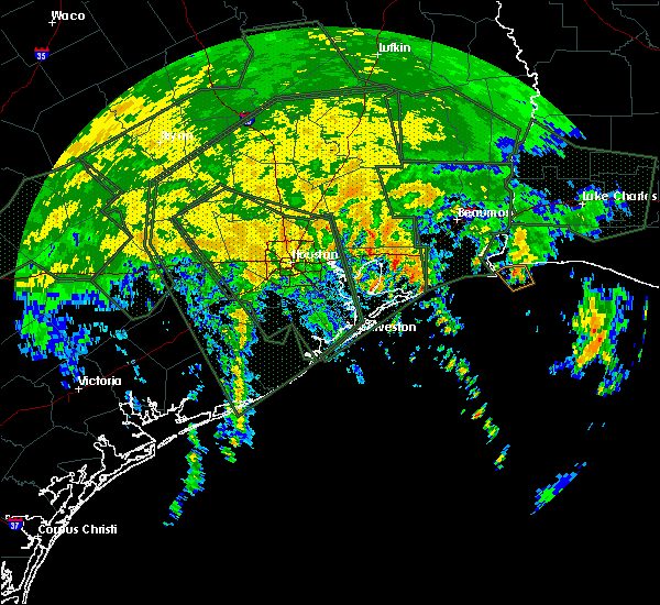 At 421 pm cdt, a severe thunderstorm capable of producing a tornado was located 7 miles northwest of high island, or 16 miles southwest of hamshire, moving north at 30 mph (radar indicated rotation). Hazards include tornado. Flying debris will be dangerous to those caught without shelter. mobile homes will be damaged or destroyed. damage to roofs, windows, and vehicles will occur. Tree damage is likely. At 421 pm cdt, a severe thunderstorm capable of producing a tornado was located 7 miles northwest of high island, or 16 miles southwest of hamshire, moving north at 30 mph (radar indicated rotation). Hazards include tornado. Flying debris will be dangerous to those caught without shelter. mobile homes will be damaged or destroyed. damage to roofs, windows, and vehicles will occur. Tree damage is likely.
|
| 5/3/2017 9:38 PM CDT |
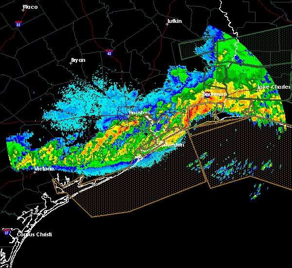 At 937 pm cdt, severe thunderstorms were located along a line extending from 7 miles south of nome to near high island, moving southeast at 30 mph (radar indicated). Hazards include ping pong ball size hail. People and animals outdoors will be injured. expect damage to roofs, siding, windows, and vehicles. Locations impacted include, winnie, high island, stowell and bolivar peninsula. At 937 pm cdt, severe thunderstorms were located along a line extending from 7 miles south of nome to near high island, moving southeast at 30 mph (radar indicated). Hazards include ping pong ball size hail. People and animals outdoors will be injured. expect damage to roofs, siding, windows, and vehicles. Locations impacted include, winnie, high island, stowell and bolivar peninsula.
|
| 5/3/2017 9:16 PM CDT |
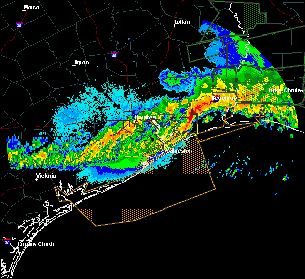 At 915 pm cdt, severe thunderstorms were located along a line extending from near nome to near anahuac, moving east at 35 mph (radar indicated). Hazards include ping pong ball size hail. People and animals outdoors will be injured. Expect damage to roofs, siding, windows, and vehicles. At 915 pm cdt, severe thunderstorms were located along a line extending from near nome to near anahuac, moving east at 35 mph (radar indicated). Hazards include ping pong ball size hail. People and animals outdoors will be injured. Expect damage to roofs, siding, windows, and vehicles.
|
| 5/3/2017 8:56 PM CDT |
 At 854 pm cdt, a cluster of severe thunderstorms was located from daisetta to cove, moving southeast at 30 mph. similar storms earlier in the evening produced hail up to golf ball size (radar indicated). Hazards include golf ball size hail. People and animals outdoors will be injured. expect damage to roofs, siding, windows, and vehicles. Locations impacted include, southeastern mont belvieu, anahuac, old river-winfree, daisetta, cove, devers, winnie, stowell, hankamer, wallisville and oak island. At 854 pm cdt, a cluster of severe thunderstorms was located from daisetta to cove, moving southeast at 30 mph. similar storms earlier in the evening produced hail up to golf ball size (radar indicated). Hazards include golf ball size hail. People and animals outdoors will be injured. expect damage to roofs, siding, windows, and vehicles. Locations impacted include, southeastern mont belvieu, anahuac, old river-winfree, daisetta, cove, devers, winnie, stowell, hankamer, wallisville and oak island.
|
| 5/3/2017 8:30 PM CDT |
 At 825 pm cdt, a cluster of severe thunderstorms was located over central liberty county, just northwest of liberty, moving southeast at 30 mph (radar indicated). Hazards include quarter size hail. 60 mph wind gusts. At 825 pm cdt, a cluster of severe thunderstorms was located over central liberty county, just northwest of liberty, moving southeast at 30 mph (radar indicated). Hazards include quarter size hail. 60 mph wind gusts.
|
| 3/29/2017 3:50 PM CDT |
 At 350 pm cdt, severe thunderstorms were located along a line extending from 6 miles northeast of daisetta to 7 miles southwest of nome to 7 miles east of anahuac, moving northeast at 30 mph (radar indicated). Hazards include 60 mph wind gusts and quarter size hail. Hail damage to vehicles is expected. Expect wind damage to roofs, siding, and trees. At 350 pm cdt, severe thunderstorms were located along a line extending from 6 miles northeast of daisetta to 7 miles southwest of nome to 7 miles east of anahuac, moving northeast at 30 mph (radar indicated). Hazards include 60 mph wind gusts and quarter size hail. Hail damage to vehicles is expected. Expect wind damage to roofs, siding, and trees.
|
| 3/25/2017 12:36 AM CDT |
 At 1235 am cdt, severe thunderstorms were located along a line extending from near old river-winfree to pearland, moving east southeast at 15 mph (radar indicated). Hazards include 60 mph wind gusts and penny size hail. expect damage to roofs, siding, and trees At 1235 am cdt, severe thunderstorms were located along a line extending from near old river-winfree to pearland, moving east southeast at 15 mph (radar indicated). Hazards include 60 mph wind gusts and penny size hail. expect damage to roofs, siding, and trees
|
| 2/14/2017 10:52 AM CST |
 The severe thunderstorm warning for southeastern liberty, northeastern galveston, chambers and southeastern polk counties will expire at 1100 am cst, the storms which prompted the warning have weakened below severe limits, and no longer pose an immediate threat to life or property. therefore the warning will be allowed to expire. however gusty winds are still possible with these thunderstorms. a tornado watch remains in effect until 100 pm cst for southeastern texas. The severe thunderstorm warning for southeastern liberty, northeastern galveston, chambers and southeastern polk counties will expire at 1100 am cst, the storms which prompted the warning have weakened below severe limits, and no longer pose an immediate threat to life or property. therefore the warning will be allowed to expire. however gusty winds are still possible with these thunderstorms. a tornado watch remains in effect until 100 pm cst for southeastern texas.
|
| 2/14/2017 10:39 AM CST |
 At 1038 am cst, severe thunderstorms were located along a line extending from 6 miles west of warren to near smith point, moving northeast at 35 mph (radar indicated). Hazards include 60 mph wind gusts. Expect damage to roofs, siding, and trees. locations impacted include, anahuac, daisetta, devers, high island, bolivar peninsula, crystal beach, gilchrist, rollover pass, smith point, stowell, winnie, oak island, wallisville and hankamer. A tornado watch remains in effect until 100 pm cst for southeastern texas. At 1038 am cst, severe thunderstorms were located along a line extending from 6 miles west of warren to near smith point, moving northeast at 35 mph (radar indicated). Hazards include 60 mph wind gusts. Expect damage to roofs, siding, and trees. locations impacted include, anahuac, daisetta, devers, high island, bolivar peninsula, crystal beach, gilchrist, rollover pass, smith point, stowell, winnie, oak island, wallisville and hankamer. A tornado watch remains in effect until 100 pm cst for southeastern texas.
|
| 2/14/2017 9:57 AM CST |
 At 956 am cst, severe thunderstorms were located along a line extending from 10 miles southeast of shepherd to hitchcock, moving northeast at 35 mph (radar indicated). Hazards include 60 mph wind gusts. expect damage to roofs, siding, and trees At 956 am cst, severe thunderstorms were located along a line extending from 10 miles southeast of shepherd to hitchcock, moving northeast at 35 mph (radar indicated). Hazards include 60 mph wind gusts. expect damage to roofs, siding, and trees
|
| 2/14/2017 8:56 AM CST |
 At 856 am cst, severe thunderstorms were located along a line extending from near porter heights to golfcrest / bellfort / reveille to near iowa colony, moving east at 60 mph (radar indicated). Hazards include 60 mph wind gusts. expect damage to roofs, siding, and trees At 856 am cst, severe thunderstorms were located along a line extending from near porter heights to golfcrest / bellfort / reveille to near iowa colony, moving east at 60 mph (radar indicated). Hazards include 60 mph wind gusts. expect damage to roofs, siding, and trees
|
| 1/2/2017 10:28 AM CST |
 At 1028 am cst, severe thunderstorms were located along a line extending from near ragley to near buhler to near gilchrist, moving east at 45 mph (radar indicated). Hazards include 70 mph wind gusts. Expect considerable tree damage. damage is likely to mobile homes, roofs, and outbuildings. locations impacted include, beaumont, lake charles, port arthur, orange, nederland, groves, port neches, vidor, bridge city, west orange, vinton, sour lake, nome, starks, central gardens, hamshire, sabine pass, de quincy, mauriceville and dequincy. A tornado watch remains in effect until 200 pm cst for southwestern louisiana, and southeastern texas. At 1028 am cst, severe thunderstorms were located along a line extending from near ragley to near buhler to near gilchrist, moving east at 45 mph (radar indicated). Hazards include 70 mph wind gusts. Expect considerable tree damage. damage is likely to mobile homes, roofs, and outbuildings. locations impacted include, beaumont, lake charles, port arthur, orange, nederland, groves, port neches, vidor, bridge city, west orange, vinton, sour lake, nome, starks, central gardens, hamshire, sabine pass, de quincy, mauriceville and dequincy. A tornado watch remains in effect until 200 pm cst for southwestern louisiana, and southeastern texas.
|
| 1/2/2017 10:28 AM CST |
 A severe thunderstorm warning remains in effect until 1045 am cst for northwestern cameron and western calcasieu parishes. orange. jefferson. southeastern hardin. southeastern jasper and southwestern newton counties. At 1028 am cst, severe thunderstorms were located along a line extending from near ragley to near buhler to near gilchrist, moving. A severe thunderstorm warning remains in effect until 1045 am cst for northwestern cameron and western calcasieu parishes. orange. jefferson. southeastern hardin. southeastern jasper and southwestern newton counties. At 1028 am cst, severe thunderstorms were located along a line extending from near ragley to near buhler to near gilchrist, moving.
|
| 1/2/2017 10:28 AM CST |
 At 1028 am cst, severe thunderstorms were located along a line extending from near ragley to near buhler to near gilchrist, moving east at 45 mph (radar indicated). Hazards include 70 mph wind gusts. Expect considerable tree damage. damage is likely to mobile homes, roofs, and outbuildings. locations impacted include, beaumont, lake charles, port arthur, orange, nederland, groves, port neches, vidor, bridge city, west orange, vinton, sour lake, nome, starks, central gardens, hamshire, sabine pass, de quincy, mauriceville and dequincy. A tornado watch remains in effect until 200 pm cst for southwestern louisiana, and southeastern texas. At 1028 am cst, severe thunderstorms were located along a line extending from near ragley to near buhler to near gilchrist, moving east at 45 mph (radar indicated). Hazards include 70 mph wind gusts. Expect considerable tree damage. damage is likely to mobile homes, roofs, and outbuildings. locations impacted include, beaumont, lake charles, port arthur, orange, nederland, groves, port neches, vidor, bridge city, west orange, vinton, sour lake, nome, starks, central gardens, hamshire, sabine pass, de quincy, mauriceville and dequincy. A tornado watch remains in effect until 200 pm cst for southwestern louisiana, and southeastern texas.
|
| 1/2/2017 9:57 AM CST |
 At 957 am cst, severe thunderstorms were located along a line extending from near fields to near starks to near smith point, moving east at 45 mph (radar indicated). Hazards include 70 mph wind gusts. Expect considerable tree damage. Damage is likely to mobile homes, roofs, and outbuildings. At 957 am cst, severe thunderstorms were located along a line extending from near fields to near starks to near smith point, moving east at 45 mph (radar indicated). Hazards include 70 mph wind gusts. Expect considerable tree damage. Damage is likely to mobile homes, roofs, and outbuildings.
|
| 1/2/2017 8:44 AM CST |
 At 844 am cst, severe thunderstorms were located along a line extending from 7 miles west of warren to near roman forest to thompsons, moving east at 40 mph (radar indicated). Hazards include 60 mph wind gusts and up to penny size hail. expect damage to roofs, siding, and trees At 844 am cst, severe thunderstorms were located along a line extending from 7 miles west of warren to near roman forest to thompsons, moving east at 40 mph (radar indicated). Hazards include 60 mph wind gusts and up to penny size hail. expect damage to roofs, siding, and trees
|
| 6/18/2016 6:46 PM CDT |
 At 643 pm cdt, numerous strong to severe thunderstorms were located along a line extending from chateau woods to anahuac, including the ship channel and surrounding eastern harris county communities, moving southwest at 5 to 10 mph (radar indicated). Hazards include 60 mph wind gusts and quarter size hail. Hail damage to vehicles is expected. expect wind damage to roofs, siding, and trees. Locations impacted include, pasadena, northeastern league city, baytown, texas city, la porte, deer park, dickinson, south houston, humble, seabrook, galena park, jacinto city, webster, beach city, kemah, clear lake, barrett, greater fifth ward, second ward and near northside houston. At 643 pm cdt, numerous strong to severe thunderstorms were located along a line extending from chateau woods to anahuac, including the ship channel and surrounding eastern harris county communities, moving southwest at 5 to 10 mph (radar indicated). Hazards include 60 mph wind gusts and quarter size hail. Hail damage to vehicles is expected. expect wind damage to roofs, siding, and trees. Locations impacted include, pasadena, northeastern league city, baytown, texas city, la porte, deer park, dickinson, south houston, humble, seabrook, galena park, jacinto city, webster, beach city, kemah, clear lake, barrett, greater fifth ward, second ward and near northside houston.
|
| 6/18/2016 6:21 PM CDT |
 At 619 pm cdt, severe thunderstorms were located along a line extending from near woodloch to anahuac, moving southwest at 15 mph. northeastern storm outflow boundaries will collide with sea breeze gust fronts, allowing strong to severe thunderstorms to develop within the warned area (radar indicated). Hazards include 60 mph wind gusts and half dollar size hail. Hail damage to vehicles is expected. Expect wind damage to roofs, siding, and trees. At 619 pm cdt, severe thunderstorms were located along a line extending from near woodloch to anahuac, moving southwest at 15 mph. northeastern storm outflow boundaries will collide with sea breeze gust fronts, allowing strong to severe thunderstorms to develop within the warned area (radar indicated). Hazards include 60 mph wind gusts and half dollar size hail. Hail damage to vehicles is expected. Expect wind damage to roofs, siding, and trees.
|
| 4/27/2016 6:42 AM CDT |
 At 639 am cdt, severe thunderstorms were located along a line extending from hemphill to near jamestown to near kirbyville to 6 miles west of old salem to 6 miles southeast of buna to wrights settlement to near gist to near vidor to 6 miles east of high island, moving east at 45 mph (radar indicated). Hazards include 60 mph wind gusts and penny size hail. Expect damage to roofs. siding. and trees. Locations impacted include, beaumont, port arthur, orange, nederland, groves, port neches, lumberton, vidor, bridge city, jasper, silsbee, west orange, newton, kirbyville, nome, deweyville, fred, bon weir, hamshire and burkeville. At 639 am cdt, severe thunderstorms were located along a line extending from hemphill to near jamestown to near kirbyville to 6 miles west of old salem to 6 miles southeast of buna to wrights settlement to near gist to near vidor to 6 miles east of high island, moving east at 45 mph (radar indicated). Hazards include 60 mph wind gusts and penny size hail. Expect damage to roofs. siding. and trees. Locations impacted include, beaumont, port arthur, orange, nederland, groves, port neches, lumberton, vidor, bridge city, jasper, silsbee, west orange, newton, kirbyville, nome, deweyville, fred, bon weir, hamshire and burkeville.
|
| 4/27/2016 6:15 AM CDT |
 At 614 am cdt, severe thunderstorms were located along a line extending from 6 miles south of macune to 6 miles west of jasper to near spurger to caney head to 7 miles east of kountze to 8 miles northwest of evadale to silsbee to near lumberton to bevil oaks to near winnie to 7 miles southeast of anahuac, moving east at 45 mph (radar indicated). Hazards include 60 mph wind gusts. Expect damage to roofs. siding. And trees. At 614 am cdt, severe thunderstorms were located along a line extending from 6 miles south of macune to 6 miles west of jasper to near spurger to caney head to 7 miles east of kountze to 8 miles northwest of evadale to silsbee to near lumberton to bevil oaks to near winnie to 7 miles southeast of anahuac, moving east at 45 mph (radar indicated). Hazards include 60 mph wind gusts. Expect damage to roofs. siding. And trees.
|
| 4/27/2016 5:51 AM CDT |
 At 550 am cdt, severe thunderstorms were located along a line extending from near daisetta to 6 miles northeast of san leon, moving east at 45 mph (radar indicated). Hazards include 60 mph wind gusts. Expect damage to roofs. siding. And trees. At 550 am cdt, severe thunderstorms were located along a line extending from near daisetta to 6 miles northeast of san leon, moving east at 45 mph (radar indicated). Hazards include 60 mph wind gusts. Expect damage to roofs. siding. And trees.
|
| 4/27/2016 5:18 AM CDT |
 At 518 am cdt, severe thunderstorms were located along a line extending from lake houston dam to south park to near first colony, moving southeast at 40 mph (radar indicated). Hazards include 60 mph wind gusts. Expect damage to roofs. siding. And trees. At 518 am cdt, severe thunderstorms were located along a line extending from lake houston dam to south park to near first colony, moving southeast at 40 mph (radar indicated). Hazards include 60 mph wind gusts. Expect damage to roofs. siding. And trees.
|
| 4/27/2016 5:12 AM CDT |
 At 512 am cdt, severe thunderstorms were located along a line extending from 6 miles northeast of onalaska to 6 miles east of cleveland to near lake houston dam, moving east at 45 mph (radar indicated). Hazards include 60 mph wind gusts. Expect damage to roofs. siding. And trees. At 512 am cdt, severe thunderstorms were located along a line extending from 6 miles northeast of onalaska to 6 miles east of cleveland to near lake houston dam, moving east at 45 mph (radar indicated). Hazards include 60 mph wind gusts. Expect damage to roofs. siding. And trees.
|
| 4/13/2016 2:27 AM CDT |
 At 224 am cdt, severe thunderstorms were located along a line extending from old river-winfree to league city to near danbury to near bay city, moving southeast at 40 mph (radar indicated). Hazards include 60 mph wind gusts and quarter size hail. Hail damage to vehicles is expected. Expect wind damage to roofs, siding, and trees. At 224 am cdt, severe thunderstorms were located along a line extending from old river-winfree to league city to near danbury to near bay city, moving southeast at 40 mph (radar indicated). Hazards include 60 mph wind gusts and quarter size hail. Hail damage to vehicles is expected. Expect wind damage to roofs, siding, and trees.
|
| 5/27/2015 6:38 AM CDT | At 637 am cdt, doppler radar indicated a line of severe thunderstorms capable of producing quarter size hail and damaging winds in excess of 60 mph. these storms were located along a line extending from near buhler to carlyss to near high island, and moving southeast at 20 mph. |
| 5/27/2015 6:38 AM CDT | At 637 am cdt, doppler radar indicated a line of severe thunderstorms capable of producing quarter size hail and damaging winds in excess of 60 mph. these storms were located along a line extending from near buhler to carlyss to near high island, and moving southeast at 20 mph. |
| 5/27/2015 6:18 AM CDT | At 617 am cdt, doppler radar indicated a line of severe thunderstorms capable of producing quarter size hail and damaging winds in excess of 60 mph. these storms were located along a line extending from near edgerly to bridge city to near gilchrist, moving southeast at 30 mph. locations impacted include, beaumont, lake charles, port arthur, sulphur, orange, nederland, groves, port neches, vidor, bridge city, westlake, west orange, vinton, deweyville, moss bluff, lake charles regional airport, starks, central gardens, hamshire and fields. |
| 5/27/2015 6:18 AM CDT | At 617 am cdt, doppler radar indicated a line of severe thunderstorms capable of producing quarter size hail and damaging winds in excess of 60 mph. these storms were located along a line extending from near edgerly to bridge city to near gilchrist, moving southeast at 30 mph. locations impacted include, beaumont, lake charles, port arthur, sulphur, orange, nederland, groves, port neches, vidor, bridge city, westlake, west orange, vinton, deweyville, moss bluff, lake charles regional airport, starks, central gardens, hamshire and fields. |
| 5/27/2015 5:30 AM CDT | At 530 am cdt, doppler radar indicated a line of severe thunderstorms capable of producing quarter size hail and damaging winds in excess of 60 mph. these storms were located along a line extending from near bancroft to near weiss bluff to near cove, and moving southeast at 30 mph. |
| 5/27/2015 5:30 AM CDT | At 530 am cdt, doppler radar indicated a line of severe thunderstorms capable of producing quarter size hail and damaging winds in excess of 60 mph. these storms were located along a line extending from near bancroft to near weiss bluff to near cove, and moving southeast at 30 mph. |
| 5/27/2015 5:28 AM CDT | At 527 am cdt, doppler radar indicated a line of severe thunderstorms capable of producing damaging winds in excess of 60 mph. these storms were located along a line extending from near sour lake to near waller. these storms were nearly stationary. locations impacted include, northwestern pasadena, baytown, deer park, bellaire, humble, west university place, katy, galena park, tomball, jacinto city, liberty, jersey village, dayton, sealy, brookshire, hunters creek village, bunker hill village, piney point village, beach city and astrodome area. |
| 5/27/2015 5:21 AM CDT | At 520 am cdt, doppler radar indicated a line of severe thunderstorms capable of producing damaging winds in excess of 60 mph. these storms were located along a line extending from sour lake to near waller, and moving south at 25 mph. frequent lightning and torrential rainfall is also occurring with this line. |
| 5/25/2015 11:17 PM CDT | At 1117 pm cdt, doppler radar indicated a line of severe thunderstorms capable of producing quarter size hail and damaging winds in excess of 60 mph. these storms were located along a line extending from libuse to near cheneyville to near lake charles to near port acres, moving southeast at 50 mph. locations impacted include, beaumont, lake charles, port arthur, alexandria, sulphur, orange, nederland, groves, pineville, port neches, vidor, jennings, bridge city, oakdale, ville platte, westlake, west orange, mamou, welsh and vinton. a tornado watch remains in effect until 200 am cdt for southwestern louisiana and southeastern texas. a tornado watch also remains in effect until 500 am cdt for central louisiana. |
| 5/25/2015 11:17 PM CDT | At 1117 pm cdt, doppler radar indicated a line of severe thunderstorms capable of producing quarter size hail and damaging winds in excess of 60 mph. these storms were located along a line extending from libuse to near cheneyville to near lake charles to near port acres, moving southeast at 50 mph. locations impacted include, beaumont, lake charles, port arthur, alexandria, sulphur, orange, nederland, groves, pineville, port neches, vidor, jennings, bridge city, oakdale, ville platte, westlake, west orange, mamou, welsh and vinton. a tornado watch remains in effect until 200 am cdt for southwestern louisiana and southeastern texas. a tornado watch also remains in effect until 500 am cdt for central louisiana. |
| 5/25/2015 10:59 PM CDT | At 1058 pm cdt, doppler radar indicated a line of severe thunderstorms capable of producing quarter size hail and damaging winds in excess of 60 mph. these storms were located along a line extending from near boyce to near glenmora to near vinton to hamshire, and moving southeast at 45 mph. |
| 5/25/2015 10:59 PM CDT | At 1058 pm cdt, doppler radar indicated a line of severe thunderstorms capable of producing quarter size hail and damaging winds in excess of 60 mph. these storms were located along a line extending from near boyce to near glenmora to near vinton to hamshire, and moving southeast at 45 mph. |
| 4/27/2015 5:23 PM CDT | At 523 pm cdt, doppler radar indicated a line of severe thunderstorms capable of producing half dollar size hail and destructive winds in excess of 70 mph. these storms were located along a line extending from 8 miles southeast of stowell to 13 miles southwest of sabine pass to 21 miles east of high island, moving northeast at 40 mph. locations impacted include, beaumont, port arthur, orange, nederland, groves, port neches, vidor, bridge city, west orange, sabine pass, central gardens, hamshire, rose city, orangefield, la belle, port acres, southeast texas regional airport, fannett, winnie and sea rim state park. |
| 4/27/2015 5:00 PM CDT | At 500 pm cdt, doppler radar indicated a line of severe thunderstorms capable of producing large damaging hail up to golf ball size and destructive winds in excess of 70 mph. these storms were located along a line extending from 8 miles southeast of high island to 16 miles southeast of gilchrist, and moving northeast at 45 mph. |
| 4/19/2015 9:07 PM CDT | At 906 pm cdt, doppler radar indicated a line of severe thunderstorms capable of producing quarter size hail and damaging winds in excess of 60 mph. these storms were located along a line extending from winnie to near high island to near bolivar peninsula, and moving east at 50 mph. |
| 4/19/2015 8:53 PM CDT | At 852 pm cdt, doppler radar indicated a severe thunderstorm capable of producing quarter size hail. this storm was located 8 miles southeast of anahuac, or 18 miles east of beach city, and moving southeast at 25 mph. |
| 4/19/2015 8:31 PM CDT | At 814 pm cdt, doppler radar indicated a severe thunderstorm capable of producing quarter size hail and damaging winds in excess of 60 mph. this storm was located over hamshire, and moving east at 40 mph. |
| 4/19/2015 8:25 PM CDT | Quarter sized hail reported 5.2 miles W of Winnie, TX, public reported estimated one inch hail |
| 4/19/2015 8:14 PM CDT | The national weather service in lake charles has issued a * severe thunderstorm warning for. central orange county in southeastern texas. jefferson county in southeastern texas. until 900 pm cdt * at 814 pm cdt. Doppler radar indicated a severe thunderstorm. |
| 4/19/2015 8:01 PM CDT | At 801 pm cdt, doppler radar indicated a line of severe thunderstorms capable of producing quarter size hail. these storms were located along a line extending from 6 miles south of nome to near cove, and moving southeast at 20 mph. |
| 4/17/2015 9:36 PM CDT | At 934 pm cdt, doppler radar indicated a line of severe thunderstorms capable of producing quarter size hail and damaging winds in excess of 60 mph. these storms were located along a line extending from near winnie to 24 miles south of sabine pass, and moving east at 40 mph. |
| 4/17/2015 8:50 PM CDT | At 850 pm cdt, doppler radar indicated a line of severe thunderstorms capable of producing damaging winds in excess of 60 mph. these storms were located along a line extending from near san jacinto state park to near crystal beach to 15 miles southeast of galveston pleasure pier, and moving east at 55 mph. |
| 4/16/2015 7:50 PM CDT | At 749 pm cdt, doppler radar indicated a severe thunderstorm capable of producing quarter size hail. this storm was located over hamshire, and moving northeast at 30 mph. |
| 5/22/2013 5:50 AM CDT | Quarter sized hail reported 5.5 miles WSW of Winnie, TX, report from media facebook page of hail mostly nickel with some quarter sized also. |
| 5/22/2013 5:30 AM CDT | Trees and powerlines down in winni in chambers county TX, 0.5 miles WSW of Winnie, TX |
| 1/1/0001 12:00 AM | Trees down on state highway 124 in chambers county TX, 0.5 miles WSW of Winnie, TX |
| 1/1/0001 12:00 AM | Golf Ball sized hail reported 0.5 miles WSW of Winnie, TX |
Hail Maps for Winnie, TX

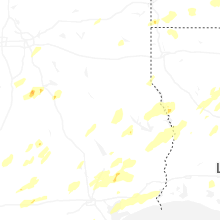


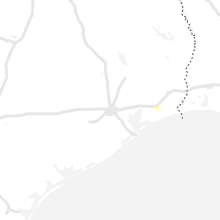


Connect with Interactive Hail Maps