

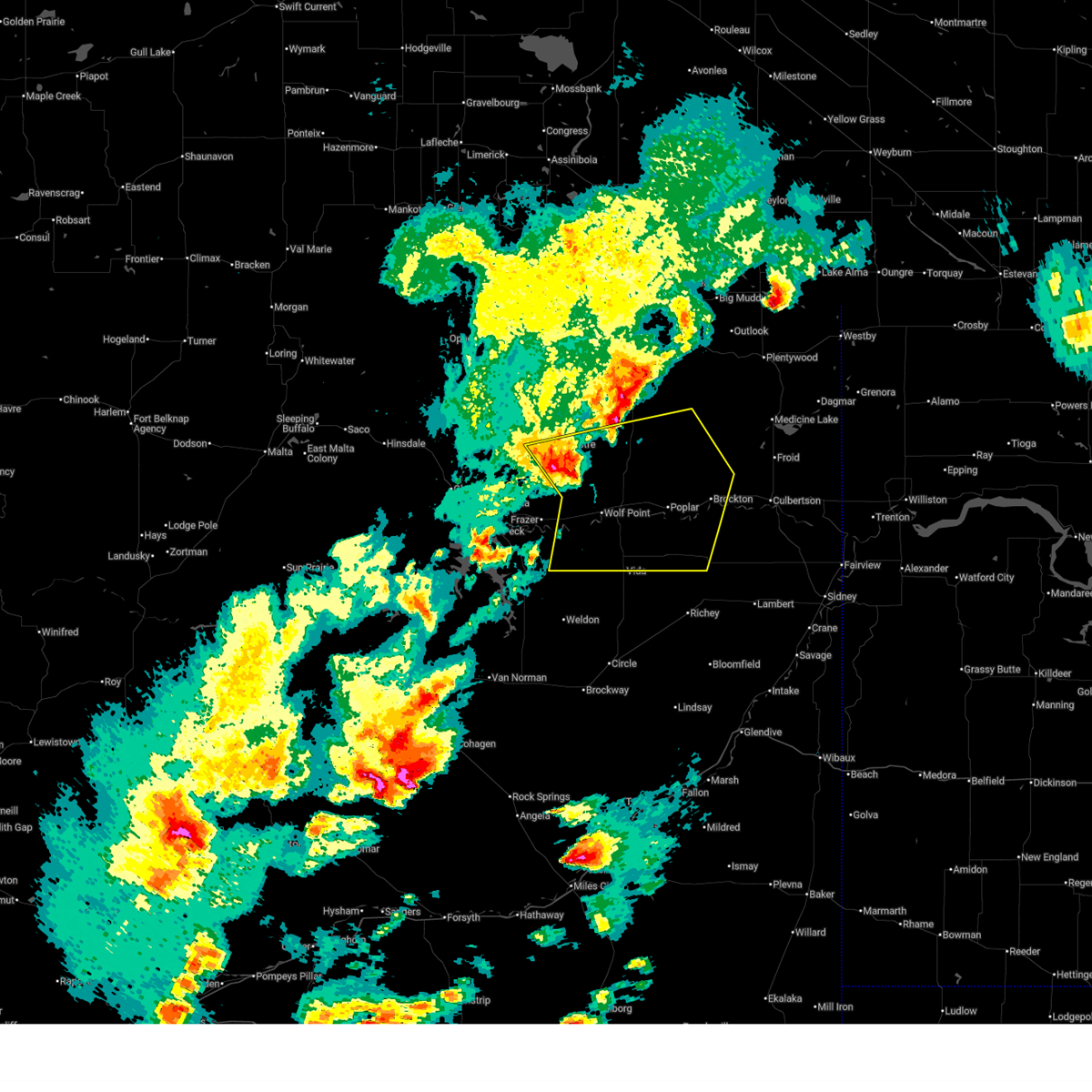
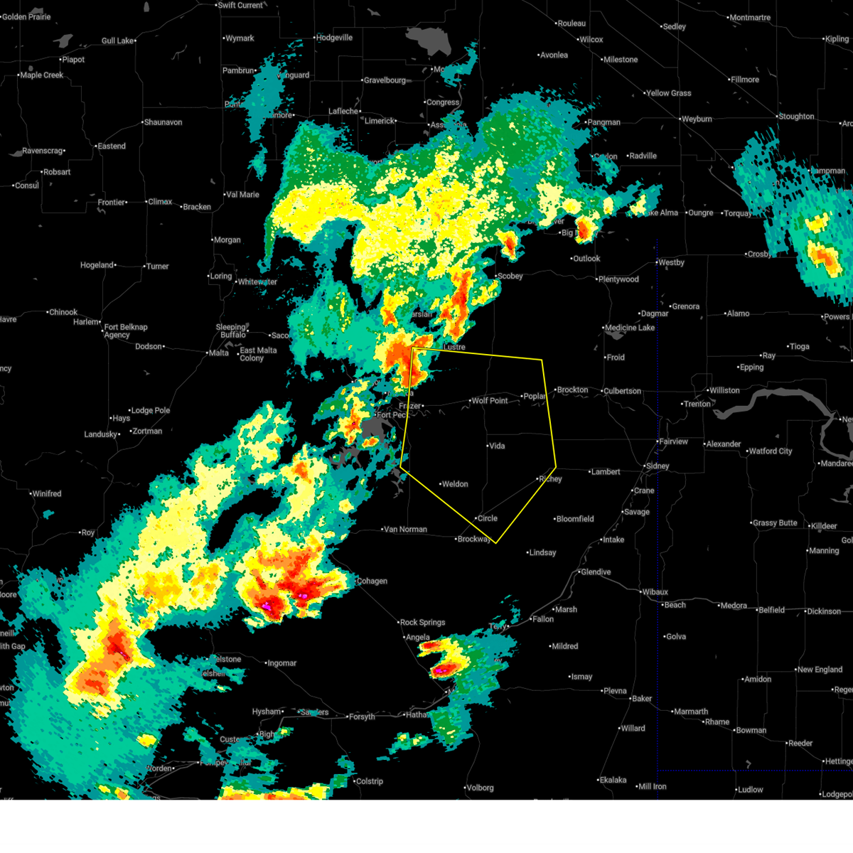
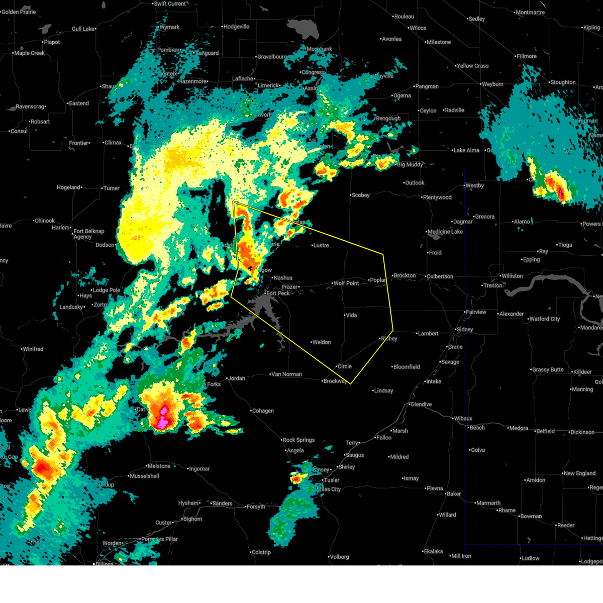
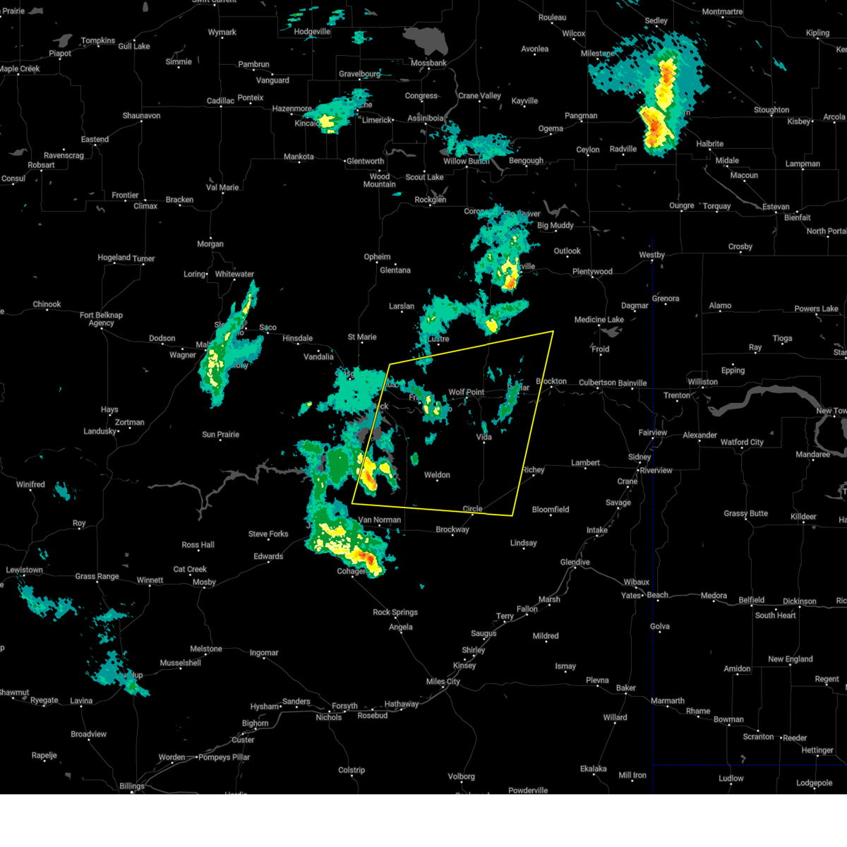
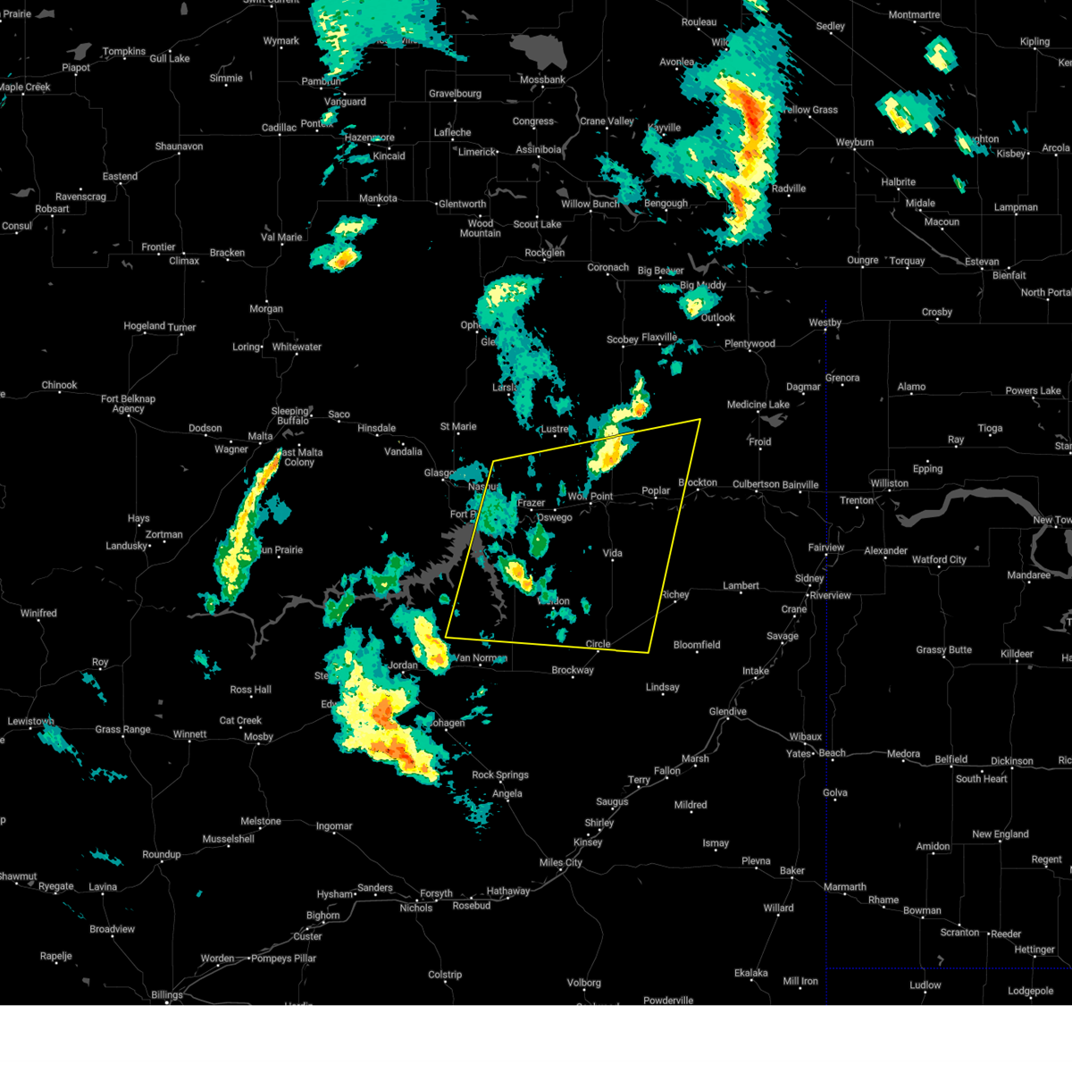
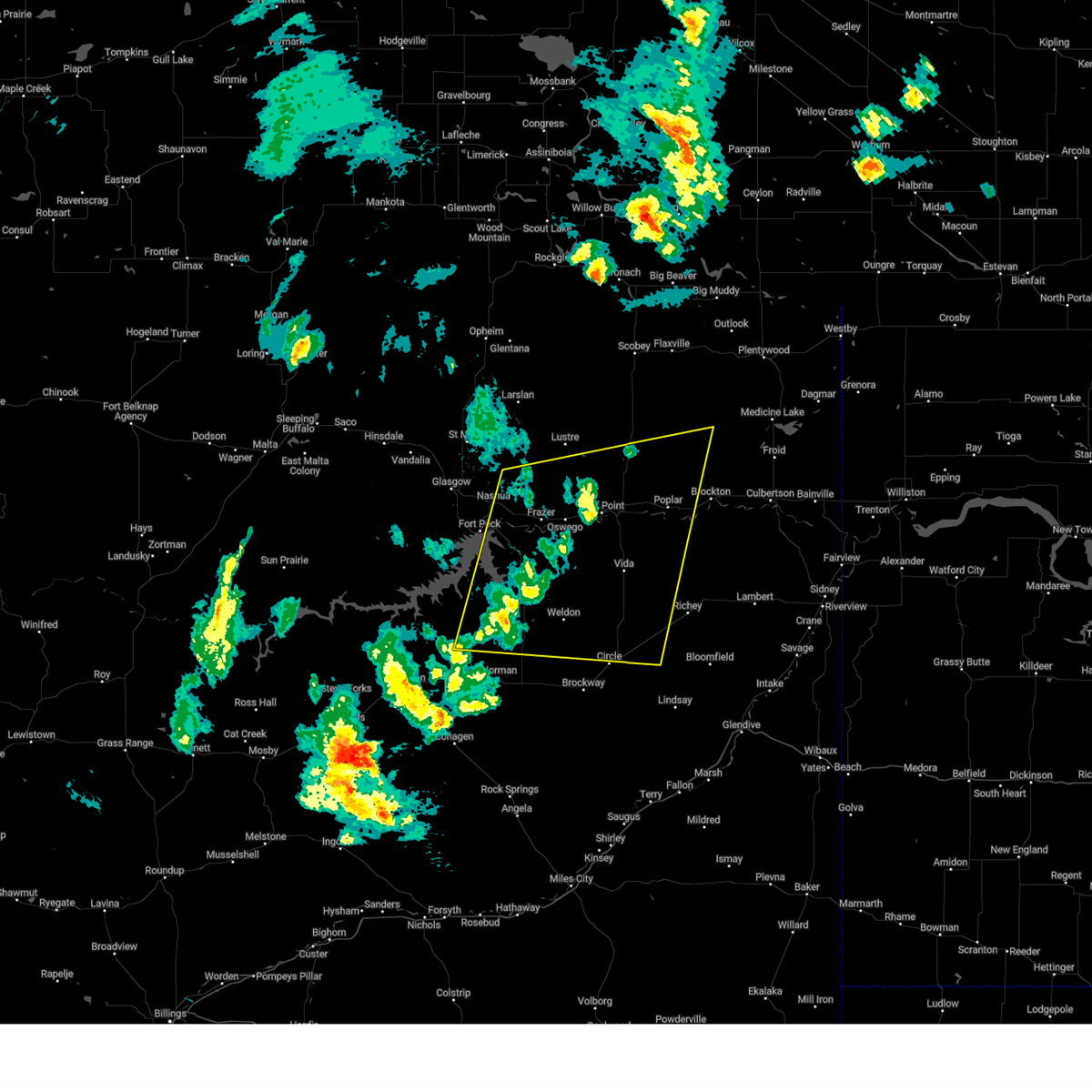
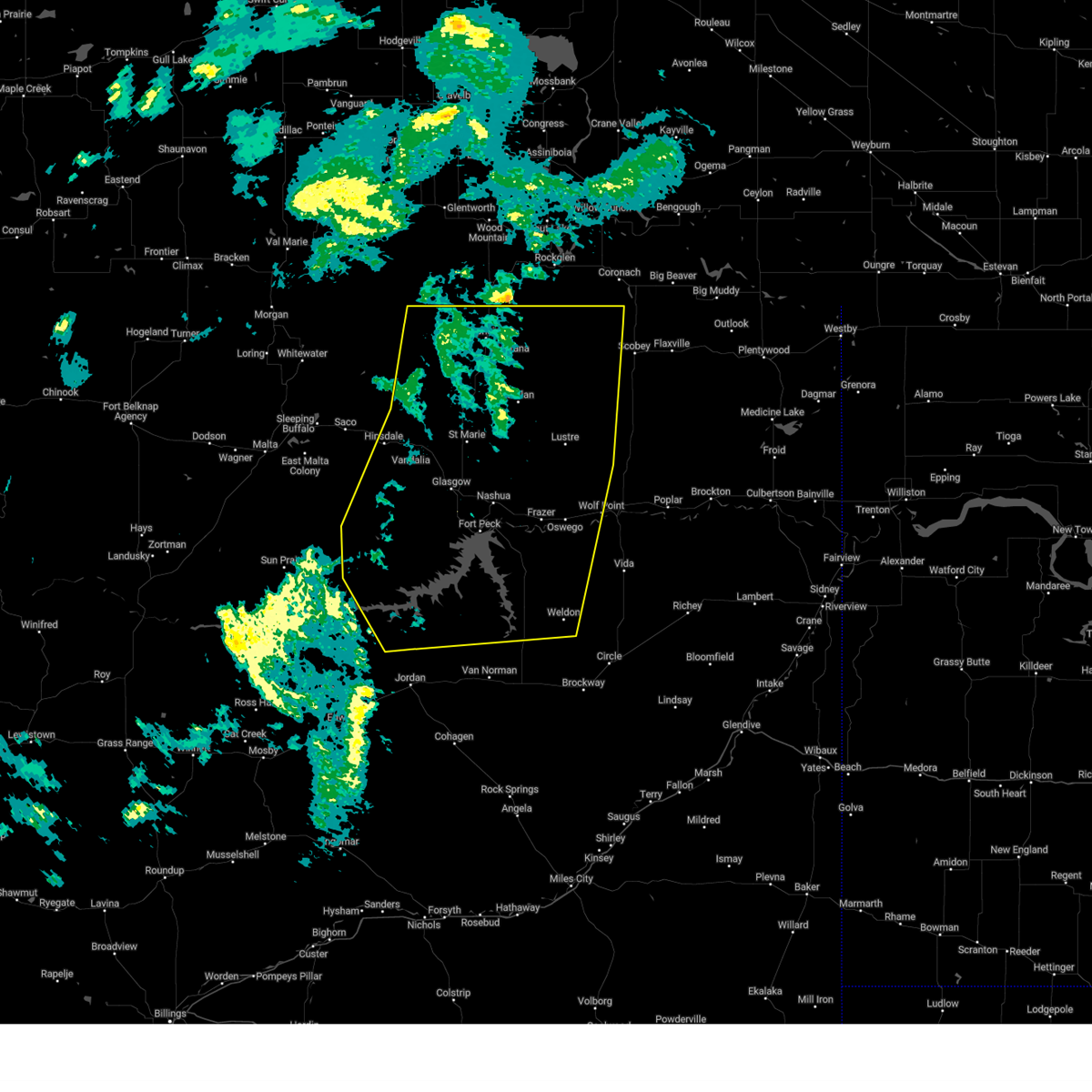
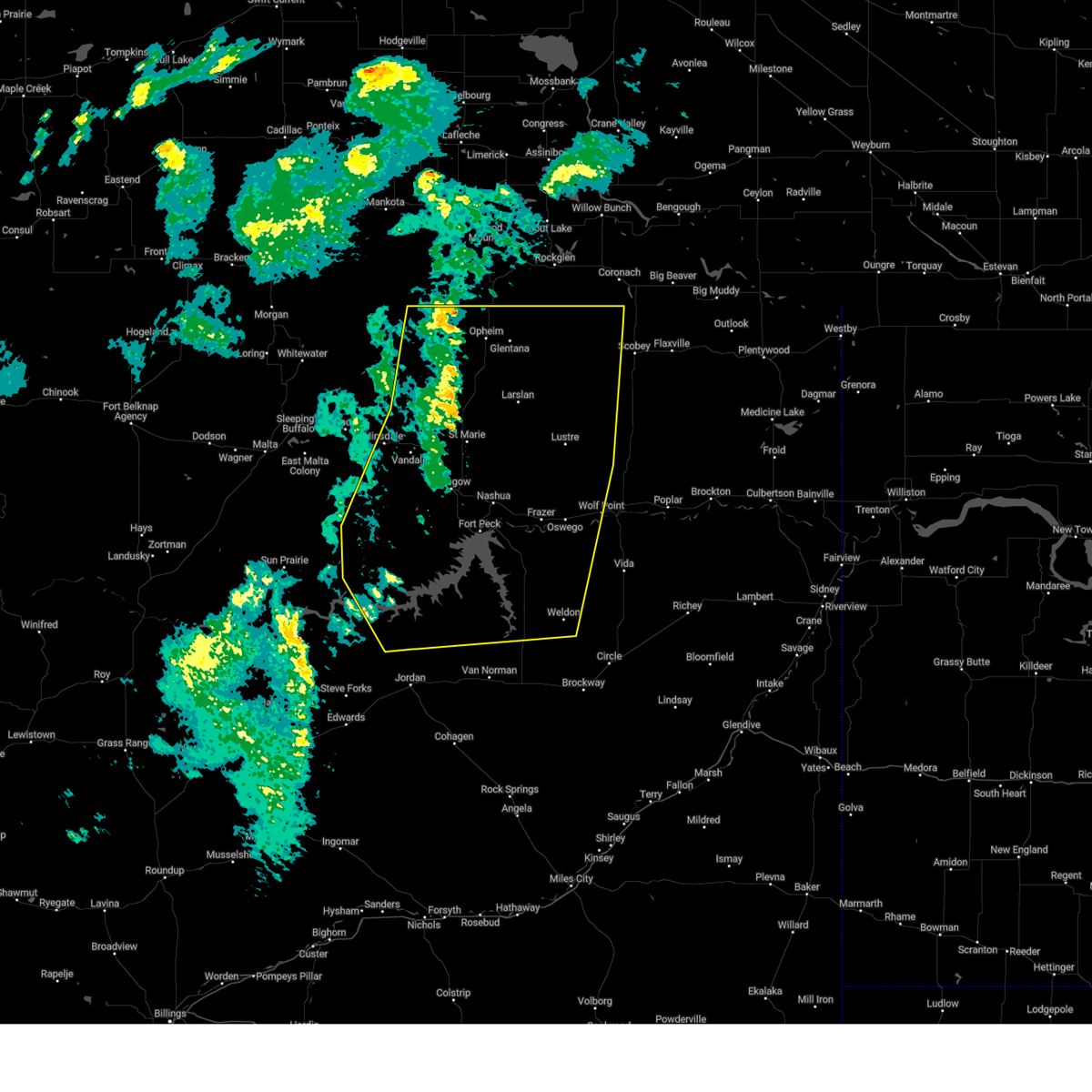
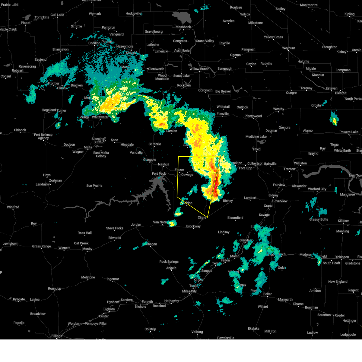
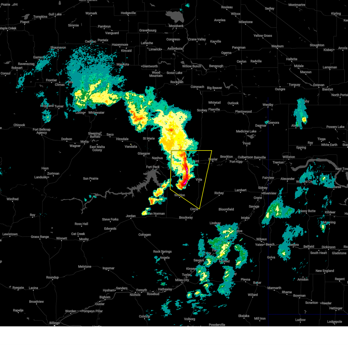
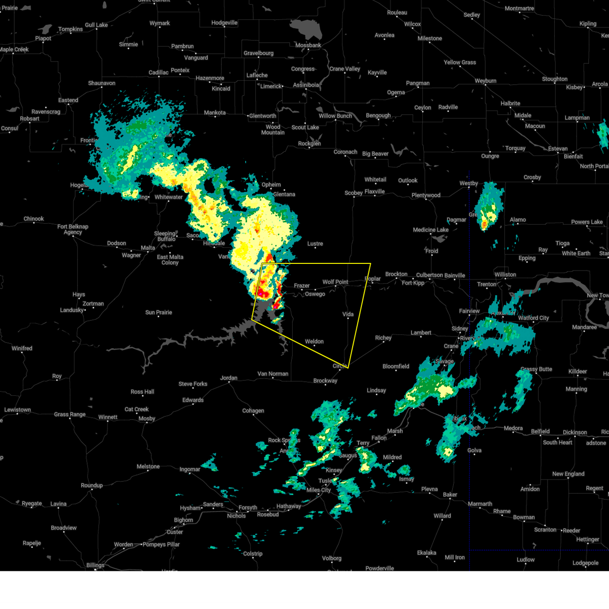
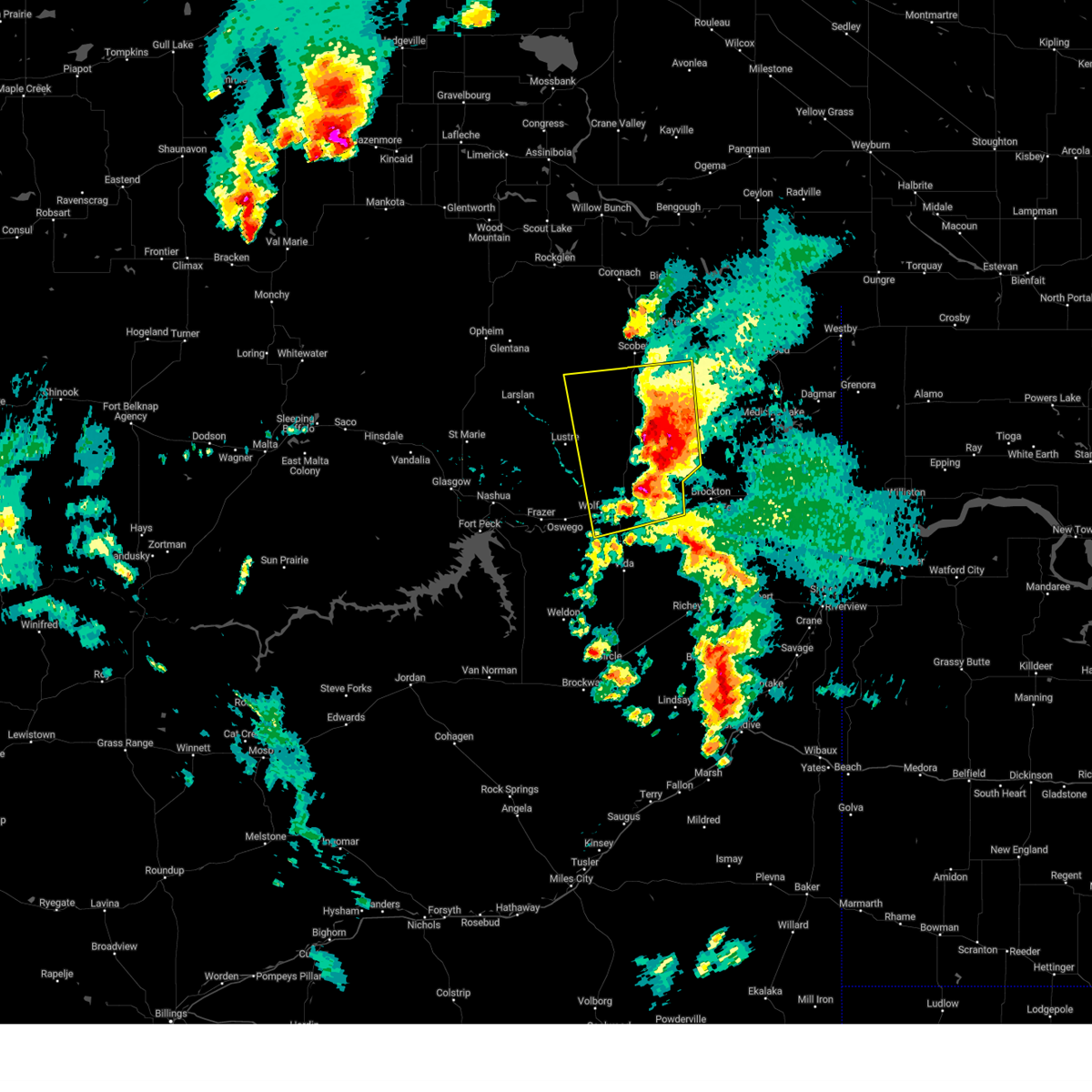
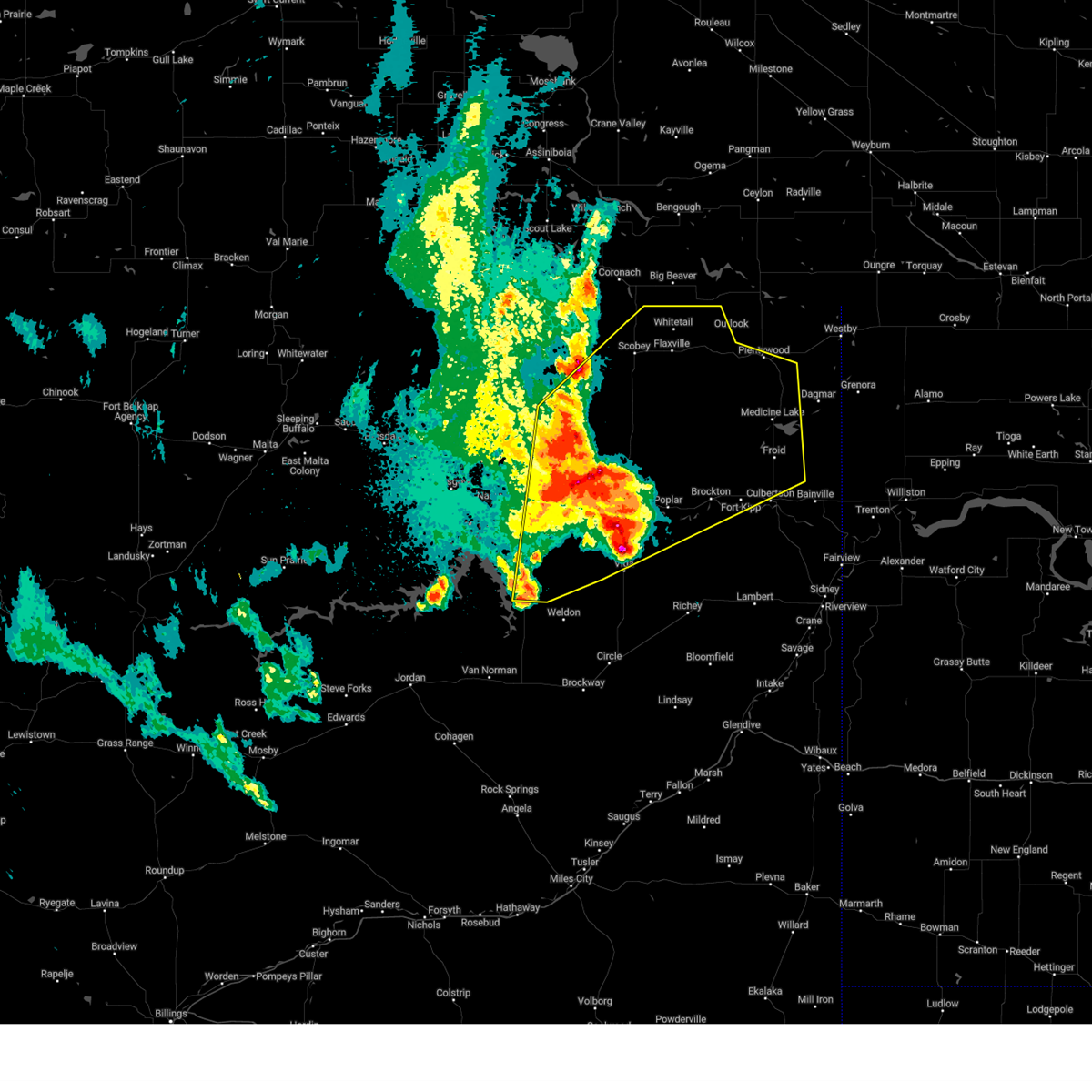
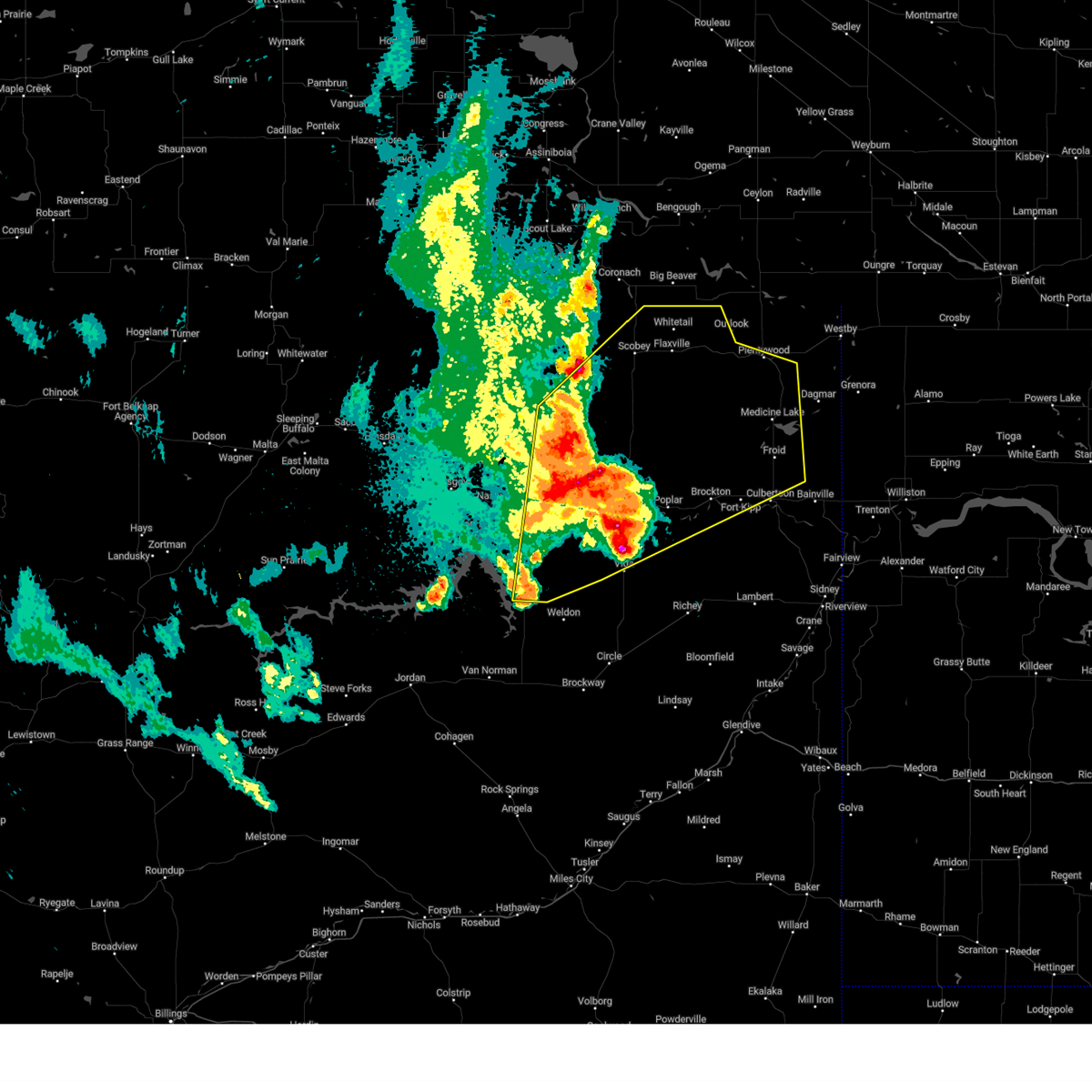
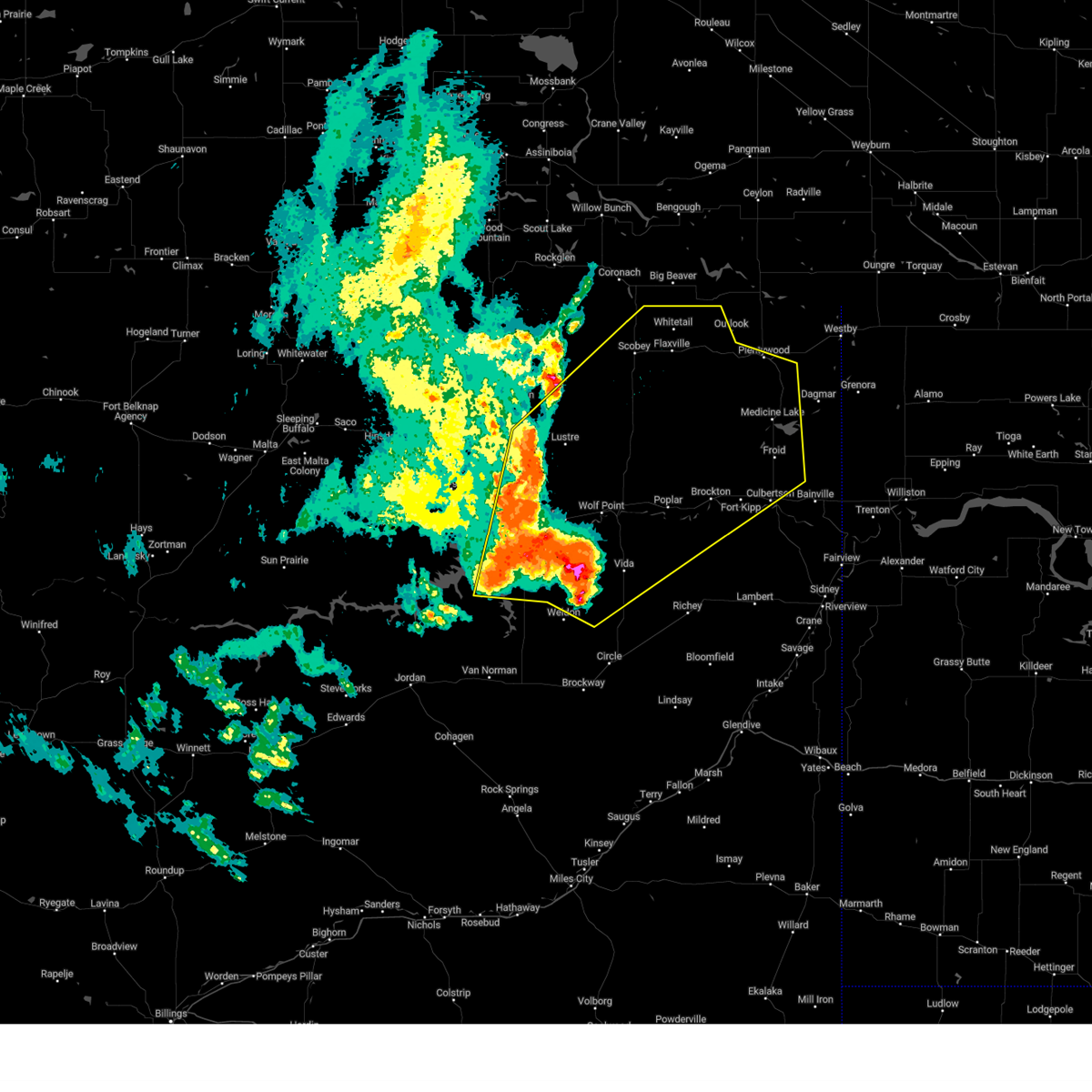
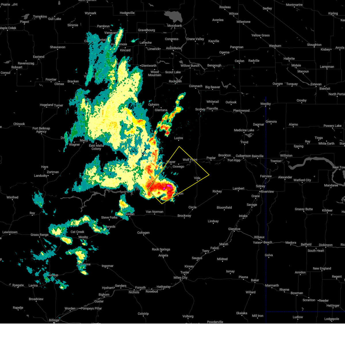
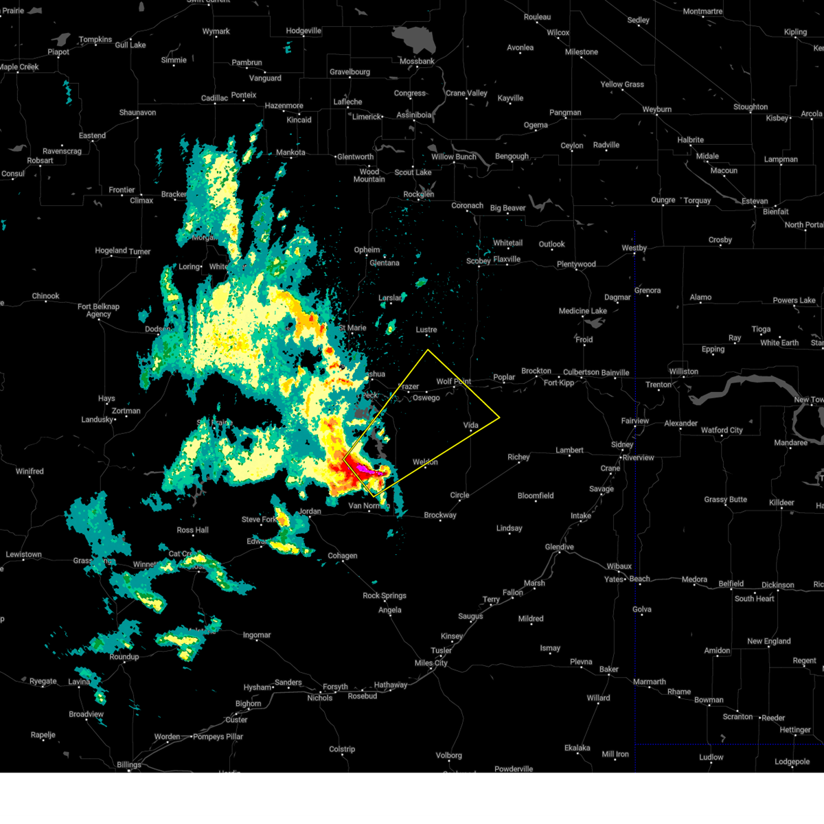
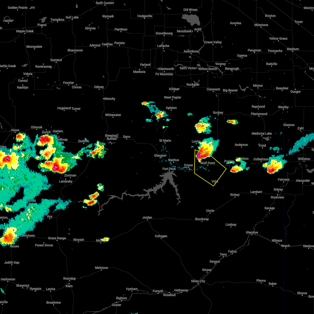
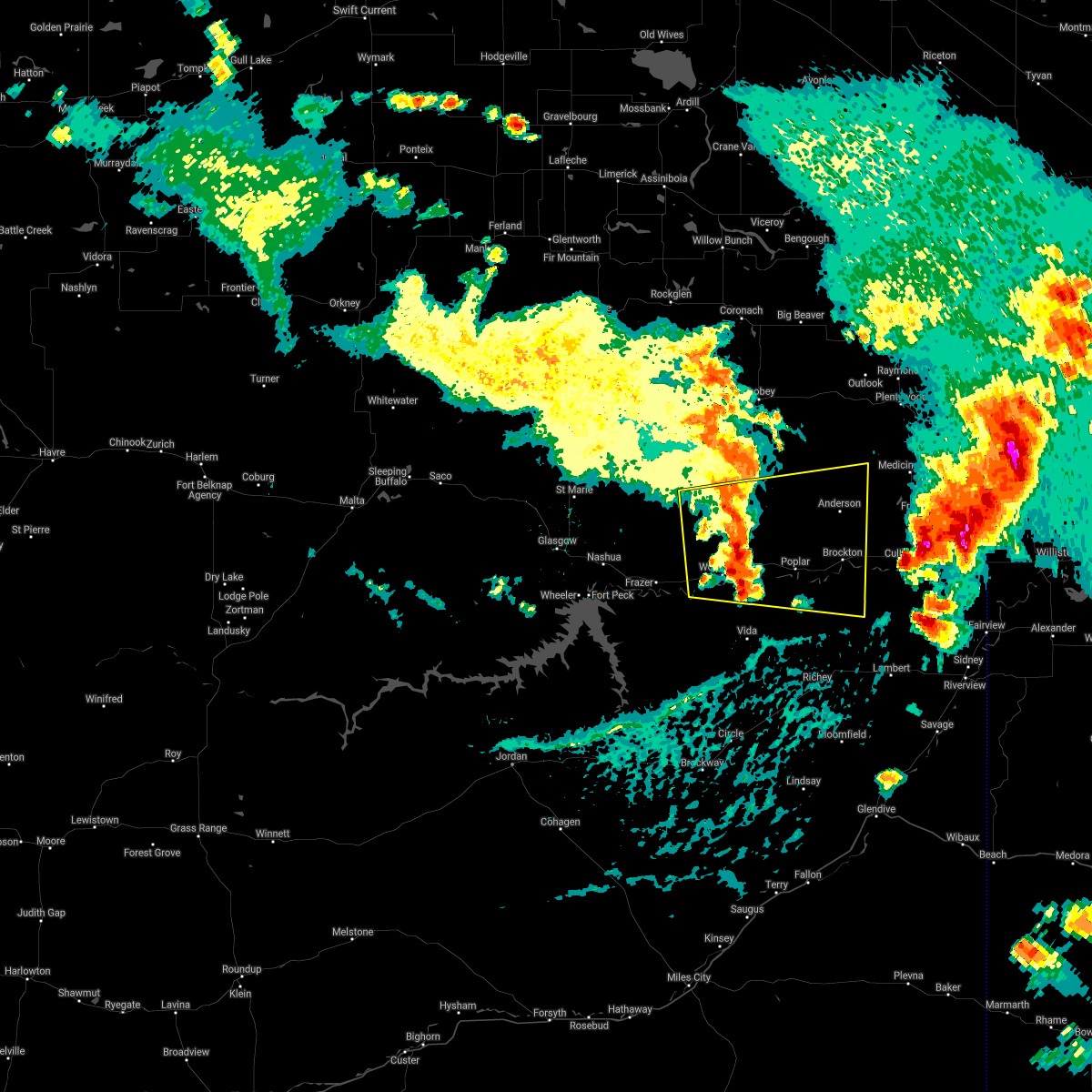
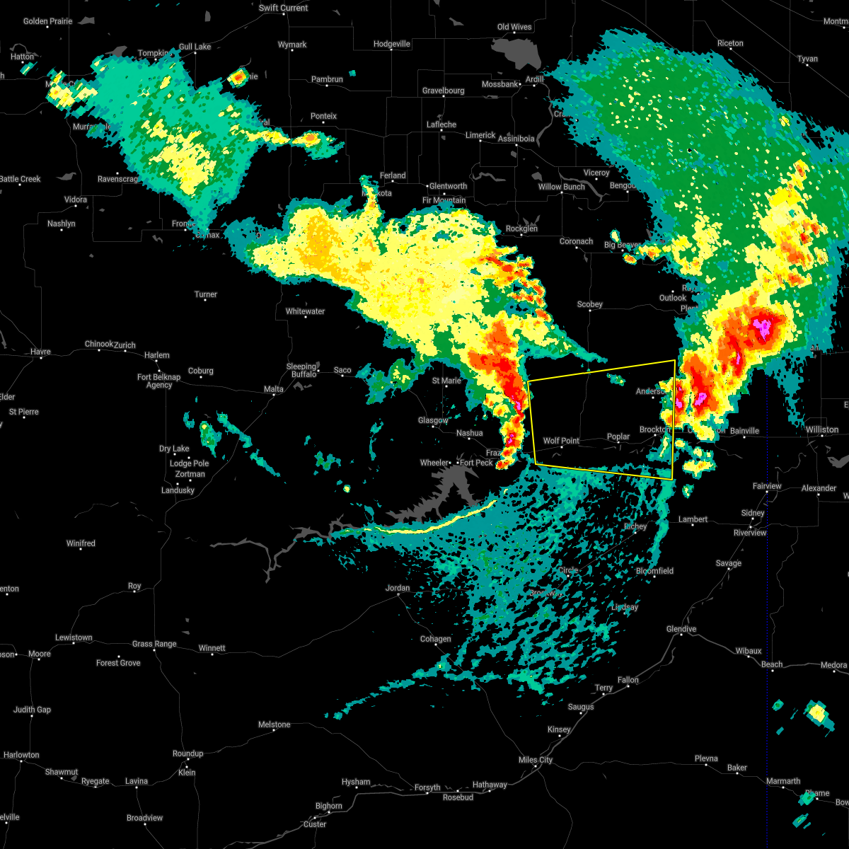
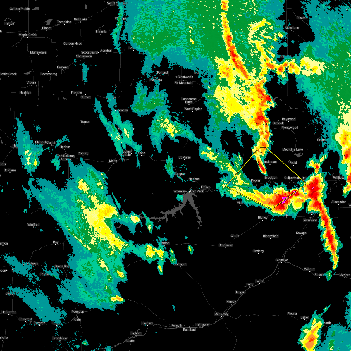
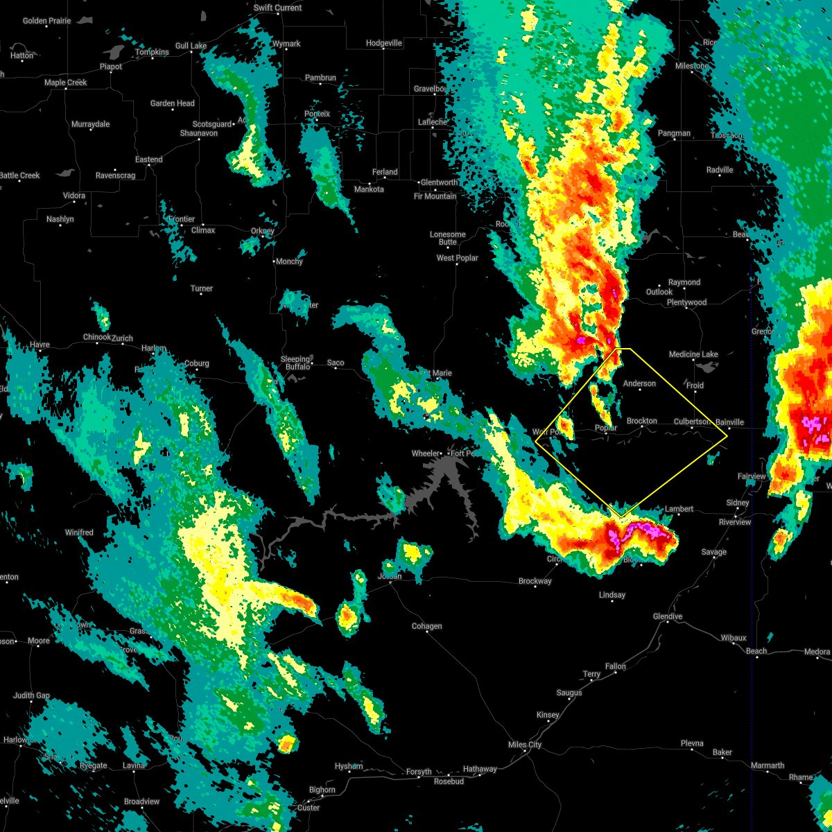
Hail Map for Wolf Point, MT
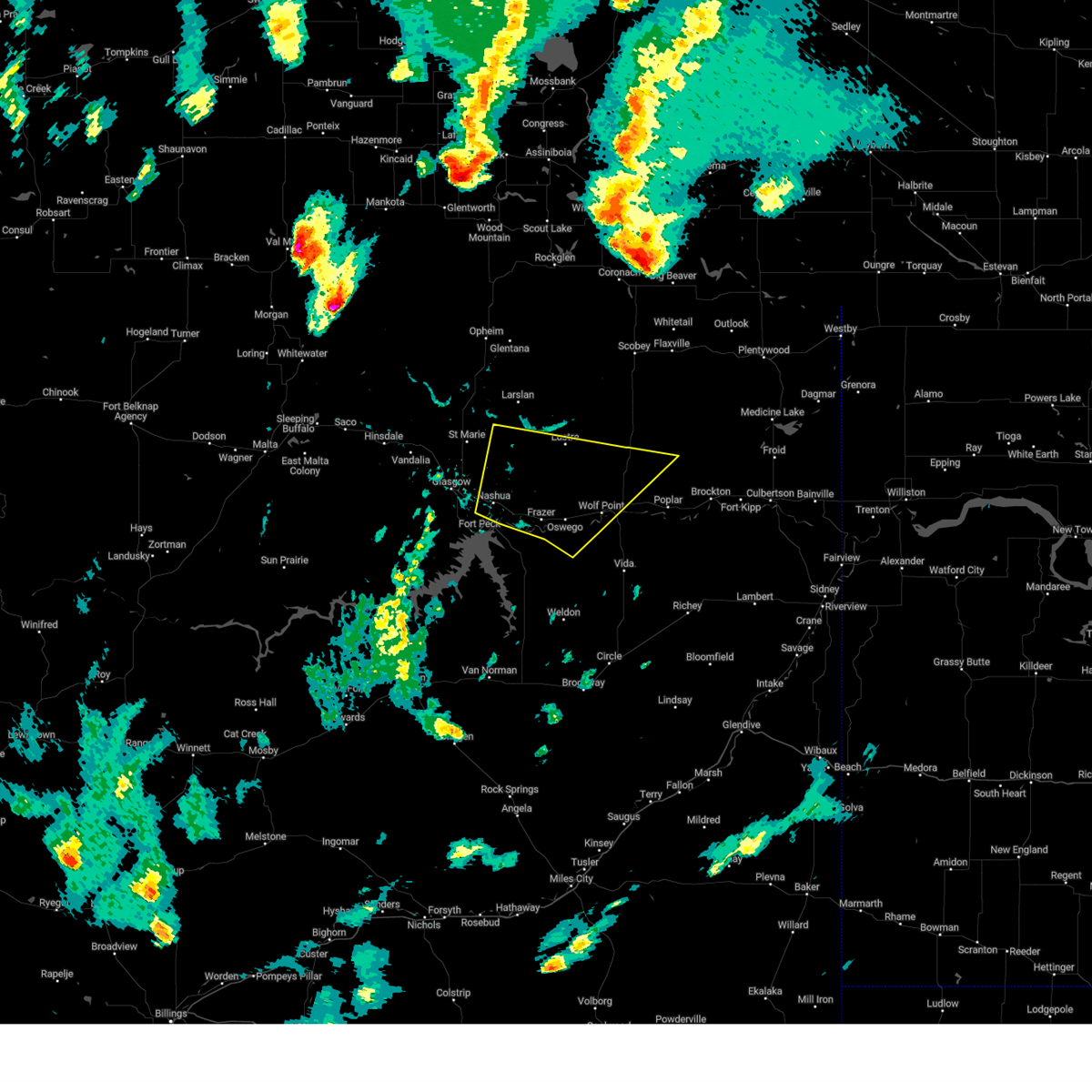
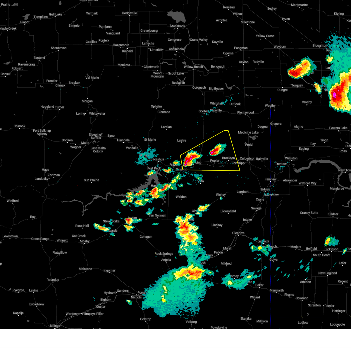
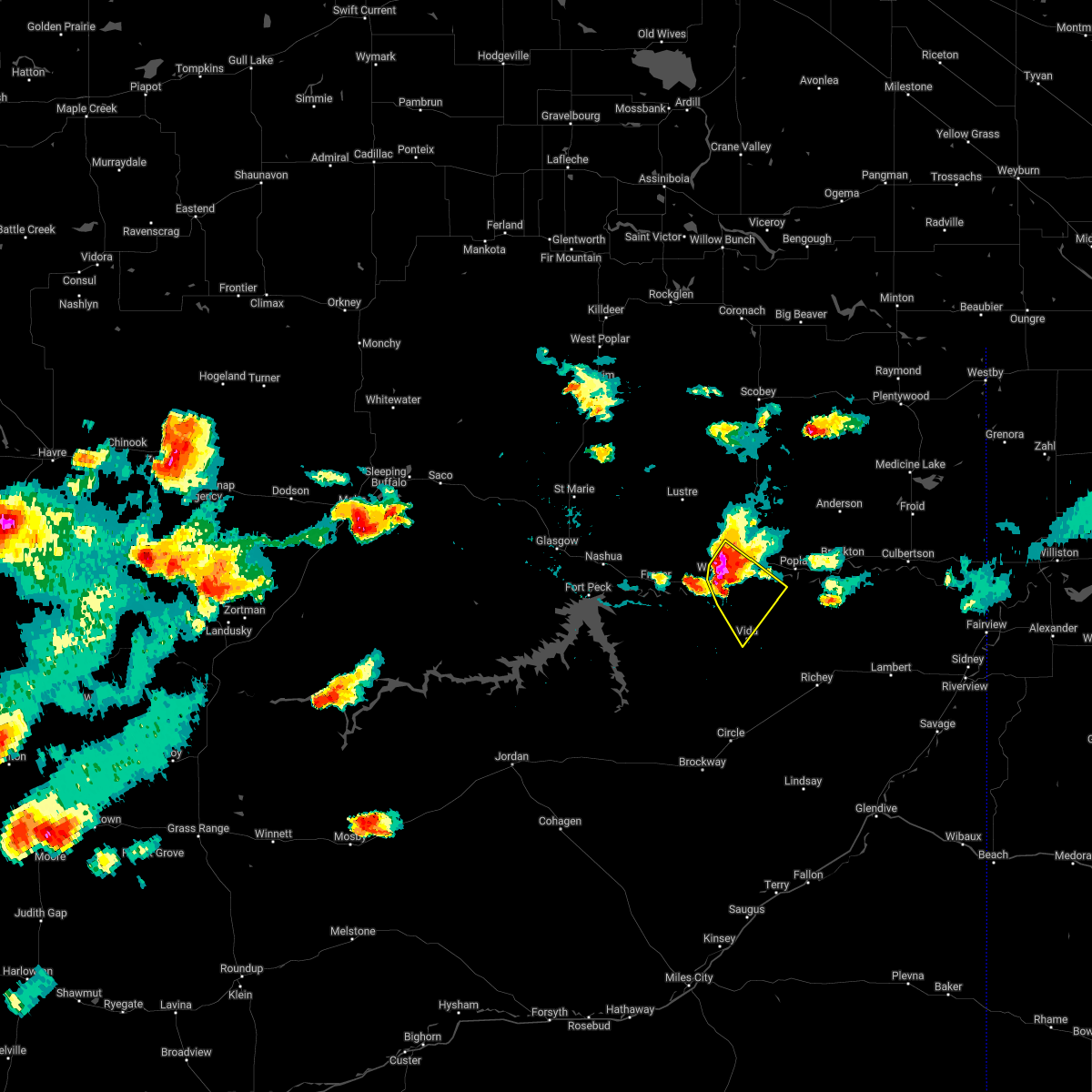
The Wolf Point, MT area has had 36 reports of on-the-ground hail by trained spotters, and has been under severe weather warnings 22 times during the past 12 months. Doppler radar has detected hail at or near Wolf Point, MT on 31 occasions, including 1 occasion during the past year.
| Name: | Wolf Point, MT |
| Where Located: | 46.5 miles E of Glasgow, MT |
| Map: | Google Map for Wolf Point, MT |
| Population: | 2621 |
| Housing Units: | 1080 |
| More Info: | Search Google for Wolf Point, MT |
0
The Top Recent Hail Date for Wolf Point, MT is Friday, September 20, 2024 (30th out of 31)

Hail and Wind Damage Spotted near Wolf Point, MT
| Date / Time | Report Details |
|---|---|
| 7/2/2025 8:35 PM MDT | Storm damage reported in mccone county MT, 20 miles NNW of Wolf Point, MT |
| 6/26/2025 4:00 PM MDT | Wolf point n in roosevelt county MT, 8.1 miles SE of Wolf Point, MT |
| 6/15/2025 9:00 PM MDT | Wolf point nw (hydromet) statio in roosevelt county MT, 3.6 miles ESE of Wolf Point, MT |
| 6/15/2025 8:52 PM MDT | Fort peck dam statio in mccone county MT, 35.5 miles E of Wolf Point, MT |
| 6/15/2025 8:37 PM MDT |
 Svrggw the national weather service in glasgow has issued a * severe thunderstorm warning for, western roosevelt county in northeastern montana, east central valley county in northeastern montana, northeastern mccone county in northeastern montana, northwestern richland county in northeastern montana, * until 945 pm mdt. * at 837 pm mdt, severe thunderstorms were located along a line extending from near lustre to 9 miles north of wolf point to 13 miles southeast of frazer, moving east at 40 mph (radar indicated). Hazards include 70 mph wind gusts. Expect considerable tree damage. Damage is likely to mobile homes, roofs, and outbuildings. Svrggw the national weather service in glasgow has issued a * severe thunderstorm warning for, western roosevelt county in northeastern montana, east central valley county in northeastern montana, northeastern mccone county in northeastern montana, northwestern richland county in northeastern montana, * until 945 pm mdt. * at 837 pm mdt, severe thunderstorms were located along a line extending from near lustre to 9 miles north of wolf point to 13 miles southeast of frazer, moving east at 40 mph (radar indicated). Hazards include 70 mph wind gusts. Expect considerable tree damage. Damage is likely to mobile homes, roofs, and outbuildings.
|
| 6/15/2025 8:20 PM MDT |
 At 818 pm mdt, severe thunderstorms were located along a line extending from 6 miles soutt of lustre to the nelson creek recreation area, moving southeast at 45 mph (trained weather spotters). Hazards include 70 mph wind gusts and half dollar size hail. Hail damage to vehicles is expected. expect considerable tree damage. wind damage is also likely to mobile homes, roofs, and outbuildings. Locations impacted include, wolf point, sprole, circle, oswego, weldon, richey, frazer, poplar, vida, and rock creek rec area. At 818 pm mdt, severe thunderstorms were located along a line extending from 6 miles soutt of lustre to the nelson creek recreation area, moving southeast at 45 mph (trained weather spotters). Hazards include 70 mph wind gusts and half dollar size hail. Hail damage to vehicles is expected. expect considerable tree damage. wind damage is also likely to mobile homes, roofs, and outbuildings. Locations impacted include, wolf point, sprole, circle, oswego, weldon, richey, frazer, poplar, vida, and rock creek rec area.
|
| 6/15/2025 8:20 PM MDT |
 the severe thunderstorm warning has been cancelled and is no longer in effect the severe thunderstorm warning has been cancelled and is no longer in effect
|
| 6/15/2025 7:48 PM MDT |
 Svrggw the national weather service in glasgow has issued a * severe thunderstorm warning for, northeastern garfield county in northeastern montana, southwestern roosevelt county in northeastern montana, eastern valley county in northeastern montana, mccone county in northeastern montana, northwestern dawson county in northeastern montana, northwestern richland county in northeastern montana, * until 845 pm mdt. * at 747 pm mdt, severe thunderstorms were located along a line extending from 15 miles north of st. marie to near nashua to 6 miles south of fort peck, moving southeast at 85 mph (trained weather spotters). Hazards include 70 mph wind gusts and half dollar size hail. Hail damage to vehicles is expected. expect considerable tree damage. Wind damage is also likely to mobile homes, roofs, and outbuildings. Svrggw the national weather service in glasgow has issued a * severe thunderstorm warning for, northeastern garfield county in northeastern montana, southwestern roosevelt county in northeastern montana, eastern valley county in northeastern montana, mccone county in northeastern montana, northwestern dawson county in northeastern montana, northwestern richland county in northeastern montana, * until 845 pm mdt. * at 747 pm mdt, severe thunderstorms were located along a line extending from 15 miles north of st. marie to near nashua to 6 miles south of fort peck, moving southeast at 85 mph (trained weather spotters). Hazards include 70 mph wind gusts and half dollar size hail. Hail damage to vehicles is expected. expect considerable tree damage. Wind damage is also likely to mobile homes, roofs, and outbuildings.
|
| 5/12/2025 9:30 PM MDT |
 The storms which prompted the warning have weakened below severe limits, and no longer pose an immediate threat to life or property. therefore, the warning will be allowed to expire. however, gusty winds are still possible with these thunderstorms. The storms which prompted the warning have weakened below severe limits, and no longer pose an immediate threat to life or property. therefore, the warning will be allowed to expire. however, gusty winds are still possible with these thunderstorms.
|
| 5/12/2025 8:52 PM MDT |
 At 850 pm mdt, severe thunderstorms were located along a line extending from 9 miles southwest of bredette to 12 miles west of circle, moving northeast at 25 mph (at 837 pm, the wolf point airport reported a gust to 59 mph). Hazards include 60 mph wind gusts. Expect damage to roofs, siding, and trees. Locations impacted include, wolf point, sprole, oswego, nashua, haxby, weldon, frazer, poplar, vida, nelson creek rec area, rock creek rec area, and circle. At 850 pm mdt, severe thunderstorms were located along a line extending from 9 miles southwest of bredette to 12 miles west of circle, moving northeast at 25 mph (at 837 pm, the wolf point airport reported a gust to 59 mph). Hazards include 60 mph wind gusts. Expect damage to roofs, siding, and trees. Locations impacted include, wolf point, sprole, oswego, nashua, haxby, weldon, frazer, poplar, vida, nelson creek rec area, rock creek rec area, and circle.
|
| 5/12/2025 8:39 PM MDT | Asos station kolf wolf point airpor in roosevelt county MT, 2.9 miles W of Wolf Point, MT |
| 5/12/2025 8:24 PM MDT |
 Svrggw the national weather service in glasgow has issued a * severe thunderstorm warning for, northeastern garfield county in northeastern montana, western roosevelt county in northeastern montana, southeastern valley county in northeastern montana, mccone county in northeastern montana, northwestern dawson county in northeastern montana, northwestern richland county in northeastern montana, * until 930 pm mdt. * at 824 pm mdt, severe thunderstorms were located along a line extending from 7 miles northwest of wolf point to 6 miles north of flowing wells rest area, moving east at 30 mph (public). Hazards include 60 mph wind gusts. expect damage to roofs, siding, and trees Svrggw the national weather service in glasgow has issued a * severe thunderstorm warning for, northeastern garfield county in northeastern montana, western roosevelt county in northeastern montana, southeastern valley county in northeastern montana, mccone county in northeastern montana, northwestern dawson county in northeastern montana, northwestern richland county in northeastern montana, * until 930 pm mdt. * at 824 pm mdt, severe thunderstorms were located along a line extending from 7 miles northwest of wolf point to 6 miles north of flowing wells rest area, moving east at 30 mph (public). Hazards include 60 mph wind gusts. expect damage to roofs, siding, and trees
|
| 5/10/2025 9:08 PM MDT |
 the severe thunderstorm warning has been cancelled and is no longer in effect the severe thunderstorm warning has been cancelled and is no longer in effect
|
| 5/10/2025 8:43 PM MDT |
 Svrggw the national weather service in glasgow has issued a * severe thunderstorm warning for, northeastern garfield county in northeastern montana, western daniels county in northeastern montana, western roosevelt county in northeastern montana, valley county in northeastern montana, northwestern mccone county in northeastern montana, * until 945 pm mdt. * at 843 pm mdt, severe thunderstorms were located along a line extending from near opheim to 6 miles east of glasgow to 7 miles north of hell creek rec area, moving east at 45 mph (radar indicated). Hazards include 60 mph wind gusts. expect damage to roofs, siding, and trees Svrggw the national weather service in glasgow has issued a * severe thunderstorm warning for, northeastern garfield county in northeastern montana, western daniels county in northeastern montana, western roosevelt county in northeastern montana, valley county in northeastern montana, northwestern mccone county in northeastern montana, * until 945 pm mdt. * at 843 pm mdt, severe thunderstorms were located along a line extending from near opheim to 6 miles east of glasgow to 7 miles north of hell creek rec area, moving east at 45 mph (radar indicated). Hazards include 60 mph wind gusts. expect damage to roofs, siding, and trees
|
| 9/20/2024 7:58 PM MDT |
 The storm which prompted the warning has moved out of the area. therefore, the warning will be allowed to expire. however, gusty winds are still possible behind this thunderstorm. The storm which prompted the warning has moved out of the area. therefore, the warning will be allowed to expire. however, gusty winds are still possible behind this thunderstorm.
|
| 9/20/2024 7:43 PM MDT | Asos station kolf wolf point airpor in roosevelt county MT, 2.9 miles W of Wolf Point, MT |
| 9/20/2024 7:27 PM MDT |
 the severe thunderstorm warning has been cancelled and is no longer in effect the severe thunderstorm warning has been cancelled and is no longer in effect
|
| 9/20/2024 7:27 PM MDT |
 At 727 pm mdt, a severe thunderstorm was located 9 miles south of wolf point, moving east at 50 mph (radar indicated). Hazards include 70 mph wind gusts and nickel size hail. Expect considerable tree damage. damage is likely to mobile homes, roofs, and outbuildings. Locations impacted include, wolf point, vida, frazer, and oswego. At 727 pm mdt, a severe thunderstorm was located 9 miles south of wolf point, moving east at 50 mph (radar indicated). Hazards include 70 mph wind gusts and nickel size hail. Expect considerable tree damage. damage is likely to mobile homes, roofs, and outbuildings. Locations impacted include, wolf point, vida, frazer, and oswego.
|
| 9/20/2024 6:55 PM MDT |
 Svrggw the national weather service in glasgow has issued a * severe thunderstorm warning for, northeastern garfield county in northeastern montana, southwestern roosevelt county in northeastern montana, southeastern valley county in northeastern montana, northern mccone county in northeastern montana, * until 800 pm mdt. * at 654 pm mdt, a severe thunderstorm was located near fort peck, or 17 miles southeast of glasgow, moving east at 55 mph (radar indicated). Hazards include 70 mph wind gusts and nickel size hail. Expect considerable tree damage. Damage is likely to mobile homes, roofs, and outbuildings. Svrggw the national weather service in glasgow has issued a * severe thunderstorm warning for, northeastern garfield county in northeastern montana, southwestern roosevelt county in northeastern montana, southeastern valley county in northeastern montana, northern mccone county in northeastern montana, * until 800 pm mdt. * at 654 pm mdt, a severe thunderstorm was located near fort peck, or 17 miles southeast of glasgow, moving east at 55 mph (radar indicated). Hazards include 70 mph wind gusts and nickel size hail. Expect considerable tree damage. Damage is likely to mobile homes, roofs, and outbuildings.
|
| 9/17/2024 6:41 PM MDT |
 Svrggw the national weather service in glasgow has issued a * severe thunderstorm warning for, southern daniels county in northeastern montana, western roosevelt county in northeastern montana, eastern valley county in northeastern montana, west central sheridan county in northeastern montana, northeastern mccone county in northeastern montana, northwestern richland county in northeastern montana, * until 745 pm mdt. * at 641 pm mdt, a severe thunderstorm was located over bredette, or 19 miles south of scobey, moving northwest at 20 mph (radar indicated). Hazards include 60 mph wind gusts and quarter size hail. Hail damage to vehicles is expected. Expect wind damage to roofs, siding, and trees. Svrggw the national weather service in glasgow has issued a * severe thunderstorm warning for, southern daniels county in northeastern montana, western roosevelt county in northeastern montana, eastern valley county in northeastern montana, west central sheridan county in northeastern montana, northeastern mccone county in northeastern montana, northwestern richland county in northeastern montana, * until 745 pm mdt. * at 641 pm mdt, a severe thunderstorm was located over bredette, or 19 miles south of scobey, moving northwest at 20 mph (radar indicated). Hazards include 60 mph wind gusts and quarter size hail. Hail damage to vehicles is expected. Expect wind damage to roofs, siding, and trees.
|
| 8/25/2024 12:45 AM MDT | Mesonet station mtmcd 8.5 sw bredette (mt dot in roosevelt county MT, 25.1 miles SSW of Wolf Point, MT |
| 8/25/2024 12:33 AM MDT |
 At 1232 am mdt, severe thunderstorms were located along a line extending from near peerless to 12 miles east of lustre to 15 miles south of bredette to 10 miles south of poplar, moving northeast at 45 mph (radar indicated). Hazards include 70 mph wind gusts and ping pong ball size hail. People and animals outdoors will be injured. expect hail damage to roofs, siding, windows, and vehicles. expect considerable tree damage. wind damage is also likely to mobile homes, roofs, and outbuildings. Locations impacted include, wolf point, plentywood, scobey, poplar, culbertson, brockton, medicine lake, froid, flaxville, archer, port of whitetail, lustre, madoc, bredette, redstone, frazer, whitetail, rock creek rec area, outlook, and reserve. At 1232 am mdt, severe thunderstorms were located along a line extending from near peerless to 12 miles east of lustre to 15 miles south of bredette to 10 miles south of poplar, moving northeast at 45 mph (radar indicated). Hazards include 70 mph wind gusts and ping pong ball size hail. People and animals outdoors will be injured. expect hail damage to roofs, siding, windows, and vehicles. expect considerable tree damage. wind damage is also likely to mobile homes, roofs, and outbuildings. Locations impacted include, wolf point, plentywood, scobey, poplar, culbertson, brockton, medicine lake, froid, flaxville, archer, port of whitetail, lustre, madoc, bredette, redstone, frazer, whitetail, rock creek rec area, outlook, and reserve.
|
| 8/25/2024 12:33 AM MDT |
 the severe thunderstorm warning has been cancelled and is no longer in effect the severe thunderstorm warning has been cancelled and is no longer in effect
|
| 8/25/2024 12:28 AM MDT | Storm damage reported in roosevelt county MT, 20.8 miles S of Wolf Point, MT |
| 8/25/2024 12:20 AM MDT | Asos station kolf wolf point airpor in roosevelt county MT, 2.9 miles W of Wolf Point, MT |
| 8/24/2024 11:51 PM MDT |
 Svrggw the national weather service in glasgow has issued a * severe thunderstorm warning for, northeastern garfield county in northeastern montana, daniels county in northeastern montana, roosevelt county in northeastern montana, east central valley county in northeastern montana, western sheridan county in northeastern montana, northern mccone county in northeastern montana, northwestern richland county in northeastern montana, northwestern dawson county in northeastern montana, * until 100 am mdt. * at 1150 pm mdt, severe thunderstorms were located along a line extending from 10 miles northwest of lustre to 7 miles northeast of frazer to near wolf point to 7 miles southeast of vida, moving northeast at 45 mph (radar indicated). Hazards include 70 mph wind gusts and quarter size hail. Hail damage to vehicles is expected. expect considerable tree damage. Wind damage is also likely to mobile homes, roofs, and outbuildings. Svrggw the national weather service in glasgow has issued a * severe thunderstorm warning for, northeastern garfield county in northeastern montana, daniels county in northeastern montana, roosevelt county in northeastern montana, east central valley county in northeastern montana, western sheridan county in northeastern montana, northern mccone county in northeastern montana, northwestern richland county in northeastern montana, northwestern dawson county in northeastern montana, * until 100 am mdt. * at 1150 pm mdt, severe thunderstorms were located along a line extending from 10 miles northwest of lustre to 7 miles northeast of frazer to near wolf point to 7 miles southeast of vida, moving northeast at 45 mph (radar indicated). Hazards include 70 mph wind gusts and quarter size hail. Hail damage to vehicles is expected. expect considerable tree damage. Wind damage is also likely to mobile homes, roofs, and outbuildings.
|
| 8/24/2024 11:24 PM MDT |
 At 1122 pm mdt, a severe thunderstorm was located 8 miles northeast of rock creek rec area, or 29 miles southwest of wolf point, moving northeast at 45 mph. this is a destructive storm for western mccone county (radar indicated). Hazards include 80 mph wind gusts and quarter size hail. Flying debris will be dangerous to those caught without shelter. mobile homes will be heavily damaged. expect considerable damage to roofs, windows, and vehicles. extensive tree damage and power outages are likely. Locations impacted include, wolf point, frazer, vida, nelson creek rec area, rock creek rec area, oswego, and haxby. At 1122 pm mdt, a severe thunderstorm was located 8 miles northeast of rock creek rec area, or 29 miles southwest of wolf point, moving northeast at 45 mph. this is a destructive storm for western mccone county (radar indicated). Hazards include 80 mph wind gusts and quarter size hail. Flying debris will be dangerous to those caught without shelter. mobile homes will be heavily damaged. expect considerable damage to roofs, windows, and vehicles. extensive tree damage and power outages are likely. Locations impacted include, wolf point, frazer, vida, nelson creek rec area, rock creek rec area, oswego, and haxby.
|
| 8/24/2024 11:04 PM MDT |
 Svrggw the national weather service in glasgow has issued a * severe thunderstorm warning for, northeastern garfield county in northeastern montana, southwestern roosevelt county in northeastern montana, east central valley county in northeastern montana, northern mccone county in northeastern montana, * until midnight mdt. * at 1103 pm mdt, a severe thunderstorm was located near rock creek rec area, or 35 miles northeast of jordan, moving northeast at 45 mph (radar indicated). Hazards include 60 mph wind gusts and quarter size hail. Hail damage to vehicles is expected. Expect wind damage to roofs, siding, and trees. Svrggw the national weather service in glasgow has issued a * severe thunderstorm warning for, northeastern garfield county in northeastern montana, southwestern roosevelt county in northeastern montana, east central valley county in northeastern montana, northern mccone county in northeastern montana, * until midnight mdt. * at 1103 pm mdt, a severe thunderstorm was located near rock creek rec area, or 35 miles northeast of jordan, moving northeast at 45 mph (radar indicated). Hazards include 60 mph wind gusts and quarter size hail. Hail damage to vehicles is expected. Expect wind damage to roofs, siding, and trees.
|
| 8/21/2024 7:53 PM MDT | Asos station kolf wolf point airpor in roosevelt county MT, 2.9 miles W of Wolf Point, MT |
| 8/21/2024 7:49 PM MDT |
 Svrggw the national weather service in glasgow has issued a * severe thunderstorm warning for, roosevelt county in northeastern montana, northeastern mccone county in northeastern montana, northwestern richland county in northeastern montana, * until 845 pm mdt. * at 748 pm mdt, severe thunderstorms were located along a line extending from 6 miles west of bredette to 11 miles south of poplar, moving northeast at 40 mph (radar indicated). Hazards include 60 mph wind gusts and quarter size hail. Hail damage to vehicles is expected. Expect wind damage to roofs, siding, and trees. Svrggw the national weather service in glasgow has issued a * severe thunderstorm warning for, roosevelt county in northeastern montana, northeastern mccone county in northeastern montana, northwestern richland county in northeastern montana, * until 845 pm mdt. * at 748 pm mdt, severe thunderstorms were located along a line extending from 6 miles west of bredette to 11 miles south of poplar, moving northeast at 40 mph (radar indicated). Hazards include 60 mph wind gusts and quarter size hail. Hail damage to vehicles is expected. Expect wind damage to roofs, siding, and trees.
|
| 8/21/2024 7:24 PM MDT |
 At 723 pm mdt, a severe thunderstorm was located 12 miles northeast of frazer, or 15 miles northwest of wolf point, moving northeast at 30 mph (radar indicated). Hazards include 60 mph wind gusts and nickel size hail. Expect damage to roofs, siding, and trees. Locations impacted include, wolf point, nashua, lustre, frazer, volt, and oswego. At 723 pm mdt, a severe thunderstorm was located 12 miles northeast of frazer, or 15 miles northwest of wolf point, moving northeast at 30 mph (radar indicated). Hazards include 60 mph wind gusts and nickel size hail. Expect damage to roofs, siding, and trees. Locations impacted include, wolf point, nashua, lustre, frazer, volt, and oswego.
|
| 8/21/2024 7:07 PM MDT |
 Svrggw the national weather service in glasgow has issued a * severe thunderstorm warning for, southwestern roosevelt county in northeastern montana, southeastern valley county in northeastern montana, northwestern mccone county in northeastern montana, * until 745 pm mdt. * at 707 pm mdt, a severe thunderstorm was located near frazer, or 21 miles west of wolf point, moving northeast at 45 mph (trained weather spotters). Hazards include 60 mph wind gusts and quarter size hail. Hail damage to vehicles is expected. Expect wind damage to roofs, siding, and trees. Svrggw the national weather service in glasgow has issued a * severe thunderstorm warning for, southwestern roosevelt county in northeastern montana, southeastern valley county in northeastern montana, northwestern mccone county in northeastern montana, * until 745 pm mdt. * at 707 pm mdt, a severe thunderstorm was located near frazer, or 21 miles west of wolf point, moving northeast at 45 mph (trained weather spotters). Hazards include 60 mph wind gusts and quarter size hail. Hail damage to vehicles is expected. Expect wind damage to roofs, siding, and trees.
|
| 7/5/2024 4:15 PM MDT |
 The storms which prompted the warning have weakened below severe limits, and have exited the warned area. therefore, the warning will be allowed to expire. however, gusty winds are still possible with these thunderstorms. The storms which prompted the warning have weakened below severe limits, and have exited the warned area. therefore, the warning will be allowed to expire. however, gusty winds are still possible with these thunderstorms.
|
| 7/5/2024 4:03 PM MDT | Storm damage reported in roosevelt county MT, 2.9 miles W of Wolf Point, MT |
| 7/5/2024 3:40 PM MDT |
 At 339 pm mdt, severe thunderstorms were located along a line extending from 11 miles north of wolf point to near nelson creek rec area to near jordan, moving southeast at 40 mph (radar indicated). Hazards include 60 mph wind gusts. Expect damage to roofs, siding, and trees. Locations impacted include, wolf point, jordan, frazer, flowing wells rest area, vida, cohagen, nelson creek rec area, rock creek rec area, oswego, weldon, and van norman. At 339 pm mdt, severe thunderstorms were located along a line extending from 11 miles north of wolf point to near nelson creek rec area to near jordan, moving southeast at 40 mph (radar indicated). Hazards include 60 mph wind gusts. Expect damage to roofs, siding, and trees. Locations impacted include, wolf point, jordan, frazer, flowing wells rest area, vida, cohagen, nelson creek rec area, rock creek rec area, oswego, weldon, and van norman.
|
| 7/5/2024 3:09 PM MDT |
 Svrggw the national weather service in glasgow has issued a * severe thunderstorm warning for, eastern garfield county in northeastern montana, southwestern roosevelt county in northeastern montana, southeastern valley county in northeastern montana, mccone county in northeastern montana, * until 415 pm mdt. * at 307 pm mdt, severe thunderstorms were located along a line extending from 7 miles west of lustre to 7 miles east of the pines rec area to 9 miles east of brusett, moving southeast at 50 mph (radar indicated). Hazards include 60 mph wind gusts. expect damage to roofs, siding, and trees Svrggw the national weather service in glasgow has issued a * severe thunderstorm warning for, eastern garfield county in northeastern montana, southwestern roosevelt county in northeastern montana, southeastern valley county in northeastern montana, mccone county in northeastern montana, * until 415 pm mdt. * at 307 pm mdt, severe thunderstorms were located along a line extending from 7 miles west of lustre to 7 miles east of the pines rec area to 9 miles east of brusett, moving southeast at 50 mph (radar indicated). Hazards include 60 mph wind gusts. expect damage to roofs, siding, and trees
|
| 6/24/2024 12:05 AM MDT | Quarter sized hail reported 0.3 miles NNW of Wolf Point, MT, mainly dime-nickel sized... some quarter sized hail. |
| 6/24/2024 12:05 AM MDT | Ping Pong Ball sized hail reported 0.3 miles NNW of Wolf Point, MT, multiple facebook reports of hail 1-1.5 inches. |
| 6/23/2024 11:57 PM MDT |
 Svrggw the national weather service in glasgow has issued a * severe thunderstorm warning for, western roosevelt county in northeastern montana, east central valley county in northeastern montana, northeastern mccone county in northeastern montana, northwestern richland county in northeastern montana, * until 1230 am mdt. * at 1157 pm mdt, a severe thunderstorm was located near wolf point, moving east at 45 mph (radar indicated). Hazards include 60 mph wind gusts and quarter size hail. Hail damage to vehicles is expected. Expect wind damage to roofs, siding, and trees. Svrggw the national weather service in glasgow has issued a * severe thunderstorm warning for, western roosevelt county in northeastern montana, east central valley county in northeastern montana, northeastern mccone county in northeastern montana, northwestern richland county in northeastern montana, * until 1230 am mdt. * at 1157 pm mdt, a severe thunderstorm was located near wolf point, moving east at 45 mph (radar indicated). Hazards include 60 mph wind gusts and quarter size hail. Hail damage to vehicles is expected. Expect wind damage to roofs, siding, and trees.
|
| 6/15/2024 7:27 PM MDT |
 Svrggw the national weather service in glasgow has issued a * severe thunderstorm warning for, southern daniels county in northeastern montana, roosevelt county in northeastern montana, east central valley county in northeastern montana, western sheridan county in northeastern montana, northeastern mccone county in northeastern montana, richland county in northeastern montana, northern dawson county in northeastern montana, * until 830 pm mdt. * at 726 pm mdt, severe thunderstorms were located along a line extending from 12 miles south of peerless to 6 miles west of poplar to 6 miles south of circle, moving east at 45 mph (radar indicated). Hazards include 70 mph wind gusts and quarter size hail. Hail damage to vehicles is expected. expect considerable tree damage. Wind damage is also likely to mobile homes, roofs, and outbuildings. Svrggw the national weather service in glasgow has issued a * severe thunderstorm warning for, southern daniels county in northeastern montana, roosevelt county in northeastern montana, east central valley county in northeastern montana, western sheridan county in northeastern montana, northeastern mccone county in northeastern montana, richland county in northeastern montana, northern dawson county in northeastern montana, * until 830 pm mdt. * at 726 pm mdt, severe thunderstorms were located along a line extending from 12 miles south of peerless to 6 miles west of poplar to 6 miles south of circle, moving east at 45 mph (radar indicated). Hazards include 70 mph wind gusts and quarter size hail. Hail damage to vehicles is expected. expect considerable tree damage. Wind damage is also likely to mobile homes, roofs, and outbuildings.
|
| 6/15/2024 7:03 PM MDT |
 At 702 pm mdt, a severe thunderstorm was located 7 miles southeast of lustre, or 17 miles north of wolf point, moving northeast at 45 mph. this is a destructive storm for oswego, wolf point, poplar, and lustre (public). Hazards include 80 mph wind gusts and quarter size hail. Flying debris will be dangerous to those caught without shelter. mobile homes will be heavily damaged. expect considerable damage to roofs, windows, and vehicles. extensive tree damage and power outages are likely. Locations impacted include, wolf point, poplar, frazer, lustre, sprole, oswego, and volt. At 702 pm mdt, a severe thunderstorm was located 7 miles southeast of lustre, or 17 miles north of wolf point, moving northeast at 45 mph. this is a destructive storm for oswego, wolf point, poplar, and lustre (public). Hazards include 80 mph wind gusts and quarter size hail. Flying debris will be dangerous to those caught without shelter. mobile homes will be heavily damaged. expect considerable damage to roofs, windows, and vehicles. extensive tree damage and power outages are likely. Locations impacted include, wolf point, poplar, frazer, lustre, sprole, oswego, and volt.
|
| 6/15/2024 7:03 PM MDT |
 the severe thunderstorm warning has been cancelled and is no longer in effect the severe thunderstorm warning has been cancelled and is no longer in effect
|
| 6/15/2024 6:28 PM MDT |
 Svrggw the national weather service in glasgow has issued a * severe thunderstorm warning for, northeastern garfield county in northeastern montana, southwestern daniels county in northeastern montana, western roosevelt county in northeastern montana, southeastern valley county in northeastern montana, northern mccone county in northeastern montana, northwestern richland county in northeastern montana, * until 730 pm mdt. * at 627 pm mdt, a severe thunderstorm was located near nashua, or 17 miles east of glasgow, moving northeast at 45 mph. this is a destructive storm for fort peck, nashua, frazer, oswego, wolf point and lustre (public). Hazards include 80 mph wind gusts and quarter size hail. Flying debris will be dangerous to those caught without shelter. mobile homes will be heavily damaged. expect considerable damage to roofs, windows, and vehicles. Extensive tree damage and power outages are likely. Svrggw the national weather service in glasgow has issued a * severe thunderstorm warning for, northeastern garfield county in northeastern montana, southwestern daniels county in northeastern montana, western roosevelt county in northeastern montana, southeastern valley county in northeastern montana, northern mccone county in northeastern montana, northwestern richland county in northeastern montana, * until 730 pm mdt. * at 627 pm mdt, a severe thunderstorm was located near nashua, or 17 miles east of glasgow, moving northeast at 45 mph. this is a destructive storm for fort peck, nashua, frazer, oswego, wolf point and lustre (public). Hazards include 80 mph wind gusts and quarter size hail. Flying debris will be dangerous to those caught without shelter. mobile homes will be heavily damaged. expect considerable damage to roofs, windows, and vehicles. Extensive tree damage and power outages are likely.
|
| 5/13/2024 8:08 PM MDT |
 the severe thunderstorm warning has been cancelled and is no longer in effect the severe thunderstorm warning has been cancelled and is no longer in effect
|
| 5/13/2024 7:24 PM MDT |
 Svrggw the national weather service in glasgow has issued a * severe thunderstorm warning for, northeastern garfield county in northeastern montana, southwestern roosevelt county in northeastern montana, central valley county in northeastern montana, northwestern mccone county in northeastern montana, * until 830 pm mdt. * at 723 pm mdt, a severe thunderstorm was located near glasgow, moving southeast at 40 mph (radar indicated). Hazards include 60 mph wind gusts. expect damage to roofs, siding, and trees Svrggw the national weather service in glasgow has issued a * severe thunderstorm warning for, northeastern garfield county in northeastern montana, southwestern roosevelt county in northeastern montana, central valley county in northeastern montana, northwestern mccone county in northeastern montana, * until 830 pm mdt. * at 723 pm mdt, a severe thunderstorm was located near glasgow, moving southeast at 40 mph (radar indicated). Hazards include 60 mph wind gusts. expect damage to roofs, siding, and trees
|
| 4/22/2024 4:47 PM MDT |
 The storms which prompted the warning have weakened below severe limits, and no longer pose an immediate threat to life or property. therefore, the warning has been allowed to expire. however, gusty winds are still possible with these thunderstorms. The storms which prompted the warning have weakened below severe limits, and no longer pose an immediate threat to life or property. therefore, the warning has been allowed to expire. however, gusty winds are still possible with these thunderstorms.
|
| 4/22/2024 3:42 PM MDT |
 Svrggw the national weather service in glasgow has issued a * severe thunderstorm warning for, southwestern roosevelt county in northeastern montana, east central valley county in northeastern montana, northeastern mccone county in northeastern montana, northwestern richland county in northeastern montana, northwestern dawson county in northeastern montana, * until 445 pm mdt. * at 341 pm mdt, showers with damaging gusts were located along a line extending from 13 miles southwest of bredette to 8 miles southeast of st. marie, moving southeast at 60 mph (radar indicated). Hazards include 60 mph wind gusts. expect damage to roofs, siding, and trees Svrggw the national weather service in glasgow has issued a * severe thunderstorm warning for, southwestern roosevelt county in northeastern montana, east central valley county in northeastern montana, northeastern mccone county in northeastern montana, northwestern richland county in northeastern montana, northwestern dawson county in northeastern montana, * until 445 pm mdt. * at 341 pm mdt, showers with damaging gusts were located along a line extending from 13 miles southwest of bredette to 8 miles southeast of st. marie, moving southeast at 60 mph (radar indicated). Hazards include 60 mph wind gusts. expect damage to roofs, siding, and trees
|
| 7/31/2023 12:16 AM MDT |
 At 1216 am mdt, severe thunderstorms were located along a line extending from 8 miles east of lustre to 10 miles south of frazer to near rock creek rec area, moving southeast at 35 mph (radar indicated). Hazards include 60 mph wind gusts. Expect damage to roofs, siding, and trees. locations impacted include, wolf point, fort peck, the pines rec area, lustre, bredette, frazer, nelson creek rec area, rock creek rec area, fort peck marina, duck creek rec area, oswego, volt and haxby. hail threat, radar indicated max hail size, <. 75 in wind threat, radar indicated max wind gust, 60 mph. At 1216 am mdt, severe thunderstorms were located along a line extending from 8 miles east of lustre to 10 miles south of frazer to near rock creek rec area, moving southeast at 35 mph (radar indicated). Hazards include 60 mph wind gusts. Expect damage to roofs, siding, and trees. locations impacted include, wolf point, fort peck, the pines rec area, lustre, bredette, frazer, nelson creek rec area, rock creek rec area, fort peck marina, duck creek rec area, oswego, volt and haxby. hail threat, radar indicated max hail size, <. 75 in wind threat, radar indicated max wind gust, 60 mph.
|
| 7/30/2023 11:42 PM MDT |
 At 1142 pm mdt, severe thunderstorms were located along a line extending from 14 miles northwest of lustre to near nashua to 7 miles north of the pines rec area, moving southeast at 35 mph (radar indicated). Hazards include 70 mph wind gusts. Expect considerable tree damage. Damage is likely to mobile homes, roofs, and outbuildings. At 1142 pm mdt, severe thunderstorms were located along a line extending from 14 miles northwest of lustre to near nashua to 7 miles north of the pines rec area, moving southeast at 35 mph (radar indicated). Hazards include 70 mph wind gusts. Expect considerable tree damage. Damage is likely to mobile homes, roofs, and outbuildings.
|
| 7/30/2023 5:43 PM MDT |
 At 541 pm mdt, a severe thunderstorm was located 8 miles south of poplar, moving southeast at 45 mph. this is a destructive storm for areas near wolf point (at 510 pm an nws employee reported an estimated wind gust of 80 mph). Hazards include 80 mph wind gusts and half dollar size hail. Flying debris will be dangerous to those caught without shelter. mobile homes will be heavily damaged. expect considerable damage to roofs, windows, and vehicles. Extensive tree damage and power outages are likely. At 541 pm mdt, a severe thunderstorm was located 8 miles south of poplar, moving southeast at 45 mph. this is a destructive storm for areas near wolf point (at 510 pm an nws employee reported an estimated wind gust of 80 mph). Hazards include 80 mph wind gusts and half dollar size hail. Flying debris will be dangerous to those caught without shelter. mobile homes will be heavily damaged. expect considerable damage to roofs, windows, and vehicles. Extensive tree damage and power outages are likely.
|
| 7/30/2023 5:19 PM MDT | Corrects previous tstm wnd gst report from 3 e wolf point. this was the latest observation before instrument faile in roosevelt county MT, 2.9 miles W of Wolf Point, MT |
| 7/30/2023 5:16 PM MDT | Quarter sized hail reported 0.3 miles NNW of Wolf Point, MT, facebook report. |
| 7/30/2023 5:15 PM MDT | Power poles... trees reported to be knocked down. a crosswalk light near the northside elementary school has been blown over. facebook report with time estimated from r in roosevelt county MT, 0.3 miles NNW of Wolf Point, MT |
| 7/30/2023 5:10 PM MDT | Corrects previous tstm wnd dmg report from 1 w wolf point. hardcover of pickup bed lifted into back window causing damage... estimated gust 90 mp in roosevelt county MT, 0.8 miles ENE of Wolf Point, MT |
| 7/30/2023 5:09 PM MDT |
 At 506 pm mdt, a severe thunderstorm was located near wolf point, moving southeast at 40 mph (radar indicated). Hazards include 70 mph wind gusts and ping pong ball size hail. People and animals outdoors will be injured. expect hail damage to roofs, siding, windows, and vehicles. expect considerable tree damage. wind damage is also likely to mobile homes, roofs, and outbuildings. locations impacted include, wolf point, nashua, lustre, frazer, volt and oswego. thunderstorm damage threat, considerable hail threat, radar indicated max hail size, 1. 50 in wind threat, radar indicated max wind gust, 70 mph. At 506 pm mdt, a severe thunderstorm was located near wolf point, moving southeast at 40 mph (radar indicated). Hazards include 70 mph wind gusts and ping pong ball size hail. People and animals outdoors will be injured. expect hail damage to roofs, siding, windows, and vehicles. expect considerable tree damage. wind damage is also likely to mobile homes, roofs, and outbuildings. locations impacted include, wolf point, nashua, lustre, frazer, volt and oswego. thunderstorm damage threat, considerable hail threat, radar indicated max hail size, 1. 50 in wind threat, radar indicated max wind gust, 70 mph.
|
| 7/30/2023 4:38 PM MDT |
 At 437 pm mdt, a severe thunderstorm was located near lustre, or 22 miles northwest of wolf point, moving southeast at 35 mph (radar indicated). Hazards include 70 mph wind gusts and half dollar size hail. Hail damage to vehicles is expected. expect considerable tree damage. Wind damage is also likely to mobile homes, roofs, and outbuildings. At 437 pm mdt, a severe thunderstorm was located near lustre, or 22 miles northwest of wolf point, moving southeast at 35 mph (radar indicated). Hazards include 70 mph wind gusts and half dollar size hail. Hail damage to vehicles is expected. expect considerable tree damage. Wind damage is also likely to mobile homes, roofs, and outbuildings.
|
| 7/30/2023 4:19 PM MDT | This was the latest observation before instrument faile in roosevelt county MT, 2.9 miles W of Wolf Point, MT |
| 5/17/2023 4:43 AM MDT | Asos station kolf wolf point airpor in roosevelt county MT, 2.9 miles W of Wolf Point, MT |
| 8/4/2022 6:53 PM MDT | Storm damage reported in roosevelt county MT, 2.9 miles W of Wolf Point, MT |
| 7/18/2022 6:35 PM MDT | Multiple yard items blown around with estimated wind gusts up to 70 mp in roosevelt county MT, 31.7 miles SSW of Wolf Point, MT |
| 7/18/2022 6:03 PM MDT |
 At 603 pm mdt, severe thunderstorms were located along a line extending from 9 miles north of peerless to 15 miles northeast of lustre to 8 miles northwest of wolf point, moving east at 65 mph (radar indicated). Hazards include 60 mph wind gusts and penny size hail. Expect damage to roofs, siding, and trees. Locations impacted include, wolf point, scobey, poplar, opheim, richland, flaxville, port of whitetail, lustre, madoc, bredette, port of scobey, redstone, whitetail, peerless, frazer, oswego, daleview, four buttes, west fork and volt. At 603 pm mdt, severe thunderstorms were located along a line extending from 9 miles north of peerless to 15 miles northeast of lustre to 8 miles northwest of wolf point, moving east at 65 mph (radar indicated). Hazards include 60 mph wind gusts and penny size hail. Expect damage to roofs, siding, and trees. Locations impacted include, wolf point, scobey, poplar, opheim, richland, flaxville, port of whitetail, lustre, madoc, bredette, port of scobey, redstone, whitetail, peerless, frazer, oswego, daleview, four buttes, west fork and volt.
|
| 7/18/2022 5:48 PM MDT |
 At 548 pm mdt, severe thunderstorms were located along a line extending from near richland to 8 miles northwest of lustre to near frazer, moving east at 65 mph (radar indicated). Hazards include 60 mph wind gusts and penny size hail. Expect damage to roofs, siding, and trees. Locations impacted include, wolf point, scobey, poplar, opheim, richland, flaxville, peerless, port of whitetail, lustre, madoc, bredette, port of scobey, redstone, frazer, whitetail, four buttes, west fork, volt, larslan and oswego. At 548 pm mdt, severe thunderstorms were located along a line extending from near richland to 8 miles northwest of lustre to near frazer, moving east at 65 mph (radar indicated). Hazards include 60 mph wind gusts and penny size hail. Expect damage to roofs, siding, and trees. Locations impacted include, wolf point, scobey, poplar, opheim, richland, flaxville, peerless, port of whitetail, lustre, madoc, bredette, port of scobey, redstone, frazer, whitetail, four buttes, west fork, volt, larslan and oswego.
|
| 7/18/2022 5:29 PM MDT |
 At 528 pm mdt, severe thunderstorms were located along a line extending from 8 miles southwest of opheim to near st. marie to near fort peck, moving east at 65 mph (radar indicated). Hazards include 60 mph wind gusts and penny size hail. expect damage to roofs, siding, and trees At 528 pm mdt, severe thunderstorms were located along a line extending from 8 miles southwest of opheim to near st. marie to near fort peck, moving east at 65 mph (radar indicated). Hazards include 60 mph wind gusts and penny size hail. expect damage to roofs, siding, and trees
|
| 7/13/2022 9:56 PM MDT |
 The severe thunderstorm warning for eastern garfield, southwestern roosevelt, southeastern valley, mccone, northwestern prairie, northwestern dawson and northwestern richland counties will expire at 1000 pm mdt, the storms which prompted the warning have weakened below severe limits, and no longer pose an immediate threat to life or property. therefore, the warning will be allowed to expire. however gusty winds are still possible with these thunderstorms. a severe thunderstorm watch remains in effect until 1100 pm mdt for northeastern montana. The severe thunderstorm warning for eastern garfield, southwestern roosevelt, southeastern valley, mccone, northwestern prairie, northwestern dawson and northwestern richland counties will expire at 1000 pm mdt, the storms which prompted the warning have weakened below severe limits, and no longer pose an immediate threat to life or property. therefore, the warning will be allowed to expire. however gusty winds are still possible with these thunderstorms. a severe thunderstorm watch remains in effect until 1100 pm mdt for northeastern montana.
|
| 7/13/2022 9:42 PM MDT |
 At 941 pm mdt, severe thunderstorms were located along a line extending from near nashua to 10 miles northwest of vida to 15 miles south of brockway, moving northeast at 45 mph (trained weather spotters). Hazards include 70 mph wind gusts and penny size hail. Expect considerable tree damage. damage is likely to mobile homes, roofs, and outbuildings. locations impacted include, glasgow, wolf point, poplar, circle, nashua, brockton, fort peck, richey, duck creek rec area, brockway, flowing wells rest area, lustre, fort peck marina, frazer, vida, nelson creek rec area, lindsay, rock creek rec area, park grove and volt. thunderstorm damage threat, considerable hail threat, radar indicated max hail size, 0. 75 in wind threat, radar indicated max wind gust, 70 mph. At 941 pm mdt, severe thunderstorms were located along a line extending from near nashua to 10 miles northwest of vida to 15 miles south of brockway, moving northeast at 45 mph (trained weather spotters). Hazards include 70 mph wind gusts and penny size hail. Expect considerable tree damage. damage is likely to mobile homes, roofs, and outbuildings. locations impacted include, glasgow, wolf point, poplar, circle, nashua, brockton, fort peck, richey, duck creek rec area, brockway, flowing wells rest area, lustre, fort peck marina, frazer, vida, nelson creek rec area, lindsay, rock creek rec area, park grove and volt. thunderstorm damage threat, considerable hail threat, radar indicated max hail size, 0. 75 in wind threat, radar indicated max wind gust, 70 mph.
|
| 7/13/2022 9:07 PM MDT |
 At 905 pm mdt, severe thunderstorms were located along a line extending from 13 miles west of duck creek rec area to 8 miles east of rock creek rec area to 11 miles east of hillside, moving northeast at 40 mph (trained weather spotters). Hazards include 70 mph wind gusts and penny size hail. Expect considerable tree damage. Damage is likely to mobile homes, roofs, and outbuildings. At 905 pm mdt, severe thunderstorms were located along a line extending from 13 miles west of duck creek rec area to 8 miles east of rock creek rec area to 11 miles east of hillside, moving northeast at 40 mph (trained weather spotters). Hazards include 70 mph wind gusts and penny size hail. Expect considerable tree damage. Damage is likely to mobile homes, roofs, and outbuildings.
|
| 7/9/2022 11:23 PM MDT |
 At 1123 pm mdt, severe thunderstorms were located along a line extending from 6 miles north of redstone to 8 miles south of brockton, moving east at 85 mph (radar indicated). Hazards include 60 mph wind gusts and nickel size hail. expect damage to roofs, siding, and trees At 1123 pm mdt, severe thunderstorms were located along a line extending from 6 miles north of redstone to 8 miles south of brockton, moving east at 85 mph (radar indicated). Hazards include 60 mph wind gusts and nickel size hail. expect damage to roofs, siding, and trees
|
| 7/9/2022 10:50 PM MDT | Via the fort peck dam sit in mccone county MT, 35.5 miles E of Wolf Point, MT |
| 7/9/2022 10:36 PM MDT |
 At 1036 pm mdt, severe thunderstorms were located along a line extending from near richland to 6 miles east of frazer, moving east at 75 mph (radar indicated). Hazards include 70 mph wind gusts and nickel size hail. Expect considerable tree damage. Damage is likely to mobile homes, roofs, and outbuildings. At 1036 pm mdt, severe thunderstorms were located along a line extending from near richland to 6 miles east of frazer, moving east at 75 mph (radar indicated). Hazards include 70 mph wind gusts and nickel size hail. Expect considerable tree damage. Damage is likely to mobile homes, roofs, and outbuildings.
|
| 7/9/2022 10:30 PM MDT | Report relayed via faceboo in roosevelt county MT, 15.2 miles S of Wolf Point, MT |
| 7/9/2022 9:45 PM MDT |
 At 945 pm mdt, severe thunderstorms were located along a line extending from 22 miles west of opheim to 11 miles west of the pines rec area, moving east at 55 mph (radar indicated). Hazards include 70 mph wind gusts and penny size hail. Expect considerable tree damage. Damage is likely to mobile homes, roofs, and outbuildings. At 945 pm mdt, severe thunderstorms were located along a line extending from 22 miles west of opheim to 11 miles west of the pines rec area, moving east at 55 mph (radar indicated). Hazards include 70 mph wind gusts and penny size hail. Expect considerable tree damage. Damage is likely to mobile homes, roofs, and outbuildings.
|
| 7/9/2022 12:07 AM MDT | At 1206 am mdt, severe thunderstorms were located along a line extending from 6 miles southeast of port of scobey to 11 miles southeast of vida, moving east at 60 mph (radar indicated). Hazards include 60 mph wind gusts and penny size hail. Expect damage to roofs, siding, and trees. locations impacted include, sidney, wolf point, plentywood, scobey, poplar, culbertson, fairview, brockton, medicine lake, bainville, froid, richey, westby, flaxville, archer, port of raymond, madoc, lambert, bredette and redstone. hail threat, radar indicated max hail size, 0. 75 in wind threat, observed max wind gust, 60 mph. |
| 7/8/2022 11:41 PM MDT | At 1140 pm mdt, severe thunderstorms were located along a line extending from 11 miles north of peerless to 12 miles west of vida, moving east at 60 mph (radar indicated). Hazards include 70 mph wind gusts and penny size hail. Expect considerable tree damage. Damage is likely to mobile homes, roofs, and outbuildings. |
| 7/8/2022 11:29 PM MDT | Reported via asos sit in roosevelt county MT, 2.9 miles W of Wolf Point, MT |
| 7/8/2022 11:28 PM MDT | At 1127 pm mdt, severe thunderstorms were located along a line extending from near peerless to 13 miles west of vida, moving east at 40 mph (radar indicated). Hazards include 70 mph wind gusts and penny size hail. Expect considerable tree damage. damage is likely to mobile homes, roofs, and outbuildings. locations impacted include, wolf point, scobey, poplar, opheim, richland, nashua, fort peck, flaxville, peerless, port of whitetail, lustre, madoc, fort peck marina, bredette, port of scobey, frazer, whitetail, vida, port of opheim and duck creek rec area. thunderstorm damage threat, considerable hail threat, radar indicated max hail size, 0. 75 in wind threat, observed max wind gust, 70 mph. |
| 7/8/2022 11:10 PM MDT | Storm damage reported in roosevelt county MT, 16 miles S of Wolf Point, MT |
| 7/8/2022 10:48 PM MDT | At 1047 pm mdt, severe thunderstorms were located along a line extending from near opheim to 10 miles northwest of rock creek rec area, moving east at 40 mph (radar indicated). Hazards include 70 mph wind gusts and penny size hail. expect damage to roofs, siding, and trees |
| 7/8/2022 10:36 PM MDT |
 At 1034 pm mdt, severe thunderstorms were located along a line extending from 12 miles north of st. marie to 6 miles east of fort peck, moving east at 65 mph (radar indicated). Hazards include 70 mph wind gusts and penny size hail. Expect considerable tree damage. damage is likely to mobile homes, roofs, and outbuildings. locations impacted include, glasgow, wolf point, richland, nashua, fort peck, duck creek rec area, st. marie, peerless, the pines rec area, tampico, hinsdale, lustre, fort peck marina, frazer, vida, rock creek rec area, vandalia, park grove, west fork and the bentonite plant. thunderstorm damage threat, considerable hail threat, radar indicated max hail size, 0. 75 in wind threat, observed max wind gust, 70 mph. At 1034 pm mdt, severe thunderstorms were located along a line extending from 12 miles north of st. marie to 6 miles east of fort peck, moving east at 65 mph (radar indicated). Hazards include 70 mph wind gusts and penny size hail. Expect considerable tree damage. damage is likely to mobile homes, roofs, and outbuildings. locations impacted include, glasgow, wolf point, richland, nashua, fort peck, duck creek rec area, st. marie, peerless, the pines rec area, tampico, hinsdale, lustre, fort peck marina, frazer, vida, rock creek rec area, vandalia, park grove, west fork and the bentonite plant. thunderstorm damage threat, considerable hail threat, radar indicated max hail size, 0. 75 in wind threat, observed max wind gust, 70 mph.
|
| 7/8/2022 10:07 PM MDT |
 At 1004 pm mdt, severe thunderstorms were located along a line extending from near hinsdale to 12 miles west of the pines rec area, moving east at 65 mph. these are destructive storms for central valley county including the city of glasgow and hinsdale (radar indicated). Hazards include 80 mph wind gusts and penny size hail. Flying debris will be dangerous to those caught without shelter. mobile homes will be heavily damaged. expect considerable damage to roofs, windows, and vehicles. Extensive tree damage and power outages are likely. At 1004 pm mdt, severe thunderstorms were located along a line extending from near hinsdale to 12 miles west of the pines rec area, moving east at 65 mph. these are destructive storms for central valley county including the city of glasgow and hinsdale (radar indicated). Hazards include 80 mph wind gusts and penny size hail. Flying debris will be dangerous to those caught without shelter. mobile homes will be heavily damaged. expect considerable damage to roofs, windows, and vehicles. Extensive tree damage and power outages are likely.
|
| 7/6/2022 5:35 PM MDT | Half Dollar sized hail reported 20 miles NNW of Wolf Point, MT |
| 7/6/2022 5:09 PM MDT | Ping Pong Ball sized hail reported 13.1 miles NNW of Wolf Point, MT, relayed via facebook. |
| 7/6/2022 4:50 PM MDT | Hen Egg sized hail reported 5.1 miles N of Wolf Point, MT |
| 7/6/2022 4:46 PM MDT |
 At 445 pm mdt, severe thunderstorms were located along a line extending from 12 miles west of poplar to wolf point to 18 miles east of frazer, moving southeast at 25 mph (radar indicated and public reported). Hazards include tennis ball size hail and 70 mph wind gusts. People and animals outdoors will be injured. expect hail damage to roofs, siding, windows, and vehicles. expect considerable tree damage. wind damage is also likely to mobile homes, roofs, and outbuildings. Locations impacted include, wolf point and vida. At 445 pm mdt, severe thunderstorms were located along a line extending from 12 miles west of poplar to wolf point to 18 miles east of frazer, moving southeast at 25 mph (radar indicated and public reported). Hazards include tennis ball size hail and 70 mph wind gusts. People and animals outdoors will be injured. expect hail damage to roofs, siding, windows, and vehicles. expect considerable tree damage. wind damage is also likely to mobile homes, roofs, and outbuildings. Locations impacted include, wolf point and vida.
|
| 7/6/2022 4:45 PM MDT | Quarter sized hail reported 0.6 miles WNW of Wolf Point, MT, relayed via facebook. |
| 7/6/2022 4:45 PM MDT | Half Dollar sized hail reported 0.3 miles NNW of Wolf Point, MT, relayed via facebook. |
| 7/6/2022 4:43 PM MDT | Relayed via facebook. also reported nickel-sized hai in roosevelt county MT, 0.3 miles NNW of Wolf Point, MT |
| 7/6/2022 4:40 PM MDT | Quarter sized hail reported 0.3 miles NNW of Wolf Point, MT, relayed via facebook. |
| 7/6/2022 4:30 PM MDT | Golf Ball sized hail reported 0.3 miles NNW of Wolf Point, MT, relayed via facebook. |
| 7/6/2022 4:18 PM MDT |
 At 418 pm mdt, severe thunderstorms were located along a line extending from 8 miles north of wolf point to 14 miles northeast of frazer to 11 miles south of lustre, moving southeast at 25 mph (radar indicated). Hazards include ping pong ball size hail and 60 mph wind gusts. People and animals outdoors will be injured. expect hail damage to roofs, siding, windows, and vehicles. Expect wind damage to roofs, siding, and trees. At 418 pm mdt, severe thunderstorms were located along a line extending from 8 miles north of wolf point to 14 miles northeast of frazer to 11 miles south of lustre, moving southeast at 25 mph (radar indicated). Hazards include ping pong ball size hail and 60 mph wind gusts. People and animals outdoors will be injured. expect hail damage to roofs, siding, windows, and vehicles. Expect wind damage to roofs, siding, and trees.
|
| 7/5/2022 6:25 PM MDT | Quarter sized hail reported 25 miles SSE of Wolf Point, MT, family member relayed quarter-sized hail report to the trained spotter providing this report. |
| 7/2/2022 4:20 PM MDT | Quarter sized hail reported 23.3 miles SSE of Wolf Point, MT, quarter sized hail covering entire ground. |
| 2/19/2022 11:55 PM MST |
 The severe thunderstorm warning for west central roosevelt, east central valley and northwestern mccone counties will expire at midnight mst, the storms which prompted the warning have moved out of the area. therefore, the warning will be allowed to expire. however gusty winds are still possible across the area tonight. The severe thunderstorm warning for west central roosevelt, east central valley and northwestern mccone counties will expire at midnight mst, the storms which prompted the warning have moved out of the area. therefore, the warning will be allowed to expire. however gusty winds are still possible across the area tonight.
|
| 2/19/2022 11:35 PM MST |
 At 1134 pm mst, rain showers producing wind gusts to 60 mph were located along a line extending from 10 miles southwest of lustre to 8 miles southeast of fort peck, moving southeast at 35 mph (radar indicated). Hazards include 60 mph wind gusts. Expect damage to roofs, siding, and trees. locations impacted include, wolf point, nashua, frazer, oswego and whatley. hail threat, radar indicated max hail size, <. 75 in wind threat, observed max wind gust, 60 mph. At 1134 pm mst, rain showers producing wind gusts to 60 mph were located along a line extending from 10 miles southwest of lustre to 8 miles southeast of fort peck, moving southeast at 35 mph (radar indicated). Hazards include 60 mph wind gusts. Expect damage to roofs, siding, and trees. locations impacted include, wolf point, nashua, frazer, oswego and whatley. hail threat, radar indicated max hail size, <. 75 in wind threat, observed max wind gust, 60 mph.
|
| 2/19/2022 10:56 PM MST |
 At 1055 pm mst, intense rainshowers with damaging winds were located along a line extending from 11 miles west of lustre to 22 miles southwest of tampico, moving southeast at 30 mph (radar indicated). Hazards include 60 mph wind gusts. expect damage to roofs, siding, and trees At 1055 pm mst, intense rainshowers with damaging winds were located along a line extending from 11 miles west of lustre to 22 miles southwest of tampico, moving southeast at 30 mph (radar indicated). Hazards include 60 mph wind gusts. expect damage to roofs, siding, and trees
|
| 2/19/2022 9:28 PM MST |
 At 928 pm mst, severe thunderstorms were located along a line extending from 15 miles southeast of lustre to near wolf point to 13 miles east of rock creek rec area, moving east at 55 mph (radar indicated). Hazards include 60 mph wind gusts. expect damage to roofs, siding, and trees At 928 pm mst, severe thunderstorms were located along a line extending from 15 miles southeast of lustre to near wolf point to 13 miles east of rock creek rec area, moving east at 55 mph (radar indicated). Hazards include 60 mph wind gusts. expect damage to roofs, siding, and trees
|
| 7/22/2021 8:07 PM MDT |
 The severe thunderstorm warning for western roosevelt, south central sheridan, northeastern mccone, northwestern dawson and northwestern richland counties will expire at 815 pm mdt, the storms which prompted the warning have weakened below severe limits, and no longer pose an immediate threat to life or property. therefore, the warning will be allowed to expire. however gusty winds are still possible with these thunderstorms. a severe thunderstorm watch remains in effect until 1100 pm mdt for northeastern montana. The severe thunderstorm warning for western roosevelt, south central sheridan, northeastern mccone, northwestern dawson and northwestern richland counties will expire at 815 pm mdt, the storms which prompted the warning have weakened below severe limits, and no longer pose an immediate threat to life or property. therefore, the warning will be allowed to expire. however gusty winds are still possible with these thunderstorms. a severe thunderstorm watch remains in effect until 1100 pm mdt for northeastern montana.
|
| 7/22/2021 7:51 PM MDT |
 At 751 pm mdt, severe thunderstorms were located along a line extending from near bredette to 13 miles southwest of richey, moving east at 45 mph (radar indicated). Hazards include 60 mph wind gusts. Expect damage to roofs, siding, and trees. Locations impacted include, wolf point, poplar, brockton, richey, vida, sprole and fort kipp. At 751 pm mdt, severe thunderstorms were located along a line extending from near bredette to 13 miles southwest of richey, moving east at 45 mph (radar indicated). Hazards include 60 mph wind gusts. Expect damage to roofs, siding, and trees. Locations impacted include, wolf point, poplar, brockton, richey, vida, sprole and fort kipp.
|
| 7/22/2021 7:48 PM MDT | Mesonet station mtmcd 8.5 sw bredette (mt dot in roosevelt county MT, 25.1 miles SSW of Wolf Point, MT |
| 7/22/2021 7:32 PM MDT | Asos station kolf wolf point airpor in roosevelt county MT, 2.9 miles W of Wolf Point, MT |
| 7/22/2021 7:28 PM MDT |
 At 727 pm mdt, severe thunderstorms were located along a line extending from 7 miles east of lustre to 9 miles northwest of circle, moving east at 45 mph (radar indicated). Hazards include 60 mph wind gusts. Expect damage to roofs, siding, and trees. Locations impacted include, wolf point, poplar, brockton, medicine lake, richey, lustre, frazer, vida, oswego, fort kipp, volt, sprole and homestead. At 727 pm mdt, severe thunderstorms were located along a line extending from 7 miles east of lustre to 9 miles northwest of circle, moving east at 45 mph (radar indicated). Hazards include 60 mph wind gusts. Expect damage to roofs, siding, and trees. Locations impacted include, wolf point, poplar, brockton, medicine lake, richey, lustre, frazer, vida, oswego, fort kipp, volt, sprole and homestead.
|
| 7/22/2021 7:11 PM MDT |
 At 710 pm mdt, severe thunderstorms were located along a line extending from near lustre to 13 miles east of nelson creek rec area, moving east at 45 mph (radar indicated). Hazards include 70 mph wind gusts. Expect considerable tree damage. Damage is likely to mobile homes, roofs, and outbuildings. At 710 pm mdt, severe thunderstorms were located along a line extending from near lustre to 13 miles east of nelson creek rec area, moving east at 45 mph (radar indicated). Hazards include 70 mph wind gusts. Expect considerable tree damage. Damage is likely to mobile homes, roofs, and outbuildings.
|
| 7/22/2021 7:02 PM MDT |
 At 701 pm mdt, severe thunderstorms were located along a line extending from 12 miles south of richland to 7 miles south of frazer, moving northeast at 60 mph (radar indicated). Hazards include 70 mph wind gusts and penny size hail. Expect considerable tree damage. damage is likely to mobile homes, roofs, and outbuildings. locations impacted include, wolf point, nashua, fort peck, duck creek rec area, lustre, fort peck marina, frazer, vida, st. Marie, rock creek rec area, peerless, oswego, park grove, four buttes, west fork, volt, haxby, larslan and whatley. At 701 pm mdt, severe thunderstorms were located along a line extending from 12 miles south of richland to 7 miles south of frazer, moving northeast at 60 mph (radar indicated). Hazards include 70 mph wind gusts and penny size hail. Expect considerable tree damage. damage is likely to mobile homes, roofs, and outbuildings. locations impacted include, wolf point, nashua, fort peck, duck creek rec area, lustre, fort peck marina, frazer, vida, st. Marie, rock creek rec area, peerless, oswego, park grove, four buttes, west fork, volt, haxby, larslan and whatley.
|
| 7/22/2021 6:37 PM MDT |
 At 636 pm mdt, severe thunderstorms were located along a line extending from near st. marie to 7 miles east of the pines rec area, moving northeast at 55 mph (radar indicated). Hazards include 70 mph wind gusts and penny size hail. Expect considerable tree damage. Damage is likely to mobile homes, roofs, and outbuildings. At 636 pm mdt, severe thunderstorms were located along a line extending from near st. marie to 7 miles east of the pines rec area, moving northeast at 55 mph (radar indicated). Hazards include 70 mph wind gusts and penny size hail. Expect considerable tree damage. Damage is likely to mobile homes, roofs, and outbuildings.
|
| 7/22/2021 6:35 PM MDT | Mesonet station ggwfp 2.4 e fort peck (ggwwfo). time estimated by rada in mccone county MT, 35.5 miles E of Wolf Point, MT |
| 7/8/2021 4:27 PM MDT |
 At 427 pm mdt, severe thunderstorms were located along a line extending from 12 miles southwest of bredette to 7 miles east of wolf point, moving east at 40 mph (trained weather spotters). Hazards include 70 mph wind gusts. Expect considerable tree damage. damage is likely to mobile homes, roofs, and outbuildings. Locations impacted include, wolf point, poplar, brockton, lustre, sprole and volt. At 427 pm mdt, severe thunderstorms were located along a line extending from 12 miles southwest of bredette to 7 miles east of wolf point, moving east at 40 mph (trained weather spotters). Hazards include 70 mph wind gusts. Expect considerable tree damage. damage is likely to mobile homes, roofs, and outbuildings. Locations impacted include, wolf point, poplar, brockton, lustre, sprole and volt.
|
| 7/8/2021 4:25 PM MDT | Asos station kolf wolf point airpor in roosevelt county MT, 2.9 miles W of Wolf Point, MT |
| 7/8/2021 4:04 PM MDT | Trained spotter estimated 70 mph wind gusts... along with pea size hail and plentiful rai in roosevelt county MT, 17.9 miles SSE of Wolf Point, MT |
| 7/8/2021 4:02 PM MDT |
 At 402 pm mdt, severe thunderstorms were located along a line extending from near lustre to 9 miles southwest of wolf point, moving east at 40 mph (radar indicated). Hazards include 60 mph wind gusts and penny size hail. expect damage to roofs, siding, and trees At 402 pm mdt, severe thunderstorms were located along a line extending from near lustre to 9 miles southwest of wolf point, moving east at 40 mph (radar indicated). Hazards include 60 mph wind gusts and penny size hail. expect damage to roofs, siding, and trees
|
| 6/10/2021 9:33 PM MDT |
 At 933 pm mdt, severe thunderstorms were located along a line extending from 12 miles northwest of poplar to 14 miles southeast of brockton, moving northeast at 55 mph (radar indicated). Hazards include 60 mph wind gusts and quarter size hail. Hail damage to vehicles is expected. expect wind damage to roofs, siding, and trees. Locations impacted include, wolf point, poplar, culbertson, brockton, sprole and fort kipp. At 933 pm mdt, severe thunderstorms were located along a line extending from 12 miles northwest of poplar to 14 miles southeast of brockton, moving northeast at 55 mph (radar indicated). Hazards include 60 mph wind gusts and quarter size hail. Hail damage to vehicles is expected. expect wind damage to roofs, siding, and trees. Locations impacted include, wolf point, poplar, culbertson, brockton, sprole and fort kipp.
|
| 6/10/2021 9:03 PM MDT |
 At 903 pm mdt, severe thunderstorms were located along a line extending from wolf point to 7 miles north of richey, moving northeast at 35 mph (radar indicated). Hazards include 60 mph wind gusts. expect damage to roofs, siding, and trees At 903 pm mdt, severe thunderstorms were located along a line extending from wolf point to 7 miles north of richey, moving northeast at 35 mph (radar indicated). Hazards include 60 mph wind gusts. expect damage to roofs, siding, and trees
|
| 6/10/2021 8:37 PM MDT |
 At 837 pm mdt, severe thunderstorms were located along a line extending from 10 miles south of peerless to 10 miles west of bredette to 7 miles northeast of wolf point, moving northeast at 35 mph (radar indicated). Hazards include 70 mph wind gusts and quarter size hail. Hail damage to vehicles is expected. expect considerable tree damage. Wind damage is also likely to mobile homes, roofs, and outbuildings. At 837 pm mdt, severe thunderstorms were located along a line extending from 10 miles south of peerless to 10 miles west of bredette to 7 miles northeast of wolf point, moving northeast at 35 mph (radar indicated). Hazards include 70 mph wind gusts and quarter size hail. Hail damage to vehicles is expected. expect considerable tree damage. Wind damage is also likely to mobile homes, roofs, and outbuildings.
|
| 6/8/2021 8:07 PM MDT |
 At 806 pm mdt, severe thunderstorms were located along a line extending from 14 miles east of lustre to 6 miles east of wolf point, moving north at 40 mph (radar indicated). Hazards include 60 mph wind gusts and quarter size hail. Hail damage to vehicles is expected. Expect wind damage to roofs, siding, and trees. At 806 pm mdt, severe thunderstorms were located along a line extending from 14 miles east of lustre to 6 miles east of wolf point, moving north at 40 mph (radar indicated). Hazards include 60 mph wind gusts and quarter size hail. Hail damage to vehicles is expected. Expect wind damage to roofs, siding, and trees.
|
| 6/8/2021 7:56 PM MDT | Asos station kolf wolf point airport. recorded at 7:48pm... 7:53pm and 7:56pm. sustained winds up to 49 mph with all but one observation in the last 15 minutes over 40 in roosevelt county MT, 2.9 miles W of Wolf Point, MT |
| 6/8/2021 7:54 PM MDT | Wolf point airpor in roosevelt county MT, 2.9 miles W of Wolf Point, MT |
| 6/8/2021 7:20 PM MDT |
 At 720 pm mdt, a severe thunderstorm was located near wolf point, moving northeast at 40 mph (radar indicated). Hazards include 60 mph wind gusts and half dollar size hail. Hail damage to vehicles is expected. Expect wind damage to roofs, siding, and trees. At 720 pm mdt, a severe thunderstorm was located near wolf point, moving northeast at 40 mph (radar indicated). Hazards include 60 mph wind gusts and half dollar size hail. Hail damage to vehicles is expected. Expect wind damage to roofs, siding, and trees.
|
| 6/8/2021 7:16 PM MDT | Golf Ball sized hail reported 11.2 miles ENE of Wolf Point, MT |
| 6/4/2021 9:46 PM MDT | Mesonet station mtmcd 8.5 sw bredette (mt dot in roosevelt county MT, 25.1 miles SSW of Wolf Point, MT |
| 10/30/2020 8:08 PM MDT |
 At 807 pm mdt, showers were located along a line extending from near port of whitetail to 12 miles north of wolf point to near rock creek rec area, moving east at 55 mph (radar indicated). Hazards include 60 mph wind gusts. Expect damage to roofs, siding, and trees. Locations impacted include, wolf point, scobey, flaxville, port of whitetail, lustre, madoc, bredette, port of scobey, whitetail, peerless, oswego, daleview, four buttes, volt and navajo. At 807 pm mdt, showers were located along a line extending from near port of whitetail to 12 miles north of wolf point to near rock creek rec area, moving east at 55 mph (radar indicated). Hazards include 60 mph wind gusts. Expect damage to roofs, siding, and trees. Locations impacted include, wolf point, scobey, flaxville, port of whitetail, lustre, madoc, bredette, port of scobey, whitetail, peerless, oswego, daleview, four buttes, volt and navajo.
|
| 10/30/2020 7:56 PM MDT |
 At 756 pm mdt, showers were located along a line extending from 7 miles southeast of port of whitetail to 11 miles southeast of bredette to 6 miles west of poplar, moving east at 45 mph. these showers have a history of mixing down wind gusts to around 60 mph (radar indicated). Hazards include 60 mph wind gusts. expect damage to roofs, siding, and trees At 756 pm mdt, showers were located along a line extending from 7 miles southeast of port of whitetail to 11 miles southeast of bredette to 6 miles west of poplar, moving east at 45 mph. these showers have a history of mixing down wind gusts to around 60 mph (radar indicated). Hazards include 60 mph wind gusts. expect damage to roofs, siding, and trees
|
| 10/30/2020 7:43 PM MDT |
 At 742 pm mdt, showers were located along a line extending from 7 miles west of port of scobey to 10 miles southwest of lustre to near the pines rec area, moving east at 55 mph. these showers have a history of mixing down strong wind gusts as high as 75 mph (radar indicated). Hazards include 70 mph wind gusts. Expect considerable tree damage. Damage is likely to mobile homes, roofs, and outbuildings. At 742 pm mdt, showers were located along a line extending from 7 miles west of port of scobey to 10 miles southwest of lustre to near the pines rec area, moving east at 55 mph. these showers have a history of mixing down strong wind gusts as high as 75 mph (radar indicated). Hazards include 70 mph wind gusts. Expect considerable tree damage. Damage is likely to mobile homes, roofs, and outbuildings.
|
| 10/30/2020 7:13 PM MDT |
 At 712 pm mdt, showers were located along a line extending from 11 miles north of richland to 7 miles northeast of glasgow to 17 miles northwest of hell creek rec area, moving east at 55 mph (glasgow asos measured a 75 mph wind gust). Hazards include 70 mph wind gusts. Expect considerable tree damage. Damage is likely to mobile homes, roofs, and outbuildings. At 712 pm mdt, showers were located along a line extending from 11 miles north of richland to 7 miles northeast of glasgow to 17 miles northwest of hell creek rec area, moving east at 55 mph (glasgow asos measured a 75 mph wind gust). Hazards include 70 mph wind gusts. Expect considerable tree damage. Damage is likely to mobile homes, roofs, and outbuildings.
|
| 10/30/2020 7:08 PM MDT |
 At 706 pm mdt, a line of showers producing strong winds were located along a line extending from 11 miles east of port of opheim to near glasgow to 19 miles northwest of hell creek rec area, moving east at 55 mph (radar indicated). Hazards include 60 mph wind gusts. expect damage to roofs, siding, and trees At 706 pm mdt, a line of showers producing strong winds were located along a line extending from 11 miles east of port of opheim to near glasgow to 19 miles northwest of hell creek rec area, moving east at 55 mph (radar indicated). Hazards include 60 mph wind gusts. expect damage to roofs, siding, and trees
|
| 8/20/2020 11:05 PM MDT |
 At 1104 pm mdt, severe thunderstorms were located along a line extending from 9 miles north of bredette to 6 miles north of brockton to 10 miles north of bloomfield to 20 miles south of terry, moving east at 45 mph (radar indicated). Hazards include 60 mph wind gusts. Expect damage to roofs, siding, and trees. Locations impacted include, glendive, wolf point, poplar, culbertson, circle, terry, fallon, brockton, medicine lake, froid, richey, savage, west glendive, brockway, intake, bloomfield, lambert, bredette, vida and lindsay. At 1104 pm mdt, severe thunderstorms were located along a line extending from 9 miles north of bredette to 6 miles north of brockton to 10 miles north of bloomfield to 20 miles south of terry, moving east at 45 mph (radar indicated). Hazards include 60 mph wind gusts. Expect damage to roofs, siding, and trees. Locations impacted include, glendive, wolf point, poplar, culbertson, circle, terry, fallon, brockton, medicine lake, froid, richey, savage, west glendive, brockway, intake, bloomfield, lambert, bredette, vida and lindsay.
|
| 8/20/2020 10:43 PM MDT |
 At 1039 pm mdt, severe thunderstorms were located along a line extending from 11 miles southeast of peerless to 11 miles northwest of poplar to 8 miles southwest of richey to 15 miles northeast of miles city, moving east at 45 mph (radar indicated). Hazards include 60 mph wind gusts. expect damage to roofs, siding, and trees At 1039 pm mdt, severe thunderstorms were located along a line extending from 11 miles southeast of peerless to 11 miles northwest of poplar to 8 miles southwest of richey to 15 miles northeast of miles city, moving east at 45 mph (radar indicated). Hazards include 60 mph wind gusts. expect damage to roofs, siding, and trees
|
| 8/20/2020 10:23 PM MDT |
 At 1022 pm mdt, severe thunderstorms were located along a line extending from 11 miles southwest of peerless to 11 miles north of wolf point to 11 miles northeast of circle to 14 miles north of miles city, moving east at 40 mph (radar indicated). Hazards include 60 mph wind gusts. Expect damage to roofs, siding, and trees. locations impacted include, wolf point, poplar, circle, terry, nashua, fort peck, richey, brockway, hillside, flowing wells rest area, st. Marie, lustre, frazer, vida, nelson creek rec area, lindsay, rock creek rec area, park grove, van norman and volt. At 1022 pm mdt, severe thunderstorms were located along a line extending from 11 miles southwest of peerless to 11 miles north of wolf point to 11 miles northeast of circle to 14 miles north of miles city, moving east at 40 mph (radar indicated). Hazards include 60 mph wind gusts. Expect damage to roofs, siding, and trees. locations impacted include, wolf point, poplar, circle, terry, nashua, fort peck, richey, brockway, hillside, flowing wells rest area, st. Marie, lustre, frazer, vida, nelson creek rec area, lindsay, rock creek rec area, park grove, van norman and volt.
|
| 8/20/2020 9:43 PM MDT |
 At 942 pm mdt, severe thunderstorms were located along a line extending from 14 miles north of st. marie to 13 miles northeast of nashua to 8 miles east of nelson creek rec area to 13 miles south of hillside, moving east at 50 mph (radar indicated). Hazards include 70 mph wind gusts. Expect considerable tree damage. Damage is likely to mobile homes, roofs, and outbuildings. At 942 pm mdt, severe thunderstorms were located along a line extending from 14 miles north of st. marie to 13 miles northeast of nashua to 8 miles east of nelson creek rec area to 13 miles south of hillside, moving east at 50 mph (radar indicated). Hazards include 70 mph wind gusts. Expect considerable tree damage. Damage is likely to mobile homes, roofs, and outbuildings.
|
| 8/6/2020 10:50 PM MDT | Thunderstorm wind gus in mccone county MT, 35.5 miles E of Wolf Point, MT |
| 7/7/2020 7:11 PM MDT |
 At 710 pm mdt, severe thunderstorms were located along a line extending from 6 miles east of froid to 10 miles northeast of lambert to 11 miles south of lindsay, moving east at 90 mph (radar indicated). Hazards include 60 mph wind gusts. Expect damage to roofs, siding, and trees. Locations impacted include, sidney, glendive, wolf point, poplar, culbertson, circle, fairview, brockton, bainville, froid, richey, savage, west glendive, brockway, skaar, intake, bloomfield, lambert, vida and lindsay. At 710 pm mdt, severe thunderstorms were located along a line extending from 6 miles east of froid to 10 miles northeast of lambert to 11 miles south of lindsay, moving east at 90 mph (radar indicated). Hazards include 60 mph wind gusts. Expect damage to roofs, siding, and trees. Locations impacted include, sidney, glendive, wolf point, poplar, culbertson, circle, fairview, brockton, bainville, froid, richey, savage, west glendive, brockway, skaar, intake, bloomfield, lambert, vida and lindsay.
|
| 7/7/2020 6:28 PM MDT | Mesonet station fw0464 lustr in roosevelt county MT, 25.4 miles SSE of Wolf Point, MT |
| 7/7/2020 6:27 PM MDT |
 At 627 pm mdt, severe thunderstorms were located along a line extending from 12 miles north of wolf point to 14 miles southwest of vida to near hillside, moving east at 70 mph (radar indicated). Hazards include 70 mph wind gusts and quarter size hail. Hail damage to vehicles is expected. expect considerable tree damage. Wind damage is also likely to mobile homes, roofs, and outbuildings. At 627 pm mdt, severe thunderstorms were located along a line extending from 12 miles north of wolf point to 14 miles southwest of vida to near hillside, moving east at 70 mph (radar indicated). Hazards include 70 mph wind gusts and quarter size hail. Hail damage to vehicles is expected. expect considerable tree damage. Wind damage is also likely to mobile homes, roofs, and outbuildings.
|
| 7/7/2020 6:05 PM MDT |
 At 604 pm mdt, severe thunderstorms were located along a line extending from 7 miles northeast of nashua to 11 miles southeast of fort peck to 11 miles southwest of cohagen, moving east at 70 mph (radar indicated). Hazards include 70 mph wind gusts and quarter size hail. Hail damage to vehicles is expected. expect considerable tree damage. wind damage is also likely to mobile homes, roofs, and outbuildings. Locations impacted include, glasgow, wolf point, circle, jordan, nashua, fort peck, duck creek rec area, brockway, hillside, hell creek rec area, flowing wells rest area, the pines rec area, fort peck marina, frazer, vida, cohagen, nelson creek rec area, rock creek rec area, park grove and van norman. At 604 pm mdt, severe thunderstorms were located along a line extending from 7 miles northeast of nashua to 11 miles southeast of fort peck to 11 miles southwest of cohagen, moving east at 70 mph (radar indicated). Hazards include 70 mph wind gusts and quarter size hail. Hail damage to vehicles is expected. expect considerable tree damage. wind damage is also likely to mobile homes, roofs, and outbuildings. Locations impacted include, glasgow, wolf point, circle, jordan, nashua, fort peck, duck creek rec area, brockway, hillside, hell creek rec area, flowing wells rest area, the pines rec area, fort peck marina, frazer, vida, cohagen, nelson creek rec area, rock creek rec area, park grove and van norman.
|
| 7/7/2020 5:30 PM MDT | 61 mph wind gust. multiple tree branches dow in roosevelt county MT, 25.4 miles SSE of Wolf Point, MT |
| 7/7/2020 5:25 PM MDT |
 At 524 pm mdt, severe thunderstorms were located along a line extending from 23 miles south of hinsdale to 17 miles northwest of hell creek rec area to 14 miles northeast of melstone, moving east at 60 mph. these are very dangerous storms (mesonet reported wind gust). Hazards include 85 mph wind gusts and quarter size hail. Flying debris will be dangerous to those caught without shelter. mobile homes will be heavily damaged. expect considerable damage to roofs, windows, and vehicles. Extensive tree damage and power outages are likely. At 524 pm mdt, severe thunderstorms were located along a line extending from 23 miles south of hinsdale to 17 miles northwest of hell creek rec area to 14 miles northeast of melstone, moving east at 60 mph. these are very dangerous storms (mesonet reported wind gust). Hazards include 85 mph wind gusts and quarter size hail. Flying debris will be dangerous to those caught without shelter. mobile homes will be heavily damaged. expect considerable damage to roofs, windows, and vehicles. Extensive tree damage and power outages are likely.
|
| 7/4/2020 10:03 PM MDT |
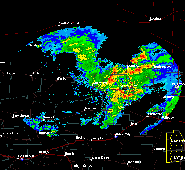 At 1003 pm mdt, severe thunderstorms were located along a line extending from near lustre to 22 miles southwest of bredette to wolf point, moving northeast at 45 mph (radar indicated). Hazards include 60 mph wind gusts. Expect damage to roofs, siding, and trees. Locations impacted include, wolf point, lustre, volt, oswego and four buttes. At 1003 pm mdt, severe thunderstorms were located along a line extending from near lustre to 22 miles southwest of bredette to wolf point, moving northeast at 45 mph (radar indicated). Hazards include 60 mph wind gusts. Expect damage to roofs, siding, and trees. Locations impacted include, wolf point, lustre, volt, oswego and four buttes.
|
| 7/4/2020 9:33 PM MDT |
 At 933 pm mdt, severe thunderstorms were located along a line extending from 8 miles northeast of nashua to near frazer to 17 miles northeast of rock creek rec area, moving northeast at 45 mph (radar indicated). Hazards include 70 mph wind gusts. Expect considerable tree damage. Damage is likely to mobile homes, roofs, and outbuildings. At 933 pm mdt, severe thunderstorms were located along a line extending from 8 miles northeast of nashua to near frazer to 17 miles northeast of rock creek rec area, moving northeast at 45 mph (radar indicated). Hazards include 70 mph wind gusts. Expect considerable tree damage. Damage is likely to mobile homes, roofs, and outbuildings.
|
| 5/20/2020 9:13 PM MDT |
 At 912 pm mdt, severe thunderstorms were located along a line extending from 19 miles northeast of devils creek rec area to 16 miles southwest of glasgow to near nashua to 6 miles northeast of frazer, moving northwest at 60 mph. these are very dangerous storms (trained weather spotters). Hazards include 80 mph wind gusts. Flying debris will be dangerous to those caught without shelter. mobile homes will be heavily damaged. expect considerable damage to roofs, windows, and vehicles. extensive tree damage and power outages are likely. locations impacted include, glasgow, wolf point, malta, nashua, fort peck, saco, duck creek rec area, hell creek rec area, st. Marie, the pines rec area, tampico, hinsdale, fort peck marina, frazer, vandalia, park grove, the bentonite plant, bowdoin, larslan and oswego. At 912 pm mdt, severe thunderstorms were located along a line extending from 19 miles northeast of devils creek rec area to 16 miles southwest of glasgow to near nashua to 6 miles northeast of frazer, moving northwest at 60 mph. these are very dangerous storms (trained weather spotters). Hazards include 80 mph wind gusts. Flying debris will be dangerous to those caught without shelter. mobile homes will be heavily damaged. expect considerable damage to roofs, windows, and vehicles. extensive tree damage and power outages are likely. locations impacted include, glasgow, wolf point, malta, nashua, fort peck, saco, duck creek rec area, hell creek rec area, st. Marie, the pines rec area, tampico, hinsdale, fort peck marina, frazer, vandalia, park grove, the bentonite plant, bowdoin, larslan and oswego.
|
| 5/20/2020 9:05 PM MDT | Mesonet station ggwfp 2.4 e fort peck (ggwwfo). time estimate in mccone county MT, 35.5 miles E of Wolf Point, MT |
| 5/20/2020 9:01 PM MDT | Trained spotter estimated 80 mph gust south of the dam along highway 24 sout in mccone county MT, 29.6 miles ENE of Wolf Point, MT |
| 5/20/2020 8:44 PM MDT |
 At 844 pm mdt, severe thunderstorms were located along a line extending from 10 miles southwest of hell creek rec area to 6 miles south of the pines rec area to 8 miles east of rock creek rec area to near vida, moving northwest at 60 mph. these are very dangerous storms (trained weather spotters). Hazards include 80 mph wind gusts. Flying debris will be dangerous to those caught without shelter. mobile homes will be heavily damaged. expect considerable damage to roofs, windows, and vehicles. Extensive tree damage and power outages are likely. At 844 pm mdt, severe thunderstorms were located along a line extending from 10 miles southwest of hell creek rec area to 6 miles south of the pines rec area to 8 miles east of rock creek rec area to near vida, moving northwest at 60 mph. these are very dangerous storms (trained weather spotters). Hazards include 80 mph wind gusts. Flying debris will be dangerous to those caught without shelter. mobile homes will be heavily damaged. expect considerable damage to roofs, windows, and vehicles. Extensive tree damage and power outages are likely.
|
| 7/16/2019 5:25 PM MDT |
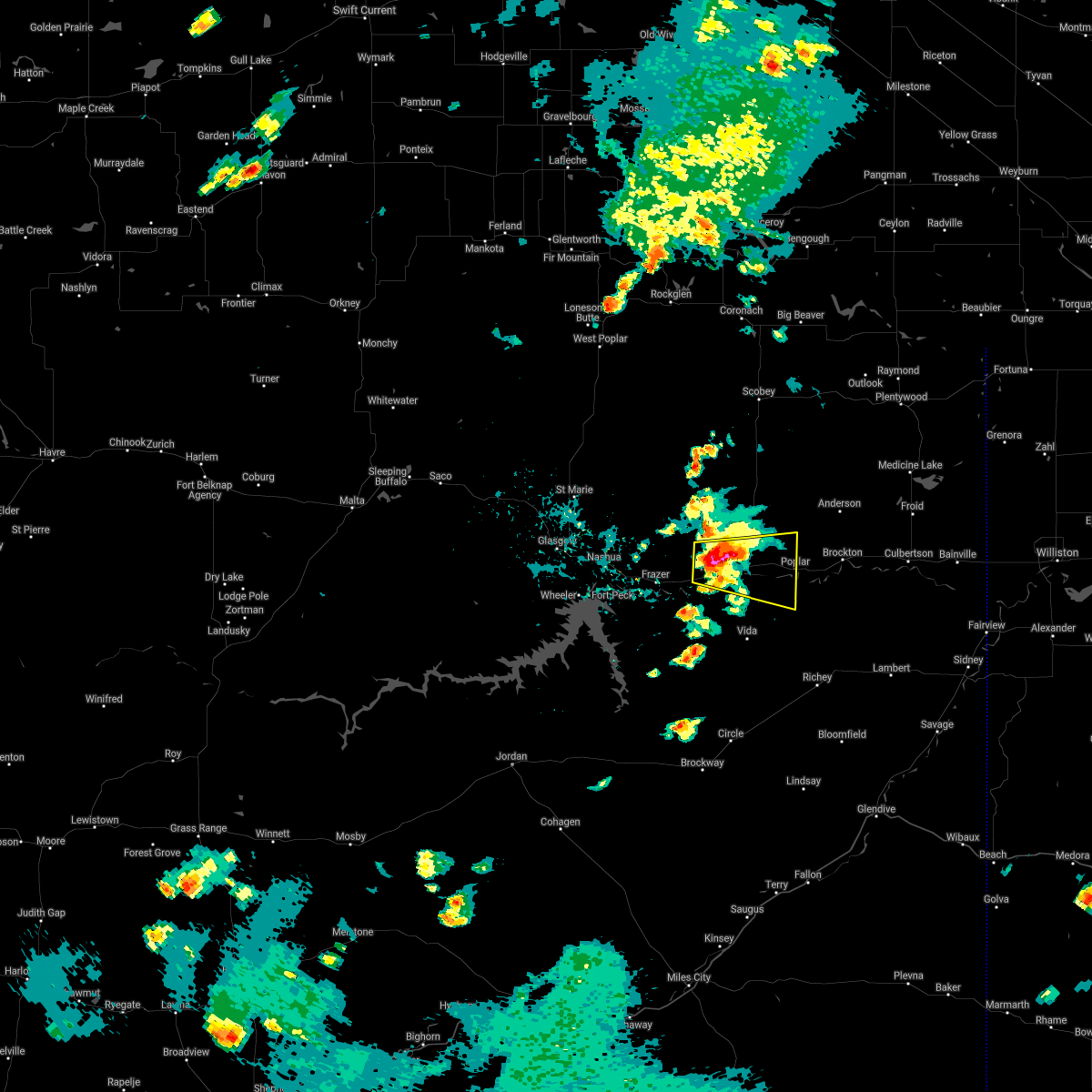 At 523 pm mdt, a severe thunderstorm was located over wolf point, moving east at 25 mph (radar indicated). Hazards include 60 mph wind gusts and quarter size hail. Hail damage to vehicles is expected. Expect wind damage to roofs, siding, and trees. At 523 pm mdt, a severe thunderstorm was located over wolf point, moving east at 25 mph (radar indicated). Hazards include 60 mph wind gusts and quarter size hail. Hail damage to vehicles is expected. Expect wind damage to roofs, siding, and trees.
|
| 7/16/2019 5:16 PM MDT |
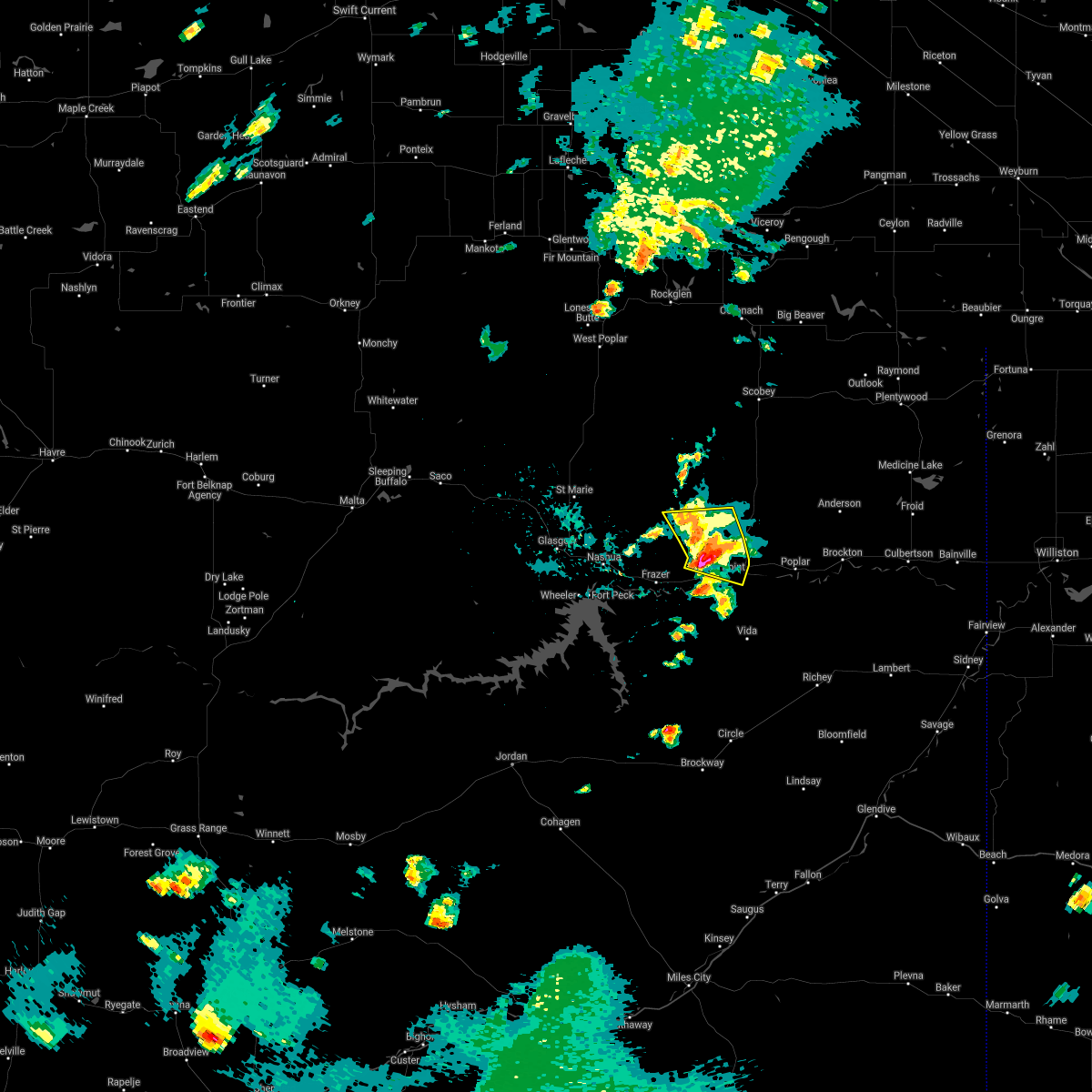 At 513 pm mdt, severe thunderstorms were located along a line extending from near lustre to 17 miles northeast of frazer to 6 miles west of wolf point, moving east at 20 mph. at 514 pm mdt, a trained weather spotter reported a rotating wall cloud about 6 miles west of wolf point (radar indicated). Hazards include 60 mph wind gusts and quarter size hail. Hail damage to vehicles is expected. expect wind damage to roofs, siding, and trees. Locations impacted include, wolf point. At 513 pm mdt, severe thunderstorms were located along a line extending from near lustre to 17 miles northeast of frazer to 6 miles west of wolf point, moving east at 20 mph. at 514 pm mdt, a trained weather spotter reported a rotating wall cloud about 6 miles west of wolf point (radar indicated). Hazards include 60 mph wind gusts and quarter size hail. Hail damage to vehicles is expected. expect wind damage to roofs, siding, and trees. Locations impacted include, wolf point.
|
| 7/16/2019 4:50 PM MDT |
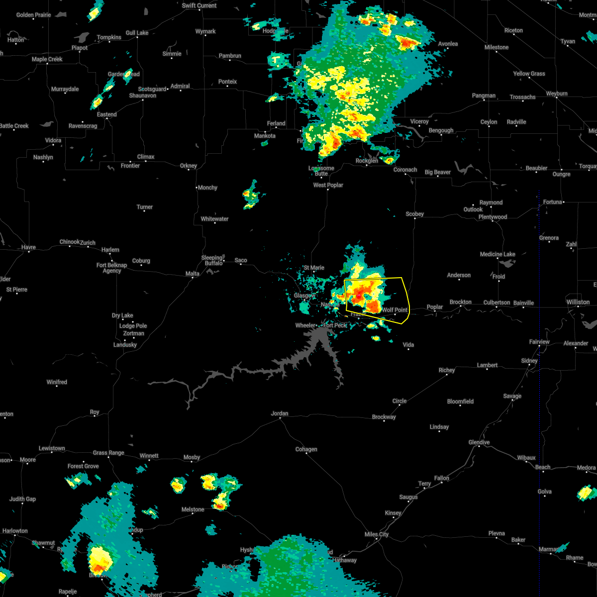 At 449 pm mdt, severe thunderstorms were located along a line extending from 9 miles southwest of lustre to 16 miles west of wolf point to frazer, moving east at 35 mph. at 443 pm mdt, a trained weather spotter reported a funnel cloud 14 miles northeast of nashua with this storm (doppler radar). Hazards include 60 mph wind gusts and quarter size hail. Hail damage to vehicles is expected. expect wind damage to roofs, siding, and trees. Locations impacted include, wolf point. At 449 pm mdt, severe thunderstorms were located along a line extending from 9 miles southwest of lustre to 16 miles west of wolf point to frazer, moving east at 35 mph. at 443 pm mdt, a trained weather spotter reported a funnel cloud 14 miles northeast of nashua with this storm (doppler radar). Hazards include 60 mph wind gusts and quarter size hail. Hail damage to vehicles is expected. expect wind damage to roofs, siding, and trees. Locations impacted include, wolf point.
|
| 7/16/2019 4:31 PM MDT |
 At 431 pm mdt, severe thunderstorms were located along a line extending from 15 miles southwest of lustre to 8 miles northwest of frazer to near nashua, moving east at 35 mph (radar indicated). Hazards include 60 mph wind gusts and quarter size hail. Hail damage to vehicles is expected. Expect wind damage to roofs, siding, and trees. At 431 pm mdt, severe thunderstorms were located along a line extending from 15 miles southwest of lustre to 8 miles northwest of frazer to near nashua, moving east at 35 mph (radar indicated). Hazards include 60 mph wind gusts and quarter size hail. Hail damage to vehicles is expected. Expect wind damage to roofs, siding, and trees.
|
| 7/7/2019 10:03 PM MDT | Quarter sized hail reported 15.9 miles S of Wolf Point, MT, corrects previous hail report from 5 s volt. |
| 7/7/2019 9:10 PM MDT | Golf Ball sized hail reported 14 miles SW of Wolf Point, MT, corrects previous hail report from 14 ne wolf point. golf ball size hail reported. |
| 7/1/2019 7:57 PM MDT |
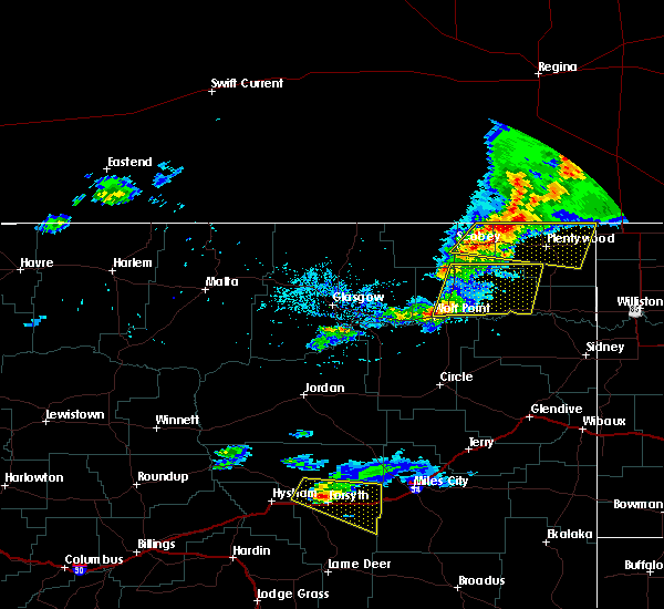 At 757 pm mdt, severe thunderstorms were located along a line extending from 6 miles northwest of bredette to 7 miles northeast of wolf point, moving east at 45 mph (radar indicated). Hazards include 60 mph wind gusts and penny size hail. Expect damage to roofs, siding, and trees. Locations impacted include, wolf point, poplar, brockton, bredette and fort kipp. At 757 pm mdt, severe thunderstorms were located along a line extending from 6 miles northwest of bredette to 7 miles northeast of wolf point, moving east at 45 mph (radar indicated). Hazards include 60 mph wind gusts and penny size hail. Expect damage to roofs, siding, and trees. Locations impacted include, wolf point, poplar, brockton, bredette and fort kipp.
|
| 7/1/2019 7:52 PM MDT | Storm damage reported in roosevelt county MT, 2.5 miles S of Wolf Point, MT |
| 7/1/2019 7:31 PM MDT |
 At 730 pm mdt, severe thunderstorms were located along a line extending from 8 miles north of lustre to 6 miles northeast of frazer, moving east at 45 mph (radar indicated). Hazards include 60 mph wind gusts and quarter size hail. Hail damage to vehicles is expected. Expect wind damage to roofs, siding, and trees. At 730 pm mdt, severe thunderstorms were located along a line extending from 8 miles north of lustre to 6 miles northeast of frazer, moving east at 45 mph (radar indicated). Hazards include 60 mph wind gusts and quarter size hail. Hail damage to vehicles is expected. Expect wind damage to roofs, siding, and trees.
|
| 6/28/2019 11:45 PM MDT | Quarter sized hail reported 0.3 miles NNW of Wolf Point, MT, reported received through social media. |
| 6/28/2019 11:09 PM MDT |
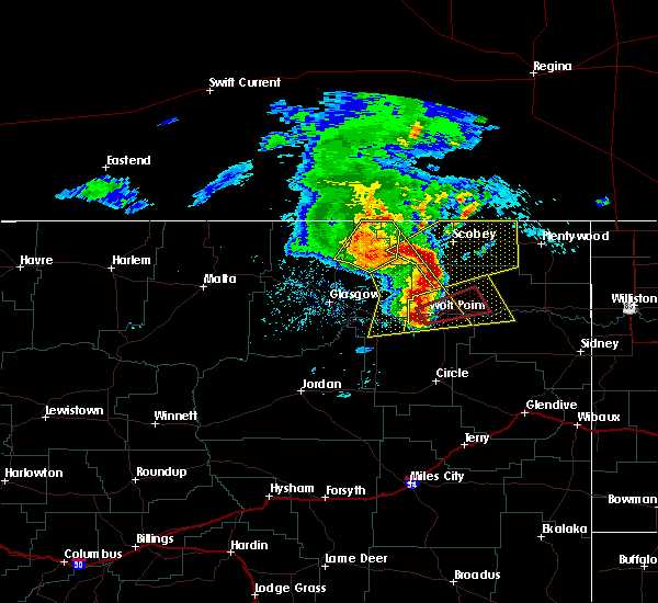 At 1109 pm mdt, a severe thunderstorm capable of producing a tornado was located over wolf point, moving east at 40 mph (radar indicated rotation). Hazards include tornado and ping pong ball size hail. Flying debris will be dangerous to those caught without shelter. mobile homes will be damaged or destroyed. damage to roofs, windows, and vehicles will occur. tree damage is likely. this dangerous storm will be near, poplar around 1140 pm mdt. Other locations impacted by this tornadic thunderstorm include sprole. At 1109 pm mdt, a severe thunderstorm capable of producing a tornado was located over wolf point, moving east at 40 mph (radar indicated rotation). Hazards include tornado and ping pong ball size hail. Flying debris will be dangerous to those caught without shelter. mobile homes will be damaged or destroyed. damage to roofs, windows, and vehicles will occur. tree damage is likely. this dangerous storm will be near, poplar around 1140 pm mdt. Other locations impacted by this tornadic thunderstorm include sprole.
|
| 6/28/2019 11:06 PM MDT |
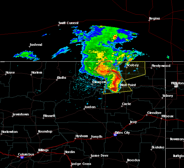 At 1106 pm mdt, a severe thunderstorm was located 7 miles southwest of wolf point, moving east at 45 mph (radar indicated). Hazards include 70 mph wind gusts and ping pong ball size hail. People and animals outdoors will be injured. expect hail damage to roofs, siding, windows, and vehicles. expect considerable tree damage. Wind damage is also likely to mobile homes, roofs, and outbuildings. At 1106 pm mdt, a severe thunderstorm was located 7 miles southwest of wolf point, moving east at 45 mph (radar indicated). Hazards include 70 mph wind gusts and ping pong ball size hail. People and animals outdoors will be injured. expect hail damage to roofs, siding, windows, and vehicles. expect considerable tree damage. Wind damage is also likely to mobile homes, roofs, and outbuildings.
|
| 6/28/2019 10:47 PM MDT |
 At 1047 pm mdt, severe thunderstorms were located along a line extending from 7 miles northwest of lustre to 9 miles southeast of frazer, moving northeast at 45 mph (radar indicated). Hazards include 60 mph wind gusts. Expect damage to roofs, siding, and trees. Locations impacted include, wolf point, lustre, frazer, west fork, volt and oswego. At 1047 pm mdt, severe thunderstorms were located along a line extending from 7 miles northwest of lustre to 9 miles southeast of frazer, moving northeast at 45 mph (radar indicated). Hazards include 60 mph wind gusts. Expect damage to roofs, siding, and trees. Locations impacted include, wolf point, lustre, frazer, west fork, volt and oswego.
|
| 6/28/2019 10:16 PM MDT |
 The national weather service in glasgow has issued a * severe thunderstorm warning for. southwestern daniels county in northeastern montana. western roosevelt county in northeastern montana. east central valley county in northeastern montana. Northern mccone county in northeastern montana. The national weather service in glasgow has issued a * severe thunderstorm warning for. southwestern daniels county in northeastern montana. western roosevelt county in northeastern montana. east central valley county in northeastern montana. Northern mccone county in northeastern montana.
|
| 6/27/2019 10:21 PM MDT |
 At 1021 pm mdt, severe thunderstorms were located along a line extending from near richland to 11 miles southwest of wolf point, moving east at 30 mph (radar indicated). Hazards include 60 mph wind gusts. Expect damage to roofs, siding, and trees. Locations impacted include, wolf point, richland, frazer, lustre, peerless, oswego, four buttes, west fork, volt, glentana and larslan. At 1021 pm mdt, severe thunderstorms were located along a line extending from near richland to 11 miles southwest of wolf point, moving east at 30 mph (radar indicated). Hazards include 60 mph wind gusts. Expect damage to roofs, siding, and trees. Locations impacted include, wolf point, richland, frazer, lustre, peerless, oswego, four buttes, west fork, volt, glentana and larslan.
|
| 6/27/2019 9:52 PM MDT |
 At 952 pm mdt, severe thunderstorms were located along a line extending from near opheim to near frazer, moving east at 35 mph (radar indicated). Hazards include 60 mph wind gusts. Expect damage to roofs, siding, and trees. locations impacted include, wolf point, opheim, richland, nashua, fort peck, lustre, frazer, st. Marie, port of opheim, peerless, duck creek rec area, fort peck marina, oswego, park grove, four buttes, west fork, volt, baylor, glentana and larslan. At 952 pm mdt, severe thunderstorms were located along a line extending from near opheim to near frazer, moving east at 35 mph (radar indicated). Hazards include 60 mph wind gusts. Expect damage to roofs, siding, and trees. locations impacted include, wolf point, opheim, richland, nashua, fort peck, lustre, frazer, st. Marie, port of opheim, peerless, duck creek rec area, fort peck marina, oswego, park grove, four buttes, west fork, volt, baylor, glentana and larslan.
|
| 6/27/2019 9:33 PM MDT |
 At 933 pm mdt, severe thunderstorms were located along a line extending from 6 miles west of opheim to near fort peck, moving east at 30 mph (trained weather spotters). Hazards include 60 mph wind gusts. expect damage to roofs, siding, and trees At 933 pm mdt, severe thunderstorms were located along a line extending from 6 miles west of opheim to near fort peck, moving east at 30 mph (trained weather spotters). Hazards include 60 mph wind gusts. expect damage to roofs, siding, and trees
|
| 7/10/2018 7:19 PM MDT | Asos station kolf... wolf point airpor in roosevelt county MT, 3.4 miles W of Wolf Point, MT |
| 7/10/2018 7:11 PM MDT |
 At 710 pm mdt, severe thunderstorms were located along a line extending from 7 miles west of port of scobey to 9 miles south of scobey to 11 miles southwest of lustre to 7 miles southeast of fort peck, moving east at 40 mph (radar indicated). Hazards include 70 mph wind gusts. Expect considerable tree damage. Damage is likely to mobile homes, roofs, and outbuildings. At 710 pm mdt, severe thunderstorms were located along a line extending from 7 miles west of port of scobey to 9 miles south of scobey to 11 miles southwest of lustre to 7 miles southeast of fort peck, moving east at 40 mph (radar indicated). Hazards include 70 mph wind gusts. Expect considerable tree damage. Damage is likely to mobile homes, roofs, and outbuildings.
|
| 7/10/2018 6:28 PM MDT |
 At 627 pm mdt, severe thunderstorms were located along a line extending from near opheim to 12 miles northeast of st. marie to 6 miles southwest of glasgow, moving northeast at 40 mph (radar indicated). Hazards include 70 mph wind gusts. Expect considerable tree damage. Damage is likely to mobile homes, roofs, and outbuildings. At 627 pm mdt, severe thunderstorms were located along a line extending from near opheim to 12 miles northeast of st. marie to 6 miles southwest of glasgow, moving northeast at 40 mph (radar indicated). Hazards include 70 mph wind gusts. Expect considerable tree damage. Damage is likely to mobile homes, roofs, and outbuildings.
|
| 7/3/2018 9:37 PM MDT |
 The severe thunderstorm warning for south central daniels, western roosevelt, east central valley and north central mccone counties will expire at 945 pm mdt, the storms which prompted the warning have weakened below severe limits, and no longer pose an immediate threat to life or property. therefore, the warning will be allowed to expire. however gusty winds are still possible with these thunderstorms. a severe thunderstorm watch remains in effect until 300 am mdt for northeastern montana. The severe thunderstorm warning for south central daniels, western roosevelt, east central valley and north central mccone counties will expire at 945 pm mdt, the storms which prompted the warning have weakened below severe limits, and no longer pose an immediate threat to life or property. therefore, the warning will be allowed to expire. however gusty winds are still possible with these thunderstorms. a severe thunderstorm watch remains in effect until 300 am mdt for northeastern montana.
|
| 7/3/2018 9:11 PM MDT |
 At 911 pm mdt, severe thunderstorms were located along a line extending from 9 miles northwest of lustre to 12 miles northeast of rock creek rec area, moving northeast at 35 mph (radar indicated). Hazards include 70 mph wind gusts. Expect considerable tree damage. damage is likely to mobile homes, roofs, and outbuildings. Locations impacted include, wolf point, nashua, lustre, frazer, volt and oswego. At 911 pm mdt, severe thunderstorms were located along a line extending from 9 miles northwest of lustre to 12 miles northeast of rock creek rec area, moving northeast at 35 mph (radar indicated). Hazards include 70 mph wind gusts. Expect considerable tree damage. damage is likely to mobile homes, roofs, and outbuildings. Locations impacted include, wolf point, nashua, lustre, frazer, volt and oswego.
|
| 7/3/2018 8:43 PM MDT |
 At 842 pm mdt, severe thunderstorms were located along a line extending from 9 miles east of st. marie to near rock creek rec area, moving northeast at 35 mph (radar indicated). Hazards include 60 mph wind gusts. expect damage to roofs, siding, and trees At 842 pm mdt, severe thunderstorms were located along a line extending from 9 miles east of st. marie to near rock creek rec area, moving northeast at 35 mph (radar indicated). Hazards include 60 mph wind gusts. expect damage to roofs, siding, and trees
|
| 7/3/2018 8:33 PM MDT |
 At 832 pm mdt, severe thunderstorms were located along a line extending from 12 miles northwest of lustre to near nashua, moving east at 45 mph (radar indicated). Hazards include 60 mph wind gusts. Expect damage to roofs, siding, and trees. Locations impacted include, wolf point, nashua, fort peck, bredette, frazer, lustre, fort peck marina, duck creek rec area, oswego, park grove, volt and whatley. At 832 pm mdt, severe thunderstorms were located along a line extending from 12 miles northwest of lustre to near nashua, moving east at 45 mph (radar indicated). Hazards include 60 mph wind gusts. Expect damage to roofs, siding, and trees. Locations impacted include, wolf point, nashua, fort peck, bredette, frazer, lustre, fort peck marina, duck creek rec area, oswego, park grove, volt and whatley.
|
| 7/3/2018 8:06 PM MDT |
 At 805 pm mdt, severe thunderstorms were located along a line extending from near st. marie to 6 miles northwest of duck creek rec area, moving east at 45 mph (radar indicated). Hazards include 60 mph wind gusts. expect damage to roofs, siding, and trees At 805 pm mdt, severe thunderstorms were located along a line extending from near st. marie to 6 miles northwest of duck creek rec area, moving east at 45 mph (radar indicated). Hazards include 60 mph wind gusts. expect damage to roofs, siding, and trees
|
| 6/28/2018 7:07 PM MDT |
 The severe thunderstorm warning for southwestern roosevelt, east central valley and northern mccone counties will expire at 715 pm mdt, the storm which prompted the warning has moved out of the area. therefore, the warning will be allowed to expire. however gusty winds are still possible with this thunderstorm. a tornado watch remains in effect until 1100 pm mdt for northeastern montana. The severe thunderstorm warning for southwestern roosevelt, east central valley and northern mccone counties will expire at 715 pm mdt, the storm which prompted the warning has moved out of the area. therefore, the warning will be allowed to expire. however gusty winds are still possible with this thunderstorm. a tornado watch remains in effect until 1100 pm mdt for northeastern montana.
|
| 6/28/2018 6:56 PM MDT |
 At 656 pm mdt, a severe thunderstorm was located 8 miles east of frazer, or 10 miles west of wolf point, moving northeast at 35 mph (radar indicated). Hazards include 60 mph wind gusts and quarter size hail. Hail damage to vehicles is expected. expect wind damage to roofs, siding, and trees. locations impacted include, wolf point. A tornado watch remains in effect until 1100 pm mdt for northeastern montana. At 656 pm mdt, a severe thunderstorm was located 8 miles east of frazer, or 10 miles west of wolf point, moving northeast at 35 mph (radar indicated). Hazards include 60 mph wind gusts and quarter size hail. Hail damage to vehicles is expected. expect wind damage to roofs, siding, and trees. locations impacted include, wolf point. A tornado watch remains in effect until 1100 pm mdt for northeastern montana.
|
| 6/28/2018 6:54 PM MDT | Gust of 53 kts measured at the wolf point kolf aso in roosevelt county MT, 2.9 miles W of Wolf Point, MT |
| 6/28/2018 6:54 PM MDT | Mccone electric co-op inc reported via social media that there are main transmission lines down from the storm. dispatch says lines are down near nickwall road and high in mccone county MT, 7.2 miles NW of Wolf Point, MT |
| 6/28/2018 6:32 PM MDT |
 At 632 pm mdt, a severe thunderstorm was located near frazer, or 24 miles west of wolf point, moving northeast at 35 mph (radar indicated). Hazards include 70 mph wind gusts and quarter size hail. Hail damage to vehicles is expected. expect considerable tree damage. wind damage is also likely to mobile homes, roofs, and outbuildings. locations impacted include, wolf point, frazer and oswego. A tornado watch remains in effect until 1100 pm mdt for northeastern montana. At 632 pm mdt, a severe thunderstorm was located near frazer, or 24 miles west of wolf point, moving northeast at 35 mph (radar indicated). Hazards include 70 mph wind gusts and quarter size hail. Hail damage to vehicles is expected. expect considerable tree damage. wind damage is also likely to mobile homes, roofs, and outbuildings. locations impacted include, wolf point, frazer and oswego. A tornado watch remains in effect until 1100 pm mdt for northeastern montana.
|
| 6/28/2018 6:09 PM MDT |
 At 609 pm mdt, a severe thunderstorm was located 8 miles southeast of fort peck, or 23 miles southeast of glasgow, moving northeast at 35 mph. this is a very dangerous storm (radar indicated). Hazards include 80 mph wind gusts and quarter size hail. Flying debris will be dangerous to those caught without shelter. mobile homes will be heavily damaged. expect considerable damage to roofs, windows, and vehicles. Extensive tree damage and power outages are likely. At 609 pm mdt, a severe thunderstorm was located 8 miles southeast of fort peck, or 23 miles southeast of glasgow, moving northeast at 35 mph. this is a very dangerous storm (radar indicated). Hazards include 80 mph wind gusts and quarter size hail. Flying debris will be dangerous to those caught without shelter. mobile homes will be heavily damaged. expect considerable damage to roofs, windows, and vehicles. Extensive tree damage and power outages are likely.
|
| 6/14/2018 8:18 AM MDT | Quarter sized hail reported 17.7 miles S of Wolf Point, MT, time estimated by radar. |
| 7/11/2017 6:50 PM MDT | Ft peck dam sensor measured 59mp in mccone county MT, 35.5 miles E of Wolf Point, MT |
| 7/11/2017 6:11 AM MDT | Storm damage reported in roosevelt county MT, 25.1 miles SSW of Wolf Point, MT |
| 7/10/2017 5:56 PM MDT |
 At 554 pm mdt, a gust front was located along a line extending from 13 miles southeast of opheim to 10 miles south of lustre to 6 miles southeast of wolf point to near vida to 16 miles north of circle, moving northeast at 40 mph (radar indicated). Hazards include 60 mph wind gusts. Expect damage to roofs, siding, and trees. Visibility may be reduced to down to a half of a mile due to blowing dust with the strongest winds. At 554 pm mdt, a gust front was located along a line extending from 13 miles southeast of opheim to 10 miles south of lustre to 6 miles southeast of wolf point to near vida to 16 miles north of circle, moving northeast at 40 mph (radar indicated). Hazards include 60 mph wind gusts. Expect damage to roofs, siding, and trees. Visibility may be reduced to down to a half of a mile due to blowing dust with the strongest winds.
|
| 7/10/2017 5:32 PM MDT |
 At 532 pm mdt, a gust front was located along a line extending from near st. marie to near frazer to 7 miles west of circle, moving northeast at 45 mph (radar indicated). Hazards include 60 mph wind gusts. expect damage to roofs, siding, and trees At 532 pm mdt, a gust front was located along a line extending from near st. marie to near frazer to 7 miles west of circle, moving northeast at 45 mph (radar indicated). Hazards include 60 mph wind gusts. expect damage to roofs, siding, and trees
|
| 7/10/2017 5:12 PM MDT |
 At 511 pm mdt, severe thunderstorms were located along a line extending from 20 miles north of tampico to 8 miles southeast of st. marie to 8 miles southeast of nashua to 11 miles east of rock creek rec area to 11 miles northwest of brockway, moving northeast at 60 mph (radar indicated). Hazards include 60 mph wind gusts. Expect damage to roofs, siding, and trees. locations impacted include, glasgow, wolf point, circle, opheim, nashua, fort peck, duck creek rec area, flowing wells rest area, st. Marie, the pines rec area, tampico, hinsdale, lustre, fort peck marina, frazer, nelson creek rec area, rock creek rec area, vandalia, park grove and larslan. At 511 pm mdt, severe thunderstorms were located along a line extending from 20 miles north of tampico to 8 miles southeast of st. marie to 8 miles southeast of nashua to 11 miles east of rock creek rec area to 11 miles northwest of brockway, moving northeast at 60 mph (radar indicated). Hazards include 60 mph wind gusts. Expect damage to roofs, siding, and trees. locations impacted include, glasgow, wolf point, circle, opheim, nashua, fort peck, duck creek rec area, flowing wells rest area, st. Marie, the pines rec area, tampico, hinsdale, lustre, fort peck marina, frazer, nelson creek rec area, rock creek rec area, vandalia, park grove and larslan.
|
| 7/10/2017 4:43 PM MDT |
 At 441 pm mdt, strong winds associated with a thunderstorm gust front were located along a line extending from 6 miles south of saco to 16 miles south of tampico to 7 miles west of the pines rec area to 12 miles east of hell creek rec area to 11 miles northeast of cohagen, moving northeast at 60 mph (radar indicated). Hazards include 70 mph wind gusts. Expect considerable tree damage. Damage is likely to mobile homes, roofs, and outbuildings. At 441 pm mdt, strong winds associated with a thunderstorm gust front were located along a line extending from 6 miles south of saco to 16 miles south of tampico to 7 miles west of the pines rec area to 12 miles east of hell creek rec area to 11 miles northeast of cohagen, moving northeast at 60 mph (radar indicated). Hazards include 70 mph wind gusts. Expect considerable tree damage. Damage is likely to mobile homes, roofs, and outbuildings.
|
| 7/22/2016 8:45 PM MDT |
 At 844 pm mdt, a severe thunderstorm was located 18 miles east of rock creek rec area, or 25 miles southwest of wolf point, moving north at 35 mph (radar indicated). Hazards include 60 mph wind gusts and half dollar size hail. Hail damage to vehicles is expected. Expect wind damage to roofs, siding, and trees. At 844 pm mdt, a severe thunderstorm was located 18 miles east of rock creek rec area, or 25 miles southwest of wolf point, moving north at 35 mph (radar indicated). Hazards include 60 mph wind gusts and half dollar size hail. Hail damage to vehicles is expected. Expect wind damage to roofs, siding, and trees.
|
| 7/19/2016 1:03 AM MDT |
 At 102 am mdt, severe thunderstorms were located along a line extending from 10 miles north of richland to near bredette to near poplar to 11 miles northeast of circle, moving east at 50 mph (radar indicated). Hazards include 60 mph wind gusts. Expect damage to roofs. siding. and trees. Locations impacted include, wolf point, scobey, poplar, opheim, richland, richey, flaxville, vida, bredette, peerless, madoc, frazer, lustre, whitetail, oswego, west fork, glentana, volt, weldon and four buttes. At 102 am mdt, severe thunderstorms were located along a line extending from 10 miles north of richland to near bredette to near poplar to 11 miles northeast of circle, moving east at 50 mph (radar indicated). Hazards include 60 mph wind gusts. Expect damage to roofs. siding. and trees. Locations impacted include, wolf point, scobey, poplar, opheim, richland, richey, flaxville, vida, bredette, peerless, madoc, frazer, lustre, whitetail, oswego, west fork, glentana, volt, weldon and four buttes.
|
| 7/19/2016 12:53 AM MDT | Mesonet station oswego 4n /e0034 in valley county MT, 11.5 miles E of Wolf Point, MT |
| 7/19/2016 12:27 AM MDT |
 At 1226 am mdt, severe thunderstorms were located along a line extending from 11 miles northwest of opheim to 9 miles northwest of lustre to 8 miles east of frazer to 6 miles east of nelson creek rec area, moving northeast at 50 mph (trained weather spotters). Hazards include 70 mph wind gusts. Expect considerable tree damage. Damage is likely to mobile homes, roofs, and outbuildings. At 1226 am mdt, severe thunderstorms were located along a line extending from 11 miles northwest of opheim to 9 miles northwest of lustre to 8 miles east of frazer to 6 miles east of nelson creek rec area, moving northeast at 50 mph (trained weather spotters). Hazards include 70 mph wind gusts. Expect considerable tree damage. Damage is likely to mobile homes, roofs, and outbuildings.
|
| 6/24/2016 7:32 PM MDT | Storm damage reported in roosevelt county MT, 0.3 miles NNW of Wolf Point, MT |
| 6/24/2016 7:11 PM MDT |
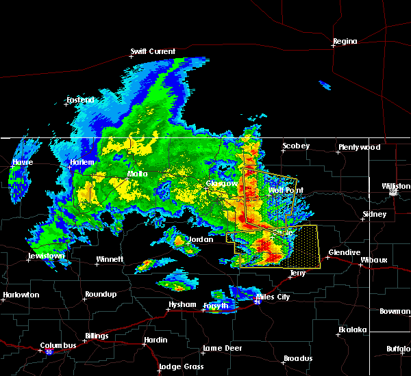 At 710 pm mdt, severe thunderstorms were located along a line extending from lustre to 13 miles southwest of wolf point to 18 miles northeast of nelson creek rec area, moving southeast at 50 mph (radar indicated). Hazards include 70 mph wind gusts. Expect considerable tree damage. damage is likely to mobile homes, roofs, and outbuildings. Locations impacted include, wolf point, lustre, vida, oswego and volt. At 710 pm mdt, severe thunderstorms were located along a line extending from lustre to 13 miles southwest of wolf point to 18 miles northeast of nelson creek rec area, moving southeast at 50 mph (radar indicated). Hazards include 70 mph wind gusts. Expect considerable tree damage. damage is likely to mobile homes, roofs, and outbuildings. Locations impacted include, wolf point, lustre, vida, oswego and volt.
|
| 6/24/2016 6:38 PM MDT |
 At 637 pm mdt, severe thunderstorms were located along a line extending from 10 miles northeast of st. marie to near fort peck marina, moving southeast at 50 mph (radar indicated). Hazards include 60 mph wind gusts. Expect damage to roofs. siding. And trees. At 637 pm mdt, severe thunderstorms were located along a line extending from 10 miles northeast of st. marie to near fort peck marina, moving southeast at 50 mph (radar indicated). Hazards include 60 mph wind gusts. Expect damage to roofs. siding. And trees.
|
| 6/24/2016 6:36 PM MDT | Storm damage reported in mccone county MT, 35.5 miles E of Wolf Point, MT |
| 6/21/2016 6:58 PM MDT | Estimated 50 to 60 mph wind gust in roosevelt county MT, 7 miles SW of Wolf Point, MT |
| 6/21/2016 6:58 PM MDT | Quarter sized hail reported 7 miles SW of Wolf Point, MT, pea sized up to quarter sized hail. |
| 6/21/2016 6:48 PM MDT |
 At 647 pm mdt, a severe thunderstorm was located 11 miles northwest of poplar, moving east at 65 mph (radar indicated). Hazards include 60 mph wind gusts and quarter size hail. Hail damage to vehicles is expected. expect wind damage to roofs, siding, and trees. Locations impacted include, wolf point, poplar, brockton, sprole and volt. At 647 pm mdt, a severe thunderstorm was located 11 miles northwest of poplar, moving east at 65 mph (radar indicated). Hazards include 60 mph wind gusts and quarter size hail. Hail damage to vehicles is expected. expect wind damage to roofs, siding, and trees. Locations impacted include, wolf point, poplar, brockton, sprole and volt.
|
| 6/21/2016 6:13 PM MDT |
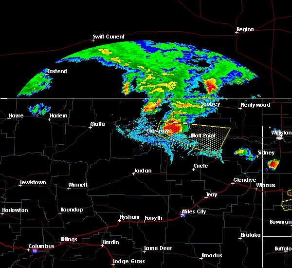 At 613 pm mdt, a severe thunderstorm was located 13 miles southwest of lustre, or 24 miles east of glasgow, moving east at 65 mph (radar indicated). Hazards include 60 mph wind gusts and quarter size hail. Hail damage to vehicles is expected. Expect wind damage to roofs, siding, and trees. At 613 pm mdt, a severe thunderstorm was located 13 miles southwest of lustre, or 24 miles east of glasgow, moving east at 65 mph (radar indicated). Hazards include 60 mph wind gusts and quarter size hail. Hail damage to vehicles is expected. Expect wind damage to roofs, siding, and trees.
|
| 6/18/2016 9:31 PM MDT | Measured by mcdonalds dot sensor in roosevelt county MT, 25.1 miles SSW of Wolf Point, MT |
| 6/18/2016 9:27 PM MDT |
 At 926 pm mdt, severe thunderstorms were located along a line extending from near port of whitetail to 7 miles south of vida, moving east at 50 mph (trained weather spotters). Hazards include golf ball size hail and 70 mph wind gusts. People and animals outdoors will be injured. expect hail damage to roofs, siding, windows, and vehicles. expect considerable tree damage. wind damage is also likely to mobile homes, roofs, and outbuildings. Locations impacted include, wolf point, scobey, poplar, brockton, flaxville, vida, bredette, madoc, redstone, archer, whitetail, outlook, enid, volt, four buttes, fort kipp, sprole, navajo and daleview. At 926 pm mdt, severe thunderstorms were located along a line extending from near port of whitetail to 7 miles south of vida, moving east at 50 mph (trained weather spotters). Hazards include golf ball size hail and 70 mph wind gusts. People and animals outdoors will be injured. expect hail damage to roofs, siding, windows, and vehicles. expect considerable tree damage. wind damage is also likely to mobile homes, roofs, and outbuildings. Locations impacted include, wolf point, scobey, poplar, brockton, flaxville, vida, bredette, madoc, redstone, archer, whitetail, outlook, enid, volt, four buttes, fort kipp, sprole, navajo and daleview.
|
| 6/18/2016 9:25 PM MDT | Ping Pong Ball sized hail reported 0.3 miles NNW of Wolf Point, MT |
| 6/18/2016 9:25 PM MDT | Hen Egg sized hail reported 2 miles W of Wolf Point, MT |
| 6/18/2016 9:23 PM MDT | Storm damage reported in roosevelt county MT, 0.3 miles NNW of Wolf Point, MT |
| 6/18/2016 9:20 PM MDT | Grapefruit sized hail reported 0.3 miles NNW of Wolf Point, MT |
| 6/18/2016 9:15 PM MDT | Golf Ball sized hail reported 0.3 miles NNW of Wolf Point, MT |
| 6/18/2016 9:02 PM MDT |
 At 902 pm mdt, severe thunderstorms were located along a line extending from 6 miles southwest of port of scobey to 15 miles east of rock creek rec area, moving east at 60 mph. these are very dangerous storms (trained weather spotters). Hazards include 80 mph wind gusts and two inch hail. Flying debris will be dangerous to those caught without shelter. mobile homes will be heavily damaged. expect considerable damage to roofs, windows, and vehicles. Extensive tree damage and power outages are likely. At 902 pm mdt, severe thunderstorms were located along a line extending from 6 miles southwest of port of scobey to 15 miles east of rock creek rec area, moving east at 60 mph. these are very dangerous storms (trained weather spotters). Hazards include 80 mph wind gusts and two inch hail. Flying debris will be dangerous to those caught without shelter. mobile homes will be heavily damaged. expect considerable damage to roofs, windows, and vehicles. Extensive tree damage and power outages are likely.
|
| 6/18/2016 8:50 PM MDT |
 At 849 pm mdt, severe thunderstorms were located along a line extending from 10 miles northeast of richland to 6 miles southwest of peerless to near frazer, moving east at 60 mph (trained weather spotters). Hazards include two inch hail and 70 mph wind gusts. People and animals outdoors will be injured. expect hail damage to roofs, siding, windows, and vehicles. expect considerable tree damage. wind damage is also likely to mobile homes, roofs, and outbuildings. locations impacted include, glasgow, wolf point, scobey, opheim, richland, nashua, st. Marie, frazer, peerless, port of whitetail, madoc, tampico, lustre, hinsdale, baylor, whatley, glentana, thoeny, larslan and oswego. At 849 pm mdt, severe thunderstorms were located along a line extending from 10 miles northeast of richland to 6 miles southwest of peerless to near frazer, moving east at 60 mph (trained weather spotters). Hazards include two inch hail and 70 mph wind gusts. People and animals outdoors will be injured. expect hail damage to roofs, siding, windows, and vehicles. expect considerable tree damage. wind damage is also likely to mobile homes, roofs, and outbuildings. locations impacted include, glasgow, wolf point, scobey, opheim, richland, nashua, st. Marie, frazer, peerless, port of whitetail, madoc, tampico, lustre, hinsdale, baylor, whatley, glentana, thoeny, larslan and oswego.
|
| 6/18/2016 8:27 PM MDT |
 At 826 pm mdt, severe thunderstorms were located along a line extending from 14 miles north of richland to 7 miles south of opheim to 6 miles southeast of glasgow, moving east at 50 mph (trained weather spotters). Hazards include golf ball size hail and 70 mph wind gusts. People and animals outdoors will be injured. expect hail damage to roofs, siding, windows, and vehicles. expect considerable tree damage. wind damage is also likely to mobile homes, roofs, and outbuildings. locations impacted include, glasgow, wolf point, scobey, opheim, richland, nashua, st. Marie, frazer, peerless, port of whitetail, madoc, tampico, lustre, hinsdale, baylor, whatley, glentana, thoeny, larslan and oswego. At 826 pm mdt, severe thunderstorms were located along a line extending from 14 miles north of richland to 7 miles south of opheim to 6 miles southeast of glasgow, moving east at 50 mph (trained weather spotters). Hazards include golf ball size hail and 70 mph wind gusts. People and animals outdoors will be injured. expect hail damage to roofs, siding, windows, and vehicles. expect considerable tree damage. wind damage is also likely to mobile homes, roofs, and outbuildings. locations impacted include, glasgow, wolf point, scobey, opheim, richland, nashua, st. Marie, frazer, peerless, port of whitetail, madoc, tampico, lustre, hinsdale, baylor, whatley, glentana, thoeny, larslan and oswego.
|
| 6/18/2016 8:11 PM MDT |
 At 810 pm mdt, severe thunderstorms were located along a line extending from 7 miles east of port of opheim to 11 miles southwest of opheim to 6 miles southwest of glasgow, moving east at 70 mph. these are very dangerous storms (trained weather spotters). Hazards include 80 mph wind gusts and ping pong ball size hail. Flying debris will be dangerous to those caught without shelter. mobile homes will be heavily damaged. expect considerable damage to roofs, windows, and vehicles. Extensive tree damage and power outages are likely. At 810 pm mdt, severe thunderstorms were located along a line extending from 7 miles east of port of opheim to 11 miles southwest of opheim to 6 miles southwest of glasgow, moving east at 70 mph. these are very dangerous storms (trained weather spotters). Hazards include 80 mph wind gusts and ping pong ball size hail. Flying debris will be dangerous to those caught without shelter. mobile homes will be heavily damaged. expect considerable damage to roofs, windows, and vehicles. Extensive tree damage and power outages are likely.
|
| 6/16/2016 1:52 AM MDT |
 The severe thunderstorm warning for east central valley, northeastern mccone, northwestern richland and southwestern roosevelt counties will expire at 200 am mdt, the storm which prompted the warning has weakened below severe limits, and no longer pose an immediate threat to life or property. therefore the warning will be allowed to expire. The severe thunderstorm warning for east central valley, northeastern mccone, northwestern richland and southwestern roosevelt counties will expire at 200 am mdt, the storm which prompted the warning has weakened below severe limits, and no longer pose an immediate threat to life or property. therefore the warning will be allowed to expire.
|
| 6/16/2016 1:32 AM MDT |
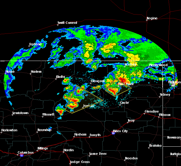 At 131 am mdt, a severe thunderstorm was located 10 miles southeast of frazer, or 15 miles southwest of wolf point, moving northeast at 35 mph (radar indicated). Hazards include 60 mph wind gusts and quarter size hail. Hail damage to vehicles is expected. expect wind damage to roofs, siding, and trees. Locations impacted include, wolf point and oswego. At 131 am mdt, a severe thunderstorm was located 10 miles southeast of frazer, or 15 miles southwest of wolf point, moving northeast at 35 mph (radar indicated). Hazards include 60 mph wind gusts and quarter size hail. Hail damage to vehicles is expected. expect wind damage to roofs, siding, and trees. Locations impacted include, wolf point and oswego.
|
| 6/16/2016 1:03 AM MDT | Quarter sized hail reported 0.3 miles NNW of Wolf Point, MT |
| 6/16/2016 1:01 AM MDT |
 At 100 am mdt, a severe thunderstorm was located near rock creek rec area, or 33 miles southwest of wolf point, moving northeast at 35 mph (radar indicated). Hazards include two inch hail and 60 mph wind gusts. People and animals outdoors will be injured. expect hail damage to roofs, siding, windows, and vehicles. Expect wind damage to roofs, siding, and trees. At 100 am mdt, a severe thunderstorm was located near rock creek rec area, or 33 miles southwest of wolf point, moving northeast at 35 mph (radar indicated). Hazards include two inch hail and 60 mph wind gusts. People and animals outdoors will be injured. expect hail damage to roofs, siding, windows, and vehicles. Expect wind damage to roofs, siding, and trees.
|
| 6/15/2016 11:54 PM MDT |
 At 1153 pm mdt, a severe thunderstorm was located near frazer, or 15 miles west of wolf point, moving northeast at 50 mph (radar indicated). Hazards include 60 mph wind gusts and quarter size hail. Hail damage to vehicles is expected. Expect wind damage to roofs, siding, and trees. At 1153 pm mdt, a severe thunderstorm was located near frazer, or 15 miles west of wolf point, moving northeast at 50 mph (radar indicated). Hazards include 60 mph wind gusts and quarter size hail. Hail damage to vehicles is expected. Expect wind damage to roofs, siding, and trees.
|
| 6/14/2016 6:55 PM MDT |
 At 653 pm mdt, severe thunderstorms were located along a line extending from 15 miles northwest of st. marie to 7 miles south of glasgow to 11 miles east of jordan, moving northeast at 40 mph (radar indicated). Hazards include 60 mph wind gusts and quarter size hail. Hail damage to vehicles is expected. Expect wind damage to roofs, siding, and trees. At 653 pm mdt, severe thunderstorms were located along a line extending from 15 miles northwest of st. marie to 7 miles south of glasgow to 11 miles east of jordan, moving northeast at 40 mph (radar indicated). Hazards include 60 mph wind gusts and quarter size hail. Hail damage to vehicles is expected. Expect wind damage to roofs, siding, and trees.
|
| 6/11/2016 2:39 AM MDT |
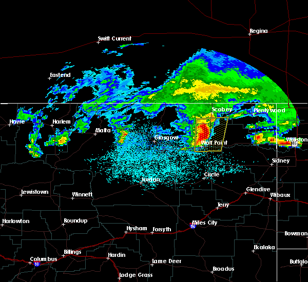 At 238 am mdt, severe thunderstorms were located along a line extending from 17 miles southwest of scobey to 14 miles southwest of bredette to near wolf point, moving east at 55 mph (radar indicated). Hazards include quarter size hail. Damage to vehicles is expected. Locations impacted include, wolf point, poplar, bredette and volt. At 238 am mdt, severe thunderstorms were located along a line extending from 17 miles southwest of scobey to 14 miles southwest of bredette to near wolf point, moving east at 55 mph (radar indicated). Hazards include quarter size hail. Damage to vehicles is expected. Locations impacted include, wolf point, poplar, bredette and volt.
|
| 6/11/2016 2:12 AM MDT |
 At 212 am mdt, severe thunderstorms were located along a line extending from 18 miles northeast of st. marie to 9 miles southwest of lustre to 6 miles west of frazer, moving east at 55 mph (radar indicated). Hazards include quarter size hail. damage to vehicles is expected At 212 am mdt, severe thunderstorms were located along a line extending from 18 miles northeast of st. marie to 9 miles southwest of lustre to 6 miles west of frazer, moving east at 55 mph (radar indicated). Hazards include quarter size hail. damage to vehicles is expected
|
| 6/10/2016 10:26 PM MDT |
 At 1025 pm mdt, severe thunderstorms were located along a line extending from near fort peck marina to 8 miles southwest of flowing wells rest area, moving east at 55 mph. these are very dangerous storms (trained weather spotters). Hazards include 90 mph wind gusts and quarter size hail. You are in a life-threatening situation. flying debris may be deadly to those caught without shelter. mobile homes will be heavily damaged or destroyed. homes and businesses will have substantial roof and window damage. Expect extensive tree damage and power outages. At 1025 pm mdt, severe thunderstorms were located along a line extending from near fort peck marina to 8 miles southwest of flowing wells rest area, moving east at 55 mph. these are very dangerous storms (trained weather spotters). Hazards include 90 mph wind gusts and quarter size hail. You are in a life-threatening situation. flying debris may be deadly to those caught without shelter. mobile homes will be heavily damaged or destroyed. homes and businesses will have substantial roof and window damage. Expect extensive tree damage and power outages.
|
| 5/21/2016 7:07 PM MDT | Quarter sized hail reported 34.5 miles E of Wolf Point, MT, quarter sized hail reported by nws employee near signal hill. |
| 7/1/2015 3:43 PM MDT |
 At 340 pm mdt, a severe thunderstorm was located 5 miles northwest of wolf point, and moving southeast at 25 mph (radar). Hazards include 60 mph wind gusts and quarter size hail. Hail damage to crops and plants is expected. some damage to vehicles is possible. expect wind damage to roofs, siding and trees. The severe thunderstorm will be near, wolf point around 355 pm mdt. At 340 pm mdt, a severe thunderstorm was located 5 miles northwest of wolf point, and moving southeast at 25 mph (radar). Hazards include 60 mph wind gusts and quarter size hail. Hail damage to crops and plants is expected. some damage to vehicles is possible. expect wind damage to roofs, siding and trees. The severe thunderstorm will be near, wolf point around 355 pm mdt.
|
| 7/1/2015 3:09 PM MDT |
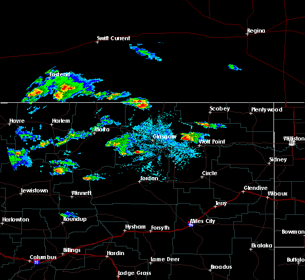 At 307 pm mdt, a severe thunderstorm was located 11 miles south of lustre, and moving southeast at 25 mph (radar indicated). Hazards include 60 mph wind gusts and quarter size hail. Hail damage to crops and plants is expected. some damage to vehicles is possible. expect wind damage to roofs, siding and trees. The severe thunderstorm will be near, wolf point around 355 pm mdt. At 307 pm mdt, a severe thunderstorm was located 11 miles south of lustre, and moving southeast at 25 mph (radar indicated). Hazards include 60 mph wind gusts and quarter size hail. Hail damage to crops and plants is expected. some damage to vehicles is possible. expect wind damage to roofs, siding and trees. The severe thunderstorm will be near, wolf point around 355 pm mdt.
|
| 6/19/2015 3:25 PM MDT | Quarter sized hail reported 8.3 miles WNW of Wolf Point, MT |
| 6/19/2015 3:15 PM MDT |
 At 312 pm mdt, a severe thunderstorm was located 8 miles east of wolf point, and moving east at 30 mph (radar indicated). Hazards include 60 mph wind gusts and quarter size hail. Hail damage to crops and plants is expected. some damage to vehicles is possible. expect wind damage to roofs, siding and trees. The severe thunderstorm will be near, poplar around 335 pm mdt. At 312 pm mdt, a severe thunderstorm was located 8 miles east of wolf point, and moving east at 30 mph (radar indicated). Hazards include 60 mph wind gusts and quarter size hail. Hail damage to crops and plants is expected. some damage to vehicles is possible. expect wind damage to roofs, siding and trees. The severe thunderstorm will be near, poplar around 335 pm mdt.
|
| 6/19/2015 2:40 PM MDT | Ping Pong Ball sized hail reported 23 miles SSW of Wolf Point, MT |
| 6/19/2015 2:25 PM MDT | Ping Pong Ball sized hail reported 25.4 miles SSE of Wolf Point, MT |
| 7/24/2014 6:00 PM MDT | Airport asos wind gust in roosevelt county MT, 0.3 miles NNW of Wolf Point, MT |
| 7/24/2014 5:59 PM MDT | Storm damage reported in roosevelt county MT, 2.9 miles W of Wolf Point, MT |
| 7/24/2014 5:52 PM MDT | Tree blown down...and a power line blown dow in roosevelt county MT, 0.3 miles NNW of Wolf Point, MT |
| 7/24/2014 3:20 AM MDT | Quarter sized hail reported 31.9 miles SSW of Wolf Point, MT |
| 8/28/2013 9:35 PM MDT | Storm damage reported in roosevelt county MT, 7.1 miles SSW of Wolf Point, MT |
| 7/24/2013 3:49 PM MDT | Quarter sized hail reported 11.1 miles E of Wolf Point, MT, quarter sized hail covering ground. |
| 7/20/2013 6:15 PM MDT | Golf Ball sized hail reported 11.7 miles SW of Wolf Point, MT, nickel to golf ball sized hail. |
| 7/20/2013 5:45 PM MDT | Quarter sized hail reported 11.5 miles E of Wolf Point, MT |
| 7/3/2012 5:26 PM MDT | Quarter sized hail reported 0.3 miles NNW of Wolf Point, MT, hailed for 5 minutes starting at 526 pm. |
| 7/3/2012 5:26 PM MDT | Storm damage reported in roosevelt county MT, 0.3 miles NNW of Wolf Point, MT |
| 7/3/2012 5:25 PM MDT | Quarter sized hail reported 0.4 miles NE of Wolf Point, MT, also 50 mph winds and tree branches down |
| 7/2/2012 12:38 AM MDT | Storm damage reported in roosevelt county MT, 0.3 miles NNW of Wolf Point, MT |
| 6/24/2012 7:00 AM MDT | 3 to 4 inch limbs on older tree broken of in roosevelt county MT, 4.5 miles SSE of Wolf Point, MT |
| 6/24/2012 6:54 AM MDT | Storm damage reported in roosevelt county MT, 0.3 miles NNW of Wolf Point, MT |
| 6/24/2012 6:45 AM MDT | 1 to 2 inch limbs broken off trees...some rain gutters blown off of buildin in roosevelt county MT, 0.3 miles NNW of Wolf Point, MT |
| 1/1/0001 12:00 AM | 44 mph winds with 58 mph gust in roosevelt county MT, 0.3 miles NNW of Wolf Point, MT |
| 1/1/0001 12:00 AM | Storm damage reported in roosevelt county MT, 10.8 miles S of Wolf Point, MT |
| 1/1/0001 12:00 AM | Tennis Ball sized hail reported 15.1 miles NNW of Wolf Point, MT, estimated 2 1/2 inch hail. |
| 1/1/0001 12:00 AM | Golf Ball sized hail reported 15.1 miles NNW of Wolf Point, MT, estimated golfball sized hail. |
| 1/1/0001 12:00 AM | Hen Egg sized hail reported 31.2 miles SSW of Wolf Point, MT, estimated 2 inch hail covering the ground. |
| 1/1/0001 12:00 AM | Storm damage reported in mccone county MT, 5.1 miles N of Wolf Point, MT |
Hail Maps for Wolf Point, MT


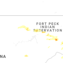


Connect with Interactive Hail Maps