

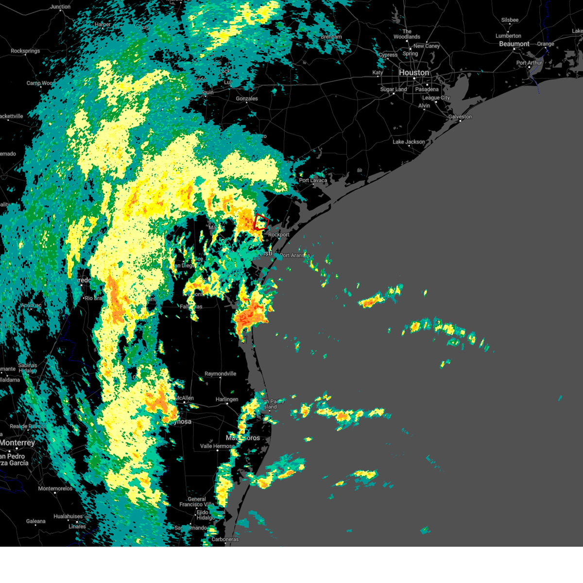
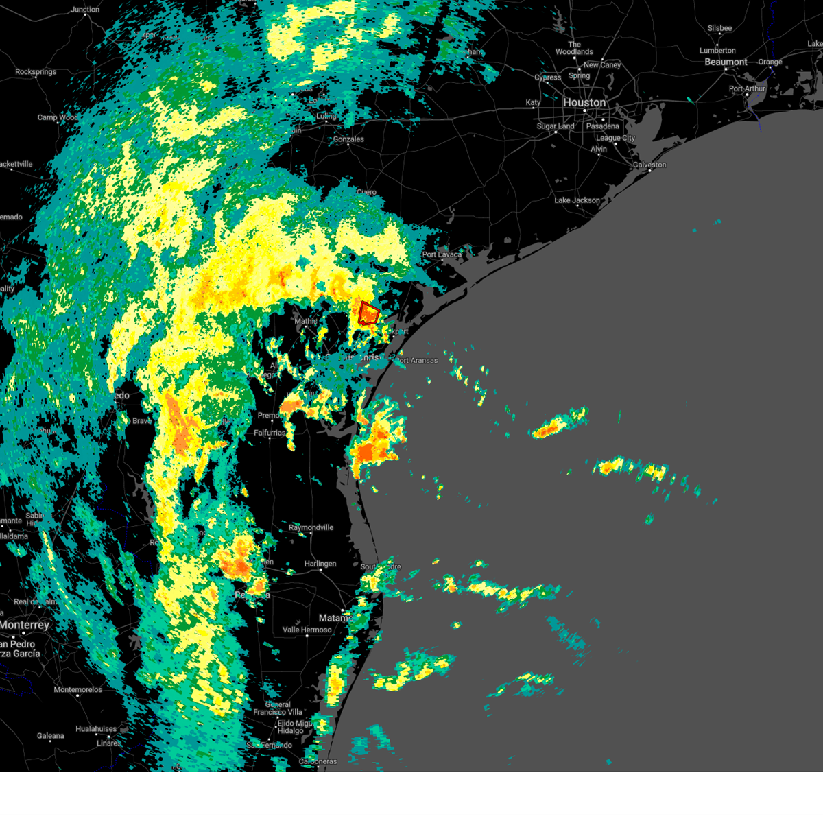
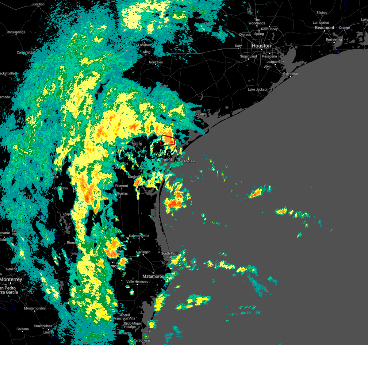
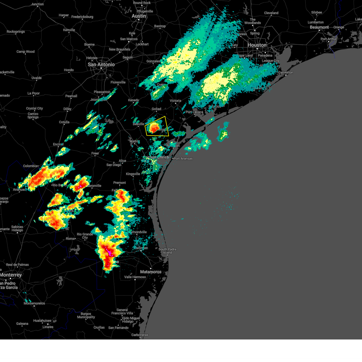
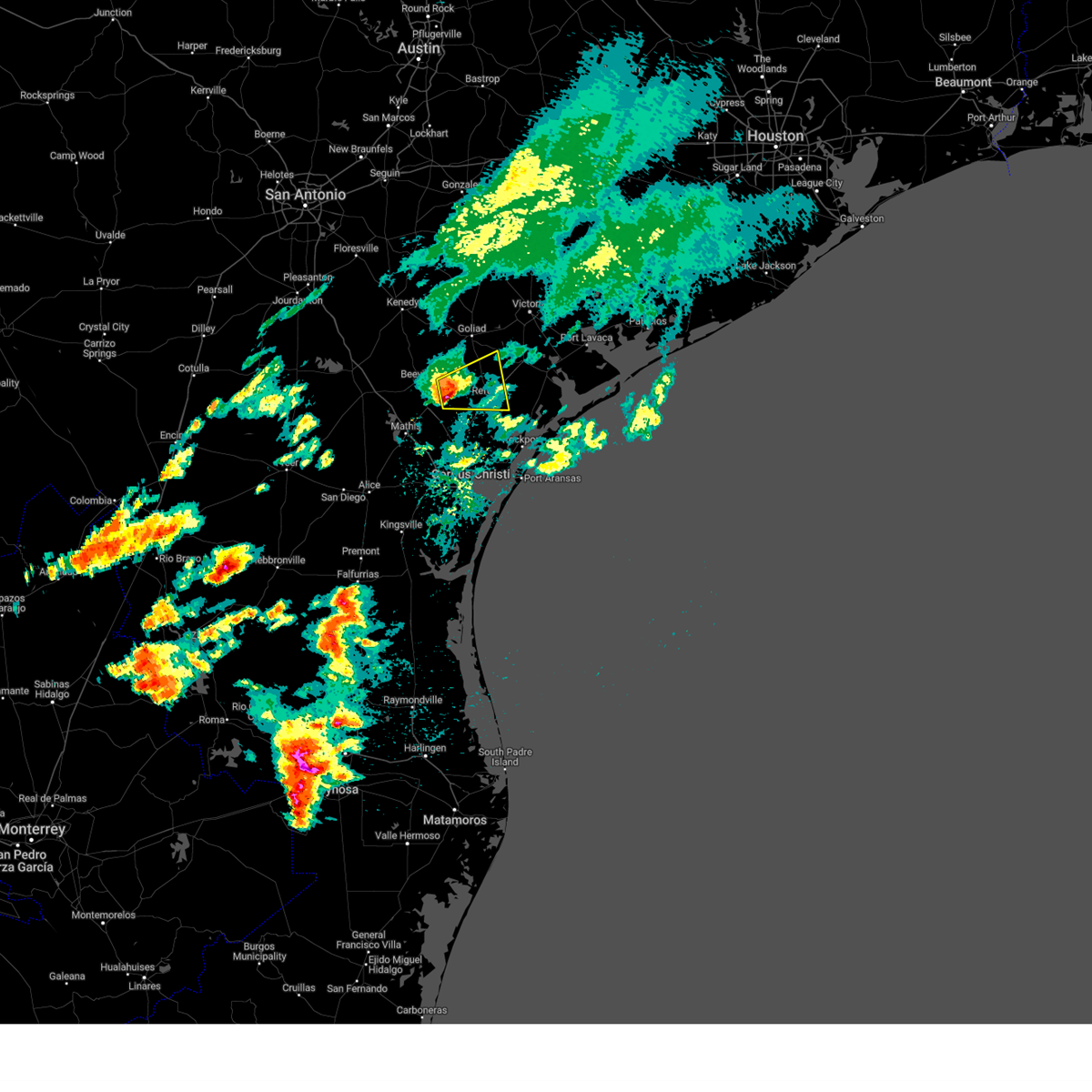
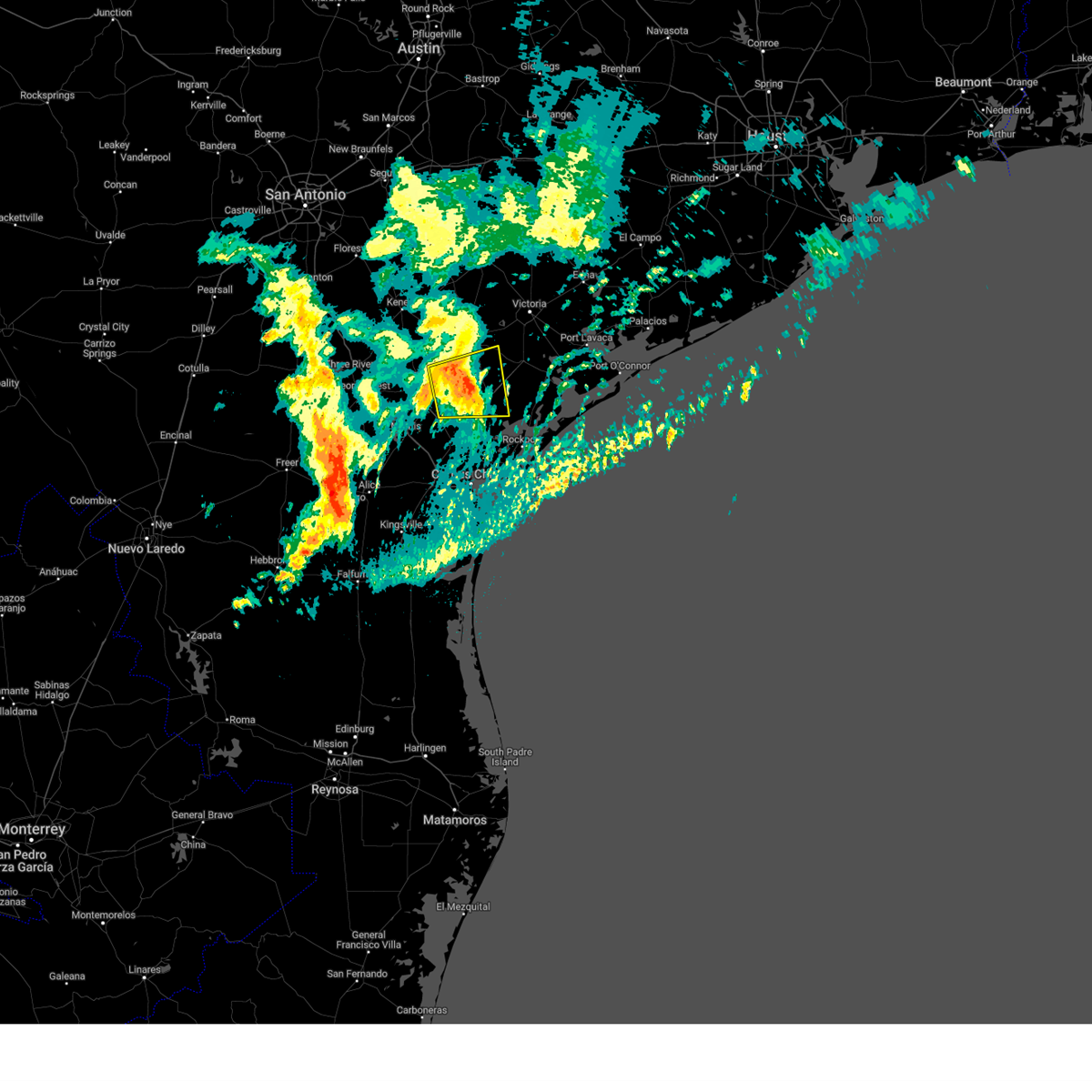
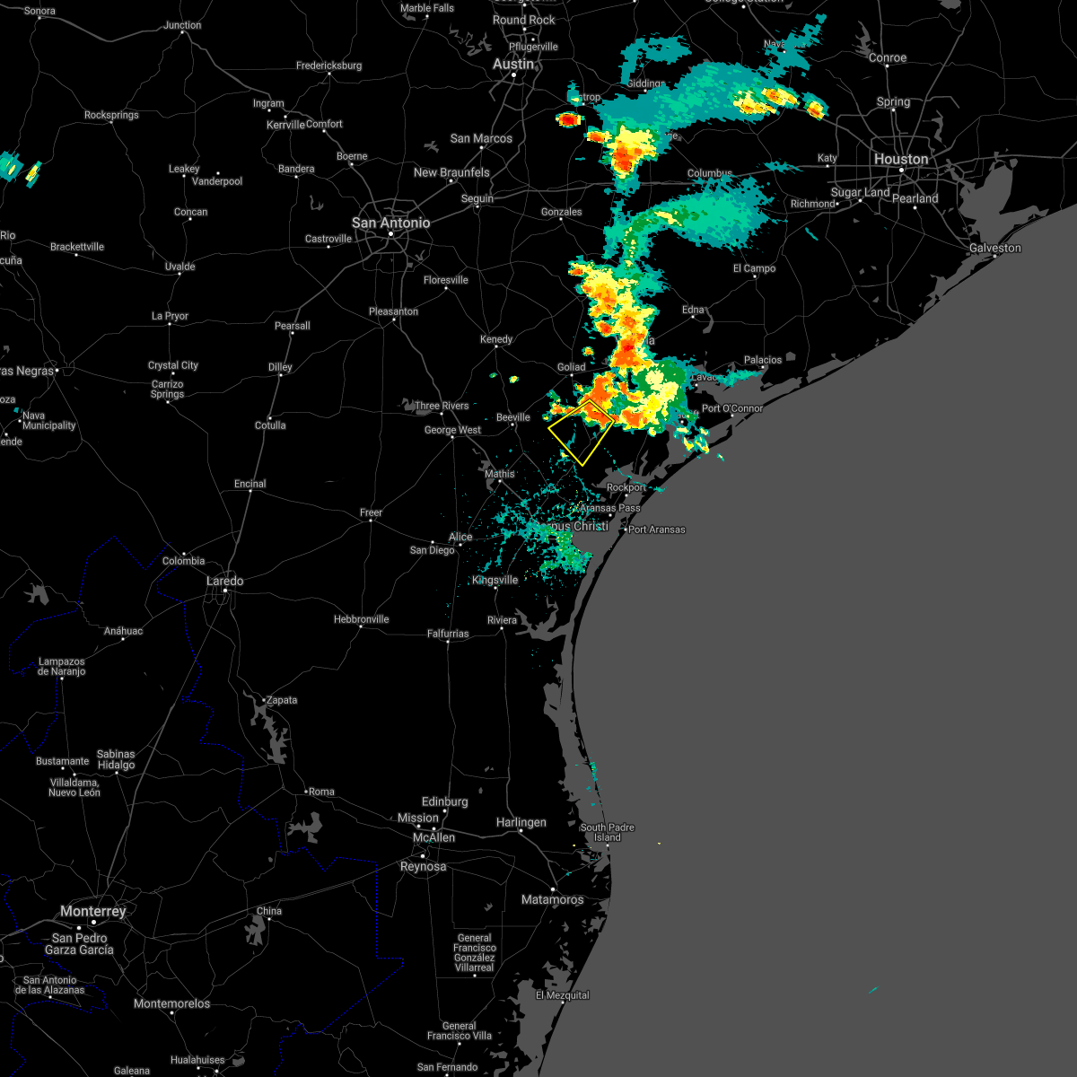
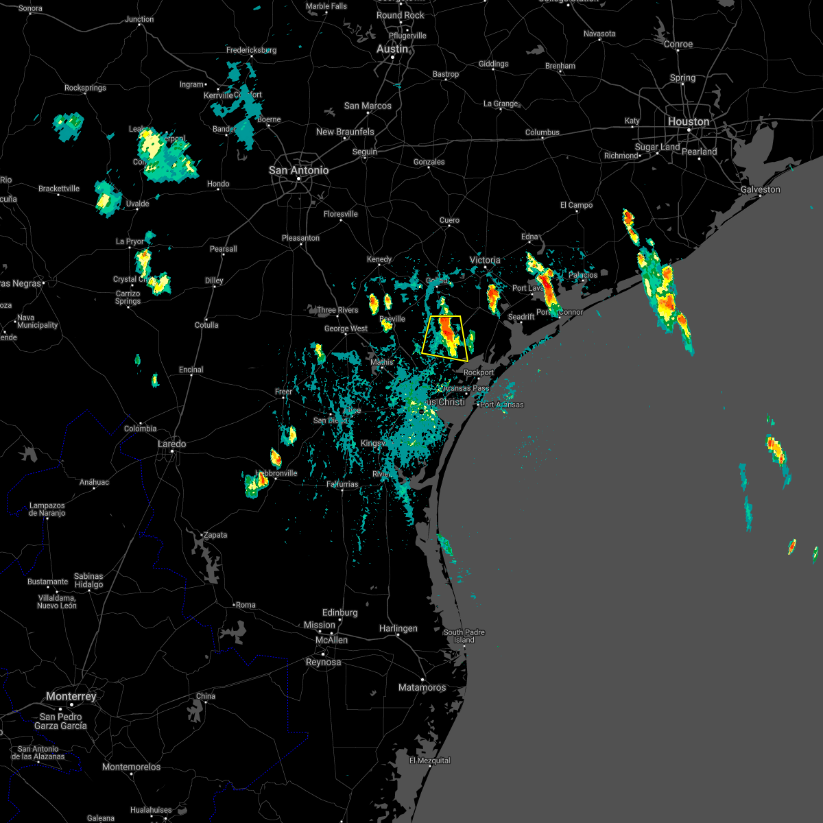
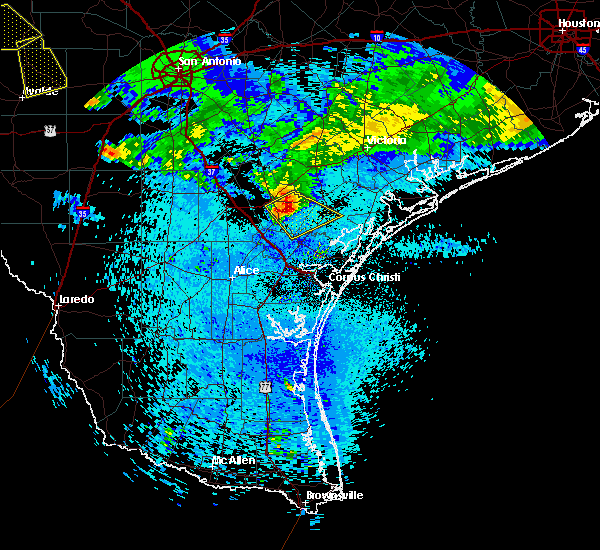
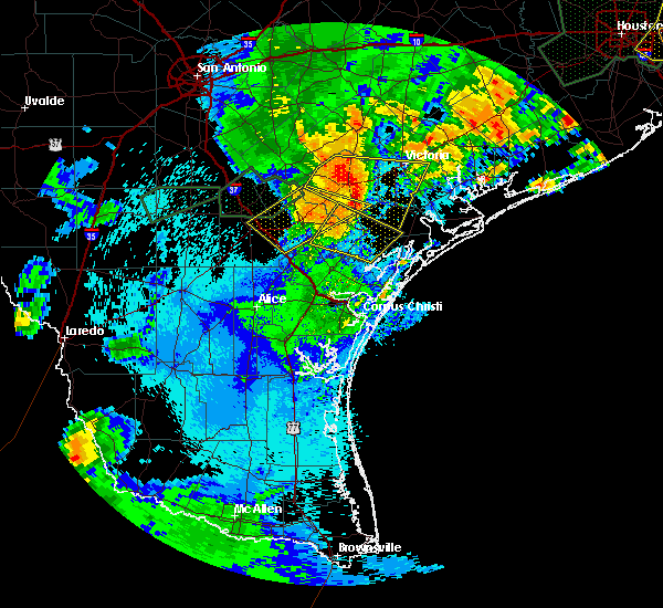
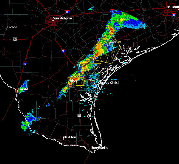
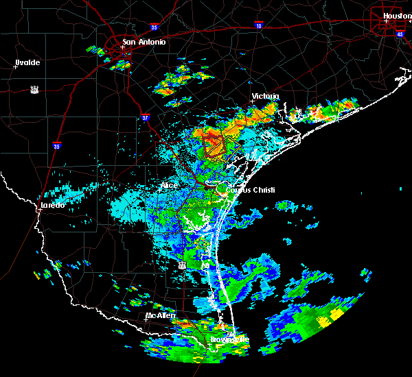
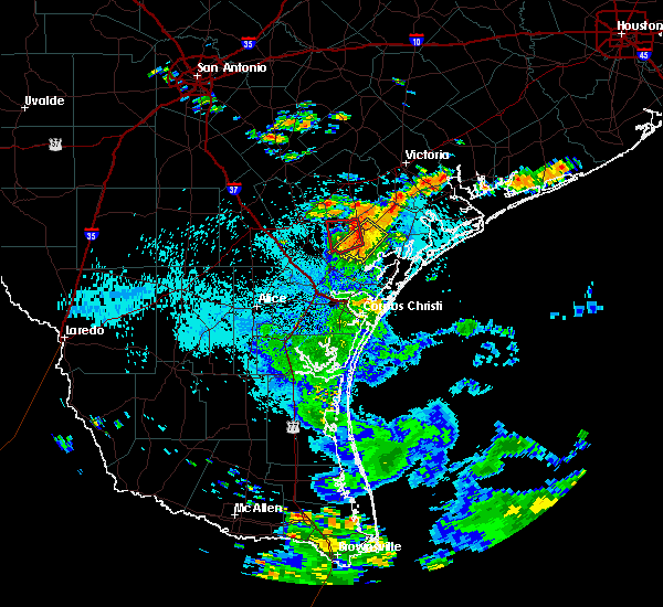
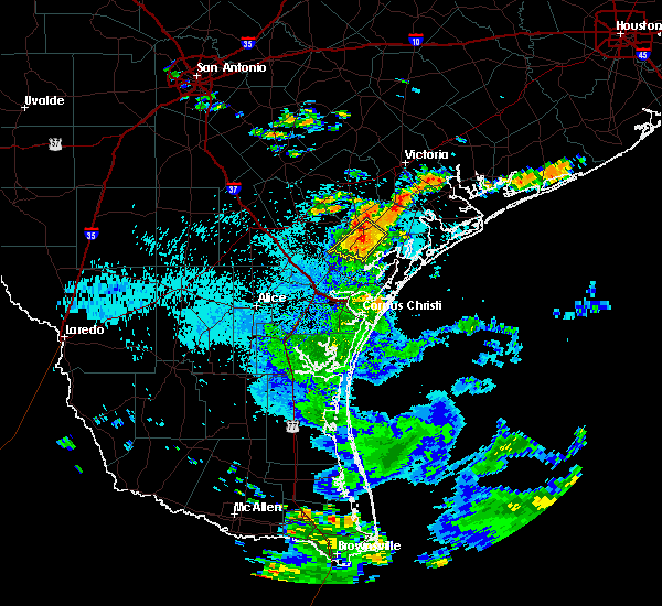
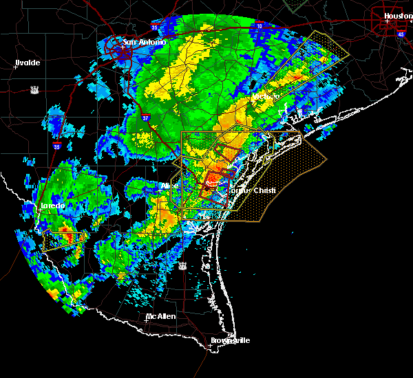
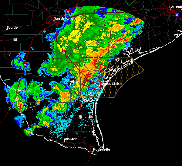
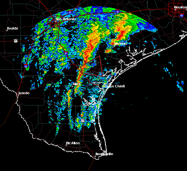
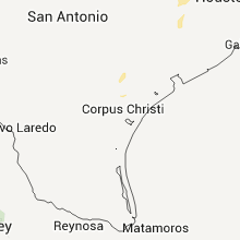
Hail Map for Woodsboro, TX
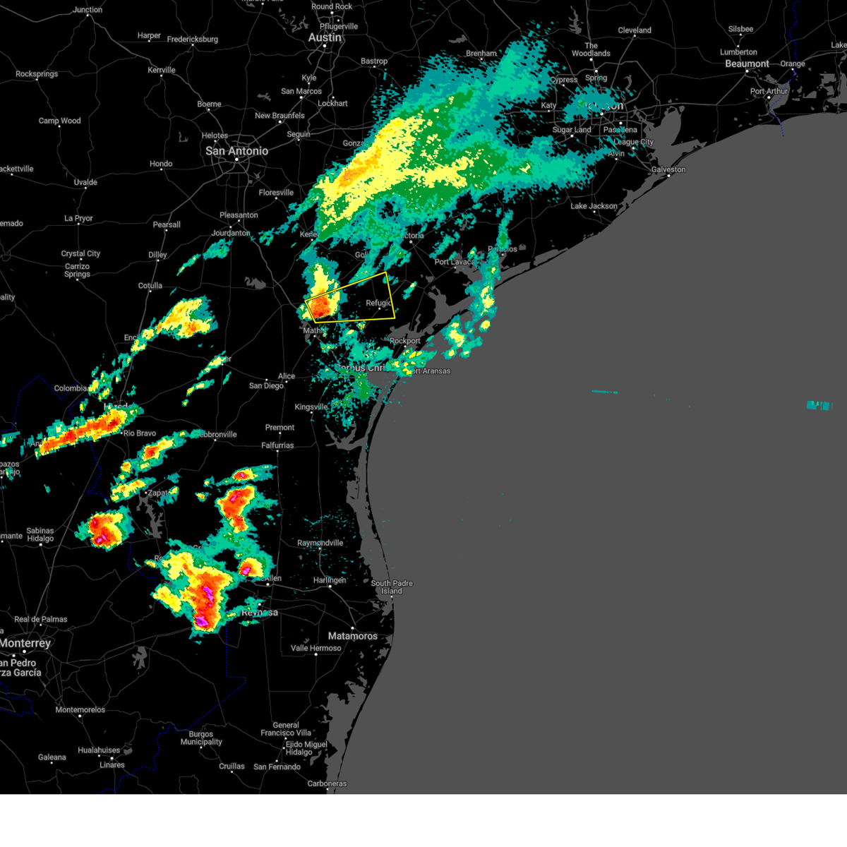
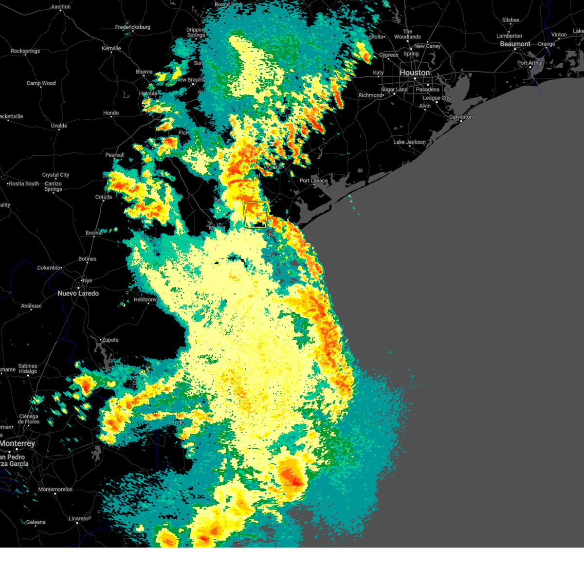
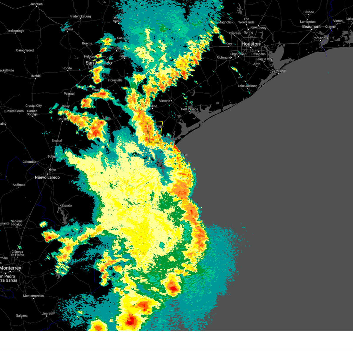
The Woodsboro, TX area has had 4 reports of on-the-ground hail by trained spotters, and has been under severe weather warnings 0 times during the past 12 months. Doppler radar has detected hail at or near Woodsboro, TX on 29 occasions.
| Name: | Woodsboro, TX |
| Where Located: | 30.7 miles N of Corpus Christi, TX |
| Map: | Google Map for Woodsboro, TX |
| Population: | 1512 |
| Housing Units: | 678 |
| More Info: | Search Google for Woodsboro, TX |
0
The Top Recent Hail Date for Woodsboro, TX is Monday, May 13, 2024 (18th out of 29)

Hail and Wind Damage Spotted near Woodsboro, TX
| Date / Time | Report Details |
|---|---|
| 6/19/2024 9:29 PM CDT |
 The storm which prompted the warning has moved out of the area. therefore, the warning will be allowed to expire. however, gusty winds and heavy rain are still possible with this thunderstorm. a tornado watch remains in effect until 700 am cdt for south central texas. The storm which prompted the warning has moved out of the area. therefore, the warning will be allowed to expire. however, gusty winds and heavy rain are still possible with this thunderstorm. a tornado watch remains in effect until 700 am cdt for south central texas.
|
| 6/19/2024 9:23 PM CDT |
 Torcrp the national weather service in corpus christi has issued a * tornado warning for, north central san patricio county in south central texas, southwestern refugio county in south central texas, southeastern bee county in south central texas, * until 945 pm cdt. * at 923 pm cdt, a severe thunderstorm capable of producing a tornado was located near bonnie view, or near woodsboro, moving west at 35 mph (radar indicated rotation). Hazards include tornado. Flying debris will be dangerous to those caught without shelter. mobile homes will be damaged or destroyed. damage to roofs, windows, and vehicles will occur. Tree damage is likely. Torcrp the national weather service in corpus christi has issued a * tornado warning for, north central san patricio county in south central texas, southwestern refugio county in south central texas, southeastern bee county in south central texas, * until 945 pm cdt. * at 923 pm cdt, a severe thunderstorm capable of producing a tornado was located near bonnie view, or near woodsboro, moving west at 35 mph (radar indicated rotation). Hazards include tornado. Flying debris will be dangerous to those caught without shelter. mobile homes will be damaged or destroyed. damage to roofs, windows, and vehicles will occur. Tree damage is likely.
|
| 6/19/2024 9:14 PM CDT |
 At 914 pm cdt, a severe thunderstorm capable of producing a tornado was located over bonnie view, or near woodsboro, moving west at 35 mph (radar indicated rotation). Hazards include tornado. Flying debris will be dangerous to those caught without shelter. mobile homes will be damaged or destroyed. damage to roofs, windows, and vehicles will occur. tree damage is likely. locations impacted include, woodsboro and bonnie view. This includes us highway 77 between mile markers 626 and 628. At 914 pm cdt, a severe thunderstorm capable of producing a tornado was located over bonnie view, or near woodsboro, moving west at 35 mph (radar indicated rotation). Hazards include tornado. Flying debris will be dangerous to those caught without shelter. mobile homes will be damaged or destroyed. damage to roofs, windows, and vehicles will occur. tree damage is likely. locations impacted include, woodsboro and bonnie view. This includes us highway 77 between mile markers 626 and 628.
|
| 6/19/2024 9:14 PM CDT |
 the tornado warning has been cancelled and is no longer in effect the tornado warning has been cancelled and is no longer in effect
|
| 6/19/2024 9:02 PM CDT |
 Torcrp the national weather service in corpus christi has issued a * tornado warning for, northeastern san patricio county in south central texas, south central refugio county in south central texas, * until 930 pm cdt. * at 901 pm cdt, a severe thunderstorm capable of producing a tornado was located near bayside, or 10 miles northwest of rockport, moving west at 35 mph (radar indicated rotation). Hazards include tornado. Flying debris will be dangerous to those caught without shelter. mobile homes will be damaged or destroyed. damage to roofs, windows, and vehicles will occur. Tree damage is likely. Torcrp the national weather service in corpus christi has issued a * tornado warning for, northeastern san patricio county in south central texas, south central refugio county in south central texas, * until 930 pm cdt. * at 901 pm cdt, a severe thunderstorm capable of producing a tornado was located near bayside, or 10 miles northwest of rockport, moving west at 35 mph (radar indicated rotation). Hazards include tornado. Flying debris will be dangerous to those caught without shelter. mobile homes will be damaged or destroyed. damage to roofs, windows, and vehicles will occur. Tree damage is likely.
|
| 5/17/2024 8:01 AM CDT |
 the severe thunderstorm warning has been cancelled and is no longer in effect the severe thunderstorm warning has been cancelled and is no longer in effect
|
| 5/17/2024 7:46 AM CDT |
 At 746 am cdt, a severe thunderstorm was located 8 miles southwest of blanconia, or 11 miles east of skidmore, moving east at 45 mph (radar indicated). Hazards include quarter size hail. Damage to vehicles is expected. locations impacted include, refugio, woodsboro, and blanconia. this includes the following highways, us highway 183 between mile markers 654 and 668. Us highway 77 between mile markers 614 and 628. At 746 am cdt, a severe thunderstorm was located 8 miles southwest of blanconia, or 11 miles east of skidmore, moving east at 45 mph (radar indicated). Hazards include quarter size hail. Damage to vehicles is expected. locations impacted include, refugio, woodsboro, and blanconia. this includes the following highways, us highway 183 between mile markers 654 and 668. Us highway 77 between mile markers 614 and 628.
|
| 5/17/2024 7:27 AM CDT |
 Svrcrp the national weather service in corpus christi has issued a * severe thunderstorm warning for, southeastern goliad county in south central texas, northwestern refugio county in south central texas, southeastern bee county in south central texas, * until 815 am cdt. * at 726 am cdt, a severe thunderstorm was located near skidmore, moving east at 45 mph (radar indicated). Hazards include quarter size hail. damage to vehicles is expected Svrcrp the national weather service in corpus christi has issued a * severe thunderstorm warning for, southeastern goliad county in south central texas, northwestern refugio county in south central texas, southeastern bee county in south central texas, * until 815 am cdt. * at 726 am cdt, a severe thunderstorm was located near skidmore, moving east at 45 mph (radar indicated). Hazards include quarter size hail. damage to vehicles is expected
|
| 2/3/2024 5:38 AM CST |
 At 538 am cst, a severe thunderstorm was located near woodsboro, moving east at 25 mph (radar indicated). Hazards include quarter size hail. damage to vehicles is expected At 538 am cst, a severe thunderstorm was located near woodsboro, moving east at 25 mph (radar indicated). Hazards include quarter size hail. damage to vehicles is expected
|
| 5/13/2023 7:12 AM CDT |
 The severe thunderstorm warning for southern goliad, southwestern refugio and eastern bee counties will expire at 715 am cdt, the storm which prompted the warning has weakened below severe limits, and no longer poses an immediate threat to life or property. therefore, the warning will be allowed to expire. however gusty winds are still possible with this thunderstorm. The severe thunderstorm warning for southern goliad, southwestern refugio and eastern bee counties will expire at 715 am cdt, the storm which prompted the warning has weakened below severe limits, and no longer poses an immediate threat to life or property. therefore, the warning will be allowed to expire. however gusty winds are still possible with this thunderstorm.
|
| 5/13/2023 6:58 AM CDT |
 At 658 am cdt, a severe thunderstorm was located over woodsboro, moving north at 30 mph (radar indicated). Hazards include 60 mph wind gusts. Expect damage to roofs, siding, and trees. locations impacted include, refugio, woodsboro, bonnie view and blanconia. this includes the following highways, us highway 183 between mile markers 662 and 668. us highway 77 between mile markers 614 and 636. hail threat, radar indicated max hail size, <. 75 in wind threat, radar indicated max wind gust, 60 mph. At 658 am cdt, a severe thunderstorm was located over woodsboro, moving north at 30 mph (radar indicated). Hazards include 60 mph wind gusts. Expect damage to roofs, siding, and trees. locations impacted include, refugio, woodsboro, bonnie view and blanconia. this includes the following highways, us highway 183 between mile markers 662 and 668. us highway 77 between mile markers 614 and 636. hail threat, radar indicated max hail size, <. 75 in wind threat, radar indicated max wind gust, 60 mph.
|
| 5/13/2023 6:46 AM CDT |
 At 646 am cdt, a severe thunderstorm was located over bonnie view, or near woodsboro, moving north at 30 mph (radar indicated). Hazards include 60 mph wind gusts. Expect damage to roofs, siding, and trees. locations impacted include, refugio, woodsboro, bonnie view and blanconia. this includes the following highways, us highway 183 between mile markers 662 and 668. us highway 77 between mile markers 614 and 640. hail threat, radar indicated max hail size, <. 75 in wind threat, radar indicated max wind gust, 60 mph. At 646 am cdt, a severe thunderstorm was located over bonnie view, or near woodsboro, moving north at 30 mph (radar indicated). Hazards include 60 mph wind gusts. Expect damage to roofs, siding, and trees. locations impacted include, refugio, woodsboro, bonnie view and blanconia. this includes the following highways, us highway 183 between mile markers 662 and 668. us highway 77 between mile markers 614 and 640. hail threat, radar indicated max hail size, <. 75 in wind threat, radar indicated max wind gust, 60 mph.
|
| 5/13/2023 6:34 AM CDT |
 At 634 am cdt, a severe thunderstorm was located near taft, moving north at 30 mph (radar indicated). Hazards include 60 mph wind gusts. expect damage to roofs, siding, and trees At 634 am cdt, a severe thunderstorm was located near taft, moving north at 30 mph (radar indicated). Hazards include 60 mph wind gusts. expect damage to roofs, siding, and trees
|
| 4/27/2023 9:35 AM CDT | Ping Pong Ball sized hail reported 0.9 miles WSW of Woodsboro, TX, hail was mostly quarter size but some were as large as ping pong balls. |
| 4/27/2023 9:29 AM CDT |
 At 928 am cdt, a severe thunderstorm was located near bonnie view, or near woodsboro, moving northeast at 30 mph (radar indicated). Hazards include 60 mph wind gusts and half dollar size hail. Hail damage to vehicles is expected. Expect wind damage to roofs, siding, and trees. At 928 am cdt, a severe thunderstorm was located near bonnie view, or near woodsboro, moving northeast at 30 mph (radar indicated). Hazards include 60 mph wind gusts and half dollar size hail. Hail damage to vehicles is expected. Expect wind damage to roofs, siding, and trees.
|
| 3/17/2023 4:39 AM CDT |
 The severe thunderstorm warning for southeastern goliad, northwestern refugio and southeastern bee counties will expire at 445 am cdt, the storm which prompted the warning has weakened below severe limits, and no longer poses an immediate threat to life or property. therefore, the warning will be allowed to expire. however gusty winds are still possible with this thunderstorm. The severe thunderstorm warning for southeastern goliad, northwestern refugio and southeastern bee counties will expire at 445 am cdt, the storm which prompted the warning has weakened below severe limits, and no longer poses an immediate threat to life or property. therefore, the warning will be allowed to expire. however gusty winds are still possible with this thunderstorm.
|
| 3/17/2023 4:29 AM CDT |
 At 428 am cdt, a severe thunderstorm was located over blanconia, or 10 miles northwest of refugio, moving east at 45 mph (radar indicated). Hazards include 60 mph wind gusts. Expect damage to roofs, siding, and trees. locations impacted include, refugio, woodsboro, skidmore and blanconia. this includes the following highways, us highway 183 between mile markers 650 and 668. us highway 59 near mile marker 688. us highway 77 between mile markers 614 and 630. hail threat, radar indicated max hail size, <. 75 in wind threat, radar indicated max wind gust, 60 mph. At 428 am cdt, a severe thunderstorm was located over blanconia, or 10 miles northwest of refugio, moving east at 45 mph (radar indicated). Hazards include 60 mph wind gusts. Expect damage to roofs, siding, and trees. locations impacted include, refugio, woodsboro, skidmore and blanconia. this includes the following highways, us highway 183 between mile markers 650 and 668. us highway 59 near mile marker 688. us highway 77 between mile markers 614 and 630. hail threat, radar indicated max hail size, <. 75 in wind threat, radar indicated max wind gust, 60 mph.
|
| 3/17/2023 4:10 AM CDT |
 At 410 am cdt, a severe thunderstorm was located 8 miles south of berclair, or 8 miles east of beeville, moving east at 45 mph (radar indicated). Hazards include 60 mph wind gusts. Expect damage to roofs, siding, and trees. locations impacted include, beeville, refugio, woodsboro, skidmore, berclair, blanconia and normanna. this includes the following highways, us highway 181 between mile markers 584 and 608. us highway 183 between mile markers 648 and 668. us highway 59 between mile markers 678 and 698. us highway 77 between mile markers 614 and 630. hail threat, radar indicated max hail size, <. 75 in wind threat, radar indicated max wind gust, 60 mph. At 410 am cdt, a severe thunderstorm was located 8 miles south of berclair, or 8 miles east of beeville, moving east at 45 mph (radar indicated). Hazards include 60 mph wind gusts. Expect damage to roofs, siding, and trees. locations impacted include, beeville, refugio, woodsboro, skidmore, berclair, blanconia and normanna. this includes the following highways, us highway 181 between mile markers 584 and 608. us highway 183 between mile markers 648 and 668. us highway 59 between mile markers 678 and 698. us highway 77 between mile markers 614 and 630. hail threat, radar indicated max hail size, <. 75 in wind threat, radar indicated max wind gust, 60 mph.
|
| 3/17/2023 3:56 AM CDT |
 At 355 am cdt, a severe thunderstorm was located over beeville, moving east at 50 mph (radar indicated). Hazards include 60 mph wind gusts and penny size hail. expect damage to roofs, siding, and trees At 355 am cdt, a severe thunderstorm was located over beeville, moving east at 50 mph (radar indicated). Hazards include 60 mph wind gusts and penny size hail. expect damage to roofs, siding, and trees
|
| 5/25/2022 2:55 AM CDT |
 The severe thunderstorm warning for aransas, calhoun, southeastern victoria, southeastern goliad and refugio counties will expire at 300 am cdt, the storms which prompted the warning have weakened below severe limits, and no longer pose an immediate threat to life or property. therefore, the warning will be allowed to expire. however heavy rain is still possible with these thunderstorms. a severe thunderstorm watch remains in effect until 500 am cdt for south central and south texas. to report severe weather, contact your nearest law enforcement agency. they will relay your report to the national weather service corpus christi. The severe thunderstorm warning for aransas, calhoun, southeastern victoria, southeastern goliad and refugio counties will expire at 300 am cdt, the storms which prompted the warning have weakened below severe limits, and no longer pose an immediate threat to life or property. therefore, the warning will be allowed to expire. however heavy rain is still possible with these thunderstorms. a severe thunderstorm watch remains in effect until 500 am cdt for south central and south texas. to report severe weather, contact your nearest law enforcement agency. they will relay your report to the national weather service corpus christi.
|
| 5/25/2022 1:56 AM CDT |
 At 155 am cdt, severe thunderstorms were located along a line extending from near inez to near bloomington to near quintana, moving southeast at 45 mph (radar indicated). Hazards include 70 mph wind gusts and penny size hail. Expect considerable tree damage. Damage is likely to mobile homes, roofs, and outbuildings. At 155 am cdt, severe thunderstorms were located along a line extending from near inez to near bloomington to near quintana, moving southeast at 45 mph (radar indicated). Hazards include 70 mph wind gusts and penny size hail. Expect considerable tree damage. Damage is likely to mobile homes, roofs, and outbuildings.
|
| 6/14/2021 6:06 PM CDT |
 The severe thunderstorm warning for southeastern goliad, northwestern refugio and eastern bee counties will expire at 615 pm cdt, the storm which prompted the warning has weakened below severe limits, and no longer poses an immediate threat to life or property. therefore, the warning will be allowed to expire. however gusty winds are still possible with this thunderstorm. The severe thunderstorm warning for southeastern goliad, northwestern refugio and eastern bee counties will expire at 615 pm cdt, the storm which prompted the warning has weakened below severe limits, and no longer poses an immediate threat to life or property. therefore, the warning will be allowed to expire. however gusty winds are still possible with this thunderstorm.
|
| 6/14/2021 5:37 PM CDT |
 At 537 pm cdt, a severe thunderstorm was located 8 miles northwest of quintana, or 9 miles north of refugio, moving southwest at 15 mph (radar indicated). Hazards include 60 mph wind gusts and quarter size hail. Hail damage to vehicles is expected. Expect wind damage to roofs, siding, and trees. At 537 pm cdt, a severe thunderstorm was located 8 miles northwest of quintana, or 9 miles north of refugio, moving southwest at 15 mph (radar indicated). Hazards include 60 mph wind gusts and quarter size hail. Hail damage to vehicles is expected. Expect wind damage to roofs, siding, and trees.
|
| 4/23/2021 8:59 PM CDT |
 At 858 pm cdt, a severe thunderstorm was located 7 miles west of blanconia, or 13 miles east of beeville, moving east at 45 mph (radar indicated). Hazards include golf ball size hail and 60 mph wind gusts. People and animals outdoors will be injured. expect hail damage to roofs, siding, windows, and vehicles. Expect wind damage to roofs, siding, and trees. At 858 pm cdt, a severe thunderstorm was located 7 miles west of blanconia, or 13 miles east of beeville, moving east at 45 mph (radar indicated). Hazards include golf ball size hail and 60 mph wind gusts. People and animals outdoors will be injured. expect hail damage to roofs, siding, windows, and vehicles. Expect wind damage to roofs, siding, and trees.
|
| 8/20/2020 5:12 PM CDT |
 At 512 pm cdt, a severe thunderstorm was located over woodsboro, moving south at 10 mph (radar indicated). Hazards include 60 mph wind gusts and quarter size hail. Hail damage to vehicles is expected. Expect wind damage to roofs, siding, and trees. At 512 pm cdt, a severe thunderstorm was located over woodsboro, moving south at 10 mph (radar indicated). Hazards include 60 mph wind gusts and quarter size hail. Hail damage to vehicles is expected. Expect wind damage to roofs, siding, and trees.
|
| 8/20/2020 4:49 PM CDT |
 At 448 pm cdt, a severe thunderstorm was located near refugio, moving south at 10 mph (radar indicated). Hazards include 60 mph wind gusts and quarter size hail. Hail damage to vehicles is expected. expect wind damage to roofs, siding, and trees. Locations impacted include, refugio, woodsboro and bonnie view. At 448 pm cdt, a severe thunderstorm was located near refugio, moving south at 10 mph (radar indicated). Hazards include 60 mph wind gusts and quarter size hail. Hail damage to vehicles is expected. expect wind damage to roofs, siding, and trees. Locations impacted include, refugio, woodsboro and bonnie view.
|
| 8/20/2020 4:26 PM CDT |
 At 426 pm cdt, a severe thunderstorm was located near refugio, moving south at 10 mph (radar indicated). Hazards include 60 mph wind gusts and quarter size hail. Hail damage to vehicles is expected. Expect wind damage to roofs, siding, and trees. At 426 pm cdt, a severe thunderstorm was located near refugio, moving south at 10 mph (radar indicated). Hazards include 60 mph wind gusts and quarter size hail. Hail damage to vehicles is expected. Expect wind damage to roofs, siding, and trees.
|
| 7/25/2020 12:37 PM CDT |
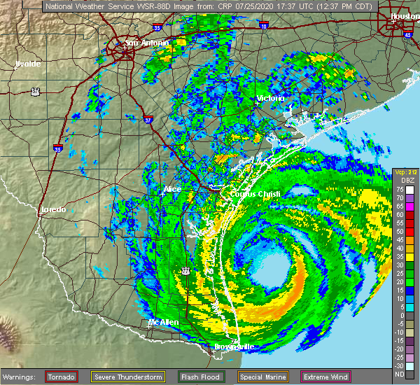 At 1237 pm cdt, a severe thunderstorm capable of producing a tornado was located near bonnie view, or 7 miles southeast of refugio, moving west at 35 mph (radar indicated rotation). Hazards include tornado. Flying debris will be dangerous to those caught without shelter. mobile homes will be damaged or destroyed. damage to roofs, windows, and vehicles will occur. tree damage is likely. This dangerous storm will be near, woodsboro and bonnie view around 1250 pm cdt. At 1237 pm cdt, a severe thunderstorm capable of producing a tornado was located near bonnie view, or 7 miles southeast of refugio, moving west at 35 mph (radar indicated rotation). Hazards include tornado. Flying debris will be dangerous to those caught without shelter. mobile homes will be damaged or destroyed. damage to roofs, windows, and vehicles will occur. tree damage is likely. This dangerous storm will be near, woodsboro and bonnie view around 1250 pm cdt.
|
| 5/28/2020 8:14 PM CDT |
 At 814 pm cdt, a severe thunderstorm was located over bayside, or 10 miles southeast of woodsboro, moving southwest at 25 mph (radar indicated). Hazards include 60 mph wind gusts and quarter size hail. Hail damage to vehicles is expected. expect wind damage to roofs, siding, and trees. Locations impacted include, rockport, sinton, taft, refugio, woodsboro, lamar, ingleside, aransas pass, bayside, quintana, palm harbor, key allegro, copano village, bonnie view, holiday beach, tivoli, aransas national wildlife refuge, fulton and austwell. At 814 pm cdt, a severe thunderstorm was located over bayside, or 10 miles southeast of woodsboro, moving southwest at 25 mph (radar indicated). Hazards include 60 mph wind gusts and quarter size hail. Hail damage to vehicles is expected. expect wind damage to roofs, siding, and trees. Locations impacted include, rockport, sinton, taft, refugio, woodsboro, lamar, ingleside, aransas pass, bayside, quintana, palm harbor, key allegro, copano village, bonnie view, holiday beach, tivoli, aransas national wildlife refuge, fulton and austwell.
|
| 5/28/2020 7:57 PM CDT |
 At 756 pm cdt, a severe thunderstorm was located near bayside, or 8 miles northwest of rockport, moving south at 25 mph (radar indicated). Hazards include 60 mph wind gusts and quarter size hail. Hail damage to vehicles is expected. Expect wind damage to roofs, siding, and trees. At 756 pm cdt, a severe thunderstorm was located near bayside, or 8 miles northwest of rockport, moving south at 25 mph (radar indicated). Hazards include 60 mph wind gusts and quarter size hail. Hail damage to vehicles is expected. Expect wind damage to roofs, siding, and trees.
|
| 5/28/2020 7:28 PM CDT |
 At 728 pm cdt, a severe thunderstorm was located near quintana, or 10 miles east of refugio, moving southwest at 20 mph (radar indicated). Hazards include 60 mph wind gusts and quarter size hail. Hail damage to vehicles is expected. expect wind damage to roofs, siding, and trees. Locations impacted include, refugio, woodsboro, quintana, bonnie view, tivoli, aransas national wildlife refuge, blanconia and austwell. At 728 pm cdt, a severe thunderstorm was located near quintana, or 10 miles east of refugio, moving southwest at 20 mph (radar indicated). Hazards include 60 mph wind gusts and quarter size hail. Hail damage to vehicles is expected. expect wind damage to roofs, siding, and trees. Locations impacted include, refugio, woodsboro, quintana, bonnie view, tivoli, aransas national wildlife refuge, blanconia and austwell.
|
| 5/28/2020 7:06 PM CDT |
 At 706 pm cdt, a severe thunderstorm was located 8 miles east of quintana, or 12 miles south of mcfaddin, moving southwest at 20 mph (radar indicated). Hazards include 60 mph wind gusts and quarter size hail. Hail damage to vehicles is expected. Expect wind damage to roofs, siding, and trees. At 706 pm cdt, a severe thunderstorm was located 8 miles east of quintana, or 12 miles south of mcfaddin, moving southwest at 20 mph (radar indicated). Hazards include 60 mph wind gusts and quarter size hail. Hail damage to vehicles is expected. Expect wind damage to roofs, siding, and trees.
|
| 5/28/2020 12:05 AM CDT |
 At 1204 am cdt, a severe thunderstorm was located 7 miles northeast of skidmore, moving southeast at 40 mph (radar indicated). Hazards include 60 mph wind gusts and quarter size hail. Hail damage to vehicles is expected. expect wind damage to roofs, siding, and trees. locations impacted include, refugio, woodsboro, skidmore, st. Paul and papalote. At 1204 am cdt, a severe thunderstorm was located 7 miles northeast of skidmore, moving southeast at 40 mph (radar indicated). Hazards include 60 mph wind gusts and quarter size hail. Hail damage to vehicles is expected. expect wind damage to roofs, siding, and trees. locations impacted include, refugio, woodsboro, skidmore, st. Paul and papalote.
|
| 5/27/2020 11:52 PM CDT |
 At 1152 pm cdt, a severe thunderstorm was located over beeville, moving southeast at 30 mph (radar indicated). Hazards include golf ball size hail and 60 mph wind gusts. People and animals outdoors will be injured. expect hail damage to roofs, siding, windows, and vehicles. Expect wind damage to roofs, siding, and trees. At 1152 pm cdt, a severe thunderstorm was located over beeville, moving southeast at 30 mph (radar indicated). Hazards include golf ball size hail and 60 mph wind gusts. People and animals outdoors will be injured. expect hail damage to roofs, siding, windows, and vehicles. Expect wind damage to roofs, siding, and trees.
|
| 5/16/2020 2:04 AM CDT |
 At 203 am cdt, severe thunderstorms were located along a line extending from 9 miles southwest of speaks to near quintana, moving east at 35 mph (radar indicated). Hazards include 60 mph wind gusts and penny size hail. Expect damage to roofs, siding, and trees. Locations impacted include, victoria, refugio, woodsboro, mcfaddin, guadalupe, fannin, quintana, victoria colony creek country club, nursery, victoria riverside park, victoria college, victoria mall, saxet lakes, inez, salem, telferner, tivoli, downtown victoria, dacosta and wood hi. At 203 am cdt, severe thunderstorms were located along a line extending from 9 miles southwest of speaks to near quintana, moving east at 35 mph (radar indicated). Hazards include 60 mph wind gusts and penny size hail. Expect damage to roofs, siding, and trees. Locations impacted include, victoria, refugio, woodsboro, mcfaddin, guadalupe, fannin, quintana, victoria colony creek country club, nursery, victoria riverside park, victoria college, victoria mall, saxet lakes, inez, salem, telferner, tivoli, downtown victoria, dacosta and wood hi.
|
| 5/16/2020 1:37 AM CDT |
 At 137 am cdt, severe thunderstorms were located along a line extending from 6 miles southwest of woodsboro to near kingsville, moving east at 45 mph (radar indicated). Hazards include 60 mph wind gusts and penny size hail. expect damage to roofs, siding, and trees At 137 am cdt, severe thunderstorms were located along a line extending from 6 miles southwest of woodsboro to near kingsville, moving east at 45 mph (radar indicated). Hazards include 60 mph wind gusts and penny size hail. expect damage to roofs, siding, and trees
|
| 5/16/2020 1:09 AM CDT |
 At 108 am cdt, severe thunderstorms were located along a line extending from near cuero to near papalote, moving east at 35 mph (radar indicated). Hazards include 60 mph wind gusts and penny size hail. expect damage to roofs, siding, and trees At 108 am cdt, severe thunderstorms were located along a line extending from near cuero to near papalote, moving east at 35 mph (radar indicated). Hazards include 60 mph wind gusts and penny size hail. expect damage to roofs, siding, and trees
|
| 6/6/2019 7:36 PM CDT |
 The severe thunderstorm warning for northern aransas and central refugio counties will expire at 745 pm cdt, the storm which prompted the warning has weakened below severe limits, and no longer poses an immediate threat to life or property. therefore, the warning will be allowed to expire. a severe thunderstorm watch remains in effect until 1000 pm cdt for south central texas. The severe thunderstorm warning for northern aransas and central refugio counties will expire at 745 pm cdt, the storm which prompted the warning has weakened below severe limits, and no longer poses an immediate threat to life or property. therefore, the warning will be allowed to expire. a severe thunderstorm watch remains in effect until 1000 pm cdt for south central texas.
|
| 6/6/2019 7:18 PM CDT |
 At 717 pm cdt, a severe thunderstorm was located near refugio, moving southeast at 30 mph (radar indicated). Hazards include 60 mph wind gusts and quarter size hail. Hail damage to vehicles is expected. expect wind damage to roofs, siding, and trees. Locations impacted include, rockport, refugio, woodsboro, lamar, bayside, quintana, palm harbor, key allegro, bonnie view, holiday beach, copano village and fulton. At 717 pm cdt, a severe thunderstorm was located near refugio, moving southeast at 30 mph (radar indicated). Hazards include 60 mph wind gusts and quarter size hail. Hail damage to vehicles is expected. expect wind damage to roofs, siding, and trees. Locations impacted include, rockport, refugio, woodsboro, lamar, bayside, quintana, palm harbor, key allegro, bonnie view, holiday beach, copano village and fulton.
|
| 6/6/2019 6:57 PM CDT |
 The national weather service in corpus christi has issued a * severe thunderstorm warning for. northern aransas county in south central texas. south central goliad county in south central texas. central refugio county in south central texas. East central bee county in south central texas. The national weather service in corpus christi has issued a * severe thunderstorm warning for. northern aransas county in south central texas. south central goliad county in south central texas. central refugio county in south central texas. East central bee county in south central texas.
|
| 6/6/2019 6:33 PM CDT |
 At 632 pm cdt, a severe thunderstorm was located near blanconia, or 8 miles north of refugio, moving southeast at 30 mph (radar indicated). Hazards include two inch hail and 70 mph wind gusts. People and animals outdoors will be injured. expect hail damage to roofs, siding, windows, and vehicles. expect considerable tree damage. wind damage is also likely to mobile homes, roofs, and outbuildings. Locations impacted include, refugio, woodsboro, berclair and blanconia. At 632 pm cdt, a severe thunderstorm was located near blanconia, or 8 miles north of refugio, moving southeast at 30 mph (radar indicated). Hazards include two inch hail and 70 mph wind gusts. People and animals outdoors will be injured. expect hail damage to roofs, siding, windows, and vehicles. expect considerable tree damage. wind damage is also likely to mobile homes, roofs, and outbuildings. Locations impacted include, refugio, woodsboro, berclair and blanconia.
|
| 6/6/2019 6:11 PM CDT |
 At 610 pm cdt, a severe thunderstorm was located 7 miles east of berclair, or 10 miles southwest of goliad, moving southeast at 30 mph (radar indicated). Hazards include two inch hail and 70 mph wind gusts. People and animals outdoors will be injured. expect hail damage to roofs, siding, windows, and vehicles. expect considerable tree damage. Wind damage is also likely to mobile homes, roofs, and outbuildings. At 610 pm cdt, a severe thunderstorm was located 7 miles east of berclair, or 10 miles southwest of goliad, moving southeast at 30 mph (radar indicated). Hazards include two inch hail and 70 mph wind gusts. People and animals outdoors will be injured. expect hail damage to roofs, siding, windows, and vehicles. expect considerable tree damage. Wind damage is also likely to mobile homes, roofs, and outbuildings.
|
| 6/6/2019 7:50 AM CDT |
 At 750 am cdt, a severe thunderstorm was located near blanconia, or near refugio, moving east at 30 mph (radar indicated). Hazards include quarter size hail. damage to vehicles is expected At 750 am cdt, a severe thunderstorm was located near blanconia, or near refugio, moving east at 30 mph (radar indicated). Hazards include quarter size hail. damage to vehicles is expected
|
| 5/9/2019 10:37 PM CDT |
 At 1037 pm cdt, severe thunderstorms were located along a line extending from 11 miles northeast of blanconia to near papalote, moving east at 30 mph (radar indicated). Hazards include 60 mph wind gusts and penny size hail. Expect damage to roofs, siding, and trees. Locations impacted include, refugio, woodsboro, skidmore, bayside, quintana, bonnie view and blanconia. At 1037 pm cdt, severe thunderstorms were located along a line extending from 11 miles northeast of blanconia to near papalote, moving east at 30 mph (radar indicated). Hazards include 60 mph wind gusts and penny size hail. Expect damage to roofs, siding, and trees. Locations impacted include, refugio, woodsboro, skidmore, bayside, quintana, bonnie view and blanconia.
|
| 5/9/2019 10:20 PM CDT |
 At 1020 pm cdt, severe thunderstorms were located along a line extending from 7 miles east of berclair to near tynan, moving east at 35 mph (radar indicated). Hazards include 60 mph wind gusts and penny size hail. expect damage to roofs, siding, and trees At 1020 pm cdt, severe thunderstorms were located along a line extending from 7 miles east of berclair to near tynan, moving east at 35 mph (radar indicated). Hazards include 60 mph wind gusts and penny size hail. expect damage to roofs, siding, and trees
|
| 4/24/2019 7:04 PM CDT |
 At 704 pm cdt, severe thunderstorms were located along a line extending from near blanconia to near mathis, moving east at 35 mph (radar indicated). Hazards include 60 mph wind gusts and nickel size hail. Expect damage to roofs, siding, and trees. locations impacted include, sinton, woodsboro, skidmore, st. Paul, west sinton, papalote and tynan. At 704 pm cdt, severe thunderstorms were located along a line extending from near blanconia to near mathis, moving east at 35 mph (radar indicated). Hazards include 60 mph wind gusts and nickel size hail. Expect damage to roofs, siding, and trees. locations impacted include, sinton, woodsboro, skidmore, st. Paul, west sinton, papalote and tynan.
|
| 4/24/2019 6:35 PM CDT |
 At 633 pm cdt, severe thunderstorms were located along a line extending from near beeville to near tecalote, moving east at 35 mph (radar indicated). Hazards include 70 mph wind gusts and quarter size hail. Hail damage to vehicles is expected. expect considerable tree damage. Wind damage is also likely to mobile homes, roofs, and outbuildings. At 633 pm cdt, severe thunderstorms were located along a line extending from near beeville to near tecalote, moving east at 35 mph (radar indicated). Hazards include 70 mph wind gusts and quarter size hail. Hail damage to vehicles is expected. expect considerable tree damage. Wind damage is also likely to mobile homes, roofs, and outbuildings.
|
| 4/7/2019 8:15 AM CDT |
 At 814 am cdt, severe thunderstorms were located along a line extending from 6 miles southeast of charco to near refugio to near taft to near naval air station cabaniss field, moving east at 40 mph (radar indicated). Hazards include 60 mph wind gusts and penny size hail. expect damage to roofs, siding, and trees At 814 am cdt, severe thunderstorms were located along a line extending from 6 miles southeast of charco to near refugio to near taft to near naval air station cabaniss field, moving east at 40 mph (radar indicated). Hazards include 60 mph wind gusts and penny size hail. expect damage to roofs, siding, and trees
|
| 4/7/2019 7:46 AM CDT |
 At 746 am cdt, severe thunderstorms were located along a line extending from 6 miles east of tuleta to 9 miles northeast of skidmore to st. paul to near robstown, moving east at 35 mph (radar indicated). Hazards include 60 mph wind gusts and quarter size hail. Hail damage to vehicles is expected. expect wind damage to roofs, siding, and trees. locations impacted include, corpus christi, portland, beeville, robstown, sinton, taft, refugio, goliad, woodsboro, corpus christi international airport, skidmore, odem, gregory, st. Paul, san patricio, corpus christi north beach, edroy, banquete, tynan and west sinton. At 746 am cdt, severe thunderstorms were located along a line extending from 6 miles east of tuleta to 9 miles northeast of skidmore to st. paul to near robstown, moving east at 35 mph (radar indicated). Hazards include 60 mph wind gusts and quarter size hail. Hail damage to vehicles is expected. expect wind damage to roofs, siding, and trees. locations impacted include, corpus christi, portland, beeville, robstown, sinton, taft, refugio, goliad, woodsboro, corpus christi international airport, skidmore, odem, gregory, st. Paul, san patricio, corpus christi north beach, edroy, banquete, tynan and west sinton.
|
| 4/7/2019 7:27 AM CDT |
 At 727 am cdt, severe thunderstorms were located along a line extending from near tuleta to near skidmore to near west sinton to near banquete, moving east at 35 mph (radar indicated). Hazards include 60 mph wind gusts and quarter size hail. Hail damage to vehicles is expected. Expect wind damage to roofs, siding, and trees. At 727 am cdt, severe thunderstorms were located along a line extending from near tuleta to near skidmore to near west sinton to near banquete, moving east at 35 mph (radar indicated). Hazards include 60 mph wind gusts and quarter size hail. Hail damage to vehicles is expected. Expect wind damage to roofs, siding, and trees.
|
| 7/6/2018 2:54 PM CDT |
 At 253 pm cdt, a severe thunderstorm capable of producing a tornado was located near woodsboro, moving west at 15 mph. this storm is still showing good rotation, and has produced funnel clouds earlier this afternoon (radar indicated rotation). Hazards include tornado. Flying debris will be dangerous to those caught without shelter. mobile homes will be damaged or destroyed. damage to roofs, windows, and vehicles will occur. tree damage is likely. Locations impacted include, woodsboro. At 253 pm cdt, a severe thunderstorm capable of producing a tornado was located near woodsboro, moving west at 15 mph. this storm is still showing good rotation, and has produced funnel clouds earlier this afternoon (radar indicated rotation). Hazards include tornado. Flying debris will be dangerous to those caught without shelter. mobile homes will be damaged or destroyed. damage to roofs, windows, and vehicles will occur. tree damage is likely. Locations impacted include, woodsboro.
|
| 7/6/2018 2:41 PM CDT |
 The national weather service in corpus christi has issued a * tornado warning for. west central refugio county in south central texas. southeastern bee county in south central texas. until 315 pm cdt. At 240 pm cdt, a severe thunderstorm capable of producing a tornado. The national weather service in corpus christi has issued a * tornado warning for. west central refugio county in south central texas. southeastern bee county in south central texas. until 315 pm cdt. At 240 pm cdt, a severe thunderstorm capable of producing a tornado.
|
| 7/6/2018 2:37 PM CDT |
 At 236 pm cdt, a severe thunderstorm was located near woodsboro, moving west at 20 mph (radar indicated). Hazards include 60 mph wind gusts and quarter size hail. Hail damage to vehicles is expected. expect wind damage to roofs, siding, and trees. Locations impacted include, refugio, woodsboro and bonnie view. At 236 pm cdt, a severe thunderstorm was located near woodsboro, moving west at 20 mph (radar indicated). Hazards include 60 mph wind gusts and quarter size hail. Hail damage to vehicles is expected. expect wind damage to roofs, siding, and trees. Locations impacted include, refugio, woodsboro and bonnie view.
|
| 7/6/2018 2:21 PM CDT |
 At 221 pm cdt, a severe thunderstorm was located near refugio, moving west at 20 mph (radar indicated). Hazards include 60 mph wind gusts and quarter size hail. Hail damage to vehicles is expected. Expect wind damage to roofs, siding, and trees. At 221 pm cdt, a severe thunderstorm was located near refugio, moving west at 20 mph (radar indicated). Hazards include 60 mph wind gusts and quarter size hail. Hail damage to vehicles is expected. Expect wind damage to roofs, siding, and trees.
|
| 4/14/2018 2:14 AM CDT |
 At 213 am cdt, severe thunderstorms were located along a line extending from point comfort to 9 miles west of blanconia to near san patricio, moving southeast at 50 mph (radar indicated). Hazards include 60 mph wind gusts. Expect damage to roofs, siding, and trees. locations impacted include, portland, port lavaca, rockport, sinton, mathis, taft, refugio, woodsboro, seadrift, skidmore, lamar, ingleside, aransas pass, gregory, st. Paul, point comfort, lake city, bayside, quintana and palm harbor. At 213 am cdt, severe thunderstorms were located along a line extending from point comfort to 9 miles west of blanconia to near san patricio, moving southeast at 50 mph (radar indicated). Hazards include 60 mph wind gusts. Expect damage to roofs, siding, and trees. locations impacted include, portland, port lavaca, rockport, sinton, mathis, taft, refugio, woodsboro, seadrift, skidmore, lamar, ingleside, aransas pass, gregory, st. Paul, point comfort, lake city, bayside, quintana and palm harbor.
|
| 4/14/2018 2:07 AM CDT |
 At 207 am cdt, severe thunderstorms were located along a line extending from near point comfort to 7 miles south of berclair to san patricio, moving southeast at 50 mph (radar indicated). Hazards include 60 mph wind gusts. Expect damage to roofs, siding, and trees. Locations impacted include, victoria, portland, beeville, port lavaca, rockport, sinton, mathis, taft, refugio, goliad, woodsboro, seadrift, mcfaddin, port oconnor, skidmore, guadalupe, lamar, fannin, ingleside and aransas pass. At 207 am cdt, severe thunderstorms were located along a line extending from near point comfort to 7 miles south of berclair to san patricio, moving southeast at 50 mph (radar indicated). Hazards include 60 mph wind gusts. Expect damage to roofs, siding, and trees. Locations impacted include, victoria, portland, beeville, port lavaca, rockport, sinton, mathis, taft, refugio, goliad, woodsboro, seadrift, mcfaddin, port oconnor, skidmore, guadalupe, lamar, fannin, ingleside and aransas pass.
|
| 4/14/2018 1:45 AM CDT |
 At 144 am cdt, severe thunderstorms were located along a line extending from near inez to pettus to near mount lucas, moving southeast at 50 mph (radar indicated). Hazards include 60 mph wind gusts and penny size hail. expect damage to roofs, siding, and trees At 144 am cdt, severe thunderstorms were located along a line extending from near inez to pettus to near mount lucas, moving southeast at 50 mph (radar indicated). Hazards include 60 mph wind gusts and penny size hail. expect damage to roofs, siding, and trees
|
| 3/29/2018 1:11 AM CDT |
 The tornado warning for southwestern refugio county will expire at 115 am cdt, the storm which prompted the warning has weakened below severe limits, and has exited the warned area. therefore, the warning will be allowed to expire. a severe thunderstorm watch remains in effect until 300 am cdt for south central texas. The tornado warning for southwestern refugio county will expire at 115 am cdt, the storm which prompted the warning has weakened below severe limits, and has exited the warned area. therefore, the warning will be allowed to expire. a severe thunderstorm watch remains in effect until 300 am cdt for south central texas.
|
| 3/29/2018 12:56 AM CDT |
 At 1255 am cdt, severe thunderstorms were located along a line extending from near oak village to near sinton to near driscoll, moving east at 45 mph (radar indicated). Hazards include 70 mph wind gusts and penny size hail. Expect considerable tree damage. Damage is likely to mobile homes, roofs, and outbuildings. At 1255 am cdt, severe thunderstorms were located along a line extending from near oak village to near sinton to near driscoll, moving east at 45 mph (radar indicated). Hazards include 70 mph wind gusts and penny size hail. Expect considerable tree damage. Damage is likely to mobile homes, roofs, and outbuildings.
|
| 3/29/2018 12:52 AM CDT |
 At 1252 am cdt, a severe thunderstorm capable of producing a tornado was located near woodsboro, moving southeast at 45 mph (radar indicated rotation). Hazards include tornado. Flying debris will be dangerous to those caught without shelter. mobile homes will be damaged or destroyed. damage to roofs, windows, and vehicles will occur. tree damage is likely. this dangerous storm will be near, woodsboro around 1255 am cdt. Bonnie view around 100 am cdt. At 1252 am cdt, a severe thunderstorm capable of producing a tornado was located near woodsboro, moving southeast at 45 mph (radar indicated rotation). Hazards include tornado. Flying debris will be dangerous to those caught without shelter. mobile homes will be damaged or destroyed. damage to roofs, windows, and vehicles will occur. tree damage is likely. this dangerous storm will be near, woodsboro around 1255 am cdt. Bonnie view around 100 am cdt.
|
| 3/29/2018 12:47 AM CDT |
 At 1247 am cdt, severe thunderstorms were located along a line extending from near schroeder to sinton to 9 miles east of ben bolt, moving east at 45 mph (radar indicated). Hazards include 70 mph wind gusts and penny size hail. Expect considerable tree damage. damage is likely to mobile homes, roofs, and outbuildings. Locations impacted include, corpus christi, victoria, portland, robstown, sinton, mathis, taft, refugio, goliad, woodsboro, driscoll, mcfaddin, corpus christi international airport, skidmore, guadalupe, fannin, bishop, odem, gregory and orange grove. At 1247 am cdt, severe thunderstorms were located along a line extending from near schroeder to sinton to 9 miles east of ben bolt, moving east at 45 mph (radar indicated). Hazards include 70 mph wind gusts and penny size hail. Expect considerable tree damage. damage is likely to mobile homes, roofs, and outbuildings. Locations impacted include, corpus christi, victoria, portland, robstown, sinton, mathis, taft, refugio, goliad, woodsboro, driscoll, mcfaddin, corpus christi international airport, skidmore, guadalupe, fannin, bishop, odem, gregory and orange grove.
|
| 3/29/2018 12:33 AM CDT |
 At 1232 am cdt, severe thunderstorms were located along a line extending from near weesatche to near west sinton to near alice acres, moving east at 45 mph (radar indicated). Hazards include 70 mph wind gusts and penny size hail. Expect considerable tree damage. damage is likely to mobile homes, roofs, and outbuildings. Locations impacted include, corpus christi, victoria, alice, portland, beeville, robstown, sinton, mathis, san diego, taft, refugio, george west, goliad, woodsboro, driscoll, mcfaddin, corpus christi international airport, skidmore, guadalupe and fannin. At 1232 am cdt, severe thunderstorms were located along a line extending from near weesatche to near west sinton to near alice acres, moving east at 45 mph (radar indicated). Hazards include 70 mph wind gusts and penny size hail. Expect considerable tree damage. damage is likely to mobile homes, roofs, and outbuildings. Locations impacted include, corpus christi, victoria, alice, portland, beeville, robstown, sinton, mathis, san diego, taft, refugio, george west, goliad, woodsboro, driscoll, mcfaddin, corpus christi international airport, skidmore, guadalupe and fannin.
|
| 3/29/2018 12:14 AM CDT |
 At 1213 am cdt, severe thunderstorms were located along a line extending from near charco to near sandia to near benavides, moving east at 45 mph (radar indicated). Hazards include 70 mph wind gusts. Expect considerable tree damage. Damage is likely to mobile homes, roofs, and outbuildings. At 1213 am cdt, severe thunderstorms were located along a line extending from near charco to near sandia to near benavides, moving east at 45 mph (radar indicated). Hazards include 70 mph wind gusts. Expect considerable tree damage. Damage is likely to mobile homes, roofs, and outbuildings.
|
| 6/5/2017 7:33 PM CDT |
 At 731 pm cdt, a severe thunderstorm was located 7 miles northeast of bonnie view, or 8 miles southeast of refugio, moving south at 30 mph (law enforcement reported report quarter size hail near refugio). Hazards include 60 mph wind gusts and quarter size hail. Hail damage to vehicles is expected. expect wind damage to roofs, siding, and trees. Locations impacted include, portland, rockport, refugio, woodsboro, ingleside, aransas pass, bayside, quintana, palm harbor, bonnie view, copano village and fulton. At 731 pm cdt, a severe thunderstorm was located 7 miles northeast of bonnie view, or 8 miles southeast of refugio, moving south at 30 mph (law enforcement reported report quarter size hail near refugio). Hazards include 60 mph wind gusts and quarter size hail. Hail damage to vehicles is expected. expect wind damage to roofs, siding, and trees. Locations impacted include, portland, rockport, refugio, woodsboro, ingleside, aransas pass, bayside, quintana, palm harbor, bonnie view, copano village and fulton.
|
| 6/5/2017 7:22 PM CDT |
 At 722 pm cdt, a severe thunderstorm was located near refugio, moving south at 30 mph (radar indicated). Hazards include 60 mph wind gusts and half dollar size hail. Hail damage to vehicles is expected. Expect wind damage to roofs, siding, and trees. At 722 pm cdt, a severe thunderstorm was located near refugio, moving south at 30 mph (radar indicated). Hazards include 60 mph wind gusts and half dollar size hail. Hail damage to vehicles is expected. Expect wind damage to roofs, siding, and trees.
|
| 6/5/2017 7:14 PM CDT |
 At 713 pm cdt, a severe thunderstorm was located near quintana, or near refugio, moving south at 25 mph (radar indicated). Hazards include 60 mph wind gusts and quarter size hail. Hail damage to vehicles is expected. expect wind damage to roofs, siding, and trees. Locations impacted include, refugio, woodsboro and quintana. At 713 pm cdt, a severe thunderstorm was located near quintana, or near refugio, moving south at 25 mph (radar indicated). Hazards include 60 mph wind gusts and quarter size hail. Hail damage to vehicles is expected. expect wind damage to roofs, siding, and trees. Locations impacted include, refugio, woodsboro and quintana.
|
| 6/5/2017 6:40 PM CDT |
 At 639 pm cdt, a severe thunderstorm was located 11 miles south of fannin, or 12 miles west of mcfaddin, moving south at 20 mph (radar indicated). Hazards include 60 mph wind gusts and half dollar size hail. Hail damage to vehicles is expected. Expect wind damage to roofs, siding, and trees. At 639 pm cdt, a severe thunderstorm was located 11 miles south of fannin, or 12 miles west of mcfaddin, moving south at 20 mph (radar indicated). Hazards include 60 mph wind gusts and half dollar size hail. Hail damage to vehicles is expected. Expect wind damage to roofs, siding, and trees.
|
| 6/4/2017 6:58 PM CDT |
 At 657 pm cdt, a severe thunderstorm was located near bonnie view, or near woodsboro, moving northeast at 25 mph (radar indicated). Hazards include 60 mph wind gusts and quarter size hail. Hail damage to vehicles is expected. Expect wind damage to roofs, siding, and trees. At 657 pm cdt, a severe thunderstorm was located near bonnie view, or near woodsboro, moving northeast at 25 mph (radar indicated). Hazards include 60 mph wind gusts and quarter size hail. Hail damage to vehicles is expected. Expect wind damage to roofs, siding, and trees.
|
| 5/23/2017 8:06 PM CDT |
 At 805 pm cdt, a severe thunderstorm was located over gregory, or near portland, moving southeast at 55 mph (radar indicated). Hazards include 70 mph wind gusts and quarter size hail. Hail damage to vehicles is expected. expect considerable tree damage. wind damage is also likely to mobile homes, roofs, and outbuildings. locations impacted include, portland, rockport, sinton, port aransas, taft, woodsboro, ingleside, aransas pass, gregory, st. Paul, ingleside on the bay, bayside, palm harbor, corpus christi north beach, west sinton, bonnie view and taft southwest. At 805 pm cdt, a severe thunderstorm was located over gregory, or near portland, moving southeast at 55 mph (radar indicated). Hazards include 70 mph wind gusts and quarter size hail. Hail damage to vehicles is expected. expect considerable tree damage. wind damage is also likely to mobile homes, roofs, and outbuildings. locations impacted include, portland, rockport, sinton, port aransas, taft, woodsboro, ingleside, aransas pass, gregory, st. Paul, ingleside on the bay, bayside, palm harbor, corpus christi north beach, west sinton, bonnie view and taft southwest.
|
| 5/23/2017 7:48 PM CDT |
 At 747 pm cdt, a severe thunderstorm was located near st. paul, or near sinton, moving southeast at 55 mph. this is a very dangerous storm (radar indicated). Hazards include 80 mph wind gusts and golf ball size hail. Flying debris will be dangerous to those caught without shelter. mobile homes will be heavily damaged. expect considerable damage to roofs, windows, and vehicles. Extensive tree damage and power outages are likely. At 747 pm cdt, a severe thunderstorm was located near st. paul, or near sinton, moving southeast at 55 mph. this is a very dangerous storm (radar indicated). Hazards include 80 mph wind gusts and golf ball size hail. Flying debris will be dangerous to those caught without shelter. mobile homes will be heavily damaged. expect considerable damage to roofs, windows, and vehicles. Extensive tree damage and power outages are likely.
|
| 4/30/2017 12:16 AM CDT |
 At 1215 am cdt, a severe thunderstorm was located near holiday beach, or 10 miles north of rockport, moving east at 30 mph (law enforcement). Hazards include 60 mph wind gusts and quarter size hail. Hail damage to vehicles is expected. expect wind damage to roofs, siding, and trees. Locations impacted include, rockport, refugio, woodsboro, lamar, bayside, quintana, key allegro, holiday beach, copano village and fulton. At 1215 am cdt, a severe thunderstorm was located near holiday beach, or 10 miles north of rockport, moving east at 30 mph (law enforcement). Hazards include 60 mph wind gusts and quarter size hail. Hail damage to vehicles is expected. expect wind damage to roofs, siding, and trees. Locations impacted include, rockport, refugio, woodsboro, lamar, bayside, quintana, key allegro, holiday beach, copano village and fulton.
|
| 4/30/2017 12:04 AM CDT |
 At 1201 am cdt, a severe thunderstorm was located near bonnie view, or near woodsboro, moving east at 30 mph. refugio county sheriffs office reported golf ball sized in the town woodsboro (law enforcement). Hazards include golf ball size hail and 60 mph wind gusts. People and animals outdoors will be injured. expect hail damage to roofs, siding, windows, and vehicles. expect wind damage to roofs, siding, and trees. Locations impacted include, rockport, refugio, woodsboro, lamar, aransas pass, bayside, quintana, palm harbor, key allegro, copano village, bonnie view, holiday beach and fulton. At 1201 am cdt, a severe thunderstorm was located near bonnie view, or near woodsboro, moving east at 30 mph. refugio county sheriffs office reported golf ball sized in the town woodsboro (law enforcement). Hazards include golf ball size hail and 60 mph wind gusts. People and animals outdoors will be injured. expect hail damage to roofs, siding, windows, and vehicles. expect wind damage to roofs, siding, and trees. Locations impacted include, rockport, refugio, woodsboro, lamar, aransas pass, bayside, quintana, palm harbor, key allegro, copano village, bonnie view, holiday beach and fulton.
|
| 4/30/2017 12:00 AM CDT | Golf Ball sized hail reported 0.3 miles SW of Woodsboro, TX, country sherrif received a call of golf ball sized falling in woodsboro |
| 4/29/2017 11:53 PM CDT |
 At 1152 pm cdt, a severe thunderstorm was located over woodsboro, moving east at 30 mph (radar indicated). Hazards include 60 mph wind gusts and half dollar size hail. Hail damage to vehicles is expected. Expect wind damage to roofs, siding, and trees. At 1152 pm cdt, a severe thunderstorm was located over woodsboro, moving east at 30 mph (radar indicated). Hazards include 60 mph wind gusts and half dollar size hail. Hail damage to vehicles is expected. Expect wind damage to roofs, siding, and trees.
|
| 2/14/2017 6:37 AM CST |
 At 636 am cst, a severe thunderstorm capable of producing a tornado was located near papalote, or near skidmore, moving east at 50 mph (radar indicated rotation). Hazards include tornado. Flying debris will be dangerous to those caught without shelter. mobile homes will be damaged or destroyed. damage to roofs, windows, and vehicles will occur. tree damage is likely. this dangerous storm will be near, blanconia around 650 am cst. Woodsboro around 655 am cst. At 636 am cst, a severe thunderstorm capable of producing a tornado was located near papalote, or near skidmore, moving east at 50 mph (radar indicated rotation). Hazards include tornado. Flying debris will be dangerous to those caught without shelter. mobile homes will be damaged or destroyed. damage to roofs, windows, and vehicles will occur. tree damage is likely. this dangerous storm will be near, blanconia around 650 am cst. Woodsboro around 655 am cst.
|
| 2/14/2017 6:24 AM CST |
 At 623 am cst, a thunderstorm capable of producing a tornado was located near tynan, or near skidmore, moving east at 50 mph (radar indicated rotation). Hazards include tornado. Flying debris will be dangerous to those caught without shelter. mobile homes will be damaged or destroyed. damage to roofs, windows, and vehicles will occur. tree damage is likely. this dangerous storm will be near, skidmore around 630 am cst. papalote around 635 am cst. blanconia around 650 am cst. Woodsboro around 655 am cst. At 623 am cst, a thunderstorm capable of producing a tornado was located near tynan, or near skidmore, moving east at 50 mph (radar indicated rotation). Hazards include tornado. Flying debris will be dangerous to those caught without shelter. mobile homes will be damaged or destroyed. damage to roofs, windows, and vehicles will occur. tree damage is likely. this dangerous storm will be near, skidmore around 630 am cst. papalote around 635 am cst. blanconia around 650 am cst. Woodsboro around 655 am cst.
|
| 6/2/2016 5:21 PM CDT |
 At 519 pm cdt, a severe thunderstorm was located near bayside, or 9 miles northeast of taft, moving northeast at 15 mph (radar indicated). Hazards include 60 mph wind gusts and nickel size hail. Expect damage to roofs. siding. And trees. At 519 pm cdt, a severe thunderstorm was located near bayside, or 9 miles northeast of taft, moving northeast at 15 mph (radar indicated). Hazards include 60 mph wind gusts and nickel size hail. Expect damage to roofs. siding. And trees.
|
| 5/27/2016 10:22 PM CDT |
 At 1021 pm cdt, a severe thunderstorm was located near bonnie view, or 7 miles north of taft, moving southeast at 20 mph. this storm has slightly weakened, but is still capable of producing destructive hail before the warning expires as the storm moves out of the area (radar indicated). Hazards include near 60 mph wind gusts and quarter size hail. Hail damage to vehicles is expected. expect wind damage to roofs, siding, and trees. Locations impacted include, rockport, taft, refugio, woodsboro, bayside, bonnie view and taft southwest. At 1021 pm cdt, a severe thunderstorm was located near bonnie view, or 7 miles north of taft, moving southeast at 20 mph. this storm has slightly weakened, but is still capable of producing destructive hail before the warning expires as the storm moves out of the area (radar indicated). Hazards include near 60 mph wind gusts and quarter size hail. Hail damage to vehicles is expected. expect wind damage to roofs, siding, and trees. Locations impacted include, rockport, taft, refugio, woodsboro, bayside, bonnie view and taft southwest.
|
| 5/27/2016 10:00 PM CDT |
 At 959 pm cdt, a severe thunderstorm was located 7 miles west of bonnie view, or 7 miles southwest of woodsboro, moving southeast at 20 mph (radar indicated). Hazards include 60 mph wind gusts and half dollar size hail. Hail damage to vehicles is expected. Expect wind damage to roofs, siding, and trees. At 959 pm cdt, a severe thunderstorm was located 7 miles west of bonnie view, or 7 miles southwest of woodsboro, moving southeast at 20 mph (radar indicated). Hazards include 60 mph wind gusts and half dollar size hail. Hail damage to vehicles is expected. Expect wind damage to roofs, siding, and trees.
|
| 3/9/2016 8:10 AM CST | Refugio law enforecment reported wind damage to a barn in the bonnie view area. rancher estimated winds of 60 to 70 mp in refugio county TX, 4.2 miles NNW of Woodsboro, TX |
| 10/24/2015 12:48 PM CDT |
 At 1247 pm cdt, severe thunderstorms were located along a line extending from near skidmore to near alfred, moving east at 25 mph (radar indicated). Hazards include 60 mph wind gusts. Expect damage to roofs. Siding and trees. At 1247 pm cdt, severe thunderstorms were located along a line extending from near skidmore to near alfred, moving east at 25 mph (radar indicated). Hazards include 60 mph wind gusts. Expect damage to roofs. Siding and trees.
|
| 5/24/2015 2:17 AM CDT | At 216 am cdt, doppler radar indicated a line of severe thunderstorms producing destructive winds in excess of 70 mph. these storms were located along a line extending from near blanconia to 6 miles northwest of holiday beach to palm harbor, moving northeast at 50 mph. locations impacted include, rockport, refugio, woodsboro, lamar, ingleside, aransas pass, ingleside on the bay, bayside, quintana, palm harbor, copano village, ingleside--aransas pass, holiday beach, key allegro, tivoli, bonnie view and fulton. |
| 5/24/2015 2:01 AM CDT | Large trees down south of woodsboro in refugio county TX, 3.3 miles N of Woodsboro, TX |
| 5/24/2015 1:57 AM CDT | At 156 am cdt, doppler radar indicated a line of severe thunderstorms capable of producing destructive winds in excess of 70 mph. these storms were located along a line extending from 6 miles northeast of st. paul to near gregory to near mustang island state park, moving northeast at 40 mph. this line of storms produced damage in corpus christi and gregory. locations impacted include, rockport, taft, refugio, woodsboro, lamar, ingleside, aransas pass, gregory, ingleside on the bay, bayside, quintana, palm harbor, copano village, ingleside--aransas pass, holiday beach, key allegro, tivoli, bonnie view and fulton. |
| 5/24/2015 1:49 AM CDT | At 148 am cdt, doppler radar indicated a line of severe thunderstorms capable of producing damaging winds in excess of 60 mph. these storms were located along a line extending from near st. paul to gregory to near flour bluff, and moving northeast at 40 mph. |
| 4/16/2015 2:27 PM CDT | A tornado warning remains in effect until 245 pm cdt for northwestern refugio county. at 216 pm cdt. trained weather spotters reported a tornado 3 miles west of refugio. at 225 pm. this tornadic storm was located over refugio. moving east at 20 mph. in addition. Hail up to the size of baseballs and wind gusts to 70. |
| 4/16/2015 2:20 PM CDT | A tornado warning remains in effect until 245 pm cdt for northwestern refugio county. at 218 pm cdt. doppler radar indicated a severe thunderstorm capable of producing a tornado. this dangerous storm was located 4 miles southwest of refugio. moving northeast at 15 mph. in addition. Hail up to the size of golf balls and wind gusts to 70. |
| 4/16/2015 2:13 PM CDT | The national weather service in corpus christi has issued a * tornado warning for. northwestern refugio county in south central texas. until 245 pm cdt * at 212 pm cdt. trained weather spotters reported a funnel cloud 4 miles northwest of woodsboro. A tornado may develop at any time. |
| 4/16/2015 2:00 PM CDT | At 200 pm cdt, doppler radar indicated a severe thunderstorm capable of producing half dollar size hail and damaging winds in excess of 60 mph. this storm was located 7 miles west of woodsboro, and moving northeast at 15 mph. |
| 4/14/2015 5:59 AM CDT | The national weather service in corpus christi has issued a * severe thunderstorm warning for. northeastern san patricio county in south central texas. northwestern aransas county in south central texas. southwestern refugio county in south central texas. South central bee county in south central texas. |
| 4/13/2015 9:28 PM CDT | Golf Ball sized hail reported 4.8 miles NNW of Woodsboro, TX, broadcast media relayed report of golf ball size hail in bonnie view |
| 4/13/2015 9:12 PM CDT | The national weather service in corpus christi has issued a * severe thunderstorm warning for. northwestern aransas county in south central texas. western refugio county in south central texas. until 945 pm cdt * at 910 pm cdt. Doppler radar indicated a severe thunderstorm. |
| 4/13/2015 9:08 PM CDT | A severe thunderstorm warning remains in effect until 915 pm cdt for southwestern refugio county. at 908 pm cdt. doppler radar indicated a severe thunderstorm capable of producing large hail up to ping pong ball size and damaging winds in excess of 60 mph. this storm was located near woodsboro. Moving northeast at 25 mph. |
| 4/13/2015 9:01 PM CDT | Tennis Ball sized hail reported 7 miles NE of Woodsboro, TX, kcrp dual polar doppler radar supports this report |
| 4/13/2015 8:50 PM CDT | The national weather service in corpus christi has issued a * severe thunderstorm warning for. north central san patricio county in south central texas. southwestern refugio county in south central texas. until 915 pm cdt * at 849 pm cdt. Doppler radar indicated a severe thunderstorm. |
| 4/13/2015 3:08 PM CDT | A severe thunderstorm warning remains in effect until 915 pm cdt for southwestern refugio county. at 908 pm cdt. doppler radar indicated a severe thunderstorm capable of producing large hail up to ping pong ball size and damaging winds in excess of 60 mph. this storm was located near woodsboro. Moving northeast at 25 mph. |
| 4/12/2015 11:51 PM CDT | The national weather service in corpus christi has issued a * severe thunderstorm warning for. central nueces county in south central texas. san patricio county in south central texas. southwestern aransas county in south central texas. Northeastern jim wells county in south central texas. |
| 11/3/2012 7:00 PM CDT | Small tree limbs blown dow in refugio county TX, 3.4 miles NNW of Woodsboro, TX |
Hail Maps for Woodsboro, TX


Connect with Interactive Hail Maps