

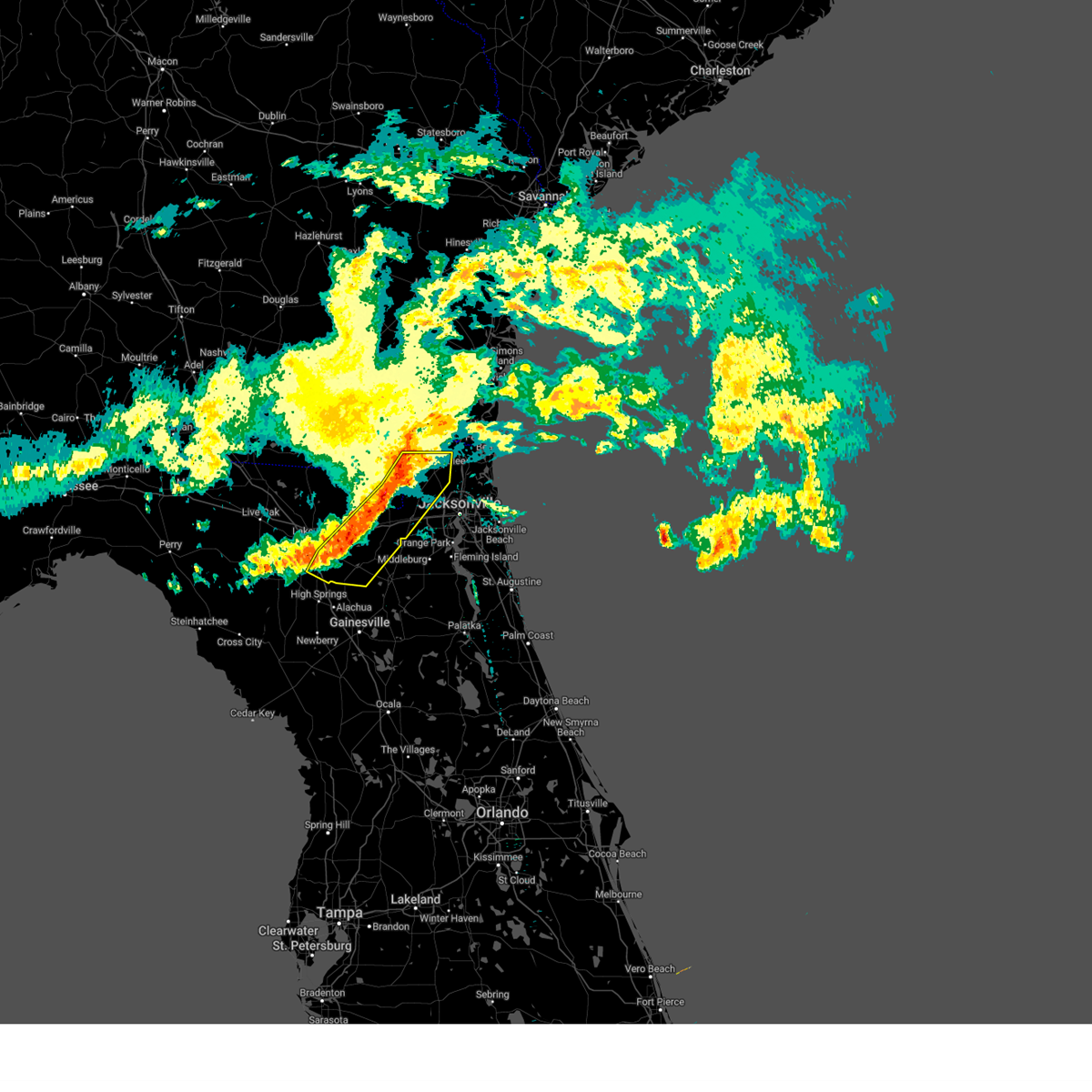
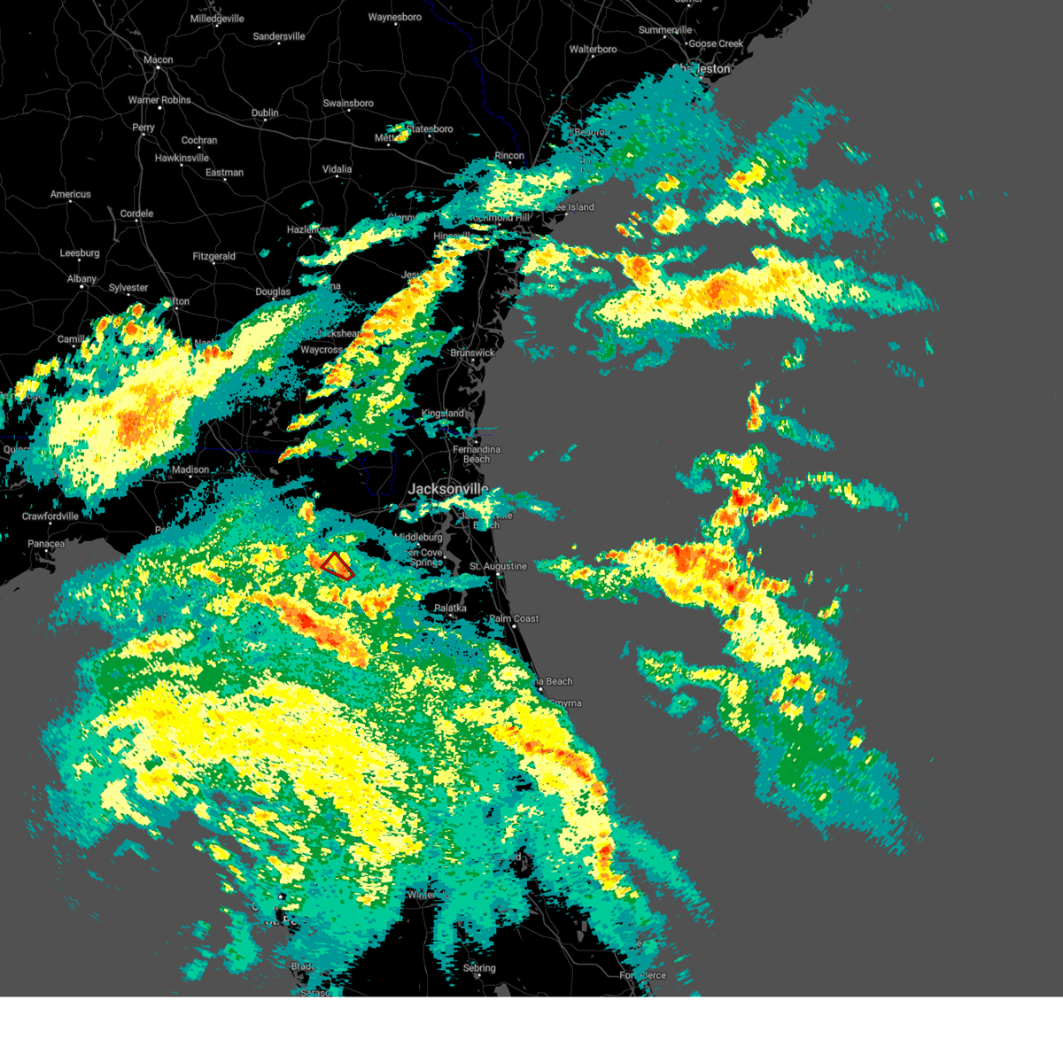
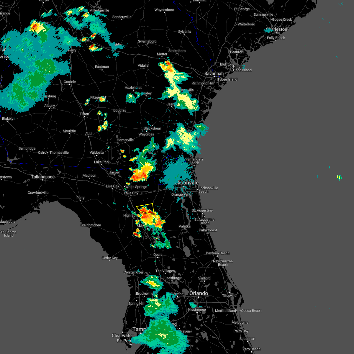
Hail Map for Worthington Springs, FL
The Worthington Springs, FL area has had 0 reports of on-the-ground hail by trained spotters, and has been under severe weather warnings 10 times during the past 12 months. Doppler radar has detected hail at or near Worthington Springs, FL on 38 occasions, including 2 occasions during the past year.
| Name: | Worthington Springs, FL |
| Where Located: | 53.7 miles WSW of Jacksonville, FL |
| Map: | Google Map for Worthington Springs, FL |
| Population: | 181 |
| Housing Units: | 82 |
| More Info: | Search Google for Worthington Springs, FL |
2
The Top Recent Hail Date for Worthington Springs, FL is Wednesday, July 9, 2025 (8th out of 38)

Hail and Wind Damage Spotted near Worthington Springs, FL
| Date / Time | Report Details |
|---|---|
| 5/10/2025 6:19 PM EDT |
 Svrjax the national weather service in jacksonville has issued a * severe thunderstorm warning for, bradford county in northern florida, northeastern alachua county in northern florida, southern baker county in northeastern florida, northwestern putnam county in northeastern florida, union county in northern florida, western clay county in northeastern florida, east central columbia county in northern florida, * until 645 pm edt. * at 619 pm edt, severe thunderstorms were located along a line extending from lake geneva to groves, moving north at 20 mph (radar indicated). Hazards include 60 mph wind gusts and penny size hail. expect damage to roofs, siding, and trees Svrjax the national weather service in jacksonville has issued a * severe thunderstorm warning for, bradford county in northern florida, northeastern alachua county in northern florida, southern baker county in northeastern florida, northwestern putnam county in northeastern florida, union county in northern florida, western clay county in northeastern florida, east central columbia county in northern florida, * until 645 pm edt. * at 619 pm edt, severe thunderstorms were located along a line extending from lake geneva to groves, moving north at 20 mph (radar indicated). Hazards include 60 mph wind gusts and penny size hail. expect damage to roofs, siding, and trees
|
| 3/16/2025 12:14 PM EDT |
 the severe thunderstorm warning has been cancelled and is no longer in effect the severe thunderstorm warning has been cancelled and is no longer in effect
|
| 3/16/2025 11:56 AM EDT |
 Svrjax the national weather service in jacksonville has issued a * severe thunderstorm warning for, southeastern gilchrist county in northern florida, alachua county in northern florida, * until 1230 pm edt. * at 1156 am edt, a severe thunderstorm was located near trenton, moving northeast at 40 mph (radar indicated). Hazards include 60 mph wind gusts and penny size hail. expect damage to roofs, siding, and trees Svrjax the national weather service in jacksonville has issued a * severe thunderstorm warning for, southeastern gilchrist county in northern florida, alachua county in northern florida, * until 1230 pm edt. * at 1156 am edt, a severe thunderstorm was located near trenton, moving northeast at 40 mph (radar indicated). Hazards include 60 mph wind gusts and penny size hail. expect damage to roofs, siding, and trees
|
| 3/9/2025 10:13 AM EDT |
 The storms which prompted the warning have weakened below severe limits, and no longer pose an immediate threat to life or property. therefore, the warning will be allowed to expire. however, small hail and strong gusty winds are still possible with these thunderstorms. The storms which prompted the warning have weakened below severe limits, and no longer pose an immediate threat to life or property. therefore, the warning will be allowed to expire. however, small hail and strong gusty winds are still possible with these thunderstorms.
|
| 3/9/2025 10:01 AM EDT |
 At 1000 am edt, severe thunderstorms were located along a line extending from 6 miles northeast of st. george to near olustee, moving east at 60 mph (radar indicated). Hazards include 60 mph wind gusts and nickel size hail. Expect damage to roofs, siding, and trees. locations impacted include, palestine community, groves, callahan, worthington spring, st. George, johnstown, raiford, new river, macclenny, and lake butler. At 1000 am edt, severe thunderstorms were located along a line extending from 6 miles northeast of st. george to near olustee, moving east at 60 mph (radar indicated). Hazards include 60 mph wind gusts and nickel size hail. Expect damage to roofs, siding, and trees. locations impacted include, palestine community, groves, callahan, worthington spring, st. George, johnstown, raiford, new river, macclenny, and lake butler.
|
| 3/9/2025 9:44 AM EDT |
 Svrjax the national weather service in jacksonville has issued a * severe thunderstorm warning for, southwestern nassau county in northeastern florida, northwestern bradford county in northern florida, baker county in northeastern florida, union county in northern florida, central columbia county in northern florida, northwestern duval county in northeastern florida, southeastern charlton county in southeastern georgia, * until 1015 am edt. * at 944 am edt, severe thunderstorms were located along a line extending from 8 miles northeast of taylor to near lake city, moving east at 60 mph (radar indicated). Hazards include 60 mph wind gusts and quarter size hail. Hail damage to vehicles is expected. Expect wind damage to roofs, siding, and trees. Svrjax the national weather service in jacksonville has issued a * severe thunderstorm warning for, southwestern nassau county in northeastern florida, northwestern bradford county in northern florida, baker county in northeastern florida, union county in northern florida, central columbia county in northern florida, northwestern duval county in northeastern florida, southeastern charlton county in southeastern georgia, * until 1015 am edt. * at 944 am edt, severe thunderstorms were located along a line extending from 8 miles northeast of taylor to near lake city, moving east at 60 mph (radar indicated). Hazards include 60 mph wind gusts and quarter size hail. Hail damage to vehicles is expected. Expect wind damage to roofs, siding, and trees.
|
| 8/4/2024 7:35 PM EDT |
 Torjax the national weather service in jacksonville has issued a * tornado warning for, southwestern union county in northern florida, * until 745 pm edt. * at 735 pm edt, a severe thunderstorm capable of producing a tornado was located over worthington springs, or over worthington spring, moving northwest at 30 mph (radar indicated rotation). Hazards include tornado. Flying debris will be dangerous to those caught without shelter. mobile homes will be damaged or destroyed. damage to roofs, windows, and vehicles will occur. tree damage is likely. this dangerous storm will be near, upland pines around 740 pm edt. Other locations impacted by this tornadic thunderstorm include dukes. Torjax the national weather service in jacksonville has issued a * tornado warning for, southwestern union county in northern florida, * until 745 pm edt. * at 735 pm edt, a severe thunderstorm capable of producing a tornado was located over worthington springs, or over worthington spring, moving northwest at 30 mph (radar indicated rotation). Hazards include tornado. Flying debris will be dangerous to those caught without shelter. mobile homes will be damaged or destroyed. damage to roofs, windows, and vehicles will occur. tree damage is likely. this dangerous storm will be near, upland pines around 740 pm edt. Other locations impacted by this tornadic thunderstorm include dukes.
|
| 8/4/2024 7:31 PM EDT |
 the tornado warning has been cancelled and is no longer in effect the tornado warning has been cancelled and is no longer in effect
|
| 8/4/2024 7:31 PM EDT |
 At 731 pm edt, a severe thunderstorm capable of producing a tornado was located over worthington springs, or over worthington spring, moving northwest at 35 mph (radar indicated rotation). Hazards include tornado. Flying debris will be dangerous to those caught without shelter. mobile homes will be damaged or destroyed. damage to roofs, windows, and vehicles will occur. tree damage is likely. this dangerous storm will be near, groves around 735 pm edt. Other locations impacted by this tornadic thunderstorm include dukes. At 731 pm edt, a severe thunderstorm capable of producing a tornado was located over worthington springs, or over worthington spring, moving northwest at 35 mph (radar indicated rotation). Hazards include tornado. Flying debris will be dangerous to those caught without shelter. mobile homes will be damaged or destroyed. damage to roofs, windows, and vehicles will occur. tree damage is likely. this dangerous storm will be near, groves around 735 pm edt. Other locations impacted by this tornadic thunderstorm include dukes.
|
| 8/4/2024 7:23 PM EDT |
 Torjax the national weather service in jacksonville has issued a * tornado warning for, west central bradford county in northern florida, north central alachua county in northern florida, southwestern union county in northern florida, * until 745 pm edt. * at 723 pm edt, a severe thunderstorm capable of producing a tornado was located near worthington spring, moving northwest at 35 mph (radar indicated rotation). Hazards include tornado. Flying debris will be dangerous to those caught without shelter. mobile homes will be damaged or destroyed. damage to roofs, windows, and vehicles will occur. tree damage is likely. this dangerous storm will be near, worthington spring, worthington springs, and groves around 730 pm edt. Other locations impacted by this tornadic thunderstorm include brooker and dukes. Torjax the national weather service in jacksonville has issued a * tornado warning for, west central bradford county in northern florida, north central alachua county in northern florida, southwestern union county in northern florida, * until 745 pm edt. * at 723 pm edt, a severe thunderstorm capable of producing a tornado was located near worthington spring, moving northwest at 35 mph (radar indicated rotation). Hazards include tornado. Flying debris will be dangerous to those caught without shelter. mobile homes will be damaged or destroyed. damage to roofs, windows, and vehicles will occur. tree damage is likely. this dangerous storm will be near, worthington spring, worthington springs, and groves around 730 pm edt. Other locations impacted by this tornadic thunderstorm include brooker and dukes.
|
| 5/10/2024 8:44 AM EDT |
 Svrjax the national weather service in jacksonville has issued a * severe thunderstorm warning for, nassau county in northeastern florida, bradford county in northern florida, alachua county in northern florida, north central marion county in northern florida, baker county in northeastern florida, northwestern putnam county in northeastern florida, union county in northern florida, western clay county in northeastern florida, western duval county in northeastern florida, southwestern camden county in southeastern georgia, southeastern ware county in southeastern georgia, charlton county in southeastern georgia, * until 915 am edt. * at 843 am edt, severe thunderstorms were located along a line extending from 9 miles south of argyle to near lulu to 7 miles southeast of cross city, moving east at 70 mph. these are destructive storms for lake butler, starke, gainesville, macclenny, baldwin, and hilliard. (radar indicated). Hazards include 80 mph wind gusts and quarter size hail. Flying debris will be dangerous to those caught without shelter. mobile homes will be heavily damaged. expect considerable damage to roofs, windows, and vehicles. Extensive tree damage and power outages are likely. Svrjax the national weather service in jacksonville has issued a * severe thunderstorm warning for, nassau county in northeastern florida, bradford county in northern florida, alachua county in northern florida, north central marion county in northern florida, baker county in northeastern florida, northwestern putnam county in northeastern florida, union county in northern florida, western clay county in northeastern florida, western duval county in northeastern florida, southwestern camden county in southeastern georgia, southeastern ware county in southeastern georgia, charlton county in southeastern georgia, * until 915 am edt. * at 843 am edt, severe thunderstorms were located along a line extending from 9 miles south of argyle to near lulu to 7 miles southeast of cross city, moving east at 70 mph. these are destructive storms for lake butler, starke, gainesville, macclenny, baldwin, and hilliard. (radar indicated). Hazards include 80 mph wind gusts and quarter size hail. Flying debris will be dangerous to those caught without shelter. mobile homes will be heavily damaged. expect considerable damage to roofs, windows, and vehicles. Extensive tree damage and power outages are likely.
|
| 5/10/2024 8:18 AM EDT |
 Svrjax the national weather service in jacksonville has issued a * severe thunderstorm warning for, gilchrist county in northern florida, western alachua county in northern florida, baker county in northeastern florida, union county in northern florida, southeastern suwannee county in northern florida, columbia county in northern florida, eastern hamilton county in northern florida, southeastern echols county in southeastern georgia, southern ware county in southeastern georgia, southeastern clinch county in southeastern georgia, central charlton county in southeastern georgia, * until 900 am edt. * at 818 am edt, severe thunderstorms were located along a line extending from 6 miles south of homerville to near white springs to near cross city, moving east at 60 mph (radar indicated). Hazards include 70 mph wind gusts and quarter size hail. Hail damage to vehicles is expected. expect considerable tree damage. Wind damage is also likely to mobile homes, roofs, and outbuildings. Svrjax the national weather service in jacksonville has issued a * severe thunderstorm warning for, gilchrist county in northern florida, western alachua county in northern florida, baker county in northeastern florida, union county in northern florida, southeastern suwannee county in northern florida, columbia county in northern florida, eastern hamilton county in northern florida, southeastern echols county in southeastern georgia, southern ware county in southeastern georgia, southeastern clinch county in southeastern georgia, central charlton county in southeastern georgia, * until 900 am edt. * at 818 am edt, severe thunderstorms were located along a line extending from 6 miles south of homerville to near white springs to near cross city, moving east at 60 mph (radar indicated). Hazards include 70 mph wind gusts and quarter size hail. Hail damage to vehicles is expected. expect considerable tree damage. Wind damage is also likely to mobile homes, roofs, and outbuildings.
|
| 4/3/2024 10:59 AM EDT |
 At 1059 am edt, severe thunderstorms were located along a line extending from near glen st. mary to near high springs, moving east at 50 mph (radar indicated). Hazards include 60 mph wind gusts and penny size hail. Expect damage to roofs, siding, and trees. Locations impacted include, lake butler, raiford, worthington spring, alachua, macclenny, high springs, worthington springs, groves, beasley, and new river. At 1059 am edt, severe thunderstorms were located along a line extending from near glen st. mary to near high springs, moving east at 50 mph (radar indicated). Hazards include 60 mph wind gusts and penny size hail. Expect damage to roofs, siding, and trees. Locations impacted include, lake butler, raiford, worthington spring, alachua, macclenny, high springs, worthington springs, groves, beasley, and new river.
|
| 4/3/2024 10:59 AM EDT |
 the severe thunderstorm warning has been cancelled and is no longer in effect the severe thunderstorm warning has been cancelled and is no longer in effect
|
| 4/3/2024 10:47 AM EDT |
 At 1047 am edt, severe thunderstorms were located along a line extending from near sanderson to near high springs, moving east at 50 mph (radar indicated). Hazards include 60 mph wind gusts and penny size hail. Expect damage to roofs, siding, and trees. locations impacted include, lake butler, bell, raiford, worthington spring, alachua, macclenny, high springs, glen st. Mary, worthington springs, and palestine community. At 1047 am edt, severe thunderstorms were located along a line extending from near sanderson to near high springs, moving east at 50 mph (radar indicated). Hazards include 60 mph wind gusts and penny size hail. Expect damage to roofs, siding, and trees. locations impacted include, lake butler, bell, raiford, worthington spring, alachua, macclenny, high springs, glen st. Mary, worthington springs, and palestine community.
|
| 4/3/2024 10:31 AM EDT |
 the severe thunderstorm warning has been cancelled and is no longer in effect the severe thunderstorm warning has been cancelled and is no longer in effect
|
| 4/3/2024 10:31 AM EDT |
 At 1030 am edt, severe thunderstorms were located along a line extending from near watertown to near bell, moving east at 40 mph (radar indicated). Hazards include 60 mph wind gusts and penny size hail. Expect damage to roofs, siding, and trees. Locations impacted include, lake city, lake butler, bell, raiford, worthington spring, columbia, alachua, macclenny, high springs, and fort white. At 1030 am edt, severe thunderstorms were located along a line extending from near watertown to near bell, moving east at 40 mph (radar indicated). Hazards include 60 mph wind gusts and penny size hail. Expect damage to roofs, siding, and trees. Locations impacted include, lake city, lake butler, bell, raiford, worthington spring, columbia, alachua, macclenny, high springs, and fort white.
|
| 4/3/2024 10:12 AM EDT |
 Svrjax the national weather service in jacksonville has issued a * severe thunderstorm warning for, central gilchrist county in northern florida, central bradford county in northern florida, northwestern alachua county in northern florida, southern baker county in northeastern florida, union county in northern florida, southeastern suwannee county in northern florida, southern columbia county in northern florida, * until 1115 am edt. * at 1012 am edt, severe thunderstorms were located along a line extending from near wellborn to 6 miles north of bell, moving east at 35 mph (radar indicated). Hazards include 60 mph wind gusts and penny size hail. expect damage to roofs, siding, and trees Svrjax the national weather service in jacksonville has issued a * severe thunderstorm warning for, central gilchrist county in northern florida, central bradford county in northern florida, northwestern alachua county in northern florida, southern baker county in northeastern florida, union county in northern florida, southeastern suwannee county in northern florida, southern columbia county in northern florida, * until 1115 am edt. * at 1012 am edt, severe thunderstorms were located along a line extending from near wellborn to 6 miles north of bell, moving east at 35 mph (radar indicated). Hazards include 60 mph wind gusts and penny size hail. expect damage to roofs, siding, and trees
|
| 2/4/2024 2:15 PM EST |
 At 214 pm est, a severe thunderstorm was located near upland pines, or 9 miles west of worthington spring, moving north at 30 mph (radar indicated). Hazards include 60 mph wind gusts and penny size hail. expect damage to roofs, siding, and trees At 214 pm est, a severe thunderstorm was located near upland pines, or 9 miles west of worthington spring, moving north at 30 mph (radar indicated). Hazards include 60 mph wind gusts and penny size hail. expect damage to roofs, siding, and trees
|
| 1/9/2024 2:44 PM EST |
 At 244 pm est, severe thunderstorms were located along a line extending from 11 miles northwest of st. george to near alachua, moving east at 35 mph (radar indicated). Hazards include 60 mph wind gusts. expect damage to roofs, siding, and trees At 244 pm est, severe thunderstorms were located along a line extending from 11 miles northwest of st. george to near alachua, moving east at 35 mph (radar indicated). Hazards include 60 mph wind gusts. expect damage to roofs, siding, and trees
|
| 1/9/2024 2:02 PM EST |
 At 201 pm est, severe thunderstorms were located along a line extending from 7 miles north of taylor to near high springs, moving east at 40 mph (radar indicated). Hazards include 60 mph wind gusts. expect damage to roofs, siding, and trees At 201 pm est, severe thunderstorms were located along a line extending from 7 miles north of taylor to near high springs, moving east at 40 mph (radar indicated). Hazards include 60 mph wind gusts. expect damage to roofs, siding, and trees
|
| 9/11/2023 6:52 PM EDT |
 The severe thunderstorm warning for union county will expire at 700 pm edt, the storm which prompted the warning has weakened below severe limits, and no longer poses an immediate threat to life or property. therefore, the warning will be allowed to expire. however, gusty winds are still possible with this thunderstorm. The severe thunderstorm warning for union county will expire at 700 pm edt, the storm which prompted the warning has weakened below severe limits, and no longer poses an immediate threat to life or property. therefore, the warning will be allowed to expire. however, gusty winds are still possible with this thunderstorm.
|
| 9/11/2023 6:25 PM EDT |
 At 625 pm edt, a severe thunderstorm was located over groves, or near worthington spring, moving northeast at 10 mph (radar indicated). Hazards include 60 mph wind gusts. Expect damage to roofs, siding, and trees. locations impacted include, lake butler, worthington spring, worthington springs, palestine community, upland pines, groves, providence, beasley, and dukes. hail threat, radar indicated max hail size, <. 75 in wind threat, radar indicated max wind gust, 60 mph. At 625 pm edt, a severe thunderstorm was located over groves, or near worthington spring, moving northeast at 10 mph (radar indicated). Hazards include 60 mph wind gusts. Expect damage to roofs, siding, and trees. locations impacted include, lake butler, worthington spring, worthington springs, palestine community, upland pines, groves, providence, beasley, and dukes. hail threat, radar indicated max hail size, <. 75 in wind threat, radar indicated max wind gust, 60 mph.
|
| 9/11/2023 6:08 PM EDT |
 At 608 pm edt, a severe thunderstorm was located over upland pines, or near worthington spring, moving northeast at 10 mph (radar indicated). Hazards include 60 mph wind gusts and penny size hail. expect damage to roofs, siding, and trees At 608 pm edt, a severe thunderstorm was located over upland pines, or near worthington spring, moving northeast at 10 mph (radar indicated). Hazards include 60 mph wind gusts and penny size hail. expect damage to roofs, siding, and trees
|
| 7/30/2023 9:21 PM EDT |
 The severe thunderstorm warning for bradford, alachua, northeastern marion, western putnam, union and southwestern clay counties will expire at 930 pm edt, the storms which prompted the warning have weakened below severe limits, and no longer pose an immediate threat to life or property. therefore, the warning will be allowed to expire. however gusty winds and heavy rain are still possible with these thunderstorms. The severe thunderstorm warning for bradford, alachua, northeastern marion, western putnam, union and southwestern clay counties will expire at 930 pm edt, the storms which prompted the warning have weakened below severe limits, and no longer pose an immediate threat to life or property. therefore, the warning will be allowed to expire. however gusty winds and heavy rain are still possible with these thunderstorms.
|
| 7/30/2023 8:55 PM EDT |
 At 855 pm edt, severe thunderstorms were located along a line extending from near worthington spring to near lake delancy, moving southwest at 20 mph (radar indicated). Hazards include 60 mph wind gusts. expect damage to roofs, siding, and trees At 855 pm edt, severe thunderstorms were located along a line extending from near worthington spring to near lake delancy, moving southwest at 20 mph (radar indicated). Hazards include 60 mph wind gusts. expect damage to roofs, siding, and trees
|
| 7/30/2023 8:28 PM EDT |
 At 828 pm edt, severe thunderstorms were located along a line extending from near raiford to near florahome, moving southwest at 10 mph (radar indicated). Hazards include 60 mph wind gusts. expect damage to roofs, siding, and trees At 828 pm edt, severe thunderstorms were located along a line extending from near raiford to near florahome, moving southwest at 10 mph (radar indicated). Hazards include 60 mph wind gusts. expect damage to roofs, siding, and trees
|
| 6/14/2023 10:55 PM EDT |
 At 1054 pm edt, severe thunderstorms were located along a line extending from near watertown to 6 miles southwest of high springs to 8 miles south of cross city, moving southeast at 40 mph (radar indicated). Hazards include 60 mph wind gusts. expect damage to roofs, siding, and trees At 1054 pm edt, severe thunderstorms were located along a line extending from near watertown to 6 miles southwest of high springs to 8 miles south of cross city, moving southeast at 40 mph (radar indicated). Hazards include 60 mph wind gusts. expect damage to roofs, siding, and trees
|
| 3/10/2023 7:22 PM EST |
 At 721 pm est, a severe thunderstorm was located over worthington springs, or over worthington spring, moving southeast at 30 mph (radar indicated). Hazards include 60 mph wind gusts and penny size hail. Expect damage to roofs, siding, and trees. locations impacted include, lake butler, worthington spring, worthington springs, upland pines, groves, beasley, la crosse, brooker and dukes. hail threat, radar indicated max hail size, 0. 75 in wind threat, radar indicated max wind gust, 60 mph. At 721 pm est, a severe thunderstorm was located over worthington springs, or over worthington spring, moving southeast at 30 mph (radar indicated). Hazards include 60 mph wind gusts and penny size hail. Expect damage to roofs, siding, and trees. locations impacted include, lake butler, worthington spring, worthington springs, upland pines, groves, beasley, la crosse, brooker and dukes. hail threat, radar indicated max hail size, 0. 75 in wind threat, radar indicated max wind gust, 60 mph.
|
| 3/10/2023 7:12 PM EST |
 At 711 pm est, a severe thunderstorm was located over providence, or 7 miles northwest of worthington spring, moving southeast at 35 mph (radar indicated). Hazards include 60 mph wind gusts and penny size hail. Expect damage to roofs, siding, and trees. locations impacted include, lake butler, worthington spring, worthington springs, upland pines, groves, providence, beasley, la crosse, brooker and dukes. hail threat, radar indicated max hail size, 0. 75 in wind threat, radar indicated max wind gust, 60 mph. At 711 pm est, a severe thunderstorm was located over providence, or 7 miles northwest of worthington spring, moving southeast at 35 mph (radar indicated). Hazards include 60 mph wind gusts and penny size hail. Expect damage to roofs, siding, and trees. locations impacted include, lake butler, worthington spring, worthington springs, upland pines, groves, providence, beasley, la crosse, brooker and dukes. hail threat, radar indicated max hail size, 0. 75 in wind threat, radar indicated max wind gust, 60 mph.
|
| 3/10/2023 6:56 PM EST |
 At 656 pm est, a severe thunderstorm was located near columbia, or 8 miles northeast of ichetucknee spring, moving southeast at 30 mph (radar indicated). Hazards include 60 mph wind gusts. expect damage to roofs, siding, and trees At 656 pm est, a severe thunderstorm was located near columbia, or 8 miles northeast of ichetucknee spring, moving southeast at 30 mph (radar indicated). Hazards include 60 mph wind gusts. expect damage to roofs, siding, and trees
|
| 1/4/2023 3:20 PM EST |
 At 320 pm est, a severe thunderstorm was located near archer, or 13 miles northeast of bronson, moving northeast at 40 mph (radar indicated). Hazards include 70 mph wind gusts and quarter size hail. Hail damage to vehicles is expected. expect considerable tree damage. wind damage is also likely to mobile homes, roofs, and outbuildings. Locations impacted include, gainesville, worthington spring, alachua, high springs, archer, worthington springs, university of florida, groves, providence and beasley. At 320 pm est, a severe thunderstorm was located near archer, or 13 miles northeast of bronson, moving northeast at 40 mph (radar indicated). Hazards include 70 mph wind gusts and quarter size hail. Hail damage to vehicles is expected. expect considerable tree damage. wind damage is also likely to mobile homes, roofs, and outbuildings. Locations impacted include, gainesville, worthington spring, alachua, high springs, archer, worthington springs, university of florida, groves, providence and beasley.
|
| 1/4/2023 3:01 PM EST |
 At 301 pm est, severe thunderstorms were located along a line extending from groves to near worthington spring to 6 miles north of bronson, moving east at 50 mph (radar indicated). Hazards include 60 mph wind gusts and penny size hail. Expect damage to roofs, siding, and trees. locations impacted include, gainesville, worthington spring, alachua, high springs, archer, worthington springs, university of florida, groves, beasley and new river. hail threat, radar indicated max hail size, 0. 75 in wind threat, radar indicated max wind gust, 60 mph. At 301 pm est, severe thunderstorms were located along a line extending from groves to near worthington spring to 6 miles north of bronson, moving east at 50 mph (radar indicated). Hazards include 60 mph wind gusts and penny size hail. Expect damage to roofs, siding, and trees. locations impacted include, gainesville, worthington spring, alachua, high springs, archer, worthington springs, university of florida, groves, beasley and new river. hail threat, radar indicated max hail size, 0. 75 in wind threat, radar indicated max wind gust, 60 mph.
|
| 1/4/2023 2:43 PM EST |
 At 242 pm est, severe thunderstorms were located along a line extending from 8 miles north of st. george to near fort white, moving east at 35 mph (radar indicated). Hazards include 60 mph wind gusts and half dollar size hail. Hail damage to vehicles is expected. Expect wind damage to roofs, siding, and trees. At 242 pm est, severe thunderstorms were located along a line extending from 8 miles north of st. george to near fort white, moving east at 35 mph (radar indicated). Hazards include 60 mph wind gusts and half dollar size hail. Hail damage to vehicles is expected. Expect wind damage to roofs, siding, and trees.
|
| 1/4/2023 2:40 PM EST |
 At 240 pm est, severe thunderstorms were located along a line extending from fort white to trenton, moving east at 45 mph (radar indicated). Hazards include 60 mph wind gusts and penny size hail. expect damage to roofs, siding, and trees At 240 pm est, severe thunderstorms were located along a line extending from fort white to trenton, moving east at 45 mph (radar indicated). Hazards include 60 mph wind gusts and penny size hail. expect damage to roofs, siding, and trees
|
| 1/4/2023 2:17 PM EST |
 At 217 pm est, severe thunderstorms were located along a line extending from 11 miles northwest of taylor to 6 miles west of ichetucknee spring, moving east at 25 mph (radar indicated). Hazards include 60 mph wind gusts and penny size hail. expect damage to roofs, siding, and trees At 217 pm est, severe thunderstorms were located along a line extending from 11 miles northwest of taylor to 6 miles west of ichetucknee spring, moving east at 25 mph (radar indicated). Hazards include 60 mph wind gusts and penny size hail. expect damage to roofs, siding, and trees
|
| 8/20/2022 9:32 PM EDT |
 At 932 pm edt, a severe thunderstorm was located near beasley, or near worthington spring, moving northwest at 10 mph (radar indicated). Hazards include 60 mph wind gusts and penny size hail. Expect damage to roofs, siding, and trees. locations impacted include, lake butler, raiford, worthington spring, worthington springs, groves, beasley, new river, johnstown and dukes. hail threat, radar indicated max hail size, 0. 75 in wind threat, radar indicated max wind gust, 60 mph. At 932 pm edt, a severe thunderstorm was located near beasley, or near worthington spring, moving northwest at 10 mph (radar indicated). Hazards include 60 mph wind gusts and penny size hail. Expect damage to roofs, siding, and trees. locations impacted include, lake butler, raiford, worthington spring, worthington springs, groves, beasley, new river, johnstown and dukes. hail threat, radar indicated max hail size, 0. 75 in wind threat, radar indicated max wind gust, 60 mph.
|
| 8/20/2022 9:20 PM EDT |
 At 920 pm edt, a severe thunderstorm was located near new river, or 7 miles south of lake butler, moving north at 15 mph (radar indicated). Hazards include 60 mph wind gusts and penny size hail. expect damage to roofs, siding, and trees At 920 pm edt, a severe thunderstorm was located near new river, or 7 miles south of lake butler, moving north at 15 mph (radar indicated). Hazards include 60 mph wind gusts and penny size hail. expect damage to roofs, siding, and trees
|
| 6/24/2022 5:27 PM EDT |
 The severe thunderstorm warning for western baker, union and central columbia counties will expire at 530 pm edt, the storm which prompted the warning has weakened below severe limits, and no longer poses an immediate threat to life or property. therefore, the warning will be allowed to expire. however gusty winds and heavy rain are still possible with this thunderstorm. The severe thunderstorm warning for western baker, union and central columbia counties will expire at 530 pm edt, the storm which prompted the warning has weakened below severe limits, and no longer poses an immediate threat to life or property. therefore, the warning will be allowed to expire. however gusty winds and heavy rain are still possible with this thunderstorm.
|
| 6/24/2022 5:23 PM EDT |
 At 523 pm edt, a severe thunderstorm was located over olustee, or 11 miles northwest of lake butler, moving east at 20 mph (radar indicated). Hazards include 60 mph wind gusts and quarter size hail. Hail damage to vehicles is expected. expect wind damage to roofs, siding, and trees. locations impacted include, lake city, lake butler, worthington spring, worthington springs, palestine community, groves, providence, winfield, olustee and suwannee valley. hail threat, radar indicated max hail size, 1. 00 in wind threat, radar indicated max wind gust, 60 mph. At 523 pm edt, a severe thunderstorm was located over olustee, or 11 miles northwest of lake butler, moving east at 20 mph (radar indicated). Hazards include 60 mph wind gusts and quarter size hail. Hail damage to vehicles is expected. expect wind damage to roofs, siding, and trees. locations impacted include, lake city, lake butler, worthington spring, worthington springs, palestine community, groves, providence, winfield, olustee and suwannee valley. hail threat, radar indicated max hail size, 1. 00 in wind threat, radar indicated max wind gust, 60 mph.
|
| 6/24/2022 5:02 PM EDT |
 At 502 pm edt, a severe thunderstorm was located near watertown, or near lake city, moving east at 20 mph (radar indicated). Hazards include 60 mph wind gusts and quarter size hail. Hail damage to vehicles is expected. Expect wind damage to roofs, siding, and trees. At 502 pm edt, a severe thunderstorm was located near watertown, or near lake city, moving east at 20 mph (radar indicated). Hazards include 60 mph wind gusts and quarter size hail. Hail damage to vehicles is expected. Expect wind damage to roofs, siding, and trees.
|
| 6/24/2022 4:03 PM EDT |
 At 402 pm edt, a severe thunderstorm was located near high springs, or 13 miles northeast of trenton, moving southwest at 30 mph (radar indicated). Hazards include 60 mph wind gusts and penny size hail. expect damage to roofs, siding, and trees At 402 pm edt, a severe thunderstorm was located near high springs, or 13 miles northeast of trenton, moving southwest at 30 mph (radar indicated). Hazards include 60 mph wind gusts and penny size hail. expect damage to roofs, siding, and trees
|
| 6/24/2022 3:17 PM EDT |
 At 316 pm edt, a severe thunderstorm was located near worthington spring, moving west at 15 mph (radar indicated). Hazards include 60 mph wind gusts and quarter size hail. Hail damage to vehicles is expected. expect wind damage to roofs, siding, and trees. locations impacted include, lake butler, worthington spring, alachua, worthington springs, beasley, new river, sampson, la crosse, brooker and dukes. hail threat, radar indicated max hail size, 1. 00 in wind threat, radar indicated max wind gust, 60 mph. At 316 pm edt, a severe thunderstorm was located near worthington spring, moving west at 15 mph (radar indicated). Hazards include 60 mph wind gusts and quarter size hail. Hail damage to vehicles is expected. expect wind damage to roofs, siding, and trees. locations impacted include, lake butler, worthington spring, alachua, worthington springs, beasley, new river, sampson, la crosse, brooker and dukes. hail threat, radar indicated max hail size, 1. 00 in wind threat, radar indicated max wind gust, 60 mph.
|
| 6/24/2022 3:11 PM EDT |
 At 311 pm edt, a severe thunderstorm was located 7 miles southeast of worthington spring, moving west at 15 mph (radar indicated). Hazards include 60 mph wind gusts and quarter size hail. Hail damage to vehicles is expected. expect wind damage to roofs, siding, and trees. locations impacted include, lake butler, worthington spring, alachua, worthington springs, beasley, new river, sampson, waldo, la crosse and brooker. hail threat, radar indicated max hail size, 1. 00 in wind threat, radar indicated max wind gust, 60 mph. At 311 pm edt, a severe thunderstorm was located 7 miles southeast of worthington spring, moving west at 15 mph (radar indicated). Hazards include 60 mph wind gusts and quarter size hail. Hail damage to vehicles is expected. expect wind damage to roofs, siding, and trees. locations impacted include, lake butler, worthington spring, alachua, worthington springs, beasley, new river, sampson, waldo, la crosse and brooker. hail threat, radar indicated max hail size, 1. 00 in wind threat, radar indicated max wind gust, 60 mph.
|
| 6/24/2022 3:04 PM EDT |
 At 304 pm edt, a severe thunderstorm was located 8 miles southeast of worthington spring, moving west at 15 mph (radar indicated). Hazards include 60 mph wind gusts and quarter size hail. Hail damage to vehicles is expected. Expect wind damage to roofs, siding, and trees. At 304 pm edt, a severe thunderstorm was located 8 miles southeast of worthington spring, moving west at 15 mph (radar indicated). Hazards include 60 mph wind gusts and quarter size hail. Hail damage to vehicles is expected. Expect wind damage to roofs, siding, and trees.
|
| 7/7/2021 6:20 AM EDT |
 At 619 am edt, a vigorous shower capable of producing a tornado was located near worthington spring, moving northwest at 35 mph (radar indicated rotation). Hazards include tornado. Flying debris will be dangerous to those caught without shelter. mobile homes will be damaged or destroyed. damage to roofs, windows, and vehicles will occur. tree damage is likely. this dangerous storm will be near, worthington springs around 625 am edt. Other locations impacted by this tornadic thunderstorm include la crosse. At 619 am edt, a vigorous shower capable of producing a tornado was located near worthington spring, moving northwest at 35 mph (radar indicated rotation). Hazards include tornado. Flying debris will be dangerous to those caught without shelter. mobile homes will be damaged or destroyed. damage to roofs, windows, and vehicles will occur. tree damage is likely. this dangerous storm will be near, worthington springs around 625 am edt. Other locations impacted by this tornadic thunderstorm include la crosse.
|
| 7/7/2021 6:14 AM EDT |
 At 613 am edt, a vigorous shower capable of producing a tornado was located 7 miles east of alachua, or 8 miles southeast of worthington spring, moving northwest at 35 mph (radar indicated rotation). Hazards include tornado. Flying debris will be dangerous to those caught without shelter. mobile homes will be damaged or destroyed. damage to roofs, windows, and vehicles will occur. tree damage is likely. this dangerous storm will be near, worthington springs around 630 am edt. Other locations impacted by this tornadic thunderstorm include brooker and la crosse. At 613 am edt, a vigorous shower capable of producing a tornado was located 7 miles east of alachua, or 8 miles southeast of worthington spring, moving northwest at 35 mph (radar indicated rotation). Hazards include tornado. Flying debris will be dangerous to those caught without shelter. mobile homes will be damaged or destroyed. damage to roofs, windows, and vehicles will occur. tree damage is likely. this dangerous storm will be near, worthington springs around 630 am edt. Other locations impacted by this tornadic thunderstorm include brooker and la crosse.
|
| 7/7/2021 6:02 AM EDT |
 At 602 am edt, a severe thunderstorm capable of producing a tornado was located near gainesville airport, or near gainesville, moving northwest at 35 mph (radar indicated rotation). Hazards include tornado. Flying debris will be dangerous to those caught without shelter. mobile homes will be damaged or destroyed. damage to roofs, windows, and vehicles will occur. tree damage is likely. this dangerous storm will be near, alachua around 615 am edt. worthington springs around 630 am edt. Other locations impacted by this tornadic thunderstorm include brooker and la crosse. At 602 am edt, a severe thunderstorm capable of producing a tornado was located near gainesville airport, or near gainesville, moving northwest at 35 mph (radar indicated rotation). Hazards include tornado. Flying debris will be dangerous to those caught without shelter. mobile homes will be damaged or destroyed. damage to roofs, windows, and vehicles will occur. tree damage is likely. this dangerous storm will be near, alachua around 615 am edt. worthington springs around 630 am edt. Other locations impacted by this tornadic thunderstorm include brooker and la crosse.
|
| 6/15/2021 4:19 PM EDT |
 At 419 pm edt, severe thunderstorms were located along a line extending from near raiford to 6 miles south of worthington spring, moving east at 20 mph (radar indicated). Hazards include 60 mph wind gusts and quarter size hail. Hail damage to vehicles is expected. Expect wind damage to roofs, siding, and trees. At 419 pm edt, severe thunderstorms were located along a line extending from near raiford to 6 miles south of worthington spring, moving east at 20 mph (radar indicated). Hazards include 60 mph wind gusts and quarter size hail. Hail damage to vehicles is expected. Expect wind damage to roofs, siding, and trees.
|
| 3/18/2021 3:43 PM EDT |
 The severe thunderstorm warning for central bradford and southeastern union counties will expire at 345 pm edt, the storm which prompted the warning has moved out of the area. therefore, the warning will be allowed to expire. however heavy rain is still possible with this thunderstorm. a tornado watch remains in effect until 600 pm edt for northern florida. to report severe weather, contact your nearest law enforcement agency. they will relay your report to the national weather service jacksonville. The severe thunderstorm warning for central bradford and southeastern union counties will expire at 345 pm edt, the storm which prompted the warning has moved out of the area. therefore, the warning will be allowed to expire. however heavy rain is still possible with this thunderstorm. a tornado watch remains in effect until 600 pm edt for northern florida. to report severe weather, contact your nearest law enforcement agency. they will relay your report to the national weather service jacksonville.
|
| 3/18/2021 3:32 PM EDT |
 At 332 pm edt, a severe thunderstorm was located over new river, or 8 miles southeast of lake butler, moving northeast at 40 mph (radar indicated). Hazards include 60 mph wind gusts. Expect damage to roofs, siding, and trees. Locations impacted include, lake butler, raiford, worthington spring, worthington springs, new river, beasley, sampson, hampton, brooker and johnstown. At 332 pm edt, a severe thunderstorm was located over new river, or 8 miles southeast of lake butler, moving northeast at 40 mph (radar indicated). Hazards include 60 mph wind gusts. Expect damage to roofs, siding, and trees. Locations impacted include, lake butler, raiford, worthington spring, worthington springs, new river, beasley, sampson, hampton, brooker and johnstown.
|
| 3/18/2021 3:17 PM EDT |
 At 316 pm edt, a severe thunderstorm capable of producing a tornado was located near worthington spring, moving east at 40 mph (radar indicated rotation). Hazards include tornado. Flying debris will be dangerous to those caught without shelter. mobile homes will be damaged or destroyed. damage to roofs, windows, and vehicles will occur. tree damage is likely. this dangerous storm will be near, new river and beasley around 330 pm edt. sampson around 335 pm edt. Other locations impacted by this tornadic thunderstorm include brooker, la crosse and hampton. At 316 pm edt, a severe thunderstorm capable of producing a tornado was located near worthington spring, moving east at 40 mph (radar indicated rotation). Hazards include tornado. Flying debris will be dangerous to those caught without shelter. mobile homes will be damaged or destroyed. damage to roofs, windows, and vehicles will occur. tree damage is likely. this dangerous storm will be near, new river and beasley around 330 pm edt. sampson around 335 pm edt. Other locations impacted by this tornadic thunderstorm include brooker, la crosse and hampton.
|
| 3/18/2021 3:07 PM EDT |
 At 306 pm edt, a severe thunderstorm capable of producing a tornado was located near alachua, or 8 miles southwest of worthington spring, moving northeast at 45 mph (radar indicated rotation). Hazards include tornado. Flying debris will be dangerous to those caught without shelter. mobile homes will be damaged or destroyed. damage to roofs, windows, and vehicles will occur. tree damage is likely. this dangerous storm will be near, worthington spring and worthington springs around 315 pm edt. raiford, new river, beasley and sampson around 330 pm edt. Other locations impacted by this tornadic thunderstorm include brooker, la crosse and hampton. At 306 pm edt, a severe thunderstorm capable of producing a tornado was located near alachua, or 8 miles southwest of worthington spring, moving northeast at 45 mph (radar indicated rotation). Hazards include tornado. Flying debris will be dangerous to those caught without shelter. mobile homes will be damaged or destroyed. damage to roofs, windows, and vehicles will occur. tree damage is likely. this dangerous storm will be near, worthington spring and worthington springs around 315 pm edt. raiford, new river, beasley and sampson around 330 pm edt. Other locations impacted by this tornadic thunderstorm include brooker, la crosse and hampton.
|
| 3/18/2021 2:58 PM EDT |
 At 258 pm edt, a severe thunderstorm was located over high springs, or 15 miles southwest of worthington spring, moving northeast at 40 mph (radar indicated). Hazards include 60 mph wind gusts. expect damage to roofs, siding, and trees At 258 pm edt, a severe thunderstorm was located over high springs, or 15 miles southwest of worthington spring, moving northeast at 40 mph (radar indicated). Hazards include 60 mph wind gusts. expect damage to roofs, siding, and trees
|
| 2/6/2021 5:43 PM EST |
 The severe thunderstorm warning for bradford, northern alachua and southern union counties will expire at 545 pm est, the storm which prompted the warning has weakened below severe limits, and no longer poses an immediate threat to life or property. therefore, the warning will be allowed to expire. however small hail and heavy rain are still possible with this thunderstorm. a tornado watch remains in effect until midnight est for northern florida. to report severe weather, contact your nearest law enforcement agency. they will relay your report to the national weather service jacksonville. The severe thunderstorm warning for bradford, northern alachua and southern union counties will expire at 545 pm est, the storm which prompted the warning has weakened below severe limits, and no longer poses an immediate threat to life or property. therefore, the warning will be allowed to expire. however small hail and heavy rain are still possible with this thunderstorm. a tornado watch remains in effect until midnight est for northern florida. to report severe weather, contact your nearest law enforcement agency. they will relay your report to the national weather service jacksonville.
|
| 2/6/2021 5:23 PM EST |
 At 523 pm est, a severe thunderstorm was located near worthington spring, moving northeast at 50 mph (radar indicated). Hazards include quarter size hail. Damage to vehicles is expected. Locations impacted include, starke, lake butler, raiford, worthington spring, alachua, high springs, worthington springs, groves, new river and beasley. At 523 pm est, a severe thunderstorm was located near worthington spring, moving northeast at 50 mph (radar indicated). Hazards include quarter size hail. Damage to vehicles is expected. Locations impacted include, starke, lake butler, raiford, worthington spring, alachua, high springs, worthington springs, groves, new river and beasley.
|
| 2/6/2021 5:08 PM EST |
 At 508 pm est, a severe thunderstorm was located near high springs, or 11 miles southwest of worthington spring, moving northeast at 55 mph (radar indicated). Hazards include quarter size hail. Damage to vehicles is expected. Locations impacted include, starke, trenton, lake butler, bell, raiford, worthington spring, alachua, high springs, worthington springs and groves. At 508 pm est, a severe thunderstorm was located near high springs, or 11 miles southwest of worthington spring, moving northeast at 55 mph (radar indicated). Hazards include quarter size hail. Damage to vehicles is expected. Locations impacted include, starke, trenton, lake butler, bell, raiford, worthington spring, alachua, high springs, worthington springs and groves.
|
| 2/6/2021 4:59 PM EST |
 At 459 pm est, a severe thunderstorm was located near high springs, or 13 miles east of bell, moving northeast at 55 mph (radar indicated). Hazards include 60 mph wind gusts and quarter size hail. Hail damage to vehicles is expected. Expect wind damage to roofs, siding, and trees. At 459 pm est, a severe thunderstorm was located near high springs, or 13 miles east of bell, moving northeast at 55 mph (radar indicated). Hazards include 60 mph wind gusts and quarter size hail. Hail damage to vehicles is expected. Expect wind damage to roofs, siding, and trees.
|
| 12/24/2020 6:03 PM EST |
 At 602 pm est, severe thunderstorms were located along a line extending from 10 miles southeast of stephen foster state park to near sanderson to alachua, moving east at 60 mph (radar indicated). Hazards include 60 mph wind gusts. Expect damage to roofs, siding, and trees. Locations impacted include, starke, hilliard, lake butler, keystone heights, callahan, raiford, worthington spring, taylor, alachua and macclenny. At 602 pm est, severe thunderstorms were located along a line extending from 10 miles southeast of stephen foster state park to near sanderson to alachua, moving east at 60 mph (radar indicated). Hazards include 60 mph wind gusts. Expect damage to roofs, siding, and trees. Locations impacted include, starke, hilliard, lake butler, keystone heights, callahan, raiford, worthington spring, taylor, alachua and macclenny.
|
| 12/24/2020 5:42 PM EST |
 At 542 pm est, severe thunderstorms were located along a line extending from 6 miles southeast of fargo to near watertown to 6 miles northeast of trenton, moving east at 55 mph (radar indicated). Hazards include 60 mph wind gusts. expect damage to roofs, siding, and trees At 542 pm est, severe thunderstorms were located along a line extending from 6 miles southeast of fargo to near watertown to 6 miles northeast of trenton, moving east at 55 mph (radar indicated). Hazards include 60 mph wind gusts. expect damage to roofs, siding, and trees
|
| 6/7/2020 4:13 PM EDT |
 At 413 pm edt, a severe thunderstorm capable of producing a tornado was located over worthington springs, moving northeast at 10 mph (radar indicated rotation). Hazards include tornado. Flying debris will be dangerous to those caught without shelter. mobile homes will be damaged or destroyed. damage to roofs, windows, and vehicles will occur. tree damage is likely. this dangerous storm will be near, beasley around 440 pm edt. lake butler around 445 pm edt. raiford around 500 pm edt. Other locations impacted by this tornadic thunderstorm include johnstown and dukes. At 413 pm edt, a severe thunderstorm capable of producing a tornado was located over worthington springs, moving northeast at 10 mph (radar indicated rotation). Hazards include tornado. Flying debris will be dangerous to those caught without shelter. mobile homes will be damaged or destroyed. damage to roofs, windows, and vehicles will occur. tree damage is likely. this dangerous storm will be near, beasley around 440 pm edt. lake butler around 445 pm edt. raiford around 500 pm edt. Other locations impacted by this tornadic thunderstorm include johnstown and dukes.
|
| 6/7/2020 4:04 PM EDT |
 At 404 pm edt, a severe thunderstorm capable of producing a tornado was located over worthington springs, or over worthington spring, moving north at 10 mph (radar indicated rotation). Hazards include tornado. Flying debris will be dangerous to those caught without shelter. mobile homes will be damaged or destroyed. damage to roofs, windows, and vehicles will occur. tree damage is likely. this dangerous storm will be near, groves around 420 pm edt. beasley around 435 pm edt. lake butler and palestine community around 445 pm edt. Other locations impacted by this tornadic thunderstorm include johnstown and dukes. At 404 pm edt, a severe thunderstorm capable of producing a tornado was located over worthington springs, or over worthington spring, moving north at 10 mph (radar indicated rotation). Hazards include tornado. Flying debris will be dangerous to those caught without shelter. mobile homes will be damaged or destroyed. damage to roofs, windows, and vehicles will occur. tree damage is likely. this dangerous storm will be near, groves around 420 pm edt. beasley around 435 pm edt. lake butler and palestine community around 445 pm edt. Other locations impacted by this tornadic thunderstorm include johnstown and dukes.
|
| 4/23/2020 10:12 PM EDT |
 The tornado warning for northern bradford, north central alachua, south central baker and union counties will expire at 1015 pm edt, the tornado threat has diminished and the tornado warning has been cancelled. however, hail and damaging winds remain likely and a severe thunderstorm warning remains in effect for the area. a tornado watch remains in effect until midnight edt for northern and northeastern florida. remember, a severe thunderstorm warning still remains in effect. The tornado warning for northern bradford, north central alachua, south central baker and union counties will expire at 1015 pm edt, the tornado threat has diminished and the tornado warning has been cancelled. however, hail and damaging winds remain likely and a severe thunderstorm warning remains in effect for the area. a tornado watch remains in effect until midnight edt for northern and northeastern florida. remember, a severe thunderstorm warning still remains in effect.
|
| 4/23/2020 10:09 PM EDT |
 At 1008 pm edt, a severe thunderstorm capable of producing a tornado was located near worthington spring, moving east at 40 mph (radar indicated rotation). Hazards include tornado. Flying debris will be dangerous to those caught without shelter. mobile homes will be damaged or destroyed. damage to roofs, windows, and vehicles will occur. tree damage is likely. this dangerous storm will be near, new river and beasley around 1020 pm edt. sampson around 1025 pm edt. starke around 1040 pm edt. kingsley and camp blanding around 1045 pm edt. Other locations impacted by this tornadic thunderstorm include lawtey, la crosse, waldo, hampton and brooker. At 1008 pm edt, a severe thunderstorm capable of producing a tornado was located near worthington spring, moving east at 40 mph (radar indicated rotation). Hazards include tornado. Flying debris will be dangerous to those caught without shelter. mobile homes will be damaged or destroyed. damage to roofs, windows, and vehicles will occur. tree damage is likely. this dangerous storm will be near, new river and beasley around 1020 pm edt. sampson around 1025 pm edt. starke around 1040 pm edt. kingsley and camp blanding around 1045 pm edt. Other locations impacted by this tornadic thunderstorm include lawtey, la crosse, waldo, hampton and brooker.
|
| 4/23/2020 9:58 PM EDT |
 At 958 pm edt, a severe thunderstorm capable of producing a tornado was located near lake butler, moving east at 40 mph (radar indicated rotation). Hazards include tornado. Flying debris will be dangerous to those caught without shelter. mobile homes will be damaged or destroyed. damage to roofs, windows, and vehicles will occur. tree damage is likely. this dangerous storm will be near, raiford around 1005 pm edt. Other locations impacted by this tornadic thunderstorm include johnstown, dukes and ellerbee. At 958 pm edt, a severe thunderstorm capable of producing a tornado was located near lake butler, moving east at 40 mph (radar indicated rotation). Hazards include tornado. Flying debris will be dangerous to those caught without shelter. mobile homes will be damaged or destroyed. damage to roofs, windows, and vehicles will occur. tree damage is likely. this dangerous storm will be near, raiford around 1005 pm edt. Other locations impacted by this tornadic thunderstorm include johnstown, dukes and ellerbee.
|
| 4/23/2020 9:37 PM EDT |
 At 937 pm edt, a severe thunderstorm capable of producing a tornado was located over providence, or 9 miles northwest of worthington spring, moving east at 40 mph (radar indicated rotation). Hazards include tornado. Flying debris will be dangerous to those caught without shelter. mobile homes will be damaged or destroyed. damage to roofs, windows, and vehicles will occur. tree damage is likely. this dangerous storm will be near, palestine community, lulu and groves around 945 pm edt. lake butler around 955 pm edt. beasley around 1000 pm edt. raiford around 1005 pm edt. Other locations impacted by this tornadic thunderstorm include johnstown, dukes and ellerbee. At 937 pm edt, a severe thunderstorm capable of producing a tornado was located over providence, or 9 miles northwest of worthington spring, moving east at 40 mph (radar indicated rotation). Hazards include tornado. Flying debris will be dangerous to those caught without shelter. mobile homes will be damaged or destroyed. damage to roofs, windows, and vehicles will occur. tree damage is likely. this dangerous storm will be near, palestine community, lulu and groves around 945 pm edt. lake butler around 955 pm edt. beasley around 1000 pm edt. raiford around 1005 pm edt. Other locations impacted by this tornadic thunderstorm include johnstown, dukes and ellerbee.
|
| 4/23/2020 9:23 PM EDT |
 At 922 pm edt, a severe thunderstorm capable of producing a tornado was located near ichetucknee spring, moving east at 40 mph (radar indicated rotation). Hazards include tornado. Flying debris will be dangerous to those caught without shelter. mobile homes will be damaged or destroyed. damage to roofs, windows, and vehicles will occur. tree damage is likely. this dangerous storm will be near, providence around 935 pm edt. upland pines around 940 pm edt. lulu around 945 pm edt. palestine community and groves around 950 pm edt. lake butler and beasley around 1000 pm edt. raiford around 1010 pm edt. Other locations impacted by this tornadic thunderstorm include johnstown, dukes and ellerbee. At 922 pm edt, a severe thunderstorm capable of producing a tornado was located near ichetucknee spring, moving east at 40 mph (radar indicated rotation). Hazards include tornado. Flying debris will be dangerous to those caught without shelter. mobile homes will be damaged or destroyed. damage to roofs, windows, and vehicles will occur. tree damage is likely. this dangerous storm will be near, providence around 935 pm edt. upland pines around 940 pm edt. lulu around 945 pm edt. palestine community and groves around 950 pm edt. lake butler and beasley around 1000 pm edt. raiford around 1010 pm edt. Other locations impacted by this tornadic thunderstorm include johnstown, dukes and ellerbee.
|
| 2/6/2020 9:44 PM EST |
 At 944 pm est, severe thunderstorms were located along a line extending from near st. george to 6 miles northeast of archer, moving east at 35 mph. some storms could potentially produce brief tornadoes (radar indicated). Hazards include 70 mph wind gusts. Expect considerable tree damage. damage is likely to mobile homes, roofs, and outbuildings. Locations impacted include, gainesville, starke, lake butler, keystone heights, callahan, raiford, melrose, worthington spring, taylor and alachua. At 944 pm est, severe thunderstorms were located along a line extending from near st. george to 6 miles northeast of archer, moving east at 35 mph. some storms could potentially produce brief tornadoes (radar indicated). Hazards include 70 mph wind gusts. Expect considerable tree damage. damage is likely to mobile homes, roofs, and outbuildings. Locations impacted include, gainesville, starke, lake butler, keystone heights, callahan, raiford, melrose, worthington spring, taylor and alachua.
|
| 2/6/2020 9:22 PM EST |
 At 920 pm est, severe thunderstorms were located along a line extending from 10 miles northwest of taylor to near high springs, moving east at 45 mph. some storms could potentially produce brief tornadoes (radar indicated). Hazards include 70 mph wind gusts. Expect considerable tree damage. Damage is likely to mobile homes, roofs, and outbuildings. At 920 pm est, severe thunderstorms were located along a line extending from 10 miles northwest of taylor to near high springs, moving east at 45 mph. some storms could potentially produce brief tornadoes (radar indicated). Hazards include 70 mph wind gusts. Expect considerable tree damage. Damage is likely to mobile homes, roofs, and outbuildings.
|
| 7/19/2019 3:12 PM EDT |
 At 312 pm edt, a severe thunderstorm was located over worthington spring, and is nearly stationary (radar indicated). Hazards include 60 mph wind gusts and quarter size hail. Hail damage to vehicles is expected. Expect wind damage to roofs, siding, and trees. At 312 pm edt, a severe thunderstorm was located over worthington spring, and is nearly stationary (radar indicated). Hazards include 60 mph wind gusts and quarter size hail. Hail damage to vehicles is expected. Expect wind damage to roofs, siding, and trees.
|
| 4/19/2019 11:29 AM EDT |
 At 1129 am edt, severe thunderstorms were located along a line extending from near raybon to near raiford, moving northeast at 55 mph (radar indicated). Hazards include 70 mph wind gusts. Expect considerable tree damage. damage is likely to mobile homes, roofs, and outbuildings. Locations impacted include, gainesville, starke, folkston, lake butler, raiford, worthington spring, stephen foster state park, taylor, alachua and macclenny. At 1129 am edt, severe thunderstorms were located along a line extending from near raybon to near raiford, moving northeast at 55 mph (radar indicated). Hazards include 70 mph wind gusts. Expect considerable tree damage. damage is likely to mobile homes, roofs, and outbuildings. Locations impacted include, gainesville, starke, folkston, lake butler, raiford, worthington spring, stephen foster state park, taylor, alachua and macclenny.
|
| 4/19/2019 11:15 AM EDT |
 At 1114 am edt, severe thunderstorms were located along a line extending from near braganza to near alachua, moving northeast at 55 mph (radar indicated). Hazards include 70 mph wind gusts. Expect considerable tree damage. damage is likely to mobile homes, roofs, and outbuildings. Locations impacted include, gainesville, starke, folkston, lake butler, raiford, worthington spring, stephen foster state park, taylor, alachua and macclenny. At 1114 am edt, severe thunderstorms were located along a line extending from near braganza to near alachua, moving northeast at 55 mph (radar indicated). Hazards include 70 mph wind gusts. Expect considerable tree damage. damage is likely to mobile homes, roofs, and outbuildings. Locations impacted include, gainesville, starke, folkston, lake butler, raiford, worthington spring, stephen foster state park, taylor, alachua and macclenny.
|
| 4/19/2019 11:00 AM EDT |
 At 1100 am edt, severe thunderstorms were located along a line extending from 8 miles west of stephen foster state park to 7 miles north of bronson, moving northeast at 55 mph (radar indicated). Hazards include 70 mph wind gusts. Expect considerable tree damage. Damage is likely to mobile homes, roofs, and outbuildings. At 1100 am edt, severe thunderstorms were located along a line extending from 8 miles west of stephen foster state park to 7 miles north of bronson, moving northeast at 55 mph (radar indicated). Hazards include 70 mph wind gusts. Expect considerable tree damage. Damage is likely to mobile homes, roofs, and outbuildings.
|
| 7/26/2018 1:25 PM EDT |
 At 124 pm edt, a severe thunderstorm was located near beasley, or near lake butler, moving northeast at 10 mph (radar indicated). Hazards include 60 mph wind gusts and penny size hail. expect damage to roofs, siding, and trees At 124 pm edt, a severe thunderstorm was located near beasley, or near lake butler, moving northeast at 10 mph (radar indicated). Hazards include 60 mph wind gusts and penny size hail. expect damage to roofs, siding, and trees
|
| 7/22/2018 3:06 PM EDT |
 At 305 pm edt, a severe thunderstorm was located near providence, or 9 miles south of lake city, moving east at 15 mph (radar indicated). Hazards include 60 mph wind gusts and quarter size hail. Hail damage to vehicles is expected. Expect wind damage to roofs, siding, and trees. At 305 pm edt, a severe thunderstorm was located near providence, or 9 miles south of lake city, moving east at 15 mph (radar indicated). Hazards include 60 mph wind gusts and quarter size hail. Hail damage to vehicles is expected. Expect wind damage to roofs, siding, and trees.
|
| 7/22/2018 2:04 PM EDT |
 At 203 pm edt, a severe thunderstorm was located near fort white, or near ichetucknee spring, moving southeast at 25 mph (radar indicated). Hazards include 60 mph wind gusts and quarter size hail. Hail damage to vehicles is expected. expect wind damage to roofs, siding, and trees. Locations impacted include, lake butler, worthington spring, ichetucknee spring, columbia, alachua, high springs, fort white, worthington springs, groves and providence. At 203 pm edt, a severe thunderstorm was located near fort white, or near ichetucknee spring, moving southeast at 25 mph (radar indicated). Hazards include 60 mph wind gusts and quarter size hail. Hail damage to vehicles is expected. expect wind damage to roofs, siding, and trees. Locations impacted include, lake butler, worthington spring, ichetucknee spring, columbia, alachua, high springs, fort white, worthington springs, groves and providence.
|
| 7/22/2018 1:38 PM EDT |
 At 138 pm edt, a severe thunderstorm was located near ichetucknee spring, moving southeast at 25 mph (radar indicated). Hazards include 60 mph wind gusts and quarter size hail. Hail damage to vehicles is expected. Expect wind damage to roofs, siding, and trees. At 138 pm edt, a severe thunderstorm was located near ichetucknee spring, moving southeast at 25 mph (radar indicated). Hazards include 60 mph wind gusts and quarter size hail. Hail damage to vehicles is expected. Expect wind damage to roofs, siding, and trees.
|
| 7/22/2018 12:58 PM EDT |
 At 1257 pm edt, a severe thunderstorm was located over alachua, or 8 miles south of worthington spring, moving east at 50 mph (radar indicated). Hazards include 60 mph wind gusts and quarter size hail. Hail damage to vehicles is expected. Expect wind damage to roofs, siding, and trees. At 1257 pm edt, a severe thunderstorm was located over alachua, or 8 miles south of worthington spring, moving east at 50 mph (radar indicated). Hazards include 60 mph wind gusts and quarter size hail. Hail damage to vehicles is expected. Expect wind damage to roofs, siding, and trees.
|
| 7/22/2018 12:45 PM EDT |
 At 1245 pm edt, a severe thunderstorm was located over lake butler, moving east at 25 mph (radar indicated). Hazards include 70 mph wind gusts and quarter size hail. Hail damage to vehicles is expected. expect considerable tree damage. wind damage is also likely to mobile homes, roofs, and outbuildings. Locations impacted include, lake butler, worthington spring, ichetucknee spring, columbia, worthington springs, palestine community, groves, providence, beasley and upland pines. At 1245 pm edt, a severe thunderstorm was located over lake butler, moving east at 25 mph (radar indicated). Hazards include 70 mph wind gusts and quarter size hail. Hail damage to vehicles is expected. expect considerable tree damage. wind damage is also likely to mobile homes, roofs, and outbuildings. Locations impacted include, lake butler, worthington spring, ichetucknee spring, columbia, worthington springs, palestine community, groves, providence, beasley and upland pines.
|
| 7/22/2018 12:35 PM EDT |
 At 1235 pm edt, a severe thunderstorm was located over palestine community, or near lake butler, moving east at 25 mph (radar indicated). Hazards include 70 mph wind gusts and quarter size hail. Hail damage to vehicles is expected. expect considerable tree damage. wind damage is also likely to mobile homes, roofs, and outbuildings. Locations impacted include, lake butler, worthington spring, ichetucknee spring, columbia, worthington springs, palestine community, groves, providence, beasley and upland pines. At 1235 pm edt, a severe thunderstorm was located over palestine community, or near lake butler, moving east at 25 mph (radar indicated). Hazards include 70 mph wind gusts and quarter size hail. Hail damage to vehicles is expected. expect considerable tree damage. wind damage is also likely to mobile homes, roofs, and outbuildings. Locations impacted include, lake butler, worthington spring, ichetucknee spring, columbia, worthington springs, palestine community, groves, providence, beasley and upland pines.
|
| 7/22/2018 12:25 PM EDT |
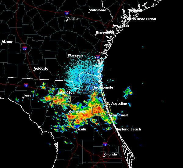 At 1225 pm edt, a severe thunderstorm was located near providence, or 9 miles northwest of worthington spring, moving east at 25 mph (radar indicated). Hazards include 70 mph wind gusts and quarter size hail. Hail damage to vehicles is expected. expect considerable tree damage. wind damage is also likely to mobile homes, roofs, and outbuildings. Locations impacted include, lake butler, worthington spring, ichetucknee spring, columbia, worthington springs, palestine community, groves, providence, beasley and upland pines. At 1225 pm edt, a severe thunderstorm was located near providence, or 9 miles northwest of worthington spring, moving east at 25 mph (radar indicated). Hazards include 70 mph wind gusts and quarter size hail. Hail damage to vehicles is expected. expect considerable tree damage. wind damage is also likely to mobile homes, roofs, and outbuildings. Locations impacted include, lake butler, worthington spring, ichetucknee spring, columbia, worthington springs, palestine community, groves, providence, beasley and upland pines.
|
| 7/22/2018 12:20 PM EDT |
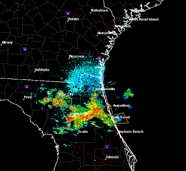 At 1220 pm edt, a severe thunderstorm was located over providence, or 11 miles northwest of worthington spring, moving east at 25 mph (radar indicated). Hazards include 70 mph wind gusts and quarter size hail. Hail damage to vehicles is expected. expect considerable tree damage. wind damage is also likely to mobile homes, roofs, and outbuildings. Locations impacted include, lake butler, worthington spring, ichetucknee spring, columbia, worthington springs, palestine community, groves, providence, beasley and upland pines. At 1220 pm edt, a severe thunderstorm was located over providence, or 11 miles northwest of worthington spring, moving east at 25 mph (radar indicated). Hazards include 70 mph wind gusts and quarter size hail. Hail damage to vehicles is expected. expect considerable tree damage. wind damage is also likely to mobile homes, roofs, and outbuildings. Locations impacted include, lake butler, worthington spring, ichetucknee spring, columbia, worthington springs, palestine community, groves, providence, beasley and upland pines.
|
| 7/22/2018 12:12 PM EDT |
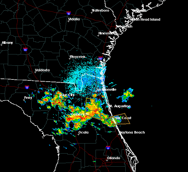 At 1212 pm edt, a severe thunderstorm was located near providence, or 10 miles south of lake city, moving east at 25 mph (radar indicated). Hazards include 70 mph wind gusts and nickel size hail. Expect considerable tree damage. Damage is likely to mobile homes, roofs, and outbuildings. At 1212 pm edt, a severe thunderstorm was located near providence, or 10 miles south of lake city, moving east at 25 mph (radar indicated). Hazards include 70 mph wind gusts and nickel size hail. Expect considerable tree damage. Damage is likely to mobile homes, roofs, and outbuildings.
|
| 7/22/2018 11:49 AM EDT |
 A severe thunderstorm warning remains in effect until noon edt for alachua county. at 1149 am edt, a severe thunderstorm was located over gainesville airport, or near gainesville, moving east at 15 mph. hazard. 70 mph wind gusts. source. Radar indicated. A severe thunderstorm warning remains in effect until noon edt for alachua county. at 1149 am edt, a severe thunderstorm was located over gainesville airport, or near gainesville, moving east at 15 mph. hazard. 70 mph wind gusts. source. Radar indicated.
|
| 7/22/2018 11:42 AM EDT |
 At 1142 am edt, a severe thunderstorm was located over gainesville airport, or near gainesville, moving east at 15 mph (radar indicated). Hazards include 70 mph wind gusts. Expect considerable tree damage. damage is likely to mobile homes, roofs, and outbuildings. Locations impacted include, gainesville, alachua, hawthorne, university of florida, rochelle, cross creek, orange heights, gainesville airport, newnans lake and waldo. At 1142 am edt, a severe thunderstorm was located over gainesville airport, or near gainesville, moving east at 15 mph (radar indicated). Hazards include 70 mph wind gusts. Expect considerable tree damage. damage is likely to mobile homes, roofs, and outbuildings. Locations impacted include, gainesville, alachua, hawthorne, university of florida, rochelle, cross creek, orange heights, gainesville airport, newnans lake and waldo.
|
| 7/22/2018 11:29 AM EDT |
 At 1128 am edt, a severe thunderstorm was located near gainesville, moving east at 15 mph (radar indicated). Hazards include 70 mph wind gusts. Expect considerable tree damage. damage is likely to mobile homes, roofs, and outbuildings. Locations impacted include, gainesville, alachua, high springs, hawthorne, university of florida, rochelle, cross creek, orange heights, gainesville airport and newnans lake. At 1128 am edt, a severe thunderstorm was located near gainesville, moving east at 15 mph (radar indicated). Hazards include 70 mph wind gusts. Expect considerable tree damage. damage is likely to mobile homes, roofs, and outbuildings. Locations impacted include, gainesville, alachua, high springs, hawthorne, university of florida, rochelle, cross creek, orange heights, gainesville airport and newnans lake.
|
| 7/22/2018 11:21 AM EDT |
 At 1121 am edt, a severe thunderstorm was located near alachua, or near gainesville, moving east at 15 mph (radar indicated). Hazards include 70 mph wind gusts. Expect considerable tree damage. Damage is likely to mobile homes, roofs, and outbuildings. At 1121 am edt, a severe thunderstorm was located near alachua, or near gainesville, moving east at 15 mph (radar indicated). Hazards include 70 mph wind gusts. Expect considerable tree damage. Damage is likely to mobile homes, roofs, and outbuildings.
|
| 3/20/2018 3:11 PM EDT |
 The severe thunderstorm warning for gilchrist, northern alachua, bradford, southern baker, union and southern columbia counties will expire at 315 pm edt, the storms which prompted the warning have weakened below severe limits, and have exited the warned area. therefore the warning will be allowed to expire. however small hail, gusty winds and heavy rain are still possible with these thunderstorms. a tornado watch remains in effect until 700 pm edt for northern and northeastern florida. The severe thunderstorm warning for gilchrist, northern alachua, bradford, southern baker, union and southern columbia counties will expire at 315 pm edt, the storms which prompted the warning have weakened below severe limits, and have exited the warned area. therefore the warning will be allowed to expire. however small hail, gusty winds and heavy rain are still possible with these thunderstorms. a tornado watch remains in effect until 700 pm edt for northern and northeastern florida.
|
| 3/20/2018 2:44 PM EDT |
 At 243 pm edt, severe thunderstorms were located along a line extending from 6 miles southeast of columbia to 9 miles northeast of trenton, moving northeast at 55 mph (radar indicated). Hazards include ping pong ball size hail and 60 mph wind gusts. People and animals outdoors will be injured. expect hail damage to roofs, siding, windows, and vehicles. expect wind damage to roofs, siding, and trees. locations impacted include, gainesville, starke, trenton, lake butler, bell, raiford, worthington spring, ichetucknee spring, columbia and alachua. A tornado watch remains in effect until 700 pm edt for northern and northeastern florida. At 243 pm edt, severe thunderstorms were located along a line extending from 6 miles southeast of columbia to 9 miles northeast of trenton, moving northeast at 55 mph (radar indicated). Hazards include ping pong ball size hail and 60 mph wind gusts. People and animals outdoors will be injured. expect hail damage to roofs, siding, windows, and vehicles. expect wind damage to roofs, siding, and trees. locations impacted include, gainesville, starke, trenton, lake butler, bell, raiford, worthington spring, ichetucknee spring, columbia and alachua. A tornado watch remains in effect until 700 pm edt for northern and northeastern florida.
|
| 3/20/2018 2:23 PM EDT |
 At 223 pm edt, severe thunderstorms were located along a line extending from 8 miles north of bell to near manattee road, moving northeast at 55 mph (radar indicated). Hazards include ping pong ball size hail and 60 mph wind gusts. People and animals outdoors will be injured. expect hail damage to roofs, siding, windows, and vehicles. Expect wind damage to roofs, siding, and trees. At 223 pm edt, severe thunderstorms were located along a line extending from 8 miles north of bell to near manattee road, moving northeast at 55 mph (radar indicated). Hazards include ping pong ball size hail and 60 mph wind gusts. People and animals outdoors will be injured. expect hail damage to roofs, siding, windows, and vehicles. Expect wind damage to roofs, siding, and trees.
|
| 3/20/2018 2:20 PM EDT |
 The severe thunderstorm warning for north central alachua, bradford and southeastern union counties will expire at 230 pm edt, the storm which prompted the warning has weakened below severe limits, and no longer poses an immediate threat to life or property. therefore the warning will be allowed to expire. however small hail, gusty winds and heavy rain are still possible with this thunderstorm. a tornado watch remains in effect until 700 pm edt for northern and northeastern florida. The severe thunderstorm warning for north central alachua, bradford and southeastern union counties will expire at 230 pm edt, the storm which prompted the warning has weakened below severe limits, and no longer poses an immediate threat to life or property. therefore the warning will be allowed to expire. however small hail, gusty winds and heavy rain are still possible with this thunderstorm. a tornado watch remains in effect until 700 pm edt for northern and northeastern florida.
|
| 3/20/2018 2:07 PM EDT |
 At 207 pm edt, a severe thunderstorm was located near new river, or near worthington spring, moving northeast at 55 mph (radar indicated). Hazards include ping pong ball size hail and 60 mph wind gusts. People and animals outdoors will be injured. expect hail damage to roofs, siding, windows, and vehicles. expect wind damage to roofs, siding, and trees. locations impacted include, starke, worthington spring, worthington springs, beasley, new river, sampson, lawtey, hampton and brooker. A tornado watch remains in effect until 700 pm edt for northern and northeastern florida. At 207 pm edt, a severe thunderstorm was located near new river, or near worthington spring, moving northeast at 55 mph (radar indicated). Hazards include ping pong ball size hail and 60 mph wind gusts. People and animals outdoors will be injured. expect hail damage to roofs, siding, windows, and vehicles. expect wind damage to roofs, siding, and trees. locations impacted include, starke, worthington spring, worthington springs, beasley, new river, sampson, lawtey, hampton and brooker. A tornado watch remains in effect until 700 pm edt for northern and northeastern florida.
|
| 3/20/2018 1:51 PM EDT |
 At 151 pm edt, a severe thunderstorm was located over alachua, or 12 miles southwest of worthington spring, moving northeast at 55 mph (radar indicated). Hazards include 60 mph wind gusts and quarter size hail. Hail damage to vehicles is expected. Expect wind damage to roofs, siding, and trees. At 151 pm edt, a severe thunderstorm was located over alachua, or 12 miles southwest of worthington spring, moving northeast at 55 mph (radar indicated). Hazards include 60 mph wind gusts and quarter size hail. Hail damage to vehicles is expected. Expect wind damage to roofs, siding, and trees.
|
| 9/1/2017 12:25 PM EDT |
 At 1225 pm edt, a severe thunderstorm was located near worthington springs, or near worthington spring, moving east at 20 mph (radar indicated). Hazards include 60 mph wind gusts and penny size hail. expect damage to roofs, siding, and trees At 1225 pm edt, a severe thunderstorm was located near worthington springs, or near worthington spring, moving east at 20 mph (radar indicated). Hazards include 60 mph wind gusts and penny size hail. expect damage to roofs, siding, and trees
|
| 8/9/2017 4:42 PM EDT |
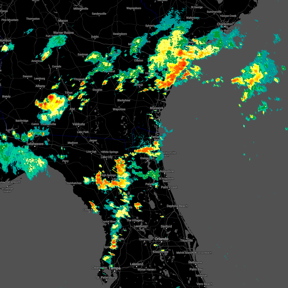 The severe thunderstorm warning for west central bradford and central union counties will expire at 445 pm edt, the storms which prompted the warning have weakened below severe limits, and no longer pose an immediate threat to life or property. therefore the warning will be allowed to expire. however heavy rain is still possible with these thunderstorms. The severe thunderstorm warning for west central bradford and central union counties will expire at 445 pm edt, the storms which prompted the warning have weakened below severe limits, and no longer pose an immediate threat to life or property. therefore the warning will be allowed to expire. however heavy rain is still possible with these thunderstorms.
|
| 8/9/2017 4:29 PM EDT |
 At 429 pm edt, severe thunderstorms were located along a line extending from near lake butler to near new river, moving north at 15 mph (radar indicated). Hazards include 60 mph wind gusts. Expect damage to roofs, siding, and trees. Locations impacted include, lake butler, worthington springs, groves, new river, beasley, brooker and dukes. At 429 pm edt, severe thunderstorms were located along a line extending from near lake butler to near new river, moving north at 15 mph (radar indicated). Hazards include 60 mph wind gusts. Expect damage to roofs, siding, and trees. Locations impacted include, lake butler, worthington springs, groves, new river, beasley, brooker and dukes.
|
| 8/9/2017 4:09 PM EDT |
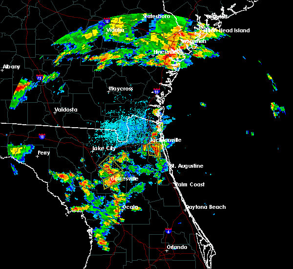 At 409 pm edt, severe thunderstorms were located along a line extending from near worthington springs to near sampson, moving northeast at 15 mph (radar indicated). Hazards include 60 mph wind gusts. expect damage to roofs, siding, and trees At 409 pm edt, severe thunderstorms were located along a line extending from near worthington springs to near sampson, moving northeast at 15 mph (radar indicated). Hazards include 60 mph wind gusts. expect damage to roofs, siding, and trees
|
| 8/9/2017 3:36 PM EDT |
 At 336 pm edt, a severe thunderstorm was located near high springs, or 7 miles southwest of worthington spring, and is nearly stationary (radar indicated). Hazards include 60 mph wind gusts. expect damage to roofs, siding, and trees At 336 pm edt, a severe thunderstorm was located near high springs, or 7 miles southwest of worthington spring, and is nearly stationary (radar indicated). Hazards include 60 mph wind gusts. expect damage to roofs, siding, and trees
|
| 7/20/2017 8:35 PM EDT |
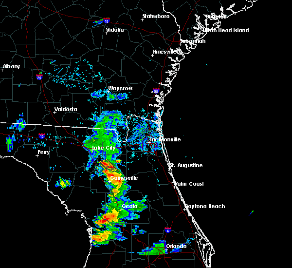 At 834 pm edt, a severe thunderstorm was located near new river, or 7 miles southeast of lake butler, and is nearly stationary (radar indicated). Hazards include 60 mph wind gusts and quarter size hail. Hail damage to vehicles is expected. Expect wind damage to roofs, siding, and trees. At 834 pm edt, a severe thunderstorm was located near new river, or 7 miles southeast of lake butler, and is nearly stationary (radar indicated). Hazards include 60 mph wind gusts and quarter size hail. Hail damage to vehicles is expected. Expect wind damage to roofs, siding, and trees.
|
| 7/16/2017 4:52 PM EDT |
 The severe thunderstorm warning for west central bradford, southwestern baker, union and east central columbia counties will expire at 500 pm edt, the storm which prompted the warning has weakened below severe limits, and no longer poses an immediate threat to life or property. therefore the warning will be allowed to expire. however gusty winds and heavy rain are still possible with this thunderstorm. The severe thunderstorm warning for west central bradford, southwestern baker, union and east central columbia counties will expire at 500 pm edt, the storm which prompted the warning has weakened below severe limits, and no longer poses an immediate threat to life or property. therefore the warning will be allowed to expire. however gusty winds and heavy rain are still possible with this thunderstorm.
|
| 7/16/2017 4:30 PM EDT |
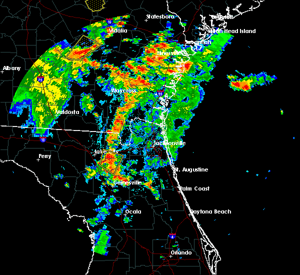 At 429 pm edt, a severe thunderstorm was located near groves, or near lake butler, moving northeast at 15 mph (radar indicated). Hazards include 60 mph wind gusts and penny size hail. Expect damage to roofs, siding, and trees. Locations impacted include, lake butler, raiford, worthington springs, palestine community, groves, olustee, new river, beasley, lulu and brooker. At 429 pm edt, a severe thunderstorm was located near groves, or near lake butler, moving northeast at 15 mph (radar indicated). Hazards include 60 mph wind gusts and penny size hail. Expect damage to roofs, siding, and trees. Locations impacted include, lake butler, raiford, worthington springs, palestine community, groves, olustee, new river, beasley, lulu and brooker.
|
| 7/16/2017 4:17 PM EDT |
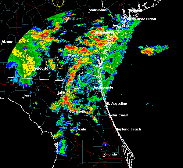 At 417 pm edt, a severe thunderstorm was located over groves, or near worthington spring, moving northeast at 15 mph (radar indicated). Hazards include 60 mph wind gusts and penny size hail. expect damage to roofs, siding, and trees At 417 pm edt, a severe thunderstorm was located over groves, or near worthington spring, moving northeast at 15 mph (radar indicated). Hazards include 60 mph wind gusts and penny size hail. expect damage to roofs, siding, and trees
|
| 4/4/2017 2:07 AM EDT |
 The severe thunderstorm warning for west central bradford, union and southern columbia counties will expire at 215 am edt, the storm which prompted the warning has weakened below severe limits, and no longer poses an immediate threat to life or property. therefore the warning will be allowed to expire. however small hail is still possible with this thunderstorm. to report severe weather, contact your nearest law enforcement agency. they will relay your report to the national weather service jacksonville. The severe thunderstorm warning for west central bradford, union and southern columbia counties will expire at 215 am edt, the storm which prompted the warning has weakened below severe limits, and no longer poses an immediate threat to life or property. therefore the warning will be allowed to expire. however small hail is still possible with this thunderstorm. to report severe weather, contact your nearest law enforcement agency. they will relay your report to the national weather service jacksonville.
|
| 4/4/2017 1:34 AM EDT |
 At 134 am edt, a severe thunderstorm was located near columbia, or 8 miles south of lake city, moving east at 25 mph (radar indicated). Hazards include 60 mph wind gusts and quarter size hail. Hail damage to vehicles is expected. Expect wind damage to roofs, siding, and trees. At 134 am edt, a severe thunderstorm was located near columbia, or 8 miles south of lake city, moving east at 25 mph (radar indicated). Hazards include 60 mph wind gusts and quarter size hail. Hail damage to vehicles is expected. Expect wind damage to roofs, siding, and trees.
|
| 2/7/2017 9:52 PM EST |
 The severe thunderstorm warning for southeastern columbia, union, western alachua, west central bradford, southwestern baker and southern gilchrist counties will expire at 1000 pm est, the storm which prompted the warning has exited the warned area. therefore the warning will be allowed to expire. however gusty winds are still possible with this thunderstorm. a severe thunderstorm watch remains in effect until midnight est for northeastern and northern florida. to report severe weather, contact your nearest law enforcement agency. they will relay your report to the national weather service jacksonville. The severe thunderstorm warning for southeastern columbia, union, western alachua, west central bradford, southwestern baker and southern gilchrist counties will expire at 1000 pm est, the storm which prompted the warning has exited the warned area. therefore the warning will be allowed to expire. however gusty winds are still possible with this thunderstorm. a severe thunderstorm watch remains in effect until midnight est for northeastern and northern florida. to report severe weather, contact your nearest law enforcement agency. they will relay your report to the national weather service jacksonville.
|
| 2/7/2017 9:39 PM EST |
 At 938 pm est, a severe thunderstorm was located near obrien, or 9 miles northwest of ichetucknee spring, moving east at 55 mph (radar indicated). Hazards include 60 mph wind gusts and nickel size hail. Expect damage to roofs, siding, and trees. Locations impacted include, trenton, lake butler, worthington spring, alachua, high springs, archer, worthington springs, groves, sanderson and upland pines. At 938 pm est, a severe thunderstorm was located near obrien, or 9 miles northwest of ichetucknee spring, moving east at 55 mph (radar indicated). Hazards include 60 mph wind gusts and nickel size hail. Expect damage to roofs, siding, and trees. Locations impacted include, trenton, lake butler, worthington spring, alachua, high springs, archer, worthington springs, groves, sanderson and upland pines.
|
| 2/7/2017 9:19 PM EST |
 At 918 pm est, a severe thunderstorm was located near columbia, or near lake city, moving east at 45 mph (radar indicated). Hazards include 60 mph wind gusts and quarter size hail. Hail damage to vehicles is expected. Expect wind damage to roofs, siding, and trees. At 918 pm est, a severe thunderstorm was located near columbia, or near lake city, moving east at 45 mph (radar indicated). Hazards include 60 mph wind gusts and quarter size hail. Hail damage to vehicles is expected. Expect wind damage to roofs, siding, and trees.
|
| 1/22/2017 6:17 PM EST |
 At 617 pm est, severe thunderstorms were located along a line extending from 8 miles north of macclenny to near williston, moving northeast at 70 mph (radar indicated). Hazards include 60 mph wind gusts and quarter size hail. Hail damage to vehicles is expected. expect wind damage to roofs, siding, and trees. locations impacted include, jacksonville, gainesville, saint augustine, fernandina beach, palatka, orange park, green cove springs, starke, lake butler and interlachen. A tornado watch remains in effect until 800 pm est for northeastern and northern florida, and southeastern georgia. At 617 pm est, severe thunderstorms were located along a line extending from 8 miles north of macclenny to near williston, moving northeast at 70 mph (radar indicated). Hazards include 60 mph wind gusts and quarter size hail. Hail damage to vehicles is expected. expect wind damage to roofs, siding, and trees. locations impacted include, jacksonville, gainesville, saint augustine, fernandina beach, palatka, orange park, green cove springs, starke, lake butler and interlachen. A tornado watch remains in effect until 800 pm est for northeastern and northern florida, and southeastern georgia.
|
| 1/22/2017 6:06 PM EST |
 At 605 pm est, severe thunderstorms were located along a line extending from near sanderson to near williston highlands, moving northeast at 70 mph (radar indicated). Hazards include 60 mph wind gusts and quarter size hail. Hail damage to vehicles is expected. Expect wind damage to roofs, siding, and trees. At 605 pm est, severe thunderstorms were located along a line extending from near sanderson to near williston highlands, moving northeast at 70 mph (radar indicated). Hazards include 60 mph wind gusts and quarter size hail. Hail damage to vehicles is expected. Expect wind damage to roofs, siding, and trees.
|
| 1/22/2017 6:01 PM EST |
 At 601 pm est, severe thunderstorms were located along a line extending from 8 miles northwest of taylor to lulu, moving east at 90 mph (radar indicated). Hazards include 60 mph wind gusts and quarter size hail. Hail damage to vehicles is expected. expect wind damage to roofs, siding, and trees. locations impacted include, lake city, trenton, worthington spring, ichetucknee spring, columbia, alachua, high springs, fort white, worthington springs and groves. A tornado watch remains in effect until 800 pm est for northeastern and northern florida. At 601 pm est, severe thunderstorms were located along a line extending from 8 miles northwest of taylor to lulu, moving east at 90 mph (radar indicated). Hazards include 60 mph wind gusts and quarter size hail. Hail damage to vehicles is expected. expect wind damage to roofs, siding, and trees. locations impacted include, lake city, trenton, worthington spring, ichetucknee spring, columbia, alachua, high springs, fort white, worthington springs and groves. A tornado watch remains in effect until 800 pm est for northeastern and northern florida.
|
| 1/22/2017 5:28 PM EST |
 At 528 pm est, severe thunderstorms were located along a line extending from near obrien to near manattee road, moving northeast at 90 mph (radar indicated). Hazards include 60 mph wind gusts and quarter size hail. Hail damage to vehicles is expected. Expect wind damage to roofs, siding, and trees. At 528 pm est, severe thunderstorms were located along a line extending from near obrien to near manattee road, moving northeast at 90 mph (radar indicated). Hazards include 60 mph wind gusts and quarter size hail. Hail damage to vehicles is expected. Expect wind damage to roofs, siding, and trees.
|
| 1/3/2017 9:02 AM EST |
 At 902 am est, a severe thunderstorm was located over beasley, or near lake butler, moving east at 35 mph (radar indicated). Hazards include 60 mph wind gusts. Expect damage to roofs, siding, and trees. Locations impacted include, starke, lake butler, raiford, new river, sampson, beasley, brooker, johnstown and dukes. At 902 am est, a severe thunderstorm was located over beasley, or near lake butler, moving east at 35 mph (radar indicated). Hazards include 60 mph wind gusts. Expect damage to roofs, siding, and trees. Locations impacted include, starke, lake butler, raiford, new river, sampson, beasley, brooker, johnstown and dukes.
|
| 1/3/2017 8:52 AM EST |
 At 852 am est, a severe thunderstorm was located over worthington springs, or near worthington spring, moving east at 35 mph (radar indicated). Hazards include 60 mph wind gusts. Expect damage to roofs, siding, and trees. Locations impacted include, starke, lake butler, raiford, worthington spring, worthington springs, groves, beasley, new river, sampson and la crosse. At 852 am est, a severe thunderstorm was located over worthington springs, or near worthington spring, moving east at 35 mph (radar indicated). Hazards include 60 mph wind gusts. Expect damage to roofs, siding, and trees. Locations impacted include, starke, lake butler, raiford, worthington spring, worthington springs, groves, beasley, new river, sampson and la crosse.
|
| 1/3/2017 8:43 AM EST |
 At 843 am est, a severe thunderstorm was located over worthington springs, or over worthington spring, moving east at 30 mph (radar indicated). Hazards include 60 mph wind gusts. expect damage to roofs, siding, and trees At 843 am est, a severe thunderstorm was located over worthington springs, or over worthington spring, moving east at 30 mph (radar indicated). Hazards include 60 mph wind gusts. expect damage to roofs, siding, and trees
|
| 7/16/2016 4:41 PM EDT |
 The severe thunderstorm warning for southeastern columbia and western union counties will expire at 445 pm edt, the storm which prompted the warning has moved out of the area. therefore, the warning will be allowed to expire. however heavy rain is still possible with this thunderstorm. The severe thunderstorm warning for southeastern columbia and western union counties will expire at 445 pm edt, the storm which prompted the warning has moved out of the area. therefore, the warning will be allowed to expire. however heavy rain is still possible with this thunderstorm.
|
| 7/16/2016 4:11 PM EDT |
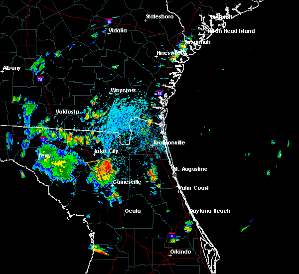 At 410 pm edt, a severe thunderstorm was located over groves, or near lake butler, moving north at 15 mph (radar indicated). Hazards include 60 mph wind gusts and nickel size hail. Expect damage to roofs. siding. and trees. Locations impacted include, lake butler, worthington spring, worthington springs, palestine community, groves, upland pines, providence, lulu and dukes. At 410 pm edt, a severe thunderstorm was located over groves, or near lake butler, moving north at 15 mph (radar indicated). Hazards include 60 mph wind gusts and nickel size hail. Expect damage to roofs. siding. and trees. Locations impacted include, lake butler, worthington spring, worthington springs, palestine community, groves, upland pines, providence, lulu and dukes.
|
| 7/16/2016 3:57 PM EDT |
 At 357 pm edt, a severe thunderstorm was located over upland pines, or near worthington spring, moving north at 15 mph (radar indicated). Hazards include 60 mph wind gusts and nickel size hail. Expect damage to roofs. siding. And trees. At 357 pm edt, a severe thunderstorm was located over upland pines, or near worthington spring, moving north at 15 mph (radar indicated). Hazards include 60 mph wind gusts and nickel size hail. Expect damage to roofs. siding. And trees.
|
| 6/1/2016 7:52 PM EDT |
 The severe thunderstorm warning for western union county will expire at 800 pm edt, the storm which prompted the warning has weakened below severe limits, and exited the warned area. therefore the warning will be allowed to expire. however moderate to heavy rain is still possible with this thunderstorm. to report severe weather, contact your nearest law enforcement agency. they will relay your report to the national weather service jacksonville. The severe thunderstorm warning for western union county will expire at 800 pm edt, the storm which prompted the warning has weakened below severe limits, and exited the warned area. therefore the warning will be allowed to expire. however moderate to heavy rain is still possible with this thunderstorm. to report severe weather, contact your nearest law enforcement agency. they will relay your report to the national weather service jacksonville.
|
| 6/1/2016 7:31 PM EDT |
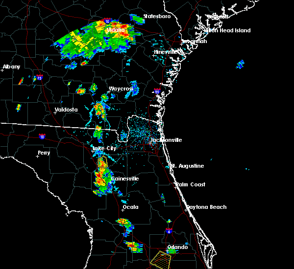 At 730 pm edt, a severe thunderstorm was located near providence, or 7 miles northwest of worthington spring, moving north at 10 mph (radar indicated). Hazards include 60 mph wind gusts. Expect damage to roofs. siding. and trees. Locations impacted include, worthington spring, worthington springs, palestine community, upland pines, groves and dukes. At 730 pm edt, a severe thunderstorm was located near providence, or 7 miles northwest of worthington spring, moving north at 10 mph (radar indicated). Hazards include 60 mph wind gusts. Expect damage to roofs. siding. and trees. Locations impacted include, worthington spring, worthington springs, palestine community, upland pines, groves and dukes.
|
| 6/1/2016 7:16 PM EDT |
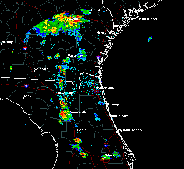 At 716 pm edt, a severe thunderstorm was located over upland pines, or near worthington spring, moving north at 10 mph (radar indicated). Hazards include 60 mph wind gusts and quarter size hail. Hail damage to vehicles is expected. Expect wind damage to roofs, siding, and trees. At 716 pm edt, a severe thunderstorm was located over upland pines, or near worthington spring, moving north at 10 mph (radar indicated). Hazards include 60 mph wind gusts and quarter size hail. Hail damage to vehicles is expected. Expect wind damage to roofs, siding, and trees.
|
| 2/24/2016 7:09 AM EST |
 At 709 am est, a severe thunderstorm was located near worthington spring, moving northeast at 55 mph (radar indicated). Hazards include 60 mph wind gusts. Expect damage to roofs. Siding and trees. At 709 am est, a severe thunderstorm was located near worthington spring, moving northeast at 55 mph (radar indicated). Hazards include 60 mph wind gusts. Expect damage to roofs. Siding and trees.
|
| 2/24/2016 6:37 AM EST |
 The severe thunderstorm warning for gilchrist, southwestern columbia and northwestern alachua counties will expire at 645 am est, the storm which prompted the warning has weakened below severe limits. therefore the warning will be allowed to expire. however gusty winds of 45 to 55 mph are still possible. a tornado watch remains in effect until 1000 am est for northern florida. The severe thunderstorm warning for gilchrist, southwestern columbia and northwestern alachua counties will expire at 645 am est, the storm which prompted the warning has weakened below severe limits. therefore the warning will be allowed to expire. however gusty winds of 45 to 55 mph are still possible. a tornado watch remains in effect until 1000 am est for northern florida.
|
| 2/24/2016 6:18 AM EST |
 At 617 am est, a severe thunderstorm was located 7 miles northeast of bell, moving northeast at 50 mph (radar indicated). Hazards include 60 mph wind gusts. Expect damage to roofs. siding and trees. locations impacted include, gainesville, trenton, bell, ichetucknee spring, columbia, alachua, high springs, fort white, worthington springs, newberry, fanning springs, la crosse and guaranto springs. A tornado watch remains in effect until 1000 am est for northern florida. At 617 am est, a severe thunderstorm was located 7 miles northeast of bell, moving northeast at 50 mph (radar indicated). Hazards include 60 mph wind gusts. Expect damage to roofs. siding and trees. locations impacted include, gainesville, trenton, bell, ichetucknee spring, columbia, alachua, high springs, fort white, worthington springs, newberry, fanning springs, la crosse and guaranto springs. A tornado watch remains in effect until 1000 am est for northern florida.
|
| 2/24/2016 5:54 AM EST |
 At 554 am est, a severe thunderstorm was located 7 miles east of cross city, moving northeast at 60 mph (radar indicated). Hazards include 60 mph wind gusts. Expect damage to roofs. Siding and trees. At 554 am est, a severe thunderstorm was located 7 miles east of cross city, moving northeast at 60 mph (radar indicated). Hazards include 60 mph wind gusts. Expect damage to roofs. Siding and trees.
|
| 8/13/2015 5:00 PM EDT |
 At 500 pm edt, doppler radar indicated a severe thunderstorm capable of producing damaging winds in excess of 60 mph. this storm was located near upland pines, or near worthington spring, and moving southwest at 10 mph. At 500 pm edt, doppler radar indicated a severe thunderstorm capable of producing damaging winds in excess of 60 mph. this storm was located near upland pines, or near worthington spring, and moving southwest at 10 mph.
|
| 8/7/2015 8:09 PM EDT |
 The severe thunderstorm warning for union, southeastern hamilton, northeastern suwannee and central columbia counties will expire at 815 pm edt, the storm which prompted the warning has weakened below severe limits, and no longer poses an immediate threat to life or property. therefore the warning will be allowed to expire. however gusty winds are still possible with this thunderstorm. The severe thunderstorm warning for union, southeastern hamilton, northeastern suwannee and central columbia counties will expire at 815 pm edt, the storm which prompted the warning has weakened below severe limits, and no longer poses an immediate threat to life or property. therefore the warning will be allowed to expire. however gusty winds are still possible with this thunderstorm.
|
| 8/7/2015 7:47 PM EDT |
 At 747 pm edt, doppler radar indicated a severe thunderstorm capable of producing damaging winds in excess of 60 mph. this storm was located near live oak, and moving southeast at 40 mph. At 747 pm edt, doppler radar indicated a severe thunderstorm capable of producing damaging winds in excess of 60 mph. this storm was located near live oak, and moving southeast at 40 mph.
|
| 8/7/2015 6:33 PM EDT |
 At 632 pm edt, doppler radar indicated a line of severe thunderstorms capable of producing damaging winds in excess of 60 mph. these storms were located along a line extending from near sampson to high springs, moving southeast at 25 mph. locations impacted include, gainesville, worthington spring, alachua, high springs, hawthorne, worthington springs, groves, university of florida, orange heights, upland pines, gainesville airport, newnans lake, rochelle, waldo, la crosse, brooker, grove park and dukes. At 632 pm edt, doppler radar indicated a line of severe thunderstorms capable of producing damaging winds in excess of 60 mph. these storms were located along a line extending from near sampson to high springs, moving southeast at 25 mph. locations impacted include, gainesville, worthington spring, alachua, high springs, hawthorne, worthington springs, groves, university of florida, orange heights, upland pines, gainesville airport, newnans lake, rochelle, waldo, la crosse, brooker, grove park and dukes.
|
| 8/7/2015 6:01 PM EDT |
 At 600 pm edt, doppler radar indicated a line of severe thunderstorms capable of producing damaging winds in excess of 60 mph. these storms were located along a line extending from near maxville to near alachua, moving southeast at 30 mph. locations impacted include, gainesville, starke, lake butler, keystone heights, raiford, middleburg, worthington spring, melrose, alachua, high springs, hawthorne, worthington springs, george`s lake, groves, lake geneva, upland pines, kingsley, university of florida, camp blanding and orange heights. At 600 pm edt, doppler radar indicated a line of severe thunderstorms capable of producing damaging winds in excess of 60 mph. these storms were located along a line extending from near maxville to near alachua, moving southeast at 30 mph. locations impacted include, gainesville, starke, lake butler, keystone heights, raiford, middleburg, worthington spring, melrose, alachua, high springs, hawthorne, worthington springs, george`s lake, groves, lake geneva, upland pines, kingsley, university of florida, camp blanding and orange heights.
|
| 8/7/2015 5:39 PM EDT |
 At 539 pm edt, doppler radar indicated a line of severe thunderstorms capable of producing damaging winds in excess of 60 mph. these storms were located along a line extending from near glen st. mary to near upland pines, and moving southeast at 30 mph. At 539 pm edt, doppler radar indicated a line of severe thunderstorms capable of producing damaging winds in excess of 60 mph. these storms were located along a line extending from near glen st. mary to near upland pines, and moving southeast at 30 mph.
|
| 6/1/2015 5:36 PM EDT | At 536 pm edt, doppler radar indicated a severe thunderstorm capable of producing quarter size hail and damaging winds in excess of 60 mph. this storm was located near worthington spring, moving northeast at 10 mph. locations impacted include, lake butler, worthington spring, worthington springs, la crosse, brooker and dukes. |
| 6/1/2015 5:16 PM EDT | At 516 pm edt, doppler radar indicated a severe thunderstorm capable of producing quarter size hail and damaging winds in excess of 60 mph. this storm was located near alachua, or near worthington spring, and moving northeast at 10 mph. |
| 7/31/2013 4:15 PM EDT | Several power outages reported in the worthington springs area. information passed on through social medi in alachua county FL, 0.4 miles WNW of Worthington Springs, FL |
| 1/1/0001 12:00 AM | Power was knocked out for a large area of southwestern union count in union county FL, 6.6 miles ESE of Worthington Springs, FL |
Hail Maps for Worthington Springs, FL


Connect with Interactive Hail Maps